Drinking Plans and Drinking Outcomes: Examining Young Adults' Weekend Drinking Behavior
Upload
khangminh22Category
view
4download
0
Initial Environmental Examination
Document Stage: Draft Project Number: 53067-005 December 2021
India: Himachal Pradesh Rural Drinking Water Improvement and Livelihood Project – Mandi Zone (CW-MZ 01), District Kullu
Prepared by Jal Shakti Viibhag Government of Himachal Pradesh for the Asian Development Bank.
CURRENCY EQUIVALENTS (as of 5 December 2021)
Currency unit – Indian rupee (₹)
₹1.00 = $0.0133 $1.00 = ₹75.234
ABBREVIATIONS
ADB - Asian Development Bank AESEO - Assistant Engineer (Safeguard/Environment) Officer CFE - Consent for Establishment CFO - Consent for Operation CPCB - Central Pollution Control Board DBO - Design-Build-Operate DMS - Detailed Measurement Survey EAC - Expert Appraisal Committee EHS - Environmental Health & Safety EIA - Environmental Impact Assessment EMP - Environmental Management Plan ESR - Elevated Service Reservoir ESS - Environment Safeguard Specialist GOI - Government of India GOHP - Government of Himachal Pradesh GWSS - Gravity Water Supply Scheme FGD - Focus Group Discussions GoHP - Government Of Himachal Pradesh GRC - Grievance Redressal Committee GRM - Grievance Redress Mechanism HPPCB - Himachal Pradesh Pollution Control Board IEE - Initial Environmental Examination JSV - Jal Shakti Vibhag LARRA - Land Acquisition, Rehabilitation and Resettlement Authority LPCD - Litres Per Capita Per Day LWSS - Lift Water Supply Scheme MOEF& CC - Ministry of Environment and Forest & Climate Change NGO - Non-Government Organization NOC - No Objection Certificates PDMSC - Project Design Management and Supervision Consultant PMU - Project Management Unit PWD - Public Works Department RFCTLARR - Right To Fair Compensation and Transparency in Land
Acquisition, Rehabilitation and Resettlement Act, 2013 RORWSSHP - Remodelling / Renovation of Old Rural Water Supply
Schemes of Himachal Pradesh REA - Rapid Environmental Assessment Checklist ROW - rights-of-way HPRDWILP - Himachal Pradesh Rural Drinking Water Improvement and
Livelihood Project SEC - State-Level Empowered Committee
SEIAA - State Environmental Impact Assessment Authority SEP - Site Environmental Plan SPS - Safeguard Policy Statement 2009 TOR - Terms Of Reference ULB - Urban Local Body WSS - Water Supply Scheme WTP - Water Treatment Plant
WEIGHTS AND MEASURES
NOTE
In this report, “$” refers to United States dollars.
This initial environmental examination is a document of the borrower. The views expressed herein do not necessarily represent those of ADB's Board of Directors, Management, or staff and may be preliminary in nature. Your attention is directed to the “terms of use” section on ADB’s website. In preparing any country program or strategy, financing any project, or by making any designation of or reference to a territory or geographic area in this document, the Asian Development Bank does not intend to make any judgments as to the legal or other status of any territory or area.
cm - centimeter dB - decibels ha - hectare kg - kilogram km - kilometer l - liter m - meter m2 - square meter m3 - cubic meter mg/l - milligrams per liter ml - milliliter MLD - million liters per day mm - millimeter km2 - square kilometers μg/m3 - micrograms per cubic meter

CONTENTS
Pages
I. INTRODUCTION 1
A. Project Background 1
B. Purpose of this IEE Report 2
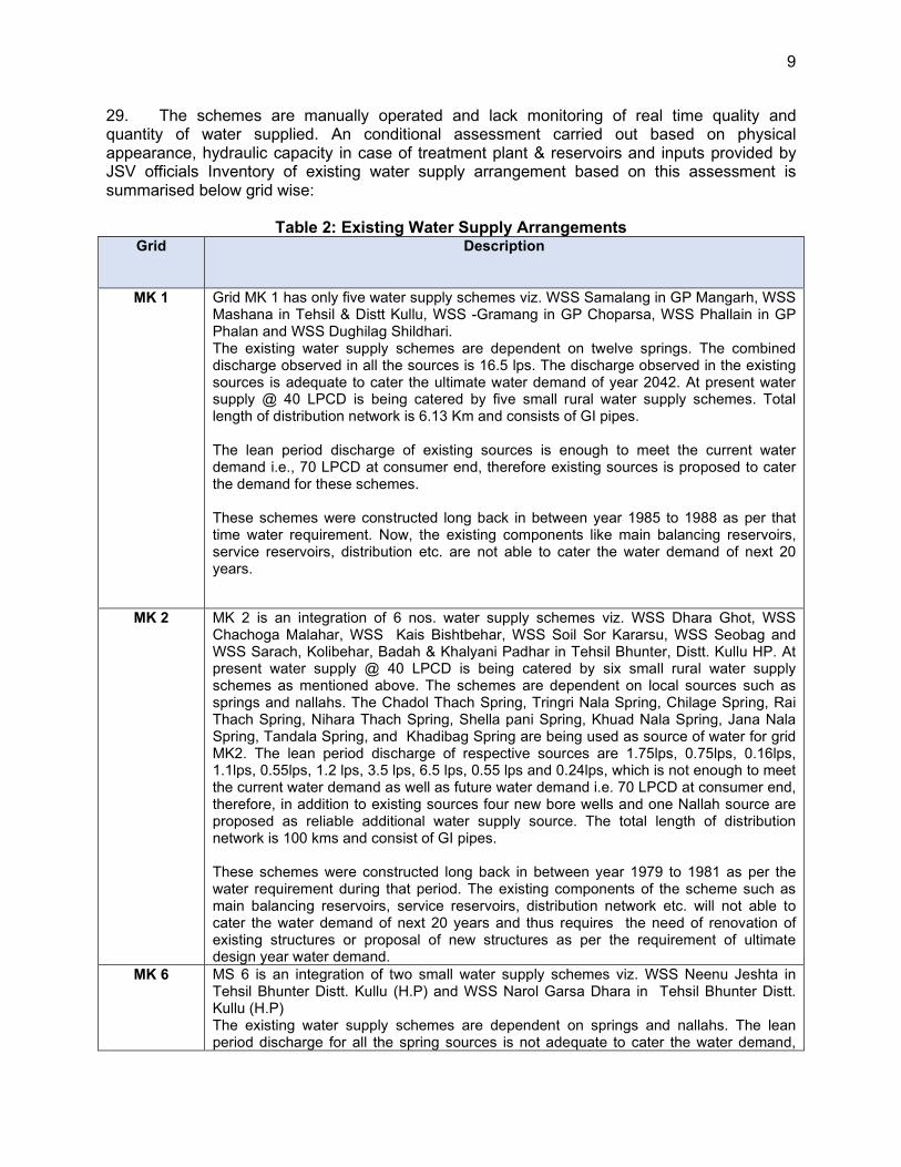
C. Report Structure 3
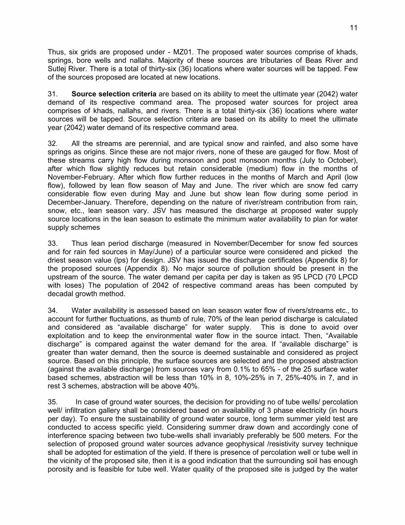
II. DESCRIPTION OF THE PROJECT 4
A. Project Area 4
B. Existing Water Supply Situation 8
C. Proposed Project 10
D. Proposed Subproject Components 37
E. Project Benefits 68
F. Energy Efficiency Measures included in the subproject 68
G. Implementation Schedule 70
III. ANALYSIS OF ALTERNATIVES 80
IV. POLICY, LEGAL AND ADMINISTRATIVE FRAMEWORK 85
A. ADB Safeguard Policy Statement, 2009 85
B. National and State Laws 88
V. DESCRIPTION OF THE ENVIRONMENT 101
A. Physical Resources 101
B. Ecological Resources 131
C. Economic Development 152
D. Social and Cultural Resources 156
E. Environmental Settings of Investment Program Component Sites 160
VI. ANTICIPATED ENVIRONMENTAL IMPACTS AND MITIGATION MEASURES 223
A. Introduction 223
B. Pre-Construction Impacts – Design & Location 224
VII. PUBLIC CONSULTATION AND INFORMATION DISCLOSURE 261
A. Overview 261
B. Public Consultation 262
C. Information Disclosure 265
VIII. GRIEVANCE REDRESS MECHANISM 266
A. Common Grievance Redress Mechanism 266
IX. ENVIRONMENTAL MANAGEMENT PLAN 269
A. Environmental Management Plan 269
B. Implementation Arrangements 312
C. Capacity Building and Training 318
D. Monitoring and Reporting 320
E. EMP Implementation Cost 320
X. CONCLUSION AND RECOMMENDATION 323
TABLES
Table 1: Details of Schemes Under Package MZ 01 of Kullu District 4 Table 2: Existing Water Supply Arrangements 9 Table 3: Grid-wise Projected Population and Water Demand 12 Table 4: Proposed Subproject Components 16 Table 5: Details of Sources, Yield and Water Demand for Grid MK 1 19 Table 6: Details of Sources, Yield and Water Demand for Grid MK 2 22 Table 7: Details of Sources, Yield and Water Demand for Grid MK 6 24 Table 8: Details of Sources, Yield and Water Demand for Grid MK 7 26 Table 9: Details of Sources, Yield and Water Demand for Grid MK 9 28 Table 10: Details of Sources, Yield and Water Demand for Grid MK 12 30 Table 11: Proposed Civil Structures in MZ 01 32 Table 12: Details of Proposed Rising Main Network under MZ 01 33 Table 13: Gravity or Clear Water Transmission Main 34 Table 14: Details of Proposed Distribution Network under MZ 01 34 Table 15: Details of Household Connections 35 Table 16: Required Land Area for MZ 01 35 Table 17: Summary of Proposed Water Supply Nnetworks 36 Table 18: Proposed Water Supply Subproject Components of MZ 01 37 Table 19: Analysis of Alternatives 80 Table 20: Applicable Environmental Regulations 90 Table 21: Clearances and Permissions required for Construction Activities 99 Table 22: Geological Description of Kullu District 115 Table 23: Water Quality Data of Beas River 126 Table 24: Ground Water Quality in Subproject Area 129 Table 25: Ambient Air Quality data 130 Table 26: Ambient Noise Quality data 131 Table 27: Different Categories of Forests Kullu District 131 Table 28: Details of Forest in MZ01 135 Table 29: Details of Protected Area 147 Table 30: Land Use Pattern of Kullu District 154 Table 31: Site Environmental Features 162 Table 32: Details of Sources, Yield and Water Demand for the Year 2042 232 Table 33: Environmental Audit of Existing Facilities 237 Table 34: Illumination Standards for Night Working 256 Table 35: Public Consultation held for Water Supply Sub-Project area MZ01 (Mandi zone) 263 Table 36: Design Stage Environmental Management Plan 271 Table 37: Environmental Management Plan of Anticipated Impacts during Pre-Construction 274 Table 38: Environmental Management Plan of Anticipated Impacts during Construction 277 Table 39: Environmental Monitoring Plan for Construction Stage 308 Table 40: Environmental Monitoring Plan for Operations Stage 309 Table 41: Capacity Building Program on EMP Implementation 319 Table 42: Cost Estimates to Implement the EMP 321
FIGURES
Figure 1: Location of the Project Area 7 Figure 2: Map Showing Proposed Grids of MZ 01- Mandi Package 3 15 Figure 3: Integrated Line Diagram of Proposed Scheme of MK 1 21 Figure 4: Integrated Line Diagram of Proposed Scheme of MK 2 23 Figure 5: Integrated Line Diagram of Proposed Scheme MK 6 25
Figure 6: Integrated Line Diagram of Proposed Scheme MK 7 27 Figure 7: Integrated Line Diagram of Proposed Scheme MK 9 29 Figure 8: Integrated Line Diagram of Proposed Scheme MK 12 31 Figure 9: Typical Layout Plan and Schematic Diagram of Various Components 71 Figure 10: Location of the Project Area Showing all Grids 102 Figure 11: Location of the Grid MK-1 103 Figure 12: Location of the Grid MK-2 105 Figure 13: Location of the Grid MK-6 107 Figure 14: Location of the Grid MK-7 109 Figure 15: Location of the Grid MK- 9 111 Figure 16: Location of the Grid MK-12 113 Figure 17: Hydrogeology and Ground water Depth Map for Kullu District 116 Figure 18: Landslide Hazard Risk Map Kullu 117 Figure 19: Flood Hazard Risk Zonation Map: Kullu 118 Figure 20: Historical Temperature Variance in the project area 119 Figure 21: Rainfall in the Project Area 119 Figure 22: Number of Rainy Days in Project Area 120 Figure 23: Average and Max Wind Speed and Gust (kmph) 121 Figure 24: Map showing water bodies and sources 125 Figure 25: Location of Proposed Subproject Components and Wildlife Sanctuaries in MZ 03 Package 148 Figure 26: Grievance Redressal Mechanism 268 Figure 27: Implementation Arrangement for Safeguard Implementation 313
APPENDICES
Appendix 1: Rapid Environmental Assessment Checklist 327 Appendix 2: Drinking Water Standards, Surface Water Quality Classification Ambient Air Quality, Vehicle, Diesel Generator Emissions Standards 334 Appendix 3: Ambient Noise Level Standards 341 Appendix 4: Extract from Construction and Demolition Management Rules, 2016 344 Appendix 5: Salient Features of Major Laws Applicable to Establishments Engaged in 350 Appendix 6: Status of Land Records 354 Appendix 7: Permission for Forest land Utilisation for laying of Water Supply Pipeline 367 Appendix 8: Water Sources Discharge Measurement Certificates form JSV 370 Appendix 9: Water Quality Reports from Proposed Sources 390 Appendix 10: Sample Chance find Protocol 436 Appendix 11: Sample Outline Spoil Management Plan 438 Appendix 12: Sample Outline Traffic Management Plan 439 Appendix 13: WHO Interim Guidance on Water, Sanitation, Hygiene and Waste Management for the COVID19 Virus 450 Appendix 14: ADB’s Interim Advisory Note on Protecting the Safety and Well-Being of Workers and Communities from COVID-19 (2020) 456 Appendix 15: IFC Benchmark Standards for Workers Accommodation 465 Appendix 16: Guidelines and Emergency plan for handling and storing Chlorine Instructions for Storage and Handling of Chlorine Cylinders 478 Appendix 17: Summary of Public Consultations 486 Appendix 18: Sample Grievance Registration Form 528 Appendix 19: Sample Environmental Site Inspection Checklist 530 Appendix 20: Semi Annual Environmental Monitoring Report Format 533 Appendix 21: Guidelines for Safety during Monsoon/Heavy rainfall 541

Appendix 22: SOP – for COVID-19 Management by JSV 545 Appendix 23: IBAT Screening Report 561
EXECUTIVE SUMMARY
The government of “Himachal Pradesh” has accorded top priority to the provision of safe drinking water to the rural areas of the state. The focus in the water supply sector is to cover every household with piped water supply. The existing old rural water supply schemes (commenced before year 2000) were designed to tap water from available local sources and many of them are small water supply schemes which cater few habitations or villages. With passage of time water demand increased due to increase in population and as a result, existing water supply schemes could not match the increased demand. The constant wear and tear, limited maintenance funds and unreliability of various small sources, made these systems more vulnerable. The Jal Shakti Vibhag (JSV) is the key sector line department, responsible for planning, infrastructure development, and regulation in the state. Prior to 2020, JSV was known as the Department of Irrigation and Public Health (IPH). IPH was established in 1986 with the mandate to provide safe drinking water supply across the state. Therefore, Jal Shakti Vibhag (JSV), wants these schemes to be re-modelled/renovated. In line with the National Jal Jeevan Mission (JJM) mission, Government of Himachal Pradesh’s (GoHP) rural water supply goal is to have 100% universal household water coverage by the end of the fiscal year (FY) 2022–2023. To do so the GoHP prepares annual action plans. Prior to the JJM, the state had launched the Himachal Pradesh Water Policy, 2013. The policy goal was to ensure equitable and adequate water supply in rural areas and to support the key stakeholders. Therefore, Government of Himachal Pradesh with loan funding from Asian Development Bank (ADB) has proposed to implement “Himachal Pradesh Rural Drinking Water Improvement and Livelihood Project (HPRDWILP), herein after referred as ‘the Project’. Jal Shakti Vibhag (JSV) shall be the Executing and Implementing Agency for the Project. The project cost for Rural Drinking Water Improvement will be funded by the Asian Development Bank (ADB) and Government of Himachal Pradesh (GoHP) in 80:20 proportions. The project area comprises the rural regions of Himachal Pradesh. JSV has identified 187 water supply schemes commissioned before 2000 which are included in the ADB supported HPRDWILP project scope for renovation and remodelling schemes in 10 districts1 in Himachal Pradesh. The entire rural water supply schemes of Himachal Pradesh are divided into four zones, namely Shimla, Hamirpur, Mandi and Dharamshala. The zones are divided into circles which get further divided into divisions and sub-divisions. The grids are then formed by integrating various small water supply schemes in these sub-divisions according to the geographical continuity of the schemes.
At present the schemes are being operated at 40 LPCD with intermittent water supply to the consumers. The water flow largely remains unaccounted due to absence of any water flow monitoring and automation system. This has led to unequal water supply in different areas and inefficiency in the system. The key objectives of the assignment to strengthen the existing network system and provide 100% rural house with piped water supply are (i) to identify reliable & sustainable drinking water source for preparation of schemes; (ii) automate the operation and telemetry system from source to reservoirs including water quality monitoring; (iii) ensure that all project household beneficiaries have a metered water connection; (iv) construct water treatment plants at all new source; (v) to reduce water borne diseases, water stress & non-revenue water (NRW),(vi) prepare works contract to include operation and maintenance for up to 5 years of the
1 The targeted districts comprise Bilaspur, Chamba, Hamirpur, Kangra, Kullu, Mandi, Shimla, Sirmaur, Solan, and
Una.
ii
service period; (vii) introduce energy-efficient mechanisms to reduce operating costs and (viii) ensure positive impact on social status and economic standard of the people of rural areas. The proposed MZ01 (Mandi Zone package 3) IEE focuses on providing 24x7 water supply system with the automation of pumps and real-time monitoring of water quality at water treatment plants and quantity from the water supply source and at the household level @70 LPCD. The sub-project area of Package - MZ 01 belongs to Mandi zone and covering mostly rural areas of Kullu district, Himachal Pradesh. MZ01 (Package-3) falls in district Kullu comes under Kullu Circle and comprises three (3) divisions viz. Kullu division-1, Kullu division-2 (Shamshi), & Anni divisions. These divisions are further divided into subdivisions. This package is an integration of six (6) grids, comprising of twenty-eight (28) small rural water supply schemes. The project area of CW-MZ01 comprises of 28 village panchayats covering 27 villages and 292 habitations.
The project (Package- MZ 01). will be implemented under Design, Build including Civil works and Operation (DBO) and Maintenance for 5 years of Rural Water Supply Scheme at District Kullu. The construction period is 24 months.
The existing rural water supply schemes sources from local sources such as springs, khads and nallahs located near the villages. Due to hilly topography, water is being supplied through lift and gravity mechanisms. Over time water demand has increased due to increased population and in some cases existing water supply schemes do not match the increased demand for water. The lack of maintenance has also resulted in repair and rehabilitation being deferred. Most of the transmission and distribution lines were laid over 20 years ago and have now past their design life. The pipes were initially designed with a peak factor of 1 and do not have sufficient capacity as per 70 LPCD requirement at household level. Most of the pipes are in extremely poor condition with leakages. At present water supply @ 40 LPCD is being catered by small rural water supply schemes dependent on local sources such as percolation well, infiltration gallery and nallah. The lean period discharge of existing sources is not enough to meet the current water demand i.e., 70 LPCD at consumer end, therefore schemes should be shifted to the reliable alternative water supply sources. Therefore, it is proposed to adopt conjunctive use approach, utilizing both surface and groundwater sources to meet the demand. Therefore, project will mostly design surface water-based water supply systems – drawing water from new/existing springs/khads/nallahs. Creation of new infrastructure to extract groundwater will be limited to areas where there are no surface water sources. The proposed water Supply system for the Package MZ-01 (District Kullu) of Mandi zone has been designed for 20 years i.e., ultimate design year 2042 considering water demand 95 LPCD. (70 LPCD plus loses) The estimate of future population has been carried out on the decadal growth rate of @12.5%, based on the 2011 census data. The total estimated population of entire project area for 2022 and 2042 is 36,842 and 44,908 respectively. Considering water demand 95 LPCD total water demand for the year 2022 and 2042 will be approximately 3.5 MLD and 4.3 MLD respectively. Screening and assessment of potential impacts. ADB requires consideration of environmental issues in all aspects of the Bank’s operations, and the requirements for Environmental Assessment are described in ADB’s SPS (2009). As per the Government of India environmental impact assessment (EIA) Notification, 2006, this subproject does not require EIA study or Environmental Clearance. The potential environmental impacts of the subproject have

iii
been assessed using ADB rapid environmental assessment (REA) checklist for water supply system. The potential negative impacts were identified in relation to preconstruction, construction and operation phases. This Initial Environmental Examination (IEE) addresses the infrastructure components proposed under water supply subproject. Categorization. Environmental assessment has been conducted for the subprojects based on (i) preliminary design. The environmental assessment used ADB’s rapid environmental assessment (REA) checklists for water supply, The environmental assessments of the subprojects are not likely to have any significant adverse environmental impacts that are irreversible, diverse, or unprecedented. Potential impacts are mostly site-specific and few of them are irreversible. In most cases mitigation measures can be designed with uncomplicated measures commonly used at construction sites and known to civil works contractors. Development of water supply, system with 5-year O&M under Mandi zone Package MZ 01 located in Kullu district, is classified as Environmental Category B as per the SPS as no significant impacts are envisaged. Accordingly, this Initial Environmental Examination (IEE) assesses the environmental impacts and provides mitigation and monitoring measures to ensure that there are no significant impacts as a result of the project. The main components of this subproject include: (i) Raw water intake facilities like Intake chambers, diversion spurs, tube wells, raw water pumps; (ii) construction of sixteen (16) Water treatment Plants of various capacities from 35 KLD to 1500 KLD with all appurtenances, civil & electro-mechanical works, including chlorination and sludge lagoons; (iii) twelve (12) Pump houses; (iii) sixteen (16) Main Balance Reservoirs (MBR) of various capacities ranging from 20 KL to 95 KL; (iv) seventy two (72) Service Reservoirs (SR) of various capacities from 20 KL to 235 KL; (v) house service connections (8,247 units); (vi) electrical and mechanical works; (vii) operation and maintenance of water supply system (for 5 years); (viii) rising mains of about 65km. of Mild Steel Electric Resistance Welding (MS ERW) with diameter ranges from 50 mm to 200 mm; (v) gravity mains of about 114 Km of Galvanised Iron (GI) with diameter ranges from 50 to 200 mm; (vi) distribution networks of about 271 km. of Galvanised Iron (GI) with diameter ranges from 25 mm to 150 mm; (vii) and (ix) automation is proposed at WTP, Pump House, MBR and SRs to bring efficiency in operation and maintenance. Description of the Environment. All the project components are located in Kullu district of Mandi zone and its immediate surroundings. The project area is situated in the great Himalayan belt of India, especially beneath the irregular pattern hills of lower Western Himalayas and southern Shivalik Ranges. The project area is situated in Kullu district lying in the inner Himalayas between 30°51 00” North latitude and 77°06’04” East longitude. The total geographical area of the Kullu district is 5,503 km2 which comprises of mountain peaks as high as Deo-Tibba (6,123 m) and as low as Jalori pass (3,000 m), the valleys of the Beas, the Parvati, the Sainj, the Tirthan and the valleys of Ani and Kurpan. The project area is well connected with a major transit route to Manali and other adjoining places from national highway (NH)-21 (Chandigarh-Manali highway) and NH-20 (Pathankot- Mandi highway). The nearest airport is Bhuntar Airport (Kullu). The nearest railway station is Joginder Nagar (Narrow Gauge) and Una (Broad Gauge). The project district is mountainous cruised by rivers and valleys. The Satluj and Beas are the principal rivers with many tributaries. The altitude of the district ranges from 500 m to 5000 m amsl, but the habitation is only up to 3500 m. As per the seismic zoning map of India, Kullu districts, lie in Zone V (Very High damage risk zone) where the maximum intensity expected
iv
Water Source Sustainability: The proposed water sources for project area comprises of khads, nallahs, and bore wells. There are total of thirty six (36) locations including 26 new proposed sources/intakes where water sources will be tapped. Out of the twenty-six (26) proposed intake structures in MZ01, nineteen (19) are RCC made intake chambers, four (4) are tube well intakes and in remaining three (3) diversion spurs are proposed. Source selection criteria are based on its ability to meet the ultimate year (2042) water demand of its respective command area. The proposed surface water supply sources in this project are the tributaries of those major Rivers (like Beas and Sutlej), Khads and Nallahs. All the rivers are perennial, and are typical snow and rainfed, and also some have springs as origins. Since these are not major rivers, none of these are gauged for flow. Most of these streams carry high flow during monsoon and post monsoon months (July to October), after which flow slightly reduces but retain considerable (medium) flow in the months of November-February. After which flow further reduces in the months of March and April (low flow), followed by lean flow season of May and June. The river which are snow fed carry considerable flow even during May and June but show lean flow during some period in December-January. Therefore, depending on the nature of river/stream contribution from rain, snow, etc., lean season vary. JSV has measured the discharge at proposed water supply source locations in the lean season to estimate the minimum water availability to plan for water supply schemes. No major source of pollution should be present in the upstream of the source The water demand per capita per day is taken as 95 LPCD (70 LPCD plus loss). The population of 2042 of respective command areas has been computed by decadal growth method. Water availability is assessed based on lean season water flow of rivers/streams etc., to account for further fluctuations, as thumb of rule, 70% of the lean period discharge is calculated and considered as “available discharge” for water supply. This is done to avoid over exploitation and to keep the environmental water flow in the source intact. Then, “Available discharge” is compared against the water demand for the area. If “available discharge” is greater than water demand, then the source is deemed sustainable and considered as project source. Based on this principle, the surface sources are selected and the proposed abstraction (against the available discharge) from sources vary from 0.1% to 65% - of the 25-surface water-based schemes, abstraction will be less than 10% in 8, 10%-25% in 7, 25%-40% in 7, and in rest 3 schemes, abstraction will be above 40%. In case of ground water sources, the decision for providing number of tube wells/ percolation well/ infiltration gallery shall be considered based on availability of 3 phase electricity (in hours per day). To ensure the sustainability of ground water source, long term summer yield test are conducted to access specific yield. Considering summer draw down and accordingly cone of interference spacing between two tube-wells shall invariably preferably be 500 meters. For the selection of proposed ground water sources advance geophysical /resistivity survey technique shall be adopted for estimation of the yield. If there is presence of percolation well or tube well in the vicinity of the proposed site, then it is a good indication that the surrounding soil has enough porosity and is feasible for tube well. Water quality of the proposed site is judged by the water quality of the nearby source (tube well or percolation well). No major source of pollution should be present in the upstream of the source, as applicable. This criterion is ensured for both existing and proposed sources used in this project. In terms of water availability and quality of water, selected sources are adequate and suitable to meet the project water demand, and there are unlikely to be any issues related source sustainability during the project life cycle. All sources are duly selected keeping in mind the downstream conditions and water requirement. Up to two kilometres downstream of the sources, it was

v
observed that there will not be any significant water reduction that will impact the users in the downstream. Considering water demand at 95 LPCD (70 LPCD will be available at consumer-end, after loss of 20 lpcd) total water demand for the year 2022 and 2042 will be approximately 3.5 MLD and 4.49 MLD (51.93 lps). The present water discharge available from all the proposed sources is 6874.87 MLD (594.16 lps), Hence it can be concluded that the proposed sources are capable to meet projected demand and sustainable for this water supply scheme and can provide water to till ultimate design year (2042). Diversion spurs are proposed where the water withdrawal will be very less (0.07% to 6.71%) in comparison to their lean period discharge. Intake chambers (will be designed as infiltration chambers/galleries) are proposed to create ponding of water where the amount of water withdrawal is higher (percentage of water withdrawal 20.5% to 55%). Water quality test reports recommends that the available water is suitable for the human consumption and fulfil the standards mentioned in BIS 10500. There are no notable water abstraction points in the downstream, and moreover most of the streams are joined by numerous small streams in its course. Therefore, no notable downstream impacts or user conflicts envisaged Potential Environmental Impacts and Mitigation Measures. In this draft IEE, negative impacts were identified in relation to location, design, construction and operation of the improved infrastructure. Environmental impacts as being due to the project design or location were not significant as various measures are included in site planning and preliminary design. There are no environmentally or archeologically sensitive areas within the project area. Proposed project area mostly comprises of rural habitation areas, agricultural, vacant and barren lands. Given the large expanse of forest lands in Himachal Pradesh, locating some subproject facilities in forest lands is unavoidable. Components such as Intakes, WTPs, Pump houses, reservoirs and water pipelines are proposed in Protected Forest land.2 Hence, JSV will obtain requisite permission from the Forest Department. However as most of the individual elements are relatively small (total forest land requirement at 131 locations in six grids is 2.39 ha) no impact on forest ecosystems is envisaged. Some tree felling may be required at Intakes, WTPs, Pump houses and reservoirs sites. Number of trees to be cut will be assessed during the detailed design phase and tree cutting will be minimized as far as possible by developing an appropriate layout plan on the identified site. Water supply pipelines will also traverse through some forest areas, but mostly along trails / earthen roads. Forest department has exempted from clearance procedure for laying of drinking water pipelines requiring excavation/trench of less than 1m width and 2 m depth along the roads in forest land. In case of sample subproject IEEs, the proposed trench width is 0.6m, hence permission from local forest department will be adequate for pipeline laying (Appendix 13). The water pipelines will be laid along the roads and within the existing right of way with no notable tree felling anticipated as per preliminary design. However, it will be finalised during detailed design period and if any tree felling is required, compensatory tree plantation will be carried out in 1:10 ratio.
In Kullu district six Wildlife Sanctuaries namely Kais, Kanawar, Khokhan, Manali, Sainj, Tirthan and Great Himalayan National Park are located. Three National Parks namely Khirganga
2 The State Government is empowered to constitute any land other than reserved forests as Protected forests over
which the Government has proprietary rights and the power to issue rules regarding the use of such forests. This power has been used to establish State control over trees, whose timber, fruit or other non-wood products have revenue-raising potential.
vi
National Park, Iderkila National Park and Great Himalayan national park are located in the Kullu district. Inderkila National Park in Kullu district has also been notified as a Eco Sensitive zone. None of the proposed project components are falling within the protected areas. The proposed intake on Kais nallah at Grid MK 2 is at about 1.6 km from Kais Wildlife Sanctuary while proposed SR Basa Bhar of GRID MK 7 is at distance of 6 km from Sainj Wildlife Sanctuary. The proposed intake at Khuad Nallah Grid MK-2 is at a distance of 7 km from Kanawar Wildlife Sanctuary. Proposed bore well near Jhakru Garat Mohal Khad is at an aerial distance of ~3km from Khokhan Wildlife Sanctuary and SR Romani in Grid MK 2 is at a distance of ~22km from Manali Wildlife Sanctuary, proposed SR Busari in Grid MK 7 is at an aerial distance of ~11km from Tirhan Wildlife Sanctuary (all aerial distance). The proposed SR Bursary at Grid MK-7 is at 1.3 km from the Great Himalayan National Park, intake chamber is proposed on Satan Nallah in Grid MK 6 is at an aerial distance of ~38km from Khirganga National Park, and proposed intake chamber Khuad Nallah in grid MK 2 is at an aerial distance of ~31Km from Inderkila National Park. The construction of these small components will not have any impact on the protected areas. There are no endangered terrestrial and aquatic species, avifauna or migratory species in these Khads and Nallahs as they are of very small nature. As per the information obtained from the Himachal Pradesh Fisheries Department (Appendix 6A) and consultations with the local people during site visits, fish species found in the water bodies like khads/nallahs proposed as sources are mainly, Schizothorax sp, Minnows, Chal, Rainbow and Brown Trouts (Snow trouts in Tirthan khad), Cyprinus Carpio (Common carp). There is no endangered aquatic species as per The IUCN Red List of Threatened Species 2010. Project components excluding intake structures/diversion spurs are not proposed in the natural drainage channels (khad/Nallah) or river flood zones. Further to confirm that there are no protected fish species (endangered or higher category as per IUCN Red List) in the water sources selected for project, an aquatic fauna / fisheries expert will conduct detailed field visit, consult with local people, fishing community, fisheries department, research agencies etc., Confirmatory field sampling surveys if deemed necessary by fisheries expert will be conducted. In case of any other source reported to have protected fish species, a biodiversity assessment study will be conducted to assess the impacts, and IEE will be updated accordingly and submitted to ADB for review, clearance and disclosure. In case of potential significant impacts, alternatives will be pursued. The proposed intake structures will not result in any major reduction in downstream flow due to abstraction (especially during lean season) as the estimated demand is less than the lean period discharge of Khads and Nallahs. Most of the sources are perennial and are both snow fed and rain fed. It can be concluded that even after the abstraction of the water for meeting the required water demand there will be enough water available in these khads and nallahs for fish propagation and downstream users. During water supply pipe laying works tree cutting is not envisaged as per design, however If any tree is required to be cut, compensatory tree plantation will be carried out in 1:10 ratio. Therefore, the project will pose no risk or impact on biodiversity and natural resources Potential impacts during construction are considered significant but temporary and are common impacts of construction, and there are well developed methods to mitigate the same. Except laying of water supply lines all other construction activities will be confined to the selected sites and the interference with the general public and community around is minimal. In these works, the temporary negative impacts arise mainly from construction dust and noise, hauling of construction material, waste and equipment on local roads (traffic, dust, safety etc.),
vii
mining of construction material, occupational health and safety (OHS) aspects. Water pipes will be laid at a depth of 1m as per topography. It may be noted that due to hilly terrain, some sites are not accessible by motorable roads, and in such cases, material will be transported manually, and work will be conducted with minimal tools and mostly manually. During the construction phase of pipeline, impacts arise from the invasive nature of excavation and trenching work mostly along the roads. However as most of the individual elements are relatively small and involve straightforward construction, the potential environmental impacts (i) will be mainly localized, temporary and not greatly significant; (ii) will not cause direct impact on biodiversity values and (iii) are common impacts of construction, and there are well-developed methods for their mitigation that are suggested in the EMP. Given the hilly terrain, cuts and fills can promote instability and erosion although proposed excavation will not be significant, necessary measures will be put in place to avoid construction during rains, and cuts, fills and sloped surfaces in construction sites will be properly stabilized to avoid erosion. Site clearance will be strictly confined to actual work area, no clearance of topsoil or vegetation will be done outside the site. Temporary containment drains, silt fences will be used to contain silt laden run off from sites. Various measures will be put in place for work in forest lands to avoid any impacts or damage / disturbance to flora and fauna. Anticipated impacts of water supply during operation and maintenance will be related to operation of WTP, handling and application of chlorine, operation of pump houses, and repair and maintenance activities. Various provisions are already made in the design: to recirculate wastewater from WTP; collect, thicken and dispose sludge; chlorine safety; use energy efficiency equipment, etc., Water supply system will be operated using the standard operating procedures. It is unlikely that there will be any significant negative impacts. Application and handling of chlorine gas will involve certain risks, and appropriate measures are included in EMP. Once the new water supply system is operating, the facilities will operate with routine maintenance, which should not affect the environment. Improved system operation will comply with the operation and maintenance manual and standard operating procedures to be developed for all the activities. Environmental Management. An Environmental Management Plan (EMP) has been developed to provide mitigation measures to reduce all negative impacts to acceptable levels, along with the delegation of responsibility to appropriate agency. Various design related measures are already included in the project design. During construction, the EMP includes mitigation measures such as (i) proper planning of sewer and drain construction works to minimize the public inconvenience; (ii) barricading, dust suppression and control measures; (iii) traffic management measures for works along the roads and for hauling activities; (iv) provision of walkways and planks over trenches to ensure access will not be impeded; and (v) finding beneficial use of excavated materials to extent possible to reduce the disposal quantity. EMP will guide the environmentally-sound construction of the subproject. EMP includes a monitoring program to measure the effectiveness of EMP implementation and include observations on- and off-site, document checks, and interviews with workers and beneficiaries. The contractor will be required to submit to PIU, for review and approval, a site environmental management plan (SEMP) including (i) proposed sites/locations for construction work camps, storage areas, hauling roads, lay down areas, disposal areas for solid and hazardous wastes; (ii) specific mitigation measures following the approved EMP; and (iii) monitoring program as per
viii
EMP. No works are allowed to commence prior to approval of SEMP. A copy of the EMP/approved SEMP will be kept on site during the construction period at all times. The EMP will also ensure efficient lines of communication between PIU/ULB, PMU, consultants and contractor. The draft IEE and EMP shall be made binding on all contractors operating on the site and will be included in the contractual clauses. Non-compliance with, or any deviation from, the conditions set out in this document shall constitute a failure in compliance. To monitor the operation stage performance, there will also be longer-term surveys to monitor quality of supplied water, in order to ensure that it is functioning well along with the project agency responsible for such actions, form part of the Environmental Management Plan. The total estimated cost for implementing the EMP is approximately Rs. 55,74,000/= (Rupees Fifty-five lakhs seventy-four thousand only). Implementation Arrangements. Jal Shakti. Vibhag (JSV) of Government of Himachal Pradesh will be the Executing Agency & Implementing Agency for the Project, responsible for management, coordination and execution of all activities funded under the loan. Jal Shakti Vibhag (JSV) will establish a central Project Management Unit (PMU) headed by a Director (PD) and will be supported by three Deputy Project Directors (DPD I, II and III). DPD-I and II will be responsible for procurement and contract management in two zones each (DPD-I -Hamirpur and Dharamshala, and DPD-II - Shimla and Mandi). DPD-III will be responsible for finance management of the project. PMU will be staffed with technical, administrative, finance, procurement, safeguards, gender, etc., Under the PMU, four Project Implementation Units (PIUs) will be established at zonal level (Hamirpur, Dharamshala, Shimla and Mandi), and each PIU will be headed by a Project Manager. PMU and PIUs will be supported by Project Design, Management and Supervision Consultant (PDMSC) team. Safeguard Implementation Arrangement. PMU will be staffed with three safeguard officers: (i) Environment Safeguard Officer (ESO) (ii) Social Safeguard and Gender Officer (SSGO), and (iii) Community Development Officer (CDO) who will be responsible for compliance with the environmental, social safeguards and community related issues in program implementation respectively. Environment Safeguard Officer and Social Safeguard and Gender Officer will have overall responsibility of safeguard implementation in compliance with ADB SPS 2009. At individual subproject level, Environment Safeguard Officer and Social Safeguard and Gender Officer will ensure that environmental assessment and social impact assessment is conducted, and IEE reports and corresponding EMPs and Social Management Plan (SMP) and Resettlement Plans (RP), due diligence reports (DDRs) are prepared and implemented, and the compliance, and corrective actions, are undertaken. Environmental Safeguard Specialist and Social Safeguards and Gender Specialist of the PDMSC will have primary responsibility of preparing the safeguard documents and supervising the EMP and resettlement plan implementation, while the Safeguards Officers at PMU will review, approve and oversee the compliance. At each PIU, a Safeguard/Environment Officer of Assistant Engineer rank, AE (SEO), will be responsible for safeguard implementation. AE(SEO) will oversee the safeguards implementation at PIU level and will be responsible for reporting to Environment Safeguard Officer and Social Safeguard and Gender Officer at PMU. The AE(SEO) will coordinate public consultation, information disclosure, regulatory clearances and approvals, EMP and resettlement plan implementation and grievance redress. Contractor will appoint an Environment, Health and Safety (EHS) supervisor to implement EMP; EHS supervisor of DBO Contractor will have responsibilities related to environmental and social safeguards compliance and grievance redress and management at field level.
ix
Consultation, Disclosure and Grievance Redress. The stakeholders were involved in developing the IEE through discussions both on-site and off-site and public consultation workshops at village levels, after which views expressed were incorporated into the IEE and in the planning and development of the project. The IEE will be made available at public locations and will be disclosed to a wider audience via the ADB and JSV/PMU websites. The consultation process will be continued and expanded during project implementation to ensure that stakeholders are fully engaged in the project and have the opportunity to participate in its development and implementation. A grievance redress mechanism (GRM) is described within the IEE to ensure any public grievances are addressed quickly. Monitoring and Reporting. The PMU, PIU and consultants will be responsible for monitoring and reporting. During construction, results from internal monitoring by the DBO contractor will be reflected in their monthly EMP implementation reports to the PIU. PIU with the assistance of PDMSC, will monitor the compliance of contractor, prepare a quarterly environmental monitoring report (QEMR) and submit to PMU. The PMU will oversee the implementation and compliance and will submit Semi-Annual Environmental Monitoring Reports (SEMR) to ADB for review and approval. ADB will post the environmental monitoring reports on its website. Monitoring reports will also be posted JSV/PMU websites. Conclusions and Recommendations. The sub-project will benefit the citizens of Package MZ 01 project area in Kullu district by contributing to the long-term improvement of water supply system. The subproject is primarily designed to improve environmental quality and living conditions of service area through provision of water supply. The subproject aims to achieve safe and sustainable water services both in terms of services to customers and conservation of precious water resources The benefits arising from this subproject include: (i) increased availability of potable water at appropriate pressure to all households including rural poor; population (ii) reduced time and costs in accessing alternative sources of water. (iii) better public health particularly reduction in waterborne and infectious diseases; (iv) reduced risk of groundwater contamination; (v) reduced risk of contamination of treated water supplies. The successful implementation of the water supply project will result in better control over the NRW management, improved monitoring system and overall demand management along with energy reduction. The subproject is therefore unlikely to cause significant adverse impacts. The potential impacts that are associated with design, construction and operation can be mitigated to standard levels without difficulty through proper engineering design and the incorporation or application of recommended mitigation measures and procedures. Based on the findings of the IEE, there are no significant impacts and the classification of the subproject as Category “B” is confirmed. The subproject is not covered by the GoI EIA Notification (2006). However, to conform with government guidelines all necessary permissions and NOCs are to be obtained from the concerned departments prior to start of construction.
This IEE shall be updated by PMU during the implementation phase to reflect any changes, amendments and will be reviewed and approved by ADB. The revised IEE shall supersede the earlier version of IEE and shall be contractually applicable to the contractor. The following are recommendations applicable to the subproject to ensure no significant impacts:
x
Include this draft IEE, prepared based on the preliminary designs, in DBO bid and contract documents, and specify that this draft will be superseded by the updated/final IEE based on detailed design after contract award
Forest Clearance (FC) from MOEF&CC for utilization of 2.39 Ha of forest land in all six grids shall be obtained by the JSV before award of contract/before start of construction. Recommendations, if any, of MOEF&CC shall be included in the EMP and to be implemented.
Update this IEE during the detailed design, and submit to ADB for approval Engage an aquatic fauna/fishery expert during the detailed design phase to
conduct confirmatory field visits and consultations, followed by field sampling surveys if deemed necessary to confirm that there are no protected fish species (endangered or higher protection status) in project water sources.
A detailed audit of existing facilities to be conducted as part of the updated IEE Provide updated IEE and EMP to the contractor for implementation Obtain all necessary permissions, and consents prior award of contract or start of
construction as applicable, and include conditions, if any, in the updated IEE and EMP
Do not commence works until all the preconstruction requirements are met, including: (i) this IEE is updated and approved by ADB and disclosed, (ii) contractor appointed EHS supervisor, and prepared SEMP and health and safety plan including COVID-19 health & safety plan, and approved by PIU/PMU, (iii) contractor complied with government regulations, and (iv) GRM is established and operationalized.
During implementation, ensure that EMP / SEMP is implemented as envisaged via regular supervision, monitoring, and timely reporting as indicated in the IEE
Ensure that sludge management protocols are compliant with environmental regulations (Solid Waste Management Rules 2016) and solid waste disposal should have a designated site (dumping on vacant lot is not allowed).
Ensure COVID-19 appropriate behavior and compliance with protocols in project implementation as per the applicable government regulations and relevant guidelines published by WHO, ILO, ADB etc.,
Continue consultations with stakeholders, and redress grievances effectively and timely.
I. INTRODUCTION
A. Project Background
1. The state of Himachal Pradesh is located in northern part of India with a total land area of 55,673 square kilometres across 12 districts, which is about 1.69% of India’s total area. The state is home to about 6.86 million people, of which 90% of the total population reside in rural areas, while the remaining 10% are urban based. In the previous decade, from 2001 to 2011, the population of Himachal Pradesh increased from 6,077,900 (2001) to 6,864, 602 (2011), at a growth rate of 12.9%. Moreover, population density has doubled from 62 in 1971 to 123 in 2011. 2. The rural water supply schemes are sourced from local sources such as springs, khads, nallahs and tube wells located near the villages. Due to hilly topography, water is being supplied through lift and gravity mechanisms. Over time water demand has increased due to increased population and in some cases existing water supply schemes do not match the increased demand for water. The lack of maintenance has also resulted in repair and rehabilitation being deferred. The risks of increased drought and reduced dry season flows have also made these systems less efficient. In rural areas, house connections are available for about 54% of households while the remaining are dependent on standpipes. It is expected to achieve 100 % coverage through this project. 3. Currently, 40 liters per capita per day (LPCD) of water is being supplied at household level. Most of the existing sources are not having sufficient discharge to cater the continuous water supply with desired rate of 70 LPCD at the household level. 4. Most of the transmission and distribution lines were laid over 20 years ago and have now past their design life. The pipes were initially designed with a peak factor of 1 and do not have sufficient capacity as per 70 LPCD requirement at household level. Most of the pipes are in extremely poor condition with leakages. Approximately 5,100 km of existing pipe network is being used to supply water from source to households. 5. The Jal Shakti Vibhag (JSV) is the key sector line department, responsible for planning, infrastructure development, and regulation in the state. Prior to 2020, JSV was known as the Department of Irrigation and Public Health (IPH). IPH was established in 1986 with the mandate to provide safe drinking water supply across the state. JSV has four administrative zones, namely Dharamshala, Mandi, Shimla, and Hamirpur. The zones are divided into ‘circles,’ and further divided into ‘divisions’ and ‘sub-divisions.’ 6. Government of Himachal Pradesh (GoHP) intends to seek a fund from Asian Development Bank (ADB) towards Himachal Pradesh Rural Water Improvement and Livelihood Project (HPRWILP) (formerly, “Remodelling/Renovation of Old Rural Water Supply Systems of Himachal Pradesh)” under which approximately 468,693 people will directly benefit from water infrastructure improvements. The HPRWILP project will cover 10 districts out of 12 districts. Jal Shakti Vibhag (JSV) of Government of Himachal Pradesh shall be the Implementing and Executing Agency for the Project. 7. Currently, the small water supply schemes supply 40 LPCD to 371,616 (2020) people in rural areas of Himachal Pradesh. This account to approximately 15,025 cubic meters per day water supply. The current water supply is insufficient to meet the daily needs of the people and on an average 70 LPCD is required to meet daily needs. At 70 LPCD, the water demand will be approximate 26,294 cubic meters per day, thus creating a water supply deficit of about 11,269
2
cubic meters per day. Apart from the existing water supply schemes there are no other domestic water supply sources used by the people 8. The objectives of the HPRDWILP project include the following: (i) identify reliable and sustainable drinking water sources for rural water supply schemes; (ii) automate the operation and telemetry system from source to reservoirs including water quality monitoring; (iii) ensure that all project household beneficiaries have a metered water connection; (iv) construct water treatment plants at all new source; (v) prepare works contract to include operation and maintenance for up to 5 years of the service period; and (vi) introduce energy-efficient mechanisms to reduce operating costs. 9. JSV has identified 187 water supply schemes commissioned before 2000 which are included in the ADB supported HPRDWILP project scope for renovation and remodelling schemes in 10 districts in Himachal Pradesh. The renovation and remodelling of 187 schemes will provide 24 hours and seven days a week water supply system with the automation of pumps and real-time monitoring of water quality at water treatment plants and quantity from the water supply source and at the household level. 10. The entire rural water supply schemes of Himachal Pradesh is divided into four administrative zones, namely Dharamshala, Mandi, Shimla, and Hamirpur. The zones are divided into circles which gets further divided into divisions and sub-divisions. The zone wise bifurcation of schemes as under;
(i) Dharamshala Zone: 10 schemes which are clustered into 8 Grids and 2 packages
(ii) Mandi Zone: 89 schemes which are clustered into 21 Grids and 3 packages (iii) Shimla Zone: 38 schemes which are clustered into 12 Grids and 3 packages (iv) Hamirpur Zone: 50 schemes which are clustered into 18 Grids and 2 packages
11. Grids are formed by the integration of various small water supply schemes based on their geographical continuity. Similarly, package is an integration of grids falling under the respective circle of each zone. 12. This IEE focuses on renovation and remodelling of 28 Schemes under 6 Grids of Package MZ 01, Mandi Zone (district: Kullu) which will provide 24 hours and seven days a week water supply system with the automation of pumps and real-time monitoring of water quality at water treatment plants and quantity from the water supply source and at the household level at 70 LPCD. 13. The project will be implemented under Design, Build including Civil works and Operation and Maintenance for 5 years of Rural Water Supply Scheme at District Kullu (Package- MZ-01). The construction period is 24 months. B. Purpose of this IEE Report
14. ADB requires the consideration of environmental issues in all aspects of the Bank’s operations, and the requirements for environmental assessment are described in ADB’s Safeguards Policy Statement (2009). Accordingly, this Initial Environmental Examination (IEE) has been conducted to assess the environmental impacts and provide mitigation and monitoring measures to ensure that there are no significant impacts because of the subprojects.
3
15. The potential environmental impacts of the subprojects have been assessed using ADB Rapid Environmental Assessment (REA) Checklist for water supply system (Appendix 1). Then potential negative impacts were identified in relation to pre-construction, construction and operation of the improved infrastructure, and results of the assessment show that the subproject is unlikely to cause significant adverse impacts. Thus, this initial environmental examination (IEE) has been prepared in accordance with ADB SPS requirements for environment Category B projects. 16. This IEE is prepared for selected project area designated as Package MZ 01 (district Kullu) under the Mandi zone. The project includes civil works, project implementation and management, and non-physical investments and is proposed for implementation under the design-build-operate (DBO) modality, where the design is carried out by the selected bidder based on the feasibility / preliminary project report prepared prior to bidding. Thus, this IEE is based on the preliminary project report prepared by the Jal Shakti Vibhag (JSV). The IEE is based mainly on field reconnaissance surveys and secondary sources of information. No field monitoring (environmental) survey was conducted; however, the environmental monitoring program developed as part of the environmental management plan (EMP) will require the contractors to establish the baseline environmental conditions prior to commencement of civil works. The results will be reported as part of the environmental monitoring report and will be the basis to ensure no degradation will happen during subproject implementation. Stakeholder consultation is an integral part of the IEE. 17. This IEE will be updated and finalized during detailed design stage to reflect change in scope of works, change in location of component and change in cost due to addition or subtraction of components which can change the environmental impacts. The revised IEE shall supersede the earlier version of IEE and shall be contractually applicable to the contractor after approval from PMU and ADB. 18. The implementation of the subprojects will be governed by Government of India (GoI) and the state of Himachal Pradesh and other applicable environmental acts, rules, regulations, and standards. Environmental safeguards will be followed in accordance with the ADB SPS, 2009. During the design, construction, and operation of the project the borrower/client will apply pollution prevention and control technologies and practices consistent with ADB SPS, 2009 and international good practice, as reflected in internationally recognized standards. C. Report Structure
19. The report has been structured in compliance with ADB SPS, 2009 and contains the following ten (10) sections including the executive summary at the beginning of the report:
Executive Summary. (i) Introduction (ii) Description of the Project. (iii) Analysis of Alternative. (iv) Policy, Legal, and Administrative Framework (v) Description of the Environment (vi) Anticipated Environmental Impacts and Mitigation Measures (vii) Public Consultation and Information Disclosure (viii) Grievance Redress Mechanism (ix) Environmental Management Plan (x) Conclusion and Recommendations
4
II. DESCRIPTION OF THE PROJECT
A. Project Area
20. The project area falls in Kullu district of Himachal Pradesh. Project area is situated in the geographical centre of Himachal Pradesh in the Northwest Himalayan region. The district of Kullu forms a transitional zone between the lesser and Greater Himalayas and presents a typical rugged mountainous terrain. Kullu district is situated in the inner Himalayas between 300 51’ 00” North latitude and 77006’ 04” East longitude. The total geographical area of the Kullu district is 5,503 sq. km which comprises of mountain peaks as high as Deo-Tibba (6,123 m) and as low as Jalori pass (3,000 m), the valleys of the Beas, the Parvati, the Sainj, the Tirthan and the valleys of Ani and Kurpan. In terms of geographical conditions, the district is mountainous cruised by rivers and valleys. The Satluj and Beas are the principal rivers with many tributaries. The altitude of the district ranges from 500 m to 5000 m amsl, but the habitation is only up to 3500 m. Project location is shown in Figure 1. The project area is well connected with a major transit route to Manali and other adjoining places from national highway (NH)-21 (Chandigarh-Manali highway) and NH-20 (Pathankot- Mandi highway). 21. The sub-project area of MZ 01 belongs to Mandi zone and covering mostly rural areas of Kullu district, Himachal Pradesh. MZ-01 comes under Kullu Circle and comprises three divisions viz. Kullu, Kullu Division-2 (Shamshi), & Anni divisions. These divisions are further divided into subdivisions. This package is an integration of seven (6) grids, comprising of twenty-eight (28) small rural water supply schemes. The project area of CW-MZ01 comprises of 28 village panchayats covering 27 villages and 292 habitations. Details of schemes are given in Table 1 and location of project area in Figure 1.
Table 1: Details of Schemes Under Package MZ 01 of Kullu District
Package Scheme Grid ID District Circle Division Villages (Nos.)
Habitation (Nos.)
CW-MZ01
PWSS Samalang in GP Mangarh
MK1 Kullu Kullu Division-1,
Kullu 5 17
WSS Mashana in Tehsil & District Kullu WSS -Gramang in GP Choparsa WSS Phallain in GP Phalan WSS Dughilag Shildhari
WSS Dhara Ghot
MK2 Kullu Kullu Division-1,
Kullu 4 40
WSS Chachoga Malahar WSS Kais Bishtbehar WSS Soil Sor Kararsu
WSS Seobag
WSS Sarach, Kolibehar, Badah &
5
Package Scheme Grid ID District Circle Division Villages (Nos.)
Habitation (Nos.)
Khalyani Padhar in Tehsil Bhunter, Distt. Kullu HP. WSS Neenu Jeshta in Tehsil Bhunter Distt. Kullu (H.P)
MK6 Kullu Kullu Shamshi 2 17 WSS Narol Garsa Dhara in Tehsil Bhunter Distt. Kullu (H.P) WSS Sarchi Bandal Arkhali Phagwara in Tehsil Banjar Distt. Kullu (H.P)
MK7 Kullu Kullu Shamshi 5 66 WSS Seraj in Tehsil Banjar Distt. Kullu (H.P) WSS Thatibir, Targali & Manglore etc. in Tehsil Banjar Distt. Kullu (H.P) WSS Khanag in G.P Khanag in Anni Block.
MK9 Kullu Kullu Anni 5 111
WSS Nagot Palli in G.P. Kohila in Anni Block. PWSS Parkot Kamand in G.P. Kohila in Anni Block. PWSS Kadvi Kafti in GP Buchchair In Ani Block PWSS Khun Bandal Jadar Chowki etc. in G.P. Khani in Anni Block. PWSS. Duga Shigan in GP Deothi in Ani block. PWSS Shanu Jaterh in G.P. Arsu in Nirmand Block.
MK12 Kullu Kullu Anni 6 41 WSS Nirmand in Nirmand Block Distt. Kullu (H.P)

6
Package Scheme Grid ID District Circle Division Villages (Nos.)
Habitation (Nos.)
WSS Remu Kedas in Nirmand block Distt. Kullu (H.P) WSS Bail Dharopa in Nirmand Block WSS Koil in Nirmand block PWSS Chatti in G.P. Tunan in Nirmand block.
TOTAL 27 292 Population Source: Detailed Project Report (2020)

7
Figure 1: Location of the Project Area
8
B. Existing Water Supply Situation
22. The existing rural water supply schemes are sourced from local sources such as springs, khads, nallahs and tube wells located near the villages. Due to hilly topography, water is being supplied through lift and gravity mechanisms. Over time water demand has increased due to increased population and in some cases existing water supply schemes do not match the increased demand for water. The lack of maintenance has also resulted in repair and rehabilitation being deferred. The risk of increased drought and reduced dry season flows has also made these systems less efficient. In rural areas, house connections are available for about 54% of households while the remaining are dependent on standpipes. It is expected to achieve 100 % coverage through this project. 23. Most of the transmission and distribution lines were laid over 20 years ago and have now past their design life. The pipes were initially designed with a peak factor of 1 and do not have sufficient capacity as per 70 LPCD requirement at household level. Most of the pipes are in extremely poor condition with leakages. Currently, the small water supply schemes supply 40 LPCD to 371,616 (2020) people in rural areas of Himachal Pradesh. This accounts to approximately 15,025 cubic meters per day water supply. The current water supply is insufficient to meet the daily needs of the people and on an average 70 LPCD is required to meet daily needs. 24. At present water supply at 40 LPCD is being catered by small rural water supply schemes as mentioned above. The schemes are dependent on local sources such as percolation well, infiltration gallery and nallah. The lean period discharge of existing sources is not enough to meet the current water demand i.e., 70 LPCD at consumer end, therefore schemes should be shifted to the reliable alternative water supply sources. 25. Conventional treatment system – Filter beds are used to treat the water before supply and manual dosing of bleaching powder is being done for disinfection at MBR stage. Due to absence of necessary equipment’s and skilled manpower filter beds are not maintained properly and the quality of supplied water is not reliable. 26. Existing civil structures such as existing intake, water treatment plant, pump house, storage reservoirs and other ancillary structures are not in good condition and they need repair and maintenance. Capacity of existing Service reservoirs is not adequate to meet the ultimate water demand. The command area of few service level reservoirs is exceeding the radius two Kms which is also a reason for inequitable supply of water to the consumer end. Few ground level reservoirs are required to be replaced with overhead tanks (OHT) to maintain the minimum terminal head of 7 meters at nearby habitations. 27. The present distribution network is laid on need basis which makes the network very complex. Multiple distribution pipes are serving the same land settlement patch directly from service level reservoirs and tail end consumers are not getting the enough terminal pressure and discharge. 28. Existing pumps are working on low efficiency and already served their design period. Boundary wall, chowkidar rooms and lighting facilities are not available at source, main balancing reservoirs and service reservoirs. None of the pump houses have an operator room that is meant to provide working space to the pump operators, except a chowkidar room at some places. Many of the pump houses lack basic facilities such as toilets.
9
29. The schemes are manually operated and lack monitoring of real time quality and quantity of water supplied. An conditional assessment carried out based on physical appearance, hydraulic capacity in case of treatment plant & reservoirs and inputs provided by JSV officials Inventory of existing water supply arrangement based on this assessment is summarised below grid wise:
Table 2: Existing Water Supply Arrangements
Grid Description
MK 1 Grid MK 1 has only five water supply schemes viz. WSS Samalang in GP Mangarh, WSS Mashana in Tehsil & Distt Kullu, WSS -Gramang in GP Choparsa, WSS Phallain in GP Phalan and WSS Dughilag Shildhari. The existing water supply schemes are dependent on twelve springs. The combined discharge observed in all the sources is 16.5 lps. The discharge observed in the existing sources is adequate to cater the ultimate water demand of year 2042. At present water supply @ 40 LPCD is being catered by five small rural water supply schemes. Total length of distribution network is 6.13 Km and consists of GI pipes. The lean period discharge of existing sources is enough to meet the current water demand i.e., 70 LPCD at consumer end, therefore existing sources is proposed to cater the demand for these schemes. These schemes were constructed long back in between year 1985 to 1988 as per that time water requirement. Now, the existing components like main balancing reservoirs, service reservoirs, distribution etc. are not able to cater the water demand of next 20 years.
MK 2 MK 2 is an integration of 6 nos. water supply schemes viz. WSS Dhara Ghot, WSS Chachoga Malahar, WSS Kais Bishtbehar, WSS Soil Sor Kararsu, WSS Seobag and WSS Sarach, Kolibehar, Badah & Khalyani Padhar in Tehsil Bhunter, Distt. Kullu HP. At present water supply @ 40 LPCD is being catered by six small rural water supply schemes as mentioned above. The schemes are dependent on local sources such as springs and nallahs. The Chadol Thach Spring, Tringri Nala Spring, Chilage Spring, Rai Thach Spring, Nihara Thach Spring, Shella pani Spring, Khuad Nala Spring, Jana Nala Spring, Tandala Spring, and Khadibag Spring are being used as source of water for grid MK2. The lean period discharge of respective sources are 1.75lps, 0.75lps, 0.16lps, 1.1lps, 0.55lps, 1.2 lps, 3.5 lps, 6.5 lps, 0.55 lps and 0.24lps, which is not enough to meet the current water demand as well as future water demand i.e. 70 LPCD at consumer end, therefore, in addition to existing sources four new bore wells and one Nallah source are proposed as reliable additional water supply source. The total length of distribution network is 100 kms and consist of GI pipes. These schemes were constructed long back in between year 1979 to 1981 as per the water requirement during that period. The existing components of the scheme such as main balancing reservoirs, service reservoirs, distribution network etc. will not able to cater the water demand of next 20 years and thus requires the need of renovation of existing structures or proposal of new structures as per the requirement of ultimate design year water demand.
MK 6 MS 6 is an integration of two small water supply schemes viz. WSS Neenu Jeshta in Tehsil Bhunter Distt. Kullu (H.P) and WSS Narol Garsa Dhara in Tehsil Bhunter Distt. Kullu (H.P) The existing water supply schemes are dependent on springs and nallahs. The lean period discharge for all the spring sources is not adequate to cater the water demand,
10
Grid Description
necessitating the need of proposition of additional new source. The existing spring sources are also being used as water source by the water supply schemes of the area. At present. there are no water treatment facilities in these schemes because the source of water is springs and the quality are good enough requiring no additional treatment.
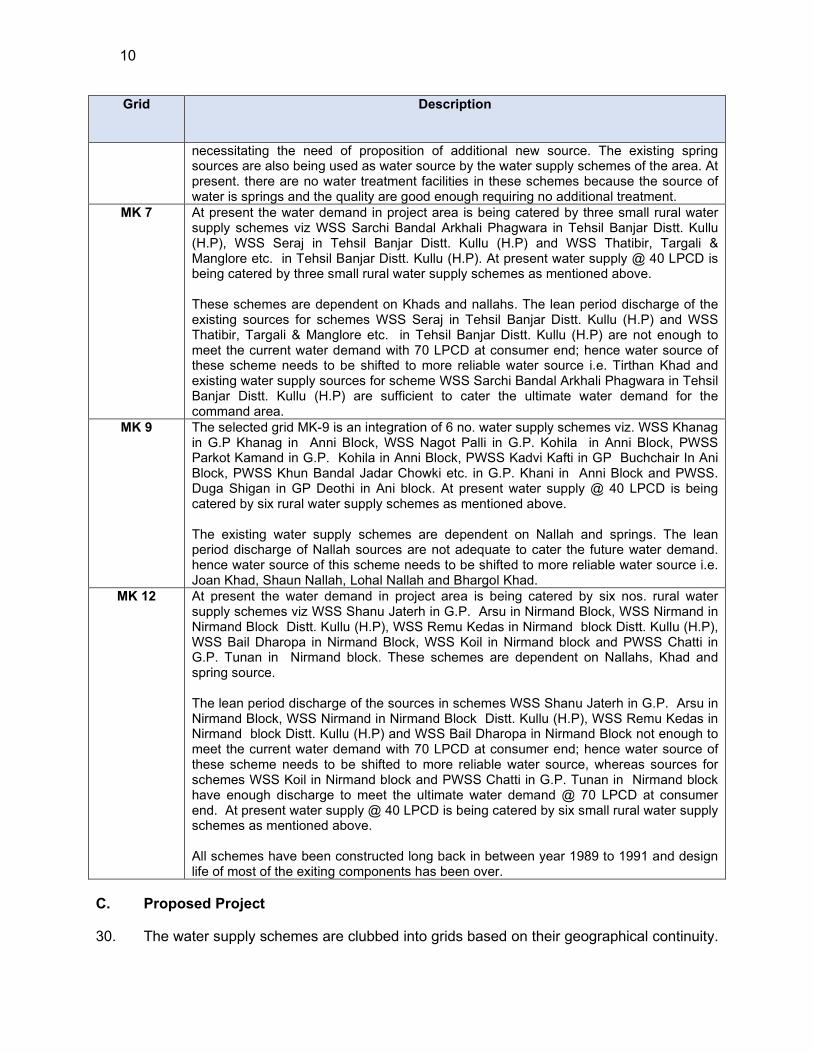
MK 7 At present the water demand in project area is being catered by three small rural water supply schemes viz WSS Sarchi Bandal Arkhali Phagwara in Tehsil Banjar Distt. Kullu (H.P), WSS Seraj in Tehsil Banjar Distt. Kullu (H.P) and WSS Thatibir, Targali & Manglore etc. in Tehsil Banjar Distt. Kullu (H.P). At present water supply @ 40 LPCD is being catered by three small rural water supply schemes as mentioned above. These schemes are dependent on Khads and nallahs. The lean period discharge of the existing sources for schemes WSS Seraj in Tehsil Banjar Distt. Kullu (H.P) and WSS Thatibir, Targali & Manglore etc. in Tehsil Banjar Distt. Kullu (H.P) are not enough to meet the current water demand with 70 LPCD at consumer end; hence water source of these scheme needs to be shifted to more reliable water source i.e. Tirthan Khad and existing water supply sources for scheme WSS Sarchi Bandal Arkhali Phagwara in Tehsil Banjar Distt. Kullu (H.P) are sufficient to cater the ultimate water demand for the command area.
MK 9 The selected grid MK-9 is an integration of 6 no. water supply schemes viz. WSS Khanag in G.P Khanag in Anni Block, WSS Nagot Palli in G.P. Kohila in Anni Block, PWSS Parkot Kamand in G.P. Kohila in Anni Block, PWSS Kadvi Kafti in GP Buchchair In Ani Block, PWSS Khun Bandal Jadar Chowki etc. in G.P. Khani in Anni Block and PWSS. Duga Shigan in GP Deothi in Ani block. At present water supply @ 40 LPCD is being catered by six rural water supply schemes as mentioned above. The existing water supply schemes are dependent on Nallah and springs. The lean period discharge of Nallah sources are not adequate to cater the future water demand. hence water source of this scheme needs to be shifted to more reliable water source i.e. Joan Khad, Shaun Nallah, Lohal Nallah and Bhargol Khad.
MK 12 At present the water demand in project area is being catered by six nos. rural water supply schemes viz WSS Shanu Jaterh in G.P. Arsu in Nirmand Block, WSS Nirmand in Nirmand Block Distt. Kullu (H.P), WSS Remu Kedas in Nirmand block Distt. Kullu (H.P), WSS Bail Dharopa in Nirmand Block, WSS Koil in Nirmand block and PWSS Chatti in G.P. Tunan in Nirmand block. These schemes are dependent on Nallahs, Khad and spring source. The lean period discharge of the sources in schemes WSS Shanu Jaterh in G.P. Arsu in Nirmand Block, WSS Nirmand in Nirmand Block Distt. Kullu (H.P), WSS Remu Kedas in Nirmand block Distt. Kullu (H.P) and WSS Bail Dharopa in Nirmand Block not enough to meet the current water demand with 70 LPCD at consumer end; hence water source of these scheme needs to be shifted to more reliable water source, whereas sources for schemes WSS Koil in Nirmand block and PWSS Chatti in G.P. Tunan in Nirmand block have enough discharge to meet the ultimate water demand @ 70 LPCD at consumer end. At present water supply @ 40 LPCD is being catered by six small rural water supply schemes as mentioned above. All schemes have been constructed long back in between year 1989 to 1991 and design life of most of the exiting components has been over.
C. Proposed Project
30. The water supply schemes are clubbed into grids based on their geographical continuity.
11
Thus, six grids are proposed under - MZ01. The proposed water sources comprise of khads, springs, bore wells and nallahs. Majority of these sources are tributaries of Beas River and Sutlej River. There is a total of thirty-six (36) locations where water sources will be tapped. Few of the sources proposed are located at new locations. 31. Source selection criteria are based on its ability to meet the ultimate year (2042) water demand of its respective command area. The proposed water sources for project area comprises of khads, nallahs, and rivers. There is a total thirty-six (36) locations where water sources will be tapped. Source selection criteria are based on its ability to meet the ultimate year (2042) water demand of its respective command area.
32. All the streams are perennial, and are typical snow and rainfed, and also some have springs as origins. Since these are not major rivers, none of these are gauged for flow. Most of these streams carry high flow during monsoon and post monsoon months (July to October), after which flow slightly reduces but retain considerable (medium) flow in the months of November-February. After which flow further reduces in the months of March and April (low flow), followed by lean flow season of May and June. The river which are snow fed carry considerable flow even during May and June but show lean flow during some period in December-January. Therefore, depending on the nature of river/stream contribution from rain, snow, etc., lean season vary. JSV has measured the discharge at proposed water supply source locations in the lean season to estimate the minimum water availability to plan for water supply schemes
33. Thus lean period discharge (measured in November/December for snow fed sources and for rain fed sources in May/June) of a particular source were considered and picked the driest season value (lps) for design. JSV has issued the discharge certificates (Appendix 8) for the proposed sources (Appendix 8). No major source of pollution should be present in the upstream of the source. The water demand per capita per day is taken as 95 LPCD (70 LPCD with loses) The population of 2042 of respective command areas has been computed by decadal growth method. 34. Water availability is assessed based on lean season water flow of rivers/streams etc., to account for further fluctuations, as thumb of rule, 70% of the lean period discharge is calculated and considered as “available discharge” for water supply. This is done to avoid over exploitation and to keep the environmental water flow in the source intact. Then, “Available discharge” is compared against the water demand for the area. If “available discharge” is greater than water demand, then the source is deemed sustainable and considered as project source. Based on this principle, the surface sources are selected and the proposed abstraction (against the available discharge) from sources vary from 0.1% to 65% - of the 25 surface water based schemes, abstraction will be less than 10% in 8, 10%-25% in 7, 25%-40% in 7, and in rest 3 schemes, abstraction will be above 40%.
35. In case of ground water sources, the decision for providing no of tube wells/ percolation well/ infiltration gallery shall be considered based on availability of 3 phase electricity (in hours per day). To ensure the sustainability of ground water source, long term summer yield test are conducted to access specific yield. Considering summer draw down and accordingly cone of interference spacing between two tube-wells shall invariably preferably be 500 meters. For the selection of proposed ground water sources advance geophysical /resistivity survey technique shall be adopted for estimation of the yield. If there is presence of percolation well or tube well in the vicinity of the proposed site, then it is a good indication that the surrounding soil has enough porosity and is feasible for tube well. Water quality of the proposed site is judged by the water
12
quality of the nearby source (tube well or percolation well). No major source of pollution should be present in the upstream of the source, as applicable. 36. This criterion is ensured for both existing and proposed sources used in this project. The JSV has also conducted water testing at sources to determine the suitability of water for potable use. In terms of water availability and quality of water, selected sources are adequate and suitable to meet the project water demand, and there are unlikely to be any issues related source sustainability during the project life cycle. 37. Water Demand and Supply. The proposed water supply system has been designed for 20 years i.e., ultimate design year 2042. Considering water demand at 95 LPCD (70 LPCD plus loss), the estimated future population has been carried out on the decadal growth rate of @12.5%, based on the 2011 census data. The total estimated population of entire project area for 2022 and 2042 is 36,842 and 44,908 respectively. Considering water demand 95 LPCD total water demand for the year 2022 and 2042 will be approximately 3.5 MLD and 4.49 MLD (4486.70 KLD) respectively. Grid wise projected population and water demand is given in Table 3.
Table 3: Grid-wise Projected Population and Water Demand
Package Scheme Grid ID
Population (Nos.) Water Demand (KLD)
2011 2022 2042 2011 2022 2042
CW-
MZ01
PWSS Samalang in GP Mangarh
MK 1 2574 2934 3580 244.53 278.73 365.47
WSS Mashana in Tehsil & Distt Kullu
WSS -Gramang in GP Choparsa
WSS Phallain in GP Phalan
WSS Dughilag Shildhari
WSS Dhara Ghot
MK 2 11584 13195 16092 1100.48 1253.53 1477.44
WSS Chachoga Malahar
WSS Kais Bishtbehar
WSS Soil Sor Kararsu
WSS Seobag
WSS Sarach, Kolibehar, Badah & Khalyani Padhar in Tehsil Bhunter, Distt.
13
Package Scheme Grid ID
Population (Nos.) Water Demand (KLD)
2011 2022 2042 2011 2022 2042
Kullu HP.
WSS Neenu Jeshta in Tehsil Bhunter Distt. Kullu (H.P)
MK 6 2061 2355 2865 195. 80 223.73 272.18 WSS Narol Garsa Dhara in Tehsil Bhunter Distt. Kullu (H.P)
WSS Sarchi Bandal Arkhali Phagwara in Tehsil Banjar Distt. Kullu (H.P)
MK 7 5414 6193 7546 514.33 588.34 453.6 WSS Seraj in Tehsil Banjar Distt. Kullu (H.P)
WSS Thatibir, Targali & Manglore etc. in Tehsil Banjar Distt. Kullu (H.P)
WSS Khanag in G.P Khanag in Anni Block.
MK 9 6311 7236 8812 599.55 687.42 838
WSS Nagot Palli in G.P. Kohila in Anni Block.
PWSS Parkot Kamand in G.P. Kohila in Anni Block.
PWSS Kadvi Kafti in GP Buchchair In Ani Block
PWSS Khun Bandal Jadar Chowki etc. in G.P. Khani in Anni Block.
PWSS. Duga Shigan in GP Deothi in Ani block.
PWSS Shanu Jaterh in G.P. Arsu in Nirmand Block.
MK12 8122 9257 11292 771.59 879.42 1080
14
Package Scheme Grid ID
Population (Nos.) Water Demand (KLD)
2011 2022 2042 2011 2022 2042
WSS Nirmand in Nirmand Block Distt. Kullu (H.P)
WSS Remu Kedas in Nirmand block Distt. Kullu (H.P)
WSS Bail Dharopa in Nirmand Block
WSS Koil in Nirmand block
PWSS Chatti in G.P. Tunan in Nirmand block.
Total 32263 36842 44908 3064.99 3499.99 4786.69
Source: Census 2011, and Detailed Project Report, 2020
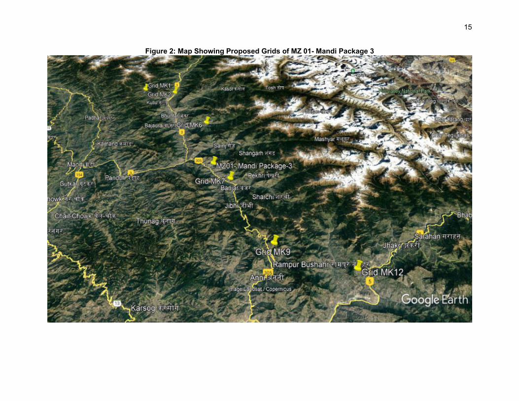
15
Figure 2: Map Showing Proposed Grids of MZ 01- Mandi Package 3
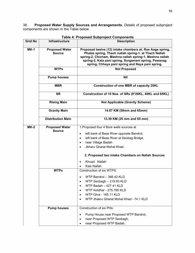
16
38. Proposed Water Supply Sources and Arrangements. Details of proposed subproject components are shown in the Table below.
Table 4: Proposed Subproject Components Grid No Infrastructure Description
MK-1 Proposed Water Source
Proposed twelve (12) intake chambers at. Roe Aage spring, Phalas spring, Thach nallah spring-1, at Thach Nallah
spring-2, Chicham, Mashna nallah spring-1, Mashna nallah spring-2, Kala pani spring, Surgamani spring, Pawanag
spring, Chhaya pani spring and Naya pani spring.
WTPs Not Proposed
Pump houses Nil
MBR Construction of one MBR of capacity 20KL
SR Construction of 10 Nos. of SRs (8*20KL, 40KL and 65KL)
Rising Main Not Applicable (Gravity Scheme)
Gravity Main 14.87 KM (50mm and 65mm)
Distribution Main 13.39 KM (25 mm and 65 mm)
MK-2 Proposed Water Source
1.Proposed four 4 Bore wells sources at
left bank of Beas River opposite Bandrol,
left bank of Beas River at Seobag Bridge,
near Village Badah
Jkharu Gharat Mohal Khad.
2. Proposed two intake Chambers on Nallah Sources
Khuad Nallah
Kais Nallah
WTPs Construction of six WTPS:
WTP Bandrol – 366.42 KLD
WTP Seobagh – 219.93 KLD
WTP Badah – 427.41 KLD
WTP Kotdhar - 275.785 KLD
WTP Ghot - 165.11 KLD
WTP Jhakru Gharat Mohal Khad - 74.1 KLD
Pump houses Construction of six PHs:
Pump House near Proposed WTP Bandrol,
near Proposed WTP Seobagh,
near Proposed WTP Badah,

17
Grid No Infrastructure Description
near Proposed WTP Jhakru Gharat Mohal Khad,
near Proposed MBR Katai,
near Proposed MBR Bhrogi
MBR Construction of 6 Nos. MBRs (20KL,20KL, 25KL, 25KL, 45KL & 95KL)
SR Construction of 22 No. SRs (14 Nos. of 20 KL, 2 Nos. of 25 KL, 2 Nos of 40KL, 1 no. of 35KL, 50 KL, 70 KL & 215 KL
each)
Rising Main 10.17 KM (50 mm and 100 mm)
Gravity Main 31.05 KM (50 mm and 100 mm)
Distribution Main 63.49 KM (25 mm and150 mm)
MK-6 Proposed Water Source
Proposed one intake chamber on Sotak Nallah
WTPs Construction of three WTPs:
Proposed WTP Jaishtha -85.025 KLD
Proposed WTP at Naroul -87.305 KLD
Proposed WTP Nautod Niul -41.99 KLD
Pump houses Not Applicable
MBR Construction of 2 Nos. MBRs of capacities 20 Kl and 40 KL
SR Construction of 3 Nos. of SRs of capacities 40 KL, 20 KL, 20 KL
Rising Main Not Applicable (Gravity Scheme)
Gravity Main 14.8 KM (50 mm and 65 mm)
Distribution Main 25.23 KM (32 mm and 80 mm)
MK-7 Proposed Water Source
Proposed diversion spur at Tirthan Khad
WTPs Construction of one WTP of 0.7 MLD capacity
Pump houses Construction of 2 Nos. of Pump houses at WTP Sidha and 2nd Stage at Padhola
MBR Construction of 1 Nos of MBR of capacity 20 KL
SR Construction of 12 Nos. of SRs (3 nos. of 20 KL, 4 nos. of 25 KL, 4 nos. of 40 KL,1 nos of 45 KL, 50 and 110 KL each)
Rising Main 4.62 KM (100 mm and 125 mm)
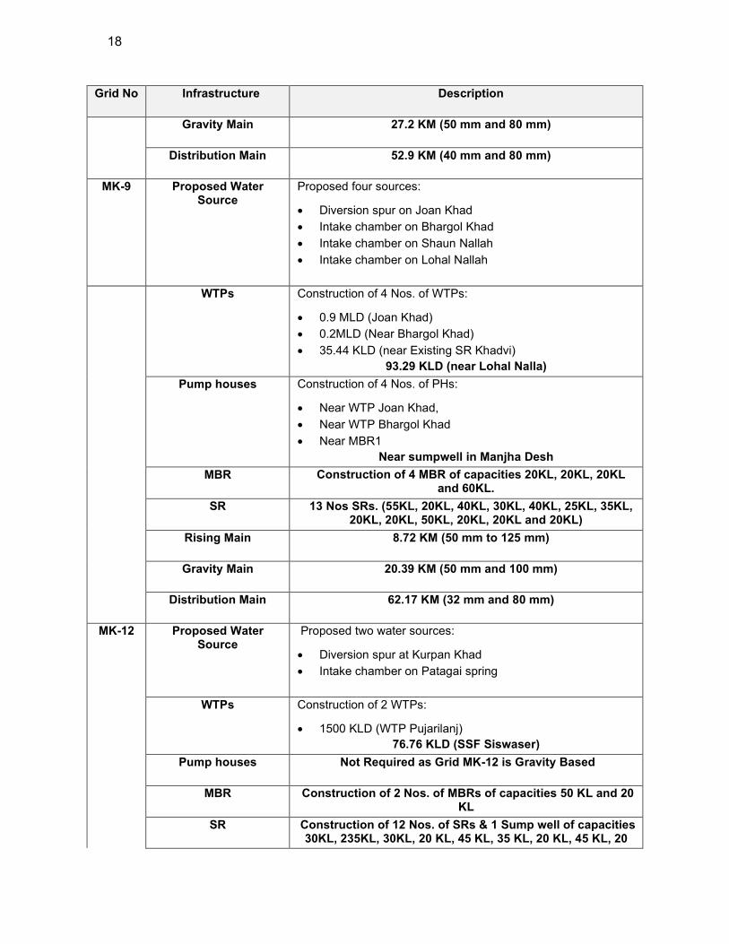
18
Grid No Infrastructure Description
Gravity Main 27.2 KM (50 mm and 80 mm)
Distribution Main 52.9 KM (40 mm and 80 mm)
MK-9 Proposed Water Source
Proposed four sources:
Diversion spur on Joan Khad
Intake chamber on Bhargol Khad
Intake chamber on Shaun Nallah
Intake chamber on Lohal Nallah
WTPs Construction of 4 Nos. of WTPs:
0.9 MLD (Joan Khad)
0.2MLD (Near Bhargol Khad)
35.44 KLD (near Existing SR Khadvi)
93.29 KLD (near Lohal Nalla)
Pump houses Construction of 4 Nos. of PHs:
Near WTP Joan Khad,
Near WTP Bhargol Khad
Near MBR1
Near sumpwell in Manjha Desh
MBR Construction of 4 MBR of capacities 20KL, 20KL, 20KL and 60KL.
SR 13 Nos SRs. (55KL, 20KL, 40KL, 30KL, 40KL, 25KL, 35KL, 20KL, 20KL, 50KL, 20KL, 20KL and 20KL)
Rising Main 8.72 KM (50 mm to 125 mm)
Gravity Main 20.39 KM (50 mm and 100 mm)
Distribution Main 62.17 KM (32 mm and 80 mm)
MK-12 Proposed Water Source
Proposed two water sources:
Diversion spur at Kurpan Khad
Intake chamber on Patagai spring
WTPs Construction of 2 WTPs:
1500 KLD (WTP Pujarilanj)
76.76 KLD (SSF Siswaser)
Pump houses Not Required as Grid MK-12 is Gravity Based
MBR Construction of 2 Nos. of MBRs of capacities 50 KL and 20 KL
SR Construction of 12 Nos. of SRs & 1 Sump well of capacities 30KL, 235KL, 30KL, 20 KL, 45 KL, 35 KL, 20 KL, 45 KL, 20
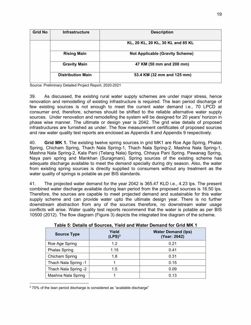
19
Grid No Infrastructure Description
KL, 20 KL, 20 KL, 30 KL and 85 KL
Rising Main Not Applicable (Gravity Scheme)
Gravity Main 47 KM (50 mm and 200 mm)
Distribution Main 53.4 KM (32 mm and 125 mm)
Source: Preliminary Detailed Project Report, 2020-2021
39. As discussed, the existing rural water supply schemes are under major stress, hence renovation and remodelling of existing infrastructure is required. The lean period discharge of few existing sources is not enough to meet the current water demand i.e., 70 LPCD at consumer end, therefore, schemes should be shifted to the reliable alternative water supply sources. Under renovation and remodelling the system will be designed for 20 years’ horizon in phase wise manner. The ultimate or design year is 2042. The grid wise details of proposed infrastructures are furnished as under. The flow measurement certificates of proposed sources and raw water quality test reports are enclosed as Appendix 8 and Appendix 9 respectively.
40. Grid MK 1. The existing twelve spring sources in grid MK1 are Roe Age Spring, Phalas Spring, Chicham Spring, Thach Nala Spring-1, Thach Nala Spring-2, Mashna Nala Spring-1, Mashna Nala Spring-2, Kala Pani (Telang Nala) Spring, Chhaya Pani Spring, Pawanag Spring, Naya pani spring and Mankhan (Suragmani). Spring sources of the existing scheme has adequate discharge available to meet the demand specially during dry season. Also, the water from existing spring sources is directly supplied to consumers without any treatment as the water quality of springs is potable as per BIS standards.
41. The projected water demand for the year 2042 is 365.47 KLD i.e., 4.23 lps. The present combined water discharge available during lean period from the proposed sources is 16.50 lps. Therefore, the sources are capable to meet projected demand and sustainable for this water supply scheme and can provide water upto the ultimate design year. There is no further downstream abstraction from any of the sources therefore, no downstream water usage conflicts will arise. Water quality test reports recommend that the water is potable as per BIS 10500 (2012). The flow diagram (Figure 3) depicts the integrated line diagram of the scheme.
Table 5: Details of Sources, Yield and Water Demand for Grid MK 1
Source Type Yield
(LPS)3 Water Demand (lps)
(Year: 2042)
Roe Age Spring 1.2 0.21
Phalas Spring 1.15 0.41
Chicham Spring 1.8 0.31
Thach Nala Spring -1 1 0.15
Thach Nala Spring -2 1.5 0.09
Mashna Nala Spring 1 0.13
3 70% of the lean period discharge is considered as “available discharge”
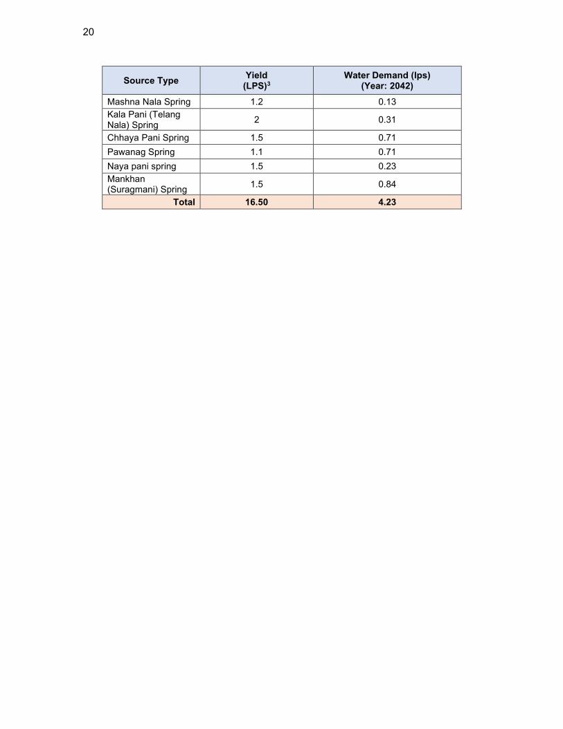
20
Source Type Yield
(LPS)3 Water Demand (lps)
(Year: 2042)
Mashna Nala Spring 1.2 0.13
Kala Pani (Telang Nala) Spring
2 0.31
Chhaya Pani Spring 1.5 0.71
Pawanag Spring 1.1 0.71
Naya pani spring 1.5 0.23
Mankhan (Suragmani) Spring
1.5 0.84
Total 16.50 4.23
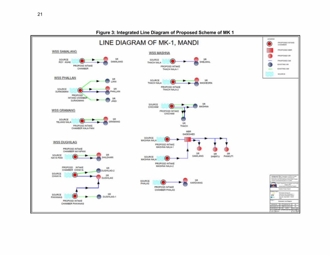
21
Figure 3: Integrated Line Diagram of Proposed Scheme of MK 1
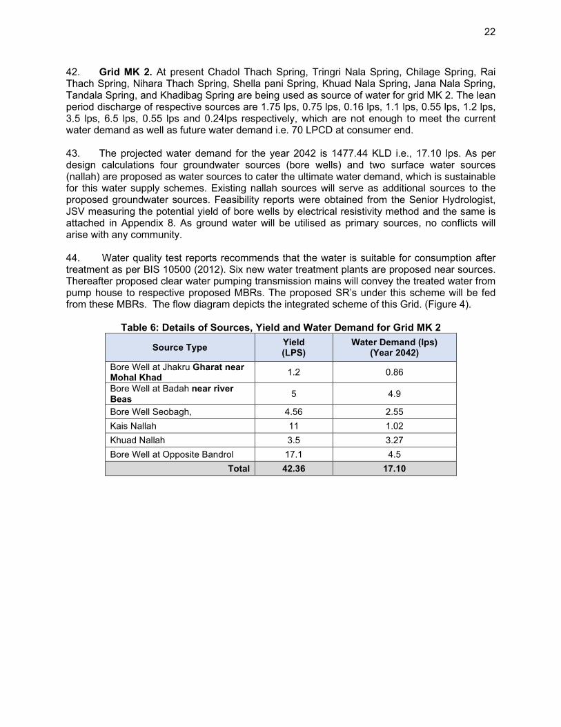
22
42. Grid MK 2. At present Chadol Thach Spring, Tringri Nala Spring, Chilage Spring, Rai Thach Spring, Nihara Thach Spring, Shella pani Spring, Khuad Nala Spring, Jana Nala Spring, Tandala Spring, and Khadibag Spring are being used as source of water for grid MK 2. The lean period discharge of respective sources are 1.75 lps, 0.75 lps, 0.16 lps, 1.1 lps, 0.55 lps, 1.2 lps, 3.5 lps, 6.5 lps, 0.55 lps and 0.24lps respectively, which are not enough to meet the current water demand as well as future water demand i.e. 70 LPCD at consumer end. 43. The projected water demand for the year 2042 is 1477.44 KLD i.e., 17.10 lps. As per design calculations four groundwater sources (bore wells) and two surface water sources (nallah) are proposed as water sources to cater the ultimate water demand, which is sustainable for this water supply schemes. Existing nallah sources will serve as additional sources to the proposed groundwater sources. Feasibility reports were obtained from the Senior Hydrologist, JSV measuring the potential yield of bore wells by electrical resistivity method and the same is attached in Appendix 8. As ground water will be utilised as primary sources, no conflicts will arise with any community. 44. Water quality test reports recommends that the water is suitable for consumption after treatment as per BIS 10500 (2012). Six new water treatment plants are proposed near sources. Thereafter proposed clear water pumping transmission mains will convey the treated water from pump house to respective proposed MBRs. The proposed SR’s under this scheme will be fed from these MBRs. The flow diagram depicts the integrated scheme of this Grid. (Figure 4).
Table 6: Details of Sources, Yield and Water Demand for Grid MK 2
Source Type Yield (LPS)
Water Demand (lps) (Year 2042)
Bore Well at Jhakru Gharat near Mohal Khad
1.2 0.86
Bore Well at Badah near river Beas
5 4.9
Bore Well Seobagh, 4.56 2.55
Kais Nallah 11 1.02
Khuad Nallah 3.5 3.27
Bore Well at Opposite Bandrol 17.1 4.5
Total 42.36 17.10
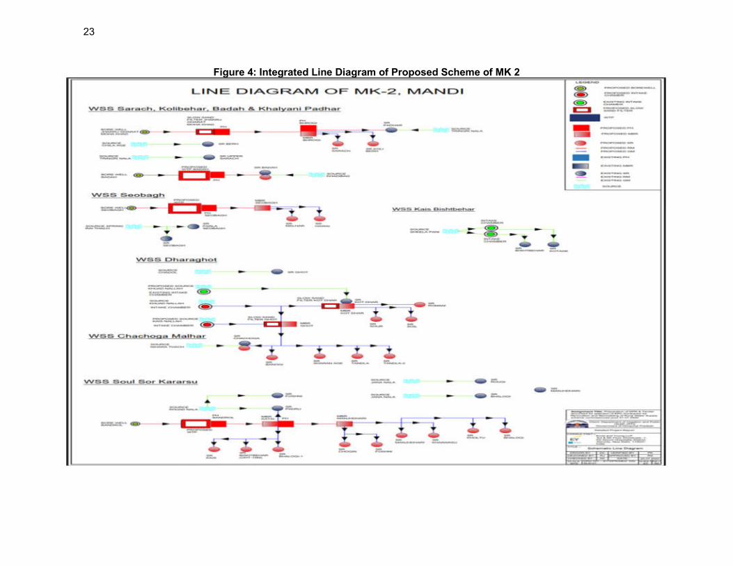
23
Figure 4: Integrated Line Diagram of Proposed Scheme of MK 2

24
45. Grid MK 6. The existing water supply schemes are dependent on springs and nallahs. The lean period discharge for all the spring sources are not adequate to cater the water demand, necessitating the need for additional sustainable new sources. while the existing sources will also continue to serve their respective command areas. 46. The water requirement for this project is only 272 KLD i.e., 3.15 lps. for the projected period year 2042. There are three existing spring sources i.e., Narali, Baggi and Regada spring and one proposed nallah source i.e., Regada nallah. One intake chamber is proposed in new source at Sotak Nallah which has enough lean period discharge. The combined lean period discharge available from all sources is 6.34 lps which is enough to fulfil the projected water demand. Therefore, sources are sustainable for this water supply scheme and can provide water till the ultimate design year.
47. The augmentation of the water supply sources will not have any impact on downstream flow, ecosystem and there will be no water usage conflicts. Water quality test reports recommends that the available water potable and within the standards mentioned in BIS 10,500 (2012). Further raw water gravity main is proposed from sources to proposed water treatment plants near sources. The proposed clear water gravity mains will convey the treated water to respective MBRs and SRs and will be distributed to households through distribution network under this scheme.
Table 7: Details of Sources, Yield and Water Demand for Grid MK 6
Source Type Yield4 (LPS)
Water Demand (lps) (2042)
Baggi spring 0.8
1.65 Narali spring 1
Sotak Nala 1.5
Julie nala spring 0.7
1.5 Rehegda spring 0.8
Rehegda nala 1.54
Total 6.34 3.15
4 70% of the lean period discharge is considered as “available discharge”
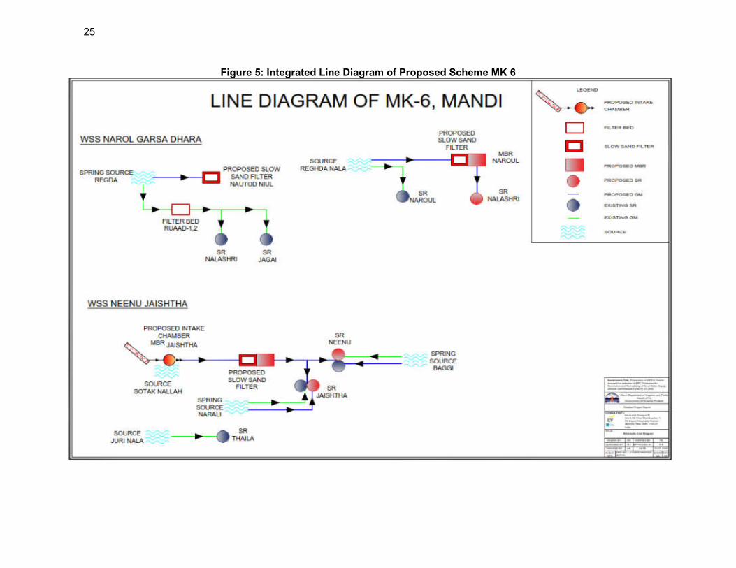
25
Figure 5: Integrated Line Diagram of Proposed Scheme MK 6
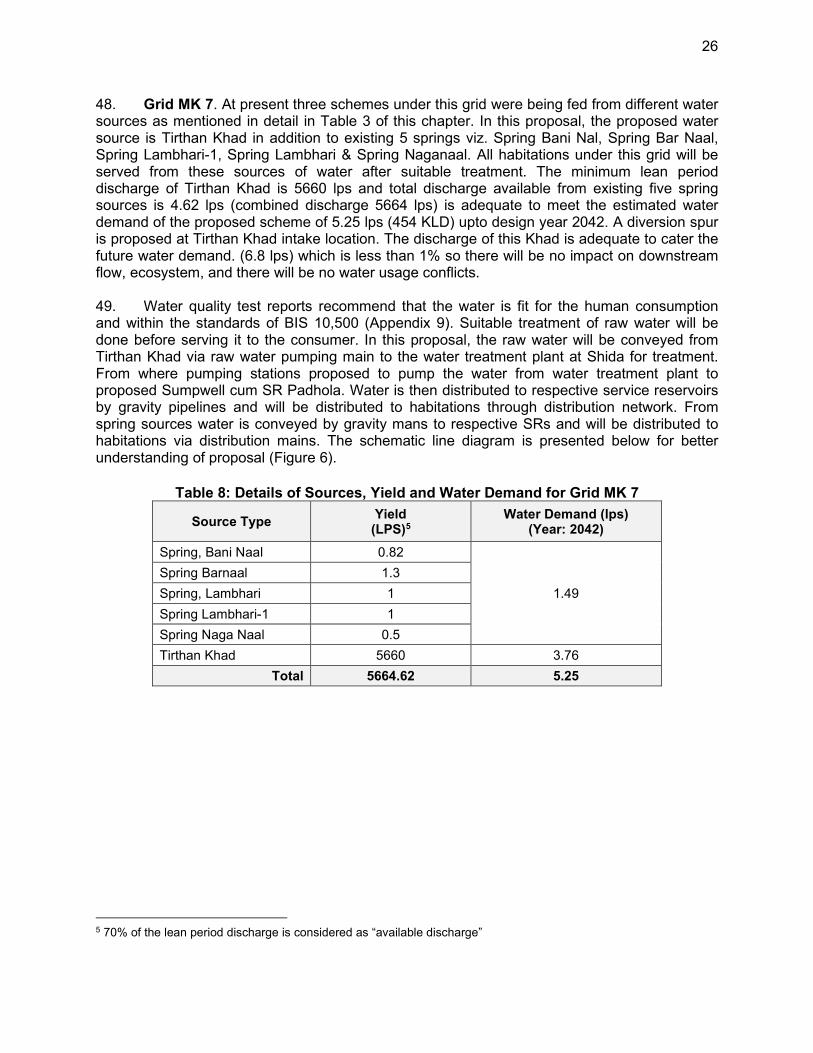
26
48. Grid MK 7. At present three schemes under this grid were being fed from different water sources as mentioned in detail in Table 3 of this chapter. In this proposal, the proposed water source is Tirthan Khad in addition to existing 5 springs viz. Spring Bani Nal, Spring Bar Naal, Spring Lambhari-1, Spring Lambhari & Spring Naganaal. All habitations under this grid will be served from these sources of water after suitable treatment. The minimum lean period discharge of Tirthan Khad is 5660 lps and total discharge available from existing five spring sources is 4.62 lps (combined discharge 5664 lps) is adequate to meet the estimated water demand of the proposed scheme of 5.25 lps (454 KLD) upto design year 2042. A diversion spur is proposed at Tirthan Khad intake location. The discharge of this Khad is adequate to cater the future water demand. (6.8 lps) which is less than 1% so there will be no impact on downstream flow, ecosystem, and there will be no water usage conflicts.
49. Water quality test reports recommend that the water is fit for the human consumption and within the standards of BIS 10,500 (Appendix 9). Suitable treatment of raw water will be done before serving it to the consumer. In this proposal, the raw water will be conveyed from Tirthan Khad via raw water pumping main to the water treatment plant at Shida for treatment. From where pumping stations proposed to pump the water from water treatment plant to proposed Sumpwell cum SR Padhola. Water is then distributed to respective service reservoirs by gravity pipelines and will be distributed to habitations through distribution network. From spring sources water is conveyed by gravity mans to respective SRs and will be distributed to habitations via distribution mains. The schematic line diagram is presented below for better understanding of proposal (Figure 6).
Table 8: Details of Sources, Yield and Water Demand for Grid MK 7
Source Type Yield
(LPS)5 Water Demand (lps)
(Year: 2042)
Spring, Bani Naal 0.82
1.49
Spring Barnaal 1.3
Spring, Lambhari 1
Spring Lambhari-1 1
Spring Naga Naal 0.5
Tirthan Khad 5660 3.76
Total 5664.62 5.25
5 70% of the lean period discharge is considered as “available discharge”
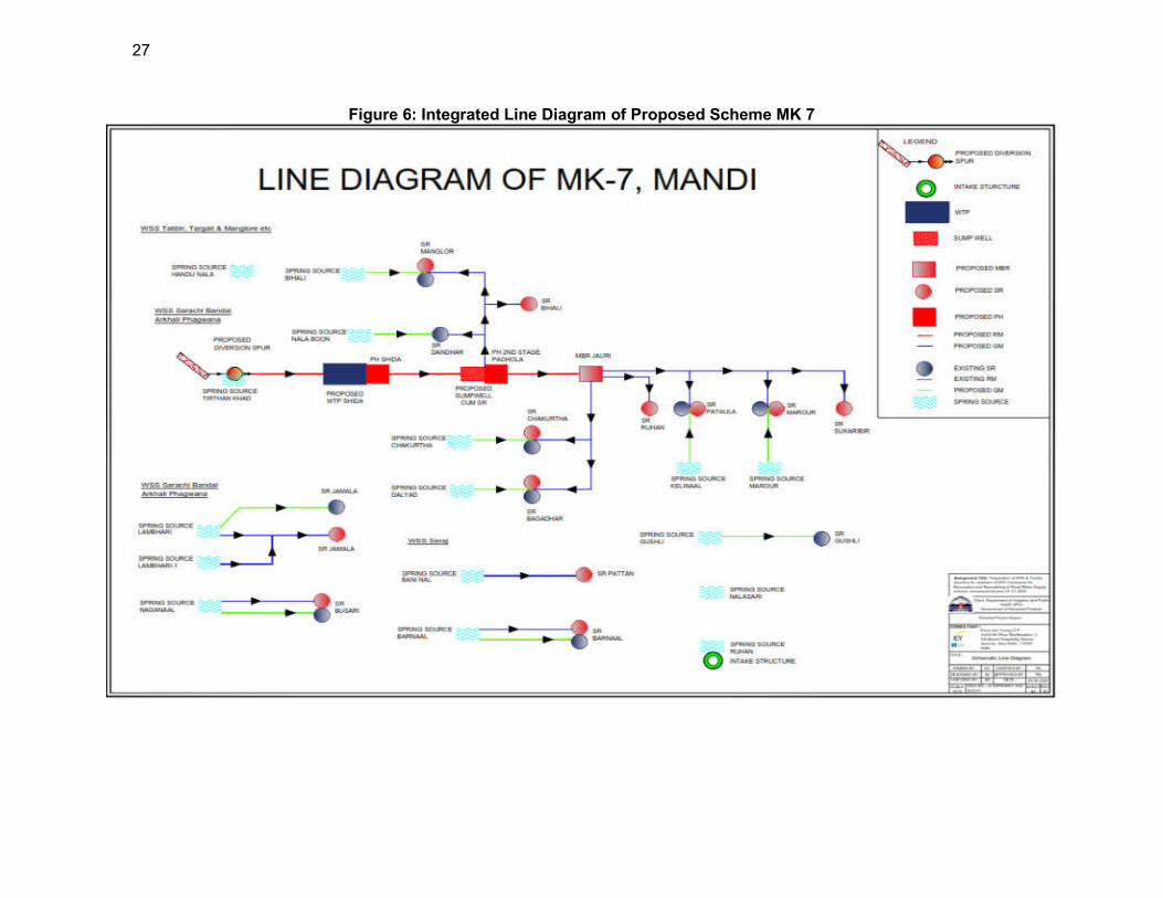
27
Figure 6: Integrated Line Diagram of Proposed Scheme MK 7
28
50. Grid MK 9: Earlier six schemes under this grid are being fed from different water sources as mentioned in detail in Table 3 of this chapter. Under the new proposal, the proposed water sources are Joan Khad, Shaun nallah, Lohal Nallah and Bhargol Khad and all habitations will be served from these sources of water after suitable treatment. Intake chambers are proposed at Shaun nallah, Lohal Nallah and Bhargol Khad and diversion spur is proposed in John khad. The total lean period discharge of sources is 107.5 adequate to meet estimated water demand of the proposed schemes 838 KLD i.e., 9.70 lps. for year 2042. The discharge of John Khad is adequate to cater the future water demand. Water quality test reports recommends that the available water is fit for the human consumption after treatment as per the standards of BIS 10500 (Appendix 9). Suitable treatment of raw water will be done before serving it to the consumer.
Table 9: Details of Sources, Yield and Water Demand for Grid MK 9
Source Type Yield6 (LPS)
Water Demand (lps) (Year: 2042)
Joan Khad 100 6.71
Shaun Nallah 2 0.41
Lohal Nallah 2.5 1.08
Bhargol Khad 3 1.5
Total 107.5 9.7
51. In this proposal, the raw water will be conveyed from Joan Khad via transmission mains to the water treatment plant for treatment. From where two pumping sets are proposed to pump the water from water treatment plant to MBR 1 and sump well at Manjha Desh. Water is then distributed to respective service reservoirs by gravity pipelines and will be distributed to habitations through distribution network. 52. The water from the proposed source Bhargol khad, is lifted to the proposed WTP near Bhargol Khad for treatment. The treated water is then pumped to MBR 4 and further taken through gravity to SR GSSS Khang and SR Tilara. The water from the SRs are then distributed to the command area through gravity. 53. The existing spring source near Lohal Nalla is also used to feed WSS Khanag after augmentation of the headworks. The water from Lohal Nalla is taken to the slow sand filter through gravity and the treated water is then supplied to SR Mithunu. The treated water from the clear water tank of slow sand filtration unit and SRs are then distributed through gravity to the respective command areas. 54. The existing source Shaun Nalla is proposed to serve WSS Khadvi Kafti, after augmentation of headworks. The water from Shaun nalla is taken through gravity mains to the slow sand filter for treatment and is then distributed to the command area from the clear water tank of the filtration unit. The schematic line diagram is presented below ::
6 70% of the lean period discharge is considered as “available discharge”
29
Figure 7: Integrated Line Diagram of Proposed Scheme MK 9
30
55. Grid MK 12. Existing all six schemes under this grid are being fed from different spring, khad and nala water sources as mentioned in detail in Table 3 of this report. In this proposal, the proposed water sources are Kurpan khad and Pattagai nallah. All habitations will be served from surface source Kurpan Khad after suitable treatment. Where as scheme WSS Chatti in G.P. Tunan in Nirmand block will continue to serve from existing spring source i.e., Pattagai spring. A diversion spur will be constructed on Kurpan Khad. Augmentation of water supply sources will not have any impact on downstream flow, ecosystem and there will be no water usage conflicts. 56. The sources proposed have enough water to serve the population under these schemes till ultimate design year 2042. The minimum lean period discharge of Kurpan Khad is enough and adequate to meet future water demand i.e., 11.53 lps (996.2 KLD). The discharge available in proposed source is 1038 lps which is enough to fulfil the projected water requirement upto 2042. The minimum lean period discharge of Pattagai spring is enough and adequate to meet future water demand i.e., 0.97 lps (84 KLD). The discharge available in proposed source is 1.6 lps which is enough to fulfil the water demand. It has also been reported that proposed sources are having flow throughout the year and are perennial sources. Water quality test reports recommends that the available water is fit for the human consumption after treatment and within the standards of BIS 10500 (Appendix 9). Suitable treatment of raw water has also been proposed and treated water will be provided to the consumers.
Table 10: Details of Sources, Yield and Water Demand for Grid MK 12
Source Type Yield7 (LPS)
Water Demand (lps) (Year: 2042)
Kurpan Khad 1038 11.53
Patagi Spring 1.6 0.97
Total 1039.6 12.50
57. In this proposal, the raw water is conveyed through gravity from the proposed intake chamber at Kurpan khad to the water treatment plant for further treatment. Later, from the WTP, water will be supplied to MBR Pujarilanj. Water is then distributed to respective service reservoirs by gravity pipelines and will be distributed to habitations through distribution networks. 58. From spring source pattagai raw water is conveyed to slow sand filter through gravity. Clear water tank of SSF will serve as SR to distribute clear water to the habitations via distribution networks. The schematic line diagram of this proposal (Grid 12) is presented below (Figure 8).
7 70% of the lean period discharge is considered as “available discharge”
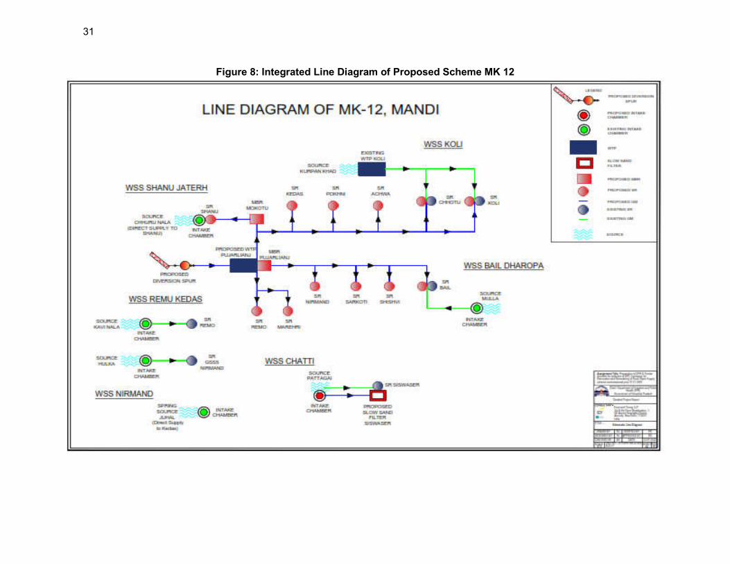
31
Figure 8: Integrated Line Diagram of Proposed Scheme MK 12
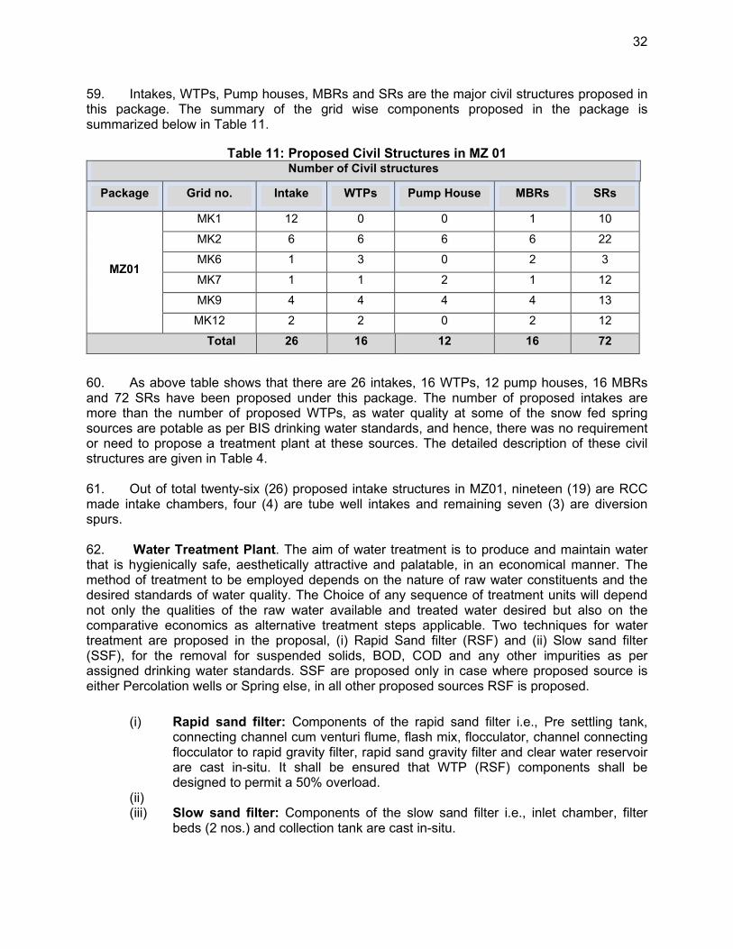
32
59. Intakes, WTPs, Pump houses, MBRs and SRs are the major civil structures proposed in this package. The summary of the grid wise components proposed in the package is summarized below in Table 11.
Table 11: Proposed Civil Structures in MZ 01 Number of Civil structures
Package Grid no. Intake WTPs Pump House MBRs SRs
MZ01
MK1 12 0 0 1 10
MK2 6 6 6 6 22
MK6 1 3 0 2 3
MK7 1 1 2 1 12
MK9 4 4 4 4 13
MK12 2 2 0 2 12
Total 26 16 12 16 72
60. As above table shows that there are 26 intakes, 16 WTPs, 12 pump houses, 16 MBRs and 72 SRs have been proposed under this package. The number of proposed intakes are more than the number of proposed WTPs, as water quality at some of the snow fed spring sources are potable as per BIS drinking water standards, and hence, there was no requirement or need to propose a treatment plant at these sources. The detailed description of these civil structures are given in Table 4.
61. Out of total twenty-six (26) proposed intake structures in MZ01, nineteen (19) are RCC made intake chambers, four (4) are tube well intakes and remaining seven (3) are diversion spurs.
62. Water Treatment Plant. The aim of water treatment is to produce and maintain water that is hygienically safe, aesthetically attractive and palatable, in an economical manner. The method of treatment to be employed depends on the nature of raw water constituents and the desired standards of water quality. The Choice of any sequence of treatment units will depend not only the qualities of the raw water available and treated water desired but also on the comparative economics as alternative treatment steps applicable. Two techniques for water treatment are proposed in the proposal, (i) Rapid Sand filter (RSF) and (ii) Slow sand filter (SSF), for the removal for suspended solids, BOD, COD and any other impurities as per assigned drinking water standards. SSF are proposed only in case where proposed source is either Percolation wells or Spring else, in all other proposed sources RSF is proposed.
(i) Rapid sand filter: Components of the rapid sand filter i.e., Pre settling tank, connecting channel cum venturi flume, flash mix, flocculator, channel connecting flocculator to rapid gravity filter, rapid sand gravity filter and clear water reservoir are cast in-situ. It shall be ensured that WTP (RSF) components shall be designed to permit a 50% overload.
(ii) (iii) Slow sand filter: Components of the slow sand filter i.e., inlet chamber, filter
beds (2 nos.) and collection tank are cast in-situ.
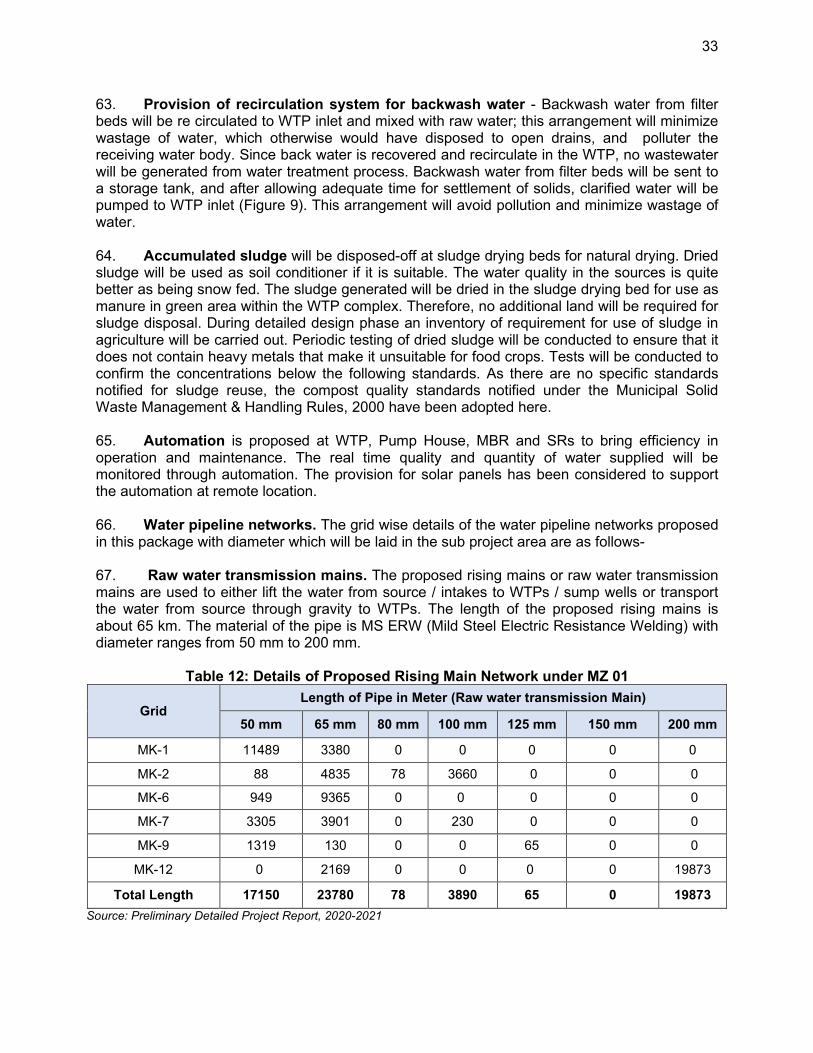
33
63. Provision of recirculation system for backwash water - Backwash water from filter beds will be re circulated to WTP inlet and mixed with raw water; this arrangement will minimize wastage of water, which otherwise would have disposed to open drains, and polluter the receiving water body. Since back water is recovered and recirculate in the WTP, no wastewater will be generated from water treatment process. Backwash water from filter beds will be sent to a storage tank, and after allowing adequate time for settlement of solids, clarified water will be pumped to WTP inlet (Figure 9). This arrangement will avoid pollution and minimize wastage of water. 64. Accumulated sludge will be disposed-off at sludge drying beds for natural drying. Dried sludge will be used as soil conditioner if it is suitable. The water quality in the sources is quite better as being snow fed. The sludge generated will be dried in the sludge drying bed for use as manure in green area within the WTP complex. Therefore, no additional land will be required for sludge disposal. During detailed design phase an inventory of requirement for use of sludge in agriculture will be carried out. Periodic testing of dried sludge will be conducted to ensure that it does not contain heavy metals that make it unsuitable for food crops. Tests will be conducted to confirm the concentrations below the following standards. As there are no specific standards notified for sludge reuse, the compost quality standards notified under the Municipal Solid Waste Management & Handling Rules, 2000 have been adopted here. 65. Automation is proposed at WTP, Pump House, MBR and SRs to bring efficiency in operation and maintenance. The real time quality and quantity of water supplied will be monitored through automation. The provision for solar panels has been considered to support the automation at remote location. 66. Water pipeline networks. The grid wise details of the water pipeline networks proposed in this package with diameter which will be laid in the sub project area are as follows- 67. Raw water transmission mains. The proposed rising mains or raw water transmission mains are used to either lift the water from source / intakes to WTPs / sump wells or transport the water from source through gravity to WTPs. The length of the proposed rising mains is about 65 km. The material of the pipe is MS ERW (Mild Steel Electric Resistance Welding) with diameter ranges from 50 mm to 200 mm.
Table 12: Details of Proposed Rising Main Network under MZ 01
Grid Length of Pipe in Meter (Raw water transmission Main)
50 mm 65 mm 80 mm 100 mm 125 mm 150 mm 200 mm
MK-1 11489 3380 0 0 0 0 0
MK-2 88 4835 78 3660 0 0 0
MK-6 949 9365 0 0 0 0 0
MK-7 3305 3901 0 230 0 0 0
MK-9 1319 130 0 0 65 0 0
MK-12 0 2169 0 0 0 0 19873
Total Length 17150 23780 78 3890 65 0 19873
Source: Preliminary Detailed Project Report, 2020-2021
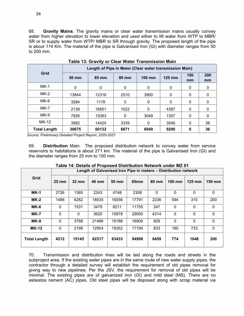
34
68. Gravity Mains. The gravity mains or clear water transmission mains usually convey water from higher elevation to lower elevation and used either to lift water from WTP to MBR/ SR or to supply water from WTP/ MBR to SR through gravity. The proposed length of the pipe is about 114 Km. The material of the pipe is Galvanised Iron (GI) with diameter ranges from 50 to 200 mm.
Table 13: Gravity or Clear Water Transmission Main
Grid
Length of Pipe in Meter (Clear water transmission Main)
50 mm 65 mm 80 mm 100 mm 125 mm 150
mm
200
mm
MK-1 0 0 0 0 0 0 0
MK-2 13844 12316 2510 3900 0 0 0
MK-6 3284 1178 0 0 0 0 0
MK-7 2139 16851 1022 0 4387 0 0
MK-9 7826 15363 0 3049 1357 0 0
MK-12 3582 14424 3339 0 3546 0 36
Total Length 30675 60132 6871 6949 9290 0 36
Source: Preliminary Detailed Project Report, 2020-2021
69. Distribution Main. The proposed distribution network to convey water from service reservoirs to habitations is about 271 km. The material of the pipe is Galvanised Iron (GI) and the diameter ranges from 25 mm to 150 mm.
Table 14: Details of Proposed Distribution Network under MZ 01
Grid
Length of Galvanised Iron Pipe in meters – Distribution network
25 mm 32 mm 40 mm 50 mm 65mm 80 mm 100 mm 125 mm 150 mm
MK-1 2726 1365 2243 4748 2308 0 0 0 0
MK-2 1486 6282 18535 16056 17791 2236 594 315 200
MK-6 0 1531 3479 8211 11755 247 0 0 0
MK-7 0 0 3620 15878 29050 4314 0 0 0
MK-9 0 3768 21486 19188 16900 829 0 0 0
MK-12 0 2199 12954 19352 17194 833 180 733 0
Total Length 4212 15145 62317 83433 94998 8459 774 1048 200
70. Transmission and distribution lines will be laid along the roads and streets in the subproject area. If the existing water pipes are in the same route of new water supply pipes, the contractor through a detailed survey will establish the requirement of old pipes removal for giving way to new pipelines. Per the JSV, the requirement for removal of old pipes will be minimal. The existing pipes are of galvanized iron (GI) and mild steel (MS). There are no asbestos cement (AC) pipes. Old steel pipes will be disposed along with scrap material via
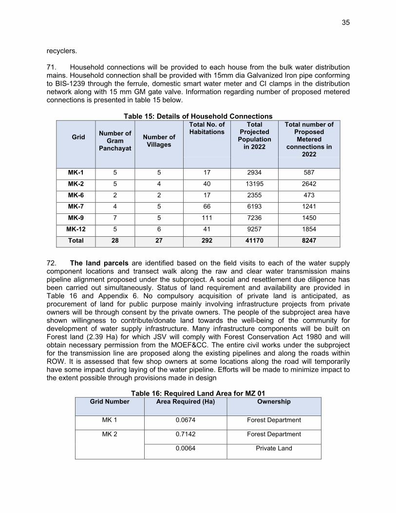
35
recyclers. 71. Household connections will be provided to each house from the bulk water distribution mains. Household connection shall be provided with 15mm dia Galvanized Iron pipe conforming to BIS-1239 through the ferrule, domestic smart water meter and CI clamps in the distribution network along with 15 mm GM gate valve. Information regarding number of proposed metered connections is presented in table 15 below.
Table 15: Details of Household Connections
Grid
Number of Gram
Panchayat
Number of Villages
Total No. of Habitations
Total Projected
Population in 2022
Total number of Proposed Metered
connections in 2022
MK-1 5 5 17 2934 587
MK-2 5 4 40 13195 2642
MK-6 2 2 17 2355 473
MK-7 4 5 66 6193 1241
MK-9 7 5 111 7236 1450
MK-12 5 6 41 9257 1854
Total
28 27 292 41170 8247
72. The land parcels are identified based on the field visits to each of the water supply component locations and transect walk along the raw and clear water transmission mains pipeline alignment proposed under the subproject. A social and resettlement due diligence has been carried out simultaneously. Status of land requirement and availability are provided in Table 16 and Appendix 6. No compulsory acquisition of private land is anticipated, as procurement of land for public purpose mainly involving infrastructure projects from private owners will be through consent by the private owners. The people of the subproject area have shown willingness to contribute/donate land towards the well-being of the community for development of water supply infrastructure. Many infrastructure components will be built on Forest land (2.39 Ha) for which JSV will comply with Forest Conservation Act 1980 and will obtain necessary permission from the MOEF&CC. The entire civil works under the subproject for the transmission line are proposed along the existing pipelines and along the roads within ROW. It is assessed that few shop owners at some locations along the road will temporarily have some impact during laying of the water pipeline. Efforts will be made to minimize impact to the extent possible through provisions made in design
Table 16: Required Land Area for MZ 01 Grid Number Area Required (Ha) Ownership
MK 1 0.0674 Forest Department
MK 2 0.7142 Forest Department
0.0064 Private Land
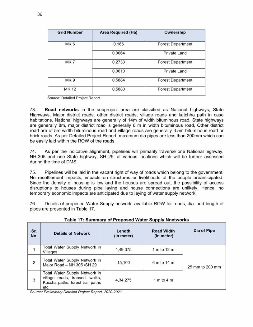
36
Grid Number Area Required (Ha) Ownership
MK 6 0.166 Forest Department
0.0064 Private Land
MK 7 0.2733 Forest Department
0.0610 Private Land
MK 9 0.5884 Forest Department
MK 12 0.5880 Forest Department
Source: Detailed Project Report
73. Road networks in the subproject area are classified as National highways, State Highways, Major district roads, other district roads, village roads and katchha path in case habitations. National highways are generally of 14m of width bituminous road, State highways are generally 8m, major district road is generally 6 m in width bituminous road, Other district road are of 5m width bituminous road and village roads are generally 3.5m bituminous road or brick roads. As per Detailed Project Report, maximum dia pipes are less than 200mm which can be easily laid within the ROW of the roads. 74. As per the indicative alignment, pipelines will primarily traverse one National highway, NH-305 and one State highway, SH 29, at various locations which will be further assessed during the time of DMS. 75. Pipelines will be laid in the vacant right of way of roads which belong to the government. No resettlement impacts, impacts on structures or livelihoods of the people areanticipated. Since the density of housing is low and the houses are spread out, the possibility of access disruptions to houses during pipe laying and house connections are unlikely. Hence, no temporary economic impacts are anticipated due to laying of water supply network. 76. Details of proposed Water Supply network, available ROW for roads, dia. and length of pipes are presented in Table 17.
Table 17: Summary of Proposed Water Supply Nnetworks
Sr. No.
Details of Network Length
(in meter) Road Width (in meter)
Dia of Pipe
1 Total Water Supply Network in Villages
4,49,375 1 m to 12 m
25 mm to 200 mm 2
Total Water Supply Network in Major Road – NH 305 /SH 29
15,100 6 m to 14 m
3
Total Water Supply Network in village roads, transect walks, Kuccha paths, forest trail paths etc.
4,34,275 1 m to 4 m
Source: Preliminary Detailed Project Report, 2020-2021.
37
D. Proposed Subproject Components
77. Subprojects are proposed for implementation under Design-Build-Operate (DBO) modality, wherein which the successful bidder will design the water supply system and components (based on the feasibility / preliminary design / standards / guidelines provided in the bid document), construct, commission, and operate for 5 years, after which it will be transferred to JSV. Therefore, at this stage, subproject is designed only in outline, and the details of components of the subproject provided in the table 18 below are as finalized at this stage based on the preliminary designs and as included in the bid documents. This IEE is based on the subprojects and components detailed in below and the IEE will be further updated during the detailed design phase. Table 11 shows the nature and size of the various components of the Water supply, system. Typical Layout Plan and Schematic Diagram of various components are shown in Figure 9 at the end of this Chapter.
Table 18: Proposed Water Supply Subproject Components of MZ 01 Sr.
No.
Infrastructure Function Description Location
GRID MK-1
1
Twelve numbers. of intake chambers are proposed at twelve numbers. of existing spring sources
Abstract the Water from Twelve nos. of existing Springs/Nallahs and through proposed Intake chambers and by Gravity mains the water will be supplied to the proposed MBR. & SRs
The discharge observed in
different springs and nallahs
in the lean period are :
1. WSS Samalang: 1.20 LPS
2. WSS Mashna,: 1.15 LPS,
1.80 LPS, 1.50 LPS, 1.00
LPS, 1.20 LPS and 1.00
LPS for
3. WSS Gramang : 2.00 LPS
4. WSS Dughilag Shildhari :
1.50 LPS, 1.10 LPS and
1.50 LPS
5. WSS Phallan 1.50 LPS
Capacitiy of the proposed intakes chambers are given below:
1. Proposed Intake Chamber Roe Aage Spring : 5 KL
2. Proposed Intake Chamber Kala Pani : 5 KL
3. Proposed Intake Chamber Chhaya Pani :10 KL
Twelve Nos. of intakes on spring sources are located at coordinates
1. Proposed Intake Chamber on Roe Aage Spring is Located at coordinates 32°3'6.14"N, 76°59'27.51"E.
2. Proposed Intake Chamber on Kala Pani (Telang nallah) Spring is Located at coordinates 31°58'15.40"N, 77° 0'22.14"E.
3. Proposed Intake Chamber on Chhaya Pani Spring is Located at coordinates 31°58'21.09"N, 77° 4'39.96"E.
4. Proposed Intake Chamber on Pawanag Spring is Located at coordinates 31°58'38.76"N, 77° 4'14.82"E.
5. Proposed Intake Chamber on Phalas Spring is Located at coordinates 31°59'54.90"N, 77°0'11.41"E.
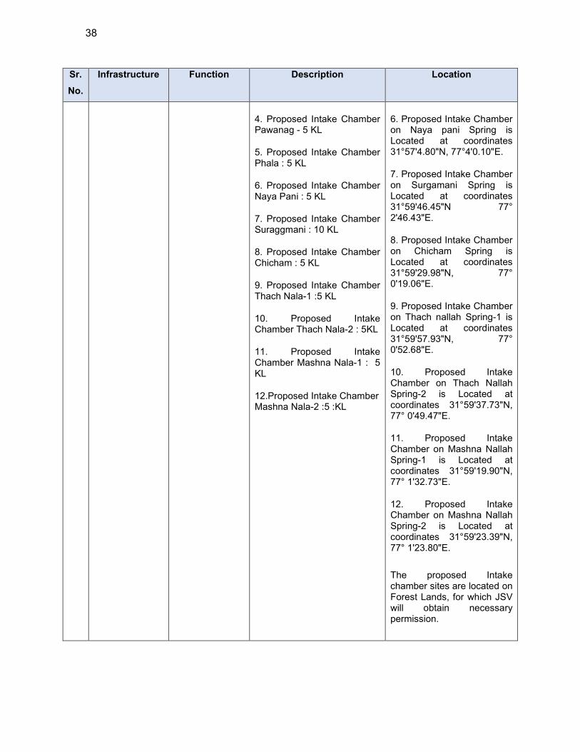
38
Sr.
No.
Infrastructure Function Description Location
4. Proposed Intake Chamber Pawanag - 5 KL
5. Proposed Intake Chamber Phala : 5 KL
6. Proposed Intake Chamber Naya Pani : 5 KL
7. Proposed Intake Chamber Suraggmani : 10 KL
8. Proposed Intake Chamber Chicham : 5 KL
9. Proposed Intake Chamber Thach Nala-1 :5 KL
10. Proposed Intake Chamber Thach Nala-2 : 5KL
11. Proposed Intake Chamber Mashna Nala-1 : 5 KL
12.Proposed Intake Chamber Mashna Nala-2 :5 :KL
6. Proposed Intake Chamber on Naya pani Spring is Located at coordinates 31°57'4.80"N, 77°4'0.10"E.
7. Proposed Intake Chamber on Surgamani Spring is Located at coordinates 31°59'46.45"N 77° 2'46.43"E.
8. Proposed Intake Chamber on Chicham Spring is Located at coordinates 31°59'29.98"N, 77° 0'19.06"E.
9. Proposed Intake Chamber on Thach nallah Spring-1 is Located at coordinates 31°59'57.93"N, 77° 0'52.68"E.
10. Proposed Intake Chamber on Thach Nallah Spring-2 is Located at coordinates 31°59'37.73"N, 77° 0'49.47"E.
11. Proposed Intake Chamber on Mashna Nallah Spring-1 is Located at coordinates 31°59'19.90"N, 77° 1'32.73"E.
12. Proposed Intake Chamber on Mashna Nallah Spring-2 is Located at coordinates 31°59'23.39"N, 77° 1'23.80"E.
The proposed Intake chamber sites are located on Forest Lands, for which JSV will obtain necessary permission.
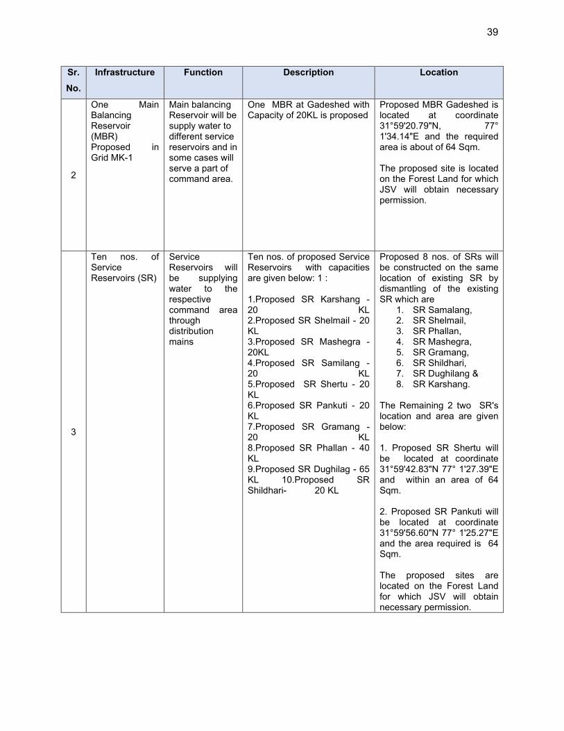
39
Sr.
No.
Infrastructure Function Description Location
2
One Main Balancing Reservoir (MBR) Proposed in Grid MK-1
Main balancing Reservoir will be supply water to different service reservoirs and in some cases will serve a part of command area.
One MBR at Gadeshed with Capacity of 20KL is proposed
Proposed MBR Gadeshed is located at coordinate 31°59'20.79"N, 77° 1'34.14"E and the required area is about of 64 Sqm. The proposed site is located on the Forest Land for which JSV will obtain necessary permission.
3
Ten nos. of Service Reservoirs (SR)
Service Reservoirs will be supplying water to the respective command area through distribution mains
Ten nos. of proposed Service Reservoirs with capacities are given below: 1 : 1.Proposed SR Karshang - 20 KL 2.Proposed SR Shelmail - 20 KL 3.Proposed SR Mashegra -20KL 4.Proposed SR Samilang - 20 KL 5.Proposed SR Shertu - 20 KL 6.Proposed SR Pankuti - 20 KL 7.Proposed SR Gramang - 20 KL 8.Proposed SR Phallan - 40 KL 9.Proposed SR Dughilag - 65 KL 10.Proposed SR Shildhari- 20 KL
Proposed 8 nos. of SRs will be constructed on the same location of existing SR by dismantling of the existing SR which are
1. SR Samalang, 2. SR Shelmail, 3. SR Phallan, 4. SR Mashegra, 5. SR Gramang, 6. SR Shildhari, 7. SR Dughilang & 8. SR Karshang.
The Remaining 2 two SR's location and area are given below: 1. Proposed SR Shertu will be located at coordinate 31°59'42.83"N 77° 1'27.39"E and within an area of 64 Sqm. 2. Proposed SR Pankuti will be located at coordinate 31°59'56.60"N 77° 1'25.27"E and the area required is 64 Sqm. The proposed sites are located on the Forest Land for which JSV will obtain necessary permission.
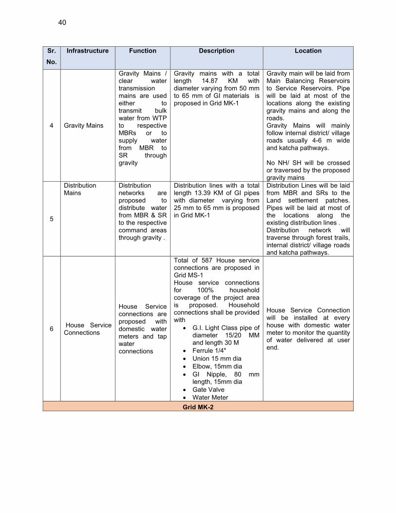
40
Sr.
No.
Infrastructure Function Description Location
4 Gravity Mains
Gravity Mains / clear water transmission mains are used either to transmit bulk water from WTP to respective MBRs or to supply water from MBR to SR through gravity
Gravity mains with a total length 14.87 KM with diameter varying from 50 mm to 65 mm of GI materials is proposed in Grid MK-1
Gravity main will be laid from Main Balancing Reservoirs to Service Reservoirs. Pipe will be laid at most of the locations along the existing gravity mains and along the roads. Gravity Mains will mainly follow internal district/ village roads usually 4-6 m wide and katcha pathways. No NH/ SH will be crossed or traversed by the proposed gravity mains
5
Distribution Mains
Distribution networks are proposed to distribute water from MBR & SR to the respective command areas through gravity .
Distribution lines with a total length 13.39 KM of GI pipes with diameter varying from 25 mm to 65 mm is proposed in Grid MK-1
Distribution Lines will be laid from MBR and SRs to the Land settlement patches. Pipes will be laid at most of the locations along the existing distribution lines . Distribution network will traverse through forest trails, internal district/ village roads and katcha pathways.
6 House Service Connections
House Service connections are proposed with domestic water meters and tap water connections
Total of 587 House service connections are proposed in Grid MS-1 House service connections for 100% household coverage of the project area is proposed. Household connections shall be provided with
G.I. Light Class pipe of diameter 15/20 MM and length 30 M
Ferrule 1/4" Union 15 mm dia Elbow, 15mm dia GI Nipple, 80 mm
length, 15mm dia Gate Valve Water Meter
House Service Connection will be installed at every house with domestic water meter to monitor the quantity of water delivered at user end.
Grid MK-2
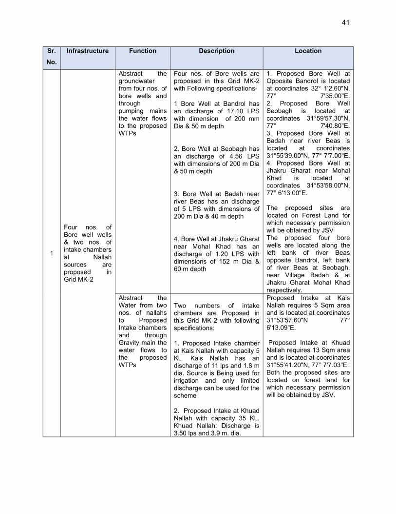
41
Sr.
No.
Infrastructure Function Description Location
1
Four nos. of Bore well wells & two nos. of intake chambers at Nallah sources are proposed in Grid MK-2
Abstract the groundwater from four nos. of bore wells and through pumping mains the water flows to the proposed WTPs
Four nos. of Bore wells are proposed in this Grid MK-2 with Following specifications-
1 Bore Well at Bandrol has an discharge of 17.10 LPS with dimension of 200 mm Dia & 50 m depth
2. Bore Well at Seobagh has an discharge of 4.56 LPS with dimensions of 200 m Dia & 50 m depth
3. Bore Well at Badah near river Beas has an discharge of 5 LPS with dimensions of 200 m Dia & 40 m depth
4. Bore Well at Jhakru Gharat near Mohal Khad has an discharge of 1.20 LPS with dimensions of 152 m Dia & 60 m depth
1. Proposed Bore Well at Opposite Bandrol is located at coordinates 32° 1'2.60"N, 77° 7'35.00"E. 2. Proposed Bore Well Seobagh is located at coordinates 31°59'57.30"N, 77° 7'40.80"E. 3. Proposed Bore Well at Badah near river Beas is located at coordinates 31°55'39.00"N, 77° 7'7.00"E. 4. Proposed Bore Well at Jhakru Gharat near Mohal Khad is located at coordinates 31°53'58.00"N, 77° 6'13.00"E. The proposed sites are located on Forest Land for which necessary permission will be obtained by JSV The proposed four bore wells are located along the left bank of river Beas opposite Bandrol, left bank of river Beas at Seobagh, near Village Badah & at Jhakru Gharat Mohal Khad respectively.
Abstract the Water from two nos. of nallahs to Proposed Intake chambers and through Gravity main the water flows to the proposed WTPs
Two numbers of intake chambers are Proposed in this Grid MK-2 with following specifications:
1. Proposed Intake chamber at Kais Nallah with capacity 5 KL. Kais Nallah has an discharge of 11 lps and 1.8 m dia. Source is Being used for irrigation and only limited discharge can be used for the scheme
2. Proposed Intake at Khuad Nallah with capacity 35 KL. Khuad Nallah: Discharge is 3.50 lps and 3.9 m. dia.
Proposed Intake at Kais Nallah requires 5 Sqm area and is located at coordinates 31°53'57.60"N 77° 6'13.09"E. Proposed Intake at Khuad Nallah requires 13 Sqm area and is located at coordinates 31°55'41.20"N, 77° 7'7.03"E. Both the proposed sites are located on forest land for which necessary permission will be obtained by JSV.
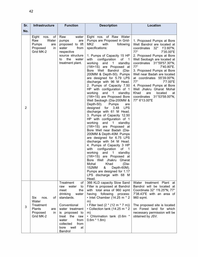
42
Sr.
No.
Infrastructure Function Description Location
2
Eight nos. of Raw Water Pumps are Proposed in Grid MK-2
Raw water pumps are proposed to lift water from respective source structure to the water treatment plant.
Eight nos. of Raw Water Pumps are Proposed in Grid-MK2 with following specifications:
1. Pumps of Capacity 15 HP with configuration of 1 working and 1 standby (1W+1S) are Proposed at Bore Well Bandrol (Dia-200MM & Depth-50). Pumps are designed for 5.79 LPS discharge with 96 M Head. 2. Pumps of Capacity 7.50 HP with configuration of 1 working and 1 standby (1W+1S) are Proposed Bore Well Seobagh (Dia-200MM & Depth-50). Pumps are designed for 3.48 LPS discharge with 61 M Head. 3. Pumps of Capacity 12.50 HP with configuration of 1 working and 1 standby (1W+1S) are Proposed at Bore Well near Badah (Dia-200MM & Depth-40M. Pumps are designed for 6.75 LPS discharge with 54 M Head. 4. Pumps of Capacity 3 HP with configuration of 1 working and 1 standby (1W+1S) are Proposed at Bore Well Jhakru Gharat Mohal Khad (Dia- 152MM & Depth-60M). Pumps are designed for 1.17 LPS discharge with 68 M Head.
1. Proposed Pumps at Bore Well Bandrol are located at coordinates 32° 1'2.60"N, 77° 7'35.00"E 2. Proposed Pumps at Bore Well Seobagh are located at coordinates 31°59'57.30"N, 77° 7'40.80"E. 3. Proposed Pumps at Bore Well near Badah are located at coordinates 55'39.00"N, 77° 7'7.00"E 4. Proposed Pumps at Bore Well Jhakru Gharat Mohal Khad are located at coordinates 31°53'58.00"N, 77° 6'13.00"E
3
Six nos. of Water Treatment Plants are Proposed in Grid MK-2
Treatment of raw water to meet the drinking water standards. Conventional water treatment is proposed to treat the raw water from collected from bore well at Bandrol
366 KLD capacity Slow Sand Filter is proposed at Bandrol with total area of 960 sqmt having following process: • Inlet Chamber (14.25 m * 2 m) • Filter bed (2 * (12 m * 7 m)) • Collection tank (14.25 m * 2 m) • Chlorination tank (0.6m * 0.6m * 1.8m)
Water treatment Plant at Bandrol will be located at Coordinate 32° 1'6.25"N, 77° 7'38.43"E with an area of 960 sqmt. The proposed site is located on Forest land for which necessary permission will be obtained by JSV.

43
Sr.
No.
Infrastructure Function Description Location
Treatment of raw water to meet the drinking water standards. Conventional water treatment is proposed to treat the raw water from Bore well at Seobag
220 KLD capacity Slow Sand Filter is proposed at Seobag within total area of 900 sqmt having following process: • Inlet Chamber (12.25 m * 2 m) • Filter bed (2 * (9 m * 6 m)) •Collection tank (12.25 m * 2 m) •Chlorination tank(0.6m * 0.6m * 1.8m)
Water treatment Plant at Seobag is proposed at Coordinate 31°59'56.83"N, 77° 7'41.24"E. The proposed site is located on Forest land for which necessary permission will be obtained by JSV.
Treatment of raw water to meet the drinking water standards. Conventional water treatment is proposed to treat the raw water from Bore well at Badah
427 KLD capacity slow sand filter is proposed at Badah covering total area of 1080 sqmt having following process: • Inlet Chamber (14.25 m * 2 m) • Filter bed (2 * (13 m * 7 m)) •Collection tank (14.25 m * 2 m) •Chlorination tank(0.6m * 0.6m * 1.8m)
Water treatment Plant at Badah is proposed are at Coordinate 31°55'41.28"N, 77° 7'6.47"E . The proposed site is located on Forest Land for which necessary permission will be obtained by JSV.
Treatment of raw water to meet the drinking water standards. Conventional water treatment is proposed to treat the raw water from intake chamber at Kotdhar
276 KLD capacity slow sand filter is proposed at Kotdhar having total area of 680 sqmt having following process: • Inlet Chamber (12.25 m * 2 m) • Filter bed (2 * (10 m * 6 m)) • Collection tank (12.25 m * 2 m) • Chlorination tank(0.6m * 0.6m * 1.8m)
Water treatment Plant at Kotdhar is proposed at Coordinate 32° 2'29.92"N 77° 9'25.79"E . The proposed site is located on Forest Land for which necessary permission will be obtained by JSV.
Treatment of raw water to meet the drinking water standards. Conventional water treatment is proposed to treat the raw water from Intake chamber at Ghot
165 KLD capacity slow sand filter is proposed at Ghot having total area of 600 sqmt having following process: • Inlet Chamber (10.25 m * 2 m) • Filter bed (2 * (8 m * 5 m)) • Collection tank (10.25 m * 2 m) • Chlorination tank(0.6m * 0.6m * 1.8m)
Water treatment Plant at Ghot is proposed at Coordinates 32° 0'31.07"N 77° 9'34.51"E and has an area of 600 sqmt. The proposed site is located on Forest Land for which necessary permission will be obtained by JSV.
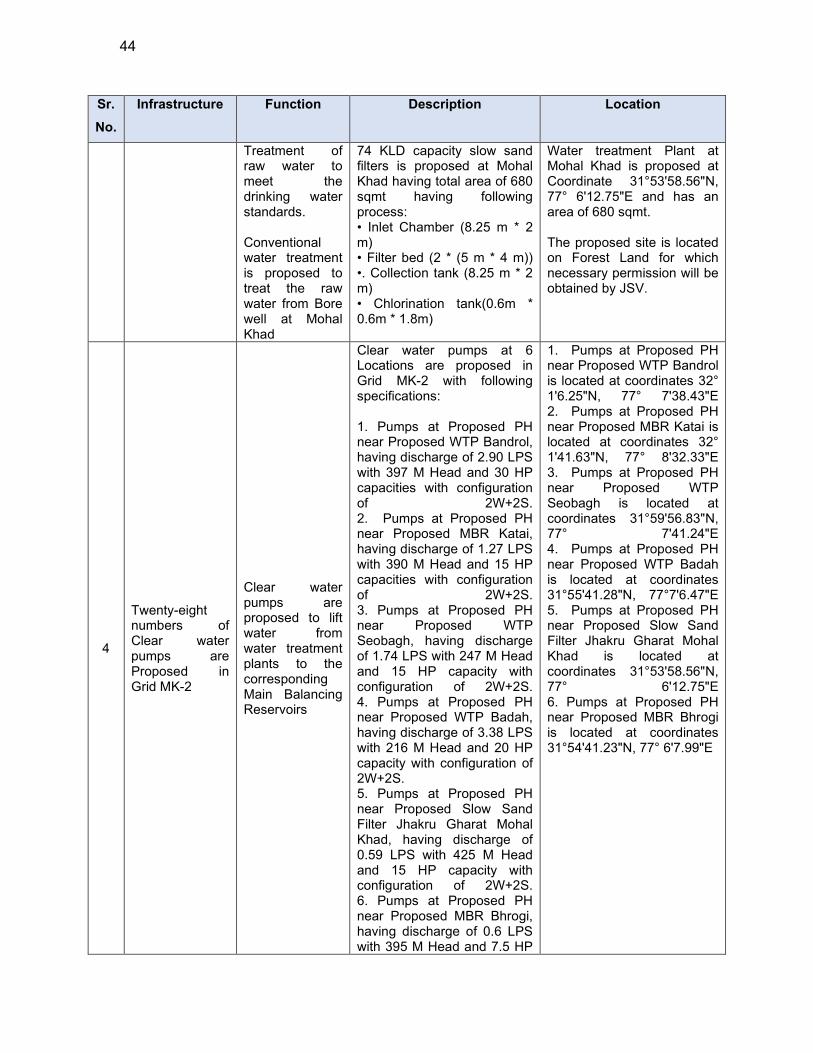
44
Sr.
No.
Infrastructure Function Description Location
Treatment of raw water to meet the drinking water standards. Conventional water treatment is proposed to treat the raw water from Bore well at Mohal Khad
74 KLD capacity slow sand filters is proposed at Mohal Khad having total area of 680 sqmt having following process: • Inlet Chamber (8.25 m * 2 m) • Filter bed (2 * (5 m * 4 m)) •. Collection tank (8.25 m * 2 m) • Chlorination tank(0.6m * 0.6m * 1.8m)
Water treatment Plant at Mohal Khad is proposed at Coordinate 31°53'58.56"N, 77° 6'12.75"E and has an area of 680 sqmt. The proposed site is located on Forest Land for which necessary permission will be obtained by JSV.
4
Twenty-eight numbers of Clear water pumps are Proposed in Grid MK-2
Clear water pumps are proposed to lift water from water treatment plants to the corresponding Main Balancing Reservoirs
Clear water pumps at 6 Locations are proposed in Grid MK-2 with following specifications: 1. Pumps at Proposed PH near Proposed WTP Bandrol, having discharge of 2.90 LPS with 397 M Head and 30 HP capacities with configuration of 2W+2S. 2. Pumps at Proposed PH near Proposed MBR Katai, having discharge of 1.27 LPS with 390 M Head and 15 HP capacities with configuration of 2W+2S. 3. Pumps at Proposed PH near Proposed WTP Seobagh, having discharge of 1.74 LPS with 247 M Head and 15 HP capacity with configuration of 2W+2S. 4. Pumps at Proposed PH near Proposed WTP Badah, having discharge of 3.38 LPS with 216 M Head and 20 HP capacity with configuration of 2W+2S. 5. Pumps at Proposed PH near Proposed Slow Sand Filter Jhakru Gharat Mohal Khad, having discharge of 0.59 LPS with 425 M Head and 15 HP capacity with configuration of 2W+2S. 6. Pumps at Proposed PH near Proposed MBR Bhrogi, having discharge of 0.6 LPS with 395 M Head and 7.5 HP
1. Pumps at Proposed PH near Proposed WTP Bandrol is located at coordinates 32° 1'6.25"N, 77° 7'38.43"E 2. Pumps at Proposed PH near Proposed MBR Katai is located at coordinates 32° 1'41.63"N, 77° 8'32.33"E 3. Pumps at Proposed PH near Proposed WTP Seobagh is located at coordinates 31°59'56.83"N, 77° 7'41.24"E 4. Pumps at Proposed PH near Proposed WTP Badah is located at coordinates 31°55'41.28"N, 77°7'6.47"E 5. Pumps at Proposed PH near Proposed Slow Sand Filter Jhakru Gharat Mohal Khad is located at coordinates 31°53'58.56"N, 77° 6'12.75"E 6. Pumps at Proposed PH near Proposed MBR Bhrogi is located at coordinates 31°54'41.23"N, 77° 6'7.99"E
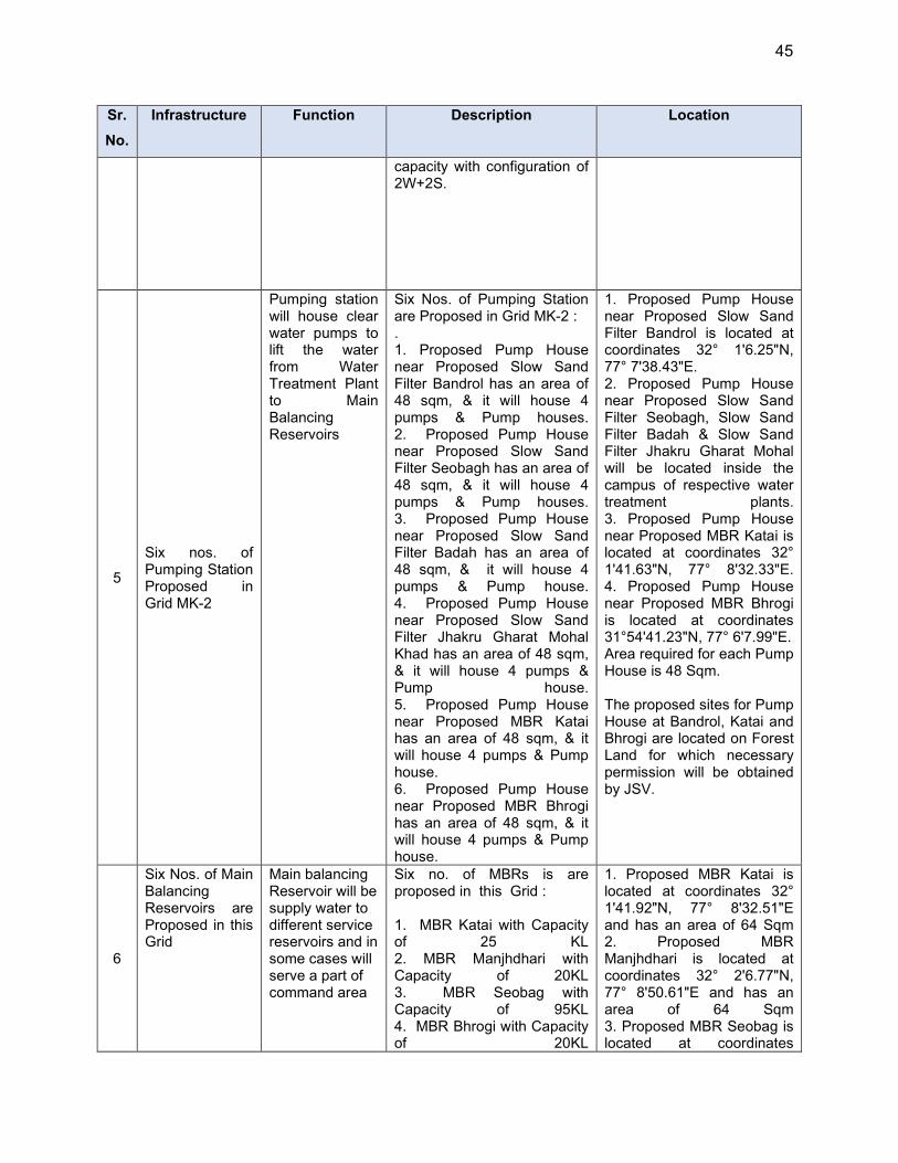
45
Sr.
No.
Infrastructure Function Description Location
capacity with configuration of 2W+2S.
5
Six nos. of Pumping Station Proposed in Grid MK-2
Pumping station will house clear water pumps to lift the water from Water Treatment Plant to Main Balancing Reservoirs
Six Nos. of Pumping Station are Proposed in Grid MK-2 : . 1. Proposed Pump House near Proposed Slow Sand Filter Bandrol has an area of 48 sqm, & it will house 4 pumps & Pump houses. 2. Proposed Pump House near Proposed Slow Sand Filter Seobagh has an area of 48 sqm, & it will house 4 pumps & Pump houses. 3. Proposed Pump House near Proposed Slow Sand Filter Badah has an area of 48 sqm, & it will house 4 pumps & Pump house. 4. Proposed Pump House near Proposed Slow Sand Filter Jhakru Gharat Mohal Khad has an area of 48 sqm, & it will house 4 pumps & Pump house. 5. Proposed Pump House near Proposed MBR Katai has an area of 48 sqm, & it will house 4 pumps & Pump house. 6. Proposed Pump House near Proposed MBR Bhrogi has an area of 48 sqm, & it will house 4 pumps & Pump house.
1. Proposed Pump House near Proposed Slow Sand Filter Bandrol is located at coordinates 32° 1'6.25"N, 77° 7'38.43"E. 2. Proposed Pump House near Proposed Slow Sand Filter Seobagh, Slow Sand Filter Badah & Slow Sand Filter Jhakru Gharat Mohal will be located inside the campus of respective water treatment plants. 3. Proposed Pump House near Proposed MBR Katai is located at coordinates 32° 1'41.63"N, 77° 8'32.33"E. 4. Proposed Pump House near Proposed MBR Bhrogi is located at coordinates 31°54'41.23"N, 77° 6'7.99"E. Area required for each Pump House is 48 Sqm. The proposed sites for Pump House at Bandrol, Katai and Bhrogi are located on Forest Land for which necessary permission will be obtained by JSV.
6
Six Nos. of Main Balancing Reservoirs are Proposed in this Grid
Main balancing Reservoir will be supply water to different service reservoirs and in some cases will serve a part of command area
Six no. of MBRs is are proposed in this Grid : 1. MBR Katai with Capacity of 25 KL 2. MBR Manjhdhari with Capacity of 20KL 3. MBR Seobag with Capacity of 95KL 4. MBR Bhrogi with Capacity of 20KL
1. Proposed MBR Katai is located at coordinates 32° 1'41.92"N, 77° 8'32.51"E and has an area of 64 Sqm 2. Proposed MBR Manjhdhari is located at coordinates 32° 2'6.77"N, 77° 8'50.61"E and has an area of 64 Sqm 3. Proposed MBR Seobag is located at coordinates
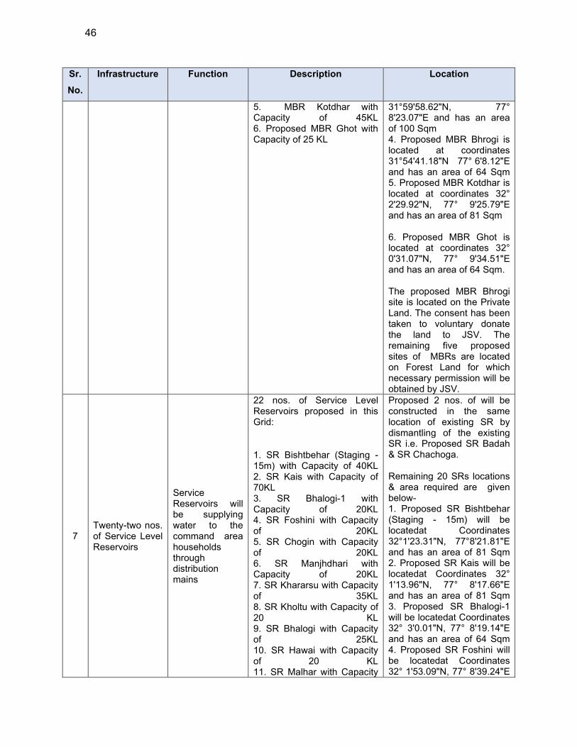
46
Sr.
No.
Infrastructure Function Description Location
5. MBR Kotdhar with Capacity of 45KL 6. Proposed MBR Ghot with Capacity of 25 KL
31°59'58.62"N, 77° 8'23.07"E and has an area of 100 Sqm 4. Proposed MBR Bhrogi is located at coordinates 31°54'41.18"N 77° 6'8.12"E and has an area of 64 Sqm 5. Proposed MBR Kotdhar is located at coordinates 32° 2'29.92"N, 77° 9'25.79"E and has an area of 81 Sqm 6. Proposed MBR Ghot is located at coordinates 32° 0'31.07"N, 77° 9'34.51"E and has an area of 64 Sqm. The proposed MBR Bhrogi site is located on the Private Land. The consent has been taken to voluntary donate the land to JSV. The remaining five proposed sites of MBRs are located on Forest Land for which necessary permission will be obtained by JSV.
7 Twenty-two nos. of Service Level Reservoirs
Service Reservoirs will be supplying water to the command area households through distribution mains
22 nos. of Service Level Reservoirs proposed in this Grid:
1. SR Bishtbehar (Staging - 15m) with Capacity of 40KL 2. SR Kais with Capacity of 70KL 3. SR Bhalogi-1 with Capacity of 20KL 4. SR Foshini with Capacity of 20KL 5. SR Chogin with Capacity of 20KL 6. SR Manjhdhari with Capacity of 20KL 7. SR Khararsu with Capacity of 35KL 8. SR Kholtu with Capacity of 20 KL 9. SR Bhalogi with Capacity of 25KL 10. SR Hawai with Capacity of 20 KL 11. SR Malhar with Capacity
Proposed 2 nos. of will be constructed in the same location of existing SR by dismantling of the existing SR i.e. Proposed SR Badah & SR Chachoga. Remaining 20 SRs locations & area required are given below- 1. Proposed SR Bishtbehar (Staging - 15m) will be locatedat Coordinates 32°1'23.31"N, 77°8'21.81"E and has an area of 81 Sqm 2. Proposed SR Kais will be locatedat Coordinates 32° 1'13.96"N, 77° 8'17.66"E and has an area of 81 Sqm 3. Proposed SR Bhalogi-1 will be locatedat Coordinates 32° 3'0.01"N, 77° 8'19.14"E and has an area of 64 Sqm 4. Proposed SR Foshini will be locatedat Coordinates 32° 1'53.09"N, 77° 8'39.24"E
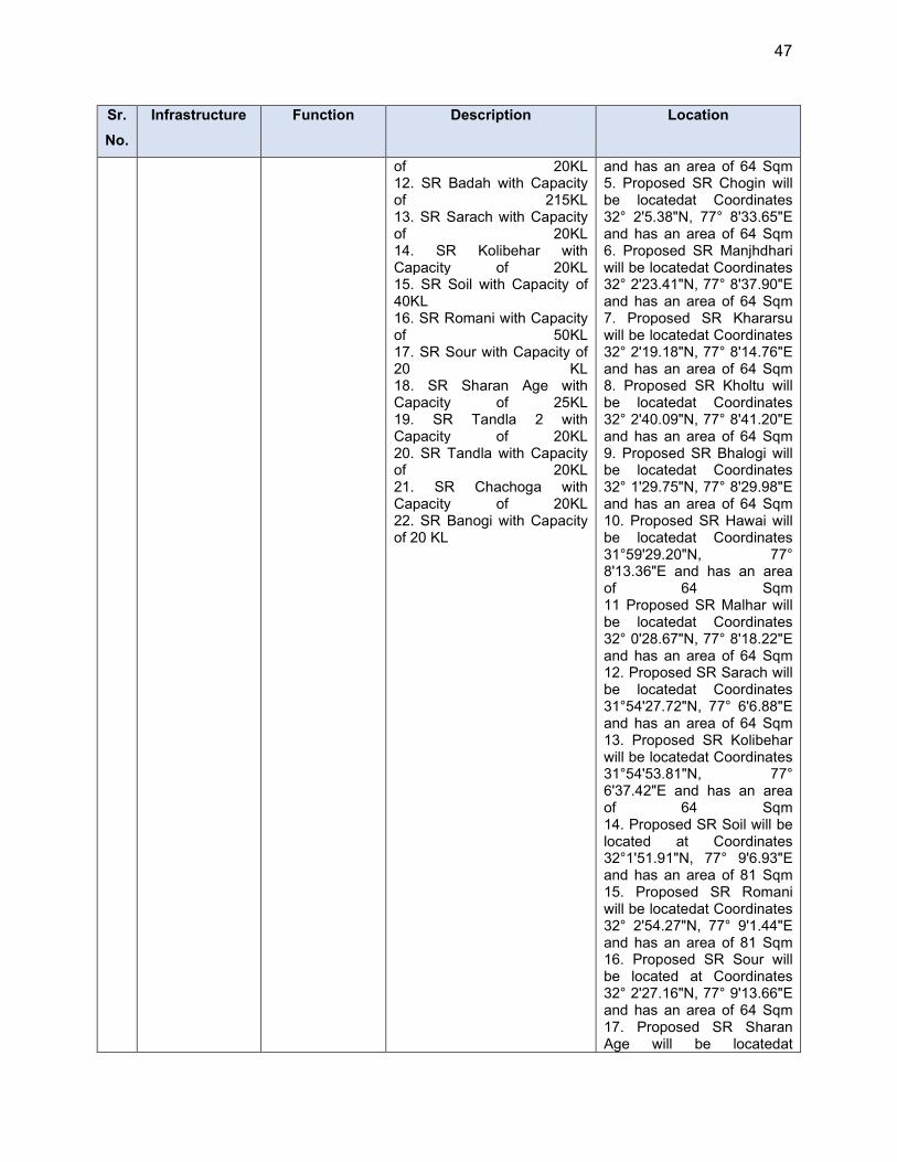
47
Sr.
No.
Infrastructure Function Description Location
of 20KL 12. SR Badah with Capacity of 215KL 13. SR Sarach with Capacity of 20KL 14. SR Kolibehar with Capacity of 20KL 15. SR Soil with Capacity of 40KL 16. SR Romani with Capacity of 50KL 17. SR Sour with Capacity of 20 KL 18. SR Sharan Age with Capacity of 25KL 19. SR Tandla 2 with Capacity of 20KL 20. SR Tandla with Capacity of 20KL 21. SR Chachoga with Capacity of 20KL 22. SR Banogi with Capacity of 20 KL
and has an area of 64 Sqm 5. Proposed SR Chogin will be locatedat Coordinates 32° 2'5.38"N, 77° 8'33.65"E and has an area of 64 Sqm 6. Proposed SR Manjhdhari will be locatedat Coordinates 32° 2'23.41"N, 77° 8'37.90"E and has an area of 64 Sqm 7. Proposed SR Khararsu will be locatedat Coordinates 32° 2'19.18"N, 77° 8'14.76"E and has an area of 64 Sqm 8. Proposed SR Kholtu will be locatedat Coordinates 32° 2'40.09"N, 77° 8'41.20"E and has an area of 64 Sqm 9. Proposed SR Bhalogi will be locatedat Coordinates 32° 1'29.75"N, 77° 8'29.98"E and has an area of 64 Sqm 10. Proposed SR Hawai will be locatedat Coordinates 31°59'29.20"N, 77° 8'13.36"E and has an area of 64 Sqm 11 Proposed SR Malhar will be locatedat Coordinates 32° 0'28.67"N, 77° 8'18.22"E and has an area of 64 Sqm 12. Proposed SR Sarach will be locatedat Coordinates 31°54'27.72"N, 77° 6'6.88"E and has an area of 64 Sqm 13. Proposed SR Kolibehar will be locatedat Coordinates 31°54'53.81"N, 77° 6'37.42"E and has an area of 64 Sqm 14. Proposed SR Soil will be located at Coordinates 32°1'51.91"N, 77° 9'6.93"E and has an area of 81 Sqm 15. Proposed SR Romani will be locatedat Coordinates 32° 2'54.27"N, 77° 9'1.44"E and has an area of 81 Sqm 16. Proposed SR Sour will be located at Coordinates 32° 2'27.16"N, 77° 9'13.66"E and has an area of 64 Sqm 17. Proposed SR Sharan Age will be locatedat
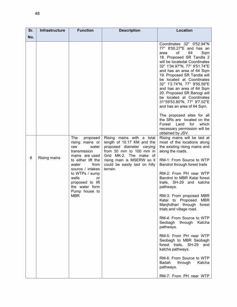
48
Sr.
No.
Infrastructure Function Description Location
Coordinates 32° 0'52.94"N 77° 8'50.27"E and has an area of 64 Sqm 18. Proposed SR Tandla 2 will be locatedat Coordinates 32° 1'34.97"N, 77° 9'51.74"E and has an area of 64 Sqm 19. Proposed SR Tandla will be located at Coordinates 32° 1'2.74"N, 77° 9'55.59"E and has an area of 64 Sqm 20. Proposed SR Banogi will be located at Coordinates 31°59'53.80"N, 77° 9'7.02"E and has an area of 64 Sqm.
The proposed sites for all the SRs are located on the Forest Land for which necessary permission will be obtained by JSV.
8
Rising mains
The proposed rising mains or raw water transmission mains are used to either lift the water from source / intakes to WTPs / sump wells or proposed to lift the water form Pump house to MBR
Rising mains with a total length of 10.17 KM and the proposed diameter varying from 50 mm to 100 mm in Grid MK-2. The make of rising main is MSERW so it could be easily laid on hilly terrain.
Rising mains will be laid at most of the locations along the existing rising mains and along the roads. RM-1: From Source to WTP Bandrol through forest trails RM-2: From PH near WTP Bandrol to MBR Katai forest trails, SH-29 and katcha pathways. RM-3: From proposed MBR Katai to Proposed MBR Manjhdhari through forest trials and village road. RM-4: From Source to WTP Seobagh through Katcha pathways. RM-5: From PH near WTP Seobagh to MBR Seobagh forest trails, SH-29 and katcha pathways. RM-6: From Source to WTP Badah through Katcha pathways. RM-7: From PH near WTP
49
Sr.
No.
Infrastructure Function Description Location
Badah to SR Badah forest trails and katcha pathways. RM-8: From Source to WTP Jhakru through Forest trails. RM-9: From PH near WTP Jhakru to MBR Bhrogi internal district/ village roads, forest trails and katcha pathways. RM-10 : From MBR Bhrogi to SR Paddar internal district/ village roads, forest trails and katcha pathways.
9 Gravity mains
Gravity Mains are proposed to convey bulk water from Main Balancing Reservoirs (MBR) to the respective Service Reservoirs(SR) through gravity
Gravity mains with a total length of 31.05 KM with diameter varying from 50 mm to 125 mm is proposed. The make of gravity main is G.I. medium class so it could be easily laid on hilly terrain
Gravity main will laid at most of the locations along the existing gravity mains. Gravity Mains will majorly follow internal district/ village roads usually 4-6 m wide and forest trails. No NH/ SH will be crossed or traversed by the proposed RM.
10 Distribution Mains
Distribution Lines are proposed to distribute water from MBR & SR to the respective command areas through gravity.
Distribution lines with a total length of 63.49 km with diameter varying from 25 mm to 150 mm of Galvanised Iron material. is proposed in Grid MK-2
Distribution Lines will be laid from Service Reservoirs to the Land settlement patches. Pipes will be laid at most of the locations along the existing distribution lines and at some places along the katcha path and village roads.

50
Sr.
No.
Infrastructure Function Description Location
11 House Service Connection
House Service connections are proposed with domestic water meter and tap water connections
Total of 2642 House Service Connection are proposed in this Grid. House service connections for 100% household coverage of the project area is proposed. Household connections shall be provided with G.I. Light Class pipe of
diameter 15/20 MM and length 30 M
Ferrule 1/4" Union 15 mm dia Elbow, 15mm dia GI Nipple, 80 mm length,
15mm dia Gate Valve Water Meter
House Service Connection will be installed at every house with domestic water smart meter to monitor the quantity of water delivered at user end
GRID MK-6
1
Construction of Intake chamber at Nallah source
Abstract the Water from Sotak nallah and through Gravity mains the water delivered to the proposed WTP
Proposed intake chamber at Sotak Nallah has discharge of 1.5 LPS
Proposed intake chamber is located at Sotak Nallah Coordinates are 31°53'4.57"N, 77°15'23.58"E. The proposed site is located on the Forest Land for which necessary permission will be obtained by JSV.
2
Three nos. of Water Treatment Plants are proposed in Grid MK-2
Treatment of raw water to meet the drinking water standards. Conventional water treatment is proposed to treat the raw water from nallahs
85.03 KLD capacity slow sand filter is proposed at Jaishtha having a total area of 35.43 sqmt with following process: • Inlet Chamber (8.3 m * 2 m) • Filter bed (2 * (5 m * 4 m)) •Collection tank (8.3 m * 2 m) •Chlorination tank(0.6m * 0.6m * 1.8m)
Proposed WTP at Jaishtha is located at coordinates 31°51'33.98"N, 77°14'56.49"E The proposed site is located on the Forest Land for which necessary permission will be obtained by JSV..
87.31 KLD capacity slow sand filter is proposed at Naroul having total area of 36.38 sqmt having following process: • Inlet Chamber (8.3 m * 2 m) • Filter bed (2 * (6 m * 4 m)) •Collection tank (8.3 m * 2 m) •Chlorination tank (0.6m * 0.6m * 1.8m)
Proposed WTP at Naroul is located at coordinates 31°49'39.42"N, 77°14'2.32"E The proposed site is located on the Forest Land for which necessary permission will be obtained by JSV.
41.99 KLD capacity slow sand filter is proposed at
Proposed WTP at Nautad Niul is located at coordinates
51
Sr.
No.
Infrastructure Function Description Location
Nautad Niul covering total area of 17.50 sqmt having following process: • Inlet Chamber (6.3 m * 2 m) • Filter bed (2 * (4 m * 3 m)) •Collection tank (6.3 m * 2 m) •Chlorination tank (0.6m * 0.6m * 1.8m)
31°50'23.90"N, 77°14'3.78"E The proposed site is located on the Forest Land for which necessary permission will be obtained by JSV.
3
Two nos. of MBRs Proposed in Grid MK-6
Main balancing Reservoir will supply water to different service reservoirs and in some cases will serve a part of command area.
2 nos. of MBRs are proposed : . 1. Proposed MBR at Jaishtha with capacity of 20 KL 2. Proposed MBR at Naroul with capacity of 40 KL
1. Proposed MBR at Jaishtha is located at coordinates 31°51'34.04"N, 77°14'56.55"E and has an area of 64 Sqm 2. Proposed MBR at Naroul is located at coordinates 31°49'39.79"N, 77°14'1.85"E and has an area of 81 Sqm. Both the proposed sites are located on the Forest Land for which JSV will obtain necessary permission..
4
Three Nos. of Service Reservoir is Proposed in Grid MK-6
Service Reservoirs will be supplying water to the command area households through distribution mains
3 Nos. of Service Reservoir is Proposed in Grid MK-6: . 1. Proposed SR Jaishtha with capacity of 40 :KL 2. Proposed SR Neenu with capacity of 20 KL 3. Proposed SR Nalashri with capacity of 20 KL
1. Proposed SR Jaishtha is located at coordinates 31°51'34.04"N, 77°14'56.55"E and has an area of 64 Sqm. 2. Proposed SR Neenu is located at coordinates 31°51'37.61"N, 77°14'33.16"E and has an area of 64 Sqm. 3. Proposed SR Nalashri is located at coordinates 31°50'13.86"N, 77°14'26.41"E and has an area of 64 Sqm. The proposed SR at Nalashri is proposed d on private land for which consent has been received for donation of vacant land parcel. Remaining sites are located on the Forest Land for which necessary permission will be obtained by JSV.
8 Gravity mains
Gravity Mains are proposed to distribute water from MBRs to respective SRs
Gravity mains with a total length of 14.80 km with diameter varying from 50 mm to 65 mm will be laid. The
Gravity mains will be laid will be laid at most the locations along the existing gravity mains.
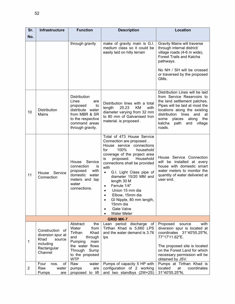
52
Sr.
No.
Infrastructure Function Description Location
through gravity make of gravity main is G.I. medium class so it could be easily laid on hilly terrain
Gravity Mains will traverse through internal district/ village roads (4-6 m wide), Forest Trails and Katcha pathways. No NH / SH will be crossed or traversed by the proposed GMs.
10 Distribution Mains
Distribution Lines are proposed to distribute water from MBR & SR to the respective command areas through gravity.
Distribution lines with a total length 25.23 KM with diameter varying from 32 mm to 80 mm of Galvanised Iron material. is proposed .
Distribution Lines will be laid from Service Reservoirs to the land settlement patches. Pipes will be laid at most the locations along the existing distribution lines and at some places along the katcha path and village roads.
11 House Service Connection
House Service connection is proposed with domestic water meters and tap water connections.
Total of 473 House Service Connection are proposed. . House service connections for 100% household coverage of the project area is proposed. Household connections shall be provided with G.I. Light Class pipe of
diameter 15/20 MM and length 30 M
Ferrule 1/4" Union 15 mm dia Elbow, 15mm dia GI Nipple, 80 mm length,
15mm dia Gate Valve Water Meter
House Service Connection will be installed at every house with domestic smart water meters to monitor the quantity of water delivered at user end.
GRID MK-7
1
Construction of diversion spur at Khad source including Rectangular Channel
Abstract the Water from Tirthan Khad and through Pumping main the water flows Through Sump to the proposed WTP
Lean period discharge of Tirthan Khad is 5,660 LPS and the water demand is 3.76 lps
Proposed source with diversion spur is located at coordinates 31°40'55.25"N, 77°17'11.62"E. The proposed site is located on the Forest Land for which necessary permission will be obtained by JSV.
2 Four nos. of Raw water Pumps are
Raw water pumps are proposed to lift
Pumps of capacity 5 HP with configuration of 2 working and two standbys (2W+2S)
Pumps at Tirthan Khad is located at coordinates 31°40'55.25"N,
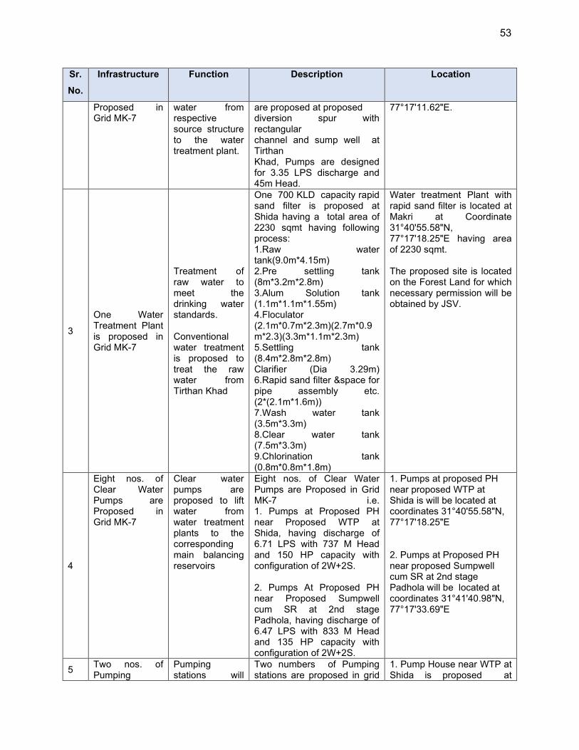
53
Sr.
No.
Infrastructure Function Description Location
Proposed in Grid MK-7
water from respective source structure to the water treatment plant.
are proposed at proposed diversion spur with rectangular channel and sump well at Tirthan Khad, Pumps are designed for 3.35 LPS discharge and 45m Head.
77°17'11.62"E.
3
One Water Treatment Plant is proposed in Grid MK-7
Treatment of raw water to meet the drinking water standards. Conventional water treatment is proposed to treat the raw water from Tirthan Khad
One 700 KLD capacity rapid sand filter is proposed at Shida having a total area of 2230 sqmt having following process: 1.Raw water tank(9.0m*4.15m) 2.Pre settling tank (8m*3.2m*2.8m) 3.Alum Solution tank (1.1m*1.1m*1.55m) 4.Floculator (2.1m*0.7m*2.3m)(2.7m*0.9m*2.3)(3.3m*1.1m*2.3m) 5.Settling tank (8.4m*2.8m*2.8m) Clarifier (Dia 3.29m) 6.Rapid sand filter &space for pipe assembly etc. (2*(2.1m*1.6m)) 7.Wash water tank (3.5m*3.3m) 8.Clear water tank (7.5m*3.3m) 9.Chlorination tank (0.8m*0.8m*1.8m)
Water treatment Plant with rapid sand filter is located at Makri at Coordinate 31°40'55.58"N, 77°17'18.25"E having area of 2230 sqmt. The proposed site is located on the Forest Land for which necessary permission will be obtained by JSV.
4
Eight nos. of Clear Water Pumps are Proposed in Grid MK-7
Clear water pumps are proposed to lift water from water treatment plants to the corresponding main balancing reservoirs
Eight nos. of Clear Water Pumps are Proposed in Grid MK-7 i.e. 1. Pumps at Proposed PH near Proposed WTP at Shida, having discharge of 6.71 LPS with 737 M Head and 150 HP capacity with configuration of 2W+2S. 2. Pumps At Proposed PH near Proposed Sumpwell cum SR at 2nd stage Padhola, having discharge of 6.47 LPS with 833 M Head and 135 HP capacity with configuration of 2W+2S.
1. Pumps at proposed PH near proposed WTP at Shida is will be located at coordinates 31°40'55.58"N, 77°17'18.25"E 2. Pumps at Proposed PH near proposed Sumpwell cum SR at 2nd stage Padhola will be located at coordinates 31°41'40.98"N, 77°17'33.69"E
5 Two nos. of Pumping
Pumping stations will
Two numbers of Pumping stations are proposed in grid
1. Pump House near WTP at Shida is proposed at
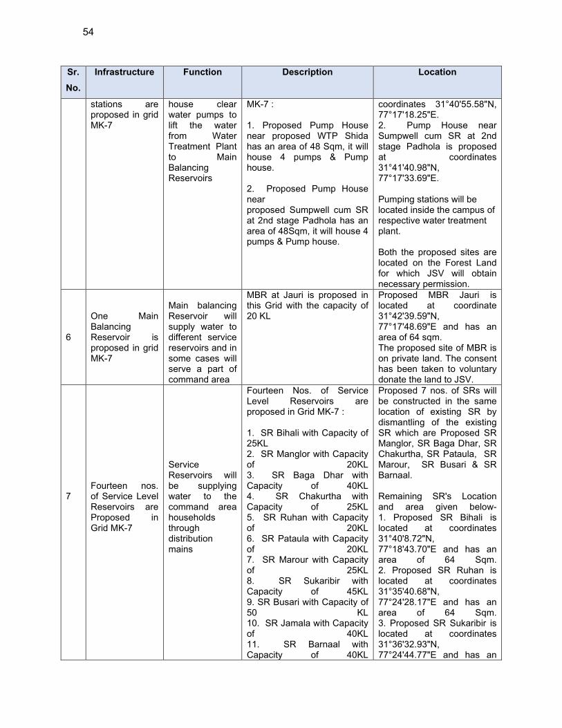
54
Sr.
No.
Infrastructure Function Description Location
stations are proposed in grid MK-7
house clear water pumps to lift the water from Water Treatment Plant to Main Balancing Reservoirs
MK-7 : 1. Proposed Pump House near proposed WTP Shida has an area of 48 Sqm, it will house 4 pumps & Pump house. 2. Proposed Pump House near proposed Sumpwell cum SR at 2nd stage Padhola has an area of 48Sqm, it will house 4 pumps & Pump house.
coordinates 31°40'55.58"N, 77°17'18.25"E. 2. Pump House near Sumpwell cum SR at 2nd stage Padhola is proposed at coordinates 31°41'40.98"N, 77°17'33.69"E. Pumping stations will be located inside the campus of respective water treatment plant. Both the proposed sites are located on the Forest Land for which JSV will obtain necessary permission.
6
One Main Balancing Reservoir is proposed in grid MK-7
Main balancing Reservoir will supply water to different service reservoirs and in some cases will serve a part of command area
MBR at Jauri is proposed in this Grid with the capacity of 20 KL
Proposed MBR Jauri is located at coordinate 31°42'39.59"N, 77°17'48.69"E and has an area of 64 sqm. The proposed site of MBR is on private land. The consent has been taken to voluntary donate the land to JSV.
7
Fourteen nos. of Service Level Reservoirs are Proposed in Grid MK-7
Service Reservoirs will be supplying water to the command area households through distribution mains
Fourteen Nos. of Service Level Reservoirs are proposed in Grid MK-7 : 1. SR Bihali with Capacity of 25KL 2. SR Manglor with Capacity of 20KL 3. SR Baga Dhar with Capacity of 40KL 4. SR Chakurtha with Capacity of 25KL 5. SR Ruhan with Capacity of 20KL 6. SR Pataula with Capacity of 20KL 7. SR Marour with Capacity of 25KL 8. SR Sukaribir with Capacity of 45KL 9. SR Busari with Capacity of 50 KL 10. SR Jamala with Capacity of 40KL 11. SR Barnaal with Capacity of 40KL
Proposed 7 nos. of SRs will be constructed in the same location of existing SR by dismantling of the existing SR which are Proposed SR Manglor, SR Baga Dhar, SR Chakurtha, SR Pataula, SR Marour, SR Busari & SR Barnaal. Remaining SR's Location and area given below- 1. Proposed SR Bihali is located at coordinates 31°40'8.72"N, 77°18'43.70"E and has an area of 64 Sqm. 2. Proposed SR Ruhan is located at coordinates 31°35'40.68"N, 77°24'28.17"E and has an area of 64 Sqm. 3. Proposed SR Sukaribir is located at coordinates 31°36'32.93"N, 77°24'44.77"E and has an

55
Sr.
No.
Infrastructure Function Description Location
12. SR Pattan with Capacity of 25KL 13. Sumpwell cum SR at 2nd stage Padhola with Capacity of 110KL
area of 81 Sqm. 4. Proposed SR Jamala is located at coordinates 31°42'49.96"N, 77°16'36.93"E and has an area of 81 Sqm. 5. Proposed SR Pattan is located at coordinates 31°39'53.95"N, 77°18'25.22"E and has an area of 64 Sqm. 6. Proposed Sumpwell cum SR at 2nd stage Padhola is located at coordinates 31°41'40.98"N, 77°17'33.69"E and has an area of 100 Sqm. SR Jamala, SR Busari, SR Pattan & SR Barnaal are located on the Forest Land for which necessary permission will be obtained by JSV. The remaining SRs are located on private lands and consent has been taken to voluntary donate the land to JSV.
8 Rising mains
The proposed rising mains or raw water pumping mains are used to either lift the bulk water from source / intakes to WTPs / sump wells or proposed to lift the water form source/ WTP to the respective main balancing reservoirs
Rising mains with a total length of 4.62 km and the proposed diameter varying from 100 mm to 125 mm in Grid MK-7 The make of rising main is MSERW so it could be easily laid on hilly terrain
Details of Proposed Rising Mains RM-1: From proposed Source on Tirthan Khad to WTP Shida. The RM will traverse through katch pathways.. RM-2: From WTP/ PH to Sumpwell cum SR at Padhola through forest trails and katcha pathways. RM-3: From WTP/ PH to Sumpwell cum SR at Padhola to MBR Jauri through forest trails and katcha pathways. No NH/ SH will be crossed or traversed by the proposed RMs.
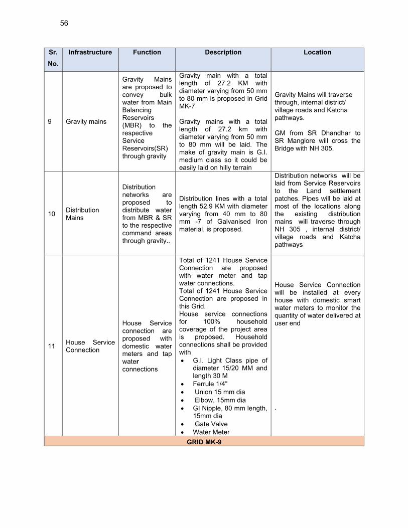
56
Sr.
No.
Infrastructure Function Description Location
9 Gravity mains
Gravity Mains are proposed to convey bulk water from Main Balancing Reservoirs (MBR) to the respective Service Reservoirs(SR) through gravity
Gravity main with a total length of 27.2 KM with diameter varying from 50 mm to 80 mm is proposed in Grid MK-7 Gravity mains with a total length of 27.2 km with diameter varying from 50 mm to 80 mm will be laid. The make of gravity main is G.I. medium class so it could be easily laid on hilly terrain
Gravity Mains will traverse through, internal district/ village roads and Katcha pathways. GM from SR Dhandhar to SR Manglore will cross the Bridge with NH 305.
10 Distribution Mains
Distribution networks are proposed to distribute water from MBR & SR to the respective command areas through gravity..
Distribution lines with a total length 52.9 KM with diameter varying from 40 mm to 80 mm -7 of Galvanised Iron material. is proposed.
Distribution networks will be laid from Service Reservoirs to the Land settlement patches. Pipes will be laid at most of the locations along the existing distribution mains will traverse through NH 305 , internal district/ village roads and Katcha pathways
11 House Service Connection
House Service connection are proposed with domestic water meters and tap water connections
Total of 1241 House Service Connection are proposed with water meter and tap water connections. Total of 1241 House Service Connection are proposed in this Grid. House service connections for 100% household coverage of the project area is proposed. Household connections shall be provided with G.I. Light Class pipe of
diameter 15/20 MM and length 30 M
Ferrule 1/4" Union 15 mm dia Elbow, 15mm dia GI Nipple, 80 mm length,
15mm dia Gate Valve Water Meter
House Service Connection will be installed at every house with domestic smart water meters to monitor the quantity of water delivered at user end .
GRID MK-9
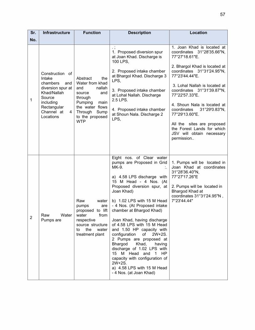
57
Sr.
No.
Infrastructure Function Description Location
1
Construction of Intake chambers and diversion spur at Khad/Nallah Source including Rectangular Channel at 4 Locations
Abstract the Water from khad and nallah source and through Pumping main the water flows Through Sump to the proposed WTP
. ; 1. Proposed diversion spur at Joan Khad. Discharge is 100 LPS, 2. Proposed intake chamber at Bhargol Khad. Discharge 3 LPS, 3. Proposed intake chamber at Lohal Nallah. Discharge 2.5 LPS. 4. Proposed intake chamber at Shoun Nala. Discharge 2 LPS,
1. Joan Khad is located at coordinates 31°28'35.66"N, 77°27'18.61"E. 2. Bhargol Khad is located at coordinates 31°31'24.95"N, 77°23'44.44"E. 3. Lohal Nallah is located at coordinates 31°31'39.87"N, 77°22'57.33"E. 4. Shoun Nala is located at coordinates 31°29'0.83"N, 77°29'13.60"E. All the sites are proposed the Forest Lands for which JSV will obtain necessary permission..
2 Raw Water Pumps are
Raw water pumps are proposed to lift water from respective source structure to the water treatment plant
Eight nos. of Clear water pumps are Proposed in Grid MK-9. :. a) 4.58 LPS discharge with 15 M Head - 4 Nos. (At Proposed diversion spur, at Joan Khad) b) 1.02 LPS with 15 M Head - 4 Nos. (At Proposed intake chamber at Bhargod Khad) Joan Khad, having discharge of 4.58 LPS with 15 M Head and 1.50 HP capacity with configuration of 2W+2S. 2 Pumps are proposed at Bhargod Khad, having discharge of 1.02 LPS with 15 M Head and 1 HP capacity with configuration of 2W+2S. a) 4.58 LPS with 15 M Head - 4 Nos. (at Joan Khad)
1. Pumps will be located in Joan Khad at coordinates 31°28'36.40"N, 77°27'17.26"E 2. Pumps will be located in Bhargod Khad at coordinates 31°31'24.95"N , 7°23'44.44"

58
Sr.
No.
Infrastructure Function Description Location
3 Water Treatment Plants
Treatment of raw water to meet the drinking water standards. Conventional water treatment is proposed to treat the raw water
Water treatment plant of capacity 0.90 MLD is proposed at Joan Khad and 0.20 MLD at Bhargol Khad to treat the water in required standards by considering 16 hours operation of both WTPs 1. Area required for WTP at Joan Khad is 2670 sqmt with following components :
Raw water tank(10m*4.45m)
▪ Pre settling tank (8.75m*3.5m*2.8m)
▪ Alum Solution tank (1.1m*1.1m*1.55m)
▪ Floculator (2.4m*0.8m*2.3m)(3.3m*1.1m*2.3)(3.9m*1.3m*2.3m)
▪ Settling tank (10.5m*3.5m*2.8m) Clarifier (Dia 4.0m)
▪ Rapid sand filter &space for pipe assembly etc. (2*(2.5m*1.8m))
▪ Wash water tank (4.0m*3.3m)
▪ Clear water tank (2.0m*3.3m)
▪ Chlorination tank (1.0m*1.0m*1.8m)
Water treatment Plant is proposed at Joan khad at Coordinate 31°28'36.40"N, 77°27'17.26"E with an area of 2670 sqmt.
The proposed site is located on the Forest Land for which necessary permission will be obtained by JSV .
Area required for Bhargod khad is 870 sqmt having following components : 1.Raw water tank(5m*4.45m) 2.Pre settling tank (4.5m*1.8m*2.8m) 3.Alum Solution tank (1.1m*1.1m*1.55m)
Water treatment Plant proposed at Bhargol Khad at Coordinate 31°31'24.54"N 77°23'45.01"E having an area of 870 sqmt. The proposed site is located on the Forest Land for which
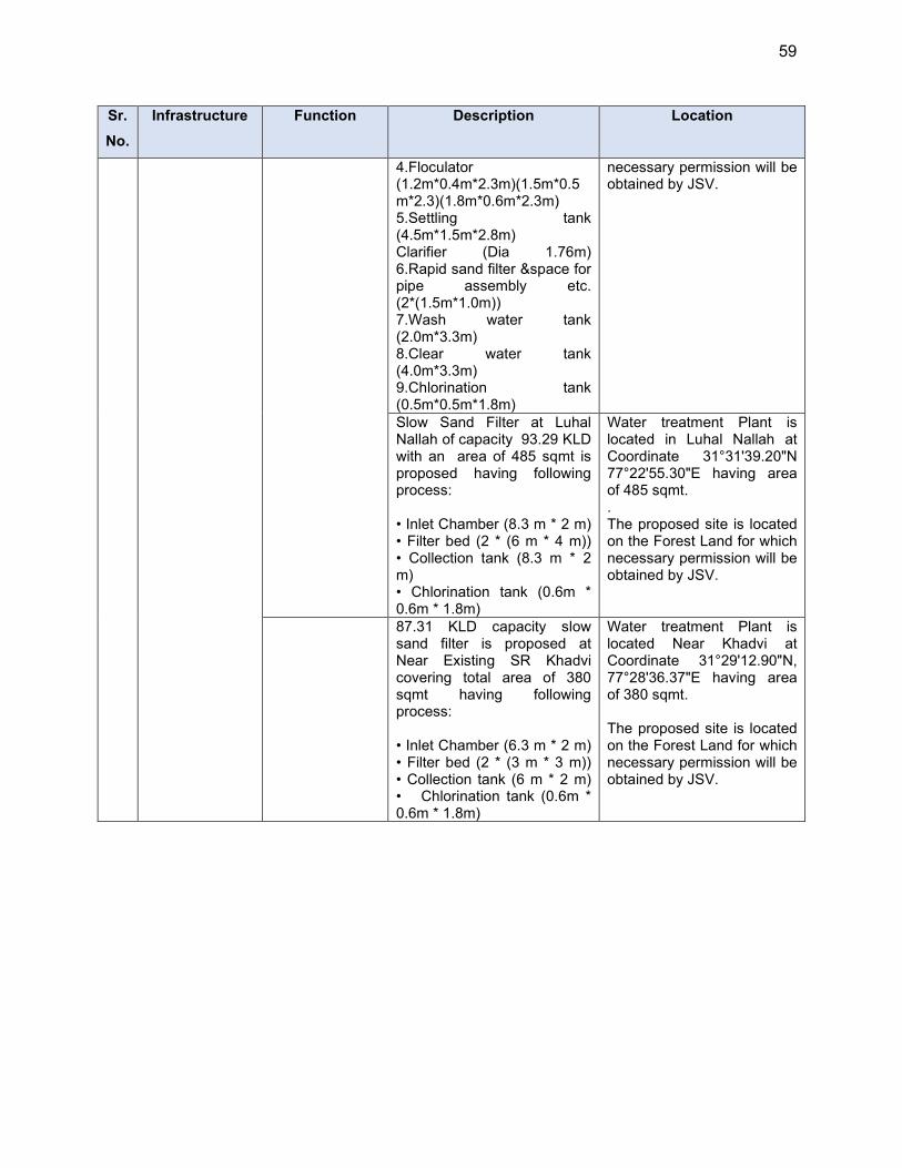
59
Sr.
No.
Infrastructure Function Description Location
4.Floculator (1.2m*0.4m*2.3m)(1.5m*0.5m*2.3)(1.8m*0.6m*2.3m) 5.Settling tank (4.5m*1.5m*2.8m) Clarifier (Dia 1.76m) 6.Rapid sand filter &space for pipe assembly etc. (2*(1.5m*1.0m)) 7.Wash water tank (2.0m*3.3m) 8.Clear water tank (4.0m*3.3m) 9.Chlorination tank (0.5m*0.5m*1.8m)
necessary permission will be obtained by JSV.
Slow Sand Filter at Luhal Nallah of capacity 93.29 KLD with an area of 485 sqmt is proposed having following process: • Inlet Chamber (8.3 m * 2 m) • Filter bed (2 * (6 m * 4 m)) • Collection tank (8.3 m * 2 m) • Chlorination tank (0.6m * 0.6m * 1.8m)
Water treatment Plant is located in Luhal Nallah at Coordinate 31°31'39.20"N 77°22'55.30"E having area of 485 sqmt. . The proposed site is located on the Forest Land for which necessary permission will be obtained by JSV.
87.31 KLD capacity slow sand filter is proposed at Near Existing SR Khadvi covering total area of 380 sqmt having following process: • Inlet Chamber (6.3 m * 2 m) • Filter bed (2 * (3 m * 3 m)) • Collection tank (6 m * 2 m) • Chlorination tank (0.6m * 0.6m * 1.8m)
Water treatment Plant is located Near Khadvi at Coordinate 31°29'12.90"N, 77°28'36.37"E having area of 380 sqmt. The proposed site is located on the Forest Land for which necessary permission will be obtained by JSV.
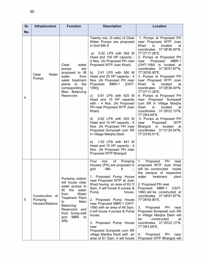
60
Sr.
No.
Infrastructure Function Description Location
4
Clear Water Pumps
Clear water pumps are proposed to lift water from water treatment plants to the corresponding Main Balancing Reservoirs
Twenty nos. (5 sets) of Clear Water Pumps are proposed in Grid MK-9 a) 5.02 LPS with 594 M Head and 100 HP capacity - 4 Nos. (At Proposed PH near Proposed WTP Joan Khad) b) 2.61 LPS with 360 M Head and 25 HP capacity - 4 Nos. (At Proposed PH near Proposed MBR-1 (OHT-10M)) c) 0.81 LPS with 625 M Head and 15 HP capacity with - 4 Nos. (At Proposed PH near Proposed WTP Joan Khad) d) 0.62 LPS with 625 M Head and 10 HP capacity - 4 Nos. (At Proposed PH near Proposed Sumpwell cum SR in Village Manjha Desh e) 1.02 LPS with 441 M Head and 15 HP capacity - 4 Nos. (At Proposed PH near Proposed WTP Bhargod
1. Pumps at Proposed PH near Proposed WTP Joan Khad is located at coordinates 31°28'36.40"N, 77°27'17.26"E. 2. Pumps at Proposed PH near Proposed MBR-1 (OHT-10M) is located at coordinates 31°28'57.87"N, 77°26'50.85"E. 3. Pumps at Proposed PH near Proposed WTP Joan Khad is located at coordinates 31°28'36.40"N, 77°27'17.26"E. 4. Pumps at Proposed PH near Proposed Sumpwell cum SR in Village Manjha Desh is located at coordinates 31°28'22.13"N, 77°28'4.69"E. 5. Pumps at Proposed PH near Proposed WTP Bhargod is located at coordinates 31°31'24.54"N, 77°23'45.01"E.
5 Construction of Pumping Houses/Stations
Pumping station will house clear water pumps to lift the water from Water Treatment Plant to Main Balancing Reservoirs and from Sump-well and MBR to SRs
Four nos. of Pumping Houses (PH) are proposed in grid MK- 9 :. 1. Proposed Pump House near Proposed WTP at Joan Khad having an area of 63.1f Sqm, it will house 8 pumps & Pump house. 2. Proposed Pump House near Proposed MBR-1 (OHT-10M) with an area of 48 Sqm, it will house 4 pumps & Pump house. 3. Proposed Pump House near Proposed Sumpwell cum SR village Manjha Desh with an area of 81 Sqm, it will house
1. Proposed PH near proposed WTP Joan Khad will be constructed inside the campus of respective water treatment plant 2. Proposed PH near Proposed MBR-1 (OHT-10M) will be constructed at coordinates 31°28'57.87"N, 77°26'50.85"E. 3. Proposed PH near Proposed Sumpwell cum SR in Village Manjha Desh will be constructed at coordinates 31°28'22.13"N, 77°28'4.69"E. 4. Proposed PH near Proposed WTP Bhargod will
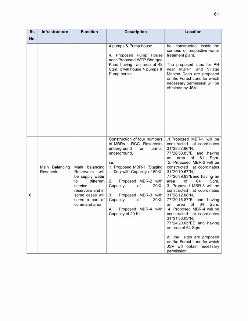
61
Sr.
No.
Infrastructure Function Description Location
4 pumps & Pump house. 4. Proposed Pump House near Proposed WTP Bhargod Khad having an area of 48 Sqm, it will house 4 pumps & Pump house.
be constructed inside the campus of respective water treatment plant. The proposed sites for PH near MBR-1 and Village Manjha Desh are proposed on the Forest Land for which necessary permission will be obtained by JSV
6
Main Balancing Reservoir
Main balancing Reservoirs will be supply water to different service reservoirs and in some cases will serve a part of command area
Construction of four numbers of MBRs : RCC Reservoirs underground or partial underground,
i.e. 1. Proposed MBR-1 (Staging - 10m) with Capacity of 60KL 2. Proposed MBR-2 with Capacity of 20KL 3. Proposed MBR-3 with Capacity of 20KL 4. Proposed MBR-4 with Capacity of 20 KL
.1.Proposed MBR-1 will be constructed at coordinates 31°28'57.96"N, 77°26'50.83"E and having an area of 81 Sqm. 2. Proposed MBR-2 will be constructed at coordinates 31°29'19.67"N, 77°26'39.93"Eand having an area of 64 Sqm. 3. Proposed MBR-3 will be constructed at coordinates 31°28'12.08"N, 77°29'16.87"E and having an area of 64 Sqm. 4. Proposed MBR-4 will be constructed at coordinates 31°31'30.03"N, 77°24'20.65"EE and having an area of 64 Sqm. All the sites are proposed on the Forest Land for which JSV will obtain necessary permission..
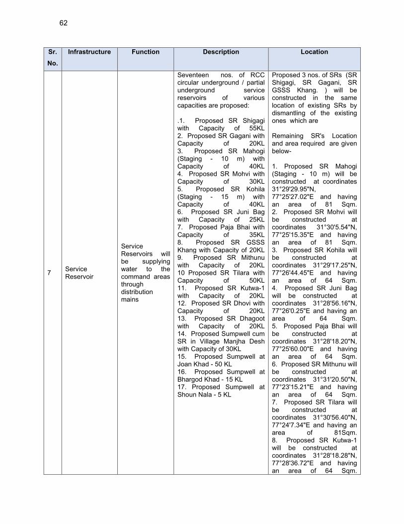
62
Sr.
No.
Infrastructure Function Description Location
7 Service Reservoir
Service Reservoirs will be supplying water to the command areas through distribution mains
Seventeen nos. of RCC circular underground / partial underground service reservoirs of various capacities are proposed: .1. Proposed SR Shigagi with Capacity of 55KL 2. Proposed SR Gagani with Capacity of 20KL 3. Proposed SR Mahogi (Staging - 10 m) with Capacity of 40KL 4. Proposed SR Mohvi with Capacity of 30KL 5. Proposed SR Kohila (Staging - 15 m) with Capacity of 40KL 6. Proposed SR Juni Bag with Capacity of 25KL 7. Proposed Paja Bhai with Capacity of 35KL 8. Proposed SR GSSS Khang with Capacity of 20KL 9. Proposed SR Mithunu with Capacity of 20KL 10 Proposed SR Tilara with Capacity of 50KL 11. Proposed SR Kutwa-1 with Capacity of 20KL 12. Proposed SR Dhovi with Capacity of 20KL 13. Proposed SR Dhagoot with Capacity of 20KL 14. Proposed Sumpwell cum SR in Village Manjha Desh with Capacity of 30KL 15. Proposed Sumpwell at Joan Khad - 50 KL 16. Proposed Sumpwell at Bhargod Khad - 15 KL 17. Proposed Sumpwell at Shoun Nala - 5 KL
Proposed 3 nos. of SRs (SR Shigagi, SR Gagani, SR GSSS Khang. ) will be constructed in the same location of existing SRs by dismantling of the existing ones which are Remaining SR's Location and area required are given below- 1. Proposed SR Mahogi (Staging - 10 m) will be constructed at coordinates 31°29'29.95"N, 77°25'27.02"E and having an area of 81 Sqm. 2. Proposed SR Mohvi will be constructed at coordinates 31°30'5.54"N, 77°25'15.35"E and having an area of 81 Sqm. 3. Proposed SR Kohila will be constructed at coordinates 31°29'17.25"N, 77°26'44.45"E and having an area of 64 Sqm. 4. Proposed SR Juni Bag will be constructed at coordinates 31°28'56.16"N, 77°26'0.25"E and having an area of 64 Sqm. 5. Proposed Paja Bhai will be constructed at coordinates 31°28'18.20"N, 77°25'60.00"E and having an area of 64 Sqm. 6. Proposed SR Mithunu will be constructed at coordinates 31°31'20.50"N, 77°23'15.21"E and having an area of 64 Sqm. 7. Proposed SR Tilara will be constructed at coordinates 31°30'56.40"N, 77°24'7.34"E and having an area of 81Sqm. 8. Proposed SR Kutwa-1 will be constructed at coordinates 31°28'18.28"N, 77°28'36.72"E and having an area of 64 Sqm.

63
Sr.
No.
Infrastructure Function Description Location
9. Proposed SR Dhovi will be constructed at coordinates 31°27'39.43"N, 77°28'55.56"E and having an area of 64 Sqm. 10. Proposed SR Dhagoot will be constructed at coordinates 31°27'46.99"N, 77°28'30.79"E and having an area of 64 Sqm. 11. Proposed Sumpwell cum SR in Village Manjha Desh will be constructed at coordinates 31°28'22.13"N, 77°28'4.69"E and having an area of 64 Sqm. The proposed sites are located on the Forest Land for which JSV will obtain necessary permission.
8 Rising mains
The proposed rising mains or raw water pumping mains are used to either lift the bulk water from source / intakes to WTPs / sump wells or proposed to lift the water form Source / WTP to the respective main balancing reservoirs
Rising mains with a total length of 8.72 km with diameter varying from 50 mm to 125 mm proposed in Grid MK-9. The make of rising main is MSERW so it could be easily laid on hilly terrain.
Rising main will be laid from source to WTP and from Water treatment Plants to Main Balancing Reservoirs. Pipe will be laid at of most the locations along the existing rising mains RM-1: From proposed Source on Joan Khad to WTP Joan Khad. The RM will traverse through Forest Trails. RM-2: From WTP/ PH to MBR-1 through forest trails, Village road and katcha pathways. RM-3: From MBR-1 to MBR-2 through forest trails and katcha pathways. RM-4: From WTP/ PH to Sump well cum SR in village Manjha desh through forest trails, and katcha pathways. RM-5: From Sump well cum SR in village Manjha desh to MBR-3 through forest trails, and katcha pathways.
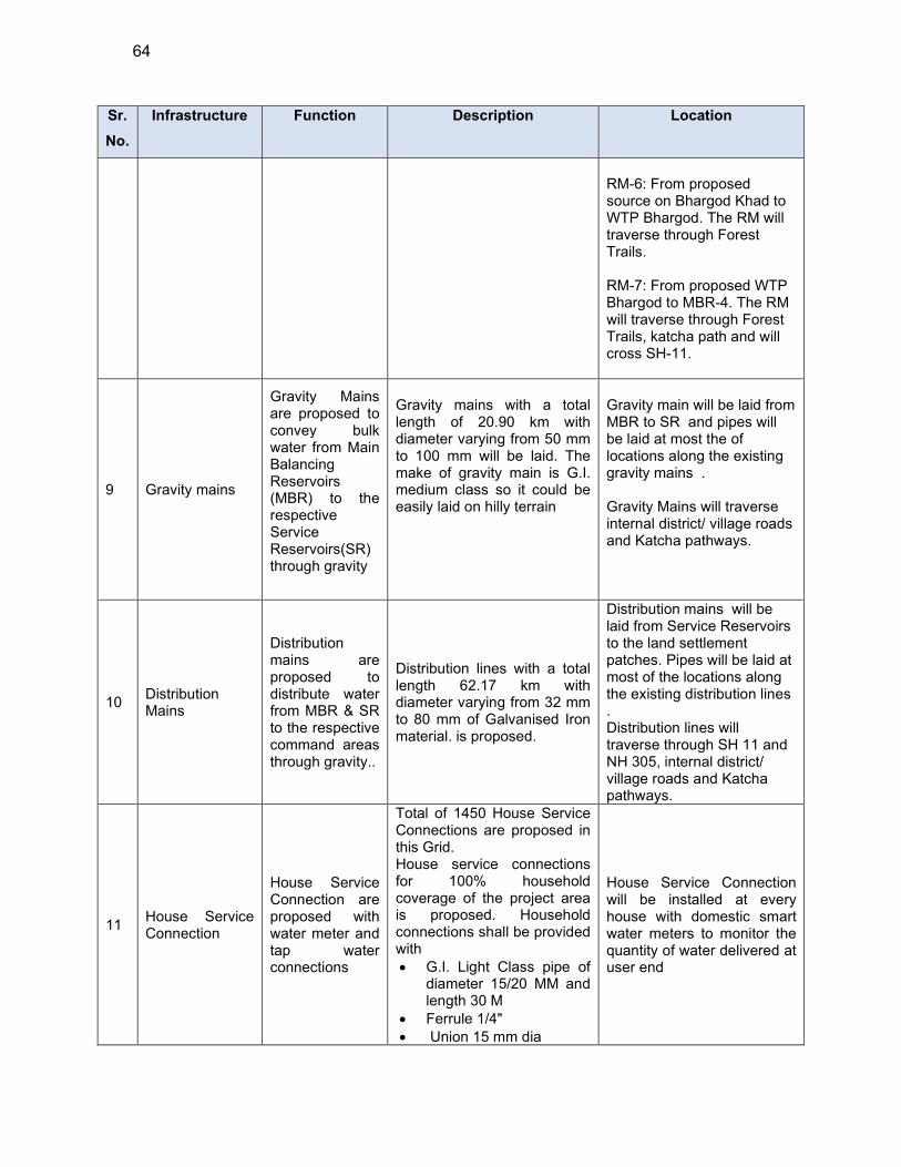
64
Sr.
No.
Infrastructure Function Description Location
RM-6: From proposed source on Bhargod Khad to WTP Bhargod. The RM will traverse through Forest Trails. RM-7: From proposed WTP Bhargod to MBR-4. The RM will traverse through Forest Trails, katcha path and will cross SH-11.
9 Gravity mains
Gravity Mains are proposed to convey bulk water from Main Balancing Reservoirs (MBR) to the respective Service Reservoirs(SR) through gravity
Gravity mains with a total length of 20.90 km with diameter varying from 50 mm to 100 mm will be laid. The make of gravity main is G.I. medium class so it could be easily laid on hilly terrain
Gravity main will be laid from MBR to SR and pipes will be laid at most the of locations along the existing gravity mains . Gravity Mains will traverse internal district/ village roads and Katcha pathways.
10 Distribution Mains
Distribution mains are proposed to distribute water from MBR & SR to the respective command areas through gravity..
Distribution lines with a total length 62.17 km with diameter varying from 32 mm to 80 mm of Galvanised Iron material. is proposed.
Distribution mains will be laid from Service Reservoirs to the land settlement patches. Pipes will be laid at most of the locations along the existing distribution lines . Distribution lines will traverse through SH 11 and NH 305, internal district/ village roads and Katcha pathways.
11 House Service Connection
House Service Connection are proposed with water meter and tap water connections
Total of 1450 House Service Connections are proposed in this Grid. House service connections for 100% household coverage of the project area is proposed. Household connections shall be provided with G.I. Light Class pipe of
diameter 15/20 MM and length 30 M
Ferrule 1/4" Union 15 mm dia
House Service Connection will be installed at every house with domestic smart water meters to monitor the quantity of water delivered at user end
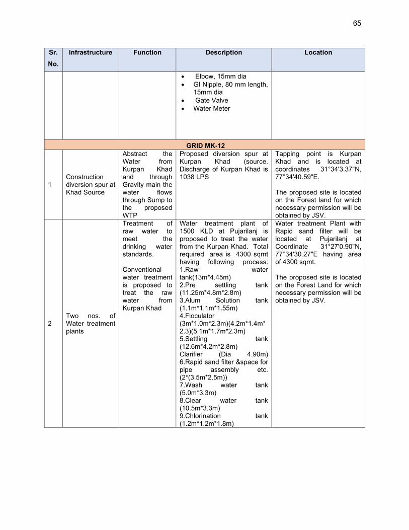
65
Sr.
No.
Infrastructure Function Description Location
Elbow, 15mm dia GI Nipple, 80 mm length,
15mm dia Gate Valve Water Meter
GRID MK-12
1 Construction diversion spur at Khad Source
Abstract the Water from Kurpan Khad and through Gravity main the water flows through Sump to the proposed WTP
Proposed diversion spur at Kurpan Khad (source. Discharge of Kurpan Khad is 1038 LPS
Tapping point is Kurpan Khad and is located at coordinates 31°34'3.37"N, 77°34'40.59"E. The proposed site is located on the Forest land for which necessary permission will be obtained by JSV.
2 Two nos. of Water treatment plants
Treatment of raw water to meet the drinking water standards. Conventional water treatment is proposed to treat the raw water from Kurpan Khad
Water treatment plant of 1500 KLD at Pujarilanj is proposed to treat the water from the Kurpan Khad. Total required area is 4300 sqmt having following process: 1.Raw water tank(13m*4.45m) 2.Pre settling tank (11.25m*4.8m*2.8m) 3.Alum Solution tank (1.1m*1.1m*1.55m) 4.Floculator (3m*1.0m*2.3m)(4.2m*1.4m*2.3)(5.1m*1.7m*2.3m) 5.Settling tank (12.6m*4.2m*2.8m) Clarifier (Dia 4.90m) 6.Rapid sand filter &space for pipe assembly etc. (2*(3.5m*2.5m)) 7.Wash water tank (5.0m*3.3m) 8.Clear water tank (10.5m*3.3m) 9.Chlorination tank (1.2m*1.2m*1.8m)
Water treatment Plant with Rapid sand filter will be located at Pujarilanj at Coordinate 31°27'0.90"N, 77°34'30.27"E having area of 4300 sqmt. The proposed site is located on the Forest Land for which necessary permission will be obtained by JSV.

66
Sr.
No.
Infrastructure Function Description Location
Treatment of raw water to meet the drinking water standards. Conventional water treatment is proposed to treat the raw water from Patgai Spring
Another 76.76 KLD capacity slow sand filter is proposed at Siswaser having a total area of 485 sqmt with following components : • Inlet Chamber (8.3 m * 2 m) • Filter bed (2 * (5 m * 4 m)) •Collection tank (8.3 m * 2 m) •Chlorination tank(0.6m * 0.6m * 1.8m
Water treatment Plant with Slow sand filter will be located at Siswaser at Coordinate 31°27'41.69"N 77°38'59.13"E having area of 485 sqmt. The proposed site is located on the Forest Land for which necessary permission will be obtained by JSV.
3 Two nos of Main Balancing Reservoirs
Main balancing Reservoir will be supply water to different service reservoirs and in some cases will serve a part of command area
Two Nos. of Main Balancing Reservoir is Proposed in Grid MK-12 : . 1. Proposed MBR at Pujarilanj with capacity of 50 KL 2. Proposed MBR at Mokutu with capacity of 20 KL
Proposed MBR at Pujarilanj will be located at coordinates 31°27'0.90"N, 77°34'30.28"E having an area of 81 Sqm Proposed MBR at Mokutu will be located at coordinates 31°27'7.47"N, 77°33'53.69"E having an area of 64 Sqm. The MBR sites are proposed on the Forest Land for which necessary permission will be obtained by JSV. .
4
Twelve nos. of Service Reservoir is Proposed in Grid MK-12
Service Reservoirs will be supplying water to the command area through distribution mains
Twelve nos. of Service Reservoirs are proposed in Grid MK-12 : . 1. Proposed SR Nirmand with capacity of 30KL 2. Proposed SR Sarkoti with capacity of 235KL 3. Proposed SR Shishvi with capacity of 30KL 4. Proposed SR Shanu with capacity of 20KL 5. Proposed SR Marehri with capacity of 45KL 6. Proposed SR Remu with capacity of 35KL 7. Proposed SR Kedas with capacity of 20KL 8. Proposed SR Bail with capacity of 45KL
Proposed 3 nos. of SRs (SR Bail, SR Chhotu, SR Koil) will be constructed in the same location of existing SRs by dismantling of the existing ones
Remaining SR's location and area are given below 1 Proposed SR Nirmand will be constructed at coordinates 31°26'11.28"N, 77°34'17.78"E and having an area of 81 Sqm. 2. Proposed SR Sarkoti will be constructed at coordinates 31°25'40.29"N, 77°34'41.85"E and having an area of 161 Sqm.
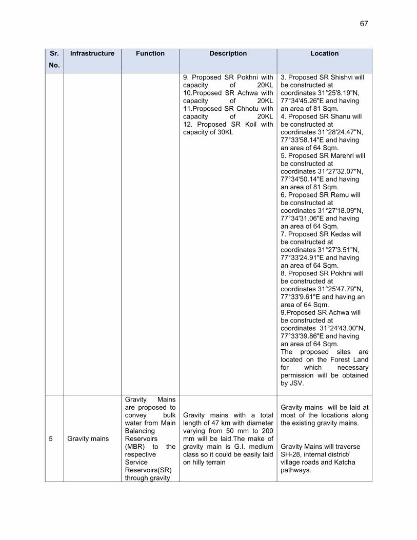
67
Sr.
No.
Infrastructure Function Description Location
9. Proposed SR Pokhni with capacity of 20KL 10.Proposed SR Achwa with capacity of 20KL 11.Proposed SR Chhotu with capacity of 20KL 12. Proposed SR Koil with capacity of 30KL
3. Proposed SR Shishvi will be constructed at coordinates 31°25'8.19"N, 77°34'45.26"E and having an area of 81 Sqm. 4. Proposed SR Shanu will be constructed at coordinates 31°28'24.47"N, 77°33'58.14"E and having an area of 64 Sqm. 5. Proposed SR Marehri will be constructed at coordinates 31°27'32.07"N, 77°34'50.14"E and having an area of 81 Sqm. 6. Proposed SR Remu will be constructed at coordinates 31°27'18.09"N, 77°34'31.06"E and having an area of 64 Sqm. 7. Proposed SR Kedas will be constructed at coordinates 31°27'3.51"N, 77°33'24.91"E and having an area of 64 Sqm. 8. Proposed SR Pokhni will be constructed at coordinates 31°25'47.79"N, 77°33'9.61"E and having an area of 64 Sqm. 9.Proposed SR Achwa will be constructed at coordinates 31°24'43.00"N, 77°33'39.86"E and having an area of 64 Sqm. The proposed sites are located on the Forest Land for which necessary permission will be obtained by JSV.
5 Gravity mains
Gravity Mains are proposed to convey bulk water from Main Balancing Reservoirs (MBR) to the respective Service Reservoirs(SR) through gravity
Gravity mains with a total length of 47 km with diameter varying from 50 mm to 200 mm will be laid.The make of gravity main is G.I. medium class so it could be easily laid on hilly terrain
Gravity mains will be laid at most of the locations along the existing gravity mains. Gravity Mains will traverse SH-28, internal district/ village roads and Katcha pathways.
68
Sr.
No.
Infrastructure Function Description Location
6 Distribution Mains
Distribution mains are proposed to distribute water from MBR & SR to the respective command areas through gravity.
Distribution lines with a total length 53.2 km with diameter varying from 32 mm to 80 mm of Galvanised Iron material. is proposed in Grid MK-12
Distribution Lines will be laid from Service Reservoirs to the Land settlement patches. Pipes will be laid at most the locations along the existing distribution lines and at some places along the katcha path and village roads.
7 House Service Connections
House Service Connections are proposed with water meter and tap water connections.
Total of 1854 House Service Connections are proposed in this Grid. House service connections for 100% household coverage of the project area is proposed. Household connections shall be provided with G.I. Light Class pipe of
diameter 15/20 MM and length 30 M
Ferrule 1/4" Union 15 mm dia Elbow, 15mm dia GI Nipple, 80 mm length,
15mm dia Gate Valve Water Meter
House Service Connection will be installed at every house with domestic smart water meters to monitor the quantity of water delivered at user end .
E. Project Benefits
78. The citizens of MZ 01, coverage area will be the major beneficiaries of the improved water supply system. The subproject is primarily designed to improve environmental quality and living conditions of service area through provision of water supply. The subproject aims to achieve safe and sustainable water services both in terms of services to customers and conservation of precious water resources The benefits arising from this subproject include: (i) increased availability of potable water at appropriate pressure to all households including rural poor; population (ii) reduced time and costs in accessing alternative sources of water. (iii) better public health particularly reduction in waterborne and infectious diseases; (iv) reduced risk of groundwater contamination; (v) reduced risk of contamination of treated water supplies. The successful implementation of the water supply project will result in better control over the NRW management, improved monitoring system and overall demand management along with energy reduction.
F. Energy Efficiency Measures included in the subproject
79. The water supply project is designed with utmost consideration to energy efficiency. Gravity flow systems adopted, wherever feasible. In water supply system, water losses (UFW) are usually very high, reducing the losses and improving the efficiency of the system is identified as the most important component under HPRWSP.
69
80. To make the project energy efficient, as part of this project, energy efficiency measures are required to be included in the design of the projects. Accordingly, energy efficiency measures are being considered and incorporated into the subproject designs where appropriate. Energy efficient, high-performance motors and transformers shall be provided for optimum utilization of energy during construction and operation of the project. 81. Component of luminaries shall be ‘energy efficient low loss’ type. Low power consuming CFL (Compact Fluorescent Lamp) /LED (Light-emitting Diode) type of luminaries shall be used for office/ all indoor areas except pump house area. HPSV or HPMV luminaries shall be used for pump house area and other outdoor areas. Street/ area lighting shall be of LED type and controlled by time switch/ photocell for automatic switching of luminaries. Solar type streetlights shall be installed where feasible in the project. Specification of solar lighting shall be as per Ministry of New and Renewable Energy. Fixtures shall be energy efficient and ballast shall be electronic low loss type. 82. Instrumentation To bring the efficiency in system, automation is proposed at Source, WTP, Pump House, MBR and SRs. The automation will be monitoring the real time quality and quantity of water supplied and will reduce the manual intervention in the operation of the supply schemes. The details of proposed component at each stage are furnished as under:
(i) At Source
Pressure Transmitter to link the automatic start and stop of pumps with respect to pressure built in the rising main on the closing of actuator valves at the inlet of Raw water tank.
Electronic flow meter to measure the discharge. Ultrasonic Level Transmitter to measure the water level.
(ii) Water Treatment Plant
Level sensor, actuator valve and Electronic flow meter to measure the real time discharge and control the out flow in Raw Water Collection tank / Sump well.
Online Water Analyser. Vacuum Gaseous Chlorination System for disinfection. Loss of Head/Differential Pressure Transmitter (DPT) at Filter bed
(iii) At Pump House
Pressure Transmitter to link the automatic start and stop of pumps with respect to pressure built in the rising main on the closing of actuator valves at the inlet of MBRs.
Desktop with operating system for supervision and collation of data. Electrical Panel. Motor actuated sluice valves.
(iv) At Main Balancing Reservoirs
Level sensor, actuator valve and Electronic flow meter to measure the real time discharge and control the out flow in respective Main Balancing Reservoirs.
70
Solar panels for campus lightning and automation components.
(v) At Service Level Reservoirs
Level sensor, actuator valve and Electronic flow meter to measure the real time discharge and control the inflow.
Solar panels for campus lightning and automation components.
83. Supply of power at the WTP and Pump house campus will be provided by the Himachal Pradesh State Electricity board and further correspondence on this will be taken ahead by IPH.
G. Implementation Schedule
84. After the completion feasibility study /preliminary designs, bids will be invited in December 2021 for the subprojects to be implemented under the DBO (design-build-operate) modality. Bids will be awarded in March 2022. Successful bidder then will carry out detailed designs and construction is will take about 24 months after the award of works. After completion of construction and commissioning, scheme will be operated by DBO contractor for 5 years, and after which the operation and maintenance will be carried out by JSV.
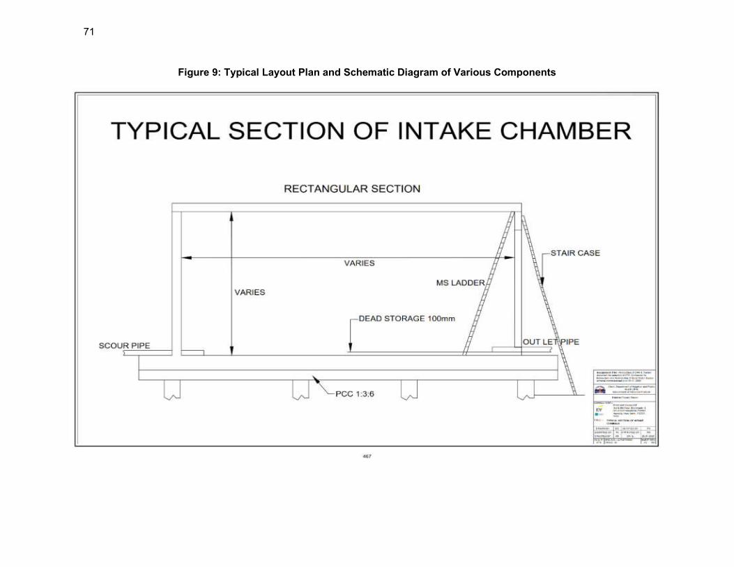
71
Figure 9: Typical Layout Plan and Schematic Diagram of Various Components
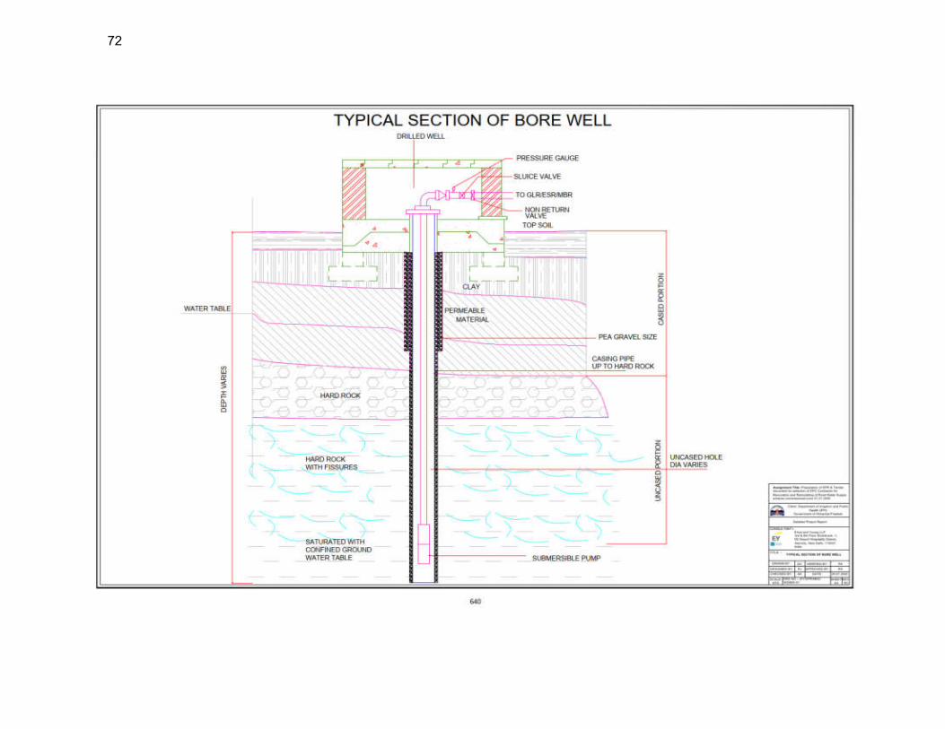
72
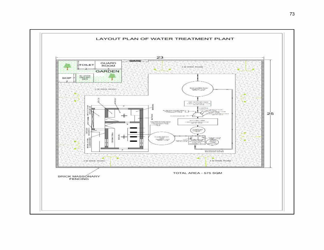
73
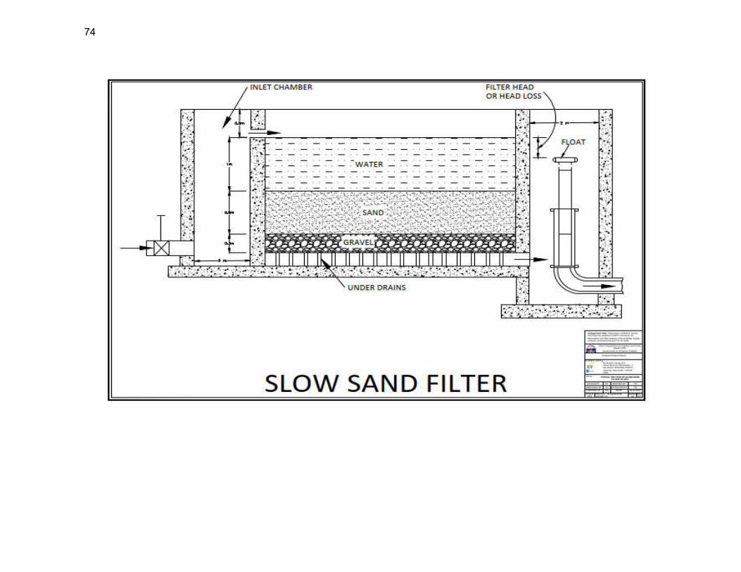
74
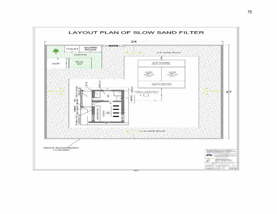
75
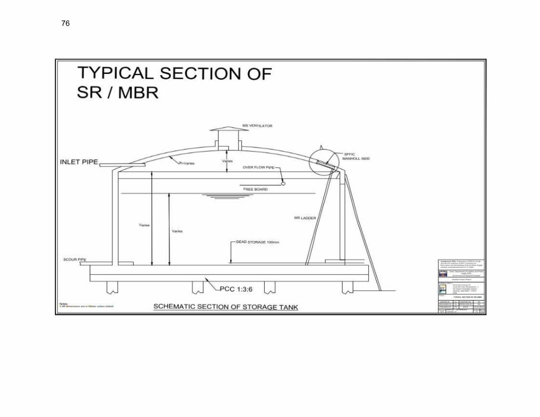
76
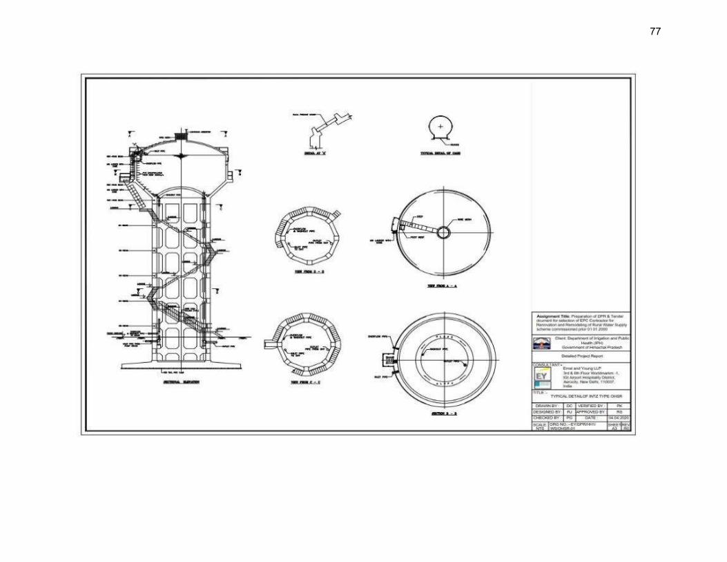
77
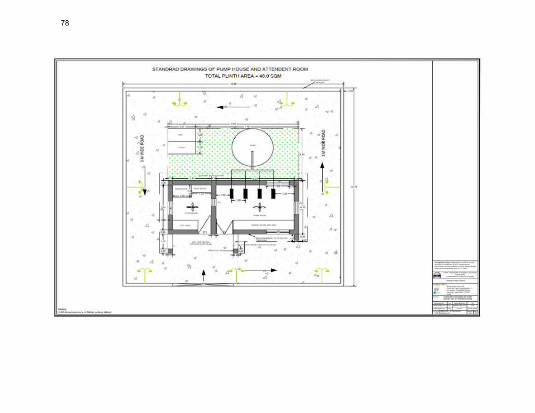
78
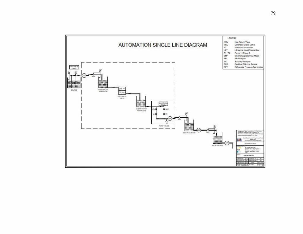
79
80
III. ANALYSIS OF ALTERNATIVES
85. Alternative analysis provides opportunity to integrate environmental considerations into early stages of project (i.e., pre-feasibility or feasibility study), so that adverse environmental impacts can be avoided or minimized by various alternatives. It also provides opportunity to study various options vis a vis costs, provides a logical base, via transparent process, assist in decision making, gaining public support and ultimately in project approvals and timely implementation. 86. GoHP intends to seek a fund from Asian Development Bank (ADB) towards “Remodelling/ Renovation of Old Rural Water Supply Systems of Himachal Pradesh, (HPRWSP)” which will cover 10 districts out of 12 districts. The renovation and remodelling of 187 schemes will provide 24 hours and seven days a week water supply system with the automation of pumps and real-time monitoring of water quality at water treatment plants and quantity from the water supply source and at the household level. 87. The existing rural water supply schemes were designed to tap water from local available sources and many of them are small water supply schemes to caters few habitation or village. With passage of time water demand increased due to increase in population and existing water supply schemes could not match the increased demand. The constant wear and tear, limited maintenance funds and unreliability of various small sources, made these systems more vulnerable. 88. Therefore, JSV wants these schemes to be re-modelled/renovated. The proposed water supply subproject components in Mandi zone Package MZ01 located in Kullu district include source augmentation to provide adequate water, water conveyance, treatment, storage and distribution. Descriptions of various alternatives considered for critical components such as water source, water treatment and distribution etc. are presented in the following Table 12
Table 19: Analysis of Alternatives
1. Project Need – No Project Alternative
Type of alternative
‘No project’ / ‘with project’ alternative
Description of alternatives
No project alternative
At present water supply is being served @ 40 LPCD, which is less than latest norms of rural water supply i.e., 70 LPCD. These schemes are dependent on Spring, Khad and Bore well. Some of existing civil structures such as storage reservoirs and other ancillary structures are not in good condition. Few reservoirs are not adequate to meet the ultimate water demand and those are meeting need repairing of civil structures. The command area of few service level reservoirs is exceeding the radius two Kms which is also a reason for inequitable supply of water to the consumer end. The present distribution network is laid on need basis which makes the network very complex and inadequate. Multiples distribution pipes are serving the same land settlement patch directly from service level reservoirs and tail end consumers are not getting the enough terminal pressure and discharge. The existing water supply schemes covered under this grid are both gravity and pumping-based schemes. The schemes are manually operated and lacking in monitoring of real time quality and quantity of water supplied. Therefore, it could be stated that unaccountable flow water in the system is very high.
81
Living conditions due to absence of proper water supply, are unhealthy and unhygienic. Lack of infrastructure is also causing environmental pollution, overall poor quality of life. Poor environmental quality affects the rural poor more. The project intends to provide following benefits to the people residing in the subproject area, and the “no project” alternative will deprive people of these benefits:
increased availability of potable water at appropriate pressure to all households including urban poor;
reduced time and costs in accessing alternative sources of water. better public health particularly reduction in waterborne and infectious diseases;
Supply 70 LPCD water supply to user end as per defined KPIs in Bidding Document
To ensure positive impact on social status and economic standard of the people of rural areas.
To automate the operation from source to sector tank with use of SCADA and water quality monitoring
Ensure that 100% households have a metered water connection,
Provide Solar enabled system in the value chain as far as possible.
With No Forest Option
Given the large expanse of forest lands in Himachal Pradesh, locating some subproject facilities in forest lands is unavoidable As it has already been mentioned in Chapter II that some project components including Intake, WTP, MBR, SR are proposed to be constructed within forest area. During alternative analysis, ‘With No Forest’ option has also been considered so that occupying of forest area could be avoided for the construction of these proposed components. But the technical study shows that there are no other feasible options. This project is conceptualized as a unique system and therefore forest areas (2.39 Ha) cannot be avoided. Hence, this ‘With No Forest’ option seems inappropriate for the proposed project. With project alternative
The proposed subprojects will support the on-going efforts of the Government of Himachal Pradesh under Himachal Pradesh Water Policy, 2013 towards improving water supply systems. Since the existing water supply sources/systems are insufficient to accommodate growing population in the area, the proposed water supply subproject include source augmentation to provide adequate water, water conveyance, treatment, storage and distribution. Construction of new source, WTP, MBR, SR and water supply pipeline networks have been included in the scope of this water supply sub-project. The project is expected to increase operational efficiency, improve service delivery, and result in a positive impact on health and quality of life for the residents of project towns. Similarly, the proposed water supply subproject is expected to increase operational efficiency, improve service delivery, and result in a positive impact on health and quality of life for the residents of project area. The successful implementation of the water supply project will result in better control over the NRW management, improved monitoring system and overall demand management along with energy reduction.
82
Overall, the ‘with project alternative’ will bring about improved public health and living environment that will contribute to improved quality of life in the rural areas/villages. Improved water supply system will create an enabling environment for local economic development.
Selected
Alternative
“Without” subprojects would yield the project area to be continuously under-serviced that puts the health of the general public at an increasing risk and could potentially worsen the living environment. This ‘no project’ scenario would impede further social and economic development of the district and the defer commitments to improve the proportion of the population with sustainable access to clean water . Given the large-scale benefits to the population and environment, ‘With Project’ alternative is considered appropriate
2 Alternative source of water
Type of alternative
‘Water source’
Description of alternatives
The existing rural water supply schemes are sourced from local sources such as springs, khads and nallahs located near the villages. This Package MZ 01, Mandi Zone (District : Kullu , Package - 03) focuses on renovation and remodelling of 28 such schemes under 6 Grids of which will provide 24 hours and seven days a week water supply system The proposed water sources mostly comprises of khads, nallahs, and bore wells. There are a total of twenty eight (28) locations where water sources will be tapped. Amongst them, fourteen (14) locations are the existing sources which will be retained in the proposal. The project area of CW-MZ01 comprises of 28 village panchayats covering 27 villages and 292 habitations. Source selection criteria are based on its ability to meet the ultimate year (2042) water demand of its respective command area. Considering water demand 95 LPCD total water demand for the year 2022 and 2042 will be approximately 3.5 MLD and 4.49 MLD (51.93 lps). The lean period water discharge available from all the proposed sources is 594.16 MLD (6876.87 lps), Hence it can be concluded that the proposed sources are capable to meet projected water demand and sustainable for this proposed water supply project till ultimate design year (2042). Water quality test reports recommends that the available water is suitable for the human consumption after treatment and fulfil the standards mentioned in BIS 10500 (2012). All sources are duly selected keeping in mind the downstream conditions and water requirement. Upto two kilometres downstream of the sources, it was observed that there will not be any significant water reduction that will impact the users downstream. Khads are tributaries of rivers and similarly nallahs are tributaries of Khads. Nallahs are small water tributaries that are both rain and snow fed. They are used to feed the water demand of a particular area and hence, do not impact the downstream users as they will be having a separate nallah source to feed them. Four groundwater sources (bore wells) along with and two surface water sources (nallah) are proposed as water sources in Grid MK 2 to cater the ultimate water demand, Feasibility reports obtained from the Senior Hydrologist, JSV measuring the potential yield of bore wells (27.86 lps) by electrical resistivity method confirms that bore wells are sufficient to meet the water demand of 12.82 lps for the respective command areas till the design year 2042.. As ground water will be utilised as primary sources here in Grid MK 2,. no conflicts

83
will arise with any community. The stage of ground water development in Kullu district has not been calculated by the CGWB due to hilly terrain and localized aquifers. Hence, no area or block in the district has been notified from the groundwater development point of view.
Selected Alternative
Selected source: Surface water sources mostly comprises of khads, nallahs, and springs along with groundwater sources for Grid MK 2
3 Project Locations
Description of alternatives
Location of water intake: About 26 intakes are proposed under this package including khads, nallahs, springs and bore wells. Location selection is guided by technical feasibility and availability of year-round availability of water. it has been found that the proposed sources are capable to meet projected demand and sustainable for the water supply schemes and can provide water to till ultimate design year, 2042. Intakes are proposed at unused vacant land under the possession of JSV and some are located on forest Land for which JSV will obtain necessary permission from Forest department. No endangered aquatic species are observed in these water sources.
Location of Tube well: Four bore wells with combined discharge of 27.86 lps will be installed in Bandrol village, Seobagh village, Badah near river Beas and Jhakru Mohal Khad on forest lands for which JSV will obtain necessary permissions from Forest department/MOEF&CC. The lands are vacant away from human settlements and free from of any encumbrances. Proposed bore well locations are away from houses, shops or any other premises used by people, thus establishing a buffer to reduce the effects of noise, dust and the visual appearance of the site. Only shrubs and bushes are present at sites and therefore no tree cutting will be required during construction of tube well as per preliminary design. No wildlife is reported at from the sites. A feasibility study has been conducted WTP Location. The aim of water treatment is to produce and maintain water that is hygienically safe, aesthetically attractive and palatable, in an economical manner. The method of treatment to be employed depends on the nature of raw water constituents and the desired standards of water quality. Considering the small rural water supply systems, slow sand filter (SSF) technology is adopted. Sixteen WTP sites are selected for this package. These are proposed at unused vacant land some of which are located on Forest Land for which JSV will obtain necessary permission from Forest department. Considering the technical feasibility of proximity to the service area, and easy access, the sites are selected for WTP.
Location of, Pump Houses, Main Balancing Reservoirs and Service Reservoirs : All together 12 pump houses, 16 MBRs and 72 SRs of various capacities are proposed within the existing water supply facilities in MZ01. These are located in vacant land some of which are located on Forest Land for which JSV will obtain necessary permission from Forest department Water Pipeline Network. (1) Rising mains. The proposed rising mains or raw water transmission mains to lift the water from lower elevation to higher elevation is about 65 km. The material of the pipe is MSERW with diameter ranges from 50 mm to 200 mm.; (2) Gravity mains. The proposed gravity mains to convey water from higher elevation to lower elevation is about 114 km. The material of the pipe is galvanised iron (GI) with diameter ranges from 50 to 200 mm and (3) Distribution mains. The proposed distribution network to convey water to habitations is about 271 km. The material of the pipe is GI and the diameter ranges from 25 mm to 150 mm .

84
Clear water pipes will be laid at most the locations along the existing pipelines and along the vacant right of way (ROW) of government roads. Distribution lines will be laid from Service Reservoirs to the Land settlement patches. Pipes will be laid at most the locations along the existing distribution lines and at some places along the katcha path and village roads within RoW. Road network in the subproject area are classified as National highways, State Highways, Major district roads, other district roads, village roads and katcha path in case habitations. As per the indicative alignment, pipelines will primarily traverse one National highway, NH-305 and one State highway, SH 29, at various locations which will be further assessed during the time of DMS. Water supply pipes will be laid on one or either side of the roads. There are no eco-sensitive or protected areas within the proposed project activity areas. No wildlife is also reported in the project area. During water supply pipe laying works tree cutting is not envisaged as per preliminary design.
Existing pipelines are of MS ERW and GI pipes, which shall be left buried as it is. If the existing water pipes are in the same route of new water supply pipes, the contractor through a detailed survey will establish the requirement of old pipes removal for giving way to new pipelines. Those pipes shall be removed and disposed along with other scrap material to recyclers.
85
IV. POLICY, LEGAL AND ADMINISTRATIVE FRAMEWORK
A. ADB Safeguard Policy Statement, 2009
89. ADB SPS requires that during the design, construction and operation of the project necessary compliance to all applicable laws and international conventions / treaties along with pollution prevention and control technologies and practices consistent with international good practice, are ensured. 90. Screening and Categorization with that of ADB SPS 2009. ADB uses a classification system to reflect the significance of a project’s potential environmental impacts. A project’s category is determined by the category of its most environmentally sensitive component, including direct, indirect, cumulative, and induced impacts in the project’s area of influence. Each proposed project is scrutinized as to its type, location, scale, and sensitivity and the magnitude of its potential environmental impacts. Projects are assigned to one of the following four categories:
(i) Category A. A proposed project is classified as category A if it is likely to have significant adverse environmental impacts that are irreversible, diverse, or unprecedented. These impacts may affect an area larger than the sites or facilities subject to physical works. An environmental impact assessment (EIA) is required.
(ii) Category B. A proposed project is classified as category B if its potential adverse environmental impacts are less adverse than those of category A projects. These impacts are site-specific, few if any of them are irreversible, and in most cases mitigation measures can be designed more readily than for Category A projects. An initial environmental examination (IEE) is required.
(iii) Category C. A proposed project is classified as category C if it is likely to have minimal or no adverse environmental impacts. No environmental assessment is required although environmental implications need to be reviewed.
(iv) Category FI. A proposed project is classified as category FI if it involves investment of ADB funds to or through a FI.
91. The environmental impacts of Package MZ 01 subproject of water supply, system has been identified and assessed as part of the planning and design process. An environmental assessment using ADB’s Rapid Environmental Assessment Checklists for Water supply system (Appendix 1) were conducted, and results of the assessments shows that the subproject is unlikely to cause significant adverse impacts. Thus, this IEE has been prepared in accordance with ADB SPS’s requirements for environment Category B projects. 92. Environmental Management Plan. An EMP which addresses the potential impacts and risks identified by the environmental assessment shall be prepared. The level of detail and complexity of the EMP and the priority of the identified measures and actions will be commensurate with the Project’s impact and risks. The EMP shall include the proposed mitigation measures, environmental monitoring and reporting requirements, emergency response procedures, related institutional or organizational arrangements, capacity development and training measures, implementation schedule, cost estimates, and performance indicators. 93. Environmental Audit of Existing Facilities. ADB SPS requires that relevant external
86
experts perform an environmental audit, if a subproject involves facilities and/or business activities that already exist or are under construction, it is to determine the existence of any areas where such project may cause or is causing environmental risks or impacts and identify and plan appropriate measures to address outstanding environmental issues. If the project does not foresee any new major expansion, the audit constitutes the environmental assessment for the project. and to identify and plan appropriate measures to address outstanding compliance issues. 94. Public Disclosure. The IEE will be put in an accessible place (e.g., local government offices, libraries, community centres, etc.), and a summary translated into local language for the project affected people and other stakeholders. The following safeguard documents will be put up in ADB’s website so that the affected people, other stakeholders, and the public can provide meaningful inputs into the project design and implementation:
(i) Final or updated IEE upon receipt; and (ii) Environmental monitoring reports submitted by the Project Management Unit
(PMU) during project implementation upon receipt.
95. Consultation and Participation. ADB SPS requires borrower to conduct meaningful consultation8 with affected people and other concerned stakeholders, including civil society, and facilitate their informed participation. The consultation process and its results are to be documented and reflected in the environmental assessment report. 96. Grievance Redress Mechanism. ADB SPS requires borrowers to establish a mechanism to receive and facilitate resolution of affected people’s concerns, complaints, and grievances about the subproject’s performance. The grievance mechanism shall be scaled to the risks and adverse impacts of the subproject. 97. Monitoring and Reporting. Borrower shall monitor measure and document the implementation progress of the EMP. If necessary, the borrower shall identify the necessary corrective actions, and reflect them in a corrective action plan. Borrower shall prepare and submit to ADB semi-annual environmental monitoring reports that describe progress with implementation of the EMP and compliance issues and corrective actions, if any. Reporting will continue at the minimum on an annual basis during operation until ADB issues a project completion report. 98. Unanticipated Environmental Impacts. Where unanticipated environmental impacts become apparent during subproject implementation, ADB SPS requires the borrower to update the environmental assessment and EMP or prepare a new environmental assessment and EMP to assess the potential impacts, evaluate the alternatives, and outline mitigation measures and resources to address those impacts.
8 Per ADB SPS, 2009, meaningful consultation means a process that (i) begins early in the project preparation stage
and is carried out on an ongoing basis throughout the project cycle;1 (ii) provides timely disclosure of relevant and adequate information that is understandable and readily accessible to affected people; (iii) is undertaken in an atmosphere free of intimidation or coercion; (iv) is gender inclusive and responsive, and tailored to the needs of disadvantaged and vulnerable groups; and (v) enables the incorporation of all relevant views of affected people and other stakeholders into decision making, such as project design, mitigation measures, the sharing of development benefits and opportunities, and implementation issues
87
99. Occupational Health and Safety. ADB SPS requires the borrower9 to ensure that workers10 are provided with a safe and healthy working environment, taking into account risks inherent to the sector and specific classes of hazards in the subproject work areas, including physical, chemical, biological, and radiological hazards. Borrower shall take steps to prevent accidents, injury, and disease arising from, associated with, or occurring during the course of work, including: (i) identifying and minimizing, so far as reasonably practicable, the causes of potential hazards to workers; (ii) providing preventive and protective measures, including modification, substitution, or elimination of hazardous conditions or substances; (iii) providing appropriate equipment to minimize risks and requiring and enforcing its use; (iv) training workers and providing them with appropriate incentives to use and comply with health and safety procedures and protective equipment; (v) enforcing appropriate protocols necessary to prevent the spread of communicable diseases, including emerging infectious diseases such as the 2019 Coronavirus Disease (COVID-19); (vi) documenting and reporting occupational accidents, diseases, and incidents; and (vi) having emergency prevention, preparedness, and response arrangements in place. 100. PMU shall ensure to apply preventive and protective measures consistent with international good practice, as reflected in internationally recognized standards such as the World Bank Group’s Environmental, Health and Safety Guidelines.
101. Community Health and Safety. ADB SPS requires the borrower to identify and assess risks to, and potential impacts on, the safety of affected communities during the design, construction, operation, and decommissioning of the subproject, and shall establish preventive measures and plans to address them in a manner commensurate with the identified risks and impacts. The borrower shall ensure to apply preventive and protective measures for both occupational and community health and safety consistent with international good practice, as reflected in internationally recognized standards such as the World Bank Group’s Environmental, Health and Safety Guidelines. PMU shall also adhere to necessary protocols in response to emerging infectious diseases such as the coronavirus disease (COVID-19) consistent with the guidelines of relevant government healthcare agencies and the World Health Organization. 102. Physical Cultural Resources. Borrower is responsible for siting and designing the subproject to avoid significant damage to physical cultural resources. ADB SPS requires that such resources likely to be affected by the subproject are identified, and qualified and experienced experts assess the subproject’s potential impacts on these resources using field-based surveys as an integral part of the environmental assessment process. When the proposed location of a subproject component is in areas where physical cultural resources are expected to be found as determined during the environmental assessment process, chance finds procedures shall be included in the EMP. 103. Pollution Prevention and Control Technologies. During the design, construction, and operation of the project, PMU, shall apply pollution prevention and control technologies and practices consistent with international good practice, as reflected in internationally recognized
9 In case where responsibility is delegated to subproject contractors during construction phase, borrower shall ensure
that the responsibilities on occupational health and safety are included in the contract documents 10 Including non-employee workers engaged by the borrower/client through contractors or other intermediaries to
work on project sites or perform work directly related to the project’s core functions.
88
standards such as the World Bank Group’s Environmental, Health and Safety Guidelines.11 These standards contain performance levels and measures that are normally acceptable and applicable to the project infrastructures. When the government’s regulations differ from these levels and measures, the project shall achieve whichever is more stringent. If less stringent levels or measures are appropriate in view of specific project circumstances, PMU, will provide full and detailed justification for any proposed alternatives that are consistent with the requirements presented in ADB SPS.
104. Bidding and Contract Documents. This IEE report, which contains the EMP, shall be included in bidding and contract documents and verified by PMU. The PMU shall also ensure that bidding and contract documents include specific provisions requiring contractors to (i) comply with all other conditions required by ADB, and (ii) to submit to PMU, for review and approval, a site specific environmental management plan (SEMP), including (i) proposed sites/locations for construction work camps, storage areas, hauling roads, lay down areas, disposal areas for solid and hazardous wastes; (ii) specific mitigation measures following the approved EMP; (iii) monitoring program as per EMP; and (iv) budget for SEMP implementation, among others as may be required. No works can commence prior to approval of SEMP. A copy of the EMP and/or approved SEMP will be kept on site during the construction period at all times. Non-compliance with, or any deviation from, the conditions set out in the EMP and/or SEMP constitutes a failure in compliance and shall require corrective actions. 105. Conditions for Award of Contract and Commencement of Work. PMU shall not award any works contract under the subproject until (i) relevant provisions from the EMP are incorporated into the works contract; (ii) this IEE report is updated to reflect subproject’s final detailed design and PMU has obtained ADB’s clearance of such updated IEE report and disclosed; and (iii) other necessary permits from relevant government agencies have been obtained. For “design, build, and operate” type contracts, PMU shall ensure no works for a subproject which involves environmental impacts shall commence until (i) relevant provisions from the EMP are incorporated into the works contract; and (ii) this IEE report is updated to reflect subproject’s detailed design and PMU has obtained ADB’s clearance for such updated IEE. B. National and State Laws
106. The implementation of the subprojects will be governed by Government of India and State of Himachal Pradesh and other applicable environmental acts, rules, regulations, and standards. These regulations impose restrictions on the activities to minimize or mitigate likely impacts on the environment. It is the responsibility of the project executing and implementing agencies to ensure subprojects are consistent with the legal framework, whether applicable international, national, state or municipal or local. Key standards include those related to drinking water quality, air quality, effluent discharge, and protected areas. Compliance is required in all stages of the subprojects including design, construction, and operation and maintenance. 107. Environmental assessment. The Government of India EIA Notification of 2006 (replacing the EIA Notification of 1994) sets out the requirement for Environmental Assessment in India. This states that Environmental Clearance (EC) is required for specified
11 World Bank Group. 2007. Environmental, Health, and Safety General Guidelines. Washington, D.C.;
https://www.ifc.org-ehs-guidelines
89
activities/projects, and this must be obtained before any construction work or land preparation (except land acquisition) may commence. Projects are categorized as A or B depending on the scale of the project and the nature of its impacts. 108. None of the components of this water supply subproject falls under the ambit of the EIA Notification 2006, and therefore EIA Study or environmental clearance (EC) is not required for the subproject. 109. Applicable environmental regulations. Besides EIA Notification 2006, there are various other acts, rules, policies and regulations currently in force in India that deal with environmental issues that could apply to infrastructure development. The specific regulatory compliance requirements of the subproject are shown in Table 20.
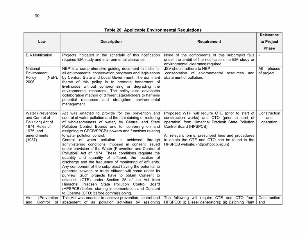
90
Table 20: Applicable Environmental Regulations
Law Description Requirement
Relevance
to Project
Phase
EIA Notification Projects indicated in the schedule of this notification requires EIA study and environmental clearance.
None of the components of this subproject falls under the ambit of the notification; no EIA study or environmental clearance required.
-
National Environment Policy (NEP), 2006
NEP is a comprehensive guiding document in India for all environmental conservation programs and legislations by Central, State and Local Government. The dominant theme of this policy is to promote betterment of livelihoods without compromising or degrading the environmental resources. The policy also advocates collaboration method of different stakeholders to harness potential resources and strengthen environmental management.
JSV should adhere to NEP conservation of environmental resources and abatement of pollution.
All phases of project
Water (Prevention and Control of Pollution) Act of 1974, Rules of 1975, and amendments (1987)
Act was enacted to provide for the prevention and control of water pollution and the maintaining or restoring of wholesomeness of water, by Central and State Pollution Control Boards and for conferring on and assigning to CPCB/SPCBs powers and functions relating to water pollution control. Control of water pollution is achieved through administering conditions imposed in consent issued under provision of the Water (Prevention and Control of Pollution) Act of 1974. These conditions regulate the quantity and quantity of effluent, the location of discharge and the frequency of monitoring of effluents. Any component of the subproject having the potential to generate sewage or trade effluent will come under its purview. Such projects have to obtain Consent to establish (CTE) under Section 25 of the Act from Himachal Pradesh State Pollution Control Board (HPSPCB) before starting implementation and Consent to Operate (CTO) before commissioning.
Proposed WTP will require CTE (prior to start of construction works) and CTO (prior to start of operation) from Himachal Pradesh State Pollution Control Board (HPSPCB) All relevant forms, prescribed fees and procedures to obtain the CTE and CTO can be found in the HPSPCB website. (http://hppcb.nic.in)
Construction and
operation
Air (Prevention and Control of
This Act was enacted to achieve prevention, control and abatement of air pollution activities by assigning
The following will require CTE and CTO from HPSPCB: (i) Diesel generators); (ii) Batching Plant
Construction and
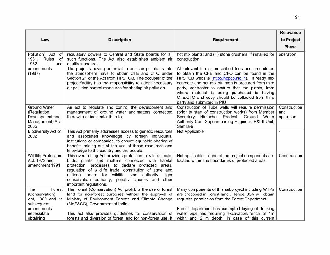
91
Law Description Requirement
Relevance
to Project
Phase
Pollution) Act of 1981, Rules of 1982 and amendments (1987)
regulatory powers to Central and State boards for all such functions. The Act also establishes ambient air quality standards. The projects having potential to emit air pollutants into the atmosphere have to obtain CTE and CTO under Section 21 of the Act from HPSPCB. The occupier of the project/facility has the responsibility to adopt necessary air pollution control measures for abating air pollution.
hot mix plants; and (iii) stone crushers, if installed for construction. All relevant forms, prescribed fees and procedures to obtain the CFE and CFO can be found in the HPSPCB website (http://hppcb.nic.in). If ready mix concrete and hot mix bitumen is procured from third party, contractor to ensure that the plants, from where material is being purchased is having CTE/CTO and copy should be collected from third party and submitted in PIU
operation
Ground Water (Regulation, Development and Management) Act 2005
An act to regulate and control the development and management of ground water and matters connected therewith or incidental thereto.
Construction of Tube wells will require permission (prior to start of construction works) from Member Secretary Himachal Pradesh Ground Water Authority-Cum-Superintending Engineer, P&I-II Unit, Shmila-9
Construction and operation
Biodiversity Act of 2002
This Act primarily addresses access to genetic resources and associated knowledge by foreign individuals, institutions or companies, to ensure equitable sharing of benefits arising out of the use of these resources and knowledge to the country and the people.
Not Applicable -
Wildlife Protection Act, 1972 and amendment 1991
This overarching Act provides protection to wild animals, birds, plants and matters connected with habitat protection, processes to declare protected areas, regulation of wildlife trade, constitution of state and national board for wildlife, zoo authority, tiger conservation authority, penalty clauses and other important regulations.
Not applicable – none of the project components are located within the boundaries of protected areas.
Construction
The Forest (Conservation) Act, 1980 and its subsequent amendments necessitate obtaining
The Forest (Conservation) Act prohibits the use of forest land for non-forest purposes without the approval of Ministry of Environment Forests and Climate Change (MoE&CC), Government of India. This act also provides guidelines for conservation of forests and diversion of forest land for non-forest use. It
Many components of this subproject including WTPs are proposed in Forest land.. Hence, JSV will obtain requisite permission from the Forest Department. Forest department has exempted laying of drinking water pipelines requiring excavation/trench of 1m width and 2 m depth. In case of this current
Construction
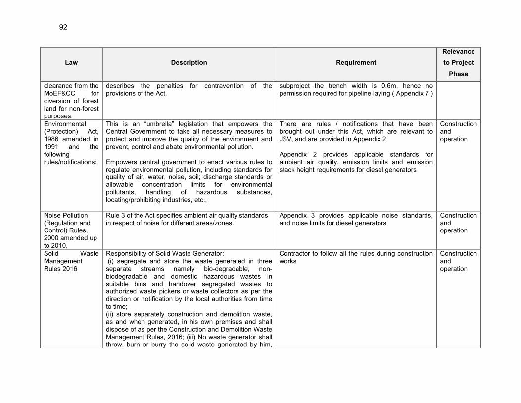
92
Law Description Requirement
Relevance
to Project
Phase
clearance from the MoEF&CC for diversion of forest land for non-forest purposes.
describes the penalties for contravention of the provisions of the Act.
subproject the trench width is 0.6m, hence no permission required for pipeline laying ( Appendix 7 )
Environmental (Protection) Act, 1986 amended in 1991 and the following rules/notifications:
This is an “umbrella” legislation that empowers the Central Government to take all necessary measures to protect and improve the quality of the environment and prevent, control and abate environmental pollution. Empowers central government to enact various rules to regulate environmental pollution, including standards for quality of air, water, noise, soil; discharge standards or allowable concentration limits for environmental pollutants, handling of hazardous substances, locating/prohibiting industries, etc.,
There are rules / notifications that have been brought out under this Act, which are relevant to JSV, and are provided in Appendix 2 Appendix 2 provides applicable standards for ambient air quality, emission limits and emission stack height requirements for diesel generators
Construction and operation
Noise Pollution (Regulation and Control) Rules, 2000 amended up to 2010.
Rule 3 of the Act specifies ambient air quality standards in respect of noise for different areas/zones.
Appendix 3 provides applicable noise standards, and noise limits for diesel generators
Construction and operation
Solid Waste Management Rules 2016
Responsibility of Solid Waste Generator: (i) segregate and store the waste generated in three separate streams namely bio-degradable, non- biodegradable and domestic hazardous wastes in suitable bins and handover segregated wastes to authorized waste pickers or waste collectors as per the direction or notification by the local authorities from time to time; (ii) store separately construction and demolition waste, as and when generated, in his own premises and shall dispose of as per the Construction and Demolition Waste Management Rules, 2016; (iii) No waste generator shall throw, burn or burry the solid waste generated by him,
Contractor to follow all the rules during construction works
Construction and operation
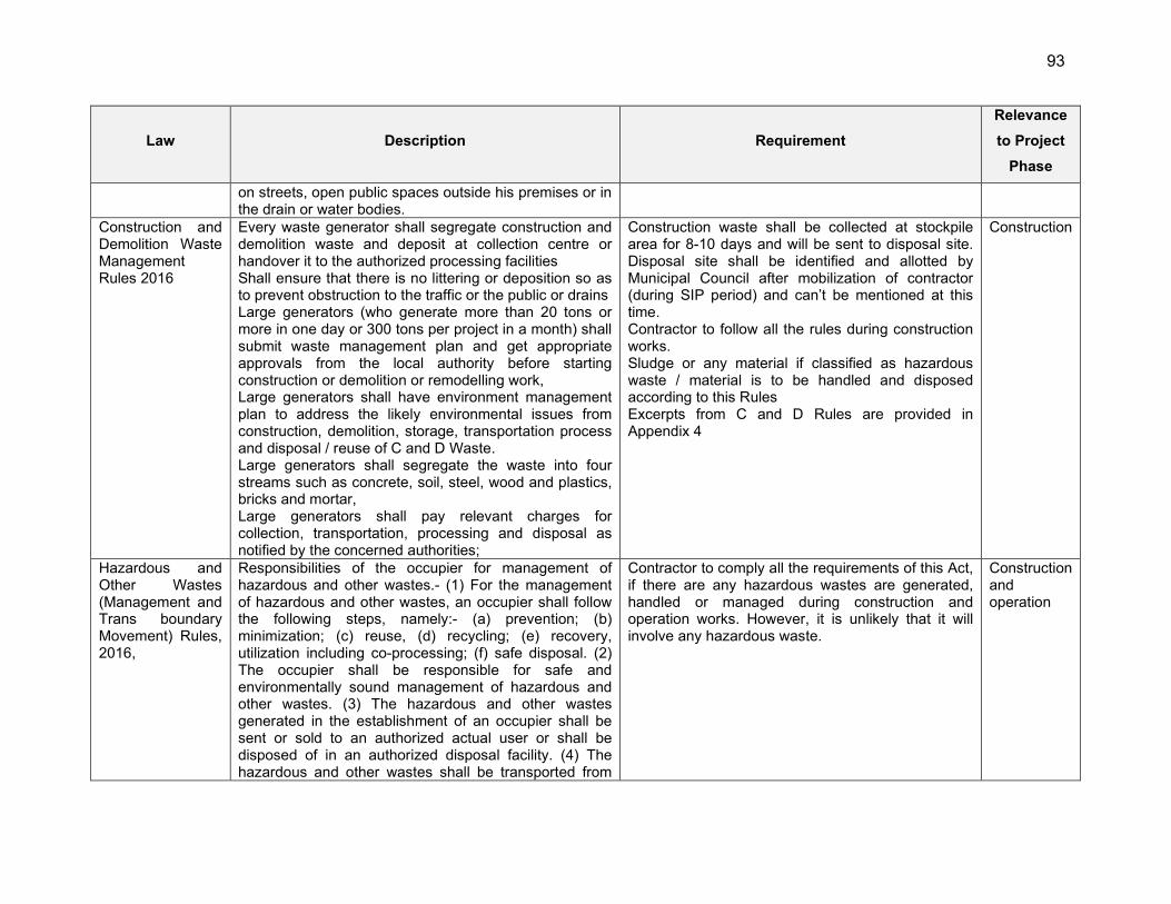
93
Law Description Requirement
Relevance
to Project
Phase
on streets, open public spaces outside his premises or in the drain or water bodies.
Construction and Demolition Waste Management Rules 2016
Every waste generator shall segregate construction and demolition waste and deposit at collection centre or handover it to the authorized processing facilities Shall ensure that there is no littering or deposition so as to prevent obstruction to the traffic or the public or drains Large generators (who generate more than 20 tons or more in one day or 300 tons per project in a month) shall submit waste management plan and get appropriate approvals from the local authority before starting construction or demolition or remodelling work, Large generators shall have environment management plan to address the likely environmental issues from construction, demolition, storage, transportation process and disposal / reuse of C and D Waste. Large generators shall segregate the waste into four streams such as concrete, soil, steel, wood and plastics, bricks and mortar, Large generators shall pay relevant charges for collection, transportation, processing and disposal as notified by the concerned authorities;
Construction waste shall be collected at stockpile area for 8-10 days and will be sent to disposal site. Disposal site shall be identified and allotted by Municipal Council after mobilization of contractor (during SIP period) and can’t be mentioned at this time. Contractor to follow all the rules during construction works. Sludge or any material if classified as hazardous waste / material is to be handled and disposed according to this Rules Excerpts from C and D Rules are provided in Appendix 4
Construction
Hazardous and Other Wastes (Management and Trans boundary Movement) Rules, 2016,
Responsibilities of the occupier for management of hazardous and other wastes.- (1) For the management of hazardous and other wastes, an occupier shall follow the following steps, namely:- (a) prevention; (b) minimization; (c) reuse, (d) recycling; (e) recovery, utilization including co-processing; (f) safe disposal. (2) The occupier shall be responsible for safe and environmentally sound management of hazardous and other wastes. (3) The hazardous and other wastes generated in the establishment of an occupier shall be sent or sold to an authorized actual user or shall be disposed of in an authorized disposal facility. (4) The hazardous and other wastes shall be transported from
Contractor to comply all the requirements of this Act, if there are any hazardous wastes are generated, handled or managed during construction and operation works. However, it is unlikely that it will involve any hazardous waste.
Construction and operation
94
Law Description Requirement
Relevance
to Project
Phase
an occupier’s establishment to an authorized actual user or to an authorized disposal facility in accordance with the provisions of these rules. (5) The occupier who intends to get its hazardous and other wastes treated and disposed of by the operator of a treatment, storage and disposal facility shall give to the operator of that facility, such specific information as may be needed for safe storage and disposal. (6) The occupier shall take all the steps while managing hazardous and other wastes to- 6 (a) contain contaminants and prevent accidents and limit their consequences on human beings and the environment; and (b) provide persons working in the site with appropriate training, equipment and the information necessary to ensure their safety.
e-waste (Management) Rules, 2016
Rules apply to manufacturer, producer, consumer, bulk consumer, collection centres, dealers, e-retailer, refurbisher, dismantler and recycler involved in manufacture, sale, transfer, purchase, collection, storage and processing of e-waste or electrical and electronic equipment listed in Schedule I, including their components, consumables, parts and spares which make the product operational but shall not apply to batteries, radio active waste. Schedule 1 specifies electrical and electronic equipment in the following categories: Information technology and telecommunication equipment, consumer electrical and electronics
This does not cover solar panels, proposed in the project. However, as there are no rules at present regulating PV panel waste, e-waste rules are presented here: Responsibilities of the consumers/bulk consumers (like JSV) include: ensuring that e-waste generated is channelised through collection centre or dealer of authorised producer or dismantler or recycler or through the designated take back service provider of the producer to authorised dismantler or recycler, and maintain e-waste records
Operation
Wetlands (Conservation and Management) Rules, 2017
The Rules specify activities which are harmful and prohibited in the wetlands such as industrialization, construction, dumping of untreated waste and effluents, and reclamation. The Central Government may permit any of the prohibited activities on the recommendation of Central Wetlands Regulatory Authority.
Not applicable as subprojects components are not located in or near to designated wetland area.
Ancient The Act designates areas within 100 meters (m) of the Not applicable - there are no protected monuments / Construction
95
Law Description Requirement
Relevance
to Project
Phase
Monuments and Archaeological Sites and Remains Act, 1958 and Ancient Monuments and Archaeological Sites and Remains (Amendment and Validation) Act, 2010.
“protected monument/area” as “prohibited area” and beyond that up to 200 m as “regulated area” respectively. No “construction” is permitted in the “prohibited area” and any construction activity in the “regulated area” requires prior permission of the Archaeological Survey of India (ASI).
places of archaeological / historical places in or near the project sites of Kullu In case of chance finds, the contractor/ PIU will be required to follow a protocol as defined in the Environmental Management Plan (EMP)
The Himachal Pradesh Ancient and Historical Monuments and Archaeological Sites and Remains Act, 1976
An Act to provide for the preservation of ancient and historical monuments, archaeological sites and remains other than those of national importance, for the regulation of archaeological excavations and for the protection of sculptures, carvings and other like objects. State government notifies monuments, objects, and excavation sites as state protected under this -Construction activities within the notified areas of each monument are regulated
Any project activities located in such notified area will require prior permission
Construction
Contract Labor (Regulation and Abolition) Act, 1970; The Inter-State Migrant Workmen (Regulation of Employment and Conditions of Service) Act, 1979
Provides for welfare measures to be provided by the Contractor to contract labor and in case the Contractor fails to provide, the same are required to be provided by the Principal Employer by Law. The principal employer is required to take Certificate of Registration and the Contractor is required to take a License from the designated Officer. The Act is applicable to the establishments or Contractor of principal employer if they employ 20 or more contract labor. The inter-state migrant workmen, in an establishment to which this Act becomes applicable, are required to be provided certain facilities such as housing, medical aid,
Applicable to all construction works in the project Principle employer (JSV) to obtain Certificate of Registration from Department of Labour, as principle employer Contractor to obtain license from designated labor officer Contractor shall register with Labor Department, if Inter-state migrant workmen are engaged Adequate and appropriate amenities and facilities shall be provided to workers including housing, medical aid, traveling expenses from home and back, etc.,
Construction and operation
96
Law Description Requirement
Relevance
to Project
Phase
traveling expenses from home up to the establishment and back, etc.,
Appendix 5 provides applicable labor laws including amendments issued from time to time applicable to establishments engaged in construction of civil works.
The Child Labour (Prohibition and Regulation) Act, 1986
Prohibits employment of children below 14 years of age in certain occupations and processes Employment of child labor is prohibited in building and construction Industry.
No child labour shall be employed Construction and operation
Minimum Wages Act, 1948
Minimum wages fixed by appropriate Government as per provisions of the Act if the employment is a scheduled employment. Construction of buildings, roads and runways are scheduled employment.
Applicable to all construction works in the project All construction workers should be paid not less than the prescribed minimum wage
Construction and operation
Workmen Compensation Act, 1923
Provides for compensation in case of injury by accident arising out of and during the course of employment.
Compensation for workers in case of injury by accident
Construction and operation
Equal Remuneration Act, 1979
Provides for payment of equal wages for work of equal nature to male and female workers and not for making discrimination against female employees in the matters of transfers, training and promotions etc.
Equal wages for work of equal nature to male and female workers
Construction and operation
The Indian Forest Amendment) Act ,2002
This Act makes the basis for declaration of Reserved Forests, constitution of village forest committees, management of reserved forests and penalties and procedures.
Applicable; some of the components / pipeline alignment are in forest areas.
Construction
IS 11768: 1986/2005: Recommendations for disposal of asbestos waste material
The standard emphasis that every employer who undertakes work which is liable to generates asbestos containing waste, shall undertake adequate steps to prevent and /or reduce the generation of airborne dust during handling, storing,
The crux is waste avoidance: the practice inculcated should focus the on minimal waste generation. Waste Collection: In the project circumstance, the waste is referred to the damaged powered asbestos which will be collected in the Permissible plastic bags to be disposed to the nearest TSDF facilities.
Construction
International Conventions and Treaties
Ramsar Convention, 1971
The Ramsar Convention is an intergovernmental treaty that provides the framework for national action and international co-operation for the conservation and wise
There are three Ramsar sites in Himachal Pradesh but no Ramsar sites are located in or near project area. Not applicable to this project
-
97
Law Description Requirement
Relevance
to Project
Phase
use of wetlands and their resources. India is one of the signatories to the treaty. The Ramsar convention made it mandatory for the signatory countries to include wetland conservation in their national land use plans.
Convention on International Trade in Endangered Species of Wild Fauna and Flora (CITES), 1973
India is a signatory of this convention which aims to control international commercial trade in endangered species
Not applicable in this project as no endangered species of wild fauna and flora is found in project areas as per consultation with forest department and local people.
-
Montreal Protocol 1992
India is a signatory of this convention which aims to reduction in the consumption and production of ozone-depleting substances (ODS), while recognizing differences in a nation’s responsibilities. Ozone depleting substances are divided in two groups Chlorofluorocarbons (CFCs) and Hydro chlorofluorocarbon carbons (HCFCs)
Not applicable in this project as no ODS are involved in construction works
-
Basel Convention on Trans-boundary Movement of Hazardous Wastes, 1989
India is a signatory of this convention which aims to reduce trans-boundary movement and creation of hazardous wastes
Contractor to follow the provisions of Hazardous Waste Rules 2016 for storage, handling, transport and disposal of any hazardous waste emerged during construction works Under this Convention, asbestos or asbestos waste in the form of dust and fibers is classified as hazardous waste.
-
Convention on Migratory Species of Wild Animals (CMS), 1979 (Bonn convention)
CMS, also known as Bonn convention, was adopted in 1979 and entered into force on 1 November 1983, which recognizes that states must be the protectors of migratory species that live within or pass through their national jurisdictions, and aims to conserve terrestrial, marine and avian migratory species throughout their ranges. Migratory species threatened with extinction are listed on Appendix 8 of the Convention. CMS Parties strive towards strictly protecting these species,
Not applicable to this project as no migratory species of wild animals are reported in the project areas as per consultation with forest department and local people as the proposed sources are small in nature .
-

98
Law Description Requirement
Relevance
to Project
Phase
conserving or restoring the places where they live, mitigating obstacles to migration and controlling other factors that might endanger them. Migratory species that need or would significantly benefit from international cooperation are listed in Appendix 8, and CMS encourages the Range States to conclude global or regional agreements.
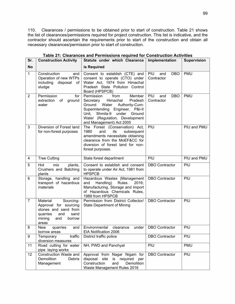
99
110. Clearances / permissions to be obtained prior to start of construction. Table 21 shows the list of clearances/permissions required for project construction. This list is indicative, and the contractor should ascertain the requirements prior to start of the construction and obtain all necessary clearances/permission prior to start of construction.
Table 21: Clearances and Permissions required for Construction Activities Sr.
No
Construction Activity Statute under which Clearance
is Required
Implementation Supervision
1 Construction and Operation of new WTPs including disposal of sludge
Consent to establish (CTE) and consent to operate (CTO) under Water Act, 1974 from Himachal Pradesh State Pollution Control Board (HPSPCB)
PIU and DBO Contractor
PMU
2 Permission for extraction of ground water
Permission from Member Secretary Himachal Pradesh Ground Water Authority-Cum-Superintending Engineer, P&I-II Unit, Shmila-9 under Ground Water (Regulation, Development and Management) Act 2005
PIU and DBO Contractor
PMU
3 Diversion of Forest land for non-forest purposes
The Forest (Conservation) Act, 1980 and its subsequent amendments necessitate obtaining clearance from the MoEF&CC for diversion of forest land for non-forest purposes.
PIU PIU and PMU
4 Tree Cutting State forest department PIU PIU and PMU
5 Hot mix plants, Crushers and Batching plants
Consent to establish and consent to operate under Air Act, 1981 from HPSPCB
DBO Contractor PIU
6 Storage, handling and transport of hazardous materials
Hazardous Wastes (Management and Handling) Rules. 2016; Manufacturing, Storage and Import of Hazardous Chemicals Rules, 1989 from HPSPCB
DBO Contractor PIU
7 Material Sourcing- Approval for sourcing stones and sand from quarries and sand mining and borrow areas
Permission from District Collector/ State Department of Mining
DBO Contractor PIU
8 New quarries and borrow areas
Environmental clearance under EIA Notification 2006
DBO Contractor PIU
9 Temporary traffic diversion measures
District traffic police DBO Contractor PIU
11 Road cutting for water pipe laying works
NH, PWD and Panchyat PIU PMU
12 Construction Waste and Demolition Debris Management
Approval from Nagar Nigam for disposal site is required per Construction and Demolition Waste Management Rules 2016
DBO Contractor PIU
100
Sr.
No
Construction Activity Statute under which Clearance
is Required
Implementation Supervision
13 Labour License Labour Commissioner, Government of Himachal Pradesh
DBO Contractor PIU
14 Use of Vehicles and Equipment- Pollution Under Control (PUC) Certificate
Motor Vehicle Rules, 1989 DBO Contractor PIU
111. JSV/PMU will be overall responsible for supervision in getting all clearances and provide details to ADB through semi-annual report. PMU will ensure all necessary regulatory clearances and approvals are obtained prior to commencement of works. Respective PIUs, with support of project consultants and contractors, are responsible for obtaining the clearances/permits and ensuring conditions/specifications/provisions are incorporated in the subproject design, costs, and implementation. The PIUs shall report to PMU the status of compliance to clearances/permits as part of the regular progress reporting.
101
V. DESCRIPTION OF THE ENVIRONMENT
A. Physical Resources
1. Location, Area & Connectivity
112. The project area falls in Kullu district of Himachal Pradesh. Project area is situated in the inner Himalayas bounded by 31o 20’ 25″ to 32o 25’ 0″ North latitude and 76o 56’ 30″ to 77o 52’ 20″ East longitude. In terms of geographical conditions, the district is mountainous cruised by rivers and valleys. The Satluj and Beas are the principal rivers with many tributaries. The altitude of the district ranges from 500 m to 5000 m amsl, but the habitation is only up to 3500 m. Kullu is approximately 267.3 km (166.1 miles) from Chandigarh, 208.7 km (29.7 miles) north of state capital of Himachal Pradesh, Shimla and 503.4 km (312.8 miles) from the national Capital of India, New Delhi. The nearest airport at Bhuntar is 10 kms from the main city of Kullu and 50 kms from Manali and the nearest rail head is 280 kms at Chandigarh. 113. The total geographical area of the Kullu district is 5,503 sq. km which comprises of mountain peaks as high as Deo-Tibba (6,123 m) and as low as Jalori pass (3,000 m), the valleys of the Beas, the Parvati, the Sainj, the Tirthan and the valleys of Ani and Kurpan. The climate of Kullu district is cool and dry and the year unfolds three broad seasons viz. cold season from October to February, hot season from March to June and rainy season from July to September. 114. The district is divided into four sub-divisions of Kullu, Banjar, Manali and Anni and 8 Tehsil/Sub-Tehsils. Further district is divided into five Community Development Blocks for the developmental purposes. There are 204-gram panchayats in the district. District Kullu has often been victim to natural calamities like flashfloods due to excessive rains and landslides causing severe damage to life and property. About 90% of its population lives in remote villages situated in far-flung and inaccessible areas making it more vulnerable to disasters.
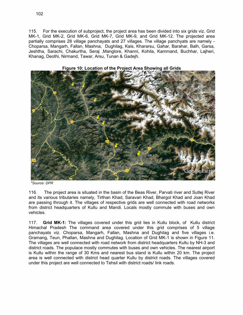
102
115. For the execution of subproject, the project area has been divided into six grids viz. Grid MK-1, Grid MK-2, Grid MK-6, Grid MK-7, Grid MK-9, and Grid MK-12. The projected area partially comprises 28 village panchayats and 27 villages. The village panchyats are namely - Choparsa, Mangarh, Fallan, Mashna, Dughilag, Kais, Khararsu, Gahar, Barahar, Balh, Garsa, Jeshtha, Sarachi, Chakurtha, Seraj ,Manglore, Khanni, Kohila, Kammand, Buchhar, Lajheri, Khanag, Deothi, Nirmand, Tawar, Arsu, Tunan & Gadejh.
Figure 10: Location of the Project Area Showing all Grids
*Source: DPR
116. The project area is situated in the basin of the Beas River, Parvati river and Sutlej River and its various tributaries namely, Tirthan Khad, Saravari Khad, Bhargol Khad and Joan Khad are passing through it. The villages of respective grids are well connected with road networks from district headquarters of Kullu and Mandi. Locals mostly commute with buses and own vehicles. 117. Grid MK-1: The villages covered under this grid lies in Kullu block, of Kullu district Himachal Pradesh The command area covered under this grid comprises of 5 village panchayats viz. Choparsa, Mangarh, Fallan, Mashna and Dughilag and five villages i.e. Gramang, Teun, Phallan, Mashna and Dughilag. Location of Grid MK-1 is shown in Figure 11. The villages are well connected with road network from district headquarters Kullu by NH-3 and district roads. The populace mostly commutes with buses and own vehicles. The nearest airport is Kullu within the range of 30 Kms and nearest bus stand is Kullu within 20 km. The project area is well connected with district head quarter Kullu by district roads. The villages covered under this project are well connected to Tehsil with district roads/ link roads.
103
Figure 11: Location of the Grid MK-1

104
118. Grid MK-2: The villages covered under this grid lies in Kullu and Naggar block, Kullu district, Himachal Pradesh. The command area covered under this grid comprises of village panchayats Kais, Khararsu, Gahar, Barahar & Balh and five villages i.e., Kais, Gahar, Barahar and Balh. Location of Grid MK-2 is shown in Figure 12. 119. The villages are well connected with road network from district headquarters Kullu by NH-3 and district roads. The populace mostly commutes with buses and own vehicles. The nearest airport is Kullu within the range of 60 Kms and railway station is Jogindernagar (Narrow Gauge) within 120 km. The project area is well connected with district head quarter Mandi by NH-3 and district roads. The villages covered under this project are well connected to Tehsil with district roads/ link roads.
105
Figure 12: Location of the Grid MK-2

106
120. Grid MK-6 The villages covered under this grid lies in Kullu Block, district Kullu, Himachal Pradesh. The command area covered under this grid comprises of two village panchayats Jaistha & Garsa and two villages Bhallan and Parli. The villages are well connected with road network from district headquarters of Kullu. Locals mostly commute with buses and own vehicles. The nearest airport is Kullu Manali airport within range of 35 Kms. The nearest railway station is Joginder Nagar (Narrow Gauge) and Una (Broad Gauge). The project area is well connected with district head quarter Mandi by NH-3 which connects Mandi district to tourist towns of Kullu - Manali. Location of Grid MK 6 is shown in Figure 13.
107
Figure 13: Location of the Grid MK-6
108
121. Grid MK-7 The villages covered under this grid lies in Banjar Block, district Kullu, Himachal Pradesh. The command area covered under this grid comprises of four village panchayats Sarachi, Chakurtha, Seraj & Manglore and five villages Sarachi, Chakurtha, Ratwah, Seraj and Thatibir. The villages of are well connected with road network from district headquarters Kullu by NH-3 and district roads. The populace mostly commutes with buses and own vehicles. The nearest airport is Kullu within the range of 60 Kms and railway station is Joginder nagar (Narrow Gauge) within 130 km. The project area is well connected with district head quarter Mandi by NH-3 and district roads. The. villages covered under this project are well connected to Tehsil with district roads/ link roads. Location of Grid MK-7 is shown in Figure 14.

109
Figure 14: Location of the Grid MK-7

110
122. Grid MK 9. The villages covered under this grid lies in Anni Block, district Kullu, Himachal Pradesh. The command area covered under this grid comprises of seven village panchayats Khanni, Kohila, Kammand, Buchhar, Khanag, Lajheri and Deothi and five villages Khani, Maja desh, Buchhar, Kohila and Lajheri. The villages are well connected with road network from district headquarters Kullu by NH-5, NH-305 and district roads. The populace mostly commutes with buses and own vehicles. The nearest airport is Kullu within the range of 80 Kms. The Mandi and Shimla Bus Terminals are nearly 100 Kms from the project area. Location of Grid MK-9 is shown in Figure 15.
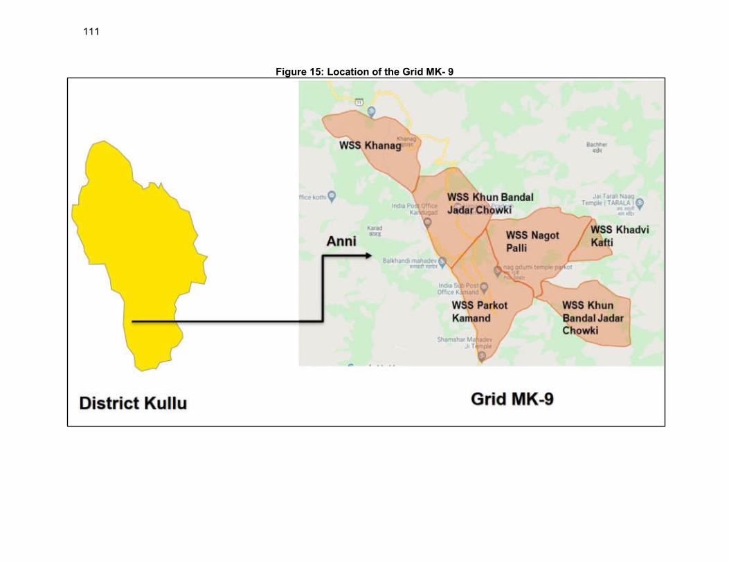
111
Figure 15: Location of the Grid MK- 9

112
123. Grid MK-12. The villages covered under this grid lies in Nirmand Block, district Kullu, Himachal Pradesh. The command area covered under this grid comprises of five village panchayats namely Nirmand, Tawar, Arsu, Tunan & Gadejh and six villages Nirmand, Remu, Baial, Arsu, Gadej and Chhati.The villages are well connected with road network from district headquarters Kullu by NH-5, NH-305 and district roads. The populace mostly commutes with buses and own vehicles. The nearest airport are Shimla and Bhuntar Airport within range of 150 Kms. The nearest ISBT is Shimla within130 KM. Location of Grid MK-12 is shown in Figure 16.
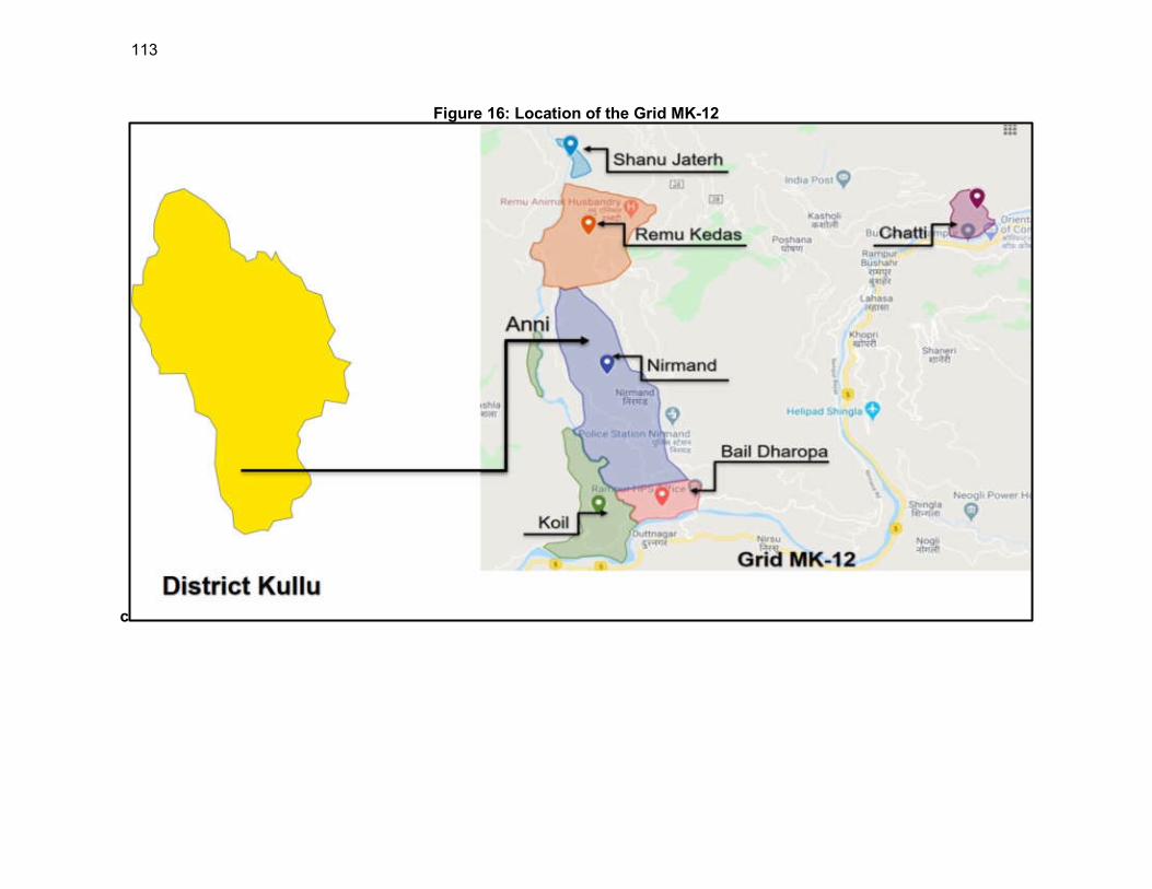
113
Figure 16: Location of the Grid MK-12
c
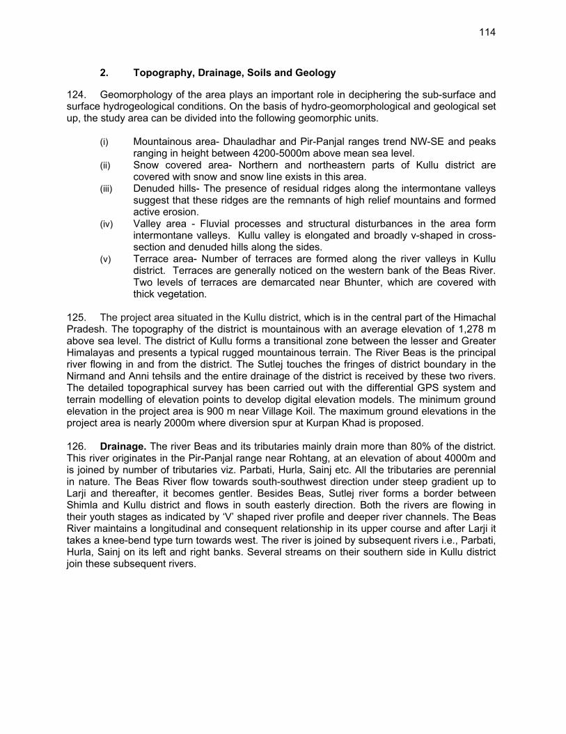
114
2. Topography, Drainage, Soils and Geology
124. Geomorphology of the area plays an important role in deciphering the sub-surface and surface hydrogeological conditions. On the basis of hydro-geomorphological and geological set up, the study area can be divided into the following geomorphic units.
(i) Mountainous area- Dhauladhar and Pir-Panjal ranges trend NW-SE and peaks ranging in height between 4200-5000m above mean sea level.
(ii) Snow covered area- Northern and northeastern parts of Kullu district are covered with snow and snow line exists in this area.
(iii) Denuded hills- The presence of residual ridges along the intermontane valleys suggest that these ridges are the remnants of high relief mountains and formed active erosion.
(iv) Valley area - Fluvial processes and structural disturbances in the area form intermontane valleys. Kullu valley is elongated and broadly v-shaped in cross-section and denuded hills along the sides.
(v) Terrace area- Number of terraces are formed along the river valleys in Kullu district. Terraces are generally noticed on the western bank of the Beas River. Two levels of terraces are demarcated near Bhunter, which are covered with thick vegetation.
125. The project area situated in the Kullu district, which is in the central part of the Himachal Pradesh. The topography of the district is mountainous with an average elevation of 1,278 m above sea level. The district of Kullu forms a transitional zone between the lesser and Greater Himalayas and presents a typical rugged mountainous terrain. The River Beas is the principal river flowing in and from the district. The Sutlej touches the fringes of district boundary in the Nirmand and Anni tehsils and the entire drainage of the district is received by these two rivers. The detailed topographical survey has been carried out with the differential GPS system and terrain modelling of elevation points to develop digital elevation models. The minimum ground elevation in the project area is 900 m near Village Koil. The maximum ground elevations in the project area is nearly 2000m where diversion spur at Kurpan Khad is proposed. 126. Drainage. The river Beas and its tributaries mainly drain more than 80% of the district. This river originates in the Pir-Panjal range near Rohtang, at an elevation of about 4000m and is joined by number of tributaries viz. Parbati, Hurla, Sainj etc. All the tributaries are perennial in nature. The Beas River flow towards south-southwest direction under steep gradient up to Larji and thereafter, it becomes gentler. Besides Beas, Sutlej river forms a border between Shimla and Kullu district and flows in south easterly direction. Both the rivers are flowing in their youth stages as indicated by ‘V’ shaped river profile and deeper river channels. The Beas River maintains a longitudinal and consequent relationship in its upper course and after Larji it takes a knee-bend type turn towards west. The river is joined by subsequent rivers i.e., Parbati, Hurla, Sainj on its left and right banks. Several streams on their southern side in Kullu district join these subsequent rivers.
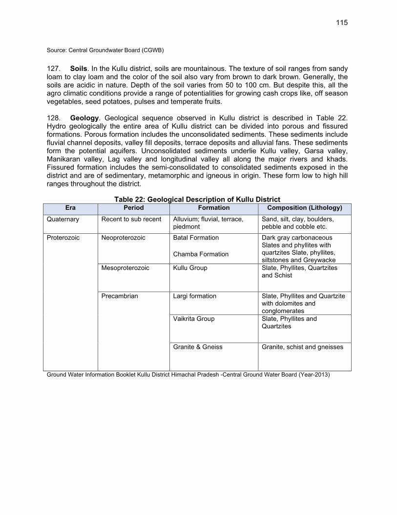
115
Source: Central Groundwater Board (CGWB)
127. Soils. In the Kullu district, soils are mountainous. The texture of soil ranges from sandy loam to clay loam and the color of the soil also vary from brown to dark brown. Generally, the soils are acidic in nature. Depth of the soil varies from 50 to 100 cm. But despite this, all the agro climatic conditions provide a range of potentialities for growing cash crops like, off season vegetables, seed potatoes, pulses and temperate fruits. 128. Geology. Geological sequence observed in Kullu district is described in Table 22. Hydro geologically the entire area of Kullu district can be divided into porous and fissured formations. Porous formation includes the unconsolidated sediments. These sediments include fluvial channel deposits, valley fill deposits, terrace deposits and alluvial fans. These sediments form the potential aquifers. Unconsolidated sediments underlie Kullu valley, Garsa valley, Manikaran valley, Lag valley and longitudinal valley all along the major rivers and khads. Fissured formation includes the semi-consolidated to consolidated sediments exposed in the district and are of sedimentary, metamorphic and igneous in origin. These form low to high hill ranges throughout the district.
Table 22: Geological Description of Kullu District Era Period Formation Composition (Lithology)
Quaternary Recent to sub recent Alluvium; fluvial, terrace, piedmont
Sand, silt, clay, boulders, pebble and cobble etc.
Proterozoic
Neoproterozoic
Batal Formation
Chamba Formation
Dark gray carbonaceous Slates and phyllites with quartzites Slate, phyllites, siltstones and Greywacke
Mesoproterozoic
Kullu Group Slate, Phyllites, Quartzites and Schist
Precambrian
Largi formation Slate, Phyllites and Quartzite with dolomites and conglomerates
Vaikrita Group
Slate, Phyllites and Quartzites
Granite & Gneiss
Granite, schist and gneisses
Ground Water Information Booklet Kullu District Himachal Pradesh -Central Ground Water Board (Year-2013)
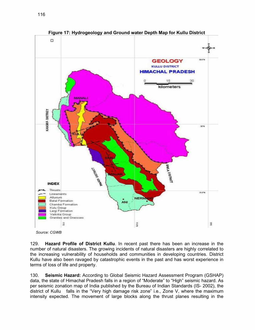
116
Figure 17: Hydrogeology and Ground water Depth Map for Kullu District
Source: CGWB
129. Hazard Profile of District Kullu. In recent past there has been an increase in the number of natural disasters. The growing incidents of natural disasters are highly correlated to the increasing vulnerability of households and communities in developing countries. District Kullu have also been ravaged by catastrophic events in the past and has worst experience in terms of loss of life and property. 130. Seismic Hazard: According to Global Seismic Hazard Assessment Program (GSHAP) data, the state of Himachal Pradesh falls in a region of “Moderate” to “High” seismic hazard. As per seismic zonation map of India published by the Bureau of Indian Standards (IS- 2002), the district of Kullu falls in the “Very high damage risk zone” i.e., Zone V, where the maximum intensity expected. The movement of large blocks along the thrust planes resulting in the

117
release of stored energy is the basic cause of earthquakes in this region. According to the seismic zoning map of the state about 53.1% area of Kullu is liable to the severest designed Intensity of MSK IX or more. 131. Landslides have been a major and widely spread natural disaster and often affect life and property and occupy a position of major concern. Looking into the past history of landslides within Kullu has brought forth that large part of its territory is prone to hazard of landslides (Figure 18) especially during the rainfall and snowfall months of the year. the landslide Hotspot areas within district Kullu are:
(i) Anni Sub-division - Bro, Jagat Khana, Sagofa, Sarga, Deem, Chayal, Gabal and
Bakhun; (ii) Banjar Sub-division - Neuli, Siund, Sainj, Bhyaliand Largi; (iii) Manali Sub-division - Gulaba, Nehru Kund, Rangri to Aloo ground near Bahnu
Bridge
Figure 18: Landslide Hazard Risk Map Kullu
Source: International Journal of Geomatics and Geosciences Volume 2, No 1, 2011 (based on Aster DEM, Landsat ETM+ (2005); IRS P6 LISS III (2005)
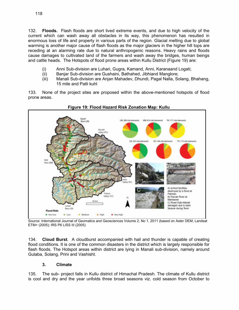
118
132. Floods. Flash floods are short lived extreme events, and due to high velocity of the current which can wash away all obstacles in its way, this phenomenon has resulted in enormous loss of life and property in various parts of the region. Glacial melting due to global warming is another major cause of flash floods as the major glaciers in the higher hill tops are receding at an alarming rate due to natural anthropogenic reasons. Heavy rains and floods cause damages to cultivated land of the farmers and wash away the bridges, human beings and cattle heads. The Hotspots of flood prone areas within Kullu District (Figure 19) are:
(i) Anni Sub-division are Luhari, Gugra, Kamand, Anni, Karanaand Logati; (ii) Banjar Sub-division are Gushaini, Bathahed, Jibhiand Manglore; (iii) Manali Sub-division are Anjan Mahadev, Dhundi, Pagal Nalla, Solang, Bhahang,
15 mile and Patli kuhl
133. None of the project sites are proposed within the above-mentioned hotspots of flood prone areas.
Figure 19: Flood Hazard Risk Zonation Map: Kullu
Source: International Journal of Geomatics and Geosciences Volume 2, No 1, 2011 (based on Aster DEM, Landsat ETM+ (2005); IRS P6 LISS III (2005)
134. Cloud Burst. A cloudburst accompanied with hail and thunder is capable of creating flood conditions. It is one of the common disasters in the district which is largely responsible for flash floods. The Hotspot areas within district are lying in Manali sub-division, namely around Gulaba, Solang, Prini and Vashisht.
3. Climate
135. The sub- project falls in Kullu district of Himachal Pradesh. The climate of Kullu district is cool and dry and the year unfolds three broad seasons viz. cold season from October to
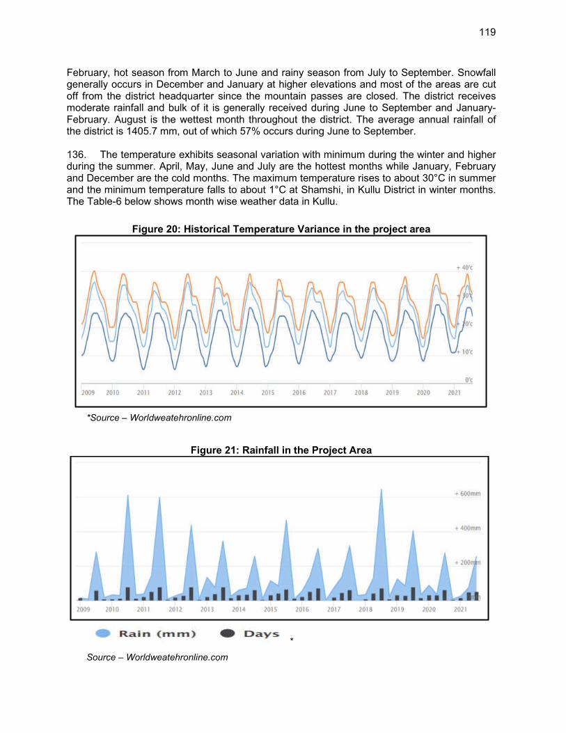
119
February, hot season from March to June and rainy season from July to September. Snowfall generally occurs in December and January at higher elevations and most of the areas are cut off from the district headquarter since the mountain passes are closed. The district receives moderate rainfall and bulk of it is generally received during June to September and January-February. August is the wettest month throughout the district. The average annual rainfall of the district is 1405.7 mm, out of which 57% occurs during June to September. 136. The temperature exhibits seasonal variation with minimum during the winter and higher during the summer. April, May, June and July are the hottest months while January, February and December are the cold months. The maximum temperature rises to about 30°C in summer and the minimum temperature falls to about 1°C at Shamshi, in Kullu District in winter months. The Table-6 below shows month wise weather data in Kullu.
Figure 20: Historical Temperature Variance in the project area
*Source – Worldweatehronline.com
Figure 21: Rainfall in the Project Area
*
Source – Worldweatehronline.com
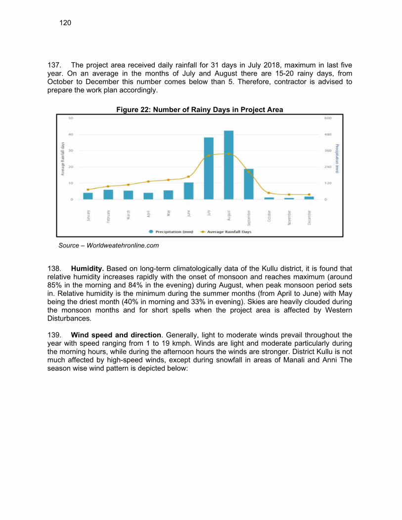
120
137. The project area received daily rainfall for 31 days in July 2018, maximum in last five year. On an average in the months of July and August there are 15-20 rainy days, from October to December this number comes below than 5. Therefore, contractor is advised to prepare the work plan accordingly.
Figure 22: Number of Rainy Days in Project Area
Source – Worldweatehronline.com
138. Humidity. Based on long-term climatologically data of the Kullu district, it is found that relative humidity increases rapidly with the onset of monsoon and reaches maximum (around 85% in the morning and 84% in the evening) during August, when peak monsoon period sets in. Relative humidity is the minimum during the summer months (from April to June) with May being the driest month (40% in morning and 33% in evening). Skies are heavily clouded during the monsoon months and for short spells when the project area is affected by Western Disturbances. 139. Wind speed and direction. Generally, light to moderate winds prevail throughout the year with speed ranging from 1 to 19 kmph. Winds are light and moderate particularly during the morning hours, while during the afternoon hours the winds are stronger. District Kullu is not much affected by high-speed winds, except during snowfall in areas of Manali and Anni The season wise wind pattern is depicted below:
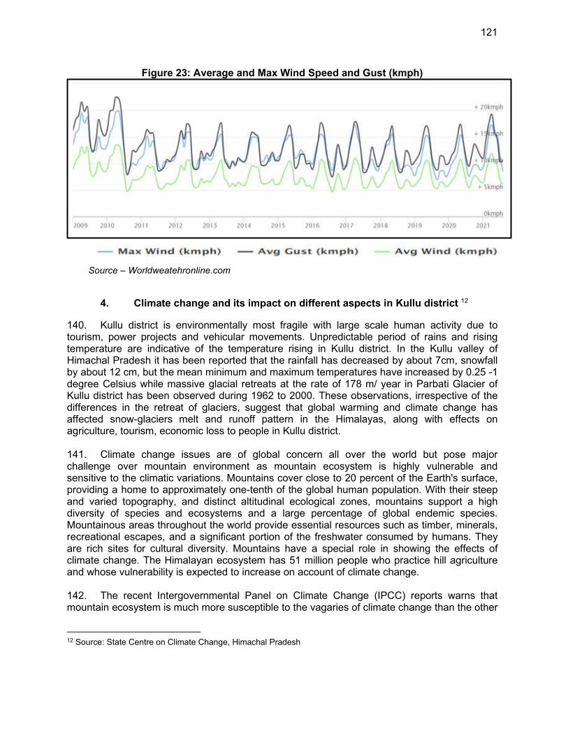
121
Figure 23: Average and Max Wind Speed and Gust (kmph)
Source – Worldweatehronline.com
4. Climate change and its impact on different aspects in Kullu district 12
140. Kullu district is environmentally most fragile with large scale human activity due to tourism, power projects and vehicular movements. Unpredictable period of rains and rising temperature are indicative of the temperature rising in Kullu district. In the Kullu valley of Himachal Pradesh it has been reported that the rainfall has decreased by about 7cm, snowfall by about 12 cm, but the mean minimum and maximum temperatures have increased by 0.25 -1 degree Celsius while massive glacial retreats at the rate of 178 m/ year in Parbati Glacier of Kullu district has been observed during 1962 to 2000. These observations, irrespective of the differences in the retreat of glaciers, suggest that global warming and climate change has affected snow-glaciers melt and runoff pattern in the Himalayas, along with effects on agriculture, tourism, economic loss to people in Kullu district. 141. Climate change issues are of global concern all over the world but pose major challenge over mountain environment as mountain ecosystem is highly vulnerable and sensitive to the climatic variations. Mountains cover close to 20 percent of the Earth's surface, providing a home to approximately one-tenth of the global human population. With their steep and varied topography, and distinct altitudinal ecological zones, mountains support a high diversity of species and ecosystems and a large percentage of global endemic species. Mountainous areas throughout the world provide essential resources such as timber, minerals, recreational escapes, and a significant portion of the freshwater consumed by humans. They are rich sites for cultural diversity. Mountains have a special role in showing the effects of climate change. The Himalayan ecosystem has 51 million people who practice hill agriculture and whose vulnerability is expected to increase on account of climate change. 142. The recent Intergovernmental Panel on Climate Change (IPCC) reports warns that mountain ecosystem is much more susceptible to the vagaries of climate change than the other
12 Source: State Centre on Climate Change, Himachal Pradesh
122
regions of earth and poses serious challenge to the people of mountain regions in dealing with this global threat for sustaining their economic and social development. The state of Himachal Pradesh, which forms a part of the North-western Himalaya, is environmentally fragile and ecologically vulnerable. occurrence of natural hazards emanating from the effects of climatologically variations are a matter of immediate concern to the state of Himachal Pradesh, as every year the state experiences the fury of nature in various forms-like cloudburst, flash floods, landslides, snow avalanches droughts etc. The fragile ecology of the mountain state coupled with large variations in physico-climatic conditions has rendered it vulnerable to vagaries of climate. The incidence of cloudbursts in the last few years has baffled both the meteorologist and the common man equally. Notwithstanding, continuous efforts made by the Government to cope with such hazards through relief and rehabilitation measures, the recurrence of uncertainties continue to inflict widespread harm and damage to human life as well as property. The roads that are the state’s lifeline are repeatedly damaged, blocked or washed away by one or the other acts of nature. The Snow and glaciers which are considered to be best indicators of changing climate have been affected by the rising temperature throughout the Himalayan belt. It has been observed that the estimates on the magnitude of glacial retreat and their impact on natural resources have been varying considerably. However, the impact of climate change and rising temperature has been noticed even by a common man in far flung parts of the Himalayan eco system. Depletion of small glaciers in the Himachal Himalaya which were providing the sustained discharge to many rivulets for irrigation to agriculture fields and sustaining the water resources in downstream areas has been reported by the villagers.
5. Surface Water
143. Water bodies present in the area are Beas River, Satluj River, Parvati river, Tirthan Khad, Saravri Khad, Kurphan Khad, Bhargol Khad and Joan Khad, and other small khads, nallahs and spring sources. Maps showing these river courses, tributaries, and proposed intake/check dam location etc are given in Figure 27. 144. Water sources proposed in MZ-01 are Tirthan Khad, Joan Khad, Shaoun Nallah, Khaud Nallah, Kais nallah, Sotak Nallah, Lohal Nallah, Bhargol Nallah and Kurpan Khad
(i) Beas River: Beas River is a snow and rain fed perennial river of length 470 km. The river rises from the Beaskund in the Pir Panjal range near the Rohtang Pass. The Beas runs for about 260 km in Himachal Pradesh before entering Punjab at Murtha. Major tributaries of Beas are Tirthan river, Parvati River, Neugal Khad, Gaj Khad etc. Its catchment area consists of parts of district Kullu, Mandi, Kangra in Himachal Pradesh and Gurdaspur, Hoshiarpur and Kapurthala in Punjab. Thanks to its snow-fed tributaries, water levels of this river increases greatly during the monsoons, sometimes resulting in floods. Pandoh Dam and Pong Dam are the major dams built on River Beas Pong dam of height 133m is built across river Beas near Sansarpur having storage of 8570-million-meter cube.
(ii) Satluj River: Satluj river (Sathdru river) is snow and rainfed river of length
~1448 km. River Satluj rises from beyond Indian borders in the Southern slopes of the Kailash Mountain near Mansarover lake. Sutlej flows through Shimla, Bilaspur before exiting from Bhakra village to enter into Punjab. Major tributaries of Satluj river are Beas River, Bakhal Khad, Jwala Khad, Thunag
123
Khad and Soul Khad and its catchment area comprises of Rakshastal lake and Parts of Shimla, Mandi, Kullu, Bilaspur in Himachal Pradesh. The Bhakra Nangal Dam of height 226m is a major dam built across the river having storage of capacity 9340 million-meter cube.
(iii) Parvati River: Parvati River is snow fed river of length ~80 km, River Parvati
originates from Parvati paravat and merges with river Beas near Kullu. Tributaries of river are small khads and springs, having catchment area of parts of Kullu district.
(iv) Trithan Khad: Tirthan Khad is a snow fed khad of length ~50 km, Tirthan Khad originates from near Srikant Mahadev and merges with river Beas near Larji at about 30 km downstream of Kullu. Tirthan Khad contributes water from various small khads and springs in the catchment area. Catchment area of the khad comprises of parts of Kullu district.
(v) Saravari Khad: Saravari Khad is a snow fed khad of length ~30 km, Saravari Khad originates from near Pichli and merges with river Beas near Kullu. Saravari Khad contributes water from various small khads and springs in the catchment area. Catchment area of the khad comprises of parts of Kullu district.
(vi) Joan Khad: Joan Khad is a snow fed khad of length ~25 km, Joan Khad originates from near Khanag and merges with river Satluj near Behna at about 35 km downstream of Rampur. Joan Khad contributes water from various small khads and springs in the catchment area. Catchment area of the khad comprises of parts of Kullu district Block Anni.
(vii) Bhargol Khad: Bhargol Khad is a snowfed khad of length ~10 km, Bhargol Khad originates from near Bachher and merges with Joan Khad near Shamshar. Bhargol Khad contributes water from various small khads and springs in the catchment area. Catchment area of the khad comprises of parts of Panchayat Kohila, Manja desh etc.
(viii) Shoun Nallah: Shoun Nallah is a snowfed nallah of length ~3 km, Shaun Nallah originates from near Lal Jougni Temple and merges with Joan Khad about 1 Km above the proposed diversion spur on Joan Khad. Shoun Nallah contributes water from small springs in the catchment area. Catchment area of the Nallah comprises of parts of Panchayat Manja desh etc.
(ix) Khaud Nallah: Khaud Nallah is a snowfed khad of length ~7 km, Khuad Nallah originates from village Pini and merges with Kais nallah about 300m above the proposed Bore well Bandrol. Khaud Nallah contributes water from small springs in the catchment area. Catchment area of the Nallah comprises of parts of Panchayat Kais etc.
(x) Kais Nallah: Kasi Nallah is a snowfed khad of length ~6 km, Kais Nallah originates from village Kais and merges with River Beas near proposed Bore well Bandrol. Kais Nallah contributes water from small springs in the catchment area. Catchment area of the Nallah comprises of parts of Panchayat Kais etc.
(xi) Sotak Nallah: Sotak Nallah is a snowfed khad of length ~5 km, Sotak Nallah originates from near Temple maharishi Jamdagni at Sees and merges with another khad near Rupi Valley. Sotak Nallah contributes water from small springs in the catchment area. Catchment area of the Nallah comprises of parts of Panchayat Jaistha etc.
(xii) Lohal Nallah: Lohal Nallah is a snowfed khad of length ~3 km, Lohal Nallah originates from near Jalori Pass and merges with Bhargol khad. Lohal Nallah contributes water from small springs in the catchment area. Catchment area of the Nallah comprises of parts of Panchayat Kohila etc.
124
145. The major sources of irrigation are small water channels or the Kuhl’s in the district and an area of 363 sq. km is brought under irrigation by various sources like canals, tanks, wells, and other sources. 146. Sources proposed in the project area are located in isolated areas where no potential pollution source is found. 147. Since Beas is the only river of significance in the subproject region so water quality data of this river obtained under MINARS Program 2019-20 is given in Table 23. The results shows the Beas river water quality meets surface water quality criteria of Class-C.13
148. The water quality monitoring will be conducted by the DBO contractor prior to the start of construction works. The JSV has also conducted water testing at different sources at HP IPH Water Testing Laboratory to determine the suitability of water for potable purpose. The test results are attached as Appendix 9.
13 Drinking water source after conventional treatment and disinfection
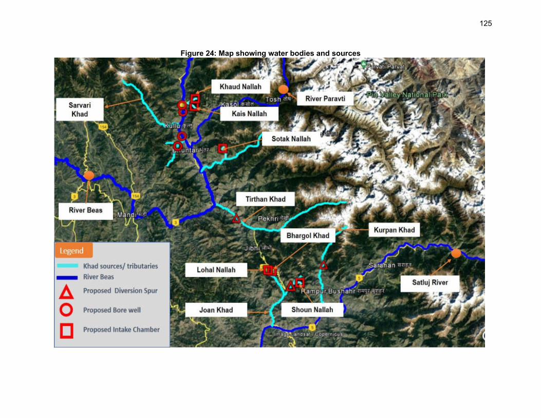
125
Figure 24: Map showing water bodies and sources
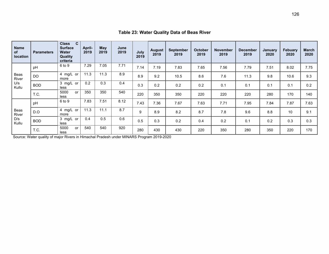
126
Table 23: Water Quality Data of Beas River
Source: Water quality of major Rivers in Himachal Pradesh under MINARS Program 2019-2020
Name of location
Parameters
Class C Surface Water Quality criteria
April-2019
May 2019
June 2019
July 2019
August 2019
September2019
October2019
November2019
December2019
January2020
Febuary2020
March2020
Beas River U/s Kullu
pH 6 to 9 7.29 7.05 7.71
7.14 7.19 7.83 7.65 7.56 7.79 7.51 8.02 7.75
DO 4 mg/L or more
11.3 11.3 8.9 8.9 9.2 10.5 8.6 7.6 11.3 9.8 10.6 9.3
BOD 3 mg/L or less
0.2 0.3 0.4 0.3 0.2 0.2 0.2 0.1 0.1 0.1 0.1 0.2
T.C. 5000 or less
350 350 540 220 350 350 220 220 220 280 170 140
Beas River D/s Kullu
pH 6 to 9 7.83 7.51 8.12
7.43 7.36 7.67 7.63 7.71 7.95 7.84 7.87 7.63
D.O 4 mg/L or more
11.3 11.1 8.7 9 8.9 8.2 8.7 7.8 9.6 8.8 10 9.1
BOD 3 mg/L or less
0.4 0.5 0.6 0.5 0.3 0.2 0.4 0.2 0.1 0.2 0.3 0.3
T.C. 5000 or less
540 540 920 280 430 430 220 350 280 350 220 170
127
6. Ground Water
149. Hydrogeologically the entire area of Kullu district can be divided into porous and fissured formations. Porous formation includes the unconsolidated sediments. These sediments include fluvial channel deposits, valley fill deposits, terrace deposits and alluvial fans. These sediments form the potential aquifers. Unconsolidated sediments underlie Kullu valley, Garsa valley, Manikaran valley, Lag valley and longitudinal valley all along the major rivers and khads. 150. Fissured formation includes the semi-consolidated to consolidated sediments exposed in the district and are of sedimentary, metamorphic and igneous in origin. These form low to high hill ranges throughout the district.
151. In the project areas under Kullu valley, ground water generally occurs under confined to semi- confined conditions. Phreatic aquifers are tapped mainly by open wells and form major source of domestic and irrigation water supply in the valley area. The aquifer zone mainly comprises of sand and silt in association with pebbles and boulders in low plains and predominantly boulders, cobbles, pebbles mixed with little clay in terraces. Static water level varies from 1.62m to 31.45m below ground level. The discharge of these wells varies from 299 lpm to 1079 lpm. 152. The source of major water supply schemes are based on springs in the district. The discharge of the springs varies from 0.5 lps to 25 lps. Majority of the springs are gravity springs. In gravity springs, the most common are the contact springs, which are formed by permeable water bearing formations overlying less permeable formations the contact of these formations intersects the ground surface.
153. Snow fall in the higher reaches and rain fall in the lower areas, recharge the ground water. Springs are the other main sources for the irrigation and water supply schemes. Major water supply schemes are based on springs and surface water. The excess of silt in major rivers, create problems for water supply schemes. Kullu valley, located along the Beas River, Lag valley located along Sarvary khad, Garsa valley-located in the eastern part of Kullu district, Manikaran valley- located along Parbati River and small valleys in Sainj, Banjar, Ani can be explored for the development of ground water for round the year and fresh water supplies to the public and for irrigation purpose. 154. The stage of ground water development in Kullu district has not been calculated due to hilly terrain and localized aquifers. Hence no area or block in the district has been notified from the groundwater development point of view.

128
155. To establish baseline scenario, ground water quality data was obtained from the Central Ground Water Board is given below in Table 24. Ground water quality in the district is in general good both for irrigation and domestic purposes. Both Surface and Groundwater quality monitoring will be conducted in the pre-construction phase (Service Improvement Period) by the contractor and shall be appended in the updated IEE.
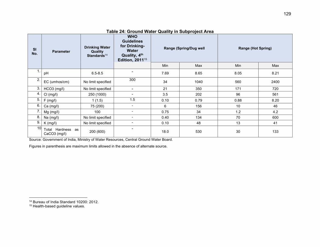
129
Table 24: Ground Water Quality in Subproject Area
Sl No.
Parameter Drinking Water
Quality Standards14
WHO Guidelines
for Drinking-Water
Quality, 4th Edition, 201115
Range (Spring/Dug well Range (Hot Spring)
Min Max Min Max
1. pH 6.5-8.5 - 7.69 8.65 8.05 8.21
2. EC (umhos/cm) No limit specified
300 34 1040 560 2400
3. HCO3 (mg/l) No limit specified - 21 350 171 720
4. Cl (mg/l) 250 (1000) - 3.5 202 96 561
5. F (mg/l) 1 (1.5) 1.5 0.10 0.79 0.88 8.20
6. Ca (mg/l) 75 (200) - 6 156 10 46
7. Mg (mg/l) 100 - 0.75 34 1.2 4.2
8. Na (mg/l) No limit specified - 0.40 134 70 600
9. K (mg/l) No limit specified - 0.10 48 13 41
10. Total Hardness as CaCO3 (mg/l)
200 (600) -
18.0 530 30 133
Source: Government of India, Ministry of Water Resources, Central Ground Water Board.
Figures in parenthesis are maximum limits allowed in the absence of alternate source.
14 Bureau of India Standard 10200: 2012. 15 Health-based guideline values.

130
7. Air Quality
156. There are no industrial air pollution sources in the sub-project areas. The main source of air pollution and increased noise are vehicles along national highways. Ambient air quality and noise levels around the subproject sites, are expected to be within Central Pollution Control Board standards as the sites are in the hills and these may be classified as silence zones. In order to record baseline ambient air quality, data published by Central Pollution Control Board (CPCB) has been referred. The data for ambient air for Kullu has been obtained from the report on National Ambient Air Quality Status and Trends 2019 published by CPCB and is given in Table 25. It is clear from these tables that ambient air quality is well within the limits in respect of SO2 and NOx, but PM10 levels are exceeding the limit in Manali. At subproject sites PM10 is also expected to be within the limits as sites are away for commercial areas as these monitored values are at busy commercial locations of Kullu-Manali.
Table 25: Ambient Air Quality data
Sl
No.
Location µg/m³
(24 hourly average)
Parameter
SO2 NOx PM10
1 Gulaba Kullu Minimum 2 5 8
Maximum 3 7 62
Average 2 5 37
2 Vashisht
Kullu
Minimum 2 5 26
Maximum 4 11 96
Average 2 5 48
3 Manali Kullu
Minimum 2 6 19
Maximum 4 16 217
Average 2 8 64
National Ambient Air Quality Standard (µg/m3),2009 (24 hour)
80 80 100
WHO Air Quality Guidelines, 2005 (µg/m3) (24 hour)
20 - 50
Source: https://cpcb.nic.in/upload/NAAQS_2019.pdf
8. Noise Level
157. There are no industrial establishments in and around the subproject area. As the traffic density is very low, the noise either from point or nonpoint sources is not expected in the project area. Moreover, there will be limited rise in noise levels due to proposed construction activity and the impact would be temporary and reversible. Noise levels data is not available for the sub project site locations. The data available for the nearest location Kullu has been referred. This data has been given in Table 26. It is clear from this table that night time levels are exceeding the limits. The night time levels are higher as these measurements for noise levels were conducted by the CPCB during festival time. However, the noise levels are expected to be well within the stipulated limits at sub-project sites as there are no sources of air or noise pollution near the sites. Air and Noise level monitoring will be conducted by the contractor prior to start of construction to establish baseline conditions.
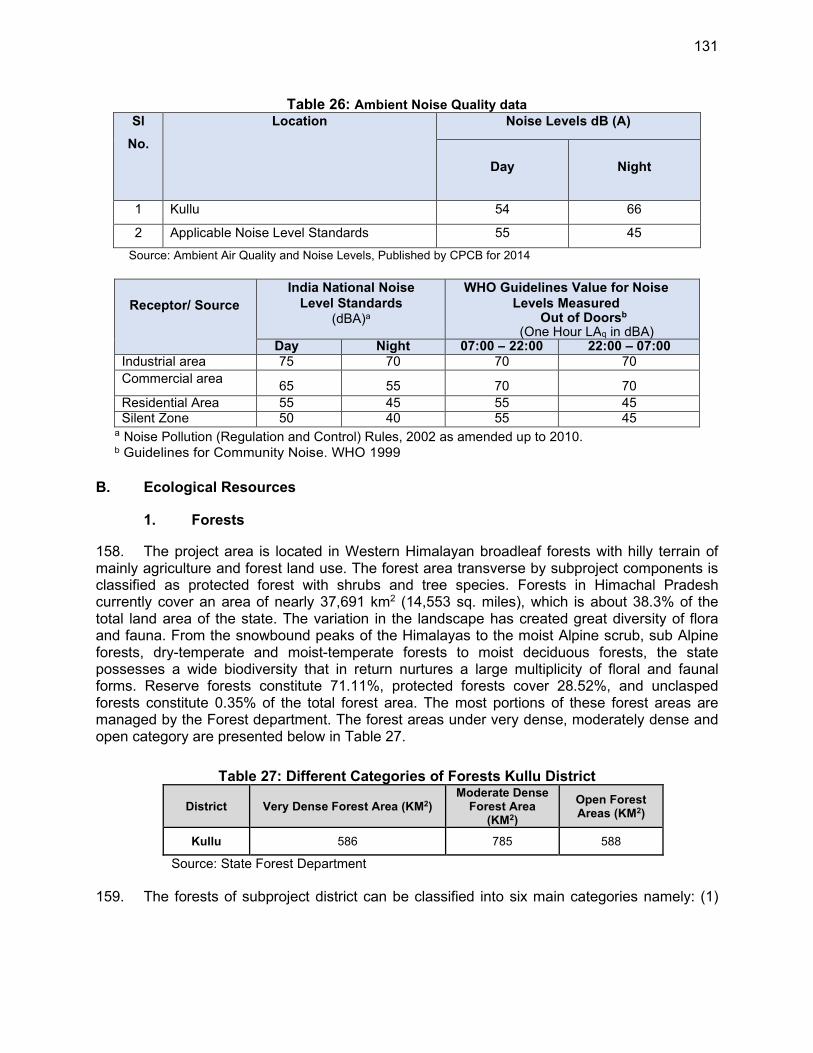
131
Table 26: Ambient Noise Quality data
Sl
No.
Location Noise Levels dB (A)
Day Night
1 Kullu 54 66
2 Applicable Noise Level Standards 55 45
Source: Ambient Air Quality and Noise Levels, Published by CPCB for 2014
Receptor/ Source
India National Noise
Level Standards (dBA)a
WHO Guidelines Value for Noise
Levels Measured Out of Doorsb
(One Hour LAq in dBA) Day Night 07:00 – 22:00 22:00 – 07:00
Industrial area 75 70 70 70
Commercial area 65 55 70 70
Residential Area 55 45 55 45 Silent Zone 50 40 55 45
a Noise Pollution (Regulation and Control) Rules, 2002 as amended up to 2010. b Guidelines for Community Noise. WHO 1999
B. Ecological Resources
1. Forests
158. The project area is located in Western Himalayan broadleaf forests with hilly terrain of mainly agriculture and forest land use. The forest area transverse by subproject components is classified as protected forest with shrubs and tree species. Forests in Himachal Pradesh currently cover an area of nearly 37,691 km2 (14,553 sq. miles), which is about 38.3% of the total land area of the state. The variation in the landscape has created great diversity of flora and fauna. From the snowbound peaks of the Himalayas to the moist Alpine scrub, sub Alpine forests, dry-temperate and moist-temperate forests to moist deciduous forests, the state possesses a wide biodiversity that in return nurtures a large multiplicity of floral and faunal forms. Reserve forests constitute 71.11%, protected forests cover 28.52%, and unclasped forests constitute 0.35% of the total forest area. The most portions of these forest areas are managed by the Forest department. The forest areas under very dense, moderately dense and open category are presented below in Table 27.
Table 27: Different Categories of Forests Kullu District
District Very Dense Forest Area (KM2) Moderate Dense
Forest Area (KM2)
Open Forest Areas (KM2)
Kullu 586 785 588
Source: State Forest Department
159. The forests of subproject district can be classified into six main categories namely: (1)
132
the tropical dry deciduous forests, (2) the Sal forests (3) the Chir forests, (4) the oak forests, (5) the deodar, fir and spruce forests, and (5) the alpine pastures. Some of the project components are proposed to be constructed on Protected Forest (PF)16 Given the large expanse of forest lands in Himachal Pradesh, locating some subproject facilities in forest lands is unavoidable. Some project components like intake, WTP, reservoirs are falling within protected forest areas and some tree cutttings may be required, which wil be assessed during the detailed design. A total of 2.39 Ha Forest land occurring in six grids need to be diverted for this purpose. Project will require small parcel of lands at 131 locations spread over six grids in entire zone area. Water pipelines at some locations will also traverse forest areas, but mostly along forest trails / earthern roads, where there are no notable trees. Forest department has exempted clearance procedure for laying of drinking water pipelines requiring excavation/trench of less than 1m width and 2 m depth along the roads in forest land. The proposed trench width is 0.6m, hence permission from local forest department will be adequate for pipeline laying (Appendix 7). The pipelines will be laid along the right of way (ROW) of existing roads. During pipe laying works tree cutting is not envisaged as per preliminary design, however it will be finalised during detailed design period. If any tree is required to be cut, compensatory tree plantation will be carried out in 1:10 ratio.
160. The complete vegetation of Himachal Pradesh relies on two factors - height and rainfall. The southern most part of the state is at a lower altitude level and it contains both humid and subtropical dry broadleaf woodlands, along with subtropical moist broadleaf forests. Majority of the area is covered by Himalayan subtropical broadleaf forests. Apart from this, the state has some of the vegetation that is abundant with Sal, Sisham, chir pine, dry deciduous, and moist broad-leafed forests. The landscape that falls in temperate regions has trees like oak, deodar, blue pine, fir, and spruce. The trees found in higher elevations include alders, birches, rhododendrons, and moist alpine scrubs. Himachal Pradesh has abundant fruits like apple, peaches, plums, and berries. It is rightly called the “fruit bowl of India.” There are plenty of fruit orchards, and fruits are exported to various parts of the country and abroad. The pleasant climate also helps numerous flower varieties like gladiolas, lilies, tulips, chrysanthemums, roses, marigolds, carnations, etc. to grow in abundance. 161. Himachal Pradesh is home to approximately 1,200 birds and 359 animal species. This includes leopards, Ghoral, snow leopard, musk deer (state animal), and western tragopan (state bird). The state is an ideal tourist destination for animal lovers as it hosts 12 main National Parks and sanctuaries. It has two major national sanctuaries-the Great Himalayan National Park and the Pin Valley National Park. 162. Flora and Fauna around Subproject area. The common trees in the surroundings of sub-project sites are West Himalayan Fir, Chir, Deodar, West Himalayan Spruce, Tree of heaven, White Siri’s tree, Jungli Gulab, Bill Toon, Indian Rosewood, Bakli, Safeda, Crepe myrtle, Persian Lilac, Chir pine, Black Poplar, Behera, Harada, Toon, etc. The medicinal and fruit trees include Bengal quince, Horse Chestnut, West Himalayan Alder, Indian Spindle Tree, Laurel, Beleric Myrobalan and Chebulic Myrobalan. Other fruit yield plants are Nettle tree, Himalayan Strawberry Tree, Wild fig, Silver Oak, Box myrtle, Indian Olive, Indian gooseberry,
16 The State Government is empowered to constitute any land other than reserved forests as protected forests over
which the Government has proprietary rights and the power to issue rules regarding the use of such forests. This power has been used to establish State control over trees, whose timber, fruit or other non-wood products have revenue-raising potential.
133
Armenian plum, Wild Himalayan cherry, Himalayan Bird Cherry, Wild pears, Himalayan Pears, Soap nut tree and Indian plum. There are no endangered or rare species of flora at any of the subproject sites. At few sites some trees need to be cut to facilitate construction. 163. The fauna in the surroundings of sub-project sites includes - Birds such as Bagola, Tota, Wild cock, Koel, Crow, and Mayna. Among the mammal’s main animals are Black Bear, Jungle Rat, Indian Leopard, Monkey, Red Fox, common squirrel, Moles, Shrews, cow, goat, etc. The main reptiles found are Girgit, Dhaman, etc. No evidences of endangered or rare species fauna at any sites could be found during consultation with forest department and local inquiry. The grid wise details of type of forests involved, flora and fauna are given in the Table 28. 164. From an aquatic perspective, the project area falls within the Ganges-Himalayan Foothill freshwater ecoregion. It is an area of very high aquatic species richness and was believed to be an area of only moderate aquatic species endemism. For aquatic species, freshwater habitat is the most important parameter to consider in the selection of an ecologically contiguous area. In Himachal Pradesh 61 species of fish observed, belongs into 13 families in general waters and trout waters, with estimated length of 600 km and 2400 km respectively. The major fishes available in these streams are Trout, Mahseer (Tor putitora), Nemacheilus spp, Barilus sp, Schizothoracids Crossocheilus sp. Glyptothorax spp. etc. Rainbow trout and Mahasheer are the important fishes in Himachal Pradesh. The trout being the focal fish, the seed of brown and rainbow trout used to be produced in three trout farms located at Chirgoan, Mahli/ Patlikuhl and Barot. Beas River and its tributaries in the Kullu valley is habitat for both brown and rainbow trout, while many rivers and streams in the Kangra valley are well-known for Mahseer. Mahseer is distributed all along the Himalayas including the freshwaters of Kashmir, Sikkim, Himachal Pradesh, Uttar Pradesh, Punjab, Haryana, Darjeeling district of West Bengal and Assam. It inhabits the mountains and sub mountains regions, running streams and rivers. The fish species is present in around 500 sq. km area of Himachal Pradesh state. The rivers Beas and Satluj in Himachal Pradesh like other Himalyan rivers supports a good population of T. putitora. The state has recorded highest 45.311 MT Mahseer catches during year 2019-20. The production is mainly from water reservoirs named Gobind Sagar, Koldam, Pong Dam and Ranjeet Sagar. The state has Golden Mahseer fish eggs production of 20900, 28700 and 41450 during year 2017-18, 2018-19 and year 2019-20; respectively.
165. As per the information obtained from Fisheries department (Appendix 6A) and consultations with the local people fish found in the subproject area are Schizothorax sp, Minnows, Chal Cyprinus Carpio (Common carp), and Rainbow/Brown Trouts. There is no endangered aquatic species of fishes in the water bodies proposed in the sub-project as per the IUCN Red list of Threatened Species 2010. Proposed sub-project components excluding intake structures (Intake chambers and diversion spurs ) are not proposed in the natural drainage channels, water bodies, river flood zones.
166. Further to confirm that there are no protected fish species (endangered or higher category as per IUCN Red List) in the water selected for project, an aquatic fauna / fisheries expert will conduct detailed field visit, consult with local people, fishing community, fisheries department, research agencies etc., Confirmatory field sampling surveys if deemed necessary by fisheries expert will be conducted. In case of any other source reported to have protected fish species, a biodiversity assessment study will be conducted to assess the impacts, and IEE will be updated accordingly and submitted to ADB for review, clearance and disclosure. In case of potential significant impacts, alternatives will be pursued.

134
167. Based on the discussion with the officials of local Fisheries department at Hamni, it may be concluded that the proposed intake structures will not create hurdle in the up and down stream movement of the fish as the continuity of the water flow will be maintained. The fish will move downstream with the water current and upwards with the help of the caudal fin/tail fin. Considering very less water demand in comparison to lean period discharge in these sources, there will be no hindrance in the natural flow of water and movement of fishers.
.
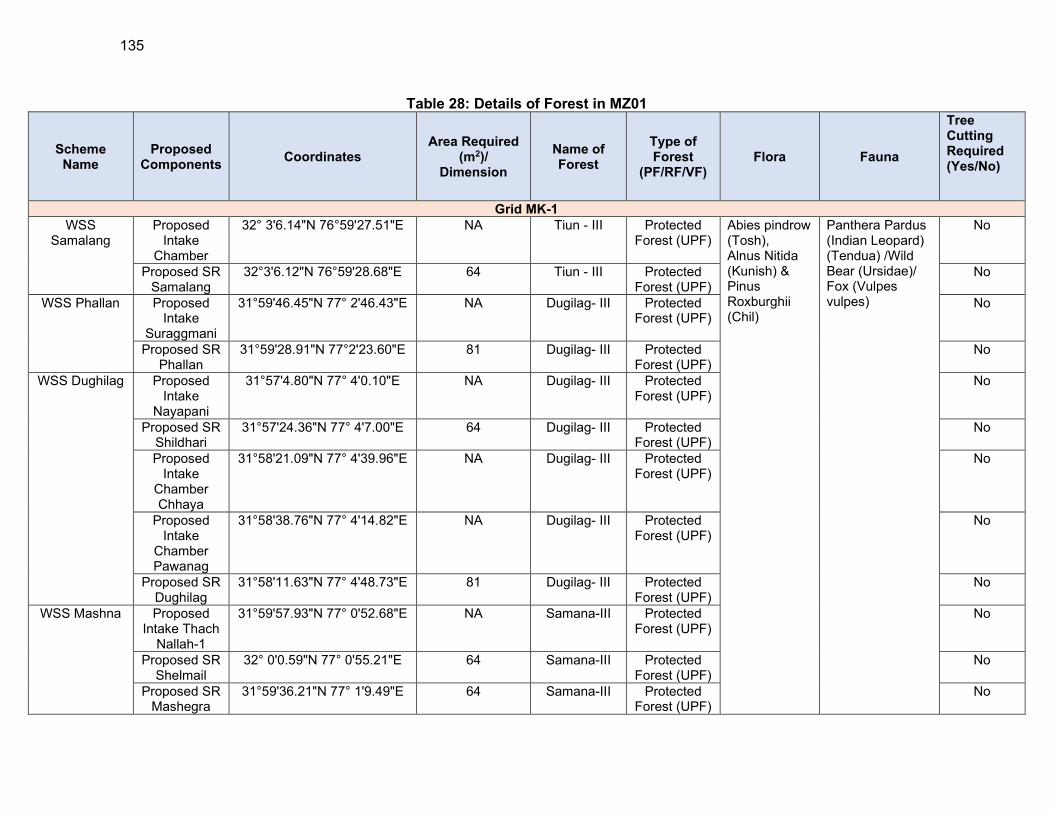
135
Table 28: Details of Forest in MZ01
Scheme Name
Proposed Components
Coordinates Area Required
(m2)/ Dimension
Name of Forest
Type of Forest
(PF/RF/VF) Flora Fauna
Tree Cutting Required (Yes/No)
Grid MK-1
WSS Samalang
Proposed Intake
Chamber
32° 3'6.14"N 76°59'27.51"E NA Tiun - III Protected Forest (UPF)
Abies pindrow (Tosh), Alnus Nitida (Kunish) & Pinus Roxburghii (Chil)
Panthera Pardus (Indian Leopard) (Tendua) /Wild Bear (Ursidae)/ Fox (Vulpes vulpes)
No
Proposed SR Samalang
32°3'6.12"N 76°59'28.68"E 64 Tiun - III Protected Forest (UPF)
No
WSS Phallan Proposed Intake
Suraggmani
31°59'46.45"N 77° 2'46.43"E NA Dugilag- III Protected Forest (UPF)
No
Proposed SR Phallan
31°59'28.91"N 77°2'23.60"E 81 Dugilag- III Protected Forest (UPF)
No
WSS Dughilag Proposed Intake
Nayapani
31°57'4.80"N 77° 4'0.10"E NA Dugilag- III Protected Forest (UPF)
No
Proposed SR Shildhari
31°57'24.36"N 77° 4'7.00"E 64 Dugilag- III Protected Forest (UPF)
No
Proposed Intake
Chamber Chhaya
31°58'21.09"N 77° 4'39.96"E NA Dugilag- III Protected Forest (UPF)
No
Proposed Intake
Chamber Pawanag
31°58'38.76"N 77° 4'14.82"E NA Dugilag- III Protected Forest (UPF)
No
Proposed SR Dughilag
31°58'11.63"N 77° 4'48.73"E 81 Dugilag- III Protected Forest (UPF)
No
WSS Mashna Proposed Intake Thach
Nallah-1
31°59'57.93"N 77° 0'52.68"E NA Samana-III Protected Forest (UPF)
No
Proposed SR Shelmail
32° 0'0.59"N 77° 0'55.21"E 64 Samana-III Protected Forest (UPF)
No
Proposed SR Mashegra
31°59'36.21"N 77° 1'9.49"E 64 Samana-III Protected Forest (UPF)
No
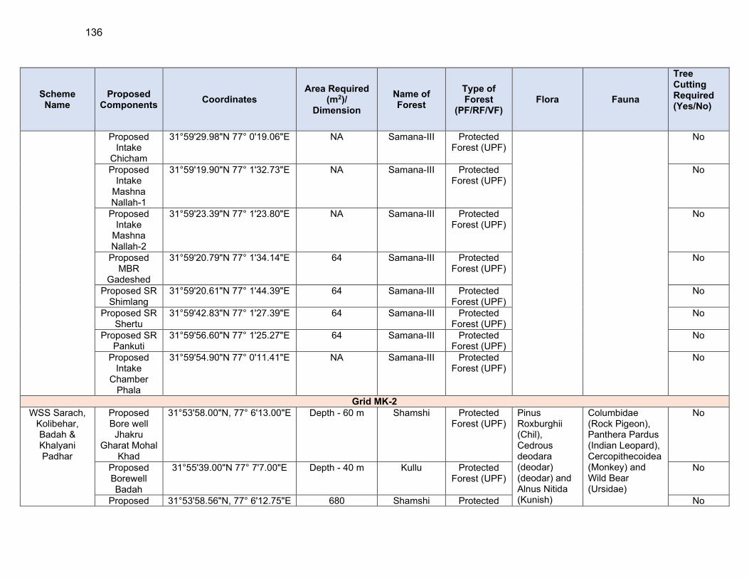
136
Scheme Name
Proposed Components
Coordinates Area Required
(m2)/ Dimension
Name of Forest
Type of Forest
(PF/RF/VF) Flora Fauna
Tree Cutting Required (Yes/No)
Proposed Intake
Chicham
31°59'29.98"N 77° 0'19.06"E NA Samana-III Protected Forest (UPF)
No
Proposed Intake
Mashna Nallah-1
31°59'19.90"N 77° 1'32.73"E NA Samana-III Protected Forest (UPF)
No
Proposed Intake
Mashna Nallah-2
31°59'23.39"N 77° 1'23.80"E NA Samana-III Protected Forest (UPF)
No
Proposed MBR
Gadeshed
31°59'20.79"N 77° 1'34.14"E 64 Samana-III Protected Forest (UPF)
No
Proposed SR Shimlang
31°59'20.61"N 77° 1'44.39"E 64 Samana-III Protected Forest (UPF)
No
Proposed SR Shertu
31°59'42.83"N 77° 1'27.39"E 64 Samana-III Protected Forest (UPF)
No
Proposed SR Pankuti
31°59'56.60"N 77° 1'25.27"E 64 Samana-III Protected Forest (UPF)
No
Proposed Intake
Chamber Phala
31°59'54.90"N 77° 0'11.41"E NA Samana-III Protected Forest (UPF)
No
Grid MK-2
WSS Sarach, Kolibehar, Badah & Khalyani Padhar
Proposed Bore well Jhakru
Gharat Mohal Khad
31°53'58.00"N, 77° 6'13.00"E Depth - 60 m Shamshi Protected Forest (UPF)
Pinus Roxburghii (Chil), Cedrous deodara (deodar) (deodar) and Alnus Nitida (Kunish)
Columbidae (Rock Pigeon), Panthera Pardus (Indian Leopard), Cercopithecoidea (Monkey) and Wild Bear (Ursidae)
No
Proposed Borewell Badah
31°55'39.00"N 77° 7'7.00"E Depth - 40 m Kullu Protected Forest (UPF)
No
Proposed 31°53'58.56"N, 77° 6'12.75"E 680 Shamshi Protected No
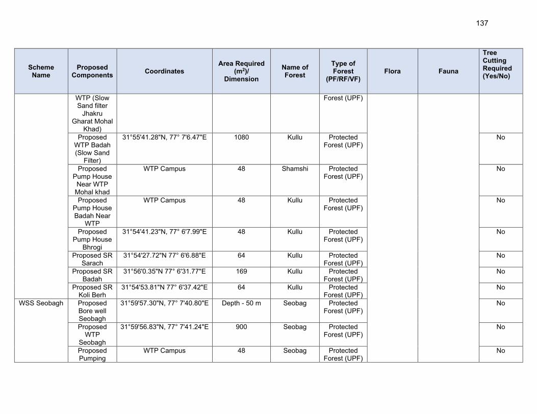
137
Scheme Name
Proposed Components
Coordinates Area Required
(m2)/ Dimension
Name of Forest
Type of Forest
(PF/RF/VF) Flora Fauna
Tree Cutting Required (Yes/No)
WTP (Slow Sand filter
Jhakru Gharat Mohal
Khad)
Forest (UPF)
Proposed WTP Badah (Slow Sand
Filter)
31°55'41.28"N, 77° 7'6.47"E 1080 Kullu Protected Forest (UPF)
No
Proposed Pump House
Near WTP Mohal khad
WTP Campus 48 Shamshi Protected Forest (UPF)
No
Proposed Pump House Badah Near
WTP
WTP Campus 48 Kullu Protected Forest (UPF)
No
Proposed Pump House
Bhrogi
31°54'41.23"N, 77° 6'7.99"E 48 Kullu Protected Forest (UPF)
No
Proposed SR Sarach
31°54'27.72"N 77° 6'6.88"E 64 Kullu Protected Forest (UPF)
No
Proposed SR Badah
31°56'0.35"N 77° 6'31.77"E 169 Kullu Protected Forest (UPF)
No
Proposed SR Koli Berh
31°54'53.81"N 77° 6'37.42"E 64 Kullu Protected Forest (UPF)
No
WSS Seobagh Proposed Bore well Seobagh
31°59'57.30"N, 77° 7'40.80"E Depth - 50 m Seobag Protected Forest (UPF)
No
Proposed WTP
Seobagh
31°59'56.83"N, 77° 7'41.24"E 900 Seobag Protected Forest (UPF)
No
Proposed Pumping
WTP Campus 48 Seobag Protected Forest (UPF)
No

138
Scheme Name
Proposed Components
Coordinates Area Required
(m2)/ Dimension
Name of Forest
Type of Forest
(PF/RF/VF) Flora Fauna
Tree Cutting Required (Yes/No)
Station Seobagh
Near WTP Proposed
MBR Seobagh
31°59'58.62"N 77° 8'23.07"E 100 Seobag Protected Forest (UPF)
Yes
Proposed SR Malhar
32° 0'28.67"N 77° 8'18.22"E 64 Seobag Protected Forest (UPF)
No
Proposed SR Hawai
31°59'29.20"N 77° 8'13.36"E 64 Seobag Protected Forest (UPF)
No
WSS Dharaghot
Proposed Intake
Chamber Khuad Nallah
32° 1'46.17"N 77°10'7.52"E NA kais -III Protected Forest (UPF)
No
Proposed Intake
Chamber Kais Nallah
32° 1'52.97"N 77°10'59.99"E NA kais -III Protected Forest (UPF)
No
Proposed WTP (Slow Sand filter Kot Dhar)
32° 2'29.92"N 77° 9'25.79"E 680 kais -III Protected Forest (UPF)
No
Proposed WTP (Slow Sand filter
Ghot)
32° 0'31.07"N 77° 9'34.51"E 600 kais -III Protected Forest (UPF)
No
Proposed MBR Kot
Dhar
32° 2'29.92"N 77° 9'25.79"E 81 kais -III Protected Forest (UPF)
No
Proposed MBR Ghot
32° 0'31.07"N 77° 9'34.51"E 64 kais -III Protected Forest (UPF)
No
Proposed SR Sour
32° 2'27.16"N 77° 9'13.66"E 64 kais -III Protected Forest (UPF)
No
Proposed SR 32° 1'51.91"N 77° 9'6.93"E 81 kais -III Protected No
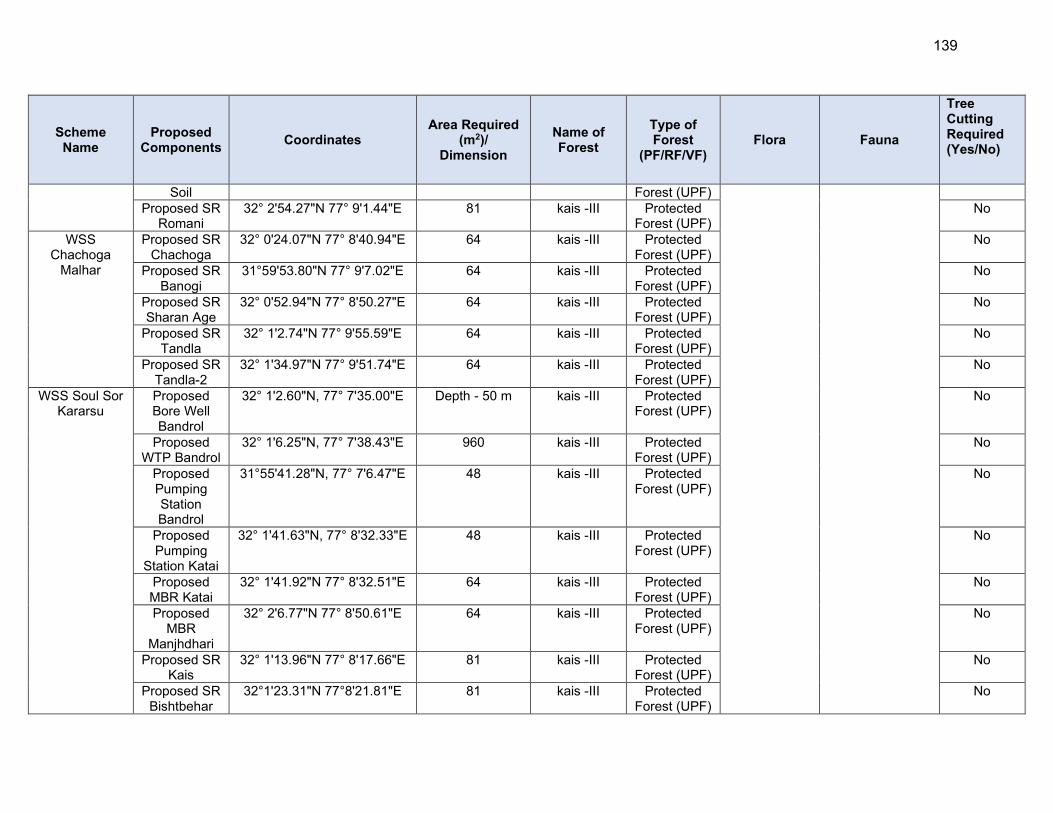
139
Scheme Name
Proposed Components
Coordinates Area Required
(m2)/ Dimension
Name of Forest
Type of Forest
(PF/RF/VF) Flora Fauna
Tree Cutting Required (Yes/No)
Soil Forest (UPF) Proposed SR
Romani 32° 2'54.27"N 77° 9'1.44"E 81 kais -III Protected
Forest (UPF) No
WSS Chachoga
Malhar
Proposed SR Chachoga
32° 0'24.07"N 77° 8'40.94"E 64 kais -III Protected Forest (UPF)
No
Proposed SR Banogi
31°59'53.80"N 77° 9'7.02"E 64 kais -III Protected Forest (UPF)
No
Proposed SR Sharan Age
32° 0'52.94"N 77° 8'50.27"E 64 kais -III Protected Forest (UPF)
No
Proposed SR Tandla
32° 1'2.74"N 77° 9'55.59"E 64 kais -III Protected Forest (UPF)
No
Proposed SR Tandla-2
32° 1'34.97"N 77° 9'51.74"E 64 kais -III Protected Forest (UPF)
No
WSS Soul Sor Kararsu
Proposed Bore Well Bandrol
32° 1'2.60"N, 77° 7'35.00"E Depth - 50 m kais -III Protected Forest (UPF)
No
Proposed WTP Bandrol
32° 1'6.25"N, 77° 7'38.43"E 960 kais -III Protected Forest (UPF)
No
Proposed Pumping Station Bandrol
31°55'41.28"N, 77° 7'6.47"E 48 kais -III Protected Forest (UPF)
No
Proposed Pumping
Station Katai
32° 1'41.63"N, 77° 8'32.33"E 48 kais -III Protected Forest (UPF)
No
Proposed MBR Katai
32° 1'41.92"N 77° 8'32.51"E 64 kais -III Protected Forest (UPF)
No
Proposed MBR
Manjhdhari
32° 2'6.77"N 77° 8'50.61"E 64 kais -III Protected Forest (UPF)
No
Proposed SR Kais
32° 1'13.96"N 77° 8'17.66"E 81 kais -III Protected Forest (UPF)
No
Proposed SR Bishtbehar
32°1'23.31"N 77°8'21.81"E 81 kais -III Protected Forest (UPF)
No
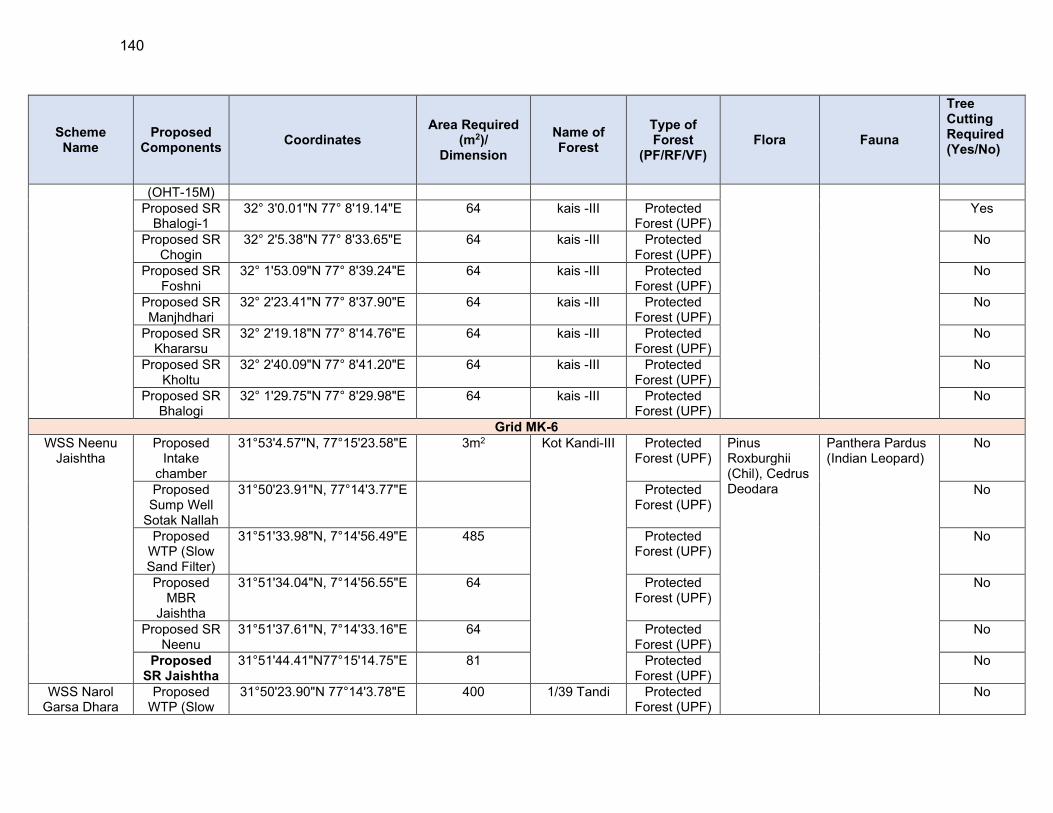
140
Scheme Name
Proposed Components
Coordinates Area Required
(m2)/ Dimension
Name of Forest
Type of Forest
(PF/RF/VF) Flora Fauna
Tree Cutting Required (Yes/No)
(OHT-15M) Proposed SR
Bhalogi-1 32° 3'0.01"N 77° 8'19.14"E 64 kais -III Protected
Forest (UPF) Yes
Proposed SR Chogin
32° 2'5.38"N 77° 8'33.65"E 64 kais -III Protected Forest (UPF)
No
Proposed SR Foshni
32° 1'53.09"N 77° 8'39.24"E 64 kais -III Protected Forest (UPF)
No
Proposed SR Manjhdhari
32° 2'23.41"N 77° 8'37.90"E 64 kais -III Protected Forest (UPF)
No
Proposed SR Khararsu
32° 2'19.18"N 77° 8'14.76"E 64 kais -III Protected Forest (UPF)
No
Proposed SR Kholtu
32° 2'40.09"N 77° 8'41.20"E 64 kais -III Protected Forest (UPF)
No
Proposed SR Bhalogi
32° 1'29.75"N 77° 8'29.98"E 64 kais -III Protected Forest (UPF)
No
Grid MK-6
WSS Neenu Jaishtha
Proposed Intake
chamber
31°53'4.57"N, 77°15'23.58"E 3m2 Kot Kandi-III Protected Forest (UPF)
Pinus Roxburghii (Chil), Cedrus Deodara
Panthera Pardus (Indian Leopard)
No
Proposed Sump Well
Sotak Nallah
31°50'23.91"N, 77°14'3.77"E Protected Forest (UPF)
No
Proposed WTP (Slow Sand Filter)
31°51'33.98"N, 7°14'56.49"E 485 Protected Forest (UPF)
No
Proposed MBR
Jaishtha
31°51'34.04"N, 7°14'56.55"E 64 Protected Forest (UPF)
No
Proposed SR Neenu
31°51'37.61"N, 7°14'33.16"E 64 Protected Forest (UPF)
No
Proposed SR Jaishtha
31°51'44.41"N77°15'14.75"E 81 Protected Forest (UPF)
No
WSS Narol Garsa Dhara
Proposed WTP (Slow
31°50'23.90"N 77°14'3.78"E 400 1/39 Tandi Protected Forest (UPF)
No

141
Scheme Name
Proposed Components
Coordinates Area Required
(m2)/ Dimension
Name of Forest
Type of Forest
(PF/RF/VF) Flora Fauna
Tree Cutting Required (Yes/No)
Sand Filter) Nautod Niul Proposed
WTP (Slow Sand Filter) at Naroul
31°49'39.42"N77°14'2.32"E 485 Protected Forest (UPF)
No
Proposed MBR Naroul
31°49'39.79"N77°14'1.85"E 81 Protected Forest (UPF)
Yes
Grid MK-7
WSS Sarchi Bandal Arkhali
Phagwana
Proposed diversion
spur with raw water Pumps
at Tirthan Khad
31°40'55.25"N,77°17'11.62"E NA
Tirthan Protected Forest (UPF)
Rosa Spp (Jangli Gulab), Principia Utilis (Bhekhal)
Red Fox (Vulpes vulpes), Red Jungle Fowl (Gallus Gallus), Canis aureus (Jackal)
No
Proposed Sump Well at Tirthan Khad to Proposed
WTP
31°40'55.25"N, 7°17'11.62"E NA Protected Forest (UPF)
No
Proposed WTP Shida
31°40'55.58"N, 7°17'18.25"E 2230 Protected Forest (UPF)
No
Proposed Pump House
Shida
31°40'55.58"N77°17'18.25"E 48 Protected Forest (UPF)
No
Proposed Sump well cum SR at Padhola
31°41'40.98"N77°17'33.69"E 100 Protected Forest (UPF)
No
Proposed Pump House
2nd Stage Padhola
31°41'40.98"N77°17'33.69"E 48 Protected Forest (UPF)
No
Proposed SR 31°42'49.96"N77°16'36.93"E 81 Protected No

142
Scheme Name
Proposed Components
Coordinates Area Required
(m2)/ Dimension
Name of Forest
Type of Forest
(PF/RF/VF) Flora Fauna
Tree Cutting Required (Yes/No)
Jamala Forest (UPF) Proposed SR
Busari 31°37'37.34"N77°25'42.30"E 81 Protected
Forest (UPF) No
WSS Seraj Proposed SR Pattan
31°39'53.95"N77°18'25.22"E 64 Banjar Protected Forest (UPF)
No
Proposed SR Barnaal
31°34'27.63"N77°20'2.88"E 81 Protected Forest (UPF)
No
Grid MK-9
WSS Khanag, WSS Nagot
Palli, Parkot & Khadvi Kafti in
Tehsil Anni Distt. Kullu
Proposed diversion
spur at Joan Khad
31°28'35.66"N 77°27'18.61"E NA UPF KUTWA C-176
Protected Forest (UPF)
Ban/ Quercus (Mohru), Pinus Roxburghii (Chil), Cedrous deodara (deodar)
Melursus ursinus (Black Bear), Panthera Pardus (Indian Leopard) Fusca (Leopard), Cercopithecoidea (Monkey/Macaca)
No
Proposed WTP Joan
Khad
31°28'36.40"N 77°27'17.26"E 2670 UPF KUTWA C-176
Protected Forest (UPF)
No
Proposed Pump House
near Proposed WTP Joan
Khad
31°28'36.40"N 77°27'17.26"E 63.15 UPF KUTWA C-176
Protected Forest (UPF)
No
Proposed Pump House
near Proposed Sumpwell cum SR in
Village Manjha Desh
31°28'22.13"N 77°28'4.69"E 48 DPF 1/27 BUNG
Protected Forest (UPF)
No
Proposed Pump House Near MBR-
1(OHT)
31°28'57.87"N 77°26'50.85"E 48 UPF KUTWA C-176
Protected Forest (UPF)
No
Proposed 31°28'57.96"N 77°26'50.83"E 81 UPF KUTWA Protected No
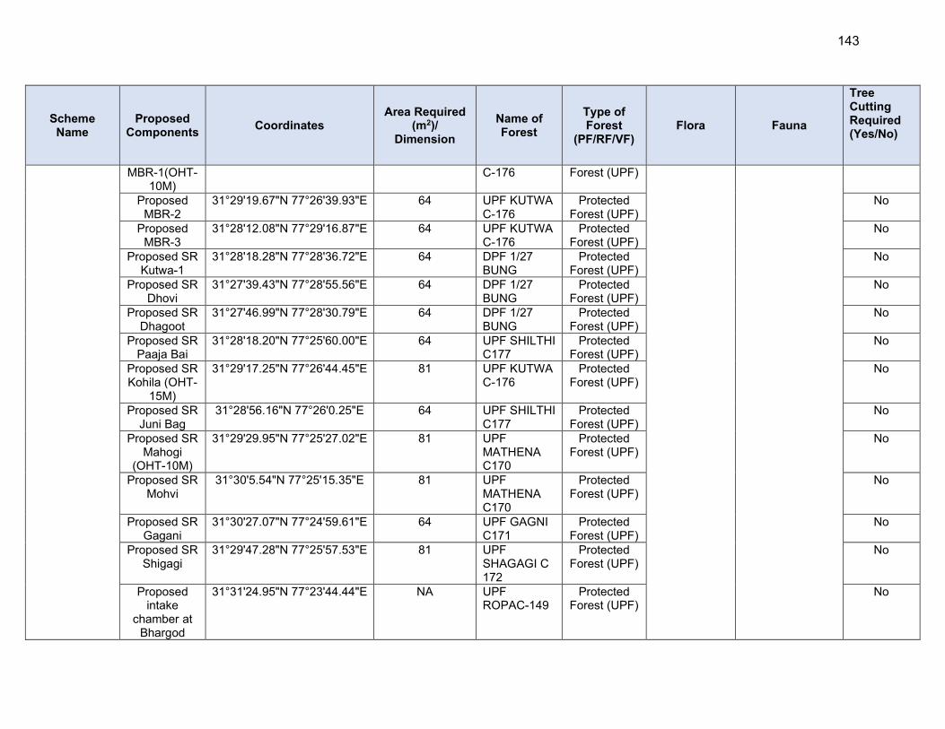
143
Scheme Name
Proposed Components
Coordinates Area Required
(m2)/ Dimension
Name of Forest
Type of Forest
(PF/RF/VF) Flora Fauna
Tree Cutting Required (Yes/No)
MBR-1(OHT-10M)
C-176 Forest (UPF)
Proposed MBR-2
31°29'19.67"N 77°26'39.93"E 64 UPF KUTWA C-176
Protected Forest (UPF)
No
Proposed MBR-3
31°28'12.08"N 77°29'16.87"E 64 UPF KUTWA C-176
Protected Forest (UPF)
No
Proposed SR Kutwa-1
31°28'18.28"N 77°28'36.72"E 64 DPF 1/27 BUNG
Protected Forest (UPF)
No
Proposed SR Dhovi
31°27'39.43"N 77°28'55.56"E 64 DPF 1/27 BUNG
Protected Forest (UPF)
No
Proposed SR Dhagoot
31°27'46.99"N 77°28'30.79"E 64 DPF 1/27 BUNG
Protected Forest (UPF)
No
Proposed SR Paaja Bai
31°28'18.20"N 77°25'60.00"E 64 UPF SHILTHI C177
Protected Forest (UPF)
No
Proposed SR Kohila (OHT-
15M)
31°29'17.25"N 77°26'44.45"E 81 UPF KUTWA C-176
Protected Forest (UPF)
No
Proposed SR Juni Bag
31°28'56.16"N 77°26'0.25"E 64 UPF SHILTHI C177
Protected Forest (UPF)
No
Proposed SR Mahogi
(OHT-10M)
31°29'29.95"N 77°25'27.02"E 81 UPF MATHENA C170
Protected Forest (UPF)
No
Proposed SR Mohvi
31°30'5.54"N 77°25'15.35"E 81 UPF MATHENA C170
Protected Forest (UPF)
No
Proposed SR Gagani
31°30'27.07"N 77°24'59.61"E 64 UPF GAGNI C171
Protected Forest (UPF)
No
Proposed SR Shigagi
31°29'47.28"N 77°25'57.53"E 81 UPF SHAGAGI C 172
Protected Forest (UPF)
No
Proposed intake
chamber at Bhargod
31°31'24.95"N 77°23'44.44"E NA UPF ROPAC-149
Protected Forest (UPF)
No
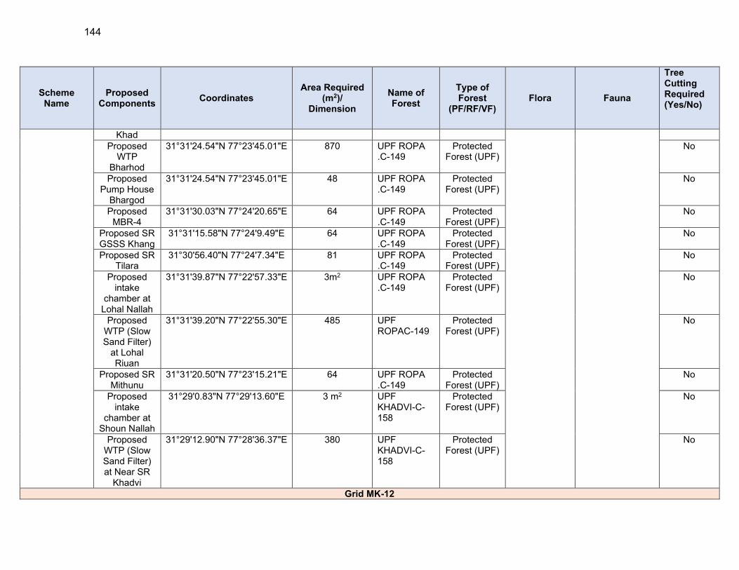
144
Scheme Name
Proposed Components
Coordinates Area Required
(m2)/ Dimension
Name of Forest
Type of Forest
(PF/RF/VF) Flora Fauna
Tree Cutting Required (Yes/No)
Khad Proposed
WTP Bharhod
31°31'24.54"N 77°23'45.01"E 870 UPF ROPA .C-149
Protected Forest (UPF)
No
Proposed Pump House
Bhargod
31°31'24.54"N 77°23'45.01"E 48 UPF ROPA .C-149
Protected Forest (UPF)
No
Proposed MBR-4
31°31'30.03"N 77°24'20.65"E 64 UPF ROPA .C-149
Protected Forest (UPF)
No
Proposed SR GSSS Khang
31°31'15.58"N 77°24'9.49"E 64 UPF ROPA .C-149
Protected Forest (UPF)
No
Proposed SR Tilara
31°30'56.40"N 77°24'7.34"E 81 UPF ROPA .C-149
Protected Forest (UPF)
No
Proposed intake
chamber at Lohal Nallah
31°31'39.87"N 77°22'57.33"E 3m2 UPF ROPA .C-149
Protected Forest (UPF)
No
Proposed WTP (Slow Sand Filter)
at Lohal Riuan
31°31'39.20"N 77°22'55.30"E 485 UPF ROPAC-149
Protected Forest (UPF)
No
Proposed SR Mithunu
31°31'20.50"N 77°23'15.21"E 64 UPF ROPA .C-149
Protected Forest (UPF)
No
Proposed intake
chamber at Shoun Nallah
31°29'0.83"N 77°29'13.60"E 3 m2 UPF KHADVI-C-158
Protected Forest (UPF)
No
Proposed WTP (Slow Sand Filter) at Near SR
Khadvi
31°29'12.90"N 77°28'36.37"E 380 UPF KHADVI-C-158
Protected Forest (UPF)
No
Grid MK-12
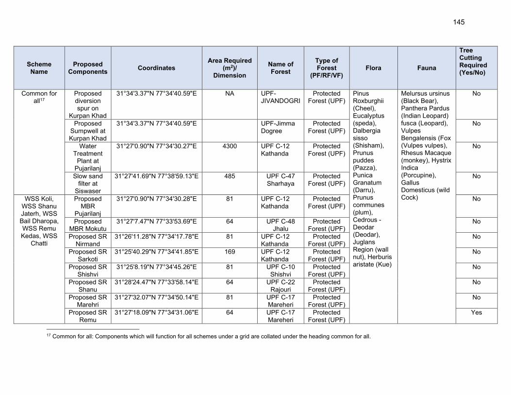
145
Scheme Name
Proposed Components
Coordinates Area Required
(m2)/ Dimension
Name of Forest
Type of Forest
(PF/RF/VF) Flora Fauna
Tree Cutting Required (Yes/No)
Common for all17
Proposed diversion spur on
Kurpan Khad
31°34'3.37"N 77°34'40.59"E NA UPF-JIVANDOGRI
Protected Forest (UPF)
Pinus Roxburghii (Cheel), Eucalyptus (speda), Dalbergia sisso (Shisham), Prunus puddes (Pazza), Punica Granatum (Darru), Prunus communes (plum), Cedrous -Deodar (Deodar), Juglans Region (wall nut), Herburis aristate (Kue)
Melursus ursinus (Black Bear), Panthera Pardus (Indian Leopard) fusca (Leopard), Vulpes Bengalensis (Fox (Vulpes vulpes), Rhesus Macaque (monkey), Hystrix Indica (Porcupine), Gallus Domesticus (wild Cock)
No
Proposed Sumpwell at Kurpan Khad
31°34'3.37"N 77°34'40.59"E UPF-Jimma Dogree
Protected Forest (UPF)
No
Water Treatment
Plant at Pujarilanj
31°27'0.90"N 77°34'30.27"E 4300 UPF C-12 Kathanda
Protected Forest (UPF)
No
Slow sand filter at
Siswaser
31°27'41.69"N 77°38'59.13"E 485 UPF C-47 Sharhaya
Protected Forest (UPF)
No
WSS Koli, WSS Shanu Jaterh, WSS Bail Dharopa, WSS Remu Kedas, WSS
Chatti
Proposed MBR
Pujarilanj
31°27'0.90"N 77°34'30.28"E 81 UPF C-12 Kathanda
Protected Forest (UPF)
No
Proposed MBR Mokutu
31°27'7.47"N 77°33'53.69"E 64 UPF C-48 Jhalu
Protected Forest (UPF)
No
Proposed SR Nirmand
31°26'11.28"N 77°34'17.78"E 81 UPF C-12 Kathanda
Protected Forest (UPF)
No
Proposed SR Sarkoti
31°25'40.29"N 77°34'41.85"E 169 UPF C-12 Kathanda
Protected Forest (UPF)
No
Proposed SR Shishvi
31°25'8.19"N 77°34'45.26"E 81 UPF C-10 Shishvi
Protected Forest (UPF)
No
Proposed SR Shanu
31°28'24.47"N 77°33'58.14"E 64 UPF C-22 Rajouri
Protected Forest (UPF)
No
Proposed SR Marehri
31°27'32.07"N 77°34'50.14"E 81 UPF C-17 Mareheri
Protected Forest (UPF)
No
Proposed SR Remu
31°27'18.09"N 77°34'31.06"E 64 UPF C-17 Mareheri
Protected Forest (UPF)
Yes
17 Common for all: Components which will function for all schemes under a grid are collated under the heading common for all.

146
Scheme Name
Proposed Components
Coordinates Area Required
(m2)/ Dimension
Name of Forest
Type of Forest
(PF/RF/VF) Flora Fauna
Tree Cutting Required (Yes/No)
Proposed SR Kedas
31°27'3.51"N 77°33'24.91"E 64 UPF C-17 Mareheri
Protected Forest (UPF)
No
Proposed SR Bail
31°24'14.78"N 77°35'24.29"E 81 UPF C-9 Bayal
Protected Forest (UPF)
No
Proposed SR Pokhni
31°25'47.79"N 77°33'9.61"E 64 UPF C-76 Bashlaya
Protected Forest (UPF)
No
Proposed SR Achwa
31°24'43.00"N 77°33'39.86"E 64 UPF C-76 Bashlaya
Protected Forest (UPF)
No
Proposed SR Chhotu
31°24'17.50"N 77°34'4.51"E 64 UPF C-77 kalog
Protected Forest (UPF)
No
Proposed SR Koli
31°23'52.45"N 77°33'50.30"E 81 UPF C-77 kalog
Protected Forest (UPF)
No
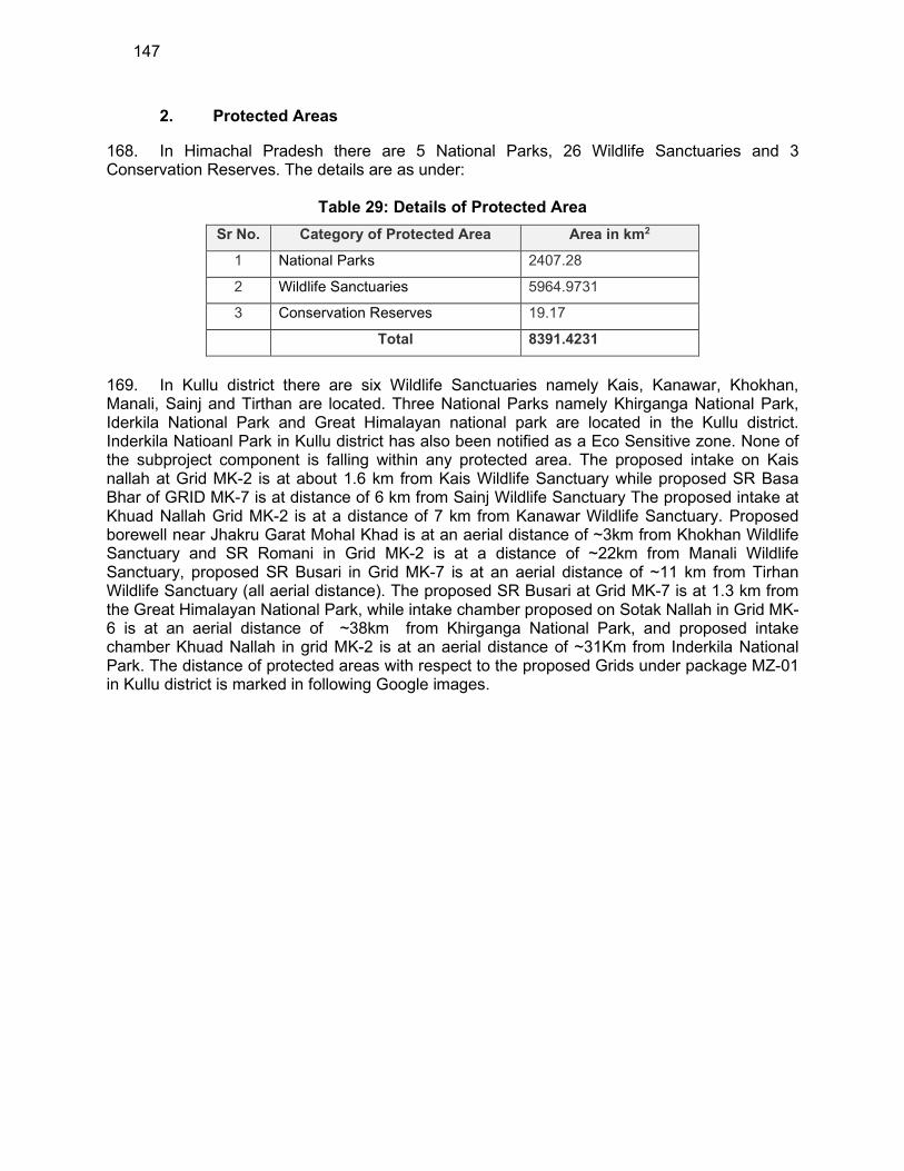
147
2. Protected Areas
168. In Himachal Pradesh there are 5 National Parks, 26 Wildlife Sanctuaries and 3 Conservation Reserves. The details are as under:
Table 29: Details of Protected Area
Sr No. Category of Protected Area Area in km2
1 National Parks 2407.28
2 Wildlife Sanctuaries 5964.9731
3 Conservation Reserves 19.17
Total 8391.4231
169. In Kullu district there are six Wildlife Sanctuaries namely Kais, Kanawar, Khokhan, Manali, Sainj and Tirthan are located. Three National Parks namely Khirganga National Park, Iderkila National Park and Great Himalayan national park are located in the Kullu district. Inderkila Natioanl Park in Kullu district has also been notified as a Eco Sensitive zone. None of the subproject component is falling within any protected area. The proposed intake on Kais nallah at Grid MK-2 is at about 1.6 km from Kais Wildlife Sanctuary while proposed SR Basa Bhar of GRID MK-7 is at distance of 6 km from Sainj Wildlife Sanctuary The proposed intake at Khuad Nallah Grid MK-2 is at a distance of 7 km from Kanawar Wildlife Sanctuary. Proposed borewell near Jhakru Garat Mohal Khad is at an aerial distance of ~3km from Khokhan Wildlife Sanctuary and SR Romani in Grid MK-2 is at a distance of ~22km from Manali Wildlife Sanctuary, proposed SR Busari in Grid MK-7 is at an aerial distance of ~11 km from Tirhan Wildlife Sanctuary (all aerial distance). The proposed SR Busari at Grid MK-7 is at 1.3 km from the Great Himalayan National Park, while intake chamber proposed on Sotak Nallah in Grid MK-6 is at an aerial distance of ~38km from Khirganga National Park, and proposed intake chamber Khuad Nallah in grid MK-2 is at an aerial distance of ~31Km from Inderkila National Park. The distance of protected areas with respect to the proposed Grids under package MZ-01 in Kullu district is marked in following Google images.
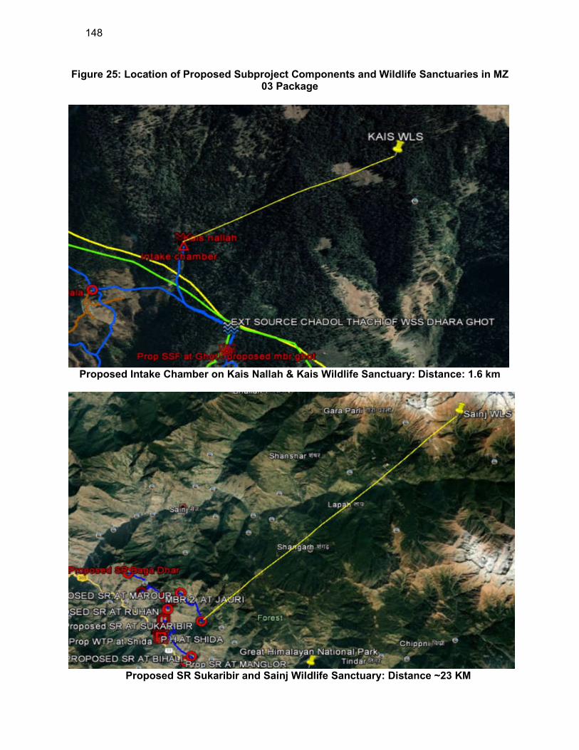
148
Figure 25: Location of Proposed Subproject Components and Wildlife Sanctuaries in MZ 03 Package
Proposed Intake Chamber on Kais Nallah & Kais Wildlife Sanctuary: Distance: 1.6 km
Proposed SR Sukaribir and Sainj Wildlife Sanctuary: Distance ~23 KM

149
Proposed intake chamber on Sotak Nallah and Kanawar Wildlife Sanctuary: Distance ~7
km
Proposed Bore Well and Khokhan Wildlife Sanctuary Jhakru: Distance ~3 KM
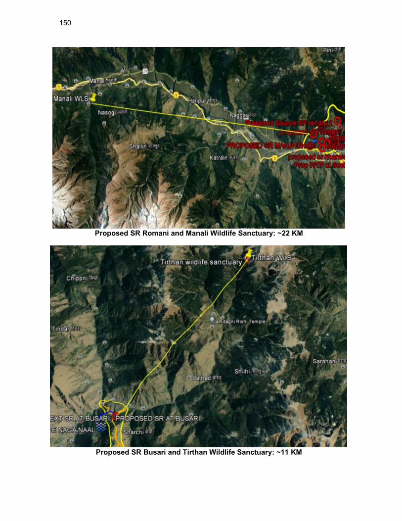
150
Proposed SR Romani and Manali Wildlife Sanctuary: ~22 KM
Proposed SR Busari and Tirthan Wildlife Sanctuary: ~11 KM
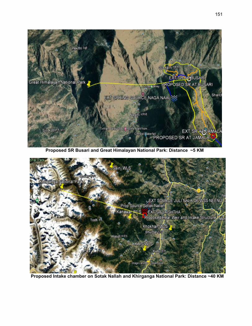
151
Proposed SR Busari and Great Himalayan National Park: Distance ~5 KM
Proposed Intake chamber on Sotak Nallah and Khirganga National Park: Distance ~40 KM
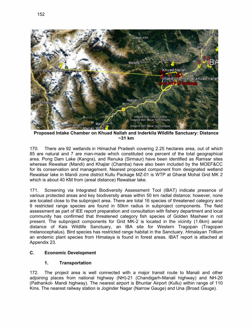
152
Proposed Intake Chamber on Khuad Nallah and Inderkila Wildlife Sanctuary: Distance
~31 km
170. There are 92 wetlands in Himachal Pradesh covering 2.25 hectares area, out of which 85 are natural and 7 are man-made which constituted one percent of the total geographical area. Pong Dam Lake (Kangra), and Renuka (Sirmaur) have been identified as Ramsar sites whereas Rewalsar (Mandi) and Khajiar (Chamba) have also been included by the MOEF&CC for its conservation and management. Nearest proposed component from designated wetland Rewalsar lake in Mandi zone district Kullu Package MZ-01 is WTP at Gharat Mohal Grid MK 2 which is about 40 KM from (areal distance) Rewalsar lake.
171. Screening via Integrated Biodiversity Assessment Tool (IBAT) indicate presence of various protected areas and key biodiversity areas within 50 km radial distance; however, none are located close to the subproject area. There are total 16 species of threatened category and 9 restricted range species are found in 50km radius in subproject components. The field assessment as part of IEE report preparation and consultation with fishery department and local community has confirmed that threatened category fish species of Golden Masheer in not present. The subproject components for Grid MK-2 is located in the vicinity (1.6km) aerial distance of Kais Wildlife Sanctuary, an IBA site for Western Tragopan (Tragopan melanocephalus). Bird species has restricted range habitat in the Sanctuary. Himalayan Trillium an endemic plant species from Himalaya is found in forest areas. IBAT report is attached at Appendix 23.
C. Economic Development
1. Transportation
172. The project area is well connected with a major transit route to Manali and other adjoining places from national highway (NH)-21 (Chandigarh-Manali highway) and NH-20 (Pathankot- Mandi highway). The nearest airport is Bhuntar Airport (Kullu) within range of 110 Kms. The nearest railway station is Joginder Nagar (Narrow Gauge) and Una (Broad Gauge).
153
173. National highways are generally of 14m of width bituminous road, major district road is generally 10.5 m in width bituminous road, Other district road are of 7m width bituminous road and village roads are generally 3.5m bituminous road or brick roads. Maximum dia pipes in this project are less than 250mm dia pipes which can be easily laid in shoulders of the roads.
2. Agriculture Development & Industry
174. Agriculture is the main occupation of the people in Kullu district. However, intensive cultivation is not possible as significant part of Kullu district is mountainous. Agricultural activities are common on the gentle hill slopes and in relatively plain, broad river valleys. Fruits and cash crops are a major source of income. The chief food crops cultivated include wheat, maize, rice, barley, seed-potato, ginger, vegetables, vegetable seeds, mushrooms, chicory seeds, hops, and fig. Maize and wheat are major crops grown in Kullu district. Apples and stone citrus fruits are major horticultural crops grown 175. Himachal Pradesh a hilly state has few large industrial units. Kullu district has micro, small, and medium enterprises focusing on agro-products, leather, textiles, wood, etc.
3. Land Use
176. A study of the land use (Table 29) shows that majority of the area Kullu district is under forest cover and none agriculture use. The land under permanent pastures and grazing is also significant. The barren land area is quite low. The land use of subproject site is rural residential. If land use of sub project sites is to be seen in terms of classification of Tables 14, it will fall '‘Land put to non-agriculture uses.
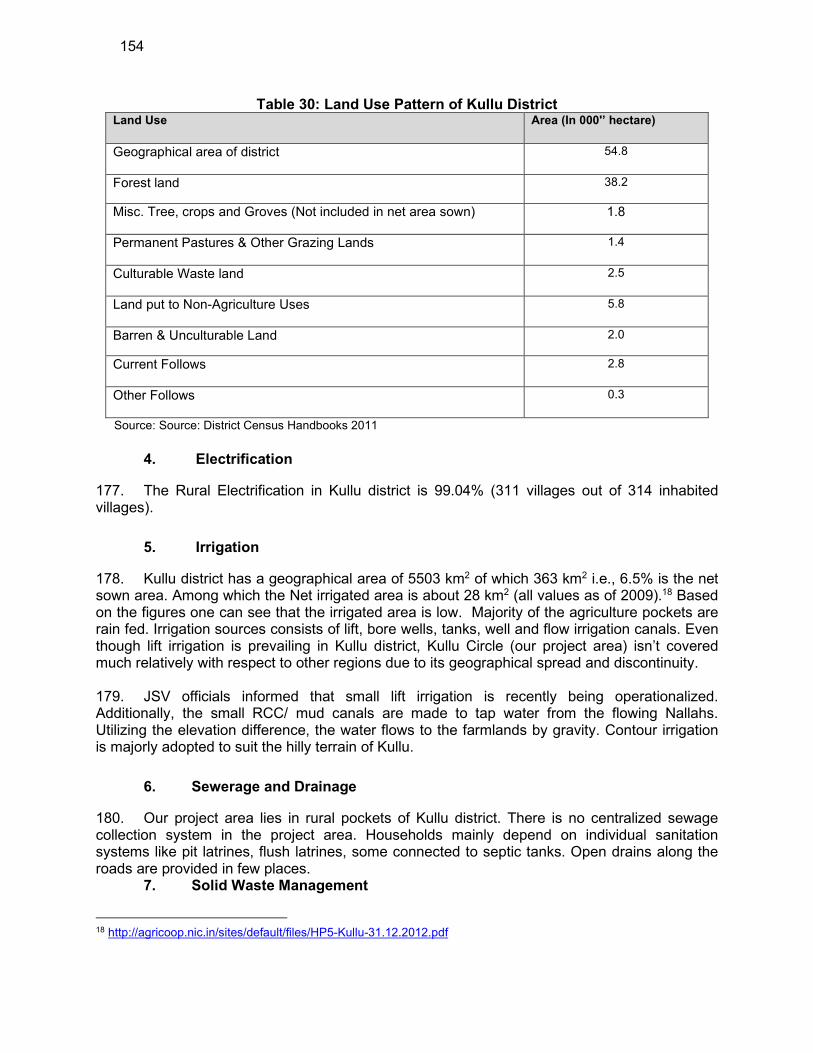
154
Table 30: Land Use Pattern of Kullu District Land Use Area (In 000'’ hectare)
Geographical area of district 54.8
Forest land 38.2
Misc. Tree, crops and Groves (Not included in net area sown) 1.8
Permanent Pastures & Other Grazing Lands 1.4
Culturable Waste land 2.5
Land put to Non-Agriculture Uses 5.8
Barren & Unculturable Land 2.0
Current Follows 2.8
Other Follows 0.3
Source: Source: District Census Handbooks 2011
4. Electrification
177. The Rural Electrification in Kullu district is 99.04% (311 villages out of 314 inhabited villages).
5. Irrigation
178. Kullu district has a geographical area of 5503 km2 of which 363 km2 i.e., 6.5% is the net sown area. Among which the Net irrigated area is about 28 km2 (all values as of 2009).18 Based on the figures one can see that the irrigated area is low. Majority of the agriculture pockets are rain fed. Irrigation sources consists of lift, bore wells, tanks, well and flow irrigation canals. Even though lift irrigation is prevailing in Kullu district, Kullu Circle (our project area) isn’t covered much relatively with respect to other regions due to its geographical spread and discontinuity. 179. JSV officials informed that small lift irrigation is recently being operationalized. Additionally, the small RCC/ mud canals are made to tap water from the flowing Nallahs. Utilizing the elevation difference, the water flows to the farmlands by gravity. Contour irrigation is majorly adopted to suit the hilly terrain of Kullu.
6. Sewerage and Drainage
180. Our project area lies in rural pockets of Kullu district. There is no centralized sewage collection system in the project area. Households mainly depend on individual sanitation systems like pit latrines, flush latrines, some connected to septic tanks. Open drains along the roads are provided in few places.
7. Solid Waste Management
18 http://agricoop.nic.in/sites/default/files/HP5-Kullu-31.12.2012.pdf

155
181. In the rural parts of Kullu district, solid waste from the respective households are dumped in community pits (also called Kua). The organic waste is converted into compost and the non-biodegradable waste is either burnt or left in the pit as such. In case of prominent public places, coloured dustbins are placed to collect wet waste and dry waste. The Swatctha committee of the respective village panchayat collects the waste and disposes it off in respective landfills.
8. Health Facilities
182. There are good health facilities in Kullu district. The Kullu district has 2 allopathic hospitals, 1 Ayurvedic hospitals, 4 community health centers, 17 public health centers and 23 primary health centers, 65 Ayurvedic Dispensaries and 100 sub health centres. In addition to above mentioned government run health facilities, there are many privately owned facilities available in the district.
9. Education Facilities
183. Kullu district has good educational facilities. In Kullu district has 761 primary schools, 87 Middle Schools, 55 Senior Secondary Schools and 6 colleges. There are many technical education training institutes in the district. The current HSDP project will also contribute towards skills development and employability of Himachali youth.
10. Socio- Economic Profile
184. District Kullu has often been victim to natural calamities causing severe damage to life and property. About 90% of its population lives in remote villages situated in far-flung and inaccessible areas making it more vulnerable to disasters. It has the lowest number of 326 villages among the 12 districts of the state. Kullu occupies 9th rank among districts of H.P. for population of 4, 37,903 and density of population being 80 persons per sq. Km, Kullu has a total road length of 1741Kms and 207 Panchayats where all the in-habited villages of the district enjoy the facility of electricity and potable drinking water. The economy of the district is mainly dependent on agriculture with 197,141 persons as cultivators and having 4th position among districts of H.P. The nearest airport at Bhuntar is 10 kms from the main city of Kullu and 50 kms from Manali and the nearest rail head is 280 kms at Chandigarh.
156
Source: 2011 Census
D. Social and Cultural Resources
1. Demography
185. According to Census 2011, the total population of Kullu district is 4,37,903 comprising 2,25,452 males and 2,12,451 females. This population of the district forms 6.38 per cent of the state population and ranks at 9th place among the districts. Out of the total population of the district 90.5 per cent lives in rural areas while 9.5 per cent lives in urban areas. Rural population of the district is distributed among 6 tehsils, sub-tehsils and urban population is spread over in 4 towns and one newly created census town namely, Shamshi. The total urban population in the district is 41,391 persons comprising 22,183 males and 19,208 females. The total rural population in this district comprises 3,96,512 persons with 2,03,269 males and 1,93,243 females as per Census 2011. In the district due to enforcement of jurisdictional changes number of villages has been increased from 172 to 326, where 12 villages are uninhabited, 314 villages are inhabited and the majority of villages are of large size consisting of several hamlets. The concentration of villages is mainly along the valleys of rivers and streams. The density of population in Kullu district is 80 persons per Sq. Km. against the state average of 123 persons. There are 942 females for every thousand males in Kullu district. The sex ratio figures for rural and urban areas of the district are 951 and 866, respectively. It is also observed that, the proportion of females in rural areas is higher than that of urban areas. Sex-ratio in age-group 0- 6 comes to 962 in the district as a whole. In rural areas, this proportion is 968 while in urban areas the sex-ratio of Child population works out to 891. During Census 2011 out of the total population of 4,37,903 persons of the district 4,15,669 (94.92 per cent) persons have reported their religion as Hindu followed by 15,377 (3.51 per cent) persons as Buddhist, 2,974 (0.68 per cent) persons as Muslim, 1,568 (0.36 per cent) persons as Christian and 1,396 (0.32 per cent) persons as Sikh. Remaining 94 persons are Jain, 83 persons have Other Religions and 742 persons have not stated any religion. Of the 4,37,903 total population of the district 28.0 per cent of the total population belong to Scheduled Castes and 3.8 per cent to Scheduled Tribes
157
186. The mother tongue in Kullu district is Hindi. The other local languages such as Punjabi and Kangri are spoken by a very small fraction of population. Most of the people are Hindu Brahmin, Rajputs, Banias, and scheduled castes and scheduled tribes. There are also minority populations of Sikhs, Muslims and Christians. The traditional dress for men is the kurta, pyjama, and a woollen jacket used in winter. Women generally wear the salwar kameez.
2. History, Culture and Tourism
187. History. Historical references about the Kullu valley dates back to ancient Hindu literary works of Ramayana, Mahabharata and the Puranas. During Vedic period several small republics known as "Janapada” existed which were later conquered by the Nanda Empire, Mauryan Empire, Gupta Empire, Pala Dynasty and Karkota Empire. After a brief period of supremacy by King Harshavardhana the region was once again divided into several local powers headed by chieftains, including some Rajput principalities, these principalities were later conquered by Maratha Empire and Sikh Empire. 188. The name Kullu derives from the word "Kulant Peeth", meaning "end of the habitable world". As per legends, during the Great Flood, Manu visited this valley but was unable to cross the Rohtang pass. He named the last settlement he found as Kulant Peeth and chose to settle and meditate in what has now become the town of Manali (Manu's Place). The name further devolved into "Kulut", as the kingdom was known for a long time; before finally being known by the current name of Kullu or Kulu. 189. Documented History. The district of Kullu came into being on November 1, 1966. Various historical evidences including inscriptions on coins etc., accounts of travellers and other printed references point out to the antiquity of the tract and the people which constitute the district Kullu of the present. The history of Kullu has been traced some 2000 years back in time. The word ‘Kullu’ is speculated to have been derived from the word ‘Kuluta’ which was found inscribed on a coin from the first century A.D. The first king (Raja) mentioned in historical record is Virayasa whose name figures on that coin as ‘Virayasa, King of Kuluta’. The Chinese pilgrim, Hiuen Tsang, is believed to have described the modern Kullu as Kiu-lu-to situated at 117 miles to the north-east of Jalandhar. The tract has also been referred to as ‘Kulantapitha’, which translates to ‘the territory which marks the end of Kula i.e. the socio-religious system of the mainland’ or ‘the end of the habitable world’. 190. The tract is said to have been first ruled by the Pal kings, who were succeeded by the Singh kings, believed to be descendants of the Pal kings. According to known history, the kingdom of Kullu was founded in the first century A.D. by Behangamani Pal, who is speculated to have come from Prayag near Allahabad. It appears that the people of the higher valley of Kullu were suffering under the repressive regime of the Thakurs of Spiti then and a keen desire to overthrow the Thakurs was smouldering in their hearts. Behangamani Pal overthrew the Thakurs and established the first ruling dynasty of Kullu. The rule of the Pal kings continued till about A.D. 1450 and Raja Kelas Pal was the last in that line. After him there was long break of about 50 years and it appears that the Thakurs and the Ranas might have captured power during this period. 191. After this interregnum, Sidh Singh, who became the Raja of Kullu in A.D. 1500, is recognized as the first of the line of the Singh kings. The local folklore narrates the story of Goddess Hidimba granting the kingdom of Kullu to Sidh Singh. Hidimba is respected as the grandmother and the patron-deity by the royal family of Kullu till date. The next important king of Kullu was Raja Jagat Singh (A.D.1637-1672) who incorporated Lag into the kingdom of Kullu.

158
The original capital of the state of Kullu was at Jagatsukh where the early kings ruled for twelve generations. Raja Visudh Pal transferred the capital to Nagar and later Raja Jagat Singh transferred it to Sultanpur. The famous idol of Raghunath was brought from Ayodhya to Kullu during the reign of Raja Jagat Singh to remove a curse which a Brahmin had casted upon Jagat Singh. Jagat Singh put the idol on the throne, proclaimed himself to be merely the first servant of the temple, and the curse was removed. Since then, the Rajas of Kullu ruled the state in the name of Raghunath, who became the principal deity of the Kullu valley. With this incident Vaishnavism established itself in a land where Shaivism and Shaktism were the dominant denominations. During the period of the Mughal rule, Kullu was subject to the suzerainty of the Mughal emperors and used to pay tribute to them. 192. In A.D. 1672, river Sutlej became the state boundary in the south and Outer Saraj (consisting of Ani and Nirmand of the present times) became a part of Kullu. In territorial terms, Kullu reached its zenith under Raja Man Singh extending from Upper Lahaul in the north to Shimla in the south. Around A.D. 1800, the authority of the Mughal empire declined and Kullu started paying tribute to the Gorkhas and to Sansar Chand, the Katoch Raja of Kangra. In A.D. 1839, the Sikhs captured Kullu state from Raja Ajit Singh and in A.D. 1846 they ceded it to the British Government. Consequently, Kullu, along with Lahaul & Spiti, became a part of the district of Kangra, as a sub-division under the control of an Assistant Commissioner. The British gave sovereign powers to Thakar Singh within the jagir of Rupi and in A.D. 1852 his son Gyan Singh was given the title of Rai instead of Raja. 193. Until 1960, the tract of Lahaul & Spiti was part of the Kullu tehsil. Kullu was declared to be a district of Punjab in 1963 and on 1 November 1966 it became a district of Himachal Pradesh. In the British times, all the modern government buildings, hospital and government bungalows were built around the Dhalpur grounds (proximate to Sultanpur, the old capital). Dhalpur continues to be the nerve centre of the district administration till date. 194. Culture & Heritage. Historical references about the Kullu valley dates back to ancient Hindu literary works of Ramayana, Mahabharata and the Puranas. During Vedic period several small republics known as "Janapada” existed which were later conquered by the Nanda Empire, Mauryan Empire, Gupta Empire, Pala Dynasty and Karkota Empire. After a brief period of supremacy by King Harshavardhana the region was once again divided into several local powers headed by chieftains, including some Rajput principalities, these principalities were later conquered by Maratha Empire and Sikh Empire. The name Kullu derives from the word "Kulant Peeth", meaning "end of the habitable world". As per legends, during the Great Flood, Manu visited this valley but was unable to cross the Rohtang pass. He named the last settlement he found as Kulant Peeth and chose to settle and meditate in what has now become the town of Manali (Manu's Place). The name further devolved into "Kulut", as the kingdom was known for a long time; before finally being known by the current name of Kullu or Kulu. 195. There are no heritage sites notified by Archaeological Survey of India (ASI) within or near any of the subproject area sites. Similarly, no common property resources such as public wells, water tanks, playgrounds, common grassing grounds or pastures, market areas and community buildings will be affected by the proposed subproject. 196. A number of fairs and festivals are celebrated in Kullu district. The major festivals/fairs celebrated in subproject area are Kullu Dussehra, Pipal Jatra/ Vasantotsava, Shamshi Virshu, Mela Bhunter.
159
197. Tourism. There are no heritage sites notified by Archaeological Survey of India (ASI) within or near the subproject area sites. Similarly, no common property resources such as public wells, water tanks, playgrounds, common grassing grounds or pastures, market areas and community buildings will be affected by the proposed subproject. 198. The identified heritage sites near the project area is the Great Himalayan National Park which is a UNESCO world heritage site and is at an approximate distance of 1.3 Km from proposed service reservoir Busari under Grid MK-7. The development of SR Busari is a small location specific component which will not any impact on the Great Himalayan National Park. The identified central protected monuments near the subproject area are Temple of Basheshar Mahadev at Hat ~3km from proposed Bore well Badah in Grid MK-2, Temple of Gauri Shankar with sculptures, Naggar ~7Km from SR Romani in Grif MK-2, a Miniature stone Shiva temple ~17Km from SR Romani in Grid MK-2, Temple of Gauri Shankar with sculptures, Desa ~17 Km from SR Romani in Grid MK-2, Hidamba Devi Temple ~22Km from SR Romani in Grid MK-2. The Docha Mocha Temple is a state protected monument in the project area and is located ~13 km from the proposed SR Romani in Grid MK-2. 199. The major tourist attraction in the subproject area is Manikaran which is a famous hot water spring. The water of the springs is said to be radioactive. It is believed to be beneficial for the people suffering from rheumatism and similar ailments. Due to the presence of Raghunathjee temple and a Gurudawara, Manikaran is a favourite resort for pilgrims of Hindu and Sikh faith. According to an ancient legend, Manikaran is also connected with Lord Shiva and his divine consort Parvati. Manikaran is approximately 50 km from command area of MK-2 Grid.
200. Other places of interests in and around Kullu district are:
(i) Manali Situated near the end of valley, Manali is one of the most attractive tourist spot not only of Himachal Pradesh, but of International fame also. There are regular bus services to these places from Manali during summer season. It is situated at a distance of 45 kms from Kullu.
(ii) Naggar. Naggar, on the left bank of the Beas and about 300 mts above the river, is delightfully situated on a wooden slope and commands extensive views, especially of the north and west of the valley. It is 27 kms from Kullu and 5 kms from Patli Kulh. A massive castle belonging to the Rajas of Kullu still exists here. Above the castle a road leads to Hall. The beautiful house which gives its name to the estate was built by Late Colonel Rennick, but is now in the possession of the Roerich family.
(iii) Rohtang Pass. Numerous mountain passes lead in and out of Kullu, but one the most popular with trekking parties is the Rohtang, about 3,978 mt. above sea level. It is easily the most convenient route from Manali and throughout the whole distance provides a charming variety of scenery. The length of the pass is about 1 km. and has served as the route for many centuries for trade with Lahaul, Ladakh and to far away countries in Central Asia. The road from Manali to Keylong passes over this pass which is 51 kms and the vest of the Rohtang pass affords a wide spread panorama of mountain scenery.
(iv) Jagatsukh. The original name of which was ’Nast’ was the ancient capital of Kullu state. Here the earliest Rajas ruled for twelve generations till, in the reign of Visudh Pal, the capital was transferred to Naggar. It lies on the left bank of the
160
Beas and the road from Naggar to Manali runs through the village. It is about twelve km from Naggar and six km from Manali. Before reaching Jagatsukh a place Shooru, near the entrance to Hamta Nullah, is passed at which is located an ancient and historical temple of Devi Sarvali. In Jagatshukh some ancient temples are still in existence. The most important being the Shiva Temple in the Shikhra style. It has a very chaste sculptured decoration. The temple of Gayatri Devi is also located near this temple.
(v) Vashisht.A little village located on the left bank of the Beas, but well above the river and about 3 kms beyond Manali and is renowned for its hot sulphur springs named as Bashisht or Vashist.
(vi) Arjun Gufa.A cave, which is about five kms from Manali and known as Arjun Gufa, is situated a little up from the left bank road near the village Prini. According to a legend, Arjuna under the advice of a Vyasa rishi practiced austerities in a cave in order to get the powerful ’Pashupata Astra’ from Indra.
(vii) Nehru Kund.A spring of clear cold water named after the late Prime Minister, Pt. Jawahar Lal Nehru, is about 6 kms from Manali on Manali-Keylong road.
(viii) Solang Valley.It is a splendid valley between Manali and Kothi and offers the views of glaciers and snow caped mountains and peaks. The nearest glacier from Manali is in this valley. It is about thirteen kms. from Manali and one can go there either by jeep or by bus up to Palchan a village from where a jeep able road branches off to the left. Good skiing slopes are also available here which are famous for summer skiing.
(ix) Malana.Nestled between Jari and Khiksa thatch lies the village Malana. Here one can still see the oldest democracy of the world where all inhabitants of the village participate in the village administration. They have their own pattern of parliament that is Upper House (Jaistang) and Lower House (Kanishtang or Core). Jaistang has its own Executive and it works like Judiciary. If no solution comes out in the both houses , then the case is put forward to Jamalu Rishi (Devta) and then Devta decides the case through its ’Gur’ and its decision is final and binding to all inhabitants of the village.The inhabitants of Malana speak a peculiar language of their own, called Kanashi.
E. Environmental Settings of Investment Program Component Sites
201. Subproject components are located in immediate surroundings of small towns/villages which were mainly rural in set up. Proposed WTP, MBR, SR will be constructed on vacant land mostly under possession of JSV and land under the ownership of private owners. However, some components are also proposed in Protected Forest land (2.39 ha of land located at various places in six water supply grids) and JSV will obtain forest clearance from the Forest department and has already submitted online application to MOEF&CC portal. Except some sites in forest areas, proposed sites do not have any notable sensitive environmental features. Removal of trees may be required at few intakes, WTP and reservoir sites; this will reviewed and minimized to the extent possible during detailed design. At some locations, water pipelines will traverse through some forest lands, mostly along forest trails (walk paths / earthen roads), and therefore no notable tree felling envisaged as per preliminary design. However, it will be finalised during detailed design period and if any tree felling is required, compensatory tree plantation will be carried out in 1:10 ratio. There are no AC pipes in the existing water supply system which may create hazardous conditions for the workers and surrounding community. 202. There are no wetland, eco-sensitive or wild life sanctuaries within proposed project activity areas of Package MZ 01. In Kullu district there are six Wildlife Sanctuaries namely Kais,
161
Kanawar, Khokhan, Manali, Sainj and Tirthan are located. Three National Parks namely Khirganga National Park, Iderkila National Park and Great Himalayan national park are located in the Kullu district. Inderkila Natioanl Park in Kullu district has also been notified as an Eco Sensitive zone. None of the subproject component is falling within any protected area. There are no endangered terrestrial and aquatic species, avifauna or migratory species in the proposed sources like Khads and Nallahs as they are of very small nature. 203. There are no heritage sites notified by Archaeological Survey of India (ASI) within or near the subproject area sites. Similarly, no common property resources such as public wells, water tanks, playgrounds, common grazing grounds or pastures, market areas and community buildings will be affected by the proposed subproject 204. Site environmental features of all subproject sites and photographs are presented in the following Table 31.
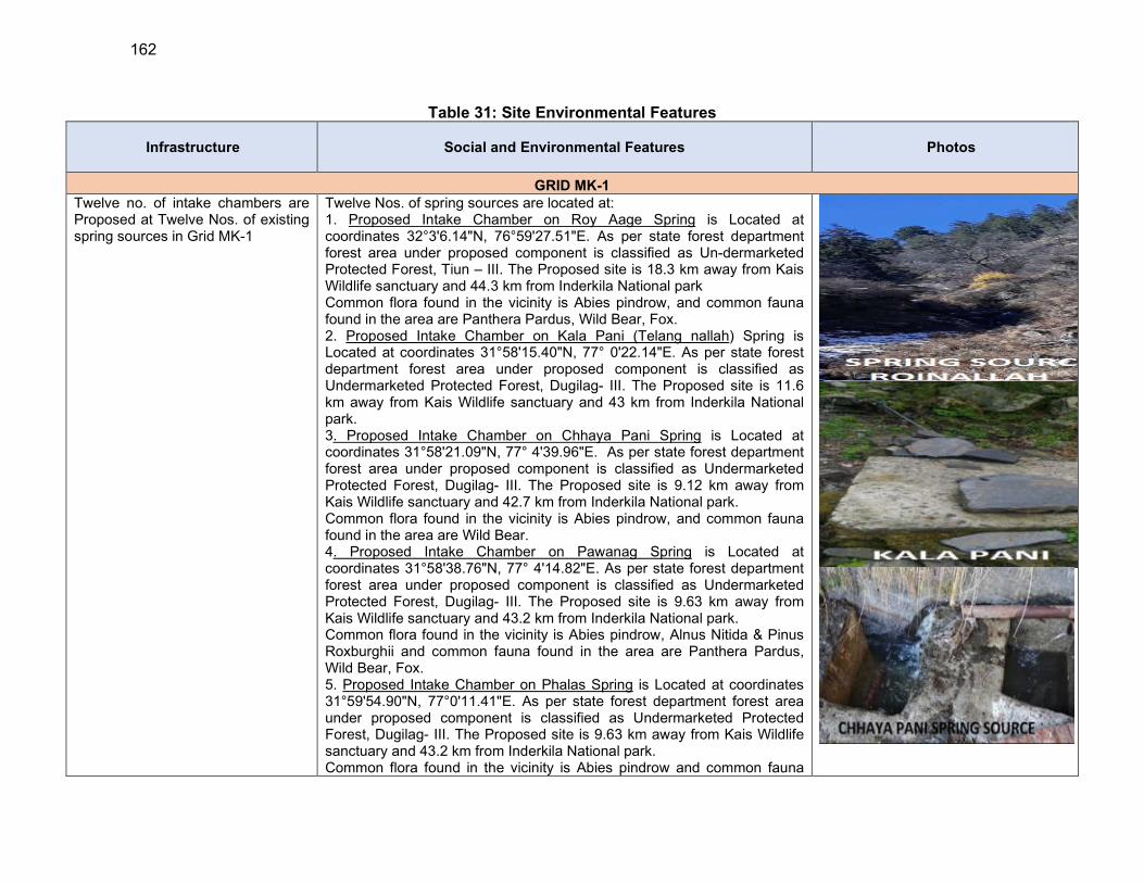
162
Table 31: Site Environmental Features
Infrastructure Social and Environmental Features Photos
GRID MK-1
Twelve no. of intake chambers are Proposed at Twelve Nos. of existing spring sources in Grid MK-1
Twelve Nos. of spring sources are located at: 1. Proposed Intake Chamber on Roy Aage Spring is Located at coordinates 32°3'6.14"N, 76°59'27.51"E. As per state forest department forest area under proposed component is classified as Un-dermarketed Protected Forest, Tiun – III. The Proposed site is 18.3 km away from Kais Wildlife sanctuary and 44.3 km from Inderkila National park Common flora found in the vicinity is Abies pindrow, and common fauna found in the area are Panthera Pardus, Wild Bear, Fox. 2. Proposed Intake Chamber on Kala Pani (Telang nallah) Spring is Located at coordinates 31°58'15.40"N, 77° 0'22.14"E. As per state forest department forest area under proposed component is classified as Undermarketed Protected Forest, Dugilag- III. The Proposed site is 11.6 km away from Kais Wildlife sanctuary and 43 km from Inderkila National park. 3. Proposed Intake Chamber on Chhaya Pani Spring is Located at coordinates 31°58'21.09"N, 77° 4'39.96"E. As per state forest department forest area under proposed component is classified as Undermarketed Protected Forest, Dugilag- III. The Proposed site is 9.12 km away from Kais Wildlife sanctuary and 42.7 km from Inderkila National park. Common flora found in the vicinity is Abies pindrow, and common fauna found in the area are Wild Bear. 4. Proposed Intake Chamber on Pawanag Spring is Located at coordinates 31°58'38.76"N, 77° 4'14.82"E. As per state forest department forest area under proposed component is classified as Undermarketed Protected Forest, Dugilag- III. The Proposed site is 9.63 km away from Kais Wildlife sanctuary and 43.2 km from Inderkila National park. Common flora found in the vicinity is Abies pindrow, Alnus Nitida & Pinus Roxburghii and common fauna found in the area are Panthera Pardus, Wild Bear, Fox. 5. Proposed Intake Chamber on Phalas Spring is Located at coordinates 31°59'54.90"N, 77°0'11.41"E. As per state forest department forest area under proposed component is classified as Undermarketed Protected Forest, Dugilag- III. The Proposed site is 9.63 km away from Kais Wildlife sanctuary and 43.2 km from Inderkila National park. Common flora found in the vicinity is Abies pindrow and common fauna
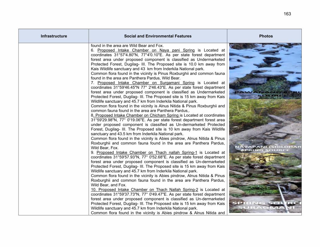
163
Infrastructure Social and Environmental Features Photos
found in the area are Wild Bear and Fox. 6. Proposed Intake Chamber on Naya pani Spring is Located at coordinates 31°57'4.80"N, 77°4'0.10"E. As per state forest department forest area under proposed component is classified as Undermarketed Protected Forest, Dugilag- III. The Proposed site is 10.0 km away from Kais Wildlife sanctuary and 43 km from Inderkila National park. Common flora found in the vicinity is Pinus Roxburghii and common fauna found in the area are Panthera Pardus, Wild Bear. 7. Proposed Intake Chamber on Surgamani Spring is Located at coordinates 31°59'46.45"N 77° 2'46.43"E. As per state forest department forest area under proposed component is classified as Undermarketed Protected Forest, Dugilag- III. The Proposed site is 15 km away from Kais Wildlife sanctuary and 45.7 km from Inderkila National park. Common flora found in the vicinity is Alnus Nitida & Pinus Roxburghii and common fauna found in the area are Panthera Pardus,. 8. Proposed Intake Chamber on Chicham Spring is Located at coordinates 31°59'29.98"N, 77° 0'19.06"E. As per state forest department forest area under proposed component is classified as Un-dermarketed Protected Forest, Dugilag- III. The Proposed site is 10 km away from Kais Wildlife sanctuary and 43.5 km from Inderkila National park. Common flora found in the vicinity is Abies pindrow, Alnus Nitida & Pinus Roxburghii and common fauna found in the area are Panthera Pardus, Wild Bear, Fox. 9. Proposed Intake Chamber on Thach nallah Spring-1 is Located at coordinates 31°59'57.93"N, 77° 0'52.68"E. As per state forest department forest area under proposed component is classified as Un-dermarketed Protected Forest, Dugilag- III. The Proposed site is 15 km away from Kais Wildlife sanctuary and 45.7 km from Inderkila National park. Common flora found in the vicinity is Abies pindrow, Alnus Nitida & Pinus Roxburghii and common fauna found in the area are Panthera Pardus, Wild Bear, and Fox. 10. Proposed Intake Chamber on Thach Nallah Spring-2 is Located at coordinates 31°59'37.73"N, 77° 0'49.47"E. As per state forest department forest area under proposed component is classified as Un-dermarketed Protected Forest, Dugilag- III. The Proposed site is 15 km away from Kais Wildlife sanctuary and 45.7 km from Inderkila National park. Common flora found in the vicinity is Abies pindrow & Alnus Nitida and
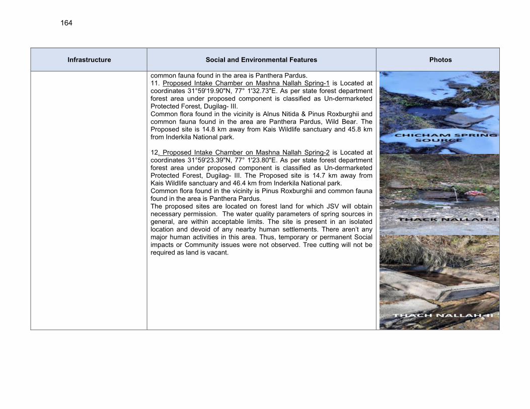
164
Infrastructure Social and Environmental Features Photos
common fauna found in the area is Panthera Pardus. 11. Proposed Intake Chamber on Mashna Nallah Spring-1 is Located at coordinates 31°59'19.90"N, 77° 1'32.73"E. As per state forest department forest area under proposed component is classified as Un-dermarketed Protected Forest, Dugilag- III. Common flora found in the vicinity is Alnus Nitida & Pinus Roxburghii and common fauna found in the area are Panthera Pardus, Wild Bear. The Proposed site is 14.8 km away from Kais Wildlife sanctuary and 45.8 km from Inderkila National park. 12. Proposed Intake Chamber on Mashna Nallah Spring-2 is Located at coordinates 31°59'23.39"N, 77° 1'23.80"E. As per state forest department forest area under proposed component is classified as Un-dermarketed Protected Forest, Dugilag- III. The Proposed site is 14.7 km away from Kais Wildlife sanctuary and 46.4 km from Inderkila National park. Common flora found in the vicinity is Pinus Roxburghii and common fauna found in the area is Panthera Pardus. The proposed sites are located on forest land for which JSV will obtain necessary permission. The water quality parameters of spring sources in general, are within acceptable limits. The site is present in an isolated location and devoid of any nearby human settlements. There aren’t any major human activities in this area. Thus, temporary or permanent Social impacts or Community issues were not observed. Tree cutting will not be required as land is vacant.
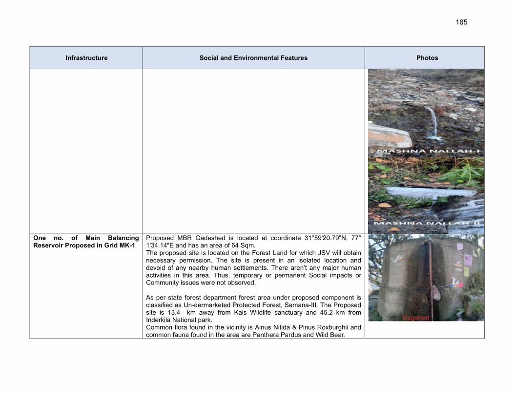
165
Infrastructure Social and Environmental Features Photos
One no. of Main Balancing Reservoir Proposed in Grid MK-1
Proposed MBR Gadeshed is located at coordinate 31°59'20.79"N, 77° 1'34.14"E and has an area of 64 Sqm. The proposed site is located on the Forest Land for which JSV will obtain necessary permission. The site is present in an isolated location and devoid of any nearby human settlements. There aren’t any major human activities in this area. Thus, temporary or permanent Social impacts or Community issues were not observed. As per state forest department forest area under proposed component is classified as Un-dermarketed Protected Forest, Samana-III. The Proposed site is 13.4 km away from Kais Wildlife sanctuary and 45.2 km from Inderkila National park. Common flora found in the vicinity is Alnus Nitida & Pinus Roxburghii and common fauna found in the area are Panthera Pardus and Wild Bear.
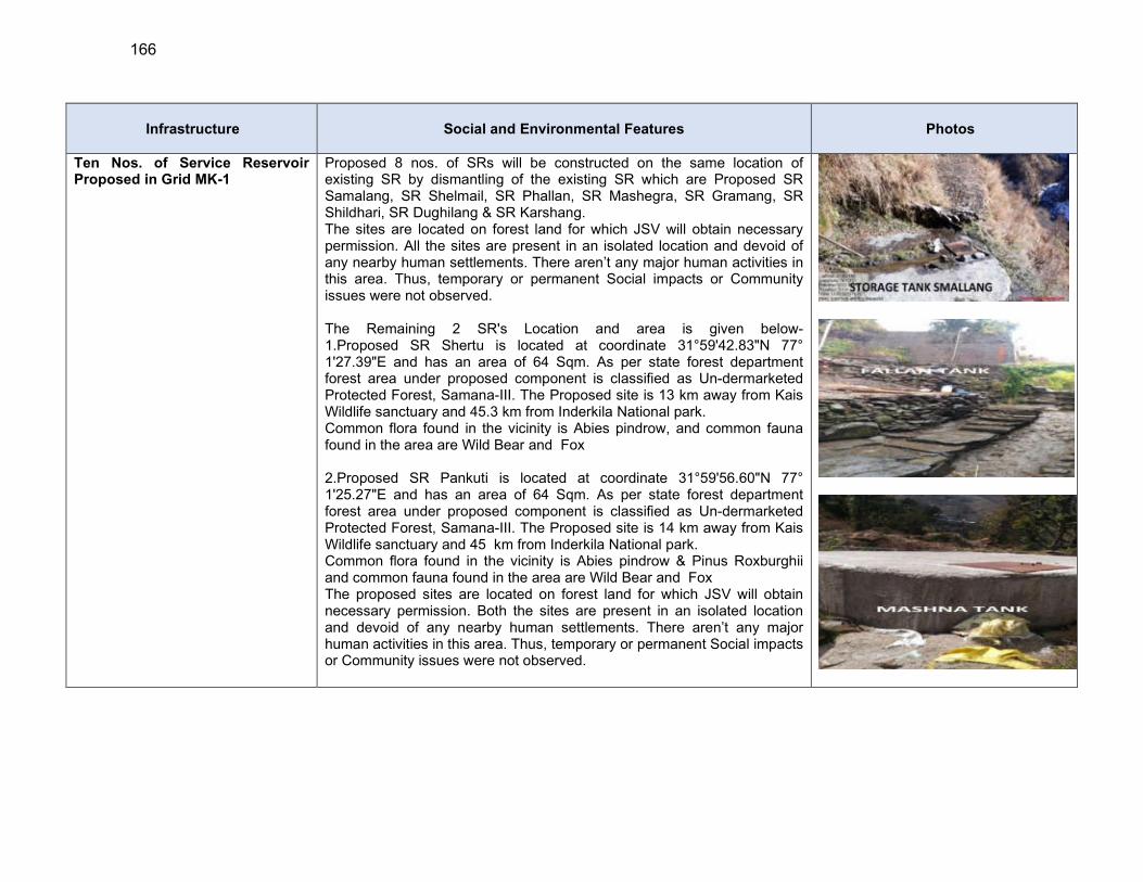
166
Infrastructure Social and Environmental Features Photos
Ten Nos. of Service Reservoir Proposed in Grid MK-1
Proposed 8 nos. of SRs will be constructed on the same location of existing SR by dismantling of the existing SR which are Proposed SR Samalang, SR Shelmail, SR Phallan, SR Mashegra, SR Gramang, SR Shildhari, SR Dughilang & SR Karshang. The sites are located on forest land for which JSV will obtain necessary permission. All the sites are present in an isolated location and devoid of any nearby human settlements. There aren’t any major human activities in this area. Thus, temporary or permanent Social impacts or Community issues were not observed. The Remaining 2 SR's Location and area is given below- 1.Proposed SR Shertu is located at coordinate 31°59'42.83"N 77° 1'27.39"E and has an area of 64 Sqm. As per state forest department forest area under proposed component is classified as Un-dermarketed Protected Forest, Samana-III. The Proposed site is 13 km away from Kais Wildlife sanctuary and 45.3 km from Inderkila National park. Common flora found in the vicinity is Abies pindrow, and common fauna found in the area are Wild Bear and Fox 2.Proposed SR Pankuti is located at coordinate 31°59'56.60"N 77° 1'25.27"E and has an area of 64 Sqm. As per state forest department forest area under proposed component is classified as Un-dermarketed Protected Forest, Samana-III. The Proposed site is 14 km away from Kais Wildlife sanctuary and 45 km from Inderkila National park. Common flora found in the vicinity is Abies pindrow & Pinus Roxburghii and common fauna found in the area are Wild Bear and Fox The proposed sites are located on forest land for which JSV will obtain necessary permission. Both the sites are present in an isolated location and devoid of any nearby human settlements. There aren’t any major human activities in this area. Thus, temporary or permanent Social impacts or Community issues were not observed.
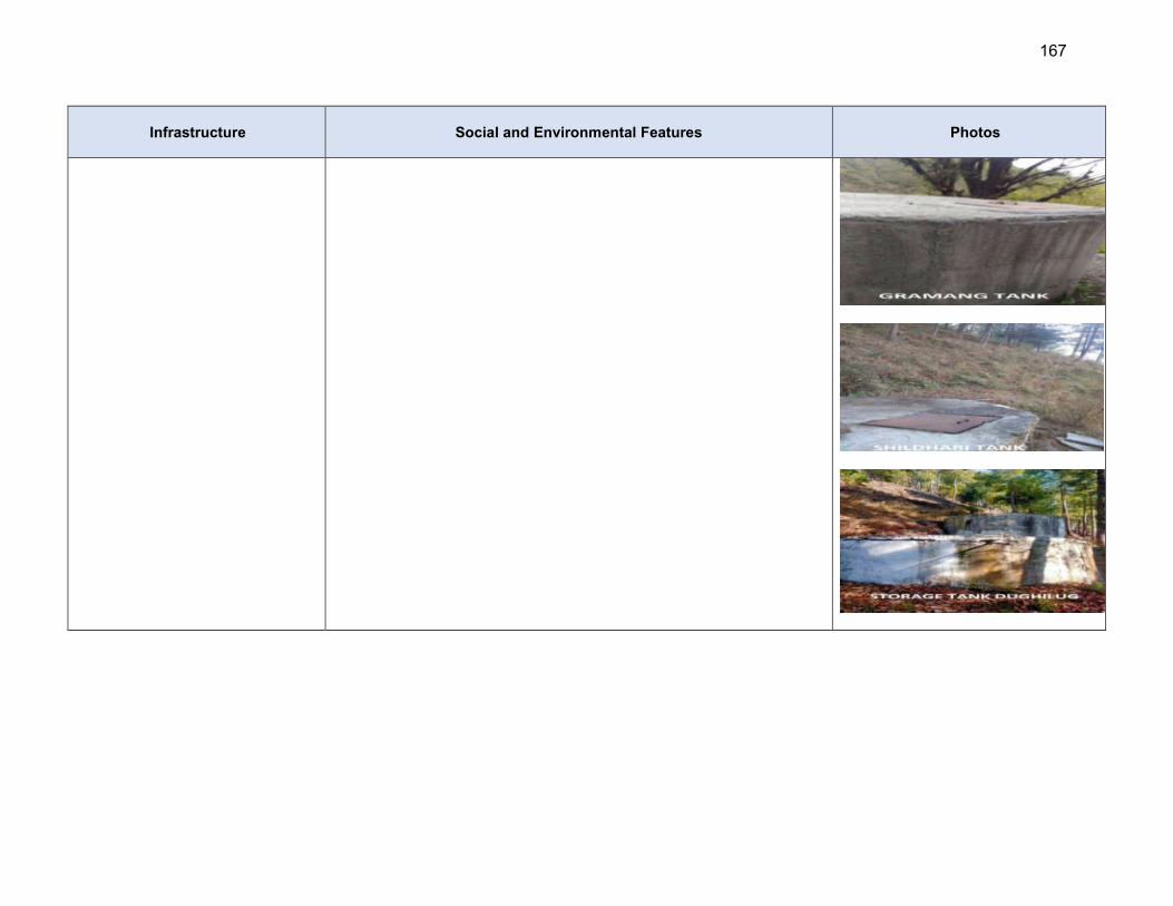
167
Infrastructure Social and Environmental Features Photos

168
Infrastructure Social and Environmental Features Photos
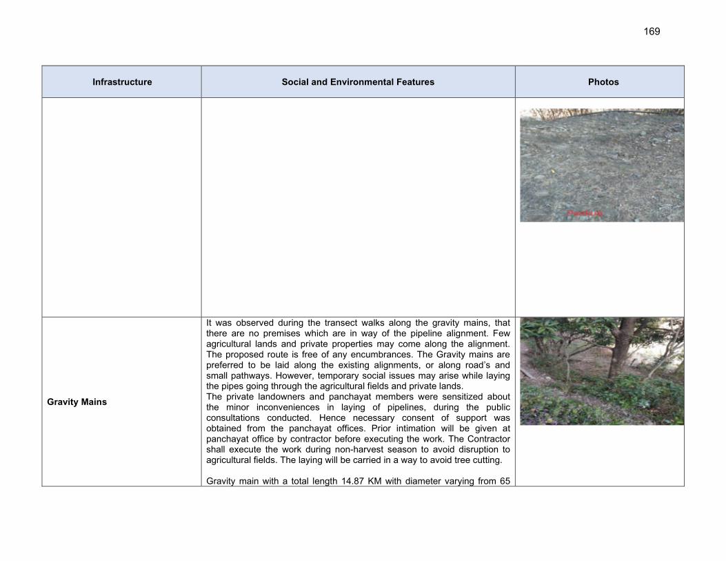
169
Infrastructure Social and Environmental Features Photos
Gravity Mains
It was observed during the transect walks along the gravity mains, that there are no premises which are in way of the pipeline alignment. Few agricultural lands and private properties may come along the alignment. The proposed route is free of any encumbrances. The Gravity mains are preferred to be laid along the existing alignments, or along road’s and small pathways. However, temporary social issues may arise while laying the pipes going through the agricultural fields and private lands. The private landowners and panchayat members were sensitized about the minor inconveniences in laying of pipelines, during the public consultations conducted. Hence necessary consent of support was obtained from the panchayat offices. Prior intimation will be given at panchayat office by contractor before executing the work. The Contractor shall execute the work during non-harvest season to avoid disruption to agricultural fields. The laying will be carried in a way to avoid tree cutting. Gravity main with a total length 14.87 KM with diameter varying from 65
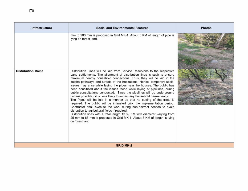
170
Infrastructure Social and Environmental Features Photos
mm to 200 mm is proposed in Grid MK-1. About 8 KM of length of pipe is lying on forest land.
Distribution Mains Distribution Lines will be laid from Service Reservoirs to the respective Land settlements. The alignment of distribution lines is such to ensure maximum nearby household connections. Thus, they will be laid in the katcha pathways and streets of the habitations. Hence, temporary social issues may arise while laying the pipes near the houses. The public has been sensitized about the issues faced while laying of pipelines, during public consultations conducted. Since the pipelines will go underground (where possible), it is less likely to impact any household permanently. The Pipes will be laid in a manner so that no cutting of the trees is required. The public will be intimated prior the implementation period. Contractor shall execute the work during non-harvest season to avoid disruption to agricultural fields if required. Distribution lines with a total length 13.39 KM with diameter varying from 25 mm to 65 mm is proposed in Grid MK-1. About 5 KM of length is lying on forest land.
GRID MK-2
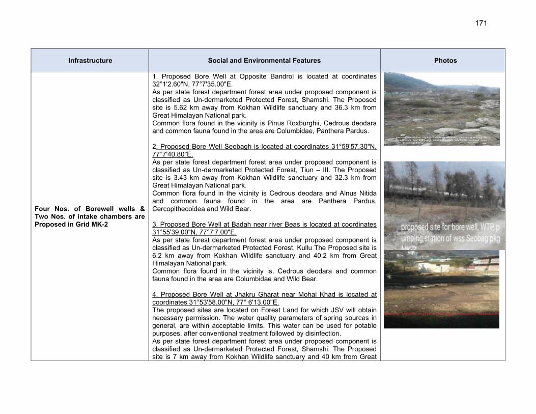
171
Infrastructure Social and Environmental Features Photos
Four Nos. of Borewell wells & Two Nos. of intake chambers are Proposed in Grid MK-2
1. Proposed Bore Well at Opposite Bandrol is located at coordinates 32°1'2.60"N, 77°7'35.00"E. As per state forest department forest area under proposed component is classified as Un-dermarketed Protected Forest, Shamshi. The Proposed site is 5.62 km away from Kokhan Wildlife sanctuary and 36.3 km from Great Himalayan National park. Common flora found in the vicinity is Pinus Roxburghii, Cedrous deodara and common fauna found in the area are Columbidae, Panthera Pardus. 2. Proposed Bore Well Seobagh is located at coordinates 31°59'57.30"N, 77°7'40.80"E. As per state forest department forest area under proposed component is classified as Un-dermarketed Protected Forest, Tiun – III. The Proposed site is 3.43 km away from Kokhan Wildlife sanctuary and 32.3 km from Great Himalayan National park. Common flora found in the vicinity is Cedrous deodara and Alnus Nitida and common fauna found in the area are Panthera Pardus, Cercopithecoidea and Wild Bear. 3. Proposed Bore Well at Badah near river Beas is located at coordinates 31°55'39.00"N, 77°7'7.00"E. As per state forest department forest area under proposed component is classified as Un-dermarketed Protected Forest, Kullu The Proposed site is 6.2 km away from Kokhan Wildlife sanctuary and 40.2 km from Great Himalayan National park. Common flora found in the vicinity is, Cedrous deodara and common fauna found in the area are Columbidae and Wild Bear. 4. Proposed Bore Well at Jhakru Gharat near Mohal Khad is located at coordinates 31°53'58.00"N, 77° 6'13.00"E. The proposed sites are located on Forest Land for which JSV will obtain necessary permission. The water quality parameters of spring sources in general, are within acceptable limits. This water can be used for potable purposes, after conventional treatment followed by disinfection. As per state forest department forest area under proposed component is classified as Un-dermarketed Protected Forest, Shamshi. The Proposed site is 7 km away from Kokhan Wildlife sanctuary and 40 km from Great

172
Infrastructure Social and Environmental Features Photos
Himalayan National park. Common flora found in the vicinity is Pinus Roxburghii, Cedrous deodara and Alnus Nitida and common fauna found in the area are Columbidae, Panthera Pardus, Cercopithecoidea and Wild Bear. The site is present in an isolated location and devoid of any nearby human settlements. There aren’t any major human activities in this area. area. Thus, temporary or permanent Social impacts or Community issues were not observed. Tree cutting will not be required as land is vacant.
5. Proposed Intake at Kais Nallah requires 5 Sqm. area and is located at coordinates 31°53'57.60"N, 77°6'13.09"E. Kais nallah is both snow and rain fed originating from a spring at Kais village and meets with Beas. Total length is about 4km and the width near intake is around 12m. Three nallahs and some springs meets with Kais nallah in the upstream. Both Igneous and Metamorphic rocks are exposed along the nallah. Very high flow is observed in July and August months and very low flow in November to January. General topography is hilly and undulating. The stream gradient is medium and rapid flows observed. Algae are visible on the bed/rocks. Rainbow and Brown Trouts and Schizothorax sp. along with Minnows are found in the stream As per state forest department forest area under proposed component is classified as Un-dermarketed Protected Forest, Kais -III. The Proposed site is 2.71 km away from Kokhan Wildlife sanctuary and 34.3 km from Great Himalayan National park. Common flora found in the vicinity is Cedrous deodara and Alnus Nitida and common fauna found in the area are Columbidae, Panthera Pardus, and Cercopithecoidea. 6. Proposed Intake at Khuad Nallah require 13 Sqm area and is located at coordinates 31°55'41.20"N, 77° 7'7.03"E. Khuad nallah is both snow and rain fed originating from a spring at 500m upstream and merges with river Beas. Total length of Khuad nallah is about 6km which has a small catchment area .The width near intake is around 10m. Few springs meets with Khuad nallah in the upstream. The water quality parameters are within acceptable limits as per JSVs report on water quality analysis. This water can be used for potable purposes, after
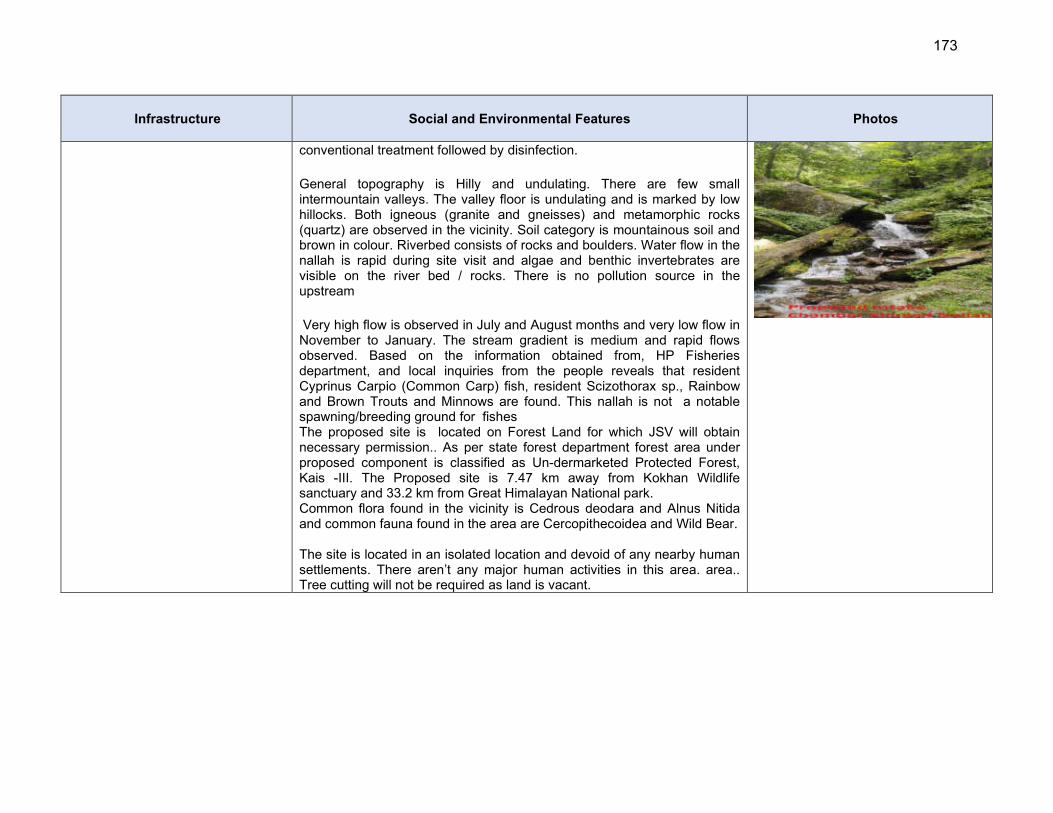
173
Infrastructure Social and Environmental Features Photos
conventional treatment followed by disinfection.
General topography is Hilly and undulating. There are few small intermountain valleys. The valley floor is undulating and is marked by low hillocks. Both igneous (granite and gneisses) and metamorphic rocks (quartz) are observed in the vicinity. Soil category is mountainous soil and brown in colour. Riverbed consists of rocks and boulders. Water flow in the nallah is rapid during site visit and algae and benthic invertebrates are visible on the river bed / rocks. There is no pollution source in the upstream
Very high flow is observed in July and August months and very low flow in November to January. The stream gradient is medium and rapid flows observed. Based on the information obtained from, HP Fisheries department, and local inquiries from the people reveals that resident Cyprinus Carpio (Common Carp) fish, resident Scizothorax sp., Rainbow and Brown Trouts and Minnows are found. This nallah is not a notable spawning/breeding ground for fishes The proposed site is located on Forest Land for which JSV will obtain necessary permission.. As per state forest department forest area under proposed component is classified as Un-dermarketed Protected Forest, Kais -III. The Proposed site is 7.47 km away from Kokhan Wildlife sanctuary and 33.2 km from Great Himalayan National park. Common flora found in the vicinity is Cedrous deodara and Alnus Nitida and common fauna found in the area are Cercopithecoidea and Wild Bear. The site is located in an isolated location and devoid of any nearby human settlements. There aren’t any major human activities in this area. area.. Tree cutting will not be required as land is vacant.
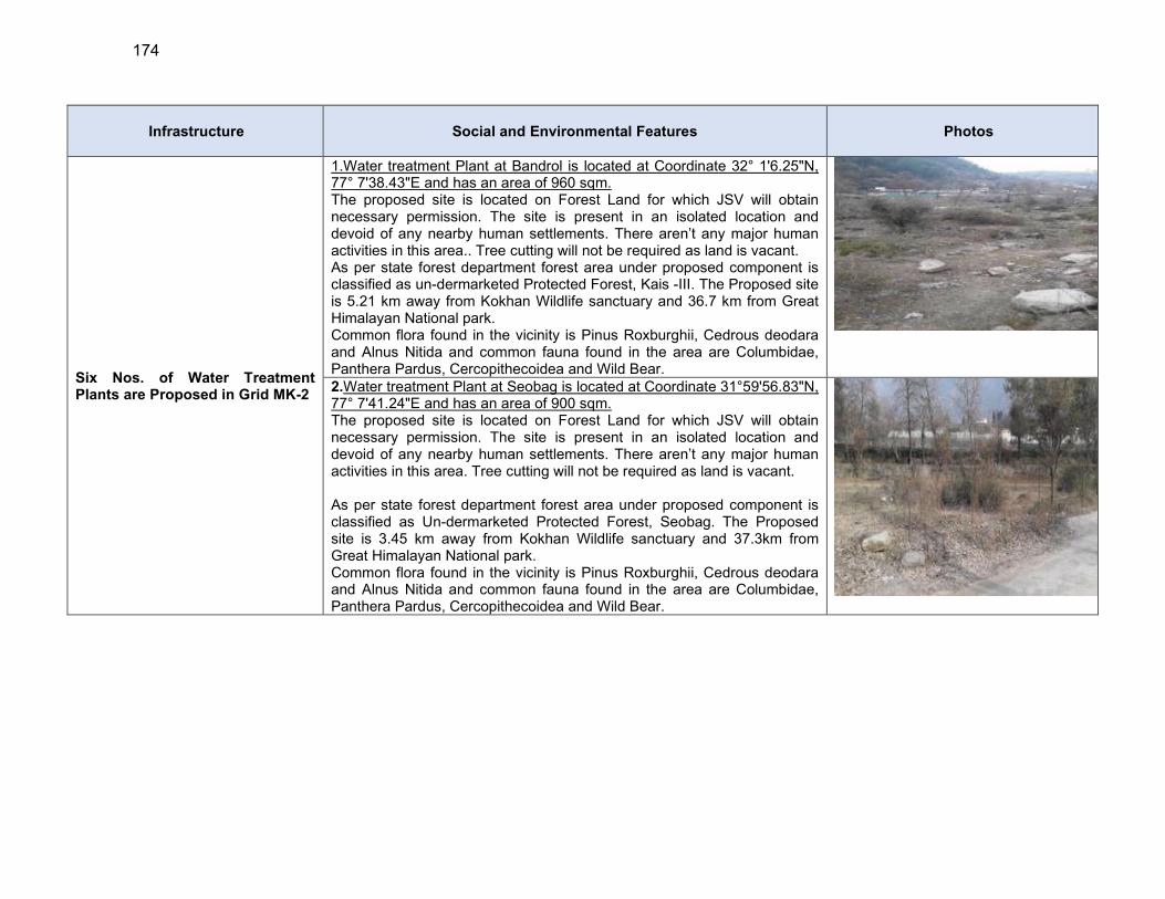
174
Infrastructure Social and Environmental Features Photos
Six Nos. of Water Treatment Plants are Proposed in Grid MK-2
1.Water treatment Plant at Bandrol is located at Coordinate 32° 1'6.25"N, 77° 7'38.43"E and has an area of 960 sqm. The proposed site is located on Forest Land for which JSV will obtain necessary permission. The site is present in an isolated location and devoid of any nearby human settlements. There aren’t any major human activities in this area.. Tree cutting will not be required as land is vacant. As per state forest department forest area under proposed component is classified as un-dermarketed Protected Forest, Kais -III. The Proposed site is 5.21 km away from Kokhan Wildlife sanctuary and 36.7 km from Great Himalayan National park. Common flora found in the vicinity is Pinus Roxburghii, Cedrous deodara and Alnus Nitida and common fauna found in the area are Columbidae, Panthera Pardus, Cercopithecoidea and Wild Bear. 2.Water treatment Plant at Seobag is located at Coordinate 31°59'56.83"N, 77° 7'41.24"E and has an area of 900 sqm. The proposed site is located on Forest Land for which JSV will obtain necessary permission. The site is present in an isolated location and devoid of any nearby human settlements. There aren’t any major human activities in this area. Tree cutting will not be required as land is vacant. As per state forest department forest area under proposed component is classified as Un-dermarketed Protected Forest, Seobag. The Proposed site is 3.45 km away from Kokhan Wildlife sanctuary and 37.3km from Great Himalayan National park. Common flora found in the vicinity is Pinus Roxburghii, Cedrous deodara and Alnus Nitida and common fauna found in the area are Columbidae, Panthera Pardus, Cercopithecoidea and Wild Bear.
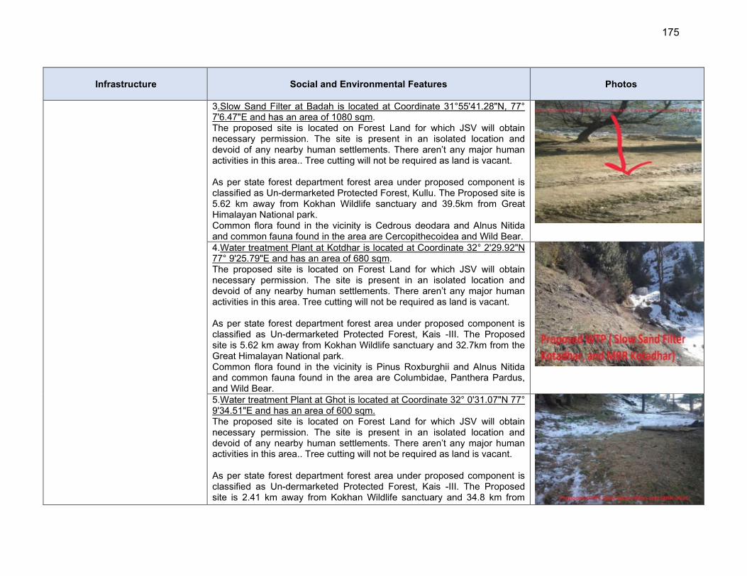
175
Infrastructure Social and Environmental Features Photos
3.Slow Sand Filter at Badah is located at Coordinate 31°55'41.28"N, 77° 7'6.47"E and has an area of 1080 sqm. The proposed site is located on Forest Land for which JSV will obtain necessary permission. The site is present in an isolated location and devoid of any nearby human settlements. There aren’t any major human activities in this area.. Tree cutting will not be required as land is vacant. As per state forest department forest area under proposed component is classified as Un-dermarketed Protected Forest, Kullu. The Proposed site is 5.62 km away from Kokhan Wildlife sanctuary and 39.5km from Great Himalayan National park. Common flora found in the vicinity is Cedrous deodara and Alnus Nitida and common fauna found in the area are Cercopithecoidea and Wild Bear.
4.Water treatment Plant at Kotdhar is located at Coordinate 32° 2'29.92"N 77° 9'25.79"E and has an area of 680 sqm. The proposed site is located on Forest Land for which JSV will obtain necessary permission. The site is present in an isolated location and devoid of any nearby human settlements. There aren’t any major human activities in this area. Tree cutting will not be required as land is vacant. As per state forest department forest area under proposed component is classified as Un-dermarketed Protected Forest, Kais -III. The Proposed site is 5.62 km away from Kokhan Wildlife sanctuary and 32.7km from the Great Himalayan National park. Common flora found in the vicinity is Pinus Roxburghii and Alnus Nitida and common fauna found in the area are Columbidae, Panthera Pardus, and Wild Bear. 5.Water treatment Plant at Ghot is located at Coordinate 32° 0'31.07"N 77° 9'34.51"E and has an area of 600 sqm. The proposed site is located on Forest Land for which JSV will obtain necessary permission. The site is present in an isolated location and devoid of any nearby human settlements. There aren’t any major human activities in this area.. Tree cutting will not be required as land is vacant. As per state forest department forest area under proposed component is classified as Un-dermarketed Protected Forest, Kais -III. The Proposed site is 2.41 km away from Kokhan Wildlife sanctuary and 34.8 km from
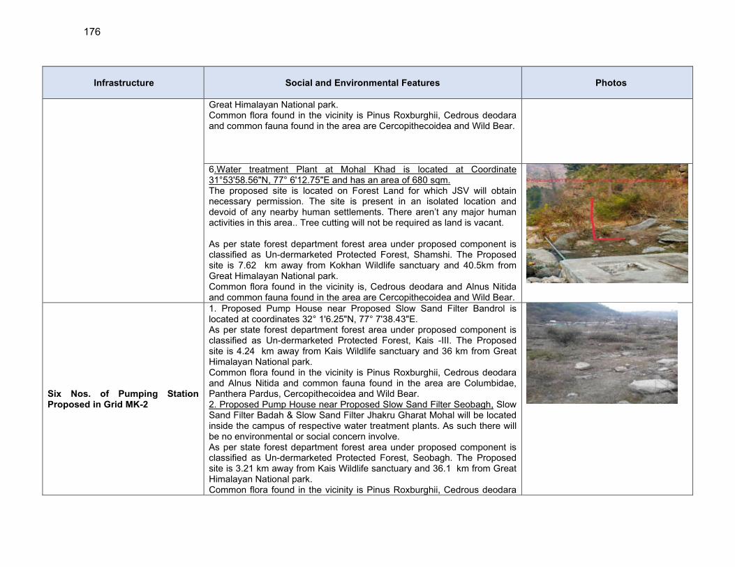
176
Infrastructure Social and Environmental Features Photos
Great Himalayan National park. Common flora found in the vicinity is Pinus Roxburghii, Cedrous deodara and common fauna found in the area are Cercopithecoidea and Wild Bear.
6.Water treatment Plant at Mohal Khad is located at Coordinate 31°53'58.56"N, 77° 6'12.75"E and has an area of 680 sqm. The proposed site is located on Forest Land for which JSV will obtain necessary permission. The site is present in an isolated location and devoid of any nearby human settlements. There aren’t any major human activities in this area.. Tree cutting will not be required as land is vacant. As per state forest department forest area under proposed component is classified as Un-dermarketed Protected Forest, Shamshi. The Proposed site is 7.62 km away from Kokhan Wildlife sanctuary and 40.5km from Great Himalayan National park. Common flora found in the vicinity is, Cedrous deodara and Alnus Nitida and common fauna found in the area are Cercopithecoidea and Wild Bear.
Six Nos. of Pumping Station Proposed in Grid MK-2
1. Proposed Pump House near Proposed Slow Sand Filter Bandrol is located at coordinates 32° 1'6.25"N, 77° 7'38.43"E. As per state forest department forest area under proposed component is classified as Un-dermarketed Protected Forest, Kais -III. The Proposed site is 4.24 km away from Kais Wildlife sanctuary and 36 km from Great Himalayan National park. Common flora found in the vicinity is Pinus Roxburghii, Cedrous deodara and Alnus Nitida and common fauna found in the area are Columbidae, Panthera Pardus, Cercopithecoidea and Wild Bear. 2. Proposed Pump House near Proposed Slow Sand Filter Seobagh, Slow Sand Filter Badah & Slow Sand Filter Jhakru Gharat Mohal will be located inside the campus of respective water treatment plants. As such there will be no environmental or social concern involve. As per state forest department forest area under proposed component is classified as Un-dermarketed Protected Forest, Seobagh. The Proposed site is 3.21 km away from Kais Wildlife sanctuary and 36.1 km from Great Himalayan National park. Common flora found in the vicinity is Pinus Roxburghii, Cedrous deodara
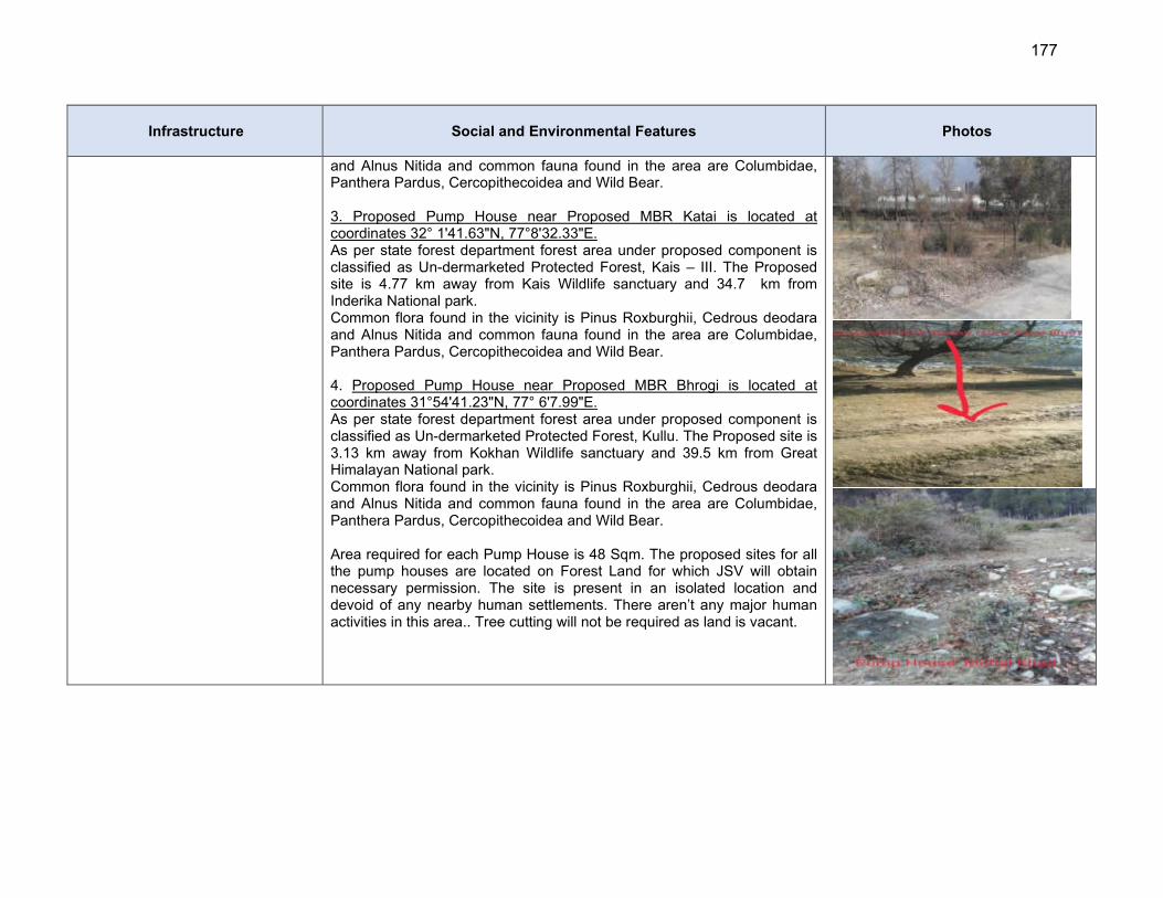
177
Infrastructure Social and Environmental Features Photos
and Alnus Nitida and common fauna found in the area are Columbidae, Panthera Pardus, Cercopithecoidea and Wild Bear. 3. Proposed Pump House near Proposed MBR Katai is located at coordinates 32° 1'41.63"N, 77°8'32.33"E. As per state forest department forest area under proposed component is classified as Un-dermarketed Protected Forest, Kais – III. The Proposed site is 4.77 km away from Kais Wildlife sanctuary and 34.7 km from Inderika National park. Common flora found in the vicinity is Pinus Roxburghii, Cedrous deodara and Alnus Nitida and common fauna found in the area are Columbidae, Panthera Pardus, Cercopithecoidea and Wild Bear. 4. Proposed Pump House near Proposed MBR Bhrogi is located at coordinates 31°54'41.23"N, 77° 6'7.99"E. As per state forest department forest area under proposed component is classified as Un-dermarketed Protected Forest, Kullu. The Proposed site is 3.13 km away from Kokhan Wildlife sanctuary and 39.5 km from Great Himalayan National park. Common flora found in the vicinity is Pinus Roxburghii, Cedrous deodara and Alnus Nitida and common fauna found in the area are Columbidae, Panthera Pardus, Cercopithecoidea and Wild Bear. Area required for each Pump House is 48 Sqm. The proposed sites for all the pump houses are located on Forest Land for which JSV will obtain necessary permission. The site is present in an isolated location and devoid of any nearby human settlements. There aren’t any major human activities in this area.. Tree cutting will not be required as land is vacant.

178
Infrastructure Social and Environmental Features Photos
Six Nos. of Main Balancing Reservoirs are Proposed in this Grid
1. Proposed MBR Katai is located at coordinates 32° 1'41.92"N, 77°8'32.51"E and has an area of 64 Sqm. As per state forest department forest area under proposed component is classified as Un-dermarketed Protected Forest, Kais -III. The Proposed site is 4.77 km away from Kais Wildlife sanctuary and 34.7 km from Inderkila National park. Common flora found in the vicinity is Cedrous deodara and Alnus Nitida and common fauna found in the area are Columbidae, Panthera Pardus and Wild Bear. 2. Proposed MBR Manjhdhari is located at coordinates 32° 2'6.77"N, 77°8'50.61"E and has an area of 64 Sqm. As per state forest department forest area under proposed component is classified as Un-dermarketed Protected Forest, Kais -III. The Proposed site is 5.61 km away from Kokhan Wildlife sanctuary and 34.2 km from Great Himalayan National park. Common flora found in the vicinity is Cedrous deodara and Alnus Nitida
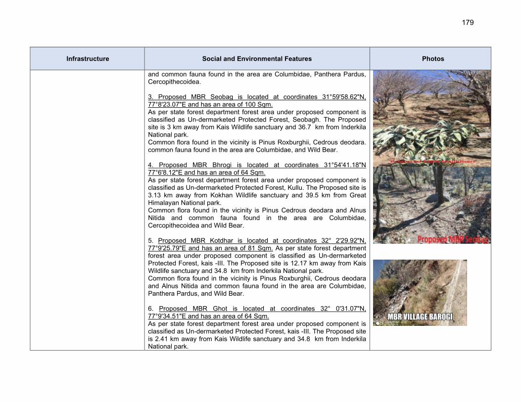
179
Infrastructure Social and Environmental Features Photos
and common fauna found in the area are Columbidae, Panthera Pardus, Cercopithecoidea. 3. Proposed MBR Seobag is located at coordinates 31°59'58.62"N, 77°8'23.07"E and has an area of 100 Sqm. As per state forest department forest area under proposed component is classified as Un-dermarketed Protected Forest, Seobagh. The Proposed site is 3 km away from Kais Wildlife sanctuary and 36.7 km from Inderkila National park. Common flora found in the vicinity is Pinus Roxburghii, Cedrous deodara. common fauna found in the area are Columbidae, and Wild Bear. 4. Proposed MBR Bhrogi is located at coordinates 31°54'41.18"N 77°6'8.12"E and has an area of 64 Sqm. As per state forest department forest area under proposed component is classified as Un-dermarketed Protected Forest, Kullu. The Proposed site is 3.13 km away from Kokhan Wildlife sanctuary and 39.5 km from Great Himalayan National park. Common flora found in the vicinity is Pinus Cedrous deodara and Alnus Nitida and common fauna found in the area are Columbidae, Cercopithecoidea and Wild Bear. 5. Proposed MBR Kotdhar is located at coordinates 32° 2'29.92"N, 77°9'25.79"E and has an area of 81 Sqm. As per state forest department forest area under proposed component is classified as Un-dermarketed Protected Forest, kais -III. The Proposed site is 12.17 km away from Kais Wildlife sanctuary and 34.8 km from Inderkila National park. Common flora found in the vicinity is Pinus Roxburghii, Cedrous deodara and Alnus Nitida and common fauna found in the area are Columbidae, Panthera Pardus, and Wild Bear. 6. Proposed MBR Ghot is located at coordinates 32° 0'31.07"N, 77°9'34.51"E and has an area of 64 Sqm. As per state forest department forest area under proposed component is classified as Un-dermarketed Protected Forest, kais -III. The Proposed site is 2.41 km away from Kais Wildlife sanctuary and 34.8 km from Inderkila National park.
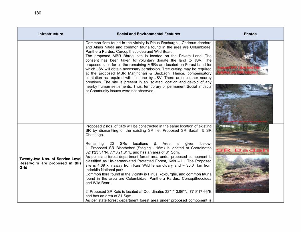
180
Infrastructure Social and Environmental Features Photos
Common flora found in the vicinity is Pinus Roxburghii, Cedrous deodara and Alnus Nitida and common fauna found in the area are Columbidae, Panthera Pardus, Cercopithecoidea and Wild Bear. The proposed MBR Bhrogi site is located on the Private Land. The consent has been taken to voluntary donate the land to JSV. The proposed sites for all the remaining MBRs are located on Forest Land for which JSV will obtain necessary permission. Tree cutting may be required at the proposed MBR Manjhdhari & Seobagh. Hence, compensatory plantation as required will be done by JSV. There are no other nearby premises. The site is present in an isolated location and devoid of any nearby human settlements. Thus, temporary or permanent Social impacts or Community issues were not observed.
Twenty-two Nos. of Service Level Reservoirs are proposed in this Grid
Proposed 2 nos. of SRs will be constructed in the same location of existing SR by dismantling of the existing SR i.e. Proposed SR Badah & SR Chachoga. Remaining 20 SRs locations & Area is given below- 1. Proposed SR Bishtbehar (Staging - 15m) is located at Coordinates 32°1'23.31"N, 77°8'21.81"E and has an area of 81 Sqm. As per state forest department forest area under proposed component is classified as Un-dermarketed Protected Forest, Kais – III. The Proposed site is 4.39 km away from Kais Wildlife sanctuary and ~ 35.6 km from Inderkila National park. Common flora found in the vicinity is Pinus Roxburghii, and common fauna found in the area are Columbidae, Panthera Pardus, Cercopithecoidea and Wild Bear. 2. Proposed SR Kais is located at Coordinates 32°1'13.96"N, 77°8'17.66"E and has an area of 81 Sqm. As per state forest department forest area under proposed component is
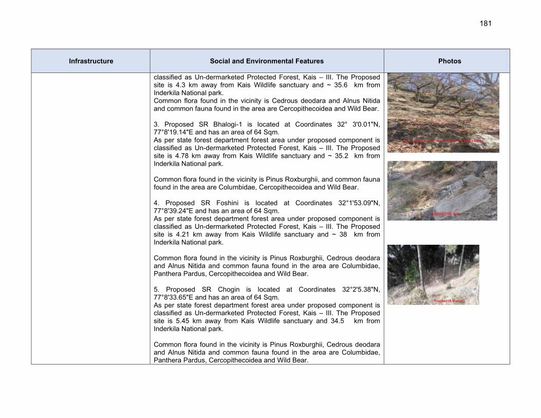
181
Infrastructure Social and Environmental Features Photos
classified as Un-dermarketed Protected Forest, Kais – III. The Proposed site is 4.3 km away from Kais Wildlife sanctuary and ~ 35.6 km from Inderkila National park. Common flora found in the vicinity is Cedrous deodara and Alnus Nitida and common fauna found in the area are Cercopithecoidea and Wild Bear. 3. Proposed SR Bhalogi-1 is located at Coordinates 32° 3'0.01"N, 77°8'19.14"E and has an area of 64 Sqm. As per state forest department forest area under proposed component is classified as Un-dermarketed Protected Forest, Kais – III. The Proposed site is 4.78 km away from Kais Wildlife sanctuary and ~ 35.2 km from Inderkila National park. Common flora found in the vicinity is Pinus Roxburghii, and common fauna found in the area are Columbidae, Cercopithecoidea and Wild Bear. 4. Proposed SR Foshini is located at Coordinates 32°1'53.09"N, 77°8'39.24"E and has an area of 64 Sqm. As per state forest department forest area under proposed component is classified as Un-dermarketed Protected Forest, Kais – III. The Proposed site is 4.21 km away from Kais Wildlife sanctuary and ~ 38 km from Inderkila National park. Common flora found in the vicinity is Pinus Roxburghii, Cedrous deodara and Alnus Nitida and common fauna found in the area are Columbidae, Panthera Pardus, Cercopithecoidea and Wild Bear. 5. Proposed SR Chogin is located at Coordinates 32°2'5.38"N, 77°8'33.65"E and has an area of 64 Sqm. As per state forest department forest area under proposed component is classified as Un-dermarketed Protected Forest, Kais – III. The Proposed site is 5.45 km away from Kais Wildlife sanctuary and 34.5 km from Inderkila National park. Common flora found in the vicinity is Pinus Roxburghii, Cedrous deodara and Alnus Nitida and common fauna found in the area are Columbidae, Panthera Pardus, Cercopithecoidea and Wild Bear.
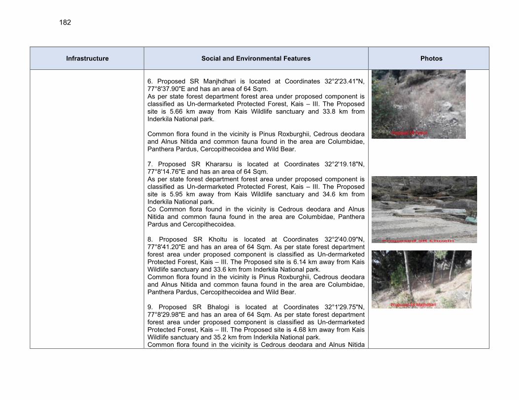
182
Infrastructure Social and Environmental Features Photos
6. Proposed SR Manjhdhari is located at Coordinates 32°2'23.41"N, 77°8'37.90"E and has an area of 64 Sqm. As per state forest department forest area under proposed component is classified as Un-dermarketed Protected Forest, Kais – III. The Proposed site is 5.66 km away from Kais Wildlife sanctuary and 33.8 km from Inderkila National park. Common flora found in the vicinity is Pinus Roxburghii, Cedrous deodara and Alnus Nitida and common fauna found in the area are Columbidae, Panthera Pardus, Cercopithecoidea and Wild Bear. 7. Proposed SR Khararsu is located at Coordinates 32°2'19.18"N, 77°8'14.76"E and has an area of 64 Sqm. As per state forest department forest area under proposed component is classified as Un-dermarketed Protected Forest, Kais – III. The Proposed site is 5.95 km away from Kais Wildlife sanctuary and 34.6 km from Inderkila National park. Co Common flora found in the vicinity is Cedrous deodara and Alnus Nitida and common fauna found in the area are Columbidae, Panthera Pardus and Cercopithecoidea. 8. Proposed SR Kholtu is located at Coordinates 32°2'40.09"N, 77°8'41.20"E and has an area of 64 Sqm. As per state forest department forest area under proposed component is classified as Un-dermarketed Protected Forest, Kais – III. The Proposed site is 6.14 km away from Kais Wildlife sanctuary and 33.6 km from Inderkila National park. Common flora found in the vicinity is Pinus Roxburghii, Cedrous deodara and Alnus Nitida and common fauna found in the area are Columbidae, Panthera Pardus, Cercopithecoidea and Wild Bear. 9. Proposed SR Bhalogi is located at Coordinates 32°1'29.75"N, 77°8'29.98"E and has an area of 64 Sqm. As per state forest department forest area under proposed component is classified as Un-dermarketed Protected Forest, Kais – III. The Proposed site is 4.68 km away from Kais Wildlife sanctuary and 35.2 km from Inderkila National park. Common flora found in the vicinity is Cedrous deodara and Alnus Nitida
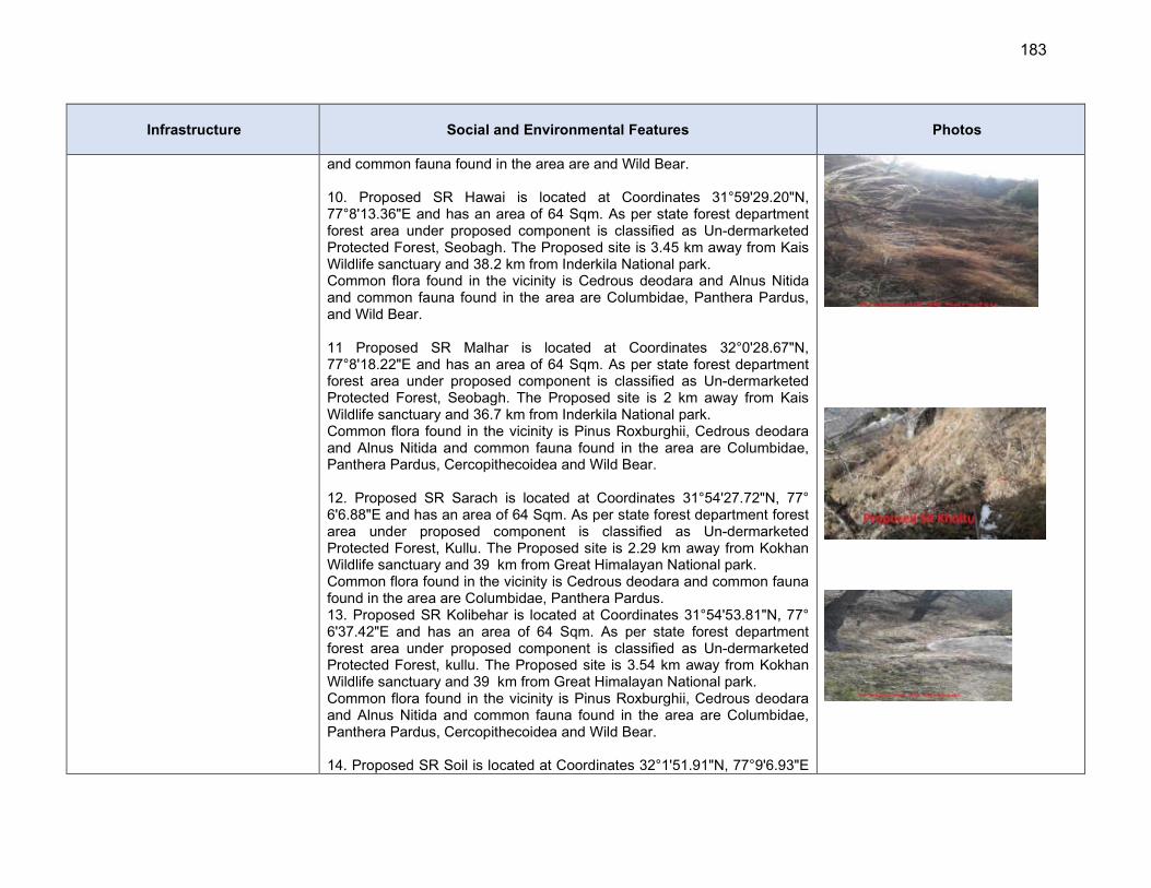
183
Infrastructure Social and Environmental Features Photos
and common fauna found in the area are and Wild Bear. 10. Proposed SR Hawai is located at Coordinates 31°59'29.20"N, 77°8'13.36"E and has an area of 64 Sqm. As per state forest department forest area under proposed component is classified as Un-dermarketed Protected Forest, Seobagh. The Proposed site is 3.45 km away from Kais Wildlife sanctuary and 38.2 km from Inderkila National park. Common flora found in the vicinity is Cedrous deodara and Alnus Nitida and common fauna found in the area are Columbidae, Panthera Pardus, and Wild Bear. 11 Proposed SR Malhar is located at Coordinates 32°0'28.67"N, 77°8'18.22"E and has an area of 64 Sqm. As per state forest department forest area under proposed component is classified as Un-dermarketed Protected Forest, Seobagh. The Proposed site is 2 km away from Kais Wildlife sanctuary and 36.7 km from Inderkila National park. Common flora found in the vicinity is Pinus Roxburghii, Cedrous deodara and Alnus Nitida and common fauna found in the area are Columbidae, Panthera Pardus, Cercopithecoidea and Wild Bear. 12. Proposed SR Sarach is located at Coordinates 31°54'27.72"N, 77° 6'6.88"E and has an area of 64 Sqm. As per state forest department forest area under proposed component is classified as Un-dermarketed Protected Forest, Kullu. The Proposed site is 2.29 km away from Kokhan Wildlife sanctuary and 39 km from Great Himalayan National park. Common flora found in the vicinity is Cedrous deodara and common fauna found in the area are Columbidae, Panthera Pardus. 13. Proposed SR Kolibehar is located at Coordinates 31°54'53.81"N, 77° 6'37.42"E and has an area of 64 Sqm. As per state forest department forest area under proposed component is classified as Un-dermarketed Protected Forest, kullu. The Proposed site is 3.54 km away from Kokhan Wildlife sanctuary and 39 km from Great Himalayan National park. Common flora found in the vicinity is Pinus Roxburghii, Cedrous deodara and Alnus Nitida and common fauna found in the area are Columbidae, Panthera Pardus, Cercopithecoidea and Wild Bear. 14. Proposed SR Soil is located at Coordinates 32°1'51.91"N, 77°9'6.93"E
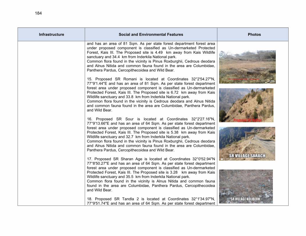
184
Infrastructure Social and Environmental Features Photos
and has an area of 81 Sqm. As per state forest department forest area under proposed component is classified as Un-dermarketed Protected Forest, Kais III. The Proposed site is 4.49 km away from Kais Wildlife sanctuary and 34.4 km from Inderkila National park. Common flora found in the vicinity is Pinus Roxburghii, Cedrous deodara and Alnus Nitida and common fauna found in the area are Columbidae, Panthera Pardus, Cercopithecoidea and Wild Bear. 15. Proposed SR Romani is located at Coordinates 32°2'54.27"N, 77°9'1.44"E and has an area of 81 Sqm. As per state forest department forest area under proposed component is classified as Un-dermarketed Protected Forest, Kais III. The Proposed site is 6.72 km away from Kais Wildlife sanctuary and 33.8 km from Inderkila National park. Common flora found in the vicinity is Cedrous deodara and Alnus Nitida and common fauna found in the area are Columbidae, Panthera Pardus, and Wild Bear. 16. Proposed SR Sour is located at Coordinates 32°2'27.16"N, 77°9'13.66"E and has an area of 64 Sqm. As per state forest department forest area under proposed component is classified as Un-dermarketed Protected Forest, Kais III. The Proposed site is 5.38 km away from Kais Wildlife sanctuary and 32.7 km from Inderkila National park. Common flora found in the vicinity is Pinus Roxburghii, Cedrous deodara and Alnus Nitida and common fauna found in the area are Columbidae, Panthera Pardus, Cercopithecoidea and Wild Bear. 17. Proposed SR Sharan Age is located at Coordinates 32°0'52.94"N 77°8'50.27"E and has an area of 64 Sqm. As per state forest department forest area under proposed component is classified as Un-dermarketed Protected Forest, Kais III. The Proposed site is 3.28 km away from Kais Wildlife sanctuary and 35.5 km from Inderkila National park. Common flora found in the vicinity is Alnus Nitida and common fauna found in the area are Columbidae, Panthera Pardus, Cercopithecoidea and Wild Bear. 18. Proposed SR Tandla 2 is located at Coordinates 32°1'34.97"N, 77°9'51.74"E and has an area of 64 Sqm. As per state forest department
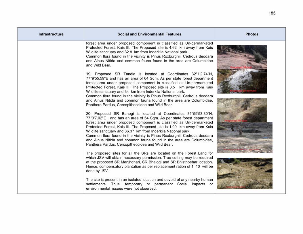
185
Infrastructure Social and Environmental Features Photos
forest area under proposed component is classified as Un-dermarketed Protected Forest, Kais III. The Proposed site is 4.62 km away from Kais Wildlife sanctuary and 32.8 km from Inderkila National park. Common flora found in the vicinity is Pinus Roxburghii, Cedrous deodara and Alnus Nitida and common fauna found in the area are Columbidae and Wild Bear. 19. Proposed SR Tandla is located at Coordinates 32°1'2.74"N, 77°9'55.59"E and has an area of 64 Sqm. As per state forest department forest area under proposed component is classified as Un-dermarketed Protected Forest, Kais III. The Proposed site is 3.5 km away from Kais Wildlife sanctuary and 34 km from Inderkila National park. Common flora found in the vicinity is Pinus Roxburghii, Cedrous deodara and Alnus Nitida and common fauna found in the area are Columbidae, Panthera Pardus, Cercopithecoidea and Wild Bear. 20. Proposed SR Banogi is located at Coordinates 31°59'53.80"N, 77°9'7.02"E and has an area of 64 Sqm. As per state forest department forest area under proposed component is classified as Un-dermarketed Protected Forest, Kais III. The Proposed site is 1.99 km away from Kais Wildlife sanctuary and 36.37 km from Inderkila National park. Common flora found in the vicinity is Pinus Roxburghii, Cedrous deodara and Alnus Nitida and common fauna found in the area are Columbidae, Panthera Pardus, Cercopithecoidea and Wild Bear. The proposed sites for all the SRs are located on the Forest Land for which JSV will obtain necessary permission. Tree cutting may be required at the proposed SR Manjhdhari, SR Bhalogi and SR Bhisthbehar location. Hence, compensatory plantation as per replacement ration of 1: 10 will be done by JSV. The site is present in an isolated location and devoid of any nearby human settlements. Thus, temporary or permanent Social impacts or environmental issues were not observed.
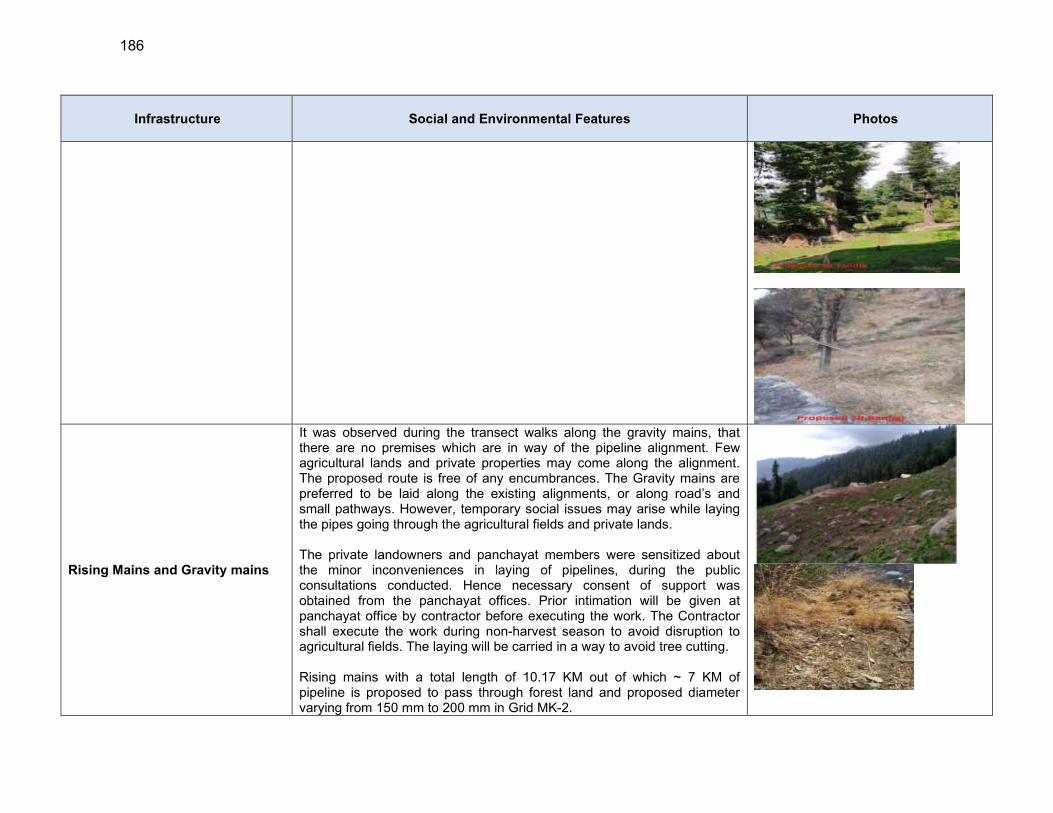
186
Infrastructure Social and Environmental Features Photos
Rising Mains and Gravity mains
It was observed during the transect walks along the gravity mains, that there are no premises which are in way of the pipeline alignment. Few agricultural lands and private properties may come along the alignment. The proposed route is free of any encumbrances. The Gravity mains are preferred to be laid along the existing alignments, or along road’s and small pathways. However, temporary social issues may arise while laying the pipes going through the agricultural fields and private lands. The private landowners and panchayat members were sensitized about the minor inconveniences in laying of pipelines, during the public consultations conducted. Hence necessary consent of support was obtained from the panchayat offices. Prior intimation will be given at panchayat office by contractor before executing the work. The Contractor shall execute the work during non-harvest season to avoid disruption to agricultural fields. The laying will be carried in a way to avoid tree cutting. Rising mains with a total length of 10.17 KM out of which ~ 7 KM of pipeline is proposed to pass through forest land and proposed diameter varying from 150 mm to 200 mm in Grid MK-2.
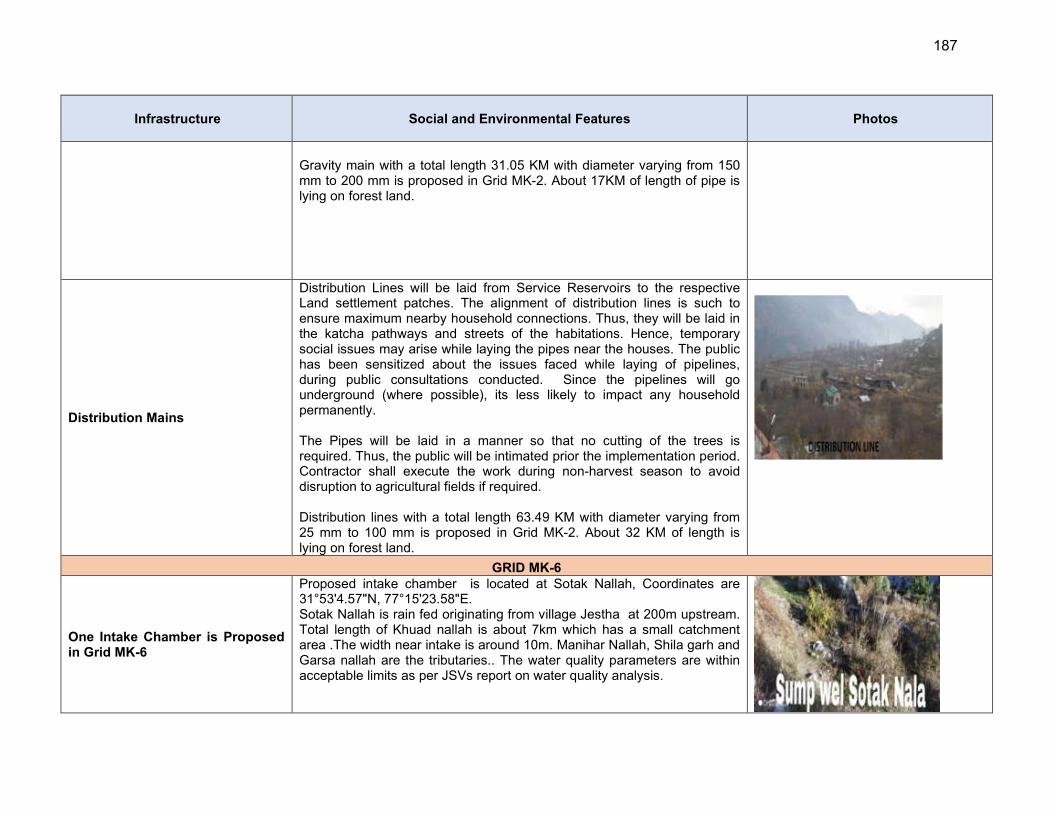
187
Infrastructure Social and Environmental Features Photos
Gravity main with a total length 31.05 KM with diameter varying from 150 mm to 200 mm is proposed in Grid MK-2. About 17KM of length of pipe is lying on forest land.
Distribution Mains
Distribution Lines will be laid from Service Reservoirs to the respective Land settlement patches. The alignment of distribution lines is such to ensure maximum nearby household connections. Thus, they will be laid in the katcha pathways and streets of the habitations. Hence, temporary social issues may arise while laying the pipes near the houses. The public has been sensitized about the issues faced while laying of pipelines, during public consultations conducted. Since the pipelines will go underground (where possible), its less likely to impact any household permanently. The Pipes will be laid in a manner so that no cutting of the trees is required. Thus, the public will be intimated prior the implementation period. Contractor shall execute the work during non-harvest season to avoid disruption to agricultural fields if required. Distribution lines with a total length 63.49 KM with diameter varying from 25 mm to 100 mm is proposed in Grid MK-2. About 32 KM of length is lying on forest land.
GRID MK-6
One Intake Chamber is Proposed in Grid MK-6
Proposed intake chamber is located at Sotak Nallah, Coordinates are 31°53'4.57"N, 77°15'23.58"E. Sotak Nallah is rain fed originating from village Jestha at 200m upstream. Total length of Khuad nallah is about 7km which has a small catchment area .The width near intake is around 10m. Manihar Nallah, Shila garh and Garsa nallah are the tributaries.. The water quality parameters are within acceptable limits as per JSVs report on water quality analysis.

188
Infrastructure Social and Environmental Features Photos
General topography is Hilly and undulating. The valley floor is undulating and is marked by low hillocks. Both igneous (granite and gneisses) and metamorphic rocks (quartz) are exposed in the nallah sections . Soil category is mountainous soil and brown in colour. Riverbed consists of rocks and boulders. Gradient of the Nallah is medium and water flow is rapid. Algae and benthic invertebrates are visible on the river bed / rocks. There is no pollution source in the upstream. Very high flow is observed in July, August and September months and very low flow in May and June .
Based on the information obtained from, HP Fisheries department, and local inquiries from the people reveals that resident Cyprinus Carpio (Common Carp) fish, resident Scizothorax sp., Rainbow and Brown Trouts and Minnows are found. This nallah is not a notable spawning/breeding ground for fishes. There is no endangered aquatic species as per The IUCN Red List of Threatened Species 2010 in the water bodies The proposed site is located on forest land for which JSV will obtain necessary permission. The water quality parameters of source in general, is within acceptable limits. This water can be used for potable purposes, after conventional treatment followed by disinfection. The site is present in an isolated location and devoid of any nearby human settlements. There aren’t any major human activities in this area. Thus, temporary or permanent Social impacts or Community issues were not observed. Tree cutting will not be required as land is vacant. As per state forest department forest area under proposed component is classified as Un-dermarketed Protected Forest, Kot Kandi-III. The Proposed site is 7.42 km away from Kanawar Wildlife sanctuary and ~ 28.4 km from Great Himalayan National park. Common flora found in the vicinity is Abies pindrow, Alnus Nitida & Pinus Roxburghii and common fauna found in the area are Panthera Pardus, Wild Bear, Fox
Three nos. of Water Treatment Plants are Proposed in Grid MK-6
Proposed WTP at Jaishtha is located at coordinates 31°51'33.98"N, 77°14'56.49"E and has an area of 485 Sqm. The proposed site is located on forest land for which JSV will obtain necessary permission.
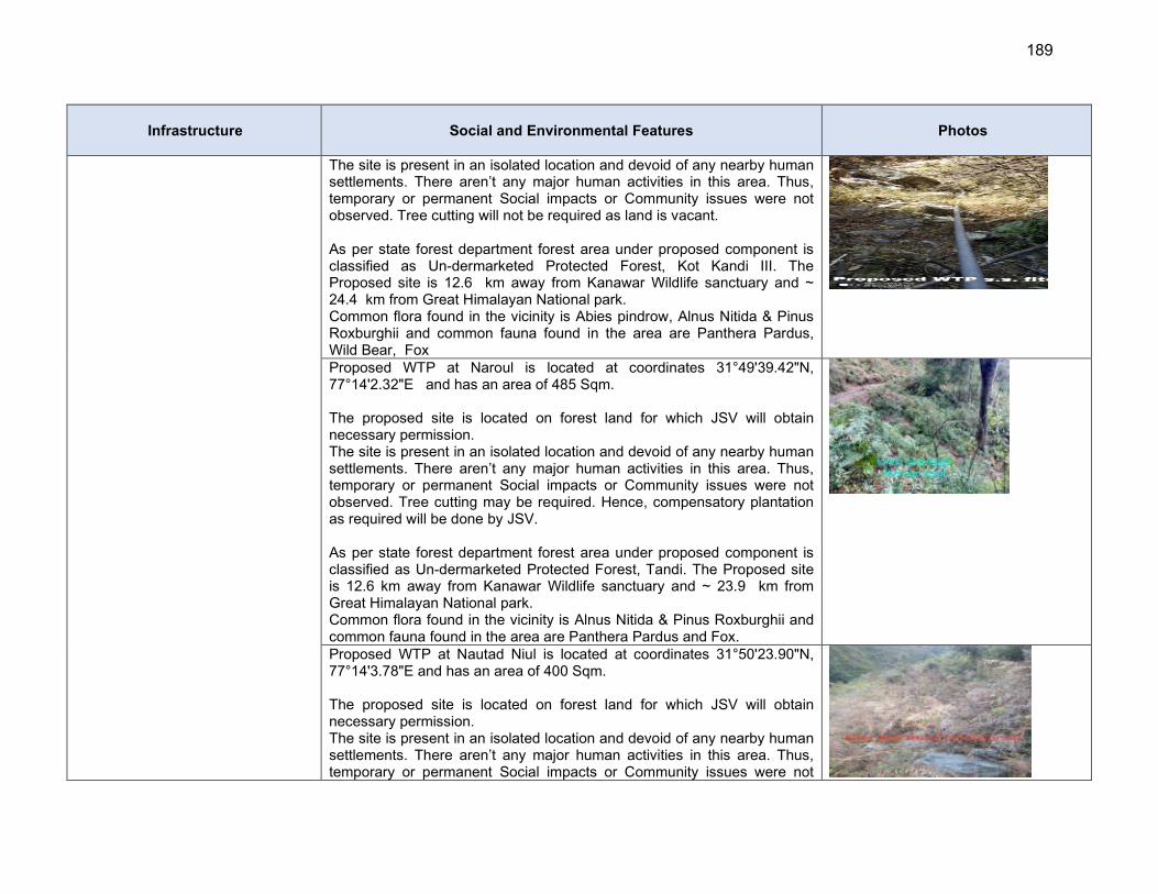
189
Infrastructure Social and Environmental Features Photos
The site is present in an isolated location and devoid of any nearby human settlements. There aren’t any major human activities in this area. Thus, temporary or permanent Social impacts or Community issues were not observed. Tree cutting will not be required as land is vacant. As per state forest department forest area under proposed component is classified as Un-dermarketed Protected Forest, Kot Kandi III. The Proposed site is 12.6 km away from Kanawar Wildlife sanctuary and ~ 24.4 km from Great Himalayan National park. Common flora found in the vicinity is Abies pindrow, Alnus Nitida & Pinus Roxburghii and common fauna found in the area are Panthera Pardus, Wild Bear, Fox
Proposed WTP at Naroul is located at coordinates 31°49'39.42"N, 77°14'2.32"E and has an area of 485 Sqm. The proposed site is located on forest land for which JSV will obtain necessary permission. The site is present in an isolated location and devoid of any nearby human settlements. There aren’t any major human activities in this area. Thus, temporary or permanent Social impacts or Community issues were not observed. Tree cutting may be required. Hence, compensatory plantation as required will be done by JSV. As per state forest department forest area under proposed component is classified as Un-dermarketed Protected Forest, Tandi. The Proposed site is 12.6 km away from Kanawar Wildlife sanctuary and ~ 23.9 km from Great Himalayan National park. Common flora found in the vicinity is Alnus Nitida & Pinus Roxburghii and common fauna found in the area are Panthera Pardus and Fox.
Proposed WTP at Nautad Niul is located at coordinates 31°50'23.90"N, 77°14'3.78"E and has an area of 400 Sqm. The proposed site is located on forest land for which JSV will obtain necessary permission. The site is present in an isolated location and devoid of any nearby human settlements. There aren’t any major human activities in this area. Thus, temporary or permanent Social impacts or Community issues were not
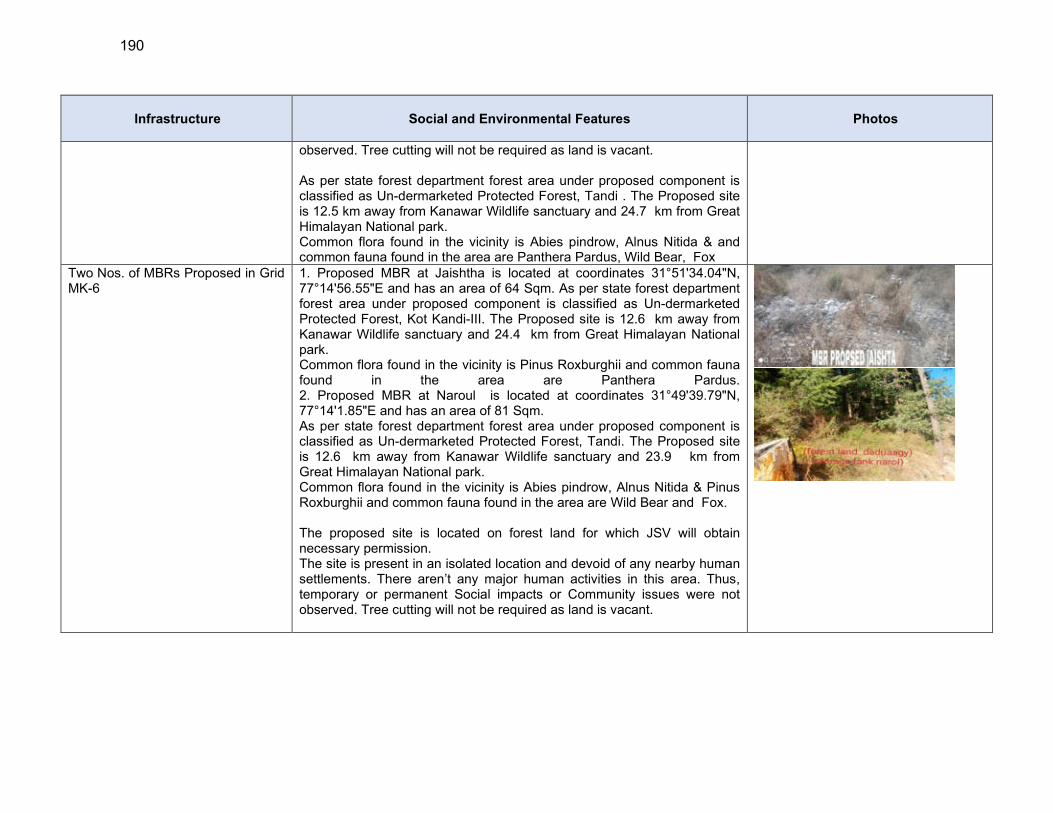
190
Infrastructure Social and Environmental Features Photos
observed. Tree cutting will not be required as land is vacant. As per state forest department forest area under proposed component is classified as Un-dermarketed Protected Forest, Tandi . The Proposed site is 12.5 km away from Kanawar Wildlife sanctuary and 24.7 km from Great Himalayan National park. Common flora found in the vicinity is Abies pindrow, Alnus Nitida & and common fauna found in the area are Panthera Pardus, Wild Bear, Fox
Two Nos. of MBRs Proposed in Grid MK-6
1. Proposed MBR at Jaishtha is located at coordinates 31°51'34.04"N, 77°14'56.55"E and has an area of 64 Sqm. As per state forest department forest area under proposed component is classified as Un-dermarketed Protected Forest, Kot Kandi-III. The Proposed site is 12.6 km away from Kanawar Wildlife sanctuary and 24.4 km from Great Himalayan National park. Common flora found in the vicinity is Pinus Roxburghii and common fauna found in the area are Panthera Pardus. 2. Proposed MBR at Naroul is located at coordinates 31°49'39.79"N, 77°14'1.85"E and has an area of 81 Sqm. As per state forest department forest area under proposed component is classified as Un-dermarketed Protected Forest, Tandi. The Proposed site is 12.6 km away from Kanawar Wildlife sanctuary and 23.9 km from Great Himalayan National park. Common flora found in the vicinity is Abies pindrow, Alnus Nitida & Pinus Roxburghii and common fauna found in the area are Wild Bear and Fox. The proposed site is located on forest land for which JSV will obtain necessary permission. The site is present in an isolated location and devoid of any nearby human settlements. There aren’t any major human activities in this area. Thus, temporary or permanent Social impacts or Community issues were not observed. Tree cutting will not be required as land is vacant.

191
Infrastructure Social and Environmental Features Photos
Three Nos. of Service Reservoir is Proposed in Grid MK-6
1. Proposed SR Jaishtha is located at coordinates 31°51'34.04"N, 77°14'56.55"E and has an area of 64 Sqm. As per state forest department forest area under proposed component is classified as Un-demarcated Protected Forest, Tiun – III. The Proposed site is 10.9 km away from Kanawar Wildlife sanctuary and 25.2 km from Great Himalayan National park. Common flora found in the vicinity is Pinus Roxburghii (Chil), Cedrus Deodara and common fauna found in the area are Panthera Pardus (Indian Leopard). 2. Proposed SR Neenu is located at coordinates 31°51'37.61"N, 77°14'33.16"E and has an area of 64 Sqm. As per state forest department forest area under proposed component is classified as Un-dermarketed Protected Forest, Tiun – III. The Proposed site is 11.9 km away from Kanawar Wildlife sanctuary and 25.5 km from Great Himalayan National park. Common flora found in the vicinity is Pinus Roxburghii (Chil), and common fauna found in the area are Panthera Pardus (Indian Leopard). 3. Proposed SR Nalashri is located at coordinates 31°50'13.86"N, 77°14'26.41"E and has an area of 64 Sqm. As per state forest department forest area under proposed component is classified as Un-dermarketed Protected Forest, Tiun – III. The Proposed site is 12.8 km away from Kanawar Wildlife sanctuary and 23.9 km from Great Himalayan National park. Common flora found in the vicinity is Cedrus Deodara and common fauna found in the area are Panthera Pardus (Indian Leopard). The proposed sites for SR Jaistha and SR Neenu are located on the Forest Land for which JSV will obtain necessary permission. The proposed site for SR Nalashri is located on the Private Land. The consent has been taken to voluntary donate the land to JSV. The sites are present in an isolated location and devoid of any nearby human settlements. There aren’t any major human activities in this area. Thus, temporary or permanent Social impacts or Community issues were not observed. Tree cutting will not be required as land is vacant.
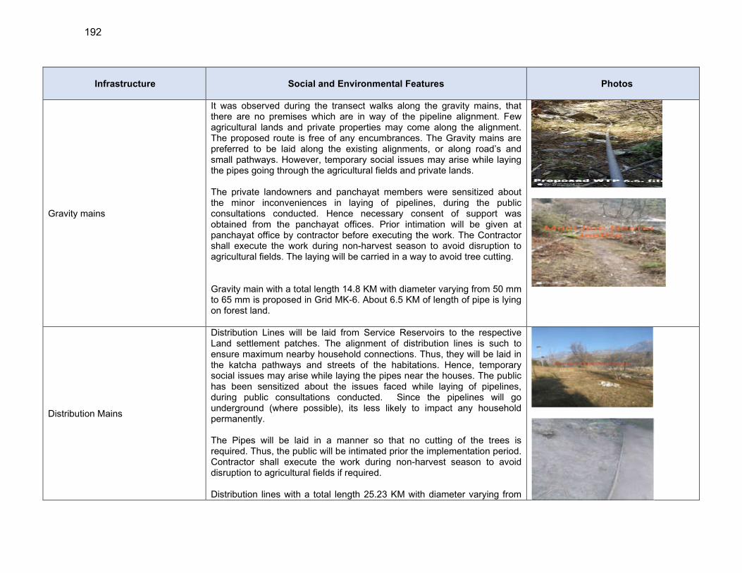
192
Infrastructure Social and Environmental Features Photos
Gravity mains
It was observed during the transect walks along the gravity mains, that there are no premises which are in way of the pipeline alignment. Few agricultural lands and private properties may come along the alignment. The proposed route is free of any encumbrances. The Gravity mains are preferred to be laid along the existing alignments, or along road’s and small pathways. However, temporary social issues may arise while laying the pipes going through the agricultural fields and private lands. The private landowners and panchayat members were sensitized about the minor inconveniences in laying of pipelines, during the public consultations conducted. Hence necessary consent of support was obtained from the panchayat offices. Prior intimation will be given at panchayat office by contractor before executing the work. The Contractor shall execute the work during non-harvest season to avoid disruption to agricultural fields. The laying will be carried in a way to avoid tree cutting. Gravity main with a total length 14.8 KM with diameter varying from 50 mm to 65 mm is proposed in Grid MK-6. About 6.5 KM of length of pipe is lying on forest land.
Distribution Mains
Distribution Lines will be laid from Service Reservoirs to the respective Land settlement patches. The alignment of distribution lines is such to ensure maximum nearby household connections. Thus, they will be laid in the katcha pathways and streets of the habitations. Hence, temporary social issues may arise while laying the pipes near the houses. The public has been sensitized about the issues faced while laying of pipelines, during public consultations conducted. Since the pipelines will go underground (where possible), its less likely to impact any household permanently. The Pipes will be laid in a manner so that no cutting of the trees is required. Thus, the public will be intimated prior the implementation period. Contractor shall execute the work during non-harvest season to avoid disruption to agricultural fields if required. Distribution lines with a total length 25.23 KM with diameter varying from
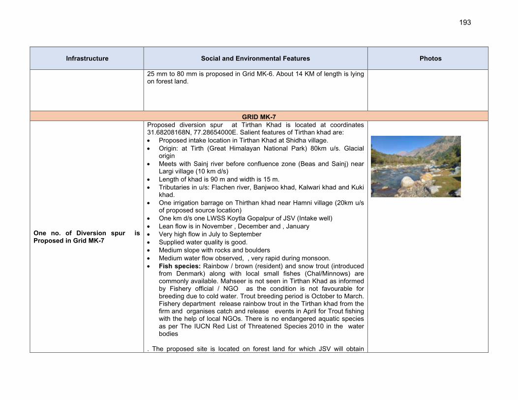
193
Infrastructure Social and Environmental Features Photos
25 mm to 80 mm is proposed in Grid MK-6. About 14 KM of length is lying on forest land.
GRID MK-7
One no. of Diversion spur is Proposed in Grid MK-7
Proposed diversion spur at Tirthan Khad is located at coordinates 31.68208168N, 77.28654000E. Salient features of Tirthan khad are: Proposed intake location in Tirthan Khad at Shidha village. Origin: at Tirth (Great Himalayan National Park) 80km u/s. Glacial
origin Meets with Sainj river before confluence zone (Beas and Sainj) near
Largi village (10 km d/s) Length of khad is 90 m and width is 15 m. Tributaries in u/s: Flachen river, Banjwoo khad, Kalwari khad and Kuki
khad. One irrigation barrage on Thirthan khad near Hamni village (20km u/s
of proposed source location) One km d/s one LWSS Koytla Gopalpur of JSV (Intake well) Lean flow is in November , December and , January Very high flow in July to September Supplied water quality is good. Medium slope with rocks and boulders Medium water flow observed, , very rapid during monsoon. Fish species: Rainbow / brown (resident) and snow trout (introduced
from Denmark) along with local small fishes (Chal/Minnows) are commonly available. Mahseer is not seen in Tirthan Khad as informed by Fishery official / NGO as the condition is not favourable for breeding due to cold water. Trout breeding period is October to March. Fishery department release rainbow trout in the Tirthan khad from the firm and organises catch and release events in April for Trout fishing with the help of local NGOs. There is no endangered aquatic species as per The IUCN Red List of Threatened Species 2010 in the water bodies
. The proposed site is located on forest land for which JSV will obtain
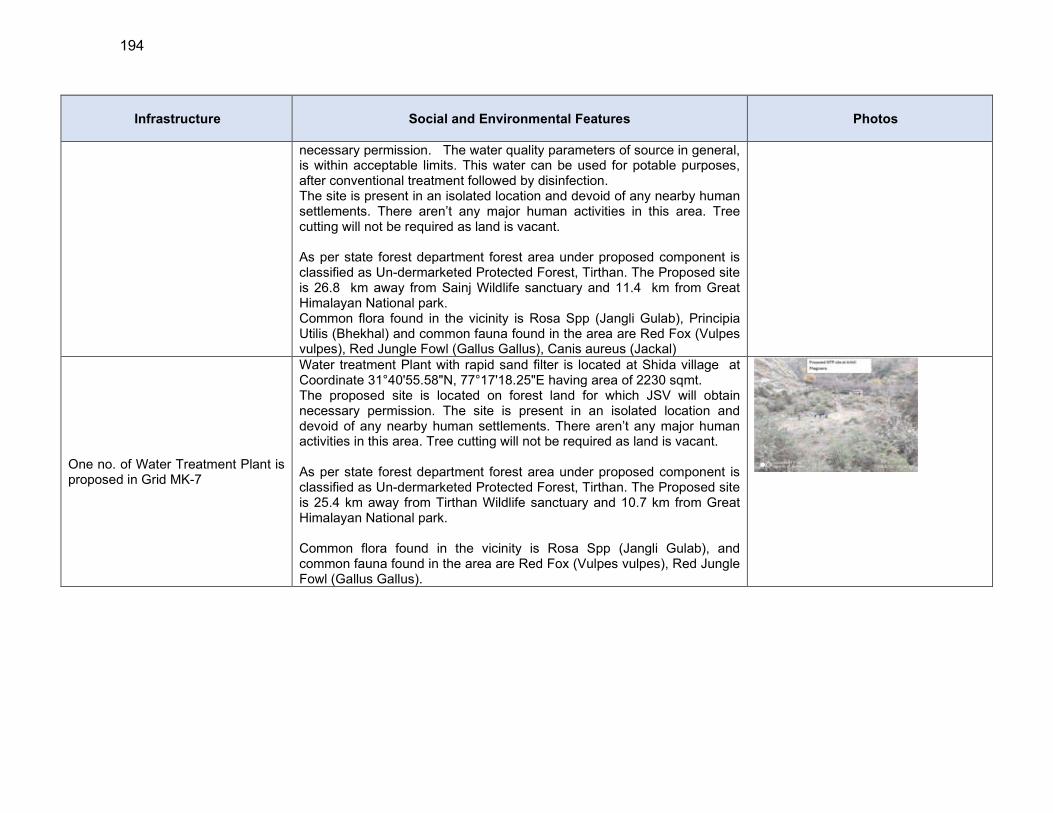
194
Infrastructure Social and Environmental Features Photos
necessary permission. The water quality parameters of source in general, is within acceptable limits. This water can be used for potable purposes, after conventional treatment followed by disinfection. The site is present in an isolated location and devoid of any nearby human settlements. There aren’t any major human activities in this area. Tree cutting will not be required as land is vacant. As per state forest department forest area under proposed component is classified as Un-dermarketed Protected Forest, Tirthan. The Proposed site is 26.8 km away from Sainj Wildlife sanctuary and 11.4 km from Great Himalayan National park. Common flora found in the vicinity is Rosa Spp (Jangli Gulab), Principia Utilis (Bhekhal) and common fauna found in the area are Red Fox (Vulpes vulpes), Red Jungle Fowl (Gallus Gallus), Canis aureus (Jackal)
One no. of Water Treatment Plant is proposed in Grid MK-7
Water treatment Plant with rapid sand filter is located at Shida village at Coordinate 31°40'55.58"N, 77°17'18.25"E having area of 2230 sqmt. The proposed site is located on forest land for which JSV will obtain necessary permission. The site is present in an isolated location and devoid of any nearby human settlements. There aren’t any major human activities in this area. Tree cutting will not be required as land is vacant. As per state forest department forest area under proposed component is classified as Un-dermarketed Protected Forest, Tirthan. The Proposed site is 25.4 km away from Tirthan Wildlife sanctuary and 10.7 km from Great Himalayan National park. Common flora found in the vicinity is Rosa Spp (Jangli Gulab), and common fauna found in the area are Red Fox (Vulpes vulpes), Red Jungle Fowl (Gallus Gallus).

195
Infrastructure Social and Environmental Features Photos
Two Nos. of Pumping station are proposed in grid MK-7
1. Proposed Pump House near Proposed WTP Shida is located at coordinates 31°40'55.58"N, 77°17'18.25"E. Proposed Pumping station will be located inside the campus of respective water treatment plant. As per state forest department forest area under proposed component is classified as Un-dermarketed Protected Forest, Tirthan. The Proposed site is 25.7 km away from Tirthan Wildlife sanctuary and 11.2 km from Great Himalayan National park. Common flora found in the vicinity is Rosa Spp (Jangli Gulab), Principia Utilis (Bhekhal) and common fauna found in the area are Red Fox (Vulpes vulpes), Red Jungle Fowl (Gallus Gallus), Canis aureus (Jackal) 2. Proposed Pump House near Proposed Sumpwell cum SR at 2nd stage Padhola is located at coordinates 31°41'40.98"N, 77°17'33.69"E. As per state forest department forest area under proposed component is classified as Un-dermarketed Protected Forest, Tirthan. The Proposed site is 27.8 km away from Tirthan Wildlife sanctuary and 11.6 km from Great Himalayan National park. Common flora found in the vicinity is Rosa Spp (Jangli Gulab), Principia Utilis (Bhekhal) and common fauna found in the area are Red Fox (Vulpes vulpes), Red Jungle Fowl (Gallus Gallus), Canis aureus (Jackal) The proposed site is located on forest land for which JSV will obtain necessary permission. The site is present in an isolated location and devoid of any nearby human settlements. There aren’t any major human activities in this area. Thus, temporary or permanent Social impacts or Community issues were not observed. Tree cutting will not be required as land is vacant.
One Main Balancing Reservoir are proposed in grid MK-7
Proposed MBR Jauri is located at coordinate 31°42'39.59"N, 77°17'48.69"E and has an area of 64 sqm. The proposed site of MBR is on private land. The consent has been taken to voluntary donate the land to JSV. The site is present in an isolated location and devoid of any nearby human settlements. There aren’t any major human activities in this area. Thus, temporary or permanent Social impacts or Community issues were not observed. Tree cutting will not be required as land is vacant. As per state forest department forest area under proposed component is classified as Un-dermarketed Protected Forest, Tiun – III. The Proposed site is 25.5 km away from Tirthan Wildlife sanctuary and 10.3 km from
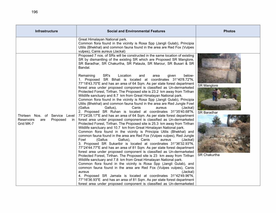
196
Infrastructure Social and Environmental Features Photos
Great Himalayan National park. Common flora found in the vicinity is Rosa Spp (Jangli Gulab), Principia Utilis (Bhekhal) and common fauna found in the area are Red Fox (Vulpes vulpes), Canis aureus (Jackal)
Thirteen Nos. of Service Level Reservoirs are Proposed in Grid MK-7
Proposed 7 nos. of SRs will be constructed in the same location of existing SR by dismantling of the existing SR which are Proposed SR Manglore, SR Baradhar, SR Chakurtha, SR Pataula, SR Marour, SR Busari & SR Bandal. Remaining SR's Location and area given below- 1. Proposed SR Bihali is located at coordinates 31°40'8.72"N, 77°18'43.70"E and has an area of 64 Sqm. As per state forest department forest area under proposed component is classified as Un-dermarketed Protected Forest, Tirthan. The Proposed site is 23.2 km away from Tirthan Wildlife sanctuary and 8.7 km from Great Himalayan National park. Common flora found in the vicinity is Rosa Spp (Jangli Gulab), Principia Utilis (Bhekhal) and common fauna found in the area are Red Jungle Fowl (Gallus Gallus), Canis aureus (Jackal) 2. Proposed SR Ruhan is located at coordinates 31°35'40.68"N, 77°24'28.17"E and has an area of 64 Sqm. As per state forest department forest area under proposed component is classified as Un-dermarketed Protected Forest, Tirthan. The Proposed site is 25.3 km away from Tirthan Wildlife sanctuary and 10.7 km from Great Himalayan National park. Common flora found in the vicinity is Principia Utilis (Bhekhal) and common fauna found in the area are Red Fox (Vulpes vulpes), Red Jungle Fowl (Gallus Gallus), Canis aureus (Jackal) 3. Proposed SR Sukaribir is located at coordinates 31°36'32.93"N, 77°24'44.77"E and has an area of 81 Sqm. As per state forest department forest area under proposed component is classified as Un-dermarketed Protected Forest, Tirthan. The Proposed site is 23 km away from Tirthan Wildlife sanctuary and 7.8 km from Great Himalayan National park. Common flora found in the vicinity is Rosa Spp (Jangli Gulab), and common fauna found in the area are Red Fox (Vulpes vulpes), Canis aureus (Jackal) 4. Proposed SR Jamala is located at coordinates 31°42'49.96"N, 77°16'36.93"E and has an area of 81 Sqm. As per state forest department forest area under proposed component is classified as Un-dermarketed
SR Manglore
SR Baradhar
SR Chakurtha
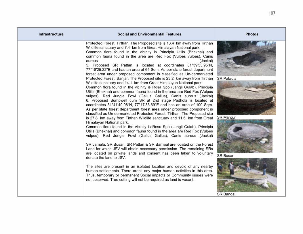
197
Infrastructure Social and Environmental Features Photos
Protected Forest, Tirthan. The Proposed site is 13.4 km away from Tirthan Wildlife sanctuary and 7.4 km from Great Himalayan National park. Common flora found in the vicinity is Principia Utilis (Bhekhal) and common fauna found in the area are Red Fox (Vulpes vulpes), Canis aureus (Jackal) 5. Proposed SR Pattan is located at coordinates 31°39'53.95"N, 77°18'25.22"E and has an area of 64 Sqm. As per state forest department forest area under proposed component is classified as Un-dermarketed Protected Forest, Banjar. The Proposed site is 23.2 km away from Tirthan Wildlife sanctuary and 14.1 km from Great Himalayan National park. Common flora found in the vicinity is Rosa Spp (Jangli Gulab), Principia Utilis (Bhekhal) and common fauna found in the area are Red Fox (Vulpes vulpes), Red Jungle Fowl (Gallus Gallus), Canis aureus (Jackal) 6. Proposed Sumpwell cum SR at 2nd stage Padhola is located at coordinates 31°41'40.98"N, 77°17'33.69"E and has an area of 100 Sqm. As per state forest department forest area under proposed component is classified as Un-dermarketed Protected Forest, Tirthan. The Proposed site is 27.8 km away from Tirthan Wildlife sanctuary and 11.6 km from Great Himalayan National park. Common flora found in the vicinity is Rosa Spp (Jangli Gulab), Principia Utilis (Bhekhal) and common fauna found in the area are Red Fox (Vulpes vulpes), Red Jungle Fowl (Gallus Gallus), Canis aureus (Jackal) SR Jamala, SR Busari, SR Pattan & SR Barnaal are located on the Forest Land for which JSV will obtain necessary permission. The remaining SRs are located on private lands and consent has been taken to voluntary donate the land to JSV. The sites are present in an isolated location and devoid of any nearby human settlements. There aren’t any major human activities in this area. Thus, temporary or permanent Social impacts or Community issues were not observed. Tree cutting will not be required as land is vacant.
SR Pataula
SR Marour
SR Busari
SR Bandal
198
Infrastructure Social and Environmental Features Photos
199
Infrastructure Social and Environmental Features Photos
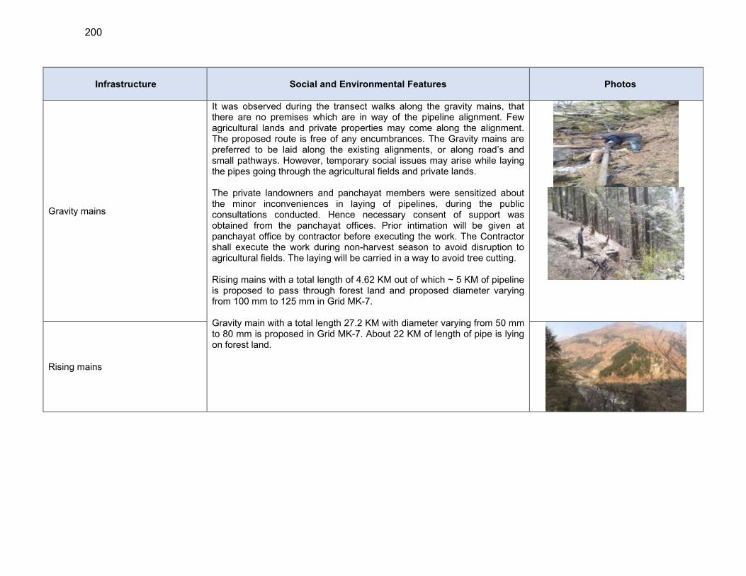
200
Infrastructure Social and Environmental Features Photos
Gravity mains
It was observed during the transect walks along the gravity mains, that there are no premises which are in way of the pipeline alignment. Few agricultural lands and private properties may come along the alignment. The proposed route is free of any encumbrances. The Gravity mains are preferred to be laid along the existing alignments, or along road’s and small pathways. However, temporary social issues may arise while laying the pipes going through the agricultural fields and private lands. The private landowners and panchayat members were sensitized about the minor inconveniences in laying of pipelines, during the public consultations conducted. Hence necessary consent of support was obtained from the panchayat offices. Prior intimation will be given at panchayat office by contractor before executing the work. The Contractor shall execute the work during non-harvest season to avoid disruption to agricultural fields. The laying will be carried in a way to avoid tree cutting. Rising mains with a total length of 4.62 KM out of which ~ 5 KM of pipeline is proposed to pass through forest land and proposed diameter varying from 100 mm to 125 mm in Grid MK-7. Gravity main with a total length 27.2 KM with diameter varying from 50 mm to 80 mm is proposed in Grid MK-7. About 22 KM of length of pipe is lying on forest land.
Rising mains

201
Infrastructure Social and Environmental Features Photos
Distribution Mains
Distribution Lines will be laid from Service Reservoirs to the respective Land settlement patches. The alignment of distribution lines is such to ensure maximum nearby household connections. Thus, they will be laid in the katcha pathways and streets of the habitations. Hence, temporary social issues may arise while laying the pipes near the houses. The public has been sensitized about the issues faced while laying of pipelines, during public consultations conducted. Since the pipelines will go underground (where possible), its less likely to impact any household permanently. The Pipes will be laid in a manner so that no cutting of the trees is required. Thus, the public will be intimated prior the implementation period. Contractor shall execute the work during non-harvest season to avoid disruption to agricultural fields if required. Distribution lines with a total length 52.9 KM with diameter varying from 40 mm to 80 mm is proposed in Grid MK-7. About 37 KM of length is lying on forest land.
GRID MK-9
Four nos. of intake structures proposed in Grid MK-9
1. Proposed diversion spur at Joan Khad Located at coordinates 31°28'35.66"N, 77°27'18.61"E. Jaon khad is both snow and rain fed originating from a Chaku khad (spring origin) at Vashlayi Thach at about 21 km upstream of proposed location. The width near intake is around 12m. Important tributaries are Chhalali Nallah, Chud Nallah, Naini Khad, Ghohan Nallah, Chuli Gad, Shoun Nallah, Guggra Khad and Kohila Nallah. There are two existing intakes within 2 km. of source location.The water quality parameters are within acceptable limits as per JSVs report on water quality analysis.
General topography is hilly and undulating. There are few small intermountain valleys. The valley floor is undulating and is marked by low hillocks. Both igneous (granite and gneisses) and metamorphic rocks (quartz) are observed in the vicinity. Soil category is mountainous soil and brown in colour. Riverbed consists of cobbles, boulders, gravel, fine sediments. and sand. Water flow in the nallah is rapid and algae and benthic invertebrates are visible on the river bed / rocks. There is no
202
Infrastructure Social and Environmental Features Photos
pollution source in the upstream
Very high flow is observed in Mid- August to mid-October months and very low flow in April and May. The stream gradient is medium and rapid flows observed. Based on the information obtained from, HP Fisheries department, and local inquiries from the people reveals that resident Cyprinus Carpio (Common Carp) fish, resident Scizothorax sp., Rainbow and Brown Trouts, Chal and Minnows are found. This khad is not a notable spawning/breeding ground for fishes As per state forest department forest area under proposed component is classified as Un-dermarketed Protected Forest, UPF KUTWA C-176. The Proposed site is 18.4 km away from Tirthan Wildlife sanctuary and 21.3 km from Great Himalayan National park. Common flora found in the vicinity is Ban, Quercus (Mohru), Pinus Roxburghii (Chil), Cedrous deodara (deodar) and common fauna found in the area are Melursus ursinus (Black Bear), Panthera Pardus (Indian Leopard) Fusca (Leopard), Cercopithecoidea (Monkey, Macaca) 2. Proposed intake chamber at Bhargol Khad Located at coordinates 31°31'24.95"N, 77°23'44.44"e.THe important features of Bhargol khad are:
A tributary of Sutlej River meets at Trivni. (8 KM D/S) Origin from spring at 2km u/s Many springs meets with this Khad in u/s and d/s Lean period is November and December Very high flow in monsoon One Water supply scheme in d/s (2 km) One check dam of irrigation department in the downstream (4 km)
near bridge site, Jarali bridge. Fish species found in the stream: Based on the information
obtained from JSV, HP Fisheries Department, and local inquiries from the people migrant Rainbow Trout, Brown Trout and small fish (Minnows/chal ) are found in the Khad.
As per state forest department forest area under proposed component is classified as Un-dermarketed Protected Forest, UPF ROPAC-149. The
203
Infrastructure Social and Environmental Features Photos
Proposed site is 15.8km away from Tirthan Wildlife sanctuary and 18.3km from Great Himalayan National park. Common flora found in the vicinity is Ban, Quercus (Mohru), Pinus Roxburghii (Chil), and common fauna found in the area are Melursus ursinus (Black Bear), Panthera Pardus (Indian Leopard) Fusca (Leopard). 3. Proposed intake chamber at Lohal Nallah Located at coordinates 31°31'39.87"N, 77°22'57.33"E. Lohal nallah is both snow and rain fed originating from a spring at Shakri at about 11 km upstream of proposed location. The width near intake is around 12m. Important tributaries are Shakrai, Riun Nallah, Bargol Khad, Dohra Nallah and Gagni Gad. There are one existing intake within 2 km. of source location. Water quality is good due to snow fed origin. And the water quality parameters are within acceptable limits as per JSVs report on water quality analysis.
General topography is hilly and undulating. The valley floor is undulating and is marked by low hillocks. Granite gneisses are observed along the nallah cuttings. Soil category is mountainous soil and brown in colour. Riverbed consists of cobbles, boulders, gravel, fine sediments. and sand. Water flow in the nallah is rapid and algae and benthic invertebrates are visible on the river bed / rocks. There is no pollution source in the upstream
Very high flow is observed in Mid- August to mid-October months and very low flow in April and May. The stream gradient is medium and rapid flows observed. Based on the information obtained from, HP Fisheries department, and local inquiries from the people reveals that resident Cyprinus Carpio (Common Carp) fish, resident Scizothorax sp., Rainbow and Brown Trouts, Chal and Minnows are found. This nallah is not a notable spawning/breeding ground for fishes As per state forest department forest area under proposed component is classified as Un-dermarketed Protected Forest, UPF ROPA .C-149. The Proposed site is 18.9 km away from Tirthan Wildlife sanctuary and 15.4km from Great Himalayan National park. Common flora found in the vicinity is Pinus Roxburghii (Chil), Cedrous
204
Infrastructure Social and Environmental Features Photos
deodara (deodar) and common fauna found in the area are Melursus ursinus (Black Bear), Cercopithecoidea (Monkey, Macaca) 4. Proposed intake chamber at Shoun Nala Located at coordinates 31°29'0.83"N, 77°29'13.60"E. Shoun nallah is both snow and rain fed originating from spring at Magru about 3 km upstream of proposed location. It merges with Jaon Khad. The width near intake is around 10m. Important tributary Darad nallah. There are one existing intake within 2 km. of source location. Water quality is good due to snow fed origin. And the water quality parameters are within acceptable limits as per JSVs report on water quality analysis.
General topography is hilly and undulating. The valley floor is undulating and is marked by low hillocks. Granite gneisses are observed along the nallah cuttings. Soil category is mountainous soil and brown in colour. Riverbed consists of cobbles, boulders, gravel, fine sediments. and sand. Water flow in the nallah is rapid and algae and benthic invertebrates are visible on the river bed / rocks. There is no pollution source in the upstream
Very high flow is observed in Mid- August to mid-October months and very low flow in April and May. The stream gradient is medium and rapid flows observed. Based on the information obtained from, HP Fisheries department, and local inquiries from the people reveals that resident Cyprinus Carpio (Common Carp) fish, resident Scizothorax sp., Rainbow and Brown Trouts, Chal and Minnows are found. This nallah is not a notable spawning/breeding ground for fishes As per state forest department forest area under proposed component is classified as Un-dermarketed Protected Forest, UPF KHADVI-C-158. The Proposed site is 15.8km away from Tirthan Wildlife sanctuary and 21.2km from Great Himalayan National park. Common flora found in the vicinity is Ban, Quercus (Mohru), Cedrous deodara (deodar) and common fauna found in the area are Melursus ursinus (Black Bear), Cercopithecoidea (Monkey, Macaca)
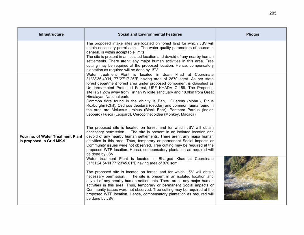
205
Infrastructure Social and Environmental Features Photos
The proposed intake sites are located on forest land for which JSV will obtain necessary permission. The water quality parameters of source in general, is within acceptable limits. The site is present in an isolated location and devoid of any nearby human settlements. There aren’t any major human activities in this area. Tree cutting may be required at the proposed location. Hence, compensatory plantation as required will be done by JSV.
Four no. of Water Treatment Plant is proposed in Grid MK-9
Water treatment Plant is located in Joan khad at Coordinate 31°28'36.40"N, 77°27'17.26"E having area of 2670 sqmt. As per state forest department forest area under proposed component is classified as Un-dermarketed Protected Forest, UPF KHADVI-C-158. The Proposed site is 21.2km away from Tirthan Wildlife sanctuary and 18.0km from Great Himalayan National park. Common flora found in the vicinity is Ban, Quercus (Mohru), Pinus Roxburghii (Chil), Cedrous deodara (deodar) and common fauna found in the area are Melursus ursinus (Black Bear), Panthera Pardus (Indian Leopard) Fusca (Leopard), Cercopithecoidea (Monkey, Macaca) The proposed site is located on forest land for which JSV will obtain necessary permission. The site is present in an isolated location and devoid of any nearby human settlements. There aren’t any major human activities in this area. Thus, temporary or permanent Social impacts or Community issues were not observed. Tree cutting may be required at the proposed WTP location. Hence, compensatory plantation as required will be done by JSV.
Water treatment Plant is located in Bhargod Khad at Coordinate 31°31'24.54"N 77°23'45.01"E having area of 870 sqm. The proposed site is located on forest land for which JSV will obtain necessary permission. The site is present in an isolated location and devoid of any nearby human settlements. There aren’t any major human activities in this area. Thus, temporary or permanent Social impacts or Community issues were not observed. Tree cutting may be required at the proposed WTP location. Hence, compensatory plantation as required will be done by JSV.
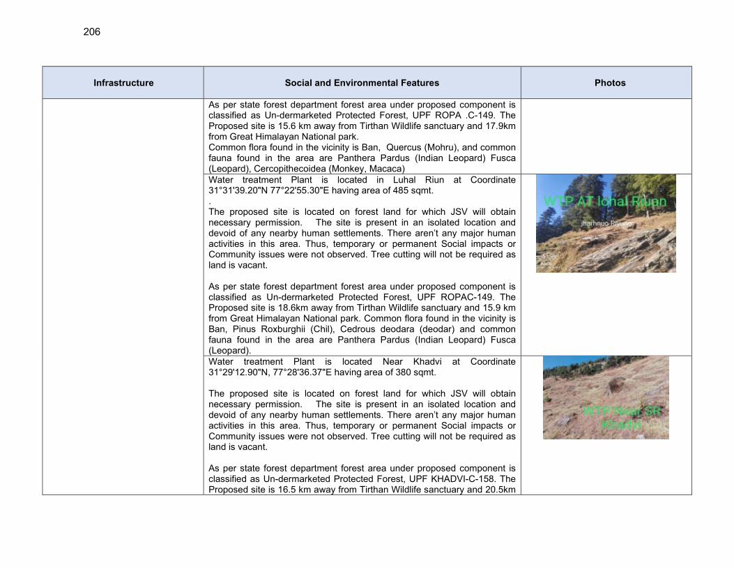
206
Infrastructure Social and Environmental Features Photos
As per state forest department forest area under proposed component is classified as Un-dermarketed Protected Forest, UPF ROPA .C-149. The Proposed site is 15.6 km away from Tirthan Wildlife sanctuary and 17.9km from Great Himalayan National park. Common flora found in the vicinity is Ban, Quercus (Mohru), and common fauna found in the area are Panthera Pardus (Indian Leopard) Fusca (Leopard), Cercopithecoidea (Monkey, Macaca) Water treatment Plant is located in Luhal Riun at Coordinate 31°31'39.20"N 77°22'55.30"E having area of 485 sqmt. . The proposed site is located on forest land for which JSV will obtain necessary permission. The site is present in an isolated location and devoid of any nearby human settlements. There aren’t any major human activities in this area. Thus, temporary or permanent Social impacts or Community issues were not observed. Tree cutting will not be required as land is vacant. As per state forest department forest area under proposed component is classified as Un-dermarketed Protected Forest, UPF ROPAC-149. The Proposed site is 18.6km away from Tirthan Wildlife sanctuary and 15.9 km from Great Himalayan National park. Common flora found in the vicinity is Ban, Pinus Roxburghii (Chil), Cedrous deodara (deodar) and common fauna found in the area are Panthera Pardus (Indian Leopard) Fusca (Leopard).
Water treatment Plant is located Near Khadvi at Coordinate 31°29'12.90"N, 77°28'36.37"E having area of 380 sqmt. The proposed site is located on forest land for which JSV will obtain necessary permission. The site is present in an isolated location and devoid of any nearby human settlements. There aren’t any major human activities in this area. Thus, temporary or permanent Social impacts or Community issues were not observed. Tree cutting will not be required as land is vacant. As per state forest department forest area under proposed component is classified as Un-dermarketed Protected Forest, UPF KHADVI-C-158. The Proposed site is 16.5 km away from Tirthan Wildlife sanctuary and 20.5km
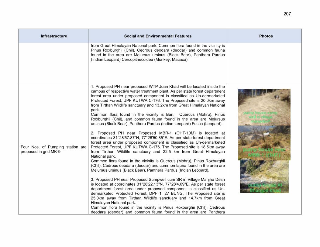
207
Infrastructure Social and Environmental Features Photos
from Great Himalayan National park. Common flora found in the vicinity is Pinus Roxburghii (Chil), Cedrous deodara (deodar) and common fauna found in the area are Melursus ursinus (Black Bear), Panthera Pardus (Indian Leopard) Cercopithecoidea (Monkey, Macaca)
Four Nos. of Pumping station are proposed in grid MK-9
1. Proposed PH near proposed WTP Joan Khad will be located inside the campus of respective water treatment plant. As per state forest department forest area under proposed component is classified as Un-dermarketed Protected Forest, UPF KUTWA C-176. The Proposed site is 20.0km away from Tirthan Wildlife sanctuary and 13.2km from Great Himalayan National park. Common flora found in the vicinity is Ban, Quercus (Mohru), Pinus Roxburghii (Chil), and common fauna found in the area are Melursus ursinus (Black Bear), Panthera Pardus (Indian Leopard) Fusca (Leopard). 2. Proposed PH near Proposed MBR-1 (OHT-10M) is located at coordinates 31°28'57.87"N, 77°26'50.85"E. As per state forest department forest area under proposed component is classified as Un-dermarketed Protected Forest, UPF KUTWA C-176. The Proposed site is 18.5km away from Tirthan Wildlife sanctuary and 22.5 km from Great Himalayan National park. Common flora found in the vicinity is Quercus (Mohru), Pinus Roxburghii (Chil), Cedrous deodara (deodar) and common fauna found in the area are Melursus ursinus (Black Bear), Panthera Pardus (Indian Leopard). 3. Proposed PH near Proposed Sumpwell cum SR in Village Manjha Desh is located at coordinates 31°28'22.13"N, 77°28'4.69"E. As per state forest department forest area under proposed component is classified as Un-dermarketed Protected Forest, DPF 1, 27 BUNG. The Proposed site is 25.0km away from Tirthan Wildlife sanctuary and 14.7km from Great Himalayan National park. Common flora found in the vicinity is Pinus Roxburghii (Chil), Cedrous deodara (deodar) and common fauna found in the area are Panthera
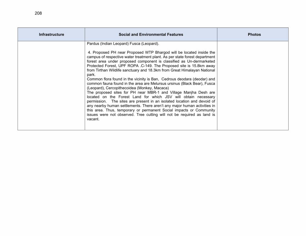
208
Infrastructure Social and Environmental Features Photos
Pardus (Indian Leopard) Fusca (Leopard). 4. Proposed PH near Proposed WTP Bhargod will be located inside the campus of respective water treatment plant. As per state forest department forest area under proposed component is classified as Un-dermarketed Protected Forest, UPF ROPA .C-149. The Proposed site is 15.8km away from Tirthan Wildlife sanctuary and 18.3km from Great Himalayan National park. Common flora found in the vicinity is Ban, Cedrous deodara (deodar) and common fauna found in the area are Melursus ursinus (Black Bear), Fusca (Leopard), Cercopithecoidea (Monkey, Macaca) The proposed sites for PH near MBR-1 and Village Manjha Desh are located on the Forest Land for which JSV will obtain necessary permission. The sites are present in an isolated location and devoid of any nearby human settlements. There aren’t any major human activities in this area. Thus, temporary or permanent Social impacts or Community issues were not observed. Tree cutting will not be required as land is vacant.
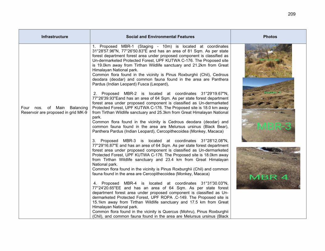
209
Infrastructure Social and Environmental Features Photos
Four nos. of Main Balancing Reservoir are proposed in grid MK-9
1. Proposed MBR-1 (Staging - 10m) is located at coordinates 31°28'57.96"N, 77°26'50.83"E and has an area of 81 Sqm. As per state forest department forest area under proposed component is classified as Un-dermarketed Protected Forest, UPF KUTWA C-176. The Proposed site is 19.0km away from Tirthan Wildlife sanctuary and 21.2km from Great Himalayan National park. Common flora found in the vicinity is Pinus Roxburghii (Chil), Cedrous deodara (deodar) and common fauna found in the area are Panthera Pardus (Indian Leopard) Fusca (Leopard), 2. Proposed MBR-2 is located at coordinates 31°29'19.67"N, 77°26'39.93"Eand has an area of 64 Sqm. As per state forest department forest area under proposed component is classified as Un-dermarketed Protected Forest, UPF KUTWA C-176. The Proposed site is 18.0 km away from Tirthan Wildlife sanctuary and 25.3km from Great Himalayan National park. Common flora found in the vicinity is Cedrous deodara (deodar) and common fauna found in the area are Melursus ursinus (Black Bear), Panthera Pardus (Indian Leopard), Cercopithecoidea (Monkey, Macaca) 3. Proposed MBR-3 is located at coordinates 31°28'12.08"N, 77°29'16.87"E and has an area of 64 Sqm. As per state forest department forest area under proposed component is classified as Un-dermarketed Protected Forest, UPF KUTWA C-176. The Proposed site is 18.0km away from Tirthan Wildlife sanctuary and 23.4 km from Great Himalayan National park. Common flora found in the vicinity is Pinus Roxburghii (Chil) and common fauna found in the area are Cercopithecoidea (Monkey, Macaca) 4. Proposed MBR-4 is located at coordinates 31°31'30.03"N, 77°24'20.65"EE and has an area of 64 Sqm. As per state forest department forest area under proposed component is classified as Un-dermarketed Protected Forest, UPF ROPA .C-149. The Proposed site is 15.1km away from Tirthan Wildlife sanctuary and 17.5 km from Great Himalayan National park. Common flora found in the vicinity is Quercus (Mohru), Pinus Roxburghii (Chil), and common fauna found in the area are Melursus ursinus (Black
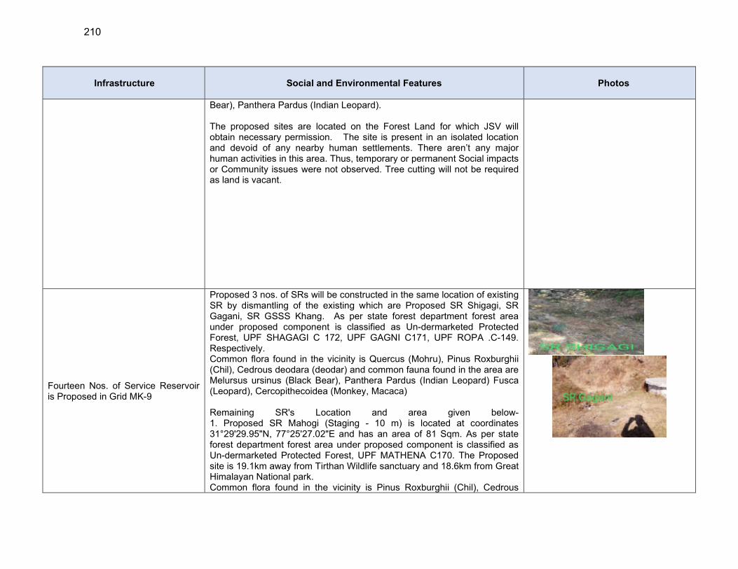
210
Infrastructure Social and Environmental Features Photos
Bear), Panthera Pardus (Indian Leopard). The proposed sites are located on the Forest Land for which JSV will obtain necessary permission. The site is present in an isolated location and devoid of any nearby human settlements. There aren’t any major human activities in this area. Thus, temporary or permanent Social impacts or Community issues were not observed. Tree cutting will not be required as land is vacant.
Fourteen Nos. of Service Reservoir is Proposed in Grid MK-9
Proposed 3 nos. of SRs will be constructed in the same location of existing SR by dismantling of the existing which are Proposed SR Shigagi, SR Gagani, SR GSSS Khang. As per state forest department forest area under proposed component is classified as Un-dermarketed Protected Forest, UPF SHAGAGI C 172, UPF GAGNI C171, UPF ROPA .C-149. Respectively. Common flora found in the vicinity is Quercus (Mohru), Pinus Roxburghii (Chil), Cedrous deodara (deodar) and common fauna found in the area are Melursus ursinus (Black Bear), Panthera Pardus (Indian Leopard) Fusca (Leopard), Cercopithecoidea (Monkey, Macaca) Remaining SR's Location and area given below- 1. Proposed SR Mahogi (Staging - 10 m) is located at coordinates 31°29'29.95"N, 77°25'27.02"E and has an area of 81 Sqm. As per state forest department forest area under proposed component is classified as Un-dermarketed Protected Forest, UPF MATHENA C170. The Proposed site is 19.1km away from Tirthan Wildlife sanctuary and 18.6km from Great Himalayan National park. Common flora found in the vicinity is Pinus Roxburghii (Chil), Cedrous
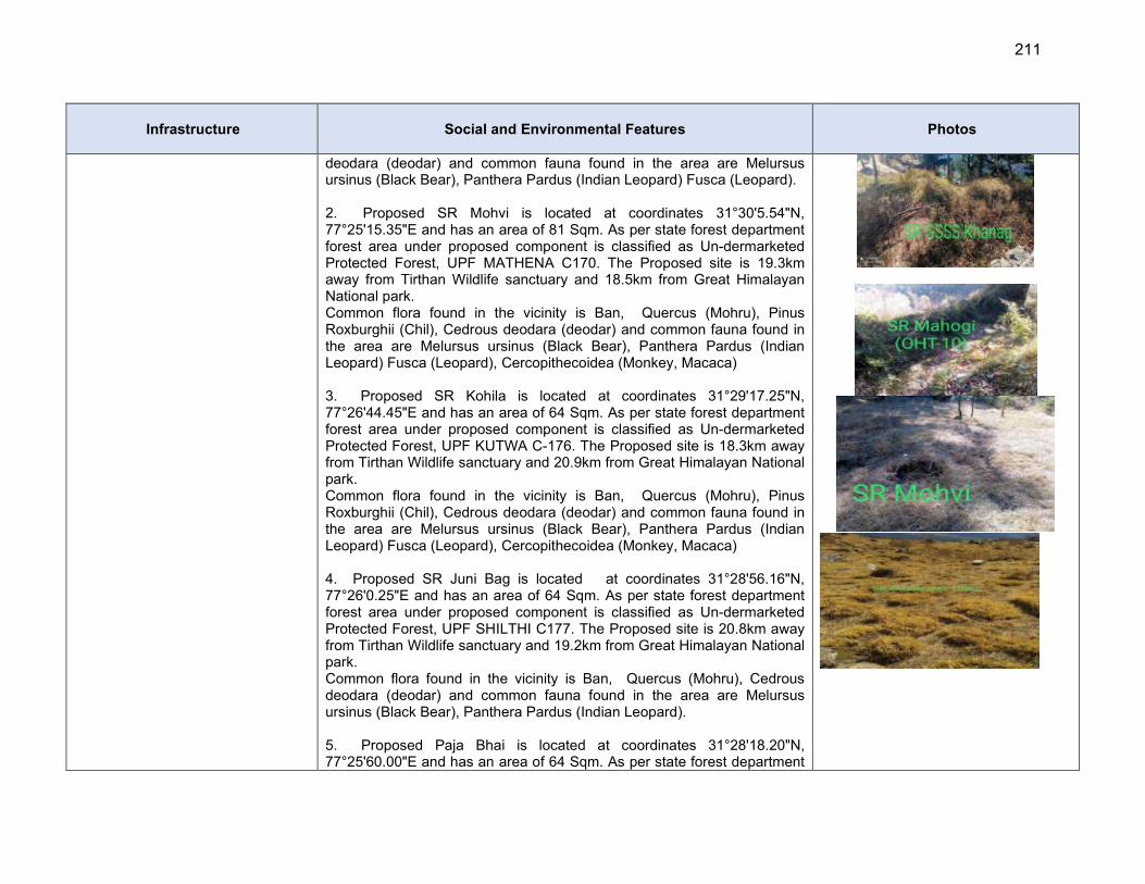
211
Infrastructure Social and Environmental Features Photos
deodara (deodar) and common fauna found in the area are Melursus ursinus (Black Bear), Panthera Pardus (Indian Leopard) Fusca (Leopard). 2. Proposed SR Mohvi is located at coordinates 31°30'5.54"N, 77°25'15.35"E and has an area of 81 Sqm. As per state forest department forest area under proposed component is classified as Un-dermarketed Protected Forest, UPF MATHENA C170. The Proposed site is 19.3km away from Tirthan Wildlife sanctuary and 18.5km from Great Himalayan National park. Common flora found in the vicinity is Ban, Quercus (Mohru), Pinus Roxburghii (Chil), Cedrous deodara (deodar) and common fauna found in the area are Melursus ursinus (Black Bear), Panthera Pardus (Indian Leopard) Fusca (Leopard), Cercopithecoidea (Monkey, Macaca) 3. Proposed SR Kohila is located at coordinates 31°29'17.25"N, 77°26'44.45"E and has an area of 64 Sqm. As per state forest department forest area under proposed component is classified as Un-dermarketed Protected Forest, UPF KUTWA C-176. The Proposed site is 18.3km away from Tirthan Wildlife sanctuary and 20.9km from Great Himalayan National park. Common flora found in the vicinity is Ban, Quercus (Mohru), Pinus Roxburghii (Chil), Cedrous deodara (deodar) and common fauna found in the area are Melursus ursinus (Black Bear), Panthera Pardus (Indian Leopard) Fusca (Leopard), Cercopithecoidea (Monkey, Macaca) 4. Proposed SR Juni Bag is located at coordinates 31°28'56.16"N, 77°26'0.25"E and has an area of 64 Sqm. As per state forest department forest area under proposed component is classified as Un-dermarketed Protected Forest, UPF SHILTHI C177. The Proposed site is 20.8km away from Tirthan Wildlife sanctuary and 19.2km from Great Himalayan National park. Common flora found in the vicinity is Ban, Quercus (Mohru), Cedrous deodara (deodar) and common fauna found in the area are Melursus ursinus (Black Bear), Panthera Pardus (Indian Leopard). 5. Proposed Paja Bhai is located at coordinates 31°28'18.20"N, 77°25'60.00"E and has an area of 64 Sqm. As per state forest department

212
Infrastructure Social and Environmental Features Photos
forest area under proposed component is classified as Un-dermarketed Protected Forest, UPF SHILTHI C177. The Proposed site is 20.5km away from Tirthan Wildlife sanctuary and 22.7 km from Great Himalayan National park.Common flora found in the vicinity is Ban, Quercus (Mohru), Pinus Roxburghii (Chil), Cedrous deodara (deodar) and common fauna found in the area are Melursus ursinus (Black Bear), Panthera Pardus (Indian Leopard) Fusca (Leopard), Cercopithecoidea (Monkey, Macaca) 6. Proposed SR Mithunu is located at coordinates 31°31'20.50"N, 77°23'15.21"E and has an area of 64 Sqm. As per state forest department forest area under proposed component is classified as Un-dermarketed Protected Forest, UPF ROPA .C-149. The Proposed site is 18.4km away from Tirthan Wildlife sanctuary and 15.7 km from Great Himalayan National park. Common flora found in the vicinity is Pinus Roxburghii (Chil), Cedrous deodara (deodar) and common fauna found in the area are Panthera Pardus (Indian Leopard) Fusca (Leopard), Cercopithecoidea (Monkey, Macaca) 7. Proposed SR Tilara is located at coordinates 31°30'56.40"N, 77°24'7.34"E and has an area of 81Sqm. As per state forest department forest area under proposed component is classified as Un-dermarketed Protected Forest, UPF ROPA .C-149. The Proposed site is 16.5km away from Tirthan Wildlife sanctuary and 18.1 km from Great Himalayan National park. Common flora found in the vicinity is Ban, Quercus (Mohru), Cedrous deodara (deodar) and common fauna found in the area are Melursus ursinus (Black Bear), Cercopithecoidea (Monkey, Macaca) 8. Proposed SR Kutwa-1 is located at coordinates 31°28'18.28"N, 77°28'36.72"E and has an area of 64 Sqm. As per state forest department forest area under proposed component is classified as Un-dermarketed Protected Forest, DPF 1, 27 BUNG. The Proposed site is 18.5km away from Tirthan Wildlife sanctuary and 22.9km from Great Himalayan National park. Common flora found in the vicinity is Ban, Quercus (Mohru), Cedrous deodara (deodar) and common fauna found in the area are Melursus
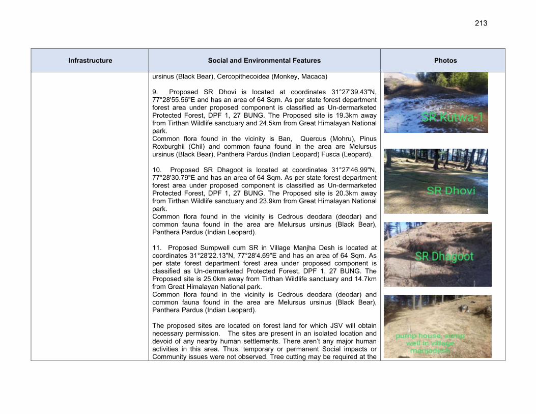
213
Infrastructure Social and Environmental Features Photos
ursinus (Black Bear), Cercopithecoidea (Monkey, Macaca) 9. Proposed SR Dhovi is located at coordinates 31°27'39.43"N, 77°28'55.56"E and has an area of 64 Sqm. As per state forest department forest area under proposed component is classified as Un-dermarketed Protected Forest, DPF 1, 27 BUNG. The Proposed site is 19.3km away from Tirthan Wildlife sanctuary and 24.5km from Great Himalayan National park. Common flora found in the vicinity is Ban, Quercus (Mohru), Pinus Roxburghii (Chil) and common fauna found in the area are Melursus ursinus (Black Bear), Panthera Pardus (Indian Leopard) Fusca (Leopard). 10. Proposed SR Dhagoot is located at coordinates 31°27'46.99"N, 77°28'30.79"E and has an area of 64 Sqm. As per state forest department forest area under proposed component is classified as Un-dermarketed Protected Forest, DPF 1, 27 BUNG. The Proposed site is 20.3km away from Tirthan Wildlife sanctuary and 23.9km from Great Himalayan National park. Common flora found in the vicinity is Cedrous deodara (deodar) and common fauna found in the area are Melursus ursinus (Black Bear), Panthera Pardus (Indian Leopard). 11. Proposed Sumpwell cum SR in Village Manjha Desh is located at coordinates 31°28'22.13"N, 77°28'4.69"E and has an area of 64 Sqm. As per state forest department forest area under proposed component is classified as Un-dermarketed Protected Forest, DPF 1, 27 BUNG. The Proposed site is 25.0km away from Tirthan Wildlife sanctuary and 14.7km from Great Himalayan National park. Common flora found in the vicinity is Cedrous deodara (deodar) and common fauna found in the area are Melursus ursinus (Black Bear), Panthera Pardus (Indian Leopard). The proposed sites are located on forest land for which JSV will obtain necessary permission. The sites are present in an isolated location and devoid of any nearby human settlements. There aren’t any major human activities in this area. Thus, temporary or permanent Social impacts or Community issues were not observed. Tree cutting may be required at the
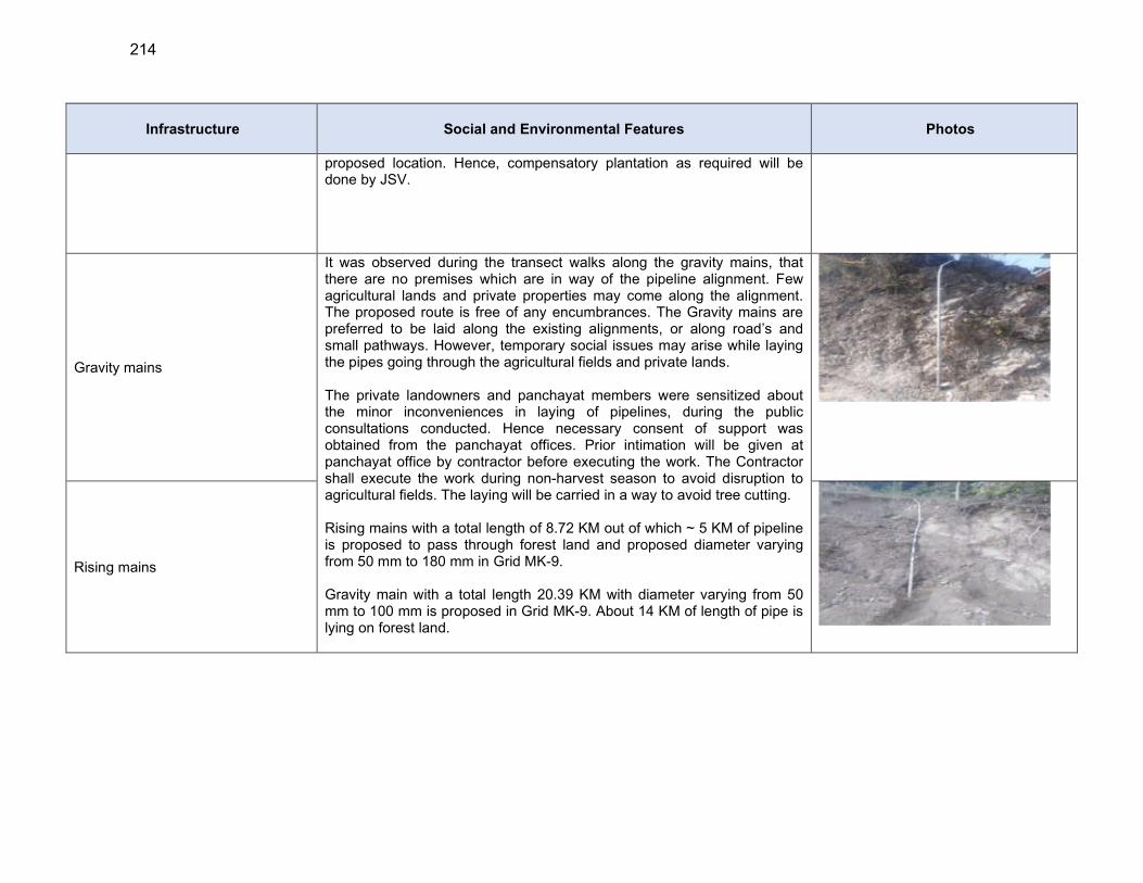
214
Infrastructure Social and Environmental Features Photos
proposed location. Hence, compensatory plantation as required will be done by JSV.
Gravity mains
It was observed during the transect walks along the gravity mains, that there are no premises which are in way of the pipeline alignment. Few agricultural lands and private properties may come along the alignment. The proposed route is free of any encumbrances. The Gravity mains are preferred to be laid along the existing alignments, or along road’s and small pathways. However, temporary social issues may arise while laying the pipes going through the agricultural fields and private lands. The private landowners and panchayat members were sensitized about the minor inconveniences in laying of pipelines, during the public consultations conducted. Hence necessary consent of support was obtained from the panchayat offices. Prior intimation will be given at panchayat office by contractor before executing the work. The Contractor shall execute the work during non-harvest season to avoid disruption to agricultural fields. The laying will be carried in a way to avoid tree cutting. Rising mains with a total length of 8.72 KM out of which ~ 5 KM of pipeline is proposed to pass through forest land and proposed diameter varying from 50 mm to 180 mm in Grid MK-9. Gravity main with a total length 20.39 KM with diameter varying from 50 mm to 100 mm is proposed in Grid MK-9. About 14 KM of length of pipe is lying on forest land.
Rising mains
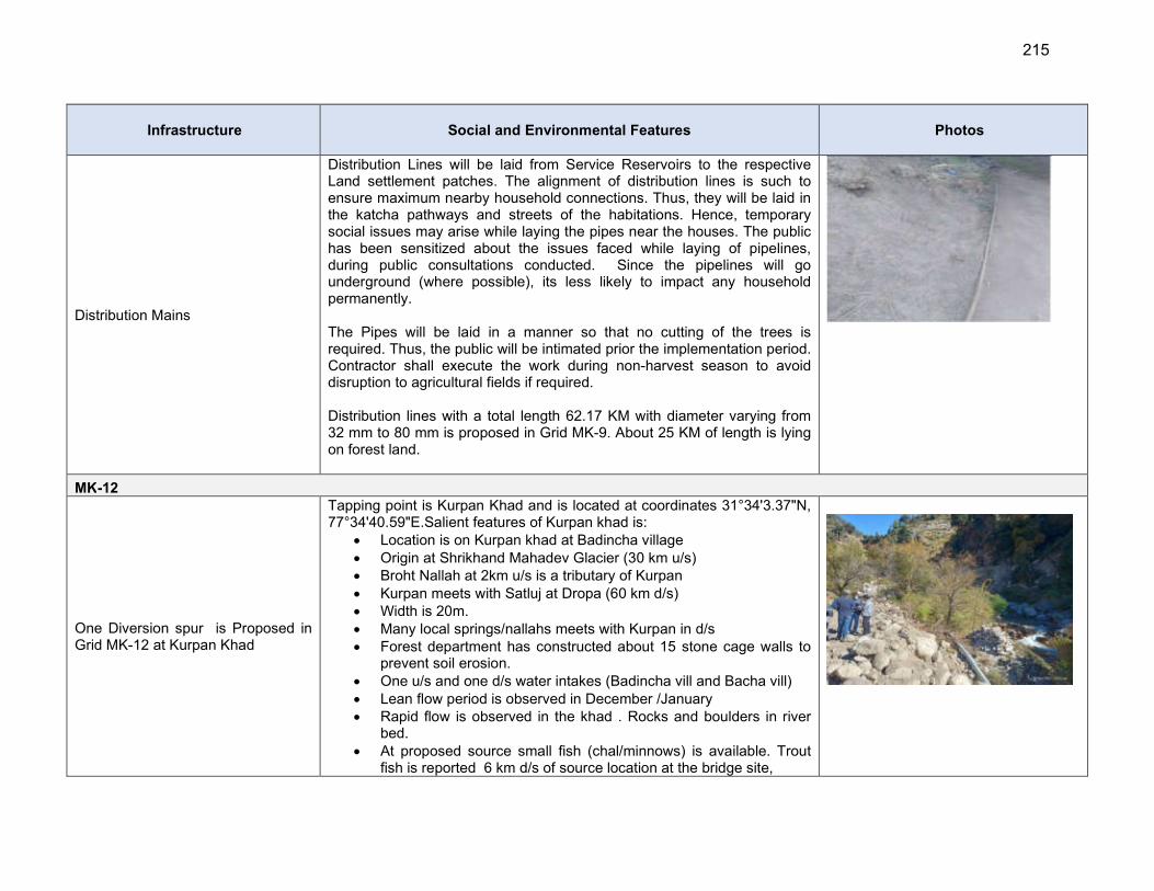
215
Infrastructure Social and Environmental Features Photos
Distribution Mains
Distribution Lines will be laid from Service Reservoirs to the respective Land settlement patches. The alignment of distribution lines is such to ensure maximum nearby household connections. Thus, they will be laid in the katcha pathways and streets of the habitations. Hence, temporary social issues may arise while laying the pipes near the houses. The public has been sensitized about the issues faced while laying of pipelines, during public consultations conducted. Since the pipelines will go underground (where possible), its less likely to impact any household permanently. The Pipes will be laid in a manner so that no cutting of the trees is required. Thus, the public will be intimated prior the implementation period. Contractor shall execute the work during non-harvest season to avoid disruption to agricultural fields if required. Distribution lines with a total length 62.17 KM with diameter varying from 32 mm to 80 mm is proposed in Grid MK-9. About 25 KM of length is lying on forest land.
MK-12
One Diversion spur is Proposed in Grid MK-12 at Kurpan Khad
Tapping point is Kurpan Khad and is located at coordinates 31°34'3.37"N, 77°34'40.59"E.Salient features of Kurpan khad is:
Location is on Kurpan khad at Badincha village Origin at Shrikhand Mahadev Glacier (30 km u/s) Broht Nallah at 2km u/s is a tributary of Kurpan Kurpan meets with Satluj at Dropa (60 km d/s) Width is 20m. Many local springs/nallahs meets with Kurpan in d/s Forest department has constructed about 15 stone cage walls to
prevent soil erosion. One u/s and one d/s water intakes (Badincha vill and Bacha vill) Lean flow period is observed in December /January Rapid flow is observed in the khad . Rocks and boulders in river
bed. At proposed source small fish (chal/minnows) is available. Trout
fish is reported 6 km d/s of source location at the bridge site,
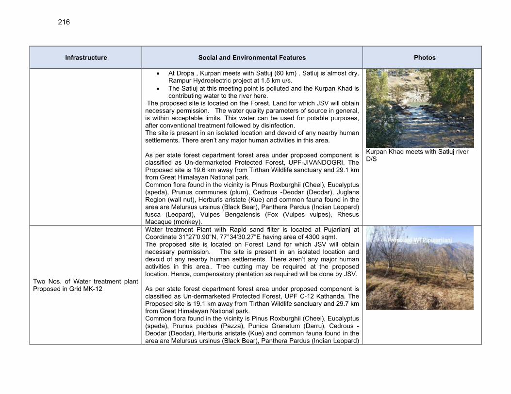
216
Infrastructure Social and Environmental Features Photos
At Dropa , Kurpan meets with Satluj (60 km) . Satluj is almost dry. Rampur Hydroelectric project at 1.5 km u/s.
The Satluj at this meeting point is polluted and the Kurpan Khad is contributing water to the river here.
The proposed site is located on the Forest. Land for which JSV will obtain necessary permission. The water quality parameters of source in general, is within acceptable limits. This water can be used for potable purposes, after conventional treatment followed by disinfection. The site is present in an isolated location and devoid of any nearby human settlements. There aren’t any major human activities in this area. As per state forest department forest area under proposed component is classified as Un-dermarketed Protected Forest, UPF-JIVANDOGRI. The Proposed site is 19.6 km away from Tirthan Wildlife sanctuary and 29.1 km from Great Himalayan National park. Common flora found in the vicinity is Pinus Roxburghii (Cheel), Eucalyptus (speda), Prunus communes (plum), Cedrous -Deodar (Deodar), Juglans Region (wall nut), Herburis aristate (Kue) and common fauna found in the area are Melursus ursinus (Black Bear), Panthera Pardus (Indian Leopard) fusca (Leopard), Vulpes Bengalensis (Fox (Vulpes vulpes), Rhesus Macaque (monkey).
Kurpan Khad meets with Satluj river D/S
Two Nos. of Water treatment plant Proposed in Grid MK-12
Water treatment Plant with Rapid sand filter is located at Pujarilanj at Coordinate 31°27'0.90"N, 77°34'30.27"E having area of 4300 sqmt. The proposed site is located on Forest Land for which JSV will obtain necessary permission. The site is present in an isolated location and devoid of any nearby human settlements. There aren’t any major human activities in this area.. Tree cutting may be required at the proposed location. Hence, compensatory plantation as required will be done by JSV. As per state forest department forest area under proposed component is classified as Un-dermarketed Protected Forest, UPF C-12 Kathanda. The Proposed site is 19.1 km away from Tirthan Wildlife sanctuary and 29.7 km from Great Himalayan National park. Common flora found in the vicinity is Pinus Roxburghii (Cheel), Eucalyptus (speda), Prunus puddes (Pazza), Punica Granatum (Darru), Cedrous -Deodar (Deodar), Herburis aristate (Kue) and common fauna found in the area are Melursus ursinus (Black Bear), Panthera Pardus (Indian Leopard)

217
Infrastructure Social and Environmental Features Photos
fusca (Leopard), Vulpes Bengalensis (Fox (Vulpes vulpes), Rhesus Macaque (monkey), Water treatment Plant with Slow sand filter is located at Siswaser at Coordinate 31°27'41.69"N 77°38'59.13"E having area of 485 sqmt. The proposed site is located on the Forest Land for which JSV will obtain necessary permission. The site is present in an isolated location and devoid of any nearby human settlements. There aren’t any major human activities in this area.. Tree cutting may be required at the proposed location. Hence, compensatory plantation as required will be done by JSV. As per state forest department forest area under proposed component is classified as Un-dermarketed Protected Forest, UPF C-47 Sharhaya. The Proposed site is 20.6km away from Tirthan Wildlife sanctuary and ~ 33.0 km from Great Himalayan National park. Common flora found in the vicinity is Dalbergia sisso (Shisham), Prunus puddes (Pazza), Punica Granatum (Darru), Prunus communes (plum), and common fauna found in the area are Melursus ursinus (Black Bear), fusca (Leopard), Vulpes Bengalensis (Fox (Vulpes vulpes), Rhesus Macaque (monkey),
Two Nos. of Main Balancing Reservoir is Proposed in Grid MK-12
1. Proposed MBR Pujarilanj is located at coordinates 31°27'0.90"N, 77°34'30.28"E and has an area of 81 Sqm. As per state forest department forest area under proposed component is classified as Un-dermarketed Protected Forest, UPF C-12 Kathanda. The Proposed site is 19.6 km away from Tirthan Wildlife sanctuary and 29.1km from Great Himalayan National park. Common flora found in the vicinity is Pinus Roxburghii (Cheel), Eucalyptus (speda), Dalbergia sisso (Shisham), Prunus puddes (Pazza), and common fauna found in the area are Melursus ursinus (Black Bear), Panthera Pardus (Indian Leopard) fusca (Leopard), Vulpes Bengalensis. 2. Proposed MBR Mokutu is located at coordinates 31°27'7.47"N, 77°33'53.69"E and has an area of 64 Sqm. As per state forest department forest area under proposed component is classified as Un-dermarketed Protected Forest, UPF C-48 Jhalu. The Proposed site is 19.4 km away from Tirthan Wildlife sanctuary and 28.8 km from Great Himalayan National park. Common flora found in the vicinity is Pinus Roxburghii (Cheel), Dalbergia sisso (Shisham), Prunus puddes (Pazza), Prunus communes (plum),
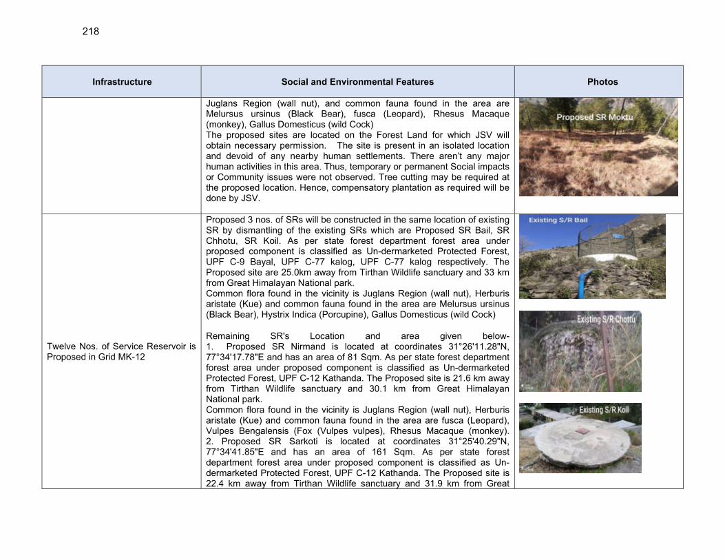
218
Infrastructure Social and Environmental Features Photos
Juglans Region (wall nut), and common fauna found in the area are Melursus ursinus (Black Bear), fusca (Leopard), Rhesus Macaque (monkey), Gallus Domesticus (wild Cock) The proposed sites are located on the Forest Land for which JSV will obtain necessary permission. The site is present in an isolated location and devoid of any nearby human settlements. There aren’t any major human activities in this area. Thus, temporary or permanent Social impacts or Community issues were not observed. Tree cutting may be required at the proposed location. Hence, compensatory plantation as required will be done by JSV.
Twelve Nos. of Service Reservoir is Proposed in Grid MK-12
Proposed 3 nos. of SRs will be constructed in the same location of existing SR by dismantling of the existing SRs which are Proposed SR Bail, SR Chhotu, SR Koil. As per state forest department forest area under proposed component is classified as Un-dermarketed Protected Forest, UPF C-9 Bayal, UPF C-77 kalog, UPF C-77 kalog respectively. The Proposed site are 25.0km away from Tirthan Wildlife sanctuary and 33 km from Great Himalayan National park. Common flora found in the vicinity is Juglans Region (wall nut), Herburis aristate (Kue) and common fauna found in the area are Melursus ursinus (Black Bear), Hystrix Indica (Porcupine), Gallus Domesticus (wild Cock)
Remaining SR's Location and area given below- 1. Proposed SR Nirmand is located at coordinates 31°26'11.28"N, 77°34'17.78"E and has an area of 81 Sqm. As per state forest department forest area under proposed component is classified as Un-dermarketed Protected Forest, UPF C-12 Kathanda. The Proposed site is 21.6 km away from Tirthan Wildlife sanctuary and 30.1 km from Great Himalayan National park. Common flora found in the vicinity is Juglans Region (wall nut), Herburis aristate (Kue) and common fauna found in the area are fusca (Leopard), Vulpes Bengalensis (Fox (Vulpes vulpes), Rhesus Macaque (monkey). 2. Proposed SR Sarkoti is located at coordinates 31°25'40.29"N, 77°34'41.85"E and has an area of 161 Sqm. As per state forest department forest area under proposed component is classified as Un-dermarketed Protected Forest, UPF C-12 Kathanda. The Proposed site is 22.4 km away from Tirthan Wildlife sanctuary and 31.9 km from Great
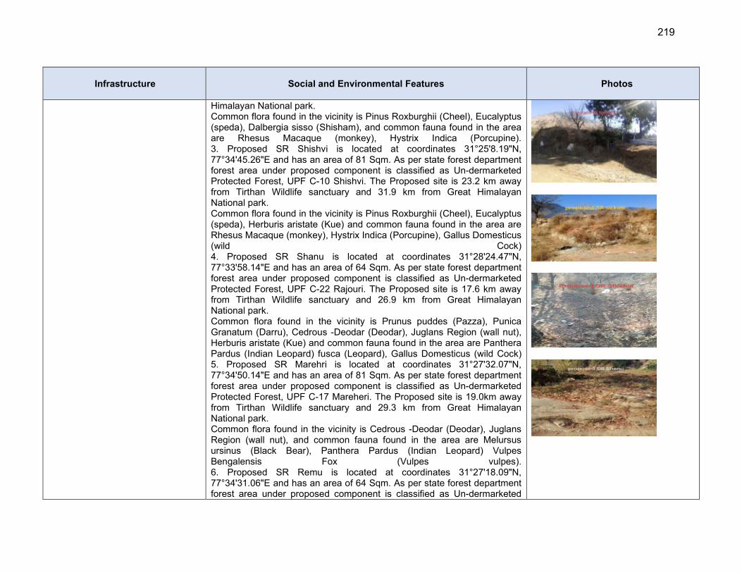
219
Infrastructure Social and Environmental Features Photos
Himalayan National park. Common flora found in the vicinity is Pinus Roxburghii (Cheel), Eucalyptus (speda), Dalbergia sisso (Shisham), and common fauna found in the area are Rhesus Macaque (monkey), Hystrix Indica (Porcupine). 3. Proposed SR Shishvi is located at coordinates 31°25'8.19"N, 77°34'45.26"E and has an area of 81 Sqm. As per state forest department forest area under proposed component is classified as Un-dermarketed Protected Forest, UPF C-10 Shishvi. The Proposed site is 23.2 km away from Tirthan Wildlife sanctuary and 31.9 km from Great Himalayan National park. Common flora found in the vicinity is Pinus Roxburghii (Cheel), Eucalyptus (speda), Herburis aristate (Kue) and common fauna found in the area are Rhesus Macaque (monkey), Hystrix Indica (Porcupine), Gallus Domesticus (wild Cock) 4. Proposed SR Shanu is located at coordinates 31°28'24.47"N, 77°33'58.14"E and has an area of 64 Sqm. As per state forest department forest area under proposed component is classified as Un-dermarketed Protected Forest, UPF C-22 Rajouri. The Proposed site is 17.6 km away from Tirthan Wildlife sanctuary and 26.9 km from Great Himalayan National park. Common flora found in the vicinity is Prunus puddes (Pazza), Punica Granatum (Darru), Cedrous -Deodar (Deodar), Juglans Region (wall nut), Herburis aristate (Kue) and common fauna found in the area are Panthera Pardus (Indian Leopard) fusca (Leopard), Gallus Domesticus (wild Cock) 5. Proposed SR Marehri is located at coordinates 31°27'32.07"N, 77°34'50.14"E and has an area of 81 Sqm. As per state forest department forest area under proposed component is classified as Un-dermarketed Protected Forest, UPF C-17 Mareheri. The Proposed site is 19.0km away from Tirthan Wildlife sanctuary and 29.3 km from Great Himalayan National park. Common flora found in the vicinity is Cedrous -Deodar (Deodar), Juglans Region (wall nut), and common fauna found in the area are Melursus ursinus (Black Bear), Panthera Pardus (Indian Leopard) Vulpes Bengalensis Fox (Vulpes vulpes). 6. Proposed SR Remu is located at coordinates 31°27'18.09"N, 77°34'31.06"E and has an area of 64 Sqm. As per state forest department forest area under proposed component is classified as Un-dermarketed
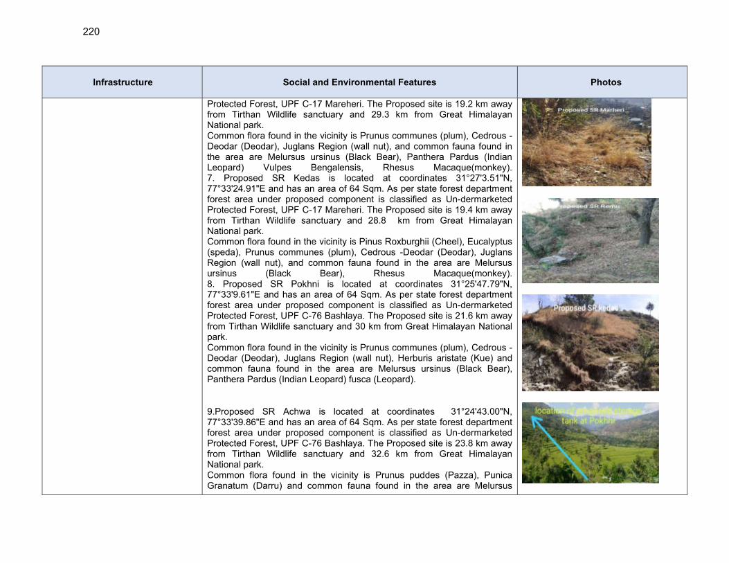
220
Infrastructure Social and Environmental Features Photos
Protected Forest, UPF C-17 Mareheri. The Proposed site is 19.2 km away from Tirthan Wildlife sanctuary and 29.3 km from Great Himalayan National park. Common flora found in the vicinity is Prunus communes (plum), Cedrous -Deodar (Deodar), Juglans Region (wall nut), and common fauna found in the area are Melursus ursinus (Black Bear), Panthera Pardus (Indian Leopard) Vulpes Bengalensis, Rhesus Macaque(monkey). 7. Proposed SR Kedas is located at coordinates 31°27'3.51"N, 77°33'24.91"E and has an area of 64 Sqm. As per state forest department forest area under proposed component is classified as Un-dermarketed Protected Forest, UPF C-17 Mareheri. The Proposed site is 19.4 km away from Tirthan Wildlife sanctuary and 28.8 km from Great Himalayan National park. Common flora found in the vicinity is Pinus Roxburghii (Cheel), Eucalyptus (speda), Prunus communes (plum), Cedrous -Deodar (Deodar), Juglans Region (wall nut), and common fauna found in the area are Melursus ursinus (Black Bear), Rhesus Macaque(monkey). 8. Proposed SR Pokhni is located at coordinates 31°25'47.79"N, 77°33'9.61"E and has an area of 64 Sqm. As per state forest department forest area under proposed component is classified as Un-dermarketed Protected Forest, UPF C-76 Bashlaya. The Proposed site is 21.6 km away from Tirthan Wildlife sanctuary and 30 km from Great Himalayan National park. Common flora found in the vicinity is Prunus communes (plum), Cedrous -Deodar (Deodar), Juglans Region (wall nut), Herburis aristate (Kue) and common fauna found in the area are Melursus ursinus (Black Bear), Panthera Pardus (Indian Leopard) fusca (Leopard).
9.Proposed SR Achwa is located at coordinates 31°24'43.00"N, 77°33'39.86"E and has an area of 64 Sqm. As per state forest department forest area under proposed component is classified as Un-dermarketed Protected Forest, UPF C-76 Bashlaya. The Proposed site is 23.8 km away from Tirthan Wildlife sanctuary and 32.6 km from Great Himalayan National park. Common flora found in the vicinity is Prunus puddes (Pazza), Punica Granatum (Darru) and common fauna found in the area are Melursus
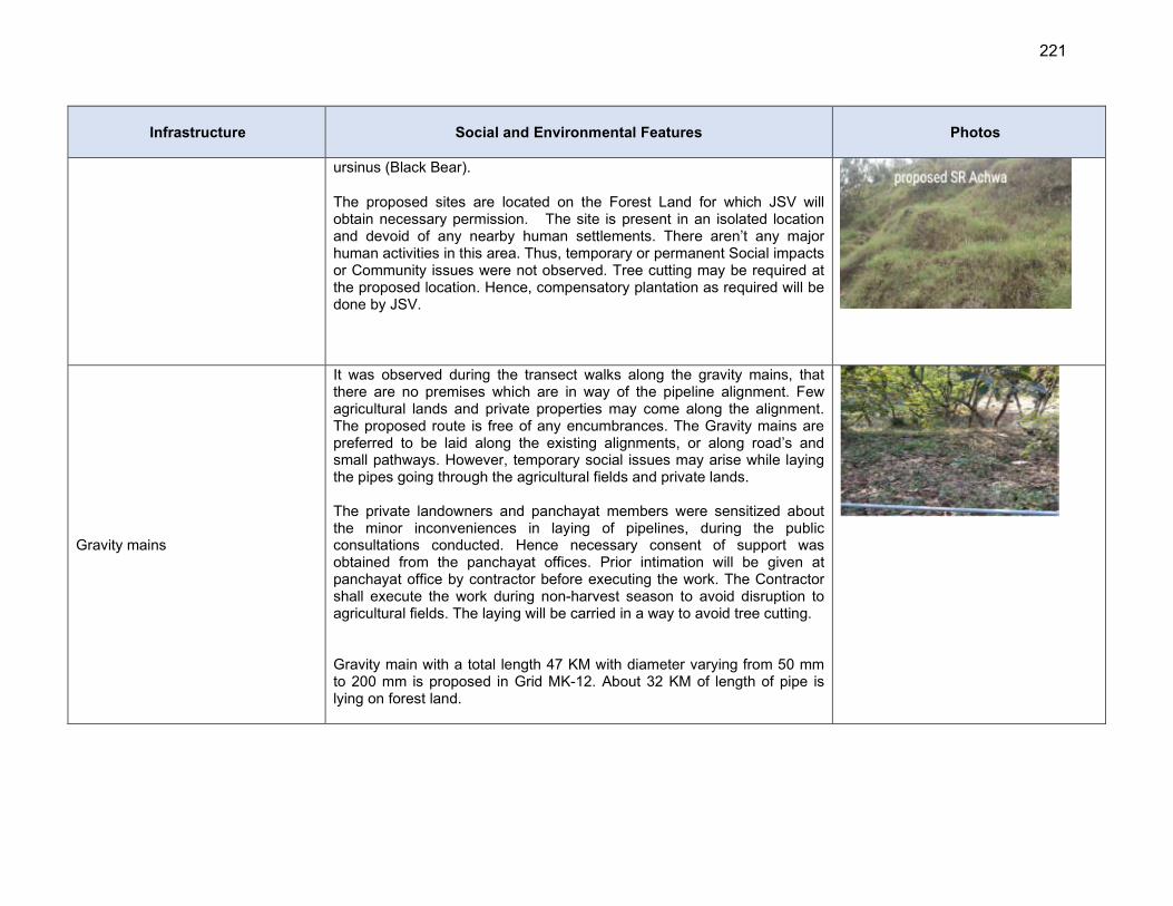
221
Infrastructure Social and Environmental Features Photos
ursinus (Black Bear).
The proposed sites are located on the Forest Land for which JSV will obtain necessary permission. The site is present in an isolated location and devoid of any nearby human settlements. There aren’t any major human activities in this area. Thus, temporary or permanent Social impacts or Community issues were not observed. Tree cutting may be required at the proposed location. Hence, compensatory plantation as required will be done by JSV.
Gravity mains
It was observed during the transect walks along the gravity mains, that there are no premises which are in way of the pipeline alignment. Few agricultural lands and private properties may come along the alignment. The proposed route is free of any encumbrances. The Gravity mains are preferred to be laid along the existing alignments, or along road’s and small pathways. However, temporary social issues may arise while laying the pipes going through the agricultural fields and private lands. The private landowners and panchayat members were sensitized about the minor inconveniences in laying of pipelines, during the public consultations conducted. Hence necessary consent of support was obtained from the panchayat offices. Prior intimation will be given at panchayat office by contractor before executing the work. The Contractor shall execute the work during non-harvest season to avoid disruption to agricultural fields. The laying will be carried in a way to avoid tree cutting. Gravity main with a total length 47 KM with diameter varying from 50 mm to 200 mm is proposed in Grid MK-12. About 32 KM of length of pipe is lying on forest land.
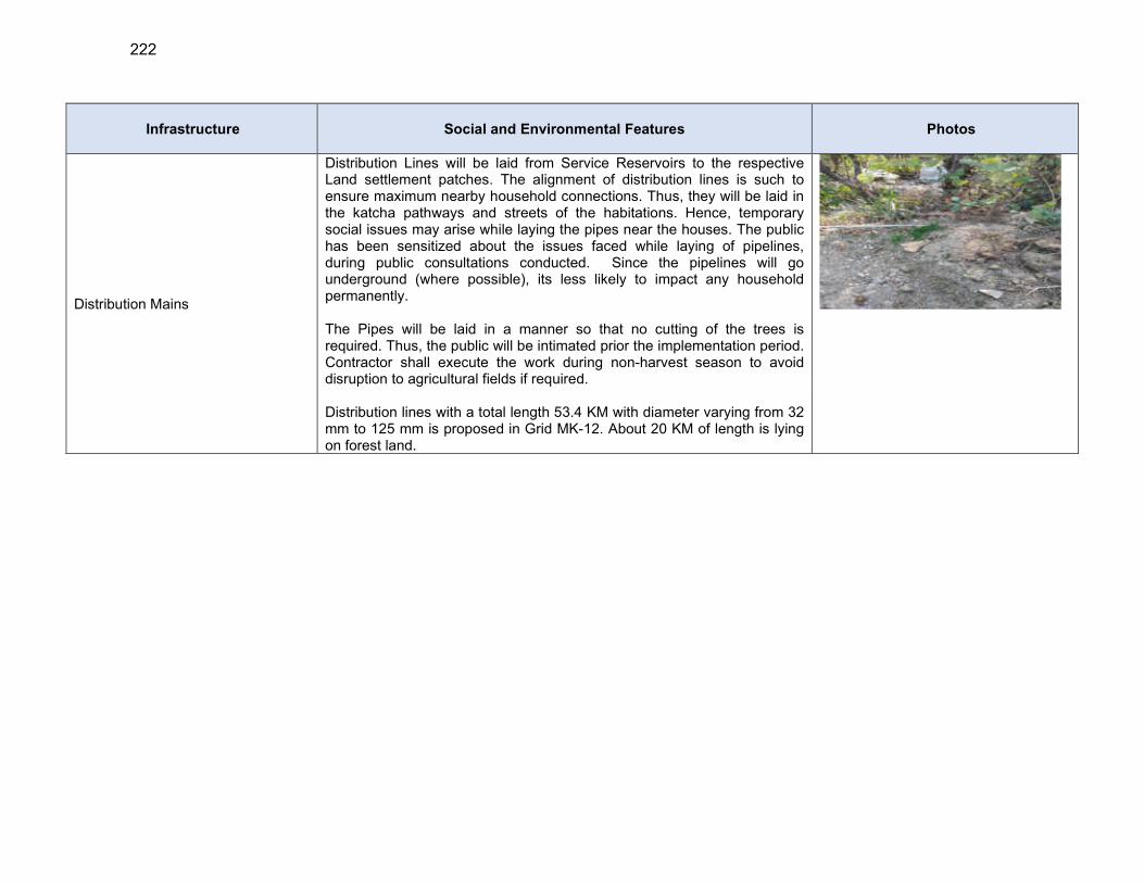
222
Infrastructure Social and Environmental Features Photos
Distribution Mains
Distribution Lines will be laid from Service Reservoirs to the respective Land settlement patches. The alignment of distribution lines is such to ensure maximum nearby household connections. Thus, they will be laid in the katcha pathways and streets of the habitations. Hence, temporary social issues may arise while laying the pipes near the houses. The public has been sensitized about the issues faced while laying of pipelines, during public consultations conducted. Since the pipelines will go underground (where possible), its less likely to impact any household permanently. The Pipes will be laid in a manner so that no cutting of the trees is required. Thus, the public will be intimated prior the implementation period. Contractor shall execute the work during non-harvest season to avoid disruption to agricultural fields if required. Distribution lines with a total length 53.4 KM with diameter varying from 32 mm to 125 mm is proposed in Grid MK-12. About 20 KM of length is lying on forest land.

223
VI. ANTICIPATED ENVIRONMENTAL IMPACTS AND MITIGATION MEASURES
A. Introduction
206. Potential environmental impacts of the proposed infrastructure components are presented in this section. Mitigation measures to minimize/mitigate negative impacts, if any, are recommended along with the agency responsible for implementation. Monitoring actions to be conducted during the implementation phase is also recommended to reduce the impact. 207. Screening of potential environmental impacts are categorized into four categories considering subproject phases: location impacts and design impacts (pre-construction phase), construction phase impacts and operations and maintenance phase impacts and mitigation is devised for any negative impacts
(i) Location impacts include impacts associated with site selection and include loss of on-site biophysical array and encroachment either directly or indirectly on adjacent environments. It also includes impacts on people who will lose their livelihood or any other structures by the development of that site.
(ii) Design impacts include impacts arising from Investment Program design, including technology used, scale of operation/throughput, waste production, discharge specifications, pollution sources and ancillary services.
(iii) Pre-Construction impacts include impacts which are anticipated during construction works but planning are required for proposed mitigation measures before start of construction works i.e. during SIP period such as taking consents from various departments, planning for construction and workers camps, deployment of safety officer, arrangement of required barricades and caution boards etc.
(iv) Construction impacts include impacts caused by site clearing, earthworks, machinery, vehicles and workers. Construction site impacts include erosion, dust, noise, traffic congestion and waste production.
(v) Operation and maintenance (O&M) impacts include impacts arising from the operation and maintenance activities of the infrastructure facility. These include routine management of operational waste streams, and occupational health and safety issues.
208. Screening of environmental impacts has been based on the impact magnitude (negligible/moderate/severe – in the order of increasing degree) and impact duration (temporary/permanent). 209. This section of the IEE reviews possible project-related impacts, in order to identify issues requiring further attention and screen out issues of no relevance. ADB SPS (2009) require that impacts and risks will be analyzed during pre-construction, construction, and operational stages in the context of the project’s area of influence. 210. The ADB Rapid Environmental Assessment Checklists for Water system have been used to screen the project for environmental impacts and to determine the scope of the IEE. In the case of this project (i) most of the individual elements involve straight forward construction and operation, so impacts are mainly localized and not greatly significant; (ii) most of the predicted impacts are associated with the construction process, and are produced because that process is invasive, involving excavation and earth movements; and (iii) being mostly located in
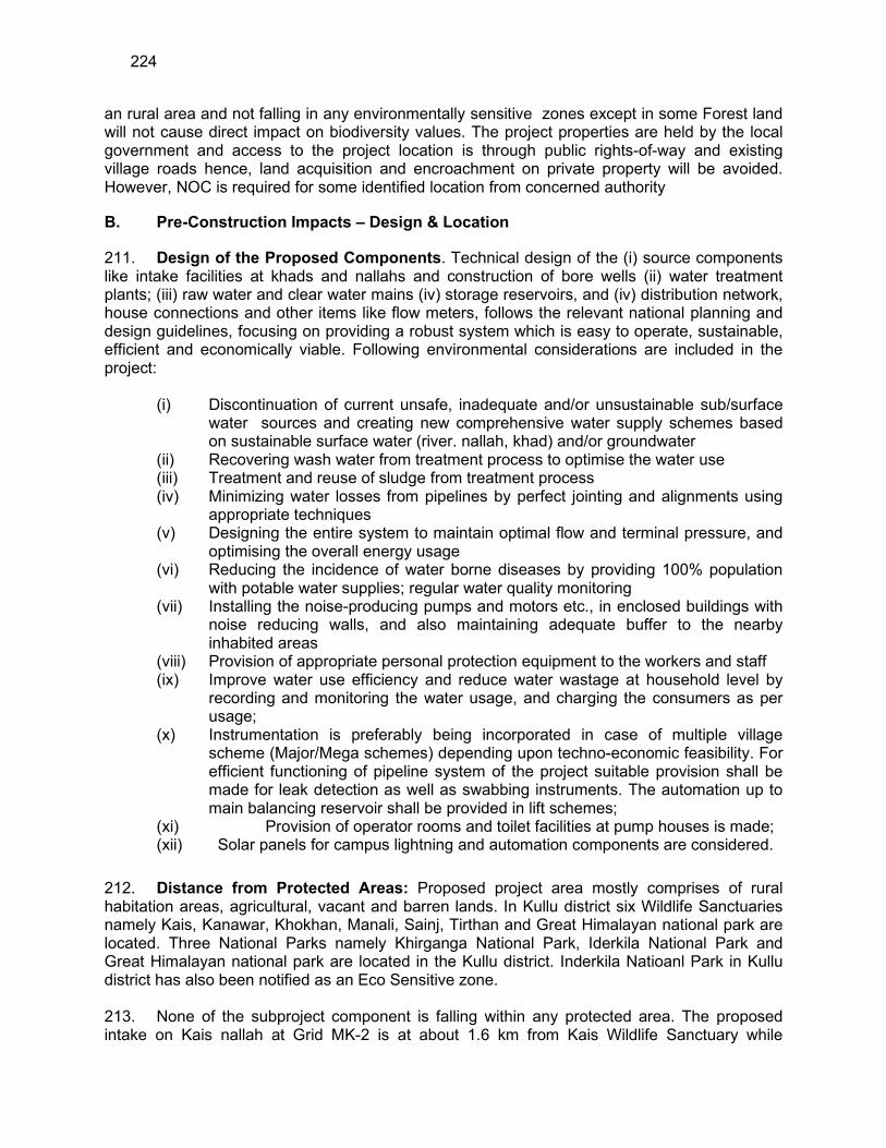
224
an rural area and not falling in any environmentally sensitive zones except in some Forest land will not cause direct impact on biodiversity values. The project properties are held by the local government and access to the project location is through public rights-of-way and existing village roads hence, land acquisition and encroachment on private property will be avoided. However, NOC is required for some identified location from concerned authority
B. Pre-Construction Impacts – Design & Location
211. Design of the Proposed Components. Technical design of the (i) source components like intake facilities at khads and nallahs and construction of bore wells (ii) water treatment plants; (iii) raw water and clear water mains (iv) storage reservoirs, and (iv) distribution network, house connections and other items like flow meters, follows the relevant national planning and design guidelines, focusing on providing a robust system which is easy to operate, sustainable, efficient and economically viable. Following environmental considerations are included in the project:
(i) Discontinuation of current unsafe, inadequate and/or unsustainable sub/surface water sources and creating new comprehensive water supply schemes based on sustainable surface water (river. nallah, khad) and/or groundwater
(ii) Recovering wash water from treatment process to optimise the water use (iii) Treatment and reuse of sludge from treatment process (iv) Minimizing water losses from pipelines by perfect jointing and alignments using
appropriate techniques (v) Designing the entire system to maintain optimal flow and terminal pressure, and
optimising the overall energy usage (vi) Reducing the incidence of water borne diseases by providing 100% population
with potable water supplies; regular water quality monitoring (vii) Installing the noise-producing pumps and motors etc., in enclosed buildings with
noise reducing walls, and also maintaining adequate buffer to the nearby inhabited areas
(viii) Provision of appropriate personal protection equipment to the workers and staff (ix) Improve water use efficiency and reduce water wastage at household level by
recording and monitoring the water usage, and charging the consumers as per usage;
(x) Instrumentation is preferably being incorporated in case of multiple village scheme (Major/Mega schemes) depending upon techno-economic feasibility. For efficient functioning of pipeline system of the project suitable provision shall be made for leak detection as well as swabbing instruments. The automation up to main balancing reservoir shall be provided in lift schemes;
(xi) Provision of operator rooms and toilet facilities at pump houses is made; (xii) Solar panels for campus lightning and automation components are considered.
212. Distance from Protected Areas: Proposed project area mostly comprises of rural habitation areas, agricultural, vacant and barren lands. In Kullu district six Wildlife Sanctuaries namely Kais, Kanawar, Khokhan, Manali, Sainj, Tirthan and Great Himalayan national park are located. Three National Parks namely Khirganga National Park, Iderkila National Park and Great Himalayan national park are located in the Kullu district. Inderkila Natioanl Park in Kullu district has also been notified as an Eco Sensitive zone.
213. None of the subproject component is falling within any protected area. The proposed intake on Kais nallah at Grid MK-2 is at about 1.6 km from Kais Wildlife Sanctuary while
225
proposed SR Basa Bhar of GRID MK-7 is at distance of 6 km from Sainj Wildlife Sanctuary The proposed intake at Khuad Nallah Grid MK-2 is at a distance of 7 km from Kanawar Wildlife Sanctuary. Proposed borewell near Jhakru Garat Mohal Khad is at an aerial distance of ~3km from Khokhan Wildlife Sanctuary and SR Romani in Grid MK-2 is at a distance of ~22km from Manali Wildlife Sanctuary, proposed SR Busari in Grid MK-7 is at an aerial distance of ~11km from Tirhan Wildlife Sanctuary (all aerial distance). The proposed SR Busari at Grid MK-7 is at 1.3 km from the Great Himalayan National Park, while intake chamber proposed on Satak Nallah in Grid MK-6 is at an aerial distance of ~38km from Khirganga National Park, and proposed intake chamber Khuad Nallah in grid MK-2 is at an aerial distance of ~31Km from Inderkila National Park.
214. There are 92 wetlands in Himachal Pradesh covering 2.25 hectares area, out of which 85 are natural and 7 are man-made which constituted one percent of the total geographical area. Pong Dam Lake, Chandratal and Renuka have been identified as Ramsar sites whereas Rewalsar and Khajiar lakes included by the MOEF & CC under national wetlands for its conservation and management. Nearest proposed component from designated wetland Rewalsar lake in Mandi zone (district Kullu of Package MZ-01 is WTP at Gharat Mohal of Grid MK 2 which is about 40 KM from (areal distance) Rewalsar lake. Therefore, the project will pose no risk or impact on biodiversity and natural resource. 215. Impacts due to location – in Forest land. Given the large expanse of forest lands in Himachal Pradesh, locating some subproject facilities in forest lands is unavoidable Components in such as Intakes, WTPs, Pump houses, reservoirs are proposed in Forest land and some tree cuttings may be required. Hence, JSV will obtain requisite permission from the Forest Department. A total of 2.39 ha of Forest land in small parcels at 131 locations occurring in six grids needs to be diverted for this purpose (Appendix 6). The forest land conversion will follow the “Guidelines for Diversion of Forest Lands for Non-Forest Purpose” under the Forest (Conservation) Act, 1980. However as most of the individual elements are relatively small no impact on forest ecosystems is envisaged. Water pipelines will also traverse through some forest trails. Forest department has exempted from clearance procedure for laying of drinking water pipelines requiring excavation/trench of less than 1m width and 2 m depth along the roads in forest land. The proposed trench width is 0.6m; hence permission from local forest department will be adequate for pipeline laying (Appendix 7). The pipelines will be laid along the existing roads and within the right of way with no notable tree felling envisaged as per preliminary design. However, it will be finalised during detailed design period and if any tree felling is required, compensatory tree plantation will be carried out in 1:10 ratio 216. Location of Bore Wells: Four bore wells with combined discharge of 27.86 lps will be installed in Bandrol village, Seobagh village, Badah near river Beas and Jhakru Mohal Khad on forest lands for which JSV will obtain necessary permissions from Forest department/MOEF&CC. The lands are vacant away from human settlements and free from of any encumbrances. Proposed bore well locations are away from houses, shops or any other premises used by people, thus establishing a buffer to reduce the effects of noise, dust and the visual appearance of the site. Only shrubs and bushes are present at sites and therefore no tree cutting will be required during construction of tube well as per preliminary design. No wildlife is reported at from the sites. A feasibility study has been conducted
217. Sensitive project locations. Subproject components are mostly located in the rural hilly areas of Kullu district. Few of the project components are located on the forest lands. Sites for few of the proposed components are covered with vegetative cover, mostly consisting of bushes, shrubs and local tree species, which may need to be removed for construction. The
226
clearance of vegetation needs to be minimized, and adequate compensatory tree plantation needs to be taken up. Removal of vegetation on the hill slopes may also lead to erosion, and therefore necessary measures to control vegetation needs to be included. There are trees and vegetation in the Intake, WTP, MBR and SR locations as detailed in Table 30. Removal of vegetation and trees shall be minimized by selecting the site appropriately within the campus and minimize tree cutting. Following measures will be adopted
(i) Minimize removal of trees, vegetation on hill sites; undertake replantation of the sites as far as possible immediately after the construction;
(ii) All the cut and open surfaces shall be properly consolidated and protected with surface pitching /grass turfing, etc., as appropriate to avoid any surface erosion in the hill slopes;
(iii) Conduct census of trees to be removed, obtain permission, and undertake compensatory tree plantation at the rate of 10 trees for 1 tree removed;
(iv) Avoid removal of trees and vegetation along the roads best pipeline alignments and layout planning of reservoirs and facilities, however, if this cannot be avoided fully, undertake compensatory tree plantation (10 trees to 1 tree removed).
218. Natural hazards: Water supply utilities are vulnerable to a variety of hazards including natural disasters such as earthquakes, flooding and landslides. The expected effects of earthquakes, floods and landslide on drinking water systems can be summarized as follows:
(i) Total or partial destruction of intakes, conveyance structures, treatment facilities, storage, and distribution;
(ii) Breaks in delivery and distribution pipes and damage in connections between pipes or with tanks, resulting in a loss of water;
(iii) Interruption of electric power, communications, and access routes; (iv) Change in water quality because of landslides; (v) Variation (decrease) in the flow of underground or surface collector works; (vi) Change in the site of water outlets in springs; (vii) Total or partial destruction of intakes located in rivers or ravines; (viii) Sedimentation, resulting in silting up of components; (ix) Breaks where exposed pipe crosses ravines and/or rivers; (x) Contamination of the watershed; (xi) Damage to pumping equipment; (xii) Total or partial destruction of all installations, in particular intake and distribution
structures, located on or in the main path of active slides, especially in unstable mountainous zones with steep slopes or in slopes with steep grades that are susceptible to slides;
(xiii) Indirect impacts such as the interruption of electrical service, communication or blockage of roads.
219. All structures under the subproject have been designed considering Seismic Zone V (Very High). The Zone V mainly covers Himalayan region in India and Himachal Pradesh being a hilly state lies in Himalayan region hence design has been prepared keeping in mind the seismic hazards. The topography of the entire subproject area is hilly. As per local enquiries carried out during field visits, the sites are not prone to flooding. Water treatment plants proposed near Khads are proposed 500mm above the high flood level (HFL) of the respective Khads to mitigate the flooding during rainy/monsoon season. The site selection of construction of structures under the subproject has been done keeping in view the landslide vulnerability.

227
Only the sites which are not vulnerable to landslides have been selected under the subproject. 220. Water Source Sustainability: The main design impact of water supply system in general are due to abstraction of water and quality of raw water. The existing water supply system in subproject area are mostly surface and groundwater based, and water supply is inadequate. The new water supply schemes will mostly be based on surface water-based sources (khads/nallah/rivers/springs) along with Groundwater sources (bore well, and tube well). No new dams/reservoirs will be developed, The proposed water sources for project area belonging to Package MZ 01 majorly comprises of khads, nallahs, and bore wells. There is a total of thirty-six (36) locations where water sources will be tapped and amongst them, ten existing sources will be retained in the proposal. Therefore, it is proposed to adopt conjunctive use approach, utilizing both surface and groundwater sources to meet the demand. Therefore, project will mostly design surface water-based water supply systems – either new river intakes or drawing water from new/existing springs/khads/nallahs. Creation of new infrastructure to extract groundwater will be limited to areas where there are no surface water sources. 221. The proposed surface water supply sources in this project are the tributaries of those major Rivers (like Beas and Sutlej), Khads and Nallahs. All the rivers are perennial, and are typical snow and rainfed, and also some have springs as origins. Since these are not major rivers, none of these are gauged for flow. Most of these streams carry high flow during monsoon and post monsoon months (July to October), after which flow slightly reduces but retain considerable (medium) flow in the months of November-February. After which flow further reduces in the months of March and April (low flow), followed by lean flow season of May and June. The river which are snow fed carry considerable flow even during May and June but show lean flow during some period in December-January. Therefore, depending on the nature of river/stream contribution from rain, snow, etc., lean season vary. JSV has measured the discharge at proposed water supply source locations in the lean season to estimate the minimum water availability to plan for water supply schemes.
222. Source selection criteria are based on its ability to meet the ultimate year (2042) water demand of its respective command area. The water demand per capita per day is taken as 95 LPCD (70 LPCD plus loss). The population of 2042 of respective command areas has been computed by decadal growth method. About 70% of the source’s lean period discharge is required to meet the ultimate year (2042) water demand of its respective command areas. As thumb of rule, not more than 70% of the discharge available at the source is considered for extraction. This is done to avoid over exploitation and to keep the environmental water flow in the source intact. Hence, 70% of the lean period discharge is calculated and considered as “available discharge” for water supply. Then, “Available discharge” is compared against the water demand for the area. If “available discharge” is greater than water demand, then the source is deemed sustainable, otherwise it is deemed un-sustainable. This criterion is ensured for both existing and proposed sources used in this project. The JSV has also conducted water testing at sources to determine the suitability of water for potable use.
223. Methodology of discharge measurement. Jal Shakti Vibhag (JSV), Himachal Pradesh has the authority to measure, record and analyse the water discharge in all water bodies in Himachal Pradesh. JSV measure the discharge in surface sources generally by two methods
(i) Area velocity method: This depends on measuring the average velocity of flow and the cross-sectional area of the channel and calculating the flow from equation : Q(m3/s) = (m2) x V(m/s)
228
(ii) V-Notch method: Triangular weirs are sharp crested thin plates with V-shaped opening (or notch). These plates are installed at the exit of a channel, tank, or basin in order to measure the real-time flow of water. For a given weir profile size and shape, the flow of water is related to the head of water at the weir.
224. –V - Notch method is generally used in the water bodies where existing head weir or check dam lies. Whereas for rest of the water bodies Area Velocity method is utilised. 225. For analysing the lean period discharge following timelines are utilised.
(i) For snow fed sources measurement is done in extreme winter season i.e., December and January
(ii) For rain fed sources measurement is done in extreme summer season i.e., May and June.
226. The flow measurement certificates of proposed sources measured by JSV and raw water quality reports are enclosed as Appendix 8 and Appendix 9 respectively.
227. Groundwater or Sub-surface water as source. In case of ground water sources, the decision for providing number of tube wells / bore wells well/ infiltration gallery are considered based on availability of 3 phase electricity (in hours per day). To ensure the sustainability of ground water source, long term summer yield test are conducted to access specific yield. Considering summer draw down and accordingly cone of interference spacing between two tube-wells shall invariably preferably be 500 meters. For the selection of proposed ground water sources advance geophysical /resistivity survey technique is adopted for estimation of the yield. If there is presence of percolation well or tube well in the vicinity of the proposed site, then it is a good indication that the surrounding soil has enough porosity and is feasible for tube well. Water quality of the proposed site is judged by the water quality of the nearby source (tube well or percolation well). No major source of pollution should be present in the upstream of the source, as applicable.
228. As discussed in preceding paragraph, four bore wells are proposed as water source which will serve the entire command area for Grid MK 2. Feasibility reports obtained from the Senior Hydrologist, JSV measuring the potential yield of four bore wells (27.86 lps) by electrical resistivity method confirms that bore wells are sufficient to meet the water demand of 12.82 lps for the respective command areas till the design year 2042. The stage of ground water development in Kullu district has not been calculated by the CGWB due to hilly terrain and localized aquifers. Hence, no area or block in the district has been notified from the groundwater development point of view. 229. Grid wise details of sources proposed, water demand and discharge availability are given in Table 31 and discussed below:
230. GRID MK 1 (Source: Spring Sources proposed in Grid MK1) A total of Twelve (12) spring sources are proposed in grid MK-1 to cater the water demand for entire command area. The lean period discharge observed in different spring sources are : 1.20 LPS for WSS Samalang, 1.15 LPS, 1.80 LPS, 1.50 LPS, 1.00 LPS, 1.20 LPS and 1.00 LPS for WSS Mashna, 2.00 LPS for WSS Gramang, 1.50 LPS, 1.10 LPS and 1.50 LPS for WSS Dughilag Shildhari and 1.50 LPS for WSS Phallan. The lean period discharge of the existing spring sources is
229
enough to cater the future water demand of 0.23 LPS, 0.15 LPS, 0.33 LPS, 0.16 LPS, 0.11 LPS, 0.14 LPS, 0.14 LPS, 0.34 LPS, 0.77 LPS, 0.77 LPS, 0.25 LPS and 0.91 LPS respectively. There is no further downstream abstraction from any of the sources therefore no water conflict will arise. 231. GRID MK 2: A total of 6 sources are proposed in Grid MK 2.
(i) Borewell Opposite Bandrol: The lean period discharge available at proposed bore well is 17.10 LPS. The source has enough yields to meet the water demand of the ultimate design year i.e. 2042 which is 4.5 LPS. Feasibility report was obtained from senior hydrologist measuring the potential yield of bore well by Electrical resistivity method and the same is attached in the report. As ground water is utilised, no conflict will arise with any community.
(ii) Bore well at Seobagh: The lean period discharge available at proposed bore well is 4.56 LPS. The source has enough discharge to meet the water demand of the ultimate design year i.e., 2042 which is 2.55 LPS. Feasibility report was obtained from senior hydrologist measuring the potential yield of bore well by Electrical resistivity method and the same is attached in the report. As ground water is utilised, no conflict will arise with any community.
(iii) Bore well at Badah near river Beas: The lean period discharge available at proposed bore well is 5 LPS for 8 hours of pumping. The source has enough discharge to meet the water demand of the ultimate design year i.e., 2042 which is 4.9 LPS. Feasibility report was obtained from senior hydrologist measuring the potential yield of bore well by Electrical resistivity method and the same is attached in the report. As ground water is utilised, no conflict will arise with any community.
(iv) Bore well at Jhakru Gharat near Mohal Khad: The lean period discharge available at proposed bore well is 1.20 LPS for 8 hours of pumping. The source has enough discharge to meet the water demand of the ultimate design year i.e., 2042 which is 0.86 LPS. Feasibility report was obtained from senior hydrologist measuring the potential yield of bore well by Electrical resistivity method and the same is attached in the report. As ground water is utilised, no conflict will arise with any community.
(v) Proposed Intake Chamber at Khuad Nallah: The lean period discharge available at proposed surface water source is 3.5 LPS. The source has enough discharge to meet the water demand of the ultimate design year i.e., 2042 which is 3.27 LPs. after the abstraction of water at proposed location Khuad nallah merges with another Khad and no further downstream abstraction takes place therefore no further conflict will arise. There are no existing head weirs in the upstream and downstream of the proposed source at Khuad Nallah.
(vi) Proposed Intake Chamber at Kais Nallah: The lean period discharge available at proposed surface water source is 11 LPS (Source is Being used for irrigation and only limited discharge can be used for the scheme). The source has enough discharge to meet the water demand of the ultimate design year i.e., 2042 which 1.02 LPs. after the abstraction of water at proposed location Kais nallah merges with another Khad and no further downstream abstraction takes place therefore no further conflict will arise. There are no existing head in the upstream and downstream of the proposed source at Kais Nallah.
232. GRID MK 6: There are a total of 2 sources proposed in Grid MK6.
230
(i) Proposed Springs and Nallah Source: There are three proposed spring sources i.e., Narali, Baggi and Regada spring and one proposed nallah i.e., Regada nallah. These proposed sources has enough lean period discharge of 0.8 LPS, 1.0 LPS, 0.8 LPS and 1.54 LPS to meet the water demand of the ultimate design year i.e. 2042 which is 0.83 LPS and 1.49 LPS. The proposed sources are already serving the same command area therefore there will not have any impact on downstream flow, users and ecosystem and there will be no water use conflict. There are no existing head weirs in the upstream and downstream of the proposed source.
(ii) Source- Proposed Intake chamber at Sotak Nallah: The lean period discharge available at proposed surface water source is 1.5 LPS. The source has enough discharge to meet the water demand of the ultimate design year i.e., 2042 which is 0.83 LPS. The proposed source is small nallah source identified by JSV department considering the facts that the augmentation of same for water supply will not have any impact on downstream flow, users and ecosystem and there will be no water use conflict. There are no existing head weirs in the upstream and downstream of the proposed source at Sotak Nallah.
233. GRID MK 7: There are a total of 2 sources proposed in Grid MK7.
(i) Proposed diversion spur at Tirthan Khad: The lean period discharge available at proposed surface water source is 5,660 LPS. The source has enough discharge to meet the water demand of the ultimate design year i.e., 2042 which is 3.76 LPS. Abstraction of water is less than 1% so there will be no impact on downstream flow, users, ecosystem, and there will be no water use conflict. There is one existing intake well at 2 km downstream of the proposed source.
(ii) Proposed intake chamber on Spring sources: The source of WSS Sarachi Bandal and Seraj scheme is not shifted from the existing springs of Lambhari (1 LPS), Lambhari-1 (1 LPS), Naganaal (0.5 LPS), Barnal (1.3 LPS) and Baninal (0.83 LPS) respectively as the existing sources are sustainable and will be continued to serve as reliable sources for the scheme. The source has enough discharge to meet the water demand of the ultimate design year for WSS Sarachi Bandal and Seraj scheme i.e., 2042 which is 1.8 LPS and 1.49 LPS. Intake chambers are proposed at the source to tap the water. The sources are existing sources and will not have any impact on downstream flow, users and ecosystem and there will be no water use conflict.
234. GRID MK 9 There are a total of 4 sources proposed in Grid MK9.
(i) Proposed intake chamber on Lohal Nallah: The lean period discharge available at proposed surface water source is 2.5 LPS. The source has enough discharge to meet the water demand of the ultimate design year i.e. 2042 which is 1.08 LPS. The source is an existing source and will not have any impact on downstream flow, users and ecosystem and there will be no water use conflict.
(ii) Proposed intake chamber on Shaun Nallah: The lean period discharge
available at existing surface water source is 2 LPS. The source has enough discharge to meet the water demand of the ultimate design year i.e. 2042 which
231
is 0.41 LPS. The source is an existing source and will not have any impact on downstream flow, users and ecosystem and there will be no water use conflict.
(iii) Proposed diversion spur on Joan Khad: The lean period discharge available at proposed surface water source is 100 LPS. The source has enough discharge to meet the water demand of the ultimate design year i.e., 2042 which is 6.71 LPS. Abstraction of water is less than 7% and the proposed source is identified by JSV department considering the facts that the augmentation of same for water supply will not have any impact on downstream flow, users and ecosystem and there will be no water use conflict. There are two existing head weirs one 1km upstream and one 0.5km downstream of the proposed site at Joan Khad.
(iv) Proposed intake chamber on Bhargol Khad: The lean period discharge available at proposed surface water source is 3 LPS. The source has enough discharge to meet the water demand of the ultimate design year i.e., 2042 which is 1.5 LPS. The proposed source is identified by JSV department considering the facts that the augmentation of same for water supply will not have any impact on downstream flow, users and ecosystem and there will be no water use conflict.
235. GRID MK 12 There are a total of 4 sources proposed in Grid MK12.
(i) Spring source at Patagai: The lean period discharge available at existing spring source is 1.6 LPS. The source has enough discharge to meet the water demand of the ultimate design year i.e., 2042 which is 0.97 LPS. The sources is an existing source and will not have any impact on downstream flow, users and ecosystem and there will be no water use conflict.
(ii) Diversion spur on Kurpan Khad: The lean period discharge available at proposed surface water source is 1038 LPS. The source has enough discharge to meet the water demand of the ultimate design year i.e., 2042 which is 11.53 LPS. Abstraction of water is less than 1% and the proposed source is identified by JSV department considering the facts that the augmentation of same for water supply will not have any impact on downstream flow, users and ecosystem and there will be no water use conflict.
236. All sources are duly selected keeping in mind the downstream conditions and water requirement. Upto two kilometres downstream of the sources, it was observed that there will not be any significant water reduction that will impact the users downstream. Proposed sources have huge lean period water discharge and in this package MZ01, less than 1% of that discharge will be extracted to serve a particular command area or scheme (Table 32).In other seasons, water abstraction will even be very minimal or negligible. There are no notable water abstraction points in the downstream, and moreover most of the streams are joined by numerous small streams in its course. Therefore, no notable downstream impacts or user conflicts envisaged. 237. Thus, as presented above, in terms of water availability and quality of water, selected sources are adequate and suitable to meet the project water demand, and there are unlikely to be any issues related source sustainability during the project life cycle.
238. Considering water demand 95 LPCD (70 LPCD to customer end) total water demand for the ultimate year 2042 will be approximately 4.49 MLD (51.93 lps). The present water discharge available from all the proposed sources is 594.16 MLD (6876.87 lps) as mentioned Table 32. Hence it can be concluded that the proposed sources are capable to meet projected water
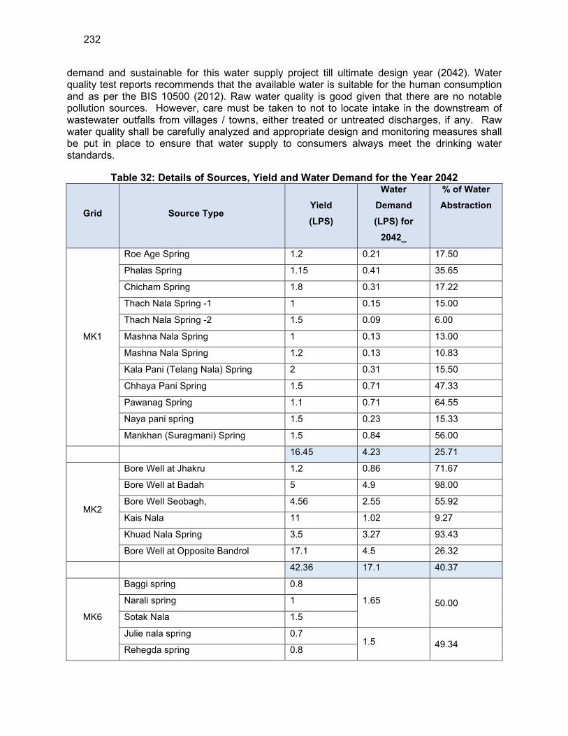
232
demand and sustainable for this water supply project till ultimate design year (2042). Water quality test reports recommends that the available water is suitable for the human consumption and as per the BIS 10500 (2012). Raw water quality is good given that there are no notable pollution sources. However, care must be taken to not to locate intake in the downstream of wastewater outfalls from villages / towns, either treated or untreated discharges, if any. Raw water quality shall be carefully analyzed and appropriate design and monitoring measures shall be put in place to ensure that water supply to consumers always meet the drinking water standards.
Table 32: Details of Sources, Yield and Water Demand for the Year 2042
Grid Source Type Yield
(LPS)
Water
Demand
(LPS) for
2042_
% of Water
Abstraction
MK1
Roe Age Spring 1.2 0.21 17.50
Phalas Spring 1.15 0.41 35.65
Chicham Spring 1.8 0.31 17.22
Thach Nala Spring -1 1 0.15 15.00
Thach Nala Spring -2 1.5 0.09 6.00
Mashna Nala Spring 1 0.13 13.00
Mashna Nala Spring 1.2 0.13 10.83
Kala Pani (Telang Nala) Spring 2 0.31 15.50
Chhaya Pani Spring 1.5 0.71 47.33
Pawanag Spring 1.1 0.71 64.55
Naya pani spring 1.5 0.23 15.33
Mankhan (Suragmani) Spring 1.5 0.84 56.00
16.45 4.23 25.71
MK2
Bore Well at Jhakru 1.2 0.86 71.67
Bore Well at Badah 5 4.9 98.00
Bore Well Seobagh, 4.56 2.55 55.92
Kais Nala 11 1.02 9.27
Khuad Nala Spring 3.5 3.27 93.43
Bore Well at Opposite Bandrol 17.1 4.5 26.32
42.36 17.1 40.37
MK6
Baggi spring 0.8
1.65 50.00 Narali spring 1
Sotak Nala 1.5
Julie nala spring 0.7 1.5 49.34
Rehegda spring 0.8

233
Grid Source Type Yield
(LPS)
Water
Demand
(LPS) for
2042_
% of Water
Abstraction
Rehegda nala 1.54
6.34 3.15 49.68
MK7
Spring, Bani Naal 0.82
1.49 32.25
Spring Barnaal 1.3
Spring, Lambhari 1
Spring Lambhari-1 1
Spring Naga Naal 0.5
Tirthan Khad 5660 3.76 0.07
5664.62 5.25 0.09
MK9
Joan Khad 100 6.71 6.71
Shaun Nallah 2 0.41 20.50
Lohal Nallah 2.5 1.08 43.20
Bhargol Khad 3 1.5 50.00
107.5 9.7 9.02
MK12
Kurpan Khad 1038 11.53 1.11
Patagi Spring 1.6 0.97 60
1039.6 12.50 1.20
Total 6876.87 51.93 0.75
239. Given the climate change effects, the rainfall is becoming more erratic and unpredictable, combined with increasing frequency of extreme weather events. The project should therefore account for these. to ensure groundwater sustainability, the following measures should therefore be implemented during the implementation:
(i) Prepare a groundwater harvesting and artificial recharge plan; (ii) Creation of artificial recharge pits in public places / public buildings. Local body
can issue a notification to this effect. (iii) Household level artificial recharge (like roof top rainwater harvesting) should be
encouraged.
240. Use of Chlorine as Disinfectant. Vacuum gaseous chlorination is proposed at all locations of water treatment plant. Vacuum operated pressure feed gaseous chlorinator of Chloromax for chlorination of water is proposed by directly feeding chlorine gas to the water mains. Components provided in the Chlorination system are:
234
(i) Chlorinator capable to deliver 0-1000 gm/hr of chlorine gas comprising of spring opposed inlet valve, rate valve, flow meter remote ejector assembly with built in check valve, vacuum tubing, vent tubing and injection assembly.
(ii) Booster pump set of 2 No: 1W+ 1S with electric motor of make Crompton/ Kirloskar/ ABB operated on 400/440-volt, 3 phase 50hz electric supply to suit ejector assembly of chlorinator, mounted on common base frame.
(iii) Water piping from water main/UGR Set of 2 No: 1W+ 1S to booster pump and delivery of water to elector through 20mm CPVC pipe complete with all fitting such as 20mm inlet gate valve, 20mm delivery valve, Y type strainer and solution delivery piping 20mm heavy duty PVC plumbing pipe such 80 up to injection point before ejector assy/piping up to delivery mains. Total piping not exceeding 24 m.
(iv) Multi-purpose cylinder Key-1 No. lead washers-6 Nos. Ejector gasket- 2 sets. Hose clips- 4 Nos. Ammonia Bottle – 50ml -1 No.
(v) Four nos. of chlorine cylinders: Chlorine gas cylinders 100 kg capacity as per BIS duly certified by CCE Nagpur and filled with Chlorine gas.
(vi) Chlorine Leak Detector with sensor and alarm. (vii) Electric Panel for booster pumps & leak detector.
241. To avoid any risk to workers and public, the chlorination facility at the WTP should be designed developed with all appropriate safety features and equipment to meet with any accidental eventuality, which may include:
(i) Chlorine neutralization pit with a lime slurry feeder (ii) Chlorine absorption and neutralization facility (iii) Proper ventilation, lighting, entry and exit facilities (iv) Visible and audible alarm facilities to alert chlorine gas leak (v) Facility for isolation in the event of major chlorine leakage (vi) Eye wash & shower facility (vii) Personal protection and safety equipment for the operators in the chlorine plant
(masks, oxygen cylinders, gloves, etc.,) (viii) Provide training to the staff in safe handling and application of chlorine; this shall
be included in the contract of Chlorinator supplier (ix) Supplier of Chlorinator equipment shall provide standard operating manual for
safe operation and as well as maintenance and repairs; preferably these shall be provided both in English and Hindi Languages
242. Energy Efficiency. Owing to hilly topography of the project area, the water supply schemes requires pumping (using the electrical energy) to lift the water at various stages coupled with the use of gravity system to obtain the requisite terminal pressure to reach the consumers. 243. To optimize the power consumption, the hydraulic design shall follow optimal approach, and the following shall also consider in design and selection of pumping systems. According to Manual for the Development of Municipal Energy Efficiency Projects in India (jointly developed by Bureau of Energy Efficiency (BEE) and International Finance Corporation in 2008), energy savings, at minimum, of 25% to 40% is possible with appropriate measures. The following measures shall be considered and incorporated into the subproject designs:
(i) Installation of Energy Efficient Motors
235
(ii) Efficient Pumping system operation (iii) Installation of Variable Frequency Drives (VFDs)
244. Wastewater & Sludge from WTP - Treatment and disposal. Water treatment process will generate sludge from sedimentation of particulate matter in raw water, flocculated and precipitated material resulting from chemical coagulation, residuals of excess chemical dosage, plankton etc; and waste from rinsing and back washing of filter media containing debris, chemical precipitates, straining of organic debris and plankton. Following are included in the subproject design to dispose the sludge and back wash:
(i) Provision of recirculation system for backwash water - backwash water from filter beds will be re circulated to WTP inlet and mixed with raw water; this arrangement will minimize wastage of water, which otherwise would have disposed to open drains, and avoids the pollution of receiving water body. Since backwash water is recovered and recirculated in the WTP, no wastewater will be generated from water treatment process. Water treatment process will generate sludge from sedimentation of particulate matter in raw water, flocculated and precipitated material resulting from chemical coagulation, residuals of excess chemical dosage, plankton etc.; and waste from rinsing and back washing of filter media containing debris, chemical precipitates, straining of organic debris and plankton. In the WTP sludge will collected, thickened and disposed of or reused as soil conditioner. Sludge will be tested periodically for heavy metal concentration.
(ii) Provision of sludge drying - accumulated sludge from clarriflocculator will be flushed to sludge drying beds, for natural drying.
(iii) Dried sludge will be used as soil conditioner. Largest water treatment plant in the located in Kullu district under Package MZ 01 is of 1.5 MLD at Pijarilani in Grid MK-12 and it is estimated based on the source water quality during monsoon that 328.68 gm of sludge is expected to be generated per day. The water quality in the sources is quite better as being snow fed. The sludge generated will be dried in the sludge drying bed for use as manure in green area within the WTP complex. Therefore, no additional land will be required for sludge disposal. During detailed design phase an inventory of requirement for use of sludge locally in gardening / horticulture / agriculture will be carried out. Periodic testing of dried sludge will be conducted to ensure that it does not contain heavy metals that make it unsuitable for food crops. Tests will be conducted to confirm the concentrations below the following standards. As there are no specific standards notified for sludge reuse, the compost quality standards notified under the Municipal Solid Waste Rules 2016, shall be adopted.
245. Groundwater Quality. The DBO contractor must ensure that supplied water to the household meets the drinking water standards as per BIS 10500 (2012) and if any additional / specific treatment (such as defluorination or softening) required, it must be included in the treatment process. A source protection plan shall be prepared to avoid source contamination at tube wells.
(i) Prepare a source protection plan for tube wells (ii) Prevent flow of untreated wastewater in the drains (iii) Ensure proper construction of tube wells including casing pipes to prevent water
contamination from well spaces, and due to flooding
236
(iv) Measures should be taken to control the open defecation, and to close all unsafe latrines (for example pit latrines).
(v) A cement seal between ground level and 5 m below land surface may be provided to avoid surface contamination to the ground water.
(vi) The tube well should be developed with air compressor followed by pump till the water becomes sand / silt free.
(vii) Awareness programs shall be conducted regarding the sanitation practices and its effect on groundwater quality
246. Social and Cultural Resources. There are no notable or significant archaeological places or protected monuments or areas in and around project area. Therefore, no impacts envisaged but risk of uncovering archaeological remains, given the long history of town, during the excavations cannot be ruled out completely. Construction contractors therefore should follow the below measures in conducting any excavation work:
(i) Create awareness among the workers, supervisors and engineers about the chance finds during excavation work;
(ii) Stop work immediately to allow further investigation if any finds are suspected; (iii) Inform local Archaeological Department / Museum office if a find is suspected
and take any action, they require to ensure its removal or protection in situ (iv) Prepare a chance find protocol (sample is provided in Appendix 10).
247. Tree cutting at selected project sites. At some subproject component sites / locations (Intake locations, WTP and reservoirs) few trees may be required to be cleared. At Water Treatment Plant sites located at Naroul and at Pujarilanj few apple trees are required to be felled for construction, however, for construction of WTP at Joan Khad few Chir trees would be required to be felled for which required permission will be obtained by JSV. As a policy decision following measures need to be implemented to compensate for the loss of tree cover.
(i) Minimize removal of trees by adopting to site condition and with appropriate component laying layout design;
(ii) Obtain prior permission for tree cutting; (iii) Plant and maintain 10 trees for each tree that is removed.
248. Development of WTP site: All the 16 proposed WTPs are located at new locations. The topography of 10 sites is hilly and undulated and for 6 sites is plain. The site for all the proposed WTPs falls in forest land at isolated location with minimum human interventions. The required permission from Forest Department will be obtained by JSV. As per local enquiries carried out during field visits, the sites are not prone to flooding. Water Treatment Plants proposed near khads are proposed 500mm above the high flood level of the khads.
249. Development of Intake structures and diversion spurs: : Diversion spurs are proposed at three locations viz. Tirthan khad (Grid: MK 7) , Joan Khad (Grid:MK 7) and Kurpan Khad (Grid:MK 12) where the water withdrawal will be very less (0.07% to 6.71%) in comparison to their lean period discharge. Intake chambers (area 3m3; capacity 5 KL)) are proposed at other locations to create ponding of water where the amount of water withdrawal is higher (percentage of water withdrawal 20.5% to 55%).
250. There are no other check dams or weirs on any of the Khad and Nallah within 2km downstream. There are no endangered aquatic species or migratory species in the proposed
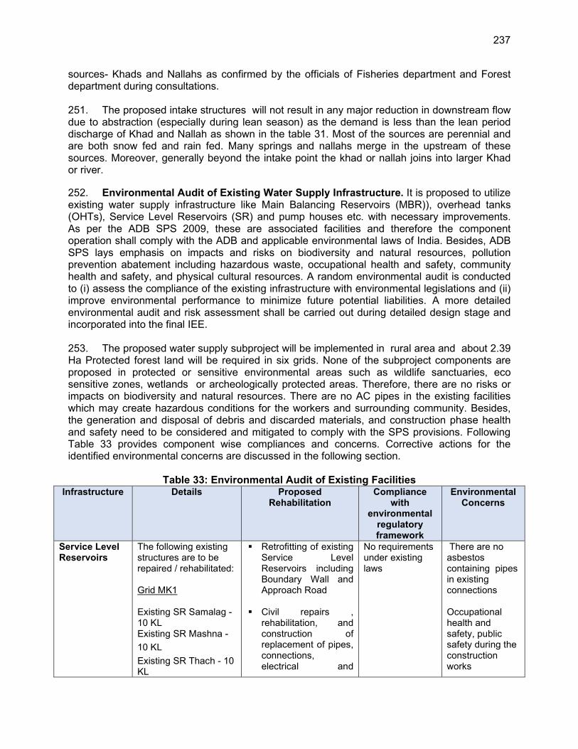
237
sources- Khads and Nallahs as confirmed by the officials of Fisheries department and Forest department during consultations. 251. The proposed intake structures will not result in any major reduction in downstream flow due to abstraction (especially during lean season) as the demand is less than the lean period discharge of Khad and Nallah as shown in the table 31. Most of the sources are perennial and are both snow fed and rain fed. Many springs and nallahs merge in the upstream of these sources. Moreover, generally beyond the intake point the khad or nallah joins into larger Khad or river.
252. Environmental Audit of Existing Water Supply Infrastructure. It is proposed to utilize existing water supply infrastructure like Main Balancing Reservoirs (MBR)), overhead tanks (OHTs), Service Level Reservoirs (SR) and pump houses etc. with necessary improvements. As per the ADB SPS 2009, these are associated facilities and therefore the component operation shall comply with the ADB and applicable environmental laws of India. Besides, ADB SPS lays emphasis on impacts and risks on biodiversity and natural resources, pollution prevention abatement including hazardous waste, occupational health and safety, community health and safety, and physical cultural resources. A random environmental audit is conducted to (i) assess the compliance of the existing infrastructure with environmental legislations and (ii) improve environmental performance to minimize future potential liabilities. A more detailed environmental audit and risk assessment shall be carried out during detailed design stage and incorporated into the final IEE. 253. The proposed water supply subproject will be implemented in rural area and about 2.39 Ha Protected forest land will be required in six grids. None of the subproject components are proposed in protected or sensitive environmental areas such as wildlife sanctuaries, eco sensitive zones, wetlands or archeologically protected areas. Therefore, there are no risks or impacts on biodiversity and natural resources. There are no AC pipes in the existing facilities which may create hazardous conditions for the workers and surrounding community. Besides, the generation and disposal of debris and discarded materials, and construction phase health and safety need to be considered and mitigated to comply with the SPS provisions. Following Table 33 provides component wise compliances and concerns. Corrective actions for the identified environmental concerns are discussed in the following section.
Table 33: Environmental Audit of Existing Facilities
Infrastructure Details Proposed Rehabilitation
Compliance with
environmental regulatory framework
Environmental Concerns
Service Level Reservoirs
The following existing structures are to be repaired / rehabilitated: Grid MK1 Existing SR Samalag - 10 KL Existing SR Mashna -
10 KL
Existing SR Thach - 10 KL
Retrofitting of existing Service Level Reservoirs including Boundary Wall and Approach Road
Civil repairs , rehabilitation, and construction of replacement of pipes, connections, electrical and
No requirements under existing laws
There are no asbestos containing pipes in existing connections Occupational health and safety, public safety during the construction works
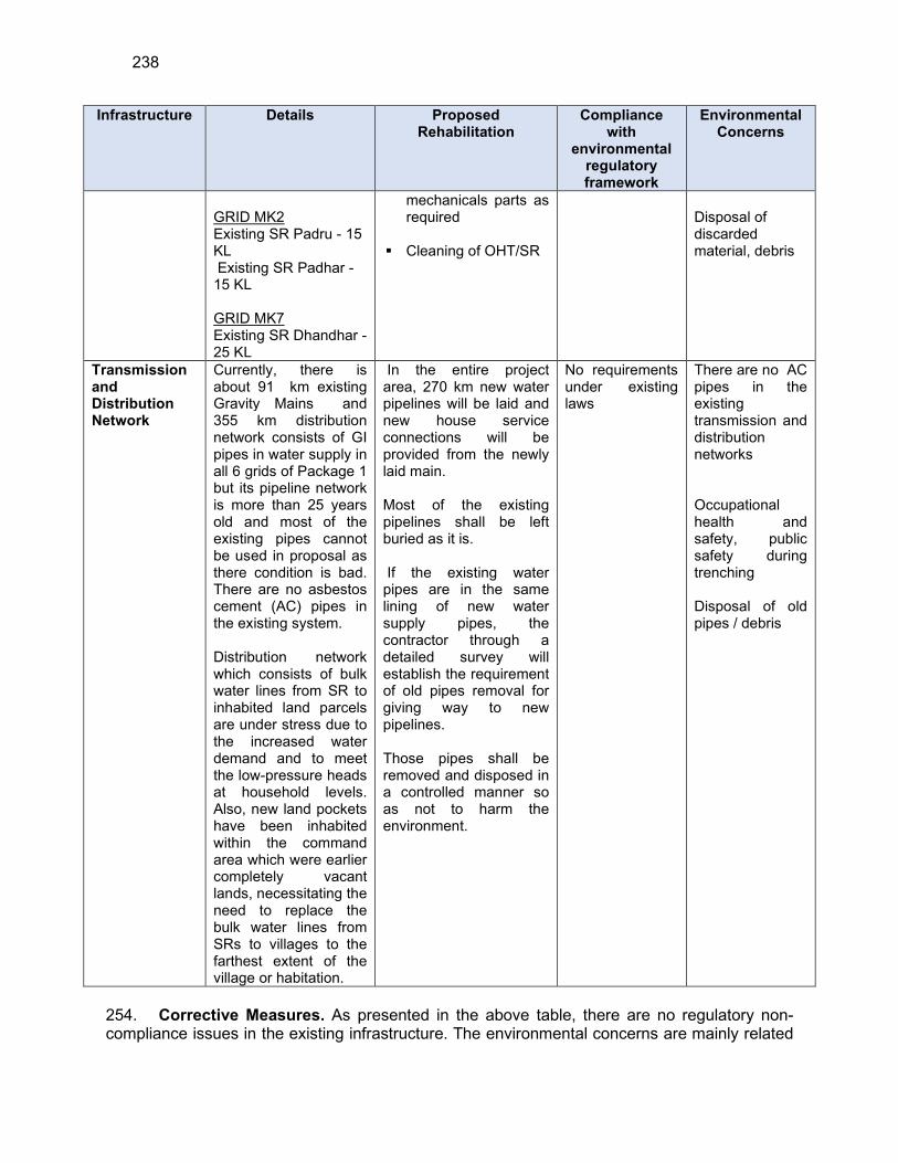
238
Infrastructure Details Proposed Rehabilitation
Compliance with
environmental regulatory framework
Environmental Concerns
GRID MK2 Existing SR Padru - 15 KL Existing SR Padhar - 15 KL GRID MK7 Existing SR Dhandhar - 25 KL
mechanicals parts as required
Cleaning of OHT/SR
Disposal of discarded material, debris
Transmission and Distribution Network
Currently, there is about 91 km existing Gravity Mains and 355 km distribution network consists of GI pipes in water supply in all 6 grids of Package 1 but its pipeline network is more than 25 years old and most of the existing pipes cannot be used in proposal as there condition is bad. There are no asbestos cement (AC) pipes in the existing system. Distribution network which consists of bulk water lines from SR to inhabited land parcels are under stress due to the increased water demand and to meet the low-pressure heads at household levels. Also, new land pockets have been inhabited within the command area which were earlier completely vacant lands, necessitating the need to replace the bulk water lines from SRs to villages to the farthest extent of the village or habitation.
In the entire project area, 270 km new water pipelines will be laid and new house service connections will be provided from the newly laid main. Most of the existing pipelines shall be left buried as it is. If the existing water pipes are in the same lining of new water supply pipes, the contractor through a detailed survey will establish the requirement of old pipes removal for giving way to new pipelines. Those pipes shall be removed and disposed in a controlled manner so as not to harm the environment.
No requirements under existing laws
There are no AC pipes in the existing transmission and distribution networks Occupational health and safety, public safety during trenching Disposal of old pipes / debris
254. Corrective Measures. As presented in the above table, there are no regulatory non-compliance issues in the existing infrastructure. The environmental concerns are mainly related
239
to occupational health and safety, public safety; disposal of debris, discarded materials etc., A work specific environmental management plan needs to be prepared for these aspects. The exact nature of rehabilitation and repair works will be known only during the detailed design phase, detailed technical audit will be conducted by the DBO contractor and the required rehabilitation and repair measures, and corrective measures if any will be proposed accordingly.
A. Pre Construction Impacts
255. Utilities. Telephone lines, electric poles and wires, water lines within the proposed project locations may require to be shifted in few cases. To mitigate the adverse impacts due to relocation of the utilities, the contractor, in collaboration with JSV will (i) identify the locations and operators of these utilities to prevent unnecessary disruption of services during construction phase; (ii) Inform in advance local residents and businesses of any utility shifting and the possibility of unscheduled interruption, and (iii) instruct construction contractors to prepare a contingency plan to include actions to be done in case of unintentional interruption of services. 256. Site selection of construction work camps, stockpile areas, storage areas, and disposal areas. Priority is to locate these near the project location. However, if it is deemed necessary to locate elsewhere, sites to be considered will not promote instability and result in destruction of property, vegetation, irrigation, and drinking water supply systems. Residential areas will not be considered for setting up construction camps to protect the human environment (i.e., to curb accident risks, health risks due to air and water pollution and dust, and noise, and to prevent social conflicts, shortages of amenities, and crime). Extreme care will be taken to avoid disposals near forest areas, water bodies, or in areas which will inconvenience the community. 257. Construction sites will be selected by DBO contractor in compliance with these conditions and the same will be reflected in Site Environmental Management Plan (SEMP) which is to be prepared by DBO contractor prior to start of construction and approved by PIU. Material stockpiles will be protected by bunds during the monsoon season to prevent silt runoff into drains. The subproject is likely to generate soil from excavations, which needs to be disposed of safely. The following measures should be considered for disposal of surplus and/or waste soil:
(i) The excavated soil should be removed from construction area at the earliest for beneficial reuse such as land raising / filling of excavated areas
(ii) Soil should be covered with tarpaulin sheets during the transportation. (iii) Soil transportation should not be done during the peak hours and should avoid
narrow and heavy traffic routes and important religious or tourist sites
258. Site selection of sources of materials. Extraction of materials can disrupt natural land contours and vegetation resulting in accelerated erosion, disturbance in natural drainage patterns, ponding and water logging, and water pollution. To mitigate the potential environmental impacts, locations of quarry site/s and borrow pit/s (for loose material other than stones) would be assessed by PIU. Priority would be sites already permitted by Mines and Geology Department. If new sites are necessary, these would be located away from population centers, drinking water intakes and streams, cultivable lands, and natural drainage systems; and in structurally stable areas. It will be the construction contractor’s responsibility to verify the suitability of all material sources and to obtain the approval of Department of Mines and Geology and local revenue administration. If additional quarries will be required after construction is started, then the construction contractor shall use the mentioned criteria to select
240
new quarry sites, with written approval of PIU.
B. Construction Impacts
259. Main civil works in the subproject include construction of (i) Intake structures - 21 numbers intake chamber, three diversion spurs and four bore wells, (ii) 16 water treatment plants, (iii) pumping stations,(iv) 16 Main Balancing Reservoirs and (v) 72 Service Reservoirs at the identified sites. These works will be confined to sites, and construction will include general activities like site clearance, excavation for foundations, and creation of concrete structures will be one of the major construction activities for this project, as many of the subproject components will be fixed to concrete plinths and most will be housed in buildings with at least some concrete structural elements. Most such structures will be constructed from reinforced concrete (RC), where steel reinforcing rods and bars are placed and attached by hand to create an interior skeleton for the foundations, walls, columns, plinths, etc, and heavy-duty metal and timber/plywood formwork is bolted around the outside to build a mould into which pre-mixed concrete is poured. Once the concrete has set, the formwork is removed, and the concrete surface is finished by masons by hand if necessary. Some buildings, such as the pump station, facilities, etc., may be constructed from brick work, in which case this work will be done using standard house-building techniques. Some components of may comprise a variety of prefabricated elements which will be are installed on site as ready-made individual units. These will be directly brought from the manufacturers place to the sites lifted into position by crane, affixed to plinths or other installation points, and connected up to pipe work and the electricity supply. Since these works are confined to the boundary of identified sites, there is no direct or significant interference of construction work with the surrounding land use. There will be temporary negative impacts, arising mainly from construction dust and noise, hauling of construction material, waste and equipment on local roads (traffic, dust, safety, etc.), mining of construction material, occupation health and safety aspects. It may be noted that due to hilly terrain, some sites are not accessible by motorable roads, and in such cases, material will be transported manually, and work will be conducted with minimal tools and mostly manually. During the construction phase of pipeline, impacts arise from the invasive nature of excavation and trenching work mostly along the roads. However as most of the individual elements are relatively small and involve straightforward construction, the potential environmental impacts (i) will be mainly localized, temporary and not greatly significant; (ii) will not cause direct impact on biodiversity values and (iii) are common impacts of construction, and there are well-developed methods for their mitigation. Given the hilly terrain, cuts and fills can promote instability and erosion although proposed excavation will not be significant, necessary measures will be put in place to avoid construction during rains, and cuts, fills and sloped surfaces in construction sites will be properly stabilized to avoid erosion. Site clearance will be strictly confined to actual work area, no clearance of topsoil or vegetation will be done outside the site. Temporary containment drains, silt fences will be used to contain silt laden run off from sites. Various measures will be put in place for work in forest lands to avoid any impacts or damage / disturbance to flora and fauna.
260. Since these works are confined to the boundary of identified sites, there is no direct interference of construction work with the surrounding land use. However, construction dust, noise, use of local roads for transportation of construction material, waste, labour camps etc., will have negative impacts, which needs to be avoided or mitigated properly.
261. Subproject also includes laying of approximately 65 km rising main, about 114 km long gravity mains and about 271 km long distribution mains. it is proposed to lay the pipelines mostly along the existing pipeline alignments and at certain places along the roads which carry
241
traffic, and along the khads/nallahs. It is proposed that the pipelines will be laid by open cut method along most of the alignment, however, the pipe which is proposed to be laid along the Khads provision of anchor blocks is considered to ensure safety of the pipelines. Due precaution would be taken while laying the pipelines along the busy roads to minimise public inconvenience and to avoid road closures and traffic disruptions, other important issues such as safety, and blocking access to properties, business and houses will also be considered.
262. Road network in the subproject area are classified as National highways, State Highways, Major district roads, other district roads, village roads and katcha path in case habitations. As per the indicative alignment, pipelines will primarily traverse one National highway, NH-305 and one State highway, SH 29, at various locations which will be further assessed during the time of DMS
263. Open cut trenching method of pipe laying involves excavation for laying pipes along the roads, placing pipes in the trench, jointing and testing, and refilling with the excavated soil. The trenches will be of 0.6m – 0.65 m wide and 0.7 to 0.75 m depth. Earth work excavation will be undertaken by machine (backhoe excavator) and include danger lighting and using sight rails and barricades at every 100 m., while pipe laying works will include laying pipes at required gradient, fixing collars, elbows, tees, bends and other fittings including conveying the material to work spot and testing for water tightness. Enough care will be taken while laying so that existing utilities and cables are not damaged and pipes are not thrown into the trenches or dragged, but carefully laid in the trenches. As trenches are 0.7 to 0.75m deep, there is risk of collapse of trenches or damage to surrounding buildings. Necessary precautions such as bracing or shoring in the trench will be provided. Once they are laid, pipes will be joined as per specification and then tested for any cracks of leakages. The minimum working hours will be 8 hours daily, the total duration of each stage depends on the soil condition and other local features. About 95% of the excavated soil will be used for refilling the refilling the trench after placing the pipe and therefore residual soil after pipe laying and refilling is not significant. 264. Although construction of these project components involves quite simple techniques of civil work, the invasive nature of excavation and the project locations in the built-up areas of the villages/towns where there are a variety of human activities, will result in impacts to the environment and sensitive receptors such as schools, religious places, hospitals and the community in general. Although these anticipated impacts are temporary and for short duration, require proper mitigation measures to limit the impacts to acceptable levels. Physical impacts will be reduced by the method of working and scheduling of work.
265. Anticipated impacts during the construction phase are discussed below along with appropriate mitigation measures to avoid, minimize or mitigate those impacts to acceptable levels.
266. Sources of Materials. Significant amount of sand and coarse aggregate will be required for this project, which will be sourced from quarries. Quarries inevitably cause extensive physical changes; as construction materials are excavated from the ground, leaving large cavities, or levelling hillsides, etc. The physical damage caused by quarries is controlled by allowing them to operate within specific limited areas only, so the damage is restricted in extent and not allowed to spread indiscriminately. New quarries are subject to a rigorous process of environmental assessment to ensure appropriate siting and adequate environmental controls on the operation. It will therefore be important to ensure that construction materials for this project are obtained from government approved licensed quarries only, to ensure these controls are in
242
place. Contractor should avoid new borrow pits / quarries as far as possible, if necessary, all the permissions, including conduct of environmental assessment, and environmental clearance as necessary shall be obtained prior to start of quarrying activity. The contractor should also make a concerted effort to re-use as much excavated material from this project as possible. The construction contractor will be required to:
(i) Obtain construction materials only from government approved quarries with prior approval of PIU;
(ii) PIU to review, and ensure that proposed quarry sources have all necessary clearances/ permissions in place prior to approval;
(iii) Contractor to submit to PIU on a monthly basis documentation on material obtained from each source (quarry/ borrow pit);
(iv) Avoid creation of new borrow areas, quarries etc., for the project; if unavoidable, contractor to obtain all clearances and permissions as required under law, including Environmental Clearance prior to approval by PIU.
267. Air Quality. Boring of deep tube wells, laying of transmission & distribution pipes, construction of storage reservoirs, construction of pump house building along with generator & guard houses, and transport & installation of pumps are the major construction activities of the project. Most of the works do not involve heavy machines except in constructing deep tube well which will produce some extent of noise for a certain period of time. There will be some activities such as transportation, loading/unloading of construction materials viz. sand and aggregates, stockpiling of construction waste and construction materials and earthworks. These will cause effect into air quality due to dust generation and vehicular emission as well as noise pollution. Use of power horns and movement of heavy vehicles can cause a serious disturbance to the community, educational institutes, hospitals/health centers and residences etc. 268. Also, emissions from construction vehicles, equipment, and machinery used for excavation and construction will induce impacts on the air quality. Anticipated impacts include dust and increase in concentration of vehicle-related pollutants such as carbon monoxide, sulphur oxides, particulate matter, nitrous oxides, and hydrocarbons. Dust generation from construction work in individual and confined work sites like WTP, pumping station, reservoirs etc., will be mainly during the initial construction phase of earth work. As the site is confined, dust can be effectively controlled with common measures. Dust generation will be significant during pipeline laying along the roads. Increase in dust/ particulate matter in ambient air is detrimental and may have adverse impacts on people and environment. There will be greater impact on air quality from the inadequately managed or haphazard project activities that includes burning of firewood for cooking & heating in work and labour camps and open burning of solid waste by workers. To mitigate the impacts, construction contractors will be required to:
(i) Plan the work sites properly, and demarcate the sites for stockpiling of, soils, gravel, and other construction materials away from the traffic, vehicle, general worker movement to avoid disturbance of loose materials
(ii) Damp down exposed soil and any stockpiled material on site by water sprinkling; (iii) Use tarpaulins to cover sand and other loose material when transported by
trucks; (iv) Clean wheels and undercarriage of haul trucks prior to leaving construction site (v) Don’t allow access in the work area except workers to limit soil disturbance and
prevent access by barricading and security personnel
243
(vi) Fit all heavy equipment and machinery with air pollution control devices which are operating correctly. contractor’s vehicles and equipment should compulsorily have PUC and submit PUC to PIU before deployment at site
(vii) Limit idling of vehicles on the construction sites to 3-5 minutes (viii) Obtain, CTE and CTO for batching plant, hot mix plant, crushers etc. if
specifically established for this project. (ix) If contractor is purchasing ready mix concrete, asphalt/macadam and aggregates
from third party, contractor will assure that all the partier/ suppliers are having CTE/CTO from HPSPCB and will collect the copy of these certificates and submit to PIU/consultants; PIU will approve the source only after all the certificates are submitted
(x) Strict Prohibition of open burning of solid waste (xi) Regular inspection & maintenance of construction/transportation vehicles •
Supply of clean cooking fuel to workers instead of allowing them to use firewood for cooking
(xii) Conduct ambient air quality monitoring periodically as per Environmental Management Plan (EMP)
269. Surface Water Quality. Run-off from stockpiled materials and chemicals from fuels and lubricants during construction works can contaminate downstream surface water quality of the streams. Project area is hilly / undulating and receives considerable rainfall, although mostly confined during the monsoon months. The WTP sites are located close to the raw water source. It is important that runoff from the construction areas, which may contain silt and chemical traces do not enter these water bodies. Impact will be temporary, and may not be significant, but needs to be mitigated. Construction contractor will be required to:
(i) Prepare and implement a spoils management plan (Appendix 11); (ii) All earthworks be conducted during the dry season to prevent the problem of soil
run-off during monsoon season; (iii) Avoid stockpiling of earth fill especially during the monsoon season unless
covered by tarpaulins or plastic sheets; (iv) Prioritize re-use of excess spoils and materials in the construction works. If spoils
will be disposed, only designated disposal areas shall be used; (v) Install temporary silt traps or sedimentation basins along the drainage leading to
the water bodies; (vi) As for a possible avoid trench works and excavation works (pipe laying) during
monsoon season to avoid any water logging and accident due to it (vii) If open trenches are not avoidable during monsoon, keep ready all the
mitigations measures to avoid water logging such as dewatering pumps and sufficient pipes, traffic assistance, barricades etc.
(viii) Place storage areas for fuels and lubricants away from any drainage leading to water bodies;
(ix) Store fuel, construction chemicals etc., on an impervious floor, also avoid spillage by careful handling
(x) Dispose any wastes generated by construction activities in designated sites; and (xi) Conduct surface quality inspection according to the Environmental Management
Plan (EMP).
270. Groundwater Quality. Groundwater is proposed as source of water supply at four locations. Increased demand for groundwater is anticipated during the construction phase for
244
construction activities and personal consumption by workers. Even a small project can require 100 m3/day of water. Uncontrolled extraction of water may affect availability of water to locals. It is expected that most fill material will generally be compacted dry. The pressure testing of pipelines will be carried out with compressed air. The testing of water retaining structures such as pumping stations, water will be used but limited to a single filling of the structure. 271. The project area is in Kullu district which is categorized as “non-regulated zone ” as per CGWB. Thus leaving a large scope for further development of the resource for domestic, industrial, agricultural and other uses. However, this large scope may give rise to over exploitation of the resources, in case its development is not planned properly in a scientific way. 272. In addition, construction waste, if left unattended, may result in percolation of leachate through the soil strata reaching the groundwater table contaminating. These potential impacts are temporary and short-term duration only. It is necessary that arrangement for safe drinking water is made prior to start of work. Water will be supplied for consumption only after adequate analysis and requisite treatment. The workers may also be trained on the need for judicious use of freshwater resources. The contractors will use water in consideration to its value as a resource. Mitigation measures will include: 273.
(i) Prevent pollutants from contaminating the soil and the groundwater; (ii) All tube wells, test holes, monitoring wells that are no longer in use or needed
shall be properly decommissioned; (iii) Storage of lubricants and fuel at least 50 m from water bodies; (iv) Storage of fuel and lubricants in double hulled tanks. Fuel and other petroleum
products stored at storage areas away from water drainage and protected by impermeable lining and bonded 110%;
(v) Daily control of machinery and vehicles for leakages; (vi) Collection of waste during construction activities; (vii) Provide uncontaminated water for dust suppression; (viii) Enclose the construction area to prevent unauthorized access
274. Another physical impact that is often associated with excavation is the effect on drainage and the local water table if groundwater and surface water collect in the voids. In the project area, groundwater depth is shallow, there are numerous water bodies and streams, and it also receives high rainfall during the monsoon. Conducting excavation works during non-monsoon season will certainly help, but due to high water table, water may collect in pits as they are excavated. The water collected in excavated pits will contain silt and disposal of this in drainage channels lead to silting. To avoid this the contractor needs to be implement the following measures:
(i) Create a temporary drainage channel around the work area to arrest the entry of
runoff from upper areas into the work area; (ii) Pump out the water collected in the pits / excavations to a temporary
sedimentation pond; dispose of only clarified water into drainage channels/streams after sedimentation in the temporary ponds;
(iii) Consider safety aspects related to pit collapse due to accumulation of water. (iv) Prepare and implement a spoils management plan (Appendix 14); (v) Avoid stockpiling of earth fill especially during the monsoon season unless
covered by tarpaulins or plastic sheets;
245
(vi) Prioritize re-use of excess spoils and materials in the construction works. If spoils will be disposed, consult with PIU on designated disposal areas;
(vii) Install temporary silt traps or sedimentation basins along the drainage leading to the water bodies;
(viii) Place storage areas for fuels and lubricants away from any drainage leading to water bodies;
(ix) Dispose any wastes generated by construction activities in designated sites; and (x) Conduct surface quality inspection according to the Environmental Management
Plan (EMP).
275. Generation of Construction Wastes. Solid wastes generated from the construction activities are excess excavated earth (spoils), discarded construction materials, cement bags, wood, steel, oils, fuels and other similar items. Domestic solid wastes may also be generated from the workers’ camp. Improper waste management could cause odour and vermin problems, pollution and flow obstruction of nearby watercourses and could negatively impact the landscape. The following mitigation measures to minimize impacts from waste generation shall be implemented by the contractor:
(i) Prepare and implement a Construction Waste Management Plan; (ii) As far as possible utilize the debris and excess soil in construction purpose, for
example for raising the ground level or construction of access roads etc.; (iii) Avoid stockpiling any excess spoils at the site for long time. Excess excavated (iv) soils should be disposed off to approved designated areas immediately; (v) If disposal is required, the site shall be selected preferably from barren, infertile
lands; site should locate away from residential areas, forests, water bodies and any other sensitive land uses;
(vi) Domestic solid wastes should be properly segregated in biodegradable and non-biodegradable for collection and disposal to designated solid waste disposal site; create a compost pit at workers camp sites for disposal of biodegradable waste; non-biodegradable / recyclable material shall be collected separately and sold in the local recycling material market;
(vii) Residual and hazardous wastes such as oils, fuels, and lubricants shall be disposed of in disposal sites approved by JSV;
(viii) Prohibit burning of construction and/or domestic waste; (ix) Ensure that wastes are not haphazardly thrown in and around the project site
provide proper collection bins and create awareness to use the dust bins; (x) Conduct site clearance and restoration to original condition after the completion
of construction work; PIU to ensure that site is properly restored prior to issuing of construction completion certificate.
276. Noise and Vibration Levels. The proposed components of the work like water intake works, tube wells, WTPs, Pump houses, MBR’s & SR’s except laying of pipelines are all the construction works proposed to be executed at selected sites in the sparsely populated hilly terrain. The pipelines will be laid in the areas, where there are houses, schools, religious places and small-scale businesses. The sensitive receptors are the general population in these areas. Increase in noise level may be caused by excavation, particularly breaking of cement concrete or bitumen roads, operation of construction equipment like concrete mixers, and the transportation of equipment, materials, and people. Vibration generated from construction activity, for instance from the use of pneumatic drills, will have impact on nearby buildings. This impact is negative but short-term, and reversible by mitigation measures. The construction
246
contractor will be required to:
(i) Plan activities in consultation with PIU so that activities with the greatest
potential to generate noise are conducted during periods of the day which will result
in least disturbance;
(ii) Horns should not be used unless it is necessary to warn other road users or
animals of the vehicle’s approach;
(iii) Minimize noise from construction equipment by using vehicle silencers, fitting
jackhammers with noise-reducing mufflers, and use portable street barriers to
minimize sound impact to surrounding sensitive receptor; and
(iv) Ensure proper training of construction workers on the safe usage of pneumatic drills
and exposure limits per day; provide appropriate personel protection equipment -
safety glasses or goggles/face shield, helmets, safety shoes or boots, hearing
protection aids etc.,. Set up screens or shields in areas where nearby workers or
community may be exposed to flying fragments, chips, dust and excessive noise.
(v) Maintain maximum sound levels not exceeding 80 decibels (dBA) when measured at a
distance of 10 m or more from the vehicle/s.
(vi) Identify any buildings at risk from vibration damage and avoiding any use of
pneumatic drills or heavy vehicles in the vicinity.
(vii) Consult local communities in advance of the work to identify and address key
issues, and avoid working at sensitive times, such as religious and cultural festivals.
(viii) Monitor noise levels to ensure they are within local and/or international
maximum levels, whichever is lower
277. Landscape and Aesthetic. Some trees may be required to cut due to which landscape and aesthetics of those sites will be reduced. About 2.39 Ha forest land will be required for construction of purpose. The construction works will produce excess excavated earth, excess construction materials, and solid waste such as removed concrete, wood, packaging materials, empty containers, spoils, oils, lubricants, and other similar items. Haphazard disposal of these will have negative impacts on landscape and overall aesthetics. These impacts are negative but are of short-term and reversible by mitigation measures. The construction contractor will be required to:
(i) Take all the efforts to reduce numbers of tree cutting by amending design. (ii) Compensatory plantation in the ratio of 1:10 is required to increase landscape
and aesthetics of the sites where tree cutting has been done (iii) Prepare and implement spoils management plan; (iv) Avoid stockpiling of excess excavated soils; (v) Coordinate with ULB for beneficial uses of excess excavated soils or
immediately dispose to designated areas; (vi) Recover used oil and lubricants and reuse or remove from the sites; (vii) Prevent generation of solid waste by adopting practices and methods (such as
avoiding the use of disposable, single use items in the workers’ camp if reusable items are practical and affordable); manage generated solid waste according to the following preference hierarchy: reuse, recycling and disposal to designated areas;
(viii) Removal and proper disposal of wreckage, rubbish, or temporary structures which are no longer required; and

247
(ix) Request PIU to report in writing that the necessary environmental restoration work has been adequately performed before acceptance of work.
278. Impact on Flora & Fauna Some trees will be felled during construction period. However, the project will avoid tree felling as far as possible. During pipe laying works, some of the top soil may be lost. The construction works may induce noise that will create discomfort to the faunas existing in those areas. Haphazard site clearing, parking, movement of construction vehicles, use of various equipment, stockpiling, illegal harvesting of forest resources as fuel for cooking by workers and hunting of animals by workers will result in unnecessary loss of vegetation & fauna. The impact is direct in nature, local in extent, medium in magnitude and short-term in duration. The mitigation measures for this impact include:
(i) Plantation of tree saplings for the felling of trees in and around the project area as compensatory plantation in the ratio 1:10 for every tree felled.
(ii) Replace the excavated top soil to its original position after the completion of pipe laying works
(iii) Re-vegetating disturbed slopes and grounds, as applicable (iv) Awareness programs regarding conservation of existing flora & fauna, to the
workers and the community; (v) Adopt the suitable mitigation measures proposed to minimize noise pollution (vi) Regular Monitoring by PMDSC & PIU
279. Impact on Aquatic Life.. Based on the discussion with the officials of Fisheries department it may be concluded that the proposed intake structures like intake chambers or will not create hurdle in the up and down stream movement of the fish as the continuity of the water flow is being maintained. The fish will move downstream with the water current and will move upwards with the help of the caudal fin/tail fin. Based on the information obtained from, Fisheries department, and inquiries from the local people reveals that Rainbow / brown (resident) and also snow trouts (introduced from Denmark) along with local small fishes (Chal/Minnows) are commonly available in these khads/nallahs. There is no endangered aquatic species as per “The IUCN Red List of Threatened Species 2010”. As the water demand is less than the lean period discharge of Khad and Nallah as shown in table 31, there will be enough water available for fish propagation these streams.
280. The habitat preference displayed by many species during spawning is closely related to the stage of the course of the life cycle occurring in the flooding at monsoon. The trouts spawn in slight gravel depression in shallow banks vegetated with water moss. Trouts are short-distance migratory fish which enters tributaries for breeding. It migrates downstream during winter and upstream during early June when water becomes turbid. The migration pattern varies from species to species and also depends on the volume of water in rivers and on water temperature. Fishery department has adopted artificial breeding of Rainbow and Brown trout’s and releasing in the khads / rivers (fingerlings)
281. During the construction of the intake structures all necessary arrangements will be made so as to minimize impacts on the movement, spawning, and breeding of the fish. Sufficient measures for trapping silt and wastes will be employed to minimise any negative impacts. During construction phase, nearby water bodies may be used by the workers for their daily activities like waste disposal, sanitation activities which may pollute the river quality which in turn lead the habitat of aquatic life towards risk. The impact is direct in nature, local in extent, medium in magnitude and short-term in duration. The mitigation measures for this impact
248
include:
(i) Construction activities should be carried out during non-breeding periods of fishes in consultation with fishery officials
(ii) Strict Monitoring on the daily activities of workers ; (iii) Provision of temporary but well equipped toilets; (iv) Restriction to workers from fishing; (v) Adopt measures for the solid waste management.
282. There are total 16 species of threatened category and 9 restricted range species are found in 50km radius in subproject components area as result of IBAT analysis (Appendix 23). The field assessment as part of IEE report preparation and consultation with fishery department and local community has confirmed that threatened category fish species of Golden Masheer in not present in project sources.. The potential impacts arise because the presence of protected bird species Western Tragopan (Tragopan melanocephalus) in Grid MK-2 and one plant species of Himalayan Trillium (Trillium govanianum) in the forest areas under the subproject component. The subproject components for Grid MK-2 is located in the vicinity (1.6km) aerial distance of Kais Wildlife Sanctuary, an IBA site for Western Tragopan (Tragopan melanocephalus). Bird species has restricted range habitat in the sactuary. Following measures are suggested to avoid any impacts:
(i) No trees of protected species Himalayan Trillium (Tragopan melanocephalus) should be removed for project; conduct survey of the trees to be removed prior to removal along with forest department; chose alternative site or alignment
(ii) Minimise removal of vegetation in forest area, especially in forest areas located close Kais Wildlife Sanctuary
(iii) Use only existing licensed quarries outside of rivers and streams for sourcing aggregates.
(iv) Avoid borrow pits in areas of Natural Habitat and within 200 m of waterways. (v) Prohibit collection, sale or purchase of timber/firewood by staff and contractors,
with heavy penalties applied; ensure that contractor provides appriopriate (vi) Train staff and contractors in good environmental practice, and prohibited
activities. (vii) Ensure contractors supply all necessary food, cooking fuel and appropriate
housing; no labour camps / construction camps should be located in or with in 500 m of forest areas
(viii) Use acoustic enclosures for noisy equipment (e.g., diesel generators, compressors).
(ix) Only undertake construction during the day, between 0800-1800 hrs, in forest or near to protected areas.
(x) Prohibit hunting, trapping, fishing and trading of wildlife by staff and contractors, with heavy penalties applied.
283. Sedimentation of stream water During constructions of intake structures the removal of bank/ in stream soil and vegetation clearing will cause sedimentation affecting fish and aquatic invertebrates sensitive to changes in the water quality parameters such as, increased turbidity, changes in temperature etc.
284. Fresh water fish and some other aquatic organisms are unlikely to live and breed well in such modified areas. In addition, sediment eroded from stream banks may be carried further downstream where it is deposited, smothering eggs and invertebrates. Moreover, extreme (too
249
high) flow variations will increase sediment load from the project site, which inhibits percolation and lowers available oxygen. Sediment in the flow scours spawning beds for breeding species. 285. Fish species that rely on vision to obtain food would be adversely affected as a result of sedimentation. Poor visibility due to sedimentation of stream water (by construction activities). The mitigation measures for this impact include:
(i) Monitor water flow during construction and maintain the minimum ecological
requirement for all khads to ensure water is available downstream all the time. (ii) Maintain the desired hydrological connectivity in the system (upstream-
downstream and maintain low water temperature necessary for survival of the moderately flow-sensitive species found at this site;
(iii) Ensure riverine protection through observing the 6-30m away from the river banks and planting of indigenous riparian trees to reduce sedimentation.
286. Reduced water flow. Instances of reduced stream flow are anticipated from diversions and retention at points during construction. These may destroy delicate microhabitats within the Khad and may result in loss of aquatic fauna particularly during the dry season. For example, when there is very low water flowing, species adapted to micro-habitats are lost or forced to the pool areas. However, the impacts will be localized only and may affect minor stretches of Khads. The impact can be mitigated by shortening the periods of temporary diversions as far as feasible.
287. Accessibility. Excavation along the roads, hauling of construction materials and operation of equipment on-site can cause traffic problems. Roads are narrow and carry considerable local traffic, mainly comprise bicycles, 2 wheelers, Mini trucks, buses etc. Cultivation is predominant in the area and large number of vehicles carrying vegetable produce to market can be seen in the area. Primary main pipeline work will be conducted along roads from intake to WTP and WTP to MBR & SR locations, which has potential to create accessibility to issues to surrounding houses and business and may also affect the traffic movement. Works related to all the remaining components will be confined to the selected sites; therefore there is no direct interference of these works with the traffic and accessibility. Hauling of construction material, equipment, construction waste, etc., to and from the work site may increase the road traffic on local roads, which are not in good condition. Potential impact is negative but short term and reversible by mitigation measures. The construction contractor will be required to:
1. Hauling (material, waste/debris and equipment) activities
(i) Prepare and implement a Traffic Management Plan (Appendix 12) (ii) Plan transportation routes so that heavy vehicles do not use narrow local
roads, except in the immediate vicinity of delivery sites (iii) Schedule transport and hauling activities during non-peak hours; (iv) Locate entry and exit points in areas where there is low potential for traffic
congestion; (v) Drive vehicles in a considerate manner (vi) Notify affected public by public information notices, providing sign boards
informing nature and duration of construction works and contact numbers for concerns/complaints.
2. Pipeline works
250
(i) Confine work areas along the roads to the minimum possible extent; all the activities, including material & waste/surplus soil stocking should be confined to this area. Proper barricading should be provided; avoid material/surplus soil stocking in congested areas – immediately removed from site/ or brought to the as and when required
(ii) Leave spaces for access between mounds of soil to maintain access to the houses / properties
(iii) Provide pedestrian access in all the locations; provide wooden/metal planks over the open trenches at each house to maintain the access.
(iv) Inform the affected local population 1-week in advance about the work schedule (v) Plan and execute the work in such a way that the period of disturbance/ loss of
access are minimum. (vi) Keep the site free from all unnecessary obstructions; (vii) Coordinate with Traffic Police for temporary road diversions, where necessary,
and for provision of traffic aids if transportation activities cannot be avoided during peak hours
288. Socio-Economic – Income. Two MBR’s and nine SR’s are proposed to be constructed on small pieces of private land, and the owners of land have consented to donate the land for the community good. The entire civil works proposed under the subproject for the transmission main is proposed along the alignment of existing pipeline, along the Khads and within the boundaries or ROW of government roads (mainly panchayat roads, PWD roads). Resettlement and social issues are being studied in a parallel resettlement planning study of this subproject. Blocking of access to the business / livelihood activities, especially during pipeline laying along the roads, may slightly impact the income of households. However, given the alignment of pipeline, and the measures suggested for ensuring accessibility during pipeline works, no notable impact is envisaged. 289. Socio-Economic – Employment. Manpower will be required during the construction stage. This can result in generation of temporary employment and increase in local revenue. Thus, potential impact is positive and long-term. The construction contractor will be required to employ local labour force, to the maximum extent, possible and Secure construction materials from local market. 290. Occupational Health and Safety. Workers need to be mindful of the occupational hazards which can arise from working in height and excavation works. Potential impacts are negative and long-term but reversible by mitigation measures. The construction contractor will be required to:
(i) Comply with all national, state and local labor laws (Appendix 5); (ii) Following best practice health and safety guidelines: IFC’s General EHS
Guidelines,19 WHO Interim Guidance (and its updates) on Water, Sanitation, Hygiene and Waste management for the COVID19 virus (Appendix 13), and Sector Specific (Water and Sanitation) Guidelines.20
(iii) ADB’s Interim Advisory Note on Protecting the Safety and Well-Being of Workers and Communities from COVID-19 (2020) (Appendix 14)
19https://www.ifc.org/wps/wcm/connect/554e8d80488658e4b76af76a6515bb18/Final%2B%2BGeneral%2BEHS%2B
Guidelines.pdf?MOD=AJPERES 20https://www.ifc.org/wps/wcm/connect/e22c050048855ae0875cd76a6515bb18/Final%2B%2BWater%2Band%2BSa
nitation.pdf?MOD=AJPERES
251
(iv) Develop and implement site-specific occupational health and safety (OHS) Plan which will include measures such as: (a) excluding public from the site; (b) ensuring all workers are provided with and use personal protective equipment; (c) OHS Training21 for all site personnel; (d) documented procedures to be followed for all site activities; and I(e) documentation of work-related accidents;
(v) Conduct work in confine spaces, trenches, and at height with suitable precautions and using standards and safe construction methods; do not adopt adhoc methods; all trenches deeper than 1.5 m shall be provided with safety shoring/braces; and avoid open cutting method for trenches deeper than 6-7 m by adopting trenchless technology
(vi) Ensure that qualified first aid is provided at all times. Equipped first-aid stations shall be easily accessible throughout the site;
(vii) Provide medical insurance coverage for workers; (viii) Secure all installations from unauthorized intrusion and accident risks; (ix) The project area experiences extreme temperature during summer months of
April and May, which may affect the health of workers engaged in construction work. Contractor should take necessary measures during summers including the following: Work schedule should be adjusted to avoid peak temperature hours (12 – 3
PM) Provide appropriate shade near the workplace; allow periodic resting and
provide adequate water Provide necessary medicine and facilities to take care of dehydration related
health issues (x) Provide supplies of potable drinking water; (xi) Provide clean eating areas where workers are not exposed to hazardous or
noxious substances; (xii) Provide H&S orientation training to all new workers to ensure that they are
apprised of the basic site rules of work at the site, personal protective protection, and preventing injuring to fellow workers;
(xiii) Provide visitor orientation if visitors to the site can gain access to areas where hazardous conditions or substances may be present. Ensure also that visitor/s do not enter hazard areas unescorted;
(xiv) Ensure the visibility of workers through their use of high visibility vests when working in or walking through heavy equipment operating areas;
(xv) Ensure moving equipment is outfitted with audible back-up alarms; (xvi) Mark and provide sign boards for hazardous areas such as energized electrical
devices and lines, service rooms housing high voltage equipment, and areas for storage and disposal. Signage shall be in accordance with international standards and be well known to, and easily understood by workers, visitors, and the general public as appropriate; and
21 Some of the key areas that may be covered during training as they relate to the primary causes of accidents
include (i) slips, trips and falls; (ii) personal protective equipment; (iii) ergonomics, repetitive motion, and manual handling; (iv) workplace transport; and (v) legislation and responsibilities. Training can provide the foundations of competence but it does not necessarily result in a competent worker. Therefore, it is essential to assess staff competence to ensure that the training provided is relevant and effective. Supervision and monitoring arrangements shall be in place to ensure that training has been effective and the worker is competent at their job. The level of supervision and monitoring required is a management decision that shall be based on the risks associated with the job, the level of competence required, the experience of the individual and whether the worker works as part of a team or is a lone worker.
252
(xvii) Disallow worker exposure to noise level greater than 85 dBA for duration of more than 8 hours per day without hearing protection. The use of hearing protection shall be enforced actively.
(xviii) Conduct regular health check-ups for workers (xix) Provide periodical awareness camps and special trainings for workers for health
issues and risks in construction sites
291. Work within River / Reservoirs. Since during construction of intake workers should have to work within or adjacent to the river, safety precautions and emergency protocol is necessary. Caution shall be maintained against flash floods in general, and untimely/unexpected rains and floods, dam releases etc., during the construction phase, and necessary safety protocols and awareness shall be created among workers, supervisory staff etc., Works shall be conducted in the lean season and confining work area to avoid any pollution of water, no chemical use, and cleaning up the site after completion of work etc., needs to be followed. Arrangement will be made to maintain the flow of the Khad and Nallah to downstream uninterrupted during the works.
292. Special precaution particularly using safety equipment and training on swimming and mitigation under emergency is necessary. River training and protection work shall include construction of guide bunds, guide walls, bank protection, flooring and approach embankment protection as required for ensuring safety of the structures and their approaches against damage by flood / flowing water. Construction of various components shall conform to IRC:89 and its Specifications or as directed by the Engineer. 293. Asbestos Materials. No Asbestos containing material (ACM) is proposed to be used in the subproject construction. The existing pipelines are of mild steel (MS) and galvasized iron (GI) pipes, and there are no asbestos cement (AC) pipes.
294. Community Health and Safety. Hazards posed to the public, specifically in high-pedestrian areas may include traffic accidents and vehicle collision with pedestrians. Potential impact is negative but short-term and reversible by mitigation measures. The construction contractor will be required to:
(i) Plan routes to avoid times of peak-vechile movement activities. (ii) Liaise with PIU in identifying risk areas on route cards/maps. (iii) Maintain regularly the vehicles and use of manufacturer-approved parts to
minimize potentially serious accidents caused by equipment malfunction or premature failure.
(iv) Provide road signs and flag persons to warn of on-going trenching activities. (v) Provide proper barricades around deep excavation pits. (vi) Provide prior information to the local people about the nature and duration of
work
295. Some parts of the project areas are characterized by narrow roads. Particularly, the areas located on slopes have very narrow roads with sharp turns and are accessible only to pedestrians. Besides impeding the access, the trench excavation and pipe laying will pose safety risks to pedestrians and the people living in these areas. The construction contractor will be required to:
(i) Trench excavation and pipeline works shall be conducted in a safe manner; if the allowing public movement along the work sites (pedestrians or vehicles as
253
the case may be) is likely to cause safety risks, movement should be blocked temporarily and work shall be conducted; in such areas, conducting night work or working in small stretches to avoid blockage of traffic/movement no more than few hours in due consultation with the local community and Panchyat shall be planned
(ii) All trenches deeper than 1.5 m shall be provided with safety shoring/braces; (iii) Survey the surrounding vulnerable buildings for likely issues in structural
stability / differential settlement during the excavation works (iv) Provide prior information to the local people about the nature and duration of
work (v) Conduct awareness program on safety during the construction work (vi) Undertake the construction work stretch-wise; excavation, pipe laying and
trench refilling should be completed on the same day (vii) Provide hard barricades, and deploy security personnel to ensure safe
movement of people and also to prevent unnecessary entry and to avoid accidental fall into open trenches
296. Occupational Health and Safety Plan due to COVID 19 Pandemic. PMU, PIUs, Consultants and contractors to ensure that: (i) package wise details and evidences such as photographs/display board for grievance redress mechanism (GRM)/health and safety (H&S) measures taken at work sites due to COVID 19 pandemic are included in monthly monitoring report; and (ii) ensure that efficient implementation of the H&S Plan developed by the project in response to COVID-19 pandemic. Important protocols or measures in the H&S Plan are to ensure that the following are complied with at the offices and worksites of the project: (i) screening of employees and workers; (ii) record keeping of screening results; (iii) availability and use of appropriate PPEs; (iv) social distancing; (v) proper office set up reconfiguration to ensure social distancing; (vi) new office and work site meeting arrangements; and (vii) regular disinfection of work areas, vehicles and equipment; among others. PIU safeguards officer with the assistance of the safeguards experts of DSCs and Contractors EHS officers to take precautions, provide continuous induction and continue conducting regular safeguards implementation trainings including implementation monitoring of regular usage of PPEs and COVID-19 related safety measures. Key reminders for the PMU, PIUs, contractors, and workers to comply with the following occupational health and safety measures as stated in the agreed OHS Plan:
(i) Ensure project staff, consultants, contractors, and workers have in their mobile devices the Aarogya Setu App, which is a mobile application developed and recommended by the government to proactively reach out to and inform the users of the app regarding risks, best practices and relevant advisories pertaining to the containment of COVID-19;
(ii) Mandatory isolation of the personnel or workers, either asymptomatic or showing symptoms, who have had direct contact with anyone tested positive for COVID-19. Follow the isolation procedures issued by the government;
(iii) Proper disposal of used PPE following guidelines and procedures issued by the government;
(iv) Conduct daily briefing on the developments of COVID-19 in the state or country, either through emails, meetings or daily toolbox talks;
(v) When possible, allow work from home arrangement based on the nature of jobs;
254
(vi) If necessary, pick up and drop off facility be extended to staff (based on the distance of the staff residence from office and on availability of safe mode of transport);
(vii) Avoid face to face meetings – critical situations requiring in-person discussion must follow social distancing. Do not convene in-person meetings of more than 10 people;
(viii) If possible, conduct all meetings via conference calls. Recommend use of cell phones, texting, web meeting sites and conference calls for project discussions;
(ix) Contractor to help its workers arrange a systematic procurement of all daily needs and groceries at worksites. This will avoid each and every worker going to shops for these daily needs;
(x) Contractor to arrange for contactless payment of wages to workers, where possible;
(xi) Allow distributed break times for workers to maintain social distancing and reduce contact;
(xii) Remind employees and workers to maintain good health by getting adequate sleep; eating a balanced and healthy diet, avoiding alcohol/smoking; and consuming plenty of fluids; and
(xiii) Remind employees and workers to extend their adherence to the H&S protocols at their respective homes. Infection may happen beyond the borders of offices and work sites.
297. Establishment and Operation of Construction Camps and Workers Facilities. It is likely that the contract may employ workers from outside project area, and therefore may provide temporary workers accommodation during the construction phase. Proper provision and maintenance of facilities is necessary for proper living conditions and avoid health, environment and safety issues. Workers camps may also adverse impacts on surrounding communities. Operation of construction camps can cause temporary air and noise pollution from machine operation, water pollution from storage and use of fuels, oils, solvents, and lubricants. Potential impacts are negative but short-term and reversible by mitigation measures. The construction contractor will be required to:
(i) Consult PIU before locating project offices, sheds, and construction plants; (ii) Minimize removal of vegetation and disallow cutting of trees; (iii) Provide drinking water, water for other uses, and sanitation facilities for
employees; (iv) Provided temporary rest and eating area at all work sites (v) Ensure conditions of liveability at work camps are maintained at the highest
standards possible at all times; living quarters and construction camps shall be provided with standard materials (as far as possible to use portable ready to fit-in reusable cabins with proper ventilation); thatched huts, and facilities constructed with materials like GI sheets, tarpaulins, etc., shall not be used as accommodation for workers; accommodation shall meet the IFC standards for workers accommodation22 which include: provision of safe housing, availability of electricity, plumbing, water and sanitation, adequate fire protection and dormitory/room facilities; accommodation shall be in the range from 10 to 12.5 cubic meters (volume) or 4 to 5.5 square meters (surface) per worker, a
22https://www.ifc.org/wps/wcm/connect/topics_ext_content/ifc_external_corporate_site/sustainability-at-
ifc/publications/publications_gpn_workersaccommodation
255
minimum ceiling height of 2.10 meters; a reasonable number of workers are allowed to share the same room – (standards range from 2 to 8 workers); workers with accompanying families shall be provided with a proper and safe accommodation (IFC benchmark standards for workers accommodation is provided in Appendix 15). Prohibit employees from poaching wildlife and cutting of trees for firewood;
(vi) Train employees in the storage and handling of materials which can potentially cause soil contamination;
(vii) Recover used oil and lubricants and reuse or remove from the site; (viii) Prevent generation of solid waste by adopting practices and methods
(such as avoiding the use of disposable, single use items in the workers’ camp if reusable items are practical and affordable); manage generated solid waste according to the following preference hierarchy: reuse, recycling and disposal to designated areas;
(ix) Remove and safely dispose all wreckage, rubbish, or temporary structures which are no longer required; and
(x) Report in writing that the camp has been vacated and restored to pre-project conditions before acceptance of work.
298. Social and Cultural Resources. For this project, excavation will occur at locations known not to have archaeological values, so it could be that there is a low risk of such impacts. Nevertheless, the construction contractor will be required to:
(i) Follow the protocol for chance finds in any excavation work; (ii) Create awareness among the workers, supervisors and engineers about the
chance finds during excavation work; (iii) Stop work immediately to allow further investigation if any finds are suspected; (iv) Inform local Archaeological Department / Museum office if a find is suspected;
take any action they require ensuring its removal or protection in situ.
299. Debris disposal. Prior to the commencement of works, contractor shall identify a debris disposal site in consultation with the PIU and PDMSC consultants. Contractor will follow all the prescribed rules during construction and adhering to following criteria:(including but not limited to)
(i) The site shall be selected preferably from barren, infertile lands. In case agricultural land needs to be selected, top-soil stripping, stacking and preservation should be undertaken prior to initiation of any activities.
(ii) Debris disposal site shall be at least 200 m away from surface water bodies. (iii) No residential areas shall be located within 100 m downwind side of the site. (iv) The site is minimum 250 m. away from sensitive locations like hospitals,
religious places, ponds/lakes or other water bodies. (v) The local governing body and community shall be consulted while selecting the
site.
300. Night works. Most of the construction works shall be undertaken only during day hours. Night works are required only in the extreme conditions such as road having heavy traffic in daytime and/or no alternate access can be provided for the road users, extreme climatic conditions (extreme hot during summers), religious fairs/celebrations in daytime etc. Contractors are required to take prior approval from PIU/consultants and concerned town authorities for
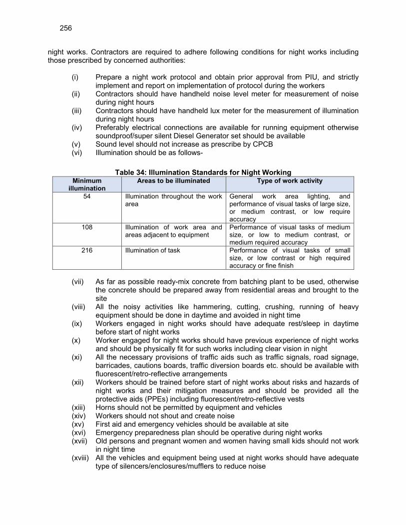
256
night works. Contractors are required to adhere following conditions for night works including those prescribed by concerned authorities:
(i) Prepare a night work protocol and obtain prior approval from PIU, and strictly
implement and report on implementation of protocol during the workers (ii) Contractors should have handheld noise level meter for measurement of noise
during night hours (iii) Contractors should have handheld lux meter for the measurement of illumination
during night hours (iv) Preferably electrical connections are available for running equipment otherwise
soundproof/super silent Diesel Generator set should be available (v) Sound level should not increase as prescribe by CPCB (vi) Illumination should be as follows-
Table 34: Illumination Standards for Night Working Minimum
illumination Areas to be illuminated Type of work activity
54 Illumination throughout the work area
General work area lighting, and performance of visual tasks of large size, or medium contrast, or low require accuracy
108 Illumination of work area and areas adjacent to equipment
Performance of visual tasks of medium size, or low to medium contrast, or medium required accuracy
216 Illumination of task Performance of visual tasks of small size, or low contrast or high required accuracy or fine finish
(vii) As far as possible ready-mix concrete from batching plant to be used, otherwise the concrete should be prepared away from residential areas and brought to the site
(viii) All the noisy activities like hammering, cutting, crushing, running of heavy equipment should be done in daytime and avoided in night time
(ix) Workers engaged in night works should have adequate rest/sleep in daytime before start of night works
(x) Worker engaged for night works should have previous experience of night works and should be physically fit for such works including clear vision in night
(xi) All the necessary provisions of traffic aids such as traffic signals, road signage, barricades, cautions boards, traffic diversion boards etc. should be available with fluorescent/retro-reflective arrangements
(xii) Workers should be trained before start of night works about risks and hazards of night works and their mitigation measures and should be provided all the protective aids (PPEs) including fluorescent/retro-reflective vests
(xiii) Horns should not be permitted by equipment and vehicles (xiv) Workers should not shout and create noise (xv) First aid and emergency vehicles should be available at site (xvi) Emergency preparedness plan should be operative during night works (xvii) Old persons and pregnant women and women having small kids should not work
in night time (xviii) All the vehicles and equipment being used at night works should have adequate
type of silencers/enclosures/mufflers to reduce noise
257
(xix) All the vehicles should be checked for working head lamps, tail lamps, inner lights etc. before start of night works
(xx) PIU/DSC site engineers and contractor’s safety personnel should closely monitor the safety of works continuously and noise and illumination levels on hourly basis and maintain photographic and video graphic records as well as register the observations.
(xxi) Night works should be stopped early in the morning at least one hour before start of pedestrian/traffic movement
(xxii) After completion of night works all the site should be cleaned and maintained obstruction free for daytime movement of vehicles and pedestrians
(xxiii) Drivers and workers should be alert and responsive during night works (xxiv) All the wages to workers working in night hours should be as per the applicable
labour acts (xxv) Avoid any nuisance which may create problems to nearby habitants and work
peacefully during night hours (xxvi) Night works should not be conducted near hospitals and during peak seasons
such as peak tourist season, students’ exam times etc.
301. Reinstatement of Working Areas on Completion. The contractor will reinstate all working areas and access routes as work proceeds during construction. All plant, equipment, materials, temporary infrastructure and vehicles will be removed at the earliest opportunity and the surface of the ground restored as near as practicable to its original condition.
C. Operation and Maintenance Impacts
302. In the operational phase, all facilities and infrastructure will operate with routine maintenance, which should not affect the environment. Facilities will need to be repaired from time to time, but environmental impacts will be much less than those of the construction period as the work will be infrequent, affecting small areas only. 303. During operation, the delivery of unsafe water is a crucial concern that can be mitigated with good operation and maintenance, prompt action on leaks and quality monitoring of supplied water. Operation and Maintenance of the water supply system will be carried out by DBO contractor for 5 years and then Jal Shakti Vibhag (JSV) directly or through an external operator. The water supply system is intended to deliver potable water meeting drinking water standards (Appendix 2) to the consumers at their homes. This must be ensured. 304. During its operation phase, 16 numbers of proposed WTP will treat 4.27 MLD of water every day. The main impact of WTP operation is from (i) generation of wastewater and sludge, (ii) noise from operation of pumps and motors, (iii) chlorine gas leakage risk, and (iv) consumption of electricity. All of these are duly considered in the design of WTP, and various measures such as the following are already incorporated into the project design:
(i) Recirculation and recovery of wastewater including backwash water generated from treatment process - backwash water from filter beds will be sent to a sump, and after allowing adequate time for settlement of solids, clarified water will be pumped back to WTP inlet. This arrangement will avoid pollution and also minimize wastage of water.
(ii) Collection of accumulated sludge, thickening, drying and reuse
258
(iii) Designing the entire system to maintain optimal flow and terminal pressure, and optimising the overall energy usage
(iv) Using low-noise and energy efficient pumping systems (v) Installing the noise-producing pumps and motors etc., in enclosed buildings
with noise reducing walls, and also maintaining adequate buffer to the nearby inhabited areas
(vi) Provision of appropriate personal protection equipment to the workers and staff (vii) Developing chlorine facility with all necessary safety measures
305. Since backwash water is recovered and recirculated in the WTP, no wastewater will be generated from water treatment process. Water treatment process will generate sludge from sedimentation of particulate matter in raw water, flocculated and precipitated material resulting from chemical coagulation, residuals of excess chemical dosage, plankton etc; and waste from rinsing and back washing of filter media containing debris, chemical precipitates, straining of organic debris and plankton. In the WTP sludge will collected, thickened and disposed off or reused as soil conditioner. Sludge will be tested periodically for heavy metal concentration 306. Water supply system will be operated using the standard operating procedures following an operating manual, which will be prepared by the DBO contractor. This will cover all necessary items such as preventive maintenance, periodic maintenance and emergency maintenance, replacement of pumps, motors, and other electro-mechanical parts as per the design life to optimize energy use and system efficiency etc., Adequate resources – technical and financial, has been taken into consideration in the project design. Manual will also include safety awareness and mock drills for chlorine safety. Thus, considering the design and proposed operational procedures, it is unlikely that there will be any significant negative impacts due to WTP operation. 307. The project is designed to deliver potable water in sufficient quantities to the consumers in their homes with proper terminal pressure. Sources proposed in the project area are located in isolated areas where no potential pollution source is found. Water quality test reports from various sources indicates that water is suitable for drinking after conventional treatment and disinfection, and WTP has been designed to treat the source water to meet the drinking water standards. The quality of water supplied will be affected by the raw water quality and as well as treatment efficiency at the WTP. To ensure that water delivered to consumers at all times meets the drinking water standards, the following measures are suggested:
(i) Preparation and implementation of a water quality surveillance program including development of a laboratory as part of the project by DBO contractor to ensure that supplied water meets the drinking water standards
(ii) Water quality surveillance program to cover source, WTP and consumer end water quality
(iii) Development of laboratory with all necessary environment, health and safety measures and adopting international standard procedures for water quality testing
308. The system has a design life of 20 years, during which shall not require major repairs or refurbishments and should operate with little maintenance beyond routine actions required to keep the equipment in working order. The stability and integrity of the system will be monitored periodically to detect any problems and allow remedial action if required. Any repairs will be small-scale involving manual, temporary, and short-term works involving regular checking and
259
recording of performance for signs of deterioration, servicing and replacement of parts.
309. Recurrence of pipe bursting and leakage problems in water supply system will be managed by the leak detection and water auditing surveys. The operating agency will be required to ensure that the leak detection and rectification time is minimized. These are however likely to be minimal as proper design selection and good quality pipe material should mean that leaks are minimal. The bulk meters that are provided as part of this sub-project will be of great use in detecting leaks in network. Leak repair work will be similar to the pipe laying work. Trenches will be dug to reveal the leaking area and the faulty connection will be re-fitted, or the pipe will be removed and replaced if necessary. 310. Chemical hazard. It is proposed to use chlorine for disinfection of water, therefore there is a safety risk due to handling of large quantities of chlorine at WTPs. Likely impacts will be negligible if the various measures are suggested safety features and equipment to meet with any accidental eventuality are included in the design and development of the facility. During the operation phase, it is necessary that the facility is operated by trained staff as per the standard operating procedures.
(i) Chlorinator facility is operated only by trained staff and as per the standard operating procedures
(ii) In case of any accident and/or maintenance activity, the staff should follow documented procedures only
(iii) It is suggested to develop an Emergency Response System (ERS) for the chlorine leakage
(iv) Ensure proper labelling of treatment and disinfection chemicals
311. Use and Disposal of solar panels. It is proposed harness solar energy to provide campus lighining in facilities like WTPs and pump houses. Photovoltaic (PV) panels will be installed to produce electricity directly from sunlight. These panels consists of a number of individual cells connected together. For proper system function, regular insepection and maintenance of solar panel system is necessary. Ensure that:
(i) Solar panels are clean, secure and free of defects. (ii) No parts have deteriorated/corroded. (iii) Vents are free of debris. (iv) Switches do not have any defects.
(v) Wiring has not been damaged/has not deteriorated.
312. Design life of solar panels is 25-30 years, after which many crystalline silicon solar panels will start seeing significant dips in energy production. This affects the power generation and needs to be discarded and replaced with new panels. Solar Pv modules are made up of PV cells, which are most commonly manufactured from silicon. Panels mainly consists of glass (75%-90%), followed by plastic, alluminum, silicon, metals etc., the composition of which vary from a silicon based PV panel to thin film based PV panel. Heavy metals like cadmium and lead are found in solar cells, which can harm the natural environment if they are not recycled or disposed of properly. Recycling of discarded end-of-life panels will enable recovering as much material from solar panels as possible e.g. frame and junction box, glass and the silicon wafer, separation and purification of the silicon cells and specialty metals (e.g., silver, tin, lead, and copper). At present there are no rules/regulations for reuse or disposal of solar panels, and given the panel end-of-life of 25-30 years, JSV shall follow the rules applicable at that time.
260
Following measures shall be followed:
(i) Remove end-of-life / discard solar panels from site and store temporarily in an identified place; ensure no contact with soil or water
(ii) Use appropriate personal protection equipment (iii) Dispose material for reuse as per the rules/regulations in force at the time of
disposal (iv) If there are no specific regulations, follow e-waste management rules, 2016. (v) Maintain records of discared/end-of-life solar panels
313. The residents of the project area will be the major beneficiaries of the improved water supply system, as they will be provided with a constant supply of better quality water, piped into their homes at an appropriate pressure. The project will improve the over-all health condition of the project area by controlling water borne diseases, so people should spend less on healthcare and lose fewer working days due to illness. Their economic status should also improve, as well as their overall health. This should also improve the environment of these areas, should deliver major improvements in individual and community health and well-being.
261
VII. PUBLIC CONSULTATION AND INFORMATION DISCLOSURE
A. Overview
314. The active participation of stakeholders including local community, NGOs/CBOs, and the media in all stages of project preparation and implementation is essential for successful implementation of the project. It will ensure that the subprojects are designed, constructed, and operated with utmost consideration to local needs, ensures community acceptance, and will bring maximum benefits to the people. Public consultation and information disclosure are a must as per the ADB policy. 315. Most of the main stakeholders have already been identified and their representatives consulted during preparation of this IEE, and any others that are identified during project implementation will be brought into the process in the future. Primary stakeholders of the subproject are: residents, shopkeepers and business people who live and work alongside the roads where water pipeline networks are provided and near sites where sub-project facilities will be built (WTPs, Pump house, MBRs and SRs). Government and utility agencies responsible for provision of services in project area of Kullu, JSV, forest, fishery department and HPPCB, are also the primary stakeholders of this project. Secondary stakeholder are NGOs and CBOs working in the area, community representatives, beneficiary community in general, government agencies, the executing and implementing agencies (JSV, PMU and PIUs), Government of India and the ADB. 316. Due to on-going COVID-19 pandemic, limited consultations with the selected representative of the stakeholders were conducted in a controlled manner. The assessment team, JSV officials and community were mandated to follow strict COVID-19 protection protocols during the consultations. All the JSV officials and the team were using PPEs during stakeholder consultations. The public consultations were conducted in open places wherever plausible. Adequate social distancing was followed during the consultations and site visits. During the consultation, the temperature of the participants was measured; further, oximeter was also used to analyse the blood oxygen level of the participants and only healthy participants were allowed to participate in the consultation. Thereafter, the participants were properly sanitized. The team also distributed the masks to community members who were not wearing masks, before beginning of the consultations. The team and JSV officials wore face shields during community consultations. 317. Stakeholder consultation was held on 9, 10 November 2020. 21 October 2021 and 11 and 12 November 2021 at JSV offices Fishery office at Hamni and Macchyal (Jogendranagar Mahseer firm) with stakeholders and local residents in the subproject area (Table 33). Further consultations with downstream users of water sources will be conducted in future during detailed design period.
262
B. Public Consultation
318. The public consultation and disclosure program are a continuous process throughout the project implementation, including project planning, design and construction.
1. Consultation during Project Preparation
319. Institutional consultations were conducted with the relevant Governmental Departments such as JSV officials, Fishery departments. Forest departments, HPPCB etc. The subproject proposals are formulated in consultation with JSV officials, concerned Nagar Parishad and Panchayats to suit their requirements. 320. Focus-group discussions with affected persons and other stakeholders were conducted to learn their views and concerns. A socio-economic household survey is being parallelly conducted in the subproject area, covering sample households, to understand the household characteristics, health status, and the infrastructure service levels, and the demand for infrastructure services. General public and the people residing along the project activity areas were also consulted during visits to the project sites. Formal panchayat-level consultation meetings were conducted in November 2020 around few of the sites of the subproject areas during sites visits. The details of consultation are provided in Appendix 17. Main issues discussed are:
(i) Awareness and extent of the project and development components; (ii) Benefits of Project for the economic and social up-liftment of Community; (iii) Labour availability in the Project area or requirement of outside labour
involvement; (iv) Local disturbances due to Project Construction Work; (v) Necessity of tree felling etc. at project sites; (vi) Water logging and drainage problem if any; (vii) Climatic Conditions; (viii) Drinking water problem; (ix) Forest and sensitive area nearby the project site; (x) Movement of wild animal etc.; (xi) Pollution level during construction period specially dust and noise pollution; (xii) Health and Hygiene; (xiii) Safety of residents during construction phase; (xiv) Solid waste disposal system; (xv) Requirement of enhancement of other facilities. (xvi) Source selection and utilisation.
321. Consultations were conducted with key stakeholders and representatives of community in line with the ADB's requirements pertaining to environmental and social considerations. These consultations helped in identifying the felt needs/concerns and apprehensions of the communities related to the project and their priorities. Consultations were held with stakeholders including temporarily affected persons, land sellers, beneficiaries/local people, poorest of poor households (non-titleholders on government land), Gram Panchayat Pradhan’s, Panchayat members/public representatives, Panchayat officials, and JSV engineers. Public consultation meetings were held at few of the proposed sub-project locations and selected sections of transmission mains network. 322. Public consultation meetings were held at few of the water supply component locations
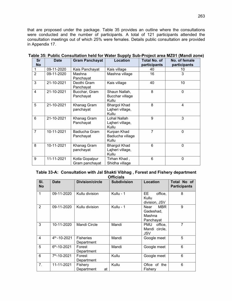
263
that are proposed under the package. Table 35 provides an outline where the consultations were conducted and the number of participants. A total of 121 participants attended the consultation meetings out of which 25% were females. Details public consultation are provided in Appendix 17.
Table 35: Public Consultation held for Water Supply Sub-Project area MZ01 (Mandi zone) Sr No
Date Gram Panchayat Location Total No. of participants
No. of female participants
1 09-11-2020 Kais Panchayat Kais village 40 10 2 09-11-2020 Mashna
Panchayat Mashna village 16 3
3 21-10-2021 Deothi Gram Panchayat
Kais village 40 10
4 21-10-2021 Bucchar, Gram Panchayat
Shaun Nallah, Bucchar village Kullu
8 0
5 21-10-2021 Khanag Gram panchayat
Bhargol Khad Lajheri village, Kullu
8 4
6 21-10-2021 Khanag Gram Panchayat
Lohal Nallah Lajheri village, Kullu
9 3
7 10-11-2021 Badiucha Gram Panchayat
Kurpan Khad Badiucha village Kullu
7 0
8 10-11-2021 Khanag Gram panchayat
Bhargol Khad Lajheri village, Kullu
6 0
9 11-11-2021 Kotla Gopalpur Gram panchayat
Tirhan Khad , Shidha village
6 0
Table 33-A: Consultation with Jal Shakti Vibhag , Forest and Fishery department Officials
Sl. No
Date Division/circle Subdivision Location Total No of Participants
1 09-11-2020 Kullu division Kullu - 1 EE office, Kullu division, JSV
8
2 09-11-2020 Kullu division Kullu - 1 Near MBR Gadeshad, Mashna Panchayat
9
3 10-11-2020 Mandi Circle Mandi PMU office, Mandi circle, JSV
7
4 4th -10-2021 Fisheries Department
Mandi Google meet 5
5 6th-10-2021 Forest Department
Mandi Google meet 6
6 7th-10-2021 Forest Department
Kullu Google meet 6
7. 11-11-2021 Fishery Department at
Kullu Ofice of the Fishery
6
264
Sl. No
Date Division/circle Subdivision Location Total No of Participants
Hamni officer, Hamni
8. 12-11-2121 Fishery Department at Badon, Macchyal (Jogendra nagar)
Mandi Ofice of the Fishery officer, Macchyal
7
323. The consultations primarily highlighted the proposed developmental interventions, perceived impacts and mitigation measures and public participation during implementation. Community members largely spoke about the insufficient or no availability of potable water for use of drinking and domestic purpose; presently portable water is tapped from ground water, in the form of dug well, hand pump, etc. Average cost of purchasing packaged water per family per month was discussed; it was mentioned that water tariff will be fixed considering the affordability of the common people. Frequent power cut, bad weather, breakdown of pumps is other phenomenon also described by the residents which they perceive as their barriers to collect water to meet their daily requirements. 324. The participants conveyed their support for the project that benefits the community with safe drinking water. They expressed concern over the present quality of drinking water they consume and appreciated government’s effort of distributing clear and treated water. It was reported by the participants that erratic water supply has resulted into immense hardships for the residents of the subproject area in the district. Affordability of water tax has been a pertinent question raised both by the Gram Panchayat members and the community - however almost all agreed to pay the water charges if they get the facility of household good potable water connections. Creating job opportunities was the other question of the Gram Panchayat. It has been observed that people are very happy about the project as the project area currently faces severe water problem due to lack of proper potable water supply. People are very much willing to extend their cooperation as the project will be provide much needed proper potable water and enhance living standard of the public. There are no negative impacts perceived by the community, however, project team explained the likely issues during construction and proposed EMP to manage the negative impacts. Increasing traffic and disturbance to agricultural vehicle movement during the work is raised during the meeting, and it was informed that proper care will be taken for movement of construction vehicles including traffic management plan, prior information to people etc., It was also informed no road closures anticipated due to this work, and if needed during the construction phase, alternative access will be provided. These measures are included in the EMP.
2. Consultation during construction
325. Prior to start of construction, JSV and PIU with the assistance of PDMSC will conduct information dissemination sessions at various places and solicit the help of the local community, leaders/prominent for the project work. At each ward/neighbourhood level, focus group meetings will be conducted to discuss and plan construction work with local communities to reduce disturbance and other impacts. 326. A constant communication will be established with the affected communities to redress the environmental issues likely to surface during construction phases and regarding the grievance redress mechanism. JSV/PIU and PDMSC will organize public meetings and will appraise the communities about the progress on the implementation of EMP. Meeting will also
265
be organized at the potential hotspots/sensitive locations before and during the construction.
C. Information Disclosure
327. Executive summary of the IEE will be translated in Hindi and made available at the offices of JSV/PMU, PIU, Village Panchayat offices, and displayed on their notice boards. Hard copies of the IEE will be accessible to citizens to disclose the document and at the same time creating wider public awareness. Local disclosure of the IEE will be done at least two weeks before public consultations to allow the public time to read, look for information or consult experts, and form opinions. Electronic version of the IEE in English and Executive Summary in Hindi will be placed in the official website of the JSV/ PMU after approval of the IEE by the Government and ADB. Stakeholders will also be made aware of grievance register and redress mechanism. 328. Public information campaigns to explain the project details to a wider population will be conducted. Public disclosure meetings will be conducted at key project stages to inform the public of progress and future. Prior to start of construction, the PMU/PIU will issue Notification on the start date of implementation in local newspapers A board showing the details of the project will be displayed at the construction site for the information of general public. 329. Local communities will be continuously consulted regarding location of construction camps, access and hauling routes and other likely disturbances during construction. The road closure together with the proposed detours will be communicated via advertising, pamphlets, radio broadcasts, road signage, etc. 330. Project related information shall be disclosed through public consultation and making relevant documents available in public locations. PMU and PIUs shall provide relevant safeguards information in a timely manner, in an accessible place and in a form and languages understandable to affected person and other stakeholders. For illiterate people, other suitable communication methods will be used. 331. At minimum, the following documents shall be made available at the offices of project agencies –PMU, PIU and Block level offices for public reference, and shall also be uploaded on respective websites.
(i) Summary of project and draft IEE (in Hindi and English); (ii) Draft IEE Report (in English); (iii) Final IEE Report (in English); (iv) Updated/amended IEE (in English); (v) Corrective action plan prepared during project implementation (English); (vi) Semi –annual Environmental Monitoring Reports (English). (vii) Annual Environmental Monitoring Report during O&M period
332. A concise summary of project and draft IEE report (in Hindi), providing all necessary details of proposals, implementation arrangements, subproject locations, likely issues and mitigation and monitoring measures and grievance redress mechanism, shall be made available to the stakeholders at consultation meetings. This should also provide contact information of project agency. This summary shall also be displayed at the notice boards of PMU, PIU and other public places. During project implementation, relevant information about any major changes to project scope will be shared with beneficiaries, affected persons, vulnerable groups, and other stakeholders. The above documents should be submitted to ADB for disclosure on
266
ADB website.
VIII. GRIEVANCE REDRESS MECHANISM
A. Common Grievance Redress Mechanism
333. The project will adopt a three-tier Grievance Redress Mechanism (GRM) in implementing the project. The GRM will receive, evaluate, and facilitate the resolution of social, environmental or any other project related grievances. The GRM will aim to provide a time-bound and transparent mechanism to voice and resolve social and environmental concerns linked to the project. The GRM described below has been developed in consultation with stakeholders. Public awareness campaign will be conducted to ensure that awareness on the project and its grievance redress procedures is generated and shared with affected persons and other stakeholders. The campaign will ensure that the poor, vulnerable and others are made aware of the need for and process in availing the GRM. 334. The GRM provides an accessible, inclusive, gender-sensitive and culturally appropriate platform for receiving and facilitating resolution of affected persons' grievances related to the project. A sample grievance/complaint register template is provided in Appendix 8. The three-tier GRM for the project is outlined below, each tier having time-bound schedules and with responsible persons identified to facilitate and address grievances at each stage, as required. Public awareness campaigns will ensure that awareness on grievance redress procedures is generated through the campaign. The Environmental Safeguard Officer and Social Safeguard and Gender Officer, PMU will have the overall responsibility for timely grievance redress on environmental and social safeguards concerns. 335. Who can file a complaint: A complaint may be registered by stakeholders who may be, directly or indirectly affected by the project? A representative can register a complaint on behalf of the affected person or group, provided that the representative is identified by the affected person or group and submits evidence of the authority to act on their behalf. 336. What type of grievance/complaint: Any comments, complaints, queries and suggestions pertaining to safeguard compliance - environment, involuntary resettlement, and indigenous people, design related issues, compensation, service delivery or any other issues or concerns related to the project can be registered. The complaint must indicate the name, date, address/contact details of the complainant, location of the problem area, along with the problem. 337. Where and how to file a complaint: The contractor’s site office will be the primary point for receiving and lodging any complaint. Apart from that, grievances/suggestions/queries from affected persons can be dropped into suggestion boxes or conveyed through phone or e-mails. Affected persons or any complainant will also be able to register grievances on social, environmental or other related issues, personally to the Complaint Cell at PIU level. Complaints can also be filed anonymously. 338. Process and Timeframe: The grievance redress process and timeframe involved in the GRM is described below:
(i) 1st Level grievance (Field Level). In case of grievances that are immediate and urgent in the perception of the complainant, concerned officer (Junior Engineer, Civil) of PIU will direct the contractor to resolve the complaint and ensures that it
267
is resolved. If the grievance is not under the contractor’s scope, PDMSC (PIU level) safeguard personnel will resolve this issue with the support of respective PIU (Junior Engineer, Civil). Efforts will be made to resolve all grievances within seven days from the date of receipt of a complaint / grievance. Relevant government representatives from the respective districts and sub-districts, where the subproject will be implemented, can be consulted as and when required.
(ii) 2nd Level grievance (PIU Level). Grievances that cannot be redressed at first level within seven days will be brought to the notice of PIU. The Project Manager will try to resolve the grievance/ complaint within a timeframe of seven days of receiving the complaint from the first level with the support of Safeguards/Environment Officer, PIU and Environmental Safeguards Specialist or Social, Gender and Community Development Specialist, PDMSC. Government representatives from the respective districts and sub-districts (Tehsils/ Development Blocks) where the subproject will be implemented can be consulted as and when required. Any unresolved complaint at the second level will be taken up to the third level.
(iii) 3rd Level Grievance (PMU Level): All the grievances that are not addressed at 2nd level by PIU will be brought to the third level, Grievance Redressal Committee (GRC) at the PMU level. The GRC will meet once a month and determine the merit of each grievance/s brought to the committee. The third level grievance redress committee will resolve the grievance within fifteen days of receiving the complaint from the second level. The GRC will be chaired by the Project Director and will have the following members: Social Safeguard and Gender Officer, Environmental Safeguard Officer and Community Development Officer from the PMU, the concerned Project Manager from the PIU, the Environmental Safeguard Specialist and Social, Gender and Community Development Specialist of PDMSC, women representative from a Civil Society Organization (CSO), and local elected representative (if required).
339. In case of any inter-departmental or inter-jurisdictional coordination required for resolution of specific grievances, the PIU will refer the matter directly to the PMU for state-level or inter-departmental coordination and resolution, instead of the district-level GRC. The project GRM notwithstanding, an aggrieved person shall have access to the country’s legal system at any stage and accessing the country’s legal system can run parallel to accessing the GRM and is not dependent on the negative outcome of the GRM. Alternatively, if the grievance is related to land acquisition, resettlement and rehabilitation, the Affected Persons can approach the Land Acquisition, Rehabilitation and Resettlement Authority (LARRA) of Himachal Pradesh, established under the Right to Fair Compensation and Transparency in Land Acquisition, Rehabilitation, and Resettlement Act, 2013.23 340. The GRM notwithstanding, an aggrieved person shall have access to the country’s legal system at any stage. This can run parallel to accessing the GRM and is not dependent on the negative outcome of the GRM. 341. The process of the project GRM is given in Figure 26.
23 The Authority admits grievance only with reference to the Land Acquisition and R&R issues under the
RFCTLARRA, 2013.
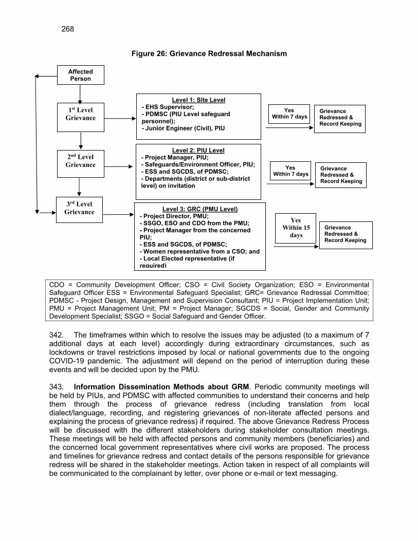
268
Figure 26: Grievance Redressal Mechanism
CDO = Community Development Officer; CSO = Civil Society Organization; ESO = Environmental Safeguard Officer ESS = Environmental Safeguard Specialist; GRC= Grievance Redressal Committee; PDMSC - Project Design, Management and Supervision Consultant; PIU = Project Implementation Unit; PMU = Project Management Unit; PM = Project Manager; SGCDS = Social, Gender and Community Development Specialist; SSGO = Social Safeguard and Gender Officer.
342. The timeframes within which to resolve the issues may be adjusted (to a maximum of 7 additional days at each level) accordingly during extraordinary circumstances, such as lockdowns or travel restrictions imposed by local or national governments due to the ongoing COVID-19 pandemic. The adjustment will depend on the period of interruption during these events and will be decided upon by the PMU. 343. Information Dissemination Methods about GRM. Periodic community meetings will be held by PIUs, and PDMSC with affected communities to understand their concerns and help them through the process of grievance redress (including translation from local dialect/language, recording, and registering grievances of non-literate affected persons and explaining the process of grievance redress) if required. The above Grievance Redress Process will be discussed with the different stakeholders during stakeholder consultation meetings. These meetings will be held with affected persons and community members (beneficiaries) and the concerned local government representatives where civil works are proposed. The process and timelines for grievance redress and contact details of the persons responsible for grievance redress will be shared in the stakeholder meetings. Action taken in respect of all complaints will be communicated to the complainant by letter, over phone or e-mail or text messaging.
Level 1: Site Level - EHS Supervisor; - PDMSC (PIU Level safeguard personnel); - Junior Engineer (Civil), PIU
Level 2: PIU Level - Project Manager, PIU; - Safeguards/Environment Officer, PIU; - ESS and SGCDS, of PDMSC; - Departments (district or sub-district level) on invitation
Level 3: GRC (PMU Level) - Project Director, PMU; - SSGO, ESO and CDO from the PMU; - Project Manager from the concerned PIU; - ESS and SGCDS, of PDMSC; - Women representative from a CSO; and - Local Elected representative (if required)
Affected Person
1st Level
Grievance
2nd Level
Grievance
3rd Level
Grievance
Yes Within 7 days
Grievance Redressed & Record Keeping
Grievance Redressed & Record Keeping
Grievance Redressed & Record Keeping
Yes Within 7 days
Yes
Within 15
days
269
344. Consultation Arrangements for GRM. This will include group meetings and discussions with affected persons, to be announced in advance and conducted at the time of day agreed on with affected persons and conducted to address general/common grievances; and if required with the Environment/Social Specialist of PMU/PIU for one-on-one consultations. Non-literate affected persons/vulnerable affected persons will be assisted to understand the grievance redress process, at the site office of the contractor and at PIU level, the official appointed to receive grievances will assist the non-literate affected persons to register complaints and follow-up with actions at different stages in the process. 345. Record Keeping. Records of all grievances received, including contact details of complainant, date of receiving complaint/grievance, nature of grievance, agreed actions and measures, the date these were affected, and outcome will be kept by PIU. The number of grievances recorded and resolved, and the outcomes will be displayed/disclosed in the PIU office, and on the website of PMU, as well as reported in the semiannual social and environmental monitoring reports to be submitted to ADB. The Environmental Officer and the Social Safeguard Officer will be responsible for maintaining the grievance record. 346. Periodic Review and Documentation of Lessons Learned. The PMU, and PIUs, supported by the PDMSC specialist will periodically review the functioning of the GRM and record information on the effectiveness of the mechanism, especially on the PIU’s ability to prevent and address grievances.
347. Costs. All costs involved in resolving the complaints (meetings, consultations, communication, and reporting/information dissemination) will be borne by the PMU. Cost estimates for grievance redress are included in resettlement cost estimates. 348. ADB Accountability Mechanism. If the established GRM is not able to resolve the issue, the affected person can use the ADB Accountability Mechanism24 through directly contacting (in writing) the Complaint Receiving Officer (CRO) at ADB headquarters. Before submitting a complaint to the Accountability Mechanism, it is recommended that affected people make effort in good faith effort to resolve their problems by working with the concerned ADB operations department (in this case, the Indian Resident Mission (INRM)). Only after doing that, and if they are still dissatisfied, they could approach the Accountability Mechanism. The ADB Accountability Mechanism information will be included in the project-relevant information to be distributed to the affected communities, as part of the project GRM.
IX. ENVIRONMENTAL MANAGEMENT PLAN
A. Environmental Management Plan
349. An Environmental Management Plan (EMP) has been developed to provide mitigation measures to reduce all negative impacts to acceptable level and monitoring the same. This is presented in the following tables (Tables 27 to 31), which shows the potential environmental impacts, proposed mitigation measures and responsible agencies for implementation and monitoring. 350. The purpose of the environmental management plan (EMP) is to ensure that the
24 Accountability Mechanism. http://www.adb.org/Accountability-Mechanism/default.asp.
270
activities are undertaken in a responsible, non-detrimental manner with the objectives of: (i) providing a proactive, feasible, and practical working tool to enable the measurement and monitoring of environmental performance on-site; (ii) guiding and controlling the implementation of findings and recommendations of the environmental assessment conducted for the project; (iii) detailing specific actions deemed necessary to assist in mitigating the environmental impact of the project; and (iv) ensuring that safety recommendations are complied with. 351. A copy of the EMP must be kept at work sites at all times. This EMP will be included in the bid documents and will be further reviewed and updated during implementation. The EMP will be made binding on all contractors operating on the site and will be included in the contractual clauses. Non-compliance with, or any deviation from, the conditions set out in this document constitutes a failure in compliance. 352. For civil works, the contractor will be required to (i) establish an operational system for managing environmental impacts (ii) carry out all of the monitoring and mitigation measures set forth in the EMP; and (iii) implement any corrective or preventative actions set out in safeguards monitoring reports that the employer will prepare from time to time to monitor implementation of this IEE and EMP. The contractor shall allocate budget for compliance with these EMP measures, requirements and actions. 353. The contractor will be required to submit to PIU, for review and approval, a site-specific environmental management plan (SEMP) including (i) proposed sites/locations for construction work camps, storage areas, hauling roads, lay down areas, disposal areas for solid and hazardous wastes; (ii) specific mitigation measures following the approved EMP; (iii) monitoring program as per SEMP; and (iv) budget for SEMP implementation. No works can commence prior to approval of SEMP. 354. The following tables show the potential environmental impacts, proposed mitigation measures and responsible agencies for implementation and monitoring.
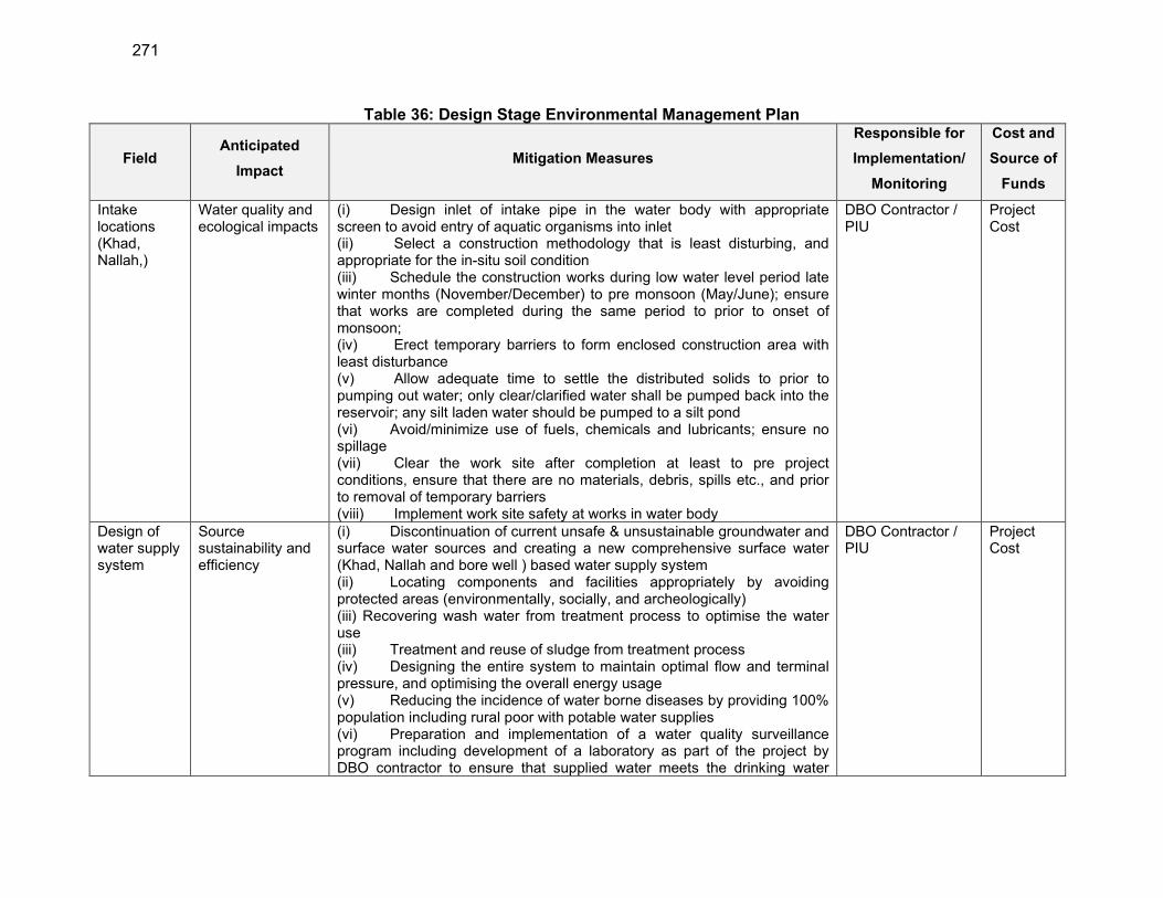
271
Table 36: Design Stage Environmental Management Plan
Field Anticipated
Impact Mitigation Measures
Responsible for
Implementation/
Monitoring
Cost and
Source of
Funds
Intake locations (Khad, Nallah,)
Water quality and ecological impacts
(i) Design inlet of intake pipe in the water body with appropriate screen to avoid entry of aquatic organisms into inlet (ii) Select a construction methodology that is least disturbing, and appropriate for the in-situ soil condition (iii) Schedule the construction works during low water level period late winter months (November/December) to pre monsoon (May/June); ensure that works are completed during the same period to prior to onset of monsoon; (iv) Erect temporary barriers to form enclosed construction area with least disturbance (v) Allow adequate time to settle the distributed solids to prior to pumping out water; only clear/clarified water shall be pumped back into the reservoir; any silt laden water should be pumped to a silt pond (vi) Avoid/minimize use of fuels, chemicals and lubricants; ensure no spillage (vii) Clear the work site after completion at least to pre project conditions, ensure that there are no materials, debris, spills etc., and prior to removal of temporary barriers (viii) Implement work site safety at works in water body
DBO Contractor / PIU
Project Cost
Design of water supply system
Source sustainability and efficiency
(i) Discontinuation of current unsafe & unsustainable groundwater and surface water sources and creating a new comprehensive surface water (Khad, Nallah and bore well ) based water supply system (ii) Locating components and facilities appropriately by avoiding protected areas (environmentally, socially, and archeologically) (iii) Recovering wash water from treatment process to optimise the water use (iii) Treatment and reuse of sludge from treatment process (iv) Designing the entire system to maintain optimal flow and terminal pressure, and optimising the overall energy usage (v) Reducing the incidence of water borne diseases by providing 100% population including rural poor with potable water supplies (vi) Preparation and implementation of a water quality surveillance program including development of a laboratory as part of the project by DBO contractor to ensure that supplied water meets the drinking water
DBO Contractor / PIU
Project Cost
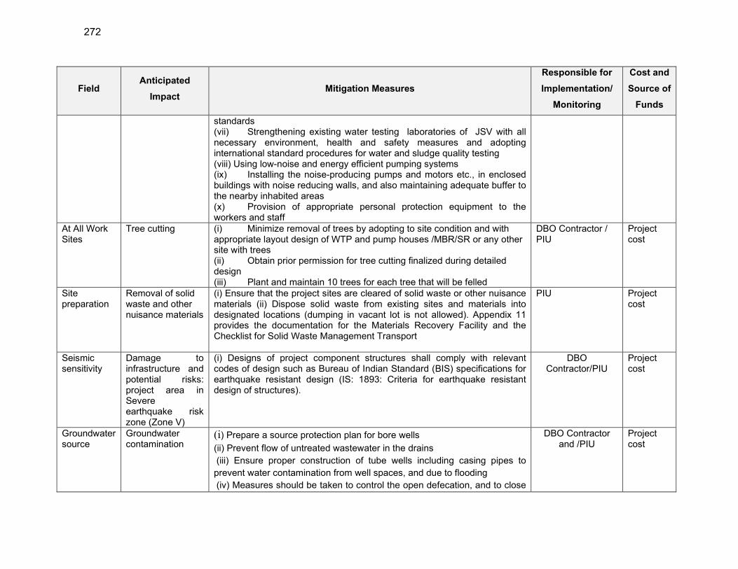
272
Field Anticipated
Impact Mitigation Measures
Responsible for
Implementation/
Monitoring
Cost and
Source of
Funds
standards (vii) Strengthening existing water testing laboratories of JSV with all necessary environment, health and safety measures and adopting international standard procedures for water and sludge quality testing (viii) Using low-noise and energy efficient pumping systems (ix) Installing the noise-producing pumps and motors etc., in enclosed buildings with noise reducing walls, and also maintaining adequate buffer to the nearby inhabited areas (x) Provision of appropriate personal protection equipment to the workers and staff
At All Work Sites
Tree cutting (i) Minimize removal of trees by adopting to site condition and with appropriate layout design of WTP and pump houses /MBR/SR or any other site with trees (ii) Obtain prior permission for tree cutting finalized during detailed design (iii) Plant and maintain 10 trees for each tree that will be felled
DBO Contractor / PIU
Project cost
Site preparation
Removal of solid waste and other nuisance materials
(i) Ensure that the project sites are cleared of solid waste or other nuisance materials (ii) Dispose solid waste from existing sites and materials into designated locations (dumping in vacant lot is not allowed). Appendix 11 provides the documentation for the Materials Recovery Facility and the Checklist for Solid Waste Management Transport
PIU Project cost
Seismic sensitivity
Damage to infrastructure and potential risks: project area in Severe earthquake risk zone (Zone V)
(i) Designs of project component structures shall comply with relevant codes of design such as Bureau of Indian Standard (BIS) specifications for earthquake resistant design (IS: 1893: Criteria for earthquake resistant design of structures).
DBO Contractor/PIU
Project cost
Groundwater source
Groundwater contamination
(i) Prepare a source protection plan for bore wells
(ii) Prevent flow of untreated wastewater in the drains
(iii) Ensure proper construction of tube wells including casing pipes to
prevent water contamination from well spaces, and due to flooding
(iv) Measures should be taken to control the open defecation, and to close
DBO Contractor and /PIU
Project cost
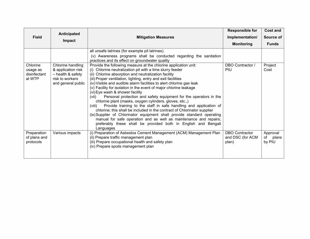
Field Anticipated
Impact Mitigation Measures
Responsible for
Implementation/
Monitoring
Cost and
Source of
Funds
all unsafe latrines (for example pit latrines).
(v) Awareness programs shall be conducted regarding the sanitation practices and its effect on groundwater quality
Chlorine usage as disinfectant at WTP
Chlorine handling & application risk – health & safety risk to workers and general public
Provide the following measure at the chlorine application unit: (i) Chlorine neutralization pit with a lime slurry feeder (ii) Chlorine absorption and neutralization facility (iii) Proper ventilation, lighting, entry and exit facilities (iv) Visible and audible alarm facilities to alert chlorine gas leak (v) Facility for isolation in the event of major chlorine leakage (vi) Eye wash & shower facility (vii) Personal protection and safety equipment for the operators in the
chlorine plant (masks, oxygen cylinders, gloves, etc.,) (viii) Provide training to the staff in safe handling and application of
chlorine; this shall be included in the contract of Chlorinator supplier (ix) Supplier of Chlorinator equipment shall provide standard operating
manual for safe operation and as well as maintenance and repairs; preferably these shall be provided both in English and Bengali Languages
DBO Contractor / PIU
Project Cost
Preparation of plans and protocols
Various impacts (i) Preparation of Asbestos Cement Management (ACM) Management Plan (ii) Prepare traffic management plan (iii) Prepare occupational health and safety plan (iv) Prepare spoils management plan
DBO Contractor and DSC (for ACM plan)
Approval of plans by PIU
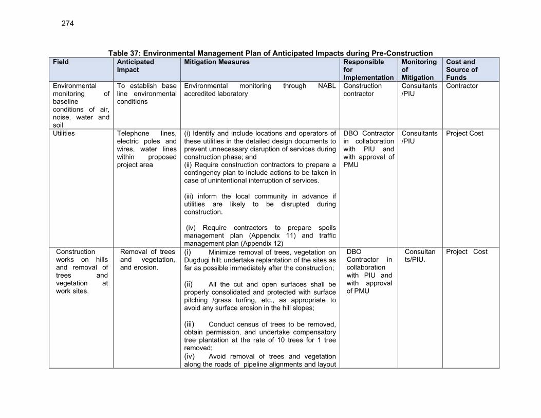
274
Table 37: Environmental Management Plan of Anticipated Impacts during Pre-Construction Field Anticipated
Impact Mitigation Measures Responsible
for Implementation
Monitoring of Mitigation
Cost and Source of Funds
Environmental monitoring of baseline conditions of air, noise, water and soil
To establish base line environmental conditions
Environmental monitoring through NABL accredited laboratory
Construction contractor
Consultants/PIU
Contractor
Utilities Telephone lines, electric poles and wires, water lines within proposed project area
(i) Identify and include locations and operators of these utilities in the detailed design documents to prevent unnecessary disruption of services during construction phase; and (ii) Require construction contractors to prepare a contingency plan to include actions to be taken in case of unintentional interruption of services. (iii) inform the local community in advance if utilities are likely to be disrupted during construction. (iv) Require contractors to prepare spoils management plan (Appendix 11) and traffic management plan (Appendix 12)
DBO Contractor in collaboration with PIU and with approval of PMU
Consultants/PIU
Project Cost
Construction works on hills and removal of trees and vegetation at work sites.
Removal of trees and vegetation, and erosion.
(i) Minimize removal of trees, vegetation on Dugdugi hill; undertake replantation of the sites as far as possible immediately after the construction;
(ii) All the cut and open surfaces shall be properly consolidated and protected with surface pitching /grass turfing, etc., as appropriate to avoid any surface erosion in the hill slopes;
(iii) Conduct census of trees to be removed, obtain permission, and undertake compensatory tree plantation at the rate of 10 trees for 1 tree removed;
(iv) Avoid removal of trees and vegetation along the roads of pipeline alignments and layout
DBO Contractor in collaboration with PIU and with approval of PMU
Consultants/PIU.
Project Cost
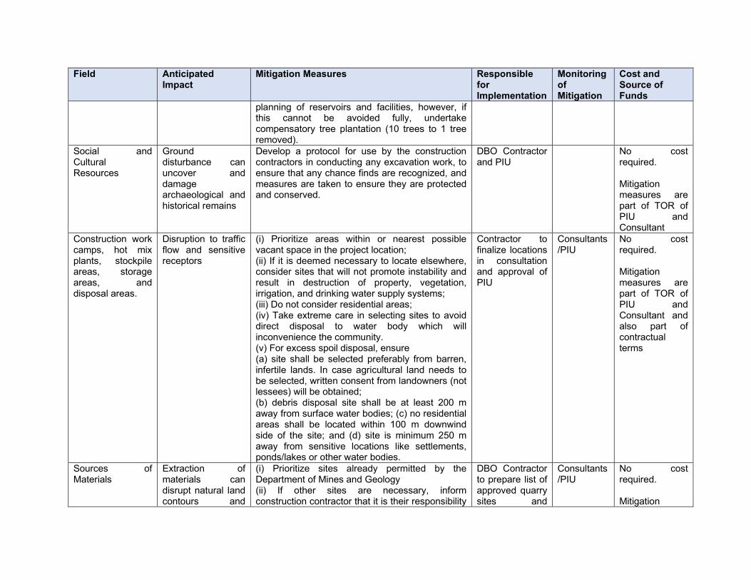
Field Anticipated Impact
Mitigation Measures Responsible for Implementation
Monitoring of Mitigation
Cost and Source of Funds
planning of reservoirs and facilities, however, if this cannot be avoided fully, undertake compensatory tree plantation (10 trees to 1 tree removed).
Social and Cultural Resources
Ground disturbance can uncover and damage archaeological and historical remains
Develop a protocol for use by the construction contractors in conducting any excavation work, to ensure that any chance finds are recognized, and measures are taken to ensure they are protected and conserved.
DBO Contractor and PIU
No cost required. Mitigation measures are part of TOR of PIU and Consultant
Construction work camps, hot mix plants, stockpile areas, storage areas, and disposal areas.
Disruption to traffic flow and sensitive receptors
(i) Prioritize areas within or nearest possible vacant space in the project location; (ii) If it is deemed necessary to locate elsewhere, consider sites that will not promote instability and result in destruction of property, vegetation, irrigation, and drinking water supply systems; (iii) Do not consider residential areas; (iv) Take extreme care in selecting sites to avoid direct disposal to water body which will inconvenience the community. (v) For excess spoil disposal, ensure (a) site shall be selected preferably from barren, infertile lands. In case agricultural land needs to be selected, written consent from landowners (not lessees) will be obtained; (b) debris disposal site shall be at least 200 m away from surface water bodies; (c) no residential areas shall be located within 100 m downwind side of the site; and (d) site is minimum 250 m away from sensitive locations like settlements, ponds/lakes or other water bodies.
Contractor to finalize locations in consultation and approval of PIU
Consultants/PIU
No cost required. Mitigation measures are part of TOR of PIU and Consultant and also part of contractual terms
Sources of Materials
Extraction of materials can disrupt natural land contours and
(i) Prioritize sites already permitted by the Department of Mines and Geology (ii) If other sites are necessary, inform construction contractor that it is their responsibility
DBO Contractor to prepare list of approved quarry sites and
Consultants/PIU
No cost required. Mitigation

276
Field Anticipated Impact
Mitigation Measures Responsible for Implementation
Monitoring of Mitigation
Cost and Source of Funds
vegetation resulting in accelerated erosion, disturbance in natural drainage patterns, ponding and water logging, and water pollution.
to verify the suitability of all material sources and to obtain the approval of PMU and (iii) If additional quarries will be required after construction is started, inform construction contractor to obtain a written approval from PIU.
sources of materials with the approval of PIU
measures are part of TOR of PIU and Consultant and also part of contractual terms
Consents, permits, clearances, NOCs, etc.
Failure to obtain necessary consents, permits, NOCs, etc. can result to design revisions and/or stoppage of works
(i) Obtain all necessary consents (including CTE for WTP from HPSPCB), permits, clearance, NOCs, etc. prior to award of civil works. Following consents are required- Tree cutting- local authority Storage, handling and transport of hazardous materials- HPSPCB Sand mining, quarries, borrow areas- Department of mines and Geology Traffic diversion/road cutting- local authority, traffic police (ii) Ensure that all necessary approvals for construction to be obtained by contractor are in place before start of construction (iii) Acknowledge in writing and provide report on compliance all obtained consents, permits, clearance, NOCs, etc. (iv) Include in detailed design drawings and documents all conditions and provisions if necessary
DBO Contractor and PIU and Consultant
PMU No cost required. Cost of obtaining all consents, permits, clearance, NOCs, etc. prior to start of civil works responsibility of PIU. Mitigation measures are part of TOR of PIU and Consultant
Updating of IEE and SEMP
Expecting minor impacts, during construction period only and mitigation measures are addressed.
(i) Update IEE based on detailed designs, and submits to ADB for review, approval, and disclosure prior to commencement of work. (ii) Formulate SEMP during implementation and get approval from the PD. (iii) Relevant information shall be disclosed.
PIU and Consultants
PMU No costs required
EMP Implementation Training
Irreversible impact to the environment, workers, and
Project manager and all key workers of contractors will be required to undergo EMP implementation training including spoils
Contractor, DSC PMU Cost of EMP Implementation Orientation
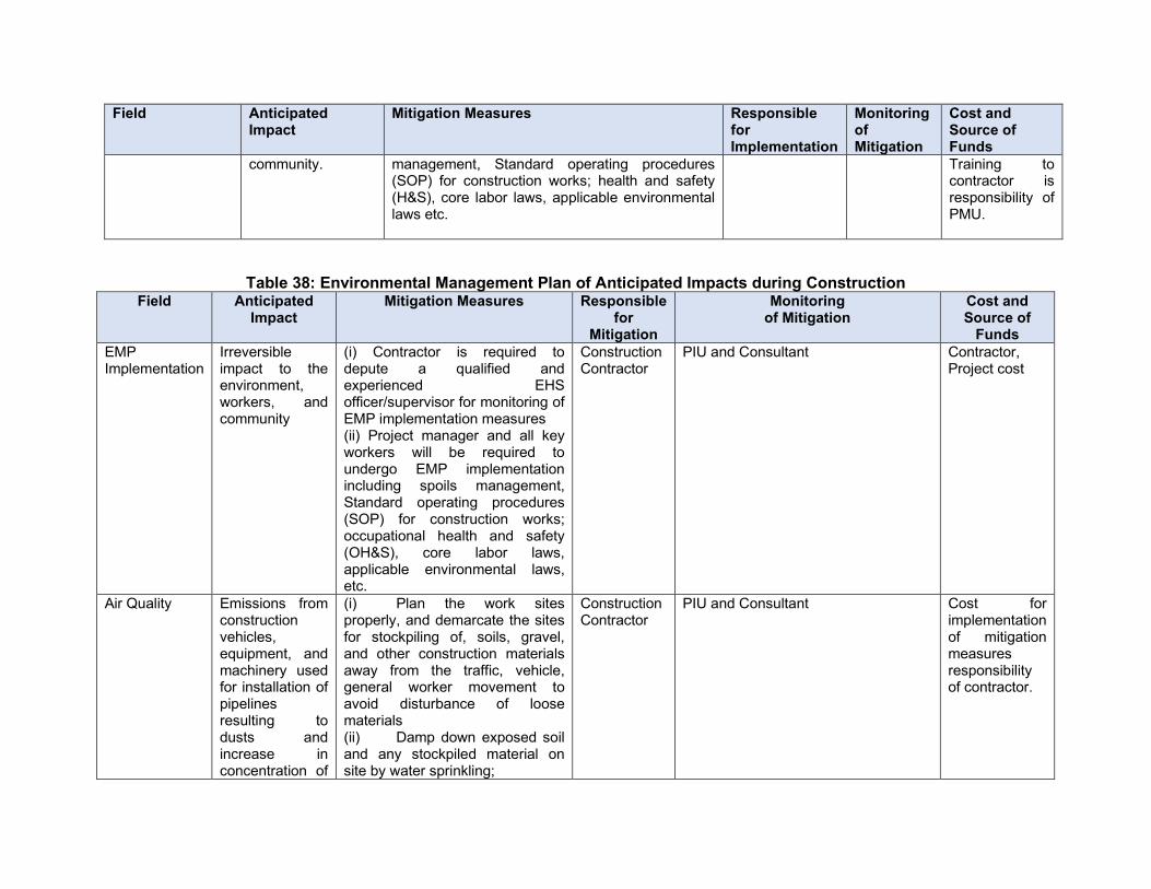
Field Anticipated Impact
Mitigation Measures Responsible for Implementation
Monitoring of Mitigation
Cost and Source of Funds
community. management, Standard operating procedures (SOP) for construction works; health and safety (H&S), core labor laws, applicable environmental laws etc.
Training to contractor is responsibility of PMU.
Table 38: Environmental Management Plan of Anticipated Impacts during Construction Field Anticipated
Impact Mitigation Measures Responsible
for Mitigation
Monitoring of Mitigation
Cost and Source of
Funds
EMP Implementation
Irreversible impact to the environment, workers, and community
(i) Contractor is required to depute a qualified and experienced EHS officer/supervisor for monitoring of EMP implementation measures (ii) Project manager and all key workers will be required to undergo EMP implementation including spoils management, Standard operating procedures (SOP) for construction works; occupational health and safety (OH&S), core labor laws, applicable environmental laws, etc.
Construction Contractor
PIU and Consultant Contractor, Project cost
Air Quality Emissions from construction vehicles, equipment, and machinery used for installation of pipelines resulting to dusts and increase in concentration of
(i) Plan the work sites properly, and demarcate the sites for stockpiling of, soils, gravel, and other construction materials away from the traffic, vehicle, general worker movement to avoid disturbance of loose materials (ii) Damp down exposed soil and any stockpiled material on site by water sprinkling;
Construction Contractor
PIU and Consultant Cost for implementation of mitigation measures responsibility of contractor.

278
Field Anticipated Impact
Mitigation Measures Responsible for
Mitigation
Monitoring of Mitigation
Cost and Source of
Funds
vehicle-related pollutants such as carbon monoxide, sulphur oxides, particulate matter, nitrous oxides, and hydrocarbons.
(iii) Use tarpaulins to cover sand and other loose material when transported by trucks; (iv) Clean wheels and undercarriage of haul trucks prior to leaving construction site (v’) Don't allow access in the work area except workers to limit soil disturbance and prevent access by barricading and security personnel (vi) Fit all heavy equipment and machinery with air pollution control devices which are operating correctly and limit idling time (3-5 minites) of construction vehicles to minimize local air pollution.Contractor’s vehicles and equipment should compulsorily have PUC and submit to PIU before deployment at site (vii) Obtain, CTE and CTO for batching plant, hot mix plant, crushers etc. if specifically established for this project. (viii) If contractor procures any material (such as ready mix concrete, asphalt/macadam, aggregates etc.,) from third party agencies, contractor shall ensure that such agencies have all necessary clearances / permissions as required under the law; these include CTE/CTO from HPSPCB, environmental clearance, etc.,; contractor shall

Field Anticipated Impact
Mitigation Measures Responsible for
Mitigation
Monitoring of Mitigation
Cost and Source of
Funds
collect the copy of these certificates and submit to PIU; PIU will approve the source only after all the certificates are submitted (ix) Conduct air quality monitoring according to the Environmental Management Plan (EMP).
Surface water quality
Works in rains/ Mobilization of settled silt materials, and chemical contamination from fuels and lubricants during installation of pipelines, and discharge of drilling fluid/mud during water well drilling can contaminate nearby surface water quality.
(i) Prepare and implement a spoils management plan (ii) Avoid stockpiling of earth fill especially during the monsoon season unless covered by tarpaulins or plastic sheets; (iii) Prioritize re-use of excess spoils and materials in the construction works. If spoils will be disposed, consult with PIU on designated disposal areas; (iv) Inspect all the drainage at construction site/construction camp/labor camp etc. and clear all the drainage lines so that no water stagnation/flooding may occur during heavy rainfall (v) As for a possible avoid trench works and excavation works (pipe laying) during monsoon season to avoid any water logging and accident due to it (vi) If open trenches are not avoidable during monsoon, keep ready all the mitigations measures to avoid water logging such as
Construction Contractor
PIU and Consultant Cost for implementation of mitigation measures responsibility of contractor.
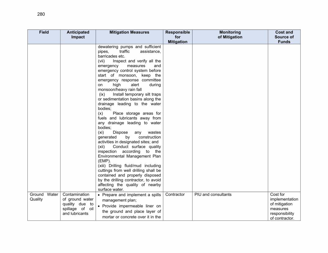
280
Field Anticipated Impact
Mitigation Measures Responsible for
Mitigation
Monitoring of Mitigation
Cost and Source of
Funds
dewatering pumps and sufficient pipes, traffic assistance, barricades etc. (vii) Inspect and verify all the emergency measures and emergency control system before start of monsoon, keep the emergency response committee on high alert during monsoon/heavy rain fall (ix) Install temporary silt traps or sedimentation basins along the drainage leading to the water bodies; (x) Place storage areas for fuels and lubricants away from any drainage leading to water bodies; (xi) Dispose any wastes generated by construction activities in designated sites; and (xii) Conduct surface quality inspection according to the Environmental Management Plan (EMP). (xiii) Drilling fluid/mud including cuttings from well drilling shall be contained and properly disposed by the drilling contractor, to avoid affecting the quality of nearby surface water.
Ground Water Quality
Contamination of ground water quality due to spillage of oil and lubricants
Prepare and implement a spills
management plan;
Provide impermeable liner on
the ground and place layer of
mortar or concrete over it in the
Contractor PIU and consultants
Cost for implementation of mitigation measures responsibility of contractor.
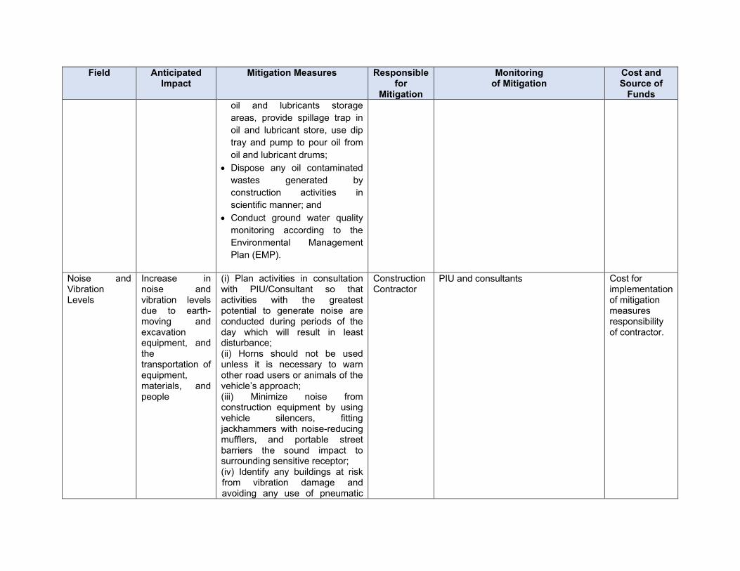
Field Anticipated Impact
Mitigation Measures Responsible for
Mitigation
Monitoring of Mitigation
Cost and Source of
Funds
oil and lubricants storage
areas, provide spillage trap in
oil and lubricant store, use dip
tray and pump to pour oil from
oil and lubricant drums;
Dispose any oil contaminated
wastes generated by
construction activities in
scientific manner; and
Conduct ground water quality
monitoring according to the
Environmental Management
Plan (EMP).
Noise and Vibration Levels
Increase in noise and vibration levels due to earth-moving and excavation equipment, and the transportation of equipment, materials, and people
(i) Plan activities in consultation with PIU/Consultant so that activities with the greatest potential to generate noise are conducted during periods of the day which will result in least disturbance; (ii) Horns should not be used unless it is necessary to warn other road users or animals of the vehicle’s approach; (iii) Minimize noise from construction equipment by using vehicle silencers, fitting jackhammers with noise-reducing mufflers, and portable street barriers the sound impact to surrounding sensitive receptor; (iv) Identify any buildings at risk from vibration damage and avoiding any use of pneumatic
Construction Contractor
PIU and consultants Cost for implementation of mitigation measures responsibility of contractor.
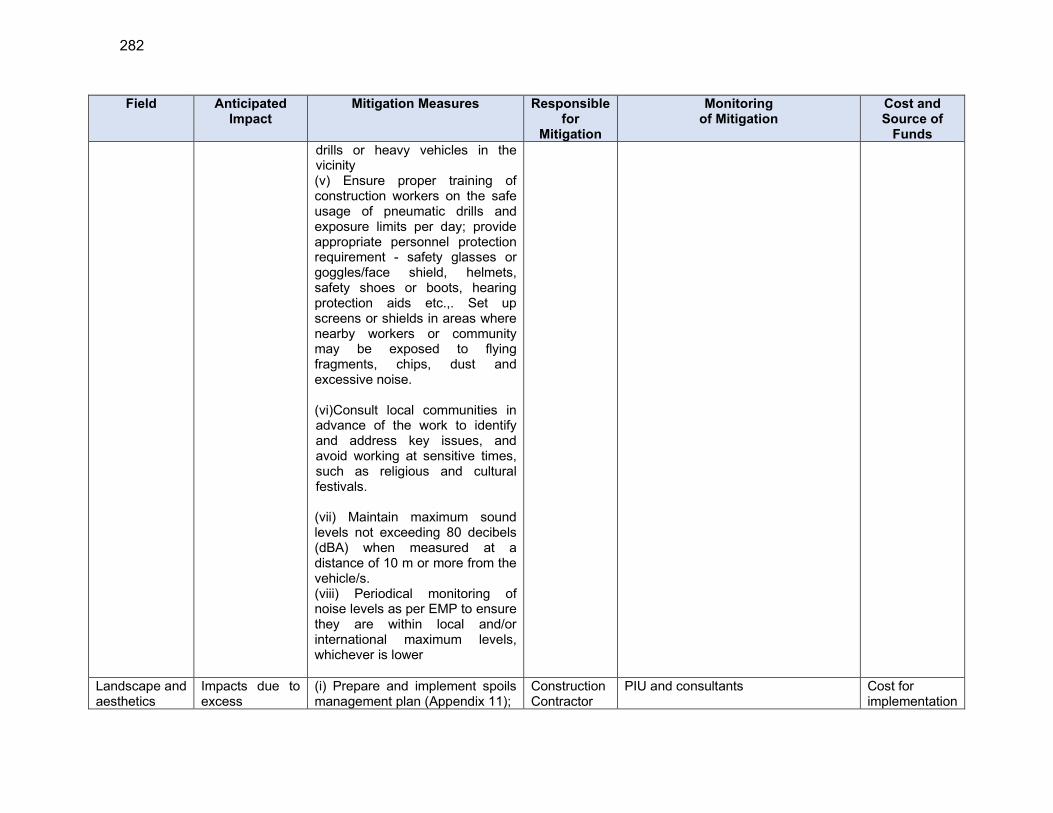
282
Field Anticipated Impact
Mitigation Measures Responsible for
Mitigation
Monitoring of Mitigation
Cost and Source of
Funds
drills or heavy vehicles in the vicinity (v) Ensure proper training of construction workers on the safe usage of pneumatic drills and exposure limits per day; provide appropriate personnel protection requirement - safety glasses or goggles/face shield, helmets, safety shoes or boots, hearing protection aids etc.,. Set up screens or shields in areas where nearby workers or community may be exposed to flying fragments, chips, dust and excessive noise. (vi)Consult local communities in advance of the work to identify and address key issues, and avoid working at sensitive times, such as religious and cultural festivals. (vii) Maintain maximum sound levels not exceeding 80 decibels (dBA) when measured at a distance of 10 m or more from the vehicle/s.
(viii) Periodical monitoring of noise levels as per EMP to ensure they are within local and/or international maximum levels, whichever is lower
Landscape and aesthetics
Impacts due to excess
(i) Prepare and implement spoils management plan (Appendix 11);
Construction Contractor
PIU and consultants Cost for implementation
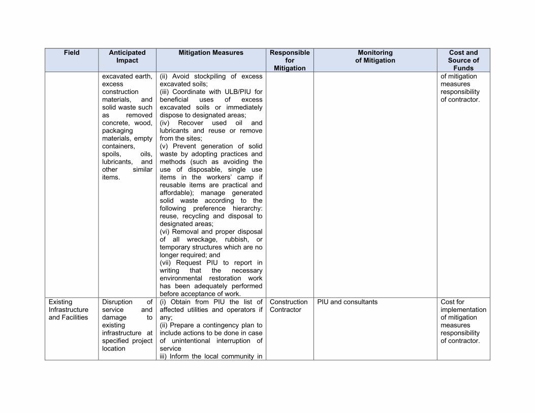
Field Anticipated Impact
Mitigation Measures Responsible for
Mitigation
Monitoring of Mitigation
Cost and Source of
Funds
excavated earth, excess construction materials, and solid waste such as removed concrete, wood, packaging materials, empty containers, spoils, oils, lubricants, and other similar items.
(ii) Avoid stockpiling of excess excavated soils; (iii) Coordinate with ULB/PIU for beneficial uses of excess excavated soils or immediately dispose to designated areas; (iv) Recover used oil and lubricants and reuse or remove from the sites; (v) Prevent generation of solid waste by adopting practices and methods (such as avoiding the use of disposable, single use items in the workers’ camp if reusable items are practical and affordable); manage generated solid waste according to the following preference hierarchy: reuse, recycling and disposal to designated areas; (vi) Removal and proper disposal of all wreckage, rubbish, or temporary structures which are no longer required; and (vii) Request PIU to report in writing that the necessary environmental restoration work has been adequately performed before acceptance of work.
of mitigation measures responsibility of contractor.
Existing Infrastructure and Facilities
Disruption of service and damage to existing infrastructure at specified project location
(i) Obtain from PIU the list of affected utilities and operators if any; (ii) Prepare a contingency plan to include actions to be done in case of unintentional interruption of service iii) Inform the local community in
Construction Contractor
PIU and consultants Cost for implementation of mitigation measures responsibility of contractor.
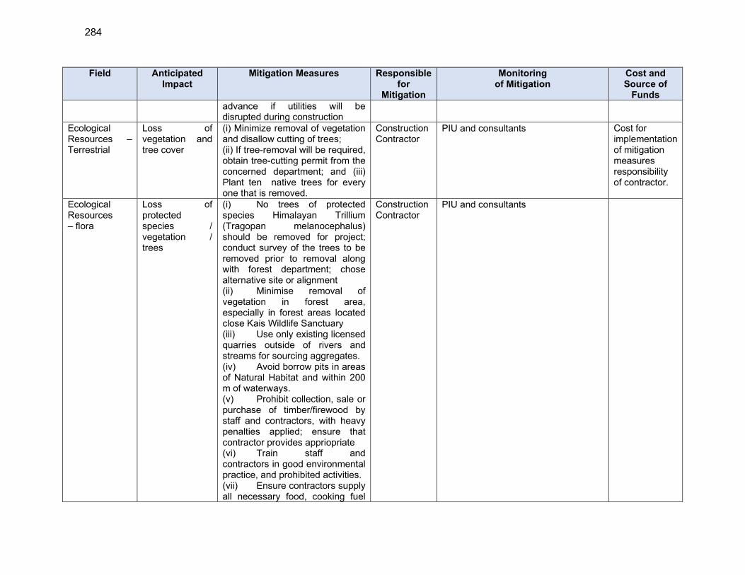
284
Field Anticipated Impact
Mitigation Measures Responsible for
Mitigation
Monitoring of Mitigation
Cost and Source of
Funds
advance if utilities will be disrupted during construction
Ecological Resources – Terrestrial
Loss of vegetation and tree cover
(i) Minimize removal of vegetation and disallow cutting of trees; (ii) If tree-removal will be required, obtain tree-cutting permit from the concerned department; and (iii) Plant ten native trees for every one that is removed.
Construction Contractor
PIU and consultants Cost for implementation of mitigation measures responsibility of contractor.
Ecological Resources – flora
Loss of protected species / vegetation / trees
(i) No trees of protected species Himalayan Trillium (Tragopan melanocephalus) should be removed for project; conduct survey of the trees to be removed prior to removal along with forest department; chose alternative site or alignment (ii) Minimise removal of vegetation in forest area, especially in forest areas located close Kais Wildlife Sanctuary (iii) Use only existing licensed quarries outside of rivers and streams for sourcing aggregates. (iv) Avoid borrow pits in areas of Natural Habitat and within 200 m of waterways. (v) Prohibit collection, sale or purchase of timber/firewood by staff and contractors, with heavy penalties applied; ensure that contractor provides appriopriate (vi) Train staff and contractors in good environmental practice, and prohibited activities. (vii) Ensure contractors supply all necessary food, cooking fuel
Construction Contractor
PIU and consultants
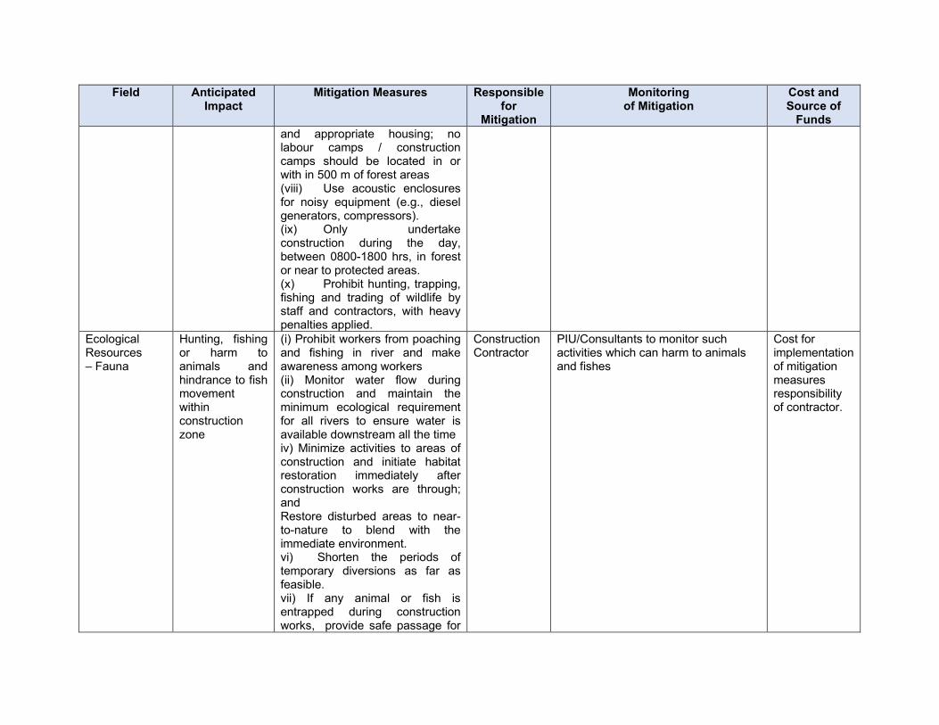
Field Anticipated Impact
Mitigation Measures Responsible for
Mitigation
Monitoring of Mitigation
Cost and Source of
Funds
and appropriate housing; no labour camps / construction camps should be located in or with in 500 m of forest areas (viii) Use acoustic enclosures for noisy equipment (e.g., diesel generators, compressors). (ix) Only undertake construction during the day, between 0800-1800 hrs, in forest or near to protected areas. (x) Prohibit hunting, trapping, fishing and trading of wildlife by staff and contractors, with heavy penalties applied.
Ecological Resources – Fauna
Hunting, fishing or harm to animals and hindrance to fish movement within construction zone
(i) Prohibit workers from poaching and fishing in river and make awareness among workers (ii) Monitor water flow during construction and maintain the minimum ecological requirement for all rivers to ensure water is available downstream all the time iv) Minimize activities to areas of construction and initiate habitat restoration immediately after construction works are through; and Restore disturbed areas to near-to-nature to blend with the immediate environment. vi) Shorten the periods of temporary diversions as far as feasible. vii) If any animal or fish is entrapped during construction works, provide safe passage for
Construction Contractor
PIU/Consultants to monitor such activities which can harm to animals and fishes
Cost for implementation of mitigation measures responsibility of contractor.
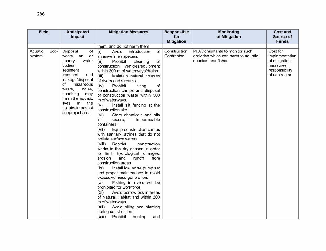
286
Field Anticipated Impact
Mitigation Measures Responsible for
Mitigation
Monitoring of Mitigation
Cost and Source of
Funds
them, and do not harm them Aquatic Eco- system
Disposal of waste on or nearby water bodies, sediment transport and leakage/disposal of hazardous waste, noise, poaching may harm the aquatic lives in the nallahs/khads of subproject area
(i) Avoid introduction of invasive alien species.
(ii) Prohibit cleaning of construction vehicles/equipment within 300 m of waterways/drains.
(iii) Maintain natural courses of rivers and streams.
(iv) Prohibit siting of construction camps and disposal of construction waste within 500 m of waterways.
(v) Install silt fencing at the construction site
(vi) Store chemicals and oils in secure, impermeable containers.
(vii) Equip construction camps with sanitary latrines that do not pollute surface waters.
(viii) Restrict construction works to the dry season in order to limit hydrological changes, erosion and runoff from construction areas
(ix) Install low noise pump set and proper maintenance to avoid excessive noise generation.
(x) Fishing in rivers will be prohibited for workforce
(xi) Avoid borrow pits in areas of Natural Habitat and within 200 m of waterways.
(xii) Avoid piling and blasting during construction.
(xiii) Prohibit hunting and
Construction Contractor
PIU/Consultants to monitor such activities which can harm to aquatic species and fishes
Cost for implementation of mitigation measures responsibility of contractor.
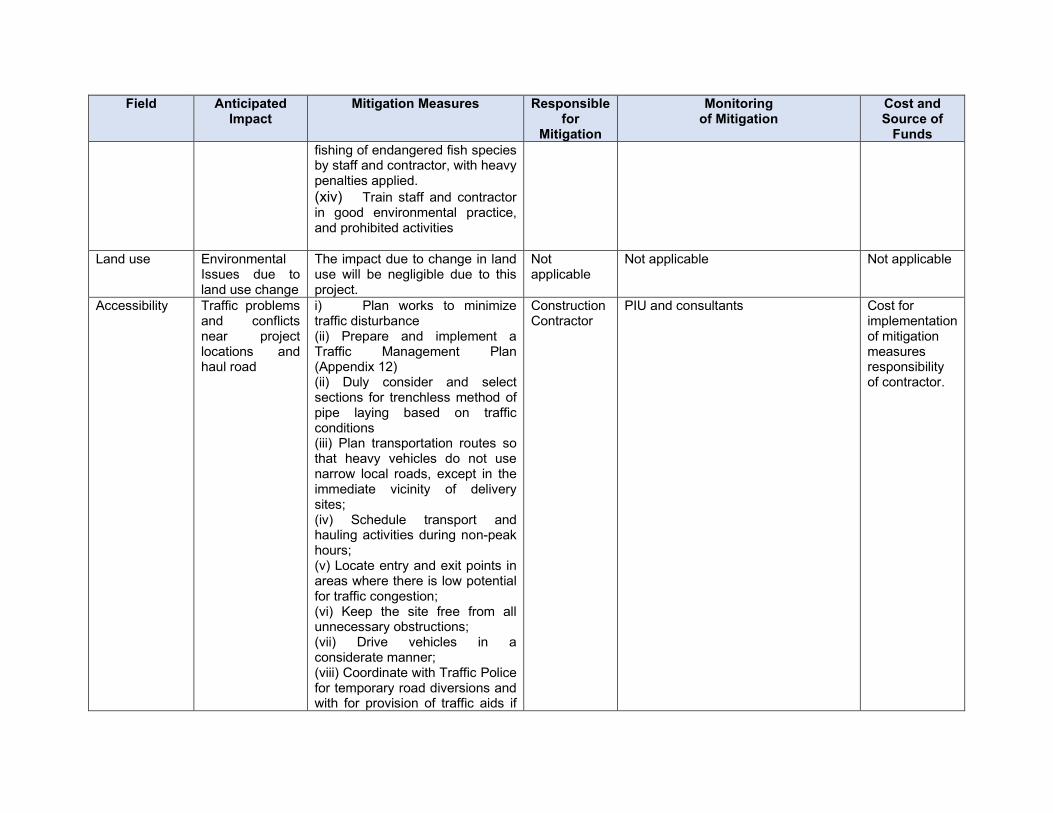
Field Anticipated Impact
Mitigation Measures Responsible for
Mitigation
Monitoring of Mitigation
Cost and Source of
Funds
fishing of endangered fish species by staff and contractor, with heavy penalties applied.
(xiv) Train staff and contractor in good environmental practice, and prohibited activities
Land use Environmental Issues due to land use change
The impact due to change in land use will be negligible due to this project.
Not applicable
Not applicable Not applicable
Accessibility Traffic problems and conflicts near project locations and haul road
i) Plan works to minimize traffic disturbance (ii) Prepare and implement a Traffic Management Plan (Appendix 12) (ii) Duly consider and select sections for trenchless method of pipe laying based on traffic conditions (iii) Plan transportation routes so that heavy vehicles do not use narrow local roads, except in the immediate vicinity of delivery sites; (iv) Schedule transport and hauling activities during non-peak hours; (v) Locate entry and exit points in areas where there is low potential for traffic congestion; (vi) Keep the site free from all unnecessary obstructions; (vii) Drive vehicles in a considerate manner; (viii) Coordinate with Traffic Police for temporary road diversions and with for provision of traffic aids if
Construction Contractor
PIU and consultants Cost for implementation of mitigation measures responsibility of contractor.
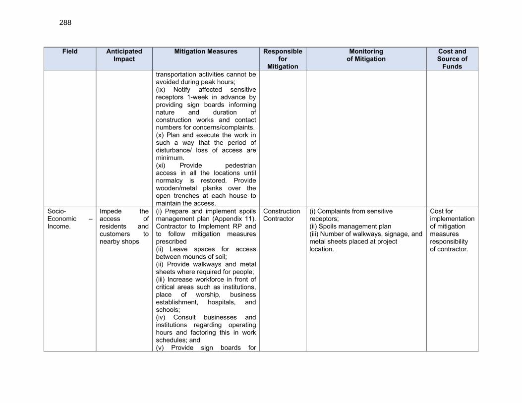
288
Field Anticipated Impact
Mitigation Measures Responsible for
Mitigation
Monitoring of Mitigation
Cost and Source of
Funds
transportation activities cannot be avoided during peak hours; (ix) Notify affected sensitive receptors 1-week in advance by providing sign boards informing nature and duration of construction works and contact numbers for concerns/complaints. (x) Plan and execute the work in such a way that the period of disturbance/ loss of access are minimum. (xi) Provide pedestrian access in all the locations until normalcy is restored. Provide wooden/metal planks over the open trenches at each house to maintain the access.
Socio-Economic – Income.
Impede the access of residents and customers to nearby shops
(i) Prepare and implement spoils management plan (Appendix 11). Contractor to Implement RP and to follow mitigation measures prescribed (ii) Leave spaces for access between mounds of soil; (ii) Provide walkways and metal sheets where required for people; (iii) Increase workforce in front of critical areas such as institutions, place of worship, business establishment, hospitals, and schools; (iv) Consult businesses and institutions regarding operating hours and factoring this in work schedules; and (v) Provide sign boards for
Construction Contractor
(i) Complaints from sensitive receptors; (ii) Spoils management plan (iii) Number of walkways, signage, and metal sheets placed at project location.
Cost for implementation of mitigation measures responsibility of contractor.
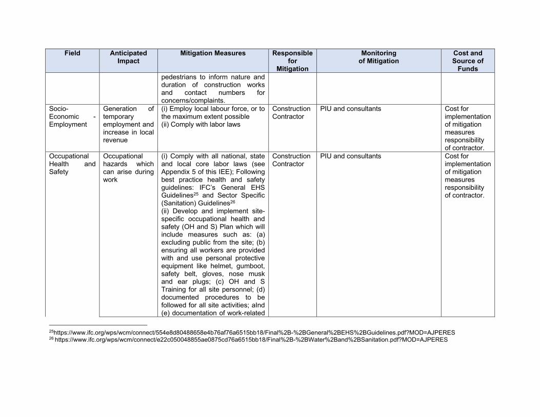
Field Anticipated Impact
Mitigation Measures Responsible for
Mitigation
Monitoring of Mitigation
Cost and Source of
Funds
pedestrians to inform nature and duration of construction works and contact numbers for concerns/complaints.
Socio-Economic - Employment
Generation of temporary employment and increase in local revenue
(i) Employ local labour force, or to the maximum extent possible (ii) Comply with labor laws
Construction Contractor
PIU and consultants Cost for implementation of mitigation measures responsibility of contractor.
Occupational Health and Safety
Occupational hazards which can arise during work
(i) Comply with all national, state and local core labor laws (see Appendix 5 of this IEE); Following best practice health and safety guidelines: IFC’s General EHS Guidelines25 and Sector Specific (Sanitation) Guidelines26 (ii) Develop and implement site-specific occupational health and safety (OH and S) Plan which will include measures such as: (a) excluding public from the site; (b) ensuring all workers are provided with and use personal protective equipment like helmet, gumboot, safety belt, gloves, nose musk and ear plugs; (c) OH and S Training for all site personnel; (d) documented procedures to be followed for all site activities; aInd (e) documentation of work-related
Construction Contractor
PIU and consultants Cost for implementation of mitigation measures responsibility of contractor.
25https://www.ifc.org/wps/wcm/connect/554e8d80488658e4b76af76a6515bb18/Final%2B-%2BGeneral%2BEHS%2BGuidelines.pdf?MOD=AJPERES 26 https://www.ifc.org/wps/wcm/connect/e22c050048855ae0875cd76a6515bb18/Final%2B-%2BWater%2Band%2BSanitation.pdf?MOD=AJPERES
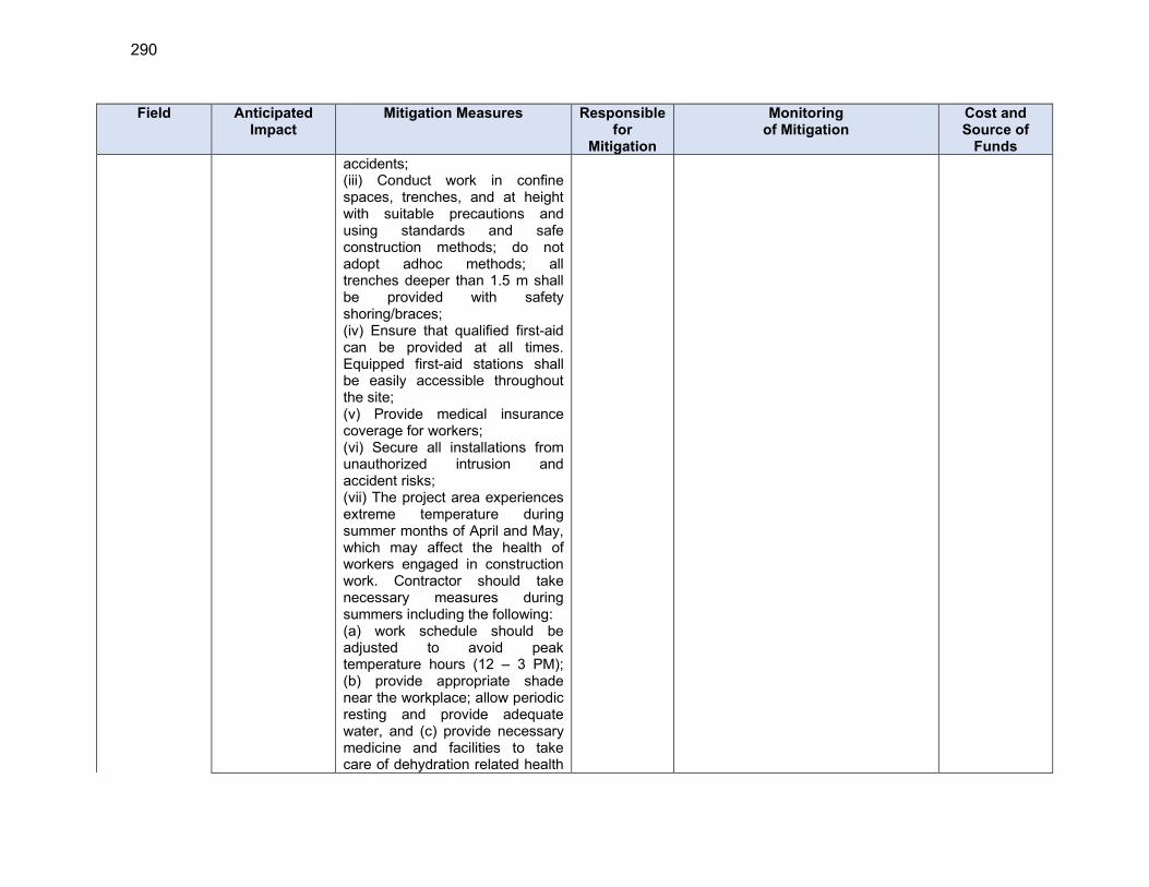
290
Field Anticipated Impact
Mitigation Measures Responsible for
Mitigation
Monitoring of Mitigation
Cost and Source of
Funds
accidents; (iii) Conduct work in confine spaces, trenches, and at height with suitable precautions and using standards and safe construction methods; do not adopt adhoc methods; all trenches deeper than 1.5 m shall be provided with safety shoring/braces; (iv) Ensure that qualified first-aid can be provided at all times. Equipped first-aid stations shall be easily accessible throughout the site; (v) Provide medical insurance coverage for workers; (vi) Secure all installations from unauthorized intrusion and accident risks; (vii) The project area experiences extreme temperature during summer months of April and May, which may affect the health of workers engaged in construction work. Contractor should take necessary measures during summers including the following: (a) work schedule should be adjusted to avoid peak temperature hours (12 – 3 PM); (b) provide appropriate shade near the workplace; allow periodic resting and provide adequate water, and (c) provide necessary medicine and facilities to take care of dehydration related health
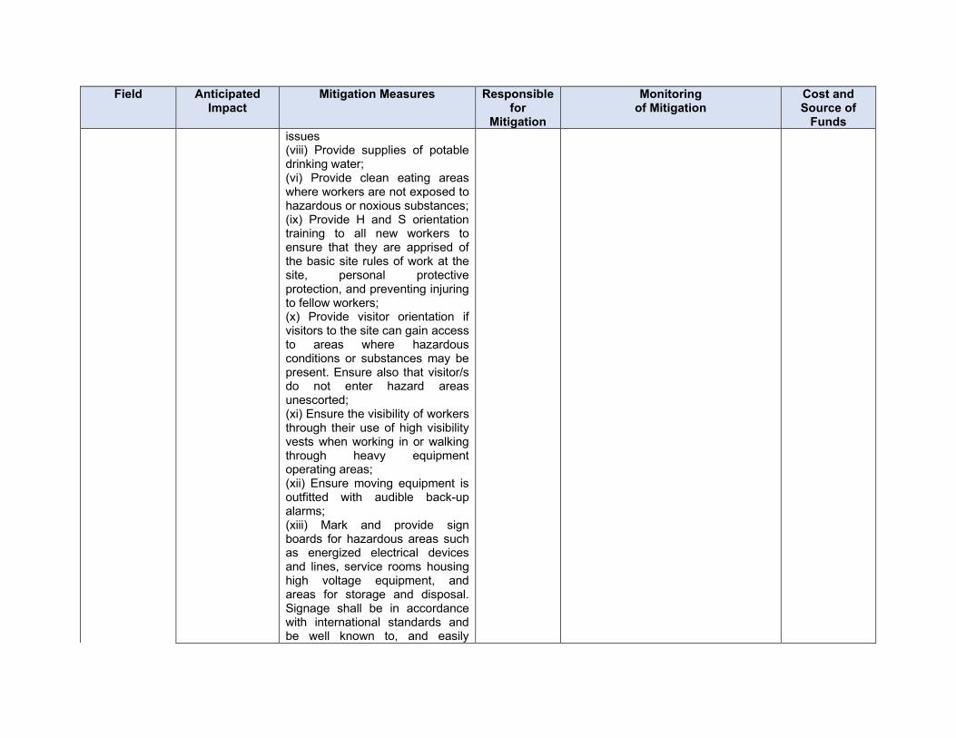
Field Anticipated Impact
Mitigation Measures Responsible for
Mitigation
Monitoring of Mitigation
Cost and Source of
Funds
issues (viii) Provide supplies of potable drinking water; (vi) Provide clean eating areas where workers are not exposed to hazardous or noxious substances; (ix) Provide H and S orientation training to all new workers to ensure that they are apprised of the basic site rules of work at the site, personal protective protection, and preventing injuring to fellow workers; (x) Provide visitor orientation if visitors to the site can gain access to areas where hazardous conditions or substances may be present. Ensure also that visitor/s do not enter hazard areas unescorted; (xi) Ensure the visibility of workers through their use of high visibility vests when working in or walking through heavy equipment operating areas; (xii) Ensure moving equipment is outfitted with audible back-up alarms; (xiii) Mark and provide sign boards for hazardous areas such as energized electrical devices and lines, service rooms housing high voltage equipment, and areas for storage and disposal. Signage shall be in accordance with international standards and be well known to, and easily
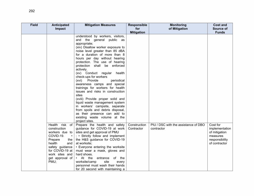
292
Field Anticipated Impact
Mitigation Measures Responsible for
Mitigation
Monitoring of Mitigation
Cost and Source of
Funds
understood by workers, visitors, and the general public as appropriate; (xiv) Disallow worker exposure to noise level greater than 85 dBA for a duration of more than 8 hours per day without hearing protection. The use of hearing protection shall be enforced actively. (xv) Conduct regular health check-ups for workers (xvi) Provide periodical awareness camps and special trainings for workers for health issues and risks in construction sites (xviii) Provide proper solid and liquid waste management system in workers’ campsite, separate from spoils and debris disposal, as their presence can add to existing waste volume at the project sites.
Health risk of construction workers due to COVID-19. • Prepare the health and safety guidance for COVID-19 at work sites and get approval of PMU;
Prepare the health and safety guidance for COVID-19 at work sites and get approval of PMU ; • Strictly follow and implement the H&S guidance for COVID-19 at worksite; • Everyone entering the worksite must wear a mask, gloves and hard shoes. • At the entrance of the worksite/camp site every personnel must wash their hands for 20 second with maintaining a
Construction Contractor
PIU / DSC with the assistance of DBO contractor
Cost for implementation of mitigation measures responsibility of contractor
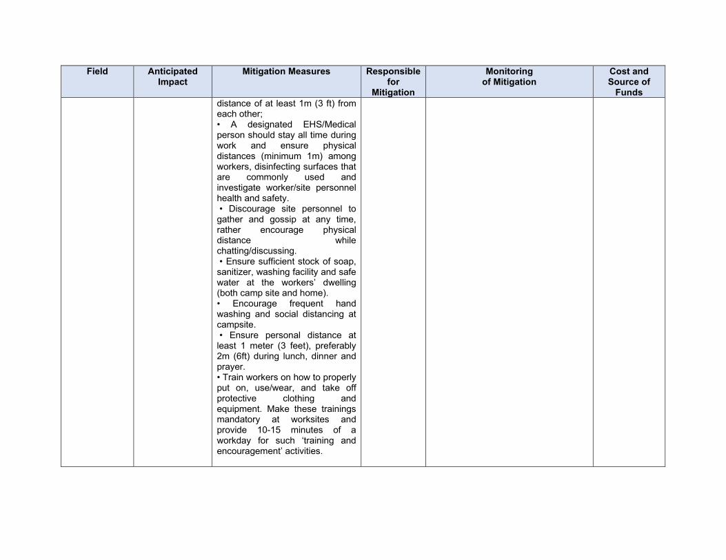
Field Anticipated Impact
Mitigation Measures Responsible for
Mitigation
Monitoring of Mitigation
Cost and Source of
Funds
distance of at least 1m (3 ft) from each other; • A designated EHS/Medical person should stay all time during work and ensure physical distances (minimum 1m) among workers, disinfecting surfaces that are commonly used and investigate worker/site personnel health and safety. • Discourage site personnel to gather and gossip at any time, rather encourage physical distance while chatting/discussing. • Ensure sufficient stock of soap, sanitizer, washing facility and safe water at the workers’ dwelling (both camp site and home). • Encourage frequent hand washing and social distancing at campsite. • Ensure personal distance at least 1 meter (3 feet), preferably 2m (6ft) during lunch, dinner and prayer. • Train workers on how to properly put on, use/wear, and take off protective clothing and equipment. Make these trainings mandatory at worksites and provide 10-15 minutes of a workday for such ‘training and encouragement’ activities.

294
Field Anticipated Impact
Mitigation Measures Responsible for
Mitigation
Monitoring of Mitigation
Cost and Source of
Funds
Community Health and Safety.
Traffic accidents and vehicle collision with pedestrians during material and waste transportation
(i)Trench excavation and pipeline works shall be conducted in a safe manner; if the allowing public movement along the work sites (pedestrians or vehicles as the case may be) is likely to cause safety risks, movement should be blocked temporarily and work shall be conducted; in such areas, conducting night work or working in small stretches to avoid blockage of traffic/movement no more than few hours in due consultation with the local community and ULB shall be planned (ii) All trenches deeper than 1.0 m shall be provided with safety shoring/braces; (iii) Survey the surrounding vulnerable buildings for likely issues in structural stability / differential settlement during the excavation works (iv) Provide prior information to the local people about the (v) Plan routes to avoid times of peak-pedestrian activities. (vi) Liaise with PIU/ULB in identifying high-risk areas on route cards/maps. (vii) Maintain regularly the vehicles and use of manufacturer-approved parts to minimize potentially serious accidents caused by equipment malfunction
Construction Contractor
PIU and consultants Cost for implementation of mitigation measures responsibility of contractor.
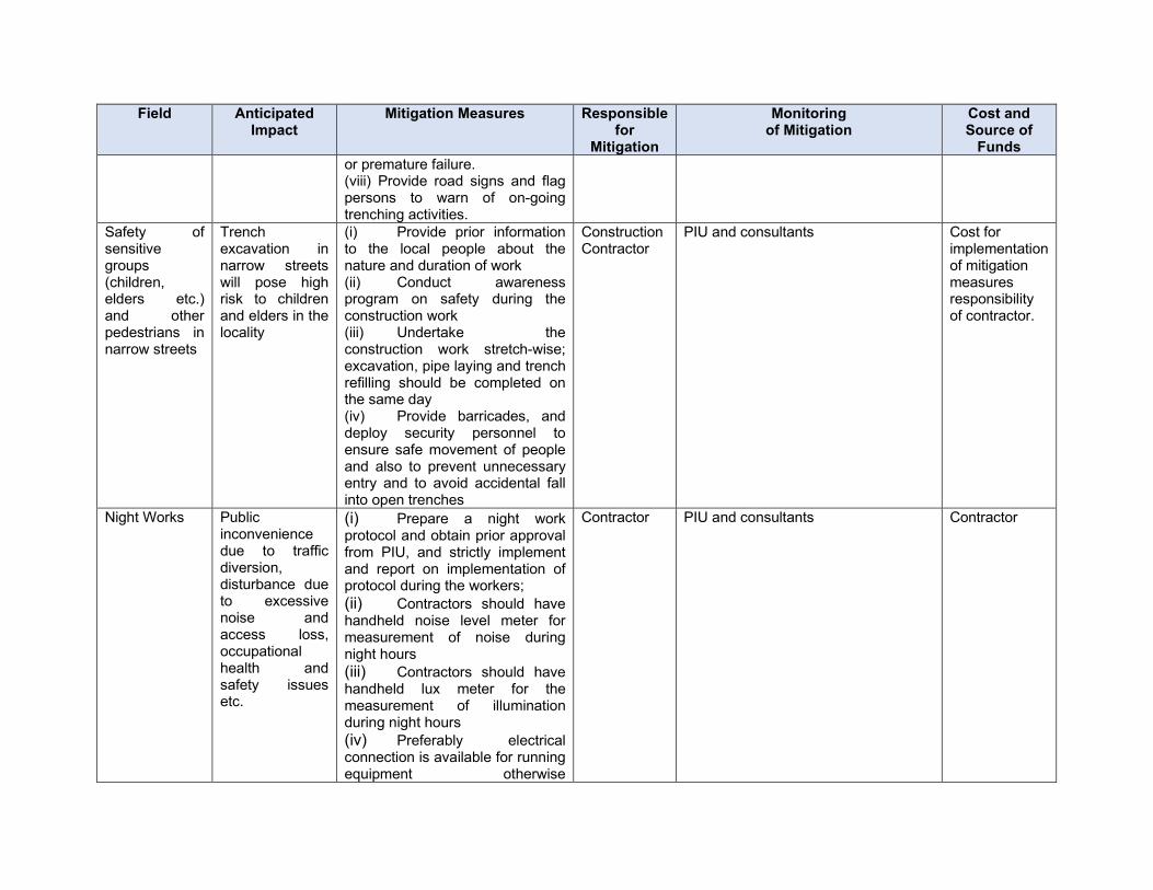
Field Anticipated Impact
Mitigation Measures Responsible for
Mitigation
Monitoring of Mitigation
Cost and Source of
Funds
or premature failure. (viii) Provide road signs and flag persons to warn of on-going trenching activities.
Safety of sensitive groups (children, elders etc.) and other pedestrians in narrow streets
Trench excavation in narrow streets will pose high risk to children and elders in the locality
(i) Provide prior information to the local people about the nature and duration of work (ii) Conduct awareness program on safety during the construction work (iii) Undertake the construction work stretch-wise; excavation, pipe laying and trench refilling should be completed on the same day (iv) Provide barricades, and deploy security personnel to ensure safe movement of people and also to prevent unnecessary entry and to avoid accidental fall into open trenches
Construction Contractor
PIU and consultants Cost for implementation of mitigation measures responsibility of contractor.
Night Works Public inconvenience due to traffic diversion, disturbance due to excessive noise and access loss, occupational health and safety issues etc.
(i) Prepare a night work protocol and obtain prior approval from PIU, and strictly implement and report on implementation of protocol during the workers;
(ii) Contractors should have handheld noise level meter for measurement of noise during night hours
(iii) Contractors should have handheld lux meter for the measurement of illumination during night hours
(iv) Preferably electrical connection is available for running equipment otherwise
Contractor PIU and consultants Contractor
296
Field Anticipated Impact
Mitigation Measures Responsible for
Mitigation
Monitoring of Mitigation
Cost and Source of
Funds
soundproof/super silent Diesel Generator set should be available
(v) Sound level should not increase as prescribe by CPCB
(vi) Illumination should be as prescribed in protocol
(vii) As far as possible ready-mix concrete from batching plant to be used, otherwise the concrete should be prepared away from residential areas and brought to the site
(viii) All the noisy activities like hammering, cutting, crushing, running of heavy equipment should be done in daytime and avoided in night time
(ix) Workers engaged in night works should have adequate rest/sleep in daytime before start of night works
(x) Worker engaged for night works should have previous experience of night works and should be physically fit for such works including clear vision in night
(xi) All the necessary provisions of traffic aids such as traffic signals, road signage, barricades, cautions boards, traffic diversion boards etc. should be available with fluorescent/retro-reflective arrangements
(xii) Workers should be
Field Anticipated Impact
Mitigation Measures Responsible for
Mitigation
Monitoring of Mitigation
Cost and Source of
Funds
trained before start of night works about risks and hazards of night works and their mitigation measures and should be provided all the protective aids (PPEs) including fluorescent/retro-reflective vests
(xiii) Horns should not be permitted by equipment and vehicles
(xiv) Workers should not shout and create noise
(xv) First aid and emergency vehicles should be available at site
(xvi) Emergency preparedness plan should be operative during night works
(xvii) Old persons and pregnant women and women having small kids should not work in night-time
(xviii) All the vehicles and equipment being used at night works should have adequate type of silencers/enclosures/mufflers to reduce noise
(xix) All the vehicles should be checked for working head lamps, tail lamps, inner lights etc. before start of night works
(xx) PIU/DSC site engineers and contractor’s safety personnel should closely monitor the safety of works continuously and noise and illumination levels on hourly basis and maintain photographic
298
Field Anticipated Impact
Mitigation Measures Responsible for
Mitigation
Monitoring of Mitigation
Cost and Source of
Funds
and video graphic records as well as register the observations.
(xxi) Night works should be stopped early in the morning at least one hour before start of pedestrian/traffic movement
(xxii) After completion of night works all the site should be cleaned and maintained obstruction free for daytime movement of vehicles and pedestrians
(xxiii) Drivers and workers should be alert and responsive during night works
(xxiv) All the wages to workers working in night hours should be as per the applicable labour acts
(xxv) Avoid any nuisance which may create problems to nearby habitants and work peacefully during night hours
(xxvi) Night works should not be conducted near hospitals and during peak seasons such as peak tourist season, students’ exam times etc.
Work in narrow streets
Will pose high risk to children and elders in the locality
(i) Conduct awareness program on safety during the construction work (ii) Undertake the construction work stretch-wise; excavation, pipe laying and trench refilling should be completed on the same day (iii) Provide barricades, and deploy security personnel to
Responsibility of contractor.
Field Anticipated Impact
Mitigation Measures Responsible for
Mitigation
Monitoring of Mitigation
Cost and Source of
Funds
ensure safe movement of people and also to prevent unnecessary entry and to avoid accidental fall into open trenches (iv) Trench excavation and pipeline works shall be conducted in a safe manner; if the allowing public movement along the work sites (pedestrians or vehicles as the case may be) is likely to cause safety risks, movement should be blocked temporarily and work shall be conducted; in such areas, conducting night work or working in small stretches to avoid blockage of traffic/movement no more than few hours in due consultation with the local community and ULB shall be planned
Construction camps and worker facilities
Temporary air and noise pollution from machine operation, water pollution from storage and use of fuels, oils, solvents, and lubricants Unsanitary and poor living conditions for workers
(i) Consult with PIU before locating project offices, sheds, and construction plants; (ii) Minimize removal of vegetation and disallow cutting of trees; (iii) Provide drinking water, water for other uses, and sanitation facilities for employees; (iv) Provided temporary rest and eating area at all work sites (v) Ensure conditions of liveability at work camps are always maintained at the highest standards possible; living quarters and construction camps shall be
Construction Contractor
PIU and consultants Cost for implementation of mitigation measures responsibility of contractor.

300
Field Anticipated Impact
Mitigation Measures Responsible for
Mitigation
Monitoring of Mitigation
Cost and Source of
Funds
provided with standard materials (as far as possible to use portable ready to fit-in reusable cabins with proper ventilation); thatched huts, and facilities constructed with materials like GI sheets, tarpaulins, etc., shall not be used as accommodation for workers; accommodation shall meet the IFC standards for workers accommodation which include: provision of safe housing, availability of electricity, plumbing, water and sanitation, adequate fire protection and dormitory/room facilities; accommodation shall be in the range from 10 to 12.5 cubic meters (volume) or 4 to 5.5 square meters (surface) per worker, a minimum ceiling height of 2.10 meters; a reasonable number of workers are allowed to share the same room – (standards range from 2 to 8 workers); workers with accompanying families shall be provided with a proper and safe accommodation (IFC benchmark standards for workers accommodation is provided in Appendix 15) (vi) Train employees in the storage and handling of materials which can potentially cause soil contamination; (vii) Recover used oil and lubricants and reuse or remove
Field Anticipated Impact
Mitigation Measures Responsible for
Mitigation
Monitoring of Mitigation
Cost and Source of
Funds
from the site; (viii) Manage solid waste according to the preference hierarchy: reuse, recycling and disposal to designated areas; (ix) Ensure unauthorized persons specially children are not allowed in any worksite at any given time.
Groundwater exploitation
Uncontrolled extraction of water may affect availability of water to locals. Contamination of groundwater from construction related sources such a fuel and liquid wastes.
To avoid over exploitation of groundwater resources, judicious use and proper scientific planning is required for further developments by the Government. Prevent pollutants from contaminating the soil and the ground water. • All tube wells, test holes, monitoring wells that are no longer in use or needed shall be properly decommissioned; • Storage of lubricants and fuel at least 50 m from water bodies • Storage of fuel and lubricants in double hulled tanks. Fuel and other petroleum products stored at storage areas away from water drainage and protected by impermeable lining and bonded 110%. • Daily control of machinery and vehicles for leakages Collection of waste during construction activities • Provide uncontaminated water for dust suppression • Monitor groundwater quality according to the environmental monitoring
Construction Contractor
PIU and consultants Cost for implementation of mitigation measures responsibility of contractor.
302
Field Anticipated Impact
Mitigation Measures Responsible for
Mitigation
Monitoring of Mitigation
Cost and Source of
Funds
plan. Social and Cultural Resources
Risk of archaeological chance finds
(i) Strictly follow the protocol for chance finds in any excavation work; (ii) Create awareness among the workers, supervisors and engineers about the chance finds during excavation work (iii) Stop work immediately to allow further investigation if any finds are suspected; (iv) Inform local Archaeological Department / Museum office if a find is suspected and take any action, they require to ensure its removal or protection in situ
Construction Contractor
PIU and consultants Cost for implementation of mitigation measures responsibility of contractor.
Monsoon preparedness
Disruption of utilities and water logging in trenches
(i) As for a possible avoid trench works and excavation works (pipe laying) during monsoon season to avoid any water logging and accident due to it (ii) if open trenches are not avoidable during monsoon, keep ready all the mitigations measures to avoid water logging such as dewatering pumps and sufficient pipes, traffic assistance, barricades etc. (iii) keep emergency response system ready before monsoon/heavy rain fall
Construction Contractor
PIU and consultants Cost for implementation of mitigation measures responsibility of contractor.
Submission of EMP implementation report
Unsatisfactory compliance to EMP
(i) Appointment of supervisor to ensure EMP implementation (ii) Timely submission of monitoring reports including pictures
Construction contractor
PIU and consultants Cost for implementation of mitigation measures responsibility
Field Anticipated Impact
Mitigation Measures Responsible for
Mitigation
Monitoring of Mitigation
Cost and Source of
Funds
of contractor. Post-construction clean-up
Damage due to debris, spoils, excess construction materials
(i) Remove and safely dopose all spoils wreckage, rubbish, or temporary structures (such as buildings, shelters, and latrines) which are no longer required; and (ii) All excavated roads shall be reinstated to original condition. (iii) All disrupted utilities restored (iv) All affected structures rehabilitated/compensated (v) The area that previously housed the construction camp is to be checked for spills of substances such as oil, paint, etc. and these shall be cleaned up. (vi) All hardened surfaces within the construction camp area shall be ripped, all imported materials removed, and the area shall be top soiled and re-grassed using the guidelines set out in the re-vegetation specification that forms part of this document. (vii) The contractor must arrange the cancellation of all temporary services. (viii) Request PIU to report in writing that worksites and camps have been vacated and restored to pre-project conditions before acceptance of work.
Construction Contractor
PIU and consultants Cost for implementation of mitigation measures responsibility of contractor.
304
Table 37 : Environmental Management Plan of Anticipated Impacts during Operation Stage
Field Anticipated Impact Mitigation Measures Responsible for
Mitigation
Monitoring of
Mitigation
Cost and
Source of
Funds
Water supply system operation
Supply of water not meeting drinking water standards, health and environment issues
(i) Ensure that water supplied to the consumers at all times meet the drinking water standards; carry out regular sampling and testing, and disseminative information; (ii) Undertake regular monitoring and maintenance of water supply infrastructure. Ensure zero wastewater discharge from the water treatment process via collection and recirculation of process wastewater / backwash water; (iii)Ensure that all conditions/standards prescribed by UEPCB are compiled duly Ensure that chlorinator facility is operated only by trained staff and as per the standard operating procedures; in case of any accident and/or maintenance activity, ensure that the staff follows documented procedures only (iv)Implement Emergency Response System (ERS) for the chlorine leakage; (v) Guidelines and Emergency plan for handling and storing chlorine is attached as Appendix 16. (vi)Ensure proper labelling of treatment and disinfection chemicals
O and M contractor for 5 years and then JSV
JSV- PIU/PMU O and M cost of contractor
Check for blockage and leakage problems reducing the water losses
It may affect the water supply system
Effectiveness of leak detection and water auditing to reduce the water losses Implementation of regular O&M schedules
O&M contractor for 5 years and then JSV-
JSV- PIU/PMU O & M cost of contractor
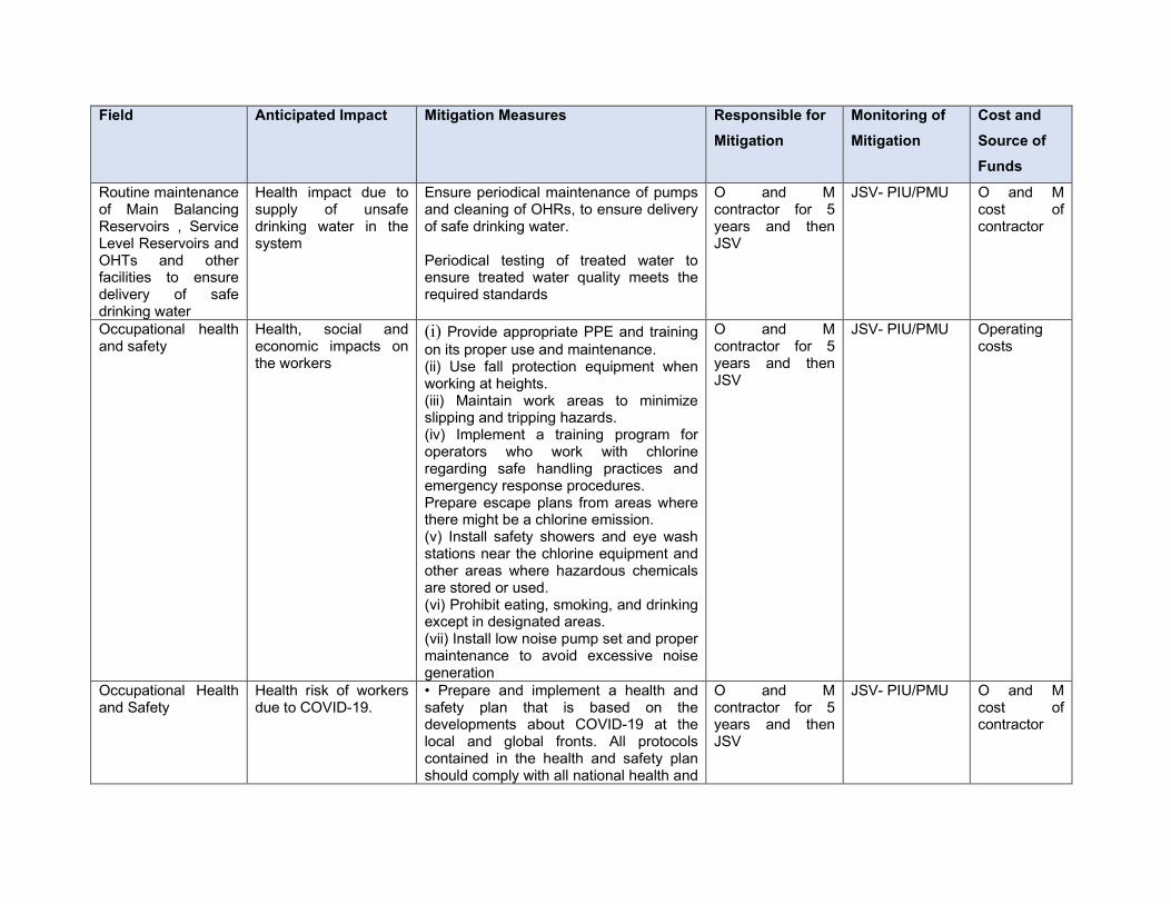
Field Anticipated Impact Mitigation Measures Responsible for
Mitigation
Monitoring of
Mitigation
Cost and
Source of
Funds
Routine maintenance of Main Balancing Reservoirs , Service Level Reservoirs and OHTs and other facilities to ensure delivery of safe drinking water
Health impact due to supply of unsafe drinking water in the system
Ensure periodical maintenance of pumps and cleaning of OHRs, to ensure delivery of safe drinking water. Periodical testing of treated water to ensure treated water quality meets the required standards
O and M contractor for 5 years and then JSV
JSV- PIU/PMU O and M cost of contractor
Occupational health and safety
Health, social and economic impacts on the workers
(i) Provide appropriate PPE and training on its proper use and maintenance. (ii) Use fall protection equipment when working at heights. (iii) Maintain work areas to minimize slipping and tripping hazards. (iv) Implement a training program for operators who work with chlorine regarding safe handling practices and emergency response procedures. Prepare escape plans from areas where there might be a chlorine emission. (v) Install safety showers and eye wash stations near the chlorine equipment and other areas where hazardous chemicals are stored or used. (vi) Prohibit eating, smoking, and drinking except in designated areas. (vii) Install low noise pump set and proper maintenance to avoid excessive noise generation
O and M contractor for 5 years and then JSV
JSV- PIU/PMU Operating costs
Occupational Health and Safety
Health risk of workers due to COVID-19.
• Prepare and implement a health and safety plan that is based on the developments about COVID-19 at the local and global fronts. All protocols contained in the health and safety plan should comply with all national health and
O and M contractor for 5 years and then JSV
JSV- PIU/PMU O and M cost of contractor
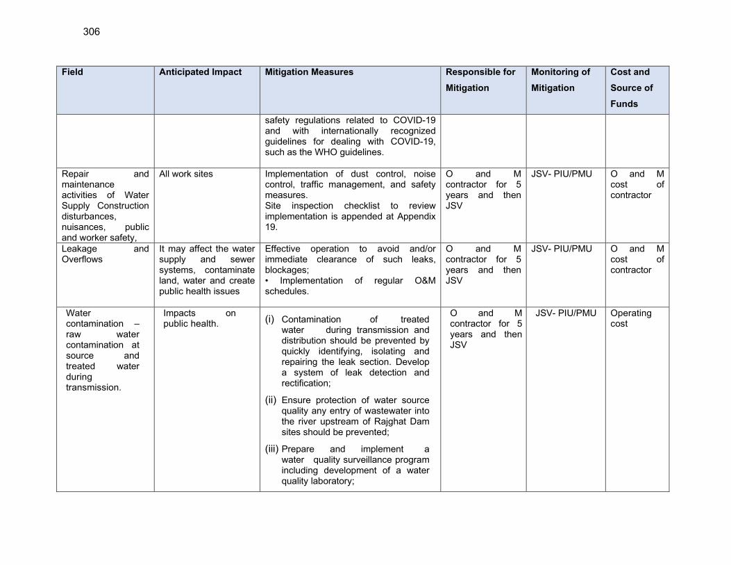
306
Field Anticipated Impact Mitigation Measures Responsible for
Mitigation
Monitoring of
Mitigation
Cost and
Source of
Funds
safety regulations related to COVID-19 and with internationally recognized guidelines for dealing with COVID-19, such as the WHO guidelines.
Repair and maintenance activities of Water Supply Construction disturbances, nuisances, public and worker safety,
All work sites Implementation of dust control, noise control, traffic management, and safety measures. Site inspection checklist to review implementation is appended at Appendix 19.
O and M contractor for 5 years and then JSV
JSV- PIU/PMU O and M cost of contractor
Leakage and Overflows
It may affect the water supply and sewer systems, contaminate land, water and create public health issues
Effective operation to avoid and/or immediate clearance of such leaks, blockages; • Implementation of regular O&M schedules.
O and M contractor for 5 years and then JSV
JSV- PIU/PMU O and M cost of contractor
Water contamination – raw water contamination at source and treated water during transmission.
Impacts on public health. (i) Contamination of treated
water during transmission and distribution should be prevented by quickly identifying, isolating and repairing the leak section. Develop a system of leak detection and rectification;
(ii) Ensure protection of water source quality any entry of wastewater into the river upstream of Rajghat Dam sites should be prevented;
(iii) Prepare and implement a water quality surveillance program including development of a water quality laboratory;
O and M contractor for 5 years and then JSV
JSV- PIU/PMU Operating cost

Field Anticipated Impact Mitigation Measures Responsible for
Mitigation
Monitoring of
Mitigation
Cost and
Source of
Funds
(iv) Conduct regular monitoring of raw & treated water and ensure that water supplied always meets the drinking water standards (Appendix 2).
Discharge the impurities and other solids collected due to filtration and back wash.
Pollution of streams /drains.
(i) Backwash water will be recirculating, so no wastewater generated from WTP;
(ii) Maintain the mechanical parts as per the maintenance plan to avoid any hazards.
O and M contractor for 5 years and then JSV
JSV- PIU/PMU Operating costs
Sludge generation
Land and water pollution, impacts on health & environment
� Collect t h e s ludge f r om WTP un i t s , d ry in sludge drying beds, and reuse / dispose safely as per the design;
O and M contractor for 5 years and then JSV
JSV- PIU/PMU Operating costs
Solar PV panels Environment and health impacts due to improper handling and disposal of discarded / end-of-life solar panels
(Remove end-of-life / discard solar panels from site and store temporarily in an identified place; ensure no contact with soil or water
Use appropriate personal protection equipment
Dispose material for reuse as per the rules/regulations in force at the time
If there are no specific regulations, follow e-waste management rules, 2016. Maintain records of discarded/end-of-life solar panel
O and M contractor for 5 years and then JSV
JSV- PIU/PMU O and M cost of DBO contractor
Asset management
Reduction in NRW Increased efficiency of the system
Preparation and implementation of O and M Manual
O and M contractor for 5 years and then JSV
JSV- PIU/PMU O and M cost of DBO contractor
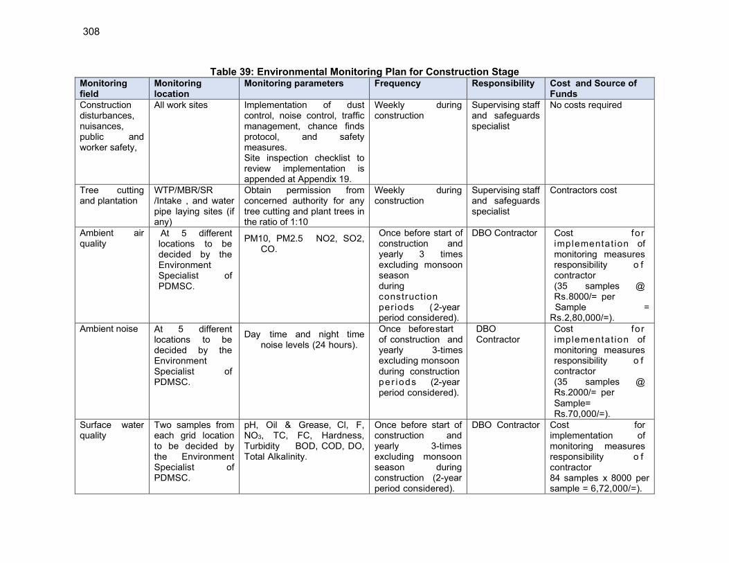
308
Table 39: Environmental Monitoring Plan for Construction Stage Monitoring field
Monitoring location
Monitoring parameters Frequency Responsibility Cost and Source of Funds
Construction disturbances, nuisances, public and worker safety,
All work sites Implementation of dust control, noise control, traffic management, chance finds protocol, and safety measures. Site inspection checklist to review implementation is appended at Appendix 19.
Weekly during construction
Supervising staff and safeguards specialist
No costs required
Tree cutting and plantation
WTP/MBR/SR /Intake , and water pipe laying sites (if any)
Obtain permission from concerned authority for any tree cutting and plant trees in the ratio of 1:10
Weekly during construction
Supervising staff and safeguards specialist
Contractors cost
Ambient air quality
At 5 different locations to be decided by the Environment Specialist of PDMSC.
PM10, PM2.5 NO2, SO2, CO.
Once before start of construction and yearly 3 times excluding monsoon season during construct ion periods (2-year period considered).
DBO Contractor Cost for implementat ion of monitoring measures responsibility o f contractor (35 samples @ Rs.8000/= per
Sample = Rs.2,80,000/=).
Ambient noise At 5 different locations to be decided by the Environment Specialist of PDMSC.
Day time and night time noise levels (24 hours).
Once before start of construction and yearly 3-times excluding monsoon during construction per iods (2-year period considered).
DBO Contractor
Cost for implementat ion of monitoring measures responsibility o f contractor (35 samples @ Rs.2000/= per Sample= Rs.70,000/=).
Surface water quality
Two samples from each grid location to be decided by the Environment Specialist of PDMSC.
pH, Oil & Grease, Cl, F, NO3, TC, FC, Hardness, Turbidity BOD, COD, DO, Total Alkalinity.
Once before start of construction and yearly 3-times excluding monsoon season during construction (2-year period considered).
DBO Contractor Cost for implementation of monitoring measures responsibility o f contractor 84 samples x 8000 per sample = 6,72,000/=).

Monitoring field
Monitoring location
Monitoring parameters Frequency Responsibility Cost and Source of Funds
Ground water quality
At 2 different two ground water sources to be decided by the Environment Specialist of PDMSC.
Colour, ordour, Turbidity, pH, total dissolved solids, electrical conductivity, total alkalinity, total hardness, Ammonia, Barium. Iron, calcium, chromium, zinc, manganese, Sulphate, Nitrite, Nitrate, Chloride, Fluoride, Phosphate, Total arsenic, Mercury, Cadmium, Total Chromium, Copper, Cynide, lead, Aluminium, nickel
Once before start of construction and yearly 3-times excluding monsoon season during construction (2-year period considered).
DBO Contractor Cost for implementat ion of monitoring measure responsibility of contractor (14 samples x 8000 per sample = 1,12,000/=)
Table 40: Environmental Monitoring Plan for Operations Stage Monitoring field Monitoring
location Monitoring parameters Frequency Responsibility Cost and
Source of Funds
Monitoring of plantations
Plantations locations
Number. of tree survived Monthly O and M contractor (DBO Contractor) for 5 years and then JSV
Contract O and M cost / JSV
Monitoring of quality of at Source
Near intake Location in each Grid
pH, TDS,Oil & grease, Cl, F, NO3, TC, FC, Hardness, Turbidity BOD, COD, DO, Total Alkalnity pesticides, heavy metals
Yearly twice (pre & post monsoon)
O and M contractor (DBO Contractor) for 5 years and then JSV
O&M costs
Monitoring of quality of water supplied to consumers
Consumer end- random sampling in all wards
pH, Nitrite, Nitrate, Turbidity BOD, Total Alkalinity, Total coliform and Feacal coliform
Monthly once
O and M contractor (DBO Contractor) for 5 years and then JSV
Contract O and M cost
Raw water quality of Tube well
Tube well Parameters as per drinking water standards (IS
105002012)
Monthly once
O and M contractor (DBO-Hybrid
Contract O and M cost / JSV
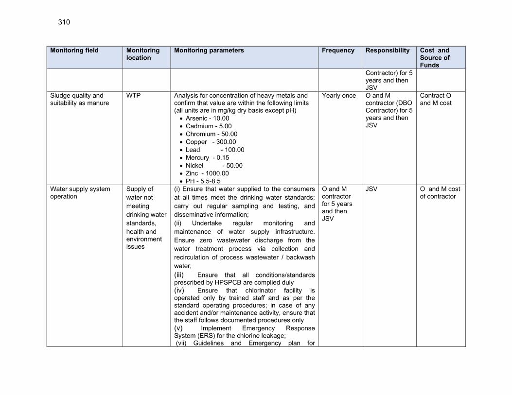
310
Monitoring field Monitoring location
Monitoring parameters Frequency Responsibility Cost and Source of Funds
Contractor) for 5 years and then JSV
Sludge quality and suitability as manure
WTP Analysis for concentration of heavy metals and confirm that value are within the following limits (all units are in mg/kg dry basis except pH) Arsenic - 10.00 Cadmium - 5.00 Chromium - 50.00 Copper - 300.00 Lead - 100.00 Mercury - 0.15 Nickel - 50.00 Zinc - 1000.00 PH - 5.5-8.5
Yearly once O and M contractor (DBO Contractor) for 5 years and then JSV
Contract O and M cost
Water supply system operation
Supply of
water not
meeting
drinking water
standards,
health and environment issues
(i) Ensure that water supplied to the consumers
at all times meet the drinking water standards;
carry out regular sampling and testing, and
disseminative information;
(ii) Undertake regular monitoring and
maintenance of water supply infrastructure.
Ensure zero wastewater discharge from the
water treatment process via collection and
recirculation of process wastewater / backwash
water;
(iii) Ensure that all conditions/standards prescribed by HPSPCB are complied duly
(iv) Ensure that chlorinator facility is operated only by trained staff and as per the standard operating procedures; in case of any accident and/or maintenance activity, ensure that the staff follows documented procedures only
(v) Implement Emergency Response System (ERS) for the chlorine leakage; (vii) Guidelines and Emergency plan for
O and M contractor for 5 years and then JSV
JSV O and M cost of contractor
Monitoring field Monitoring location
Monitoring parameters Frequency Responsibility Cost and Source of Funds
handling and storing chlorine is attached as Appendix 18.
312
B. Implementation Arrangements
355. Jal Shakti Vibhag (JSV) of the Government of Himachal Pradesh will be the Executing and Implementing Agency for the Program, responsible for management, coordination and execution of all activities funded under the loan. Jal Shakti Vibhag (JSV) will establish a central Project Management Unit (PMU) headed by a Project Director (PD) and will be supported by three Deputy Project Directors (DPD I, II and III). DPD-I and II will be responsible for procurement and contract management in two zones each (DPD-I -Hamirpur and Dharamshala, and– DPD-II - Shimla and Mandi). DPD-III will be responsible for finance management of the project. PMU will be staffed with technical, administrative, finance, procurement, safeguards, gender, etc., Under the PMU, four Project Implementation Units (PIUs) will be established at zonal level (Hamirpur, Dharamshala, Shimla and Mandi), and each PIU will be headed by a Project Manager. PMU and PIUs will be supported by Project Design, Management and Supervision Consultant (PDMSC) team.
1. Safeguard Implementation Arrangement
356. PMU will be staffed with three safeguard officers: (i) Environment Safeguard Officer (ESO) (ii) Social Safeguard and Gender Officer (SSGO), and (iii) Community Development Officer (CDO) who will be responsible for compliance with the environmental, social safeguards and community related issues in program implementation respectively. Environment Safeguard Officer and Social Safeguard and Gender Officer will have overall responsibility of safeguard implementation in compliance with ADB SPS 2009. At individual subproject level, Environment Safeguard Officer and Social Safeguard and Gender Officer will ensure that environmental assessment and social impact assessment is conducted, and IEE reports and corresponding EMPs and Social Management Plan (SMP) and Resettlement Plans (RP), due diligence reports (DDRs) are prepared and implemented, and the compliance, and corrective actions, are undertaken. Environmental Safeguard Specialist and Social Safeguards and Gender Specialist of the PDMSC will have primary responsibility of preparing the safeguard documents and supervising the EMP and resettlement plan implementation, while the Safeguards Officers at PMU will review, approve and oversee the compliance. At each PIU, a Safeguard/Environment Officer of Assistant Engineer rank, AE (SEO), will be responsible for safeguard implementation. AE(SEO) will oversee the safeguards implementation at PIU level and will be responsible for reporting to Environment Safeguard Officer and Social Safeguard and Gender Officer at PMU. The AE(SEO) will coordinate public consultation, information disclosure, regulatory clearances and approvals, EMP and resettlement plan implementation and grievance redress. Contractor will appoint an Environment, Health and Safety (EHS) supervisor to implement EMP; EHS supervisor of DBO Contractor will have responsibilities related to environmental and social safeguards compliance and grievance redress and management at field level.
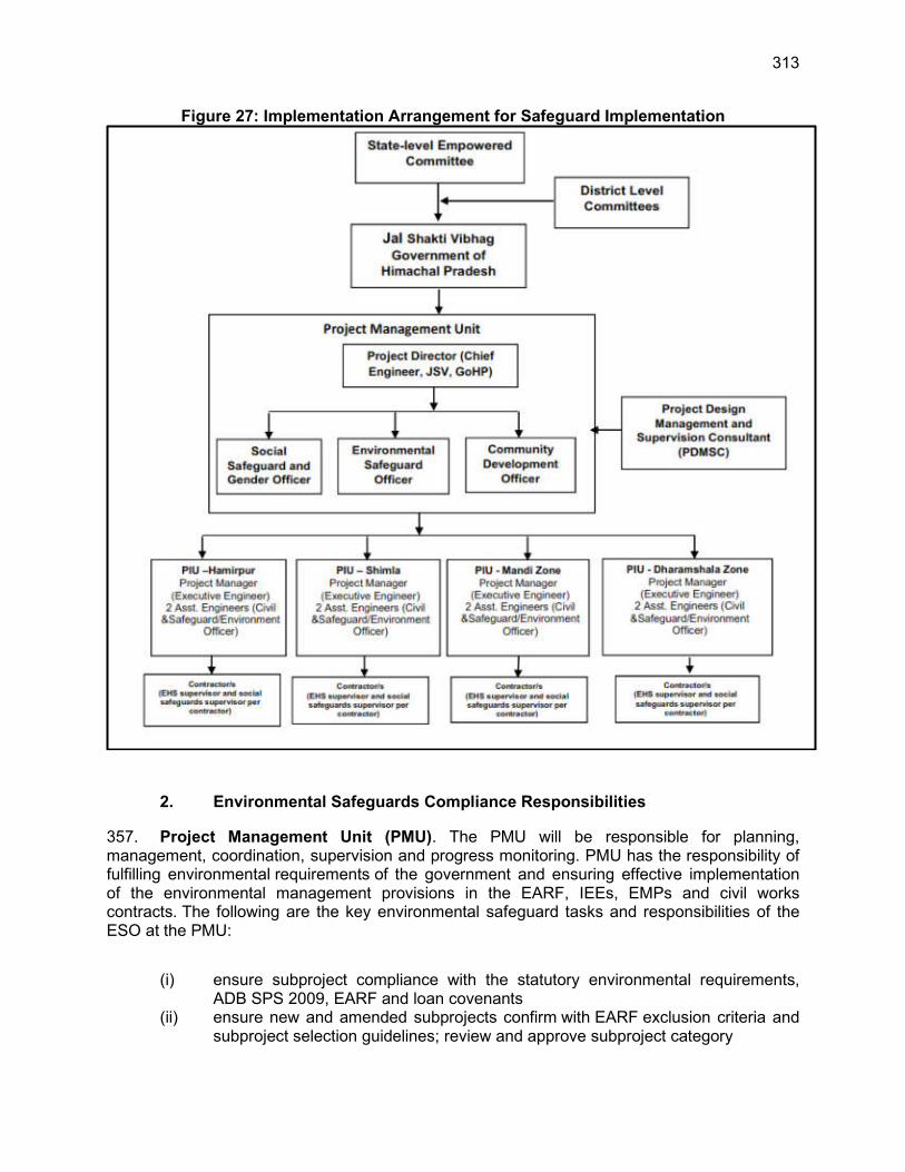
313
Figure 27: Implementation Arrangement for Safeguard Implementation
2. Environmental Safeguards Compliance Responsibilities
357. Project Management Unit (PMU). The PMU will be responsible for planning, management, coordination, supervision and progress monitoring. PMU has the responsibility of fulfilling environmental requirements of the government and ensuring effective implementation of the environmental management provisions in the EARF, IEEs, EMPs and civil works contracts. The following are the key environmental safeguard tasks and responsibilities of the ESO at the PMU:
(i) ensure subproject compliance with the statutory environmental requirements, ADB SPS 2009, EARF and loan covenants
(ii) ensure new and amended subprojects confirm with EARF exclusion criteria and subproject selection guidelines; review and approve subproject category

314
(iii) ensure that necessary environmental assessment studies are conducted, and IEEs including EMPs are prepared and submitted to ADB for approval and disclosure
(iv) ensure that IEEs including EMPs are included in bidding documents and contracts
(v) ensure that Health and Safety Plans including COVID-19 H&S Plans are included in bidding documents and civil works contracts
(vi) ensure that draft IEEs prepared based on preliminary designs are updated to reflect the final subproject detailed designs, and are approved by ADB and disclosed prior to commencement of works
(vii) coordinate with design engineers, to consider measures to avoid potential environmental impacts; ensure amended subproject designs/locations, if any, confirm with the subproject selection criteria
(viii) review and provide recommendations on the approval of site-specific EMPs (SEMPs) of contractors; ensure that no construction works are commenced until SEMPs are approved by PIU/PMU
(ix) ensure overall compliance with all national, state, and local government rules and regulations; ensure that approvals/permits/licenses are obtained in a timely manner
(x) ensure that construction works are not commenced until all applicable government clearances are obtained
(xi) Oversee and ensure that contractors and their subcontractors comply with labour legislations
(xii) provide oversight on environmental management aspects of the project; establish a system to monitor environmental safeguards including monitoring the indicators set out in the monitoring plan of the EMP
(xiii) review, monitor and evaluate effectiveness with which the SEMPs, EMPs, and Health and Safety Plans are implemented, and recommend necessary corrective actions
(xiv) ensure that the IEEs including EMPs are updated in case of changes in detailed design that may occur during implementation phase
(xv) confirm compliance with all measures and requirements set forth in the IEEs, the EMPs and any corrective or preventive actions set forth in safeguard monitoring reports
(xvi) with support from PMDSC, consolidate quarterly monitoring reports from the PIUs and submit semi-annual environmental monitoring reports (SEMRs) to ADB during construction and annually during operation
(xvii) ensure availability of budget for safeguards activities (xviii) ensure adequate awareness campaigns, information disclosure among affected
communities and timely disclosure of final IEEs/EMPs and SEMRs, including corrective action plans, if any, in project website and in a form accessible to the public
(xix) assist in setting up of grievance redress mechanism (GRM), identifying grievance redressal committee (GRC) members and developing capacity of GRC members, PIUs, consultants, and contractors in addressing environmental safeguards-related issues/concerns/complaints
(xx) ensure any grievances brought about through the GRM are redressed in a timely manner
(xxi) ensure timely disclosure of draft/updated IEEs/EMPs and SEMRs, including corrective action plans, if any, in project website and in a form accessible to the public
315
(xxii) organize periodic capacity building and training programs on safeguards for PMU, PIUs and contractors
358. Project Implementation Units (PIU). The PIUs will be responsible for the day-to-day activities of project implementation in the field and will have direct supervision of all contractors. Each PIU will be headed by a Project Manager, and assisted by a Safeguards Officer, will oversee, and monitor the day-to-day progress and implementation including environmental safeguards. PMDSC will place one environmental engineer in each PIU, With the support of PMDSC, Safeguards Officer will:
(i) Ensure compliance with government regulations and ADB requirements set forth in EARF, IEEs, including corresponding EMPs, and ADB SPS
(ii) confirm to ESO/PMU that IEEs and EMPs are up-to-date and reflect detailed engineering designs, or any change in location, alignment, or components
(iii) inform ESO/PMU promptly of any change in project locations / designs (iv) Liaise with local offices of regulatory agencies in obtaining clearances /approvals;
assist PMU for clearances obtained at town/city level; prior to award of contract; confirm PMU that all statutory clearances are in place
(v) Take necessary action for obtaining right of way prior to start of works (vi) Review and approve contractor SEMPs (vii) Oversee day-to-day implementation of SEMPs by contractors, including
compliance with all government rules and regulations, and conduct regular site visits/inspections;
(viii) Ensure that contractors and their subcontractors comply with labour legislations cited in IEEs and ADB’s SPS Prohibited list requirements; ensure that workers are paid and treated according to the labor legislations
(ix) ensure contractors and subcontractors (a) comply with the measures forth in the IEEs, the EMPs, and any corrective or preventative actions set forth in a Semiannual Environmental Monitoring Report; (b) make available a budget for all such environmental and social measures; (c) provide the PIU and PMU with a written notice of any unanticipated environmental, impacts that arise during construction, implementation or operation of the Project that were not considered in the IEE, the EMP; (d) adequately record the condition of roads, agricultural land and other infrastructure prior to starting to transport materials and construction; and (e) reinstate pathways, other local infrastructure, and agricultural land to at least their pre-project condition upon the completion of construction
(x) ensure all workers are provided with OSH training prior to start of works and on a regular basis
(xi) ensure strict implementation of OSH requirements including but not limited to contractors’ no personal protective equipment (PPE), no work policy
(xii) Recommend issuance of work construction work completion certification to the contractor upon verification of satisfactory post-construction clean-up.
(xiii) Review monthly reports from contractors on SEMR implementation (xiv) Prepare quarterly reports on all aspects concerning environmental assessment,
management, and monitoring, and submit to ESO/PMU (xv) Ensure continuous public consultation and awareness (xvi) Coordinate grievance redress process and ensure timely actions by all parties;
and
316
(xvii) Support all other environmental safeguards-related activities and tasks of the PMU as may be needed
359. Project Management, Design and Supervision Consultants (PMDSC). The PMU and PIUs will be supported by PMDSC’s Environmental Expert at PMU level, and one environmental engineer in each PIU. Environmental Expert will assist in preparing, updating, reviewing, implementing, monitoring, and reporting of all tasks related to environmental safeguards. Environmental Engineer will assist in day-to-day monitoring of EMP implementation, regulatory compliance, grievance redress, reporting etc., Key tasks of Environmental Expert, assisted by Environmental Engineers at PIU level will include, but not limited to, the following:
(i) Ensure that subprojects comply with key exclusion criteria and subproject
selection guidelines stipulated in this EARF (ii) Conduct environmental categorization of subprojects per EARF, and validate
when necessary to reflect project changes based on the final detailed design (iii) Work closely with design teams to include environmental considerations in
subproject location, design and technical specifications (iv) Carry out environmental assessment (IEE) for the proposed subprojects and
formulating environmental management plans (EMPs) for the different components of the civil works in line with ADB and national requirements
(v) Lead / assist PIU in public consultations and include inputs from the public consultation in the project design and EMP, and proper documentation in the IEEs
(vi) Ensure that the relevant provisions of EMPs, including costs of implementing the EMPs, are fully included in bid and contract documents, particularly in the bill of quantities and cost line items
(vii) Identify statutory clearance / permissions / approvals required and assist the PMU and PIU in obtaining them
(viii) Assist in including standards/conditions of regulatory clearances and consents, if any, in the project design
(ix) Review designs, bidding documents, BOQ, and safeguard documents to ensure environment, health and safety considerations including issues related to COVID 19 pandemic, are adequately covered and coasted
(x) Calculate and provide the indicative cost estimate to implement EMPs, environmental monitoring programs, awareness programs, etc.
(xi) Update the subproject IEE studies and reports and EMPs to reflect any changes in subproject detailed design or implementation.; the IEE shall reflect the final subproject design; the IEE shall also be updated in case of any unanticipated impacts
(xii) Assisting with awareness campaigns for and meaningful consultations with affected communities
(xiii) Identify and conduct capacity building activities for PMU, PIU and contractors (xiv) Ensure compliance with ADB's disclosure requirements as per the SPS (xv) Assist PMU/PIUs in reviewing and approving contractor SEMPs, health and
safety plan including Health and Safety COVID-19 Plan, and any other associated plans as required
(xvi) Carry out site verification of EMP/SEMP implementation on a regular basis, and monitor the implementation and ensure compliance by the Contractors including subcontractors
317
(xvii) Conduct regular monitoring and ensure that contractors and their subcontractors comply with labour legislations and ADB SPS Prohibited list requirements; ensure that workers are paid and treated according to the labor legislations
(xviii) Provide guidance on resolving issues pertaining to effective and efficient implementation of proposed environmental mitigation measures per EMPs/SEMPs during construction phase. Identify, non-compliance or unanticipated impacts, if any, and initiate corrective actions and report to PMU
(xix) Assist the PIU in the preparation of environmental safeguards compliance/EMP implementation updates in the quarterly reports to PMU
(xx) Monitor required environmental parameters and prepare semi-annual environmental monitoring report per the requirement of ADB
(xxi) Identify training needs and implement capacity building activities on environmental safeguards for the PMU, PIU, contractors, and other stakeholders
(xxii) Assist PIU in establishing GRM for the Project (xxiii) Assist PIU in grievance redress, advise the contractor on appropriate actions on
grievances, ensure timely resolution and proper documentation (xxiv) Support all other environmental safeguards-related activities and tasks of the
PMU and PIUs as may be needed.
360. Design, Build and Operate (DBO) contractor. The approved draft IEEs and EMPs are to be included in bidding and contract documents and verified by the PIUs and PMU. The PMU and PIUs will ensure that bidding and contract documents include specific provisions requiring contractors to comply with: (i) all applicable laws and regulations relating to environment, health and safety; (ii) reinstate pathways, other local infrastructure, and agricultural land to at least to their pre-project condition upon the completion of construction; and (iii) all applicable labor laws and core labor standards on (a) prohibition of child labor as defined in national legislation, international treaties for construction and maintenance activities;(b) equal pay for equal work of equal value regardless of gender, ethnicity, or caste; (c) no discrimination in respect of employment and occupation; (d) allow freedom of association and effectively recognize the right to collective bargainIing, and (e) elimination of forced labor; and with (ii) the requirement to disseminate information on sexually transmitted diseases, including HIV/AIDS, to employees and local communities surrounding the project sites. 361. The contractor will be required to appoint a full-time Environment, Health and Safety (EHS) supervisor on-site to implement the EMP. Prior to start of construction, Contractor will be required to prepare and submit to PMU and PIU, for review and approval. A Site-specific EMP (SEMP) No works can commence until SEMP is approved by PMU/PIU. Contractors will carry out all environmental mitigation and monitoring measures outlined in EMP, approved SEMP and their contracts. The contractor will be required to undertake day-to-day monitoring of the SEMP implementation and submit reports to the PIU on a monthly basis. A copy of the EMP/approved SEMP will always be kept on-site during the construction period. Non-compliance with, or any deviation from, the conditions set out in the EMP/SEMP constitutes a failure in compliance and will require corrective actions. The contractors will be required to conduct environmental awareness and orientation of workers prior to deployment to work sites. Key responsibilities of the EHS supervisor are:
(i) Prepare SEMP and submit to PMU/PIU for approval prior to start of construction (ii) Ensure implementation of SEMP and report to PIU/PDMSC on any new or
unanticipated impacts; seek guidance from the PMU/PIU/PDMSC to address the new or unanticipated impact in accordance with the EARF, and ADB SPS

318
(iii) Ensure that necessary pre-construction and construction permits are obtained (iv) Conduct orientation and daily briefing sessions to workers on environment,
health and safety (v) Ensure that appropriate worker facilities are provided at the workplace and labor
camps as per the contractual provisions (vi) Carry out site inspections on a regular basis and prepare site-inspection
checklists/reports (vii) Record EHS incidents and undertake remedial actions (viii) Conduct environmental monitoring (air, noise, etc.,) as per the monitoring plan (ix) Prepare monthly EMP monitoring reports and submit to PIU (x) Comply with labour legislations, and ensure that subcontractors also implement
labor legislations requirements, through cascading of requirements to subcontractors—HR policy, labor management requirements, any worksite specific grievance redress mechanism.
(xi) Work closely with PIU Safeguards Officer and PDMSC Environmental Engineer to ensure communities are aware of project-related impacts, mitigation measures, and GRM; and
(xii) Coordinate with the PIU and PDMSC on any grievances received and ensure that those are addressed in an effective and timely manner.
C. Capacity Building and Training
362. Capacity Development. Executing and implementing agencies need to have a sustained capacity to manage and monitor environmental safeguards. Although specialist consultants support will be available to PMU and PIUs, it is necessary to mainstream safeguards in day-to-day working. Therefore, PMU and PIUs require capacity building measures for (i) a better understanding of the project-related environmental issues; and (ii) to strengthen their role in preparation of IEE, implementation of mitigation measures, and subsequent monitoring. Trainings and awareness workshops are included in the project with the primary focus of enabling the PMU and PIU staff to understand impact assessments and carry out environmental monitoring and implement EMPs. After participating in such activities, the participants will be able to review environmental assessments, conduct monitoring of EMPs, understand government and ADB requirements for environmental assessment, management, and monitoring (short- and long-term), and incorporate environmental features into future project designs, specifications, and tender documents and carry out necessary checks and balances during project implementation. 363. The PDMSC will facilitate the implementation of capacity building program for the PMU, PIU, and contractors, with specific topics on environmental safeguards such as but not limited to the list below. The contractors will be responsible for conducting site-specific/work-specific orientation on environmental safeguards for their workers prior to deployment to work sites. Typical modules would be as follows: (i) sensitization; (ii) introduction to environment and environmental considerations in water supply projects; (iii) review of IEEs and integration into the project detailed design; (iv) improved coordination within nodal departments; (v) monitoring and reporting system; and (vi) project GRM. Specific modules customized for the available skill set will be devised after assessing the capabilities of the target participants and the requirements of the project. The proposed training program along with the frequency of sessions, is presented in Table 41. The capacity building program will be participatory to the extent possible and will employ variety approaches to be more effective (such as learning by doing, role playing, group exercises, on-the-job training, etc). A pre- and post-training
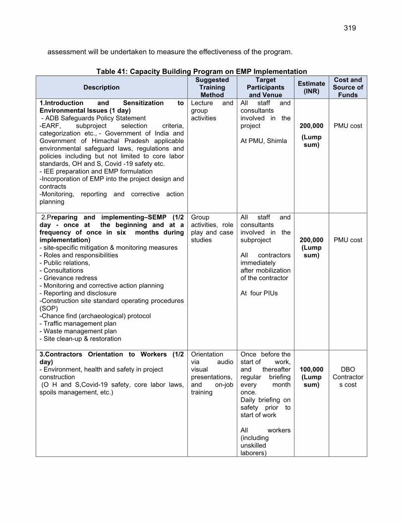
319
assessment will be undertaken to measure the effectiveness of the program.
Table 41: Capacity Building Program on EMP Implementation
Description Suggested
Training Method
Target Participants and Venue
Estimate (INR)
Cost and Source of
Funds
1.Introduction and Sensitization to Environmental Issues (1 day) - ADB Safeguards Policy Statement -EARF, subproject selection criteria, categorization etc., - Government of India and Government of Himachal Pradesh applicable environmental safeguard laws, regulations and policies including but not limited to core labor standards, OH and S, Covid -19 safety etc. - IEE preparation and EMP formulation -Incorporation of EMP into the project design and contracts -Monitoring, reporting and corrective action planning
Lecture and group activities
All staff and consultants involved in the project At PMU, Shimla
200,000
(Lump sum)
PMU cost
2.Preparing and implementing–SEMP (1/2 day - once at the beginning and at a frequency of once in six months during implementation) - site-specific mitigation & monitoring measures - Roles and responsibilities - Public relations, - Consultations - Grievance redress - Monitoring and corrective action planning - Reporting and disclosure -Construction site standard operating procedures (SOP) -Chance find (archaeological) protocol - Traffic management plan - Waste management plan - Site clean-up & restoration
Group activities, role play and case studies
All staff and consultants involved in the subproject All contractors immediately after mobilization of the contractor At four PIUs
200,000 (Lump sum)
PMU cost
3.Contractors Orientation to Workers (1/2 day) - Environment, health and safety in project construction (O H and S,Covid-19 safety, core labor laws, spoils management, etc.)
Orientation via audio visual presentations, and on-job training
Once before the start of work, and thereafter regular briefing every month once. Daily briefing on safety prior to start of work All workers (including unskilled laborers)
100,000 (Lump sum)
DBO Contractor
s cost
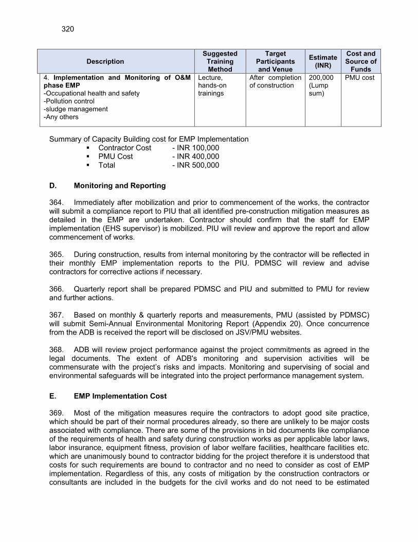
320
Description Suggested
Training Method
Target Participants and Venue
Estimate (INR)
Cost and Source of
Funds
4. Implementation and Monitoring of O&M phase EMP -Occupational health and safety -Pollution control -sludge management -Any others
Lecture, hands-on trainings
After completion of construction
200,000 (Lump sum)
PMU cost
Summary of Capacity Building cost for EMP Implementation Contractor Cost - INR 100,000 PMU Cost - INR 400,000 Total - INR 500,000
D. Monitoring and Reporting
364. Immediately after mobilization and prior to commencement of the works, the contractor will submit a compliance report to PIU that all identified pre-construction mitigation measures as detailed in the EMP are undertaken. Contractor should confirm that the staff for EMP implementation (EHS supervisor) is mobilized. PIU will review and approve the report and allow commencement of works. 365. During construction, results from internal monitoring by the contractor will be reflected in their monthly EMP implementation reports to the PIU. PDMSC will review and advise contractors for corrective actions if necessary. 366. Quarterly report shall be prepared PDMSC and PIU and submitted to PMU for review and further actions. 367. Based on monthly & quarterly reports and measurements, PMU (assisted by PDMSC) will submit Semi-Annual Environmental Monitoring Report (Appendix 20). Once concurrence from the ADB is received the report will be disclosed on JSV/PMU websites. 368. ADB will review project performance against the project commitments as agreed in the legal documents. The extent of ADB's monitoring and supervision activities will be commensurate with the project’s risks and impacts. Monitoring and supervising of social and environmental safeguards will be integrated into the project performance management system.
E. EMP Implementation Cost
369. Most of the mitigation measures require the contractors to adopt good site practice, which should be part of their normal procedures already, so there are unlikely to be major costs associated with compliance. There are some of the provisions in bid documents like compliance of the requirements of health and safety during construction works as per applicable labor laws, labor insurance, equipment fitness, provision of labor welfare facilities, healthcare facilities etc. which are unanimously bound to contractor bidding for the project therefore it is understood that costs for such requirements are bound to contractor and no need to consider as cost of EMP implementation. Regardless of this, any costs of mitigation by the construction contractors or consultants are included in the budgets for the civil works and do not need to be estimated
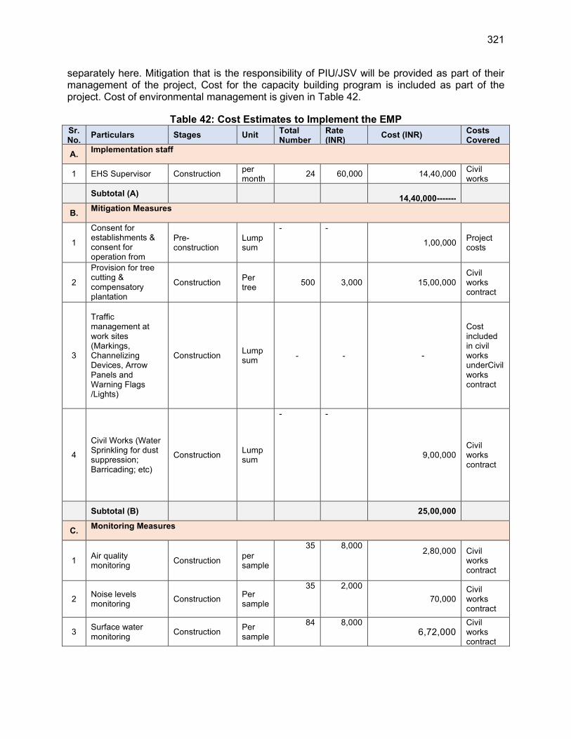
321
separately here. Mitigation that is the responsibility of PIU/JSV will be provided as part of their management of the project, Cost for the capacity building program is included as part of the project. Cost of environmental management is given in Table 42.
Table 42: Cost Estimates to Implement the EMP Sr. No.
Particulars Stages Unit Total Number
Rate (INR)
Cost (INR) Costs Covered
A. Implementation staff
1 EHS Supervisor Construction per month
24 60,000 14,40,000 Civil works
Subtotal (A)
14,40,000-------
B. Mitigation Measures
1
Consent for establishments & consent for operation from HPPCB.
Pre-construction
Lump sum
- -
1,00,000 Project costs
2
Provision for tree cutting & compensatory plantation measures
Construction Per tree
500 3,000 15,00,000 Civil works contract
3
Traffic management at work sites (Markings, Channelizing Devices, Arrow Panels and Warning Flags /Lights)
Construction Lump sum
-
- -
Cost included in civil works underCivil works contract
4
Civil Works (Water Sprinkling for dust suppression; Barricading; etc)
Construction Lump sum
- -
9,00,000 Civil works contract
Subtotal (B)
25,00,000
C. Monitoring Measures
1 Air quality monitoring
Construction per sample
35 8,000 2,80,000
Civil works contract
2 Noise levels monitoring
Construction Per sample
35 2,000
70,000 Civil works contract
3 Surface water monitoring
Construction Per sample
84 8,000 6,72,000
Civil works contract
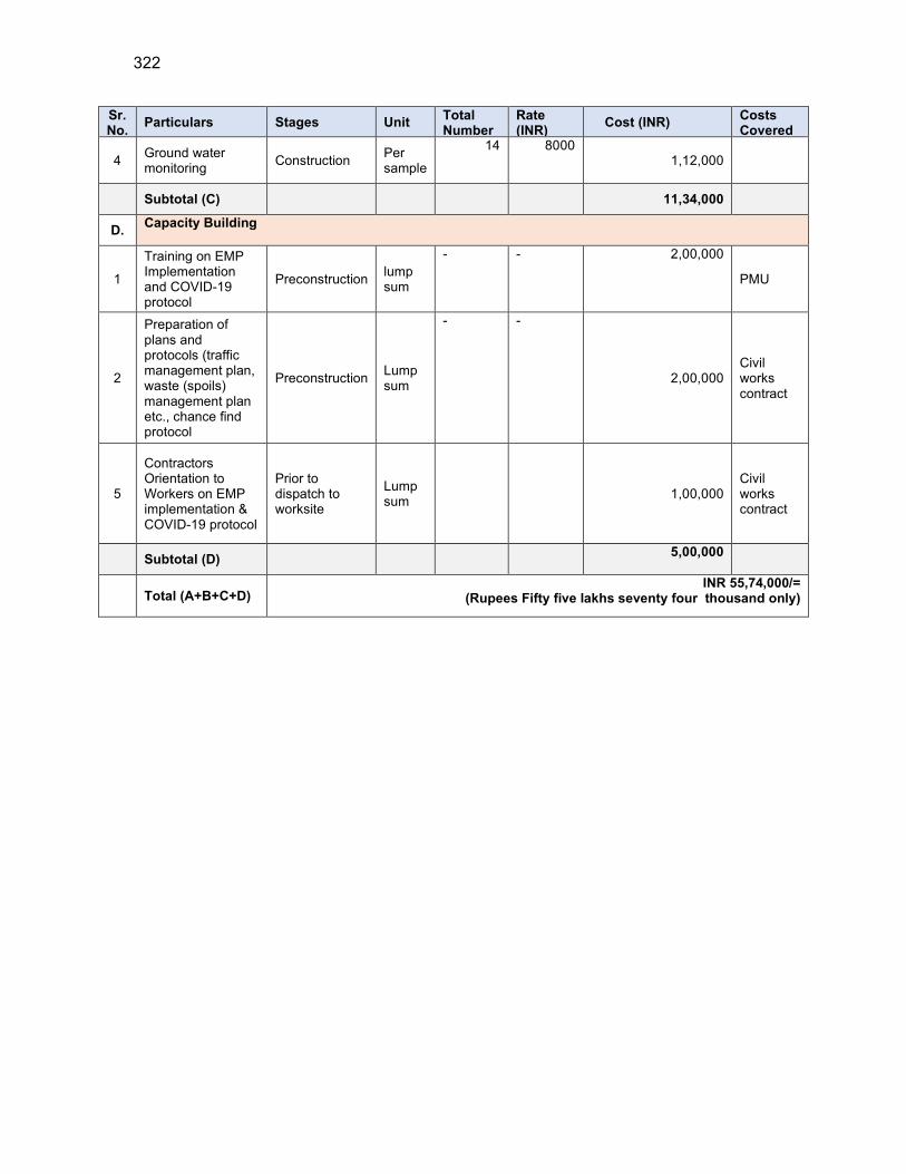
322
Sr. No.
Particulars Stages Unit Total Number
Rate (INR)
Cost (INR) Costs Covered
4 Ground water monitoring
Construction Per sample
14 8000 1,12,000
Subtotal (C)
11,34,000
D. Capacity Building
1
Training on EMP Implementation and COVID-19 protocol
Preconstruction lump sum
- - 2,00,000
PMU
2
Preparation of plans and protocols (traffic management plan, waste (spoils) management plan etc., chance find protocol
Preconstruction Lump sum
- -
2,00,000 Civil works contract
5
Contractors Orientation to Workers on EMP implementation & COVID-19 protocol
Prior to dispatch to worksite
Lump sum
1,00,000 Civil works contract
Subtotal (D) 5,00,000
Total (A+B+C+D) INR 55,74,000/=
(Rupees Fifty five lakhs seventy four thousand only)
323
X. CONCLUSION AND RECOMMENDATION
370. The process described in this document has assessed the environmental impacts of all elements of the proposed water supply subproject for MZ01 (District Kullu) of Mandi zone. All potential impacts were identified in relation to pre-construction, construction, and operation phases. Planning principles and design considerations have been reviewed and incorporated into the site planning and design process wherever possible. Thus, environmental impacts resulting from project design or location were not considered significant. 371. Since the water supply system is in deteriorating condition, new water source and pipeline network have been included in the scope of this project with consumer connections. The project involves development of new water sources on various streams and tributaries (locally called Khad and Nallah) to augment the water scarcity, and these new sources have adequate water to meet the project demand. The Quality of raw water is good and is suitable for drinking water supply after conventional treatment and disinfection. All sources were duly selected keeping in mind the downstream conditions and water requirements and in this package, less than 1% of total available discharge will be utilised to serve a particular command area or scheme. For the new WTPs- backwash water & sludge management and chlorine safety facilities these facilities are included in the designs. Consent to Establish (CTE) followed by Consent for Operation (CFO) from the Himachal Pradesh State Pollution Control Board (HPSPCB), shall be obtained. 372. Construction activities will be confined to the selected sites, and the interference with the general public and community around is minimal. There will be temporary negative impacts, arising mainly from construction dust and noise, hauling of construction material, waste and equipment on local roads (traffic, dust, safety etc.,), mining of construction material, occupational health and safety aspects. During the construction phase of pipeline work along the public roads, impacts will arise from the construction dust and noise; disturbance to residents, businesses, traffic by the construction work, and from the need to dispose of large quantities of waste soil. The social impacts (access disruptions) due to construction activities are minimal. These are the general impacts of construction in semi-urban, rural and habitation areas, and there are well developed methods of mitigation that are suggested in the EMP. Other specific measures include safe handling of wastes, minimize tree cutting and vegetation removal at various sites, and at hill sides proper erosion control measures. 373. The subproject area primarily a rural area and no subproject component is located in protected or sensitive environmental areas such as wildlife sanctuaries, eco sensitive zones, wetlands or archeologically protected areas. In Kullu district there are six Wildlife Sanctuaries namely Kais, Kanawar, Khokhan, Manali, Sainj and Tirthan are located. Three National Parks namely Khirganga National Park, Iderkila National Park and Great Himalayan national park are located in the Kullu district. Inderkila Natioanl Park in Kullu district has also been notified as an Eco Sensitive zone. None of the subproject component is falling within any protected area. There are no endangered aquatic species or migratory species in the proposed water sources like Khads and Nallahs which are of very small nature. 374. Given the large expanse of forest lands in Himachal Pradesh, locating some subproject facilities in forest lands is unavoidable. The forest land conversion will follow the “Guidelines for Diversion of Forest Lands for Non-Forest Purpose” under the Forest (Conservation) Act, 1980. Components such as Intakes, WTPs, Pump houses, reservoirs at some locations are proposed in Forest lands and few trees may be required to be removed. Exact number of trees to be removed will be finalized during the detailed design. Layout plan of facilities will be prepared

324
minimizing the tree cutting as far as possible. JSV will obtain requisite permission from the Forest Department. Most of the individual elements are relatively small and total amount of forest land requirement at 131 locations in six grids is 2.39 ha.. At some locations, water pipelines will also pass through forest lands, but mostly along forest trails /earthen roads where there no notable trees in the alignment. Forest department has exempted from clearance procedure for laying of drinking water pipelines requiring excavation/trench of less than 1m width and 2 m depth along the roads in forest land. Here the proposed trench width is 0.6m, hence permission from local forest department will be adequate for pipeline laying. The water pipelines will be laid along the roads and within the existing right of way with no notable tree felling envisaged as per preliminary design. However, it will be finalised during detailed design period and if any tree felling is required, compensatory tree plantation will be carried out in 1:10 ratio. 375. Considering water demand 95 LPCD (70 LPCD to customer end) total water demand for the ultimate year 2042 will be approximately 4.49 MLD (51.93 lps). The present lean period water discharge available from all the proposed sources is 594.16 MLD (6876.87 lps). Hence it can be concluded that the proposed sources are capable to meet projected water demand and sustainable for this water supply project till ultimate design year (2042). Water quality test reports recommends that the available water is suitable for the human consumption as per the BIS 10500 (2012). It can be noted that even after the abstraction of the water for meeting the demand there will be enough water available in these khads and nallahs for downstream users. There will be no water use conflicts as the areas in the downstream are served by other sources.
376. Based on the information obtained from, Fisheries department, and inquiries from the local people reveals that Rainbow / brown (resident) and also snow trouts (introduced from Denmark) along with local small fishes (Chal/Minnows) are commonly available in these khads/nallahs. There is no endangered aquatic species as per “The IUCN Red List of Threatened Species 2010”. As the water demand is very less than the lean period discharge of Khad and Nallah, there will be enough water available for fish propagation in these streams.
377. Most impacts of HPRDWILP will result from considerable construction activities. Water pipelines will be laid along the public roads within rural habitations, access roads, and some through forest areas. Construction activities of other components like storage tanks, WTP etc., will be confined to the selected sites, and the interference with the public and community around is minimal. Some components are located in forests. There will be temporary negative impacts, arising mainly from construction dust and noise, hauling of construction material, waste and equipment on local roads (traffic, dust, safety, etc.), mining of construction material, occupation health and safety aspects. It may be noted that due to hilly terrain, some sites are not accessible by motorable roads, and in such cases, material will be transported manually, and work will be conducted with minimal tools and mostly manually. During the construction phase of pipeline, impacts arise from the invasive nature of excavation and trenching work mostly along the roads. However as most of the individual elements are relatively small and involve straightforward construction, the potential environmental impacts (i) will be mainly localized, temporary and not greatly significant; (ii) will not cause direct impact on biodiversity values and (iii) are common impacts of construction, and there are well-developed methods for their mitigation. Given the hilly terrain, cuts and fills can promote instability and erosion although proposed excavation will not be significant, necessary measures will be put in place to avoid construction during rains, and cuts, fills and sloped surfaces in construction sites will be properly stabilized to avoid erosion. Site clearance will be strictly confined to actual work area, no clearance of topsoil or vegetation will be done outside the site. Temporary containment drains,
325
silt fences will be used to contain silt laden run off from sites. Various measures will be put in place for work in forest lands to avoid any impacts or damage / disturbance to flora and fauna.
378. In the entire project area, about 271 Km distribution network of Galvanised Iron (GI) with diameter ranges from 25 mm to 150 mm; will be laid at a depth of 1m depending on topography and 8247 numbers new house service connections will be provided from the newly laid mains. If the existing water pipes (MS ERW and GI pipes) are in the same lining of new water supply pipes, a contractor through a detailed survey will establish the requirement of old pipes removal for giving way to new pipelines. These pipes shall be removed and disposed in a controlled manner so as not to harm the environment. There are no AC pipes in the existing water supply system.
379. Anticipated impacts of water supply during operation and maintenance will be related to operation of WTP, handling and application of chlorine, operation of pump houses, and repair and maintenance activities. Various provisions have already been made in the design to: recirculate wastewater from WTP; collect, thicken and dispose of sludge; chlorine safety; use energy efficient equipment, etc. Water supply system will be operated using the standard operating procedures following an operating manual, which will be prepared by the DBO contractor. Thus, considering the design and proposed operational procedures, it is unlikely that there will be any significant negative impacts due to operation of water supply system. It is important that proper O&M system as per the SOPs is must. Application and handling of chlorine gas will involve certain risks, and appropriate measures are suggested for safe application including PPEs, awareness programs and mock drills. The DBO Contractor will implement the operation stage EMP. There may be requirement of repairs in pipelines due to leaks and pipe bursts. Proper design and selection of good quality pipe material will mean that leaks are minimal. Leak repair work will be similar to the pipe-laying work. 380. Mitigation will be assured by a program of environmental monitoring conducted during construction and operation to ensure that all measures are implemented, and to determine whether the environment is protected as intended. This will include observations on-site and off-site, document checks, and interviews with workers and beneficiaries, and any requirements for remedial action will be reported to the PMU. Mitigation and monitoring measures, along with the project agency responsible for such actions, form part of the Environmental Management Plan. 381. During the design and construction period of 24 months, the contractor will have the responsibility of maintaining the existing water supply levels and provide good quality water to consumers at least for the duration and adequate pressure being maintained presently. Operation and Maintenance of the all project facilities will be carried out by DBO contractor for 5 years and then JSV or through an external operator. In the operational phase, all facilities and infrastructure will operate with routine maintenance, which should not affect the environment. Facilities will need to be repaired from time to time, but environmental impacts will be much less than those of the construction period as the work will be infrequent, affecting small areas only. Improved system operation will comply with the operation and maintenance manual and standard operating procedures to be developed for all the activities. 382. Stakeholders were involved in developing the IEE through face-to-face discussions, on site meetings, and a Town level consultation workshop, which was conducted for larger public participation in the project. Views expressed by the stakeholders were incorporated into the IEE and the planning and development of the project. The IEE will be made available at public locations and will be disclosed to a wider audience via the PMU and ADB websites. The consultation process will be continued during project implementation to ensure that stakeholders
326
are engaged in the project and have the opportunity to participate in its development and implementation. The project’s grievance redress mechanism will provide the citizens with a platform for redress their grievances, and describes the informal and formal channels, time frame, and mechanisms for resolving complaints about environmental performance.
383. The Environmental Management Plan (EMP) proposed in the project includes mitigation measures for identified impacts, training and capacity building activities, a monitoring plan to ensure that the environmental standards are maintained throughout the project construction period and a reporting plan to ensure that the project is implemented as per environmentally sound engineering and construction practices. The total estimated cost for implementing the EMP is approximately Rs. 55,74,000/= (Rupees Fifty five lakhs seventy four thousand only). 384. The draft IEE and EMP will be included in the bid and contract documents to ensure compliance with the conditions set out in this document. The contractor will be required to submit to PIU, for review and approval, an updated EMP / site environmental management plan (SEMP) including (i) proposed sites/locations for construction work camps, storage areas, hauling roads, lay down areas, disposal areas for solid and hazardous wastes; (ii) specific mitigation measures following the approved EMP; and (iii) monitoring program as per EMP. 385. The EMP will assist the PMU, PIU, consultants and contractors in mitigating the environmental impacts, and guide them in the environmentally sound execution of the proposed project. The EMP will also ensure efficient lines of communication between PIU/ULB, PMU, consultants and contractor. The EMP shall be made binding on all contractors operating on the site, and will be included in the contractual clauses. Non-compliance with, or any deviation from, the conditions set out in this document shall constitute a failure in compliance. No works are allowed to commence prior to approval of SEMP. A copy of the EMP/approved SEMP will be kept on site during the construction period at all times 386. The sub-project will benefit the general public by contributing to the long-term improvement of water supply, system and community liveability in the project coverage area. The benefits arising from this subproject include: (i) better public health particularly reduction in waterborne and infectious diseases; (iv) reduced risk of groundwater contamination; (v) reduced risk of contamination of treated water supplies. The successful implementation of the water supply project will result in better control over the NRW management, improved monitoring system and overall demand management along with energy reduction. 387. The potential adverse environmental impacts are mainly related to the construction period, which can be minimized by the mitigation measures and environmentally sound engineering and construction practices. Therefore, as per ADB SPS, the project is classified as environmental Category B and does not require further environmental impact assessment. However, to conform with government guidelines all necessary permissions and NOCs are to be obtained from the concerned departments prior to start of construction. 388. This IEE shall be updated by PMU during the detailed design phase to reflect any changes, amendments and will be reviewed and approved by ADB and disclosed. As exact nature of rehabilitation works will be known during detailed design, a detailed audit of existing facilities will be conducted as part of the updated IEE. Draft IEE recommends engaging an aquatic fauna/fishery expert during the detailed design phase to conduct confirmatory field visits and consultations, followed by field sampling surveys if deemed necessary to confirm that there are no protected fish species (endangered or higher protection status) in project water sources.
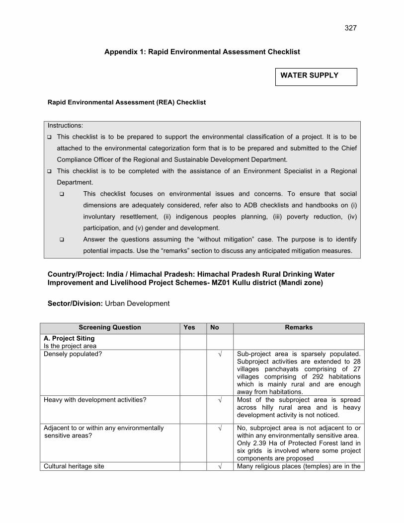
327
Appendix 1: Rapid Environmental Assessment Checklist
Rapid Environmental Assessment (REA) Checklist
Instructions:
This checklist is to be prepared to support the environmental classification of a project. It is to be
attached to the environmental categorization form that is to be prepared and submitted to the Chief
Compliance Officer of the Regional and Sustainable Development Department.
This checklist is to be completed with the assistance of an Environment Specialist in a Regional
Department.
This checklist focuses on environmental issues and concerns. To ensure that social
dimensions are adequately considered, refer also to ADB checklists and handbooks on (i)
involuntary resettlement, (ii) indigenous peoples planning, (iii) poverty reduction, (iv)
participation, and (v) gender and development.
Answer the questions assuming the “without mitigation” case. The purpose is to identify
potential impacts. Use the “remarks” section to discuss any anticipated mitigation measures.
Country/Project: India / Himachal Pradesh: Himachal Pradesh Rural Drinking Water Improvement and Livelihood Project Schemes- MZ01 Kullu district (Mandi zone)
Sector/Division: Urban Development
Screening Question Yes No Remarks
A. Project Siting Is the project area
Densely populated?
Sub-project area is sparsely populated. Subproject activities are extended to 28 villages panchayats comprising of 27 villages comprising of 292 habitations which is mainly rural and are enough away from habitations.
Heavy with development activities? Most of the subproject area is spread across hilly rural area and is heavy development activity is not noticed.
Adjacent to or within any environmentally sensitive areas?
No, subproject area is not adjacent to or within any environmentally sensitive area. Only 2.39 Ha of Protected Forest land in six grids is involved where some project components are proposed
Cultural heritage site Many religious places (temples) are in the
WATER SUPPLY
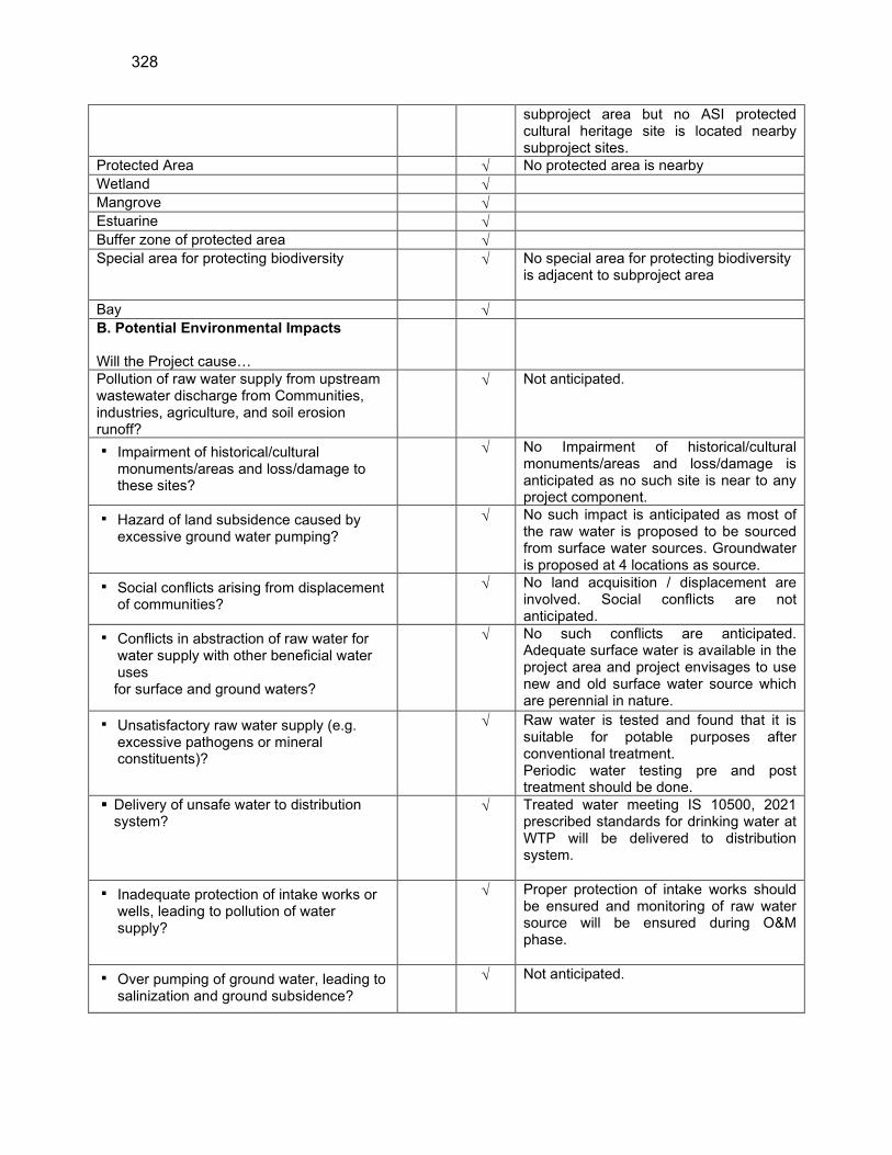
328
subproject area but no ASI protected cultural heritage site is located nearby subproject sites.
Protected Area No protected area is nearby
Wetland
Mangrove
Estuarine
Buffer zone of protected area
Special area for protecting biodiversity No special area for protecting biodiversity is adjacent to subproject area
Bay
B. Potential Environmental Impacts Will the Project cause…
Pollution of raw water supply from upstream wastewater discharge from Communities, industries, agriculture, and soil erosion runoff?
Not anticipated.
▪ Impairment of historical/cultural monuments/areas and loss/damage to these sites?
No Impairment of historical/cultural monuments/areas and loss/damage is anticipated as no such site is near to any project component.
▪ Hazard of land subsidence caused by excessive ground water pumping?
No such impact is anticipated as most of the raw water is proposed to be sourced from surface water sources. Groundwater is proposed at 4 locations as source.
▪ Social conflicts arising from displacement of communities?
No land acquisition / displacement are involved. Social conflicts are not anticipated.
▪ Conflicts in abstraction of raw water for water supply with other beneficial water uses for surface and ground waters?
No such conflicts are anticipated. Adequate surface water is available in the project area and project envisages to use new and old surface water source which are perennial in nature.
▪ Unsatisfactory raw water supply (e.g. excessive pathogens or mineral constituents)?
Raw water is tested and found that it is suitable for potable purposes after conventional treatment. Periodic water testing pre and post treatment should be done.
Delivery of unsafe water to distribution system?
Treated water meeting IS 10500, 2021 prescribed standards for drinking water at WTP will be delivered to distribution system.
▪ Inadequate protection of intake works or wells, leading to pollution of water supply?
Proper protection of intake works should be ensured and monitoring of raw water source will be ensured during O&M phase.
▪ Over pumping of ground water, leading to salinization and ground subsidence?
Not anticipated.
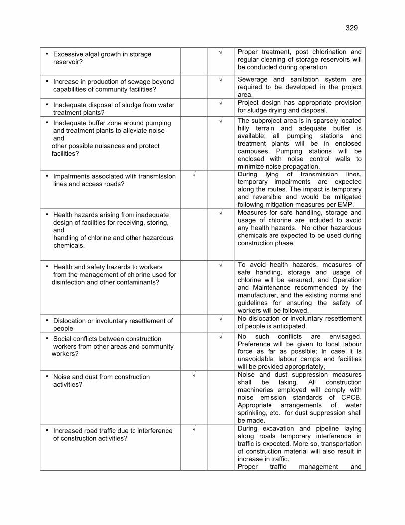
329
▪ Excessive algal growth in storage reservoir?
Proper treatment, post chlorination and regular cleaning of storage reservoirs will be conducted during operation
▪ Increase in production of sewage beyond capabilities of community facilities?
Sewerage and sanitation system are required to be developed in the project area.
▪ Inadequate disposal of sludge from water treatment plants?
Project design has appropriate provision for sludge drying and disposal.
▪ Inadequate buffer zone around pumping and treatment plants to alleviate noise and other possible nuisances and protect facilities?
The subproject area is in sparsely located hilly terrain and adequate buffer is available; all pumping stations and treatment plants will be in enclosed campuses. Pumping stations will be enclosed with noise control walls to minimize noise propagation.
▪ Impairments associated with transmission lines and access roads?
During lying of transmission lines, temporary impairments are expected along the routes. The impact is temporary and reversible and would be mitigated following mitigation measures per EMP.
▪ Health hazards arising from inadequate design of facilities for receiving, storing, and handling of chlorine and other hazardous chemicals.
Measures for safe handling, storage and usage of chlorine are included to avoid any health hazards. No other hazardous chemicals are expected to be used during construction phase.
▪ Health and safety hazards to workers from the management of chlorine used for disinfection and other contaminants?
To avoid health hazards, measures of safe handling, storage and usage of chlorine will be ensured, and Operation and Maintenance recommended by the manufacturer, and the existing norms and guidelines for ensuring the safety of workers will be followed.
▪ Dislocation or involuntary resettlement of people
No dislocation or involuntary resettlement of people is anticipated.
▪ Social conflicts between construction workers from other areas and community workers?
No such conflicts are envisaged. Preference will be given to local labour force as far as possible; in case it is unavoidable, labour camps and facilities will be provided appropriately,
▪ Noise and dust from construction activities?
Noise and dust suppression measures shall be taking. All construction machineries employed will comply with noise emission standards of CPCB. Appropriate arrangements of water sprinkling, etc. for dust suppression shall be made.
▪ Increased road traffic due to interference of construction activities?
During excavation and pipeline laying along roads temporary interference in traffic is expected. More so, transportation of construction material will also result in increase in traffic. Proper traffic management and

330
construction planning will be ensured to minimize the interference.
▪ Continuing soil erosion/silt runoff from construction operations?
All measures to ensure silt run off due to construction operation shall be employed. No construction will be allowed during rainy days.
Delivery of unsafe water due to poor O&M treatment processes (especially mud accumulations in filters) and inadequate chlorination due to lack of adequate monitoring of chlorine residuals in distribution systems?
The Contractor shall prepare an O&M manual for approval of the Employer and training will be given to the staff operating the plant to ensure proper O&M.
Delivery of water to distribution system, which is corrosive due to inadequate attention to feeding of corrective chemicals?
Not anticipated. Proper monitoring of process water shall be ensured. Care should be talked during O&M period to ensure that corrosive chemicals are not entering in the distribution system.
Accidental leakage of chlorine gas? Measures for safe handling of chlorine are included in EMP.
Excessive abstraction of water affecting downstream water users?
The surface water sources identified for subproject area has enough flow and abstraction for the project is negligible, hence will not affect the downstream users.
Competing uses of water? Development of new sources is envisaged in the project. Adequate capacity of raw water sources is available for the project.
Increased sewage flow due to increased water supply
Sewerage system is also required to be planned for project area.
Increased volume of sullage (wastewater from cooking and washing) and sludge from wastewater treatment plant
Sanitation and Sewerage system is also required to be planned for project area.
Large population influx during project construction and operation that causes increased burden on social infrastructure and services (such as water supply and sanitation systems)?
Preference shall be given to the local work force for the execution of the project. Most of the unskilled workers will be hired locally, some of skilled workers will be brought from outside but numbers will not so large to have impact on the social infrastructure and services.
Risks to community health and safety due to the transport, storage, and use and/or disposal of materials such as explosives, fuel, and other chemicals during operation and construction?
Not anticipated: No such explosives and chemicals are proposed to be used during operation and construction.

331
Community safety risks due to both accidental and natural hazards, especially where the structural elements or components of the project are accessible to members of the affected community or where their failure could result in injury to the community throughout project construction, operation, and decommissioning?
Community safety risk may be there during construction during excavation for pipe laying, equipment and vehicle operation. for which mitigation measures will be adopted by the contractor
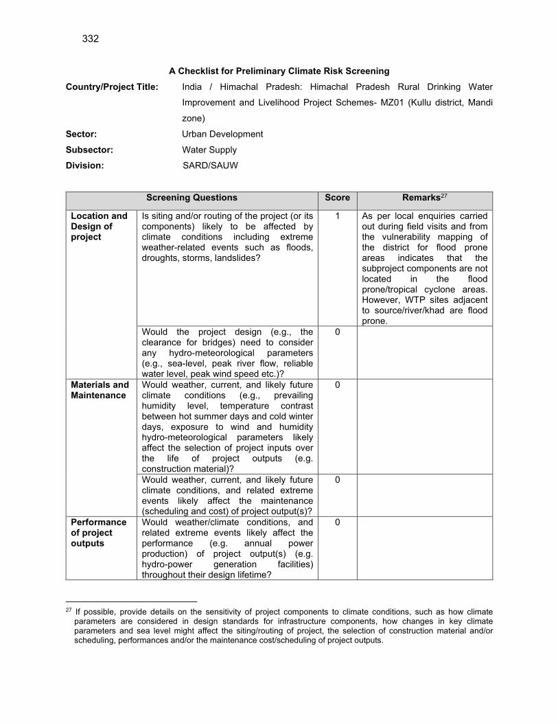
332
A Checklist for Preliminary Climate Risk Screening
Country/Project Title: India / Himachal Pradesh: Himachal Pradesh Rural Drinking Water
Improvement and Livelihood Project Schemes- MZ01 (Kullu district, Mandi
zone)
Sector: Urban Development
Subsector: Water Supply
Division: SARD/SAUW
Screening Questions Score Remarks27
Location and Design of project
Is siting and/or routing of the project (or its components) likely to be affected by climate conditions including extreme weather-related events such as floods, droughts, storms, landslides?
1 As per local enquiries carried out during field visits and from the vulnerability mapping of the district for flood prone areas indicates that the subproject components are not located in the flood prone/tropical cyclone areas. However, WTP sites adjacent to source/river/khad are flood prone.
Would the project design (e.g., the clearance for bridges) need to consider any hydro-meteorological parameters (e.g., sea-level, peak river flow, reliable water level, peak wind speed etc.)?
0
Materials and Maintenance
Would weather, current, and likely future climate conditions (e.g., prevailing humidity level, temperature contrast between hot summer days and cold winter days, exposure to wind and humidity hydro-meteorological parameters likely affect the selection of project inputs over the life of project outputs (e.g. construction material)?
0
Would weather, current, and likely future climate conditions, and related extreme events likely affect the maintenance (scheduling and cost) of project output(s)?
0
Performance of project outputs
Would weather/climate conditions, and related extreme events likely affect the performance (e.g. annual power production) of project output(s) (e.g. hydro-power generation facilities) throughout their design lifetime?
0
27 If possible, provide details on the sensitivity of project components to climate conditions, such as how climate
parameters are considered in design standards for infrastructure components, how changes in key climate parameters and sea level might affect the siting/routing of project, the selection of construction material and/or scheduling, performances and/or the maintenance cost/scheduling of project outputs.

333
Options for answers and corresponding score are provided below:
Response Score
Not Likely 0
Likely 1
Very Likely 2
Responses when added that provide a score of 0 will be considered low risk project. If adding all responses will
result to a score of 1–4 and that no score of 2 was given to any single response, the project will be assigned a
medium risk category. A total score of 5 or more (which include providing a score of 1 in all responses) or a 2 in
any single response, will be categorized as high-risk project.
Result of Initial Screening (Low, Medium, High): Medium risk
Other Comments: The anticipated environmental impacts are very marginal and the
construction activity does not impose any threat to the existing climatic condition

334
Appendix 2: Drinking Water Standards, Surface Water Quality Classification Ambient Air
Quality, Vehicle, Diesel Generator Emissions Standards
Table 1: Applicable Drinking Water Quality Standards for ADB funded projects in India
Group National Standards for Drinking Watera WHO Guidelines for
Drinking-Water
Quality, 4th Edition,
2011b
Applicable
Per ADB
SPS c, d
Parameter Unit Max.
Concentration
Limitsd
Physical Turbidity NTU 1 (5) - 1 (5)
pH 6.5 – 8.5 none 6.5 – 8.5
Color Hazen
units
5 (15) none 5 (15)
Taste and
Odor
Agreeable - Agreeable
TDS mg/l 500 (2,000) - 500 (2,000)
Iron mg/l 0.3 - 0.3
Manganese mg/l 0.1 (0.3) - 0.1 (0.3)
Arsenic mg/l 0.01 (0.05) 0.01 0.01
Cadmium mg/l 0.003 0.003 0.003
Chromium mg/l 0.05 0.05 0.05
Cyanide mg/l 0.05 none 0.05
Fluoride mg/l 1 (1.5) 1.5 1 (1.5)
Lead mg/l 0.01 0.01 0.01
Ammonia mg/l 0.5 none established 0.5
Chemical Chloride mg/l 250 (1,000) none established 250 (1,000)
Sulphate mg/l 200 (400) none 200 (400)
Nitrate mg/l 45 50 45
Copper mg/l 0.05 (1.5) 2 0.05 (1.5)
Total
Hardness
mg/l 200 (600) - 200 (600)
Calcium mg/l 75 (200) - 75 (200)
Zinc mg/l 5 (15) none established 5 (15)
Mercury mg/l 0.001 0.006 0.001
Aluminum mg/l 0.1 (0.3) none established 0.1 (0.3)
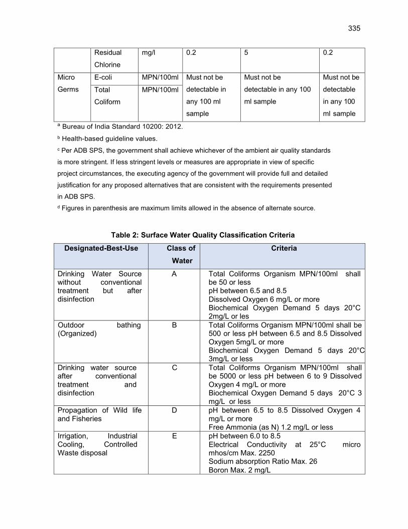
335
Residual
Chlorine
mg/l 0.2 5 0.2
Micro
Germs
E-coli MPN/100ml Must not be
detectable in
any 100 ml
sample
Must not be
detectable in any 100
ml sample
Must not be
detectable
in any 100
ml sample
Total
Coliform
MPN/100ml
a Bureau of India Standard 10200: 2012.
b Health-based guideline values.
c Per ADB SPS, the government shall achieve whichever of the ambient air quality standards
is more stringent. If less stringent levels or measures are appropriate in view of specific
project circumstances, the executing agency of the government will provide full and detailed
justification for any proposed alternatives that are consistent with the requirements presented
in ADB SPS.
d Figures in parenthesis are maximum limits allowed in the absence of alternate source.
Table 2: Surface Water Quality Classification Criteria
Designated-Best-Use Class of
Water
Criteria
Drinking Water Source without conventional treatment but after disinfection
A Total Coliforms Organism MPN/100ml shall be 50 or less pH between 6.5 and 8.5 Dissolved Oxygen 6 mg/L or more Biochemical Oxygen Demand 5 days 20°C 2mg/L or les
Outdoor bathing (Organized)
B Total Coliforms Organism MPN/100ml shall be 500 or less pH between 6.5 and 8.5 Dissolved Oxygen 5mg/L or more Biochemical Oxygen Demand 5 days 20°C 3mg/L or less
Drinking water source after conventional treatment and disinfection
C Total Coliforms Organism MPN/100ml shall be 5000 or less pH between 6 to 9 Dissolved Oxygen 4 mg/L or more Biochemical Oxygen Demand 5 days 20°C 3 mg/L or less
Propagation of Wild life and Fisheries
D pH between 6.5 to 8.5 Dissolved Oxygen 4 mg/L or more Free Ammonia (as N) 1.2 mg/L or less
Irrigation, Industrial Cooling, Controlled Waste disposal
E pH between 6.0 to 8.5 Electrical Conductivity at 25°C micro mhos/cm Max. 2250 Sodium absorption Ratio Max. 26 Boron Max. 2 mg/L
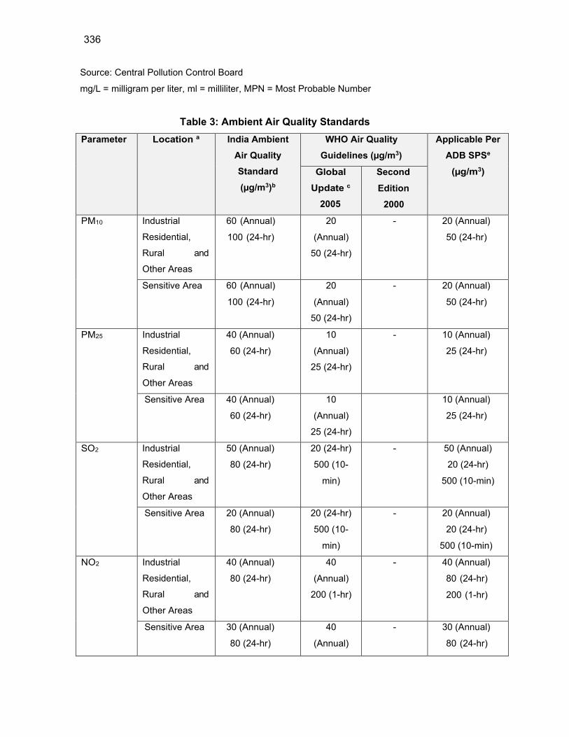
336
Source: Central Pollution Control Board
mg/L = milligram per liter, ml = milliliter, MPN = Most Probable Number
Table 3: Ambient Air Quality Standards
Parameter Location a India Ambient
Air Quality
Standard
(µg/m3)b
WHO Air Quality
Guidelines (µg/m3)
Applicable Per
ADB SPSe
(µg/m3) Global
Update c
2005
Second
Edition
2000
PM10 Industrial
Residential,
Rural and
Other Areas
60 (Annual)
100 (24-hr)
20
(Annual)
50 (24-hr)
- 20 (Annual)
50 (24-hr)
Sensitive Area 60 (Annual)
100 (24-hr)
20
(Annual)
50 (24-hr)
- 20 (Annual)
50 (24-hr)
PM25 Industrial
Residential,
Rural and
Other Areas
40 (Annual)
60 (24-hr)
10
(Annual)
25 (24-hr)
- 10 (Annual)
25 (24-hr)
Sensitive Area 40 (Annual)
60 (24-hr)
10
(Annual)
25 (24-hr)
10 (Annual)
25 (24-hr)
SO2 Industrial
Residential,
Rural and
Other Areas
50 (Annual)
80 (24-hr)
20 (24-hr)
500 (10-
min)
- 50 (Annual)
20 (24-hr)
500 (10-min)
Sensitive Area 20 (Annual)
80 (24-hr)
20 (24-hr)
500 (10-
min)
- 20 (Annual)
20 (24-hr)
500 (10-min)
NO2 Industrial
Residential,
Rural and
Other Areas
40 (Annual)
80 (24-hr)
40
(Annual)
200 (1-hr)
- 40 (Annual)
80 (24-hr)
200 (1-hr)
Sensitive Area 30 (Annual)
80 (24-hr)
40
(Annual)
- 30 (Annual)
80 (24-hr)
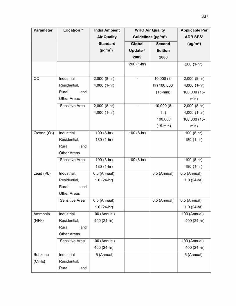
337
Parameter Location a India Ambient
Air Quality
Standard
(µg/m3)b
WHO Air Quality
Guidelines (µg/m3)
Applicable Per
ADB SPSe
(µg/m3) Global
Update c
2005
Second
Edition
2000
200 (1-hr) 200 (1-hr)
CO Industrial
Residential,
Rural and
Other Areas
2,000 (8-hr)
4,000 (1-hr)
- 10,000 (8-
hr) 100,000
(15-min)
2,000 (8-hr)
4,000 (1-hr)
100,000 (15-
min)
Sensitive Area 2,000 (8-hr)
4,000 (1-hr)
- 10,000 (8-
hr)
100,000
(15-min)
2,000 (8-hr)
4,000 (1-hr)
100,000 (15-
min)
Ozone (O3) Industrial
Residential,
Rural and
Other Areas
100 (8-hr)
180 (1-hr)
100 (8-hr) 100 (8-hr)
180 (1-hr)
Sensitive Area 100 (8-hr)
180 (1-hr)
100 (8-hr) 100 (8-hr)
180 (1-hr)
Lead (Pb) Industrial,
Residential,
Rural and
Other Areas
0.5 (Annual)
1.0 (24-hr)
0.5 (Annual) 0.5 (Annual)
1.0 (24-hr)
Sensitive Area 0.5 (Annual)
1.0 (24-hr)
0.5 (Annual) 0.5 (Annual)
1.0 (24-hr)
Ammonia
(NH3)
Industrial
Residential,
Rural and
Other Areas
100 (Annual)
400 (24-hr)
100 (Annual)
400 (24-hr)
Sensitive Area 100 (Annual)
400 (24-hr)
100 (Annual)
400 (24-hr)
Benzene
(C6H6)
Industrial
Residential,
Rural and
5 (Annual) 5 (Annual)

338
Parameter Location a India Ambient
Air Quality
Standard
(µg/m3)b
WHO Air Quality
Guidelines (µg/m3)
Applicable Per
ADB SPSe
(µg/m3) Global
Update c
2005
Second
Edition
2000
Other Areas
Sensitive Area 5 (Annual) 5 (Annual)
Benzo(o)py
rene (BaP)
particulate
phase only
Industrial
Residential,
Rural and
Other Areas
0.001
(Annual)
0.001 (Annual)
Sensitive Area 0.001
(Annual)
0.001 (Annual)
Arsenic
(As)
Industrial
Residential,
Rural and
Other Areas
0.006
(Annual)
0.006 (Annual)
Sensitive Area 0.006
(Annual)
0.006 (Annual)
Nickel (Ni) Industrial
Residential,
Rural and
Other Areas
0.02 (Annual) 0.02 (Annual)
Sensitive Area 0.02 (Annual) 0.02 (Annual)
a Sensitive area refers to such areas notified by the India Central Government. b Notification by Ministry of Environment and Forests, Government of India Environment
(Protection) Seventh Amendment Rules, 2009 c WHO Air quality guidelines for particulate matter, ozone, nitrogen dioxide and sulfur dioxide.
Global update 2005. WHO. 2006 d Air Quality Guidelines for Europe Second Edition. WHO 2000. e Per ADB SPS, the government shall achieve whichever of the ambient air quality standards is
more stringent. If less stringent levels or measures are appropriate in view of specific project circumstances, the executing agency of the government will provide full and detailed justification for any proposed alternatives that are consistent with the requirements presented in ADB SPS
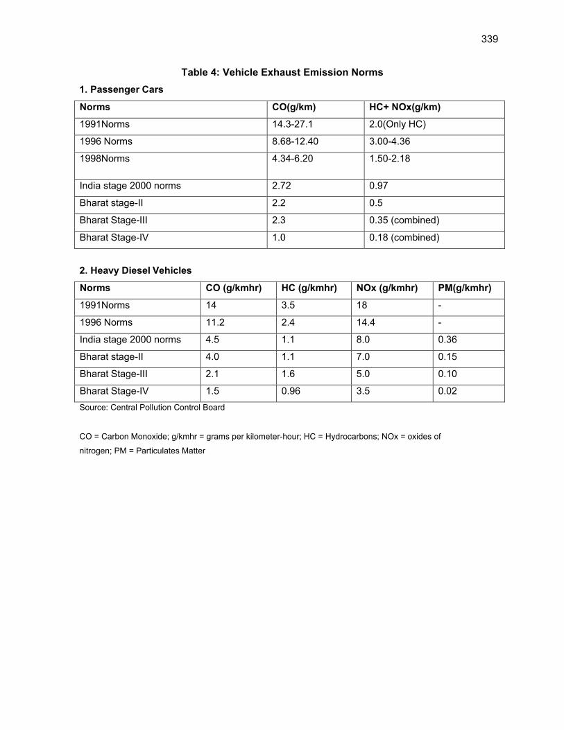
339
Table 4: Vehicle Exhaust Emission Norms
1. Passenger Cars
Norms CO(g/km) HC+ NOx(g/km)
1991Norms 14.3-27.1 2.0(Only HC)
1996 Norms 8.68-12.40 3.00-4.36
1998Norms 4.34-6.20 1.50-2.18
India stage 2000 norms 2.72 0.97
Bharat stage-II 2.2 0.5
Bharat Stage-III 2.3 0.35 (combined)
Bharat Stage-IV 1.0 0.18 (combined)
2. Heavy Diesel Vehicles
Norms CO (g/kmhr) HC (g/kmhr) NOx (g/kmhr) PM(g/kmhr)
1991Norms 14 3.5 18 -
1996 Norms 11.2 2.4 14.4 -
India stage 2000 norms 4.5 1.1 8.0 0.36
Bharat stage-II 4.0 1.1 7.0 0.15
Bharat Stage-III 2.1 1.6 5.0 0.10
Bharat Stage-IV 1.5 0.96 3.5 0.02
Source: Central Pollution Control Board
CO = Carbon Monoxide; g/kmhr = grams per kilometer-hour; HC = Hydrocarbons; NOx = oxides of
nitrogen; PM = Particulates Matter
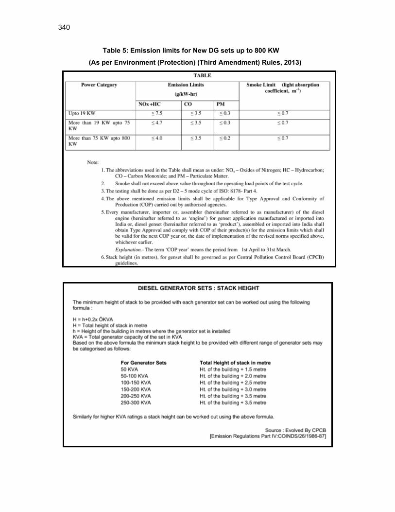
340
Table 5: Emission limits for New DG sets up to 800 KW
(As per Environment (Protection) (Third Amendment) Rules, 2013)
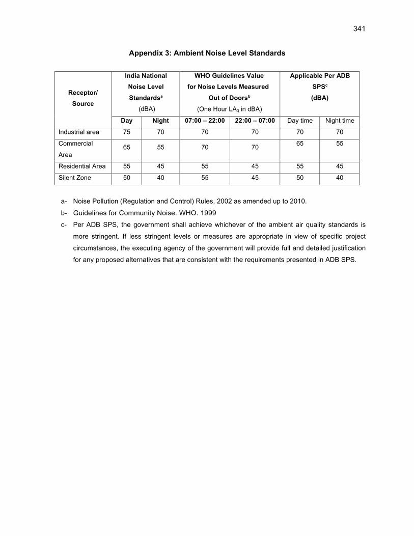
341
Appendix 3: Ambient Noise Level Standards
Receptor/
Source
India National
Noise Level
Standardsa
(dBA)
WHO Guidelines Value
for Noise Levels Measured
Out of Doorsb
(One Hour LAq in dBA)
Applicable Per ADB
SPSc
(dBA)
Day Night 07:00 – 22:00 22:00 – 07:00 Day time Night time
Industrial area 75 70 70 70 70 70
Commercial
Area 65 55 70 70
65 55
Residential Area 55 45 55 45 55 45
Silent Zone 50 40 55 45 50 40
a- Noise Pollution (Regulation and Control) Rules, 2002 as amended up to 2010.
b- Guidelines for Community Noise. WHO. 1999
c- Per ADB SPS, the government shall achieve whichever of the ambient air quality standards is
more stringent. If less stringent levels or measures are appropriate in view of specific project
circumstances, the executing agency of the government will provide full and detailed justification
for any proposed alternatives that are consistent with the requirements presented in ADB SPS.

342
Noise Limits for Diesel Generator Sets

343
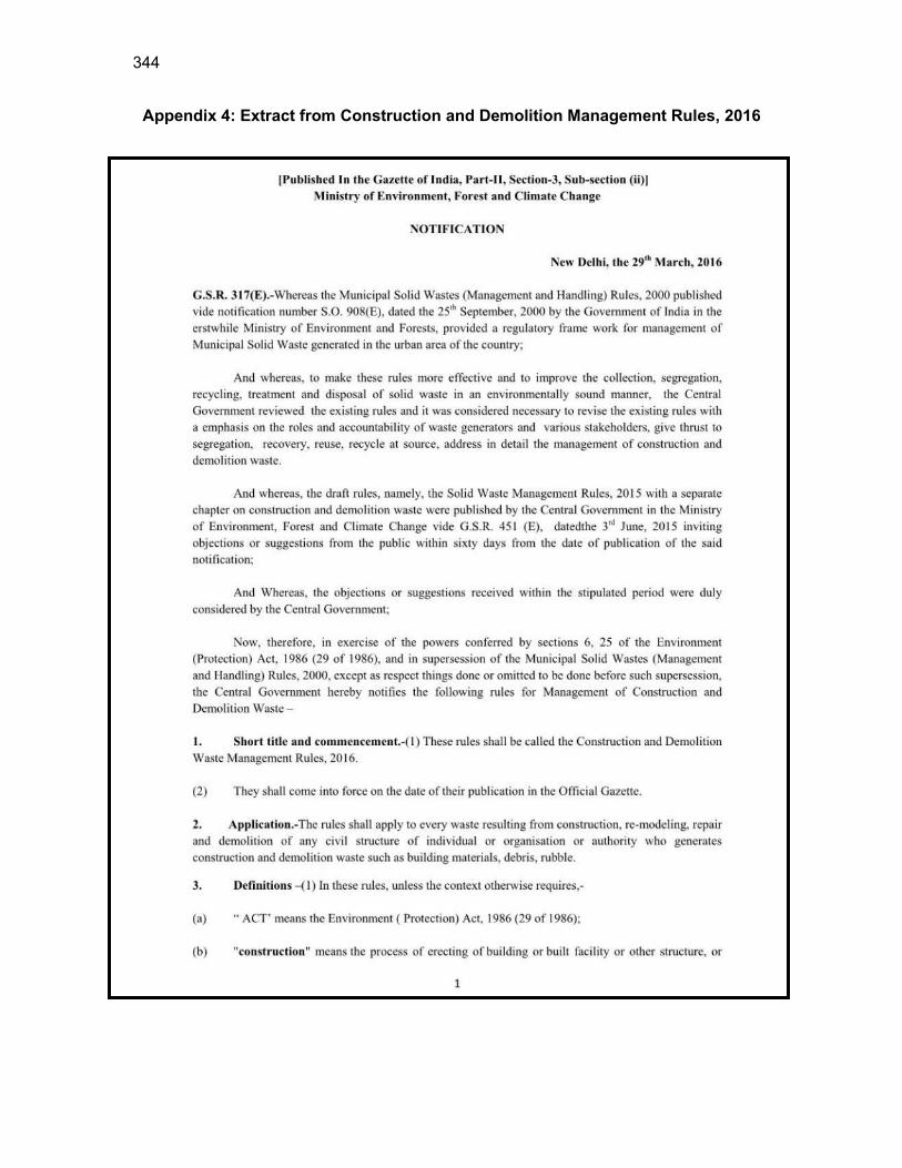
344
Appendix 4: Extract from Construction and Demolition Management Rules, 2016
345
346
347
348
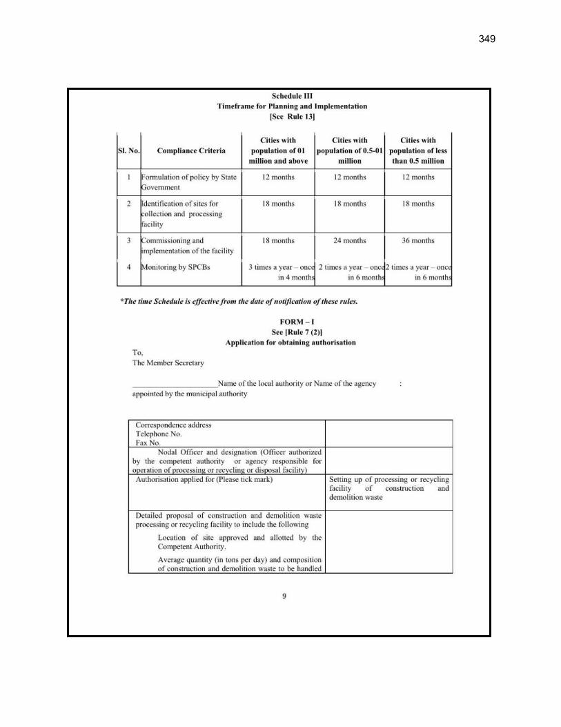
349

350
Appendix 5: Salient Features of Major Laws Applicable to Establishments Engaged in Construction of Civil Works
(i) Workmen Compensation Act, 1923 - The Act provides for compensation in case of
injury by accident arising out of and during the course of employment.
(ii) Payment of Gratuity Act, 1972 - Gratuity is payable to an employee under the Act on
satisfaction of certain conditions on separation if an employee has completed 5 years’ service
or more or on death at the rate of 15 days wages for every completed year of service. The
Act is applicable to all establishments employing 10 or more employees.
(iii) Employees’ PF and Miscellaneous Provisions Act, 1952 - The Act provides for
monthly contributions by the employer plus workers @10 % or 8.33 %. The benefits payable
under the Act are: (a) Pension or family pension on retirement or death as the case may be;
(b) Deposit linked insurance on the death in harness of the worker; (c) Payment of PF accumulation on retirement/death etc.
(iv) Maternity Benefit Act, 1951 - The Act provides for leave and some other benefits to
women employees in case of confinement or miscarriage etc.
(v) Contract Labor (Regulation and Abolition) Act, 1970 - The Act provides for certain
welfare measures to be provided by the Contractor to contract labor and in case the
Contractor fails to provide, the same are required to be provided by the Principal Employer by
Law. The principal employer is required to take Certificate of Registration and the Contractor
is required to take a License from the designated Officer. The Act is applicable to the
establishments or Contractor of principal employer if they employ 20 or more contract labor.
(vi) Minimum Wages Act, 1948 - The employer is supposed to pay not less than the
Minimum Wages fixed by appropriate Government as per provisions of the Act if the
employment is a scheduled employment. Construction of Buildings, Roads and Runways are
scheduled employment.
(vii) Payment of Wages Act, 1936 - It lays down as to by what date the wages are to be
paid, when it will be paid and what deductions can be made from the wages of the workers.
(viii) Equal Remuneration Act, 1979 - The Act provides for payment of equal wages for
work of equal nature to Male and Female workers and not for making discrimination against
Female employees in the matters of transfers, training and promotions etc.
(ix) Payment of Bonus Act, 1965 - The Act is applicable to all establishments employing
20 or more workmen. The Act provides for payments of annual bonus subject to a minimum
351
of 8.33 % of wages and maximum of 20 % of wages to employees drawing Rs.3500/- per
month or less. The bonus to be paid to employees getting Rs.2500/- per month or above up
to Rs.3500/- per month shall be worked out by taking wages as Rs.2500/- per month only.
The Act does not apply to certain establishments. The newly set up establishments are
exempted for five years in certain circumstances. Some of the State Governments have
reduced the employment size from 20 to 10 for the purpose of applicability of the Act.
(x) Industrial Disputes Act, 1947 - The Act lays down the machinery and procedure for
resolution of industrial disputes, in what situations a strike or lock-out becomes illegal and
what are the requirements for laying off or retrenching the employees or closing down the
establishment.
(xi) Industrial Employment (Standing Orders) Act, 1946-It is applicable to all
establishments employing 100 or more workmen (employment size reduced by some of the
States and Central Government to 50). The Act provides for laying down rules governing the
conditions of employment by the employer on matters provided in the Act and get the same
certified by the designated Authority.
(xii) Trade Unions Act, 1926 - The Act lays down the procedure for registration of trade
unions of workmen and employees. The trade unions registered under the Act have been
given certain immunities from civil and criminal liabilities.
(xiii) Child Labor (Prohibition and Regulation) Act, 1986 - The Act prohibits employment of
children below 14 years of age in certain occupations and processes and provides for
regulation of employment of children in all other occupations and processes. Employment of
child labor is prohibited in Building and Construction Industry.
(xiv) Inter-State Migrant Workmen's (Regulation of Employment and Conditions of
Service) Act, 1979 - The Act is applicable to an establishment which employs 5 or more inter-
state migrant workmen through an intermediary (who has recruited workmen in one state for
employment in the establishment situated in another state). The inter-state migrant workmen,
in an establishment to which this Act becomes applicable, are required to be provided certain
facilities such as housing, medical aid, traveling expenses from home up to the establishment
and back, etc.
(xv) Construction and Demolition Waste Management Rules 2016- This Rule stipulate that-
Every waste generator shall segregate construction and demolition waste and deposit
at collection centre or handover it to the authorized processing facilities
Shall ensure that there is no littering or deposition so as to prevent obstruction to the
352
traffic or the public or drains.
Large generators (who generate more than 20 tons or more in one day or 300 tons per
project in a month) shall submit waste management plan and get appropriate
approvals from the local authority before starting construction or demolition or
remodelling work,
Large generators shall have environment management plan to address the likely
environmental issues from construction, demolition, storage, transportation process
and disposal / reuse of C & D Waste.
Large generators shall segregate the waste into four streams such as concrete, soil,
steel, wood and plastics, bricks and mortar,
Large generators shall pay relevant charges for collection, transportation, processing
and disposal as notified by the concerned authorities;
(xvi) Solid Waste Management Rules 2016- As per this Rule responsibility of Solid Waste
Generator is as below.
segregate and store the waste generated in three separate streams namely bio-
degradable, non-biodegradable and domestic hazardous wastes in suitable bins and
handover segregated wastes to authorized waste pickers or waste collectors as per
the direction or notification by the local authorities from time to time;
store separately construction and demolition waste, as and when generated, in his
own premises and shall dispose off as per the Construction and Demolition Waste
Management Rules, 2016; and
No waste generator shall throw, burn or burry the solid waste generated by him, on
streets, open public spaces outside his premises or in the drain or water bodies.
(xvii) The Building and Other Construction Workers (Regulation of Employment and
Conditions of Service) Act, 1996 and the Cess Act of 1996 - All the establishments
who carry on any building or other construction work and employ 10 or more workers
are covered under this Act. All such establishments are required to pay Cess at rate not
exceeding 2% of the cost of construction as may be notified by the Government. The
employer of the establishment is required to provide safety measures at the building or
construction work and other welfare measures, such as canteens, first-aid facilities,
ambulance, housing accommodation for workers near the workplace etc. The employer to
whom the Act applies has to obtain a registration certificate from the Registering Officer
appointed by the Government. Salient features of this Act are given below.
Employer shall-
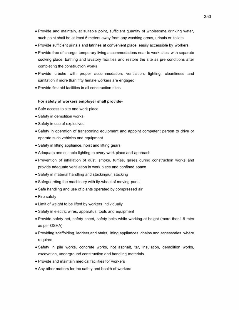
353
Provide and maintain, at suitable point, sufficient quantity of wholesome drinking water,
such point shall be at least 6 meters away from any washing areas, urinals or toilets
Provide sufficient urinals and latrines at convenient place, easily accessible by workers
Provide free of charge, temporary living accommodations near to work sites with separate
cooking place, bathing and lavatory facilities and restore the site as pre conditions after
completing the construction works
Provide crèche with proper accommodation, ventilation, lighting, cleanliness and
sanitation if more than fifty female workers are engaged
Provide first aid facilities in all construction sites
For safety of workers employer shall provide-
Safe access to site and work place
Safety in demolition works
Safety in use of explosives
Safety in operation of transporting equipment and appoint competent person to drive or
operate such vehicles and equipment
Safety in lifting appliance, hoist and lifting gears
Adequate and suitable lighting to every work place and approach
Prevention of inhalation of dust, smoke, fumes, gases during construction works and
provide adequate ventilation in work place and confined space
Safety in material handling and stacking/un stacking
Safeguarding the machinery with fly-wheel of moving parts
Safe handling and use of plants operated by compressed air
Fire safety
Limit of weight to be lifted by workers individually
Safety in electric wires, apparatus, tools and equipment
Provide safety net, safety sheet, safety belts while working at height (more than1.6 mtrs
as per OSHA)
Providing scaffolding, ladders and stairs, lifting appliances, chains and accessories where
required
Safety in pile works, concrete works, hot asphalt, tar, insulation, demolition works,
excavation, underground construction and handling materials
Provide and maintain medical facilities for workers
Any other matters for the safety and health of workers

354
Appendix 6: Status of Land Records
Details of Proposed Components under Mandi Zone: MZ01- District Kullu
Scheme Name
Village Proposed
Components Coordinates
Area Required (Sqm)/
Dimensions
Ownershi
p Khasara No
Availability of Land Records/ No Objection
Certificate (For Private Land)
Present Land Use of the Plot
Involuntary Resettlement
Impact
WSS Samalang
Teun Proposed Intake
Chamber 32° 3'6.14"N
76°59'27.51"E NA
Forest Land
Tukda No- 1
Yes Unused Vacant Land
Nil
Teun Proposed SR
Samalang 32°3'6.12"N
76°59'28.68"E 64
Forest Land
Tukda No- 1
Yes Unused Vacant Land
Nil
WSS Phallan
Phallan Proposed Intake
Suraggmani 31°59'46.45"N 77° 2'46.43"E
NA Forest Land
Tukda No- 1
Yes Unused Vacant Land
Nil
Phallan Proposed SR
Phallan 31°59'28.91"N 77°2'23.60"E
81 Forest Land
Tukda No- 1
Yes Unused Vacant Land
Nil
WSS Dughilag
Nayapani Proposed Intake
Nayapani 31°57'4.80"N 77° 4'0.10"E
NA Forest Land
Tukda No- 1
Yes Unused Vacant Land
Nil
Dughilag Proposed SR
Shildhari 31°57'24.36"N 77° 4'7.00"E
64 Forest Land
Tukda No- 1
Yes Unused Vacant Land
Nil
Chhaya Pani
Proposed Intake Chamber Chhaya
31°58'21.09"N 77° 4'39.96"E
NA Forest Land
Tukda No- 1
Yes Unused Vacant Land
Nil
Pawanag Proposed Intake
Chamber Pawanag 31°58'38.76"N 77° 4'14.82"E
NA Forest Land
Tukda No- 1
Yes Unused Vacant Land
Nil
Dughilag Proposed SR
Dughilag 31°58'11.63"N 77° 4'48.73"E
81 Forest Land
847 Yes Unused Vacant Land
Nil
WSS Mashna Mashna Proposed Intake Thach Nallah-1
31°59'57.93"N 77° 0'52.68"E
NA Forest Land
Tukda No- 1
Yes Unused Vacant Land
Nil
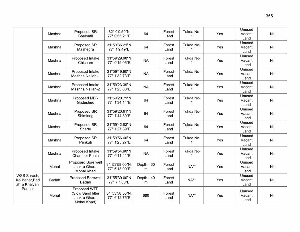
355
Mashna Proposed SR
Shelmail 32° 0'0.59"N 77° 0'55.21"E
64 Forest Land
Tukda No- 1
Yes Unused Vacant Land
Nil
Mashna Proposed SR
Mashegra 31°59'36.21"N 77° 1'9.49"E
64 Forest Land
Tukda No- 1
Yes Unused Vacant Land
Nil
Mashna Proposed Intake
Chicham 31°59'29.98"N 77° 0'19.06"E
NA Forest Land
Tukda No- 1
Yes Unused Vacant Land
Nil
Mashna Proposed Intake Mashna Nallah-1
31°59'19.90"N 77° 1'32.73"E
NA Forest Land
Tukda No- 1
Yes Unused Vacant Land
Nil
Mashna Proposed Intake Mashna Nallah-2
31°59'23.39"N 77° 1'23.80"E
NA Forest Land
Tukda No- 1
Yes Unused Vacant Land
Nil
Mashna Proposed MBR
Gadeshed 31°59'20.79"N 77° 1'34.14"E
64 Forest Land
Tukda No- 1
Yes Unused Vacant Land
Nil
Mashna Proposed SR
Shimlang 31°59'20.61"N 77° 1'44.39"E
64 Forest Land
Tukda No- 1
Yes Unused Vacant Land
Nil
Mashna Proposed SR
Shertu 31°59'42.83"N 77° 1'27.39"E
64 Forest Land
Tukda No- 1
Yes Unused Vacant Land
Nil
Mashna Proposed SR
Pankuti 31°59'56.60"N 77° 1'25.27"E
64 Forest Land
Tukda No- 1
Yes Unused Vacant Land
Nil
Mashna Proposed Intake Chamber Phala
31°59'54.90"N 77° 0'11.41"E
NA Forest Land
Tukda No- 1
Yes Unused Vacant Land
Nil
WSS Sarach, Kolibehar,Badah & Khalyani
Padhar
Mohal Proposed Bore well
Jhakru Gharat Mohal Khad
31°53'58.00"N, 77° 6'13.00"E
Depth - 60 m
Forest Land
NA** Yes Unused Vacant Land
Nil
Badah Proposed Borewell
Badah 31°55'39.00"N 77° 7'7.00"E
Depth - 40 m
Forest Land
NA** Yes Unused Vacant Land
Nil
Mohal
Proposed WTP (Slow Sand filter Jhakru Gharat Mohal Khad)
31°53'58.56"N, 77° 6'12.75"E
680 Forest Land
NA** Yes Unused Vacant Land
Nil
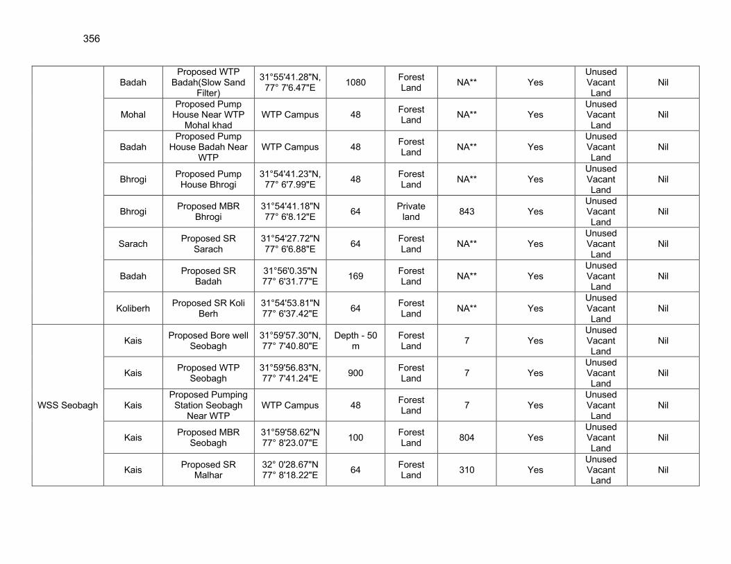
356
Badah Proposed WTP
Badah(Slow Sand Filter)
31°55'41.28"N, 77° 7'6.47"E
1080 Forest Land
NA** Yes Unused Vacant Land
Nil
Mohal Proposed Pump
House Near WTP Mohal khad
WTP Campus 48 Forest Land
NA** Yes Unused Vacant Land
Nil
Badah Proposed Pump
House Badah Near WTP
WTP Campus 48 Forest Land
NA** Yes Unused Vacant Land
Nil
Bhrogi Proposed Pump House Bhrogi
31°54'41.23"N, 77° 6'7.99"E
48 Forest Land
NA** Yes Unused Vacant Land
Nil
Bhrogi Proposed MBR
Bhrogi 31°54'41.18"N 77° 6'8.12"E
64 Private
land 843 Yes
Unused Vacant Land
Nil
Sarach Proposed SR
Sarach 31°54'27.72"N 77° 6'6.88"E
64 Forest Land
NA** Yes Unused Vacant Land
Nil
Badah Proposed SR
Badah 31°56'0.35"N 77° 6'31.77"E
169 Forest Land
NA** Yes Unused Vacant Land
Nil
Koliberh Proposed SR Koli
Berh 31°54'53.81"N 77° 6'37.42"E
64 Forest Land
NA** Yes Unused Vacant Land
Nil
WSS Seobagh
Kais Proposed Bore well
Seobagh 31°59'57.30"N, 77° 7'40.80"E
Depth - 50 m
Forest Land
7 Yes Unused Vacant Land
Nil
Kais Proposed WTP
Seobagh 31°59'56.83"N, 77° 7'41.24"E
900 Forest Land
7 Yes Unused Vacant Land
Nil
Kais Proposed Pumping
Station Seobagh Near WTP
WTP Campus 48 Forest Land
7 Yes Unused Vacant Land
Nil
Kais Proposed MBR
Seobagh 31°59'58.62"N 77° 8'23.07"E
100 Forest Land
804 Yes Unused Vacant Land
Nil
Kais Proposed SR
Malhar 32° 0'28.67"N 77° 8'18.22"E
64 Forest Land
310 Yes Unused Vacant Land
Nil
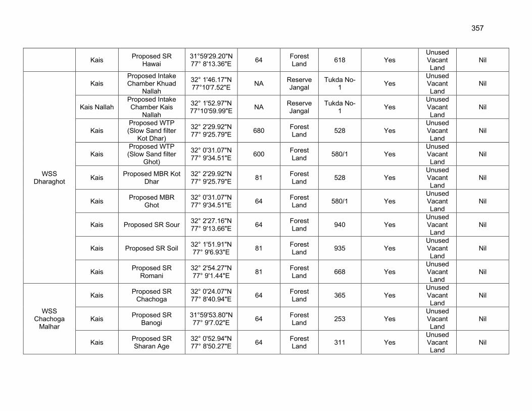
357
Kais Proposed SR
Hawai 31°59'29.20"N 77° 8'13.36"E
64 Forest Land
618 Yes Unused Vacant Land
Nil
WSS Dharaghot
Kais Proposed Intake Chamber Khuad
Nallah
32° 1'46.17"N 77°10'7.52"E
NA Reserve Jangal
Tukda No- 1
Yes Unused Vacant Land
Nil
Kais Nallah Proposed Intake Chamber Kais
Nallah
32° 1'52.97"N 77°10'59.99"E
NA Reserve Jangal
Tukda No- 1
Yes Unused Vacant Land
Nil
Kais Proposed WTP (Slow Sand filter
Kot Dhar)
32° 2'29.92"N 77° 9'25.79"E
680 Forest Land
528 Yes Unused Vacant Land
Nil
Kais Proposed WTP (Slow Sand filter
Ghot)
32° 0'31.07"N 77° 9'34.51"E
600 Forest Land
580/1 Yes Unused Vacant Land
Nil
Kais Proposed MBR Kot
Dhar 32° 2'29.92"N 77° 9'25.79"E
81 Forest Land
528 Yes Unused Vacant Land
Nil
Kais Proposed MBR
Ghot 32° 0'31.07"N 77° 9'34.51"E
64 Forest Land
580/1 Yes Unused Vacant Land
Nil
Kais Proposed SR Sour 32° 2'27.16"N 77° 9'13.66"E
64 Forest Land
940 Yes Unused Vacant Land
Nil
Kais Proposed SR Soil 32° 1'51.91"N 77° 9'6.93"E
81 Forest Land
935 Yes Unused Vacant Land
Nil
Kais Proposed SR
Romani 32° 2'54.27"N 77° 9'1.44"E
81 Forest Land
668 Yes Unused Vacant Land
Nil
WSS Chachoga
Malhar
Kais Proposed SR
Chachoga 32° 0'24.07"N 77° 8'40.94"E
64 Forest Land
365 Yes Unused Vacant Land
Nil
Kais Proposed SR
Banogi 31°59'53.80"N 77° 9'7.02"E
64 Forest Land
253 Yes Unused Vacant Land
Nil
Kais Proposed SR Sharan Age
32° 0'52.94"N 77° 8'50.27"E
64 Forest Land
311 Yes Unused Vacant Land
Nil
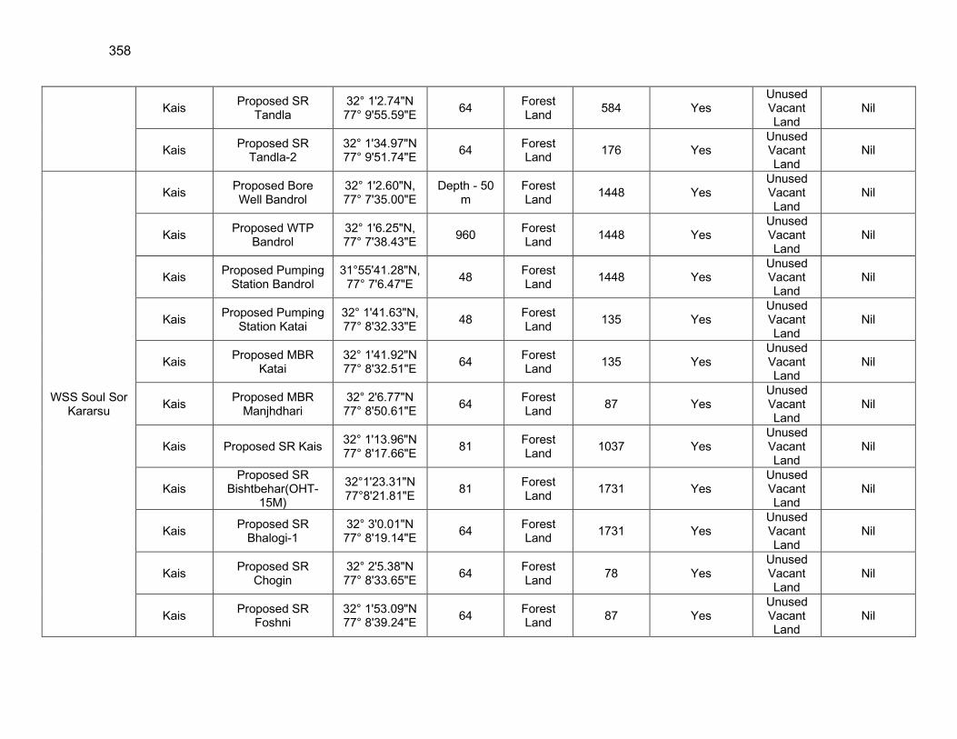
358
Kais Proposed SR
Tandla 32° 1'2.74"N 77° 9'55.59"E
64 Forest Land
584 Yes Unused Vacant Land
Nil
Kais Proposed SR
Tandla-2 32° 1'34.97"N 77° 9'51.74"E
64 Forest Land
176 Yes Unused Vacant Land
Nil
WSS Soul Sor Kararsu
Kais Proposed Bore Well Bandrol
32° 1'2.60"N, 77° 7'35.00"E
Depth - 50 m
Forest Land
1448 Yes Unused Vacant Land
Nil
Kais Proposed WTP
Bandrol 32° 1'6.25"N, 77° 7'38.43"E
960 Forest Land
1448 Yes Unused Vacant Land
Nil
Kais Proposed Pumping
Station Bandrol 31°55'41.28"N,
77° 7'6.47"E 48
Forest Land
1448 Yes Unused Vacant Land
Nil
Kais Proposed Pumping
Station Katai 32° 1'41.63"N, 77° 8'32.33"E
48 Forest Land
135 Yes Unused Vacant Land
Nil
Kais Proposed MBR
Katai 32° 1'41.92"N 77° 8'32.51"E
64 Forest Land
135 Yes Unused Vacant Land
Nil
Kais Proposed MBR
Manjhdhari 32° 2'6.77"N 77° 8'50.61"E
64 Forest Land
87 Yes Unused Vacant Land
Nil
Kais Proposed SR Kais 32° 1'13.96"N 77° 8'17.66"E
81 Forest Land
1037 Yes Unused Vacant Land
Nil
Kais Proposed SR
Bishtbehar(OHT-15M)
32°1'23.31"N 77°8'21.81"E
81 Forest Land
1731 Yes Unused Vacant Land
Nil
Kais Proposed SR
Bhalogi-1 32° 3'0.01"N 77° 8'19.14"E
64 Forest Land
1731 Yes Unused Vacant Land
Nil
Kais Proposed SR
Chogin 32° 2'5.38"N 77° 8'33.65"E
64 Forest Land
78 Yes Unused Vacant Land
Nil
Kais Proposed SR
Foshni 32° 1'53.09"N 77° 8'39.24"E
64 Forest Land
87 Yes Unused Vacant Land
Nil
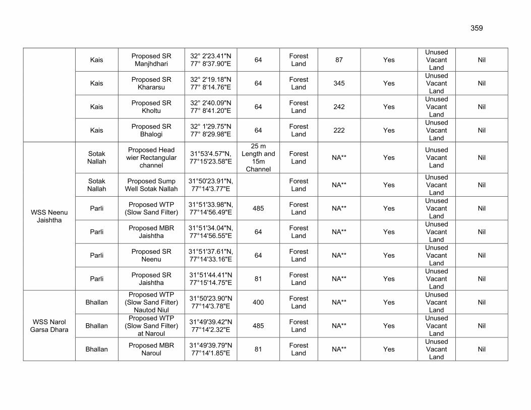
359
Kais Proposed SR Manjhdhari
32° 2'23.41"N 77° 8'37.90"E
64 Forest Land
87 Yes Unused Vacant Land
Nil
Kais Proposed SR
Khararsu 32° 2'19.18"N 77° 8'14.76"E
64 Forest Land
345 Yes Unused Vacant Land
Nil
Kais Proposed SR
Kholtu 32° 2'40.09"N 77° 8'41.20"E
64 Forest Land
242 Yes Unused Vacant Land
Nil
Kais Proposed SR
Bhalogi 32° 1'29.75"N 77° 8'29.98"E
64 Forest Land
222 Yes Unused Vacant Land
Nil
WSS Neenu Jaishtha
Sotak Nallah
Proposed Head wier Rectangular
channel
31°53'4.57"N, 77°15'23.58"E
25 m Length and
15m Channel
Forest Land
NA** Yes Unused Vacant Land
Nil
Sotak Nallah
Proposed Sump Well Sotak Nallah
31°50'23.91"N, 77°14'3.77"E
Forest Land
NA** Yes Unused Vacant Land
Nil
Parli Proposed WTP
(Slow Sand Filter) 31°51'33.98"N, 77°14'56.49"E
485 Forest Land
NA** Yes Unused Vacant Land
Nil
Parli Proposed MBR
Jaishtha 31°51'34.04"N, 77°14'56.55"E
64 Forest Land
NA** Yes Unused Vacant Land
Nil
Parli Proposed SR
Neenu 31°51'37.61"N, 77°14'33.16"E
64 Forest Land
NA** Yes Unused Vacant Land
Nil
Parli Proposed SR
Jaishtha 31°51'44.41"N77°15'14.75"E
81 Forest Land
NA** Yes Unused Vacant Land
Nil
WSS Narol Garsa Dhara
Bhallan Proposed WTP
(Slow Sand Filter) Nautod Niul
31°50'23.90"N 77°14'3.78"E
400 Forest Land
NA** Yes Unused Vacant Land
Nil
Bhallan Proposed WTP
(Slow Sand Filter) at Naroul
31°49'39.42"N77°14'2.32"E
485 Forest Land
NA** Yes Unused Vacant Land
Nil
Bhallan Proposed MBR
Naroul 31°49'39.79"N77°14'1.85"E
81 Forest Land
NA** Yes Unused Vacant Land
Nil
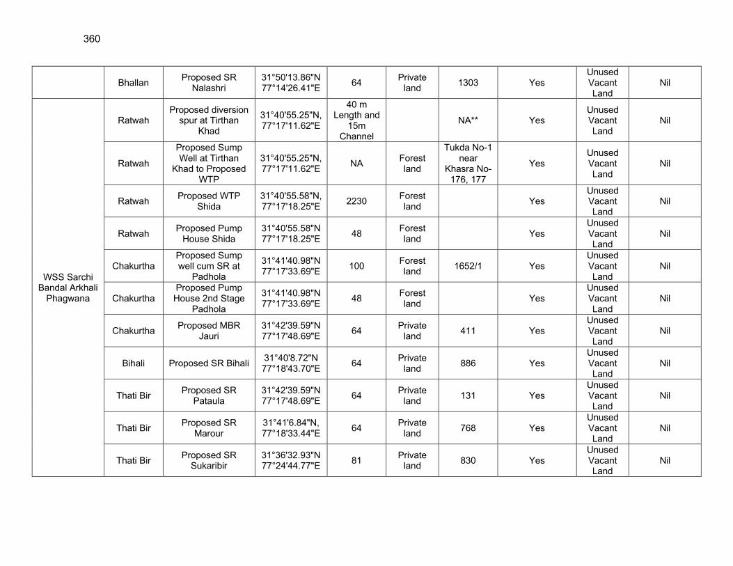
360
Bhallan Proposed SR
Nalashri 31°50'13.86"N77°14'26.41"E
64 Private
land 1303 Yes
Unused Vacant Land
Nil
WSS Sarchi Bandal Arkhali
Phagwana
Ratwah Proposed diversion
spur at Tirthan Khad
31°40'55.25"N,77°17'11.62"E
40 m Length and
15m Channel
NA** Yes Unused Vacant Land
Nil
Ratwah
Proposed Sump Well at Tirthan
Khad to Proposed WTP
31°40'55.25"N, 77°17'11.62"E
NA Forest land
Tukda No-1 near
Khasra No-176, 177
Yes Unused Vacant Land
Nil
Ratwah Proposed WTP
Shida 31°40'55.58"N, 77°17'18.25"E
2230 Forest land
Yes Unused Vacant Land
Nil
Ratwah Proposed Pump
House Shida 31°40'55.58"N77°17'18.25"E
48 Forest land
Yes Unused Vacant Land
Nil
Chakurtha Proposed Sump well cum SR at
Padhola
31°41'40.98"N77°17'33.69"E
100 Forest land
1652/1 Yes Unused Vacant Land
Nil
Chakurtha Proposed Pump House 2nd Stage
Padhola
31°41'40.98"N77°17'33.69"E
48 Forest land
Yes Unused Vacant Land
Nil
Chakurtha Proposed MBR
Jauri 31°42'39.59"N77°17'48.69"E
64 Private
land 411 Yes
Unused Vacant Land
Nil
Bihali Proposed SR Bihali 31°40'8.72"N 77°18'43.70"E
64 Private
land 886 Yes
Unused Vacant Land
Nil
Thati Bir Proposed SR
Pataula 31°42'39.59"N77°17'48.69"E
64 Private
land 131 Yes
Unused Vacant Land
Nil
Thati Bir Proposed SR
Marour 31°41'6.84"N, 77°18'33.44"E
64 Private
land 768 Yes
Unused Vacant Land
Nil
Thati Bir Proposed SR
Sukaribir 31°36'32.93"N77°24'44.77"E
81 Private
land 830 Yes
Unused Vacant Land
Nil
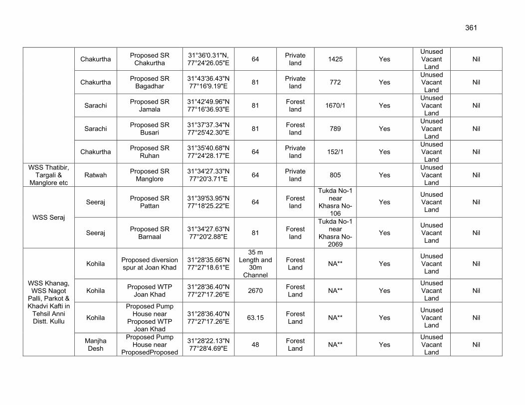
361
Chakurtha Proposed SR
Chakurtha 31°36'0.31"N, 77°24'26.05"E
64 Private
land 1425 Yes
Unused Vacant Land
Nil
Chakurtha Proposed SR
Bagadhar 31°43'36.43"N77°16'9.19"E
81 Private
land 772 Yes
Unused Vacant Land
Nil
Sarachi Proposed SR
Jamala 31°42'49.96"N77°16'36.93"E
81 Forest land
1670/1 Yes Unused Vacant Land
Nil
Sarachi Proposed SR
Busari 31°37'37.34"N77°25'42.30"E
81 Forest land
789 Yes Unused Vacant Land
Nil
Chakurtha Proposed SR
Ruhan 31°35'40.68"N77°24'28.17"E
64 Private
land 152/1 Yes
Unused Vacant Land
Nil
WSS Thatibir, Targali &
Manglore etc Ratwah
Proposed SR Manglore
31°34'27.33"N77°20'3.71"E
64 Private
land 805 Yes
Unused Vacant Land
Nil
WSS Seraj
Seeraj Proposed SR
Pattan 31°39'53.95"N77°18'25.22"E
64 Forest land
Tukda No-1 near
Khasra No-106
Yes Unused Vacant Land
Nil
Seeraj Proposed SR
Barnaal 31°34'27.63"N77°20'2.88"E
81 Forest land
Tukda No-1 near
Khasra No-2069
Yes Unused Vacant Land
Nil
WSS Khanag, WSS Nagot
Palli, Parkot & Khadvi Kafti in
Tehsil Anni Distt. Kullu
Kohila Proposed diversion spur at Joan Khad
31°28'35.66"N 77°27'18.61"E
35 m Length and
30m Channel
Forest Land
NA** Yes Unused Vacant Land
Nil
Kohila Proposed WTP
Joan Khad 31°28'36.40"N 77°27'17.26"E
2670 Forest Land
NA** Yes Unused Vacant Land
Nil
Kohila
Proposed Pump House near
Proposed WTP Joan Khad
31°28'36.40"N 77°27'17.26"E
63.15 Forest Land
NA** Yes Unused Vacant Land
Nil
Manjha Desh
Proposed Pump House near
ProposedProposed
31°28'22.13"N 77°28'4.69"E
48 Forest Land
NA** Yes Unused Vacant Land
Nil
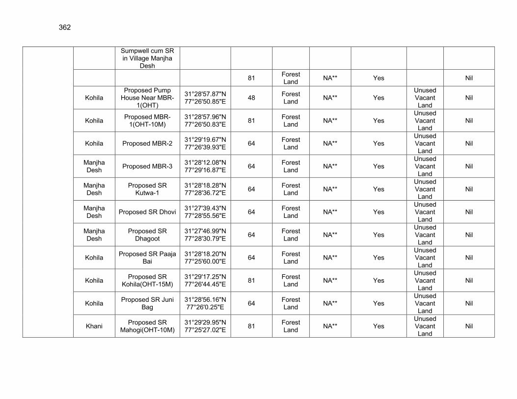
362
Sumpwell cum SR in Village Manjha
Desh
81 Forest Land
NA** Yes Nil
Kohila Proposed Pump
House Near MBR-1(OHT)
31°28'57.87"N 77°26'50.85"E
48 Forest Land
NA** Yes Unused Vacant Land
Nil
Kohila Proposed MBR-
1(OHT-10M) 31°28'57.96"N 77°26'50.83"E
81 Forest Land
NA** Yes Unused Vacant Land
Nil
Kohila Proposed MBR-2 31°29'19.67"N 77°26'39.93"E
64 Forest Land
NA** Yes Unused Vacant Land
Nil
Manjha Desh
Proposed MBR-3 31°28'12.08"N 77°29'16.87"E
64 Forest Land
NA** Yes Unused Vacant Land
Nil
Manjha Desh
Proposed SR Kutwa-1
31°28'18.28"N 77°28'36.72"E
64 Forest Land
NA** Yes Unused Vacant Land
Nil
Manjha Desh
Proposed SR Dhovi 31°27'39.43"N 77°28'55.56"E
64 Forest Land
NA** Yes Unused Vacant Land
Nil
Manjha Desh
Proposed SR Dhagoot
31°27'46.99"N 77°28'30.79"E
64 Forest Land
NA** Yes Unused Vacant Land
Nil
Kohila Proposed SR Paaja
Bai 31°28'18.20"N 77°25'60.00"E
64 Forest Land
NA** Yes Unused Vacant Land
Nil
Kohila Proposed SR
Kohila(OHT-15M) 31°29'17.25"N 77°26'44.45"E
81 Forest Land
NA** Yes Unused Vacant Land
Nil
Kohila Proposed SR Juni
Bag 31°28'56.16"N 77°26'0.25"E
64 Forest Land
NA** Yes Unused Vacant Land
Nil
Khani Proposed SR
Mahogi(OHT-10M) 31°29'29.95"N 77°25'27.02"E
81 Forest Land
NA** Yes Unused Vacant Land
Nil
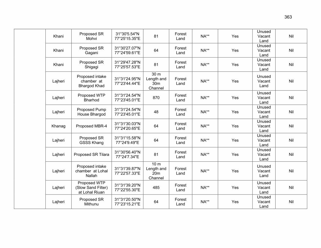
363
Khani Proposed SR
Mohvi 31°30'5.54"N 77°25'15.35"E
81 Forest Land
NA** Yes Unused Vacant Land
Nil
Khani Proposed SR
Gagani 31°30'27.07"N 77°24'59.61"E
64 Forest Land
NA** Yes Unused Vacant Land
Nil
Khani Proposed SR
Shigagi 31°29'47.28"N 77°25'57.53"E
81 Forest Land
NA** Yes Unused Vacant Land
Nil
Lajheri Proposed intake
chamber at Bhargod Khad
31°31'24.95"N 77°23'44.44"E
30 m Length and
30m Channel
Forest Land
NA** Yes Unused Vacant Land
Nil
Lajheri Proposed WTP
Bharhod 31°31'24.54"N 77°23'45.01"E
870 Forest Land
NA** Yes Unused Vacant Land
Nil
Lajheri Proposed Pump House Bhargod
31°31'24.54"N 77°23'45.01"E
48 Forest Land
NA** Yes Unused Vacant Land
Nil
Khanag Proposed MBR-4 31°31'30.03"N 77°24'20.65"E
64 Forest Land
NA** Yes Unused Vacant Land
Nil
Lajheri Proposed SR GSSS Khang
31°31'15.58"N 77°24'9.49"E
64 Forest Land
NA** Yes Unused Vacant Land
Nil
Lajheri Proposed SR Tilara 31°30'56.40"N 77°24'7.34"E
81 Forest Land
NA** Yes Unused Vacant Land
Nil
Lajheri Proposed intake
chamber at Lohal Nallah
31°31'39.87"N 77°22'57.33"E
10 m Length and
20m Channel
Forest Land
NA** Yes Unused Vacant Land
Nil
Lajheri Proposed WTP
(Slow Sand Filter) at Lohal Riuan
31°31'39.20"N 77°22'55.30"E
485 Forest Land
NA** Yes Unused Vacant Land
Nil
Lajheri Proposed SR
Mithunu 31°31'20.50"N 77°23'15.21"E
64 Forest Land
NA** Yes Unused Vacant Land
Nil
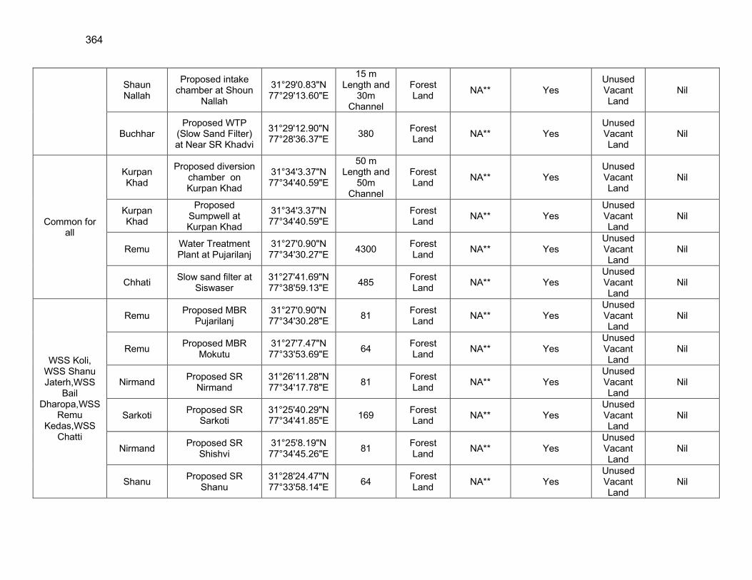
364
Shaun Nallah
Proposed intake chamber at Shoun
Nallah
31°29'0.83"N 77°29'13.60"E
15 m Length and
30m Channel
Forest Land
NA** Yes Unused Vacant Land
Nil
Buchhar Proposed WTP
(Slow Sand Filter) at Near SR Khadvi
31°29'12.90"N 77°28'36.37"E
380 Forest Land
NA** Yes Unused Vacant Land
Nil
Common for all
Kurpan Khad
Proposed diversion chamber on Kurpan Khad
31°34'3.37"N 77°34'40.59"E
50 m Length and
50m Channel
Forest Land
NA** Yes Unused Vacant Land
Nil
Kurpan Khad
Proposed Sumpwell at Kurpan Khad
31°34'3.37"N 77°34'40.59"E
Forest Land
NA** Yes Unused Vacant Land
Nil
Remu Water Treatment Plant at Pujarilanj
31°27'0.90"N 77°34'30.27"E
4300 Forest Land
NA** Yes Unused Vacant Land
Nil
Chhati Slow sand filter at
Siswaser 31°27'41.69"N 77°38'59.13"E
485 Forest Land
NA** Yes Unused Vacant Land
Nil
WSS Koli, WSS Shanu Jaterh,WSS
Bail Dharopa,WSS
Remu Kedas,WSS
Chatti
Remu Proposed MBR
Pujarilanj 31°27'0.90"N 77°34'30.28"E
81 Forest Land
NA** Yes Unused Vacant Land
Nil
Remu Proposed MBR
Mokutu 31°27'7.47"N 77°33'53.69"E
64 Forest Land
NA** Yes Unused Vacant Land
Nil
Nirmand Proposed SR
Nirmand 31°26'11.28"N 77°34'17.78"E
81 Forest Land
NA** Yes Unused Vacant Land
Nil
Sarkoti Proposed SR
Sarkoti 31°25'40.29"N 77°34'41.85"E
169 Forest Land
NA** Yes Unused Vacant Land
Nil
Nirmand Proposed SR
Shishvi 31°25'8.19"N 77°34'45.26"E
81 Forest Land
NA** Yes Unused Vacant Land
Nil
Shanu Proposed SR
Shanu 31°28'24.47"N 77°33'58.14"E
64 Forest Land
NA** Yes Unused Vacant Land
Nil
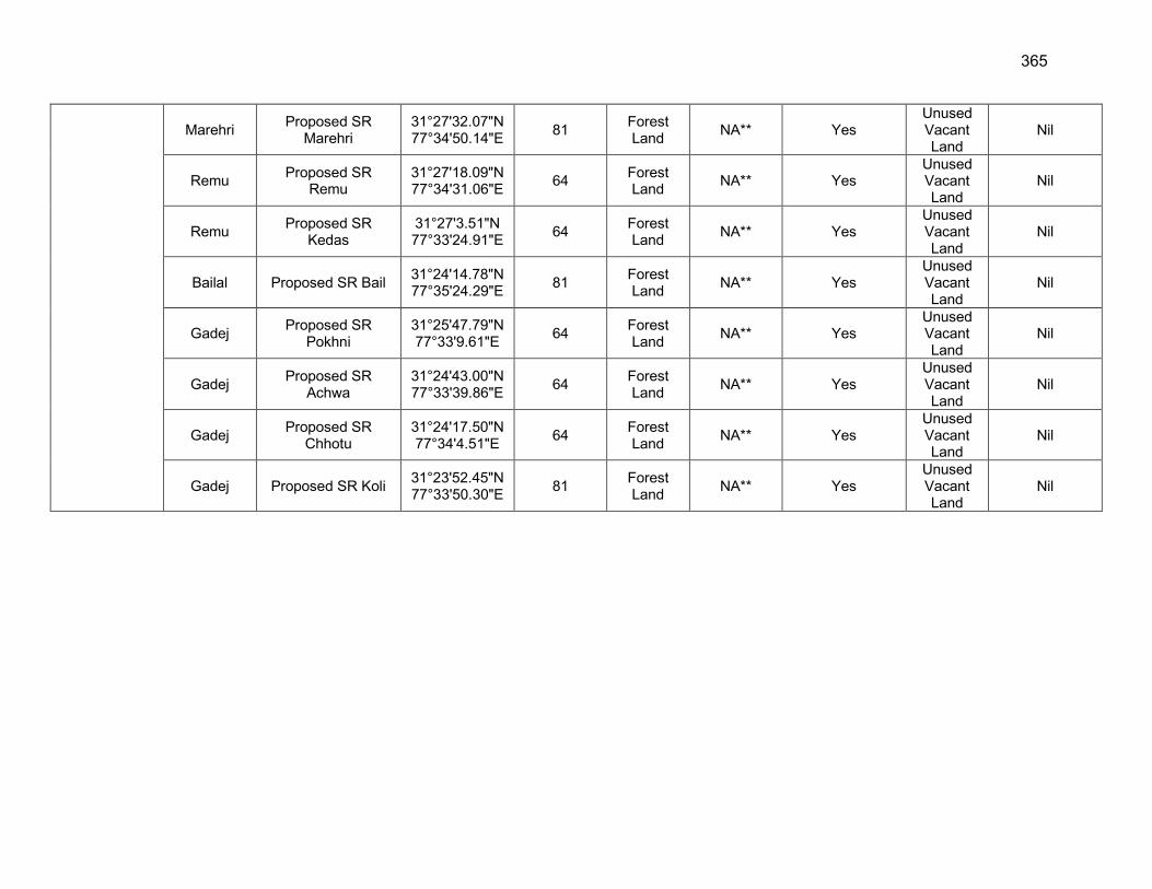
365
Marehri Proposed SR
Marehri 31°27'32.07"N 77°34'50.14"E
81 Forest Land
NA** Yes Unused Vacant Land
Nil
Remu Proposed SR
Remu 31°27'18.09"N 77°34'31.06"E
64 Forest Land
NA** Yes Unused Vacant Land
Nil
Remu Proposed SR
Kedas 31°27'3.51"N 77°33'24.91"E
64 Forest Land
NA** Yes Unused Vacant Land
Nil
Bailal Proposed SR Bail 31°24'14.78"N 77°35'24.29"E
81 Forest Land
NA** Yes Unused Vacant Land
Nil
Gadej Proposed SR
Pokhni 31°25'47.79"N 77°33'9.61"E
64 Forest Land
NA** Yes Unused Vacant Land
Nil
Gadej Proposed SR
Achwa 31°24'43.00"N 77°33'39.86"E
64 Forest Land
NA** Yes Unused Vacant Land
Nil
Gadej Proposed SR
Chhotu 31°24'17.50"N 77°34'4.51"E
64 Forest Land
NA** Yes Unused Vacant Land
Nil
Gadej Proposed SR Koli 31°23'52.45"N 77°33'50.30"E
81 Forest Land
NA** Yes Unused Vacant Land
Nil
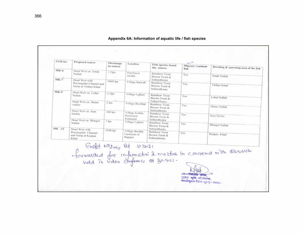
366
Appendix 6A: Information of aquatic life / fish species
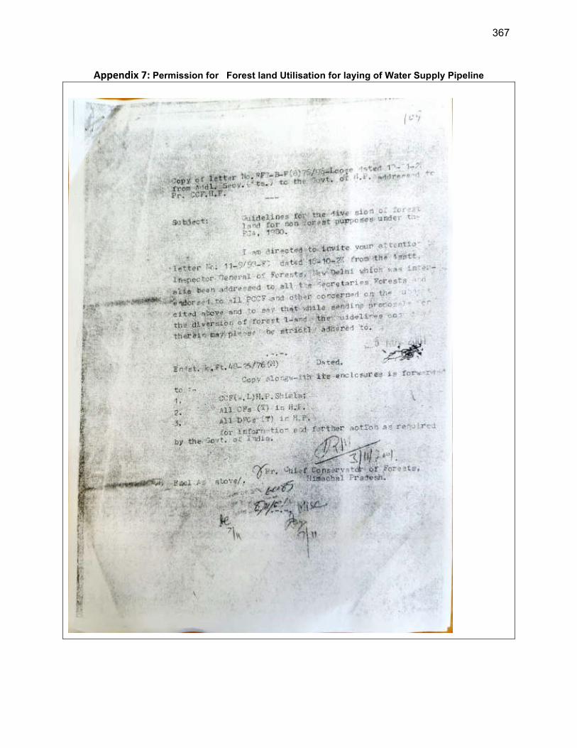
367
Appendix 7: Permission for Forest land Utilisation for laying of Water Supply Pipeline
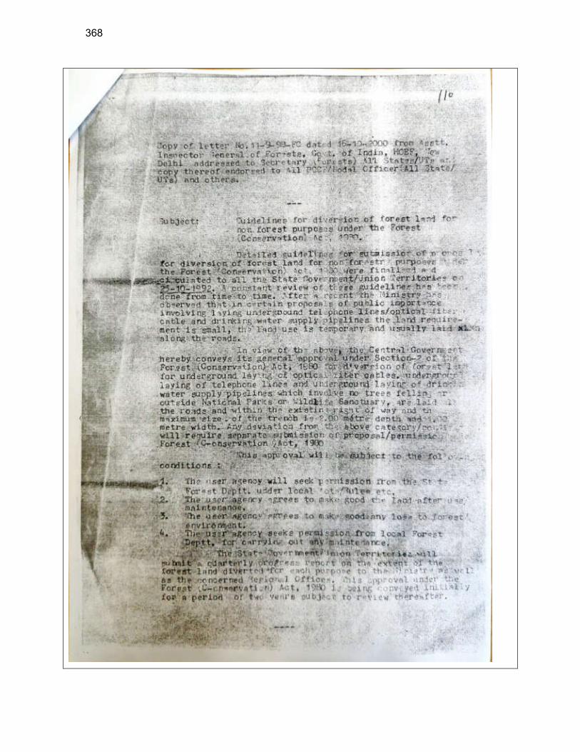
368

369
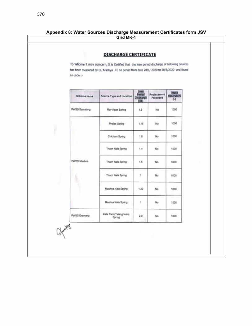
370
Appendix 8: Water Sources Discharge Measurement Certificates form JSV Grid MK-1
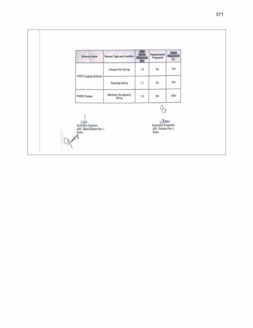
371
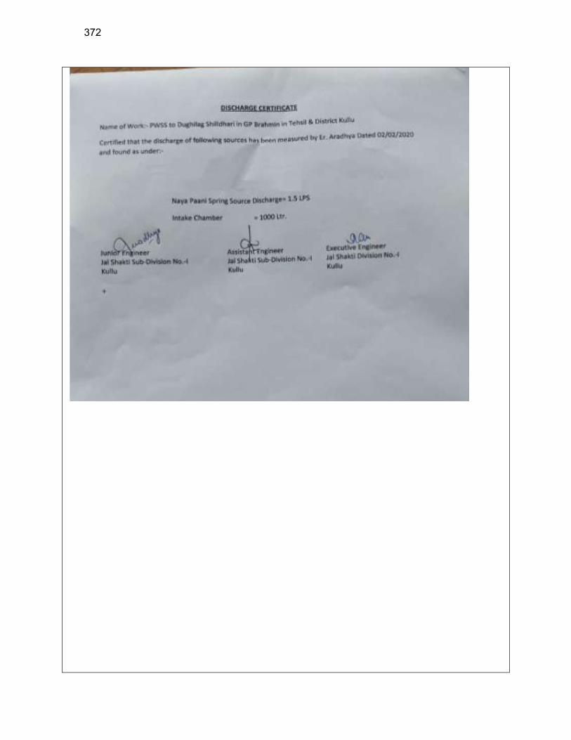
372
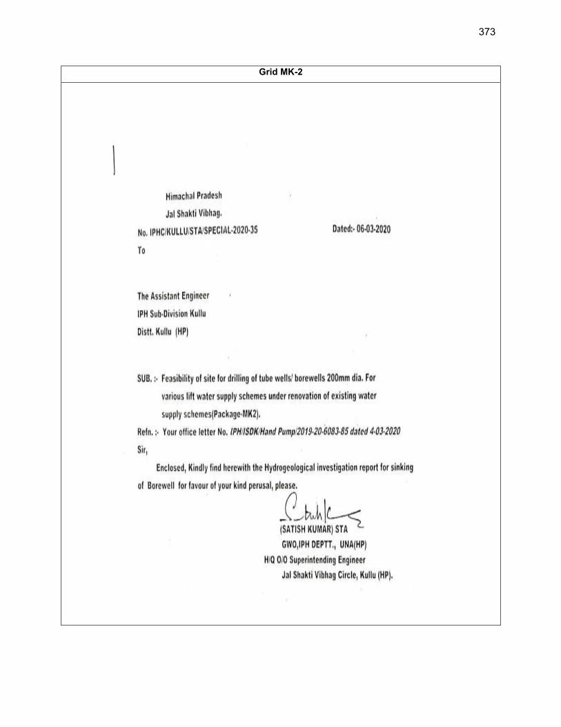
373
Grid MK-2
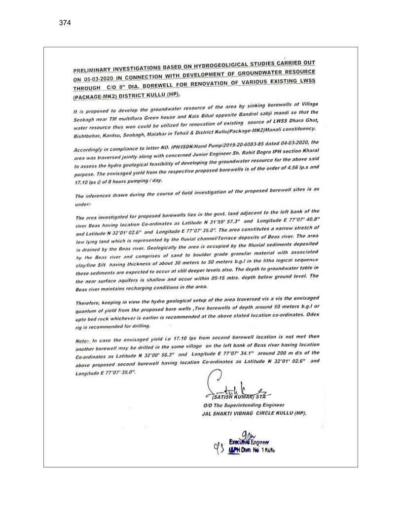
374
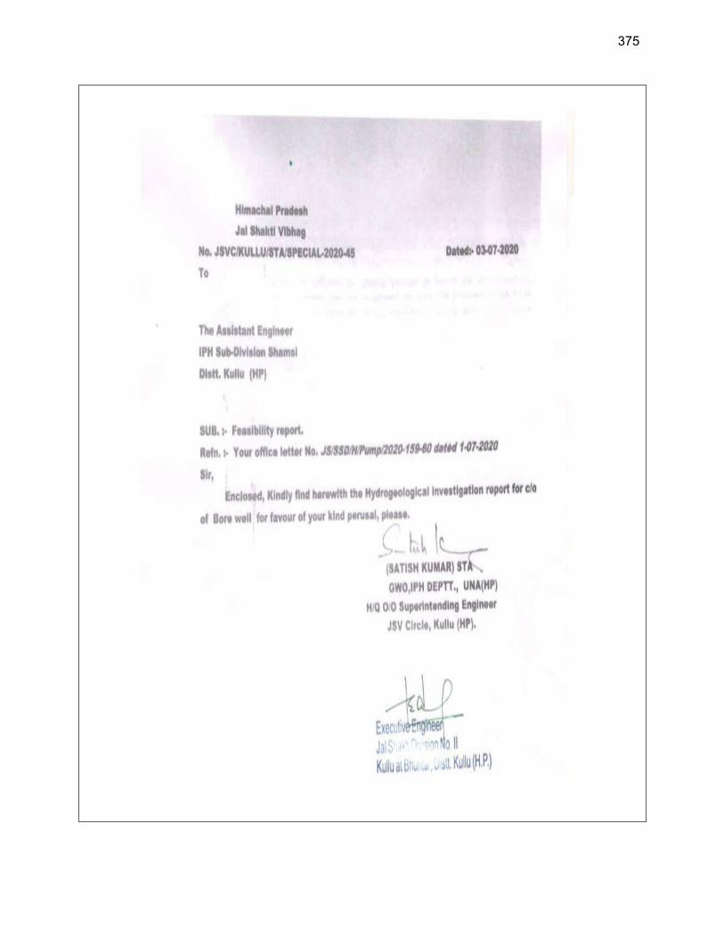
375
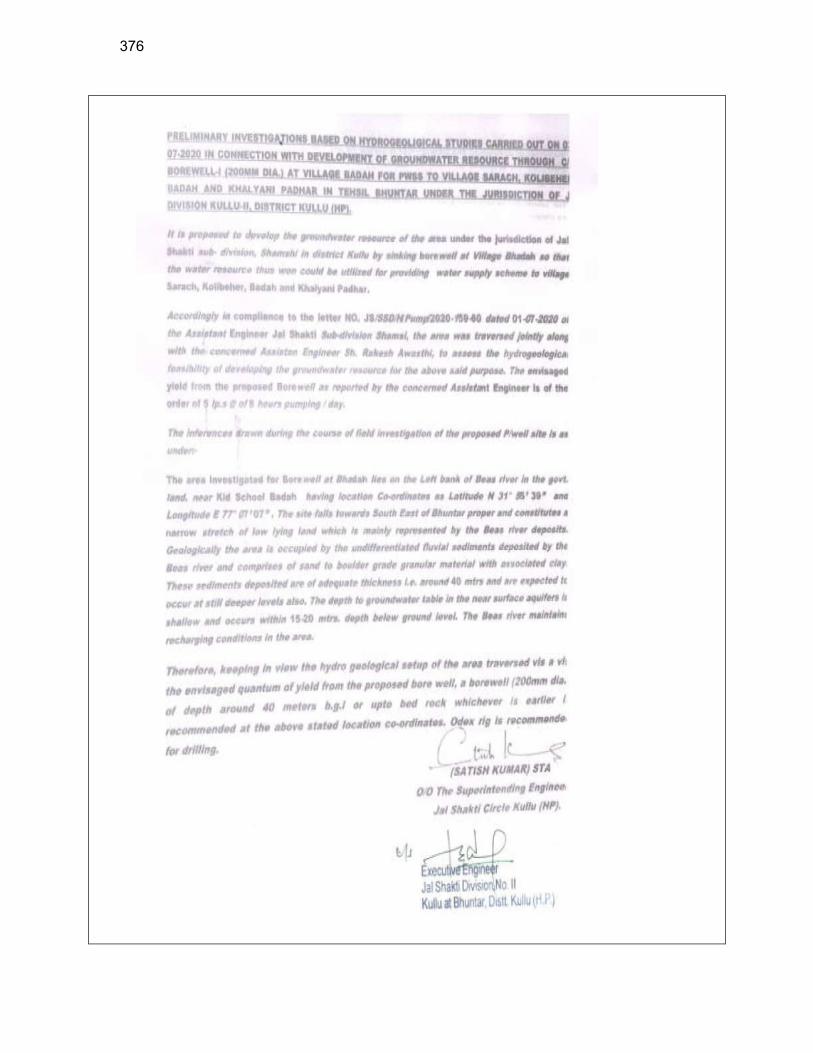
376
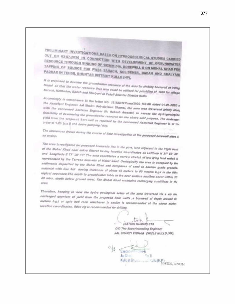
377
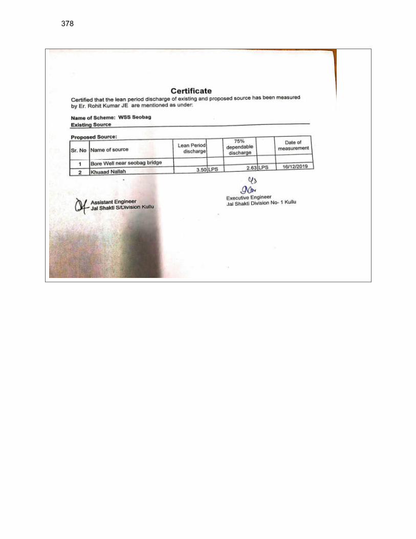
378
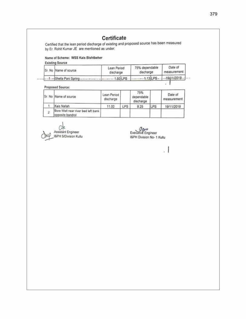
379
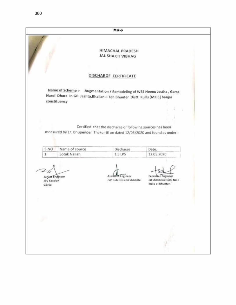
380
MK-6
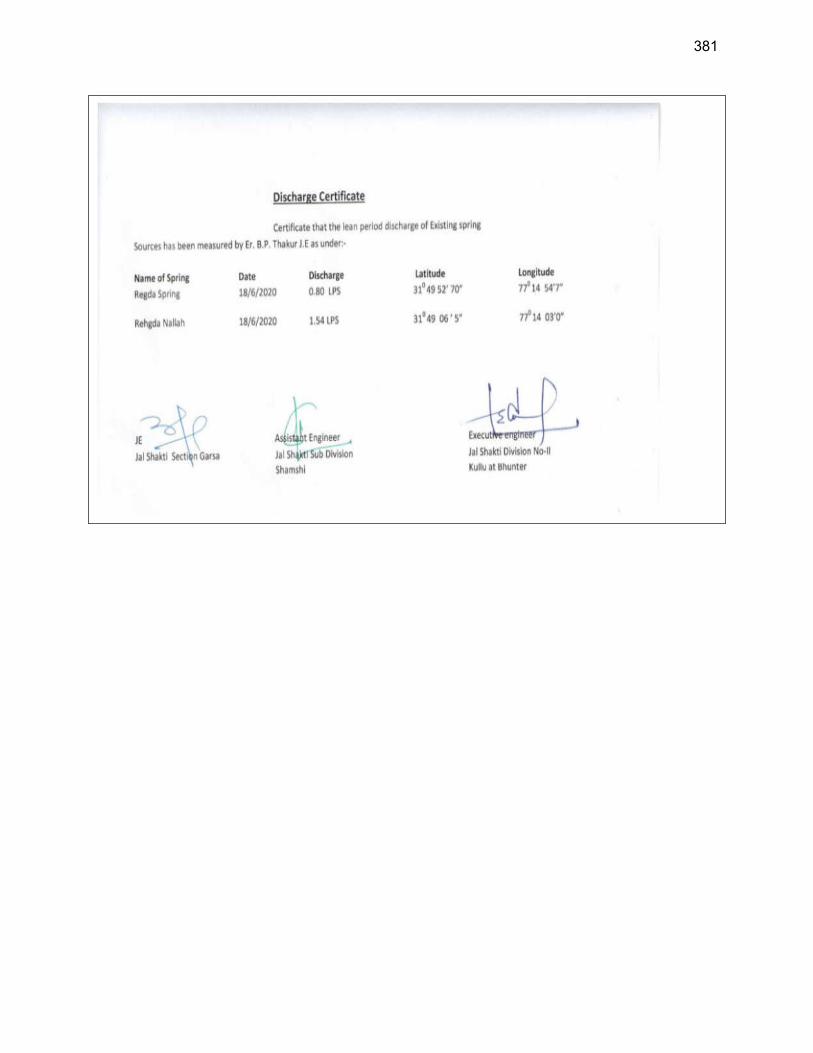
381
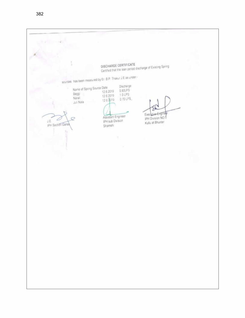
382

383
MK-7
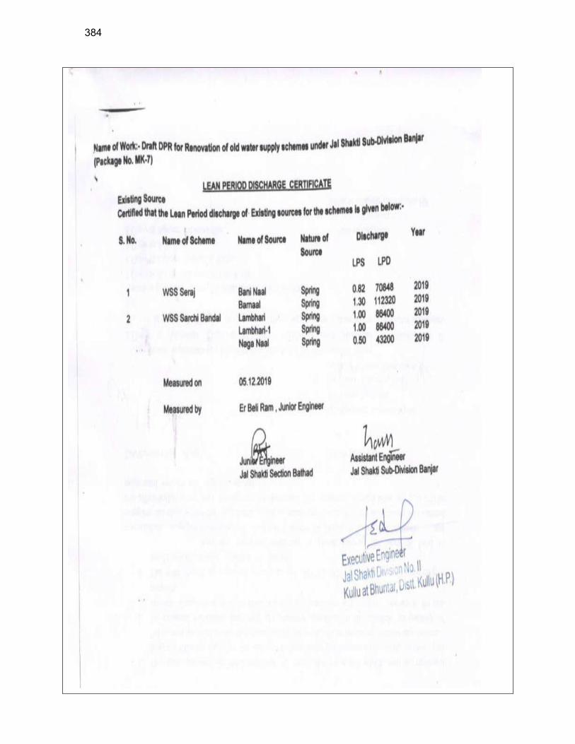
384
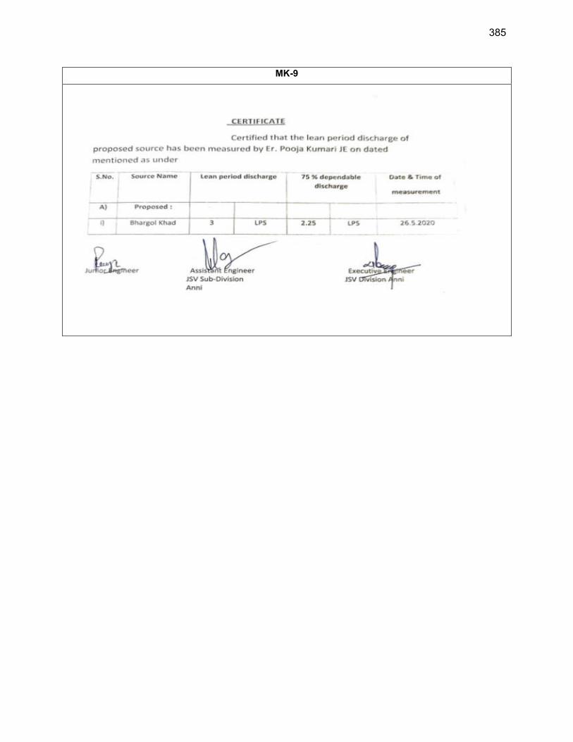
385
MK-9
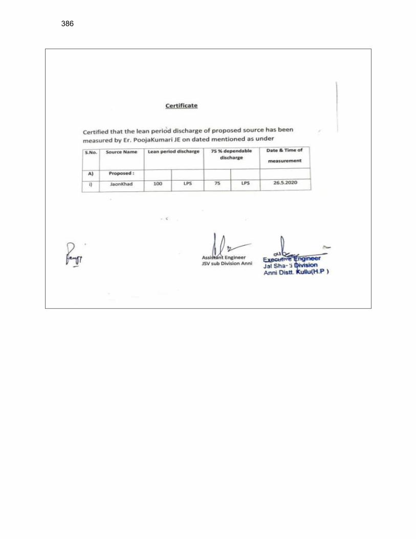
386
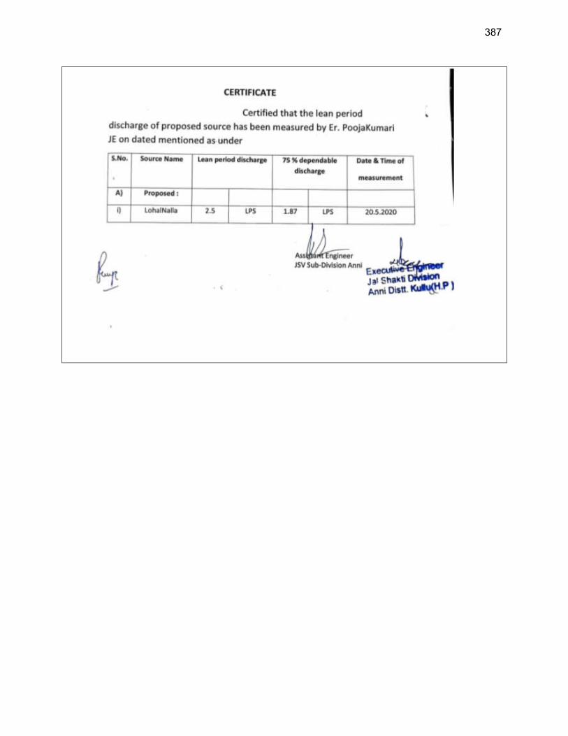
387
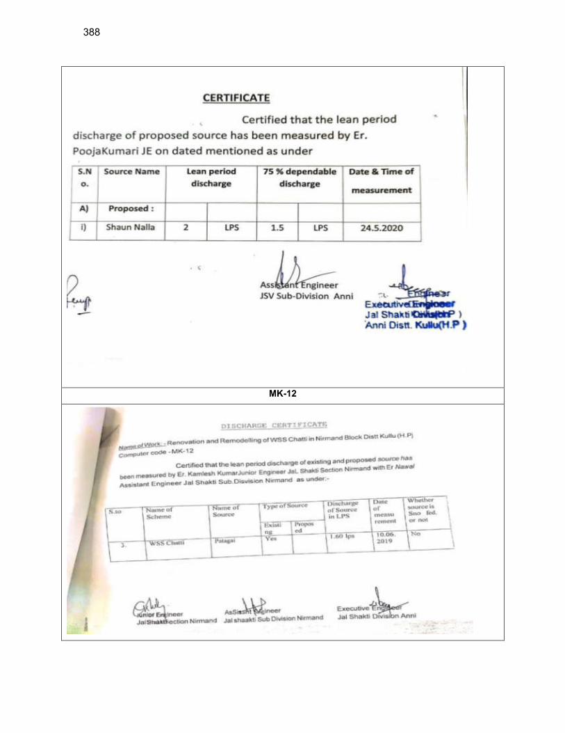
388
MK-12
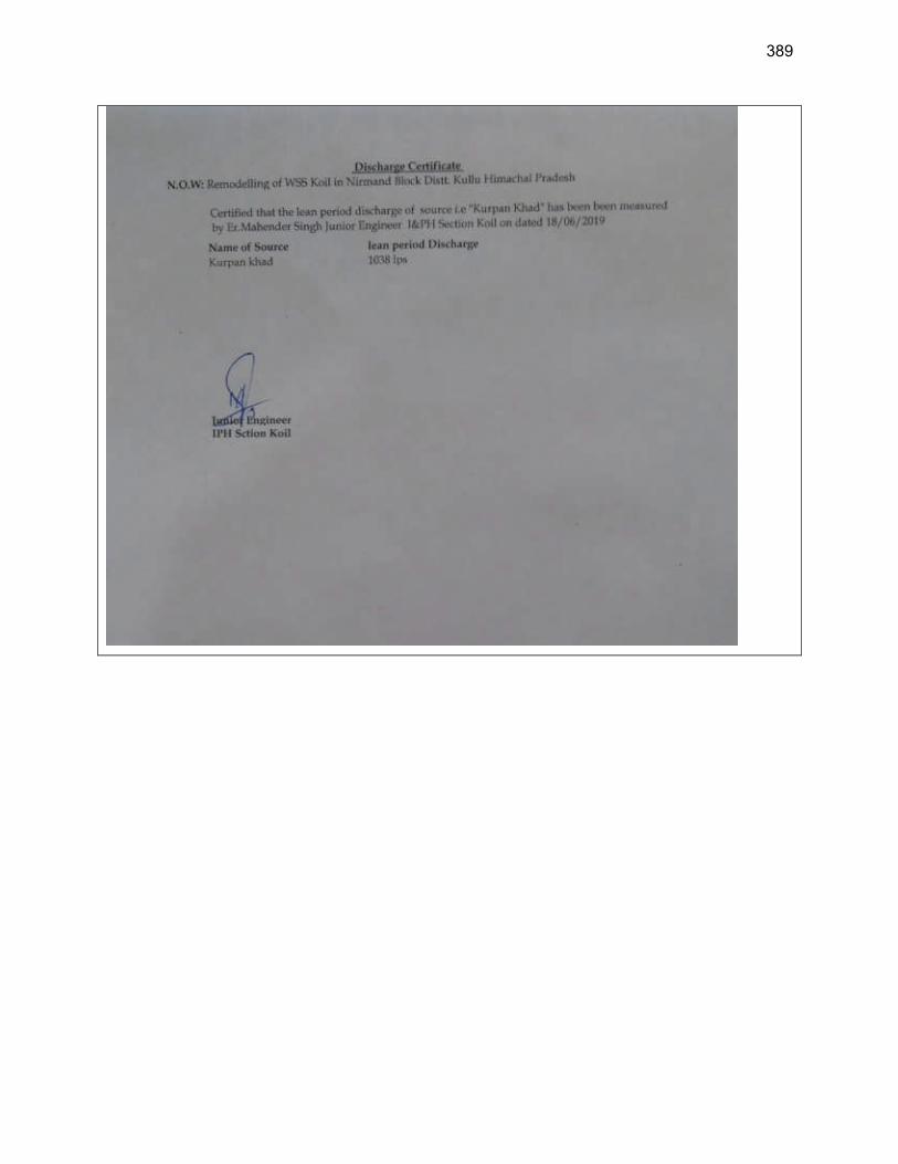
389
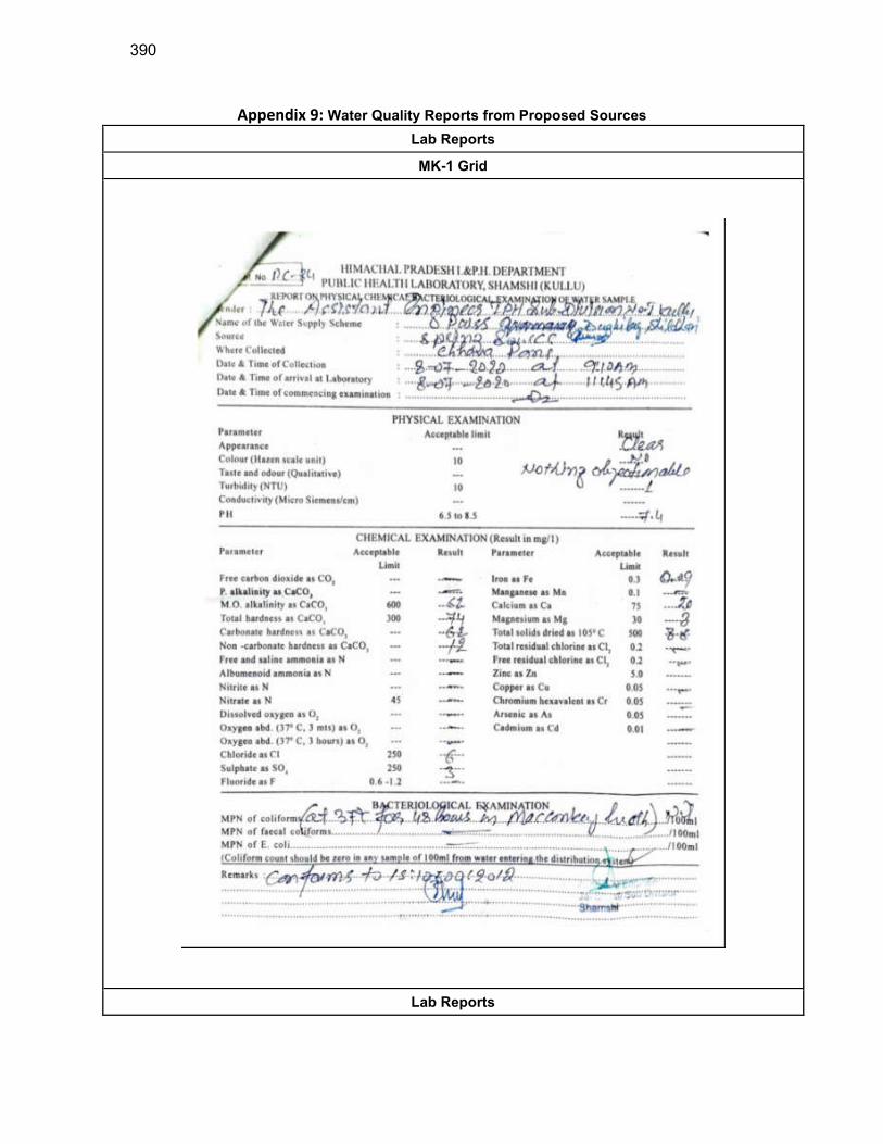
390
Appendix 9: Water Quality Reports from Proposed Sources
Lab Reports
MK-1 Grid
Lab Reports
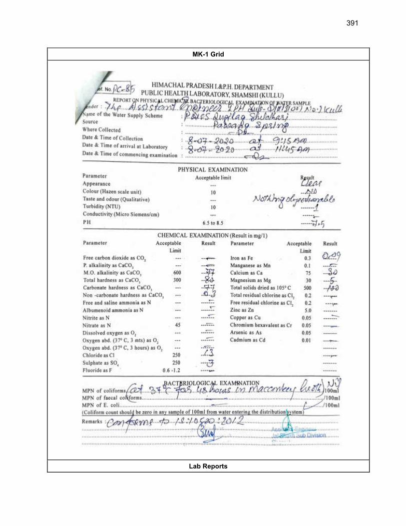
391
MK-1 Grid
Lab Reports
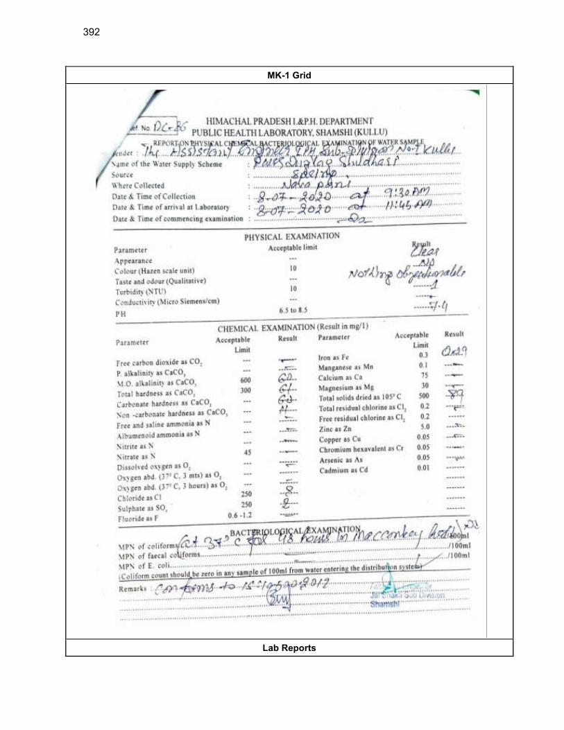
392
MK-1 Grid
Lab Reports
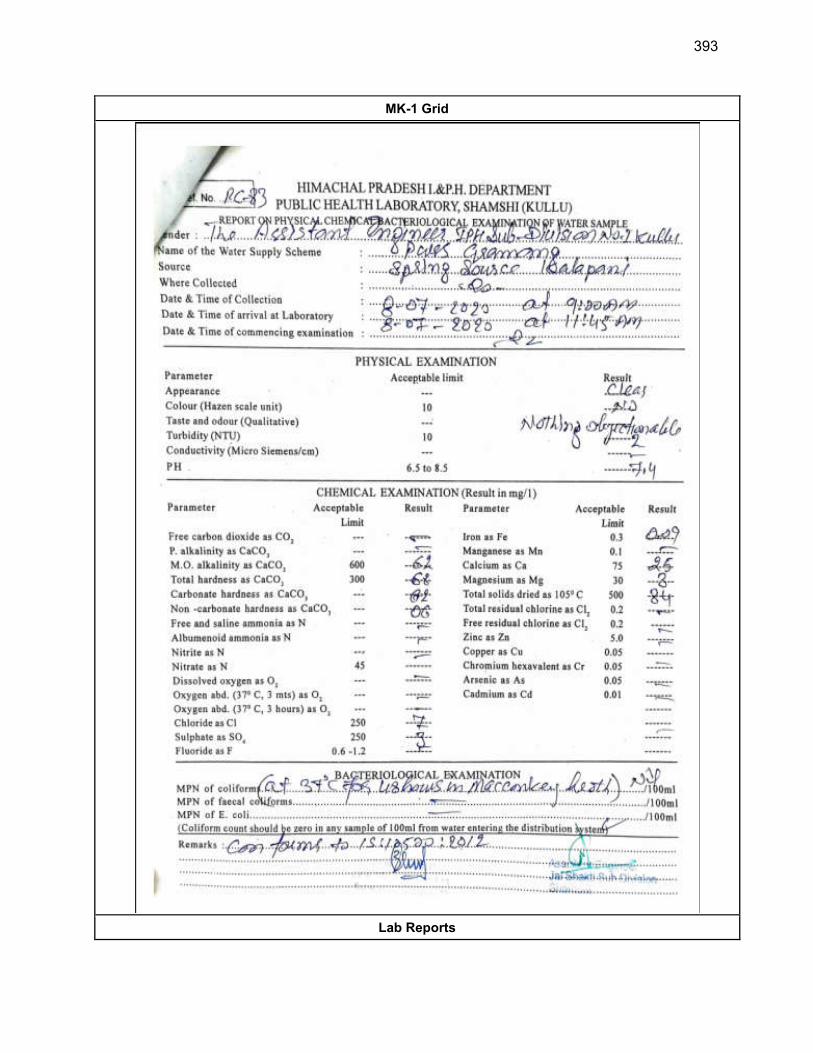
393
MK-1 Grid
Lab Reports
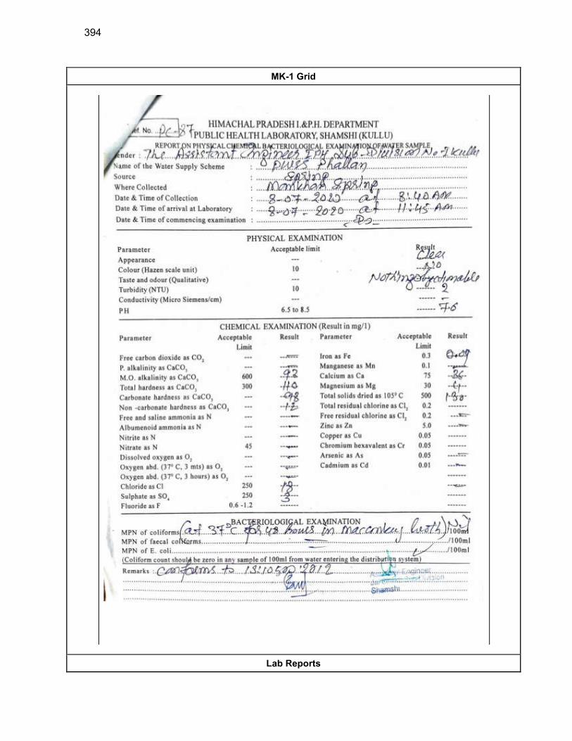
394
MK-1 Grid
Lab Reports

395
MK-1 Grid
Lab Reports
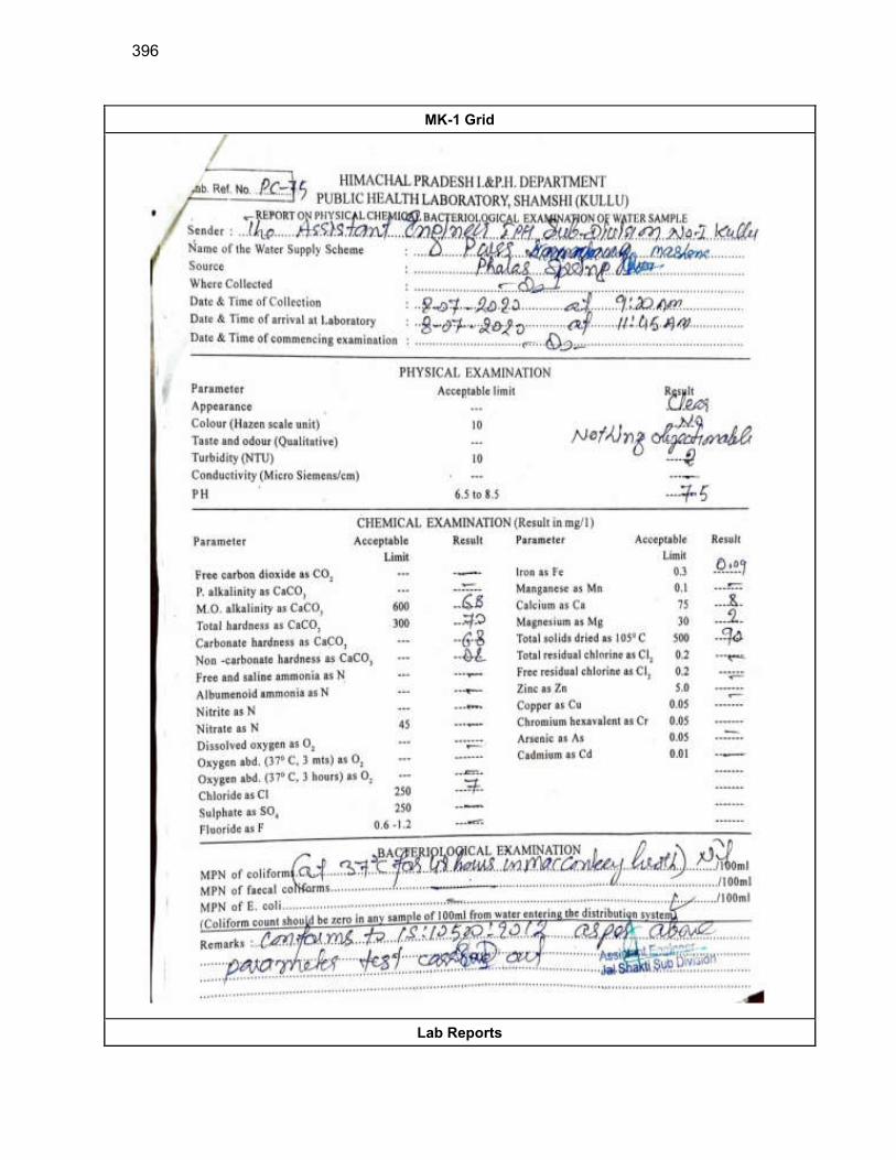
396
MK-1 Grid
Lab Reports
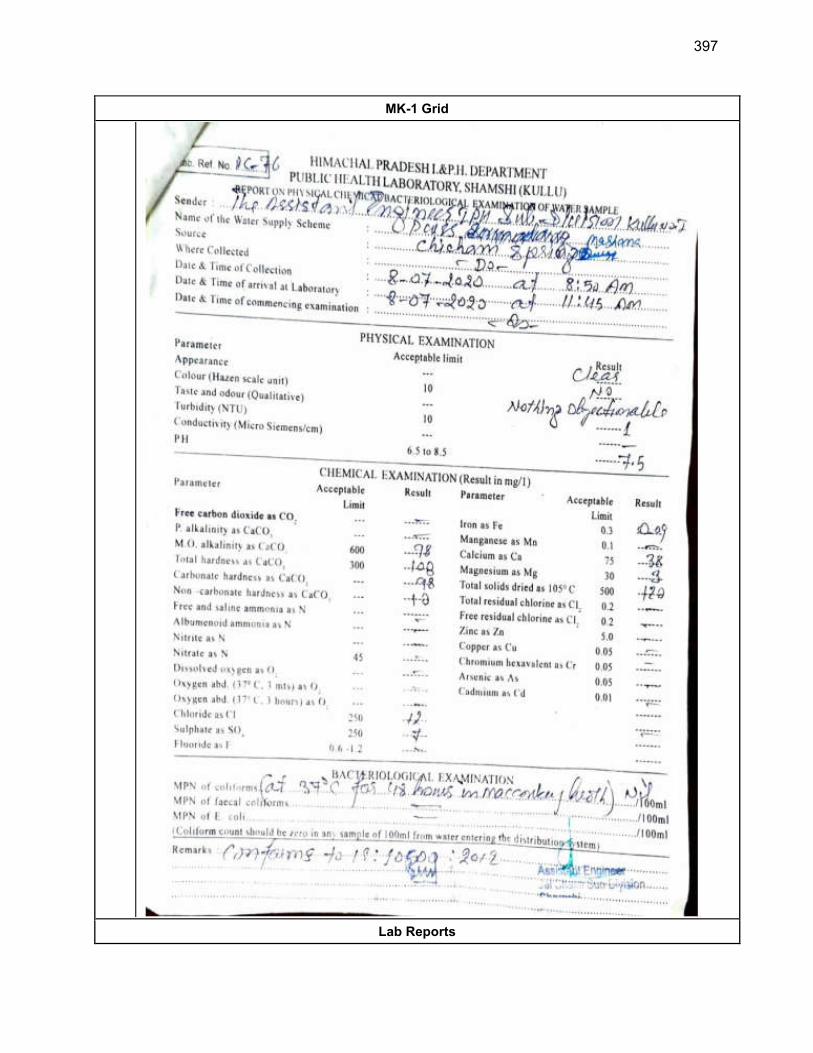
397
MK-1 Grid
Lab Reports
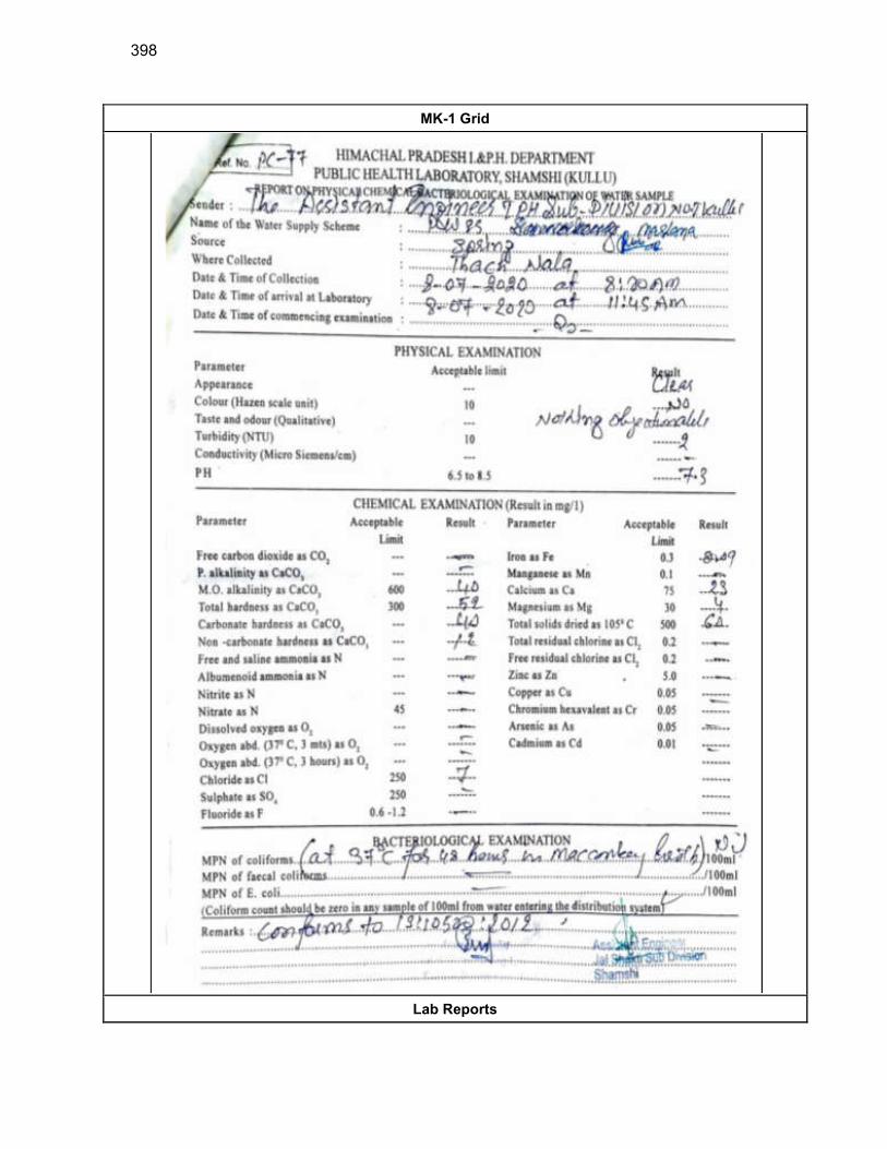
398
MK-1 Grid
Lab Reports
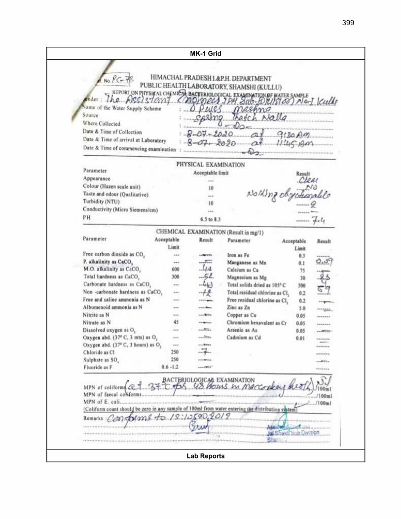
399
MK-1 Grid
Lab Reports
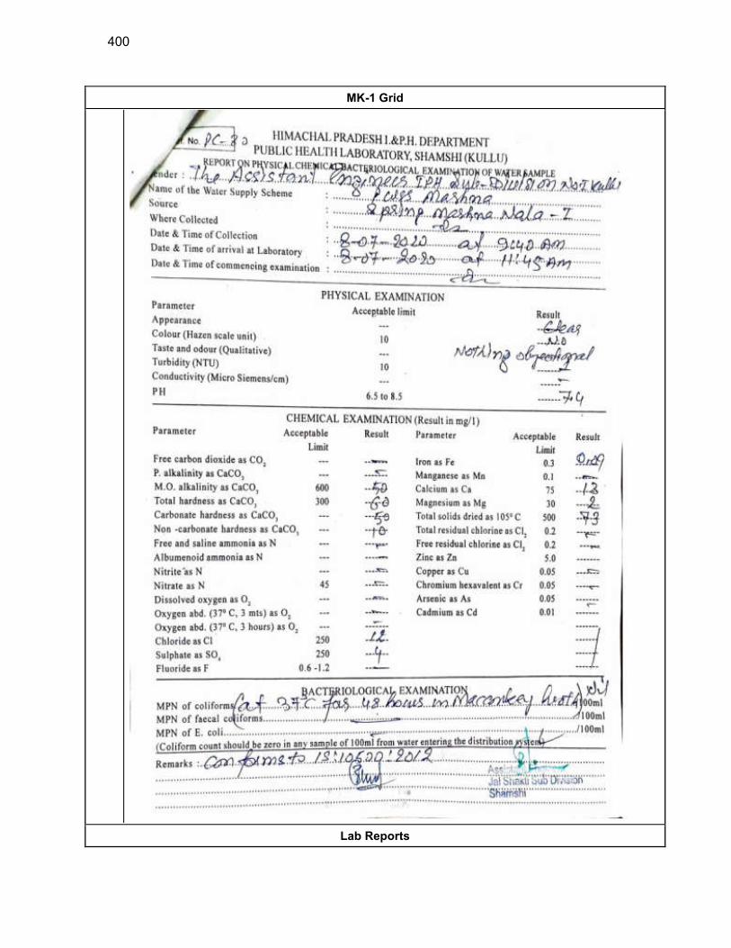
400
MK-1 Grid
Lab Reports

401
MK-1 Grid
Lab Reports
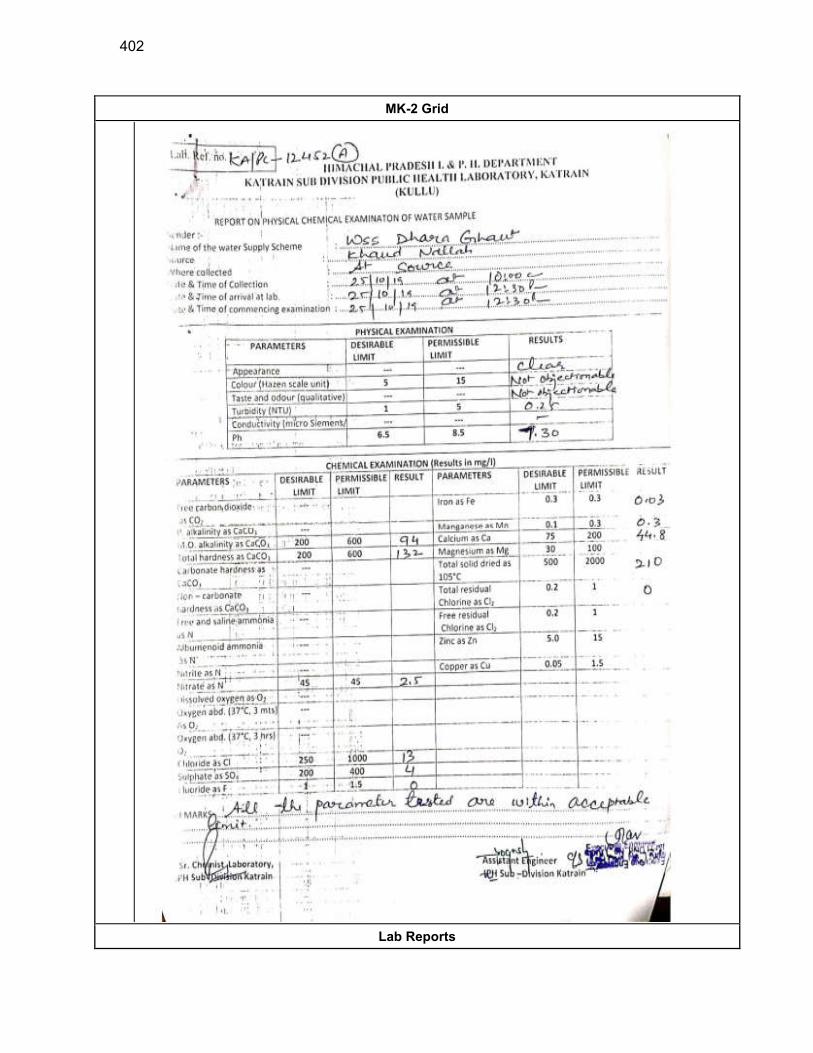
402
MK-2 Grid
Lab Reports
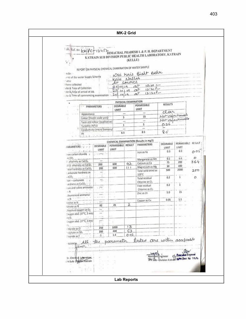
403
MK-2 Grid
Lab Reports
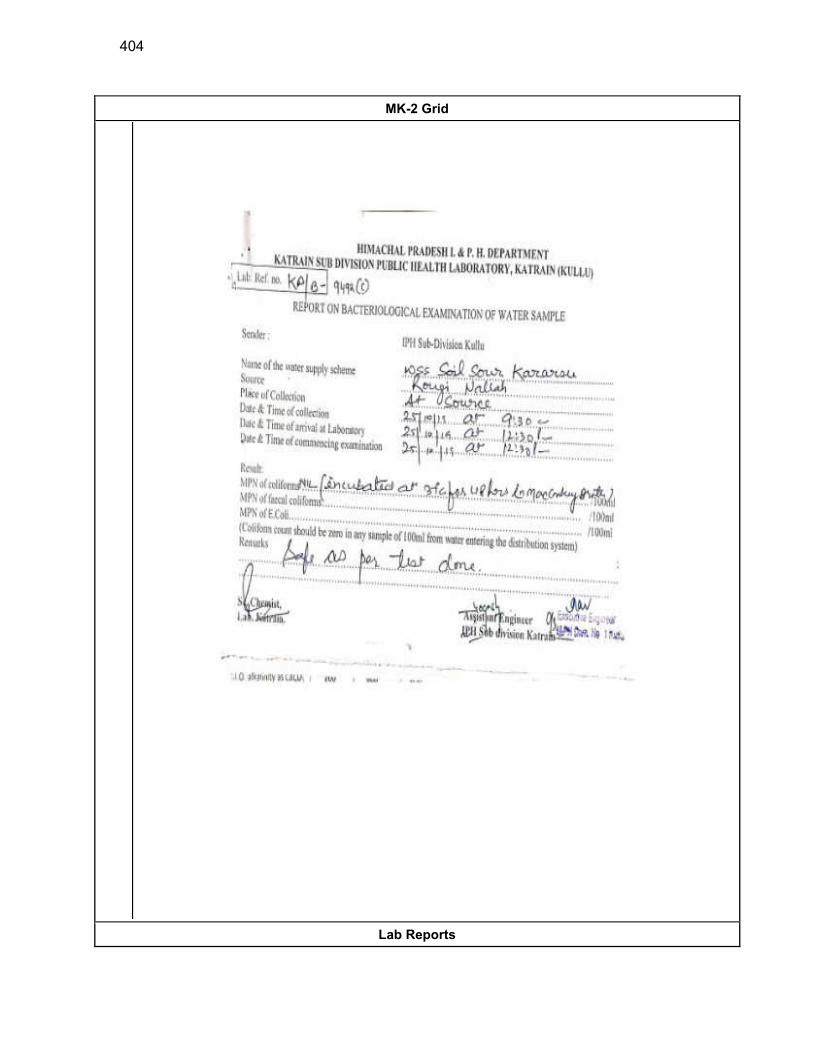
404
MK-2 Grid
Lab Reports
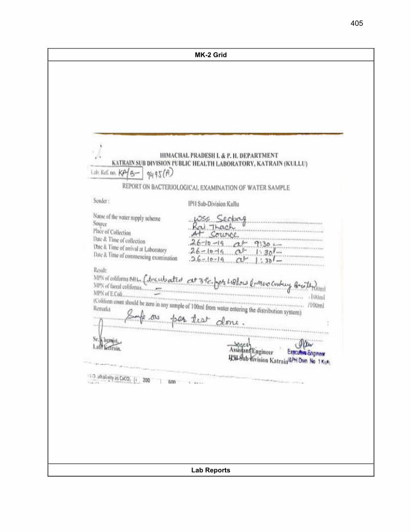
405
MK-2 Grid
Lab Reports
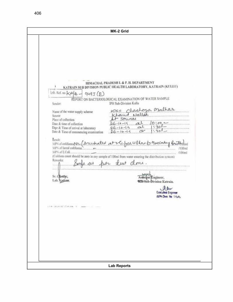
406
MK-2 Grid
Lab Reports
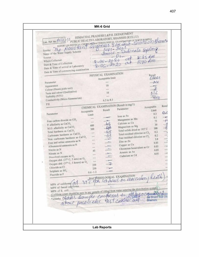
407
MK-6 Grid
Lab Reports
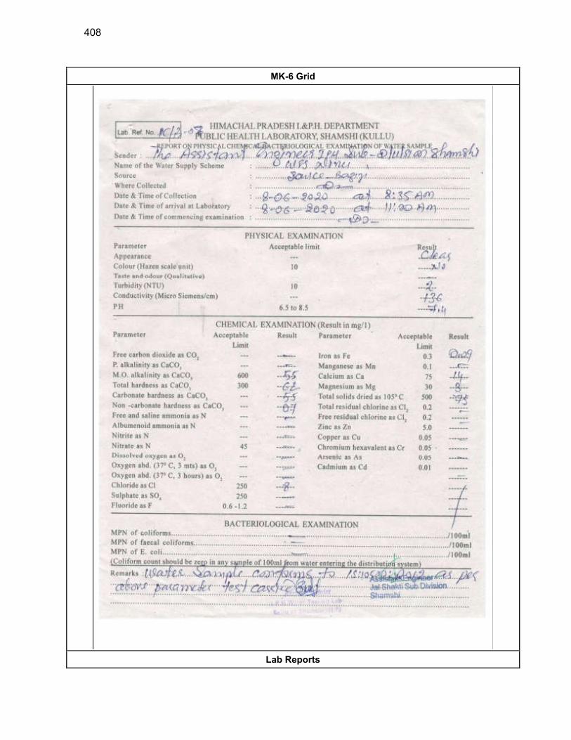
408
MK-6 Grid
Lab Reports
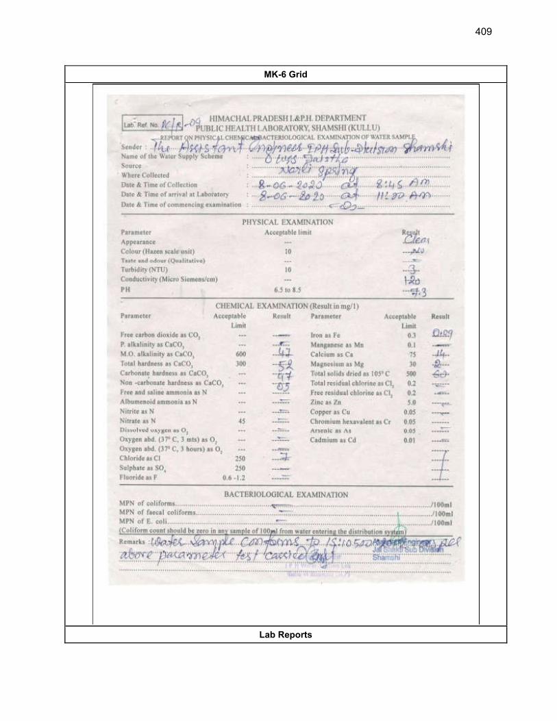
409
MK-6 Grid
Lab Reports

410
MK-6 Grid
Lab Reports
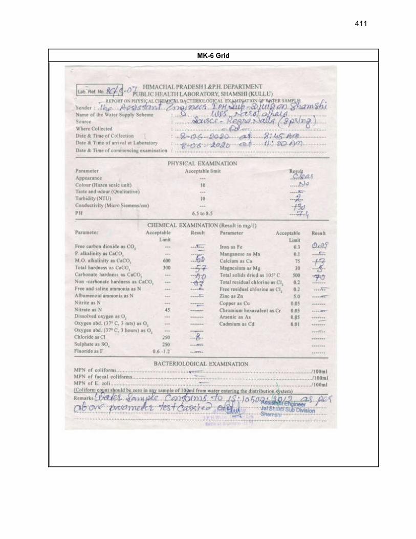
411
MK-6 Grid
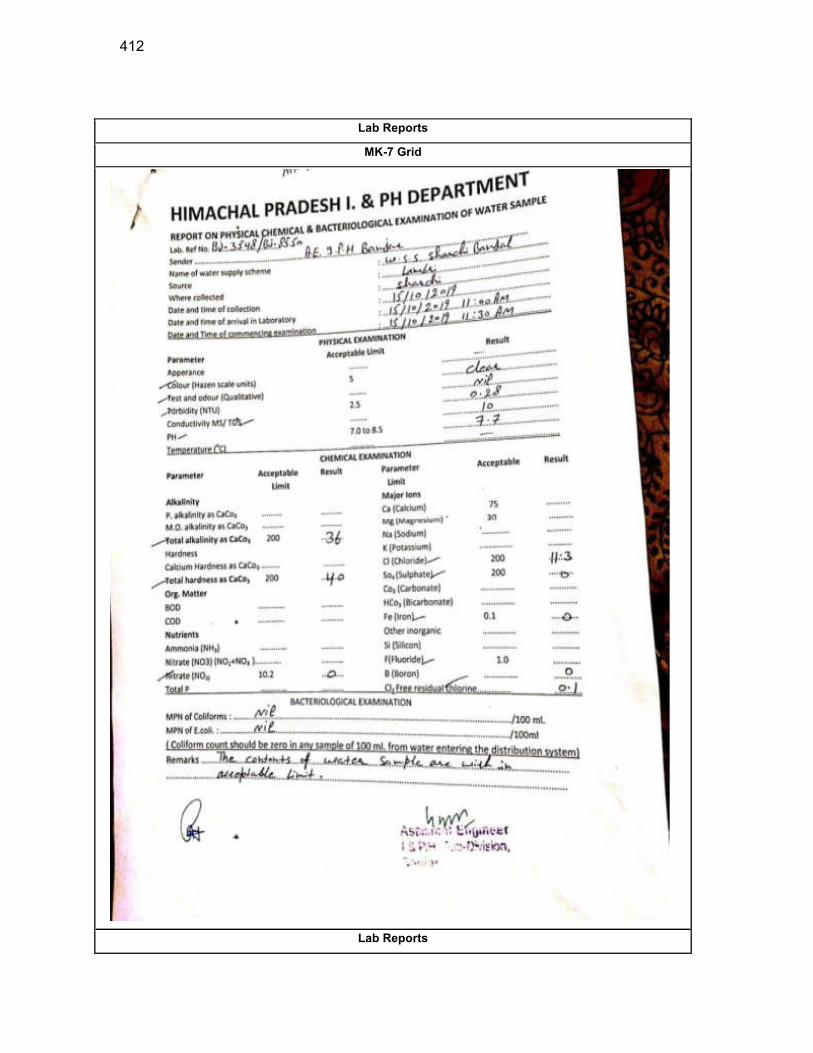
412
Lab Reports
MK-7 Grid
Lab Reports
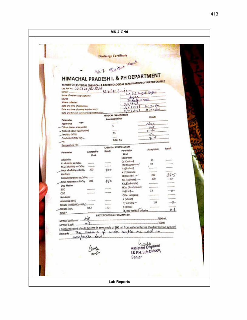
413
MK-7 Grid
Lab Reports
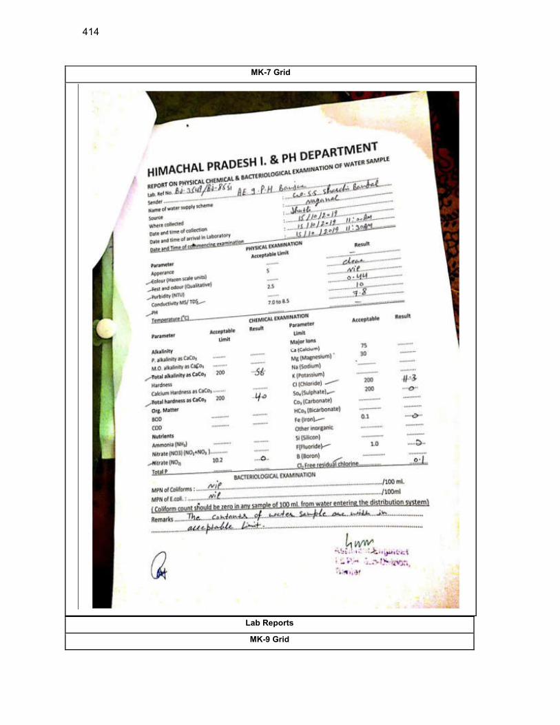
414
MK-7 Grid
Lab Reports
MK-9 Grid
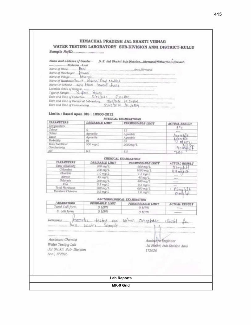
415
Lab Reports
MK-9 Grid
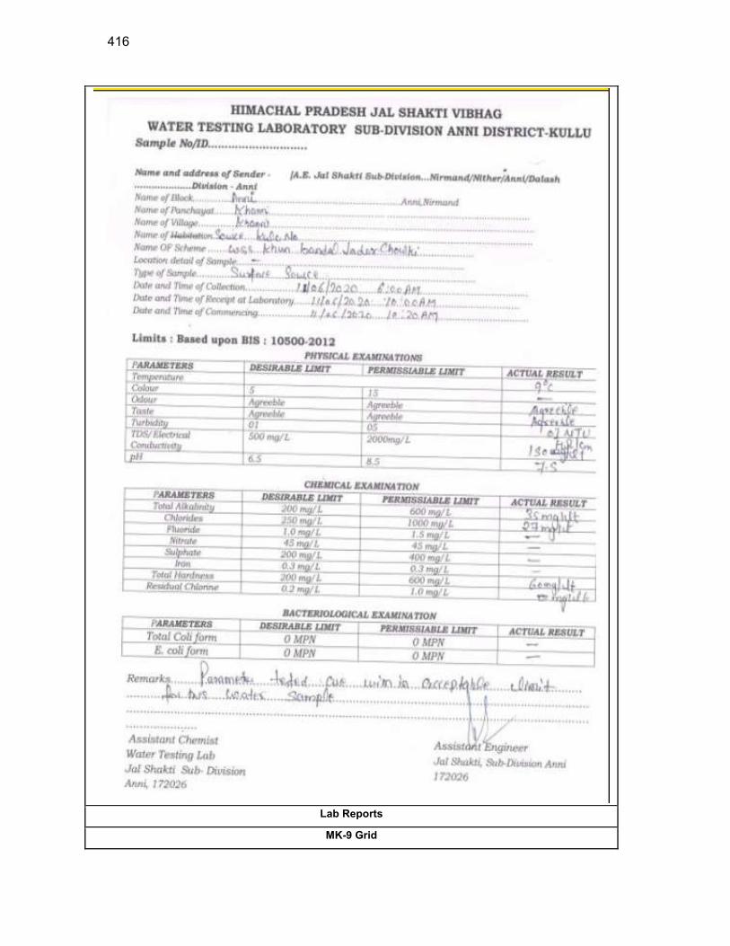
416
Lab Reports
MK-9 Grid
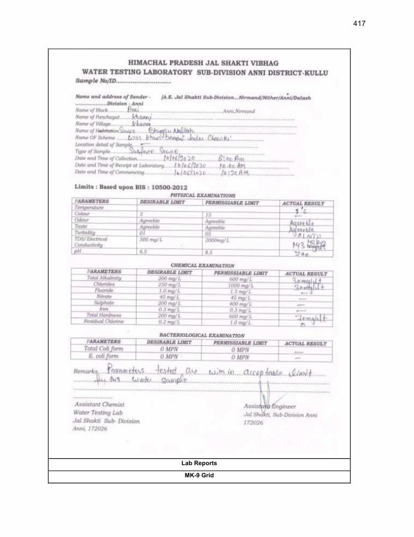
417
Lab Reports
MK-9 Grid
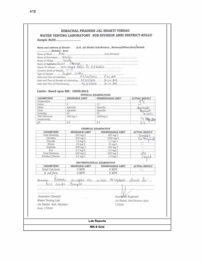
418
Lab Reports
MK-9 Grid
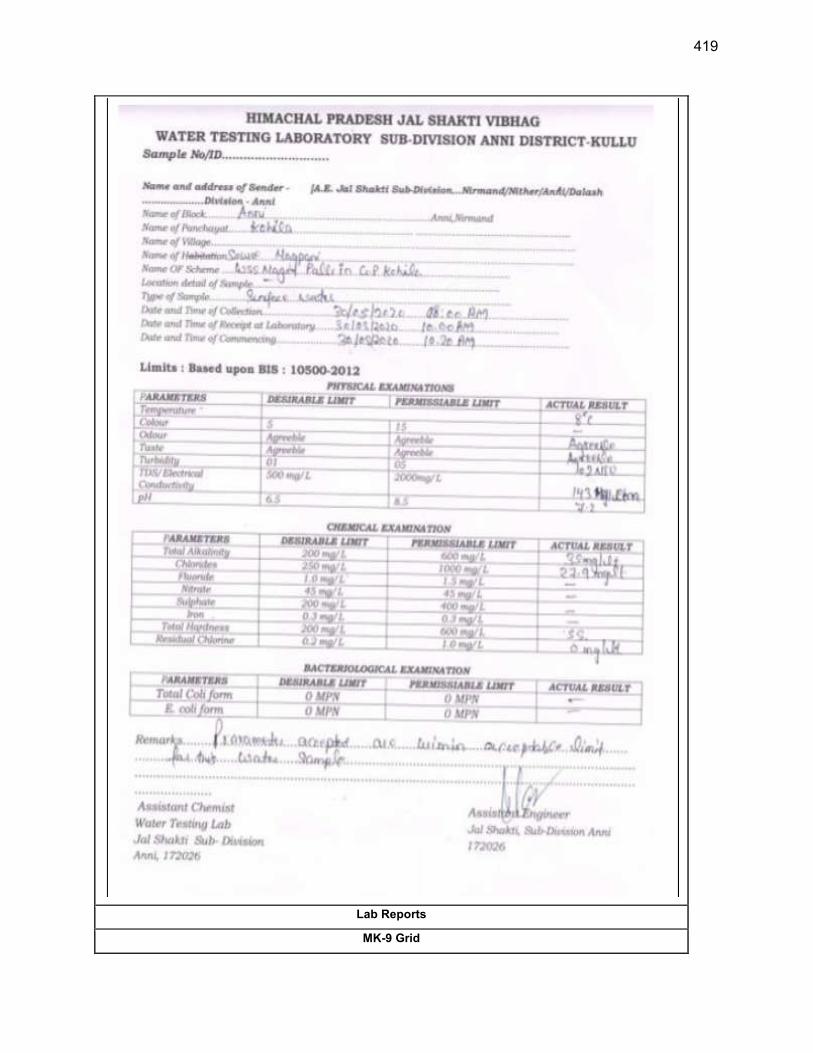
419
Lab Reports
MK-9 Grid
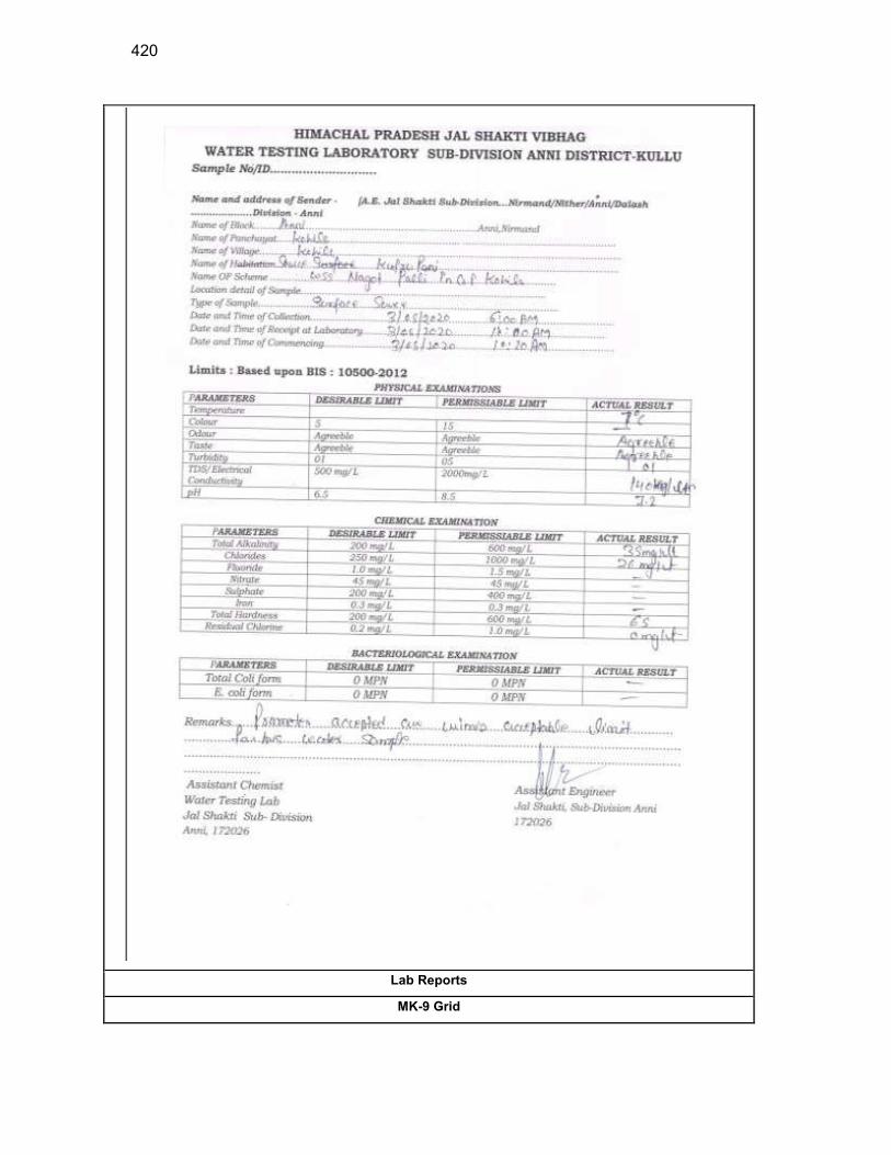
420
Lab Reports
MK-9 Grid
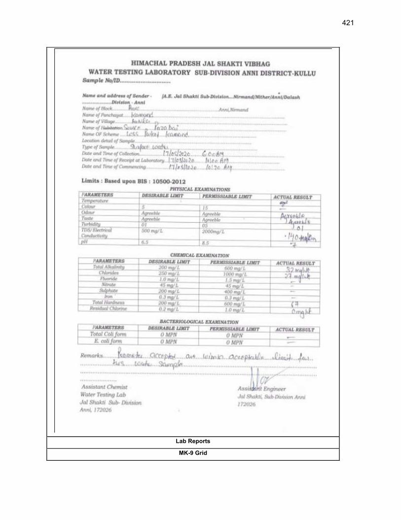
421
Lab Reports
MK-9 Grid
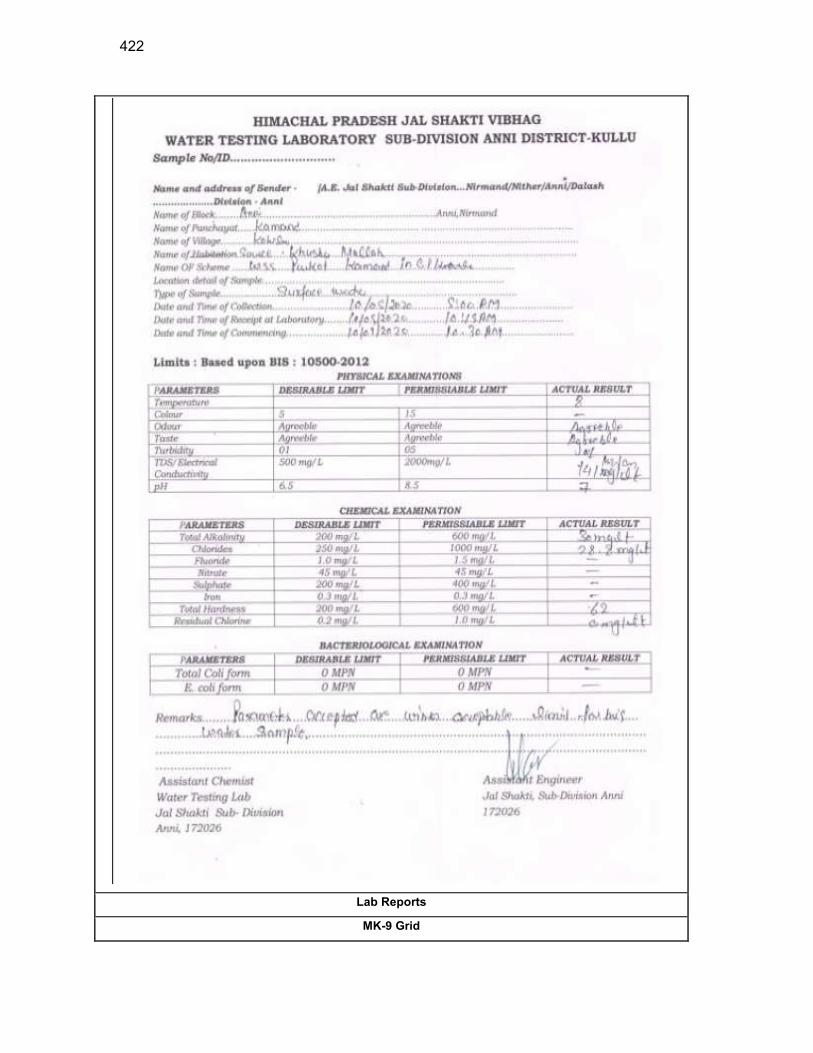
422
Lab Reports
MK-9 Grid
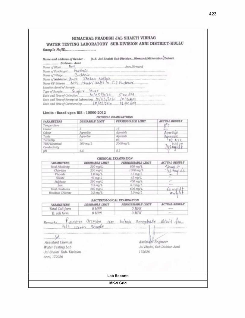
423
Lab Reports
MK-9 Grid
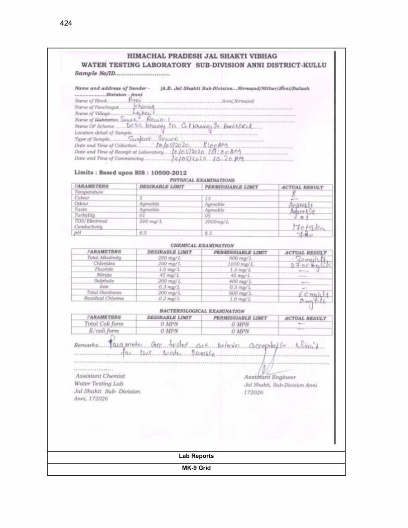
424
Lab Reports
MK-9 Grid

425
Lab Reports
MK-9 Grid
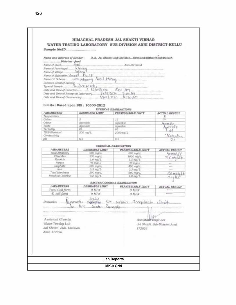
426
Lab Reports
MK-9 Grid
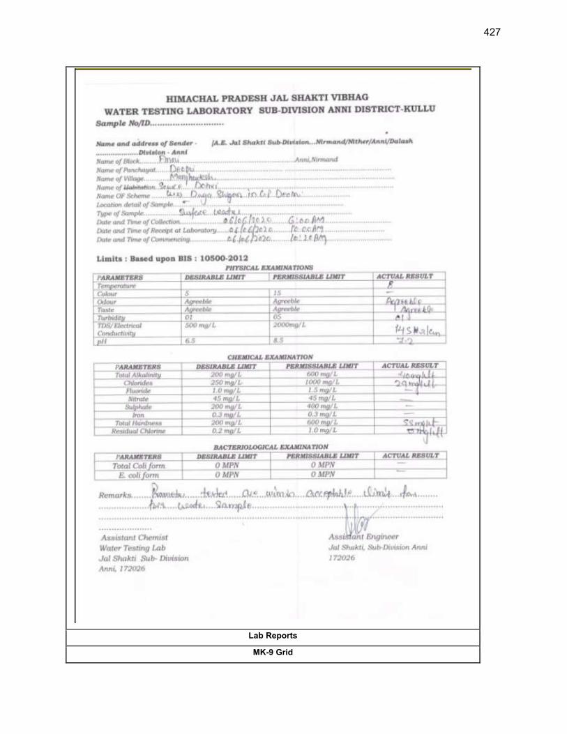
427
Lab Reports
MK-9 Grid
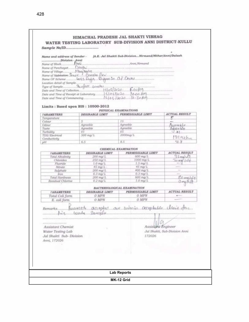
428
Lab Reports
MK-12 Grid
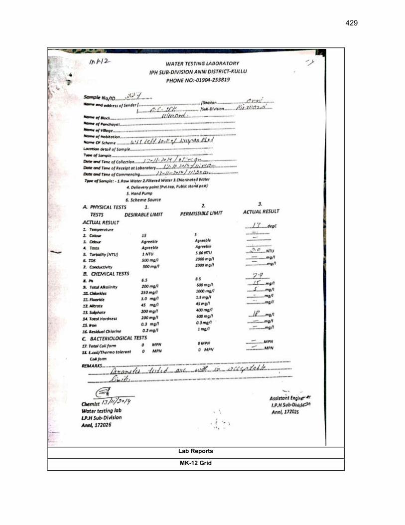
429
Lab Reports
MK-12 Grid

430
Lab Reports
MK-12 Grid
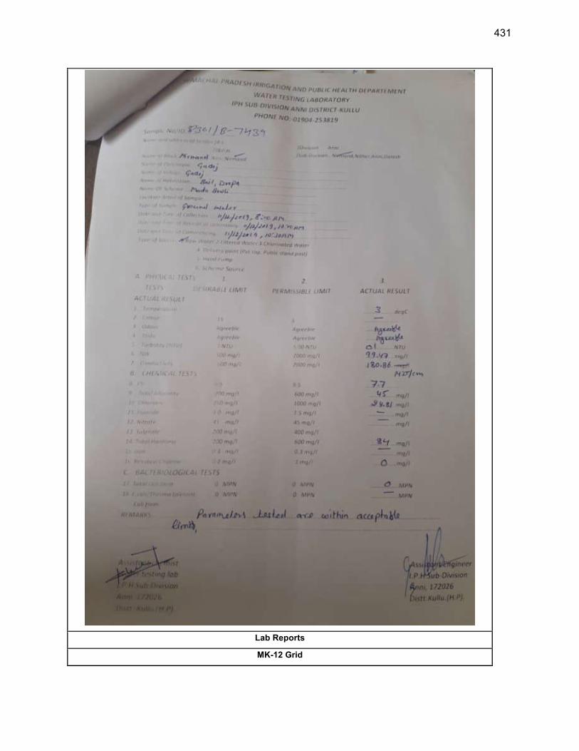
431
Lab Reports
MK-12 Grid
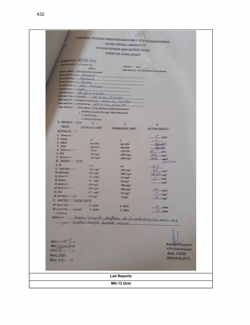
432
Lab Reports
MK-12 Grid
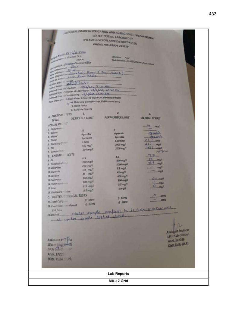
433
Lab Reports
MK-12 Grid
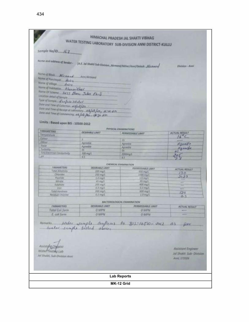
434
Lab Reports
MK-12 Grid
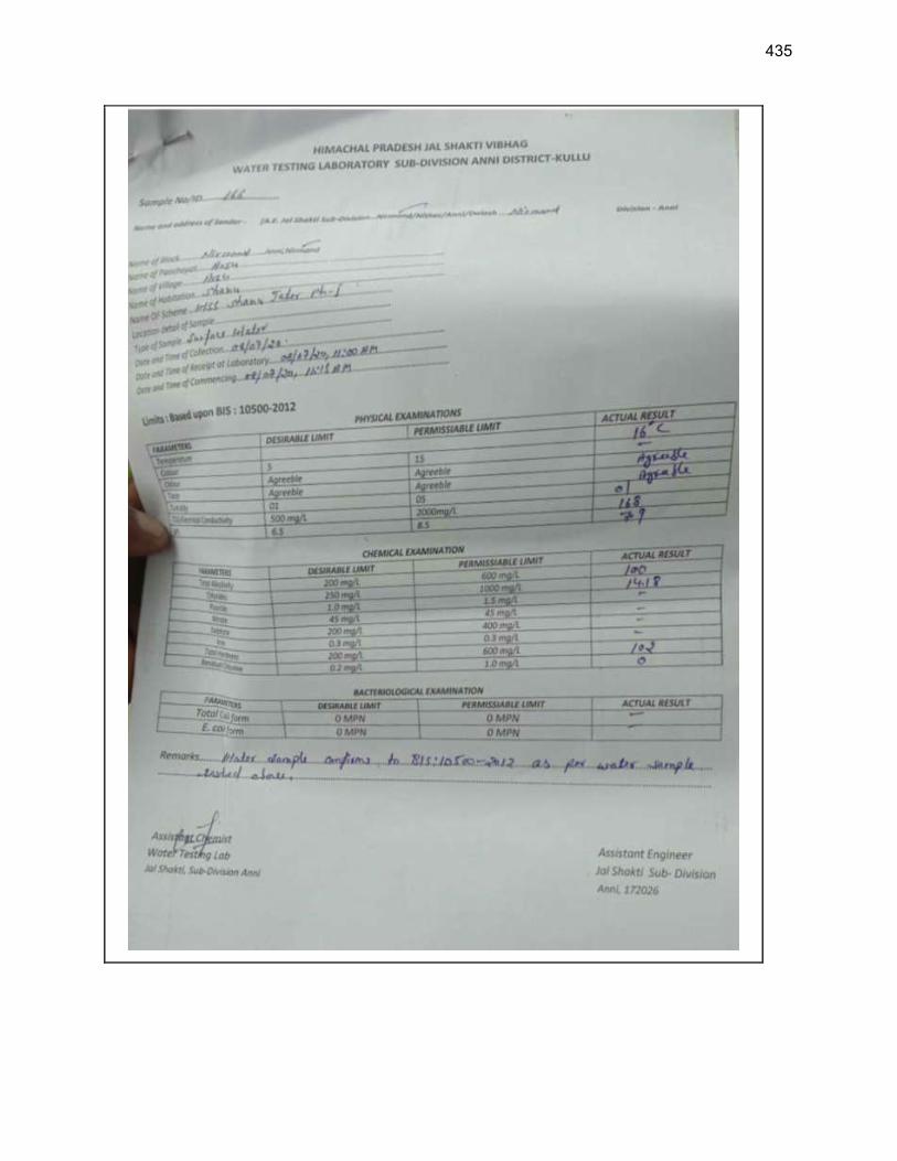
435

436
Appendix 10: Sample Chance find Protocol
Introduction
Project town being a heritage town, there are possibility of any chance finds (artefacts) recovery
during excavations. Contractors working at heritage towns must take additional care not to destroy or
damage historic features during excavations. There may be many buried historic features in heritage
towns such as – idols, toys, wells, ancient drains, remains of buildings, other walls, grain pits, etc.
Every care must be made not to destroy these during excavations.
Excavator drivers need to be instructed to be aware of hitting buried features and that they must be
investigated before continuing work. When features are encountered during mechanical excavation,
work should stop and the PIU/Consultants engineers must be informed immediately so that they can
be inspected at the first opportunity.
When historic features such as walls, brick constructions and other features are encountered during
excavation the excavation must be stopped immediately and the PIU/Consultants must be informed
immediately.
Contractors’ instruction: As soon as contractor recovers any chance find during any excavation
works for pipe laying, they should immediately inform PIU/Consultant present in town about the
chance find recovery. Immediately stop the excavation activity near point of recovery. After
PIU/consultants engineers come at site, contractor should follow cleaning and photography in
supervision of PIU/Consultant engineers.
Cleaning - When a feature/chance find is discovered it must be defined by careful cleaning. Roots
must be removed and dirt must be carefully cleaned away. The section or trench base should also
be cleaned back for a little distance around the feature.
Record photography – When the feature is clean good photography should be taken – vertical
and face-on shots and a few general shots of the feature, also showing its position in relation to
surrounding features, buildings, etc. The photographed should be catalogued (date, location, direction
of shot)
Drawn record - When features/chance finds are revealed a drawn record should also be made.
a. General location record – measuring its position and orientation within the protected site /
in relation to surrounding structures
437
b. Record drawings – detail drawings made in plan and section/profile. The extent (edges) of
the feature should be drawn and the level of the existing ground surface and the top and
base of the feature should be recorded. These levels should be marked on the drawings.
The drawings should include detail of the construction of the feature. Perspective
sketches could also be made if necessary. Explanatory notes can also be put on the
drawings.
Reporting finds - When finds are made these should be reported to PIU/Consultants. Photographs
and record drawings should be sent.
Discovery of historic objects - When clearance and excavation takes place artifacts and historic
objects are sometimes found. These should be recovered and kept in a safe place. The place of
discovery should be recorded and each find given a number and tag tied to the find with the same
number on it. A list of the finds should be kept (with the find No. And place of discovery and date of
discovery recorded).
PIU/Consultants responsibility- PIU/Consultants should inform in written to the State
Archaeological Department at the earliest with photographs and request to Archaeology Department
to visit the site and hand over the chance finds to them.
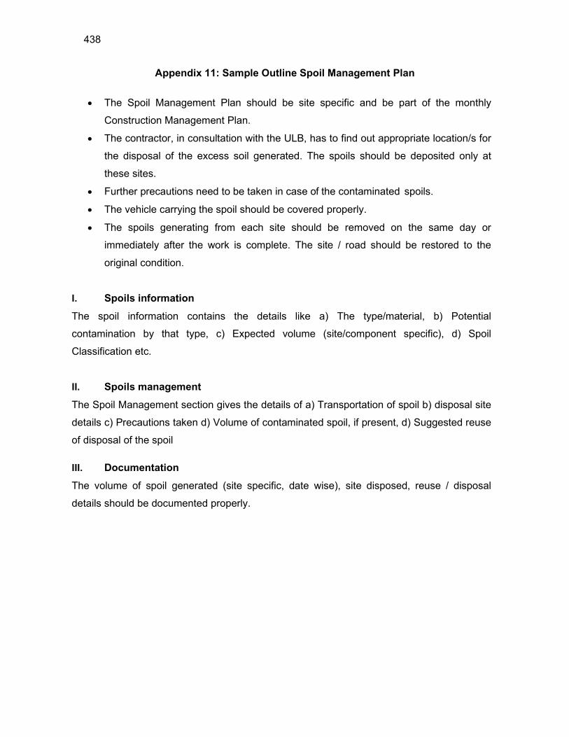
438
Appendix 11: Sample Outline Spoil Management Plan
The Spoil Management Plan should be site specific and be part of the monthly
Construction Management Plan.
The contractor, in consultation with the ULB, has to find out appropriate location/s for
the disposal of the excess soil generated. The spoils should be deposited only at
these sites.
Further precautions need to be taken in case of the contaminated spoils.
The vehicle carrying the spoil should be covered properly.
The spoils generating from each site should be removed on the same day or
immediately after the work is complete. The site / road should be restored to the
original condition.
I. Spoils information
The spoil information contains the details like a) The type/material, b) Potential
contamination by that type, c) Expected volume (site/component specific), d) Spoil
Classification etc.
II. Spoils management
The Spoil Management section gives the details of a) Transportation of spoil b) disposal site
details c) Precautions taken d) Volume of contaminated spoil, if present, d) Suggested reuse
of disposal of the spoil
III. Documentation
The volume of spoil generated (site specific, date wise), site disposed, reuse / disposal
details should be documented properly.
439
Appendix 12: Sample Outline Traffic Management Plan
A. Principles for TMP around the Water Pipes/Sewer Construction Sites
1. One of the prime objectives of this TMP is to ensure the safety of all the road users along the work zone, and to address the following issues:
(i) the safety of pedestrians, bicyclists, and motorists travelling through the
construction zone;
(ii) protection of work crews from hazards associated with moving traffic;
(iii) mitigation of the adverse impact on road capacity and delays to the road users;
(iv) maintenance of access to adjoining properties; and
(v) Addressing issues that may delay the project.
B. Operating Policies for TMP
2. The following principles will help promote safe and efficient movement for all road users (motorists, bicyclists, and pedestrians, including persons with disabilities) through and around work zones while reasonably protecting workers and equipment.
(i) Make traffic safety and temporary traffic control an integral and high-priority
element of project from planning through design, construction, and
maintenance.
(ii) Inhibit traffic movement as little as possible.
(iii) Provide clear and positive guidance to drivers, bicyclists, and pedestrians as
they approach and travel through the temporary traffic control zone.
(iv) Inspect traffic control elements routinely, both day and night, and make
modifications when necessary.
(v) Pay increased attention to roadside safety in the vicinity of temporary traffic
control zones.
(vi) Train all persons that select, place, and maintain temporary traffic control
devices.
(vii) Keep the public well informed.
(viii) Make appropriate accommodation for abutting property owners, residents,
businesses, emergency services, railroads, commercial vehicles, and transit
operations.
440
3. Figure A2 to Figure A12 illustrates the operating policy for TMP for the construction of water pipes and the sewers along various types of roads.
C. Analyze the impact due to street closure
4. Apart from the capacity analysis, a final decision to close a particular street and divert the traffic should involve the following steps:
(i) approval from the ULB/Public Works Department (PWD) to use the local
streets as detours;
(ii) consultation with businesses, community members, traffic police, PWD, etc.,
regarding the mitigation measures necessary at the detours where the road is
diverted during the construction;
(iii) determining of the maximum number of days allowed for road closure, and
incorporation of such provisions into the contract documents;
(iv) determining if additional traffic control or temporary improvements are needed
along the detour route;
(v) considering how access will be provided to the worksite;
(vi) contacting emergency service, school officials, and transit authorities to
determine if there are impacts to their operations; and
(vii) Developing a notification program to the public so that the closure is not a
surprise. As part of this program, the public should be advised of alternate
routes that commuters can take or will have to take as result of the traffic
diversion.
5. If full road-closure of certain streets within the area is not feasible due to inadequate capacity of the Detour Street or public opposition, the full closure can be restricted to weekends with the construction commencing on Saturday night and ending on Monday morning prior to the morning peak period.
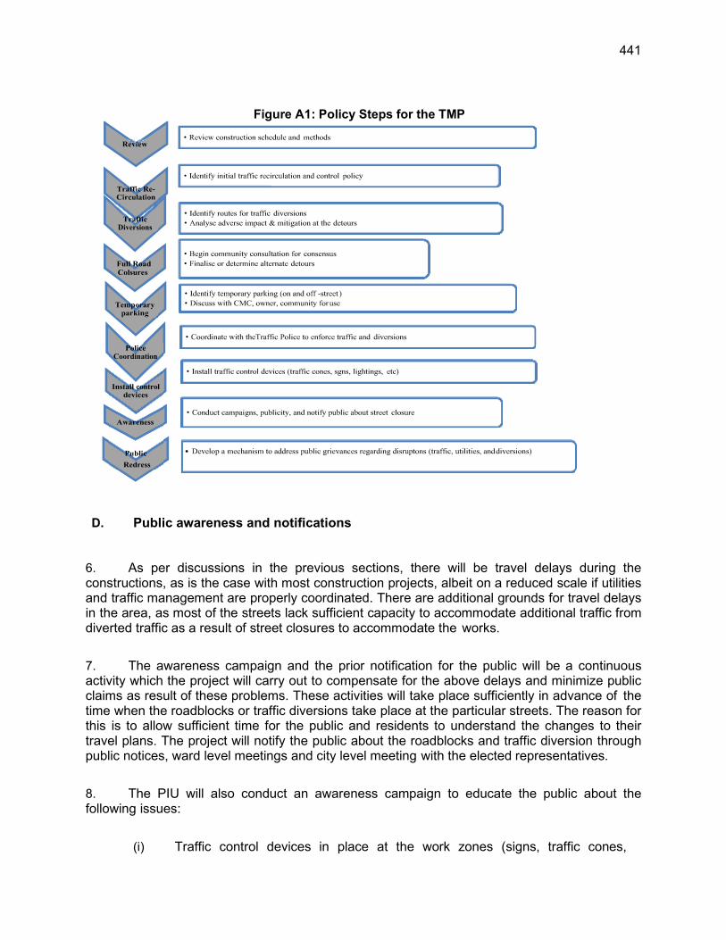
441
Figure A1: Policy Steps for the TMP
D. Public awareness and notifications
6. As per discussions in the previous sections, there will be travel delays during the constructions, as is the case with most construction projects, albeit on a reduced scale if utilities and traffic management are properly coordinated. There are additional grounds for travel delays in the area, as most of the streets lack sufficient capacity to accommodate additional traffic from diverted traffic as a result of street closures to accommodate the works.
7. The awareness campaign and the prior notification for the public will be a continuous activity which the project will carry out to compensate for the above delays and minimize public claims as result of these problems. These activities will take place sufficiently in advance of the time when the roadblocks or traffic diversions take place at the particular streets. The reason for this is to allow sufficient time for the public and residents to understand the changes to their travel plans. The project will notify the public about the roadblocks and traffic diversion through public notices, ward level meetings and city level meeting with the elected representatives.
8. The PIU will also conduct an awareness campaign to educate the public about the following issues:
(i) Traffic control devices in place at the work zones (signs, traffic cones,
Diversions
Coordination
442
barriers, etc.);
(ii) Defensive driving behavior along the work zones; and
(iii) Reduced speeds enforced at the work zones and traffic diversions.
7. It may be necessary to conduct the awareness programs/campaigns on road safety
during construction.
9. The campaign will cater to all types of target groups i.e. children, adults, and drivers. Therefore, these campaigns will be conducted in schools and community centers. In addition, the project will publish a brochure for public information. These brochures will be widely circulated around the area and will also be available at the PIU, and the contractor's site office. The text of the brochure should be concise to be effective, with a lot of graphics. It will serve the following purpose:
(i) explain why the brochure was prepared, along with a brief description of the
project;
(ii) advise the public to expect the unexpected;
(iii) educate the public about the various traffic control devices and safety
measures adopted at the work zones;
(iv) educate the public about the safe road user behavior to emulate at the work
zones;
(v) tell the public how to stay informed or where to inquire about road safety
issues at the work zones (name, telephone, mobile number of the contact
person; and
(vi) Indicate the office hours of relevant offices.
E. Install traffic control devices at the work zones and traffic diversion routes
10. The purpose of installing traffic control devices at the work zones is to delineate these areas to warn, inform, and direct the road users about a hazard ahead, and to protect them as well as the workers. As proper delineation is a key to achieve the above objective, it is important to install good traffic signs at the work zones. The following traffic control devices are used in work zones:
Signs
Pavement Markings
Channelizing Devices
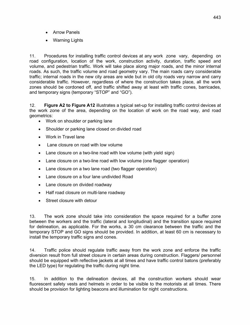
443
Arrow Panels
Warning Lights
11. Procedures for installing traffic control devices at any work zone vary, depending on road configuration, location of the work, construction activity, duration, traffic speed and volume, and pedestrian traffic. Work will take place along major roads, and the minor internal roads. As such, the traffic volume and road geometry vary. The main roads carry considerable traffic; internal roads in the new city areas are wide but in old city roads very narrow and carry considerable traffic. However, regardless of where the construction takes place, all the work zones should be cordoned off, and traffic shifted away at least with traffic cones, barricades, and temporary signs (temporary “STOP” and “GO”).
12. Figure A2 to Figure A12 illustrates a typical set-up for installing traffic control devices at the work zone of the area, depending on the location of work on the road way, and road geometrics:
Work on shoulder or parking lane
Shoulder or parking lane closed on divided road
Work in Travel lane
Lane closure on road with low volume
Lane closure on a two-line road with low volume (with yield sign)
Lane closure on a two-line road with low volume (one flagger operation)
Lane closure on a two lane road (two flagger operation)
Lane closure on a four lane undivided Road
Lane closure on divided roadway
Half road closure on multi-lane roadway
Street closure with detour
13. The work zone should take into consideration the space required for a buffer zone between the workers and the traffic (lateral and longitudinal) and the transition space required for delineation, as applicable. For the works, a 30 cm clearance between the traffic and the temporary STOP and GO signs should be provided. In addition, at least 60 cm is necessary to install the temporary traffic signs and cones.
14. Traffic police should regulate traffic away from the work zone and enforce the traffic diversion result from full street closure in certain areas during construction. Flaggers/ personnel should be equipped with reflective jackets at all times and have traffic control batons (preferably the LED type) for regulating the traffic during night time.
15. In addition to the delineation devices, all the construction workers should wear fluorescent safety vests and helmets in order to be visible to the motorists at all times. There should be provision for lighting beacons and illumination for night constructions.
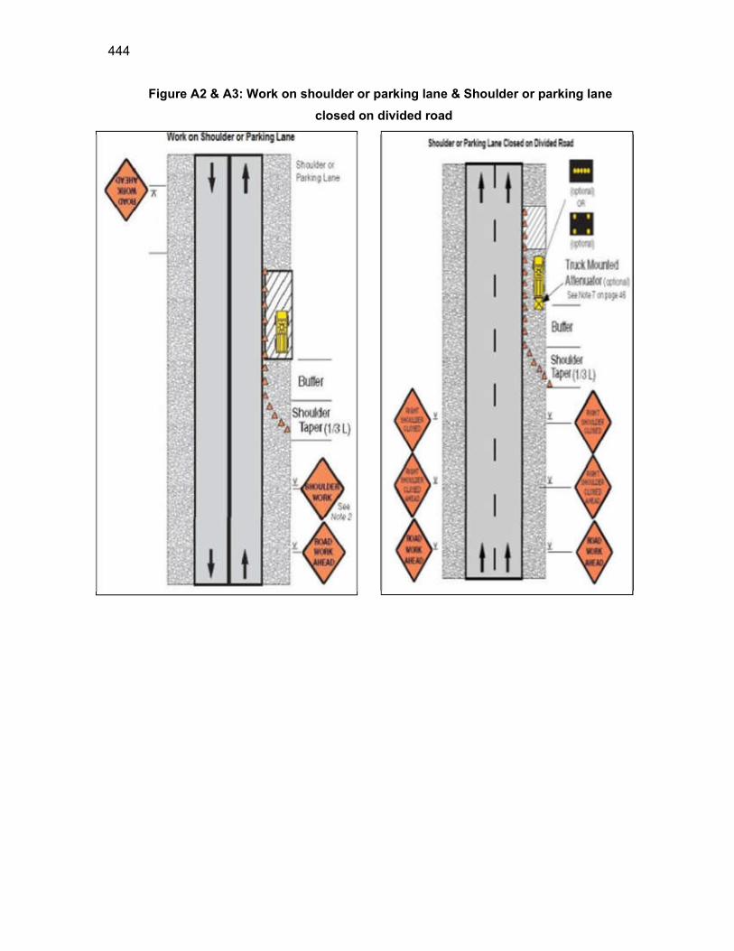
444
Figure A2 & A3: Work on shoulder or parking lane & Shoulder or parking lane
closed on divided road
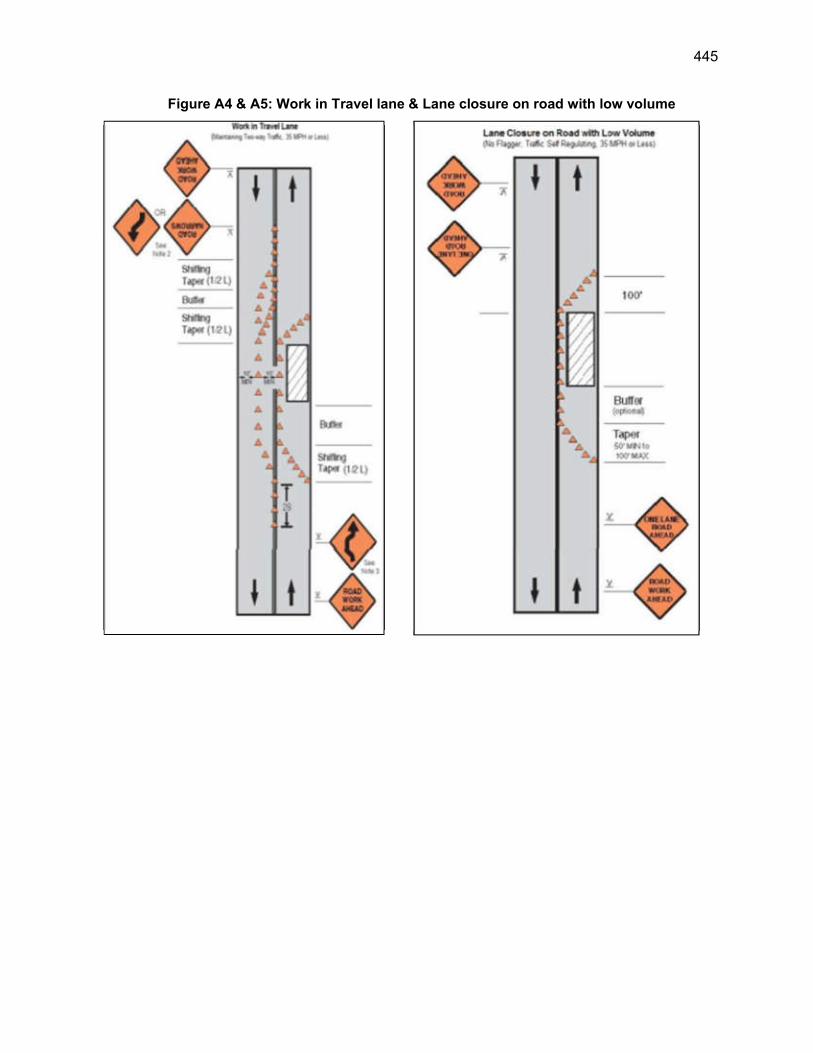
445
Figure A4 & A5: Work in Travel lane & Lane closure on road with low volume
446
Figure A6 & A7: Lane closure on a two-line road with low volume (with yield sign)
& Lane closure on a two-line road with low volume (one flagger operation)
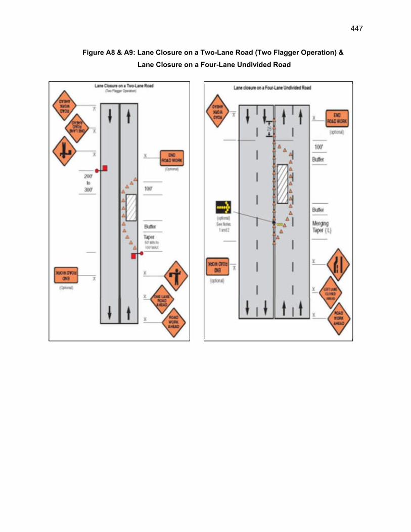
447
Figure A8 & A9: Lane Closure on a Two-Lane Road (Two Flagger Operation) &
Lane Closure on a Four-Lane Undivided Road
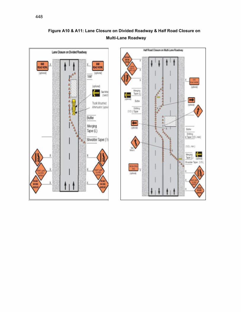
448
Figure A10 & A11: Lane Closure on Divided Roadway & Half Road Closure on
Multi-Lane Roadway
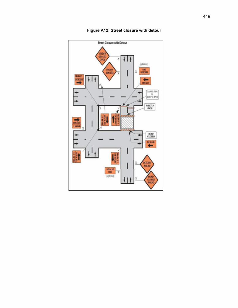
449
Figure A12: Street closure with detour
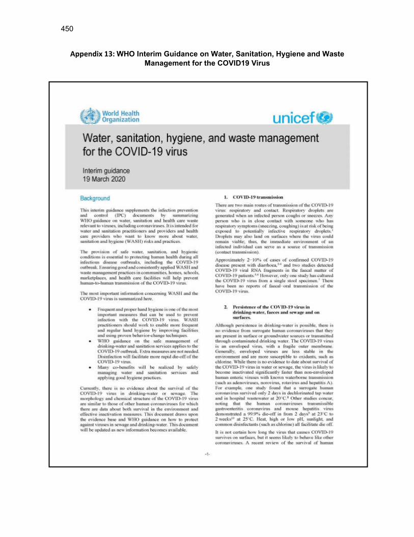
450
Appendix 13: WHO Interim Guidance on Water, Sanitation, Hygiene and Waste
Management for the COVID19 Virus
451
452
453
454
455
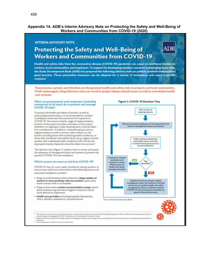
456
Appendix 14: ADB’s Interim Advisory Note on Protecting the Safety and Well-Being of Workers and Communities from COVID-19 (2020)
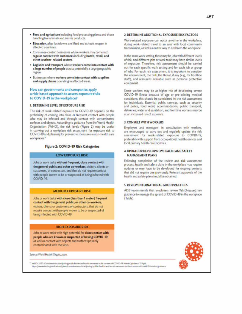
457
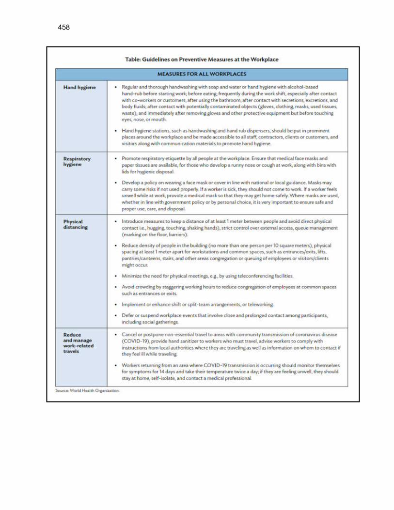
458

459
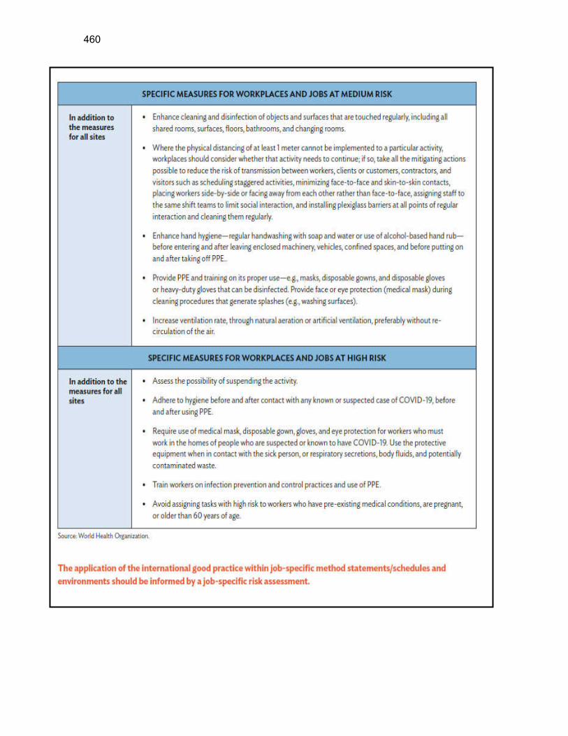
460

461
462
463
464
465
Appendix 15: IFC Benchmark Standards for Workers Accommodation
466
467

468

469
470
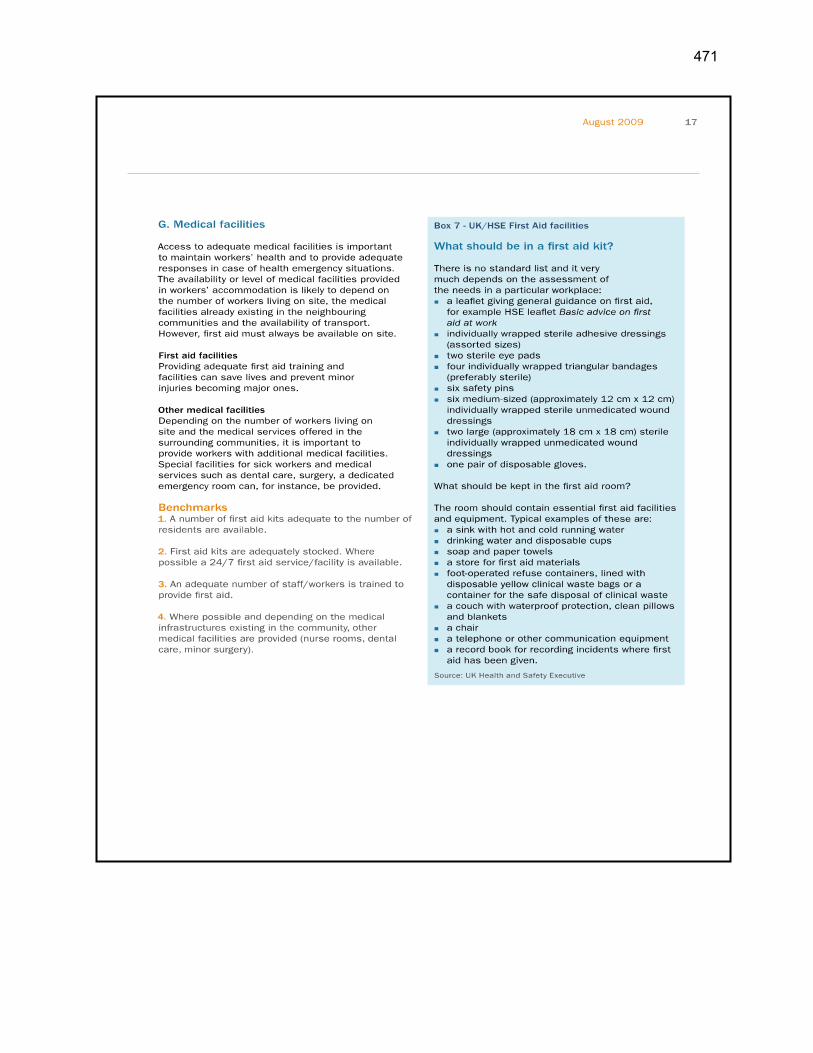
471

472
473
474
475
476
477
478
Appendix 16: Guidelines and Emergency plan for handling and storing Chlorine Instructions for Storage and Handling of Chlorine Cylinders
(Based on the ‘Manual on Operation and Maintenance of Water Supply Systems’
published by the Central Public Health and Environmental Engineering Organization
(CPHEEO) in 2005)
1. Storage Area
(i) Obtain storage license from controller of explosives under Gas Cylinder Rules 2004 if the quantity of Cl2 containers to be stored is more than 5 Nos.
(ii) Storage area should be cool, dry, well ventilated, and clean of trash and protected from external heat sources. Please refer to Manual on “Water Supply and Treatment”, (1999 Edition), for further details.
(iii) Ventilation must be sufficient to prevent accumulation of vapor pockets. The exhaust should be located either near the floor or duct be provided extending to the floor. All fan switches should be outside the storage area.
(iv) Do not store container directly under the sun. (v) Weather cock should be installed near the storage to determine wind
direction. (vi) The storage building should be of non-combustible construction with at
least two exits opening outside. (vii) Neutralization system should be provided. (viii) Continuous monitoring of chlorine leak detection equipment with alarm
should be installed in the storage area. (ix) The area should be free and remote from elevators, gangways or
ventilating system to avoid dangerous concentration of Chlorine during leak.
(x) Two portable foam type fire extinguishers should be provided in the premises.
(xi) Corrosive substances shall not be stored nearby which react violently with each other.
(xii) Unauthorized person should not be allowed to enter into the storage area.
(xiii) The floor level of storage shed should be preferably 30 cms (at least one foot) higher from the ground level to avoid water logging.
(xiv) Ensure that all containers are properly fitted with safety caps or hooks.
2. Cylinder & Drum Containers
a) Store chlorine cylinders upright and secure them so that they do not fall. b) Drum containers should be stored on their sides on rails, a few inches above
the floor. They should not be stacked one upon the other. They should be stored such that the valves are in vertical plane.
c) Keep enough space between containers so as to have accessibility in case of emergency.
479
d) Store the containers in a covered shed only. Keep them away from any source of heat as excessive heat may increase the pressure in container which will result into burst.
e) Do not store explosives, acids, turpentine, ether, anhydrous ammonia, finely divided metals or other flammable material in the vicinity of Chlorine.
f) Do not store containers in wet and muddy areas. g) Store filled and empty containers separately. h) Protective covers for valves are secured even when the containers are empty,
except during use in the system. i) Never use containers as a roller to move other equipment. j) Never tamper with fusible plugs of tonners. k) Check leakages every day by means of ammonia torch. However, it should
not be touched to brass components like valves of container for safety. l) Never carry out any welding work on the chlorine system as combustion of
steel takes place at 2510C in presence of chlorine. m) The boxes containing emergency kit, safety applications and self-contained
breathing apparatus should be kept in working order in an easily approachable area.
3. Use of Cylinders & Drum Containers in Process System
a) Use containers in the order of their receipt, as valve packing can get hardened during prolonged storage and cause gas leaks.
b) Do not use oil or lubricant on any valve of the containers. c) Badly fitting connections should not be forced and correct tool should always
be used for opening and closing valves. They should never be hammered. d) The area should be well ventilated with frequent air changes. e) Transport the cylinders to the process area by using crane, hoist or railings
etc. f) The drum containers should be kept in a horizontal position in such a way that
the valves are in a vertical plane. The upper valve gives out gas and the lower one gives out liquid chlorine.
g) The cylinder should be kept in upright position in order to release gas from the valve. For liquid chlorine withdrawal, it should be inverted with the help of an inverted rack.
h) Connect the containers to the system by using approved accessories. i) Use copper flexible tube, with lead washer containing 2 to 4% antimony or
bonded asbestos or Teflon washer. Use yoke clamp for connecting chlorine container.
j) Never use rubber tubes, PVC tubes etc. for making connections. k) Use the right spanner for operating the valve. Always keep the spanner on the
valve spindle. Never use ill-fitting spanner. l) After making the flexible connection, check for the leakage by means of
ammonia torch but it should not come in contact with a valve. m) Keep minimum distance between the container valve and header valve so that
during change-over of the container, minimum amount of gas leaks. n) The material of construction of the adopter should be same as that of valve
outlet threads. o. The valve should not be used as a regulator for controlling the chlorine. During regulation due to high velocity of Chlorine, the valve gets damaged which in turn can cause difficulty in closing.
480
o) The tools and other equipment used for operating the container should be clean and free of grease, dust or grit.
p) Wear breathing apparatus while making the change-over of the container from the process header.
q) Do not heat the container to withdraw more gas at faster rate. r) Use pressure gauge and flow measuring device to control the flow and to
know the quantity of gas left in the container. s) Use an inverted U type barometric leg or vacuum breaking arrangement for
connecting the container to the process piping. t) Withdrawal of the gas should be stopped when the gas pressure inside the
container is between 0.1 to 0.5 kg/cm2 approximately. u) If withdrawal of the gas from the container connected to the process system
has to be suspended for long intervals, it should be disconnected from the system, and the valve cap and hood replaced.
v) Gas containers should be handled by trained persons only. 4. Disconnecting Containers from Process System
a) Use breathing apparatus before disconnecting the container. b) First close the container valve fully. After removal of chlorine the process
valve should be closed. c) Remove the flexible connection, plug the flexible connection in order to
avoid entry of humid air. Replace the valve cap or hood on the container. d) Put the tag on the empty container & bring it to storage area marked for
empties. e. Check for the leakage. 5. Loading and Unloading of Containers
a) The handling of containers should be done under the supervision of trained and competent person.
b) It should be done carefully with a crane, hoist or slanted ramp. Do not use magnet or sharp object for lifting the containers.
c) Small cylinders should not be lifted by means of valve caps as these are not designed to carry the weight.
d) The containers should not be allowed to strike against each other or against any hard object.
e) Vehicles should be braked and isolated against any movement. f) After loading, the containers should be secured properly with the help of
wooden wedges, rope or sling wire so that they do not roll away. g) The containers should never be dropped directly to the ground or on the tyre
from the vehicle. h) There should be no sharp projection in the vehicle. i) Containers must have valve caps and plugs fitted properly. j) Check containers for leakage before loading/unloading.
6. Transportation of Container
a) The name of the chemical along with diamond pictorial sign denoting the dangerous goods should be marked on the vehicle.
b) The name of the transporter, his address and telephone number should be clearly written on the vehicle.
481
c) The vehicle should not be used to transport any material other than what is written on it.
d) Only trained drivers and cleaners should transport hazardous chemical e) The driver should not transport any leaking cylinder. f) The cylinder should not project outside the vehicle. g) The transporter must ensure that every vehicle driver must carry “Trem Card”
(Transport Emergency Card) and ‘Instructions in writing booklet’ and follow them.
h) Every driver must carry safety appliances with him, viz; Emergency kit, breathing apparatus etc.
i) The vehicles must be driven carefully, especially in crowded localities and on bumpy roads. Do not apply sudden brakes.
j) Check for the leakage from time to time. k) In the case of uncontrollable leakage the vehicle should be taken to an open
area where there is less population.
16. Emergency Kit It consists of various tools and appliances like gaskets, yokes, studs, tie rods hoods, clamps, spanners, mild steel channels, screws, pins, wooden pegs etc. of standard sizes. Separate kits are used for cylinders and tonners. All the gadgets are designed for using in controlling or stopping the leakages from valves, fusible plug and side walls of cylinders and containers used for handling chlorine.
a. Leakage may occur through the valve. There are basically four types of valve leaks.
1 Valve packing
2 Valve seat
3 Defective inlet thread
4 Broken valve thread
b. Leakage may occur through container wall. For controlling such leakages, clamps are
used for cylinders and chain and yoke arrangement is used for tonner. Sometimes
wooden peg is used by driving into the leaking hole as a temporary arrangement.
c. Leakage may occur through fusible plug.
1 If the leakage is through the threads of fusible plug, yoke, hood and cap nut arrangement
is used to control the leak.
2 If fusible metal itself in the plug is leaking, yoke and stud arrangement is used to control
the leak.
1. First Aid to be Provided for a Person Affected by Chlorine
a. General Remove the affected person immediately to an uncontaminated area. Remove
482
contaminated clothing and wash contaminated parts of the body with soap and plenty of
water. Lay down the affected person in cardiac position and keep him warm. Call a
physician for medical assistance at the earliest. Caution: Never attempt to neutralize
chlorine with other chemicals.
b. Skin Contact Remove the contaminated clothes, wash the affected skin with large
quantity of water. Caution: No ointment should be applied unless prescribed by the
physician.
c. Eye Contact If eyes get affected with liquid chlorine or high concentration of chlorine gas,
they must be flushed immediately with running water for at least 15 minutes keeping the
eyelids open by hand. Caution: No ointment should be used unless prescribed by an eye
specialist.
d. Inhalation If the victim is conscious, take him to a quiet place and lay him down on his
back, with head and back elevated (cardiac position). Loosen his clothes and keep him
warm using blankets. Give him tea, coffee, milk, peppermint etc. for making good effect on
breathing system. If the victim is unconscious, but breathing, lay him down in the position
mentioned above and give oxygen at low pressure until the arrival of doctor. If breathing has
stopped, quickly stretch him out on the ground or a blanket if available, loosen his collar and
belt and start artificial respiration without delay. Neilson arm lift back pressure method is
useful. Automatic artificial respiration is preferable if available. Continue the respiration until
the arrival of the doctor. Amboo bag can also be used for this purpose.
2. On-Site Emergency Plan to Cover the Leakage of Chlorine
Introduction As chlorine is a hazardous chemical, handling and storage of it demand
adequate precautions to avoid possible hazards. Leakage of chlorine may develop into a
major emergency. Therefore the emergency procedure to cover this eventuality is essential.
It is drawn in the form of on-site emergency plan. The elements of onsite emergency plan
are as follows:
Identification of Hazard Chart
In this case the site risk is evaluated by the expert and the extent of the probable damage is
calculated on the basis of stored chlorine quantity, nearby population, wind direction, type of
equipment failure etc. For this purpose hazard analysis is conducted in which case all the
hazardous properties of chlorine are considered. If evacuation is required, the range of it is
calculated.
483
Appointing Key Persons In order to control the incident like chlorine leakage, it is essential
to appoint various persons with their well-defined responsibilities. Taking into account the
various activities likely to be involved, the following key persons are appointed (i) Site
Controller, (ii) Incident controller, (iii) Shift Executive In charge, (iv) Communication Officer,
(v) Safety Officer, (vi) Fire and Security Officer, (vii) Utilities and Services In charge, (viii)
Traffic Controller, (ix) First Aider
Assembly Points These points are set up where persons from the plant would assemble in
case of chlorine leakage. At these points the in-charge for counting the heads will be
available.
Emergency Control Center
The control center is the focal point in case of an emergency from where the operations to
handle the emergency from are directed and coordinated. It contains site plan, telephone
lines, public address system, safety equipment, first aid boxes, loud speaker, torches, list of
essential telephone numbers, viz. fire brigade, police, hospital, civil defence, collector,
factory inspector, organizational authorities, chlorine suppliers, mutual aid group, social
workers, list of key persons and their addresses, copy of chemical fact sheet, location plan
of fire hydrant, details of dispersion model of chlorine gas, population distribution pattern,
location of alarm system.
Procedure to Meet Emergency
The actions to be taken by the staff and authority are given below; Emergency Alarm: An
audible emergency alarm system is installed throughout the plant. On hearing the alarm the
incident controller will activate the public address system to communicate with the staff
about the emergency and give specific instructions for evacuations etc. anyone can report
the occurrence of chlorine leakage to section in-charge or incident controller through
telephone or intercom or in person.
Communication: Communication officer shall establish the communication suitable to that
incident.
Services
For quickness and efficient operation of emergency plan the plant is divided into convenient
484
number of zones and clearly marked on the plan. These are emergency services viz.
firefighting, first aid, rescue, alternative source of power supply, communication with local
bodies etc. The incident controller will hand over the charge to the site controller of all these
coordinating activities, when the site controller appears on the site. The site controller will
coordinate all the activities of the key persons. On hearing the emergency alarm system all
the key persons will take their charge. In case of their absence other alternatives are
nominated. The person nominated for personnel and administration purposes will be
responsible for informing all statutory authorities, keeping account of all persons in the plant
including contract labor, casual workers and visitors. He will be responsible for giving
information to press or any outside agencies. He is also responsible for organizing canteen
facilities and keeping informed the families of affected persons. The person nominated as
security officer should guide police, fire fighting and control the vehicle entries. The site
controller or any other nominated person will announce resumption of normalcy after
everything is brought under control. The onsite emergency plan needs to be evaluated by
mock drill. Any weaknesses noticed during such drills should be noted and the plan is
modified to eliminate the weaknesses.
Emergency
Measures In case of leakage or spillage of Chlorine, the following emergency measures
should be taken:
1) Take a shallow breath and keep eyes opened to a minimum. 2) Evacuate the area. 3) Investigate the leak with proper gas mask and other appropriate Personal
protection. 4) The investigator must be watched by a rescuer to rescue him in emergency. 5) If liquid leak occurs, turn the containers so as to leak only gas. 6) In case of major leakage, all persons including neighbors should be warned. 7) As the escaping gas is carried in the direction of the wind all persons should
be moved in a direction opposite to that of the wind. Nose should be covered with wet handkerchief.
8) Under no circumstances should water or other liquid be directed towards leaking containers, because water makes the leak worse due to corrosive effect.
9) The spillage should be controlled for evaporation by spraying chilled water having temperature below 9.4oC. With this water crystalline hydrates are formed which will temporarily avoid evaporation. Then try to neutralize the spillage by caustic soda or soda ash or hydrated Lime solution carefully. If fluroprotein foam is available, use for preventing the evaporation of liquid chlorine.
10) Use emergency kit for controlling the leak.
485
11) On controlling the leakage, use the container in the system or neutralize the contents in alkali solution such as caustic soda, soda ash or hydrated lime. Caution: Keep the supply of caustic soda or soda ash or hydrated lime available. Do not push the leaking container in the alkali tank. Connect the container to the tank by barometric leg.
12) If container commences leak during transport, it should be carried on to its destination or manufacturer or to remote place where it will be less harmful. Keeping the vehicle moving will prevent accumulation of high concentrations.
13) Only specially trained and equipped workers should deal with emergency arising due to major leakage.
14) If major leak takes place, alert the public nearby by sounding the siren. 15) Any minor leakage must be attended immediately or it will become worse. 16) If the leakage is in the process system, stop the valve on the container at
once.
Safety Systems Required at Chlorination Plant
The following safety systems should be kept ready at the chlorination plant:
1) Breathing apparatus. 2) Emergency kit. 3) Leak detectors. 4) Neutralization tank. 5) Siren system. 6) Display of boards in local language for public cautioning, first aid and list of
different authorities with phone numbers. 7) Communication system. 8) Tagging system for equipment. 9) First aid including tablets and cough mixtures. 10) Exhaust fans. 11) Testing of pressure vessels, chlorine lines etc. every year as per factory act. 12) Training & mock drill. 13) Safety showers. 14) Eye fountain. 15) Personal protective equipment. 16) Protecting hoods for ton-containers. 17) Fire extinguishers. 18) Wind cock.

486
Appendix 17: Summary of Public Consultations Package
MZ01 Mandi zone
(S.No)
Location Participants No Concerns / issues discussed Photographs
1 Kais village, Kais Panchayat (09-11-2020)
40 The prime focus of consultation was to explain the
proposed development interventions, perceived
impacts, mitigation measures and comprehend
public concerns and suggestions.
The major occupations of IP community
mentioned were about farming, knitting of
sweaters and shawls. Apples, Plum and Pear are
majorly cultivated by the community members
Issues raised by public were concerning about
irregular supply of water forcing them to purchase
personal drums and tanks to store water. The
existing source serving them was a local spring
source whose discharge is not reliable throughout
the year. Hence in peak summers the spring dries
up causing delays in water supply. Other problems
stated were leakages of pipes, repairs and
maintenance issues in pipelines.
Therefore, the proposed reliable source of a
dedicated borewell to serve the LWSS Seobagh

487
Package MZ01
Mandi zone (S.No)
Location Participants No Concerns / issues discussed Photographs
scheme of their village was explained. The water
demand projections to cater water demand up to
year 2042 was also elaborated. The provision of
bulk water distribution lines with individual
household connections was explained and was
well appreciated. This will reduce the frequent
repairs faced in the multiple existing distribution
lines. The IP community members were satiated
with project preparedness.
The concept of Automation and its benefits were
elaborated. The smart water metering was
explained, and community was willing to pay the
tariff for the provided household connections.
Women Group - As stated by Smt. Yuma Negi,
Gram Pradhan Kais panchayat, there is dire need
of water to their village. Majority of the community
members store water in their personal tanks and
drums since the supply is not regular. The existing
pipelines are frequently being broken by the
running vehicles
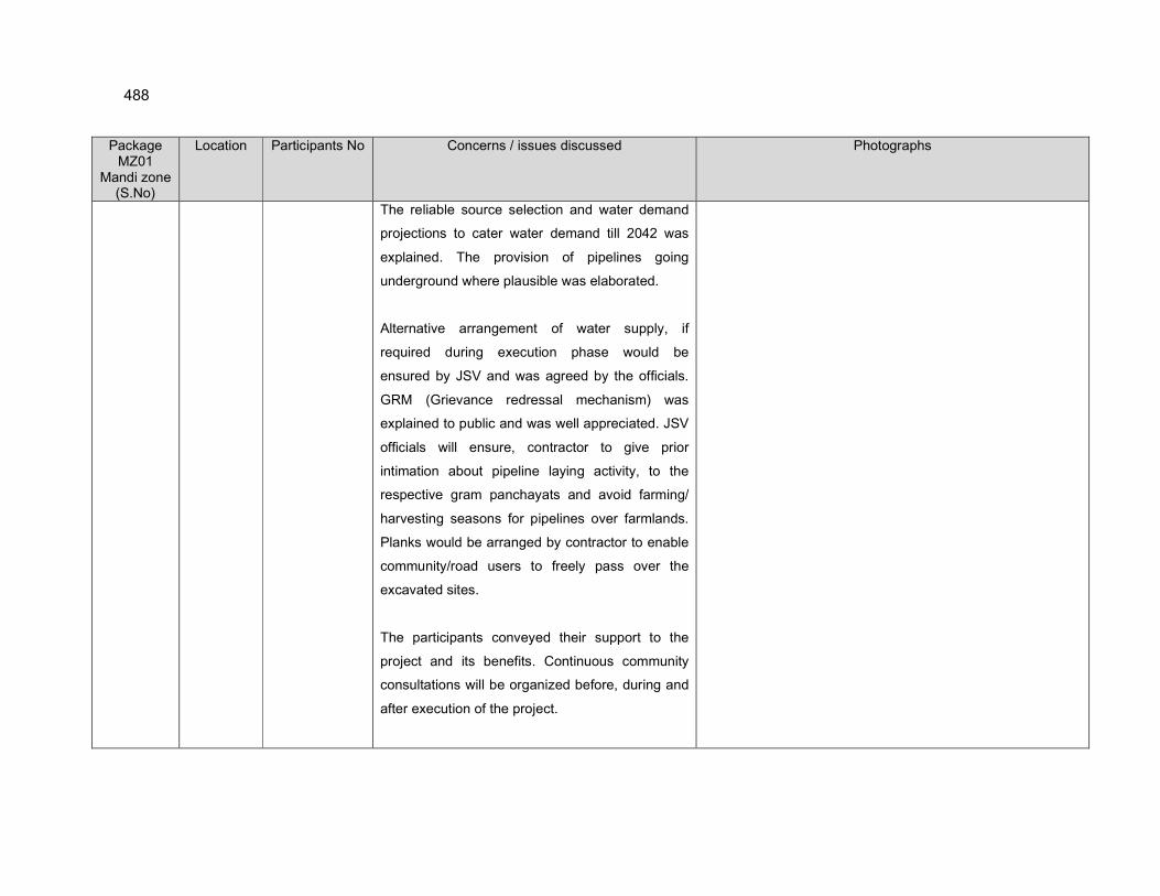
488
Package MZ01
Mandi zone (S.No)
Location Participants No Concerns / issues discussed Photographs
The reliable source selection and water demand
projections to cater water demand till 2042 was
explained. The provision of pipelines going
underground where plausible was elaborated.
Alternative arrangement of water supply, if
required during execution phase would be
ensured by JSV and was agreed by the officials.
GRM (Grievance redressal mechanism) was
explained to public and was well appreciated. JSV
officials will ensure, contractor to give prior
intimation about pipeline laying activity, to the
respective gram panchayats and avoid farming/
harvesting seasons for pipelines over farmlands.
Planks would be arranged by contractor to enable
community/road users to freely pass over the
excavated sites.
The participants conveyed their support to the
project and its benefits. Continuous community
consultations will be organized before, during and
after execution of the project.
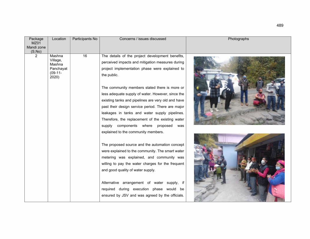
489
Package MZ01
Mandi zone (S.No)
Location Participants No Concerns / issues discussed Photographs
2 Mashna Village, Mashna Panchayat (09-11-2020)
16 The details of the project development benefits,
perceived impacts and mitigation measures during
project implementation phase were explained to
the public.
The community members stated there is more or
less adequate supply of water. However, since the
existing tanks and pipelines are very old and have
past their design service period. There are major
leakages in tanks and water supply pipelines.
Therefore, the replacement of the existing water
supply components where proposed was
explained to the community members.
The proposed source and the automation concept
were explained to the community. The smart water
metering was explained, and community was
willing to pay the water charges for the frequent
and good quality of water supply.
Alternative arrangement of water supply, if
required during execution phase would be
ensured by JSV and was agreed by the officials.
490
Package MZ01
Mandi zone (S.No)
Location Participants No Concerns / issues discussed Photographs
GRM (Grievance redressal mechanism) was
explained to public and was well appreciated. JSV
officials will ensure, contractor to give prior
intimation about pipeline laying activity, to the
respective gram panchayats and avoid farming/
harvesting seasons for pipelines over farmlands.
Planks would be arranged by contractor to enable
community/road users to freely pass over the
excavated sites.
The participants conveyed their support to the
project and its benefits. Continuous community
consultations will be organized before, during and
after execution of the project.
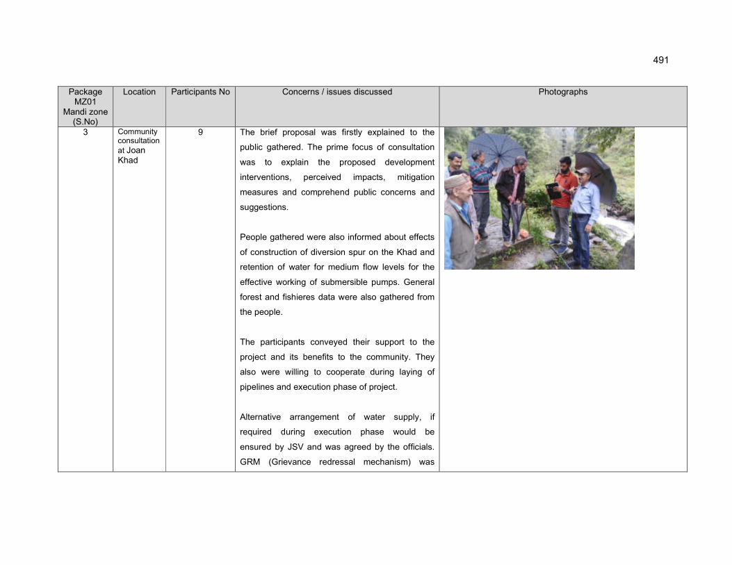
491
Package MZ01
Mandi zone (S.No)
Location Participants No Concerns / issues discussed Photographs
3 Community consultation
at Joan Khad
9 The brief proposal was firstly explained to the
public gathered. The prime focus of consultation
was to explain the proposed development
interventions, perceived impacts, mitigation
measures and comprehend public concerns and
suggestions.
People gathered were also informed about effects
of construction of diversion spur on the Khad and
retention of water for medium flow levels for the
effective working of submersible pumps. General
forest and fishieres data were also gathered from
the people.
The participants conveyed their support to the
project and its benefits to the community. They
also were willing to cooperate during laying of
pipelines and execution phase of project.
Alternative arrangement of water supply, if
required during execution phase would be
ensured by JSV and was agreed by the officials.
GRM (Grievance redressal mechanism) was
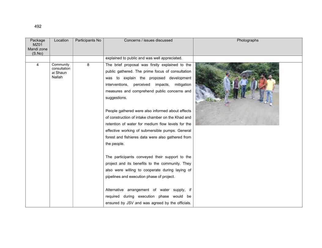
492
Package MZ01
Mandi zone (S.No)
Location Participants No Concerns / issues discussed Photographs
explained to public and was well appreciated.
4 Community consultation
at Shaun Nallah
8 The brief proposal was firstly explained to the
public gathered. The prime focus of consultation
was to explain the proposed development
interventions, perceived impacts, mitigation
measures and comprehend public concerns and
suggestions.
People gathered were also informed about effects
of construction of intake chamber on the Khad and
retention of water for medium flow levels for the
effective working of submersible pumps. General
forest and fishieres data were also gathered from
the people.
The participants conveyed their support to the
project and its benefits to the community. They
also were willing to cooperate during laying of
pipelines and execution phase of project.
Alternative arrangement of water supply, if
required during execution phase would be
ensured by JSV and was agreed by the officials.

493
Package MZ01
Mandi zone (S.No)
Location Participants No Concerns / issues discussed Photographs
GRM (Grievance redressal mechanism) was
explained to public and was well appreciated.
5 Community consultation
at Lohal Nallah
9 The brief proposal was firstly explained to the
public gathered. The prime focus of consultation
was to explain the proposed development
interventions, perceived impacts, mitigation
measures and comprehend public concerns and
suggestions.
People gathered were also informed about effects
of construction of intake chamber on the Khad and
retention of water for medium flow levels for the
effective working of submersible pumps. General
forest and fishieres data were also gathered from
the people.
The participants conveyed their support to the
project and its benefits to the community. They
also were willing to cooperate during laying of
pipelines and execution phase of project.
Alternative arrangement of water supply, if
required during execution phase would be

494
Package MZ01
Mandi zone (S.No)
Location Participants No Concerns / issues discussed Photographs
ensured by JSV and was agreed by the officials.
GRM (Grievance redressal mechanism) was
explained to public and was well appreciated.
6 Community consultation
at Bhargol Khad
8 The brief proposal was firstly explained to the
public gathered. The prime focus of consultation
was to explain the proposed development
interventions, perceived impacts, mitigation
measures and comprehend public concerns and
suggestions.
People gathered were also informed about effects
of construction of intake chamber on the Khad
and retention of water for medium flow levels for
the effective working of submersible pumps.
General forest and fishieres data were also
gathered from the people.
The participants conveyed their support to the
project and its benefits to the community. They
also were willing to cooperate during laying of
pipelines and execution phase of project.
Alternative arrangement of water supply, if
495
Package MZ01
Mandi zone (S.No)
Location Participants No Concerns / issues discussed Photographs
required during execution phase would be
ensured by JSV and was agreed by the officials.
GRM (Grievance redressal mechanism) was
explained to public and was well appreciated.
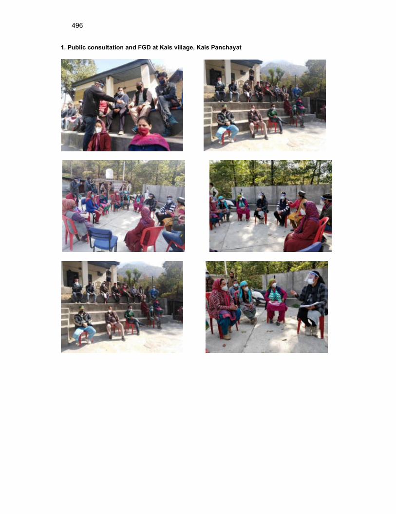
496
1. Public consultation and FGD at Kais village, Kais Panchayat
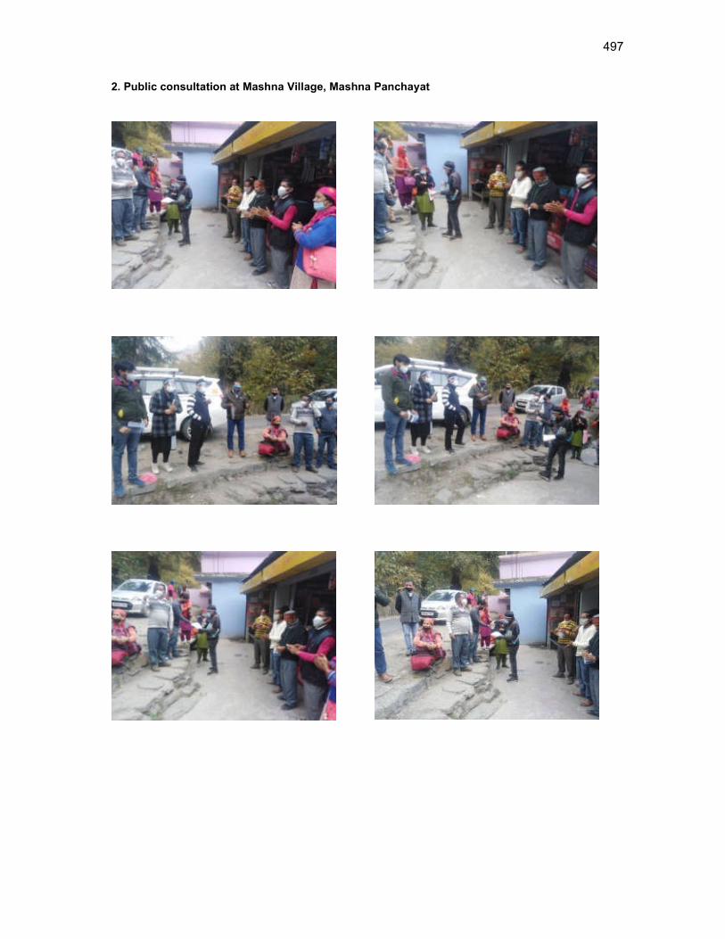
497
2. Public consultation at Mashna Village, Mashna Panchayat
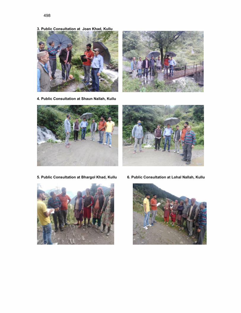
498
3. Public Consultation at Joan Khad, Kullu
4. Public Consultation at Shaun Nallah, Kullu
5. Public Consultation at Bhargol Khad, Kullu 6. Public Consultation at Lohal Nallah, Kullu
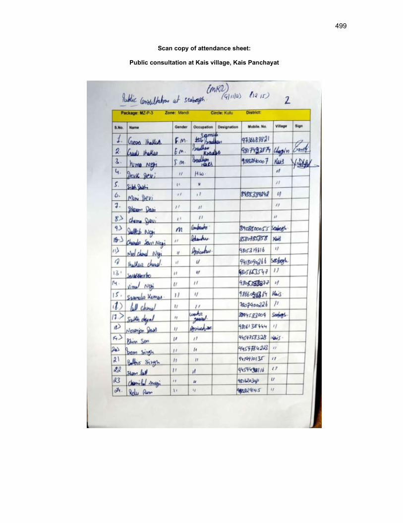
499
Scan copy of attendance sheet:
Public consultation at Kais village, Kais Panchayat

500
Continued. (Public consultation at Kais Village, Kais Panchayat)
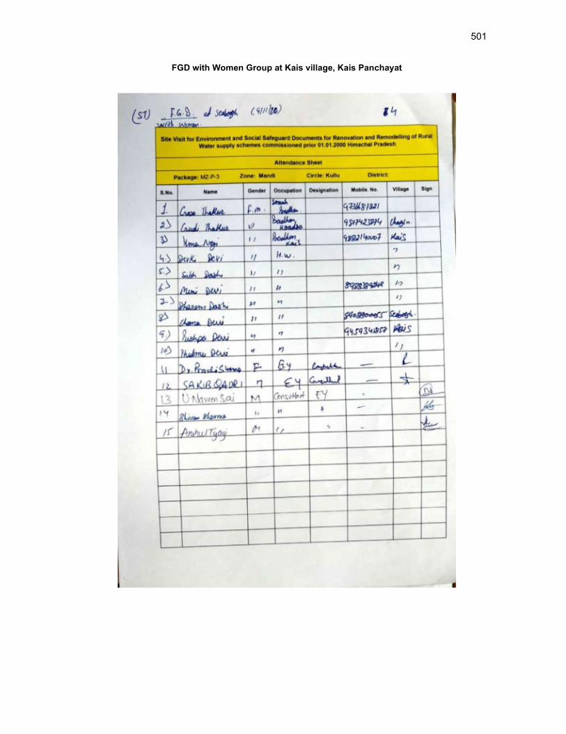
501
FGD with Women Group at Kais village, Kais Panchayat
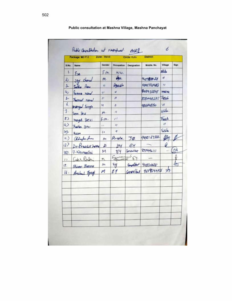
502
Public consultation at Mashna Village, Mashna Panchayat
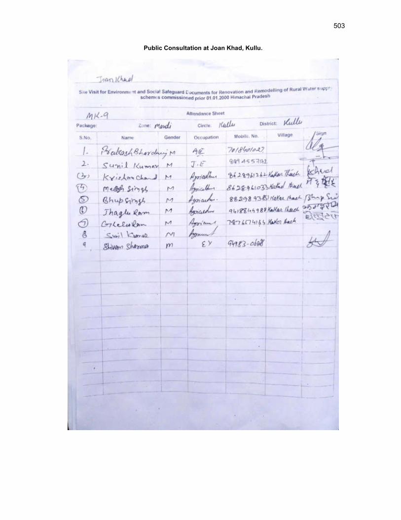
503
Public Consultation at Joan Khad, Kullu.
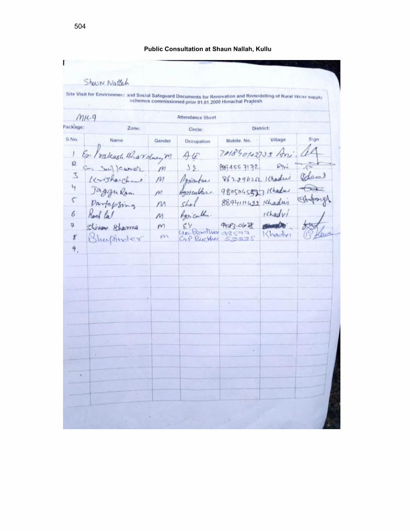
504
Public Consultation at Shaun Nallah, Kullu
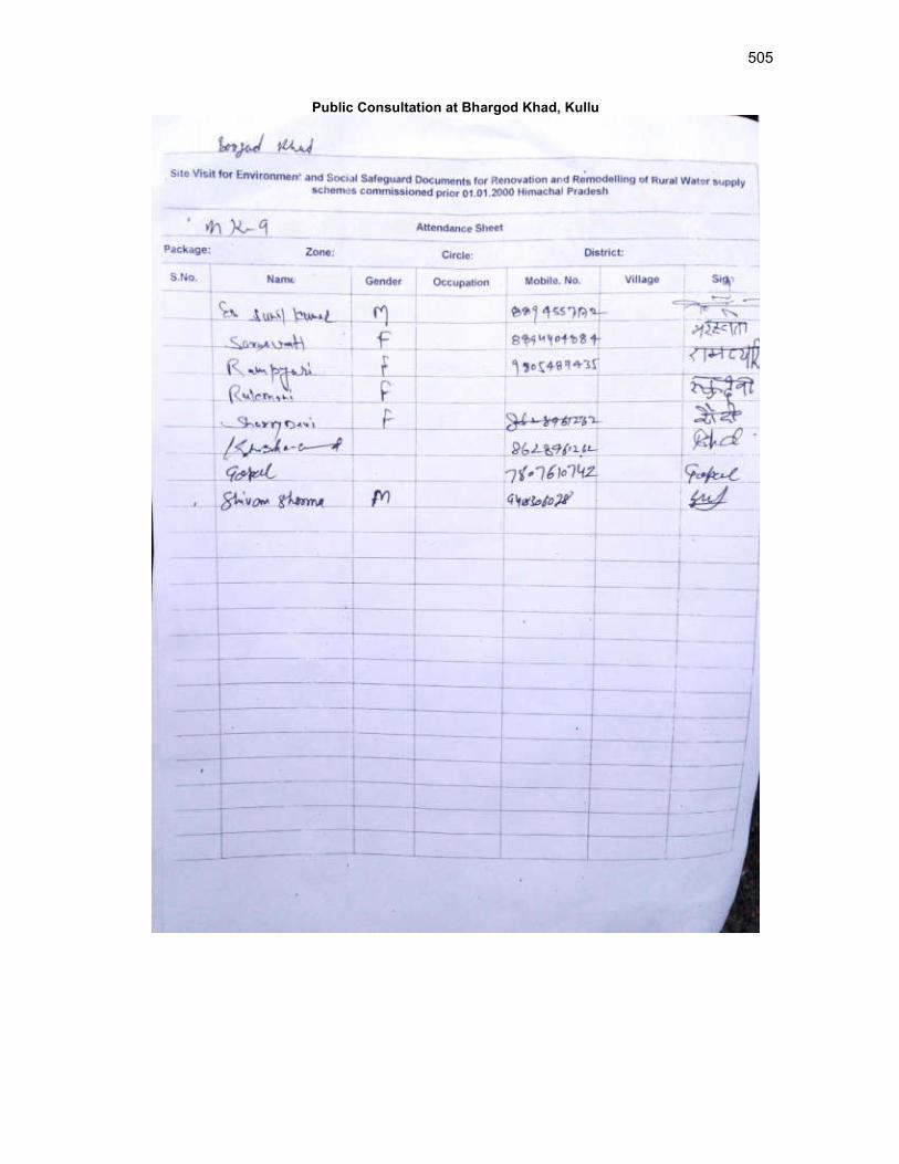
505
Public Consultation at Bhargod Khad, Kullu
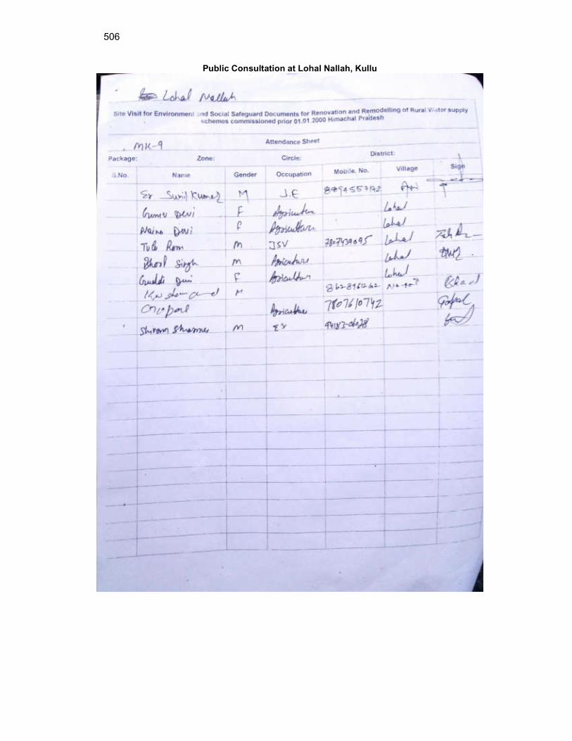
506
Public Consultation at Lohal Nallah, Kullu
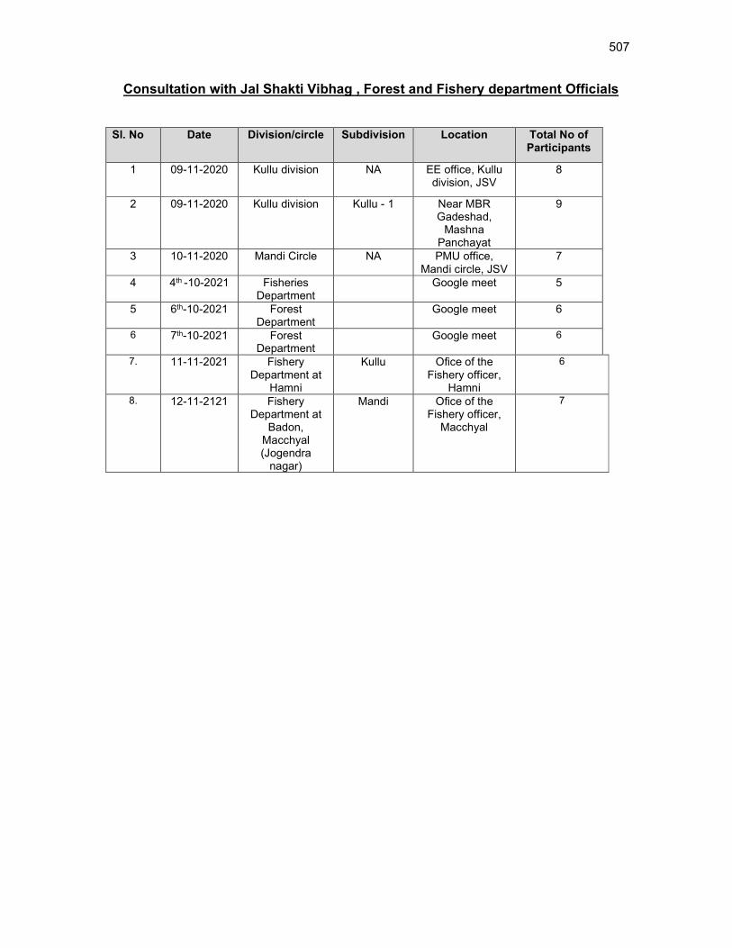
507
Consultation with Jal Shakti Vibhag , Forest and Fishery department Officials
Sl. No Date Division/circle Subdivision Location Total No of Participants
1 09-11-2020 Kullu division NA EE office, Kullu division, JSV
8
2 09-11-2020 Kullu division Kullu - 1 Near MBR Gadeshad,
Mashna Panchayat
9
3 10-11-2020 Mandi Circle NA PMU office, Mandi circle, JSV
7
4 4th -10-2021 Fisheries Department
Google meet 5
5 6th-10-2021 Forest Department
Google meet 6
6 7th-10-2021 Forest Department
Google meet 6
7. 11-11-2021 Fishery Department at
Hamni
Kullu Ofice of the Fishery officer,
Hamni
6
8. 12-11-2121 Fishery Department at
Badon, Macchyal (Jogendra
nagar)
Mandi Ofice of the Fishery officer,
Macchyal
7
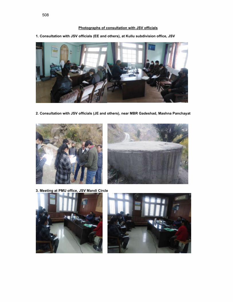
508
Photographs of consultation with JSV officials 1. Consultation with JSV officials (EE and others), at Kullu subdivision office, JSV
2. Consultation with JSV officials (JE and others), near MBR Gadeshad, Mashna Panchayat
3. Meeting at PMU office, JSV Mandi Circle
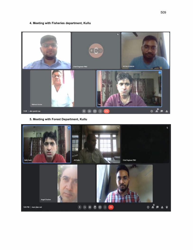
509
4. Meeting with Fisheries department, Kullu
5. Meeting with Forest Department, Kullu
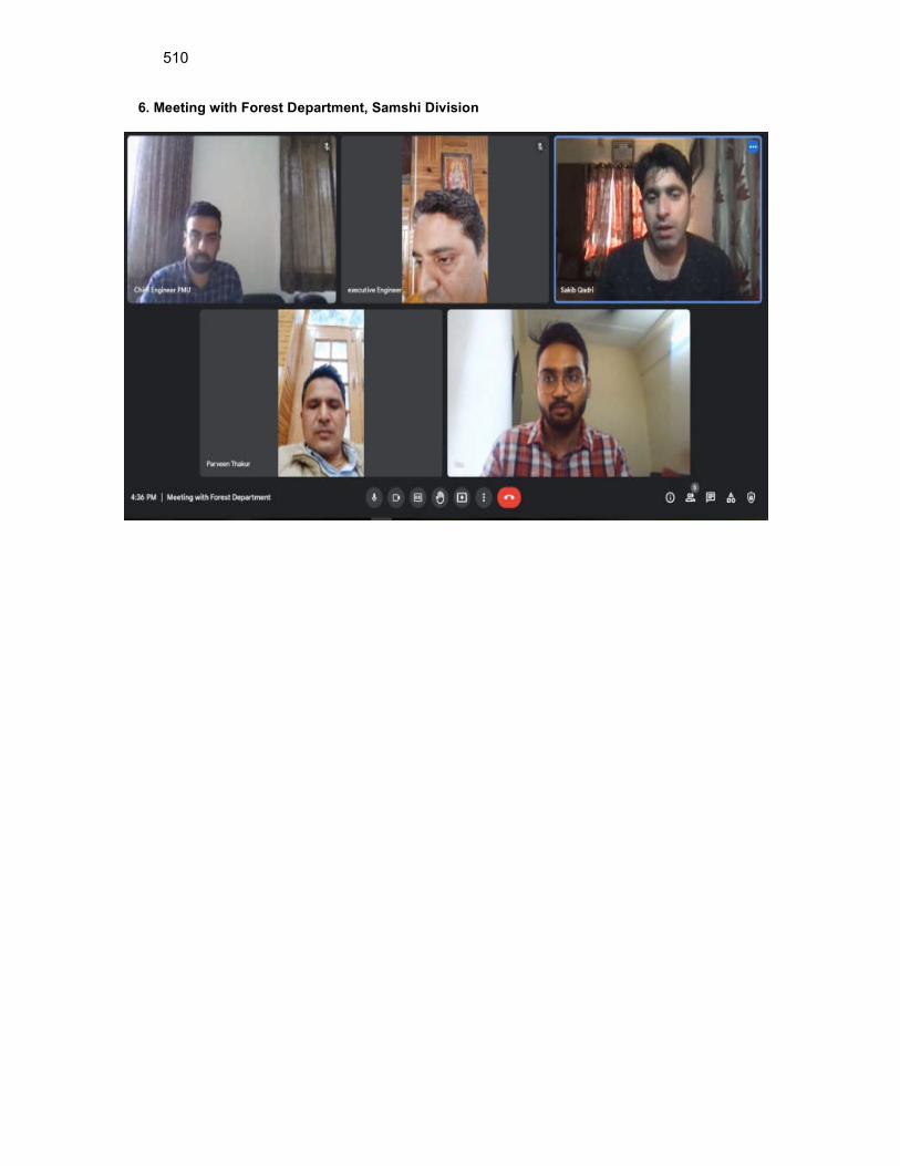
510
6. Meeting with Forest Department, Samshi Division

511
17. Meeting with Fishery Department, Hamni on 11th November 2021
18. Meeting with Fishery Department, Macchiyal, Jogendranagar (Golden Mahseer Firm) on
12th November 2021
19. Meeting with Engineer –in –Chief, JSV on 12th November 2021
Scan copy of attendance sheet:
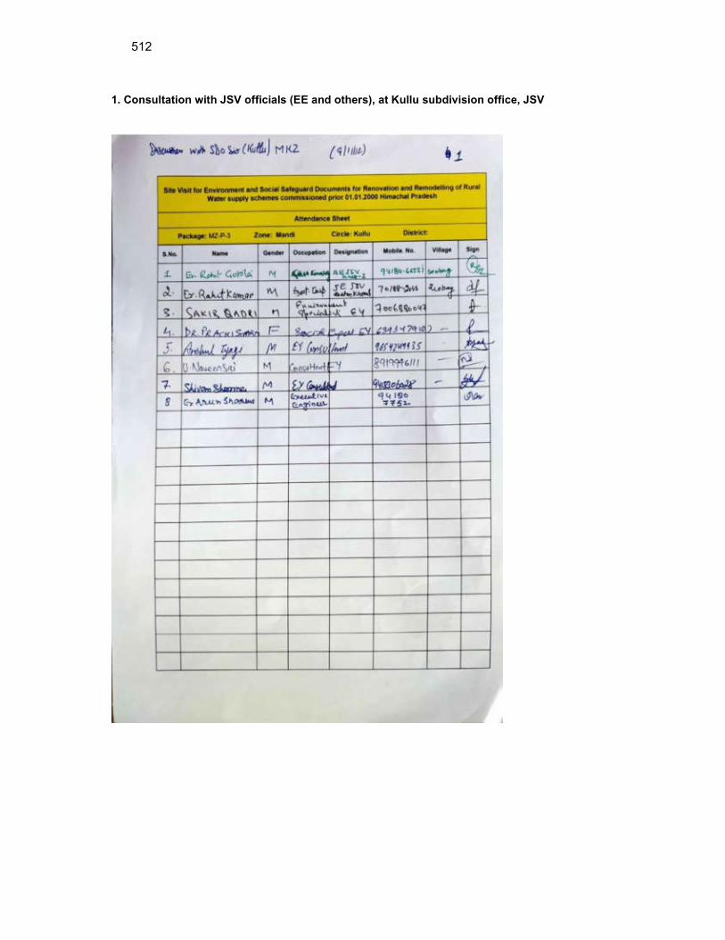
512
1. Consultation with JSV officials (EE and others), at Kullu subdivision office, JSV

513
2. Consultation with JSV officials (JE and others), near MBR Gadeshad, Mashna Panchayat
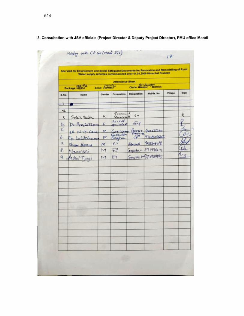
514
3. Consultation with JSV officials (Project Director & Deputy Project Director), PMU office Mandi
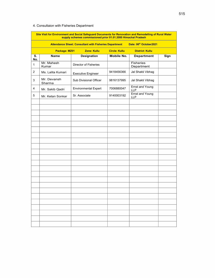
515
4. Consultaion with Fisheries Department
Site Visit for Environment and Social Safeguard Documents for Renovation and Remodelling of Rural Water supply schemes commissioned prior 01.01.2000 Himachal Pradesh
Attendance Sheet: Consultant with Fisheries Department Date: 06th October2021
Package: MZ01 Zone: Kullu Circle: Kullu District: Kullu
S. No.
Name Designation Mobile No. Department Sign
1 Mr. Mahesh Kumar
Director of Fisheries Fisheries Department
2 Ms. Lalita Kumari Executive Engineer 9418456366 Jal Shakti Vibhag
3 Mr. Devansh
Sharma Sub Divisional Officer 9816137995 Jal Shakti Vibhag
4 Mr. Sakib Qadri Environmental Expert 7006880047 Ernst and Young LLP
5 Mr. Ketan Sonkar Sr. Associate 9140003192 Ernst and Young LLP

516
5. Consultation with Forest Department .
Site Visit for Environment and Social Safeguard Documents for Renovation and Remodelling of Rural Water supply schemes commissioned prior 01.01.2000 Himachal Pradesh
Attendance Sheet: Consultant with Forest Department Date: 06th October2021
Package: MZ01 Zone: Kullu Circle: Kullu District: Kullu
S. No.
Name Designation Mobile No. Department Sign
1 Mr. Angel Chauhan
Divisional Forest Officer 9418183267
Forest Department
2 Ms. Lalita Kumari Executive Engineer 9418456366
Jal Shakti Vibhag
3 Mr. Devansh
Sharma Sub Divisional Officer
9816137995
Jal Shakti Vibhag
4 Mr. Arun Sharma Executive Engineer, Kullu
418077520 Jal Shakti Vibhag
5 Mr. Sakib Qadri Environmental Expert 7006880047
Ernst and Young LLP
6 Mr. Ketan Sonkar Sr. Associate 9140003192 Ernst and Young LLP
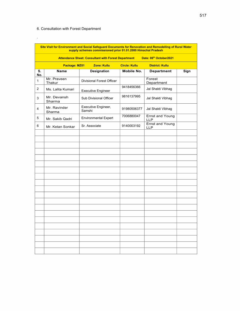
517
6. Consultation with Forest Department .
Site Visit for Environment and Social Safeguard Documents for Renovation and Remodelling of Rural Water supply schemes commissioned prior 01.01.2000 Himachal Pradesh
Attendance Sheet: Consultant with Forest Department Date: 06th October2021
Package: MZ01 Zone: Kullu Circle: Kullu District: Kullu
S. No.
Name Designation Mobile No. Department Sign
1 Mr. Praveen Thakur
Divisional Forest Officer Forest Department
2 Ms. Lalita Kumari Executive Engineer 9418456366
Jal Shakti Vibhag
3 Mr. Devansh
Sharma Sub Divisional Officer
9816137995
Jal Shakti Vibhag
4 Mr. Ravinder
Sharma
Executive Engineer, Samshi
91980506377 Jal Shakti Vibhag
5 Mr. Sakib Qadri Environmental Expert 7006880047
Ernst and Young LLP
6 Mr. Ketan Sonkar Sr. Associate 9140003192 Ernst and Young LLP

518
Summary of Consultations with Stakeholders
Sr. no. Location Participants No Concerns / issues discussed Photographs
1 Meeting with
Executive
Engineer,
Kullu Division
office, JSV
(09-11-2020)
8 Firstly, the overall components (Existing &
Proposed) of the Water Supply Schemes
and the complete proposal was discussed
with Mr. Arun Sharma, Executive Engineer,
Kullu division. The proposed sites to be
visited and the Locations for public
consultations were finalized. The meeting
with IP community was arranged in Kais
panchayat
The importance and readiness of Land
ownership for the proposed components
was explained. The necessary land details
will be given by JSV.
JSV has agreed to follow the land transfer
procedures for the proposed components at
the required locations. This would help to
avoid land ownership issues during
implementation phase.
The CTE (Consent to establish) & CTO
(Consent to operate) WTP will be arranged

519
Sr. no. Location Participants No Concerns / issues discussed Photographs
by JSV. Tree cutting if required is to be
compensated by Cross plantation
2 Meeting with
Junior
Engineer,
near MBR
Gadeshad,
Mashna
Panchayat
(09-11-2020)
9 Firstly, the overall components (Existing &
Proposed) of the Water Supply Schemes
and the complete proposal was discussed
with Mr. Chappe Ram, Junior Engineer, Lag
valley section. The proposed sites to be
visited and the Locations for public
consultations were finalized.
The importance and readiness of Land
ownership for the proposed components
was explained. The necessary land details
will be given by JSV.
JSV has agreed to provide the land
ownership and land transfer documents for
the required land parcels shortly.
The CTE (Consent to establish) & CTO
(Consent to operate) WTP will be arranged
by JSV. Tree cutting if required is to be
compensated by Cross plantation
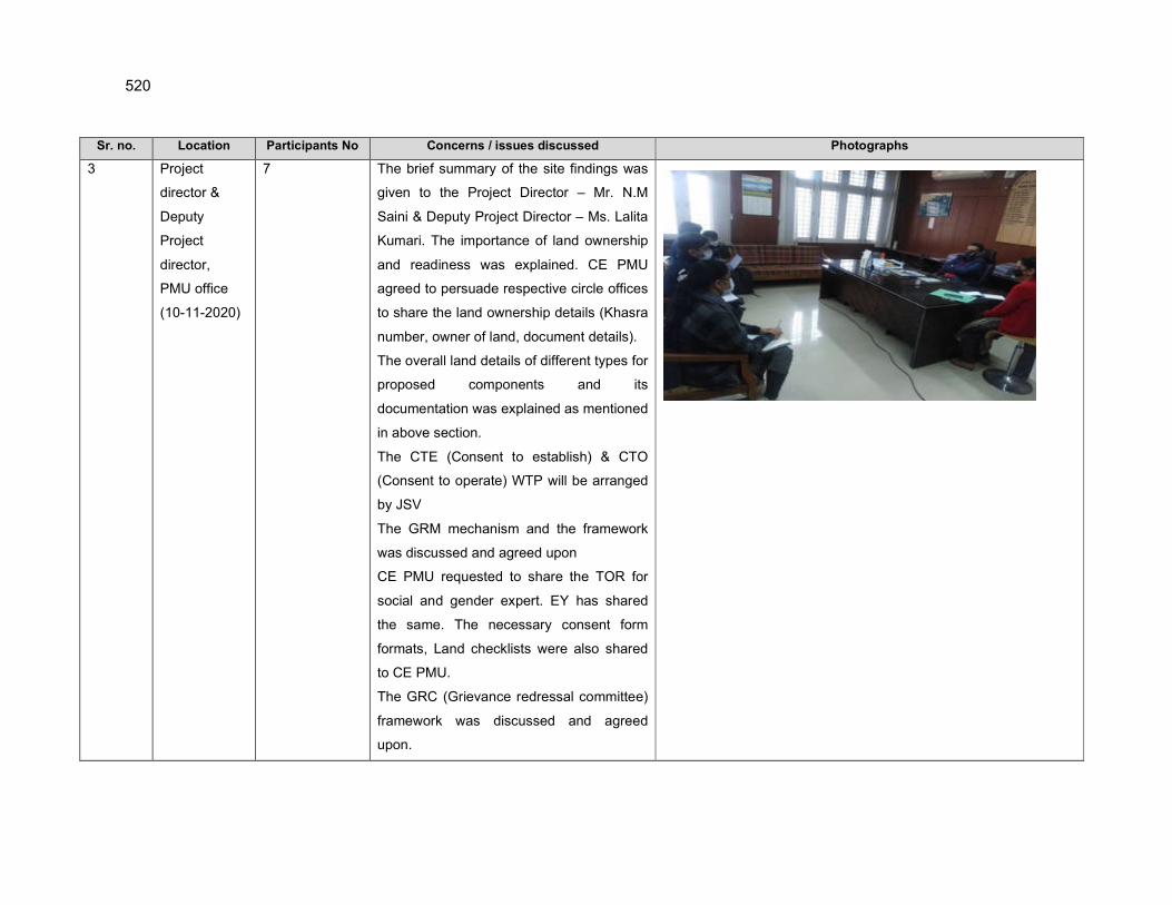
520
Sr. no. Location Participants No Concerns / issues discussed Photographs
3 Project
director &
Deputy
Project
director,
PMU office
(10-11-2020)
7 The brief summary of the site findings was
given to the Project Director – Mr. N.M
Saini & Deputy Project Director – Ms. Lalita
Kumari. The importance of land ownership
and readiness was explained. CE PMU
agreed to persuade respective circle offices
to share the land ownership details (Khasra
number, owner of land, document details).
The overall land details of different types for
proposed components and its
documentation was explained as mentioned
in above section.
The CTE (Consent to establish) & CTO
(Consent to operate) WTP will be arranged
by JSV
The GRM mechanism and the framework
was discussed and agreed upon
CE PMU requested to share the TOR for
social and gender expert. EY has shared
the same. The necessary consent form
formats, Land checklists were also shared
to CE PMU.
The GRC (Grievance redressal committee)
framework was discussed and agreed
upon.

521
Sr. no. Location Participants No Concerns / issues discussed Photographs
4 Consultation
Meeting with
Assistant
Director,
Fisheries,
Kullu, at
Google Meet.
5 Consultation with Mr. Mahesh Kumar, Assistant
Director of Fisheries, Kullu was held on 6th
October 2021 virtually.
Detailed discussion was made on the species of
fish found in water bodies in Kullu, reason, and
pattern of migration of fishes, information on
endangered species and movement of fishes
through water retaining structure.
Mr. Mahesh Kumar replied generally fish species
Schizothorax is observed in Kullu District,
Schizothorax is a resident fish and spawns in
the local areas.
On enquiring about Indian Torrent Catfish, Mr.
Mahesh Kumar replied Catfish is not found in
Kullu District.
On enquiring about the hinderance in movement
of fish due to construction of head weir, Mr.
Mahesh Kumar replied Structures with 1 m of
height do not cause hinderance in the
movement of fish if there is continuous flow in
downstream of the stream.

522
Sr. no. Location Participants No Concerns / issues discussed Photographs
Detailed information for fish species found in
surface water bodies proposed under the project
and the effect of construction of head weirs on
fish movement was analysed and shared by
Fisheries Department.
5 Consultation
Meeting with
Divisional
Forest Officer,
Thunag,
Google Meet.
6 Consultation with Mr Angel Chauhan, Divisional
Forest Officer, Kullu was held on 6th October
2021 virtually.
Detailed discussion was made with Mr Angel
Chauhan, on the species of Flora and Fauna
found in Mandi, protected species of trees,
shrubs and herbs found in the region, provision
required if any tree felling is required.
Mr. Mr Angel Chauhan replied Himalayan
Deodar, Blue Pine and Chir are the dominant
species generally found in Kullu district.
Detailed information for flora and fauna found in
project area was received from the forest
department and Forestry university kullu.
6 Consultation
Meeting with
Divisional
Forest Officer,,
Samshi,
6 Consultation with Mr Praveen Thakur, Divisional
Forest Officer,, Samshi was held on 7th October
2021 virtually.
Detailed discussion was made with Mr Praveen
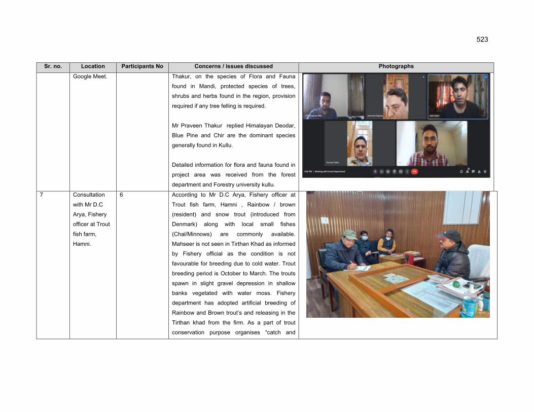
523
Sr. no. Location Participants No Concerns / issues discussed Photographs
Google Meet. Thakur, on the species of Flora and Fauna
found in Mandi, protected species of trees,
shrubs and herbs found in the region, provision
required if any tree felling is required.
Mr Praveen Thakur replied Himalayan Deodar,
Blue Pine and Chir are the dominant species
generally found in Kullu.
Detailed information for flora and fauna found in
project area was received from the forest
department and Forestry university kullu.
7 Consultation
with Mr D.C
Arya, Fishery
officer at Trout
fish farm,
Hamni.
6 According to Mr D.C Arya, Fishery officer at
Trout fish farm, Hamni , Rainbow / brown
(resident) and snow trout (introduced from
Denmark) along with local small fishes
(Chal/Minnows) are commonly available.
Mahseer is not seen in Tirthan Khad as informed
by Fishery official as the condition is not
favourable for breeding due to cold water. Trout
breeding period is October to March. The trouts
spawn in slight gravel depression in shallow
banks vegetated with water moss. Fishery
department has adopted artificial breeding of
Rainbow and Brown trout’s and releasing in the
Tirthan khad from the firm. As a part of trout
conservation purpose organises “catch and

524
Sr. no. Location Participants No Concerns / issues discussed Photographs
release” events in April every year with the help
of local NGOs. Anglers from all over the world
participate in this event.
7 Consultation
with Mr Ajay
Sharma,
Fishery officer
at Macchyal
Mahseer Firm,
Jogendranagar.
6 According to Mr Ajay Sharma, Fishery officer at
Mahseer farm, Macchyal , Golden Mahseer
which is an endangered species as per IUCN
status is a long range migrant and use the
Beas river stretch between Pong dam and
Pandoh dam and Satluj rivers and their
tributaries for breeding and spawning during
monsoon (mid May to September). Other fish
species are local and low/medium range
migrant.
Golden Mahseer is called sporty/game fish and
can move upstream upto 100km. During
torrential monsoon migrates upstream from
Lakes / lowland rivers to reach suitable
spawning grounds. It prefers to spawn over
rocky and stony substrates. It is omnivorous but
during migration carni-omnivorous.
In recent years due to their proximity to human
intervention, mahseer stock is threatened with
multifaceted dangers posed by construction of
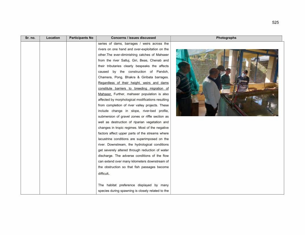
525
Sr. no. Location Participants No Concerns / issues discussed Photographs
series of dams, barrages / weirs across the
rivers on one hand and over-exploitation on the
other.The ever-diminishing catches of Mahseer
from the river Satluj, Giri, Beas, Chenab and
their tributaries clearly bespeaks the affects
caused by the construction of Pandoh,
Chamera, Pong, Bhakra & Giribata barrages.
Regardless of their height, weirs and dams
constitute barriers to breeding migration of
Mahseer. Further, mahseer population is also
affected by morphological modifications resulting
from completion of river valley projects. These
include change in slope, river-bed profile,
submersion of gravel zones or riffle section as
well as destruction of riparian vegetation and
changes in tropic regimes. Most of the negative
factors affect upper parts of the streams where
lacustrine conditions are superimposed on the
river. Downstream, the hydrological conditions
get severely altered through reduction of water
discharge. The adverse conditions of the flow
can extend over many kilometers downstream of
the obstruction so that fish passages become
difficult.
The habitat preference displayed by many
species during spawning is closely related to the
526
Sr. no. Location Participants No Concerns / issues discussed Photographs
stage of the course of the life cycle occurring in
the flooding at monsoon. The trouts spawn in
slight gravel depression in shallow banks
vegetated with water moss. Mahseer prefers
shallow semi - stagnant water in general with
stones for spawning. Carps generally do not
breed in confined channels but rather spawn in
flooded fields during monsoon at depth of 0.5 to
1m.
Normally the spawning of Mahseer takes place
at confluences of the tributaries with the main
streams where water is well oxygenated and has
a moderate velocity. ,
Several fish species including Tor putitora
(Golden Mahseer) which requires upstream
migration to reach the spawning ground in order
to reproduce will be obstructed by head weirs in
their specific pathways from successfully
reaching their spawning grounds and breed.
State Government through its conservation plan
launched to save endangered Golden Mahseer
from the brink of extinction has succeeded in
improving the status of this specie in the rivers
and reservoirs of Himachal Pradesh.
527
Sr. no. Location Participants No Concerns / issues discussed Photographs
There are many natural Mahseer sanctuaries
called Machhial in the state water where Golden
Mahseer is being conserved spiritually by the
people and department of fisheries also doing
commendable work in this direction by strictly
implementing fisheries Act and Rules. It has also
created opportunities of employment and
strengthened the economy of fishermen of the
state. So far now 10893 families have been
involved in captive fisheries in the state out of
which 5883 families are involved in riverine
around 5010 families are involved in fish catches
in reservoirs area.

528
Appendix 18: Sample Grievance Registration Form
(To be available in Hindi and English)
The Project welcomes complaints, suggestions,
queries, and comments regarding project implementation. We encourage persons with
grievance to provide their name and contact information to enable us to get in touch with you for
clarification and feedback.
Should you choose to include your personal details but want that information to remain
confidential, please inform us by writing/typing *(CONFIDENTIAL)* above your name. Thank
you.
Date Place of registration Project Town
Project:
Contact information/personal details
Name Gender * Male
* Female
Age
Home address
Place
Phone no.
Complaint/suggestion/comment/question Please provide the details (who, what, where, and how) of your
grievance below:
If included as attachment/note/letter, please tick here:
How do you want us to reach you for feedback or update on your comment/grievance?
FOR OFFICIAL USE ONLY
Registered by: (Name of official registering grievance)
Mode of communication:
Note/letter
Verbal/telephonic

529
Reviewed by: (Names/positions of officials reviewing grievance)
Action taken:
Whether action taken disclosed: Yes
No
Means of disclosure:
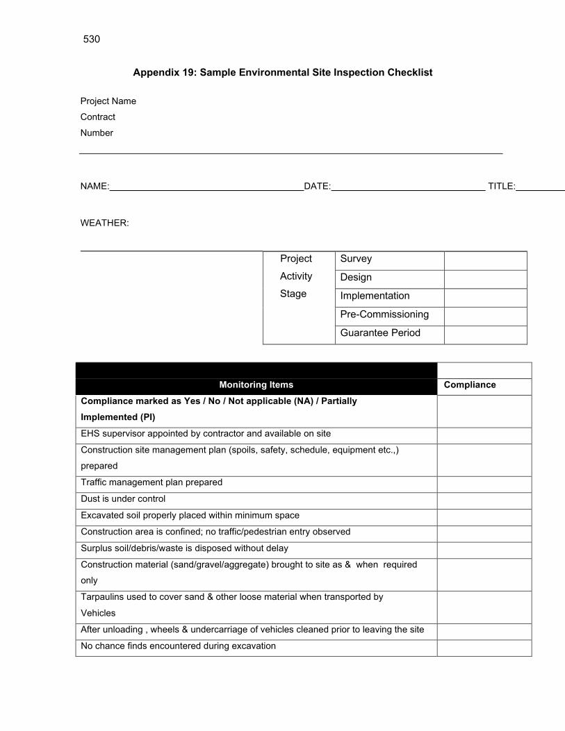
530
Appendix 19: Sample Environmental Site Inspection Checklist
Project Name
Contract
Number
NAME: DATE: TITLE:
WEATHER:
Project
Activity
Stage
Survey
Design
Implementation
Pre-Commissioning
Guarantee Period
Monitoring Items Compliance
Compliance marked as Yes / No / Not applicable (NA) / Partially
Implemented (PI)
EHS supervisor appointed by contractor and available on site
Construction site management plan (spoils, safety, schedule, equipment etc.,)
prepared
Traffic management plan prepared
Dust is under control
Excavated soil properly placed within minimum space
Construction area is confined; no traffic/pedestrian entry observed
Surplus soil/debris/waste is disposed without delay
Construction material (sand/gravel/aggregate) brought to site as & when required
only
Tarpaulins used to cover sand & other loose material when transported by
Vehicles
After unloading , wheels & undercarriage of vehicles cleaned prior to leaving the site
No chance finds encountered during excavation
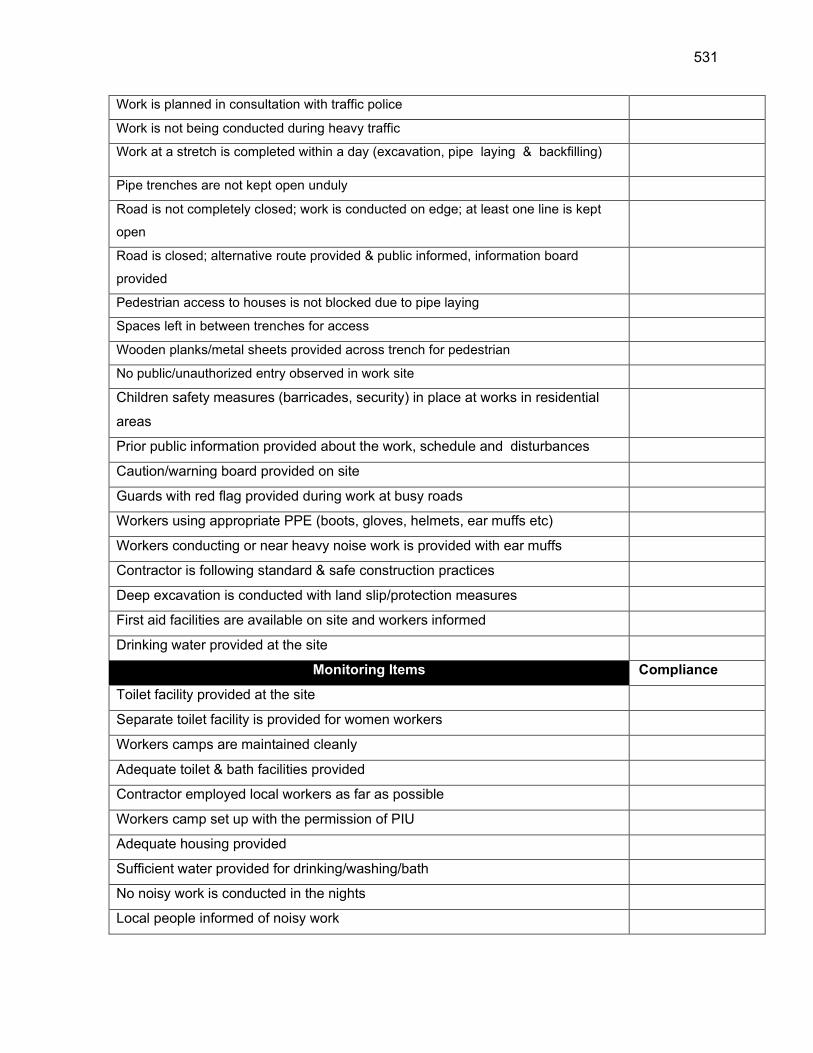
531
Work is planned in consultation with traffic police
Work is not being conducted during heavy traffic
Work at a stretch is completed within a day (excavation, pipe laying & backfilling)
Pipe trenches are not kept open unduly
Road is not completely closed; work is conducted on edge; at least one line is kept
open
Road is closed; alternative route provided & public informed, information board
provided
Pedestrian access to houses is not blocked due to pipe laying
Spaces left in between trenches for access
Wooden planks/metal sheets provided across trench for pedestrian
No public/unauthorized entry observed in work site
Children safety measures (barricades, security) in place at works in residential
areas
Prior public information provided about the work, schedule and disturbances
Caution/warning board provided on site
Guards with red flag provided during work at busy roads
Workers using appropriate PPE (boots, gloves, helmets, ear muffs etc)
Workers conducting or near heavy noise work is provided with ear muffs
Contractor is following standard & safe construction practices
Deep excavation is conducted with land slip/protection measures
First aid facilities are available on site and workers informed
Drinking water provided at the site
Monitoring Items Compliance
Toilet facility provided at the site
Separate toilet facility is provided for women workers
Workers camps are maintained cleanly
Adequate toilet & bath facilities provided
Contractor employed local workers as far as possible
Workers camp set up with the permission of PIU
Adequate housing provided
Sufficient water provided for drinking/washing/bath
No noisy work is conducted in the nights
Local people informed of noisy work

532
No blasting activity conducted
Pneumatic drills or other equipment creating vibration is not used near old/risky
buildings
Signature
Sign off
Name Name
Position Position
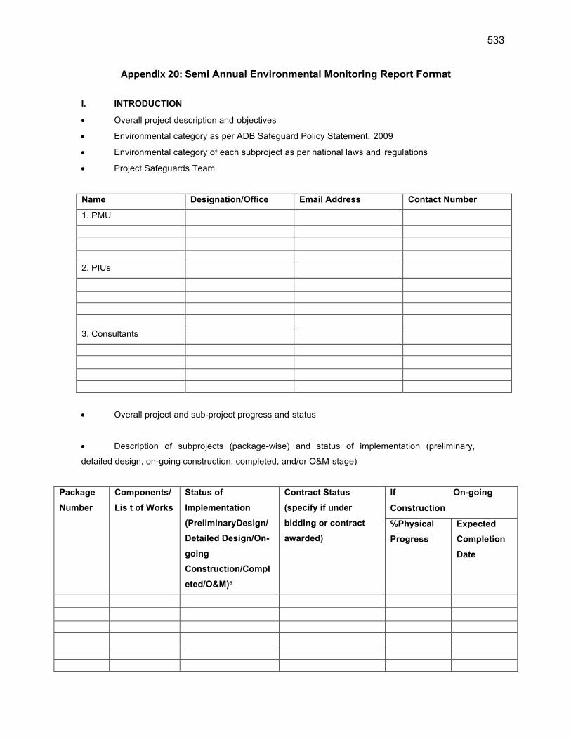
533
Appendix 20: Semi Annual Environmental Monitoring Report Format
I. INTRODUCTION
Overall project description and objectives
Environmental category as per ADB Safeguard Policy Statement, 2009
Environmental category of each subproject as per national laws and regulations
Project Safeguards Team
Name Designation/Office Email Address Contact Number
1. PMU
2. PIUs
3. Consultants
Overall project and sub-project progress and status
Description of subprojects (package-wise) and status of implementation (preliminary,
detailed design, on-going construction, completed, and/or O&M stage)
Package
Number
Components/
Lis t of Works
Status of
Implementation
(PreliminaryDesign/
Detailed Design/On-
going
Construction/Compl
eted/O&M)a
Contract Status
(specify if under
bidding or contract
awarded)
If On-going
Construction
%Physical
Progress
Expected
Completion
Date

534
a- If on-going construction, include %physical progress and expected date of completion.
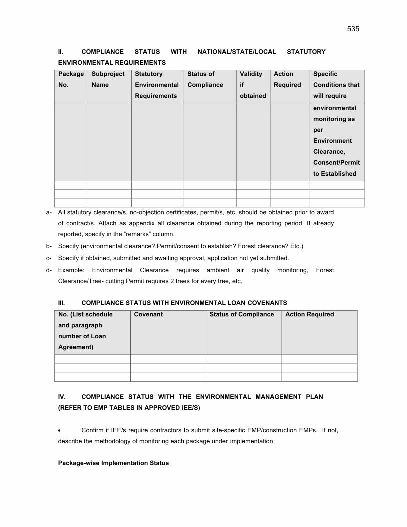
535
II. COMPLIANCE STATUS WITH NATIONAL/STATE/LOCAL STATUTORY
ENVIRONMENTAL REQUIREMENTS
Package
No.
Subproject
Name
Statutory
Environmental
Requirements
Status of
Compliance
Validity
if
obtained
Action
Required
Specific
Conditions that
will require
environmental
monitoring as
per
Environment
Clearance,
Consent/Permit
to Established
a- All statutory clearance/s, no-objection certificates, permit/s, etc. should be obtained prior to award
of contract/s. Attach as appendix all clearance obtained during the reporting period. If already
reported, specify in the “remarks” column.
b- Specify (environmental clearance? Permit/consent to establish? Forest clearance? Etc.)
c- Specify if obtained, submitted and awaiting approval, application not yet submitted.
d- Example: Environmental Clearance requires ambient air quality monitoring, Forest
Clearance/Tree- cutting Permit requires 2 trees for every tree, etc.
III. COMPLIANCE STATUS WITH ENVIRONMENTAL LOAN COVENANTS
No. (List schedule
and paragraph
number of Loan
Agreement)
Covenant Status of Compliance Action Required
IV. COMPLIANCE STATUS WITH THE ENVIRONMENTAL MANAGEMENT PLAN
(REFER TO EMP TABLES IN APPROVED IEE/S)
Confirm if IEE/s require contractors to submit site-specific EMP/construction EMPs. If not,
describe the methodology of monitoring each package under implementation.
Package-wise Implementation Status
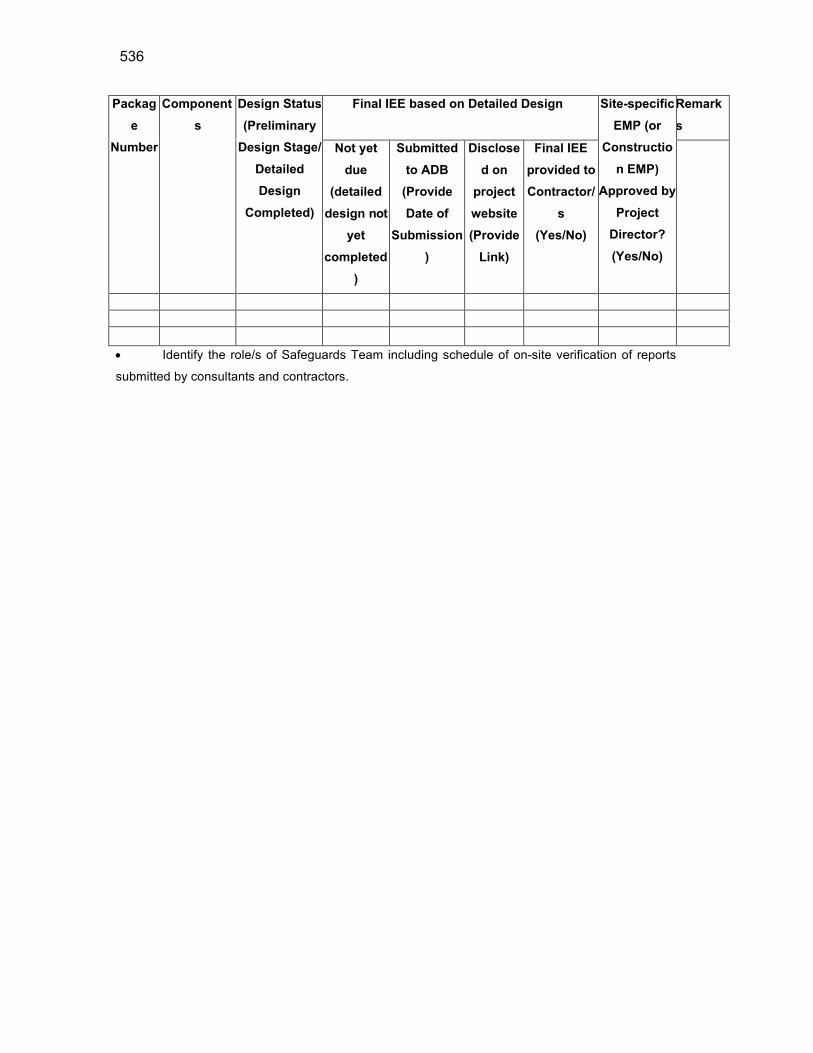
536
Packag
e
Number
Component
s
Design Status
(Preliminary
Design Stage/
Detailed
Design
Completed)
Final IEE based on Detailed Design Site-specific
EMP (or
Constructio
n EMP)
Approved by
Project
Director?
(Yes/No)
Remark
s
Not yet
due
(detailed
design not
yet
completed
)
Submitted
to ADB
(Provide
Date of
Submission
)
Disclose
d on
project
website
(Provide
Link)
Final IEE
provided to
Contractor/
s
(Yes/No)
Identify the role/s of Safeguards Team including schedule of on-site verification of reports
submitted by consultants and contractors.
537
For each package, provide name/s and contact details of contractor/s’ nodal person/s for
environmental safeguards.
Include as appendix all supporting documents including signed monthly environmental site
inspection reports prepared by consultants and/or contractors.
With reference to approved EMP/site-specific EMP/construction EMP, complete the table below
Provide the monitoring results as per the parameters outlined in the approved EMP (or site-
specific EMP/construction EMP when applicable).
In addition to the table on EMP implementation, the main text of the report should discuss
in details the following items:
(i) Grievance Redress Mechanism. Provide information on establishment of grievance
redress mechanism and capacity of grievance redress committee to address project-related
issues/complaints. Include as appendix Notification of the GRM (town-wise if applicable).
(ii) Complaints Received during the Reporting Period. Provide information on number,
nature, and resolution of complaints received during reporting period. Attach records as per GRM in
the approved IEE. Identify safeguards team member/s involved in the GRM process. Attach minutes
of meetings (ensure English translation is provided).
Confirm if any dust was noted to escape the site boundaries and identify dust suppression
techniques followed for site/s.
Identify muddy water was escaping site boundaries or muddy tracks were seen on adjacent
roads.
Identify type of erosion and sediment control measures installed on site/s, condition of
erosion and sediment control measures including if these were intact following heavy rain;
Identify designated areas for concrete works, chemical storage, construction materials, and
refueling. Attach photographs of each area.
Confirm spill kits on site and site procedure for handling emergencies.
Identify any chemical stored on site and provide information on storage condition. Attach
photograph.
Describe management of stockpiles (construction materials, excavated soils, spoils, etc.).
Provide photographs.
Describe management of solid and liquid wastes on-site (quantity generated, transport,
storage and disposal). Provide photographs.
Provide information on barricades, signages, and on-site boards. Provide photographs.
Provide information on
Checking if there are any activities being under taken out of working hours and how that is
being managed.

538
Summary of Environmental Monitoring Activities (for the Reporting
Period)a
Impacts (List
from IEE)
Mitigation
Measures (List
from IEE)
Parameters Monitored (As a
minimum those identified in
the IEE should be monitored)
Method of
Monitoring
Location of
Monitoring
Date of
Monitoring
Conducted
Name of Person
Who Conducted
the Monitoring
Design Phase
Pre-Construction Phase
Construction Phase
Operational Phase
a Attach Laboratory Results and Sampling Map/Locations
539
Overall Compliance with CEMP/EMP
No. Sub-Project
Name
EMP/ CEMP
Part of
Contract
Documents
(Y/N)
CEMP/ EMP
Being
Implemented
(Y/N)
Status of
Implementation
(Excellent/ Satisfactory/
Partially Satisfactory/
Below Satisfactory)
Action
Proposed and
Additional
Measures
Required
V. APPROACH AND METHODOLOGY FOR ENVIRONMENTAL MONITORING OF THE
PROJECT
Brief description on the approach and methodology used for environmental monitoring of each
sub- project
VI. MONITORING OF ENVIRONMENTAL IMPACTS ON PROJECT SURROUNDINGS
(ambient air, water quality and noise levels)
Brief discussion on the basis for monitoring
Indicate type and location of environmental parameters to be monitored
Indicate the method of monitoring and equipment to be used
Provide monitoring results and an analysis of results in relation to baseline data and statutory
requirements
As a minimum the results should be presented as per the tables below.
Air Quality Results
Site No.
Date of Testing
Site Location
Parameters (Government
Standards)
PM10
µg/m3
SO2
µg/m3
NO2
µg/m3
Parameters (Monitoring
Results)
540
Site No. Date of Testing Site Location PM10
µg/m3
SO2
µg/m3
NO2
µg/m3
Water Quality Results
Site No.
Date of Sampling
Site Location
Parameters (Government Standards)
pH Conductivity
µS/cm
BOD
mg/L
TSS
mg/L
TN
mg/L
TP
mg/L
Noise Quality Results
Site No. Date of Testing Site Location LAeq (dBA) (Government Standard)
Day Time Night Time
VII. SUMMARY OF KEY ISSUES AND REMEDIAL ACTIONS
Summary of follow up time-bound actions to be taken within a set timeframe.
APPENDIXES
Photos
Summary of consultations
Copies of environmental clearances and permits
Sample of environmental site inspection report
Other
541
Appendix 21: Guidelines for Safety during Monsoon/Heavy rainfall
Excavation and refilling of earth are common activities, which, if not
carefully executed may pose problems to the safety of works as well as
passersby and road users during the impending Monsoon.
Normal and heavy rainfall event affect our ongoing works, It should be our
conscientious effort to ensure that such events do not prove to be
problematic to people and structures in town. During monsoon PIU/PDMSC
should ensure that any further excavation work is taken up only after
ensuring that the earlier work is in safe stage. It is desired that DCM/ACM &
Ex En PIU should inspect all sites during rains and take proactive actions.
Some of the precautions and mitigation measures to be taken are discussed below-
1 The execution of works having deep excavation in smaller lanes and
congested areas should be completed well before monsoon. The works
of deep excavation during monsoon should not be preferably taken up
or extensive care should be taken for execution of such works.
2 The settlement in refilled trenches of sewerage and water supply lines
may occur during monsoon. PDMSC and PIU team should inspect all
sites after a storm to identify such reaches and take immediate
corrective action by proper refilling and compacting. It is responsibility
of all engineers to look after this activity during monsoon and ensure
corrective actions from Contractor’s side.
3 The contractor’s crew should be equipped with vehicle, gum boots,
raincoats, torch etc. to tackle such situation during and after rains.
Adequate quantities of earth, debris and gravel should be stacked at
strategic places so that no time is lost in procuring such material.
4 In trenches where pipe laying has been done and duly tested and
approved, refilling should be done and all surplus material relocated to
safe disposal sites such that it does not obstruct traffic or waterways.
5 All open ends of WS and WW pipelines should be firmly plugged to
prevent debris from entering the pipeline. Manhole covers of sewer
lines should be fixed in place to avoid any harm to road users.
542
6 Drains are primary or secondary carriers of storm water. Any unutilized
construction material should be relocated to allow free passage of
storm water. Surplus earth should be suitably and immediately be
relocated to avoid earth from falling into the drain so that choking does
not occur.
7 Overhead works should not be carried on in-weather conditions that
threaten the safety of workers. More frequent checks on scaffold and
bracings should be done during monsoon season.
8 Additional precautions should be taken of the power lines, ignorance
and carelessness can cause major accidents and casualty.
9 Take preventive measures for water logging in working areas by
providing dewatering pumps. Place bright and reflective warning signs.
10 Inspection should also be carried out before resumption of work after a
shower/rain.
11 Storage of Construction Material: Steel & Cement are vital ingredients
for quality construction work but in absence of proper storage,
especially during monsoon, cement and steel may rapidly decline in
quality and strength. Care should be taken to protect these materials
and use of any exposed material should be allowed only after
conducting fresh tests. Improper storage of such material should be
reported to PIU/DSC and use of any apparently affected material
should be done after permission of PIU/

543
Additional Precautions
1. Adequate set up and resources such as dewatering pumps, electrical
routings etc should be planned ahead. Water logging on main roads to be
avoided, where construction works are going on.
2. Ensuring the monsoon specific PPE’s issued in adequate and are used
during monsoon.
3. Use of electric extension box should be avoided; extension cables (if used)
should not be wet and damaged. Cables connections should be only
weatherproof/ waterproof. Electrical and HSE personnel of contractor
should visit permanent and running sites regularly. Transparent protective
sheets/rain sheds should be placed for the power distribution boards.
4. Welding machines, bar cutting machines etc. should be kept in dry
conditions; should not stand in water logged area. Breakers and Drill
machines should not be used when raining; dirt/mud should be scrubbed
with cloth.
5. Special Trainings to all drivers and operators on safe practices and all
vehicles/ equipment’s maintenance checks to be more frequent.
6. High boom equipment to be stopped during blowing of high speed wind
and rain storm. Arresting of parked vehicles, equipment during monsoon
should be done.
7. All chemicals should be stored as per MSDS, chemicals to be protected
from water ingress. Chemical waste should be disposed for preventing
overflow of chemicals.
8. At labor camps following precautions should be taken:-
Maintaining hygiene & proper housekeeping.
Additional health checkup camp to identify seasonal diseases
Preventive measures on mosquito/parasite breeding mainly in
work locations and camps
Frequent cleaning of toilets
To avoid water borne diseases, high level of cleanliness to be
maintained, drinking water containers need to be cleaned and
kept covered. Walk areas and pathways to be covered with
Murom and soft rock particles (to avoid soft soil conditions).

544
Obstacle free approach to rest sheds, camp and toilets.
Proper illumination, provision of battery operated emergency lights
No bonfires inside resting sheds. No use of wood.
PIU and PMU should oversee the arrangements to effectively deal with the
eventuality.
EHS officer of contractor should visit each site and camps more frequently.
Contractor/EHS officer will also impart training on safe working methods
during Monsoon and will keep a daily watch on weather conditions to share
with site team to act accordingly.
Contractor should organize Monsoon Health Camps and Monitor Workmen Habitat and
Hygiene.

545
Appendix 22: SOP – for COVID-19 Management by JSV
Stop the SPREAD of COVID-19

546
1. INTRODUCTION
� This document is meant to supplement Health and Safety (H&S) policies, procedures and plans
for the Himachal Pradesh Rural Drinking Water Improvement and Livelihood Project.
� The project requirement will have modified requirement to h a v e a COVID-19 Officer28 at the
Contractor’s worksite (appointed by Contractor and agreed by PIU) submit a written daily report
to the Client’s Representative (Project Manager, PIU). The COVID-19 Officer shall certify that the
Contractor and all subcontractors are in full compliance with these guidelines.
� The COVID-19 officer should always be present on site.
� Any issue of non-compliance with these guidelines shall be a basis for the suspension of work. The
Contractor will be required to submit a corrective action plan (on the next day or immediately as
per the nature of issue) detailing each issue of non-conformance and a plan to rectify the
issue(s). The Contractor will not be allowed to resume work until the plan is approved by the
Client (PMU). Any additional issues of non- conformance may be subject to action against the
Contractor as health & safety/safeguard clauses of the contract.
� Construction sites operating during the Covid-19 pandemic need to ensure they are
protecting their workforce and minimizing the risk of spread of infection.
� This guidance is intended to introduce consistent measures on sites of all scale in conformity with
the Government’s recommendations on social distancing as well as to conform to ADB’s
safeguard requirements.
� These are exceptional circumstances and the industry must remain abreast of and
comply with the latest Government advice on COVID-19 at all times.
� The health and safety requirements of any construction activity must also not be
compromised at this time. If an activity cannot be undertaken safely due to a lack of suitably
qualified personnel being available or social distancing being implemented, it should not take
place. However, prior approval of PIU/PMU shall be mandatory in such a case.
� It is to be noted that emergency services are also under great pressure and may not be in a
position to respond as quickly as usual.
� Sites should remind the workforce at every opportunity about the Worksite Procedures
28 The safeguard officer or health & safety officer or Supervisor of the contractor can be designated as COVID-19
Officer by undergoing the training available at: - (a) https://www.who.int/emergencies/diseases/novel-coronavirus-2019/training/online-training
(b) https://openwho.org/courses/eprotect-acute-respiratory-infections
(c) https://openwho.org/courses/COVID-19-IPC-EN
547
which are aimed at protecting them, their colleagues, their families and the Himachal
population. If a worksite is not consistently implementing the measures in this document, it may
be required to shut down.
2. PRINCIPLES OF WORKER PROTECTION
� Consistently practice social distancing;
� Cover coughs and sneezes;
� Maintain hand hygiene;
� Clean surfaces (e.g. desks, tables and door handles) and objects (e.g. telephone,
keyboards, mobiles) with disinfectant frequently.
3. MAXIMUM PRECAUTION FOR PERSONS/LABOURERS REPORTING TO WORK
� If any person/worker has even mild cough or low-grade fever (i.e. temperature of 37.3C or
more) ask him to stay at Home and self-isolate.
� A worker/staff/employee of the contractor showing any symptoms of COVID-19 (dry
cough, fever, malaise) should be sent to the nearest hospital/clinic/quarantine facility identified
for the purpose in consultation with the local administration/health authorities.
� Contractor to provide face masks (three layered medical masks for use to protect persons
from COVID-19) to all persons working in or visiting the worksite. This along with procedures
set out in this document is always for maximum precaution to protect all persons/laborer’s
working at site.
4. COVID-19 TYPICAL SYMPTOMS
� Fever;
� Cough;
� Shortness of Breath;
� Sore Throat.
5
. SELF-ATTESTATION BY PERSONS/LABOUR PRIOR TO WORK
All persons at the worksite should have their temperature screened by
COVID-19 officer with Infrared Thermometer (handheld non-contact)
548
Prior to starting a work (on daily basis), each labour /worker will self-attest to the supervisor:
� No signs of COVID-19 symptoms within the past 24 hours;
� No contact with an individual diagnosed with COVID-19. (contact means living with a positive
person, being within 6 feet of positive person OR sharing things with positive person)
� Not undergone quarantine or isolation (in case of any laborer /worker who has been quarantined
or isolated previously, the engagement shall be only after quarantine period has been
completed), (Specimen copy of COVID-19 self-declaration form is attached as Annexure-C).
The engagement of workers falling in the high-risk category such as workers over the age of 55
years, with underlying medical conditions or health issues, etc. should be done only after obtaining
the requisite clearance from trained and registered medical practitioners.
The self-attestation would be verified in collaboration with trained and registered medical practitioners
avai lab le at site and through discussions with laborers /workers and/or preliminary checks such
as temperature checks, etc. prior to their engagement at site.
In addition, the Contractor shall mandatorily follow all medical test requirements for the workers prior
to their engagement and/or mobilization at site as per the guidelines issued by the Central and
State government agencies and WHO from time to time.
Persons/Labourers showing COVID-19 symptoms or not providing self-attestation shall be directed to
leave the work site and report to the nearest Dedicated COVID Care Centres (DCCC), Dedicated
COVID Health Centre (DCHC) and Dedicated COVID Hospital (DCH) as notified vide Office Order NO.
HFW-H(COVID-19)DCCC, DCHC & DCH dated 04th May 2020 of Health & Family Welfare Deptt,
Govt. of Himachal Pradesh /quarantine Centre immediately. Labour not to return to the work site
until cleared by the DCCC/DCHC/DCH /quarantine Centre.
6. GENERAL DIRECTIONS
� No handshake, Only Namaste;
� Non-essential physical work that requires close contact between workers should not be carried
out;
� Work requiring physical contact should not be carried out;
� Plan all other works to minimize contact between workers;
549
� Wash hands often (every 1-2 hrs or frequently as possible) with soap for at least 20 seconds;
� Use hand sanitizer;
� No person should enter the work site other than the authorized persons mentioned by
supervisor during working hours;
� All must implement social distancing by maintaining a minimum distance of 6-feet from
others29 at all times to eliminate the potential of cross contamination;
� Avoid face to face meetings – critical situations requiring in-person discussion must
follow social distancing i.e., 6 feet from others;
� Conduct all meetings via conference calls, if possible. Do not convene meetings of more
than 10 people. Recommend use of cell phones, texting, web meeting sites and conference
calls for project discussion;
� All individual work group meetings/ talks should follow social distancing;
� At each job briefing /toolbox talk, employees are asked if they are experiencing any
symptoms, and are sent home if they report any symptoms;
� Each worksite should have laminated COVID-19 safety guidelines and handwashing
instructions, put as a notice at a prominent place at site;
� All restroom /toilet facilities should be cleaned (minimum twice a day), and handwashing
facility must be provided with soap, hand sanitizer and paper towels;
� All surfaces should be regularly cleaned, including mobiles, tabletops/surfaces, door
handles, laptops, records, etc.;
� All common areas and meeting areas are to be regularly cleaned (minimum twice a day) and
disinfected at least twice a day;
� All persons to maintain their own water bottle and should not be shared;
� To avoid external contamination, it is recommended everyone brings food from home;
� Please maintain Social Distancing during breaks and lunch;
� Cover coughing or sneezing with a tissue, then throw the tissue in the trash and wash
hands. If no tissue is available, then cough/sneeze into your upper sleeves or flex elbow.
Do not cough or sneeze into your hands;
� Clean your hands after coughing or sneezing thoroughly by using soap and water
29 Social distancing may not be practical for undertaking certain specific activities within the workplace. It is, therefore,
important to review the work method statements for these types of activities to assess impact and how to find safe ways of
doing it in line with best available guidance.
550
(minimum for 20 seconds). If soap and water are not available;
� The Contractor shall ensure adequate quantities of sanitizer and soap are made available at
all locations including site offices, meeting rooms, corridors, washrooms/toilets, etc. as
appropriate;
� Avoid touching eyes, nose, and mouth with your hands;
� To avoid sharing germs, please clean up after yourself. Do not make others responsible
for moving, unpacking and packing up your personal belongings;
� If you or a family member is feeling ill, stay home;30
� Work schedules are adjusted to provide time for proper cleaning and disinfecting as
required;
� Most importantly, the employees/ workers may be advised not to spread/believe in rumors or
create panic;
� They may also be advised not to spit in working areas or public places;
� Use of Gutka should be banned at the work site/premises.
7. PREVENTION PRACTICES
a) At Worksite
� At the start of each shift, confirm with all employees that they are healthy and fit to
resume their work;
� Outside person(s) should be strictly prohibited at worksite;
� All construction workers will be required to wear cut-resistant gloves or its equivalent.
� Before the start of work, all Tools and Appliances should be sanitized;
� Use of eye protection (reusable safety goggles/face shields) is recommended. The
supply of eye protection equipment to the workers is considered as a standard part of PPE
during construction works;
� In work conditions where social distancing is impossible to achieve, the employees shall be
supplied with standard face mask, gloves, and eye protection;
30 The workers with no sick-leave would be supported with additional leave while affected by COVID-19 by the Contractor. The
workers who must stay home because of COVID-19 affected family member(s), the Contractor shall pay for the days for staying away from the work

551
� All employees shall drive to work site in a single occupant vehicle. Staff shall not ride together
in the same vehicle;
� When entering a machine or vehicle which you are not sure you were the last person to enter,
make sure that you wipe down the interior and door handles with disinfectant (with 1% sodium
hypochlorite solution daily) prior to entry. Adequate quantity of the disinfectant shall be
provided by the Contractor at all such site-specific locations;
� Workers should maintain separation of 6 feet from each other;
� Multi person activities will be limited where feasible (two persons lifting activities);
� Gathering places on the site such as sheds and/or break areas will be eliminated, and
instead small break areas will be used with seating limited to ensure social distancing;
� Contact the cleaning person of the worksite and ensure proper COVID-19 sanitation
processes. Increase cleaning/disinfection visits to at least 2 times a day. Cleaning person(s)
to be provided with gloves, gown and face mask for each cycle of cleaning. The Contractor shall
make available adequate supply of cleaning material and disinfectant chemicals while the
threat of COVID-19 continues;
� Clean all high contact surfaces a minimum of twice a day in order to minimize the spread
of germs in areas that people touch frequently. This includes but is not limited to furniture,
electrical, electronic equipment’s and vehicles, etc. All the employees be encouraged to
maintain good health by getting adequate sleep; eating a balanced and healthy diet, avoiding
alcohol and by consuming plenty of fluids;
� Continuation of works in construction project with workers available on- site shall be
encouraged;
� The site offices shall have adequate ventilation. The air conditioning or ventilation
systems installed at the site offices should have high- efficiency air filters to reduce the risk
of infection. The frequency of air changes may be increased for areas where close personal
proximity cannot be fully prevented such as control rooms, elevators, waiting rooms, etc.;
� The Contractor shall carry out contactless temperature checks of the workers prior to
entering the site, during working hours and after site works to identify persons showing signs
of being unwell with the COVID-19 symptoms;
� The Contractor shall also ensure that the Project sites situated in the border areas of
Himachal Pradesh, the employees and workers do not commute from the neighboring states
without requisite permission from relevant authorities.
b) Washing Facility
552
� All worksites should have access to toilet and hand washing facility;
� Providing hand cleaning facilities at entrances and exits;
� There should be soap and water wherever possible or hand sanitizer if water is not available;
� Washing facility with hot water, and soap also at other water sources to be used for frequent
hand washing for all onsite employees;
� All onsite workers must help to maintain and keep their working sites clean;
� If a worker notices soap or towels are running low or out, he/she should immediately notify
supervisor(s);
� Proactively supervisor should make sure that shortage situation never occurs;
� Garbage bins will be placed next to the hand wash facility for discarding used tissues/towels
with regular removal and disposal facility (at the end of each day).
c) Cleaning Procedures
Increase cleaning/disinfection at least two times a day.
Persons engaged in cleaning be provided with gloves, gown and face mask for each cycle of
cleaning.
Each worksite including sheds, gates, equipment, vehicles, etc. should have enhanced
cleaning and disinfection procedures that are posted and shared. These shall be posted at all
entry points to the sites, and throughout the project site. These include common areas and high
touch points like
� Taps and washing facilities;
� Toilet flush and seats;
� Door handles and push plates;
� Handrails on staircases and corridors;
� Lift and hoist controls;
� Machinery and equipment controls;
� Food preparation and eating surfaces;
� Telephone equipment / mobiles;
� Electrical and electronic equipment;
� Keyboards, photocopiers and other office equipment;
553
� Re-usable PPE should be thoroughly cleaned after use and not shared amongst the workers.
8. LABOUR CAMPS
Contractor shall follow a zero-tolerance policy on wearing of masks.
Masks to be provided to all the persons/labourers for use at the camp site as well as at the
worksite. Increase cleaning/disinfection visits to at least 2 times a day. Persons engaged in
cleaning to be provided with disposable gloves, gown and face mask for each cycle of
cleaning.
8.1 Toilet Facility
� Restrict the number of people using toilet facility at any one time e.g. appoint one welfare
attendant among the laborers;
� Wash hands before and after using the common facilities;
� Enhance the cleaning regimes for toilet facilities particularly door handles, locks and the toilet
flush;
� Portable toilets should be avoided wherever possible, but where in use these should be
cleaned and emptied more frequently;
� Provide suitable and enough trash bins for hand towels with regular removal and disposal.
8.2 Eating/Snacks Arrangements
� With eateries having been closed (restricted) across Himachal, providing permanent (till society
is safe from COVID-19) on-camp/off-camp cook/helpers can be implemented. Make sure that
the “Guidelines for Food Hygiene and Safety during COVID-19” issued by Food Safety and
Standard Authority of India (FSSAI)31 and its regular updates are being followed;
� Whilst there is a requirement for construction camps to provide a means of heating food and
making hot water, these are exceptional circumstances and where it is not possible to introduce
a means of keeping equipment clean between use, etc. must be removed from use;
� Dedicated eating areas should be identified at campsites to reduce food waste and
contamination;
� Break times should be staggered to reduce contact, congestion always;
� Hand cleaning facilities or hand sanitizer should be available at the entrance of the room
31 FSSI guidelines can be downloaded from www.fssai.gov.in
554
where people eat, and it should be used by workers when entering and leaving the area;
� Workers should sit 2 meters (6 feet) apart from each other whilst eating and should avoid all
contact;
� Where catering is provided at camp site, it should provide pre-prepared and wrapped food only;
� Payments should be taken by contactless options wherever possible;
� Crockery, eating utensils, cups, etc. should be avoided wherever possible;
� Taps for drinking water should be provided with such mechanism that contact of had is
minimized (taps with long handle);
� Eating tables should be cleaned between each use;
� All rubbish should be put straight in the bin and not left for someone else to clear up; only
covered pedal operated bins should be used and the bins should be cleaned regularly, with
strict adherence to safety protocols for disposal and of maintenance of hygiene (including
proper PPE’s such as gloves, mask and apron worn by the waste handler/cleaner and disposal
at a designated place);
� All areas used for eating must be thoroughly cleaned at the end of each break and shift,
including chairs, door handles, etc.
8.3 Changing Facilities, Showers and Drying Areas
� Introduce staggered start and finish times to reduce contact, congestion always;
� Introduce enhanced cleaning of all facilities throughout the day and at the end of each day;
� Consider increasing the number or size of facilities available on camp if possible;
� Based on the size of each facility, determine how many people can use it at any one time to
maintain two meters;
� Provide suitable and enough garbage bins in these areas with regular removal and disposal;
� Visitor logbook with record of thermal screening should be strictly maintained at the labour
camps.
COVID-19 officer will always ensure compliance of preventive measures at the labour camps.
9.UPDATES ON COVID-19
555
The Contractor shall be in touch with the Department of Health & Family Welfare and Labour
Department to identify any potential worksite exposures relating to COVID-19, including:
� Strictly follow the guidelines issued by Ministry of health, Govt. of India;
� Workers, vendors, inspectors, or visitors to the worksite with close contact to the individual;
� Labour Camps / Work areas such as designated workstations or rooms/sheds;
� Work tools and equipment;
� Common areas such as break rooms, tables and sanitary facilities.
Also refer the following websites from time to time for regular updates.
https://www.mohfw.gov.in/
https://covidportal.hp.gov.in
This document shall be updated from time to time based on the advisories or directions of the
Govt.
10. TRAINING
� The representative of PMU/PIU to ensure all workers get training on above requirements
before start of any construction activity after lockdown;
� During construction period frequent visual and verbal reminders to workers can improve
compliance with hand hygiene practices and thus reduce rates of infection. Handwashing
posters should also be displayed at work site and labour camps.
11. EMERGENCY CONTACT
� Provide emergency contact number(s) at work site and labour camp for reporting
COVID-19 symptoms.
In case of any COVID-19 related emergency, please contact at the following helpline
numbers:
(i) Toll Free Helpline (COVID-19)-104;
(ii) State Control Room (COVID-19)-1070;
(iii) District Control Room (COVID-19)-1077 (Every district).

556
Ensure all staff uses the Aarogya Setu app (can be downloaded from Play Store), recommended by
Govt. of India for tracking COVID-19 patients. In case a person does not have a smart phone,
the use of Aarogya Setu IVRS (toll-free number 1921) facility shall be used.
“Relaxation is only given by Govt.
-Corona hasn’t given relaxation”
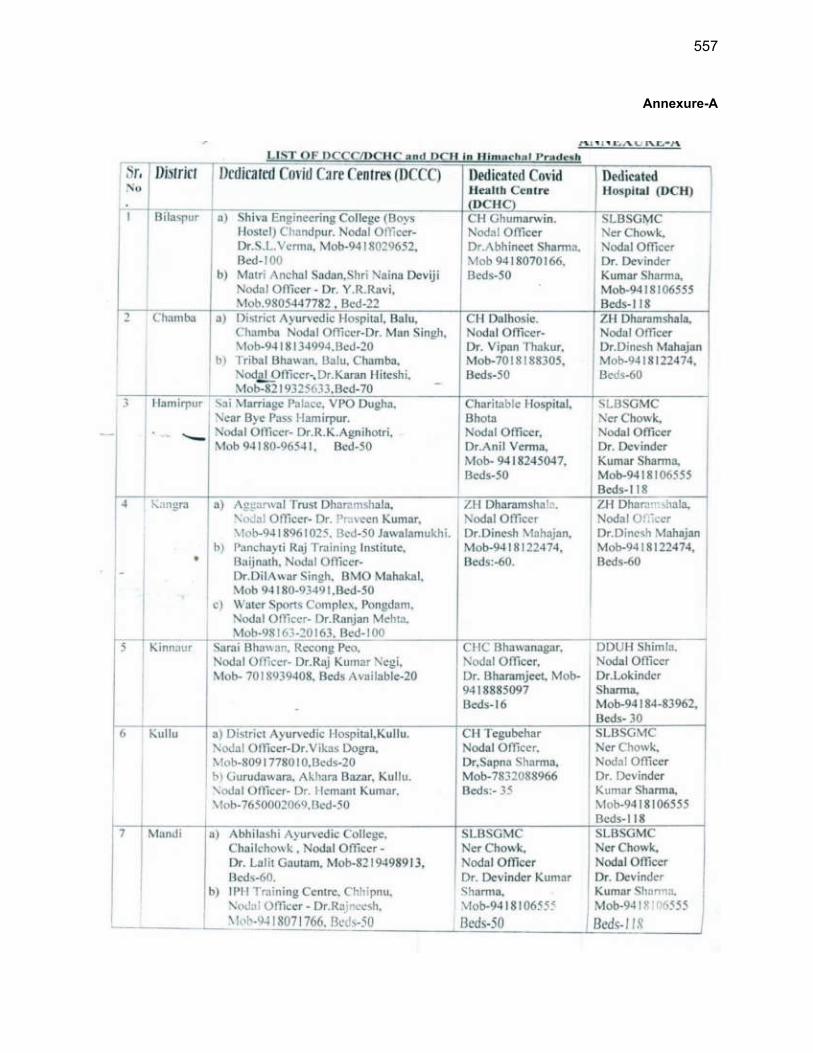
557
Annexure-A
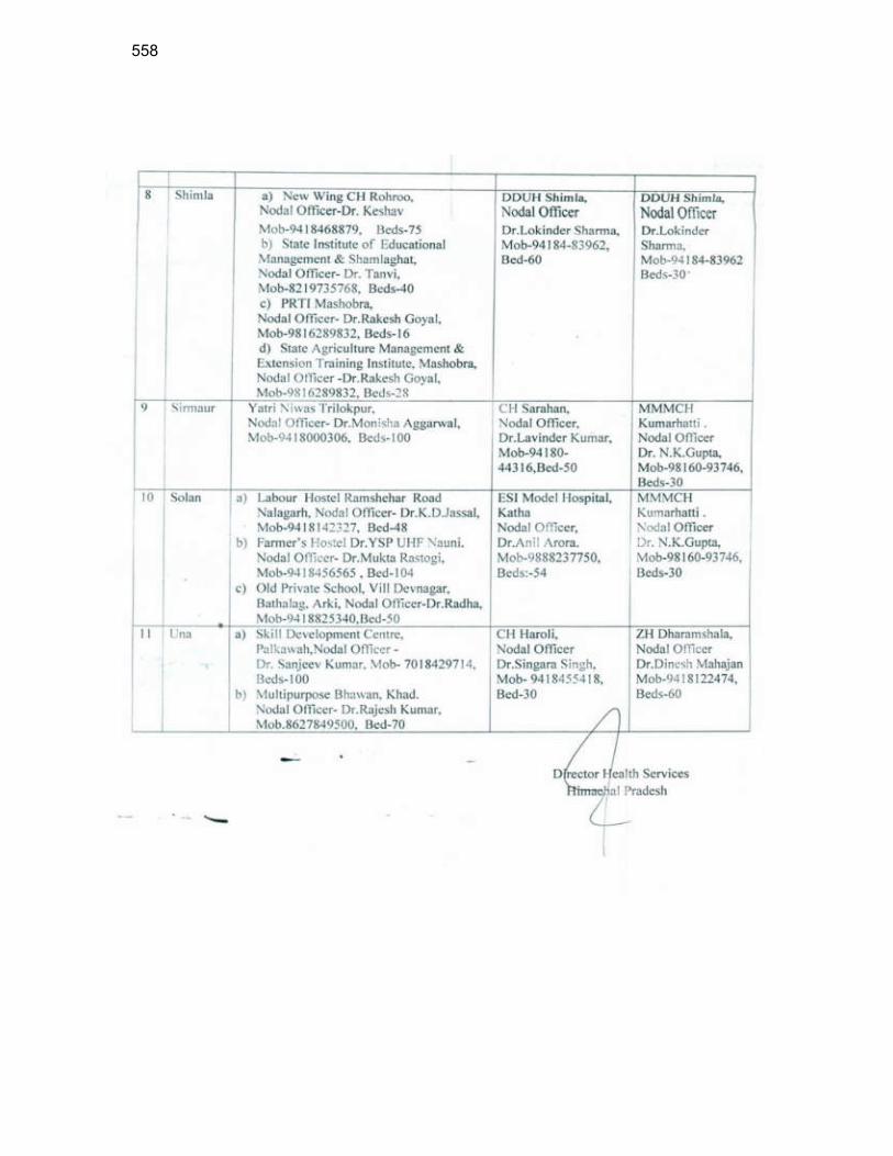
558
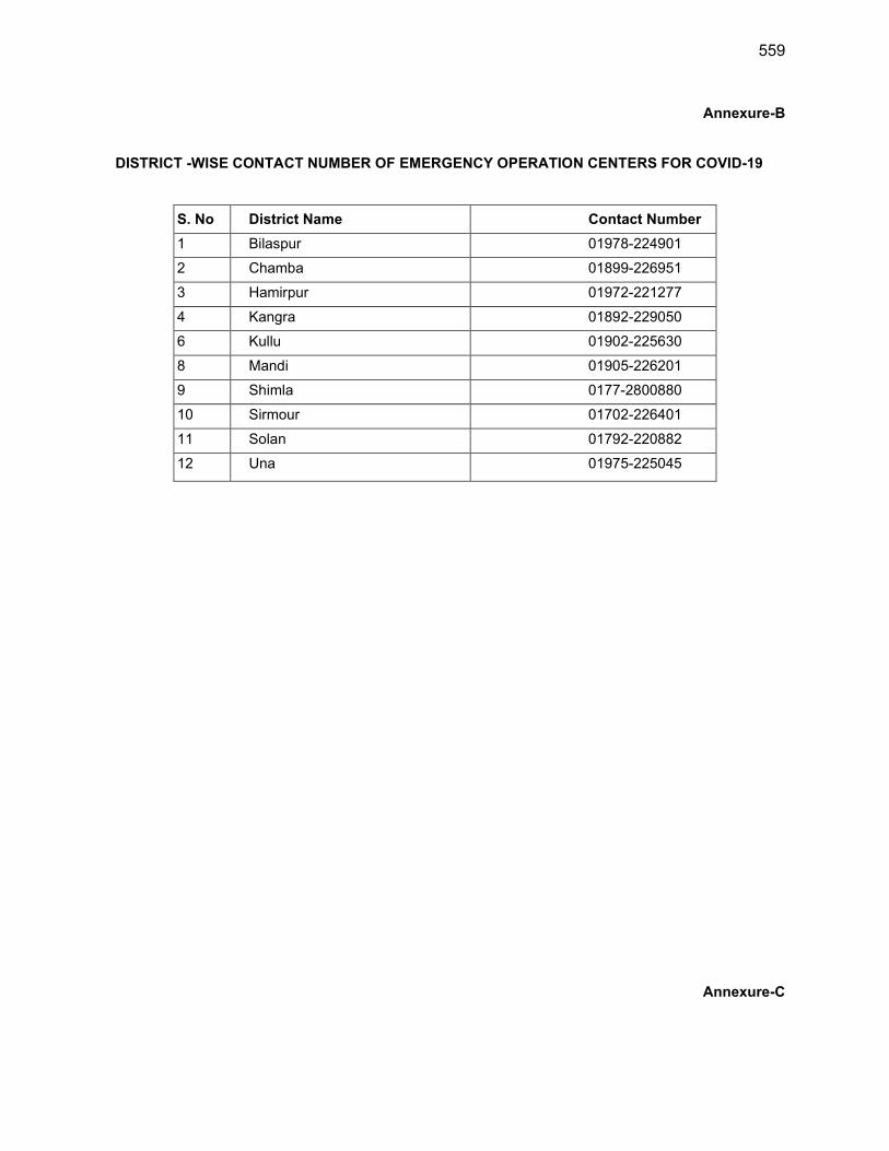
559
Annexure-B
DISTRICT -WISE CONTACT NUMBER OF EMERGENCY OPERATION CENTERS FOR COVID-19
S. No District Name Contact Number
1 Bilaspur 01978-224901
2 Chamba 01899-226951
3 Hamirpur 01972-221277
4 Kangra 01892-229050
6 Kullu 01902-225630
8 Mandi 01905-226201
9 Shimla 0177-2800880
10 Sirmour 01702-226401
11 Solan 01792-220882
12 Una 01975-225045
Annexure-C

560
COVID-19 Self-Declaration
Please answer the following questions:
Description Yes No
Have you or has anyone you come into close contact with currently or
in the last 14 days felt unwell, experienced any cold or flu-like
symptoms such as a high temperature (at least 38 degrees C, 100 F),
fever, coughing, sneezing, runny nose, sore throat, or had difficulty
Have you been or has anyone you come into close contact with
confirmed as having COVID-19 (Coronavirus)?
Have you recently returned from overseas travel (28-45 days)
Are you a healthcare worker and examined a COVID-19 confirmed
case without protective gear
Have you been in close contact with a person who has recently
returned from overseas travel?
Do you have a respiratory or a heart condition, high blood pressure,
kidney problems or diabetes?
I am and will continue to observe all the requirements of the
lockdown as outlined by the Government
I, ( _) from ( ) declare that I
have answered the above questions truthfully and to the best of my knowledge and I will inform the
authorities immediately of any changes to the above statements.
Signed:
Dated:
Countersigned by:
Contractors Representative PDMSC/PIU Representative

561
Appendix 23: IBAT Screening Report
562
563
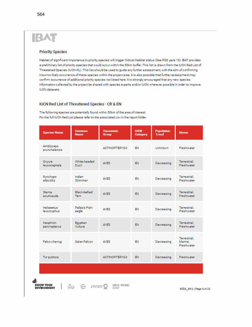
564
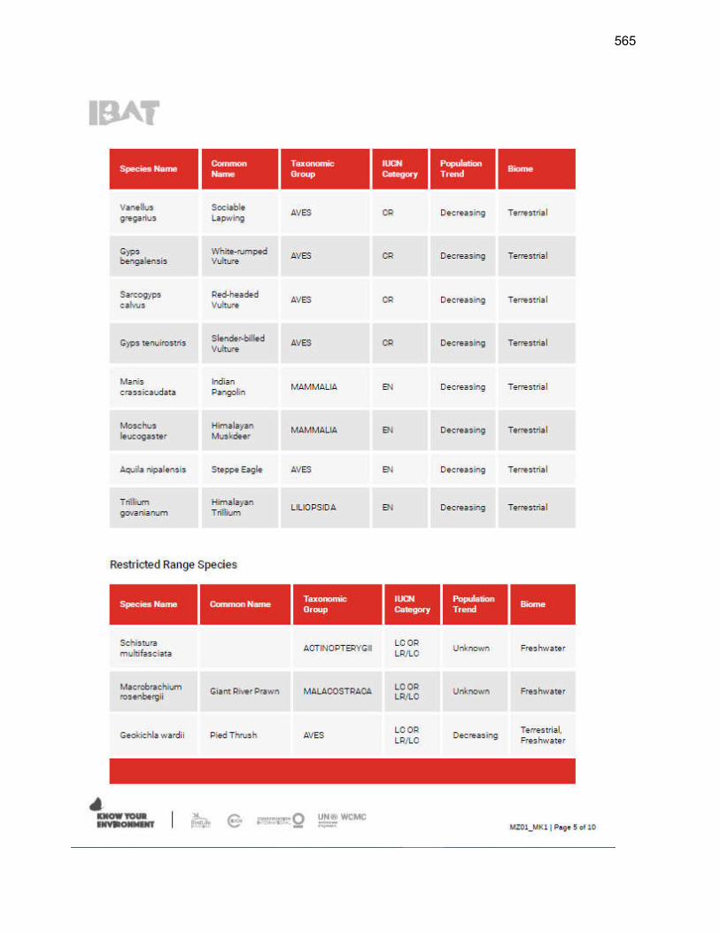
565
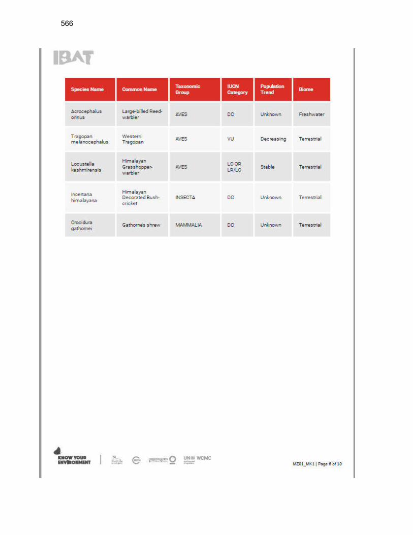
566
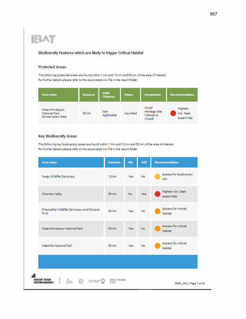
567
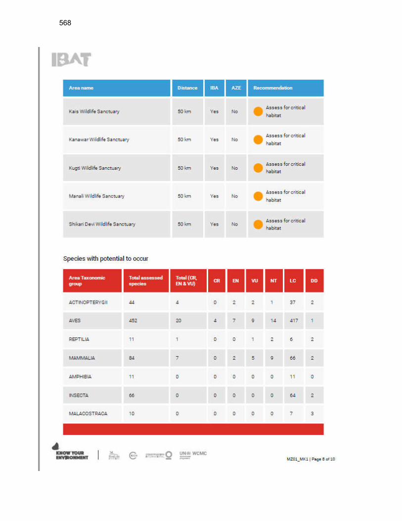
568
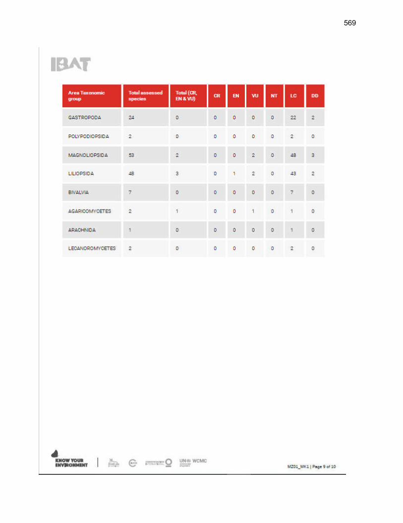
569
570
Copyright © 2022 FDOKUMEN