礦物與岩石-地質的基礎材料- MINERALS AND ROCKS
95
-
Upload
khangminh22 -
Category
Documents
-
view
0 -
download
0
Transcript of 礦物與岩石-地質的基礎材料- MINERALS AND ROCKS
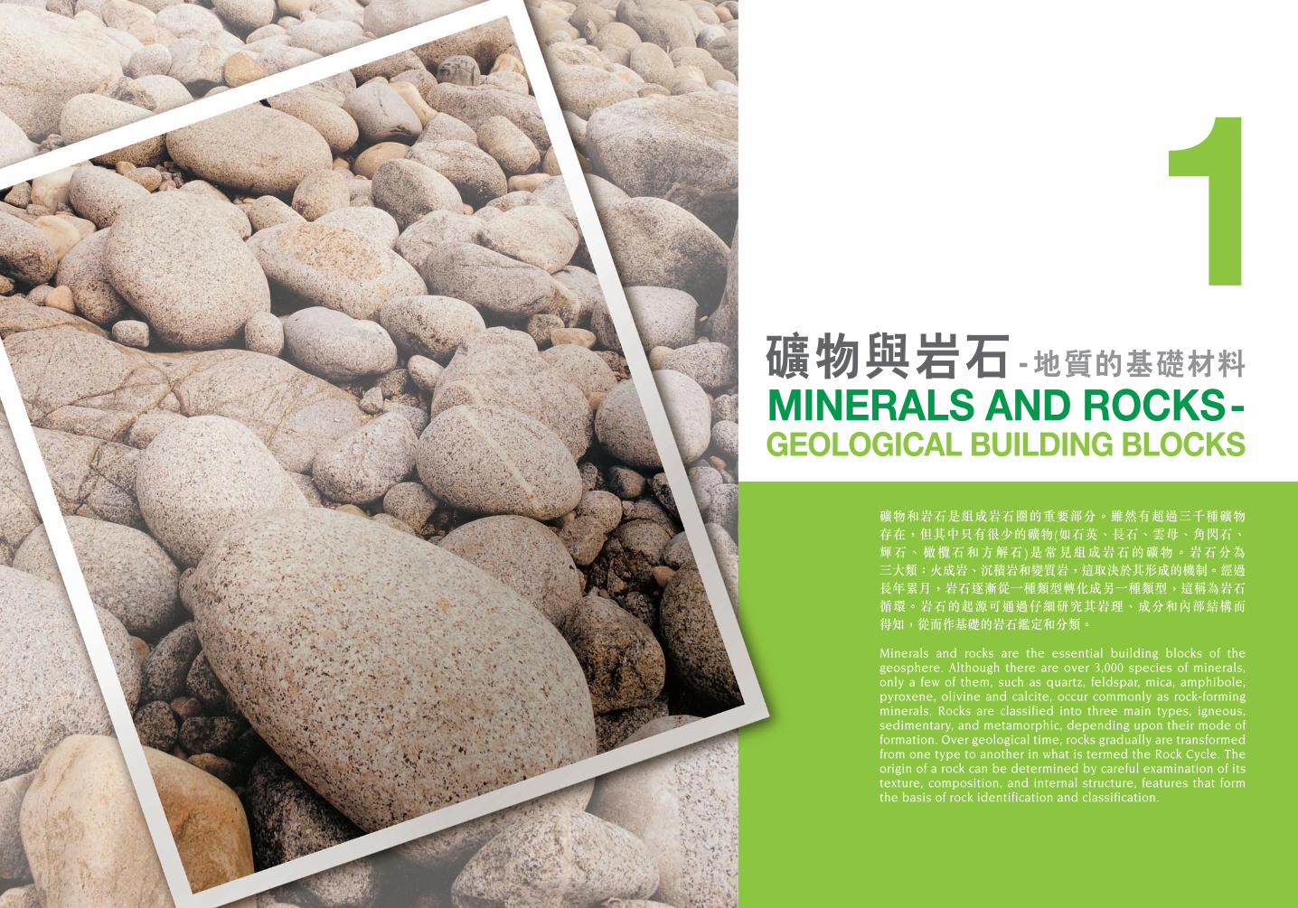
礦物和岩石是組成岩石圈的重要部分。雖然有超過三千種礦物 存在,但其中只有很少的礦物(如石英、長石、雲母、角閃石、輝石、橄欖石和方解石)是常見組成岩石的礦物。岩石分為 三大類:火成岩、沉積岩和變質岩,這取決於其形成的機制。經過 長年累月,岩石逐漸從一種類型轉化成另一種類型,這稱為岩石 循環。岩石的起源可通過仔細研究其岩理、成分和內部結構而 得知,從而作基礎的岩石鑑定和分類。
Minerals and rocks are the essential building blocks of the geosphere. Although there are over 3,000 species of minerals, only a few of them, such as quartz, feldspar, mica, amphibole, pyroxene, olivine and calcite, occur commonly as rock-forming minerals. Rocks are classified into three main types, igneous, sedimentary, and metamorphic, depending upon their mode of formation. Over geological time, rocks gradually are transformed from one type to another in what is termed the Rock Cycle. The origin of a rock can be determined by careful examination of its texture, composition, and internal structure, features that form the basis of rock identification and classification.
礦物與岩石 - 地質的基礎材料MINERALS AND ROCKS- GEOLOGICAL BUILDING BLOCKS
1
06 07
Minerals are the fundamental components of rocks. They are naturally occurring inorganic substances with a specific chemical composition and an orderly repeating atomic structure that defines a crystal structure.
Silicate minerals are the most abundant components of rocks on the Earth’s surface, making up over 90% by mass of the Earth’s crust. The fundamental chemical building block of silicate minerals is the chemical compound silicon tetroxide, SiO
4 (Figure 1-1).
The common non-silicate minerals, which constitute less than 10% of the Earth’s crust, include carbonates, oxides, sulphides, phosphates and chlorides. A few elements may occur in pure form. These include gold, silver, copper, bismuth, arsenic, lead, tellurium and carbon.
Although 92 naturally occurring elements exist in nature, only eight of these are common in the rocks of the Earth’s crust. Together, these eight elements make up more than 98% of the crust (Table 1-1).
礦物是岩石的基本成分,屬天然形成的無機物質,它們由特定化學元素組成,原子規律地重複構成晶體結構。
矽酸鹽礦物是地球表面的岩石中,所含最 豐富的成分,佔地殼物質超過90%。矽酸鹽 礦物的基本成分是化合物四氧化矽(S iO
4)
(圖1-1)。
其他常見的非矽酸鹽礦物,合共佔地殼成分不足10%,計有碳酸鹽、氧化物、硫化物、磷酸鹽和氯 化 物 。 此外,還包括少量可能以單一化學元素存在的礦物,例如金、銀、銅、鉍、砷、鉛、碲及碳。
儘管自然界的天然化學元素多達92種, 但當中僅有8種天然化學元素,常見於地殼 內的岩石,而這8種元素合共已佔去地殼質量的98%以上(表1-1)。
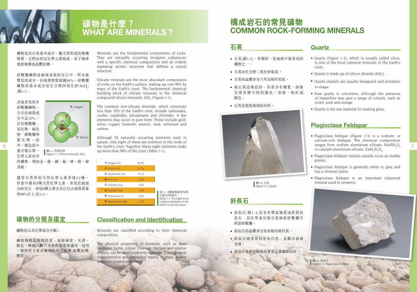
圖1-1. 四氧化矽Figure 1-1. Silicon tetroxide, SiO
4
表1-1. 8種地殼最常見的元素(以質量計)。Table 1-1. The eight most common elements in the Earth’s crust (by mass).
圖1-2. 石英Figure 1-2. Quartz
圖1-3. 斜長石Figure 1-3. Plagioclase feldspar
構成岩石的常見礦物 COMMON ROCK-FORMING MINERALS
礦物的分類及鑑定
礦物是以其化學成分分類。
礦物按照其物理性質,如堅硬度、光澤、 顏色、解理、斷口及相對密度來識別。這些一般特性主要由礦物的原子結構(晶體結構) 操控。
石英
• 石英(圖1-2),常稱矽,是地殼中最常見的 礦物之一。
• 石英由化合物二氧化矽組成。
• 石英的晶體多呈六角及稜柱形狀。
• 純石英是無色的,但若含有雜質,則會 呈 現 各 種 不 同 的 顏 色 , 如 紫 、 粉 紅 或 橙色。
• 石英是製造玻璃的原料。
斜長石
• 斜長石(圖1-3)是含有豐富鈉質或鈣質的 長石,其化學成分組合從鈉鋁矽酸鹽至 鈣鋁矽酸鹽。
• 斜長石的晶體多呈短而粗的稜柱狀。
• 斜長石通常是白至灰白色,並顯出玻璃 光澤。
• 斜長石是製造陶瓷的重要工業礦物原料 。
Quartz
• Quartz (Figure 1-2), which is usually called silica,is one of the most common minerals in the Earth’s crust.
• Quartzismadeupofsilicondioxide(SiO2).
•Quartz crystals are usually hexagonal and prismatic
in shape.
• Pure quartz is colourless, although the presenceof impurities may give a range of colours, such as violet, pink and orange.
• Quartzistherawmaterialformakingglass.
Plagioclase Feldspar
• Plagioclase feldspar (Figure 1-3) is a sodium- or calcium-rich feldspar. The chemical composition ranges from sodium aluminium silicate, NaAlSi
3O
8
to calcium aluminium silicate, CaAl2Si
2O
8.
• Plagioclasefeldsparcrystalsusuallyoccurasstubbyprisms.
• Plagioclase feldspar is generally white to grey andhas a vitreous lustre.
• Plagioclase feldspar is an important industrial mineral used in ceramics.
氧 Oxygen (O) 46.6%
矽 Silicon (Si) 27.7%
鋁 Aluminium (Al) 8.1%
鐵 Iron (Fe) 5.0%
鈣 Calcium (Ca) 3.6%
鈉 Sodium (Na) 2.8%
鉀 Potassium (K) 2.6%
鎂 Magnesium (Mg) 2.1%
礦物是什麼? WHAT ARE MINERALS ?
Classification and Identification
Minerals are classified according to their chemical composition.
The physical properties of minerals, such as their hardness, lustre, colour, cleavage, fracture and relative density, can be used to identify minerals. These general characteristics are controlled mainly by their atomic structure (crystal structure).
矽 Silicon
氧 Oxygen
08 09
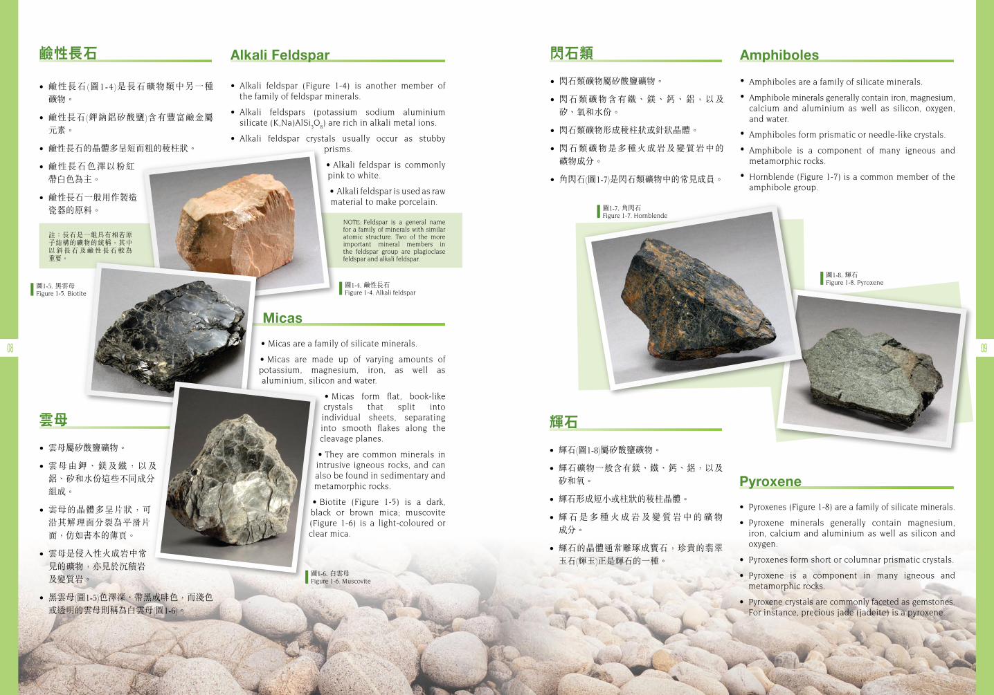
鹼性長石
• 鹼性長石(圖1-4)是長石礦物類中另一種 礦物。
• 鹼性長石(鉀鈉鋁矽酸鹽)含有豐富鹼金屬 元素。
• 鹼性長石的晶體多呈短而粗的稜柱狀。
• 鹼性長石色澤以粉紅帶白色為主。
• 鹼性長石一般用作製造瓷器的原料。
閃石類
• 閃石類礦物屬矽酸鹽礦物。
• 閃石類礦物含有鐵、鎂、鈣、鋁,以及矽、氧和水份。
• 閃石類礦物形成稜柱狀或針狀晶體。
• 閃石類礦物是多種火成岩及變質岩中的 礦物成分。
• 角閃石(圖1-7)是閃石類礦物中的常見成員。
輝石
• 輝石(圖1-8)屬矽酸鹽礦物。
• 輝石礦物一般含有鎂、鐵、鈣、鋁,以及矽和氧。
• 輝石形成短小或柱狀的稜柱晶體。
• 輝 石 是 多 種 火 成 岩 及 變 質 岩 中 的 礦 物 成分。
• 輝石的晶體通常雕琢成寶石,珍貴的翡翠玉石(輝玉)正是輝石的一種。
Micas
• Micasareafamilyofsilicateminerals.
• Micas are made up of varying amounts of potassium, magnesium, iron, as well as aluminium, silicon and water.
• Micas form flat, book-like crystals that split into individual sheets, separating into smooth flakes along thecleavage planes.
• They are common minerals in intrusive igneous rocks, and can also be found in sedimentary and metamorphic rocks.
• Biotite (Figure 1-5) is a dark,black or brown mica; muscovite (Figure 1-6) is a light-coloured or clear mica.
圖1-4. 鹼性長石Figure 1-4. Alkali feldspar
圖1-5. 黑雲母Figure1-5.Biotite
圖1-6. 白雲母Figure 1-6. Muscovite
圖1-7. 角閃石Figure 1-7. Hornblende
圖1-8. 輝石Figure 1-8. Pyroxene
Alkali Feldspar
• Alkali feldspar (Figure 1-4) is another member of the family of feldspar minerals.
• Alkali feldspars (potassium sodium aluminium silicate (K,Na)AlSi
3O
8) are rich in alkali metal ions.
• Alkali feldspar crystals usually occur as stubbyprisms.
• Alkali feldspar is commonlypink to white.
• Alkalifeldsparisusedasraw material to make porcelain.
雲母
• 雲母屬矽酸鹽礦物。
• 雲母由鉀、鎂及鐵,以及鋁、矽和水份這些不同成分組成。
• 雲母的晶體多呈片狀,可沿其解理面分裂為平滑片面,仿如書本的薄頁。
• 雲母是侵入性火成岩中常見的礦物,亦見於沉積岩及變質岩。
• 黑雲母(圖1-5)色澤深、帶黑或啡色,而淺色或透明的雲母則稱為白雲母(圖1-6)。
Amphiboles
• Amphiboles are a family of silicate minerals.
• Amphibole minerals generally contain iron, magnesium, calcium and aluminium as well as silicon, oxygen, and water.
• Amphiboles form prismatic or needle-like crystals.
• Amphibole is a component of many igneous and metamorphic rocks.
• Hornblende (Figure 1-7) is a common member of the amphibole group.
Pyroxene
• Pyroxenes(Figure1-8)areafamilyofsilicateminerals.
• Pyroxene minerals generally contain magnesium,iron, calcium and aluminium as well as silicon and oxygen.
• Pyroxenesformshortorcolumnarprismaticcrystals.
• Pyroxene is a component in many igneous and metamorphic rocks.
• Pyroxenecrystalsarecommonlyfacetedasgemstones.For instance, precious jade (jadeite) is a pyroxene.
註:長石是一組具有相若原子結構的礦物的統稱,其中以 斜 長 石 及 鹼 性 長 石 較 為 重要。
NOTE: Feldspar is a general name for a family of minerals with similar atomic structure. Two of the more important mineral members in the feldspar group are plagioclase feldspar and alkali feldspar.
10 11
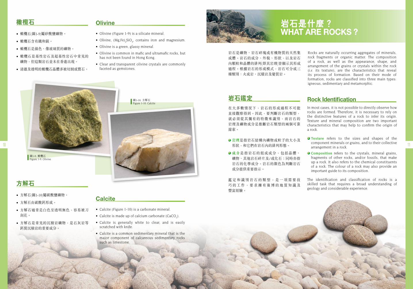
圖1-9. 橄欖石Figure 1-9. Olivine
圖1-10. 方解石Figure 1-10. Calcite
岩石是礦物、岩石碎塊或有機物質的天然集成體。岩石的成分、外貌、形狀,以及岩石內顆粒和晶體的排列(即其岩理)皆顯示其形成過程。根據岩石的形成模式,岩石可分成三種類別:火成岩、沉積岩及變質岩。
Rocks are naturally occurring aggregates of minerals, rock fragments or organic matter. The composition of a rock, as well as the appearance, shape, and arrangement of the grains or crystals within the rock (i.e. its texture), are the characteristics that reveal its process of formation. Based on their mode of formation, rocks are classified into three main types: igneous, sedimentary and metamorphic.
橄欖石
• 橄欖石(圖1-9)屬矽酸鹽礦物。
• 橄欖石含有鐵和鎂。
• 橄欖石是綠色、像玻璃質的礦物。
• 橄欖石是基性岩石及超基性岩石中常見的礦物,但這類岩石並未在香港出現。
• 清澈及透明的橄欖石晶體多被切割成寶石。
Olivine
• Olivine(Figure1-9)isasilicatemineral.
• Olivine, (Mg,Fe)2SiO
4, contains iron and magnesium.
• Olivineisagreen,glassymineral.
• Olivineiscommoninmaficandultramaficrocks,buthas not been found in Hong Kong.
• Clearandtransparentolivinecrystalsarecommonlyfaceted as gemstones.
方解石
• 方解石(圖1-10)屬碳酸鹽礦物。
• 方解石由碳酸鈣形成。
• 方解石通常是白色至透明無色,容易被刀刮花。
• 方解石是常見的沉積岩礦物,是石灰岩等鈣質沉積岩的重要成分。
Calcite
• Calcite(Figure1-10)isacarbonatemineral.
• Calciteismadeupofcalciumcarbonate(CaCO3).
• Calcite is generally white to clear, and is easilyscratched with knife.
• Calciteisacommonsedimentarymineralthatisthemajor component of calcareous sedimentary rocks such as limestone.
岩石是什麼? WHAT ARE ROCKS ?
Rock IdentificationIn most cases, it is not possible to directly observe how rocks are formed. Therefore, it is necessary to rely on the distinctive features of a rock to infer its origin. Texture and mineral composition are two important characteristics that may help to confirm the origin of a rock.
Texture refers to the sizes and shapes of the component minerals or grains, and to their collective arrangement in a rock.
Composition refers to the crystals, mineral grains, fragments of other rocks, and/or fossils, that make up a rock. It also refers to the chemical constituents of a rock. The colour of a rock may also provide an important guide to its composition.
The identification and classification of rocks is a skilled task that requires a broad understanding of geology and considerable experience.
岩石鑑定在大多數情況下,岩石的形成過程不可能 直接觀察得到。因此,要判斷岩石的類型,就必須從其獨有的特徵來識別,而岩石的 岩理及礦物成分是推斷岩石類型的兩個可靠線索。
岩理是指岩石結構內礦物或粒子的大小及形狀,和它們在岩石內的排列形態。
成分是指岩石的組成成分,包括晶體、 礦物、其他岩石碎片及/或化石;同時亦指岩石的化學成分。岩石的顏色為判斷岩石成分提供重要指示。
鑑 定 和 識 別 岩 石 的 類 型 , 是 一 項 需 要 技巧 的 工 作 , 要 求 擁 有 廣 博 的 地 質 知 識 及 豐富經驗。
12 13
資料匣 BOX
資料匣 BOX
Granitic Rocks • Granitic rocks contain predominantly
feldspar and quartz minerals, withsubordinateamphiboles,andmicas.
• Graniticrocksoccurasplutons,dykesorsills(Figure1-11).
• Individual minerals, can generallybe identified with the naked eye(Figures1-12&1-13).
• Mineralsarecrystallineandshowaninterlocking texture (Figures 1-12 &1-13).
• Unweathered granite is commonlypinkishgreyorlightgreyincolour.
花崗岩
·花崗岩主要成分是長石和石英礦物,其次是角閃石及雲母。
·花崗岩以深成岩體、岩牆或岩床形態出現(圖1-11)。
·個別礦物一般可憑肉眼觀察(圖1-12及圖1-13)。
·花崗岩內的礦物呈晶體狀,並顯現出互鎖的岩理(圖1-12及圖1-13)。
·未受風化的花崗岩一般呈淡粉紅色或淡灰色。
Lava • Individualmineralgrainsinlavaare
generallytoosmalltobeidentifiedwiththenakedeye.
• Lava may contain some largercrystals (phenocrysts) within thefine-grainedgroundmass.
• Lavamaydisplayaflowfabric.
Tuff • Tuff(Figure1-14)containsfragments
of minerals, glass, pumice and/orpre-existingrocks.
• Tuff is classified on the basis ofthe relative components of thevarious fragments.The fragmentsaregenerallyangularandbroken.
• Tuffiscommonlydarkgreyincolourwhentherockisunweathered.
• The rock may show a eutaxiticweldingstructure(Figure1-15).
• Sometuffiscolumnar-jointed.
侵入性火成岩的特徵Characteristics of Intrusive Igneous Rocks
噴出性火成岩的特徵Characteristics of Extrusive Igneous Rocks
熔岩
·熔岩中的個別礦物顆粒一般都非常細小,難以憑肉眼辨認。
·熔岩的幼細基質內可能含體積較大的晶體(斑晶)。
·岩石可呈流動構造。
凝灰岩
·凝灰岩(圖1-14)成分包括礦物、玻璃、浮石及/或已存在岩石的碎塊。
·凝灰岩根據不同碎塊的相對成分分類。碎片一般呈稜角狀及破碎。
·未被風化的凝灰岩通常呈深灰色。
·岩石可呈條紋斑狀(圖1-15)、熔結構造等特徵。
·有些凝灰岩顯現柱狀節理。
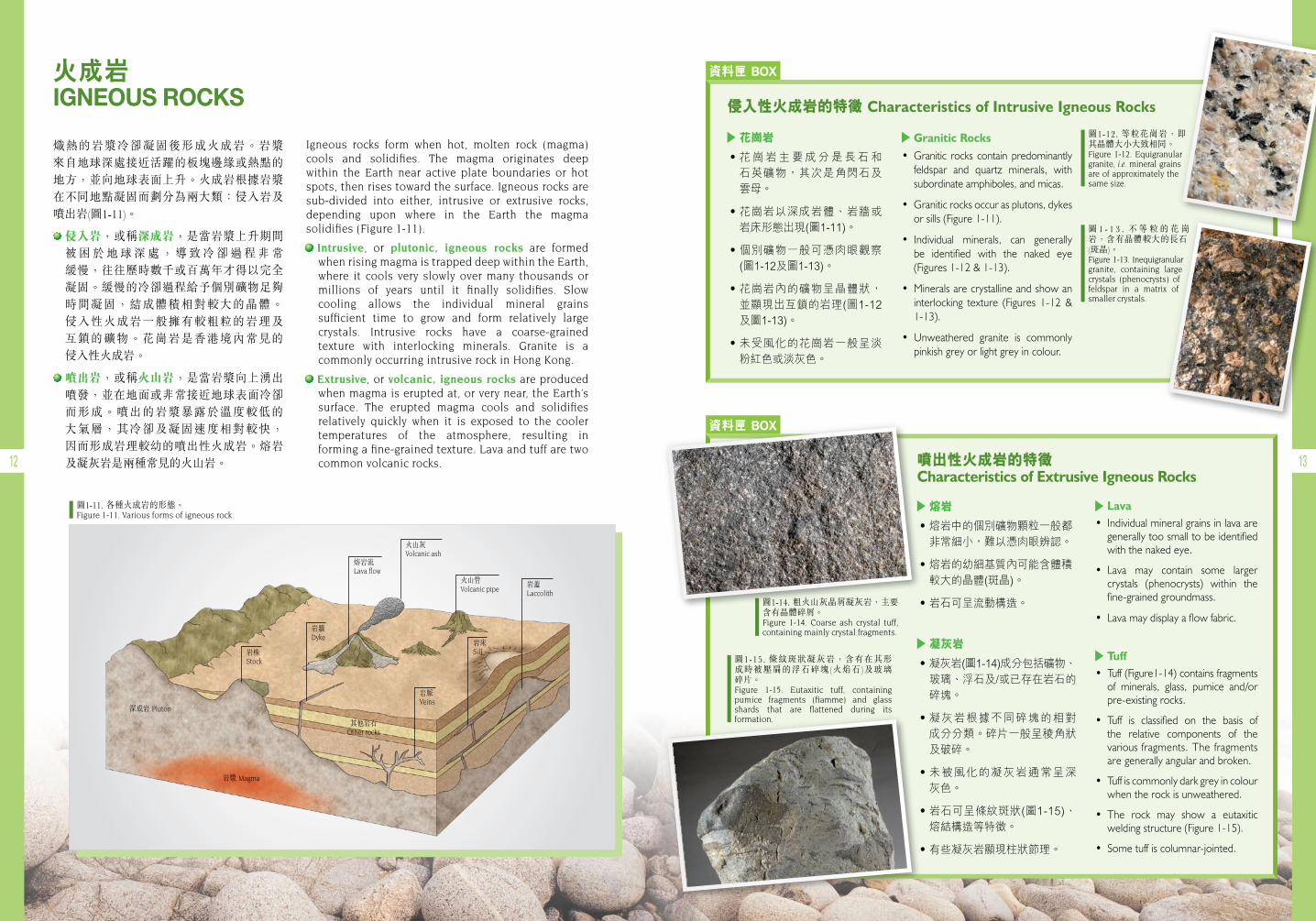
火成岩 IGNEOUS ROCKS
熾熱的岩漿冷卻凝固後形成火成岩。岩漿 來自地球深處接近活躍的板塊邊緣或熱點的地方,並向地球表面上升。火成岩根據岩漿在不同地點凝固而劃分為兩大類:侵入岩及噴出岩(圖1-11)。
侵入岩,或稱深成岩,是當岩漿上升期間 被 困 於 地 球 深 處 , 導 致 冷 卻 過 程 非 常 緩慢,往往歷時數千或百萬年才得以完全凝固。緩慢的冷卻過程給予個別礦物足夠時間凝固,結成體積相對較大的晶體。 侵入性火成岩一般擁有較粗粒的岩理及 互鎖的礦物。花崗岩是香港境內常見的 侵入性火成岩。
噴出岩,或稱火山岩,是當岩漿向上湧出噴發,並在地面或非常接近地球表面冷卻 而形成。噴出的岩漿暴露於溫度較低的 大氣層,其冷卻及凝固速度相對較快, 因而形成岩理較幼的噴出性火成岩。熔岩及凝灰岩是兩種常見的火山岩。
Igneous rocks form when hot, molten rock (magma) cools and solidifies. The magma originates deep within the Earth near active plate boundaries or hot spots, then rises toward the surface. Igneous rocks are sub-divided into either, intrusive or extrusive rocks, depending upon where in the Earth the magma solidifies (Figure 1-11).
Intrusive, or plutonic, igneous rocks are formed when rising magma is trapped deep within the Earth, where it cools very slowly over many thousands or millions of years until it finally solidifies. Slow cooling allows the individual mineral grains sufficient time to grow and form relatively large crystals. Intrusive rocks have a coarse-grained texture with interlocking minerals. Granite is a commonly occurring intrusive rock in Hong Kong.
Extrusive, or volcanic, igneous rocks are produced when magma is erupted at, or very near, the Earth’s surface. The erupted magma cools and solidifies relatively quickly when it is exposed to the cooler temperatures of the atmosphere, resulting in forming a fine-grained texture. Lava and tuff are two common volcanic rocks.
圖1-11. 各種火成岩的形態。Figure 1-11. Various forms of igneous rock.
深成岩 Pluton
岩漿 Magma
其他岩石Other rocks
岩株Stock
岩牆Dyke
熔岩流Lavaflow
岩脈Veins
岩床Sill
岩蓋Laccolith
火山灰Volcanic ash
火山管Volcanic pipe
圖1-12. 等粒花崗岩,即其晶體大小大致相同。Figure1-12.Equigranular granite, i.e. mineral grains are of approximately the same size.
圖1-14. 粗火山灰晶屑凝灰岩,主要含有晶體碎屑。Figure 1-14. Coarse ash crystal tuff, containing mainly crystal fragments.
圖1-15. 條紋斑狀凝灰岩,含有在其形成時被壓扁的浮石碎塊(火焰石)及玻璃 碎片。Figure 1-15. Eutaxitic tuff, containing pumice fragments (fiamme) and glass shards that are flattened during its formation.
圖 1 - 1 3 . 不 等 粒 的 花 崗岩,含有晶體較大的長石 (斑晶)。Figure1-13.Inequigranular granite, containing large crystals (phenocrysts) of feldspar in a matrix of smaller crystals.
資料匣 BOX
14 15
生物沉積岩是當大量生物死亡,其殘骸 被分解、壓縮、膠結及堆積,而形成的 沉積岩。沉積物含豐富碳質的植物便可能形成煤;若沉積物中含大量動物外殼, 則可能形成石灰岩或燧石。
化學沉積岩是由液體沉澱化合物形成。 當水沿岩石隙流動時,石頭內部分礦物 溶於水中,並被水流帶走。其後當水份 蒸發或水中含礦物過多,最終礦物會沉積 或從溶液中沉澱而形成化學岩石。岩鹽 正是化學沉積岩的例子。
Biological sedimentary rocks form when large quantities of living organisms die and accumulate.Their remains are broken down, compressed and cemented to form rock. Accumulations of carbon-rich plant material may form coal. Deposits composed mainly of animal shells may form limestone or chert.
Chemical sedimentary rocks are formed by chemical precipitation from solutions. This process begins when water passes through rock dissolving some of the minerals and carrying them away from their source. Eventually the minerals are deposited, or precipitated, when the water evaporates or when the water becomes over-saturated with minerals. Rock salts are examples of chemical sedimentary rocks.
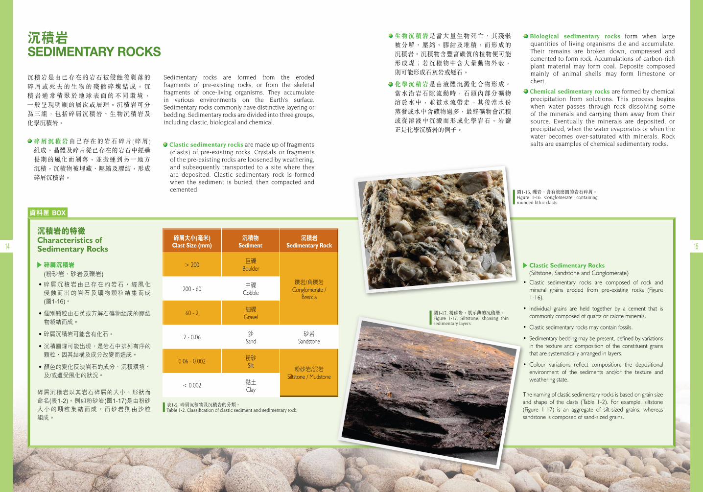
沉積岩是由已存在的岩石被侵蝕後剝落的 碎 屑 或 死 去 的 生 物 的 殘 骸 碎 塊 結 成 。 沉積 岩 通 常 積 聚 於 地 球 表 面 的 不 同 環 境 , 一般呈現明顯的層次或層理。沉積岩可分為三組,包括碎屑沉積岩、生物沉積岩及 化學沉積岩。 碎屑沉積岩由已存在的岩石碎片(碎屑)
組成。晶體及碎片從已存在的岩石中經過 長期的風化而剝落,並搬運到另一地方 沉積。沉積物被埋藏、壓縮及膠結,形成碎屑沉積岩。
Sedimentary rocks are formed from the eroded fragments of pre-existing rocks, or from the skeletal fragments of once-living organisms. They accumulate in various environments on the Earth’s surface. Sedimentary rocks commonly have distinctive layering or bedding. Sedimentary rocks are divided into three groups, including clastic, biological and chemical.
Clastic sedimentary rocks are made up of fragments (clasts) of pre-existing rocks. Crystals or fragments of the pre-existing rocks are loosened by weathering, and subsequently transported to a site where theyare deposited. Clastic sedimentary rock is formed when the sediment is buried, then compacted and cemented.
沉積岩 SEDIMENTARY ROCKS
Clastic Sedimentary Rocks (Siltstone,SandstoneandConglomerate)
• Clastic sedimentary rocks are composed of rock andmineral grains eroded from pre-existing rocks (Figure1-16).
• Individual grains are held together by a cement that iscommonlycomposedofquartzorcalciteminerals.
• Clasticsedimentaryrocksmaycontainfossils.
• Sedimentarybeddingmaybepresent,definedbyvariationsin the texture and composition of the constituent grainsthataresystematicallyarrangedinlayers.
• Colour variations reflect composition, the depositionalenvironment of the sediments and/or the texture andweatheringstate.
Thenamingofclasticsedimentaryrocksisbasedongrainsizeand shape of the clasts (Table 1-2). For example, siltstone(Figure 1-17) is an aggregate of silt-sized grains, whereassandstoneiscomposedofsand-sizedgrains.
沉積岩的特徵Characteristics of Sedimentary Rocks
碎屑沉積岩(粉砂岩、砂岩及礫岩)
·碎屑沉積岩由已存在的岩石,經風化侵蝕而出的岩石及礦物顆粒結集而成(圖1-16)。
·個別顆粒由石英或方解石礦物組成的膠結物凝結而成。
·碎屑沉積岩可能含有化石。
·沉積層理可能出現,是岩石中排列有序的顆粒,因其結構及成分改變而造成。
·顏色的變化反映岩石的成分、沉積環境、及/或遭受風化的狀況。
碎屑沉積岩以其岩石碎屑的大小、形狀而命名(表1-2)。例如粉砂岩(圖1-17)是由粉砂大小的顆粒集結而成,而砂岩則由沙粒組成。
圖1-16. 礫岩,含有被磨圓的岩石碎屑。Figure 1-16. Conglomerate, containing rounded lithic clasts.
表1-2. 碎屑沉積物及沉積岩的分類。Table 1-2. Classification of clastic sediment and sedimentary rock.
圖1-17. 粉砂岩,展示薄的沉積層。Figure 1-17. Siltstone, showing thin sedimentary layers.
>200
200-60
60-2
2-0.06
0.06-0.002
<0.002
巨礫Boulder
中礫Cobble
細礫Gravel
沙Sand
粉砂Silt
黏土Clay
碎屑大小(毫米)Clast Size (mm)
沉積物Sediment
沉積岩Sedimentary Rock
礫岩/角礫岩Conglomerate/
Breccia
粉砂岩/泥岩Siltstone/Mudstone
砂岩Sandstone
資料匣 BOX
16 17
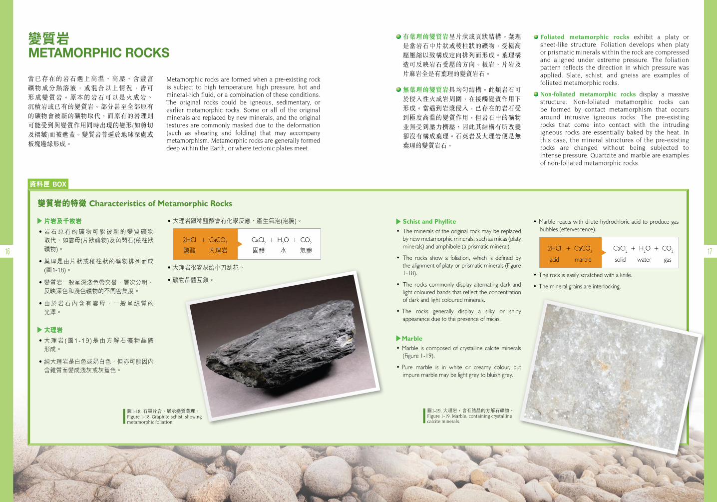
當已存在的岩石遇上高溫、高壓、含豐富 礦物成分熱溶液,或混合以上情況,皆可 形成變質岩。原本的岩石可以是火成岩、 沉積岩或已有的變質岩。部分甚至全部原有的礦物會被新的礦物取代,而原有的岩理則可能受到與變質作用同時出現的變形(如剪切及褶皺)而被遮蓋。變質岩普遍於地球深處或板塊邊緣形成。
Metamorphic rocks are formed when a pre-existing rock is subject to high temperature, high pressure, hot and mineral-richfluid,oracombinationoftheseconditions.The original rocks could be igneous, sedimentary, or earlier metamorphic rocks. Some or all of the original minerals are replaced by new minerals, and the original textures are commonly masked due to the deformation (such as shearing and folding) that may accompany metamorphism. Metamorphic rocks are generally formed deep within the Earth, or where tectonic plates meet.
Schist and Phyllite • Themineralsoftheoriginalrockmaybereplaced
bynewmetamorphicminerals,suchasmicas(platyminerals)andamphibole(aprismaticmineral).
• The rocks show a foliation, which is defined bythealignmentofplatyorprismaticminerals(Figure1-18).
• The rocks commonlydisplay alternatingdark andlightcolouredbandsthatreflecttheconcentrationofdarkandlightcolouredminerals.
•The rocks generally display a silky or shinyappearanceduetothepresenceofmicas.
Marble•Marble is composed of crystalline calcite minerals
(Figure1-19).
•Pure marble is in white or creamy colour, butimpuremarblemaybelightgreytobluishgrey.
•Marblereactswithdilutehydrochloricacid toproducegasbubbles(effervescence).
•Therockiseasilyscratchedwithaknife.
•Themineralgrainsareinterlocking.
變質岩的特徵Characteristics of Metamorphic Rocks
片岩及千枚岩
·岩石原有的礦物可能被新的變質礦物取代,如雲母(片狀礦物)及角閃石(稜柱狀礦物)。
·葉理是由片狀或稜柱狀的礦物排列而成(圖1-18)。
·變質岩一般呈深淺色帶交替,層次分明,反映深色和淺色礦物的不同密集度。
·由於岩石內含有雲母,一般呈絲質的光澤。
大理岩
·大理岩(圖1-19 )是由方解石礦物晶體形成。
·純大理岩是白色或奶白色,但亦可能因內含雜質而變成淺灰或灰藍色。
有葉理的變質岩呈片狀或頁狀結構。葉理是當岩石中片狀或稜柱狀的礦物,受極高壓壓縮以致構成定向排列而形成。葉理構造可反映岩石受壓的方向。板岩、片岩及片麻岩全是有葉理的變質岩石。
無葉理的變質岩具均勻結構。此類岩石可於侵入性火成岩周圍,在接觸變質作用下形成。當遇到岩漿侵入,已存在的岩石受到極度高溫的變質作用,但岩石中的礦物並無受到壓力擠壓,因此其結構有所改變卻沒有構成葉理。石英岩及大理岩便是無葉理的變質岩石。
Foliated metamorphic rocks exhibit a platy or sheet-like structure. Foliation develops when platy or prismatic minerals within the rock are compressed and aligned under extreme pressure. The foliation pattern reflects the direction in which pressure wasapplied. Slate, schist, and gneiss are examples of foliated metamorphic rocks.
Non-foliated metamorphic rocks display a massive structure. Non-foliated metamorphic rocks can be formed by contact metamorphism that occurs around intrusive igneous rocks. The pre-existing rocks that come into contact with the intruding igneous rocks are essentially baked by the heat. In this case, the mineral structures of the pre-existing rocks are changed without being subjected to intense pressure. Quartzite and marble are examples of non-foliated metamorphic rocks.
2HCl+CaCO3 CaCl2+H2O+CO2
marbleacid solid water gas
變質岩 METAMORPHIC ROCKS
2HCl+CaCO3 CaCl2+H2O+CO2
大理岩鹽酸 固體 水 氣體
圖1-18. 石墨片岩,展示變質葉理。Figure 1-18. Graphite schist, showing metamorphic foliation.
圖1-19. 大理岩,含有結晶的方解石礦物。Figure 1-19. Marble, containing crystalline calcite minerals.
·大理岩跟稀鹽酸會有化學反應,產生氣泡(泡騰)。
·大理岩很容易給小刀刮花。
·礦物晶體互鎖。
資料匣 BOX
18 19
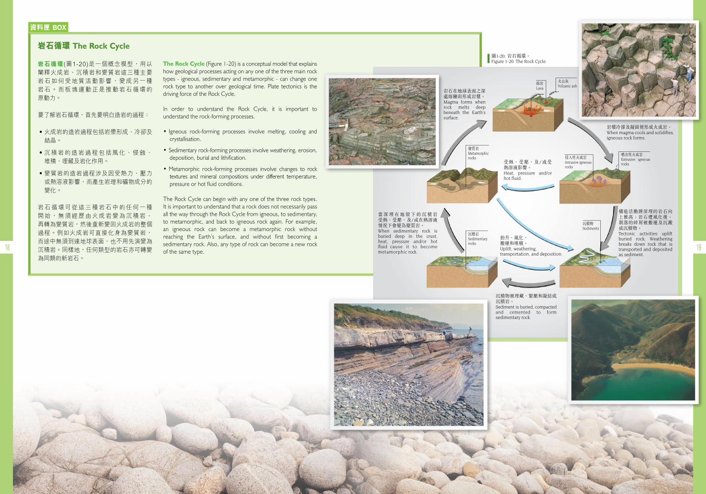
岩石循環The Rock Cycle
岩石循環(圖1-20)是一個概念模型,用以闡釋火成岩、沉積岩和變質岩這三種主要岩石如何受地質活動影響,變成另一種岩石。而板塊運動正是推動岩石循環的原動力。
要了解岩石循環,首先要明白造岩的過程:
·火成岩的造岩過程包括岩漿形成、冷卻及結晶。
·沉積岩的造岩過程包括風化、侵蝕、堆積、埋藏及岩化作用。
·變質岩的造岩過程涉及因受熱力、壓力或熱溶液影響,而產生岩理和礦物成分的變化。
岩石循環可從這三種岩石中的任何一種開始,無須經歷由火成岩變為沉積岩、再轉為變質岩,然後重新變回火成岩的整個過程。例如火成岩可直接化身為變質岩,而途中無須到達地球表面,也不用先演變為沉積岩。同樣地,任何類型的岩石亦可轉變為同類的新岩石。
岩石在地球表面之深處熔融而形成岩漿。 Magma forms when rock melts deep beneath the Earth’s surface.
岩漿冷卻及凝固便形成火成岩。When magma cools and solidifies, igneous rock forms.
構造活動將深埋的岩石向上推高;岩石遭風化後,剝落的碎屑被搬運及沉澱成沉積物。 Tectonic activities uplift buried rock; Weathering breaks down rock that is transported and deposited as sediment.
沉積物被埋藏、緊壓和凝結成沉積岩。Sediment is buried, compacted and cemented to form sedimentary rock.
火山灰Volcanic ash
沉積岩Sedimentaryrocks
變質岩Metamorphicrocks
噴出性火成岩Extrusive igneous rocks
熔岩Lava
岩漿 Magma
當 深 埋 在 地 殼 下 的 沉 積 岩 受熱、受壓、及/或在熱溶液 情況下會變為變質岩。 When sedimentary rock is buried deep in the crust, heat, pressure and/or hot fluid cause it to become metamorphic rock.
抬升、風化、 搬運和堆積。 Uplift, weathering, transportation, and deposition.
侵入性火成岩Intrusive igneous rocks
沉積物Sediments
受熱、受壓、及/或受熱溶液影響。 Heat, pressure and/or hotfluid.
The Rock Cycle(Figure1-20)isaconceptualmodelthatexplainshowgeologicalprocessesactingonanyoneofthethreemainrocktypes- igneous,sedimentaryandmetamorphic-canchangeonerock type to another over geological time. Plate tectonics is thedrivingforceoftheRockCycle.
In order to understand the Rock Cycle, it is important tounderstandtherock-formingprocesses.
• Igneous rock-forming processes involve melting, cooling andcrystallisation.
•Sedimentaryrock-formingprocessesinvolveweathering,erosion,deposition,burialandlithification.
•Metamorphic rock-forming processes involve changes to rocktextures and mineral compositions under different temperature,pressureorhotfluidconditions.
TheRockCyclecanbeginwithanyoneofthethreerocktypes.ItisimportanttounderstandthatarockdoesnotnecessarilypassallthewaythroughtheRockCyclefromigneous,tosedimentary,to metamorphic, and back to igneous rock again. For example,an igneous rock can become a metamorphic rock withoutreaching the Earth’s surface, and without first becoming asedimentaryrock.Also,anytypeofrockcanbecomeanewrockofthesametype.
圖1-20. 岩石循環。Figure 1-20. The Rock Cycle.
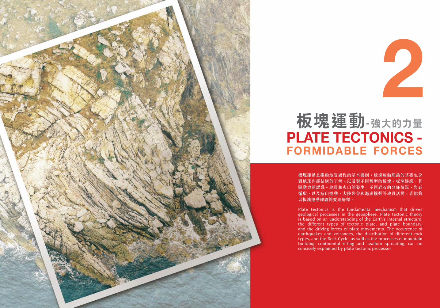
板塊運動是推動地質過程的基本機制。板塊運動理論的基礎包含對地球內部結構的了解,以及對不同類型的板塊、板塊邊緣、其驅動力的認識。地震和火山的發生、不同岩石的分佈情況、岩石循環,以及造山運動、大陸裂谷和海底擴張等地質活動,皆能夠以板塊運動理論簡要地解釋。
Plate tectonics is the fundamental mechanism that drives geological processes in the geosphere. Plate tectonic theory is based on an understanding of the Earth’s internal structure, the different types of tectonic plate, and plate boundary, and the driving forces of plate movements. The occurrence of earthquakes and volcanoes, the distribution of different rock types, and the Rock Cycle, as well as the processes of mountain building, continental rifting and seafloor spreading, can be concisely explained by plate tectonic processes.
板塊運動- 強大的力量PLATE TECTONICS - FORMIDABLE FORCES
2
22 23
地球結構 STRUCTURE OF THE EARTH
The Earth is an irregular sphere, with a radius that varies between 6,356 and 6,378 kilometres. This solid sphere is chemically divided into layers that become less dense from the centre towards the surface. Three main layers are recognised: the core (which comprises an Inner Core and an Outer Core), the mantle, and the crust. Each layer has a distinctive chemical composition, and a different density (Figure 2-1).
地球呈不規則球形,半徑長6,356至6,378 公里。地球按化學成分分層,由地球表面至中心,越深密度越高。地球主要分為三層:地核(由內核及外核構成)、地幔和地殼。每層均具獨特的化學成分,而且密度各異(圖2-1)。
圖2-1. 地球的基本構造。Figure 2-1. Generalised structure of the Earth.
外核 Outer core
內核 Inner core
地幔 Mantle
地殼(見圖2-2) Crust (see Figure 2-2)
根據科學家推斷,高密度的地核主要由鐵 和 鎳 兩 種 重 金 屬 元 素 組 成 。 地 核 外 層 為 液態鐵,地球磁場由此而成。
地核受地幔所包圍,地幔密度較低,深達2,900公里,富帶有鐵和鎂的矽酸鹽礦物。
地球最外層稱為地殼,分為海洋地殼及大陸地殼。一般而言,大陸地殼含矽較多,密度則比海洋地殼低。
海洋地殼(厚約10公里)由富鐵、鎂、鈣, 和鋁的矽酸鹽礦物組成,通常形成深色、沉重的岩石,稱為玄武岩。
大陸地殼 (厚約20-60公里)由富鉀、鈉和 鋁的矽酸鹽礦物組成,形成多種岩石, 如花崗岩等。
Scientists infer that the dense core is primarily composed of the heavy elements iron and nickel. The outer core is made of molten iron, which produces the Earth’s magnetic field.
Surrounding the core is the less-dense mantle, which extends to a depth of about 2,900 km. The mantle is rich in iron- and magnesium-bearing silicate minerals.
The outer layer of the Earth is termed the crust, which is divided into oceanic crust and continental crust. Overall, continental crust is richer in silica, and is less dense, than oceanic crust.
Oceanic crust (about 10 km thick) is composed of iron-, magnesium-, calcium-, and aluminium-rich silicate minerals that typically form a dark coloured, heavy rock called basalt.
Continental crust (about 20 – 60 km thick) is composed of potassium-, sodium-, and aluminium-rich silicate minerals that form a diverse range of rock types such as granite.
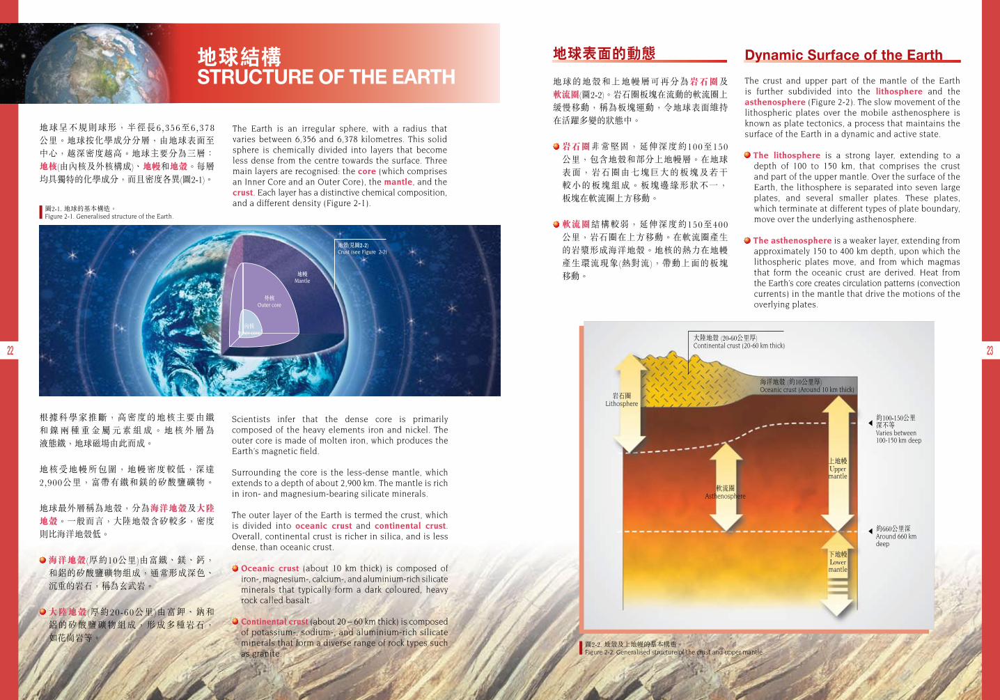
Dynamic Surface of the Earth
The crust and upper part of the mantle of the Earth is further subdivided into the lithosphere and the asthenosphere (Figure 2-2). The slow movement of the lithospheric plates over the mobile asthenosphere is known as plate tectonics, a process that maintains the surface of the Earth in a dynamic and active state.
The lithosphere is a strong layer, extending to a depth of 100 to 150 km, that comprises the crust and part of the upper mantle. Over the surface of the Earth, the lithosphere is separated into seven large plates, and several smaller plates. These plates, which terminate at different types of plate boundary, move over the underlying asthenosphere.
The asthenosphere is a weaker layer, extending from approximately 150 to 400 km depth, upon which the lithospheric plates move, and from which magmas that form the oceanic crust are derived. Heat from the Earth’s core creates circulation patterns (convection currents) in the mantle that drive the motions of the overlying plates.
地球表面的動態
地球的地殼和上地幔層可再分為岩石圈及 軟流圈(圖2-2)。岩石圈板塊在流動的軟流圈上緩慢移動,稱為板塊運動,令地球表面維持在活躍多變的狀態中。
岩石圈非常堅固,延伸深度約100至150 公里,包含地殼和部分上地幔層。在地球表面,岩石圈由七塊巨大的板塊及若干 較小的板塊組成。板塊邊緣形狀不一, 板塊在軟流圈上方移動。
軟流圈結構較弱,延伸深度約150至400 公里,岩石圈在上方移動。在軟流圈產生的岩漿形成海洋地殼。地核的熱力在地幔產生環流現象(熱對流),帶動上面的板塊 移動。
圖2-2. 地殼及上地幔的基本構造。Figure 2-2. Generalised structure of the crust and upper mantle.
軟流圈Asthenosphere
上地幔 Uppermantle
下地幔 Lowermantle
海洋地殼 (約10公里厚)Oceanic crust (Around 10 km thick)
岩石圈 Lithosphere
大陸地殼 (20-60公里厚)Continental crust (20-60 km thick)
約100-150公里 深不等Varies between 100-150 km deep
約660公里深Around 660 km deep
24 25
圖2-3. 地幔對流作為板塊運動的動力。Figure 2-3. Mantle convection as the driving force for plate tectonics.
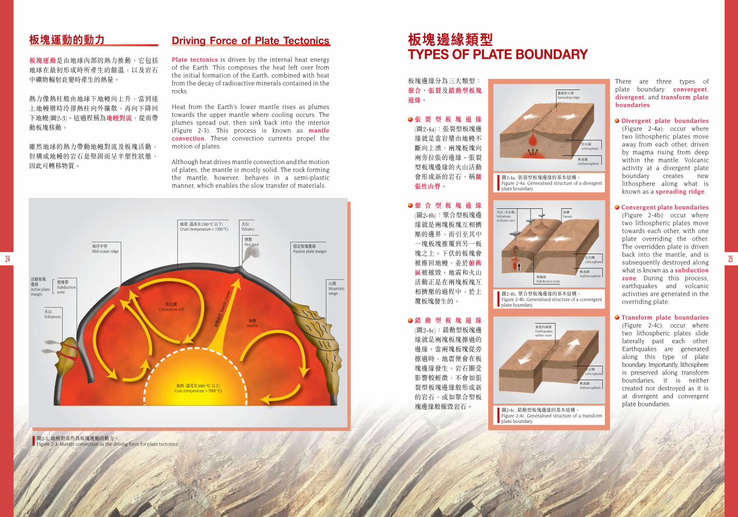
板塊運動的動力
板塊運動是由地球內部的熱力推動,它包括地球在最初形成時所產生的餘溫,以及岩石中礦物輻射衰變時產生的熱量。
熱力像熱柱般由地球下地幔向上升,當到達上地幔層時冷卻熱柱向外擴散,再向下降回下地幔(圖2-3)。這過程稱為地幔對流,從而帶動板塊移動。
雖然地球的熱力帶動地幔對流及板塊活動,但構成地幔的岩石是堅固而呈半塑性狀態,因此可轉移物質。
Driving Force of Plate Tectonics
Plate tectonics is driven by the internal heat energy of the Earth. This comprises the heat left over from the initial formation of the Earth, combined with heat from the decay of radioactive minerals contained in the rocks.
Heat from the Earth’s lower mantle rises as plumes towards the upper mantle where cooling occurs. The plumes spread out, then sink back into the interior (Figure 2-3). This process is known as mantle convection. These convection currents propel the motion of plates.
Although heat drives mantle convection and the motion of plates, the mantle is mostly solid. The rock forming the mantle, however, behaves in a semi-plastic manner, which enables the slow transfer of materials.
板塊邊緣類型 TYPES OF PLATE BOUNDARY
There are three types of plate boundary: convergent, divergent, and transform plate boundaries.
Divergent plate boundaries (Figure 2-4a): occur where two lithospheric plates move away from each other, driven by magma rising from deep within the mantle. Volcanic activity at a divergent plate boundary creates new lithosphere along what is known as a spreading ridge.
Convergent plate boundaries (Figure 2-4b): occur where two lithospheric plates move towards each other, with one plate overriding the other. The overridden plate is driven back into the mantle, and is subsequently destroyed along what is known as a subduction zone. During this process, earthquakes and volcanic activities are generated in the overriding plate.
Transform plate boundaries (Figure 2-4c): occur where two lithospheric plates slide laterally past each other. Earthquakes are generated along this type of plate boundary. Importantly, lithosphere is preserved along transform boundaries, it is neither created nor destroyed as it is at divergent and convergent plate boundaries.
板塊邊緣分為三大類型:聚合、張裂及錯動型板塊邊緣。
張 裂 型 板 塊 邊 緣 (圖2-4a):張裂型板塊邊緣就是當岩漿由地幔不斷向上湧,兩塊板塊向兩旁拉張的邊緣。張裂型板塊邊緣的火山活動會形成新的岩石,稱擴張性山脊。
聚 合 型 板 塊 邊 緣 (圖2-4b):聚合型板塊邊緣就是兩塊板塊互相擠壓的邊界,而引至其中一塊板塊推覆到另一板塊之上。下伏的板塊會被推回地幔,並於俯衝區被摧毀。地震和火山活動正是在兩塊板塊互相擠壓的過程中,於上覆板塊發生的。
錯 動 型 板 塊 邊 緣 (圖2-4c):錯動型板塊邊緣就是兩塊板塊擦過的邊緣。當兩塊板塊從旁擦過時,地震便會在板塊邊緣發生。岩石圈受影響較輕微,不會如張裂型板塊邊緣般形成新的岩石,或如聚合型板塊邊緣般摧毀岩石。
圖2-4a. 張裂型板塊邊緣的基本結構。 Figure 2-4a. Generalised structure of a divergent plate boundary.
擴張性山脊Spreading ridge
岩石圈Lithosphere
軟流圈Asthenosphere
圖2-4b. 聚合型板塊邊緣的基本結構。Figure 2-4b. Generalised structure of a convergent plate boundary.
海槽Trench
俯衝區Subduction zone
火山 (火山弧)Volcanoes(volcanic arc)
岩石圈Lithosphere
軟流圈Asthenosphere
圖2-4c. 錯動型板塊邊緣的基本結構。Figure 2-4c. Generalised structure of a transform plate boundary.
地殼內地震 Earthquakes within crust
岩石圈Lithosphere
軟流圈Asthenosphere地核 (溫度在5000 ºC 以上)
Core (temperature > 5000 ºC)
對流圈Convection cell
地幔Mantle地
幔熱
柱 M
antle
plu
me
熱點Hot spot
火山Volcano
地殼 (溫度在1300 ºC 以下)Crust (temperature < 1300 ºC)
穩定板塊邊緣Passive plate margin
山脈Mountainrange
火山Volcanoes
俯衝帶Subduction zone
活動板塊邊緣Active plate margin
海洋中脊Mid-ocean ridge
26 27
Plate tectonics is a process that maintains the surface of the Earth in a dynamic and active state. Consequently, it drives such processes as:
Magmatism: the primary way in which new elements and new materials are transported as molten rock (magma) from the mantle to the crust. This is the first stage in the process known as “The Rock Cycle”. The molten rock (magma) issuing from cracks in the surface of the Earth cools to create new rocks, and thereby introduces new elements and minerals into the Rock Cycle. These new rocks are broken down (weathered), transported (eroded), accumulated (deposited), and buried (lithified) to form other rocks, which are subsequently uplifted and then weathered, eroded and deposited in a repeated cycle.
Plutonism: a large proportion of the mobile magma never reaches the Earth’s surface. This magma accumulates and cools in the crust to form bodies of new rock called plutons.
Volcanism: at certain types of plate boundary, magma and gases escape at the Earth’s surface, either explosively, as ash, or effusively, as lava forming volcanoes.
Earthquakes: the sudden displacement of rocks along faults, triggered by plate movements, or by the movement of magma upwards in the crust, causes shaking of the Earth (Figure 2-5).
板塊運動令地球表面維持活躍多變,因而 帶動下列活動:
岩漿活動:岩漿把新元素及物質由地幔送至地殼,是岩石循環的首階段。岩漿由 裂縫上湧至地球表面後冷卻成岩石,從而在岩石循環中引入新元素及礦物質。這些 岩石會被摧毀(風化)、搬運(侵蝕)、沉澱 (沉積),經埋藏後形成新岩石(岩化), 再迴湧升起,然後風化、被侵蝕及沉積,繼續循環不息。
深成作用:大部分岩漿都不能湧到地球 表面,這些岩漿在地殼內冷凝結晶,形成深成岩。
火山作用:於特定的板塊邊緣,岩漿及 氣體從地殼噴溢到地面,形成火山。猛烈的爆發會產生火山灰,而流出的岩漿則 形成熔岩。
地震:由於板塊活動而引起岩石沿 斷層 的 突 然 錯 動 , 又 或 是 岩 漿 從 地 球 表 面 冒出,都會導致地震(圖2-5)。
板塊運動和地球表面活動 PLATE TECTONICS AND EARTH SURFACE PROCESSES
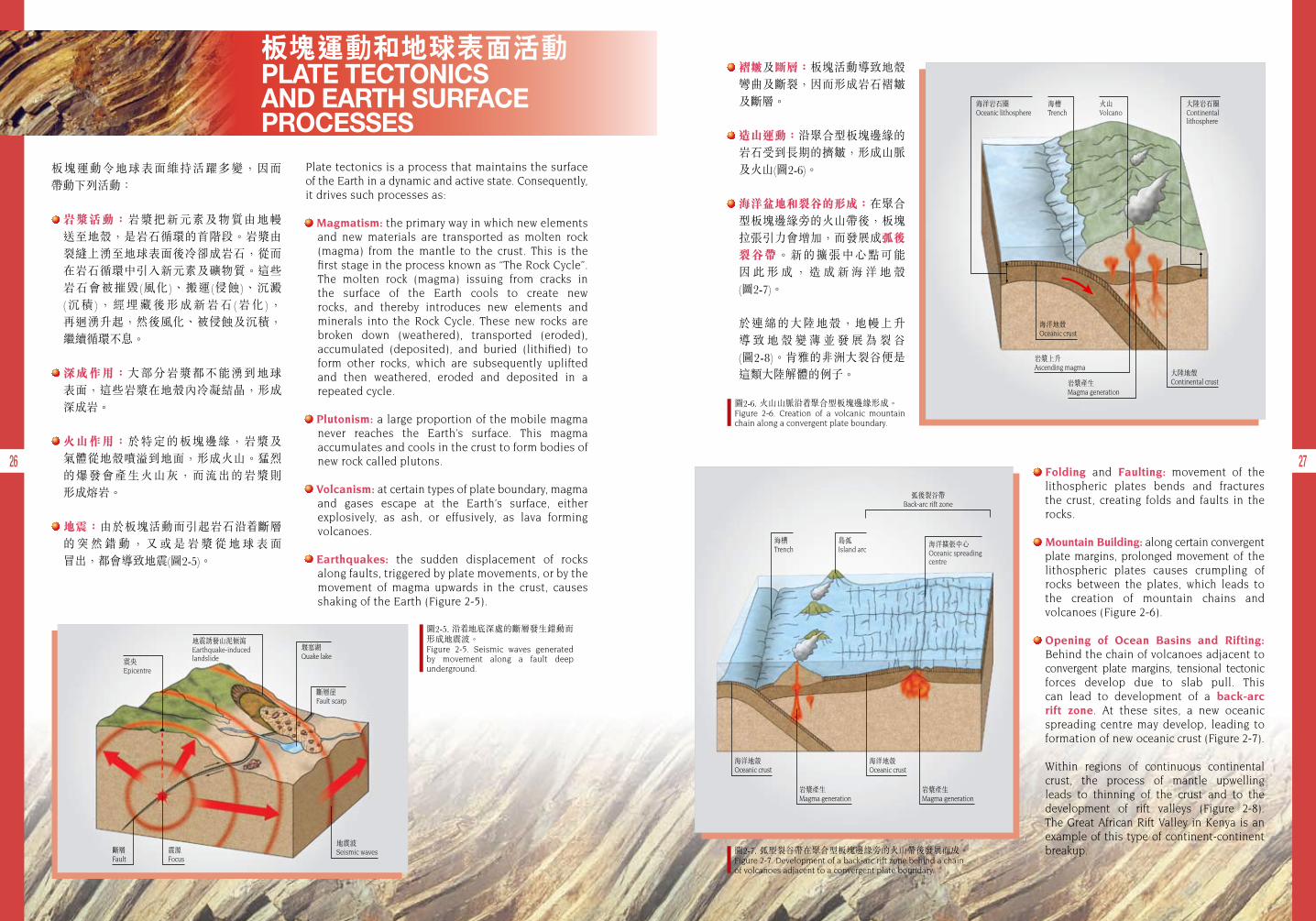
褶皺及斷層:板塊活動導致地殼彎曲及斷裂,因而形成岩石褶皺及斷層。
造山運動:沿聚合型板塊邊緣的岩石受到長期的擠皺,形成山脈及火山(圖2-6)。
海洋盆地和裂谷的形成:在聚合 型板塊邊緣旁的火山帶後,板塊拉張引力會增加,而發展成弧後裂谷帶。新的擴張中心點可能 因 此 形 成 , 造 成 新 海 洋 地 殼 (圖2-7)。
於連綿的大陸地殼,地幔上升 導 致 地 殼 變 薄 並 發 展 為 裂 谷 (圖2-8)。肯雅的非洲大裂谷便是這類大陸解體的例子。
Folding and Faulting: movement of the lithospheric plates bends and fractures the crust, creating folds and faults in the rocks.
Mountain Building: along certain convergent plate margins, prolonged movement of the lithospheric plates causes crumpling of rocks between the plates, which leads to the creation of mountain chains and volcanoes (Figure 2-6).
Opening of Ocean Basins and Rifting: Behind the chain of volcanoes adjacent to convergent plate margins, tensional tectonic forces develop due to slab pull. This can lead to development of a back-arc rift zone. At these sites, a new oceanic spreading centre may develop, leading to formation of new oceanic crust (Figure 2-7).
Within regions of continuous continental crust, the process of mantle upwelling leads to thinning of the crust and to the development of rift valleys (Figure 2-8). The Great African Rift Valley in Kenya is an example of this type of continent-continent breakup.
圖2-5. 沿 地底深處的斷層發生錯動而形成地震波。Figure 2-5. Seismic waves generated by movement along a fault deep underground.
圖2-6. 火山山脈沿 聚合型板塊邊緣形成。Figure 2-6. Creation of a volcanic mountain chain along a convergent plate boundary.
圖2-7. 弧型裂谷帶在聚合型板塊邊緣旁的火山帶後發展而成。Figure 2-7. Development of a back-arc rift zone behind a chain of volcanoes adjacent to a convergent plate boundary.
海洋地殼Oceanic crust
岩漿上升Ascending magma
岩漿產生Magma generation
大陸地殼Continental crust
海洋岩石圈Oceanic lithosphere
大陸岩石圈Continental lithosphere
海槽Trench
火山Volcano
海洋擴張中心Oceanic spreading centre
島弧Island arc
弧後裂谷帶Back-arc rift zone
海槽Trench
海洋地殼Oceanic crust
海洋地殼Oceanic crust
岩漿產生Magma generation
岩漿產生Magma generation
震央Epicentre
地震誘發山泥傾瀉Earthquake-induced landslide
斷層Fault
震源Focus
地震波Seismic waves
斷層崖Fault scarp
堰塞湖Quake lake
28 29
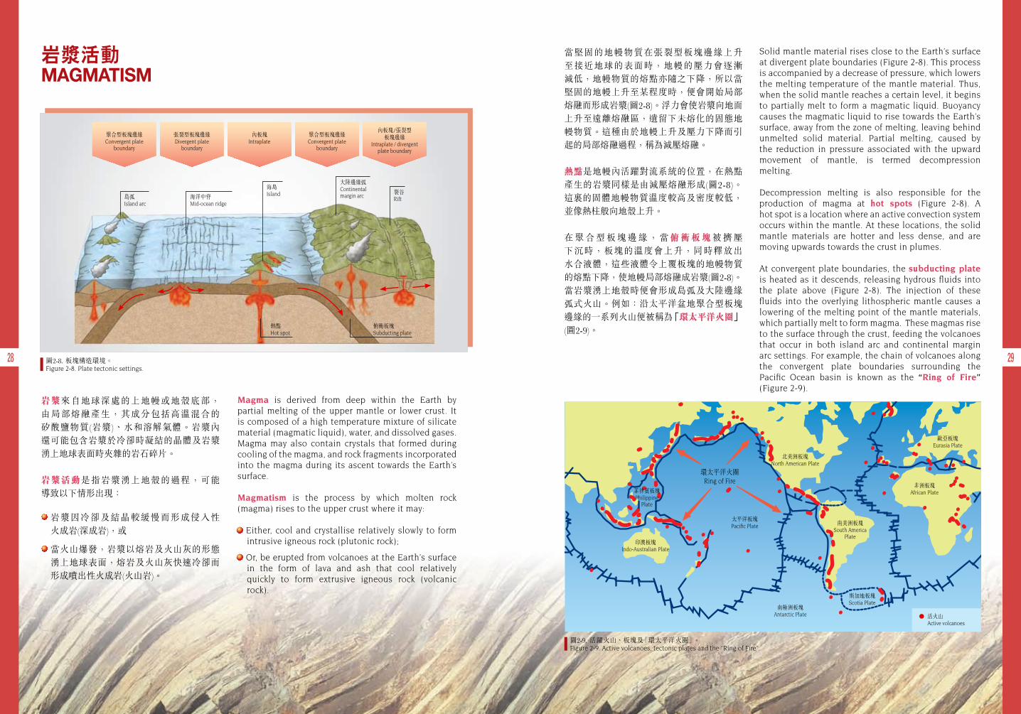
岩漿來自地球深處的上地幔或地殼底部, 由局部熔融產生,其成分包括高溫混合的 矽酸鹽物質(岩漿)、水和溶解氣體。岩漿內 還可能包含岩漿於冷卻時凝結的晶體及岩漿湧上地球表面時夾雜的岩石碎片。
岩漿活動是指岩漿湧上地殼的過程,可能 導致以下情形出現:
岩漿因冷卻及結晶較緩慢而形成侵入性 火成岩(深成岩),或
當火山爆發,岩漿以熔岩及火山灰的形態湧上地球表面,熔岩及火山灰快速冷卻而形成噴出性火成岩(火山岩)。
Magma is derived from deep within the Earth by partial melting of the upper mantle or lower crust. It is composed of a high temperature mixture of silicate material (magmatic liquid), water, and dissolved gases. Magma may also contain crystals that formed during cooling of the magma, and rock fragments incorporated into the magma during its ascent towards the Earth’s surface.
Magmatism is the process by which molten rock (magma) rises to the upper crust where it may:
Either, cool and crystallise relatively slowly to form intrusive igneous rock (plutonic rock);
Or, be erupted from volcanoes at the Earth’s surface in the form of lava and ash that cool relatively quickly to form extrusive igneous rock (volcanic rock).
岩漿活動MAGMATISM
海島Island
熱點Hot spot
俯衝板塊Subducting plate
島弧Island arc
海洋中脊Mid-ocean ridge
大陸邊緣弧Continental margin arc
裂谷Rift
聚合型板塊邊緣Convergent plate
boundary
張裂型板塊邊緣Divergent plate
boundary
聚合型板塊邊緣Convergent plate
boundary
內板塊/張裂型板塊邊緣
Intraplate / divergentplate boundary
內板塊Intraplate
圖2-8. 板塊構造環境。Figure 2-8. Plate tectonic settings.
圖2-9. 活躍火山、板塊及「環太平洋火圈」。Figure 2-9. Active volcanoes, tectonic plates and the “Ring of Fire”.
當堅固的地幔物質在張裂型板塊邊緣上升至接近地球的表面時,地幔的壓力會逐漸 減低,地幔物質的熔點亦隨之下降,所以當堅固的地幔上升至某程度時,便會開始局部熔融而形成岩漿(圖2-8)。浮力會使岩漿向地面上升至遠離熔融區,遺留下未熔化的固態地幔物質。這種由於地幔上升及壓力下降而引起的局部熔融過程,稱為減壓熔融。
熱點是地幔內活躍對流系統的位置,在熱點產生的岩漿同樣是由減壓熔融形成(圖2-8)。 這 的固體地幔物質溫度較高及密度較低,並像熱柱般向地殼上升。
在 聚 合 型 板 塊 邊 緣 , 當 俯 衝 板 塊 被 擠 壓 下沉時,板塊的溫度會上升,同時釋放出 水合液體,這些液體令上覆板塊的地幔物質的熔點下降,使地幔局部熔融成岩漿(圖2-8)。當岩漿湧上地殼時便會形成島弧及大陸邊緣弧式火山。例如:沿太平洋盆地聚合型板塊 邊緣的一系列火山便被稱為「環太平洋火圈」 (圖2-9)。
Solid mantle material rises close to the Earth’s surface at divergent plate boundaries (Figure 2-8). This process is accompanied by a decrease of pressure, which lowers the melting temperature of the mantle material. Thus, when the solid mantle reaches a certain level, it begins to partially melt to form a magmatic liquid. Buoyancy causes the magmatic liquid to rise towards the Earth’s surface, away from the zone of melting, leaving behind unmelted solid material. Partial melting, caused by the reduction in pressure associated with the upward movement of mantle, is termed decompression melting.
Decompression melting is also responsible for the production of magma at hot spots (Figure 2-8). A hot spot is a location where an active convection system occurs within the mantle. At these locations, the solid mantle materials are hotter and less dense, and are moving upwards towards the crust in plumes.
At convergent plate boundaries, the subducting plate is heated as it descends, releasing hydrous fluids into the plate above (Figure 2-8). The injection of these fluids into the overlying lithospheric mantle causes a lowering of the melting point of the mantle materials, which partially melt to form magma. These magmas rise to the surface through the crust, feeding the volcanoes that occur in both island arc and continental margin arc settings. For example, the chain of volcanoes along the convergent plate boundaries surrounding the Pacific Ocean basin is known as the “Ring of Fire” (Figure 2-9).
菲律賓板塊Philippine
Plate
印澳板塊Indo-Australian Plate
南極洲板塊Antarctic Plate
太平洋板塊Pacific Plate
北美洲板塊North American Plate
南美洲板塊South America
Plate
斯加地板塊Scotia Plate
活火山Active volcanoes
非洲板塊African Plate
歐亞板塊Eurasia Plate
環太平洋火圈Ring of Fire
30 31
一般來說,火山爆發時噴出的岩漿由三種 主要成分組成,包括晶體、岩漿和溶解 氣體(主要為水蒸氣)。不同類型的火山在 不同的板塊構造環境下,會產生不同的 爆炸力,爆炸強度視乎所噴出的岩漿成分 而定,尤其是其中溶解氣體的含量。當火山 岩漿噴出至地表時,溶解於岩漿中的氣體 以氣泡釋放。
目 前 , 世 界 各 地 可 發現一系列不同成分的岩漿,包括含豐富鎂 和 鐵 的 鋁 矽 酸 鹽 礦物(玄武岩),以至含豐富鈉、鉀、鈣和鋁的矽酸鹽礦物(流紋岩)和介乎兩者之間的岩漿(例如安山岩)。
由於玄武岩質的岩漿 溫 度 較 高 , 流 動 性 相對亦較高,岩漿中 的氣泡得以釋放,因此噴發出岩漿時多數 沒有爆炸力。相反,流紋岩質的岩漿溫度 相對較低及較黏稠,岩漿內的氣泡較難 釋出,當火山爆發時,釋出氣泡產生的爆炸力強烈而可以粉碎岩漿。因此流紋岩火山的爆炸力較玄武岩火山猛烈,並產生較多的 火山灰。層狀火山爆發時產生的熔岩及火山灰比例大致相等,環太平洋的火山便是其中例子(圖2-10)。
在各種板塊構造環境中常見的三種火山是 盾狀火山、層狀火山及破火山口火山。
Magma erupted from a volcano is generally a mixture of three main components, crystals, magmatic liquid, and dissolved gases (mostly water vapour). Different types of volcano occurring in contrasting plate tectonic settings will exhibit varying degrees of explosivity depending upon the composition of the erupting magma, in particular the dissolved gas
content. When a magma is erupted at the surface, any dissolved gas comes out of solution and is released in the form of gas bubbles.
Around the world, a spectrum of magma compositions can be found. These range from magmas rich in magnesium and iron aluminium silicate minerals (basalt), to those rich in sodium, potassium, and calcium aluminium silicate minerals (rhyolite), with a range of intermediate magmas occurring in between (e.g. andesite).
The magma in basaltic volcanoes is relatively hot, and flows easily. This allows any gas bubbles to escape, resulting in largely non- explosive eruptions. In contrast, the magma in rhyolitic volcanoes
is relatively cool and more viscous. Any gas bubbles in the rhyolitic magma have great difficulty escaping, and are explosively released, shattering the magma. Thus, rhyolitic volcanoes are more explosive than basaltic volcanoes, producing greater quantities of ash. Volcanoes that generate roughly equal proportions of lava and ash produce the characteristic stratovolcanoes that occur around the Pacific “Ring of Fire” (Figure 2-10).
Three common types of volcanoes that occur in different tectonic settings are shield volcanoes, stratovolcanoes, and caldera volcanoes.
在不同板塊構造環境下形成的火山VOLCANOES IN DIFFERENT PLATE TECTONIC SETTINGS
圖2-10. 美國聖海倫火山(相片由美國地質調查局喀斯開 火山觀察站提供)。Figure 2-10. Mount St. Helens volcano, USA (Photo courtesy of the USGS/Cascades Volcano Observatory).
盾狀火山
大部分在內板塊或大洋中脊擴張中心爆發的玄武岩質火山,其山坡坡幅較小,形成狀似盾牌的盾狀火山。玄武岩火山爆發時,熔岩通常如噴泉般由火山通道噴出,大量低黏 稠度的岩漿會以熔岩流的狀態瀉出。夏威夷火山群便是著名的例子(圖2-11)。
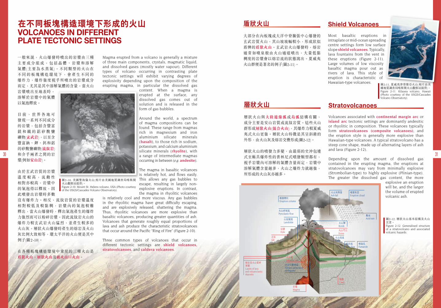
層狀火山
層狀火山與大陸邊緣弧或島弧結構有關, 成分主要是安山岩質或流紋岩質。這些火山 群形成層狀火山(混合火山),其爆炸力較夏威夷式火山更強。層狀火山特徵是其呈斜錐的外形,由火山灰及熔岩交疊形成(圖2-12)。
層狀火山的噴發力多變,由最弱的史沖包連式至極具爆炸性的普林尼式噴發類型都有,視乎岩漿內可溶解的氣體含量而定,岩漿中溶解氣體含量越多,火山之爆炸力就越強,所形成的火山灰亦越多。
火山穹丘Dome
噴發煙柱Eruption column
噴氣孔Fumarole
熔岩流Lava flow
火山泥流Lahar
山泥傾瀉Landslide
岩牆Dyke
岩床Sill
火山引發地震Volcano-generated earthquake
岩漿Magma
裂縫Crack
火山道Volcanic vent
熔岩及火山質碎屑層Layers of lava and volcaniclastic deposits
火山碎屑流Pyroclastic flow
酸雨Acid rain
火山彈Bomb
火山灰降落Ash fall
噴發灰雲Eruption cloud
圖2-11. 夏威夷津勞維亞火山(相片由美國地質調查局喀斯開火山觀察站提供)。Figure 2-11. Kilauea volcano, Hawaii (Photo courtesy of the USGS/Cascades Volcano Observatory).
圖2-12. 層狀火山基本結構及火山災害。Figure 2-12. Generalised structure of a stratovolcano and associated volcanic hazards.
Stratovolcanoes
Volcanoes associated with continental margin arc or island arc tectonic settings are dominantly andesitic or rhyolitic in composition. These volcanoes typically form stratovolcanoes (composite volcanoes), and the eruption style is generally more explosive than Hawaiian-type volcanoes. A typical stratovolcano has a steep cone shape, made up of alternating layers of ash and lava (Figure 2-12).
Depending upon the amount of dissolved gas contained in the erupting magma, the eruptions at stratovolcanoes may vary from minimally explosive (Strombolian-type) to highly explosive (Plinian-type). The greater the dissolved gas content, the more
explosive an eruption will be, and the larger the volume of erupted volcanic ash.
Shield Volcanoes
Most basaltic eruptions in intraplate or mid-ocean spreading centre settings form low surface slope shield volcanoes. Typically, lava fountains from the vent in these eruptions (Figure 2-11). Large volumes of low viscosity basaltic magma pour out as rivers of lava. This style of eruption is characteristic of Hawaiian-type volcanoes.
資料匣 BOX
火山爆發帶來的災害主要分為直接引起的主要災害及間接引起的次要災害(圖2-12)。
主要災害包括:熔岩流、火山碎屑流、灰降及氣體噴發。
次要災害包括:火山泥流、水災、火災及海嘯。
火山災害Volcanic Hazards
Hazards created by volcanoes can be divided into those that are produced directly from volcanic activity (primary hazards), and those that are produced indirectly from volcanic activity (secondary hazards) (Figure 2-12).
Primary hazards include: lava flows, pyroclastic flows, ash-falls, and gas emissions.
Secondary hazards include: lahars (mud flows), floods, fires, and tsunami (large sea waves).
32 33
Caldera Volcanoes
Rhyolitic volcanoes in convergent boundary tectonic settings may form caldera volcanoes. Caldera volcanoes are ones in which the top part of the volcano has been explosively destroyed following collapse into an underlying drained magma chamber (Figure 2-13). Caldera volcanoes are the result of very violent eruptions.
The volcanic rocks that occur in Hong Kong are predominantly of rhyolitic composition, consisting mainly of ash. These rocks were formed by violent eruptions of ash from caldera-type volcanoes. Ash clouds from caldera-type volcanoes are commonly so large that they collapse under gravity and flow over the landscape like a fiery fluid.
破火山口火山
在聚合型板塊邊緣環境,流紋岩質火山可能形成破火山口火山。破火山口火山的形成是由於火山頂部因強烈爆發而崩塌,並陷落於下面的岩漿庫(圖2-13)所致。
香港發現的火山岩大部分為流紋岩質,主要成分是火山灰,它們大都由破火山口火山 爆發時噴出的火山灰形成。破火山口火山的灰雲體積通常很大,會因地心吸力而塌 下來, 火山灰像火熱的液體般在地面流動。
岩漿Magma
其他岩石Other rocks
A
其他岩石Other rocks
岩漿Magma
下降塊狀Sunken block
B
圖2-13. 破火山口火山之形成 ﹣(A)強烈爆發掏空了部分火山之下的岩漿庫;(B)火山的頂部崩塌,並陷落於掏空的岩漿庫中,形成破火山口。Figure 2-13. Formation of a caldera volcano - (A) Explosive eruption partially empties the underlying magma chamber; (B) The summit of the volcano collapses into the empty space left in the magma chamber, forming a caldera.
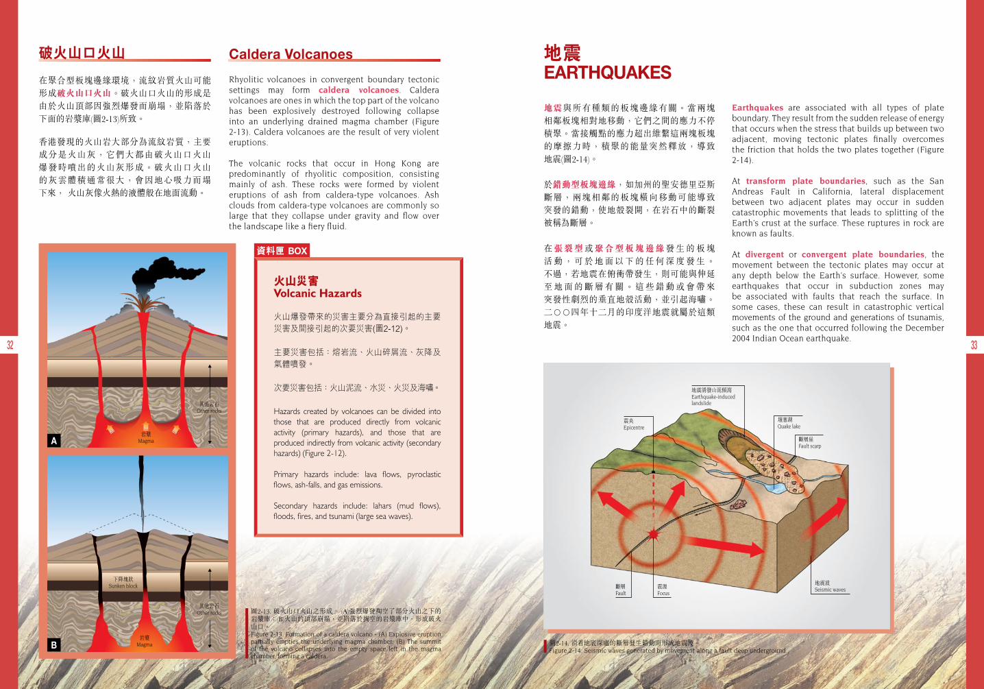
圖2-14. 沿 地底深處的斷層發生錯動而形成地震波。Figure 2-14. Seismic waves generated by movement along a fault deep underground.
地震 EARTHQUAKES
Earthquakes are associated with all types of plate boundary. They result from the sudden release of energy that occurs when the stress that builds up between two adjacent, moving tectonic plates finally overcomes the friction that holds the two plates together (Figure 2-14).
At transform plate boundaries, such as the San Andreas Fault in California, lateral displacement between two adjacent plates may occur in sudden catastrophic movements that leads to splitting of the Earth’s crust at the surface. These ruptures in rock are known as faults.
At divergent or convergent plate boundaries, the movement between the tectonic plates may occur at any depth below the Earth’s surface. However, some earthquakes that occur in subduction zones may be associated with faults that reach the surface. In some cases, these can result in catastrophic vertical movements of the ground and generations of tsunamis, such as the one that occurred following the December 2004 Indian Ocean earthquake.
地震與所有種類的板塊邊緣有關。當兩塊 相鄰板塊相對地移動,它們之間的應力不停積聚。當接觸點的應力超出維繫這兩塊板塊 的摩擦力時,積聚的能量突然釋放,導致 地震(圖2-14)。
於錯動型板塊邊緣,如加州的聖安德里亞斯 斷層,兩塊相鄰的板塊橫向移動可能導致 突發的錯動,使地殼裂開,在岩石中的斷裂被稱為斷層。
在張裂型或聚合型板塊邊緣發 生 的 板 塊 活 動 , 可 於 地 面 以 下 的 任 何 深 度 發 生 。 不過,若地震在俯衝帶發生,則可能與伸延 至 地 面 的 斷 層 有 關 。 這 些 錯 動 或 會 帶 來 突發性劇烈的垂直地殼活動,並引起海嘯。二○○四年十二月的印度洋地震就屬於這類地震。
震央Epicentre
地震誘發山泥傾瀉Earthquake-induced landslide
斷層Fault
震源Focus
地震波Seismic waves
斷層崖Fault scarp
堰塞湖Quake lake
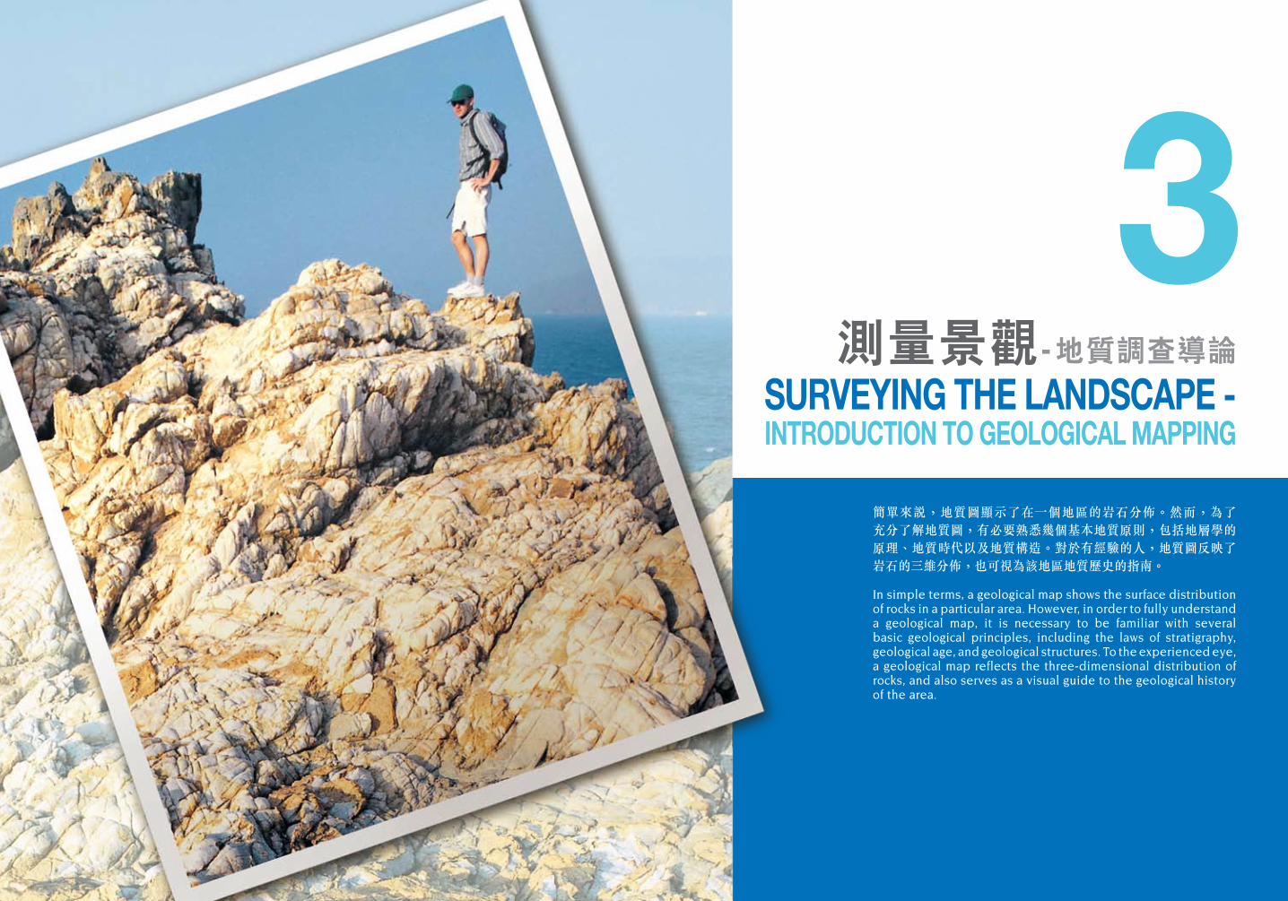
簡單來說,地質圖顯示了在一個地區的岩石分佈。然而,為了 充分了解地質圖,有必要熟悉幾個基本地質原則,包括地層學的原理、地質時代以及地質構造。對於有經驗的人,地質圖反映了岩石的三維分佈,也可視為該地區地質歷史的指南。
In simple terms, a geological map shows the surface distribution of rocks in a particular area. However, in order to fully understand a geological map, it is necessary to be familiar with several basic geological principles, including the laws of stratigraphy, geological age, and geological structures. To the experienced eye, a geological map reflects the three-dimensional distribution of rocks, and also serves as a visual guide to the geological history of the area.
3測量景觀- 地質調查導論
SURVEYING THE LANDSCAPE - INTRODUCTION TO GEOLOGICAL MAPPING
36 37
地層學的原理 PRINCIPLES OF STRATIGRAPHY
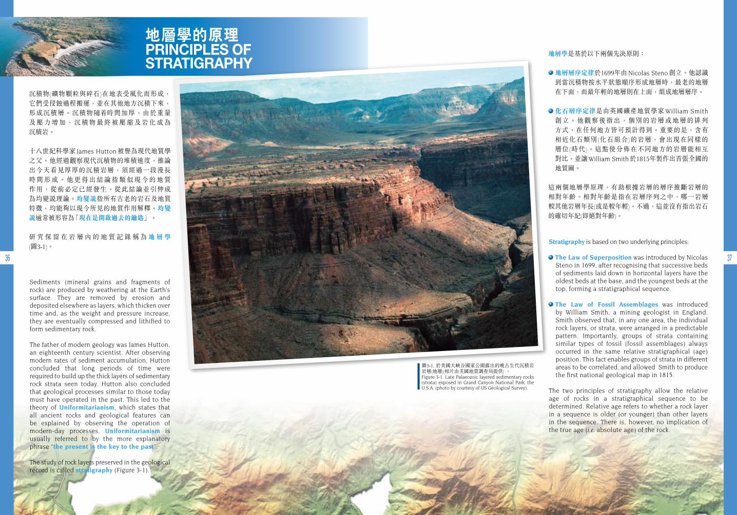
Sediments (mineral grains and fragments of rock) are produced by weathering at the Earth’s surface. They are removed by erosion and deposited elsewhere as layers, which thicken over time and, as the weight and pressure increase, they are eventually compressed and lithified to form sedimentary rock.
The father of modern geology was James Hutton, an eighteenth century scientist. After observing modern rates of sediment accumulation, Hutton concluded that long periods of time were required to build up the thick layers of sedimentary rock strata seen today. Hutton also concluded that geological processes similar to those today must have operated in the past. This led to the theory of Uniformitarianism, which states that all ancient rocks and geological features can be explained by observing the operation of modern-day processes. Uniformitarianism is usually referred to by the more explanatory phrase “the present is the key to the past”.
The study of rock layers preserved in the geological record is called stratigraphy (Figure 3-1).
沉積物(礦物顆粒與碎石)在地表受風化而形成, 它們受侵蝕過程搬運,並在其他地方沉積下來,形成沉積層。沉積物隨 時間加厚,由於重量 及壓力增加,沉積物最終被壓縮及岩化成為 沉積岩。
十八世紀科學家 James Hutton 被譽為現代地質學 之父。他經過觀察現代沉積物的堆積速度,推論 出今天看見厚厚的沉積岩層,須經過一段漫長 時間形成。他更得出結論指類似現今的地質 作用,從前必定已經發生。從此結論並引伸成 為均變說理論。均變說指所有古老的岩石及地質特徵,均能夠以現今所見的地質作用解釋。均變說通常被形容為「現在是開啟過去的鑰匙」。
研 究 保 留 在 岩 層 內 的 地 質 記 錄 稱 為 地 層 學 (圖3-1)。
圖3-1. 於美國大峽谷國家公園露出的晚古生代沉積岩岩層(地層)(相片由美國地質調查局提供) 。Figure 3-1. Late Palaeozoic layered sedimentary rocks (strata) exposed in Grand Canyon National Park, the U.S.A. (photo by courtesy of US Geological Survey).
Stratigraphy is based on two underlying principles:
The Law of Superposition was introduced by Nicolas Steno in 1699, after recognising that successive beds of sediments laid down in horizontal layers have the oldest beds at the base, and the youngest beds at the top, forming a stratigraphical sequence.
The Law of Fossil Assemblages was introduced by William Smith, a mining geologist in England. Smith observed that, in any one area, the individual rock layers, or strata, were arranged in a predictable pattern. Importantly, groups of strata containing similar types of fossil (fossil assemblages) always occurred in the same relative stratigraphical (age) position. This fact enables groups of strata in different areas to be correlated, and allowed Smith to produce the first national geological map in 1815.
The two principles of stratigraphy allow the relative age of rocks in a stratigraphical sequence to be determined. Relative age refers to whether a rock layer in a sequence is older (or younger) than other layers in the sequence. There is, however, no implication of the true age (i.e. absolute age) of the rock.
地層學是基於以下兩個先決原則:
地層層序定律於1699年由 Nicolas Steno 創立。他認識到當沉積物按水平狀態順序形成地層時,最老的地層在下面,而最年輕的地層則在上面,組成地層層序。
化石層序定律是由英國礦產地質學家 William Smith
創立。他觀察後指出,個別的岩層或地層的排列 方式,在任何地方皆可預計得到。重要的是,含有 相近化石類別(化石組合)的岩層,會出現在同樣的 層位(時代)。這點使分佈在不同地方的岩層能相互 對比,並讓 William Smith 於1815年製作出首張全國的 地質圖。
這兩個地層學原理,有助根據岩層的層序推斷岩層的 相對年齡。相對年齡是指在岩層序列之中,哪一岩層 較其他岩層年長(或是較年輕)。不過,這並沒有指出岩石的確切年紀(即絕對年齡)。
38 39
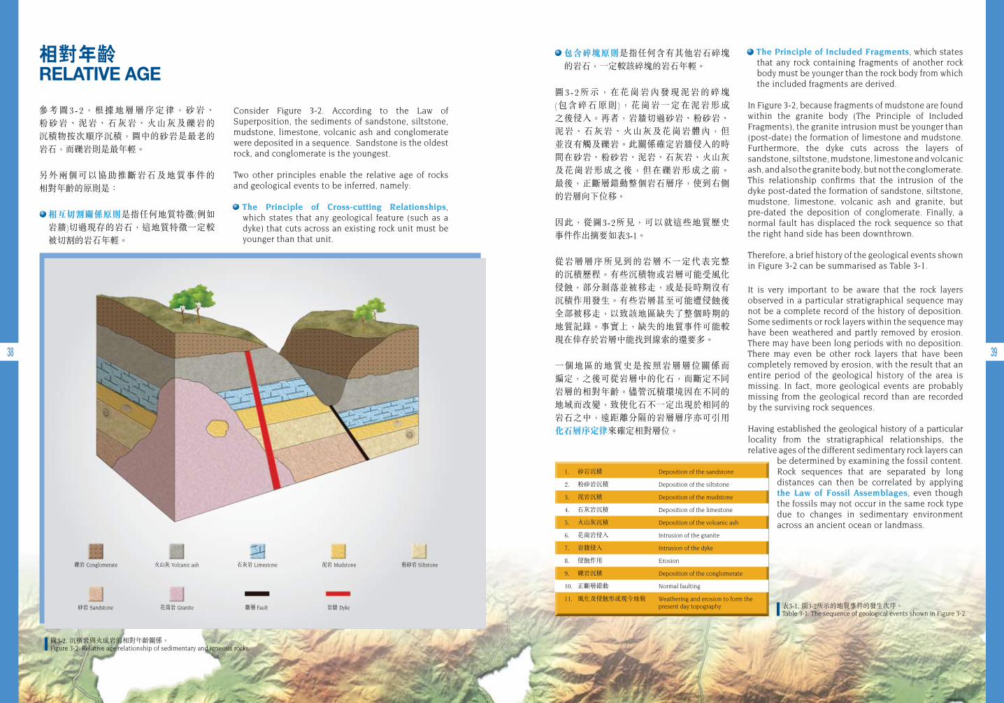
圖3-2. 沉積岩與火成岩的相對年齡關係。 Figure 3-2. Relative age relationship of sedimentary and igneous rocks.
表3-1. 圖3-2所示的地質事件的發生次序。Table 3-1. The sequence of geological events shown in Figure 3-2.
相對年齡 RELATIVE AGE
Consider Figure 3-2. According to the Law of Superposition, the sediments of sandstone, siltstone, mudstone, limestone, volcanic ash and conglomerate were deposited in a sequence. Sandstone is the oldest rock, and conglomerate is the youngest.
Two other principles enable the relative age of rocks and geological events to be inferred, namely:
The Principle of Cross-cutting Relationships, which states that any geological feature (such as a dyke) that cuts across an existing rock unit must be younger than that unit.
參考圖3-2,根據地層層序定律,砂岩、 粉砂岩、泥岩、石灰岩、火山灰及礫岩的 沉積物按次順序沉積,圖中的砂岩是最老的岩石,而礫岩則是最年輕。
另外兩個可以協助推斷岩石及地質事件的 相對年齡的原則是:
相互切割關係原則是指任何地質特徵(例如岩牆)切過現存的岩石,這地質特徵一定較被切割的岩石年輕。
The Principle of Included Fragments, which states that any rock containing fragments of another rock body must be younger than the rock body from which the included fragments are derived.
In Figure 3-2, because fragments of mudstone are found within the granite body (The Principle of Included Fragments), the granite intrusion must be younger than (post-date) the formation of limestone and mudstone. Furthermore, the dyke cuts across the layers of sandstone, siltstone, mudstone, limestone and volcanic ash, and also the granite body, but not the conglomerate. This relationship confirms that the intrusion of the dyke post-dated the formation of sandstone, siltstone, mudstone, limestone, volcanic ash and granite, but pre-dated the deposition of conglomerate. Finally, a normal fault has displaced the rock sequence so that the right hand side has been downthrown.
Therefore, a brief history of the geological events shown in Figure 3-2 can be summarised as Table 3-1.
It is very important to be aware that the rock layers observed in a particular stratigraphical sequence may not be a complete record of the history of deposition. Some sediments or rock layers within the sequence may have been weathered and partly removed by erosion. There may have been long periods with no deposition. There may even be other rock layers that have been completely removed by erosion, with the result that an entire period of the geological history of the area is missing. In fact, more geological events are probably missing from the geological record than are recorded by the surviving rock sequences.
Having established the geological history of a particular locality from the stratigraphical relationships, the relative ages of the different sedimentary rock layers can
be determined by examining the fossil content. Rock sequences that are separated by long distances can then be correlated by applying the Law of Fossil Assemblages, even though the fossils may not occur in the same rock type due to changes in sedimentary environment across an ancient ocean or landmass.
包含碎塊原則是指任何含有其他岩石碎塊的岩石,一定較該碎塊的岩石年輕。
圖3-2所示,在花崗岩內發現泥岩的碎塊 (包含碎石原則),花崗岩一定在泥岩形成 之後侵入。再者,岩牆切過砂岩、粉砂岩、泥岩、石灰岩、火山灰及花崗岩體內,但並沒有觸及礫岩。此關係確定岩牆侵入的時間在砂岩、粉砂岩、泥岩、石灰岩、火山灰 及花崗岩形成之後,但在礫岩形成之前。 最後,正斷層錯動整個岩石層序,使到右側的岩層向下位移。
因此,從圖3-2所見,可以就這些地質歷史 事件作出摘要如表3-1。
從岩層層序所見到的岩層不一定代表完整 的沉積歷程。有些沉積物或岩層可能受風化侵蝕,部分剝落並被移走,或是長時期沒有沉積作用發生。有些岩層甚至可能遭侵蝕後全部被移走,以致該地區缺失了整個時期的地質記錄。事實上,缺失的地質事件可能較現在倖存於岩層中能找到線索的還要多。
一個地區的地質史是按照岩層層位關係而 編定,之後可從岩層中的化石,而斷定不同岩層的相對年齡。儘管沉積環境因在不同的地域而改變,致使化石不一定出現於相同的岩石之中,遠距離分隔的岩層層序亦可引用 化石層序定律來確定相對層位。
1. 砂岩沉積 Deposition of the sandstone
2. 粉砂岩沉積 Deposition of the siltstone
3. 泥岩沉積 Deposition of the mudstone
4. 石灰岩沉積 Deposition of the limestone
5. 火山灰沉積 Deposition of the volcanic ash
6. 花崗岩侵入 Intrusion of the granite
7. 岩牆侵入 Intrusion of the dyke
8. 侵蝕作用 Erosion
9. 礫岩沉積 Deposition of the conglomerate
10. 正斷層錯動 Normal faulting
11. 風化及侵蝕形成現今地貌 Weathering and erosion to form the present day topography花崗岩 Granite砂岩 Sandstone
粉砂岩 Siltstone泥岩 Mudstone石灰岩 Limestone火山灰 Volcanic ash礫岩 Conglomerate
斷層 Fault 岩牆 Dyke
40 41
A geological map shows the surface distribution of different rock types, their structural features, and their age relationships.
The first geological maps simply showed the relative stratigraphical positions of groups of rocks that contained similar fossil assemblages. Over time, as more areas were mapped and knowledge increased, the geological time-scale was developed, based on a wide range of rock and fossil occurrences. Geological Time Units were subsequently devised, which placed particular groups of rocks and fossils into relative age categories. Many of these time units are named after groups of strata that were first described from type localities in the British countryside (e.g. the Devonian).
The last 542 million years to the present is known as the Phanerozoic (meaning “life presence”) era. It contains the most subdivisions in the geological time scale because this period in Earth history was teeming with recognisable and evolving plant and animal life. The boundaries between geological time units of the Phanerozoic era are marked by widespread extinctions in the fossil record and by major unconformities in the rock sequence that signify global events, such as major magmatic episodes and meteorite impacts. Examples include the voluminous outpouring of magma at the end of the Permian and Cretaceous periods, and a meteorite impact at the end of the Cretaceous.
地質圖顯示不同類型的岩石在地面的分佈 情況、構造特徵及其相對年齡的關係。
最初的地質圖只有簡單地顯示含有相似化石組合的岩石的地層關係。後來,隨 有更多地方的地質圖完成及知識的增加,地質時代表根據廣泛的岩石及化石種類為基礎發展 而成。期後制定了地質時代單位,即是將個別岩石及化石組別歸類至相對的年代。不少的地質時代單位,是按該地層首次在英國被描述的地區而命名(例如泥盆紀)。
自五億四千二百萬年前至今,稱為顯生元 (意謂「展現生命」)。在這期間,地球上出現非常豐富、能夠確認而且不斷演化的植物及動物生態,因此地質時代表中,顯生元出現最多的分組。顯生元時期之地質時代單位的 界線,通常以物種廣泛絕跡的化石記錄, 以及反映了全球性地質事件的不整合來劃分,如主要的岩漿活動或隕石撞擊等事故,例子包括:在二疊紀及白堊紀末期,有大量岩漿湧出,以及於白堊紀末期的隕石撞擊。
直 至 二 十 世 紀 初 , 沒 有 任 何 科 學 方 法 可 以 推 斷 岩石的確切(絕對)年齡。 因此,地質時代單位只代表相對年齡。一直以來有多個有關地球年歲的理論面世。以宗教角度估計,地球相當年輕,即使早期 的地質學家早已認定沉積岩的龐大厚度,需要很長 的 時 間 始 能 形 成 。 英 國 物理學家 Lord Kelvin 於1846年根據岩漿在地球表面冷卻估計所需的時間為基礎,推算出地球的年齡約二千萬至三千萬年。
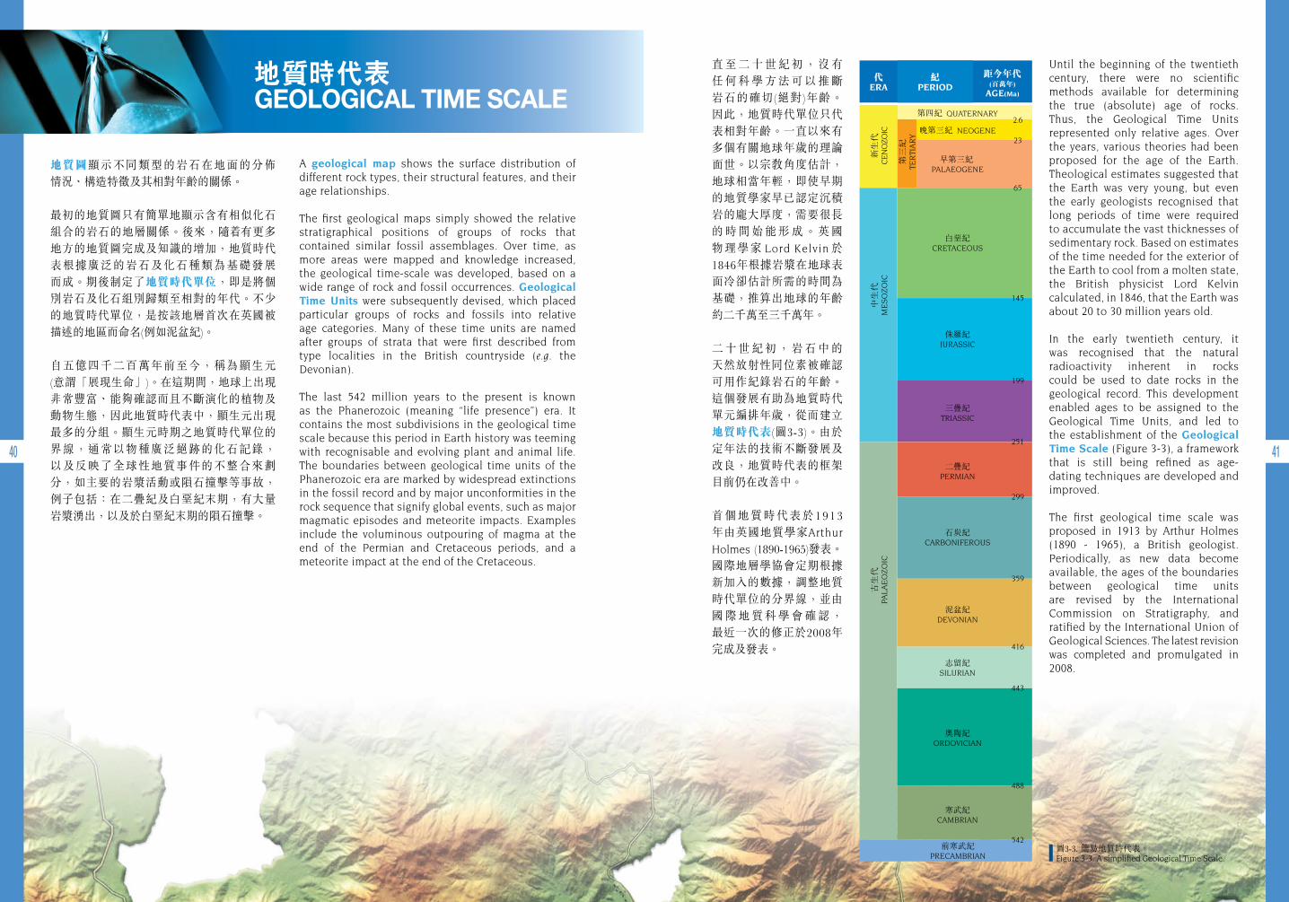
二 十 世 紀 初 , 岩 石 中 的 天然放射性同位素被確認可用作紀錄岩石的年齡。這個發展有助為地質時代單元編排年歲,從而建立地質時代表(圖3-3)。由於定年法的技術不斷發展及改良,地質時代表的框架目前仍在改善中。
首個地質時代表於1913年由英國地質學家Arthur
Holmes (1890-1965)發表。國際地層學協會定期根據新加入的數據,調整地質時代單位的分界線,並由 國 際 地 質 科 學 會 確 認 , 最近一次的修正於2008年完成及發表。
Until the beginning of the twentieth century, there were no scientific methods available for determining the true (absolute) age of rocks. Thus, the Geological Time Units represented only relative ages. Over the years, various theories had been proposed for the age of the Earth. Theological estimates suggested that the Earth was very young, but even the early geologists recognised that long periods of time were required to accumulate the vast thicknesses of sedimentary rock. Based on estimates of the time needed for the exterior of the Earth to cool from a molten state, the British physicist Lord Kelvin calculated, in 1846, that the Earth was about 20 to 30 million years old.
In the early twentieth century, it was recognised that the natural radioactivity inherent in rocks could be used to date rocks in the geological record. This development enabled ages to be assigned to the Geological Time Units, and led to the establishment of the Geological Time Scale (Figure 3-3), a framework that is still being refined as age-dating techniques are developed and improved.
The first geological time scale was proposed in 1913 by Arthur Holmes (1890 - 1965), a British geologist. Periodically, as new data become available, the ages of the boundaries between geological time units are revised by the International Commission on Stratigraphy, and ratified by the International Union of Geological Sciences. The latest revision was completed and promulgated in 2008.
圖3-3. 簡易地質時代表。Figure 3-3. A simplified Geological Time Scale.
地質時代表 GEOLOGICAL TIME SCALE
前寒武紀PRECAMBRIAN
資料匣 BOX
資料匣 BOX
42 43
Radioactive isotopes (“the clocks in rocks”) are used to determine the absolute (or numerical) age of a rock. The absolute age of a rock is calculated as a specific number of years.
In simple terms, isotopes of an element exist when the same element has a different number of neutrons in the nucleus, but the same number of electrons and protons. Some of these isotopes (the parent isotope) are unstable (i.e. radioactive), and decay to a more stable isotope (the daughter isotope) by releasing energy. The rate of decay from parent to daughter isotope is constant, and is unique for each particular isotope.
Many minerals contain radioactive isotopes. Once a mineral is formed, the parent isotope in the mineral begins to decay to produce a daughter isotope. In theory, the age (time since formation) of these minerals, and thus the age of the rock bearing them, can be determined by counting the ratio of parent to daughter isotopes in the mineral. The age of the mineral is the length of time that is required to produce the quantity of daughter isotope that has accumulated in the mineral. This length of time required can be calculated using the known decay rate for the isotope.
It is now known that the oldest dated rocks on the Earth are about 4.28 billion years old. However, since these original rocks have been recycled and destroyed during the process of plate tectonic movements, they do not provide a reliable age for the Earth. Instead, the most reliable estimate of the age of the Earth is based on the radiometric dating of meteorites. Meteorites are believed to be material left over from the formation of the Solar System. The age of the oldest minerals contained in iron meteorites that have entered the Earth’s atmosphere is about 4.57 billion years, which is currently regarded as being the best estimate of the age of the Earth.
絕對年齡
放射性同位素被稱為「藏於岩石內的時鐘」,可用來確定岩石的絕對(或數字)年齡,把岩石的絕對年齡計算成一個具體的數字年歲。
簡 單 而 言 , 同 位 素 元 素 的 存 在 , 是 由 於 某些元素的原子核內擁有不同數目的中子, 但具有相同數目的電子和質子。其中有些 同 位 素 ( 母 同 位 素 ) 不 太 穩 定 ( 即 指 具 放 射性),並經由釋放能量而轉化至另一個 較穩定的同位素(子同位數)。從母同位素 轉化至子同位素的衰減速度是固定的,而 個別的同位素的衰減速度均獨一無二。
許 多 礦 物 皆 含 有 放 射 性 同 位 素 。 當 礦 物 形成後,礦物中的母同位素便開始衰減而 轉 化 至 子 同 位 素 。 理 論 上 , 礦 物 的 年 齡 (自形成後的時間)可從計算礦物中的母及 子同位素的比率來判斷。礦物的年歲等同 礦物內產生出的子同位素數量所需的時間。該 時 間 可 根 據 已 知 的 同 位 素 衰 減 速 度 來 計算。
地球年歲
地球上已知最古老的岩石約有四十二億八千萬年歲。然而由於板塊運動的關係,這些最早的岩石於板塊運動的過程中被循環再生及破壞,以致未能憑此計算出地球可靠的 歲數。取而代之,估計地球歲數最準確的 方法是利用隕石的放射性年齡測定。隕石相信是太陽系形成時遺留的物質,在地球找到最古老的含鐵隕石,所含有的礦物的年齡是四十五億七千萬年,這年齡被視為目前 地球年歲的最佳估計。
地質圖 GEOLOGICAL MAPS
Geological maps are a visual representation of a wide variety of geological data, including the distribution of rocks and sediments in a particular area, the types of rock, their age relationships, and the structural features in that area.
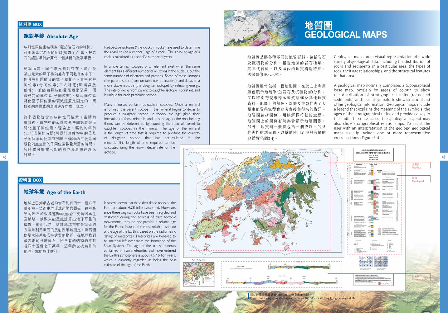
A geological map normally comprises a topographical base map, overlain by areas of colour, to show the distribution of stratigraphical units (rocks and sediments), and special symbols, to show structural and other geological information. Geological maps include a legend that explains the meaning of the symbols, the ages of the stratigraphical units, and provides a key to the units. In some cases, the geological legend may also show stratigraphical relationships. To assist the user with an interpretation of the geology, geological maps usually include one or more representative cross-sections (Figure 3-4).
地質圖是將各種不同的地質資料,包括岩石及沉積物的分佈、指定地區的岩石種類、 其年代關係、以及區內的地質構造特點, 透過圖像展示出來。
地質圖通常包括一張地形圖,在此之上利用顏色顯示地層單位(岩石及沉積物)的分佈; 又以特別符號來標示地質結構及其他地質 資料。地圖上的顏色、線條及符號代表了大量由地質學家從實地考察搜集得來的資訊。地質圖包括圖例,用以解釋符號的意思。 地質圖上的圖例有時亦會顯示地層關係。 另外,地質圖一般都包括一個或以上的具 代表性的剖面圖,以幫助使用者理解該區的 地質情況(圖3-4)。
地圖面Map face
圖例Map legend
剖面圖Cross-sections
圖3-4. 香港地質調查1:100,000比例香港地質圖。Figure 3-4. Hong Kong Geological Survey 1:100,000-scale Hong Kong Geological Map.
Absolute Age
Age of the Earth
44 45
Geological maps are used for a wide variety of purposes including land use planning, natural hazard assessments, mineral resource investigations, water resources evaluations, and engineering projects.
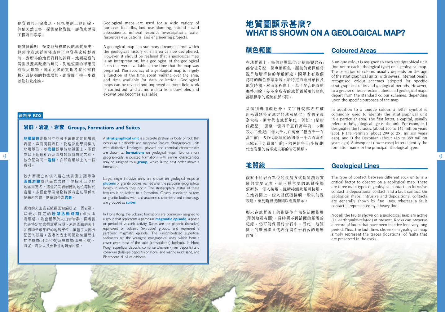
A geological map is a summary document from which the geological history of an area can be deciphered. However, it should be realised that a geological map is an interpretation, by a geologist, of the geological facts that were available at the time that the map was prepared. The accuracy of a geological map is largely a function of the time spent walking over the area, and time available for data collection. Geological maps can be revised and improved as more field work is carried out, and as more data from boreholes and excavations becomes available.
地質圖的用途廣泛,包括規劃土地用途、 評估天然災害、探測礦物資源、評估水源及工程項目等等。
地質圖簡明、扼要地解釋區內的地質歷史。 但須注意地質圖僅表達了地質學家於製圖時,對所得的地質資料的詮釋。地圖勘察的範圍及搜集數據的時間,對地質圖的準確度 有很大影響。隨 更多的實地考察和來自 探孔及挖掘的數據增加,地質圖可進一步得以修訂及改進。
資料匣 BOX
A stratigraphical unit is a discrete stratum or body of rock that occurs as a definable and mappable feature. Stratigraphical units with distinctive lithological, physical and chemical characteristics are shown as formations on geological maps. Two or more geographically associated formations with similar characteristics may be assigned to a group, which is the next order above a formation.
Large, single intrusive units are shown on geological maps as plutons or granite bodies, named after the particular geographical locality in which they occur. The stratigraphical status of these features is equivalent to a formation. Closely associated plutons or granite bodies with a characteristic chemistry and mineralogy are grouped as suites.
In Hong Kong, the volcanic formations are commonly assigned to a group that represents a particular magmatic episode, a phase or period of volcanic activity. Suites are the plutonic (intrusive) equivalent of volcanic (extrusive) groups, and represent a particular magmatic episode. The unconsolidated superficial sediments are the youngest stratigraphical units, which form a cover over most of the solid (consolidated) bedrock. In Hong Kong, superficial deposits comprise alluvium (river deposits) and colluvium (hillslope deposits) onshore, and marine mud, sand, and Pleistocene alluvium offshore.
岩群、岩組、岩套
地層單位是指分立並可明確劃定的地層或 岩體。具有獨特岩性、物理及化學特徵的 地層單位,以岩組顯示於地質圖上。兩個 或以上地理相近及具有類似特質的岩組, 被分配為同一岩群,亦即岩組以上的一個 級別。
較 大 而 獨 立 的 侵 入 岩 在 地 質 圖 上 顯 示 為 深 成 岩 體 或 花 崗 岩 岩 體 , 並 按 其 出 現 的 地區而定名。這些花崗岩岩體的地位等同於岩組。多個化學及礦物特徵有密切關係的 花崗岩岩體,則會組合為岩套。
香港的火山岩岩組通常被編排至一個岩群, 以 表 示 特 定 的 岩 漿 活 動 時 期 ( 即 火 山 活躍期)。岩套相等於火山岩岩群,兩者皆代表特定的岩漿活動時期。未經固結的表土沉積物是最年輕的地層單位,覆蓋了大部分堅固的基岩。香港的表土沉積物包括陸上的沖積物(河流沉積)及坡積物(山坡沉積), 海泥、海沙以及更新世的離岸沖積。
地質圖顯示甚麼? WHAT IS SHOWN ON A GEOLOGICAL MAP?
Coloured Areas
A unique colour is assigned to each stratigraphical unit (but not to each lithological type) on a geological map. The selection of colours usually depends on the age of the stratigraphical units, with several internationally recognised colour schemes adopted for specific stratigraphical units and geological periods. However, to a greater or lesser extent, almost all geological maps depart from the standard colour schemes, depending upon the specific purposes of the map.
In addition to a unique colour, a letter symbol is commonly used to identify the stratigraphical unit in a particular area. The first letter, a capital, usually refers to the geological age of the unit. For example, J designates the Jurassic (about 200 to 145 million years ago), P the Permian (about 299 to 251 million years ago), and D the Devonian (about 416 to 359 million years ago). Subsequent (lower case) letters identify the formation name or the principal lithological type.
Geological Lines
The type of contact between different rock units is a critical factor to observe on a geological map. There are three main types of geological contact: an intrusive contact, a depositional contact, and a fault contact. On geological maps, intrusive and depositional contacts are generally shown by fine lines, whereas a fault contact is represented by a heavy line.
Not all the faults shown on a geological map are active (i.e. earthquake-related) at present. Rocks can preserve a record of faults that have been inactive for a very long period. Thus, the fault lines shown on a geological map simply represent the traces (locations) of faults that are preserved in the rocks.
顏色範圍
在地質圖上,每個地層單位(非指每類岩石) 都會被分配一個專用顏色,顏色的選擇通常視乎地層單位的年齡而定。國際上有數個 認可的顏色標準系統,給特定的地層單位及地質時期。然而某程度上,為了配合地圖的 獨特用途,差不多所有的地質圖採用的顏色都跟標準的系統有所不同。
除 個 別 專 用 顏 色 外 , 文 字 符 號 亦 經 常 被 用來識別特定地方的地層單位。首個字母 為大楷,通常代表地質年代,例如: J是指 侏羅紀(二億至一億四千五百萬年前),P則 表示二疊紀(二億九千九百萬至二億五千一百萬年前),及D代表泥盆紀(四億一千六百萬至 三億五千九百萬年前),隨後的字母(小楷)則 代表岩組的名字或主要的岩石種類。
地質線
觀察不同岩石單位的接觸方式是閱讀地質圖 的 重 要 元 素 , 而 三 種 主 要 的 地 質 接 觸 類型為:侵入接觸、沉積接觸及斷層接觸。在地質圖上,侵入及沉積接觸一般以幼線 表達,至於斷層接觸則以粗線顯示。
顯示在地質圖上的斷層並非都是活躍斷層 (即與地震有關)。長時間不再活躍的斷層的 紀錄,仍可能保留於岩石中。因此,地質 圖上的斷層線只代表保留在岩石內的斷層 位置。
Groups, Formations and Suites
46 47
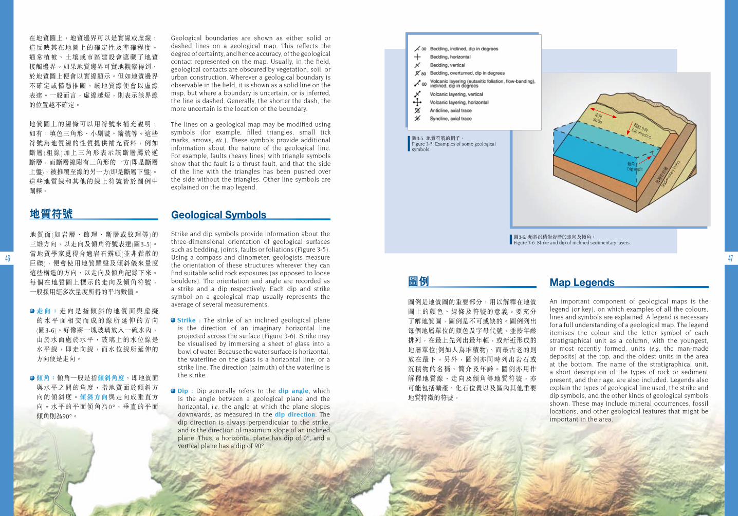
圖3-5. 地質符號的例子。Figure 3-5. Examples of some geological symbols.
圖3-6. 傾斜沉積岩岩層的走向及傾角。Figure 3-6. Strike and dip of inclined sedimentary layers.
在地質圖上,地質邊界可以是實線或虛線,這反映其在地圖上的確定性及準確程度。 通常植被、土壤或市區建設會遮藏了地質 接觸邊界。如果地質邊界可實地觀察得到,於地質圖上便會以實線顯示。但如地質邊界 不確定或僅憑推斷,該地質線便會以虛線 表達。一般而言,虛線越短,則表示該界線的位置越不確定。
地質圖上的線條可以用符號來補充說明, 如有:填色三角形、小剔號、箭號等。這些符號為地質線的性質提供補充資料,例如 斷層(粗線)加上三角形表示該斷層屬於逆 斷層,而斷層線附有三角形的一方(即是斷層上盤),被推覆至線的另一方(即是斷層下盤)。 這些地質線和其他的線上符號皆於圖例中 闡釋。
Geological boundaries are shown as either solid or dashed lines on a geological map. This reflects the degree of certainty, and hence accuracy, of the geological contact represented on the map. Usually, in the field, geological contacts are obscured by vegetation, soil, or urban construction. Wherever a geological boundary is observable in the field, it is shown as a solid line on the map, but where a boundary is uncertain, or is inferred, the line is dashed. Generally, the shorter the dash, the more uncertain is the location of the boundary.
The lines on a geological map may be modified using symbols (for example, filled triangles, small tick marks, arrows, etc.). These symbols provide additional information about the nature of the geological line. For example, faults (heavy lines) with triangle symbols show that the fault is a thrust fault, and that the side of the line with the triangles has been pushed over the side without the triangles. Other line symbols are explained on the map legend.
Geological Symbols
Strike and dip symbols provide information about the three-dimensional orientation of geological surfaces such as bedding, joints, faults or foliations (Figure 3-5). Using a compass and clinometer, geologists measure the orientation of these structures wherever they can find suitable solid rock exposures (as opposed to loose boulders). The orientation and angle are recorded as a strike and a dip respectively. Each dip and strike symbol on a geological map usually represents the average of several measurements.
Strike : The strike of an inclined geological plane is the direction of an imaginary horizontal line projected across the surface (Figure 3-6). Strike may be visualised by immersing a sheet of glass into a bowl of water. Because the water surface is horizontal, the waterline on the glass is a horizontal line, or a strike line. The direction (azimuth) of the waterline is the strike.
Dip : Dip generally refers to the dip angle, which is the angle between a geological plane and the horizontal, i.e. the angle at which the plane slopes downwards, as measured in the dip direction. The dip direction is always perpendicular to the strike, and is the direction of maximum slope of an inclined plane. Thus, a horizontal plane has dip of 0°, and a vertical plane has a dip of 90°.
Map Legends
An important component of geological maps is the legend (or key), on which examples of all the colours, lines and symbols are explained. A legend is necessary for a full understanding of a geological map. The legend itemises the colour and the letter symbol of each stratigraphical unit as a column, with the youngest, or most recently formed, units (e.g. the man-made deposits) at the top, and the oldest units in the area at the bottom. The name of the stratigraphical unit, a short description of the types of rock or sediment present, and their age, are also included. Legends also explain the types of geological line used, the strike and dip symbols, and the other kinds of geological symbols shown. These may include mineral occurrences, fossil locations, and other geological features that might be important in the area.
地質符號
地質面(如岩層、節理、斷層或紋理等)的 三維方向,以走向及傾角符號表達(圖3-5)。 當地質學家覓得合適岩石露頭(並非鬆散的 巨礫),便會使用地質羅盤及傾斜儀來量度 這些構造的方向,以走向及傾角記錄下來。每個在地質圖上標示的走向及傾角符號, 一般採用經多次量度所得的平均數值。
走 向 : 走 向 是 指 傾 斜 的 地 質 面 與 虛 擬 的 水 平 面 相 交 而 成 的 線 所 延 伸 的 方 向 (圖3-6)。好像將一塊玻璃放入一碗水內,由於水面處於水平,玻璃上的水位線是 水平線,即走向線,而水位線所延伸的 方向便是走向。
傾角:傾角一般是指傾斜角度,即地質面 與水平之間的角度,指地質面於傾斜方向的傾斜度。傾斜方向與走向成垂直方向。水平的平面傾角為0°,垂直的平面 傾角則為90°。
圖例
圖例是地質圖的重要部分,用以解釋在地質 圖上的顏色、線條及符號的意義。要充分 了解地質圖,圖例是不可或缺的。圖例列出每個地層單位的顏色及字母代號,並按年齡排列,在最上先列出最年輕,或新近形成的地層單位(例如人為堆積物),而最古老的則 放在最下。另外,圖例亦同時列出岩石或 沉積物的名稱、簡介及年齡。圖例亦用作 解釋地質線、走向及傾角等地質符號,亦 可能包括礦產、化石位置以及區內其他重要地質特徵的符號。
沉積
岩岩
層
Sedi
men
tary
laye
rs傾角 Dip angle
傾斜方向 Dip direction
走向 Strike
48 49
繪畫地質圖的工具 GEOLOGICAL MAPPING TOOLS
Traditionally, geological maps are made by geologists who walk over as much of the map area as possible, noting where rocks can be seen (outcrops), the rock types (lithology), their structure, degree of weathering, and any other features that might be useful. All observations are marked upon a topographical base map, and measurements are taken using a magnetic compass and clinometer. Aerial photographs may help the geologist to identify target geological features in the field.
Topographical base maps show the landscape of an area in the form of contours (lines of equal height), rivers, lakes, reservoirs, roads, buildings, footpaths, etc. Topographical maps are drawn at various scales, the most common scales in Hong Kong being 1:20,000 and 1:5,000, with 1:1,000 scale maps also available. This means, for example, that on a 1:10,000 scale map, 1 centimetre on the map represents 10,000 centimetres (100 metres) on the ground. The scale of the topographical base map selected depends upon the survey objectives, i.e. the amount of geological detail required on the finished map.
Aerial photographs (Figure 3-7) are taken from aircraft flying at fixed heights above the ground. Adjacent pairs of aerial photographs with about 60% overlap can be used under a stereoscope to provide a three-dimensional image of the landscape, which is useful for reconnaissance surveys. The scale of the aerial photograph can be determined if the flying height and the focal length of the camera lens are known. Aerial photographs of limited areas of Hong Kong are available for some years between 1924 and 1963. Systematic, annual, territory-wide black and white aerial photographic coverage began in 1963, twice-annual black and white photography began in
1985, and routine, twice-annual colour photography began in 1993.
傳 統 上 , 地 質 圖 是 根 據 地 質 學 家 在 調 查 範圍內盡量行經的地方,記錄所見的岩石 (露頭)、岩石種類(岩性學)、地質構造、風化程度,以及其他特徵。全部觀察所得的資料均記錄在地形圖上,並且利用磁極羅盤及 傾斜儀等作測量。航空照片亦協助地質學家在野外認出目標地質特徵。
地 形 圖 利 用 等 高 線 顯 示 區 內 的 地 形 , 包括河流、湖泊、水塘、道路、建築物、步行徑等。地形圖以不同的比例繪畫, 香港最常用的地圖比例有1:20,000、1:5,000及1:1,000。例如1:10,000比例的地圖指 地圖上每一厘米代表實地的10,000厘米 (即100米)。選用的比例視乎勘察目的,即地圖上所需記錄的地質資料的多寡而定。
航空照片(圖3-7)是從飛機於空中離地面固定的高度拍攝。一對相鄰的航空照片,若有約60%的重疊範圍,則可用於塑造地形的三維視象,對偵察性勘察甚有用處。如能掌握拍攝航空照片的飛行高度及鏡頭焦距的資料,即可確定航空照片的比例。香港備有少量攝於1924至1963年間,有限地區的航空照片。自1963年開始,每年均有系 統地於全港進行黑白航空照片的拍攝。 於1985年起,每年進行兩次黑白照片拍攝工作,而到了1993年則定期每年拍攝兩次彩色照片。
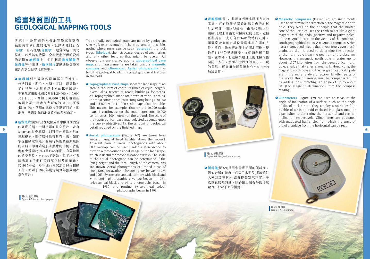
磁極羅盤(圖3-8)是用來判斷北磁極方向的 工具。它的原理是基於地球深處的地核 形成有如一個巨型磁石,兩端代表(正負 兩極)地理上的南北兩極附近的位置。磁極 羅盤具有一支可自由360º旋轉的磁針, 讓觀察者能確定其位置與北極之間的方位。然而,磁極與地理上的南北兩極出現最多1,167公里的偏差,而這偏差按年轉變。在香港,北磁極與地理上的北極均指向同一方位。然而在世界別的地方,出現的差異,可能須從羅盤讀數作出約30º的 加減調整。
傾斜儀(圖3-9)是用來量度平面的傾斜度, 例如岩層的傾角。它採用水平尺(將液體注入密封玻璃管內)或鐘擺分別來判定水平或垂直的傾斜度。傾斜儀上刻有半圓形度 數表,指示平面的傾角。
Magnetic compasses (Figure 3-8) are instruments used to determine the direction of the magnetic north pole. They work on the principle that the molten core of the Earth causes the Earth to act like a giant magnet, with the ends (positive and negative poles) of the magnet located in the vicinity of the north and south geographical poles. A magnetic compass, which has a magnetised needle that pivots freely over a 360º graduated dial, is used to determine the direction of the north pole from the position of the observer. However, the magnetic north pole migrates up to about 1,167 kilometres from the geographical north pole, a value that varies annually. In Hong Kong, the magnetic north pole and the geographical north pole are in the same relative direction. In other parts of the world, this difference must be compensated for by adding, or subtracting, an angle of up to about 30º (the magnetic declination) from the compass reading.
Clinometers (Figure 3-9) are used to measure the angle of inclination of a surface, such as the angle of dip of rock strata. They employ a spirit level (a bubble of air in a liquid enclosed in a glass tube) or a pendulum to determine the horizontal and vertical inclination respectively. Clinometers are equipped with graduated half circles from which the angle of dip of a surface from the horizontal can be read.
圖3-7. 航空照片Figure 3-7. Aerial photographs
圖3-8. 磁極羅盤 Figure 3-8. Magnetic compasses
圖3-9. 傾斜儀 Figure 3-9. Clinometer
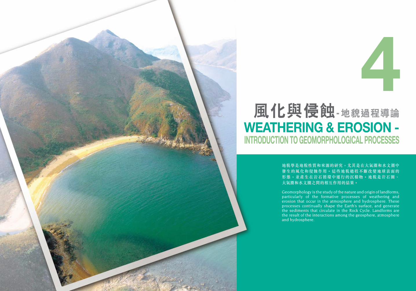
地貌學是地貌性質和來源的研究,尤其是在大氣圈和水文圈中 發生的風化和侵蝕作用。這些地貌過程不斷改變地球表面的 形態,並產生在岩石循環中運行的沉積物。地貌是岩石圈、大氣圈和水文圈之間的相互作用的結果。
Geomorphology is the study of the nature and origin of landforms, particularly of the formative processes of weathering and erosion that occur in the atmosphere and hydrosphere. These processes continually shape the Earth’s surface, and generate the sediments that circulate in the Rock Cycle. Landforms are the result of the interactions among the geosphere, atmosphere and hydrosphere.
4風化與侵蝕- 地貌過程導論
WEATHERING & EROSION - INTRODUCTION TO GEOMORPHOLOGICAL PROCESSES
52 53
風化 WEATHERING
風化是指岩石礦物及岩體暴露在大氣圈下的蝕變及分解作用。風化作用發生於原地, 意即並沒有涉及主要的岩石物質遷移。
風化是全球性的基本作用。風化作用將岩石從堅硬的狀態變為較軟及較脆弱,令它們更容易受到侵蝕。
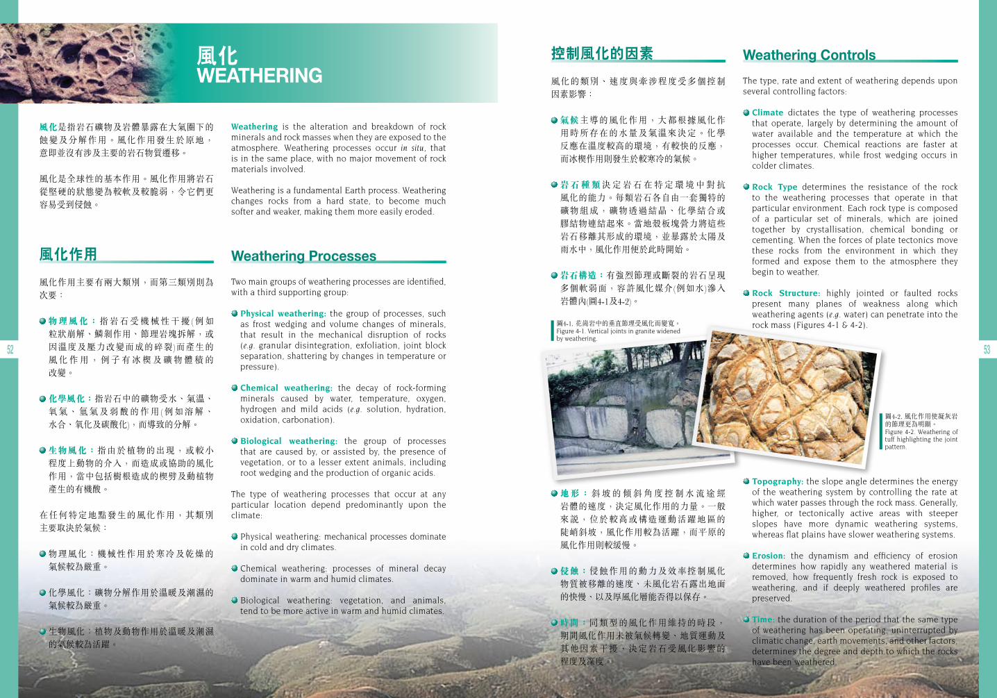
圖4-1. 花崗岩中的垂直節理受風化而變寬。 Figure 4-1. Vertical joints in granite widened by weathering.
圖4-2. 風化作用使凝灰岩的節理更為明顯。Figure 4-2. Weathering of tuff highlighting the joint pattern.
Weathering is the alteration and breakdown of rock minerals and rock masses when they are exposed to the atmosphere. Weathering processes occur in situ, that is in the same place, with no major movement of rock materials involved.
Weathering is a fundamental Earth process. Weathering changes rocks from a hard state, to become much softer and weaker, making them more easily eroded.
Weathering Processes
Two main groups of weathering processes are identified, with a third supporting group:
Physical weathering: the group of processes, such as frost wedging and volume changes of minerals, that result in the mechanical disruption of rocks (e.g. granular disintegration, exfoliation, joint block separation, shattering by changes in temperature or pressure).
Chemical weathering: the decay of rock-forming minerals caused by water, temperature, oxygen, hydrogen and mild acids (e.g. solution, hydration, oxidation, carbonation).
Biological weathering: the group of processes that are caused by, or assisted by, the presence of vegetation, or to a lesser extent animals, including root wedging and the production of organic acids.
The type of weathering processes that occur at any particular location depend predominantly upon the climate:
Physical weathering: mechanical processes dominate in cold and dry climates.
Chemical weathering: processes of mineral decay dominate in warm and humid climates.
Biological weathering: vegetation, and animals, tend to be more active in warm and humid climates.
Weathering Controls
The type, rate and extent of weathering depends upon several controlling factors:
Climate dictates the type of weathering processes that operate, largely by determining the amount of water available and the temperature at which the processes occur. Chemical reactions are faster at higher temperatures, while frost wedging occurs in colder climates.
Rock Type determines the resistance of the rock to the weathering processes that operate in that particular environment. Each rock type is composed of a particular set of minerals, which are joined together by crystallisation, chemical bonding or cementing. When the forces of plate tectonics move these rocks from the environment in which they formed and expose them to the atmosphere they begin to weather.
Rock Structure: highly jointed or faulted rocks present many planes of weakness along which weathering agents (e.g. water) can penetrate into the rock mass (Figures 4-1 & 4-2).
Topography: the slope angle determines the energy of the weathering system by controlling the rate at which water passes through the rock mass. Generally, higher, or tectonically active areas with steeper slopes have more dynamic weathering systems, whereas flat plains have slower weathering systems.
Erosion: the dynamism and efficiency of erosion determines how rapidly any weathered material is removed, how frequently fresh rock is exposed to weathering, and if deeply weathered profiles are preserved.
Time: the duration of the period that the same type of weathering has been operating, uninterrupted by climatic change, earth movements, and other factors, determines the degree and depth to which the rocks have been weathered.
風化作用
風化作用主要有兩大類別,而第三類別則為次要:
物理風化:指岩石受機械性干擾(例如 粒狀崩解、鱗剝作用、節理岩塊拆解,或因溫度及壓力改變而成的碎裂)而產生的 風 化 作 用 , 例 子 有 冰 楔 及 礦 物 體 積 的 改變。
化學風化:指岩石中的礦物受水、氣溫、氧氣、氫氣及弱酸的作用(例如溶解、 水合、氧化及碳酸化),而導致的分解。
生物風化:指由於植物的出現,或較小 程度上動物的介入,而造成或協助的風化作用,當中包括樹根造成的楔劈及動植物產生的有機酸。
在任何特定地點發生的風化作用,其類別 主要取決於氣候:
物理風化:機械性作用於寒冷及乾燥的 氣候較為嚴重。
化學風化:礦物分解作用於溫暖及潮濕的氣候較為嚴重。
生物風化:植物及動物作用於溫暖及潮濕的氣候較為活躍。
控制風化的因素
風化的類別、速度與牽涉程度受多個控制 因素影響:
氣候主導的風化作用,大都根據風化作用時所存在的水量及氣溫來決定。化學 反應在溫度較高的環境,有較快的反應,而冰楔作用則發生於較寒冷的氣候。
岩石種類決 定 岩 石 在 特 定 環 境 中 對 抗 風化的能力。每類岩石各自由一套獨特的礦物組成,礦物透過結晶、化學結合或 膠結物連結起來。當地殼板塊營力將這些岩石移離其形成的環境,並暴露於太陽及雨水中,風化作用便於此時開始。
岩石構造:有強烈節理或斷裂的岩石呈現多個軟弱面,容許風化媒介(例如水)滲入 岩體內(圖4-1及4-2)。
地形:斜 坡 的 傾 斜 角 度 控 制 水 流 途 經 岩體的速度,決定風化作用的力量。一般來說,位於較高或構造運動活躍地區的 陡峭斜坡,風化作用較為活躍,而平原的風化作用則較緩慢。
侵蝕:侵蝕作用的動力及效率控制風化 物質被移離的速度、未風化岩石露出地面的快慢、以及厚風化層能否得以保存。
時間:同類型的風化作用維持的時段, 期間風化作用未被氣候轉變、地質運動及其他因素干擾,決定岩石受風化影響的 程度及深度。
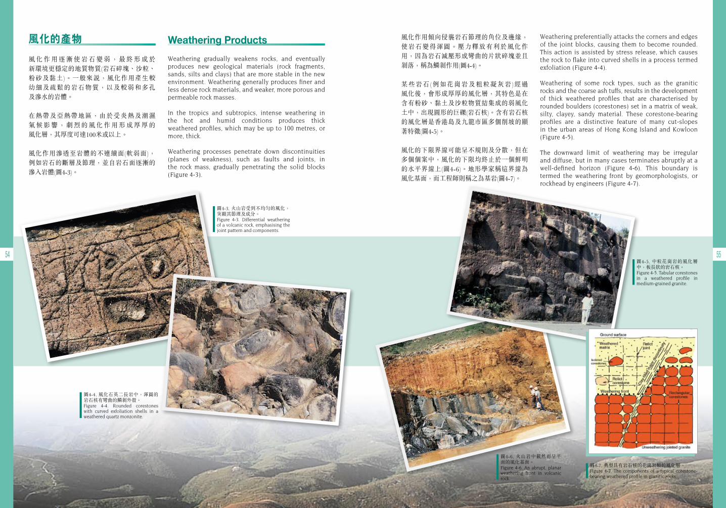
54 55
Weathering preferentially attacks the corners and edges of the joint blocks, causing them to become rounded. This action is assisted by stress release, which causes the rock to flake into curved shells in a process termed exfoliation (Figure 4-4).
Weathering of some rock types, such as the granitic rocks and the coarse ash tuffs, results in the development of thick weathered profiles that are characterised by rounded boulders (corestones) set in a matrix of weak, silty, clayey, sandy material. These corestone-bearing profiles are a distinctive feature of many cut-slopes in the urban areas of Hong Kong Island and Kowloon (Figure 4-5).
The downward limit of weathering may be irregular and diffuse, but in many cases terminates abruptly at a well-defined horizon (Figure 4-6). This boundary is termed the weathering front by geomorphologists, or rockhead by engineers (Figure 4-7).
風化作用傾向侵襲岩石節理的角位及邊緣,使岩石變得渾圓。壓力釋放有利於風化作用,因為岩石減壓形成彎曲的片狀碎塊並且剝落,稱為鱗剝作用(圖4-4)。
某些岩石(例如花崗岩及粗粒凝灰岩)經過 風化後,會形成厚厚的風化層,其特色是在含有粉砂、黏土及沙粒物質結集成的弱風化土中,出現圓形的巨礫(岩石核)。含有岩石核的風化層是香港島及九龍市區多個削坡的顯著特徵(圖4-5)。
風化的下限界線可能呈不規則及分散,但在多個個案中,風化的下限均終止於一個鮮明的水平界線上(圖4-6)。地形學家稱這界線為 風化基面,而工程師則稱之為基岩(圖4-7)。
圖4-3. 火山岩受到不均勻的風化,突顯其節理及成分。Figure 4-3. Differential weathering of a volcanic rock, emphasising the joint pattern and components.
圖4-4. 風化石英二長岩中,渾圓的岩石核有彎曲的鱗剝外殼。Figure 4-4. Rounded corestones with curved exfoliation shells in a weathered quartz monzonite.
圖4-6. 火山岩中截然而呈平面的風化基面。Figure 4-6. An abrupt, planar weathering front in volcanic rock.
圖4-5. 中粒花崗岩的風化層中,板長狀的岩石核。Figure 4-5. Tabular corestones in a weathered profile in medium-grained granite.
圖4-7. 典型具有岩石核的花崗岩類的風化層。Figure 4-7. The components of a typical corestone-bearing weathered profile in granitic rocks.
Weathering Products
Weathering gradually weakens rocks, and eventually produces new geological materials (rock fragments, sands, silts and clays) that are more stable in the new environment. Weathering generally produces finer and less dense rock materials, and weaker, more porous and permeable rock masses.
In the tropics and subtropics, intense weathering in the hot and humid conditions produces thick weathered profiles, which may be up to 100 metres, or more, thick.
Weathering processes penetrate down discontinuities (planes of weakness), such as faults and joints, in the rock mass, gradually penetrating the solid blocks (Figure 4-3).
風化的產物
風 化 作 用 逐 漸 使 岩 石 變 弱 , 最 終 形 成 於 新環境更穩定的地質物質(岩石碎塊、沙粒、粉砂及黏土)。一般來說,風化作用產生較 幼細及疏鬆的岩石物質,以及較弱和多孔 及滲水的岩體。
在熱帶及亞熱帶地區,由於受炎熱及潮濕 氣 候 影 響 , 劇 烈 的 風 化 作 用 形 成 厚 厚 的 風化層,其厚度可達100米或以上。
風化作用滲透至岩體的不連續面(軟弱面), 例如岩石的斷層及節理,並自岩石面逐漸的滲入岩體(圖4-3)。
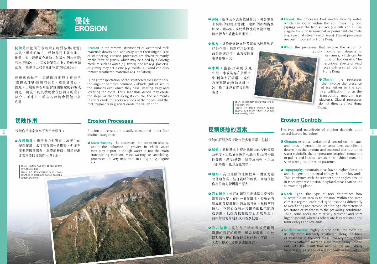
56 57
侵蝕 EROSION
侵蝕是指把風化後的岩石物質移離(搬運) 其風化形成的地方。侵蝕作用主要由重力 推動,並由流動媒介輔助,包括水(例如河流)和冰(例如冰川),又或是單單由重力推動(例如落石),風也可以移走風化物質(例如風蝕)。
在 運 送 過 程 中 , 流 動 的 角 形 粒 子 會 磨 滑 (磨擦或沖刷)經過的表面,並磨蝕岩石。 因此,山崩的碎石可能會侵蝕沿途的斜坡或河道,河流中的沉積物會侵蝕河床的岩石 部 分 , 而 冰 川 中 的 岩 石 碎 塊 會 侵 蝕 山 谷 底部。
Erosion is the removal (transport) of weathered rock materials downslope, and away, from their original site of weathering. Erosion processes are driven primarily by the force of gravity, which may be aided by a flowing medium such as water (e.g. rivers), and ice (e.g. glaciers), or gravity may act alone (e.g. rockfalls). Wind can also remove weathered materials (e.g. deflation).
During transportation of the weathered rock materials, the angular particles commonly abrade (rub or scour) the surfaces over which they pass, wearing away and lowering the rocks. Thus, landslide debris may erode the slope or channel along its course, the sediments in rivers erode the rocky sections of their beds, and the rock fragments in glaciers erode the valley floor.
河流:指涉及水流的侵蝕作用,可發生在土壤中(例如泥土管涌)、地面(例如細溝及 沖溝,圖4-9),或於季節性或常流河道。 河流營力在香港非常重要。
風力:指於乾燥地方涉及氣流迅速移動的侵蝕作用,地點可以是寒冷或炎熱的沙漠。風力侵蝕在香港影響不大。
冰川:指 涉 及 冰 的 侵 蝕 作用,冰或是存在於泥土中(例如土石緩滑),或作為搬運媒介(例如冰川)。 冰川作用並沒有直接影響香港。
Fluvial: the processes that involve flowing water, which can occur within the soil mass (e.g. soil piping), over the land surface (e.g. rills and gullies (Figure 4-9)), or in seasonal or permanent channels (e.g. seasonal streams and rivers). Fluvial processes are very important in Hong Kong.
Wind: the processes that involve the action of rapidly moving air streams in
dry areas, which can be cold or hot deserts. The erosional effects of wind play only a small role in Hong Kong.
Glacial: the processes that involve the presence of ice, either in the soil (e.g. solifluction), or as the transporting medium (e.g. glaciers). Glacial processes do not directly affect Hong Kong.
圖4-8. 沿溝泥石流只於陡斜而狹窄的季節性河流出現。Figure 4-8. Channelised debris flows confined to steep and narrow seasonal stream channels.
圖4-9. 深的蝕溝切割 受深度風化的花崗岩的山脊。Figure 4-9. Deep erosion gullies dissecting narrow ridges in deeply weathered granite.
Erosion Processes
Erosion processes are usually considered under four distinct categories:
Mass Wasting: the processes that occur on slopes, under the influence of gravity, in which water may play a part, although water is not the main transporting medium. Mass wasting, or landsliding, processes are very important in Hong Kong (Figure 4-8).
侵蝕作用
侵蝕作用通常分為下列四大類別:
塊體崩移:指受重力影響在山坡發生的 侵蝕作用,水可能有部分的影響,但並非主要的搬運媒介。塊體崩移或山崩是香港非常重要的侵蝕作用(圖4-8)。
Erosion Controls
The type and magnitude of erosion depends upon several factors including:
Climate: exerts a fundamental control on the types and rates of erosion in an area, because climate determines the amount and seasonal distribution of water (rainfall), the temperature (tropical, temperate or polar), and factors such as the sunshine hours, the wind strengths, and wind patterns.
Topography: mountain areas have a higher elevation and thus greater potential energy than the lowlands. This, combined with the steeper slope angles, results in more dynamic erosion in upland areas than on the surrounding plains.
Rock Type: the type of rock determines how susceptible an area is to erosion. Within the same climatic regime, each rock type responds differently to weathering and erosion, exhibiting a characteristic resistance or weakness to the prevailing conditions. Thus, some rocks are relatively resistant and form higher ground, whereas others are less-resistant and form valleys and lowlands.
Rock Structure: highly jointed or faulted rocks are usually more intensely weathered along the lines of weakness in the rock mass. Consequently, these softer weathered materials are more easily eroded out, with the result that river valleys are usually located along the line of a major fault or joint set.
控制侵蝕的因素
侵蝕的類別及程度決定於多個因素,包括:
氣候:氣候基本上控制地區內的侵蝕類別及速度,因為氣候決定水量(雨量)及其季節性分佈、溫度(熱帶、寒帶及兩極),以及 日照時數、風力及風向等。
地形:高山地區的地勢較高,潛在力量 較低地為高。結合陡峭的斜坡,高地侵蝕作用的動力較周邊平原大。
岩石類別:岩石的類別決定地區內受侵蝕影響的程度。在同一氣候環境,每種岩石對風化及侵蝕作用的反應各異。根據當時 情況,各種岩石展示其獨特的抵抗能力 或弱點。抵抗力較強的岩石形成高地, 而相對較弱的則形成山谷及低地。
岩石結構:風 化 作 用 沿 節 理 或 受 斷 層 影響的岩石的弱線,通常較嚴重。由於 這些風化後的物質較易被侵蝕,河流山谷大多出現於主要斷層或節理線。

資料匣 BOX
58 59
圖4-10. 在天然山坡上常見受侵蝕的岩石碎屑層(坡積物)。Figure 4-10. A layer of eroded debris (colluvium) is common on most natural hillsides.
圖4-11. 蚺蛇尖陡斜的山坡受河流侵蝕。Figure 4-11. Numerous stream channels erode the steep flanks of Sharp Peak.
表4-1. 各類沉積環境的例子。 Table 4-1. Example of various types of depositional environments.
表土沉積 SUPERFICIAL DEPOSITS
岩石經過風化後,被分解成鬆散的岩石碎屑及礦物顆粒,並經侵蝕過程轉移至另一 地點。這些沉積物可能由水力、風力或地心吸力推動,最終堆積至不同的沉積環境。 表土沉積是指在地表上未被整固的沉積物。
When rocks are weathered, they break down into loose rock and mineral grains, which are then carried away by erosion processes. These sediments are transported by water, wind, or gravity, and are eventually deposited in various sedimentary environments. Superficial deposits are unconsolidated accumulation of sediments on the landscape.
Classification of Superficial Deposits
Superficial deposits are generally classified into three broad categories according to environments of deposition: terrestrial (land), shoreline and marine environments (Figure 4-12 & Table 4-1). A sedimentary environment results from the interaction of various factors, including plate tectonic setting, geographical location of the site, transporting agents, organisms that may modify the sediments, and climatic system. The sedimentary environment of a site may change over time in response to factors such as shifting river channels and relative sea level changes.
海岸沉積環境例子包括:Examples of shoreline
sedimentary environment are:
陸上(土地)沉積環境 的例子包括:
Examples of terrestrial (land) sedimentary environment are:
海洋沉積環境例子包括:Examples of marine sedimentary
environment are:
深海 Deep sea•
大陸邊緣Continental margin
•大陸棚
Continental shelf•
珊瑚礁 Coral reef
三角洲 Delta•
沙灘 Beach•
潮汐灘地 Tidal flat
湖泊 Lake•
河流 River•
沙漠 Desert•
冰川 Glacier
Erosion Products
The rock and soil materials transported by erosion processes are eventually deposited in the sea, although they may be temporarily deposited in other locations such as below cliff faces (e.g. as screes), on hillsides (e.g. as colluvium, Figure 4-10) beside rivers (e.g. as floodplains), in lakes (e.g. as deltas), or on desert plains (e.g. as sand dunes).
Over the millennia, the topography of an area is sculptured by the processes of erosion, from an original mass of folded or uplifted rocks into a complex of mountain summits, intervening valleys, and surrounding plains.
Gravity causes landslides on hillsides, flowing water erodes gullies and shallow stream courses (Figure 4-11), and joint-bounded blocks of rock fall from cliff faces building up screes. On lower ground, rivers carve valleys and deposit floodplain sediments. Below the ground surface, in soluble rocks such as limestone, water erosion forms passages, caves and shafts.
The ultimate result of erosion is to reduce all mountains, ridges, and high ground to a flat plain (termed a peneplain) that slopes gently from the centre of a landmass to the sea.
侵蝕的產物
經侵蝕作用而剝落的岩石物質,最終將沉積 於海底,儘管途中可能短暫停留於其他 地方,如懸崖之下的山石堆、山邊的坡積物 (圖4-10)、河道兩旁的氾濫平原、湖泊的三角洲,或沙漠(例如沙丘)。
過去千億年間,一個地區的地形經由侵蝕 作用雕刻而成,由原來被抬升的岩體,變成複雜的山峰、交錯的山谷及圍繞的平原。
重 力 造 成 山 崩 、 流 水 侵 蝕 水 溝 及 河 道 (圖4-11 ),岩塊從懸崖剝落形成山石堆。 在下游地帶,河流勾劃出山谷,沉積物堆積形成氾濫平原。而在地面以下,可溶解的 岩石(例如石灰岩)經過水的侵蝕,形成通道、 洞穴及豎井。
侵蝕的最終結果是將高山、山脊及高地 變為平原(稱為準平原),從陸地逐步伸延至 大海。
表土沉積的分類
表土沉積物一般按其沉積環境分為三大類:陸上(土地)、海岸及海洋沉積環境(圖4-12及 表4-1)。沉積環境受各種不同因素相互影響, 包括板塊構造環境、地理位置、沉積物輸送媒體、可影響沉積物的生物、以及氣候系統等。沉積環境可能隨 時間,因海平面變化或河道變更等因素,而作出相應改變。
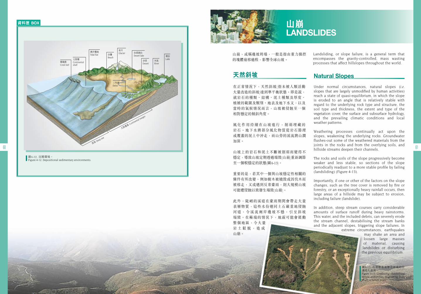
資料匣 BOX
60 61深海 Deep sea
大陸邊緣 Continental margin
潮汐灘地Tidal flat
大陸棚Continental shelf
珊瑚礁Coral reef
三角洲Delta
沙灘Beach
冰川Glacier 沙漠湖泊
Desert lake
沙漠Desert
湖泊Lake
河流River
圖4-12. 沉積環境。 Figure 4-12. Depositional sedimentary environments.
山崩,或稱邊坡坍塌,一般是指由重力操控的塊體崩移過程,影響全球山坡。
Landsliding, or slope failure, is a general term that encompasses the gravity-controlled, mass wasting processes that affect hillslopes throughout the world.
山崩 LANDSLIDES
Natural Slopes
Under normal circumstances, natural slopes (i.e. slopes that are largely unmodified by human activities) reach a state of quasi-equilibrium, in which the slope is eroded to an angle that is relatively stable with regard to the underlying rock type and structure, the soil type and thickness, the extent and type of the vegetation cover, the surface and subsurface hydrology, and the prevailing climatic conditions and local weather patterns.
Weathering processes continually act upon the slopes, weakening the underlying rocks. Groundwater flushes-out some of the weathered materials from the joints in the rocks and from the overlying soils, and hillside streams deepen their channels.
The rocks and soils of the slope progressively become weaker and less stable, so sections of the slope periodically readjust to a more stable profile by failing (landsliding) (Figure 4-13).
Importantly, if one or other of the factors on the slope changes, such as the tree cover is removed by fire or forestry, or an exceptionally heavy rainfall occurs, then large areas of a hillside may be subject to erosion, including failure (landslide).
In addition, steep stream courses carry considerable amounts of surface runoff during heavy rainstorms. This water, and the included debris, can severely erode the stream channel, destabilising the stream banks and the adjacent slopes, triggering slope failures. In
extreme circumstances, earthquakes may shake an area and loosen large masses of material, causing landslides or disturbing the previous equilibrium.
天然斜坡
在正常情況下,天然斜坡(指未被人類活動 大量改造的斜坡)達到準平衡狀態。即是說,就岩石的種類、結構、泥土種類及厚度、 植被的範圍及類別、地表及地下水文,以及當時的氣候情況而言,山坡被侵蝕至一個 相對穩定的傾斜角度。
風化作用持續在山坡進行,削弱埋藏的 岩石。地下水將部分風化物質從岩石節理 或覆蓋的泥土中沖走,而山旁的溪流將山澗加深。
山坡上的岩石和泥土不斷被削弱而變得不 穩定,導致山坡定期透過塌毀(山崩)重新調節至一個較穩定的狀態(圖4-13)。
重要的是,若其中一個與山坡穩定性相關的條件有所改變,例如樹木被燒毀或因伐木而被移走,又或遇到反常豪雨,則大規模山坡 可能遭侵蝕以致發生塌毀(山崩)。
此外,陡峭的溪道在豪雨期間會帶走大量 表層物質,這些水份連同土石嚴重地侵蝕 河道,令溪流兩岸邊坡不穩,引至斜坡 塌毀。在極端的情況下,地震可能會搖動 整個地區,令大量岩 土 鬆 脫 , 造 成 山崩。
圖4-13. 由淺層滑坡聚合而成的沿溝泥石崩瀉。 Figure 4-13. Coalescing channelised debris avalanches originating from shallow failure scars.
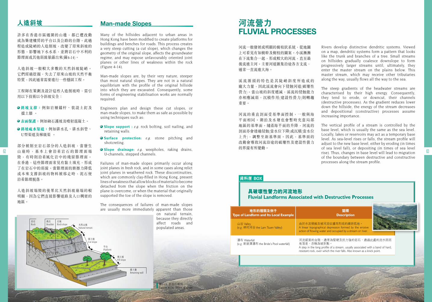
資料匣 BOX
62 63
圖4-14. 斜坡的類別。 Figure 4-14. Types of slope.
河流營力 FLUVIAL PROCESSES
河流一般發展成明顯的樹枝狀系統,從地圖上可看見有如樹幹及樹枝的圖案。小溪漸漸在下流集合一起,形成較大的河流,直至最後流進主河。主要河道匯集沿途各方支流,通常一直流進大海。
溪 流 源 頭 的 特 色 是 其 陡 峭 斜 度 所 造 成 的 龐大力量,因此溪流會向下侵蝕河道(破壞性營力)。當山坡的斜度遞減,溪流的侵蝕能力亦相應減弱,沉積作用(建設性營力)則轉趨 重要。
河流的垂直剖面受基準面控制,一般與海 平面相同。湖泊及水塘也會暫時充當局部 地區的基準面。隨 海平面的升降,河流的剖面亦會透過侵蝕(當水位下降)或沉積(當水位 上升),調整至新基準面。因此,基準面的 改動會導致河流沿途的破壞性及建設性營力的界線有所變動。
Rivers develop distinctive dendritic systems. Viewed on a map, dendritic systems form a pattern that looks like the trunk and branches of a tree. Small streams on hillsides gradually coalesce downslope to form progressively larger streams until, ultimately, they enter the master stream on the plains below. This master stream, which may receive other tributaries along the way, usually flows all the way to the sea.
The steep gradients of the headwater streams are characterised by their high energy. Consequently, they tend to erode, or downcut, their channels (destructive processes). As the gradient reduces lower down the hillside, the energy of the stream decreases and depositional (constructive) processes assume increasing importance.
The vertical profile of a stream is controlled by the base level, which is usually the same as the sea level. Locally, lakes or reservoirs may act as a temporary base level. As sea-level rises or falls, the stream profile will adjust to the new base level, either by eroding (in times of sea level fall), or depositing (in times of sea level rise). Thus, changes in base level will lead to migration of the boundary between destructive and constructive processes along the stream profile.
具破壞性營力的河流地形Fluvial Landforms Associated with Destructive Processes
由於水流侵蝕及被河流佔據而形成的線狀低地。A linear topographical depression formed by the erosive action of flowing water and occupied by a stream or river.
山谷 Valley(e.g. 林村河谷 the Lam Tsuen Valley)
地形的種類及例子Type of Landform and Its Local Example
闡釋Description
瀑布 Waterfall(e.g. 新娘潭瀑布 the Bride’s Pool waterfall)
河流縱面的台階,通常為堅硬及抗力強的岩石,通過此處的流水因而有落差,亦稱為坡折點。A step in the long profile of a stream, usually associated with a band of hard, resistant rock, over which the river falls. Also known as a knick point.
Man-made Slopes
Many of the hillsides adjacent to urban areas in Hong Kong have been modified to create platforms for buildings and benches for roads. This process creates a very steep cutting (a cut slope), which changes the geometry of the original slope, affects the groundwater regime, and may expose unfavourably oriented joint planes or other lines of weakness within the rock (Figure 4-14).
Man-made slopes are, by their very nature, steeper than most natural slopes. They are not in a natural equilibrium with the profile of the original hillside into which they are excavated. Consequently, some forms of engineering stabilisation works are normally required.
Engineers plan and design these cut slopes, or man-made slopes, to make them as safe as possible by using techniques such as:
Slope support : e.g. rock bolting, soil nailing, and retaining walls.
Surface protection: e.g. stone pitching and shotcreting.
Slope drainage: e.g. weepholes, raking drains, U-channels, stepped channels.
Failures of man-made slopes primarily occur along joint planes in fresh rock, and in some cases along relict joint planes in weathered rock. These discontinuities, which are commonly clay-filled in Hong Kong, present lines of weakness that allow blocks of material to become detached from the slope when the friction on the plane is overcome, or when the material that originally supported the toe of the slope is removed.
The consequences of failures of man-made slopes are usually more immediately apparent than those
on natural terrain, because they directly affect roads and populated areas.
人造斜坡
許多在香港市區週圍的山邊,都已遭改動 成為築建樓房的平台以及公路的台階。此過程造成陡峭的人造削坡,改變了原來斜坡的 形態,影響地下水水系,並將岩石中不利的節理面或其他弱線暴露出來(圖4-14)。
人造斜坡一般較大多數的天然斜坡陡峭。 它們經過挖掘,失去了原來山坡的天然平衡特質,因此通常需要進行一些穩固工程。
工程師在策劃及設計這些人造削坡時,需引用以下技術以令斜坡安全:
斜坡支撐:例如岩層錨杆、裝設土釘及 擋土牆 。
表面保護:例如砌石護坡及噴射混凝土。
斜坡疏水渠道:例如排水孔、排水斜管、 U型渠道及梯級渠 。
部分被削至岩石部分的人造斜坡,當發生 山 崩 時 , 基 本 上 會 沿 岩 石 的 節 理 面 塌毀,有時則沿 風化岩中的殘留節理面。 在香港,這些節理面常見有黏土填充,形成了在岩石中的弱線。當節理面的磨擦力降低或本來支撐斜坡的物料被移走時,泥石便 沿 節理脫落。
人造斜坡塌毀的後果比天然斜坡崩塌的較 明顯,因為它們直接影響道路及人口稠密的地區。
岩石Rock
孤石Boulder
石坡Rock slope 天然山坡
Natural terrain
削土坡Cut slope
平台Platform
填土坡Fill slope
擋土牆Retaining wall
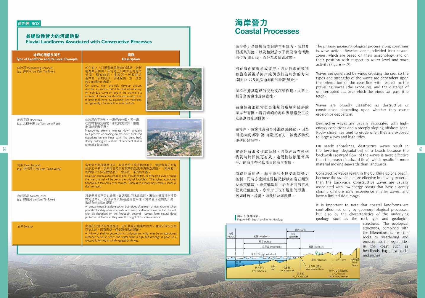
資料匣 BOX
64 65
具建設性營力的河流地形Fluvial Landforms Associated with Constructive Processes
於平原上,河道發展成彎曲的路線,過程稱為曲流作用。在河道上出現個別的彎位 或 圈 , 稱 為 曲 流 。 曲 流 河 一 般 較 接 近 基準面,斜幅較少,流速緩慢,並一般含 較少的粗粒的床載。On plains, river channels develop sinuous courses, a process that is termed meandering. An individual curve or loop in the channel is a meander. Meandering streams are usually close to base level, have low gradients, low velocities, and generally contain little coarse bedload.
曲流河 Meandering Channels(e.g. 錦田河 the Kam Tin River)
地形的種類及例子Type of Landform and Its Local Example
闡釋Description
氾濫平原 Floodplain(e.g. 元朗平原 the Yuen Long Plain)
自然河堤 Natural Levee(e.g. 錦田河 the Kam Tin River)
河階 River Terraces(e.g. 林村河谷 the Lam Tsuen Valley)
沼澤 Swamp
曲流河向下流動,一邊侵蝕外彎,另一邊在內彎堆積沉積物,形成曲流沙洲,慢慢堆積成氾濫平原。Meandering streams migrate down gradient by a process of eroding on the outer bank and depositing on the inner bank (the point bar), slowly building up a sheet of sediment that is termed a floodplain.
河堤是河流兩旁的堤圍。當週期性河水氾濫時,導致沙質沉積物積聚 於河道附近,而粉砂則沉積越過氾濫平原。河堤使河道兩側升高, 形成自然抗洪的堤圍。An embankment that develops on both sides of a stream or river channel when periodic flooding causes deposition of sandy sediments close to the channel, with silt deposited on the floodplain beyond. Levees form natural flood protection defences as they raise the height of the channel sides.
當河流不斷侵蝕其河床,如海水平下降或陸地抬升,河道會低於原有的氾濫平原。這些較高及已被荒廢的氾濫平原稱為河階。一連串發生的海水平下降或陸地抬升,會形成一系列的河階。As a river continues to erode its bed, if sea level falls, or if the land level is raised, the river channel will be below the original floodplain. This higher, abandoned floodplain is termed a river terrace. Successive events may create a series of river terraces.
出現在氾濫平原的低窪地,它可能是已廢棄的曲流。由於沼澤水位高而排水差,因而形成一個長滿植物的濕地。A hollow or shallow depression on a floodplain, which may be an abandoned meander curve, in which the water table is high and drainage is poor, so a wetland is formed in which vegetation thrives.
海浪營力是影響海岸線的主要營力。海灘會根據其形態,以及相對於水平面及海浪活動的位置(圖4-15),而分為多個區域帶。
風在海面掠過形成波浪,因此波浪的類別和強度需視乎海岸線與盛行波相對的方向 (朝向),以及風吹過海面的距離(風距)。
海浪根據其造成的侵蝕或沉積作用,大致上劃分為破壞性及建設性。
破壞性海浪通常與高能量的環境和陡斜的 海岸帶有關。岩石嶙峋的海岸線暴露於巨浪及高潮而受到侵蝕。
在沙岸,破壞性海浪令沙灘退減(降級),因為回流(向海)較沖流(向陸)更有力,被更多物質運送回到海中。
建設性海浪會建成海灘,因為沖流在運送 物質時比回流更有效。建設性波浪通常與 平坦的海岸帶和低能量的海岸有關。
值得注意的是,海岸地形不但受地貌營力 控制,同時亦受到地質情況影響(如岩石類別及地質構造)。地質構造加上岩石不同的抗風化及侵蝕能力,令海岸出現不規則的形態,例如岬角、港灣、海蝕柱及海蝕拱。
濱外Offshore
海灘 Beach
前濱Foreshore近濱 Nearshore
近岸 Inshore
浪裂線 Breaker zone 後濱 Backshore
高水平位 High water level
低水平位Low water level
低水標Low water mark
高水標High water mark
沙州Bar
植物 Vegetation 沙丘 Dune 抬升海灘Raisedbeach
海岸中心活動的高位Upper limit of
shore zone processes
最向海之灘台Most seaward berm
10 米 10 metres
The primary geomorphological process along coastlines is wave action. Beaches are subdivided into several zones, which are based on their morphology, and on their position with respect to water level and wave activity (Figure 4-15).
Waves are generated by winds crossing the sea, so the types and strengths of the waves are dependent upon the orientation of the coastline with respect to the prevailing waves (the exposure), and the distance of uninterrupted sea over which the winds can pass (the fetch).
Waves are broadly classified as destructive or constructive, depending upon whether they cause erosion or deposition.
Destructive waves are usually associated with high-energy conditions and a steeply sloping offshore zone. Rocky shorelines tend to erode when they are exposed to large waves and high tides.
On sandy shorelines, destructive waves result in the lowering (degradation) of a beach because the backwash (seaward flow) of the waves is more effective than the swash (landward flow), which results in more material moving seawards than landwards.
Constructive waves result in the building up of a beach, because the swash is more effective in moving material than the backwash. Constructive waves are usually associated with low-energy coasts that have a gently sloping offshore zone, experience smaller waves, and have a limited tidal range.
It is important to note that coastal landforms are controlled not only by geomorphological processes, but also by the characteristics of the underlying geology, such as the rock type and geological
structures. The geological structures, combined with the different resistance of the rocks to weathering and erosion, lead to irregularities in the coast such as headlands, bays, sea stacks and arches.
圖4-15. 沙灘詞彙。Figure 4-15. Beach profile terminology.
海岸營力Coastal Processes
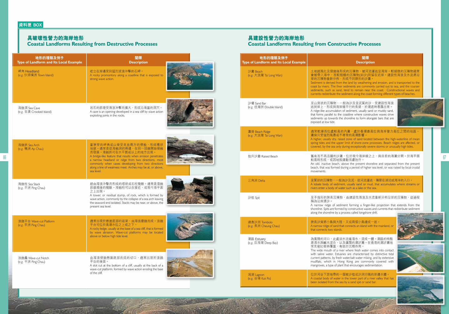
資料匣 BOX
66 67
具破壞性營力的海岸地形Coastal Landforms Resulting from Destructive Processes
具建設性營力的海岸地形Coastal Landforms Resulting from Constructive Processes
屹立在岸邊受到猛烈波浪沖擊的石岬。A rocky promontory along a coastline that is exposed to strong wave action.
土地經風化及侵蝕後形成的沉積物,被河流運送至海岸。較細微的沉積物通常會被帶入海中,而較粗糙的沉積物(如沙)則留在近岸。建設性海浪及水流將沿岸的沉積物重新分佈,形成不同類形的沙灘。Sediment is derived from the land by weathering and erosion, and is transported to the coast by rivers. The finer sediments are commonly carried out to sea, and the coarser sediments, such as sand, tend to remain near the coast. Constructional waves and currents redistribute the sediment along the coast forming different types of beaches.
通常乾燥而位處較高的內灘,處於春潮最高位與海岸營力高位之間的地區。 灘脊只受強烈風暴或不尋常的高潮影響。A higher, usually dry, raised zone of sand located between the high-waterline of mean spring tides and the upper limit of shore-zone processes. Beach ridges are affected, or covered, by the sea only during exceptionally severe storms or unusually high tides.
呈葉狀的沉積物,一般為沙及泥,從河流運送,積聚在湖泊或海洋的入口。A lobate body of sediment, usually sand or mud, that accumulates where streams or rivers enter a body of water such as a lake or the sea.
狹長沙脊將小島與大陸,又或兩個小島連成一起。A narrow ridge of sand that connects an island with the mainland, or that connects two islands.
位於河谷下游地帶的一個被沙咀或沙洲分隔的岸邊水體。A coastal body of water in the lower part of a river valley that has been isolated from the sea by a sand spit or sand bar.
岬角 Headland(e.g. 伙頭墳洲 Town Island)
沙灘 Beach(e.g. 大浪灣 Tai Long Wan)
灘脊 Beach Ridge(e.g. 大浪灣 Tai Long Wan)
三角洲 Delta
連島沙洲 Tombolo(e.g. 長洲 Cheung Chau)
潟湖 Lagoon(e.g. 谷埔 Kuk Po)
地形的種類及例子Type of Landform and Its Local Example
地形的種類及例子Type of Landform and Its Local Example
闡釋Description
闡釋Description
海蝕洞 Sea Cave(e.g. 吉澳 Crooked Island)
沙壩 Sand Bar(e.g. 往灣洲 Double Island)
抬升沙灘 Raised Beach
沙咀 Spit
潮區 Estuary(e.g. 后海灣 Deep Bay)
海蝕柱 Sea Stack(e.g. 平洲 Ping Chau)
海蝕拱 Sea Arch(e.g. 鴨洲 Ap Chau)
浪蝕平台 Wave-cut Platform(e.g. 平洲 Ping Chau)
浪蝕龕 Wave-cut Notch(e.g. 平洲 Ping Chau)
岩石的節理受海浪沖擊而擴大,形成沿海崖的洞穴。A cave is an opening developed in a sea cliff by wave action exploiting joints in the rocks.
呈山脊狀的沉積物,一般為沙及含泥質的沙,受建設性海浪送到岸上,形成與海岸線平行的長堤,於潮退時暴露出來。A ridge-like accumulation of sediment, usually sand or muddy sand, that forms parallel to the coastline where constructive waves drive sediments up towards the shoreline to form elongate bars that are exposed at low tide.
舊有而不再活躍的沙灘,位於現今海岸線之上,與目前的海灘分開。於海平面較高時形成,或因地殼運動而遭抬升。An old, inactive beach, above the present shoreline and separated from the present beach, that was formed during a period of higher sea level, or was raised by local crustal movements.
呈手指形的狹長沉積物,由建設性海浪及水流重新分佈沿岸的沉積物,這過程稱為沿岸漂沙。A narrow ridge of sediment forming a finger-like projection that extends from the shoreline. Spits are formed by constructive waves and currents that redistribute sediment along the shoreline by a process called longshore drift.
為寬闊的河口,此處淡水流進海水,混成一體。潮區的特點是清水與鹹水混合,以及廣闊的潮汐灘。在香港的潮汐灘地常見被紅樹林覆蓋,有助於沉積作用。The wide mouth of a river where fresh water comes into contact with saline water. Estuaries are characterised by distinctive tidal current patterns, by fresh water/salt water mixing, and by extensive mudflats, which in Hong Kong are commonly covered with mangroves, a type of plant that encourages sedimentation.
當狹窄的岬角或山脊受來自兩方的侵蝕,形成橋狀 地貌。通常是從海蝕洞的兩邊,在同一弱線開始侵蝕而發展。海蝕拱可在水平面或以上的地方出現。A bridge-like feature that results when erosion penetrates a narrow headland or ridge from two directions, most commonly when caves developing from two directions along a line of weakness meet. Arches may be at, or above, sea level.
經由海浪沖擊而形成的塔狀或石柱殘骸。通常是海蝕拱崩塌後的殘骸。海蝕柱可以在接近、或現今海平面之上出現。A tower, or residual stump, of rock, which is formed by wave action, commonly by the collapse of a sea arch leaving the seaward end isolated. Stacks may be near, or above, the present sea level.
通常出現於懸崖底部的岩架,由海浪磨蝕而成。浪蝕平台可位於高潮水位之上或之下。A rocky ledge, usually at the base of a sea cliff, that is formed by wave abrasion. Wave-cut platforms may be located above or below high tide level.
由海浪侵蝕懸崖底部而成的切口,通常出現於浪蝕 平台的後面。A slot cut at the bottom of a cliff, usually at the back of a wave-cut platform, formed by wave action eroding the base of the cliff.
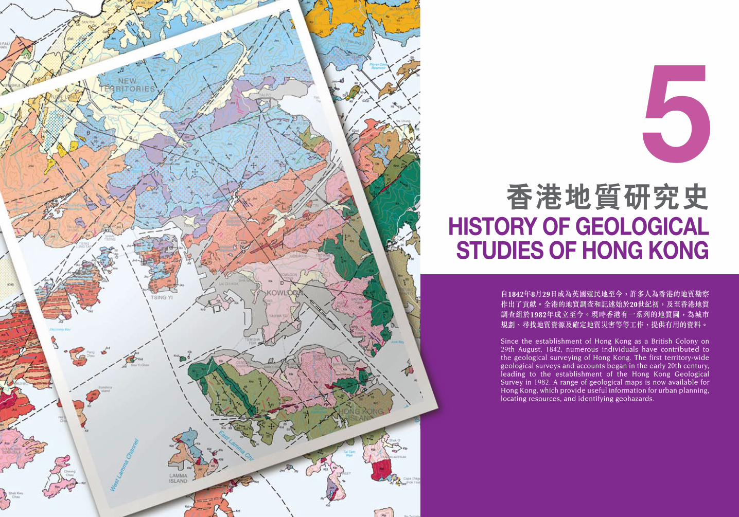
自1842年8月29日成為英國殖民地至今,許多人為香港的地質勘察作出了貢獻。全港的地質調查和記述始於20世紀初,及至香港地質調查組於1982年成立至今。現時香港有一系列的地質圖,為城市規劃、尋找地質資源及確定地質災害等等工作,提供有用的資料。
Since the establishment of Hong Kong as a British Colony on 29th August, 1842, numerous individuals have contributed to the geological surveying of Hong Kong. The first territory-wide geological surveys and accounts began in the early 20th century, leading to the establishment of the Hong Kong Geological Survey in 1982. A range of geological maps is now available for Hong Kong, which provide useful information for urban planning, locating resources, and identifying geohazards.
香港地質研究史HISTORY OF GEOLOGICAL STUDIES OF HONG KONG
5
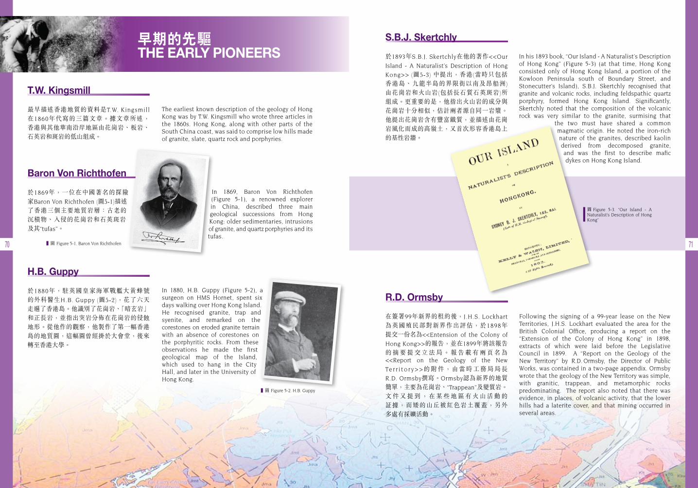
70 71
早期的先驅 THE EARLY PIONEERS
圖 Figure 5-3. “Our Island - A Naturalist’s Description of Hong Kong”
圖 Figure 5-1. Baron Von Richthofen
R.D. Ormsby
在簽署99年新界的租約後,J.H.S. Lockhart
為英國殖民部對新界作出評估,於1898年 提交一份名為<<Entension of the Colony of
Hong Kong>>的報告,並在1899年將該報告 的 摘 要 提 交 立 法 局 。 報 告 載 有 兩 頁 名 為 <<Report on the Geology of the New
Te r r i t o r y > >的附件,由當時工務局局長R.D. Ormsby撰寫。Ormsby認為新界的地質簡單,主要為花崗岩、“Trappean”及變質岩。 文 件 又 提 到 , 在 某 些 地 區 有 火 山 活 動 的 証據,而矮的山丘被紅色岩土覆蓋,另外 多處有採礦活動。
The earliest known description of the geology of Hong Kong was by T.W. Kingsmill who wrote three articles in the 1860s. Hong Kong, along with other parts of the South China coast, was said to comprise low hills made of granite, slate, quartz rock and porphyries.
In his 1893 book, “Our Island - A Naturalist’s Description of Hong Kong” (Figure 5-3) (at that time, Hong Kong consisted only of Hong Kong Island, a portion of the Kowloon Peninsula south of Boundary Street, and Stonecutter’s Island), S.B.J. Skertchly recognised that granite and volcanic rocks, including feldspathic quartz porphyry, formed Hong Kong Island. Significantly, Skertchly noted that the composition of the volcanic rock was very similar to the granite, surmising that the two must have shared a common
magmatic origin. He noted the iron-rich nature of the granites, described kaolin derived from decomposed granite, and was the first to describe mafic dykes on Hong Kong Island.
Following the signing of a 99-year lease on the New Territories, J.H.S. Lockhart evaluated the area for the British Colonial Office, producing a report on the “Extension of the Colony of Hong Kong” in 1898, extracts of which were laid before the Legislative Council in 1899. A “Report on the Geology of the New Territory” by R.D. Ormsby, the Director of Public Works, was contained in a two-page appendix. Ormsby wrote that the geology of the New Territory was simple, with granitic, trappean, and metamorphic rocks predominating. The report also noted that there was evidence, in places, of volcanic activity, that the lower hills had a laterite cover, and that mining occurred in several areas.
In 1880, H.B. Guppy (Figure 5-2), a surgeon on HMS Hornet, spent six days walking over Hong Kong Island. He recognised granite, trap and syenite, and remarked on the corestones on eroded granite terrain with an absence of corestones on the porphyritic rocks. From these observations he made the first geological map of the Island, which used to hang in the City Hall, and later in the University of Hong Kong.
In 1869, Baron Von Richthofen (Figure 5-1), a renowned explorer in China, described three main geological successions from Hong Kong: older sedimentaries, intrusions of granite, and quartz porphyries and its tufas.
圖 Figure 5-2. H.B. Guppy
T.W. Kingsmill
最早描述香港地質的資料是T.W. Kingsmill
在1860年代寫的三篇文章。據文章所述, 香港與其他華南沿岸地區由花崗岩、板岩、石英岩和斑岩的低山組成。
H.B. Guppy
於1880年,駐英國皇家海軍戰艦大黃蜂號 的外科醫生H.B. Guppy (圖5-2),花了六天 走遍了香港島。他識別了花崗岩、「暗玄岩」和正長岩,並指出突岩分佈在花崗岩的侵蝕地形。從他作的觀察,他製作了第一幅香港島的地質圖,這幅圖曾經掛於大會堂,後來轉至香港大學。
Baron Von Richthofen
於1869年,一位在中國著名的探險家Baron Von Richthofen (圖5-1)描述了香港三個主要地質岩層:古老的 沉積物、入侵的花崗岩和石英斑岩 及其“tufas”。
S.B.J. Skertchly
於1893年S.B.J. Skertchly在他的著作<<Our
Island - A Naturalist’s Description of Hong
Kong>> (圖5-3) 中提出,香港(當時只包括 香港島、九龍半島的界限街以南及昂船洲) 由花崗岩和火山岩(包括長石質石英斑岩)所 組成。更重要的是,他指出火山岩的成分與花崗岩十分相似,估計兩者源自同一岩漿。他提出花崗岩含有豐富鐵質,並描述由花崗岩風化而成的高嶺土,又首次形容香港島上 的基性岩牆。
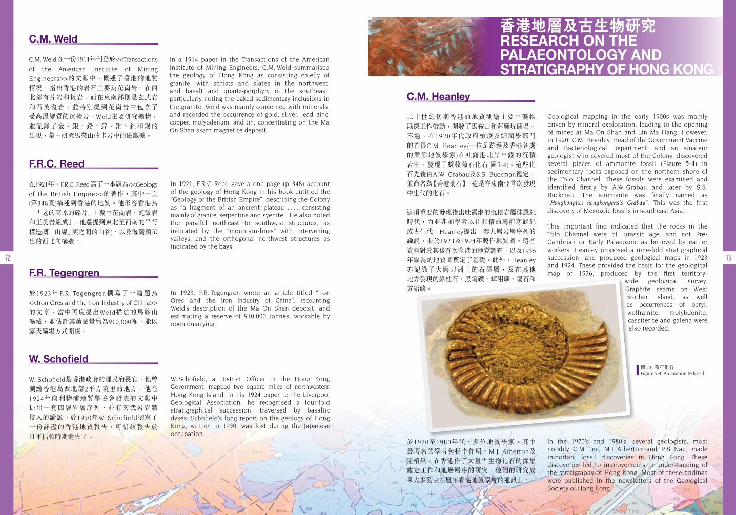
72 73
F.R. Tegengren
於1923年 F.R. Tegengren 撰寫了一篇題為<<Iron Ores and the Iron Industry of China>>
的文章,當中再度提出Weld描述的馬鞍山 礦藏,並估計其蘊藏量約為910,000噸,能以 露天礦場方式開採。
W. Schofield
W. Schofield是香港政府的理民府長官,他曾 測繪香港島西北部2平方英里的地方。他在1924年向利物浦地質學協會發表的文獻中 提出一套四層岩層序列、並有玄武岩岩牆 侵入的論說。於1930年W. Schofield撰寫了 一份詳盡的香港地質報告,可惜該報告於 日軍佔領時期遺失了。
In 1921, F.R.C. Reed gave a one page (p. 348) account of the geology of Hong Kong in his book entitled the “Geology of the British Empire”, describing the Colony as “a fragment of an ancient plateau ......... consisting mainly of granite, serpentine and syenite”. He also noted the parallel northeast to southwest structures, as indicated by the “mountain-lines” with intervening valleys, and the orthogonal northwest structures as indicated by the bays.
In 1923, F.R. Tegengren wrote an article titled “Iron Ores and the Iron Industry of China”, recounting Weld’s description of the Ma On Shan deposit, and estimating a reserve of 910,000 tonnes, workable by open quarrying.
W. Schofield, a District Officer in the Hong Kong Government, mapped two square miles of northwestern Hong Kong Island. In his 1924 paper to the Liverpool Geological Association, he recognised a four-fold stratigraphical succession, traversed by basaltic dykes. Schofield’s long report on the geology of Hong Kong, written in 1930, was lost during the Japanese occupation.
In a 1914 paper in the Transactions of the American Institute of Mining Engineers, C.M. Weld summarised the geology of Hong Kong as consisting chiefly of granite, with schists and slates in the northwest, and basalt and quartz-porphyry in the southeast, particularly noting the baked sedimentary inclusions in the granite. Weld was mainly concerned with minerals, and recorded the occurrence of gold, silver, lead, zinc, copper, molybdenum, and tin, concentrating on the Ma On Shan skarn magnetite deposit.
Geological mapping in the early 1900s was mainly driven by mineral exploration, leading to the opening of mines at Ma On Shan and Lin Ma Hang. However, in 1920, C.M. Heanley, Head of the Government Vaccine and Bacteriological Department, and an amateur geologist who covered most of the Colony, discovered several pieces of ammonite fossil (Figure 5-4) in sedimentary rocks exposed on the northern shore of the Tolo Channel. These fossils were examined and identified firstly by A.W. Grabau and later by S.S. Buckman, The ammonite was finally named as “Hongkongites hongkongensis Grabau”. This was the first discovery of Mesozoic fossils in southeast Asia.
This important find indicated that the rocks in the Tolo Channel were of Jurassic age, and not Pre- Cambrian or Early Palaeozoic as believed by earlier workers. Heanley proposed a nine-fold stratigraphical succession, and produced geological maps in 1923 and 1924. These provided the basis for the geological map of 1936, produced by the first territory-
wide geological survey. Graphite seams on West Brother Island, as well as occurrences of beryl, wolframite, molybdenite, cassiterite and galena were also recorded.
In the 1970’s and 1980’s, several geologists, most notably C.M. Lee, M.J. Atherton and P.S. Nau, made important fossil discoveries in Hong Kong. These discoveries led to improvements in understanding of the stratigraphy of Hong Kong. Most of these findings were published in the newsletters of the Geological Society of Hong Kong.
C.M. Weld
C.M. Weld在一份1914年刊登於<<Transactions
of the American Institute of Mining
Engineers>>的文獻中,概述了香港的地質 情況,指出香港的岩石主要為花崗岩,在西北部有片岩和板岩,而在東南部則是玄武岩 和石英斑岩,並特別提到花崗岩中包含了 受高溫變質的沉積岩。Weld主要研究礦物,並記錄了金、銀、鉛、鋅、銅、鉏和錫的 出現,集中研究馬鞍山矽卡岩中的磁鐵礦。
C.M. Heanley
二十世紀初期香港的地質測繪主要由礦物 勘探工作帶動,開發了馬鞍山和蓮麻坑礦場。不過,在1920年代政府檢疫及細菌學部門 的首長C.M. Heanley (一位足跡遍及香港各處 的業餘地質學家)在吐露港北岸出露的沉積 岩中,發現了數枚菊石化石(圖5-4)。這些化石先後由A.W. Grabau及S.S. Buckman鑑定, 並命名為【香港菊石】。這是在東南亞首次發現中生代的化石。
這項重要的發現指出吐露港的沉積岩屬侏羅紀時代,而並非如學者以往相信的屬前寒武紀或古生代。Heanley提出一套九層岩層序列的 論說,並於1923及1924年製作地質圖。這些資料對於其後首次全港的地質調查,以及1936
年編製的地質圖奠定了基礎。此外,Heanley
亦記綠了大磨刀洲上的石墨層,及在其他 地方發現的綠柱石、黑鎢礦、輝鉬礦、錫石和方鉛礦。
於1970至1980年代,多位地質學家,其中 最著名的學者包括李作明、M.J. Atherton及 鈕 燊,在香港作了大量古生物化石的採集鑑定工作和地層層序的研究,他們的研究成果大多發表在歷年香港地質學會的通訊上。
F.R.C. Reed
在1921年,F.R.C. Reed寫了一本題為<<Geology
of the British Empire>>的著作,其中一頁 (第348頁)描述到香港的地質。他形容香港為 「古老的高原的碎片...主要由花崗岩、蛇紋岩和正長岩組成」,他還提到東北至西南的平行構造(即「山線」與之間的山谷),以及海灣顯示出的西北向構造。
香港地層及古生物研究RESEARCH ON THE PALAEONTOLOGY AND STRATIGRAPHY OF HONG KONG
圖5-4. 菊石化石Figure 5-4. An ammonite fossil

74 75
圖5-5. 李作明先生 Figure 5-5. Mr. C.M. Lee
香港地質調查及報告 HONG KONG GEOLOGICAL SURVEYS AND ACCOUNTS
Following the deaths of Uglow in 1926 and Brock in 1935, Williams and Schofield completed the geological report, which was sent out to Hong Kong in 1939. Unfortunately, the report and maps were lost during the war. However, Williams, by then a professor at UBC, published some accounts of the stratigraphy and palaeontology of Hong Kong in the Proceedings of the Royal Society of Canada in 1943 and 1945. Following the war, the Hong Kong Government requested a copy of the report, but no copies had been kept. Consequently, Williams compiled a second version, which was sent to Hong Kong in 1948.
圖5-6. R.W. Brock (照片由加拿大哥倫比亞大學提供)Figure 5-6. R.W. Brock (Photo courtesy of the University of British Columbia, Canada)
圖5-7. S.J. Schofield (照片由加拿大哥倫比亞大學提供)Figure 5-7. S.J. Schofield (Photo courtesy of the University of British Columbia, Canada)
李作明
李作明先生 (圖5-5) 於1980年在船灣淡水湖地區發現了泥盆紀的魚化石(盾皮魚),是其中最重要的發現。這是首次在香港出土泥盆紀時代的化石,使香港的地質歷史推前至泥盆紀 時代(即大約4億年前)。
於1988-1990年間,香港理工學院(現為香港 理工大學)與中國科學院南京地質古生物 研究所,合作開展一項名為「香港地層」的 綜合研究項目。這項研究歷時十五個月, 是 香 港 地 層 古 生 物 研 究 近 年 來 最 重 大 的 進展,為現今香港的地層研究奠定了基礎。最終研究的成果於1997及1998年編輯成上下兩冊「香港古生物和地層」的專著。這是目前香港地層和古生物研究最重要的參考文獻。
On the advice of the British Government, R.W. Brock (Figure 5-6), Head of the Geography Department at the University of British Columbia (UBC), and formerly Director of the Geological Survey of Canada and Deputy Minister of Mines, was asked to direct a detailed geological survey of Hong Kong for the Government of the Colony. In 1923, R.W. Brock carried out a reconnaissance and made arrangements for the main survey. As well as R.W. Brock (1926-1927), three other geologists from UBC came out at different times, S.J. Schofield (Figure 5-7) (1923-1924), M.Y. Williams (1924-1925), and W.L. Uglow (1925-1926). A new topographical map, released in 1932, differed substantially from the original base map, so Brock carried out further fieldwork in 1932-1933 to address the discrepancies. The geological map, at a scale of 1:84,480, was finally published in 1936, and reprinted at 1:80,000-scale in 1945 for military purposes.
依從英國政府的建議,R.W. Brock (圖5-6) 獲委任為香港政府進行一次詳細的香港地質調查。Brock是加拿大哥倫比亞大學地理學系 的系主任,曾任加拿大地質調查所所長及 礦務部副部長。於1923年,Brock來港作初步調查,並為主要的勘察工作作安排。Brock於 1926至1927年在香港作地質調查,而另外 三位加拿大哥倫比亞大學的地質學家亦曾在不同時期在香港工作。他們是S.J. Schofield
(圖5-7) (1923-1924在港)、M.Y. Williams (1924-
1925在港) 和W.L.Uglow (1925-1926在港)。 於1932年,一幅全新的香港地形圖面世, 這幅地形圖跟原本的有很大差別。Brock於是在1932至1933年間進行進一步的勘測以針對其中的差異。終於,一幅比例為1:84,480的 地質圖於 1 9 3 6年面世,其後於 1 9 4 5年以1:80,000的比例再版作軍事用途。
隨 Uglow及Brock先後於1926年和1935
年逝世,Williams及Schofield完成了相關的地質報告,並於1939年將之送交香港。可 惜 這 份 報 告 及 地 質 圖 均 在 戰 時 遺 失 。 不過,於1943及1945年,當時身為加拿大哥倫比亞大學教授的Williams於<<Proceedings
of the Royal Society of Canada>>發表了數篇 有關香港地層及古生物的文章。戰爭結束後,香港政府要求地質調查報告的副本,但當時並沒有將報告保存下來。因此,Williams
編寫了報告的第二版,並於1948年將之送交香港。
1923 - 1952 首次地質調查 The First Geological Survey
C.M. Lee
One of the most significant finds was the discovery of Devonian fish fossils (placoderms) in the Plover Cove area by Mr. C.M. Lee in 1980 (Figure 5-5). The discovery of Devonian fossils was the first in Hong Kong, and established the age of the enclosing rocks to be about 400 million years old.
A collaborative research effort between the Hong Kong Polytechnic (now the Polytechnic University of Hong Kong) and the Nanjing Institute of Geology and Palaeontology, was carried out between 1988 and 1990. Known as the “Stratigraphy of Hong Kong” project, the study lasted for 15 months and formed the basis of two special volumes on the stratigraphy of Hong Kong that were published by the Nanjing Institute of Geology and Palaeontology in 1997 and 1998. These two volumes (Lee et al. 1997, 1998) serve as important reference documents on the stratigraphy of Hong Kong, and also provide the most comprehensive account of the palaeontology of Hong Kong to date.
資料匣 BOX
李作明先生發現泥盆紀魚化石的報道 (由李作明先生提供)
Old article on discovery of Devonian fish fossil by C.M. Lee (Courtesy of Mr. C.M. Lee)
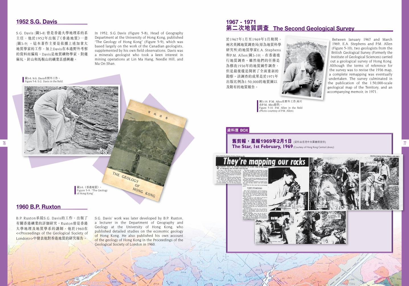
76 77
圖5-8. S.G. Davis在野外工作。Figure 5-8. S.G. Davis in the field.
圖5-9.《香港地質》。Figure 5-9. “The Geology of Hong Kong”.
圖5-10. P.M. Allen在野外工作(相片由P.M. Allen提供)。Figure 5-10. P.M. Allen in the field (Photo courtesy of P.M. Allen).
In 1952, S.G. Davis (Figure 5-8), Head of Geography Department at the University of Hong Kong, published “The Geology of Hong Kong” (Figure 5-9), which was based largely on the work of the Canadian geologists, supplemented by his own field observations. Davis was a minerals geologist who took a keen interest in mining operations at Lin Ma Hang, Needle Hill, and Ma On Shan.
S.G. Davis’ work was later developed by B.P. Ruxton, a lecturer in the Department of Geography and Geology at the University of Hong Kong, who published detailed studies on the economic geology of Hong Kong. He also published his own account of the geology of Hong Kong in the Proceedings of the Geological Society of London in 1960.
1952 S.G. Davis
S.G. Davis (圖5-8) 曾是香港大學地理系的系主任,他於1952年出版了《香港地質》一書 (圖5-9) 。這本著作主要是依據上述加拿大 地質學家的工作,加上Davis在本港野外考察的資料而編寫。Davis是地質礦物學家,對蓮麻坑、針山和馬鞍山的礦業甚感興趣。
Between January 1967 and March 1969, E.A. Stephens and P.M. Allen (Figure 5-10), two geologists from the British Geological Survey (Formerly the Institute of Geological Sciences) carried out a geological survey of Hong Kong. Although the terms of reference for the survey was to revise the 1936 map, a complete remapping was eventually undertaken. The survey culminated in the publication of the 1:50,000-scale geological map of the Territory, and an accompanying memoir, in 1971.
1967 - 1971 第二次地質調查 The Second Geological Survey
於1967年1月至1969年3月期間, 兩名英國地質調查局(原為地質科學研究所)的地質學家E.A. Stephens
和P.M. Allen(圖5-10),在香港進行地質調查。雖然他們的任務是為修改1936年的地質圖作調查,但是最後還是開展了全面重新的 勘察。該調查的成果是於1971年出版比例為1:50,000的地質圖以及附有的地質報告。
1960 B.P. Ruxton
B.P. Ruxton承接S.G. Davis的工作,出版了 有關香港礦業的詳細研究。Ruxton曾是香港 大學地理及地質學系的講師,他於1960在 <<Proceedings of the Geological Society of
London>>中發表他對香港地質的研究報告。
資料匣 BOX
舊剪報,星報1969年2月1日 (資料由香港中央圖書館提供)
The Star, 1st February, 1969 (Courtesy of Hong Kong Central Library)
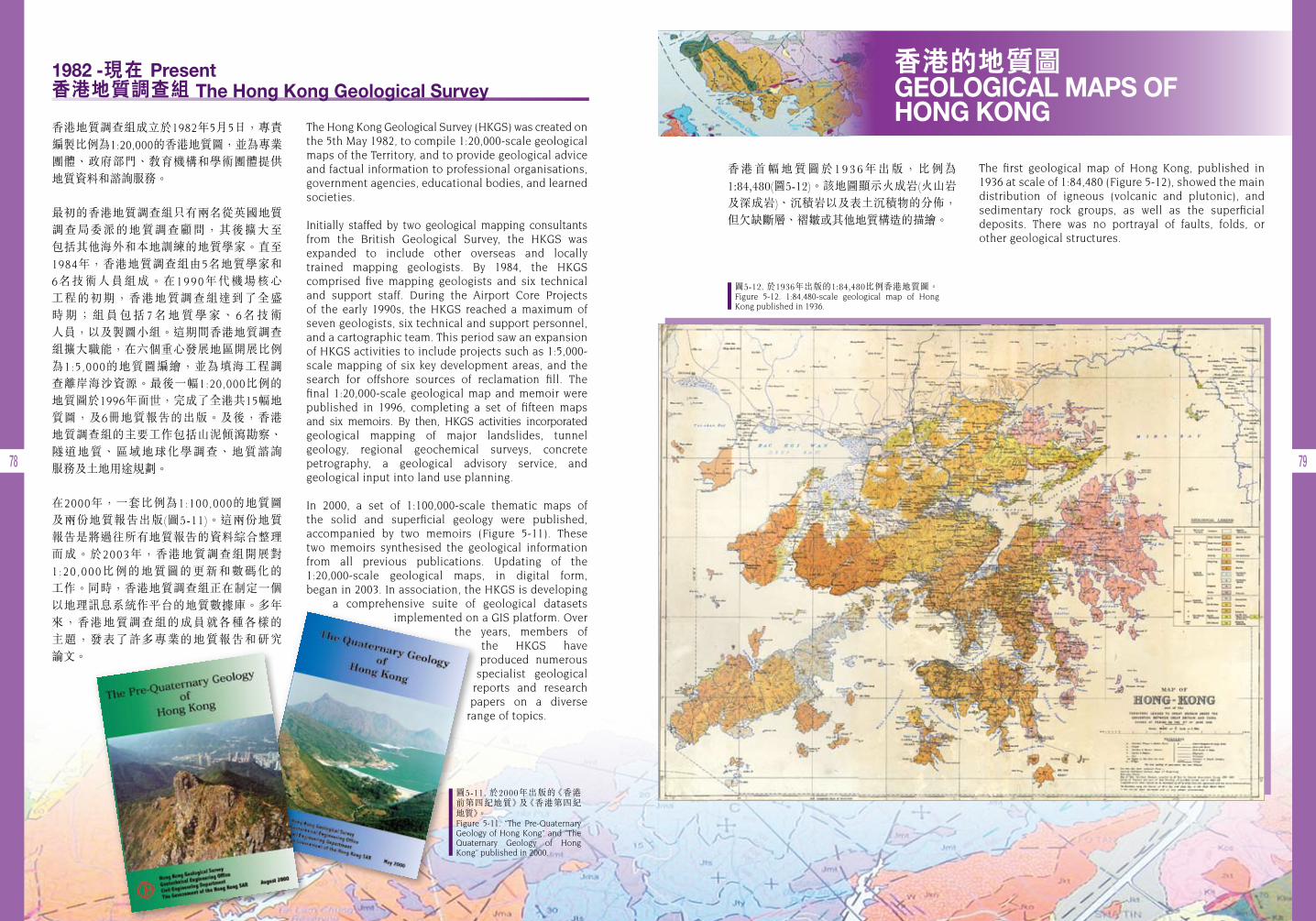
78 79
The Hong Kong Geological Survey (HKGS) was created on the 5th May 1982, to compile 1:20,000-scale geological maps of the Territory, and to provide geological advice and factual information to professional organisations, government agencies, educational bodies, and learned societies.
Initially staffed by two geological mapping consultants from the British Geological Survey, the HKGS was expanded to include other overseas and locally trained mapping geologists. By 1984, the HKGS comprised five mapping geologists and six technical and support staff. During the Airport Core Projects of the early 1990s, the HKGS reached a maximum of seven geologists, six technical and support personnel, and a cartographic team. This period saw an expansion of HKGS activities to include projects such as 1:5,000-scale mapping of six key development areas, and the search for offshore sources of reclamation fill. The final 1:20,000-scale geological map and memoir were published in 1996, completing a set of fifteen maps and six memoirs. By then, HKGS activities incorporated geological mapping of major landslides, tunnel geology, regional geochemical surveys, concrete petrography, a geological advisory service, and geological input into land use planning.
In 2000, a set of 1:100,000-scale thematic maps of the solid and superficial geology were published, accompanied by two memoirs (Figure 5-11). These two memoirs synthesised the geological information from all previous publications. Updating of the 1:20,000-scale geological maps, in digital form, began in 2003. In association, the HKGS is developing
a comprehensive suite of geological datasets implemented on a GIS platform. Over
the years, members of the HKGS have produced numerous
specialist geological reports and research papers on a diverse
range of topics.
香港地質調查組成立於1982年5月5日,專責 編製比例為1:20,000的香港地質圖,並為專業團體、政府部門、教育機構和學術團體提供地質資料和諮詢服務。
最初的香港地質調查組只有兩名從英國地質 調查局委派的地質調查顧問,其後擴大至 包括其他海外和本地訓練的地質學家。直至1984年,香港地質調查組由5名地質學家和 6名技術人員組成。在1990年代機場核心 工程的初期,香港地質調查組達到了全盛 時 期 ; 組 員 包 括 7 名 地 質 學 家 、 6名 技 術 人員,以及製圖小組。這期間香港地質調查組擴大職能,在六個重心發展地區開展比例為1:5,000的地質圖編繪,並為填海工程調查離岸海沙資源。最後一幅1:20,000比例的 地質圖於1996年面世,完成了全港共15幅地質圖,及6冊地質報告的出版。及後,香港地質調查組的主要工作包括山泥傾瀉勘察、 隧道地質、區域地球化學調查、地質諮詢 服務及土地用途規劃。
在2000年,一套比例為1:100,000的地質圖 及兩份地質報告出版(圖5-11)。這兩份地質報告是將過往所有地質報告的資料綜合整理而成。於2003年,香港地質調查組開展對 1:20 ,000比例的地質圖的更新和數碼化的 工作。同時,香港地質調查組正在制定一個以地理訊息系統作平台的地質數據庫。多年來,香港地質調查組的成員就各種各樣的 主題,發表了許多專業的地質報告和研究 論文。
香港的地質圖 GEOLOGICAL MAPS OF HONG KONG
香港首幅地質圖於1936年出版,比例為1:84,480(圖5-12)。該地圖顯示火成岩(火山岩及深成岩)、沉積岩以及表土沉積物的分佈,但欠缺斷層、褶皺或其他地質構造的描繪。
The first geological map of Hong Kong, published in 1936 at scale of 1:84,480 (Figure 5-12), showed the main distribution of igneous (volcanic and plutonic), and sedimentary rock groups, as well as the superficial deposits. There was no portrayal of faults, folds, or other geological structures.
圖5-12. 於1936年出版的1:84,480比例香港地質圖。Figure 5-12. 1:84,480-scale geological map of Hong Kong published in 1936.
1982 -現在 Present 香港地質調查組 The Hong Kong Geological Survey
圖5-11. 於2000年出版的《香港前第四紀地質》及《香港第四紀 地質》。Figure 5-11. “The Pre-Quaternary Geology of Hong Kong” and “The Quaternary Geology of Hong Kong” published in 2000.
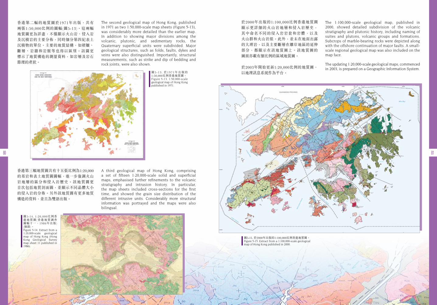
80 81
香港第二幅的地質圖於1971年出版,共有 兩張1:50,000比例的圖幅(圖5-13)。這兩幅 地質圖更為詳盡,不僅顯示火山岩、侵入岩及沉積岩的主要分佈,同時細分第四紀表土沉積物的單位。主要的地質結構,如褶皺、斷層、岩牆和岩脈等也得以區別。該圖更 標示了地質構造的測量資料,如岩層及岩石節理的產狀。
香港第三幅地質圖共有十五張比例為1:20,000的基岩和表土地質圖圖幅,進一步強調火山 岩地層的區分和侵入岩歷史。該地質圖更 首次包括地質剖面圖,並顯示不同晶體大小的侵入岩的分佈。另外該地質圖有更多地質構造的資料,並且為雙語出版。
The second geological map of Hong Kong, published in 1971 as two 1:50,000-scale map sheets (Figure 5-13), was considerably more detailed than the earlier map. In addition to showing major divisions among the volcanic, plutonic, and sedimentary rocks, the Quaternary superficial units were subdivided. Major geological structures, such as folds, faults, dykes and veins were also distinguished. Importantly, structural measurements, such as strike and dip of bedding and rock joints, were also shown.
A third geological map of Hong Kong, comprising a set of fifteen 1:20,000-scale solid and superficial maps, emphasised further refinements to the volcanic stratigraphy and intrusion history. In particular, the map sheets included cross-sections for the first time, and showed the grain size distribution of the different intrusive units. Considerably more structural information was portrayed and the maps were also bilingual.
於2000年出版的1:100,000比例香港地質圖 顯示更詳細的火山岩地層和侵入岩歷史, 其中命名不同的侵入岩岩套和岩體,以及 火山群和火山岩組。此外,並未在地面出露的大理岩,以及主要斷層在離岸地區的延伸部分,都顯示在該地質圖上。該地質圖的 圖面亦載有細比例的區域地質圖。
於2003年開始更新1:20,000比例的地質圖, 以地理訊息系統作為平台。
The 1:100,000-scale geological map, published in 2000, showed detailed subdivision of the volcanic stratigraphy and plutonic history, including naming of suites and plutons, volcanic groups and formations. Subcrops of marble-bearing rocks were depicted along with the offshore continuation of major faults. A small-scale regional geological map was also included on the map face.
The updating 1:20,000-scale geological maps, commenced in 2003, is prepared on a Geographic Information System.
圖5-15. 於2000年出版的1:100,000比例香港地質圖。Figure 5-15. Extract from a 1:100,000-scale geological map of Hong Kong published in 2000.
圖5 - 1 3 . 於19 7 1年出版的1:50,000比例香港地質圖。Figure 5-13. 1:50,000-scale geological map of Hong Kong published in 1971.
圖5-14. 1 :20 ,000比例香港地質圖(香港地質調查圖幅十一,1986年出版) (摘錄)。Figure 5-14. Extract from a 1:20,000-scale geological map of Hong Kong (Hong Kong Geological Survey map sheet 11 published in 1986).

82 83
其他地質學相關的香港地圖OTHER GEOLOGIAL-RELATED HONG KONG MAPS
立體地形圖
圖5-16是香港的立體地形圖,它是根據香港 政府地政署所提供的地形勘察圖的高程 數據,編製而成的數碼高程模型。
立體地形圖協助看到地貌的三維地勢,而顯現在立體地形圖的線條,則可能代表一系列不同的現象,例如水道、地質構造(斷層、 節理等)、岩層或不同岩石的邊界。
同時,立體地形圖也是劃分及描繪地質 構造,以及進行地形評估的工具。
地磁異常圖
差不多整個香港水域內,均曾進行海洋地磁 測量。這些測量有助於確定離岸地區的地質情況,尤其是主要斷層位置。觀察所得的地磁場主要視乎不同岩石的磁化率、岩石形成時剩餘的磁性,以及岩石的風化程度。地磁場模型的製作需要利用鑽探及陸上的地質資料,以幫助劃定磁性來源的岩石種類、走向及形狀。圖5-17為香港離岸地磁異常圖。
Shaded Relief Map
Figure 5-16 is a Shaded Relief Map of Hong Kong. It is a visual derivative of the Digital Elevation Model (DEM) that is based on elevation data extracted from the topographical survey maps provided by the Lands Department of the Hong Kong SAR Government.
The Shaded Relief Map helps to visualise three- dimensional topography. Linear features revealed on the Shaded Relief Map may represent a variety of phenomena, such as drainage lines, geological structures (faults, joints, etc.), stratigraphical layering, and boundaries between different rock units.
Also, the Shaded Relief Map is a useful tool in geological mapping, for distinguishing and delineating geological structures, and for terrain evaluation.
Magnetic Anomaly Map
Marine magnetic surveys have been undertaken over nearly all of Hong Kong’s waters. The surveys have helped to establish the solid geology for the offshore areas, and in particular the location of major faults. The observed magnetic field is mainly dependent on variations in the magnetic susceptibility of the different bedrock types, remanent magnetism imparted to the rocks at the time of formation, and the degree of weathering. Modelling of the magnetic fields includes reference to the known geology from borehole and onshore information, which helps to define the orientations, shapes and rock types of the magnetic sources. The magnetic anomaly map for the offshore area of Hong Kong is reproduced in Figure 5-17.
圖5-16. 香港立體地形圖。 Figure 5-16. Shaded Relief Map of Hong Kong.
圖5-17. 香港地磁異常圖。 Figure 5-17. Magnetic Anomaly Map of Hong Kong.
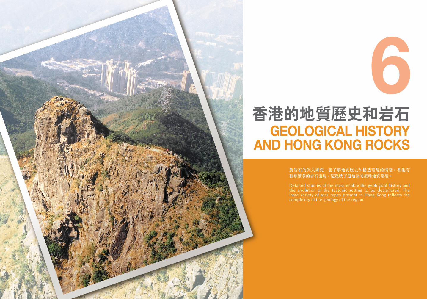
對岩石的深入研究,能了解地質歷史和構造環境的演變。香港有種類繁多的岩石出現,這反映了這地區的複雜地質環境。
Detailed studies of the rocks enable the geological history and the evolution of the tectonic setting to be deciphered. The large variety of rock types present in Hong Kong reflects the complexity of the geology of the region.
香港的地質歷史和岩石GEOLOGICAL HISTORY
AND HONG KONG ROCKS
6
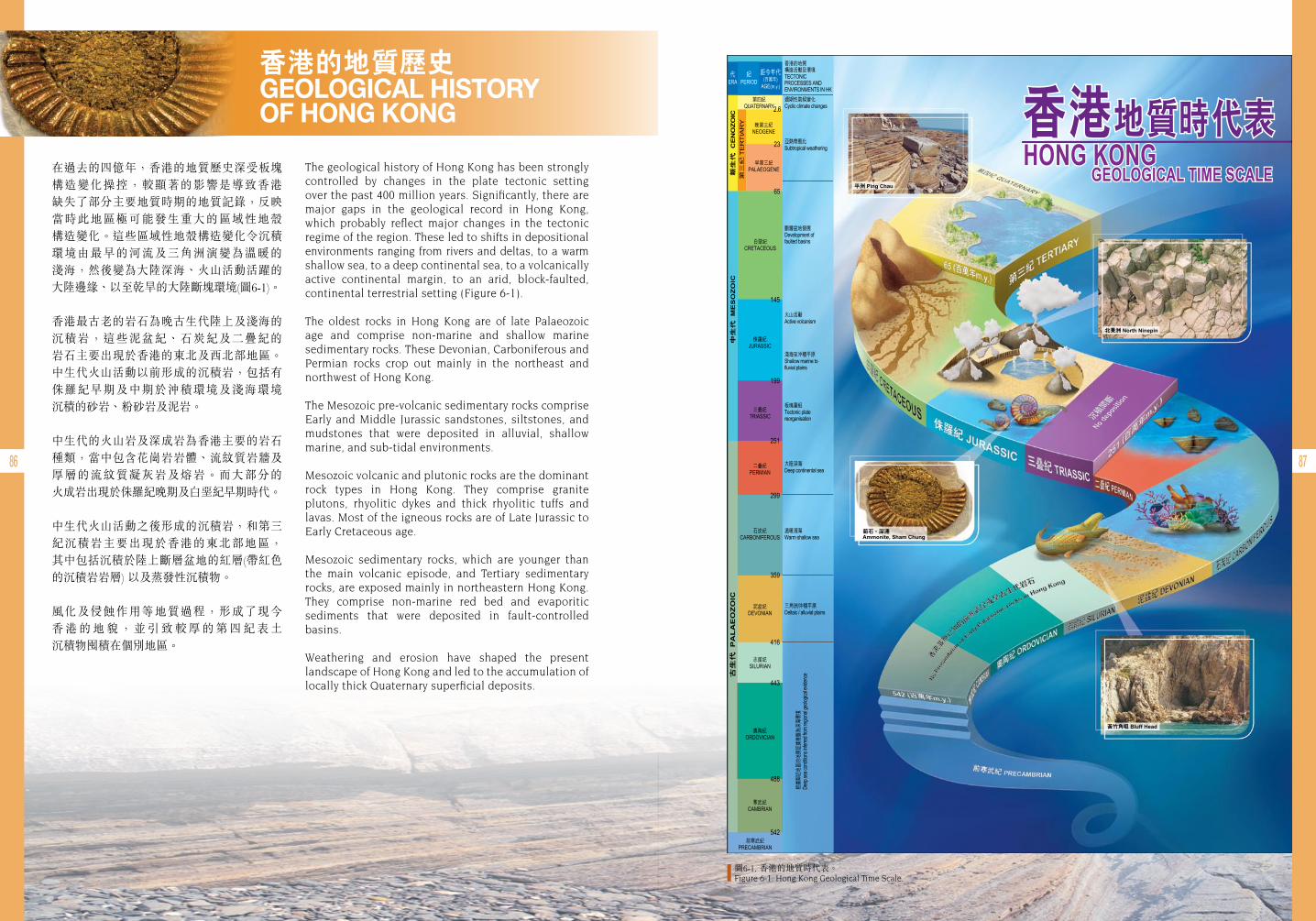
86 87
香港的地質歷史 GEOLOGICAL HISTORY OF HONG KONG
在過去的四億年,香港的地質歷史深受板塊構造變化操控,較顯著的影響是導致香港 缺失了部分主要地質時期的地質記錄,反映當時此地區極可能發生重大的區域性地殼 構造變化。這些區域性地殼構造變化令沉積環境由最早的河流及三角洲演變為溫暖的 淺海,然後變為大陸深海、火山活動活躍的大陸邊緣、以至乾旱的大陸斷塊環境(圖6-1)。
香港最古老的岩石為晚古生代陸上及淺海的沉積岩,這些泥盆紀、石炭紀及二疊紀的 岩石主要出現於香港的東北及西北部地區。中生代火山活動以前形成的沉積岩,包括有侏羅紀早期及中期於沖積環境及淺海環境 沉積的砂岩、粉砂岩及泥岩。
中生代的火山岩及深成岩為香港主要的岩石種類,當中包含花崗岩岩體、流紋質岩牆及厚層的流紋質凝灰岩及熔岩。而大部分的 火成岩出現於侏羅紀晚期及白堊紀早期時代。
中生代火山活動之後形成的沉積岩,和第三紀沉積岩主要出現於香港的東北部地區, 其中包括沉積於陸上斷層盆地的紅層(帶紅色的沉積岩岩層) 以及蒸發性沉積物。
風化及侵蝕作用等地質過程,形成了現今 香 港 的 地 貌 , 並 引 致 較 厚 的 第 四 紀 表 土 沉積物囤積在個別地區。
The geological history of Hong Kong has been strongly controlled by changes in the plate tectonic setting over the past 400 million years. Significantly, there are major gaps in the geological record in Hong Kong, which probably reflect major changes in the tectonic regime of the region. These led to shifts in depositional environments ranging from rivers and deltas, to a warm shallow sea, to a deep continental sea, to a volcanically active continental margin, to an arid, block-faulted, continental terrestrial setting (Figure 6-1).
The oldest rocks in Hong Kong are of late Palaeozoic age and comprise non-marine and shallow marine sedimentary rocks. These Devonian, Carboniferous and Permian rocks crop out mainly in the northeast and northwest of Hong Kong.
The Mesozoic pre-volcanic sedimentary rocks comprise Early and Middle Jurassic sandstones, siltstones, and mudstones that were deposited in alluvial, shallow marine, and sub-tidal environments.
Mesozoic volcanic and plutonic rocks are the dominant rock types in Hong Kong. They comprise granite plutons, rhyolitic dykes and thick rhyolitic tuffs and lavas. Most of the igneous rocks are of Late Jurassic to Early Cretaceous age.
Mesozoic sedimentary rocks, which are younger than the main volcanic episode, and Tertiary sedimentary rocks, are exposed mainly in northeastern Hong Kong. They comprise non-marine red bed and evaporitic sediments that were deposited in fault-controlled basins.
Weathering and erosion have shaped the present landscape of Hong Kong and led to the accumulation of locally thick Quaternary superficial deposits.
圖6-1. 香港的地質時代表。Figure 6-1. Hong Kong Geological Time Scale.

88 89
中國東南地區的地殼構造架構TECTONIC FRAMEWORK OF SOUTHEASTERN CHINA
在香港沒有露出而深埋的大陸基盤估計年齡超過五億五千萬年,然而鄰近的廣東省則 發現遠達二十五億年前的結晶岩。
中國東南部相信是由三組古老地塊構成, 稱為華北地塊、揚子地塊及華夏地塊(圖6-2)。它們於過去十億年間,經過大陸板塊與大陸 板塊之間的碰撞而接連(縫合)一起。現時位於中國東南部的地殼環境稱為不活動大陸邊緣 (即大陸地殼邊緣並不是板塊邊界)。
中國東南部屬於歐亞板塊的一部分,歐亞 板塊的南端與印澳板塊之間發生大陸板塊與大陸板塊的碰撞,形成喜馬拉雅山山脈。 在東面,菲律賓板塊正向西北方移動,形成歐亞板塊邊緣一帶複雜的大洋俯衝帶系統。
在台灣北面,菲律賓板塊正俯衝於歐亞板塊之下;而在台灣南面,菲律賓和歐亞兩板塊則俯衝於菲律賓群島之下。這樣的板塊構造環境,構成複雜的火山及地震歷史。
The unexposed (buried) continental basement of Hong Kong is thought to be older than 550 million years. However, in neighbouring Guangdong Province, crystalline rocks as old as 2.5 billion years have been discovered.
Southeastern China is believed to comprise a series of three old crustal blocks. These blocks are known as the North China Block, the Yangtze Block and the Cathaysia Block (Figure 6-2). The crustal blocks have been joined together (sutured) by continent-continent collision events over the past 1,000 million years.
The present-day tectonic setting of southeastern China is what is termed a passive continental margin (i.e. there is no plate boundary along the edge of the continental platform).
Southeastern China forms part of the Eurasian Plate, which is in continent-continent collision with the Indo-Australian Plate along its southern border (forming the Himalayan Mountain Chain).
In the east, the Philippine Plate is moving northwestwards forming a complex oceanic subduction zone system along the margin of the Eurasian Plate. North of Taiwan, the Philippine Plate is being subducted beneath the Eurasian Plate. South of Taiwan, both the Philippine and Eurasian Plates appear to be subducting beneath the islands of the Philippines, leading to a complex history of volcanism and earthquakes.
圖6-2. 大陸板塊與現時位於中國東南部的板塊構造。Figure 6-2. Crustal blocks and the present-day tectonic setting of southeastern China.
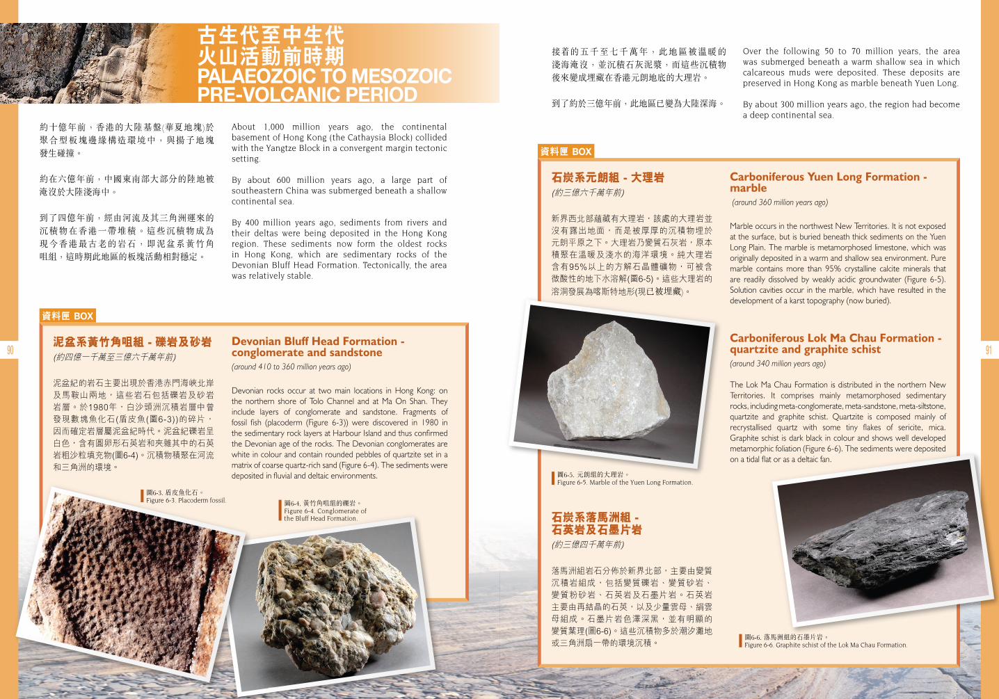
90 91
古生代至中生代 火山活動前時期 PALAEOZOIC TO MESOZOIC PRE-VOLCANIC PERIOD
約十億年前,香港的大陸基盤(華夏地塊)於 聚合型板塊邊緣構造環境中,與揚子地塊 發生碰撞。
約在六億年前,中國東南部大部分的陸地被淹沒於大陸淺海中。
到了四億年前,經由河流及其三角洲運來的沉積物在香港一帶堆積。這些沉積物成為 現今香港最古老的岩石,即泥盆系黃竹角 咀組,這時期此地區的板塊活動相對穩定。
接 的五千至七千萬年,此地區被溫暖的 淺海淹沒,並沉積石灰泥漿,而這些沉積物後來變成埋藏在香港元朗地底的大理岩。
到了約於三億年前,此地區已變為大陸深海。
About 1,000 million years ago, the continental basement of Hong Kong (the Cathaysia Block) collided with the Yangtze Block in a convergent margin tectonic setting.
By about 600 million years ago, a large part of southeastern China was submerged beneath a shallow continental sea.
By 400 million years ago, sediments from rivers and their deltas were being deposited in the Hong Kong region. These sediments now form the oldest rocks in Hong Kong, which are sedimentary rocks of the Devonian Bluff Head Formation. Tectonically, the area was relatively stable.
Over the following 50 to 70 million years, the area was submerged beneath a warm shallow sea in which calcareous muds were deposited. These deposits are preserved in Hong Kong as marble beneath Yuen Long.
By about 300 million years ago, the region had become a deep continental sea.
資料匣 BOX
資料匣 BOX
Devonian Bluff Head Formation - conglomerate and sandstone(around 410 to 360 million years ago)
Devonian rocks occur at two main locations in Hong Kong: on the northern shore of Tolo Channel and at Ma On Shan. They include layers of conglomerate and sandstone. Fragments of fossil fish (placoderm (Figure 6-3)) were discovered in 1980 in the sedimentary rock layers at Harbour Island and thus confirmed the Devonian age of the rocks. The Devonian conglomerates are white in colour and contain rounded pebbles of quartzite set in a matrix of coarse quartz-rich sand (Figure 6-4). The sediments were deposited in fluvial and deltaic environments.
Carboniferous Yuen Long Formation - marble (around 360 million years ago)
Marble occurs in the northwest New Territories. It is not exposed at the surface, but is buried beneath thick sediments on the Yuen Long Plain. The marble is metamorphosed limestone, which was originally deposited in a warm and shallow sea environment. Pure marble contains more than 95% crystalline calcite minerals that are readily dissolved by weakly acidic groundwater (Figure 6-5). Solution cavities occur in the marble, which have resulted in the development of a karst topography (now buried).
Carboniferous Lok Ma Chau Formation - quartzite and graphite schist (around 340 million years ago)
The Lok Ma Chau Formation is distributed in the northern New Territories. It comprises mainly metamorphosed sedimentary rocks, including meta-conglomerate, meta-sandstone, meta-siltstone, quartzite and graphite schist. Quartzite is composed mainly of recrystallised quartz with some tiny flakes of sericite, mica. Graphite schist is dark black in colour and shows well developed metamorphic foliation (Figure 6-6). The sediments were deposited on a tidal flat or as a deltaic fan.
泥盆系黃竹角咀組 - 礫岩及砂岩
泥盆紀的岩石主要出現於香港赤門海峽北岸及馬鞍山兩地,這些岩石包括礫岩及砂岩岩層。於1980年,白沙頭洲沉積岩層中曾發現數塊魚化石(盾皮魚(圖6-3))的碎片,因而確定岩層屬泥盆紀時代。泥盆紀礫岩呈白色,含有圓卵形石英岩和夾雜其中的石英岩粗沙粒填充物(圖6-4)。沉積物積聚在河流和三角洲的環境。
石炭系元朗組 - 大理岩
新界西北部蘊藏有大理岩,該處的大理岩並沒有露出地面,而是被厚厚的沉積物埋於元朗平原之下。大理岩乃變質石灰岩,原本積聚在溫暖及淺水的海洋環境。純大理岩含有95%以上的方解石晶體礦物,可被含微酸性的地下水溶解(圖6-5)。這些大理岩的
溶洞發展為喀斯特地形(現已被埋藏)。
石炭系落馬洲組 - 石英岩及石墨片岩
落馬洲組岩石分佈於新界北部,主要由變質沉積岩組成,包括變質礫岩、變質砂岩、變質粉砂岩、石英岩及石墨片岩。石英岩主要由再結晶的石英,以及少量雲母、絹雲母組成。石墨片岩色澤深黑,並有明顯的變質葉理(圖6-6)。這些沉積物多於潮汐灘地或三角洲扇一帶的環境沉積。
圖6-4. 黃竹角咀組的礫岩。Figure 6-4. Conglomerate of the Bluff Head Formation.
圖6-3. 盾皮魚化石。Figure 6-3. Placoderm fossil.
圖6-5. 元朗組的大理岩。Figure 6-5. Marble of the Yuen Long Formation.
圖6-6. 落馬洲組的石墨片岩。Figure 6-6. Graphite schist of the Lok Ma Chau Formation.
(約四億一千萬至三億六千萬年前)
(約三億六千萬年前)
(約三億四千萬年前)
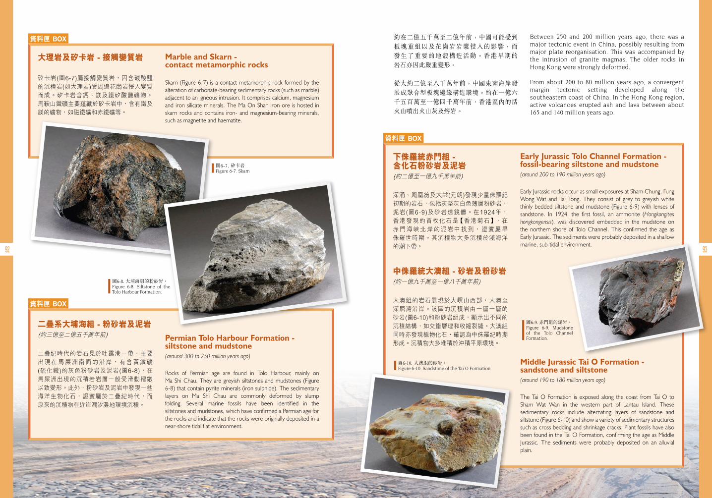
92 93
資料匣 BOX
Marble and Skarn - contact metamorphic rocks
Skarn (Figure 6-7) is a contact metamorphic rock formed by the alteration of carbonate-bearing sedimentary rocks (such as marble) adjacent to an igneous intrusion. It comprises calcium, magnesium and iron silicate minerals. The Ma On Shan iron ore is hosted in skarn rocks and contains iron- and magnesium-bearing minerals, such as magnetite and haematite.
大理岩及矽卡岩 - 接觸變質岩
矽卡岩(圖6-7)屬接觸變質岩,因含碳酸鹽的沉積岩(如大理岩)受周邊花崗岩侵入變質而成。矽卡岩含鈣、鎂及鐵矽酸鹽礦物。馬鞍山鐵礦主要蘊藏於矽卡岩中,含有鐵及鎂的礦物,如磁鐵礦和赤鐵礦等。
圖6-7. 矽卡岩Figure 6-7. Skarn
資料匣 BOX
Permian Tolo Harbour Formation - siltstone and mudstone(around 300 to 250 million years ago)
Rocks of Permian age are found in Tolo Harbour, mainly on Ma Shi Chau. They are greyish siltstones and mudstones (Figure 6-8) that contain pyrite minerals (iron sulphide). The sedimentary layers on Ma Shi Chau are commonly deformed by slump folding. Several marine fossils have been identified in the siltstones and mudstones, which have confirmed a Permian age for the rocks and indicate that the rocks were originally deposited in a near-shore tidal flat environment.
二疊系大埔海組 - 粉砂岩及泥岩
二疊紀時代的岩石見於吐露港一帶,主要出現在馬屎洲南面的沿岸,有含黃鐵礦(硫化鐵)的灰色粉砂岩及泥岩(圖6-8),在馬屎洲出現的沉積岩岩層一般受滑動褶皺以致變形。此外,粉砂岩及泥岩中發現一些海洋生物化石,證實屬於二疊紀時代,而原來的沉積物在近岸潮汐灘地環境沉積。
約在二億五千萬至二億年前,中國可能受到板塊重組以及花崗岩岩漿侵入的影響,而 發生了重要的地殼構造活動。香港早期的 岩石亦因此嚴重變形。
從大約二億至八千萬年前,中國東南海岸發展成聚合型板塊邊緣構造環境。約在一億六千五百萬至一億四千萬年前,香港區內的活火山噴出火山灰及熔岩。
Between 250 and 200 million years ago, there was a major tectonic event in China, possibly resulting from major plate reorganisation. This was accompanied by the intrusion of granite magmas. The older rocks in Hong Kong were strongly deformed.
From about 200 to 80 million years ago, a convergent margin tectonic setting developed along the southeastern coast of China. In the Hong Kong region, active volcanoes erupted ash and lava between about 165 and 140 million years ago.
圖6-8. 大埔海組的粉砂岩。Figure 6-8. Siltstone of the Tolo Harbour Formation.
資料匣 BOX
Early Jurassic Tolo Channel Formation - fossil-bearing siltstone and mudstone (around 200 to 190 million years ago)
Early Jurassic rocks occur as small exposures at Sham Chung, Fung Wong Wat and Tai Tong. They consist of grey to greyish white thinly bedded siltstone and mudstone (Figure 6-9) with lenses of sandstone. In 1924, the first fossil, an ammonite (Hongkongites hongkongensis), was discovered embedded in the mudstone on the northern shore of Tolo Channel. This confirmed the age as Early Jurassic. The sediments were probably deposited in a shallow marine, sub-tidal environment.
Middle Jurassic Tai O Formation - sandstone and siltstone (around 190 to 180 million years ago)
The Tai O Formation is exposed along the coast from Tai O to Sham Wat Wan in the western part of Lantau Island. These sedimentary rocks include alternating layers of sandstone and siltstone (Figure 6-10) and show a variety of sedimentary structures such as cross bedding and shrinkage cracks. Plant fossils have also been found in the Tai O Formation, confirming the age as Middle Jurassic. The sediments were probably deposited on an alluvial plain.
下侏羅統赤門組 - 含化石粉砂岩及泥岩
深涌、鳳凰笏及大棠(元朗)發現少量侏羅紀初期的岩石,包括灰至灰白色薄層粉砂岩、泥岩(圖6-9)及砂岩透鏡體。在1924年,香港發現的首枚化石是【香港菊石】,在赤門海峽北岸的泥岩中找到,證實屬早侏羅世時期。其沉積物大多沉積於淺海洋的潮下帶。
中侏羅統大澳組 - 砂岩及粉砂岩
大澳組的岩石展現於大嶼山西部,大澳至深屈灣沿岸。該區的沉積岩由一層一層的砂岩(圖6-10)和粉砂岩組成,顯示出不同的沉積結構,如交錯層理和收縮裂縫。大澳組同時亦發現植物化石,確認為中侏羅紀時期形成。沉積物大多堆積於沖積平原環境。
圖6-9. 赤門組的泥岩。Figure 6-9. Mudstone of the Tolo Channel Formation.
圖6-10. 大澳組的砂岩。Figure 6-10. Sandstone of the Tai O Formation.
(約三億至二億五千萬年前)
(約二億至一億九千萬年前)
(約一億九千萬至一億八千萬年前)
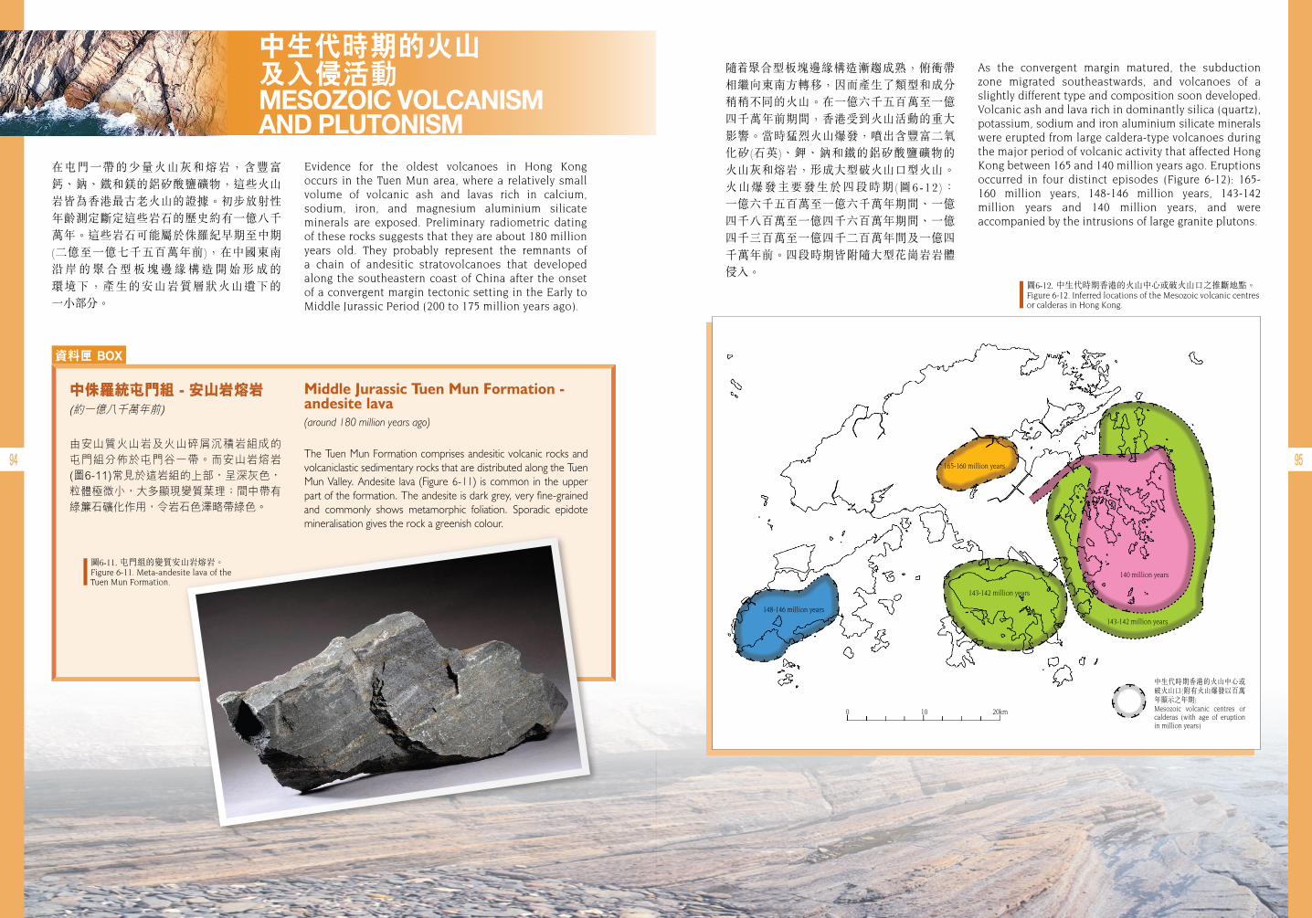
94 95
中生代時期的火山 及入侵活動 MESOZOIC VOLCANISM AND PLUTONISM
在屯門一帶的少量火山灰和熔岩,含豐富鈣、鈉、鐵和鎂的鋁矽酸鹽礦物,這些火山岩皆為香港最古老火山的證據。初步放射性年齡測定斷定這些岩石的歷史約有一億八千萬年。這些岩石可能屬於侏羅紀早期至中期(二億至一億七千五百萬年前),在中國東南 沿 岸 的 聚 合 型 板 塊 邊 緣 構 造 開 始 形 成 的 環境下,產生的安山岩質層狀火山遺下的 一小部分。
隨 聚合型板塊邊緣構造漸趨成熟,俯衝帶相繼向東南方轉移,因而產生了類型和成分稍稍不同的火山。在一億六千五百萬至一億四千萬年前期間,香港受到火山活動的重大影響。當時猛烈火山爆發,噴出含豐富二氧化矽(石英)、鉀、鈉和鐵的鋁矽酸鹽礦物的 火山灰和熔岩,形成大型破火山口型火山。火山爆發主要發生於四段時期(圖6-12 ): 一億六千五百萬至一億六千萬年期間、一億四千八百萬至一億四千六百萬年期間、一億四千三百萬至一億四千二百萬年間及一億四千萬年前。四段時期皆附隨大型花崗岩岩體侵入。
Evidence for the oldest volcanoes in Hong Kong occurs in the Tuen Mun area, where a relatively small volume of volcanic ash and lavas rich in calcium, sodium, iron, and magnesium aluminium silicate minerals are exposed. Preliminary radiometric dating of these rocks suggests that they are about 180 million years old. They probably represent the remnants of a chain of andesitic stratovolcanoes that developed along the southeastern coast of China after the onset of a convergent margin tectonic setting in the Early to Middle Jurassic Period (200 to 175 million years ago).
As the convergent margin matured, the subduction zone migrated southeastwards, and volcanoes of a slightly different type and composition soon developed. Volcanic ash and lava rich in dominantly silica (quartz), potassium, sodium and iron aluminium silicate minerals were erupted from large caldera-type volcanoes during the major period of volcanic activity that affected Hong Kong between 165 and 140 million years ago. Eruptions occurred in four distinct episodes (Figure 6-12): 165- 160 million years, 148-146 million years, 143-142 million years and 140 million years, and were accompanied by the intrusions of large granite plutons.
資料匣 BOX
Middle Jurassic Tuen Mun Formation - andesite lava
(around 180 million years ago)
The Tuen Mun Formation comprises andesitic volcanic rocks and volcaniclastic sedimentary rocks that are distributed along the Tuen Mun Valley. Andesite lava (Figure 6-11) is common in the upper part of the formation. The andesite is dark grey, very fine-grained and commonly shows metamorphic foliation. Sporadic epidote mineralisation gives the rock a greenish colour.
中侏羅統屯門組 - 安山岩熔岩
由安山質火山岩及火山碎屑沉積岩組成的屯門組分佈於屯門谷一帶。而安山岩熔岩(圖6-11)常見於這岩組的上部,呈深灰色,粒體極微小,大多顯現變質葉理;間中帶有綠簾石礦化作用,令岩石色澤略帶綠色。
圖6-11. 屯門組的變質安山岩熔岩。 Figure 6-11. Meta-andesite lava of the Tuen Mun Formation.
圖6-12. 中生代時期香港的火山中心或破火山口之推斷地點。Figure 6-12. Inferred locations of the Mesozoic volcanic centres or calderas in Hong Kong.
中生代時期香港的火山中心或破火山口(附有火山爆發以百萬年顯示之年期)Mesozoic volcanic centres or calderas (with age of eruption in million years)
165-160 million years
148-146 million years
140 million years
143-142 million years
143-142 million years
0 10 20km
(約一億八千萬年前)

96 97
主要火山爆發時段
• 一億六千五百萬至一億六千萬年期間
現時我們在新界中部看到的岩石,大部分在首段火山爆發時期形成,這些岩石主要 是 含 有 豐 富 晶 體 碎 屑 的 火 山 灰 , 當 中 也包括大量的岩石碎片。火山爆發非常 猛 烈 , 僅 留 下 極 少 證 據 顯 示 有 任 何 熔 岩流。雖然這時期形成的破火山口早已 消失,但其大約位置仍可根據火山噴道的物質及相關深成岩的位置推斷。它們形成東北向間斷的、環狀構造,很可能是原來破火山口型火山的邊界(圖6-13)。而東北向、平行於當時聚合型板塊邊緣的斷層,則可能控制了破火山口的大小和形狀。
Major Volcanic Episodes
• 165-160 million years
The first major episode of eruption formed much of the volcanic rock exposed in the central New Territories. These rocks are dominantly crystal-rich ashes containing abundant rock fragments. The volcanic eruptions were very violent, and there is very little evidence of any lava flows. Although the caldera that produced the ash has long since disappeared, its approximate location can be determined from the concentration of volcanic vent-type materials and the associated plutonic rocks. Volcanic vent materials and related plutonic bodies form a discontinuous, northeast-oriented ring-like structure that probably marks the original caldera boundary (Figure 6-13). Northeast-trending faults, subparallel to the convergent margin, probably controlled the shape and size of the caldera.
新界New Territories
荃灣火山岩群Tsuen Wan Volcanic Group
花崗閃長岩Granodiorite
花崗岩Granite
破火山口火山邊界Caldera boundary
斷層Fault
前荃灣火山岩群基盤Pre-Tsuen Wan Volcanic Group basement
斷層崖Fault scarp
新界中部Central New Territories
圖6-13. 一億六千五百萬至一億六千萬年前的破火山口及相關的侵入岩之圖解(細圖為該火山活動時期形成的火成岩於本港之分佈) 。Figure 6-13. Schematic representation of caldera development and related subvolcanic intrusions between 165 and 160 million years ago (Inset map indicates the distribution of igneous rocks in Hong Kong associated with this volcanic episode).
資料匣 BOX
Middle Jurassic Tsuen Wan Volcanic Group - coarse ash crystal tuff (164 to 160 million years ago)
The Tsuen Wan Volcanic Group is mainly exposed in the northeastern and northwestern New Territories. The dominant rock type is coarse ash crystal tuff (Figure 6-14), which is composed of crystal fragments of quartz, feldspar, hornblende and biotite, locally containing rock fragments. The volcanic ash was erupted from a nearby volcanic centre.
Middle Jurassic Tsuen Wan Volcanic Group - tuff breccia (164 to 160 million years ago)
Tuff breccia (Figure 6-15) at Shek Lung Kung comprises angular rock fragments that are up to 6 m in diameter. The rock fragments consist mainly of volcanic rocks with some quartzite and chert. The size and angularity of the fragments suggest that they were deposited close to a volcanic vent.
中侏羅統荃灣火山岩群 - 粗火山灰晶屑凝灰岩
荃灣火山岩群主要出現在新界東北及西北部,粗火山灰晶屑凝灰岩(圖6-14)為主要的岩石,火山岩由石英、長石、角閃石、黑雲母及岩石的碎屑組成。這些火山灰噴發自鄰近的火山中心。
中侏羅統荃灣火山岩群 - 凝灰角礫岩
石龍拱的凝灰角礫岩(圖6-15)由直徑長達6米、呈稜角狀的岩石碎片構成。這些岩石碎片主要包括火山岩以及少量石英岩和燧石。根據岩石碎片的角狀及大小,可推斷其沉積地點在火山噴道附近。
圖6-14. 荃灣火山岩群的粗火山灰晶屑凝灰岩。Figure 6-14. Coarse ash crystal tuff of the Tsuen Wan Volcanic Group.
圖6-15. 荃灣火山岩群的凝灰角礫岩。Figure 6-15. Tuff breccia of the Tsuen Wan Volcanic Group.
(約一億六千四百萬至一億六千萬年前)
(約一億六千四百萬至一億六千萬年前)
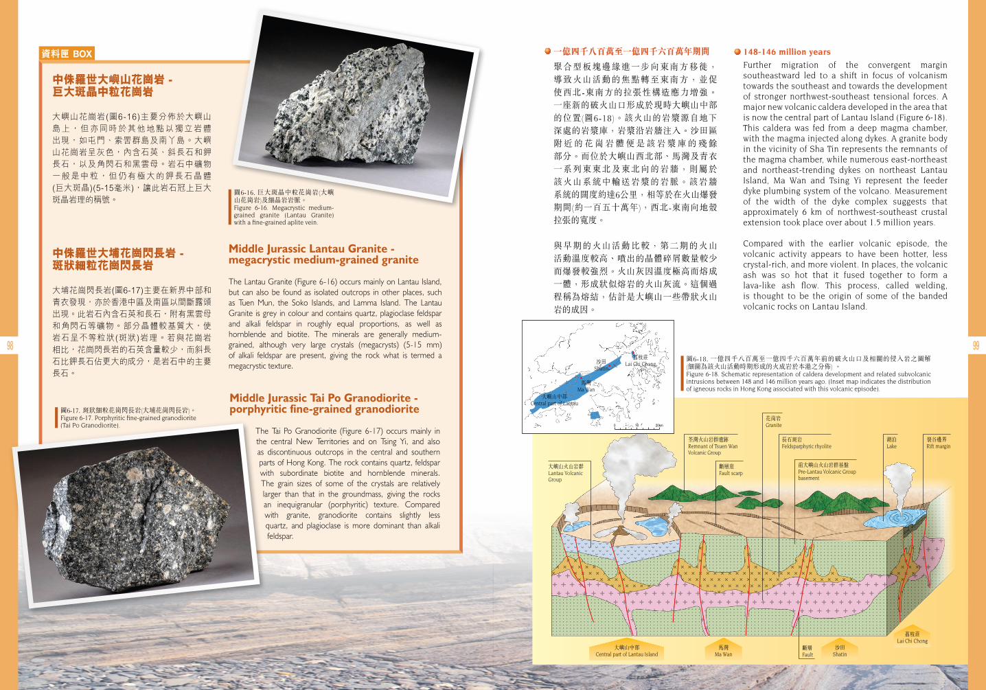
98 99
資料匣 BOX
Middle Jurassic Lantau Granite - megacrystic medium-grained granite
The Lantau Granite (Figure 6-16) occurs mainly on Lantau Island, but can also be found as isolated outcrops in other places, such as Tuen Mun, the Soko Islands, and Lamma Island. The Lantau Granite is grey in colour and contains quartz, plagioclase feldspar and alkali feldspar in roughly equal proportions, as well as hornblende and biotite. The minerals are generally medium-grained, although very large crystals (megacrysts) (5-15 mm) of alkali feldspar are present, giving the rock what is termed a megacrystic texture.
Middle Jurassic Tai Po Granodiorite - porphyritic fine-grained granodiorite
The Tai Po Granodiorite (Figure 6-17) occurs mainly in the central New Territories and on Tsing Yi, and also as discontinuous outcrops in the central and southern parts of Hong Kong. The rock contains quartz, feldspar with subordinate biotite and hornblende minerals. The grain sizes of some of the crystals are relatively larger than that in the groundmass, giving the rocks an inequigranular (porphyritic) texture. Compared with granite, granodiorite contains slightly less quartz, and plagioclase is more dominant than alkali feldspar.
中侏羅世大嶼山花崗岩 - 巨大斑晶中粒花崗岩
大嶼山花崗岩(圖6-16)主要分佈於大嶼山島上,但亦同時於其他地點以獨立岩體出現,如屯門、索罟群島及南丫島。大嶼山花崗岩呈灰色,內含石英、斜長石和鉀長石,以及角閃石和黑雲母。岩石中礦物一般是中粒,但仍有極大的鉀長石晶體(巨大斑晶)(5-15毫米),讓此岩石冠上巨大斑晶岩理的稱號。
中侏羅世大埔花崗閃長岩 - 斑狀細粒花崗閃長岩
大埔花崗閃長岩(圖6-17)主要在新界中部和青衣發現,亦於香港中區及南區以間斷露頭出現。此岩石內含石英和長石,附有黑雲母和角閃石等礦物。部分晶體較基質大,使岩石呈不等粒狀(斑狀)岩理。若與花崗岩相比,花崗閃長岩的石英含量較少,而斜長石比鉀長石佔更大的成分,是岩石中的主要長石。
圖6-18. 一億四千八百萬至一億四千六百萬年前的破火山口及相關的侵入岩之圖解 (細圖為該火山活動時期形成的火成岩於本港之分佈) 。Figure 6-18. Schematic representation of caldera development and related subvolcanic intrusions between 148 and 146 million years ago. (Inset map indicates the distribution of igneous rocks in Hong Kong associated with this volcanic episode).
圖6-16. 巨大斑晶中粒花崗岩(大嶼山花崗岩)及細晶岩岩脈。Figure 6-16. Megacrystic medium-grained granite (Lantau Granite) with a fine-grained aplite vein.
圖6-17. 斑狀細粒花崗閃長岩(大埔花崗閃長岩)。Figure 6-17. Porphyritic fine-grained granodiorite (Tai Po Granodiorite).
• 一億四千八百萬至一億四千六百萬年期間
聚合型板塊邊緣進一步向東南方移徙, 導致火山活動的焦點轉至東南方,並促使西北-東南方的拉張性構造應力增強。 一座新的破火山口形成於現時大嶼山中部的位置(圖6-18)。該火山的岩漿源自地下 深處的岩漿庫,岩漿沿岩牆注入。沙田區 附 近 的 花 崗 岩 體 便 是 該 岩 漿 庫 的 殘 餘 部分。而位於大嶼山西北部、馬灣及青衣一系列東東北及東北向的岩牆,則屬於 該火山系統中輸送岩漿的岩脈。該岩牆 系統的闊度約達6公里,相等於在火山爆發期間(約一百五十萬年),西北-東南向地殼 拉張的寬度。
與早期的火山活動比較,第二期的火山 活動溫度較高、噴出的晶體碎屑數量較少而爆發較強烈。火山灰因溫度極高而熔成一體,形成狀似熔岩的火山灰流。這個過程稱為熔結,估計是大嶼山一些帶狀火山岩的成因。
• 148-146 million years
Further migration of the convergent margin southeastward led to a shift in focus of volcanism towards the southeast and towards the development of stronger northwest-southeast tensional forces. A major new volcanic caldera developed in the area that is now the central part of Lantau Island (Figure 6-18). This caldera was fed from a deep magma chamber, with the magma injected along dykes. A granite body in the vicinity of Sha Tin represents the remnants of the magma chamber, while numerous east-northeast and northeast-trending dykes on northeast Lantau Island, Ma Wan and Tsing Yi represent the feeder dyke plumbing system of the volcano. Measurement of the width of the dyke complex suggests that approximately 6 km of northwest-southeast crustal extension took place over about 1.5 million years.
Compared with the earlier volcanic episode, the volcanic activity appears to have been hotter, less crystal-rich, and more violent. In places, the volcanic ash was so hot that it fused together to form a lava-like ash flow. This process, called welding, is thought to be the origin of some of the banded volcanic rocks on Lantau Island.
大嶼山火山岩群Lantau Volcanic Group
荃灣火山岩群遺跡Remnant of Tsuen Wan Volcanic Group
斷層崖Fault scarp
長石斑岩Feldsparphyric rhyolite
花崗岩Granite
湖泊Lake
裂谷邊界Rift margin
前大嶼山火山岩群基盤Pre-Lantau Volcanic Group basement
斷層Fault
沙田Shatin
荔枝莊Lai Chi Chong
馬灣Ma Wan
大嶼山中部Central part of Lantau Island
大嶼山中部Central part of Lantau
馬灣Ma Wan
沙田Shatin
荔枝莊Lai Chi Chong
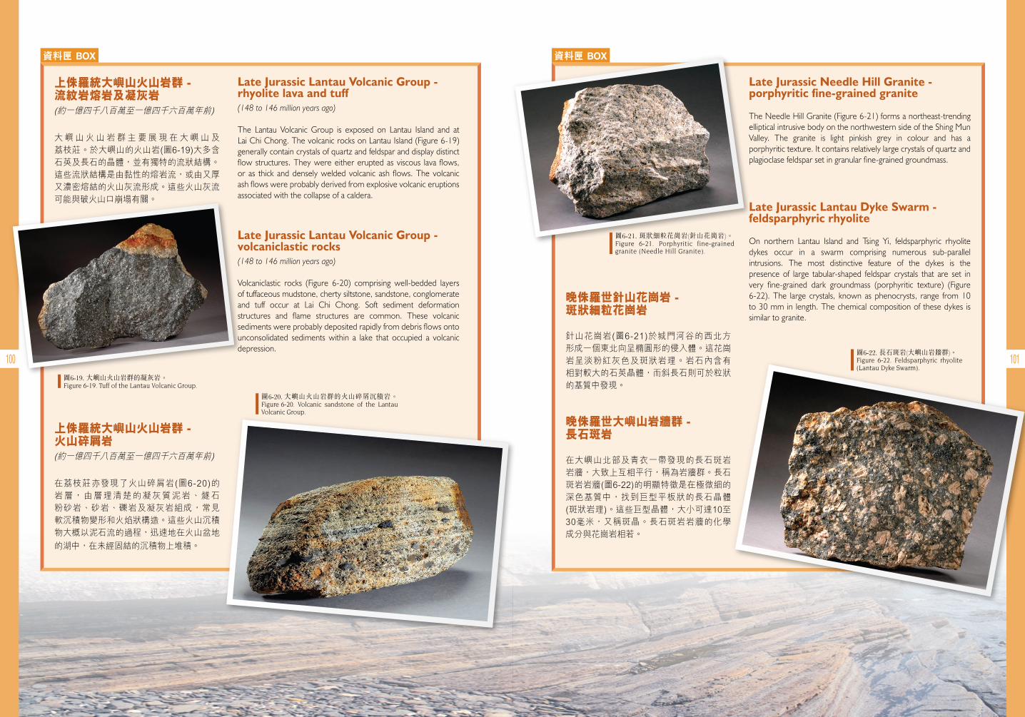
100 101
資料匣 BOX
Late Jurassic Lantau Volcanic Group - rhyolite lava and tuff (148 to 146 million years ago)
The Lantau Volcanic Group is exposed on Lantau Island and at Lai Chi Chong. The volcanic rocks on Lantau Island (Figure 6-19) generally contain crystals of quartz and feldspar and display distinct flow structures. They were either erupted as viscous lava flows, or as thick and densely welded volcanic ash flows. The volcanic ash flows were probably derived from explosive volcanic eruptions associated with the collapse of a caldera.
Late Jurassic Lantau Volcanic Group - volcaniclastic rocks (148 to 146 million years ago)
Volcaniclastic rocks (Figure 6-20) comprising well-bedded layers of tuffaceous mudstone, cherty siltstone, sandstone, conglomerate and tuff occur at Lai Chi Chong. Soft sediment deformation structures and flame structures are common. These volcanic sediments were probably deposited rapidly from debris flows onto unconsolidated sediments within a lake that occupied a volcanic depression.
上侏羅統大嶼山火山岩群 - 流紋岩熔岩及凝灰岩
大嶼山火山岩群主要展現在大嶼山及荔枝莊。於大嶼山的火山岩(圖6-19)大多含石英及長石的晶體,並有獨特的流狀結構。這些流狀結構是由黏性的熔岩流,或由又厚又濃密熔結的火山灰流形成。這些火山灰流可能與破火山口崩塌有關。
上侏羅統大嶼山火山岩群 - 火山碎屑岩
在荔枝莊亦發現了火山碎屑岩(圖6-20)的岩層,由層理清楚的凝灰質泥岩、燧石粉砂岩、砂岩、礫岩及凝灰岩組成,常見軟沉積物變形和火焰狀構造。這些火山沉積物大概以泥石流的過程,迅速地在火山盆地
的湖中,在未經固結的沉積物上堆積。
圖6-19. 大嶼山火山岩群的凝灰岩。Figure 6-19. Tuff of the Lantau Volcanic Group.
圖6-20. 大嶼山火山岩群的火山碎屑沉積岩。 Figure 6-20. Volcanic sandstone of the Lantau Volcanic Group.
資料匣 BOX
Late Jurassic Needle Hill Granite - porphyritic fine-grained granite
The Needle Hill Granite (Figure 6-21) forms a northeast-trending elliptical intrusive body on the northwestern side of the Shing Mun Valley. The granite is light pinkish grey in colour and has a porphyritic texture. It contains relatively large crystals of quartz and plagioclase feldspar set in granular fine-grained groundmass.
Late Jurassic Lantau Dyke Swarm - feldsparphyric rhyolite
On northern Lantau Island and Tsing Yi, feldsparphyric rhyolite dykes occur in a swarm comprising numerous sub-parallel intrusions. The most distinctive feature of the dykes is the presence of large tabular-shaped feldspar crystals that are set in very fine-grained dark groundmass (porphyritic texture) (Figure 6-22). The large crystals, known as phenocrysts, range from 10 to 30 mm in length. The chemical composition of these dykes is similar to granite.
晚侏羅世針山花崗岩 - 斑狀細粒花崗岩
針山花崗岩(圖6-21)於城門河谷的西北方形成一個東北向呈橢圓形的侵入體。這花崗岩呈淡粉紅灰色及斑狀岩理。岩石內含有相對較大的石英晶體,而斜長石則可於粒狀的基質中發現。
晚侏羅世大嶼山岩牆群 - 長石斑岩
在大嶼山北部及青衣一帶發現的長石斑岩岩牆,大致上互相平行,稱為岩牆群。長石斑岩岩牆(圖6-22)的明顯特徵是在極微細的深色基質中,找到巨型平板狀的長石晶體(斑狀岩理)。這些巨型晶體,大小可達10至30毫米,又稱斑晶。長石斑岩岩牆的化學成分與花崗岩相若。
圖6-21. 斑狀細粒花崗岩(針山花崗岩)。Figure 6-21. Porphyritic fine-grained granite (Needle Hill Granite).
圖6-22. 長石斑岩(大嶼山岩牆群)。Figure 6-22. Feldsparphyric rhyolite (Lantau Dyke Swarm).
(約一億四千八百萬至一億四千六百萬年前)
(約一億四千八百萬至一億四千六百萬年前)
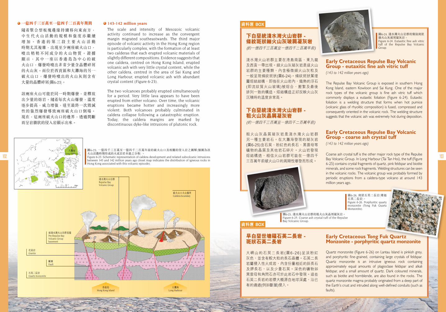
102 103
• 一億四千三百萬至一億四千二百萬年期間
隨 聚合型板塊邊緣持續移向東南方, 中 生 代 火 山 活 動 的 規 模 和 強 度 亦 繼 續 增 加 。 香 港 的 第 三 段 主 要 火 山 活 動 時期尤其複雜,出現至少兩座破火山口,噴 出 稍 稍 不 同 成 分 的 火 山 物 質 。 證 據 顯 示 , 其 中 一 座 以 香 港 島 為 中 心 的 破 火山口,爆發時噴出非常少量含晶體碎屑的火山灰。而位於西貢區和大灘海的另一破火山口,爆發時噴出的火山灰則含有 大量的晶體碎屑(圖6-23)。
該兩座火山可能於同一時期爆發,並釋放出少量的熔岩。隨 每次火山爆發,溫度逐步提高,威力增強,達至最終一次毀滅性的強烈爆發導致兩座破火山口倒塌。 現在,這兩座破火山口的邊界,透過間斷而呈岩牆狀的侵入岩顯示出來。
• 143-142 million years
The scale and intensity of Mesozoic volcanic activity continued to increase as the convergent margin migrated southeastwards. The third major episode of volcanic activity in the Hong Kong region is particularly complex, with the formation of at least two calderas that each erupted volcanic materials of slightly different compositions. Evidence suggests that one caldera, centred on Hong Kong Island, erupted volcanic ash with very little crystal content, while the other caldera, centred in the area of Sai Kung and Long Harbour, erupted volcanic ash with abundant crystal content (Figure 6-23).
The two volcanoes probably erupted simultaneously for a period. Very little lava appears to have been erupted from either volcano. Over time, the volcanic eruptions became hotter and increasingly more violent. Both volcanoes probably culminated in caldera collapse following a catastrophic eruption. Today, the caldera margins are marked by discontinuous dyke-like intrusions of plutonic rock.
淺水灣火山岩群Repulse Bay Volcanic Group
破火山口火山邊界Caldera boundary
前淺水灣火山岩群基盤Pre-Repulse Bay Volcanic Group basement
花崗岩Granite
石英二長岩Quartz monzonite
斷層Fault
大灘海Long Harbour
香港島Hong Kong Island
香港島Hong Kong Island
大灘海Long Harbour
圖6-23. 一億四千三百萬至一億四千二百萬年前的破火山口及相關的侵入岩之圖解(細圖為該 火山活動時期形成的火成岩於本港之分佈) 。Figure 6-23. Schematic representation of caldera development and related subvolcanic intrusions between 143 and 142 million years ago (Inset map indicates the distribution of igneous rocks in Hong Kong associated with this volcanic episode).
資料匣 BOX
Early Cretaceous Repulse Bay Volcanic Group - eutaxitic fine ash vitric tuff(143 to 142 million years ago)
The Repulse Bay Volcanic Group is exposed in southern Hong Kong Island, eastern Kowloon and Sai Kung. One of the major rock types of the volcanic group is fine ash vitric tuff which commonly displays a eutaxitic foliation (Figure 6-24). Eutaxitic foliation is a welding structure that forms when hot pumice (volcanic glass of rhyolitic composition) is fused, compressed and consequently oriented in the volcanic rock. The welding structure suggests that the volcanic ash was extremely hot during deposition.
Early Cretaceous Repulse Bay Volcanic Group - coarse ash crystal tuff (143 to 142 million years ago)
Coarse ash crystal tuff is the other major rock type of the Repulse Bay Volcanic Group. In Long Harbour (Tai Tan Hoi), the tuff (Figure 6-25) contains crystal fragments of quartz, pink feldspar and biotite minerals, and some rock fragments. Welding structures can be seen in the volcanic rocks. The volcanic group was probably formed by periodic eruptions from a caldera-type volcano at around 143 million years ago.
下白堊統淺水灣火山岩群 - 條紋斑狀細火山灰玻屑凝灰岩
淺水灣火山岩群主要在港島南區、東九龍及西貢一帶出現。細火山灰凝灰岩是這火山岩群的主要種類,內含極微細火山灰粒及一般呈現條紋斑狀(圖6-24)。條紋斑狀葉理屬熔結結構,即指在火山岩內,熾熱的浮石(即流紋質火山玻璃)被熔合、壓緊及最後排列一致的構造。熔結構造正好反映火山灰沉積時的溫度非常高。
資料匣 BOX
Early Cretaceous Tong Fuk Quartz Monzonite - porphyritic quartz monzonite
Quartz monzonite (Figure 6-26) on Lantau Island is pinkish grey, and porphyritic fine-grained, containing large crystals of feldspar. Quartz monzonite is an intrusive igneous rock containing approximately equal amounts of plagioclase feldspar and alkali feldspar, and a small amount of quartz. Dark coloured minerals, such as biotite and hornblende, are also found in the rocks. The quartz monzonite magma probably originated from a deep part of the Earth’s crust and intruded along well-defined conduits (such as faults).
早白堊世塘福石英二長岩 - 斑狀石英二長岩
大嶼山的石英二長岩(圖6-26 )呈淡粉紅灰色,並含有較大粒的長石晶體。石英二長岩屬侵入性火成岩,內含份量相近的斜長石及鉀長石,以及少量石英。深色的礦物如黑雲母和角閃石亦可於此岩石中發現。這些石英二長岩的岩漿大概源自地球深處,沿已有的通道(例如斷層)侵入。
下白堊統淺水灣火山岩群 - 粗火山灰晶屑凝灰岩
粗火山灰晶屑凝灰岩是淺水灣火山岩群另一種主要岩石。在大灘海發現的凝灰岩(圖6-25)含石英、粉紅色的長石、黑雲母等礦物的晶屑及其他岩石碎片。火山岩發現熔結構造,相信火山岩群可能在一億四千三百萬年前破火山口的周期性爆發而形成。
圖6-25. 淺水灣火山岩群的粗火山灰晶屑凝灰岩。Figure 6-25. Coarse ash crystal tuff of the Repulse Bay Volcanic Group.
圖6-26. 斑狀石英二長岩(塘福 石英二長岩)。Figure 6-26. Porphyritic quartz monzonite (Tong Fuk Quartz Monzonite).
圖6-24. 淺水灣火山岩群的條紋斑狀細火山灰玻屑凝灰岩。Figure 6-24. Eutaxitic fine ash vitric tuff of the Repulse Bay Volcanic Group.(約一億四千三百萬至一億四千二百萬年前)
(約一億四千三百萬至一億四千二百萬年前)
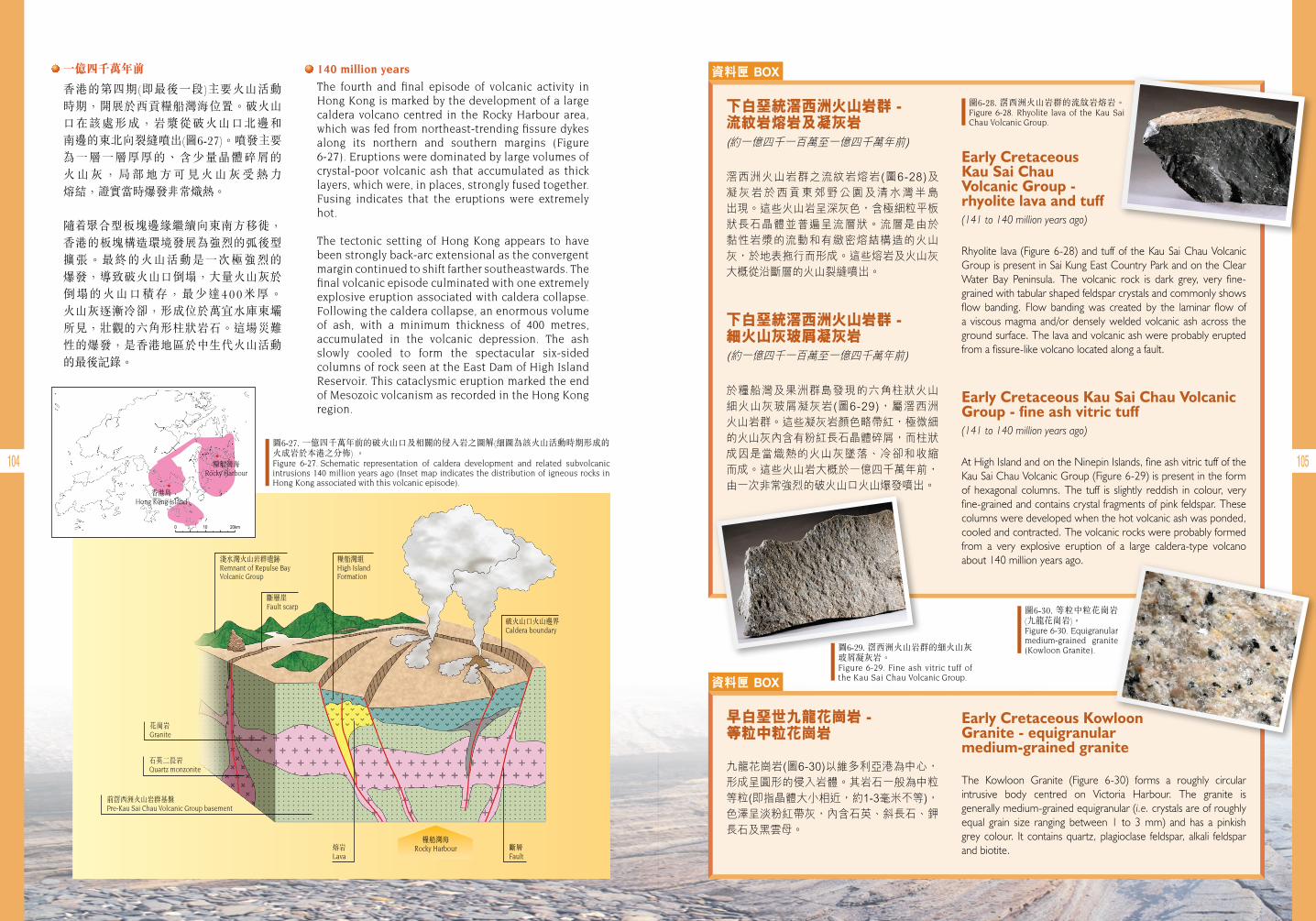
104 105
• 一億四千萬年前
香港的第四期(即最後一段)主要火山活動時期,開展於西貢糧船灣海位置。破火山口在該處形成,岩漿從破火山口北邊和 南邊的東北向裂縫噴出(圖6-27)。噴發主要 為一層一層厚厚的、含少量晶體碎屑的 火 山 灰 , 局 部 地 方 可 見 火 山 灰 受 熱 力 熔結,證實當時爆發非常熾熱。
隨 聚合型板塊邊緣繼續向東南方移徙,香港的板塊構造環境發展為強烈的弧後型擴張。最終的火山活動是一次極強烈的 爆發,導致破火山口倒塌,大量火山灰於 倒塌的火山口積存,最少達400米厚。 火山灰逐漸冷卻,形成位於萬宜水庫東壩所見,壯觀的六角形柱狀岩石。這場災難 性的爆發,是香港地區於中生代火山活動的最後記錄。
• 140 million years
The fourth and final episode of volcanic activity in Hong Kong is marked by the development of a large caldera volcano centred in the Rocky Harbour area, which was fed from northeast-trending fissure dykes along its northern and southern margins (Figure 6-27). Eruptions were dominated by large volumes of crystal-poor volcanic ash that accumulated as thick layers, which were, in places, strongly fused together. Fusing indicates that the eruptions were extremely hot.
The tectonic setting of Hong Kong appears to have been strongly back-arc extensional as the convergent margin continued to shift farther southeastwards. The final volcanic episode culminated with one extremely explosive eruption associated with caldera collapse. Following the caldera collapse, an enormous volume of ash, with a minimum thickness of 400 metres, accumulated in the volcanic depression. The ash slowly cooled to form the spectacular six-sided columns of rock seen at the East Dam of High Island Reservoir. This cataclysmic eruption marked the end of Mesozoic volcanism as recorded in the Hong Kong region.
淺水灣火山岩群遺跡Remnant of Repulse Bay Volcanic Group
斷層崖Fault scarp
糧船灣組High Island Formation
破火山口火山邊界Caldera boundary
花崗岩Granite
石英二長岩Quartz monzonite
前滘西洲火山岩群基盤Pre-Kau Sai Chau Volcanic Group basement
熔岩Lava
斷層Fault
糧船灣海Rocky Harbour
糧船灣海Rocky Harbour
香港島Hong Kong Island
圖6-27. 一億四千萬年前的破火山口及相關的侵入岩之圖解(細圖為該火山活動時期形成的火成岩於本港之分佈) 。Figure 6-27. Schematic representation of caldera development and related subvolcanic intrusions 140 million years ago (Inset map indicates the distribution of igneous rocks in Hong Kong associated with this volcanic episode).
資料匣 BOX
Early Cretaceous Kau Sai Chau Volcanic Group - rhyolite lava and tuff (141 to 140 million years ago)
Rhyolite lava (Figure 6-28) and tuff of the Kau Sai Chau Volcanic Group is present in Sai Kung East Country Park and on the Clear Water Bay Peninsula. The volcanic rock is dark grey, very fine-grained with tabular shaped feldspar crystals and commonly shows flow banding. Flow banding was created by the laminar flow of a viscous magma and/or densely welded volcanic ash across the ground surface. The lava and volcanic ash were probably erupted from a fissure-like volcano located along a fault.
Early Cretaceous Kau Sai Chau Volcanic Group - fine ash vitric tuff (141 to 140 million years ago)
At High Island and on the Ninepin Islands, fine ash vitric tuff of the Kau Sai Chau Volcanic Group (Figure 6-29) is present in the form of hexagonal columns. The tuff is slightly reddish in colour, very fine-grained and contains crystal fragments of pink feldspar. These columns were developed when the hot volcanic ash was ponded, cooled and contracted. The volcanic rocks were probably formed from a very explosive eruption of a large caldera-type volcano about 140 million years ago.
下白堊統滘西洲火山岩群 - 流紋岩熔岩及凝灰岩
滘西洲火山岩群之流紋岩熔岩(圖6-28)及凝灰岩於西貢東郊野公園及清水灣半島出現。這些火山岩呈深灰色,含極細粒平板狀長石晶體並普遍呈流層狀。流層是由於黏性岩漿的流動和有緻密熔結構造的火山灰,於地表拖行而形成。這些熔岩及火山灰大概從沿斷層的火山裂縫噴出。
資料匣 BOX
Early Cretaceous Kowloon Granite - equigranular medium-grained granite
The Kowloon Granite (Figure 6-30) forms a roughly circular intrusive body centred on Victoria Harbour. The granite is generally medium-grained equigranular (i.e. crystals are of roughly equal grain size ranging between 1 to 3 mm) and has a pinkish grey colour. It contains quartz, plagioclase feldspar, alkali feldspar and biotite.
早白堊世九龍花崗岩 - 等粒中粒花崗岩
九龍花崗岩(圖6-30)以維多利亞港為中心,形成呈圓形的侵入岩體。其岩石一般為中粒等粒(即指晶體大小相近,約1-3毫米不等),色澤呈淡粉紅帶灰,內含石英、斜長石、鉀長石及黑雲母。
下白堊統滘西洲火山岩群 - 細火山灰玻屑凝灰岩
於糧船灣及果洲群島發現的六角柱狀火山細火山灰玻屑凝灰岩(圖6-29),屬滘西洲火山岩群。這些凝灰岩顏色略帶紅,極微細的火山灰內含有粉紅長石晶體碎屑,而柱狀成因是當熾熱的火山灰墜落、冷卻和收縮而成。這些火山岩大概於一億四千萬年前,由一次非常強烈的破火山口火山爆發噴出。
圖6-29. 滘西洲火山岩群的細火山灰玻屑凝灰岩。Figure 6-29. Fine ash vitric tuff of the Kau Sai Chau Volcanic Group.
圖6-30. 等粒中粒花崗岩 (九龍花崗岩)。Figure 6-30. Equigranular medium-grained granite (Kowloon Granite).
圖6-28. 滘西洲火山岩群的流紋岩熔岩。Figure 6-28. Rhyolite lava of the Kau Sai Chau Volcanic Group.
(約一億四千一百萬至一億四千萬年前)
(約一億四千一百萬至一億四千萬年前)
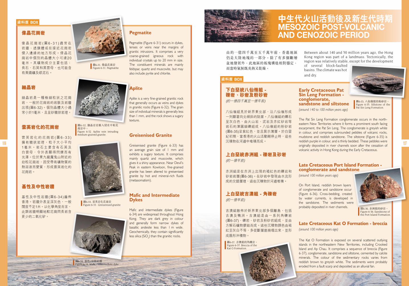
106 107
資料匣 BOX
Pegmatite
Pegmatite (Figure 6-31) occurs in dykes, lenses or veins near the margins of granitic intrusions. It comprises a very coarse-grained igneous rock with individual crystals up to 20 mm in size. The constituent minerals are mainly feldspar, quartz and muscovite, but may also include pyrite and chlorite.
Aplite
Aplite is a very fine-grained granitic rock that generally occurs as veins and dykes in granitic rocks (Figure 6-32). The grain size of individual minerals is generally less than 1 mm, and the rock shows a sugary texture.
Greisenised Granite
Greisenised granite (Figure 6-33) has an average grain size of 1 mm and exhibits a sugary texture. It comprises mainly quartz and muscovite, which gives it a shiny appearance. Near Devil’s Peak in eastern Kowloon, fine-grained granite has been altered to greisenised granite by hot and mineral-rich fluids (metasomatism).
Mafic and Intermediate Dykes
Mafic and intermediate dykes (Figure 6-34) are widespread throughout Hong Kong. They are dark grey in colour and generally form narrow dykes of basaltic andesite less than 1 m wide. Geochemically, they contain significantly less silica (SiO2) than the granitic rocks.
偉晶花崗岩
偉晶花崗岩 (圖6 - 3 1 )通常在岩牆、透鏡體或在接近花崗岩侵入邊緣的地方形成。偉晶花崗岩中個別的晶體大小可達20毫米。其礦物成分主要包括:長石、石英和黑雲母,也可能含有黃鐵礦及綠泥石。
細晶岩
細晶岩是一種極細粒狀之花崗岩,一般於花崗岩的岩脈及岩牆出現(圖6-32)。個別晶體大小通常小於1毫米,且呈砂糖狀岩理。
雲英岩化的花崗岩
雲英岩化的花崗岩 (圖6 - 3 3 )擁有糖狀岩理,粒子大小平均1毫米。岩石主要含有石英及白雲母,令外表顯得閃爍而有光澤。位於東九龍魔鬼山附近的幼粒花崗岩,因受帶有礦物質的熱溶液而變質,形成雲英岩化的花崗岩。
基性及中性岩牆
基性及中性岩牆(圖6-34)遍佈香港。岩牆外表呈深灰色,一般闊度不足1米。以化學角度而言,此類岩牆明顯地較花崗閃長岩含更少的二氧化矽。
圖6-33. 雲英岩化花崗岩Figure 6-33 . Greisenised granite
圖6-31. 偉晶花崗岩 Figure 6-31. Pegmatite
圖6-32. 細晶岩岩脈入侵在中粒花崗岩中。Figure 6-32. Aplite vein intruding medium-grained granite.
圖6-34. 基性/中性岩牆 Figure 6-34. Mafic / intermediate dyke
中生代火山活動後及新生代時期MESOZOIC POST-VOLCANIC AND CENOZOIC PERIOD
由約一億四千萬至五千萬年前,香港地區 仍是大陸地塊的一部分。除了有多個斷層 盆地發展外,此地區的板塊構造相對穩定,而當時氣候既炎熱又乾燥。
Between about 140 and 50 million years ago, the Hong Kong region was part of a landmass. Tectonically, the region was relatively stable, except for the development of several block-faulted basins. The climate was hot
and dry. 資料匣 BOX
Early Cretaceous PatSin Leng Formation - conglomerate, sandstone and siltstone (around 140 to 100 million years ago)
The Pat Sin Leng Formation conglomerate occurs in the north-eastern New Territories where it forms a prominent south facing escarpment, the Pat Sin Leng. The conglomerate is greyish white in colour, and comprises subrounded pebbles of volcanic rocks, mudstone and reddish sandstone. The siltstone (Figure 6-35) is reddish purple in colour, and is thinly bedded. These pebbles were originally deposited in river channels soon after the cessation of volcanic activity in Hong Kong during the Early Cretaceous.
Late Cretaceous Port Island Formation - conglomerate and sandstone (around 100 million years ago)
On Port Island, reddish brown layers of conglomerate and sandstone occur (Figure 6-36). Cross-bedding, created by water currents, is developed in the sandstone. The sediments were probably deposited in river channels.
Late Cretaceous Kat O Formation - breccia (around 100 million years ago)
The Kat O Formation is exposed on several scattered outlying islands in the northeastern New Territories, including Crooked Island and Ap Chau. It comprises a sequence of breccia (Figure 6-37), conglomerate, sandstone and siltstone, cemented by calcite minerals. The colour of the sedimentary rocks varies from reddish brown to greyish white. The sediments were probably eroded from a fault scarp and deposited as an alluvial fan.
下白堊統八仙嶺組 - 礫岩、砂岩及粉砂岩
八仙嶺組見於新界東北部,沿八仙嶺形成一列顯著向北傾斜的陡崖。八仙嶺組的礫石呈灰白色,由火山岩、泥岩及赤紅砂岩等岩石的渾圓細礫組成。八仙嶺組的粉砂岩(圖6-35)呈紫紅色,並且展示薄層。於白堊紀初期,當香港的火山活動剛停止時,這些沉積物在河道中堆積而成。
上白堊統赤洲組 - 礫岩及砂岩
赤洲組是在赤洲上出現的褐紅色的礫岩和砂岩岩層(圖6-36)。在砂岩中發現由水流形成的交錯層理,這些沉積物於河道堆積。
上白堊統吉澳組 - 角礫岩
吉澳組散佈於新界東北部多個離島,包括吉澳及鴨洲。吉澳組是由一系列角礫岩(圖6-37)、礫岩、砂岩及粉砂岩組成,並由方解石礦物膠結而成。這些沉積物顏色由褐紅至灰白不等,多從斷層崖崩塌出來,並形
成扇形沖積物。
圖6-35. 八仙嶺組的粉砂岩。Figure 6-35. Siltstone of the Pat Sin Leng Formation.
圖6-36. 赤洲組的砂岩。Figure 6-36. Sandstone of the Port Island Formation.
圖6-37. 吉澳組的角礫岩。 Figure 6-37. Breccia of the Kat O Formation.
(約一億四千萬至一億年前)
(約一億年前)
(約一億年前)
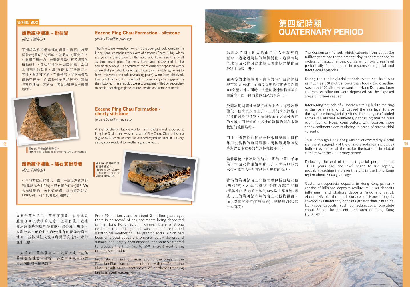
108 109
資料匣 BOX
Eocene Ping Chau Formation - siltstone (around 50 million years ago)
The Ping Chau Formation, which is the youngest rock formation in Hong Kong, comprises thin layers of siltstone (Figure 6-38), which are gently inclined towards the northeast. Fossil insects as well as bituminised plant fragments have been discovered in the sedimentary rocks. The sediments were originally deposited within a lake that periodically dried up allowing salt crystals (gypsum) to form. However, the salt crystals (gypsum) were later dissolved, leaving behind only the moulds of the original crystals of gypsum in the siltstone. These moulds were subsequently filled by secondary minerals, including aegirine, calcite, zeolite and acmite minerals.
Eocene Ping Chau Formation - cherty siltstone (around 50 million years ago)
A layer of cherty siltstone (up to 1.2 m thick) is well exposed at Lung Lok Shui on the western coast of Ping Chau. Cherty siltstone (Figure 6-39) contains very fine-grained crystalline silica. It is a very strong rock resistant to weathering and erosion.
始新統平洲組 - 粉砂岩
平洲組是香港最年輕的岩層,岩石由薄層粉砂岩(圖6-38)組成,並略斜向東北方。在此組沉積岩內,曾發現昆蟲化石及瀝青化植物碎片。這些沉積物於湖底沉積,當湖水周期性的乾涸,鹽(石膏)便沉澱形成。其後,石膏被溶解,在粉砂岩上留下石膏晶體的空模子,而這些模子最終被次生礦物包括霓輝石、方解石、沸石及錐輝石等礦物填補。
始新統平洲組 - 燧石質粉砂岩
在平洲西岸的龍落水,露出一層燧石質粉砂岩(厚度高至1.2米)。燧石質粉砂岩(圖6-39)含極微細的二氧化矽晶體,燧石質粉砂岩非常堅硬,可以抵禦風化和侵蝕。
From 50 million years to about 2 million years ago, there is no record of any sediments being deposited in the Hong Kong region. However, there is strong evidence that this period was one of continued subtropical weathering. The granitic rocks, which had been emplaced about 2 kilometres below the ground surface, had largely been exposed, and were weathered to produce the thick (up to 250 metres) weathering profiles seen today.
From about 5 million years ago to the present, the Eurasian Plate has been in collision with the Philippine Plate, resulting in reactivation of northeast-trending faults in southeastern China.
從五千萬至約二百萬年前期間,香港地區 並無任何沉積物的紀錄,但卻有強力證據 顯示這段時期處於持續的亞熱帶風化環境。大部分原本藏於地下約2公里深的花崗岩露出 地面,並被風化成現今所見厚度達250米的 風化土層。
由大約五百萬年前至今,歐亞板塊一直與 菲律賓板塊發生碰撞,導致中國東南部的 東北向斷層再度活躍。
圖6-38. 平洲組的粉砂岩。Figure 6-38. Siltstone of the Ping Chau Formation.
圖6-39. 平洲組的燧石質粉砂岩。Figure 6-39. Cherty siltstone of the Ping Chau Formation.
第四紀時期QUATERNARY PERIOD
第 四 紀 時 期 , 即 大 約 由 二 百 六 十 萬 年 前 至今,適逢週期性的氣候變化,這段時期 全球海面水位因應冰期及間冰期之變化而 分別下降或上升。
在寒冷的冰期期間,當時的海平面曾經較 現在的低120米,而海岸線則約位於香港以南100公里以外,同時,大量河流沖積物堆積在由於海平面下降而暴露出來的海床上。
於間冰期期間地球溫度略為上升,導致冰原 融化,使海水水位上升。上升的海水淹沒了沉積的河流沖積物,海泥覆蓋了大部分香港的水域,而較粗粒、多沙的沉積物則在水流較強的範圍堆積。
因此,儘管香港從來未被冰川淹蓋,但從 離岸沉積物的地層證據,間接證明第四紀 時期曾發生重要的全球性氣候變化。
隨 最後一個冰期的結束,即約一萬一千年前,海面水位開始急速上升,香港地區的 水位可能在八千年前已升至現時的高度。
香港的第四紀表土沉積主要包括山坡沉積 (坡積物)、河流沉積(沖積物)及離岸沉積 (泥與沙)。香港的土地約14%是由厚度達2米 或以上的第四紀時期的表土沉積物覆蓋, 而人為的沉積物(如填海區),則構成約6%的 土地面積。
The Quaternary Period, which extends from about 2.6 million years ago to the present-day, is characterised by cyclical climatic changes, during which world sea level periodically fell and rose in response to glacial and interglacial episodes.
During the cooler glacial periods, when sea level was as much as 120 metres lower than today, the coastline was about 100 kilometres south of Hong Kong and large volumes of alluvium were deposited on the exposed areas of former seabed.
Intervening periods of climatic warming led to melting of the ice sheets, which caused the sea level to rise during these interglacial periods. The rising sea flooded across the alluvial sediments, depositing marine mud over much of Hong Kong waters, with coarser, more sandy sediments accumulating in areas of strong tidal currents.
Thus, although Hong Kong was never covered by glacial ice, the stratigraphy of the offshore sediments provides indirect evidence of the major fluctuations in global climate over the Quaternary period.
Following the end of the last glacial period, about 11,000 years ago, sea level began to rise rapidly, probably reaching its present height in the Hong Kong region about 8,000 years ago.
Quaternary superficial deposits in Hong Kong primarily consist of hillslope deposits (colluvium), river deposits (alluvium), and offshore deposits (mud and sand). About 14% of the land surface of Hong Kong is covered by Quaternary deposits greater than 2 m thick. Man-made deposits, such as reclamations, constitute about 6% of the present land area of Hong Kong (1,105 km2).
(約五千萬年前)
(約五千萬年前)
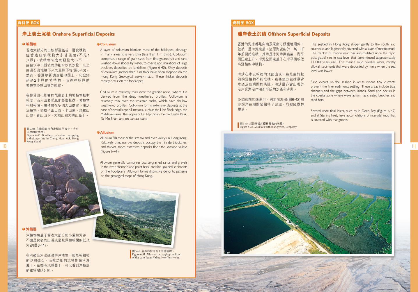
110 111
資料匣 BOX 資料匣 BOX
Colluvium
A layer of colluvium blankets most of the hillslopes, although in many areas it is very thin (less than 1 m thick). Colluvium comprises a range of grain sizes from fine-grained silt and sand washed down slopes by water, to coarse accumulations of large boulders deposited by landslides (Figure 6-40). Only deposits of colluvium greater than 2 m thick have been mapped on the Hong Kong Geological Survey maps. These thicker deposits mostly occur on the footslopes.
Colluvium is relatively thick over the granitic rocks, where it is derived from the deep weathered profiles. Colluvium is relatively thin over the volcanic rocks, which have shallow weathered profiles. Colluvium forms extensive deposits at the base of several large hill masses, such as the Lion Rock ridge, the Mid-levels area, the slopes of Fei Ngo Shan, below Castle Peak, Tai Mo Shan, and on Lantau Island
The seabed in Hong Kong slopes gently to the south and southeast, and is generally covered with a layer of marine mud. The blanket of marine mud has accumulated since the rapid post-glacial rise in sea level that commenced approximately 11,000 years ago. The marine mud overlies older, mostly alluvial, sediments that were deposited by rivers when the sea level was lower.
Sand occurs on the seabed in areas where tidal currents prevent the finer sediments settling. These areas include tidal channels and the gaps between islands. Sand also occurs in the coastal zone where wave action has created beaches and sand bars.
Several wide tidal inlets, such as in Deep Bay (Figure 6-42) and at Starling Inlet, have accumulations of intertidal mud that is covered with mangroves.
•Alluvium
Alluvium fills most of the stream and river valleys in Hong Kong. Relatively thin, narrow deposits occupy the hillside tributaries, and thicker, more extensive deposits floor the lowland valleys (Figure 6-41).
Alluvium generally comprises coarse-grained sands and gravels in the river channels and point bars, and fine-grained sediments on the floodplains. Alluvium forms distinctive dendritic patterns on the geological maps of Hong Kong.
岸上表土沉積 Onshore Superficial Deposits 離岸表土沉積 Offshore Superficial Deposits
坡積物
香港大部分的山坡都覆蓋 一層坡積物,儘管這些坡積物大多非常薄 (不足 1米厚)。坡積物包含的顆粒大小不一,由被水沖下斜坡的幼細粉砂及沙粒,以至由泥石流堆積下來的巨礫不等(圖6-40)。然而,香港地質調查組地圖上,只記錄超過2米厚的坡積物,而這些較厚的坡積物多數出現於麓坡。
在飽受風化影響的花崗岩上的坡積物相對較厚,而火山岩受風化影響較微,坡積物相對較薄。坡積層在多個大山群留下廣泛沉積物,如獅子山山脊、半山區、飛鵝山山坡、青山山下、大帽山和大嶼山島上。
香港的海床都是向南及東南方緩緩地傾斜,並被一層海泥掩蓋。這層海泥約於一萬一千年前開始堆積,其時是冰河時期過後,海平面迅速上升。海泥全面掩蓋了在海平面較低時沉積的沖積物。
海沙在水流較強的地區出現,這是由於較幼的沉積物不能堆積。這些地方包括潮汐水道及島嶼間的峽隙。海沙層亦會出現於沿岸受海浪作用而形成的沙灘和沙洲。
多個寬闊的進潮口,例如后海灣(圖6-42)和沙頭角在潮間帶囤積了淤泥,均被紅樹林覆蓋。
• 沖積層
沖積物填蓋了香港大部分的小溪和河谷,不論是狹窄的山溪或是較深和較闊的低地河谷(圖6-41)。
在河道及河流邊灘的沖積物一般是較粗粒的沙和礫石,而較幼細的沉積則在河漫灘上。在香港地質圖上,可以看到沖積層的獨特樹狀分佈。
圖6-40. 在港島舂坎角堆積在河流中,含有巨礫的坡積物。Figure 6-40. Bouldery colluvium occupying a drainage line in Chung Hom Kok, Hong Kong Island.
圖6-41. 新界林村河谷上的沖積物。Figure 6-41. Alluvium occupying the floor of the Lam Tsuen Valley, New Territories.
圖6-42. 后海灣被紅樹林覆蓋的潮灘。Figure 6-42. Mudflats with mangroves, Deep Bay.
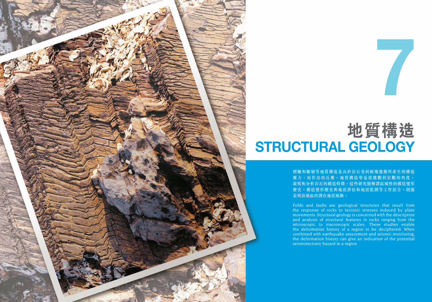
褶皺和斷層等地質構造是由於岩石受到板塊運動所產生的構造 應力,而作出的反應。地質構造學是從微觀到宏觀的角度, 說明和分析岩石的構造特徵。這些研究能解譯區域性的構造變形 歷史。構造變形歷史與地震評估和地震監測等工作結合,則能 表明該地區的潛在地震風險。
Folds and faults are geological structures that result from the response of rocks to tectonic stresses induced by plate movements. Structural geology is concerned with the description and analysis of structural features in rocks ranging from the microscopic to macroscopic scales. These studies enable the deformation history of a region to be deciphered. When combined with earthquake assessment and seismic monitoring, the deformation history can give an indication of the potential seismotectonic hazard in a region.
地質構造STRUCTURAL GEOLOGY
7
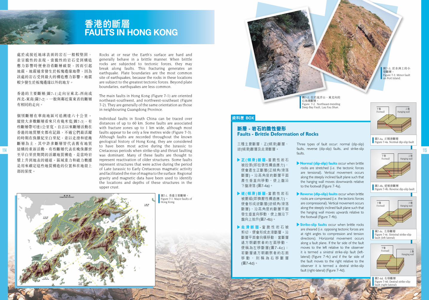
圖7-4a. 正傾滑斷層 Figure 7-4a. Normal dip-slip fault
下盤Footwall
上盤Hanging wall
圖7-4b. 逆傾滑斷層 Figure 7-4b. Reverse dip-slip fault
下盤Footwall
上盤Hanging wall
圖7-4c. 左移斷層 Figure 7-4c. Sinistral strike-slip fault (left-lateral)
下盤Footwall
上盤Hanging wall
圖7-4d. 右移斷層 Figure 7-4d. Dextral strike-slip fault (right-lateral)
下盤Footwall 上盤
Hanging wall
114 115
香港的斷層 FAULTS IN HONG KONG
處於或接近地球表面的岩石一般較堅固, 並呈脆性的表現。當脆性的岩石受到構造 應力影響時便會沿 斷層破裂,因而引起 地震。地震通常發生於板塊邊緣地帶,因為該處的岩石受到最大的構造應力影響。地震較少發生於板塊邊緣以外的地方。
香港的主要斷層(圖7-1)走向呈東北-西南或 西北-東南(圖7-2),一般與鄰近廣東省的斷層有相同的走向。
個別斷層在華南地區可追溯達六十公里。 縱使大多數斷層看來只有幾米寬(圖7-3),有些斷層帶可達1公里寬。自古以來斷層活動在 香港的地質歷史都有記錄,不過它們最活躍的時期在侏羅紀至白堊紀,並以走滑和逆衝斷層為主,其中許多斷層皆代表舊有地質 結構的重新活動。有些斷層代表在晚侏羅世至早白堊世期間的活躍地質構造,是當時岩漿上升到地表的通道。區域重力和磁力數據是用來確定這些地質構造的位置和在地殼上部的深度。
圖7-1. 香港主要斷層。Figure 7-1. Major faults of Hong Kong.
圖7-2. 位於流浮山,東北向的后海灣斷層。Figure 7-2. Northeast-trending Deep Bay Fault, Lau Fau Shan.
圖7-3. 於赤洲上的小型斷層。Figure 7-3. Minor fault on Port Island.
資料匣 BOX
Three types of fault occur: normal (dip-slip) faults, reverse (dip-slip) faults, and strike-slip faults.
Normal (dip-slip) faults occur when brittle rocks are stretched (i.e. the tectonic forces are tensional). Vertical movement occurs along the steeply inclined fault plane such that the hanging wall moves downwards relative to the footwall (Figure 7-4a).
Reverse (dip-slip) faults occur when brittle rocks are compressed (i.e. the tectonic forces are compressional). Vertical movement occurs along the steeply inclined fault plane such that the hanging wall moves upwards relative to the footwall (Figure 7-4b).
Strike-slip faults occur when brittle rocks are sheared (i.e. opposing tectonic forces are at right angles to compression and tension directions). Horizontal movement occurs along a fault plane. If the far side of the fault moves to the left relative to the observer it is termed a sinistral strike-slip fault (left- lateral) (Figure 7-4c) and if the far side of the fault moves to the right relative to the observer it is termed a dextral strike-slip fault (right-lateral) (Figure 7-4d).
斷層-岩石的脆性變形Faults - Brittle Deformation of Rocks
三種主要斷層:正(傾滑)斷層、 逆(傾滑)斷層及走滑斷層。
正 ( 傾 滑 ) 斷 層 - 當 脆 性 岩 石 被拉張(即拉張性構造應力),便會產生正斷層(正傾角/滑落斷層)。沿高角度的斷層平面 產生垂直向移動,使上盤沿 下盤滑落 (圖7-4a)。
逆 ( 傾 滑 ) 斷 層 - 當 脆 性 岩 石 被壓縮(即擠壓性構造應力),便會形成逆斷層(逆傾角/滑落斷層),沿高角度的斷層平面發生垂直向移動,使上盤沿下盤向上抬升(圖7-4b)。
走 滑 斷 層 - 當 脆 性 岩 石 被 剪切,便會形成走滑斷層。沿斷層平面會向橫移動:當斷層 遠方朝觀察者的左面移動, 便稱為左移斷層(圖7-4c); 若斷層遠方朝觀察者的右面 移 動 , 則 稱 為 右 移 斷 層 (圖7-4d)。
Rocks at or near the Earth’s surface are hard and generally behave in a brittle manner. When brittle rocks are subjected to tectonic forces, they may break along faults. This fracturing generates an earthquake. Plate boundaries are the most common site of earthquakes, because the rocks in these locations are subject to the greatest tectonic forces. Beyond plate boundaries, earthquakes are less common.
The main faults in Hong Kong (Figure 7-1) are oriented northeast-southwest, and northwest-southeast (Figure 7-2). They are generally of the same orientation as those in neighbouring Guangdong Province.
Individual faults in South China can be traced over distances of up to 60 km. Some faults are associated with fracture zones up to 1 km wide, although most faults appear to be only a few metres wide (Figure 7-3). Although faults are recorded throughout the known geological history of Hong Kong, they are considered to have been most active during the Jurassic to Cretaceous periods when strike-slip and thrust faulting was dominant. Many of these faults are thought to represent reactivation of older structures. Some faults represent structures that were active during the period of Late Jurassic to Early Cretaceous magmatic activity and facilitated the rise of magma to the surface. Regional gravity and magnetic data have been used to identify the locations and depths of these structures in the upper crust.
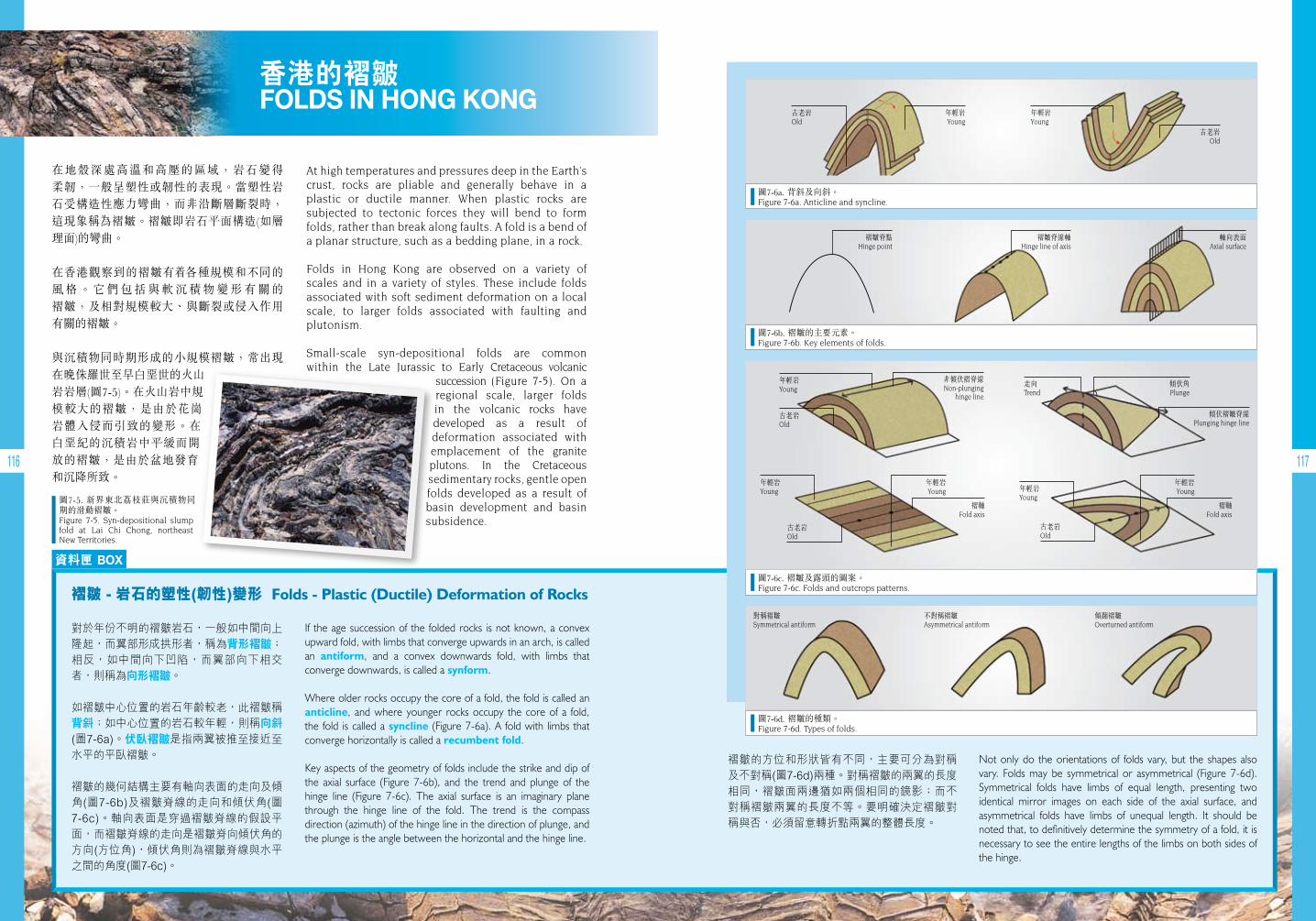
116 117
At high temperatures and pressures deep in the Earth’s crust, rocks are pliable and generally behave in a plastic or ductile manner. When plastic rocks are subjected to tectonic forces they will bend to form folds, rather than break along faults. A fold is a bend of a planar structure, such as a bedding plane, in a rock.
Folds in Hong Kong are observed on a variety of scales and in a variety of styles. These include folds associated with soft sediment deformation on a local scale, to larger folds associated with faulting and plutonism.
Small-scale syn-depositional folds are common within the Late Jurassic to Early Cretaceous volcanic
succession (Figure 7-5). On a regional scale, larger folds in the volcanic rocks have developed as a result of deformation associated with emplacement of the granite plutons. In the Cretaceous sedimentary rocks, gentle open folds developed as a result of basin development and basin subsidence.
香港的褶皺 FOLDS IN HONG KONG
資料匣 BOX
If the age succession of the folded rocks is not known, a convex upward fold, with limbs that converge upwards in an arch, is called an antiform, and a convex downwards fold, with limbs that converge downwards, is called a synform.
Where older rocks occupy the core of a fold, the fold is called an anticline, and where younger rocks occupy the core of a fold, the fold is called a syncline (Figure 7-6a). A fold with limbs that converge horizontally is called a recumbent fold.
Key aspects of the geometry of folds include the strike and dip of the axial surface (Figure 7-6b), and the trend and plunge of the hinge line (Figure 7-6c). The axial surface is an imaginary plane through the hinge line of the fold. The trend is the compass direction (azimuth) of the hinge line in the direction of plunge, and the plunge is the angle between the horizontal and the hinge line.
對於年份不明的褶皺岩石,一般如中間向上隆起,而翼部形成拱形者,稱為背形褶皺; 相反,如中間向下凹陷,而翼部向下相交者,則稱為向形褶皺。
如褶皺中心位置的岩石年齡較老,此褶皺稱背斜;如中心位置的岩石較年輕,則稱向斜(圖7-6a)。伏臥褶皺是指兩翼被推至接近至水平的平臥褶皺。
褶皺的幾何結構主要有軸向表面的走向及傾角(圖7-6b)及褶皺脊線的走向和傾伏角(圖7-6c)。軸向表面是穿過褶皺脊線的假設平面,而褶皺脊線的走向是褶皺脊向傾伏角的方向(方位角),傾伏角則為褶皺脊線與水平之間的角度(圖7-6c)。
褶皺-岩石的塑性(韌性)變形Folds - Plastic (Ductile) Deformation of Rocks
褶皺的方位和形狀皆有不同,主要可分為對稱及不對稱(圖7-6d)兩種。對稱褶皺的兩翼的長度相同,褶皺面兩邊猶如兩個相同的鏡影;而不對稱褶皺兩翼的長度不等。要明確決定褶皺對稱與否,必須留意轉折點兩翼的整體長度。
Not only do the orientations of folds vary, but the shapes also vary. Folds may be symmetrical or asymmetrical (Figure 7-6d). Symmetrical folds have limbs of equal length, presenting two identical mirror images on each side of the axial surface, and asymmetrical folds have limbs of unequal length. It should be noted that, to definitively determine the symmetry of a fold, it is necessary to see the entire lengths of the limbs on both sides of the hinge.
圖7-6b. 褶皺的主要元素。Figure 7-6b. Key elements of folds.
圖7-6d. 褶皺的種類。Figure 7-6d. Types of folds.
圖7-6a. 背斜及向斜。 Figure 7-6a. Anticline and syncline.
圖7-5. 新界東北荔枝莊與沉積物同期的滑動褶皺。Figure 7-5. Syn-depositional slump fold at Lai Chi Chong, northeast New Territories.
圖7-6c. 褶皺及露頭的圖案。Figure 7-6c. Folds and outcrops patterns.
對稱褶皺Symmetrical antiform
不對稱褶皺Asymmetrical antiform
傾翻褶皺Overturned antiform
古老岩Old
年輕岩Young
年輕岩Young 年輕岩
Young
年輕岩Young
年輕岩Young
褶軸Fold axis
褶軸Fold axis
年輕岩Young
褶皺脊點Hinge point
非傾伏褶脊線Non-plunging
hinge line
褶皺脊線軸 Hinge line of axis
傾伏角Plunge
傾伏褶皺脊線Plunging hinge line
軸向表面Axial surface
古老岩Old
古老岩Old
古老岩Old
古老岩Old
年輕岩Young
走向 Trend
在地殼深處高溫和高壓的區域,岩石變得 柔韌,一般呈塑性或韌性的表現。當塑性岩石受構造性應力彎曲,而非沿斷層斷裂時,這現象稱為褶皺。褶皺即岩石平面構造(如層理面)的彎曲。
在香港觀察到的褶皺有 各種規模和不同的 風 格 。 它 們 包 括 與 軟 沉 積 物 變 形 有 關 的 褶皺,及相對規模較大、與斷裂或侵入作用有關的褶皺。
與沉積物同時期形成的小規模褶皺,常出現 在晚侏羅世至早白堊世的火山岩岩層(圖7-5)。在火山岩中規模較大的褶皺,是由於花崗岩體入侵而引致的變形。在白堊紀的沉積岩中平緩而開放的褶皺,是由於盆地發育和沉降所致。
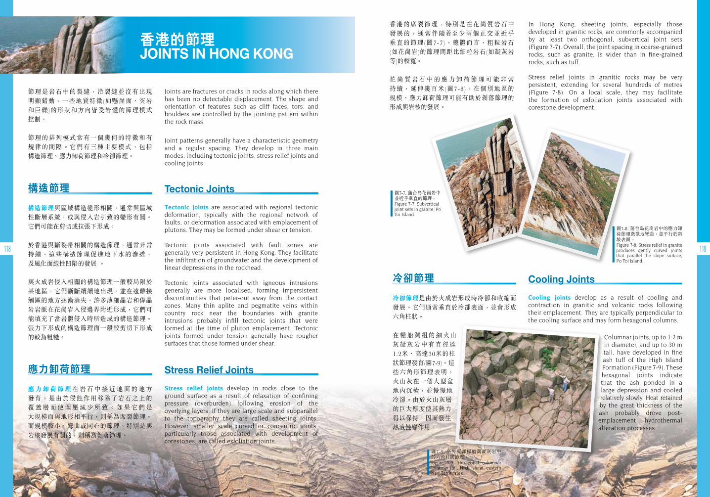
118 119
香港的節理 JOINTS IN HONG KONG
冷卻節理
冷卻節理是由於火成岩形成時冷卻和收縮而發展。它們通常垂直於冷卻表面,並會形成六角柱狀。
在糧船灣組的細火山灰凝灰岩中有直徑達 1.2米、高達30米的柱狀節理發育(圖7-9)。這些六角形節理表明,火山灰在一個大型盆地內沉積,並慢慢地冷卻。由於火山灰層的巨大厚度使其熱力得以保持,因而發生 熱液蝕變作用。
Cooling Joints
Cooling joints develop as a result of cooling and contraction in granitic and volcanic rocks following their emplacement. They are typically perpendicular to the cooling surface and may form hexagonal columns.
Columnar joints, up to 1.2 m in diameter, and up to 30 m tall, have developed in fine ash tuff of the High Island Formation (Figure 7-9). These hexagonal joints indicate that the ash ponded in a large depression and cooled relatively slowly. Heat retained by the great thickness of the ash probably drove post- emplacement hydrothermal alteration processes.
Tectonic Joints
Tectonic joints are associated with regional tectonic deformation, typically with the regional network of faults, or deformation associated with emplacement of plutons. They may be formed under shear or tension.
Tectonic joints associated with fault zones are generally very persistent in Hong Kong. They facilitate the infiltration of groundwater and the development of linear depressions in the rockhead.
Tectonic joints associated with igneous intrusions generally are more localised, forming impersistent discontinuities that peter-out away from the contact zones. Many thin aplite and pegmatite veins within country rock near the boundaries with granite intrusions probably infill tectonic joints that were formed at the time of pluton emplacement. Tectonic joints formed under tension generally have rougher surfaces that those formed under shear.
Stress Relief Joints
Stress relief joints develop in rocks close to the ground surface as a result of relaxation of confining pressure (overburden) following erosion of the overlying layers. If they are large scale and subparallel to the topography they are called sheeting joints. However, smaller scale curved or concentric joints, particularly those associated with development of corestones, are called exfoliation joints.
構造節理
構造節理與區域構造變形相關,通常與區域性斷層系統,或與侵入岩引致的變形有關。它們可能在剪切或拉張下形成。
於香港與斷裂帶相關的構造節理,通常非常持續。這些構造節理促進地下水的滲透, 及風化面線性凹陷的發展 。
與火成岩侵入相關的構造節理一般較局限於某地區,它們斷斷續續地出現,並在遠離接觸區的地方逐漸消失。許多薄細晶岩和偉晶岩岩脈在花崗岩入侵邊界附近形成,它們可能填充了當岩體侵入時所造成的構造節理。張力下形成的構造節理面一般較剪切下形成的較為粗糙。
應力卸荷節理
應力卸荷節理在 岩 石 中 接 近 地 面 的 地 方 發育,是由於侵蝕作用移除了岩石之上的 覆 蓋 層 而 使 圍 壓 減 少 所 致 。 如 果 它 們 是 大規模而與地形相平行,則稱為席裂節理。而規模較小、彎曲或同心的節理,特別是與
岩核發展有關的,則稱為剝落節理。
圖7-7. 蒲台島花崗岩中並近乎垂直的節理。Figure 7-7. Subvertical joint sets in granite, Po Toi Island.
圖7-9. 新界東部糧船灣凝灰岩中的六角柱狀節理。Figure 7-9. Hexagonal columnar joints in tuff, High Island, eastern New Territories.
圖7-8. 蒲台島花崗岩中的應力卸荷節理微微地彎曲,並平行於斜坡表面。Figure 7-8. Stress relief in granite produces gently curved joints that parallel the slope surface, Po Toi Island.
節理是岩石中的裂縫,沿裂縫並沒有出現 明顯錯動。一些地質特徵(如懸崖面、突岩 和巨礫)的形狀和方向皆受岩體的節理模式 控制。
節理的排列模式常有一個幾何的特徵和有 規律的間隔。它們有三種主要模式,包括 構造節理、應力卸荷節理和冷卻節理。
Joints are fractures or cracks in rocks along which there has been no detectable displacement. The shape and orientation of features such as cliff faces, tors, and boulders are controlled by the jointing pattern within the rock mass.
Joint patterns generally have a characteristic geometry and a regular spacing. They develop in three main modes, including tectonic joints, stress relief joints and cooling joints.
香港的席裂節理,特別是在花崗質岩石中 發展的,通常伴隨 至少兩個正交並近乎 垂直的節理(圖7-7)。總體而言,粗粒岩石 (如花崗岩)的節理間距比細粒岩石(如凝灰岩等)的較寬。
花 崗 質 岩 石 中 的 應 力 卸 荷 節 理 可 能 非 常 持續,延伸幾百米(圖7-8)。在個別地區的 規模,應力卸荷節理可能有助於剝落節理的形成與岩核的發展。
In Hong Kong, sheeting joints, especially those developed in granitic rocks, are commonly accompanied by at least two orthogonal, subvertical joint sets (Figure 7-7). Overall, the joint spacing in coarse-grained rocks, such as granite, is wider than in fine-grained rocks, such as tuff.
Stress relief joints in granitic rocks may be very persistent, extending for several hundreds of metres (Figure 7-8). On a local scale, they may facilitate the formation of exfoliation joints associated with corestone development.
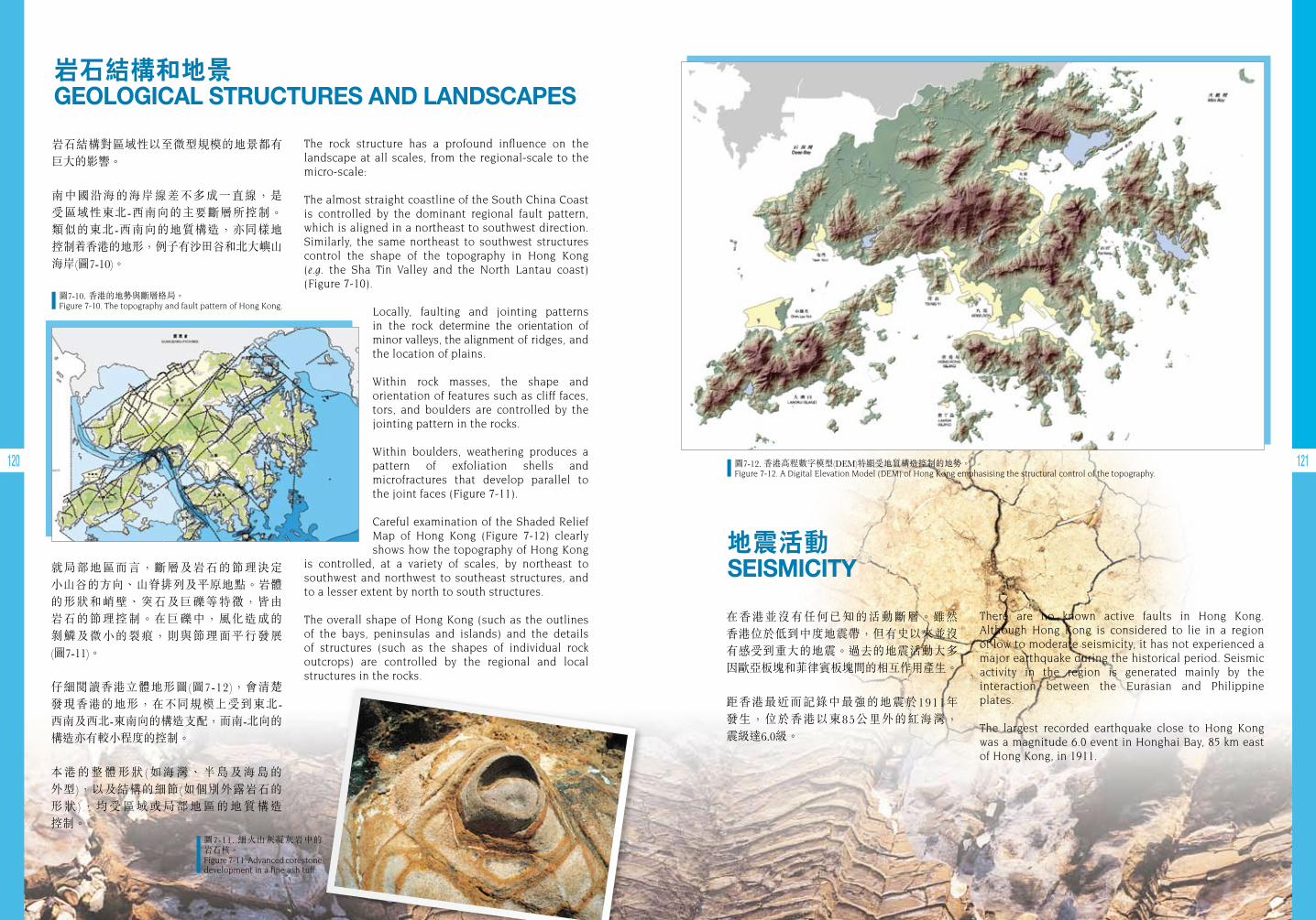
120 121
地震活動SEISMICITY
岩石結構和地景GEOLOGICAL STRUCTURES AND LANDSCAPES
在香港並沒有任何已知的活動斷層。雖然 香港位於低到中度地震帶,但有史以來並沒有感受到重大的地震。過去的地震活動大多因歐亞板塊和菲律賓板塊間的相互作用產生。
距香港最近而記錄中最強的地震於1911年 發生,位於香港以東85公里外的紅海灣, 震級達6.0級。
岩石結構對區域性以至微型規模的地景都有巨大的影響。
南中國沿海的海岸線差不多成一直線,是受區域性東北-西南向的主要斷層所控制。類似的東北-西南向的地質構造,亦同樣地 控制 香港的地形,例子有沙田谷和北大嶼山海岸(圖7-10)。
There are no known active faults in Hong Kong. Although Hong Kong is considered to lie in a region of low to moderate seismicity, it has not experienced a major earthquake during the historical period. Seismic activity in the region is generated mainly by the interaction between the Eurasian and Philippine plates.
The largest recorded earthquake close to Hong Kong was a magnitude 6.0 event in Honghai Bay, 85 km east of Hong Kong, in 1911.
The rock structure has a profound influence on the landscape at all scales, from the regional-scale to the micro-scale:
The almost straight coastline of the South China Coast is controlled by the dominant regional fault pattern, which is aligned in a northeast to southwest direction. Similarly, the same northeast to southwest structures control the shape of the topography in Hong Kong (e.g. the Sha Tin Valley and the North Lantau coast) (Figure 7-10).
Locally, faulting and jointing patterns in the rock determine the orientation of minor valleys, the alignment of ridges, and the location of plains.
Within rock masses, the shape and orientation of features such as cliff faces, tors, and boulders are controlled by the jointing pattern in the rocks.
Within boulders, weathering produces a pattern of exfoliation shells and microfractures that develop parallel to the joint faces (Figure 7-11).
Careful examination of the Shaded Relief Map of Hong Kong (Figure 7-12) clearly shows how the topography of Hong Kong
is controlled, at a variety of scales, by northeast to southwest and northwest to southeast structures, and to a lesser extent by north to south structures.
The overall shape of Hong Kong (such as the outlines of the bays, peninsulas and islands) and the details of structures (such as the shapes of individual rock outcrops) are controlled by the regional and local structures in the rocks.
圖7-10. 香港的地勢與斷層格局。Figure 7-10. The topography and fault pattern of Hong Kong.
圖7-12. 香港高程數字模型(DEM)特顯受地質構造控制的地勢。Figure 7-12. A Digital Elevation Model (DEM) of Hong Kong emphasising the structural control of the topography.
圖7-11. 細火山灰凝灰岩中的 岩石核。Figure 7-11. Advanced corestone development in a fine ash tuff.
就局部地區而言,斷層及岩石的節理決定 小山谷的方向、山脊排列及平原地點。岩體的形狀和峭壁、突石及巨礫等特徵,皆由岩石的節理控制。在巨礫中,風化造成的剝鱗及微小的裂痕,則與節理面平行發展 (圖7-11)。
仔細閱讀香港立體地形圖(圖7-12),會清楚 發現香港的地形,在不同規模上受到東北- 西南及西北-東南向的構造支配,而南-北向的構造亦有較小程度的控制。
本港的整體形狀(如海灣、半島及海島的 外型),以及結構的細節(如個別外露岩石的 形狀),均受區域或局部地區的地質構造 控制。
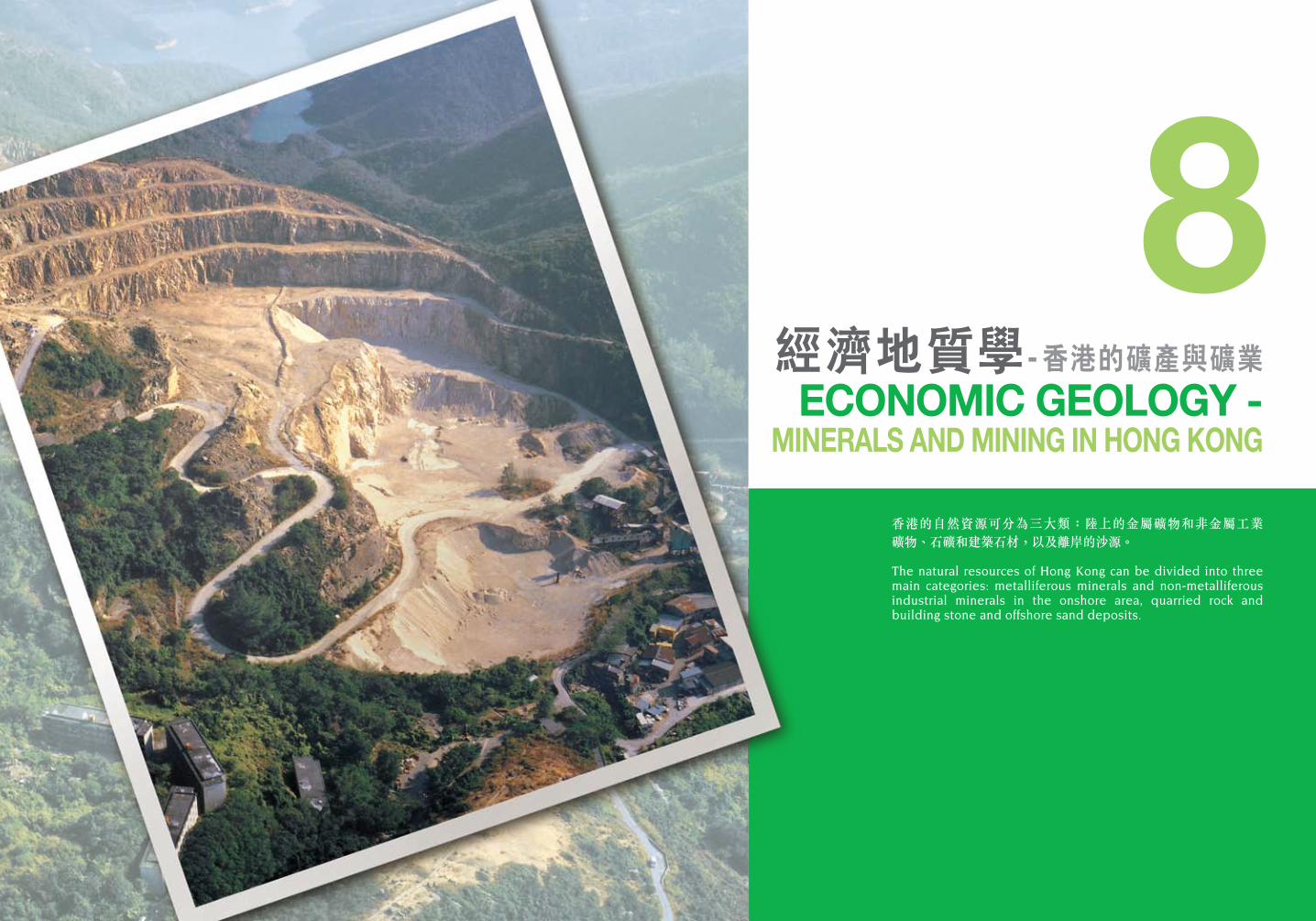
香港的自然資源可分為三大類:陸上的金屬礦物和非金屬工業礦物、石礦和建築石材,以及離岸的沙源。
The natural resources of Hong Kong can be divided into three main categories: metalliferous minerals and non-metalliferous industrial minerals in the onshore area, quarried rock and building stone and offshore sand deposits.
經濟地質學- 香港的礦產與礦業ECONOMIC GEOLOGY -
MINERALS AND MINING IN HONG KONG
8
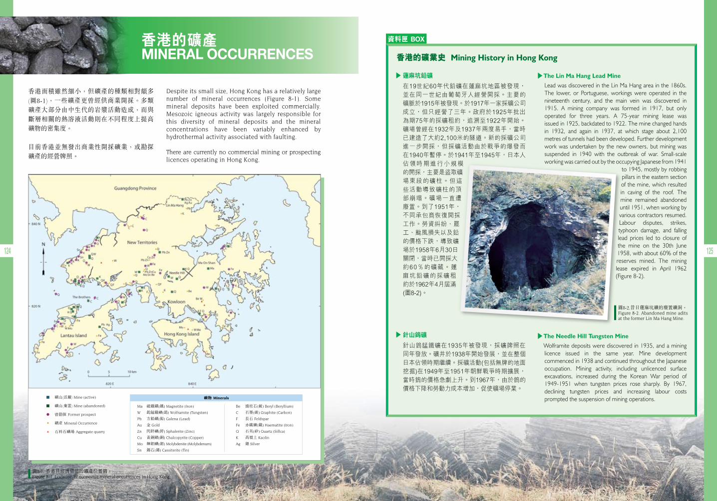
124 125
香港的礦產 MINERAL OCCURRENCES
香港面積雖然細小,但礦產的種類相對頗多 (圖8-1),一些礦產更曾經供商業開採。多類 礦產大部分由中生代的岩漿活動造成,而與斷層相關的熱溶液活動則在不同程度上提高礦物的密集度。
目前香港並無發出商業性開採礦業,或勘探礦產的經營牌照。
資料匣 BOX
The Lin Ma Hang Lead Mine
Lead was discovered in the Lin Ma Hang area in the 1860s. The lower, or Portuguese, workings were operated in the nineteenth century, and the main vein was discovered in 1915. A mining company was formed in 1917, but only operated for three years. A 75-year mining lease was issued in 1925, backdated to 1922. The mine changed hands in 1932, and again in 1937, at which stage about 2,100 metres of tunnels had been developed. Further development work was undertaken by the new owners, but mining was suspended in 1940 with the outbreak of war. Small-scale working was carried out by the occupying Japanese from 1941
to 1945, mostly by robbing pillars in the eastern section of the mine, which resulted in caving of the roof. The mine remained abandoned until 1951, when working by various contractors resumed. Labour disputes, strikes, typhoon damage, and falling lead prices led to closure of the mine on the 30th June 1958, with about 60% of the reserves mined. The mining lease expired in April 1962 (Figure 8-2).
The Needle Hill Tungsten Mine
Wolframite deposits were discovered in 1935, and a mining licence issued in the same year. Mine development commenced in 1938 and continued throughout the Japanese occupation. Mining activity, including unlicenced surface excavations, increased during the Korean War period of 1949-1951 when tungsten prices rose sharply. By 1967, declining tungsten prices and increasing labour costs prompted the suspension of mining operations.
香港的礦業史Mining History in Hong Kong
Despite its small size, Hong Kong has a relatively large number of mineral occurrences (Figure 8-1). Some mineral deposits have been exploited commercially. Mesozoic igneous activity was largely responsible for this diversity of mineral deposits and the mineral concentrations have been variably enhanced by hydrothermal activity associated with faulting.
There are currently no commercial mining or prospecting licences operating in Hong Kong.
圖8-1. 香港具經濟價值的礦產位置圖。 Figure 8-1. Location of economic mineral occurrences in Hong Kong.
蓮麻坑鉛礦
在19世紀60年代鉛礦在蓮麻坑地區被發現,並在同一世紀由葡萄牙人經營開採。主要的礦脈於1915年被發現。於1917年一家採礦公司成立,但只經營了三年。政府於1925年批出為期75年的採礦租約,追溯至1922年開始。礦場曾經在1932年及1937年兩度易手,當時已建造了大約2,100米的隧道。新的採礦公司進一步開採,但採礦活動由於戰爭的爆發而在1940年暫停。於1941年至1945年,日本人
佔領時期進行小規模的開採,主要是盜取礦場東段的礦柱。但這些活動導致礦柱的頂部崩塌。礦場一直遭廢置。到了1951年,不同承包商恢復開採工作。勞資糾紛、罷工、颱風損失以及鉛的價格下跌,導致礦場於1958年6月30日關閉,當時已開採大約60%的礦藏。蓮麻坑鉛礦的採礦租約於1962年4月屆滿(圖8-2)。
針山鎢礦
針山鎢錳鐵礦在1935年被發現,採礦牌照在同年發放。礦井於1938年開始發展,並在整個日本佔領時期繼續。採礦活動(包括無牌的地面挖掘)在1949年至1951年朝鮮戰爭時期擴展,當時鎢的價格急劇上升。到1967年,由於鎢的價格下降和勞動力成本增加,促使礦場停業。
圖8-2.昔日蓮麻坑礦的廢置礦洞。Figure 8-2. Abandoned mine adits at the former Lin Ma Hang Mine.
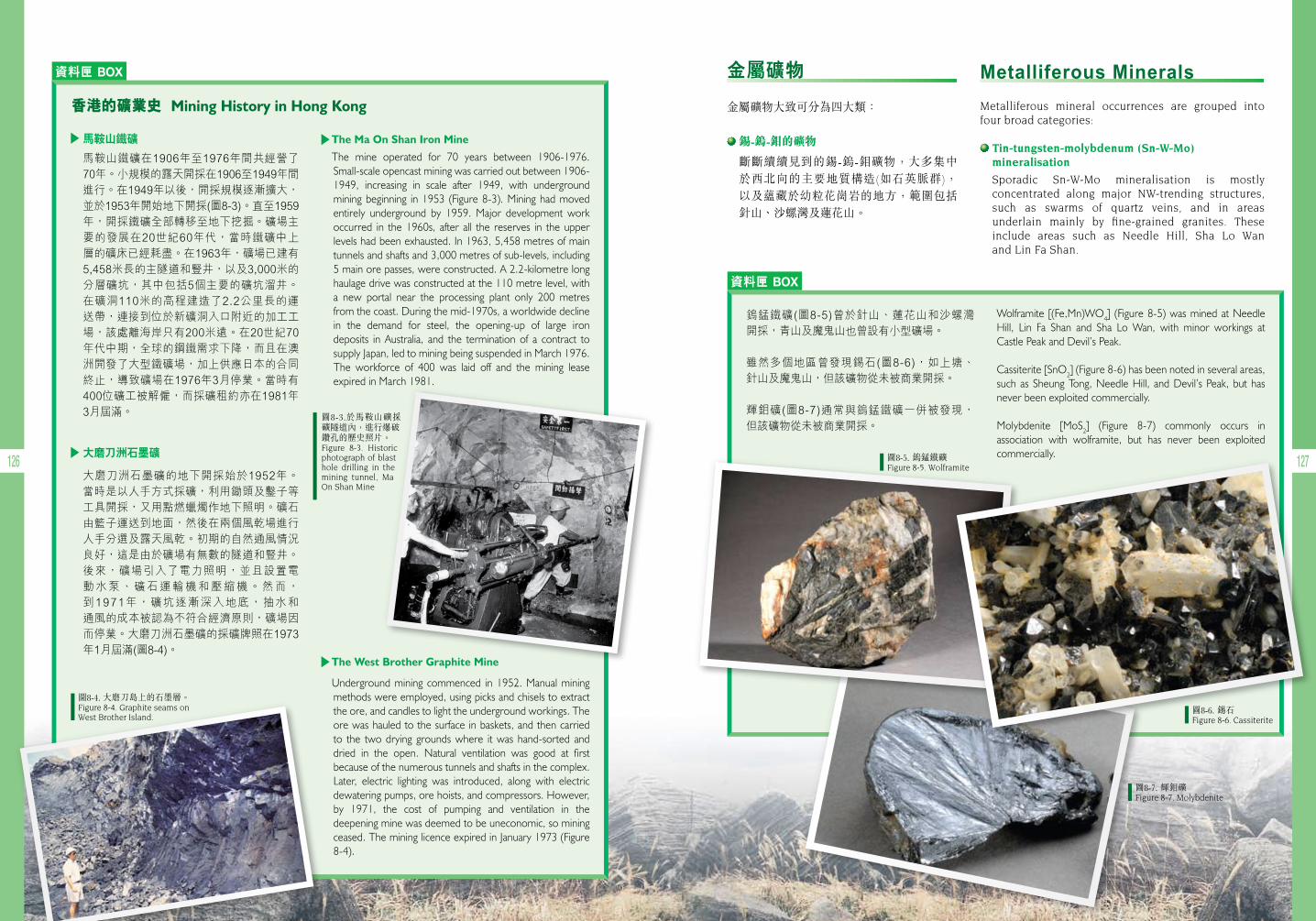
126 127
資料匣 BOX
資料匣 BOX
Wolframite [(Fe,Mn)WO4] (Figure 8-5) was mined at Needle Hill, Lin Fa Shan and Sha Lo Wan, with minor workings at Castle Peak and Devil’s Peak.
Cassiterite [SnO2] (Figure 8-6) has been noted in several areas, such as Sheung Tong, Needle Hill, and Devil’s Peak, but has never been exploited commercially.
Molybdenite [MoS2] (Figure 8-7) commonly occurs in association with wolframite, but has never been exploited commercially.
香港的礦業史Mining History in Hong Kong
馬鞍山鐵礦
馬鞍山鐵礦在1906年至1976年間共經營了70年。小規模的露天開採在1906至1949年間進行。在1949年以後,開採規模逐漸擴大,並於1953年開始地下開採(圖8-3)。直至1959年,開採鐵礦全部轉移至地下挖掘。礦場主要的發展在20世紀60年代,當時鐵礦中上層的礦床已經耗盡。在1963年,礦場已建有5,458米長的主隧道和豎井,以及3,000米的分層礦坑,其中包括5個主要的礦坑溜井。在礦洞110米的高程建造了2.2公里長的運送帶,連接到位於新礦洞入口附近的加工工場,該處離海岸只有200米遠。在20世紀70年代中期,全球的鋼鐵需求下降,而且在澳洲開發了大型鐵礦場,加上供應日本的合同終止,導致礦場在1976年3月停業。當時有400位礦工被解僱,而採礦租約亦在1981年3月屆滿。
大磨刀洲石墨礦
大磨刀洲石墨礦的地下開採始於1952年。當時是以人手方式採礦,利用鋤頭及鑿子等工具開採,又用點燃蠟燭作地下照明。礦石由籃子運送到地面,然後在兩個風乾場進行人手分選及露天風乾。初期的自然通風情況良好,這是由於礦場有無數的隧道和豎井。後來,礦場引入了電力照明,並且設置電動水泵、礦石運輸機和壓縮機。然而,到1971年,礦坑逐漸深入地底,抽水和通風的成本被認為不符合經濟原則,礦場因而停業。大磨刀洲石墨礦的採礦牌照在1973年1月屆滿(圖8-4)。
鎢錳鐵礦(圖8-5)曾於針山、蓮花山和沙螺灣開採,青山及魔鬼山也曾設有小型礦場。
雖然多個地區曾發現錫石(圖8-6),如上塘、針山及魔鬼山,但該礦物從未被商業開採。
輝鉬礦(圖8-7)通常與鎢錳鐵礦一併被發現,但該礦物從未被商業開採。
Metalliferous Minerals
Metalliferous mineral occurrences are grouped into four broad categories:
Tin-tungsten-molybdenum (Sn-W-Mo) mineralisation
Sporadic Sn-W-Mo mineralisation is mostly concentrated along major NW-trending structures, such as swarms of quartz veins, and in areas underlain mainly by fine-grained granites. These include areas such as Needle Hill, Sha Lo Wan and Lin Fa Shan.
金屬礦物
金屬礦物大致可分為四大類:
錫-鎢-鉬的礦物
斷斷續續見到的錫-鎢-鉬礦物,大多集中 於西北向的主要地質構造(如石英脈群), 以及蘊藏於幼粒花崗岩的地方,範圍包括針山、沙螺灣及蓮花山。
圖8-4. 大磨刀島上的石墨層。Figure 8-4. Graphite seams on West Brother Island.
圖8-5. 鎢錳鐵礦 Figure 8-5. Wolframite
圖8-6. 錫石Figure 8-6. Cassiterite
圖8-7. 輝鉬礦Figure 8-7. Molybdenite
The Ma On Shan Iron Mine
The mine operated for 70 years between 1906-1976. Small-scale opencast mining was carried out between 1906- 1949, increasing in scale after 1949, with underground mining beginning in 1953 (Figure 8-3). Mining had moved entirely underground by 1959. Major development work occurred in the 1960s, after all the reserves in the upper levels had been exhausted. In 1963, 5,458 metres of main tunnels and shafts and 3,000 metres of sub-levels, including 5 main ore passes, were constructed. A 2.2-kilometre long haulage drive was constructed at the 110 metre level, with a new portal near the processing plant only 200 metres from the coast. During the mid-1970s, a worldwide decline in the demand for steel, the opening-up of large iron deposits in Australia, and the termination of a contract to supply Japan, led to mining being suspended in March 1976. The workforce of 400 was laid off and the mining lease expired in March 1981.
The West Brother Graphite Mine
Underground mining commenced in 1952. Manual mining methods were employed, using picks and chisels to extract the ore, and candles to light the underground workings. The ore was hauled to the surface in baskets, and then carried to the two drying grounds where it was hand-sorted and dried in the open. Natural ventilation was good at first because of the numerous tunnels and shafts in the complex. Later, electric lighting was introduced, along with electric dewatering pumps, ore hoists, and compressors. However, by 1971, the cost of pumping and ventilation in the deepening mine was deemed to be uneconomic, so mining ceased. The mining licence expired in January 1973 (Figure 8-4).
圖8-3.於馬鞍山礦採礦隧道內,進行爆破鑽孔的歷史照片。Figure 8-3. Historic photograph of blast hole drilling in the mining tunnel, Ma On Shan Mine
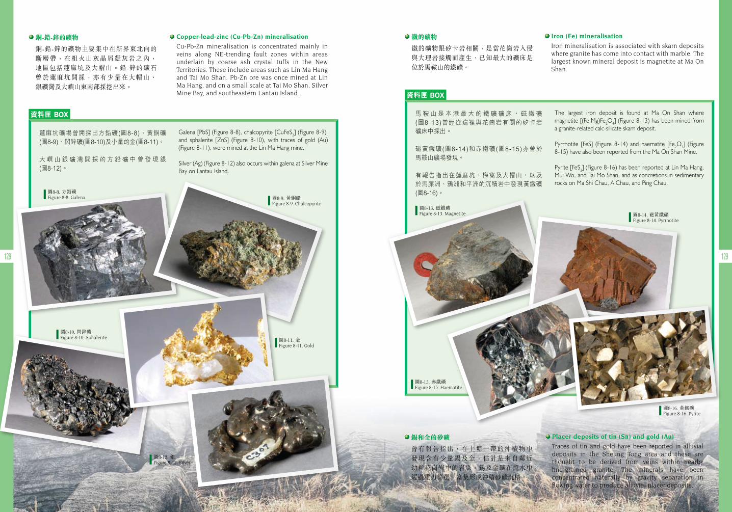
128 129
資料匣 BOX
資料匣 BOX
Galena [PbS] (Figure 8-8), chalcopyrite [CuFeS2] (Figure 8-9), and sphalerite [ZnS] (Figure 8-10), with traces of gold (Au) (Figure 8-11), were mined at the Lin Ma Hang mine.
Silver (Ag) (Figure 8-12) also occurs within galena at Silver Mine Bay on Lantau Island.
The largest iron deposit is found at Ma On Shan where magnetite [(Fe,Mg)Fe2O4] (Figure 8-13) has been mined from a granite-related calc-silicate skarn deposit.
Pyrrhotite [FeS] (Figure 8-14) and haematite [Fe2O3] (Figure 8-15) have also been reported from the Ma On Shan Mine.
Pyrite [FeS2] (Figure 8-16) has been reported at Lin Ma Hang, Mui Wo, and Tai Mo Shan, and as concretions in sedimentary rocks on Ma Shi Chau, A Chau, and Ping Chau.
蓮麻坑礦場曾開採出方鉛礦(圖8-8)、黃銅礦(圖8-9)、閃鋅礦(圖8-10)及小量的金(圖8-11)。
大嶼山銀礦灣開採的方鉛礦中曾發現銀(圖8-12)。
馬鞍山是本港最大的鐵礦礦床,磁鐵礦(圖8-13)曾經從這裡與花崗岩有關的矽卡岩礦床中採出。
磁黃鐵礦(圖8-14)和赤鐵礦(圖8-15)亦曾於馬鞍山礦場發現。
有報告指出在蓮麻坑、梅窩及大帽山,以及於馬屎洲、鴉洲和平洲的沉積岩中發現黃鐵礦(圖8-16)。
Copper-lead-zinc (Cu-Pb-Zn) mineralisation
Cu-Pb-Zn mineralisation is concentrated mainly in veins along NE-trending fault zones within areas underlain by coarse ash crystal tuffs in the New Territories. These include areas such as Lin Ma Hang and Tai Mo Shan. Pb-Zn ore was once mined at Lin Ma Hang, and on a small scale at Tai Mo Shan, Silver Mine Bay, and southeastern Lantau Island.
Iron (Fe) mineralisation
Iron mineralisation is associated with skarn deposits where granite has come into contact with marble. The largest known mineral deposit is magnetite at Ma On Shan.
銅-鉛-鋅的礦物
銅-鉛-鋅的礦物主要集中在新界東北向的 斷層帶,在粗火山灰晶屑凝灰岩之內, 地區包括蓮麻坑及大帽山。鉛-鋅的礦石 曾於蓮麻坑開採,亦有少量在大帽山、 銀礦灣及大嶼山東南部採挖出來。
鐵的礦物
鐵的礦物跟矽卡岩相關,是當花崗岩入侵與大理岩接觸而產生,已知最大的礦床是位於馬鞍山的鐵礦。
圖8-8. 方鉛礦Figure 8-8. Galena
圖8-13. 磁鐵礦Figure 8-13. Magnetite 圖8-14. 磁黃鐵礦
Figure 8-14. Pyrrhotite
圖8-15. 赤鐵礦Figure 8-15. Haematite
圖8-16. 黃鐵礦Figure 8-16. Pyrite
圖8-9. 黃銅礦 Figure 8-9. Chalcopyrite
圖8-10. 閃鋅礦 Figure 8-10. Sphalerite 圖8-11. 金
Figure 8-11. Gold
圖8-12. 銀Figure 8-12. Silver
Placer deposits of tin (Sn) and gold (Au)
Traces of tin and gold have been reported in alluvial deposits in the Sheung Tong area and these are thought to be derived from veins within nearby fine-grained granite. The minerals have been concentrated naturally by gravity separation in flowing water to produce alluvial placer deposits.
錫和金的砂礦
曾有報告指出,在上塘一帶的沖積物中 發現含有少量錫及金,估計是來自鄰近 幼粒花崗岩中的岩脈。錫及金礦在流水中經過重力篩選,富集形成沖積砂礦沉積。
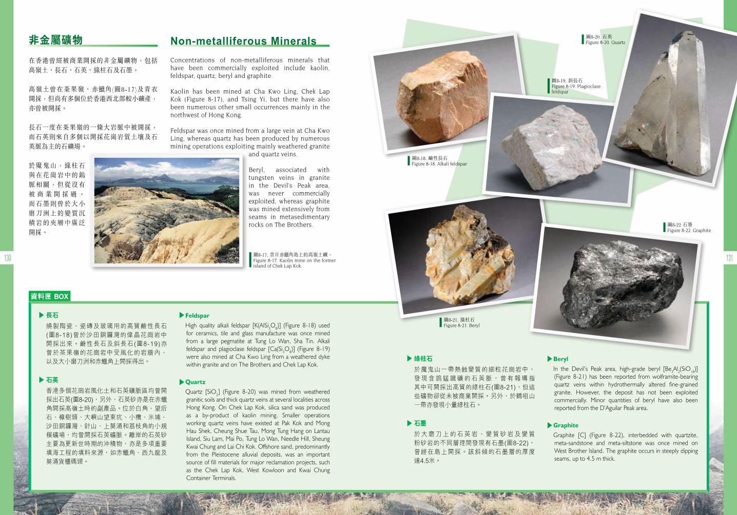
130 131
資料匣 BOX
Feldspar
High quality alkali feldspar [K(AISi3O8)] (Figure 8-18) used for ceramics, tile and glass manufacture was once mined from a large pegmatite at Tung Lo Wan, Sha Tin. Alkali feldspar and plagioclase feldspar [Ca(Si3O8)] (Figure 8-19) were also mined at Cha Kwo Ling from a weathered dyke within granite and on The Brothers and Chek Lap Kok.
Quartz
Quartz [SiO2] (Figure 8-20) was mined from weathered granitic soils and thick quartz veins at several localities across Hong Kong. On Chek Lap Kok, silica sand was produced as a by-product of kaolin mining. Smaller operations working quartz veins have existed at Pak Kok and Mong Hau Shek, Cheung Shue Tau, Mong Tung Hang on Lantau Island, Siu Lam, Mai Po, Tung Lo Wan, Needle Hill, Sheung Kwai Chung and Lai Chi Kok. Offshore sand, predominantly from the Pleistocene alluvial deposits, was an important source of fill materials for major reclamation projects, such as the Chek Lap Kok, West Kowloon and Kwai Chung Container Terminals.
Beryl
In the Devil’s Peak area, high-grade beryl [Be3Al2(SiO18)] (Figure 8-21) has been reported from wolframite-bearing quartz veins within hydrothermally altered fine-grained granite. However, the deposit has not been exploited commercially. Minor quantities of beryl have also been reported from the D’Aguilar Peak area.
Graphite
Graphite [C] (Figure 8-22), interbedded with quartzite, meta-sandstone and meta-siltstone was once mined on West Brother Island. The graphite occurs in steeply dipping seams, up to 4.5 m thick.
長石
燒製陶瓷、瓷磚及玻璃用的高質鹼性長石(圖8-18)曾於沙田銅鑼灣的偉晶花崗岩中開採出來。鹼性長石及斜長石(圖8-19)亦曾於茶果嶺的花崗岩中受風化的岩牆內、以及大小磨刀洲和赤 角上開採得出。
石英
香港多個花崗岩風化土和石英礦脈區均曾開採出石英(圖8-20),另外,石英砂亦是在赤角開採高嶺土時的副產品。位於白角、望后石、樟樹頭、大嶼山望東坑、小欖、米埔、沙田銅鑼灣、針山、上葵涌和荔枝角的小規模礦場,均曾開採石英礦脈。離岸的石英砂主要為更新世時期的沖積物,亦是多項重要填海工程的填料來源,如赤 角、西九龍及葵涌貨櫃碼頭。
綠柱石
於魔鬼山一帶熱蝕變質的細粒花崗岩中,發現含鎢錳鐵礦的石英脈,曾有報導指其中可開採出高質的綠柱石(圖8-21),但這些礦物卻從未被商業開採。另外,於鶴咀山一帶亦發現小量綠柱石。
石墨
於大磨刀上的石英岩、變質砂岩及變質粉砂岩的不同層理間發現有石墨(圖8-22),曾經在島上開採。該斜傾的石墨層的厚度達4.5米。
Non-metalliferous Minerals
Concentrations of non-metalliferous minerals that have been commercially exploited include kaolin, feldspar, quartz, beryl and graphite.
Kaolin has been mined at Cha Kwo Ling, Chek Lap Kok (Figure 8-17), and Tsing Yi, but there have also been numerous other small occurrences mainly in the northwest of Hong Kong.
Feldspar was once mined from a large vein at Cha Kwo Ling, whereas quartz has been produced by numerous mining operations exploiting mainly weathered granite
and quartz veins.
Beryl, associated with tungsten veins in granite in the Devil’s Peak area, was never commercially exploited, whereas graphite was mined extensively from seams in metasedimentary rocks on The Brothers.
非金屬礦物
在香港曾經被商業開採的非金屬礦物,包括 高嶺土、長石、石英、綠柱石及石墨。
高嶺土曾在茶果嶺、赤 角(圖8-17)及青衣 開採,但尚有多個位於香港西北部較小礦產, 亦曾被開採。
長石一度在茶果嶺的一條大岩脈中被開採,而石英則來自多個以開採花崗岩質土壤及石英脈為主的石礦場。
於魔鬼山,綠柱石與在花崗岩中的鎢脈相關,但從沒有被 商 業 開 採 過 。 而石墨則曾於大小磨刀洲上的變質沉積岩的夾層中廣泛開採。
圖8-18. 鹼性長石Figure 8-18. Alkali feldspar
圖8-20. 石英Figure 8-20. Quartz
圖8-21. 綠柱石Figure 8-21. Beryl
圖8-22 石墨Figure 8-22. Graphite
圖8-19. 斜長石Figure 8-19. Plagioclase feldspar
圖8-17. 昔日赤 角島上的高嶺土礦。Figure 8-17. Kaolin mine on the former island of Chek Lap Kok.
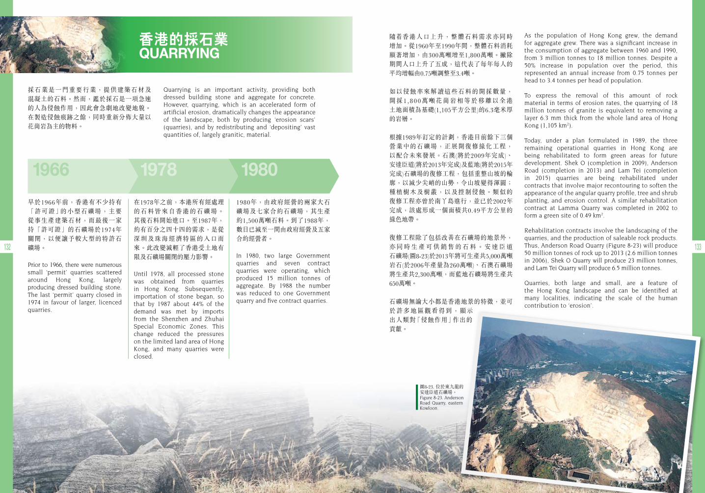
132 133
香港的採石業 QUARRYING
採石業是一門重要行業,提供建築石材及 混凝土的石料。然而,鑑於採石是一項急速的人為侵蝕作用,因此會急劇地改變地貌。在製造侵蝕痕跡之餘,同時重新分佈大量以 花崗岩為主的物料。
Quarrying is an important activity, providing both dressed building stone and aggregate for concrete. However, quarrying, which is an accelerated form of artificial erosion, dramatically changes the appearance of the landscape, both by producing ‘erosion scars’ (quarries), and by redistributing and ‘depositing’ vast quantities of, largely granitic, material.
隨 香港人口上升,整體石料需求亦同時 增加。從1960年至1990年間,整體石料消耗顯著增加,由300萬噸增至1,800萬噸。撇除 期間人口上升了五成,這代表了每年每人的平均增幅由0.75噸調整至3.4噸。
如以侵蝕率來解讀這些石料的開採數量, 開採1,800萬噸花崗岩相等於移離以全港 土地面積為基礎(1,105平方公里)的6.3毫米厚的岩層。
根據1989年訂定的計劃,香港目前餘下三個 營業中的石礦場,正展開復修綠化工程, 以配合未來發展。石澳(將於2009年完成)、 安達臣道(將於2013年完成)及藍地(將於2015年完成)石礦場的復修工程,包括重整山坡的輪廓,以減少尖峭的山勢,令山坡變得渾圓;種植樹木及樹叢,以及控制侵蝕。類似的 復修工程亦曾於南丫島進行,並已於2002年完成,該處形成一個面積共0.49平方公里的 綠色地帶。
復修工程除了包括改善在石礦場的地景外,亦 同 時 生 產 可 供 銷 售 的 石 料 。 安 達 臣 道 石礦場(圖8-23)於2013年將可生產共5,000萬噸岩石(於2006年產量為260萬噸)、石澳石礦場將生產共2,300萬噸,而藍地石礦場將生產共650萬噸。
石礦場無論大小都是香港地景的特徵,並可於許多地區觀看得到,顯示 出人類對「侵蝕作用」作出的貢獻。
As the population of Hong Kong grew, the demand for aggregate grew. There was a significant increase in the consumption of aggregate between 1960 and 1990, from 3 million tonnes to 18 million tonnes. Despite a 50% increase in population over the period, this represented an annual increase from 0.75 tonnes per head to 3.4 tonnes per head of population.
To express the removal of this amount of rock material in terms of erosion rates, the quarrying of 18 million tonnes of granite is equivalent to removing a layer 6.3 mm thick from the whole land area of Hong Kong (1,105 km2).
Today, under a plan formulated in 1989, the three remaining operational quarries in Hong Kong are being rehabilitated to form green areas for future development. Shek O (completion in 2009), Anderson Road (completion in 2013) and Lam Tei (completion in 2015) quarries are being rehabilitated under contracts that involve major recontouring to soften the appearance of the angular quarry profile, tree and shrub planting, and erosion control. A similar rehabilitation contract at Lamma Quarry was completed in 2002 to form a green site of 0.49 km2.
Rehabilitation contracts involve the landscaping of the quarries, and the production of saleable rock products. Thus, Anderson Road Quarry (Figure 8-23) will produce 50 million tonnes of rock up to 2013 (2.6 million tonnes in 2006), Shek O Quarry will produce 23 million tonnes, and Lam Tei Quarry will produce 6.5 million tonnes.
Quarries, both large and small, are a feature of the Hong Kong landscape and can be identified at many localities, indicating the scale of the human contribution to ‘erosion’.
1966 1978 1980
早於1966年前,香港有不少持有「許可證」的小型石礦場,主要從事生產建築石材,而最後一家持「許可證」的石礦場於1974年關閉,以便讓予較大型的特許石 礦場。
Prior to 1966, there were numerous small ‘permit’ quarries scattered around Hong Kong, largely producing dressed building stone. The last ‘permit’ quarry closed in 1974 in favour of larger, licenced quarries.
1980年,由政府經營的兩家大石 礦場及七家合約石礦場,其生產約1,500萬噸石料。到了1988年, 數目已減至一間由政府經營及五家合約經營者。
In 1980, two large Government quarries and seven contract quarries were operating, which produced 15 million tonnes of aggregate. By 1988 the number was reduced to one Government quarry and five contract quarries.
在1978年之前,本港所有經處理的石料皆來自香港的石礦場。 其後石料開始進口。至1987年,約有百分之四十四的需求,是從深圳及珠海經濟特區的入口而來。此改變減輕了香港受土地有限及石礦場關閉的壓力影響。
Until 1978, all processed stone was obtained from quarries in Hong Kong. Subsequently, importation of stone began, so that by 1987 about 44% of the demand was met by imports from the Shenzhen and Zhuhai Special Economic Zones. This change reduced the pressures on the limited land area of Hong Kong, and many quarries were closed.
圖8-23. 位於東九龍的安達臣道石礦場。Figure 8-23. Anderson Road Quarry, eastern Kowloon.
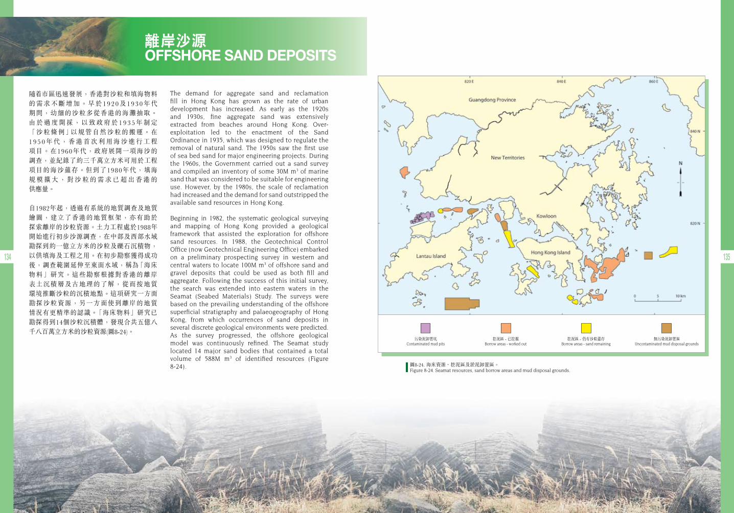
134 135
離岸沙源 OFFSHORE SAND DEPOSITS
隨 市區迅速發展,香港對沙粒和填海物料 的需求不斷增加。早於1920及1930年代 期間,幼細的沙粒多從香港的海灘抽取。 由於過度開採,以致政府於193 5年制定 「沙粒條例」以規管自然沙粒的搬運。在195 0年代,香港首次利用海沙進行工程 項目。在1960年代,政府展開一項海沙的 調查,並紀錄了約三千萬立方米可用於工程項目的海沙蘊存。但到了1980年代,填海 規 模 擴 大 , 對 沙 粒 的 需 求 已 超 出 香 港 的 供應量。
自1982年起,透過有系統的地質調查及地質繪圖,建立了香港的地質框架,亦有助於 探索離岸的沙粒資源。土力工程處於1988年開始進行初步沙源調查,在中部及西部水域勘探到約一億立方米的沙粒及礫石沉積物,以供填海及工程之用。在初步勘察獲得成功後,調查範圍延伸至東面水域,稱為「海床 物料」研究。這些勘察根據對香港的離岸 表土沉積層及古地理的了解,從而按地質 環境推斷沙粒的沉積地點。這項研究一方面勘探沙粒資源,另一方面使到離岸的地質 情況有更精準的認識。「海床物料」研究已 勘探得到14個沙粒沉積體,發現合共五億八千八百萬立方米的沙粒資源(圖8-24)。
The demand for aggregate sand and reclamation fill in Hong Kong has grown as the rate of urban development has increased. As early as the 1920s and 1930s, fine aggregate sand was extensively extracted from beaches around Hong Kong. Over- exploitation led to the enactment of the Sand Ordinance in 1935, which was designed to regulate the removal of natural sand. The 1950s saw the first use of sea bed sand for major engineering projects. During the 1960s, the Government carried out a sand survey and compiled an inventory of some 30M m3 of marine sand that was considered to be suitable for engineering use. However, by the 1980s, the scale of reclamation had increased and the demand for sand outstripped the available sand resources in Hong Kong.
Beginning in 1982, the systematic geological surveying and mapping of Hong Kong provided a geological framework that assisted the exploration for offshore sand resources. In 1988, the Geotechnical Control Office (now Geotechnical Engineering Office) embarked on a preliminary prospecting survey in western and central waters to locate 100M m3 of offshore sand and gravel deposits that could be used as both fill and aggregate. Following the success of this initial survey, the search was extended into eastern waters in the Seamat (Seabed Materials) Study. The surveys were based on the prevailing understanding of the offshore superficial stratigraphy and palaeogeography of Hong Kong, from which occurrences of sand deposits in several discrete geological environments were predicted. As the survey progressed, the offshore geological model was continuously refined. The Seamat study located 14 major sand bodies that contained a total volume of 588M m3 of identified resources (Figure 8-24).
挖泥區 - 仍有沙粒蘊存Borrow areas - sand remaining
挖泥區 - 已挖掘Borrow areas - worked out
污染泥卸置坑Contaminated mud pits
無污染泥卸置區Uncontaminated mud disposal grounds
圖8-24. 海床資源、挖泥區及淤泥卸置區。Figure 8-24. Seamat resources, sand borrow areas and mud disposal grounds.
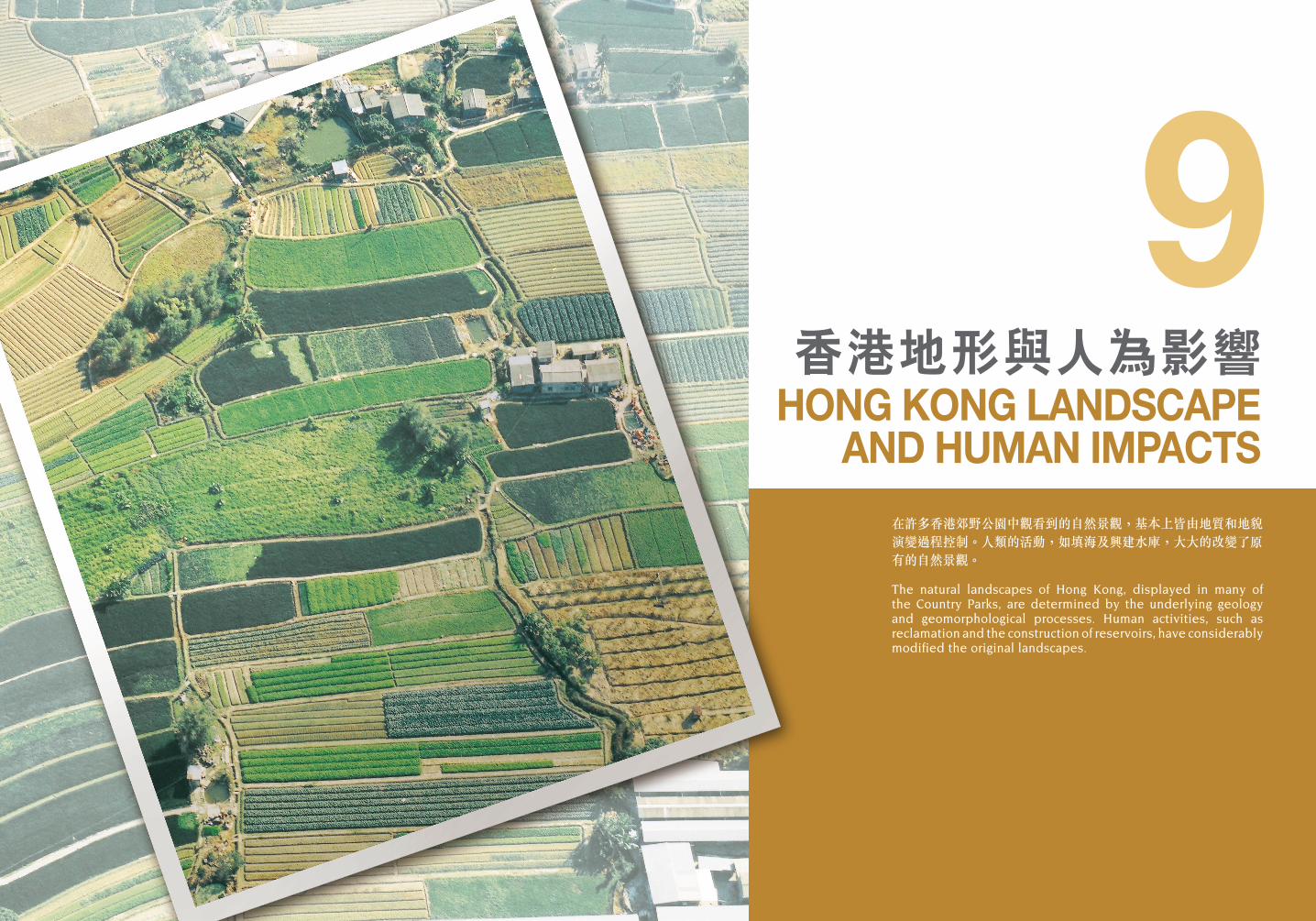
在許多香港郊野公園中觀看到的自然景觀,基本上皆由地質和地貌演變過程控制。人類的活動,如填海及興建水庫,大大的改變了原有的自然景觀。
The natural landscapes of Hong Kong, displayed in many of the Country Parks, are determined by the underlying geology and geomorphological processes. Human activities, such as reclamation and the construction of reservoirs, have considerably modified the original landscapes.
香港地形與人為影響HONG KONG LANDSCAPE
AND HUMAN IMPACTS
9
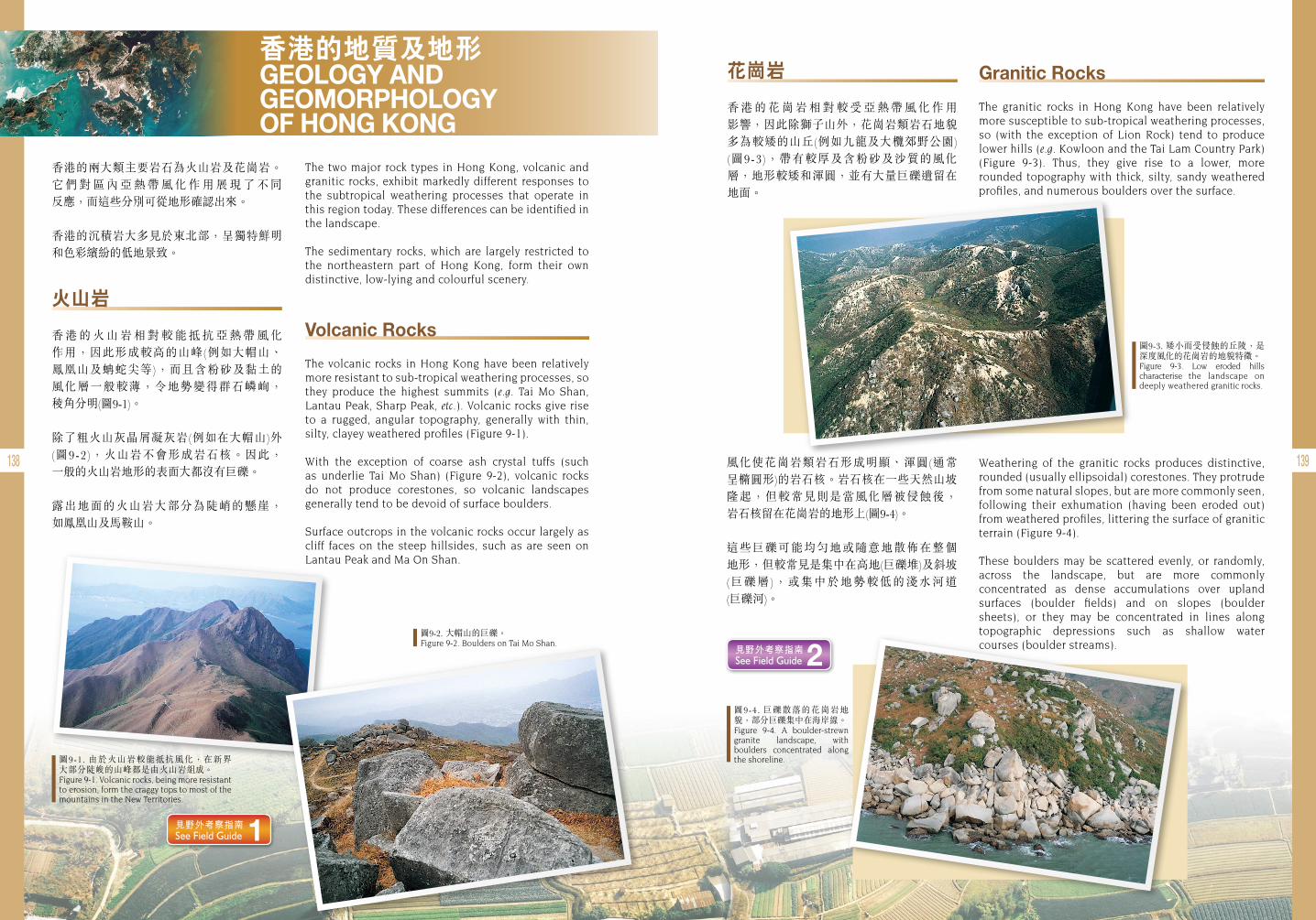
138 139
香港的地質及地形 GEOLOGY AND GEOMORPHOLOGY OF HONG KONG
香港的兩大類主要岩石為火山岩及花崗岩。它 們 對 區 內 亞 熱 帶 風 化 作 用 展 現 了 不 同 反應,而這些分別可從地形確認出來。
香港的沉積岩大多見於東北部,呈獨特鮮明和色彩繽紛的低地景致。
The two major rock types in Hong Kong, volcanic and granitic rocks, exhibit markedly different responses to the subtropical weathering processes that operate in this region today. These differences can be identified in the landscape.
The sedimentary rocks, which are largely restricted to the northeastern part of Hong Kong, form their own distinctive, low-lying and colourful scenery.
圖9-1. 由於火山岩較能抵抗風化,在新界大部分陡峻的山峰都是由火山岩組成。Figure 9-1. Volcanic rocks, being more resistant to erosion, form the craggy tops to most of the mountains in the New Territories.
圖9-2. 大帽山的巨礫。Figure 9-2. Boulders on Tai Mo Shan.
圖9-3. 矮小而受侵蝕的丘陵,是深度風化的花崗岩的地貌特徵。Figure 9-3. Low eroded hills characterise the landscape on deeply weathered granitic rocks.
圖9-4. 巨礫散落的花崗岩地貌,部分巨礫集中在海岸線。Figure 9-4. A boulder-strewn granite landscape, with boulders concentrated along the shoreline.
花崗岩
香 港 的 花 崗 岩 相 對 較 受 亞 熱 帶 風 化 作 用 影響,因此除獅子山外,花崗岩類岩石地貌多為較矮的山丘(例如九龍及大欖郊野公園) (圖9-3),帶有較厚及含粉砂及沙質的風化層,地形較矮和渾圓,並有大量巨礫遺留在 地面。
火山岩
香 港 的 火 山 岩 相 對 較 能 抵 抗 亞 熱 帶 風 化 作用,因此形成較高的山峰(例如大帽山、 鳳凰山及蚺蛇尖等),而且含粉砂及黏土的 風化層一般較薄,令地勢變得群石嶙峋, 稜角分明(圖9-1)。
除了粗火山灰晶屑凝灰岩(例如在大帽山)外(圖9-2),火山岩不會形成岩石核。因此, 一般的火山岩地形的表面大都沒有巨礫。
露出地面的火山岩大部分為陡峭的懸崖, 如鳳凰山及馬鞍山。
Volcanic Rocks
The volcanic rocks in Hong Kong have been relatively more resistant to sub-tropical weathering processes, so they produce the highest summits (e.g. Tai Mo Shan, Lantau Peak, Sharp Peak, etc.). Volcanic rocks give rise to a rugged, angular topography, generally with thin, silty, clayey weathered profiles (Figure 9-1).
With the exception of coarse ash crystal tuffs (such as underlie Tai Mo Shan) (Figure 9-2), volcanic rocks do not produce corestones, so volcanic landscapes generally tend to be devoid of surface boulders.
Surface outcrops in the volcanic rocks occur largely as cliff faces on the steep hillsides, such as are seen on Lantau Peak and Ma On Shan.
Granitic Rocks
The granitic rocks in Hong Kong have been relatively more susceptible to sub-tropical weathering processes, so (with the exception of Lion Rock) tend to produce lower hills (e.g. Kowloon and the Tai Lam Country Park) (Figure 9-3). Thus, they give rise to a lower, more rounded topography with thick, silty, sandy weathered profiles, and numerous boulders over the surface.
風化使花崗岩類岩石形成明顯、渾圓(通常 呈橢圓形)的岩石核。岩石核在一些天然山坡 隆起,但較常見則是當風化層被侵蝕後, 岩石核留在花崗岩的地形上(圖9-4)。
這些巨礫可能均勻地或隨意地散佈在整個 地形,但較常見是集中在高地(巨礫堆)及斜坡 (巨礫層),或集中於地勢較低的淺水河道 (巨礫河)。
Weathering of the granitic rocks produces distinctive, rounded (usually ellipsoidal) corestones. They protrude from some natural slopes, but are more commonly seen, following their exhumation (having been eroded out) from weathered profiles, littering the surface of granitic terrain (Figure 9-4).
These boulders may be scattered evenly, or randomly, across the landscape, but are more commonly concentrated as dense accumulations over upland surfaces (boulder fields) and on slopes (boulder sheets), or they may be concentrated in lines along topographic depressions such as shallow water courses (boulder streams).
見野外考察指南 See Field Guide 1
見野外考察指南 See Field Guide 2
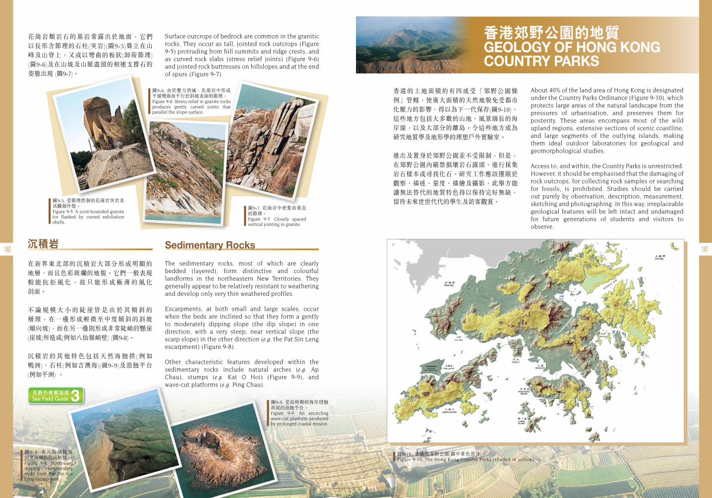
140 141沉積岩
在新界東北部的沉積岩大部分形成明顯的 地層,而且色彩斑斕的地貌。它們一般表現 較 能 抗 拒 風 化 , 故 只 能 形 成 極 薄 的 風 化 剖面。
不 論 規 模 大 小 的 陡 崖 皆 是 由 於 其 傾 斜 的 層理,在一邊形成輕微至中度傾斜的斜坡 (順向坡),而在另一邊則形成非常陡峭的懸崖 (崖坡)所造成(例如八仙嶺峭壁) (圖9-8)。
沉積岩的其他特色包括天然海蝕拱(例如 鴨洲)、石柱(例如吉澳海)(圖9-9)及浪蝕平台 (例如平洲) 。
花崗岩類岩石的基岩常露出於地面,它們以長形含節理的石柱(突岩)(圖9-5)聳立在山峰及山脊上,又或以彎曲的板狀(卸荷節理) (圖9-6)及在山坡及山脈盡頭的相連支撐石的 姿態出現 (圖9-7)。
Surface outcrops of bedrock are common in the granitic rocks. They occur as tall, jointed rock outcrops (Figure 9-5) protruding from hill summits and ridge crests, and as curved rock slabs (stress relief joints) (Figure 9-6) and jointed rock buttresses on hillslopes and at the end of spurs (Figure 9-7).
Sedimentary Rocks
The sedimentary rocks, most of which are clearly bedded (layered), form distinctive and colourful landforms in the northeastern New Territories. They generally appear to be relatively resistant to weathering and develop only very thin weathered profiles.
Escarpments, at both small and large scales, occur when the beds are inclined so that they form a gently to moderately dipping slope (the dip slope) in one direction, with a very steep, near vertical slope (the scarp slope) in the other direction (e.g. the Pat Sin Leng escarpment) (Figure 9-8).
Other characteristic features developed within the sedimentary rocks include natural arches (e.g. Ap Chau), stumps (e.g. Kat O Hoi) (Figure 9-9), and wave-cut platforms (e.g. Ping Chau).
圖9-5. 受節理控制的花崗岩突岩及其鱗剝外殼。Figure 9-5. A joint-bounded granite tor flanked by curved exfoliation shells.
圖9-6. 由於壓力消減,花崗岩中形成平緩彎曲而平行於斜坡表面的節理。Figure 9-6. Stress relief in granite rocks produces gently curved joints that parallel the slope surface.
圖9-7. 花崗岩中密集而垂直的節理。Figure 9-7. Closely spaced vertical jointing in granite.
圖9-10. 香港的郊野公園(圖中黃色部分)。Figure 9-10. The Hong Kong Country Parks (shaded in yellow).
圖9-8 . 在八仙嶺陡崖 向北面傾斜的沉積岩。Figure 9-8. Northward dipping sedimentary rocks form the Pat Sin Leng escarpment.
圖9-9. 受長時期的海岸侵蝕而成的浪蝕平台。Figure 9-9. An encircling wave-cut platform produced by prolonged coastal erosion.
香港郊野公園的地質 GEOLOGY OF HONG KONG COUNTRY PARKS
About 40% of the land area of Hong Kong is designated under the Country Parks Ordinance (Figure 9-10), which protects large areas of the natural landscape from the pressures of urbanisation, and preserves them for posterity. These areas encompass most of the wild upland regions, extensive sections of scenic coastline, and large segments of the outlying islands, making them ideal outdoor laboratories for geological and geomorphological studies.
Access to, and within, the Country Parks is unrestricted. However, it should be emphasised that the damaging of rock outcrops, for collecting rock samples or searching for fossils, is prohibited. Studies should be carried out purely by observation, description, measurement, sketching and photographing. In this way, irreplaceable geological features will be left intact and undamaged for future generations of students and visitors to observe.
香港的土地面積約有四成受「郊野公園條例」管轄,使廣大面積的天然地貌免受都市化壓力的影響,得以為下一代保存(圖9-10)。這些地方包括大多數的山地、風景綿長的海岸線,以及大部分的離島。令這些地方成為研究地質學及地形學的理想戶外實驗室。
進出及置身於郊野公園並不受限制,但是,在郊野公園內嚴禁損壞岩石露頭、進行採集 岩石樣本或尋找化石。研究工作應該僅限於觀察、描述、量度、描繪及攝影,此舉方能讓無法替代的地質特色得以保持完好無缺,留待未來世世代代的學生及訪客觀賞。
見野外考察指南 See Field Guide 3
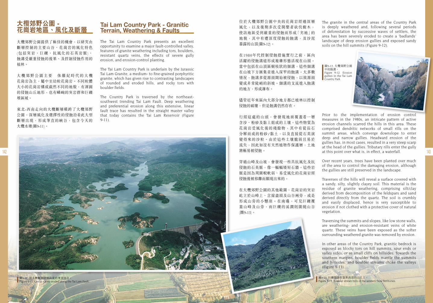
142 143
Tai Lam Country Park - Granitic Terrain, Weathering & Faults
The Tai Lam Country Park presents an excellent opportunity to examine a major fault-controlled valley, features of granite weathering including tors, boulders, resistant quartz veins, the effects of severe gully erosion, and erosion-control planting.
The Tai Lam Country Park is underlain by the Jurassic Tai Lam Granite, a medium- to fine-grained porphyritic granite, which has given rise to contrasting landscapes of rounded and eroded hills, and rocky tors with boulder fields.
The Country Park is traversed by the northeast- southwest trending Tai Lam Fault. Deep weathering and preferential erosion along this extensive, linear fault trace has resulted in the straight master valley that today contains the Tai Lam Reservoir (Figure 9-11).
位於大欖郊野公園中央的花崗岩經過深層 風化,以及後期多次受開墾者砍伐樹木, 使該地區受到嚴重的侵蝕而形成「劣地」的 地貌,其中有遭深度侵蝕的蝕溝,及沙泥 暴露的山頂(圖9-12)。
在1980年代控制侵蝕措施實行之前,區內 活躍的侵蝕溝道形成複雜形態活現在山頭。當中包括在山頂區樹枝狀的細溝,這些細溝在山坡下方匯集並進入深窄的蝕溝。大多數 情況,蝕溝多從源頭開始被侵蝕,以致源頭變成非常陡峭的斜坡。細溝的支流進入蝕溝的地方,形成瀑布。
儘管近年來區內大部分地方都已植林以控制 侵蝕的破壞,但是蝕溝仍然存在。
行經這處的山頭,會發現地面覆蓋 一層 含沙、粉砂及黏土組成的土壤。這些物質為花崗岩受風化後的殘餘物,其中有從長石 分解而成的粉砂/黏土,以及直接從石英演 變得來的沙粒。由於這些土壤脆弱且易於 流失,因此如沒有天然植物作保護層,土地將極易被侵蝕。
穿過山峰及山坡,會發現一些具抗風化及抗侵蝕的石英脈,像一幅幅矮短石牆。這些岩脈是因為周圍較軟弱、易受風化的花崗岩經侵蝕後被移離而顯現出來的。
在大欖郊野公園的其他範圍,花崗岩的突岩屹立於山峰上、岔線盡頭及山谷兩旁,或是形成山旁的小懸崖。在南邊,可見巨礫覆蓋山峰及山旁,而巨礫的溪澗則圍繞山谷 (圖9-13)。
The granite in the central areas of the Country Park is deeply weathered and, following several periods of deforestation by successive waves of settlers, the area has been severely eroded to create a ‘badlands’ landscape of deep erosion gullies and exposed sandy soils on the hill summits (Figure 9-12).
圖9-11. 沿大欖斷層侵蝕而成的筆直河谷。 Figure 9-11. Linear valley eroded along the Tai Lam Fault.
圖9-13. 巨礫散落在新界西部的山丘上。Figure 9-13. Boulder strewn hills of the western New Territories.
圖9-12. 大欖郊野公園中的蝕溝。Figure 9-12. Erosion gullies in the Tai Lam Country Park.
Prior to the implementation of erosion control measures in the 1980s, an intricate pattern of active erosion channels scarred the hills in this area. These comprised dendritic networks of small rills on the summit areas, which converge downslope to enter deep and narrow gullies. Headward erosion of the gullies has, in most cases, resulted in a very steep scarp at the head of the gullies. Tributary rills enter the gully at this point over what is, in effect, a waterfall.
Over recent years, trees have been planted over much of the area to control the damaging erosion, although the gullies are still preserved in the landscape.
Traverses of the hills will reveal a surface covered with a sandy, silty, slightly clayey soil. This material is the residue of granite weathering, comprising silt/clay derived from decomposition of the feldspars and sand derived directly from the quartz. The soil is crumbly and easily displaced, hence is very susceptible to erosion if not clothed with a protective cover of natural vegetation.
Traversing the summits and slopes, like low stone walls, are weathering- and erosion-resistant veins of white quartz. These veins have been exposed as the softer surrounding weathered granite was removed by erosion.
In other areas of the Country Park, granitic bedrock is exposed as blocky tors on hill summits, spur ends or valley sides, or as small cliffs on hillsides. Towards the southern margins, boulder fields mantle the summits and hillsides, and boulder streams choke the valleys (Figure 9-13).
大欖郊野公園 - 花崗岩地區、風化及斷層
大欖郊野公園提供了極佳的機會,以研究由斷層控制的主要山谷、花崗岩的風化特色 (包括突岩、巨礫、抗風化的石英岩脈)、 蝕溝受嚴重侵蝕的後果、及控制侵蝕作用的植林。
大 欖 郊 野 公 園 主 要以侏 羅 紀 時 代 的 大 欖 花崗岩為主,屬中至幼粒花崗岩。不同粒體 大小的花崗岩構成截然不同的地貌,有渾圓的侵蝕山丘地形,也有嶙峋的突岩群和巨礫堆區域。
東北-西南走向的大欖斷層橫跨了大欖郊野 公園,深層風化及選擇性的侵蝕沿 此大型 斷層出現,形成筆直的峽谷,包含今天的 大欖水塘(圖9-11)。
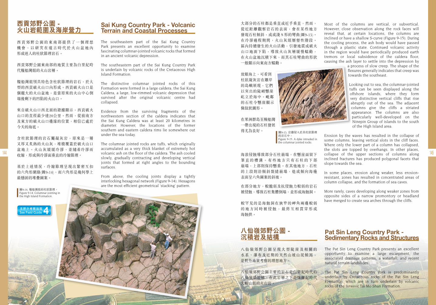
144 145
Sai Kung Country Park - Volcanic Terrain and Coastal Processes
The southeastern part of the Sai Kung Country Park presents an excellent opportunity to examine fascinating columnar-jointed volcanic rocks that formed in an ancient volcanic depression.
The southeastern part of the Sai Kung Country Park is underlain by volcanic rocks of the Cretaceous High Island Formation.
The distinctive columnar jointed rocks of this Formation were formed in a large caldera, the Sai Kung Caldera, a large, low-rimmed volcanic depression that survived after the original volcanic centre had collapsed.
Evidence from the surviving fragments of the northwestern section of the caldera indicates that the Sai Kung Caldera was at least 20 kilometres in diameter. However, the locations of the former southern and eastern caldera rims lie somewhere out under the sea today.
The columnar jointed rocks are tuffs, which originally accumulated as a very thick blanket of extremely hot volcanic ash on the floor of the caldera. The ash cooled slowly, gradually contracting and developing vertical joints that formed at right angles to the bounding surfaces.
From above, the cooling joints display a tightly interlocking hexagonal network (Figure 9-14). Hexagons are the most efficient geometrical ‘stacking’ pattern.
西貢郊野公園 - 火山岩範圍及海岸營力
西 貢 郊 野 公 園 的 東 南 部 提 供 了 一 個 理 想 機 會 , 以 研 究 在 遠 古 時 代 於 火 山 盆 地 內 形成迷人的柱狀節理岩石。
西貢郊野公園東南部的地質主要為白堊紀時代糧船灣組的火山岩層。
糧船灣組別具特色含柱狀節理的岩石,於大型的西貢破火山口內形成。西貢破火山口是個龐大的火山盆地,是當原來的火山中心倒塌後剩下的凹陷的火山口。
來自破火山口西北面的證據顯示,西貢破火山口的直徑最少達20公里。然而,從前南方及東方的破火山口邊緣的位置,相信已處於今天的海底。
含柱狀節理的岩石屬凝灰岩,原來是一層 又厚又炙熱的火山灰,堆積覆蓋於破火山口 盆地上。火山灰緩緩冷卻,並隨 冷卻而 收縮,形成與冷卻面垂直的冷縮節理。
基於上述情況,冷縮節理呈現出緊密互扣 的六角形網絡(圖9-14),而六角形是幾何學上最穩固的堆疊圖案。
大部分的石柱都是垂直或近乎垂直,然而,從近距離觀察岩石的表面,會在某些地方 發現石柱傾斜,或成淺S形的彎曲(圖9-15)。 在冷卻過程期間,火山灰經歷塑性階段。 區內持續發生的火山活動,引發地震或破火山口地面下陷,導致火山灰層緩慢蠕動, 在火山盆地沉積下來,而其石柱彎曲的形狀一般顯示向東南方蠕動。
放眼海上,可看到柱狀凝灰岩在離岸的島嶼展現,它們以突出的陡峭懸崖屹立於海中。毗鄰的石柱令懸崖顯示條紋狀圖形。
在果洲群島至糧船灣一帶出現的石柱發展得尤為良好。
海浪侵蝕導致部分石柱崩塌,在懸崖面留下 筆 直 的 槽 溝 。 有 些 地 方 只 有 石 柱 的 下 部 崩塌,上部則保持懸垂。在其他地方,石柱的上段則沿傾斜裂縫崩塌,造成傾向海邊 表面呈六角圖案的斜坡。
在部分地方,較脆弱及抗侵蝕力較弱的岩石被侵蝕,導致石柱集體倒塌,並形成海蝕洞。
較罕見的是海蝕洞在狹窄的岬角兩邊較弱 的 地 方 同 時 被 侵 蝕 , 最 終 互 相 貫 穿 形 成 海蝕拱。
Most of the columns are vertical, or subvertical. However, close observation along the rock faces will reveal that, at certain locations, the columns are inclined or have a shallow S-curve (Figure 9-15). During the cooling process, the ash body would have passed through a plastic state. Continued volcanic activity in the region would have periodically produced earth tremors or local subsidence of the caldera floor, causing the ash layer to settle into the depression by
a process of slow creep. The shape of the flexures generally indicates that creep was towards the southeast.
Looking out to sea, the columnar-jointed tuffs can be seen displayed along the offshore islands, where they form very distinctive vertical cliffs that rise abruptly out of the sea. The adjacent columns give the cliffs a striated appearance. The columns are also particularly well-developed on the Ninepin Group of islands to the south of the High Island area.
Erosion by the waves has resulted in the collapse of some columns, leaving vertical slots in the cliff faces. Where only the lower part of a column has collapsed, the slots are topped by overhangs. In other places, collapse of the upper sections of columns along inclined fractures has produced polygonal facets that slope towards the sea.
In some places, erosion along weaker, less erosion-resistant, zones has resulted in concentrated areas of column collapse, and the formation of sea caves.
More rarely, caves developing along weaker zones from opposite sides of a narrow promontory or headland have merged to create sea arches through the cliffs.
圖9-15. 岩牆侵入於具柱狀節理的岩石中。Figure 9-15. A dyke intruded in the columnar jointed rocks.
Pat Sin Leng Country Park - Sedimentary Rocks and Structures
The Pat Sin Leng Country Park presents an excellent opportunity to examine a large escarpment, the associated drainage patterns, a waterfall, and recent natural terrain landslides.
The Pat Sin Leng Country Park is predominantly underlain by Cretaceous rocks of the Pat Sin Leng Formation, which are in turn underlain by volcanic rocks of the Jurassic Tai Mo Shan Formation.
八仙嶺郊野公園 - 沉積岩及結構
八 仙 嶺 郊 野 公 園 呈 現 大 型 陡 崖 及 相 關 的 水系、瀑布及近期的天然山坡山泥傾瀉, 是野外地質考察的理想地方。
八仙嶺郊野公園主要的岩石是白堊紀時代的八仙嶺組岩層,在此岩層之下是侏羅紀時代大帽山組的火山岩。
圖9-14. 糧船灣組的柱狀節理。Figure 9-14. Columnar jointing in the High Island Formation.
見野外考察指南 See Field Guide 4
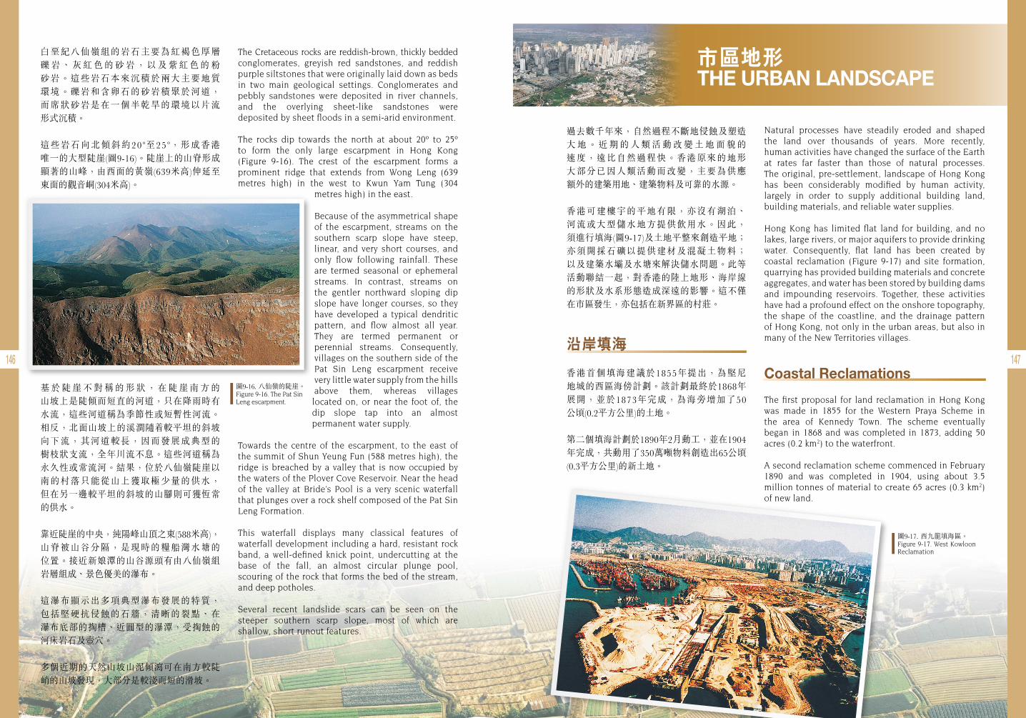
146 147
白堊紀八仙嶺組的岩石主要為紅褐色厚層 礫 岩 、 灰 紅 色 的 砂 岩 , 以 及 紫 紅 色 的 粉 砂岩。這些岩石本來沉積於兩大主要地質 環境。礫岩和含卵石的砂岩積聚於河道, 而席狀砂岩是在一個半乾旱的環境以片流 形式沉積。
這些岩石向北傾斜約20o至25o,形成香港 唯一的大型陡崖(圖9-16)。陡崖上的山脊形成顯著的山峰,由西面的黃嶺(639米高)伸延至東面的觀音峒(304米高)。
基 於 陡 崖 不 對 稱 的 形 狀 , 在 陡 崖 南 方 的 山坡上是陡傾而短直的河道,只在降雨時有 水流,這些河道稱為季節性或短暫性河流。相反,北面山坡上的溪澗隨 較平坦的斜坡 向下流,其河道較長,因而發展成典型的 樹枝狀支流,全年川流不息。這些河道稱為永久性或常流河。結果,位於八仙嶺陡崖以南的村落只能從山上獲取極少量的供水, 但在另一邊較平坦的斜坡的山腳則可獲恆常的供水。
靠近陡崖的中央,純陽峰山頂之東(588米高), 山脊被山谷分隔,是現時的糧船灣水塘的 位置。接近新娘潭的山谷源頭有由八仙嶺組岩層組成、景色優美的瀑布。
這瀑布顯示出多項典型瀑布發展的特質, 包括堅硬抗侵蝕的石牆,清晰的裂點、在 瀑布底部的掏槽、近圓型的瀑潭,受掏蝕的河床岩石及壺穴。
多個近期的天然山坡山泥傾瀉可在南方較陡峭的山坡發現,大部分是較淺而短的滑坡。
The Cretaceous rocks are reddish-brown, thickly bedded conglomerates, greyish red sandstones, and reddish purple siltstones that were originally laid down as beds in two main geological settings. Conglomerates and pebbly sandstones were deposited in river channels, and the overlying sheet-like sandstones were deposited by sheet floods in a semi-arid environment.
The rocks dip towards the north at about 20º to 25º to form the only large escarpment in Hong Kong (Figure 9-16). The crest of the escarpment forms a prominent ridge that extends from Wong Leng (639 metres high) in the west to Kwun Yam Tung (304
metres high) in the east.
Because of the asymmetrical shape of the escarpment, streams on the southern scarp slope have steep, linear, and very short courses, and only flow following rainfall. These are termed seasonal or ephemeral streams. In contrast, streams on the gentler northward sloping dip slope have longer courses, so they have developed a typical dendritic pattern, and flow almost all year. They are termed permanent or perennial streams. Consequently, villages on the southern side of the Pat Sin Leng escarpment receive very little water supply from the hills above them, whereas villages
located on, or near the foot of, the dip slope tap into an almost permanent water supply.
Towards the centre of the escarpment, to the east of the summit of Shun Yeung Fun (588 metres high), the ridge is breached by a valley that is now occupied by the waters of the Plover Cove Reservoir. Near the head of the valley at Bride’s Pool is a very scenic waterfall that plunges over a rock shelf composed of the Pat Sin Leng Formation.
This waterfall displays many classical features of waterfall development including a hard, resistant rock band, a well-defined knick point, undercutting at the base of the fall, an almost circular plunge pool, scouring of the rock that forms the bed of the stream, and deep potholes.
Several recent landslide scars can be seen on the steeper southern scarp slope, most of which are shallow, short runout features.
圖9-16. 八仙嶺的陡崖。Figure 9-16. The Pat Sin Leng escarpment.
圖9-17. 西九龍填海區。 Figure 9-17. West Kowloon Reclamation
市區地形 THE URBAN LANDSCAPE
Natural processes have steadily eroded and shaped the land over thousands of years. More recently, human activities have changed the surface of the Earth at rates far faster than those of natural processes. The original, pre-settlement, landscape of Hong Kong has been considerably modified by human activity, largely in order to supply additional building land, building materials, and reliable water supplies.
Hong Kong has limited flat land for building, and no lakes, large rivers, or major aquifers to provide drinking water. Consequently, flat land has been created by coastal reclamation (Figure 9-17) and site formation, quarrying has provided building materials and concrete aggregates, and water has been stored by building dams and impounding reservoirs. Together, these activities have had a profound effect on the onshore topography, the shape of the coastline, and the drainage pattern of Hong Kong, not only in the urban areas, but also in many of the New Territories villages.
Coastal Reclamations
The first proposal for land reclamation in Hong Kong was made in 1855 for the Western Praya Scheme in the area of Kennedy Town. The scheme eventually began in 1868 and was completed in 1873, adding 50 acres (0.2 km2) to the waterfront.
A second reclamation scheme commenced in February 1890 and was completed in 1904, using about 3.5 million tonnes of material to create 65 acres (0.3 km2) of new land.
過去數千年來,自然過程不斷地侵蝕及塑造 大 地 。 近 期 的 人 類 活 動 改 變 土 地 面 貌 的 速度,遠比自然過程快。香港原來的地形 大部分已因人類活動而改變,主要為供應 額外的建築用地、建築物料及可靠的水源。
香港可建樓宇的平地有限,亦沒有湖泊、 河流或大型儲水地方提供飲用水。因此, 須進行填海(圖9-17)及土地平整來創造平地; 亦須開採石礦以提供建材及混凝土物料; 以及建築水壩及水塘來解決儲水問題。此等活動聯結一起,對香港的陸上地形、海岸線的形狀及水系形態造成深遠的影響。這不僅在市區發生,亦包括在新界區的村莊。
沿岸填海
香港首個填海建議於1855年提出,為堅尼 地城的西區海傍計劃。該計劃最終於1868年展開,並於1873年完成,為海旁增加了50 公頃(0.2平方公里)的土地。
第二個填海計劃於1890年2月動工,並在1904年完成,共動用了350萬噸物料創造出65公頃(0.3平方公里)的新土地。
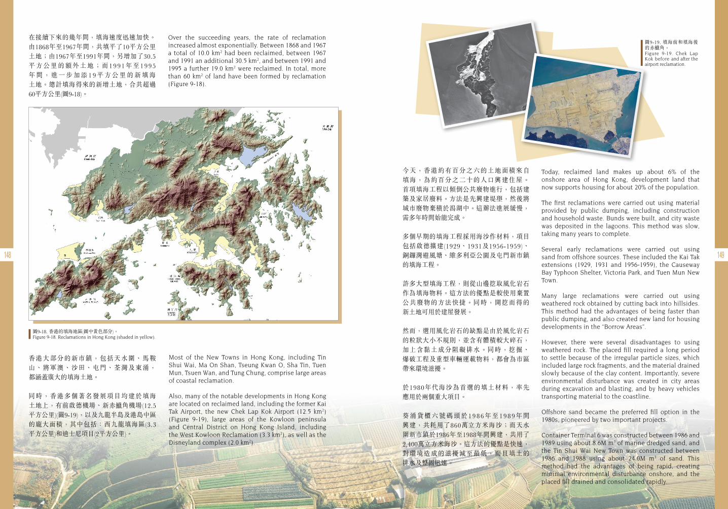
148 149
在接續下來的幾年間,填海速度迅速加快。由1868年至1967年間,共填平了10平方公里土地;由1967年至1991年間,另增加了30.5 平方公里的額外土地;而1991年至1995 年 間 , 進 一 步 加 添 1 9 平 方 公 里 的 新 填 海 土地。總計填海得來的新增土地,合共超過60平方公里(圖9-18)。
Over the succeeding years, the rate of reclamation increased almost exponentially. Between 1868 and 1967 a total of 10.0 km2 had been reclaimed, between 1967 and 1991 an additional 30.5 km2, and between 1991 and 1995 a further 19.0 km2 were reclaimed. In total, more than 60 km2 of land have been formed by reclamation (Figure 9-18).
香港大部分的新市鎮,包括天水圍、馬鞍山、將軍澳、沙田、屯門、荃灣及東涌, 都涵蓋廣大的填海土地。
同時,香港多個著名發展項目均建於填海 土地上,有前啟德機場、新赤 角機場(12.5 平方公里)(圖9-19),以及九龍半島及港島中區 的龐大面積,其中包括:西九龍填海區(3.3 平方公里)和迪士尼項目(2平方公里)。
Most of the New Towns in Hong Kong, including Tin Shui Wai, Ma On Shan, Tseung Kwan O, Sha Tin, Tuen Mun, Tsuen Wan, and Tung Chung, comprise large areas of coastal reclamation.
Also, many of the notable developments in Hong Kong are located on reclaimed land, including the former Kai Tak Airport, the new Chek Lap Kok Airport (12.5 km2) (Figure 9-19), large areas of the Kowloon peninsula and Central District on Hong Kong Island, including the West Kowloon Reclamation (3.3 km2), as well as the Disneyland complex (2.0 km2).
今天,香港約有百分之六的土地面積來自 填海,為約百分之二十的人口興建住屋。 首項填海工程以傾倒公共廢物進行,包括建築及家居廢料。方法是先興建堤壆,然後將城市廢物棄積於潟湖中。這辦法進展緩慢,需多年時間始能完成。
多個早期的填海工程採用海沙作材料,項目 包括啟德擴建(1929、1931及1956-1959)、 銅鑼灣避風塘、維多利亞公園及屯門新市鎮的填海工程。
許多大型填海工程,則從山邊挖取風化岩石作為填海物料。這方法的優點是較使用棄置公共廢物的方法快捷。同時,開挖而得的 新土地可用於建屋發展。
然而,選用風化岩石的缺點是由於風化岩石的粒狀大小不規則,並含有體積較大碎石,加上含黏土成分阻礙排水。同時,挖掘、 爆破工程及重型車輛運載物料,都會為市區帶來環境滋擾。
於1980年代海沙為首選的填土材料,率先 應用於兩個重大項目。
葵涌貨櫃六號碼頭於1986年至1989年間 興建,共耗用了860萬立方米海沙;而天水圍新市鎮於1986年至1988年間興建,共用了2,400萬立方米海沙。這方法的優點是快速,對環境造成的滋擾減至最低,而且填土的 排水及整固迅速。
Today, reclaimed land makes up about 6% of the onshore area of Hong Kong, development land that now supports housing for about 20% of the population.
The first reclamations were carried out using material provided by public dumping, including construction and household waste. Bunds were built, and city waste was deposited in the lagoons. This method was slow, taking many years to complete.
Several early reclamations were carried out using sand from offshore sources. These included the Kai Tak extensions (1929, 1931 and 1956-1959), the Causeway Bay Typhoon Shelter, Victoria Park, and Tuen Mun New Town.
Many large reclamations were carried out using weathered rock obtained by cutting back into hillsides. This method had the advantages of being faster than public dumping, and also created new land for housing developments in the “Borrow Areas”.
However, there were several disadvantages to using weathered rock. The placed fill required a long period to settle because of the irregular particle sizes, which included large rock fragments, and the material drained slowly because of the clay content. Importantly, severe environmental disturbance was created in city areas during excavation and blasting, and by heavy vehicles transporting material to the coastline.
Offshore sand became the preferred fill option in the 1980s, pioneered by two important projects.
Container Terminal 6 was constructed between 1986 and 1989 using about 8.6M m3 of marine dredged sand, and the Tin Shui Wai New Town was constructed between 1986 and 1988 using about 24.0M m3 of sand. This method had the advantages of being rapid, creating minimal environmental disturbance onshore, and the placed fill drained and consolidated rapidly.
圖9-18. 香港的填海地區(圖中黃色部分)。Figure 9-18. Reclamations in Hong Kong (shaded in yellow).
圖9-19. 填海前和填海後的赤 角。Figure 9-19. Chek Lap Kok before and after the airport reclamation.
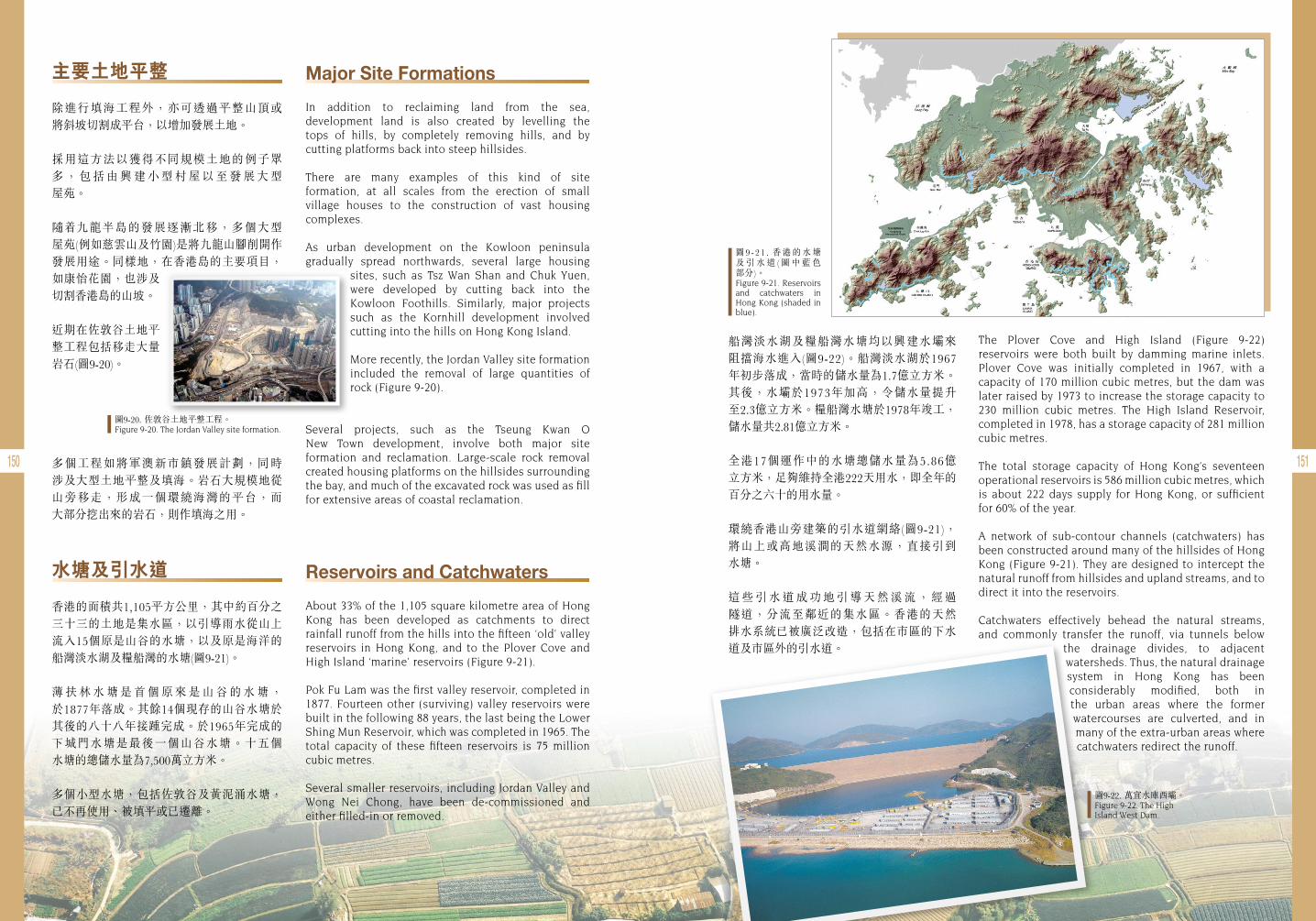
150 151
主要土地平整
除進行填海工程外,亦可透過平整山頂或 將斜坡切割成平台,以增加發展土地。
採用這方法以獲得不同規模土地的例子眾多 , 包 括 由 興 建 小 型 村 屋 以 至 發 展 大 型 屋苑。
隨 九龍半島的發展逐漸北移,多個大型 屋苑(例如慈雲山及竹園)是將九龍山腳削開作發展用途。同樣地,在香港島的主要項目,如康怡花園,也涉及切割香港島的山坡。
近期在佐敦谷土地平整工程包括移走大量岩石(圖9-20)。
多個工程如將軍澳新市鎮發展計劃,同時 涉及大型土地平整及填海。岩石大規模地從山旁移走,形成一個環繞海灣的平台,而 大部分挖出來的岩石,則作填海之用。
水塘及引水道
香港的面積共1,105平方公里,其中約百分之三十三的土地是集水區,以引導雨水從山上流入15個原是山谷的水塘,以及原是海洋的船灣淡水湖及糧船灣的水塘(圖9-21)。
薄 扶 林 水 塘 是 首 個 原 來 是 山 谷 的 水 塘 , 於1877年落成。其餘14個現存的山谷水塘於其後的八十八年接踵完成。於1965年完成的下城門水塘是最後一個山谷水塘。十五個 水塘的總儲水量為7,500萬立方米。
多個小型水塘,包括佐敦谷及黃泥涌水塘,已不再使用、被填平或已遷離。
Major Site Formations
In addition to reclaiming land from the sea, development land is also created by levelling the tops of hills, by completely removing hills, and by cutting platforms back into steep hillsides.
There are many examples of this kind of site formation, at all scales from the erection of small village houses to the construction of vast housing complexes.
As urban development on the Kowloon peninsula gradually spread northwards, several large housing
sites, such as Tsz Wan Shan and Chuk Yuen, were developed by cutting back into the Kowloon Foothills. Similarly, major projects such as the Kornhill development involved cutting into the hills on Hong Kong Island.
More recently, the Jordan Valley site formation included the removal of large quantities of rock (Figure 9-20).
Several projects, such as the Tseung Kwan O New Town development, involve both major site formation and reclamation. Large-scale rock removal created housing platforms on the hillsides surrounding the bay, and much of the excavated rock was used as fill for extensive areas of coastal reclamation.
Reservoirs and Catchwaters
About 33% of the 1,105 square kilometre area of Hong Kong has been developed as catchments to direct rainfall runoff from the hills into the fifteen ‘old’ valley reservoirs in Hong Kong, and to the Plover Cove and High Island ‘marine’ reservoirs (Figure 9-21).
Pok Fu Lam was the first valley reservoir, completed in 1877. Fourteen other (surviving) valley reservoirs were built in the following 88 years, the last being the Lower Shing Mun Reservoir, which was completed in 1965. The total capacity of these fifteen reservoirs is 75 million cubic metres.
Several smaller reservoirs, including Jordan Valley and Wong Nei Chong, have been de-commissioned and either filled-in or removed.
圖9-20. 佐敦谷土地平整工程。Figure 9-20. The Jordan Valley site formation.
圖9-21 . 香港的水塘及 引 水 道 ( 圖 中 藍 色 部分)。Figure 9-21. Reservoirs and catchwaters in Hong Kong (shaded in blue).
圖9-22. 萬宜水庫西壩。Figure 9-22. The High Island West Dam.
船灣淡水湖及糧船灣水塘均以興建水壩來 阻擋海水進入(圖9-22)。船灣淡水湖於1967年初步落成,當時的儲水量為1.7億立方米。 其後,水壩於1973年加高,令儲水量提升 至2.3億立方米。糧船灣水塘於1978年竣工,儲水量共2.81億立方米。
全港17個運作中的水塘總儲水量為5.86億 立方米,足夠維持全港222天用水,即全年的百分之六十的用水量。
環繞香港山旁建築的引水道網絡(圖9-21),將山上或高地溪澗的天然水源,直接引到 水塘。
這 些 引 水 道 成 功 地 引 導 天 然 溪 流 , 經 過 隧道,分流至鄰近的集水區。香港的天然 排水系統已被廣泛改造,包括在市區的下水道及市區外的引水道。
The Plover Cove and High Island (Figure 9-22) reservoirs were both built by damming marine inlets. Plover Cove was initially completed in 1967, with a capacity of 170 million cubic metres, but the dam was later raised by 1973 to increase the storage capacity to 230 million cubic metres. The High Island Reservoir, completed in 1978, has a storage capacity of 281 million cubic metres.
The total storage capacity of Hong Kong’s seventeen operational reservoirs is 586 million cubic metres, which is about 222 days supply for Hong Kong, or sufficient for 60% of the year.
A network of sub-contour channels (catchwaters) has been constructed around many of the hillsides of Hong Kong (Figure 9-21). They are designed to intercept the natural runoff from hillsides and upland streams, and to direct it into the reservoirs.
Catchwaters effectively behead the natural streams, and commonly transfer the runoff, via tunnels below
the drainage divides, to adjacent watersheds. Thus, the natural drainage system in Hong Kong has been considerably modified, both in the urban areas where the former watercourses are culverted, and in many of the extra-urban areas where catchwaters redirect the runoff.
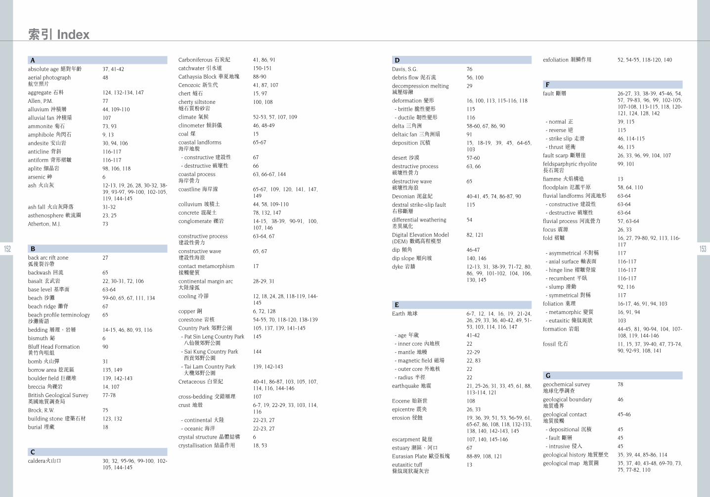
152 153
154 155
156 157
158
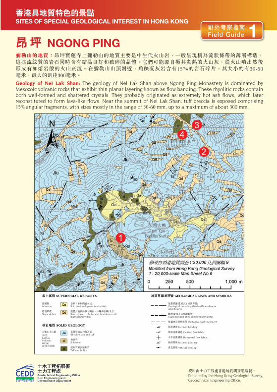
SITES OF SPECIAL GEOLOGICAL INTEREST IN HONG KONG香港具地質特色的景點
昂 坪 NGONG PING彌勒山的地質:昂坪寶蓮寺上彌勒山的地質主要是中生代火山岩,一般呈現稱為流狀條帶的薄層構造。 這些流紋質的岩石同時含有結晶良好和破碎的晶體。它們可能源自極其炙熱的火山灰,從火山噴出然後 形成有如熔岩般的火山灰流。在彌勒山山頂附近,角礫凝灰岩含有15%的岩石碎片,其大小約有30-60 毫米,最大的則達300毫米。
Geology of Nei Lak Shan: The geology of Nei Lak Shan above Ngong Ping Monastery is dominated by Mesozoic volcanic rocks that exhibit thin planar layering known as flow banding. These rhyolitic rocks contain both well-formed and shattered crystals. They probably originated as extremely hot ash flows, which later reconstituted to form lava-like flows. Near the summit of Nei Lak Shan, tuff breccia is exposed comprising 15% angular fragments, with sizes mostly in the range of 30-60 mm, up to a maximum of about 300 mm.
粉砂、砂和礫石(未分) Silt, sand and gravel (undivided)
基質為粉砂的砂、礫石、中礫和巨礫(未分) Sand, gravel, cobbles and boulders in silt matrix (undivided)
流紋質熔岩和凝灰岩 Rhyolite lava and tuff
粉砂岩 Siltstone
凝灰岩和沉凝灰岩 Tuff and tuffite
沖積物 Alluvium
坡屑堆積 Slope debris
大嶼山火山群(未分)Lantau Volcanic Group (undivided)
表土沉積 SUPERFICIAL DEPOSITS
Qa
Jlu
Qd
sl
tt
如何前往? How to Get There?
地質界線(虛線表示推測界線) Geological boundary (Dashed lines denote uncertainty)
斷層(虛線表示推測斷層) Fault (Dashed lines denote uncertainty)
航攝地質線性影像 Photogeolocial lineament
傾斜層理 Inclined bedding
傾斜流動構造 Inclined flow fabric
水平流動構造 Horizontal flow fabric
傾斜節理 Inclined jointing
垂直節理 Vertical jointing
地質界線及符號 GEOLOGICAL LINES AND SYMBOLS
昂坪的寶蓮寺是受歡迎的旅遊景點,並有完善的公共交通。巴士服務包括來往梅窩至昂坪的2號 路線、來往大澳至昂坪的21號路線,以及來往東涌至昂坪的23號路線。此外,亦可乘坐昂坪360 纜車由東涌到昂坪。從昂坪往彌勒山山頂的兩條路線,皆須攀登約300米。稍微較短的路線是沿 寶蓮寺後面的小徑登山,該小徑初段約70-80米雜草叢生,不太好走。另外沿彌勒山東南坡山脊的 登山路徑雖然稍長,但由於坡度較緩而較多人使用。
Po Lin Monastery at Ngong Ping is a popular tourist destination and is well served by public transport. Bus services include Route no. 2 from Mui Wo to Ngong Ping, Route no. 21 from Tai O to Ngong Ping, and Route no. 23 from Tung Chung to Ngong Ping. In addition, there is the Ngong Ping 360 Cable Car from Tung Chung. There are two possible routes to the summit of Nei Lak Shan, both involving a climb of about 300 m. A slightly shorter route is along the footpath from behind Po Lin Monastery, although the initial 70-80 metres of the path is overgrown. A second slightly longer, but gentler and more popular, route follows the path along the southeast ridge of Nei Lak Shan.
資料由土力工程處香港地質調查組編製。Prepared by the Hong Kong Geological Survey, Geotechnical Engineering Office.
基岩地質 SOLID GEOLOGY
野外考察指南 Field Guide 1
角礫凝灰岩 Tuff Breccia 角礫凝灰岩是當大塊角碟狀的火山岩碎片,與較幼細的火山灰碎片膠結、凝固而成的岩石。角礫凝灰岩可能有多個來源,它們可能是近火山噴發口的產物,又或是由於舊有的火山岩屑遭侵蝕而形成。
Large angular fragments of volcanic rocks which have been cemented together by smaller ash fragments produces a rock type known as tuff breccia. Tuff breccia may have multiple origins, ranging from the products of near-vent volcanic eruptions, to erosion of older volcanic debris.
4
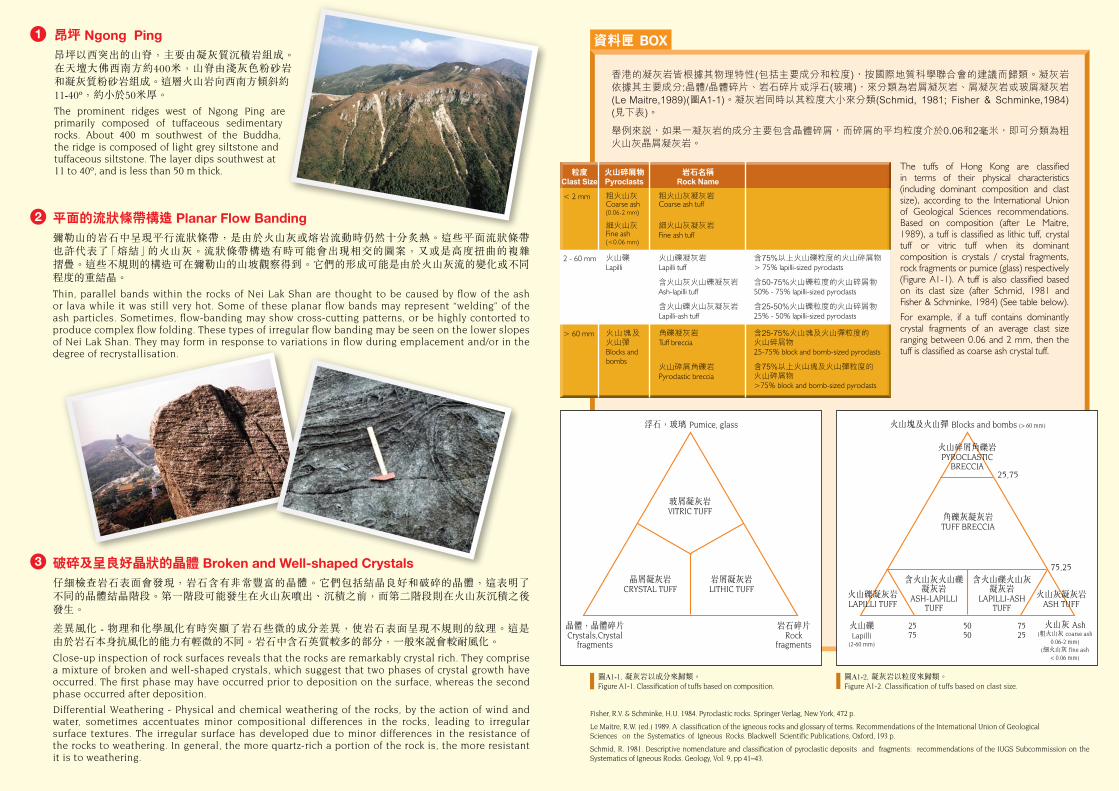
資料匣 BOX昂坪 Ngong Ping昂坪以西突出的山脊,主要由凝灰質沉積岩組成。在天壇大佛西南方約400米,山脊由淺灰色粉砂岩和凝灰質粉砂岩組成。這層火山岩向西南方傾斜約 11-40º,約小於50米厚。
The prominent ridges west of Ngong Ping are primarily composed of tuffaceous sedimentary rocks. About 400 m southwest of the Buddha, the ridge is composed of light grey siltstone and tuffaceous siltstone. The layer dips southwest at 11 to 40º, and is less than 50 m thick.
平面的流狀條帶構造 Planar Flow Banding
彌勒山的岩石中呈現平行流狀條帶,是由於火山灰或熔岩流動時仍然十分炙熱。這些平面流狀條帶 也許代表了「熔結」的火山灰。流狀條帶構造有時可能會出現相交的圖案,又或是高度扭曲的複雜 摺疊。這些不規則的構造可在彌勒山的山坡觀察得到。它們的形成可能是由於火山灰流的變化或不同程度的重結晶。
Thin, parallel bands within the rocks of Nei Lak Shan are thought to be caused by flow of the ash or lava while it was still very hot. Some of these planar flow bands may represent “welding” of the ash particles. Sometimes, flow-banding may show cross-cutting patterns, or be highly contorted to produce complex flow folding. These types of irregular flow banding may be seen on the lower slopes of Nei Lak Shan. They may form in response to variations in flow during emplacement and/or in the degree of recrystallisation.
破碎及呈良好晶狀的晶體 Broken and Well-shaped Crystals 仔細檢查岩石表面會發現,岩石含有非常豐富的晶體。它們包括結晶良好和破碎的晶體,這表明了 不同的晶體結晶階段。第一階段可能發生在火山灰噴出、沉積之前,而第二階段則在火山灰沉積之後發生。
差異風化 - 物理和化學風化有時突顯了岩石些微的成分差異,使岩石表面呈現不規則的紋理。這是 由於岩石本身抗風化的能力有輕微的不同。岩石中含石英質較多的部分,一般來說會較耐風化。
Close-up inspection of rock surfaces reveals that the rocks are remarkably crystal rich. They comprise a mixture of broken and well-shaped crystals, which suggest that two phases of crystal growth have occurred. The first phase may have occurred prior to deposition on the surface, whereas the second phase occurred after deposition.
Differential Weathering - Physical and chemical weathering of the rocks, by the action of wind and water, sometimes accentuates minor compositional differences in the rocks, leading to irregular surface textures. The irregular surface has developed due to minor differences in the resistance of the rocks to weathering. In general, the more quartz-rich a portion of the rock is, the more resistant it is to weathering.
1
2
3
香港的凝灰岩皆根據其物理特性(包括主要成分和粒度),按國際地質科學聯合會的建議而歸類。凝灰岩依據其主要成分:晶體/晶體碎片、岩石碎片或浮石(玻璃),來分類為岩屑凝灰岩、屑凝灰岩或玻屑凝灰岩(Le Maitre,1989)(圖A1-1)。凝灰岩同時以其粒度大小來分類(Schmid, 1981; Fisher & Schminke,1984) (見下表)。
舉例來說,如果一凝灰岩的成分主要包含晶體碎屑,而碎屑的平均粒度介於0.06和2毫米,即可分類為粗火山灰晶屑凝灰岩。
The tuffs of Hong Kong are classified in terms of their physical characteristics (including dominant composition and clast size), according to the International Union of Geological Sciences recommendations. Based on composition (after Le Maitre, 1989), a tuff is classified as lithic tuff, crystal tuff or vitric tuff when its dominant composition is crystals / crystal fragments, rock fragments or pumice (glass) respectively (Figure A1-1). A tuff is also classified based on its clast size (after Schmid, 1981 and Fisher & Schminke, 1984) (See table below).
For example, if a tuff contains dominantly crystal fragments of an average clast size ranging between 0.06 and 2 mm, then the tuff is classified as coarse ash crystal tuff.
粒度Clast Size
火山碎屑物Pyroclasts
岩石名稱Rock Name
含75%以上火山礫粒度的火山碎屑物> 75% lapilli-sized pyroclasts
含50-75%火山礫粒度的火山碎屑物50% - 75% lapilli-sized pyroclasts
含25-50%火山礫粒度的火山碎屑物 25% - 50% lapilli-sized pyroclasts
含25-75%火山塊及火山彈粒度的 火山碎屑物25-75% block and bomb-sized pyroclasts
含75%以上火山塊及火山彈粒度的 火山碎屑物 >75% block and bomb-sized pyroclasts
< 2 mm 粗火山灰 Coarse ash (0.06-2 mm)
細火山灰 Fine ash (<0.06 mm)
火山礫Lapilli
火山塊及火山彈Blocks and bombs
粗火山灰凝灰岩 Coarse ash tuff
細火山灰凝灰岩 Fine ash tuff
火山礫凝灰岩 Lapilli tuff
含火山灰火山礫凝灰岩 Ash-lapilli tuff
含火山礫火山灰凝灰岩 Lapilli-ash tuff
角礫凝灰岩 Tuff breccia
火山碎屑角礫岩Pyroclastic breccia
> 60 mm
2 - 60 mm
Fisher, R.V. & Schminke, H.U. 1984. Pyroclastic rocks. Springer Verlag, New York, 472 p.
Le Maitre, R.W. (ed.) 1989. A classification of the igneous rocks and glossary of terms. Recommendations of the International Union of GeologicalSciences on the Systematics of Igneous Rocks. Blackwell Scientific Publications, Oxford, 193 p.
Schmid, R. 1981. Descriptive nomenclature and classification of pyroclastic deposits and fragments: recommendations of the IUGS Subcommission on the Systematics of Igneous Rocks. Geology, Vol. 9, pp 41–43.
圖A1-1. 凝灰岩以成分來歸類。 Figure A1-1. Classification of tuffs based on composition.
圖A1-2. 凝灰岩以粒度來歸類。 Figure A1-2. Classification of tuffs based on clast size.
浮石,玻璃 Pumice, glass
玻屑凝灰岩 VITRIC TUFF
晶屑凝灰岩 CRYSTAL TUFF
岩屑凝灰岩 LITHIC TUFF
岩石碎片 Rock
fragments
晶體,晶體碎片 Crystals,Crystal
fragments
火山塊及火山彈 Blocks and bombs (> 60 mm)
火山礫Lapilli
(2-60 mm)
火山灰 Ash (粗火山灰 coarse ash
0.06-2 mm)(細火山灰 fine ash
< 0.06 mm)
角礫灰凝灰岩 TUFF BRECCIA
火山碎屑角礫岩 PYROCLASTIC
BRECCIA
火山礫凝灰岩 LAPILLI TUFF
火山灰凝灰岩 ASH TUFF
含火山灰火山礫凝灰岩
ASH-LAPILLI TUFF
含火山礫火山灰凝灰岩
LAPILLI-ASH TUFF
25,75
75,25
7525
5050
2575
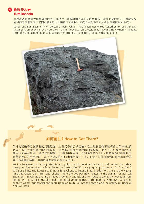
SITES OF SPECIAL GEOLOGICAL INTEREST IN HONG KONG香港具地質特色的景點
昂 坪 NGONG PING彌勒山的地質:昂坪寶蓮寺上彌勒山的地質主要是中生代火山岩,一般呈現稱為流狀條帶的薄層構造。 這些流紋質的岩石同時含有結晶良好和破碎的晶體。它們可能源自極其炙熱的火山灰,從火山噴出然後 形成有如熔岩般的火山灰流。在彌勒山山頂附近,角礫凝灰岩含有15%的岩石碎片,其大小約有30-60 毫米,最大的則達300毫米。
Geology of Nei Lak Shan: The geology of Nei Lak Shan above Ngong Ping Monastery is dominated by Mesozoic volcanic rocks that exhibit thin planar layering known as flow banding. These rhyolitic rocks contain both well-formed and shattered crystals. They probably originated as extremely hot ash flows, which later reconstituted to form lava-like flows. Near the summit of Nei Lak Shan, tuff breccia is exposed comprising 15% angular fragments, with sizes mostly in the range of 30-60 mm, up to a maximum of about 300 mm.
粉砂、砂和礫石(未分) Silt, sand and gravel (undivided)
基質為粉砂的砂、礫石、中礫和巨礫(未分) Sand, gravel, cobbles and boulders in silt matrix (undivided)
流紋質熔岩和凝灰岩 Rhyolite lava and tuff
粉砂岩 Siltstone
凝灰岩和沉凝灰岩 Tuff and tuffite
沖積物 Alluvium
坡屑堆積 Slope debris
大嶼山火山群(未分)Lantau Volcanic Group (undivided)
表土沉積 SUPERFICIAL DEPOSITS
Qa
Jlu
Qd
sl
tt
如何前往? How to Get There?
地質界線(虛線表示推測界線) Geological boundary (Dashed lines denote uncertainty)
斷層(虛線表示推測斷層) Fault (Dashed lines denote uncertainty)
航攝地質線性影像 Photogeolocial lineament
傾斜層理 Inclined bedding
傾斜流動構造 Inclined flow fabric
水平流動構造 Horizontal flow fabric
傾斜節理 Inclined jointing
垂直節理 Vertical jointing
地質界線及符號 GEOLOGICAL LINES AND SYMBOLS
昂坪的寶蓮寺是受歡迎的旅遊景點,並有完善的公共交通。巴士服務包括來往梅窩至昂坪的2號 路線、來往大澳至昂坪的21號路線,以及來往東涌至昂坪的23號路線。此外,亦可乘坐昂坪360 纜車由東涌到昂坪。從昂坪往彌勒山山頂的兩條路線,皆須攀登約300米。稍微較短的路線是沿 寶蓮寺後面的小徑登山,該小徑初段約70-80米雜草叢生,不太好走。另外沿彌勒山東南坡山脊的 登山路徑雖然稍長,但由於坡度較緩而較多人使用。
Po Lin Monastery at Ngong Ping is a popular tourist destination and is well served by public transport. Bus services include Route no. 2 from Mui Wo to Ngong Ping, Route no. 21 from Tai O to Ngong Ping, and Route no. 23 from Tung Chung to Ngong Ping. In addition, there is the Ngong Ping 360 Cable Car from Tung Chung. There are two possible routes to the summit of Nei Lak Shan, both involving a climb of about 300 m. A slightly shorter route is along the footpath from behind Po Lin Monastery, although the initial 70-80 metres of the path is overgrown. A second slightly longer, but gentler and more popular, route follows the path along the southeast ridge of Nei Lak Shan.
資料由土力工程處香港地質調查組編製。Prepared by the Hong Kong Geological Survey, Geotechnical Engineering Office.
基岩地質 SOLID GEOLOGY
野外考察指南 Field Guide 1
角礫凝灰岩 Tuff Breccia 角礫凝灰岩是當大塊角碟狀的火山岩碎片,與較幼細的火山灰碎片膠結、凝固而成的岩石。角礫凝灰岩可能有多個來源,它們可能是近火山噴發口的產物,又或是由於舊有的火山岩屑遭侵蝕而形成。
Large angular fragments of volcanic rocks which have been cemented together by smaller ash fragments produces a rock type known as tuff breccia. Tuff breccia may have multiple origins, ranging from the products of near-vent volcanic eruptions, to erosion of older volcanic debris.
4
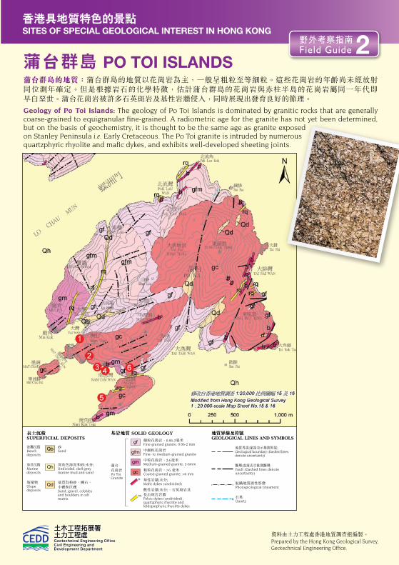
資料匣 BOX SITES OF SPECIAL GEOLOGICAL INTEREST IN HONG KONG香港具地質特色的景點
蒲台群島 PO TOI ISLANDS蒲台群島的地質:蒲台群島的地質以花崗岩為主,一般呈粗粒至等細粒。這些花崗岩的年齡尚未經放射 同位測年確定。但是根據岩石的化學特徵,估計蒲台群島的花崗岩與赤柱半島的花崗岩屬同一年代即 早白堊世。蒲台花崗岩被許多石英斑岩及基性岩牆侵入,同時展現出發育良好的節理。
Geology of Po Toi Islands: The geology of Po Toi Islands is dominated by granitic rocks that are generally coarse-grained to equigranular fine-grained. A radiometric age for the granite has not yet been determined, but on the basis of geochemistry, it is thought to be the same age as granite exposed on Stanley Peninsula i.e. Early Cretaceous. The Po Toi granite is intruded by numerous quartzphyric rhyolite and mafic dykes, and exhibits well-developed sheeting joints.
砂Sand
海灘沉積Beach deposits
海洋沉積Marine deposits
深灰色海泥和砂(未分) Undivided, dark grey marine mud and sand
坡積物 Slope deposits
基質為粉砂、礫石、中礫和巨礫 Sand, gravel, cobbles and boulders in silt matrix
表土沉積 SUPERFICIAL DEPOSITS
Qb
Qh
Qd
基岩地質 SOLID GEOLOGY
細粒花崗岩,0.06-2毫米 Fine-grained granite, 0.06-2 mm
中細粒花崗岩 Fine- to medium-grained granite
中粒花崗岩,2-6毫米 Medium-grained granite, 2-6mm
粗粒花崗岩,>6 毫米 Coarse-grained granite, >6 mm
基性岩牆(未分) Mafic dykes (undivided)
酸性岩牆(未分),石英斑岩及 長石斑岩岩牆 Felsic dykes (undivided), quartzphyric rhyolite and feldsparphyric rhyolite dykes
蒲台 花崗岩 Po Toi Granite
gf
gm
gfm
gc
如何前往? How to Get There?
地質界線(虛線表示推測界線)Geological boundary (Dashed lines denote uncertainty)
斷層(虛線表示推測斷層)Fault (Dashed lines denote uncertainty)
航攝地質線性影像 Photogeological lineament
石英 Quartz
地質界線及符號GEOLOGICAL LINES AND SYMBOLS
逢星期二和星期四設有限度的街渡服務來往香港仔至蒲台島,班次為上午10時從香港仔往蒲台島,而下午2時自蒲台島返回香港仔。逢星期六有兩班自香港仔開出的航班,分別為上午10時和下午 2時,亦有一班從赤柱在下午1點20分開往蒲台島。回程航班在星期六下午12點40分往赤柱,以及 下午二時及下午四時往香港仔。星期日及公眾假期從赤柱開出的班次會增加,但只有一班在上午 8時15分從香港仔開出。
A limited Kaito service operates from Aberdeen to Po Toi on Tuesdays and Thursdays, departing Aberdeen at 10:00 am and returning from Po Toi at 2 pm. On Saturdays, there are two departures from Aberdeen at 10 am and 2 pm, as well as a departure from Stanley at 1:20 pm. Return sailings on Saturdays depart from Po Toi at 12:40 pm for Stanley, and 2 pm and 4 pm for Aberdeen. There are increased frequencies of sailings from Stanley on Sundays and public holidays, but only one departure at 8:15 am from Aberdeen.
節理類型 Types of Joints
資料由土力工程處香港地質調查組編製。Prepared by the Hong Kong Geological Survey, Geotechnical Engineering Office.
b
rqq
節理是岩石石中的裂縫,沿裂縫並沒有出現明顯錯動。一些地質特徵(如懸崖面、突岩和巨礫)的形狀和 方向皆受岩體的節理模式控制。節理的排列模式常有一個幾何的特徵和有規律的間隔。它們有三種主要 模式:
構造節理與區域構造變形相關,通常與區域性斷層系統,或與侵入岩引致的變形有關。它們可能在剪切或拉張下形成。
應力卸荷節理在岩石中接近地面的地方發育,是由於侵蝕作用移除了岩石之上的覆蓋層而使圍壓減少所致。如果它們是大規模而與地形相平行,則稱為席裂節理。而規模較小、彎曲或同心的節理,特別是與岩核發展有關的,則稱為剝落節理。
冷卻節理是由於火成岩形成時冷卻和收縮而發展。它們通常垂直於冷卻表面,並會呈六角柱狀。
Joints are fractures or cracks in rocks along which there has been no detectable displacement. The shape and orientation of features such as cliff faces, tors, and boulders are controlled by the jointing pattern within the rock mass. Joint patterns generally have a characteristic geometry and a regular spacing. They develop in three main modes:
Tectonic joints are associated with regional tectonic deformation, typically with the regional network of faults, or deformation associated with emplacement of plutons. They may be formed under shear or tension.
Stress relief joints develop in rocks close to the ground surface as a result of relaxation of confining pressure (overburden) following erosion of the overlying layers. If they are large scale and subparallel to the topography they are called sheeting joints. However, smaller scale curved or concentric joints, particularly those associated with development of corestones are called exfoliation joints.
Cooling joints develop as a result of cooling and contraction in granitic and volcanic rocks following their emplacement. They are typically perpendicular to the cooling surface and may form hexagonal columns.
野外考察指南 Field Guide 2
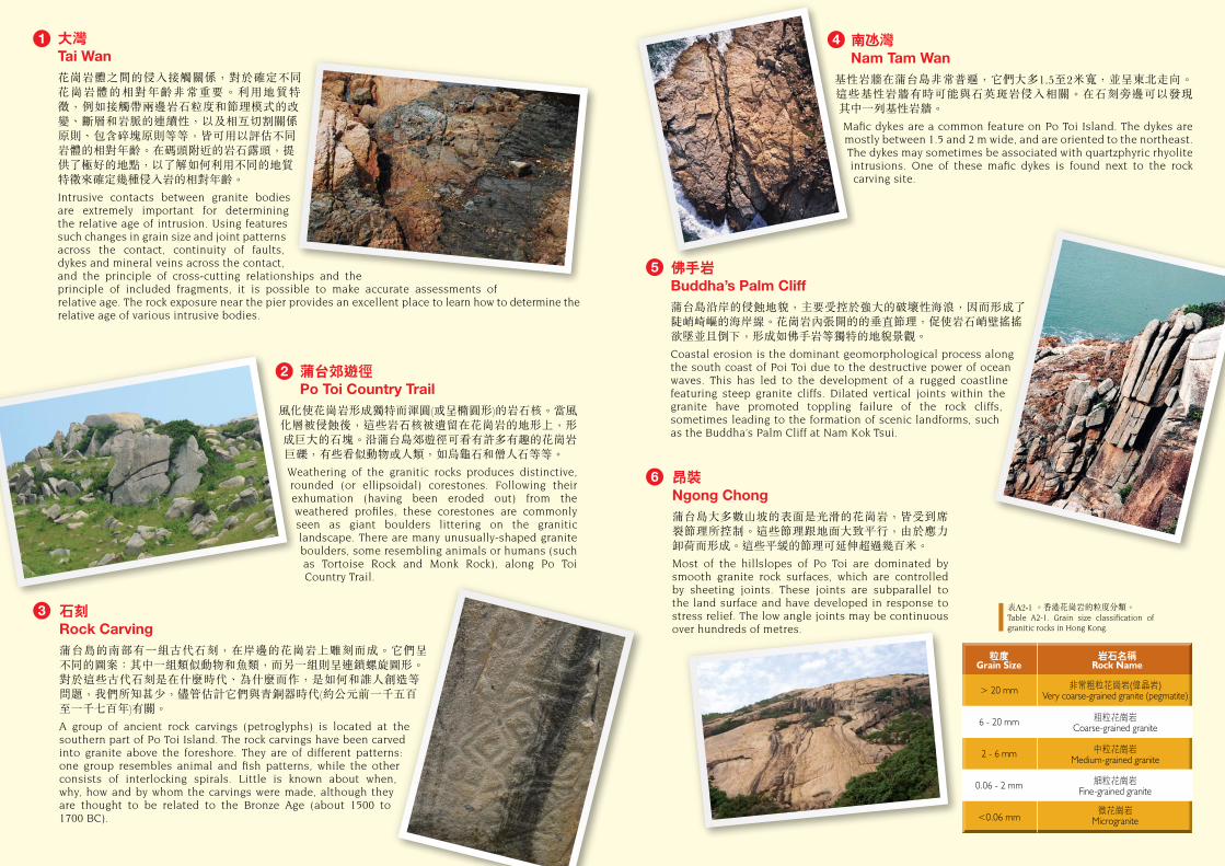
大灣 Tai Wan花崗岩體之間的侵入接觸關係,對於確定不同花崗岩體的相對年齡非常重要。利用地質特徵,例如接觸帶兩邊岩石粒度和節理模式的改變、斷層和岩脈的連續性,以及相互切割關係原則、包含碎塊原則等等,皆可用以評估不同岩體的相對年齡。在碼頭附近的岩石露頭,提供了極好的地點,以了解如何利用不同的地質特徵來確定幾種侵入岩的相對年齡。
Intrusive contacts between granite bodies are extremely important for determining the relative age of intrusion. Using features such changes in grain size and joint patterns across the contact, continuity of faults, dykes and mineral veins across the contact, and the principle of cross-cutting relationships and the principle of included fragments, it is possible to make accurate assessments of relative age. The rock exposure near the pier provides an excellent place to learn how to determine the relative age of various intrusive bodies.
南 灣 Nam Tam Wan 基性岩牆在蒲台島非常普遍,它們大多1.5至2米寬,並呈東北走向。 這些基性岩牆有時可能與石英斑岩侵入相關。在石刻旁邊可以發現 其中一列基性岩牆。
Mafic dykes are a common feature on Po Toi Island. The dykes are mostly between 1.5 and 2 m wide, and are oriented to the northeast. The dykes may sometimes be associated with quartzphyric rhyolite intrusions. One of these mafic dykes is found next to the rock carving site.
蒲台郊遊徑 Po Toi Country Trail風化使花崗岩形成獨特而渾圓(或呈橢圓形)的岩石核。當風化層被侵蝕後,這些岩石核被遺留在花崗岩的地形上,形成巨大的石塊。沿蒲台島郊遊徑可看有許多有趣的花崗岩巨礫,有些看似動物或人類,如烏龜石和僧人石等等。
Weathering of the granitic rocks produces distinctive, rounded (or ellipsoidal) corestones. Following their exhumation (having been eroded out) from the weathered profiles, these corestones are commonly seen as giant boulders littering on the granitic landscape. There are many unusually-shaped granite boulders, some resembling animals or humans (such as Tortoise Rock and Monk Rock), along Po Toi Country Trail.
佛手岩 Buddha’s Palm Cliff蒲台島沿岸的侵蝕地貌,主要受控於強大的破壞性海浪,因而形成了陡峭崎嶇的海岸線。花崗岩內張開的的垂直節理,促使岩石峭壁搖搖欲墜並且倒下,形成如佛手岩等獨特的地貌景觀。
Coastal erosion is the dominant geomorphological process along the south coast of Poi Toi due to the destructive power of ocean waves. This has led to the development of a rugged coastline featuring steep granite cliffs. Dilated vertical joints within the granite have promoted toppling failure of the rock cliffs, sometimes leading to the formation of scenic landforms, such as the Buddha’s Palm Cliff at Nam Kok Tsui.
石刻 Rock Carving蒲台島的南部有一組古代石刻,在岸邊的花崗岩上雕刻而成。它們呈 不同的圖案:其中一組類似動物和魚類,而另一組則呈連鎖螺旋圖形。對於這些古代石刻是在什麼時代、為什麼而作,是如何和誰人創造等問題,我們所知甚少,儘管估計它們與青銅器時代(約公元前一千五百至一千七百年)有關。
A group of ancient rock carvings (petroglyphs) is located at the southern part of Po Toi Island. The rock carvings have been carved into granite above the foreshore. They are of different patterns: one group resembles animal and fish patterns, while the other consists of interlocking spirals. Little is known about when, why, how and by whom the carvings were made, although they are thought to be related to the Bronze Age (about 1500 to 1700 BC).
昂裝 Ngong Chong 蒲台島大多數山坡的表面是光滑的花崗岩,皆受到席裂節理所控制。這些節理跟地面大致平行,由於應力卸荷而形成。這些平緩的節理可延伸超過幾百米。
Most of the hillslopes of Po Toi are dominated by smooth granite rock surfaces, which are controlled by sheeting joints. These joints are subparallel to the land surface and have developed in response to stress relief. The low angle joints may be continuous over hundreds of metres.
2
4
5
6
表A2-1 。香港花崗岩的粒度分類。Table A2-1. Grain size classification of granitic rocks in Hong Kong.
3
1
> 20 mm
6 - 20 mm
2 - 6 mm
0.06 - 2 mm
<0.06 mm
非常粗粒花崗岩(偉晶岩) Very coarse-grained granite (pegmatite)
中粒花崗岩Medium-grained granite
微花崗岩Microgranite
粗粒花崗岩Coarse-grained granite
細粒花崗岩Fine-grained granite
粒度Grain Size
岩石名稱Rock Name
資料匣 BOX SITES OF SPECIAL GEOLOGICAL INTEREST IN HONG KONG香港具地質特色的景點
蒲台群島 PO TOI ISLANDS蒲台群島的地質:蒲台群島的地質以花崗岩為主,一般呈粗粒至等細粒。這些花崗岩的年齡尚未經放射 同位測年確定。但是根據岩石的化學特徵,估計蒲台群島的花崗岩與赤柱半島的花崗岩屬同一年代即 早白堊世。蒲台花崗岩被許多石英斑岩及基性岩牆侵入,同時展現出發育良好的節理。
Geology of Po Toi Islands: The geology of Po Toi Islands is dominated by granitic rocks that are generally coarse-grained to equigranular fine-grained. A radiometric age for the granite has not yet been determined, but on the basis of geochemistry, it is thought to be the same age as granite exposed on Stanley Peninsula i.e. Early Cretaceous. The Po Toi granite is intruded by numerous quartzphyric rhyolite and mafic dykes, and exhibits well-developed sheeting joints.
砂Sand
海灘沉積Beach deposits
海洋沉積Marine deposits
深灰色海泥和砂(未分) Undivided, dark grey marine mud and sand
坡積物 Slope deposits
基質為粉砂、礫石、中礫和巨礫 Sand, gravel, cobbles and boulders in silt matrix
表土沉積 SUPERFICIAL DEPOSITS
Qb
Qh
Qd
基岩地質 SOLID GEOLOGY
細粒花崗岩,0.06-2毫米 Fine-grained granite, 0.06-2 mm
中細粒花崗岩 Fine- to medium-grained granite
中粒花崗岩,2-6毫米 Medium-grained granite, 2-6mm
粗粒花崗岩,>6 毫米 Coarse-grained granite, >6 mm
基性岩牆(未分) Mafic dykes (undivided)
酸性岩牆(未分),石英斑岩及 長石斑岩岩牆 Felsic dykes (undivided), quartzphyric rhyolite and feldsparphyric rhyolite dykes
蒲台 花崗岩 Po Toi Granite
gf
gm
gfm
gc
如何前往? How to Get There?
地質界線(虛線表示推測界線)Geological boundary (Dashed lines denote uncertainty)
斷層(虛線表示推測斷層)Fault (Dashed lines denote uncertainty)
航攝地質線性影像 Photogeological lineament
石英 Quartz
地質界線及符號GEOLOGICAL LINES AND SYMBOLS
逢星期二和星期四設有限度的街渡服務來往香港仔至蒲台島,班次為上午10時從香港仔往蒲台島,而下午2時自蒲台島返回香港仔。逢星期六有兩班自香港仔開出的航班,分別為上午10時和下午 2時,亦有一班從赤柱在下午1點20分開往蒲台島。回程航班在星期六下午12點40分往赤柱,以及 下午二時及下午四時往香港仔。星期日及公眾假期從赤柱開出的班次會增加,但只有一班在上午 8時15分從香港仔開出。
A limited Kaito service operates from Aberdeen to Po Toi on Tuesdays and Thursdays, departing Aberdeen at 10:00 am and returning from Po Toi at 2 pm. On Saturdays, there are two departures from Aberdeen at 10 am and 2 pm, as well as a departure from Stanley at 1:20 pm. Return sailings on Saturdays depart from Po Toi at 12:40 pm for Stanley, and 2 pm and 4 pm for Aberdeen. There are increased frequencies of sailings from Stanley on Sundays and public holidays, but only one departure at 8:15 am from Aberdeen.
節理類型 Types of Joints
資料由土力工程處香港地質調查組編製。Prepared by the Hong Kong Geological Survey, Geotechnical Engineering Office.
b
rqq
節理是岩石石中的裂縫,沿裂縫並沒有出現明顯錯動。一些地質特徵(如懸崖面、突岩和巨礫)的形狀和 方向皆受岩體的節理模式控制。節理的排列模式常有一個幾何的特徵和有規律的間隔。它們有三種主要 模式:
構造節理與區域構造變形相關,通常與區域性斷層系統,或與侵入岩引致的變形有關。它們可能在剪切或拉張下形成。
應力卸荷節理在岩石中接近地面的地方發育,是由於侵蝕作用移除了岩石之上的覆蓋層而使圍壓減少所致。如果它們是大規模而與地形相平行,則稱為席裂節理。而規模較小、彎曲或同心的節理,特別是與岩核發展有關的,則稱為剝落節理。
冷卻節理是由於火成岩形成時冷卻和收縮而發展。它們通常垂直於冷卻表面,並會呈六角柱狀。
Joints are fractures or cracks in rocks along which there has been no detectable displacement. The shape and orientation of features such as cliff faces, tors, and boulders are controlled by the jointing pattern within the rock mass. Joint patterns generally have a characteristic geometry and a regular spacing. They develop in three main modes:
Tectonic joints are associated with regional tectonic deformation, typically with the regional network of faults, or deformation associated with emplacement of plutons. They may be formed under shear or tension.
Stress relief joints develop in rocks close to the ground surface as a result of relaxation of confining pressure (overburden) following erosion of the overlying layers. If they are large scale and subparallel to the topography they are called sheeting joints. However, smaller scale curved or concentric joints, particularly those associated with development of corestones are called exfoliation joints.
Cooling joints develop as a result of cooling and contraction in granitic and volcanic rocks following their emplacement. They are typically perpendicular to the cooling surface and may form hexagonal columns.
野外考察指南 Field Guide 2
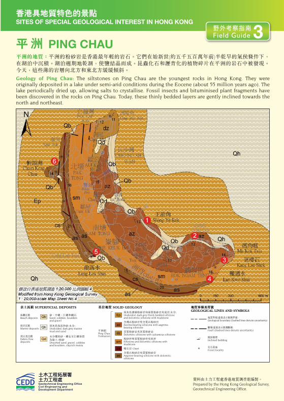
資料匣 BOX SITES OF SPECIAL GEOLOGICAL INTEREST IN HONG KONG香港具地質特色的景點
平 洲 PING CHAU平洲的地質:平洲的粉砂岩是香港最年輕的岩石。它們在始新世(約五千五百萬年前)半乾旱的氣侯條件下,在湖泊中沉積。湖泊週期地乾涸,使鹽結晶而成。昆蟲化石和瀝青化的植物碎片在平洲的岩石中被發現。今天,這些薄的岩層向北方和東北方緩緩傾斜。
Geology of Ping Chau: The siltstones on Ping Chau are the youngest rocks in Hong Kong. They were originally deposited in a lake under semi-arid conditions during the Eocene (about 55 million years ago). The lake periodically dried up, allowing salts to crystallise. Fossil insects and bituminised plant fragments have been discovered in the rocks on Ping Chau. Today, these thinly bedded layers are gently inclined towards the north and northeast.
砂、中礫、巨礫和礫石Sand, cobbles, boulders and gravel
深灰色海泥和砂(未分)Undivided, dark grey marine mud and sand
未分選的砂、礫石至巨礫基質為黏土/粉砂Unsorted sand, gravel, cobbles and boulders, clay/silt matrix
海灘沉積Beach deposits
海洋沉積Marine deposits
泥石流沉積Debris flow deposits
表土沉積 SUPERFICIAL DEPOSITS
Qb
Qh
Qd
基岩地質 SOLID GEOLOGY
深灰色薄層粉砂岩和雲質粉砂岩夾泥岩(未分)Undivided, dark grey thinly bedded siltstone and dolomitic siltstone with mudstone
含沸石粉砂岩夾含霓石粉砂岩Zeolite-bearing siltstone with aegirine-bearing siltstone
雲質粉砂岩夾灰質粉砂岩Dolomitic siltstone with calcareous siltstone
粉砂岩和雲質粉砂岩夾泥岩Siltstone and dolomitic siltstone with mudstone
燧石岩 Chert
含霓石粉砂岩夾雲質粉砂岩Aegirine-bearing siltstone with dolomitic siltstone
平洲組Ping Chau Formation
Ep
dz
az
sm
cs
as
如何前往? How to Get There?
地質界線(虛線表示推測界線)Geological boundary (Dashed lines denote uncertainty)
斷層(虛線表示推測斷層)Fault (Dashed lines denote uncertainty)
傾斜層理 Inclined bedding
化石產地 Fossil locality
地質界線及符號GEOLOGICAL LINES AND SYMBOLS
除可租用機動船或遊艇外,亦可以乘渡輪從馬料水前往平洲。然而,渡輪服務僅適用於週六和 週日。星期六有兩班從馬料水出發的航班,於上午9時和下午3時30分開出,回程航班在下午5時15離開平洲。星期日只有上午9時一班班次從馬料水出發,回程班次則在下午5時15分離開。航程一般需時約1小時40分鐘。遇大風的天氣,航程可能需要2至3小時。沿 岸邊的平洲郊遊徑步行,可到達各地質景點,而於退潮時亦可沿海邊的岩石平台觀察岩層。
Apart from hiring a motor boat or crusier, one can take a public ferry from Ma Liu Shui to Ping Chau. However, the public ferry service is only available on Saturdays and Sundays. On Saturdays, there are two departures from Ma Lui Shui at 9 am and 3:30 pm. Return sailings on Saturdays depart from Ping Chau at 5:15 pm. There is only one return sailing on Sundays, departing from Ma Liu Shui at 9 am, and from Ping Chau at 5:15 pm. The traveling time is about 1 hour 40 minutes. On a windy day, the traveling time may take 2 to 3 hours. Access to rock outcrops is easy along Ping Chau Country Trail, and it is possible to observe the rock strata along the coastal platform at low tide.
平洲上的破壞性營力的海岸地形Coastal Landforms Resulting from Destructional Processes on Ping Chau
地形的種類Type of Landform
闡釋Description
海蝕柱 Sea Stack
經由海浪沖擊而形成的塔狀或石柱殘骸。通常是海蝕拱崩塌後的殘骸。海蝕柱可以在接近、或現今海平面之上出現。
A tower, or residual stump, of rock, which is formed by wave action, commonly by the collapse of a sea arch leaving the seaward end isolated. Stacks may be near, or above, the present sea level.
浪蝕平台 Wave-cut Platform
浪蝕龕 Wave-cut Notch
通常出現於懸崖底部的岩架,由海浪磨蝕而成。浪蝕平台可位於高潮 水位之上或之下。
A rocky ledge, usually at the base of a sea cliff, that is formed by wave abrasion. Wave-cut platforms may be located above or below high tide level.
由海浪侵蝕懸崖底部而成的切口,通常出現於浪蝕平台的後面。
A slot cut at the bottom of a cliff, usually at the back of a wave-cut platform, formed by wave action eroding the base of the cliff.
資料由土力工程處香港地質調查組編製。Prepared by the Hong Kong Geological Survey, Geotechnical Engineering Office.
野外考察指南 Field Guide 3
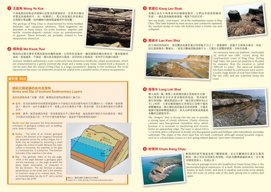
王爺角 Wong Ye Kok 平洲地質的特點是其薄層白雲質及鈣質粉砂岩。在許多岩層內有豐富的植物碎片。在一些層理上,霓石和玫瑰花形的沸石 出現假石膏晶體。這些礦物可能與低溫變質作用有關。
The geology of Ping Chau is characterised by thinly-bedded dolomitic and calcareous siltstones. Plant fragments are abundant in many layers. On some horizons, aegirine and zeolite (rosette-shaped) crystals occur as pseudomorphs of gypsum. These minerals are probably related to low temperature alteration.
媽角咀 Ma Kwok Tsui 傾斜的沉積岩層常見稱為陡崖的獨特地貌,它的特色是地形一邊為緩傾的順向坡而另一邊為陡峭的 崖坡。從遠處看,平洲是一個向東北傾斜的大陡崖。沿岸的岩石則組成一系列平行的細小陡崖。
Inclined, bedded sedimentary rocks commonly form distinctive landforms called escarpments, which are characterised by a gently inclined dip slope and a steep scarp slope. Viewed from a distance, it can be seen that the island of Ping Chau is a large escarpment, dipping to the northeast. The rocks exposed on the wave-cut platforms around the island form a parallel series of minor escarpments.
1 3
4
5
6
2
資料匣 BOX
沉積
岩岩
層
Sedi
men
tary
laye
rs
傾角 Dip angle
傾斜方向 Dip direction
走向 Strike
圖A3-1. 傾斜沉積岩岩層的走向及傾角。Figure A3-1. Strike and dip of inclined sedimentary layers.
傾斜沉積岩層的走向及傾角Strike and Dip of Inclined Sedimentary Layers
走向及傾角表達了岩層、節理、斷層或紋理等地質面的三維方向。
走向:走向是指傾斜的地質面與虛擬的水平面相交而成的線所指的方向(圖A3-1)。好像將一塊玻璃 放入一碗水內,由於水面處於水平,玻璃上的水位線是水平線,即走向線,而水位線所指的方向便是走向。
傾角:傾角一般是指傾斜角度,即地質面與水平之間的角度,指地質面於傾斜方向的傾斜度。傾斜 方向與走向成垂直方向。水平的平面的傾角為0º,垂直的平面的傾角則為90º。
Strike and dip represents the three-dimensional orientation of geological surfaces such as bedding, joints, faults or foliations.
Strike : The strike of an inclined geological plane is the direction of an imaginary horizontal line projected across the surface (Figure A3-1). Strike may be visualised by immersing a sheet of glass into a bowl of water. Because the water surface is horizontal, the waterline on the glass is a horizontal line, or a strike line. The direction (azimuth) of the waterline is the strike.
Dip : Dip generally refers to the dip angle, which is the angle between a geological plane and the horizontal, i.e. the angle at which the plane slopes downwards, as measured in the dip direction. The dip direction is always perpendicular to the strike, and is the direction of maximum slope of an inclined plane. Thus, an horizontal plane has dip of 0º, and a vertical plane has a dip of 90º.
更樓石 Kang Lau Shek 更樓石是在平洲東南角的兩個海蝕柱。它們由於海浪侵蝕而 形成,一般是當海蝕拱崩塌後,殘留下的岩石柱。
Two sea stacks, “rock towers”, sit at the southeastern corner of Ping Chau. They were formed by wave erosion and commonly represent the residual stump of rocks left behind when a former sea arch collapsed.
難過水 Lan Kwo Shui 沿平洲的西南海岸,垂直懸崖高聳於廣泛的浪蝕平台之上。當漲潮時,浪蝕平台被海水淹沒,因此,這位置被稱為「難過水」。海浪不斷地侵蝕浪蝕平台,大塊岩石從懸崖墜落,分佈在海邊。
An extensive wave-cut platform, overlooked by vertical sea cliffs, occurs along the southwestern coast of Ping Chau. During high tides, the wave-cut platform is flooded by seawater, thus the location is called “difficult to pass”. The wave-cut platform has been eroded by continuous wave action. Locally, huge blocks of rock have fallen from the sea cliffs and are scattered along the coast.
龍落水 Lung Lok Shui潛入海的「龍」實際上是堅硬的燧石質粉砂岩岩層。燧石質粉砂岩含有非常幼細的矽結晶,使其耐於 風化和侵蝕,構成挺拔的山脊。燧石質岩層約有0.8至1.2米厚,主要由極微細的石英與長石及較少量的 碳酸鹽組成。燧石層的成因還沒有得到證實,不過有幾個可能的解釋曾被提出,如火山碎屑來源或與溫泉有關的沉積物等等。
The “Dragon” that is diving into the sea is actually a strong layer of cherty siltstone. Cherty siltstone contains very fine-grained crystalline silica, which, because it is resistant to weathering and erosion, forms an upstanding ridge. The layer is about 0.8 to 1.2 m thick and is composed of mostly very fine-grained quartz and feldspar, with subordinate secondary carbonate. The origin of the chert layer has not been confirmed, although several possible origins, such as a volcaniclastic source or a hot spring-related deposit, have been interpreted.
斬頸洲 Cham Keng Chau 斬頸洲的狹窄通道表現了斷層地貌。岩石在斷層的位置往往變得 較弱,使之更易受到風化和侵蝕。因此在斷層通過的地方,岩石被 切削得更深入,形成山谷。
The narrow passage across the headland at Cham Keng Chau is the geomorphological expression of a fault. Rocks commonly become weaker in fault zones, and tend to weather and erode more deeply than the rocks on either side of the fault, giving rise to valleys and gaps.
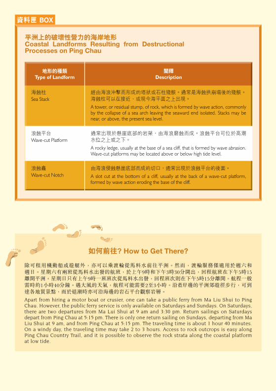
資料匣 BOX SITES OF SPECIAL GEOLOGICAL INTEREST IN HONG KONG香港具地質特色的景點
平 洲 PING CHAU平洲的地質:平洲的粉砂岩是香港最年輕的岩石。它們在始新世(約五千五百萬年前)半乾旱的氣侯條件下,在湖泊中沉積。湖泊週期地乾涸,使鹽結晶而成。昆蟲化石和瀝青化的植物碎片在平洲的岩石中被發現。今天,這些薄的岩層向北方和東北方緩緩傾斜。
Geology of Ping Chau: The siltstones on Ping Chau are the youngest rocks in Hong Kong. They were originally deposited in a lake under semi-arid conditions during the Eocene (about 55 million years ago). The lake periodically dried up, allowing salts to crystallise. Fossil insects and bituminised plant fragments have been discovered in the rocks on Ping Chau. Today, these thinly bedded layers are gently inclined towards the north and northeast.
砂、中礫、巨礫和礫石Sand, cobbles, boulders and gravel
深灰色海泥和砂(未分)Undivided, dark grey marine mud and sand
未分選的砂、礫石至巨礫基質為黏土/粉砂Unsorted sand, gravel, cobbles and boulders, clay/silt matrix
海灘沉積Beach deposits
海洋沉積Marine deposits
泥石流沉積Debris flow deposits
表土沉積 SUPERFICIAL DEPOSITS
Qb
Qh
Qd
基岩地質 SOLID GEOLOGY
深灰色薄層粉砂岩和雲質粉砂岩夾泥岩(未分)Undivided, dark grey thinly bedded siltstone and dolomitic siltstone with mudstone
含沸石粉砂岩夾含霓石粉砂岩Zeolite-bearing siltstone with aegirine-bearing siltstone
雲質粉砂岩夾灰質粉砂岩Dolomitic siltstone with calcareous siltstone
粉砂岩和雲質粉砂岩夾泥岩Siltstone and dolomitic siltstone with mudstone
燧石岩 Chert
含霓石粉砂岩夾雲質粉砂岩Aegirine-bearing siltstone with dolomitic siltstone
平洲組Ping Chau Formation
Ep
dz
az
sm
cs
as
如何前往? How to Get There?
地質界線(虛線表示推測界線)Geological boundary (Dashed lines denote uncertainty)
斷層(虛線表示推測斷層)Fault (Dashed lines denote uncertainty)
傾斜層理 Inclined bedding
化石產地 Fossil locality
地質界線及符號GEOLOGICAL LINES AND SYMBOLS
除可租用機動船或遊艇外,亦可以乘渡輪從馬料水前往平洲。然而,渡輪服務僅適用於週六和 週日。星期六有兩班從馬料水出發的航班,於上午9時和下午3時30分開出,回程航班在下午5時15離開平洲。星期日只有上午9時一班班次從馬料水出發,回程班次則在下午5時15分離開。航程一般需時約1小時40分鐘。遇大風的天氣,航程可能需要2至3小時。沿 岸邊的平洲郊遊徑步行,可到達各地質景點,而於退潮時亦可沿海邊的岩石平台觀察岩層。
Apart from hiring a motor boat or crusier, one can take a public ferry from Ma Liu Shui to Ping Chau. However, the public ferry service is only available on Saturdays and Sundays. On Saturdays, there are two departures from Ma Lui Shui at 9 am and 3:30 pm. Return sailings on Saturdays depart from Ping Chau at 5:15 pm. There is only one return sailing on Sundays, departing from Ma Liu Shui at 9 am, and from Ping Chau at 5:15 pm. The traveling time is about 1 hour 40 minutes. On a windy day, the traveling time may take 2 to 3 hours. Access to rock outcrops is easy along Ping Chau Country Trail, and it is possible to observe the rock strata along the coastal platform at low tide.
平洲上的破壞性營力的海岸地形Coastal Landforms Resulting from Destructional Processes on Ping Chau
地形的種類Type of Landform
闡釋Description
海蝕柱 Sea Stack
經由海浪沖擊而形成的塔狀或石柱殘骸。通常是海蝕拱崩塌後的殘骸。海蝕柱可以在接近、或現今海平面之上出現。
A tower, or residual stump, of rock, which is formed by wave action, commonly by the collapse of a sea arch leaving the seaward end isolated. Stacks may be near, or above, the present sea level.
浪蝕平台 Wave-cut Platform
浪蝕龕 Wave-cut Notch
通常出現於懸崖底部的岩架,由海浪磨蝕而成。浪蝕平台可位於高潮 水位之上或之下。
A rocky ledge, usually at the base of a sea cliff, that is formed by wave abrasion. Wave-cut platforms may be located above or below high tide level.
由海浪侵蝕懸崖底部而成的切口,通常出現於浪蝕平台的後面。
A slot cut at the bottom of a cliff, usually at the back of a wave-cut platform, formed by wave action eroding the base of the cliff.
資料由土力工程處香港地質調查組編製。Prepared by the Hong Kong Geological Survey, Geotechnical Engineering Office.
野外考察指南 Field Guide 3
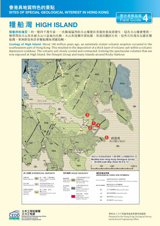
資料匣 BOX SITES OF SPECIAL GEOLOGICAL INTEREST IN HONG KONG香港具地質特色的景點
糧 船 灣 HIGH ISLAND糧船灣的地質:約一億四千萬年前,一次極端猛烈的火山爆發在香港的東南部發生。這次火山爆發導致一層厚厚的火山灰在破火山口盆地內沉積。火山灰逐漸冷卻收縮,形成壯觀的石柱。這些石柱現在出露在糧船灣、果洲群島和許多糧船灣海周圍島嶼。
Geology of High Island: About 140 million years ago, an extremely violent volcanic eruption occurred in the southeastern part of Hong Kong. This resulted in the deposition of a thick layer of volcanic ash within a volcanic depression (caldera). The volcanic ash slowly cooled and contracted, forming the spectacular columns that are now exposed at High Island, the Ninepin Group and many islands around Rocky Harbour.
砂、中礫、巨礫和礫石Sand, cobbles, boulders and gravel
深灰色海泥和砂(未分)Undivided, dark grey marine mud and sand
黏土/粉砂、砂及 礫石(未分)Undivided clay/silt, sand and gravel
海灘沉積Beach deposits
海洋沉積Marine deposits
沖積物及坡積物Alluvial and colluvial deposits
表土沉積 SUPERFICIAL DEPOSITS
Qb
Qh
Qad
基岩地質 SOLID GEOLOGY
主要為熔結細火山灰玻屑凝灰岩 Mainly welded fine ash vitric tuff
主要為粗面英安岩和流紋岩 Mainly trachydacite and rhyolite lava
基性岩牆,主要為 玄武安山岩 Mafic dykes, mainly basaltic andesite
糧船灣組 High Island Formation
清水灣組 Clear Water Bay Formation
Kkh
b
Kkw
如何前往? How to Get There?
地質界線及符號GEOLOGICAL LINES AND SYMBOLS
萬宜水庫提供了觀察壯觀的柱狀凝灰岩的地點。萬宜水庫位於西貢東郊野公園。從北潭涌郊野公園遊客中心,可步行前往萬宜水庫。從西貢往黃石碼頭的94號巴士及從鑽石山港鐵站往黃石碼頭的96R巴土(只在週末及公眾假期服務),則途經郊野公園遊客中心前面的停車場。由此下車,沿大網仔路向東南步行約1.5公里,即達萬宜水庫的涼亭。在這兒往西貢萬宜路向東南方走行約9公里,繞經西壩,直行至萬宜水庫的東壩。柱狀凝灰岩的地質觀察點在東壩的東北端。
High Island Reservoir provides a relatively convenient location for examining the spectacular outcrops of columnar-jointed tuff. High Island Reservoir is located in the Sai Kung East Country Park. Access is on foot from the Country Park Visitor’s Centre at Pak Tam Chung, which is on the route of public bus no. 94 from Sai Kung to Wong Shek Pier, and no. 96R from Diamond Hill MTR Station to Wong Shek Pier (services only on weekends and public holidays). Alight by the car park in front of Country Park Visitor’s Centre, then walk southeast along Tai Mong Tsai Road for about 1.5 km to the shelter at the High Island Reservoir. At this point, take the right branch to Sai Kung Man Wee Road, and walk southeast for about 9 km, crossing the West Dam, until the East Dam of High Island Reservoir is reached. The columnar-jointed tuff is visible at the far side of the dam.
萬宜水庫 High Island Reservoir
資料由土力工程處香港地質調查組編製。Prepared by the Hong Kong Geological Survey, Geotechnical Engineering Office.
地質界線(虛線表示推測界線) Geological boundary (Dashed lines denote uncertainty)
斷層(虛線表示推測斷層) Fault (Dashed lines denote uncertainty)
水平流動構造 Horizontal flow fabric
傾斜流動構造 Inclined flow fabric
傾斜節理 Inclined jointing
垂直節理 Vertical jointing
萬宜水庫位於西貢半島的南部與糧船灣洲的狹窄海道 之間,其面積約為8平方公里,儲水量達2億8千立方 公里。興建水庫的工程是在官門海峽東西兩邊加建兩道 堤壩,將糧船灣洲和西貢半島連接起來。在興建主堤壩之前,先建造兩道圍堰,以隔開並抽乾圍堰內的海水,然後挖除海床的黏土和沙,使主壩能建造在堅硬的基岩之上。 最後,淡水注入人工湖而成水庫。
興建萬宜水庫的計劃於1969年展開,在1971年正式 動工,並在1978年11月竣工,工程歷時7年。東壩長485米,高106米;西壩長752米,高101米。堤壩建成後,圍堰仍然保留作主壩的護堤。東壩前的圍堰放了 七千多塊各重約25噸的防波石,以阻擋海浪的衝擊。
The High Island Reservoir covers an area of about 8 km2 and is located between the southern part of the Sai Kung Peninsula and High Island in Rocky Harbour. Its storage capacity is about 280 million cubic metres. The reservoir was formed by building two main dams across the eastern and western entrances of Kon Mun Strait, thereby linking the once High Island to the Sai Kung Peninsula. Before the main dams could be built, two cofferdams were constructed in order to seal off the man-made lake. Seawater was then pumped out. Sediment and soil, which were originally lying on the seabed, were removed. The main dams were then founded on solid bedrock. Finally, fresh water was allowed to fill the reservoir.
The High Island Reservoir project began in 1969 with the construction works starting in 1971. The reservoir took 7 years to complete, and finally opened in November 1978. The East Dam is 485 m long and 106 m high, whereas the West Dam is 752 m long and 101 m high. The cofferdams are retained to serve as protective structures for the main dams. More than 7,000 pieces of dolosses, which are concrete structures weighting 25 tonnes each, were placed at the cofferdam for the East Dam to stop the pounding waves from the open sea.
圖A4-2. 萬宜水庫水壩建造並抽乾海水後,海床的沉積物暴露出來。Figure A4-2. Sediments exposed on the floor of the High Island Reservoir following construction of the dams and draining of the area.
野外考察指南 Field Guide 4
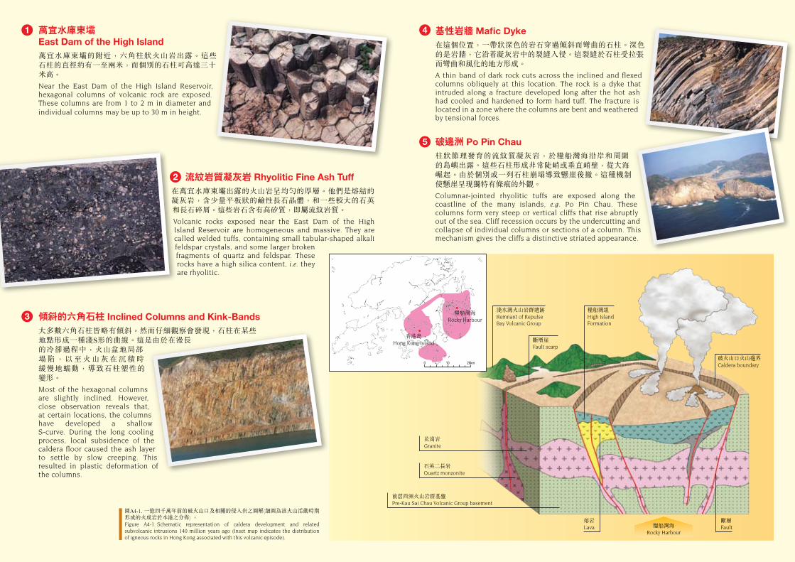
萬宜水庫東壩East Dam of the High Island萬宜水庫東壩的附近,六角柱狀火山岩出露。這些 石柱的直徑約有一至兩米,而個別的石柱可高達三十米高。
Near the East Dam of the High Island Reservoir, hexagonal columns of volcanic rock are exposed. These columns are from 1 to 2 m in diameter and individual columns may be up to 30 m in height.
流紋岩質凝灰岩 Rhyolitic Fine Ash Tuff 在萬宜水庫東壩出露的火山岩呈均勻的厚層。他們是熔結的凝灰岩,含少量平板狀的鹼性長石晶體,和一些較大的石英和長石碎屑。這些岩石含有高矽質,即屬流紋岩質。
Volcanic rocks exposed near the East Dam of the High Island Reservoir are homogeneous and massive. They are called welded tuffs, containing small tabular-shaped alkali feldspar crystals, and some larger broken fragments of quartz and feldspar. These rocks have a high silica content, i.e. they are rhyolitic.
傾斜的六角石柱 Inclined Columns and Kink-Bands 大多數六角石柱皆略有傾斜。然而仔細觀察會發現,石柱在某些地點形成一種淺S形的曲線。這是由於在漫長的冷卻過程中,火山盆地局部 塌 陷 , 以 至 火 山 灰 在 沉 積 時 緩慢地蠕動,導致石柱塑性的 變形。
Most of the hexagonal columns are slightly inclined. However, close observation reveals that, at certain locations, the columns have developed a shallow S-curve. During the long cooling process, local subsidence of the caldera floor caused the ash layer to settle by slow creeping. This resulted in plastic deformation of the columns.
基性岩牆 Mafic Dyke在這個位置,一帶狀深色的岩石穿過傾斜而彎曲的石柱。深色的是岩牆,它沿 凝灰岩中的裂縫入侵。這裂縫於石柱受拉張而彎曲和風化的地方形成。
A thin band of dark rock cuts across the inclined and flexed columns obliquely at this location. The rock is a dyke that intruded along a fracture developed long after the hot ash had cooled and hardened to form hard tuff. The fracture is located in a zone where the columns are bent and weathered by tensional forces.
破邊洲 Po Pin Chau柱狀節理發育的流紋質凝灰岩,於糧船灣海沿岸和周圍的島嶼出露。這些石柱形成非常陡峭或垂直峭壁,從大海 崛起。由於個別或一列石柱崩塌導致懸崖後撤。這種機制使懸崖呈現獨特有條痕的外觀。
Columnar-jointed rhyolitic tuffs are exposed along the coastline of the many islands, e.g. Po Pin Chau. These columns form very steep or vertical cliffs that rise abruptly out of the sea. Cliff recession occurs by the undercutting and collapse of individual columns or sections of a column. This mechanism gives the cliffs a distinctive striated appearance.
1 4
5
3
2
淺水灣火山岩群遺跡Remnant of Repulse Bay Volcanic Group
斷層崖Fault scarp
糧船灣組High Island Formation
破火山口火山邊界Caldera boundary
花崗岩Granite
石英二長岩Quartz monzonite
前滘西洲火山岩群基盤Pre-Kau Sai Chau Volcanic Group basement
熔岩Lava
斷層Fault糧船灣海
Rocky Harbour
糧船灣海Rocky Harbour
香港島Hong Kong Island
圖A4-1. 一億四千萬年前的破火山口及相關的侵入岩之圖解(細圖為該火山活動時期形成的火成岩於本港之分佈) 。Figure A4-1. Schematic representation of caldera development and related subvolcanic intrusions 140 million years ago (Inset map indicates the distribution of igneous rocks in Hong Kong associated with this volcanic episode).
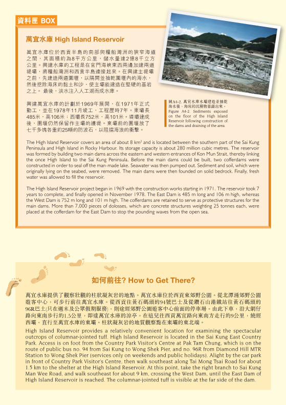
資料匣 BOX SITES OF SPECIAL GEOLOGICAL INTEREST IN HONG KONG香港具地質特色的景點
糧 船 灣 HIGH ISLAND糧船灣的地質:約一億四千萬年前,一次極端猛烈的火山爆發在香港的東南部發生。這次火山爆發導致一層厚厚的火山灰在破火山口盆地內沉積。火山灰逐漸冷卻收縮,形成壯觀的石柱。這些石柱現在出露在糧船灣、果洲群島和許多糧船灣海周圍島嶼。
Geology of High Island: About 140 million years ago, an extremely violent volcanic eruption occurred in the southeastern part of Hong Kong. This resulted in the deposition of a thick layer of volcanic ash within a volcanic depression (caldera). The volcanic ash slowly cooled and contracted, forming the spectacular columns that are now exposed at High Island, the Ninepin Group and many islands around Rocky Harbour.
砂、中礫、巨礫和礫石Sand, cobbles, boulders and gravel
深灰色海泥和砂(未分)Undivided, dark grey marine mud and sand
黏土/粉砂、砂及 礫石(未分)Undivided clay/silt, sand and gravel
海灘沉積Beach deposits
海洋沉積Marine deposits
沖積物及坡積物Alluvial and colluvial deposits
表土沉積 SUPERFICIAL DEPOSITS
Qb
Qh
Qad
基岩地質 SOLID GEOLOGY
主要為熔結細火山灰玻屑凝灰岩 Mainly welded fine ash vitric tuff
主要為粗面英安岩和流紋岩 Mainly trachydacite and rhyolite lava
基性岩牆,主要為 玄武安山岩 Mafic dykes, mainly basaltic andesite
糧船灣組 High Island Formation
清水灣組 Clear Water Bay Formation
Kkh
b
Kkw
如何前往? How to Get There?
地質界線及符號GEOLOGICAL LINES AND SYMBOLS
萬宜水庫提供了觀察壯觀的柱狀凝灰岩的地點。萬宜水庫位於西貢東郊野公園。從北潭涌郊野公園遊客中心,可步行前往萬宜水庫。從西貢往黃石碼頭的94號巴士及從鑽石山港鐵站往黃石碼頭的96R巴土(只在週末及公眾假期服務),則途經郊野公園遊客中心前面的停車場。由此下車,沿大網仔路向東南步行約1.5公里,即達萬宜水庫的涼亭。在這兒往西貢萬宜路向東南方走行約9公里,繞經西壩,直行至萬宜水庫的東壩。柱狀凝灰岩的地質觀察點在東壩的東北端。
High Island Reservoir provides a relatively convenient location for examining the spectacular outcrops of columnar-jointed tuff. High Island Reservoir is located in the Sai Kung East Country Park. Access is on foot from the Country Park Visitor’s Centre at Pak Tam Chung, which is on the route of public bus no. 94 from Sai Kung to Wong Shek Pier, and no. 96R from Diamond Hill MTR Station to Wong Shek Pier (services only on weekends and public holidays). Alight by the car park in front of Country Park Visitor’s Centre, then walk southeast along Tai Mong Tsai Road for about 1.5 km to the shelter at the High Island Reservoir. At this point, take the right branch to Sai Kung Man Wee Road, and walk southeast for about 9 km, crossing the West Dam, until the East Dam of High Island Reservoir is reached. The columnar-jointed tuff is visible at the far side of the dam.
萬宜水庫 High Island Reservoir
資料由土力工程處香港地質調查組編製。Prepared by the Hong Kong Geological Survey, Geotechnical Engineering Office.
地質界線(虛線表示推測界線) Geological boundary (Dashed lines denote uncertainty)
斷層(虛線表示推測斷層) Fault (Dashed lines denote uncertainty)
水平流動構造 Horizontal flow fabric
傾斜流動構造 Inclined flow fabric
傾斜節理 Inclined jointing
垂直節理 Vertical jointing
萬宜水庫位於西貢半島的南部與糧船灣洲的狹窄海道 之間,其面積約為8平方公里,儲水量達2億8千立方 公里。興建水庫的工程是在官門海峽東西兩邊加建兩道 堤壩,將糧船灣洲和西貢半島連接起來。在興建主堤壩之前,先建造兩道圍堰,以隔開並抽乾圍堰內的海水,然後挖除海床的黏土和沙,使主壩能建造在堅硬的基岩之上。 最後,淡水注入人工湖而成水庫。
興建萬宜水庫的計劃於1969年展開,在1971年正式 動工,並在1978年11月竣工,工程歷時7年。東壩長485米,高106米;西壩長752米,高101米。堤壩建成後,圍堰仍然保留作主壩的護堤。東壩前的圍堰放了 七千多塊各重約25噸的防波石,以阻擋海浪的衝擊。
The High Island Reservoir covers an area of about 8 km2 and is located between the southern part of the Sai Kung Peninsula and High Island in Rocky Harbour. Its storage capacity is about 280 million cubic metres. The reservoir was formed by building two main dams across the eastern and western entrances of Kon Mun Strait, thereby linking the once High Island to the Sai Kung Peninsula. Before the main dams could be built, two cofferdams were constructed in order to seal off the man-made lake. Seawater was then pumped out. Sediment and soil, which were originally lying on the seabed, were removed. The main dams were then founded on solid bedrock. Finally, fresh water was allowed to fill the reservoir.
The High Island Reservoir project began in 1969 with the construction works starting in 1971. The reservoir took 7 years to complete, and finally opened in November 1978. The East Dam is 485 m long and 106 m high, whereas the West Dam is 752 m long and 101 m high. The cofferdams are retained to serve as protective structures for the main dams. More than 7,000 pieces of dolosses, which are concrete structures weighting 25 tonnes each, were placed at the cofferdam for the East Dam to stop the pounding waves from the open sea.
圖A4-2. 萬宜水庫水壩建造並抽乾海水後,海床的沉積物暴露出來。Figure A4-2. Sediments exposed on the floor of the High Island Reservoir following construction of the dams and draining of the area.
野外考察指南 Field Guide 4