


Bahasa
Halaman
Hukum

1. Call to Order
2. Recognition of Sergeant at Arms - Master Officer Lori Strickland Master Officer Strickland has 13 years law enforcement experience, 11 years with theTown of Morrisville. She has served on the Crisis Intervention Team and has receivedOfficer of the Year recognition several times.
3. Invocation Invocation by Council Member Robotti.
4. Pledge of Allegiance
5. Adoption of Regular Agenda Call for any conflicts of interest in relation to theproposed agenda.
6. Consent Agenda
6.a Ordinance 2020-241-0 of the Morrisville Town Council Pertaining to the Extensionof the Town of Morrisville Corporate Limits to Include Properties Located Along thesouth side of Slater Road, east of North Carolina 540 at the Wake/Durham Countyline, commonly known as 703 and 3109 Slater Road (ANX-21-0002 and ANX-21-0004).
Aaron Prichard, Planner IIAction (Ordinance) - July 27
2021-241-0 Peak Supp - 703 & 3109 Slater Rd ANX.pdf 2021-241-0 ORD - Approving the Annexation - 703 & 3109 Slater Rd ANX.pdf 2021-241-0 ATTH 01 - Annexation Petitions - 703 & 3109 Slater Rd ANX.pdf 2021-241-0 ATTH 02 - Maps - 703 & 3109 Slater Rd ANX.pdf 2021-241-0 UPDATED TC Presentation - 703 & 3109 Slater Rd ANX.pdf
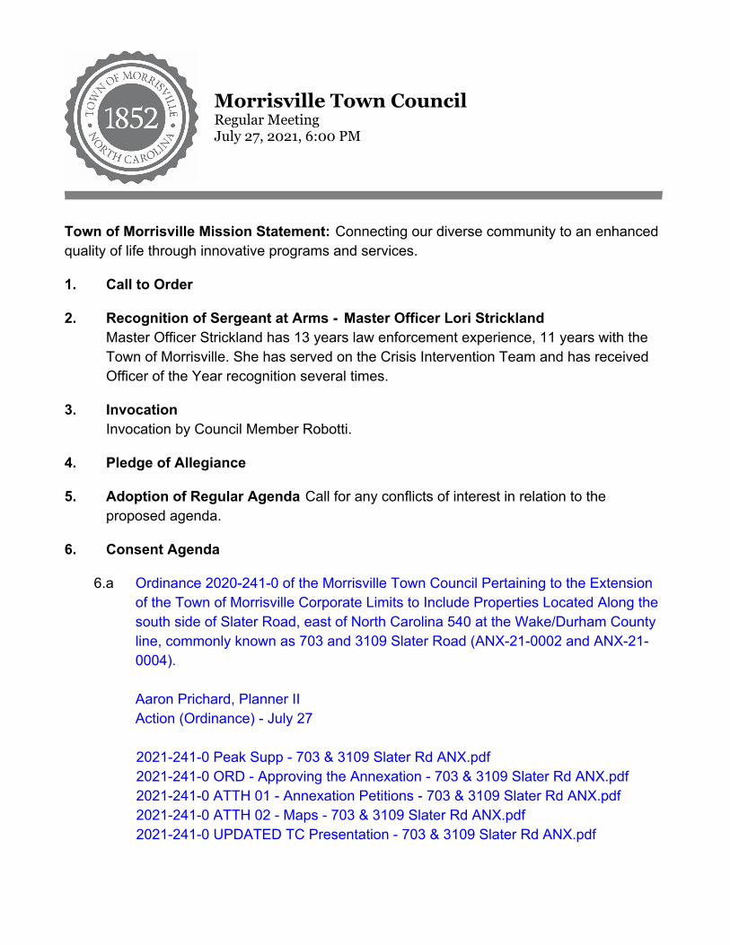
Morrisville Town CouncilRegular MeetingJuly 27, 2021, 6:00 PM
Town of Morrisville Mission Statement: Connecting our diverse community to an enhancedquality of life through innovative programs and services.
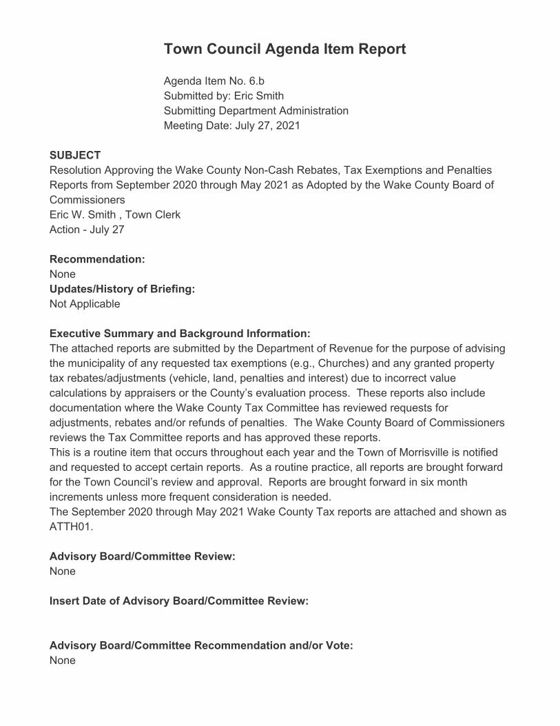
6.b Resolution Approving the Wake County Non-Cash Rebates, Tax Exemptions andPenalties Reports from September 2020 through May 2021 as Adopted by theWake County Board of CommissionersEric W. Smith , Town Clerk Action - July 27
2021-302-0 Peak Supp Wake Co Tax Rebates.pdf 2021-302-0 RES Approving Wake Co Tax Rebates.pdf 2021-302-0 ATTH01 Wake Co Tax Rebates.pdf
6.c Resolution Designating an Official to Make Recommendations to the NC AlcoholicBeverage Control CommissionEric Smith, Town Clerk Action - July 27
2021-303-0 BS Resolution Designating ABC Official.pdf 2021-303-0_RES_Resolution_Designating_ABC_Official.pdf
6.d Resolution Approving an Amendment to the Cary/Morrisville Utility AgreementMartha Paige, Town ManagerAction - July 27
2021-311-0 BS Cary.Morrisville Utility Agreement Amendment.pdf 2021-311-0 RES Cary.Morrisville Utility Agreement Amendment .pdf 2021-311-0 ATTH01 CaryMville Utility Merger Agreement Amendment.pdf
6.e Approval of June 8, 2021 Town Council Meeting MinutesEric Smith, Town ClerkAction - July 27
20210608M.pdf
6.f Approval of June 10, 2021 Town Council Work Session MinutesEric Smith, Town ClerkAction - July 27
20210610M.pdf
6.g Approval of June 22, 2021 Town Council Meeting MinutesEric Smith, Town ClerkAction - July 27
20210622M.pdf
6.h Resolution Authorizing the Purchase of Real Property at 104 Marcom DriveBrandon Zuidema, Assistant Town ManagerAction - July 27
2021-312-0 BS Purchase of Real Property 104 Marcom Drive.pdf 2021-312-0 RES Purchase of Real Property 104 Marcom Drive.pdf 2021-312-0 ATTH01 Real Property Purchase Agreement 104 Marcom Drive.pdf
6.i Resolution Authorizing the Purchase of Real Property at 109 Marcom DriveBrandon Zuidema, Assistant Town ManagerAction - July 27
2021-312-0 BS Purchase of Real Property 104 Marcom Drive.pdf 2021-319-0 RES Purchase of Real Property 109 Marcom Drive.pdf 2021-319-0 ATTH01 Real Property Purchase Agreement 109 Marcom Drive.pdf
7. Items Pulled from Consent (if any)
8. Public Address
9. Action Items
9.a Consideration of Zoning Map Amendments and UDO Text Amendments Related toLand Use Plan Implementation of the McCrimmon Extension Subarea Plan and theTransit Oriented Development District (AMEND 21-0002, 21-0003, 21-0004, 21-0005, 21-0006). 1. Ordinance 2021-189-0A Approving a Zoning Map Amendment to theBoundaries of the Airport Overlay Zoning District (AMEND-21-0002). 2. Ordinance 2021-189-0B Approving a Zoning Map Amendment to RezoneVarious Parcels located along McCrimmon Parkway and Airport Boulevard fromthe Industrial Management (IM) zoning district to the Business Activity Center(BAC) zoning district (AMEND-21-0003). 3. Ordinance 2021-189-0C Approving a Zoning Map Amendment to Install theGateway Overlay (GO) Zoning District on Various Parcels along McCrimmonParkway and Airport Boulevard (AMEND-21-0004). 4. Ordinance 2021-189-0D Approving a Zoning Map Amendment to RezoneVarious Parcels to the Transit Oriented Development (TOD) Zoning District(AMEND-21-0005). 5. Ordinance 2021-189-0E: Approving Text Amendments to the UnifiedDevelopment Ordinance related to Land Use Plan Implementation of theMcCrimmon Subarea Plan and the Transit Oriented Development Zoning District(UDO AMEND-21-0005). Chris Lawson, Planning ManagerJune 8 - Brief and Public Hearing June 22 - Continuation of the Public Hearing & UpdatesJuly 13 - Continuation of the Public Hearing & Updates
July 27 - Action
2021-189-0 LUP Implementation McCrimmon, TOD Peak Briefing Supplement.pdf 2021-189-0A ORD - Approving a Zoning Map Amendment Airport Overlay.pdf 2021-189-0B ORD - Approving a Zoning Map Amendment BAC.pdf 2021-189-0C ORD - Approving a Zoning Map Amendment GO.pdf 2021-189-0D ORD - Approving a Zoning Map Amendment TOD.pdf 2021-189-0E ORD THIS ITEM HAS BEEN UPDATED- Approving a UDO Text
Amendment LUP Implementation.pdf 2021-189-0 ATTH 01 - FAA Morrisville follow up letter.pdf 2021-189-0 ATTH 02 FAA Adjustment of Proposed Airport Overlay
Amendment.pdf 202-189-0 ATTH 03 Airport Overlay.pdf 2021-189-0 ATTH 04 Previous Conditional Rezoning Ordinances.pdf 2021-189-0 ATTH 05 BAC Rezoned Area.pdf 2021-189-0 ATTH 06 GO Rezoning.pdf 2021-189-0 ATTH 07 TOD Rezoning.pdf 2021-189-0 ATTH 08 Form Based Code Example - Virginia Beach Oceanfront
Resort.pdf 2021-189-0 ATTH 09 PZB Statement of Plan Consistency and Reasonableness of
Action.pdf 2021-189-0 ATTH 10 Draft PZB Minutes 2021-05-13.pdf 2021-189-0 ATTH 11 - Aerial Image Comparing Parking Orientation.pdf 2021-189-0 ATTH 12 - Upper Floor Stepback Example.pdf 2021-189-0 ATTH 13 - Avigation Easement Example.pdf 2021-189-0 ATTH 14 - Compiled Public Hearing Comments.pdf 2021-189-0 THIS ITEM HAS BEEN UPDATED LUP Implementation McCrimmon,
TOD Presentation.pdf
9.b Resolution Appointing Advisory Committee Members (Summer)Eric Smith, Town ClerkBrief - July 13Action - July 27
2021-281-0 BS Resolution Appointing Advisory Committee Members(Summer).pdf
2021-281-0 RES Appointing Advisory Committee Members (Summer).pdf 2021-281-0 ATTH01 Committee Vacancy Overview.pdf 2021-281-0 ATTH04 Completed Electronic Ballots.pdf 2021-281-0 ATTH06 Applicant Tally Sheet.pdf
10. Future Meetings, Events and Citizen Involvement Opportunities For a full listing ofevents, please see the Town Calendar at www.townofmorrisville.org.
11. Council and Manager Comments
12. Closed Session
12.a Closed Session Pursuant to N.C.G.S. 143-318.11(a)(4) to discuss matters relatingto economic development.
13. Adjournment Thank you for attending this meeting of the Morrisville Town Council. Wehope you plan to join us again! Please feel free to email your Town Council members [email protected], or visit www.TownofMorrisville.org/Council foradditional contact information.
Town Council Agenda Item Report
Agenda Item No. 6.aSubmitted by: Aaron PrichardSubmitting Department Planning Meeting Date: July 27, 2021
SUBJECTOrdinance 2020-241-0 of the Morrisville Town Council Pertaining to the Extension of the Townof Morrisville Corporate Limits to Include Properties Located Along the south side of SlaterRoad, east of North Carolina 540 at the Wake/Durham County line, commonly known as 703and 3109 Slater Road (ANX-21-0002 and ANX-21-0004).
Aaron Prichard, Planner IIAction (Ordinance) - July 27
Recommendation:Staff recommends approval of the requested annexation.
Updates/History of Briefing:Resolution A, relating to the sufficiency of the annexation petition, and Resolution B, settingthe date of the Public Hearing, were approved by the Town Council on June 22, 2021. ThePublic Hearing was held at the July 13, 2021 Town Council meeting. There were no speakersand the public hearing was closed. Please note: the ordinance document for 2021-241-0 was updated to show the annexation asbeing effective March 9, 2021. Through conversations with Durham County, staff determinedthat the annexation would need to be retroactively backdated to coincide with the zoning mapamendment for the properties, which was approved by the Town Council on March 9, 2021.The annexation will need to coincide with the rezoning because specific documentationshowing that the two properties were in our Extraterritorial Jurisdiction could not be found.However, the Town has the authority to annex the properties through an existing agreementwith Durham County. Changing the date of the annexation will have tax implications for the property owners, as thetaxing jurisdiction for the properties will officially change to the Town of Morrisville (formerlyWake and Durham Counties), effective on March 9, 2021. The applicant for the propertyowners has confirmed his acceptance of the retroactive annexation with me over the phoneand by email. He stated that he and the property owners would like to avoid having to repeatthe zoning map amendment process, which would be required if the annexation were not

backdated.
Executive Summary and Background Information:CE Group, Inc. (applicant) has submitted two petitions for annexation (see ATTH 01 andATTH 02) on behalf of Michael L. and Jennifer M. Lane (property owners). The subjectproperties are located along the south side of Slater Road, east of North Carolina 540 at theWake/Durham County line (see ATTH 03, Map A), and are commonly known as 703 and 3109Slater Road. The Durham County PIN for 703 Slater Road is 0757-00-38-7857 and the WakeCounty PIN for 3109 Slater Road is 0757-00-5853. The subject properties are comprised of1.53 acres (703 Slater Road) and 1.36 acres (3109 Slater Road). 3109 Slater Road currentlycontains an occupied single family residence, and 703 Slater Road currently contains a vacantsingle family residence. The applicant is making the annexation requests in order to facilitatethe development of a proposed office building which is currently preparing for aSite/Construction Plan review. The properties are contiguous to the Town of Morrisville'scorporate limits to the north and south (see ATTH 03, Map B). The sites are within the Town'splanning jurisdiction and were recently rezoned to Conditional Office/Institutional (see ATTH02, Map C). In accordance with G.S. 160A-31, Town Council must hold a public hearingbefore acting on the requested annexations.
Advisory Board/Committee Review:None
Insert Date of Advisory Board/Committee Review:
Advisory Board/Committee Recommendation and/or Vote:NA
Potential Options:The Town Council is asked to consider the proposed annexation and should either:
1. Approve the annexation; or 2. Deny the annexation.
Consideration of an annexation is a legislative decision and is discretionary. Action on therequest is scheduled for the July 27, 2021 meeting.
Staff Recommendation:Town Staff recommends approval of Resolutions A & B on June 22, 2021, directing staff toinvestigate the sufficiency of the annexation petition and to set a public hearing date of July13, 2021. Town staff recommends approval of the proposed annexation on July 27, 2021 forthe following reasons:
1. The Town has historically honored voluntary annexation requests; 2. The annexation petition meets all statutory requirements; 3. Annexation of the property would expand the Town's tax base; and 4. The annexation and increase in tax base will improve the economies of scale in the deliveryof Town services. ATTACHMENTS• 2021-241-0 Peak Supp - 703 & 3109 Slater Rd ANX.pdf• 2021-241-0 ORD - Approving the Annexation - 703 & 3109 Slater Rd ANX.pdf• 2021-241-0 ATTH 01 - Annexation Petitions - 703 & 3109 Slater Rd ANX.pdf• 2021-241-0 ATTH 02 - Maps - 703 & 3109 Slater Rd ANX.pdf• 2021-241-0 UPDATED TC Presentation - 703 & 3109 Slater Rd ANX.pdf
Updated: June 7, 2021 1 of 1
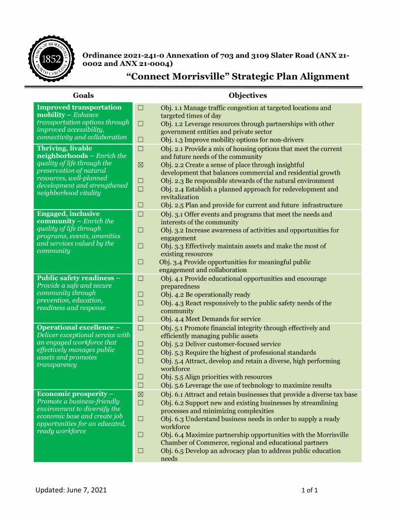
Ordinance 2021-241-0 Annexation of 703 and 3109 Slater Road (ANX 21-0002 and ANX 21-0004)
Goals Objectives
Improved transportation mobility – Enhance transportation options through improved accessibility, connectivity and collaboration
☐ Obj. 1.1 Manage traffic congestion at targeted locations and targeted times of day ☐ Obj. 1.2 Leverage resources through partnerships with other government entities and private sector ☐ Obj. 1.3 Improve mobility options for non-drivers
Thriving, livable neighborhoods – Enrich the quality of life through the preservation of natural resources, well-planned development and strengthened neighborhood vitality
☐ Obj. 2.1 Provide a mix of housing options that meet the current and future needs of the community ☒ Obj. 2.2 Create a sense of place through insightful development that balances commercial and residential growth ☐ Obj. 2.3 Be responsible stewards of the natural environment ☐ Obj. 2.4 Establish a planned approach for redevelopment and revitalization ☐ Obj. 2.5 Plan and provide for current and future infrastructure
Engaged, inclusive community – Enrich the quality of life through programs, events, amenities and services valued by the community
☐ Obj. 3.1 Offer events and programs that meet the needs and interests of the community ☐ Obj. 3.2 Increase awareness of activities and opportunities for engagement ☐ Obj. 3.3 Effectively maintain assets and make the most of existing resources ☐ Obj. 3.4 Provide opportunities for meaningful public engagement and collaboration
Public safety readiness – Provide a safe and secure community through prevention, education, readiness and response
☐ Obj. 4.1 Provide educational opportunities and encourage preparedness ☐ Obj. 4.2 Be operationally ready ☐ Obj. 4.3 React responsively to the public safety needs of the community ☐ Obj. 4.4 Meet Demands for service
Operational excellence – Deliver exceptional service with an engaged workforce that effectively manages public assets and promotes transparency
☐ Obj. 5.1 Promote financial integrity through effectively and efficiently managing public assets ☐ Obj. 5.2 Deliver customer-focused service ☐ Obj. 5.3 Require the highest of professional standards ☐ Obj. 5.4 Attract, develop and retain a diverse, high performing workforce ☐ Obj. 5.5 Align priorities with resources ☐ Obj. 5.6 Leverage the use of technology to maximize results
Economic prosperity – Promote a business-friendly environment to diversify the economic base and create job opportunities for an educated, ready workforce
☒ Obj. 6.1 Attract and retain businesses that provide a diverse tax base ☐ Obj. 6.2 Support new and existing businesses by streamlining processes and minimizing complexities ☐ Obj. 6.3 Understand business needs in order to supply a ready workforce ☐ Obj. 6.4 Maximize partnership opportunities with the Morrisville Chamber of Commerce, regional and educational partners ☐ Obj. 6.5 Develop an advocacy plan to address public education needs
“Connect Morrisville” Strategic Plan Alignment
MAIL TO: TOWN OF MORRISVILLE * 100 TOWN HALL DRIVE * MORRISVILLE, NC 27560
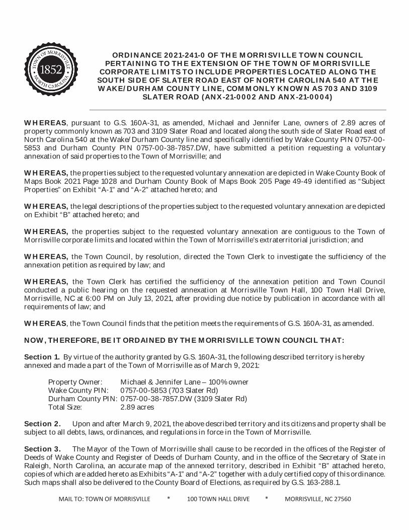
ORDINANCE 2021-241-0 OF THE MORRISVILLE TOWN COUNCIL PERTAINING TO THE EXTENSION OF THE TOWN OF MORRISVILLE
CORPORATE LIMITS TO INCLUDE PROPERTIES LOCATED ALONG THE SOUTH SIDE OF SLATER ROAD EAST OF NORTH CAROLINA 540 AT THE WAKE/DURHAM COUNTY LINE, COMMONLY KNOWN AS 703 AND 3109
SLATER ROAD (ANX-21-0002 AND ANX-21-0004)
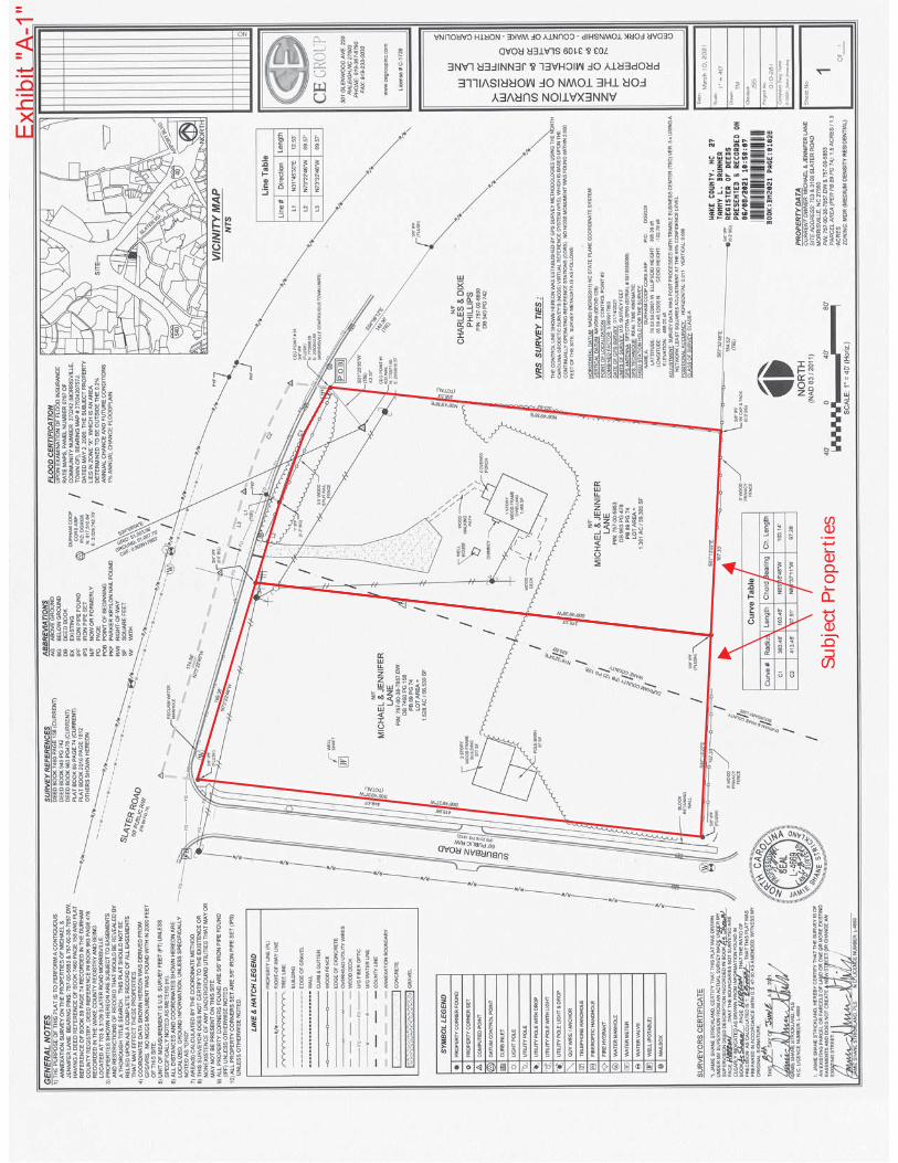
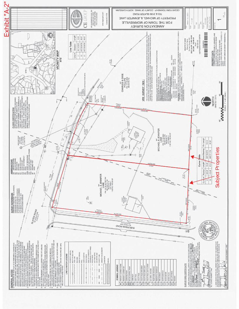
WHEREAS, pursuant to G.S. 160A-31, as amended, Michael and Jennifer Lane, owners of 2.89 acres of property commonly known as 703 and 3109 Slater Road and located along the south side of Slater Road east of North Carolina 540 at the Wake/Durham County line and specifically identified by Wake County PIN 0757-00-5853 and Durham County PIN 0757-00-38-7857.DW, have submitted a petition requesting a voluntary annexation of said properties to the Town of Morrisville; and WHEREAS, the properties subject to the requested voluntary annexation are depicted in Wake County Book of Maps Book 2021 Page 1028 and Durham County Book of Maps Book 205 Page 49-49 identified as “Subject Properties” on Exhibit “A-1” and “A-2” attached hereto; and WHEREAS, the legal descriptions of the properties subject to the requested voluntary annexation are depicted on Exhibit “B” attached hereto; and WHEREAS, the properties subject to the requested voluntary annexation are contiguous to the Town of Morrisville corporate limits and located within the Town of Morrisville’s extraterritorial jurisdiction; and WHEREAS, the Town Council, by resolution, directed the Town Clerk to investigate the sufficiency of the annexation petition as required by law; and WHEREAS, the Town Clerk has certified the sufficiency of the annexation petition and Town Council conducted a public hearing on the requested annexation at Morrisville Town Hall, 100 Town Hall Drive, Morrisville, NC at 6:00 PM on July 13, 2021, after providing due notice by publication in accordance with all requirements of law; and WHEREAS, the Town Council finds that the petition meets the requirements of G.S. 160A-31, as amended. NOW, THEREFORE, BE IT ORDAINED BY THE MORRISVILLE TOWN COUNCIL THAT:
Section 1. By virtue of the authority granted by G.S. 160A-31, the following described territory is hereby annexed and made a part of the Town of Morrisville as of March 9, 2021: Property Owner: Michael & Jennifer Lane – 100% owner Wake County PIN: 0757-00-5853 (703 Slater Rd) Durham County PIN: 0757-00-38-7857.DW (3109 Slater Rd) Total Size: 2.89 acres Section 2. Upon and after March 9, 2021, the above described territory and its citizens and property shall be subject to all debts, laws, ordinances, and regulations in force in the Town of Morrisville. Section 3. The Mayor of the Town of Morrisville shall cause to be recorded in the offices of the Register of Deeds of Wake County and Register of Deeds of Durham County, and in the office of the Secretary of State in Raleigh, North Carolina, an accurate map of the annexed territory, described in Exhibit “B” attached hereto, copies of which are added hereto as Exhibits “A-1” and “A-2” together with a duly certified copy of this ordinance. Such maps shall also be delivered to the County Board of Elections, as required by G.S. 163-288.1.
MAIL TO: TOWN OF MORRISVILLE * 100 TOWN HALL DRIVE * MORRISVILLE, NC 27560
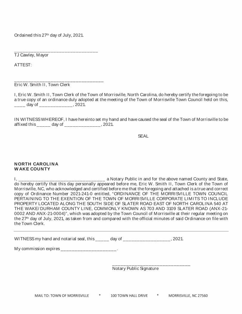
Ordained this 27th day of July, 2021. ______________________________ TJ Cawley, Mayor ATTEST: ________________________________ Eric W. Smith II, Town Clerk I, Eric W. Smith II, Town Clerk of the Town of Morrisville, North Carolina, do hereby certify the foregoing to be a true copy of an ordinance duly adopted at the meeting of the Town of Morrisville Town Council held on this, ____ day of ____________, 2021. IN WITNESS WHEREOF, I have hereinto set my hand and have caused the seal of the Town of Morrisville to be affixed this _____ day of _____________, 2021. NORTH CAROLINA WAKE COUNTY I, _______________________________ a Notary Public in and for the above named County and State, do hereby certify that this day personally appeared before me, Eric W. Smith II, Town Clerk of the Town of Morrisville, NC, who acknowledged and certified before me that the foregoing and attached is a true and correct copy of Ordinance Number 2021-241-0 entitled, “ORDINANCE OF THE MORRISVILLE TOWN COUNCIL PERTAINING TO THE EXENTION OF THE TOWN OF MORRISVILLE CORPORATE LIMITS TO INCLUDE PROPERTY LOCATED ALONG THE SOUTH SIDE OF SLATER ROAD EAST OF NORTH CAROLINA 540 AT THE WAKE/DURHAM COUNTY LINE, COMMONLY KNOWN AS 703 AND 3109 SLATER ROAD (ANX-21-0002 AND ANX-21-0004)”, which was adopted by the Town Council of Morrisville at their regular meeting on the 27th day of July, 2021, as taken from and compared with the official minutes of said Ordinance on file with the Town Clerk.
WITNESS my hand and notarial seal, this _____ day of _________________, 2021. My commission expires ____________________.
____________________________
Notary Public Signature
SEAL
MAIL TO: TOWN OF MORRISVILLE * 100 TOWN HALL DRIVE * MORRISVILLE, NC 27560
NORTH CAROLINA DURHAM COUNTY I, _______________________________ a Notary Public in and for the above named County and State, do hereby certify that this day personally appeared before me, Eric W. Smith II, Town Clerk of the Town of Morrisville, NC, who acknowledged and certified before me that the foregoing and attached is a true and correct copy of Ordinance Number 2021-241-0 entitled, “ORDINANCE OF THE MORRISVILLE TOWN COUNCIL PERTAINING TO THE EXENTION OF THE TOWN OF MORRISVILLE CORPORATE LIMITS TO INCLUDE PROPERTY LOCATED ALONG THE SOUTH SIDE OF SLATER ROAD EAST OF NORTH CAROLINA 540 AT THE WAKE/DURHAM COUNTY LINE, COMMONLY KNOWN AS 703 AND 3109 SLATER ROAD (ANX-21-0002 AND ANX-21-0004)”, which was adopted by the Town Council of Morrisville at their regular meeting on the 27th day of July, 2021, as taken from and compared with the official minutes of said Ordinance on file with the Town Clerk.
WITNESS my hand and notarial seal, this _____ day of _________________, 2021. My commission expires ____________________.
____________________________
Notary Public Signature
Subj
ect P
rope
rtie
s
Exhi
bit "
A-1"
Exhi
bit "
A-2"
Subj
ect P
rope
rtie
s
Michael and Jennifer Lane LO6 Suburban Investments Property
703 Slater Road
COMMENCING AT A POINT, SAID POINT BEING “DURHAM COOP CORS ARP” (PID: DG9328) HAVING NORTH CAROLINA GRID COORDINATES OF NORTHING: 817,510.84 FEET & EASTING: 2,029,742.70 FEET AS SHOWN ON THE NORTH CAROLINA GEODETIC SURVEY; THENCE S 24° 09' 04" E FOR A GROUND DISTANCE OF 51,007.75 FEET TO A POINT KNOWN AS “CE POINT #1” AND HAVING NORTH CAROLINA GRID COORDINATES OF NORTHING: 770,971.66 FEET & EASTING: 2,050,610.57 FEET; THENCE N 51° 25' 35" E FOR A DISTANCE OF 42.37 FEET TO A POINT ON THE SOUTHERN MARGIN OF SLATER ROAD (S.R. 1641) HAVING NC GRID COORDINATES OF NORTHING: 770,998.08 FEET & EASTING: 2,050,643.69; THENCE WITH THE SOUTHERN MARGIN OF SAID ROAD, A CURVE TURNING TO THE LEFT WITH A RADIUS OF 383.46 FEET, A CORD BEARING OF N 65° 38' 48" W FOR A CHORD DISTANCE OF 103.14 FEET TO A 1” IRON PIPE FOUND (IPF); THENCE S 73° 22' 46" W FOR A DISTANCE OF 69.57 FEET TO A ¾” IPF 0.5 FEET BELOW GROUND AND BEING HEREBY KNOW AS THE POINT OF BEGINNING
THENCE FROM THE POINT OF BEGINNING S 06° 49' 38" W FOR A DISTANCE OF 378.33 TO A POINT; THENCE N 87° 13' 22" W FOR A DISTANCE OF 167.33 TO A POINT; THENCE ALONG THE EASTERN MARGIN OF SUBURBAN ROAD N 06° 49' 37" E FOR A DISTANCE OF 418.96 FEET TO A POINT LYING ON THE SOUTHERN MARGIN OF SLATER ROAD; THENCE N 06° 49' 37" E FOR A DISTANCE OF 30.44 TO A POINT IN THE CENTERLINE OF SAID ROAD; THENCE FOLLOWING THE CENTERLINE OF SAID ROAD S 73° 22' 46" E FOR A DISTANCE OF 174.56 TO A POINT; THENCE LEAVING THE CENTERLINE OF SAID ROAD S 16° 37' 14" W FOR A DISTANCE OF 30.00 FEET TO A POINT; SAID POINT BEING THE POINT AND PLACE OF BEGINNING; CONTAINING 1.528 ACRES 66,539 SQUARE FEET, MORE OR LESS.
Michael and Jennifer Lane LO5 Richard R & Ruth B Jones Property
3109 Slater Road
COMMENCING AT A POINT, SAID POINT BEING “DURHAM COOP CORS ARP” (PID: DG9328) HAVING NORTH CAROLINA GRID COORDINATES OF NORTHING: 817,510.84 FEET & EASTING: 2,029,742.70 FEET AS SHOWN ON THE NORTH CAROLINA GEODETIC SURVEY; THENCE S 24° 09' 04" E FOR A GROUND DISTANCE OF 51,007.75 FEET TO A POINT KNOWN AS “CE POINT #1” AND HAVING NORTH CAROLINA GRID COORDINATES OF NORTHING: 770,971.66 FEET & EASTING: 2,050,610.57 FEET; THENCE N 51° 25' 35" E FOR A DISTANCE OF 42.37 FEET TO A POINT ON THE SOUTHERN MARGIN OF SLATER ROAD (S.R. 1641) HAVING NC GRID COORDINATES OF NORTHING: 770,998.08 FEET & EASTING: 2,050,643.69 FEET AND BEING HEREBY KNOW AS THE POINT OF BEGINNING
Exhibit "B"
THENCE FROM THE POINT OF BEGINNING S 06° 49' 38" W FOR A DISTANCE OF 323.62 TO A POINT; THENCE N 87° 13' 22" W FOR A DISTANCE OF 167.33 FEET TO A POINT; THENCE N 87° 13' 22" W FOR A DISTANCE OF 167.33 FEET TO A POINT; THENCE N 06° 49' 38" E FOR A DISTANCE OF 378.33 FEET TO A POINT LYING ON THE SOUTHERN MARGIN OF SLATER ROAD; THENCE N 16° 37' 14" E FOR A DISTANCE OF 30.00 TO A POINT IN THE CENTERLINE OF SAID ROAD; THENCE FOLLOWING THE CENTERLINE OF SAID ROAD S 73° 22' 46" E FOR A DISTANCE OF 69.57 FEET TO A POINT; THENCE WITH A CURVE TURNING TO THE RIGHT WITH A RADIUS OF 413.46, A CORD BEARING OF S 66° 37' 11" E FOR A CHORD DISTANCE OF 97.28 FEET TO A POINT; THENCE LEAVING THE CENTERLINE OF SAID ROAD S 06° 49' 38" W FOR A DISTANCE OF 32.91 FEET TO A POINT, SAID POINT BEING THE POINT AND PLACE OF BEGINNING; CONTAINING 1.361 ACRES 59,305 SQUARE FEET, MORE OR LESS.
Exhibit "B"
Annexation Petition Applicant Owner Name: Name:
Mailing Address: Mailing Address:
E-mail Address: E-mail Address:
Phone Number: Phone Number:
Property Location Location (e.g., east side of Smith St, approximately 750 feet south of its intersections with Jones Ave.):
Parcel Address: Parcel Identification Number(s):
Latitude (decimal degrees): Longitude (decimal degrees):
Property Information Site Acreage: Zoning:
Number of buildings on-site: Complete the following if changing from current conditions:
Proposed buildings on-site:
Existing uses: Proposed uses:
Existing total square footage: Proposed total square footage:
Existing residential units: Proposed residential units:
Property is requesting connection to Town of Cary: Water Sewer
Written metes and bounds description of property proposed for annexation:
I/We hereby certify that all information furnished in this application, and included materials, are true to the best of my/our knowledge. Furthermore, I/We have authority to file an application in accordance Section 2.4.3.A, Authority to File Applications, of the Unified Development Ordinance.
__________________________________ ______________________________ ______________ Signature Printed Name Date
__________________________________ ______________________________ ______________ Signature Printed Name Date
If there are multiple owners, contract purchasers, or other persons authorized to submit the application, all such persons shall sign the application or a letter or document consenting to the application.
CE Group, Inc. Michael L. Lane & Jennifer Lane
301 Glenwood Ave. Suite 220, Raleigh, NC 27603 1020 Wooded Lake Dr., Apex NC 27523
[email protected] 367-8790 ext 104
South side of Slater road approximately 950' east of 1-540 at the Wake & Durham County line
703 Slater Road, Morrisville, NC 27560 757-00-38-7857.DW35.868265 N 78.830025 W
1.528 CU-OI
Residential
11Office
1440Conventional N/A
+/- 36,126
COMMENCING AT A POINT, SAID POINT BEING “DURHAM COOP CORS ARP” (PID: DG9328) HAVING NORTH CAROLINA GRID COORDINATES OF NORTHING: 817,510.84 FEET & EASTING: 2,029,742.70 FEET AS SHOWN ON THE NORTH CAROLINAGEODETIC SURVEY; THENCE S 24° 09' 04" E FOR A GROUND DISTANCE OF 51,007.75 FEET TO A POINT KNOWN AS “CE POINT #1” AND HAVING NORTH CAROLINA GRID COORDINATES OF NORTHING: 770,971.66 FEET & EASTING: 2,050,610.57FEET; THENCE N 51° 25' 35" E FOR A DISTANCE OF 42.37 FEET TO A POINT ON THE SOUTHERN MARGIN OF SLATER ROAD (S.R. 1641) HAVING NC GRID COORDINATES OF NORTHING: 770,998.08 FEET & EASTING: 2,050,643.69; THENCE WITHTHE SOUTHERN MARGIN OF SAID ROAD, A CURVE TURNING TO THE LEFT WITH A RADIUS OF 383.46 FEET, A CORD BEARING OF N 65° 38' 48" W FOR A CHORD DISTANCE OF 103.14 FEET TO A 1” IRON PIPE FOUND (IPF); THENCE S 73° 22' 46"W FOR A DISTANCE OF 69.57 FEET TO A ¾” IPF 0.5 FEET BELOW GROUND AND BEING HEREBY KNOW AS THE POINT OF BEGINNING
THENCE FROM THE POINT OF BEGINNING S 06° 49' 38" W FOR A DISTANCE OF 378.33 TO A POINT; THENCE N 87° 13' 22" W FOR A DISTANCE OF 167.33 TO A POINT; THENCE ALONG THE EASTERN MARGIN OF SUBURBAN ROAD N 06° 49' 37" EFOR A DISTANCE OF 418.96 FEET TO A POINT LYING ON THE SOUTHERN MARGIN OF SLATER ROAD; THENCE N 06° 49' 37" E FOR A DISTANCE OF 30.44 TO A POINT IN THE CENTERLINE OF SAID ROAD; THENCE FOLLOWING THE CENTERLINEOF SAID ROAD S 73° 22' 46" E FOR A DISTANCE OF 174.56 TO A POINT; THENCE LEAVING THE CENTERLINE OF SAID ROAD S 16° 37' 14" W FOR A DISTANCE OF 30.00 FEET TO A POINT; SAID POINT BEING THE POINT AND PLACE OF BEGINNING;CONTAINING 1.528 ACRES 66,539 SQUARE FEET, MORE OR LESS.
Michael L. Lane 06/07/21
Jennifer M. Lane 06/07/21
1074
ANNEXATION PETITIONS ATTH 01
Annexation Petition Applicant Owner Name: Name:
Mailing Address: Mailing Address:
E-mail Address: E-mail Address:
Phone Number: Phone Number:
Property Location Location (e.g., east side of Smith St, approximately 750 feet south of its intersections with Jones Ave.):
Parcel Address: Parcel Identification Number(s):
Latitude (decimal degrees): Longitude (decimal degrees):
Property Information Site Acreage: Zoning:
Number of buildings on-site: Complete the following if changing from current conditions:
Proposed buildings on-site:
Existing uses: Proposed uses:
Existing total square footage: Proposed total square footage:
Existing residential units: Proposed residential units:
Property is requesting connection to Town of Cary: Water Sewer
Written metes and bounds description of property proposed for annexation:
I/We hereby certify that all information furnished in this application, and included materials, are true to the best of my/our knowledge. Furthermore, I/We have authority to file an application in accordance Section 2.4.3.A, Authority to File Applications, of the Unified Development Ordinance.
__________________________________ ______________________________ ______________ Signature Printed Name Date
__________________________________ ______________________________ ______________ Signature Printed Name Date
If there are multiple owners, contract purchasers, or other persons authorized to submit the application, all such persons shall sign the application or a letter or document consenting to the application.
CE Group, Inc. Michael L. Lane & Jennifer Lane
301 Glenwood Ave. Suite 220, Raleigh, NC 27603 1020 Wooded Lake Dr., Apex NC 27523
[email protected] 367-8790 ext 104
South side of Slater road approximately 1150' east of 1-540 at the Wake & Durham County line
3109 Slater Road, Morrisville, NC 27560 757-00-585335.868052 N 78.829393 W
1.361 CU-OI
Residential
11Office
1440Conventional N/A
+/- 36,126
COMMENCING AT A POINT, SAID POINT BEING “DURHAM COOP CORS ARP” (PID: DG9328) HAVING NORTH CAROLINA GRID COORDINATES OF NORTHING: 817,510.84 FEET & EASTING: 2,029,742.70 FEET AS SHOWN ON THE NORTH CAROLINAGEODETIC SURVEY; THENCE S 24° 09' 04" E FOR A GROUND DISTANCE OF 51,007.75 FEET TO A POINT KNOWN AS “CE POINT #1” AND HAVING NORTH CAROLINA GRID COORDINATES OF NORTHING: 770,971.66 FEET & EASTING: 2,050,610.57FEET; THENCE N 51° 25' 35" E FOR A DISTANCE OF 42.37 FEET TO A POINT ON THE SOUTHERN MARGIN OF SLATER ROAD (S.R. 1641) HAVING NC GRID COORDINATES OF NORTHING: 770,998.08 FEET & EASTING: 2,050,643.69 FEET AND BEINGHEREBY KNOW AS THE POINT OF BEGINNING
THENCE FROM THE POINT OF BEGINNING S 06° 49' 38" W FOR A DISTANCE OF 323.62 TO A POINT; THENCE N 87° 13' 22" W FOR A DISTANCE OF 167.33 FEET TO A POINT; THENCE N 87° 13' 22" W FOR A DISTANCE OF 167.33 FEET TO A POINT;THENCE N 06° 49' 38" E FOR A DISTANCE OF 378.33 FEET TO A POINT LYING ON THE SOUTHERN MARGIN OF SLATER ROAD; THENCE N 16° 37' 14" E FOR A DISTANCE OF 30.00 TO A POINT IN THE CENTERLINE OF SAID ROAD; THENCEFOLLOWING THE CENTERLINE OF SAID ROAD S 73° 22' 46" E FOR A DISTANCE OF 69.57 FEET TO A POINT; THENCE WITH A CURVE TURNING TO THE RIGHT WITH A RADIUS OF 413.46, A CORD BEARING OF S 66° 37' 11" E FOR A CHORDDISTANCE OF 97.28 FEET TO A POINT; THENCE LEAVING THE CENTERLINE OF SAID ROAD S 06° 49' 38" W FOR A DISTANCE OF 32.91 FEET TO A POINT, SAID POINT BEING THE POINT AND PLACE OF BEGINNING; CONTAINING 1.361 ACRES59,305 SQUARE FEET, MORE OR LESS.
Michael L. Lane 06/07/21
Jennifer M. Lane 06/07/21
ANNEXATION PETITIONS ATTH 01
Subj
ect P
rope
rtie
s
ATTH
01
ANN
EXAT
ION
PET
ITIO
NS
DisclaimeriMaps makes every effort to produce and publish the most current and accurate information possible.However, the maps are produced for information purposes,and are NOT surveys. No warranties, expressed or implied,are provided for the data therein, its use,or its interpretation.
0 430 860215 ft
1 inch = 400 feet
±
Map A - Aerial Map ATTH 02
JurisdictionalBoundary Line

C-OI
C-OI
MDROI
MDR
MDR
MDR
C-OI
HDR
HDROI
OI
2021-241-0Consideration of Items Related to the
Annexation Petition for Properties Located at 703 and 3109 Slater Road - UPDATED
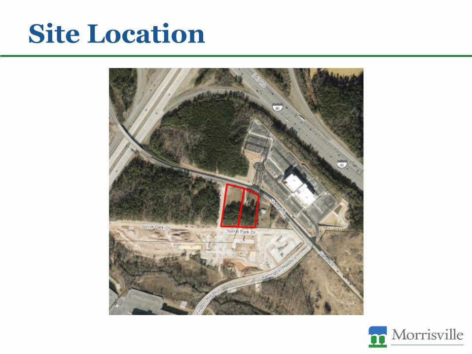
Site Location
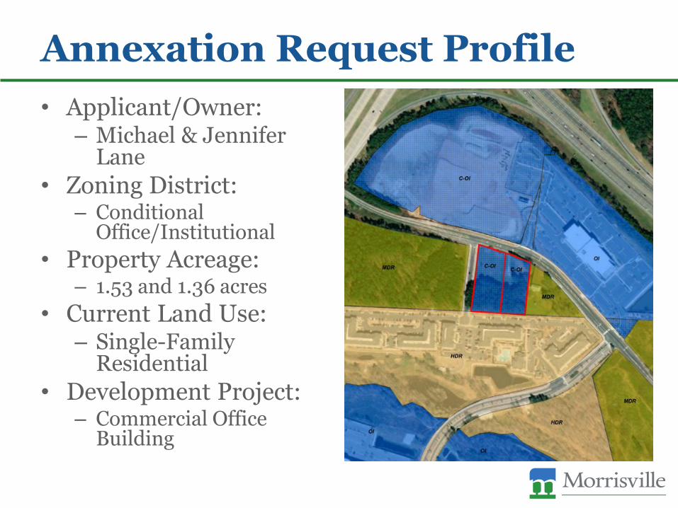
Annexation Request Profile• Applicant/Owner:
– Michael & Jennifer Lane
• Zoning District:– Conditional
Office/Institutional• Property Acreage:
– 1.53 and 1.36 acres• Current Land Use:
– Single-Family Residential
• Development Project:– Commercial Office
Building
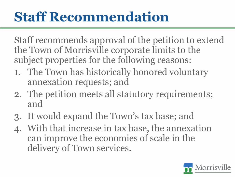
Staff Recommendation
Staff recommends approval of the petition to extend the Town of Morrisville corporate limits to the subject properties for the following reasons:1. The Town has historically honored voluntary
annexation requests; and2. The petition meets all statutory requirements;
and3. It would expand the Town’s tax base; and4. With that increase in tax base, the annexation
can improve the economies of scale in the delivery of Town services.
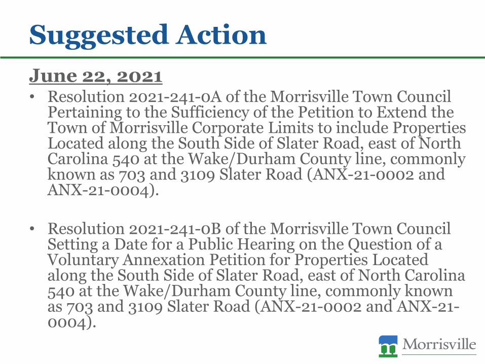
Suggested ActionJune 22, 2021• Resolution 2021-241-0A of the Morrisville Town Council
Pertaining to the Sufficiency of the Petition to Extend the Town of Morrisville Corporate Limits to include Properties Located along the South Side of Slater Road, east of North Carolina 540 at the Wake/Durham County line, commonly known as 703 and 3109 Slater Road (ANX-21-0002 and ANX-21-0004).
• Resolution 2021-241-0B of the Morrisville Town Council Setting a Date for a Public Hearing on the Question of a Voluntary Annexation Petition for Properties Located along the South Side of Slater Road, east of North Carolina 540 at the Wake/Durham County line, commonly known as 703 and 3109 Slater Road (ANX-21-0002 and ANX-21-0004).

Suggested Action, ContinuedJuly 13, 2021• Public hearing
July 27, 2021• Ordinance 2021-241-0 of the Morrisville Town Council
Pertaining to the Extension of the Town of Morrisville Corporate Limits to Include Properties Located along the South Side of Slater Road, east of North Carolina 540 at the Wake Durham County line, commonly known as 703 and 3109 Slater Road (ANX-21-0002 and ANX-21-0004).
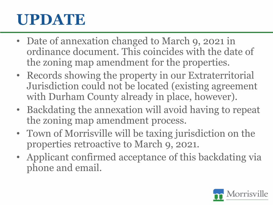
UPDATE• Date of annexation changed to March 9, 2021 in
ordinance document. This coincides with the date of the zoning map amendment for the properties.
• Records showing the property in our Extraterritorial Jurisdiction could not be located (existing agreement with Durham County already in place, however).
• Backdating the annexation will avoid having to repeat the zoning map amendment process.
• Town of Morrisville will be taxing jurisdiction on the properties retroactive to March 9, 2021.
• Applicant confirmed acceptance of this backdating via phone and email.
Town Council Agenda Item Report
Agenda Item No. 6.bSubmitted by: Eric SmithSubmitting Department Administration Meeting Date: July 27, 2021
SUBJECTResolution Approving the Wake County Non-Cash Rebates, Tax Exemptions and PenaltiesReports from September 2020 through May 2021 as Adopted by the Wake County Board ofCommissionersEric W. Smith , Town Clerk Action - July 27
Recommendation:NoneUpdates/History of Briefing:Not Applicable
Executive Summary and Background Information:The attached reports are submitted by the Department of Revenue for the purpose of advisingthe municipality of any requested tax exemptions (e.g., Churches) and any granted propertytax rebates/adjustments (vehicle, land, penalties and interest) due to incorrect valuecalculations by appraisers or the County’s evaluation process. These reports also includedocumentation where the Wake County Tax Committee has reviewed requests foradjustments, rebates and/or refunds of penalties. The Wake County Board of Commissionersreviews the Tax Committee reports and has approved these reports. This is a routine item that occurs throughout each year and the Town of Morrisville is notifiedand requested to accept certain reports. As a routine practice, all reports are brought forwardfor the Town Council’s review and approval. Reports are brought forward in six monthincrements unless more frequent consideration is needed.The September 2020 through May 2021 Wake County Tax reports are attached and shown asATTH01.
Advisory Board/Committee Review:None
Insert Date of Advisory Board/Committee Review:
Advisory Board/Committee Recommendation and/or Vote:None
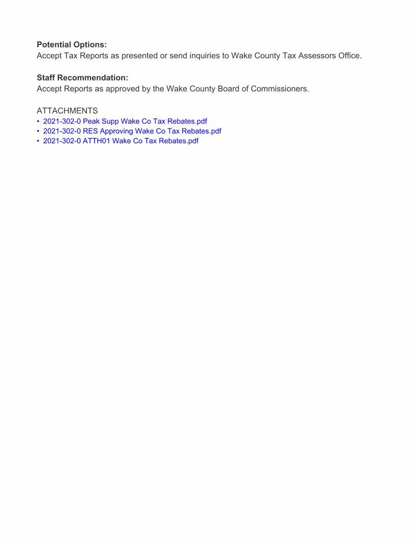
Potential Options:Accept Tax Reports as presented or send inquiries to Wake County Tax Assessors Office.
Staff Recommendation:Accept Reports as approved by the Wake County Board of Commissioners. ATTACHMENTS• 2021-302-0 Peak Supp Wake Co Tax Rebates.pdf• 2021-302-0 RES Approving Wake Co Tax Rebates.pdf• 2021-302-0 ATTH01 Wake Co Tax Rebates.pdf

Updated: July 19, 2021 1 of 1
Resolution 2021-302-0 Approving the Wake Co Non-Cash Rebates, Tax
Exemptions and Penalties Reports (September 2020 - May 2021)
Goals Objectives
Improved transportation mobility – Enhance transportation options through improved accessibility, connectivity and collaboration
☐ Obj. 1.1 Manage traffic congestion at targeted locations and
targeted times of day
☐ Obj. 1.2 Leverage resources through partnerships with other
government entities and private sector
☐ Obj. 1.3 Improve mobility options for non-drivers
Thriving, livable neighborhoods – Enrich the quality of life through the preservation of natural resources, well-planned development and strengthened neighborhood vitality
☐ Obj. 2.1 Provide a mix of housing options that meet the current
and future needs of the community
☐ Obj. 2.2 Create a sense of place through insightful development that balances commercial and residential growth
☐ Obj. 2.3 Be responsible stewards of the natural environment
☐ Obj. 2.4 Establish a planned approach for redevelopment and revitalization
☐ Obj. 2.5 Plan and provide for current and future infrastructure
Engaged, inclusive community – Enrich the quality of life through programs, events, amenities and services valued by the community
☐ Obj. 3.1 Offer events and programs that meet the needs and interests of the community
☐ Obj. 3.2 Increase awareness of activities and opportunities for
engagement
☐ Obj. 3.3 Effectively maintain assets and make the most of
existing resources
☐ Obj. 3.4 Provide opportunities for meaningful public
engagement and collaboration
Public safety readiness – Provide a safe and secure community through prevention, education, readiness and response
☐ Obj. 4.1 Provide educational opportunities and encourage
preparedness
☐ Obj. 4.2 Be operationally ready
☐ Obj. 4.3 React responsively to the public safety needs of the
community
☐ Obj. 4.4 Meet Demands for service
Operational excellence – Deliver exceptional service with an engaged workforce that effectively manages public assets and promotes transparency
☒ Obj. 5.1 Promote financial integrity through effectively and
efficiently managing public assets
☐ Obj. 5.2 Deliver customer-focused service
☐ Obj. 5.3 Require the highest of professional standards
☐ Obj. 5.4 Attract, develop and retain a diverse, high performing
workforce
☐ Obj. 5.5 Align priorities with resources
☐ Obj. 5.6 Leverage the use of technology to maximize results
Economic prosperity – Promote a business-friendly environment to diversify the economic base and create job opportunities for an educated, ready workforce
☐ Obj. 6.1 Attract and retain businesses that provide a diverse tax base
☐ Obj. 6.2 Support new and existing businesses by streamlining
processes and minimizing complexities
☐ Obj. 6.3 Understand business needs in order to supply a ready
workforce
☐ Obj. 6.4 Maximize partnership opportunities with the Morrisville
Chamber of Commerce, regional and educational partners
☐ Obj. 6.5 Develop an advocacy plan to address public education needs
“Connect Morrisville” Strategic Plan Alignment
TOWN OF MORRISVILLE * 100 TOWN HALL DRIVE * MORRISVILLE, NC 27560
Page 1 of 1
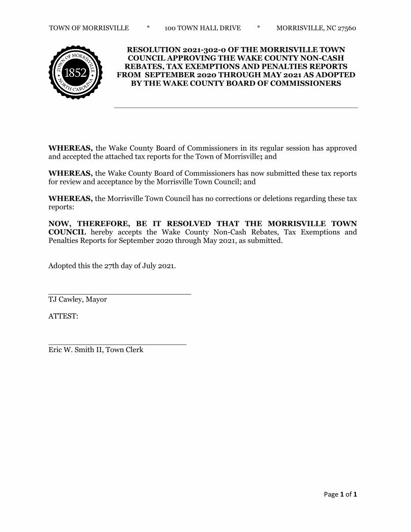
RESOLUTION 2021-302-0 OF THE MORRISVILLE TOWN COUNCIL APPROVING THE WAKE COUNTY NON-CASH
REBATES, TAX EXEMPTIONS AND PENALTIES REPORTS FROM SEPTEMBER 2020 THROUGH MAY 2021 AS ADOPTED
BY THE WAKE COUNTY BOARD OF COMMISSIONERS
WHEREAS, the Wake County Board of Commissioners in its regular session has approved and accepted the attached tax reports for the Town of Morrisville; and WHEREAS, the Wake County Board of Commissioners has now submitted these tax reports for review and acceptance by the Morrisville Town Council; and WHEREAS, the Morrisville Town Council has no corrections or deletions regarding these tax reports: NOW, THEREFORE, BE IT RESOLVED THAT THE MORRISVILLE TOWN COUNCIL hereby accepts the Wake County Non-Cash Rebates, Tax Exemptions and Penalties Reports for September 2020 through May 2021, as submitted. Adopted this the 27th day of July 2021. ______________________________ TJ Cawley, Mayor ATTEST: _____________________________ Eric W. Smith II, Town Clerk
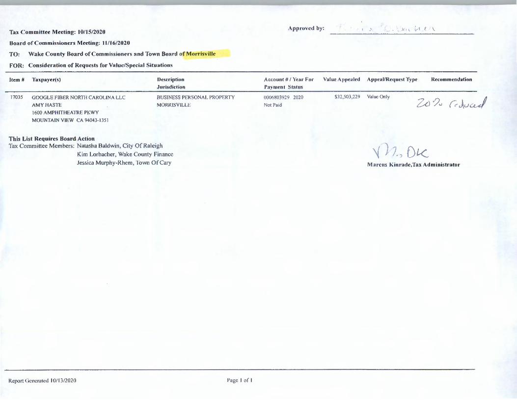
Tax C ommittee Meeting: I0/15/2020
Board of C ommissioners Meeting: 11 / 16/2020
TO : Wake C ounty Board of C omm iss ioners and Town Board of Morrisville
FOR: Consideration of Requests for Value/Special Situations
Item # Taxpayer(s) Description
.Jurisdiction
17035 GOOGLE FIBER NORTH CAROLINA LLC
AMY HASTE
BUS INESS PERSONAL PROPERTY
MORR ISVILLE
1600 AMPH ITHEATRE PKWY
MOUNTAIN VIEW CA 94043- 135 1
This List Requires Board Action Tax Comm ittee Members: Natasha Baldwi n, C ity Of Raleigh
Report Generated I 0/ 13/2020
Ki m Lorbacher, Wake County Fi nance
Jessica Murphy-R hem. Town Of Cary
l'ag,c I or I
Approved by: .. . . ) , \ ( .. (
Acco unt # / Yea r For Va lue Appea led Appeal/ Request Type
Paymen t S ta tus
0006X03929 2020
Not Paid
$32,503,229 Value Onl y .-,
"i ). /) f) [<
\
Recommendation
·,?.., ( , J u<-
Man'. IIS Ki nrad c,Tax Administrator
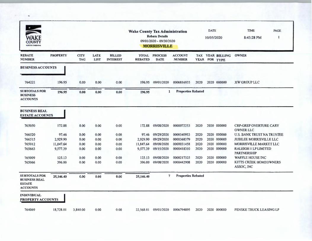
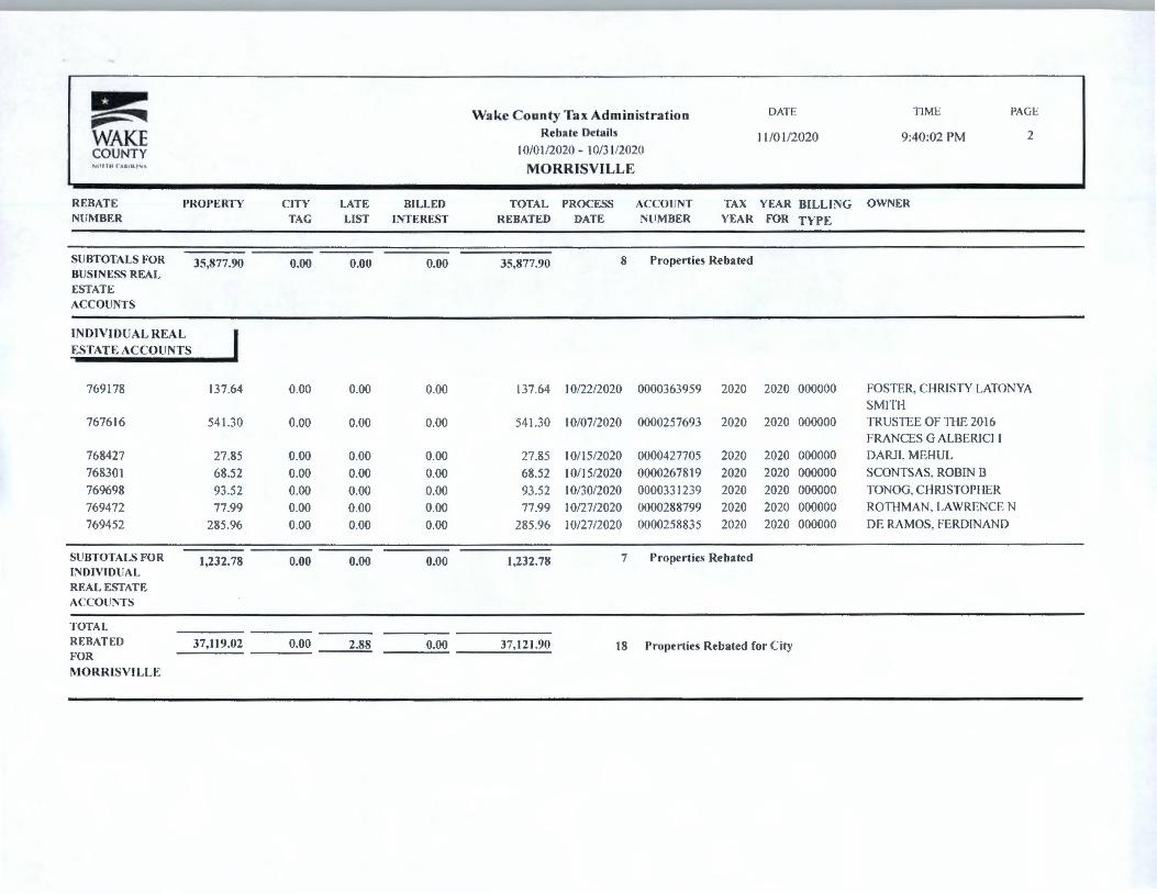
~ Wake County Tax Administration DATE TIME PAGE ._. ~ WAKE Rebate Details 10/05/2020 8:43 :28 PM COUNTY 09/01/2020 - 09/30/2020 J.:01,HI C.UOUN', MORRISVILI:E
REBATE PROPERTY CITY LATE BILLED TOTAL PROCESS ACCOUNT TAX YEAR BILLING OWNER NUMBER TAG LIST INTEREST REBATED DATE NUMBER YEAR FOR TYPE
BUSINESS ACCOUNTS I 764221 196.95 0.00 0.00 0.00 196.95 09/01/2020 0006816935 2020 2020 000000 XWGROUPLLC
SUBTOTALS FOR 196.95 0.00 0.00 0.00 196.95 1 Properties Rebated BUSINESS ACCOUNTS
BUSINESS REAL
ESTATE ACCOUNTS
765050 172.88 0.00 0.00 0.00 172.88 09/08/2020 0000072253 2020 2020 000000 CRP-GREP OVERTURE CARY OWNERLLC
766520 97.46 0.00 0.00 0.00 97.46 09/29/2020 0000340953 2020 2020 000000 U.S. BANK TRUST NA TRUSTEE
766515 2,929.90 0.00 0.00 0.00 2,929.90 09/29/2020 0000368379 2020 2020 000000 JUBILEE MORRISVILLE LLC
765012 11,847.64 0.00 0.00 0.00 11 ,847.64 09/08/2020 0000031458 2020 2020 000000 MORRISVILLE MARKET LLC
765663 9,577.39 0.00 0.00 0.00 9,577.39 09/15/2020 0000418310 2020 2020 000000 RALEIGH 1 LP LIMITED PARTNERSHIP
765009 125.13 0.00 0.00 0.00 125.13 09/08/2020 0000217325 2020 2020 000000 WAFFLE HOUSE INC
765066 396.00 0.00 0.00 0.00 396.00 09/08/2020 0000442908 2020 2020 000000 KITTS CREEK HOMEOWNERS ASSOC, INC
SUBTOTALS FOR 25,146.40 0.00 0.00 0.00 25,146.40 7 Properties Rebated BUSINESS REAL ESTATE ACCOUNTS
INDIVIDUAL
PROPERTY ACCOUNTS
764069 18,728.01 3,840.00 0.00 0.00 22,568.01 09/01/2020 0006794895 2020 2020 000000 PENSKE TRUCK LEASING LP
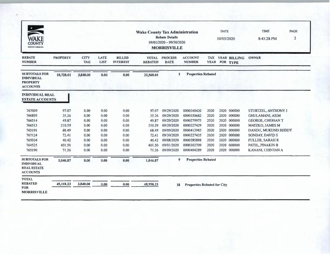
~ Wake County Tax Administration DATE TIME PAGE -- ~ WAKE Rebate Details 10/05/2020 8:43 :28 PM 2
COUNTY 09/01/2020 - 09/30/2020 NOltlll CAltOllH,\ MORRISVILLE
REBATE PROPERTY CITY LATE BILLED TOTAL PROCESS ACCOUNT TAX YEAR BILLING OWNER NUMBER TAG LIST INTEREST REBATED DATE NUMBER YEAR FOR TYPE
SUBTOTALS FOR 18,728.01 3,840.00 0.00 0.00 22,568.01 I Properties Rebated INDIVIDUAL PROPERTY ACCOUNTS
INDIVIDUAL REAL I ESTATE ACCOUNTS
767009 97.07 0.00 0.00 0.00 97.07 09/29/2020 0000340420 2020 2020 000000 STURTZEL, ANTHONY J 766895 35.26 0.00 0.00 0.00 35.26 09/29/2020 0000350682 2020 2020 000000 GHULAMANI, ASIM 766514 49.87 0.00 0.00 0.00 49.87 09/29/2020 0000279975 2020 2020 000000 GEORGE, CHERJAN T 766513 210.59 0.00 0.00 0.00 210.59 09/29/2020 0000227429 2020 2020 000000 MATZKO, JAMES M 765191 68.49 0.00 0.00 0.00 68.49 09/09/2020 0000413985 2020 2020 000000 DANDU, MUKUND REDDY 767124 72.41 0.00 0.00 0.00 72.41 09/30/2020 0000227435 2020 2020 000000 SONDAY, DAVIDS 765034 40.42 0.00 0.00 0.00 40.42 09/08/2020 0000285898 2020 2020 000000 FULLER, SARAH R 764535 401.50 0.00 0.00 0.00 401.50 09/01/2020 0000302709 2020 2020 000000 PATEL, PINAKIN B 765190 71.26 0.00 0.00 0.00 71.26 09/09/2020 0000404289 2020 2020 000000 KANAN!, CHINTAN A
SUBTOTALS FOR 1,046.87 0.00 0.00 0.00 1,046.87 9 Properties Rebated INDIVIDUAL REAL ESTATE ACCOUNTS
TOTAL REBATED 45,118.23 3,840.00 0.00 0.00 48,958.23 18 Properties Rebated for City FOR MORRISVILLE

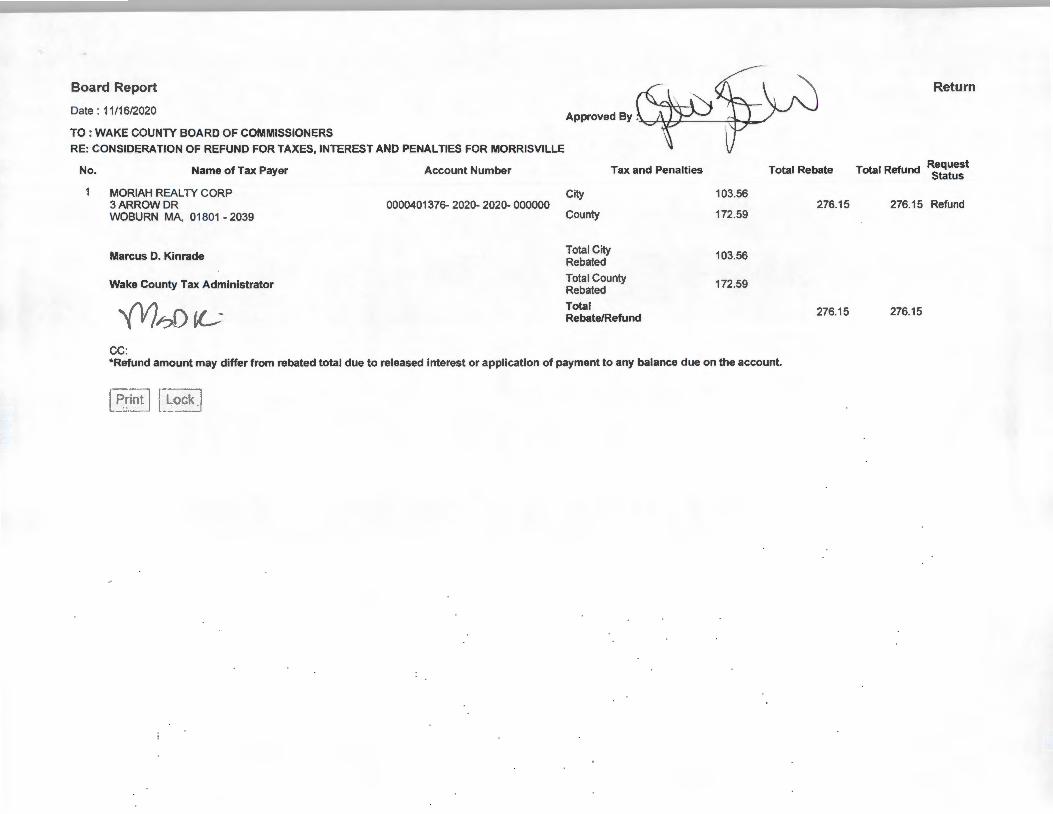
Board Report
Date : 11/16/2020
TO : WAKE COUNTY BOARD OF COMMISSIONERS
RE: CONSIDERATION OF REFUND FOR TAXES, INTEREST AND PENALTIES FOR MORRISVILLE
No. Name of Tax Payer
MORIAH REAL TY CORP 3ARROWDR WOBURN MA, 01801 - 2039
Marcus D. Kinrade
Wake County Tax Administrator
\ l ';L ('> lC CC:
Account Number
0000401376- 2020- 2020- 000000
I Approved By : __ ,. ______ _
City
County
Tota l City Rebated
Tax and Penalties
Total County Rebated
Total Rebate/Refund
103.56
172.59
103.56
172.59
Total Rebate
276.15
276.15
*Refund amount may d iffer from rebated total due to released interest or appl icat ion of payment to any balance due on the account.
Pnn1 Lock
Return
Total Refund Request Status
276.15 Refund
276.15
Board Report
Date : 11/16/2020
TO : WAKE COUNTY BOARD OF COMMISSIONERS
RE: CONSIDERATION OF REFUND FOR TAXES, INTEREST AND PENALTIES FOR MORRISVILLE
No. Name of Tax Payer
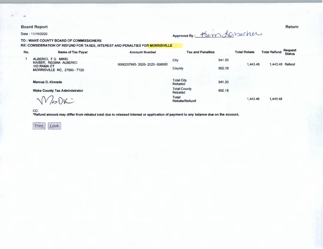
ALBERICI , F G MIKKI KAISER, REGINA ALBERICI 103 RAMA CT MORRISVILLE NC, 27560 - 7720
Marcus D. Kinrade
Wake County Tax Administrator , , , \ "' , / ,-, t l C
CC:
Account Number
0000257693-2020-2020-000000
Approved By : _________ _
Tax and Penalties Total Rebate
City 541 .30 1,443.48
County 902 18
Tota l City 541 .30
Rebated
Total County 902.18 Rebated
Total 1,443.48 Rebate/Refund
*Refund amount may differ from rebated total due to released interest or application of payment to any balance due on the account.
· Print I
Lock
Retl1rn
Request Total Refund Status
1,443.48 Refund
1,443.48
">
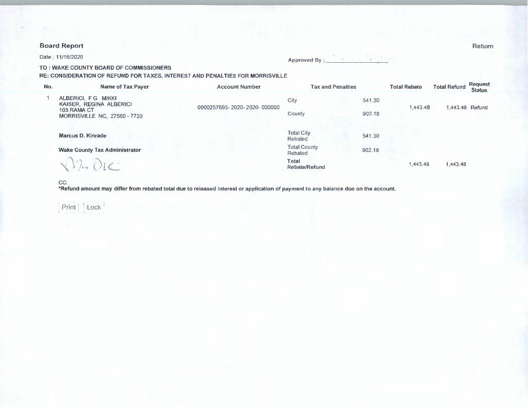
Board Report
Date : 11/16/2020
TO : WAKE COUNTY BOARD OF COMMISSIONERS
RE: CONSIDERATION OF REFUND FOR TAXES, INTEREST AND PENALTIES FOR MORRISVILLE
No. Name of Tax Payer Account Number
ALBERICI, F G MIKKI KAISER, REGINA ALBERICI 103 RAMA CT 0000257693-2020- 2020- 000000
MORRISVILLE NC, 27560 - 7720
Marcus D. Kinrade
Wake County Tax Administrator
~nD\C--CC:
Return
Approved By : 4-fu,~ df)\ ba C ~
Tax and Penalties Total Rebate Total Refund RequeSt Status
City 541 .30 1,443.48 1,443.48 Refund
County 902.18
Total City 541 .30 Rebated
Total County 902.18 Rebated
Total 1,443.48 1,443.48 Rebate/Refund
*Refund amount may differ from rebated total due to released interest or application of payment to any balance due on the account.
I Print 11 Lock . I
Board Report
Date : 11/16/2020
TO : WAKE COUNTY BOARD OF COMMISSIONERS
RE: CONSIDERATION OF REFUND FOR TAXES, INTEREST AND PENALTIES FOR MORRISVILLE
No. Name of Tax Payer
MORIAH REAL TY CORP 3ARROWDR WOBURN MA, 01801 - 2039
Marcus D. Kinrade
Wake County Tax Administrator
"f'l)/?0 iL--CC:
Account Number
0000401376-2020-2020- 000000
Approved By ·\, ... ,,'\,':.;;/~ C1- I-,,,
City
County
Total City Rebated
Tax and Penalties
Total County Rebated
Total Rebate/Refund
103.56
172.59
103.56
172.59
Total Rebate
276.15
276.15
*Refund amount may differ from rebated total due to released interest or application of payment to any balance due on the account.
~~~ ~ -{~]
Return
Total Refund Request Status
276.15 Refund
276.15
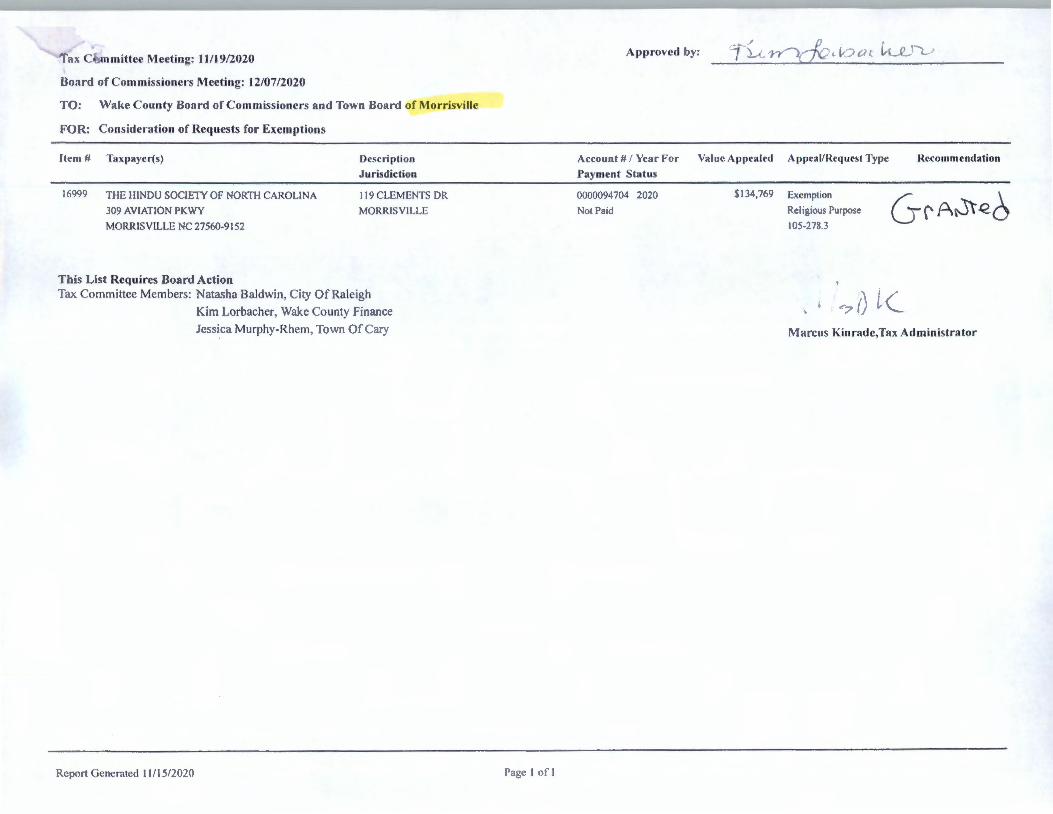
rax C t.mmittce Meeting: 11/19/2020
Board of Com missioners Meeting: 12/07/2020
TO: Wal<e County Board of Commissioners and Town Board of Mor:risvill
FOR: Consideration of Requests for Exemptions
Item#
16999
Taxpaycr(s)
THE IIINDU SOCIElY Of NORTH CAROLINA
309 AVIATION PKWY
MORRISVILLE NC 27560-9 152
This List Requires Board Action
Description
Jurisdiction
I I 9 CLEMENTS DR
MORRISVILLE
Tax Committee Members: Natasha Baldwin, City Of Raleigh
Report Generated I I /15/2020
Kim Lorbacher, Wake County Finance
Jessica Murphy-Rhem, Town Of Cary
Page I of 1
. /
Approved by: 7 ~t
Account # / Year For
Pa),ment Status
Va lue Appealed
0000094704 2020
Not Paid
$ I 34,769
fl ' 7'7\,- , l, ., ((, vt_C Ye ,
A ppcal/Rcquesl Type Recommendalion
Exemption ✓- . \ Religious Purpose u (' A~ e.o 105-278.3
--~ r) l ( Marcus Kinradc,Tax Administrator

Tax Committee Meeting: 11/19/2020
Board of Commissioners Meeting: 12/07/2020
TO: \1/akc C ounty Board of Commissioners and Town Board of Morrisville
FOR: Consideration of Reques ts for /\<ljus trnents , Rchates, and/or Refund s of Penalties
Item # Taxpaycr(s) Descr-iption
.Jurisdiction
Re li ef Codes:
17 105 DI SH NETWORK LLC
PO 110X 6623
BUSINESS PERSONAL PROPERTY MORR ISV ll .1.1 .
ENGLEWOOD CO 80 155-(,(,21
This List Requires Board Action Tax Committee Members: Natasha Baldwin. C ity O f Raleigh
Re po rt Genera ted 11 / 15/2020
Kim Lorbachcr. Wake County Fi nance
Jessica Murphy-Rhem. Town Of Cary
l'agc I of I
Approved by: J<· I' I) i I ,), (, \ \ "
rl1c Wake Co unty Tax Committee has approved th e foll owing po li cy to
reco mm end re li ef of the late listin g and/or vehi c le penalties when at
least <1 nc o f the fo ll ow in g co nditi ons apply:
I . New to North Caro lina
2. First time li st ing
3. Previous year listing on time
5. Military Deployment
6 . Provided proo f of timely listing
4. O m itted item(s) from li sting - Current/previous li sting on time
Account#/ Year For Late List Appealed Appeal/Request Recommendation Relief
Payment Status Type Code
0006 I 505 17 2020 Not l',11d
$8 . 19 I.ate Lrst Penalty Granted
. I ·1 " I ,
\ L ( , j I v~
Marcus Kinrade, T,u Administrator
(,
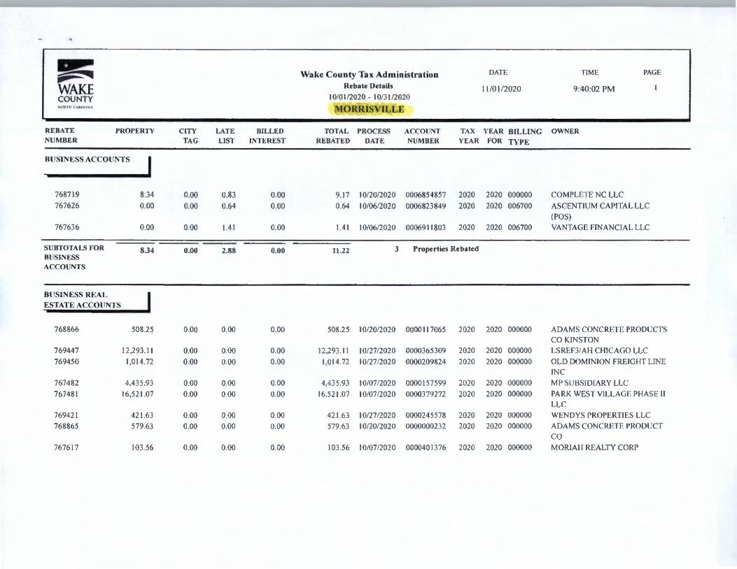
~ DATE TIM E PAGE .,,. ~ Wake County Tax Administration
WAKE Rebate Details 11 /01 /2020 9 :40:02 PM COUNTY I 0/0 l /2020 - I 0/3 l /2020 \,{lit PC I -',J.lll!'lA MORRISVILLE
REBATE PROPERTY CITY LATE BILLED TOTAL PROCESS ACCOUNT TAX YEAR RILLING OWNER NUMBER TAG LIST INTEREST REBATED DATE NUMBER YEAR FOR TYPE
BUSINESS ACCOUNTS I 768719 8.34 0.00 0.83 0.00 9.17 10/20/2020 0006854857 2020 2020 000000 COMPLETE NC LLC
767626 0.00 0.00 0.64 0.00 0.64 10/06/2020 0006823849 2020 2020 006700 ASCENTIUM CAPITAL LLC
(POS)
767636 0.00 0.00 1.41 0.00 1.41 10/06/2020 0006911803 2020 2020 006700 VANTAGE FINANCIAL LLC
SUBTOTALS FOR 8.34 0.00 2.88 0.00 11.22 3 Properties Rebated BUSINESS ACCOUNTS
BUSINESS REAL ESTATE ACCOUNTS
768866 508.25 0.00 0.00 0.00 508 .25 I 0/20/2020 0000117065 2020 2020 000000 ADAMS CONCRETE PRODUCTS CO KINSTON
769447 12.293.11 0.00 0.00 0.00 12,293 .11 10/27/2020 0000365309 2020 2020 000000 LSREF3/AH CHICAGO LLC
769450 1,014 .72 0.00 0.00 0.00 1.014.72 10/27/2020 0000209824 2020 2020 000000 OLD DOMINION FREIGHT LIN E
IN C
767482 4.435 .93 0.00 0.00 0.00 4.435 .93 10/07/2020 0000157599 2020 2020 000000 MP SUBSIDIARY LLC
767481 16,521 .07 0.00 0.00 0.00 16.521 .07 10/07/2020 0000379272 2020 2020 000000 PARK WEST VILLAGE PHASE II
LLC
769421 421.63 0.00 0.00 0.00 421.63 I 0/27/2020 0000245578 2020 2020 000000 WENDYS PROPERTIES LLC
768865 579.63 0.00 0.00 0.00 579.63 10/20/2020 0000000232 2020 2020 000000 ADAMS CONCRETE PRODUCT
co 767617 103.56 0.00 0.00 0.00 103.56 I 0/07/2020 0000401 376 2020 2020 000000 MORJAl-1 REALTY CORP
~ DATE T IME PAGE "' .... Wake County Tax Administration
WAKE Rebate Details 11 /0 1/2020 9:40:02 PM 2
COUNTY I 0/0 I /2020 - I 0/31/2020 '- IU III (A i;:1111 '-A MORRISVILLE
REBATE PROPERTY CITY LATE BILLED TOTAL PROCESS ACCOUNT TAX YEAR BILLING OWNER NUM BER TAG LIST INTEREST REBATED DATE NUMBER YEAR FOR TYPE
SUBTOTALS FOR 35,877.90 0.00 0.00 0.00 35,877.90 8 Properties Rebated BUSINESS REAL ESTATE
ACCOUNTS
IN DI VIDUAL REAL I ESTATE ACCOUNTS
769178 137.64 0.00 0.00 0.00 137.64 I 0/22/2020 0000363959 2020 2020 000000 FOSTER. CHRJSTY L/\TONY/\ SM ITH
7676 16 54 1.30 0.00 0.00 0.00 54 1.30 I 0/07/2020 0000257693 2020 2020 000000 TRUSTEE OF TH E 20 16 FRANCES G /\LB ERICI I
768427 27.85 0.00 0.00 0.00 27 .85 I 0/15/2020 0000427705 2020 2020 000000 D/\ RJI. MEIIUL
768301 68.52 0.00 0.00 0.00 68 .52 I 0/15/2020 0000267819 2020 2020 000000 SCONTS/\S, ROBIN B
769698 93 .52 0.00 0.00 0.00 93.52 I 0/30/2020 0000331239 2020 2020 000000 TONOG, Cl IRISTO PI IER
769472 77.99 0.00 0.00 0.00 77.99 I 0/27/2020 0000288799 2020 2020 000000 ROTHMAN. LAWRENCE N
769452 285 .96 0.00 0.00 0.00 285.96 I 0/27/2020 0000258835 2020 2020 000000 DE RAMOS, FERDINAND
SUBTOTALS FOR 1,232.78 0.00 0.00 0.00 1,232.78 7 Properties Rebated INDIVIDUAL REAL ESTATE ACCOUNTS
TOTAL REBATED 37,119.02 0.00 2.88 FOR
0.00 37,121.90 18 Properties Rebated for C ity
MO RRI SVILLE
Board Report
Date . 01/04/2021
TO : WAKE COUNTY BOARD OF COMMISSIONERS
RE: CONSIDERATION OF REFUND FOR TAXES, INTEREST AND PENALTIES FOR MORRISVILLE
No. Name of Tax Payer
LIMANO & ASSOCIATES Ill LLC 110 PHEASANT WOOD CT STE D MORRISVILLE NC, 27560 - 7926
Marcus D. Kinrade
Wake County Tax Administrator
'fv1?DlA___::_ cc
Account Number
0000157586-2020-2020-000000
Approved By :...., l'> l 1~,-d,v, ~ -- yt__..'_ 0
City
County
Total City Rebated
Tax and Penalties
Total County Rebated
Total Rebate/Refund
1,254.39
2,090.66
1,254 .39
2,090.66
Total Rebate
3,345.05
3,345 05
*Refund amount may differ from rebated total due to released interest or application of payment to any balance due on the account.
Return
Total Refund Request Status
3,345.05 Refund
3, 345.05
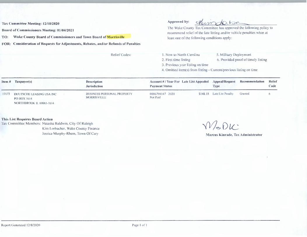
Tax C ommittee Meeting: 12/10/2020
Board of Com missioners Meeting: 0 I /04/2021
TO: \Vake C ounty Board of Commiss ioners and Town Board of ,\lorri~, ill•·
FOR: C onsideration of Requests for Adjustments, Rebates, and/or Refunds of Pen a lties
Relief Codc~:
Item # Taxpaycr-(s) Descri ption
.Jurisdiction
17173 DEUTSCII F LEAS ING US/\ INC
PO BOX 1614
BUSINESS l'l :RSON/\L PROPl:RTY MORRISV II LE
NOlffl llllHl()K II 600<,:i-161 -1
This List Requires Board Action Tax Committt:c Mt:mht:rs: Natasha Bald" in . C ily or Rale igh
Kim Lorhacht:r. Wakt: County Financi.:
Jessica Murph~-Rhcm. Town orc:ary
Report t irnerated 12/8/2020 l'a l,!.e I <1I. I
A pproved by: ~ ,{ '}'>,,...\, ;,~ 1- ....) C . :::::-,.,
I he Wa"c Count) Tax Committee has arprovcd the fol l(lll' ing policy to
recommend relier nr the late li sti ng and/nr ,·chicle pcna lti cs whcn at
lc:ist one or the rollowing conditions apply :
I. Ne\\ to North Carolina
~- First time listing
3. Previous year li sti ng on time
5. Militar) l)cploymcnt
(>. l'ro\'idcJ proor or timely I isling
-+. Omitted itcm(s) from li sting - Curn.:nt/prc, ious list ing on time
Auo unt #/ \'car For Lale List Appealed A11pcal/l{c4uest l{ccornmcndation
Payment Status T~ipc
0006794147 2020 $ 148 .18 Lale L"l Pe11ali1 ( ,1 a111cd Nol Paid
M? Die Marc us h:inrnde. Ta:1. Ad ministrator
l{clicf
Code
(1
•
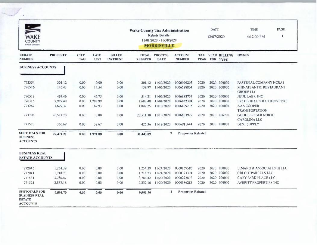
~ DATE TIME PAGE ,is;~ Wake County Tax Administration
WAKE Rebate Details 12/07/2020 4:12:00 PM COUNTY 11 /0 l /2020 - l l /30/2020 ._ , ,~UI I ,\!till!"-' MORRISVILCE
REBATE PROPERTY CITY LATE BILLED TOTAL PROCESS ACCOUNT TAX YEAR BILLING OWNER NUMBER TAG LIST INTEREST REBATED DATE NUMBER YEAR FOR TYPE
BUSINESS ACCOUNTS I 772354 301.12 0.00 0.00 0.00 301.12 1 l /30/2020 0006096203 2020 2020 000000 FASTENAL COMPANY NCRA I
770516 145.43 0.00 14.54 0.00 159.97 11 /06/2020 0006588804 2020 2020 000000 MID-ATLANTIC RESTAURANT
GROUP LLC 770513 467.46 0.00 46.75 0.00 514.21 11 /06/2020 0006888757 2020 2020 000000 JUUL LABS, INC
770315 5,979.49 0.00 1,703 .99 0.00 7,683.48 11 /04/2020 0006852394 2020 2020 000000 IITfGLOBALSOLUTIONSCORP
771267 1,679.32 0.00 167.93 0.00 1.847.25 11/19/2020 0006109235 2020 2020 000000 AAA COOPER
TRANSPORTATION 771708 20.511.70 0.00 0.00 0.00 20.511.70 11 / 19/2020 0006803929 2020 2020 006700 GOOGLE FIBER NORTH
CAROLINA LLC 771573 386.69 0.00 38.67 0.00 425 .36 11/18/2020 0006911644 2020 2020 000000 BEST SUPPLY
SUBTOTALS FOR 29,471.21 0.00 1,971.88 0.00 31,443.09 7 Properties Rebated BUSINESS ACCOUNTS
BUSINESS REAL
ESTATE ACCOUNTS
772045 1.254.39 0.00 0.00 0.00 1,254.39 11 /24/2020 0000157586 2020 2020 000000 LIMANO & ASSOCIAfES Ill LLC
772041 1.718.73 0.00 0.00 0.00 1.718.73 11 /24/2020 0000371374 2020 2020 000000 CRI OUTPARCELS LLC
771531 3,786.42 0.00 0.00 0.00 3.786.42 I 1/20/2020 0000222673 2020 2020 000000 CARY PARK PLAC E LLC
771521 2.832.16 0.00 0.00 0.00 2.832.16 11 /20/2020 0000)86283 2020 2020 000000 AVERITT PROPERTIES INC
SUBTOTALS FOR 9,591.70 0.00 0.00 0.00 9,591.70 4 Properties Rebated BUSINESS REAL ESTATE ACCOUNTS
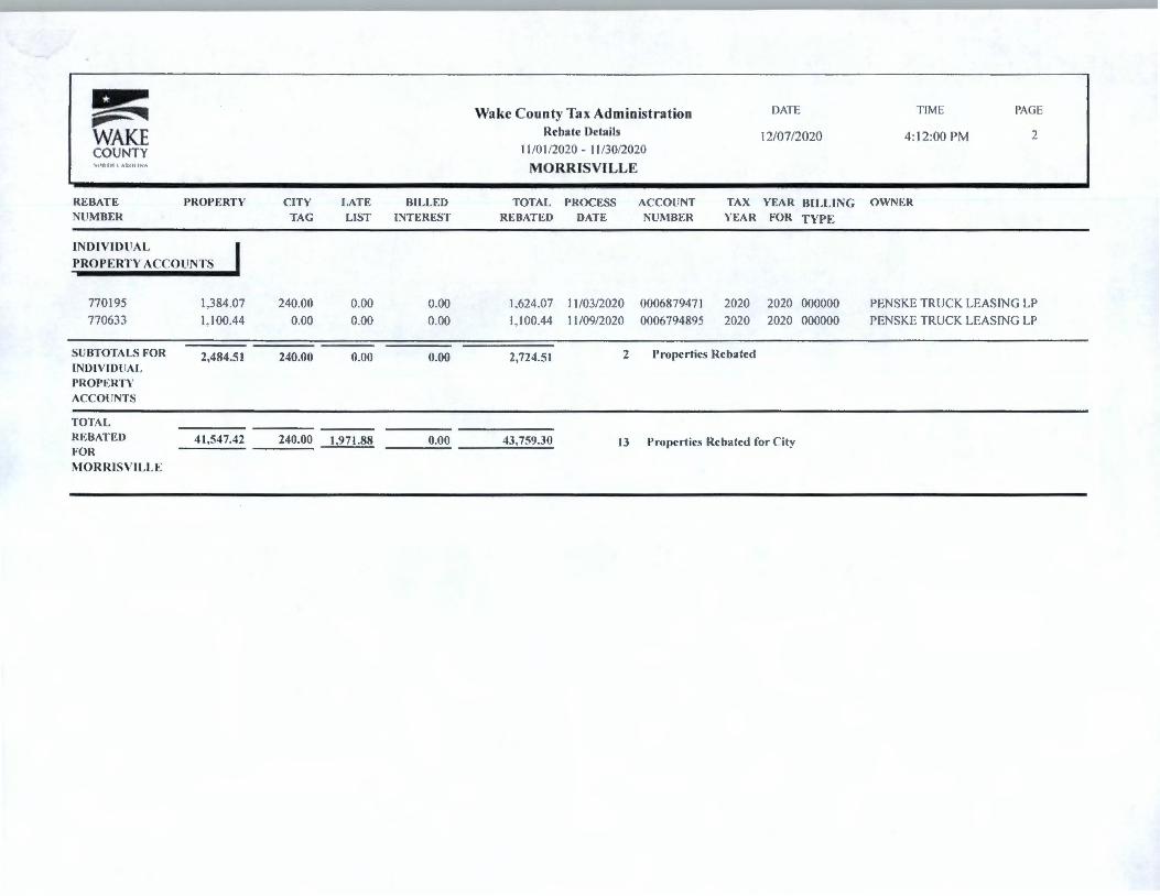
~ -- :"I WAKE COUNTY
REBATE NU MBER
PROPERTY
lNOIVIOllAL
PROP E RTY ACCO UNT S
770 195 1.384.07
770633 1.1 00.44
SU BTOTALS FOR 2,484.51 INDIVID UAL PROPERTY ACCO UNTS
TOTAL REBATED 41,547.42 FOR
MORRISVILLE
CITY TAG
240.00
0.00
240.00
240.00
LAT E BILLE D LIST INT EREST
0.00 0.00
0.00 0.00
0.00 0.00
1,971.88 0.00
Wake County Tax Administration Rebate Details
11 /0 1/2020 - 11/3 0/2020
MORRISVILLE
D/\TE
12/07/2020
T IME
4: 12:00 PM
P/\GE
2
TOTAL PROCESS ACCOllNT TAX YEAR BILLI NG OWNER REBAT l'.: D DATE NUJ\1BER YEA R FOR TYP E
1.624.07 11 /03/2020 000687947 1 2020 2020 000000 PENSKE T RUCK LEAS ING LP
I. I 00.44 11 /09/2020 0006794895 2020 2020 000000 PENSKE TRUCK LEAS ING LP
2,724.51 2 Properties Reba ted
43,759.30 13 Properties Rebated for C ity

Tax C ommittec Mceting : 01 / 1_./2021
Board of C ommissioners Mceting : 02/01 /2021
T O : \\lake C ounty IJoanl of C ommiss ioners and Town Board of :Vlorri~ville
FOR: C onsideration of Rcqucs ts for Value/Special S ituations
lll'm # Taxpa)•cr(s)
17313
17315
.IOII N. TIIOM/\S
.IO II N. Sllll31
2 1<, ll i\ lU:Y RID(i l· DR
MOR RI SVI LLI : NC 175hU-<,9X2
JOI IN. Tl IO M/\S
JOII N. Sllllll
2 16 111\ 11.EY RIIJ(iE DR
MOR l{ISV IL LF NC 175<,0-6982
17317 .J() II N. TIIOM/\S
173 19
1732 1
.IOII N. SIII IJ I
216 11 1\ 11.EY RIDld · DR
MOR RISV II.LF NC 175<,ll-<,'!82
.I O I IN, Tl IOM/\S
.IOII N. SII IBI
2 16131\11.1 :Y RIIJ(jl · 1)1{
MORRISV ILU · NC 275W-6982
.IO II N. TII OM/\S
.IO II N, Slllll l
216 lli\ lLEY Rll )(i l: l)R
MORRISV ll.l.1 NC 275r,0-(, lJX 2
This Lis t Requires Board Action
Description
.Jurisdiction
2 16131\ 11.EY RIDGE UR
MllRRISV II U ·
2 1(, 111\ILl:Y RIDG I' l)R
MORRI SVII.I I·
2 16111\ ILEY IUIJGI: DR
MORR ISVll.1.1 :
2 1(, lli\ lLl :Y I\IDGI: DI<
MORR ISVII I.I'
21(, lli\ 11.LY l{ll)GI' 1)1{
MOIZRISVII .I I·
Tax ( 'o mrnittl'e l'vlemhns : Natasha Baldwin . City or Ralei gh
M iche lle Brooks. ' li,wn O ITary
Rc: port (ic: 11c ratc:d 1/10/2 11 2 1
I< im Lorbacher. Wake Count) Finance
.Jessica Murp hy- I{ hcm . ·11llv11 or \Vakc hircst
l' age I ,,I' I
/\ pp rovcd by: <-/'{~ c/Q_l 1-:)~ l ~
Arcount #/ Ye ar For
Pay ment S tat u~
Va lu e A ppealed ,\ppcal / Rcqucst Type Recommendation
0UU025R767 201')
l'aid Ill Full
000025 87(,7 2018
l'a1d 111 l·ul l
00002587(, 7 20 17
Paid in Full
00002587(,7 20 I<,
1'.i1d 111 Full
()()002587(,7 201 5
l'a1d Ill l·ull
'!,<,.1 .629 l{cf'ullJ Request
$r, l/,29 Rclt111J i{ cq ucsl
:f,c, U,29 l(clt111u Rl'qul',t
$(,3.C,29 RclunJ l{cqucst
~(,'I . I .J(, l{cl i.1nd li c:quc,t
,UL, ! ('(vA.J'::, ,
(
I ,
· __ ,,:, chi: , '" ,_J , t,: Ir..., J :JJ
( v· ,"f l._)c 1 \ ~\uT
C Ir, 1 <- j . ..,
P1 f u,r .
"" \ ( , J) t1L i\ Ja rcu~ Kinradc,Tax Administ rator
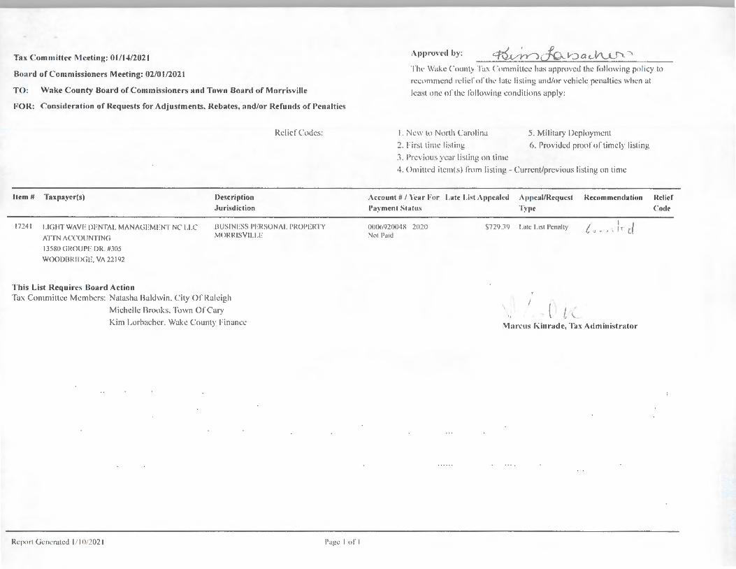
Tax Committcl' Meeting: 01 / 14/2021
Board of Commiss ioners Meeting: 02/01 /2021
TO: Wake County Board of Commissioners and Town Board of Morrisville
FOR: Consideration of Requests for Adjustments, Rebates, and/or Refunds of Penalties
Item # Taxpayer(s) Description
,Jurisdiction
Rcliel"Codcs:
17241 LIGHT W/\YI· IJENTtd . M/\N/\Gl:MLNT NC 1.1.C
/\TTN /\CCOl JNTING
IHJS INl:SS PLRSUN/\1. l'ROl'ERTY MORRI SY ll. 1.F
13580 GllOU l'F DR 11305
WOODBRID(iE, Y/\ 22 192
This List Requires Board Action Ta.\ Com mittee Members: Natasha Baldwin . City or Ralei gh
Michelle !hooks. Town Oi'Cary
Kim Lorhachcr. Wake County 1-'in ancc
Rcpon ( icncr'1lcd I / I 0/202 1 1''1gc I of I
Appr·on·cl hy : '-t•-V~YJJ__'{J .__ ~-._) a cV\...-l_.:> ' TIH' Wake ('uunt:, Ta\ ('ummittec has approved the follull'in g policy to
rccn1111rn:nd relic!' or thL' late li st ing and/or veh icle penalties when at
least one ol'the following cond itions apply:
1. Ne11 to Nunh ( \1nliina
:2. First time listing
:; _ l're , ·ious ye;1r listing on time
5. Mi litary l)cpluymcnt
(i. Provided prooi'ortimely li sting
4. Omittcd item( s) 1·mm li st ing - Current/previous li sting on time
Account #/ Year· For I.ate List Appcalrd Appcal/ lfrqucst l{cco 111111cndation Relief
l'a~·111cnt Statu.,
OIJ0(,92004X 2020 Nol l\11u
T~')lC Code
$72') ] <) I.ate I.isl l'~nally I ( I i '( !, ., . , .. (_
. \ l I , I
,, '--i\1at'CllS Kinrade, Tax Ad mini strator

Board Report
Date : 02/01 /2021
TO : WAKE COUNTY BOARD OF COMMISSIONERS
RE: CONSIDERATION OF REFUND FOR TAXES, INTEREST AND PENALTIES FOR MORRISVILLE
No. Name of Tax Payer
CAROLINA HANDLIN G LLC 3101 PIPER LN CHARLOTTE NC, 28208 - 6444
2 SMITH AND TART, DDS II , PA 6406 MCCRIMMON PYWY STE 220 MORRISVILLE NC, 27560
Marcus D. Kinrade
Wake County Tax Admin istrator
\J'v 1 ~'7 () C 1--cc
A ccount Number
000611 4772-2019-2019-006700
0006869998-2020-2020- 000000
Approved By : ~?.1P- Qa.LVLVV
City
County
City
County
Total City Rebated
Tax and Penalties
Total County Reba ted
Total Rebate/Refund
73 74
136.27
117.21
195.34
190.95
331 61
Tota l Rebate
210 01
312.55
522.56
*Refund amount may differ f rom rebated total due to re leased interest or application of payment to any balance due on the account.
Return
Total Refund Request Status
210.01 Refund
312.55 Refund
522 56
~ DATE TIME PAGE ~ :-... Wake County Tax Administration
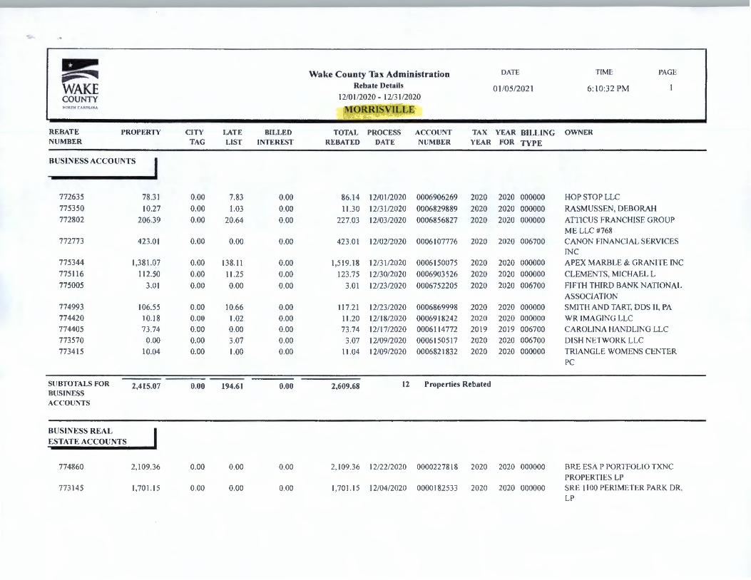
WAKE Rebate Details 01 /05/2021 6:10:32 PM
COUNTY 12/0 I /2020 - I 2/3 I /2020 ',Ill!!! I Al. (1 11'-/A, MORRISVILLE
REBATE PROPERTY CITY LATE BILLED TOTAL PROCESS ACCOUNT TAX YEAR BILLING OWNER NUM BER TAG LIST INTE REST REBATED DATE NUMBER YEAR FOR TYPE
BUSINESS ACCOUNTS I 772635 78.31 0.00 7.83 0.00 86.14 12/01/2020 0006906269 2020 2020 000000 HOP STOP LLC
775350 10.27 0.00 1.03 0.00 I 1.30 12/3 1/2020 0006829889 2020 2020 000000 RASMUSSEN, DEBORAH
772802 206.39 0.00 20.64 0.00 227.03 12/03/2020 0006856827 2020 2020 000000 ATflCUS FRANCHISE GROUP
ME LLC #768
772773 423 .01 0.00 0.00 0.00 423 .01 12/02/2020 0006107776 2020 2020 006700 CANON FINANCIAL SERVICES
INC
775344 1,381 .0_7 0.00 138.11 0.00 1.519.18 12/3 1/2020 0006150075 2020 2020 000000 APEX MARBLE & GRANITE INC
775116 112.50 0.00 11 .25 0.00 123.75 12/30/2020 0006903526 2020 2020 000000 CLEMENTS, MICHAEL L
775005 3.01 0 .00 0.00 0.00 3.01 12/23/2020 0006752205 2020 2020 006700 FIFTH TH IRD BANK NATIONAL
ASSOCIATION
774993 106.55 0.00 10.66 0.00 117.21 12/23/2020 0006869998 2020 2020 000000 SM ITH AND TART. DDS II , PA
774420 10.18 0.00 1.02 0.00 11.20 12/ 18/2020 0006918242 2020 2020 000000 WR IMAGING LLC
774405 73 .74 0.00 0.00 0.00 73 .74 12/ 17/2020 0006 11 4772 2019 2019 006700 CA ROLINA I IANDLING LLC
773570 0.00 0.00 3.07 0.00 3.07 12/09/2020 0006150517 2020 2020 006700 DISH NETWORK LLC
7734 15 10.04 0.00 1.00 0.00 I 1.04 12/09/2020 0006821832 2020 2020 000000 TRIANGLE WOMENS CENTER
PC
SUBTOTALS FOR 2,415.07 0.00 194.61 0.00 2,609.68 12 Properties Rebated BUSINESS ACCOUNTS
BUS INESS REAL ESTATE ACCOUNTS
774860 2, 109.36 0.00 0.00 0.00 2. 109.36 12/22/2020 0000227818 2020 2020 000000 13RE ES/\ I' PORTFOLIO TXNC
PROPERTI ES LP
773145 1.701.15 0.00 0.00 0.00 1.701.15 12/04/2020 0000182533 2020 2020 000000 SRE I 100 PERIMETER PARK DR.
LP
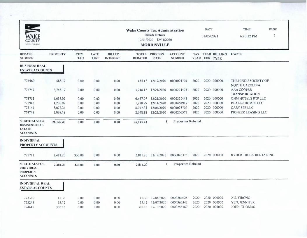
~ Wake Co un ty Tax Adm inistratio n D/\TE TIME PAGE -,_,,--WAKE Rebate Detai ls 0 I /05/2021 6: 10:32 PM 2
COUNTY 12/0 l /2020 - 12/31/2020 , ni:1111 Ai.Rnt1 ,A MO RRISVILLE
REBATE PROPERTY CITY LATE BILLED TOTAL PROCESS ACCOUNT TAX YEAR BILLING OWNER NUMBER TAG LIST INTEREST REBATED DATE NUMBER YEAR FOR TYPE
BUS INESS REAL
ESTATE ACCOUNTS
774460 485.17 0.00 0.00 0.00 485.17 12/17/2020 0000094704 2020 2020 000000 THE HINDU SOCIETY OF NORTH CAROLINA
774747 3,748.17 0.00 0.00 0.00 3.748.17 12/21/2020 0000224474 2020 2020 000000 AAA COOPER TRANSPORTATION
774751 6.657.07 0.00 0.00 0.00 6.657.07 12/21/2020 0000311443 2020 2020 000000 OI IM I IOTELS RTP LLC 773943 1,270.99 0.00 0.00 0.00 1.270.99 12/ 14/2020 0000468917 2020 2020 000000 BEAZER I IOM ES LLC
773 144 8,077.34 0.00 0.00 0.00 8.077.34 12/04/2020 0000075700 2020 2020 000000 CARY SPE LLC
774748 2.098.18 0.00 0.00 0.00 2.098. 18 12/21/2020 0000206572 2020 2020 000000 PIONEER LEASING LLC
SUBTOTALS FOR 26,147.43 0.00 0.00 0.00 26,147.43 8 Properties Rebated BUSINESS REAL ESTATE ACCOUNTS
IND IV ID UAL
PROPERTY ACCOUNTS
773711 2,481.20 330.00 0.00 0.00 2.8 11 .20 I 2/ 17/2020 0006845376 2020 2020 000000 RYDER TRUCK RENTAL INC
SUBTOTALS FOR 2,481.20 330.00 0.00 0.00 2,811.20 I Properties Rebated INDIVIDUAL PROPERTY
ACCOUNTS
IND IVIDUAL REAL
ESTATE ACCOUNTS
773396 12.30 0.00 0.00 0.00 12.30 12/08/2020 0000284625 2020 2020 000000 XU. YI RONG
773245 13. 12 0.00 0.00 0.00 13. 12 12/07/2020 0000360342 2020 2020 000000 YEN, JENNIFER
774446 303. 16 0.00 0.00 0.00 303.16 12/17/2020 0000258767 2020 2020 000000 JOI IN. Tl IOMAS
~ ~ .... WAKE COUNTY , c11t1111 ,1u11 l'A
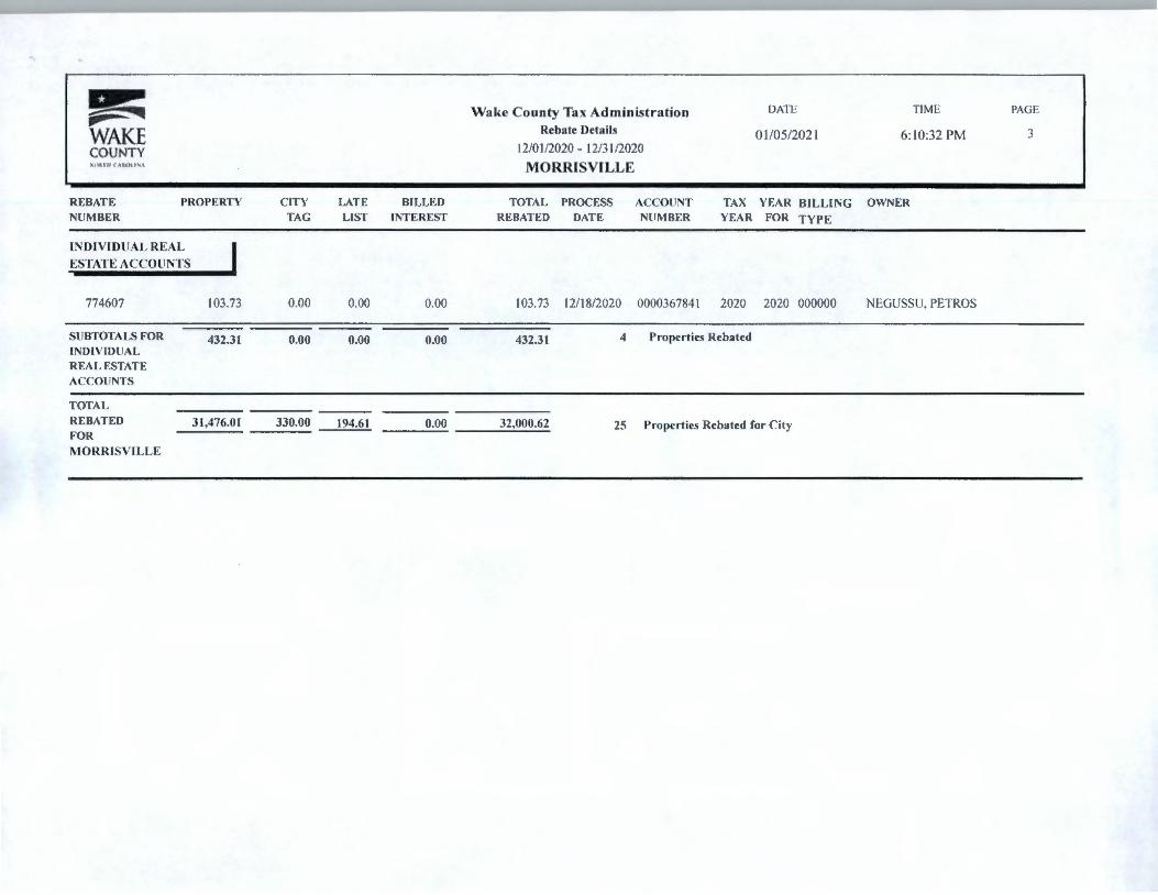
REBATE NUMBER
PROPERTY
INDIVID UAL REAL
ESTATE ACCO UNTS
774607 103.73
SU BTOTALS FOR 432.31 INDIVID UAL REAL ESTATE ACCOUNTS
TOTAL REBAT ED 31,476.01 FOR
MORRISVILLE
C ITY TAG
0.00
0.00
330.00
LATE BILLED LIST INT EREST
0.00 0.00
0.00 0.00
194.61 0.00
Wake County Tax Administration Rebate Details
12/01/2020 - 12/3 I /2020
MORRISVILLE
TOTAL PROC ESS ACCO UNT REBATED DAT E NUMBER
103.73 12/ 18/2020 000036784 1
DATE
01/05/202 1
TIME
6: 10:32 PM
TAX YEAR BILLI NG OWNER YEAR FOR TYP E
2020 2020 000000 NEGUSSU. PETROS
432.31 4 Properties Rebated
32,000.62 25 Properties Rebated for Ci ty
PAGE
3
~ DATE TIME PAGE iii- ~ Wake County Tax Administration
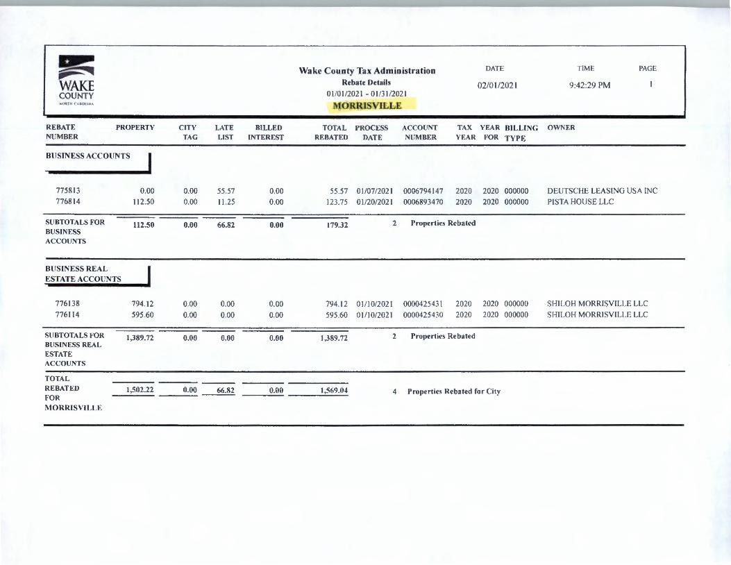
WAKE Reba te Details 02/0 1/202 1 9:42 :29 PM COUNTY 01 /01 /2021 - 0 1/31/202 1 '- ~lltlll ( A,ll ll t l -.;A MORRISVILLE
REBATE PROPERTY CITY LATE BILLED TOTAL PROCESS ACCOUNT TAX YEAR BILLI NG OWNER NU MBER TAG LIST INTEREST REBATED DATE NUMBER YEAR FOR TYP E
BUSINESS ACCO UNTS I 7758 13 0.00 0.00 55 .57 0.00 55 .57 01 /07/2021 0006794147 2020 2020 000000 DEUTSCHE LEAS ING USA INC 7768 14 112.50 0.00 11 .25 0.00 123.75 0 1/20/202 1 0006893470 2020 2020 000000 PI STA HOUSE LLC
SU BTOTALS FOR 112 .50 0.00 66.82 0.00 179.32 2 Properties Rebated BUSINESS ACCOlJ NTS
BUSIN ESS REAL I ESTAT E ACCO UNTS
776 138 794 .12 0.00 0.00 0.00 794 .12 0 1/ 10/2021 0000425431 2020 2020 000000 SI II LOH MOR RISVILLE LLC 776 11 4 595.60 0.00 0.00 0.00 595 .60 0 1/10/202 1 0000425430 2020 2020 000000 SH ILOH MORRI SVI LLE LLC
SU BTOTALS FOR 1,389.72 0.00 0.00 0.00 1,389.72 2 Properties Rebated BUSINESS REAL ESTATE ACCOUNTS
TOTAL REBATED 1,502.22 0.00 66.82 0.00 1,569.04 4 Propert ies Rebated for C ity FOR
MORRISV ILLE

Board Report
Date : 04/05/2021
TO : WAKE COUNTY BOARD OF COMMISSIONERS
RE: CONSIDERATION OF REFUND FOR TAXES, INTEREST AND PENALTIES FOR MORRISVILLE
No. Name of Tax Payer
WELLS FARGO FINANCIAL LEASING INC C/O LEASING TAX N0005-041 800 WALNUT ST DES MOINES IA, 50309 - 3605
Marcus D. Kinrade
Wake County Tax Administrator
"\{VJ h Du__; CC:
Account Number
0006023344- 2020-2020- 006700
Approved By : ~cfP:.---
Tax and Penalties Total Rebate
City 913.06 2,434.82
County 1,521 .76
Total City 913.06 Rebated
Total County 1,52 1.76
Rebated
Total 2,434.82 Rebate/Refund
*Refund amount may differ from rebated total due to released interest or application of payment to any balance due on the account.
Pnnt ] [ Lo_ck '.
Return
Total Refund RequeSt Status
2,434.82 Refund
2,434.82

.. I ~ DATE TIME PAGE ~ ~ Wake County Tax Administration
WAKE Rebate Details 03/03/2021 9:01:34 PM
COUNTY 02/01/2021 - 02/28/2021 MIii. i II CAltOll~A MORRISVILLE
REBATE PROPERTY CITY LATE BILLED TOTAL PROCESS ACCOUNT TAX YEAR BILLING OWNER NUMBER TAG LIST INTEREST REBATED DATE NUMBER YEAR FOR TYPE
BUSINESS ACCOUNTS I 778677 25,358.92 0.00 0.00 0.00 25.358.92 02/11/2021 0006803929 2019 2019 006700 GOOGLE FIBER NORTH
CAROLINA LLC 778172 0.00 0.00 273.52 0.00 273.52 02/05/2021 0006920048 2020 2020 000000 LIGHT WAVE DENTAL
MANAGEMENT NC LLC 779706 379.94 0.00 37.99 0.00 417.93 02/25/2021 0006793190 2020 2020 000000 CHARMING CHARLIE LLC 779379 913 .06 0.00 0.00 0.00 913 .06 02/19/2021 0006023344 2020 2020 006700 WELLS FARGO FINANCIAL
LEASING INC
SUBTOTALS FOR 26,651.92 0.00 311.51 0.00 26,963.43 4 Properties Rebated BUSINESS ACCOUNTS
BUSINESS REAL ESTATE ACCOUNTS
778799 6,527.21 0.00 0.00 0.00 6,527.21 02/12/2021 0000101247 2020 2020 000000 MARION REAL ESTATE INVESTMENTS LLC
777774 5,434.00 0.00 0.00 0.00 5.434.00 02/02/2021 0000425434 2020 2020 000000 NOR ENTERPRISES AT RTP LLC 777652 4,659.32 0.00 0.00 0.00 4,659.32 02/01 /2021 0000379244 2020 2020 000000 TARGET CORP 777639 1,331 .06 0.00 0.00 0.00 1,33 1.06 02/01 /202 I 0000157601 2020 2020 000000 PBR SUBSIDIARY LLC 777609 3,609.20 0.00 0.00 0.00 3,609.20 02/01/2021 0000232351 2020 2020 000000 KYLA HOTELS LLC
SUBTOTALS FOR 2I,560.79 0.00 0.00 0.00 21,560.79 s Properties Rebated BUSINESS REAL ESTATE ACCOUNTS
INDIVIDUAL PROPERTY ACCOUNTS
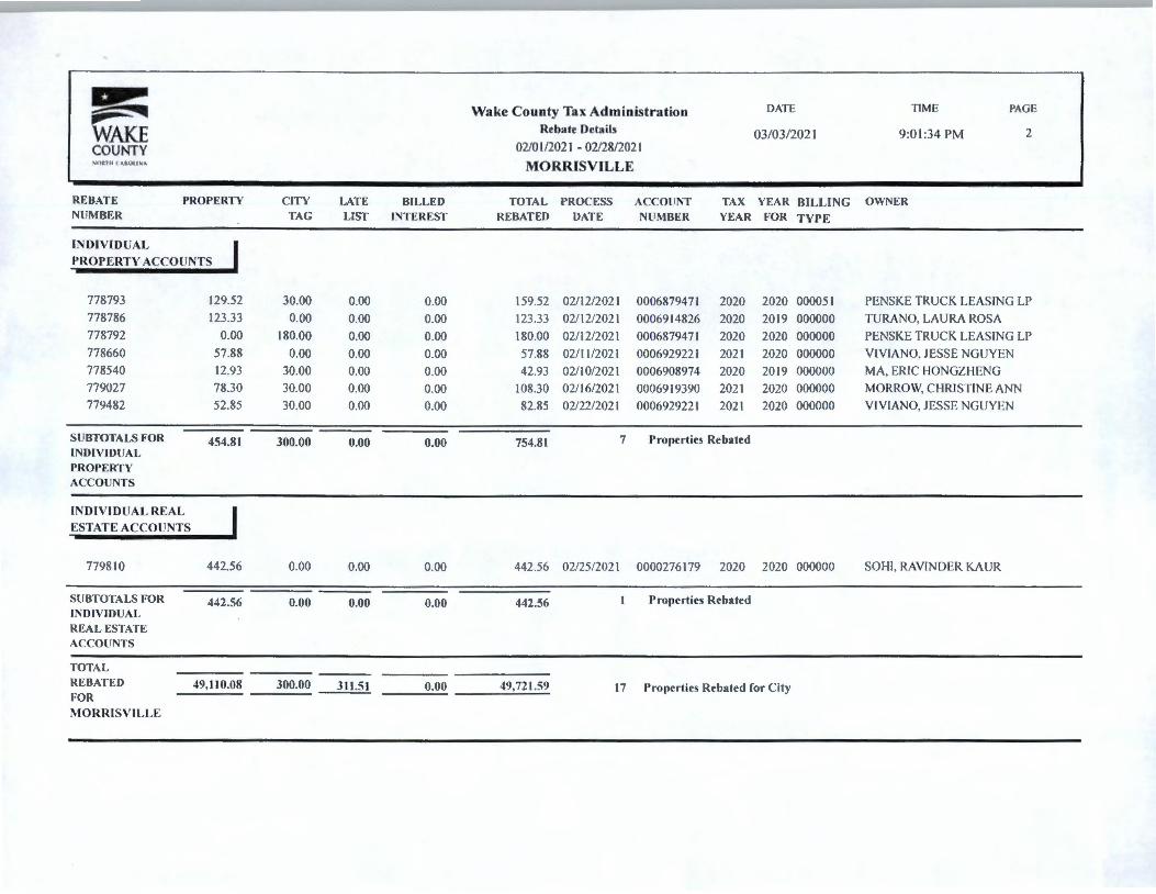
~ ~ ~ Wake County Tax Administration DATE TIME PAGE
WAKE Rehate Details 03/03/202 1 9:0 1:34 PM 2
COUNTY 02/0 I /2021 - 02/28/2021 "lj: l l!(,\l:;Oll'-1.\ MORRISVILLE
REBATE PROPERTY CITY LATE BILLED TOTAL PROCESS ACCOUNT TAX YEAR BILLI NG OWNER NUM BER TAG LIST INTEREST REBATED DATE NUMBE R YEAR FOR TYPE
INDIVID UAL
PROP ERTY ACCOUNTS
778793 129.52 30.00 0.00 0.00 159.52 02/ 12/2021 0006879471 2020 2020 000051 PENSKE TRUCK LEASING LP 778786 123.33 0.00 0.00 0.00 123.33 02/12/2021 0006914826 2020 2019 000000 TURANO, LAURA ROSA 778792 0.00 180.00 0.00 0.00 180.00 02/ 12/2021 0006879471 2020 2020 000000 PENSKE TRUCK LEASING LP 778660 57.88 0.00 0.00 0.00 57.88 02/ 11 /2021 0006929221 2021 2020 000000 VIVIANO. JESSE NGUYEN 778540 12.93 30.00 0.00 0.00 42 .93 02/ 10/2021 0006908974 2020 2019 000000 MA, ERIC HONGZHENG 779027 78.30 30.00 0.00 0.00 108.30 02/16/2021 0006919390 2021 2020 000000 MORROW, CHRJSTINE ANN 779482 52.85 30.00 0.00 0.00 82 .85 02/22/2021 0006929221 2021 2020 000000 VIVIANO, JESSE NGUYEN
SU BTOTALS FOR 454.81 300.00 0.00 0.00 754.81 7 Properties Rebated INDIVIDUAL PROPERTY ACCOUNTS
INDIVIDUAL REAL
ESTATE ACCOUNTS
779810 442.56 0.00 0.00 0.00 442.56 02/25/2021 0000276179 2020 2020 000000 SOI II, RAVINDER KAUR
SUBTOTALS FOR 442.56 0.00 0.00 0.00 442.56 I Properties Rebated INDIVIDUAL REAL ESTATE ACCOUNTS
TOTAL REBATED 49,110.08 300.00 311.51 0.00 49,721.59 17 Properties Rebated for City FOR
MORRISVILLE

~ DATE TIME PAGE ~ • Wake County Tax Administration
WAKE Rebate Details 04/04/2021 11 : 11 :13 PM
COUNTY 03/0 l /2021 - 03/31 /202 l ,-o,n 11 C"Alt.Oll NA MORRlSVJLLE
REBATE PROPERTY CITY LATE BILLED TOTAL PROCESS ACCOUNT TAX YEAR BILLING OWNER NUMBER TAG LIST INTEREST REBATED DATE NUMBER YEAR FOR TYPE
BUSINESS ACCOUNTS I 780774 112.50 0.00 11.25 0.00 123.75 03/10/2021 0006856745 2020 2020 000000 GREEN, STACIE M 782293 415.59 0.00 41.56 0.00 457.15 03/30/2021 0006789544 2020 2020 000000 AGlOLLC
SUBTOTALS FOR 528.09 0.00 52.81 0.00 580.90 2 Properties Rebated BUSINESS ACCOUNTS
INDIVIDUAL I PROPERTY ACCOUNTS
780023 28 .25 0.00 0.00 0.00 28 .25 03/01/2021 0006888239 2020 2019 000000 JA.STI, SEETARAMASWAMY 780028 51 .07 30.00 0.00 0.00 81 .07 03/01/2021 0006927270 2021 2020 000000 OLSEN, MATTHEW LEIF 781946 1.80 30.00 0.00 0.00 31 .80 03/25/2021 0006804004 2020 2020 000000 LUNDAHL, JODI L 781947 10.50 0.00 0.00 0.00 10.50 03/25/2021 0006862633 2020 2020 000000 BARON, JOHN EDWARD
780564 3.60 30.00 0.36 0.00 33.96 03/08/2021 0006886734 2020 2020 000000 WELLS FARGO EQUIPMENT FINANCE INC
782296 702.28 0.00 0.00 0.00 702.28 03/30/2021 0006879471 2020 2020 000000 PENSKE TRUCK LEASING LP 782295 72.87 0.00 0.00 0.00 72.87 03/30/2021 0006829208 2019 2019 000000 PENSKE LEASING AND RENTAL
COMPANY
SUBTOTALS FOR 870.37 90.00 0.36 0.00 960.73 7 Properties Rebated INDIVIDUAL PROPERTY ACCOUNTS
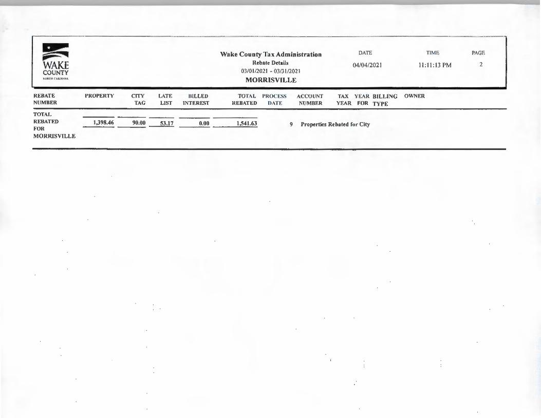
~ ~ ~ WAKE COUNTY Slll\111 ( O ll ltN"
REBATE NUMBER
TOTAL
REBATED FOR
MORRJSVILLE
PROPERTY
1,398.46
CITY TAG
90.00 -----
LATE LIST
53.17
BILLED INTEREST
Wake County Tax Administration Rebate Details
03/01 /2021 - 03/31 /202 I
MORRISVILLE
TOTAL PROCESS REBATED DATE
ACCOUNT NUMBER
DATE
04/04/2021
TIME
11 : 11 : 13 PM
TAX YEAR BILLING OWNER
YEAR FOR TYPE
___ o_.o_o t,541.63 9 Properties Rebated for City
PAGE
2
•
~ DATE TIME PAGE ~ :4iliii Wake County Tax Administration
WAKE Rebate Details 05/09/2021 9:35:10 PM
COUNTY 04/01/2021 - 04/30/2021 Jt,:(lll, lll CA,OllNA MORRISVILLE
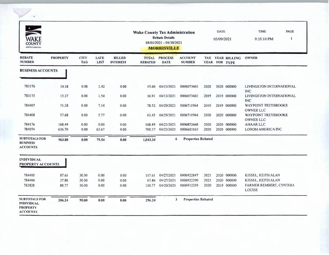
REBATE PROPERTY CITY LATE BILLED TOTAL PROCESS ACCOUNT TAX YEAR BILLING OWNER NUMBER TAG LIST INTEREST REBATED DATE NUMBER YEAR FOR TYPE
BUSINESS ACCOUNTS I 783176 14.18 0.00 1.42 0.00 15.60 04/13/2021 0006073603 2020 2020 000000 LIVINGSTON INTERNATIONAL
INC 783175 15.37 0.00 1.54 0.00 16.91 04/13/2021 0006073603 2019 2019 000000 LIVINGSTON INTERNATIONAL
INC 784407 71.38 0.00 7.14 0.00 78.52 04/29/2021 0006711964 2019 2019 000000 WAYPOINT TREYBROOKE
OWNER LLC 784408 57.68 0.00 5.77 0.00 63.45 04/29/2021 0006711964 2020 2020 000000 WAY POINT TREYBROOKE
OWNERLLC 784176 168.49 0.00 0.00 0.00 168.49 04/23/2021 0006852668 2020 2020 000000 Al-lAAR LLC 784074 636.70 0.00 63 .67 0.00 700.37 04/23/2021 0006603165 2020 2020 000000 LOROM AMERICA INC
SUBTOTALS FOR 963.80 0.00 79.54 0.00 1,043.34 6 Properties Rebated BUSINESS ACCOUNTS
INDIVIDUAL PROPERTY ACCOUNTS
784405 87.61 30.00 0.00 0.00 117.61 04/27/2021 0006922847 2021 2020 000000 KISSEL, KEITH ALAN 784404 37.86 30.00 0.00 0.00 67.86 04/27/2021 0006922290 2021 2020 000000 KISSEL, KEITH ALAN
783828 80.77 30.00 0.00 0.00 110.77 04/20/2021 0006912359 2020 20 19 000000 FARMER REMBERT, CYNTHIA LOUISE
SUBTOTALS FOR 206.24 90.00 0.00 0.00 296.24 3 Properties Rebated INDIVIDUAL PROPERTY ACCOUNTS
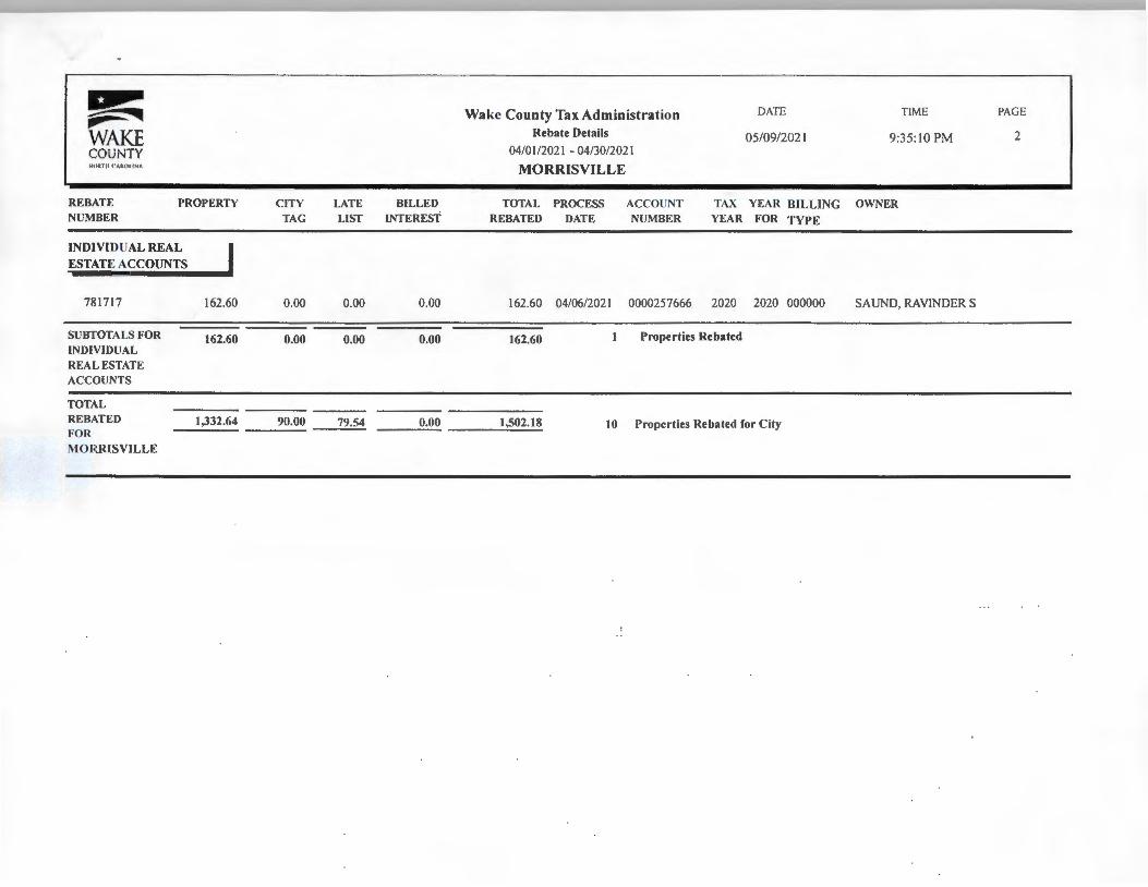
~ Wake County Tax Administration DATE TIME PAGE ~ ~
WAKE Rebate Details 05/09/202 1 9:35 :10 PM 2
COUNTY 04/0 l /202 1 - 04/30/202 1 -.:1 IRIII f•"fUIIINA MORRISVILLE
REBATE PROPERTY C ITY LATE BILLED TOTAL PROCESS ACCOUNT TAX YEAR BILLING OWNER NUMBER TAG LIST INTEREST REBATED DATE NUMBER YEAR FOR TYPE
INDIVIDUAL REA L I ESTATE ACCOUNTS
781717 162.60 0.00 0.00 0.00 162.60 04/06/2021 0000257666 2020 2020 000000 SAUND, RAVINDER S
SUBTOTALS FOR 162.60 0.00 0.00 0.00 162.60 1 Properties Rebated INDIVIDUAL REAL ESTATE ACCOUNTS --TOTAL REBATED 1,332.64 90.00 79.54 0.00 1,502.18 10 Properties Rebated for Ci ty FOR
MORRISVILLE
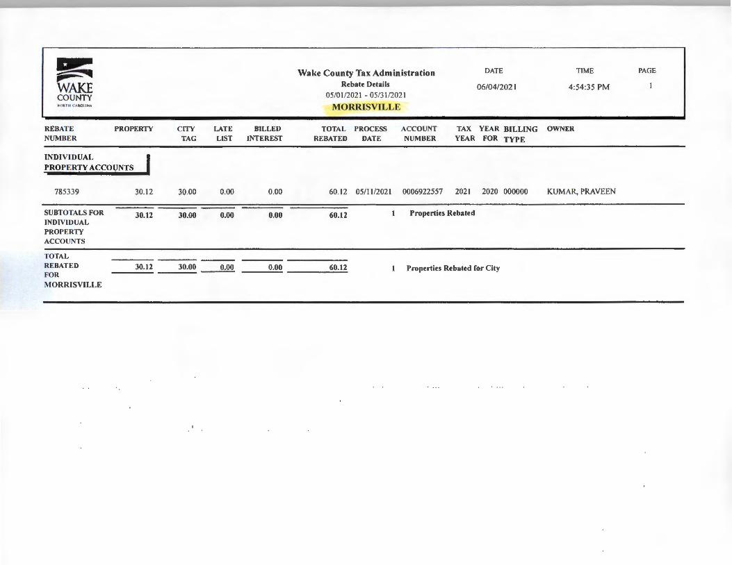
~ Wake County Tax Administration DATE TIME PAGE
~ ~ WAKE Rebate Details 06/04/2021 4:54:35 PM COUNTY 05/01/2021 - 05/31/2021 ,._Oll lt CAltOI I NA MORRISVILLE
REBATE PROPERTY CITY LATE BILLED TOTAL PROCESS ACCOUNT TAX YEAR BILLING OWNER NUMBER TAG LIST INTEREST REBATED DATE NUMBER YEAR FOR TYPE
INDIVIDUAL I PROPERTY ACCOUNTS
785339 30.12 30.00 0.00 0.00 60.12 05/ 11 /2021 0006922557 2021 2020 000000 KUMAR, PRAVEEN
SUBTOTALS FOR 30.12 30.00 0.00 0.00 60.12 I Properties Rebated INDIVIDUAL PROPERTY ACCOUNTS
TOTAL REBATED 30.12 30.00 0.00 0.00 60.12 1 Properties Rebated for City FOR MORRISVILLE
Town Council Agenda Item Report
Agenda Item No. 6.cSubmitted by: Eric SmithSubmitting Department Administration Meeting Date: July 27, 2021
SUBJECTResolution Designating an Official to Make Recommendations to the NC Alcoholic BeverageControl CommissionEric Smith, Town Clerk Action - July 27
Recommendation:Approve the resolution.
Updates/History of Briefing:Not Applicable
Executive Summary and Background Information:Before issuing a retail permit, the NC Alcoholic Beverage Control Commission shall determinethat the applicant is a suitable person and that the location is a suitable place. The governingbody of a municipality may designate an official, by name, or by position, to makerecommendations concerning the suitability of a person or of a location for an ABC permit.The official designated shall be allowed to testify at a contested case hearing in which thesuitability of a person or of a location for an ABC permit is an issue without further qualificationor authorization. The NC Alcoholic Beverage Control Commission currently lists former Police Chief RobertWhitesell as the designated official to make these recommendations on behalf of the Town ofMorrisville. This resolution will update the currently listed information and designate theposition of "Police Chief" to make these recommendations. Designating the position of "PoliceChief" will mitigate the need to update this information in the future.
Advisory Board/Committee Review:None
Insert Date of Advisory Board/Committee Review:
Advisory Board/Committee Recommendation and/or Vote:None
Potential Options:Approve ResolutionNot Approve ResolutionApprove with changes
Staff Recommendation:Approve Resolution ATTACHMENTS• 2021-303-0 BS Resolution Designating ABC Official.pdf• 2021-303-0_RES_Resolution_Designating_ABC_Official.pdf
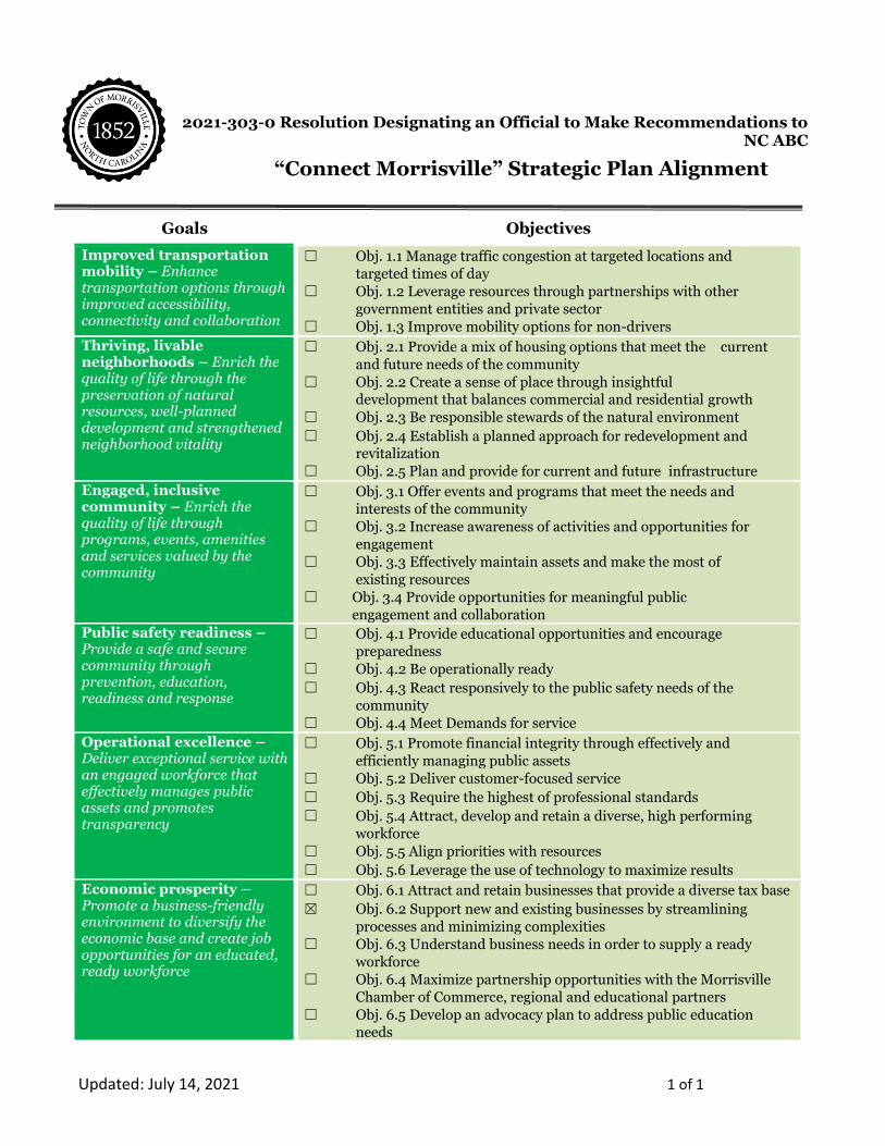
Updated: July 14, 2021 1 of 1
2021-303-0 Resolution Designating an Official to Make Recommendations to
NC ABC
Goals Objectives
Improved transportation mobility – Enhance transportation options through improved accessibility, connectivity and collaboration
☐ Obj. 1.1 Manage traffic congestion at targeted locations and
targeted times of day
☐ Obj. 1.2 Leverage resources through partnerships with other
government entities and private sector
☐ Obj. 1.3 Improve mobility options for non-drivers
Thriving, livable neighborhoods – Enrich the quality of life through the preservation of natural resources, well-planned development and strengthened neighborhood vitality
☐ Obj. 2.1 Provide a mix of housing options that meet the current
and future needs of the community
☐ Obj. 2.2 Create a sense of place through insightful development that balances commercial and residential growth
☐ Obj. 2.3 Be responsible stewards of the natural environment
☐ Obj. 2.4 Establish a planned approach for redevelopment and revitalization
☐ Obj. 2.5 Plan and provide for current and future infrastructure
Engaged, inclusive community – Enrich the quality of life through programs, events, amenities and services valued by the community
☐ Obj. 3.1 Offer events and programs that meet the needs and interests of the community
☐ Obj. 3.2 Increase awareness of activities and opportunities for
engagement
☐ Obj. 3.3 Effectively maintain assets and make the most of
existing resources
☐ Obj. 3.4 Provide opportunities for meaningful public
engagement and collaboration
Public safety readiness – Provide a safe and secure community through prevention, education, readiness and response
☐ Obj. 4.1 Provide educational opportunities and encourage
preparedness
☐ Obj. 4.2 Be operationally ready
☐ Obj. 4.3 React responsively to the public safety needs of the
community
☐ Obj. 4.4 Meet Demands for service
Operational excellence – Deliver exceptional service with an engaged workforce that effectively manages public assets and promotes transparency
☐ Obj. 5.1 Promote financial integrity through effectively and
efficiently managing public assets
☐ Obj. 5.2 Deliver customer-focused service
☐ Obj. 5.3 Require the highest of professional standards
☐ Obj. 5.4 Attract, develop and retain a diverse, high performing
workforce
☐ Obj. 5.5 Align priorities with resources
☐ Obj. 5.6 Leverage the use of technology to maximize results
Economic prosperity – Promote a business-friendly environment to diversify the economic base and create job opportunities for an educated, ready workforce
☐ Obj. 6.1 Attract and retain businesses that provide a diverse tax base
☒ Obj. 6.2 Support new and existing businesses by streamlining
processes and minimizing complexities
☐ Obj. 6.3 Understand business needs in order to supply a ready
workforce
☐ Obj. 6.4 Maximize partnership opportunities with the Morrisville
Chamber of Commerce, regional and educational partners
☐ Obj. 6.5 Develop an advocacy plan to address public education needs
“Connect Morrisville” Strategic Plan Alignment
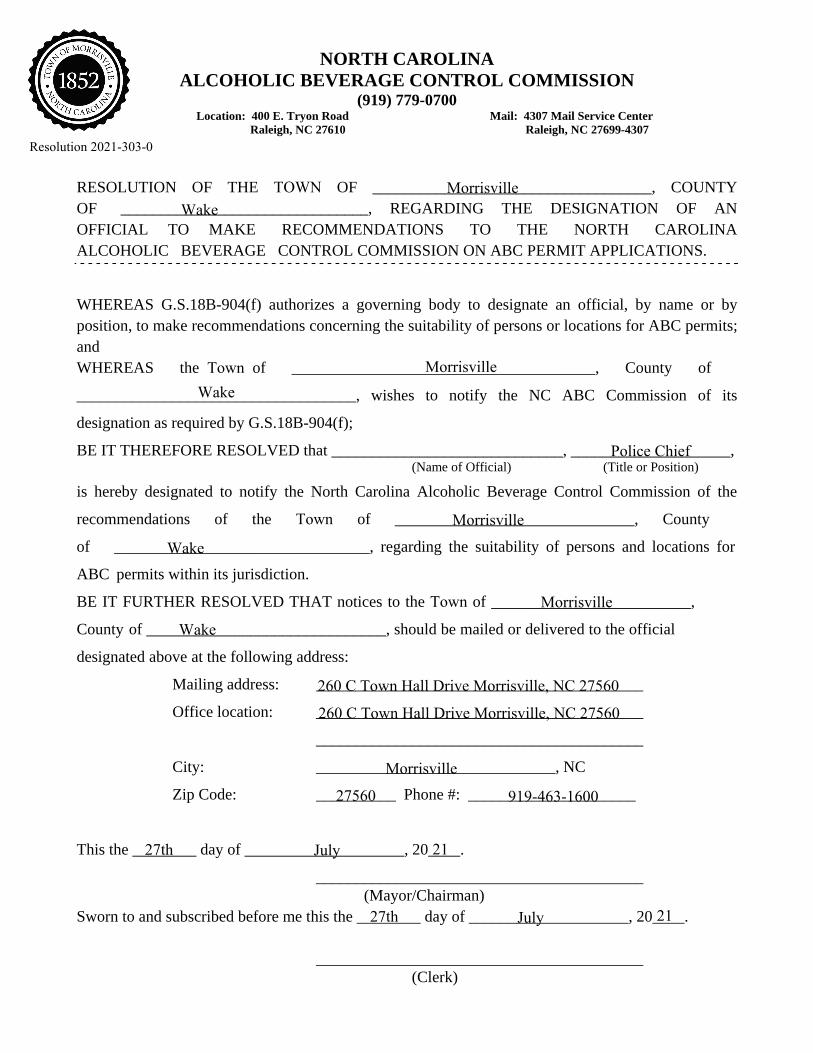
NORTH CAROLINA ALCOHOLIC BEVERAGE CONTROL COMMISSION
(919) 779-0700 Location: 400 E. Tryon Road Mail: 4307 Mail Service Center
Raleigh, NC 27610 Raleigh, NC 27699-4307
RESOLUTION OF THE TOWN OF ___________________________________, COUNTY OF _______________________________, REGARDING THE DESIGNATION OF AN OFFICIAL TO MAKE RECOMMENDATIONS TO THE NORTH CAROLINA ALCOHOLIC BEVERAGE CONTROL COMMISSION ON ABC PERMIT APPLICATIONS.
WHEREAS G.S.18B-904(f) authorizes a governing body to designate an official, by name or by position, to make recommendations concerning the suitability of persons or locations for ABC permits; and WHEREAS the Town of ______________________________________, County of
___________________________________, wishes to notify the NC ABC Commission of its
designation as required by G.S.18B-904(f);
BE IT THEREFORE RESOLVED that _____________________________, ____________________, (Name of Official) (Title or Position)
is hereby designated to notify the North Carolina Alcoholic Beverage Control Commission of the
recommendations of the Town of ______________________________, County
of ________________________________, regarding the suitability of persons and locations for
ABC permits within its jurisdiction.
BE IT FURTHER RESOLVED THAT notices to the Town of _________________________,
County of ______________________________, should be mailed or delivered to the official
designated above at the following address:
Mailing address: _________________________________________
Office location: _________________________________________
_________________________________________
City: ______________________________, NC
Zip Code: __________ Phone #: _____________________
This the ________ day of ____________________, 20____.
_________________________________________ (Mayor/Chairman)
Sworn to and subscribed before me this the ________ day of ____________________, 20____.
_________________________________________ (Clerk)
Morrisville
WakeMorrisville
Wake
Police Chief
Morrisville
Wake
Morrisville
Wake
Morrisville
27560 919-463-1600
260 C Town Hall Drive Morrisville, NC 27560
260 C Town Hall Drive Morrisville, NC 27560
27th July 21
27th July 21
Resolution 2021-303-0
Town Council Agenda Item Report
Agenda Item No. 6.dSubmitted by: Martha PaigeSubmitting Department Administration Meeting Date: July 27, 2021
SUBJECTResolution Approving an Amendment to the Cary/Morrisville Utility AgreementMartha Paige, Town ManagerAction - July 27
Recommendation:Approve Amendment to the Cary/Morrisville Utility Agreement.
Updates/History of Briefing:Not Applicable
Executive Summary and Background Information:
The Towns of Morrisville and Cary merged their water and sewer systems effective April 2006and later entered into a revised Utility Agreement dated September 15, 2015 that clarified andupdated the duties and responsibilities of each municipality related to the merger. Prior to themerger, the Town of Morrisville had accepted payments for utility capital fees from someproperty owners (prepaid fees). Morrisville transferred the total amount of unused prepaid feescollected to Cary as part of the merger for properties not yet connected to water or sewerservice. When a property was developed and utility development fees were due, Cary wouldcredit the prepaid fees from that property against utility development fees due to Cary.
The Town of Morrisville desires to resume responsibility for making appropriate arrangementswith property owners who prepaid fees or with current owners of property for which prepaidfees are related. Cary will no longer credit prepaid fees against utility development fees andwill be released from any obligations related to outstanding prepaid fees. Upon execution ofthis amendment, Cary will return the remaining balance of $266,187.74 to Morrisville, togetherwith all documents and supporting information previously provided to Cary by Morrisvillerelated to the prepaid fees. Return of the funds and related paperwork to the Town will bebeneficial to facilitating inquiries and questions about prepaid fees from property ownersdirectly by Town staff and allow the Town of Morrisville to manage monitoring and trackingpayments and changes in parcel and property owner information. Funds will be placed in aninterest bearing capital project fund to be used for this purpose. A Capital Project Ordinance
Amendment will be considered at a future Town Council meeting.
The draft First Amendment to the Cary/Morrisville Utility Agreement is provided in ATTH01.There are no other proposed changes to the merger or revised Utility Agreement.
Advisory Board/Committee Review:None
Insert Date of Advisory Board/Committee Review:
Advisory Board/Committee Recommendation and/or Vote:None
Potential Options:- Approve Amendment to the Cary/Morrisville Utility Agreement- Do Not Approve Amendment to the Cary/Morrisville Utility Agreement
Staff Recommendation:Staff recommends approval of the amendment to the Cary/Morrisville Utility Agreement. ATTACHMENTS• 2021-311-0 BS Cary.Morrisville Utility Agreement Amendment.pdf• 2021-311-0 RES Cary.Morrisville Utility Agreement Amendment .pdf• 2021-311-0 ATTH01 CaryMville Utility Merger Agreement Amendment.pdf
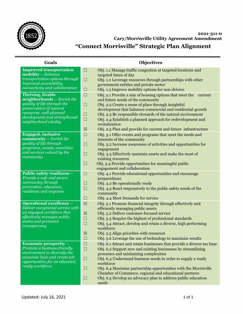
Updated: July 16, 2021 1 of 1
2021-311-0
Cary/Morrisville Utility Agreement Amendment
Goals Objectives
Improved transportation mobility – Enhance transportation options through improved accessibility, connectivity and collaboration
☐ Obj. 1.1 Manage traffic congestion at targeted locations and
targeted times of day
☐ Obj. 1.2 Leverage resources through partnerships with other
government entities and private sector
☐ Obj. 1.3 Improve mobility options for non-drivers
Thriving, livable neighborhoods – Enrich the quality of life through the preservation of natural resources, well-planned development and strengthened neighborhood vitality
☐ Obj. 2.1 Provide a mix of housing options that meet the current
and future needs of the community
☐ Obj. 2.2 Create a sense of place through insightful development that balances commercial and residential growth
☐ Obj. 2.3 Be responsible stewards of the natural environment
☐ Obj. 2.4 Establish a planned approach for redevelopment and revitalization
☒ Obj. 2.5 Plan and provide for current and future infrastructure
Engaged, inclusive community – Enrich the quality of life through programs, events, amenities and services valued by the community
☐ Obj. 3.1 Offer events and programs that meet the needs and interests of the community
☐ Obj. 3.2 Increase awareness of activities and opportunities for
engagement
☐ Obj. 3.3 Effectively maintain assets and make the most of
existing resources
☐ Obj. 3.4 Provide opportunities for meaningful public
engagement and collaboration
Public safety readiness – Provide a safe and secure community through prevention, education, readiness and response
☐ Obj. 4.1 Provide educational opportunities and encourage
preparedness
☐ Obj. 4.2 Be operationally ready
☐ Obj. 4.3 React responsively to the public safety needs of the
community
☐ Obj. 4.4 Meet Demands for service
Operational excellence – Deliver exceptional service with an engaged workforce that effectively manages public assets and promotes transparency
☒ Obj. 5.1 Promote financial integrity through effectively and
efficiently managing public assets
☒ Obj. 5.2 Deliver customer-focused service
☐ Obj. 5.3 Require the highest of professional standards
☐ Obj. 5.4 Attract, develop and retain a diverse, high performing
workforce
☒ Obj. 5.5 Align priorities with resources
☐ Obj. 5.6 Leverage the use of technology to maximize results
Economic prosperity – Promote a business-friendly environment to diversify the economic base and create job opportunities for an educated, ready workforce
☐ Obj. 6.1 Attract and retain businesses that provide a diverse tax base
☐ Obj. 6.2 Support new and existing businesses by streamlining
processes and minimizing complexities
☐ Obj. 6.3 Understand business needs in order to supply a ready
workforce
☐ Obj. 6.4 Maximize partnership opportunities with the Morrisville
Chamber of Commerce, regional and educational partners
☐ Obj. 6.5 Develop an advocacy plan to address public education needs
“Connect Morrisville” Strategic Plan Alignment

TOWN OF MORRISVILLE * 100 TOWN HALL DRIVE * MORRISVILLE, NC 27560
Page 1 of 1
RESOLUTION 2021-311-0 OF THE MORRISVILLE TOWN
COUNCIL APPROVING AN AMENDMENT TO THE CARY/MORRISVILLE UTILITY AGREEMENT
WHEREAS, Cary and Morrisville merged their water and sewer systems effective in April 2006 (“Merger”), and later entered into a revised Utility Agreement dated September 15, 2015 (“2015 Contract”) clarifying and updating the duties and responsibilities of the Parties related to the merger; and
WHEREAS, in accordance with Section 6.3 of the 2015 Contract, it may be amended by the mutual written agreement of the governing bodies of Cary and Morrisville; and
WHEREAS, Cary and Morrisville are desirous of amending the 2015 Contract as more specifically set forth herein; and WHEREAS, Prior to the Merger, Morrisville had accepted payments for utility capital fees from some property owners (“Prepaid Fees”). All the properties for which Prepaid Fees were paid to Morrisville yet had not connected to water or sewer service were listed on Exhibit A to the 2015 Contract, capping the amount of Prepaid Fees available to credit Cary utility development fees at $388,332.60; and WHEREAS, Cary has credited $122,144.86 of Prepaid Fees against utility development fees due from developed properties to date, leaving a balance of Prepaid Fees in the amount of $266,187.74; and WHEREAS, The Parties have agreed that Cary will return the sum of $266,187.74 to Morrisville, together with all documents and supporting information previously provided to Cary by Morrisville related to the Prepaid Fees. Thereafter, Morrisville will take responsibility for making appropriate arrangements with property owners who prepaid fees or with current owners of property with prepaid fee credits. Cary will no longer credit prepaid fees against utility development fees.
NOW, THEREFORE BE IT RESOLVED, by the Morrisville Town Council that we do hereby authorize the Town Manager to execute the First Amendment to the Cary/Morrisville Utility Agreement.
BE IT FURTHER RESOLVED, that except as amended by the terms of this Amendment, all terms and conditions of the 2015 Contract shall remain in full force and effect and are ratified by the Parties.
Adopted this the 27th day of July 2021. ______________________________ TJ Cawley, Mayor ATTEST: _____________________________ Eric W. Smith II, Town Clerk
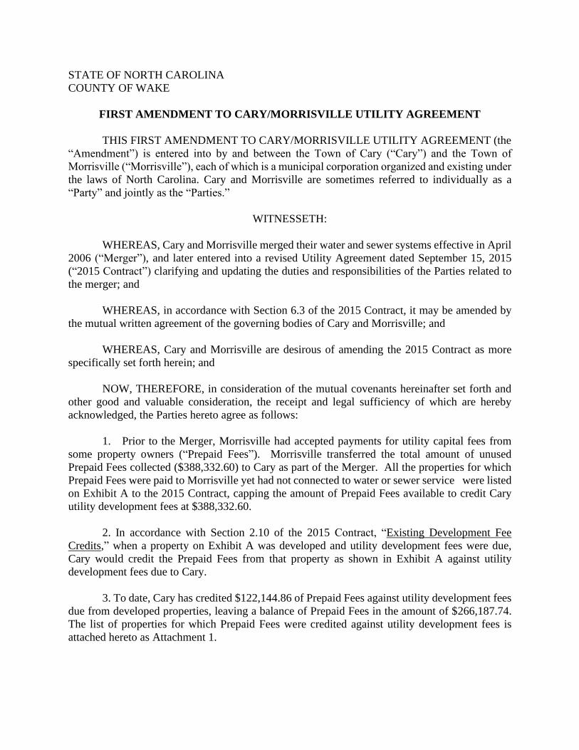
STATE OF NORTH CAROLINA
COUNTY OF WAKE
FIRST AMENDMENT TO CARY/MORRISVILLE UTILITY AGREEMENT
THIS FIRST AMENDMENT TO CARY/MORRISVILLE UTILITY AGREEMENT (the
“Amendment”) is entered into by and between the Town of Cary (“Cary”) and the Town of
Morrisville (“Morrisville”), each of which is a municipal corporation organized and existing under
the laws of North Carolina. Cary and Morrisville are sometimes referred to individually as a
“Party” and jointly as the “Parties.”
WITNESSETH:
WHEREAS, Cary and Morrisville merged their water and sewer systems effective in April
2006 (“Merger”), and later entered into a revised Utility Agreement dated September 15, 2015
(“2015 Contract”) clarifying and updating the duties and responsibilities of the Parties related to
the merger; and
WHEREAS, in accordance with Section 6.3 of the 2015 Contract, it may be amended by
the mutual written agreement of the governing bodies of Cary and Morrisville; and
WHEREAS, Cary and Morrisville are desirous of amending the 2015 Contract as more
specifically set forth herein; and
NOW, THEREFORE, in consideration of the mutual covenants hereinafter set forth and
other good and valuable consideration, the receipt and legal sufficiency of which are hereby
acknowledged, the Parties hereto agree as follows:
1. Prior to the Merger, Morrisville had accepted payments for utility capital fees from
some property owners (“Prepaid Fees”). Morrisville transferred the total amount of unused
Prepaid Fees collected ($388,332.60) to Cary as part of the Merger. All the properties for which
Prepaid Fees were paid to Morrisville yet had not connected to water or sewer service were listed
on Exhibit A to the 2015 Contract, capping the amount of Prepaid Fees available to credit Cary
utility development fees at $388,332.60.
2. In accordance with Section 2.10 of the 2015 Contract, “Existing Development Fee
Credits,” when a property on Exhibit A was developed and utility development fees were due,
Cary would credit the Prepaid Fees from that property as shown in Exhibit A against utility
development fees due to Cary.
3. To date, Cary has credited $122,144.86 of Prepaid Fees against utility development fees
due from developed properties, leaving a balance of Prepaid Fees in the amount of $266,187.74.
The list of properties for which Prepaid Fees were credited against utility development fees is
attached hereto as Attachment 1.

4. The Parties agree that, upon execution of this Amendment, Cary will return the sum of
$266,187.74 to Morrisville, together with all documents and supporting information previously
provided to Cary by Morrisville related to the Prepaid Fees. Thereafter, Morrisville will take
responsibility for making appropriate arrangements with property owners who prepaid fees or with
current owners of property listed on Exhibit A. Cary will no longer credit Prepaid Fees against
utility development fees.
5. Morrisville shall indemnify and hold Cary, its officers and employees, harmless from
and against any and all costs, civil penalties, fines, losses, damages, liabilities, claims, actions,
judgments, and awards, including reasonable attorneys' fees, by whomsoever brought or alleged,
that are incurred by Cary or awarded against Cary in a judgment, arising out of, resulting from, or
in connection with this Amendment, Section 2.10 of the 2015 Contract, or any claim related to the
Prepaid Fees. In addition, Morrisville, for itself and all others claiming by or through it, hereby
releases, discharges, and waives any and all claims, actions, causes of action, defenses, demands,
fines, penalties, damages (both actual and punitive), expenses, liabilities, costs, interest,
complaints, and suits, existing under federal, state, local, or international law, statute, regulation,
rule, common law, or other legal basis of any kind or nature whatsoever, whether known or
unknown, contingent or absolute, past or present, which any or all may have against the Town, its
officers or employees, relating to or arising from this Amendment, Section 2.10 of the 2015
Contract, or the Prepaid Fees. This indemnification and release shall survive the termination of
2015 Contract.
6. Except as amended by the terms of this Amendment, all terms and conditions of the
2015 Contract shall remain in full force and effect and are ratified by the Parties.
7. The Recitals are true and are incorporated herein.
8. Nothing in this Amendment shall be construed to mandate purchase of insurance by
either Party pursuant to N.C.G.S. 160A-485 or to in any way waive either Party’s defense of
governmental immunity from any cause of action alleged or brought against any Party for any
reason if otherwise available as a matter of law. No officer, agent or employee of either Party shall
be subject to any personal liability by reason of the execution of this Amendment or any other
documents related to the transactions contemplated hereby. Such officers, agents, or employees
shall be deemed to execute this Amendment in their official capacities only, and not in their
individual capacities. This section shall not relieve any such officer, agent or employee from the
performance of any official duty provided by law.
9. There are no third-party beneficiaries to this Amendment.
10. Both Parties acknowledge and agree that the electronic signature application DocuSign
may be used to execute this Amendment. By selecting “I Agree,” “I Accept,” or other similar item,
button, or icon via use of a keypad, mouse, or other device, as part of the DocuSign application,
both Parties consent to be legally bound by the terms and conditions of this Amendment and that
such act constitutes their signature as if actually signed in writing. No certification authority or
other third-party verification is necessary to validate the Parties’ electronic signature and the lack
of such certification or third-party verification will not in any way affect the enforceability of their
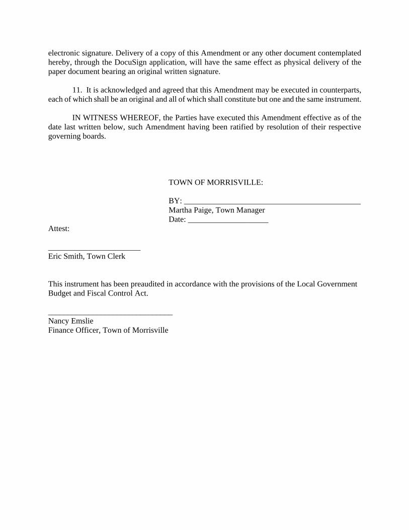
electronic signature. Delivery of a copy of this Amendment or any other document contemplated
hereby, through the DocuSign application, will have the same effect as physical delivery of the
paper document bearing an original written signature.
11. It is acknowledged and agreed that this Amendment may be executed in counterparts,
each of which shall be an original and all of which shall constitute but one and the same instrument.
IN WITNESS WHEREOF, the Parties have executed this Amendment effective as of the
date last written below, such Amendment having been ratified by resolution of their respective
governing boards.
TOWN OF MORRISVILLE:
BY: ____________________________________________
Martha Paige, Town Manager
Date: ____________________
Attest:
_______________________
Eric Smith, Town Clerk
This instrument has been preaudited in accordance with the provisions of the Local Government
Budget and Fiscal Control Act.
_______________________________
Nancy Emslie
Finance Officer, Town of Morrisville
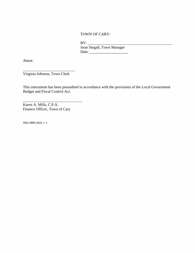
TOWN OF CARY:
BY: ____________________________________________
Sean Stegall, Town Manager
Date: ____________________
Attest:
___________________________
Virginia Johnson, Town Clerk
This instrument has been preaudited in accordance with the provisions of the Local Government
Budget and Fiscal Control Act.
_______________________________
Karen A. Mills, C.P.A.
Finance Officer, Town of Cary
4831-3885-1818, v. 1
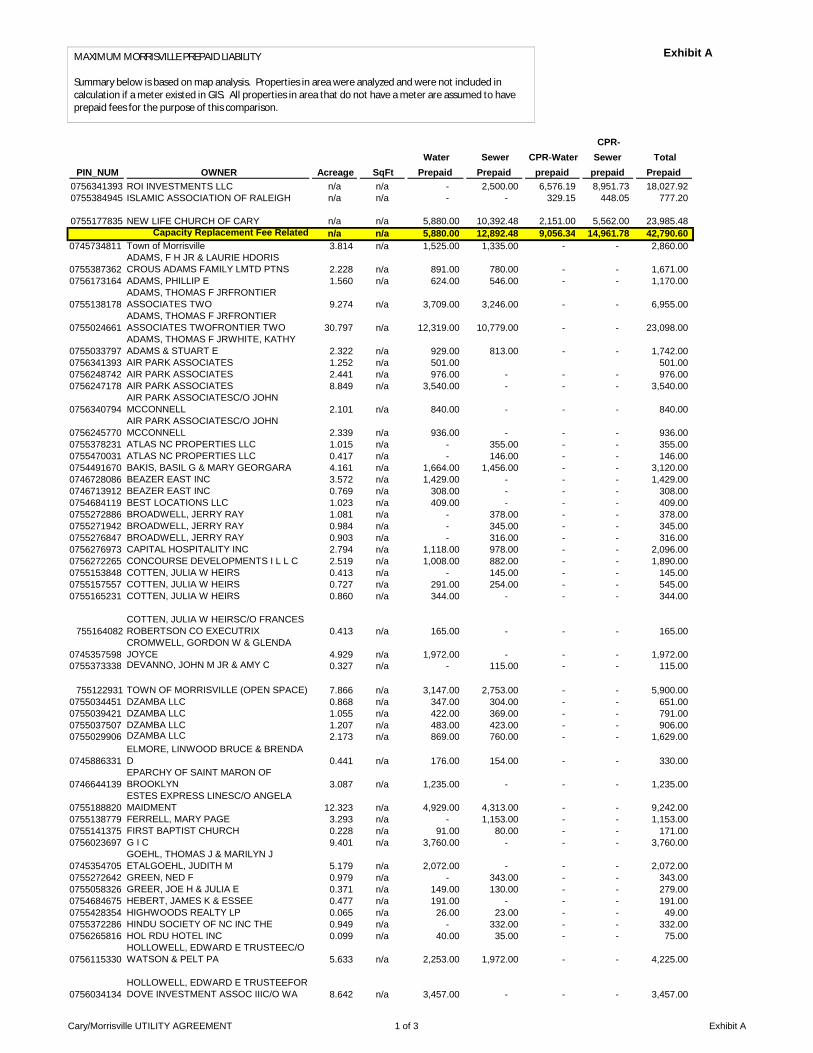
PIN_NUM OWNER Acreage SqFt Water
Prepaid Sewer Prepaid
CPR-Water prepaid
CPR-Sewer
prepaid Total
Prepaid 0756341393 ROI INVESTMENTS LLC n/a n/a - 2,500.00 6,576.19 8,951.73 18,027.92
0755384945 ISLAMIC ASSOCIATION OF RALEIGH n/a n/a - - 329.15 448.05 777.20
0755177835 NEW LIFE CHURCH OF CARY n/a n/a 5,880.00 10,392.48 2,151.00 5,562.00 23,985.48
Capacity Replacement Fee Related n/a n/a 5,880.00 12,892.48 9,056.34 14,961.78 42,790.60 0745734811 Town of Morrisville 3.814 n/a 1,525.00 1,335.00 - - 2,860.00
0755387362
ADAMS, F H JR & LAURIE HDORIS
CROUS ADAMS FAMILY LMTD PTNS 2.228 n/a 891.00 780.00 - - 1,671.00
0756173164 ADAMS, PHILLIP E 1.560 n/a 624.00 546.00 - - 1,170.00
0755138178
ADAMS, THOMAS F JRFRONTIER
ASSOCIATES TWO 9.274 n/a 3,709.00 3,246.00 - - 6,955.00
0755024661
ADAMS, THOMAS F JRFRONTIER
ASSOCIATES TWOFRONTIER TWO 30.797 n/a 12,319.00 10,779.00 - - 23,098.00
0755033797
ADAMS, THOMAS F JRWHITE, KATHY
ADAMS & STUART E 2.322 n/a 929.00 813.00 - - 1,742.00
0756341393 AIR PARK ASSOCIATES 1.252 n/a 501.00 501.00
0756248742 AIR PARK ASSOCIATES 2.441 n/a 976.00 - - - 976.00
0756247178 AIR PARK ASSOCIATES 8.849 n/a 3,540.00 - - - 3,540.00
0756340794
AIR PARK ASSOCIATESC/O JOHN
MCCONNELL 2.101 n/a 840.00 - - - 840.00
0756245770
AIR PARK ASSOCIATESC/O JOHN
MCCONNELL 2.339 n/a 936.00 - - - 936.00
0755378231 ATLAS NC PROPERTIES LLC 1.015 n/a - 355.00 - - 355.00
0755470031 ATLAS NC PROPERTIES LLC 0.417 n/a - 146.00 - - 146.00
0754491670 BAKIS, BASIL G & MARY GEORGARA 4.161 n/a 1,664.00 1,456.00 - - 3,120.00
0746728086 BEAZER EAST INC 3.572 n/a 1,429.00 - - - 1,429.00
0746713912 BEAZER EAST INC 0.769 n/a 308.00 - - - 308.00
0754684119 BEST LOCATIONS LLC 1.023 n/a 409.00 - - - 409.00
0755272886 BROADWELL, JERRY RAY 1.081 n/a - 378.00 - - 378.00
0755271942 BROADWELL, JERRY RAY 0.984 n/a - 345.00 - - 345.00
0755276847 BROADWELL, JERRY RAY 0.903 n/a - 316.00 - - 316.00
0756276973 CAPITAL HOSPITALITY INC 2.794 n/a 1,118.00 978.00 - - 2,096.00
0756272265 CONCOURSE DEVELOPMENTS I L L C 2.519 n/a 1,008.00 882.00 - - 1,890.00
0755153848 COTTEN, JULIA W HEIRS 0.413 n/a - 145.00 - - 145.00
0755157557 COTTEN, JULIA W HEIRS 0.727 n/a 291.00 254.00 - - 545.00
0755165231 COTTEN, JULIA W HEIRS 0.860 n/a 344.00 - - - 344.00
755164082
COTTEN, JULIA W HEIRSC/O FRANCES
ROBERTSON CO EXECUTRIX 0.413 n/a 165.00 - - - 165.00
0745357598
CROMWELL, GORDON W & GLENDA
JOYCE 4.929 n/a 1,972.00 - - - 1,972.00
0755373338 DEVANNO, JOHN M JR & AMY C 0.327 n/a - 115.00 - - 115.00
755122931 TOWN OF MORRISVILLE (OPEN SPACE) 7.866 n/a 3,147.00 2,753.00 - - 5,900.00
0755034451 DZAMBA LLC 0.868 n/a 347.00 304.00 - - 651.00
0755039421 DZAMBA LLC 1.055 n/a 422.00 369.00 - - 791.00
0755037507 DZAMBA LLC 1.207 n/a 483.00 423.00 - - 906.00
0755029906 DZAMBA LLC 2.173 n/a 869.00 760.00 - - 1,629.00
0745886331
ELMORE, LINWOOD BRUCE & BRENDA
D 0.441 n/a 176.00 154.00 - - 330.00
0746644139
EPARCHY OF SAINT MARON OF
BROOKLYN 3.087 n/a 1,235.00 - - - 1,235.00
0755188820
ESTES EXPRESS LINESC/O ANGELA
MAIDMENT 12.323 n/a 4,929.00 4,313.00 - - 9,242.00
0755138779 FERRELL, MARY PAGE 3.293 n/a - 1,153.00 - - 1,153.00
0755141375 FIRST BAPTIST CHURCH 0.228 n/a 91.00 80.00 - - 171.00
0756023697 G I C 9.401 n/a 3,760.00 - - - 3,760.00
0745354705
GOEHL, THOMAS J & MARILYN J
ETALGOEHL, JUDITH M 5.179 n/a 2,072.00 - - - 2,072.00
0755272642 GREEN, NED F 0.979 n/a - 343.00 - - 343.00
0755058326 GREER, JOE H & JULIA E 0.371 n/a 149.00 130.00 - - 279.00
0754684675 HEBERT, JAMES K & ESSEE 0.477 n/a 191.00 - - - 191.00
0755428354 HIGHWOODS REALTY LP 0.065 n/a 26.00 23.00 - - 49.00
0755372286 HINDU SOCIETY OF NC INC THE 0.949 n/a - 332.00 - - 332.00
0756265816 HOL RDU HOTEL INC 0.099 n/a 40.00 35.00 - - 75.00
0756115330
HOLLOWELL, EDWARD E TRUSTEEC/O
WATSON & PELT PA 5.633 n/a 2,253.00 1,972.00 - - 4,225.00
0756034134
HOLLOWELL, EDWARD E TRUSTEEFOR
DOVE INVESTMENT ASSOC IIIC/O WA 8.642 n/a 3,457.00 - - - 3,457.00
Exhibit AMAXIMUM MORRISVILLE PREPAID LIABILITY
Summary below is based on map analysis. Properties in area were analyzed and were not included in calculation if a meter existed in GIS. All properties in area that do not have a meter are assumed to have prepaid fees for the purpose of this comparison.
Cary/Morrisville UTILITY AGREEMENT 1 of 3 Exhibit A

PIN_NUM OWNER Acreage SqFt Water
Prepaid Sewer Prepaid
CPR-Water prepaid
CPR-Sewer
prepaid Total
Prepaid 0755367882 HOOKS, MARIAN 0.937 n/a 375.00 328.00 - - 703.00
0755064507 ISLAMIC ASSOCIATION OF RALEIGH 3.737 n/a 1,495.00 1,308.00 - - 2,803.00
0755388866
JT HOBBY SONS INC ETALWHITE,
KATHY ADAMS & STUART E 16.697 n/a 6,679.00 5,844.00 - - 12,523.00
0755396968
JT HOBBY SONS INC ETALWHITE,
KATHY ADAMS & STUART E 18.619 n/a 7,448.00 6,517.00 - - 13,965.00
0756024008 LONG, DAVID E & BARBARA B 6.824 n/a 2,730.00 - - - 2,730.00
0756164457 LUIHN FOUR INC 4.592 n/a 1,837.00 1,607.00 - - 3,444.00
0756168413 LUIHN FOUR INC 1.091 n/a 436.00 - - - 436.00
0745885550 MARSHBURN, RICKEY 0.658 n/a - 230.00 - - 230.00
0745636014 MCR DEVELOPERS LLC 0.023 n/a 9.00 8.00 - - 17.00
0746711877 MEDLIN, JOHN & PEGGY 0.705 n/a 282.00 - - - 282.00
0756112748 MINESH INC ET ALRANDERY, KIRAN K 3.118 n/a 1,247.00 1,091.00 - - 2,338.00
0756027350
MOORE, LINDA WWATKINS, RICHARD
LARRY 0.318 n/a 127.00 - - - 127.00
0755062243
MOORE, THELMA JMOORE, MARY
ELIZABETH 3.598 n/a 1,439.00 1,259.00 - - 2,698.00
0756337955
MORRISVILLE ASSOCIATES
LLCNATHAN, LIZA 16.734 n/a 6,694.00 5,857.00 - - 12,551.00
0755571774
MORRISVILLE ASSOCIATESC/O JACKIE
HERON 9.686 n/a 3,874.00 3,390.00 - - 7,264.00
0746866066
MORRISVILLE LD ACQUISITON GROUP
LLCATTN: RICK VAUGHN 21.469 n/a 8,588.00 7,514.00 - - 16,102.00
0746965825
MORRISVILLE LD ACQUISITON GROUP
LLCATTN: RICK VAUGHN 24.117 n/a 9,647.00 8,441.00 - - 18,088.00
0745344852 NEWCOMB, DAVID L & EMILY J 4.686 n/a 1,874.00 - - - 1,874.00
0754591215 NORDAN, J B & JANET K 1.320 n/a 528.00 - - - 528.00
0745188648
PARK SOUTH VILLAGE LLCC/O
CROSLAND DEVELOPMENT CORP 0.067 n/a 27.00 23.00 - - 50.00
0756165025 PERIMETER ASSOCIATES LLC 3.703 n/a 1,481.00 - - - 1,481.00
0755258292
PERRY, GERALD W & BARBARA
HPERRY, GERALD W 0.911 n/a - 319.00 - - 319.00
0755072709 POU, JAMES W 13.491 n/a - 4,722.00 - - 4,722.00
0756241767 RALEIGH DURHAM ESUITES LLC 6.618 n/a 2,647.00 - - - 2,647.00
0756366308
RDU CHOICE PROPERTIES INCATTN:
BOB DALY 8.598 n/a 3,439.00 3,009.00 - - 6,448.00
0755250102
RIDOUT, CLARENCE B & PEGGY
CCOTTEN, EXIE L SR 0.995 n/a 398.00 - - - 398.00
0755144965 RIDOUT, PEGGY C 0.123 n/a 49.00 43.00 - - 92.00
0756111224 RYDER TRUCK RENTAL INC 3.918 n/a 1,567.00 1,371.00 - - 2,938.00
0745976404 SLRK MANAGEMENT COMPANY 9.019 n/a 3,607.00 3,157.00 - - 6,764.00
0755584219
SOUTHPORT BUSINESS PARK LTD
PRTNSHP 6.333 n/a 2,533.00 2,216.00 - - 4,749.00
0755485334
SOUTHPORT BUSINESS PARK LTD
PTNRP 22.300 n/a 8,920.00 7,805.00 - - 16,725.00
0756318355
SPRUNT, WILLIAM HWIGGINS W FRANK
U/A FBO 68.674 n/a 27,470.00 24,036.00 - - 51,506.00
0755384945 TERRECORP COMPANY 8.000 n/a 3,200.00 2,800.00 - - 6,000.00
0755241634
TEW, PRENTISS B & JEAN
ROSECOTTON, E L SR & WIFE JULIA L 1.180 n/a 472.00 413.00 - - 885.00
0755269960 THE HINDU SOCIETY OF N C 2.185 n/a - 765.00 - - 765.00
0755053431 TOLER, GAIL L 0.190 n/a - 67.00 - - 67.00
0755052389 TOLER, GAIL L 0.185 n/a - 65.00 - - 65.00
0746613511 TOWN HALL COMMONS LLC 0.411 n/a 164.00 - - - 164.00
0746614679 TOWN HALL COMMONS LLC 2.050 n/a 820.00 - - - 820.00
0755143288 TUCKER, JAMES HTUCKER, THOMAS O 0.339 n/a 135.00 119.00 - - 254.00
0755057143
UPCHURCH, FRANKLIN H & MARTHA
MUPCHURCH FRANKLIN HUNTER JR T-
COM 0.530 n/a 212.00 186.00 - - 398.00
0755051536 UPCHURCH, JAMES M 0.348 n/a - 122.00 - - 122.00
0755052687 UPCHURCH, JAMES M 0.658 n/a - 230.00 - - 230.00
0755173443 VARIETY PIC UP INC 1.015 n/a 406.00 355.00 - - 761.00
0756261127 VMP INC 1.823 n/a 729.00 638.00 - - 1,367.00
0755178222 WALTON, PAUL H & EMMA S G JR 0.226 n/a - 79.00 - - 79.00
0756158354 WATKINS, MARVIN O 0.977 n/a 391.00 - - - 391.00
0756158225 WEEKS REALTY LP 0.962 n/a 385.00 - - - 385.00
0755415770
WESTRIDGE AT WESTON
CONDOMINIUMS 0.415 n/a 166.00 145.00 - - 311.00
0755148838 WHISTLER INVESTMENT GROUP LLC 0.553 n/a 221.00 193.00 - - 414.00
0755147977 WHISTLER INVESTMENT GROUP LLC 0.360 n/a 144.00 126.00 - - 270.00
0755149971 WHISTLER INVESTMENT GROUP LLC 0.570 n/a 228.00 200.00 - - 428.00
0755148768 WHISTLER INVESTMENT GROUP LLC 0.332 n/a 133.00 116.00 - - 249.00
0756420816
WHITE, STUART E & KATHY AZILHA,
MORIS 29.853 n/a 11,941.00 10,448.00 - - 22,389.00
Cary/Morrisville UTILITY AGREEMENT 2 of 3 Exhibit A

PIN_NUM OWNER Acreage SqFt Water
Prepaid Sewer Prepaid
CPR-Water prepaid
CPR-Sewer
prepaid Total
Prepaid
0755284108
WHITEHOUSE, DOUGLAS ALAN &
BARBARAGREEN, STELLA 0.918 n/a - 321.00 - - 321.00
0746650977
WILLIAMS, PAULINE
ETALPENNINGTON, RALPH 1.696 n/a 678.00 - - - 678.00
0755157046 WONG, BORLIE & WENSHU 0.386 n/a 154.00 135.00 - - 289.00
0755156194 WONG, BORLIE & WENSHU 0.307 n/a 123.00 108.00 - - 231.00
0745452517 YATES, HERMAN HEIRS 3.584 n/a 1,434.00 - - - 1,434.00
0755054451 ZUNIGA BROTHERS INC 0.215 n/a - 75.00 - - 75.00
General Prepaid Total 502.169 n/a 188,728.00 143,814.00 - - 332,542.00 0746800135 LYONS, OTTO C n/a 2,694 1,805.00 3,456.00 - - 5,261.00
0745891951 LYONS, OTTO C & QUEEN H n/a 825 1,183.00 2,118.00 - - 3,301.00
0746264198
LYONS, OTTO CLYONS, QUEENESTHER
H n/a 2,160 1,471.00 2,967.00 - - 4,438.00
Residential-Shiloh Total n/a 5,679 4,459.00 8,541.00 - - 13,000.00
Grand Total 502.1693 5,679 199,067.00 165,247.48 9,056.34 14,961.78 388,332.60
Cary/Morrisville UTILITY AGREEMENT 3 of 3 Exhibit A

Cary/Morrisville Utility Agreement Beginning Balance Total Used Balance
388,332.60$ 122,144.86$ 266,187.74$ WATER & SEWER
Project Name Water Sewer Total Credit Date Permit # Old Pin # Comments1 BROADSTONE TRAILSIDE 164.00$ ‐$ 164.00$ 3/18/2019 19‐5887 0746613511 LISTED ON PREPAID UTILITY AGREEMENT AS TOWN HALL COMMONS LLC‐ OLD PIN# 07466135112 BROADSTONE TRAILSIDE 820.00 ‐ 820.00 3/18/2019 19‐5887 0746614679 LISTED ON PREPAID UTILITY AGREEMENT AS TOWN HALL COMMONS LLC‐ OLD PIN# 07466146793 AVIATION CROSSING 8,920.00 7,805.00 16,725.00 3/18/2019 19‐6632 0755485334 LISTED ON THE PREPAID UTILITY AGREEMENT AS SOUTHPORT BUSINESS PARK LTD PTNRP PIN#07554853344 WAKE TECH COMMUNITY COLLEGE 8,588.00 7,514.00 16,102.00 9/12/2019 20-2320 0746866066 LISTED ON THE PREPAID UTILITY AGREEMENT AS RICK VAUGHN MORRISVILLE LD ACQUISITION GROUP PIN # 07468660665 MYERS POINT LOT#53 - 1003 Myers Point Dr 1,439.00 1,259.00 2,698.00 9/25/2019 20‐2755 0755062243 LISTED ON THE PREPAID UTILITY AGREEMENT AS ELIZABETH MORRISVILLE ASSOCIATES PIN#07550622436 MYERS POINT LOT#69 - 1044 Myers Point Dr 1,495.00 1,308.00 2,803.00 9/25/2019 20-2752 0755064507 LISTED ON THE PREPAID UTILITY AGREEMENT AS ISLAMIC ASSOCIATE OF RALEIGH JT HOBBY SONS IN ETAL WHITE PIN#07550645077 BEAZER HOMES LLC - LOT #36 HAMPTON
PLACE - 1041 URBAN DRIVE 1,183.00 2,118.00 3,301.00 10/30/2019 20-3821 0745976404 LISTED ON THE PREPAID UTILITY AGREEMENT AS SLRK MANAGEMENT COMPANY PIN#07459764048 BEAZER HOMES LLC -- LOT#9 HAMPTON
PLACE - 1420 HOPEDALE DR 1,586.00 1,039.00 2,625.00 11/27/2019 20-4684 0745976404 LISTED ON THE PREPAID UTILITY AGREEMENT AS SLRK MANAGEMENT COMPANY PIN#07459764049 BEAZER HOMES LLC -- LOT#10 HAMPTON
PLACE - 1416 HOPEDALE DR 838.00 ‐ 838.00 12/6/2019 20‐4837 0745976404 LISTED ON THE PREPAID UTILITY AGREEMENT AS SLRK MANAGEMENT COMPANY PIN#074597640410 AMERICA'S HOMEPLACE INC - LOT 30B
GREENWOODS - 104 CLEMENTS DR 355.00 ‐ 355.00 6/19/2020 20‐10131 0755378231 LISTED ON THE PREPAID UTILITY AGREEMENT AS ATLAS NC PROPERTIES LLC PIN#075537823111 EARTH FARE RETAIL STORE - 951
MORRISVILLE PKWY 1,664.00 1,456.00 3,120.00 8/8/2014 14‐8054 NO PIN LISTED ON THE PREPAID UTILITY AGREEMENT AS BAKIS,BASIL G & MARY GEORGARA12 KUMON LEARNING CENTER - 101
MORRISVILLE SQUARE WAY 483.00 423.00 905.00 7/14/2016 17-379 NO PIN LISTED ON THE PREPAID UTILITY AGREEMENT AS DZAMBA LLC13 810 CHURCH STREET - CONNECT TO
WATER ONLY 1,471.00 ‐ 1,471.00 2/13/2017 17-5413 NO PIN LISTED ON THE AGREEMENT AS LYONS, OTTO C.14 804 CHURCH STREET - CONNECT TO
WATER ONLY 1,183.00 ‐ 1,183.00 6/19/2017 17-9133 NO PIN LISTED ON THE PREPAID UTILITY AGREEMENT AS LYONS, OTTO C.15 LAKE CRABTREE APARTMENTS - 2599
EVANS ROAD 3,874.00 3,390.00 7,264.00 8/2/2016 16-6772 NO PIN LISTED ON THE PREPAID UTILITY AGREEMENT AS HERON MORRISVILLE LD ACQUISITION GROUP16 NEW LIFE CHURCH - 10260 CHAPEL HILL RD 1,825.53 2,644.33 4,469.86 5/12/2016 16‐4618 NO PIN LISTED ON THE PREPAID UTILITY AGREEMENT AS NEW LIFE CHURCH17 PARK WEST VILLAGE - 9648 CHAPEL HILL
RD 528.00 ‐ 528.00 5/16/2016 16-4618 NO PIN LISTED ON THE PREPAID UTILITY AGREEMENT AS NORDAN, J B & JANET K PARK SOUTH VILLAGE LLC/O18 BEAZER HOMES LLC LOT 94 - 1221
GRENSHAW DR ‐ 2,266.00 2,266.00 2/17/2021 21-7053 0755072709 LISTED ON THE PREPAID UTILITY AGREEMENT AS JAMES W POU PIN#075507270919 BEAZER HOMES LLC LOT 96 - 1213
GRENSHAW DR ‐ 2,266.00 2,266.00 2/17/2021 21-7055 0755072709 LISTED ON THE PREPAID UTILITY AGREEMENT AS JAMES W POU PIN#075507270920 BEAZER HOMES LLC LOT 95 - 1217
GRENSHAW DR ‐ 190.00 190.00 2/17/2021 21-7058 0755072709 LISTED ON THE PREPAID UTILITY AGREEMENT AS JAMES W POU PIN#075507270921 SCOTT HUFFMAN LOT 23 VILLAS AT
SUNSET 291.00 254.00 545.00 2/25/2021 21-7343 0755157557 LISTED ON THE PREPAID UTILITY AGREEMENT AS JULIA W COTTON HEIRS PIN#075515755722 WAKE COMPETITION CENTER - 111
COMPETITION CENTER DR 27,470.00 24,036.00 51,506.00 1/24/2019 19‐5003 0756318355 LISTED ON THE PREPAID UTILITY AGREEMENT AS SPRUNT WILLIAM HWIGGINS W FRANK PIN#0756318355
Water Sewer Total CreditTotals 64,177.53$ 57,968.33$ 122,144.86$
Attachment 1

Town Council Agenda Item Report
Agenda Item No. 6.eSubmitted by: Eric SmithSubmitting Department Administration Meeting Date: July 27, 2021
SUBJECTApproval of June 8, 2021 Town Council Meeting MinutesEric Smith, Town ClerkAction - July 27
Recommendation:N/A
Updates/History of Briefing:N/A
Executive Summary and Background Information:N/A
Advisory Board/Committee Review:None
Insert Date of Advisory Board/Committee Review:
Advisory Board/Committee Recommendation and/or Vote:None
Potential Options:N/A
Staff Recommendation:N/A ATTACHMENTS• 20210608M.pdf
Town Council June 8, 2021 Meeting Minutes Page 1 of 9
Morrisville Town Council Regular Meeting June 8, 2021, 6:00 p.m.
NOTE: Minutes are summaries only, reflecting Council action and main points of discussion. For the full meeting audio and/or video, please click here. For the meeting agenda, presentations and other related agenda materials, click here.
1. Call to order
Mayor Cawley called the meeting to order at 6:00 p.m. Video transmission was available to members of the public through the Town of Morrisville website. Also present were Mayor Pro Tem Johnson and Council Members Garimella, Rao, Robotti, Scroggins-Johnson, and Town Attorney Frank Gray. Council Member Fender participated remotely.
Staff present in Town Council Chambers included: Martha Paige, Town Manager Nancy Emslie, Finance Director
Brandon Zuidema, Assistant Town Manager Eric Smith, Town Clerk
Jeanne Hooks, Director of Management Services Chris Lawson, Planning Manager
Giselle Rodriguez, Public Works Director Benjamin Howell, Long Range Planning Manager
Michele Stegall, Planning Director Kate Murdoch, Planner I
2. Roll Call
Eric Smith, Town Clerk, facilitated a Town Council Roll Call. All Council members were present.
3. Motion to Invoke Rule 19
MOTION: Mayor Pro Tem Johnson made a motion to invoke Rule 19. Council Member Scroggins–Johnson seconded the motion. A roll call vote was conducted, which carried unanimously.
4. Recognition of Sergeant at Arms – Sgt. Chad Penland Mayor Cawley recognized Sgt. Penland.
5. Invocation
Council Member Robotti gave the Invocation.
6. Pledge of Allegiance
Mayor Cawley led the Pledge of Allegiance. 7. Adoption of Regular Agenda
MOTION: Council Member Rao made a motion to adopt the regular agenda. The motion was seconded by Mayor Pro Tem Johnson and carried unanimously.
Town Council June 8, 2021 Meeting Minutes Page 2 of 9
8. Consent Agenda
8.a Resolution 2021-242-0 Appointing the Chair and Vice Chair for the Planning and Zoning Board for the Remainder of 2021
8.b Consideration of Text Amendments to the Unified Development Ordinance Related to Access and Circulation
8.c Budget Ordinance Amendments Authorizing Close of Capital Project Funds
8.d Consideration of Annexation for Property Located at 703 Church Street
MOTION: Council Member Rao made a motion to adopt the consent agenda. The motion was seconded by Council Member Garimella. A roll call vote was conducted, which carried unanimously.
9. Items Pulled from Consent (if any) - None
10. Administrative Reports
10.a. 3rd Quarter FY 2021 Financial Report
11. Presentations
11.a Building Recognizing Juneteenth
Council Member Robotti read the proclamation.
11.b Proclamation Recognizing National Pollinator Week
Mayor Cawley read the proclamation.
11.c Recognizing June as Pride Month
Council Member Rao read the proclamation.
12. Public Address
Eric Smith, Town Clerk, stated that there were no comments received for Public Address and no speakers signed up to provide in-person Public Comments.
13. Public Hearings
13.a. Zoning Map Amendment for 1608 Wilson Road Kate Murdoch, Planner I
Ms. Murdoch presented a project profile, noting that the applicant requested a zoning map
amendment from R-20 (Town of Cary) to Medium Density Residential (MDR). Ms. Murdoch stated that staff recommended approval for the following reasons: 1. The requested Zoning Map amendment is consistent with the recommendations in the
adopted 2021 Land Use Plan. 2. The requested Zoning Map amendment would allow for development that is compatible
with the adjacent residential development.
Ms. Murdoch stated that the Planning and Zoning Board also unanimously recommended approval of the requested zoning map amendment.
Town Council June 8, 2021 Meeting Minutes Page 3 of 9
Council Member Robotti asked staff to confirm that the amendment was to rezone the property to Morrisville and develop a single-family home. Ms. Murdoch confirmed. Mayor Cawley opened the Public Hearing.
Kevin Lauenstein (111 New Rail Drive, Cary) stated that his question regarding the number of homes proposed on the parcel had already been answered. Brett Page (411 Peachtree Point Ct, Cary) discussed his concerns regarding water drainage and the clear cutting of trees related to the development. There were no e-mailed comments.
Mayor Cawley asked why the parcel was proposed to be rezoned as MDR and for clarification regarding the Town of Cary’s R-20 zoning. Ms. Murdoch stated that zoning was proposed to align to the Land Use Plan and she believes the R-20 zoning of Cary was essentially equivalent with Morrisville’s Low Density or Very Low-Density zoning designation. Mayor Cawley stated his preference that the parcel be zoned LDR.
The Public Hearing remained open. Recess: 6:22 pm Reconvene 6:30 pm
13.b. Consideration of Zoning Map Amendments and UDO Text Amendments Related to Land Use Plan Implementation of the McCrimmon Extension Subarea Plan and the Transit Oriented Development District Chris Lawson, Planning Manager
Mr. Lawson stated that the item represented a series of zoning map and UDO text
amendments to implement portions of the Land Use Plan. He noted the amendments were as
follows:
Zoning Map Amendments include:
− Rezoning the McCrimmon Parkway Extension to the Business Activity Center Zoning District.
− Rezoning to install a zoning overlay district named the Gateway Overlay zoning district along the McCrimmon Parkway Extension.
− Rezoning to amend the boundaries of the Airport Overlay Zoning District.
− Rezoning to install the Transit Oriented Development Zoning District.
UDO Text Amendments include:
− Establishing the Gateway Overlay district.
− Creating/amending site and building design standards in the Gateway Overlay and Transit Oriented Development Zoning Districts.
Mr. Lawson discussed the history of item development and explained each of the proposed amendments.
Town Council June 8, 2021 Meeting Minutes Page 4 of 9
AMEND-21-0002 Map amendment proposed to amend the boundaries within the Airport Overlay. – Does not alter the exterior boundary of the Airport Overlay, but does reclassify a portion of the current overlay from the AO-A to the AO-B. Mr. Lawson stated that staff worked with RDU to increase their comfort with the amendments and discussed specific areas of RDU collaboration. Council Member Garimella asked for further information regarding the 50-feet FAA maximum and development sound attenuation. Mr. Lawson stated that the 50-feet FAA maximum would correlate to a three to four floor building. He further explained example development regulations for sound attenuation and noise interference. Mr. Lawson added that RDU would be updated of any developments within the airport overlay and that staff would look to RDU to ensure that no developments would interfere with aircraft communications. Council Member Garimella asked for further information regarding the avigation easement. Mr. Lawson provided further information regarding this easement. Council Member Scroggins-Johnson asked about the needs of RDU related to noise standards. Mr. Lawson provided more detail regarding the noise standards within the UDO. Council Member Scroggins–Johnson asked how renters would be made aware of potential noise issues in the area. Mr. Lawson stated that there was no easy answer to this question and RDU had also struggled to find a resolution. He noted that multi-family units would include noise attenuation. Council Member Scroggins–Johnson suggested that future residents be notified of the airport noise upon entry into a lease. Mr. Lawson suggested signage identifying areas within the airport overlay. Council Member Robotti asked for more information regarding the odors, vapors, particulates, and dust mentioned in the avigation easement. Mr. Lawson stated that he believed the language was to protect RDU in their normal operations. Council Member Robotti stated that the Council needed to protect the residents. Mr. Lawson reminded Council that the language within the easement was not required in the UDO or policy statement by Town Council and could be changed at Council’s discretion. Michele Stegall, Planning Director, stated that the standard language was included to acknowledge what could happen, but added that staff could look further review the language. Mayor Pro Tem Johnson asked for clarification regarding the easements negotiated with RDU. Mr. Lawson stated that the Town would not be involved with the easements signed between RDU and developers. She made suggestions related to the language used within the avigation easement. AMEND-21-0003 Map amendment proposed to rezone most of the area along the McCrimmon Parkway Extension from Industrial Management to the Business Activity Center District (BAC) as called for in the Land Use Plan. Council Member Rao asked if the area could become an innovation district in the Town of Morrisville. Mr. Lawson acknowledged that based on the number of phone calls from
Town Council June 8, 2021 Meeting Minutes Page 5 of 9
biomedical firms across the country that were interested in relocating to the area, that could occur. Council Member Garimella asked how the Wake County Competition Center would proceed if they were non-conforming after the amendment. Mr. Lawson stated that the Wake County Competition Center would be conforming as it was exempted in the added overlay. Council Member Garimella asked for the definition of multi-family. Mr. Lawson noted that no area could be designated for renters or purchasers, so the definition of multi-family means development on one parcel that is connected vertically or horizontally. Council Member Fender asked about the removal of previous conditional zoning districts through the rezoning. Mr. Lawson further explained this language. Council Member Robotti asked for clarification regarding biomanufacturing. Mr. Lawson further explained biomanufacturing and its allowed uses.
AMEND-21-0004 Map amendment proposed to install the Gateway Overlay, a brand-new zoning overlay, informally referred to as the GO district. Purpose of the overlay is to implement design standards as called for in the McCrimmon Extension Subarea plan to provide an attractive, pedestrian oriented space. Council Member Garimella asked how the Grace Park development would fit within the proposed spacing standards. Mr. Lawson replied that Grace Park would satisfy section 3.b of the multi-family spacing standards. Mayor Cawley discussed his vision for the area and the number of possible units that could be developed in the area. He stated he would like to see first floor retail and walkable areas. He also suggested vertical mixed use in every road facing building. Council Member Robotti suggested incentivization of tree preservation and greenspace on parcels.
Mayor Pro Tem Johnson discussed the need to limit area development in a fair manner. Mr. Lawson stated how the tiered spacing system was developed. Council Member Fender suggested the incentivization of open space, green space, and landscaping. Mayor Cawley asked if the text within the overlay amendments could be required. Mr. Lawson confirmed that Council could require items within the amendments. Mayor Cawley asked that staff provide photo examples of street level parking options. AMEND-21-0005 Map amendment proposed to install the Transit Oriented Development District. Mr. Lawson stated that the TOD East was the highest priority and developers had already expressed interest in this area. He noted that staff suggested the rezoning of all three areas to stay ahead of the future development.
Town Council June 8, 2021 Meeting Minutes Page 6 of 9
Council Member Scroggins-Johnson stated that this was the perfect location for a vibrant mixed-use area and should be protected. She asked for timing regarding the TOD flyover. Mr. Lawson replied that flyover right of way had not been acquired. Council Member Robotti asked when a discussion regarding the widening of Church Street would take place. Mr. Lawson discussed various traffic mitigation tools and alternative routes that would be implemented on Church Street and added that the Comprehensive Transportation Plan did not call for Church Street to be widened. Council Member Robotti stated that the Town did not have the infrastructure to support the proposed development. Mr. Lawson discussed the traffic in the area and future estimates regarding traffic. Council Member Robotti asked if developers could fund street widening. Mr. Lawson replied that developer funded road widening was a possibility. Ms. Stegall discussed the area, noting that there was a booming life sciences industry permitted by right. She stated that these amendments were proposed to protect the area and that the code was proposed ahead of the small area plan. She noted traffic will increase even with the current IM zoning designation. Council Member Rao suggested electric vehicle charging stations in the area. Mr. Lawson stated that the Public Works Department was researching sustainability efforts related to this question and staff could review parking standards to require electric vehicle parking. Mayor Pro Tem Johnson stated that there was potential for undesirable development in the area if zoning is not addressed. She added that a commuter rail station was important for this community well into the future and she did not want to lose that opportunity Mr. Lawson presented the UDO text amendments related to the TOD. Mayor Cawley stated that Town Hall Drive was overbuilt and could take pressure off Church Street. Mr. Lawson stated that staff recommended approval for the following reasons: 1. The requested Zoning Map amendments implement the recommendations in the
adopted 2021 Land Use Plan. 2. The requested Zoning Map amendments would prevent development which may be
incompatible with the 2021 Land Use Plan Mayor Cawley opened the Public Hearing. Eric Smith, Town Clerk, stated that there were six comments received for Public Hearing. - Three comments were in support of Item 13.b. - One comment was in support of Item 13.b. with an exception related to section 3.8.4. - One comment related to item 13.b. objected to any changes in the Airport Overlay
District that would allow new incompatible residential development and requested that any zoning amendments strictly prohibit new residential development in the Airport Overlay District.
- One comment related to item 13.b. asked that Council review each usage change and approve/disapprove based on the purpose and objective of each district or change in purpose of the district.
Town Council June 8, 2021 Meeting Minutes Page 7 of 9
Town Clerk Smith noted that all comments were added in their entirety to the public record. Mayor Pro Tem Johnson suggested that the Public Hearing remain open. Mayor Cawley asked how form-based code could be used to ensure Council’s vision. MOTION: Council Member Scroggins–Johnson made a motion to extend the public hearing until the next regularly scheduled meeting. The motion was seconded by Council Member Garimella. A roll call vote was conducted, which carried unanimously. Council discussed adding selected requirements from within the TOD language to the Gateway Overlay District amendment language.
Council Member Garimella asked for more multi-family spacing standards options. Mayor Pro Tem Johnson asked that Mr. Lawson develop responses to address the public hearing comments received. Recess: 8:40 pm Reconvene 8:50 pm
14. Action Items
14.a. Resolutions Approving Advisory Committee Charter Amendments Eric Smith, Town Clerk
Town Clerk Smith presented the changes made to the proposed resolutions based upon previous Council discussion. MOTION: Mayor Pro Tem Johnson made a motion to approve Resolutions 2021-198-0 A through G. The motion was seconded by Council Member Garimella and carried unanimously.
14.b. FY2022 Proposed Annual Operating Budget and Related Items Martha Paige, Town Manager Jeanne Hooks, Director of Management Services
Ms. Hooks noted that all the action items were updated based on Council discussion. MOTION: Council Member Mayor Pro Tem Johnson made a motion to approve Ordinance 2021-183-0A, Resolution 2021-183-0B, Resolution 2021-183-0C and Resolution 2021-183-0D. The motion was seconded by Council Member Scroggins-Johnson. A roll call vote was conducted, which carried unanimously. Council thanked staff for their work developing the budget. Council Member Rao noted that the budget made great investments to move Morrisville forward. He voiced his interest in focusing on small business recovery efforts. Mayor Cawley discussed the need to support important issues in Morrisville.
Town Council June 8, 2021 Meeting Minutes Page 8 of 9
Mayor Pro Tem Johnson stated that the budget included important projects for the community and showed that Council prioritized community needs.
15. New Items
15.a. Consideration of Annexation for 1608 Wilson Road Kate Murdoch, Planner I
Ms. Murdoch stated that the applicant requested a zoning map amendment from R-20 (Town
of Cary) to Medium Density Residential (MDR). She stated that Staff recommended approval of the petition to extend the Town of Morrisville corporate limits to the subject property for the following reasons: 1. The Town had historically honored voluntary annexation requests. 2. The petition met all statutory requirements. Council Member Garimella asked how this property was determined to be in Cary town limits. Ms. Murdoch explained the border agreements between Cary and Morrisville. MOTION: Mayor Pro Tem Johnson made a motion to approve Resolution 2021-229-0A. The motion was seconded by Council Member Scroggins-Johnson. A roll call vote was conducted, which carried unanimously.
MOTION: Mayor Pro Tem Johnson made a motion to approve Resolution 2021-229-0B. The motion was seconded by Council Member Scroggins-Johnson. A roll call vote was conducted, which carried unanimously.
16. Future Meetings, Events and Citizen Involvement Opportunities
Mayor Cawley announced future events. 17. Council and Manager Comments
Mayor Pro Tem Johnson thanked those that participated in the All-America City Award presentation. She discussed the collaboration between various community agencies to hold vaccination clinics. Council Member Garimella thanked Assistant Town Manager Zuidema for his coordination of vaccination events. Council Member Scroggins-Johnson congratulated the newly appointed Chair and Vice Chair of the Planning and Zoning Board. She reminded the community of advisory committee volunteer opportunities and discussed the upcoming Juneteenth celebration. Mayor Cawley thanked the Communications Department for their support of the All-America City Award presentation and congratulated all area graduates. He encouraged the community to get vaccinated.
Town Council June 8, 2021 Meeting Minutes Page 9 of 9
Council Member Robotti discussed a presentation at the Hindu Society of NC where a $25,000 check was presented to SAWA for COVID Relief India. Council Member Rao congratulated the Wake County Board of Commissioners for passing their recent budget and the graduating class of 2021. He discussed development in RTP that would push other municipalities to make investments in affordable housing. Council Member Rao suggested collaboration with the Memorial Foundation to accelerate the development of a Veteran’s Memorial within the Town of Morrisville. Town Manager Paige thanked staff and community representatives for their work on the All-America City presentation. She thanked Council for approving the budget on behalf of current and future staff. She informed Council that the July 3rd event would resemble a SpringFest and added that staff were working on details.
18. Adjournment MOTION: Council Member Robotti made a motion to adjourn. The motion was seconded by Council Member Garimella. A roll call vote was conducted, which carried unanimously.
Mayor Cawley adjourned the meeting at 9:32 p.m.
Town Council Agenda Item Report
Agenda Item No. 6.fSubmitted by: Eric SmithSubmitting Department Administration Meeting Date: July 27, 2021
SUBJECTApproval of June 10, 2021 Town Council Work Session MinutesEric Smith, Town ClerkAction - July 27
Recommendation:N/A
Updates/History of Briefing:N/A
Executive Summary and Background Information:N/A
Advisory Board/Committee Review:None
Insert Date of Advisory Board/Committee Review:
Advisory Board/Committee Recommendation and/or Vote:None
Potential Options:N/A
Staff Recommendation:N/A ATTACHMENTS• 20210610M.pdf
Town Council June 10, 2021 Meeting Minutes Page 1 of 2
Morrisville Town Council Work Session June 10, 2021, 6:00 p.m.
NOTE: Minutes are summaries only, reflecting Council action and main points of discussion. For the full meeting audio and/or video, please click here. For the meeting agenda, presentations and other related agenda materials, click here.
1. Call to order
Mayor Cawley called the meeting to order at 6:00 p.m. Video transmission was available to members of the public through the Town of Morrisville website. Also present were Mayor Pro Tem Johnson and Council Members Garimella, Rao, Robotti, Scroggins-Johnson, and Town Attorney Frank Gray. Council Member Fender was absent.
Staff present in Town Council Chambers included: Martha Paige, Town Manager Jeanne Hooks, Director of Management Services
Brandon Zuidema, Assistant Town Manager Eric Smith, Town Clerk
2. Roll Call
Eric Smith, Town Clerk, facilitated a Town Council Roll Call. All Council members were present, except Council Member Fender.
3. Motion to Invoke Rule 19
MOTION: Council Member Rao made a motion to invoke Rule 19. Council Member Robotti seconded the motion. A roll call vote was conducted, which carried unanimously. Assistant Town Manager Brandon Zuidema explained how the closed session would be facilitated and discussed the goals and expectations of the closed session.
4. Closed Session
4.a. Closed Session Pursuant to N.C.G.S. 143-318.11 (a)(4) to discuss
matters relating to economic development and N.C.G.S. 143-
318.11(a)(5) to discuss real property acquisition.
MOTION: Council Member Rao made a motion to enter Closed Session Pursuant to N.C.G.S. 143-318.11 (a)(4) to discuss matters relating to economic development and N.C.G.S. 143-318.11(a)(5) to discuss real property acquisition. The motion was seconded by Mayor Pro Tem Johnson. A roll call vote was conducted, which carried unanimously.
Council entered Closed Session at 6:08 p.m.

Town Council June 10, 2021 Meeting Minutes Page 2 of 2
MOTION: Council Member Rao made a motion to end Closed Session and resume Open Session. The motion was seconded by Council Member Garimella and carried unanimously. Council resumed Open Session at 10:45 p.m.
5. Adjournment
MOTION: Council Member Robotti made a motion to adjourn. The motion was seconded by Mayor Pro Tem Johnson. A roll call vote was conducted, which carried unanimously. Mayor Cawley adjourned the meeting at 10:46 p.m.
Town Council Agenda Item Report
Agenda Item No. 6.gSubmitted by: Eric SmithSubmitting Department Administration Meeting Date: July 27, 2021
SUBJECTApproval of June 22, 2021 Town Council Meeting MinutesEric Smith, Town ClerkAction - July 27
Recommendation:N/A
Updates/History of Briefing:N/A
Executive Summary and Background Information:N/A
Advisory Board/Committee Review:None
Insert Date of Advisory Board/Committee Review:
Advisory Board/Committee Recommendation and/or Vote:None
Potential Options:N/A
Staff Recommendation:N/A ATTACHMENTS• 20210622M.pdf
Town Council June 22, 2021 Meeting Minutes Page 1 of 9
Morrisville Town Council Regular Meeting June 22, 2021, 6:00 p.m.
NOTE: Minutes are summaries only, reflecting Council action and main points of discussion. For the full meeting audio and/or video, please click here. For the meeting agenda, presentations and other related agenda materials, click here.
1. Call to order
Mayor Cawley called the meeting to order at 6:00 p.m. Video transmission was available to members of the public through the Town of Morrisville website. Also present were Mayor Pro Tem Johnson and Council Members Fender, Garimella, Rao, Robotti, Scroggins-Johnson, and Town Attorney Frank Gray.
Staff present in Town Council Chambers included: Martha Paige, Town Manager Erin Hudson, Strategic Performance Manager
Brandon Zuidema, Assistant Town Manager Chris Lawson, Planning Manager
Jeanne Hooks, Director of Management Services Eric Smith, Town Clerk
Nancy Emslie, Finance Director Chuck Bryan, Sr. IT Analyst
Michele Stegall, Planning Director Rodney Wadkins, GIS Manager
Randy Little, Park and Recreation Director Mark Spanioli, Town Engineer
Aaron Prichard, Planner II Kate Murdoch, Planner I
2. Recognition of Sergeant at Arms – Sgt. Chad Penland
Mayor Cawley recognized Sgt. Penland. 3. Invocation
Council Member Rao gave the Invocation.
4. Pledge of Allegiance
Mayor Cawley led the Pledge of Allegiance. 5. Adoption of Regular Agenda
MOTION: Mayor Pro Tem Johnson made a motion to adopt the regular agenda. The motion was seconded by Council Member Rao and carried unanimously.
6. Consent Agenda
6.a Approval of May 4, 2021 Town Council Budget Workshop Minutes Eric Smith, Town Clerk
6.b Approval of May 11, 2021 Town Council Meeting Minutes Eric Smith, Town Clerk
6.c Approval of May 20, 2021 Town Council Budget Workshop Minutes Eric Smith, Town Clerk

Town Council June 22, 2021 Meeting Minutes Page 2 of 9
6.d Approval of May 25, 2021 Town Council Meeting Minutes Eric Smith, Town Clerk
MOTION: Council Member Rao made a motion to adopt the consent agenda. The motion was seconded by Mayor Pro Tem Johnson and carried unanimously.
7. Items Pulled from Consent (if any) - None
8. Administrative Reports
8.a. Quarterly Capital Projects Update Mark Spanioli, Director of Engineering
Council Member Garimella asked if the Historic Christian Church parking lot project was complete. Mr. Spanioli stated that the project was complete. Council Member Robotti asked for more information regarding the issues with the previous environmental studies at the planned Crabtree Creek Nature Park site. Mr. Spanioli explained that previously completed unpermitted work that needed to be reviewed. Mr. Zuidema added that the work was completed prior to Town acquisition of the parcel. He noted that the remediation to address the issue would not be a significant cost but would be more of a time issue.
8.b ERP System Update Nancy Emslie, Finance Director Chuck Bryan, Sr. IT Analyst Rodney Wadkins, GIS Manager
Council Member Scroggins-Johnson recognized and thanked the ERP Team. She asked for an updated timeline regarding the project. Ms. Emslie discussed the history of the item and the future timeline related to the item. Council Member Scroggins-Johnson reiterated that Morrisville was one of the leading municipalities in NC for MUNIS enterprise system connectivity. Council Member Garimella discussed the ease of flow the enterprise systems provide for users.
9. Presentations
9.a Introduction of Randy Little - Parks, Recreation and Cultural Resources Director Brandon Zuidema, Assistant Town Manager
Mr. Zuidema introduced Mr. Little and provided comments regarding Mr. Little’s background. Mr. Little provided brief remarks.
9.b Proclamation Recognizing July as Parks and Recreation Month
Council Member Scroggins–Johnson read the proclamation.
Town Council June 22, 2021 Meeting Minutes Page 3 of 9
The proclamation was presented to Mr. Little, Parks, Recreation and Cultural Resources Director and Bob Butler, member of the Parks, Recreation and Cultural Resources Advisory Committee.
10. Public Address Eric Smith, Town Clerk, stated that there were no comments received for Public Address.
11. Action Items
11.a. Consideration of Annexation for Properties Located at 703 and 3109 Slater Road Aaron Prichard, Planner II
Mr. Prichard presented the annexation request profile and noted that staff recommended approval of the petition to extend the Town of Morrisville corporate limits to the subject properties for the following reasons: 1. The Town had historically honored voluntary annexation requests. 2. The petition met all statutory requirements. 3. It would expand the Town’s tax base. 4. With the increase in tax base, the annexation could improve the economies of scale in the delivery of Town services Mr. Prichard presented a timeline related to the item. MOTION: Council Member Robotti made a motion to approve Resolution 2021-241-0A. The motion was seconded by Council Member Fender and carried unanimously. MOTION: Council Member Robotti made a motion to approve Resolution 2021-241-0A. The motion was seconded by Council Member Scroggins-Johnson and carried unanimously.
11.b. 2021 Bond Referendum, Preliminary Findings Resolution Nancy Emslie, Finance Director
Ms. Emslie explained the Preliminary Findings Resolution and noted that it needed to be adopted to move forward with the bond authorization process. She discussed the next steps if Council approved the resolution. MOTION: Mayor Pro Tem Johnson made a motion to approve Resolution 2021-256-0. The motion was seconded by Council Member Robotti and carried unanimously.
12. Public Hearings
12.a. Consideration of Annexation for 1608 Wilson Road Kate Murdoch, Planner I
Ms. Murdoch stated that there were no updates to the item.
Town Council June 22, 2021 Meeting Minutes Page 4 of 9
Mayor Cawley opened the public hearing. MOTION: Mayor Pro Tem Johnson made a motion to close the public hearing. The motion was seconded by Council Member Garimella and carried unanimously.
12.b. Zoning Map Amendment for 1608 Wilson Road Kate Murdoch, Planner I
Ms. Murdoch stated that there were no updates on the item. MOTION: Mayor Pro Tem Johnson made a motion to close the public hearing. The motion was seconded by Council Member Robotti and carried unanimously. Ms. Murdoch discussed the next steps related to the item.
12.c. Consideration of Zoning Map Amendments and UDO Text Amendments Related to Land Use Plan Implementation of the McCrimmon Extension Subarea Plan and the Transit Oriented Development District Chris Lawson, Planning Manager
Mayor Cawley continued the public hearing from June 8. Ken Nolan (32 Albion Place, Boston MA) stated that he was a development manager for Longfellow Real Estate Partners and voiced some specific concerns related to the text amendments that could limit development. Town Clerk Smith stated that four written comments were received related to the item:
− Three comments were in support of item 12.c.
− One comment was in support of item 12.c. with some suggested changes. Town Clerk Smith noted that all comments were added in their entirety to the public record. Council Member Robotti asked if light manufacturing was prohibited. Mr. Lawson confirmed that light manufacturing was currently prohibited, but staff had suggested an update to the item to allow for some light manufacturing related to life sciences production and research. Mr. Lawson discussed the concerns voiced by RDU related to potential residential development, noting that staff had adjusted the land use plan to remove any residential uses, other than multi-family, from the Airport Overlay District. Mr. Lawson stated that staff did recommend multi-family in the McCrimmon corridor with added conditions such as noise attenuation and an avigation easement. He noted that the options related to multi-family spacing standards were still proposed as a tiered system with 1,500-foot, 800-foot and 500-foot spacing and discussed the updates to this item related to landscaping, streetyard buffers and tree canopies. Lawson discussed the ability of council to incentivize or require vertical mixed use or structured parking.
Town Council June 22, 2021 Meeting Minutes Page 5 of 9
Council Member Garimella asked for clarification regarding the parking requirement options related to multi-family spacing standards. Mr. Lawson explained how a developer could comply with the parking requirements related to multi-family spacing standards. Mayor Cawley asked for information regarding the maximum potential multi-family units for the presented conceptual development sites. Mr. Lawson presented estimated numbers discussed by proposed developers. Mayor Cawley suggested that Council mandate 1,500 foot spacing between multi-family development sites, with at least 50% ground floor retail. Council Member Robotti asked if the 50% ground floor retail requirement was sensible and asked if multi-family was needed in the area. Mayor Cawley noted that office space would be in addition to the multi-family in the area. Council Member Rao indicated he was fine with 1,500 foot spacing and asked how many apartments could be developed in the area with the 1,500-foot spacing option. Mr. Lawson replied that 1,000 – 1,500 apartments could be developed in the location using the 1,500-foot spacing option. Mr. Lawson stated that several uses would be allowed beyond retail such as entertainment or medical offices. He added that staff could request open space when appropriate. Council Member Rao asked if a brewery would be allowed. Mr. Lawson stated that a brewery was a permitted use. Council Member Scroggins – Johnson stated that the 1,500-foot spacing would create increased housing prices and voiced her support for the 800-foot spacing option. Council Member Fender asked how green space would be addressed. Mr. Lawson stated that the green space would be addressed in the same fashion that it is in other areas of town. Council Member Fender stated that she would like to see the preservation of tree canopy incentivized or required. Mayor Pro Tem Johnson supported the 1,500-foot spacing option. She voiced concern with unintended consequences when Council was very prescriptive. She preferred flexibility for creative and innovative options. Council Member Robotti asked if a developer with an innovative project could seek a change to the UDO standards for the spacing requirements. Mr. Lawson discussed the ways a developer could seek to change the requirements for an innovative development but reminded Town Council that UDO text amendments can take 5-6 months to process. Mr. Lawson stated that staff would follow the language within the UDO. Council Member Robotti stated that she did not want the requirements to be overly prescriptive and asked for the best method to fulfil Council’s vision. Mr. Lawson discussed staff recommendations to move forward. Council Member Garimella asked for clarification regarding use requirements for businesses fronting a major thoroughfare. Mr. Lawson discussed the proposed requirements and noted that buildings not on major roads would not be subject to these requirements.

Town Council June 22, 2021 Meeting Minutes Page 6 of 9
Council Member Fender noted that tree preservation should be required in the UDO as it was in the developer’s best interest to remove trees. She suggested the addition of a requirement to preserve more trees than currently mandated within the UDO. Council Member Rao asked how Council could achieve more tree preservation. Mr. Lawson discussed Councils’ desire for tree preservation and tree placement along property frontage. He noted Council has consistently noted a desire not only to preserve trees but have them visible. Tree preservation standards would need to be updated to change the existing priority of tree save order. Council Member Fender asked if the created overlay would allow for additional restrictions. Mr. Lawson stated that it would, but the overlay was focused more on building design rather than tree preservation. Mayor Pro Tem Johnson asked for further clarification regarding tree save requirements. Mr. Lawson stated that the tree save would depend on several parcel related factors, especially the number of trees existing on the site. Mayor Cawley discussed the spacing standards and voiced his support for the 1,500-foot spacing option. Council Member Garimella stated that flexibility was beneficial and supported the 800-foot or even 500-foot spacing options. He asked for information regarding the types of development calls staff received. Mr. Lawson stated that calls were received almost daily regarding labs and multi-family developments in the area. He noted that there was a large amount of developer interest in the area. Council Member Scroggins–Johnson stated that the 800-foot spacing option would allow for more tree canopy and was a win-win option that was more favorable to the end goal. Mr. Lawson summarized Council discussion regarding multi-family unit spacing standards. Council Member Garimella asked if a buffer could be used between two properties. Mr. Lawson discussed the trade-offs between existing tree canopies and newly developed landscape buffers. Council Member Scroggins–Johnson asked for clarification regarding research labs within the TOD area. Mr. Lawson discussed how research labs were added as an acceptable use to the TOD area. Mr. Lawson further discussed the required uses within the area. Mr. Lawson noted that light manufacturing was proposed as an allowed use for research or educational purposes. Council Member Fender asked for more information regarding biomanufacturing in the McCrimmon Extension area. Mr. Lawson stated that within the TOD, the biomanufacturing would be incidental to the primary use of the development. Council Member Fender asked for the constraints of the biomanufacturing noting that some limitations should be placed on the definition. She voiced her concern regarding possible noise from equipment related to biomanufacturing. Mr. Lawson discussed the proposed conditions related to loading docks that would limit the amount of trucks that would be allowed to enter the area. Mr. Lawson stated that central utility plants could be limited in the amendments.
Town Council June 22, 2021 Meeting Minutes Page 7 of 9
Mayor Pro Tem Johnson asked for more information regarding mix of use requirements. Mr. Lawson discussed the requirements related to mix of uses within proposed developments. Council Member Garimella discussed the standards related to laboratories and biomanufacturing. Mr. Lawson stated that any power generators to support those facilities would require screening to mitigate noise and other effects. Council Member Fender discussed the types of generators that could be placed at a biomanufacturing plant if developed. Council Member Robotti noted that light and medium manufacturing would open the town up to a larger manufacturing development. She suggested the amendment be limited to light manufacturing. Mr. Lawson discussed the definition of light and medium manufacturing. Mr. Lawson stated that staff would update the definitions of light and medium manufacturing to better fit Council’s vision. Mayor Cawley discussed his vision for the area, indicating he did not envision manufacturing. Council Member Scroggins–Johnson noted that loading docks were needed as trucks would have to resupply goods to developments within the area. She noted that she would not like to eliminate items without further consideration.
MOTION: Mayor Pro Tem Johnson made a motion to keep the public hearing open. The motion was seconded by Council Member Garimella and carried unanimously.
13. New Items
13.a. Resolution Approving the Connect Morrisville Strategic Plan Update Erin L. Hudson, Strategic Performance Manager
Ms. Hudson provided a process recap summarizing the work to reach this point since 2018, discussed key updates to the item and future highlights. She presented each strategic goal and opened the floor for Council discussion. Council Member Garimella asked if there was a central location for new residents to find Town information. Jeanne Hooks, Director of Management Services, discussed the locations where new residents could find Town information. Council Member Rao suggested a centralized portal where people could find information regarding business funding and other important town information. Ms. Hudson discussed the addition of diversity and inclusion to the Strategic Plan, noting that this area was purposely left broad to allow for further development.
14. Future Meetings, Events and Citizen Involvement Opportunities
Town Council June 22, 2021 Meeting Minutes Page 8 of 9
Mayor Cawley announced future events. 15. Council and Manager Comments
Council thanked staff for the Juneteenth event hosted by the town and discussed the interesting history presented at the event, specifically the history presented by Esther Dunnegan. Council Member Garimella discussed the national shortage of blood and suggested that residents donate blood if able. Council Member Scroggins–Johnson discussed the upcoming USA Woman’s Cricket Regional Tournament. Mayor Cawley thanked the Fire Department that recently conducted a bike rodeo, providing youth with helmets. He also thanked the Parks and Recreation Department for facilitating a Yoga event at Morrisville Community Park. Council Member Robotti discussed the importance of understanding and considering the Black Experience in the Town of Morrisville. Council Member Fender discussed the “Flip the Switch” event at Fire Station #1 and discussed a local family whose home was recently destroyed in a fire. Council Member Rao discussed an area of weed overgrowth on McCrimmon Parkway and noted that the Smart Shuttle stops throughout the town would not host large buses and would instead be for smaller shuttles. He congratulated Katy Crosby, the new Town Manager of Apex. Mayor Pro Tem Johnson discussed the upcoming USA Woman’s Cricket Regional Tournament that would take place on July 2- 5 and wished everyone a Happy July 4th.
16. Closed Session
16.a. Closed Session Pursuant to N.C.G.S. 143-318.11 (a)(4) to discuss
matters relating to economic development and N.C.G.S. 143-
318.11(a)(5) to discuss real property acquisition.
MOTION: Council Member Rao made a motion to enter Closed Session Pursuant to N.C.G.S. 143-318.11 (a)(4) to discuss matters relating to economic development and N.C.G.S. 143-318.11(a)(5) to discuss real property acquisition. The motion was seconded by Council Member Fender and carried unanimously.
Council entered Closed Session at 9:15 p.m.
MOTION: Council Member Rao made a motion to end Closed Session and resume Open Session. The motion was seconded by Council Member Garimella and carried unanimously. Council resumed Open Session at 10:39 p.m.
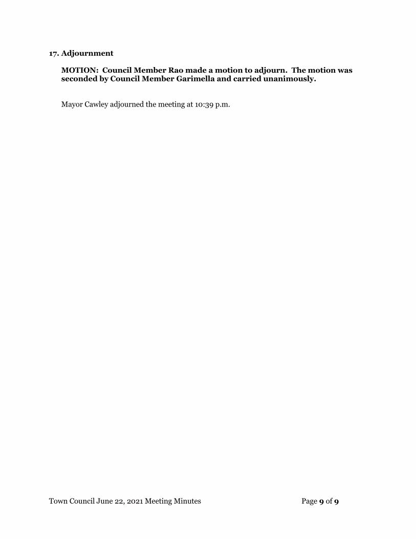
Town Council June 22, 2021 Meeting Minutes Page 9 of 9
17. Adjournment
MOTION: Council Member Rao made a motion to adjourn. The motion was seconded by Council Member Garimella and carried unanimously. Mayor Cawley adjourned the meeting at 10:39 p.m.
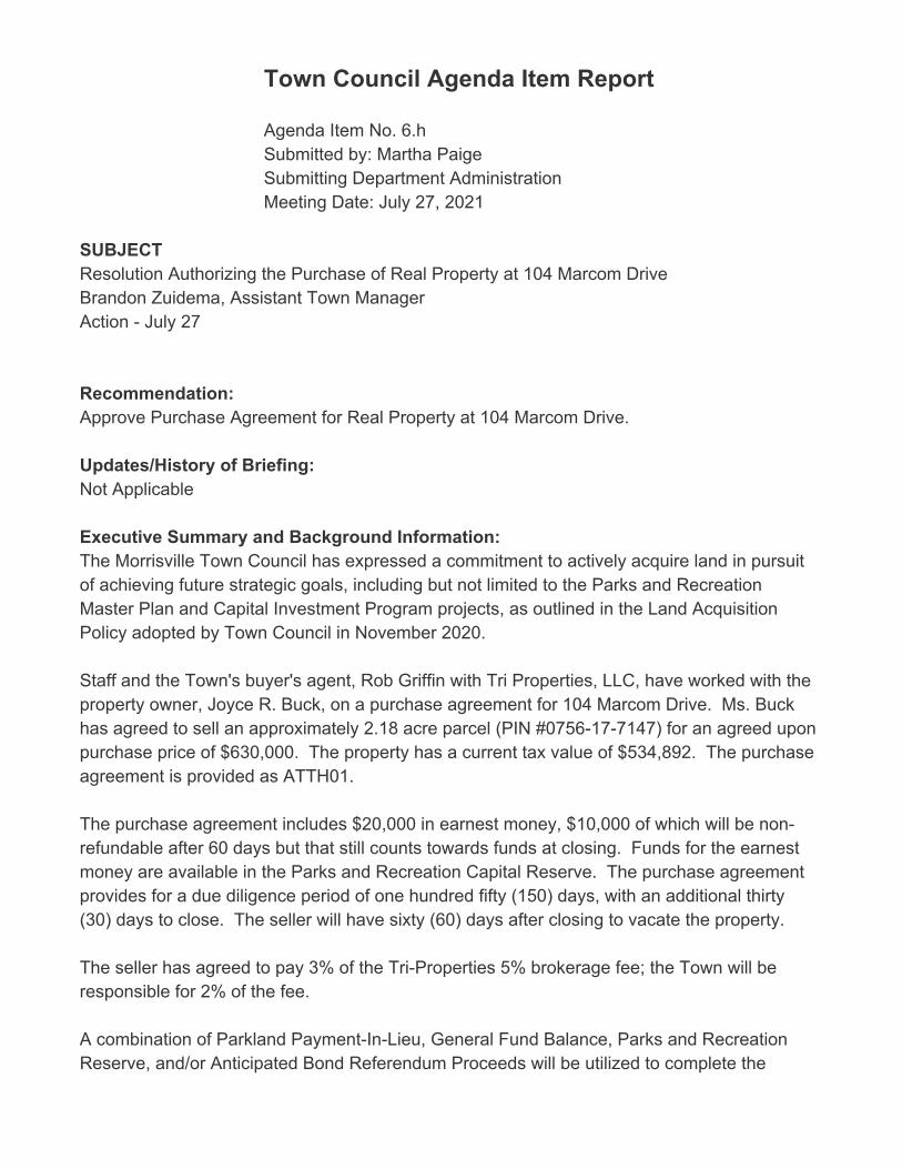
Town Council Agenda Item Report
Agenda Item No. 6.hSubmitted by: Martha PaigeSubmitting Department Administration Meeting Date: July 27, 2021
SUBJECTResolution Authorizing the Purchase of Real Property at 104 Marcom DriveBrandon Zuidema, Assistant Town ManagerAction - July 27
Recommendation:Approve Purchase Agreement for Real Property at 104 Marcom Drive.
Updates/History of Briefing:Not Applicable
Executive Summary and Background Information:The Morrisville Town Council has expressed a commitment to actively acquire land in pursuitof achieving future strategic goals, including but not limited to the Parks and RecreationMaster Plan and Capital Investment Program projects, as outlined in the Land AcquisitionPolicy adopted by Town Council in November 2020. Staff and the Town's buyer's agent, Rob Griffin with Tri Properties, LLC, have worked with theproperty owner, Joyce R. Buck, on a purchase agreement for 104 Marcom Drive. Ms. Buckhas agreed to sell an approximately 2.18 acre parcel (PIN #0756-17-7147) for an agreed uponpurchase price of $630,000. The property has a current tax value of $534,892. The purchaseagreement is provided as ATTH01. The purchase agreement includes $20,000 in earnest money, $10,000 of which will be non-refundable after 60 days but that still counts towards funds at closing. Funds for the earnestmoney are available in the Parks and Recreation Capital Reserve. The purchase agreementprovides for a due diligence period of one hundred fifty (150) days, with an additional thirty(30) days to close. The seller will have sixty (60) days after closing to vacate the property. The seller has agreed to pay 3% of the Tri-Properties 5% brokerage fee; the Town will beresponsible for 2% of the fee. A combination of Parkland Payment-In-Lieu, General Fund Balance, Parks and RecreationReserve, and/or Anticipated Bond Referendum Proceeds will be utilized to complete the
purchase at closing after the due diligence period.
Advisory Board/Committee Review:None
Insert Date of Advisory Board/Committee Review:
Advisory Board/Committee Recommendation and/or Vote:None
Potential Options:- Approve Resolution Authorizing Real Property Purchase - Do Not Approve Resolution Authorizing Real Property Purchase
Staff Recommendation:Staff Recommends Approval of the Real Property Purchase Agreement ATTACHMENTS• 2021-312-0 BS Purchase of Real Property 104 Marcom Drive.pdf• 2021-312-0 RES Purchase of Real Property 104 Marcom Drive.pdf• 2021-312-0 ATTH01 Real Property Purchase Agreement 104 Marcom Drive.pdf

Updated: July 22, 2021 1 of 1
Resolution 2021-312-0
Purchase of Real Property at 104 Marcom Drive
Goals Objectives
Improved transportation mobility – Enhance transportation options through improved accessibility, connectivity and collaboration
☐ Obj. 1.1 Manage traffic congestion at targeted locations and
targeted times of day
☐ Obj. 1.2 Leverage resources through partnerships with other
government entities and private sector
☐ Obj. 1.3 Improve mobility options for non-drivers
Thriving, livable neighborhoods – Enrich the quality of life through the preservation of natural resources, well-planned development and strengthened neighborhood vitality
☐ Obj. 2.1 Provide a mix of housing options that meet the current
and future needs of the community
☒ Obj. 2.2 Create a sense of place through insightful development that balances commercial and residential growth
☒ Obj. 2.3 Be responsible stewards of the natural environment
☒ Obj. 2.4 Establish a planned approach for redevelopment and revitalization
☒ Obj. 2.5 Plan and provide for current and future infrastructure
Engaged, inclusive community – Enrich the quality of life through programs, events, amenities and services valued by the community
☐ Obj. 3.1 Offer events and programs that meet the needs and interests of the community
☐ Obj. 3.2 Increase awareness of activities and opportunities for
engagement
☐ Obj. 3.3 Effectively maintain assets and make the most of
existing resources
☐ Obj. 3.4 Provide opportunities for meaningful public
engagement and collaboration
Public safety readiness – Provide a safe and secure community through prevention, education, readiness and response
☐ Obj. 4.1 Provide educational opportunities and encourage
preparedness
☐ Obj. 4.2 Be operationally ready
☐ Obj. 4.3 React responsively to the public safety needs of the
community
☐ Obj. 4.4 Meet Demands for service
Operational excellence – Deliver exceptional service with an engaged workforce that effectively manages public assets and promotes transparency
☐ Obj. 5.1 Promote financial integrity through effectively and
efficiently managing public assets
☐ Obj. 5.2 Deliver customer-focused service
☐ Obj. 5.3 Require the highest of professional standards
☐ Obj. 5.4 Attract, develop and retain a diverse, high performing
workforce
☐ Obj. 5.5 Align priorities with resources
☐ Obj. 5.6 Leverage the use of technology to maximize results
Economic prosperity – Promote a business-friendly environment to diversify the economic base and create job opportunities for an educated, ready workforce
☐ Obj. 6.1 Attract and retain businesses that provide a diverse tax base
☐ Obj. 6.2 Support new and existing businesses by streamlining
processes and minimizing complexities
☐ Obj. 6.3 Understand business needs in order to supply a ready
workforce
☐ Obj. 6.4 Maximize partnership opportunities with the Morrisville
Chamber of Commerce, regional and educational partners
☐ Obj. 6.5 Develop an advocacy plan to address public education needs
“Connect Morrisville” Strategic Plan Alignment
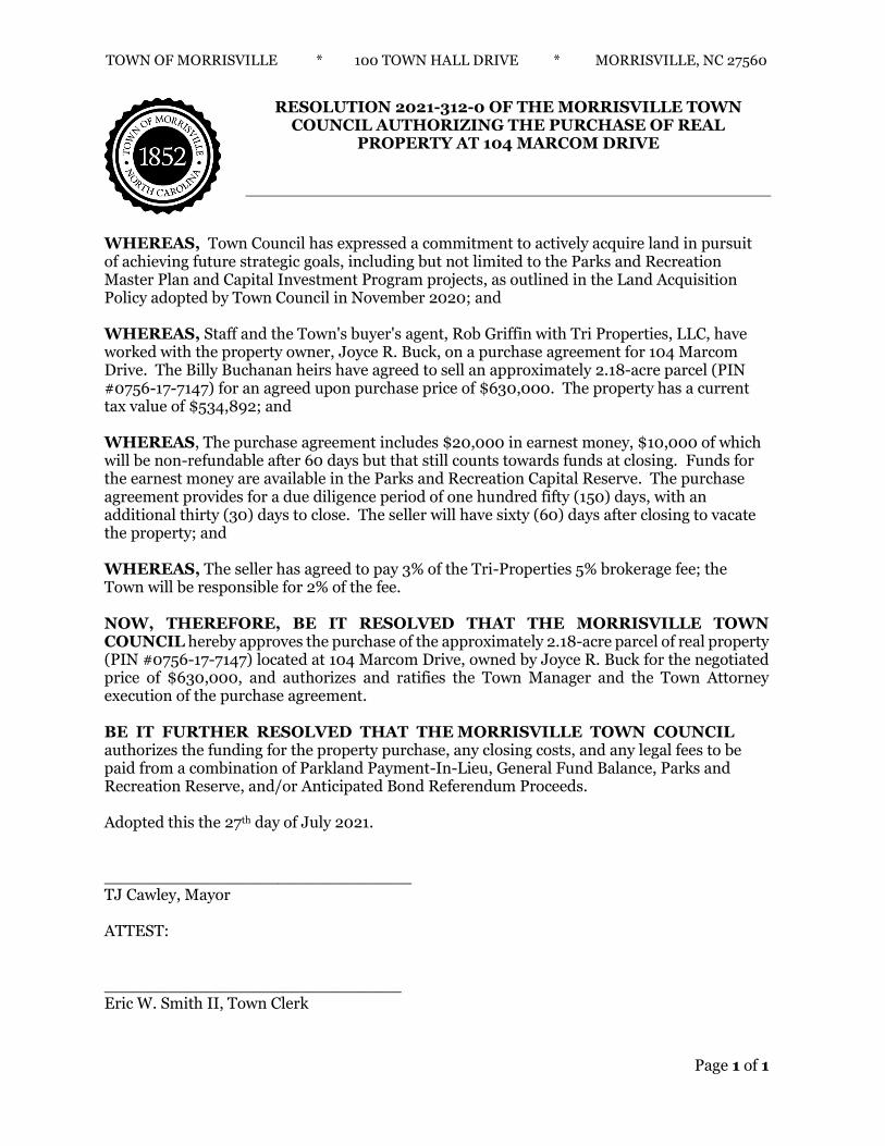
TOWN OF MORRISVILLE * 100 TOWN HALL DRIVE * MORRISVILLE, NC 27560
Page 1 of 1
RESOLUTION 2021-312-0 OF THE MORRISVILLE TOWN
COUNCIL AUTHORIZING THE PURCHASE OF REAL PROPERTY AT 104 MARCOM DRIVE
WHEREAS, Town Council has expressed a commitment to actively acquire land in pursuit of achieving future strategic goals, including but not limited to the Parks and Recreation Master Plan and Capital Investment Program projects, as outlined in the Land Acquisition Policy adopted by Town Council in November 2020; and WHEREAS, Staff and the Town's buyer's agent, Rob Griffin with Tri Properties, LLC, have worked with the property owner, Joyce R. Buck, on a purchase agreement for 104 Marcom Drive. The Billy Buchanan heirs have agreed to sell an approximately 2.18-acre parcel (PIN #0756-17-7147) for an agreed upon purchase price of $630,000. The property has a current tax value of $534,892; and WHEREAS, The purchase agreement includes $20,000 in earnest money, $10,000 of which will be non-refundable after 60 days but that still counts towards funds at closing. Funds for the earnest money are available in the Parks and Recreation Capital Reserve. The purchase agreement provides for a due diligence period of one hundred fifty (150) days, with an additional thirty (30) days to close. The seller will have sixty (60) days after closing to vacate the property; and WHEREAS, The seller has agreed to pay 3% of the Tri-Properties 5% brokerage fee; the Town will be responsible for 2% of the fee. NOW, THEREFORE, BE IT RESOLVED THAT THE MORRISVILLE TOWN COUNCIL hereby approves the purchase of the approximately 2.18-acre parcel of real property (PIN #0756-17-7147) located at 104 Marcom Drive, owned by Joyce R. Buck for the negotiated price of $630,000, and authorizes and ratifies the Town Manager and the Town Attorney execution of the purchase agreement. BE IT FURTHER RESOLVED THAT THE MORRISVILLE TOWN COUNCIL authorizes the funding for the property purchase, any closing costs, and any legal fees to be paid from a combination of Parkland Payment-In-Lieu, General Fund Balance, Parks and Recreation Reserve, and/or Anticipated Bond Referendum Proceeds. Adopted this the 27th day of July 2021. ______________________________ TJ Cawley, Mayor ATTEST: _____________________________ Eric W. Smith II, Town Clerk

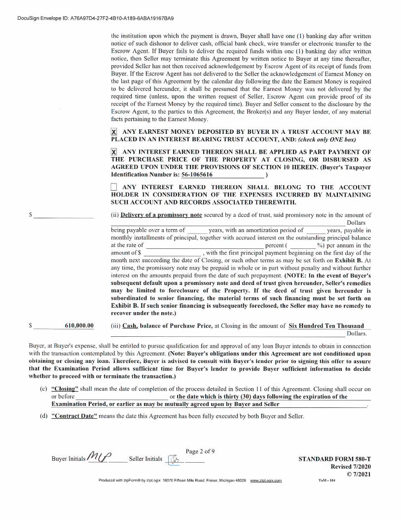
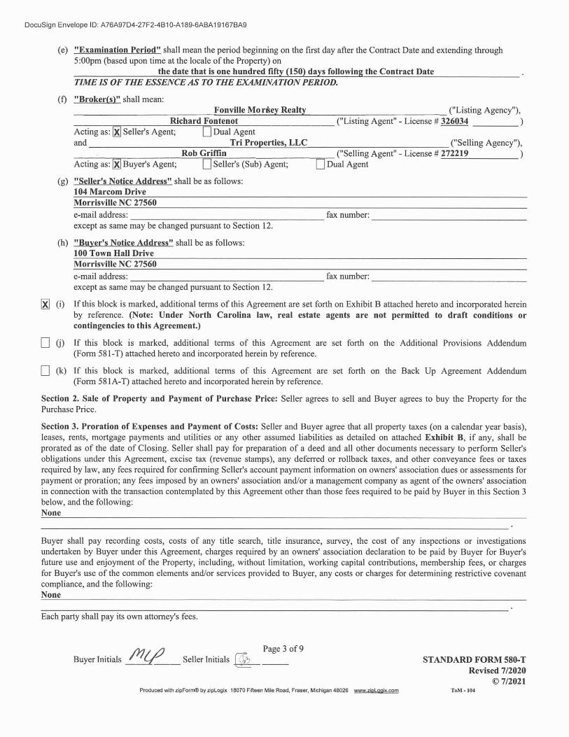

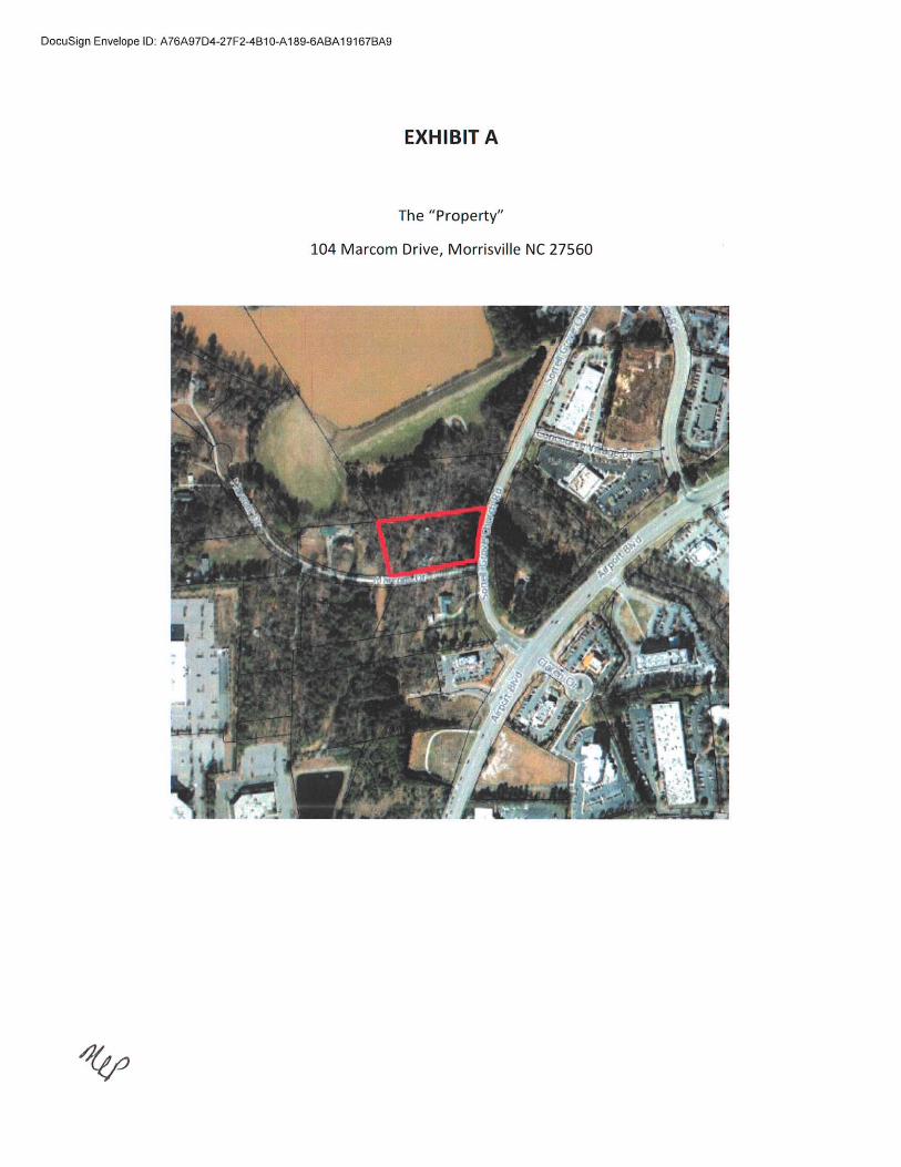
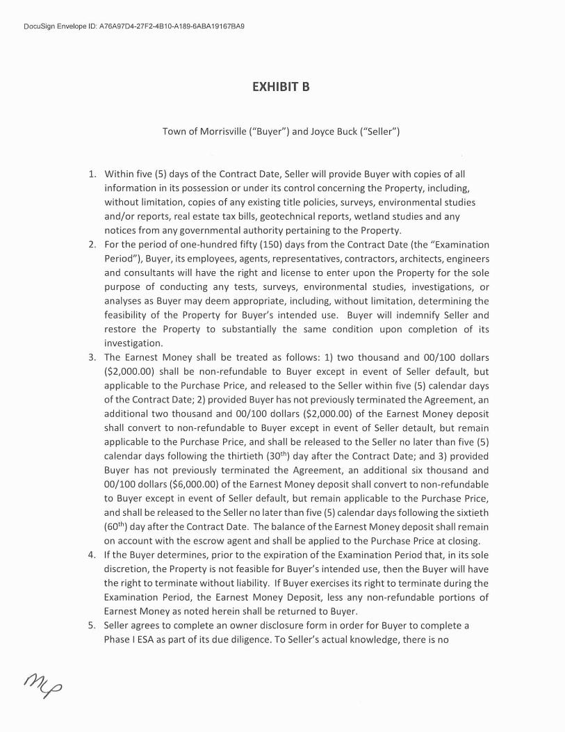
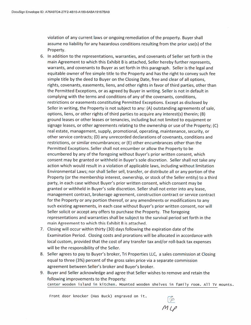
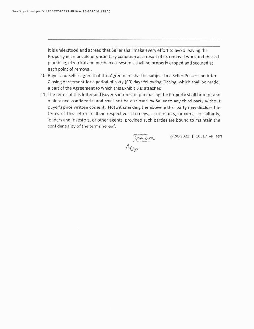

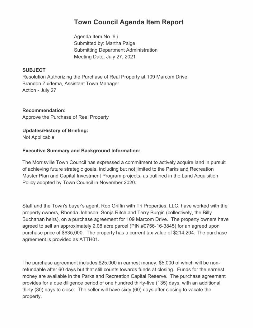
Town Council Agenda Item Report
Agenda Item No. 6.iSubmitted by: Martha PaigeSubmitting Department Administration Meeting Date: July 27, 2021
SUBJECTResolution Authorizing the Purchase of Real Property at 109 Marcom DriveBrandon Zuidema, Assistant Town ManagerAction - July 27
Recommendation:Approve the Purchase of Real Property
Updates/History of Briefing:Not Applicable
Executive Summary and Background Information:
The Morrisville Town Council has expressed a commitment to actively acquire land in pursuitof achieving future strategic goals, including but not limited to the Parks and RecreationMaster Plan and Capital Investment Program projects, as outlined in the Land AcquisitionPolicy adopted by Town Council in November 2020.
Staff and the Town's buyer's agent, Rob Griffin with Tri Properties, LLC, have worked with theproperty owners, Rhonda Johnson, Sonja Ritch and Terry Burgin (collectively, the BillyBuchanan heirs), on a purchase agreement for 109 Marcom Drive. The property owners haveagreed to sell an approximately 2.08 acre parcel (PIN #0756-16-3845) for an agreed uponpurchase price of $635,000. The property has a current tax value of $214,204. The purchaseagreement is provided as ATTH01.
The purchase agreement includes $25,000 in earnest money, $5,000 of which will be non-refundable after 60 days but that still counts towards funds at closing. Funds for the earnestmoney are available in the Parks and Recreation Capital Reserve. The purchase agreementprovides for a due diligence period of one hundred thirty-five (135) days, with an additionalthirty (30) days to close. The seller will have sixty (60) days after closing to vacate theproperty.
The seller has agreed to pay 3% of the Tri-Properties 5% brokerage fee; the Town will beresponsible for 2% of the fee.
A combination of Parkland Payment-In-Lieu, General Fund Balance, Parks and RecreationReserve, and/or Anticipated Bond Referendum Proceeds will be utilized to complete thepurchase at closing after the due diligence period.
Advisory Board/Committee Review:None
Insert Date of Advisory Board/Committee Review:
Advisory Board/Committee Recommendation and/or Vote:None
Potential Options:- Approve Purchase of Real Property - Do Not Approve Purchase of Real Property
Staff Recommendation:Staff recommends approval of the purchase agreement for real property at 109 Marcom Drive. ATTACHMENTS• 2021-312-0 BS Purchase of Real Property 104 Marcom Drive.pdf• 2021-319-0 RES Purchase of Real Property 109 Marcom Drive.pdf• 2021-319-0 ATTH01 Real Property Purchase Agreement 109 Marcom Drive.pdf

Updated: July 22, 2021 1 of 1
Resolution 2021-319-0
Purchase of Real Property at 109 Marcom Drive
Goals Objectives
Improved transportation mobility – Enhance transportation options through improved accessibility, connectivity and collaboration
☐ Obj. 1.1 Manage traffic congestion at targeted locations and
targeted times of day
☐ Obj. 1.2 Leverage resources through partnerships with other
government entities and private sector
☐ Obj. 1.3 Improve mobility options for non-drivers
Thriving, livable neighborhoods – Enrich the quality of life through the preservation of natural resources, well-planned development and strengthened neighborhood vitality
☐ Obj. 2.1 Provide a mix of housing options that meet the current
and future needs of the community
☒ Obj. 2.2 Create a sense of place through insightful development that balances commercial and residential growth
☒ Obj. 2.3 Be responsible stewards of the natural environment
☒ Obj. 2.4 Establish a planned approach for redevelopment and revitalization
☒ Obj. 2.5 Plan and provide for current and future infrastructure
Engaged, inclusive community – Enrich the quality of life through programs, events, amenities and services valued by the community
☐ Obj. 3.1 Offer events and programs that meet the needs and interests of the community
☐ Obj. 3.2 Increase awareness of activities and opportunities for
engagement
☐ Obj. 3.3 Effectively maintain assets and make the most of
existing resources
☐ Obj. 3.4 Provide opportunities for meaningful public
engagement and collaboration
Public safety readiness – Provide a safe and secure community through prevention, education, readiness and response
☐ Obj. 4.1 Provide educational opportunities and encourage
preparedness
☐ Obj. 4.2 Be operationally ready
☐ Obj. 4.3 React responsively to the public safety needs of the
community
☐ Obj. 4.4 Meet Demands for service
Operational excellence – Deliver exceptional service with an engaged workforce that effectively manages public assets and promotes transparency
☐ Obj. 5.1 Promote financial integrity through effectively and
efficiently managing public assets
☐ Obj. 5.2 Deliver customer-focused service
☐ Obj. 5.3 Require the highest of professional standards
☐ Obj. 5.4 Attract, develop and retain a diverse, high performing
workforce
☐ Obj. 5.5 Align priorities with resources
☐ Obj. 5.6 Leverage the use of technology to maximize results
Economic prosperity – Promote a business-friendly environment to diversify the economic base and create job opportunities for an educated, ready workforce
☐ Obj. 6.1 Attract and retain businesses that provide a diverse tax base
☐ Obj. 6.2 Support new and existing businesses by streamlining
processes and minimizing complexities
☐ Obj. 6.3 Understand business needs in order to supply a ready
workforce
☐ Obj. 6.4 Maximize partnership opportunities with the Morrisville
Chamber of Commerce, regional and educational partners
☐ Obj. 6.5 Develop an advocacy plan to address public education needs
“Connect Morrisville” Strategic Plan Alignment

TOWN OF MORRISVILLE * 100 TOWN HALL DRIVE * MORRISVILLE, NC 27560
Page 1 of 1
RESOLUTION 2021-319-0 OF THE MORRISVILLE TOWN
COUNCIL AUTHORIZING THE PURCHASE OF REAL PROPERTY AT 109 MARCOM DRIVE
WHEREAS, Town Council has expressed a commitment to actively acquire land in pursuit of achieving future strategic goals, including but not limited to the Parks and Recreation Master Plan and Capital Investment Program projects, as outlined in the Land Acquisition Policy adopted by Town Council in November 2020; and WHEREAS, Staff and the Town's buyer's agent, Rob Griffin with Tri Properties, LLC, have worked with the property owners, Rhonda Johnson, Sonja Ritch, and Terry Burgin (collectively, the Billy Buchanan heirs), on a purchase agreement for 109 Marcom Drive. The Billy Buchanan heirs have agreed to sell an approximately 2.08-acre parcel (PIN #0756-16-3845) for an agreed upon purchase price of $635,000. The property has a current tax value of $214,204; and WHEREAS, The purchase agreement includes $25,000 in earnest money, $5,000 of which will be non-refundable after 60 days but that still counts towards funds at closing. Funds for the earnest money are available in the Parks and Recreation Capital Reserve. The purchase agreement provides for a due diligence period of one hundred thirty-five (135) days, with an additional thirty (30) days to close. The seller will have sixty (60) days after closing to vacate the property; and WHEREAS, The seller has agreed to pay 3% of the Tri-Properties 5% brokerage fee; the Town will be responsible for 2% of the fee. NOW, THEREFORE, BE IT RESOLVED THAT THE MORRISVILLE TOWN COUNCIL hereby approves the purchase of the approximately 2.08-acre parcels of real property (PIN #0756-16-3845) located at 109 Marcom Drive, owned by the Billy Buchanan heirs for the negotiated price of $635,000, and authorizes and ratifies the Town Manager and the Town Attorney execution of the purchase agreement. BE IT FURTHER RESOLVED THAT THE MORRISVILLE TOWN COUNCIL authorizes the funding for the property purchase, any closing costs, and any legal fees to be paid from a combination of Parkland Payment-In-Lieu, General Fund Balance, Parks and Recreation Reserve, and/or Anticipated Bond Referendum Proceeds. Adopted this the 27th day of July 2021. ______________________________ TJ Cawley, Mayor ATTEST: _____________________________ Eric W. Smith II, Town Clerk


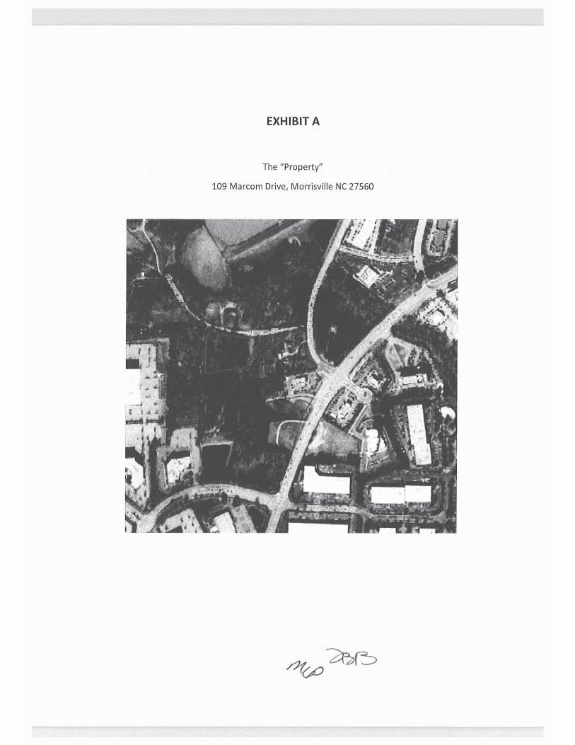
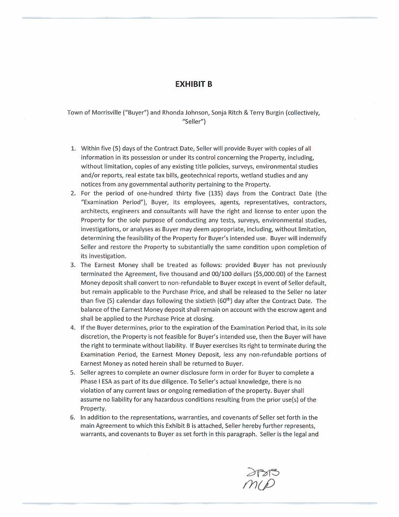
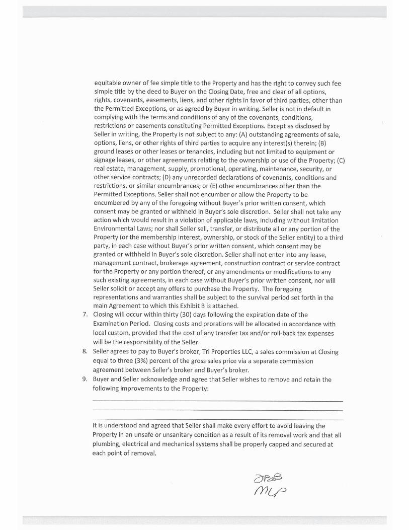
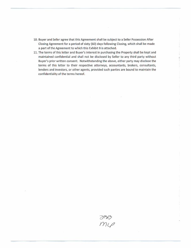

Town Council Agenda Item Report
Agenda Item No. 9.aSubmitted by: Christopher LawsonSubmitting Department Planning Meeting Date: July 27, 2021
SUBJECTConsideration of Zoning Map Amendments and UDO Text Amendments Related to Land UsePlan Implementation of the McCrimmon Extension Subarea Plan and the Transit OrientedDevelopment District (AMEND 21-0002, 21-0003, 21-0004, 21-0005, 21-0006). 1. Ordinance 2021-189-0A Approving a Zoning Map Amendment to the Boundaries of theAirport Overlay Zoning District (AMEND-21-0002). 2. Ordinance 2021-189-0B Approving a Zoning Map Amendment to Rezone Various Parcelslocated along McCrimmon Parkway and Airport Boulevard from the Industrial Management(IM) zoning district to the Business Activity Center (BAC) zoning district (AMEND-21-0003). 3. Ordinance 2021-189-0C Approving a Zoning Map Amendment to Install the GatewayOverlay (GO) Zoning District on Various Parcels along McCrimmon Parkway and AirportBoulevard (AMEND-21-0004). 4. Ordinance 2021-189-0D Approving a Zoning Map Amendment to Rezone Various Parcelsto the Transit Oriented Development (TOD) Zoning District (AMEND-21-0005). 5. Ordinance 2021-189-0E: Approving Text Amendments to the Unified DevelopmentOrdinance related to Land Use Plan Implementation of the McCrimmon Subarea Plan and theTransit Oriented Development Zoning District (UDO AMEND-21-0005). Chris Lawson, Planning ManagerJune 8 - Brief and Public Hearing June 22 - Continuation of the Public Hearing & UpdatesJuly 13 - Continuation of the Public Hearing & UpdatesJuly 27 - Action
Recommendation:Recommend Approval
Updates/History of Briefing:
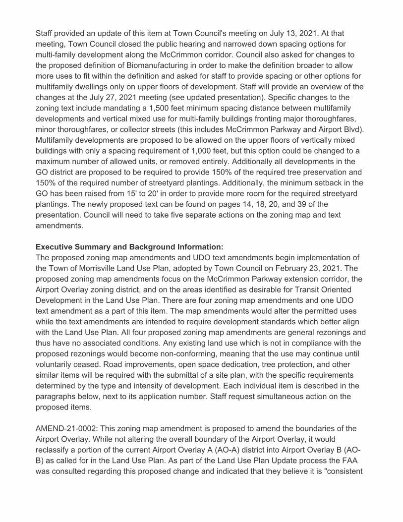
Staff provided an update of this item at Town Council's meeting on July 13, 2021. At thatmeeting, Town Council closed the public hearing and narrowed down spacing options formulti-family development along the McCrimmon corridor. Council also asked for changes tothe proposed definition of Biomanufacturing in order to make the definition broader to allowmore uses to fit within the definition and asked for staff to provide spacing or other options formultifamily dwellings only on upper floors of development. Staff will provide an overview of thechanges at the July 27, 2021 meeting (see updated presentation). Specific changes to thezoning text include mandating a 1,500 feet minimum spacing distance between multifamilydevelopments and vertical mixed use for multi-family buildings fronting major thoroughfares,minor thoroughfares, or collector streets (this includes McCrimmon Parkway and Airport Blvd).Multifamily developments are proposed to be allowed on the upper floors of vertically mixedbuildings with only a spacing requirement of 1,000 feet, but this option could be changed to amaximum number of allowed units, or removed entirely. Additionally all developments in theGO district are proposed to be required to provide 150% of the required tree preservation and150% of the required number of streetyard plantings. Additionally, the minimum setback in theGO has been raised from 15' to 20' in order to provide more room for the required streetyardplantings. The newly proposed text can be found on pages 14, 18, 20, and 39 of thepresentation. Council will need to take five separate actions on the zoning map and textamendments.
Executive Summary and Background Information:The proposed zoning map amendments and UDO text amendments begin implementation ofthe Town of Morrisville Land Use Plan, adopted by Town Council on February 23, 2021. Theproposed zoning map amendments focus on the McCrimmon Parkway extension corridor, theAirport Overlay zoning district, and on the areas identified as desirable for Transit OrientedDevelopment in the Land Use Plan. There are four zoning map amendments and one UDOtext amendment as a part of this item. The map amendments would alter the permitted useswhile the text amendments are intended to require development standards which better alignwith the Land Use Plan. All four proposed zoning map amendments are general rezonings andthus have no associated conditions. Any existing land use which is not in compliance with theproposed rezonings would become non-conforming, meaning that the use may continue untilvoluntarily ceased. Road improvements, open space dedication, tree protection, and othersimilar items will be required with the submittal of a site plan, with the specific requirementsdetermined by the type and intensity of development. Each individual item is described in theparagraphs below, next to its application number. Staff request simultaneous action on theproposed items. AMEND-21-0002: This zoning map amendment is proposed to amend the boundaries of theAirport Overlay. While not altering the overall boundary of the Airport Overlay, it wouldreclassify a portion of the current Airport Overlay A (AO-A) district into Airport Overlay B (AO-B) as called for in the Land Use Plan. As part of the Land Use Plan Update process the FAAwas consulted regarding this proposed change and indicated that they believe it is "consistent

with FAA land use guidance near airports" and that they "do not believe the land use changeswill adversely affect airport operations or jeopardize FAA funding for future airportdevelopment". (see ATTHs 01 and 02) Reclassification of the subject parcels from AO-A toAO-B allows for a variety of uses that were previously prohibited. Although the AO-B is not asuse-restrictive as the AO-A, it nonetheless requires underground storage of hazardouschemicals and substances, FAA approval of structures over 50' in height, outdoor lighting tobe directed downwards, no electronic interference of navigation or aircraft communications,sound mitigation for a number of types of development, and an avigation easement dedicatedto Raleigh-Durham Airport. Residential uses are not prohibited in the AO-B overlay, howeverthey are required to provide sound mitigation to limit interior aircraft noise to an average soundlevel of 45dB. In conjunction with the proposed Gateway Overlay (GO), only multifamilydwellings providing sound mitigation would be allowed in any areas which were formally AO-A. No single family detached or attached dwellings would be allowed in this GatewayOverlay. The proposed amendment to the boundary between AO-A and AO-B is depicted on ATTH 03Airport Overlay. AMEND-21-0003: This zoning map amendment is proposed to rezone various parcels locatedalong McCrimmon Parkway and Airport Boulevard from the Industrial Management (IM)zoning district to the Business Activity Center (BAC) zoning district as called for in the LandUse Plan. The subject properties are mostly undeveloped land, but also include the WakeCompetition Center and several other businesses. Staff is not aware of any land uses whichwould become non-conforming. The BAC zoning district features a mix of uses that provideconvenient, walkable retail and service options for adjacent offices and employment centers.Development is expected to provide a mix of residential, retail, offices, and lifesciences/research space. There are currently two properties in this area (the Bainbridge development located at thenorthwest corner of Aviation and McCrimmon and the parcel located at the northeast corner ofAviation and McCrimmon) that currently have a conditional rezoning in place. Staff hasreviewed the conditions in each associated Ordinance (see ATTH 04) and is recommendingthat both be rezoned to the General BAC district consistent with the remainder of the parcelsalong the corridor. The area along McCrimmon proposed to be rezoned is depicted on ATTH 05. AMEND-21-0004: This zoning map amendment is proposed to install an overlay zoningdistrict, named the Gateway Overlay (GO), on various parcels along McCrimmon Parkway andAirport Boulevard. The purpose of this overlay is to implement design standards as called forin the McCrimmon Extension Subarea plan to provide an attractive, pedestrian oriented space.The properties subject to this overlay are expected to match those of AMEND-21-0003 and
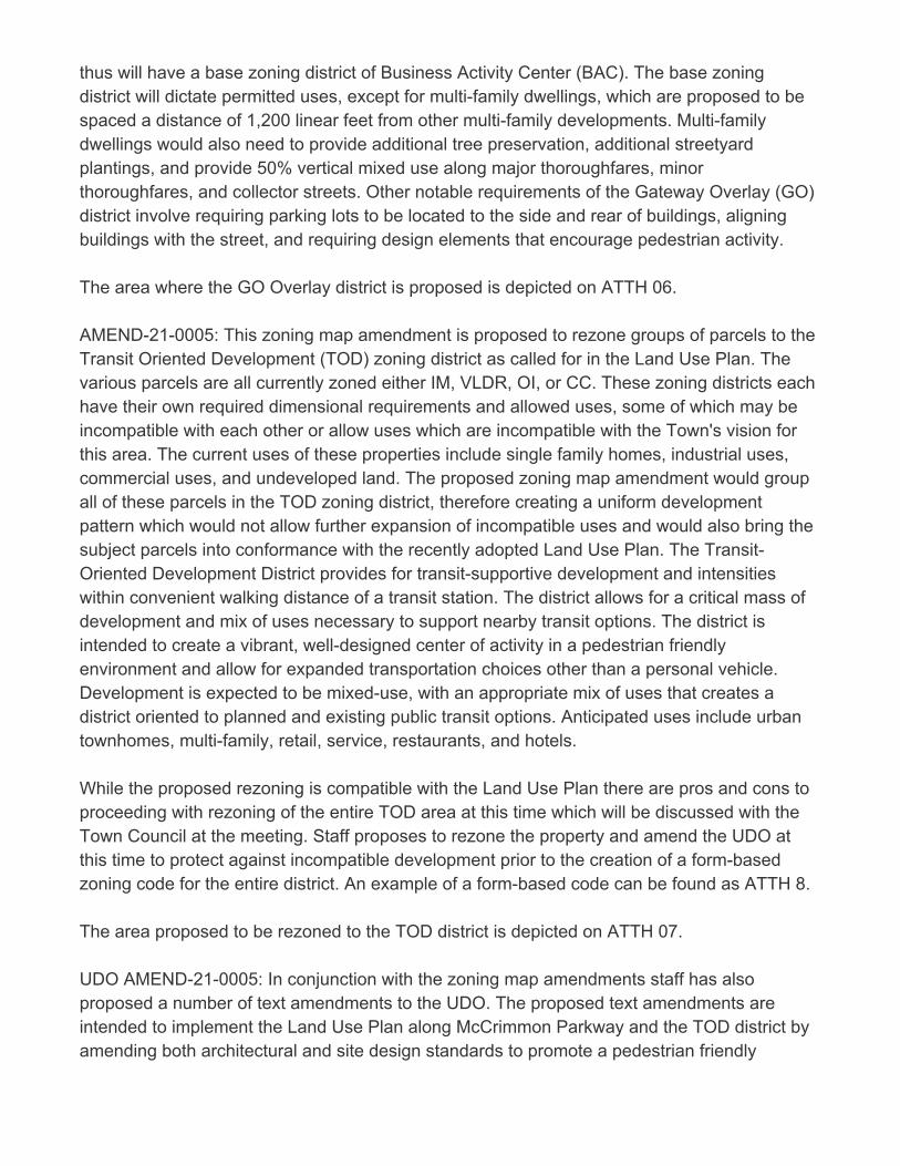
thus will have a base zoning district of Business Activity Center (BAC). The base zoningdistrict will dictate permitted uses, except for multi-family dwellings, which are proposed to bespaced a distance of 1,200 linear feet from other multi-family developments. Multi-familydwellings would also need to provide additional tree preservation, additional streetyardplantings, and provide 50% vertical mixed use along major thoroughfares, minorthoroughfares, and collector streets. Other notable requirements of the Gateway Overlay (GO)district involve requiring parking lots to be located to the side and rear of buildings, aligningbuildings with the street, and requiring design elements that encourage pedestrian activity. The area where the GO Overlay district is proposed is depicted on ATTH 06. AMEND-21-0005: This zoning map amendment is proposed to rezone groups of parcels to theTransit Oriented Development (TOD) zoning district as called for in the Land Use Plan. Thevarious parcels are all currently zoned either IM, VLDR, OI, or CC. These zoning districts eachhave their own required dimensional requirements and allowed uses, some of which may beincompatible with each other or allow uses which are incompatible with the Town's vision forthis area. The current uses of these properties include single family homes, industrial uses,commercial uses, and undeveloped land. The proposed zoning map amendment would groupall of these parcels in the TOD zoning district, therefore creating a uniform developmentpattern which would not allow further expansion of incompatible uses and would also bring thesubject parcels into conformance with the recently adopted Land Use Plan. The Transit-Oriented Development District provides for transit-supportive development and intensitieswithin convenient walking distance of a transit station. The district allows for a critical mass ofdevelopment and mix of uses necessary to support nearby transit options. The district isintended to create a vibrant, well-designed center of activity in a pedestrian friendlyenvironment and allow for expanded transportation choices other than a personal vehicle.Development is expected to be mixed-use, with an appropriate mix of uses that creates adistrict oriented to planned and existing public transit options. Anticipated uses include urbantownhomes, multi-family, retail, service, restaurants, and hotels. While the proposed rezoning is compatible with the Land Use Plan there are pros and cons toproceeding with rezoning of the entire TOD area at this time which will be discussed with theTown Council at the meeting. Staff proposes to rezone the property and amend the UDO atthis time to protect against incompatible development prior to the creation of a form-basedzoning code for the entire district. An example of a form-based code can be found as ATTH 8. The area proposed to be rezoned to the TOD district is depicted on ATTH 07. UDO AMEND-21-0005: In conjunction with the zoning map amendments staff has alsoproposed a number of text amendments to the UDO. The proposed text amendments areintended to implement the Land Use Plan along McCrimmon Parkway and the TOD district byamending both architectural and site design standards to promote a pedestrian friendly
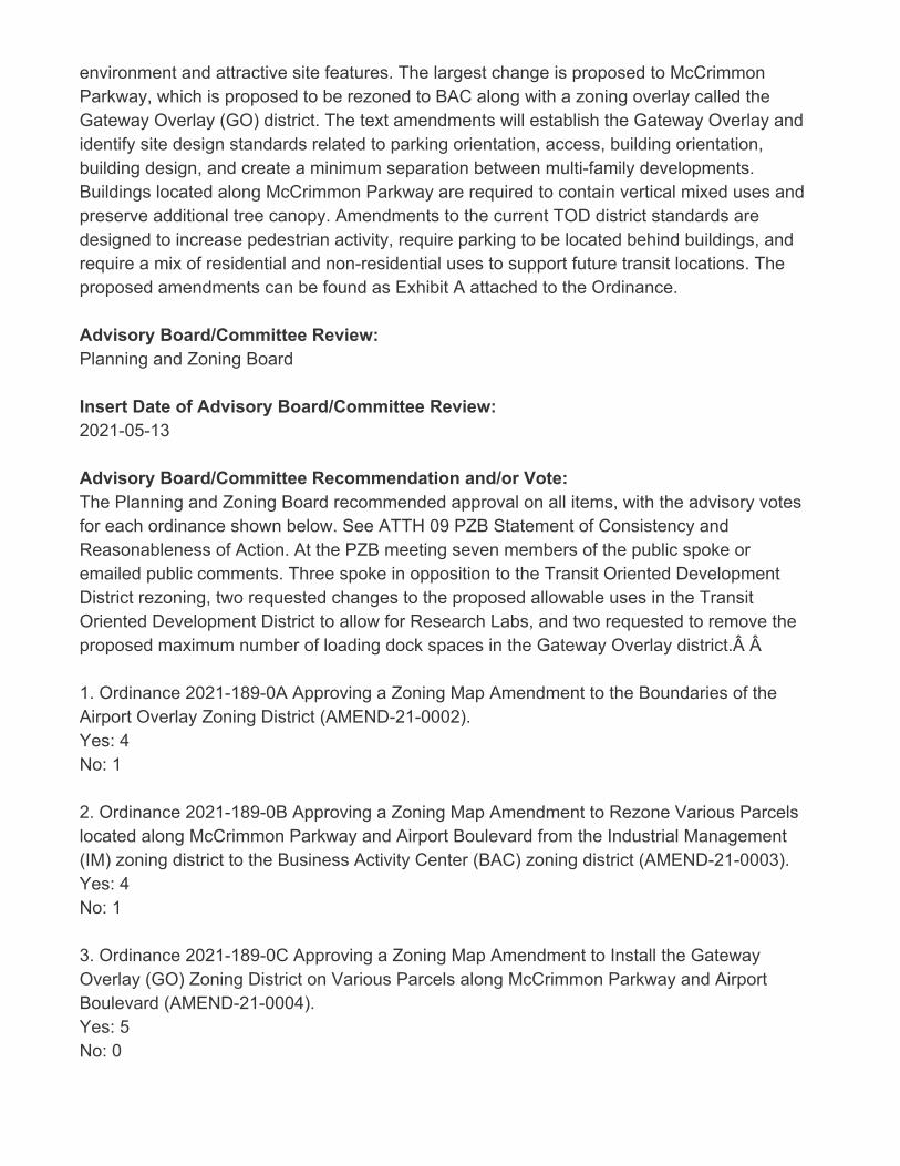
environment and attractive site features. The largest change is proposed to McCrimmonParkway, which is proposed to be rezoned to BAC along with a zoning overlay called theGateway Overlay (GO) district. The text amendments will establish the Gateway Overlay andidentify site design standards related to parking orientation, access, building orientation,building design, and create a minimum separation between multi-family developments.Buildings located along McCrimmon Parkway are required to contain vertical mixed uses andpreserve additional tree canopy. Amendments to the current TOD district standards aredesigned to increase pedestrian activity, require parking to be located behind buildings, andrequire a mix of residential and non-residential uses to support future transit locations. Theproposed amendments can be found as Exhibit A attached to the Ordinance.
Advisory Board/Committee Review:Planning and Zoning Board
Insert Date of Advisory Board/Committee Review:2021-05-13
Advisory Board/Committee Recommendation and/or Vote:The Planning and Zoning Board recommended approval on all items, with the advisory votesfor each ordinance shown below. See ATTH 09 PZB Statement of Consistency andReasonableness of Action. At the PZB meeting seven members of the public spoke oremailed public comments. Three spoke in opposition to the Transit Oriented DevelopmentDistrict rezoning, two requested changes to the proposed allowable uses in the TransitOriented Development District to allow for Research Labs, and two requested to remove theproposed maximum number of loading dock spaces in the Gateway Overlay district. Â
1. Ordinance 2021-189-0A Approving a Zoning Map Amendment to the Boundaries of theAirport Overlay Zoning District (AMEND-21-0002).Yes: 4No: 1
2. Ordinance 2021-189-0B Approving a Zoning Map Amendment to Rezone Various Parcelslocated along McCrimmon Parkway and Airport Boulevard from the Industrial Management(IM) zoning district to the Business Activity Center (BAC) zoning district (AMEND-21-0003).Yes: 4No: 1
3. Ordinance 2021-189-0C Approving a Zoning Map Amendment to Install the GatewayOverlay (GO) Zoning District on Various Parcels along McCrimmon Parkway and AirportBoulevard (AMEND-21-0004).Yes: 5No: 0
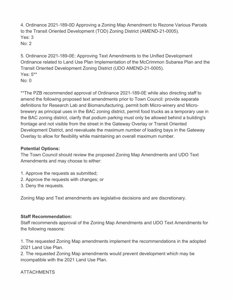
4. Ordinance 2021-189-0D Approving a Zoning Map Amendment to Rezone Various Parcelsto the Transit Oriented Development (TOD) Zoning District (AMEND-21-0005).Yes: 3No: 2
5. Ordinance 2021-189-0E: Approving Text Amendments to the Unified DevelopmentOrdinance related to Land Use Plan Implementation of the McCrimmon Subarea Plan and theTransit Oriented Development Zoning District (UDO AMEND-21-0005). Yes: 5**No: 0
**The PZB recommended approval of Ordinance 2021-189-0E while also directing staff toamend the following proposed text amendments prior to Town Council: provide separatedefinitions for Research Lab and Biomanufacturing, permit both Micro-winery and Micro-brewery as principal uses in the BAC zoning district, permit food trucks as a temporary use inthe BAC zoning district, clarify that podium parking must only be allowed behind a building'sfrontage and not visible from the street in the Gateway Overlay or Transit OrientedDevelopment District, and reevaluate the maximum number of loading bays in the GatewayOverlay to allow for flexibility while maintaining an overall maximum number.
Potential Options:The Town Council should review the proposed Zoning Map Amendments and UDO TextAmendments and may choose to either:
1. Approve the requests as submitted;2. Approve the requests with changes; or 3. Deny the requests.
Zoning Map and Text amendments are legislative decisions and are discretionary.
Staff Recommendation:Staff recommends approval of the Zoning Map Amendments and UDO Text Amendments forthe following reasons:
1. The requested Zoning Map amendments implement the recommendations in the adopted2021 Land Use Plan. 2. The requested Zoning Map amendments would prevent development which may beincompatible with the 2021 Land Use Plan. ATTACHMENTS
• 2021-189-0 LUP Implementation McCrimmon, TOD Peak Briefing Supplement.pdf• 2021-189-0A ORD - Approving a Zoning Map Amendment Airport Overlay.pdf• 2021-189-0B ORD - Approving a Zoning Map Amendment BAC.pdf• 2021-189-0C ORD - Approving a Zoning Map Amendment GO.pdf• 2021-189-0D ORD - Approving a Zoning Map Amendment TOD.pdf• 2021-189-0E ORD THIS ITEM HAS BEEN UPDATED- Approving a UDO Text Amendment LUPImplementation.pdf• 2021-189-0 ATTH 01 - FAA Morrisville follow up letter.pdf• 2021-189-0 ATTH 02 FAA Adjustment of Proposed Airport Overlay Amendment.pdf• 202-189-0 ATTH 03 Airport Overlay.pdf• 2021-189-0 ATTH 04 Previous Conditional Rezoning Ordinances.pdf• 2021-189-0 ATTH 05 BAC Rezoned Area.pdf• 2021-189-0 ATTH 06 GO Rezoning.pdf• 2021-189-0 ATTH 07 TOD Rezoning.pdf• 2021-189-0 ATTH 08 Form Based Code Example - Virginia Beach Oceanfront Resort.pdf• 2021-189-0 ATTH 09 PZB Statement of Plan Consistency and Reasonableness of Action.pdf• 2021-189-0 ATTH 10 Draft PZB Minutes 2021-05-13.pdf• 2021-189-0 ATTH 11 - Aerial Image Comparing Parking Orientation.pdf• 2021-189-0 ATTH 12 - Upper Floor Stepback Example.pdf• 2021-189-0 ATTH 13 - Avigation Easement Example.pdf• 2021-189-0 ATTH 14 - Compiled Public Hearing Comments.pdf• 2021-189-0 THIS ITEM HAS BEEN UPDATED LUP Implementation McCrimmon, TODPresentation.pdf
Updated: May 6, 2021 1 of 2
Consideration of Zoning Map Amendments and UDO Text Amendments Related to Land Use Plan Implementation of the McCrimmon Extension Subarea Plan and the Transit Oriented Development District (AMEND 21-0002, 21-0003, 21-0004, 21-0005, 21-0006) (Peak item 2021-189-0)
Goals Objectives
Improved transportation mobility – Enhance transportation options through improved accessibility, connectivity and collaboration
☐ Obj. 1.1 Manage traffic congestion at targeted locations and
targeted times of day
☐ Obj. 1.2 Leverage resources through partnerships with other
government entities and private sector
☒ Obj. 1.3 Improve mobility options for non-drivers
Thriving, livable neighborhoods – Enrich the quality of life through the preservation of natural resources, well-planned development and strengthened neighborhood vitality
☒ Obj. 2.1 Provide a mix of housing options that meet the current
and future needs of the community
☒ Obj. 2.2 Create a sense of place through insightful
development that balances commercial and residential growth
☐ Obj. 2.3 Be responsible stewards of the natural environment
☐ Obj. 2.4 Establish a planned approach for redevelopment and revitalization
☒ Obj. 2.5 Plan and provide for current and future infrastructure
Engaged, inclusive community – Enrich the quality of life through programs, events, amenities and services valued by the community
☐ Obj. 3.1 Offer events and programs that meet the needs and
interests of the community
☐ Obj. 3.2 Increase awareness of activities and opportunities for engagement
☐ Obj. 3.3 Effectively maintain assets and make the most of
existing resources
☐ Obj. 3.4 Provide opportunities for meaningful public
engagement and collaboration
Public safety readiness – Provide a safe and secure community through prevention, education, readiness and response
☐ Obj. 4.1 Provide educational opportunities and encourage
preparedness
☐ Obj. 4.2 Be operationally ready
☐ Obj. 4.3 React responsively to the public safety needs of the
community
☐ Obj. 4.4 Meet Demands for service
Operational excellence – Deliver exceptional service with an engaged workforce that effectively manages public assets and promotes transparency
☐ Obj. 5.1 Promote financial integrity through effectively and
efficiently managing public assets
☐ Obj. 5.2 Deliver customer-focused service
☐ Obj. 5.3 Require the highest of professional standards
☐ Obj. 5.4 Attract, develop and retain a diverse, high performing
workforce
☐ Obj. 5.5 Align priorities with resources
☐ Obj. 5.6 Leverage the use of technology to maximize results
Economic prosperity – Promote a business-friendly environment to diversify the economic base and create job opportunities for an educated, ready workforce
☒ Obj. 6.1 Attract and retain businesses that provide a diverse tax base
☐ Obj. 6.2 Support new and existing businesses by streamlining
processes and minimizing complexities
☐ Obj. 6.3 Understand business needs in order to supply a ready
workforce
☒ Obj. 6.4 Maximize partnership opportunities with the Morrisville
Chamber of Commerce, regional and educational partners
“Connect Morrisville” Strategic Plan Alignment

Updated: May 6, 2021 2 of 2
☐ Obj. 6.5 Develop an advocacy plan to address public education
needs
TOWN OF MORRISVILLE * 100 TOWN HALL * MORRISVILLE, NC 27560
Page 1 of 2
ORDINANCE 2021-189-0A OF THE MORRISVILLE TOWN COUNCIL APPROVING A ZONING MAP AMENDMENT TO THE BOUNDARIES OF THE AIRPORT OVERLAY ZONING DISTRICT
(AMEND-21-0002)
WHEREAS, the Town of Morrisville proposes to amend the zoning map to implement the Land Use Plan in the Airport Overlay zoning district; and
WHEREAS, the proposed amendment would not alter the overall boundaries of the Airport Overlay zoning district but rather modify the boundary between Airport Overlay A and Airport Overlay B; and
WHEREAS, the proposed rezoning was the subject of a public comment session by the Planning and Zoning Board of the Town of Morrisville on May 13, 2021; and
WHEREAS, at the May 13, 2021 Planning and Zoning Board meeting, the Planning and Zoning Board, by a vote of 4 “Yes” and 1 “No,” forwarded a recommendation of approval on the proposed zoning map amendment to the Town Council; and
WHEREAS, the proposed zoning map amendment was presented to the Morrisville Town Council on June 8, 2021; and
WHEREAS, the Town Council held a public hearing on June 8, 2021 on the proposed zoning map amendments; and
WHEREAS, prior to the June 8, 2021 public hearing, the proposed zoning map amendment was duly advertised in accordance with all requirements of law; and
WHEREAS, at the July 27, 2021 meeting, Town Council, by a vote of < > “Yes” and < > “No,” approved the proposed zoning map amendment; and
NOW, THEREFORE, BE IT ORDAINED BY THE MORRISVILLE TOWN COUNCIL THAT:
A. SECTION ONE: the Town of Morrisville zoning map is hereby amended by modifyingthe boundaries between Airport Overlay A and Airport Overlay B as depicted on the mapattached hereto as Exhibit A.
B. SECTION TWO: Those parcels subject to the proposed zoning map amendment titledAMEND-21-0002 and hereby rezoned from the Airport Overlay A district to the AirportOverlay-B zoning overlay district are made up of all or portions of those Wake County PINsidentified in Exhibit B attached hereto.
C. SECTION THREE: The new boundaries of Airport Overlay A and Airport Overlay B arelegally described in Exhibit C attached hereto.; and

Page 2 of 2
Ordained this the 27th day of July, 2021
______________________________ TJ Cawley, Mayor
ATTEST:
________________________________ Eric W. Smith II, Town Clerk
Exhibit A - Proposed Airport Overlay Map
Page 3
0746942571
0756505559
0756524912
0746941532
0756611068
0756505909
0756111224
0756110577
0746747207
0756506272 (a portion of)0746748296
0746944827
0756028519
0756123979
0756343713
0746849444
0746940414
0756106071
0756004961
0746746657 (a portion of)0746748478 (a portion of)0746757074 (a portion of)0756345343
0756002823
0755296685
0756512730
0746848536
0756003662
0746918112
0756205120
0746916565
0755384945
0756122745
0756346841
0746947996
0755591753 (a portion of)0756502135 (a portion of)0746926449
0756512570
0756521164
0756007957
0756611424
0756529013
0756018302
0756000940
0756509513 (a portion of)0755296073 (a portion of)0756516675
0756614570
0746922326
0756007729
0756518145
0756001613
0755595805 (a portion of)0756012580
0755180975 (a portion of)0746908873
0755188820 (a portion of)0755197670
0756100799
0756006587
0756340794
0756245770
0756248742
0756349378
0755281672 (a portion of)0756603862 (a portion of)0756616106 (a portion of)0746844500
0746745614 (a portion of)0746748768 (a portion of)0746841905
0756015056
0756241767
0756005145
0755096768
0756005432
0756002327
0755190699
0756046227
0756143702
0756140760
0756142412
0756039676
0756039273
0756034647
0756030206
0746838064
0746835271
0755493937 (a portion of)0756143837
0756047824
0756341393
0746934282
0746942847
0746852083
0746857085
0746948561
0746944430
0756247178
0746838759
0756236139
0746832151
0756420816
0756427975
0756112748
0756106719
0756204421
0756104325
0756115330
0756112646
0756337955
0756201976
0746913357
0746830767
0746937688
0746846004
0746837520
0746948260
0746828712
0746922853
0746826355
0746822898
0746830320
0746743338
0755494136 (a portion of)0756427087
0756418744
0756241238
0756146101
0756146433
0756135833
0756134625
0756136651
0756230220
0756136013
0756330565
0756134470
0756134296
0756118109
0746742693
0746929704
0746926093
0756024008
0756027350
0756034134
0756023697
0756305617
0756309193
0755395976
0755092652
0756323768
0755388866 (a portion of) 0755491011 (a portion of) 0756401824
0756407274
0755497860 (a portion of) 0756500860
0756418261
0756411722
0756214599
Exhibit B - PINs of Impacted Parcels
Page 4
0756129455
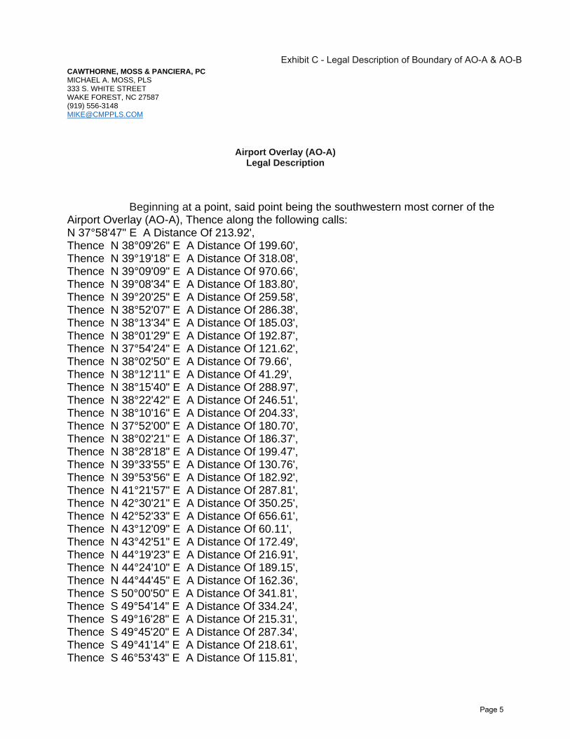
CAWTHORNE, MOSS & PANCIERA, PC MICHAEL A. MOSS, PLS 333 S. WHITE STREET WAKE FOREST, NC 27587 (919) [email protected]
Airport Overlay (AO-A) Legal Description
Beginning at a point, said point being the southwestern most corner of the Airport Overlay (AO-A), Thence along the following calls: N 37°58'47" E A Distance Of 213.92', Thence N 38°09'26" E A Distance Of 199.60', Thence N 39°19'18" E A Distance Of 318.08', Thence N 39°09'09" E A Distance Of 970.66', Thence N 39°08'34" E A Distance Of 183.80', Thence N 39°20'25" E A Distance Of 259.58', Thence N 38°52'07" E A Distance Of 286.38', Thence N 38°13'34" E A Distance Of 185.03', Thence N 38°01'29" E A Distance Of 192.87', Thence N 37°54'24" E A Distance Of 121.62', Thence N 38°02'50" E A Distance Of 79.66', Thence N 38°12'11" E A Distance Of 41.29', Thence N 38°15'40" E A Distance Of 288.97', Thence N 38°22'42" E A Distance Of 246.51', Thence N 38°10'16" E A Distance Of 204.33', Thence N 37°52'00" E A Distance Of 180.70', Thence N 38°02'21" E A Distance Of 186.37', Thence N 38°28'18" E A Distance Of 199.47', Thence N 39°33'55" E A Distance Of 130.76', Thence N 39°53'56" E A Distance Of 182.92', Thence N 41°21'57" E A Distance Of 287.81', Thence N 42°30'21" E A Distance Of 350.25', Thence N 42°52'33" E A Distance Of 656.61', Thence N 43°12'09" E A Distance Of 60.11', Thence N 43°42'51" E A Distance Of 172.49', Thence N 44°19'23" E A Distance Of 216.91', Thence N 44°24'10" E A Distance Of 189.15', Thence N 44°44'45" E A Distance Of 162.36', Thence S 50°00'50" E A Distance Of 341.81', Thence S 49°54'14" E A Distance Of 334.24', Thence S 49°16'28" E A Distance Of 215.31', Thence S 49°45'20" E A Distance Of 287.34', Thence S 49°41'14" E A Distance Of 218.61', Thence S 46°53'43" E A Distance Of 115.81',
Exhibit C - Legal Description of Boundary of AO-A & AO-B
Page 5
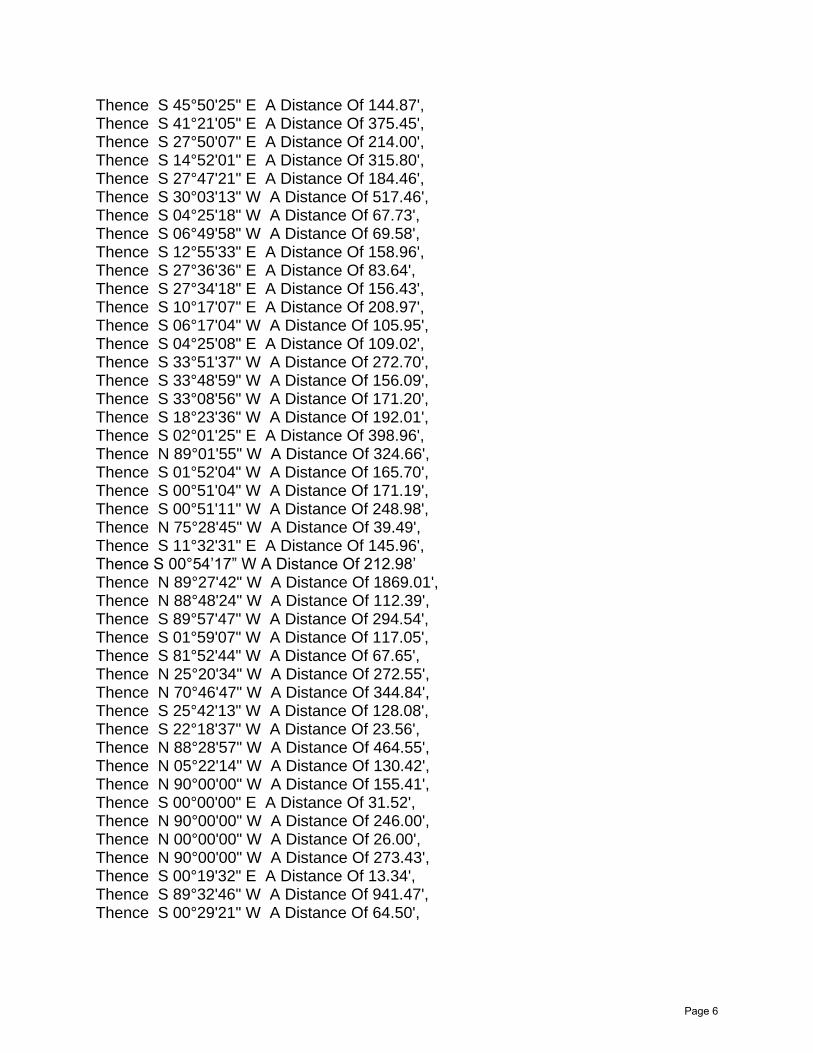
Thence S 45°50'25" E A Distance Of 144.87', Thence S 41°21'05" E A Distance Of 375.45', Thence S 27°50'07" E A Distance Of 214.00', Thence S 14°52'01" E A Distance Of 315.80', Thence S 27°47'21" E A Distance Of 184.46', Thence S 30°03'13" W A Distance Of 517.46', Thence S 04°25'18" W A Distance Of 67.73', Thence S 06°49'58" W A Distance Of 69.58', Thence S 12°55'33" E A Distance Of 158.96', Thence S 27°36'36" E A Distance Of 83.64', Thence S 27°34'18" E A Distance Of 156.43', Thence S 10°17'07" E A Distance Of 208.97', Thence S 06°17'04" W A Distance Of 105.95', Thence S 04°25'08" E A Distance Of 109.02', Thence S 33°51'37" W A Distance Of 272.70', Thence S 33°48'59" W A Distance Of 156.09', Thence S 33°08'56" W A Distance Of 171.20', Thence S 18°23'36" W A Distance Of 192.01', Thence S 02°01'25" E A Distance Of 398.96', Thence N 89°01'55" W A Distance Of 324.66', Thence S 01°52'04" W A Distance Of 165.70', Thence S 00°51'04" W A Distance Of 171.19', Thence S 00°51'11" W A Distance Of 248.98', Thence N 75°28'45" W A Distance Of 39.49', Thence S 11°32'31" E A Distance Of 145.96', Thence S 00°54’17” W A Distance Of 212.98’ Thence N 89°27'42" W A Distance Of 1869.01', Thence N 88°48'24" W A Distance Of 112.39', Thence S 89°57'47" W A Distance Of 294.54', Thence S 01°59'07" W A Distance Of 117.05', Thence S 81°52'44" W A Distance Of 67.65', Thence N 25°20'34" W A Distance Of 272.55', Thence N 70°46'47" W A Distance Of 344.84', Thence S 25°42'13" W A Distance Of 128.08', Thence S 22°18'37" W A Distance Of 23.56', Thence N 88°28'57" W A Distance Of 464.55', Thence N 05°22'14" W A Distance Of 130.42', Thence N 90°00'00" W A Distance Of 155.41', Thence S 00°00'00" E A Distance Of 31.52', Thence N 90°00'00" W A Distance Of 246.00', Thence N 00°00'00" W A Distance Of 26.00', Thence N 90°00'00" W A Distance Of 273.43', Thence S 00°19'32" E A Distance Of 13.34', Thence S 89°32'46" W A Distance Of 941.47', Thence S 00°29'21" W A Distance Of 64.50',
Page 6
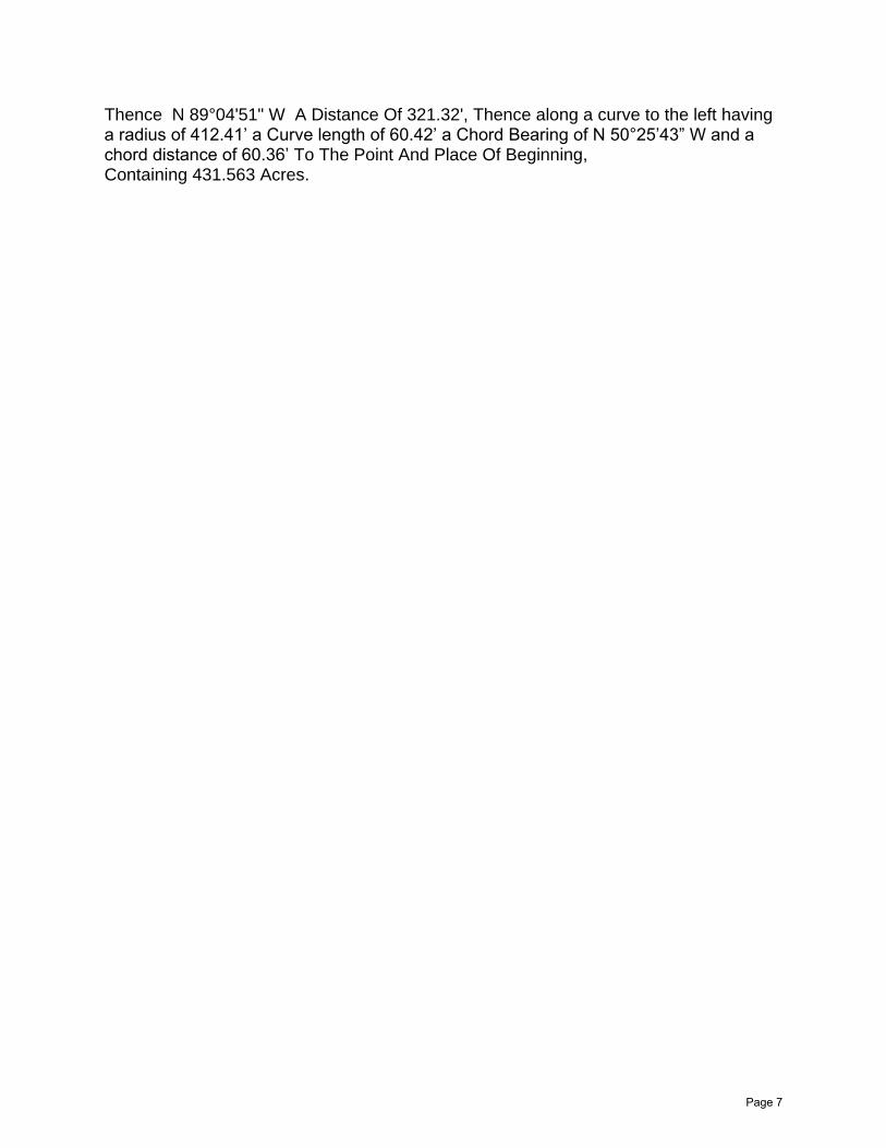
Thence N 89°04'51" W A Distance Of 321.32', Thence along a curve to the left having a radius of 412.41’ a Curve length of 60.42’ a Chord Bearing of N 50°25’43” W and a chord distance of 60.36’ To The Point And Place Of Beginning, Containing 431.563 Acres.
Page 7
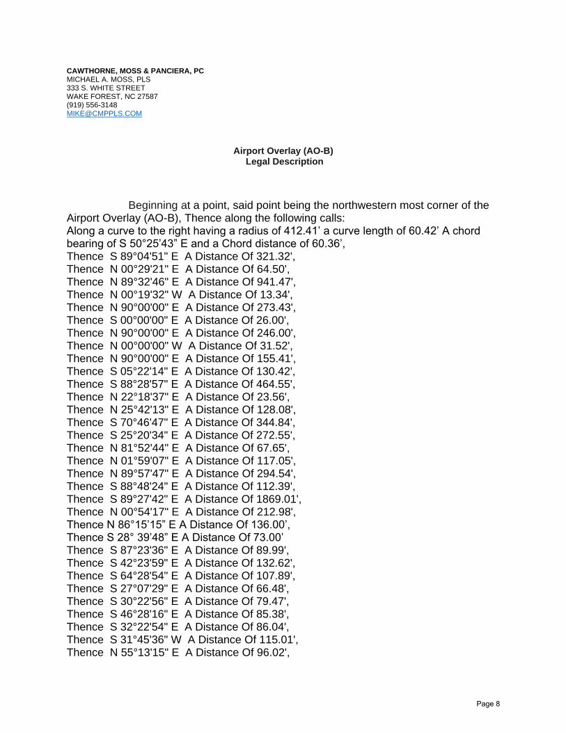
CAWTHORNE, MOSS & PANCIERA, PC MICHAEL A. MOSS, PLS 333 S. WHITE STREET WAKE FOREST, NC 27587 (919) [email protected]
Airport Overlay (AO-B) Legal Description
Beginning at a point, said point being the northwestern most corner of the Airport Overlay (AO-B), Thence along the following calls: Along a curve to the right having a radius of 412.41’ a curve length of 60.42’ A chord bearing of S 50°25’43” E and a Chord distance of 60.36’, Thence S 89°04'51" E A Distance Of 321.32', Thence N 00°29'21" E A Distance Of 64.50', Thence N 89°32'46" E A Distance Of 941.47', Thence N 00°19'32" W A Distance Of 13.34', Thence N 90°00'00" E A Distance Of 273.43', Thence S 00°00'00" E A Distance Of 26.00', Thence N 90°00'00" E A Distance Of 246.00', Thence N 00°00'00" W A Distance Of 31.52', Thence N 90°00'00" E A Distance Of 155.41', Thence S 05°22'14" E A Distance Of 130.42', Thence S 88°28'57" E A Distance Of 464.55', Thence N 22°18'37" E A Distance Of 23.56', Thence N 25°42'13" E A Distance Of 128.08', Thence S 70°46'47" E A Distance Of 344.84', Thence S 25°20'34" E A Distance Of 272.55', Thence N 81°52'44" E A Distance Of 67.65', Thence N 01°59'07" E A Distance Of 117.05', Thence N 89°57'47" E A Distance Of 294.54', Thence S 88°48'24" E A Distance Of 112.39', Thence S 89°27'42" E A Distance Of 1869.01', Thence N 00°54'17" E A Distance Of 212.98', Thence N 86°15’15” E A Distance Of 136.00’, Thence S 28° 39’48” E A Distance Of 73.00’ Thence S 87°23'36" E A Distance Of 89.99', Thence S 42°23'59" E A Distance Of 132.62', Thence S 64°28'54" E A Distance Of 107.89', Thence S 27°07'29" E A Distance Of 66.48', Thence S 30°22'56" E A Distance Of 79.47', Thence S 46°28'16" E A Distance Of 85.38', Thence S 32°22'54" E A Distance Of 86.04', Thence S 31°45'36" W A Distance Of 115.01', Thence N 55°13'15" E A Distance Of 96.02',
Page 8
Thence S 57°14'45" E A Distance Of 107.01', Thence S 46°39'34" E A Distance Of 165.98', Thence S 51°39'50" E A Distance Of 146.76', Thence S 55°54'07" E A Distance Of 307.15', Thence S 17°00'12" E A Distance Of 68.03', Thence S 65°03'47" W A Distance Of 225.02', Thence S 17°15'41" W A Distance Of 106.31', Thence N 50°55'31" E A Distance Of 108.14', Thence S 78°44'12" E A Distance Of 139.23', Thence S 68°28'20" E A Distance Of 100.22', Thence S 40°17'42" E A Distance Of 244.56', Thence S 58°23'09" E A Distance Of 69.48', Thence S 58°23'10" E A Distance Of 69.48', Thence N 81°40'03" E A Distance Of 11.39', Thence S 43°42'40" E A Distance Of 161.28', Thence S 22°57'00" E A Distance Of 72.51', Thence S 37°15'51" W A Distance Of 46.39', Thence N 82°18'59" E A Distance Of 70.45', Thence S 57°20'34" E A Distance Of 84.53', Thence S 79°27'05" E A Distance Of 51.37', Thence S 79°27'06" E A Distance Of 51.37', Thence S 72°36'23" E A Distance Of 94.14', Thence S 28°38'59" E A Distance Of 94.19', Thence S 22°35'26" E A Distance Of 29.39', Thence S 22°35'25" E A Distance Of 82.26', Thence S 01°13'04" W A Distance Of 117.67', Thence S 54°12'40" W A Distance Of 174.76', Thence S 76°28'42" W A Distance Of 84.47', Thence N 66°01'18" W A Distance Of 90.43', Thence S 65°34'48" W A Distance Of 113.53', Thence S 67°55'33" E A Distance Of 134.21', Thence S 40°23'33" E A Distance Of 63.27', Thence S 79°37'58" E A Distance Of 97.59', Thence N 35°13'18" E A Distance Of 81.71', Thence N 80°29'06" E A Distance Of 89.61', Thence S 85°04'36" E A Distance Of 132.84', Thence S 33°23'51" E A Distance Of 86.18', Thence S 01°18'26" W A Distance Of 236.17', Thence S 17°34'30" W A Distance Of 86.27', Thence S 85°08'45" E A Distance Of 70.92', Thence N 78°31'42" E A Distance Of 129.03', Thence S 27°25'12" E A Distance Of 43.43', Thence S 38°14'29" E A Distance Of 133.75', Thence S 24°13'53" E A Distance Of 104.04', Thence S 46°55'05" E A Distance Of 74.52', Thence S 46°55'05" E A Distance Of 127.24',
Page 9
Thence S 40°37'36" E A Distance Of 158.10', Thence S 69°44'22" E A Distance Of 126.59', Thence S 37°10'57" W A Distance Of 183.19', Thence S 73°26'03" W A Distance Of 84.56', Thence S 24°24'53" W A Distance Of 108.14', Thence S 49°27'37" W A Distance Of 102.81', Thence S 32°26'02" W A Distance Of 176.57', Thence N 82°35'17" E A Distance Of 269.77', Thence N 68°15'18" E A Distance Of 60.83', Thence N 39°46'25" E A Distance Of 139.71', Thence N 62°30'04" E A Distance Of 259.30’ Thence S 10°49'30" W A Distance Of 220.37', Thence S 38°14'59" E A Distance Of 112.70', Thence S 20°57'46" E A Distance Of 102.53', Thence S 20°57'47" E A Distance Of 129.49', Thence S 10°01'07" E A Distance Of 38.35', Thence S 38°05'20" W A Distance Of 81.02', Thence S 38°15'25" W A Distance Of 145.55', Thence S 40°48'51" W A Distance Of 109.97', Thence S 39°51'16" W A Distance Of 74.81', Thence S 42°13'26" W A Distance Of 108.21', Thence S 42°13'27" W A Distance Of 152.05', Thence S 44°56'33" W A Distance Of 129.34', Thence S 45°31'18" W A Distance Of 140.79', Thence S 49°16'23" W A Distance Of 91.59', Thence S 50°06'11" W A Distance Of 214.34', Thence S 55°42'10" W A Distance Of 287.85', Thence S 59°25'07" W A Distance Of 93.88', Thence S 59°28'14" W A Distance Of 205.89', Thence S 62°01'01" W A Distance Of 364.21', Thence S 62°05'19" W A Distance Of 142.33', Thence S 61°49'35" W A Distance Of 213.82', Thence S 61°40'04" W A Distance Of 147.43', Thence S 62°21'16" W A Distance Of 184.49', Thence S 62°24'58" W A Distance Of 130.03', Thence S 63°52'42" W A Distance Of 123.21', Thence S 63°52'43" W A Distance Of 99.00', Thence S 64°38'34" W A Distance Of 141.98', Thence S 65°44'56" W A Distance Of 130.37', Thence S 66°53'37" W A Distance Of 152.15', Thence S 69°12'21" W A Distance Of 168.52', Thence S 71°30'39" W A Distance Of 138.38', Thence S 74°22'59" W A Distance Of 288.24', Thence S 80°31'33" W A Distance Of 393.67', Thence S 86°16'52" W A Distance Of 400.85', Thence S 88°34'04" W A Distance Of 207.40',
Page 10

Thence S 88°34'05" W A Distance Of 192.73', Thence S 87°06'19" W A Distance Of 261.17', Thence S 85°25'19" W A Distance Of 260.61', Thence S 83°49'31" W A Distance Of 183.63', Thence S 79°40'22" W A Distance Of 159.30', Thence S 77°33'16" W A Distance Of 177.99', Thence S 74°31'00" W A Distance Of 186.50', Thence S 72°20'39" W A Distance Of 314.26', Thence S 71°01'40" W A Distance Of 201.73', Thence S 71°39'15" W A Distance Of 201.45', Thence S 70°54'11" W A Distance Of 182.27', Thence S 70°56'13" W A Distance Of 193.05', Thence S 71°03'39" W A Distance Of 107.34', Thence S 70°54'49" W A Distance Of 107.06', Thence S 70°54'49" W A Distance Of 45.54', Thence S 75°44'07" W A Distance Of 47.07', Thence S 75°44'08" W A Distance Of 74.42', Thence S 75°44'07" W A Distance Of 70.94', Thence S 75°44'08" W A Distance Of 67.50', Thence S 75°44'08" W A Distance Of 57.14', Thence S 86°25'25" W A Distance Of 83.50', Thence S 65°38'28" W A Distance Of 51.31', Thence S 65°38'28" W A Distance Of 60.08', Thence S 65°38'27" W A Distance Of 57.23', Thence S 66°04'41" W A Distance Of 80.63', Thence S 66°04'40" W A Distance Of 51.28', Thence S 69°11'01" W A Distance Of 51.55', Thence S 66°57'01" W A Distance Of 48.37', Thence S 69°26'12" W A Distance Of 55.03', Thence S 67°25'38" W A Distance Of 88.36', Thence S 72°41'11" W A Distance Of 136.31', Thence S 80°48'15" W A Distance Of 137.26', Thence N 88°32'38" W A Distance Of 131.16', Thence N 82°12'59" W A Distance Of 115.71', Thence N 49°51'33" W A Distance Of 107.62', Thence N 37°03'01" W A Distance Of 46.34', Thence N 31°52'50" W A Distance Of 43.92', Thence N 11°17'56" W A Distance Of 61.76', Thence N 07°13'48" W A Distance Of 43.63', Thence N 04°48'12" E A Distance Of 110.39', Thence N 14°53'16" E A Distance Of 95.88', Thence N 16°44'43" E A Distance Of 76.75', Thence N 17°36'47" E A Distance Of 84.92', Thence N 22°49'35" E A Distance Of 33.47', Thence N 22°49'34" E A Distance Of 222.73', Thence N 23°24'32" E A Distance Of 99.17',
Page 11
Thence N 23°10'49" E A Distance Of 82.92', Thence N 23°29'32" E A Distance Of 85.34', Thence N 24°54'17" E A Distance Of 92.40', Thence N 24°32'03" E A Distance Of 134.75', Thence N 24°58'47" E A Distance Of 147.73', Thence N 27°04'19" E A Distance Of 76.87', Thence N 27°04'18" E A Distance Of 55.56', Thence N 27°32'59" E A Distance Of 232.96', Thence N 27°32'58" E A Distance Of 70.80', Thence N 26°43'59" E A Distance Of 139.91', Thence N 26°19'28" E A Distance Of 273.93', Thence N 23°06'00" E A Distance Of 121.57', Thence N 22°23'27" E A Distance Of 103.90', Thence N 21°59'48" E A Distance Of 96.06', Thence N 20°46'32" E A Distance Of 113.66', Thence N 15°05'02" E A Distance Of 109.78', Thence N 11°02'33" E A Distance Of 57.89', Thence N 05°05'43" E A Distance Of 90.53', Thence N 00°48'50" W A Distance Of 95.43', Thence N 03°53'27" W A Distance Of 198.52', Thence N 07°49'22" W A Distance Of 84.44', Thence N 11°06'56" W A Distance Of 83.36', Thence N 14°54'49" W A Distance Of 53.29', Thence N 26°21'20" W A Distance Of 158.99', Thence N 49°45'32" W A Distance Of 118.58', Thence N 63°36'15" W A Distance Of 65.90', Thence N 69°31'17" W A Distance Of 82.17', Thence N 80°20'15" W A Distance Of 111.69', Thence N 80°20'16" W A Distance Of 102.19', Thence N 82°39'05" W A Distance Of 194.74', Thence N 80°29'51" W A Distance Of 220.32', Thence N 70°59'45" W A Distance Of 190.21', Thence N 68°14'09" W A Distance Of 71.91', Thence N 60°36'23" W A Distance Of 85.57', Thence N 43°55'50" W A Distance Of 60.67', Thence N 39°20'58" W A Distance Of 71.01', Thence N 30°52'29" W A Distance Of 73.96', Thence N 26°47'05" W A Distance Of 88.13', Thence N 12°26'59" W A Distance Of 97.14', Thence N 03°19'39" W A Distance Of 180.12', Thence S 64°20'03" W A Distance Of 109.44', Thence S 64°20'04" W A Distance Of 76.61', Thence S 64°20'03" W A Distance Of 71.20', Thence S 64°20'02" W A Distance Of 45.17', Thence S 64°20'03" W A Distance Of 68.40’, Thence S 64°20'04" W A Distance Of 31.89',
Page 12
Thence S 64°20'01" W A Distance Of 34.44', Thence S 64°20'04" W A Distance Of 41.70', Thence S 64°20'02" W A Distance Of 36.15', Thence S 64°20'04" W A Distance Of 51.58', Thence S 64°20'03" W A Distance Of 48.43', Thence S 64°20'02" W A Distance Of 14.14', Thence S 67°05'18" W A Distance Of 4.80', Thence S 69°12'54" W A Distance Of 31.77', Thence S 70°31'15" W A Distance Of 54.88', Thence S 68°53'01" W A Distance Of 141.90', Thence S 68°41'39" W A Distance Of 47.18', Thence S 78°13'05" W A Distance Of 64.51', Thence S 79°05'47" W A Distance Of 193.77', Thence S 79°05'48" W A Distance Of 30.54', Thence N 87°05'50" W A Distance Of 30.31', Thence N 87°05'49" W A Distance Of 24.66', Thence N 87°05'50" W A Distance Of 22.50', Thence N 88°48'28" W A Distance Of 18.40', Thence S 88°56'24" W A Distance Of 17.20', Thence S 88°56'21" W A Distance Of 88.88', Thence N 03°00'46" W A Distance Of 396.38', Thence S 88°12'36" E A Distance Of 555.83', Thence N 09°19'25" W A Distance Of 225.76', Thence N 00°40'26" E A Distance Of 21.40', Thence N 00°40'27" E A Distance Of 38.78', Thence N 00°40'26" E A Distance Of 33.41', Thence N 00°40'27" E A Distance Of 83.38', Thence N 00°40'26" E A Distance Of 53.06', Thence N 00°40'27" E A Distance Of 63.75', Thence N 00°40'26" E A Distance Of 61.89', Thence N 00°40'27" E A Distance Of 55.73', Thence N 00°40'26" E A Distance Of 91.03', Thence N 00°40'27" E A Distance Of 87.88', Thence N 87°52'35" W A Distance Of 158.95', Thence N 32°34'10" E A Distance Of 73.41', Thence N 33°21'22" E A Distance Of 62.23', Thence N 34°16'47" E A Distance Of 200.15', Thence N 35°21'36" E A Distance Of 200.48', Thence N 35°50'04" E A Distance Of 173.61', Thence N 37°02'57" E A Distance Of 208.30', Thence N 37°06'05" E A Distance Of 96.04', Thence N 37°38'49" E A Distance Of 126.43', Thence N 38°02'03" E A Distance Of 214.16', Thence N 37°23'58" E A Distance Of 133.76', Thence N 40°16'24" E A Distance Of 289.68', Thence N 39°54'20" E A Distance Of 172.70',
Page 13
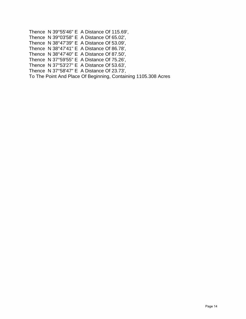
Thence N 39°55'46" E A Distance Of 115.69', Thence N 39°03'58" E A Distance Of 65.02', Thence N 38°47'39" E A Distance Of 53.09', Thence N 38°47'41" E A Distance Of 86.78', Thence N 38°47'40" E A Distance Of 87.50', Thence N 37°59'55" E A Distance Of 75.26', Thence N 37°53'27" E A Distance Of 53.63', Thence N 37°58'47" E A Distance Of 23.73', To The Point And Place Of Beginning, Containing 1105.308 Acres
Page 14
TOWN OF MORRISVILLE * 100 TOWN HALL * MORRISVILLE, NC 27560
ORDINANCE 2021-189-0B OF THE MORRISVILLE TOWN COUNCIL APPROVING A ZONING MAP AMENDMENT TO REZONE
VARIOUS PARCELS LOCATED ALONG MCCRIMMON PARKWAY AND AIRPORT BOULEVARD FROM THE INDUSTRIAL
MANAGEMENT ZONING DISTRICT TO THE BUSINESS ACTIVITY CENTER ZONING DISTRICT (AMEND-21-0003)
WHEREAS, the Town of Morrisville proposes to amend the zoning map to implement the Land Use Plan in the McCrimmon Extension Subarea; and
WHEREAS, the proposed rezoning was the subject of a public comment session by the Planning and Zoning Board of the Town of Morrisville on May 13, 2021; and
WHEREAS, at the May 13, 2021 Planning and Zoning Board meeting, the Planning and Zoning Board, by a vote of 4 “Yes” and 1 “No,” forwarded a recommendation of approval on the proposed zoning map amendment to the Town Council; and
WHEREAS, the proposed rezoning was presented to the Morrisville Town Council on June 8, 2021; and
WHEREAS, the Town Council held a public hearing on June 8, 2021 on the proposed zoning map amendment; and
WHEREAS, prior to the June 8, 2021 public hearing, the proposed zoning map amendment was duly advertised in accordance with all requirements of law; and
WHEREAS, at the July 27, 2021 meeting, Town Council, by a vote of < > “Yes” and < > “No,” approved the proposed zoning map amendment; and
NOW, THEREFORE, BE IT ORDAINED BY THE MORRISVILLE TOWN COUNCIL THAT:
SECTION ONE: The Town of Morrisville zoning map is hereby amended by rezoning the subject properties to the Business Center Activity (BAC) zoning district.
SECTION TWO: The parcels subject to the proposed zoning map amendment titled AMEND-21-0003 and hereby rezoned to the Business Activity Center (BAC) zoning district are depicted on Exhibit “A” attached hereto and identified by those Wake County PINs identified in Exhibit B attached hereto.
Page 1 of 2
Page 2 of 2
Ordained this the 27th day of July, 2021.
______________________________ TJ Cawley, Mayor
ATTEST:
________________________________ Eric W. Smith II, Town Clerk
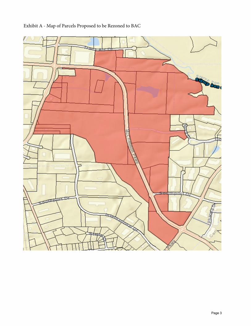
Exhibit A - Map of Parcels Proposed to be Rezoned to BAC
Page 3
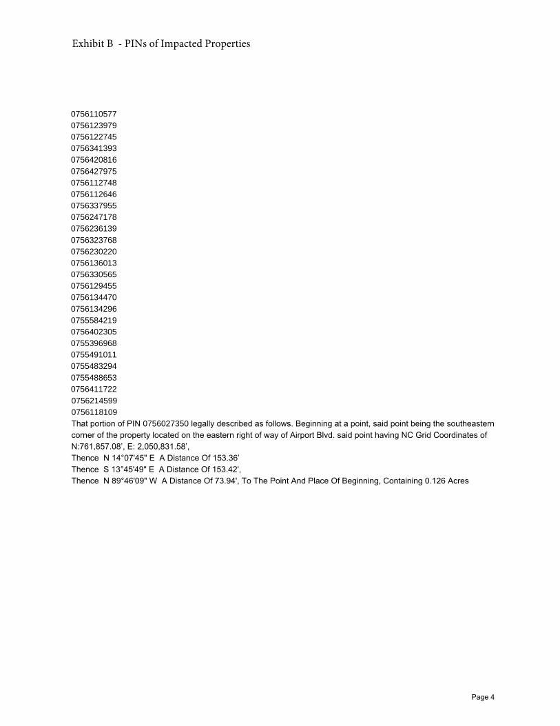
0756110577
0756123979
0756122745
0756341393
0756420816
0756427975
0756112748
0756112646
0756337955
0756247178
0756236139
0756323768
0756230220
0756136013
0756330565
0756129455
0756134470
0756134296
0755584219
0756402305
0755396968
0755491011
0755483294
0755488653
0756411722
0756214599
0756118109
That portion of PIN 0756027350 legally described as follows. Beginning at a point, said point being the southeastern corner of the property located on the eastern right of way of Airport Blvd. said point having NC Grid Coordinates of N:761,857.08’, E: 2,050,831.58’, Thence N 14°07'45" E A Distance Of 153.36’ Thence S 13°45'49" E A Distance Of 153.42', Thence N 89°46'09" W A Distance Of 73.94', To The Point And Place Of Beginning, Containing 0.126 Acres
Exhibit B - PINs of Impacted Properties
Page 4
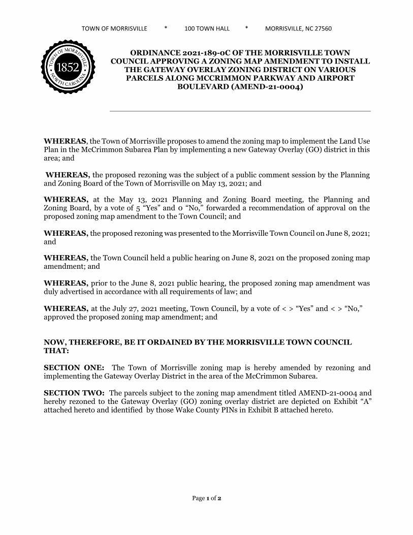
TOWN OF MORRISVILLE * 100 TOWN HALL * MORRISVILLE, NC 27560
ORDINANCE 2021-189-0C OF THE MORRISVILLE TOWN COUNCIL APPROVING A ZONING MAP AMENDMENT TO INSTALL
THE GATEWAY OVERLAY ZONING DISTRICT ON VARIOUS PARCELS ALONG MCCRIMMON PARKWAY AND AIRPORT
BOULEVARD (AMEND-21-0004)
WHEREAS, the Town of Morrisville proposes to amend the zoning map to implement the Land Use Plan in the McCrimmon Subarea Plan by implementing a new Gateway Overlay (GO) district in this area; and
WHEREAS, the proposed rezoning was the subject of a public comment session by the Planning and Zoning Board of the Town of Morrisville on May 13, 2021; and
WHEREAS, at the May 13, 2021 Planning and Zoning Board meeting, the Planning and Zoning Board, by a vote of 5 “Yes” and 0 “No,” forwarded a recommendation of approval on the proposed zoning map amendment to the Town Council; and
WHEREAS, the proposed rezoning was presented to the Morrisville Town Council on June 8, 2021; and
WHEREAS, the Town Council held a public hearing on June 8, 2021 on the proposed zoning map amendment; and
WHEREAS, prior to the June 8, 2021 public hearing, the proposed zoning map amendment was duly advertised in accordance with all requirements of law; and
WHEREAS, at the July 27, 2021 meeting, Town Council, by a vote of < > “Yes” and < > “No,” approved the proposed zoning map amendment; and
NOW, THEREFORE, BE IT ORDAINED BY THE MORRISVILLE TOWN COUNCIL THAT:
SECTION ONE: The Town of Morrisville zoning map is hereby amended by rezoning and implementing the Gateway Overlay District in the area of the McCrimmon Subarea.
SECTION TWO: The parcels subject to the zoning map amendment titled AMEND-21-0004 and hereby rezoned to the Gateway Overlay (GO) zoning overlay district are depicted on Exhibit “A” attached hereto and identified by those Wake County PINs in Exhibit B attached hereto.
Page 1 of 2

Page 2 of 2
Ordained this the 27th day of July, 2021.
______________________________ TJ Cawley, Mayor
ATTEST:
________________________________ Eric W. Smith II, Town Clerk
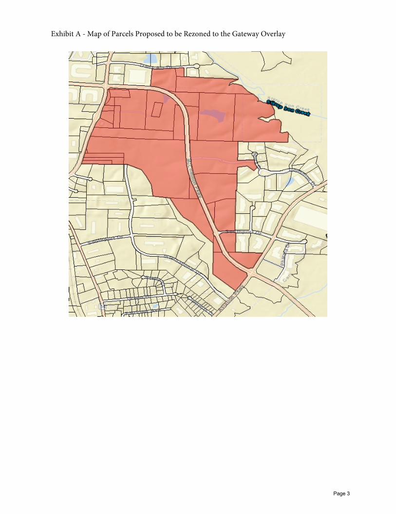
Exhibit A - Map of Parcels Proposed to be Rezoned to the Gateway Overlay
Page 3
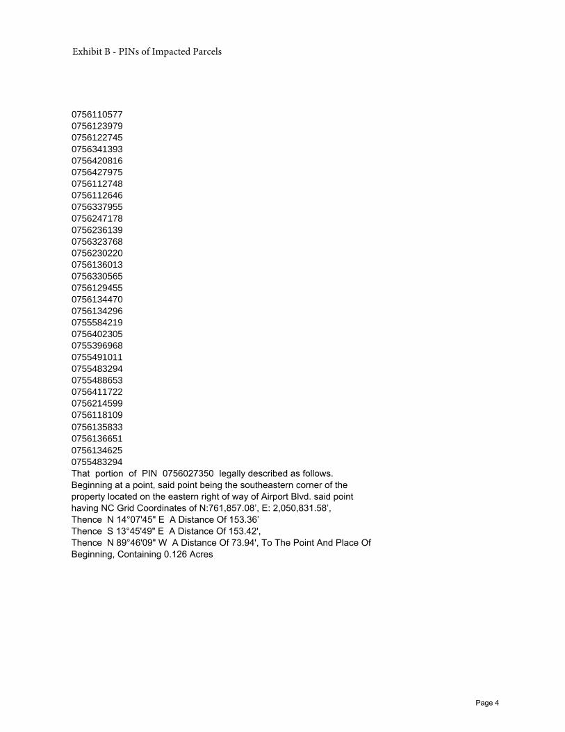
0756110577
0756123979
0756122745
0756341393
0756420816
0756427975
0756112748
0756112646
0756337955
0756247178
0756236139
0756323768
0756230220
0756136013
0756330565
0756129455
0756134470
0756134296
0755584219
0756402305
0755396968
0755491011
0755483294
0755488653
0756411722
0756214599
0756118109
0756135833
0756136651
0756134625
0755483294
That portion of PIN 0756027350 legally described as follows. Beginning at a point, said point being the southeastern corner of the property located on the eastern right of way of Airport Blvd. said point having NC Grid Coordinates of N:761,857.08’, E: 2,050,831.58’, Thence N 14°07'45" E A Distance Of 153.36’ Thence S 13°45'49" E A Distance Of 153.42', Thence N 89°46'09" W A Distance Of 73.94', To The Point And Place Of Beginning, Containing 0.126 Acres
Exhibit B - PINs of Impacted Parcels
Page 4
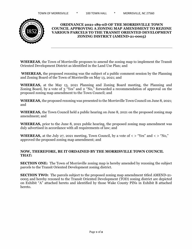
TOWN OF MORRISVILLE * 100 TOWN HALL * MORRISVILLE, NC 27560
ORDINANCE 2021-189-0D OF THE MORRISVILLE TOWN COUNCIL APPROVING A ZONING MAP AMENDMENT TO REZONE VARIOUS PARCELS TO THE TRANSIT ORIENTED DEVELOPMENT
ZONING DISTRICT (AMEND-21-0005)
WHEREAS, the Town of Morrisville proposes to amend the zoning map to implement the Transit Oriented Development District as identified in the Land Use Plan; and
WHEREAS, the proposed rezoning was the subject of a public comment session by the Planning and Zoning Board of the Town of Morrisville on May 13, 2021; and
WHEREAS, at the May 13, 2021 Planning and Zoning Board meeting, the Planning and Zoning Board, by a vote of 3 “Yes” and 2 “No,” forwarded a recommendation of approval on the proposed zoning map amendment to the Town Council; and
WHEREAS, the proposed rezoning was presented to the Morrisville Town Council on June 8, 2021; and
WHEREAS, the Town Council held a public hearing on June 8, 2021 on the proposed zoning map amendment; and
WHEREAS, prior to the June 8, 2021 public hearing, the proposed zoning map amendment was duly advertised in accordance with all requirements of law; and
WHEREAS, at the July 27, 2021 meeting, Town Council, by a vote of < > “Yes” and < > “No,” approved the proposed zoning map amendment; and
NOW, THEREFORE, BE IT ORDAINED BY THE MORRISVILLE TOWN COUNCIL THAT:
SECTION ONE: The Town of Morrisville zoning map is hereby amended by rezoning the subject parcels to the Transit Oriented Development zoning district.
SECTION TWO: The parcels subject to the proposed zoning map amendment titled AMEND-21-0005 and hereby rezoned to the Transit Oriented Development (TOD) zoning district are depicted on Exhibit “A” attached hereto and identified by those Wake County PINs in Exhibit B attached hereto.
Page 1 of 2

Page 2 of 2
Ordained this the 27th day of July, 2021.
______________________________ TJ Cawley, Mayor
ATTEST:
________________________________ Eric W. Smith II, Town Clerk
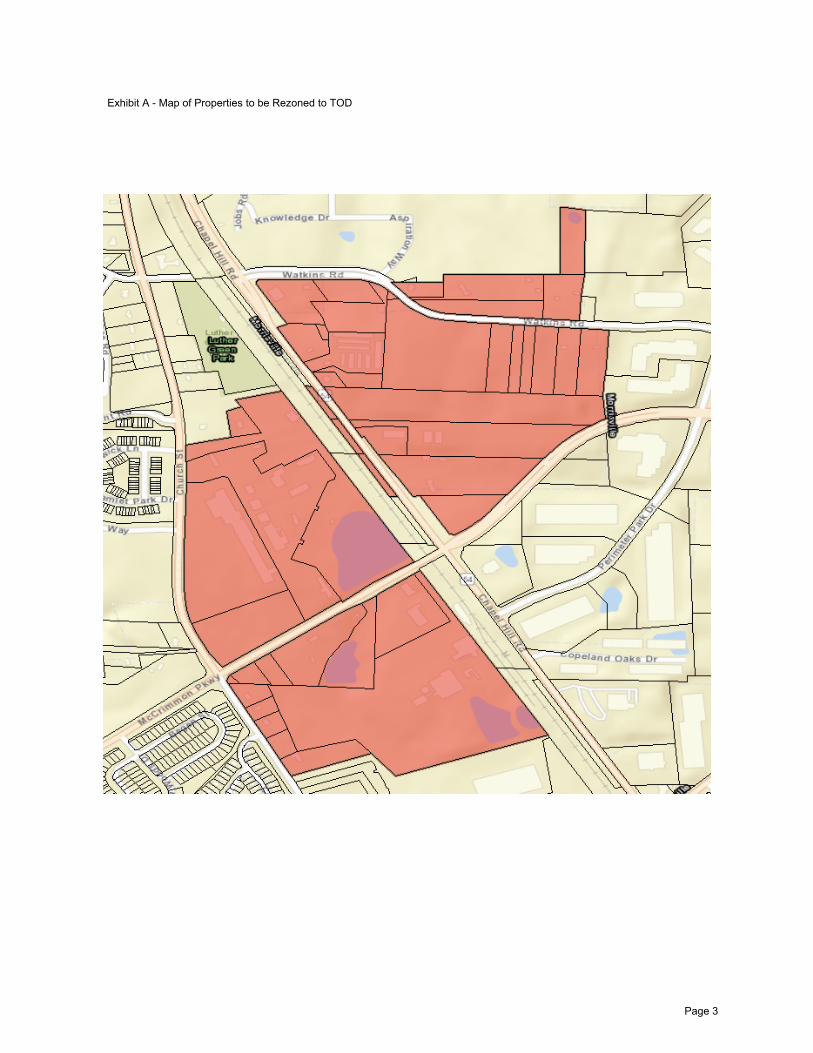
Page 3
Exhibit A - Map of Properties to be Rezoned to TOD
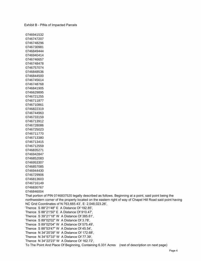
0746941532
0746747207
0746748296
0746730981
0746849444
0746940414
0746746657
0746748478
0746757074
0746848536
0746844500
0746745614
0746748768
0746841905
0746629895
0746721255
0746711877
0746710861
0746822319
0746744963
0746733159
0746713912
0746728086
0746725023
0746711770
0746713380
0746713415
0746712559
0746835271
0746942847
0746852083
0746953307
0746857085
0746944430
0746729906
0746813603
0746716149
0746830767
0746846004
That portion of PIN 0746837520 legally described as follows. Beginning at a point, said point being the northwestern corner of the property located on the eastern right of way of Chapel Hill Road said point having NC Grid Coordinates of N:763,665.43’, E: 2,048,023.26’, Thence S 88°21'48" E A Distance Of 192.85', Thence S 88°21'50" E A Distance Of 910.47', Thence S 39°21'18" W A Distance Of 385.61', Thence S 89°02'02" W A Distance Of 3.78', Thence S 89°02'04" W A Distance Of 575.49', Thence S 88°53'47" W A Distance Of 45.54', Thence N 34°20'39" W A Distance Of 172.68', Thence N 34°57'33" W A Distance Of 77.39', Thence N 34°22'23" W A Distance Of 162.72', To The Point And Place Of Beginning, Containing 6.331 Acres (rest of description on next page)
Page 4
Exhibit B - PINs of Impacted Parcels
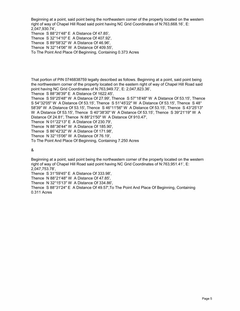
Page 5
That portion of PIN 0746838759 legally described as follows. Beginning at a point, said point being the northwestern corner of the property located on the eastern right of way of Chapel Hill Road said point having NC Grid Coordinates of N:763,949.72’, E: 2,047,823.36’, Thence S 88°36'39" E A Distance Of 1622.45', Thence S 59°25'48" W A Distance Of 27.99', Thence S 57°18'48" W A Distance Of 53.15', Thence S 54°32'05" W A Distance Of 53.15', Thence S 51°45'22" W A Distance Of 53.15', Thence S 48°58'39" W A Distance Of 53.15', Thence S 46°11'56" W A Distance Of 53.15', Thence S 43°25'13" W A Distance Of 53.15', Thence S 40°38'30" W A Distance Of 53.15', Thence S 39°21'19" W A Distance Of 24.81', Thence N 88°21'50" W A Distance Of 910.47', Thence N 01°22'13" E A Distance Of 230.79', Thence N 88°36'44" W A Distance Of 185.90', Thence S 86°42'32" W A Distance Of 171.98', Thence N 32°15'06" W A Distance Of 76.19', To The Point And Place Of Beginning, Containing 7.250 Acres
&
Beginning at a point, said point being the northeastern corner of the property located on the western right of way of Chapel Hill Road said point having NC Grid Coordinates of N:763,951.41’, E: 2,047,753.78’, Thence S 31°59'45" E A Distance Of 333.98', Thence N 88°21'48" W A Distance Of 47.85', Thence N 32°15'13" W A Distance Of 334.86', Thence S 88°31'24" E A Distance Of 49.57',To The Point And Place Of Beginning, Containing 0.311 Acres
Beginning at a point, said point being the northeastern corner of the property located on the western right of way of Chapel Hill Road said point having NC Grid Coordinates of N:763,668.16’, E: 2,047,930.74’, Thence S 88°21'48" E A Distance Of 47.85', Thence S 32°14'10" E A Distance Of 407.92', Thence S 89°58'32" W A Distance Of 46.96', Thence N 32°14'06" W A Distance Of 409.55', To The Point And Place Of Beginning, Containing 0.373 Acres
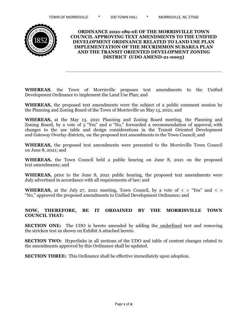
TOWN OF MORRISVILLE * 100 TOWN HALL * MORRISVILLE, NC 27560
ORDINANCE 2021-189-0E OF THE MORRISVILLE TOWN COUNCIL APPROVING TEXT AMENDMENTS TO THE UNIFIED DEVELOPMENT ORDINANCE RELATED TO LAND USE PLANIMPLEMENTATION OF THE MCCRIMMON SUBAREA PLAN
AND THE TRANSIT ORIENTED DEVELOPMENT ZONING DISTRICT (UDO AMEND-21-0005)
WHEREAS, the Town of Morrisville proposes text amendments to the Unified Development Ordinance to implement the Land Use Plan; and
WHEREAS, the proposed text amendments were the subject of a public comment session by the Planning and Zoning Board of the Town of Morrisville on May 13, 2021; and
WHEREAS, at the May 13, 2021 Planning and Zoning Board meeting, the Planning and Zoning Board, by a vote of 5 “Yes” and 0 “No,” forwarded a recommendation of approval, with changes to the use table and design considerations in the Transit Oriented Development and Gateway Overlay districts, on the proposed text amendments to the Town Council; and
WHEREAS, the proposed text amendments were presented to the Morrisville Town Council on June 8, 2021; and
WHEREAS, the Town Council held a public hearing on June 8, 2021 on the proposed text amendments; and
WHEREAS, prior to the June 8, 2021 public hearing, the proposed text amendments were duly advertised in accordance with all requirements of law; and
WHEREAS, at the July 27, 2021 meeting, Town Council, by a vote of < > “Yes” and < > “No,” approved the proposed amendments to Unified Development Ordinance; and
NOW, THEREFORE, BE IT ORDAINED BY THE MORRISVILLE TOWN COUNCIL THAT:
SECTION ONE: The UDO is hereto amended by adding the underlined text and removing the stricken text as shown on Exhibit A attached hereto.
SECTION TWO: Hyperlinks in all sections of the UDO and table of content changes related to the amendments approved by this Ordinance shall be updated.
SECTION THREE: This Ordinance shall be effective immediately upon adoption.
Page 1 of 2
Page 2 of 2
Ordained this the 27th day of July, 2021.
______________________________ TJ Cawley, Mayor
ATTEST:
________________________________ Eric W. Smith II, Town Clerk


Article 1: General Provisions Section 1.7. Severability 1.6.5. New Zoning Districts Compared to Previous Zoning Districts
Morrisville, NC February 1, 2021 Unified Development Ordinance Page 1-6
Table 1.6.5, New Zoning Districts
Previous Zoning District New Zoning District
Conservation Districts
Conservation/Buffer (CB) Park/Greenway/Open Space (PGO)
Residential Districts
Agricultural (AD) Very Low Density Residential (VLDR)
R-12 Residential (R-12)
Low Density Residential (LDR) R-10 Residential (R-10)
R-8 Residential (R-8)
R-6 Residential (R-6) Medium Density Residential (MDR)
Residential Multi-Family (RMF)
High Density Residential (HDR) [NEW]
Activity Center Districts
Neighborhood Activity Center (NAC) [NEW]
Business Activity Center (BAC) [NEW]
Community Activity Center (CAC) [NEW]
Regional Activity Center (RAC) [NEW]
Transit-Oriented Development (TOD) [NEW]
Town Center Districts
Historic Crossroads Village (HCV) Historic Crossroads Village (HCV)
Main Street (MS) Main Street (MS)
Corridor Commercial (CC) Town Center Commercial (TCC)
Town Center Residential (TCR) Town Center Residential (TCR)
Residential Transition (RT) Residential Transition (RT)
Residential Neighborhood Preservation (RNP) Residential Neighborhood Preservation (RNP)
Commercial and Industrial Districts
Corridor Commercial (CC)
Office/Institutional (OI) Office/Institutional (OI)
Neighborhood Business (NB) [Reclassified to Neighborhood or Business Activity Center – see above]
General Business (GB) [Reclassified to Business, Community, or Regional Activity Center – see
above]
Industrial Management (IM) Industrial Management (IM)
Planned Development Districts
Mixed Use (MU) [base district] Mixed-Use Planned Development (MUPD)
Main Street Planned Development District [MSPD]
Overlay Districts
Planned Development Overlay DELETE
Airport Overlay Subdistrict A Airport Overlay-A
Subdistrict B Airport Overlay-B
Floodplain Overlay (FO) [NEW]
Gateway Overlay (GO)
SECTION 1.7. SEVERABILITY
The Town Council hereby declares that it would have adopted this Ordinance and any section, subsection, sentence, clause, or phrase thereof regardless whether one or more other portions of the Ordinance is declared invalid by a court of competent jurisdiction.
A. If a court of competent jurisdiction holds any section, subsection, sentence, clause, or phrase of this Ordinance to be invalid for any reason, such judgment shall not affect the validity of the remaining portions of this Ordinance.
B. If a court of competent jurisdiction holds any condition attached to a development permit or approval granted in accordance with this Ordinance to be invalid for any reason, such judgment shall not affect the validity of any other conditions of the permit or approval not specifically included in the judgment.
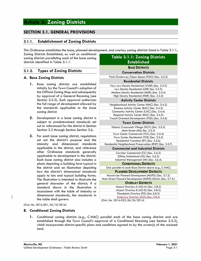
Morrisville, NC February 1, 2021 Unified Development Ordinance - Public Review Draft Page 3-1
Article 3: Zoning Districts
SECTION 3.1. GENERAL PROVISIONS
3.1.1. Establishment of Zoning Districts
This Ordinance establishes the base, planned development, and overlay zoning districts listed in Table 3.1.1, Zoning Districts Established, as well as conditional zoning districts paralleling each of the base zoning districts identified in Table 3.1.1.
3.1.2. Types of Zoning Districts
A. Base Zoning Districts
1. Base zoning districts are established initially by the Town Council’s adoption of the Official Zoning Map and subsequently by approval of a General Rezoning (see Section 2.5.3). Such approval authorizes the full range of development allowed by the standards applicable to the base zoning district.
2. Development in a base zoning district is subject to predetermined standards set out or referenced for the district in Section Section 3.2 through Section Section 3.6.
3. For each base zoning district, regulations set out the district’s purpose and the intensity and dimensional standards applicable in the district, and reference other Ordinance standards generally applicable to development in the district. Each base zoning district also includes a photo depicting a building form typical in the district and an illustration depicting how the district’s dimensional standards apply to lots and typical building forms. The illustration is intended to illustrate the general character of the district; if a standard shown in the illustration is inconsistent with the table of intensity or dimensional standards, the standards in the table shall govern.
(Ord. No. 2016-001, 05/10/2016)
B. Conditional Zoning Districts
1. Conditional zoning districts (e.g., C-NAC) parallel each of the base zoning districts and are established through the Town Council’s approval of a Conditional Rezoning (see Section 2.5.3), which incorporates district-specific plans and conditions agreed to by the owner(s) of the rezoned land.
Table 3.1.1: Zoning Districts Established
BASE DISTRICTS
Conservation Districts
Park/Greenway/Open Space (PGO) (Sec. 3.2.2)
Residential Districts
Very Low Density Residential (VLDR) (Sec. 3.3.2)
Low Density Residential (LDR) Sec. 3.3.3)
Medium Density Residential (MDR) (Sec. 3.3.4)
High Density Residential (HDR) (Sec. 3.3.5)
Activity Center Districts
Neighborhood Activity Center (NAC) (Sec. 3.4.2)
Business Activity Center (BAC) (Sec. 3.4.3)
Community Activity Center (CAC) (Sec. 3.4.4)
Regional Activity Center (RAC) (Sec. 3.4.5)
Transit-Oriented Development (TOD) (Sec. 3.4.6)
Town Center Districts
Historic Crossroads Village (HCV) (Sec. 3.5.2)
Main Street (MS) Sec. 3.5.3)
Town Center Commercial (TCC) (Sec. 3.5.4)
Town Center Residential (TCR) (Sec. 3.5.5)
Residential Transition (RT) (Sec. 3.5.6)
Residential Neighborhood Preservation (RNP) (Sec. 3.5.7)
Commercial and Industrial Districts
Corridor Commercial (CC) (Sec. 3.6.2)
Office/Institutional (OI) (Sec. 3.6.3)
Industrial Management (IM) (Sec. 3.6.4)
CONDITIONAL DISTRICTS One parallel to each Base District above (e.g., C-NAC)
PLANNED DEVELOPMENT DISTRICTS Mixed-Use Planned Development (MUPD) (Sec. 3.7.2)
Main Street Planned Development (MSPD) District (Sec. 3.7.3.)
OVERLAY DISTRICTS Airport Overlay-A (AO-A) (Sec. 3.8.2)
Airport Overlay-B (AO-B) (Sec. 3.8.2)
Floodplain Overlay (FO) (Sec.3.8.3)
Gateway Overlay (GO) (Sec. 3.8.4)
(Ord. No. 2014-022, 06/24/2014)
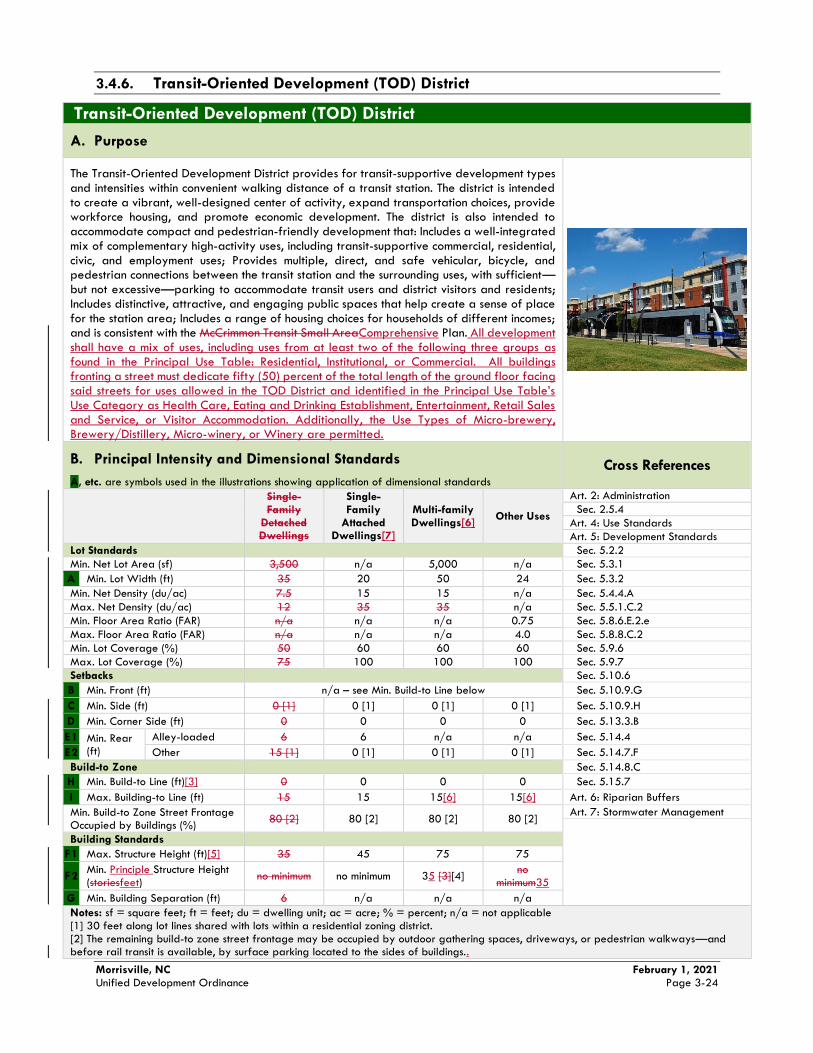
Morrisville, NC February 1, 2021 Unified Development Ordinance Page 3-24
3.4.6. Transit-Oriented Development (TOD) District
Transit-Oriented Development (TOD) District
A. Purpose
The Transit-Oriented Development District provides for transit-supportive development types and intensities within convenient walking distance of a transit station. The district is intended to create a vibrant, well-designed center of activity, expand transportation choices, provide workforce housing, and promote economic development. The district is also intended to accommodate compact and pedestrian-friendly development that: Includes a well-integrated mix of complementary high-activity uses, including transit-supportive commercial, residential, civic, and employment uses; Provides multiple, direct, and safe vehicular, bicycle, and pedestrian connections between the transit station and the surrounding uses, with sufficient—but not excessive—parking to accommodate transit users and district visitors and residents; Includes distinctive, attractive, and engaging public spaces that help create a sense of place for the station area; Includes a range of housing choices for households of different incomes; and is consistent with the McCrimmon Transit Small AreaComprehensive Plan. All development shall have a mix of uses, including uses from at least two of the following three groups as found in the Principal Use Table: Residential, Institutional, or Commercial. All buildings fronting a street must dedicate fifty (50) percent of the total length of the ground floor facing said streets for uses allowed in the TOD District and identified in the Principal Use Table’s Use Category as Health Care, Eating and Drinking Establishment, Entertainment, Retail Sales and Service, or Visitor Accommodation. Additionally, the Use Types of Micro-brewery, Brewery/Distillery, Micro-winery, or Winery are permitted.
B. Principal Intensity and Dimensional Standards
A, etc. are symbols used in the illustrations showing application of dimensional standards
Cross References
Single-Family
Detached Dwellings
Single-Family
Attached Dwellings[7]
Multi-family Dwellings[6]
Other Uses
Art. 2: Administration
Sec. 2.5.4
Art. 4: Use Standards
Art. 5: Development Standards
Lot Standards Sec. 5.2.2
Min. Net Lot Area (sf)
3,500 n/a 5,000 n/a Sec. 5.3.1
A Min. Lot Width (ft) 35 20 50 24 Sec. 5.3.2
Min. Net Density (du/ac) 7.5 15 15 n/a Sec. 5.4.4.A
Max. Net Density (du/ac) 12 35 35 n/a Sec. 5.5.1.C.2
Min. Floor Area Ratio (FAR) n/a n/a n/a 0.75 Sec. 5.8.6.E.2.e
Max. Floor Area Ratio (FAR) n/a n/a n/a 4.0 Sec. 5.8.8.C.2
Min. Lot Coverage (%) 50 60 60 60 Sec. 5.9.6
Max. Lot Coverage (%) 75 100 100 100 Sec. 5.9.7
Setbacks Sec. 5.10.6
B Min. Front (ft) n/a – see Min. Build-to Line below Sec. 5.10.9.G
C
Min. Side (ft)
0 [1] 0 [1] 0 [1] 0 [1] Sec. 5.10.9.H
D Min. Corner Side (ft) 0 0 0 0 Sec. 5.13.3.B
E1
Min. Rear (ft)
Alley-loaded
6 6 n/a n/a Sec. 5.14.4
E2 Other 15 [1] 0 [1] 0 [1] 0 [1] Sec. 5.14.7.F
Build-to Zone Sec. 5.14.8.C
H Min. Build-to Line (ft)[3] 0 0 0 0 Sec. 5.15.7
I Max. Building-to Line (ft) 15 15 15[6] 15[6] Art. 6: Riparian Buffers
Min. Build-to Zone Street Frontage Occupied by Buildings (%)
80 [2] 80 [2] 80 [2] 80 [2] Art. 7: Stormwater Management
Building Standards
F1 Max. Structure Height (ft)[5] 35 45 75 75
F2 Min. Principle Structure Height (storiesfeet)
no minimum no minimum 35 [3][4] no
minimum35
G Min. Building Separation (ft) 6 n/a n/a n/a
Notes: sf = square feet; ft = feet; du = dwelling unit; ac = acre; % = percent; n/a = not applicable [1] 30 feet along lot lines shared with lots within a residential zoning district. [2] The remaining build-to zone street frontage may be occupied by outdoor gathering spaces, driveways, or pedestrian walkways—and before rail transit is available, by surface parking located to the sides of buildings..
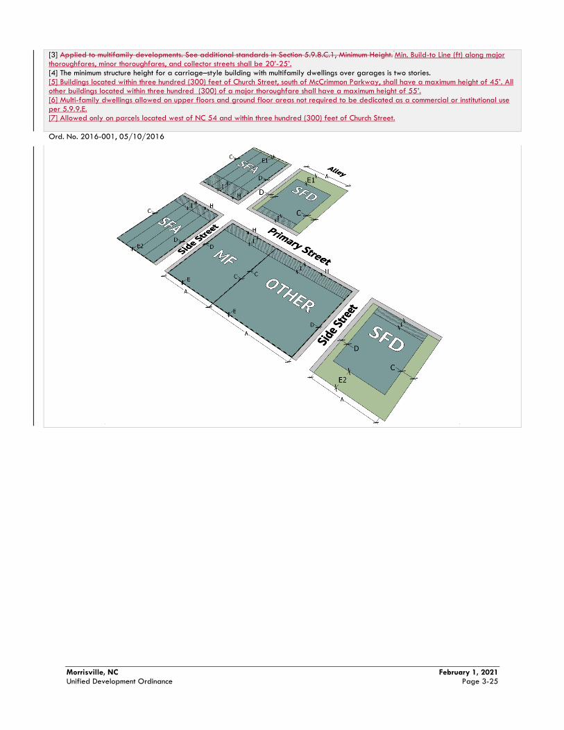
Morrisville, NC February 1, 2021 Unified Development Ordinance Page 3-25
[3] Applied to multifamily developments. See additional standards in Section 5.9.8.C.1, Minimum Height. Min. Build-to Line (ft) along major
thoroughfares, minor thoroughfares, and collector streets shall be 20’-25’. [4] The minimum structure height for a carriage–style building with multifamily dwellings over garages is two stories. [5] Buildings located within three hundred (300) feet of Church Street, south of McCrimmon Parkway, shall have a maximum height of 45’. All other buildings located within three hundred (300) of a major thoroughfare shall have a maximum height of 55’. [6] Multi-family dwellings allowed on upper floors and ground floor areas not required to be dedicated as a commercial or institutional use per 5.9.9.E. [7] Allowed only on parcels located west of NC 54 and within three hundred (300) feet of Church Street.
Ord. No. 2016-001, 05/10/2016
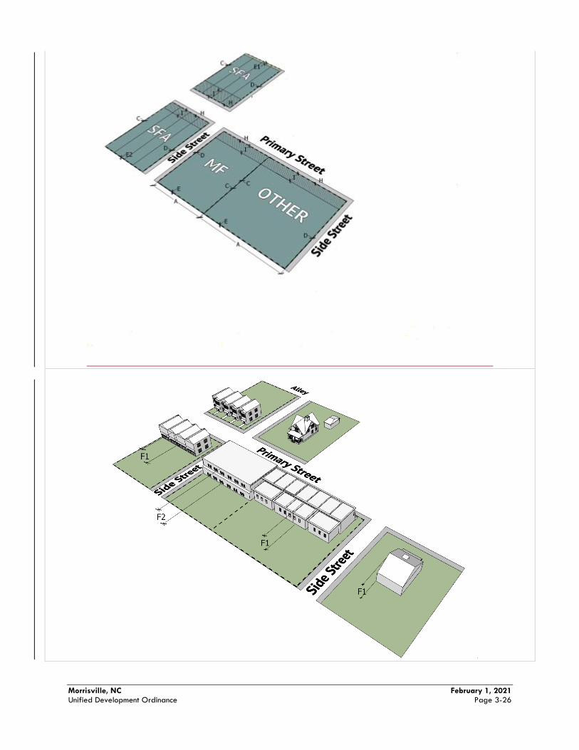
Morrisville, NC February 1, 2021 Unified Development Ordinance Page 3-26
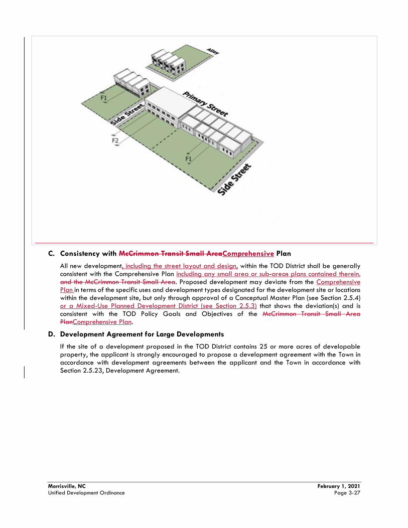
Morrisville, NC February 1, 2021 Unified Development Ordinance Page 3-27
C. Consistency with McCrimmon Transit Small AreaComprehensive Plan
All new development, including the street layout and design, within the TOD District shall be generally consistent with the Comprehensive Plan including any small area or sub-areas plans contained therein. and the McCrimmon Transit Small Area. Proposed development may deviate from the Comprehensive Plan in terms of the specific uses and development types designated for the development site or locations within the development site, but only through approval of a Conceptual Master Plan (see Section 2.5.4) or a Mixed-Use Planned Development District (see Section 2.5.3) that shows the deviation(s) and is consistent with the TOD Policy Goals and Objectives of the McCrimmon Transit Small Area PlanComprehensive Plan.
D. Development Agreement for Large Developments
If the site of a development proposed in the TOD District contains 25 or more acres of developable property, the applicant is strongly encouraged to propose a development agreement with the Town in accordance with development agreements between the applicant and the Town in accordance with Section 2.5.23, Development Agreement.
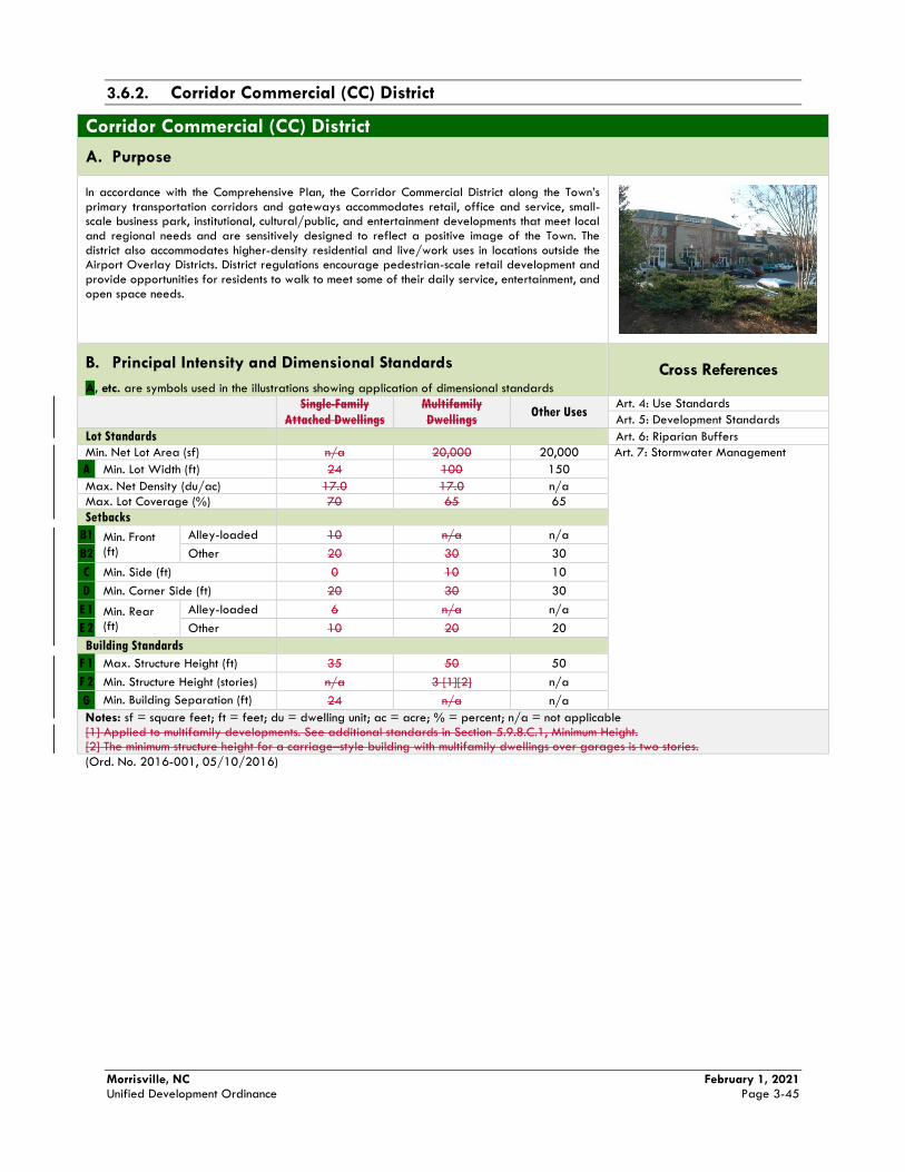
Morrisville, NC February 1, 2021 Unified Development Ordinance Page 3-45
3.6.2. Corridor Commercial (CC) District
Corridor Commercial (CC) District
A. Purpose
In accordance with the Comprehensive Plan, the Corridor Commercial District along the Town’s primary transportation corridors and gateways accommodates retail, office and service, small-scale business park, institutional, cultural/public, and entertainment developments that meet local and regional needs and are sensitively designed to reflect a positive image of the Town. The district also accommodates higher-density residential and live/work uses in locations outside the Airport Overlay Districts. District regulations encourage pedestrian-scale retail development and provide opportunities for residents to walk to meet some of their daily service, entertainment, and open space needs.
B. Principal Intensity and Dimensional Standards
A, etc. are symbols used in the illustrations showing application of dimensional standards
Cross References
Single-Family
Attached Dwellings
Multifamily
Dwellings Other Uses
Art. 4: Use Standards
Art. 5: Development Standards
Lot Standards Art. 6: Riparian Buffers
Min. Net Lot Area (sf)
n/a 20,000 20,000 Art. 7: Stormwater Management
A Min. Lot Width (ft) 24 100 150
Max. Net Density (du/ac) 17.0 17.0 n/a
Max. Lot Coverage (%) 70 65 65
Setbacks
B1 Min. Front (ft)
Alley-loaded 10 n/a n/a
B2 Other 20 30 30
C Min. Side (ft)
0 10 10
D Min. Corner Side (ft) 20 30 30
E 1 Min. Rear (ft)
Alley-loaded 6 n/a n/a
E 2 Other 10 20 20
Building Standards
F 1 Max. Structure Height (ft) 35 50 50
F 2 Min. Structure Height (stories) n/a 3 [1][2] n/a
G Min. Building Separation (ft) 24 n/a n/a
Notes: sf = square feet; ft = feet; du = dwelling unit; ac = acre; % = percent; n/a = not applicable [1] Applied to multifamily developments. See additional standards in Section 5.9.8.C.1, Minimum Height. [2] The minimum structure height for a carriage–style building with multifamily dwellings over garages is two stories.
(Ord. No. 2016-001, 05/10/2016)
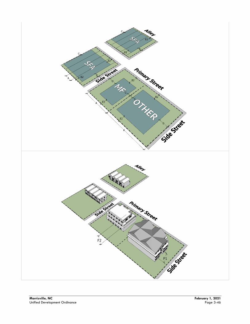
Morrisville, NC February 1, 2021 Unified Development Ordinance Page 3-46
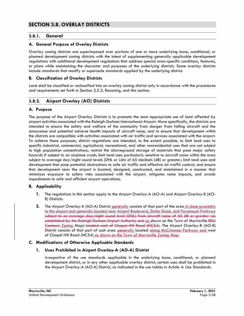
Morrisville, NC February 1, 2021 Unified Development Ordinance Page 3-58
SECTION 3.8. OVERLAY DISTRICTS
3.8.1. General
A. General Purpose of Overlay Districts
Overlay zoning districts are superimposed over portions of one or more underlying base, conditional, or planned development zoning districts with the intent of supplementing generally applicable development regulations with additional development regulations that address special area-specific conditions, features, or plans while maintaining the character and purposes of the underlying districts. Some overlay districts include standards that modify or supersede standards applied by the underlying district.
B. Classification of Overlay Districts
Land shall be classified or reclassified into an overlay zoning district only in accordance with the procedures and requirements set forth in Section 2.5.3, Rezoning, and this section.
3.8.2. Airport Overlay (AO) Districts
A. Purpose
The purpose of the Airport Overlay Districts is to promote the most appropriate use of land affected by airport activities associated with the Raleigh-Durham International Airport. More specifically, the districts are intended to ensure the safety and welfare of the community from danger from falling aircraft and the annoyance and potential adverse health impacts of aircraft noise, and to ensure that development within the districts are compatible with activities associated with air traffic and services associated with the airport. To achieve these purposes, district regulations are intended, to the extent possible, to limit land uses to specific industrial, commercial, agricultural, recreational, and other nonresidential uses that are not subject to high population concentrations; restrict the aboveground storage of materials that pose major safety hazards if subject to an airplane crash; limit land uses particularly sensitive to aircraft noise within the area subject to average day/night sound levels (DNL or Ldn) of 65 decibels (dB) or greater; limit land uses and development that pose potential obstructions to safe air traffic and effective air traffic control; and ensure that development near the airport is located, designed, constructed, and maintained in a manner that minimizes exposure to safety risks associated with the airport, mitigates noise impacts, and avoids impediments to safe and efficient airport operations.
B. Applicability
1. The regulations in this section apply to the Airport Overlay-A (AO-A) and Airport Overlay-B (AO-B) Districts.
2. The Airport Overlay-A (AO-A) District generally consists of that part of the area in close proximity to the airport and generally located near Airport Boulevard, Slater Road, and Paramount Parkway subject to an average day/night sound level (DNL) from aircraft noise of 65 dB or greater (as established by the Raleigh-Durham Airport Authority and as shown on the Town of Morrisville RDU Contours Zoning Map) located east of Chapel Hill Road (NC54). The Airport Overlay-B (AO-B) District consists of that part of such area generally located along McCrimmon Parkway and west of Chapel Hill Road (NC54) as shown on the Town of Morrisville Zoning Map.
C. Modifications of Otherwise Applicable Standards
1. Uses Prohibited in Airport Overlay-A (AO-A) District
Irrespective of the use standards applicable in the underlying base, conditional, or planned development district, or in any other applicable overlay district, certain uses shall be prohibited in the Airport Overlay-A (AO-A) District, as indicated in the use tables in Article 4: Use Standards.
Morrisville, NC February 1, 2021 Unified Development Ordinance Page 3-59
2. Underground Storage of Hazardous Chemicals and Substances
In the Airport Overlay-A District or Airport Overlay-B District, permanent or long-term storage of significant quantities of highly explosive, flammable, toxic, corrosive, or otherwise hazardous liquids, gases, chemicals, or other hazardous substances shall be located underground to reduce the hazardous consequences from an airplane crash.
3. Structure Height
The height of any structure in the Airport Overlay-A District or Airport Overlay-B District shall not exceed that which constitutes an obstruction to air navigation, navigational aids, or navigational facilities under standards of the Federal Aviation Administration (FAA) in 14 CFR Part 77, Subpart C, as applied to the area around Raleigh-Durham International Airport, unless the FAA determines no substantial obstruction exists in accordance with 14 CFR Part 77, Subpart D. Documentation of compliance with this requirement may be required for any structure or structural alteration that extends more than 50 feet above ground level.
4. Outdoor Lighting
a. Outdoor lighting in the Airport Overlay-A District or Airport Overlay-B District shall be shielded to minimize direct skyward glare from the light source and otherwise located and designed to avoid producing light emissions—whether direct or indirect (reflective) of such intensity and directed in such directions as to impair pilot visibility or otherwise interfere with the safe operation of overhead aircraft.
b. Lighting of towers, tall buildings, and other potential obstructions to air navigation shall include warning lighting that complies with FAA standards in Advisory Circular 70/7460-1 (Obstruction Marking and Lighting).
5. Electronic Interference
No use, development, or activity in the Airport Overlay-A District or Airport Overlay-B District shall produce electronic emissions that interfere with navigation signals or radio communications between aircraft and landing control facilities or with aircraft navigational or communication equipment.
6. Sound Mitigation
a. Airport Overlay-A
New construction, or substantial improvement, of buildings within the Airport Overlay-A District shall be designed to limit interior noise from aircraft to an average day/night sound level (DNL) of 45 dB in the following use categories if permitted in Table 4.2.4, Principal Use Table:
(1) Group Living Uses (e.g. dormitories);
(2) Community and Government Service Uses (e.g. clubs or lodges, college or universities, public park or recreation facilities, business or vocational schools, or sports academies); and
(3) Health Care Uses (e.g. hospitals, nursing homes).
b. Airport Overlay-B
New construction, or substantial improvement, of buildings within the Airport Overlay-B District shall be designed to limit interior noise from aircraft to an average day/night sound level (DNL) of 45 dB in the following use categories if permitted in Table 4.2.4, Principal Use Table:
(1) Household Living Uses (e.g. dwellings, including Multi-family dwellings, or family care homes);
(2) Group Living Uses (e.g. congregate living facilities, dormitories, or rooming houses);
(3) Community and Government Service Uses (e.g. clubs or lodges, elementary, middle and high schools, cultural facilities, day care centers, places of worship, or sports academies);
Morrisville, NC February 1, 2021 Unified Development Ordinance Page 3-60
(4) Health Care Uses (e.g. hospitals, nursing homes); and
(5) Visitor Accommodation Uses (e.g. bed and breakfasts or hotel/motels).
c. Applications for a Building Permit for any building subject to the standards in subsection a above shall include the written certification by a Professional Engineer or Licensed Architect experienced and qualified in the field of acoustical testing and engineering that the proposed new construction will comply with the applicable standards.
7. Avigation Easement
The developer of new development in the Airport Overlay-A District or Airport Overlay-B District shall grant an avigation easement to the Raleigh-Durham Airport Authority for the subject property. where needed to ensure the safe approach and departure of aircraft to and from the Raleigh-Durham International Airport. A copy of the recorded avigation easement shall be provided to the Planning Director before prior to approval of any Site Plan for the subject propertyissuance of any Certificate of Compliance/Occupancy for a building on the property. The easement must, at a minimum, convey a perpetual right and easement for the free and unobstructed overflight of aircraft over and in the vicinity of the property. The easement must be appurtenant to the property and must not be subordinated to any other interest such as mortgage or lien. An example of RDU’s required Avigation Easement is located in Part 3.3 of the UDO Administrative Manual.
(Ord. No. 2016-001, 05/10/2016)
3.8.3. Floodplain Overlay (FO) District
A. Findings and Purpose
1. The flood prone areas within the jurisdiction of the Town are subject to periodic inundation. The cumulative effect of obstructions in floodplains cause increases in flood heights and velocities and the occupancy in flood prone areas of uses vulnerable to floods increase the likelihood of loss of life, property, health and safety hazards, disruption of commerce and governmental services, extraordinary public expenditures for flood protection and relief, and impairment of the tax base, all of which could adversely affect the public health, safety and general welfare.
2. The purpose of the Floodplain Overlay District is to minimize these risks and losses by provisions designed to:
a. Protect human life and health;
b. Minimize expenditure of public money for costly flood control projects;
c. Minimize the need for rescue and relief efforts associated with flooding and generally undertaken at the expense of the general public;
d. Minimize prolonged business losses and interruptions;
e. Minimize damage to public facilities and utilities (i.e. water and gas mains, electric, telephone, cable and sewer lines, streets and bridges) that are located in flood prone areas;
f. Help maintain a stable tax base by providing for the sound use and development of flood prone areas; and
g. Ensure that potential buyers are aware that property is in a Special Flood Hazard Area or Future Conditions Flood Hazard Area.
B. Applicability
1. The Floodplain Overlay (FO) District applies to all land within any Special Flood Hazard Area or a Future Conditions Flood Hazard Area within the corporate limits and extraterritorial jurisdiction of the Town of Morrisville. Special Flood Hazard Areas and Future Conditions Flood Hazard Areas shall be as determined under the Cooperating Technical State (CTS) agreement between the State of North Carolina and the Federal Emergency Management Agency (FEMA) using the most recent

Morrisville, NC February 1, 2021 Unified Development Ordinance Page 3-61
version of the Flood Insurance Study (FIS) for Wake County and associated DFIRM panels, which are adopted by reference as part of this Ordinance. Future revisions to the FIS or DFIRM panels that do not change flood hazard data within the jurisdiction of Morrisville are also adopted by reference as part of this Ordinance.
2. Within the Floodplain Overlay (FO) District, no structure shall be located, extended, converted, or altered, and no development activity shall occur, in any way except after approval of a Floodplain Development Permit in accordance with 2.5.9, Floodplain Development Permit, and in full compliance with the provisions of Section 5.6, Floodplain Management.
3. The degree of flood protection required by the Floodplain Overlay District is considered reasonable for regulatory purposes and is based on scientific and engineering consideration. Larger floods can and will occur. Actual flood heights may be increased by manmade or natural causes. This section does not imply that land outside the Special Flood Hazard Areas and Future Conditions Flood Hazard Areas or uses permitted within such areas will be free from flooding or flood damages. This section shall not create liability on the part of the Town or by any Town officer or employee for any flood damages that result from reliance on Floodplain Overlay District regulations or any administrative decision lawfully made in accordance with such regulations.
3.8.4 Gateway Overlay (GO) District
A. Findings and Purpose
The Gateway Overlay (GO) District was designed to implement the Morrisville Land Use Plan. To that end, the Town of Morrisville has found it necessary to enact additional code language that addresses specific design considerations.
Properties located in this area have been placed in the Gateway Overlay District, which regulates the form and arrangement of all development. These regulations have been designed to enhance any underlying base Zoning District by complementing a variety of uses with high-quality, pedestrian-friendly design. In order to better manage the wide array of possible underlying uses, a set of development guidelines has been established to regulate buildings and their relationship to public streets and open space.
B. Applicability
1. The regulations found in this section shall apply to the Gateway Overlay (GO) District.
2. The Gateway Overlay (GO) District is intended only for properties adjacent to or in close proximity of major thoroughfares.
3. Indoor or Outdoor Private Recreation Facilities, Indoor or Outdoor Sports Training Facilities, and Sports Academies are exempt from the Gateway Overlay (GO) standards.
C. Modifications to Otherwise Applicable Standards
1. Required Setbacks
a. All buildings in the Gateway Overlay (GO) shall adhere to the following setbacks:
i. Front: Minimum twenty (20) to maximum thirty (30) feet.
ii. Side: Fifteen (15) feet.
iii. Corner Side: Minimum twenty (20) to maximum thirty (30) feet.
iv. Rear: Twenty (20) Feet.
Morrisville, NC February 1, 2021 Unified Development Ordinance Page 3-62
v. Multi-family dwellings adjacent to a major or minor thoroughfare shall include a 15feet minimum stepback of all floors above the third floor.
2. Use Standards
a. Irrespective of the use standards applicable in the underlying base district, or in any otherapplicable overlay district, certain uses shall be prohibited in the Gateway Overlay (GO) District, as indicated in the use table in Article 4: Use Standards.
3. Multi-family Standards.
In order to ensure that a mix of residential and non-residential uses are distributed throughout the Gateway Overlay (GO) that promote live, work, and play, and promote the creation of a pedestrian friendly environment as called for in the Comprehensive Plan, developments which contain multi-family dwellings shall meet the following standards.
a. Developments which contain multi-family dwellings shall not be located within 1,500 feetfrom another approved multi-family development unless separated by a major throughfare, minor thoroughfare, or a collector street. The required minimum distance shall be measured from the nearest property line of one multi-family development to the nearest property line of the newly proposed multi-family development.
b. Developments which contain multi-family dwellings and front a major thoroughfare, minorthoroughfare, or collector street must dedicate fifty (50) percent of the total length of the ground floor facing said streets for uses allowed in the BAC District and identified in the Principal Use Table’s Use Category as one of the following: Health Care, Eating and Drinking Establishment, Entertainment, Retail Sales and Service, Visitor Accommodation. Additionally, the Use Types of Micro-brewery, Brewery, Micro-winery, or Winery are permitted.
c. Developments which contain multi-family dwellings located only on upper floors of verticallymixed use developments may be closer than 1,500 feet, but shall not be closer than 1,000 feet.
4. Access
No curb cuts shall be permitted between the building and adjacent streets.
5. Other Standards.
a. Loading docks shall not face a major or minor thoroughfare, or a residential development
b. Drive-through establishments shall be limited to one (1), 12 foot drive-thru lane between thebuilding and adjacent streets.
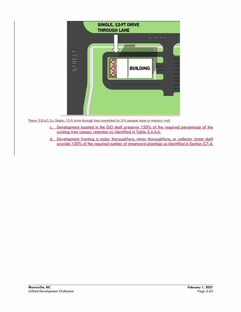
Morrisville, NC February 1, 2021 Unified Development Ordinance Page 3-63
Figure 3.8.4.C.3.c: Single, 12-ft drive-through lane concealed by 3-ft opaque stone or masonry wall.
c. Development located in the GO shall preserve 150% of the required percentage of the existing tree canopy retention as identified in Table 5.4.4.A.
d. Development fronting a major thoroughfare, minor thoroughfare, or collector street shall provide 150% of the required number of streetyard plantings as identified in Section 5.7.4.
Article 4: Use Standards Section 4.2. Principal Uses 4.2.4. Principal Use Table
Morrisville, NC February 1, 2021 Unified Development Ordinance Page 4-3
principal uses designated in the use tables as allowed in the applicable zoning district, and each principal use shall be subject to any use-specific standards applicable to the use.
C. Principal Use Table
Table 4.2.4: Principal Use Table P = Permitted as exempt from Site Plan Approval or with Site Plan Approval by Town staff
S = Allowed as a Special Use
C = Allowed as an additional use in the parallel Conditional Zoning District
A = Allowed subject to a PD Plan/Agreement
Blank Cell = Prohibited (except Overlay Districts) X = Prohibited (Overlay Districts only)
Use
Category Use Type
Base/Conditional Districts PD
Dis
tric
t
Overlay Districts
Use-
Specific
Standard
PG
O
VLD
R
LDR
MD
R
HD
R
NA
C
BA
C
CA
C
RA
C
TO
D
HCV
MS
TCC
TCR
RT
RN
P
CC
OI
IM
MU
PD
MSP
D
AO
-A
AO
-B
FO
GO
Agricultural and Animal Related Uses
Ag
ricu
ltura
l
Use
s
Community Garden P P P P P P P P P P P P P P P P P P P A A 4.2.5.B.1.a
Farm, Small P P P P A 4.2.5.B.1.b
Farm, Large P A
Forestry P P P P P P P P P P P P P P P P P P P A 4.2.5.B.1.c
Garden Center P P P P A
Greenhouse/ Nursery
P P P A
4.2.5.B.d.1
Anim
al
Rela
ted U
ses Kennel, Indoor P P P P P P P P P A 4.2.5.B.2.a
Kennel, Outdoor P A 4.2.5.B.2.b
Stables P P P A
Veterinary Clinic/Hospital
P P P P P P P P P A
4.2.5.B.2.c
Residential Uses
Hou
sehold
Liv
ing
Use
s
Bungalow Court P 4.2.5.C.1.a
Dwelling, Duplex P P P A X
Dwelling, Live/Work
P P P P P P P C P C C P A X
4.2.5.C.1.b
Dwelling, Manufactured Home
P X
4.2.5.C.1.c
Dwelling, Multi-family
≤50 du P P P P P P P P C C P A A X 4.2.5.C.1.d
>50 du P P P P P
P P P
C C P A A X
Dwelling, Single-Family Attached
P P P P P P C C C P P P A A X
X 4.2.5.C.f
Dwelling, Single-Family Detached
P P P P C C P P P A X
Family Care Home P P P P P P P P P P P A X X 4.2.5.C.1.e
Pocket Neighborhood
P
4.2.5.C.1.f
Gro
up
Livin
g
Use
s
Congregate Living Facility
P P P P P P P P A X X
4.2.5.C.2.a
Continuing Care Retirement Community
S S S P P A X
X 4.2.5.C.2.b
Article 4: Use Standards Section 4.2. Principal Uses 4.2.4. Principal Use Table
Morrisville, NC February 1, 2021 Unified Development Ordinance Page 4-4
Table 4.2.4: Principal Use Table P = Permitted as exempt from Site Plan Approval or with Site Plan Approval by Town staff
S = Allowed as a Special Use
C = Allowed as an additional use in the parallel Conditional Zoning District
A = Allowed subject to a PD Plan/Agreement
Blank Cell = Prohibited (except Overlay Districts) X = Prohibited (Overlay Districts only)
Use
Category Use Type
Base/Conditional Districts PD
Dis
tric
t
Overlay Districts
Use-
Specific
Standard
PG
O
VLD
R
LDR
MD
R
HD
R
NA
C
BA
C
CA
C
RA
C
TO
D
HCV
MS
TCC
TCR
RT
RN
P
CC
OI
IM
MU
PD
MSP
D
AO
-A
AO
-B
FO
GO
Dormitory P P P P P P P P P A
Rooming House P A X
Institutional Uses
Com
mu
nity
and
Gov
ern
ment
Serv
ice U
ses
Club or Lodge P P P P P P P P P P A X
College or University
P P P P P P P P P A
4.2.5.D.1.a
Community Center P P P P P P P P P P P P P A A
Cultural Facility P P P P P P P P P C P P P A A X
Day Care Center P P P P P P P P P P A A X 4.2.5.D.1.b
Emergency Services
P P P P P P C P P C C P P P A A
Government Services, Administrative
P P P P P P P P P P P P P P A A
Government Maintenance, Storage, or Distribution Facility
P P P A X
Place of Worship, Community
P P P
P P
P C C P P P A X
4.2.5.D.1.c
Place of Worship, Neighborhood
P P P P
P P P P P P P C C P P P A X
4.2.5.D.1.d
Public Park or Recreation Facility
P P P P P P P P P P P P P P P P P P P A A
School, Elementary P P P P P P P P P P C C A X
School, Middle P P P P P P P P P C C A X [1]
School, High P P P P P P P P C C A X [1]
School, Business or Vocational
P P P P P P P C C P P P A
Sports Academy P P P A
Health
Ca
re U
ses Hospital P P P P P P A X
Nursing Home P P P P P P P P P P A X 4.2.5.D.2.a
Office, Medical/ Dental
P P P P P P P P P P P A A
Office Park, Medical/ Dental
P P P P P P P A
Urgent Care Facility
P P P P P P P P P P A A
Wellness Center P P P P P P P P P P A A
Tra
nsp
ort
atio
n a
nd
Utility
Use
s
Bus Station C C C P C C C C A
Central Utility Plant P P P P P P P A 4.2.5.D.3.a
Heliport S
Office, Utility P P P P P P P P P A
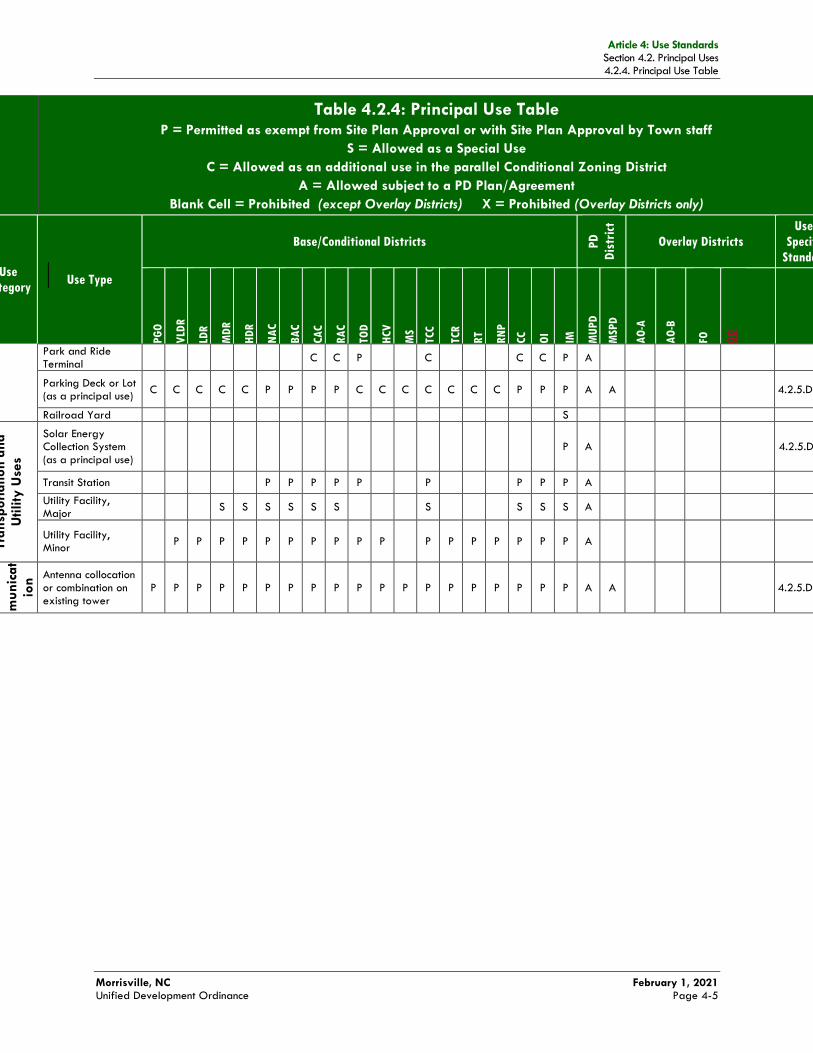
Article 4: Use Standards Section 4.2. Principal Uses 4.2.4. Principal Use Table
Morrisville, NC February 1, 2021 Unified Development Ordinance Page 4-5
Table 4.2.4: Principal Use Table P = Permitted as exempt from Site Plan Approval or with Site Plan Approval by Town staff
S = Allowed as a Special Use
C = Allowed as an additional use in the parallel Conditional Zoning District
A = Allowed subject to a PD Plan/Agreement
Blank Cell = Prohibited (except Overlay Districts) X = Prohibited (Overlay Districts only)
Use
Category Use Type
Base/Conditional Districts PD
Dis
tric
t
Overlay Districts
Use-
Specific
Standard
PG
O
VLD
R
LDR
MD
R
HD
R
NA
C
BA
C
CA
C
RA
C
TO
D
HCV
MS
TCC
TCR
RT
RN
P
CC
OI
IM
MU
PD
MSP
D
AO
-A
AO
-B
FO
GO
Park and Ride Terminal
C C P C C C P A
Parking Deck or Lot (as a principal use)
C C C C C P P P P C C C C C C C P P P A A
4.2.5.D.3.b
Railroad Yard S
Tra
nsp
ort
ation
and
Utility
Use
s
Solar Energy Collection System (as a principal use)
P A
4.2.5.D.3.c
Transit Station P P P P P P P P P A
Utility Facility, Major
S S S S S S S S S S A
Utility Facility, Minor
P P P P P P P P P P P P P P P P P A
Tele
com
mu
nic
at
ion
Use
s
Antenna collocation or combination on existing tower
P P P P P P P P P P P P P P P P P P P A A
4.2.5.D.4.a
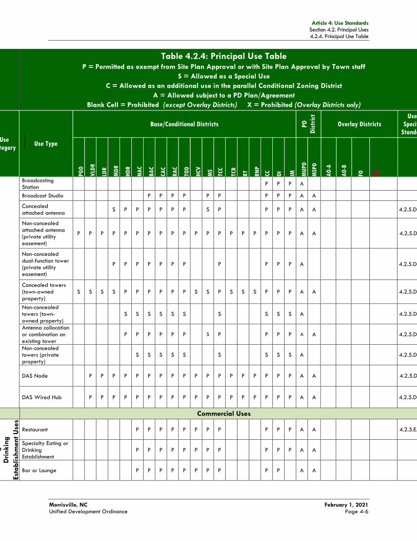
Article 4: Use Standards Section 4.2. Principal Uses 4.2.4. Principal Use Table
Morrisville, NC February 1, 2021 Unified Development Ordinance Page 4-6
Table 4.2.4: Principal Use Table P = Permitted as exempt from Site Plan Approval or with Site Plan Approval by Town staff
S = Allowed as a Special Use
C = Allowed as an additional use in the parallel Conditional Zoning District
A = Allowed subject to a PD Plan/Agreement
Blank Cell = Prohibited (except Overlay Districts) X = Prohibited (Overlay Districts only)
Use
Category Use Type
Base/Conditional Districts PD
Dis
tric
t
Overlay Districts
Use-
Specific
Standard
PG
O
VLD
R
LDR
MD
R
HD
R
NA
C
BA
C
CA
C
RA
C
TO
D
HCV
MS
TCC
TCR
RT
RN
P
CC
OI
IM
MU
PD
MSP
D
AO
-A
AO
-B
FO
GO
Broadcasting Station
P P P A
Broadcast Studio P P P P P P P P P A A
Concealed attached antenna
S P P P P P P S P P P P A A
4.2.5.D.4.b
Non-concealed attached antenna (private utility easement)
P P P P P P P P P P P P P P P P P P P A A
4.2.5.D.4.c
Non-concealed dual-function tower (private utility easement)
P P P P P P P P P P P A
4.2.5.D.4.d
Concealed towers (town-owned property)
S S S S P P P P P P S S P S S S P P P A A
4.2.5.D.4.e
Non-concealed towers (town-owned property)
S S S S S S S S S S A
4.2.5.D.4.e
Antenna collocation or combination on existing tower
P P P P P P S P P P P A A
4.2.5.D.4.e
Non-concealed towers (private property)
S S S S S S S S S A
4.2.5.D.4.e
DAS Node P P P P P P P P P P P P P P P P P P A A
4.2.5.D.4.f
DAS Wired Hub P P P P P P P P P P P P P P P P P P A A
4.2.5.D.4.g
Commercial Uses
Eating
and
Dri
nkin
g
Est
ablish
ment U
ses
Restaurant P P P P P P P P P P P A A
4.2.5.E.1.a
Specialty Eating or Drinking Establishment
P P P P P P P P P P P A A
Bar or Lounge P P P P P P P P P P A A
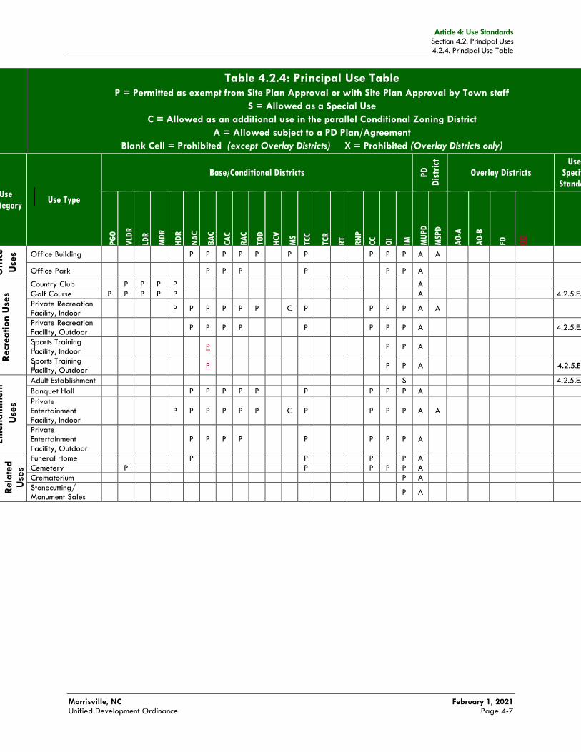
Article 4: Use Standards Section 4.2. Principal Uses 4.2.4. Principal Use Table
Morrisville, NC February 1, 2021 Unified Development Ordinance Page 4-7
Table 4.2.4: Principal Use Table P = Permitted as exempt from Site Plan Approval or with Site Plan Approval by Town staff
S = Allowed as a Special Use
C = Allowed as an additional use in the parallel Conditional Zoning District
A = Allowed subject to a PD Plan/Agreement
Blank Cell = Prohibited (except Overlay Districts) X = Prohibited (Overlay Districts only)
Use
Category Use Type
Base/Conditional Districts PD
Dis
tric
t
Overlay Districts
Use-
Specific
Standard
PG
O
VLD
R
LDR
MD
R
HD
R
NA
C
BA
C
CA
C
RA
C
TO
D
HCV
MS
TCC
TCR
RT
RN
P
CC
OI
IM
MU
PD
MSP
D
AO
-A
AO
-B
FO
GO
Off
ice
Use
s Office Building P P P P P P P P P P A A
Office Park P P P P P P A
Recr
ea
tion U
ses
Country Club P P P P A
Golf Course P P P P P A 4.2.5.E.3.a
Private Recreation Facility, Indoor
P P P P P P C P P P P A A
Private Recreation Facility, Outdoor
P P P P P P P P A
4.2.5.E.3.b
Sports Training Facility, Indoor
P P P A
Sports Training Facility, Outdoor
P P P A
4.2.5.E.3.c
Ente
rta
inm
ent
Use
s
Adult Establishment S 4.2.5.E.4.a
Banquet Hall P P P P P P P P P A
Private Entertainment Facility, Indoor
P P P P P P C P P P P A A
Private Entertainment Facility, Outdoor
P P P P P P P P A
Funera
l
Rela
ted
Use
s
Funeral Home P P P P A
Cemetery P P P P P A
Crematorium P A
Stonecutting/ Monument Sales
P A

Article 4: Use Standards Section 4.2. Principal Uses 4.2.4. Principal Use Table
Morrisville, NC February 1, 2021 Unified Development Ordinance Page 4-8
Table 4.2.4: Principal Use Table P = Permitted as exempt from Site Plan Approval or with Site Plan Approval by Town staff
S = Allowed as a Special Use
C = Allowed as an additional use in the parallel Conditional Zoning District
A = Allowed subject to a PD Plan/Agreement
Blank Cell = Prohibited (except Overlay Districts) X = Prohibited (Overlay Districts only)
Use
Category Use Type
Base/Conditional Districts PD
Dis
tric
t
Overlay Districts
Use-
Specific
Standard
PG
O
VLD
R
LDR
MD
R
HD
R
NA
C
BA
C
CA
C
RA
C
TO
D
HCV
MS
TCC
TCR
RT
RN
P
CC
OI
IM
MU
PD
MSP
D
AO
-A
AO
-B
FO
GO
Reta
il S
ale
s a
nd
Serv
ice U
ses
Convenience Store P P S S P P P P A
Farmers’ Market P P P P P P P P P A A 4.2.5.E.6.a
Retail Store
< 3,000 sf P P P P P P P P P P P A A
3,000 to < 20,000 sf
P P P P P C P P P P P A A
20,000 to < 50,000 sf
P P P P P C C C P P P A A
50,000 to < 75,000 sf
P P P P A
≥ 75,000 sf P P P P A
Service Establishment
P P P P P P P P P P P A A
Reta
il S
ale
s
and
Serv
ice
Use
s
Service Establishment, Personal
P P P P P P P P P P P A A
4.2.5.E.6.b
Shopping Center, Major
P P
P P A
Shopping Center, Neighborhood
P P P P P P P P A
Vehic
le/
Eq
uip
ment Sa
les
and
Serv
ice U
ses
Automobile Repair, Major
P A
4.2.5.E.7.a
Automobile Repair, Minor
P P P P P A
4.2.5.E.7.b
Automobile Sales or Rental
P P A
4.2.5.E.7.c
Automobile Service Station
S S P P A
4.2.5.E.7.d
Car Wash/ Detailing
P P P P P A
4.2.5.E.7.e
Recreational Vehicle Sales, Rental, or Service
P A
4.2.5.E.7.f
Taxi or Limousine Service
P P A
4.2.5.E.7.g
Tire Capping and Retreading
P A
4.2.5.E.7.h
Vehicle Fleet Storage
P A
4.2.5.E.7.i
Vehicular Towing Service
P A
4.2.5.E.7.j
Vis
itor
Acc
om
mo-
da
tion
Use
s Bed and Breakfast P P P P A
4.2.5.E.8.a
Hotel/Motel P P P P C P P P P A A
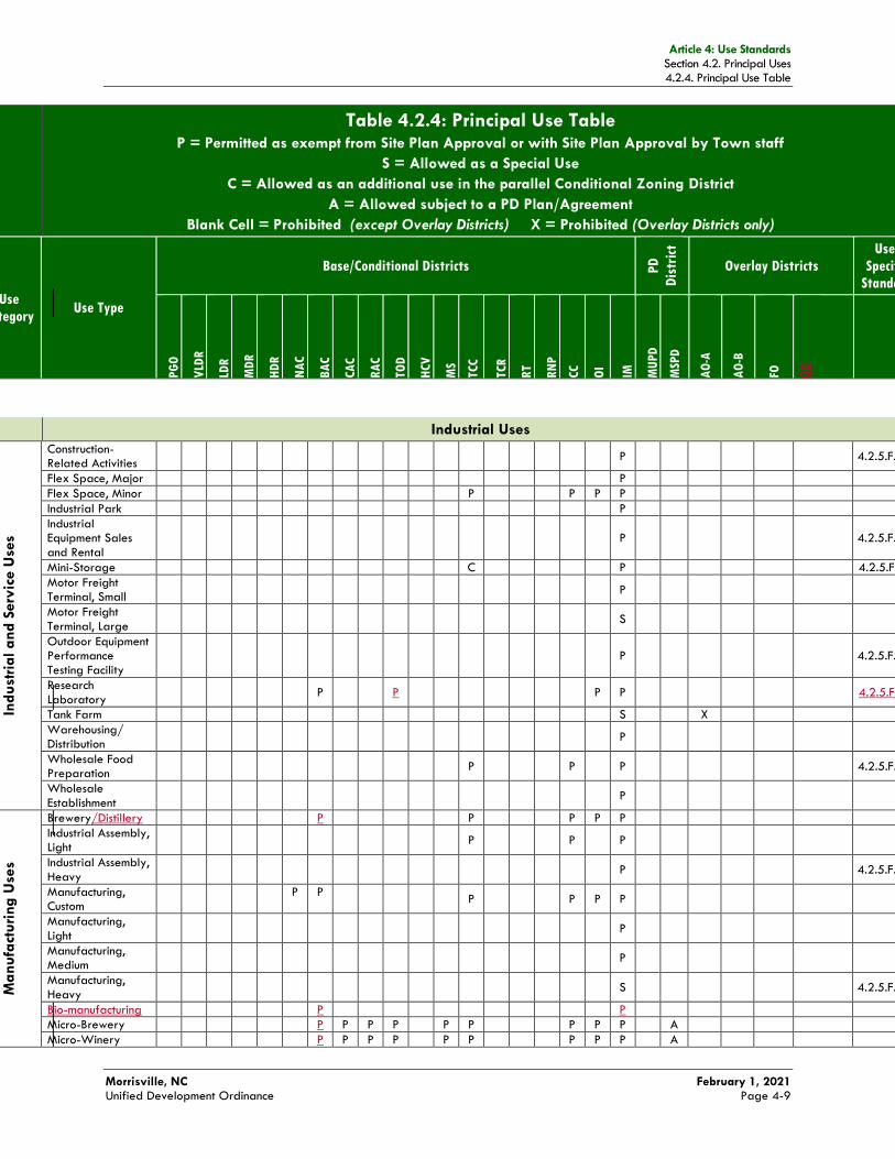
Article 4: Use Standards Section 4.2. Principal Uses 4.2.4. Principal Use Table
Morrisville, NC February 1, 2021 Unified Development Ordinance Page 4-9
Table 4.2.4: Principal Use Table P = Permitted as exempt from Site Plan Approval or with Site Plan Approval by Town staff
S = Allowed as a Special Use
C = Allowed as an additional use in the parallel Conditional Zoning District
A = Allowed subject to a PD Plan/Agreement
Blank Cell = Prohibited (except Overlay Districts) X = Prohibited (Overlay Districts only)
Use
Category Use Type
Base/Conditional Districts PD
Dis
tric
t
Overlay Districts
Use-
Specific
Standard
PG
O
VLD
R
LDR
MD
R
HD
R
NA
C
BA
C
CA
C
RA
C
TO
D
HCV
MS
TCC
TCR
RT
RN
P
CC
OI
IM
MU
PD
MSP
D
AO
-A
AO
-B
FO
GO
Industrial Uses
Ind
ust
rial a
nd
Serv
ice U
ses
Construction-Related Activities
P
4.2.5.F.1.a
Flex Space, Major P
Flex Space, Minor P P P P
Industrial Park P
Industrial Equipment Sales and Rental
P
4.2.5.F.1.b
Mini-Storage C P 4.2.5.F.1.c
Motor Freight Terminal, Small
P
Motor Freight Terminal, Large
S
Outdoor Equipment Performance Testing Facility
P
4.2.5.F.1.d
Research Laboratory
P P P P
4.2.5.F.1.f
Tank Farm S X
Warehousing/ Distribution
P
Wholesale Food Preparation
P P P
4.2.5.F.1.e
Wholesale Establishment
P
Ma
nufa
cturi
ng
Use
s
Brewery/Distillery P P P P P
Industrial Assembly, Light
P P P
Industrial Assembly, Heavy
P
4.2.5.F.2.a
Manufacturing, Custom
P P
P P P P
Manufacturing, Light
P
Manufacturing, Medium
P
Manufacturing, Heavy
S
4.2.5.F.2.a
Bio-manufacturing P P
Micro-Brewery P P P P P P P P P A
Micro-Winery P P P P P P P P P A
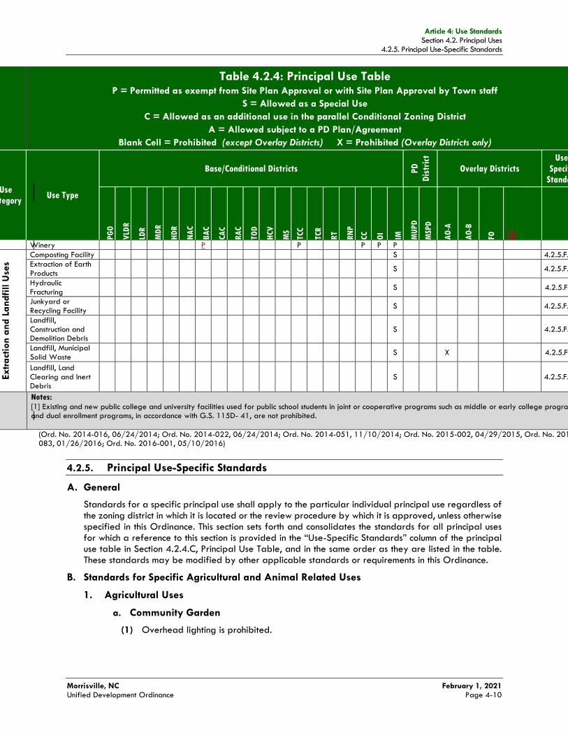
Article 4: Use Standards Section 4.2. Principal Uses 4.2.5. Principal Use-Specific Standards
Morrisville, NC February 1, 2021 Unified Development Ordinance Page 4-10
Table 4.2.4: Principal Use Table P = Permitted as exempt from Site Plan Approval or with Site Plan Approval by Town staff
S = Allowed as a Special Use
C = Allowed as an additional use in the parallel Conditional Zoning District
A = Allowed subject to a PD Plan/Agreement
Blank Cell = Prohibited (except Overlay Districts) X = Prohibited (Overlay Districts only)
Use
Category Use Type
Base/Conditional Districts PD
Dis
tric
t
Overlay Districts
Use-
Specific
Standard
PG
O
VLD
R
LDR
MD
R
HD
R
NA
C
BA
C
CA
C
RA
C
TO
D
HCV
MS
TCC
TCR
RT
RN
P
CC
OI
IM
MU
PD
MSP
D
AO
-A
AO
-B
FO
GO
Winery P P P P P
Extr
act
ion a
nd
La
ndfi
ll U
ses
Composting Facility S 4.2.5.F.3.a
Extraction of Earth Products
S
4.2.5.F.3.b
Hydraulic Fracturing
S
4.2.5.F.3.c
Junkyard or Recycling Facility
S
4.2.5.F.3.d
Landfill, Construction and Demolition Debris
S
4.2.5.F.3.e
Landfill, Municipal Solid Waste
S
X
4.2.5.F.3.f
Landfill, Land Clearing and Inert Debris
S
4.2.5.F.3.g
Notes: [1] Existing and new public college and university facilities used for public school students in joint or cooperative programs such as middle or early college programs and dual enrollment programs, in accordance with G.S. 115D- 41, are not prohibited.
(Ord. No. 2014-016, 06/24/2014; Ord. No. 2014-022, 06/24/2014; Ord. No. 2014-051, 11/10/2014; Ord. No. 2015-002, 04/29/2015, Ord. No. 2015-083, 01/26/2016; Ord. No. 2016-001, 05/10/2016)
4.2.5. Principal Use-Specific Standards
A. General
Standards for a specific principal use shall apply to the particular individual principal use regardless of the zoning district in which it is located or the review procedure by which it is approved, unless otherwise specified in this Ordinance. This section sets forth and consolidates the standards for all principal uses for which a reference to this section is provided in the “Use-Specific Standards” column of the principal use table in Section 4.2.4.C, Principal Use Table, and in the same order as they are listed in the table. These standards may be modified by other applicable standards or requirements in this Ordinance.
B. Standards for Specific Agricultural and Animal Related Uses
1. Agricultural Uses
a. Community Garden
(1) Overhead lighting is prohibited.
Article 4: Use Standards Section 4.2. Principal Uses 4.2.5. Principal Use-Specific Standards
Morrisville, NC February 1, 2021 Unified Development Ordinance Page 4-11
(2) Accessory buildings shall be limited to sheds for the storage of tools, greenhouses, and seasonal farm stands. The combined area of all buildings and other structures shall not exceed 15 percent of the area of the parcel.
(3) Areas used for communal composting shall be limited to ten percent of the area of the parcel.
(4) Perimeter fences, including trellises, are allowed in community gardens, subject to the standards in Section 5.14, Fences and Walls.
(5) The community garden shall have an established set of operating rules addressing the governance structure of the garden, hours of operation, assignment of garden plots, and maintenance and security requirements and responsibilities.
b. Farm, Small
The raising of livestock or other animals for commercial purposes is not allowed within the boundary of the Town Center.
c. Forestry
(1) Forestry activities may occur only on property enrolled as timberland in the State’s present use-value tax program or pursuant to a forest management plan prepared by a registered forester.
(2) Forestry activities shall apply best management practices as necessary to comply with the North Carolina Forestry Practice Guidelines Related to Water Quality (15A NCAC 01I.0102 et seq.).
(3) Forestry activities resulting in the clear-cutting of trees from a site subsequently proposed for development may result in up to a five-year delay in obtaining permits for the development, in accordance with 5.4.2.C, Limitations on Development Proposals Subsequent to Exempt Forestry Activity.
d. Greenhouse/Nursery
(1) Allowed only on rooftops of principal structures in the TOD district.
2. Animal Related Uses
a. Kennel, Indoor
(1) Those parts of structures in which animals are boarded shall be fully enclosed with solid core doors and no operable windows, and shall be sufficiently insulated so noises comply with the noise regulations in the Code of Ordinances, and no unreasonable odor can be detected off the premises.
(2) The facility shall include a minimum of 200 square feet of outdoor enclosed yard for supervised use by boarded animals for exercise or elimination of waste. Such yard shall be enclosed by an opaque fence or masonry wall at least eight feet in height.
(3) All boarded animals shall be kept within a totally enclosed part of a structure between the hours of 10:00 p.m. and 6:00 a.m.
(Ord. No. 2014-022, 06/24/2014; Ord. No. 2016-001, 05/10/2016)
b. Kennel, Outdoor
(1) Those parts of structures in which animals are boarded shall be fully enclosed with solid core doors and no operable windows, and shall be sufficiently insulated so noises comply
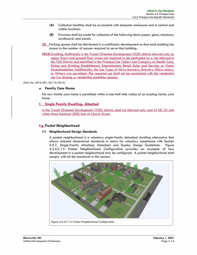
Article 4: Use Standards Section 4.2. Principal Uses 4.2.5. Principal Use-Specific Standards
Morrisville, NC February 1, 2021 Unified Development Ordinance Page 4-14
(A) Collection facilities shall be co-located with dumpster enclosures and in central and visible locations.
(B) Provision shall be made for collection of the following items: paper, glass, aluminum, cardboard, and plastic.
(2) Parking spaces shall be distributed in a multifamily development so that each building has access to the number of spaces required to serve that building.
(2)(3) Dwelling, Multifamily in the Transit Oriented Development (TOD) district allowed only on upper floors and ground floor areas not required to be dedicated as a use allowed in the TOD District and identified in the Principal Use Table’s Use Category as Health Care, Eating and Drinking Establishment, Entertainment, Retail Sales and Service, or Visitor Accommodation. Additionally, the Use Types of Micro-brewery, Brewery, Micro-winery, or Winery are permitted. The required use shall not be associated with the residential use (i.e. leasing or residential amenities spaces).
(Ord. No. 2016-001, 05/10/2016)
e. Family Care Home
No new family care home is permitted within a one-half mile radius of an existing family care home.
f. Single Family Dwelling, Attached
In the Transit Oriented Development (TOD) district, shall be allowed only west of NC 54 and within three hundred (300) feet of Church Street.
f.g. Pocket Neighborhood
(1) Neighborhood Design Standards
A pocket neighborhood is a voluntary single-family detached dwelling alternative that allows reduced dimensional standards in return for voluntary compliance with Section 5.9.7, Single-Family Attached, Detached and Duplex Design Guidelines. Figure 4.2.5.C.1.f: Pocket Neighborhood Configuration provides an example of how development in a pocket neighborhood may be configured. A pocket neighborhood shall comply with all the standards in this section.
Figure 4.2.5.C.1.f: Pocket Neighborhood Configuration
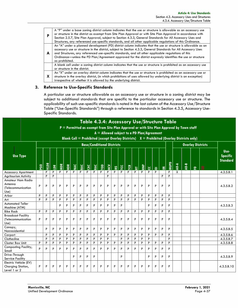
Article 4: Use Standards Section 4.3. Accessory Uses and Structures 4.3.4. Accessory Use/Structure Table
Morrisville, NC February 1, 2021 Unified Development Ordinance Page 4-37
P
A “P” under a base zoning district column indicates that the use or structure is allowable as an accessory use or structure in the district as exempt from Site Plan Approval or with Site Plan Approval in accordance with Section 2.5.7, Site Plan Approval, subject to Section 4.3.3, General Standards for All Accessory Uses and Structures, any referenced use-specific standards, and all other applicable regulations of this Ordinance.
A
An “A” under a planned development (PD) district column indicates that the use or structure is allowable as an accessory use or structure in the district, subject to Section 4.3.3, General Standards for All Accessory Uses and Structures, any referenced use-specific standards, and all other applicable regulations of this Ordinance—unless the PD Plan/Agreement approved for the district expressly identifies the use or structure as prohibited.
A blank cell under a zoning district column indicates that the use or structure is prohibited as an accessory use or structure in the district.
X An “X” under an overlay district column indicates that the use or structure is prohibited as an accessory use or structure in the overlay district, (in which prohibitions of uses allowed by underlying district is an exception) irrespective of whether it is allowed by the underlying district.
3. Reference to Use-Specific Standards
A particular use or structure allowable as an accessory use or structure in a zoning district may be subject to additional standards that are specific to the particular accessory use or structure. The applicability of such use-specific standards is noted in the last column of the Accessory Use/Structure Table (“Use-Specific Standards”) through a reference to standards in Section 4.3.5, Accessory Use-Specific Standards.
Table 4.3.4: Accessory Use/Structure Table P = Permitted as exempt from Site Plan Approval or with Site Plan Approval by Town staff
A = Allowed subject to a PD Plan/Agreement
Blank Cell = Prohibited (except Overlay Districts) X = Prohibited (Overlay Districts only)
Use Type
Base/Conditional Districts
MU
PD
Overlay Districts
Use-
Specific
Standard
PG
O
VLD
R
LDR
MD
R
HD
R
NA
C
BA
C
CA
C
RA
C
TO
D
HCV
MS
TCC
TCR
RT
RN
P
CC
OI
IM
AO
-A
AO
-B
FO
GO
Accessory Apartment P P P P P P P P P P P P P P P P P P X 4.3.5.B.1
Agritourism Activity P P P P P
Amateur Ham Radio Antenna (Telecommunication Use)
P P P P P P P P P P P P P P P P P P P P
4.3.5.B.2
Arbor P P P P P P P P P P P P P P P P P P P P
Art P P P P P P P P P P P P P P P P P P P P
Automated Teller Machine (ATM)
P P P P P P P P P P P P P P
4.3.5.B.3
Bike Rack P P P P P P P P P P P P P P P P P P P P
Broadcast Facility (Telecommunication Use)
P P P P P P P P P P P P P P P P P P P P
4.3.5.B.4
Canopy, Nonresidential
P P P P P P P P P P P P P P P P P P P
4.3.5.B.5
Carport P P P P P P P P P P P P P P P P P P P 4.3.5.B.6
Clothesline P P P P P P P P P P P P P P P P 4.3.5.B.7
Cluster Box Unit P P P P P P P P P P P P P P P P P P P P 4.3.5.B.8
Composting Facility, Small
P P P P P P P P P P P P P P P P P P P P
Drive-Through Service Facility
P P P P P P P P P
4.3.5.B.9
Electric Vehicle (EV) Charging Station, Level 1 or 2
P P P P P P P P P P P P P P P P P P P P
4.3.5.B.10
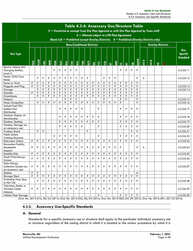
Article 4: Use Standards Section 4.3. Accessory Uses and Structures 4.3.5. Accessory Use-Specific Standards
Morrisville, NC February 1, 2021 Unified Development Ordinance Page 4-38
Table 4.3.4: Accessory Use/Structure Table P = Permitted as exempt from Site Plan Approval or with Site Plan Approval by Town staff
A = Allowed subject to a PD Plan/Agreement
Blank Cell = Prohibited (except Overlay Districts) X = Prohibited (Overlay Districts only)
Use Type
Base/Conditional Districts
MU
PD
Overlay Districts
Use-
Specific
Standard
PG
O
VLD
R
LDR
MD
R
HD
R
NA
C
BA
C
CA
C
RA
C
TO
D
HCV
MS
TCC
TCR
RT
RN
P
CC
OI
IM
AO
-A
AO
-B
FO
GO
Electric Vehicle (EV) Charging Station, Level 3
P P P P P P P P P
4.3.5.B.11
Family Child Care Home
P P P P P P P P P P P P P P X
4.3.5.B.12
Fence or Wall P P P P P P P P P P P P P P P P P P P P
Flagpole and Flag P P P P P P P P P P P P P P P P P P P P 4.3.5.B.13
Garage P P P P P P P P P P P P P P P P P P P 4.3.5.B.14
Gazebo P P P P P P P P P P P P P P P P P P P P
Greenhouse P P P P P P P P P P P P P P P P P P P
Heliport P P P P P P P 4.3.5.B.15
Home Occupation P P P P P P P P P P P P P P P P P 4.3.5.B.16
Limited Fuel/Oil/ Bottled Gas Distribution
P P P P P P P P P P
4.3.5.B.17
Outdoor Display of Merchandise
P P P P P P P P P P P P
4.3.5.B.18
Outdoor Seating P P P P P P P P P P P P 4.3.5.B.19
Outdoor Storage (as an accessory use)
P P P P P P P P P P
4.3.5.B.20
Produce Stand P P P P P 4.3.5.B.21
Public Safety Training Structure
P P P P P P P P P P
4.3.5.B.22
Rainwater Cistern P P P P P P P P P P P P P P P P P P P P 4.3.5.B.23
Recreation Facility, Residential Support
P P P P P P P P P P P P P P P P P P X
4.3.5.B.24
Satellite Dish P P P P P P P P P P P P P P P P P P P P 4.3.5.B.25
Small Wind Energy System
P P P P P P P P P P P P P P P P P P P P
4.3.5.B.26
Solar Energy Collection System (as an accessory use)
P P P P P P P P P P P P P P P P P P P P
4.3.5.B.27
Stables P P A
Storage Shed P P P P P P P P P P P P P P P P P P P P
Swimming Pool, Spa, or Hot Tub
P P P P P P P P P P P P P P P P P P P
4.3.5.B.28
Television, Radio, or Wireless Cable Antenna
P P P P P P P P P P P P P P P P P P P P
4.3.5.B.29
Vehicle Fleet Storage P P P P P 4.3.5.B.30
(Ord. No. 2014-016, 06/24/2014; Ord. No. 2014-022, 06/24/2014; Ord. No. 2015-002, 04/29/2015; Ord. No. 2016-001, 05/10/2016)
4.3.5. Accessory Use-Specific Standards
A. General
Standards for a specific accessory use or structure shall apply to the particular individual accessory use or structure regardless of the zoning district in which it is located or the review procedure by which it is
Article 5: Development Standards Section 5.3. Subdivision Blocks, Lots, and Reference Points
5.3.2. Lots
Morrisville, NC February 1, 2021 Unified Development Ordinance Page 5-2
B. Blocks shall have sufficient width to provide for two back-to-back rows of street-fronting lots of appropriate depth for the zoning district, excluding any water bodies, public alleys, or other public rights-of-way. Exceptions shall be permitted in blocks adjacent to thoroughfares, railroads, or waterways, or due to limiting topographical conditions, the size or configuration of the site, or for approved through lots.
C. Blocks in the Main Street (MS) District shall not exceed a length of 350 feet. Blocks in the Transit-Oriented Development (TOD) District shall not exceed a length of 800 feet. Blocks in the Gateway Overlay (GO) District shall not exceed a length of 800 feet. Alternative block configurations in the MS District may be approved in accordance with Section 2.5.20, Alternative Equivalent Compliance. In all other districts, blocks shall be at least 400 feet long and no more than 1,200 feet long except as necessary to secure efficient use of land, or desired features of the street pattern, or to reflect the size and configuration of the site.
(Ord. No. 2018-302-0, 09/11/2018)
D. The lengths, widths, and shapes of blocks shall be determined based on the following:
1. Lot area and width standards;
2. Needs for convenient access, circulation, control, and safety of vehicular, bicycle, and pedestrian traffic;
3. Relationship to existing utilities;
4. Layout of the water system with regard to eliminating stagnant water, providing adequate fire flow, appropriately placing fire hydrants, and meeting minimum pressure requirements.;
5. Layout of the sanitary sewer system with regard to utilizing gravity sewer system wherever possible and minimizing the use of sewer force mains;
6. Layout of the stormwater management system with regard to utilizing natural outfalls adjacent to the land being subdivided, and effectively using existing public stormwater or drainage systems;
7. Location of existing and proposed easements; and
8. Limitations and opportunities of existing, pre-development topography.
5.3.2. Lots
A. Each lot shall meet the applicable lot area and width standards set forth in Article 3: Zoning Districts, and otherwise be developable in accordance with the standards in this Ordinance.
B. Lots shall be arranged in relationship to topography, flood hazards, tree protection requirements, or other site conditions to minimize difficulties in providing a reasonable building site and yard area in accordance with requirement of this Ordinance.
C. Each lot shall be situated so that stormwater may be easily directed away from buildings in subsequent site-specific development. Lots shall be configured so that buildings and general flood sensitive site facilities are not located in drainage ways.
D. Each single-family detached, duplex, manufactured home, and single-family attached dwelling lot shall have at least 20 feet of frontage on a public street right-of-way—except for the following:
1. The Transit-Oriented Development (TOD) District where lots with vehicular access from a rear alley may front on publicly-dedicated open space instead of a street;
2. Bungalow courts that comply with Section 4.2.5.C.1.a(2), Site Requirements; or
3. Pocket neighborhoods that comply with Section 4.2.5.C.1.f(2), Site Requirements.
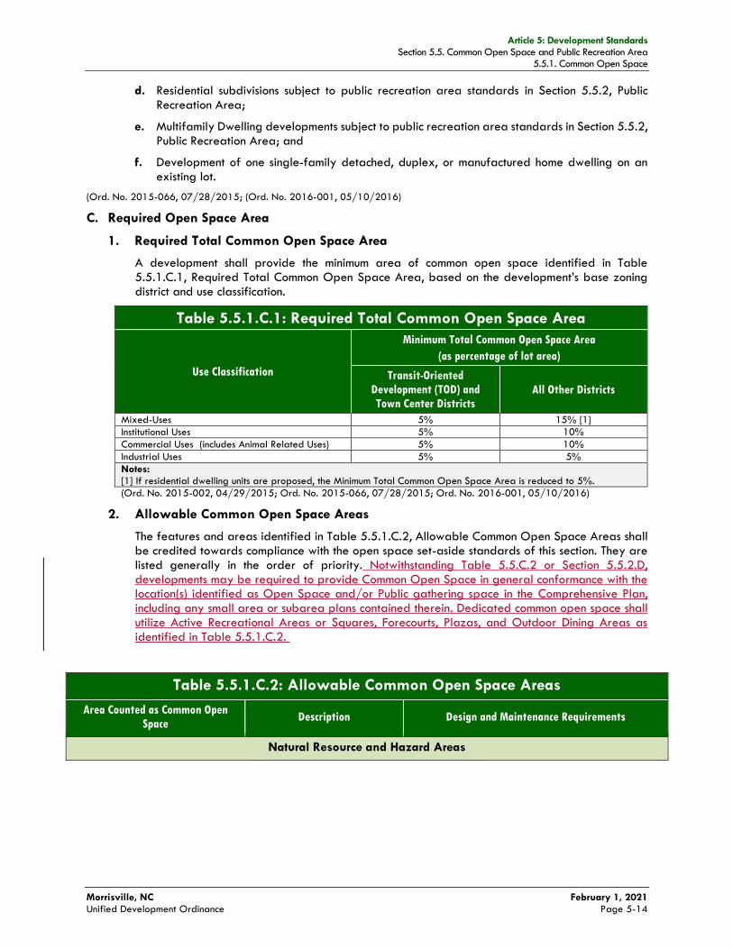
Article 5: Development Standards Section 5.5. Common Open Space and Public Recreation Area
5.5.1. Common Open Space
Morrisville, NC February 1, 2021 Unified Development Ordinance Page 5-14
d. Residential subdivisions subject to public recreation area standards in Section 5.5.2, Public Recreation Area;
e. Multifamily Dwelling developments subject to public recreation area standards in Section 5.5.2, Public Recreation Area; and
f. Development of one single-family detached, duplex, or manufactured home dwelling on an existing lot.
(Ord. No. 2015-066, 07/28/2015; (Ord. No. 2016-001, 05/10/2016)
C. Required Open Space Area
1. Required Total Common Open Space Area
A development shall provide the minimum area of common open space identified in Table 5.5.1.C.1, Required Total Common Open Space Area, based on the development’s base zoning district and use classification.
Table 5.5.1.C.1: Required Total Common Open Space Area
Use Classification
Minimum Total Common Open Space Area
(as percentage of lot area)
Transit-Oriented
Development (TOD) and
Town Center Districts
All Other Districts
Mixed-Uses 5% 15% [1]
Institutional Uses 5% 10%
Commercial Uses (includes Animal Related Uses) 5% 10%
Industrial Uses 5% 5%
Notes: [1] If residential dwelling units are proposed, the Minimum Total Common Open Space Area is reduced to 5%.
(Ord. No. 2015-002, 04/29/2015; Ord. No. 2015-066, 07/28/2015; Ord. No. 2016-001, 05/10/2016)
2. Allowable Common Open Space Areas
The features and areas identified in Table 5.5.1.C.2, Allowable Common Open Space Areas shall be credited towards compliance with the open space set-aside standards of this section. They are listed generally in the order of priority. Notwithstanding Table 5.5.C.2 or Section 5.5.2.D, developments may be required to provide Common Open Space in general conformance with the location(s) identified as Open Space and/or Public gathering space in the Comprehensive Plan, including any small area or subarea plans contained therein. Dedicated common open space shall utilize Active Recreational Areas or Squares, Forecourts, Plazas, and Outdoor Dining Areas as identified in Table 5.5.1.C.2.
Table 5.5.1.C.2: Allowable Common Open Space Areas
Area Counted as Common Open
Space Description Design and Maintenance Requirements
Natural Resource and Hazard Areas

Article 5: Development Standards Section 5.5. Common Open Space and Public Recreation Area
5.5.2. Public Recreation Area
Morrisville, NC February 1, 2021 Unified Development Ordinance Page 5-19
C. Required Public Recreation Area
1. Type 1 and Type 2 Subdivisions
Any subdivisions proposing to create lots designed and intended to serve as building sites for bungalow court, pocket neighborhood, single-family detached, duplex, manufactured home, single-family attached, multifamily, live/work, congregate living facility, and continuing care retirement facility shall dedicate a portion of the subdivision site as public recreation area. The amount of land required to be dedicated shall equal 1/35 of an acre multiplied by the number of dwelling units proposed to be accommodated by subdivision lots (for subdivisions creating lots for bungalow court, pocket neighborhood, single-family detached, manufactured home, or single-family attached dwellings, this will equal the number of such lots; for subdivisions creating lots for duplex dwellings, this will equal twice the number of lots; for subdivisions creating lots for multifamily dwellings, live/work, congregate living, and continuing care retirement facilities this will equal the number of dwelling units).
2. Site Plan Approval for Multifamily Dwellings
In instances where the Town Council authorizes partial payment of in lieu funds and partial dedication of public recreation area for any multifamily dwelling development or mixed-use not subject to subdivision regulations, the amount of land required to be dedicated shall equal 1/35 acre multiplied by the number of multifamily dwelling units proposed for land dedication multiplied by the current multifamily factor (e.g. 1/35 * the number of dwelling units * .80). A flat fee per unit shall be paid for any dwelling unit not proposed for land dedication.
(Ord. No. 2016-001, 05/10/2016)
D. Design Standards for Required Public Recreation Area
Areas used as a required public recreation area shall meet the following design standards:
1. Required public recreation area shall be compact and contiguous, forming a single area, unless multiple public recreation areas or a different configuration is needed to continue an existing trail or accommodate preservation of natural features.
2. The size and shape of required public recreation area shall be sufficient to accommodate active recreation activities appropriate to the recreational needs of subdivision residents (e.g., public recreation area should be sufficiently large and rectangular to accommodate soccer or softball fields, tennis courts, swimming pools, etc.).
3. Required public recreation area shall be located to be readily accessible and useable by occupants and users of the development.
4. Required public recreation area shall have at least 50 feet of frontage on a public street or a public access easement at least 30 feet wide.
5. No land dedicated as active public recreation area shall be located on slopes exceeding five percent.
6. No more than 25 percent of land dedicated as active public recreation area shall be located within a Floodplain Overlay District.
7. If the development site is adjacent to existing or planned parks, greenways, or other public open space, required public recreation area shall, to the maximum extent practicable, be located to adjoin, extend, and enlarge the park, greenway, or other public open space.
7.8. Notwithstanding the above, if property is identified in the Comprehensive Plan, including any small area or subarea plans contained therein, as Open Space and/or Public gathering space, the Town may require land dedication in locations shown in the Comprehensive Plan even if standards 1-7 above are not met.

Article 5: Development Standards Section 5.7. Perimeter and Streetyard Buffers
5.7.3. Required Buffer Type
Morrisville, NC February 1, 2021 Unified Development Ordinance Page 5-31
f. Street; or
g. An existing residential dwelling or development.
2. Transit Oriented Development (TOD)
g. Development internal to the Transit Oriented Development (TOD) district shall only be required to plant shade trees at a minimum of every forty (40) feet within the required sidewalk.
(Ord. No. 2016-001, 05/10/2016)
5.7.3. Required Buffer Type
Table 5.7.3, Required Buffer Type specifies the type of perimeter or streetyard buffer that a new development shall provide between it and an adjoining property or street, based on the proposed use type on the development site and the existing use type on the adjoining property, the zoning district in which abutting vacant property is located, or the classification of an adjoining street. The type of buffer to be provided is indicated by a letter corresponding to one of the buffer types depicted in Table 5.7.3, Required Buffer Type
Table 5.7.3: Required Buffer Type A, B, C, D, E = Type of Perimeter Buffer (see Section 5.7.4) F, G, H, I, J, K = Type of Streetyard Buffer (see Section 5.7.4)
n/a = Not Applicable (no buffer required)
Existing Use Type
or Category on
Adjoining Land [2]
or Classification
of Adjoining
Street
Zoning of
Adjoining
Vacant Land
[2]
Proposed Use Type or Category [1]
Single-Family
Detached,
Duplex, or
Manufactured
Home Dwelling
Single-
Family
Attached
Dwelling
Multifamily
Dwelling
Institutional
Use
Commercial
Use, or Mixed-
Use
Development
Industrial
Use
Single-family detached, duplex, or manufactured home dwelling
VLDR, LDR, HCV, RNP
D [3] D C C B A
Single-family attached dwelling, bungalow court, pocket neighborhood
MDR, TCR, RT D D C C B A
Multifamily, manufactured home park
HDR C C D C B A
Institutional use PGO, OI C C C D C B
Commercial use, mixed-use development, agricultural use, animal related use
NAC, BAC, CAC, RAC, TOD, MS, CC, TCC, MUPD
B B B C C B
Industrial use IM A A A B B C
Cemetery n/a C C C C C C
Major utility facility [3]
n/a E E E E E E
Minor utility facility [4]
n/a C C C C C C
Railroad n/a A A A B B B
Freeway n/a F F F F F F
Major or minor thoroughfare
n/a G G G G G G
Collector street n/a H H H H H H
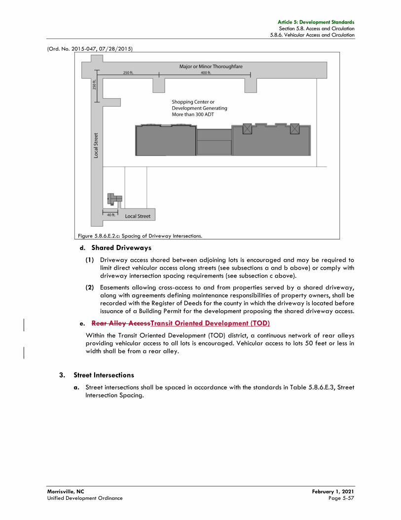
Article 5: Development Standards Section 5.8. Access and Circulation
5.8.6. Vehicular Access and Circulation
Morrisville, NC February 1, 2021 Unified Development Ordinance Page 5-57
(Ord. No. 2015-047, 07/28/2015)
Figure 5.8.6.E.2.c: Spacing of Driveway Intersections.
d. Shared Driveways
(1) Driveway access shared between adjoining lots is encouraged and may be required to limit direct vehicular access along streets (see subsections a and b above) or comply with driveway intersection spacing requirements (see subsection c above).
(2) Easements allowing cross-access to and from properties served by a shared driveway, along with agreements defining maintenance responsibilities of property owners, shall be recorded with the Register of Deeds for the county in which the driveway is located before issuance of a Building Permit for the development proposing the shared driveway access.
e. Rear Alley AccessTransit Oriented Development (TOD)
Within the Transit Oriented Development (TOD) district, a continuous network of rear alleys providing vehicular access to all lots is encouraged. Vehicular access to lots 50 feet or less in width shall be from a rear alley.
3. Street Intersections
a. Street intersections shall be spaced in accordance with the standards in Table 5.8.6.E.3, Street Intersection Spacing.
Article 5: Development Standards Section 5.8. Access and Circulation
5.8.8. Pedestrian Access and Circulation
Morrisville, NC February 1, 2021 Unified Development Ordinance Page 5-62
(2) Off-street parking bays (including any parking serving on-site transit stations or facilities);
(3) Any designated or planned bus stops and shelters; and
(4) Recreation facilities and other common use area and amenities.
b. The development internal pedestrian circulation system shall also provide safe, convenient, efficient, and orderly movement of pedestrians between the development’s internal pedestrian origin and destination points and adjoining parts of an existing or planned external, community-wide pedestrian circulation system as well as any adjoining transit stations, bus stops and shelters, public parks, greenways, schools, community centers, and shopping areas.
2. Sidewalks Required
a. All new development except an individual single-family detached, duplex, or manufactured home dwelling on an existing lot shall install sidewalks along both sides of roadways proposed within the development site and along the entire frontage of the development site with an existing street (unless an existing sidewalk meeting Town standards is already in place).
b. Such sidewalks shall be provided within the right-of-way of the street unless the Planning Director determines that location within the right-of-way is not practicable—in which case, the sidewalk may be provided on the development site, within a dedicated widening of the right-of-way or a dedicated public easement and running parallel and adjacent to the street.
c. The Planning Director may require additional sidewalks where warranted by the safety and welfare of the general public—including, but not limited to:
(1) Along one side of all driveway entrances to residential and nonresidential off-street parking facilities;
(2) In group living and nonresidential off-street parking facilities to maximize pedestrian travel to and from each business; and
(3) In off-street parking facilities in accordance with Section 5.10.6.D, Pedestrian Walkways through Large Vehicle Parking Areas.
(3)d. In the Transit Oriented Development (TOD) district, except for major thoroughfares, minor thoroughfares, and collector streets, all street shall be constructed with a minimum (10) foot sidewalks.
d. Additional sidewalks or pedestrian walkways may be required where called for by the Comprehensive Plan.
(Ord. No. 2015-002, 04/29/2015)
B. Greenway Paths Required
All new development except individual lot development of a single-family detached, duplex, or manufactured home dwelling on an existing lot (i.e., including subdivisions for such dwellings) shall incorporate into its required open space any greenway or sidepath called for across the development site by the Comprehensive Plan. Such incorporation shall include installation of the path and recording of an associated pedestrian access easement, if applicable.
(Ord. No. 2014-022, 06/24/2014)
C. Pedestrian Connectivity
1. Walkway Connections to/from Adjoining Development and Developable Land
a. Where a public street is extended to or from a development site’s boundary in accordance with Section 5.8.6.D.4, Public Street Connectivity, such extension shall include the extension of any sidewalks within the right-of-way of the street.
b. The pedestrian access and circulation system for a development shall incorporate the continuation and connection of public walkways and associated rights-of-way or easements
Article 5: Development Standards Section 5.9. Building Configuration and Design
5.9.5. Building and Design Standards for Mixed-Use, Group Living, and Nonresidential Development
Morrisville, NC February 1, 2021 Unified Development Ordinance Page 5-70
2. Accent Colors
a. Historic Crossroads Village
All accent colors shall be compatible with the colors found on traditional buildings in the Historic Crossroads Village District. These accent colors range from a deep red and green hues to black.
b. Other Districts
All accent colors shall complement the primary color palette and should be limited to the awnings, doors, and roof materials. (See Figure 5.9.4.C: Example of Exterior Facade Color.)
3. Window, Awning, Roof Material, Aluminum Storefront, Door Frame and Similar Element Colors
The colors of these building features shall be identified, shall complement the primary color palette, and if applicable, shall be identified as an accent color.
(Ord. No. 2016-001, 05/10/2016)
5.9.5. Building and Design Standards for Mixed-Use, Group Living, and Nonresidential Development
A. Applicability
In addition to the exterior material and color standards Section 5.9.4, Exterior Facade Materials and Colors for All Development, mixed-use, group living, and nonresidential development located outside the Transit-Oriented Development (TOD), Historic Crossroads Village (HCV), and Main Street (MS) districts shall comply with the following building and design standards.
B. Facade Wall – Length
1. A facade wall greater than 100 feet in length, measured horizontally, shall:
a. Incorporate wall plane projections or recesses having a depth of at least three percent of the length of the longest segment of the facade wall. Said projections or recesses shall extend at least 20 percent of the length of the facade wall. (See Figure 5.9.5.B.1: Wall Plane Projects or Recesses.)
b. Not exceed 100 feet in uninterrupted length.
Article 5: Development Standards Section 5.9. Building Configuration and Design
5.9.6. Single-Family Attached, Detached, and Duplex Design Standards
Morrisville, NC February 1, 2021 Unified Development Ordinance Page 5-74
a. 50 percent of the length of the ground floor facade elevation for eating and drinking establishments and retail sales and service uses;
b. 35 percent of the length of the ground floor facade elevation for mixed-use, group living, and all other nonresidential uses;
c. 20 percent of the length of all upper floors.
2. Required fenestration on the ground-level shall comply with the following standards:
a. Window or glass door shall cover an average of at least 60 percent of the ground floor facade height, as measured from the finished grade to the top of the first floor facade; and
b. Each individual glass window or door shall:
(1) Provide direct views to the building’s interior;
(2) Provide direct views to lit display areas extending a minimum of three feet behind the window; or
(3) Be tinted to provide the appearance of a window, except in the TOD District where mirrored, spandrel or other faux glass is not permitted.
3. These fenestration standards shall not apply to building facades that conceal structured parking.
(Ord. No. 2014-022, 06/24/2014; Ord. No. 2016-001, 05/10/2016)
5.9.6. Single-Family Attached, Detached, and Duplex Design Standards
A. Applicability
Except where exempted in accordance with Section 5.9.6.B, Exemptions, the standards in Section 5.9.6.C, Standards, shall apply to all new bungalow court, pocket neighborhood, single-family detached, attached, and duplex development in the Town.
B. Exemptions
The following forms of single-family detached, attached, and duplex development are exempted from these design standards:
1. Development located within a Type 1 or Type 2 subdivision submitted and determined complete in accordance with Section 2.4.3.F, Determination of Application Completeness, prior to May 11, 2016;
2. Development located in a preliminary subdivision plat approved prior to May 11, 2016;
3. Manufactured homes; and
4. Development in a Very Low Density Residential (VLDR) district (See Section 3.3.2, Very Low Density Residential (VLDR) District).
C. Standards
1. Finished Floor Elevation
Except for structures located more than 30 feet from the front lot line or designed or intended for occupation by persons with physical disabilities, the finished floor elevation at the front facade shall be a minimum of 18 inches above grade for structures set back from the front lot line from 10 feet to 30 feet. (See Figure 5.9.6.C.1: Foundation Heights.)
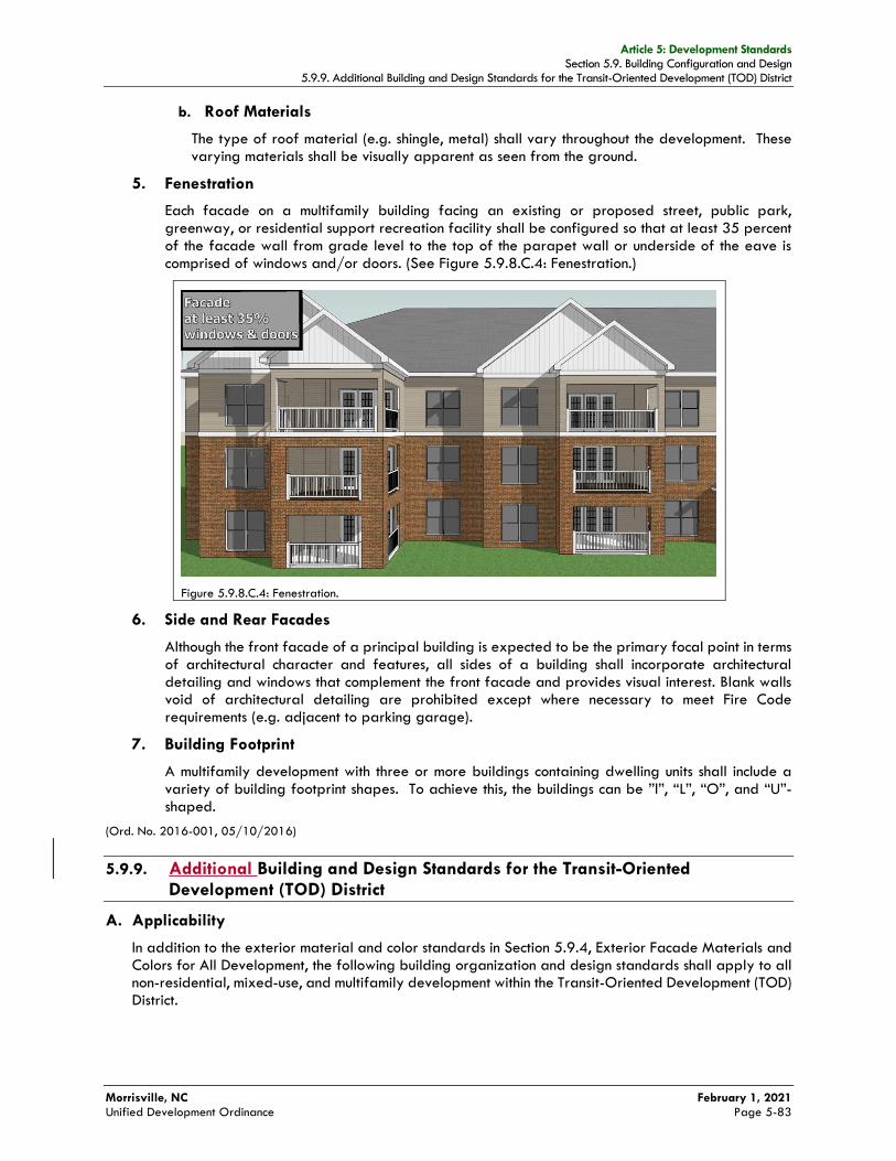
Article 5: Development Standards Section 5.9. Building Configuration and Design
5.9.9. Additional Building and Design Standards for the Transit-Oriented Development (TOD) District
Morrisville, NC February 1, 2021 Unified Development Ordinance Page 5-83
b. Roof Materials
The type of roof material (e.g. shingle, metal) shall vary throughout the development. These varying materials shall be visually apparent as seen from the ground.
5. Fenestration
Each facade on a multifamily building facing an existing or proposed street, public park, greenway, or residential support recreation facility shall be configured so that at least 35 percent of the facade wall from grade level to the top of the parapet wall or underside of the eave is comprised of windows and/or doors. (See Figure 5.9.8.C.4: Fenestration.)
Figure 5.9.8.C.4: Fenestration.
6. Side and Rear Facades
Although the front facade of a principal building is expected to be the primary focal point in terms of architectural character and features, all sides of a building shall incorporate architectural detailing and windows that complement the front facade and provides visual interest. Blank walls void of architectural detailing are prohibited except where necessary to meet Fire Code requirements (e.g. adjacent to parking garage).
7. Building Footprint
A multifamily development with three or more buildings containing dwelling units shall include a variety of building footprint shapes. To achieve this, the buildings can be ”l”, “L”, “O”, and “U”-shaped.
(Ord. No. 2016-001, 05/10/2016)
5.9.9. Additional Building and Design Standards for the Transit-Oriented
Development (TOD) District
A. Applicability
In addition to the exterior material and color standards in Section 5.9.4, Exterior Facade Materials and Colors for All Development, the following building organization and design standards shall apply to all non-residential, mixed-use, and multifamily development within the Transit-Oriented Development (TOD) District.
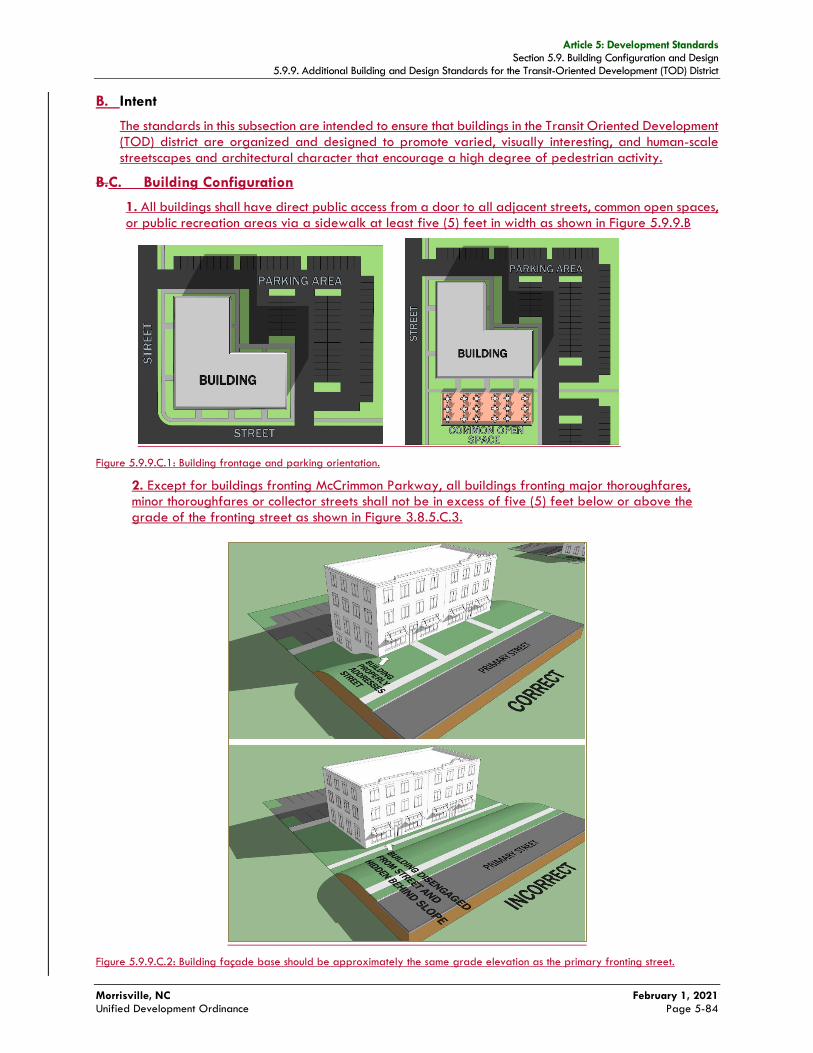
Article 5: Development Standards Section 5.9. Building Configuration and Design
5.9.9. Additional Building and Design Standards for the Transit-Oriented Development (TOD) District
Morrisville, NC February 1, 2021 Unified Development Ordinance Page 5-84
B. Intent
The standards in this subsection are intended to ensure that buildings in the Transit Oriented Development (TOD) district are organized and designed to promote varied, visually interesting, and human-scale streetscapes and architectural character that encourage a high degree of pedestrian activity.
B.C. Building Configuration
1. All buildings shall have direct public access from a door to all adjacent streets, common open spaces, or public recreation areas via a sidewalk at least five (5) feet in width as shown in Figure 5.9.9.B
Figure 5.9.9.C.1: Building frontage and parking orientation.
2. Except for buildings fronting McCrimmon Parkway, all buildings fronting major thoroughfares, minor thoroughfares or collector streets shall not be in excess of five (5) feet below or above the grade of the fronting street as shown in Figure 3.8.5.C.3.
Figure 5.9.9.C.2: Building façade base should be approximately the same grade elevation as the primary fronting street.

Article 5: Development Standards Section 5.9. Building Configuration and Design
5.9.9. Additional Building and Design Standards for the Transit-Oriented Development (TOD) District
Morrisville, NC February 1, 2021 Unified Development Ordinance Page 5-85
C.D. Multiple Building Design Buildings
1. Building design shall include the following.
1. All multi-tenant retail and service buildings shall have a dedicated entrance and walkway for each respective tenant space that connects directly onto a sidewalk along a street, common open space, or public recreation area. Shared walkways that are parallel to a sidewalk are allowed, but must provide individual, direct walkways for each respective tenant space entrance.
2. All multi-family and single family attached building facades facing a public street must be designed to mimic the appearance of single-family attached row homes. Design features shall include stoops and landings and/or porches, with respective walkways from each ground floor unit directly to fronting sidewalks as shown in Figure 3.8.5.C.5.
Figure 5.9.9.D.3: Standalone multi-family facades with single-family attached features.
2.3. Frame and enclose, on at least three sides, parking areas, public spaces, or other site amenities.
E. Façade Mass and Scale
Frame and enclose plazas, pocket parks, squares, outdoor dining areas, or other outdoor gathering space for pedestrians.
If the street-facing facade of a building is more than 40 feet wide, the perceived mass and scale of the building shall be reduced by incorporating at least three of the following design elements that are consistent with the development’s architectural character and create distinctive variations in the facade spaced no more than 40 feet apart:
3.1. Variations in roof form and parapet heights;
4.2. Pronounced (as least one foot deep) recesses and/or projections in the wall plane;
5.3. Distinct changes in texture and/or color of wall surfaces;
6.4. Pilasters that are at least eight inches deep and at least eight inches wide, and have a height equal to at least 80 percent of the facade’s height; or
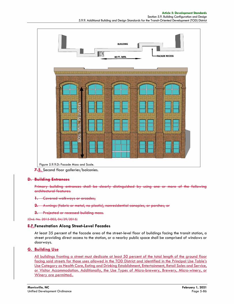
Article 5: Development Standards Section 5.9. Building Configuration and Design
5.9.9. Additional Building and Design Standards for the Transit-Oriented Development (TOD) District
Morrisville, NC February 1, 2021 Unified Development Ordinance Page 5-86
7.5. Second floor galleries/balconies.
D. Building Entrances
Primary building entrances shall be clearly distinguished by using one or more of the following architectural features:
1. Covered walkways or arcades;
2. Awnings (fabric or metal, no plastic), nonresidential canopies, or porches; or
3. Projected or recessed building mass.
(Ord. No. 2015-002, 04/29/2015)
E.F. Fenestration Along Street-Level Facades
At least 35 percent of the facade area of the street-level floor of buildings facing the transit station, a street providing direct access to the station, or a nearby public space shall be comprised of windows or doorways.
G. Building Use
All buildings fronting a street must dedicate at least 50 percent of the total length of the ground floor facing said streets for those uses allowed in the TOD District and identified in the Principal Use Table’s Use Category as Health Care, Eating and Drinking Establishment, Entertainment, Retail Sales and Service, or Visitor Accommodation. Additionally, the Use Types of Micro-brewery, Brewery, Micro-winery, or Winery are permitted..
Figure 5.9.9.D: Facade Mass and Scale.
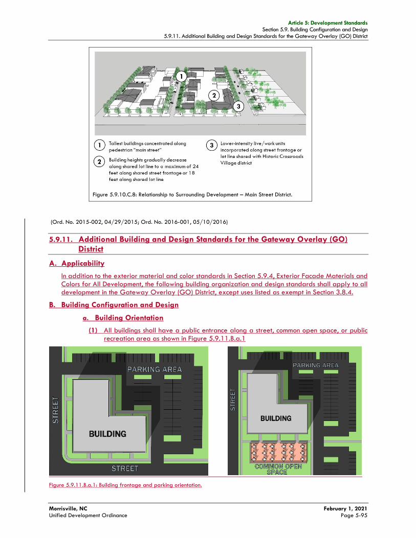
Article 5: Development Standards Section 5.9. Building Configuration and Design
5.9.11. Additional Building and Design Standards for the Gateway Overlay (GO) District
Morrisville, NC February 1, 2021 Unified Development Ordinance Page 5-95
Figure 5.9.10.C.8: Relationship to Surrounding Development – Main Street District.
(Ord. No. 2015-002, 04/29/2015; Ord. No. 2016-001, 05/10/2016)
5.9.11. Additional Building and Design Standards for the Gateway Overlay (GO)
District
A. Applicability
In addition to the exterior material and color standards in Section 5.9.4, Exterior Facade Materials and Colors for All Development, the following building organization and design standards shall apply to all development in the Gateway Overlay (GO) District, except uses listed as exempt in Section 3.8.4.
B. Building Configuration and Design
a. Building Orientation
(1) All buildings shall have a public entrance along a street, common open space, or public recreation area as shown in Figure 5.9.11.B.a.1
Figure 5.9.11.B.a.1: Building frontage and parking orientation.

Article 5: Development Standards Section 5.9. Building Configuration and Design
5.9.11. Additional Building and Design Standards for the Gateway Overlay (GO) District
Morrisville, NC February 1, 2021 Unified Development Ordinance Page 5-96
b. Building Design
(1) All multi-family building facades facing a major or minor thoroughfare must be designed to mimic the appearance of single-family attached homes. Design features shall include stoops and landings, and/or porches, respective walkways from each ground floor onto directly fronting sidewalks, and a 15 foot setback terracing of all floors above the third floor as shown in Figure 5.9.11.b.5
Figure 5.9.11.b.5: Multi-family facades with single-family attached features.
(2) All restaurant, bar or lounge, specialty eating or drinking establishment, or brewery uses fronting major thoroughfares, minor thoroughfares, or collector streets must have patio or rooftop seating along no less than 65 percent of their building frontage along the highest classified adjacent street as shown in Figure 5.9.11.b.6
(A) Patio seating area may be roofed but shall not be enclosed.
(B) Patio seating area must be a minimum of 15 feet in depth.
Figure 5.9.11.B.6: Required patio seating area along major thoroughfares, minor thoroughfares and collector streets.

Article 5: Development Standards Section 5.10. Parking and Loading
5.10.3. Off-Street Vehicle and Bicycle Parking Space Requirements
Morrisville, NC February 1, 2021 Unified Development Ordinance Page 5-103
Table 5.10.3.A: Minimum Number of Off-Street Vehicle and Bicycle Parking Spaces [1]
Use Category Use Type
Minimum Number of Vehicle
Parking Spaces [2][3][4][5][6]
Minimum Number of Bicycle
Parking Spaces
TOD and MS
Districts
Other Districts TOD and MS
Districts Other Districts
Flex Space (Major and Minor) See Section
5.10.3.B
Industrial Park 1 per 1,000 sf
Industrial Equipment Sales and Rental
1 per 400 sf of indoor display
area and office space
Mini-Storage 1 per 5,000 sf
Industrial Service Uses
(cont.)
Motor Freight Terminal, Small
n/a
1 per 500 sf
n/a
n/a Motor Freight Terminal, Large
Research Laboratory 2
Tank Farm 1 per 400 sf of
office space n/a
Warehousing/ Distribution 1 per 2,000 sf
2 Wholesale Food Preparation 1 per 1,000 sf
Wholesale Establishment
Manufacturing Uses
Brewery
n/a
1 per 1,000 sf
n/a
2
Industrial Assembly, Light
Industrial Assembly, Heavy
Manufacturing, Custom
Manufacturing, Light
Manufacturing, Medium
1 per 300 sf of accessory public
retail sales, restaurant, or tasting room
space + 1 per 1,000 sf of other
space
Manufacturing, Heavy
Biomanufacturing
Micro-Brewery
1 per 600 sf of accessory public
retail sales, restaurant, or tasting room
space + 1 per 2,000 sf of other
space
4
Micro-Winery
Winery n/a n/a
Extraction and Landfill
Uses
Composting Facility
n/a See Section
5.10.3.B n/a
2
Extraction of Earth Products
n/a
Hydraulic Fracturing
Landfill, Construction and Demolition Debris
Landfill, Land Clearing and Inert Debris
Landfill, Municipal Solid Waste
Recycling Facility 2
Article 5: Development Standards Section 5.10. Parking and Loading
5.10.3. Off-Street Vehicle and Bicycle Parking Space Requirements
Morrisville, NC February 1, 2021 Unified Development Ordinance Page 5-105
E. Compact Vehicle Parking Spaces
1. Up to 20 percent of the required number of off-street vehicle parking spaces may be designed to accommodate compact vehicles.
2. Compact vehicle parking spaces may only be used where the parking angle is 90 degrees.
3. Compact vehicle parking spaces shall consist as one or more group(s) of contiguous spaces located where they can be readily identified by vehicle drivers through signage and/or pavement marking.
F. Electric Vehicle (EV) Charging Stations
1. Up to ten percent of the required number of off-street vehicle parking spaces may be used and designated as electric vehicle (EV) charging stations, subject to the use-specific standards in Section 4.3.5 and subsection 2 below. Such spaces may include one required accessible parking space (see subsection I below). The Planning Director shall have authority to approve the use and designation of additional required parking spaces as electric vehicle charging stations, provided that such additional spaces shall count as only one-half of a parking space when computing the minimum number of parking spaces required.
2. Vehicle parking spaces used as electric vehicle charging stations shall consist as one or more group(s) of contiguous spaces located where they can be readily identified by electric vehicle drivers (e.g., through directional signage), but where their use by non-electric vehicles is discouraged (e.g., not in locations most convenient to the entrances of the buildings served).
G. On-Street Vehicle Parking
Except as authorized in the list below, streets shall not be used to satisfy the off-street vehicle parking standards of this section.
1. Off-street parking is part of an alternative parking plan in Section 5.10.9, Off-Street Vehicle Parking Alternatives, or
2. The road is specifically designed to accommodate parallel parking on local residential streets with landscaped chokers or other similar delineation methods approved by the Planning Director.
2.3. All streets within the Transit Oriented Development (TOD) district shall be designed to allow for on-street parallel or 45 degree angled parking spaces.
(Ord. No. 2015-002, 04/29/2015)
H. Driveways Used to Satisfy Off-Street Vehicle Requirements
Driveways can only be used to satisfy the minimum off-street vehicle parking requirements for bungalow court, pocket neighborhood, single-family detached, duplex, manufactured home, and single-family attached dwellings provided sufficient space is available outside a street right-of-way or easement to satisfy the standards of this section and this Ordinance. The use of a garage or carport to meet this requirement shall be prohibited.
(Ord. No. 2015-002, 04/29/2015; Ord. No. 2016-001, 05/10/2016)
I. Accessible Parking Spaces for Physically Disabled Persons
In each off-street parking area, a portion of the total number of off-street vehicle parking spaces shall be spaces specifically designated, located, and reserved for use by persons with physical disabilities (“accessible parking spaces”), in accordance with the standards of the North Carolina Accessibility Code for Building Construction.
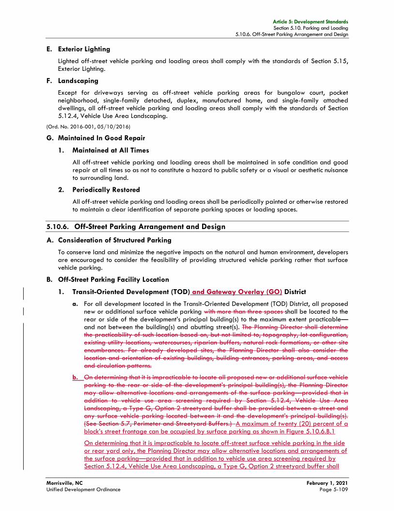
Article 5: Development Standards Section 5.10. Parking and Loading
5.10.6. Off-Street Parking Arrangement and Design
Morrisville, NC February 1, 2021 Unified Development Ordinance Page 5-109
E. Exterior Lighting
Lighted off-street vehicle parking and loading areas shall comply with the standards of Section 5.15, Exterior Lighting.
F. Landscaping
Except for driveways serving as off-street vehicle parking areas for bungalow court, pocket neighborhood, single-family detached, duplex, manufactured home, and single-family attached dwellings, all off-street vehicle parking and loading areas shall comply with the standards of Section 5.12.4, Vehicle Use Area Landscaping.
(Ord. No. 2016-001, 05/10/2016)
G. Maintained In Good Repair
1. Maintained at All Times
All off-street vehicle parking and loading areas shall be maintained in safe condition and good repair at all times so as not to constitute a hazard to public safety or a visual or aesthetic nuisance to surrounding land.
2. Periodically Restored
All off-street vehicle parking and loading areas shall be periodically painted or otherwise restored to maintain a clear identification of separate parking spaces or loading spaces.
5.10.6. Off-Street Parking Arrangement and Design
A. Consideration of Structured Parking
To conserve land and minimize the negative impacts on the natural and human environment, developers are encouraged to consider the feasibility of providing structured vehicle parking rather that surface vehicle parking.
B. Off-Street Parking Facility Location
1. Transit-Oriented Development (TOD) and Gateway Overlay (GO) District
a. For all development located in the Transit-Oriented Development (TOD) District, all proposed new or additional surface vehicle parking with more than three spaces shall be located to the rear or side of the development’s principal building(s) to the maximum extent practicable—and not between the building(s) and abutting street(s). The Planning Director shall determine the practicability of such location based on, but not limited to, topography, lot configuration, existing utility locations, watercourses, riparian buffers, natural rock formations, or other site encumbrances. For already developed sites, the Planning Director shall also consider the location and orientation of existing buildings, building entrances, parking areas, and access and circulation patterns.
b. On determining that it is impracticable to locate all proposed new or additional surface vehicle parking to the rear or side of the development’s principal building(s), the Planning Director may allow alternative locations and arrangements of the surface parking—provided that in addition to vehicle use area screening required by Section 5.12.4, Vehicle Use Area Landscaping, a Type G, Option 2 streetyard buffer shall be provided between a street and any surface vehicle parking located between it and the development’s principal building(s). (See Section 5.7, Perimeter and Streetyard Buffers.) A maximum of twenty (20) percent of a block’s street frontage can be occupied by surface parking as shown in Figure 5.10.6.B.1
On determining that it is impracticable to locate off-street surface vehicle parking in the side or rear yard only, the Planning Director may allow alternative locations and arrangements of the surface parking—provided that in addition to vehicle use area screening required by Section 5.12.4, Vehicle Use Area Landscaping, a Type G, Option 2 streetyard buffer shall
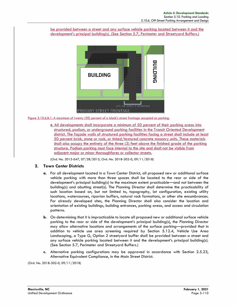
Article 5: Development Standards Section 5.10. Parking and Loading
5.10.6. Off-Street Parking Arrangement and Design
Morrisville, NC February 1, 2021 Unified Development Ordinance Page 5-110
be provided between a street and any surface vehicle parking located between it and the development’s principal building(s). (See Section 5.7, Perimeter and Streetyard Buffers.)
Figure 5.10.6.B.1: A maximum of twenty (20) percent of a block’s street frontage occupied as parking.
c. All developments shall incorporate a minimum of 50 percent of their parking areas into
structured, podium, or underground parking facilities in the Transit Oriented Development district. The façade walls of structured parking facilities facing a street shall include at least 50 percent brick, stone or rock, or tinted/textured concrete masonry units. These materials shall also occupy the entirety of the three (3) feet above the finished grade of the parking structure. Podium parking must face internal to the site and shall not be visible from adjacent major or minor thoroughfares or collector streets.
(Ord. No. 2015-047, 07/28/2015, Ord. No. 2018-302-0, 09/11/2018)
2. Town Center Districts
a. For all development located in a Town Center District, all proposed new or additional surface vehicle parking with more than three spaces shall be located to the rear or side of the development’s principal building(s) to the maximum extent practicable—and not between the building(s) and abutting street(s). The Planning Director shall determine the practicability of such location based on, but not limited to, topography, lot configuration, existing utility locations, watercourses, riparian buffers, natural rock formations, or other site encumbrances. For already developed sites, the Planning Director shall also consider the location and orientation of existing buildings, building entrances, parking areas, and access and circulation patterns.
b. On determining that it is impracticable to locate all proposed new or additional surface vehicle parking to the rear or side of the development’s principal building(s), the Planning Director may allow alternative locations and arrangements of the surface parking—provided that in addition to vehicle use area screening required by Section 5.12.4, Vehicle Use Area Landscaping, a Type G, Option 2 streetyard buffer shall be provided between a street and any surface vehicle parking located between it and the development’s principal building(s). (See Section 5.7, Perimeter and Streetyard Buffers.)
c. Alternative parking configurations may be approved in accordance with Section 2.5.23, Alternative Equivalent Compliance, in the Main Street District.
(Ord. No. 2018-302-0, 09/11/2018)

Article 11: Interpretation and Definitions Section 11.5. Terms and Uses Defined
11.4.3. Illuminated Signs
Morrisville, NC February 1, 2021 Unified Development Ordinance Page 11-25
BIKE LANE A designated area within a street roadway or other vehicular accessway that is reserved for bicycle travel and separated from the rest of the roadway or vehicular accessway by painted lines or other pavement markings.
BIKE LOCKER A locker or box in which a single bicycle is placed and locked in.
BIKE PATH A designated accessway reserved for bicycle travel that is not within a street roadway or other vehicular accessway. A bike path may be within a greenway or may parallel a street or other vehicular accessway, but are typically separated from them by landscaping.
BIKE RACK A stand used for mounting and securing two bicycles when not in use.
BIKEWAY Any improved bicycle accessway that is specifically designated as being open to bicycle travel, regardless of whether such facility is designated for the exclusive use of bicycles or is shared with other transportation modes. Bikeways include bike lanes within roadways and off-street bike paths.
BIOMANUFACTURING Manufacturing or similar technological processes which may utilize biological or chemical systems to produce, develop, analyze, engineer, or demonstrate functions of proteins, enzymes, high-tech life science outputs, or similar bio-molecules used for life science, bio-agricultural, food, beverage, medical, or pharmaceutical purposes. Accessory uses may include institutional, academic, and hospital uses ancillary to life science uses, research laboratories, temporary indoor storage of produced goods, and storage/distribution of produced goods. All manufacturing activities are contained entirely within a building and noise, odor, smoke, heat, glare, and vibration resulting from the manufacturing activity are confined entirely within the building. Examples of biomanufacturing include high-tech life science outputs, vaccines, medicines, or similar compounds. Uses similar to those also defined in this section shall not be permitted under this definition.
BLOCK A unit of land bounded by streets or by a combination of streets and parks or open space, railroad rights-of-way, waterways or any barrier to the continuity of development.
BLOCK FACE Properties abutting one side of a street or public right-of-way and lying between the two nearest intersecting streets or rights-of-way, or intersecting right-of-way and railroad right-of-way, unsubdivided land, water course or Town boundary.
BREWERY/DISTILLERY An establishment primarily engaged in the brewing or manufacturing of ale, beer, malt liquors, and nonalcoholic beer, and/or fortified spirits that is are permitted to do so in accordance with N.C.G.S. 18B-1104 and regulations of tthe Alcoholic Beverage Control Commission. Breweries shall have, with a capacity of 15,000 barrels or more per year. Accessory uses include a restaurant, a public tasting room, and retails sales of ale, or beer, spirits, or related products.

Article 11: Interpretation and Definitions Section 11.5. Terms and Uses Defined 11.4.3. Illuminated Signs
Morrisville, NC February 1, 2021 Unified Development Ordinance Page 11-65
RESEARCH LABORATORY A facility that is designed or equipped for basic or applied research of experimental study, testing, or analysis in the natural and medical sciences or engineering, including any educational activities associated with and accessory to such research. Research laboratory uses shall not contain warehousing/ distribution uses, but may allow shipping or storage as incidental to the use of the lab. Research laboratories may be an accessory use to biomanufacturing facilities and also may allow for limited on-site manufacturing of items not for sale to the public, which are intended for research, study, developmental, or academic purposes.
RESERVATION The setting aside of real property for a specified use, purpose, or activity. Compare to “dedication.” which generally involves the conveyance of real property to a government entity for a public purpose.
RESIDENTIAL USE OR DEVELOPMENT Development whose primary use(s) is one (or more) of the principal use categories and use types listed under the Residential Uses classification in Article 4: Use Standards, and as described in Section.
RESTAURANT An establishment where meals or prepared food, including beverages and confections, are served to customers. Accessory uses may include bars, banquet rooms, catering services, pick-up facilities for take-out orders, windows for walk-up service, outdoor seating, and where specifically allowed, drive-through service facilities. An establishment that sells both alcoholic beverages and food is classified as a bar or lounge if it derives most of its gross revenue from the sale of food and nonalcoholic beverages consumed on the premises.
RETAIL STORE A building, property, or activity, the principal use or purpose of which is the sale of goods, products, or materials directly to the consumer. This use includes, but is not limited to, clothing stores, appliance stores, food stores, grocers, caterers, pharmacies, book stores, florists, furniture stores, hardware stores, and pet stores. This use does not include convenience stores, automobile service stations, service establishments, restaurants, or adult establishments.
REVEAL A change in height of the primary plane that brings relief to an otherwise flat surface and increases its complexity.
REZONING, CONDITIONAL See Section 2.5.3.
REZONING, GENERAL See Section 2.5.3.
REZONING, PLANNED DEVELOPMENT See Section 2.5.3.
RIVERINE Relating to, formed by, or resembling a river (including tributaries), stream, brook, etc.
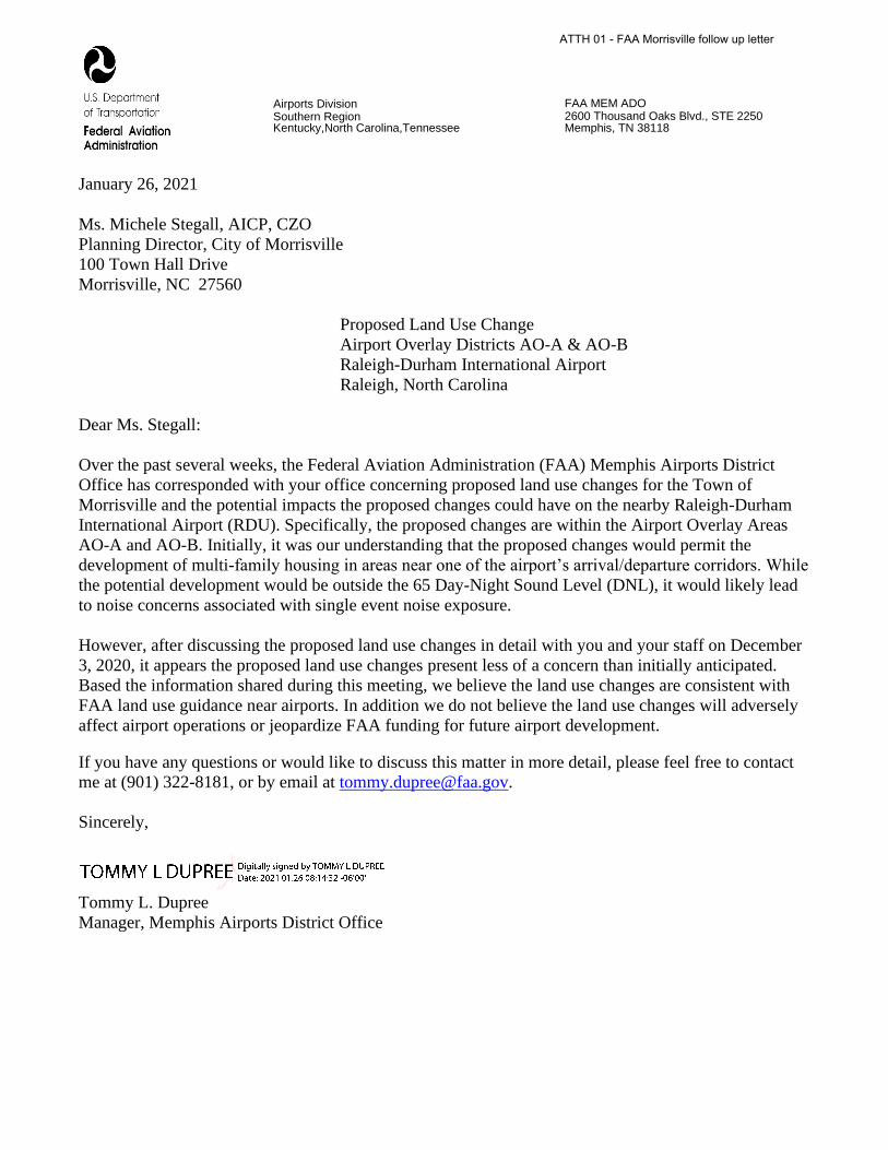
Airports Division Southern Region Kentucky,North Carolina,Tennessee
FAA MEM ADO 2600 Thousand Oaks Blvd., STE 2250 Memphis, TN 38118
January 26, 2021
Ms. Michele Stegall, AICP, CZO
Planning Director, City of Morrisville
100 Town Hall Drive
Morrisville, NC 27560
Proposed Land Use Change
Airport Overlay Districts AO-A & AO-B
Raleigh-Durham International Airport
Raleigh, North Carolina
Dear Ms. Stegall:
Over the past several weeks, the Federal Aviation Administration (FAA) Memphis Airports District
Office has corresponded with your office concerning proposed land use changes for the Town of
Morrisville and the potential impacts the proposed changes could have on the nearby Raleigh-Durham
International Airport (RDU). Specifically, the proposed changes are within the Airport Overlay Areas
AO-A and AO-B. Initially, it was our understanding that the proposed changes would permit the
development of multi-family housing in areas near one of the airport’s arrival/departure corridors. While
the potential development would be outside the 65 Day-Night Sound Level (DNL), it would likely lead
to noise concerns associated with single event noise exposure.
However, after discussing the proposed land use changes in detail with you and your staff on December
3, 2020, it appears the proposed land use changes present less of a concern than initially anticipated.
Based the information shared during this meeting, we believe the land use changes are consistent with
FAA land use guidance near airports. In addition we do not believe the land use changes will adversely
affect airport operations or jeopardize FAA funding for future airport development.
If you have any questions or would like to discuss this matter in more detail, please feel free to contact
me at (901) 322-8181, or by email at [email protected].
Sincerely,
Tommy L. Dupree
Manager, Memphis Airports District Office
ATTH 01 - FAA Morrisville follow up letter
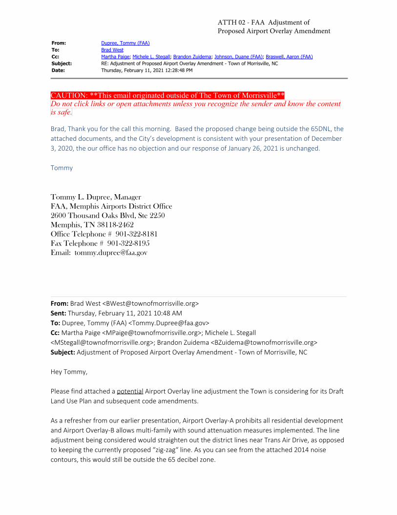
From: Dupree, Tommy (FAA)To: Brad WestCc: Martha Paige; Michele L. Stegall; Brandon Zuidema; Johnson, Duane (FAA); Braswell, Aaron (FAA)Subject: RE: Adjustment of Proposed Airport Overlay Amendment - Town of Morrisville, NCDate: Thursday, February 11, 2021 12:28:48 PM
CAUTION: **This email originated outside of The Town of Morrisville**Do not click links or open attachments unless you recognize the sender and know the contentis safe.
Brad, Thank you for the call this morning. Based the proposed change being outside the 65DNL, theattached documents, and the City’s development is consistent with your presentation of December3, 2020, the our office has no objection and our response of January 26, 2021 is unchanged.
Tommy
Tommy L. Dupree, ManagerFAA, Memphis Airports District Office2600 Thousand Oaks Blvd, Ste 2250Memphis, TN 38118-2462Office Telephone # 901-322-8181Fax Telephone # 901-322-8195Email: [email protected]
From: Brad West <[email protected]> Sent: Thursday, February 11, 2021 10:48 AMTo: Dupree, Tommy (FAA) <[email protected]>Cc: Martha Paige <[email protected]>; Michele L. Stegall<[email protected]>; Brandon Zuidema <[email protected]>Subject: Adjustment of Proposed Airport Overlay Amendment - Town of Morrisville, NC
Hey Tommy,
Please find attached a potential Airport Overlay line adjustment the Town is considering for its DraftLand Use Plan and subsequent code amendments.
As a refresher from our earlier presentation, Airport Overlay-A prohibits all residential developmentand Airport Overlay-B allows multi-family with sound attenuation measures implemented. The lineadjustment being considered would straighten out the district lines near Trans Air Drive, as opposedto keeping the currently proposed “zig-zag“ line. As you can see from the attached 2014 noisecontours, this would still be outside the 65 decibel zone.
ATTH 02 - FAA Adjustment of Proposed Airport Overlay Amendment
Though it’s a fairly minor adjustment, our Town Council is committed to keeping the FAA informedof any land use adjustments within close proximity to RDU. Any feedback you may have isappreciated. Thank you,- Brad West
Brad West AICP CZO • Senior Planner / GIS919-463-6926bwest@townofmorrisville.orgwww.townofmorrisville.org
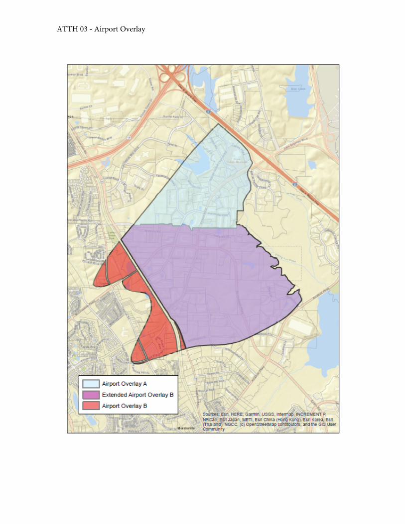
ATTH 03 - Airport Overlay
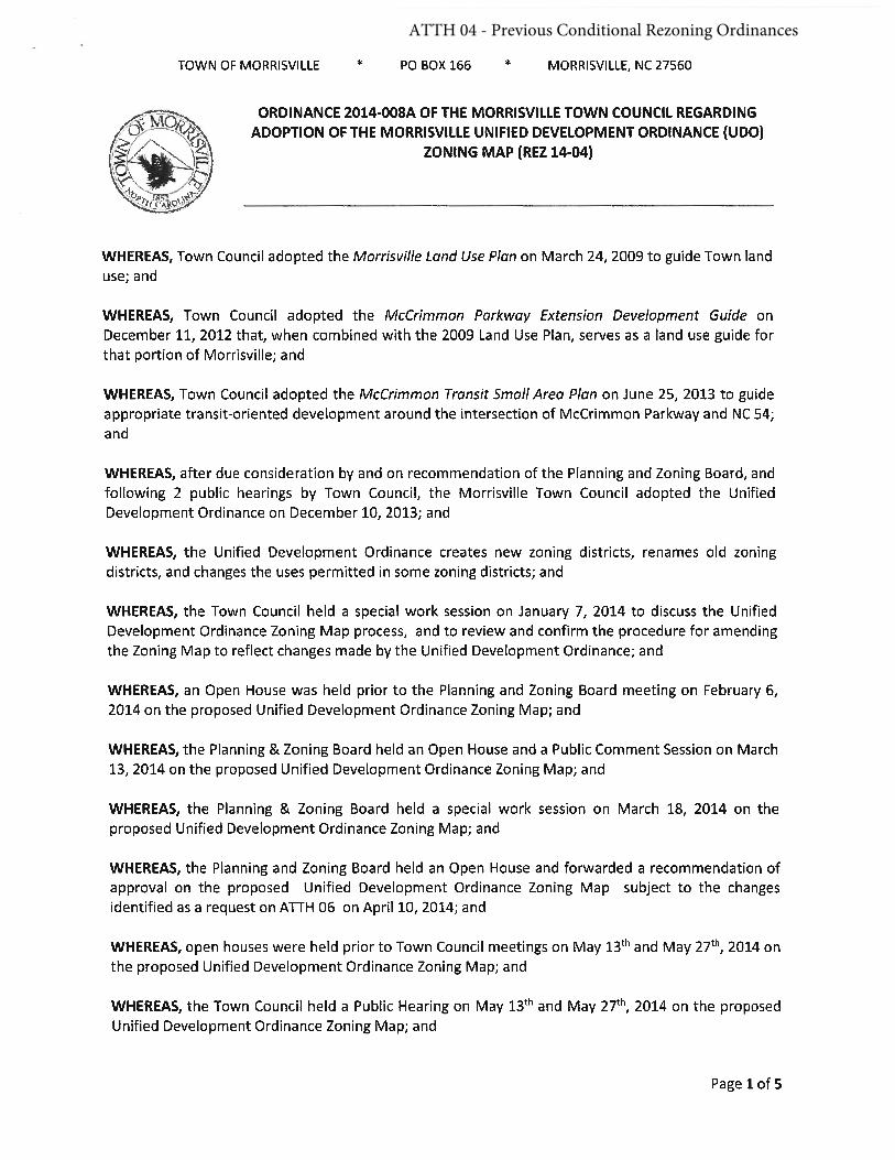
ATTH 04 - Previous Conditional Rezoning Ordinances
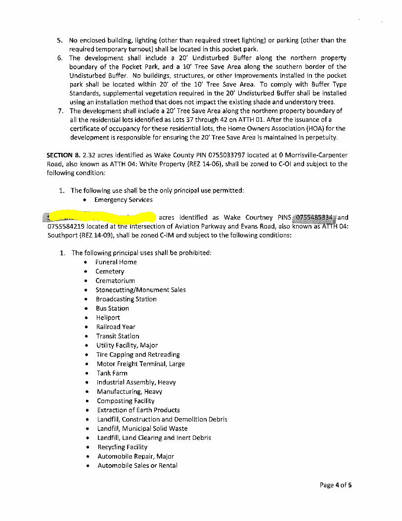
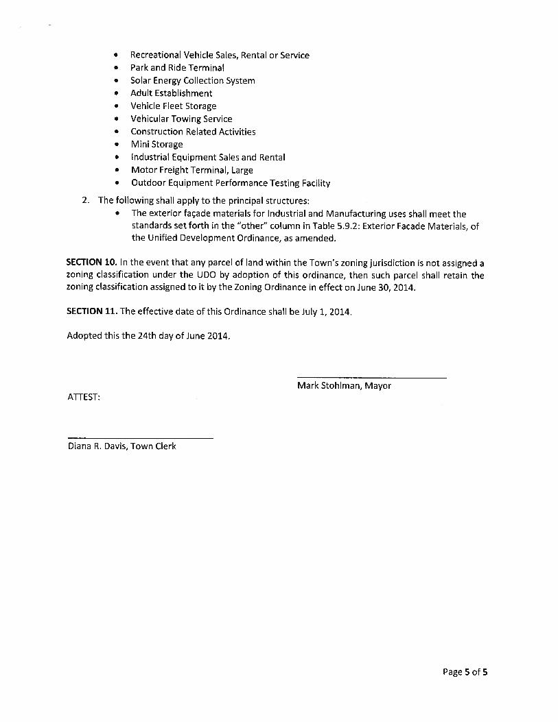
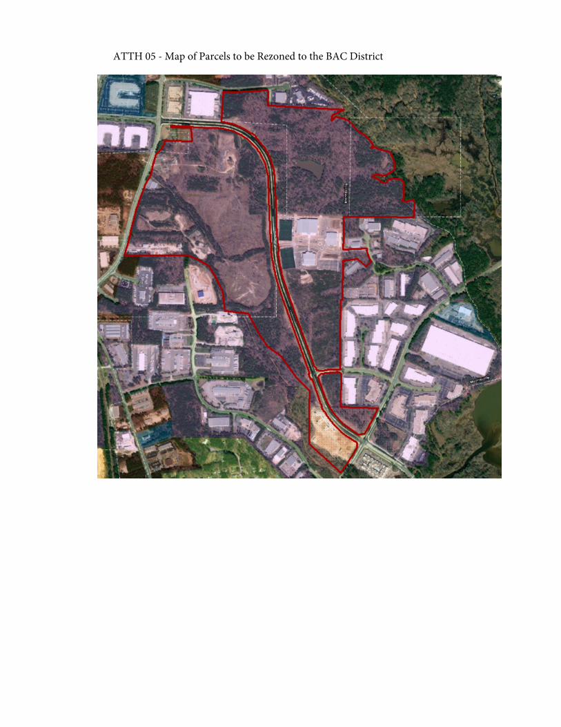
ATTH 05 - Map of Parcels to be Rezoned to the BAC District
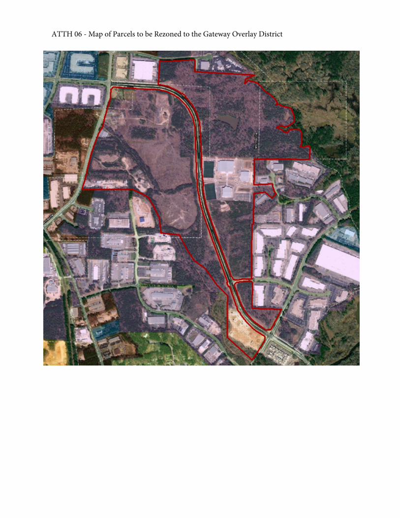
ATTH 06 - Map of Parcels to be Rezoned to the Gateway Overlay District
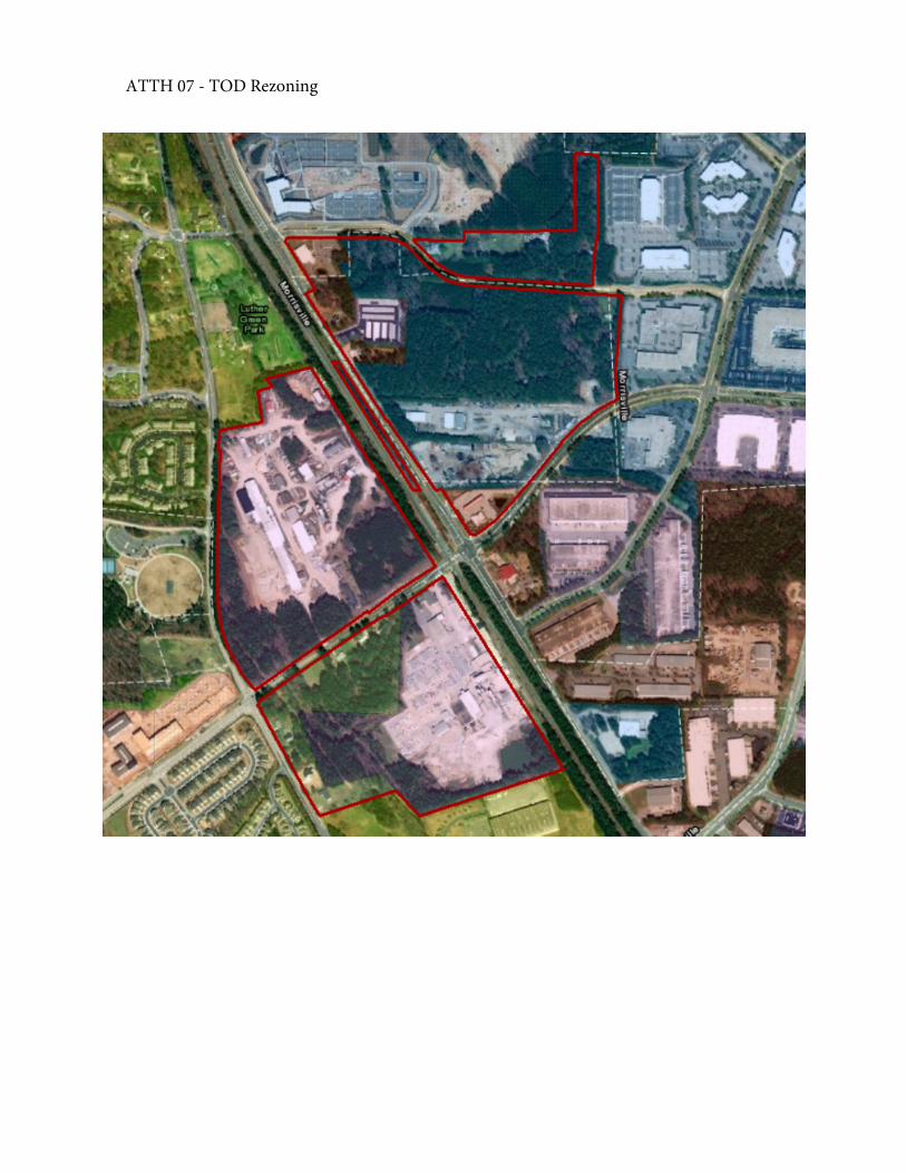
ATTH 07 - TOD Rezoning
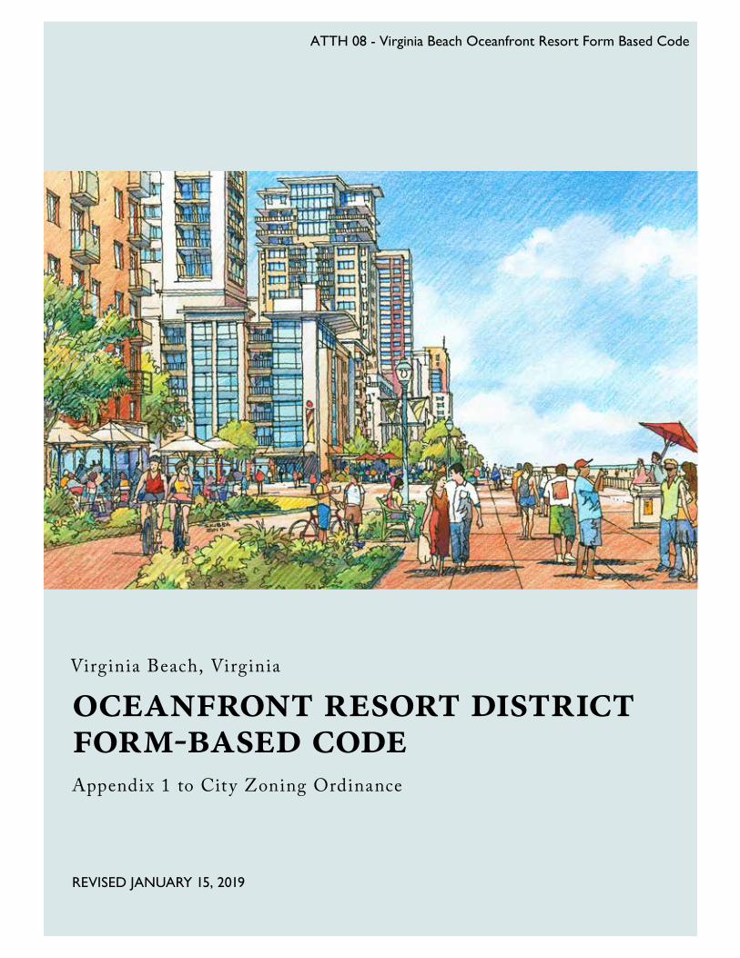
REVISED JANUARY 15, 2019
Appendix 1 to City Zoning Ordinance
oceanfront resort district form-based code
Virginia Beach, Virginia
ATTH 08 - Virginia Beach Oceanfront Resort Form Based Code
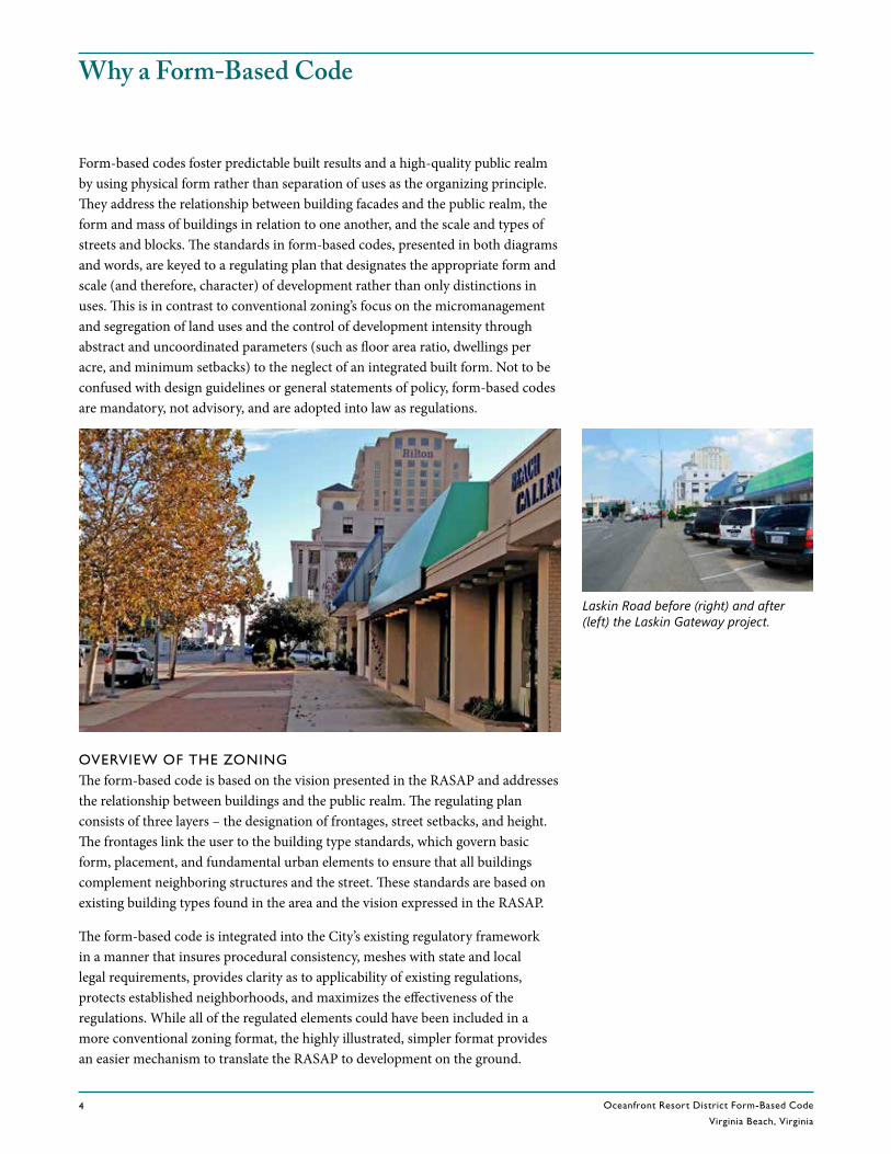
Oceanfront Resort District Form-Based Code
Virginia Beach, Virginia4
RE V. DECEMBER 5 , 2017
Why a Form-Based Code
Form-based codes foster predictable built results and a high-quality public realm by using physical form rather than separation of uses as the organizing principle. They address the relationship between building facades and the public realm, the form and mass of buildings in relation to one another, and the scale and types of streets and blocks. The standards in form-based codes, presented in both diagrams and words, are keyed to a regulating plan that designates the appropriate form and scale (and therefore, character) of development rather than only distinctions in uses. This is in contrast to conventional zoning’s focus on the micromanagement and segregation of land uses and the control of development intensity through abstract and uncoordinated parameters (such as floor area ratio, dwellings per acre, and minimum setbacks) to the neglect of an integrated built form. Not to be confused with design guidelines or general statements of policy, form-based codes are mandatory, not advisory, and are adopted into law as regulations.
OVERVIEW OF THE ZONINGThe form-based code is based on the vision presented in the RASAP and addresses the relationship between buildings and the public realm. The regulating plan consists of three layers – the designation of frontages, street setbacks, and height. The frontages link the user to the building type standards, which govern basic form, placement, and fundamental urban elements to ensure that all buildings complement neighboring structures and the street. These standards are based on existing building types found in the area and the vision expressed in the RASAP.
The form-based code is integrated into the City’s existing regulatory framework in a manner that insures procedural consistency, meshes with state and local legal requirements, provides clarity as to applicability of existing regulations, protects established neighborhoods, and maximizes the effectiveness of the regulations. While all of the regulated elements could have been included in a more conventional zoning format, the highly illustrated, simpler format provides an easier mechanism to translate the RASAP to development on the ground.
Laskin Road before (right) and after (left) the Laskin Gateway project.
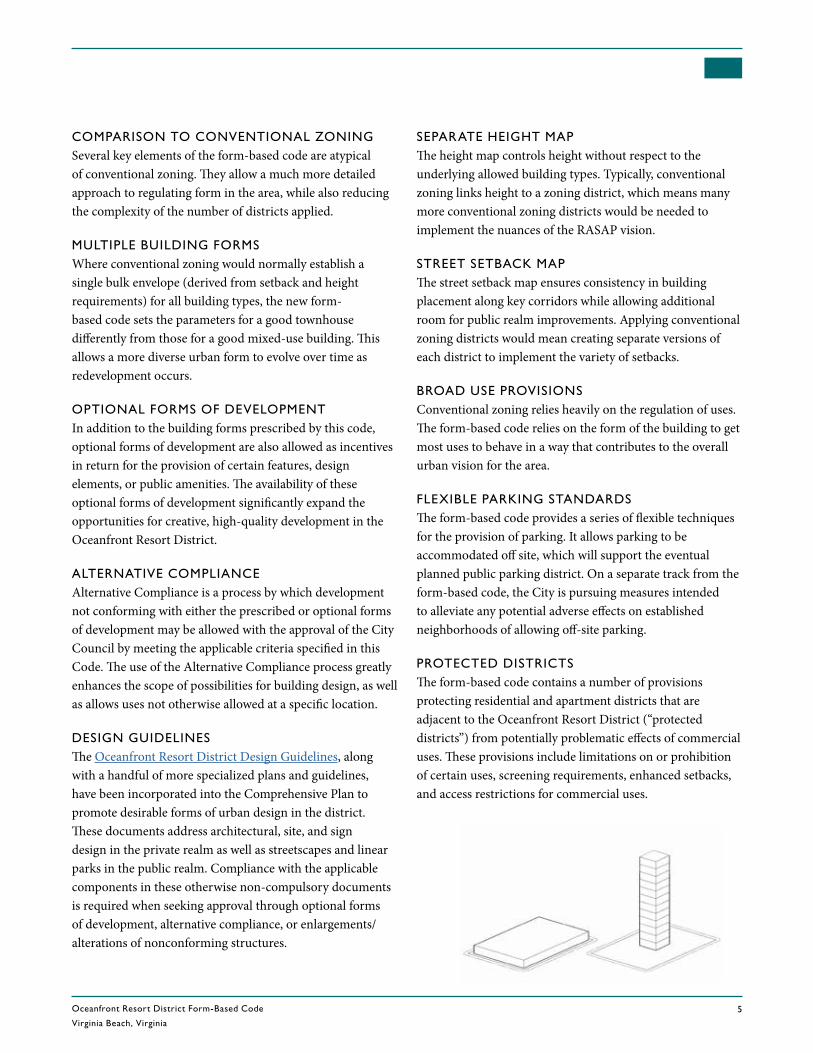
Oceanfront Resort District Form-Based Code
Virginia Beach, Virginia5
REV. DECEMBER 5, 2017
COMPARISON TO CONVENTIONAL ZONINGSeveral key elements of the form-based code are atypical of conventional zoning. They allow a much more detailed approach to regulating form in the area, while also reducing the complexity of the number of districts applied.
MULTIPLE BUILDING FORMSWhere conventional zoning would normally establish a single bulk envelope (derived from setback and height requirements) for all building types, the new form-based code sets the parameters for a good townhouse differently from those for a good mixed-use building. This allows a more diverse urban form to evolve over time as redevelopment occurs.
OPTIONAL FORMS OF DEVELOPMENTIn addition to the building forms prescribed by this code, optional forms of development are also allowed as incentives in return for the provision of certain features, design elements, or public amenities. The availability of these optional forms of development significantly expand the opportunities for creative, high-quality development in the Oceanfront Resort District.
ALTERNATIVE COMPLIANCEAlternative Compliance is a process by which development not conforming with either the prescribed or optional forms of development may be allowed with the approval of the City Council by meeting the applicable criteria specified in this Code. The use of the Alternative Compliance process greatly enhances the scope of possibilities for building design, as well as allows uses not otherwise allowed at a specific location.
DESIGN GUIDELINESThe Oceanfront Resort District Design Guidelines, along with a handful of more specialized plans and guidelines, have been incorporated into the Comprehensive Plan to promote desirable forms of urban design in the district. These documents address architectural, site, and sign design in the private realm as well as streetscapes and linear parks in the public realm. Compliance with the applicable components in these otherwise non-compulsory documents is required when seeking approval through optional forms of development, alternative compliance, or enlargements/alterations of nonconforming structures.
SEPARATE HEIGHT MAPThe height map controls height without respect to the underlying allowed building types. Typically, conventional zoning links height to a zoning district, which means many more conventional zoning districts would be needed to implement the nuances of the RASAP vision.
STREET SETBACK MAPThe street setback map ensures consistency in building placement along key corridors while allowing additional room for public realm improvements. Applying conventional zoning districts would mean creating separate versions of each district to implement the variety of setbacks.
BROAD USE PROVISIONSConventional zoning relies heavily on the regulation of uses. The form-based code relies on the form of the building to get most uses to behave in a way that contributes to the overall urban vision for the area.
FLEXIBLE PARKING STANDARDSThe form-based code provides a series of flexible techniques for the provision of parking. It allows parking to be accommodated off site, which will support the eventual planned public parking district. On a separate track from the form-based code, the City is pursuing measures intended to alleviate any potential adverse effects on established neighborhoods of allowing off-site parking.
PROTECTED DISTRICTSThe form-based code contains a number of provisions protecting residential and apartment districts that are adjacent to the Oceanfront Resort District (“protected districts”) from potentially problematic effects of commercial uses. These provisions include limitations on or prohibition of certain uses, screening requirements, enhanced setbacks, and access restrictions for commercial uses.
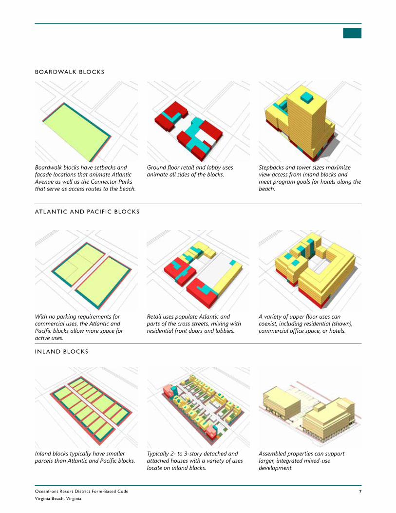
Oceanfront Resort District Form-Based Code
Virginia Beach, Virginia7
REV. DECEMBER 5, 2017
Boardwalk blocks have setbacks and facade locations that animate Atlantic Avenue as well as the Connector Parks that serve as access routes to the beach.
Ground floor retail and lobby uses animate all sides of the blocks.
Stepbacks and tower sizes maximize view access from inland blocks and meet program goals for hotels along the beach.
BOARDWALK BLOCKS
With no parking requirements for commercial uses, the Atlantic and Pacific blocks allow more space for active uses.
Retail uses populate Atlantic and parts of the cross streets, mixing with residential front doors and lobbies.
A variety of upper floor uses can coexist, including residential (shown), commercial office space, or hotels.
ATL ANTIC AND PACIF IC BLOCKS
Inland blocks typically have smaller parcels than Atlantic and Pacific blocks.
Typically 2- to 3-story detached and attached houses with a variety of uses locate on inland blocks.
INL AND BLOCKS
Assembled properties can support larger, integrated mixed-use development.
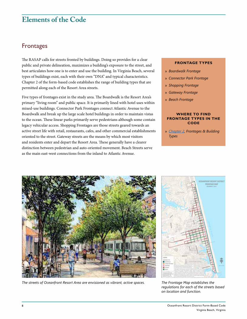
Oceanfront Resort District Form-Based Code
Virginia Beach, Virginia8
RE V. DECEMBER 5 , 2017
Elements of the Code
FRONTAGE TYPES
» Boardwalk Frontage
» Connector Park Frontage
» Shopping Frontage
» Gateway Frontage
» Beach Frontage
WHERE TO FIND FRONTAGE TYPES IN THE
CODE
» Chapter 2, Frontages & BuildingTypes
The RASAP calls for streets fronted by buildings. Doing so provides for a clear public and private delineation, maximizes a building’s exposure to the street, and best articulates how one is to enter and use the building. In Virginia Beach, several types of buildings exist, each with their own “DNA” and typical characteristics. Chapter 2 of the form-based code establishes the range of building types that are permitted along each of the Resort Area streets.
Five types of frontages exist in the study area. The Boardwalk is the Resort Area’s primary “living room” and public space. It is primarily lined with hotel uses within mixed-use buildings. Connector Park Frontages connect Atlantic Avenue to the Boardwalk and break up the large scale hotel buildings in order to maintain vistas to the ocean. These linear parks primarily serve pedestrians although some contain legacy vehicular access. Shopping Frontages are those streets geared towards an active street life with retail, restaurants, cafes, and other commercial establishments oriented to the street. Gateway streets are the means by which most visitors and residents enter and depart the Resort Area. These generally have a clearer distinction between pedestrian and auto-oriented movement. Beach Streets serve as the main east-west connections from the inland to Atlantic Avenue.
The Frontage Map establishes the regulations for each of the streets based on location and function.
The streets of Oceanfront Resort Area are envisioned as vibrant, active spaces.
Frontages
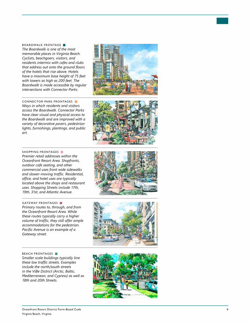
Oceanfront Resort District Form-Based Code
Virginia Beach, Virginia9
REV. DECEMBER 5, 2017
BOARDWALK FRONTAGE
The Boardwalk is one of the most memorable places in Virginia Beach. Cyclists, beachgoers, visitors, and residents intermix with cafes and clubs that address out onto the ground floors of the hotels that rise above. Hotels have a maximum base height of 75 feet with towers as high as 200 feet. The Boardwalk is made accessible by regular intersections with Connector Parks.
SHOPP ING FRONTAGES
Premier retail addresses within the Oceanfront Resort Area. Shopfronts, outdoor cafe seating, and other commercial uses front wide sidewalks and slower-moving traffic. Residential, office, and hotel uses are typically located above the shops and restaurant uses. Shopping Streets include 17th, 19th, 31st, and Atlantic Avenue.
GATE WAY FRONTAGES
Primary routes to, through, and from the Oceanfront Resort Area. While these routes typically carry a higher volume of traffic, they still offer ample accommodations for the pedestrian. Pacific Avenue is an example of a Gateway street.
BE ACH FRONTAGES
Smaller scale buildings typically line these low traffic streets. Examples include the north/south streets in the ViBe District (Arctic, Baltic, Mediterranean, and Cypress) as well as 18th and 20th Streets.
CONNECTOR PARK FRONTAGES
Ways in which residents and visitors access the Boardwalk. Connector Parks have clear visual and physical access to the Boardwalk and are improved with a variety of decorative pavers, pedestrian lights, furnishings, plantings, and public art.
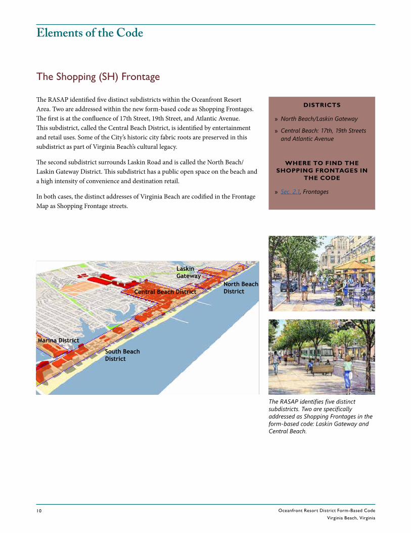
Oceanfront Resort District Form-Based Code
Virginia Beach, Virginia10
RE V. DECEMBER 5 , 2017
Elements of the Code
The Shopping (SH) Frontage
Marina District
Laskin Gateway
South Beach District
RESORT AREA Districts & Corridors
Central Beach DistrictNorth Beach District
The RASAP identified five distinct subdistricts within the Oceanfront Resort Area. Two are addressed within the new form-based code as Shopping Frontages. The first is at the confluence of 17th Street, 19th Street, and Atlantic Avenue. This subdistrict, called the Central Beach District, is identified by entertainment and retail uses. Some of the City’s historic city fabric roots are preserved in this subdistrict as part of Virginia Beach’s cultural legacy.
The second subdistrict surrounds Laskin Road and is called the North Beach/Laskin Gateway District. This subdistrict has a public open space on the beach and a high intensity of convenience and destination retail.
In both cases, the distinct addresses of Virginia Beach are codified in the Frontage Map as Shopping Frontage streets.
DISTRICTS
» North Beach/Laskin Gateway
» Central Beach: 17th, 19th Streets and Atlantic Avenue
WHERE TO FIND THE SHOPPING FRONTAGES IN
THE CODE
» Sec. 2.1, Frontages
The RASAP identifies five distinct subdistricts. Two are specifically addressed as Shopping Frontages in the form-based code: Laskin Gateway and Central Beach.

Oceanfront Resort District Form-Based Code
Virginia Beach, Virginia11
REV. DECEMBER 5, 2017
NORTH BE ACH/L ASK IN GATE WAY
Laskin Gateway is a primary entry point into the Oceanfront Resort Area. Residential atop a variety of retail uses in mixed-use buildings line wide sidewalks. On-street parking slows traffic to further ease the comfortable crossing of the street. At the eastern terminus is one of the Resort Area parks that is frequently used for concerts and other civic functions.
CENTR AL BE ACH: 17 TH STREET, 19TH STREET, AND ATL ANTIC AVENUE
The entertainment hub of the Resort Area. Theaters, restaurants, and other entertainment venues are activated by the close proximity of the hotels and the eventual terminus of the transit line.
Laskin Road
17th Street
I-264
Atlantic A
ve.
Atlantic Ocean
Atlantic Ocean
Atlantic A
ve.
19th Street
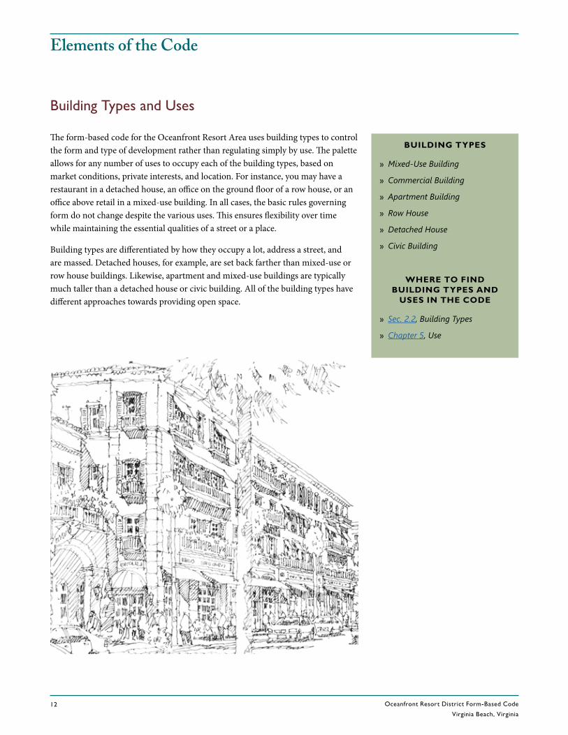
Oceanfront Resort District Form-Based Code
Virginia Beach, Virginia12
RE V. DECEMBER 5 , 2017
Elements of the Code
Building Types and Uses
The form-based code for the Oceanfront Resort Area uses building types to control the form and type of development rather than regulating simply by use. The palette allows for any number of uses to occupy each of the building types, based on market conditions, private interests, and location. For instance, you may have a restaurant in a detached house, an office on the ground floor of a row house, or an office above retail in a mixed-use building. In all cases, the basic rules governing form do not change despite the various uses. This ensures flexibility over time while maintaining the essential qualities of a street or a place.
Building types are differentiated by how they occupy a lot, address a street, and are massed. Detached houses, for example, are set back farther than mixed-use or row house buildings. Likewise, apartment and mixed-use buildings are typically much taller than a detached house or civic building. All of the building types have different approaches towards providing open space.
BUILDING TYPES
» Mixed-Use Building
» Commercial Building
» Apartment Building
» Row House
» Detached House
» Civic Building
WHERE TO FIND BUILDING TYPES AND
USES IN THE CODE
» Sec. 2.2, Building Types
» Chapter 5, Use

Oceanfront Resort District Form-Based Code
Virginia Beach, Virginia13
REV. DECEMBER 5, 2017
M IXED - USE BU ILDINGS
Mixed-use buildings typically offer some type of retail, office, or civic frontage with office, hotel, or residential above. Mixed-use buildings have minimal setbacks and higher requirements for forming a street wall.
ROW HOUSES
Row houses are in-line structures ranging from 20 to 30 feet wide and two to four stories in height. Row houses support any number of ground floor uses with residential uses typically located above. Row houses typically have a small setback from the street.
DETACHED HOUSES
Detached houses were initially much more prevalent in the area. The ones that remain are cherished for their ability to be a bed and breakfast, a restaurant, professional office space, or residences. Detached houses have a deeper front setback with a yard and usually have some form of porch or welcoming entrance element.
CIV IC BU ILDINGS
Civic buildings represent the values, culture, character and native materials to Virginia Beach. Civic buildings contain the City’s most important institutional and cultural functions and have great flexibility in site organization and scale. These buildings often are associated with either proximate or on-lot open space.
COMMERCIAL BU ILDINGS
Commercial buildings are single story buildings that have office or retail functions associated with them. Commercial buildings range anywhere from convenience retail shops to professional offices.
APARTMENT BU ILDINGS
Apartment buildings are multifamily structures oriented to the street with a primary entrance or lobby off the street.
BUILDING T YPES
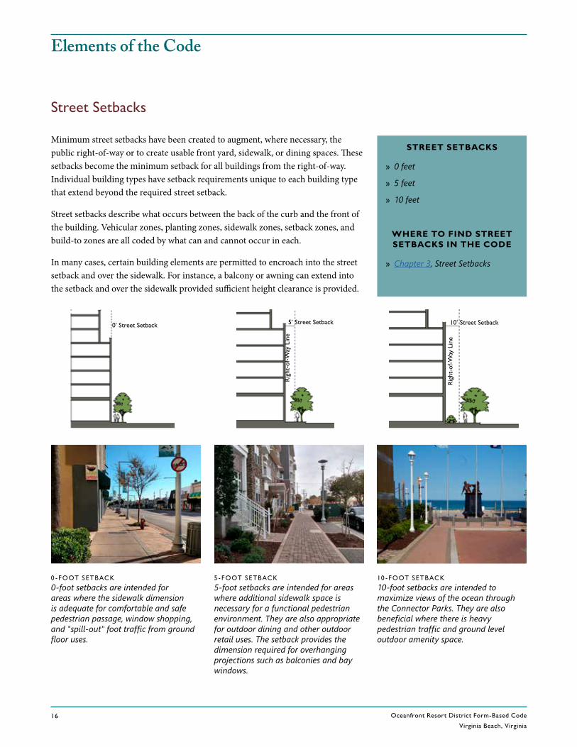
Oceanfront Resort District Form-Based Code
Virginia Beach, Virginia16
RE V. DECEMBER 5 , 2017
Elements of the Code
Street Setbacks
STREET SETBACKS
» 0 feet
» 5 feet
» 10 feet
WHERE TO FIND STREET SETBACKS IN THE CODE
» Chapter 3, Street Setbacks
Minimum street setbacks have been created to augment, where necessary, the public right-of-way or to create usable front yard, sidewalk, or dining spaces. These setbacks become the minimum setback for all buildings from the right-of-way. Individual building types have setback requirements unique to each building type that extend beyond the required street setback.
Street setbacks describe what occurs between the back of the curb and the front of the building. Vehicular zones, planting zones, sidewalk zones, setback zones, and build-to zones are all coded by what can and cannot occur in each.
In many cases, certain building elements are permitted to encroach into the street setback and over the sidewalk. For instance, a balcony or awning can extend into the setback and over the sidewalk provided sufficient height clearance is provided.
0 - FOOT SETBACK
0-foot setbacks are intended for areas where the sidewalk dimension is adequate for comfortable and safe pedestrian passage, window shopping, and "spill-out" foot traffic from ground floor uses.
5 - FOOT SETBACK
5-foot setbacks are intended for areas where additional sidewalk space is necessary for a functional pedestrian environment. They are also appropriate for outdoor dining and other outdoor retail uses. The setback provides the dimension required for overhanging projections such as balconies and bay windows.
10 - FOOT SETBACK
10-foot setbacks are intended to maximize views of the ocean through the Connector Parks. They are also beneficial where there is heavy pedestrian traffic and ground level outdoor amenity space.
Rig
ht-o
f-Way
Lin
e
Rig
ht-o
f-Way
Lin
e
0’ Street Setback 5’ Street Setback 10’ Street Setback
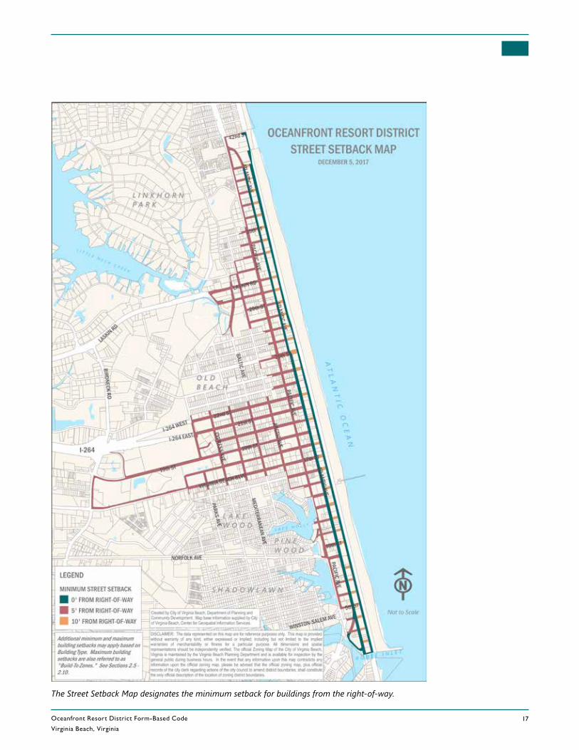
Oceanfront Resort District Form-Based Code
Virginia Beach, Virginia17
REV. DECEMBER 5, 2017
The Street Setback Map designates the minimum setback for buildings from the right-of-way.

Oceanfront Resort District Form-Based Code
Virginia Beach, Virginia18
RE V. DECEMBER 5 , 2017
Elements of the Code
Heights
HEIGHT ZONES
» 35 feet
» 45 feet
» 75 feet
» 75’ Podium+35’ Tower/110 feet
» 75’ Podium+125’ Tower/200 feet
» 100’ Podium+100’ Tower/200 feet
WHERE TO FIND HEIGHT LIMITS IN THE
CODE
» Chapter 4, Height
The form-based code identifies six height categories, ranging in total building height from 35 feet to 200 feet. The location of the height categories is determined by proximity to residential neighborhoods and relationships to streets and public spaces. The height categories are shown on the Height Map, pictured to the right.
Traditionally in Virginia Beach, height is governed by the City Zoning Ordinance. Under the previous RT zoning, height on blocks east of Atlantic was capped at 200 feet, blocks between Atlantic and Pacific had a 75-foot cap, and in the RT-3 districts, no height restrictions existed except for 75 feet on hotels. The form-based code redistributes height equitable to surrounding neighborhoods and minimizes over-bulking of streets and open space. The latter improvement, in particular, allows for secondary views around and over structures whereas before, massive “walls” prohibited such sight lines. Towers are the primary tools used to redistribute the height. By allowing 110-foot and 200-foot towers much of the Resort Area is allowed to stay at a much lower height. Tower dimensions are restricted to 15,000 square feet for 200-foot towers and 7,500 feet for 110-foot towers.
35 - AND 45 - FOOT ZONES
Typically used in areas that transition to surrounding residential neighborhoods. Houses and small commercial and mixed-use buildings generally fall within these height limits.
75 - FOOT ZONES
Typically used to allow taller heights in the Laskin Gateway and Central Beach districts.
110 - AND 20 0 - FOOT ZONES
Primarily located on the Atlantic and Pacific blocks, the 110-foot and 200-foot zones permit towers with floor plates up to 7,500 square feet and 15,000 square feet respectively.
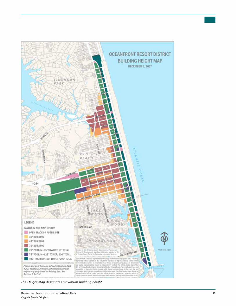
Oceanfront Resort District Form-Based Code
Virginia Beach, Virginia19
REV. DECEMBER 5, 2017
The Height Map designates maximum building height.
Oceanfront Resort District Form-Based Code
Virginia Beach, Virginia
1-2
RE V. DECEMBER 5 , 2017
Chapter 1. Purpose & Applicability
Sec. 1.1 General Provisions 1.1.1 Purpose and IntentA. The purpose of the OR Oceanfront Resort District is to implement and
update the vision of the City’s Resort Area contained in the 2008 Resort Area Strategic Action Plan (RASAP) by facilitating the transition of the Resort Area from a seasonal vacation spot to a year-round, world-class urban resort destination for recreation, entertainment and conventions, complemented by a dedicated, active local community that adds unique local flavor in the form of restaurants, creative businesses, shops and recreational activities.
B. Rather than relying upon conventional zoning principles, the OR Oceanfront Resort District (ORD) fosters predictable results and a high-quality public realm by prescribing the physical form of buildings and other elements and addressing the relationship between building facades and the public realm, the form and mass of buildings in relation to one another, and the scale and types of streets and blocks. At the same time, however, the Code provides a high degree of flexibility by allowing the use of optional design forms as incentives that accomplish the purpose of the ORD in ways other than those specifically prescribed in the Code.
C. It is the intent of the OR District, by using such principles, to:
1. Create a walkable, mixed-use urban area with improved access to the beach;
2. Improve pedestrian connections between destinations;
3. Create a transition from the Resort Area to residential neighborhoods;
4. Expand residential opportunities;
5. Concentrate retail activities; and
6. Transform the Resort Area into a year-round resort.
1.1.2 ApplicabilityA. This Code applies to all property located within the OR District, as
designated on the Official Zoning Map. Property abutting a specific frontage shown on the Frontage Map set forth in Sec. 2.1 shall conform to the provisions of this Code applicable to such frontage.
B. Unless expressly provided otherwise, any provision of this Code that conflicts with another provision of the City Zoning Ordinance or other applicable ordinance or regulation shall be deemed to control to the extent of such conflict.
Sec. 1.1 General Provisions
Oceanfront Resort District Form-Based Code
Virginia Beach, Virginia
2 – 3
REV. DECEMBER 5, 2017
Chapter 2. Frontages & Building Types Sec. 2.1 Frontages
Sec. 2.1 Frontages2.1.1 Frontages EstablishedThe following street frontages have been established and are applied to property as set forth on the Frontage Map.
A. (BW) Boardwalk
The Boardwalk Frontage is intended to preserve and enhance pedestrian and bicycle access to the beach. The frontage allows only limited vehicular access and is intended to preserve the openness of the Oceanfront. The frontage is also intended to encourage activity by allowing active uses to directly access the beach.
B. (CP) Connector Park
The Connector Park Frontage is assigned to all rights-of-way between Atlantic Avenue and the Boardwalk. Many of these have been improved as public outdoor amenity spaces with varying degrees of vehicular use. Any modifications to these frontages must adhere to the Connector Park Design Guidelines, which were created to protect and enhance pedestrian use, emergency/service vehicle access, viewsheds, and the aesthetic character of these connections.
C. (SH) Shopping Frontage
The Shopping Frontage is intended for the most walkable places in the Resort Area, with a focus on pedestrian movement and activity. Shopping Frontages typically include mixed-use buildings with active uses on the ground floor and office, residential, or hotel uses in the upper stories.
D. (GW) Gateway Frontage
The Gateway Frontage is intended to balance moving vehicles through the area with walkability and pedestrian safety. These frontages typically carry a higher volume of traffic, but still offer accommodations for the pedestrian.
E. (BE) Beach
The Beach Frontage is intended as a quieter frontage with high pedestrian activity associated with movement from residential areas down to the beach.
2.1.2 [RESERVED]
2.1.3 Frontage Map Incorporated A. The Frontage Map is hereby incorporated and made a part of the Official
Zoning Map.
B. The Frontage Map specifies the territorial application of the OR District and is the key that identifies the allowed building types within each designated frontage.
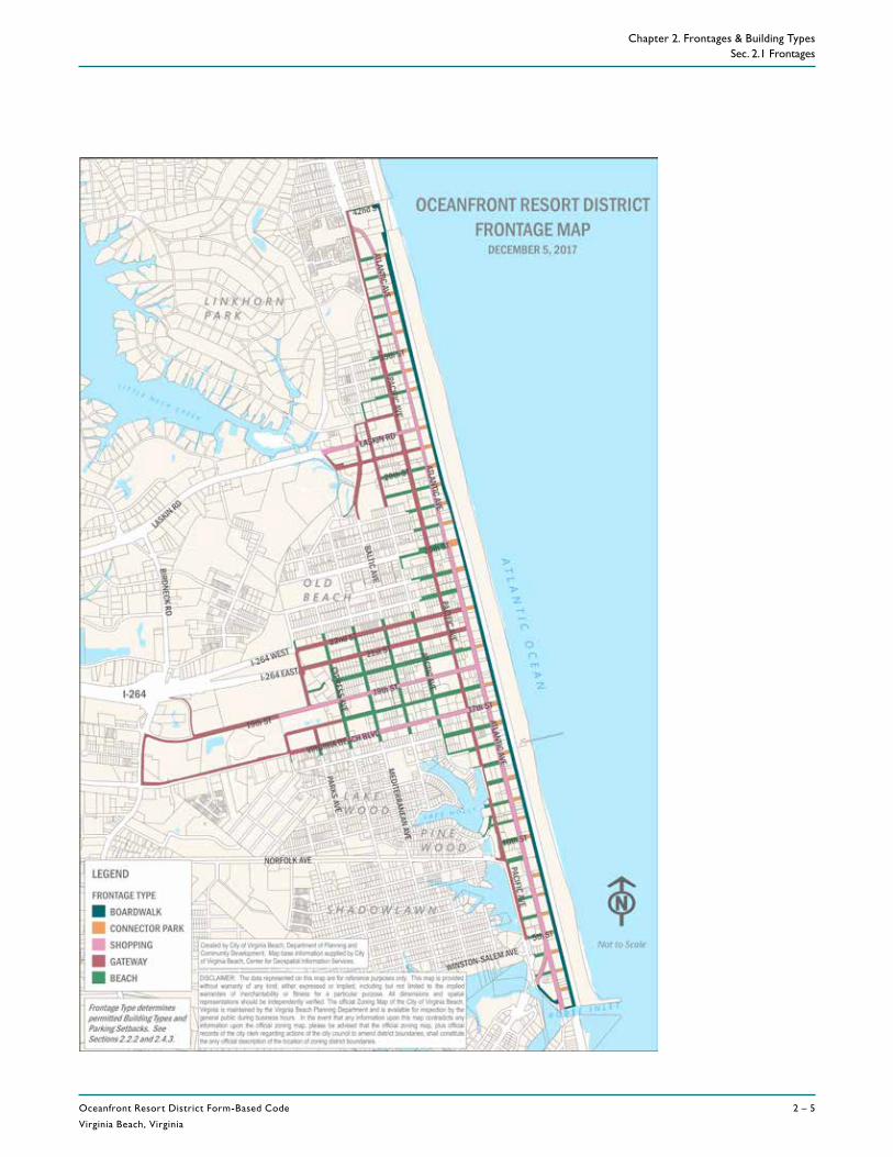
Oceanfront Resort District Form-Based Code
Virginia Beach, Virginia
2 – 5
REV. DECEMBER 5, 2017
Chapter 2. Frontages & Building Types Sec. 2.1 Frontages
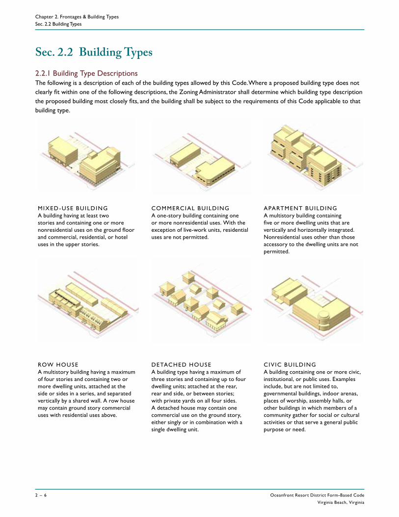
Oceanfront Resort District Form-Based Code
Virginia Beach, Virginia
2 – 6
RE V. DECEMBER 5 , 2017
Chapter 2. Frontages & Building TypesSec. 2.2 Building Types
Sec. 2.2 Building Types2.2.1 Building Type Descriptions The following is a description of each of the building types allowed by this Code. Where a proposed building type does not clearly fit within one of the following descriptions, the Zoning Administrator shall determine which building type description the proposed building most closely fits, and the building shall be subject to the requirements of this Code applicable to that building type.
MIXED- USE BU ILDING A building having at least two stories and containing one or more nonresidential uses on the ground floor and commercial, residential, or hotel uses in the upper stories.
COMMERCIAL BU ILDING A one-story building containing one or more nonresidential uses. With the exception of live-work units, residential uses are not permitted.
APARTMENT BUILDING A multistory building containing five or more dwelling units that are vertically and horizontally integrated. Nonresidential uses other than those accessory to the dwelling units are not permitted.
ROW HOUSE A multistory building having a maximum of four stories and containing two or more dwelling units, attached at the side or sides in a series, and separated vertically by a shared wall. A row house may contain ground story commercial uses with residential uses above.
DETACHED HOUSE A building type having a maximum of three stories and containing up to four dwelling units; attached at the rear, rear and side, or between stories; with private yards on all four sides. A detached house may contain one commercial use on the ground story, either singly or in combination with a single dwelling unit.
C IV IC BU ILDING A building containing one or more civic, institutional, or public uses. Examples include, but are not limited to, governmental buildings, indoor arenas, places of worship, assembly halls, or other buildings in which members of a community gather for social or cultural activities or that serve a general public purpose or need.

Oceanfront Resort District Form-Based Code
Virginia Beach, Virginia
2 – 7
REV. DECEMBER 5, 2017
Chapter 2. Frontages & Building Types Sec. 2.2 Building Types
2.2.2 Building Types Allowed by FrontageBuilding types are allowed by frontage as established in the table below. Specific requirements for each building type are shown on the following pages.
MIXED-USE BUILDING
COMMERCIAL BUILDING
APARTMENT BUILDING
ROW HOUSE
DETACHED HOUSE
CIVIC BUILDING
FRONTAGE
(BW) Boardwalk P -- -- -- -- P
(CP) Connector Park P -- -- -- -- P
(SH-E) Shopping east side of Atlantic P -- -- -- -- P
(SH-W) Shopping west side of Atlantic P -- P P -- P
(GW) Gateway P P P P P P
(BE) Beach P -- P P P P
KEY: P = Permitted building type -- = Building type not permitted
Oceanfront Resort District Form-Based Code
Virginia Beach, Virginia
2 – 8
RE V. DECEMBER 5 , 2017
Chapter 2. Frontages & Building TypesSec. 2.3 Building Type Properties
2.3.1 Intent The building types establish the basic parameters governing lot dimensions, building placement, building height, and building form.
2.3.2 Lot Criteria A. The lot criteria sets the minimum lot area and width for
each building type.
B. The building setback determines how far buildings must be placed from each lot line.
2.3.3 PlacementA. The build-to zone and parking location criteria determine
where buildings and parking will be placed relative to the street.
B. Outdoor amenity space sets minimum requirements for the provision of smaller areas of urban open space that supplement major public spaces such as the Beach, Boardwalk and Connector Parks.
2.3.4 HeightA. Establishes vertical dimensions of ground and upper floors.
B. The minimum and maximum height for each building type is set forth in Sec. 2.5 through 2.10. Maximum heights based on location are set forth in Chapter 4. The lesser of the two is the maximum building height.
2.3.5 FormA. Transparency establishes the degree to which a building's
facade must contain windows and provide views into and out of the interior of the building.
B. Entrances determine the orientation of each building.
LOT CRITERIA
PLACEMENT
HEIGHT
FORM
Sec. 2.3 Building Type Properties
Oceanfront Resort District Form-Based Code
Virginia Beach, Virginia
2 – 9
REV. DECEMBER 5, 2017
Chapter 2. Frontages & Building Types Sec. 2.4 Rules for All Buildings
Sec. 2.4 Rules for All Buildings2.4.1 ApplicabilityThe following standards apply to all building types unless expressly stated otherwise.
2.4.2 Lot Criteria
A. Lot
1. Minimum lot area is exclusive of public right-of-way, water, wetlands, and floodways.
2. Lot width is measured between the side lot lines (generally running perpendicular to a street) at the street setback line.
3. When multiple primary buildings or building types are placed on the same lot, each building must be able to meet the minimum lot criteria of its associated building type whether or not actual lot lines exist.
B. Building Setbacks
1. Street setbacks are measured from the right-of-way line, excluding alleys, and are established on the Street Setback Map (see Chapter 3). Permitted street setback encroachments are listed in Chapter 3.
2. Alley setbacks are measured from the rear property line where alleys are present, improved or unimproved. Permitted alley setback encroachments are listed in Chapter 3.
3. Side or rear setbacks from a common lot line are measured from the side or rear property line. Permitted side or rear setback encroachments are listed in Chapter 3.
4. Provisions allowing the use of optional forms of development in place of the building setback requirements prescribed above are set forth in Sec. 7.2.2 (A).
2.4.3 Placement
A. Build-to
1. The build-to zone is the area on the lot where a required minimum percentage of the lot width, as required for each Building Type in Sec. 2.5 through 2.10, must contain building facade, which may include galleries, arcades, porte cocheres, forecourts, and shopfronts. Specifically, the build-to zone is the area between the minimum and maximum setback range from the street setback line.
2. The ‘minimum percentage’ as required for each Building Type in Sec. 2.5 through 2.10, specifies the width (in terms of a percentage of the width of the lot) in which building facade must be located in the build-to area.
3. Permitted build-to zone encroachments are listed in Chapter 3.
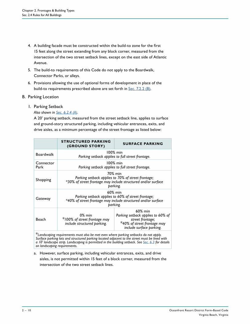
Oceanfront Resort District Form-Based Code
Virginia Beach, Virginia
2 – 10
RE V. DECEMBER 5 , 2017
Chapter 2. Frontages & Building TypesSec. 2.4 Rules for All Buildings
4. A building facade must be constructed within the build-to zone for the first 15 feet along the street extending from any block corner, measured from the intersection of the two street setback lines, except on the east side of Atlantic Avenue.
5. The build-to requirements of this Code do not apply to the Boardwalk, Connector Parks, or alleys.
6. Provisions allowing the use of optional forms of development in place of the build-to requirements prescribed above are set forth in Sec. 7.2.2 (B).
B. Parking Location
1. Parking Setback Also shown in Sec. 6.2.4 (A).A 20’ parking setback, measured from the street setback line, applies to surface and ground-story structured parking, including vehicular entrances, exits, and drive aisles, as a minimum percentage of the street frontage as listed below:
STRUCTURED PARKING (GROUND STORY) SURFACE PARKING
Boardwalk 100% minParking setback applies to full street frontage.
Connector Park
100% minParking setback applies to full street frontage.
Shopping 70% min
Parking setback applies to 70% of street frontage; *30% of street frontage may include structured and/or surface
parking.
Gateway60% min
Parking setback applies to 60% of street frontage; *40% of street frontage may include structured and/or surface
parking.
Beach0% min
*100% of street frontage may include structured parking.
60% minParking setback applies to 60% of
street frontage; *40% of street frontage may
include surface parking.
*Landscaping requirements must also be met even where parking setbacks do not apply. Surface parking lots and structured parking located adjacent to the street must be lined with a 10' landscape strip. Landscaping is permitted in the building setback. See Sec. 6.3 for details on landscaping requirements.
a. However, surface parking, including vehicular entrances, exits, and drive aisles, is not permitted within 15 feet of a block corner, measured from the intersection of the two street setback lines.
Oceanfront Resort District Form-Based Code
Virginia Beach, Virginia
2 – 11
REV. DECEMBER 5, 2017
Chapter 2. Frontages & Building Types Sec. 2.4 Rules for All Buildings
b. Structured and surface parking, including drive aisles but excluding vehicular entrances and exits, must also be located behind the side and rear parking setbacks, measured from the side or rear (common) property line, as listed by building type in Sec. 2.5 through 2.10. The setback applies to 100% of the side and rear property lines.
c. Other than a building setback that would be applicable for a parking structure, there is no parking setback from alleys.
d. The parking setback does not apply to the upper stories of structured parking facilities.
e. The ground story of structured parking must have active uses located between the parking structure and any public sidewalk.
2. Optional Forms of DevelopmentProvisions allowing the use of optional forms of development in place of the parking setback requirements prescribed above are set forth in Sec. 7.2.2 (C).
C. Outdoor Amenity Space
1. Required outdoor amenity space must be provided on the site in accordance with the requirements of this chapter. Outdoor amenity space:
a. May be comprised of one contiguous area or multiple areas;
b. Shall have a minimum width or depth of six feet;
c. May be located in a setback zone;
d. May be located at grade or above grade;
e. Shall be visible from the street if located at grade;
f. Shall not contain outdoor display, outdoor storage, dumpsters, or any permanent improvements, except for improved surfaces and structures that provide a shared amenity, and may not be parked or driven upon, except for emergency access and during permitted temporary events; and
g. May be covered, but if covered, must remain open on at least three sides.
2. Optional Forms of DevelopmentProvisions allowing the use of optional forms of development in place of the outdoor amenity space requirements prescribed above are set forth in Sec. 7.2.2 (G).
Oceanfront Resort District Form-Based Code
Virginia Beach, Virginia
2 – 12
RE V. DECEMBER 5 , 2017
Chapter 2. Frontages & Building TypesSec. 2.4 Rules for All Buildings
2.4.4 Height
A. Building Height
1. The maximum permitted height of buildings and structures varies based on location (shown on the Height Map in Chapter 4) and building type (shown in Sec. 2.5 - 2.10). The lesser of the two is the maximum building height.
2. The minimum required building height is established in Sec. 2.5 - 2.10. All portions of the building used to meet the build-to requirement must meet minimum building height.
3. Up to four feet of the height of a parapet may be applied to meet minimum building height, provided the parapet continues around the full perimeter of the building.
B. Story Height
1. Ground-story finished floor elevation is measured from the top of the abutting sidewalk to the top of the finished ground floor.
2. Story height is measured from the top of the finished floor to the top of the finished floor above. When there is no floor above, floor height is measured to the ceiling above plus one additional foot.
3. Minimum ground-story height applies to the first 30 feet of the building measured inward from the facade adjacent to the street. At least 50% of the ground story must meet the minimum height provisions.
4. At least 80% of each upper story must meet the minimum upper-story height provisions.
C. Optional Forms of Development
Provisions allowing the use of optional forms of development in place of the height requirements prescribed above are set forth in Sec. 7.2.2 (D).
2.4.5 Form
A. Transparency
1. The minimum percentage of windows and doors that must cover a ground-story facade adjacent to a street is measured between 2 and 12 feet above ground level.
2. The minimum percentage of windows and doors that must cover an upper-story facade adjacent to a street is measured from the top of the finished floor to the top of the finished floor above. When there is no floor above, upper-story transparency is measured from the top of the finished floor to the top of the wall plate.
Oceanfront Resort District Form-Based Code
Virginia Beach, Virginia
2 – 13
REV. DECEMBER 5, 2017
Chapter 2. Frontages & Building Types Sec. 2.4 Rules for All Buildings
3. Blank wall means a portion of the exterior facade of the building that does not include a substantial material change (paint color is not considered a substantial change); windows, doors, columns, pilasters, or other articulation greater than 6 inches in depth.
4. Blank wall applies in both a vertical and horizontal direction.
5. Blank wall applies to both ground and upper-story facades adjacent to a street.
B. Building Entrances
1. A primary entrance providing both ingress and egress, operable during normal business hours, if applicable, is required to meet the street-facing entrance requirements.
2. An angled entrance may be provided at either corner of a building along the street to meet the street entrance requirements.
3. A minimum of 50% of a required entrance must be transparent on a mixed-use or commercial building.
C. Optional Forms of Development
Provisions allowing the use of optional forms of development in place of the form requirements prescribed above are set forth in Sec. 7.2.2 (E).
REV. DECEMBER 5, 2017
Chapter 3. Setbacks
SEC. 3.1 STREET SETBACK MAP ...................................................................3 – 23.1.1 Street Setbacks Established ............................................................................3 – 23.1.2 Street Setback Map Incorporated ...............................................................3 – 2
SEC. 3.2 ENCROACHMENTS ............................................................................3 – 43.2.1 Vehicular Zone ...................................................................................................3 – 43.2.2 Planting Zone .......................................................................................................3 – 43.2.3 Sidewalk Zone ......................................................................................................3 – 53.2.4 Street Setback Zone ..........................................................................................3 – 53.2.5 Build-To Zone ......................................................................................................3 – 63.2.6 Easements ..............................................................................................................3 – 63.2.7 Side and Rear Setback Encroachments .....................................................3 – 7
Oceanfront Resort District Form-Based Code
Virginia Beach, Virginia
3 – 2
RE V. DECEMBER 5 , 2017
Chapter 3. SetbacksSec. 3.1 Street Setback Map
Sec. 3.1 Street Setback Map3.1.1 Street Setbacks EstablishedTo provide consistency in building placement while ensuring room for public realm improvements, the following street setbacks have been established and are applied to property as set forth on the Street Setback Map.
A. 0 Feet
No setback is required from the public right-of-way. Intended for areas where adequate sidewalk or open area currently exists and therefore buildings are allowed to be built up to the property line.
B. 5 Feet
1. All buildings must set back at least five feet from the public right-of-way. Intended for areas where inadequate sidewalk width currently exists. The five foot setback can serve as an extension to the existing sidewalk and must meet all City and ADA specifications for the construction of sidewalks.
2. Sidewalk extensions are to be constructed and maintained by the developer/property owner and must be encumbered by an easement permanently dedicated to the City in accordance with Sec. 3.2.6.
C. 10 Feet
1. All buildings must be set back at least 10 feet from the public right-of-way. Intended for areas adjacent to Connector Parks to expand ocean vistas.
2. Improvements in this setback area must follow the Oceanfront Resort District Connector Park Design Guidelines.
3.1.2 Street Setback Map Incorporated A. The Street Setback Map is hereby incorporated and made a part of the
Official Zoning Map.
B. A full-scale Street Setback Map is available for review at the Department of Planning.
Oceanfront Resort District Form-Based Code
Virginia Beach, Virginia
3 – 3
REV. DECEMBER 5, 2017
Chapter 3. Setbacks Sec. 3.1 Street Setback Map
Oceanfront Resort District Form-Based Code
Virginia Beach, Virginia
3 – 4
RE V. DECEMBER 5 , 2017
Chapter 3. Setbacks
Sec. 3.2 Encroachments
Sec. 3.2 Encroachments
3.2.1 Vehicular Zone A. The vehicular zone accommodates transit, motor vehicles, and bicycles in a
variety of possible lane configurations.
B. The vehicular zone must remain clear of obstacles at all times except during temporary permitted events.
C. Loading and unloading is only permitted in areas and during times designated by the City in the vehicular zone.
3.2.2 Planting ZoneA. The planting zone is the area nearest to the curb within the public right-of-
way.
B. The planting zone must remain clear of obstacles at all times except as provided below. All private improvements in the public right-of-way are subject to approval by the City in accordance with Ch. 33-114.3 of the City Code and must meet all applicable Design Guidelines.
1. Benches, trash receptacles, and bicycle racks.
2. Minor structures accessory to utility facilities such as hydrants, manholes, transformers, and fire suppression equipment.
3. Public transit facilities.
4. Street and pedestrian lighting.
5. Landscaping, sidewalk, trees, tree grates, and planters.
6. Permitted access drives.
Vehicular Zone
PlantingZone
PUBL IC R IGHT- OF-WAYPR IVATE PROPERT Y
Sidewalk Zone
Setback Zone
Build-to Zone
Stre
et S
etba
ck L
ine
Rig
ht-o
f-Way
Lin
e

Oceanfront Resort District Form-Based Code
Virginia Beach, Virginia
3 – 5
REV. DECEMBER 5, 2017
Chapter 3. Setbacks Sec. 3.2 Encroachments
3.2.3 Sidewalk ZoneA. The sidewalk zone is the area between the planting zone and the public
right-of-way line.
B. The sidewalk zone must remain clear of obstacles at all times except as provided below. All private improvements in the public right-of-way are subject to approval by the City in accordance with Ch. 33-114.3 of the City Code and must meet all applicable Design Guidelines.
1. Awnings, canopies, light shelves, operable windows, and shutters may encroach up to three feet, provided there is at least eight feet in clearance above ground level.
2. Signs in accordance with Ch. 8.
3. Building-mounted lights and security cameras may encroach up to one foot, provided there is at least eight feet in clearance above ground level.
4. Galleries designed in accordance with applicable Design Guidelines.
5. Handicapped ramps may encroach to the extent necessary to perform their proper function.
6. Balconies designed in accordance with applicable Design Guidelines provided there is at least 24 feet in clearance above ground level.
7. Cornices, belt courses, sills, or other similar decorative architectural features may encroach up to one foot provided there is at least eight feet in clearance above ground level.
8. Permitted access drives.
C. The sidewalk zone must meet City and ADA specifications at all times.
3.2.4 Street Setback ZoneA. The street setback zone is the area between the public right-of-way line and
the street setback line as established on the Setback Map in Sec. 3.1.
B. All buildings and structures must be located behind the street setback line, except as listed below:
1. Awnings, canopies, light shelves, operable windows, and shutters provided there is at least eight feet in clearance above ground level.
2. Galleries and porte cocheres designed in accordance with applicable Design Guidelines.
3. Outdoor seating and cafes.
4. Outdoor display areas in accordance with Sec. 6.5.
5. Signs in accordance with Ch. 8.
6. Benches, trash receptacles, public art, water features, bicycle racks, and bollards.
Oceanfront Resort District Form-Based Code
Virginia Beach, Virginia
3 – 6
RE V. DECEMBER 5 , 2017
Chapter 3. SetbacksSec. 3.2 Encroachments
7. Pedestrian lighting and security cameras, provided building-mounted fixtures are placed at least eight feet from ground level.
8. Minor structures accessory to utility facilities such as hydrants, manholes, transformers, backflow preventers, generators, utility boxes, meters, and fire suppression equipment, provided such structures greater than four feet in height are not placed between the building and the street and all such structures are positioned to be screened from the street without obstructing access and venting requirements.
9. Handicapped ramps to the extent necessary to perform their proper function.
10. Balconies, building eaves, and roof overhangs provided there is at least 12 feet in clearance above ground level.
11. Cornices, belt courses, pilasters, or other similar decorative architectural features may encroach up to one foot into the required street setback.
12. Bay windows, oriels, sills, and vestibules that are less than 10 feet wide may encroach up to three feet, provided that such extension is at least two feet from the vertical plane of the front lot line.
13. Stoops and porches designed in accordance with applicable Design Guidelines provided that such extension is at least two feet from the vertical plane of the front lot line.
14. Chimneys or flues may encroach up to two feet, provided that such extension is at least five feet from the vertical plane of the front lot line.
15. Landscaping, sidewalks, trees, tree grates, and planters.
16. Permitted access drives.
17. A wall or fence not more than four feet in height. All walls and fences must meet the criteria set forth in Sec. 6.3.5.
18. Subgrade foundation.
3.2.5 Build-To ZoneA. The build-to zone is the area located between a minimum and maximum
setback range measured from the street setback line.
B. Unless otherwise indicated, all structures and uses customarily allowed on the lot are allowed in the build-to zone.
3.2.6 EasementsA. The sidewalk zone and planting zone may be provided on private property
(outside of the public right-of-way) provided the sidewalk zone and planting zone are located within an easement permanently dedicated to the City.

Oceanfront Resort District Form-Based Code
Virginia Beach, Virginia
3 – 7
REV. DECEMBER 5, 2017
Chapter 3. Setbacks Sec. 3.2 Encroachments
B. The dedicated easement must provide the City with perpetual access to allow for customary public use including but not limited to the provision of public signs, street lighting, parking meters, and public utilities.
C. The easement cannot be used for underground structures of any kind except those associated with underground utilities.
3.2.7 Side and Rear Setback Encroachments All buildings and structures must be located at or behind the side or rear setback, except as listed below:
A. Fences and walls may encroach into a required rear or side setback provided that they meet the criteria set forth in Sec. 6.3.5.
B. Chimneys or flues may encroach up to two feet, provided that such extension is at least five feet from the vertical plane of any side or rear lot line.
C. Building eaves, roof overhangs, light shelves, operable windows, and shutters may encroach up to three feet, provided that such extension is at least two feet from the vertical plane of any side or rear lot line.
D. Bay windows, oriels, sills, and vestibules that are less than 10 feet wide may encroach up to three feet, provided that such extension is at least two feet from the vertical plane of any side or rear lot line.
E. Unenclosed fire escapes or stairways may encroach up to four feet, provided that such extension is at least five feet from the vertical plane of any side or rear lot line.
F. Unenclosed stoops, porches, patios, decks, or terraces may encroach up to four feet, provided that such extension is at least five feet from the vertical plane of any side or rear lot line.
G. Cornices, belt courses, pilasters, or other similar decorative architectural features may encroach up to one foot into a required side or rear setback.
H. Minor structures accessory to utility facilities such as hydrants, manholes, transformers, backflow preventers, generators, utility boxes, meters, and fire suppression equipment may encroach into a required rear or side setback.
I. Handicapped ramps may encroach into a required rear or side setback to the extent necessary to perform their proper function.
J. Rainwater collection or harvesting systems may encroach into a required rear or side setback, provided that such extension is at least three feet from the vertical plane of any side or rear lot line.
K. Subgrade foundation may encroach into a required rear or side setback.
REV. DECEMBER 5, 2017
Chapter 4. Height
SEC. 4.1 HEIGHT MAP ......................................................................................................................4 – 24.1.1 Height Zones Established ...........................................................................................................4 – 24.1.2 Height Map Incorporated ..........................................................................................................4 – 24.1.3 General Standards .........................................................................................................................4 – 44.1.4 Height Encroachments ...............................................................................................................4 – 44.1.5 Measurement of Height ...............................................................................................................4 – 54.1.6 Optional Forms of Development .............................................................................................4 – 5
SEC. 4.2 TOWER PROVISIONS...................................................................................................4 – 64.2.1 75-Foot Podium+35-Foot Tower/110-Foot Height Zone ..............................................4 – 64.2.2 West of Atlantic/75-Foot Podium+125-Foot Tower/200-Foot Height Zone ...........4 – 74.2.3 East of Atlantic/100-Foot Podium+100-Foot Tower/200-Foot Height Zone ..........4 – 8
Oceanfront Resort District Form-Based Code
Virginia Beach, Virginia
4 – 2
RE V. DECEMBER 5 , 2017
Chapter 4. HeightSec. 4.1 Height Map
Sec. 4.1 Height Map4.1.1 Height Zones EstablishedThe following height zones have been established and are applied to property as set forth on the Height Map.
A. Public and Open Space
Established to provide for and maintain public open spaces. Buildings and structures must be used for public purposes only.
B. 35 Feet
Established to provide a transition to adjacent established residential neighborhoods. No building or structure may exceed 35 feet in height.
C. 45 Feet
Established to provide a transition between the 35-foot and 75-foot height zones. No building or structure may exceed 45 feet in height.
D. 75 Feet
Established as the predominant height zone for areas west of Pacific, particularly in the Laskin Gateway and Central Beach corridors. No building or structure may exceed 75 feet in height.
E. 75-Foot Podium+35-Foot Tower/110 Feet
Established to provide an opportunity for mid-rise towers on blocks between Atlantic and Pacific and on blocks surrounding the Convention Center. Height restrictions are set forth in Sec. 4.2.1.
F. 75-Foot Podium+125-Foot Tower/200 Feet
Established to provide an opportunity for high-rise towers at key sites near the Convention Center and on the west side of Atlantic directly across from Public and Open Space sites on the east side of Atlantic. Tower provisions are set forth in Sec. 4.2.2.
G. 100-Foot Podium+100-Foot Tower/200 Feet
Established to provide an opportunity for high-rise towers along the ocean. Tower provisions are set forth in Sec. 4.2.3.
4.1.2 Height Map Incorporated A. The Height Map is hereby incorporated and made a part of the Official
Zoning Map.
B. A full-scale Height Map is available for review at the Department of Planning and Community Development.

Oceanfront Resort District Form-Based Code
Virginia Beach, Virginia
4 – 3
REV. DECEMBER 5, 2017
Chapter 4. Height Sec. 4.1 Height Map
Oceanfront Resort District Form-Based Code
Virginia Beach, Virginia
4 – 4
RE V. DECEMBER 5 , 2017
Chapter 4. HeightSec. 4.1 Height Map
4.1.3 General StandardsA. A row house and detached house may have maximum building height limits
that are lower than the maximum height limit established on the Height Map (see Sec. 2.8, Row House or Sec. 2.9, Detached House).
B. A commercial building cannot exceed one story or 35 feet in height (see Sec. 2.6, Commercial Building).
C. No artificial structure or tree or other natural growth that on the basis of its height would constitute an obstruction to air navigation pursuant to Part 77 of the Federal Aviation Administration Regulations, 14 C.F.R. §§ 77.21 et seq. or any successor regulation, or which would cause an adjustment to an airfield’s established straight-in, circling, alternate, takeoff, and safety minima, or which would adversely affect radio reception or radar coverage for any airfield or FAA facility shall be allowed in any district.
4.1.4 Height Encroachments Any height encroachment not specifically listed is expressly prohibited except where the Zoning Administrator determines that the encroachment is similar to a permitted encroachment listed below.
A. The maximum height limits of the height zone do not apply to spires, belfries, cupolas, domes not intended for human occupancy, monuments, or other similar structures that, by design or function, must exceed the established height limits.
B. The following items may exceed the established height limits, provided they do not exceed the maximum building height by more than 12 feet:
1. Chimney, flue, or vent stack;
2. Deck, patio, shade structure;
3. Flagpole;
4. Garden, landscaping;
5. Parapet wall, limited to a height of four feet;
6. Rainwater collection or harvesting systems; and
7. Sustainable energy systems, such as solar panels and wind turbines.
C. The following items may exceed the established height limits, provided they do not exceed the maximum building height by more than 12 feet, do not occupy more than 25% of the roof area, and are set back at least 10 feet from the edge of the roof:
1. Cooling tower;
2. Elevator penthouse or bulkhead;
3. Greenhouse;
4. HVAC units;
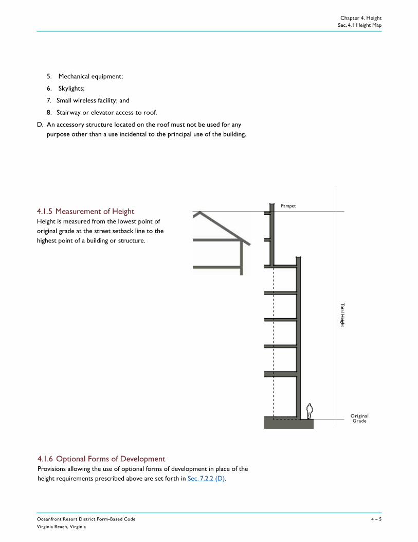
Oceanfront Resort District Form-Based Code
Virginia Beach, Virginia
4 – 5
REV. DECEMBER 5, 2017
Chapter 4. Height Sec. 4.1 Height Map
Total Height
OriginalGrade
4.1.5 Measurement of HeightHeight is measured from the lowest point of original grade at the street setback line to the highest point of a building or structure.
Parapet
4.1.6 Optional Forms of DevelopmentProvisions allowing the use of optional forms of development in place of the height requirements prescribed above are set forth in Sec. 7.2.2 (D).
5. Mechanical equipment;
6. Skylights;
7. Small wireless facility; and
8. Stairway or elevator access to roof.
D. An accessory structure located on the roof must not be used for any purpose other than a use incidental to the principal use of the building.


Page 3 of 9
6.b Consideration of Zoning Map Amendments and UDO TextAmendments Related to Land Use Plan Implementation of theMcCrimmon Extension Subarea Plan and the Transit OrientedDevelopment District (AMEND 21-0002, 21-0003, 21-0004, 21-0005, 21-0006)Planning Manager Chris Lawson explained that staff is proposing a series of zoningmap and UDO text amendments to implement portions of the Land Use Plan (LUP),which was adopted in February 2021. Staff was directed to begin implementation ofportions of the LUP at the Town Council retreat in 2021, including the McCrimmonExtension subarea, the TOD subarea, and to amend the boundaries of the AirportOverlay District (AO).
Zoning Map Amendments include:
• Airport Overlay District (AO) Amendment would change the boundaries withinthe AO. The exterior boundary will not change; however, it will reclassify aportion of the current overlay from the AO-A to the AO-B. The AO-B is less userestrictive than the AO-A but must meet still meet standards for developmentwithin the AO.
• The McCrimmon Parkway Extension would be rezoned to the Business ActivityCenter (BAC) as recommended in the LUP. BAC is expected to providedevelopment with a mix of uses. Much of the area along the McCrimmonParkway Extension is currently zoned Industrial Management (IM). Staff isunaware of any land uses that would become non-conforming. If approved, therezoning would remove two Conditional Zoning Districts near the intersectionof Aviation Parkway and McCrimmon/Evans Road.
• The Zoning Map would be amended to install the Gateway Overlay (GO)District, a brand-new zoning overlay district. This district would implementdesign standards to the McCrimmon Extension Subarea Plan. The base zoningwould be BAC, which would dictate permitted uses other than those usesprohibited by the GO such as single-family homes. All residential uses wouldbe prohibited except multi-family by the GO district. Other notablerequirements would require minimum spacing between multi-family dwellingsand locations of parking lots to the side or rear of the building.
• The Zoning Map would be amended to install the Transit OrientedDevelopment (TOD) zoning district, an existing zoning district which has neverbeen implemented. This area includes the TOD East subarea as well as areaswest of NC54 informally referred to as the TOD West and the TOD South. Thisdistrict would provide transit-supportive development that would allow forconvenient walking to transit stations and higher density residential spaces.
Member Sack asked for a timeline for future transit improvements in the Town. Long Range Planning Manager Howell stated that commuter rail is fully funded and expected to be open in 2030. The Rapid Bus Transit is funded by the State and is expected to be fully functional in 2028. Planning Manager Lawson also pointed out that the McCrimmon Parkway fly-over is expected to be begin construction in 2022 or 2023. NCDOT will take land for this construction.
Page 1
ATTH 10 - Draft PZB Minutes
XX
Page 4 of 9
Director Stegall added that there was a lot of study regarding the TOD district that staff believes rezoning the property now is the best course of action. Currently most of the land is zoned IM and could be developed for any number of industrial uses. The goal of rezoning the property now is to prevent unwanted uses. However, there are pros and cons to rezoning the property at this time.
Member Toterhi had a question about the permitted residential uses in AO, specifically residential uses. Planning Manager Lawson said that residential is allowed in the AO-B, however the Gateway Overlay zoning district prevents any residential besides multi-family dwellings subject to sound attenuation.
Member Michael questioned the RDU opinion regarding these changes. Planning Manager Lawson stated that the FAA has endorsed the proposed changes; however, RDU has not.
UDO Text Amendments include:
• Text amendments that would amend both the architectural and site designstandards in the Gateway Overlay (GO) along McCrimmon Parkway Extensionand the Transit Oriented Development (TOD) zoning districts. Theamendments to establish the GO district standards include parking orientationand minimum separation between multi-family site developments. Theamendments to the current TOD standards are designed to support pedestrianactivity and require a mix of uses to support future transit locations. The usetables will be amended as well as several definitions.
Member Michael asked about the “wall-like” appearance of an apartment building. Planning Manager Lawson added that the proposed step back on the elevations would change the perception of the building appearance.
Member Robuck expressed her concern regarding delivery trucks in mixed use developments, especially food service deliveries and moving trucks.
Vice Chair Langston was concerned with allowing “drive-throughs” in a mixed-use development. It does not support a pedestrian friendly area and cross access traffic.
Planning Manager Lawson informed the Board that Distilleries would be added to the principal use table. The definition would also be clarified in the definitions section of the UDO. Vice Chair Langston added that there are variations of this type of use; for example, a winery or meadery. Planning Manager Lawson explained that these types of uses are governed by ABC laws. Winery was an added option.
Vice Chair Langston questioned the “podium” parking facility option and would it dove-tail into the design or use of parking. It doesn’t seem feasible in most cases. He was in favor of removing podium. Planning Manager Lawson said that he expected most parking to be structured, not underground.
Page 2
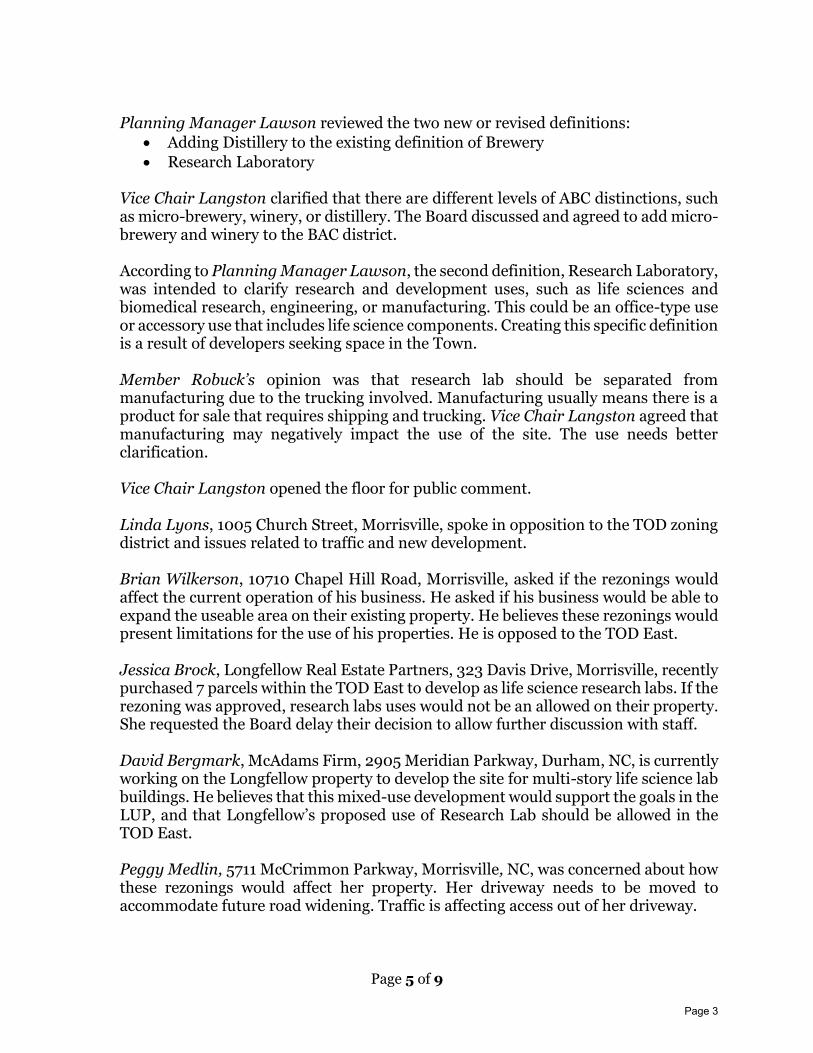
Page 5 of 9
Planning Manager Lawson reviewed the two new or revised definitions:
• Adding Distillery to the existing definition of Brewery
• Research Laboratory Vice Chair Langston clarified that there are different levels of ABC distinctions, such as micro-brewery, winery, or distillery. The Board discussed and agreed to add micro-brewery and winery to the BAC district. According to Planning Manager Lawson, the second definition, Research Laboratory, was intended to clarify research and development uses, such as life sciences and biomedical research, engineering, or manufacturing. This could be an office-type use or accessory use that includes life science components. Creating this specific definition is a result of developers seeking space in the Town. Member Robuck’s opinion was that research lab should be separated from manufacturing due to the trucking involved. Manufacturing usually means there is a product for sale that requires shipping and trucking. Vice Chair Langston agreed that manufacturing may negatively impact the use of the site. The use needs better clarification. Vice Chair Langston opened the floor for public comment. Linda Lyons, 1005 Church Street, Morrisville, spoke in opposition to the TOD zoning district and issues related to traffic and new development. Brian Wilkerson, 10710 Chapel Hill Road, Morrisville, asked if the rezonings would affect the current operation of his business. He asked if his business would be able to expand the useable area on their existing property. He believes these rezonings would present limitations for the use of his properties. He is opposed to the TOD East. Jessica Brock, Longfellow Real Estate Partners, 323 Davis Drive, Morrisville, recently purchased 7 parcels within the TOD East to develop as life science research labs. If the rezoning was approved, research labs uses would not be an allowed on their property. She requested the Board delay their decision to allow further discussion with staff. David Bergmark, McAdams Firm, 2905 Meridian Parkway, Durham, NC, is currently working on the Longfellow property to develop the site for multi-story life science lab buildings. He believes that this mixed-use development would support the goals in the LUP, and that Longfellow’s proposed use of Research Lab should be allowed in the TOD East. Peggy Medlin, 5711 McCrimmon Parkway, Morrisville, NC, was concerned about how these rezonings would affect her property. Her driveway needs to be moved to accommodate future road widening. Traffic is affecting access out of her driveway.
Page 3
Page 6 of 9
Marty Saunders, Secretary to the Board, read three email comments into the record. These comments were submitted by Rob Griffin, Tri Properties, 5425 Page Road, Durham, NC, Matt Stephens, Stephens Enterprises, LLC, 319 Chapanoke Road, Raleigh, NC, and Scot Humphrey, Edgewater Ventures, 3105 Glenwood Avenue, Raleigh, NC. These comments supported the Airport Overlay amendment, questioned the orientation and the number of loading docks, the block length requirement related to cross streets in the McCrimmon Extension, allowing the congregate care uses and adding food trucks to the Temporary Use Table. Vice Chair Langston closed the public comment session. Board discussion addressed the impact on infrastructure due to new development and was countered with the need to implement the recently adopted LUP. Member Robuck would like to see definitions clarified and maintain proposed loading dock requirements. Vice Chair Langston called for a motion. MOTION: Member Robuck found the proposed Airport Overlay Zoning Map Amendment to be consistent with the Town of Morrisville’s Comprehensive Plan and made a motion to recommend approval of Ordinance 2021-189-0A Approving a Zoning Map Amendment to the Boundaries of the Airport Overlay Zoning District (AMEND 21-0002) and to forward the following advisory statement to the Town Council: The proposed Zoning Map Amendment is reasonable, consistent with the Comprehensive Plan, and is in the public interest because:
A. The newly adopted 2021 Future Land Use Plan delineates new boundaries for the Airport Overlay A & B and the proposed zoning map amendment is consistent with the plan.
B. The zoning map amendment addresses the Future Land Use Plan’s goals of Housing Diversity, Economic Development, Fiscally Responsible Development, and Strong Community Image.
SECOND: Member Michael seconded the motion. VOTE: Passed with a vote 4 – 1 (Member Toterhi opposed) MOTION: Member Robuck found the proposed BAC Zoning Map Amendment to be consistent with the Town of Morrisville’s Comprehensive Plan and made a motion to recommend approval of Ordinance 2021-189-0B Approving the Zoning Map Amendment to Rezone Various Parcels located along McCrimmon Parkway and Airport Boulevard from the Industrial Management (IM) zoning district to the Business Activity Center (BAC) zoning district (AMEND 21-0003) and to forward the following advisory statement to the Town Council:
Page 4
Page 7 of 9
The proposed Zoning Map Amendment is reasonable, consistent with the Comprehensive Plan, and is in the public interest because:
A. The newly adopted 2021 Future Land Use Plan designates the McCrimmon Parkway Extension corridor as the Business Activity Center land use and proposed zoning map amendment is consistent with the plan.
B. The zoning map amendment addresses the Land Use Plan’s goals of Housing, Diversity, Economic Development, Fiscally Responsible Development, and Strong Community Image.
SECOND: Member Sack seconded the motion. VOTE: Passed with a vote of 4 – 1 (Member Toterhi opposed) MOTION: Member Robuck found that the proposed GO Overlay Zoning Map Amendment to be consistent with the Town of Morrisville’s Comprehensive Plan and made a motion to recommend approval of Ordinance 2021-189-0C Approving a Zoning Map Amendment to Install the Gateway Overlay (GO) Zoning District on Various Parcels along the McCrimmon Parkway and Airport Boulevard (AMEND 21-0004) and to forward the following advisory statement to the Town Council: The proposed Zoning Map Amendment is reasonable, consistent with the Comprehensive Plan, and is in the public interest because:
A. The newly adopted 2021 Future Land Use Plan calls for design standards to ensure McCrimmon Parkway Extension corridor develops in a way that builds upon the community image and identity and the proposed zoning map amendment is consistent with the plan.
B. The zoning map amendment addresses the Land Use Plan’s goals of Housing Diversity, Economic Development, Fiscally Responsible Development, and Strong Community Image.
SECOND: The motion was seconded by Member Sack. VOTE: Passed unanimously MOTION: Member Michael found that the proposed TOD Zoning Map Amendment to be consistent with the Town of Morrisville’s Comprehensive Plan and made a motion to recommend approval of Ordinance 2021-189-0D Approving the Zoning Map Amendment to Rezone Various Parcels to the Transit Oriented Development (TOD) Zoning District (AMEND 21-0005) and to forward the following advisory statement to the Town Council: The proposed Zoning Map Amendment is reasonable, consistent with the Comprehensive Plan, and is in the public interest because:
A. The newly adopted 2021 Future Land Use Plan designates several areas of Town to be developed in a fashion to support future transit stops and the proposed zoning map amendment is consistent with the plan.
Page 5
Page 8 of 9
B. The zoning map amendment addresses the Land Use Plan’s goals of Housing Diversity, Economic Development, Fiscally Responsible Development, Strong Community Image, and Concurrent Transportation Infrastructure.
SECOND: The motion was seconded by Member Robuck. VOTE: Motion passed by a vote of 3-2 (Members Toterhi and Sack opposed) MOTION: Member Robuck found the proposed Unified Development Ordinance Text Amendments to be consistent with the Town of Morrisville’s Comprehensive Plan and made a motion to recommend approval of Ordinance 21-189-0E Approving Text Amendments to the Unified Development Ordinance related to the Land Use Plan Implementation of the McCrimmon Subarea Plan and the Transit Oriented Development Zoning District (UDO AMEND 21-0005) and to forward the following advisory statement to the Town Council: The proposed Unified Development Ordinance Text Amendment is reasonable, consistent with the Comprehensive Plan, and is in the public interest because:
A. The newly adopted 2021 Future Land Use Plan calls for design standards to ensure that the Transit Oriented Development and McCrimmon Parkway Extension develop in a way that builds upon the community’s image and identity and the proposed Unified Development Ordinance text amendments are consistent with the plan.
B. The Unified Development Ordinance text amendments address the Land Use Plan’s goals of Housing Diversity, Economic Development, Fiscally Responsible Development, Strong Community Image, and Concurrent Transportation Infrastructure.
The motion was made subject to the condition that the following items be amended prior to presenting the request to the Town Council:
1. In the GO zoning district, recommendation is to maintain a maximum number of loading bays but allow for flexibility.
2. Add design standards for podium parking to ensure they are not visible from the street frontage.
3. Add micro-brewery to the Principal Use Table for BAC. 4. Delineate manufacturing use from Research Lab use definition. 5. Add Food Trucks to Accessory Use Table in BAC.
SECOND: The motion was seconded by Member Sack. VOTE: Passed Unanimously.
7. New Business 7.a Nomination for Chair Secretary Saunders reviewed the process to nominate a new Chair. Nominations were made and paper ballots were distributed to the members present. Lee Langston was nominated for Chair by unanimous vote.
Page 6
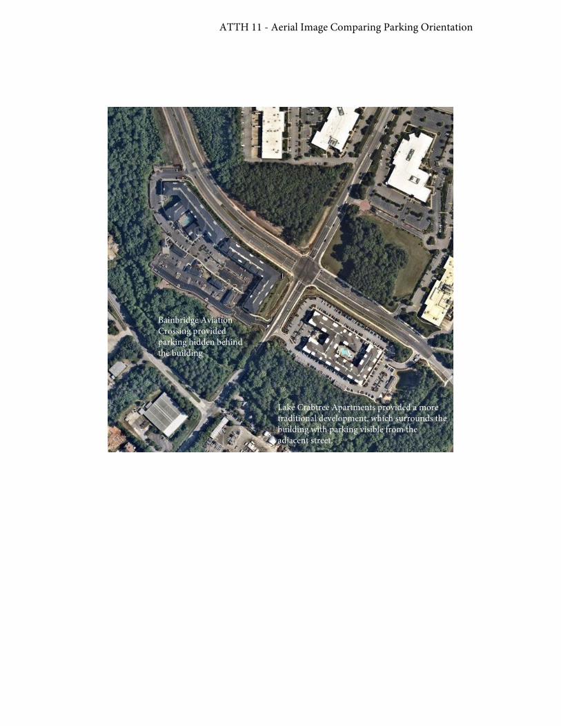
ATTH 11 - Aerial Image Comparing Parking Orientation
Bainbridge Aviation Crossing provided parking hidden behind the building
Lake Crabtree Apartments provided a more traditional development, which surrounds the building with parking visible from the adjacent street.

ATTH 11 - Upper Floor Stepback Example
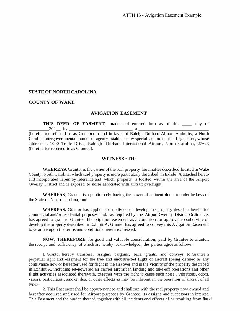
STATE OF NORTH CAROLINA
COUNTY OF WAKE
AVIGATION EASEMENT
THIS DEED OF EASMENT, made and entered into as of this ____ day of
_________202__, by ____________________________, a _______________________________
(hereinafter referred to as Grantor) to and in favor of Raleigh-Durham Airport Authority, a North
Carolina intergovernmental municipal agency established by special action of the Legislature, whose
address is 1000 Trade Drive, Raleigh- Durham International Airport, North Carolina, 27623
(hereinafter referred to as Grantee).
WITNESSETH:
WHEREAS, Grantor is the owner of the real property hereinafter described located in Wake
County, North Carolina, which said property is more particularly described in Exhibit A attached hereto
and incorporated herein by reference and which property is located within the area of the Airport
Overlay District and is exposed to noise associated with aircraft overflight;
WHEREAS , Grantee is a public body having the power of eminent domain under the laws of
the State of North Carolina; and
WHEREAS, Grantor has applied to subdivide or develop the property described herein for
commercial and/or residential purposes and, as required by the Airport Overlay District Ordinance,
has agreed to grant to Grantee this avigation easement as a condition for approval to subdivide or
develop the property described in Exhibit A. Granter has agreed to convey this Avigation Easement
to Grantee upon the terms and conditions herein expressed.
NOW, THEREFORE, for good and valuable consideration, paid by Grantee to Grantor,
the receipt and sufficiency of which are hereby acknowledged, the parties agree as follows:
l. Grantor hereby transfers , assigns, bargains, sells, grants, and conveys to Grantee a
perpetual right and easement for the free and unobstructed flight of aircraft (being defined as any
contrivance now or hereafter used for flight in the air) over and in the vicinity of the property described
in Exhibit A, including jet-powered air carrier aircraft in landing and take-off operations and other
flight activities associated therewith, together with the right to cause such noise , vibrations, odors,
vapors, particulates , smoke, dust or other effects as may be inherent in the operation of aircraft of all
types .
2. This Easement shall be appurtenant to and shall run with the real property now owned and
hereafter acquired and used for Airport purposes by Grantee, its assigns and successors in interest.
This Easement and the burden thereof, together with all incidents and effects of or resulting from use
ATTH 13 - Avigation Easement Example
Page1
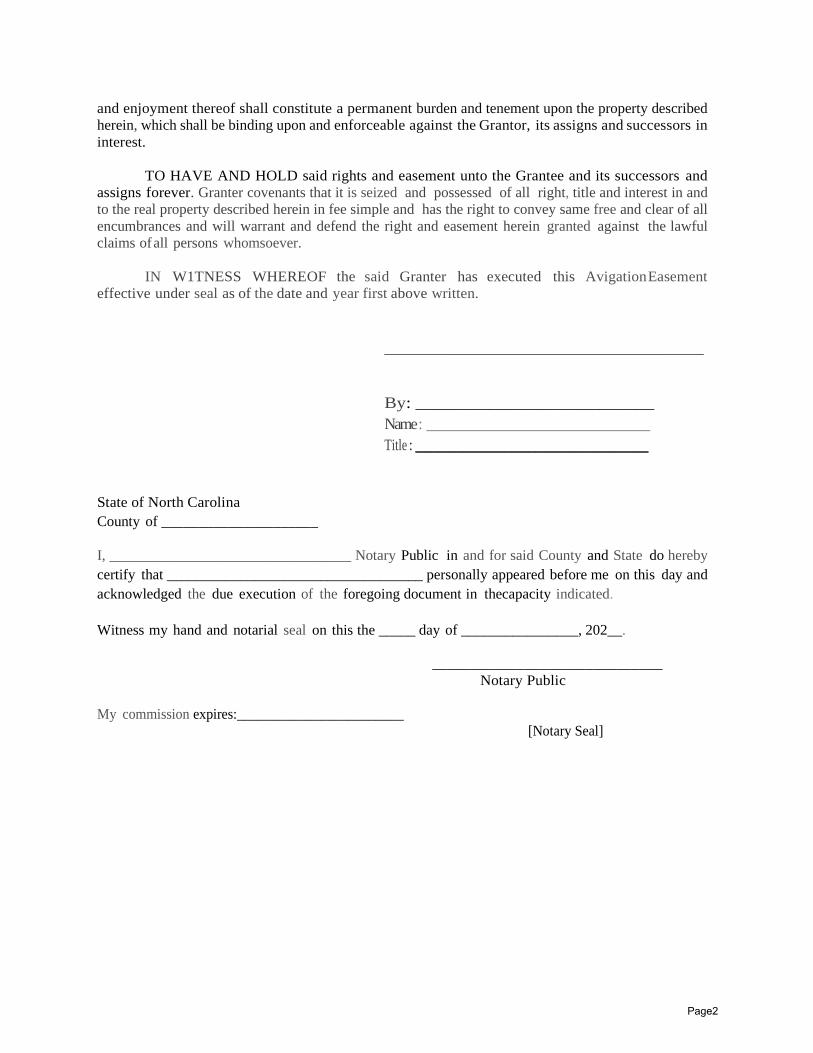
and enjoyment thereof shall constitute a permanent burden and tenement upon the property described
herein, which shall be binding upon and enforceable against the Grantor, its assigns and successors in
interest.
TO HAVE AND HOLD said rights and easement unto the Grantee and its successors and
assigns forever. Granter covenants that it is seized and possessed of all right, title and interest in and
to the real property described herein in fee simple and has the right to convey same free and clear of all
encumbrances and will warrant and defend the right and easement herein granted against the lawful
claims of all persons whomsoever.
IN W1TNESS WHEREOF the said Granter has executed this Avigation Easement
effective under seal as of the date and year first above written.
________________________________________
By: __________________________
Name : ____________________________
Title : _______________________________________
State of North Carolina
County of _____________________
I, _________________________________ Notary Public in and for said County and State do hereby
certify that ___________________________________ personally appeared before me on this day and
acknowledged the due execution of the foregoing document in the capacity indicated.
Witness my hand and notarial seal on this the _____ day of ________________, 202__.
______________________________
Notary Public
My commission expires:________________________
[Notary Seal]
Page2

Exhibit A
Property Description
Page3

1
Eric W. Smith
From: Ed White <[email protected]>Sent: Tuesday, June 8, 2021 9:24 AMTo: PublicHearingsCc: TJ Cawley; Liz Johnson; Anne Robotti; Donna L. Fender; Vicki Scroggins-Johnson; Steve Rao; Satish
Garimella; Martha Paige; Frank Gray; Rob GriffinSubject: Land Use Plan and Airport Overlay Amendments regarding McCrimmon Parkway Extension area,
CAUTION: **This email originated outside of The Town of Morrisville** Do not click links or open attachments unless you recognize the sender and know the content is safe.
Dear Morrisville Town Council,
I am a long term land owner and developer (Town Hall Commons) in Morrisville. I worked with the Town on a public‐private partnership to build Town Hall Drive by co‐funding this development as well as subsiding the school site for Cedar Fork Elementary.
I live at 8320 Society PL, Raleigh, NC.
I am also one of the owners of land within the McCrimmon Parkway extension area with land held under Morrisville Properties LLC and the Cedar Fork development.
I recommend that Morrisville Town Council approve amendments “Amend‐21‐0003” and “Amend‐21‐0004” which are important to maintain marketability and value of land impacted by the new Land Use Plan and Rezoning.
Sincerely yours,
Ed White Owner/Manager Morrisville Properties LLC
Ed White Chairman / CEO
m 919.280.6070 field2base.com
Page 1
ATTH 14 - Compiled Public Hearing Comments
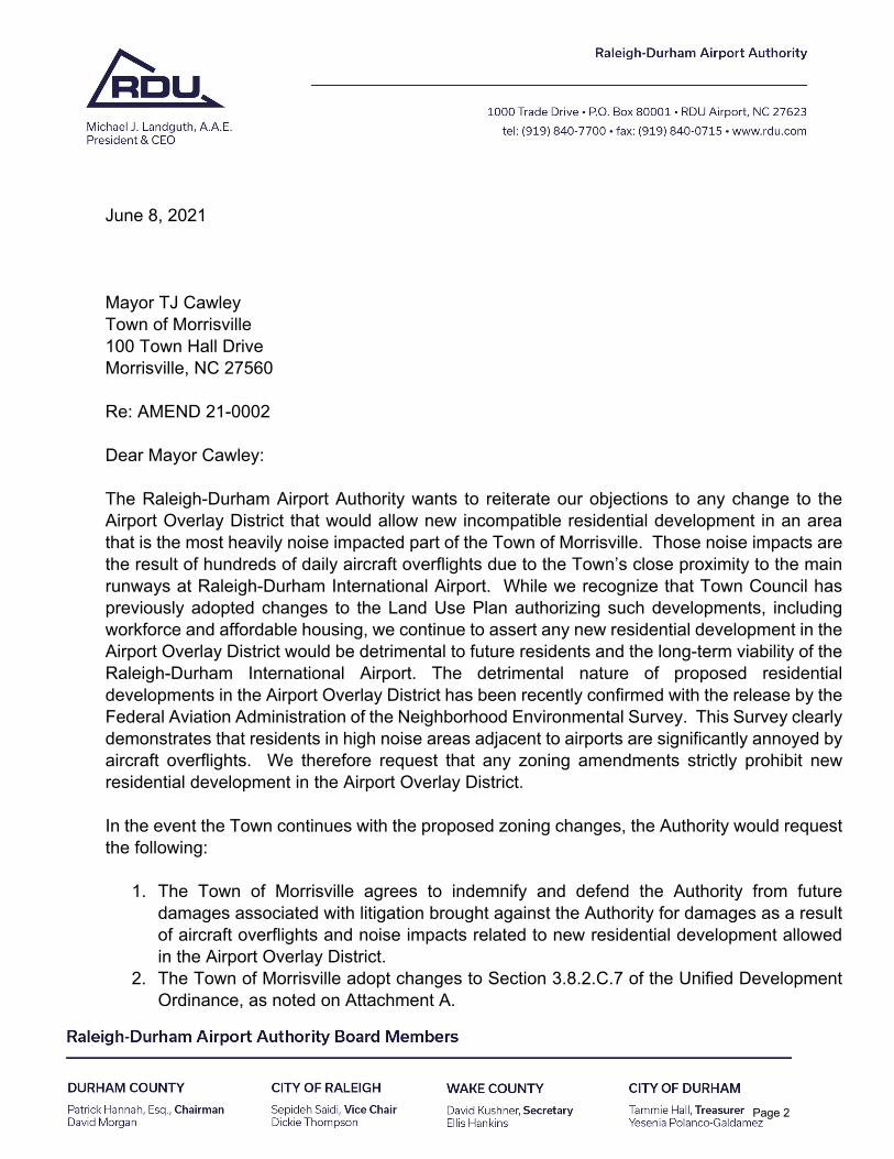
June 8, 2021
Mayor TJ Cawley Town of Morrisville 100 Town Hall Drive Morrisville, NC 27560
Re: AMEND 21-0002
Dear Mayor Cawley:
The Raleigh-Durham Airport Authority wants to reiterate our objections to any change to the Airport Overlay District that would allow new incompatible residential development in an area that is the most heavily noise impacted part of the Town of Morrisville. Those noise impacts are the result of hundreds of daily aircraft overflights due to the Town’s close proximity to the main runways at Raleigh-Durham International Airport. While we recognize that Town Council has previously adopted changes to the Land Use Plan authorizing such developments, including workforce and affordable housing, we continue to assert any new residential development in the Airport Overlay District would be detrimental to future residents and the long-term viability of the Raleigh-Durham International Airport. The detrimental nature of proposed residential developments in the Airport Overlay District has been recently confirmed with the release by the Federal Aviation Administration of the Neighborhood Environmental Survey. This Survey clearly demonstrates that residents in high noise areas adjacent to airports are significantly annoyed by aircraft overflights. We therefore request that any zoning amendments strictly prohibit new residential development in the Airport Overlay District.
In the event the Town continues with the proposed zoning changes, the Authority would request the following:
1. The Town of Morrisville agrees to indemnify and defend the Authority from futuredamages associated with litigation brought against the Authority for damages as a resultof aircraft overflights and noise impacts related to new residential development allowedin the Airport Overlay District.
2. The Town of Morrisville adopt changes to Section 3.8.2.C.7 of the Unified DevelopmentOrdinance, as noted on Attachment A.
Page 2
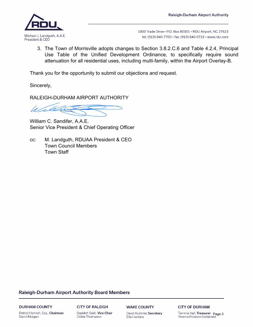
3. The Town of Morrisville adopts changes to Section 3.8.2.C.6 and Table 4.2.4, PrincipalUse Table of the Unified Development Ordinance, to specifically require soundattenuation for all residential uses, including multi-family, within the Airport Overlay-B.
Thank you for the opportunity to submit our objections and request.
Sincerely,
RALEIGH-DURHAM AIRPORT AUTHORITY
William C. Sandifer, A.A.E. Senior Vice President & Chief Operating Officer
cc: M. Landguth, RDUAA President & CEO Town Council Members Town Staff
Page 3
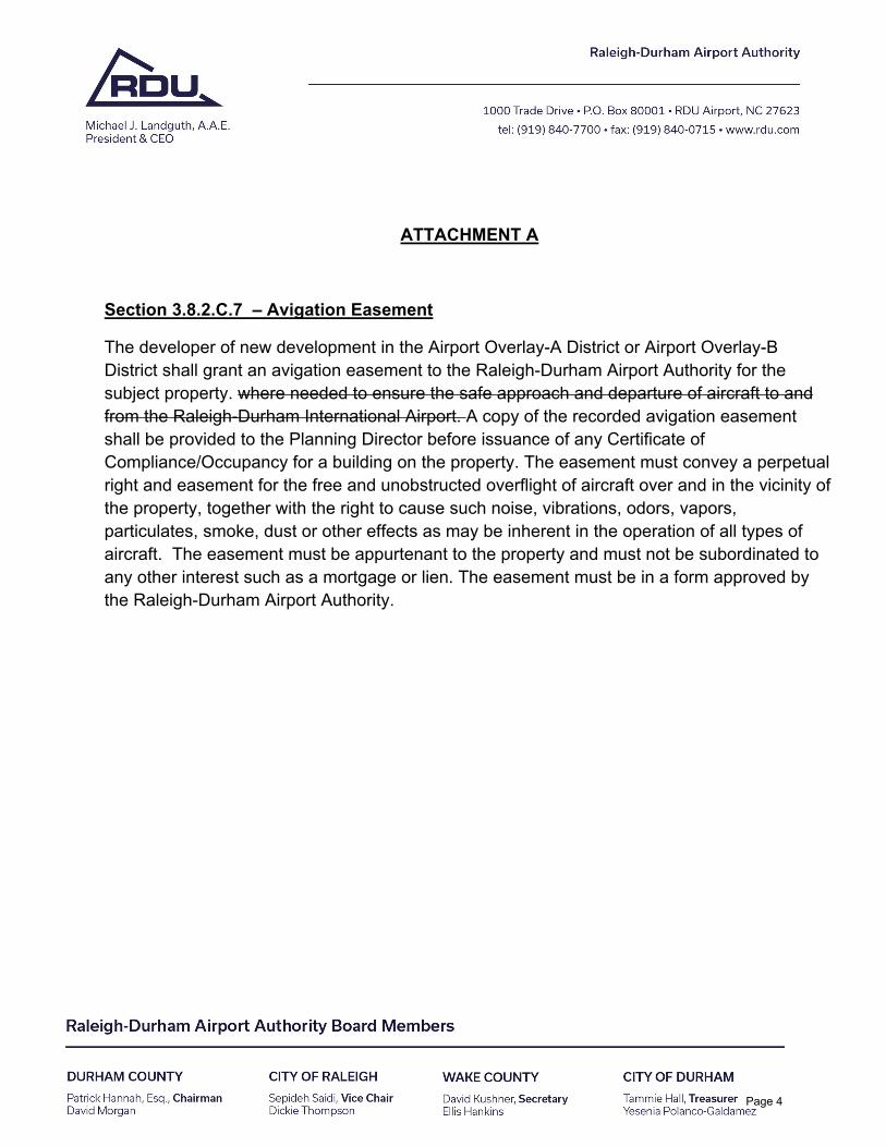
ATTACHMENT A
Section 3.8.2.C.7 – Avigation Easement
The developer of new development in the Airport Overlay-A District or Airport Overlay-B District shall grant an avigation easement to the Raleigh-Durham Airport Authority for the subject property. where needed to ensure the safe approach and departure of aircraft to and from the Raleigh-Durham International Airport. A copy of the recorded avigation easement shall be provided to the Planning Director before issuance of any Certificate of Compliance/Occupancy for a building on the property. The easement must convey a perpetual right and easement for the free and unobstructed overflight of aircraft over and in the vicinity of the property, together with the right to cause such noise, vibrations, odors, vapors, particulates, smoke, dust or other effects as may be inherent in the operation of all types of aircraft. The easement must be appurtenant to the property and must not be subordinated to any other interest such as a mortgage or lien. The easement must be in a form approved by the Raleigh-Durham Airport Authority.
Page 4
1
Eric W. Smith
From: Jeff Ammons <[email protected]>Sent: Tuesday, June 8, 2021 2:47 PMTo: Public Comment; Eric W. SmithCc: Christopher A. LawsonSubject: Re: public comment support
CAUTION: **This email originated outside of The Town of Morrisville** Do not click links or open attachments unless you recognize the sender and know the content is safe.
The purpose of this letter is to state my support for: AMEND‐21‐0004 and AMEDN‐21‐0003
With the following exception:
Regarding the Morrisville Unified Development Ordinance, Text Amendment update.
Section 3.8.4 Gateway Overlay (GO) District, Subsection C.1.a.v. states that: “Multi‐family dwellings adjacent to a major or minor thoroughfare shall include a 15’ minimum stepback of all floors above the THIRD floor”.
I am in agreement with this note for all floors above the FOURTH floor.
This note is not compatible with typical 4‐story multifamily construction. Typical multifamily unit depths are 32’. Accounting for a 15’ setback, unit depths would be reduced to 17’; which is not a practical unit depth. If the 15’ setback is required, the entire front row of units on the fourth floor would need to be removed, leaving an undesirable condition with the blank rear corridor wall on the remaining half of the fourth floor facing the street.
Thank you and I appreciate all the time and effort you give the Town of Morrisville,
Jeff Ammons, PE 111 competition center drive Morrisville, NC
cell 919-427-2322office 919-453-0175
Page 5
June 8th Public hearing comments by Suvas Shah, 111 Canberra Ct, Cary, NC 27513
My Morrisville Investments are in Town Center District, Commercial Corridor, and Perimeter Park.
New land use plan was developed with focus for McCrimmon Overlay (MO) Extension Area, Transit Oriented Development (TOD), and Town Center (TC).
Going through Land Use Plan Revisions (01/26/2021 Version), there is not a single revision or a comment for Corridor Commercial (CC). It was expected that there were no changes in usage.
Under Chapter 160D compliance, major modifications are done in UDO without proper due diligence and Purpose of each district are no longer aligned with allowed usage.
Slater Rd plan this year was approved on following reasoning but it is no longer allowed in CC. Slater Rd plan in CC district approved encouraged people staying near offices and walk to retail and shopping as a better use. This is consistent with CC purpose in 3.6.2 that CC district also accommodates higher‐density residential and live/work uses in locations outside Airport Overlay and district regulations encourage pedestrian scale retail development and provide opportunities for residents to walk to meet some of their daily service, entertainment, and open space needs.
Unfortunately all residential options are deleted in UDO for CC defeating the purpose of CC district.
Some examples of inconsistencies in proposed UDO changes are:
1. Retail Services between 20,000 and 50,000 sf not allowed in TCC and TCR2. Dwelling, multi‐family >50 not allowed in TCR, CC3. Office is not allowed in TCR4. Office building is allowed, but Office park is not allowed in CC5. Bus station is not allowed in TCC, TCR, RT, CC6. Sports Training Facility not allowed in all activity centers (McCrimmon Extension) and
CC7. Park and Ride Terminal not allowed in NAC, BAC, TCC, TCR
Town Council needs to review each usage changes and approve or disapprove based on purpose and objective of each district or change in purpose of the district.
Page 6
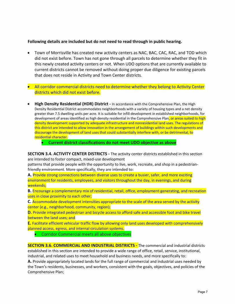
Following details are included but do not need to read through in public hearing.
Town of Morrisville has created new activity centers as NAC, BAC, CAC, RAC, and TOD whichdid not exist before. Town has not gone through all parcels to determine whether they fit inthis newly created activity centers or not. When UDO options that are currently available tocurrent districts cannot be removed without doing proper due diligence for existing parcelsthat does not reside in Activity and Town Center districts.
All corridor commercial districts need to determine whether they belong to Activity Centerdistricts which did not exist before.
High Density Residential (HDR) District ‐ In accordance with the Comprehensive Plan, the High
Density Residential District accommodates neighborhoods with a variety of housing types and a net densitygreater than 7.5 dwelling units per acre. It is suitable for infill development in established neighborhoods, fordevelopment of areas identified as high density residential in the Comprehensive Plan, or areas suited to highdensity development supported by adequate infrastructure and nonresidential land uses. The regulations ofthis district are intended to allow innovation in the arrangement of buildings within such developments anddiscourage the development of land uses that could substantially interfere with, or be detrimental, toresidential character.
Current district classifications do not meet UDO objective as above
SECTION 3.4. ACTIVITY CENTER DISTRICTS ‐ The activity center districts established in this section are intended to foster compact, mixed‐use development patterns that provide people with the opportunity to live, work, recreate, and shop in a pedestrian‐friendly environment. More specifically, they are intended to:
A. Provide strong connections between diverse uses to create a busier, safer, and more exciting
environment for residents, employees, and visitors throughout the day, in evenings, and duringweekends;
B. Encourage a complementary mix of residential, retail, office, employment‐generating, and recreation
uses in close proximity to each other;
C. Accommodate development intensities appropriate to the scale of the area served by the activitycenter (e.g., neighborhood, community, region);
D. Provide integrated pedestrian and bicycle access to afford safe and accessible foot and bike travelbetween the land uses; and
E. Facilitate efficient vehicular traffic flow by allowing only land uses developed with comprehensively
planned access, egress, and internal circulation systems.
Corridor Commercial meets all above objectives
SECTION 3.6. COMMERCIAL AND INDUSTRIAL DISTRICTS ‐ The commercial and industrial districts
established in this section are intended to provide a wide range of office, retail, service, institutional, industrial, and related uses to meet household and business needs, and more specifically to:
A. Provide appropriately located lands for the full range of commercial and industrial uses needed by
the Town’s residents, businesses, and workers, consistent with the goals, objectives, and policies of theComprehensive Plan;
Page 7
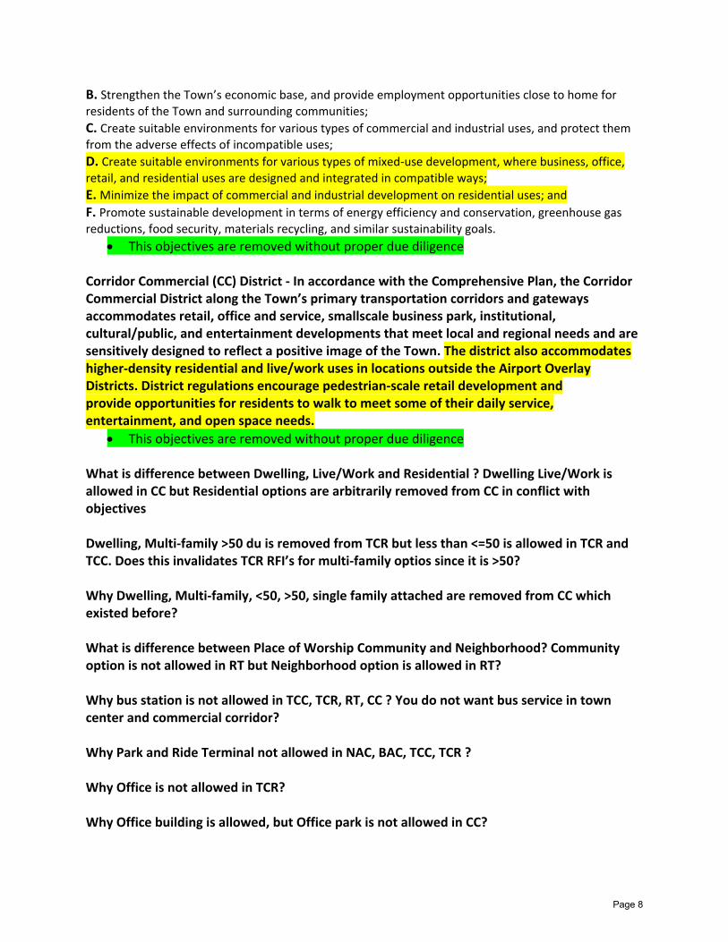
B. Strengthen the Town’s economic base, and provide employment opportunities close to home for
residents of the Town and surrounding communities;
C. Create suitable environments for various types of commercial and industrial uses, and protect them
from the adverse effects of incompatible uses;
D. Create suitable environments for various types of mixed‐use development, where business, office,
retail, and residential uses are designed and integrated in compatible ways;
E.Minimize the impact of commercial and industrial development on residential uses; and
F. Promote sustainable development in terms of energy efficiency and conservation, greenhouse gas
reductions, food security, materials recycling, and similar sustainability goals.
This objectives are removed without proper due diligence
Corridor Commercial (CC) District ‐ In accordance with the Comprehensive Plan, the Corridor Commercial District along the Town’s primary transportation corridors and gateways accommodates retail, office and service, smallscale business park, institutional, cultural/public, and entertainment developments that meet local and regional needs and are sensitively designed to reflect a positive image of the Town. The district also accommodates higher‐density residential and live/work uses in locations outside the Airport Overlay Districts. District regulations encourage pedestrian‐scale retail development and provide opportunities for residents to walk to meet some of their daily service, entertainment, and open space needs.
This objectives are removed without proper due diligence
What is difference between Dwelling, Live/Work and Residential ? Dwelling Live/Work is allowed in CC but Residential options are arbitrarily removed from CC in conflict with objectives
Dwelling, Multi‐family >50 du is removed from TCR but less than <=50 is allowed in TCR and TCC. Does this invalidates TCR RFI’s for multi‐family optios since it is >50?
Why Dwelling, Multi‐family, <50, >50, single family attached are removed from CC which existed before?
What is difference between Place of Worship Community and Neighborhood? Community option is not allowed in RT but Neighborhood option is allowed in RT?
Why bus station is not allowed in TCC, TCR, RT, CC ? You do not want bus service in town center and commercial corridor?
Why Park and Ride Terminal not allowed in NAC, BAC, TCC, TCR ?
Why Office is not allowed in TCR?
Why Office building is allowed, but Office park is not allowed in CC?
Page 8
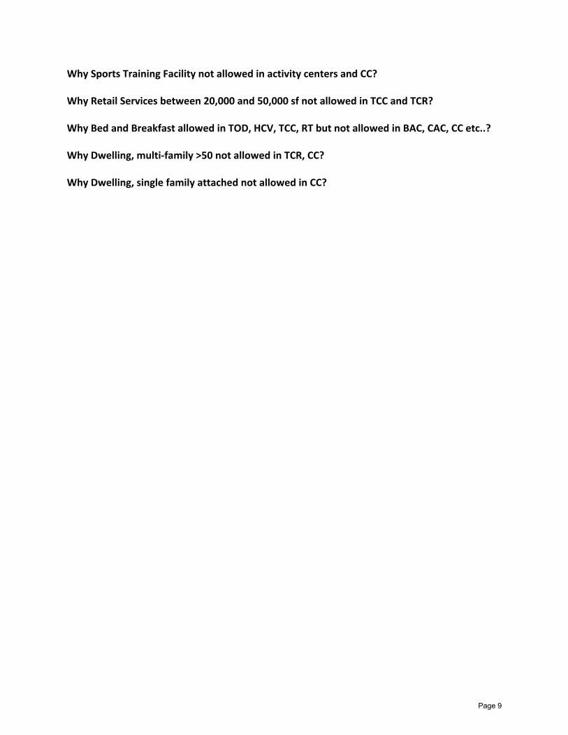
Why Sports Training Facility not allowed in activity centers and CC?
Why Retail Services between 20,000 and 50,000 sf not allowed in TCC and TCR?
Why Bed and Breakfast allowed in TOD, HCV, TCC, RT but not allowed in BAC, CAC, CC etc..?
Why Dwelling, multi‐family >50 not allowed in TCR, CC?
Why Dwelling, single family attached not allowed in CC?
Page 9
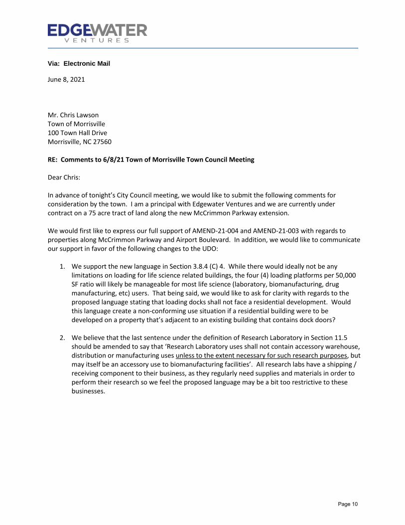
Via: Electronic Mail
June 8, 2021
Mr. Chris Lawson Town of Morrisville 100 Town Hall Drive Morrisville, NC 27560
RE: Comments to 6/8/21 Town of Morrisville Town Council Meeting
Dear Chris:
In advance of tonight’s City Council meeting, we would like to submit the following comments for consideration by the town. I am a principal with Edgewater Ventures and we are currently under contract on a 75 acre tract of land along the new McCrimmon Parkway extension.
We would first like to express our full support of AMEND-21-004 and AMEND-21-003 with regards to properties along McCrimmon Parkway and Airport Boulevard. In addition, we would like to communicate our support in favor of the following changes to the UDO:
1. We support the new language in Section 3.8.4 (C) 4. While there would ideally not be anylimitations on loading for life science related buildings, the four (4) loading platforms per 50,000SF ratio will likely be manageable for most life science (laboratory, biomanufacturing, drugmanufacturing, etc) users. That being said, we would like to ask for clarity with regards to theproposed language stating that loading docks shall not face a residential development. Wouldthis language create a non-conforming use situation if a residential building were to bedeveloped on a property that’s adjacent to an existing building that contains dock doors?
2. We believe that the last sentence under the definition of Research Laboratory in Section 11.5should be amended to say that ‘Research Laboratory uses shall not contain accessory warehouse,distribution or manufacturing uses unless to the extent necessary for such research purposes, butmay itself be an accessory use to biomanufacturing facilities’. All research labs have a shipping /receiving component to their business, as they regularly need supplies and materials in order toperform their research so we feel the proposed language may be a bit too restrictive to thesebusinesses.
Page 10
EDGEWATER VENTURES | RALEIGH, NORTH CAROLINA | EDGEWATER-VENTURES.COM
Thank you in advance for your consideration of our above comments and please let us know if anyone would like to discuss our comments in more detail.
Sincerely,
EDGEWATER VENTURES
Scot W. Humphrey
Cc: Justin Good – Edgewater Ventures Valerie Derrick – Edgewater Ventures
Page 11

1
Eric W. Smith
From: Tim Skender <[email protected]>Sent: Tuesday, June 8, 2021 2:56 PMTo: PublicHearingsSubject: Tonight's Town Council Meeting
CAUTION: **This email originated outside of The Town of Morrisville** Do not click links or open attachments unless you recognize the sender and know the content is safe.
In advance of tonight’s Town Council meeting, we would like to submit the following comments for consideration by the town. I am Tim Skender, a Vice President with King Street Properties and we currently own EastRidge at Perimeter Park, an 8‐building, 480,000 Sq. Ft. business and research park at the intersection of Airport Boulevard and Perimeter Park Drive. Given the other changes occurring in the UDO and Use Standards, we would be supportive of the town considering adding Research Laboratory as a permitted use to the Corridor Commercial (CC) District. We feel these Research Laboratory uses are consistent with the vision of the Comprehensive Plan for Corridor Commercial Districts.
Kindly,
Tim Skender
Tim Skender | Vice President King Street Properties 900 Perimeter Park Drive, Suite B2 | Morrisville, NC 27560 O: 919-659-2922 | C: 919-332-1668
Page 12

1
Eric W. Smith
From: Dustin Engelken <[email protected]>Sent: Monday, July 12, 2021 3:26 PMTo: Public CommentCc: TJ Cawley; Liz Johnson; Anne Robotti; Donna L. Fender; Vicki Scroggins-Johnson; Steve Rao; Satish
GarimellaSubject: Public Comments-July 13 Town Council Meeting
CAUTION: **This email originated outside of The Town of Morrisville** Do not click links or open attachments unless you recognize the sender and know the content is safe.
Dear Mayor Cawley and Members of the Morrisville Town Council, On behalf of our membership, I want to thank you all for your leadership in managing the development and implementation of the Town’s Land Use Plan, and especially for the thoughtful and careful planning around the McCrimmon Extension. Our organization was proud to support the Land Use Plan and we are pleased to see the Town moving forward today with Map and UDO Text Amendments that will begin the work of making these plans a reality. Our organization supports the staff and Planning Board recommendations that are before you today. Specifically, we urge the adoption of AMEND‐21‐0002, AMEND‐21‐0003, AMEND‐21‐0004, and AMEND‐21‐0005, which together will allow the Town to move forward with implementation of the 2021 Land Use Plan. As we look forward to the next steps, we understand that the Town will now need to work to develop appropriate sound mitigation and avigation easement measures. It is critical that these issues be addressed thoughtfully in a way that will allow the Town to accomplish its goals in an appropriate and cost‐effective way while not inhibiting the development anticipated in these amendments. As such, I look forward to learning more about how our membership can engage in the rulemaking process that will follow adoption of these amendments. Thank you for your consideration of our comments. Best, Dustin Engelken
Dustin Engelken
Government Affairs Director
www.TriangleAptAssn.org
7920 ACC Blvd., Suite 220 | Raleigh, NC 27617
T: 919.782.1165 ext. 4
1
Eric W. Smith
From: Scot Humphrey <[email protected]>Sent: Tuesday, July 13, 2021 2:31 PMTo: PublicHearingsCc: Justin Good; Valerie DerrickSubject: Comments to Tonight's Town Council Meeting
Importance: High
CAUTION: **This email originated outside of The Town of Morrisville** Do not click links or open attachments unless you recognize the sender and know the content is safe.
Good afternoon, We would like to submit to the town the following comments regarding the UDO. Overall, we are very encouraged by and supportive of the progress that the Town has made thus far in the UDO process. After reading through some of the proposed text changes in more detail, one concern that we have is that the definition of biomanufacturing may be a bit too restrictive in terms of attracting similarly innovative science and technology applications to the town. As such, we would like to recommend that the definition be broadened or modified so that similar innovation uses such as agriculture technology, clean‐tech, green energy and other similar high‐tech life sciences uses are approved uses under the definition. We appreciate the Town’s consideration of this recommendation and we are happy to discuss in more detail if any members of the town have any further questions. Best, Scot Humphrey Scot Humphrey Principal
Edgewater Ventures 3105 Glenwood Avenue, Suite 105 Raleigh, NC 27612 D: 919.578.5446 | M: 919.280.1312 shumphrey@edgewater‐ventures.com
1
Eric W. Smith
From: Tim Skender <[email protected]>Sent: Tuesday, July 13, 2021 2:58 PMTo: PublicHearingsCc: Robert AlbroSubject: Public Comment to the July 13, 2021 Morrisville Town Council Meeting
CAUTION: **This email originated outside of The Town of Morrisville** Do not click links or open attachments unless you recognize the sender and know the content is safe.
In advance of tonight’s Town Council meeting, I would like to submit the following comments for consideration by the town. I am Tim Skender, a Vice President with King Street Properties, the current owner of EastRidge at Perimeter Park, an 8‐building, 480,000 Sq. Ft. business and research park at the intersection of Airport Boulevard and Perimeter Park Drive. We are among the largest owner‐operators of life science real estate in the world, focused on serving the complex need of science‐based companies and institutions. First of all, we are supportive of the town’s thoughtful approach to the ongoing changes to the UDO and Use Standards. Given the other changes occurring in the UDO and Use Standards and proposed text amendments, we would encourage the town’s new definition for the Biomanufacturing use to also include similar high tech, advanced‐science processes that utilize the same sort of infrastructure of bio‐manufacturing facilities do without precisely qualifying as a bio‐manufacturing use – some examples would include green energy technologies, small molecule therapies, and advanced clean tech processes, among others. It may seem like a minor detail, but this would provide further indication of the town’s thoughtful, forward‐thinking perspective on such matters. Below, we have included minor comments to the proposed updated use definitions of Biomanufacturing and Research Lab. I would be happy to discuss these recommended tweaks further with the town council or town members at the appropriate time. BIOMANUFACTURING: Manufacturing or similar high‐tech process which may utilize biological or chemical systems to produce, develop, analyze, engineer, or demonstrate functions of proteins, enzymes, high‐tech outputs, or other molecules used for life science, bio‐agricultural, food, beverage, medical, medical device, or pharmaceutical purposes. Accessory uses may include institutional, academic, and hospital uses ancillary to or complementary to life science, research laboratories, temporary indoor storage of produced goods, and warehouse/distribution of produced goods. All manufacturing activities are contained entirely within a building and noise, odor, smoke, heat, glare, and vibration resulting from the manufacturing activity are confined entirely within the building. Examples of biomanufacturing include vaccines, medicines, or other similar high‐tech outputs. RESEARCH LABORATORY: A facility that is designed or equipped for basic or applied research of experimental study, testing, or analysis in the natural sciences, and medical sciences or engineering, including any educational activities associated with and accessory to such research. Research laboratory uses shall not contain warehousing / distribution as a primary use, but may allow shipping or storage as incidental to the use of the lab. Research laboratories may be an accessory use to biomanufacturing facilities and also may allow for limited on‐site manufacturing of items not for sale to the public, which are intended for research, study, developmental, or academic purposes. Respectfully, Tim Skender

2
Tim Skender | Vice President King Street Properties 900 Perimeter Park Drive, Suite B2 | Morrisville, NC 27560 O: 919-659-2922 | C: 919-332-1668
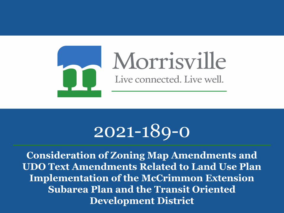
2021-189-0Consideration of Zoning Map Amendments and
UDO Text Amendments Related to Land Use Plan Implementation of the McCrimmon Extension
Subarea Plan and the Transit Oriented Development District
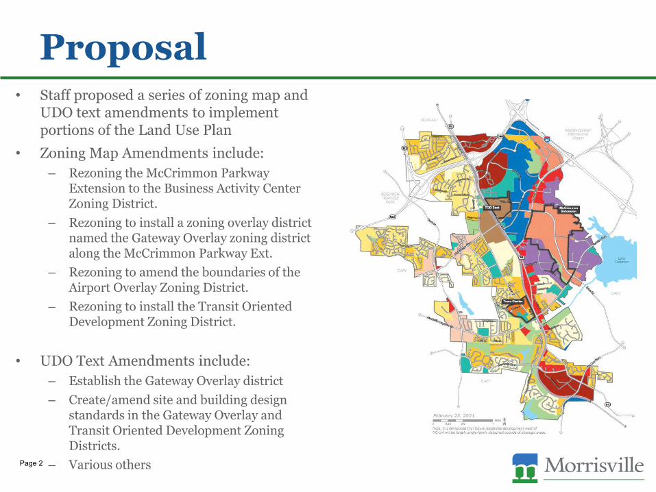
Proposal• Staff proposed a series of zoning map and
UDO text amendments to implement portions of the Land Use Plan
• Zoning Map Amendments include:
– Rezoning the McCrimmon Parkway Extension to the Business Activity Center Zoning District.
– Rezoning to install a zoning overlay district named the Gateway Overlay zoning district along the McCrimmon Parkway Ext.
– Rezoning to amend the boundaries of the Airport Overlay Zoning District.
– Rezoning to install the Transit Oriented Development Zoning District.
• UDO Text Amendments include:
– Establish the Gateway Overlay district
– Create/amend site and building design standards in the Gateway Overlay and Transit Oriented Development Zoning Districts.
– Various othersPage 2

History• Town Council adopted the 2021 Morrisville Land Use Plan on February 23,
2021.
– The Land Use Plan established three subareas, including the McCrimmon Extension and theTOD East.
– McCrimmon Parkway Extension opened in 2020, thereby opening large tracts of undevelopedland which are all currently zoned Industrial Management. The subarea plan called for theextension area to be rezoned to the Business Activity Center district.
– Transit Oriented Zoning District is currently a floating zoning district, meaning that it is in theUDO but is not shown on any parcels in Town.
• 2021 Town Council Retreat
– Town Council discussed their vision for the McCrimmon Extension and the Transit OrientedDevelopment District in more detail at retreat and directed staff to begin implementation ofportions of the Land Use Plan, including the McCrimmon Extension Subarea, the TransitOriented Development District, and to amend the boundaries of the Airport Overlay District.
– To supplement the zoning map amendments, staff have drafted text amendments designed tosupport Council’s vision of attractive, pedestrian friendly developments, with an appropriate mixof uses.
– The proposed zoning map and UDO text amendments are proposed to prevent developmentwhich may be incompatible with the current zoning and development standards.
Page 3

UDO Text Amendments• UDO AMEND-21-0005 UDO Text Amendments designed to implement the
Land Use Plan along McCrimmon Parkway and the TOD district.
– Text amendments amend both architectural and site design standards to promote a pedestrianfriendly environment and attractive site features in the Gateway Overlay (GO) and the TransitOriented Development (TOD) district.
– Amendments establish the GO district and create site design standards related to:
• Parking orientation, building orientation, and building design.
• Creates a minimum separation between multi-family developments.
– Amendments to the current TOD standards are designed to:
• Increase pedestrian activity, require parking to be located behind buildings, and require a mix of residentialand non-residential uses to support future transit locations.
– Various other amendments to amend allowed uses, or re-work definitions.
Page 4
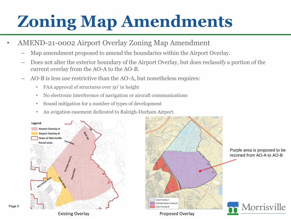
Zoning Map Amendments• AMEND-21-0002 Airport Overlay Zoning Map Amendment
– Map amendment proposed to amend the boundaries within the Airport Overlay.
– Does not alter the exterior boundary of the Airport Overlay, but does reclassify a portion of thecurrent overlay from the AO-A to the AO-B.
– AO-B is less use restrictive than the AO-A, but nonetheless requires:
• FAA approval of structures over 50' in height
• No electronic interference of navigation or aircraft communications
• Sound mitigation for a number of types of development
• An avigation easement dedicated to Raleigh-Durham Airport.
Existing Overlay Proposed Overlay
Purple area is proposed to be
rezoned from AO-A to AO-B
Page 5

Zoning Map Amendments, cont.• AMEND-21-0002 Airport Overlay Zoning Map Amendment, cont.
– The Federal Aviation Administration was consulted regarding this proposed change andindicated that they believe it is "consistent with FAA land use guidance near airports" and thatthey "do not believe the land use changes will adversely affect airport operations or jeopardizeFAA funding for future airport development.“
– Residential uses are not prohibited in the AO-B overlay, however they are required to providesound mitigation to limit interior aircraft noise to an average sound level of 45dB.
– In conjunction with the proposed Gateway Overlay (GO), only multifamily dwellings providingsound mitigation would be allowed in any areas which were formally AO-A. No single familydetached or attached dwellings would be allowed in this Gateway Overlay.
Page 6

UDO Amendments, AO.
Page 7
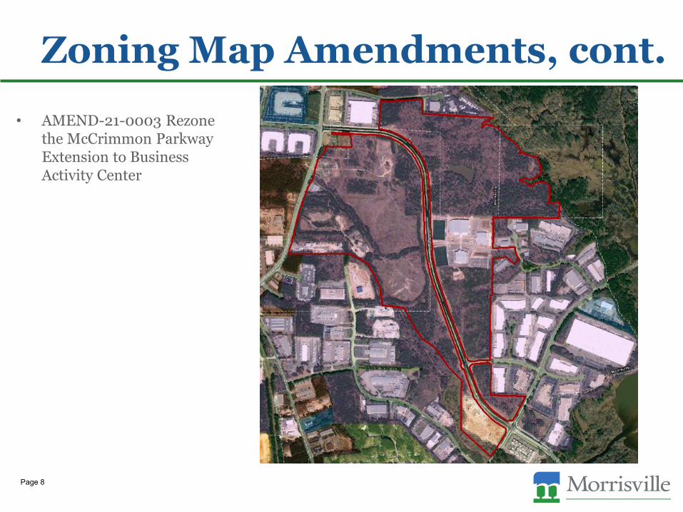
Zoning Map Amendments, cont.
• AMEND-21-0003 Rezonethe McCrimmon ParkwayExtension to BusinessActivity Center
Page 8
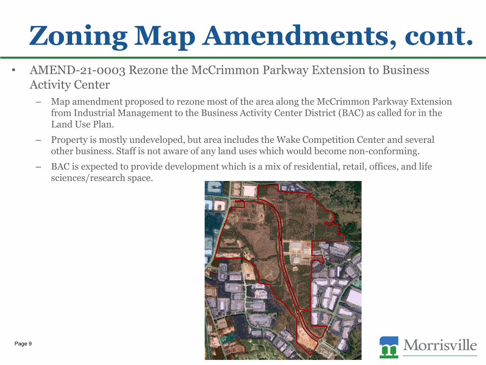
Zoning Map Amendments• AMEND-21-0003 Rezone the McCrimmon Parkway Extension to Business
Activity Center
– Map amendment proposed to rezone most of the area along the McCrimmon Parkway Extensionfrom Industrial Management to the Business Activity Center District (BAC) as called for in theLand Use Plan.
– Property is mostly undeveloped, but area includes the Wake Competition Center and severalother business. Staff is not aware of any land uses which would become non-conforming.
– BAC is expected to provide development which is a mix of residential, retail, offices, and lifesciences/research space.
Zoning Map Amendments, cont.
Page 9
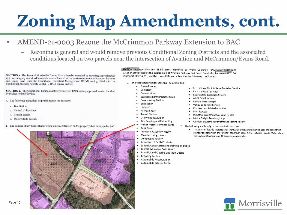
Zoning Map Amendments• AMEND-21-0003 Rezone the McCrimmon Parkway Extension to BAC
– Rezoning is general and would remove previous Conditional Zoning Districts and the associatedconditions located on two parcels near the intersection of Aviation and McCrimmon/Evans Road.
Zoning Map Amendments, cont.
Page 10
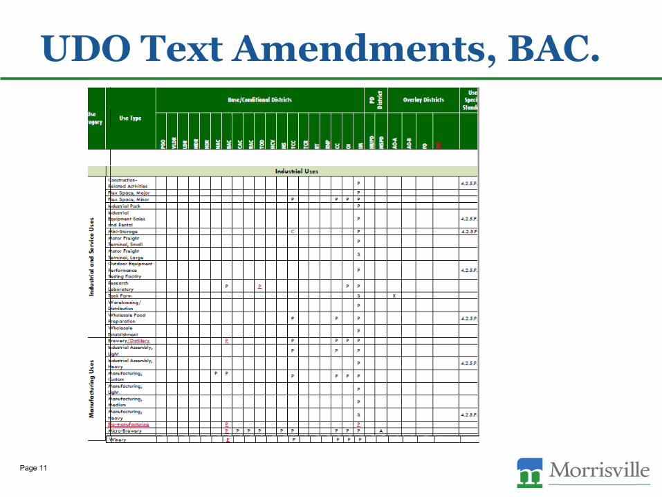
UDO Text Amendments, BAC.
Page 11
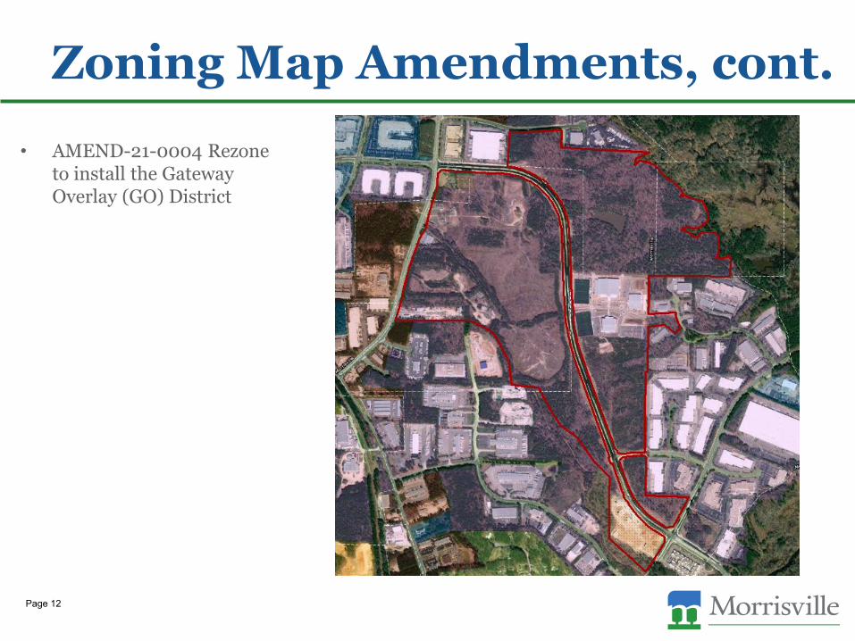
Zoning Map Amendments, cont.
• AMEND-21-0004 Rezoneto install the GatewayOverlay (GO) District
Page 12
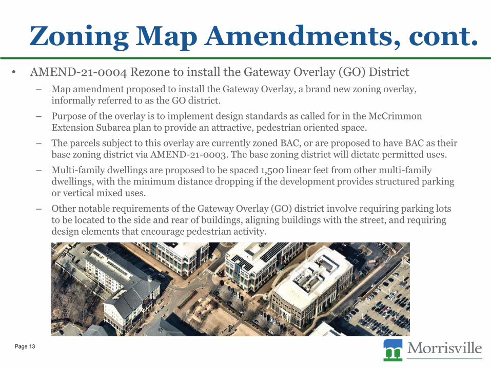
• AMEND-21-0004 Rezone to install the Gateway Overlay (GO) District
– Map amendment proposed to install the Gateway Overlay, a brand new zoning overlay,informally referred to as the GO district.
– Purpose of the overlay is to implement design standards as called for in the McCrimmonExtension Subarea plan to provide an attractive, pedestrian oriented space.
– The parcels subject to this overlay are currently zoned BAC, or are proposed to have BAC as theirbase zoning district via AMEND-21-0003. The base zoning district will dictate permitted uses.
– Multi-family dwellings are proposed to be spaced 1,500 linear feet from other multi-familydwellings, with the minimum distance dropping if the development provides structured parkingor vertical mixed uses.
– Other notable requirements of the Gateway Overlay (GO) district involve requiring parking lotsto be located to the side and rear of buildings, aligning buildings with the street, and requiringdesign elements that encourage pedestrian activity.
Zoning Map Amendments, cont.
Page 13
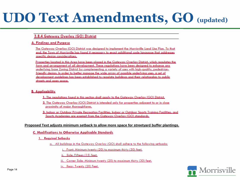
UDO Text Amendments, GO (updated)
Proposed Text adjusts minimum setback to allow more space for streetyard buffer plantings.
Page 14

UDO Text Amendments, GOFormerly proposed text
Page 15

UDO Text Amendments, GOFormerly proposed text
Page 16
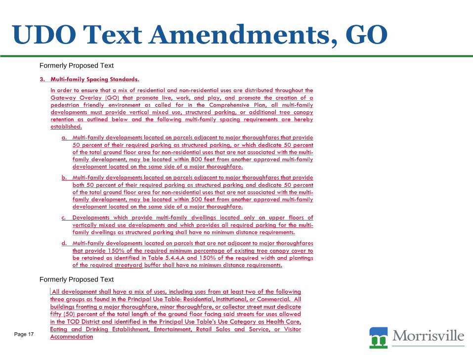
UDO Text Amendments, GOFormerly Proposed Text
Formerly Proposed Text
Page 17
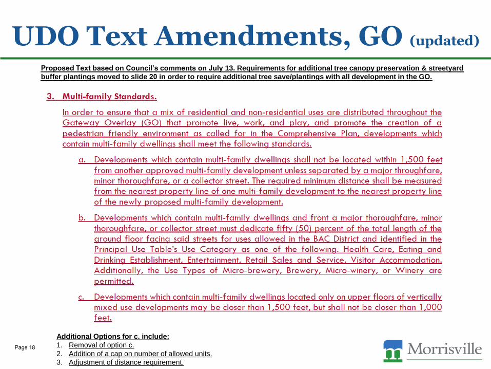
UDO Text Amendments, GO (updated)
Proposed Text based on Council’s comments on July 13. Requirements for additional tree canopy preservation & streetyard
buffer plantings moved to slide 20 in order to require additional tree save/plantings with all development in the GO.
Additional Options for c. include:
1. Removal of option c.
2. Addition of a cap on number of allowed units.
3. Adjustment of distance requirement.
Page 18
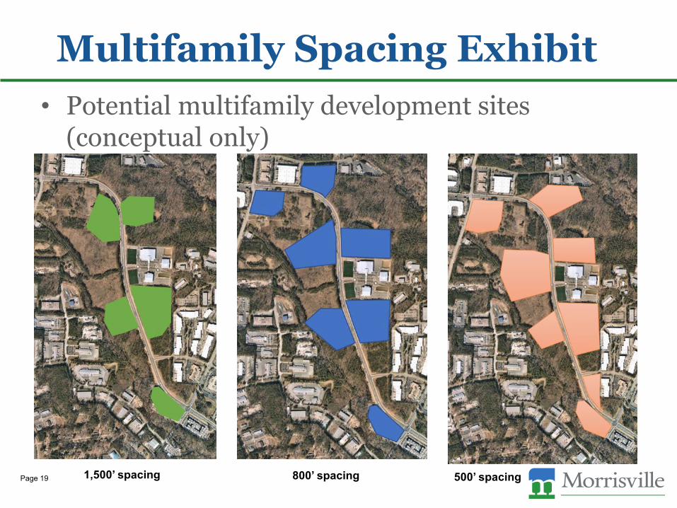
Multifamily Spacing Exhibit
• Potential multifamily development sites(conceptual only)
1,500’ spacing 800’ spacing 500’ spacingPage 19
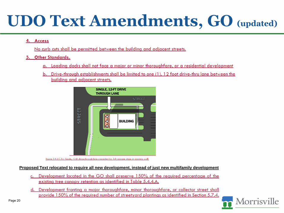
UDO Text Amendments, GO (updated)
Proposed Text relocated to require all new development, instead of just new multifamily development
Page 20
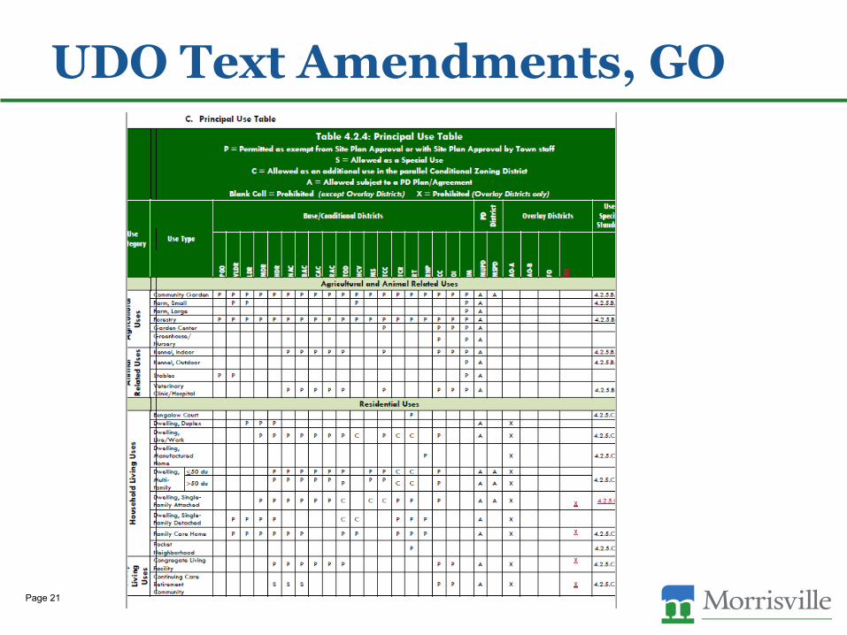
UDO Text Amendments, GO
Page 21
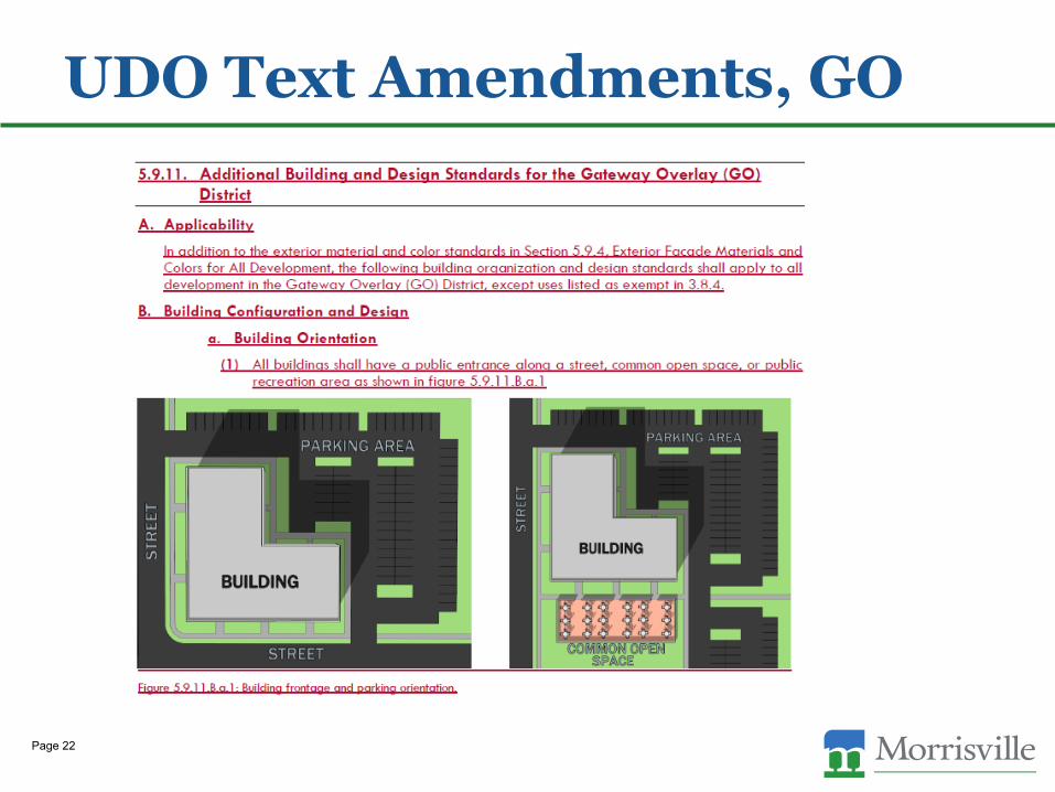
UDO Text Amendments, GO
Page 22

UDO Text Amendments, GO
Page 23
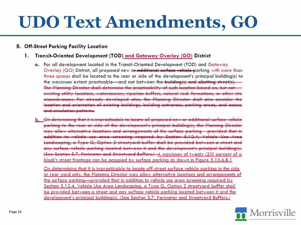
UDO Text Amendments, GO
Page 24
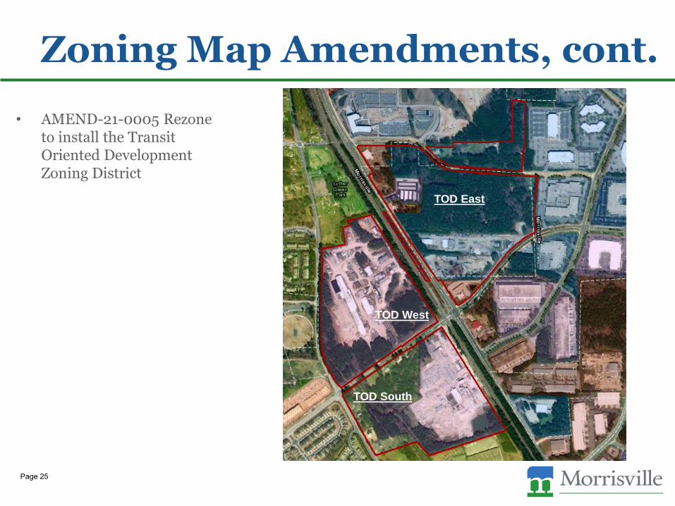
Zoning Map Amendments, cont.
• AMEND-21-0005 Rezone to install the Transit Oriented Development Zoning District
TOD East
TOD West
TOD South
Page 25

• AMEND-21-0005 Rezone to install the Transit Oriented Development District
– Map amendment proposed to install the Transit Oriented Development District.
• Includes the TOD East as identified in the TOD East Subarea Plan, but also the TOD areas west of NC 54 informally referred to as the TOD West and TOD South.
– The TOD provides for transit-supportive development and intensities within convenient walking distance of a transit station. The district allows for a critical mass of development and mix of uses necessary to support nearby transit options.
– Parcels are currently located in a variety of zoning districts including VLDR, IM, OI, and CC zoning districts and have several current uses.
– Proposed zoning map amendment would group all of these parcels in the TOD zoning district, therefore creating a uniform development pattern which would not allow further expansion of incompatible uses such as industrial uses.
– Anticipated uses include urban townhomes, multi-family, retail, service, restaurants, and hotels.
Zoning Map Amendments, cont.
Page 26
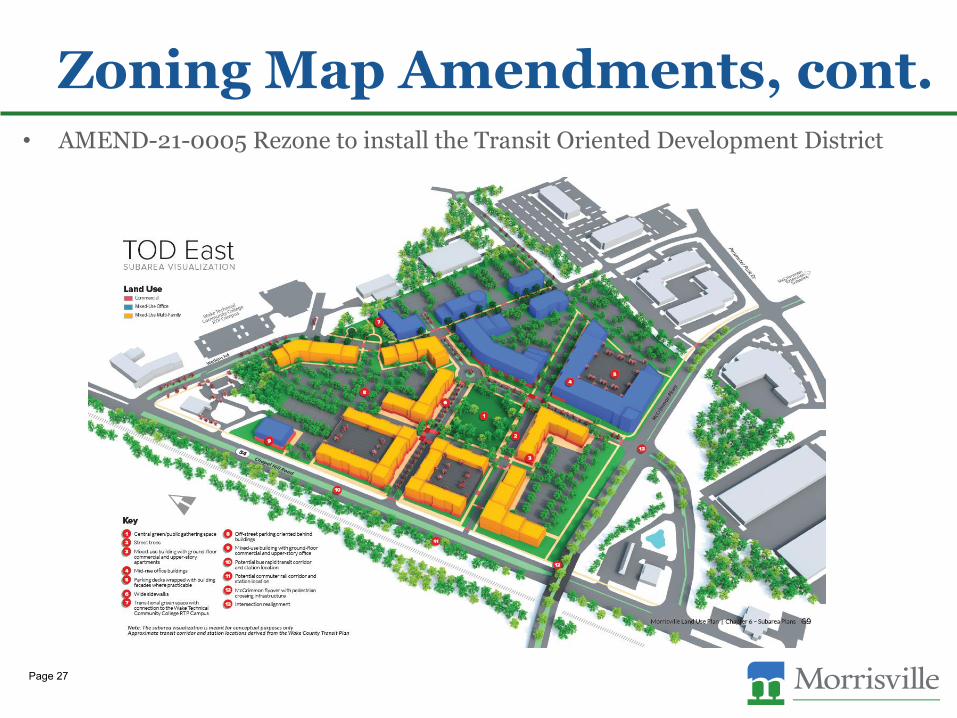
• AMEND-21-0005 Rezone to install the Transit Oriented Development District
Zoning Map Amendments, cont.
Page 27
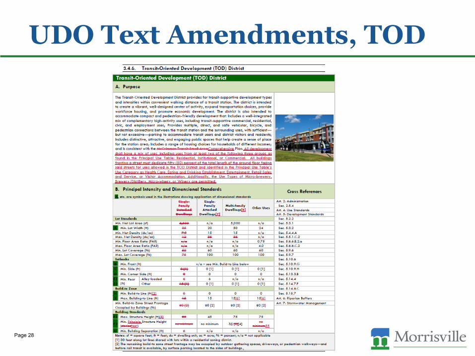
UDO Text Amendments, TOD
Page 28
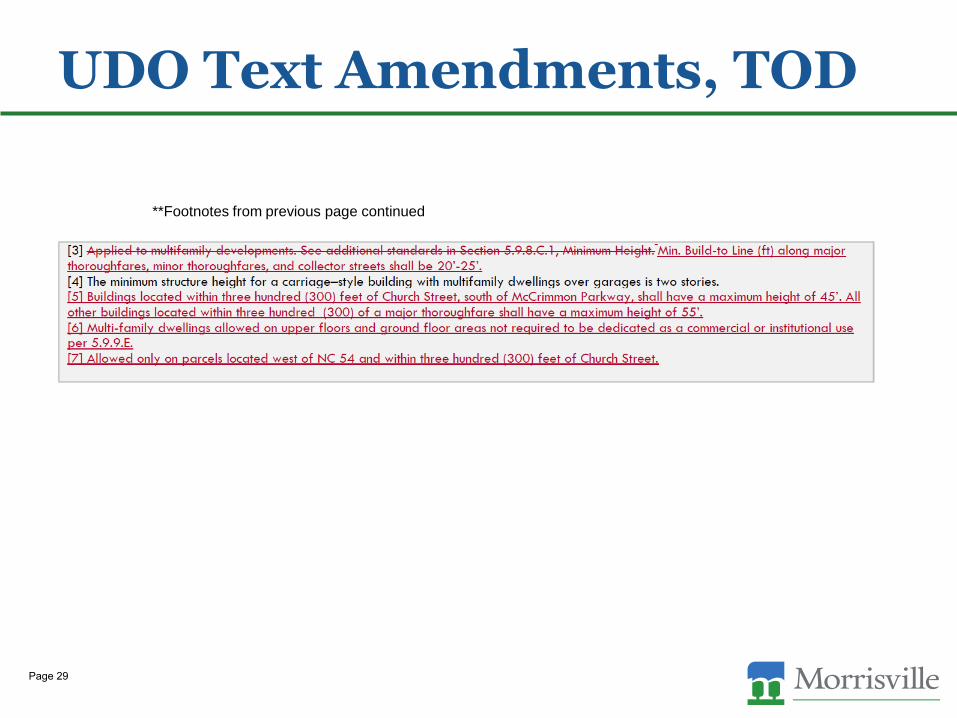
UDO Text Amendments, TOD
**Footnotes from previous page continued
Page 29
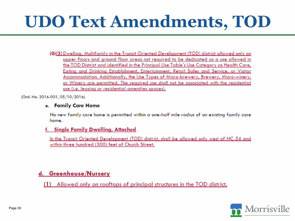
UDO Text Amendments, TOD
Page 30
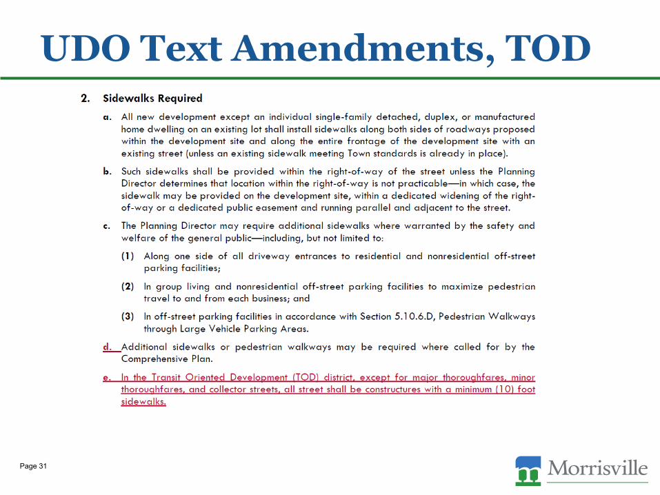
UDO Text Amendments, TOD
Page 31
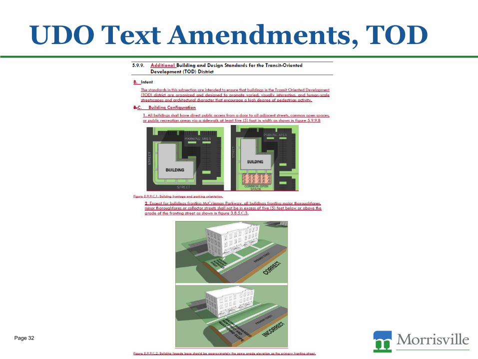
UDO Text Amendments, TOD
Page 32
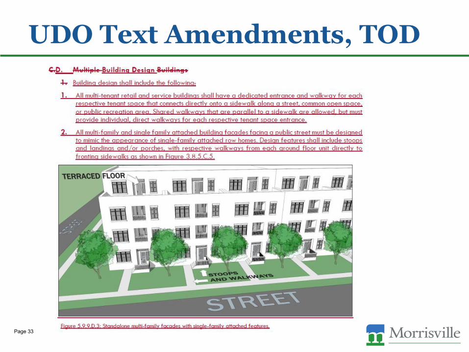
UDO Text Amendments, TOD
Page 33
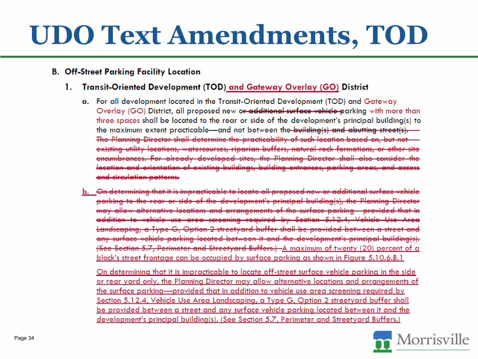
UDO Text Amendments, TOD
Page 34
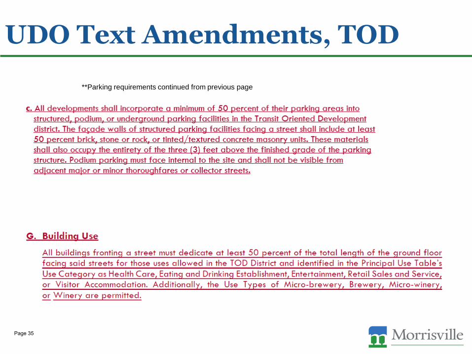
UDO Text Amendments, TOD
**Parking requirements continued from previous page
Page 35
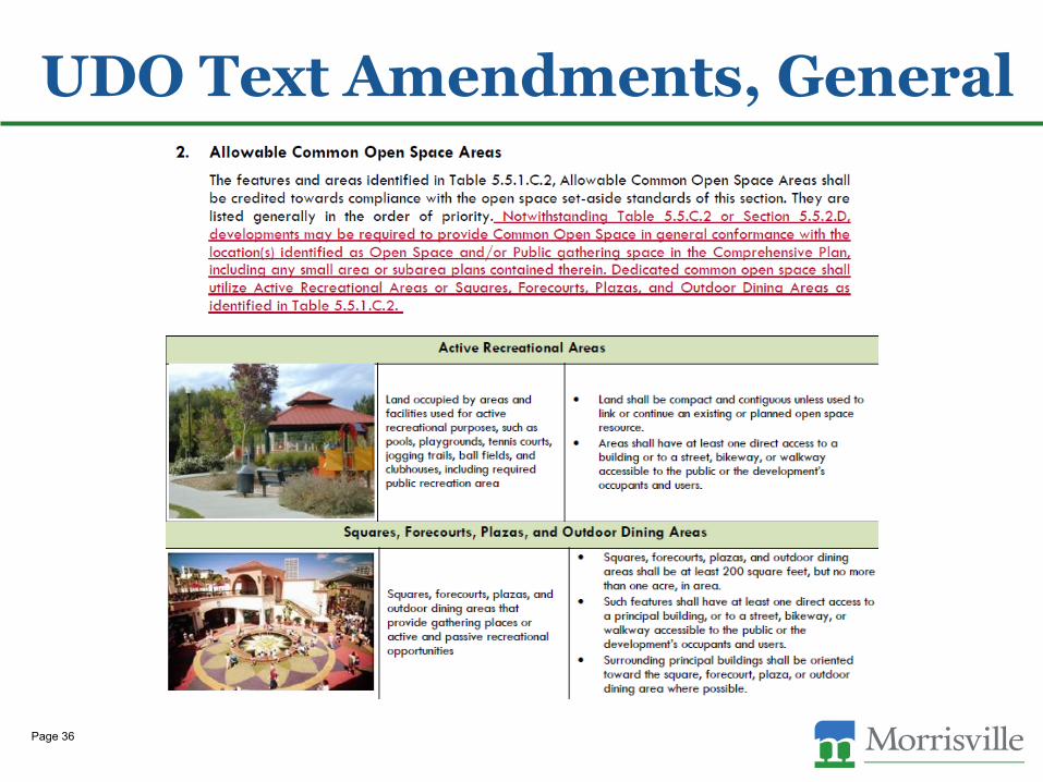
UDO Text Amendments, General
Page 36
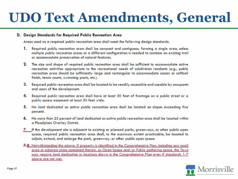
UDO Text Amendments, General
Page 37
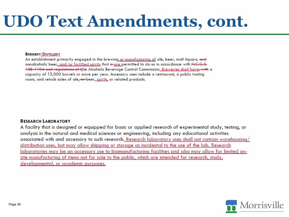
UDO Text Amendments, cont.
Page 38

UDO Text Amendments (updated)
Proposed Text based on Council’s comments on July 13
Page 39
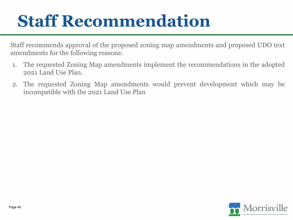
Staff Recommendation
Staff recommends approval of the proposed zoning map amendments and proposed UDO textamendments for the following reasons:
1. The requested Zoning Map amendments implement the recommendations in the adopted2021 Land Use Plan.
2. The requested Zoning Map amendments would prevent development which may beincompatible with the 2021 Land Use Plan
Page 40
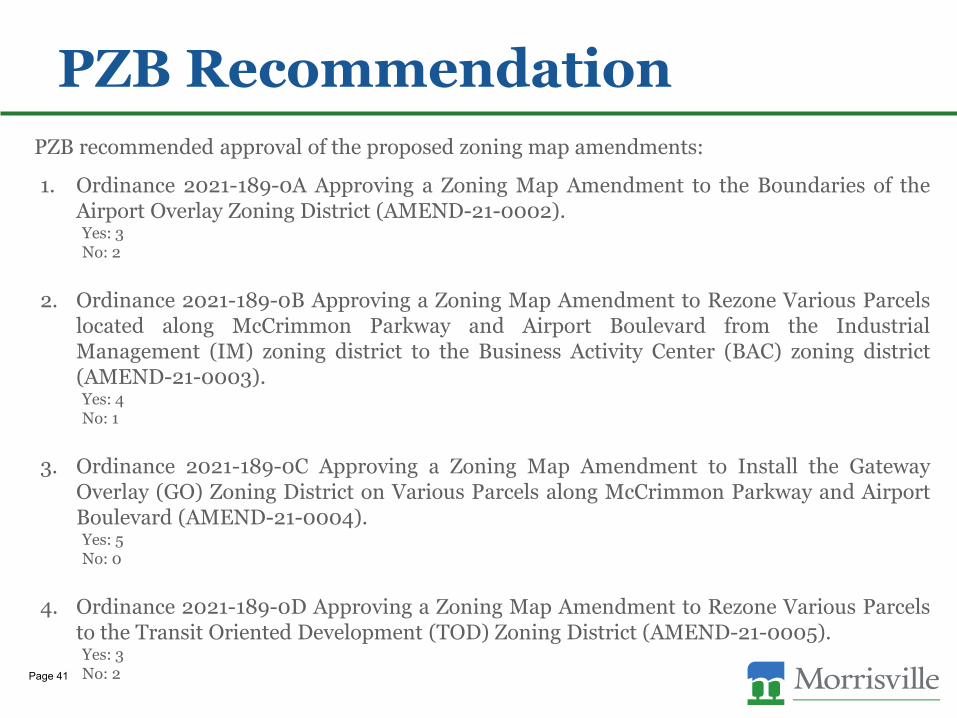
PZB Recommendation
PZB recommended approval of the proposed zoning map amendments:
1. Ordinance 2021-189-0A Approving a Zoning Map Amendment to the Boundaries of theAirport Overlay Zoning District (AMEND-21-0002).Yes: 3No: 2
2. Ordinance 2021-189-0B Approving a Zoning Map Amendment to Rezone Various Parcelslocated along McCrimmon Parkway and Airport Boulevard from the IndustrialManagement (IM) zoning district to the Business Activity Center (BAC) zoning district(AMEND-21-0003).Yes: 4No: 1
3. Ordinance 2021-189-0C Approving a Zoning Map Amendment to Install the GatewayOverlay (GO) Zoning District on Various Parcels along McCrimmon Parkway and AirportBoulevard (AMEND-21-0004).Yes: 5No: 0
4. Ordinance 2021-189-0D Approving a Zoning Map Amendment to Rezone Various Parcelsto the Transit Oriented Development (TOD) Zoning District (AMEND-21-0005).Yes: 3No: 2Page 41
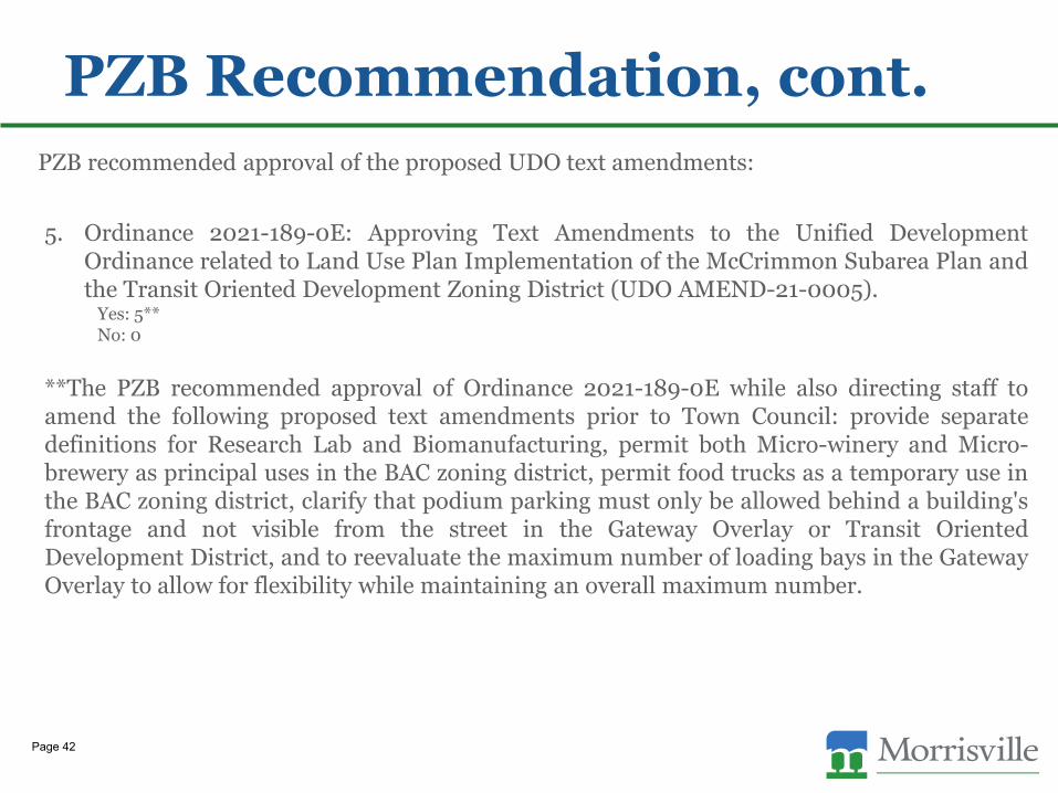
PZB Recommendation, cont.
PZB recommended approval of the proposed UDO text amendments:
5. Ordinance 2021-189-0E: Approving Text Amendments to the Unified DevelopmentOrdinance related to Land Use Plan Implementation of the McCrimmon Subarea Plan andthe Transit Oriented Development Zoning District (UDO AMEND-21-0005).
Yes: 5**No: 0
**The PZB recommended approval of Ordinance 2021-189-0E while also directing staff toamend the following proposed text amendments prior to Town Council: provide separatedefinitions for Research Lab and Biomanufacturing, permit both Micro-winery and Micro-brewery as principal uses in the BAC zoning district, permit food trucks as a temporary use inthe BAC zoning district, clarify that podium parking must only be allowed behind a building'sfrontage and not visible from the street in the Gateway Overlay or Transit OrientedDevelopment District, and to reevaluate the maximum number of loading bays in the GatewayOverlay to allow for flexibility while maintaining an overall maximum number.
Page 42
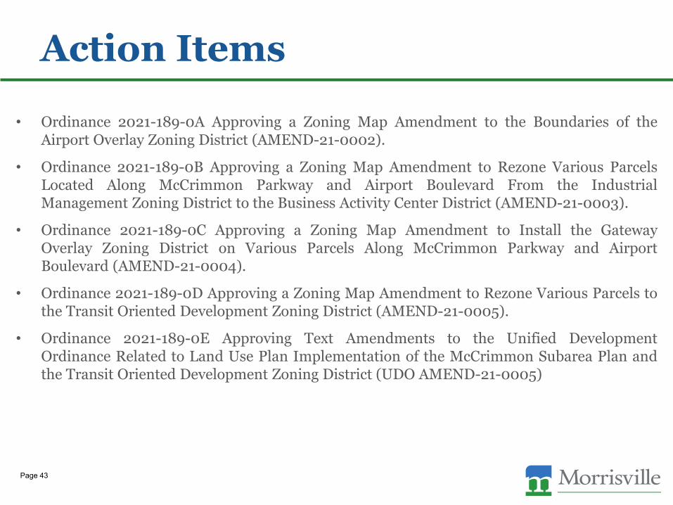
Action Items
• Ordinance 2021-189-0A Approving a Zoning Map Amendment to the Boundaries of theAirport Overlay Zoning District (AMEND-21-0002).
• Ordinance 2021-189-0B Approving a Zoning Map Amendment to Rezone Various ParcelsLocated Along McCrimmon Parkway and Airport Boulevard From the IndustrialManagement Zoning District to the Business Activity Center District (AMEND-21-0003).
• Ordinance 2021-189-0C Approving a Zoning Map Amendment to Install the GatewayOverlay Zoning District on Various Parcels Along McCrimmon Parkway and AirportBoulevard (AMEND-21-0004).
• Ordinance 2021-189-0D Approving a Zoning Map Amendment to Rezone Various Parcels tothe Transit Oriented Development Zoning District (AMEND-21-0005).
• Ordinance 2021-189-0E Approving Text Amendments to the Unified DevelopmentOrdinance Related to Land Use Plan Implementation of the McCrimmon Subarea Plan andthe Transit Oriented Development Zoning District (UDO AMEND-21-0005)
Page 43
Town Council Agenda Item Report
Agenda Item No. 9.bSubmitted by: Eric SmithSubmitting Department Administration Meeting Date: July 27, 2021
SUBJECTResolution Appointing Advisory Committee Members (Summer)Eric Smith, Town ClerkBrief - July 13Action - July 27
Recommendation:Consider eligible applicants for potential appointment.
Updates/History of Briefing:The results of electronic balloting have been tallied and compiled as ATTH06 "Tally Sheet".The attached resolution has been updated to reflect selected applicants for Councilappointment. Completed electronic ballots are on file in the office of the Town Clerk(ATTH04). Kulananda Sharma was selected for appointment to both the MPEAC and PSAC. Herappointment defaults to her first choice committee, PSAC. On the morning of July 22 Council will receive an electronic ballot to make an appointment tofill the PZB alternate position that will be vacated by Chris Robuck. Council is asked to returnthese ballots by July 26. All documents will be updated on the evening of July 26 to includethe PZB alternate if selected by Council.
Executive Summary and Background Information:
Official recruitment for summer appointments began on May 24 and closed at 5 pm on July 2. Recruitment has been conducted through a variety of outreach mechanisms (recruitment plannoted below).
A total of 12 new applications were received during this recruitment window and there were 10eligible applicants remaining on file from the last year. Residency for each applicant has beenverified and all reside within the Town limits of Morrisville.
Previous applicants were contacted to determine if they were still interested inappointment/reappointment. Those who were not interested were removed from considerationand those who did not respond remain for future consideration. Information regarding current
vacancies and upcoming expiring terms is noted below and is detailed in ATTH01.
On July 9, Council will receive an application packet and electronic ballots for all appointmentsvia email. Council will be asked to complete the electronic ballots and return them to the TownClerk no later than July 20 at 5pm for initial tallying. Results will be announced at the July 27meeting and Council will be asked to take action appointing any selected applicants. Allballots will remain as part of the agenda item and public record. If a runoff is needed followinginitial ballot tallying, Council members will receive electronic ballots on the morning of July 27for completion prior to the meeting. An application packet including all applicant informationhas been added to this agenda packet as a "Council Only" item and will not be available forpublic viewing within the agenda.
Per the balloting language, Council will be asked to select "up to" the number of currentcommittee vacancies. If a committee has vacancies that equal the number of eligibleapplicants, Council is not obligated to select all those that applied in an effort to fill allvacancies. Council may choose to leave any committee vacancies unfilled until the nextscheduled appointment cycle or extend recruitment to generate a larger pool of eligibleapplicants.
To ensure a fair process to all applicants, those applications received after the 5 pm deadlineon July 2 will be kept on file for appointment consideration during the next committeeappointment cycle.
To meet district member minimums for MPEAC, Council will need to appoint one applicantfrom District 3 and one applicant from District 4. All MPEAC vacancies are for two year terms.
The Planning and Zoning Board appointee if selected, will serve the remainder of the vacatedterm from August 1, 2021 – July 31, 2023.If a PZB alternate is selected for appointment to the vacant PZB seat, Town Clerk Smith willemail a secondary ballot on the Morning of July 22 to fill the PZB alternate vacancy. Results ofthis ballot will be presented at the July 27 meeting.
Committee vacancies and upcoming expiring terms:
Morrisville Environment and Stormwater Committee (11 Members)
Vacancies: 3
Expiring Terms: 1 (August 31)
Eligible Applicants on File: 2
Morrisville Smart City Steering Committee (11 Members)
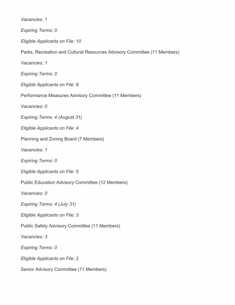
Vacancies: 1
Expiring Terms: 0
Eligible Applicants on File: 10
Parks, Recreation and Cultural Resources Advisory Committee (11 Members)
Vacancies: 1
Expiring Terms: 0
Eligible Applicants on File: 8
Performance Measures Advisory Committee (11 Members)
Vacancies: 0
Expiring Terms: 4 (August 31)
Eligible Applicants on File: 4
Planning and Zoning Board (7 Members)
Vacancies: 1
Expiring Terms: 0
Eligible Applicants on File: 5
Public Education Advisory Committee (12 Members)
Vacancies: 0
Expiring Terms: 4 (July 31)
Eligible Applicants on File: 3
Public Safety Advisory Committee (11 Members)
Vacancies: 3
Expiring Terms: 0
Eligible Applicants on File: 2
Senior Advisory Committee (11 Members)
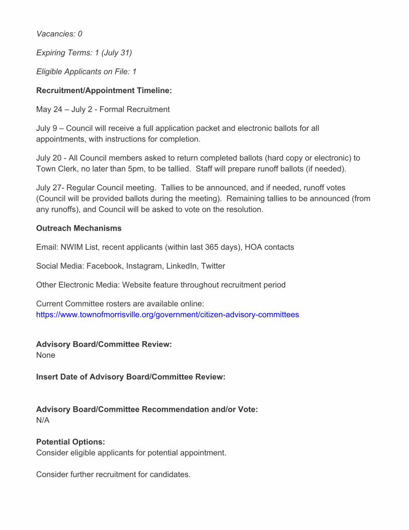
Vacancies: 0
Expiring Terms: 1 (July 31)
Eligible Applicants on File: 1
Recruitment/Appointment Timeline:
May 24 – July 2 - Formal Recruitment
July 9 – Council will receive a full application packet and electronic ballots for allappointments, with instructions for completion.
July 20 - All Council members asked to return completed ballots (hard copy or electronic) toTown Clerk, no later than 5pm, to be tallied. Staff will prepare runoff ballots (if needed).
July 27- Regular Council meeting. Tallies to be announced, and if needed, runoff votes(Council will be provided ballots during the meeting). Remaining tallies to be announced (fromany runoffs), and Council will be asked to vote on the resolution.
Outreach Mechanisms
Email: NWIM List, recent applicants (within last 365 days), HOA contacts
Social Media: Facebook, Instagram, LinkedIn, Twitter
Other Electronic Media: Website feature throughout recruitment period
Current Committee rosters are available online:https://www.townofmorrisville.org/government/citizen-advisory-committees
Advisory Board/Committee Review:None
Insert Date of Advisory Board/Committee Review:
Advisory Board/Committee Recommendation and/or Vote:N/A
Potential Options:Consider eligible applicants for potential appointment.
Consider further recruitment for candidates.
Staff Recommendation:Receive briefing
On July 27 2021, Council will be asked to vote on a single resolution for all board andcommittee appointments.
ATTACHMENTS• 2021-281-0 BS Resolution Appointing Advisory Committee Members (Summer).pdf• 2021-281-0 RES Appointing Advisory Committee Members (Summer).pdf• 2021-281-0 ATTH01 Committee Vacancy Overview.pdf• 2021-281-0 ATTH04 Completed Electronic Ballots.pdf• 2021-281-0 ATTH06 Applicant Tally Sheet.pdf

Updated: July 8, 2021 1 of 1
Resolution Appointing Advisory Committee Members: (2021-281-0)
Goals Objectives
Improved transportation mobility – Enhance transportation options through improved accessibility, connectivity and collaboration
☐ Obj. 1.1 Manage traffic congestion at targeted locations and
targeted times of day
☐ Obj. 1.2 Leverage resources through partnerships with other government entities and private sector
☐ Obj. 1.3 Improve mobility options for non-drivers
Thriving, livable neighborhoods – Enrich the quality of life through the preservation of natural resources, well-planned development and strengthened neighborhood vitality
☐ Obj. 2.1 Provide a mix of housing options that meet the current
and future needs of the community
☐ Obj. 2.2 Create a sense of place through insightful development that balances commercial and residential growth
☐ Obj. 2.3 Be responsible stewards of the natural environment
☐ Obj. 2.4 Establish a planned approach for redevelopment and
revitalization
☐ Obj. 2.5 Plan and provide for current and future infrastructure
Engaged, inclusive community – Enrich the quality of life through programs, events, amenities and services valued by the community
☐ Obj. 3.1 Offer events and programs that meet the needs and interests of the community
☐ Obj. 3.2 Increase awareness of activities and opportunities for
engagement
☐ Obj. 3.3 Effectively maintain assets and make the most of
existing resources
☒ Obj. 3.4 Provide opportunities for meaningful public
engagement and collaboration
Public safety readiness – Provide a safe and secure community through prevention, education, readiness and response
☐ Obj. 4.1 Provide educational opportunities and encourage
preparedness
☐ Obj. 4.2 Be operationally ready
☐ Obj. 4.3 React responsively to the public safety needs of the community
☐ Obj. 4.4 Meet Demands for service
Operational excellence – Deliver exceptional service with an engaged workforce that effectively manages public assets and promotes transparency
☐ Obj. 5.1 Promote financial integrity through effectively and
efficiently managing public assets
☐ Obj. 5.2 Deliver customer-focused service
☐ Obj. 5.3 Require the highest of professional standards
☐ Obj. 5.4 Attract, develop and retain a diverse, high performing
workforce
☐ Obj. 5.5 Align priorities with resources
☐ Obj. 5.6 Leverage the use of technology to maximize results
Economic prosperity – Promote a business-friendly environment to diversify the economic base and create job opportunities for an educated, ready workforce
☐ Obj. 6.1 Attract and retain businesses that provide a diverse tax base
☐ Obj. 6.2 Support new and existing businesses by streamlining
processes and minimizing complexities
☐ Obj. 6.3 Understand business needs in order to supply a ready
workforce
☐ Obj. 6.4 Maximize partnership opportunities with the Morrisville Chamber of Commerce, regional and educational partners
☐ Obj. 6.5 Develop and advocacy plan to address public education
needs
“Connect Morrisville” Strategic Plan Alignment

TOWN OF MORRISVILLE * 100 TOWN HALL DRIVE * MORRISVILLE, NC 27560
Page 1 of 1
RESOLUTION 2021-281-0 OF THE MORRISVILLE TOWN
COUNCIL CONSIDERING APPOINTMENTS OF ADVISORY COMMITTEE MEMBERS
WHEREAS, recruitment for vacancies on Advisory Committees took place May 24, 2021 through July 2, 2021; and WHEREAS, initial appointments from the applicant pool are considered by the Council: NOW, THEREFORE, BE IT RESOLVED THAT THE MORRISVILLE TOWN COUNCIL hereby notes that the following applicants are eligible for appointment, as indicated by ballot vote. Environment and Stormwater Committee (MESC) Beverly Goll- Yekeson September 1, 2021 – August 31, 2023 (2-year term) Aleck Johnson August 1, 2021 – July 31, 2023 (2-year term) Smart City Steering Committee (MSCSC) Guilherme Correia August 1, 2021 – July 31, 2023 (2-year term) Haydee De Leon August 1, 2021 – July 31, 2023 (2-year term) Parks, Recreation and Cultural Resources Advisory Committee (PRCRAC) Brian Cook August 1, 2021 – July 31, 2023 (2-year term) Performance Measures Advisory Committee (PMAC) Ranga Narasimhan September 1, 2021 – August 31, 2023 (2-year term) Biswadev Roy September 1, 2021 – August 31, 2023 (2-year term) Rehanali Sayed September 1, 2021 – August 31, 2023 (2-year term) John Wall September 1, 2021 – August 31, 2023 (2-year term) Planning and Zoning Board (PZB) Chris Robuck August 1, 2021 – July 31, 2023 (remainder of vacated 3-year term) Public Education Advisory Committee (MPEAC) Lauren Quick-Graham (District 4) August 1, 2021 – July 31, 2023 (2-year term) Shreyance Rai August 1, 2021 – July 31, 2023 (2-year term) Public Safety Advisory Committee (PSAC) Sadaf Abbas August 1, 2021 – July 31, 2023 (2-year term) Kulananda Sharma August 1, 2021 – July 31, 2023 (2-year term) Senior Advisory Committee (SAC) Cathy Busby August 1, 2021 – July 31, 2023 (2-year term) Adopted this the 27th day of July 2021.
ATTEST: ______________________________ _____________________________ TJ Cawley, Mayor Eric W. Smith II, Town Clerk
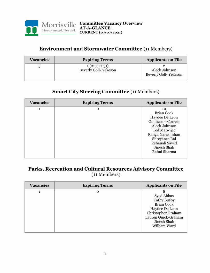
1
Committee Vacancy Overview AT-A-GLANCE CURRENT (07/07/2021)
Environment and Stormwater Committee (11 Members)
Vacancies Expiring Terms Applicants on File
3 1 (August 31) Beverly Goll- Yekeson
2 Aleck Johnson
Beverly Goll- Yekeson
Smart City Steering Committee (11 Members)
Vacancies Expiring Terms Applicants on File
1 0
10 Brian Cook
Haydee De Leon Guilherme Correia
Aleck Johnson Ted Matwijec
Ranga Narasimhan Shreyance Rai
Rehanali Sayed Jinesh Shah
Rahul Sharma
Parks, Recreation and Cultural Resources Advisory Committee (11 Members)
Vacancies Expiring Terms Applicants on File
1 0 8 Syed Abbas Cathy Busby Brian Cook
Haydee De Leon Christopher Graham
Lauren Quick-Graham Jinesh Shah
William Ward
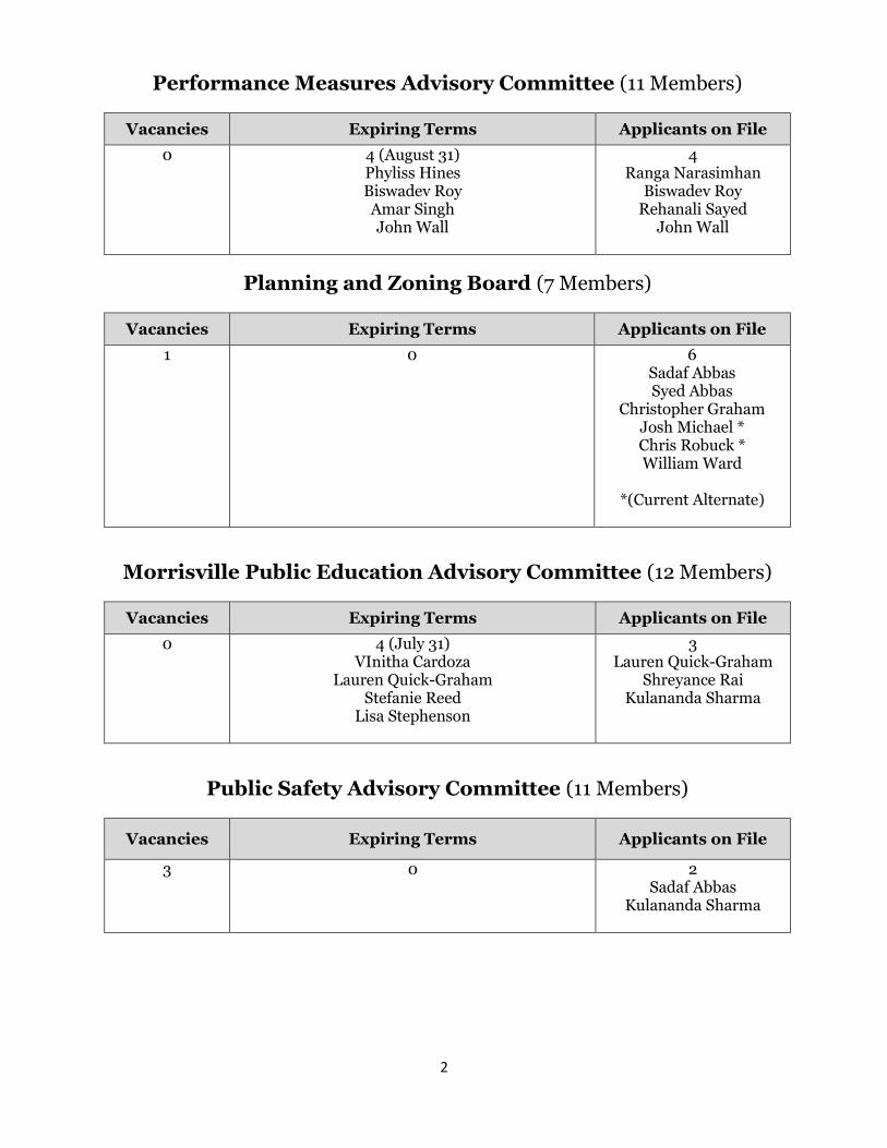
2
Performance Measures Advisory Committee (11 Members)
Vacancies Expiring Terms Applicants on File
0 4 (August 31) Phyliss Hines Biswadev Roy Amar Singh John Wall
4 Ranga Narasimhan
Biswadev Roy Rehanali Sayed
John Wall
Planning and Zoning Board (7 Members)
Vacancies Expiring Terms Applicants on File
1 0 6 Sadaf Abbas Syed Abbas
Christopher Graham Josh Michael * Chris Robuck * William Ward
*(Current Alternate)
Morrisville Public Education Advisory Committee (12 Members)
Vacancies Expiring Terms Applicants on File
0 4 (July 31) VInitha Cardoza
Lauren Quick-Graham Stefanie Reed
Lisa Stephenson
3 Lauren Quick-Graham
Shreyance Rai Kulananda Sharma
Public Safety Advisory Committee (11 Members)
Vacancies Expiring Terms Applicants on File
3 0 2 Sadaf Abbas
Kulananda Sharma
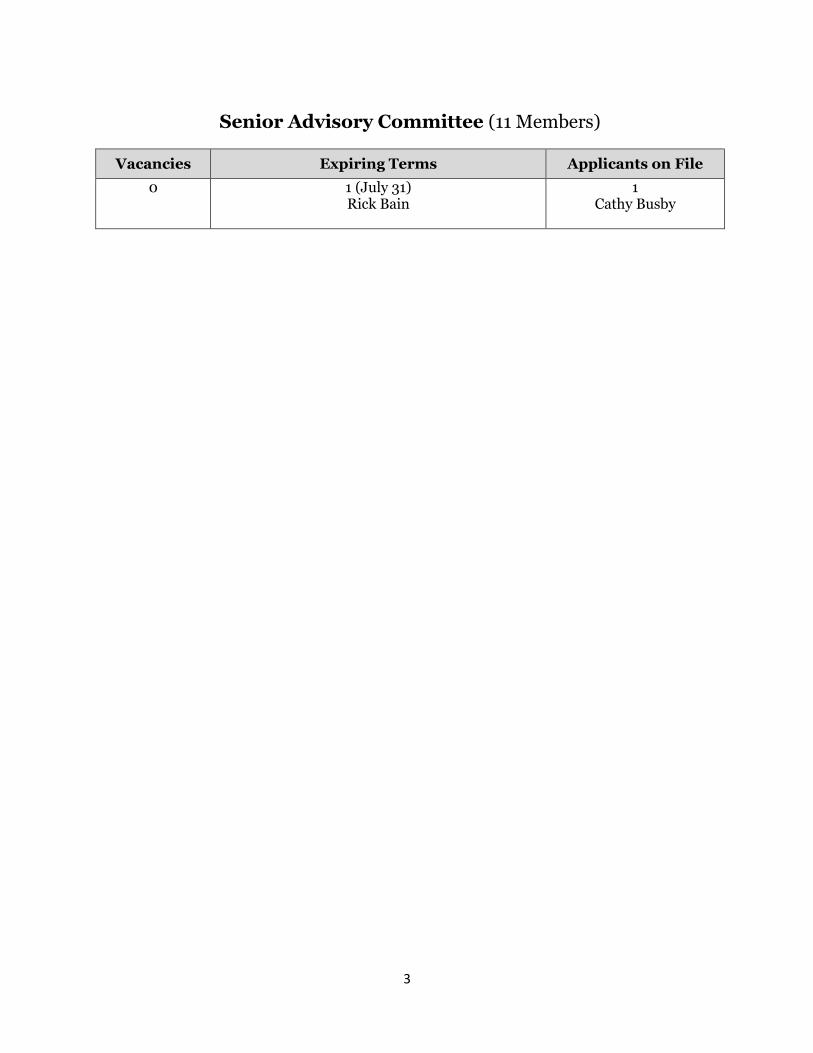
3
Senior Advisory Committee (11 Members)
Vacancies Expiring Terms Applicants on File
0 1 (July 31) Rick Bain
1 Cathy Busby

l
11111 Morrisville ll Live connected. Live well.
BALLOT FOR ADVISORY COMMITTEE APPOINTMENT: SUMMER 2021
Place an "x" or "check mark" next to any applicant 's name you w ish to be appointed/reappointed.
Environment and Stormwater Committee (MESC) 3 Seats Available (two-year term)
SELECT UP TO 2 APPLICANTS
Applicant Additional Information
Aleck Johnson Also applying for MSCSC
Beverly Goll - Yekeson
Mayor T J Cawley Pri nted Name: -------------------- -
T JC July 20, 2021 Signature: _____________________ _
Current Appointment
MESC expiring term (August 31}
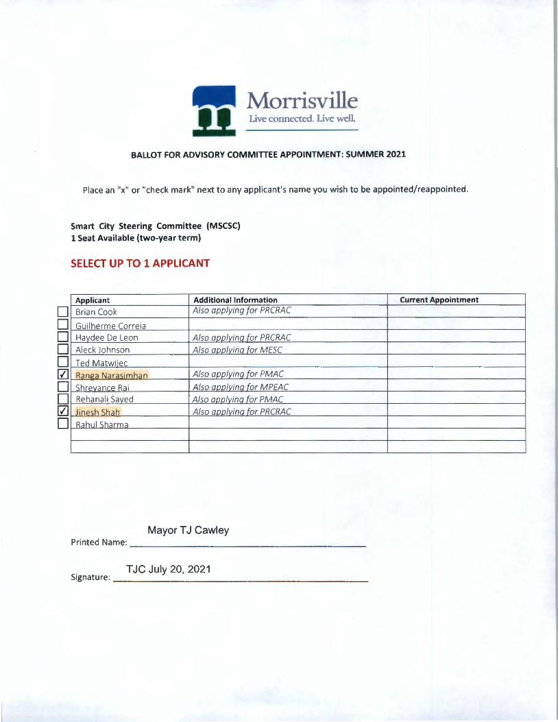
• • • • • [Z]
• • [Z]
•
11111 Morrisville ll Live connected. Live well
BALLOT FOR ADVISORY COMMITTEE APPOINTMENT: SUMMER 2021
Place an "x" or "check mark" next to any applicant's name you wish to be appointed/reappointed.
Smart City Steering Committee (MSCSC) 1 Seat Available (two-year term)
SELECT UP TO 1 APPLICANT
Applicant Additional Information
Brian Cook Also applying for PRCRAC
Guilherme Correia
Haydee De Leon Also annlvina for PRCRAC
Aleck Johnson Also annlvina for MESC
Ted Matwiiec
Ran12a Narasimhan Also applyinq for PMAC
ShrevanrP Rai Also annlvina for MPEAC
Rehanali Saved Also annlvina for PMAC
Jinesh Sha h Also annlvina for PRCRAC
Rahul Sharma
Mayor T J Cawley Printed Name: ____________________ _
T JC July 20, 2021 Signature: ______________________ _
Current Appointment
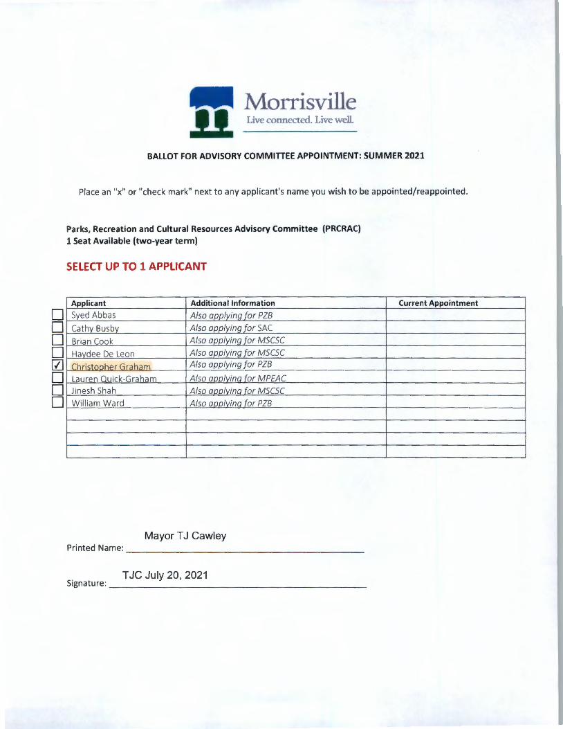
• • • • 0 • • •
Morrisville Live connected. Live well.
BALLOT FOR ADVISORY COMMITTEE APPOINTMENT: SUMMER 2021
Place an "x" or "check mark" next to any appl icant's name you wish to be appo inted/reappointed.
Parks, Recreation and Cultural Resources Advisory Committee (PRCRAC)
1 Seat Available (two-year term)
SELECT UP TO 1 APPLICANT
Applicant Additional Information
Syed Abbas Also applyina for PZB
Cathy Busby Also applyinq for SAC
Brian Cook Also applying for MSCSC
Havdee De Leon Also applyinq for MSCSC
ChristrrnhPr Gr;iham Also applying for PZB
Lauren Quick-Graham Also aoolvina for MPEAC
Jinesh Shah Also annlvina for MSCSC
William Ward Also annlvina for PZB
Mayor T J Cawley Printed Name: ____________________ _
T JC July 20, 2021 Signatu re: _______ ______________ _
Current Appointment
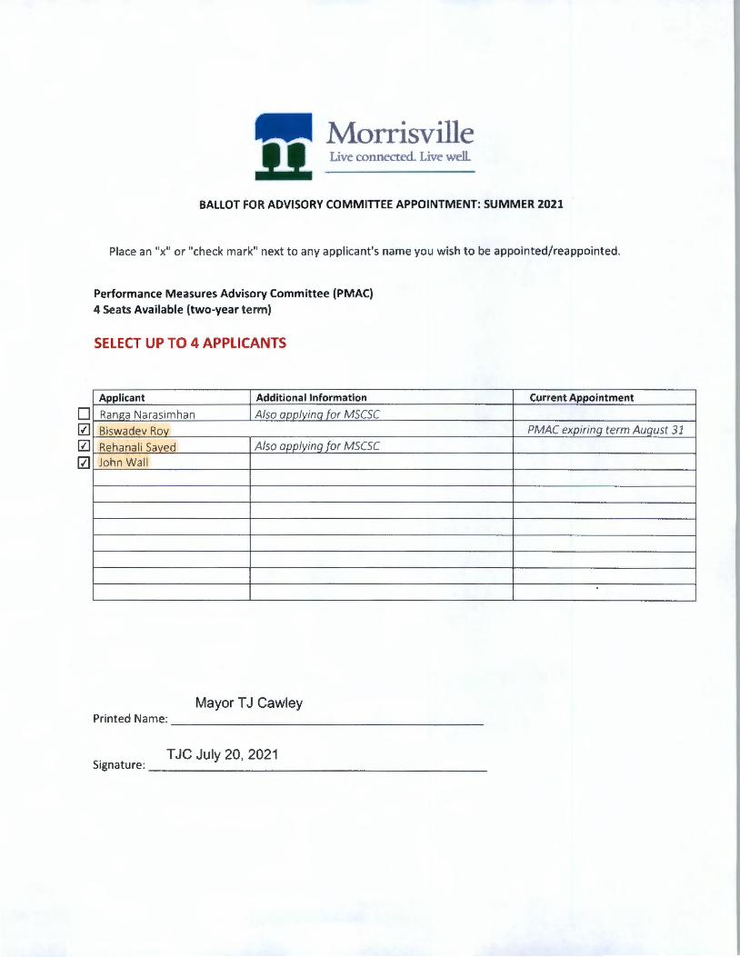
• 0 0 0
Morrisville 11 Live connected. Llve well
BALLOT FOR ADVISORY COMMITTEE APPOINTMENT: SUMMER 2021
Place an "x" or "check mark" next to any applicant's name you wish to be appointed/reappointed .
Performance Measures Advisory Committee (PMAC) 4 Seats Available (two-year term)
SELECT UP TO 4 APPLICANTS
Applicant Additional Information
Ranga Nara si mhan Also aoolvina for MSCSC
Biswadev Rov
Reha nali Saved Also applying for MSCSC
John Wal l
Mayor T J Cawley Printed Name: ____________________ _
T JC July 20, 2021 Signature : ______________________ _
Current Appointment
PMAC expiring term August 31

Morrisville Live connected. Live well.
BALLOT FOR ADVISORY COMMITTEE APPOINTMENT: SUMMER 2021
Place an "x" or "check mark" next to any applicant's name you w ish to be appointed/reappointe d .
Planning and Zoning Board (PZB)
1 Seat Available (remainder of vacated term from August 1, 2021- July 31, 2023)
SELECT UP TO 1 APPLICANT
Applicant Additional Information Current Appoint ment
• Sadaf Abbas Also applying for PRCRAC
• S ed Abbas or PRCRAC
• Christo her Graham Al rPR RA
• Josh Michael orMSCSC PZB - current olte mote
0 Chris Robuck PZB - current olte mote
• William Ward or PRCRAC
Mayor T J Cawley Printed Name: ____________________ _
T JC July 20, 2021 Signature: ___________ __________ _
-

[Z] [Z]
•
Morrisville 11 Live connected. Live well.
BALLOT FOR ADVISORY COMMITTEE APPOINTMENT: SUMMER 2021
Place an "x" or "check mark" next to any applica nt 's name you w ish to be appointed/reappointed.
Public Education Advisory Committee (MPEAC) 4 Seats Available (two-year term)
SELECT UP TO 1 APPLICANT FROM DISTRICT 4 SELECT UP TO 2 APPLICANTS FROM ANY DISTRICT
Applicant Additional Information
Lauren Quick-Graham (Dist. 4 Also applying for PRCRAC
Shrevance Rai (Dist. 1) Also aoolvina for MSCSC k', il;:m;:inrb <;h;:irm;:i /r)i,t 71 Alc:n annl\linn fnr Pr:.Ar
Mayor T J Cawley Printed Name: __________________ _
T JC July 20, 2021 Signature: ____________________ _
Current Appointment
MPEAC expiring term July 31)
• 0
Morrisville ll Live connected. Live well
BALLOT FOR ADVISORY COMMITTEE APPOINTMENT: SUMMER 2021
Place an "x" or "check mark" next to any appl icant 's name you w ish to be appointed/reappointed.
Public Safety Advisory Committee (PSAC) 3 Seats Available (two-year term)
SELECT UP TO 2 APPLICANTS
Applicant Additional Information
Sadaf Abbas Also aoolvina for PZB
Ku lananda Sharma Also aoolvina for MPEAC
Mayor T J Cawley Printed Name: _ _____ _____________ _
T JC July 20, 2021 Signature : ____________ _ ________ _
Current Appointment

Morrisville ll. Live connected. Live well.
BALLOT FOR ADVISORY COMMITTEE APPOINTMENT: SUMMER
Place an "x" or "check mark" next to any applicant's name you wish to be appoin
Senior Advisory Committee (SAC) 1 Seat Available (two-year term)
SELECT UP TO 1 APPLICANT
Applicant Additional Information
0 Cathy Busby
Mayor T J Cawley Printed Name: ___________________ _
T JC July 20, 2021 Signature: _____________________ _
2021
ted/reappointed .
Current Appointment
-

Morrisville ll Live connected. Live well.
BALLOT FOR ADVISORY COMMITTEE APPOINTMENT: SUMMER 2021
Place an "x" or "check mark" next to any applicant's name you wish to be appointed/reappointed.
Environment and Stormwater Committee (MESC) 3 Seats Available (two-year term)
SELECT UP TO 2 APPLICANTS
Applicant Additional Information
[Z] Aleck Johnson Also applying for MSCSC
[Z] Beverl Goll- Yekeson
Mayor Pro Tern Liz Johnson Printed Name: ____________________ _
LJ 7/20/21 Signature: ________________ _____ _
Current Appointment
MESC expiring term (Augu st 31)

• [Z] [Z]
• • • • • • •
Morrisville 11 Live connected. Llve well.
BALLOT FOR ADVISORY COMMITTEE APPOINTMENT: SUMM ER 2021
Place an "x" or "check mark" next to any applicant's name you wish to be
Smart City Steering Committee (MSCSC) 1 Seat Available (two-year term)
SELECT UP TO 1 APPLICANT
Applicant Additional Information
Brian Cook Also applying for PRCRAC
Guilherme Correia Ha dee De Leon Also a or PRCRAC Aleck Johnson Also a
Also a orPMAC
Also a orMPEAC Also a orPMAC
Also a or PRCRAC
Mayor Pro Tern Liz Johnson Printed Name: ___________________ _
LJ 7/20/21 Signature: _____________________ _
appointed/reappointed.
Current Appointment
-
• • 0 • • • • •
Morrisville Live connected. Live well.
BALLOT FOR ADVISORY COMMITTEE APPOINTMENT: SUMMER 2021
Place an "x" or "check mark" next to any appl icant 's name you wish to be appointed/reap
Parks, Recreation and Cultural Resources Advisory Committee (PRCRAC} 1 Seat Available (two-year term)
SELECT UP TO 1 APPLICANT
Applicant Additional Information
Syed Abbas Also a I in orPZB
Cath Busb Also a I in or SAC
Brian Cook Also applying for MSCSC
Also applyin orMSCSC
m Also applying for PZB
Lauren uick-Graham Also a orMPEAC
Jinesh Shah Also a orMSCSC
William Ward Also a orPZB
Mayor Pro Tern Liz Johnson Printed Name: __________ _________ _
LJ 7/20/21 Signature : _____________________ _
Current A
pointed.
ppointment
-
0 0 0 0
Morrisville 11 Live connected. Live well
BALLOT FOR ADVISORY COMMITTEE APPOINTMENT: SUMMER 2021
Place an "x" or "check mark" next to any appl icant 's name you w ish to be appointed/reappointed.
Performance Measures Advisory Committee (PMAC) 4 Seats Available (two-year term)
SELECT UP TO 4 APPLICANTS
Applicant Additional Information
Ranga Narasimhan Also aoolvina for MSCSC
Biswadev Rov
Rehanali Saved Also applying for MSCSC
John Wall
Mayor Pro Tern Liz Johnson Printed Name: ____________________ _
LJ 7/20/21 Signature: __________ _ __________ _
Current Appointment
PMAC expiring term August 31
Morrisville .ll Live connected. Live well
BALLOT FOR ADVISORY COMMITTEE APPOINTMENT: SUMM ER 2021
Place an "x" or "check mark" next to any appl icant 's name you wish to be ap pointed/ reappointed .
Planning and Zoning Board (PZB) 1 Seat Available (remainder of vacated term from August 1, 2021 - July 31, 20 23)
SELECT UP TO 1 APPLICANT
Applicant Current Appointment
• Sadaf Abbas
• S ed Abbas
• Christo her Graham Al
• Josh Michael PZB - current alternate
• Chris Robuck PZB - current alternate
• William Ward or PRCRAC
Mayor Pro Tern Liz Johnson Printed Name: ____________________ _
LJ 7/20/21 Signature: _____________________ _
-

Morrisville Live connected. Live well.
BALLOT FOR ADVISORY COMMITTEE APPOINTMENT: SUMMER 2021
Place an "x" or "check mark" next to any applicant's name you wish to be appointed/reappointed.
Public Education Advisory Committee (MPEAC)
4 Seats Available (two-year term)
SELECT UP TO 1 APPLICANT FROM DISTRICT 4 SELECT UP TO 2 APPLICANTS FROM ANY DISTRICT
Applicant Additional Information
Lauren Quick-Graham (Di st. 4 Also applying for PRCRAC
Shrevance Rai (Dist. 1) Also aoolvina for MSCSC k', il;:m;:mrb <;h;:irm;:i lni~t )\ Also nnnl\linn for pc:;Ar
Mayor Pro Tern Liz Johnson Printed Name: ___________________ _
LJ 7/20/21 Signature: _____________________ _
Current Appointment
MPEAC expiring term July 31)
Morrisville !1 Live connected. Live well
BALLOT FOR ADVISORY COMMITTEE APPOINTMENT: SUMMER 2021
Place an "x" or "check mark" next to any applicant's name you w ish to be appointed/reappoin ted .
Public Safety Advisory Committee (PSAC) 3 Seats Available (two-year term)
SELECT UP TO 2 APPLICANTS
Applicant Additional Information
0 Sadaf Abbas 0 Kulananda Sharma
Mayor Pro Tern Liz Johnson Printed Name: __________ __________ _
LJ 7/20/21 Signature: _____________________ _
Current Appoi ntment
-

Morrisville ll Live connected. Live well.
BALLOT FOR ADVISORY COMMITTEE APPOINTMENT: SUMMER 2021
Place an "x" or "check mark" next to any applicant's name you wish to be appointed/reappointed.
Senior Advisory Committee {SAC) 1 Seat Available (two-year term)
SELECT UP TO 1 APPLICANT
Applicant Additional Information
0 Cathy Busby
Mayor Pro T em Liz Johnson Printed Name: ___________________ _
LJ 7/20/21 Signature: _____________________ _
Current Appointmen t
-

Morrisville ll Live connected. Live well
BALLOT FOR ADVISORY COMMITTEE APPOINTMENT: SUMMER 2021
Place an "x" or "check mark" next to any appl icant 's name you w ish to be appointed/ reappointed .
Environment and Stormwater Committee {MESC} 3 Seats Available (two-year term)
SELECT UP TO 2 APPLICANTS
Applicant Additional Information
Aleck Johnson Also applying for MSCSC
Beverly Goll - Yekeson
Council Member Donna Fender Printed Name: ____________________ _
dlf 07/19/2021 Signatu re: ______________________ _
Current Appointment
MESC expiring term (August 31)
• • [Z]
• • • [Z]
• • •
Morrisville !1 Live connected. Live well.
BALLOT FOR ADVISORY COMMITTEE APPOINTMENT: SUMMER 2021
Place an "x" or "check mark" next to any applicant's name you wish to be appointed/reappointed.
Smart City Steering Committee (MSCSC) 1 Seat Available (two-year term)
SELECT UP TO 1 APPLICANT
Applicant Additional Information
Brian Cook Also applying for PRCRAC
Guilherme Correia Havdee De Leon Also ann/vina for PRCRAC Aleck Johnson Also ann/vina for MESC
Ted Matwiiec RanPa Narr1simhr1n Also opp/vino for PMAC
c;hrPvrincP Rrii Also ann/vinn for MPEAC Rehanali Saved Also aon/vinn for PMAC
linPsh Shah Also ann/vina for PRCRAC
Rr1h11I Shrirm;i
Council Member Donna Fender Pri nted Name: _________ ___________ _
dlf 07/19/2021 Signatu re: _ _______ ______________ _
Current Appointment

• • • 0 • • • •
Morrisville Live connected. Live well .
. BALLOT FOR ADVISORY COMMITTEE APPOINTMENT: SUMMER
Place an "x" or "check mark" next to any applicant's name you wish to be appoint
Parks, Recreation and Cultural Resources Advisory Committee (PRCRAC} 1 Seat Available (two-year term)
SELECT UP TO 1 APPLICANT
Applicant Additional Information
Syed Abbas
Cath Busb Also a I in or SAC
Brian Cook Also applying for MSCSC
Also opp/yin orMSCSC
m Also applying for PZB
Lauren uick-Graham Also a orMPEAC
Jinesh Shah Also a orMSCSC
William Ward Also a orPZB
Council Member Donna Fender Printed Name: ____________________ _
dlf 07/19/2021 Signature : ______________________ _
C
2021
ed/reappointed.
urrent Appointment
-
0 0 0 0
1111 Morrisville ll Live connected. Live well
BALLOT FOR ADVISORY COMMITTEE APPOINTMENT: SUMMER 2021
Place an "x" or "check mark" next to any applicant's name you wish to be appointed/reappointed.
Performance Measures Advisory Committee (PMAC) 4 Seats Available (two-year term)
SELECT UP TO 4 APPLICANTS
Applicant Additional Information
Ranga Narasimhan Also annlvina for MSCSC
Biswadev Rov
Rehanali Saved Also applying for MSCSC
John Wall
Council Member Donna Fender Printed Name: ____________________ _
dlf 07/19/2021 Signature: ______________________ _
Current Appointment
PMAC expiring term August 31

Morrisville !1 Live connected. Live well
BALLOT FOR ADVISORY COMMITTEE APPOINTMENT: SU MME
Place an "x" or "check mark" next to any appl icant's name you wish to be appo
Planning and Zoning Board (PZB) 1 Seat Available (remainder of vacated term from August 1, 2021- July 31, 2023
SELECT UP TO 1 APPLICANT
Applicant
0 Sadaf Abbas
0 S ed Abbas
Additional Information
R 2021
inted/reappointed.
)
Current Appointment
D Christo her Graham
0 Josh Michael PZB - current alternate
D Chris Robuck PZB - current alternate • William Ward
Council Member Donna Fender Printed Name: ____________________ _
dlf 07/19/2021 Signature: _____________________ _
-
Morrisville 11 Live connected. Live well.
BALLOT FOR ADVISORY COMMITTEE APPOINTMENT: SUMMER 2021
Place an "x" or "check mark" next to any applicant's name you wish to be appointed/reappo inted.
Public Education Advisory Committee (MPEAC) 4 Seats Available (two-year term)
SELECT UP TO 1 APPLICANT FROM DISTRICT 4 SELECT UP TO 2 APPLICANTS FROM ANY DISTRICT
Council Member Donna Fender Printed Name: __________________ _
dlf 07/19/2021 Signature: ____________________ _
Current App ointment
MPEACexp iring term July 31)
-
0 0
Morrisville 11 Live connected. Live well
BALLOT FOR ADVISORY COMMITTEE APPOINTMENT: SUMMER 2021
Place an "x" or "check ma rk" next to any applicant's name you w ish to be appointed/reappointed.
Public Safety Advisory Committee (PSAC) 3 Seats Available (two-year term)
SELECT UP TO 2 APPLICANTS
Applicant Additional Information
Sadaf Abbas Also aoolyinq for PZB
Kulananda Sharma Also aoolvina for MPEAC
Council Member Donna Fender Printed Name: _________ __________ _
dlf 07/19/2021 Signat ure: _____________________ _
Current Appointment
Morrisville .ll Live connected. Live well.
BALLOT FOR ADVISORY COMMITTEE APPOINTMENT: SUM MER 2021
Place an "x" or "check mark" next to any applicant's name you wish to be ap pointed/reappointed.
Senior Advisory Committee (SAC) 1 Seat Available (two-year term)
SELECT UP TO 1 APPLICANT
Applicant Additional Information
0 Cathy Busby
Council Member Donna Fender Printed Name: ___________________ _
dlf 07/19/2021 Signature: _____________________ _
Current Appointment
• 0
Morrisville 11 Live connected. Live well.
BALLOT FOR ADVISORY COMMITTEE APPOINTMENT: SUMMER 2021
Place an "x" or "check mark" next to any applicant's name you wish to be appointed/reappointed.
Environment and Stormwater Committee (MESC) 3 Seats Available (two-year term)
SELECT UP TO 2 APPLICANTS
Applicant Additional Information
Aleck Johnson Also applying for MSCSC
Beverly Goll- Yekeson
Council Member Satish Garimella B Printed Name: ____________________ _
gss 7/21/21 Signature: _____________________ _
Current Appointment
MESC expiring term (August 31)
• 0 • • • • • • • •
Morrisville 11 Live connected. Live well.
BALLOT FOR ADVISORY COMMITTEE APPOINTMENT: SUMMER 2021
Place an "x" or "check mark" next to any applicant 's name you wish to be appointed/reappointed.
Smart City Steering Committee (MSCSC) 1 Seat Available (two-year term)
SELECT UP TO 1 APPLICANT
Applicant Additional Information
Brian Cook Also applying for PRCRAC
Guilherme Correia Havdee De Leon Also aoolyina for PRCRAC Aleck Johnson Also annlvina for MESC
Ted Matwiiec R;:ina" N;:ir;:i~imhan Also O{J{Jlyina for PMAC
<;h rev;:i nre R;:i i Also annlvina for MPEAC
Rehanali Saved Also annlvina for PMAC
linPsh Shah Also annlvina for PRCRAC
R;:ih11I <:;h;:irmri
Council Member Satish Garimella B Printed Name: ____________________ _
gss 7/21/21 Signature: ______________________ _
Current Appointment
• • • • • • [Z]
•
Morrisville ll Live connected. Live well.
BALLOT FOR ADVISORY COMMITTEE APPOINTMENT: SUMMER 2021
Place an "x" or "check mark" next to any appl ica nt 's name you w ish to be appointed/reappointed.
Parks, Recreation and Cultural Resources Advisory Committee (PRCRAC} 1 Seat Available (two-year term)
SELECT UP TO 1 APPLICANT
Applicant Additional Information
Syed Abbas Also aoolyinq for PZB
Cathv Busbv Also applyinq for SAC
Brian Cook Also applying for MSCSC
Havdee De Leon Also applyina for MSCSC
rhri~tnnhPr Graham Also applying for PZB
Lauren Ouick-Graham Also annlvina for MPEAC
Jinesh Shah Also aoolvina for MSCSC
William Ward Also aoolvina for PZB
Council Member Satish Garimella fJ Printed Name: _ _ _ ______________ [] __ _
gss 7/21 /21 Signature: _ _ _ _______________ ___ _
Current Appointment
0 0 0 0
Morrisville 11. Live connected. Live welL
BALLOT FOR ADVISORY COMMITTEE APPOINTMENT: SUMMER 2021
Place an "x" or "check mark" next to any applicant's name you wish to be appointed/reappointed.
Performance Measures Advisory Committee (PMAC) 4 Seats Available (two-year term)
SELECT UP TO 4 APPLICANTS
Applicant Additional Information
Ranga Narasimhan Also aoolvina for MSCSC
Biswadev Rov
Rehanali Saved Also applying for MSCSC
John Wall
Council Member Satish Garimella B Printed Name: ____________________ _
gss 7/21/21 Signature: ______________________ _
Current Appointment
PMAC expiring term August 31

0 • • • 0 •
Morrisville Live connected. Live well.
BALLOT FOR ADVISORY COMMITTEE APPOINTMENT: SUMMER 202i
Place an "x" or "check mark" next to any appl icant 's name you wish to be appointed/reappointed.
Planning and Zoning Board (PZB) 1 Seat Available (remainder of vacated term from August 1, 2021- July 31, 2023)
SELECT UP TO 1 APPLICANT
Applicant Additional Information Current Appointment
Sadaf Abbas Also applying for PRCRAC
Sved Abbas Also aoo!vina for PRCRAC Christopher Graham A/en nnn/vina for PRCRAC
Josh Michael Also applying for MSCSC PZB - current alternate
Chris Robuck PZB - current alternate William Ward Also ann/vina for PRCRAC
Council Member Satish Garimella [3 Pri nted Name: ____ ________________ _
gss 7/21/21 Signature: ___________________ __ _
Morrisville 11 Live connected. Live well
BALLOT FOR ADVISORY COMMITTEE APPOINTMENT: SUMMER 2021
Place an "x" or "check mark" next to any applicant's name you wish to be appointed/reappointed.
Public Education Advisory Committee (MPEAC)
4 Seats Available (two-year term)
SELECT UP TO 1 APPLICANT FROM DISTRICT 4 SELECT UP TO 2 APPLICANTS FROM ANY DISTRICT
Applicant Additional Information
Lauren Quick-Graham /Dist. 4 Also applying for PRCRAC
Shrevance Rai (Dist. ll Also onnlvina for MSCSC
K1 il;rn;rnrL::i <;h;:irm;:i lni,t 7\ Alrn nnnlvinn fnr PSAr
Council Member Satish Garimella B Printed Name: ___________________ _
gss 7/21/21 Signature: _____________________ _
Current Appointment
MPEAC expiring term July 31)
0 0
Morrisville ll Live connected. Live well.
BALLOT FOR ADVISORY COMMITTEE APPOINTMENT: SUMMER 2021
Place an "x" or "check mark" next to any applicant 's name you wish to be appo inted/reappointed.
Public Safety Advisory Committee (PSAC) 3 Seats Available (two-year term)
SELECT UP TO 2 APPLICANTS
Applicant Additional Information
Sadaf Abbas Also aoolvina for PZB
Kulananda Sharma Also aoolvina for MPEAC
Council Member Satish Garimella [3 Printed Name: _ ______ ___ ________ _ _ _
gss 7/21 /21 Signature: _____________________ _
Current Appointment
Morrisville 11 Live connected. Live well.
BALLOT FOR ADVISORY COMMITTEE APPOINTMENT: SUM MER 2021
Place an "x" or "check mark" next to any applicant's name you wish to be a
Senior Advisory Committee (SAC) 1 Seat Available (two-year term)
SELECT UP TO 1 APPLICANT
Applicant Additional Information
[Z] Cathy Busby
Council Member Satish Garimella B Printed Name: ___________________ _
gss 7/21/21 Signature: _____________________ _
ppointed/reappointed.
Current Appointment
-
-
Morrisville 11 Live connected. Live well
BALLOT FOR ADVISORY COMMITTEE APPOINTMENT: SUMMER 2021
Place an "x" or "check mark" next to any applicant's name you wish to be appointed/reappo inted.
Environment and Stormwater Committee (MESC) 3 Seats Available (two-year term)
SELECT UP TO 2 APPLICANTS
Applicant Additional Information
D Aleck Johnson Also applying for MSCSC
[Z] Beverl Goll- Yekeson
Council Member Steve Rao Printed Name: ____________________ _
SR 07/20/21 Signature: ______________________ _
Current App ointment
MESC expiring term (August 31)
-
• 0 0 • • • • • • •
Morrisville Live connected. Live well.
BALLOT FOR ADVISORY COMMITTEE APPOINTMENT: SUMMER 2021
Place an "x" or "check mark" next to any applicant 's name you w ish to be appointed/reappointed .
Smart City Steering Committee (MSCSC) 1 Seat Available (two-year term)
SELECT UP TO 1 APPLICANT
Applicant Additional Information
Brian Cook Also applying for PRCRAC
Guilherme Correia Haydee De Leon Also aoolvina for PRCRAC Aleck Johnson Also aoolvina for MESC
Ted Matwiiec Rang;:i Nrirrisimhrin Also aoolvina for PMAC
ShrPvrinr,:, Rrii Also annlvina for MPEAC Rehanali Saved Also annlvina for PMAC
linP<;h Shah Also annlvina for PRCRAC R;:ih11I Sh;:irm;:i
Council Member Steve Rao Printed Name: ------ - --------------
SR 07/20/21 Signature: _______________ _______ _
Current Appointment
• • 0 • • • • •
Morrisville Live connected. Live well.
BALLOT FOR ADVISORY COMMITTEE APPOINTMENT: SUMMER 2 021
Place an "x" or "check mark" next to any applicant's name you wish to be appointed /reappointed.
Parks, Recreation and Cultural Resources Advisory Committee (PRCRAC) 1 Seat Available (two-year term)
SELECT UP TO 1 APPLICANT
Applicant Additional Information
Syed Abbas
Cath Busb Also a I in or SAC
Brian Cook Also applying for MSCSC
Also applying for MSCSC
m Also applying for PZB
Lauren uick-Graham Also a orMPEAC
Jinesh Shah Also a orMSCSC
William Ward Also a or PZB
Council Member Steve Rao Printed Name: ____________________ _
SR 07/20/21 Signature : ______________________ _
Cur rent Appointment
-
Morrisville Live connected. Live well.
BALLOT FOR ADVISORY COMMITTEE APPOINTMENT: SUMMER 202
Place an "x" or "check ma rk" next t o any applicant 's name you w ish to be appointed/r
Performance Measures Advisory Committee (PMAC) 4 Seats Available (two-year term)
SELECT UP TO 4 APPLICANTS
1
eappointed.
Applicant Additional Information Curre nt Appointment
[Z] Also a I in or MSCSC 1----'-'-"-'-'-'-"-"---'-'--~-~---~-~~~~--------------+---• Biswadev Ro D Rehanali Sa ed 0 John Wa ll
Also opp/yin for MSCSC
Counci l Member Steve Rao Pri nted Name: ____________________ _
SR 07/20/21 Signatu re: _____________________ _
PMAC expiring term August 31
-
0 • • • 0 •
Morrisville 11 Live connected. Live well.
BALLOT FOR ADVISORY COMMITTEE APPOINTMENT: SUMMER 2021
Place an "x" or "check mark" next to any applicant's name you wish to be appointed/reappointed.
Planning and Zoning Board (PZB) 1 Seat Available (remainder of vacated term from August 1, 2021- July 31, 2023)
SELECT UP TO 1 APPLICANT
Applicant Additional Information Current Appointment
Sadaf Abbas Also applying for PRCRAC
Syed Abbas Also aoolvina for PRCRAC Christopher Graham Also nnnlvino for PR(RA(
Josh Michael Also applyinq for MSCSC PZB - current alternate
Chris Robuck PZB - current alternate
William Ward Also aoolvino for PRCRAC
Council Member Steve Rao Printed Name: ____________________ _
SR 07/20/21 Signature : _____________________ _
11111 Morrisville ll Live connected. Live well
BALLOT FOR ADVISORY COMMITTEE APPOINTMENT: SUMMER 2021
Place an "x" or "check mark" next to any applicant's name you wish to be appointed/reap
Public Education Advisory Committee {MPEAC)
4 Seats Available (two-year term)
SELECT UP TO 1 APPLICANT FROM DISTRICT 4 SELECT UP TO 2 APPLICANTS FROM ANY DISTRICT
Additional Information Current A
pointed.
ppointment
MPEACe xpiring term July 31)
Council Member Steve Rao Printed Name: __________________ _
SR 07/20/21 Signature: ____________________ _
- -
0 •
Morrisville 11 Live connected. Live well.
BALLOT FOR ADVISORY COMMITTEE APPOINTMENT: SUMMER 2021
Place an "x" or "check mark" next to any applicant's name you wish to be appointed/reappointed.
Public Safety Advisory Committee (PSAC)
3 Seats Available (two-year term)
SELECT UP TO 2 APPLICANTS
Applicant Additional Information
Sadaf Abbas Also aonlvina for PZB
Kulanan da Sharma Also annlvina for MPEAC
Council Member Steve Rao Printed Name: ___________________ _
SR 07/20/21 Signature: _____________________ _
Current Appointment

0
Morrisville ll Live connected. Live well
BALLOT FOR ADVISORY COMMITTEE APPOINTMENT: SUMMER 2021
Place an "x" or "check mark" next to any appl icant 's name you w ish to be appointed/reappointed .
Senior Advisory Committee (SAC) 1 Seat Available (two-year term)
SELECT UP TO 1 APPLICANT
Applicant Additional Information
Cathy Busby Also aoolvina for PRCRAC
Council Member Steve Rao Printed Name: ___ ________________ _
SR 07/20/21 Signature: ____________________ _ _
Current Appointment
• [x]
Morrisville Live connected. Live well.
BALLOT FOR ADVISORY COMMITTEE APPOINTMENT: SUMMER 2021
Place an "x" or "check mark" next to any appl icant's name you wish to be appointed/reappointed.
Environment and Stormwater Committee {MESC) 3 Seats Available (two-year term)
SELECT UP TO 2 APPLICANTS
Applicant Additional Information
Aleck Johnson Also applying for MSCSC
Beverly Goll- Yekeson
SELECT YOUR NAME Anne Robotti
Printed Name: ___________________ _
TYPE YOUR INITIALS AND DATE 7/19/2021 Signature: _ ____________________ _
Current Appointment
M ESC expiring term (August 31)
• • Gl • • • • • • •
Morrisville ll Live connected. Live wdl.
BALLOT FOR ADVISORY COMMITTEE APPOINTMENT: SUMMER 2021
Place an "x" or "check mark" next to any applicant's name you wish to be appointed/reappointed.
Smart City Steering Committee (MSCSC) 1 Seat Available (two-year term)
SELECT UP TO 1 APPLICANT
Applicant Additional Information
Brian Cook Also applying for PRCRAC
Guilherme Correia
Havdee De Leon Also aoolvina for PRCRAC
Aleck Johnson Also aoolvina for MESC
Ted Matwiiec
Ran12a Narac;imhan Also aoolvina for PMAC
Shrevance R;:ii Also annlvina for MPEAC
Rehanali Saved Also annlvina for PMAC
linPc;h Shah Also annlvina for PRCRAC
R;:ih11I Sh;:irm;:i
SELECT YOUR NAME Anne Robotti Printed Name: ___________________ _
TYPE YOUR INITIALS AND DATE 7/19/2021 Signature: _____________________ _
Current Appointment
• • 8 • • • •
Morrisville ll Live connected. Live well.
BALLOT FOR ADVISORY COMMITTEE APPOINTMENT: SUMMER 2021
Place an "x" or "check mark" next to any applicant 's name you w ish to be appointed/reappointed.
Parks, Recreation and Cultural Resources Advisory Committee (PRCRAC) 1 Seat Available (two-year term)
SELECT UP TO 1 APPLICANT
Applicant Additional Information
Syed Abbas Also aoolyina for PZB
Cathv Busbv Also aoolvina for SAC
Brian Cook Also applying for MSCSC
Havdee De Leon Also applying for MSCSC
C:hric:trmher Graham Also applying for PZB
Lauren Ouick-Graham Also annlvina for MPEAC
Jinesh Shah Also ann/vina for MSCSC
William Ward Also annlvina for PZB
SELECT YOUR NAME Anne Robotti Printed Name: ___________________ _
TYPE YOUR INITIALS AND DATE 7/19/2021 Signature: _______________ _____ _ _
Current Appointment
1111 Morrisville 11 Live connected. Live well
BALLOT FOR ADVISORY COMMITTEE APPOINTMENT: SUMMER 2021
Place an "x" or "check mark" next to any applicant's name you wish to be appointed/reappointed.
Performance Measures Advisory Committee (PMAC) 4 Seats Available (two-year term)
SELECT UP TO 4 APPLICANTS
Applicant Additional Information
Ranga Narasimhan Also aoolvinq for MSCSC
Biswadev Rov
Rehanali Saved Also applying for MSCSC
John Wall
SELECT YOUR NAME Anne Robotti Printed Name: ___________________ _
TYPE YOUR INITIALS AND DATE 7 I 19/2021 Signature: _____________________ _
Current Appointment
PMAC expiring term August 31
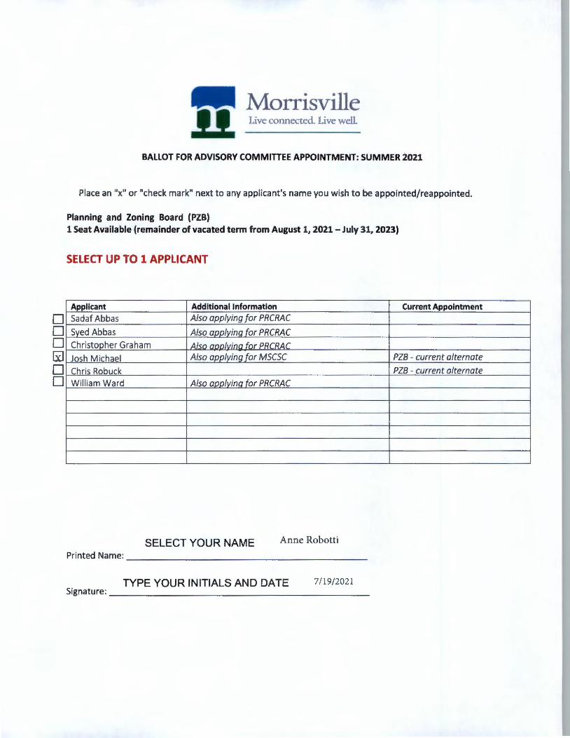
• • • [i]
• •
Morrisville 11 Live connected. Live well
BALLOT FOR ADVISORY COMMITTEE APPOINTMENT: SUMMER i021
Place an "x" or "check mark" next to any appl icant's name you w ish to be appointed/reappointed.
Planning and Zoning Board (PZB) 1 Seat Available (remainder of vacated term from August 1, 2021 - July 31, 2023)
SELECT UP TO 1 APPLICANT
Applicant Additional Information Current Appointment
Sadaf Abbas Also applying for PRCRAC
Sved Abbas Also annlvina for PRCRAC
Christopher Graham 4/c;n nnnlvinn fnr PRr RIJ.r
Josh Michael Also applying for MSCSC PZB - current alternate
Chris Robuck PZB - current alternate
William Ward Also annlvina for PRCRAC
SELECT YOUR NAME Anne Robotti
Printed Name: ___________________ _
TYPE YOUR INITIALS AND DATE 7/19/2021 Signature: _______________ ______ _

Morrisville .11 Live connected. Live well.
BALLOT FOR ADVISORY COMMITTEE APPOINTMENT: SUMMER 2021
Place an "x" or "check mark" next to any applicant's name you w ish to be appointed/reappointed.
Public Education Advisory Committee (MPEAC) 4 Seats Available (two-year term)
SELECT UP TO 1 APPLICANT FROM DISTRICT 4 SELECT UP TO 2 APPLICANTS FROM ANY DISTRICT
Applicant Additional Information
Lauren Qu ick-Graham /Dist. 4 Also applying for PRCRAC
Shrevance Ra i (Dist. 1) Also annlvina for MSCSC
Ki il~nanda Sharma /Dist 2\ Also nnnlvina fnr pc:.t. r
SELECT YOUR NAME Anne Robotti Printed Name: __________________ _
TYPE YOUR INITIALS AND DATE 7/19/2021 Signat ure: _ ___ ___ ___ ___ ___ ____ _
Current Appointment
MPEAC expiring term July 31)
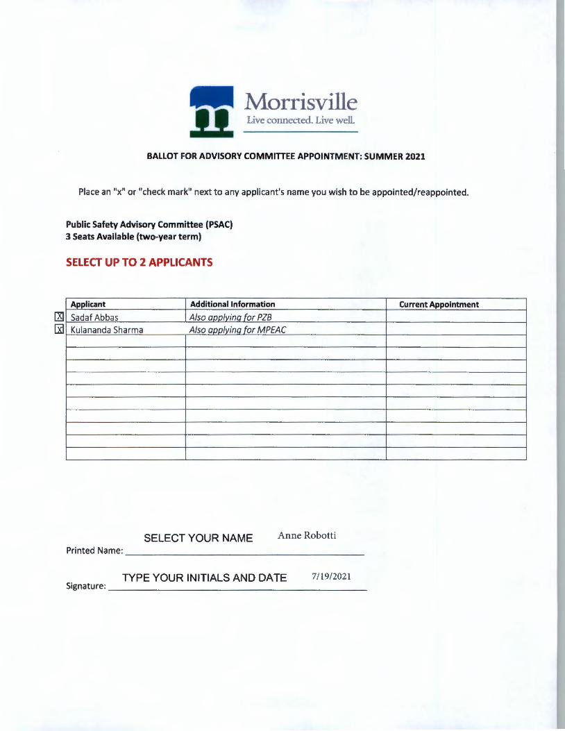
Morrisville ll Live connected. Live well
BALLOT FOR ADVISORY COMMITTEE APPOINTMENT: SUMMER 2021
Place an "x" or "check mark" next to any applicant's name you wish to be appointed/reappointed.
Public Safety Advisory Committee (PSAC) 3 Seats Available (two-year term)
SELECT UP TO 2 APPLICANTS
Applicant Additional Information
Sadaf Abbas Also aoolvina for PZB
Kulananda Sharma Also annlvina for MPEAC
SELECT YOUR NAME Anne Robotti Printed Name: ___________________ _
TYPE YOUR INITIALS AND DATE 7/19/2021 Signature: ____ _________________ _
Current Appointment
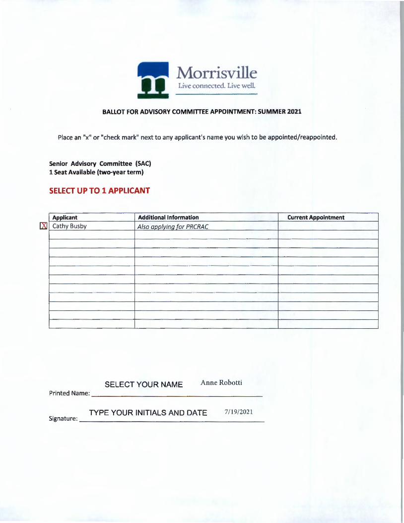
[XI
Morrisville 11 Live connected. Live well.
BALLOT FOR ADVISORY COMMITTEE APPOINTMENT: SUMMER 2021
Place an "x" or "check mark" next to any applicant's name you wish to be appointed/reappointed.
Senior Advisory Committee (SAC) 1 Seat Available (two-year term)
SELECT UP TO 1 APPLICANT
Applicant Additional Information
Cathy Busby Also ann/vina for PRCRAC
SELECT YOUR NAME Anne Robotti Pri nted Name: ___________________ _
TYPE YOUR INITIALS AND DATE 7/19/2021 Signat ure: ________ _ _ _ _ ________ _ _
Current Appointment

7/21 /2021 Account Summary - 0097767
Wake County Real Estate Data
---- 111111 Real Estate ID 0097767
Account Summary
PIN# 0756177147
Property Description BUCK PROPERTY
Pin/Parcel History_ Search Results New Search 'ORTH CAROLI NA Account I Buildings I Land I Deeds I Notes I Sales I Photos I Tax Bill I Map
iMaRS
Tax Bills
Account Search
Property Owner Owner's Mailing Address Property Location Address BUCK, DONALD R & JOYCE R 104 MARCOM DR 104 MARCOM DR (Use the Deeds link to view any additional owners) MORRISVILLE NC 27560-9521 MORRISVILLE NC 27560-9521
Administrative Data Transfer Information Assessed Value Old Map# 372-00000-0048 Map/Scale 0756 01 Deed Date 10/15/1979 Land Value Assessed $379,840 vcs RPMO001 Book & Page 02446 0029 Bldg. Value Assessed $155,052 City Revenue Stamps Fire District 23 Pkg Sale Date 1/1/1976 Township CEDAR FORK Pkg Sale Price $7,000 Tax Relief Land Class R-<10-HS Land Sale Date ETJ MO Land Sale Price Land Use Value Spec Dist(s) Use Value Deferment Zoning 01 Improvement Summary Historic Deferment History ID 1 Total Deferred Value History ID 2 Total Units 1 Acreage 2.18 Recycle Units 1 Permit Date Apt/SC Sqft Use/Hist/Tax Relief
Permit# Heated Area 1,750 Assessed Total Value Assessed* $534,892
*Wake County assessed building and land values reflect the market value as of January 1, 2020, which is the date of the last county-wide revaluation. Any inflation, deflation or other economic changes occurring after this date does not affect the assessed value of the property and cannot be lawfully considered when reviewing the value for adjustment.
The January 1, 2020 values will remain in effect until the next county-wide revaluation . Until that time, any real estate accounts created or new construction built is assessed according to the 2020 Schedule of Values.
For questions regarding the information displayed on this site, please contact the Department of Tax Administration at [email protected] or call 919-856-5400.
services .wakegov.com/realestate/ Account.asp?id=0097767 &stype=addr&stnu m= 104&stname=Marcom&locidlist=&spg= 1 1/1
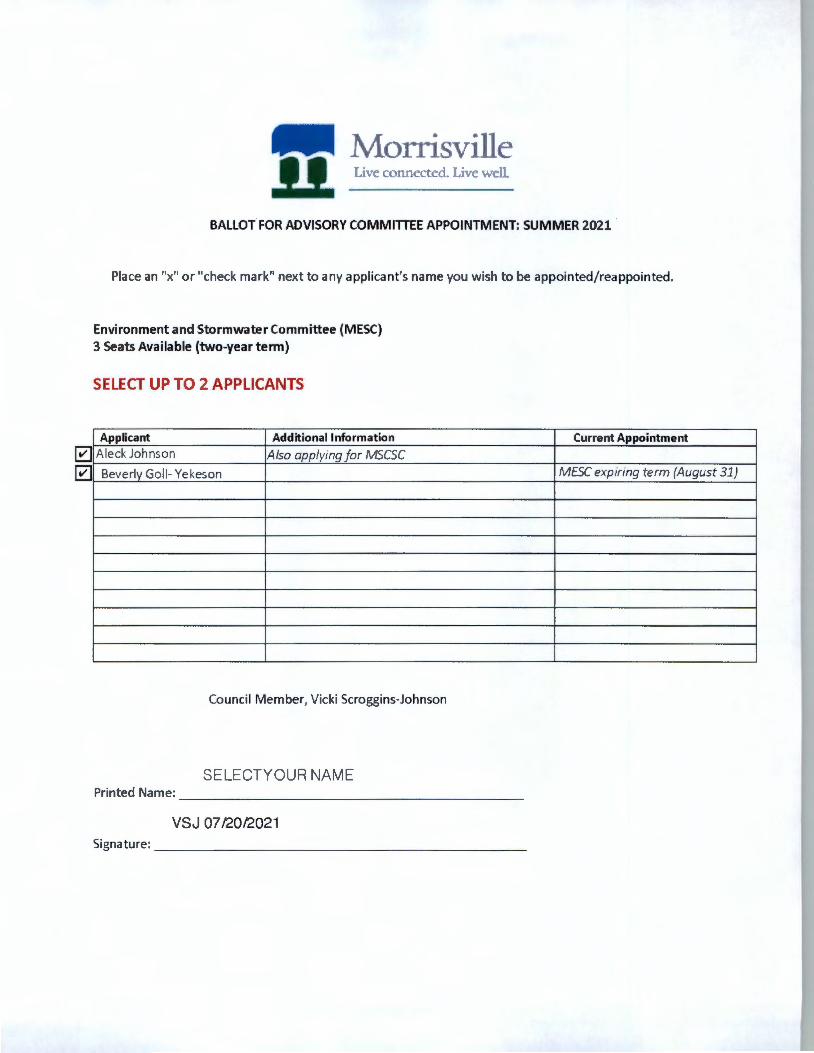
Morrisville 11 L,ve connected. Live well.
BALLOT FOR ADVISORY COMMITTEE APPOINTMENT: SUMMER 2021
Place an "x" or "check mark" next to any applicant's name you wish to be appointed/reappointed.
Environment and Stormwater Committee (MESC) 3 Seats Available (two-year term)
SELECT UP TO 2 APPLICANTS
Applicant Additional Information
Aleck Johnson Also applying for MSCSC
Beverly Goll- Ye keson
Council Member, Vicki Scroggins-Johnson
SELECTYOUR NAME Printed Name: --------------------
VSJ 07/20/2021 Signature: _____________________ _
Current Appointment
MESC expiring term {August 31}

• 0 0 • • • • • • •
Morrisville ll Live connected. Live well.
BALLOT FOR ADVISORY COMMITTEE APPOINTMENT: SUMMER 2021
Place an "x" or "check mark 11 next to any applicant's name you wish to be appointed/reappointed.
Smart City Steering Committee (MSCSC} 1 Seat Available (two-year term)
SELECT UP TO 1 APPLICANT
Applicant Additional Information
Brian Cook Also applying for PRCRAC
Guilherme Correia
Havdee De Leon Also annlvina for PRCRAC
Aleck Johnson Also annlvina for MESC
Ted Matwiiec
Ran!!a Nar;isimhan Also aoolvina for PM.AC
ShrPv;inr:P R::ij Also annlvina for MPEAC
Rehanali Saved Also annlvina for PMAC
Jinesh Shah Also annlvina for PRCRAC
R::1h1il <;h::irm::i
Council Member, Vicki Scroggins-Johnson
Council Member Vicki Scroggins-JohnsO Printed Name: ____________________ _
VSJ July 20 , 2021
Signature: _____________________ _
Current Appointment
• • 0 • • • • •
Morrisville Live connected. Live well.
BALLOT FOR ADVISORY COMMITTEE APPOINTMENT: SUMMER 2021
Place an "x" or "check mark" next to any applicant's name you wish to be appointed/reappointed.
Parks, Recreation and Cultural Resources Advisory Committee (PRCRAC) 1 Seat Available (two-year term)
SELECT UP TO 1 APPLICANT
Applicant Additional Information
Syed Abbas Also aoolyinq for PZB
Cathy Busby Also applyinq for SAC
Brian Cook Also aoolyinq for MSCSC
Havdee De Leon Also applyinq for MSCSC
Christonher C-;rah.:im Also applying for PZB
La1J ren Ouir:k-C-;r.:ih.:im Also annlvina for MPEAC
Jinesh Shah Also annlvina for MSCSC
William Ward Also aoolvino for PZB
Council Member, Vicki Scroggins-Johnson
SELECT YOUR NAME Printed Name: ---------------------
TYPE YOUR INITIALS AND DATE Signature: ______________________ _
VSJ July 20, 2021
Current Appointment
0 _x_x xi7
0 0
191 Morrisville 11 Live connected. Live well.
BALLOT FOR ADVISORY COMMITTEE APPOINTMENT: SUMMER 2021
Place an "x" or "check mark" next to any applicant's name you wish to be appointed/reappointed.
Performance Measures Advisory Committee (PMAC) 4 Seats Available (two-year term)
SELECT UP TO 4 APPLICANTS
Applicant Additional Information
Ranga Narasimhan Also aoolvina for MSCSC
Biswadev Rov
Rehanali Saved Also aoolvinq for MSCSC
John Wall
Current Appointment
PMAC expiring term August 31
Please note I vote for ALL 4 applicants. The PDF Form is not allowing me to check the box for Biswadev Roy. So I indicated my support with an XXXX.
Council Member. Vicki Scroggins-Johnson
SELECT YOUR NAME Printed Name: ---------------------
TYPE YOUR INITIALS AND DATE Signature: ______________________ _
VSJ July 20, 2021
• • • • 0 •
.. Morrisville 11 Live connected. Live well.
BALLOT FOR ADVISORY COMMITTEE APPOINTMENT: SUMMER 2021
Place an "x" or "check mark" next to any applicant's name you wish to be appointed/reappointed.
Planning and Zoning Board (PZB) 1 Seat Available (remainder of vacated term from August 1, 2021-July 31, 2023)
SELECT UP TO 1 APPLICANT
Applicant Additional Information Current Appointment
Sadaf Abbas Also applying for PRC RAC
Syed Abbas Also annlvina for PRCRAC
Christooher Graham Also annlvina for PRCRAC
Josh M ichael Also aoolvina for MSCSC PZB - current alternate
Chris Robuck PZB - current alternate
Wi lliam Ward Also annlvina for PRCRAC
Council Member, Vicki Scroggins-Johnson
SELECT YOUR NAME Printed Name: --------------------
TYPE YOUR INITIALS AND DATE Signature: _____________________ _
VSJ July 20, 2021
v v v
Morrisville 11 Live connected. Live well
BALLOT FOR ADVISORY COMMITTEE APPOINTMENT: SUMMER 2021
Place an "x" or "check mark" next to any applicant's name you wish to be appointed/reappointed.
Public Education Advisory Committee (MPEAC) 4 Seats Available (two-year term)
SELECT UP TO 1 APPLICANT FROM DISTRICT 4 SELECT UP TO 2 APPLICANTS FROM ANY DISTRICT
Applicant Additional Information
Lauren Quick-Graham (Dist. 4 Also aoolvinq for PRCRAC
Shrevance Rai (Dist. ll Also aoolvinq for MSCSC
l<11lananda Sharma IDist 21 Al,n nnnlvina for PSAC
Council Member Vicki Scroggins-Johnson
SELECT YOUR NAME Printed Name: ___________________ _
TYPE YOUR INITIALS AND DATE Signature: _____________________ _
VSJ July 20, 2021
Current Appointment
MPEAC expiring term July 31)

0 •
Morrisville Live connected. Live well.
BALLOT FOR ADVISORY COMMITTEE APPOINTMENT: SUMMER 2021
Place an "x" or "check mark" next to any applicant's name you wish to be appointed/reappointed.
Public Safety Advisory Committee (PSAC) 3 Seats Available (two-year term)
SELECT UP TO 2 APPLICANTS
Applicant Additional Information
Sadaf Abbas Also annlvina for PZB
Kulananda Sharma Also aoolvinq for MPEAC
Council Member, Vicki Scroggins-Johnson
SELECT YOUR NAME Printed Name: --------------------
TYPE YOUR INITIALS AND DATE Signature: _____________________ _
VSJ July 20, 2021
Current Appointment
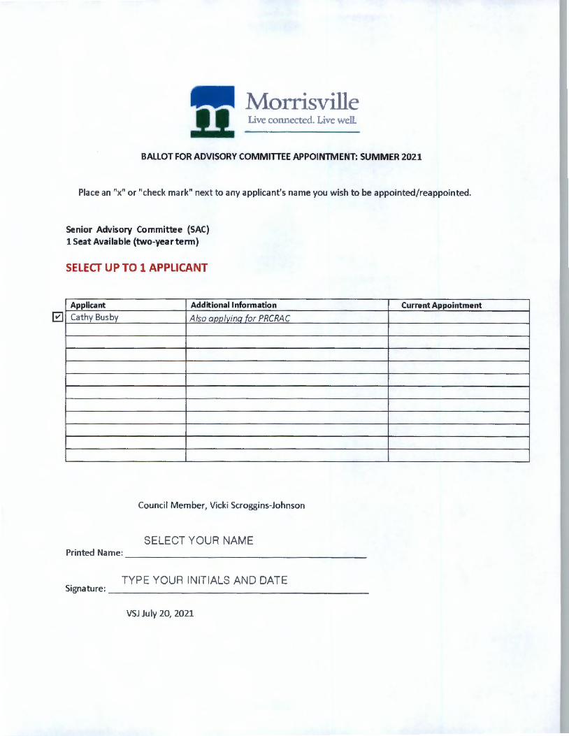
Morrisville 11 Live connected. Live well
BALLOT FOR ADVISORY COMMITTEE APPOINTMENT: SUMMER 2021
Place an "x" or "check mark" next to any applicant's name you wish to be appointed/reappointed.
Senior Advisory Committee (SAC) 1 Seat Available (two-yeartenn)
SELECT UP TO 1 APPLICANT
Applicant Additional Information
Cathy Busby Also aoolvino for PRCRAC
Council Member, Vicki Scroggins-Johnson
SELECT YOUR NAME Printed Name: ___________________ _
TYPE YOUR INITIALS AND DATE Signature: ____________ _________ _
VSJ July 20, 2021
Current Appointment
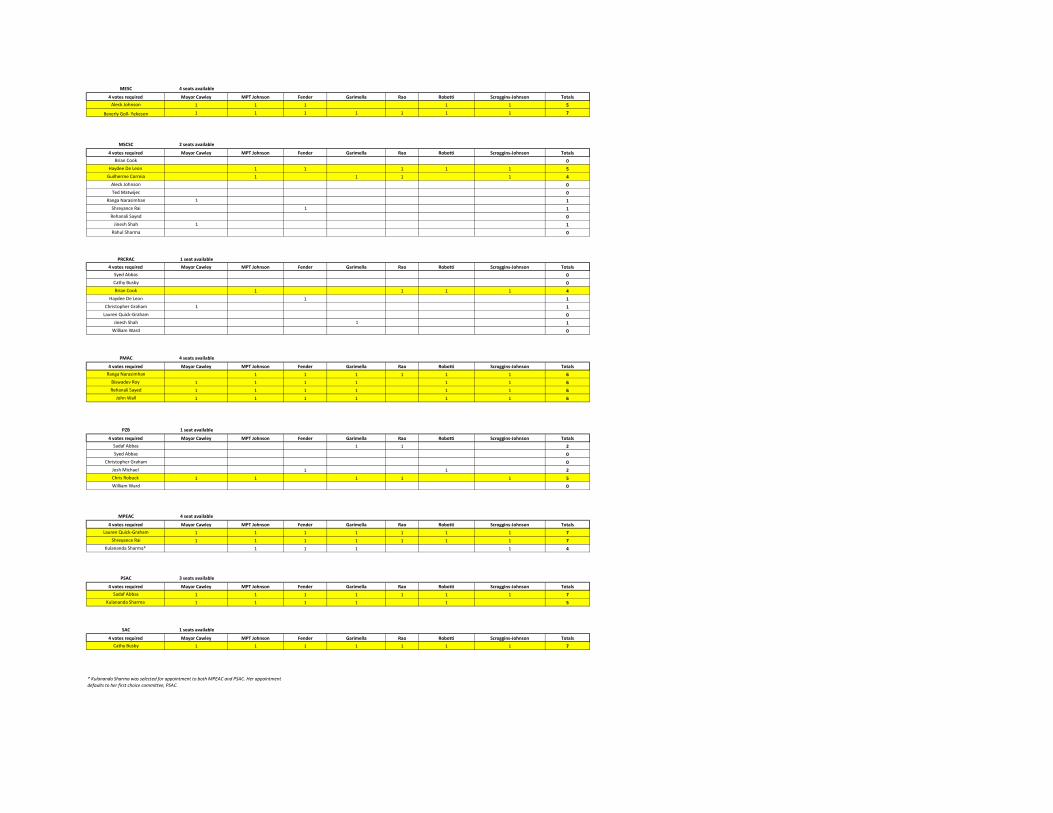
MESC 4 seats available
4 votes required Mayor Cawley MPT Johnson Fender Garimella Rao Robotti Scroggins-Johnson Totals
Aleck Johnson 1 1 1 1 1 5
Beverly Goll- Yekeson 1 1 1 1 1 1 1 7
MSCSC 2 seats available
4 votes required Mayor Cawley MPT Johnson Fender Garimella Rao Robotti Scroggins-Johnson Totals
Brian Cook 0
Haydee De Leon 1 1 1 1 1 5
Guilherme Correia 1 1 1 1 4
Aleck Johnson 0
Ted Matwijec 0
Ranga Narasimhan 1 1
Shreyance Rai 1 1
Rehanali Sayed 0
Jinesh Shah 1 1
Rahul Sharma 0
PRCRAC 1 seat available
4 votes required Mayor Cawley MPT Johnson Fender Garimella Rao Robotti Scroggins-Johnson Totals
Syed Abbas 0
Cathy Busby 0
Brian Cook 1 1 1 1 4
Haydee De Leon 1 1
Christopher Graham 1 1
Lauren Quick-Graham 0
Jinesh Shah 1 1
William Ward 0
PMAC 4 seats available
4 votes required Mayor Cawley MPT Johnson Fender Garimella Rao Robotti Scroggins-Johnson Totals
Ranga Narasimhan 1 1 1 1 1 1 6
Biswadev Roy 1 1 1 1 1 1 6
Rehanali Sayed 1 1 1 1 1 1 6
John Wall 1 1 1 1 1 1 6
PZB 1 seat available
4 votes required Mayor Cawley MPT Johnson Fender Garimella Rao Robotti Scroggins-Johnson Totals
Sadaf Abbas 1 1 2
Syed Abbas 0
Christopher Graham 0
Josh Michael 1 1 2
Chris Robuck 1 1 1 1 1 5
William Ward 0
MPEAC 4 seat available
4 votes required Mayor Cawley MPT Johnson Fender Garimella Rao Robotti Scroggins-Johnson Totals
Lauren Quick-Graham 1 1 1 1 1 1 1 7
Shreyance Rai 1 1 1 1 1 1 1 7
Kulananda Sharma* 1 1 1 1 4
PSAC 3 seats available
4 votes required Mayor Cawley MPT Johnson Fender Garimella Rao Robotti Scroggins-Johnson Totals
Sadaf Abbas 1 1 1 1 1 1 1 7
Kulananda Sharma 1 1 1 1 1 5
SAC 1 seats available
4 votes required Mayor Cawley MPT Johnson Fender Garimella Rao Robotti Scroggins-Johnson Totals
Cathy Busby 1 1 1 1 1 1 1 7
* Kulananda Sharma was selected for appointment to both MPEAC and PSAC. Her appointment
defaults to her first choice committee, PSAC.
Town Council Agenda Item Report
Agenda Item No. 12.aSubmitted by: Eric SmithSubmitting Department Administration Meeting Date: July 27, 2021
SUBJECTClosed Session Pursuant to N.C.G.S. 143-318.11(a)(4) to discuss matters relating toeconomic development.
Recommendation:NoneUpdates/History of Briefing:Not Applicable
Executive Summary and Background Information:None
Advisory Board/Committee Review:None
Insert Date of Advisory Board/Committee Review:
Advisory Board/Committee Recommendation and/or Vote:None
Potential Options:Discussion
Staff Recommendation:Receive Information. ATTACHMENTS
Top Related
Copyright © 2022 FDOKUMEN

