


Bahasa
Halaman
Hukum

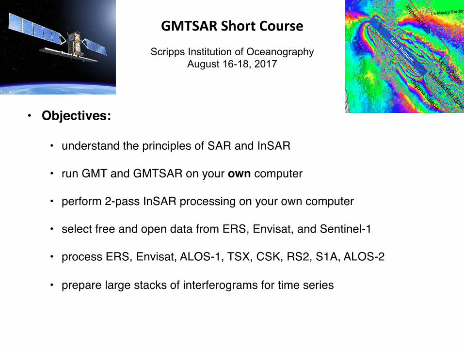
GMTSARShortCourse
Scripps Institution of Oceanography August 16-18, 2017
• Objectives:
• understand the principles of SAR and InSAR
• run GMT and GMTSAR on your own computer
• perform 2-pass InSAR processing on your own computer
• select free and open data from ERS, Envisat, and Sentinel-1
• process ERS, Envisat, ALOS-1, TSX, CSK, RS2, S1A, ALOS-2
• prepare large stacks of interferograms for time series
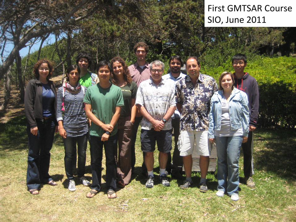
FirstGMTSARCourseSIO,June2011
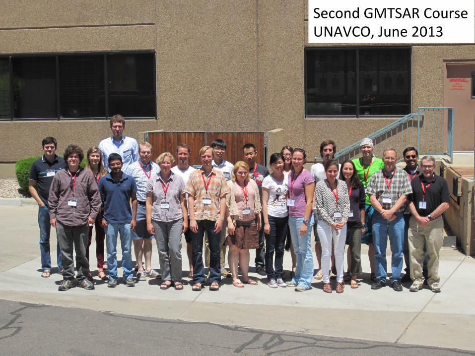
SecondGMTSARCourseUNAVCO,June2013
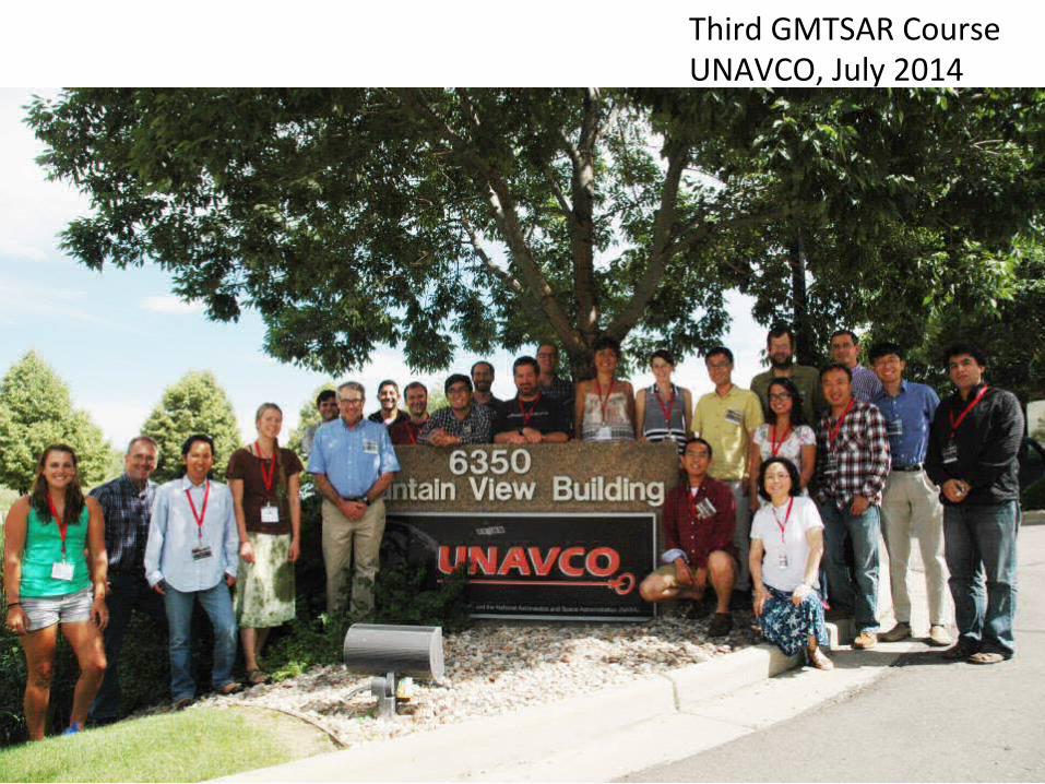
ThirdGMTSARCourseUNAVCO,July2014
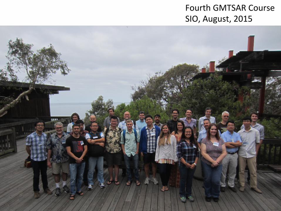
FourthGMTSARCourseSIO,August,2015
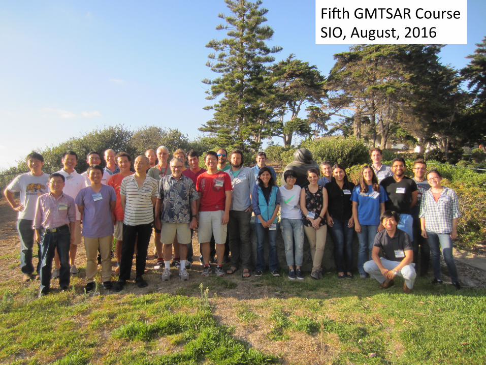
FiEhGMTSARCourseSIO,August,2016
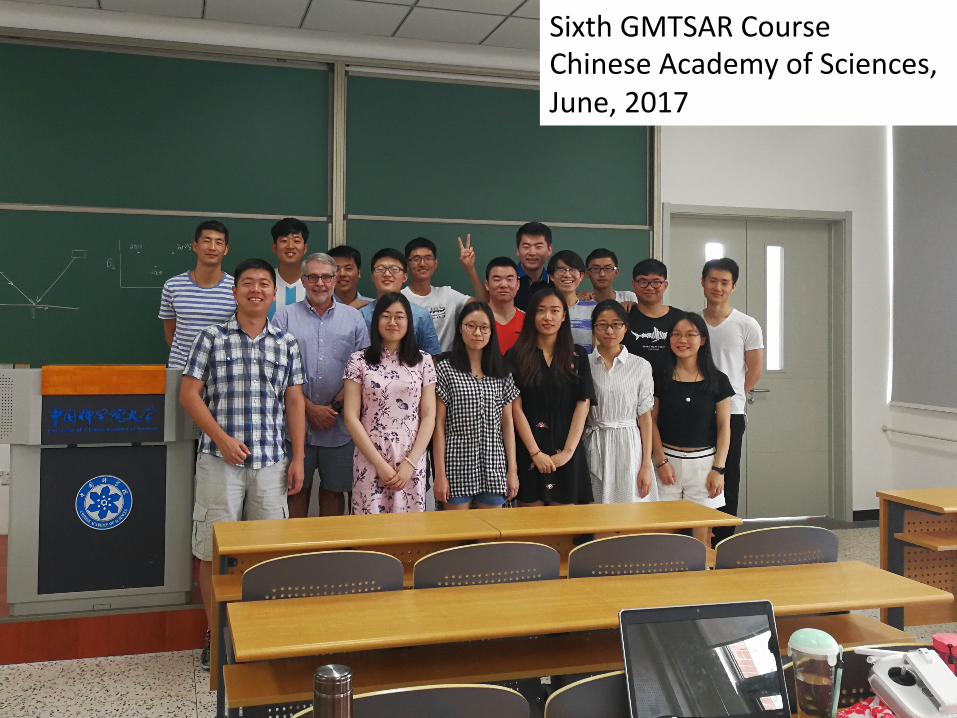
SixthGMTSARCourseChineseAcademyofSciences,June,2017
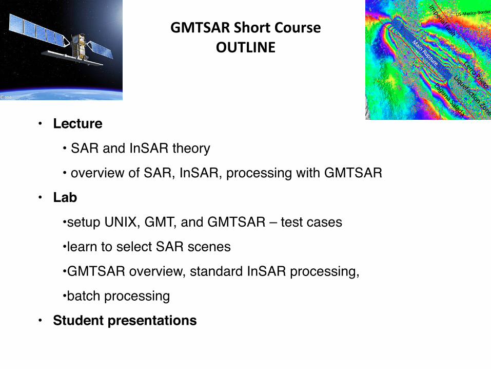
GMTSARShortCourseOUTLINE
• Lecture• SAR and InSAR theory
• overview of SAR, InSAR, processing with GMTSAR
• Lab• setup UNIX, GMT, and GMTSAR – test cases
• learn to select SAR scenes
• GMTSAR overview, standard InSAR processing,
• batch processing
• Student presentations
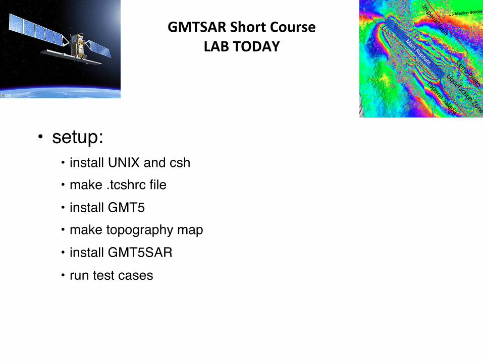
GMTSARShortCourseLABTODAY
• setup:• install UNIX and csh• make .tcshrc file• install GMT5• make topography map• install GMT5SAR• run test cases
HOMEWORK1P-UNIXandcsh/tcshWewilluseUNIXcommandsforallInSARprocessingsooneshouldbeabletodothebasics.Thefollowingwebsitehasatutorial.hXp://www.ee.surrey.ac.uk/Teaching/Unix/GothrougheachtutorialunlessyourarealreadyaUNIXwhiz.Youwillneedtohaveabasictexteditoravailableforthisexercise.CommonUNIXtexteditorsarevioremacs.Thefollowingwebsitehasanextensivelist.hXp://en.wikipedia.org/wiki/List_of_text_editorsNotethattodothisexerciseyourcomputermusthavetheC-shell(orbash)installedaswellasaC-compilerinstalled.Ifyouhavetroublewiththeseinstallabonspleasesende-mailquesbons.Tutorial8isespeciallyimportant.Eachtypeofunixwillhaveslightvariabonsinthe.tcshrcor.cshrcfile.Thedefaultshellonmanysystemstodayisbash.GMTSARisbasedonthetcsh/cshshellsomakesurecshisinstalled.AEergoingthroughoutthetutorialandsefngupyour.tcshrcor.cshrc(or.bashrc)file,pleasesendmeacopyofthatfilewithembeddedcommentsonyourcustomaddibons.
HOMEWORK2P-GenericMappingTools(GMT5)RemoveoldversionsofNETCDFandGMTfromyourcomputerunlessyouare100%sureyouhavethelatestcompleteinstallabonincludingthesourcecode.ManyproblemsrelatedtotheinstallabonofGMT5SARareduetohavinganoldinstallabonofGMT.Installabonscanbedoneinavarietyofways.Hereisawebpagedescribingtheinstallabonopbons.hXp://gmt.soest.hawaii.edu/projects/gmt5sar/wikiLEARNGMT5Tomakesureeverythingisworkingproperly,youmustcloseallyourterminalwindowsandstartnewones.Makesureyouarerunningcsh/tcshineachwindowbytypingthecommandcshortcsh.Thentypethecommand‘gmtgrdinfo’tomakesuretheGMT5programsareinyourpath.IfyouarenotfamiliarwithGMT5,thengothroughtheGMT5Tutorialatthefollowingwebsite.hXp://gmt.soest.hawaii.edu/doc/latest/tutorial.htmlThelastpartofthisexerciseistomakeamapoftheareawhereyouliveusingtopographydatafromthefollowingwebsite.hXp://topex.ucsd.edu/gmtsar/demgen/Usethison-linetooltoextracta1-degreegridofelevabonsfortheareawhereyoulive.UseGMT5tomakeashadedreliefmapandsendtheresulbngpostscriptfile.ThissametoolwillbeusedtopreparedigitalelevabonmodelsforInSARprocessing.Wewillshowallthereliefmapsduringtheshortcourse.HOMEWORK3-GMTSARThethirdassignmentbeforetheworkshophas3parts.Part1istoinstallGoogleEarth.Part2istoreadthereviewpaperbyBurgmannetal.,2000.Hereisthelink.hXp://topex.ucsd.edu/insar/burgmann_insar_rev.pdfPart3istoinstallGMT5SAR.Gotothefollowingwebsiteandfollowtheinstallaboninstrucbons.hXp://gmt.soest.hawaii.edu/projects/gmt5sar/wiki
HOMEWORK3-GMTSARThethirdassignmentbeforetheworkshophas3parts.Part1istoinstallGoogleEarth.IfyouhaveUBUNTU16.04thenusetheseinstrucbons.hXp://www.configserverfirewall.com/ubuntu-linux/install-google-earth-ubuntu-16-04/Part2istoreadthereviewpaperbyBurgmannetal.,2000.Hereisthelink.hXp://topex.ucsd.edu/insar/burgmann_insar_rev.pdfPart3istoinstallGMT5SAR.Gotothefollowingwebsiteandfollowtheinstallaboninstrucbons.hXp://gmt.soest.hawaii.edu/projects/gmt5sar/wikiAddGMT5SARtoyourpathNote:IfyouareusingaMacOSXandmacport,makesurechangethefollowingenvironmentalvariablesinyour.cshrcor.tcshrcor.bashrcfilebeforecompiling:fortcsh/cshsetenvGMT5SARYourPathTo/GMT5SARsetenvPATH$GMT5SAR/bin:"$PATH"forbashexportGMT5SAR=YourPathTo/GMT5SARexportPATH=$GMT5SAR/bin:$PATH
GMTSARShortCourse
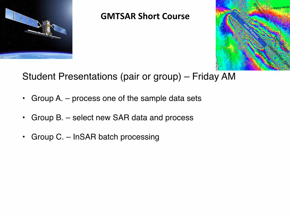
Student Presentations (pair or group) – Friday AM
• Group A. – process one of the sample data sets
• Group B. – select new SAR data and process
• Group C. – InSAR batch processing
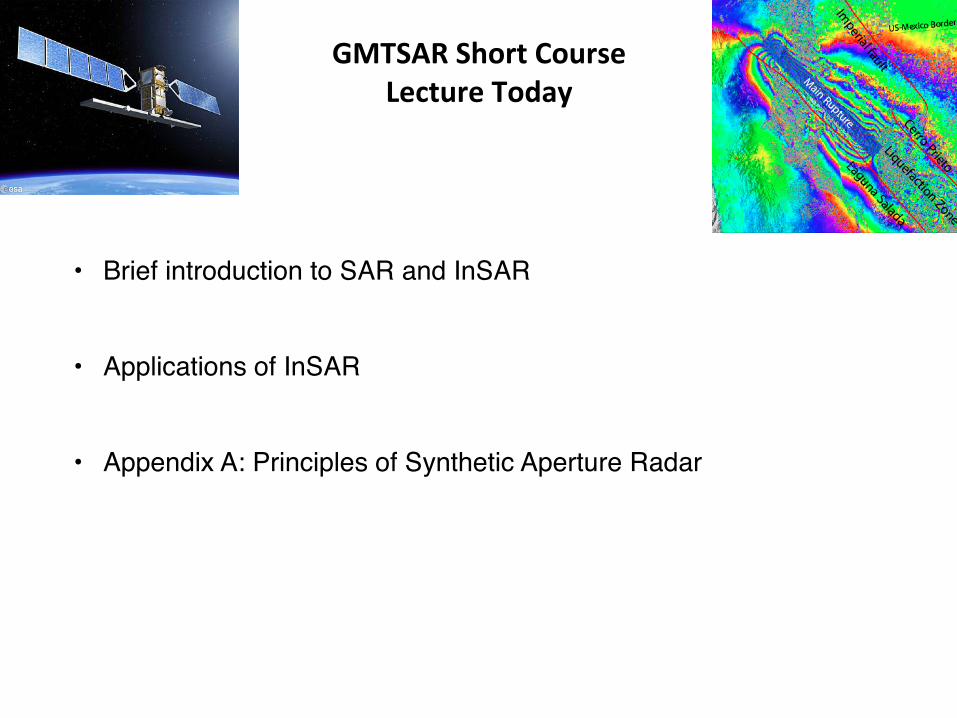
GMTSARShortCourseLectureToday
• Brief introduction to SAR and InSAR
• Applications of InSAR
• Appendix A: Principles of Synthetic Aperture Radar
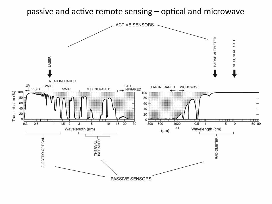
passiveandacbveremotesensing–opbcalandmicrowave
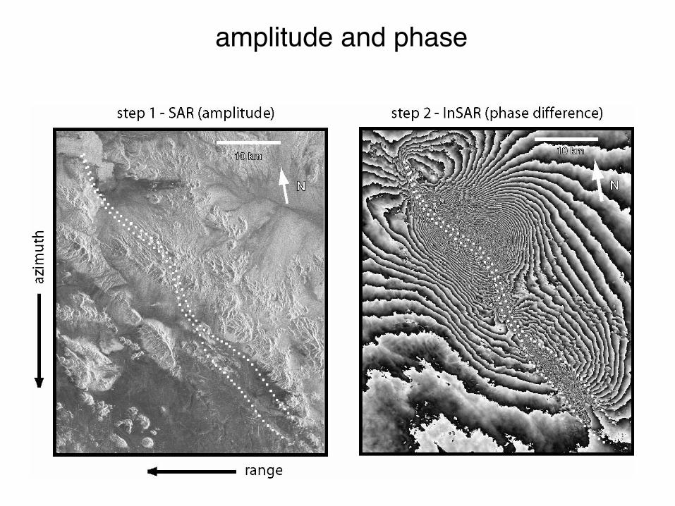
amplitude and phase
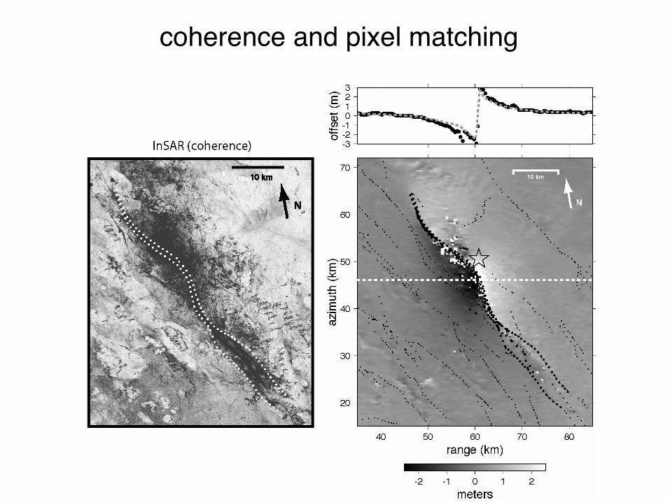
coherence and pixel matching
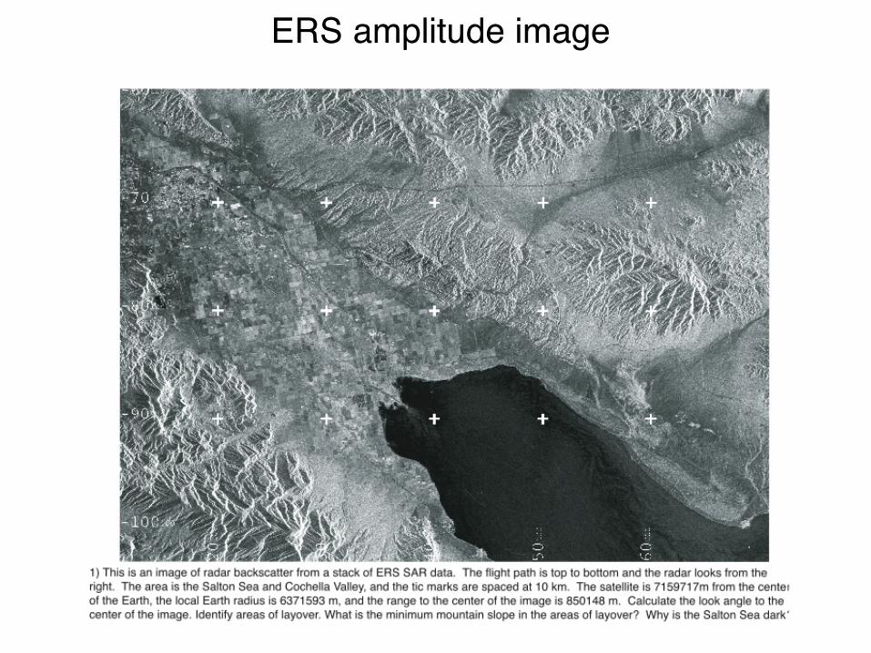
ERS amplitude image
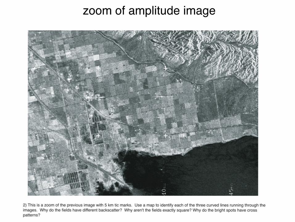
zoom of amplitude image
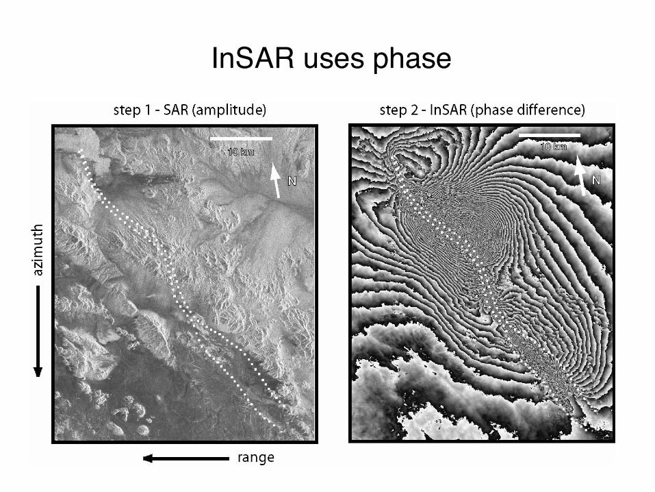
InSAR uses phase
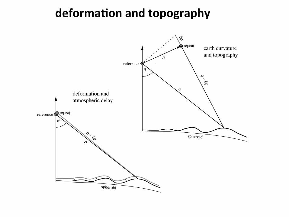
deforma?onandtopography
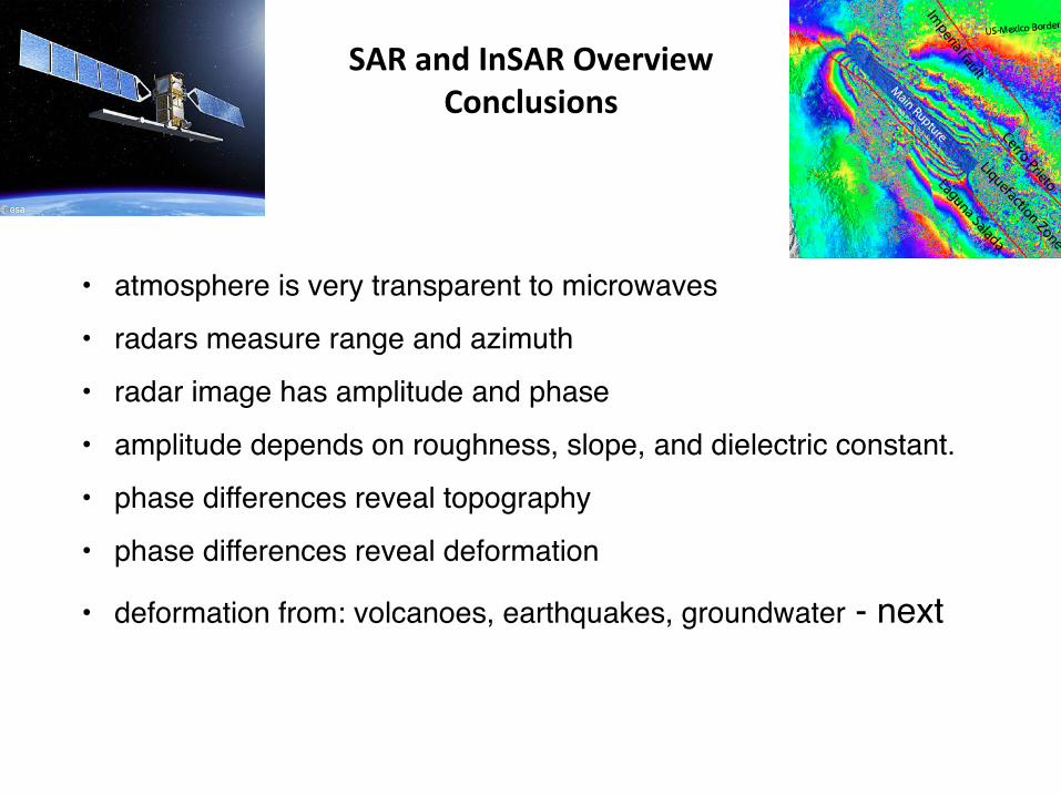
SARandInSAROverviewConclusions
• atmosphere is very transparent to microwaves
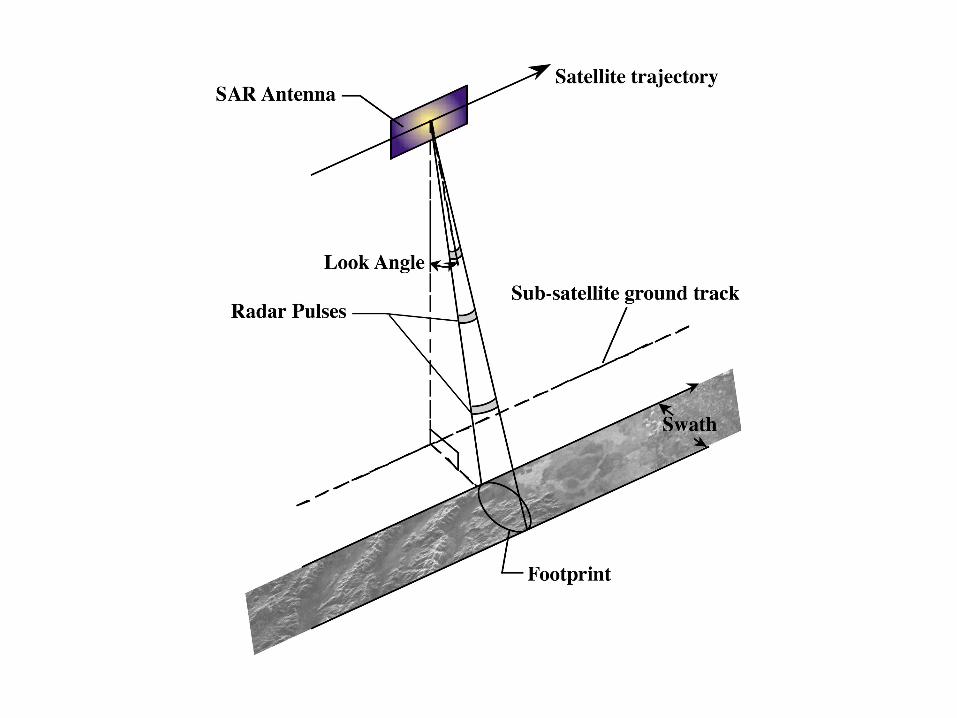
• radars measure range and azimuth
• radar image has amplitude and phase
• amplitude depends on roughness, slope, and dielectric constant.
• phase differences reveal topography
• phase differences reveal deformation
• deformation from: volcanoes, earthquakes, groundwater - next
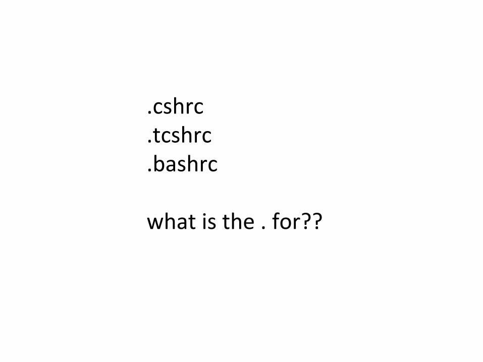
.cshrc
.tcshrc
.bashrcwhatisthe.for??
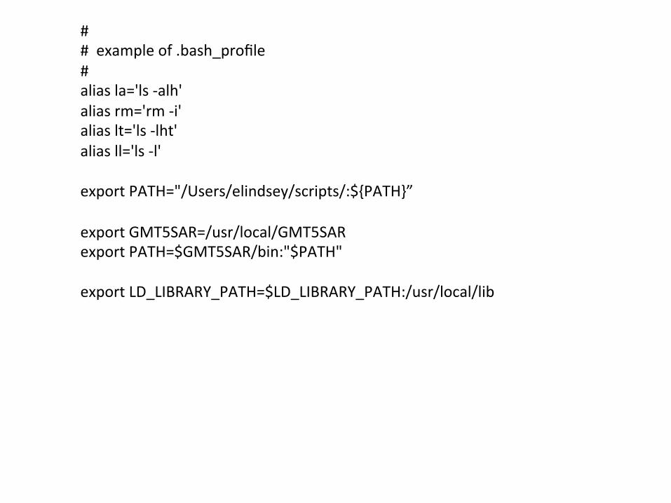
##exampleof.bash_profile#aliasla='ls-alh'aliasrm='rm-i'aliaslt='ls-lht'aliasll='ls-l'exportPATH="/Users/elindsey/scripts/:${PATH}”exportGMT5SAR=/usr/local/GMT5SARexportPATH=$GMT5SAR/bin:"$PATH"exportLD_LIBRARY_PATH=$LD_LIBRARY_PATH:/usr/local/lib
Top Related
Copyright © 2022 FDOKUMEN

