


Bahasa
Halaman
Hukum


A CULTURAL HISTORICAL GEOGRAPHY OF SCHOOLS IN THE HONDURAN
MUSKITIA
By
Taylor A. Tappan
Submitted to the graduate degree program in the Department of Geography & Atmospheric
Science and the Graduate Faculty of the University of Kansas in partial fulfillment of the
requirements for the degree of Master of Arts.
________________________________
Chairperson Peter H. Herlihy
________________________________
Jerome E. Dobson
________________________________
Stephen L. Egbert
Date Defended: 14 December 2015

ii
The Thesis Committee for Taylor A. Tappan
certifies that this is the approved version of the following thesis:
A CULTURAL HISTORICAL GEOGRAPHY OF SCHOOLS IN THE HONDURAN
MUSKITIA
________________________________
Chairperson Peter H. Herlihy
Date approved: 14 December 2015

iii
ABSTRACT
In the geographically isolated Honduran Muskitia region, schools have represented a
contested space through which both the Honduran government and Miskitu communities have
struggled for territorial identity. Schools are functional spaces through which social interaction
strengthens Miskitu cultural boundaries, norms, and identities. The historical development of
education in this isolated indigenous region is paradoxical in that early state initiatives were
designed to provide education for Miskitu communities while simultaneously excluding their
indigenous cultural identities. However, schools’ historical impact on Miskitu territoriality has
received little attention from scholars. The primary objective of this research is to understand 1)
the origin and diffusion of schools in the Muskitia region; and 2) the impact of schools on
Miskitu territoriality. This thesis brings into question whether the geographic inaccessibility of
Muskitia and recurrent state failures to provide baseline education there ultimately contributed to
the preservation of Miskitu language and territorial identity. My research aims to fill a gap in
existing cultural historical scholarship by examining schools as contested spaces of linguistic
identity through which the Miskitu v. state territorial struggle has taken place. Archival research,
participant observation, and semi-structured interviews were my primary methodological
approaches to understand the historical geography of schools and their impact on Miskitu
territoriality.

iv
ACKNOWLEDGEMENTS
First and foremost, I would like to thank my parents for their support throughout my academic
endeavors. For as long as I can remember, it has been their worldly experiences and adventures
from which I have garnered the inspiration to seek my own. Thank you for all your love and
encouragement in helping me to discover geography.
My thesis adviser, Peter Herlihy, will forever have my gratitude for empowering me as a young
geographer with singular opportunities to conduct research in Latin America. His wisdom,
charisma, and particular set of skills are truly unique and irreplaceable for the work we do. I have
learned a great deal from Peter and have a great deal more to learn.
I also my gratitude to Laura Herlihy, from whom I learned to speak Miskitu on numerous
excursions to the Nicaraguan Muskitia. She is a remarkable anthropologist with a wealth of
knowledge and experience on both sides of the Río Coco.
To my colleagues John Kelly, Andy Hilburn, Aida Ramos Viera, and Matt Fahrenbruch I owe
many thanks, indeed, for countless moments of counsel, laughter, insight, and adventure. It
seems like just yesterday that we were in our office in Ixtlán, Oaxaca, where it all started for me
as a member of our 202 crew.
I thank Jerry Dobson for his support and mentorship as a geographer. It was through an unlikely
meeting that he had with my dad on a 2008 field trip to Africa that ultimately led me to where I
am now. I am incredibly grateful to Jerry for the opportunity to work on our Central America
Indígena project. I believe I have the best job of any geography student in the country.
I also thank Steve Egbert and Terry Slocum for having served as my committee members. I have
relied upon both for numerous letters of recommendation, not to mention occasional pieces of
chocolate in Steve’s office or table tennis lessons from Terry at the Rec Center.
I would like to thank the Department of Geography at the University of Kansas for funding
opportunities and a warm, collegial atmosphere. I have thoroughly enjoyed my years here as an
undergraduate and master’s student, and I look forward to the challenge of completing a Ph.D.,
once again, as a Jayhawk.
Finally, there are dozens of collaborators in Honduras to whom I owe my gratitude. In particular,
I thank Rollins George and his wife Nela who hosted me on my field visits to Kuri. Elmor Wood,
Scott Wood, Donaldo Allen, and many more generously offered their time and insight while I
was conducting my thesis research.

v
TABLE OF CONTENTS
ABSTRACT ................................................................................................................................... iii
ACKNOWLEDGEMENTS ........................................................................................................... iv
PREFACE ....................................................................................................................................... 1
CHAPTER ONE: HISTORICAL GEOGRAPHY AND METHODOLOGY ................................ 2
I. Historical Geography and the Berkeley School of Geographic Thought .............................................. 2
II. Methodology and Field Work .............................................................................................................. 6
CHAPTER TWO: GEOGRAPHY AND LANDS IN MUSKITIA .............................................. 10
I. First Impressions .................................................................................................................................. 10
II. Life in Kuri ......................................................................................................................................... 16
III. Miskitu Cultural Origins ................................................................................................................... 21
IV. Territoriality and Schools in La Muskitia ......................................................................................... 24
CHAPTER THREE: EARLY RURAL EDUCATION POLITICS AND THE FORMATION OF
THE MUSKITIA TERRITORY ................................................................................................... 30
I. Introduction ......................................................................................................................................... 30
II. Rural Education in Post-Colonial Latin America ............................................................................... 31
III. Indigenismo in Honduras .................................................................................................................. 37
IV. Political and Territorial Organization of Muskitia: 1859-1915 ........................................................ 39
CHAPTER FOUR: ORIGIN AND DIFFUSION OF SCHOOLS IN LA MUSKITIA ............... 47
I. Introduction ......................................................................................................................................... 47
II. First State Education Initiatives in Muskitia, 1915-1930 ................................................................... 50
III. Moravian Missions and Education, 1930-1950 ................................................................................ 56
IV. Expansion of State Education, 1950-1982 ........................................................................................ 63
CHAPTER FIVE: BILINGUAL EDUCATION, PROGRAMS, AND DECENTRALIZATION
IN THE HONDURAN MUSKITIA ............................................................................................. 72
I. Introduction ......................................................................................................................................... 72
II. Birth of Programs ............................................................................................................................... 73
III. Decentralization of Education and Territory..................................................................................... 77
IV. Using GIS to Understand a Geographic Disconnection in Education .............................................. 80
V. Decentralization and Concejos Territoriales ...................................................................................... 88
CHAPTER SIX: CONCLUSION ................................................................................................. 93
vi
REFERENCES ............................................................................................................................. 98
APPENDIX 1: SURVEY OF EDUCATION BACKGROUND FOR MISKITU COMMUNITY
RESIDENTS ............................................................................................................................... 111
APPENDIX 2: SCHOOLS IN GRACIAS A DIOS (ordered by GIS attribute codes) ............... 112

vii
LIST OF FIGURES
Figure 1.1: Honduran public schools per department in 1956 ........................................................ 7
Figure 2.1: Downtown Puerto Cabezas-Bilwi, Nicaragua ............................................................ 10
Figure 2.2: A Miskitu home near Las Marías Baltituk along the Río Plátano.............................. 11
Figure 2.3: The Muskitia region of eastern Honduras and Nicaragua .......................................... 12
Figure 2.4: Approximate populations of settlements in the Honduran Muskitia .......................... 14
Figure 2.5: Deforestation in Río Plátano Biosphere Reserve near Río Sico, 2010 ...................... 15
Figure 2.6: Kuri and neighboring villages in Río Plátano Reserve, Honduras ............................. 17
Figure 2.7: Herlihy residence in Kuri ........................................................................................... 18
Figure 2.8: Mosquitia District in late 19th century ....................................................................... 26
Figure 2.9: The Honduran Muskitia, 1957.................................................................................... 28
Figure 2.10: Department of Gracias a Dios, 1996 ........................................................................ 29
Figure 3.1: Approximate limits of Departamento de la Mosquitia in 1868 .................................. 42
Figure 3.2: The three districts of Muskitia, 1889.......................................................................... 44
Figure 4.1: Miskitu communities with primary schools, 2013 ..................................................... 47
Figure 4.2: 20th century school expansion in the Honduran Muskitia ......................................... 49
Figure 4.3: First Misiones Escolares in the Honduran Muskitia .................................................. 52
Figure 4.4: Second Misiones Escolares in the Honduran Muskitia .............................................. 53
Figure 4.5: Inland canal covered by forest canopy near Ahuas: ................................................... 54
Figure 4.6: Diffusion of Moravian missions, 1930-1949 ............................................................. 56
Figure 4.7: Miskitu schools established along the Honduran-Nicaraguan border, 1961 .............. 67
Figure 5.1: Interactive schools map of Honduras with no data for Gracias a Dios ...................... 81
Figure 5.2: Schools, students, and teachers in the 14 districts of Gracias a Dios ......................... 84
Figure 5.3: Spatial representation of primary schools and school districts in Gracias a Dios ...... 85
Figure 5.4: New concejos territoriales covering nearly all of Gracias a Dios .............................. 89
1
PREFACE
I preface the following pages of this thesis with a brief account of how I came from
Kansas to study the cultural historical geography of the remote Muskitia (also written Mosquitia
or Moskitia) vernacular region of Honduras. It may seem as though I made a deliberate decision
one day to frequent these distant landscapes based on prior knowledge or experience. After all,
how else could I arrive there? The region is so isolated, in fact, that no roads link the Honduran
capital, Tegucigalpa, with Muskitia. One does not inadvertently stumble into Muskitia by taking
a wrong exit on the highway or falling asleep on the bus.
My first field experience as a KU student was not in Honduras; instead, I traveled to
southern Mexico in July 2008, where I participated for nine days as an observer on the México
Indígena Project. A multinational team of university students and professors from the U.S.,
Mexico, and Canada collaborated with indigenous Zapotec communities of Oaxaca to map their
lands and to document land tenure changes resulting from PROCEDE, the Mexican
government’s revolutionary land certification and privatization program. It was here where I first
met my thesis adviser, Dr. Peter Herlihy1, who co-led México Indígena with Dr. Jerry Dobson;
and my esteemed colleagues Andy Hilburn, John Kelly, and Aida Ramos, who worked as
graduate research assistants. I felt absorbed by the team’s camaraderie, and the research
fascinated me. I was convinced I wanted to be a Latin Americanist geographer.
1 This encounter was facilitated by American Geographical Society President/KU Geography Professor, Jerry
Dobson, after he met my dad, Gray Tappan (a KU Geography graduate), on a field trip to West Africa and South
Africa in March 2008.

2
CHAPTER ONE
HISTORICAL GEOGRAPHY AND METHODOLOGY
I. Historical Geography and the Berkeley School of Geographic Thought
The infinite variety of physical and cultural landscapes has always sparked my interest in
geography, the lens through which I hope to see and understand people and places. As a student
at the University of Kansas, I have enjoyed numerous field experiences in Mexico and Central
America, and I have come to appreciate the Sauerian family tree of cultural historical
geographers. Historical geography, broadly defined, concerns itself with the study of places and
environments in the past. Historical geographers, then, study geographical patterns through time
and how cultural landscapes are formed through human-environment interaction (see Mitchell
1954; Offen 2012).
The Sauerian academic tradition falls under the umbrella of historical geography. This
academic lineage originated at the University of California at Berkeley after the turn of the 20th
century. Carl Sauer, after whom the Sauerian tradition is named, was a Latin Americanist
geographer who underscored the importance of understanding cultural landscapes through
participant observation, fieldwork, and archival research. He graduated many doctoral students
who carried on his philosophy that a geographer should be multilingual and have an
interdisciplinary educational background.
Several geographers in the Sauer tradition of cultural historical geography identify
themselves and their scholarship with the term “ethnogeography,” an intellectual approach which

3
Sauer had developed has a hybridization of an older European tradition called
“anthropogeography” (Herlihy, Mathewson, and Revels 2008: 15). Specifically, ethnogeography,
or the “Berkeley School” of geographic thought, examines human-environment interaction,
particularly in rural areas and in non-Western or ethnic societies (Herlihy, Mathewson, and
Revels 2008: 15; Mathewson 2011). Examples of Berkeley School scholarship include West’s
Ph.D. dissertation (1946) on the economic structure of mining in Chihuahua, Mexico. Parsons
(1948) studied the processes of colonization in the Antioquia region of western Colombia.
Clinton Edwards (1962), Sauer’s last Ph.D. student, examined aboriginal watercraft and the
maritime skills of coastal peoples along the Pacific seaboard of South America. Bill Davidson, a
second-generation Sauerian and advisee of Edwards, wrote his dissertation (1972) on the
historical geography of the Bay Islands, Honduras, and the Anglo-Hispanic conflict that played
out there. Peter Herlihy (1986) was Davidson’s student and studied the cultural geography of the
Emberá and Wounaan (Chocó) indigenous groups of eastern Panamá, specifically examining
patterns of village formation and economic diversification.
The preceding examples are just a few from the Sauerian academic pedigree of cultural
historical geographers. Topics of dissertations vary widely among scholars in the Berkeley
School tradition, but they are generally characterized by Sauer’s views of geography that
construed “environment as a cultural value, environmental change as independent of culture,
habitat modification by human action, culture origins, culture survivals (marginal peoples), and
diffusion of culture” (Speth 1999: 192; Herlihy, Mathewson, and Revels 2008: 15; Mathewson
2011). My thesis is one of historical geography and is Sauerian in nature, seeking to document
Miskitu culture history through the examination of schools—where they originated in the
Honduran Muskitia, how they diffused over time, and what impact they played on territoriality as

4
construed both by the state and the Miskitu. This thesis describes the Miskitu within a context
that has not yet been highlighted by scholars—that is, I examine territoriality as it relates to
schools, language, and the political ideology of indigenismo through which the Honduran
government acted to shape the identities and roles of the indigenous Miskitu in their relations
with a non-indigenous, Spanish-speaking Honduran state. As I continue my graduate career as a
Ph.D. student following the completion of my thesis research, I too will join the Berkeley School
pedigree as a fourth-generation scholar, tracing my academic lineage back to Sauer through
Herlihy, Davidson, and Edwards.
The more I reflect upon Sauer’s principles, the more I have come to realize that it takes a
long time to develop the knowledge and skills to become a successful geographer. Sauer avowed
that for students of geography, “We are unlikely to start early and we need a long time to mature.
Ours is a task of slow accumulation of knowledge, experience, and judgment” (Sauer 1956: 288).
Indeed, my own ongoing development as a geographer reflects this reality, and my most
formative experiences have not emerged through the fulfillment of predetermined classroom
requisites, but rather during occasions in which I have been a guest observer and participant in
socio-cultural landscapes that lie beyond the realm of my daily routine.
As the son of a field geographer and well-traveled, multilingual parents who value
exploring our world by way of field work or family vacations, I had always been privileged to
grand family road trips and international flavors in cuisine and culture. I knew at a young age
that I wanted to find a discipline that encouraged exploration, particularly abroad, and so for me
geography felt like a logical career path. My concurrent penchant for the Spanish language
eventually led me to study in Latin America, where I began to develop an interest in the culture
and geographies of indigenous societies in Mexico and Central America.

5
While visiting the Honduran Muskitia for the first time I was surprised to find, given its
marked geographic and cultural isolation from the rest of Honduras, that nearly every Miskitu
community has a primary school. Most people speak both Miskitu and Spanish there, but Miskitu
is dominant. Like anywhere, language is a foundational component of culture, and in the
Muskitia of Honduras and Nicaragua, to speak Miskitu is to be Miskitu, especially considering
that the majority of Hondurans and Nicaraguans have never been to the isolated Muskitia region
and haven’t learned even simple greetings in the Miskitu language. In both Honduras and
Nicaragua, the Miskitu often self-identify as being Miskitu, or being from Muskitia, more readily
than they would self-identify as being Honduran or Nicaraguan. This observation provoked me
to wonder whether schools, as functional places to develop and strengthen language, cultural
norms, and identity, also play a role in shaping Miskitu territoriality in Honduras.
The following pages of this thesis are dedicated to a cultural historical investigation of
schools in the Honduran Muskitia. I describe their origin and diffusion in the region and examine
the relationship between education and the development of territoriality as construed by the state
and by the Miskitu. The remaining pages of chapter one provide an overview of my field work
and methodological approaches to understanding the geography of schools in La Muskitia.
Chapter two provides a description of lands in the Muskitia vernacular region, a glimpse into the
culture history of the Miskitu, and an introduction to territoriality and schools in the Muskitia
region. Chapter three contextualizes 19th and early 20th century Honduran education politics
within a broader framework of rural educative politics and indigenismo in Latin America and
describes the formation of the Muskitia territory in Honduras. Chapter four discusses 20th
century Honduran government policies that sought to establish schools in Muskitia as spaces to
strengthen Honduran nationalism by assimilating and acculturating the Miskitu and neighboring

6
indigenous groups. In chapter five I turn to the contemporary state of education in the Muskitia
region. I examine the advent of education programs and agendas, the decentralization of
education, and the emergence of new indigenous territorial jurisdictions called concejos
territoriales. I discuss bilingual education and the relationship between schools and these new
forms of spatial autonomy that are reshaping Miskitu territorial identity. My research is anchored
in cultural historical geography that describes Miskitu settlement patterns and territoriality,
archival documents that illustrate the origin and diffusion of schools in the Honduran Muskitia,
and in my experiences as a participant observer on numerous field trips to Honduras from 2012-
2015 during my master’s program at the University of Kansas.
II. Methodology and Field Work
This thesis is aligned with the Sauerian-Berkeley tradition of cultural historical
geography. I examine the origin and diffusion of schools in the Honduran Muskitia as a means to
understand the Miskitu cultural landscape. Participant observation, archival research, and semi-
structured interviews functioned as chief methodological strategies to address two general
themes: 1) where did schools originate and how did they diffuse throughout the Honduran
Muskitia? and 2) what impact, if any, have schools played in negotiating territorial identity in
Muskitia? I constructed my own geographic information system (GIS) and produced original
maps for this thesis based on the data acquired during my field research. Few scholars have
researched the geography of schools in Muskitia, which has allowed this thesis to fill a void in
the existing literature on the Miskitu cultural landscapes, but has also made this research
challenging given the dearth of previous scholarship. This thesis is an original contribution to the
literature on the Miskitu cultural landscapes.
7
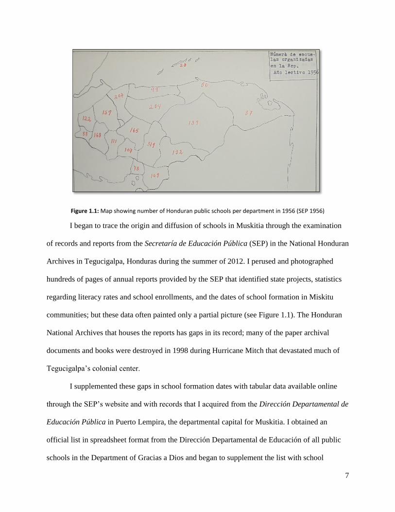
Figure 1.1: Map showing number of Honduran public schools per department in 1956 (SEP 1956)
I began to trace the origin and diffusion of schools in Muskitia through the examination
of records and reports from the Secretaría de Educación Pública (SEP) in the National Honduran
Archives in Tegucigalpa, Honduras during the summer of 2012. I perused and photographed
hundreds of pages of annual reports provided by the SEP that identified state projects, statistics
regarding literacy rates and school enrollments, and the dates of school formation in Miskitu
communities; but these data often painted only a partial picture (see Figure 1.1). The Honduran
National Archives that houses the reports has gaps in its record; many of the paper archival
documents and books were destroyed in 1998 during Hurricane Mitch that devastated much of
Tegucigalpa’s colonial center.
I supplemented these gaps in school formation dates with tabular data available online
through the SEP’s website and with records that I acquired from the Dirección Departamental de
Educación Pública in Puerto Lempira, the departmental capital for Muskitia. I obtained an
official list in spreadsheet format from the Dirección Departamental de Educación of all public
schools in the Department of Gracias a Dios and began to supplement the list with school

8
formation dates obtained in the Honduran National Archives in order to understand the diffusion
of schools across the Muskitia region. I used the list to construct a spatial GIS database and to
map the schools and their corresponding districts in order to obtain a spatial representation of
how the Department of Gracias a Dios organizes and administers its public schools. The map of
schools and their corresponding districts may be the only one that exists. I interviewed five
different representatives of the Dirección Departamental de Educación Pública in Puerto
Lempira in search of a map of Muskitia’s schools and school districts, but nobody had ever seen
one.
Fieldwork conducted in Muskitia provided me with the firsthand opportunity to visit
schools in Miskitu villages and to connect with the Dirección Departamental de Educación, the
administrative seat in Puerto Lempira for managing public schools in Muskitia. From my base in
the Miskitu village of Kuri, I walked among all the coastal villages from Plaplaya to Río Plátano
and visited schools in each village along the way. I interviewed public officials, local experts,
students, and teachers in villages to learn the impact schools play in Miskitu cultural and
territorial identity. I distributed 21 questionnaires to Miskitu bachillerato (high school) students
(see Appendix 1), but I abandoned the questionnaires when I realized how many of the students
struggled to read the questions and provide simple written answers. I continued to use the
questionnaires as a reference for conducting oral interviews. Perhaps above all else, my
proficiency in Spanish and Miskitu proved to be the most valuable tool while I was conducting
field research, as all of my interviews and archival research were conducted in these two
languages.
An excursion in a canoe fitted with an outboard motor up the Río Plátano offered me a
four-day glimpse of life in Las Marías Baltituk, a traditional riverine community of indigenous
9
Pech and Miskitu residents. I also traveled along Muskitia’s principal water highways (Ibans
Lagoon, Brus Lagoon, Río Plátano, Río Patuca, and Laguna de Caratasca) in colectivos—long
lanchas (motorboats) for 15 to 20 passengers—to visit three of Muskitia’s most important
communities and educational centers: Brus Lagoon (also Brus Laguna), Ahuas, and Puerto
Lempira. On multiple occasions I flew among communities on small Honduran domestic carriers
or chartered flights. Twin-engine turboprops link the largest Miskitu communities with the
Honduran capital, Tegucigalpa; and with La Ceiba, a large city west of Muskitia on the
Caribbean shoreline. Charter flights in a single-engine Cessna can be taken to smaller
communities where runways are short, narrow, and often maintained by grazing cattle.
Altogether my travel throughout Gracias a Dios as an observer and archival research in the
National Archives in Honduras helped to paint a picture of the historical origin and diffusion of
schools in this vast, remote region and to provide my understanding of the contemporary
geography of schools in the Honduran Muskitia.
10
CHAPTER TWO
GEOGRAPHY AND LANDS IN MUSKITIA
I. First Impressions
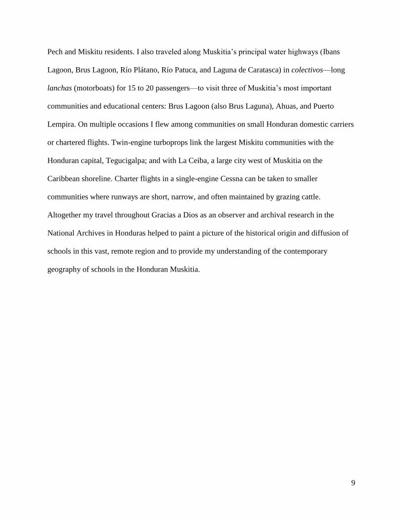
Figure 2.1: Downtown Puerto Cabezas-Bilwi, Nicaragua (photo credit: Taylor A. Tappan)
Two particular excursions to Central America were instrumental in my decision to study
the Miskitu upon entering a master’s program in geography at the University of Kansas. My first
experience in 2009 came on a pilot study abroad program, led by KU anthropologist Laura
Hobson Herlihy, which immersed students in Miskitu language and culture in Puerto Cabezas-
Bilwi, Nicaragua (Figure 2.1). The exchanged juxtaposed the marked socioeconomic and cultural
differences between Nicaragua’s mestizo Pacific coast and the indigenous-creole Caribbean

11
coast. The experience was my first in Nicaragua and in Muskitia, one that I repeated twice in
subsequent years as a master’s student.
Figure 2.2: A Miskitu home near Las Marías Baltituk along the Río Plátano (photo credit: Taylor A. Tappan)
I received a Tinker Research Grant the following summer to study Miskitu culture and
political autonomy in Honduras. As in Nicaragua, the experience was my first in the Honduran
Muskitia. I spent my time living in a small coastal village and practicing Miskitu. I learned that
although Miskitu language and settlement spans the border between Nicaragua and Honduras,
each side has pronounced cultural distinctions. The Honduran Muskitia region is more remote
and characteristic of traditional Miskitu settlement patterns in which villages generally are found
along river networks where subsistence activities include hunting, fishing, gathering, and slash-
and-burn agriculture, or shifting cultivation, in fertile riparian zones (Figure 2.2). In contrast, the
Nicaraguan Muskitia, encompassed by the North and South Atlantic Autonomous Regions,
includes the port city of Puerto Cabezas-Bilwi, one of the largest indigenous cities in all of Latin
America with a population approaching 70,000. It is a cultural melting pot that juxtaposes

12
various languages and cultures, including the Miskitu majority, Sumo-Mayangna, Garífuna,
English-speaking Creole, and Spanish-speaking mestizo. A few American expatriates and
Mormon missionaries can also be seen frequenting the street markets and restaurant patios in
Puerto Cabezas-Bilwi.
Figure 2.3: The Muskitia region of eastern Honduras and Nicaragua
The Muskitia region is a vast, sparsely populated expanse of eastern Honduras and
Nicaragua. It is home to a number of Afro-indigenous and Amerindian groups including the
Garífuna, Miskitu, Pech, and Tawahka in Honduras and the Garífuna, Miskitu, Sumo-Mayangna,
and English-speaking Creole in Nicaragua. In the Honduran Muskitia the Miskitu are the largest
indigenous group with a population of more than 72,000 (Protocolo Bio-cultural del Pueblo

13
Indígena Miskitu 2012: 14). Their language (Miskitu), along with Spanish, has become a lingua
franca among other Honduran indigenous groups living in the same region and is widely spoken
today (Helms 1995; Cochran 2005).
Miskitu settlement covers an extensive area (Figure 2.3) which ranges from Cabo
Camarón on Honduras’s northern coast south to the Pearl Lagoon area near Bluefields,
Nicaragua (Dodds 2001). The humid coastal lowlands of Muskitia are covered with pine
savannas, fresh and salt water lagoons, marshes, meandering rivers, and gallery forests (Parsons
1955; Herlihy 1997a; Tillman 2011). The lowland pine savanna, the largest of its kind in Central
America, measures 300 miles from Honduras’s Ibans Lagoon in the north to its southernmost
extent near Bluefields, Nicaragua. Along the banks of the Río Coco, the pine savanna reaches
more than 100 miles inland from Cape Gracias a Dios, but on average its width from east to west
generally measures no more than 30 miles (Parsons 1955; Cochran 2005).
Beyond the lagoons, marshes, and pine savannas of the Caribbean lowlands, the more
sparsely populated western segment of La Muskitia is characterized by hilly uplands and the
largest remaining stretches of tropical forest in Central America (Herlihy 1997a, 2001; Cochran
2005). The contiguous tract of forest that spans the border between Honduras and Nicaragua has
been called the Muskitia Rain Forest Corridor because it has allowed for the biological exchange
of flora and fauna for both North and South American species (Herlihy 1997a, 2001; Dodds
2001; Cochran 2005). Sadly, field observations show that recent external threats have
endangered the biodiversity of the Muskitia Rain Forest Corridor and disrupted the settlement
patterns of many resident indigenous communities, leading to a social instability of existing
Miskitu land tenure practices (Herlihy 2001).
14
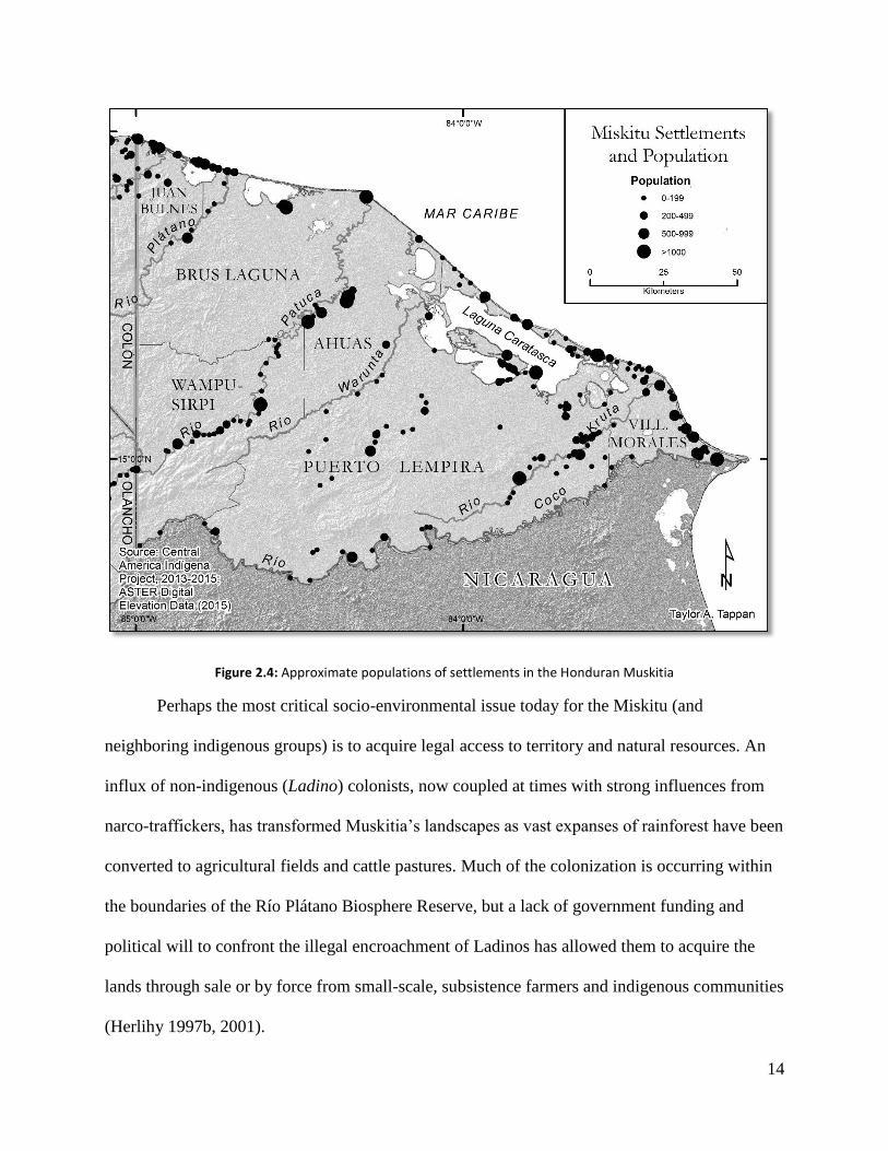
Figure 2.4: Approximate populations of settlements in the Honduran Muskitia
Perhaps the most critical socio-environmental issue today for the Miskitu (and
neighboring indigenous groups) is to acquire legal access to territory and natural resources. An
influx of non-indigenous (Ladino) colonists, now coupled at times with strong influences from
narco-traffickers, has transformed Muskitia’s landscapes as vast expanses of rainforest have been
converted to agricultural fields and cattle pastures. Much of the colonization is occurring within
the boundaries of the Río Plátano Biosphere Reserve, but a lack of government funding and
political will to confront the illegal encroachment of Ladinos has allowed them to acquire the
lands through sale or by force from small-scale, subsistence farmers and indigenous communities
(Herlihy 1997b, 2001).

15
Figure 2.5: Deforestation in Río Plátano Biosphere Reserve near Río Sico, 2010 (photo credit: Taylor A. Tappan)
In response to heightened tensions between Miskitu communities and Ladino colonists,
MASTA (Muskitia Asla Takanka, Unity of Muskitia), the umbrella political federation
representing the Miskitu, petitioned the Honduran government in 1988 to legalize Miskitu
ancestral homelands (Herlihy 2001). The land titles, though, were held by INA, the National
Agrarian Institute; and AFE/COHDEFOR, the State Forestry Agency (Herlihy 1997b, 2001;
Galeana and Pantoja 2013). No legal precedent existed for titling both the areas of occupation
and the greater functional subsistence habitats of the Miskitu; thus, the titles remained with the
state during the 1990s (Herlihy 1997; Galeana and Pantoja 2013).

16
The early 2000s ushered in a new era of land management in Honduras. Policy reforms
incorporated a comprehensive program, sponsored by the World Bank and the Honduran
Institute of Property, to strengthen property rights throughout the country, including in the
isolated Muskitia. The Honduran Land Administration Program (Programa de Administración de
Tierras de Honduras, PATH), an agency operated through the Honduran Institute of Property,
initiated in 2004 a demarcation and titling process of Miskitu territorial federations that were
organized through MASTA in the late 1990s (Galeana and Pantoja 2013). These local indigenous
territorial jurisdictions, called concejos territoriales, represent large functional land and resource
use areas shared by multiple communities. Their boundaries are permeable to allow for a flow of
people and overlapping resource uses among neighboring concejos territoriales, and they were
delimited according to natural landmarks, areas of subsistence, and community cultural ties
(Herlihy and Leake 1993; Galeana and Pantoja 2013: 7). In 2012 the Honduran government
awarded an inter-community title to representatives of KATAINASTA, the first concejo territorial
to receive one (Galeana and Pantoja 2013). This new titling process is continuing to unfold at the
time of this thesis and is paving the way for the Miskitu in Honduras to acquire legal, inter-
community control over their ancestral homelands and resources that cover the entire department
of Gracias a Dios.
II. Life in Kuri
I spent the majority of my time in the Honduran Muskitia in a small village called Kuri,
named after a tropical fruit bearing tree (sapote), of which none currently exist in the village.
Kuri is a Miskitu community of 300-400 inhabitants and sits on narrow strait of land between the
17
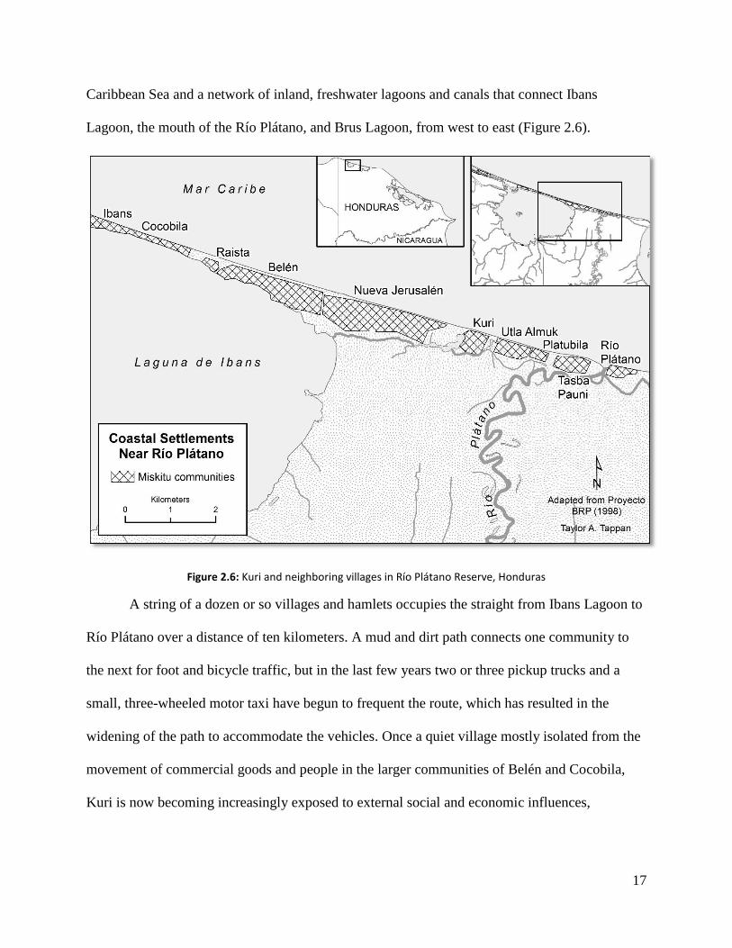
Caribbean Sea and a network of inland, freshwater lagoons and canals that connect Ibans
Lagoon, the mouth of the Río Plátano, and Brus Lagoon, from west to east (Figure 2.6).
Figure 2.6: Kuri and neighboring villages in Río Plátano Reserve, Honduras
A string of a dozen or so villages and hamlets occupies the straight from Ibans Lagoon to
Río Plátano over a distance of ten kilometers. A mud and dirt path connects one community to
the next for foot and bicycle traffic, but in the last few years two or three pickup trucks and a
small, three-wheeled motor taxi have begun to frequent the route, which has resulted in the
widening of the path to accommodate the vehicles. Once a quiet village mostly isolated from the
movement of commercial goods and people in the larger communities of Belén and Cocobila,
Kuri is now becoming increasingly exposed to external social and economic influences,
18
including conflict brought to the coast by non-indigenous colonists (terceros) and narco-
traffickers.
Figure 2.7: Herlihy residence in Kuri (photo credit: Taylor A. Tappan)
The relatively quiet, tranquil nature of Kuri and its proximity to neighboring Miskitu
villages made it an ideal hub from which to conduct my master’s research. The Miskitu family of
Rollins and Nela George hosted me for the length of my stay. Nela cooked for me every day and
boiled water in light of my trepidation to drink straight from the well. Meals were typically
loaded with carbohydrates, consisting of gallo pinto (a mixture of white rice with beans), boiled
or fried chicken or salted fish, fried plantain or breadfruit chips, biscuits, spaghetti noodles, and
coffee. I was somewhat dismayed that, despite an abundance of mango and other fruit-bearing
trees, fresh fruit was rarely served during any meal of the day in Kuri.

19
I lived in Kuri for two weeks in July 2012 in a wooden house on stilts built more than a
decade ago by my thesis adviser, Dr. Peter Herlihy (Figure 2.7). Despite the decaying
floorboards, the gaping hole in the aluminum roof, and corroded hinges that prevented the
windows from closing, the insects were kept in check at night by vigilant bats and spiders and a
steady ocean breeze. The house failed, though, to prevent a fragment of a stray lightning bolt
from striking me one day during an afternoon thundershower while I was taking shelter from the
downpour inside the house with the children of my host family. The bolt seemed to deflect first
off the aluminum sheets that comprise the roof before it struck me; nevertheless, the jolt was
sufficiently potent to knock me flat on my back from my standing position and to prompt a
burning sensation in my arm from my fingers to my shoulder. The children stared wide-eyed at
me as I staggered to my feet, unharmed but not without a ringing in my ears and a white haze in
my eyes, and immediately they began to recount how a white flame traveled up my right arm and
escaped through my mouth. To this day the incident seems rather surreal when I recall the
bizarre occurrence. In March 2014 on another visit to Kuri, the children excitedly reminded me
of the episode as soon as I arrived in the village.
I feel humbled and grateful for the warmth and hospitality offered by Rollins, Nela, and
their family on three visits to Kuri while I conducted undergraduate research on Miskitu political
autonomous movements and thesis research on the cultural historical geography of schools in the
Honduran Muskitia. Although Rollins received little formal education as a child, he has become
one of Kuri’s leaders and shoulders a wide of array of responsibilities. Beyond caring for his
family of nearly a dozen, Rollins periodically makes trips klaura (upriver) to the family’s kiamp
(small agricultural fields along the Río Plátano) where they cultivate rice and beans and raise a
few cattle. He is also involved in working on community development projects with MOPAWI, a

20
local Miskitu non-governmental organization, and in maintaining the inland canals that link the
lagoons and rivers between Ibans Lagoon, Río Plátano, and Brus Lagoon; an arduous process
that requires dozens of workers to clear tree and plant growth and to carve channels for lanchas
(small motor boats) and canoes.
Rollins inherited his community leadership qualities from his late father, Sixto George,
who I never had the privilege of knowing. Before moving to the coast, Sixto grew up in the
riverine community of Auka, which sits along the banks of the Río Kruta that runs parallel to the
Río Coco, the border between Honduras and Nicaragua. Sixto completed his schooling there and
then became a primary school teacher circa 1959 in Kaukira, a coastal community that sits on a
spit of land between Caratasca Lagoon and the Caribbean Sea. At the time, Kaukira, along with
Brus Lagoon, had benefitted from the influence of the Moravian Church to become the most
important center for education in the Honduran Muskitia. Sixto worked in Kaukira for two years
before moving to Brus Lagoon in 1961 (George 2012 personal communication).
Like Kaukira, Brus Lagoon had emerged as the other most important center for education
in the Honduran Muskitia. Upon its arrival to Brus Lagoon in 1933, the Moravian Church
founded a private school, Instituto Renacimiento, for Miskitu children in Brus and surrounding
communities. After relocating to Brus Lagoon from Kaukira, Sixto continued his career as a
teacher, working in Instituto Renacimiento for fifteen years. His son, Rollins, was born in 1968
in Brus Lagoon.
During his tenure in the Moravian Instituto Renacimiento, Sixto became a well-
recognized teacher. In an effort to expand educational opportunities to neighboring Miskitu
communities, Sixto moved his family to the coast in 1976, and they settled in Kuri. Sixto
founded a private primary school called Escuela Rural Mixta Camilo Miralda for children in

21
grades 1-6 who were living in Kuri and the neighboring communities of Utla Almuk and
Tasbapauni. Prior to the establishment of Escuela Rural Mixta Camilo Miralda, children from
theses villages had to walk two or three miles each day and cross the mouth of the Río Plátano to
attend class in the community that bears the same name. Sixto’s establishment of a primary
school in Kuri pioneered a wave of school teachers to found additional primary schools along the
coast in following years. In 1983 the Honduran government assumed control of Escuela Rural
Mixta Camilo Miralda, changing the name to Guillermo Ardón, but to this day the same school
remains in use for grade school children in Kuri, Utla Almuk and Tasbapauni (George 2012
personal communication). It was on the grounds of this school in Kuri, through village soccer
games and conversations with friendly neighbors in my broken Miskitu, where I began to learn
the geography and culture of the Honduran Muskitia.
III. Miskitu Cultural Origins
Miskitu is a Misumalpa, Macro-Chibchan language of Amazonian origin, with loan
words from English and Spanish that form an integral part of Miskitu vocabulary (Helms 1995).
The contemporary Miskitu population likely originated from small pockets of indigenous groups
that lived near Cabo Gracias a Dios and along the Río Coco at the time of European contact in
the 16th century (Conzemius 1932; von Hagen 1940). Conzemius (1932) and Helms (1971) have
suggested that intermarriage with other ethnic groups, including European settlers, privateers,
and escaped black slaves, enabled the expansion of Miskitu society from the 17th to the 19th
century.
One of the first points of contact was in 1631 at Providence Island. English Puritan cash
croppers had settled Providence Island, located roughly 150 miles off the Miskitu Shore at Cabo
22
Gracias a Dios (Floyd 1967; Galvin 1999). The island was eventually conquered by Spanish
forces in 1641, and most of the English population was sent back to Europe. The English,
though, had brought several hundred black slaves to the island by 1641, many of whom escaped
to the Miskitu Coast upon Spanish arrival, where they assimilated into the native indigenous
population (von Hagen 1940; Floyd 1967; Helms 1983). The famous English buccaneer, Henry
Morgan, regained control of Providence Island from Spanish occupants in 1670, using it as a
springboard to attack Spanish strongholds in Panama, but ultimately he determined that the
island was too isolated to serve as a strategic stronghold for England and he eventually de-
fortified it in 1671 (Floyd 1967; Galvin 1999).
The Miskitu frequently aided English, French, and Dutch privateers in raids against
Spanish settlements on the mainland for much of the 17th century (Floyd 1967; Helms 1983;
Galvin 1999). Miskitu men traveled with the privateers, providing dugout canoes for riverine
transportation and serving as guides and fishermen when out at sea (Floyd 1967; Helms 1983;
Galvin 1999). In exchange for their service, the privateers armed the Miskitu with European
technologies and weapons like guns, ammunition, and machetes that allowed the Miskitu to
become one of the most aggressive and expansionistic indigenous groups in Central America
(Helms 1983; Herlihy and Hobson Herlihy 1991). The firearms in particular gave the Miskitu an
advantage over other native Amerindians and perhaps led to the emergence of the name Miskitu,
thought to be a derivative of the word musket. Through interactions with European settlers and
pirates, the indigenous musket-bearing group emerged as the Miskitu (Helms 1995).
European powers officially outlawed privateering in 1685, and many pirates settled down
to establish communities along the Miskitu Coast. Black River, Cabo Gracias a Dios, and
Bluefields became the most important and populous settlements, characterized by blending of

23
European, black, and Amerindian populations (Floyd 1967; Helms 1983). The Miskitu
intermixed in these melting pots and emerged as a racially and culturally amalgamated populace
(Helms 1983; Hall et al. 2003). In the opening decades of the eighteenth century, permanent
Miskitu communities began to appear near British coastal settlements, a reversal in traditional
Miskitu settlement patterns where villages were typically found in fertile riparian zones in the
interior while coastal fishing camps were only ephemeral (Helms 1983; Herlihy and Hobson
Herlihy 1991). Rapid Miskitu population growth occurred simultaneously with the reorientation
of Miskitu communities toward the coast, as trade with Europeans allowed the Miskitu to acquire
new tools and skills to increase agricultural production (Helms 1983).
Britain strengthened its position in the Muskitia region between 1687 and 1800 by
bringing Miskitu leaders to Jamaica to be crowned as kings before returning them to La
Muskitia. The creation of this Miskitu kingdom allowed Britain to rationalize its presence and
the fabrication of a protectorate in the region. Although the Miskitu kings had little political
power, the practice of crowning Miskitu leaders demonstrated the symbiotic relationship
between the British and the Miskitu and represented a mutual affront against the Spanish (Hall et
al. 2003).
Periodic boom-and-bust cycles in which North American enterprises exploited natural
resources from the Muskitia region led to the integration of the Miskitu into the global trade
market throughout the 20th century. Economies in Muskitia would rise and collapse periodically
as various resources were exploited intensively and unsustainably by the Miskitu and their North
American and European trading partners. These repetitive cycles influenced Miskitu livelihoods
that were traditionally dependent upon riparian zone agriculture and other interior forms of
subsistence. New settlements emerged along the north coast of Honduras, as Miskitu wage

24
laborers found employment on the United Fruit Company’s banana plantations in the early 1900s
(von Hagen 1940; Helbig 1965; Herlihy 1997a).
Commercial lumber extraction then accelerated in the mid-20th century, and non-
indigenous ladino colonists followed the penetration roads carved by lumber companies into the
forested landscapes of Muskitia (Helbig 1965; Herlihy 1997a). Additional boom industries that
have employed Miskitu wage laborers are chicle, gold, coconuts, turtles, and lobsters (Helms
1971; Nietschmann 1973; Dodds 1998; Offen 1999; Hobson Herlihy 2012). At the time of this
thesis, the newest boom industry in the region is evidenced by hundreds of estaciones (makeshift
tents) lining the Miskitu coast that process freshly netted jellyfish to be shipped to East Asian
markets where they are considered a culinary delicacy and are used in a variety of foodstuffs.
IV. Territoriality and Schools in La Muskitia
Miskitu identity is partly embedded today in its historical resilience against Spanish
territorial conquest and the preservation of its language and culture, some of which can be
attributed to British support for Miskitu territorial rights. In 1859 Great Britain formally
recognized in the Wyke-Cruz Treaty the Mosquito Territory, as it was then called, as part of the
Republic of Honduras (Creación del Departamento de Gracias a Dios 1957). In addition to
declaring this vernacular region as belonging to the Honduran State, the treaty broadly outlined
the territorial rights held by the Miskitu communities there. Article 3 of the treaty stated that the
Mosquito Indians who remained within the Mosquito District (as recognized by Article 2 of the
same treaty) “shall not be disturbed in the possession of any lands or other property which they
may hold or occupy, and shall enjoy, as natives of the Republic of Honduras, all rights and
25
privileges enjoyed generally by the natives of the Republic” (Creación del Departamento de
Gracias a Dios 1957: 17).
Beyond the territorial provisions outlined in the Wyke-Cruz Treaty, the Republic of
Honduras also declared its intent to educate the Miskitu in order to improve social conditions in
the isolated Mosquito Territory (Creación del Departamento de Gracias a Dios 1957). In the
immediate wake of the treaty, though, the Honduran government began to devise strategies to
gain control over the Muskitia region by indoctrinating and ‘civilizing’ the various indigenous
groups living there (Barahona 2009: 172-173). Government policies planned to use schools to
foster the development of a national, unified culture based on the Spanish language, which in
turn would lead to the assimilation and acculturation of Miskitu and other indigenous groups
living in the isolated Muskitia region into a national Honduran identity. The proposed
establishment of schools in the remote Muskitia region aimed to strengthen Honduran
territoriality through the construction of a homogenous, Spanish-speaking society (Barahona
2009). This coercive and paternalistic approach characterized the position of the Honduran
government following its independence and during the construction of a national republican
state. Policies designed to civilize, assimilate, and acculturate the indigenous groups of Honduras
through education and the formation of a national identity played out until indigenous rights
movements began in Honduras in the late 20th century.
Indigenous rights movements gained traction in Honduras in 1982 when the new Law of
Education allowed indigenous groups the right to receive primary school education in their
maternal languages. For the Miskitu and neighboring indigenous groups in Muskitia, education
entered a new phase in which Honduran government agendas began to explore how to revive
threatened indigenous languages and cultures. This thesis discusses how contested territorial
26
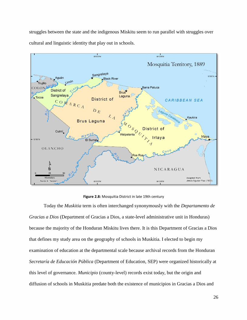
struggles between the state and the indigenous Miskitu seem to run parallel with struggles over
cultural and linguistic identity that play out in schools.
Figure 2.8: Mosquitia District in late 19th century
Today the Muskitia term is often interchanged synonymously with the Departamento de
Gracias a Dios (Department of Gracias a Dios, a state-level administrative unit in Honduras)
because the majority of the Honduran Miskitu lives there. It is this Department of Gracias a Dios
that defines my study area on the geography of schools in Muskitia. I elected to begin my
examination of education at the departmental scale because archival records from the Honduran
Secretaría de Educación Pública (Department of Education, SEP) were organized historically at
this level of governance. Municipio (county-level) records exist today, but the origin and
diffusion of schools in Muskitia predate both the existence of municipios in Gracias a Dios and

27
the department itself, which has undergone numerous political and territorial reorganizations
since the late 19th century. Figures 2.8, 2.9, and 2.10 show those modifications, beginning with
the first legal recognition of the Mosquito Territory or Comarca de la Mosquitia (as it was then
called) in the late 19th century (Figure 2.8). During the first half of the 20th century, the Comarca
de la Mosquitia remained organized in three districts, as displayed in Figure 2.8, but was
incorporated politically and administratively into the adjacent Department of Colón. Honduran
geographer Jesús Aguilar Paz’s 1933 Mapa General de la República de Honduras provided a
cartographic base from which I worked to digitize the district and comarca boundaries (as well as
notable settlements) while archival records enabled me to depict the territorial limits and district
capitals of the territory (see Creación del Departamento de Gracias a Dios 1957).
Gracias a Dios formally split from Colón in 1957 and became its own department,
bounded to the west by the 85th meridian, to the north and east by the Caribbean Sea, and to the
south by the Río Coco (Figure 2.9). The creation of Gracias a Dios also led to the consolidation
of political control over the territory through the establishment of two municipios, Brus Laguna
and Puerto Lempira. The department capital was assigned to the community of Puerto Lempira
(formerly known in Miskitu as Auhya Yari), while Brus Laguna became a municipal capital. The
creation of Gracias a Dios coincided, as I will explain further in subsequent chapters, with a
concerted effort by the Secretaría de Educación Pública to expand primary school coverage in
Miskitu communities. The administrative landscape of Gracias a Dios remained this way for
nearly forty years until 1996 when the department was further divided into four additional
municipios (Ahuas, Juan Francisco Bulnes, Villeda Morales, and Wampusirpi). This change also
coincided with reforms to education in Gracias a Dios, notably the establishment of fourteen
school districts to manage public schools throughout the department.

28
Figure 2.9: The Honduran Muskitia region was reorganized into its own department in 1957
Figure 2.10 shows the administrative units of Gracias a Dios as they are today. Four
additional municipios were created in 1996 to further consolidate political control over the
isolated Muskitia. I have included additional settlements not pictured on the map of Comarca de
la Mosquitia. Kaukira, Barra Patuca, Cocobila, and Wawina, for example, are all population
centers today. Las Marías, on the other hand, is culturally significant in that it is a mixed Miskitu
and Pech community that serves as an ecotourism destination for backpackers wanting to hike in
virgin tropical rainforest. Krausirpi is the largest Tawahka community in Gracias a Dios.

29
Figure 2.10: Department of Gracias a Dios and its six municipios, 1996 to present
The preceding pages of this chapter have provided insight into the lands of Muskitia and
its cultural landscapes. I now turn to contextualize my research on schools within a broader
framework of education and politics in Latin America. I describe indigenismo as a Mexican
political ideology that ran parallel in the late 19th and early 20th century to the agendas of
Honduran governments that sought to shape the cultural and territorial identities of the Miskitu
through education.

30
CHAPTER THREE
EARLY RURAL EDUCATION POLITICS AND THE FORMATION OF THE
MUSKITIA TERRITORY
I. Introduction
This thesis examines the historical geography of schools in the isolated Honduran
Muskitia and schools’ impact upon the culture and territorial identity of the Miskitu. It fits within
the literature of a relatively small number of scholars who have profiled the development of rural
education in Latin America (Civera Cerecedo 2011). Who, where, why, and how was education
driven in rural areas of Latin America? Addressing these simple inquiries can provide insight
into many themes, including historical relations among states and indigenous groups, the
construction of national identities, mechanisms of social hegemony, class and gender dynamics,
and language politics (Civera Cerecedo 2011).
This chapter discusses 1) how 19th and early 20th century government legislation in
Honduras fits within the broader context of rural development and state education politics in
Latin America that, until the end of the 20th century, had aimed to incorporate rural or indigenous
identities into national mestizo societies; 2) how Honduran government political ideologies for
education paralleled the notion of indigenismo in late 19th and early 20th century Mexico; and 3)
the formation of the Muskitia Territory in Honduras after the Wyke Cruz Treaty of 1859. I
should note that I do not mean to interchange the terms ‘rural’ and ‘indigenous’ synonymously in

31
reference to remote, sparsely-populated reaches of Honduras and Latin America, but generally
indigenous areas tend to be rural, while the reciprocal doesn’t necessarily hold true.
II. Rural Education in Post-Colonial Latin America
Tracking patterns of school formation in rural Latin America is complicated because
schools were not established uniformly across time and space, and there is no one catalyst that
acted as the primary impetus behind the development of education in such areas. Rural schools in
the 19th and early 20th centuries were very different from rural schools today, particularly
considering the effect globalization has had in offering connectivity to even the most remote
communities. Early schools were subject to unstable beginnings, political conflicts, economic
crises, and population movements. A dearth of qualified professors and systems of supervision
plagued rural schools too (Civera Cerecedo 2011). Governments often lacked the means to pay
for teachers in rural areas, and it wasn’t uncommon for one teacher to rotate among
communities, offering classes to a given school only a few times a week and splitting time
among all-boys and all-girls schools (Civera Cerecedo 2011).
The rural school movement in Latin America began in the 19th century, often coinciding
with neoliberal agricultural reforms, and accelerated as states became increasingly urbanized in
the 20th century (Civera Cerecedo 2011). There are varying degrees of ‘rurality’ to account for as
well; a school may be considered rural if it is situated in a community with a small population
even if the community has proximity to a larger urban metropolis. On the other hand, schools
like those in the isolated Honduran Muskitia, particularly in the early 20th century, lack
proximity to any urban setting. To this day, there are still no roads that connect the Honduran
capital, Tegucigalpa, with the isolated Muskitia region, and many Miskitu schools are further
32
qualified as rural because they have no plumbing or electricity. Civera Cerecedo (2011) contends
that a school’s proximity to urban centers; local forms of land tenure and governance; and ways
of interacting with the state, internal markets, sociocultural characteristics, and local political
stability are all factors that determine the extent of a school’s ‘rurality’ (Civera Cerecedo 2011:
10-11).
Researching the development of education can help us to yield a better understanding of
the rural school, as an object of study, and its beneficiary population. Elite hacendados in
Mexico, for example, supported rural school development in 19th and early 20th centuries. They
opened schools for the children of their workers, largely in response to a general sense of apathy
towards education from their campesino employees (Civera Cerecedo 2011: 16). However, the
national literacy rate in Mexico in 1910 at the end of the Porfiriato remained under 20 percent,
with 71 percent of Mexicans living in rural areas (Rodrigo 2011: 75). Labor-intensive agriculture
in rural areas exacerbated low rates of school attendance as campesino children were often
needed in the fields for sowing and cultivating. Many children only attended school for two or
three years and then abandoned their studies to continue working in the fields. Rodrigo (2011:
76) quotes a passage from Moisés Sáenz (1927) to summarize this dilemma:
Enseñar a leer, escribir y contar a una gente que no tiene en qué leer, ni para qué
escribir, y cuyos haberes pueden siempre contarse con los dedos es tarea tonta.
Durante muchos años, hay que reconocerlo, estas escuelas del campo no
estuvieron haciendo otra cosa que esta tonta tarea.
Teaching reading, writing, and arithmetic to people who have no reason to read or
write, and whose possessions can be counted on their fingers, is a useless toil.
And it must be recognized that rural schools having been accomplishing nothing
more than this useless toil for many years.
33
So who benefitted from the development of rural education in Latin America in the 19th
and early 20th centuries? In many cases, education was a state mechanism to accelerate economic
growth and the integration of rural and indigenous societies into a national identity, largely at the
expense of their languages and cultures (Herranz 1996; Regalsky and Laurie 2007; Barahona
2009; Civera 2011; Aguilera 2012). The ethnic pluralities and territories of indigenous groups in
Honduras were often ignored by post-colonial, liberal governments seeking to modernize the
country through land and economic reforms (Lara Pinto 2002). Rural education was monolingual
in Spanish during the 19th and 20th centuries, and most indigenous languages disappeared in
Honduras altogether as Spanish became the official language of education and commerce. This
process is not unique to Honduras, though, and state-sponsored efforts to develop rural education
have played out very differently from one country to the next.
Civera et al. (2011) have compiled twelve case studies that examine the development of
rural education in Latin American countries and the role that schools played in rural campesino
and indigenous societies. In the late 19th and early 20th centuries in Brazil, schools helped to root
the campesino population in rural areas, consequently curbing a rural-to-urban migration in the
decades after the abolition of slavery in 1888 (Civera 2011: 15; Corrêa and Carvalho 2011: 410).
In other cases in which the government failed to support education in rural areas, the
communities themselves often formed their own ‘parochial’ schools, in conjunction with
Catholic churches (Corrêa and Carvalho 2011: 405).
Beginning in 1920, rural education and literacy began to enter political dialogues as a
means to promote Brazilian nationalism. Between 1931 and 1937; the government began to
create nationalized schools (Corrêa and Carvalho 2011). Brazilian nationalism campaigns
concentrated their messages in parochial schools that were primarily attended by new European

34
immigrants and managed by the Catholic Church. Meanwhile the number of national primary
schools nearly doubled in Brazil between 1923 and 1939 (Corrêa and Carvalho 2011: 408-409).
Despite nationalistic fervor and the expansion of primary schools, Brazil’s system of
education remained disproportionately geared towards urban populations, and the government
was presented with a paradoxical dilemma; it needed to become more urbanized and
industrialized in order to escape its economic crisis of 1930 while simultaneously limiting a mass
rural-to-urban migration. The government’s strategy during the 1930s turned to investing in the
development of urban education in southern and southeastern Brazil while fostering rural
education in the northeast. These policies contributed to an imbalance in population dynamics in
Brazil as literacy rates and cities like Sao Paulo and Río de Janeiro grew rapidly in the south
while the northern and northeastern regions remained mostly rural (Corrêa and Carvalho 2011:
425).
Similar patterns played out in Costa Rica near the turn of the 20th century as economic
growth and education were driven by agricultural reforms and urbanization. The creation of
Costa Rica’s education system dates back to 1820 when municipal governments were formed,
and whose responsibilities included establishing schools. Initially schools were opened slowly in
Costa Rica’s provincial capitals: San José, Alajuela, Cartago, Heredia, Guanacaste, Puntarenas,
and Limón.2 They suffered from miniscule budgets and a lack of qualified teachers, and curricula
were designed with a strong Catholic influence (Jiménez 2011: 134).
Costa Rica aimed to expand primary education to rural areas during the 1820s. As coffee
became a major export for the Costa Rican economy in the 1830s, agricultural fronts extended
beyond the country’s central valley. Communal lands then became increasingly privatized, and
2 Puntarenas and Limón, at the time, were comarcas and officially became provinces in 1909 (Jiménez 2011: 114).
35
indigenous groups living in central Costa Rica were often dispossessed of their ancestral
homelands (Jiménez 2011: 111). This rapid rural expansion outpaced development at the
municipal level, and colonists in search of fertile lands moved beyond the areas served by rural
schools. The movement intensified during the 1850s and 1860s to the point in which a lesser
proportion of children attended primary school in the 1870s and 1880s than at the end of the
1820s, resulting in an increasingly illiterate society (Jiménez 2011: 115).
Comprehensive legislative reform in 1886 put an end to this regressive trend; primary
education was centralized by the Costa Rican government and made secular. Primary schools
were configured into grade levels and assured more financial support from the central
government. The reforms also established pedagogic schools to train young teachers, but these
reforms created disparities among urban and rural schools. As the educative responsibility
shifted from the municipality to the central government, urban schools received disproportionate
financial support and access to qualified teachers. Primary schools in urban areas tended to offer
class through 6th grade, while their rural counterparts were structured only through 4th grade. The
consequences of the rural-urban gap became evident in the 1927 census in which 85.7 percent of
the urban population nine or older was literate, while that figure fell to 66.8 percent in small
towns and only 56.4 percent along agricultural frontiers (Jiménez 2011: 135).
Very different experiences have played out from one country to the next across Latin
America in the development of post-colonial systems of education, but a common thread that
many seem to share is an alternate agenda by the provider, usually the state. Regalsky and Laurie
(2007) have written about a ‘hidden curriculum’ that sought to introduce new institutionalized
forms of authority into rural space in the wake of Bolivia’s ‘National Revolution’ of 1952
(Regalsky and Laurie 2007: 231). The authors argue that schools attempt to “integrate members

36
of indigenous Andean communities as individual citizens into the Bolivian nation state through a
Criollo (mestizo) hegemonic culture which, in turn, denies a place for cultural diversity in the
school system” (Regalsky and Laurie 2007: 231). In this context, the school represents a
battleground through which non-indigenous, state-employed teachers vie to impose national or
local territorial authority while indigenous communities struggle to acquire their own
autonomous space. They become contested spaces manifested by the struggle between groups
differentiated by cultural and economic status (Regalsky and Laurie 2007: 233). Hornberger
(1988) and Aikman (1999) suggested that the imposition of an authoritarian pedagogy centered
on the Spanish language reinforces a school’s character as a non-indigenous island within the
community. As such, the struggle between the state and the indigenous community becomes
manifest when the community deploys cognitive knowledge of its functional territory and
jurisdictional space while the state superimposes, through the employment of non-indigenous
pedagogic authority, its own political space (Regalsky and Laurie 2007).
Rural education development in 19th and early 20th century Honduras shares elements
with the development histories described by Civera Cerecedo (2011) in Mexico, Corrêa and
Carvalho (2011) in Brazil, Jiménez (2011) in Costa Rica, and Regalsky and Laurie (2007) in
Bolivia. Schools were established unevenly in Honduras—both in time and space. A weak
central government limited the diffusion of schools for most of the 19th century. In 1856 for
example, only 37 primary schools were in operation in Honduras and they were concentrated
primarily in urban areas (Herranz 1996: 184-185). As were the cases in many Latin American
countries, they lacked budgets and qualified teachers. The few rural indigenous communities that
had schools reportedly financed them with the earnings from their communal milpas, small
agricultural plots of corns, bean, and squash (Herranz 1996: 185).

37
III. Indigenismo in Honduras
In this section, I describe the policies and geographic strategies of the Honduran
government to assimilate and acculturate the Miskitu into a national, Spanish-speaking society.
These policies were not unique to Honduras and have run parallel to a broader movement of
indigenismo rooted in Mexican politics in the late 19th and early 20th centuries. Many scholars
(see Villoro 1950; Batalla and Dennis 1996; Gonzales 2002; Taylor 2005; to name a few) have
written about indigenismo in Mexico as a political ideology in which the figure of the mestizo
(mixed indigenous and non-indigenous) was “adopted as the subject of the nation, the symbol of
national unity, modernization and progress; at the same time, the figure of the ‘Indian’ came to
symbolize a work in progress, an ‘object’ of the ever-unfolding post-revolutionary task of
cultural and economic modernization” (Taylor 2005: 80). Government policies in education, land
reform, and economic development targeted indigenous groups as objects of a necessary
assimilation and acculturation into a homogenous, Spanish-speaking, mestizo society. Thus, “the
‘Indian’ was cast as a mute collective singular entity whose ‘incoherent’ local economic,
cultural, and political forms of organization presented obstacles to modernization and progess”
(Taylor 2005: 80).
The Miskitu and other indigenous groups in Honduras were viewed through the same
lens of hegemonic discourse and targeted as objects to be assimilated and acculturated into a
homogenous, Spanish-speaking Honduran society. Beginning in 1876 liberal reforms of the
agriculture, banking, mining, communications, and education industries spurred economic
growth and led to the separation of church and state in Honduras (Herranz 1996 and Barahona
2009). Indigenous groups were considered culturally undesirable remnants of a colonial past
among Honduran elites, and ‘desindianización’ (‘de-indianization’) was construed as an

38
indispensable component of progress, civilization, and escape from colonialism during these
reforms (Barahona 2009: 146-148). As in Mexico, the Honduran government implemented
strategies to employ education as a mechanism to foster cultural homogeneity and to promote a
national Honduran state. President Marco Aurelio Soto and his Minister of Public Education,
Ramón Rosa, passed the Código Fundamental de Instrucción Pública in 1882 that effectively
organized the country’s system of education, establishing primary, secondary, and professional
education and requiring every municipio to have a primary school (Herranz 1996: 191).
Soto’s and Rosa’s policies led to indigenous integration into the national economies and
mestizo culture. Lenca and Maya-Chortí communities in southern and western Honduras had
already begun losing their languages as young men had been working as wage laborers on coffee
and tobacco plantations where Spanish was the only means of communication. The spread of
primary schools in Lenca and Maya-Chortí communities further accelerated the desertion of the
Lenca and Chortí languages as young women also abandoned their cultural heritages and learned
Spanish (Herranz 1996: 186-188). President Manuel Bonilla then amended the Código
Fundamental de Instrucción Pública in 1906 to declare Spanish the official and only language
permissible in schools (Herranz 1996; Barahona 2009).
At the height of the liberal reforms, coffee and tobacco production was the impetus
driving rural education in southern and western Honduras. Penetration roads made rural areas
more accessible and catalyzed the diffusion of primary schools and Spanish. President Soto and
his Education Minister Rosa favored secular education, teachers replaced Catholic priests as the
educated and linguistic authorities in rural communities, and younger generations of Lenca and
Chortí speakers abandoned their maternal languages for Spanish (Herranz 1996: 196). This new,
monolingual mestizo social construction was being created without regard for indigenous

39
identities, but it did not extend to all corners of Honduras. The Miskitu remained geographically
and culturally isolated from these social and economic reforms, and the Honduran government
struggled to consolidate control over the Muskitia region. In the following section, I discuss the
Wyke-Cruz Treaty of 1859 and the Honduran government’s first attempts to exercise control
over the vast, isolated Muskitia.
IV. Political and Territorial Organization of Muskitia: 1859-1915
The Wyke-Cruz Treaty of 1859 between Great Britain and Honduras provided for the
advent of a formal territorial identity for the Miskitu because the treaty required the Honduran
government to recognize the land and property rights of the Miskitu as citizens of the Republic
of Honduras (Protocolo Bio-cultural del Pueblo Indígena Miskitu 2012). The treaty also stood in
fundamental contrast to policies promoted by Spain and the Honduran government that sought to
assimilate and acculturate the Miskitu into a homogenous, Spanish-speaking society. Great
Britain officially declared in Articles 1 and 2 of the treaty that the Bay Islands and the Mosquito
Territory were “part of Honduras within the frontier of that country, whatever that frontier may
be” (Creación del Departamento de Gracias a Dios 1957: 15). Article 3 avowed the following
provisions for the Miskitu:
The Mosquito Indians in the District recognized by Article II of this Treaty as
belonging to and under the sovereignty of the Republic of Honduras, shall be at
liberty to remove, with their property, from the Territory of the Republic…and
such of the Mosquito Indians who remain within the said District shall not be
disturbed in the possession of any lands or other property which they may hold or
occupy, and shall enjoy, as natives of the Republic of Honduras all rights and

40
privileges enjoyed generally by the natives of the Republic (Creación del
Departamento de Gracias a Dios 1957: 17).
In addition to the formal recognition of the land rights held by the Miskitu and
neighboring indigenous groups in the Muskitia region, the Honduran government pledged in the
Wyke-Cruz Treaty to invest in the development of education: “The Republic also desires to
educate the Mosquito Indians to improve social condition, and will grant 5000 dollars annually
in gold or silver for the next ten years for that purpose” (Creación del Departamento de Gracias
a Dios 1957: 17). The geographic isolation of Muskitia complicated this transaction, and the sum
was never remitted. The weak Honduran state had no precedent for developing education in
Muskitia, and it remained isolated from the growing coffee and tobacco industries of southern
and western Honduras. There were no penetration roads that allowed for the development of
infrastructure and the influx of settlers.
The Honduran government’s dialogues to indoctrinate the Miskitu were analogous to its
policies designed to assimilate rural and indigenous areas into a national, homogenous culture.
Liberal reforms sought to consolidate territorial control over Muskitia and to “nationalize,
acculturate, and subject” the indigenous groups of the Muskitia region through education
(Barahona 2009; Protocolo Bio-cultural del Pueblo Indígena Miskitu 2012: 10). In 1861, just
two years after the Wyke-Cruz Treaty that granted land rights to the Miskitu, the Honduran
government formally declared that the Bay Islands and the Muskitia territory would remain
henceforth under the dominion and sovereignty of the Honduran state, effectively violating the
Wyke-Cruz Treaty and Miskitu territorial rights supported by Great Britain. The government
then sent the commanding military officer of Trujillo to take possession of the territory
(Creación del Departamento de Gracias a Dios: 1957). Later in 1861, Honduran President
Santos Guardiola issued a decreto (order or decree) naming José Lamotte as the Civil and

41
Military Governor of the Tribes of Muskitia. His task was to indoctrinate the “…morenos, indios
mosquitos, zambos and payas (brown-skinned peoples, Mosquito Indians, mixed Afro-
indigenous peoples, and the Pech Indians) from the Río Aguán to Cape Gracias a Dios and up the
Río Plátano” (Creación del Departamento de Gracias a Dios 1957: 23).
Specifically, his foremost duties included 1) building temples and churches so that the
indigenous groups could worship God, 2) establishing primary schools that employ the Spanish
language, 3) indoctrinating the ‘tribes’ in Christianity, and 4) civilizing the indigenous peoples
so that their ‘costumbres selváticas’ (jungle customs) would disappear entirely (Creación del
Departamento de Gracias a Dios 1957: 25). Lamotte lasted just one year as Civil and Military
Governor of the Tribes of Muskitia, but his appointment reflected broader state sentiments to
provide education to the Miskitu while simultaneously excluding their indigenous identities.
President José María Medina succeeded Santos Guardiola and continued to implement policies to
consolidate territorial control over the Muskitia region. A separate Departamento de la Mosquitia
(see Figure 3.1) that encompassed the traditional homelands of the ‘indios selváticos’ was
officially established by decree in 1868 (Creación del Departamento de Gracias a Dios 1957).
The legislation proclaimed that the consolidation of territorial control over Muskitia would allow
the state to provide benefits to the indigenous groups there (Creación del Departamento de
Gracias a Dios 1957: 24).
Considerando que las tribus selváticas de la Costa Norte, conocidas con el nombre
de <<Mosquitia>>, demandan la protección del Gobierno para hacerlas cesar en
su vida nómade, infundirles las ideas de civilización que reinan en los demás
pueblos de la República, inculcarles las luces del cristianismo y proporcionarles
medios fijos de subsistencia.

42
Considering that the jungle tribes of the North Coast, known as <<Mosquitia>>,
demand protection from the Government in order to cease their nomadic lifestyle,
(the state) will impart to them the ideas of civilization that govern the rest of the
populaces of the Republic, imbue them with the light of Christianity and provide
them with stable means of subsistence.
The newly formed departamento encompassed a vast area of northern and eastern
Honduras, extending from the Río Aguán in the west to Cape Gracias a Dios in the east, and
bounded by the Caribbean Sea to the north and a range of hilly uplands to the south, separating
the more settled regions of Olancho from the sparsely-populated Muskitia region (Figure 3.1). It
was not, however, granted congressional representation upon its formation; instead it was placed
under the jurisdiction of a governor whose chief responsibilities consisted of enacting numerous
measures to subject and incorporate the indigenous groups of the region into national Honduran
society (Barahona 2009: 152-153).
Figure 3.1: Approximate limits of Departamento de la Mosquitia in 1868

43
Liberal reforms followed in the 1870s, but their effects went largely unnoticed in
Muskitia. President Soto’s and Education Minister Rosa’s Código Fundamental de Instrucción
Pública that mandated the establishment of primary schools in every municipio was hindered by
the geographic isolation of the Muskitia region and, consequently, no schools were established
there at the height of the liberal reforms that were rapidly integrating the Lenca and Maya-Chortí
groups into a national Honduran homogenous society. This thesis brings into question whether
this historical absence of primary schools slowed the integration of the Miskitu into broader
Honduran nationalism and led to the preservation of Miskitu language, particularly when state
politics advocated for the cultural assimilation of indigenous groups through education.
New strategies designed to strengthen Honduran nationalism, particularly in the
Departamento de la Mosquitia, paralleled the organization of a national system of education.
Although primary schools continued to remain absent in Miskitu communities in the immediate
wake of the Código Fundamental de Instrucción Pública, new political agendas further altered
the administrative landscapes of Muskitia. In 1889 the Reglamento de Gobierno para el
Territorio de la Mosquitia (Governmental Bylaw for the Muskitia Territory) divided the territory
into three districts (Figure 3.2): 1) Sangrelaya, bounded by the Río Aguán and Río Tinto; 2) Brus
Lagoon, from Río Tinto to Río Patuca; and 3) Irlaya, from the banks of Río Patuca to the Río
Segovia (Río Coco), which also serves as a segment of the international border between
Honduras and Nicaragua (Creación del Departamento de Gracias a Dios 1957). The
communities of Sangrelaya, Brus Lagoon, and Irlaya (after which the three districts were named)
served as cabeceras (local administrative capitals), and the Departamento de la Mosquitia was
granted representation in the Honduran National Congress (Creación del Departamento de
Gracias a Dios 1957; Barahona 2009).
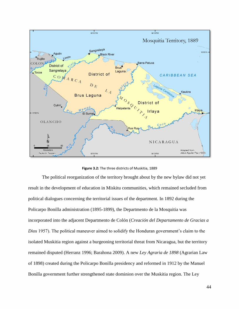
44
Figure 3.2: The three districts of Muskitia, 1889
The political reorganization of the territory brought about by the new bylaw did not yet
result in the development of education in Miskitu communities, which remained secluded from
political dialogues concerning the territorial issues of the department. In 1892 during the
Policarpo Bonilla administration (1895-1899), the Departmento de la Mosquitia was
incorporated into the adjacent Departmento de Colón (Creación del Departamento de Gracias a
Dios 1957). The political maneuver aimed to solidify the Honduran government’s claim to the
isolated Muskitia region against a burgeoning territorial threat from Nicaragua, but the territory
remained disputed (Herranz 1996; Barahona 2009). A new Ley Agraria de 1898 (Agrarian Law
of 1898) created during the Policarpo Bonilla presidency and reformed in 1912 by the Manuel
Bonilla government further strengthened state dominion over the Muskitia region. The Ley

45
Agraria de 1898 awarded control of vast baldíos (wastelands), construed as having no
‘legitimate’ owner, to the federal government (Barahona 2009: 175). Nearly all of the sparsely-
populated Muskitia region would be appropriated through the new Ley Agraria without regard
for resident indigenous populations (Barahona 2009).
Political strife between Honduras and Nicaragua in the early 1900s escalated after the
Nicaraguan government continued to dispute the limits of the international boundary between the
two countries. A bi-national committee attempted to delineate the boundary, but negotiations
were terminated after the committee failed to reach a consensus over the limits in the Muskitia
region (Creación del Departamento de Gracias a Dios 1957). In 1906 King Alfonso XIII of
Spain intervened as an arbiter and declared the boundary to be the thalweg of the Río Coco from
its mouth at Cape Gracias a Dios to its inland confluence with the Río Poteca or Bodega
(Creación del Departamento de Gracias a Dios 1957). Alfonso XIII’s decision split the Muskitia
cultural region in half, and to this day the international boundary divides Miskitu communities in
Honduras and Nicaragua.
In the preceding pages of this chapter and the subsequent pages of chapter four, I
emphasize the geographic remoteness of the Muskitia vernacular as an actor that has
differentiated the geographies of Muskitia from the geographies of other indigenous areas in
Honduras. I argue that this differentiation has played out across time and space and is reflected in
the contemporary circumstances of Miskitu language, territoriality, and schools in Muskitia. This
thesis posits that the comparative accessibility to post-colonial processes of liberal land and
economic reforms, and then to education, has influenced the degree to which indigenous groups
in Honduras associate with their cultural, territorial, and linguistic identities today. The Miskitu
in particular remained isolated from the liberal reforms of the late 19th century and were immune
46
to the ‘hidden curricula’ in rural public schools that sought to incorporate them into the national
Honduran society through the diffusion of Spanish. Today the Miskitu retain their language and
are continuing to define and strengthen their territorial identities. In chapter four, I turn to 20th
century state policies that sought to establish schools in the Honduran Muskitia in an attempt to
strengthen Honduran nationalism by incorporating and ‘Hispanicizing’ the Miskitu and
neighboring indigenous groups. I discuss how the relative inaccessibility of Muskitia continued
to hinder state efforts to develop education there. My narrative describes three specific phases
that led to the geographic origin and diffusion of schools in the Honduran Muskitia region.

47
CHAPTER FOUR
ORIGIN AND DIFFUSION OF SCHOOLS IN LA MUSKITIA
I. Introduction
Figure 4.1: Miskitu communities with primary schools, 2013
Few public schools existed in the Muskitia region of northeastern Honduras at the onset
of the 20th century, but today they are prevalent in nearly every Miskitu community (Figure 4.1).
Schools are a visible element of Miskitu village settlement, and they function as a place for
Miskitu students and teachers to maintain their language, cultural norms, and identity. However,

48
this was not always the case. Rural education once functioned to strengthen nationalism and to
promote a broader, homogenous, Honduran social consciousness. Indigenous groups in
Honduras have often been excluded in the construction of a national identity, and the state has
used schools to impose the Spanish language upon indigenous communities (Barahona 2009;
Protocolo Bio-Cultural del Pueblo Indígena Miskitu 2012). This chapter discusses the origin and
diffusion of primary schools in Muskitia to demonstrate the gradual process of how schools
became prevalent throughout the region.
Numerous phases mark the historical geography of schools and the diffusion of education
in the Honduran Muskitia. I begin with the period from 1915 until 1930, when the Honduran
government launched initiatives to build schools and to bring education to a region where it had
never formally existed, while simultaneously consolidating political and territorial control over
the Muskitia region. A second phase began in 1930 with the arrival of the Moravian Church
missions in the Honduran Muskitia. Moravian missionaries emphasized education as a strategy
to proselytize Miskitu communities by improving literacy, social conditions, agricultural
production, and architecture of Miskitu homes (Tillman 2011). I conclude the chapter by
discussing a phase that began in 1953 with the implementation of the state’s Misiones Culturales
(Cultural Missions) agenda that aimed to strengthen Honduran nationalism by acculturating the
Miskitu and neighboring indigenous groups of the region into a homogenous Spanish-speaking
society. I discuss the paradox that early state initiatives were designed to provide rural education
for Miskitu communities while simultaneously excluding their indigenous cultural identities. I
demonstrate that schools have historically represented a contested space through which both the
Honduran government and Miskitu communities have struggled for control. Early state efforts

49
tried to suppress Miskitu language in schools while indigenous movements at the end of the 20th
century advocated for bilingual education and legal recognition of indigenous homelands.
Figure 4.2: 20th century school expansion in the Honduran Muskitia
This chapter describes numerous agendas, actors, and places critical to the development
of education in the Honduran Muskitia, and the descriptions are both spatial and multi-temporal
in nature. Figure 4.2 demonstrates these spatial and temporal components by displaying the
establishment of schools in all three phases mentioned above. The multi-temporal nature of the
events described in this chapter rendered it a cartographic challenge to represent Miskitu
communities that were relevant to multiple phases of education development. Kaukira, for
example, was a site of the first Misiones Escolares, the origin of the Moravian missions, and a
place for state-sponsored education in the 1950s-1980s. I have chosen to display these eras of
50
education development in chronological order on the map so that the reader can see the original
sites of education more prominently than schools established more recently. The base
cartography shows the Department of Gracias a Dios and its six municipios as they are today,
although the historical phases of the development of education in Muskitia predate their
existence.
II. First State Education Initiatives in Muskitia, 1915 -1930
President Marco Aurelio Soto and his Minister of Public Education, Ramón Rosa,
championed liberal reforms in Honduras in the 1880s and promoted nationalistic fervor with the
development of rural education. Their efforts accelerated cultural assimilation in the Lenca and
Maya-Chortí indigenous areas, but Muskitia remained geographically and culturally secluded.
The first attempt by the Honduran government to establish schools in Muskitia was not until
1915, more than twenty years after the Código Fundamental de Instrucción Pública that
mandated the formation of primary schools in every municipio (Herranz 1996 and Barahona
2009).
President Francisco Bertrand (1913-1919) launched the Misiones Escolares (School
Missions) in 1915 as an initiative to integrate the Miskitu, Pech, and Tawahka into the national
Honduran culture that had been promoted since the onset of liberal reforms in the late 19th
century. The chief objective of the Misiones Escolares was to strengthen the Spanish language in
indigenous communities of Muskitia through educational programs and the establishment of
primary schools (Herranz 1996; Barahona 2009). In 1915 the Honduran government founded a
reducción (small encampment) of 150 inhabitants at ‘El Sumal’ (Sumo camp), located along the
Río Wampú near its confluence with the Río Patuca, for the purpose of schooling young

51
Tawahka-Sumo children (Landero 1980: 3; Herranz 1996). One teacher, Francisco Landero, was
entrusted to manage the school. During his brief tenure in El Sumal, Landero recorded basic
ethnographic observations of the Tawahka. His notes suggest that the experience was as
educational for him as it was for the villagers, but his comments also carry racist undertones that
demonstrate how little the Honduran government understood the indigenous cultures in the
remote Muskitia region (Landero 1980: 3).
¿Cómo son los sumos? Estos aborígenes son de estatura regular, más altos que los
payas, o payitas como ellos dicen: 1.70 metros. Cara aguileña, de nariz regular,
ojos negros, frente despejada, orejas grandes, barba y bigote escasos; de cabello
negro, grueso y abundante, el cual engrasan con un aceite llamado batana,
extraído por los misquitos de las semillas de una palmera (Elacis metanococca
Gaerta). La expresión es dulce, muy humilde. Difiere completamente del físico de
los payas que tienen rasgos característicos de la raza amarilla.
What are the Sumos like? These aborigines are of normal stature, standing 5 feet
4 inches, and taller than the Payas, or little Payas as they say. Sharp facial
features, average nose length, dark eyes, broad forehead, large ears, scarcely a
beard or moustache; thick, dark hair to which they apply a palm seed (Elacis
metanococca Gaerta) oil called batana, extracted by the Miskitu. Their appearance
is amicable and humble. It differs completely from the physiology of the Payas
whose features are more characteristic of the yellow race.
Between 1915 and 1917, the Misiones Escolares brought primary schools to seven other
villages in Muskitia: Dulce Nombre de Culmí, El Carbón, Ahuas, Barra Patuca, Cauquira (also
written Kaukira or Kauhrkira), Brus Lagoon, and Yapuwas (Figure 4.3). These dispersed villages
were chosen strategically to make education accessible to the Miskitu, Pech, and Tawahka.
Ahuas, Barra Patuca, Brus Lagoon, and Kaukira were sizeable Miskitu population centers.
Schools at El Sumal and Yapuwas served Tawahka communities along the upper Río Patuca; and
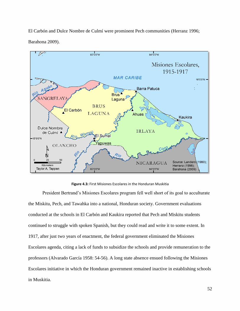
52
El Carbón and Dulce Nombre de Culmí were prominent Pech communities (Herranz 1996;
Barahona 2009).
Figure 4.3: First Misiones Escolares in the Honduran Muskitia
President Bertrand’s Misiones Escolares program fell well short of its goal to acculturate
the Miskitu, Pech, and Tawahka into a national, Honduran society. Government evaluations
conducted at the schools in El Carbón and Kaukira reported that Pech and Miskitu students
continued to struggle with spoken Spanish, but they could read and write it to some extent. In
1917, after just two years of enactment, the federal government eliminated the Misiones
Escolares agenda, citing a lack of funds to subsidize the schools and provide remuneration to the
professors (Alvarado García 1958: 54-56). A long state absence ensued following the Misiones
Escolares initiative in which the Honduran government remained inactive in establishing schools
in Muskitia.

53
Figure 4.4: Second Misiones Escolares in the Honduran Muskitia
A second attempt to develop education in La Muskitia came in 1928 during the Paz
Baraona administration (Figure 4.4). The new agenda, also named Misiones Escolares, sought to
integrate four communities from the eastern stretches of La Muskitia into the national education
framework (Alvarado García 1958; Herranz 1996; Barahona 2009; Wood et al. 2009). One
professor—Gilberto Valle Castrejón—was assigned a multi-community position to teach in the
villages of Ahuas, Kaukira, Kruta, and Mocorón (Herranz 1996: 428-429; Wood et al. 2009: 34).
His rotating work schedule required that he traverse more than 50 kilometers of hot and humid
lowland savannah to arrive in Mocorón and to navigate the network of rivers, swamps, and
lagoons to travel among Ahuas, Kaukira and Kruta. The geographically dispersed nature of these
communities and the logistics hindering travel and communication among villages prevented

54
Valle Castrejón from spending more than two or three days a week in any given community.
Figure 4.4 demonstrates the distance covered by Valle Castrejón on his rotation work schedule.
Figure 4.5: Inland canal covered by forest canopy near Ahuas (photo credit: Taylor A. Tappan)
During my thesis research, I retraced the voyage between two of Valle Castrejón’s
communities: Ahuas and Kaukira. I departed Ahuas one morning in a lancha outfitted with a
Yamaha 200-horsepower outboard motor. We left the scorching, wind-swept, pine savanna
plains of Ahuas through shallow, man-made canals that converged with a broader network of
inland canals covered by a dense forest canopy. The Miskitu driver raced the lancha with
incredible skill and precision through sharp meanders and narrow straightaways, beginning each
turn a second early so as to drift the lancha laterally into the subsequent straightaway, and then
gunning the engine to launch the boat forward. Eventually these forested canals gave way to
Caratasca Lagoon, a vast, shallow expanse of brackish water. We raced eastward mercilessly
across the length of the choppy lagoon at 50 miles per hour, rededicating our life preservers as
seat cushions, and arriving in Puerto Lempira two hours removed from Ahuas. Here we

55
disembarked, bruised and battered from the ride, and switched to a smaller lancha outfitted with
a 75-horsepower motor to cross the eastern extreme of Caratasca Lagoon on the 45-minute ride
to Kaukira. The time in transit, including our stop in Puerto Lempira, totaled four hours to
traverse the 75-kilometers of canals and lagoons between Ahuas and Puerto Lempira.
My experience demonstrates how rivers, inland lagoons, and canals still constitute
Muskitia’s transportation network in linking one community to the next. Today lancha
‘colectivos’ are fitted with outboard motors and shorten commuting times considerably for
travelers crossing the vast Muskitia region from north to south and from east to west, although
Valle Castrejón would not have benefitted from such luxuries. Even with the 75, 100, and 200
horse-power Yamaha engines that propel the lanchas across Muskitia’s network of rivers,
swamps and lagoons today, Valle Castrejon’s schedule would be nearly impossible for one
teacher working alone. The distance is too great among these dispersed communities, and travel
would have been unreliable due to volatile weather patterns. Strong winds and sudden
downpours would have prevented Valle Castrejón from traveling on many days of the year. The
failure of these second Misiones Escolares to integrate the Miskitu into national Honduran
society comes as no surprise and reflects the geographic inaccessibility of the Honduran
Muskitia and the Honduran government’s lack of understanding of Miskitu cultural landscapes.
The initiative achieved very little in fostering Spanish language education, and another long
absence from the Honduran government followed the end of the second Misiones Escolares in
Muskitia. This continued isolation of the Miskitu from broader Honduran nationalism left an
aperture for Moravian missionaries to establish baseline education in Muskitia where
government efforts had failed.

56
III. Moravian Missions and Education, 1930-1950
Figure 4.6: Diffusion of Moravian missions, 1930-1949
The Moravian Church missions arrived in Honduras shortly after the second Misiones
Escolares attempt, and their educative efforts easily surpassed those of the Honduran government
(Wood et al. 2009). Moravian missionaries were already well established along the Caribbean
coast of Nicaragua since the 1860s. Their purpose was to “spread the word,” encouraged by
German politicians who hoped to establish a colony on the Mosquito Coast of Central America
(Tillman 2011: 1). In 1930 the first Moravian mission in the Honduran Muskitia was founded in
Kaukira (Heath 1939 and 1949; Marx 1980; Wood et al. 2009; Tillman 2011).

57
As in Nicaragua, Moravian missionaries in Honduras employed a “three-pronged
approach” to evangelize the Miskitu: proselytizing, medical treatment, and education (Tillman
2011: 1). They built hospitals and schools in Nicaragua and Honduras where state facilities were
nonexistent (Breckel 1975; Marx 1980; Tillman 2011). Moravian missionaries differentiated
their practices from the mass baptisms of the Catholic Church by emphasizing “heart”
conversions in which the missionaries lived in Miskitu communities in order to maintain contact
and build congregations (Tillman 2011: 20). This willingness of the Moravians to live in Miskitu
communities and to learn the Miskitu language contributed to the success and longevity of their
efforts in Muskitia. Upon their arrival in Honduras, the Moravians found that one of the greatest
obstacles impeding their missionizing efforts was the high illiteracy rate in Muskitia (Marx
1980). They began to establish schools in the larger Miskitu villages upon their arrival to the
Honduran Muskitia, and gradually reached smaller settlements over time.
During the 1930s Moravian missionaries expanded from their original base in Kaukira to
extend their ministries to Brus Lagoon in 1933, Auka in 1935, Cocobila in 1936, and Ahuas in
1936 (Tillman 2011). These communities were selected to serve as local headquarters given the
sizeable population of each with respect to surrounding villages, and they were accessible to
riverine transportation routes within Muskitia (Figure 4.6). Smaller outlying villages with
sizeable Moravian congregations were often assigned a Miskitu lay pastor who moved to the
village and lived permanently with its residents.
The closely-knit relationship between the Moravian Church and Miskitu communities
dates back to 1930 when George R. Heath founded the Moravian missions in the Honduran
Muskitia. Heath established the first mission in Kaukira, but later moved west to Cocobila, a
community located on a narrow stretch of land between Ibans Lagoon and the Caribbean Sea,

58
where he and his wife, Marguerite, built a modest hut (Marx 1980). His mission was to continue
establishing Moravian congregations in Miskitu villages throughout the Honduran Muskitia, but
eventually Heath realized that the region was too vast for one person to work it alone by
commuting in canoe or on foot. In 1934 Dannery Downs became the first Miskitu pastor of the
Moravian Church in Honduras and was entrusted to lead the congregation in Brus Lagoon (Marx
1980: 14).
Heath was an accomplished linguist, and he became an expert in Miskitu (Marx 1980).
His impact upon Miskitu villages was noticeable up and down the coast. Every Tuesday, Heath
walked east to Río Plátano to hold church services in village homes and to tend to the sick. On
Thursdays he traveled west to Plaplaya and visited inland communities along the Río Paulaya.
Friday services were held in Cocobila, and the congregation grew with the attendance of
villagers from neighboring coastal settlements. During his spare time on Mondays and
Wednesdays, Heath taught elementary school classes in Cocobila with Marguerite, treated the
sick, and directed the construction of a mission house (Marx 1980). Through community
interaction, medical treatment, education, and the use of the Miskitu language in church services,
written texts, and education Moravian missionaries like Heath were able to further the goals of
the Moravian Church. They employed education as a strategy to convert the Miskitu, and they
propagated their evangelical efforts by allowing Miskitu men to serve as pastors in important
Miskitu communities like Brus Lagoon.
Like George and Marguerite Heath, the majority of Moravian missionaries were married
couples that lived in the Miskitu communities and regularly taught classes and administered
medical care to the sick (Tillman 2011). As such, the development of education in the Honduran
Muskitia between 1930 and the early 1950s coincided in large part with the diffusion of the
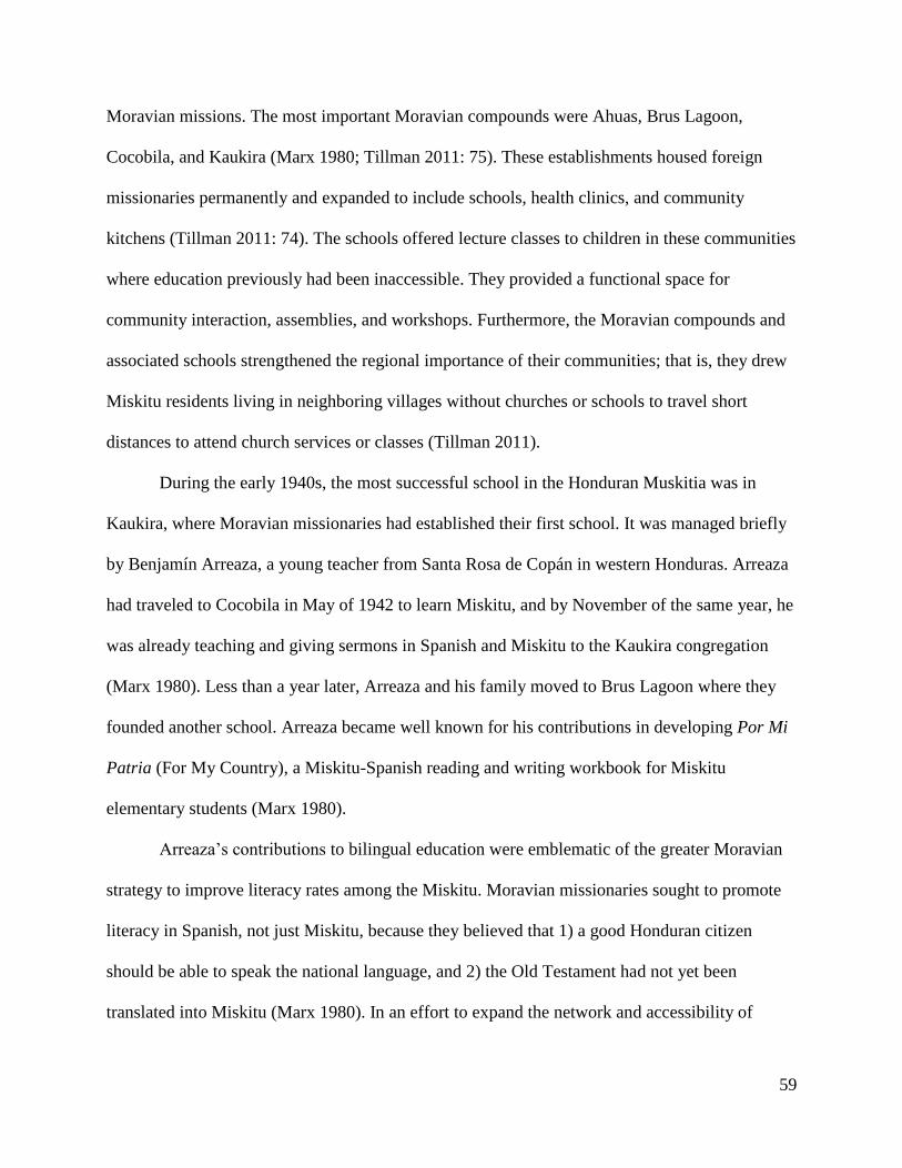
59
Moravian missions. The most important Moravian compounds were Ahuas, Brus Lagoon,
Cocobila, and Kaukira (Marx 1980; Tillman 2011: 75). These establishments housed foreign
missionaries permanently and expanded to include schools, health clinics, and community
kitchens (Tillman 2011: 74). The schools offered lecture classes to children in these communities
where education previously had been inaccessible. They provided a functional space for
community interaction, assemblies, and workshops. Furthermore, the Moravian compounds and
associated schools strengthened the regional importance of their communities; that is, they drew
Miskitu residents living in neighboring villages without churches or schools to travel short
distances to attend church services or classes (Tillman 2011).
During the early 1940s, the most successful school in the Honduran Muskitia was in
Kaukira, where Moravian missionaries had established their first school. It was managed briefly
by Benjamín Arreaza, a young teacher from Santa Rosa de Copán in western Honduras. Arreaza
had traveled to Cocobila in May of 1942 to learn Miskitu, and by November of the same year, he
was already teaching and giving sermons in Spanish and Miskitu to the Kaukira congregation
(Marx 1980). Less than a year later, Arreaza and his family moved to Brus Lagoon where they
founded another school. Arreaza became well known for his contributions in developing Por Mi
Patria (For My Country), a Miskitu-Spanish reading and writing workbook for Miskitu
elementary students (Marx 1980).
Arreaza’s contributions to bilingual education were emblematic of the greater Moravian
strategy to improve literacy rates among the Miskitu. Moravian missionaries sought to promote
literacy in Spanish, not just Miskitu, because they believed that 1) a good Honduran citizen
should be able to speak the national language, and 2) the Old Testament had not yet been
translated into Miskitu (Marx 1980). In an effort to expand the network and accessibility of

60
bilingual education throughout Muskitia, the Moravians devised a plan to construct two schools
that would serve as regional centers for students in the eastern and western zones of Muskitia.
They hoped to attract the brightest Miskitu children from each zone while the schools would
offer a comprehensive primary and secondary level education to parallel the study of the Bible
(Marx 1980).
Upon their arrival to Muskitia in 1930, the Moravians had petitioned the Honduran
government to no avail for funding to establish schools. Likewise, the Moravian plan to provide
a school for the east and west zone lacked the necessary funding to construct two separate
schools, and so only the Escuela Renacimiento (Revival School) in Brus Lagoon was sanctioned
to serve all of Muskitia. Escuela Renacimiento was established in 1951, and it quickly became
the most important in the region after the Moravians moved their church headquarters from
Kaukira to Brus Lagoon in the late 1940s (Tillman 2011: 80).
The school made Brus Lagoon one of Muskitia’s most important educational centers after
1951. It offered dormitories to students who arrived from smaller coastal communities near Río
Plátano and for children from Las Marías Batiltuk, a mixed Pech and Miskitu community
situated approximately 20 kilometers up the Río Plátano. The importance of Escuela
Renacimiento eventually attracted the attention of the Honduran government, which began to
recognize the success of the Moravians in developing education in the isolated Muskitia. The
Moravian mission in Brus Lagoon began to cooperate with the government to award scholarships
to students from throughout Muskitia to attend Escuela Renacimiento (Marx 1980). In 1959, the
Honduran government nationalized Moravian schools in Muskitia, effectively increasing its
presence in Muskitia and marking the transition to a new era of school development there
(Woodward 1988).

61
The presence of Moravian missionaries in Miskitu communities, particularly at a time
when the Honduran state was expanding education in rural indigenous and campesino societies,
played an important role, perhaps inadvertently, in strengthening Miskitu territorial identity
through education. Upon the arrival of Moravian missionaries to the Honduran Muskitia in 1930,
the state had only managed to develop education through the aforementioned Misiones Escolares
initiatives, which did little to incorporate Miskitu, Pech and Tawahka communities into a
national Honduran, Spanish-speaking identity. Moravian missionaries, though, integrated
themselves into Miskitu village culture and offered bilingual, primary school education in
Spanish and Miskitu to young children.
The accomplishments of the Moravians are noteworthy in that their efforts in the 1930s
and 1940s effectively founded baseline education in Muskitia in the wake of failed attempts by
the state. Moravian missionaries like Heath and Arreaza conquered the geographic isolation of
Muskitia and integrated their missionary efforts into Miskitu village life. This thesis brings into
question whether the geographic inaccessibility of Muskitia and recurrent state failures to
provide baseline education ultimately contributed to the preservation of Miskitu language and
culture in an era where state agendas in more accessible parts of rural Honduras aimed to
strengthen Honduran nationalism through education in the Spanish language. The development
of education was perhaps only a secondary outcome behind Moravian evangelical agendas in
Muskitia, but these contributions to Miskitu culture history should not be understated given that
government-sponsored education didn’t exist in the region until well into the 20th century.
Today the community of Ahuas is the provincial headquarters for the Moravian Church.
It was originally founded in 1936 by a Miskitu pastor, but it gained importance in the 1950s and
eventually became headquarters for its central location in Muskitia and sizeable population.
62
Samuel Marx was the first foreign missionary stationed there in 1952 where he served as a
medical doctor and a pastor (Marx 1980; Tillman 2011). During his tenure, Ahuas became a
regional hub for Alas de Socorro in 1952, the Moravian-operated airline that would transport
medical patients from more distant villages to the hospital in Ahuas, the first in the Honduran
Muskitia (Marx 1980; Tillman 2011). The Moravian hospital remains the largest medical facility
in the Honduran Muskitia and includes a hyperbaric chamber for many injured Miskitu lobster
divers suffering from decompression sickness (Tillman 2011: 82).
I visited the Moravian church in Ahuas during my field work for this research. It remains
the most prominent building in the center of the community and remains the Moravian
headquarters in the Honduran Muskitia. I learned that the building is an important part of
everyday life in Ahuas. Its size allows for it to function as a town hall with seating sufficient for
a few hundred people, where important community and regional assemblies can be held to
discuss development projects and territorial issues, to host workshops, and to provide space for
children’s activities. The compound overlooks a community soccer field where competitive
pickup games seem to materialize on a nightly basis.
The Moravian church in Ahuas reflects the level of community integration achieved by
Moravian missionaries. Many Miskitu consider themselves Moravian, and even those not
associated with the church hold it in high esteem for the contributions of Moravian missionaries
to Miskitu communities. Miskitu leader Jairo Wood summarizes Moravian influence in Muskitia
(Wood et al. 2009: 35):
Nos establecieron escuelas, nos enseñaron manualidades y nos construyeron
centros de salud y en algunos casos nos otorgaron pequeñas ayudas económicas
para que algunos estudiantes pudiéramos continuar estudiando en centros

63
educativos de ciudades próximas a la Muskitia…Ceiba, Tocoa y Trujillo, Minas
de Oro, Tegucigalpa…es que…la iglesia morava la llevamos en la sangre.
They established schools, they taught us various crafts, and they built health
centers for us, and in some cases, they gave us financial support so that a few of
our students could continue studying in schools outside Muskitia…in Ceiba,
Tocoa, and Trujillo, in Minas de Oro and Tegucigalpa…the Moravian Church
runs through our veins.
IV. Expansion of State Education, 1950-1982
In 1950 the Honduran government sent a team of educators and representatives to
Muskitia to evaluate the region’s system of education in the hopes of finding alternative
strategies to assimilate and acculturate the Miskitu into a Honduran national society (Herranz
1996). Professor Jesús Aguilar Paz, the lead investigator, prepared a radical proposal to
incorporate the Miskitu. He suggested two primary approaches to overhaul Miskitu cultural
dominance. The first proposed that the state encourage non-indigenous (Ladino) migrants to
colonize the Muskitia region. Ladino settlement was thought to improve the economic
productivity of the region as the colonists would clear the land for agriculture while
simultaneously increasing the population of Spanish-speaking inhabitants there (Aguilar Paz
1953; Herranz 1996).
Even more drastic was the second component of Aguilar Paz’s strategy: to require
Miskitu adults to serve in the military and adolescents to be sent outside La Muskitia for
education. Aguilar Paz believed that terms served by Miskitu adults in the military garrisons
would require them to learn Spanish which they would continue to use upon returning to La
Mosquitia. Children between the ages of ten and fifteen, on the other hand, would be sent outside

64
the region to live with “honorable families” of European and Mestizo descent (Aguilar Paz 1953:
20-33). While away, the children would attend school to learn Spanish and would perform
household tasks for the host family. After a period of one or two years, the students would be
permitted to return to La Muskitia to continue living and studying (Aguilar Paz 1953: 20-33;
Herranz 1996).
Although Aguilar Paz’s proposal to acculturate the Miskitu into Honduran national
culture by means of required military service for adults and the relocation of children for
education never came to fruition, his report did prove instrumental in prompting the state to
unfold a new strategy to promote national culture and primary education in the Muskitia region.
It also reflected the Honduran government’s ideologies of indigenismo and continued efforts to
shape Miskitu cultural identity and promote Honduran nationalism in order to consolidate control
over the isolated Muskitia region.
In 1950 Honduran President Juan Manuel Gálvez (1949-1954) initiated a comprehensive
campaign to establish rural schools in the Honduran Muskitia. Nearly 75 years had passed since
the height of liberal reforms in Honduras, in which Marco Aurelio Soto and Ramón Rosa had
championed rural education as a means to promote Honduran nationalism and integrate rural
communities into Honduran mestizo culture. Acuerdo 2490 fashioned the Misiones Culturales
(Cultural Missions) program that aimed to drastically alter the cultural landscapes of Muskitia
through the widespread construction of primary schools in Miskitu communities (Alvarado
García 1958: 61; Herranz 1996; Barahona 2009; Wood et al. 2009). The legislation had a
twofold objective: 1) to ‘Hispanicize’ the indigenous populations of Muskitia and 2) to confront
renewed border tensions with the Nicaraguan government that had been contesting dominion
over the eastern reaches of the Honduran Muskitia (Herranz 1996; Barahona 2009; Wood et al.

65
2009). At the time, approximately thirty primary schools were in operation throughout La
Muskitia, including those operated by the Moravians. In 1953 alone, though, the total nearly
doubled after twenty-five additional primary schools were constructed (Palacios 1954; Alvarado
García 1958; Helbig 1965; Herranz 1996). The sudden, sweeping investment by the Honduran
government to develop education in Muskitia, as well as a communications infrastructure, was a
political maneuver to consolidate territorial control over a region that had remained
geographically isolated since the Wyke-Cruz Treaty of 1859.
The ongoing border dispute with Nicaragua over the eastern margin of Muskitia ran
concurrent to Honduran government school investment in the region. The dispute became known
as the Mocorón Conflict and triggered the Honduran government to strengthen its presence in the
region by way of a political and territorial reorganization (Barahona 2009). Article 1 of the 1957
Decreto No. 52 established a new department, called ‘Gracias a Dios,’ bounded to the west by
the 85th meridian, to the north and east by the Caribbean Sea, and to the south by the Río Coco
(Creación del Departamento de Gracias a Dios 1957; Protocolo Bio-Cultural del Pueblo
Miskitu 2012). The state further consolidated control in the new department by dividing it into
two municipios, Brus Lagoon and Puerto Lempira (refer back to Figure 2.9), centered on the
most populous communities, effectively centralizing political authority in La Muskitia (Barahona
2009). This territorial consolidation shifted political power in Muskitia from the communities to
civil authorities at the state and municipal levels while the Honduran military established a
permanent presence in Gracias a Dios, which it has maintained ever since (Wood et al. 2009;
Protocolo Bio-Cultural del Pueblo Miskitu 2012).
Substantial changes to the Miskitu territorial and cultural landscapes followed as a result
of the political organization of the Department of Gracias a Dios. Annual reports from the

66
Honduran Secretaría de Educación Pública show the expansion of education to Miskitu
communities previously isolated from public schools. Changes to established indigenous land
tenure regimes paralleled a heightened emphasis on the construction of schools and the
promotion of Spanish. Immediately following the creation of Gracias a Dios, private property
became more attainable through municipal authorities, a further violation of the Wyke Cruz
Treaty and an affront to traditional ownership practices of Miskitu villages that recognized land
to be held communally (Barahona 2009). Throughout Muskitia, traditional ownership of land
develops through usufructuary rights where fields become the property of the farmer who
maintains and cultivates them, and property is inherited and transferred through kin lines
(Herlihy 1997b, 2001). The Miskitu communities also recognize fallow ownership of land when
a farmer abandons a parcel for a period of a few years in order to allow the vegetation to recover
and the soil to replenish its nutrients. Each village depends on a much greater territory for basic
subsistence than the limits of the community itself (Herlihy 1997b). The notion of private
ownership that construes land as a commodity remained largely non-existent in Miskitu
communities prior to the political organization of Gracias a Dios in 1957 (Barahona 2009).
Modifications to the state educative agenda were concurrent with the territorial
reorganization of Muskitia into its own department. President Ramón Villeda Morales (1957-
1963) initiated reforms designed to modernize rural Honduras, particularly through Spanish
education (Herranz 1996; Barahona 2009). At the national scale, Villeda Morales re-consolidated
the national system of education and endorsed a revitalization of the defunct Misiones Escolares.
The ‘Reglamento de Educación Primaria’ (Regulation for Primary Education) was approved four
years after Villeda Morales left office and recapitulated the government’s agenda from the early
1900s to acculturate indigenous groups into a national, mestizo culture (Herranz 1996: 229):
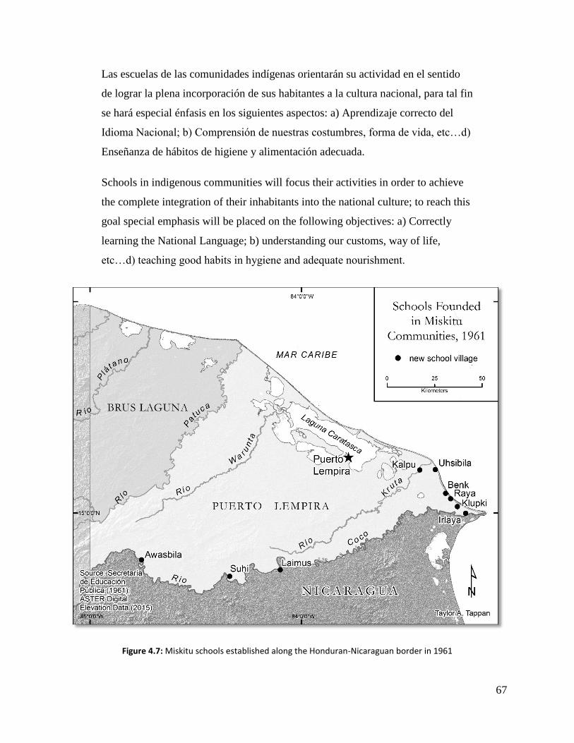
67
Las escuelas de las comunidades indígenas orientarán su actividad en el sentido
de lograr la plena incorporación de sus habitantes a la cultura nacional, para tal fin
se hará especial énfasis en los siguientes aspectos: a) Aprendizaje correcto del
Idioma Nacional; b) Comprensión de nuestras costumbres, forma de vida, etc…d)
Enseñanza de hábitos de higiene y alimentación adecuada.
Schools in indigenous communities will focus their activities in order to achieve
the complete integration of their inhabitants into the national culture; to reach this
goal special emphasis will be placed on the following objectives: a) Correctly
learning the National Language; b) understanding our customs, way of life,
etc…d) teaching good habits in hygiene and adequate nourishment.
Figure 4.7: Miskitu schools established along the Honduran-Nicaraguan border in 1961

68
The establishment of schools in the 1950s and 1960s allowed the state to further
consolidate territorial and economic control over Gracias a Dios while newly cut penetration
roads paved the way for non-indigenous colonists to settle in the region. Development initiatives
from the Secretaría de Educación Pública were carried out in smaller, more isolated villages to
provide school houses, construction materials, motorboat engines, and gasoline to those areas. In
1961 alone (Figure 4.7), the Honduran government constructed primary schools in the remote
Miskitu communities of “Gualtara, Calpo, Usibila, El Benck, Raya, Clupky, Ilaya, Leymus, Sují,
Ahuasbila, and Bocay, Olancho” (Secretaría de Educación Pública 1961: 13). The development
also included the installation of a radio tower near the mouth of the Río Coco in the village of
Tiubila to facilitate communications with the authorities and the inhabitants of those
communities.
Displaying Miskitu villages on a map where schools were constructed in 1961
emphasizes how the Honduran government used education as one component of its geographic
strategy to strengthen its presence in Muskitia. Nearly all the schools built that year border
Nicaragua, including a cluster in the easternmost villages where Nicaraguan troops had
maintained a presence until 1961. I was fortunate to stumble upon this history while reading and
photographing sections from annual reports published by the Honduran Secretaría de Educación
Pública that are catalogued in the Honduran National Archives in Tegucigalpa. Each report
details the government’s progress in fostering education for every department in the country.
Included are sketch maps, tables, and statistics that describe where schools were founded, social
development programs, enrollment figures, and school budgets. The reports, though, are in poor
condition, and the National Archives has many gaps in its records resulting from damage to the
collection by Hurricane Mitch that devastated Tegucigalpa and Comayagüela in 1998.

69
The border dispute with Nicaragua over eastern Muskitia ended when Nicaraguan
soldiers withdrew from the region in April of 1961. The Honduran government’s stance in the
dispute seems analogous to Mexican ideologies of indigenismo, as well as Regalsky and Laurie’s
(2007) concept of the ‘hidden curriculum,’ in which a state’s purpose transcends simply
providing education to rural areas. Instead, the state’s agenda is to introduce institutional
authority into these remote landscapes. A school becomes a contested space among groups
differentiated by cultural and economic status (Regaslky and Laurie 2007: 233).
Indeed, the development strategy stamped Honduran territorial control over the ‘Zona
Recuperada’ (the ‘Recovered Zone,’ known today as Villeda Morales) by marking its presence
with changes to the cultural landscape through the construction of schools and a radio tower. Not
only did these new primary schools offer education to the Miskitu communities of Zona
Recuperada including Kalpu, Uhsibila, Benk, Raya, Klubki, and Irlaya that had never been
integrated into national Honduran culture, but the schools also functioned to strengthen
Honduran territoriality in the Muskitia region against Nicaraguan lands claims. Miskitu villagers
were the recipients, or perhaps inadvertent bystanders, in this geopolitical dispute waged
between the Honduran and Nicaraguan governments. That public primary schools now offered
classes in their communities seems almost inconsequential in comparison to the schools’
alternative role as territorial buoys for the Honduran government. For twenty more years state
education politics maintained this stance to acculturate rural indigenous groups through Spanish
education. The agenda of these Miskitu schools was designed to promote Honduran nationalism
and cultural homogeneity, thus lending a comparison to Mexican indigenismo and Regalsky and
Laurie’s ‘hidden curriculum.’

70
The Honduran government’s approach to expand education in Muskitia remained static
into the early 1980s; that is, it continued to construct primary schools in Miskitu villages, slowly
staking its presence in increasingly remote areas while promoting Spanish education. Then in
1982, the reformed Law of Education suddenly altered more than a century’s worth of state
education politics, allowing for the coexistence of Spanish and indigenous languages in schools.
These reforms were concurrent with indigenous rights movements in Honduras and Central
America (Barahona 2009: 213; Molina 2015 personal communication). Young Miskitu leaders
had recently formed Muskitia Asla Takanka, or MASTA, a student political organization that
became the country’s first indigenous federation (Protocolo Bio-Cultural del Pueblo Indígena
Miskitu 2012; Molina 2015, personal communication). Jacinto Molina, a well-known Miskitu
political activist, teacher, and host of a Miskitu radio program in Puerto Lempira, was a founding
member of MASTA in 1974 and recalled in an interview how Miskitu leaders from Honduras
and Nicaragua, many of whom were young teachers, had formed a binational committee to
promote bilingual education and Miskitu territorial rights. He recounted how they even traveled
to a congreso in Panama with indigenous leaders from throughout Central America as part of a
broader movement to promote land rights and education for indigenous groups up and down the
isthmus (Molina 2015, personal communication).
As indigenous groups in Honduras and Central America began to organize to protect their
identities, state education politics gradually shifted from fostering nationalistic fervor and
cultural homogeneity to promoting bilingual education and the revitalization of indigeneity.
Construction of school buildings in rural Honduran communities gave way to a restructuring of
the national system of education and a birth of programs designed to raise literacy rates and

71
decentralize educative services. I turn to discuss these programs and the current state of
education in chapter five.

72
CHAPTER FIVE
BILINGUAL EDUCATION, PROGRAMS, AND DECENTRALIZATION IN THE
HONDURAN MUSKITIA
I. Introduction
The 1982 Law of Education marked a turning point in the development of education in
the Honduran Muskitia. It legalized the use of indigenous languages in schools, in turn creating a
demand for bilingual teachers and textbooks (Salgado and Rápalo 2012). The legislation paved
the way for the birth of educative programs, particularly geared toward bilingualism, as a new
approach to developing education in the remote Muskitia region. This emphasis on programs
departed from nearly five decades of government investment that expanded education in
Muskitia through construction of new schools in remote villages. The shift to programs after
heavy investment in the construction of schools is one indicator of a decentralization process in
the Honduran Secretaría de Educación Pública, as educative programs have been outsourced to
municipalities and NGOs (di Gropello and Marshall 2005; Parker 2005; Sawada and Ragatz
2005). By the late 1990s, primary schools existed in nearly every Miskitu village, but literacy
rates, school dropout, and grade repetition rates in Gracias a Dios remained among the worst in
Honduras (Lara Pinto 1997). In the following pages of this chapter, I argue that geographic
isolation continues to factor in the quality of education in Muskitia today. I examine bilingual
education and the decentralization of the Honduran Secretaría de Educación Pública as state
mechanisms designed to counteract the disproportionately low metrics in literacy, graduation

73
rates, and grade completion in Muskitia. The lack of geographic information related to education
and a disconnection between Miskitu territorial jurisdictions and schools exacerbates the
dichotomy between the state, as the provider of schools; and Miskitu communities, the recipients
of state-sponsored education.
II. Birth of Programs
An indigenous rights movement for territory and education gained speed in Honduras
during the late 1970s and early 1980s. The Muskitia Asla Takanka (MASTA, 1976), Federación
de Tribus Pech de Honduras (FETRIPH, 1985), and Federación Indígena Tawahka de Honduras
(FITH, 1987) indigenous federations were created by Miskitu, Pech, and Tawahka leaders,
respectively, to promote indigenous cultural heritages and strengthen their demands for land
rights and education (Herranz 1996). Constitutional reforms via the new Ley de Educación de
1982 allowed indigenous languages to be taught in schools for the first time, but bilingual
education was slow to develop in Muskitia. Honduran scholars Salgado and Rápalo (2012) were
critical of these reforms, arguing that if the Ley de Educación indeed created a structure for
launching a system of bilingual education, the constitution itself effectively impeded the
recognition of indigenous rights, thus reaffirming the status quo of a homogenous, Spanish-
speaking society. Article 6 in the 1982 Constitution maintained Spanish as the official language
of Honduras and recapitulated that the state would do all in its power to protect the integrity and
the use of Spanish in schools: “El idioma oficial de Honduras es español. El Estado protegerá su
pureza e incrementará su enseñanza—The official language of Honduras is Spanish. The state
will protect its purity and extend its instruction” (Salgado and Rápalo 2012: 145).

74
I found Salgado and Rápalo’s concerns veritable during my thesis research in Muskitia.
Most high school students I interviewed struggled to read and complete short surveys I had
drafted in Spanish that sought to collect basic information on a given student’s grade level,
school, and home community (see Appendix 1). A middle-aged nurse I met in the mixed Pech-
Miskitu community of Las Marías recalled that grade school students in her village were still
punished in the mid-1990s for speaking Pech or Miskitu in class, more than a decade after the
legalization of indigenous languages in schools. Professor Enrique Moncada, a Miskitu teacher
and founder of the Alfonzo Rugama primary school in Nueva Jerusalén, explained that language
is a constant struggle for students in Muskitia. Many young children begin classes after only
speaking Miskitu at home. Monolingual students in Gracias a Dios don’t receive the additional
attention they need to learn Spanish, and there are not enough well-trained bilingual Miskitu
teachers. School teachers and administrators are required to meet grade completion rate
standards determined by the Secretaría de Educación, so Miskitu students are often funneled
from one grade to the next despite not having learned the material (Moncada 2012 personal
communication).
Perhaps above all else, this reflects the apathetic nature and failure of the Honduran
government today to provide quality education in Muskitia. Not only are Miskitu students at a
disadvantage in attending schools that are so geographically isolated and underfunded, but the
Honduran government is complicit in allowing school administrators to advance
underperforming students from one grade to the next just so that the school’s performance
metrics will reflect positively in annual reports to the Honduran Secretaría de Educación Pública.
Professor Moncada explained that there’s little accountability for school administrators here in
Muskitia. It’s not that people don’t recognize the challenges faced by Miskitu students and

75
schools, it’s just that it’s easier to pretend they don’t exist because in Muskitia there won’t be
any repercussions (Moncada 2012 personal communication).
The education gap in Muskitia at the end of the 1980s was less determined by
accessibility to schools (in comparison to accessibility in the 1950s, for example) and more so by
how education was implemented. I interviewed Gloria Lara Pinto, an anthropologist at the
Universidad Pedagógica Nacional Francisco Morazán in Tegucigalpa, about the issues hindering
education in Muskitia. She cited the scarcity of well-trained Miskitu teachers and explained that
to her knowledge, there still are no native Miskitu speakers in Honduras that hold a doctoral
degree in linguistics or language arts. Such students would have the potential to make
contributions that could dramatically improve the quality of education in Muskitia, especially
given a native speaker’s perspective on the structure and grammar of the Miskitu language. It
isn’t just that there is a paucity of primary school teachers that are fluent in both Spanish and
Miskitu; instead those that are bilingual have never been properly trained to be able to dissect,
analyze, and teach the basics of the Miskitu language to young children. Even the more advanced
Miskitu students that manage to complete high school and enroll in a university like the UPNFM
often struggle with Spanish because they never had a context for learning it (Lara Pinto 2012
personal communication).
Statistics from surveys and censuses at the end of the 1980s demonstrated that Gracias a
Dios continued to suffer some of the highest rates of student dropout, grade repetition, and
illiteracy for all departments in Honduras. More than one-third of all residents in Gracias a Dios
were illiterate, and as much as 80 percent in the most geographically remote villages along the
upper Río Plátano and Río Patuca (Lara Pinto 1997; Cochran 2005: 196).

76
In response to these concerns, the Comité para la Educación Bilingüe Intercultural para
la Muskitia de Honduras (CEBIMH) was formed in 1990 in collaboration with Moskitia Pawisa
(MOPAWI), a Miskitu development NGO, to identify ways to improve education in Muskitia
(Herranz 1996; Lara Pinto 1997 and 2002). A survey conducted in 1992 by CEBIMH and the
Administration of Rural Primary Schools (Administración de las Escuelas Primarias Rurales,
ADEPRIR) concluded that the application of a monolingual, Spanish-based curriculum was the
primary cause of academic underperformance by Miskitu students in Gracias a Dios (Keogh et
al. 1992). The academic model assumed that children would learn Spanish in preschool and
would be fluent upon entering primary school. In larger population centers such as Brus Lagoon
and Puerto Lempira, as well as in border towns such as Leimus or Awasbila, young children are
exposed to Spanish, but in more remote regions along the middle Río Patuca or Río Plátano,
young Miskitu children tend to speak only Miskitu (Keogh et al. 1992).
CEBIMH and MOPAWI began to promote the use of Miskitu in school. Together they
published a workbook of Miskitu grammar and began negotiations with the Secretaría de
Educación Pública to introduce Miskitu as the official language for primary schools in Gracias a
Dios (Herranz 1996 and Lara Pinto 2002). Local initiatives to expand bilingual education also
received support at the national level in 1994 when President Carlos Roberto Reina signed the
Acuerdo Presidencial No. 0719-EP, considered one of the most important pieces of legislation
between the state and indigenous populations in Honduran history. The act reaffirmed the
cultural and ethnic plurality of Honduras and established a precedence to institutionalize a
framework of intercultural, bilingual education (Educación Intercultural Bilingüe, EIB) for
indigenous groups (Herranz 1996: 284-290; Salgado and Rápalo 2012: 147).
77
Bilingual education and a decentralization of the Secretaría de Educación Pública became
priorities of the Honduran government after Acuerdo Presidencial No. 0719-EP. Educative
programs were implemented concurrently with a growing indigenous movement for land rights
and access to better education. The Programa Nacional de Educación para las Etnias
Autóctonas y Afro-Antillanas de Honduras (National Program of Education for Indigenous and
Afro-Caribbean Groups in Honduras, PRONEEAH) was created to provide assistance and
guidance to indigenous communities in developing school curricula and aimed to strengthen
indigeneity in Muskitia through the revitalization of language (Lara Pinto 1997; Von Gleich and
Gálvez 1999). Educación Intercultural Bilingüe (EIB) emerged as a subcomponent of
PRONEEAH and didactic materials for schools were developed in the Miskitu language through
EIB. Indigenous communities were granted greater autonomy in designing school curricula and
administering their schools as the Honduran government initiated a movement to decentralize
and outsource its educative services.
III. Decentralization of Education and Territory
The historical geography of schools in Muskitia has been a target of nationalistic fervor
and territorial movements that sought to consolidate territorial control in the central government.
However, a new decentralized pattern of governance in Honduras began in the late 1990s and is
changing this pattern. Gracias a Dios underwent a territorial reorganization in 1996 in which its
two muncipios—Brus Laguna and Puerto Lempira—were redrawn to generate four more—
Ahuas, Juan F. Bulnes, Villeda Morales, and Wampusirpi (refer back to Figure 2.10). The move
affected the management of schools too, creating fourteen districts at the municipal level and one
Dirección Departamental de Educación Pública (departmental seat) to streamline the
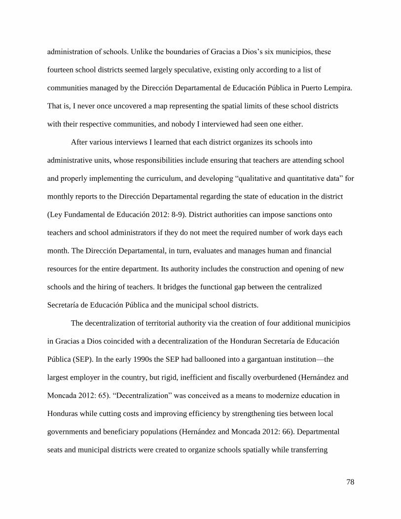
78
administration of schools. Unlike the boundaries of Gracias a Dios’s six municipios, these
fourteen school districts seemed largely speculative, existing only according to a list of
communities managed by the Dirección Departamental de Educación Pública in Puerto Lempira.
That is, I never once uncovered a map representing the spatial limits of these school districts
with their respective communities, and nobody I interviewed had seen one either.
After various interviews I learned that each district organizes its schools into
administrative units, whose responsibilities include ensuring that teachers are attending school
and properly implementing the curriculum, and developing “qualitative and quantitative data” for
monthly reports to the Dirección Departamental regarding the state of education in the district
(Ley Fundamental de Educación 2012: 8-9). District authorities can impose sanctions onto
teachers and school administrators if they do not meet the required number of work days each
month. The Dirección Departamental, in turn, evaluates and manages human and financial
resources for the entire department. Its authority includes the construction and opening of new
schools and the hiring of teachers. It bridges the functional gap between the centralized
Secretaría de Educación Pública and the municipal school districts.
The decentralization of territorial authority via the creation of four additional municipios
in Gracias a Dios coincided with a decentralization of the Honduran Secretaría de Educación
Pública (SEP). In the early 1990s the SEP had ballooned into a gargantuan institution—the
largest employer in the country, but rigid, inefficient and fiscally overburdened (Hernández and
Moncada 2012: 65). “Decentralization” was conceived as a means to modernize education in
Honduras while cutting costs and improving efficiency by strengthening ties between local
governments and beneficiary populations (Hernández and Moncada 2012: 66). Departmental
seats and municipal districts were created to organize schools spatially while transferring

79
administrative responsibilities from the central SEP to regional authorities. As a result, schools in
Muskitia were granted more autonomy in the 1990s to manage their own budgets, and through
their boards of directors, they acquired more authority to make administrative decisions (such as
recommending the hiring or dismissal of a teacher) based on the needs of the students and the
community (Hernández and Moncada 2012: 67).
The decentralization of educative responsibilities to regional authorities increased the
need for programs and bilingual education in Muskitia with the diminished role of the central
Secretaría de Educación Pública. Most rural Miskitu communities only offered classes for
educación primaria (grades 1-6) while in larger communities like Puerto Lempira and Brus
Laguna, the existing Centros de Educación Básica (CEB, grades 1-9) were overcrowded with
both local students and students from smaller neighboring villages where classes weren’t
available beyond 6th grade (Wood 2012 personal communication). Programs such as the World
Bank-sponsored Proyecto Hondureño de Educación Comunitaria (Community Education Project
of Honduras, PROHECO) responded by offering a new model to outsource educative services to
the communities themselves. Through PROHECO young Miskitu men and women who had
successfully completed a bachillerato (high school) were trained to become pre-school and CEB
teachers to improve accessibility beyond 6th grade in remote villages. PROHECO’s level of
success from one village to the next has been hit or miss, as the employment of inexperienced
and sometimes insufficiently-trained teachers has hampered efforts to improve literacy rates and
bilingualism in Miskitu villages (Hernández and Moncada 2012).
When I arrived in Muskitia to begin my thesis research, I expected such a geographically
isolated region with the country’s lowest metrics in literacy and bachillerato (high school)
graduation rates to have limited access to schools. I was surprised to learn that nearly every
80
village has at least a primary school, and that an overwhelming variety of government and NGO
programs have been put in place to improve education in Gracias a Dios. It seemed paradoxical
that many Miskitu students I met had attended school for years, yet so many in middle school
and high school still hadn’t learned to read. I searched for specific answers to this paradox in my
interviews with local students, teachers, and administrators, but it was difficult to diagnose a
one-size-fits-all response for why Miskitu students who have access to schools lag behind their
peers in other departments of Honduras. I chose to examine the spatial organization of schools in
Gracias a Dios as one approach to understand how the state is underperforming in providing
adequate education in Muskitia.
IV. Using GIS to Understand a Geographic Disconnection in Education
When I first traveled to Puerto Lempira, the capital of the Honduran Muskitia and site of
the Dirección Departamental de Educación for Gracias a Dios, it became apparent that many of
the schools I had visited in Miskitu communities did not exist in a spatial database. I had traveled
to Puerto Lempira in the hopes of finding a map of Miskitu schools in Gracias a Dios. I perused
archives at MOPAWI (a Miskitu development NGO) and interviewed representatives at the
departmental division of the Honduran Secretaría de Educación. Scott Wood Ronas, a Miskitu
teacher and representative of the Honduran Secretaría de Educación Pública, explained that a
map should exist, either in digital or paper format for the schools in Muskitia, but that he had
never seen one. He explained that public schools in every department in Honduras belong to
districts that are overseen by municipal authorities (Wood 2012 personal communication).
I modified my search in order to locate a map of the school districts in Gracias a Dios,
but apparently no such map existed either. Various offices within the Dirección Departamental

81
de Educación Pública granted interviews and underscored how a map of school districts would
be useful, but nobody had ever seen the spatial extents of the districts. Nearly everyone
mentioned the lack of institutional support that Gracias a Dios receives from the central
Secretaría de Educación Pública. I was referred to no avail from one office to another in search
of any map related to education in Muskitia and eventually left Puerto Lempira without one.
Figure 5.1: Screenshot of interactive schools map of Honduras with no data for Gracias a Dios (SEP 2014: http://estadisticas.se.gob.hn/portal/portal.php)
Upon returning to Kansas I began constructing a digital database for schools in Gracias a
Dios. The Honduran Secretaría de Educación Pública website offers reports, statistical analyses,
available downloads in spreadsheet format for raw data including enrollment totals, graduation
and dropout rates, gender-based statistics, and number of teachers in each school. I found an
interactive map (which has since been removed and is being redesigned; see Figure 5.1,
http://sace.se.gob.hn/estadistica/comparativo/2014-2015) of the Republic of Honduras, which
allowed the user to view public schools—represented as small icons—in all but three of the 18
82
departments in Honduras. Clicking on an icon would open a dialogue box that indicated the
name of the school, its corresponding neighborhood and municipio, generally one or two
statistics, such as the school’s enrollment and how many teachers were employed there. As it
were, though, Gracias a Dios was one of the departments lacking data. The map offered no
information on schools in the department.
The SEP’s portrayal of Gracias a Dios as a vast, empty expanse demonstrates the
geographic disconnect between the state and Miskitu communities. Neither the Dirección
Departamental de Educación in Puerto Lempira nor the central SEP seemed to manage a spatial
GIS coverage of schools in Gracias a Dios. Schools in each department fall under the jurisdiction
of school districts, which in turn are ascribed to municipalities, but in Muskitia which school
belonged to which district is not common knowledge. The Ley Fundamental de Educación
(2012) requires school districts to report monthly to the Dirección Departamental de Educación,
and a local district director purportedly manages a budget to implement the educative objectives
of the SEP and to provide mentorship to his district. In Muskitia, though, financial resources are
very limited. Miskitu teacher Scott Wood explained to me that there are no school district
directors in Gracias a Dios that report directly to the Dirección Departamental de Educación in
Puerto Lempira. This lack of coordination and oversight at the district level indicates a broader
geographical disorganization in the Secretaría de Educación and also demonstrates the limited
competency of the six municipios in Gracias a Dios to manage schools. In a broken chain of
command, they too lack the resources or political will to manage effectively the schools and
corresponding districts that fall within their jurisdiction.
I argue that this disconnection is exacerbated by the lack of a simple spatial coverage that
displays public schools in Gracias a Dios and their respective districts. When I inquired about

83
schools and their corresponding districts at the Dirección Departamental de Educación Pública in
Puerto Lempira, I was referred to the office that manages the tabular data and statistics for
schools in Gracias a Dios. The employees there kindly promised to send me information on
schools and their districts, but first they acknowledged that the information wasn’t ready and
would have to be assembled. This same disconnection has plagued the management of spatial
data in other government agencies in Honduras too; the National Geography Institute (IGN), the
Honduran Land Management Program (PATH II), and the Honduran Property Institute (IP) have
all reportedly managed three distinct GIS vector coverages for municipal boundaries in Gracias a
Dios (see Central America Indígena Project 2014).
After my research in Puerto Lempira, I turned to the SEP’s website and eventually
located a spreadsheet of schools in Gracias a Dios. The list provided the names of the schools in
the department alongside their respective communities and villages. As I began to organize and
clean the list, mostly to standardize the spelling of Miskitu names and villages, I noticed that the
list could be structured to fit a spatial GIS database, although it did not contain geographic
coordinates for any of the schools. Each school was assigned a numerical code to identify the
school and its corresponding department and municipio in Honduras. Puerto Lempira’s Centro
de Educación Básica, called Ramón Rosa, was coded as 90100002, where 9 indicates Gracias a
Dios, the ninth department (listed in alphabetical order); 01 designates Puerto Lempira, the first
municipio registered in the department; and 00002 specifies Escuela Ramón Rosa, the second
school in Puerto Lempira to be entered into the database. I continued to order and clean the list
with respect to the GIS coding system. I added a column to include school formation dates,
which I populated with records obtained from the SEP’s annual reports that I researched in the
Honduran National Archives in Tegucigalpa and from information available on the SEP’s

84
website. In sum, I compiled a comprehensive digital spreadsheet of public schools and their
villages in Gracias a Dios, formation dates for most of the schools, and with all entries ordered in
a GIS coding system (see appendix for complete list of schools).
In October 2012, I received a document via email from colleagues I had met at the
Dirección Departamental de Educación in Puerto Lempira listing the fourteen school districts in
Gracias a Dios and the Miskitu communities that fall within the jurisdiction of each. I began to
incorporate the district numbers into my digital GIS database to reflect schools in Gracias a Dios
and their respective districts (Figure 5.2). My objectives were to generate a coarse-scale map of
schools in Gracias a Dios and to represent spatially the fourteen school districts in the
department.
Approximate Enrollment and Teacher Employment Totals for Gracias a Dios, 2014
District # District Location # Schools # Students # Teachers
1 Puerto Lempira 39 6931 261
2 Brus Laguna 18 2785 126
3 Villeda Morales 25 2833 85
4 Ahuas 41 3405 154
5 Juan F. Bulnes 21 1282 76
6 Wampusirpi 25 1592 78
7 Puerto Lempira 33 2479 108
8 Puerto Lempira 45 2408 76
9 Puerto Lempira 26 1627 59
10 Puerto Lempira 27 1825 47
11 Brus Laguna 21 1570 71
12 Puerto Lempira 21 1666 65
13 Wampusirpi 8 712 20
14 Juan F. Bulnes 8 835 22
Total 358 31,950 1248
Figure 5.2: Schools, students, and teachers in the 14 districts of Gracias a Dios (adapted from SEP 2014)

85
Figure 5.3: Spatial representation of primary schools and school districts in Gracias a Dios
To map the public schools in Gracias a Dios I joined my coded GIS database to a vector
point file using ArcGIS software. I used an existing spatial coverage of Miskitu settlements
based on Herlihy and Leake’s (1993) subsistence zone map to approximate school locations with
respect to their communities. My school data are thus limited to the precision of the Herlihy and
Leake (1993) Miskitu settlement vector shapefile and do not attempt to reflect a given school’s
location at a scale finer than 1:300,000. Nevertheless, my results include a coarse-scale map of
the more than 150 public schools in Gracias a Dios and a spatial approximation of the fourteen
school districts that encompass them (Figure 5.3).
The fourteen district limits in Figure 5.3 are speculative and represent approximations
based on drawing lines to encompass the outermost schools in a given district. Nevertheless, the

86
rendering seems logical based on the geography of Gracias a Dios and Miskitu village settlement
patterns. Near Laguna Caratasca and its surrounding system of inland lagoons, swamps, and
canals, districts appear to be based on natural groupings of schools and their villages. District 7,
for example, encompasses the large community of Kaukira and its numerous neighborhoods and
nearby villages that extend east to Río Kruta. District 3 corresponds to all schools within Villeda
Morales, the smallest municipio by area in the department. District 9 is much larger, extending
west from the vast pine savanna near Puerto Lempira to Mocorón, where the savanna gives way
to tropical rainforest. The dispersed communities in District 9 are interconnected by a gravel
carretera (road) whose main path runs from Puerto Lempira to Mocorón, and then south to the
border village of Leimus along the Río Coco. Districts 4, 6, 10, and 11 are more linear in nature
and reflect Miskitu settlement patterns along the banks of the Río Plátano, Río Patuca, and Río
Kruta, from west to east. All districts are confined to a single municipio with the exception of
District 13, which crosses the 85th meridian into the Department of Olancho. The schools in
District 13 belong to villages of mixed Miskitu and Tawahka residents. Geographically and
culturally, these villages are more characteristic of indigenous settlements in Gracias a Dios than
the predominantly Ladino settlements of Olancho. Consequently, teachers are sent from the
Dirección Departamental in Puerto Lempira to offer classes in these schools.
My depiction of the fourteen districts in Gracias a Dios is not an official rendering of
their spatial limits. The boundaries are not based on any existing map and were drawn simply to
enclose those schools common to a particular district, but the portrayal demonstrates the
decentralized spatial organization of education in Gracias a Dios. That fourteen school districts
were created for only six municipios suggests a fragmentation of authority and a limited
competency of municipal governments in the management of public schools within their

87
boundaries. I posit that this is a logical consequence of miniscule budgets for school districts and
municipal governments, as well as a result of the geographic isolation of many Miskitu
communities in Gracias a Dios. Municipal governments in Muskitia simply don’t have the
funding for a centralized oversight of schools within their jurisdiction. Thus, decentralization of
administrative authority becomes a logical and economically favorable approach to manage the
clusters of more than 150 primary schools in the department.
Without these localized forms of spatial management and authority imbued by school
districts, schools in the most remote reaches of Muskitia would be even further removed from
core curricula and educative initiatives of the central Secretaría de Educación Pública. I concede
that geographically isolated communities are already at a disadvantage in receiving quality
education—they often lack materials, space, and properly-trained teachers—but I argue that their
condition is further exacerbated by the lack of spatial data in the Honduran Secretaría de
Educación Pública and its Dirección Departamental de Educación in Puerto Lempira. How can
educative services be delivered to remote Miskitu schools if regional authorities don’t know
where they are? The concejo territorial, a new decentralized indigenous territorial jurisdiction
that is unfolding in the Honduran Muskitia at the time of this thesis research, may serve to
support localized spatial management of schools. I turn to discuss the concejo territorial as a
form of indigenous territorial autonomy that has the potential to strengthen education in Miskitu
schools while bridging a functional gap between Miskitu communities and the Honduran
Secretaría de Educación Pública.

88
V. Decentralization and Concejos Territoriales
Decentralization policies in Honduras during the past twenty-five years have extended
beyond the education sector. While bilingual education was gaining traction in the early 1990s,
the Miskitu were beginning to redefine their collective territorial identity. They established local
land ‘committees’ under MASTA, the umbrella political federation for the Miskitu (Protocolo
Bio-cultural del Pueblo Indígena Miskitu 2012). Each of these committees encompassed
numerous communities and sought to consolidate political power at a local level and to promote
Miskitu rights to land and resources (Protocolo Bio-cultural del Pueblo Indígena Miskitu 2012:
15). These land committees were the groundwork for new concejos territoriales—multi-village
scale indigenous territorial jurisdictions--that began receiving land titles from the Honduran
Instituto Nacional Agrario (INA) in 2012 (Galeana and Pantoja 2013).
For decades INA and the Instituto de Conservación Forestal (ICF) have held title over
the approximately 17,000km2 of land in the Honduran Muskitia (Herlihy 1997a, 2001; del Gatto
2015). Indigenous groups in Honduras including the Tolupán, Lenca, and Garífuna had received
land titles from INA previously, but only at the scale of the community and its immediate
surroundings (Herranz 1996; Herlihy 1997b; Barahona 2009; del Gatto 2015). Agrarian reform
laws of the 1970s-1990s bypassed Miskitu communities in their efforts to acquire legal
recognition over their ancestral homelands and functional subsistence use areas, but broader
indigenous rights movements in Latin America, international conventions like ILO 169, and the
determination of Miskitu leaders provided an impetus for the devolution of national lands in
Honduras to the Miskitu (del Gatto 2015). Participatory Research Mapping (PRM) experiences
in the 1990s further contributed by empowering MASTA and MOPAWI (a Miskitu development

89
NGO) to use resulting maps to petition for land titles from INA, but no legal precedence or
framework existed to permit the transfer of titles to local land ‘committees’ (Herlihy and Knapp
2003; Galeana and Pantoja 2013). Then in 2004, World Bank funding in Honduras supported the
Programa de Administración de Tierras de Honduras (PATH), a comprehensive land
management program designed to strengthen property rights in Honduras (Galeana and Pantoja
2013).
Figure 5.4: New concejos territoriales covering nearly all of Gracias a Dios
Since its inception, PATH has worked through the Honduran Institute of Property to
address policy reforms in land management, including the demarcation and titling of the local
land ‘committees,’ or concejos territoriales, in Muskitia. In order to receive a title, a concejo
90
territorial must apply for and receive its personería jurídica (legal status). In August 2012,
KATAINASTA (established in 1993 and encompassing nearly 50 communities along the shores
of Caratasca Lagoon today) was the first concejo territorial to receive its title (Protocolo Bio-
cultural del Pueblo Indígena Miskitu 2012; Galeana and Pantoja 2013). Seven more concejos
territoriales have received title since 2012, and eight more are currently negotiating for title in
the Honduran Muskitia (Figure 5.4).
These new concejos territoriales represent large areas of functional land and resource use
zones shared by multiple communities. Their boundaries are permeable, reflecting traditional
Miskitu overlapping land use and subsistence patterns (Galeana and Pantoja 2013). This
permeability allows Miskitu residents of one community to cross concejo territorial boundaries
in order to maintain basic subsistence livelihoods like fishing or hunting. The titling of the
concejos territoriales now offers unprecedented expanses of land, resources, and local political
autonomy to the Miskitu communities that lie within their boundaries.
While the decentralization of the Honduran government and the devolution of territory to
the concejos territoriales signify a major victory for Miskitu communities in their struggle to
acquire legal access to their ancestral homelands, concerns related to the long-term governance
structures of each concejo territorial still exist. Once titled, the concejo territorial must develop
its ordenamiento territorial, or governance structure for the management of its land and
resources. Concejos territoriales are governed jointly by the communities that fall within their
jurisdiction, but their boundaries complicate the geo-political landscape of Gracias a Dios
because they do not coincide with the existing municipal limits.
Further obscuring land tenure circumstances in Gracias a Dios are the municipal capitals
that already possess their own community land titles of their casco urbano (the primary urban

91
core of a municipio that is generally more densely inhabited and developed than surrounding
areas). These casco urbano titles predate the existence of the concejos territoriales, and disputes
are surfacing about how to negotiate the continual urban growth of these communities beyond
their limits into the functional areas of the concejos territoriales (Galeana and Pantoja 2013: 11).
How will concejo territorial authorities and municipal authorities work together or compete for
political power? Will governance responsibilities change for municipal governments with the
establishment of concejos territoriales? Should municipalities in Gracias a Dios be dissolved
altogether and replaced by concejos territoriales as local governance authorities? These concerns
have not yet been resolved, but they may be key to the long-term success or failure of the
concejos territoriales.
Just as the school originated in Muskitia as a contested space through which the state
pitted itself against the Miskitu to promote Spanish, Honduran nationalism, and cultural
homogeneity, I posit that now it has the potential to strengthen Miskitu cultural identity and
territoriality as increasing levels of autonomy are granted to the Miskitu through the
decentralization of education and territory. This thesis brings into question but cannot yet
provide answers for what changes to education in Muskitia are brought about by the advent of
concejos territoriales. Their limits superimpose yet another set of boundaries onto an already
complex geopolitical and administrative landscape in which both the central Secretaría de
Educación de Honduras and municipal authorities have struggled to manage Miskitu schools
spatially. The fourteen school districts in Gracias a Dios seem only to exist on paper or in theory,
while municipal governments lack the funding and political will to oversee the schools within
their jurisdictions. Perhaps the concejo territorial will provide greater local autonomy and a
stronger governance structure for Miskitu communities to manage their schools and improve the

92
quality of education in a geographically-isolated region where students continue to suffer from a
dearth of educational opportunities.
My research leads me to conclude that both municipio and school district boundaries in
Gracias a Dios should be redrawn to coincide with the limits of the emerging concejos
territoriales. This would simplify the geopolitical and administrative landscape and would
increase local autonomy in Miskitu communities. Concejo governments would serve as
intermediaries to bridge the functional gap among schools and the central Secretaría de
Educación de Honduras. The spatial organization of schools would be a function of the
clustering of communities into their respective concejos territoriales rather than in poorly-
defined school districts forgotten by weak municipal governments. Local concejo authorities and
citizens alike should work together to implement school curricula that will educate and empower
Miskitu students to be able to make effective decisions regarding the management of their
territory and resources and to be able to organize in order to facilitate change.
Ultimately time will indicate the competency of the concejos territoriales in governance
and the correlation of each to its schools. Will they replace or work alongside the municipio as
the multi-village scale political unit? Will boundaries of new school districts be redrawn to
coincide with the spatial jurisdiction of each concejo territorial? Will the Secretaría de Educación
de Honduras transfer authority to Miskitu communities in the designing of school curricula and
the administration of public schools in Muskitia? These uncertainties relate to the long-term
governance and ultimate success of these new indigenous territorial jurisdictions. Local
governments of concejo territoriales will have to confront these issues if they are to improve the
conditions and accessibility of education in Miskitu communities while concurrently fostering
Miskitu cultural identity and territoriality.

93
CHAPTER SIX
CONCLUSION
This thesis has explored the historical role of the school as a mechanism to express
territorial identity in the Honduran Muskitia. Much emphasis has been placed on how the
Honduran government has sought to employ the school and Spanish-based education to promote
nationalism and to consolidate territorial control over Muskitia. Miskitu cultural identity and
language has survived the state’s integrationist policies in large part due to the geographic
isolation of the region that hindered state agendas to acculturate Miskitu communities through
formal education. Indigenous rights movements for land and bilingual education accelerated in
the 1980s, causing a slow reversal of state policies that sought to assimilate and acculturate
indigenous groups into a homogenous mestizo society. The newly-forming concejos territoriales
now have the potential to provide the opportunity for Miskitu communities to construe their own
territorial identities through schools.
I employed a cultural historical approach of the Sauerian tradition (see Herlihy,
Mathewson, and Revels 2008; Mathewson 2011) in this thesis research to examine the
geography of education in the Honduran Muskitia. Specifically, I addressed two major themes in
this thesis: 1) where did schools originate in Muskitia and how did they diffuse throughout the
region? and 2) what role have schools played in negotiating territorial identity in Muskitia? In
turn, this place-based methodology helped me to gain insight into a host of related cultural and
territorial issues. My original research on the origin and diffusion of schools in Muskitia
provided an avenue to understand the cultural and geographic landscapes of the region and the
various phases of territorial organization in Muskitia.
94
My thesis research has led me to conclude that above all else, the geographic isolation of
Muskitia has been a determining factor in the origin and diffusion of schools. State hegemonic
policies related to the indigenismo political ideologies in Mexico originally tried to exploit
schools to consolidate territorial control over the isolated Muskitia through Spanish language
education while suppressing Miskitu language and culture. Somewhat ironically, however, the
geographic isolation of the region benefitted Miskitu culture in that state assimilation and
acculturation initiatives struggled to reach La Muskitia. Consequently Miskitu language never
suffered the dramatic decline encountered by the Lenca, Chortí-Maya, and other indigenous
groups in Honduras.
The Miskitu communities of Kaukira, Ahuas, and Brus Lagoon represent the origin of
education in Muskitia. They were among the first communities to receive schools in the
Misiones Escolares program in 1915 that established schools in eight communities (El Sumal,
Dulce Nombre de Culmí, El Carbón, Ahuas, Barra Patuca, Kaukira, Brus Lagoon, and
Yapuwas). Each community was strategically chosen so as to reach the isolated Miskitu, Pech,
and Tawahka populations. A second Misiones Escolares attempt assigned a floating work
schedule among Miskitu villages to Professor Gilberto Valle Castrejón, but the geographic
inaccessibility of Muskitia effectively curbed both efforts to develop baseline education for the
Miskitu.
Beginning in the 1930s, Moravian missionaries successfully expanded education in
isolated Miskitu communities in the wake of failed state attempts to establish schools. They
achieved their goals by proselytizing, educating, and offering medical treatment to the Miskitu. I
argue that through its geographic isolation, Miskitu territoriality ensued as an unintended
consequence of Moravian schools. The Moravians offered spaces where Miskitu students could

95
gain the upper hand through education in their struggle against the state’s cultural
homogenization initiatives. Moravian missionaries lived among the Miskitu in rural
communities, entrusted Miskitu men to work as pastors, and emphasized the importance of
education while employing the Miskitu language in schools and in written texts. These efforts
helped to establish baseline education in Muskitia where state attempts had failed to do so. Over
the course of the 20th century, Moravian churches became integral components of the Miskitu
settlement landscape and remain visible in Miskitu communities today.
When I began my thesis research in 2012, I expected to find that schools had functioned
historically to promote Miskitu culture and territoriality. My research, however, has led me to
conclude that schools have functioned for much longer as mechanisms of the state to implement
cultural assimilation agendas through Spanish-based education and to serve as territorial buoys
that mark the state’s presence in Muskitia. This is strongly evidenced in the 1950s when the
Honduran government initiated a sweeping campaign to build schools in Muskitia through the
Misiones Culturales program. Government policies continued to parallel the post-revolutionary
ideologies of indigenismo in Mexico, where constructing a mestizo identity was construed as a
necessary means for modernizing a new nation-state (Taylor 2005). However, state attempts to
integrate the Miskitu into a national identity remained largely ineffective due to the geographic
isolation of the region.
My research leads me to conclude that poor spatial management of schools in Miskitu
communities today is evidenced by the disorganization of the fourteen school districts. The
geographic disconnection between municipal authorities and school administrators is a causal
factor in slowing accessibility and hindering the quality of education in Muskitia. I have
discussed how education in Muskitia has always carried its own agenda, which has often been

96
intertwined with issues of territoriality. The latest change in Miskitu territoriality is the
establishment of concejos territoriales—new multi-village scale indigenous territorial
jurisdictions in Muskitia. These recently-titled lands add to the territorial complexity of the
region, and time will tell whether they will find a common nexus with existing municipal and
school district boundaries.
At the same time, I argue that the advent of the concejos territoriales now represents an
opportunity of self-determinism for Miskitu communities in developing education in their
schools. School curricula in Muskitia today contrast previous government policies that sought to
exploit education as a mechanism to suppress Miskitu language, culture, and territoriality.
Schools should represent spaces to reinvigorate the collective memory of Miskitu communities
and to link their present circumstances with those of their ancestors living on the same land in
pre-colonial times (Barahona 2009). Primary schools exist in nearly every Miskitu community,
and the majority of teachers in these schools are Miskitu (Lara Pinto 1997). Schools are an
integral component of Miskitu settlement landscape, and perhaps above all else they allow for
the preservation of the Miskitu language, the most defining factor in Miskitu cultural identity.
The Miskitu have historically proven resilient against threats to their cultural and territorial
identities, particularly in that Miskitu culture today seems to have selectively assimilated traits
and elements of language from other cultures without losing its own.
Just as Miskitu identity is articulated through language, so too is it expressed through a
sense of place in Muskitia. These new concejos territoriales are continuing to unfold at the time
of this thesis and represent an opportunity for the Miskitu to produce their own official history
and collective memory. I posit that schools will need to play a substantial role in the long-term
success of these new indigenous territorial jurisdictions. Just as each multi-village concejo

97
territorial will need a governance structure and a resource management plan, so too should
Miskitu leaders integrate schools into the framework as functional places to teach Miskitu
language, norms, culture, and geography. Since school districts in Muskitia do not appear to be
defined spatially, I conclude that the concejo territorial should be the new administrative body
overseeing the management of public schools within its boundaries. The remoteness of La
Muskitia and the geographic disconnection among the central Honduran Secretaría de
Educación, the municipios, and the school districts will provide an opening for the Miskitu and
the concejos territoriales to gain domain over schools as places where the expression of Miskitu
cultural and territorial identity becomes manifest.

98
REFERENCES
Aguilera Montoya, Héctor Leonel. La Experiencia de la Educación Intercultural Bilingüe en
Honduras. Tegucigalapa, Honduras: Secretaría de Estado en los Despachos de Pueblos
Indígenas y Afrohondureños; Universidad Pedagógica Nacional Francisco Morazán,
2012. Print.
Aikman, Sheila. Intercultural education and literacy: an ethnographic study of indigenous
knowledge and learning in the Peruvian Amazon. Amsterdam, Netherlands: John
Benjamins Co., 1999. Print.
Alvarado García, Ernesto. Legislación Indigenista. México: Instituto Indigenista Interamericano,
1958. Print.
Barahona, Marvin. Pueblos Iindígenas, Estado y Memoria Colectiva en Honduras. Tegucigalpa,
Honduras: Editorial Guaymuras, 2009. Print.
Batalla, Guillermo Bonfil and Philip A. Dennis. México profundo: reclaiming a civilization.
Austin, TX: University of Texas Press, 1996. Print.
Central America Indígena Project. “Land Rights and Stability in Indigenous Societies of Central
America.” A three to five year geographic research project of the University of Kansas
and the American Geographical Society. Sponsored by the U.S. Department of Defense

99
Minerva Initiative for university-led research. Lawrence, KS, 2013-2015. Web.
<www.prmapping.res.ku.edu>
Civera Cerecedo, Alicia. “Introducción: Hacia el Estudio de la Escuela de los Campos
Latinoamericanos.” Campesinos y escolares: la construcción de la escuela en el campo
latinoamericano, siglos XIX y XX. Ed. Alicia Civera Cerecedo, Juan Alfonseca Giner de
los Ríos, and Carlos Escalante Fernández. El Colegio Mexiquense, A.C., 2011. 5-24.
Print.
Cochran, David M. The Sustainability of Shifting Cultivation in Rain Forest Conservation:
Participatory Mapping the Cultural Geography of Native Peoples in the Río Plátano
Biosphere Reserve, Honduras. University of Kansas: Ph.D. diss., 2005. Print.
Conzemius, Eduard. Ethnographic Survey of the Miskito and Sumu Indians of Honduras and
Nicaragua. Smithsonian Institution. Bureau of American Ethnology, Bulletin 106.
Washington, D.C.: U.S. Government Printing Office, 1932. Print.
Corrêa Werle, Flávia Obino and Ana Maria Carvalho Metzler. “Instituciones y prácticas en las
escuelas rurales del sur de Brasil.” Campesinos y escolares: la construcción de la escuela
en el campo latinoamericano, siglos XIX y XX. Ed. Alicia Civera Cerecedo, Juan
Alfonseca Giner de los Ríos, and Carlos Escalante Fernández. El Colegio Mexiquense,
A.C., 2011. 393-426. Print.
100
Creación del Departamento de Gracias a Dios (1957). Tegucigalpa, Honduras: Secretaría de
Relaciones Exteriores de la República de Honduras, 1957. Print.
Davidson, William V. Historical Geography of the Bay Islands, Honduras: Anglo-Hispanic
Conflict in the Western Caribbean. University of Wisconsin-Milwaukee: Ph.D. diss.,
1972. Print.
Del Gatto, Filippo. “La titulación de territorios indígenas en La Muskitia hondureña: explorando
sus implicaciones para los pueblos autóctonos del país.” Forest Trends, Aug. 2015. Web.
Accessed 21 Sept. 2015 <www.forest-trends.org>.
Di Gropello, Emanuela and Jeffery H. Marshall. “Teaching Effort and Schooling Outcomes in
Rural Honduras.” Incentives to Improve Teaching: Lessons from Latin America. Ed.
Emiliana Vegas. Washington, D.C.: The World Bank: Directions in Development, 2005.
Print.
Dodds, David J. “Lobster in the Rain Forest: The Political Ecology of Miskito Wage Labor and
Agricultural Deforestation.” Journal of Political Ecology, Vol. 5 (1998): 83-108. Print.
--- “The Miskito of Honduras and Nicaragua.” Endangered Peoples of Latin America: Struggles
to Survive and Thrive. Ed. Susan C. Stonich. Westport, CT: Greenwood Press, 2001. 87-
99. Print.
101
Edwards, Clinton. Aboriginal Water-craft of Western South America: Distribution, History and
Problems of Origin. University of California Berkeley: Ph.D. diss., 1962. Print.
Floyd, Troy. The Anglo-Spanish Struggle for Mosquitia. Albuquerque: University of New
Mexico Press, 1967. Print.
Galeana, Fernando and Enrique Pantoja. “Strengthening Indigenous Peoples’ Land Tenure
Governance: the Case of the Miskito People in Honduras.” Annual World Bank
Conference on Land and Poverty 2013. Washington, D.C., April 8-11, 2013. Web.
Accessed 3 May 2014
<http://www.academia.edu/4314700/Strengthening_Indigenous_Peoples_Land_Tenure_
Governance_the_Case_of_the_Miskito_People_in_Honduras>.
Galvin, Peter R. Patterns of Pillage: A Geography of Caribbean-based Piracy in Spanish
America, 1536-1718. New York, NY: Peter Lang Publishing, Inc., 1999. Print.
George, Rollins. Personal communication. July 10-24, 2012, Kuri, Honduras.
Gonzales, Michael J. The Mexican Revolution, 1910-1940. Albuquerque: University of New
Mexico Press, 2002. Print.
Hall Carolyn, Héctor Pérez Brignoli, and John V. Cotter. Historical Atlas of Central America.
Norman, OK: University of Oklahoma Press, 2003. Print.

102
Heath, George Reinke. Periodical Accounts Relating to the Foreign Missions of the Church of
the United Brethren, Second Century. No. 107 (1939): 102-107. Print.
---Beginnings in Honduras. Moravian, Vol. 94, No. 23 (1949): 1-2. Print.
Helbig, Karl M. Áreas y Paisajes del Noreste de Honduras. Tegucigalpa: Banco Central de
Honduras, 1965. Print.
Helms, Mary. Asang: Adaptations to Culture Contact in a Miskito Community. Gainesville, FL:
Univesity of Florida Press, 1971. Print.
---“Miskito Slaving and Culture Contact: Ethnicity and Opportunity in an Expanding
Population.” Journal of Anthropological Research, Vol. 39, No. 2, 1983: 179-189. Print.
---“Miskito.” Encyclopedia of World Cultures, Vol. III: Middle America and the Caribbean. Ed.
J.W. Kemper. New York, NY: G.K. Hall & Co., 1995. 170-172. Print.
Herlihy, Peter H. A Cultural Geography of the Emberá and Wounan (Chocó) Indians of Darién,
Panama, with Emphasis on Recent Village Formation and Economic Diversification.
Louisiana State University: Ph.D. diss., 1986. Print.

103
---. “Central American Indian Peoples and Lands Today.” Central America: A Natural and
Cultural History. Ed. Anthony G. Coates. Yale University Press, 1997a. 215-240. Print.
---“Indigenous Peoples and Biosphere Reserve Conservation in the Mosquitia Rainforest
Corridor, Honduras.” Conservation through Cultural Survival. Ed. Stan Stevens.
Washington, D.C.: Island Press, 1997b. 99-129. Print.
---“Indigenous and Ladino Peoples of the Río Plátano Biosphere Reserve, Honduras.”
Endangered Peoples of Latin America: Struggles to Survive and Thrive. Ed. Susan C.
Stonich. Westport, CT: Greenwood Press, 2001. 101-120. Print.
Herlihy, Peter H. and Andrew P. Leake. “Tierras Indígenas de la Mosquitia Hondureña: 1992
Zonas de Subsistencia.” Instituto Geográfico Nacional, Tegucigalpa, Honduras, 1993.
Map document, 1:500,000 scale. Web. Accessed 28 June 2015 <
http://www.prmapping.res.ku.edu/zonas_subsis_1992.pdf>.
Herlihy, Peter H. and Laura Hobson Herlihy. “La Herencia Cultural de la Reserva de la Biósfera
del Río Plátano: Un Área de Confluencias Étnicas en la Mosquitia.” Herencia de Nuestro
Pasado: La Reserva del Río Plátano. Ed. Vicente Murphy. Tegucigalpa: Ventanas
Tropicales, 1991. 9-15. Print.
Herlihy, Peter H. and Gregory Knapp. “Maps of, by, and for the Peoples of Latin America.”
Human Organization, Vol. 62, No. 4, 2003. 303-314. Print.

104
Herlihy, Peter H., Kent Mathewson and Craig Revels, eds. Ethno- and Historical Geographic
Studies in Latin America: Essays Hondoring William V. Davidson. Baton Rouge, LA:
Geoscience Publications, 2008. Print.
Hernández, Bessy Dolores and German Edgardo Moncada. “Estado actual de la
descentralización educative en Honduras.” Estado de la Educación en Honduras. Ed.
Ramón Salgado and Renán Rápalo. Tegucigalpa, Honduras: Universidad Pedagógica
Nacional Francisco Morazán, 2012. 59-78. Print.
Herranz, Atanasio. Estado, sociedad y lenguaje: La política lingüística en Honduras.
Tegucigalpa, Honduras: Editorial Guaymuras, 1996. Print.
Hobson Herlihy, Laura. The Mermaid & the Lobster Diver: Gender, Sexuality, and Money on the
Miskito Coast. Albuquerque, NM: University of New Mexico Press, 2012. Print.
Hornberger, Nancy. Bilingual education and language maintenance. Dordrecht, Netherlands:
Foris Publications, 1988. Print.
Jiménez, Iván Molina. “Educación Primaria Rural en Costa Rica, 1812-1885.” Campesinos y
escolares: la construcción de la escuela en el campo latinoamericano, siglos xix y xx. Ed.
Alicia Civera Cerecedo, Juan Alfonseca Giner de los Ríos, and Carlos Escalante
Fernández. El Colegio Mexiquense, A.C., 2011. 107-138. Print.
Keogh, Tomas et al. Encuesta sobre el nivel de fluidez oral en la lengua española entre niños del
Departamento de Gracias a Dios. Financed by ADEPRIR (Administración de las
Escuelas Primarias Rurales), 1992. Print.
105
Landero, Francisco M. La lengua y cultura de los sumos de Honduras. Tegucigalpa, Honduras:
Instituto Hondureño de Antropología e Historia, 1980. Print.
Lara Pinto, Gloria. Educación de Adultos en Contextos Indígenas. Tegucigalpa, Honduras:
Universidad Pedagógica Nacional Francisco Morazán, 1997. Print.
---Perfil de los Pueblos Indígenas y Negros de Honduras. Tegucigalpa, M.D.C., Honduras:
Unidad Regional de Asistencia Técnica (RUTA), 2002. Print.
---Personal communication. 22 June 2012, Tegucigalpa, Honduras.
“Ley Fundamental de Educación.” La Gaceta. Decreto No. 262-2011, Num. 32,754.
Tegucigalpa, Honduras: 22 February 2012. Print.
Marx, Werner G. Un pueblo que canta: Historia de las Iglesias Evangélicas Moravas en la
República de Honduras. Cocobila: Iglesias Evangélicas Moravas, 1980. Print.
Mathewson, Kent. “Sauer’s Berkeley School Legacy: Foundation for an Emergent
Environmental Geography?” In Geografía y Ambiente en América Latina. Ed. G. Bocco,
P.S. Urquijo, and A Vierya. Morelia: UNAM/CIGA, 2011. 51-82. Print.
Mitchell, J.B. Historical Geography. London: English Universities Press, 1954. Print.
Molina, Jacinto. Personal communication. 5 February 2015, Puerto Lempira, Honduras.
Moncada, Enrique. Personal communication. 14 July 2012, Nueva Jerusalén, Honduras.
Nietschmann, Bernard Q. Between Land and Water: The Subsistence Ecology of the Miskito
Indians, Eastern Nicaragua. New York, NY: Seminar Press, 1973. Print.

106
Offen, Karl H. The Miskitu Kingdom: Landscape and the Emergence of a Miskitu Ethnic
Identity, Northeastern Nicaragua and Honduras, 1600-1800. University of Texas: Ph.D.
diss., 1999. Print.
---“Historical Geography I.” Progress in Human Geography. Vol. 36, No. 4, 2012. 527-540.
Print.
Palacios, Julio C. Informe de la Secretaría de Estado en el Despacho de Educación Pública al
Congreso Nacional. Accessed in July 2012 in the Honduran National Archives.
Tegucigalpa, Honduras (1954). Print.
Parker, Caroline E. “Teacher Incentives and Student Achievement in Nicaraguan Autonomous
Schools.” In Incentives to Improve Teaching: Lessons from Latin America. Ed. Emiliana
Vegas. Washington, D.C.: The World Bank, Directions in Development, 2005. 1-20.
Print.
Parsons, James J. Antioqueño Colonization in Western Colombia. University of California
Berkeley: Ph.D. diss., 1948. Print.
---“The Miskito Pine Savanna of Nicaragua and Honduras.” Annals of the Association of
American Geographers, Vol. 45, No. 1, 1955. 36-63. Print.
Paz, Jesús Aguilar. Mapa General de la República de Honduras. Tegucigalpa, Honduras: Tipo-
Lito Ariston, 1933. Accessed 3 March 2015, Anschutz Map Library, University of
Kansas. Map.
---“La Mosquitia, tierra irredenta.” RABNH XXXII, Tegucigalpa, 1953. 20-33. Print.
107
Protocolo Bio-cultural del Pueblo Indígena Miskitu: El derecho al consentimiento libre, previo e
informado en nuestro territorio de la Muskitia Hondureña. With technical support from
Unión Internacional para la Conservación de la Naturaleza (UICN) and financial support
from Ministerio Federal de Cooperación Económico y Desarrollo (BMZ), 2012. Web.
Accessed 5 October 2014 through the University of Kansas CA Indígena website
<http://www.prmapping.res.ku.edu/Protocolo_Miskitu.pdf>.
Proyecto de Manejo y Protección de la Biosfera Río Plátano (Proyecto BRP). “La Reserva del
Hombre y la Biosfera del Río Plátano: Zona La Costa.” Administración Forestal del
Estado-Corporación Hondureña de Desarrollo Forestal (COHDEFOR), Kreditanstalt fur
Wiederaufbau (KfW), Deutsche Gesellschaft für Techniche Zusammenarbeit GmbH
(GTZ), Gesellschaft für Agrarprojekte mbH (GFA); Tegucigalpa, Honduras, 1998. Web.
Accessed 3 November 2014 <
http://www.prmapping.res.ku.edu/1998_zona_La_Costa.pdf>.
Regalsky, Pablo and Nina Laurie. “The school, whose place is this? The deep structures of the
hidden curriculum in indigenous education in Bolivia.” Comparative Education, Vol. 43,
No. 2 (2007): 231-251. Print.
Rodrigo, Ariadna Acevedo. “Muchas Escuelas y Poco Alfabeto: La Educación Rural en el
Porfiriato, México, 1876-1910.” Campesinos y escolares: la construcción de la escuela
en el campo latinoamericano, siglos xix y xx. Ed. Alicia Civera Cerecedo, Juan Alfonseca
Giner de los Ríos, and Carlos Escalante Fernández. El Colegio Mexiquense, A.C., 2011.
73-100. Print.

108
Salgado, Ramón and Renán Rápalo. Estado de la Educación en Honduras. Tegucigalpa,
Honduras: Universidad Pedagógica Nacional Francisco Morazán, 2012. Print.
Sauer, Carl O. “The Education of a Geographer.” Annals of the Association of American
Geographers, Vol. 46, No. 3 (1956): 287-299. Print.
Sawada, Yasuyuki and Andrew B. Ragatz. “Decentralization of Education, Teacher Behavior,
and Outcomes.” Incentives to Improve Teaching: Lessons from Latin America. Ed.
Emiliana Vegas. Washington, D.C.: The World Bank, Directions in Development, 2005.
1-20. Print.
Secretaría de Educación de Honduras. “Sistema de Estadísticas Educativas.” Secretaría de
Educación de Honduras, 2014. Web. 20 October 2014 <
http://estadisticas.se.gob.hn/portal/portal.php>.
---Informe que el Ministro de Educación Pública presenta al Congreso Nacional de República
de Honduras en sus sesiones ordinarias de 1956. Comayagüela, D.C., Honduras:
Honduran National Archives, 1956. Print. Accessed 24 June 2012, Honduran National
Archives.
---Informe que el Ministro de Educación Pública presenta al Congreso Nacional de República
de Honduras en sus sesiones ordinarias de 1961. Comayagüela, D.C., Honduras:
109
Honduran National Archives, 1961. Print. Accessed 24 June 2012, Honduran National
Archives.
Secretaría de Obras Públicas, Transporte y Vivienda. “Departamento de Gracias a Dios.”
Instituto Geográfico Nacional, Tegucigalapa, Honduras, 1999. Map.
Speth, William W. How it Came To Be: Carl O. Sauer, Franz Boas and the Meanings of
Anthropogeography. Ellensburg, WA: Ephemera Press, 1999. Print.
Taylor, Analisa. “The ends of indigenismo in Mexico.” Journal of Latin American Cultural
Studies. Vol. 14, No. 1, 2005. 75-86. Print.
Tillman, Benjamin F. Imprints on Native Lands: The Miskito-Moravian Settlement Landscapes
in Honduras. Tuscon, AZ: University of Arizona Press, 2011. Print.
U.S. Department of the Interior: U.S. Geological Survey. “ASTER Global DEM.” Web.
Accessed 2 April 2015 <http://earthexplorer.usgs.gov>.
Villoro, Luis. Los grandes momentos del indigenismo en México. Mexico City: El Colegio de
México, 1950. Print.
Von Gleich, Utta and Gálvez, Ernesto. “Pobreza étnica en Honduras.” Banco Interamericano de
Desarrollo, 1999. 46-52. Print.
110
Von Hagen, V. Wolfgang. “The Mosquito Coast of Honduras and its Inhabitants.” Geographical
Review, Vol. 30, No. 2, 1940. 239-255. Print.
West, Robert C. The Economic Structure of the Mining Community in Northern New Spain: The
Parral Mining District. University of California Berkeley: Ph.D. diss., 1946. Print.
Wood, Scott, et al. Sistemas Matemáticos, Ciencias, Tecnologías y el Entorno Ambiental y
Cultural de los Miskitos de Honduras. Tegucigalpa, Honduras: Secretaría de Educación
and Instituto de Investigación y Evaluación Educativa de la Universidad Pedagógica
Nacional Francisco Morazán, 2009. Print.
---Personal communication. 8-10 July 2012, Puerto Lempira, Honduras.
---Personal communication. 9 October 2014, Tegucigalpa, Honduras.
Woodward, George Tomas. Gracias a Dios: Change and Development in Honduran La
Mosquitia. Master’s Thesis, University of Texas at Austin, 1988. Print. Accessed Instituto
Hondureño de Antropología e Historia. Tegucigalpa, Honduras.

111
APPENDIX 1: SURVEY OF EDUCATION BACKGROUND FOR MISKITU
COMMUNITY RESIDENTS
1. Nombre Fecha____________
2. Edad
3. Empleo
4. Lugar de nacimiento
5. Lugar de residencia actual
6. Lugar de nacimiento de sus padres
7. Estado civil
8. ¿Cuántos hijos tiene usted?
9. ¿Hay escuelas en su comunidad? Sí___ No___ En el caso que sí,
a. ¿Cómo se llaman las escuelas?
b. ¿Hasta qué nivel académico llegan las escuelas en su comunidad?
c. ¿Cuándo se fundaron las escuelas en su comunidad?
d. ¿Quién estableció las escuelas en su comunidad?
10. ¿Ha asistado usted alguna escuela? Sí___ No___ En el caso que sí,
a. ¿Hasta qué nivel académico llegó usted?
b. En el caso que no, ¿por qué no asistía la escuela?
11. ¿Cuáles idiomas se usaban en su escuela?
12. ¿Qué más le agradaba de la escuela?
13. ¿Qué más le desgustaba de la escuela?
14. ¿Cuál es la función más importante de las escuelas en comunidades miskitas?
15. ¿Cómo contribuyen las escuelas a la cultura miskita?
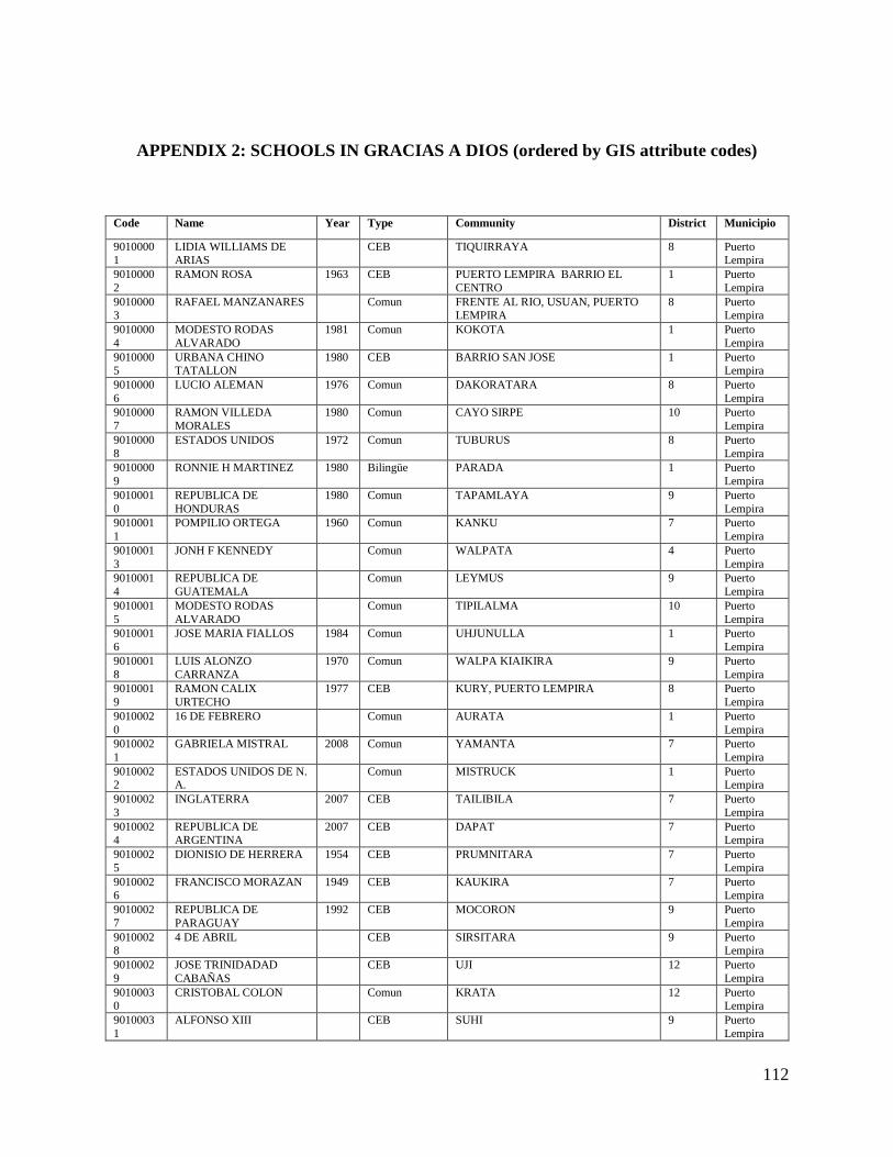
112
APPENDIX 2: SCHOOLS IN GRACIAS A DIOS (ordered by GIS attribute codes)
Code Name Year Type Community District Municipio
90100001
LIDIA WILLIAMS DE ARIAS
CEB TIQUIRRAYA 8 Puerto Lempira
9010000
2
RAMON ROSA 1963 CEB PUERTO LEMPIRA BARRIO EL
CENTRO
1 Puerto
Lempira
90100003
RAFAEL MANZANARES Comun FRENTE AL RIO, USUAN, PUERTO LEMPIRA
8 Puerto Lempira
9010000
4
MODESTO RODAS
ALVARADO
1981 Comun KOKOTA 1 Puerto
Lempira
90100005
URBANA CHINO TATALLON
1980 CEB BARRIO SAN JOSE 1 Puerto Lempira
9010000
6
LUCIO ALEMAN 1976 Comun DAKORATARA 8 Puerto
Lempira
9010000
7
RAMON VILLEDA
MORALES
1980 Comun CAYO SIRPE 10 Puerto
Lempira
9010000
8
ESTADOS UNIDOS 1972 Comun TUBURUS 8 Puerto
Lempira
9010000
9
RONNIE H MARTINEZ 1980 Bilingüe PARADA 1 Puerto
Lempira
9010001
0
REPUBLICA DE
HONDURAS
1980 Comun TAPAMLAYA 9 Puerto
Lempira
9010001
1
POMPILIO ORTEGA 1960 Comun KANKU 7 Puerto
Lempira
9010001
3
JONH F KENNEDY Comun WALPATA 4 Puerto
Lempira
9010001
4
REPUBLICA DE
GUATEMALA
Comun LEYMUS 9 Puerto
Lempira
9010001
5
MODESTO RODAS
ALVARADO
Comun TIPILALMA 10 Puerto
Lempira
9010001
6
JOSE MARIA FIALLOS 1984 Comun UHJUNULLA 1 Puerto
Lempira
9010001
8
LUIS ALONZO
CARRANZA
1970 Comun WALPA KIAIKIRA 9 Puerto
Lempira
9010001
9
RAMON CALIX
URTECHO
1977 CEB KURY, PUERTO LEMPIRA 8 Puerto
Lempira
9010002
0
16 DE FEBRERO Comun AURATA 1 Puerto
Lempira
9010002
1
GABRIELA MISTRAL 2008 Comun YAMANTA 7 Puerto
Lempira
90100022
ESTADOS UNIDOS DE N. A.
Comun MISTRUCK 1 Puerto Lempira
9010002
3
INGLATERRA 2007 CEB TAILIBILA 7 Puerto
Lempira
90100024
REPUBLICA DE ARGENTINA
2007 CEB DAPAT 7 Puerto Lempira
9010002
5
DIONISIO DE HERRERA 1954 CEB PRUMNITARA 7 Puerto
Lempira
90100026
FRANCISCO MORAZAN 1949 CEB KAUKIRA 7 Puerto Lempira
9010002
7
REPUBLICA DE
PARAGUAY
1992 CEB MOCORON 9 Puerto
Lempira
90100028
4 DE ABRIL CEB SIRSITARA 9 Puerto Lempira
9010002
9
JOSE TRINIDADAD
CABAÑAS
CEB UJI 12 Puerto
Lempira
90100030
CRISTOBAL COLON Comun KRATA 12 Puerto Lempira
9010003
1
ALFONSO XIII CEB SUHI 9 Puerto
Lempira

113
9010003
2
REPUBLICA DE
HONDURAS
Comun SIAKUALAYA, PUERTO LEMPIRA 8 Puerto
Lempira
90100033
JOSE TRINIDAD CABAÑAS
1955 Comun TIPI LALMA 10 Puerto Lempira
9010003
4
21 DE OCTUBRE 2001 CEB AUKA 10 Puerto
Lempira
90100035
JUAN LINDO 1974 CEB BARRIO EL CENTRO 1 Puerto Lempira
9010003
6
LA FRATERNIDAD 1963 Comun TANSIN 1 Puerto
Lempira
90100037
FROYLAN TURCIOS 1965 Comun TUNTUNTARA, PUERTO LEMPIRA 8 Puerto Lempira
9010003
8
REPUBLICA DE BRAZIL 1968 Comun AHUASBILA Puerto
Lempira
90100039
FRANCISCA REYES 1970 Bilingüe RATLAYA 12 Puerto Lempira
9010004
0
EL ADELANTO 1964 Bilingüe WAUPLAYA 9 Puerto
Lempira
90100041
JOSE TRINIDAD REYES 1979 Comun RUS RUS 9 Puerto Lempira
9010004
2
JESUS VILLANUEVA
BURGOS
1995 Comun RONDIN 9 Puerto
Lempira
90100043
INSTITUTO DEPARTAMENTAL
GRACIAS A DIOS
1971 Comun CONTIGUO A LA COLONIA CANADA, PUERTO LEMPIRA
1 Puerto Lempira
90100044
MIGUEL ENRIQUE KELLEY
1985 Comun PUSWAYA 12 Puerto Lempira
9010004
5
FAUSTO MIGUEL
ALVAREZ
Comun AHUASLUPIA, PUERTO LEMPIRA 8 Puerto
Lempira
90100046
WALTER WILLIAM HAYLOCK
1989 Comun COCAL 7 Puerto Lempira
9010004
7
14 DE JULIO CEB LAKA,TABILA, PUERTO LEMPIRA 8 Puerto
Lempira
90100048
OSCAR MEJIA URQUIA Comun UMBRUS, PUERTO LEMPIRA 8 Puerto Lempira
9010004
9
RIGOBERTO COELLO
ZALAZAR
2007 Comun UJI LANDIN 12 Puerto
Lempira
90100050
AUGUSTO C COELLO 1986 Comun SUABILA, PUERTO LEMPIRA 8 Puerto Lempira
9010005
1
JOSE TRINIDADA
CABAÐAS
Comun LIWA, PUERTO LEMPIRA 8 Puerto
Lempira
90100052
HECTOR CARRACCIOLI Comun TURRALAYA, PUERTO LEMPIRA 8 Puerto Lempira
9010005
3
FLORINDA FLORES
BLAS
1991 Comun PRANZA 9 Puerto
Lempira
90100054
INGNI YAMNI Comun BATILKIRA Puerto Lempira
9010005
5
CECILIO TATALLON 1999 Comun TAILYARE, PUERTO LEMPIRA 8 Puerto
Lempira
90100056
KASBRIKA PISKA 1995 Comun TIKUABILA 7 Puerto Lempira
9010005
7
PROF. GALILLAS
BORDAS ASTIN
1999 Comun SUDIN BUENA VISTA 9 Puerto
Lempira
9010005
8
SLILMA LILA 1985 Comun USUPUM 1 Puerto
Lempira
9010005
9
KABU TANGNI 2008 PROHECO IBAT 12 Puerto
Lempira
9010006
0
RAFAEL PINEDA PONCE Comun UHUNBILA 12 Puerto
Lempira
9010006
1
LAKUN TAKIKA Comun AHUASPAHNI Puerto
Lempira
9010006
2
AUGUSTO C. COELLO 1996 Comun SIRSIRTARA 9 Puerto
Lempira
9010006
3
FIAT LUX 1979 CEB YAHURABILA 12 Puerto
Lempira
9010006
4
MARCELINO PINEDA
LOPEZ
1973 Comun FRENTE A CEB RAMON ROSA 1 Puerto
Lempira

114
9010006
5
FROYLAN TURCIOS 1988 Comun ALD.TIPI LALMA 10 Puerto
Lempira
90100066
RAMON CALIX URTECHO
Comun AUKA Puerto Lempira
9010006
7
MARIA DEL SOCORRO
AMADOR
Comun LAKA,TABILA, PUERTO LEMPIRA 8 Puerto
Lempira
90100068
LEOVIGILDO PINEDA CARDONA
Bilingüe KRATA 12 Puerto Lempira
9010006
9
FRANCISCO ZELAYA 1975 Comun CAUQUIRA 7 Puerto
Lempira
90100070
RONNY H. MARTINEZ 1983 Comun PUERTO LEMPIRA 9 Puerto Lempira
9010007
1
LIDIA DE CALIX 1988 Comun TIQUIRRAYA, PUERTO LEMPIRA 8 Puerto
Lempira
90100072
AIDA ZACAPA DE SUAZO CORDOVA
Comun SUHI 9 Puerto Lempira
9010007
3
JUAN LINDO 1983 Comun TAILIBILA 7 Puerto
Lempira
90100074
RAMON CALIX URTECHO
Comun AUKA 10 Puerto Lempira
9010007
5
LIDIA DE CALIX 1987 Comun PALKAKA 1 Puerto
Lempira
90100076
FAUSTO MIGUEL ALVARADO
1990 Comun PRUNINTARA 7 Puerto Lempira
9010007
7
REYNALDO GOMEZ
GARCIA
1995 Comun MISTRUCK ALDEA 1 Puerto
Lempira
9010007
8
RODOLFO CACERES 1996 Comun TUBURUS, PUERTO LEMPIRA 8 Puerto
Lempira
9010007
9
LAKIAYA 1997 Comun TUNTUNTARA, PUERTO LEMPIRA 8 Puerto
Lempira
9010008
0
JARDIN DE NIÐOS
TAGNI
1999 Comun YAMANTA 7 Puerto
Lempira
9010008
1
PARAISO INFANTIL 1983 Comun DAPAT MUNICIPIOP PURTO
LEMPIRA
7 Puerto
Lempira
9010008
2
MODESTO MORALES Comun AURATA 1 Puerto
Lempira
9010008
3
INHNI RAYA Comun WALPA KIAIKIRA 9 Puerto
Lempira
9010008
4
TUKTAN LILIKA 1997 Comun BO. SAN JOSE 1 Puerto
Lempira
9010008
5
VICTORIANO GUIDO
FEDERICO
Comun WAUPLAYA 9 Puerto
Lempira
9010008
6
ROMULO CARIAS
CERRATO
1998 Comun RUS-RUS Puerto
Lempira
9010008
7
NUEVA ESPERANZA Comun AHUASBILA Puerto
Lempira
9010008
8
ESTADOS UNIDOS 1980 Comun TIPIMONA 10 Puerto
Lempira
9010008
9
TWI DAMNI 1994 Comun PUSWAYA 12 Puerto
Lempira
9010009
0
LAPTA 1999 Comun TIKUABILA 7 Puerto
Lempira
90100091
JOSE CECILIO DEL VALLE
Comun LA CUNKA 8 Puerto Lempira
9010009
2
MIGUEL RAFAEL
MADRID
2007 Comun CORINTO 9 Puerto
Lempira
90100093
OSWALDO LOPEZ ARELLANO
1934 Comun LIWAKURIA, PUERTO LEMPIRA GRACIAS A DIOS
10 Puerto Lempira
9010009
4
MELQUESEDEC
GALINDO
1990 Comun KUSUA SUAMP 7 Puerto
Lempira
90100095
NORMA GABORIT DE CALLEJAS
Comun KIASKIRA Puerto Lempira
9010009
6
FROILAN TURCIOS 1990 Comun COMUNIDAD, UJI 12 Puerto
Lempira
90100097
RAMON CALIX URTECHO
1985 PROHECO ALDEA TANSING 1 Puerto Lempira
9010009
8
HERNANDEZ LALIS 1995 Comun KANKU, PUERTO LEMPIRA,
GRACIAS A DIOS
7 Puerto
Lempira

115
9010009
9
TASBA PRANA 1990 Comun TWINMAWALA, PUERTO LEMPIRA,
GRACIAS A DIOS
7 Puerto
Lempira
90100100
JARDIN DE NIÑOS SMELLING WOOD
RONAS
1999 Comun PRANZA 9 Puerto Lempira
90100101
INSTITUTO RAYA INGWAYA
1999 Comun Barrio El Centro, Frente al Centro Penal 1 Puerto Lempira
9010010
2
ERNESTO MARADIAGA
CASCO
1977 Comun TWIMAWALA 7 Puerto
Lempira
90100103
SILVIA LAVINIA BARELA
Comun SAULALA Puerto Lempira
9010010
4
MAHANAIM 2002 Comun BO EL CENTRO CONTIGUO IGLESIA
ASAMBLEA DE DIOS
1 Puerto
Lempira
90100105
LAGUN TAGNIKA Comun AWASPRAHMI 1 Puerto Lempira
9010010
6
WALPA TANGNI 2001 Comun WALPATA 1 Puerto
Lempira
9010010
7
JUAN SAMSA 2007 Comun PUERTO LEMPIRA 1 Puerto
Lempira
9010010
8
LUKY YABAYAK 2004 Comun LAS BRISAS 1 Puerto
Lempira
90100109
GRACIAS A DIOS 1986 Comun KATSKY RAYA MUN PUERTO LEMPIRA
7 Puerto Lempira
9010011
0
VICTOR HUGO
ECHEVERRIA HAYLOCK
2002 Comun COLONIA CANADA 1 Puerto
Lempira
90100111
MARIA MONTESORI 1983 Comun DAKORATARA, PUERTO LEMPIRA 8 Puerto Lempira
9010011
2
TWIKIA PAINKIRA 2003 Comun ZONA COSTERA CARATASCA
(UHUNBILA)
12 Puerto
Lempira
90100113
YU YAMNI Comun LANDIN Puerto Lempira
9010011
4
NORMA ISABEL LOVE 2007 Comun COCOTA 1 Puerto
Lempira
90100115
JARDIN LAPTA Comun TIKUABILA Puerto Lempira
9010011
6
ESCUELA REPUBLICA
DE CUBA
2005 Comun BARRIO CANADA, PUERTO
LEMPIRA
1 Puerto
Lempira
90100117
EL PORVENIR 2005 Comun EL PORVENIR, PUERTO LEMPIRA 1 Puerto Lempira
9010011
8
GUADALUPE QUEZADA 1982 Comun COCO, PUERTO LEMPIRA 9 Puerto
Lempira
90100119
LAPTA INGNIKA 2005 Comun ALABAR Puerto Lempira
9010012
0
LUIS GALINDO ZUNIGA 2004 PROHECO CILAL, PUERTO LEMPIRA 7 Puerto
Lempira
90100121
HAYLOCK ALMENDAREZ
2005 PROHECO BARRA CARATASCA 8 Puerto Lempira
9010012
2
FLORINDA VIUDA DE
ALEMAN
2005 Comun EL PORVENIR 1 Puerto
Lempira
90100123
DAMPAHNI JOSE 2004 PROHECO LUR, PUERTO LEMPIRA 8 Puerto Lempira
9010012
4
TECNOLOGICO PERLA
DE LA MOSKITIA
2006 Técnico BO EL CENTRO, PUERTO LEMPIRA 1 Puerto
Lempira
9010012
5
ESCUELA RURAL
MIXTA 14 DE AGOSTO
1993 Comun LIWAKURIA 10 Puerto
Lempira
9010012
7
CASA ESPERANZA 2005 Comun BARRIO BELLA VISTA 1 Puerto
Lempira
9010012
8
ESCUELA CRISTIANA
CEAD MAHANAIM
2003 BARRIO EL CENTRO, PUERTO
LEMPIRA
Puerto
Lempira
9010012
9
LUKY YABAYAK BARRIO LAS BRISAS, PUERTO
LEMPIRA
Puerto
Lempira
9010013
1
ESCUELA JOSE
TRINIDAD CABANAS
BARRIO EL CENTRO, UHI Puerto
Lempira
9010013
4
CCEPREB COCOTA 2007 CCEPREB KOKOTA, ISLA DE TANSIN Puerto
Lempira
9010013
6
CCEPREB AURATA 2007 CCEPREB AURATA Puerto
Lempira
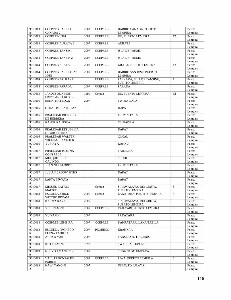
116
9010013
8
CCEPREB BARRIO
CANADA 2
2007 CCEPREB BARRIO CANADA, PUERTO
LEMPIRA
Puerto
Lempira
90100139
CCEPREB UJI-1 2007 CCEPREB UJI, PUERTO LEMPIRA 12 Puerto Lempira
9010014
0
CCEPREB AURATA 2 2007 CCEPREB AURATA Puerto
Lempira
90100142
CCEPREB TANSIN 1 2007 CCEPREB ISLA DE TANSIN Puerto Lempira
9010014
3
CCEPREB TANSIN 2 2007 CCEPREB ISLA DE TANSIN Puerto
Lempira
90100146
CCEPREB KRATA 2007 CCEPREB KRATA, PUERTO LEMPIRA 12 Puerto Lempira
9010014
8
CCEPREB BARRIO SAN
JOSE
2007 CCEPREB BARRIO SAN JOSE, PUERTO
LEMPIRA
Puerto
Lempira
90100149
CCEPREB PALKAKA CCEPREB PALKAKA, ISLA DE TANSING, PUERTO LEMPIRA
1 Puerto Lempira
9010015
0
CCEPREB PARADA 2007 CCEPREB PARADA Puerto
Lempira
90100151
JARDIN DE NIÑOS FROYLAN TURCIOS
1990 Comun UJI, PUERTO LEMPIRA 12 Puerto Lempira
9010016
0
BENKI HAYLOCK 2007 TWIMAWALA Puerto
Lempira
90100163
GERAL PEREZ JULIAN DAPAT Puerto Lempira
9010016
5
PRALEBAH DIONICIO
DE HERRERA
PRUMNITARA Puerto
Lempira
9010016
6
KASBRIKA PISKA TIKUABILA Puerto
Lempira
9010016
7
PRALEBAH REPUBLICA
DE ARGENTINA
DAPAT Puerto
Lempira
9010016
8
PRALEBAH WALTER
WILLIAM HAYLOCK
COCAL Puerto
Lempira
9010016
9
YU RAYA KANKU Puerto
Lempira
9010017
0
PRALEBAH ISOLINA
GONZALEZ
TAILIBILA Puerto
Lempira
9010017
1
MELQUESEDEC
GALINDO
SRUHI Puerto
Lempira
9010017
2
JUAN NEL FLORES PRUMNITARA Puerto
Lempira
9010017
3
JULIAN BROOW PITHS DAPAT Puerto
Lempira
9010017
4
LAPTA INWAYA DAPAT Puerto
Lempira
9010017
7
MIGUEL RAFAEL
MADRID
Comun SIAKWALAYA, RIO CRUTA,
PUERTO LEMPIRA
8 Puerto
Lempira
9010018
1
ESCUELA JORGE
WITCHO BECAM
2005 Comun LAKATARA, PUERTO LEMPIRA 8 Puerto
Lempira
9010018
2
KARMA RAYA 2007 SIAKWALAYA, RIO KRUTA,
PUERTO LEMPIRA
Puerto
Lempira
9010018
3
YULU TAGNI 2007 CCEPREB TAILYARI, PUERTO LEMPIRA 8 Puerto
Lempira
90100184
YU YAMNI 2007 LAKATARA Puerto Lempira
9010018
5
CCEPREB LEMPIRA 2007 CCEPREB DAKRATARA, LAKA TABILA Puerto
Lempira
90100186
ESCUELA PROHECO ELENA PADILLA
2007 PROHECO KRAHKRA Puerto Lempira
9010018
8
AUHYA YARI 2007 TANSLAYA, TUBURUS Puerto
Lempira
90100189
KUTA TANNI 1992 SWABILA, TUBURUS Puerto Lempira
9010019
0
NUEVO AMANECER 2007 SUBA, TUMTUMTARA Puerto
Lempira
90100191
VALLAS GONSALES PORINE
2007 CCEPREB LIWA, PUERTO LEMPIRA 8 Puerto Lempira
9010019
2
KAWI TANGNI 2007 USAN, TIKIURAYA Puerto
Lempira

117
9010019
3
CCEPREB FRANCISCO
MORAZAN
2007 CCEPREB KURI, PUERTO LEMPIRA 8 Puerto
Lempira
90100194
CCEPREB TABILA 2007 LAKA TABILA Puerto Lempira
9010019
5
PASCACIO SAICION 2007 AHUASLUPIA, PUERTO LEMPIRA Puerto
Lempira
90100196
CACIQUE LEMPIRA 2007 CCEPREB KRAHKRA, PUERTO LEMPIRA 8 Puerto Lempira
9010019
7
CCEPREB YALAM
TANGNI
2007 LUR, LAKA TABILA Puerto
Lempira
90100198
BALLAS GONZALES PURINE
2007 LIWA, TUBURUS Puerto Lempira
9010019
9
CCEPREB RONDIN 2007 CCEPREB RONDIN SISRSIRTARA 9 Puerto
Lempira
90100200
ESCUELA RURAL MIXTA JOSE TRINIDAD
CABANAS
1955 TIPI LALMA, LISANGNIPURA Puerto Lempira
9010020
2
CCEPREB
WALPAKIAIKIRA
CCEPREB RUSRUS 9 Puerto
Lempira
9010020
3
CCEPREB CORINTO 2007 CCEPREB CORINTO, LEYMUS 9 Puerto
Lempira
90100204
CCEPREB TAPAMLAYA 2007 CCEPREB TAPAMLAYA, SIRSIRTARA Puerto Lempira
9010020
5
CCEPREB SUDIN 2007 CCEPREB SUDIN, SIRSIRTARA Puerto
Lempira
90100206
CCEPREB MOCORON 2007 CCEPREB MOCORON, 9 Puerto Lempira
9010020
7
CCEPREB LIWAKURIA CCEPREB LIWAKURIA, AUKA Puerto
Lempira
90100208
MERILES WALDAN 2007 CCEPREB BARRIO LAS BRISAS, AUKA Puerto Lempira
9010020
9
SAMUEL GEORGE 2007 YABALTARA, AUKA Puerto
Lempira
90100210
MIGUEL RAMON FLORES
2007 LISANGNIPURA, LIWAKURIA Puerto Lempira
9010021
1
IGNI TARA 2007 CCEPREB CAYOSIRPE, AUKA 10 Puerto
Lempira
90100212
INGNIKA RAYA 2007 CCEPREB TIPILALMA, AUKA Puerto Lempira
9010021
3
RESLY GUTIERREZ
PAMAN
AUKA, CARRETERA Puerto
Lempira
90100214
7 DE MAYO 2007 SRUNLAYA, AUKA Puerto Lempira
9010021
5
YULU TAGNI 2007 CCEPREB TIPIMONA, TIPILALMA 10 Puerto
Lempira
90100216
ALBERTO MICHEL HORACIO
2007 CCEPREB SIAKWALAYA, LAKUNKA Puerto Lempira
9010021
7
SERRANO GEORGE
WAILAN
2007 AUKA, BARRIO USUS YAPAIKA Puerto
Lempira
90100218
ANCELMO SANTIAGO 2007 YABALTARA Puerto Lempira
9010021
9
PRALEBAH PLP-1 PRALEBAH PUERTO LEMPIRA Puerto
Lempira
9010022
0
PROHECO KRATA PROHECO KRATA Puerto
Lempira
9010022
1
PRALEBAH PLP-2 PRALEBAH PUERTO LEMPIRA Puerto
Lempira
9010022
2
PUSWAYA 2007 CCEPREB PUSWAYA Puerto
Lempira
9010022
3
RAMON ROSA EXPERIMEN
T
PUERTO LEMPIRA, BARRIO SAN
JOSE
Puerto
Lempira
9010022
4
ROGELIO ELVIR
AGUILAR
2011 Comun WAHABISBAN 9 Puerto
Lempira
9010022
5
ESTADOS UNIDOS DE
AMERICA
MISTRUK Puerto
Lempira
9010022
6
NUEVA JERUSALEN EXPERIMEN
T
PUERTO LEMPIRA Puerto
Lempira
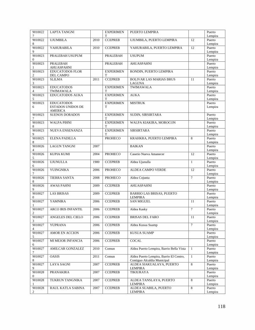
118
9010022
7
LAPTA TANGNI EXPERIMEN
T
PUERTO LEMPIRA Puerto
Lempira
90100228
UJUMBILA 2010 CCEPREB UJUMBILA, PUERTO LEMPIRA 12 Puerto Lempira
9010022
9
YAHURABILA 2010 CCEPREB YAHURABILA, PUERTO LEMPIRA 12 Puerto
Lempira
90100230
PRALEBAH USUPUM PRALEBAH USUPUM Puerto Lempira
9010023
1
PRALEBAH
AHUASPAHNI
PRALEBAH AHUASPAHNI Puerto
Lempira
90100232
EDUCATODOS FLOR DEL CAMPO
EXPERIMENT
RONDIN, PUERTO LEMPIRA Puerto Lempira
9010023
3
SLILMA 2011 CCEPREB BOLIVAR LAS MARIAS BRUS
LAGUNA
11 Puerto
Lempira
90100234
EDUCATODOS TWIMAWALA
EXPERIMENT
TWIMAWALA Puerto Lempira
9010023
5
EDUCATODOS AUKA EXPERIMEN
T
AUKA Puerto
Lempira
90100236
EDUCATODOS ESTADOS UNIDOS DE
AMERICA
EXPERIMENT
MISTRUK Puerto Lempira
90100237
SUENOS DORADOS EXPERIMENT
SUDIN, SIRSIRTARA Puerto Lempira
9010023
8
WALPA PIHNI EXPERIMEN
T
WALPA KIAKIRA, MOROCON Puerto
Lempira
90100239
NUEVA ENSENANZA EXPERIMENT
SIRSIRTARA Puerto Lempira
9010025
8
ELENA PADILLA PROHECO KRAHKRA, PUERTO LEMPIRA 8 Puerto
Lempira
90100264
LAGUN TANGNI 2007 BAIKAN Puerto Lempira
9010026
5
KUPIA KUMI 2004 PROHECO Caserio Nueva Amanecer 12 Puerto
Lempira
90100266
UJUNULLA 1900 CCEPREB Aldea Ujunulla 1 Puerto Lempira
9010026
7
YUINGNIKA 2006 PROHECO ALDEA CAMPO VERDE 12 Puerto
Lempira
90100268
TIERRA SANTA 2008 PROHECO Aldea Cojunta 7 Puerto Lempira
9010026
9
AWAS PAHNI 2009 CCEPREB AHUASPAHNI Puerto
Lempira
90100270
LAS BRISAS 2009 CCEPREB BARRIO LAS BRISAS, PUERTO LEMPIRA
Puerto Lempira
9010027
1
YAMNIRA 2006 CCEPREB SAN MIGUEL 11 Puerto
Lempira
90100272
ARCO IRIS INFANTIL 2006 CCEPREB Aldea Kasky 7 Puerto Lempira
9010027
3
ANGELES DEL CIELO 2006 CCEPREB BRISAS DEL FARO 11 Puerto
Lempira
90100274
YUPRANA 2006 CCEPREB Aldea Kusua Suamp 7 Puerto Lempira
9010027
5
AMOR EN ACCION 2006 CCEPREB KUSUA SUAMP Puerto
Lempira
9010027
6
MI MEJOR INFANCIA 2006 CCEPREB COCAL Puerto
Lempira
9010027
7
AMILCAR GONZALEZ 2010 Comun Aldea Puerto Lempira, Barrio Bella Vista 1 Puerto
Lempira
9010027
8
OASIS 2011 Comun Aldea Puerto Lempira, Barrio El Centro,
Contiguo Alcaldia Municipal
1 Puerto
Lempira
9010027
9
LAYA SAGNI 2007 CCEPREB ALDEA SIAKUALAYA, PUERTO
LEMPIRA
8 Puerto
Lempira
9010028
0
PRANAKIRA 2007 CCEPREB TIKIURAYA Puerto
Lempira
9010028
1
TUKRUN TANGNIKA 2007 CCEPREB ALDEA TANSLAYA, PUERTO
LEMPIRA
8 Puerto
Lempira
9010028
2
RAUL KATLA SABINA 2007 CCEPREB ALDEA SUABILA, PUERTO
LEMPIRA
8 Puerto
Lempira
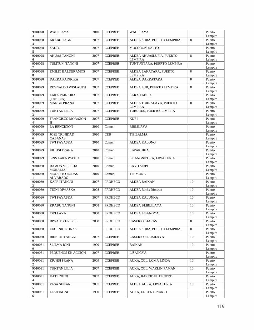
119
9010028
3
WAUPLAYA 2010 CCEPREB WAUPLAYA Puerto
Lempira
90100284
KRABU TAGNI 2007 CCEPREB ALDEA SUBA, PUERTO LEMPIRA 8 Puerto Lempira
9010028
5
SALTO 2007 CCEPREB MOCORON, SALTO Puerto
Lempira
90100286
AHUAS TANGNI 2007 CCEPREB ALDEA AHUASLUPIA, PUERTO LEMPIRA
8 Puerto Lempira
9010028
7
TUMTUM TANGNI 2007 CCEPREB TUNTUNTARA, PUERTO LEMPIRA Puerto
Lempira
90100288
EMILIO BALDERAMOS 2007 CCEPREB ALDEA LAKATARA, PUERTO LEMPIRA
8 Puerto Lempira
9010028
9
DAKRA PAINKIRA 2007 CCEPREB ALDEA DAKRATARA 8 Puerto
Lempira
90100290
REYNALDO WISLAUTH 2007 CCEPREB ALDEA LUR, PUERTO LEMPIRA 8 Puerto Lempira
9010029
1
LAKA PAINKIRA
(TABILIA)
2007 CCEPREB LAKA TABILA Puerto
Lempira
90100292
MANGO PRANA 2007 CCEPREB ALDEA TURRALAYA, PUERTO LEMPIRA
8 Puerto Lempira
9010029
3
TUKTAN LILIA 2007 CCEPREB TUBURUS, PUERTO LEMPIRA Puerto
Lempira
90100294
FRANCISCO MORAZON II
2007 CCEPREB KURI Puerto Lempira
9010029
5
LA BENCICION 2010 Comun BIBLILAYA Puerto
Lempira
9010029
6
JOSE TRINIDAD
CABAÑAS
2010 CEB TIPILALMA Puerto
Lempira
9010029
7
TWI PAYASKA 2010 Comun ALDEA KALONG Puerto
Lempira
9010029
8
KIUHSI PRANA 2010 Comun LIWAKURIA Puerto
Lempira
9010029
9
SINS LAKA WATLA 2010 Comun LISANGNIPURA, LIWAKURIA Puerto
Lempira
9010030
0
RAMON VILLEDA
MORALES
2010 Comun CAYO SIRPI Puerto
Lempira
9010030
1
MODESTO RODAS
ALVARADO
2010 Comun TIPIMUNA Puerto
Lempira
9010030
2
KAPRI TANGNI 2007 PROHECO ALDEA BAIKAN 10 Puerto
Lempira
9010030
3
TIGNI DIWASKA 2008 PROHECO ALDEA Racks Dimwan 10 Puerto
Lempira
9010030
4
TWI PAYASKA 2007 PROHECO ALDEA KALUNKA 10 Puerto
Lempira
9010030
5
KRABU TANGNI 2008 PROHECO ALDEA BLIBLILAYA 10 Puerto
Lempira
9010030
6
TWI LAYA 2008 PROHECO ALDEA LISANGYA 10 Puerto
Lempira
9010030
7
BIWAIT YUREPEL 2008 PROHECO CASERIO KIARAS 8 Puerto
Lempira
9010030
8
EUGENIO RONAS PROHECO ALDEA SUBA, PUERTO LEMPIRA 8 Puerto
Lempira
90100309
BRIBRIT TANGNI 2007 CCEPREB CASERIO, SRUMLAYA 10 Puerto Lempira
9010031
0
SLILMA IGNI 1900 CCEPREB BAIKAN 10 Puerto
Lempira
90100311
PEQUENOS EN ACCION 2007 CCEPREB LISANGYA Puerto Lempira
9010031
2
KIUHSI PRANA 2009 CCEPREB AUKA, COL. LOMA LINDA 10 Puerto
Lempira
90100313
TUKTAN LILIA 2007 CCEPREB AUKA, COL. WAKLIN PAMAN 10 Puerto Lempira
9010031
4
KATI INGNI 2007 CCEPREB AUKA, BARRIO EL CENTRO Puerto
Lempira
90100315
PASA SUNAN 2007 CCEPREB ALDEA AUKA, LIWAKURIA 10 Puerto Lempira
9010031
6
LESITINGNI 1900 CCEPREB AUKA, EL CENTENARIO Puerto
Lempira
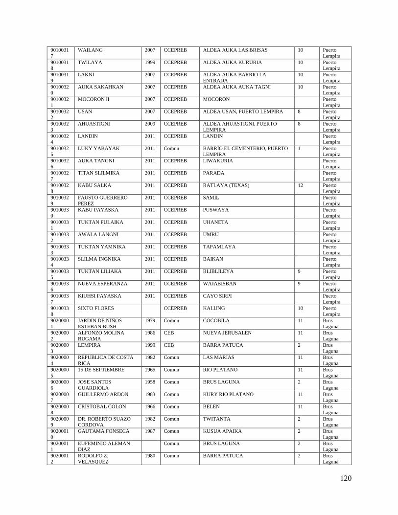
120
9010031
7
WAILANG 2007 CCEPREB ALDEA AUKA LAS BRISAS 10 Puerto
Lempira
90100318
TWILAYA 1999 CCEPREB ALDEA AUKA KURURIA 10 Puerto Lempira
9010031
9
LAKNI 2007 CCEPREB ALDEA AUKA BARRIO LA
ENTRADA
10 Puerto
Lempira
90100320
AUKA SAKAHKAN 2007 CCEPREB ALDEA AUKA AUKA TAGNI 10 Puerto Lempira
9010032
1
MOCORON II 2007 CCEPREB MOCORON Puerto
Lempira
90100322
USAN 2007 CCEPREB ALDEA USAN, PUERTO LEMPIRA 8 Puerto Lempira
9010032
3
AHUASTIGNI 2009 CCEPREB ALDEA AHUASTIGNI, PUERTO
LEMPIRA
8 Puerto
Lempira
90100324
LANDIN 2011 CCEPREB LANDIN Puerto Lempira
9010032
5
LUKY YABAYAK 2011 Comun BARRIO EL CEMENTERIO, PUERTO
LEMPIRA
1 Puerto
Lempira
90100326
AUKA TANGNI 2011 CCEPREB LIWAKURIA Puerto Lempira
9010032
7
TITAN SLILMIKA 2011 CCEPREB PARADA Puerto
Lempira
90100328
KABU SALKA 2011 CCEPREB RATLAYA (TEXAS) 12 Puerto Lempira
9010032
9
FAUSTO GUERRERO
PEREZ
2011 CCEPREB SAMIL Puerto
Lempira
9010033
0
KABU PAYASKA 2011 CCEPREB PUSWAYA Puerto
Lempira
9010033
1
TUKTAN PULAIKA 2011 CCEPREB UHANETA Puerto
Lempira
9010033
2
AWALA LANGNI 2011 CCEPREB UMRU Puerto
Lempira
9010033
3
TUKTAN YAMNIKA 2011 CCEPREB TAPAMLAYA Puerto
Lempira
9010033
4
SLILMA INGNIKA 2011 CCEPREB BAIKAN Puerto
Lempira
9010033
5
TUKTAN LILIAKA 2011 CCEPREB BLIBLILEYA 9 Puerto
Lempira
9010033
6
NUEVA ESPERANZA 2011 CCEPREB WAJABISBAN 9 Puerto
Lempira
9010033
7
KIUHSI PAYASKA 2011 CCEPREB CAYO SIRPI Puerto
Lempira
9010033
8
SIXTO FLORES CCEPREB KALUNG 10 Puerto
Lempira
9020000
1
JARDIN DE NIÑOS
ESTEBAN BUSH
1979 Comun COCOBILA 11 Brus
Laguna
9020000
2
ALFONZO MOLINA
RUGAMA
1986 CEB NUEVA JERUSALEN 11 Brus
Laguna
9020000
3
LEMPIRA 1999 CEB BARRA PATUCA 2 Brus
Laguna
9020000
4
REPUBLICA DE COSTA
RICA
1982 Comun LAS MARIAS 11 Brus
Laguna
90200005
15 DE SEPTIEMBRE 1965 Comun RIO PLATANO 11 Brus Laguna
9020000
6
JOSE SANTOS
GUARDIOLA
1958 Comun BRUS LAGUNA 2 Brus
Laguna
90200007
GUILLERMO ARDON 1983 Comun KURY RIO PLATANO 11 Brus Laguna
9020000
8
CRISTOBAL COLON 1966 Comun BELEN 11 Brus
Laguna
90200009
DR. ROBERTO SUAZO CORDOVA
1982 Comun TWITANTA 2 Brus Laguna
9020001
0
GAUTAMA FONSECA 1987 Comun KUSUA APAIKA 2 Brus
Laguna
90200011
EUFEMINIO ALEMAN DIAZ
Comun BRUS LAGUNA 2 Brus Laguna
9020001
2
RODOLFO Z.
VELASQUEZ
1980 Comun BARRA PATUCA 2 Brus
Laguna

121
9020001
3
DONALDO SABILLON
VASQUEZ
1976 Comun RIO PLATANO 11 Brus
Laguna
90200014
ESTEBAN BUSH Comun COCOBILA Brus Laguna
9020001
5
RICARDO ALBERTO
RIVAS
1984 Comun BELEN PAYABILA 11 Brus
Laguna
90200016
MARIA HORTENCIA ALVARADO
1985 Comun CURY 11 Brus Laguna
9020001
7
JAMES GOFF 1987 Comun BARRIO TWITANTA 2 Brus
Laguna
90200018
FEDERICO FROEBEL 1990 Comun KUSIRA APAIKA 2 Brus Laguna
9020002
0
JUAN AMBROSIO SABIO 1996 Comun NUEVA JERUSALEN 11 Brus
Laguna
90200021
JARDIN DE NINOS KATI 1999 Comun RAISTA Brus Laguna
9020002
2
GALILLAS BORDAS
ASTIN
1999 Comun BO ARASLAYA, AEROPUERTO
BRUS LAGUNA
2 Brus
Laguna
90200024
SCOTT WOOD RONAS 2002 Comun LAS PALMERAS 11 Brus Laguna
9020002
5
RAMON CALIX
URTECHO
1994 Bilingüe BRISAS 2 Brus
Laguna
90200026
J.N. LAS MARIAS 2002 LAS MARIAS Brus Laguna
9020002
7
WALTER NAVARRO
ALLEN
2000 Comun TASBAPAUNI Brus
Laguna
9020002
8
JARDIN DE NIÑOS
RICARDO WOOD
1999 Comun CALLE PRINCIPAL DEL BARRIO
UHRY A LA IZQUIERDA
2 Brus
Laguna
9020002
9
INSTITUTO
RENACIMIENTO
1978 Comun ARAS LAYA 2 Brus
Laguna
9020003
0
CEB PEDRO NUFIO 1950 CEB BARRRIO EL CENTRO 11 Brus
Laguna
9020003
1
LAS BRISAS BRUS LAGUNA, BARRIO LAS
BRISAS
Brus
Laguna
9020003
2
LILIA TARA 2004 Comun BARRA PATUCA 2 Brus
Laguna
9020003
3
RODOLFO SANDOVAL 2003 Comun SAN MIGUEL, RIO PLATANO 11 Brus
Laguna
9020003
4
JACINTO MOLINA
GONZALEZ
1999 Comun RIO PLATANO Brus
Laguna
9020003
5
AMELIO LOPEZ 1999 Comun BO LAS BRISAS, BARRA DEL
PATUCA
2 Brus
Laguna
9020003
6
EDWIN WARREN 2004 PROHECO UHRY, BRUS LAGUNA 2 Brus
Laguna
9020003
7
DWIT WOOD 2004 PROHECO USUPUM, BRUS LAGUNA 2 Brus
Laguna
9020003
8
ASLA PAWANKA 2006 Comun BO EL CENTRO, BRUS LAGUNA 2 Brus
Laguna
9020004
0
ESCUELA PROHECO
BOLIVAR JIMENEZ
2006 PROHECO BRUS LAGUNA, BRUS LAGUNA 11 Brus
Laguna
9020004
1
ESCUELA PROHECO
NARCISO RAMOS
2009 PROHECO LAS MARIAS, BIOSFERA DE RIO
PLATANO
11 Brus
Laguna
90200042
J.N. SIXTO GEORGE WAILANG
2007 Comun KURI Brus Laguna
9020004
3
ESCUELA PROHECO
LIDIA GODFRY
2005 PROHECO PAYABILA, BELEN 11 Brus
Laguna
90200044
DONALDO ALLEN 2007 PROHECO ALDEA MIRASOL 11 Brus Laguna
9020004
5
STANLEY GOFF 2002 Comun LAS MARIAS Brus
Laguna
90300001
GALILLAS BORDAS ASTIN
1997 Comun CALLE PRINCIPAL USUPUMPURA 4 Ahuas
9030000
2
WILLIAMS BLUCHA
CRAMA
1999 Comun BO.EL CENTRO KROPUNTA 4 Ahuas
90300003
RAFAEL HELIODORO VALLE
1978 Comun CALLE PRINCIPAL (KUPIA KUMI) 4 Ahuas
9030000
4
JOSE TRINIDAD REYES 1960 CEB WAWINA 4 Ahuas
122
9030000
5
CESAR AUGUSTO
CALDERON
1995 Comun Aldea, Usupumpura 4 Ahuas
90300006
LA INDEPENDENCIA 1959 Comun WARUNTA 4 Ahuas
9030000
7
ALVARO CONTRERAS CEB TERMINAL DE LA CALLE
PRINCIPAL
4 Ahuas
90300008
GUADALUPE QUEZADA COCO Ahuas
9030000
9
ESCUELA DR. MIGUEL
PAZ BARAHONA
1957 Comun BARRIO EL CENTRO, ALDEA
PAPTALAYA
4 Ahuas
90300010
JOSE TRINIDAD CABAÑAS
Comun AL LADO ESTE DE LA IGLESIA CATOLICA
4 Ahuas
9030001
1
J.N. HUMBERTO
ALVARO TORRES
1972 Comun BARRIO EL CENTRO 4 Ahuas
90300012
J.N. DOROTEO FELDEMAN BORDAS
1999 Comun MEDIA CUADRA IGLESIA RENOVADA
4 Ahuas
9030001
3
J.N. FELIPE LICONA 1970 Comun FRENTE A LA CALLE PRINCIPAL EL
CENTRO
4 Ahuas
90300014
MANUEL SOTO 1965 Comun BARRIO EL CENTRO CALLE PRINCIPAL
4 Ahuas
9030001
5
RAMON VILLEDA
MORALES
1979 Comun AWAS DEPT DE GRACIAS A 4 Ahuas
90300016
POLIVALENTE SAMUEL BENNO MARX
1989 Polivalente KUPLA KUMI AHUAS GRACIAS A DIOS
4 Ahuas
9030001
7
SANTIAGO LEMOTH 2004 PROHECO NARANJAL, PAPTALAYA 4 Ahuas
9030001
8
RUBEN MORALES
WALTER
2004 Comun BUENA VISTA, WAKSMA 4 Ahuas
9030001
9
HOGAR DE NIÑOS 2007 AHUAS Ahuas
9030002
0
FELICIDAD 2007 CCEPREB Bº NARANJAL, PAPTALAYA 4 Ahuas
9030002
1
ANGELES FELICES 2007 CCEPREB CENTRO 4 Ahuas
9030002
2
NUEVO AMANECER 2007 CCEPREB KROPUNTA, KROPUNTA BRISAS 4 Ahuas
9030002
3
ESCUELA PROHECO
SANTIAGO LEMOTH
PROHECO PAPTALAYA Ahuas
9030002
4
TUKTAN WATLA 2007 CCEPREB ALDEA WARUNTA 4 Ahuas
9030002
5
HOGAR DE NIÑOS 2005 CCEPREB ALDEA USUPUNMPURA BARRIO
BUENOS AIRES
4 Ahuas
9030002
6
VERONICA TRAPP 2008 CCEPREB ALDEA WAXMA BARRIO ROSA DE
SARON
4 Ahuas
9030002
7
LAPTA INNICA 2008 CCEPREB ALDEA WAWINA BARRIO EL
CENTRO
4 Ahuas
9030002
8
JUGUEMOS JUNTOS 2008 CCEPREB ALDEA GUARUNTA BARRIO
CENTRAL
4 Ahuas
9030002
9
LILIAN KAYA WATLA 2007 CCEPREB AHUAS, BARRIO KUPIA KUMI Ahuas
9030003
0
BINK BILA 2005 CCEPREB ALDEA WAWINA BARRIO CENTRO 4 Ahuas
90300031
BENDICION A LAS NACIONES
2010 Comun Aldea Ahuas, Barrio Aeropuerto 4 Ahuas
9030003
2
AHUAS INGNIKA Comun ALDEA AHUAS, BARRIO KUPIA
KUMI
4 Ahuas
90300033
TASBA DAWANKA CCEPREB WAXMA- CENTRO 4 Ahuas
9030003
4
KABO YULA CCEPREB ALDEA PAPTALAYA, OCOTAL 4 Ahuas
90300035
PRAMAS PAINKIRA CCEPREB SAUCE 4 Ahuas
9030003
6
LILIA PAINKIRA CCEPREB BO. SAUCE 4 Ahuas
90300037
AWALA KINKA CCEPREB PAPTALAYA, BRISAS 4 Ahuas
9030003
8
YULU TAGNIKA CCEPREB WAWINA, EL CENTRO 4 Ahuas

123
9030003
9
AUBRA TARA CCEPREB KROPUNTA, PROCERES 4 Ahuas
90300040
WAXMA PRANA CCEPREB WAXMA, BETANIA 4 Ahuas
9030004
1
LI SANNY CCEPREB DAGVANTARA 4 Ahuas
90300042
SANNILY CCEPREB NARANJAL 4 Ahuas
9030004
3
LILIA TARA CCEPREB NUEVA MALY 4 Ahuas
90300044
YU PRANA CCEPREB WARUNTA, EL CENTRO 4 Ahuas
9040000
1
AMERICA 2003 Comun IBANS 14 Juan Fco.
Bulnes
90400002
J.N ISMAEL NORALES 1996 Comun PUEBLO NUEVO 5 Juan Fco. Bulnes
9040000
3
ESCUELA RURAL
MIXTA CAMILO
MIRALDA
1977 Comun LIMONALES 5 Juan Fco.
Bulnes
9040000
4
BRISAS DEL GUAPOTE Comun GUAPOTE Juan Fco.
Bulnes
90400005
ADALBERTO GONZALES MITCHEL
1994 Comun BANAKA JUAN FRANCISCO BULNES GRACIAS A DIOS
14 Juan Fco. Bulnes
9040000
6
JARDIN DE NINOS
YAMNI KAIKAN
2002 PINALES, JUAN F. BULNES Juan Fco.
Bulnes
90400007
SIMON FIGUEROA 1980 Comun BATALLA 5 Juan Fco. Bulnes
9040000
8
CELSO RIVERA
CASTILLO
1999 Comun ALDEA IBANS BARRIO COYOLES 14 Juan Fco.
Bulnes
90400009
MARCO AURELIO SOTO 1974 Comun PALACIOS CENTRO 5 Juan Fco. Bulnes
9040001
0
MINERVA 2010 CEB PLA PLAYA 5 Juan Fco.
Bulnes
90400011
REYNERIO RAMIREZ 2000 Comun PALACIOS ARRIBA 5 Juan Fco. Bulnes
9040001
2
PRESENTACION
CENTENO
1942 Comun BATALLA 5 Juan Fco.
Bulnes
90400013
ROSA CANELO VDA DE SERRANO
1974 Comun IBANS 14 Juan Fco. Bulnes
9040001
4
JOSE TRINIDAD
CABAÑAS
1976 Comun BARRIO EL CENTRO PLAPLAYA 5 Juan Fco.
Bulnes
90400015
ERLINDA SANDOVAL 1992 Comun PIÑALES 14 Juan Fco. Bulnes
9040001
6
INSTITUTO RIO DE LA
POSESION
1987 Comun BATALLA, JUAN FRANCISCO
BULNES
5 Juan Fco.
Bulnes
90400017
FRANCISCO MELGAR GAVARRETE
1997 Comun BARRIO TRUJILLO 5 Juan Fco. Bulnes
9040001
8
SAN ISIDRO 2000 Comun TOCAMACHO 5 Juan Fco.
Bulnes
90400019
EL FARO 1980 Comun BARRIO PALACIOS CENTRO 5 Juan Fco. Bulnes
9040002
0
LUIS GONZALES 1999 Comun LIMONAL 5 Juan Fco.
Bulnes
9040002
1
JARDIN FLOR DEL RIO 1997 Comun BARRIO PALACIOS ARRIBA 5 Juan Fco.
Bulnes
9040002
2
ESCUELA BILINGUE
GRACIAS A DIOS
2005 Bilingüe PALACIOS CENTRO 5 Juan Fco.
Bulnes
9040002
3
ABRAHAN NORALES 2002 PROHECO EL BRANS, JUAN FCO BULNES 14 Juan Fco.
Bulnes
9040002
4
MARVIN FIGUEROA 2009 PROHECO BUENOS AIRES, JUAN FCO BULNES 5 Juan Fco.
Bulnes
9040002
5
JOSE ANTONIO
VILLALTA BLANCO
2006 Comun CALDERAS, BACALAR 5 Juan Fco.
Bulnes
9040002
6
ROMEL CELAN
PORTILLO PADILLA
2006 Comun CASERIO TRANVIO, ALDEA
BATALLA, MUNICIPIO JUAN FCO. BULNES
5 Juan Fco.
Bulnes
9040002
7
YAMNI KAYKAN 2005 Comun PIÑALES, IBANS 14 Juan Fco.
Bulnes

124
9040002
8
EDNA CAROLINA
ECHEVERRIA HAYLOCK
2007 Comun ALDEA TOCAMACHO, CASERIO
TRANVIO
5 Juan Fco.
Bulnes
90400029
ABEL GREEN GONZALES
2008 Comun Aldea Pueblo Nuevo 5 Juan Fco. Bulnes
9040003
0
FLORINDA FLORES
BLASS
2007 Comun ALDEA TRUJILLO 5 Juan Fco.
Bulnes
90400031
SPORDIAN CENTENO 2009 PROHECO CASERIO ILBILA 14 Juan Fco. Bulnes
9050000
1
ESCUELA 18 DE
NOVIEMBRE
1960 Comun KALPU 7 Villeda
Morales
90500002
DIONISIO DE HERRERA 1974 CEB WALPATARA CRUTA 7 Villeda Morales
9050000
2
DIONISIO DE HERRERA 1974 Comun WALPATARA CRUTA 7 Villeda
Morales
90500003
RURAL MIXTA EL ADELANTO
1968 Comun KARASUNTA 3 Villeda Morales
9050000
4
ESCUELA RURAL MIXA
TWILAYA
1999 Comun KARASUNTA Villeda
Morales
90500005
J.D.N. DIONISIO DE HERRERA
1974 KRUTA Villeda Morales
9050000
6
KRUTA TAGNI 1995 Comun COCOTIGNE DEPARTAMENTAL,
GRACIAS A DIOS
7 Villeda
Morales
90500007
REPUBLICA DE ARGENTINA
1965 CEB KLIUBKI 3 Villeda Morales
9050000
8
REPUBLICA DE
PANAMA
1963 CEB BO EL LAMAL 3 Villeda
Morales
9050000
9
REPUBLICA DEL PERU 2007 CEB RAYA 3 Villeda
Morales
9050001
0
REPUBLICA DE
HONDURAS
1962 Comun MANGOTARA 3 Villeda
Morales
9050001
1
REPUBLICA DE
PANAMA
Comun BO ABRA 3 Villeda
Morales
9050001
2
SEBASTIAN
HERNANDEZ
1975 Comun ILAYA 3 Villeda
Morales
9050001
3
GERMAN BONILLA
CHICAS
Comun WANKIAWALA Villeda
Morales
9050001
4
TWI DANMI 1997 Comun KALPU 7 Villeda
Morales
9050001
5
CONCEPCIÒN AMADOR Comun CLUPQUI 3 Villeda
Morales
9050001
6
REPUBLICA DE
COLOMBIA
Comun BENK 3 Villeda
Morales
9050001
7
CARLOS MEJIA
WILIAMS
Comun TITI 3 Villeda
Morales
9050001
8
SIMON BOLIVAR 1982 CEB PAKWI 3 Villeda
Morales
9050001
9
CEB REPUBLICA DE
MEXICO
CEB BARRIO EL CENTRO 3 Villeda
Morales
9050002
0
REPUBLICA DE
CANADA
1982 Comun WANGKIAWALA 3 Villeda
Morales
9050002
1
+ Comun TUSIDAKSA Villeda
Morales
90500022
ROQUE RAMON ANDRADE
1982 Comun TITI 3 Villeda Morales
9050002
3
CAMILO CALDERON 1997 Comun TASBARRAYA 3 Villeda
Morales
90500024
23 DE ABRIL 1975 Comun COCOTIGNE 7 Villeda Morales
9050002
5
FAUSTO CORRALES
SUAZO
2000 Comun TUSIDAKSA 3 Villeda
Morales
90500026
MAXIMILIANO DURON CARRANZA
1980 Comun TUSIDAKSA 3 Villeda Morales
9050002
7
YABAL RAYA 2000 Bilingüe KARASUNTA 3 Villeda
Morales
90500028
CARMELINA ARIAS SANTOS
1997 Comun TASBARAYA, VILLEDA MORALES 3 Villeda Morales
9050002
9
KUPIA KUMI 2004 Comun NUEVO AMANECER Villeda
Morales

125
9050003
0
XIOMARA CASTRO DE
ZELAYA
2006 CCEPREB COCOTINGNI Villeda
Morales
90500031
SINSINTARA 2006 CCEPREB LAS PALMERAS 11 Villeda Morales
9050003
2
INGNIKA 2005 CCEPREB WANGKIAWALA Villeda
Morales
90500033
JULIUS FELDEMAN MORALES
2008 PROHECO Aldea Rancho Escondido 3 Villeda Morales
9050003
4
YU BAIWAN 2005 CCEPREB KARASUNTA Villeda
Morales
90500035
TANGNIKA 2010 CCEPREB PAKWI Villeda Morales
9060000
1
INSTITUTO MONSEÑOR
HECTOR ENRIQUE SANTOS
1988 Comun Barrio Las Brisas, WAMPUSIRPI 6 Wampusirp
i
9060000
2
ROBERTO GALVEZ
BARNES
1980 Comun RAYA 6 Wampusirp
i
9060000
3
MARCO AURELIO SOTO 1957 CEB Krausirpi 13 Wampusirp
i
9060000
4
PEDRO NUFIO 1981 Comun RAITI RIO PATUCA 6 Wampusirp
i
90600005
RAMON ROSA 1965 Comun PIMIENTA 6 Wampusirpi
9060000
6
JOSE RAMON
BARREIRO
1984 Comun ALDEA PANZANA WAMPUSIRPI 6 Wampusirp
i
90600007
PAULINO VALLADARES 1964 Comun WAMPUSIRPI 6 Wampusirpi
9060000
8
JOSE CECILIO DEL
VALLE
1953 Comun WAMPUSIRPI 6 Wampusirp
i
90600009
RALEY GODFREY BUSTILLO
KUAH Wampusirpi
9060001
0
BUTUKA TANGNI 2000 Comun BARRIO CENTRO, RAYA 6 Wampusirp
i
90600011
YALAM DUSA 2004 PANSANA Wampusirpi
9060001
2
ROBERTO SUAZO
CORDOVA
1990 Bilingüe BILALMUCK 6 Wampusirp
i
90600013
VICTORIANO ZELAYA 1998 Comun BODEGA 8 Wampusirpi
9060001
4
HERALDO CUEVAS
ZELAYA
1986 Comun ARENAS BLANCAS 8 Wampusirp
i
90600015
JARDIN DE NIÑOS YARIGNNI
1980 Comun KRAUSIRPI 13 Wampusirpi
9060001
6
LAPTA INGNIKA 1994 Comun PIMIENTA 6 Wampusirp
i
90600017
JOSUE GRANWELL ASTIN
1997 Comun TUKRUN 6 Wampusirpi
9060001
8
SANTIAGO RIVAS 2001 Comun BIL ALMUCK 6 Wampusirp
i
90600019
FELIPE ORDOÑES RAMOS
1989 Comun KURHPA 6 Wampusirpi
9060002
0
JESUS MEJIA PAZ 2010 Comun WANPUSIRPI 6 Wampusirp
i
9060002
1
GALILLAS BORDAS
ASTIN
1990 Comun NUEVA ESPERANZA 6 Wampusirp
i
9060002
2
RAMON AMAYA
AMADOR
1969 Bilingüe KRAUTARA 13 Wampusirp
i
9060002
3
NICODEMOS SANCHEZ
ROSA
1974 Comun YAPUWAS 13 Wampusirp
i
9060002
4
RENOVACION 1952 Comun WANPUSIRPI, GRACIAS A DIOS 6 Wampusirp
i
9060002
5
CALIXTO GONZALEZ 2003 PROHECO KUNGKUNGWAS, WAMPUSIRPI 13 Wampusirp
i
9060002
6
FRANCISCO MORAZAN 2003 PROHECO PARAWASITO, WAMPUSIRPI 13 Wampusirp
i
9060002
7
RURAL MIXTA
LEMPIRA
1990 PROHECO KAMAKASNA, WAMPUSIRPI 13 Wampusirp
i

126
9060002
8
DAVID LOPEZ 2006 PROHECO LOS LAURES, BRABILA,
WAMPUSIRPI
6 Wampusirp
i
90600030
ESCUELA RUARAL MIXTA ANTONIO LIRA
CRUZ
2007 Comun ALDEA PIMIENTA, CASERIO BELLA VISTA
6 Wampusirpi
90600031
CCEPREB LAS LOMAS 2 2008 CCEPREB TUKRUN, WAMPUSIRPI Wampusirpi
9060003
2
LAS LOMAS 1 2008 CCEPREB TUKRUN, WAMPUSIRPI Wampusirp
i
90600034
NUEVO AMANECER 2008 CCEPREB ALDEA RAYA, WAMPUSIRPI 6 Wampusirpi
9060003
5
CCEPREB LOS ROBLES 2008 CCEPREB Bº LAS BRISAS, WAMPUSIRPI 6 Wampusirp
i
90600036
CCEPREB SUPATIGNI 2007 CCEPREB Bº SUPATIGNI, WAMPUSIRPI 6 Wampusirpi
9060003
7
CCEPREB J.N. FELIPE
ORDONEZ RAMOS
2008 CCEPREB KURHPA Wampusirp
i
9060003
8
CCEPREB J.N. FELIPE
ORDONEZ RAMOS 2
2006 CCEPREB KURHPA Wampusirp
i
9060003
9
CCEPREB ELSAGNI 2007 CCEPREB CASERIO GOSEN, WAMPUSIRPI 6 Wampusirp
i
90600040
CCEPREB YABAL RAYA Nº 2
2007 CCEPREB RAITI BODEGA, WAMPUSIRPI 6 Wampusirpi
9060004
1
CCEPREB YABAL RAYA
1
2007 CCEPREB RAITI BODEGA, WAMPUSIRPI Wampusirp
i
90600042
ESCUELA RURAL MIXTA DISIDERIO ROSA
2000 PROHECO ALDEA PARAWAS, ZONA TAWAHKA, WAMPUSIRPI
13 Wampusirpi
9060004
3
YALA 2009 CCEPREB PIMIENTA Wampusirp
i
90600044
KRABU TANGNI 2011 CCEPREB BILALMUK 6 Wampusirpi
Top Related
Copyright © 2022 FDOKUMEN

