The Eisenhower Interstate Highway System - PDH Online
501
PDHonline Course C656 (6 PDH) Road to Everywhere: The Eisenhower Interstate Highway System Instructor: J.M. Syken 2013 PDH Online | PDH Center 5272 Meadow Estates Drive Fairfax, VA 22030-6658 Phone & Fax: 703-988-0088 www.PDHonline.org www.PDHcenter.com An Approved Continuing Education Provider
-
Upload
khangminh22 -
Category
Documents
-
view
0 -
download
0
Transcript of The Eisenhower Interstate Highway System - PDH Online
PDHonline Course C656 (6 PDH)
Road to Everywhere:
The Eisenhower Interstate Highway System
Instructor: J.M. Syken
2013
PDH Online | PDH Center
5272 Meadow Estates Drive
Fairfax, VA 22030-6658
Phone & Fax: 703-988-0088
www.PDHonline.org
www.PDHcenter.com
An Approved Continuing Education Provider

1
Road to Everywhere
The Eisenhower InterstateHighway System
2
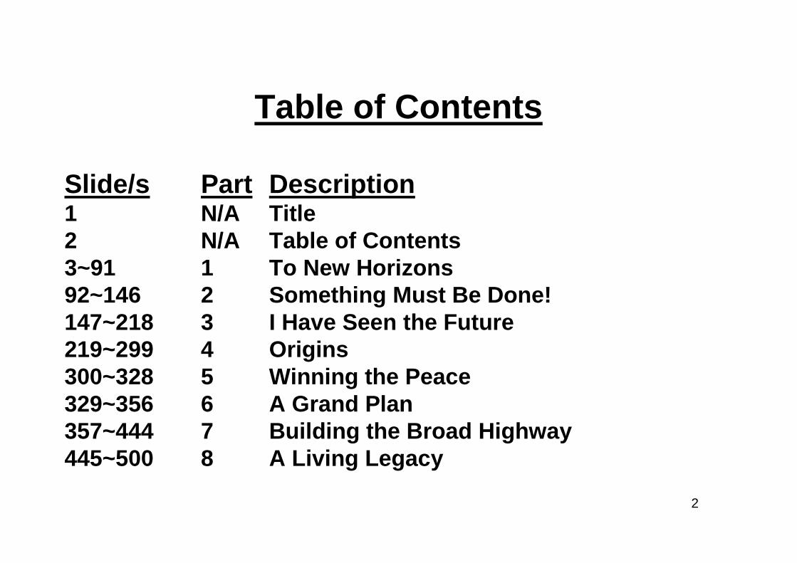
Table of Contents
Slide/s Part Description1 N/A Title2 N/A Table of Contents3~91 1 To New Horizons92~146 2 Something Must Be Done!147~218 3 I Have Seen the Future219~299 4 Origins300~328 5 Winning the Peace329~356 6 A Grand Plan357~444 7 Building the Broad Highway445~500 8 A Living Legacy

3
Part 1
To New Horizons
4
Greatest Highway System Ever Conceived

5
“It will be the greatest highwaysystem ever conceived by manand will link 48 states and 209 bigcities with multi-lane, high-speedfreeways…”Bureau of Public Roads (BPR), 1956
6
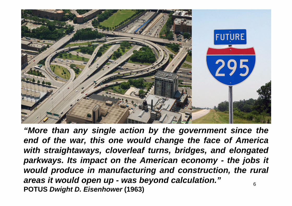
“More than any single action by the government since theend of the war, this one would change the face of Americawith straightaways, cloverleaf turns, bridges, and elongatedparkways. Its impact on the American economy - the jobs itwould produce in manufacturing and construction, the ruralareas it would open up - was beyond calculation.”POTUS Dwight D. Eisenhower (1963)
7
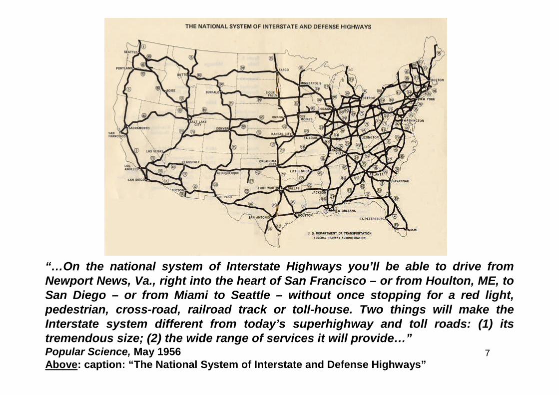
“…On the national system of Interstate Highways you’ll be able to drive fromNewport News, Va., right into the heart of San Francisco – or from Houlton, ME, toSan Diego – or from Miami to Seattle – without once stopping for a red light,pedestrian, cross-road, railroad track or toll-house. Two things will make theInterstate system different from today’s superhighway and toll roads: (1) itstremendous size; (2) the wide range of services it will provide…”Popular Science, May 1956Above: caption: “The National System of Interstate and Defense Highways”
8
“…Transcontinental trips of over 3,000 miles with no stopsexcept for food, sleep or gasoline are just one indication ofits size. The Interstate will be a network of 4-, 6- and 8-lanefreeways that will extend 40,000 miles. The proposed systemof roads will:• Connect all 48 states;• Join 209 of the nation’s 232 cities of more than 50,000population;• Take you to, or near, the center of each city it reaches bymeans of 6,700 miles of multi-lane direct routes or spurs,sometimes elevated over city streets;• Pass through, and connect, all farm belts and all sources ofraw materials such as oil, timber, uranium and coalThe Interstate represents a major change in U.S. highwaythinking…”Popular Science, May 1956
9
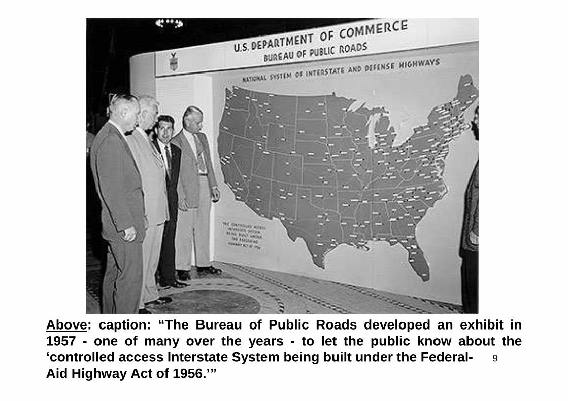
Above: caption: “The Bureau of Public Roads developed an exhibit in1957 - one of many over the years - to let the public know about the‘controlled access Interstate System being built under the Federal-Aid Highway Act of 1956.’”
10
“When I was a boy, most roads were only a few miles longand ran only to the nearest railroad stations. Then they joinedtowns. Next they joined cities. The Interstate will indeedconnect cities – most of them. But its concept goes muchfurther. Like the street system of a town, the Interstate isdesigned not just to link several points, but to serve an entirearea. That area is the United States. The Interstate will not bea new ribbon of road. It will be, instead, the framework of thewhole U.S. highway system. I think we’ve got to have it..”R.E. Royall - Chief of Research, Bureau of Public Roads (1956)

11
Consensus Opinion
12
“…Many persons agree. So many, in fact, that the Interstateis hardly questioned at all in vigorous debate on highwaysnow going on in Congress. A bill now before Congressproposes that the U.S. provide 90 percent of the funds, withthe states adding 10 percent, a new high percentage forFederal money for roads. But even without any increase inWashington’s percentage, which would speed upconstruction, the Interstate is certain to be built. That’sbecause it has been planned by the highway departments ofthe states themselves to meet the urgent needs of U.S.drivers…”Popular Science, May 1956

13
1) It Will Carry You to Work
14
“…It may surprise you to learn that this continental networkis designed to get a great many people to their jobs. But it is.Around 80 percent of U.S. citizens drive to work. Many live insuburbs. Around 80 to 90 percent of all cars approaching anycity are going to that city – not through it. A No. 1 militaryrequirement for U.S. highways is not that they permit themovement of mass armies – it is, instead, that they help keepwar workers at war production. That’s the big reason forthose freeways that will lead into every city on the Interstate.They will reach the centers of the cities, and they will therebyreach seven-eighths of the nation’s manufacturing andindustrial facilities. Plans for entrances into 102 cities wereannounced by the Bureau of Public Roads last September –the final detail in completing the design of the Interstate…”Popular Science, May 1956
15
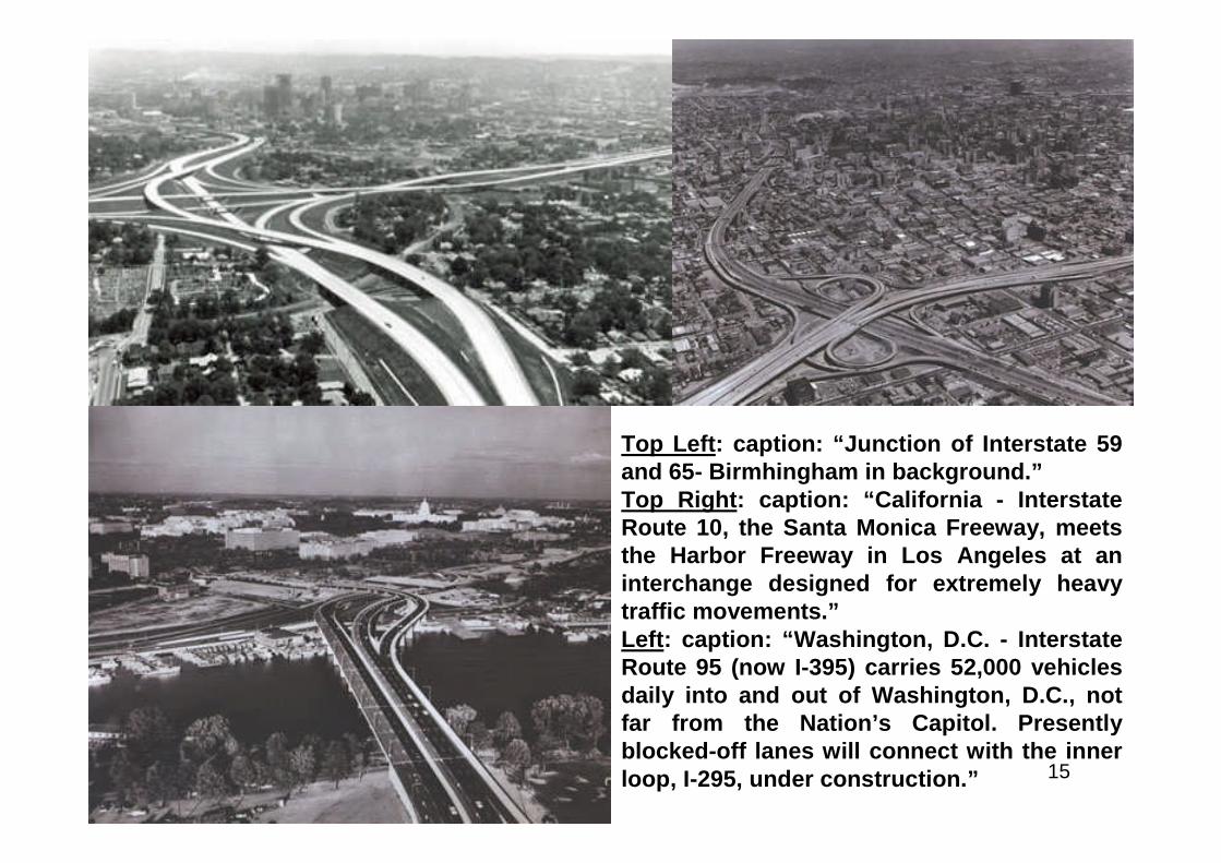
Top Left: caption: “Junction of Interstate 59and 65- Birmhingham in background.”Top Right: caption: “California - InterstateRoute 10, the Santa Monica Freeway, meetsthe Harbor Freeway in Los Angeles at aninterchange designed for extremely heavytraffic movements.”Left: caption: “Washington, D.C. - InterstateRoute 95 (now I-395) carries 52,000 vehiclesdaily into and out of Washington, D.C., notfar from the Nation’s Capitol. Presentlyblocked-off lanes will connect with the innerloop, I-295, under construction.”
16
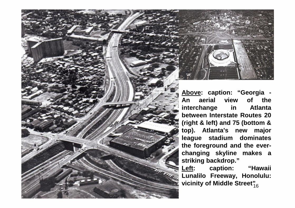
Above: caption: “Georgia -An aerial view of theinterchange in Atlantabetween Interstate Routes 20(right & left) and 75 (bottom &top). Atlanta's new majorleague stadium dominatesthe foreground and the ever-changing skyline makes astriking backdrop.”Left: caption: “HawaiiLunalilo Freeway, Honolulu:vicinity of Middle Street”
17
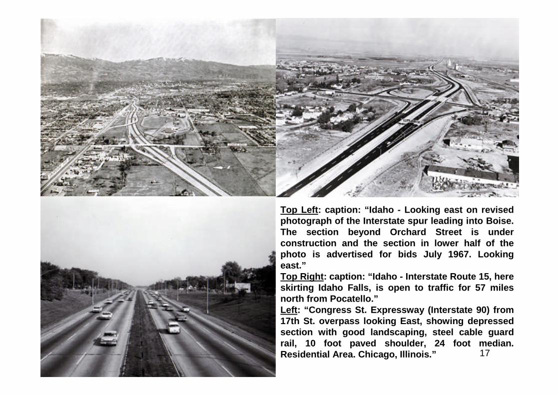
Top Left: caption: “Idaho - Looking east on revisedphotograph of the Interstate spur leading into Boise.The section beyond Orchard Street is underconstruction and the section in lower half of thephoto is advertised for bids July 1967. Lookingeast.”Top Right: caption: “Idaho - Interstate Route 15, hereskirting Idaho Falls, is open to traffic for 57 milesnorth from Pocatello.”Left: “Congress St. Expressway (Interstate 90) from17th St. overpass looking East, showing depressedsection with good landscaping, steel cable guardrail, 10 foot paved shoulder, 24 foot median.Residential Area. Chicago, Illinois.”
18
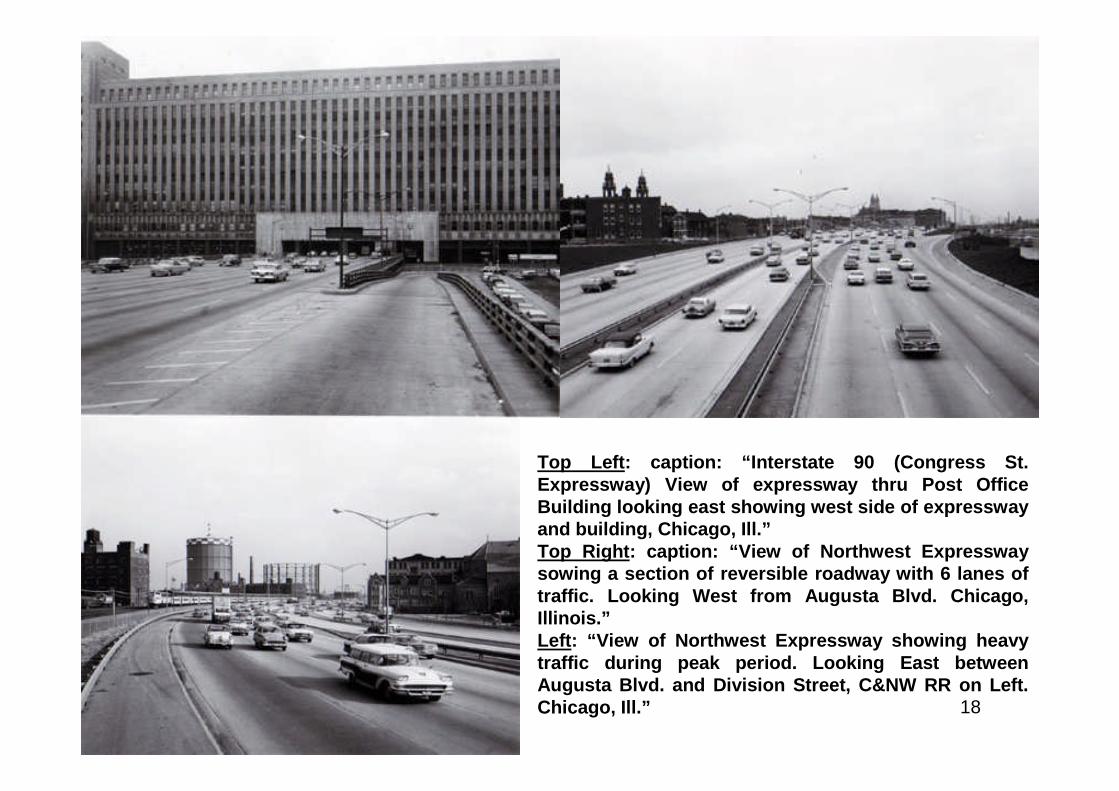
Top Left: caption: “Interstate 90 (Congress St.Expressway) View of expressway thru Post OfficeBuilding looking east showing west side of expresswayand building, Chicago, Ill.”Top Right: caption: “View of Northwest Expresswaysowing a section of reversible roadway with 6 lanes oftraffic. Looking West from Augusta Blvd. Chicago,Illinois.”Left: “View of Northwest Expressway showing heavytraffic during peak period. Looking East betweenAugusta Blvd. and Division Street, C&NW RR on Left.Chicago, Ill.”
19
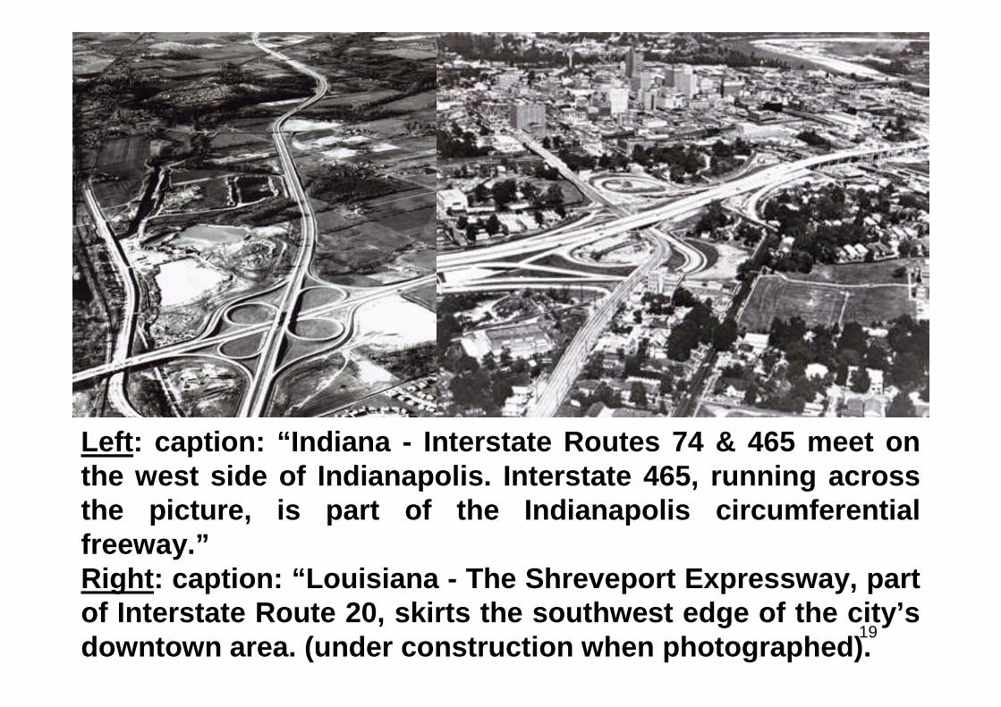
Left: caption: “Indiana - Interstate Routes 74 & 465 meet onthe west side of Indianapolis. Interstate 465, running acrossthe picture, is part of the Indianapolis circumferentialfreeway.”Right: caption: “Louisiana - The Shreveport Expressway, partof Interstate Route 20, skirts the southwest edge of the city’sdowntown area. (under construction when photographed).
20
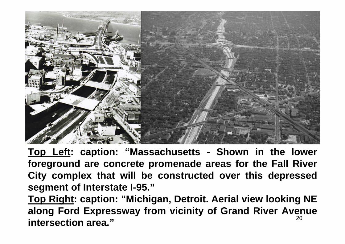
Top Left: caption: “Massachusetts - Shown in the lowerforeground are concrete promenade areas for the Fall RiverCity complex that will be constructed over this depressedsegment of Interstate I-95.”Top Right: caption: “Michigan, Detroit. Aerial view looking NEalong Ford Expressway from vicinity of Grand River Avenueintersection area.”
21
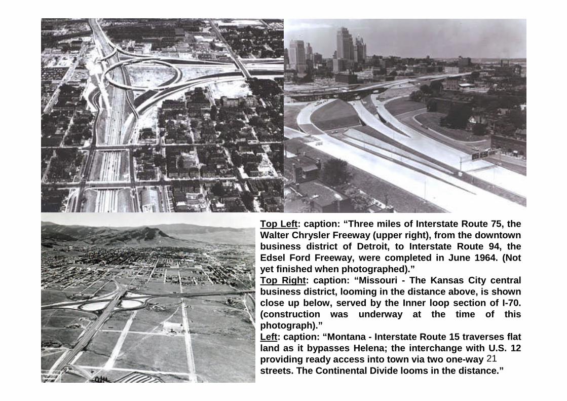
Top Left: caption: “Three miles of Interstate Route 75, theWalter Chrysler Freeway (upper right), from the downtownbusiness district of Detroit, to Interstate Route 94, theEdsel Ford Freeway, were completed in June 1964. (Notyet finished when photographed).”Top Right: caption: “Missouri - The Kansas City centralbusiness district, looming in the distance above, is shownclose up below, served by the Inner loop section of I-70.(construction was underway at the time of thisphotograph).”Left: caption: “Montana - Interstate Route 15 traverses flatland as it bypasses Helena; the interchange with U.S. 12providing ready access into town via two one-waystreets. The Continental Divide looms in the distance.”
22
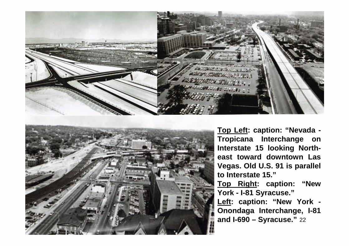
Top Left: caption: “Nevada -Tropicana Interchange onInterstate 15 looking North-east toward downtown LasVegas. Old U.S. 91 is parallelto Interstate 15.”Top Right: caption: “NewYork - I-81 Syracuse.”Left: caption: “New York -Onondaga Interchange, I-81and I-690 – Syracuse.”
23
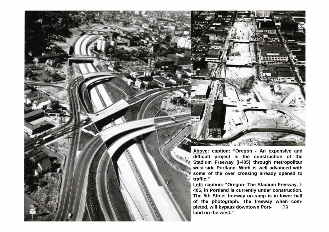
Above: caption: “Oregon - An expensive anddifficult project is the construction of theStadium Freeway (I-405) through metropolitanwest-side Portland. Work is well advanced withsome of the over crossing already opened totraffic.”Left: caption: “Oregon- The Stadium Freeway, I-405, in Portland is currently under construction.The 5th Street freeway on-ramp is in lower halfof the photograph. The freeway when com-pleted, will bypass downtown Port-land on the west.”
24
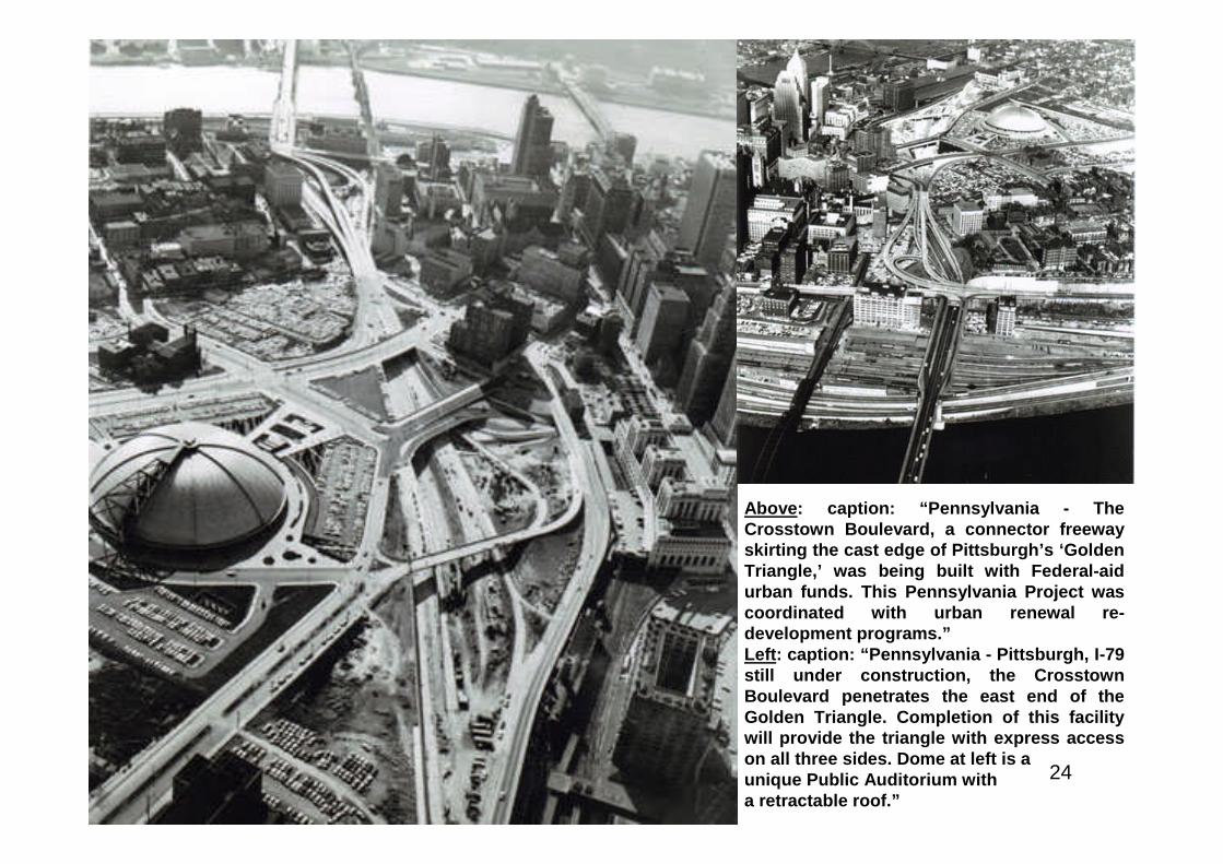
Above: caption: “Pennsylvania - TheCrosstown Boulevard, a connector freewayskirting the cast edge of Pittsburgh’s ‘GoldenTriangle,’ was being built with Federal-aidurban funds. This Pennsylvania Project wascoordinated with urban renewal re-development programs.”Left: caption: “Pennsylvania - Pittsburgh, I-79still under construction, the CrosstownBoulevard penetrates the east end of theGolden Triangle. Completion of this facilitywill provide the triangle with express accesson all three sides. Dome at left is aunique Public Auditorium witha retractable roof.”
25
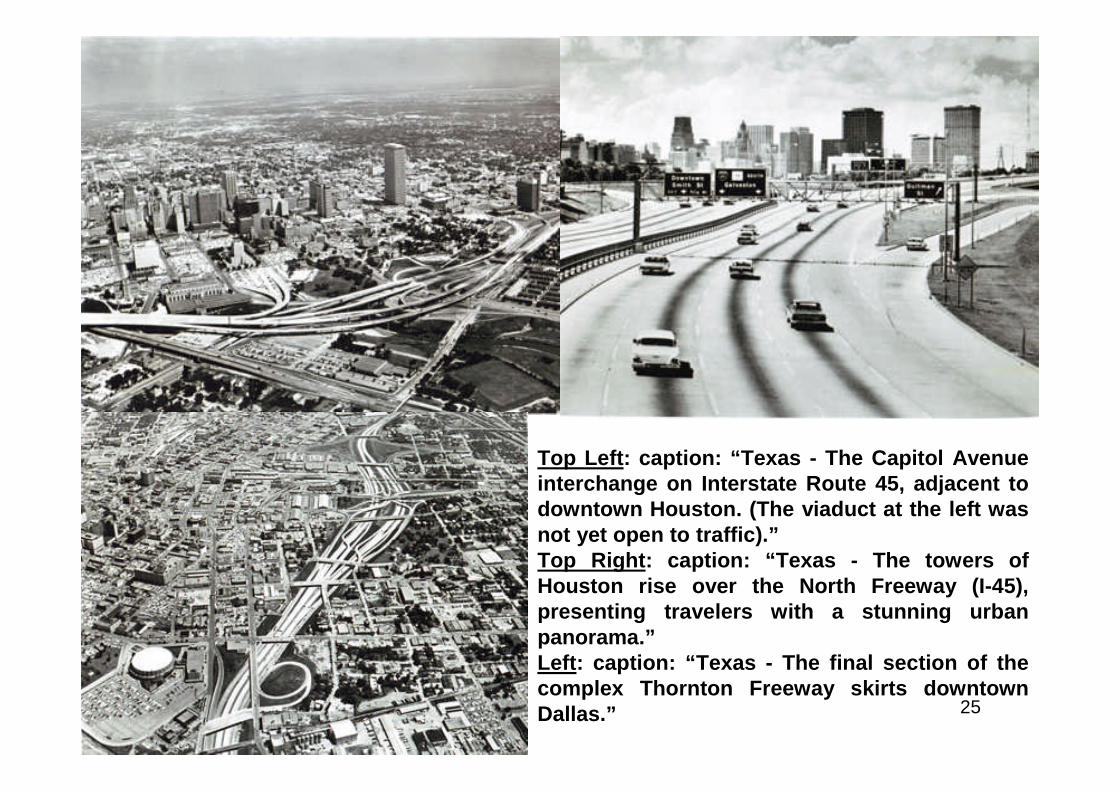
Top Left: caption: “Texas - The Capitol Avenueinterchange on Interstate Route 45, adjacent todowntown Houston. (The viaduct at the left wasnot yet open to traffic).”Top Right: caption: “Texas - The towers ofHouston rise over the North Freeway (I-45),presenting travelers with a stunning urbanpanorama.”Left: caption: “Texas - The final section of thecomplex Thornton Freeway skirts downtownDallas.”
26
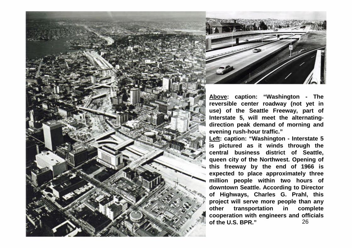
Above: caption: “Washington - Thereversible center roadway (not yet inuse) of the Seattle Freeway, part ofInterstate 5, will meet the alternating-direction peak demand of morning andevening rush-hour traffic.”Left: caption: “Washington - Interstate 5is pictured as it winds through thecentral business district of Seattle,queen city of the Northwest. Opening ofthis freeway by the end of 1966 isexpected to place approximately threemillion people within two hours ofdowntown Seattle. According to Directorof Highways, Charles G. Prahl, thisproject will serve more people than anyother transportation in completecooperation with engineers and officialsof the U.S. BPR.”
27
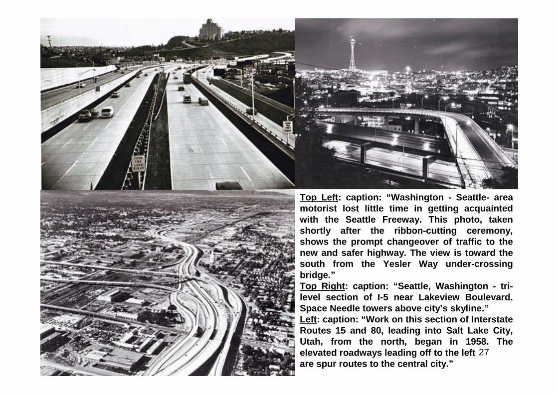
Top Left: caption: “Washington - Seattle- areamotorist lost little time in getting acquaintedwith the Seattle Freeway. This photo, takenshortly after the ribbon-cutting ceremony,shows the prompt changeover of traffic to thenew and safer highway. The view is toward thesouth from the Yesler Way under-crossingbridge.”Top Right: caption: “Seattle, Washington - tri-level section of I-5 near Lakeview Boulevard.Space Needle towers above city’s skyline.”Left: caption: “Work on this section of InterstateRoutes 15 and 80, leading into Salt Lake City,Utah, from the north, began in 1958. Theelevated roadways leading off to the leftare spur routes to the central city.”
28
2) It Will Reduce Traffic Jams
29
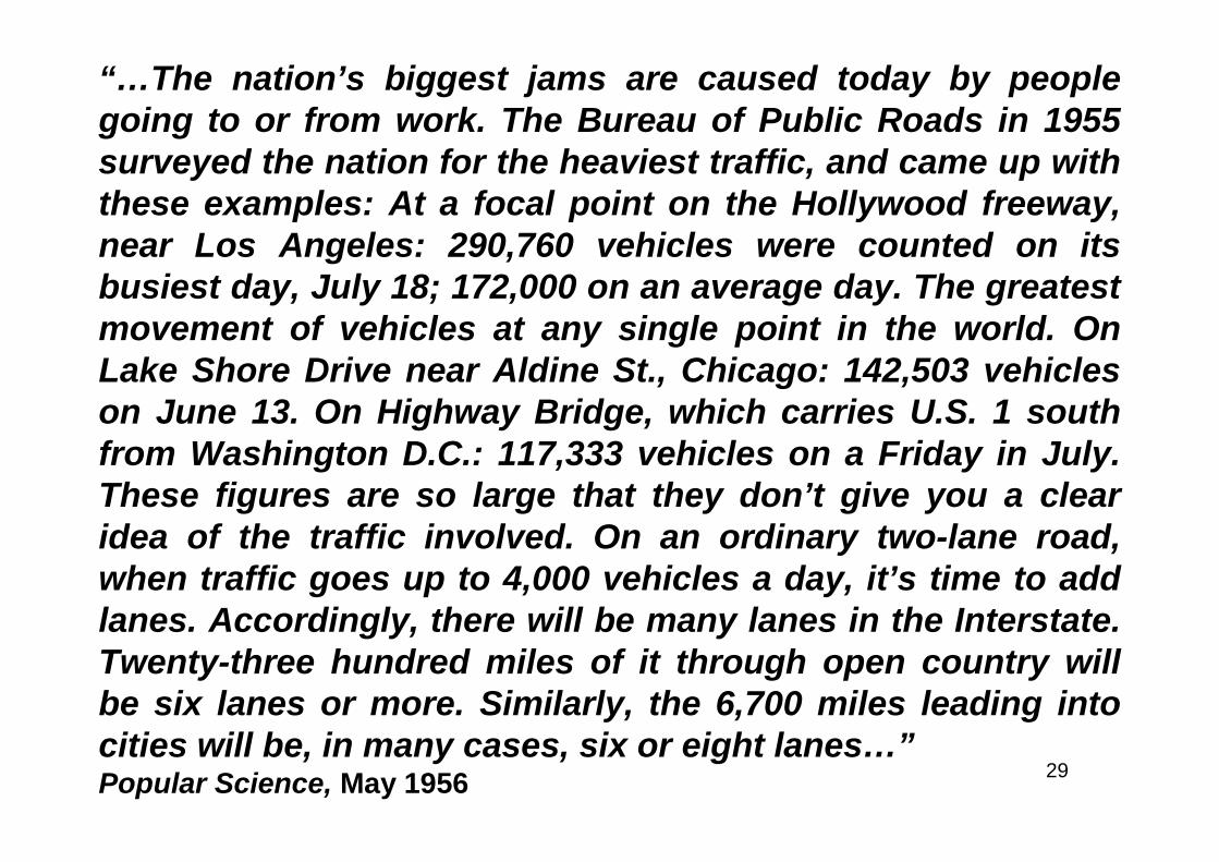
“…The nation’s biggest jams are caused today by peoplegoing to or from work. The Bureau of Public Roads in 1955surveyed the nation for the heaviest traffic, and came up withthese examples: At a focal point on the Hollywood freeway,near Los Angeles: 290,760 vehicles were counted on itsbusiest day, July 18; 172,000 on an average day. The greatestmovement of vehicles at any single point in the world. OnLake Shore Drive near Aldine St., Chicago: 142,503 vehicleson June 13. On Highway Bridge, which carries U.S. 1 southfrom Washington D.C.: 117,333 vehicles on a Friday in July.These figures are so large that they don’t give you a clearidea of the traffic involved. On an ordinary two-lane road,when traffic goes up to 4,000 vehicles a day, it’s time to addlanes. Accordingly, there will be many lanes in the Interstate.Twenty-three hundred miles of it through open country willbe six lanes or more. Similarly, the 6,700 miles leading intocities will be, in many cases, six or eight lanes…”Popular Science, May 1956

30
3) It Will make Possible Longer Vacation Trips
31
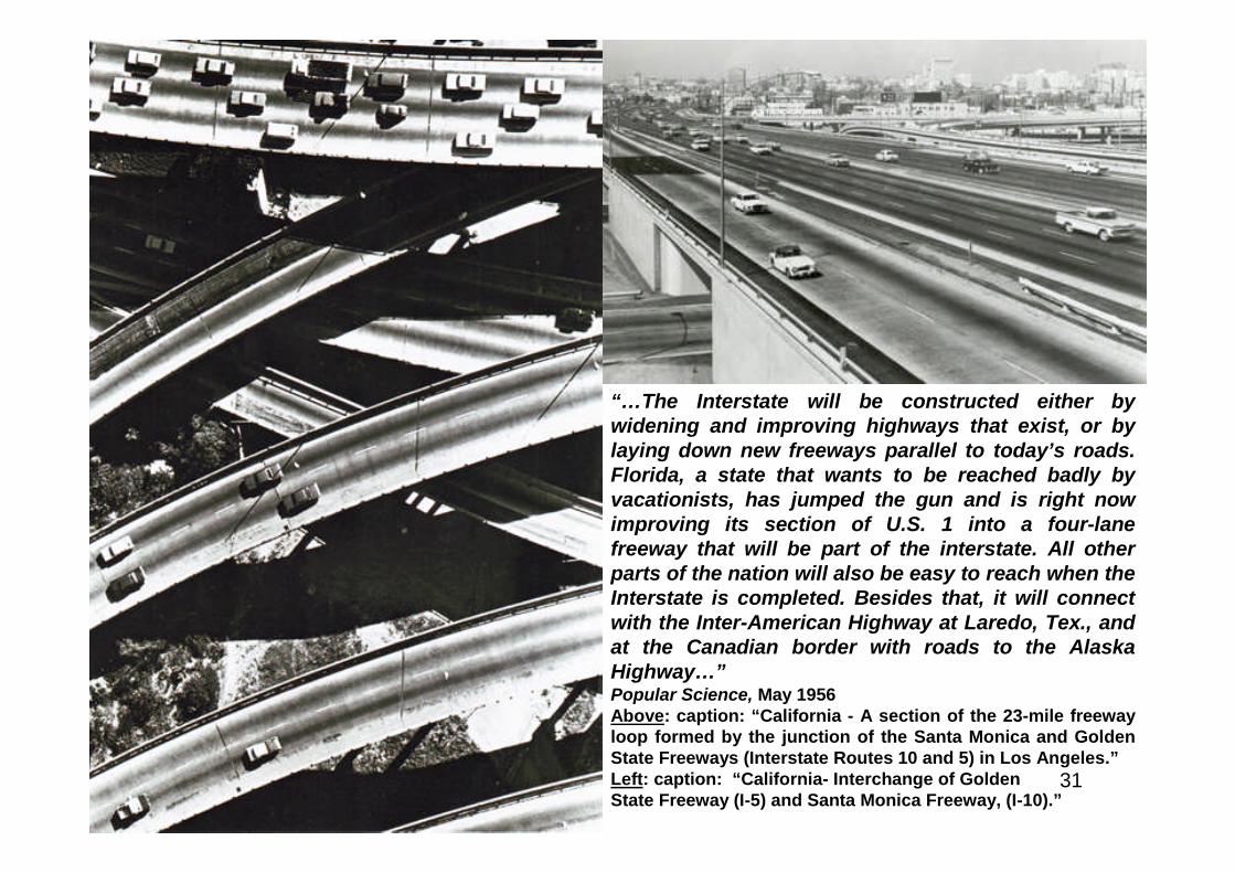
“…The Interstate will be constructed either bywidening and improving highways that exist, or bylaying down new freeways parallel to today’s roads.Florida, a state that wants to be reached badly byvacationists, has jumped the gun and is right nowimproving its section of U.S. 1 into a four-lanefreeway that will be part of the interstate. All otherparts of the nation will also be easy to reach when theInterstate is completed. Besides that, it will connectwith the Inter-American Highway at Laredo, Tex., andat the Canadian border with roads to the AlaskaHighway…”Popular Science, May 1956Above: caption: “California - A section of the 23-mile freewayloop formed by the junction of the Santa Monica and GoldenState Freeways (Interstate Routes 10 and 5) in Los Angeles.”Left: caption: “California- Interchange of GoldenState Freeway (I-5) and Santa Monica Freeway, (I-10).”
32
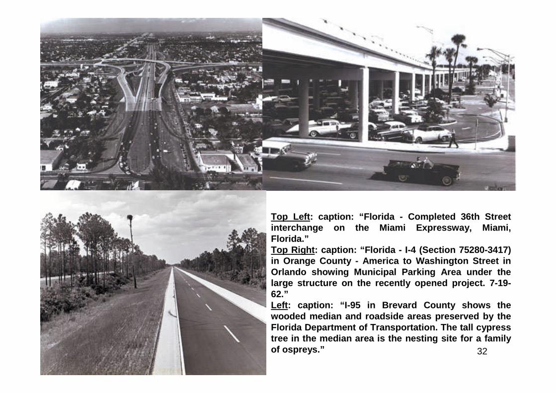
Top Left: caption: “Florida - Completed 36th Streetinterchange on the Miami Expressway, Miami,Florida.”Top Right: caption: “Florida - I-4 (Section 75280-3417)in Orange County - America to Washington Street inOrlando showing Municipal Parking Area under thelarge structure on the recently opened project. 7-19-62.”Left: caption: “I-95 in Brevard County shows thewooded median and roadside areas preserved by theFlorida Department of Transportation. The tall cypresstree in the median area is the nesting site for a familyof ospreys.”
33
4) It Will Provide Satisfactory Speed With Safety
34
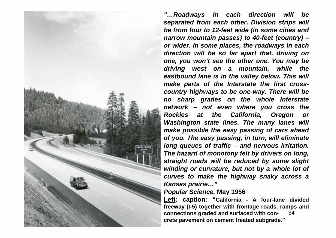
“…Roadways in each direction will beseparated from each other. Division strips willbe from four to 12-feet wide (in some cities andnarrow mountain passes) to 40-feet (country) –or wider. In some places, the roadways in eachdirection will be so far apart that, driving onone, you won’t see the other one. You may bedriving west on a mountain, while theeastbound lane is in the valley below. This willmake parts of the Interstate the first cross-country highways to be one-way. There will beno sharp grades on the whole Interstatenetwork – not even where you cross theRockies at the California, Oregon orWashington state lines. The many lanes willmake possible the easy passing of cars aheadof you. The easy passing, in turn, will eliminatelong queues of traffic – and nervous irritation.The hazard of monotony felt by drivers on long,straight roads will be reduced by some slightwinding or curvature, but not by a whole lot ofcurves to make the highway snaky across aKansas prairie…”Popular Science, May 1956Left: caption: “California - A four-lane dividedfreeway (I-5) together with frontage roads, ramps andconnections graded and surfaced with con-crete pavement on cement treated subgrade.”
35
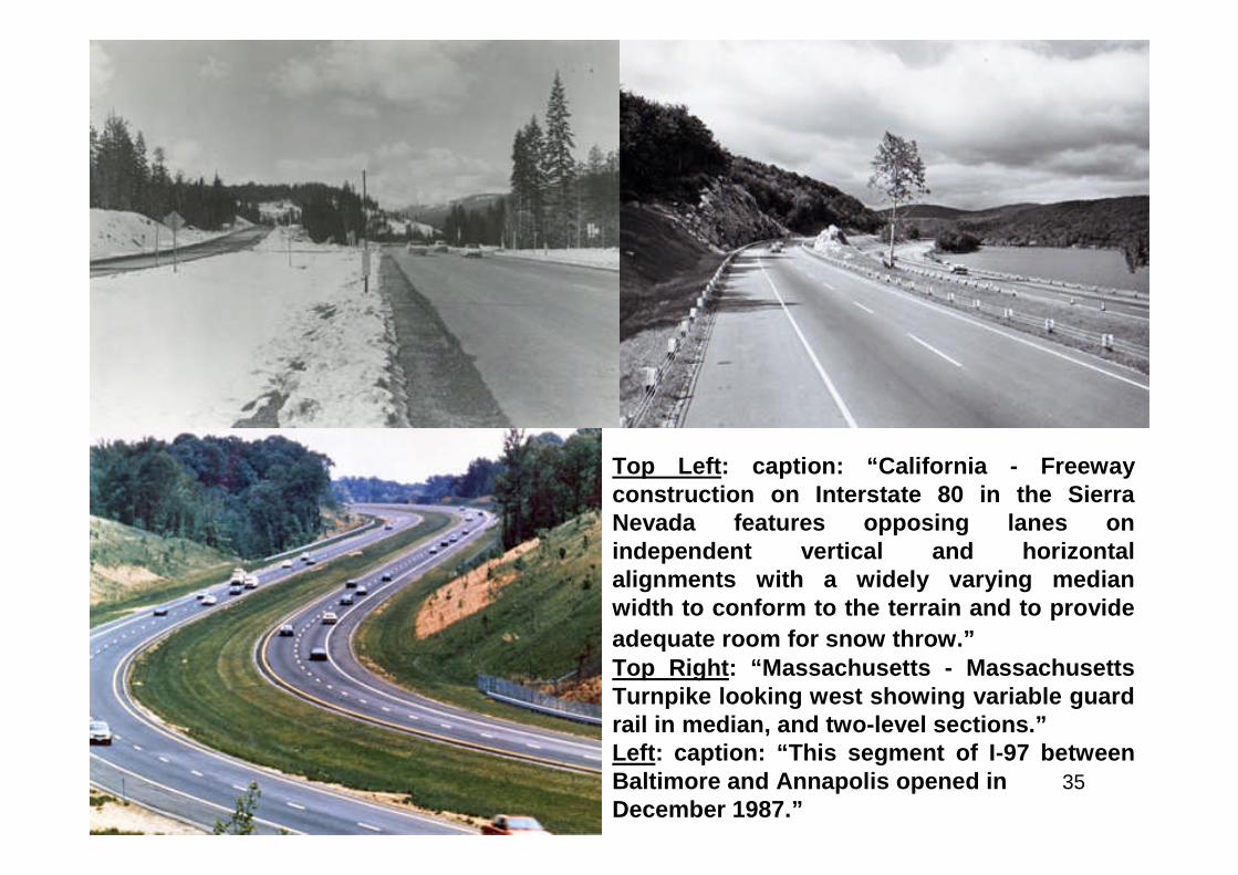
Top Left: caption: “California - Freewayconstruction on Interstate 80 in the SierraNevada features opposing lanes onindependent vertical and horizontalalignments with a widely varying medianwidth to conform to the terrain and to provide
adequate room for snow throw.”Top Right: “Massachusetts - MassachusettsTurnpike looking west showing variable guardrail in median, and two-level sections.”Left: caption: “This segment of I-97 betweenBaltimore and Annapolis opened inDecember 1987.”
36
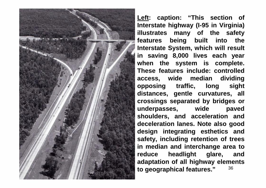
Left: caption: “This section ofInterstate highway (I-95 in Virginia)illustrates many of the safetyfeatures being built into theInterstate System, which will resultin saving 8,000 lives each yearwhen the system is complete.These features include: controlledaccess, wide median dividingopposing traffic, long sightdistances, gentle curvatures, allcrossings separated by bridges orunderpasses, wide pavedshoulders, and acceleration anddeceleration lanes. Note also gooddesign integrating esthetics andsafety, including retention of treesin median and interchange area toreduce headlight glare, andadaptation of all highway elementsto geographical features.”
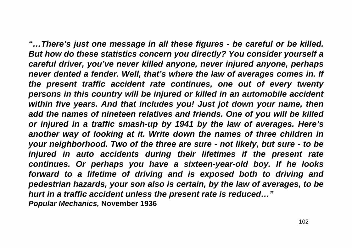
37

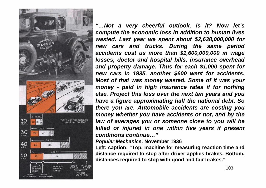
38
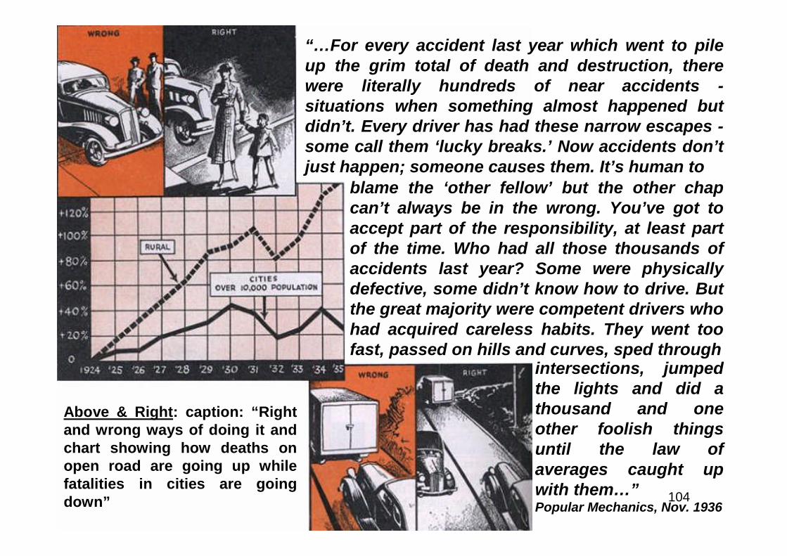
Interstate vs. Toll Roads
39
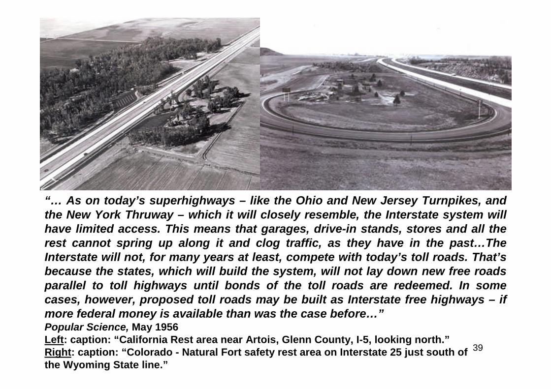
“… As on today’s superhighways – like the Ohio and New Jersey Turnpikes, andthe New York Thruway – which it will closely resemble, the Interstate system willhave limited access. This means that garages, drive-in stands, stores and all therest cannot spring up along it and clog traffic, as they have in the past…TheInterstate will not, for many years at least, compete with today’s toll roads. That’sbecause the states, which will build the system, will not lay down new free roadsparallel to toll highways until bonds of the toll roads are redeemed. In somecases, however, proposed toll roads may be built as Interstate free highways – ifmore federal money is available than was the case before…”Popular Science, May 1956Left: caption: “California Rest area near Artois, Glenn County, I-5, looking north.”Right: caption: “Colorado - Natural Fort safety rest area on Interstate 25 just south ofthe Wyoming State line.”
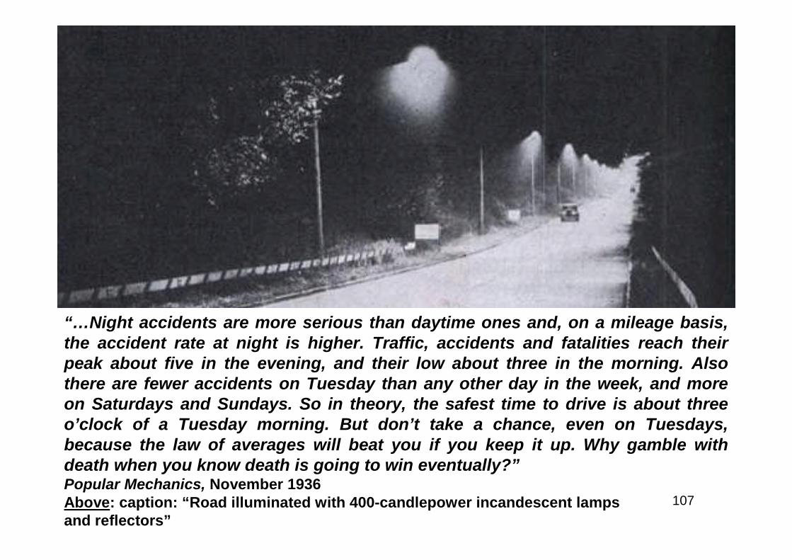
40
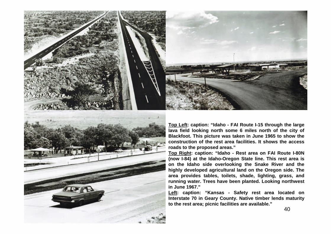
Top Left: caption: “Idaho - FAI Route I-15 through the largelava field looking north some 6 miles north of the city ofBlackfoot. This picture was taken in June 1965 to show theconstruction of the rest area facilities. It shows the accessroads to the proposed areas.”Top Right: caption: “Idaho - Rest area on FAI Route I-80N(now I-84) at the Idaho-Oregon State line. This rest area ison the Idaho side overlooking the Snake River and thehighly developed agricultural land on the Oregon side. Thearea provides tables, toilets, shade, lighting, grass, andrunning water. Trees have been planted. Looking northwestin June 1967.”Left: caption: “Kansas - Safety rest area located onInterstate 70 in Geary County. Native timber lends maturityto the rest area; picnic facilities are available.”
41
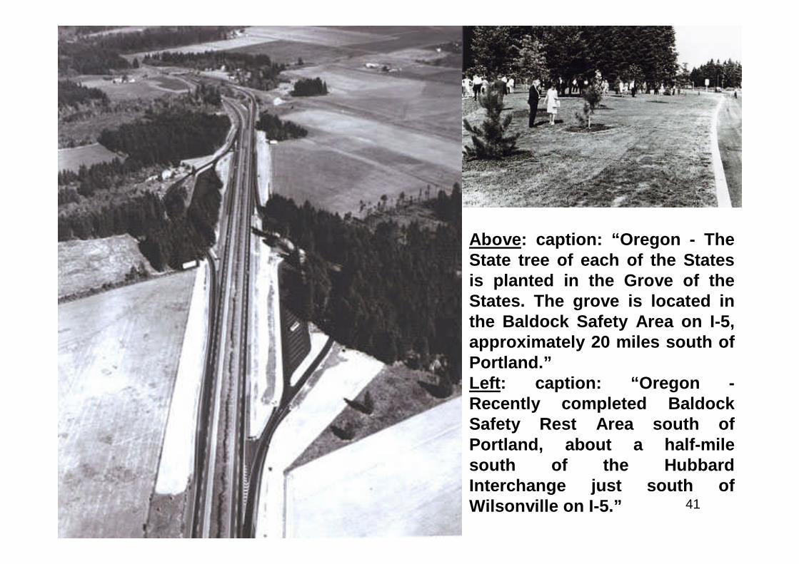
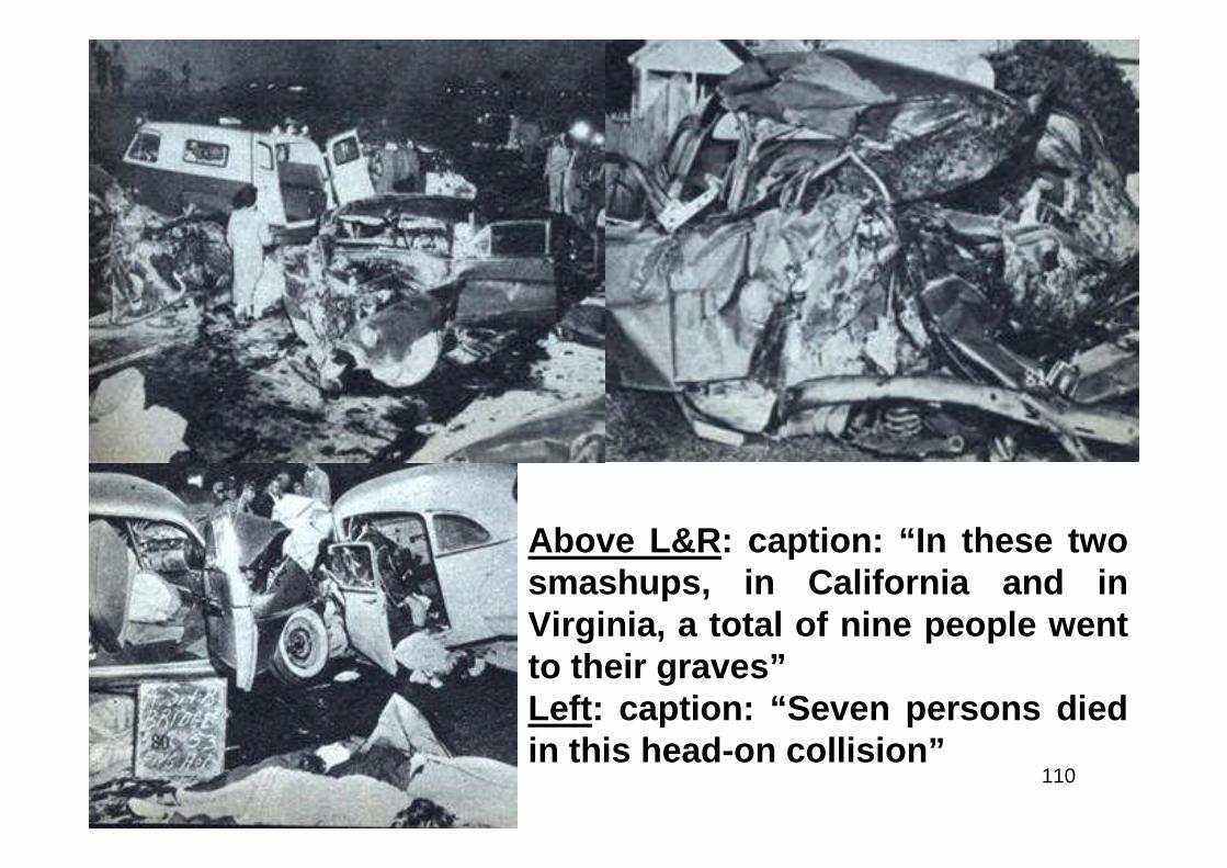
Above: caption: “Oregon - TheState tree of each of the Statesis planted in the Grove of theStates. The grove is located inthe Baldock Safety Area on I-5,approximately 20 miles south ofPortland.”Left: caption: “Oregon -Recently completed BaldockSafety Rest Area south ofPortland, about a half-milesouth of the HubbardInterchange just south ofWilsonville on I-5.”
42
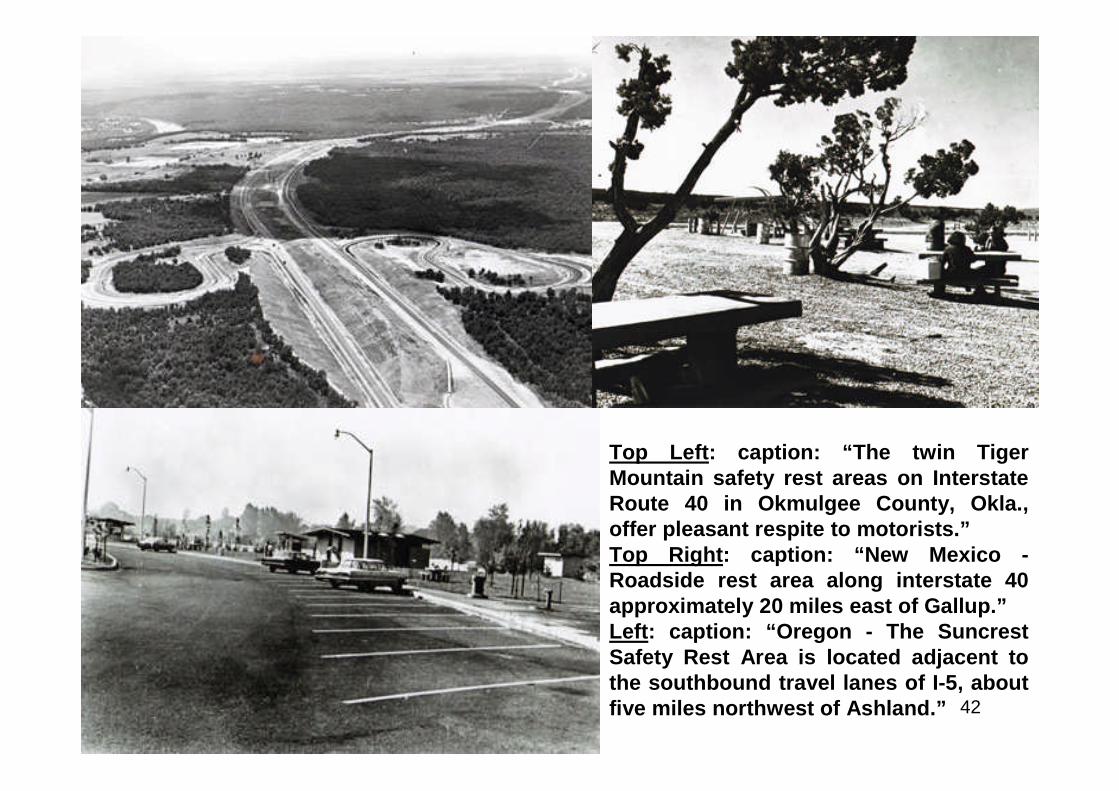
Top Left: caption: “The twin TigerMountain safety rest areas on InterstateRoute 40 in Okmulgee County, Okla.,offer pleasant respite to motorists.”Top Right: caption: “New Mexico -Roadside rest area along interstate 40approximately 20 miles east of Gallup.”Left: caption: “Oregon - The SuncrestSafety Rest Area is located adjacent tothe southbound travel lanes of I-5, aboutfive miles northwest of Ashland.”
43
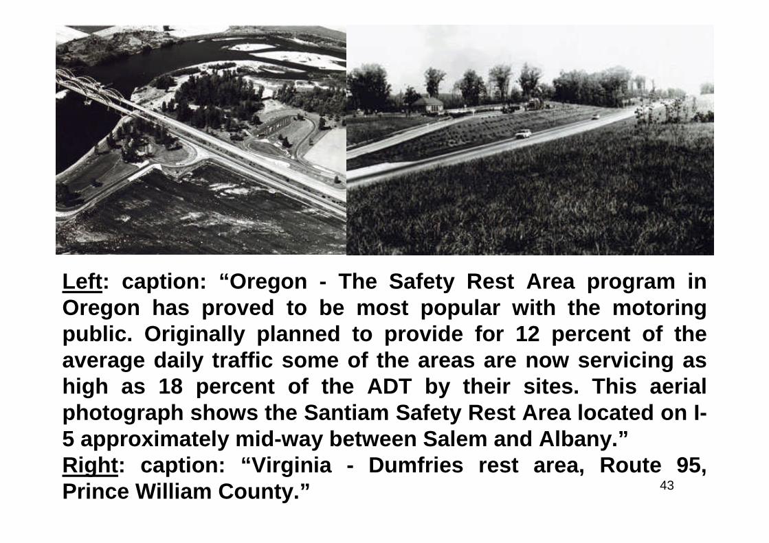
Left: caption: “Oregon - The Safety Rest Area program inOregon has proved to be most popular with the motoringpublic. Originally planned to provide for 12 percent of theaverage daily traffic some of the areas are now servicing ashigh as 18 percent of the ADT by their sites. This aerialphotograph shows the Santiam Safety Rest Area located on I-5 approximately mid-way between Salem and Albany.”Right: caption: “Virginia - Dumfries rest area, Route 95,Prince William County.”
44

45
Distinctly Different
46
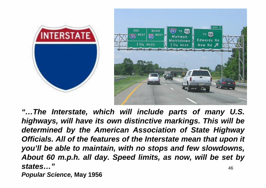
“…The Interstate, which will include parts of many U.S.highways, will have its own distinctive markings. This will bedetermined by the American Association of State HighwayOfficials. All of the features of the Interstate mean that upon ityou’ll be able to maintain, with no stops and few slowdowns,About 60 m.p.h. all day. Speed limits, as now, will be set bystates…”Popular Science, May 1956
47

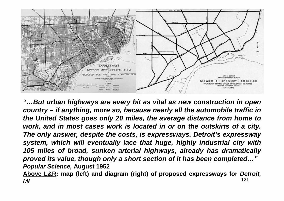
48
Eighth Wonder
49
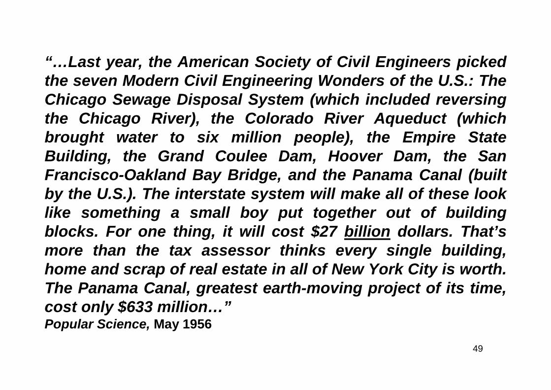
“…Last year, the American Society of Civil Engineers pickedthe seven Modern Civil Engineering Wonders of the U.S.: TheChicago Sewage Disposal System (which included reversingthe Chicago River), the Colorado River Aqueduct (whichbrought water to six million people), the Empire StateBuilding, the Grand Coulee Dam, Hoover Dam, the SanFrancisco-Oakland Bay Bridge, and the Panama Canal (builtby the U.S.). The interstate system will make all of these looklike something a small boy put together out of buildingblocks. For one thing, it will cost $27 billion dollars. That’smore than the tax assessor thinks every single building,home and scrap of real estate in all of New York City is worth.The Panama Canal, greatest earth-moving project of its time,cost only $633 million…”Popular Science, May 1956
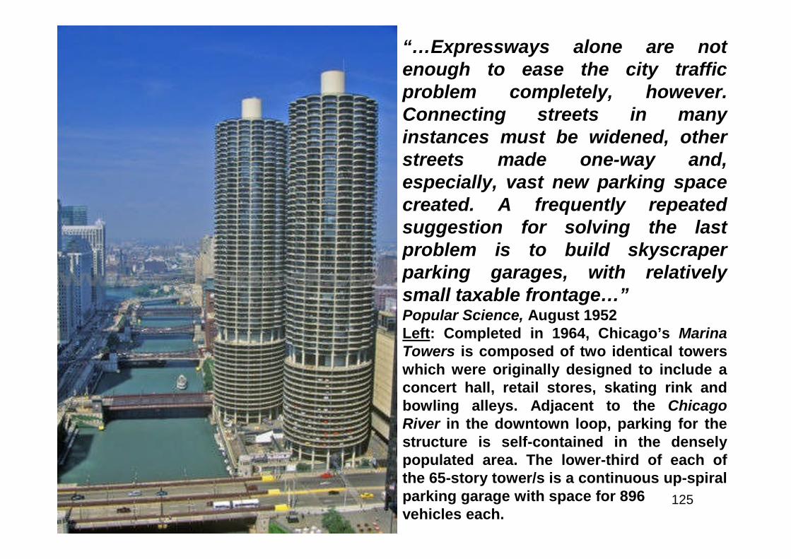
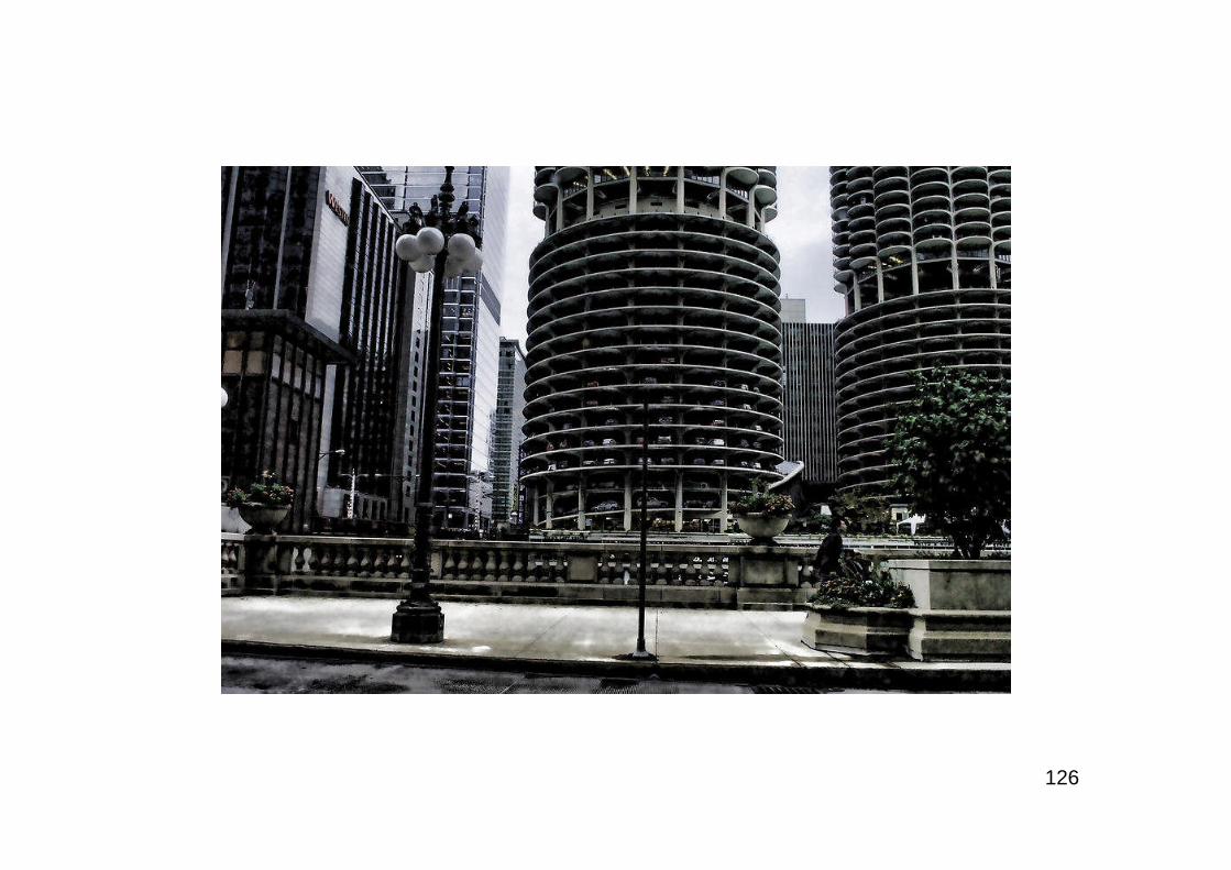
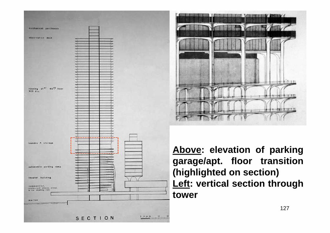
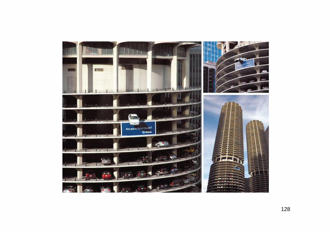
50

51
Mankind’s Biggest Building Job
52
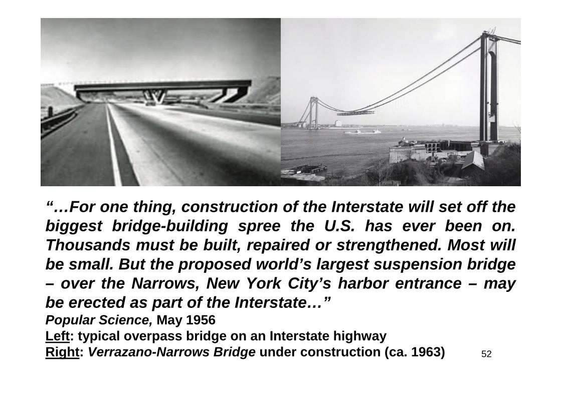
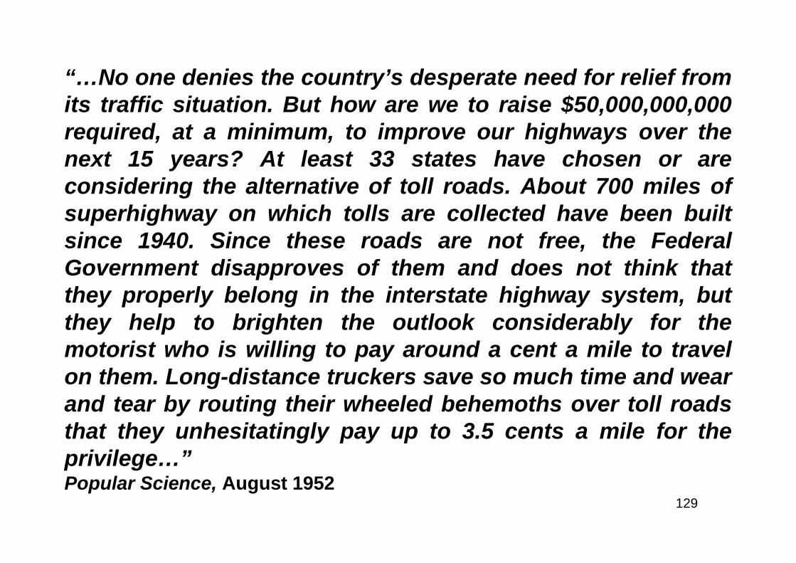
“…For one thing, construction of the Interstate will set off thebiggest bridge-building spree the U.S. has ever been on.Thousands must be built, repaired or strengthened. Most willbe small. But the proposed world’s largest suspension bridge– over the Narrows, New York City’s harbor entrance – maybe erected as part of the Interstate…”Popular Science, May 1956Left: typical overpass bridge on an Interstate highwayRight: Verrazano-Narrows Bridge under construction (ca. 1963)

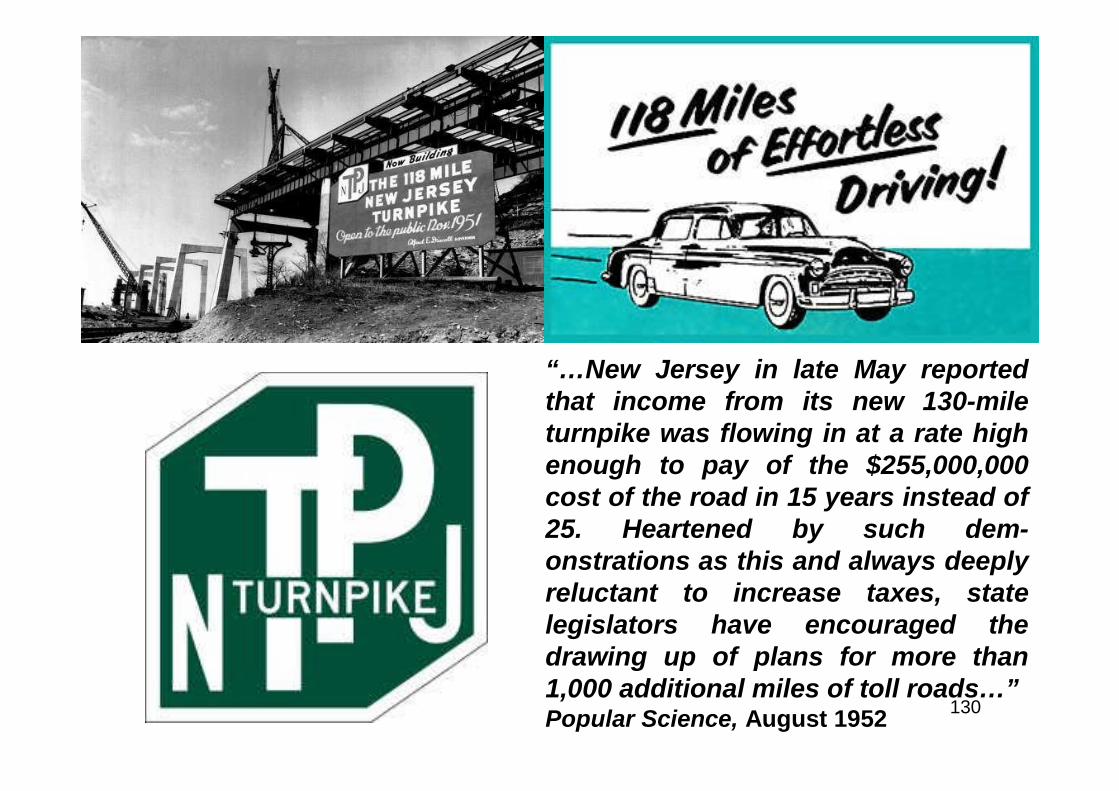
53
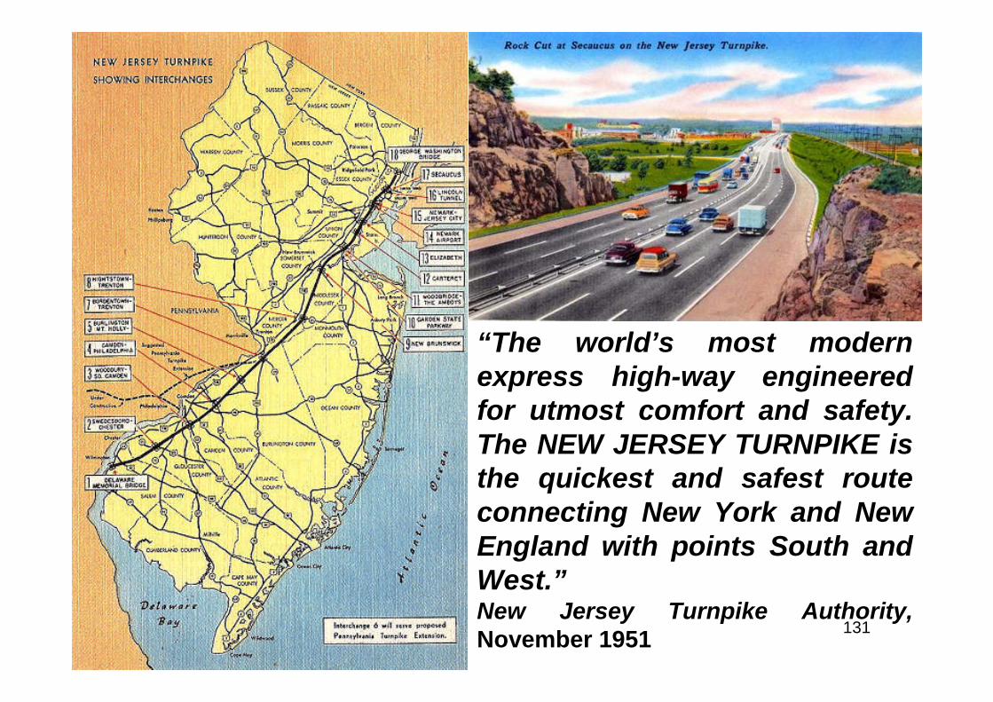
Top Left: caption: “Connecticut - InterstateRoute 91 - Founders Bridge interchange inHartford. Aerial view looking northeast. Nov.26, 1958.”Top Right: caption: “Curved girder bridge inFarmington over I-84.”Left: caption: “Connecticut - A steel-archdesign was chosen for esthetic reasons forthis bridge spanning Interstate Route 84 inMiddlebury.”
54
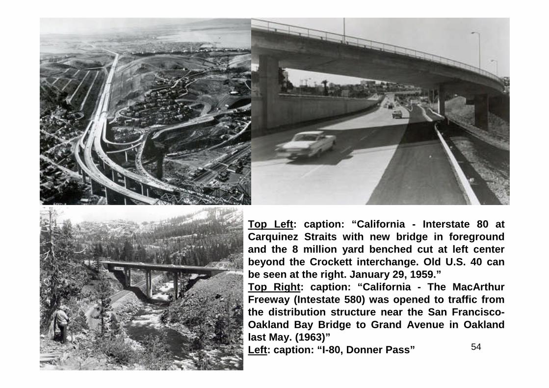
Top Left: caption: “California - Interstate 80 atCarquinez Straits with new bridge in foregroundand the 8 million yard benched cut at left centerbeyond the Crockett interchange. Old U.S. 40 canbe seen at the right. January 29, 1959.”Top Right: caption: “California - The MacArthurFreeway (Intestate 580) was opened to traffic fromthe distribution structure near the San Francisco-Oakland Bay Bridge to Grand Avenue in Oaklandlast May. (1963)”Left: caption: “I-80, Donner Pass”
55
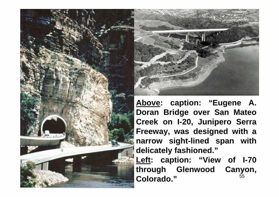
Above: caption: “Eugene A.Doran Bridge over San MateoCreek on I-20, Junipero SerraFreeway, was designed with anarrow sight-lined span withdelicately fashioned.”Left: caption: “View of I-70through Glenwood Canyon,Colorado.”
56
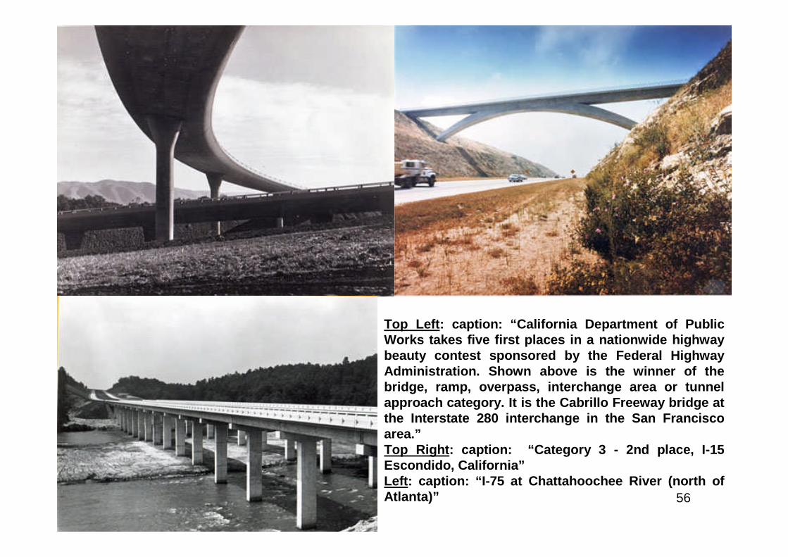
Top Left: caption: “California Department of PublicWorks takes five first places in a nationwide highwaybeauty contest sponsored by the Federal HighwayAdministration. Shown above is the winner of thebridge, ramp, overpass, interchange area or tunnelapproach category. It is the Cabrillo Freeway bridge atthe Interstate 280 interchange in the San Franciscoarea.”Top Right: caption: “Category 3 - 2nd place, I-15Escondido, California”Left: caption: “I-75 at Chattahoochee River (north ofAtlanta)”
57
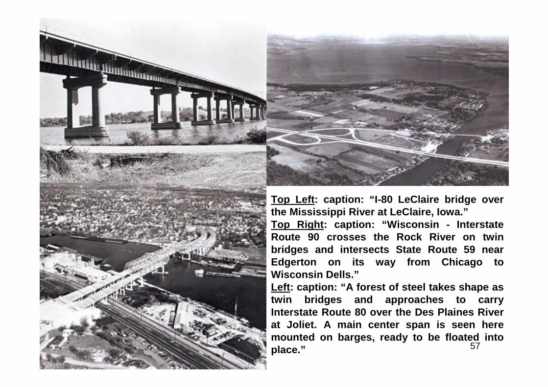
Top Left: caption: “I-80 LeClaire bridge overthe Mississippi River at LeClaire, Iowa.”Top Right: caption: “Wisconsin - InterstateRoute 90 crosses the Rock River on twinbridges and intersects State Route 59 nearEdgerton on its way from Chicago toWisconsin Dells.”Left: caption: “A forest of steel takes shape astwin bridges and approaches to carryInterstate Route 80 over the Des Plaines Riverat Joliet. A main center span is seen heremounted on barges, ready to be floated intoplace.”
58
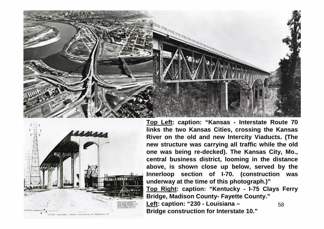
Top Left: caption: “Kansas - Interstate Route 70links the two Kansas Cities, crossing the KansasRiver on the old and new Intercity Viaducts. (Thenew structure was carrying all traffic while the oldone was being re-decked). The Kansas City, Mo.,central business district, looming in the distanceabove, is shown close up below, served by theInnerloop section of I-70. (construction wasunderway at the time of this photograph.)”Top Right: caption: “Kentucky - I-75 Clays FerryBridge, Madison County- Fayette County.”Left: caption: “230 - Louisiana –Bridge construction for Interstate 10.”
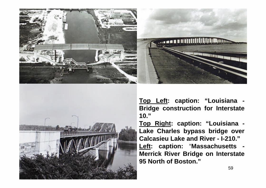
59
Top Left: caption: “Louisiana -Bridge construction for Interstate10.”Top Right: caption: “Louisiana -Lake Charles bypass bridge overCalcasieu Lake and River - I-210.”Left: caption: “Massachusetts -Merrick River Bridge on Interstate95 North of Boston.”
60
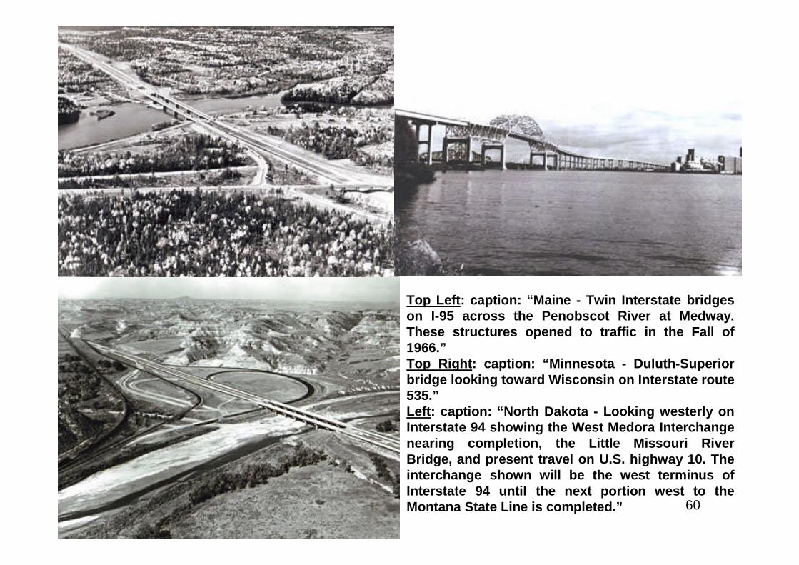
Top Left: caption: “Maine - Twin Interstate bridgeson I-95 across the Penobscot River at Medway.These structures opened to traffic in the Fall of1966.”Top Right: caption: “Minnesota - Duluth-Superiorbridge looking toward Wisconsin on Interstate route535.”Left: caption: “North Dakota - Looking westerly onInterstate 94 showing the West Medora Interchangenearing completion, the Little Missouri RiverBridge, and present travel on U.S. highway 10. Theinterchange shown will be the west terminus ofInterstate 94 until the next portion west to theMontana State Line is completed.”
61
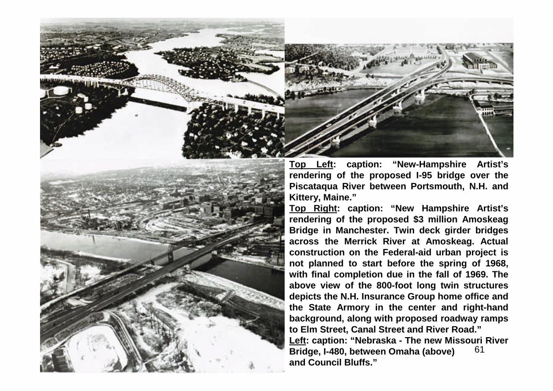
Top Left: caption: “New-Hampshire Artist’srendering of the proposed I-95 bridge over thePiscataqua River between Portsmouth, N.H. andKittery, Maine.”Top Right: caption: “New Hampshire Artist’srendering of the proposed $3 million AmoskeagBridge in Manchester. Twin deck girder bridgesacross the Merrick River at Amoskeag. Actualconstruction on the Federal-aid urban project isnot planned to start before the spring of 1968,with final completion due in the fall of 1969. Theabove view of the 800-foot long twin structuresdepicts the N.H. Insurance Group home office andthe State Armory in the center and right-handbackground, along with proposed roadway rampsto Elm Street, Canal Street and River Road.”Left: caption: “Nebraska - The new Missouri RiverBridge, I-480, between Omaha (above)and Council Bluffs.”
62
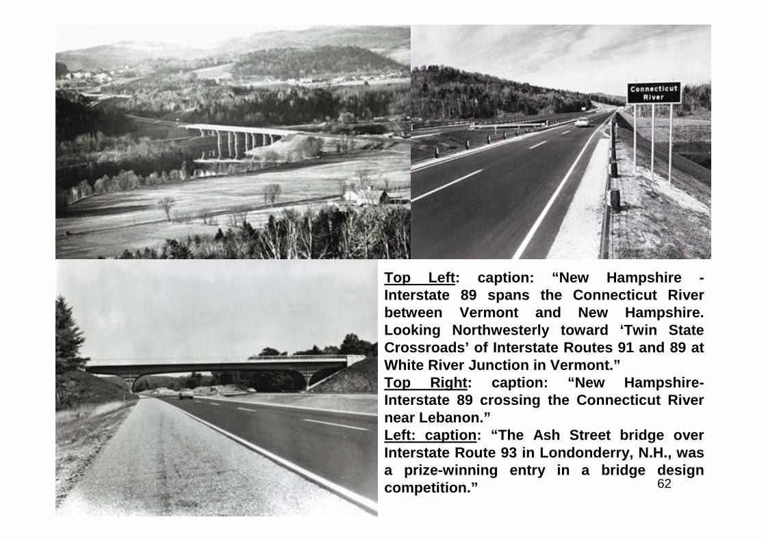
Top Left: caption: “New Hampshire -Interstate 89 spans the Connecticut Riverbetween Vermont and New Hampshire.Looking Northwesterly toward ‘Twin StateCrossroads’ of Interstate Routes 91 and 89 atWhite River Junction in Vermont.”Top Right: caption: “New Hampshire-Interstate 89 crossing the Connecticut Rivernear Lebanon.”Left: caption: “The Ash Street bridge overInterstate Route 93 in Londonderry, N.H., wasa prize-winning entry in a bridge designcompetition.”
63
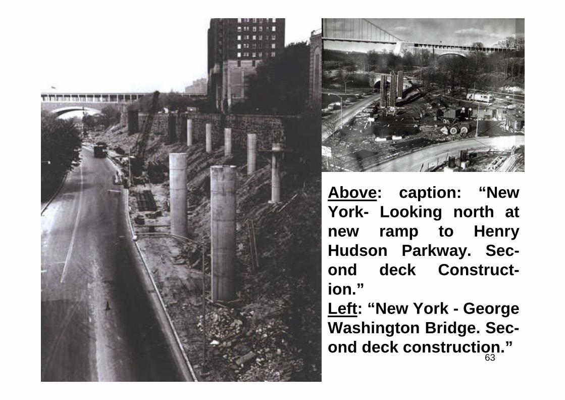
Above: caption: “NewYork- Looking north atnew ramp to HenryHudson Parkway. Sec-ond deck Construct-ion.”Left: “New York - GeorgeWashington Bridge. Sec-ond deck construction.”
64
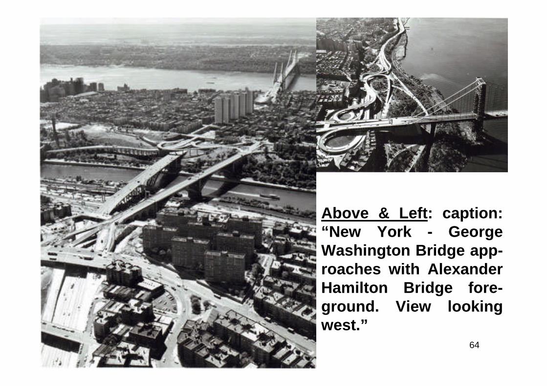
Above & Left: caption:“New York - GeorgeWashington Bridge app-roaches with AlexanderHamilton Bridge fore-ground. View lookingwest.”
65
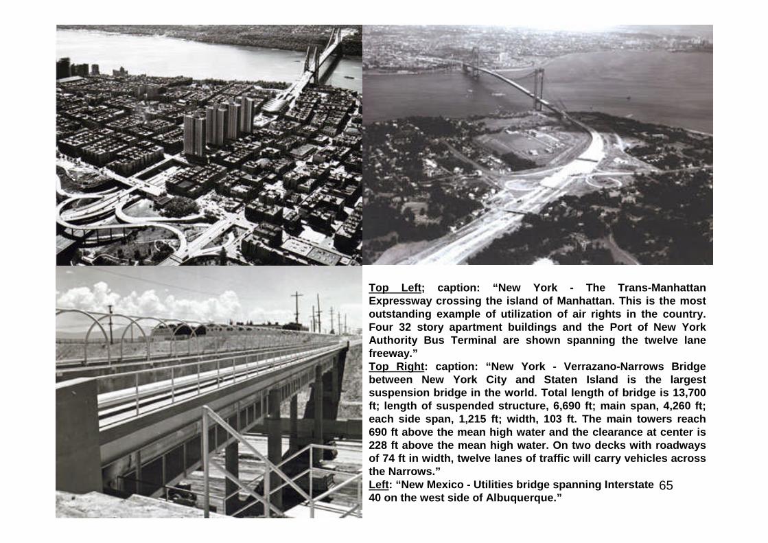
Top Left; caption: “New York - The Trans-ManhattanExpressway crossing the island of Manhattan. This is the mostoutstanding example of utilization of air rights in the country.Four 32 story apartment buildings and the Port of New YorkAuthority Bus Terminal are shown spanning the twelve lanefreeway.”Top Right: caption: “New York - Verrazano-Narrows Bridgebetween New York City and Staten Island is the largestsuspension bridge in the world. Total length of bridge is 13,700ft; length of suspended structure, 6,690 ft; main span, 4,260 ft;each side span, 1,215 ft; width, 103 ft. The main towers reach690 ft above the mean high water and the clearance at center is228 ft above the mean high water. On two decks with roadwaysof 74 ft in width, twelve lanes of traffic will carry vehicles acrossthe Narrows.”Left: “New Mexico - Utilities bridge spanning Interstate40 on the west side of Albuquerque.”
66
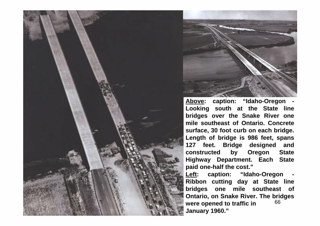
Above: caption: “Idaho-Oregon -Looking south at the State linebridges over the Snake River onemile southeast of Ontario. Concretesurface, 30 foot curb on each bridge.Length of bridge is 986 feet, spans127 feet. Bridge designed andconstructed by Oregon StateHighway Department. Each Statepaid one-half the cost.”Left: caption: “Idaho-Oregon -Ribbon cutting day at State linebridges one mile southeast ofOntario, on Snake River. The bridgeswere opened to traffic inJanuary 1960.”

67
Top Left: caption: “Ohio- Interstate Route 71 & 75cross the Ohio River from Covington, Kentucky, onthis two-level bridge into Cincinnati, Ohio, whereramps distribute traffic to the two diverging Interstateroutes and the city Streets.”Top Right: caption: “Oregon - The Marquam Bridgeover the Willamette River in Portland. The two-deckedstructure connects I-5 and the Stadium Freeway (I-405)with the East Bank Freeway, I-80N (now I-84), and theMinnesota Freeway, which runs to the InterstateBridge (I-5 across the Columbia River).”Left: caption: “Oregon- Construction continues on theBonneville-Hood River County Line Section of I-84. Thetwo-lane Tooth Rock Tunnel will be used foreastbound traffic; the westbound lanes willuse a viaduct.”
68
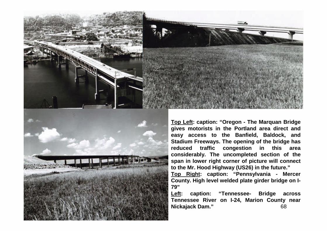
Top Left: caption: “Oregon - The Marquan Bridgegives motorists in the Portland area direct andeasy access to the Banfield, Baldock, andStadium Freeways. The opening of the bridge hasreduced traffic congestion in this areaconsiderably. The uncompleted section of thespan in lower right corner of picture will connectto the Mr. Hood Highway (US26) in the future.”Top Right: caption: “Pennsylvania - MercerCounty. High level welded plate girder bridge on I-79”Left: caption: “Tennessee- Bridge acrossTennessee River on I-24, Marion County nearNickajack Dam.”
69
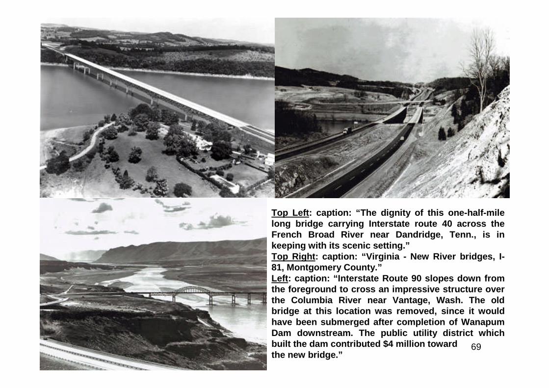
Top Left: caption: “The dignity of this one-half-milelong bridge carrying Interstate route 40 across theFrench Broad River near Dandridge, Tenn., is inkeeping with its scenic setting.”Top Right: caption: “Virginia - New River bridges, I-81, Montgomery County.”Left: caption: “Interstate Route 90 slopes down fromthe foreground to cross an impressive structure overthe Columbia River near Vantage, Wash. The oldbridge at this location was removed, since it wouldhave been submerged after completion of WanapumDam downstream. The public utility district whichbuilt the dam contributed $4 million towardthe new bridge.”

70
Above L&R: caption: “These two pairs of twinbridges on Interstate Route 90 in WisconsinIllustrate both the functional grace and thediversity of design with which bridge buildersfit structures to location needs. The girderbridges supported on piers cross theWisconsin River; the steel arches span MirrorLake near the Wisconsin Dells. These bridgesare part of a 55-mile, $32 million section ofInterstate 90 between Madison and the Dells,opened to traffic in October 1961.”Left: caption: “Interstate Route 90 crosses theRock River on twin bridges and intersectsState Route 59 near Edgerton, Wis., onits way from Chicago to Wisconsin Dells.”
71
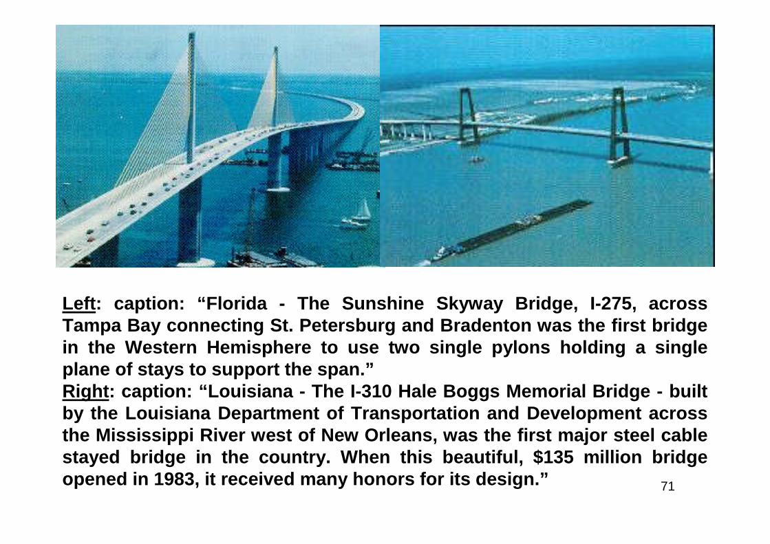
Left: caption: “Florida - The Sunshine Skyway Bridge, I-275, acrossTampa Bay connecting St. Petersburg and Bradenton was the first bridgein the Western Hemisphere to use two single pylons holding a singleplane of stays to support the span.”Right: caption: “Louisiana - The I-310 Hale Boggs Memorial Bridge - builtby the Louisiana Department of Transportation and Development acrossthe Mississippi River west of New Orleans, was the first major steel cablestayed bridge in the country. When this beautiful, $135 million bridgeopened in 1983, it received many honors for its design.”
72
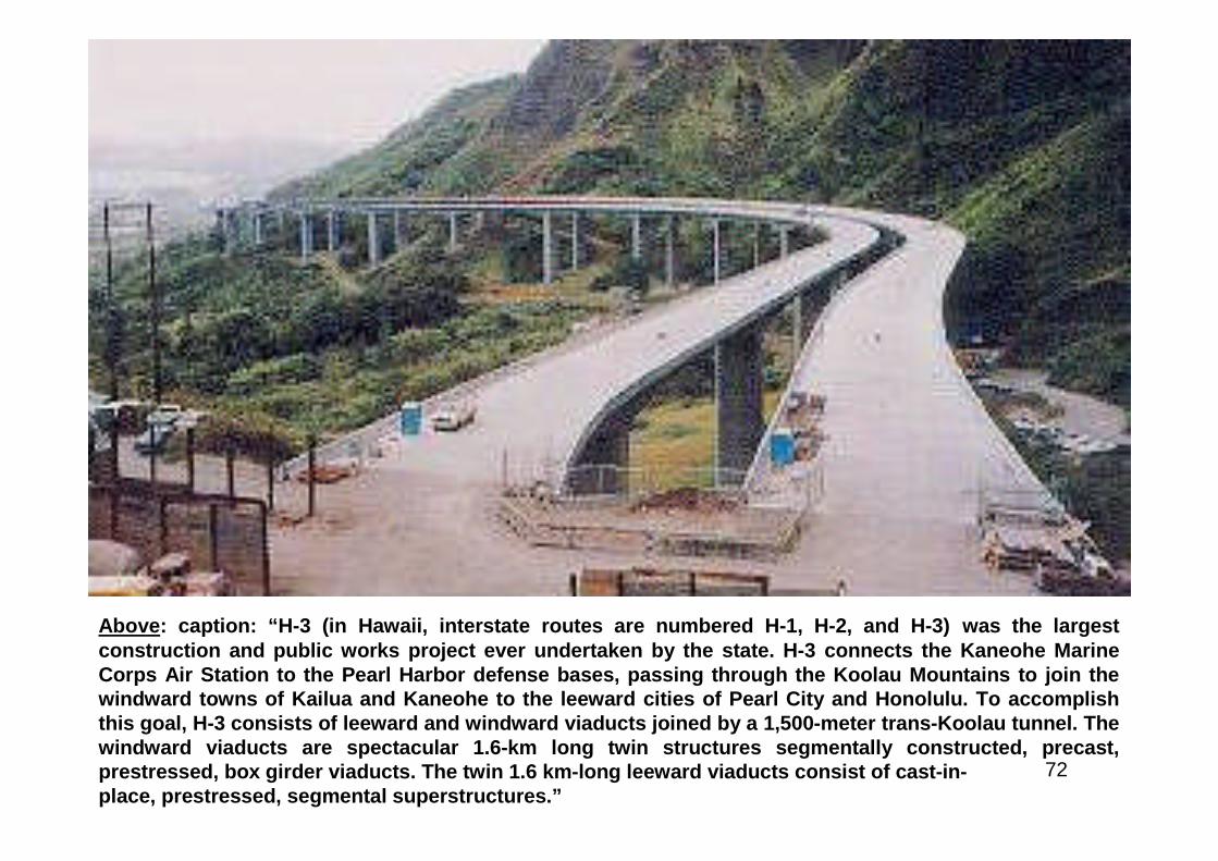
Above: caption: “H-3 (in Hawaii, interstate routes are numbered H-1, H-2, and H-3) was the largestconstruction and public works project ever undertaken by the state. H-3 connects the Kaneohe MarineCorps Air Station to the Pearl Harbor defense bases, passing through the Koolau Mountains to join thewindward towns of Kailua and Kaneohe to the leeward cities of Pearl City and Honolulu. To accomplishthis goal, H-3 consists of leeward and windward viaducts joined by a 1,500-meter trans-Koolau tunnel. Thewindward viaducts are spectacular 1.6-km long twin structures segmentally constructed, precast,prestressed, box girder viaducts. The twin 1.6 km-long leeward viaducts consist of cast-in-place, prestressed, segmental superstructures.”
73
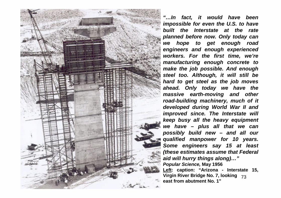
“…In fact, it would have beenimpossible for even the U.S. to havebuilt the Interstate at the rateplanned before now. Only today canwe hope to get enough roadengineers and enough experiencedworkers. For the first time, we’remanufacturing enough concrete tomake the job possible. And enoughsteel too. Although, it will still behard to get steel as the job movesahead. Only today we have themassive earth-moving and otherroad-building machinery, much of itdeveloped during World War II andimproved since. The Interstate willkeep busy all the heavy equipmentwe have – plus all that we canpossibly build new – and all ourqualified manpower for 10 years.Some engineers say 15 at least(these estimates assume that Federalaid will hurry things along)…”Popular Science, May 1956Left: caption: “Arizona - Interstate 15,Virgin River Bridge No. 7, lookingeast from abutment No. 1”
74
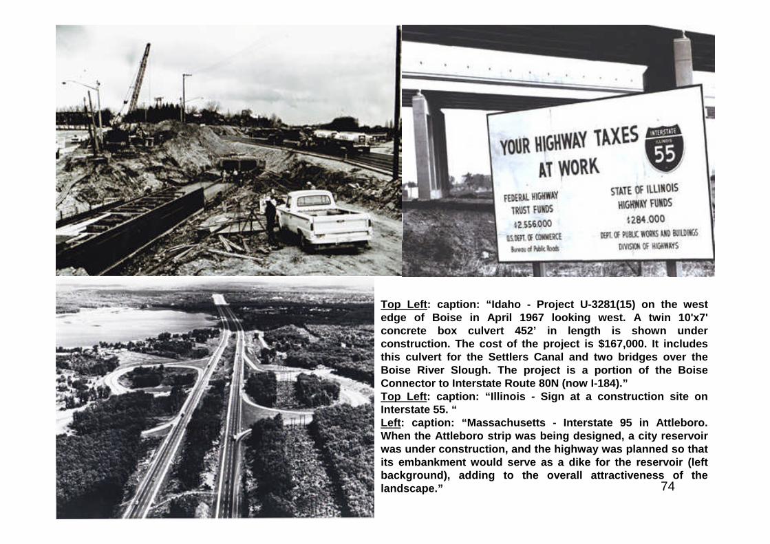
Top Left: caption: “Idaho - Project U-3281(15) on the westedge of Boise in April 1967 looking west. A twin 10'x7'concrete box culvert 452’ in length is shown underconstruction. The cost of the project is $167,000. It includesthis culvert for the Settlers Canal and two bridges over theBoise River Slough. The project is a portion of the BoiseConnector to Interstate Route 80N (now I-184).”Top Left: caption: “Illinois - Sign at a construction site onInterstate 55. “Left: caption: “Massachusetts - Interstate 95 in Attleboro.When the Attleboro strip was being designed, a city reservoirwas under construction, and the highway was planned so thatits embankment would serve as a dike for the reservoir (leftbackground), adding to the overall attractiveness of thelandscape.”
75
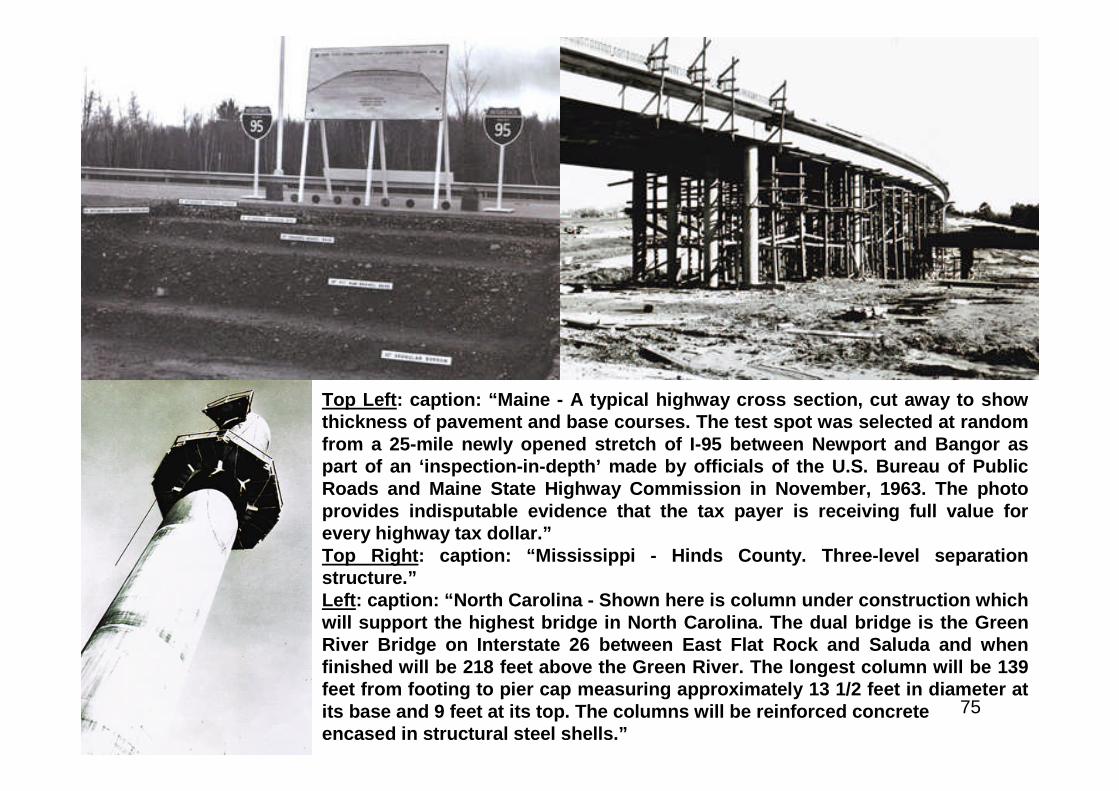
Top Left: caption: “Maine - A typical highway cross section, cut away to showthickness of pavement and base courses. The test spot was selected at randomfrom a 25-mile newly opened stretch of I-95 between Newport and Bangor aspart of an ‘inspection-in-depth’ made by officials of the U.S. Bureau of PublicRoads and Maine State Highway Commission in November, 1963. The photoprovides indisputable evidence that the tax payer is receiving full value forevery highway tax dollar.”Top Right: caption: “Mississippi - Hinds County. Three-level separationstructure.”Left: caption: “North Carolina - Shown here is column under construction whichwill support the highest bridge in North Carolina. The dual bridge is the GreenRiver Bridge on Interstate 26 between East Flat Rock and Saluda and whenfinished will be 218 feet above the Green River. The longest column will be 139feet from footing to pier cap measuring approximately 13 1/2 feet in diameter atits base and 9 feet at its top. The columns will be reinforced concreteencased in structural steel shells.”
76
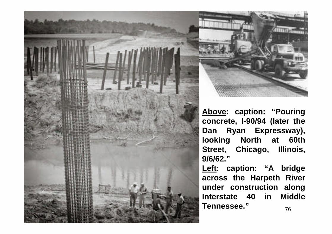
Above: caption: “Pouringconcrete, I-90/94 (later theDan Ryan Expressway),looking North at 60thStreet, Chicago, Illinois,9/6/62.”Left: caption: “A bridgeacross the Harpeth Riverunder construction alongInterstate 40 in MiddleTennessee.”
77
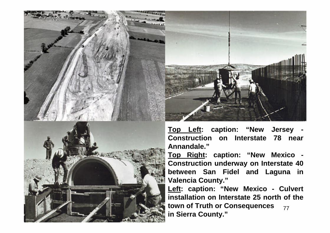
Top Left: caption: “New Jersey -Construction on Interstate 78 nearAnnandale.”Top Right: caption: “New Mexico -Construction underway on Interstate 40between San Fidel and Laguna inValencia County.”Left: caption: “New Mexico - Culvertinstallation on Interstate 25 north of thetown of Truth or Consequencesin Sierra County.”
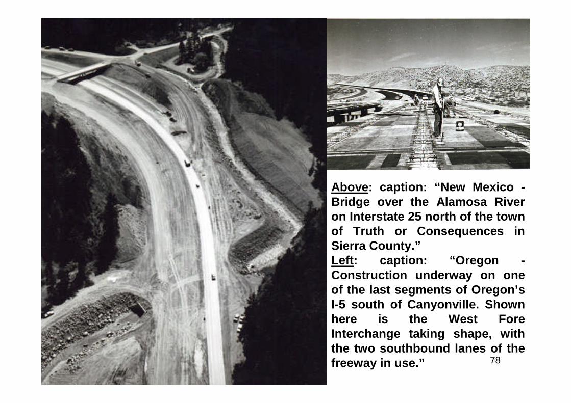
78
Above: caption: “New Mexico -Bridge over the Alamosa Riveron Interstate 25 north of the townof Truth or Consequences inSierra County.”Left: caption: “Oregon -Construction underway on oneof the last segments of Oregon’sI-5 south of Canyonville. Shownhere is the West ForeInterchange taking shape, withthe two southbound lanes of thefreeway in use.”
79
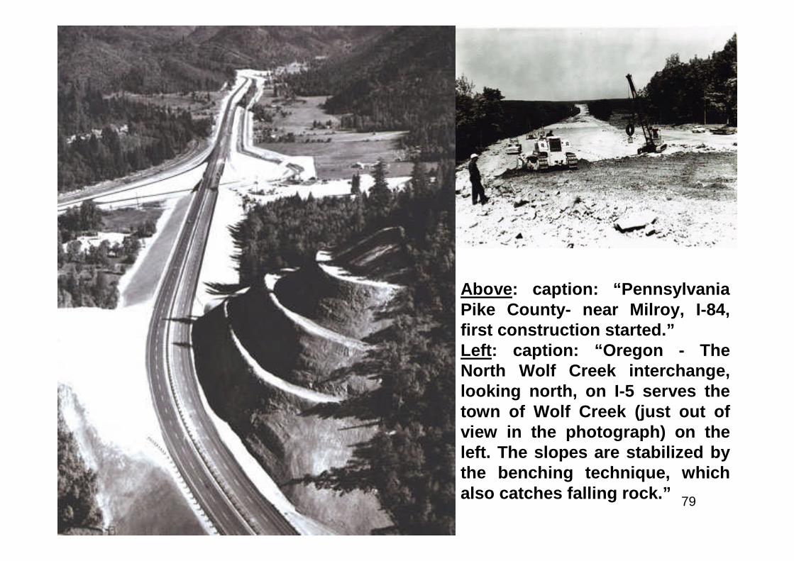
Above: caption: “PennsylvaniaPike County- near Milroy, I-84,first construction started.”Left: caption: “Oregon - TheNorth Wolf Creek interchange,looking north, on I-5 serves thetown of Wolf Creek (just out ofview in the photograph) on theleft. The slopes are stabilized bythe benching technique, whichalso catches falling rock.”

80
Above: caption: “RhodeIsland - Washington DualBridge on I-195.”Left: caption: “Oregon - FromSiskiyou Summit, lookingnorth, I-5 winds its way downtoward Ashland. The grade iseast and the sight distance isexcellent, thus combining tomake a trip over the ruggedSiskiyou a favorable travelingexperience.”

81
Top Left: caption: “Virginia - Bridgeconstruction over southern branch ofElizabeth 1 1/2 miles south of US 460& S.R. 166.Top Right: caption: “Tennessee -Bridge across Tennessee River on I-24, Marion County near NickajackDam.”Left: caption: “Virginia Just east ofGaskins Road, I-64 in HenricoCounty.”
82
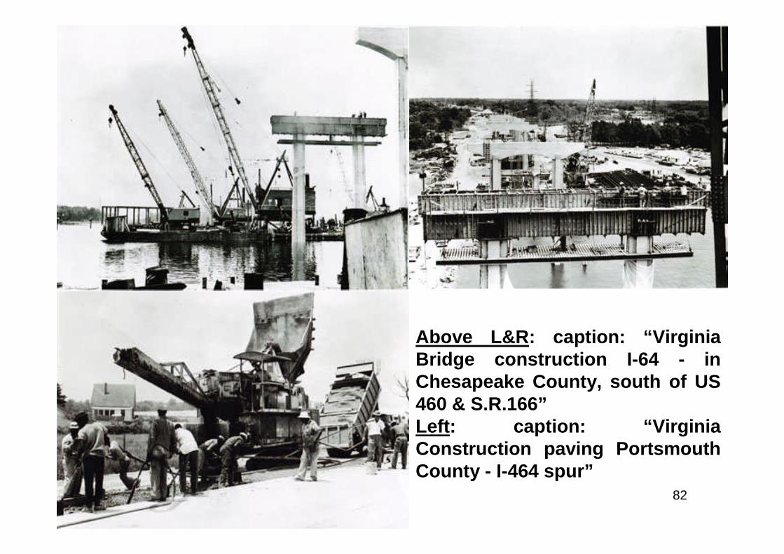
Above L&R: caption: “VirginiaBridge construction I-64 - inChesapeake County, south of US460 & S.R.166”Left: caption: “VirginiaConstruction paving PortsmouthCounty - I-464 spur”
83
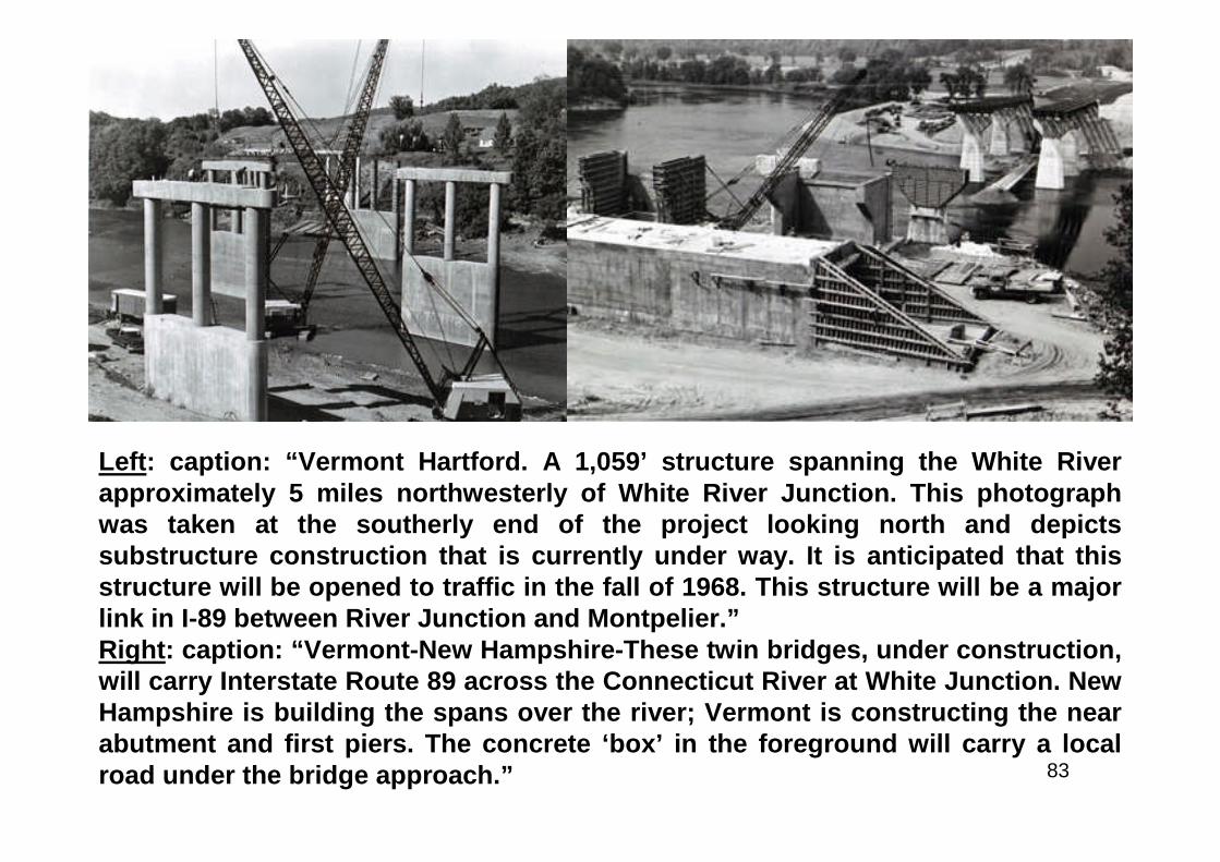
Left: caption: “Vermont Hartford. A 1,059’ structure spanning the White Riverapproximately 5 miles northwesterly of White River Junction. This photographwas taken at the southerly end of the project looking north and depictssubstructure construction that is currently under way. It is anticipated that thisstructure will be opened to traffic in the fall of 1968. This structure will be a majorlink in I-89 between River Junction and Montpelier.”Right: caption: “Vermont-New Hampshire-These twin bridges, under construction,will carry Interstate Route 89 across the Connecticut River at White Junction. NewHampshire is building the spans over the river; Vermont is constructing the nearabutment and first piers. The concrete ‘box’ in the foreground will carry a localroad under the bridge approach.”
84
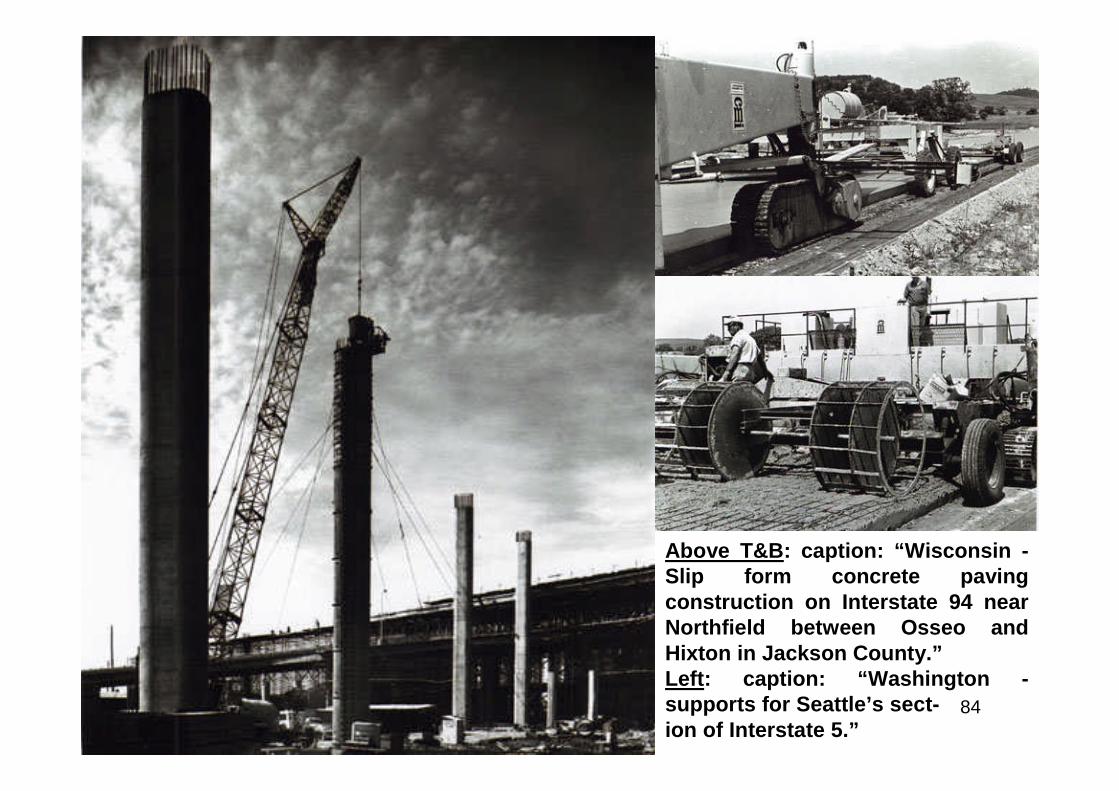
Above T&B: caption: “Wisconsin -Slip form concrete pavingconstruction on Interstate 94 nearNorthfield between Osseo andHixton in Jackson County.”Left: caption: “Washington -supports for Seattle’s sect-ion of Interstate 5.”
85
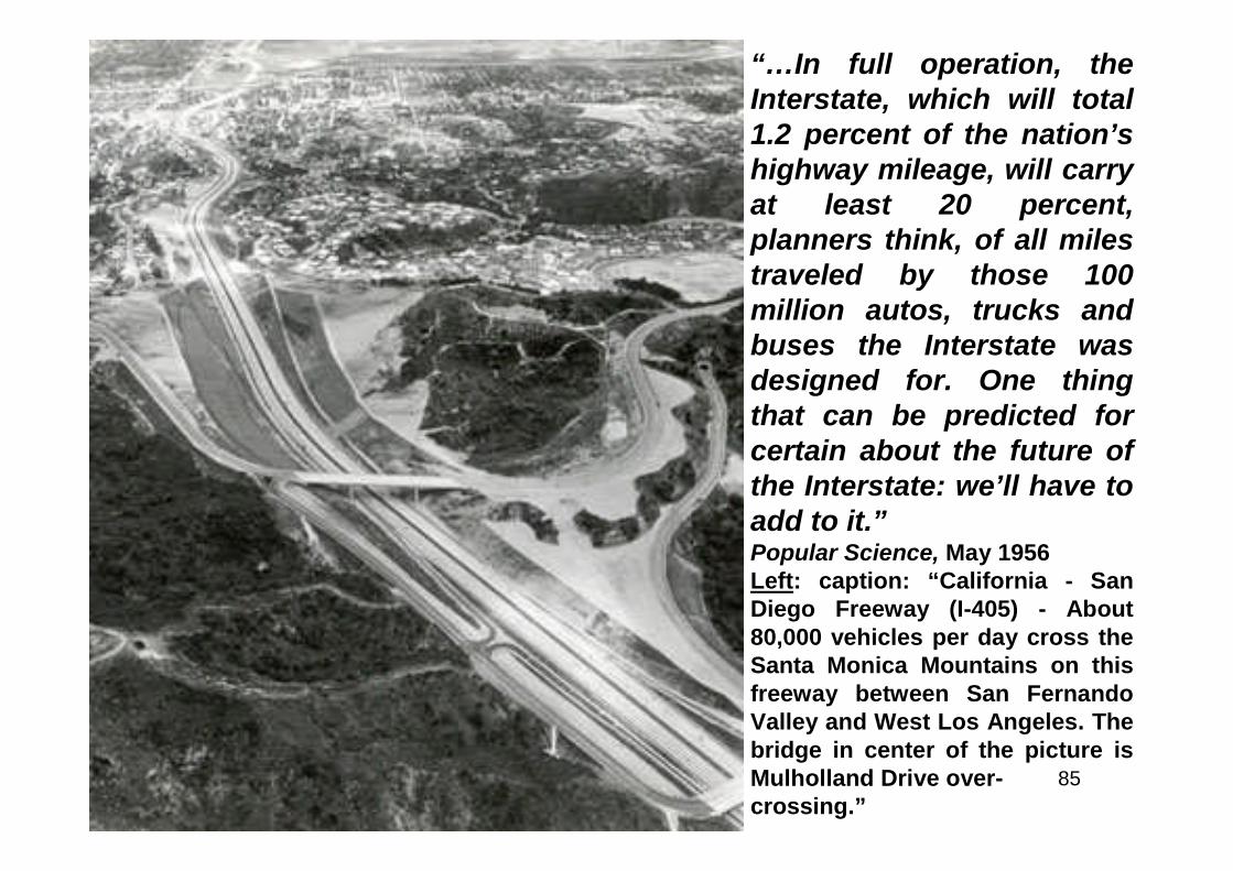
“…In full operation, theInterstate, which will total1.2 percent of the nation’shighway mileage, will carryat least 20 percent,planners think, of all milestraveled by those 100million autos, trucks andbuses the Interstate wasdesigned for. One thingthat can be predicted forcertain about the future ofthe Interstate: we’ll have toadd to it.”Popular Science, May 1956Left: caption: “California - SanDiego Freeway (I-405) - About80,000 vehicles per day cross theSanta Monica Mountains on thisfreeway between San FernandoValley and West Los Angeles. Thebridge in center of the picture isMulholland Drive over-crossing.”

86
Deutschland Uber Alles
87
“…Germany stands out among all the countries of Europe in magnificentconception of a national system of major highways. This developmentcontemplates a system of approximately 4,500 miles, of which upwards of 1,000miles have been actually constructed. Roughly, the system contemplates threeroutes, north and south, and the same number east and west across the nation.This description is only approximate since the routes composing the system aredesigned to connect the population centers and carry traffic continuouslybetween the borders of the nation. The construction consists essentially of twolines of roadway each approximately 30 feet in width and entirely separated fromeach other by a center grass strip. These roads are known as the‘Reichsautobahnen’ or National Auto Roads. No cross traffic of any character ispermitted. The ordinary roads are generally carried over the ‘Autobahn’ andseparations are effected at points on intersection with railroads as best fit thedesign standards. No provision is made for foot traffic and no bicycle orpedestrian traffic is permitted upon these auto highways. They are designed forhigh speed and exclusively for the use of the motor vehicle. Here again the sameprinciples are used in the design conceived by Germany for this system of ultra-modern through highways of providing ample width of roadways with opposingtraffic separated by an unpaved strip and no cross traffic at grade to interfere withthe continuous flow. The highways which have been completed are wonderfulexamples of the best modern road building. The road from Munich to Salzburg inAustria is one of the most delightful drives of the world…”T.H. MacDonald, BPR Director (1936)
88
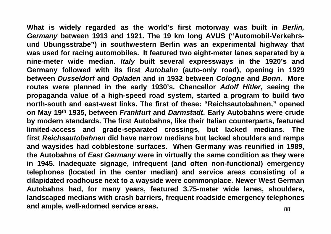
What is widely regarded as the world’s first motorway was built in Berlin,Germany between 1913 and 1921. The 19 km long AVUS (“Automobil-Verkehrs-und Ubungsstrabe”) in southwestern Berlin was an experimental highway thatwas used for racing automobiles. It featured two eight-meter lanes separated by anine-meter wide median. Italy built several expressways in the 1920’s andGermany followed with its first Autobahn (auto-only road), opening in 1929between Dusseldorf and Opladen and in 1932 between Cologne and Bonn. Moreroutes were planned in the early 1930’s. Chancellor Adolf Hitler, seeing thepropaganda value of a high-speed road system, started a program to build twonorth-south and east-west links. The first of these: “Reichsautobahnen,” openedon May 19th 1935, between Frankfurt and Darmstadt. Early Autobahns were crudeby modern standards. The first Autobahns, like their Italian counterparts, featuredlimited-access and grade-separated crossings, but lacked medians. Thefirst Reichsautobahnen did have narrow medians but lacked shoulders and rampsand waysides had cobblestone surfaces. When Germany was reunified in 1989,the Autobahns of East Germany were in virtually the same condition as they werein 1945. Inadequate signage, infrequent (and often non-functional) emergencytelephones (located in the center median) and service areas consisting of adilapidated roadhouse next to a wayside were commonplace. Newer West GermanAutobahns had, for many years, featured 3.75-meter wide lanes, shoulders,landscaped medians with crash barriers, frequent roadside emergency telephonesand ample, well-adorned service areas.
89
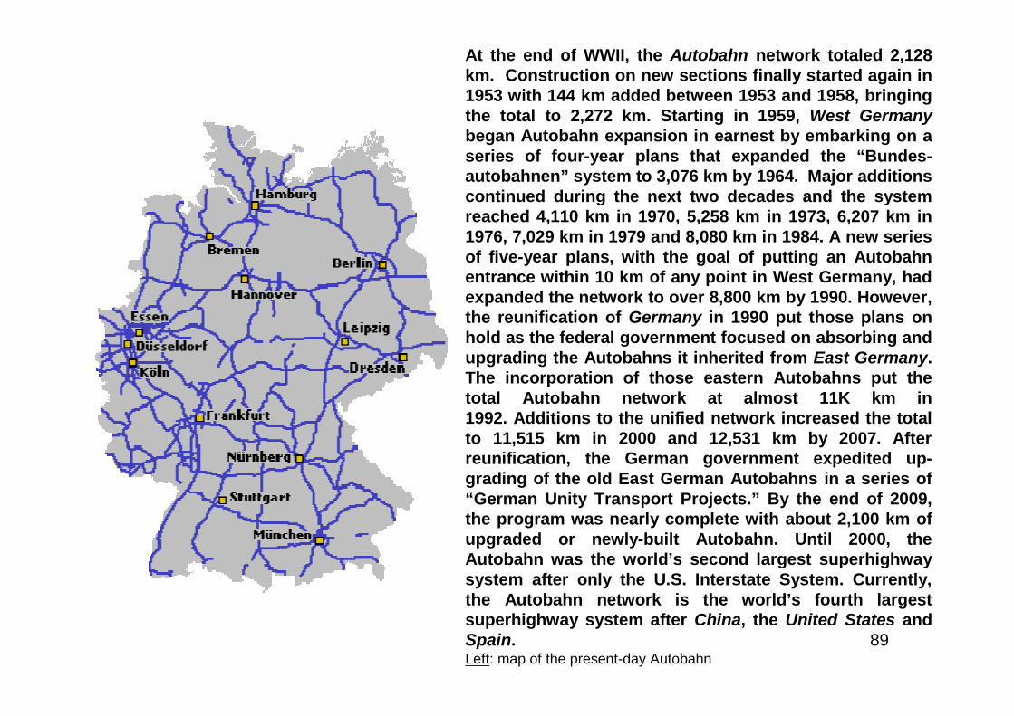
At the end of WWII, the Autobahn network totaled 2,128km. Construction on new sections finally started again in1953 with 144 km added between 1953 and 1958, bringingthe total to 2,272 km. Starting in 1959, West Germanybegan Autobahn expansion in earnest by embarking on aseries of four-year plans that expanded the “Bundes-autobahnen” system to 3,076 km by 1964. Major additionscontinued during the next two decades and the systemreached 4,110 km in 1970, 5,258 km in 1973, 6,207 km in1976, 7,029 km in 1979 and 8,080 km in 1984. A new seriesof five-year plans, with the goal of putting an Autobahnentrance within 10 km of any point in West Germany, hadexpanded the network to over 8,800 km by 1990. However,the reunification of Germany in 1990 put those plans onhold as the federal government focused on absorbing andupgrading the Autobahns it inherited from East Germany.The incorporation of those eastern Autobahns put thetotal Autobahn network at almost 11K km in1992. Additions to the unified network increased the totalto 11,515 km in 2000 and 12,531 km by 2007. Afterreunification, the German government expedited up-grading of the old East German Autobahns in a series of“German Unity Transport Projects.” By the end of 2009,the program was nearly complete with about 2,100 km ofupgraded or newly-built Autobahn. Until 2000, theAutobahn was the world’s second largest superhighwaysystem after only the U.S. Interstate System. Currently,the Autobahn network is the world’s fourth largestsuperhighway system after China, the United States andSpain.Left: map of the present-day Autobahn
90
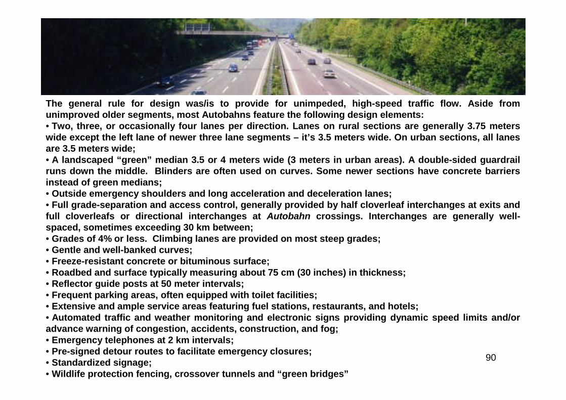
The general rule for design was/is to provide for unimpeded, high-speed traffic flow. Aside fromunimproved older segments, most Autobahns feature the following design elements:• Two, three, or occasionally four lanes per direction. Lanes on rural sections are generally 3.75 meterswide except the left lane of newer three lane segments – it’s 3.5 meters wide. On urban sections, all lanesare 3.5 meters wide;• A landscaped “green” median 3.5 or 4 meters wide (3 meters in urban areas). A double-sided guardrailruns down the middle. Blinders are often used on curves. Some newer sections have concrete barriersinstead of green medians;• Outside emergency shoulders and long acceleration and deceleration lanes;• Full grade-separation and access control, generally provided by half cloverleaf interchanges at exits andfull cloverleafs or directional interchanges at Autobahn crossings. Interchanges are generally well-spaced, sometimes exceeding 30 km between;• Grades of 4% or less. Climbing lanes are provided on most steep grades;• Gentle and well-banked curves;• Freeze-resistant concrete or bituminous surface;• Roadbed and surface typically measuring about 75 cm (30 inches) in thickness;• Reflector guide posts at 50 meter intervals;• Frequent parking areas, often equipped with toilet facilities;• Extensive and ample service areas featuring fuel stations, restaurants, and hotels;• Automated traffic and weather monitoring and electronic signs providing dynamic speed limits and/oradvance warning of congestion, accidents, construction, and fog;• Emergency telephones at 2 km intervals;• Pre-signed detour routes to facilitate emergency closures;• Standardized signage;• Wildlife protection fencing, crossover tunnels and “green bridges”
91
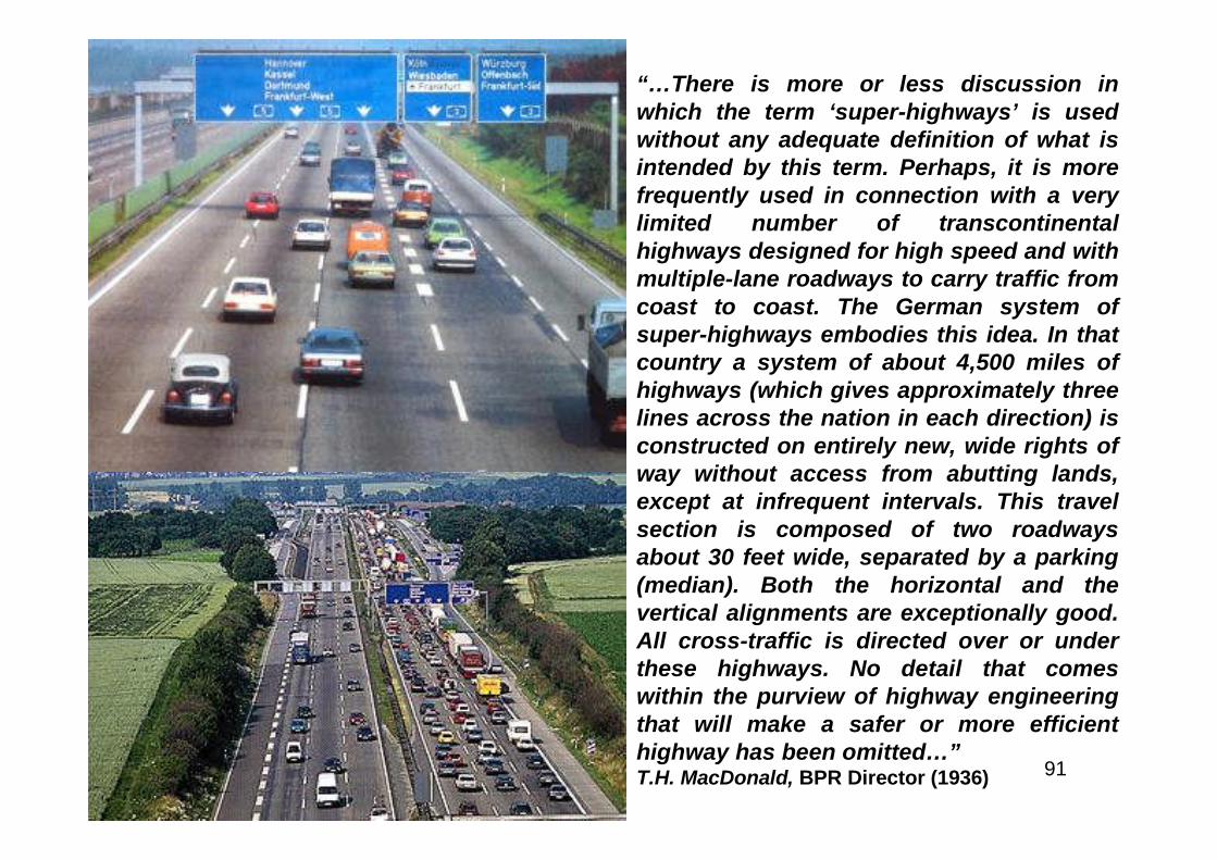
“…There is more or less discussion inwhich the term ‘super-highways’ is usedwithout any adequate definition of what isintended by this term. Perhaps, it is morefrequently used in connection with a verylimited number of transcontinentalhighways designed for high speed and withmultiple-lane roadways to carry traffic fromcoast to coast. The German system ofsuper-highways embodies this idea. In thatcountry a system of about 4,500 miles ofhighways (which gives approximately threelines across the nation in each direction) isconstructed on entirely new, wide rights ofway without access from abutting lands,except at infrequent intervals. This travelsection is composed of two roadwaysabout 30 feet wide, separated by a parking(median). Both the horizontal and thevertical alignments are exceptionally good.All cross-traffic is directed over or underthese highways. No detail that comeswithin the purview of highway engineeringthat will make a safer or more efficienthighway has been omitted…”T.H. MacDonald, BPR Director (1936)

92
Part 2
Something Must Be Done!
93
How Bad Are Our Roads?

94
“American taxpayers have laid out 50 billion dollars for roads in the last25 years. But we have only a trifle more than 2,200 miles of first-class,fully modern, non-toll highways to show for our money. Most of the other740,000 miles of pavement that we have paid for since the twenties arenow too narrow, too sharply curved, too steep, too nearly shoulderless,too often crisscrossed with intersecting routes and railroad tracks, orbecoming too crumbly for the traffic burden they must bear. This year52,000,000 passenger cars, trucks and buses are traveling the highways.And they are pounding those expensive pavements to pieces. Even themen whose job it is to estimate how many more vehicles are going to beon the road each successive year – and who used to be remarkablyaccurate – did not anticipate any such traffic before 1960. The tragiccombination of an out-of-date, aging road system and this nationwidestream of traffic is costing billions a year in time lost, perishable goodswasted, property wrecked in accidents. It is causing thousands ofunnecessary deaths…”Popular Science, August 1952
95
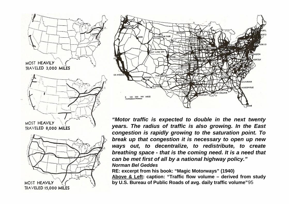
“Motor traffic is expected to double in the next twentyyears. The radius of traffic is also growing. In the Eastcongestion is rapidly growing to the saturation point. Tobreak up that congestion it is necessary to open up newways out, to decentralize, to redistribute, to createbreathing space - that is the coming need. It is a need thatcan be met first of all by a national highway policy.”Norman Bel GeddesRE: excerpt from his book: “Magic Motorways” (1940)Above & Left: caption: “Traffic flow volume – derived from studyby U.S. Bureau of Public Roads of avg. daily traffic volume”
96
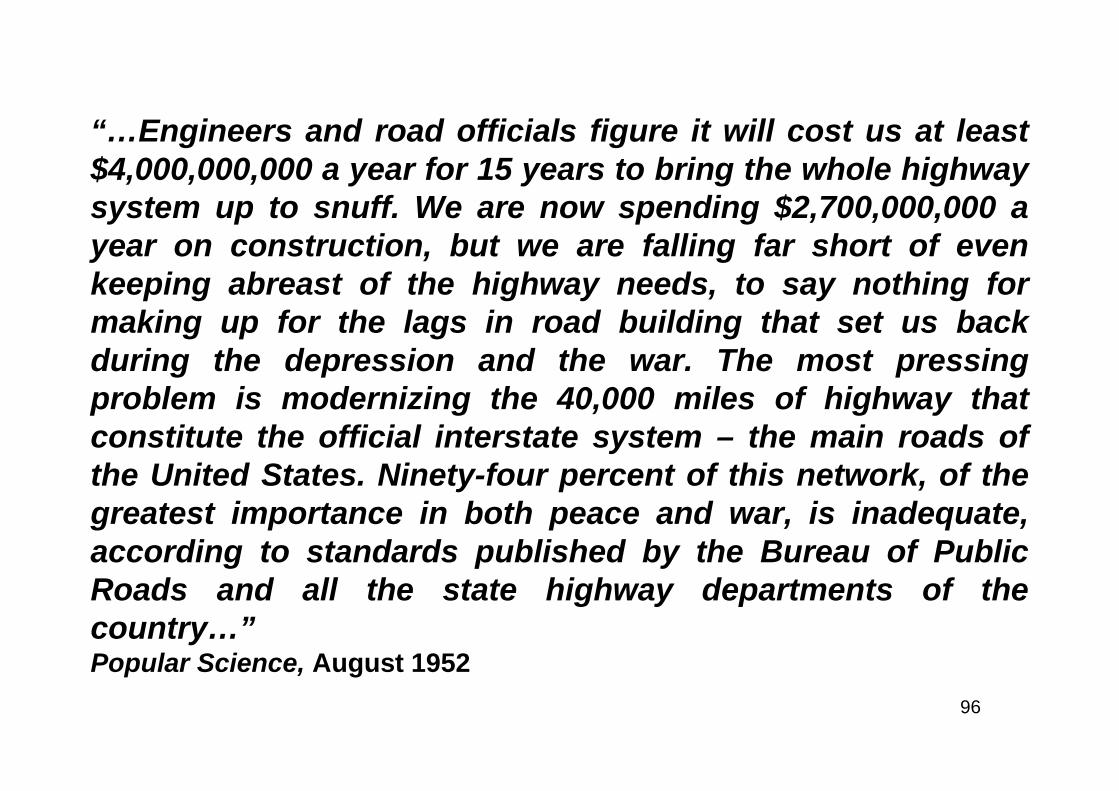
“…Engineers and road officials figure it will cost us at least$4,000,000,000 a year for 15 years to bring the whole highwaysystem up to snuff. We are now spending $2,700,000,000 ayear on construction, but we are falling far short of evenkeeping abreast of the highway needs, to say nothing formaking up for the lags in road building that set us backduring the depression and the war. The most pressingproblem is modernizing the 40,000 miles of highway thatconstitute the official interstate system – the main roads ofthe United States. Ninety-four percent of this network, of thegreatest importance in both peace and war, is inadequate,according to standards published by the Bureau of PublicRoads and all the state highway departments of thecountry…”Popular Science, August 1952
97
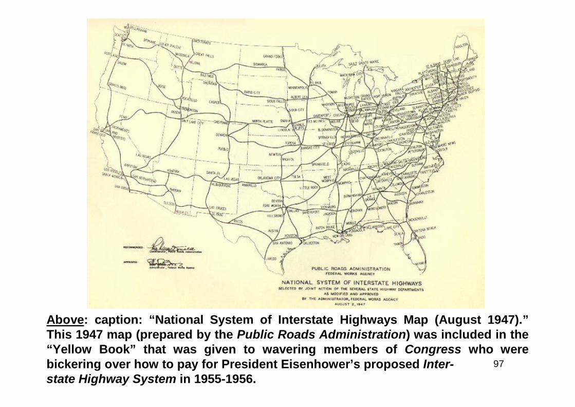
Above: caption: “National System of Interstate Highways Map (August 1947).”This 1947 map (prepared by the Public Roads Administration) was included in the“Yellow Book” that was given to wavering members of Congress who werebickering over how to pay for President Eisenhower’s proposed Inter-state Highway System in 1955-1956.
98
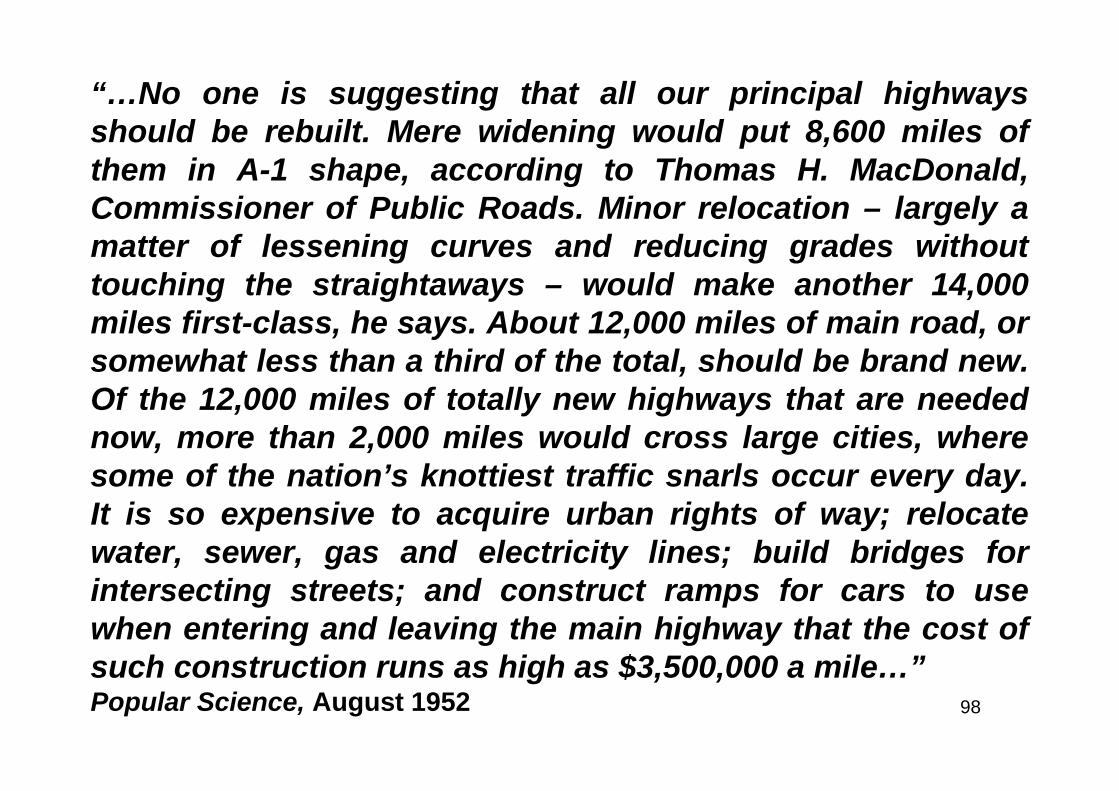
“…No one is suggesting that all our principal highwaysshould be rebuilt. Mere widening would put 8,600 miles ofthem in A-1 shape, according to Thomas H. MacDonald,Commissioner of Public Roads. Minor relocation – largely amatter of lessening curves and reducing grades withouttouching the straightaways – would make another 14,000miles first-class, he says. About 12,000 miles of main road, orsomewhat less than a third of the total, should be brand new.Of the 12,000 miles of totally new highways that are needednow, more than 2,000 miles would cross large cities, wheresome of the nation’s knottiest traffic snarls occur every day.It is so expensive to acquire urban rights of way; relocatewater, sewer, gas and electricity lines; build bridges forintersecting streets; and construct ramps for cars to usewhen entering and leaving the main highway that the cost ofsuch construction runs as high as $3,500,000 a mile…”Popular Science, August 1952
99
The Immutable Law of Averages
100
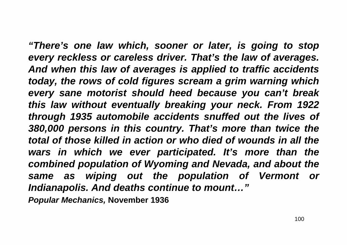
“There’s one law which, sooner or later, is going to stopevery reckless or careless driver. That’s the law of averages.And when this law of averages is applied to traffic accidentstoday, the rows of cold figures scream a grim warning whichevery sane motorist should heed because you can’t breakthis law without eventually breaking your neck. From 1922through 1935 automobile accidents snuffed out the lives of380,000 persons in this country. That’s more than twice thetotal of those killed in action or who died of wounds in all thewars in which we ever participated. It’s more than thecombined population of Wyoming and Nevada, and about thesame as wiping out the population of Vermont orIndianapolis. And deaths continue to mount…”Popular Mechanics, November 1936
101
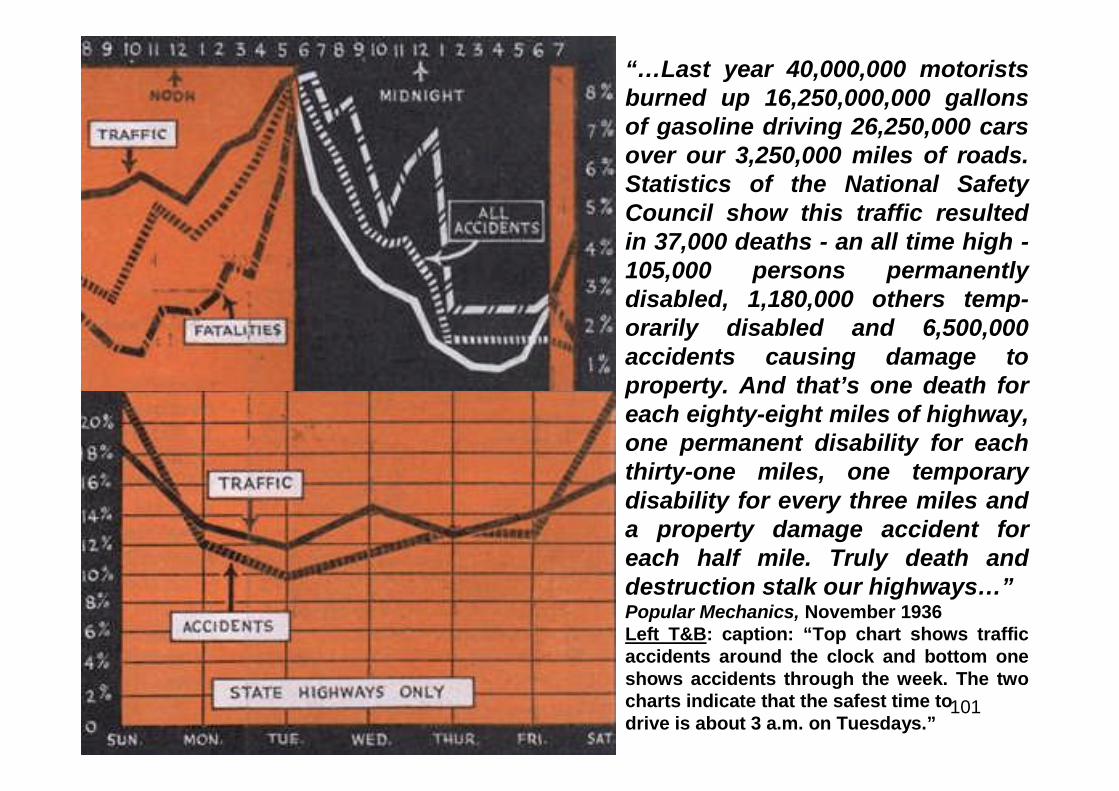
“…Last year 40,000,000 motoristsburned up 16,250,000,000 gallonsof gasoline driving 26,250,000 carsover our 3,250,000 miles of roads.Statistics of the National SafetyCouncil show this traffic resultedin 37,000 deaths - an all time high -105,000 persons permanentlydisabled, 1,180,000 others temp-orarily disabled and 6,500,000accidents causing damage toproperty. And that’s one death foreach eighty-eight miles of highway,one permanent disability for eachthirty-one miles, one temporarydisability for every three miles anda property damage accident foreach half mile. Truly death anddestruction stalk our highways…”Popular Mechanics, November 1936Left T&B: caption: “Top chart shows trafficaccidents around the clock and bottom oneshows accidents through the week. The twocharts indicate that the safest time todrive is about 3 a.m. on Tuesdays.”
102
“…There’s just one message in all these figures - be careful or be killed.But how do these statistics concern you directly? You consider yourself acareful driver, you’ve never killed anyone, never injured anyone, perhapsnever dented a fender. Well, that’s where the law of averages comes in. Ifthe present traffic accident rate continues, one out of every twentypersons in this country will be injured or killed in an automobile accidentwithin five years. And that includes you! Just jot down your name, thenadd the names of nineteen relatives and friends. One of you will be killedor injured in a traffic smash-up by 1941 by the law of averages. Here’sanother way of looking at it. Write down the names of three children inyour neighborhood. Two of the three are sure - not likely, but sure - to beinjured in auto accidents during their lifetimes if the present ratecontinues. Or perhaps you have a sixteen-year-old boy. If he looksforward to a lifetime of driving and is exposed both to driving andpedestrian hazards, your son also is certain, by the law of averages, to behurt in a traffic accident unless the present rate is reduced…”Popular Mechanics, November 1936
103
“…Not a very cheerful outlook, is it? Now let’scompute the economic loss in addition to human liveswasted. Last year we spent about $2,638,000,000 fornew cars and trucks. During the same periodaccidents cost us more than $1,600,000,000 in wagelosses, doctor and hospital bills, insurance overheadand property damage. Thus for each $1,000 spent fornew cars in 1935, another $600 went for accidents.Most of that was money wasted. Some of it was yourmoney - paid in high insurance rates if for nothingelse. Project this loss over the next ten years and youhave a figure approximating half the national debt. Sothere you are. Automobile accidents are costing youmoney whether you have accidents or not, and by thelaw of averages you or someone close to you will bekilled or injured in one within five years if presentconditions continue…”Popular Mechanics, November 1936Left: caption: “Top, machine for measuring reaction time anddistance required to stop after driver applies brakes. Bottom,distances required to stop with good and fair brakes.”
104
Above & Right: caption: “Rightand wrong ways of doing it andchart showing how deaths onopen road are going up whilefatalities in cities are goingdown”
“…For every accident last year which went to pileup the grim total of death and destruction, therewere literally hundreds of near accidents -situations when something almost happened butdidn’t. Every driver has had these narrow escapes -some call them ‘lucky breaks.’ Now accidents don’tjust happen; someone causes them. It’s human to
blame the ‘other fellow’ but the other chapcan’t always be in the wrong. You’ve got toaccept part of the responsibility, at least partof the time. Who had all those thousands ofaccidents last year? Some were physicallydefective, some didn’t know how to drive. Butthe great majority were competent drivers whohad acquired careless habits. They went toofast, passed on hills and curves, sped through
intersections, jumpedthe lights and did athousand and oneother foolish thingsuntil the law ofaverages caught upwith them…”Popular Mechanics, Nov. 1936

105
“…The higher the speed, the worse the accident. One accident in elevenis fatal at fifty miles per hour and above. At speeds of twenty and under,only one accident in sixty-one is fatal…Modern cars do seventy, eighty oreven ninety miles an hour with ease. But can your brain go ninety milesan hour, or even sixty? Cars and highways are faster, but your reactiontime isn’t. And it still takes time to think. It takes about three-fourths of asecond on average. So from the time you see the heifer until the time youdo something about it, your car travels about fifty-five feet if you’re doingfifty miles an hour. Then after you get your foot on the brake, you neednearly 200-feet more to stop - unless you have poor brakes. With goodbrakes and good road conditions, you need about 330-feet to stop at sixtymiles per hour. Now if your lights enable you to see only 200-feet, yourstopping point at any moment is almost 150-feet beyond the distance youcan see ahead. You would even be out-driving 300-foot head lamps at thatspeed. Here’s another startling conception of sixty miles an hour. At thatspeed your car has enough momentum to travel 120-feet straight up if itcould ‘take off.’ So when you do sixty you might as well be 120-feet in theair if you hit something. Just another way of saying that hitting astationary object at sixty creates the same impact force as though the carwere to drop from the top of a twelve-story building…”Popular Mechanics, November 1936

106
“…One serious mistake in driving may be your last, so don’t be lulled intoa sense of security just because you’re on the open road. Since 1930traffic deaths for large cities have been declining while deaths on the openroad have been climbing. And don’t think you are careful just because youexercise caution in turning. Nine out of ten vehicles involved in fatalaccidents last year were going straight ahead. Even at intersections, mostaccidents involve vehicles going straight ahead. If you cross the centerline occasionally, or pass on a hill or blind curve, you should be interestedto learn that twenty-six per cent of all fatal accidents and fifty-eight percent of the non-fatal ones last year occurred in collisions betweenautomobiles. Passing on a hill or driving on the wrong side is an excellentpreliminary to a collision. If you’re in the habit of looking after you get onthe railroad track instead of before, you’re headed for the same fate thatovertook six per cent of those killed last year and five per cent of theinjured. They were killed and hurt as the result of automobiles hitting orbeing hit by vehicles other than automobiles. Ever take a curve too fastand find yourself struggling for control? If your 4,000 pound car hits acurve of 100 feet radius at thirty miles per hour there’s a force of 2,400pounds trying to pull you into the ditch. That’s centrifugal force. Twelveper cent of last year’s fatalities and six per cent of the injuries werecaused by accidents involving no collisions with anything. Which mightprove that anyone can round a corner on two wheels - once. And thisbrings up skidding. You can’t blame a skid on the ‘other fellow.’ Twelveper cent of all rural accidents in Ohio last year were caused by skids. Butwhen roads were wet, snowy or icy, one-fourth the accidents involvedskidding. The lesson seems obvious - but remember also that four out offive traffic accidents occur on dry roads and in clear weather, so don’t getcareless just because the road is dry…”Popular Mechanics, November 1936Left: caption: “Types of fatal and non-fatal accidents”
107
“…Night accidents are more serious than daytime ones and, on a mileage basis,the accident rate at night is higher. Traffic, accidents and fatalities reach theirpeak about five in the evening, and their low about three in the morning. Alsothere are fewer accidents on Tuesday than any other day in the week, and moreon Saturdays and Sundays. So in theory, the safest time to drive is about threeo’clock of a Tuesday morning. But don’t take a chance, even on Tuesdays,because the law of averages will beat you if you keep it up. Why gamble withdeath when you know death is going to win eventually?”Popular Mechanics, November 1936Above: caption: “Road illuminated with 400-candlepower incandescent lampsand reflectors”
108
Stop the Highway Slaughter!
109
“…As I see it, there are four primary causes of our annualroadway slaughter: obsolete highways, Stone Age policepractices, bad drivers and unsafe automobiles. I don’t intendto waste much space talking about out-of-date, overcrowdedhighways that are real killers by themselves. A lot of people,from President Ike on down, have been working on that one.If everybody agrees with his proposal to spend 50 billionbucks and ten years of effort on the job, maybe we’ll havedecent roads by the time your son Herman starts asking forthe keys to the family crate. In the meantime, standardFederal highway laws would help somewhat to straighten outthe 48-state confusion...”Mechanix Illustrated, November 1954
110
Above L&R: caption: “In these twosmashups, in California and inVirginia, a total of nine people wentto their graves”Left: caption: “Seven persons diedin this head-on collision”
111
“…In New York City it is possible to take your driving test intraffic near Sutton Place, a little-traveled road along the EastRiver where you will never go faster than 25 miles an hour. Ifyou make all the right-hand signals and don’t run over theinspector, you will most likely receive a driver’s license - acertificate which will permit you to travel the Penn Turnpike,where 70 mph is legal, and give you the right to drive instates where 100 mph is not frowned on too hard, such as thespeedways near Detroit. That arm-waving test at eight milesan hour back in New York will do you a lot of good here ifsuddenly your car goes into a dry slide at 70 or better. Youcan end up awfully dead and still be within the legal speedlimits - in fact, not violating any traffic law whatsoever…”Mechanix Illustrated, November 1954
112
“…The cause of many accidents, and the most neglected, is theequipment naive owners are conned into buying. Regardless of what theads say, all cars are not safe, and for a number of reasons…There are anumber of truly good, road-able automobiles made in America today. Onthe other hand, there are makes which are real killers…As Harley Earl,vice-president in charge of General Motors styling, recently stated,American women are the principal influence in buying today’sautomobiles. Most women are more concerned with luxury and comfortthan they are with an automobile’s athletic prowess. All manufacturersknow this and, in order to meet the competition from their fellow balloonbuilders, they have had to go overboard with mushy suspension,ridiculously low-pressured tires and out-of-balance chassis to get the rearpassenger seats off the rear axles…Naturally, some cars have gone evenfurther than others and have proved to be very popular with thebuyers…In fairness to the manufacturers, the latest fad of blaminghighway deaths on the so-called horsepower race is ridiculous. In manycases that extra horsepower is needed to get you safely around one ofthose railroad-car-long tractor-trailers on a two-lane highway. In a pinch, askilled driver will be a lot safer in a good car with 200 horsepower than hewill in one with half that much moxie…”Modern Mechanix, March 1954
113
“…On the other hand, a little item like tire pressure can,under some conditions, mean the difference between livingand dying. A car with 32 pounds of air often can becontrolled in a semi-emergency situation where a car withfactory-recommended pressure of 26 or 24 pounds will mush,plow and become completely unmanageable…Why is this tirestuff so important? When a tire is out of balance it develops agyroscopic action whose intensity increases with speed. At100 mph a real dog of a tire can almost tear the wheel off theaxle, the eccentric action is so severe. At any speed above 60the car with unbalanced wheels can become extremelyuncontrollable and, in some cases, will actually develop agalloping tendency. If you have to brake hard, the offbeatwheel motion makes it almost impossible to hold the car on astraight line…”Modern Mechanix, March 1954
114
Speed Highways of Tomorrow
115
“Here is an artist’s conceptionof the amazing multiplehighway plan of Dr. John A.Harriss, former health com-missioner of New York City.The plan calls for six trafficlevels. Each level is fordesignated traffic. There is anexpress traffic level, two one-way levels for bus traffic andother plans to expedite traffic.This proposal of Dr. Harriss isgaining in favor as one of themost feasible of manyschemes advanced to ade-quately handle the constantlyincreasing motor and ped-estrian traffic.”Modern Mechanix, March 1930
116
FUTURE MOTORWAY
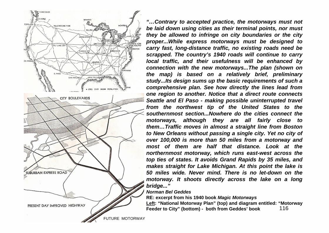
“…Contrary to accepted practice, the motorways must notbe laid down using cities as their terminal points, nor mustthey be allowed to infringe on city boundaries or the cityproper...While express motorways must be designed tocarry fast, long-distance traffic, no existing roads need bescrapped. The country’s 1940 roads will continue to carrylocal traffic, and their usefulness will be enhanced byconnection with the new motorways...The plan (shown onthe map) is based on a relatively brief, preliminarystudy...Its design sums up the basic requirements of such acomprehensive plan. See how directly the lines lead fromone region to another. Notice that a direct route connectsSeattle and El Paso - making possible uninterrupted travelfrom the northwest tip of the United States to thesouthernmost section...Nowhere do the cities connect themotorways, although they are all fairly close tothem…Traffic moves in almost a straight line from Bostonto New Orleans without passing a single city. Yet no city ofover 100,000 is more than 50 miles from a motorway andmost of them are half that distance. Look at thenorthernmost motorway, which runs east-west across thetop ties of states. It avoids Grand Rapids by 35 miles, andmakes straight for Lake Michigan. At this point the lake is50 miles wide. Never mind. There is no let-down on themotorway. It shoots directly across the lake on a longbridge...”Norman Bel GeddesRE: excerpt from his 1940 book Magic MotorwaysLeft: “National Motorway Plan” (top) and diagram entitled: “MotorwayFeeder to City” (bottom) - both from Geddes’ book
117
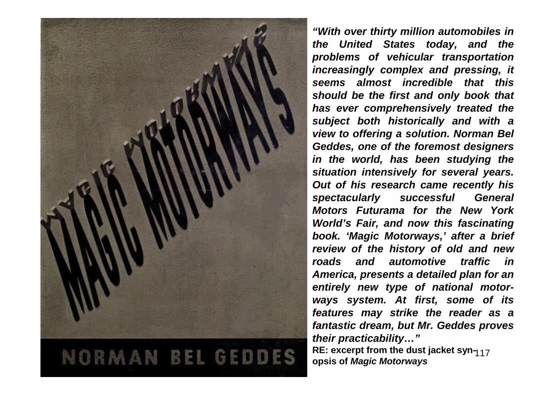
“With over thirty million automobiles inthe United States today, and theproblems of vehicular transportationincreasingly complex and pressing, itseems almost incredible that thisshould be the first and only book thathas ever comprehensively treated thesubject both historically and with aview to offering a solution. Norman BelGeddes, one of the foremost designersin the world, has been studying thesituation intensively for several years.Out of his research came recently hisspectacularly successful GeneralMotors Futurama for the New YorkWorld’s Fair, and now this fascinatingbook. ‘Magic Motorways,’ after a briefreview of the history of old and newroads and automotive traffic inAmerica, presents a detailed plan for anentirely new type of national motor-ways system. At first, some of itsfeatures may strike the reader as afantastic dream, but Mr. Geddes provestheir practicability…”RE: excerpt from the dust jacket syn-opsis of Magic Motorways
118
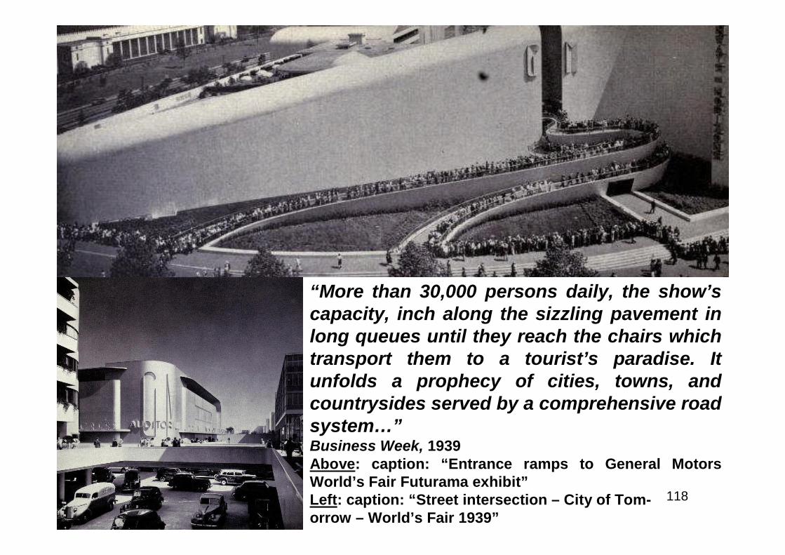
“More than 30,000 persons daily, the show’scapacity, inch along the sizzling pavement inlong queues until they reach the chairs whichtransport them to a tourist’s paradise. Itunfolds a prophecy of cities, towns, andcountrysides served by a comprehensive roadsystem…”Business Week, 1939Above: caption: “Entrance ramps to General MotorsWorld’s Fair Futurama exhibit”Left: caption: “Street intersection – City of Tom-orrow – World’s Fair 1939”

119
Left: contrary to his 1940book Magic Motorways,which outlined his ideafor a future interstatehighway system to skirtrather than pass directlythrough cities, NormanBel Geddes’ “Futurama”exhibit in the GeneralMotors Pavilion at the1939/40 New York World’sFair boldly represented(in scale model form),superhighways of thedistant year 1960 passingthrough the heart ofmetropolitan areas, evenhaving the skyscrapers ofthe future integral to theirdesign.
120
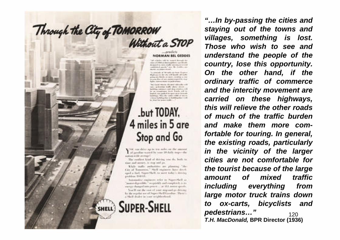
“…In by-passing the cities andstaying out of the towns andvillages, something is lost.Those who wish to see andunderstand the people of thecountry, lose this opportunity.On the other hand, if theordinary traffic of commerceand the intercity movement arecarried on these highways,this will relieve the other roadsof much of the traffic burdenand make them more com-fortable for touring. In general,the existing roads, particularlyin the vicinity of the largercities are not comfortable forthe tourist because of the largeamount of mixed trafficincluding everything fromlarge motor truck trains downto ox-carts, bicyclists andpedestrians…”T.H. MacDonald, BPR Director (1936)
121
“…But urban highways are every bit as vital as new construction in opencountry – if anything, more so, because nearly all the automobile traffic inthe United States goes only 20 miles, the average distance from home towork, and in most cases work is located in or on the outskirts of a city.The only answer, despite the costs, is expressways. Detroit’s expresswaysystem, which will eventually lace that huge, highly industrial city with105 miles of broad, sunken arterial highways, already has dramaticallyproved its value, though only a short section of it has been completed…”Popular Science, August 1952Above L&R: map (left) and diagram (right) of proposed expressways for Detroit,MI
122
“…The present streets of Detroit and its environs consist of wide boulevards andadequate avenues on the outskirts of the city but like other cities the core iscongested and choked with traffic. The present streets of Detroit and its environsconsist of wide boulevards and adequate avenues on the outskirts of the city butlike other cities the core is congested and choked with traffic. The arterialvehicular traffic jams in Detroit can be cleared only by breaking the bottlenecks inthe heart of the city where the greatest volume occurs. Traffic studies clearlyshow that a large percentage of traffic proceeds between its origin anddestination on illogical routes. The crow-foot avenues, the confused tangle of theold city, the rectangular pattern of the newer developments, the network ofrailroads, the absence of breaks in topography through which arteries might havebeen built behind the growth of the city, the monotonous flatness downtownwhich prompted the solid building with no open spaces between developments,the relation of business and industry to the waterfront; all these contribute to thecircuitous travel necessary to reach most points by automobile. The streets ofDetroit are wider than those in most cities but they arc not wide enough in theright places and cannot he stretched enough at most throats of congestion tomeet the increasing traffic loads. The greatest barriers to convenient and safeautomobile travel are the automobiles themselves which were built faster than thestreets were modernized to accommodate them…”Detroit Transportation Board, 1945
123
“…The locations of the principal business districts, secondary businesssections, industrial and manufacturing areas, railroads and terminals,educational institutions, recreation centers, hospitals and other featuresof community development influenced our conclusions in selecting theroutes for the combined expressway and transit system. The character ofthe buildings on the proposed rights-of-way and the effects of replacingthem with the proposed improvements were important considerations,particularly the influence on the neighborhoods. The effect of theimprovements on desirable future community development and on thestabilization of manufacturing and business areas and residentialneighborhoods along the routes and in the areas served by them hasprompted many of our decisions. With no natural open spaces to follow,the new expressways must be located largely through solid development.It is fortunate that the general pattern of traffic flow coincides with belts ofdepressed property cheap enough to acquire for wide traffic arteries…”Detroit Transportation Board, 1945

124
“…The first section – a segment 2.5 miles long – was opened on July 9, 1951. Itconsists of a divided six-lane highway running 18-feet below the level of adjacentstreets, with a right-of-way about 300-feet wide. Traffic is one-way over the threelanes on each side. Trucks, buses and passenger cars travel at an average speedof 45 to 50 miles an hour. Already the expressway is carrying five times as manycars per lane as the average main thoroughfare of older vintage. A heavyDecember snowstorm that clogged narrower nearby streets where parking waspermitted scarcely slowed down the expressway traffic…”Popular Science, August 1952Above: caption: “First completed portion of the John C. Lodge Expressway. Theabove photo shows a New York Central steam locomotive using the rail-road overpass near Holden.”
125
“…Expressways alone are notenough to ease the city trafficproblem completely, however.Connecting streets in manyinstances must be widened, otherstreets made one-way and,especially, vast new parking spacecreated. A frequently repeatedsuggestion for solving the lastproblem is to build skyscraperparking garages, with relativelysmall taxable frontage…”Popular Science, August 1952Left: Completed in 1964, Chicago’s MarinaTowers is composed of two identical towerswhich were originally designed to include aconcert hall, retail stores, skating rink andbowling alleys. Adjacent to the ChicagoRiver in the downtown loop, parking for thestructure is self-contained in the denselypopulated area. The lower-third of each ofthe 65-story tower/s is a continuous up-spiralparking garage with space for 896vehicles each.
126
127
Above: elevation of parkinggarage/apt. floor transition(highlighted on section)Left: vertical section throughtower
128
129
“…No one denies the country’s desperate need for relief fromits traffic situation. But how are we to raise $50,000,000,000required, at a minimum, to improve our highways over thenext 15 years? At least 33 states have chosen or areconsidering the alternative of toll roads. About 700 miles ofsuperhighway on which tolls are collected have been builtsince 1940. Since these roads are not free, the FederalGovernment disapproves of them and does not think thatthey properly belong in the interstate highway system, butthey help to brighten the outlook considerably for themotorist who is willing to pay around a cent a mile to travelon them. Long-distance truckers save so much time and wearand tear by routing their wheeled behemoths over toll roadsthat they unhesitatingly pay up to 3.5 cents a mile for theprivilege…”Popular Science, August 1952
130
“…New Jersey in late May reportedthat income from its new 130-mileturnpike was flowing in at a rate highenough to pay of the $255,000,000cost of the road in 15 years instead of25. Heartened by such dem-onstrations as this and always deeplyreluctant to increase taxes, statelegislators have encouraged thedrawing up of plans for more than1,000 additional miles of toll roads…”Popular Science, August 1952
131
“The world’s most modernexpress high-way engineeredfor utmost comfort and safety.The NEW JERSEY TURNPIKE isthe quickest and safest routeconnecting New York and NewEngland with points South andWest.”New Jersey Turnpike Authority,November 1951
132
133
“…The Bureau of Public Roads, on the other hand, doesn’tadvocate toll roads, for these reasons:• They can’t possibly be substituted for free roads throughcities, because of the short distances involved;• In many cases, before the roads can be paid for, they’ll startwearing out. As a consequence, they may never be paid for;• Toll roads are primarily for long-distance travel. Thedistance between toll gates necessarily is too great for theroads to serve local motorists. Therefore, there must still beparallel free roads. Since the highway user is, in effect,paying for both types of roads, he might better foot the bill inhigher taxes and enable all roads to be ‘free’…”Popular Science, August 1952

134
Out of the Muddle
135
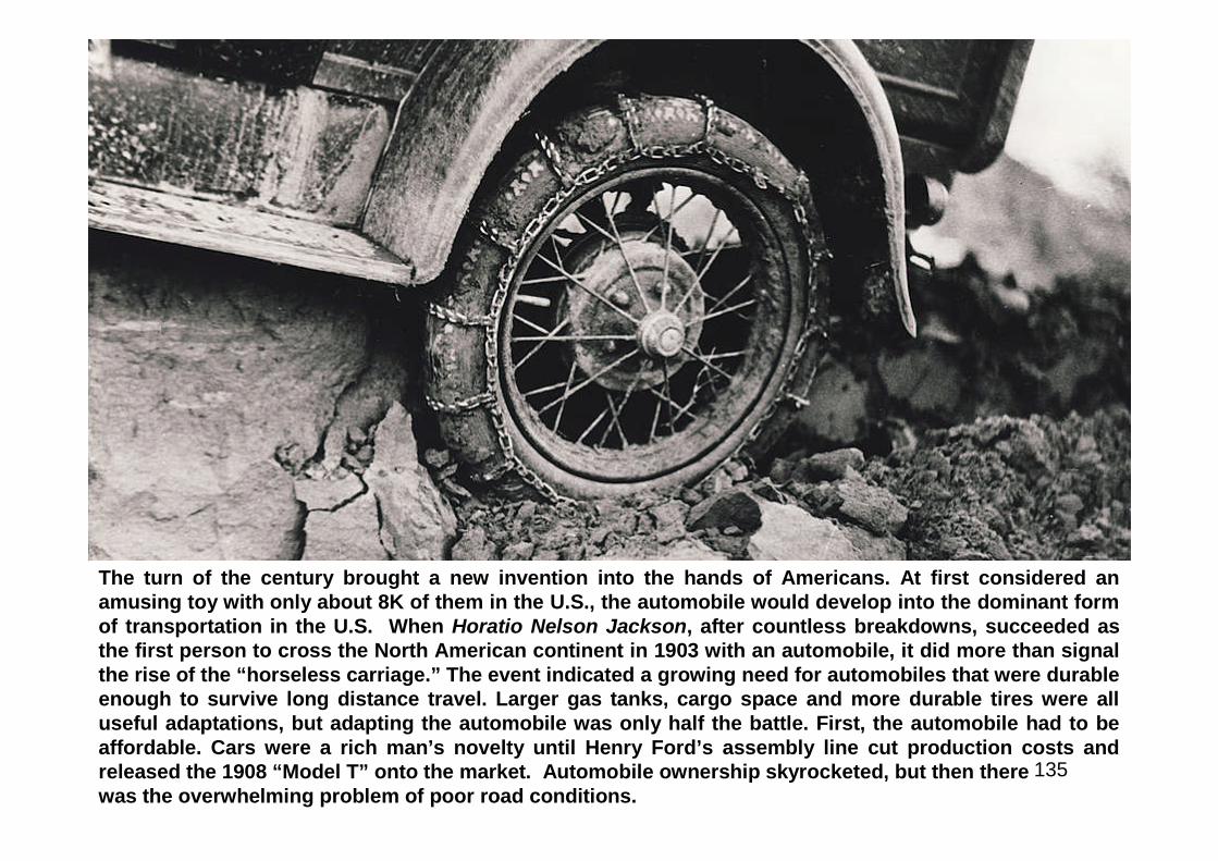
The turn of the century brought a new invention into the hands of Americans. At first considered anamusing toy with only about 8K of them in the U.S., the automobile would develop into the dominant formof transportation in the U.S. When Horatio Nelson Jackson, after countless breakdowns, succeeded asthe first person to cross the North American continent in 1903 with an automobile, it did more than signalthe rise of the “horseless carriage.” The event indicated a growing need for automobiles that were durableenough to survive long distance travel. Larger gas tanks, cargo space and more durable tires were alluseful adaptations, but adapting the automobile was only half the battle. First, the automobile had to beaffordable. Cars were a rich man’s novelty until Henry Ford’s assembly line cut production costs andreleased the 1908 “Model T” onto the market. Automobile ownership skyrocketed, but then therewas the overwhelming problem of poor road conditions.
136
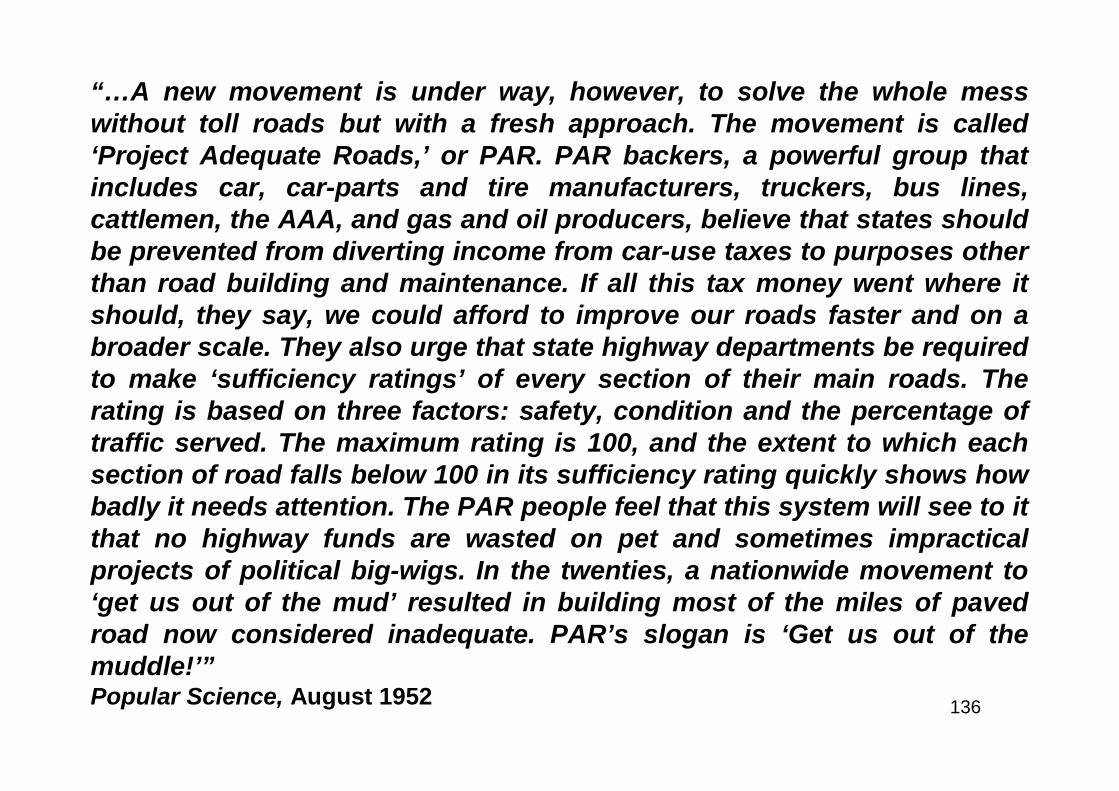
“…A new movement is under way, however, to solve the whole messwithout toll roads but with a fresh approach. The movement is called‘Project Adequate Roads,’ or PAR. PAR backers, a powerful group thatincludes car, car-parts and tire manufacturers, truckers, bus lines,cattlemen, the AAA, and gas and oil producers, believe that states shouldbe prevented from diverting income from car-use taxes to purposes otherthan road building and maintenance. If all this tax money went where itshould, they say, we could afford to improve our roads faster and on abroader scale. They also urge that state highway departments be requiredto make ‘sufficiency ratings’ of every section of their main roads. Therating is based on three factors: safety, condition and the percentage oftraffic served. The maximum rating is 100, and the extent to which eachsection of road falls below 100 in its sufficiency rating quickly shows howbadly it needs attention. The PAR people feel that this system will see to itthat no highway funds are wasted on pet and sometimes impracticalprojects of political big-wigs. In the twenties, a nationwide movement to‘get us out of the mud’ resulted in building most of the miles of pavedroad now considered inadequate. PAR’s slogan is ‘Get us out of themuddle!’”Popular Science, August 1952

137
From its inception in 1926, the Federal Highway System underwent frequentchanges as engineers sought to improve the safety and efficiency of roadwayswithin the national system. At first simply a splicing together of local roads thatconnected lines of settlement, many of the road alignments included in theoriginal 1926 system were a reflection of already existing patterns of movementwithin an area. However, over time the roads within the Federal system came toreflect the quest of engineers to move increasing amounts of traffic efficiently anddirectly across the country.Above: caption: “Car descending 1920’s alignment of Route 66 at La Bajada, NM”
138
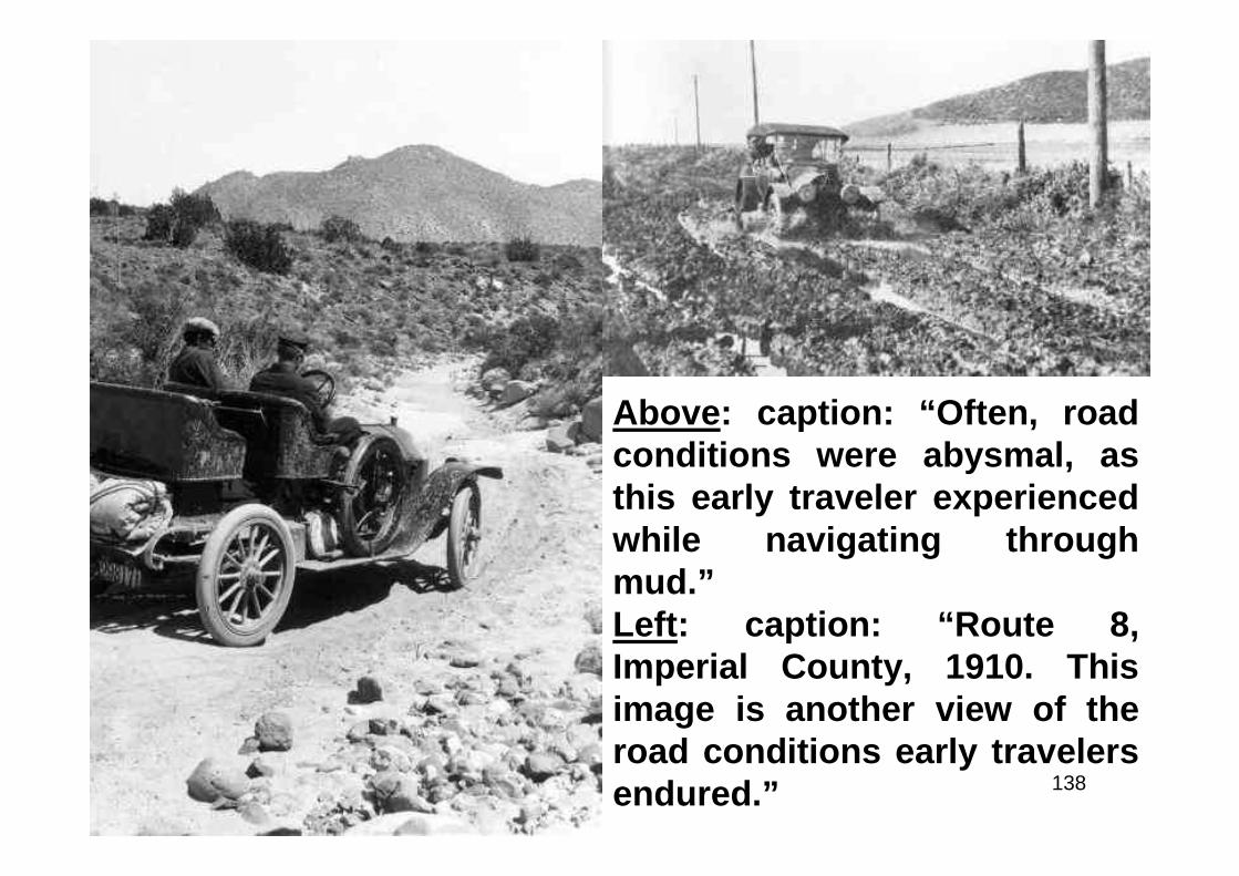
Above: caption: “Often, roadconditions were abysmal, asthis early traveler experiencedwhile navigating throughmud.”Left: caption: “Route 8,Imperial County, 1910. Thisimage is another view of theroad conditions early travelersendured.”

139
“In outlining the 187,000 miles of road comprising the Federal-aid systemof highways, it has been arranged that not more than seven percent of thetotal road mileage of any one state be included. Not to exceed three-sevenths of this will be designated as primary or interstate highways, andthe remainder secondary or inter-county highways. The plans cover a 15to 20-year construction program, with provision for enlargement at theend of that time.”Popular Mechanics, March 1923RE: before 1920, most roads in the U.S. were dirt, hard-packed and rutted. Carsgot stuck in the mud so often that local farmers could make a significant amountof money using their horses to haul them out. Dust was also a constant problem,so much so that drivers wore dusters and goggles. Gravel and macadam (oil andcrushed rock) roads were improvements, but highway departments willing tospend the money could produce concrete and asphalt roads. Aside from theroads themselves, many other aspects of travel were only just being developed by1920. There were few, if any, gas stations, convenience stores and/ormechanics. Long-distance highways needed to be planned, signposted andmapped. “Good Roads” movements and automobile clubs worked to improvetravel for motorists. Their work included building the Lincoln Highway, theYellowstone Highway and the National Old Trails Road. The Federal Governmentalso had a hand in funding roads and their efforts culminated in the Federal-AidHighway Act of 1956, which established the Interstate Highway System.

140
A Victory for Roads
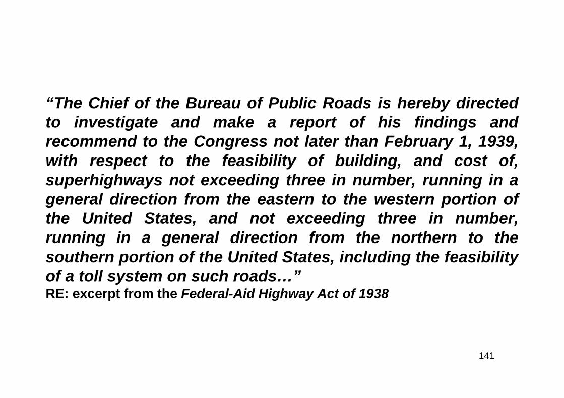
141
“The Chief of the Bureau of Public Roads is hereby directedto investigate and make a report of his findings andrecommend to the Congress not later than February 1, 1939,with respect to the feasibility of building, and cost of,superhighways not exceeding three in number, running in ageneral direction from the eastern to the western portion ofthe United States, and not exceeding three in number,running in a general direction from the northern to thesouthern portion of the United States, including the feasibilityof a toll system on such roads…”RE: excerpt from the Federal-Aid Highway Act of 1938
142
“The system of main highways in the United States is by far the most extensive ofany in the world. Only the most out-of-the-way places cannot now be reached overa surfaced road. Many miles of main highways are broad, direct routes over whichvehicles can travel continuously at the touring speed selected by the driverwithout the need for slowing down because of sharp curves, steep grades, orother obstacles and there is frequent opportunity to pass overtakenvehicles…Many of our most used and important roads are among those that mustnow be classed as very inadequately improved. These are the roads that were firstrecognized as of outstanding importance and as such were first improved withsurfaces of the highest type designed according to the standards of early roadbuilders. There was general acceptance of these standards as sufficientlyadvanced - in fact, there was much opposition on the grounds that they were tooadvanced. The great increase in highway use and the recent marked increase invehicle speed have forced the adoption of much higher standards…There hasbeen wide public interest in the creation of a system of multiple-lane highways,built according to the highest standards of grade and alignment, with opposingtraffic separated by a center parkway, bypassing all cities, with structuresseparating streams of traffic at all highway and rail crossings. The large volumesof traffic that flow between densely populated areas, when not too widelyseparated, in many instances appear to justify the high cost of suchimprovement…”RE: excerpts from the Bureau of Public Roads annual report (for fiscal year 1938)
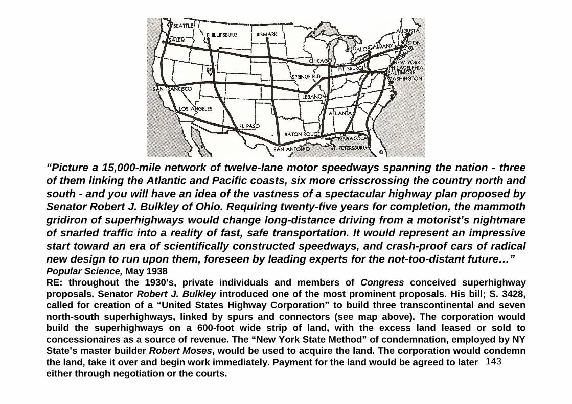
143
“Picture a 15,000-mile network of twelve-lane motor speedways spanning the nation - threeof them linking the Atlantic and Pacific coasts, six more crisscrossing the country north andsouth - and you will have an idea of the vastness of a spectacular highway plan proposed bySenator Robert J. Bulkley of Ohio. Requiring twenty-five years for completion, the mammothgridiron of superhighways would change long-distance driving from a motorist’s nightmareof snarled traffic into a reality of fast, safe transportation. It would represent an impressivestart toward an era of scientifically constructed speedways, and crash-proof cars of radicalnew design to run upon them, foreseen by leading experts for the not-too-distant future…”Popular Science, May 1938RE: throughout the 1930’s, private individuals and members of Congress conceived superhighwayproposals. Senator Robert J. Bulkley introduced one of the most prominent proposals. His bill; S. 3428,called for creation of a “United States Highway Corporation” to build three transcontinental and sevennorth-south superhighways, linked by spurs and connectors (see map above). The corporation wouldbuild the superhighways on a 600-foot wide strip of land, with the excess land leased or sold toconcessionaires as a source of revenue. The “New York State Method” of condemnation, employed by NYState’s master builder Robert Moses, would be used to acquire the land. The corporation would condemnthe land, take it over and begin work immediately. Payment for the land would be agreed to latereither through negotiation or the courts.
144
“$8,000,000,000 Highway Project Wins Encouragement of RooseveltBulkley Shapes Bill for East-West and North-South Transcontinental TollSpans - Favored if “Pump-Priming” Is NeededWashington, Feb. 6. - Should President Roosevelt decide to spur recovery bysome form of ‘pump-priming,’ as some of his close advisers are urging, he maysupport legislation for the construction of a transcontinental system of self-liquidating super-highways. The movement for such legislation is gainingpopularity among members of Congress, some of whom are searching for anappropriate form of government construction to benefit their constituents in anelection year, and the plan is said to have support in the War Department, theBureau of Public Roads, and from at least one member of the Board of Governorsof the Federal Reserve System...The President was reported to have told theSenator that he had been thinking of a similar plan for some time, and to have toldhim to draft a bill.”The New York Times, February 7th 1938RE: in early February 1938, before introducing the bill, Senator Bulkley met with PresidentRoosevelt. The NYT described the meeting in a front page article (excerpted above).
145
“…It is well established that between 80 and 85 percent of thetotal expenditure in the construction of highways goes tolabor. It should also be borne in mind that in handling theFederal funds for roads the State highway departments have,in cooperation with the Bureau of Public Roads, required thecontractors to take, whenever possible, the employees fortheir work from the unemployment rolls. Between 85 and 90percent of the people hired for these purposes are taken fromthe rolls of the unemployed….”The House Committee on Roads, 1938RE: though Congress reduced the authorized funding for the FederalHighway Act of 1938, the principles of the legislation remained intact.Road building not only meant better roads, it also meant jobs; labor-intensive jobs at that, thereby helping solve the problem of chronicunemployment during a worldwide depression.
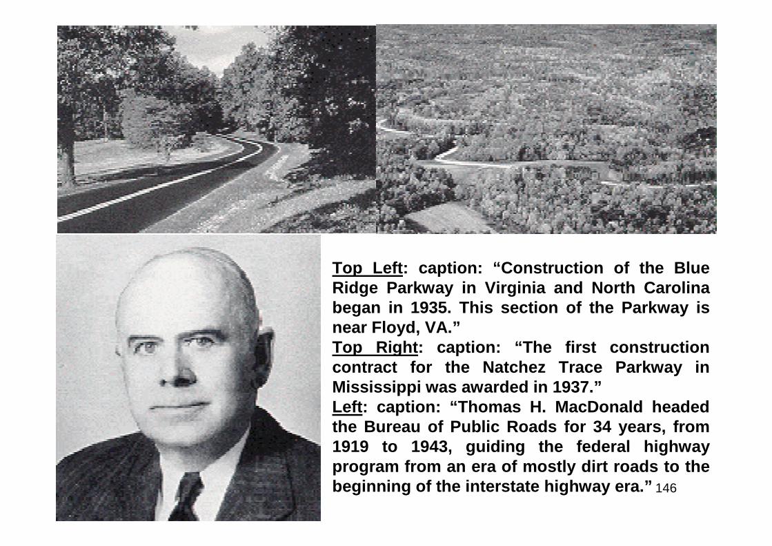
146
Top Left: caption: “Construction of the BlueRidge Parkway in Virginia and North Carolinabegan in 1935. This section of the Parkway isnear Floyd, VA.”Top Right: caption: “The first constructioncontract for the Natchez Trace Parkway inMississippi was awarded in 1937.”Left: caption: “Thomas H. MacDonald headedthe Bureau of Public Roads for 34 years, from1919 to 1943, guiding the federal highwayprogram from an era of mostly dirt roads to thebeginning of the interstate highway era.”

147
Part 3
I Have Seen the Future
148
The Superhighway of Tomorrow
149
“…What will transcontinental touring be like, say, fifty years from now? RecentlyDr. Miller McClintock, director of the Harvard University Bureau for Street TrafficResearch - the man who is recognized as the nation’s foremost authority on trafficproblems - gave a startling preview of the momentous changes he sees ahead.Rear-end collisions, he foresees, will be made impossible by a new expedient.Pushing down the brake pedal on a car of the future will operate a stop light thatemits infra-red rays. These invisible light rays, picked up and distinguished fromordinary light by a photo-electric cell on the front of a following car, will energizean electric circuit and apply its brakes automatically. Electric cables, buriedbeneath the pavements of superhighways, will govern the movement of cars. Oneset of electromagnetic impulses will control the car’s speed. Another set will lockits steering gear against any attempt to make a dangerous turn from one lane toanother. Eventually, the cable system may even be adapted to take over steeringaltogether - allowing the driver to release the wheel, sit back, and make himselfcomfortable until he chooses to switch back again to manual control. At night, thesuperhighways will light up of their own accord, section by section, as a cartravels over them. ‘Electric eyes’ spaced along the road will turn on the glare-lessillumination whenever a car passes, shutting it off at other times to conserveelectricity...”Popular Science, May 1938
150
“…Imagine a typical section of this superhighway of thefuture. Straight as a shaft of light, ten or more broad lanes ofconcrete stretch across the countryside, passing aroundcities and towns, bridging railroads, canals, and crossroads.Streamline busses roar along a center strip that splits thespeedway, separating streams of private cars traveling inboth directions. For cars moving at different speeds, eachone-way pavement is divided into separate safety,accelerating, cruising, and express lanes…”Popular Science, May 1938
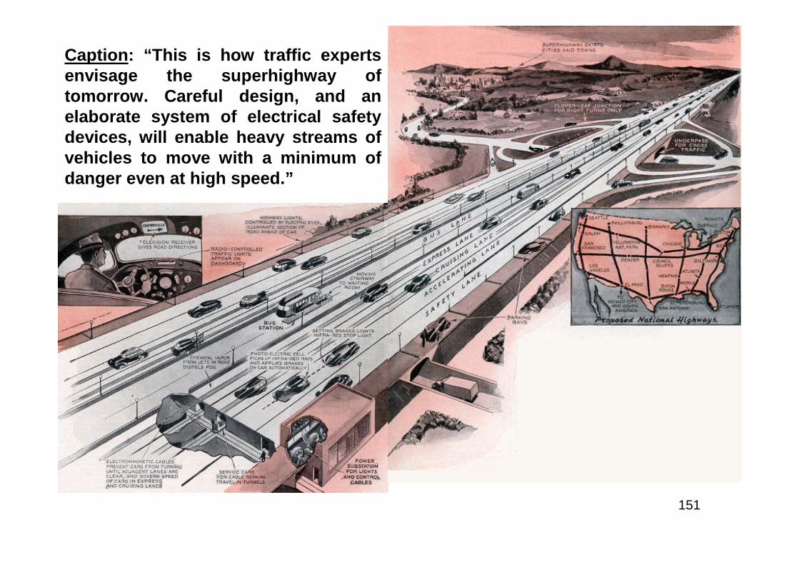
151
Caption: “This is how traffic expertsenvisage the superhighway oftomorrow. Careful design, and anelaborate system of electrical safetydevices, will enable heavy streams ofvehicles to move with a minimum ofdanger even at high speed.”
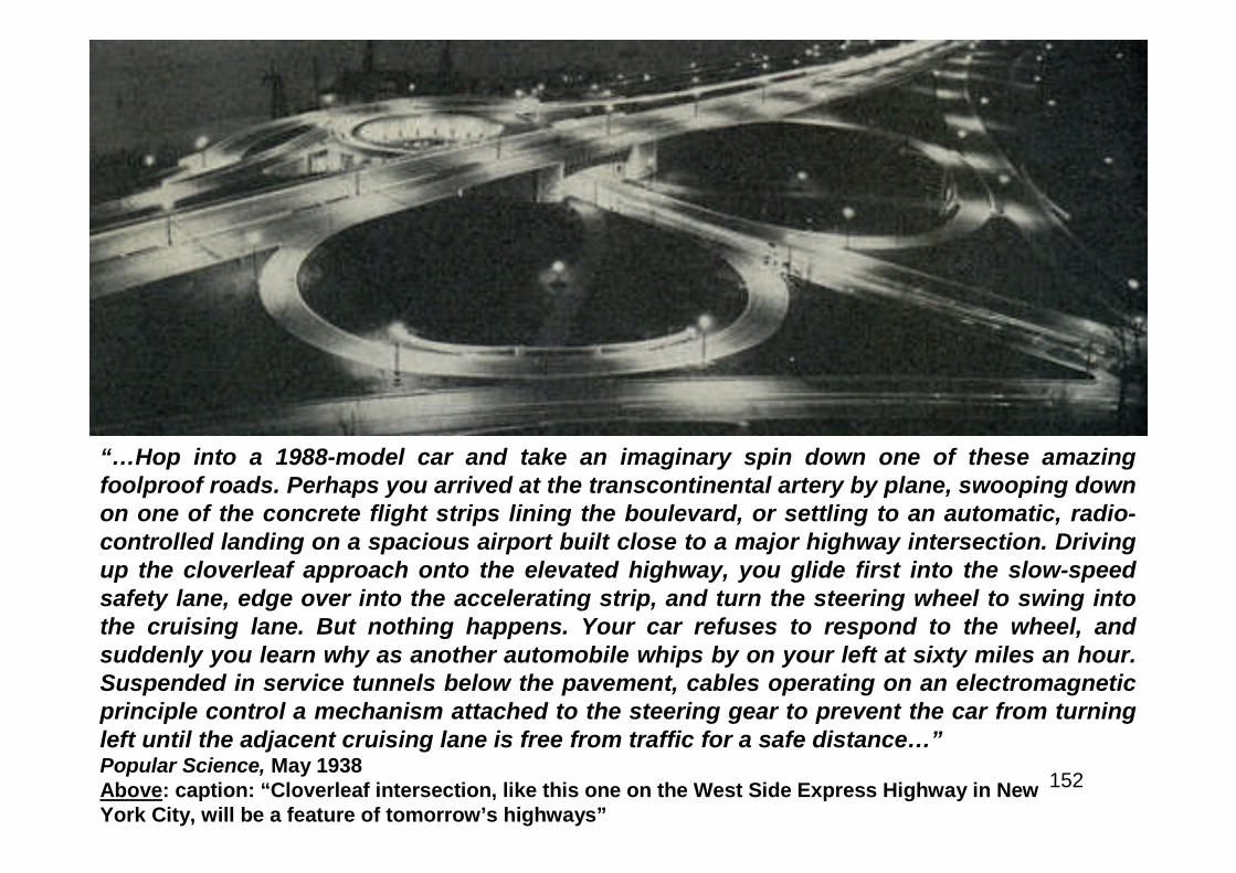
152
“…Hop into a 1988-model car and take an imaginary spin down one of these amazingfoolproof roads. Perhaps you arrived at the transcontinental artery by plane, swooping downon one of the concrete flight strips lining the boulevard, or settling to an automatic, radio-controlled landing on a spacious airport built close to a major highway intersection. Drivingup the cloverleaf approach onto the elevated highway, you glide first into the slow-speedsafety lane, edge over into the accelerating strip, and turn the steering wheel to swing intothe cruising lane. But nothing happens. Your car refuses to respond to the wheel, andsuddenly you learn why as another automobile whips by on your left at sixty miles an hour.Suspended in service tunnels below the pavement, cables operating on an electromagneticprinciple control a mechanism attached to the steering gear to prevent the car from turningleft until the adjacent cruising lane is free from traffic for a safe distance…”Popular Science, May 1938Above: caption: “Cloverleaf intersection, like this one on the West Side Express Highway in NewYork City, will be a feature of tomorrow’s highways”
153
“…You try the wheel again. This time the car swings over into the cruisinglane and immediately picks up speed. You haven’t stepped on the gas,but the speedometer needle creeps steadily upward and freezes on thesixty mark. A second set of buried electromagnetic cables is taking overcontrol of your speed, since cars in the cruising lane must go no moreand no less than sixty miles an hour. But other automobiles are still flyingpast you on the express lane to your left. Now you swing the wheel over,confident that the car will respond only if turning is safe. In the expresslane, your speed automatically steps up to the 100-mile-an-hour limit. Fiftyyards of special nonskid pavement flies by underneath your car everysecond. Unless you switch back to a slower lane, you can maintain thatpace hour after hour, for you’ll never see a traffic light, a railroadcrossing, a street intersection, or even a curve sharp enough to slow youdown. At twilight, overhead lamps will bathe the road in light. Sleet cannotform on the chemically coated windshield of the car. If you run into fog,chemical vapor escaping from tiny jets in the roadway will clear a lane ofvisibility. So your top speed of 100 miles an hour is also your averagespeed - fast enough to let you have breakfast in New York, lunch in Ohio,dinner in Iowa, and a midnight snack not far from the Colorado stateline…”Popular Science, May 1938
154
“…As your car eats up the miles in the express lane, you notice on yourleft a steel barrier that divides you from the broad two-way center lanereserved for express bus traffic. Built into the middle of this bus roadwayat the outskirts of cities and towns, and at railroad and route junctions,are station platforms, served by moving stairways from waiting roomsbelow. Here passengers change from interstate busses to local lines to bewhisked into cities and towns adjacent to the main highway. Still fartherto the left, traffic is speeding along at a controlled pace in the duplicateone-way road section for cars traveling in the opposite direction. But asyou marvel at the efficient handling, safety, and speed of this 1988 traffic,it suddenly dawns on you that this superhighway has no roadsidemarkers, no painted warnings on the pavement, not even a signpost todirect you along the route. You search in vain for any of the familiar signsthat in 1938 were almost as much a part of the highway as the paving –‘Sharp Curve,’ ‘Winding Road,’ ‘Steep Hill’ - these signs, and thenecessity for them, have disappeared from main routes years ago…”Popular Science, May 1938

155
How Will I Know?
156
“…‘But how do I find my way around?’ you ask your guide. ‘How do I know where to turn offfor Middletown or Centerville? Is every motorist a mind reader these days?’ Your guidesmiles and suggests that you swing off the traveled lanes and nose into one of the parkingbays that line the shoulder of the road. ‘Take a look at that dashboard,’ he advises as youpull up to a stop out of the stream of traffic. At first glance you spot a few of the familiardials and instruments - speedometer, fuel gauge, ammeter. After a little study you figure outa few of the others - tachometer, tire-pressure gauge, engine-temperature meter. But what isthat row of colored lights, and what is that white screen just over the windshield? ‘Since theold days when all cars had gear-shifts and burned gasoline for fuel,’ he explains, ‘sciencehas stripped the welter of directional and warning signs off the highway and put theessential ones right on the dashboard of each car. At 100 miles an hour, roadside markerswould be no more legible than hen tracks, anyway.’ The law now requires every automobileto be equipped with standard, pre-tuned, ultra-short-wave radio and television units. Onsmall four-lane side roads, traffic signals are indicated by the colored lights here on thepanel. ‘Miles before you reach any superhighway junction,’ your guide continues, ‘yourtelevision set picks up the junction transmitter. All you have to do is glance at the viewingscreen to find out where the crossroads will take you and how far it is to the next turn-off.And in case you get confused somehow, it’s simply a matter of throwing that switch lever toput you in two-way radio communication with highway-patrol headquarters. They’ll tell youwhere you are, how far it is in hours and minutes to your destination, and where to make thecorrect turn off the highway.’…”Popular Science, May 1938
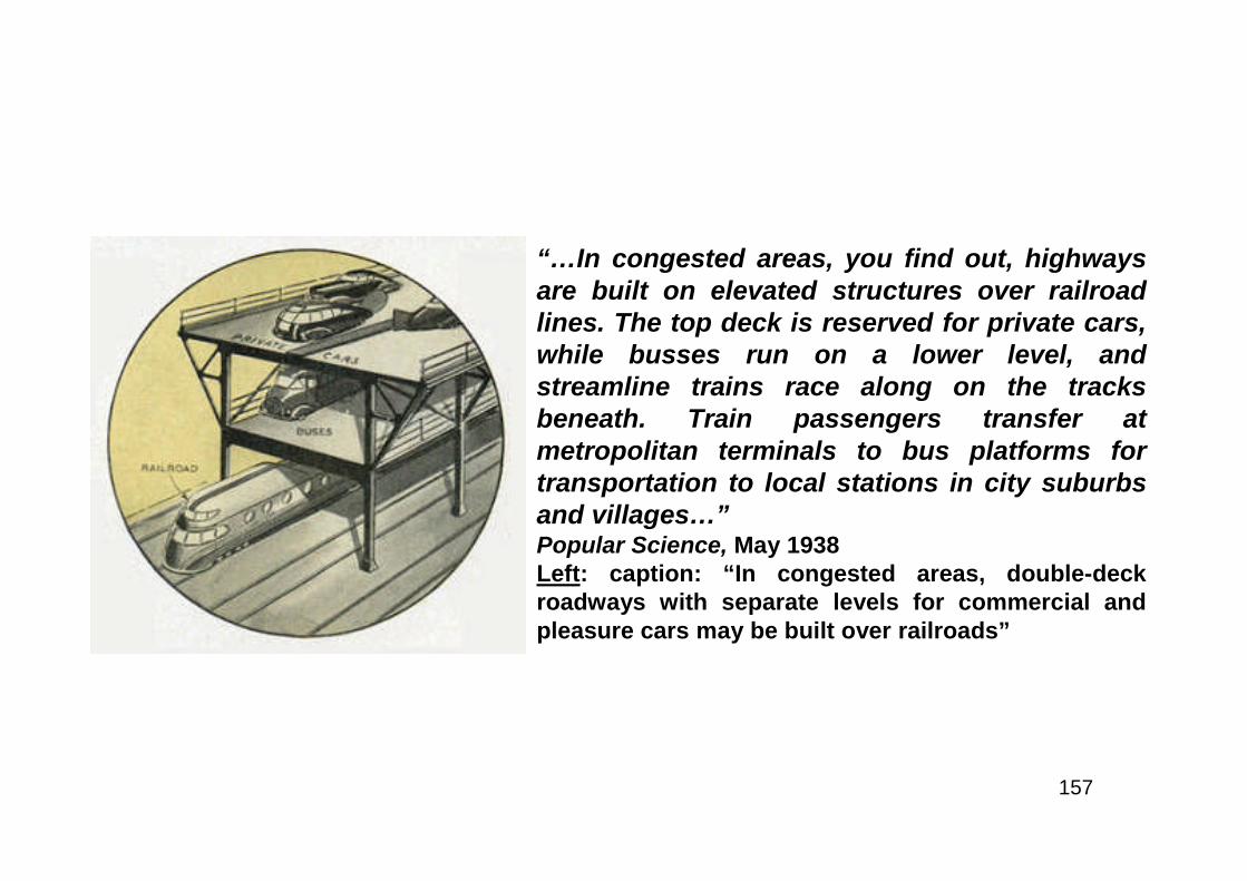
157
“…In congested areas, you find out, highwaysare built on elevated structures over railroadlines. The top deck is reserved for private cars,while busses run on a lower level, andstreamline trains race along on the tracksbeneath. Train passengers transfer atmetropolitan terminals to bus platforms fortransportation to local stations in city suburbsand villages…”Popular Science, May 1938Left: caption: “In congested areas, double-deckroadways with separate levels for commercial andpleasure cars may be built over railroads”
158
“…Traffic experts realize that a superhighway similar to the one justdescribed must eventually be constructed - not only to handle an ever-increasing volume of vehicular traffic, but also to end the highwayslaughter that in the last fifteen years has taken almost twice as manylives as the total lost in all the wars the United States has fought since thefounding of the Republic. Accident statistics show that in many cases thedriver is at fault, but the great majority of crashes can be traced ultimatelyto the roads over which we drive. Better, safer highways are a vitalnecessity, and extensive road-development programs, now being pushedby state as well as Federal authorities, may lead toward the high-speedsuperhighways of the future. Already the State of Pennsylvania ispointing the way by authorizing the construction of what has been calledthe greatest road engineering project ever undertaken in the United States- a 164-mile, $80,000,000 toll boulevard stretching through the AlleghenyMountains from Harrisburg to Pittsburgh….”Popular Science, May 1938
159
America’s First Superhighway
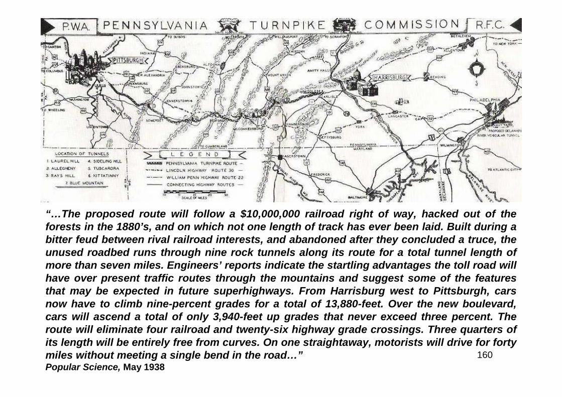
160
“…The proposed route will follow a $10,000,000 railroad right of way, hacked out of theforests in the 1880’s, and on which not one length of track has ever been laid. Built during abitter feud between rival railroad interests, and abandoned after they concluded a truce, theunused roadbed runs through nine rock tunnels along its route for a total tunnel length ofmore than seven miles. Engineers’ reports indicate the startling advantages the toll road willhave over present traffic routes through the mountains and suggest some of the featuresthat may be expected in future superhighways. From Harrisburg west to Pittsburgh, carsnow have to climb nine-percent grades for a total of 13,880-feet. Over the new boulevard,cars will ascend a total of only 3,940-feet up grades that never exceed three percent. Theroute will eliminate four railroad and twenty-six highway grade crossings. Three quarters ofits length will be entirely free from curves. On one straightaway, motorists will drive for fortymiles without meeting a single bend in the road…”Popular Science, May 1938
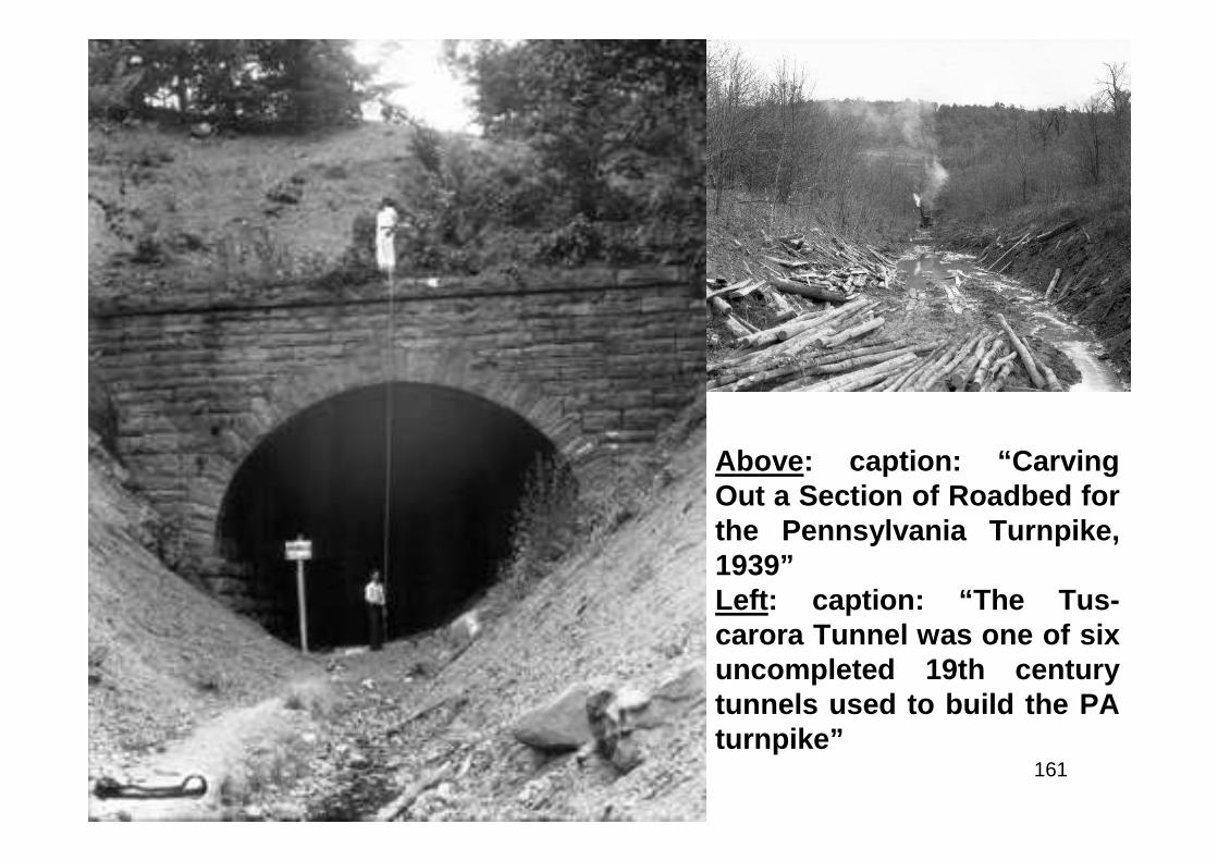
161
Above: caption: “CarvingOut a Section of Roadbed forthe Pennsylvania Turnpike,1939”Left: caption: “The Tus-carora Tunnel was one of sixuncompleted 19th centurytunnels used to build the PAturnpike”
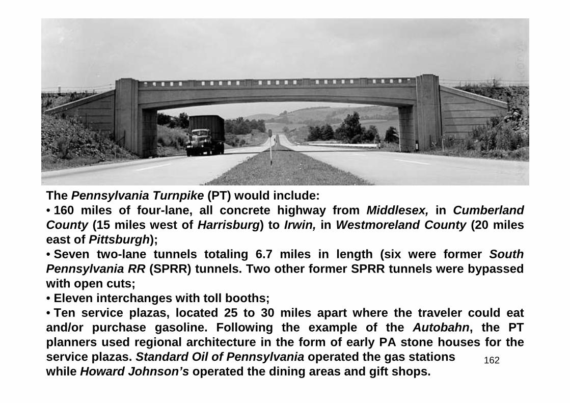
162
The Pennsylvania Turnpike (PT) would include:• 160 miles of four-lane, all concrete highway from Middlesex, in CumberlandCounty (15 miles west of Harrisburg) to Irwin, in Westmoreland County (20 mileseast of Pittsburgh);• Seven two-lane tunnels totaling 6.7 miles in length (six were former SouthPennsylvania RR (SPRR) tunnels. Two other former SPRR tunnels were bypassedwith open cuts;• Eleven interchanges with toll booths;• Ten service plazas, located 25 to 30 miles apart where the traveler could eatand/or purchase gasoline. Following the example of the Autobahn, the PTplanners used regional architecture in the form of early PA stone houses for theservice plazas. Standard Oil of Pennsylvania operated the gas stationswhile Howard Johnson’s operated the dining areas and gift shops.
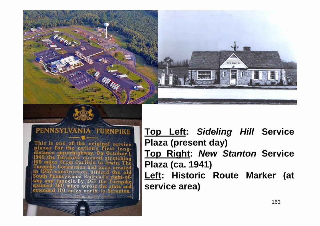
163
Top Left: Sideling Hill ServicePlaza (present day)Top Right: New Stanton ServicePlaza (ca. 1941)Left: Historic Route Marker (atservice area)

164
165
“The Pennsylvania Turnpike will meet one of the country’s greatest needs – safeand rapid motor transportation through the Appalachian Mountains. Furthermore,actual savings in money will be made possible for all who use it. And moneysavings naturally appeal to owners and operators of motor cars. This is primarilysignificant in the operation and maintenance of trucks. On the present highways itis sometimes necessary to transfer heavy freight loads to specially equippedhigh-powered trucks for the trip over the mountains. Much of the trip also must bemade in second or low gear. On the Turnpike, however, the heaviest modern truckwill travel the entire 160 miles in high gear. Seventy trucking companiesinterviewed by the Commission’s Traffic Engineers agreed that substantialmonetary savings will result from the Turnpike in the following particulars:• Safe operation at higher speeds in all kinds of weather;• Reduced fuel cost;• Reduced tire cost (because of lower grades and reduced breaking effort);• Reduced maintenance cost (because of lower grades and reduced curves, withresulting lessening of strain on transmission, brakes and engine);• Utilization of lower powered trucks for the same payload and of increasedpayload for present size of unit;• Saving of time ranging from two to six hours per trip between Harrisburg andPittsburgh;• Reduction of accidents with corresponding saving in insurance rates;• Trucks and other slow moving vehicles will use the outside lanePennsylvania Turnpike Commission (1940)
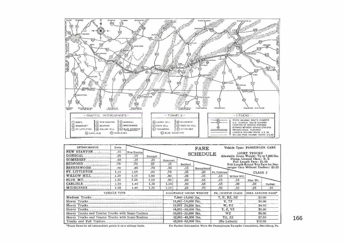
166
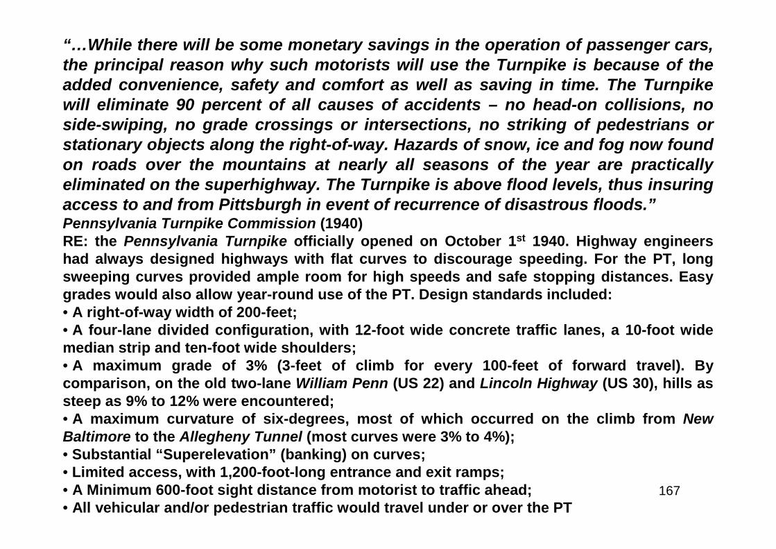
167
“…While there will be some monetary savings in the operation of passenger cars,the principal reason why such motorists will use the Turnpike is because of theadded convenience, safety and comfort as well as saving in time. The Turnpikewill eliminate 90 percent of all causes of accidents – no head-on collisions, noside-swiping, no grade crossings or intersections, no striking of pedestrians orstationary objects along the right-of-way. Hazards of snow, ice and fog now foundon roads over the mountains at nearly all seasons of the year are practicallyeliminated on the superhighway. The Turnpike is above flood levels, thus insuringaccess to and from Pittsburgh in event of recurrence of disastrous floods.”Pennsylvania Turnpike Commission (1940)RE: the Pennsylvania Turnpike officially opened on October 1st 1940. Highway engineershad always designed highways with flat curves to discourage speeding. For the PT, longsweeping curves provided ample room for high speeds and safe stopping distances. Easygrades would also allow year-round use of the PT. Design standards included:• A right-of-way width of 200-feet;• A four-lane divided configuration, with 12-foot wide concrete traffic lanes, a 10-foot widemedian strip and ten-foot wide shoulders;• A maximum grade of 3% (3-feet of climb for every 100-feet of forward travel). Bycomparison, on the old two-lane William Penn (US 22) and Lincoln Highway (US 30), hills assteep as 9% to 12% were encountered;• A maximum curvature of six-degrees, most of which occurred on the climb from NewBaltimore to the Allegheny Tunnel (most curves were 3% to 4%);• Substantial “Superelevation” (banking) on curves;• Limited access, with 1,200-foot-long entrance and exit ramps;• A Minimum 600-foot sight distance from motorist to traffic ahead;• All vehicular and/or pedestrian traffic would travel under or over the PT
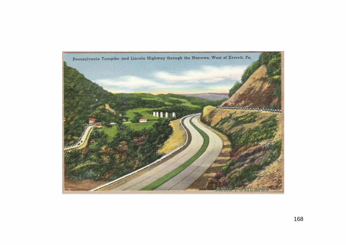
168

169
Above: caption: The PA turnpikeimmediately caught the public’simagination. Here cars passthrough an original toll booth.”Left: caption: “Western Portal ofTuscarora Tunnel shortly beforethe opening of the Turnpike in1940”

170
Above L&R: Pennsylvania TurnpikeCommission (PTC) photo of the1627-foot-long Clarks SummitBridge (at Scranton Inter-change). The PT featured sevenmountain tunnels and 307 bridges.Left: “Speed Limit 70 Miles” signalong the PT (ca. 1942)
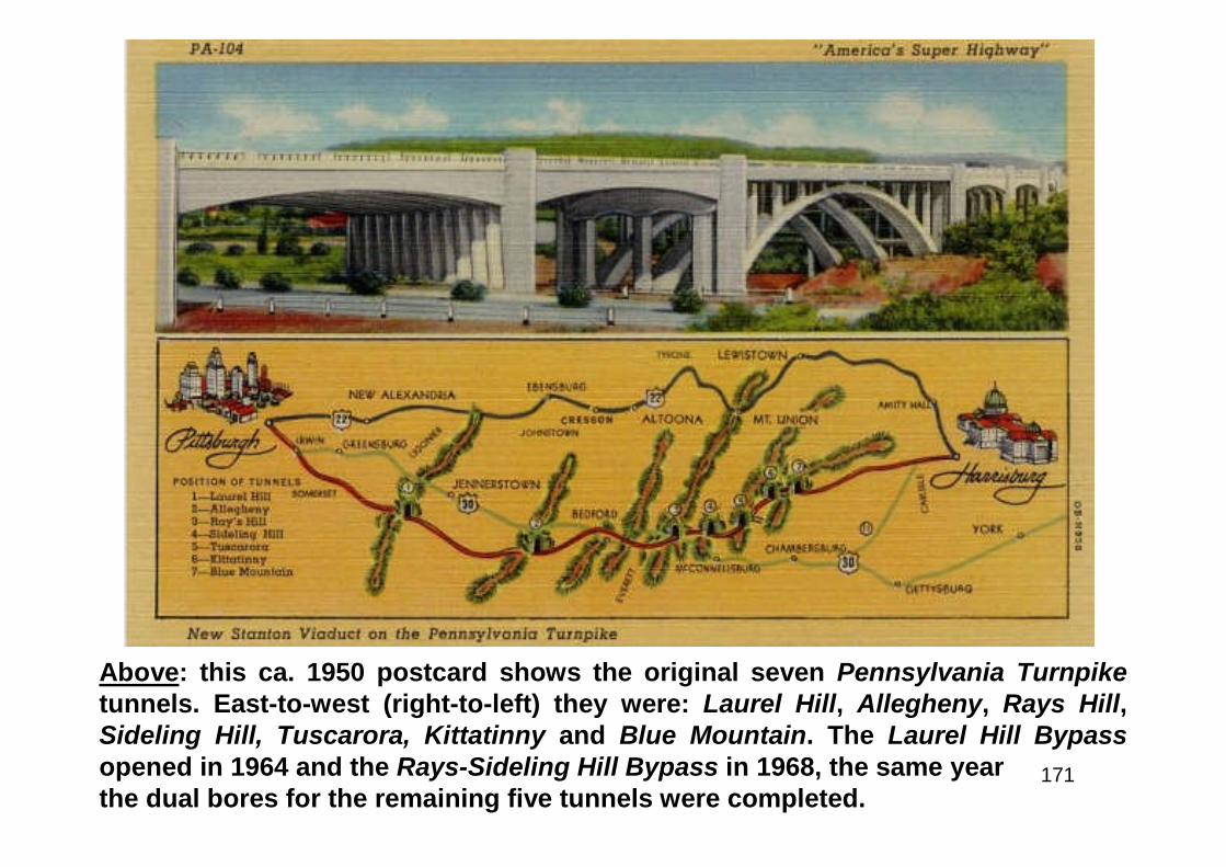
171
Above: this ca. 1950 postcard shows the original seven Pennsylvania Turnpiketunnels. East-to-west (right-to-left) they were: Laurel Hill, Allegheny, Rays Hill,Sideling Hill, Tuscarora, Kittatinny and Blue Mountain. The Laurel Hill Bypassopened in 1964 and the Rays-Sideling Hill Bypass in 1968, the same yearthe dual bores for the remaining five tunnels were completed.
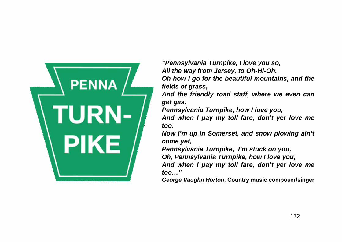
172
“Pennsylvania Turnpike, I love you so,All the way from Jersey, to Oh-Hi-Oh.Oh how I go for the beautiful mountains, and thefields of grass,And the friendly road staff, where we even canget gas.Pennsylvania Turnpike, how I love you,And when I pay my toll fare, don’t yer love metoo.Now I’m up in Somerset, and snow plowing ain’tcome yet,Pennsylvania Turnpike, I’m stuck on you,Oh, Pennsylvania Turnpike, how I love you,And when I pay my toll fare, don’t yer love metoo…”George Vaughn Horton, Country music composer/singer
173
“…Ultimately, the Pennsylvania toll road may serve as one link in thetranscontinental chain of highways proposed by Senator Bulkley and nowbeing studied by a committee. This whole Federal network would alsooperate under a toll system, scaled to the rate of about one tenth of a centa passenger mile, in addition to a flat fee of twenty-five cents for each carentering the highway. Thus you would pay a quarter to get on theboulevard at New York and ninety cents to drive the 900 miles to Chicago,if you were alone in the car. Federal police would man the toll gates andpatrol the road. Since every car would be required to stop at toll stations,authorities could bar intoxicated drivers, check licenses, halt automobilesconsidered unsafe to drive, and enforce uniform traffic regulations - aprocedure that might result in one nationwide code of traffic laws andregulations that would apply in every state in the Union. These road-building developments indicate that the superhighway of the future isdefinitely on the way. No one can predict exactly what it will be like, butexperts are confident that a modern Rip Van Winkle would wake uptwenty years from now rubbing his eyes in amazement at the sight ofstreamline cars racing along broad, divided highways of concrete with aspeed and a margin of safety far beyond his wildest dreams.”Popular Science, May 1938

174
Highways and Horizons
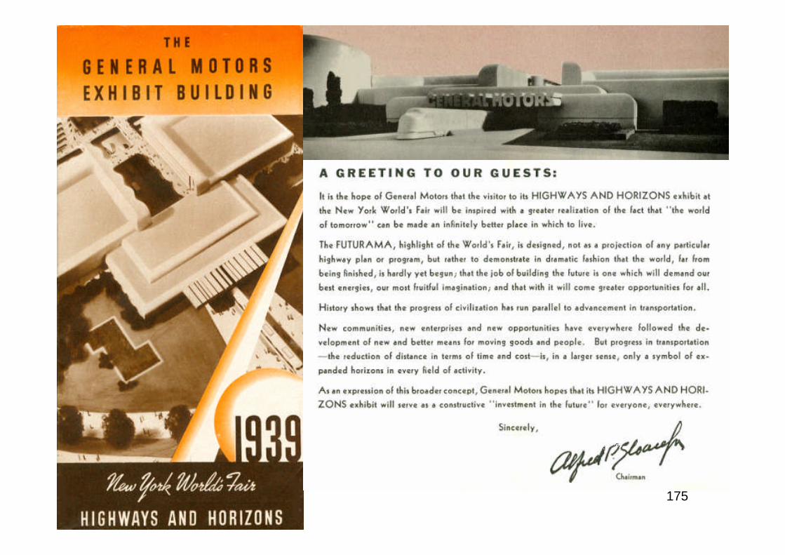
175
176
177
178
179
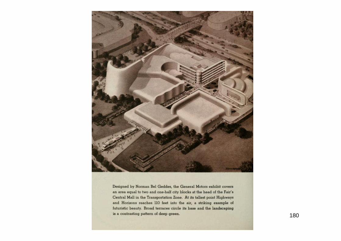
180
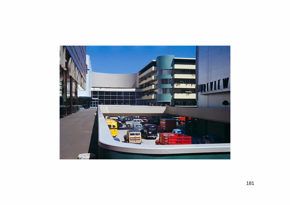
181
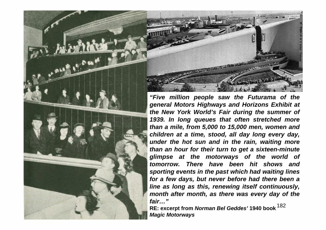
182
“Five million people saw the Futurama of thegeneral Motors Highways and Horizons Exhibit atthe New York World’s Fair during the summer of1939. In long queues that often stretched morethan a mile, from 5,000 to 15,000 men, women andchildren at a time, stood, all day long every day,under the hot sun and in the rain, waiting morethan an hour for their turn to get a sixteen-minuteglimpse at the motorways of the world oftomorrow. There have been hit shows andsporting events in the past which had waiting linesfor a few days, but never before had there been aline as long as this, renewing itself continuously,month after month, as there was every day of thefair…”RE: excerpt from Norman Bel Geddes’ 1940 bookMagic Motorways
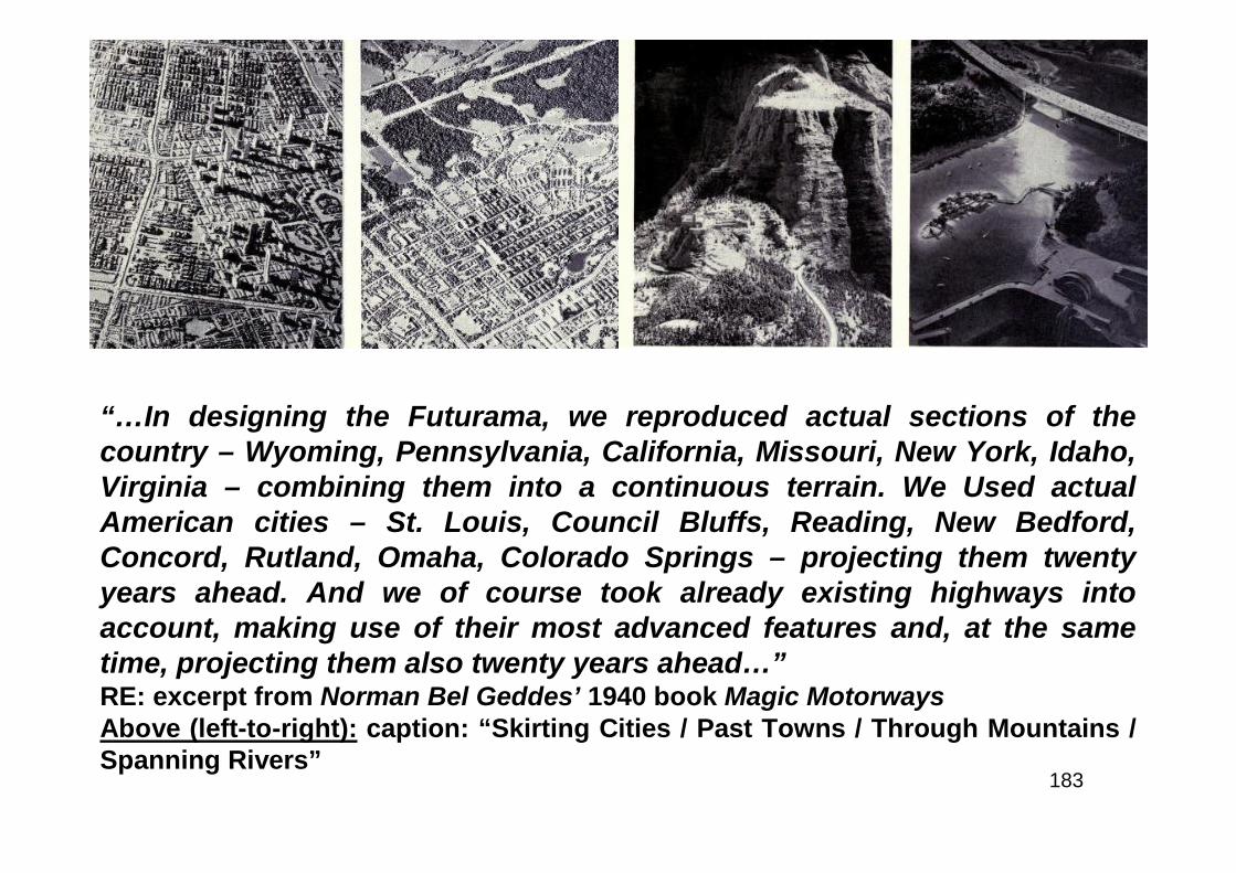
183
“…In designing the Futurama, we reproduced actual sections of thecountry – Wyoming, Pennsylvania, California, Missouri, New York, Idaho,Virginia – combining them into a continuous terrain. We Used actualAmerican cities – St. Louis, Council Bluffs, Reading, New Bedford,Concord, Rutland, Omaha, Colorado Springs – projecting them twentyyears ahead. And we of course took already existing highways intoaccount, making use of their most advanced features and, at the sametime, projecting them also twenty years ahead…”RE: excerpt from Norman Bel Geddes’ 1940 book Magic MotorwaysAbove (left-to-right): caption: “Skirting Cities / Past Towns / Through Mountains /Spanning Rivers”
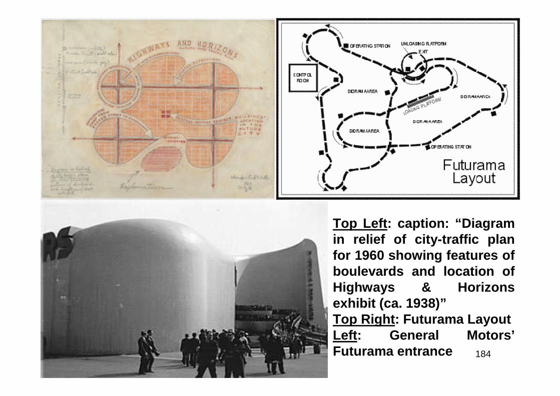
184
Top Left: caption: “Diagramin relief of city-traffic planfor 1960 showing features ofboulevards and location ofHighways & Horizonsexhibit (ca. 1938)”Top Right: Futurama LayoutLeft: General Motors’Futurama entrance
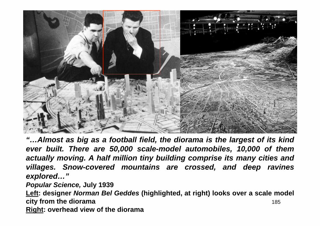
185
“…Almost as big as a football field, the diorama is the largest of its kindever built. There are 50,000 scale-model automobiles, 10,000 of themactually moving. A half million tiny building comprise its many cities andvillages. Snow-covered mountains are crossed, and deep ravinesexplored…”Popular Science, July 1939Left: designer Norman Bel Geddes (highlighted, at right) looks over a scale modelcity from the dioramaRight: overhead view of the diorama
186
“…There are few barriers left, and people, once days apart,are now within easy reach of one another. The future will seea still greater realization of this conquest of mankind overnature’s distances. The necessity for a far-reaching andplanned expansion of America’s highway system is not duechiefly to the fact that the motor vehicle is already operatingwell below its capacity to serve. Getting in and out of, orpassing through, a large city have long been a tremendoushandicap to the efficiency of the motorcar. A few express, orsuper-arterial, highways have done something to bring abouta better correlation between city and rural systems at theirmeeting point, and by-passes, or circumferential highways,have eliminated many delays to so-called through traffic…”RE: excerpt from General Motor’s “Highways and Horizons” brochure

187
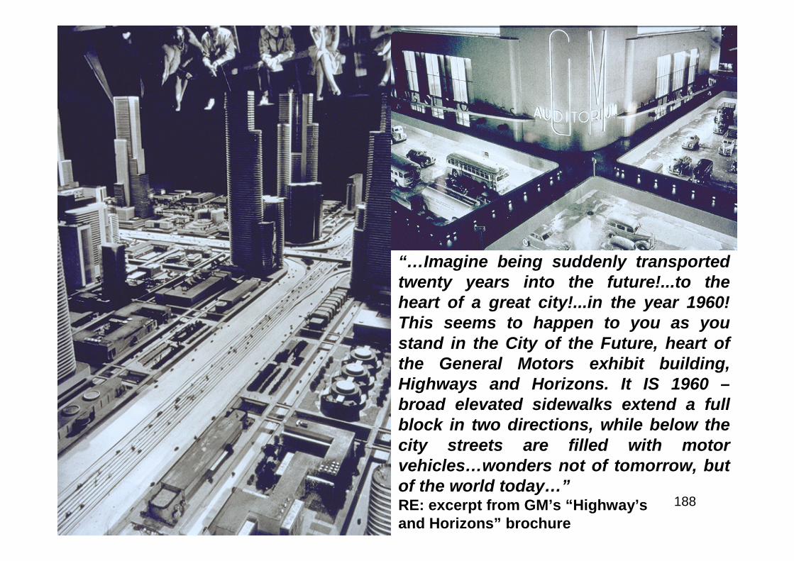
188
“…Imagine being suddenly transportedtwenty years into the future!...to theheart of a great city!...in the year 1960!This seems to happen to you as youstand in the City of the Future, heart ofthe General Motors exhibit building,Highways and Horizons. It IS 1960 –broad elevated sidewalks extend a fullblock in two directions, while below thecity streets are filled with motorvehicles…wonders not of tomorrow, butof the world today…”RE: excerpt from GM’s “Highway’sand Horizons” brochure

189
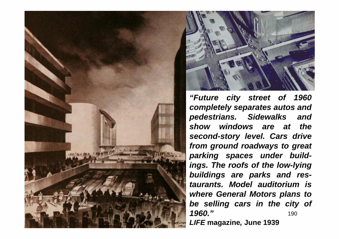
190
“Future city street of 1960completely separates autos andpedestrians. Sidewalks andshow windows are at thesecond-story level. Cars drivefrom ground roadways to greatparking spaces under build-ings. The roofs of the low-lyingbuildings are parks and res-taurants. Model auditorium iswhere General Motors plans tobe selling cars in the city of1960.”LIFE magazine, June 1939
191
“…We are satisfied with the mere possession of theautomobile, and fail to make use of its full potentialities.Many of us do not realize that our cars can reliably do up toeighty-five miles an hour, but that the average speed of motortraffic in the United States is twenty miles an hour; thatalthough our cars have been designed for efficiency andeconomy, the loss due to traffic congestion in New York Cityalone is a million dollars a day; that although our cars havebeen designed for safety, there is a death toll on Americanroads today of almost four lives every hour, ninety everysingle day, 2,700 a month, and 32,400 a year! Until recently,we have been told that the cure for these paradoxes lies inhit-or-miss, spasmodic road ‘improvements’ and catchysafety slogans. But we are due to open our eyes any daynow, and demand a comprehensive, basic solution to acomprehensive, basic problem…”RE: excerpt from Norman Bel Geddes’ 1940 book Magic Motorways
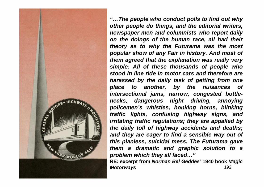
192
“…The people who conduct polls to find out whyother people do things, and the editorial writers,newspaper men and columnists who report dailyon the doings of the human race, all had theirtheory as to why the Futurama was the mostpopular show of any Fair in history. And most ofthem agreed that the explanation was really verysimple: All of these thousands of people whostood in line ride in motor cars and therefore areharassed by the daily task of getting from oneplace to another, by the nuisances ofintersectional jams, narrow, congested bottle-necks, dangerous night driving, annoyingpolicemen’s whistles, honking horns, blinkingtraffic lights, confusing highway signs, andirritating traffic regulations; they are appalled bythe daily toll of highway accidents and deaths;and they are eager to find a sensible way out ofthis planless, suicidal mess. The Futurama gavethem a dramatic and graphic solution to aproblem which they all faced…”RE: excerpt from Norman Bel Geddes’ 1940 book MagicMotorways
193
“…General Motors bids you welcome to the HIGHWAYS AND HORIZONSexhibit at the New York World’s Fair. The history of American roads is thehistory of our civilization as it marched westward from the Atlantic to thePacific – roadways forging ever onward through mountain, desert andforest barriers, leaving in their wake great thriving cities, industrialcenters and prosperous farms. General Motors salutes the men whopioneered these roads. General Motors salutes the United States Bureauof Public Roads – the highway officials of our states, the trafficadministrators of our cities and the individuals and organizationseverywhere who are contributing so importantly to highway progress forthe future…While much has been accomplished in improving ourhighways, actually in many sections today’s traffic is moving onroadways designed for yesterday. With the continued improvement of themotorcar and its ever-increasing contribution to our daily lives, ourhighways must be improved and expanded…”RE: excerpt from the narration of the “Highways and Horizons” exhibit
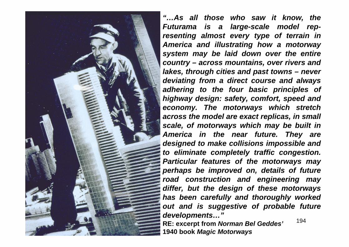
194
“…As all those who saw it know, theFuturama is a large-scale model rep-resenting almost every type of terrain inAmerica and illustrating how a motorwaysystem may be laid down over the entirecountry – across mountains, over rivers andlakes, through cities and past towns – neverdeviating from a direct course and alwaysadhering to the four basic principles ofhighway design: safety, comfort, speed andeconomy. The motorways which stretchacross the model are exact replicas, in smallscale, of motorways which may be built inAmerica in the near future. They aredesigned to make collisions impossible andto eliminate completely traffic congestion.Particular features of the motorways mayperhaps be improved on, details of futureroad construction and engineering maydiffer, but the design of these motorwayshas been carefully and thoroughly workedout and is suggestive of probable futuredevelopments…”RE: excerpt from Norman Bel Geddes’1940 book Magic Motorways
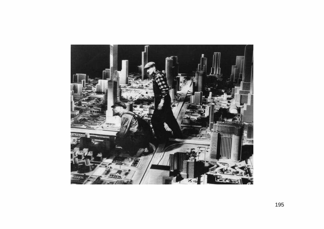
195

196
Carry-Go-Round
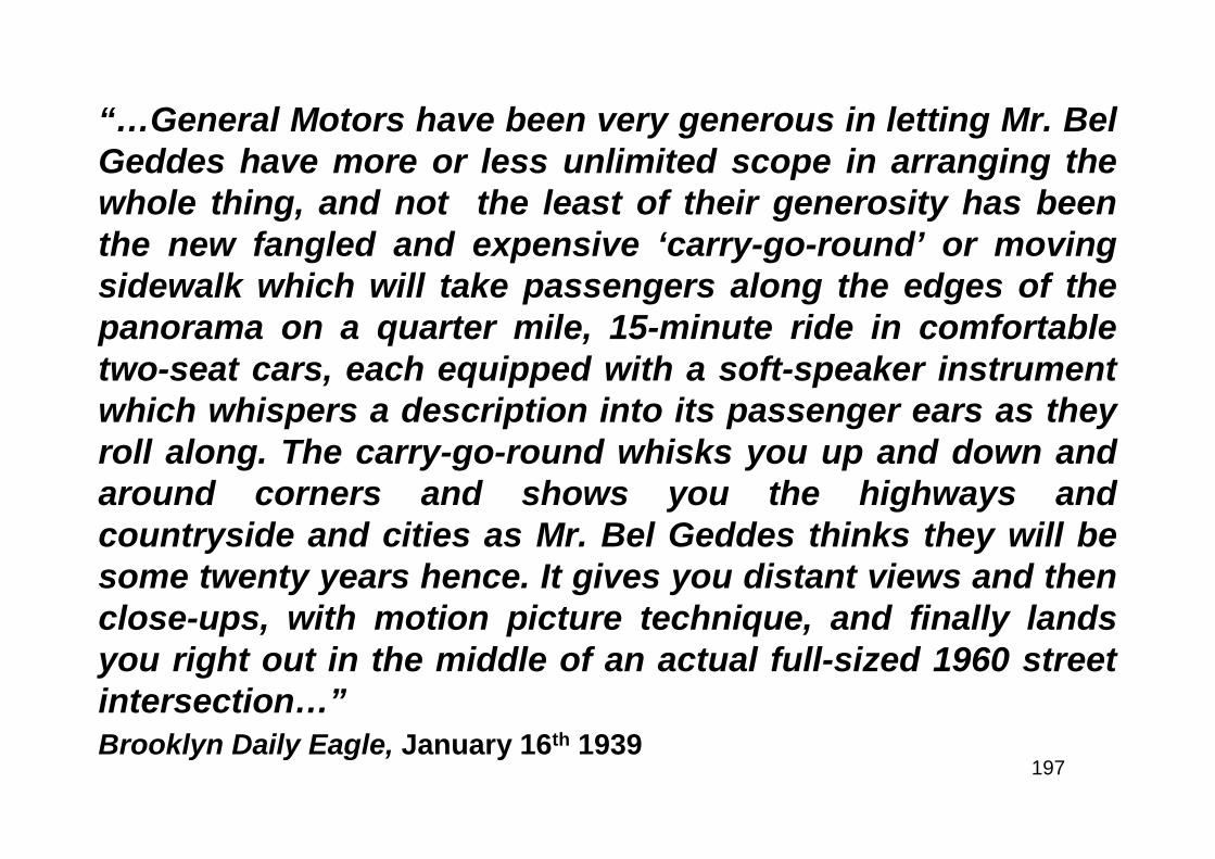
197
“…General Motors have been very generous in letting Mr. BelGeddes have more or less unlimited scope in arranging thewhole thing, and not the least of their generosity has beenthe new fangled and expensive ‘carry-go-round’ or movingsidewalk which will take passengers along the edges of thepanorama on a quarter mile, 15-minute ride in comfortabletwo-seat cars, each equipped with a soft-speaker instrumentwhich whispers a description into its passenger ears as theyroll along. The carry-go-round whisks you up and down andaround corners and shows you the highways andcountryside and cities as Mr. Bel Geddes thinks they will besome twenty years hence. It gives you distant views and thenclose-ups, with motion picture technique, and finally landsyou right out in the middle of an actual full-sized 1960 streetintersection…”Brooklyn Daily Eagle, January 16th 1939
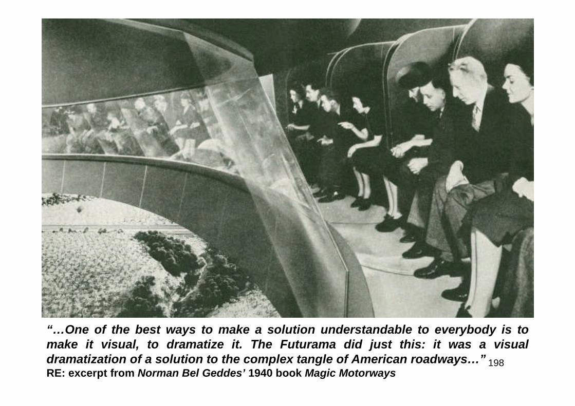
198
“…One of the best ways to make a solution understandable to everybody is tomake it visual, to dramatize it. The Futurama did just this: it was a visualdramatization of a solution to the complex tangle of American roadways…”RE: excerpt from Norman Bel Geddes’ 1940 book Magic Motorways

199
“…Much of the initial appeal of the Futurama was due to its imaginativequality. But the reason that its popularity never diminished was that itsboldness was based on soundness. The plan it presented appealed to thepractical engineer as much as to the idle day-dreamer. The motorwayswhich it featured were not only desirable, but practical, As each spectatorrode around the model in his comfortable, upholstered armchair, helistened to a description of it in a voice which came from a small speakerbuilt into the back of the chair. This recorded description synchronizedwith the movement of the chairs and explained the main features of whatwas passing before the spectator’s eyes. It directed his attention to thegreat arterial highways which were segregated into different speed lanesand which looked so different from the roads today. It pointed out theoverpasses, high-speed intersections and wide bridges over which tear-drop motor cars whisked by at a hundred miles an hour. It commented inpassing on the surrounding scenery, the planned cities, decentralizedcommunities and experimental farms. But it did not describe in detail howany of this was to be accomplished. It did not explain how the highwaysystem worked. It could not dwell at length on any specific points ofinterest because of the short time available…”RE: excerpt from Norman Bel Geddes’ 1940 book Magic Motorways
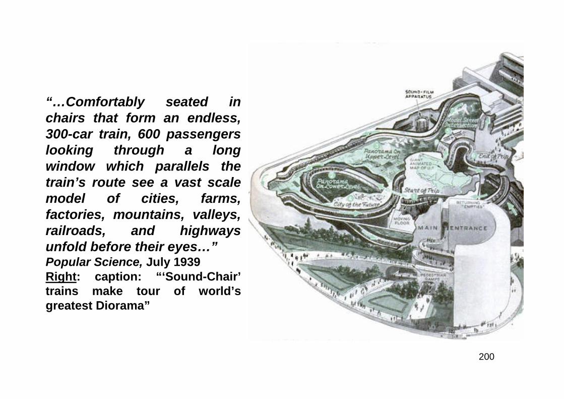
200
“…Comfortably seated inchairs that form an endless,300-car train, 600 passengerslooking through a longwindow which parallels thetrain’s route see a vast scalemodel of cities, farms,factories, mountains, valleys,railroads, and highwaysunfold before their eyes…”Popular Science, July 1939Right: caption: “‘Sound-Chair’trains make tour of world’sgreatest Diorama”
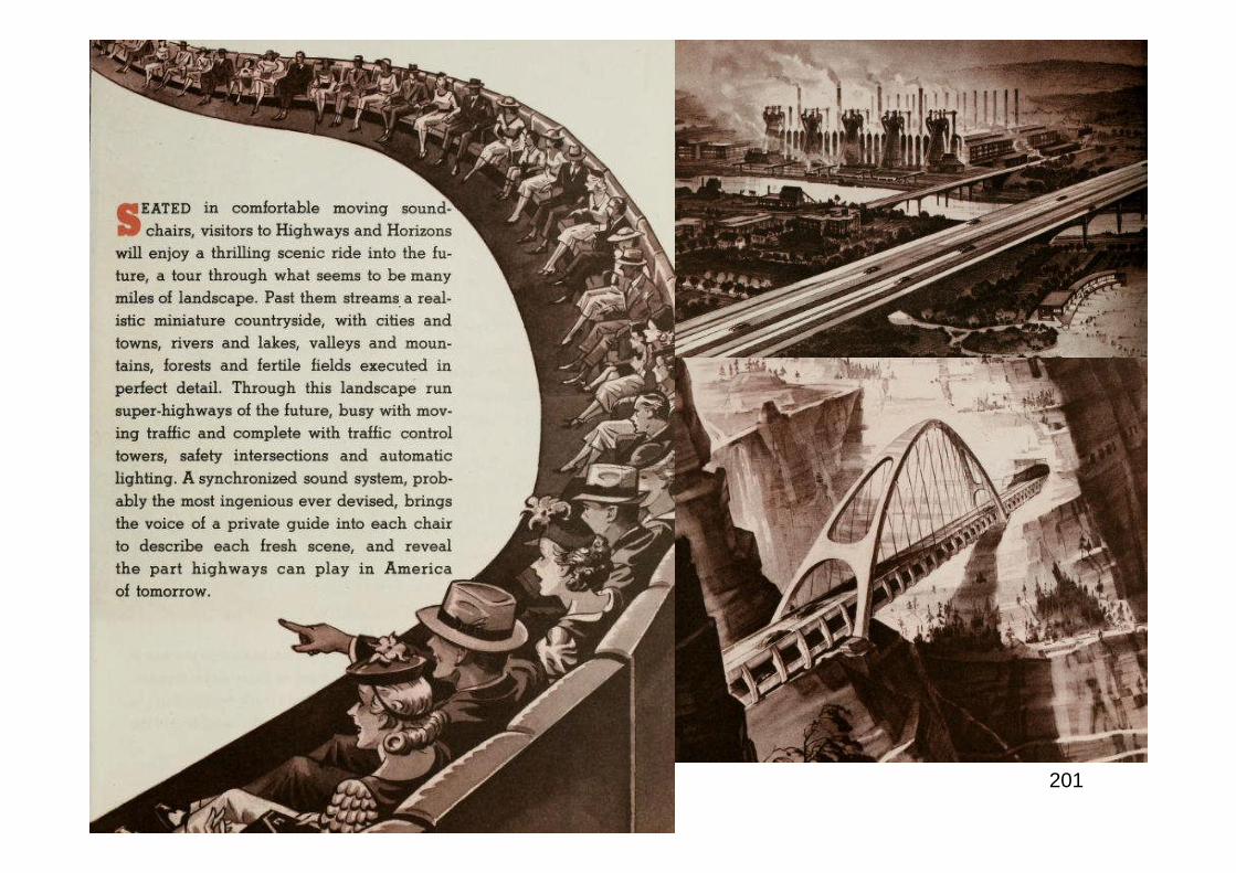
201
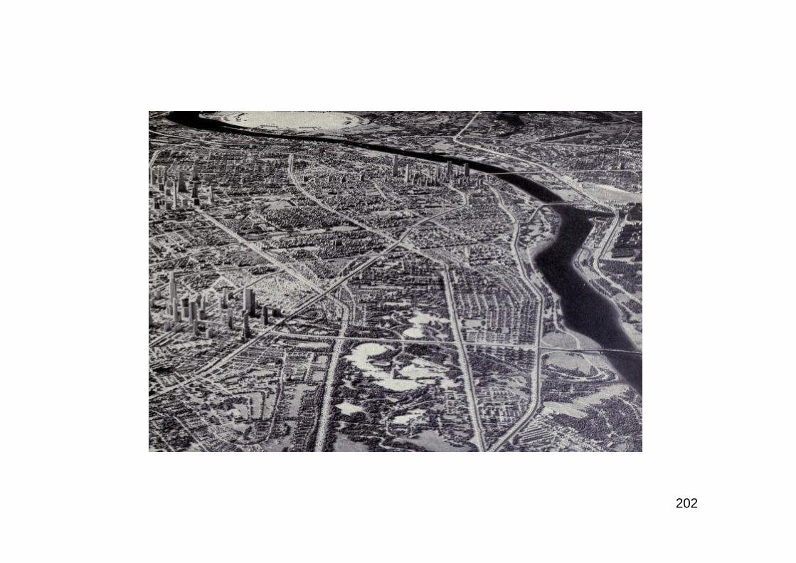
202
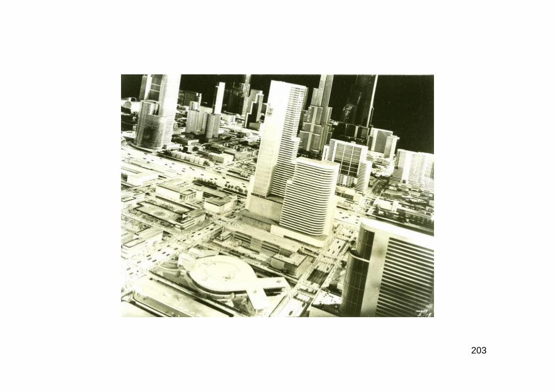
203
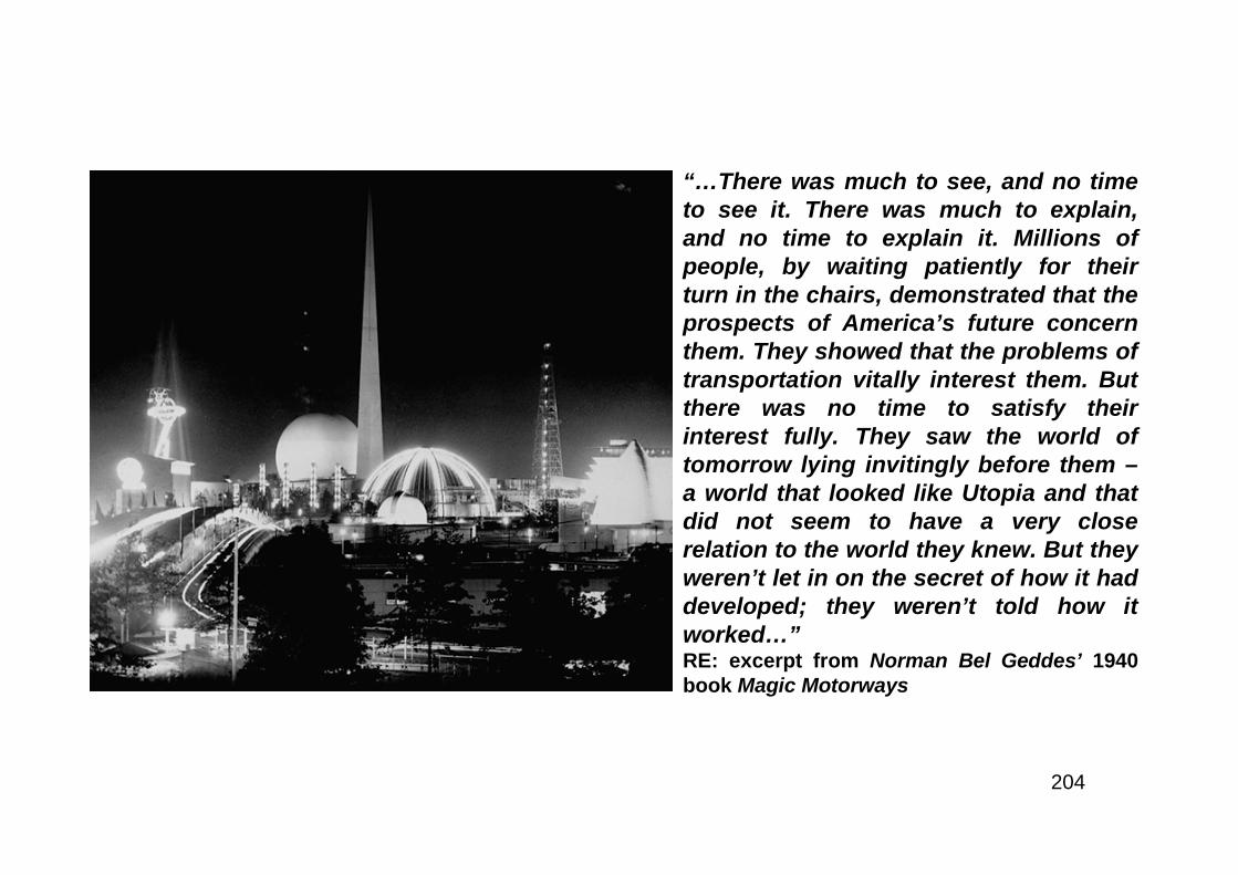
204
“…There was much to see, and no timeto see it. There was much to explain,and no time to explain it. Millions ofpeople, by waiting patiently for theirturn in the chairs, demonstrated that theprospects of America’s future concernthem. They showed that the problems oftransportation vitally interest them. Butthere was no time to satisfy theirinterest fully. They saw the world oftomorrow lying invitingly before them –a world that looked like Utopia and thatdid not seem to have a very closerelation to the world they knew. But theyweren’t let in on the secret of how it haddeveloped; they weren’t told how itworked…”RE: excerpt from Norman Bel Geddes’ 1940book Magic Motorways
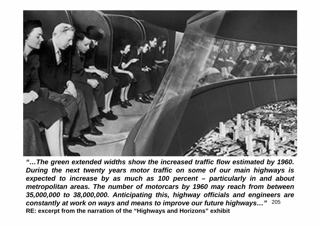
205
“…The green extended widths show the increased traffic flow estimated by 1960.During the next twenty years motor traffic on some of our main highways isexpected to increase by as much as 100 percent – particularly in and aboutmetropolitan areas. The number of motorcars by 1960 may reach from between35,000,000 to 38,000,000. Anticipating this, highway officials and engineers areconstantly at work on ways and means to improve our future highways…”RE: excerpt from the narration of the “Highways and Horizons” exhibit
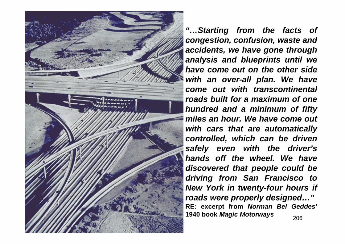
206
“…Starting from the facts ofcongestion, confusion, waste andaccidents, we have gone throughanalysis and blueprints until wehave come out on the other sidewith an over-all plan. We havecome out with transcontinentalroads built for a maximum of onehundred and a minimum of fiftymiles an hour. We have come outwith cars that are automaticallycontrolled, which can be drivensafely even with the driver’shands off the wheel. We havediscovered that people could bedriving from San Francisco toNew York in twenty-four hours ifroads were properly designed…”RE: excerpt from Norman Bel Geddes’1940 book Magic Motorways
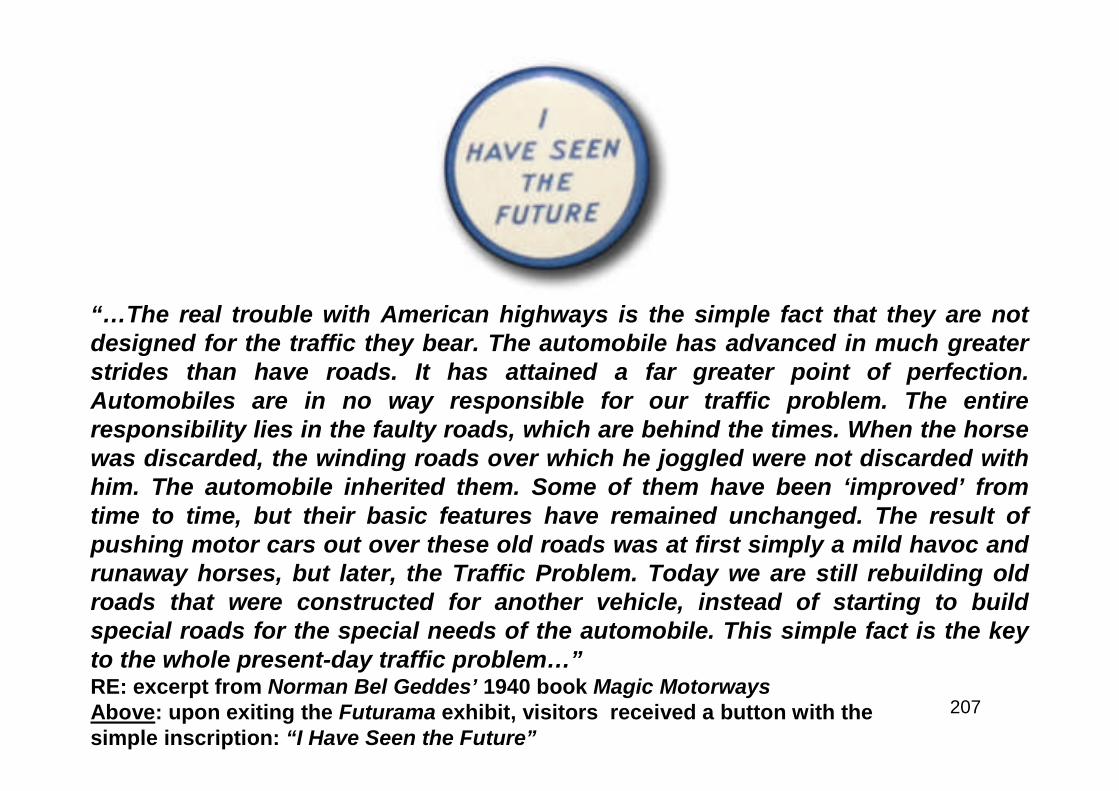
207
“…The real trouble with American highways is the simple fact that they are notdesigned for the traffic they bear. The automobile has advanced in much greaterstrides than have roads. It has attained a far greater point of perfection.Automobiles are in no way responsible for our traffic problem. The entireresponsibility lies in the faulty roads, which are behind the times. When the horsewas discarded, the winding roads over which he joggled were not discarded withhim. The automobile inherited them. Some of them have been ‘improved’ fromtime to time, but their basic features have remained unchanged. The result ofpushing motor cars out over these old roads was at first simply a mild havoc andrunaway horses, but later, the Traffic Problem. Today we are still rebuilding oldroads that were constructed for another vehicle, instead of starting to buildspecial roads for the special needs of the automobile. This simple fact is the keyto the whole present-day traffic problem…”RE: excerpt from Norman Bel Geddes’ 1940 book Magic MotorwaysAbove: upon exiting the Futurama exhibit, visitors received a button with thesimple inscription: “I Have Seen the Future”
208
The Highway Lobby
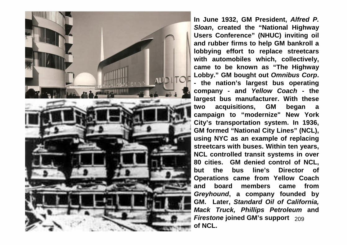
209
In June 1932, GM President, Alfred P.Sloan, created the “National HighwayUsers Conference” (NHUC) inviting oiland rubber firms to help GM bankroll alobbying effort to replace streetcarswith automobiles which, collectively,came to be known as “The HighwayLobby.” GM bought out Omnibus Corp.- the nation’s largest bus operatingcompany - and Yellow Coach - thelargest bus manufacturer. With thesetwo acquisitions, GM began acampaign to “modernize" New YorkCity’s transportation system. In 1936,GM formed “National City Lines” (NCL),using NYC as an example of replacingstreetcars with buses. Within ten years,NCL controlled transit systems in over80 cities. GM denied control of NCL,but the bus line’s Director ofOperations came from Yellow Coachand board members came fromGreyhound, a company founded byGM. Later, Standard Oil of California,Mack Truck, Phillips Petroleum andFirestone joined GM’s supportof NCL.
210
“There was not a scintilla of doubt that these defendants, General Motorsand the others, had set out to destroy the streetcar system.”Brad Snell, Auto Industry HistorianRE: the U.S. Justice Department prosecuted NCL, General Motors and othercompanies for monopolizing America’s transit systems. For eliminating thestreetcar system, the corporations involved were eventually found guilty ofconspiracy: “to monopolize the sale of supplies used by the local transportationcompanies controlled by the City Lines defendants.” Each defendant was fined$5K while key individuals (such as the Treasurer of GM) were fined $1. In 1953,President Eisenhower appointed then GM President Charles Wilson as hisSecretary of Defense, who lobbied intensely for a system of interstate highwaysas critical to the national defense. Francis du Pont, whose family owned thelargest share of GM stock, was appointed Chief Administrator of FederalHighways. Funding for the future “National System of Interstate and DefenseHighways” came, primarily, from the Highway Trust Fund’s tax on gasoline; to beused exclusively for highways. Dow Chemical – major producer of asphalt,entered the PR campaign with a film featuring a testimonial from a grade schoolteacher standing up to her anti-highway neighbors with quiet indignation stating:“Can’t you see this highway means a whole new way of life for the children?” Thefuture would prove that with the blessings, came the curses as well. Nogovernment sponsored program in the immediate post-WWII years would sotransform the landscape – and America itself, as the creation of the InterstateHighway System.
211
Crash-Proof Highways
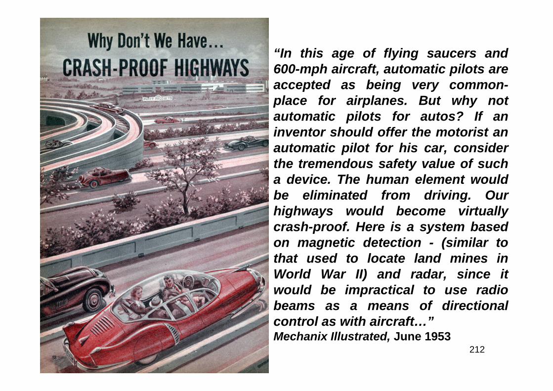
212
“In this age of flying saucers and600-mph aircraft, automatic pilots areaccepted as being very common-place for airplanes. But why notautomatic pilots for autos? If aninventor should offer the motorist anautomatic pilot for his car, considerthe tremendous safety value of sucha device. The human element wouldbe eliminated from driving. Ourhighways would become virtuallycrash-proof. Here is a system basedon magnetic detection - (similar tothat used to locate land mines inWorld War II) and radar, since itwould be impractical to use radiobeams as a means of directionalcontrol as with aircraft…”Mechanix Illustrated, June 1953
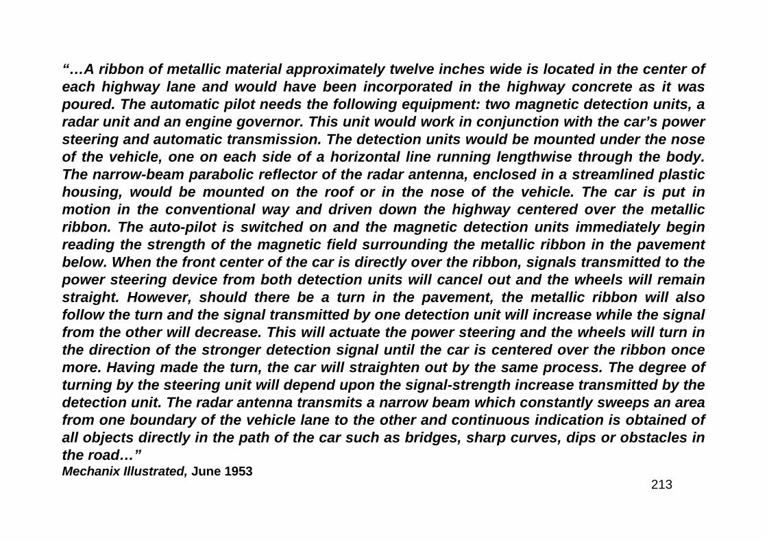
213
“…A ribbon of metallic material approximately twelve inches wide is located in the center ofeach highway lane and would have been incorporated in the highway concrete as it waspoured. The automatic pilot needs the following equipment: two magnetic detection units, aradar unit and an engine governor. This unit would work in conjunction with the car’s powersteering and automatic transmission. The detection units would be mounted under the noseof the vehicle, one on each side of a horizontal line running lengthwise through the body.The narrow-beam parabolic reflector of the radar antenna, enclosed in a streamlined plastichousing, would be mounted on the roof or in the nose of the vehicle. The car is put inmotion in the conventional way and driven down the highway centered over the metallicribbon. The auto-pilot is switched on and the magnetic detection units immediately beginreading the strength of the magnetic field surrounding the metallic ribbon in the pavementbelow. When the front center of the car is directly over the ribbon, signals transmitted to thepower steering device from both detection units will cancel out and the wheels will remainstraight. However, should there be a turn in the pavement, the metallic ribbon will alsofollow the turn and the signal transmitted by one detection unit will increase while the signalfrom the other will decrease. This will actuate the power steering and the wheels will turn inthe direction of the stronger detection signal until the car is centered over the ribbon oncemore. Having made the turn, the car will straighten out by the same process. The degree ofturning by the steering unit will depend upon the signal-strength increase transmitted by thedetection unit. The radar antenna transmits a narrow beam which constantly sweeps an areafrom one boundary of the vehicle lane to the other and continuous indication is obtained ofall objects directly in the path of the car such as bridges, sharp curves, dips or obstacles inthe road…”Mechanix Illustrated, June 1953
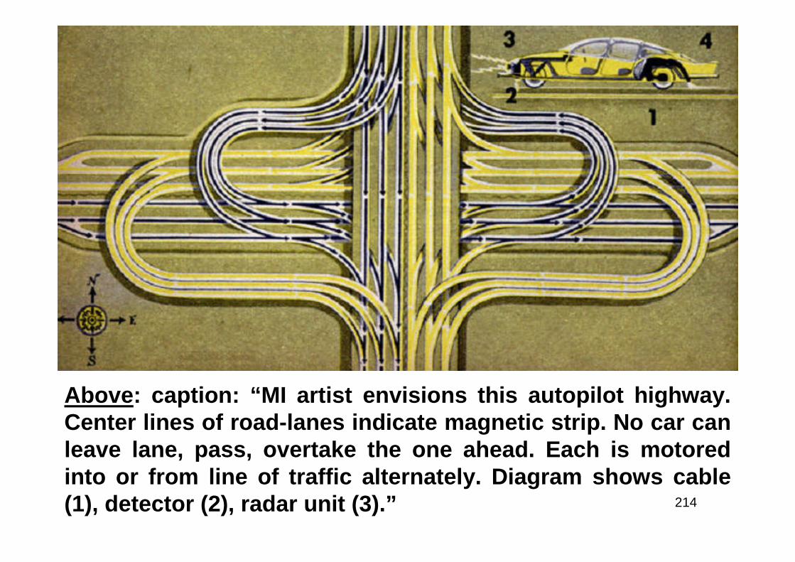
214
Above: caption: “MI artist envisions this autopilot highway.Center lines of road-lanes indicate magnetic strip. No car canleave lane, pass, overtake the one ahead. Each is motoredinto or from line of traffic alternately. Diagram shows cable(1), detector (2), radar unit (3).”
215
“…Let us assume, for example, that a cruising speed of 50 mph has beenestablished and set up on the control panel. The engine governor willmaintain this speed by increasing or decreasing the amount of gas beingfed to the engine in response to varying engine loads. After cruisingspeed has been set on the control panel, changes in the speed arebrought about only by the driver’s overriding of the auto-pilot or as theresult of a signal from the radar unit. Suddenly our car begins to overhaula slow-moving truck. As soon as it reaches a certain distance from thetruck - a minimum safe distance - the signal received from the radar beambouncing off the truck causes a warning buzzer to sound. In addition itcauses the governor to slow the engine of the car to the speed needed tokeep that distance. To pass, the driver must over-ride the auto-pilot andcontrol his car manually. When he is once more on-the-beam and hisradar unit is silent, he can relax. To turn off the highway, he must overridehis pilot once more…”Mechanix Illustrated, June 1953
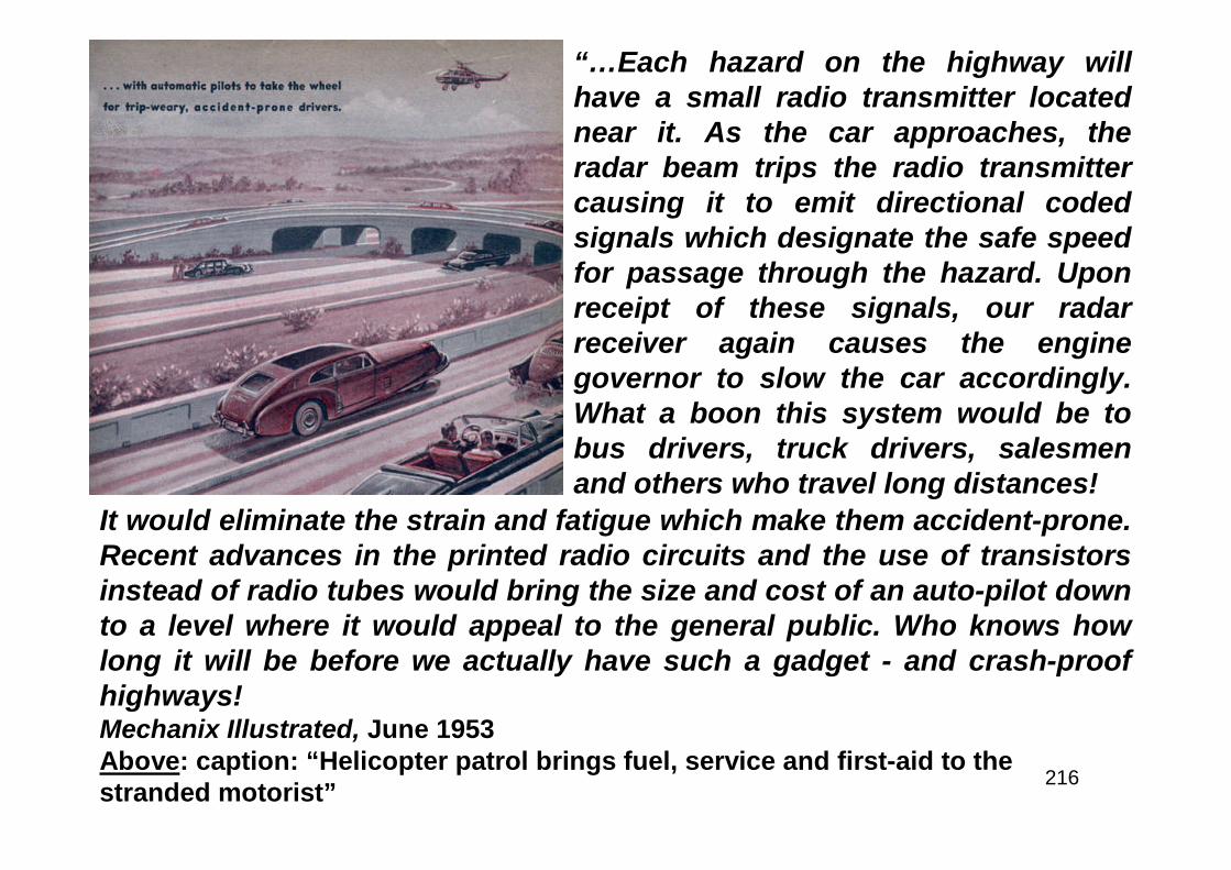
216
“…Each hazard on the highway willhave a small radio transmitter locatednear it. As the car approaches, theradar beam trips the radio transmittercausing it to emit directional codedsignals which designate the safe speedfor passage through the hazard. Uponreceipt of these signals, our radarreceiver again causes the enginegovernor to slow the car accordingly.What a boon this system would be tobus drivers, truck drivers, salesmenand others who travel long distances!
It would eliminate the strain and fatigue which make them accident-prone.Recent advances in the printed radio circuits and the use of transistorsinstead of radio tubes would bring the size and cost of an auto-pilot downto a level where it would appeal to the general public. Who knows howlong it will be before we actually have such a gadget - and crash-proofhighways!Mechanix Illustrated, June 1953Above: caption: “Helicopter patrol brings fuel, service and first-aid to thestranded motorist”
217
Dream Highways for Dream Cars
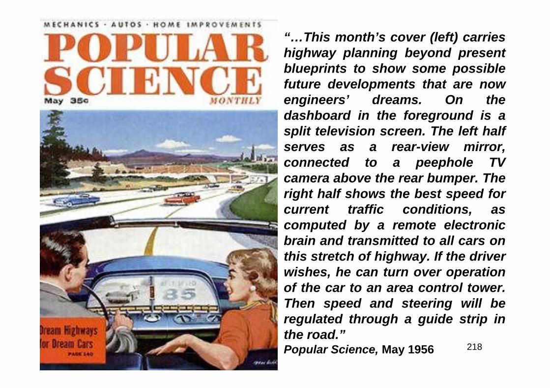
218
“…This month’s cover (left) carrieshighway planning beyond presentblueprints to show some possiblefuture developments that are nowengineers’ dreams. On thedashboard in the foreground is asplit television screen. The left halfserves as a rear-view mirror,connected to a peephole TVcamera above the rear bumper. Theright half shows the best speed forcurrent traffic conditions, ascomputed by a remote electronicbrain and transmitted to all cars onthis stretch of highway. If the driverwishes, he can turn over operationof the car to an area control tower.Then speed and steering will beregulated through a guide strip inthe road.”Popular Science, May 1956

219
Part 4
Origins

220
A Union of Sentiment
221
The idea of the Federal Government building transcontinental highways was not a new one.In fact, in 1906 Congressman William Randolph Hearst proposed one. The FederalGovernment did indeed build national highways at one time. The National Road - fromCumberland, Maryland to Vandalia, Illinois. George Washington traveled over the Indian trailthat later became the National Road as a young man in his twenties on a mission forGovernor Dinwiddie to tell the French that they were trespassers at Fort Le Boeuf (north ofPittsburgh). A few years later, he was sent again, this time with a small force of troops. Hismission was not successful, suffering a humiliating defeat at Fort Necessity. He traveled theroute once again with General Edward Braddock and a strong military force. This time,however, they hacked out a road sufficient to drag wheeled canon and wagons. Thismission, too, was unsuccessful with Braddock being buried in the middle of the newlyconstructed road. But that was the beginning of the National Road. In 1803 as part of thelegislation admitting Ohio to the Union, 2% of the revenues derived from the sale of Federallands in Ohio were to be set aside for roads, part of it specifically for the National Road. OnMarch 29th 1806, POTUS Thomas Jefferson signed legislation authorizing the appointment ofthree commissioners to build a road from the Potomac River at Cumberland, MD, to the OhioRiver at Wheeling, WV (then in Virginia). With rivers being the fastest means of travel amongthe states, the first National Road would provide a land bridge connecting the Potomac andOhio River/s for settlers bound for the public lands on sale in the new state of Ohio. Theroad also would facilitate trade and bind the states in what Jefferson called a: “Union ofSentiment.” There was some controversy and doubt as to the constitutionality of such anendeavor, but confrontation was avoided between the states through which the road was topass and resolutions were enacted requesting the Federal government to build the road.
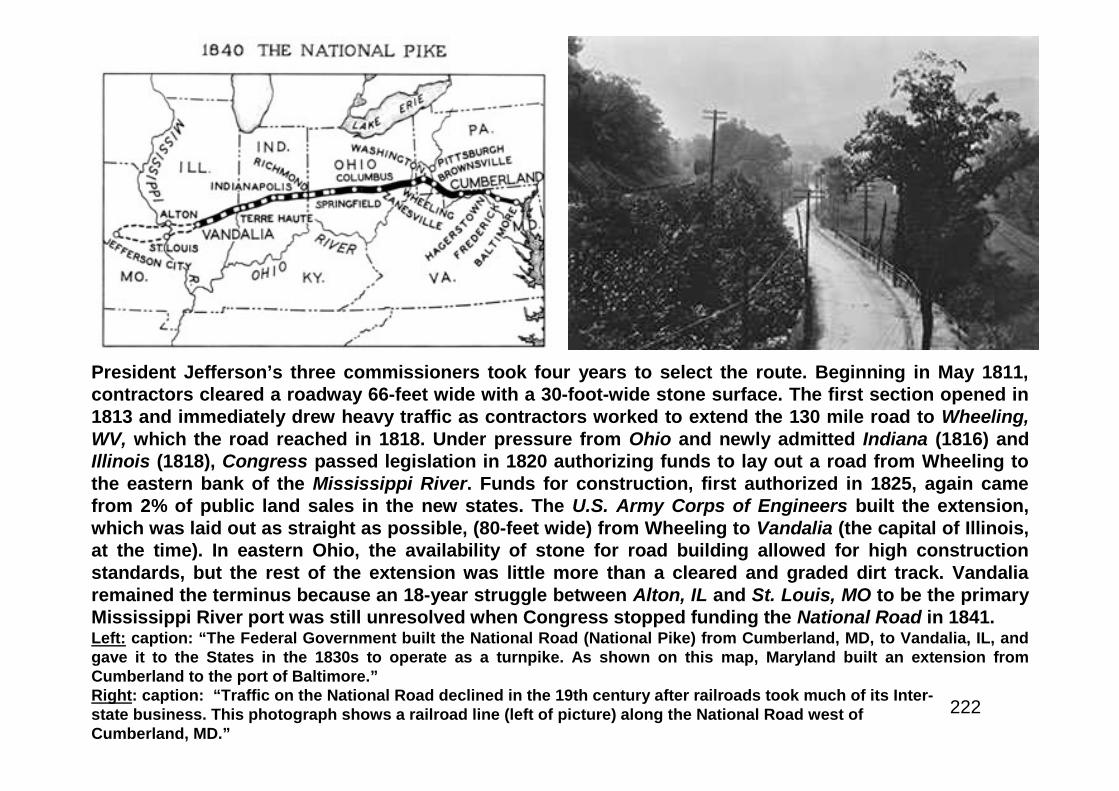
222
President Jefferson’s three commissioners took four years to select the route. Beginning in May 1811,contractors cleared a roadway 66-feet wide with a 30-foot-wide stone surface. The first section opened in1813 and immediately drew heavy traffic as contractors worked to extend the 130 mile road to Wheeling,WV, which the road reached in 1818. Under pressure from Ohio and newly admitted Indiana (1816) andIllinois (1818), Congress passed legislation in 1820 authorizing funds to lay out a road from Wheeling tothe eastern bank of the Mississippi River. Funds for construction, first authorized in 1825, again camefrom 2% of public land sales in the new states. The U.S. Army Corps of Engineers built the extension,which was laid out as straight as possible, (80-feet wide) from Wheeling to Vandalia (the capital of Illinois,at the time). In eastern Ohio, the availability of stone for road building allowed for high constructionstandards, but the rest of the extension was little more than a cleared and graded dirt track. Vandaliaremained the terminus because an 18-year struggle between Alton, IL and St. Louis, MO to be the primaryMississippi River port was still unresolved when Congress stopped funding the National Road in 1841.Left: caption: “The Federal Government built the National Road (National Pike) from Cumberland, MD, to Vandalia, IL, andgave it to the States in the 1830s to operate as a turnpike. As shown on this map, Maryland built an extension fromCumberland to the port of Baltimore.”Right: caption: “Traffic on the National Road declined in the 19th century after railroads took much of its Inter-state business. This photograph shows a railroad line (left of picture) along the National Road west ofCumberland, MD.”

223
Above Top: mile marker along the National Road inColumbus, Ohio.Above Bottom: As late as the 1930s, U.S. 40 includedthis National Road “S” bridge west of Hendrysburg,OH. The bridge was replaced with an arch bridgeduring reconstruction of the highway in 1933.Left: start of the National Road markerin Cumberland, MD

224
Object Lesson
225
...It would greatly increase the value of the interstate roadsand stimulate a general public interest in road building ifsome of these lines (object lesson roads) could be soconnected or combined as to form in a measure, a nationalsystem, such as was planned and partly built by theGovernment in the early days of this century. The mosteffective lines that could be adopted for this purpose wouldbe an Atlantic and a Pacific Coast line, joined by a continentalhighway extending from Washington to San Francisco.”RE: excerpt from “Public Roads of the Past,” published by the AmericanAssociation of State Highway Officials in 1953. The Office of Road Inquiry(part of the Department of Agriculture and the direct predecessor of theFederal Highway Administration) built the first “Object Lesson Road” atthe entrance to the New Jersey Agricultural College and ExperimentStation at New Brunswick, NJ in 1897. In 1913, The Road-Maker magazinepublished an article entitled “The Proposed Interstate Highway System”(prepared by the National Highway Association) including a map showinghow the highway would connect the state capitols with sixteen-foot wideroads. The system would be 18K miles long and would be paid forby a tobacco tax.
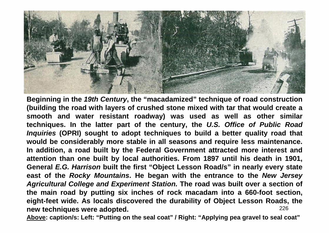
226
Beginning in the 19th Century, the “macadamized” technique of road construction(building the road with layers of crushed stone mixed with tar that would create asmooth and water resistant roadway) was used as well as other similartechniques. In the latter part of the century, the U.S. Office of Public RoadInquiries (OPRI) sought to adopt techniques to build a better quality road thatwould be considerably more stable in all seasons and require less maintenance.In addition, a road built by the Federal Government attracted more interest andattention than one built by local authorities. From 1897 until his death in 1901,General E.G. Harrison built the first “Object Lesson Road/s” in nearly every stateeast of the Rocky Mountains. He began with the entrance to the New JerseyAgricultural College and Experiment Station. The road was built over a section ofthe main road by putting six inches of rock macadam into a 660-foot section,eight-feet wide. As locals discovered the durability of Object Lesson Roads, thenew techniques were adopted.Above: caption/s: Left: “Putting on the seal coat” / Right: “Applying pea gravel to seal coat”
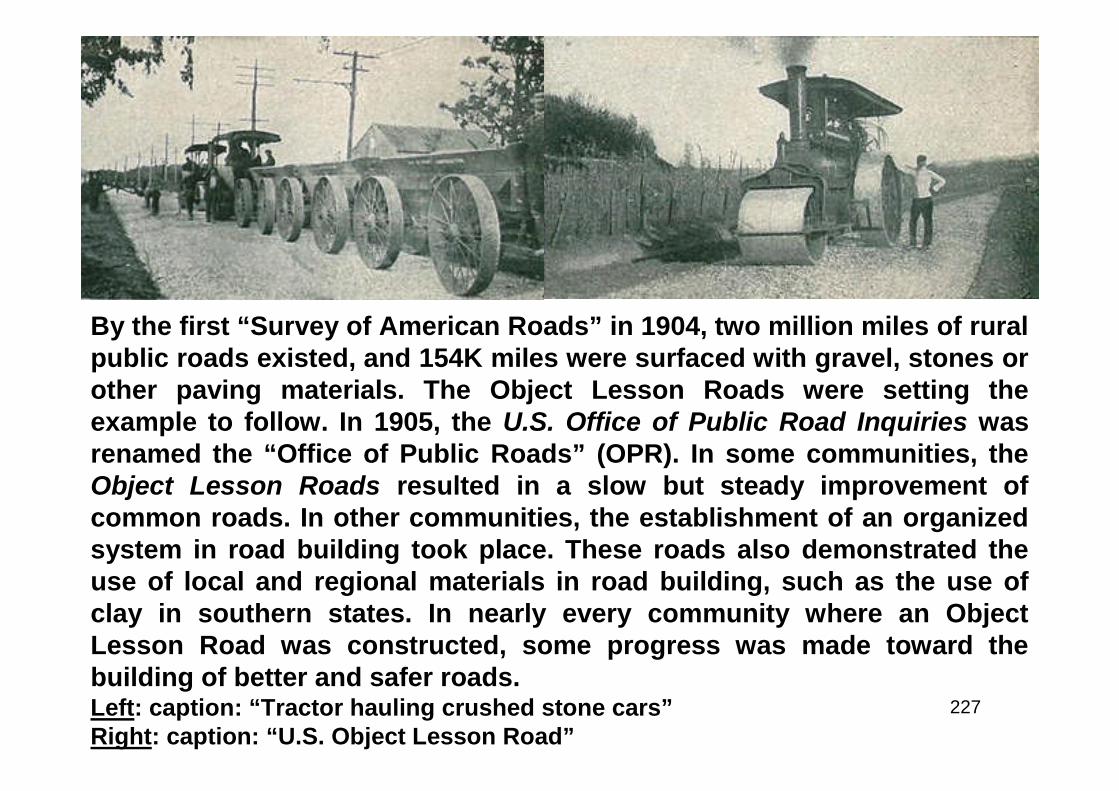
227
By the first “Survey of American Roads” in 1904, two million miles of ruralpublic roads existed, and 154K miles were surfaced with gravel, stones orother paving materials. The Object Lesson Roads were setting theexample to follow. In 1905, the U.S. Office of Public Road Inquiries wasrenamed the “Office of Public Roads” (OPR). In some communities, theObject Lesson Roads resulted in a slow but steady improvement ofcommon roads. In other communities, the establishment of an organizedsystem in road building took place. These roads also demonstrated theuse of local and regional materials in road building, such as the use ofclay in southern states. In nearly every community where an ObjectLesson Road was constructed, some progress was made toward thebuilding of better and safer roads.Left: caption: “Tractor hauling crushed stone cars”Right: caption: “U.S. Object Lesson Road”
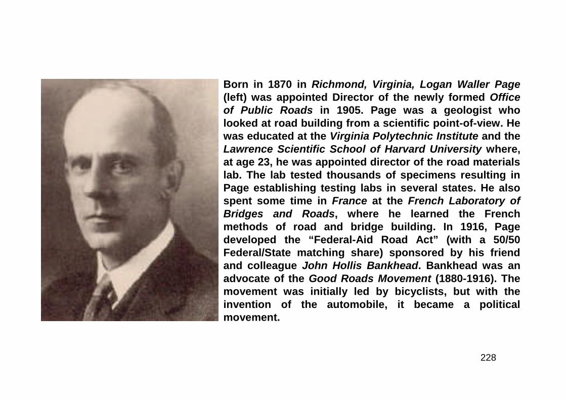
228
Born in 1870 in Richmond, Virginia, Logan Waller Page(left) was appointed Director of the newly formed Officeof Public Roads in 1905. Page was a geologist wholooked at road building from a scientific point-of-view. Hewas educated at the Virginia Polytechnic Institute and theLawrence Scientific School of Harvard University where,at age 23, he was appointed director of the road materialslab. The lab tested thousands of specimens resulting inPage establishing testing labs in several states. He alsospent some time in France at the French Laboratory ofBridges and Roads, where he learned the Frenchmethods of road and bridge building. In 1916, Pagedeveloped the “Federal-Aid Road Act” (with a 50/50Federal/State matching share) sponsored by his friendand colleague John Hollis Bankhead. Bankhead was anadvocate of the Good Roads Movement (1880-1916). Themovement was initially led by bicyclists, but with theinvention of the automobile, it became a politicalmovement.
229
The Post Road Act of 1912
230
“In 1910 Charlie Moorefield and I were the only new full trained road engineers who came into the B. P. R.(under a different title then). It was in 1912 that I learned that something tremendously big in theengineering and administrative line was in the making. At that time the U.S., road-wise was still in themud. The BPR (actually the name was the Office of Road Inquiry) since 1896 had been buildingdemonstration roads, mostly of ‘sand clay’ to interest and encourage people, mostly farmers...It startedreally with the Post Road Act of 1912. I chanced to be handy and was asked to sit in (and say nothing) atan informal meeting in Page’s office with Page, Pennypacker, his man Friday, George Coleman, Va., andHenry Shirley, Md. The purpose was a completely informal discussion of how to use the Post Road Act,and I learned, which few persons then knew, that that small tentative tryout was really to determine andadvise Congress in a final report what opposite national jurisdictional areas should be considered mostfeasible, practical, and generally best to cooperate with the Federal Government in some huge plan forjoint construction of roads. At that time I think no one in the group had a clear idea of the possiblemagnitude of the concept or the program they were discussing off hand...Next to the States, then 43,came counties (3000+) not administratively feasible; Congressional Districts (475+) open to 475 fightsover pork-barrel funds; Improvement Districts; ad infinitum; too varied, and impermanent. Mr. Page,Director of the Office, and other well-known and active members in such State highway departments asthen existed, George Coleman, Va., Henry Shirley, Md., A. N. Johnson, Ill., A. B. Fletcher, Cal., Mr. Rogersof Michigan, and Mr. Green of New York were then considering and promoting the organization of theAmerican Association of State Highway Officials, in order to have an organization with which the FederalGovernment through the Office of Public Roads, could directly cooperate. This association was finallyorganized in 1915, about which time the Post Road work was drawing to a close, having been instrumentalin constructing what might be called demonstration cooperative roads in Maine, Ohio, Tennessee,Minnesota, Texas and elsewhere, with States, counties, and, as I remember, one improvement district. ThePost Road experiment fixed the State as the only feasible cooperative agent. But the bigger concept wasmoving ahead, and Congress did not await our final Post Road Act report, but on oral advice, I suppose,passed the first Federal Aid Act (of 1916). The first Federal Aid Act provided for no system of roads, set nodefinite standards of design and construction, set forth no specifications, and was virtually wide open atboth ends.”E.W. James, EngineerRE: letter written in 1965 at the age 90 recounting the early days of Federal road building
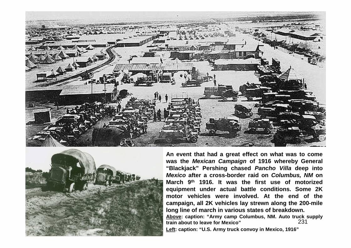
231
An event that had a great effect on what was to comewas the Mexican Campaign of 1916 whereby General“Blackjack” Pershing chased Pancho Villa deep intoMexico after a cross-border raid on Columbus, NM onMarch 9th 1916. It was the first use of motorizedequipment under actual battle conditions. Some 2Kmotor vehicles were involved. At the end of thecampaign, all 2K vehicles lay strewn along the 200-milelong line of march in various states of breakdown.Above: caption: “Army camp Columbus, NM. Auto truck supplytrain about to leave for Mexico”
Left: caption: “U.S. Army truck convoy in Mexico, 1916”
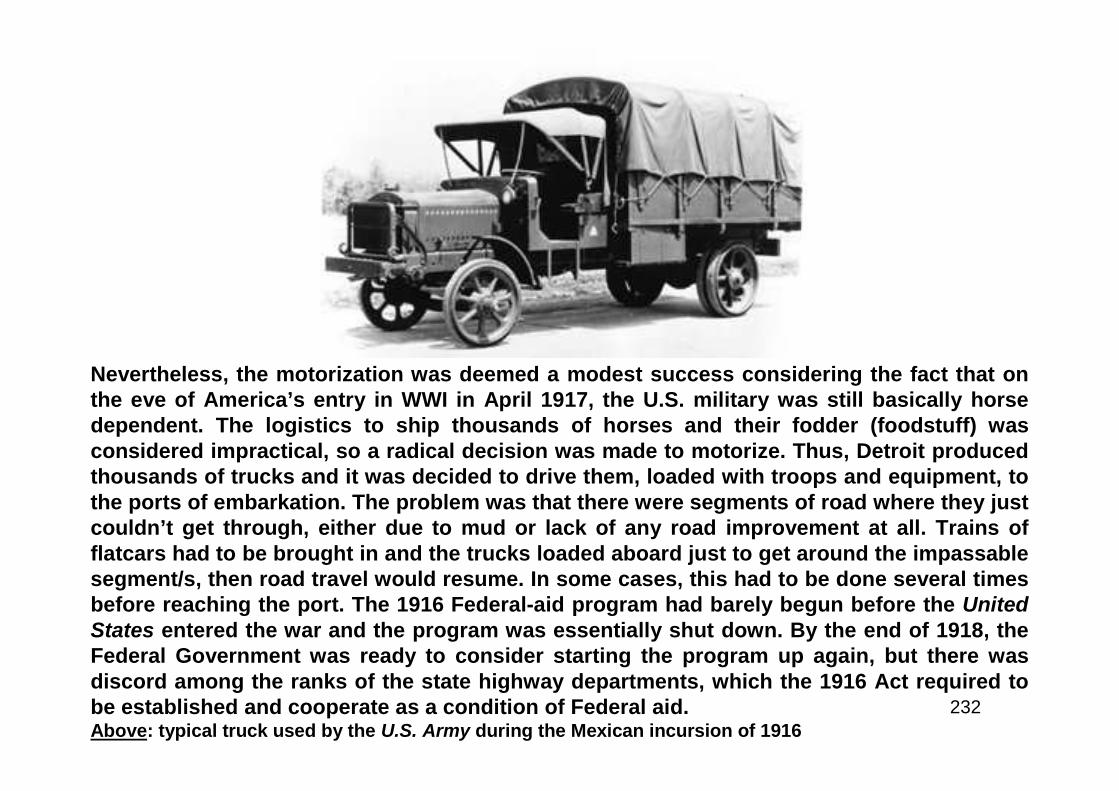
232
Nevertheless, the motorization was deemed a modest success considering the fact that onthe eve of America’s entry in WWI in April 1917, the U.S. military was still basically horsedependent. The logistics to ship thousands of horses and their fodder (foodstuff) wasconsidered impractical, so a radical decision was made to motorize. Thus, Detroit producedthousands of trucks and it was decided to drive them, loaded with troops and equipment, tothe ports of embarkation. The problem was that there were segments of road where they justcouldn’t get through, either due to mud or lack of any road improvement at all. Trains offlatcars had to be brought in and the trucks loaded aboard just to get around the impassablesegment/s, then road travel would resume. In some cases, this had to be done several timesbefore reaching the port. The 1916 Federal-aid program had barely begun before the UnitedStates entered the war and the program was essentially shut down. By the end of 1918, theFederal Government was ready to consider starting the program up again, but there wasdiscord among the ranks of the state highway departments, which the 1916 Act required tobe established and cooperate as a condition of Federal aid.Above: typical truck used by the U.S. Army during the Mexican incursion of 1916
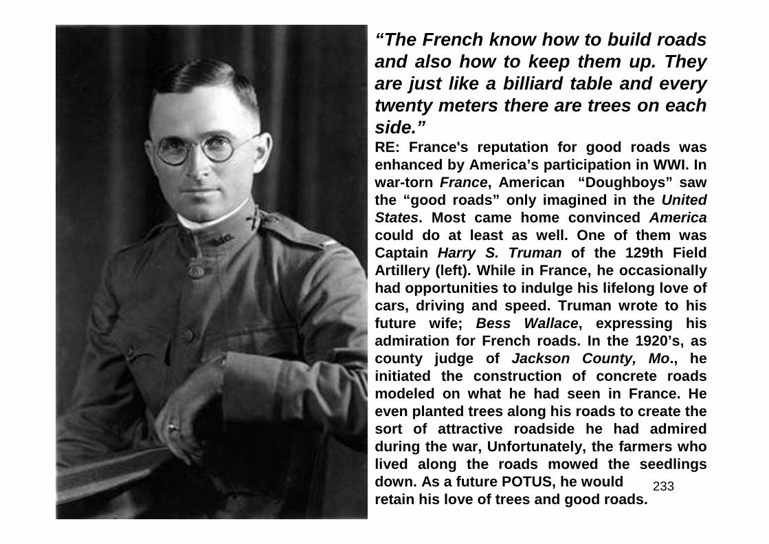
233
“The French know how to build roadsand also how to keep them up. Theyare just like a billiard table and everytwenty meters there are trees on eachside.”RE: France's reputation for good roads wasenhanced by America’s participation in WWI. Inwar-torn France, American “Doughboys” sawthe “good roads” only imagined in the UnitedStates. Most came home convinced Americacould do at least as well. One of them wasCaptain Harry S. Truman of the 129th FieldArtillery (left). While in France, he occasionallyhad opportunities to indulge his lifelong love ofcars, driving and speed. Truman wrote to hisfuture wife; Bess Wallace, expressing hisadmiration for French roads. In the 1920’s, ascounty judge of Jackson County, Mo., heinitiated the construction of concrete roadsmodeled on what he had seen in France. Heeven planted trees along his roads to create thesort of attractive roadside he had admiredduring the war, Unfortunately, the farmers wholived along the roads mowed the seedlingsdown. As a future POTUS, he wouldretain his love of trees and good roads.
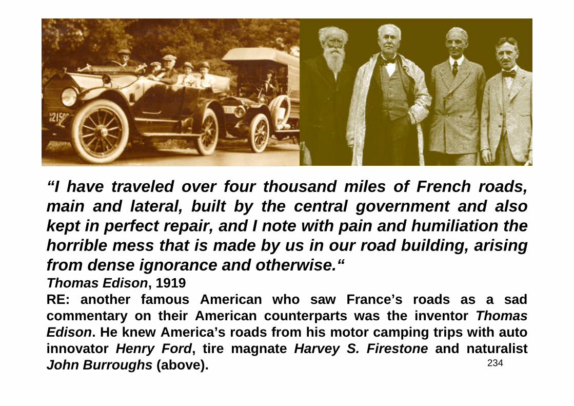
234
“I have traveled over four thousand miles of French roads,main and lateral, built by the central government and alsokept in perfect repair, and I note with pain and humiliation thehorrible mess that is made by us in our road building, arisingfrom dense ignorance and otherwise.“Thomas Edison, 1919RE: another famous American who saw France’s roads as a sadcommentary on their American counterparts was the inventor ThomasEdison. He knew America’s roads from his motor camping trips with autoinnovator Henry Ford, tire magnate Harvey S. Firestone and naturalistJohn Burroughs (above).
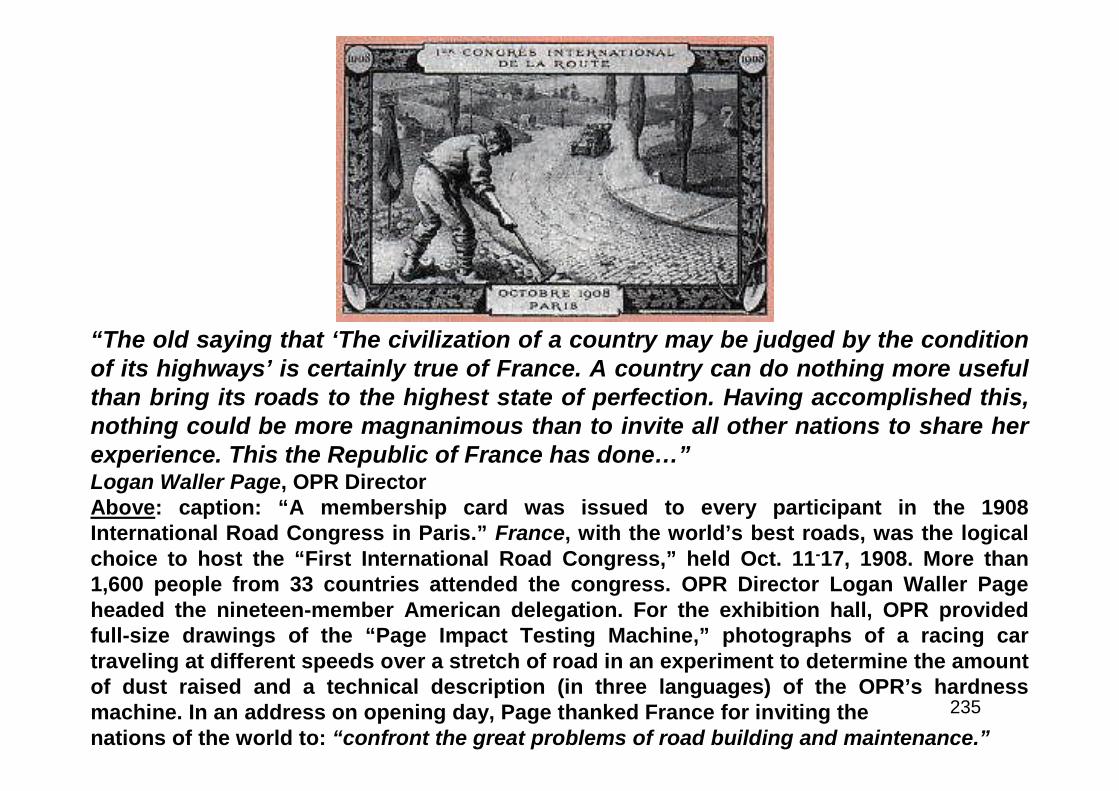
235
“The old saying that ‘The civilization of a country may be judged by the conditionof its highways’ is certainly true of France. A country can do nothing more usefulthan bring its roads to the highest state of perfection. Having accomplished this,nothing could be more magnanimous than to invite all other nations to share herexperience. This the Republic of France has done…”Logan Waller Page, OPR DirectorAbove: caption: “A membership card was issued to every participant in the 1908International Road Congress in Paris.” France, with the world’s best roads, was the logicalchoice to host the “First International Road Congress,” held Oct. 11-17, 1908. More than1,600 people from 33 countries attended the congress. OPR Director Logan Waller Pageheaded the nineteen-member American delegation. For the exhibition hall, OPR providedfull-size drawings of the “Page Impact Testing Machine,” photographs of a racing cartraveling at different speeds over a stretch of road in an experiment to determine the amountof dust raised and a technical description (in three languages) of the OPR’s hardnessmachine. In an address on opening day, Page thanked France for inviting thenations of the world to: “confront the great problems of road building and maintenance.”
236
“…dissention and doubt crept into the Association ranks. Some States still did not have aState Highway Department. They were unable to assume their places at our council table. Anumber of the States which did not have State Highway Departments were not members ofthe Association. The Association had not sold itself to them. Worse yet, the Associationitself began to waver on the principle of Federal-State cooperation conceived by itsfounders and written into the Federal Aid Road Act of 1916. A movement for a limitedmileage system of highly improved highways to be designated, constructed, maintained,operated, and owned by the Federal Government sprouted and grew. This movement foundrecruits and able advocates in our own ranks. We were thus an Association divided againstitself. The Federal-aid principle had not yet had a chance to prove that it could function.There were the inevitable delays, misunderstandings, and friction of the organizing period ofa new and untried plan. The war had intruded and immensely complicated the difficulties.The struggle within the Association went on and became more intense. It was in thisatmosphere that the Association approached its fourth annual convention held in Chicago inDecember of 1918. The war was over. The boys were coming home. The Nation wasbeginning to readjust itself to peace-time pursuits. War transport necessity had thrust thehighway problems into the limelight. It was inevitable that the battle of Federal aid versusNational Highways would come to a show-down at that convention. And it did. On the show-down resolution to endorse the National Highway plan, the convention voted 50-50. It was atie. With the delegation present and voting from every State represented at the convention,we were split exactly even. By that slender margin and with not a single vote to spare, didthis Association cling to its ideal of Federal-State cooperation laid down by its founders…”Fred R. White, Iowa State Highway EngineerRE: recounting post-WWI events (at the annual meeting of the AASHO held in late 1942)
237
“…we must superimpose upon the classification which is now generally recognized, classeswhich we may call, for the lack of better names, interstate or national, and special roads.The national roads would serve interstate business and pleasure travel, and in many casesthe military requirements also. The special class would include roads of distinct militarysignificance which may have little or no commercial value, and certain special recreationalroads. In other words we should have about five classes of roads; the national or interstate,special roads, and the State, county and local roads...We have found by scientific study ofthe character, origin and destination of highway travel that 90 per cent of the traffic whichuses our average highway is of local character. The 10 per cent of the traffic, which innormal times, pushes out beyond local limits, across State lines, and which can therefore beproperly described as national in extent, is due to tourist travel by automobile, and freightand express haulage by motor truck...We must provide the roads for the (interstate) carriers.But it is not necessary to build an especially chosen national system to reach this desiredend. The same result can be obtained, probably in a shorter span of time, under the presentplan of Federal and State cooperation; and the roads we construct under that plan will be solocated as to serve the local as well as the national uses. It seems clear to me that while itmust be our national policy to provide roads to facilitate commerce by motor truck - themodern highway vehicle, a commerce which is national in extent, and which is not limitedby State borders, we can do so by the development of properly articulated local and Statesystems better than by building special long transcontinental highways, across tributaryterritory which for some time may not be able to share in the benefits of the through roadsbecause of a lack of local road development. There is no support for the assumption thatsuch long through roads are required for the purposes of military defense...but in the mainthe highway requirements of war coincide with those of peace...”Thomas H. MacDonald, Director – Bureau of Public RoadsRE: excerpt from a February 1920 address to the American Road Builders Association (ARBA)
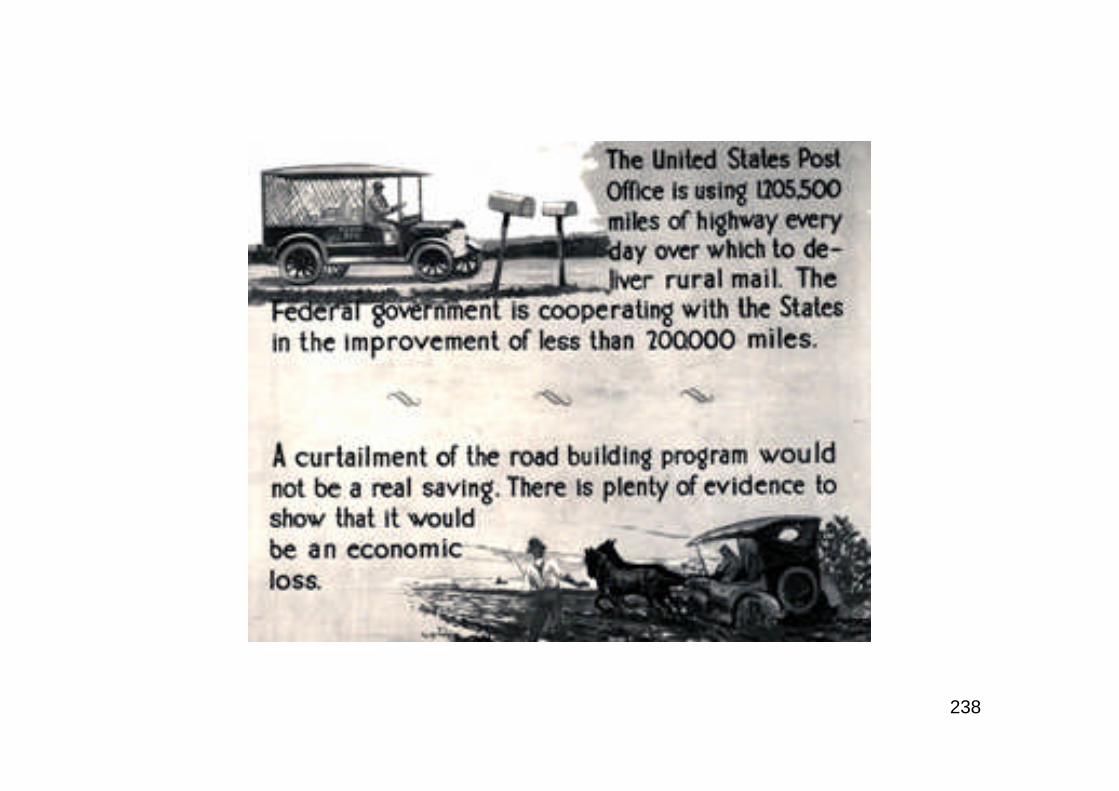
238

239
The Seven Percent System
240
...The Bureau does not seek initiative. It does not seek to direct the States but tocooperate with them. There is now a plan of action for the guidance of bothorganizations that is so clear and so explicit that neither can escape theresponsibilities imposed. The Federal requirements are fairly defined and will besincerely and faithfully enforced…It is going to take a long time to do this work,but we are engaged upon a very large work. One hundred and eighty thousandmiles is probably the minimum mileage that will be required to complete such asystem and it may run as high as 190,000 or 200,000 miles…”Thomas H. MacDonald, Director – Bureau of Public RoadsRE: comments made in late 1921/1922. T.H. MacDonald, Chief Engineer of the Iowa HighwayCommission was the selection to replace Logan Waller Page as Director (later“Commissioner”) of the BPR upon Page’s death. MacDonald defined four classes ofhighway use; Agriculture, Recreational, Commercial and Military. He made the case that itwould be wasteful to build national highways solely for interstate travel. He noted thephenomenal growth of the cities and felt that improved roads would help to keep people onthe farm. As he had done in Iowa, MacDonald advocated a classification system comprising5-7% of all roads. He also felt that ensuring interconnectivity between states was the Federalrole and advocated a higher Federal share for states with large amounts of public lands.MacDonald set out to build the State-Federal partnership which would feature; engineeringprofessionalism, dedicated highway user revenues (at the state level), establishment ofindependent highway commissions, highway research, highway classification, programmingand project development (based on economic principles) and transfer of highwayjurisdiction from counties and townships to the states.
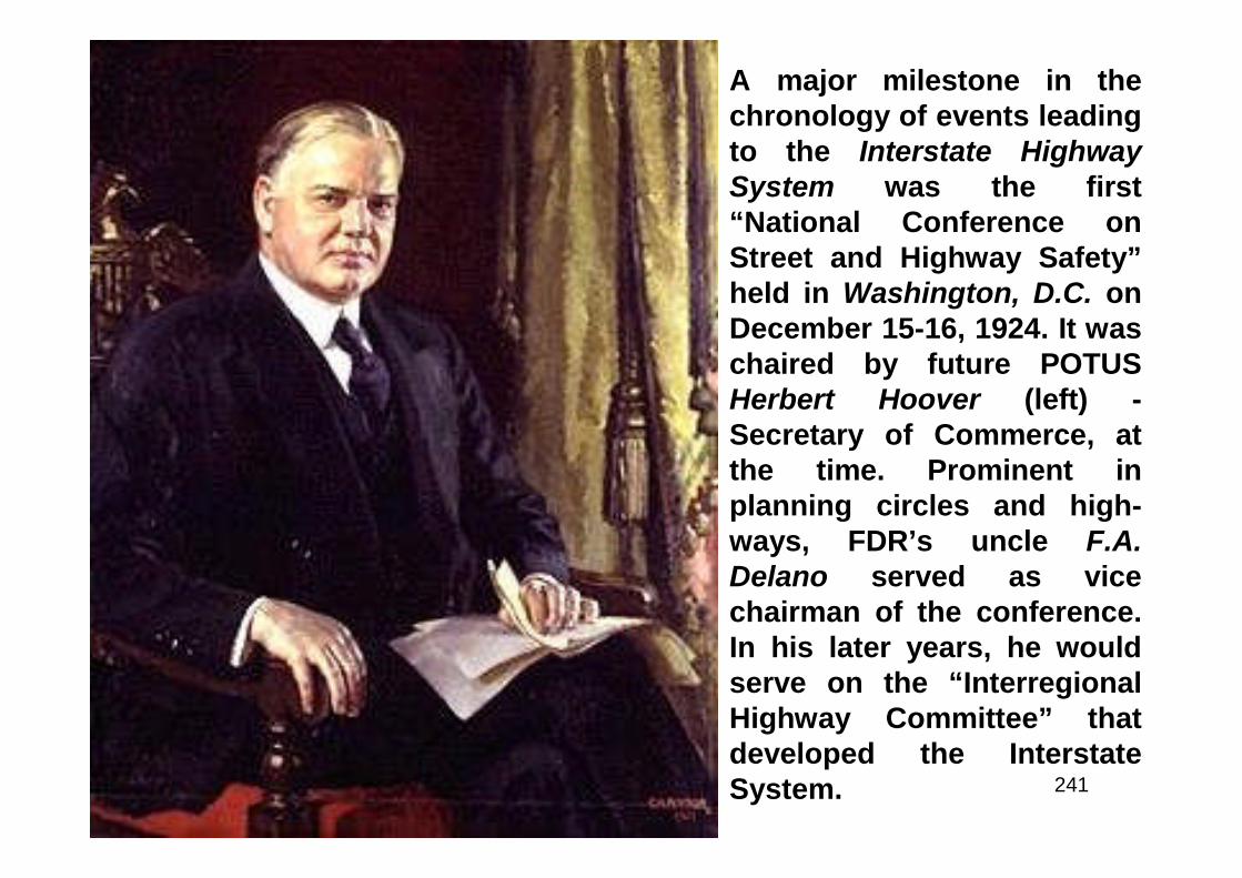
241
A major milestone in thechronology of events leadingto the Interstate HighwaySystem was the first“National Conference onStreet and Highway Safety”held in Washington, D.C. onDecember 15-16, 1924. It waschaired by future POTUSHerbert Hoover (left) -Secretary of Commerce, atthe time. Prominent inplanning circles and high-ways, FDR’s uncle F.A.Delano served as vicechairman of the conference.In his later years, he wouldserve on the “InterregionalHighway Committee” thatdeveloped the InterstateSystem.
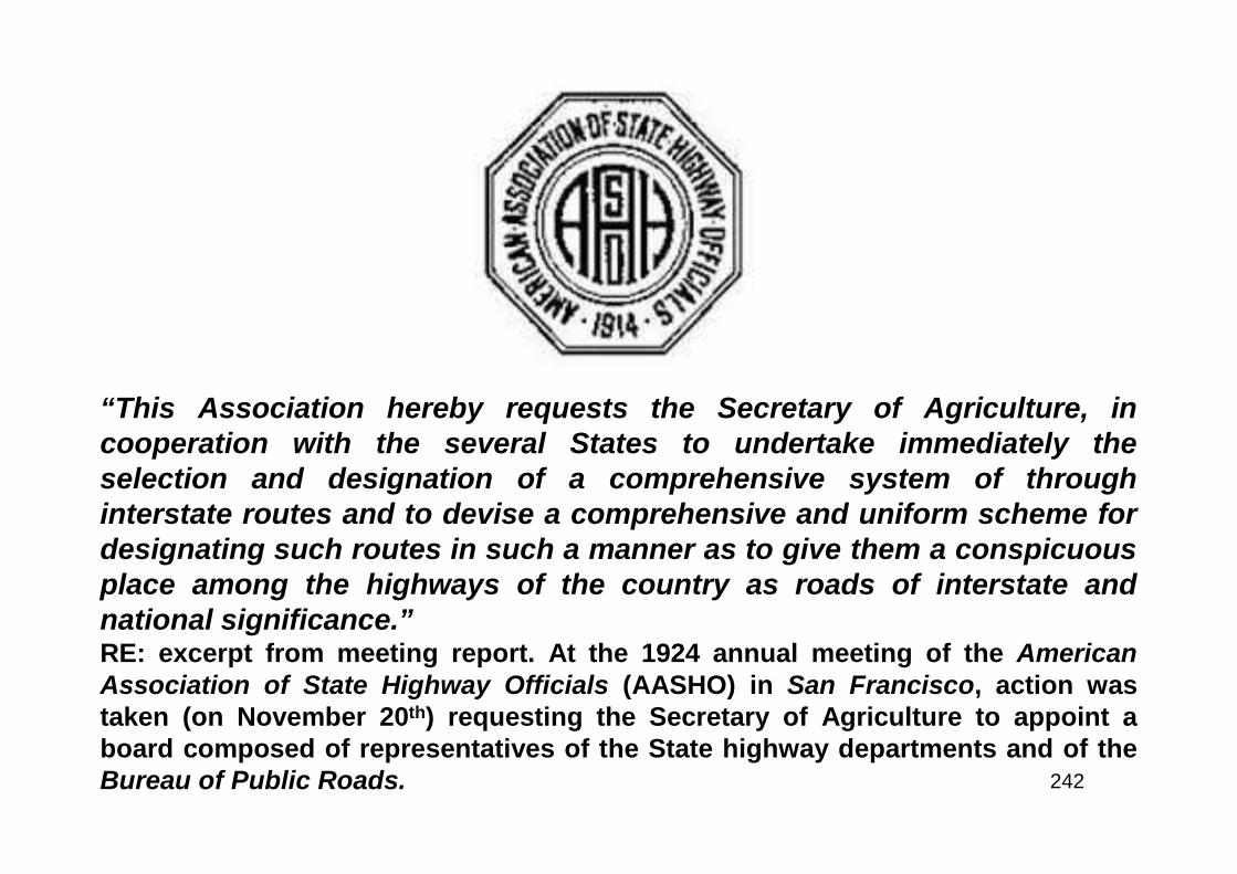
242
“This Association hereby requests the Secretary of Agriculture, incooperation with the several States to undertake immediately theselection and designation of a comprehensive system of throughinterstate routes and to devise a comprehensive and uniform scheme fordesignating such routes in such a manner as to give them a conspicuousplace among the highways of the country as roads of interstate andnational significance.”RE: excerpt from meeting report. At the 1924 annual meeting of the AmericanAssociation of State Highway Officials (AASHO) in San Francisco, action wastaken (on November 20th) requesting the Secretary of Agriculture to appoint aboard composed of representatives of the State highway departments and of theBureau of Public Roads.

243
The Joint Board on Interstate Highways felt that it was legally bound tonot exceed the three-sevenths of the “seven percent system” (establishedin the 1921 Act) as “primary or interstate highways.” The 1921 Federal Acthad required that all Federal aid be spent on a system comprised of not toexceed seven percent of total highway mileage; “Highways which mayreceive Federal aid shall be divided into two classes, one of which shallbe known as primary or interstate highways, and shall not exceed three-sevenths of the total mileage that may receive Federal aid, and the otherwhich shall connect or correlate therewith and be known as secondary orinter-county highways...” In its final deliberations, the Board rec-ommended 2.8 percent of all the highways and roads in the nation benumbered as “Interstate Highways.” At its April 20th 1925 meeting, theJoint Board, among other things, passed the following resolution: “3. Theselection of approximately 1 percent or less of the total highway mileageof the State as of greatest importance; of a second 1 percentapproximately as of secondary importance; and a third 1 percentapproximately as of tertiary importance; and that these suggestedpercentages be increased in sparsely settled States.” It’s interesting tonote that the present-day Interstate Highway System representsapproximately 1% of total national highway mileage.
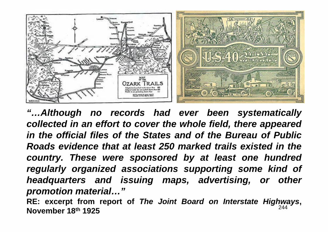
244
“…Although no records had ever been systematicallycollected in an effort to cover the whole field, there appearedin the official files of the States and of the Bureau of PublicRoads evidence that at least 250 marked trails existed in thecountry. These were sponsored by at least one hundredregularly organized associations supporting some kind ofheadquarters and issuing maps, advertising, or otherpromotion material…”RE: excerpt from report of The Joint Board on Interstate Highways,November 18th 1925
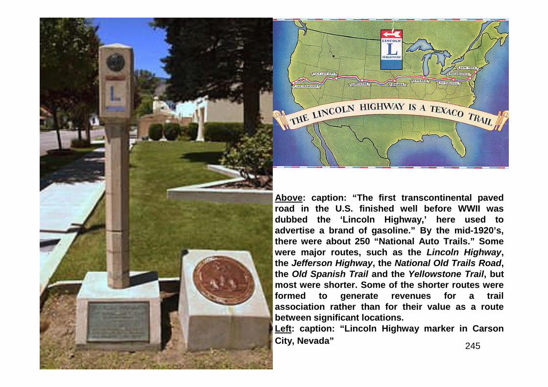
245
Above: caption: “The first transcontinental pavedroad in the U.S. finished well before WWII wasdubbed the ‘Lincoln Highway,’ here used toadvertise a brand of gasoline.” By the mid-1920’s,there were about 250 “National Auto Trails.” Somewere major routes, such as the Lincoln Highway,the Jefferson Highway, the National Old Trails Road,the Old Spanish Trail and the Yellowstone Trail, butmost were shorter. Some of the shorter routes wereformed to generate revenues for a trailassociation rather than for their value as a routebetween significant locations.Left: caption: “Lincoln Highway marker in Carson
City, Nevada”
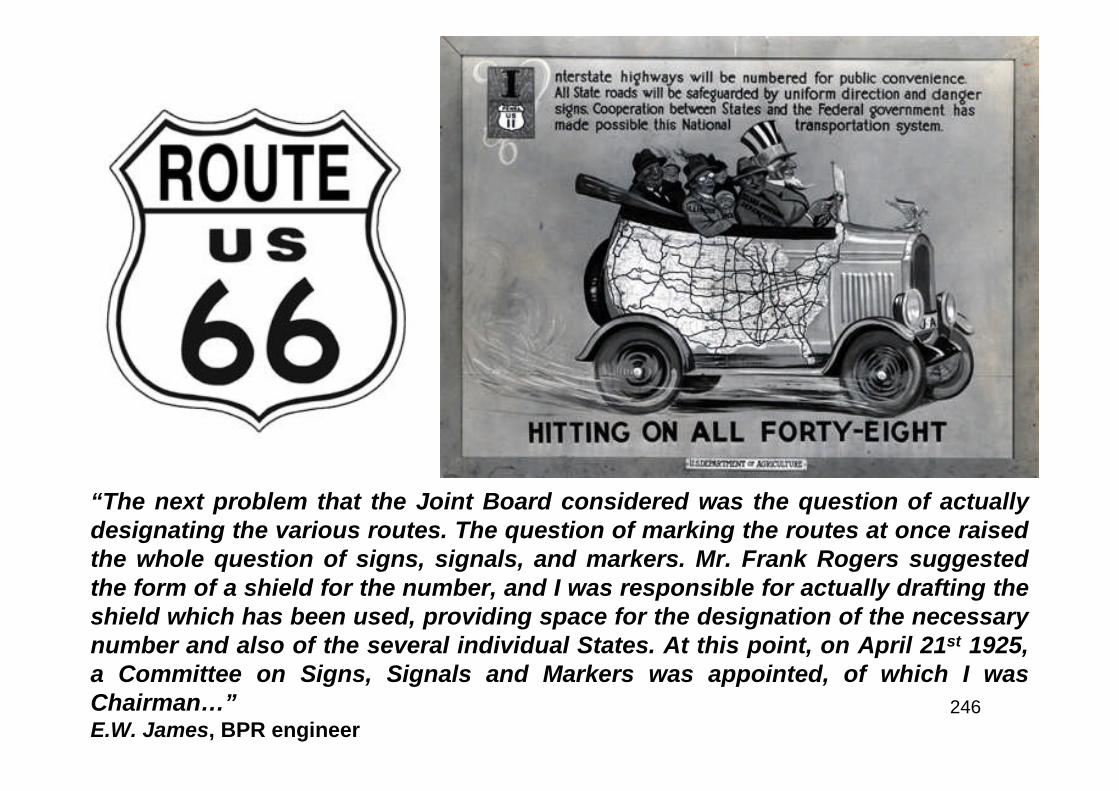
246
“The next problem that the Joint Board considered was the question of actuallydesignating the various routes. The question of marking the routes at once raisedthe whole question of signs, signals, and markers. Mr. Frank Rogers suggestedthe form of a shield for the number, and I was responsible for actually drafting theshield which has been used, providing space for the designation of the necessarynumber and also of the several individual States. At this point, on April 21st 1925,a Committee on Signs, Signals and Markers was appointed, of which I wasChairman…”E.W. James, BPR engineer
247
The period of the mid-to-late 1920’s was characterized by phenomenalgrowth of automobiles and their use which provided an ever growingbase of user revenues for the states. “Completion” was the goal, whichmeant providing a “permanent” improvement to each component of theFederal-aid system. The system was improved from the top-down withmajor roads receiving primary attention. The first coast-to-coast routewas completed in late 1927. By 1930, completion was nearly achieved.Cooperative “Transport Surveys” were done with several states gatheringdata for the classification of roads and as research tools. These becamesuccessively more sophisticated with the “origin and destination”concept developed. Two urban studies were done, the first was in CookCounty (Chicago) while the second was done in Cuyahoga County(Cleveland). With the stock market crash in October 1929 and the settlingin of the Great Depression, the first impacts were felt at the state levelwhen legislatures, being pressed for resources, began to divert highway-user revenues to other uses. In November 1929, POTUS Herbert Hoovercalled for an extensive program of public works. In April 1930, Congressincreased Federal authorizations by 66%. By December 1930, Congresshad allocated $80 million to Federal-aid roads. It was expected that thewhole program, including states’ money, would provide employment for100K men.
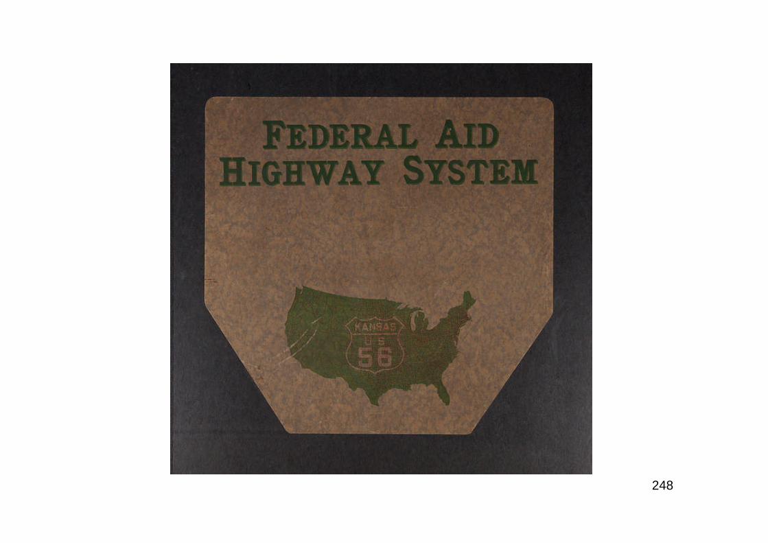
248
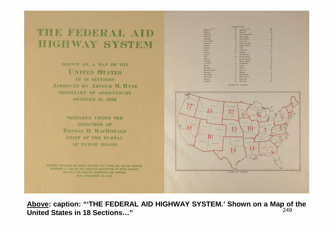
249Above: caption: “‘THE FEDERAL AID HIGHWAY SYSTEM.’ Shown on a Map of theUnited States in 18 Sections…”
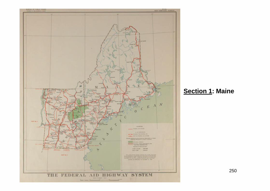
250
Section 1: Maine
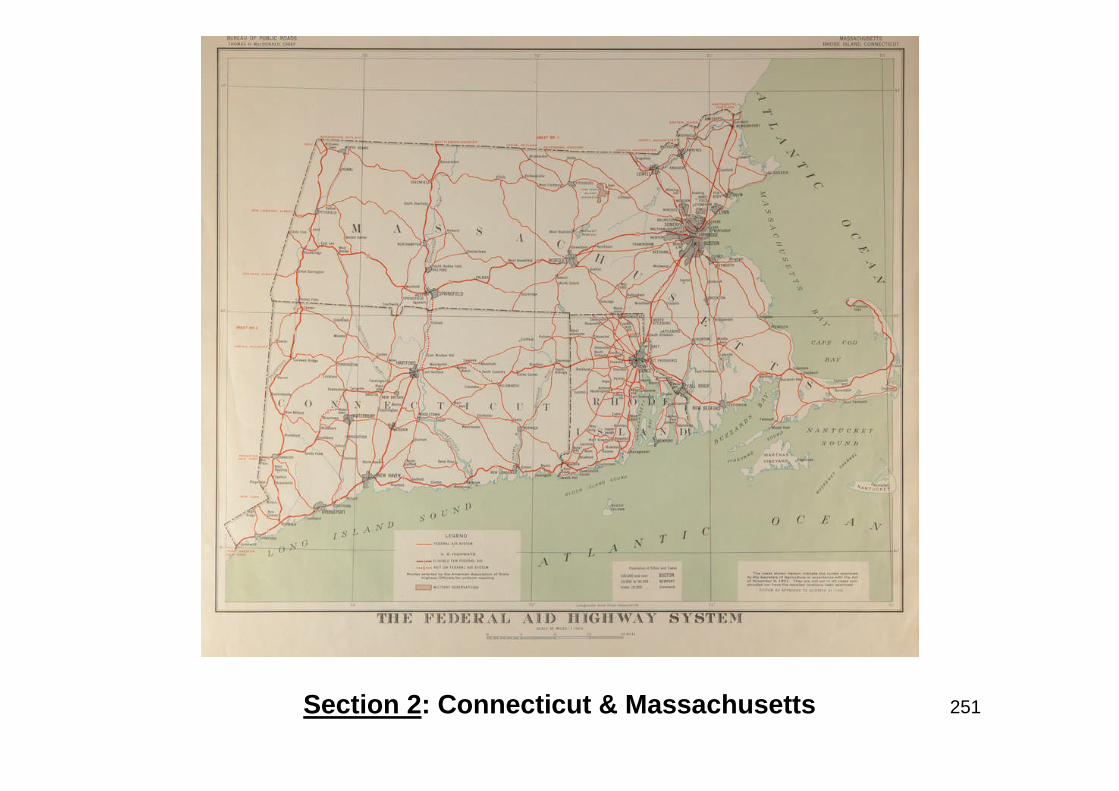
251Section 2: Connecticut & Massachusetts

252
Section 3: NewYork State, LongIsland, New Jersey& Pennsylvania
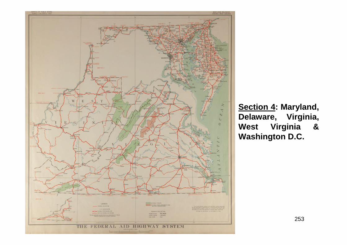
253
Section 4: Maryland,Delaware, Virginia,West Virginia &Washington D.C.
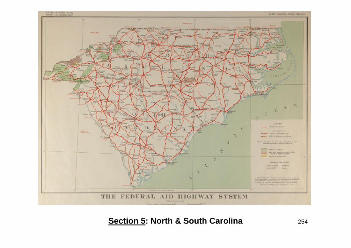
254Section 5: North & South Carolina
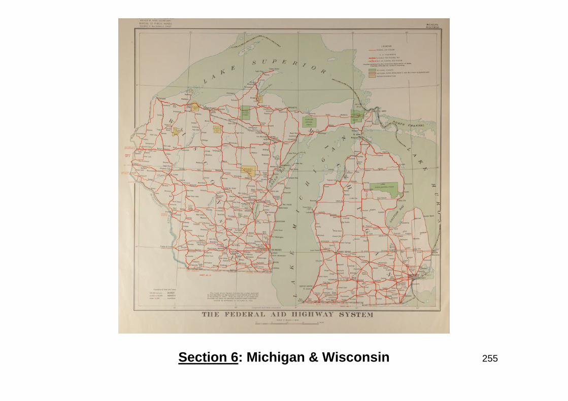
255Section 6: Michigan & Wisconsin
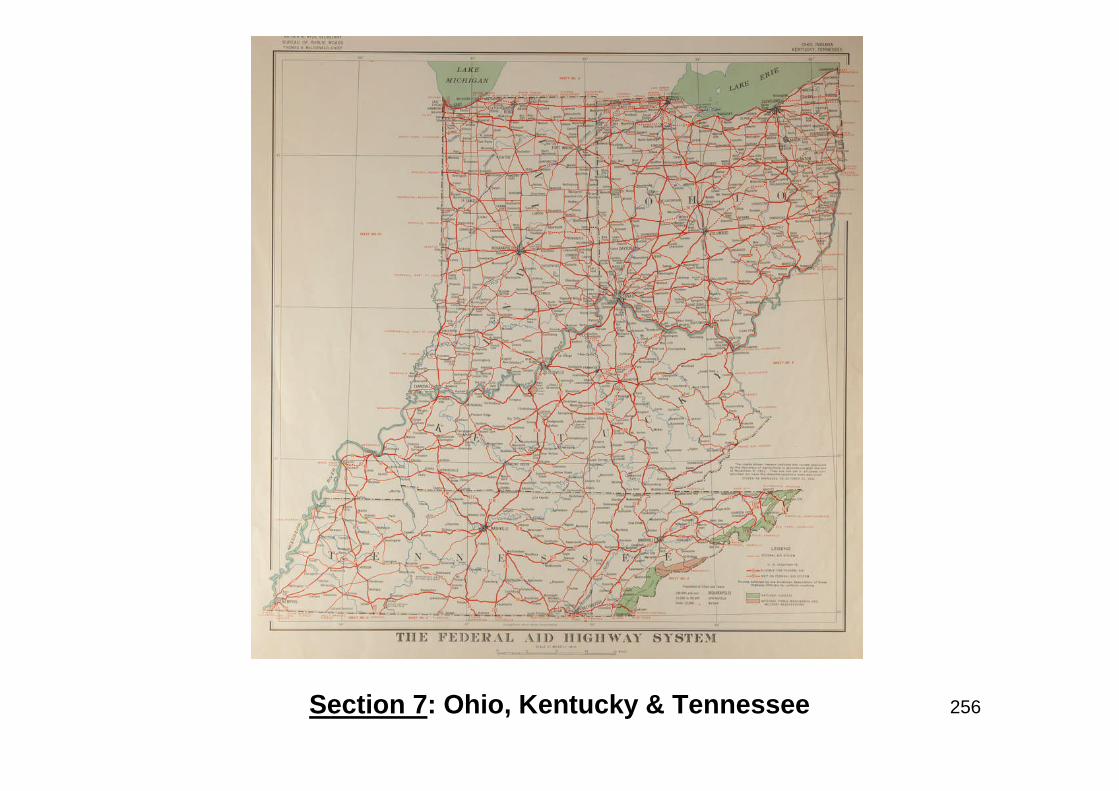
256Section 7: Ohio, Kentucky & Tennessee
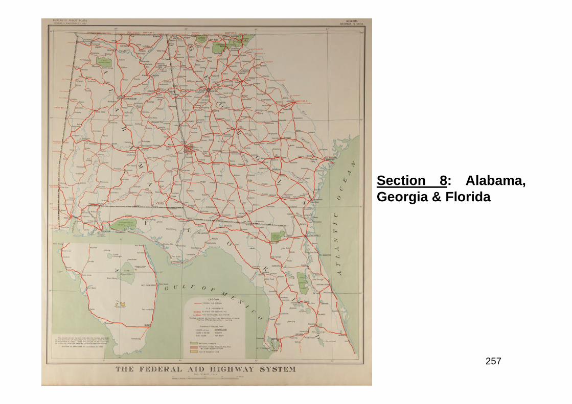
257
Section 8: Alabama,Georgia & Florida
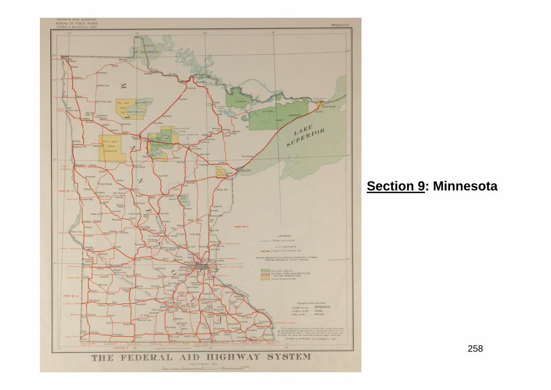
258
Section 9: Minnesota
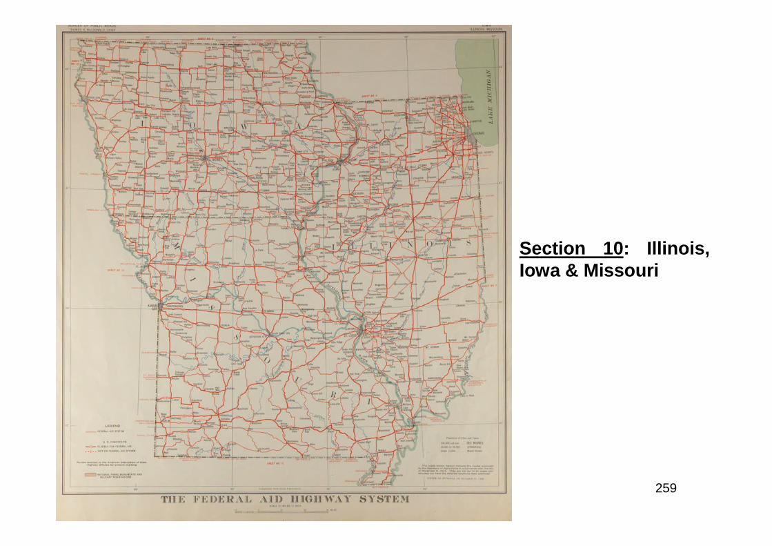
259
Section 10: Illinois,Iowa & Missouri
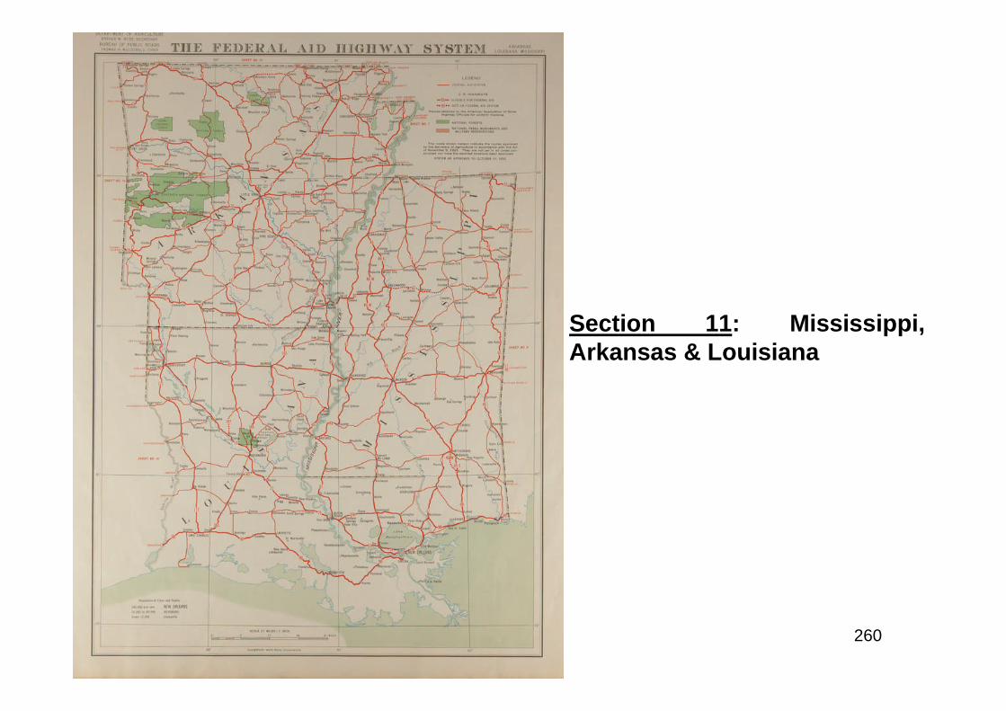
260
Section 11: Mississippi,Arkansas & Louisiana
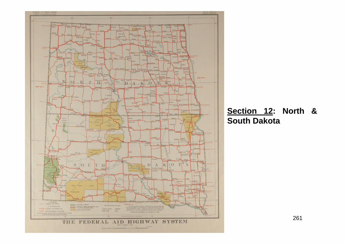
261
Section 12: North &South Dakota
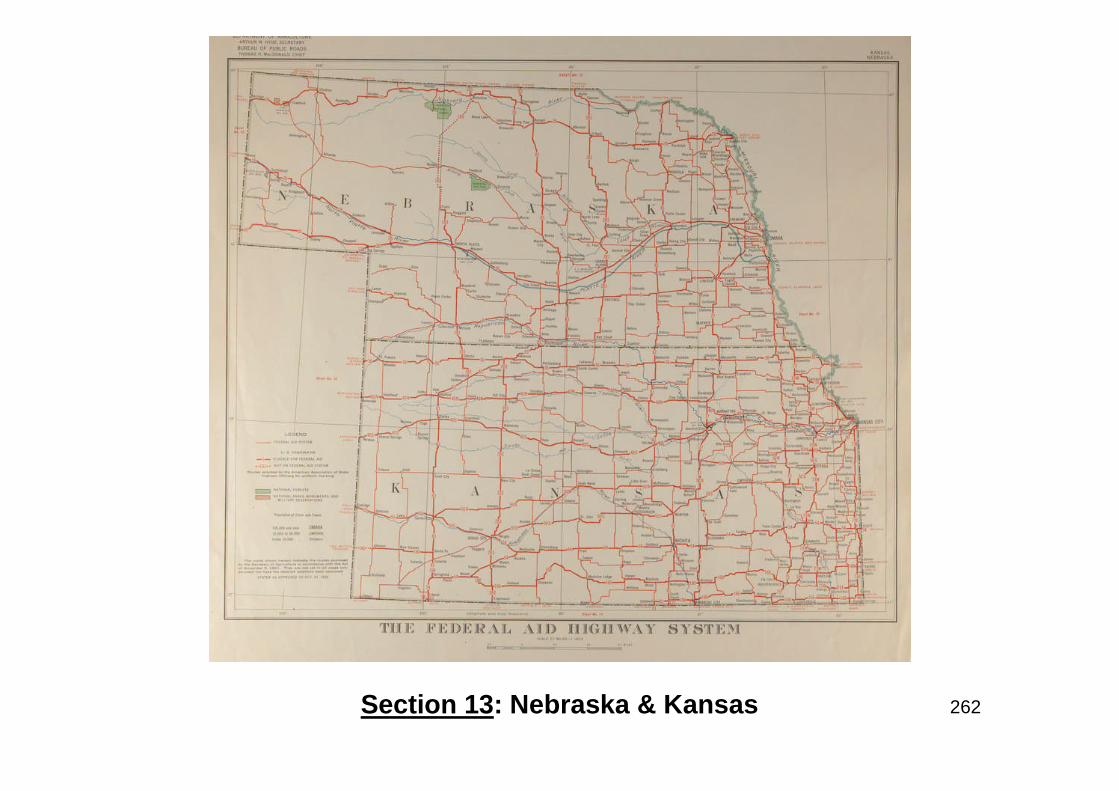
262Section 13: Nebraska & Kansas
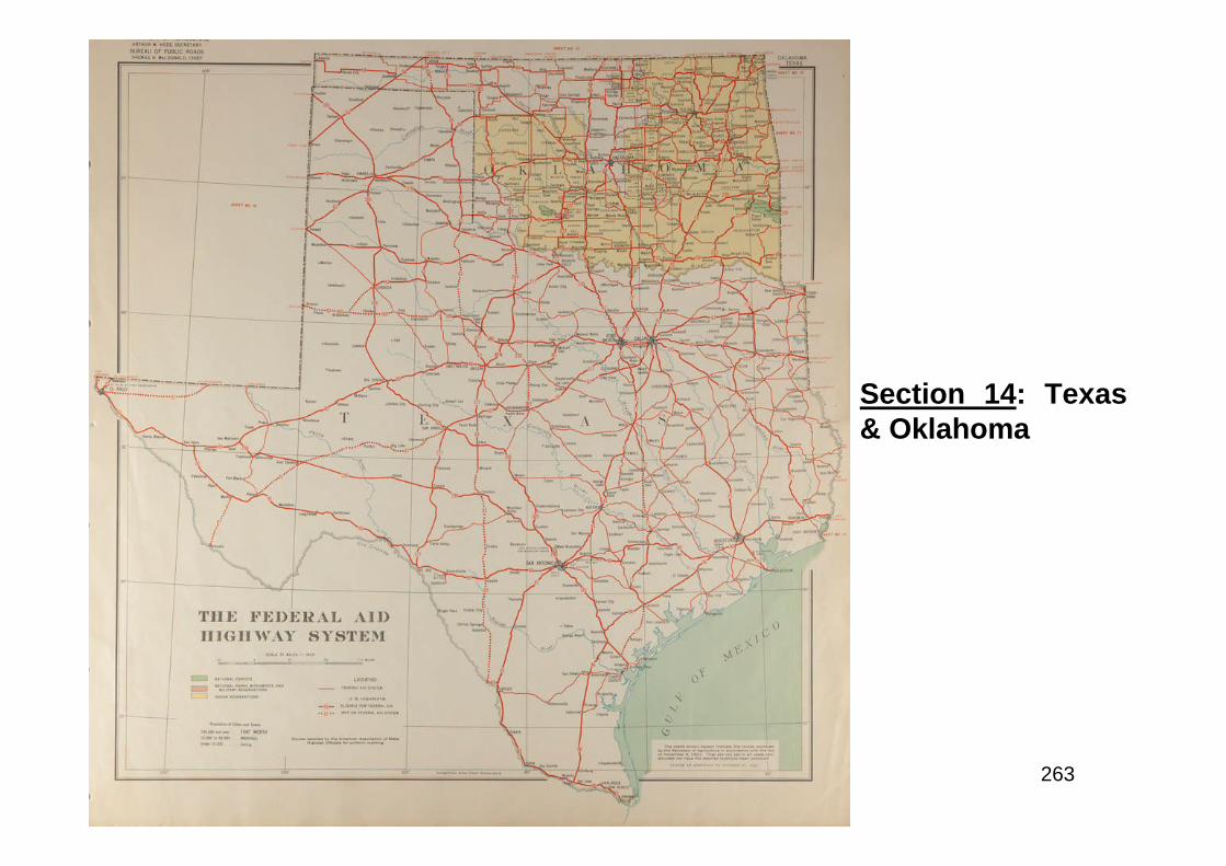
263
Section 14: Texas& Oklahoma
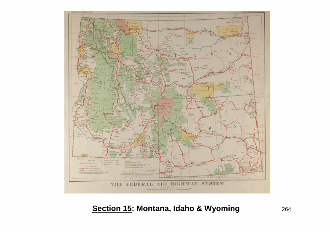
264Section 15: Montana, Idaho & Wyoming
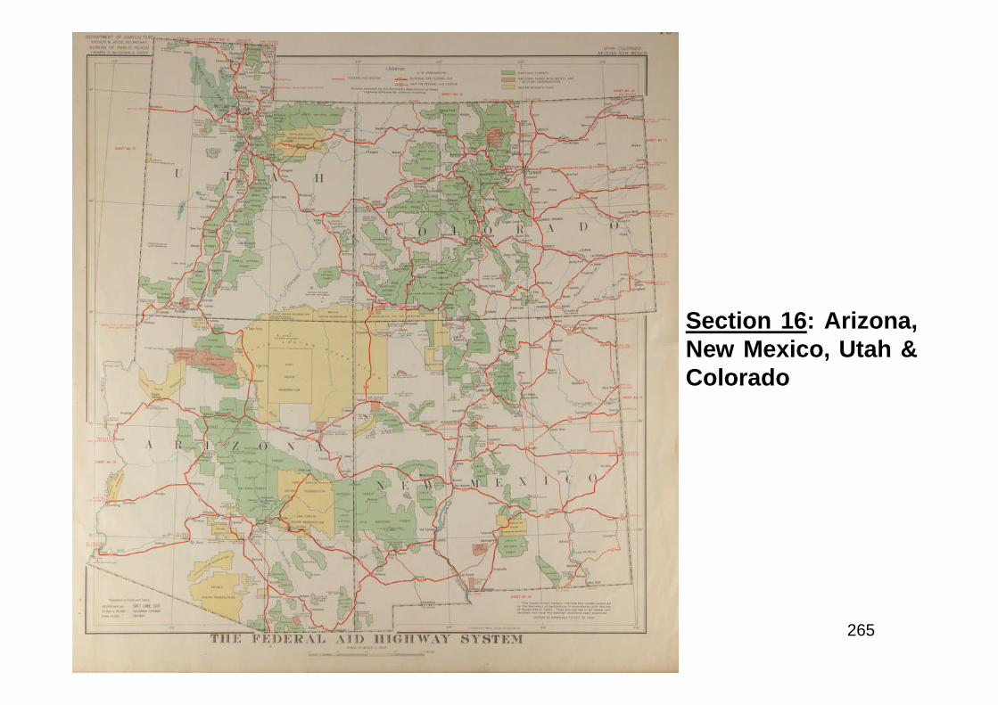
265
Section 16: Arizona,New Mexico, Utah &Colorado
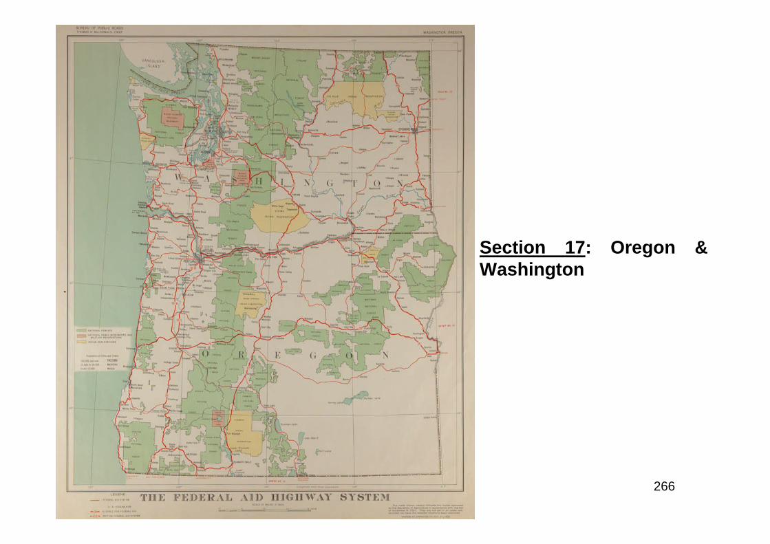
266
Section 17: Oregon &Washington
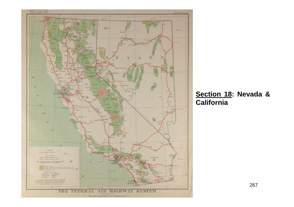
267
Section 18: Nevada &California
268
“The State Highway Officials are greatly concerned that no provision hasbeen made by the Federal Government for the continuance of the highwaypolicy of cooperation between the States and the Federal Governmentthat was adopted in 1916 and has been in continuous effect now for 17years. Neither has any provision been made for continuing the work onpublic roads through the national forests, parks and other public lands.Each Congress since 1916 has provided for the continuance of theFederal aid program for a two-year period until the Congress which hasjust adjourned which provided no such legislation…The position of theState Highway Officials is further jeopardized at this time by the very largediversion of revenues from the gas taxes and license fees, heretoforedevoted to roads, which have been commandeered for other purposes.One of the potent arguments advanced for these diversions in manyStates has been the fact that no Federal aid legislation had been providedto insure the continuance of the cooperative program…The withdrawal ofthe Federal Government definitely from this field, even temporarily, willmean a further diversion of the funds coming from the gas tax and motorvehicle license fees to other than road purposes…”American Highways, April 1933

269
Make Work

270
“...In determining this important question of public policy - the place of roadbuilding as an agency of employment during the depression - we must not losesight of the central fact that it is imperative for the future of our Americancivilization to replace the dole with work, and that of all the means of providingwork (other than the normal upward swing of the business cycle, which putsworkers back on their normal jobs), road building is from almost every standpointthe most satisfactory…In addition, there is the possibility so often discussed, ofconstructing a series of national super-highways, from east to west and north tosouth, perhaps with separate lanes for high-speed traffic and heavy slow-movingtrucks…”Grover C. Dillman, Michigan State Highway Commissioner (January 1933)
Above: caption: “In 1930, an American road crew builds a concrete highway. Notice
the use of horse power.”
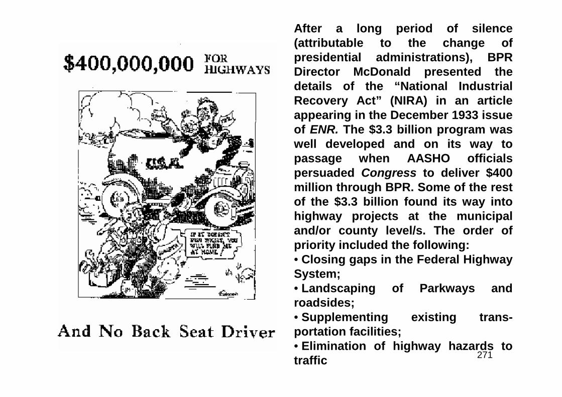
271
After a long period of silence(attributable to the change ofpresidential administrations), BPRDirector McDonald presented thedetails of the “National IndustrialRecovery Act” (NIRA) in an articleappearing in the December 1933 issueof ENR. The $3.3 billion program waswell developed and on its way topassage when AASHO officialspersuaded Congress to deliver $400million through BPR. Some of the restof the $3.3 billion found its way intohighway projects at the municipaland/or county level/s. The order ofpriority included the following:• Closing gaps in the Federal HighwaySystem;• Landscaping of Parkways androadsides;• Supplementing existing trans-portation facilities;• Elimination of highway hazards totraffic
272
In January 1934, BPR Director MacDonald presented statistics to a conference ofthe American Road-Builders’ Association (ARBA) to show that the NIRA programhad begun building the equivalent of three transcontinental highways in theperiod extending from July 1933 to January 1934, creating 132K jobs in theprocess. However, the results of the emergency program were devastating tostate highway departments. The 100% Federal share of funds accelerated thediversion of state highway-user revenues because, as the state legislatures saw it,the highway departments had no need of state revenues since they had moreFederal money than ever before and no need for matching funds. Vast mileages ofminor roads were transferred to state jurisdiction without any revenue to go withthem because that’s where the 100% Federal money was allocated and taxrevenues were drying up. The emphasis on labor intensive projects on minorroads completely inverted the economic efficiency that had prevailed in the pre-depression days of the Federal-aid highway program. Thus, the main coast-to-coast routes suffered at the expense of minor projects. The funds, although theygenerated employment, did not provide nearly as much as if the regular Federal-aid (50-50) matching program had been in place. This dilemma would lead to thepassage of the Hayden-Cartwright Act in 1934 which provided for a return to theregular program in 1936. A specific section of the Hayden-Cartwright Act wouldprohibit rampant diversion of Federal highway funds by the states.
273
“…The most striking trend indicated by the figures is the drop in employment onindependent State construction. In this connection it is to be noted that thedecline in State contribution to construction has been even greater than theseemployment figures would suggest, on account of the fact that in 1931 the Statesbore the expense of a considerable portion of the employment attributed toFederal and Federal-aid work whereas in the succeeding years they havecontributed in progressively smaller percentage. The transfer of State supportfrom construction to maintenance work as Federal funds have been supplied tocarry the construction cost is also one of the notable indications of thisemployment record. But the salient point is the evidence that the additionalprovision made for highways during the period by the Federal Government hasbeen offset by withdrawal of support by the States. It is important that these factsbe generally understood at this time because the Federal Government has givennotice in the Hayden-Cartwright Act of its intention hereafter to return to theFederal-aid plan of contribution to road work. That plan will substitute for thedirect grants of the recent past, a shared expenditure, which will impose upon theStates an equal obligation. The contemplated Federal contribution will beconsiderably less than those of the past year or two. Therefore, if a materialreduction of the highway program is to be avoided it will be necessary that theStates return to the work at least the measure of support they recently havewithdrawn from it. In the light of the figures presented in the employment tables,the wisdom of the provision of the Hayden-Cartwright Act that seeks to haltfurther diversion of motor vehicle revenues from road work is apparent.”Contractors and Engineers Monthly, December 1934
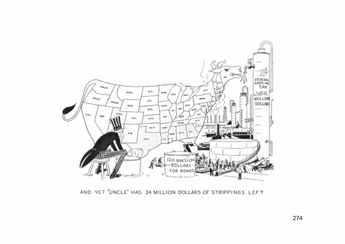
274
275
“…The traveler by highway may yet see highwaydevelopments that will be conceived on an interstate or anational basis. Such development is indicated along intercityroads where population density and traffic point to thenecessity of a moderate program of new highways orparkways caring for recreational travel of a character nowdenied to the traveler upon our most heavily traveledroads…”T.H. MacDonald, BPR Director (August 1935)
RE: during the depression years of the mid-1930’s, the movementadvocating the building of “Superhighways” was in its heyday. Thebuilding of roads through state highway departments simply did notcreate the public perception that the Federal Government was doing all itcould to relieve the chronic unemployment still prevalent. No less a figurethan FDR himself came to believe this. Despite the long list of initiativesof the Roosevelt Administration, the unemployment rate never went below17% until 1939 when armament production began to stimulate the nationaleconomy.
276
“Proposals for a new form of empire building - a network ofsuperhighways have been seriously considered by President Roosevelt inconnection with the $4,880,000,000 works program, it was reportedyesterday. The President, it was learned, has discussed withcongressional advisers the possibility of using a substantial portion ofthe works fund, now awaiting Senate passage, to link the country’sinternational boundaries with smooth, arrow-straight four-lanethoroughfares. Tentative plans call for three of the master roadsconnecting the Atlantic and Pacific coasts and two others stretching fromCanada to Florida and Mexico. Nearly every State would be crossed byone of the roadways in this vast mosaic pattern…President Rooseveltdisplayed what friends described as ‘uncanny knowledge’ of Americangeography in discussing the new traffic arteries. Outlining a suggestedsouthern route, he glanced slyly across his desk at Vice President Garnerand quipped; ‘We’ll have to cut this highway short because Texas isimpenetrable.’ One of the President’s advisers got the impression theright-of-way would be half-a-mile wide. When the plan was in anembryonic stage last fall, however, Secretary Ickes fixed the width at1,000 feet and suggested the roads should be landscaped until they werethe most beautiful in the world...”The Washington Post, February 20th 1935
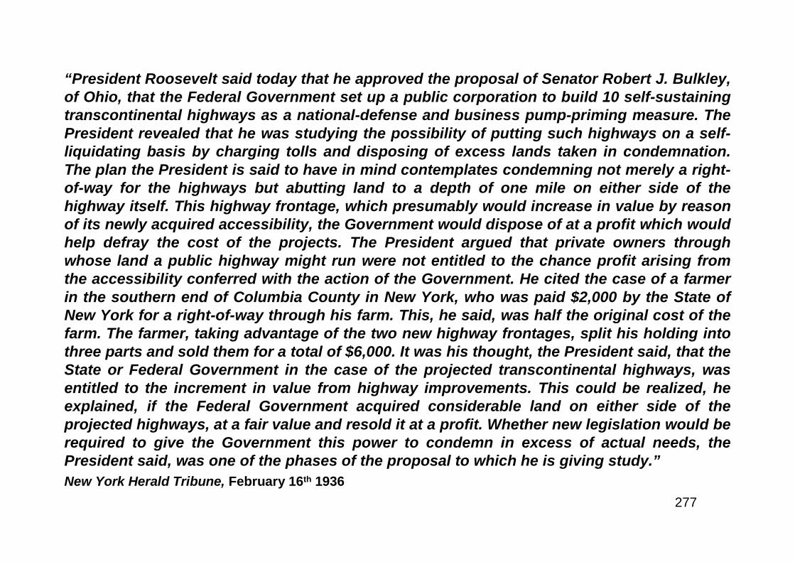
277
“President Roosevelt said today that he approved the proposal of Senator Robert J. Bulkley,of Ohio, that the Federal Government set up a public corporation to build 10 self-sustainingtranscontinental highways as a national-defense and business pump-priming measure. ThePresident revealed that he was studying the possibility of putting such highways on a self-liquidating basis by charging tolls and disposing of excess lands taken in condemnation.The plan the President is said to have in mind contemplates condemning not merely a right-of-way for the highways but abutting land to a depth of one mile on either side of thehighway itself. This highway frontage, which presumably would increase in value by reasonof its newly acquired accessibility, the Government would dispose of at a profit which wouldhelp defray the cost of the projects. The President argued that private owners throughwhose land a public highway might run were not entitled to the chance profit arising fromthe accessibility conferred with the action of the Government. He cited the case of a farmerin the southern end of Columbia County in New York, who was paid $2,000 by the State ofNew York for a right-of-way through his farm. This, he said, was half the original cost of thefarm. The farmer, taking advantage of the two new highway frontages, split his holding intothree parts and sold them for a total of $6,000. It was his thought, the President said, that theState or Federal Government in the case of the projected transcontinental highways, wasentitled to the increment in value from highway improvements. This could be realized, heexplained, if the Federal Government acquired considerable land on either side of theprojected highways, at a fair value and resold it at a profit. Whether new legislation would berequired to give the Government this power to condemn in excess of actual needs, thePresident said, was one of the phases of the proposal to which he is giving study.”
New York Herald Tribune, February 16th 1936
278
The Urbanism Committee
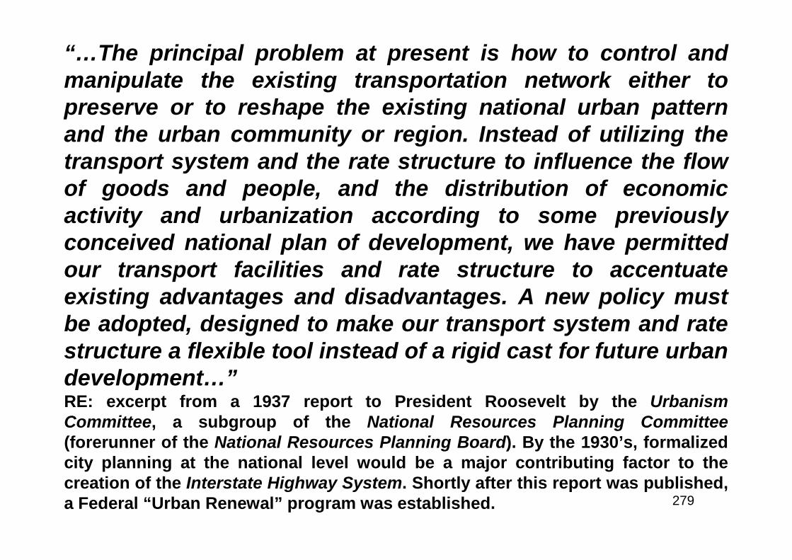
279
“…The principal problem at present is how to control andmanipulate the existing transportation network either topreserve or to reshape the existing national urban patternand the urban community or region. Instead of utilizing thetransport system and the rate structure to influence the flowof goods and people, and the distribution of economicactivity and urbanization according to some previouslyconceived national plan of development, we have permittedour transport facilities and rate structure to accentuateexisting advantages and disadvantages. A new policy mustbe adopted, designed to make our transport system and ratestructure a flexible tool instead of a rigid cast for future urbandevelopment…”RE: excerpt from a 1937 report to President Roosevelt by the UrbanismCommittee, a subgroup of the National Resources Planning Committee(forerunner of the National Resources Planning Board). By the 1930’s, formalizedcity planning at the national level would be a major contributing factor to thecreation of the Interstate Highway System. Shortly after this report was published,a Federal “Urban Renewal” program was established.
280
President Roosevelt was a strong advocate of Federally constructednational coast-to-coast highways and was quoted widely in the press anddiscussed such a proposal on more than one occasion with selectedgroups of Congressmen. No less than fourteen bills to build such asystem were introduced with at least two sponsored directly by theadministration. In parallel, there was a growing concern for the conditionof the cities. The migration from rural to urban had reached alarmingproportions by the mid-thirties. It was the wisdom of the times that therural environment was wholesome and that the cities were moralwastelands. Thus, decay of central cities was becoming endemic. FDRestablished the National Resources Planning Committee (NRPC) to studynational problems and the Urbanism Committee (UC) to look into theurban problem. “Our Cities” (published in 1937) dwelt heavily on cityplanning as the way to solutions and the use of highways as a tool forchange since it envisioned the public rebuilding (a.k.a. “Urban Renewal”)of blighted areas. Congress ordered BPR to study the national toll roadproblem in 1938 as a reaction to all of the pressure for legislation. BPRprepared a comprehensive response using for the first time the resultsfrom the planning survey studies.
281
A Fantasy in Concrete
282
“…I was in Germany this summer and when I think of super-highways, I think of Germany,for, regardless of what we think of him as a man, we must give Fuehrer Hitler credit forbuilding a system of super-highways in his country which are second to none in the worldtoday. It is undoubtedly true that the construction of these highways was prompted by thesame motives which are behind Germany’s huge expenditures for armament and for thebuilding up of her army to the limit of her manpower. The super-highways will become veryimportant assets to that nation in the event of another war in Europe. In the meantime,however, they are providing the German people with innumerable peacetime commercial,industrial, social and cultural benefits. I think that the United States should have a highwaysystem second to none. Our highway engineers such as Thomas H. MacDonald and CharlesM. Upham have long served as teachers to road builders in other parts of the world. Thesafety features which are built into the German super-highways are, in fact, those whichhave long been recommended by American engineers. The world’s best and most efficientroad-building machinery and materials are manufactured in the United States. Our financialstructure is certainly superior. It is , therefore, not an idle boast for us to say that we can dobetter anything that Germany can do well. However, I do not advocate that we startimmediately to construct a super-highway system like that in Germany. It would take manyyears to build a complete system which would link the entire country and cost billions butwe can begin now to design and lay out this system and to construct super-highways inthose areas where traffic is heavy and congested. In this way we will be able to attain, in thenext decade or so, the beginnings of a system of highways and super-highways which willbe adequate for the needs of our country.”Representative Wilburn Cartwright, Chairman of the House Committee on RoadsRE: excerpt from a speech to the annual meeting of the AASHO in December 1938
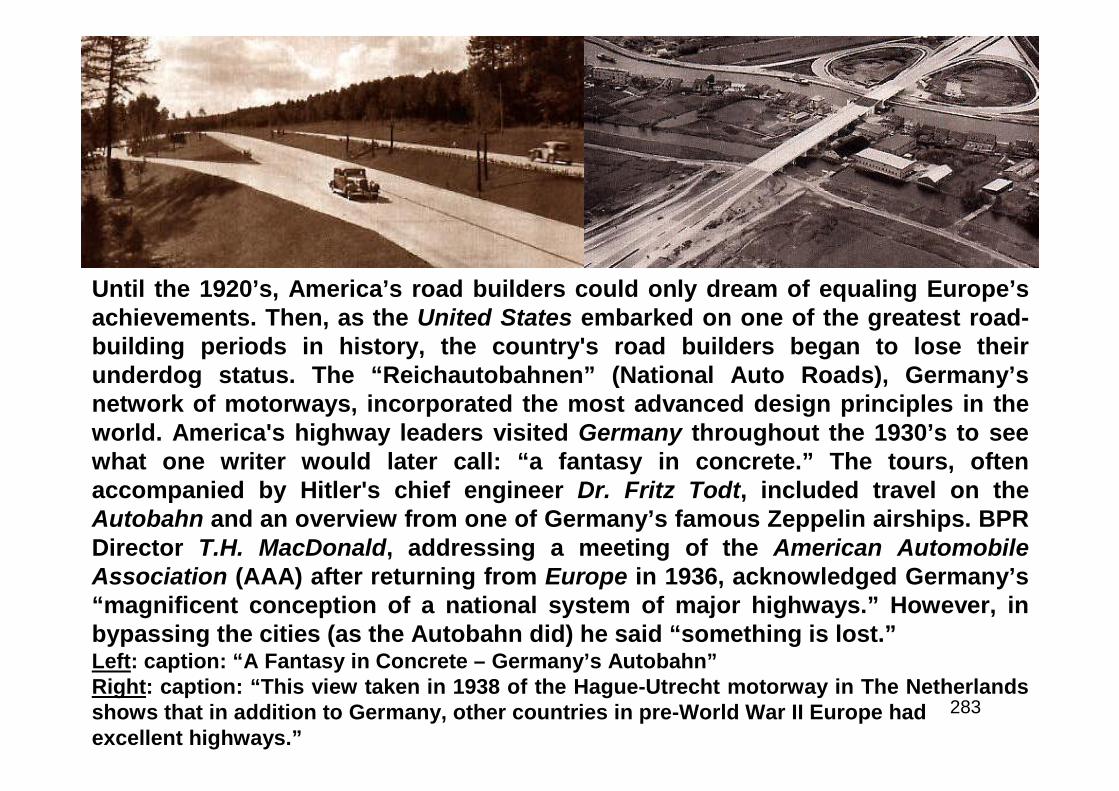
283
Until the 1920’s, America’s road builders could only dream of equaling Europe’sachievements. Then, as the United States embarked on one of the greatest road-building periods in history, the country's road builders began to lose theirunderdog status. The “Reichautobahnen” (National Auto Roads), Germany’snetwork of motorways, incorporated the most advanced design principles in theworld. America's highway leaders visited Germany throughout the 1930’s to seewhat one writer would later call: “a fantasy in concrete.” The tours, oftenaccompanied by Hitler's chief engineer Dr. Fritz Todt, included travel on theAutobahn and an overview from one of Germany’s famous Zeppelin airships. BPRDirector T.H. MacDonald, addressing a meeting of the American AutomobileAssociation (AAA) after returning from Europe in 1936, acknowledged Germany’s“magnificent conception of a national system of major highways.” However, inbypassing the cities (as the Autobahn did) he said “something is lost.”Left: caption: “A Fantasy in Concrete – Germany’s Autobahn”Right: caption: “This view taken in 1938 of the Hague-Utrecht motorway in The Netherlandsshows that in addition to Germany, other countries in pre-World War II Europe hadexcellent highways.”

284
“…The system of German roads is being built in advance of, and topromote the development of, highway transport. In the United States thesituation is just the reverse. Highway builders are proceeding on theprinciple that the utilization of the highways must produce directly therevenues with which to finance their construction. As long as the UnitedStates adheres to this method of financing, the building of super-highways must be limited to areas where the present and prospectivetraffic will justify it. As a trend of highway development, it is apparent,from the important beginnings already made, that a considerable mileageof motor super-highways will be developed, that their location will becarefully integrated with the population centers, and that the layout willnot be on the transcontinental basis. From the development abroad and inthe United States, one can conclude that super-highways will be created,but only in the vicinity of metropolitan areas and for connecting thosethat are separated by relatively short distances. The first function hasalready been served to a considerable extent by parkways. It is logicalthat there will be further developments of the type of the Blue RidgeParkway designed to connect the Shenandoah and the Great SmokeyMountain National Parks. The development of such parkways recognizesthe large use of motor vehicles for recreational purposes…”T.H. MacDonald, BPR Director, July 1937
285
Toll Roads and Free Roads
286
“The Chief of the Bureau of Public Roads is hereby directedto investigate and make a report of his findings andrecommend feasibility of building, and cost of, superhighways not exceeding three in number, running in ageneral direction from the eastern to the western portion ofthe United States, and not exceeding three in number,running from the northern to the southern portion of theUnited States, including the feasibility of a toll system onsuch roads.”RE: excerpt from Section 13 of the Federal Highway Act of 1938. In the1930’s, there was a strong “Superhighway” movement and POTUSFranklin Delano Roosevelt was one of its main advocates. In fact, legendhas it that the Interstate Highway System began with FDR drawing threelines east and west and three lines north and south on a map of theUnited States and asking the Bureau of Public Roads to build it.
287
“…It is as clear as daylight that, to bring about any sort of recovery, somebodymust start some new sort of business or some extension of an old business. It isalso clear that nobody is in sight right now who has any notion of doing that - atleast not in time to do this country any good as a depression cure. There is onebusiness which is a public business but is also a private one. This is the road-building business. The Government pays for the roads and hires the contractors.But the roads are built usually by private contractors and with materials furnishedby private manufacturers. If there is one thing needed in this country now, in viewof the development of the automobile, it is express highways running east andwest and north and south. Why, therefore, cannot the Government go into thebusiness of building these highways? They would cost a great deal of money. Itwould probably be possible to spend a billion dollars in a year on such a project,perhaps more. The money to build them could be provided by the issuance ofGovernment bonds. But they would be self-liquidating bonds. No such roadsshould be built without at the same time establishing a toll system to carry theinterest load and maintenance charges and to pay off the principal over amoderately short period of years…the enterprise should be put under thedirection of the biggest, ablest, strongest man the President could find, whoseability to resist political and business corruption is known - a man like Bob Mosesof New York. Who can doubt that this would be infinitely better than buildingbattleships and machine guns?”Washington News, February 9th 1938
288
“…Class I, National Superhighways, should comprise a system of direct inter-regional routes, following the alignment and incorporating the improvement ofexisting highways wherever feasible, but departing from existing roads wherevernecessary to obtain direct alignment and high standards of curvature andgradient. Such a system may be limited to not more than 1 percent of the totalmileage of all highways and roads in the United States, but it should be unlimitedas to mileage in each State. Such a system would serve approximately one-eighthof the total traffic moving over all rural highways. It would include all of theimportant lines of long distance travel and, except for short sections radiatingfrom the larger cities, all of the roads on which there is, at present, an approach to
congestion of traffic…The Class II State highway system was discussed andwould have been limited to 10% of total mileage. Class III would also have beenlimited to 10% of total mileage in each State. Class IV would have been selectedfrom the remaining roads but limited to 20% leaving 60% not eligible for Federalaid and, the recommendation was, a significant portion of that should beabandoned…Both the proposed National Superhighway System (Exhibit G) andthe proposed toll road system (Exhibit A) have been discussed informally withofficers of the War Plans Division of the General Staff of the Army, elicitingcomment indicative of pronounced military preference for the larger system…”RE: excerpts from part one the 1939 BPR report which came to be known as “Toll Roads and
Free Roads”
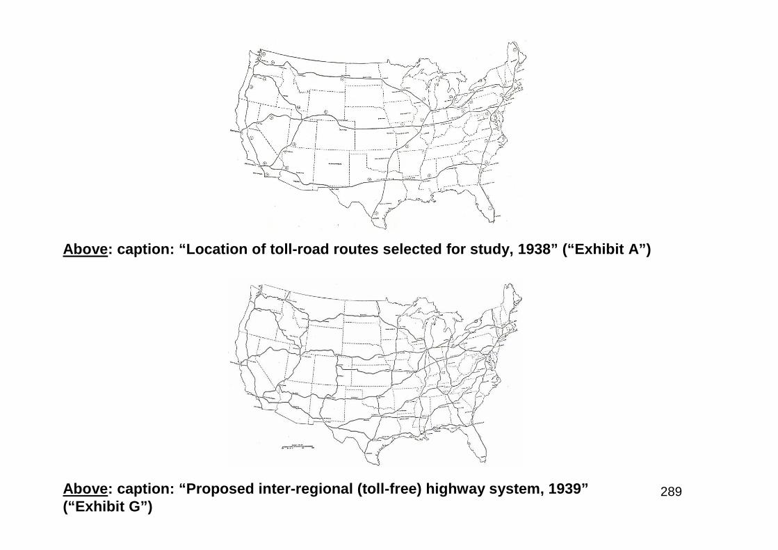
289Above: caption: “Proposed inter-regional (toll-free) highway system, 1939”(“Exhibit G”)
Above: caption: “Location of toll-road routes selected for study, 1938” (“Exhibit A”)
290
BPR Director T.H. MacDonald was appointed chairman of the InterregionalHighway Committee (IHC) whose mandate was to expedite theimplementation of the Toll Roads and Free Roads program (1939). ThePresident’s charge to the IHC was to report to him by October of 1941.With the outbreak of war, the work of the IHC languished. In July 1943,Congress, seeking a post-war highway program: “Authorized anddirected the Commissioner of Public Roads to make a survey of the needfor a system of express highways throughout the United States, thenumber of such highways needed, the approximate routes which theyshould follow, and the approximate cost of construction, and to report tothe Congress within six months...” By early 1943, the highway programwas effectively shut down. Money was available from pastapportionments, but it couldn’t be used because approval to build wasgranted only if the War Department certified that the project was essentialto the national defense and the War Production Board agreed to grant apriority so that scarce materials could be obtained. The production ofautomobiles had been suspended, tires and gasoline were rationed and a35 mph speed limit was in effect. Both in AASHO and Congress, thoughtswere turning to the development of a post-war highway program.
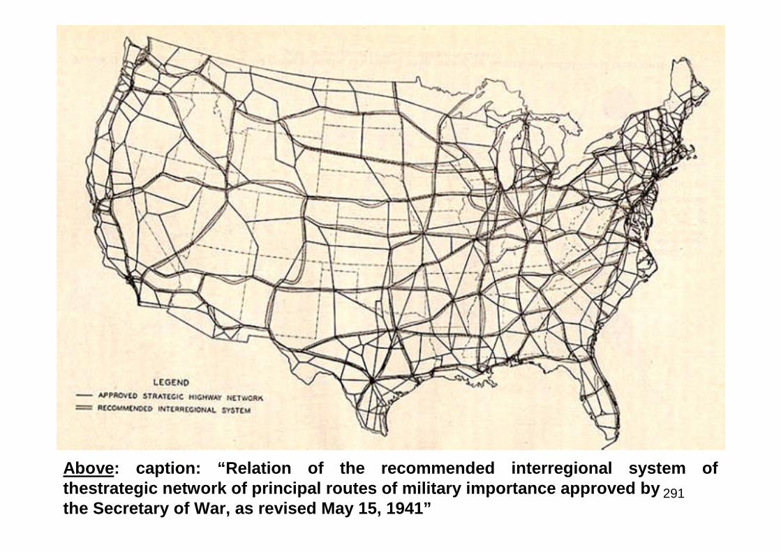
291
Above: caption: “Relation of the recommended interregional system ofthestrategic network of principal routes of military importance approved bythe Secretary of War, as revised May 15, 1941”
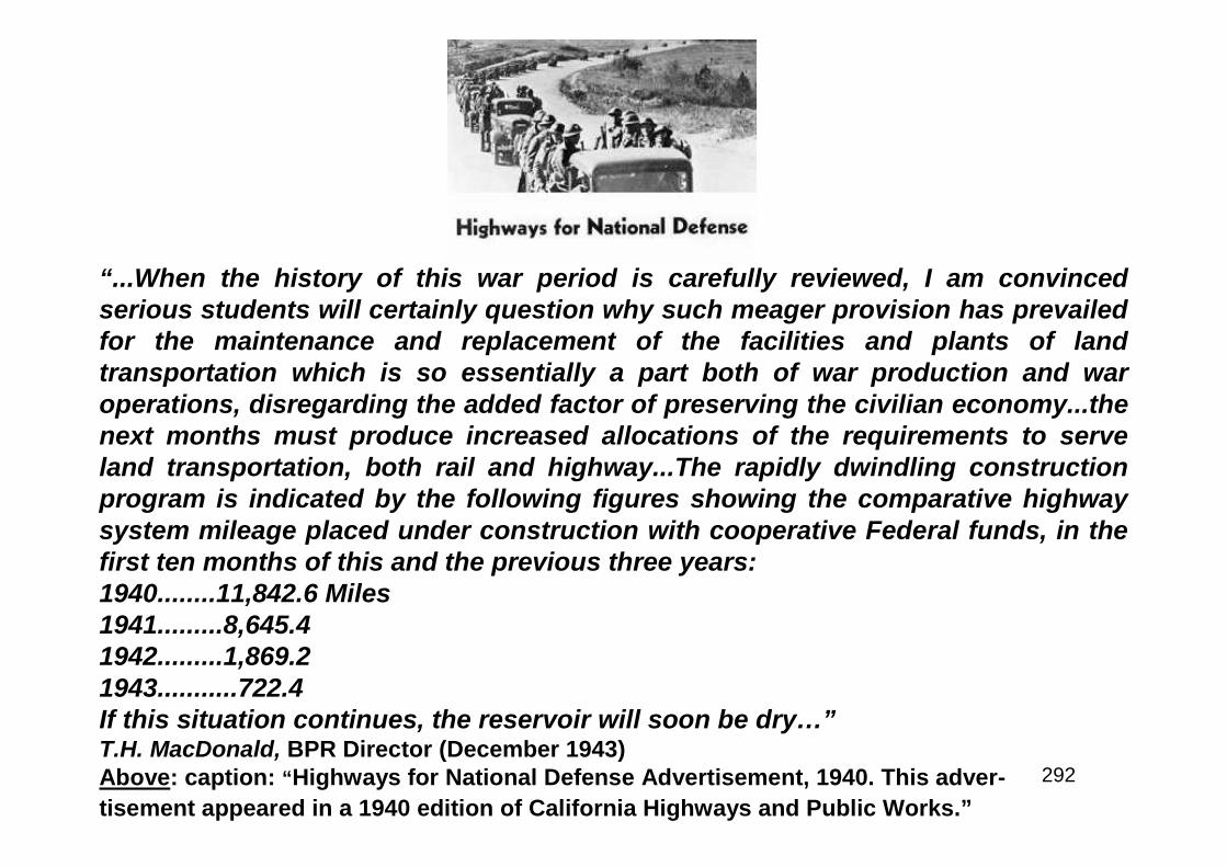
292
“...When the history of this war period is carefully reviewed, I am convincedserious students will certainly question why such meager provision has prevailedfor the maintenance and replacement of the facilities and plants of landtransportation which is so essentially a part both of war production and waroperations, disregarding the added factor of preserving the civilian economy...thenext months must produce increased allocations of the requirements to serveland transportation, both rail and highway...The rapidly dwindling constructionprogram is indicated by the following figures showing the comparative highwaysystem mileage placed under construction with cooperative Federal funds, in thefirst ten months of this and the previous three years:1940........11,842.6 Miles1941.........8,645.41942.........1,869.21943...........722.4If this situation continues, the reservoir will soon be dry…”T.H. MacDonald, BPR Director (December 1943)Above: caption: “Highways for National Defense Advertisement, 1940. This adver-
tisement appeared in a 1940 edition of California Highways and Public Works.”
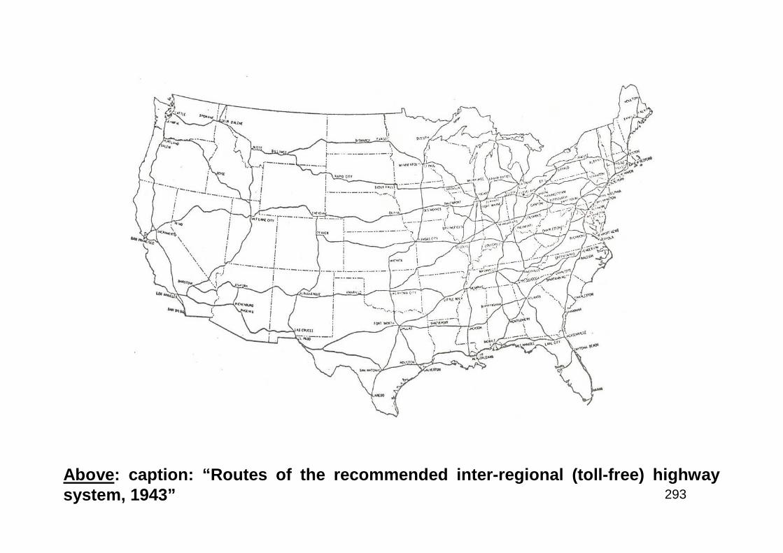
293
Above: caption: “Routes of the recommended inter-regional (toll-free) highwaysystem, 1943”

294
Post-War Worries
295
“When this war is over, there will be an immediate necessityof assuring employment for thousands of honorablydischarged Army and Navy men. The American Associationof State Highway Officials estimates that each billion dollarsexpended upon highway work will give employment forapproximately 750,000 men for a period of one year. In viewof these facts, there can be no question but what it is ofparamount importance for our Federal government to aid theStates in every possible way in the planning and engineeringof a large scale nation-wide post-war highway improvementand development program…”Senator Carl Hayden (AZ) – House Committee on Post Offices and PostRoads (1943)
296
“Winning the peace is not a job we can postpone until the war is won. It ishow we work and how we plan while winning the war that will spell victoryor defeat in the battle for a worthwhile peace. Each time we have engagedin war it has taken us three or more miserable years to climb back ontoour feet. But this is a war that surpasses our wildest nightmares. Thistime we must meet the peace and remain on our feet, or we may staydown forever...And when I say plans, I mean a fully worked out program,complete with specifications, cost estimates and other preliminarydetails. I mean plans so complete that the first pinch of war industrylayoffs can be relieved without doing injury; so complete that materialscan be absorbed as soon as industry can convert to peacetimeproduction. Much of this work must be done by the road builders. Yourplace in the post-war picture cannot be overemphasized. The HouseCommittee on Roads is now preparing to consider bills designed to meetpresent and post-war problems. We sincerely hope to have the legislativemachinery thoroughly set up, greased and ready to move forward whenthe present conflict comes to an end…”J.W. Robinson, Chairman - House Committee on Roads (early 1943)

297
“Recently the President, by Ex-ecutive Order, called upon the variousdepartments and agencies to submittheir post-war construction plans tothe Bureau of the Budget, and tomake frequent revisions in order tokeep them up to date. The FederalGovernment has in prospect aboutseven billion dollars’ worth ofconstruction. But very little has beencompletely planned, with engineeringsurveys and actual working draw-ings, and much that has been plannedis only partially planned. It has beenestimated that of the entire seven-billion-dollar program only about sixhundred million dollars’ worth of itcould be put into operation within thefirst year after the war...”General Philip B. Fleming, Administrator of theFederal Works Agency (December 1943)
298
“…In the urban highway picture, ripples are now appearing on municipal watersthat have long been undisturbed. Some of them have become sizable waves...Ihave a feeling that those waves will grow larger in the coming months - thatwhitecaps will appear in municipalities all over America...Municipal officials willcome to you asking your cooperation in their traffic problems. I know you will dowhat must be done...To your past record of erecting the backbone of a highwaysystem which now contains half of all the world’s improved roads, you will add anew chapter of helping to unscramble the urban traffic congestion problem. Youwill respect the city’s rights to control its streets, just as the Public RoadsAdministration has respected the States rights to designate the Federal-aidhighway system. But, working hand-in-hand with the Public RoadsAdministration, you will, as the Public Roads Administration does on a nationalscale, exercise proper supervision over the local program, to preserve theintegrated network of major traffic arteries when the new urban links are welded.The urban job must be done. If you did not cooperate in the doing of it, our citieswould find ways of by-passing you, and doing the job some other way. I firmlybelieve that would bring about grave problems, and that the emphasis on anationally integrated highway system which you have struggled to maintain wouldbe destroyed.”J.W. Robinson, Chairman - House Committee on RoadsRE: excerpt from his address to the 1943 AASHO annual meeting
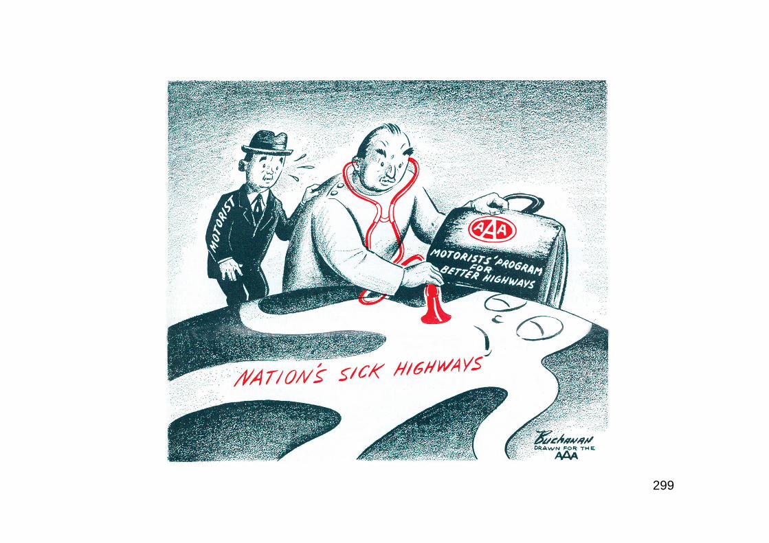
299

300
Part 5
Winning the Peace
301
Interregional Highway System
302
“On April 14, 1941, I appointed a committee, known as the National Interregional HighwayCommittee to investigate the need for a limited system of national highways...to advise theFederal Works Administrator as to the desirable character of such improvement, and thepossibility of utilizing some of the manpower and industrial capacity expected to beavailable at the end of the war…Commissioner of Public Roads Thomas H. MacDonald wasauthorized and directed to make a survey of the need for a system of express highwaysthroughout the United States...and to report to the President and to Congress, within sixmonths after the date of the Act...The Act was approved on July 13, 1943…Early actions bythe Congress in authorizing joint designation by the Federal Government and the severalState Highway Departments of a national system of interregional highways is desirable, inorder to facilitate the acquisition of land, the drawing of detailed project plans, and otherpreliminary work which must precede actual road construction. These advance steps taken,the program can serve not only to help meet the nation’s highway transportation needs, butalso as a means of utilizing productively during the post-war readjustment period asubstantial share of the manpower and industrial capacity then available. A program ofhighway construction, will, in addition, encourage and support the many diverse economicactivities dependent upon highway transportation. From personal experience, as Governorof a State and as President, I hope that the Congress will make additional studies in regardto the acquisition of land for highways.”POTUS Franklin Delano RooseveltRE: in January 1944, FDR transmitted the IHC report to Congress. His comments were meant to influenceupcoming congressional Highway Hearings, scheduled for early 1944. The report recommended a 33,920-mile system (a House bill under consideration at that time already had a 40K mile system in it fordiscussion purposes). The IHC report recommended that the program begin in cities and work outwardfrom there since the greatest need for traffic relief existed in urban areas.
303
“…It will be recalled that we recommended to Congress a Federal grant of not less than$1,000,000,000 a year for each of the three years following the end of the war for highwaypurposes. Congress was unwilling to make such a large appropriation at this time and wehave to be content for the present with half that amount. Even so, at the reduced level theprogram should become permanent and not merely for a three-year period...Strongopposition in Congress exists to the use of Federal funds for the acquisition of rights-of-wayand this seems to us to be unfortunate. We should continue our efforts to convince themembers of Congress that such use of Federal grants is not only legitimate but is necessaryif we are to make the type of urban improvements which are long overdue and which are sourgently required...”S.C. Hadden, AASHO President (1944)RE: the original AASHO proposal (1943) called for $1 billion per year for three years on a $2 (Federal) for$1 (State) basis to take effect after the war ended. However, there was a new element to be considered;the “Interregional Highway System” recommended by FDR. He noted that there was not unanimity amongthe states on that system and renewed AASHO’s long-standing request for the Federal Government toabandon highway user-taxes in favor of the states. AASHO felt that the fuel tax, levied in the depressionyears as a temporary emergency measure to provide employment, should either be abandoned or theFederal Government should expand the highway program such that all highway user revenues would bereturned to the states. Furthermore, Hadden said that AASHO wanted only one Federal-aid system andone Federal-aid fund, as in the past. Some states wanted the new kind of highways represented by theInterregional System and others felt that they had no need for them and therefore ought to be able tochoose. He said that despite provision of special funding and urgings from Congress and BPR, the statescould not prepare post-war plans until the Congress committed itself as to the size of the program andBPR issued its regulations. Otherwise, they had no way of knowing what to plan and design for.
304
Highway Act of 1944
305
“...National System of Interstate Highways so located as to connect byroutes, as direct as practicable, the principal metropolitan areas, cities,and industrial centers, to serve the national defense, and to connect atsuitable border points with routes of continental importance in theDominion of Canada and the Republic of Mexico.”RE: excerpt from Section 7 of the Federal-Aid Highway Act of 1944. A BPR reportissued on January 14th 1943 recommended an Interregional Highway System of63,000 km (39,146.5 miles) designed to accommodate traffic twenty years from thedate of construction. The report went into detail on urban freeways believing thatthey would exert a powerful force on the shape of the future city. Thus, It wasimportant for the network to be located to: “promote a desirable urbandevelopment.” As consideration of the Federal-Aid Highway Act of 1944 began,rival apportionment formulas divided the states. Urban interests battled ruralinterests for priority and states sought increased authority from the FederalGovernment. The result of these partisan disagreements was an inability to agreeon the major changes needed in the post-war era to address highway needs. TheAct primarily maintained the status quo. Although Section 7 authorized theInterstate System, it included no special provisions to give the InterstateHighways a priority based on their national importance neither did it authorizespecial funding, increase the federal share or make a federal commitment toconstruct the system.
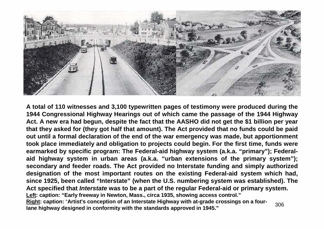
306
A total of 110 witnesses and 3,100 typewritten pages of testimony were produced during the1944 Congressional Highway Hearings out of which came the passage of the 1944 HighwayAct. A new era had begun, despite the fact that the AASHO did not get the $1 billion per yearthat they asked for (they got half that amount). The Act provided that no funds could be paidout until a formal declaration of the end of the war emergency was made, but apportionmenttook place immediately and obligation to projects could begin. For the first time, funds wereearmarked by specific program: The Federal-aid highway system (a.k.a. “primary”); Federal-aid highway system in urban areas (a.k.a. “urban extensions of the primary system”);secondary and feeder roads. The Act provided no Interstate funding and simply authorizeddesignation of the most important routes on the existing Federal-aid system which had,since 1925, been called “Interstate” (when the U.S. numbering system was established). TheAct specified that Interstate was to be a part of the regular Federal-aid or primary system.Left: caption: “Early freeway in Newton, Mass., circa 1935, showing access control.”Right: caption: “Artist's conception of an Interstate Highway with at-grade crossings on a four-lane highway designed in conformity with the standards approved in 1945.”
307
“The Federal-Aid Highway Act of 1944 authorizes the designation of a NationalSystem of Interstate Highways not exceeding 40,000 miles in extent. No specialfund has been provided for use solely on this system but both the funds for theFederal-aid system and those for urban highways may be used in itsimprovement. Because of variation in conditions among the States no attemptwas made to specify what portion of available funds should be applied to theInterstate System. These will be the most important roads of the nation andshould be improved to the high standards justified by large traffic volumes. Anyconsiderable lack of uniformity among States in service to traffic would be aserious defect in the system. The standards for the Interstate System adopted byyour Association are indicative that you fully realize the need for a uniformly highdegree of improvement, and afford the best assurance that it is safe to leave thismatter in your hands. However, should one or two States fail to keep abreast ofthe others in this important matter it might be necessary to consider introducingcorrective measures in the law. Full benefit from the National System of InterstateHighways will be realized only when it is completed in all of its parts...Sharing ofthe cost on a generally 50-50 basis is the teaching of our past experience inbuilding the Federal-aid system. I have seen no indication that equal sharing ofthe cost will not be equally satisfactory. Should it become necessary to increasethe ratio action can be taken when that event proves the need. In any case, Ianticipate no eventuality that will suggest a complete Federal assumption ofresponsibility for the cost of construction...”J.W. Robinson, Chairman - House Committee on RoadsRE: excerpts from his address to the annual meeting of AASHO (early 1946)
308
“…It is becoming increasingly evident that in carrying out the vast post-war program there are certain difficulties which will be encountered - thehigh cost of construction, the reluctance of contractors to bid largeprojects because of the uncertainties of labor and material costs, and theattempt being made to subject the highway construction program tocontrol by some authority that could automatically stop highwayconstruction or start it up depending on the unemployment situation. AsPresident I have taken the liberty on behalf of the Association to write tothe Secretary of War and Secretary of the Navy appealing for the promptdischarge of engineers from the military and naval services of our countryso that we may not be hampered by lack of trained personnel in ourconstruction program…”H.A. MacDonald, AASHO PresidentRE: excerpts from his address to the annual meeting of AASHO (early 1946)

309
Above: caption: “Seabees’ - those men whose job is to buildand fight with the Navy - put together a roadway on the sanddunes of the Virginia coast where they are getting bases”
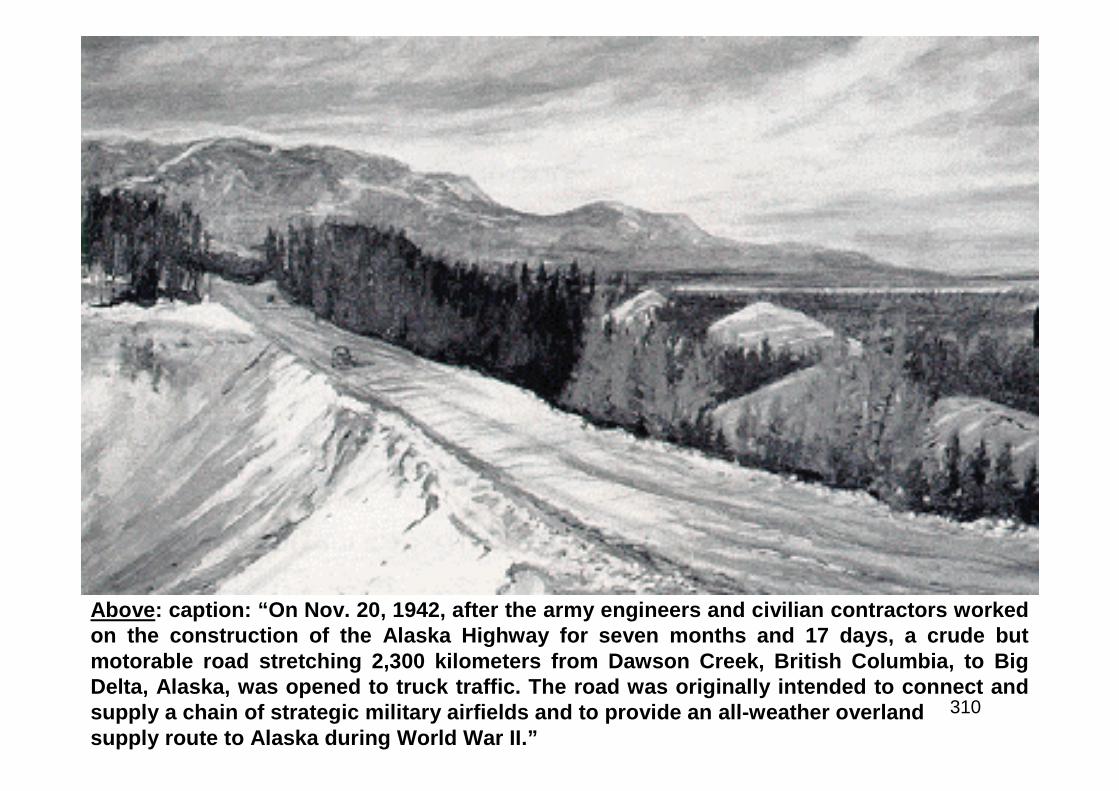
310
Above: caption: “On Nov. 20, 1942, after the army engineers and civilian contractors workedon the construction of the Alaska Highway for seven months and 17 days, a crude butmotorable road stretching 2,300 kilometers from Dawson Creek, British Columbia, to BigDelta, Alaska, was opened to truck traffic. The road was originally intended to connect andsupply a chain of strategic military airfields and to provide an all-weather overlandsupply route to Alaska during World War II.”
311
“The 1944 Federal Highway Act determined as a matter of national policythat the United States is not going to embark upon any elaborate andextravagant super-highway program. The members of this Associationare familiar with the various proposals brought forward during the decadeprior to World War II in spanning the continent in colossal gridiron patternwith ribbons of concrete. The Transcontinental highway idea found strongadvocates...Congress rejected this proposal. However, Congress wasfully aware of the need of an integrated nationwide system of modernhighways. The 1944 Act provides that kind of a network…The nationalpolicy has been set. We are embarked now on a program under which theFederal Government and the States, working jointly, will develop anational system of interstate highways. The need for this system isurgent. We should therefore forget about transcontinental superhighways and concentrate our attention, energies and available fundsupon the program established by law.”J.W. Robinson, Chairman - House Committee on RoadsRE: excerpts from his address to the annual meeting of AASHO (late 1946)
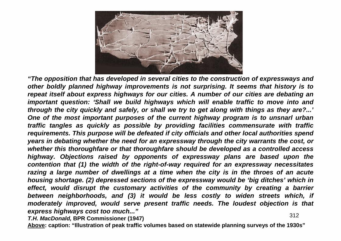
312
“The opposition that has developed in several cities to the construction of expressways andother boldly planned highway improvements is not surprising. It seems that history is torepeat itself about express highways for our cities. A number of our cities are debating animportant question: ‘Shall we build highways which will enable traffic to move into andthrough the city quickly and safely, or shall we try to get along with things as they are?...’One of the most important purposes of the current highway program is to unsnarl urbantraffic tangles as quickly as possible by providing facilities commensurate with trafficrequirements. This purpose will be defeated if city officials and other local authorities spendyears in debating whether the need for an expressway through the city warrants the cost, orwhether this thoroughfare or that thoroughfare should be developed as a controlled accesshighway. Objections raised by opponents of expressway plans are based upon thecontention that (1) the width of the right-of-way required for an expressway necessitatesrazing a large number of dwellings at a time when the city is in the throes of an acutehousing shortage. (2) depressed sections of the expressway would be ‘big ditches’ which ineffect, would disrupt the customary activities of the community by creating a barrierbetween neighborhoods, and (3) it would be less costly to widen streets which, ifmoderately improved, would serve present traffic needs. The loudest objection is thatexpress highways cost too much...”T.H. MacDonald, BPR Commissioner (1947)Above: caption: “Illustration of peak traffic volumes based on statewide planning surveys of the 1930s”
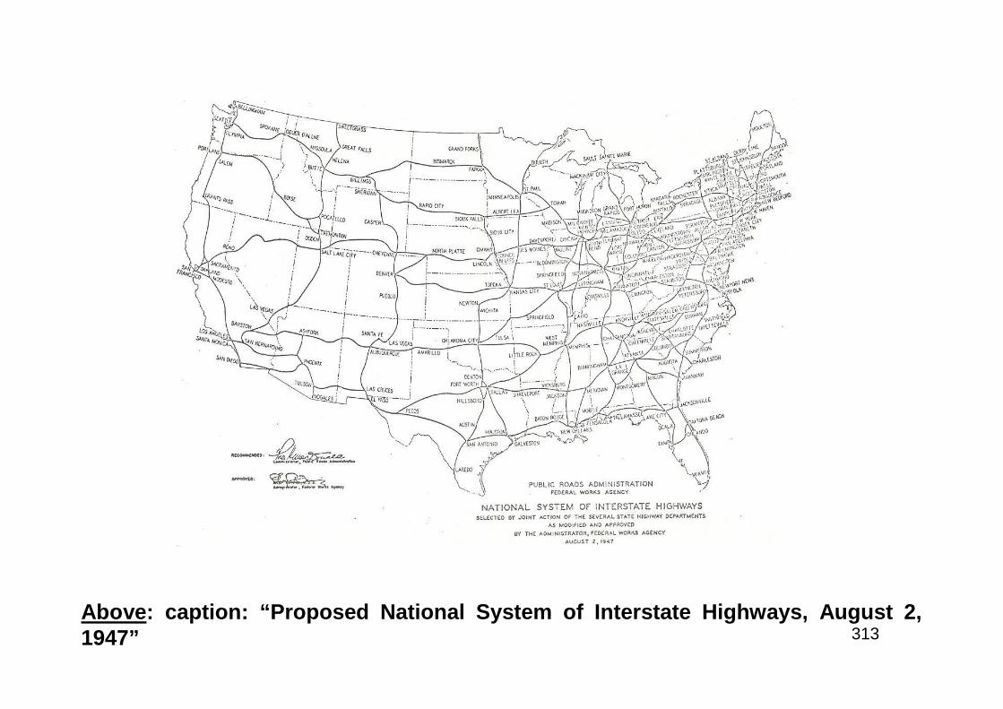
313Above: caption: “Proposed National System of Interstate Highways, August 2,1947”
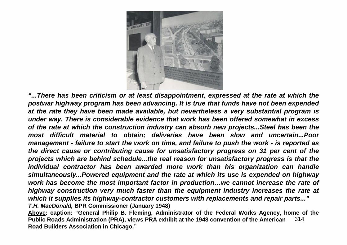
314
“...There has been criticism or at least disappointment, expressed at the rate at which thepostwar highway program has been advancing. It is true that funds have not been expendedat the rate they have been made available, but nevertheless a very substantial program isunder way. There is considerable evidence that work has been offered somewhat in excessof the rate at which the construction industry can absorb new projects...Steel has been themost difficult material to obtain; deliveries have been slow and uncertain...Poormanagement - failure to start the work on time, and failure to push the work - is reported asthe direct cause or contributing cause for unsatisfactory progress on 31 per cent of theprojects which are behind schedule...the real reason for unsatisfactory progress is that theindividual contractor has been awarded more work than his organization can handlesimultaneously...Powered equipment and the rate at which its use is expended on highwaywork has become the most important factor in production…we cannot increase the rate ofhighway construction very much faster than the equipment industry increases the rate atwhich it supplies its highway-contractor customers with replacements and repair parts...”T.H. MacDonald, BPR Commissioner (January 1948)Above: caption: “General Philip B. Fleming, Administrator of the Federal Works Agency, home of thePublic Roads Administration (PRA), views PRA exhibit at the 1948 convention of the AmericanRoad Builders Association in Chicago.”
315
“Against these service requirements and indicated potentials must be measuredthe progress in highway improvement. Taken by itself the Federal-aid operationsof the latest fiscal year are encouraging, but relative to needs the whole programof construction and maintenance is inadequate and unbalanced. During the fouryears since the end of the war, there has been completed and opened to traffic atotal of nearly 50,000 miles of Federal-aid highways. Another 19,000 miles areprogrammed for construction. These figures constitute an enviable record,particularly in view of the many difficulties that have confronted the highwayconstruction industry in this postwar period…The urban program has not keptpace with the primary and secondary programs. Projects completed to dateaccount for less than the first postwar fiscal year apportionment of urban funds.Although 80 per cent of the urban funds apportioned for the fiscal years 1946,1947, 1948, 1949 and 1950 have been programmed, less than 60 percent havebeen covered by approved plans. Interstate system improvements...accounted forabout 30 per cent of the total amounts (of urban and primary). About 23 per centof the primary funds and nearly 46 per cent of the urban funds are for interstatesystem improvements...The rate at which interstate system improvements havebeen programmed during the postwar period thus amounts to about 1,000 milesannually…”T.H. MacDonald, BPR Commissioner (1949)
316
“…As we entered the 1949 construction season the situation had changed greatly.Materials and equipment were in general readily available in adequate quantitiesalthough spot shortages of steel and cement are still being reported occasionally.The labor supply was much improved in both quality and quantity. Workmen moreexperienced, more energetic and more dependable could be obtained. Instead ofbeing troubled with a shortage of labor we are now being asked to expeditehighway construction work in certain areas where unemployment threatens tobecome a serious problem. As a consequence of these improved conditions bidprices decreased steadily during the first six months of this year...An importantdeterrent to progress this year has undoubtedly been the inability of some of theStates to provide matching funds for the available Federal funds...Because of thecessation in highway construction during the war years and the increase in bothvolume and weight of traffic since then, the Federal-aid highway system has beenwearing out or becoming obsolete at a much faster rate than reconstruction hasbeen performed and permanent improvements made. This resulted in extremelyheavy maintenance costs and has necessitated recourse to low typereconstruction and improvements as temporary expedients to keep traffic moving.As Federal funds cannot be used for maintenance, the abnormally largeexpenditures have caused further disparity between the Federal-aid fundsavailable and the State matching funds available for new construction andreconstruction on fully adequate standards...”T.H. MacDonald, BPR Commissioner (1949)
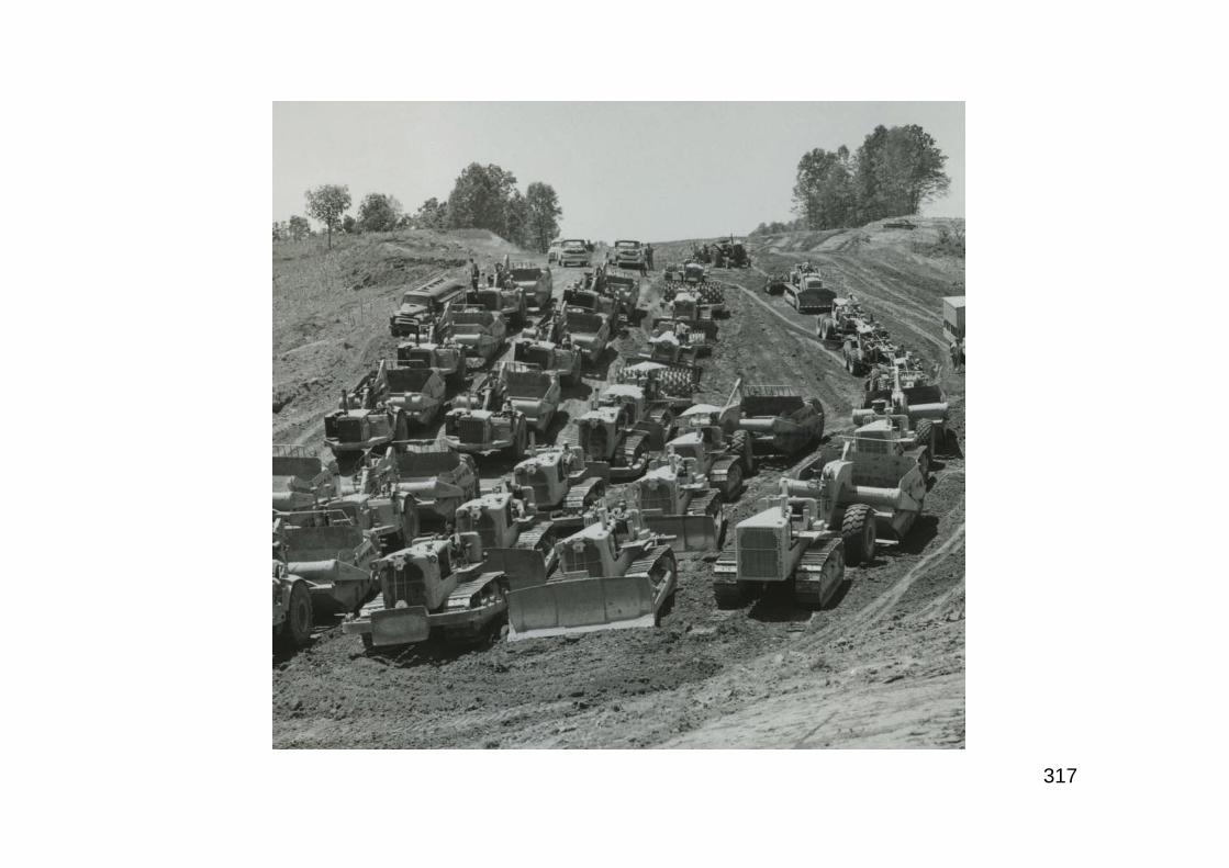
317
318
A New Policy
319
“The American Association of State Highway Officials, in a specialmeeting in Chicago, Ill. on November 21, adopted an important and far-reaching statement of national policy on new Federal-aid forhighways...After long and earnest discussion, the Association adopted astatement of national policy on the matter and therein advocated anannual program approximating $810,000,000 per year in Federal funds.The new recommendation for the first time, would make provision forwork on the Interstate System of Highways, as such; setting up a specialcategory in the amount of $210,000,000 per year Federal funds, to bematched on a 75-25 basis by state funds. This contrasts with the 50-50matching on the primary, secondary and urban programs. The Interstatefunds would also be available on a new formula of population...”RE: in October 1949, D.C. Greer - President of AASHO, announced a new policywhich - for the first time - advocated a separate funding category for the InterstateSystem by which no state was to receive less than three-quarters of one percent.At the same meeting, there was some resentment exhibited concerning the largeexpenditures the Federal Government was making to repair war damage in Europewhile allowing the highway system at home to deteriorate.
320
“...major development of our highway system is required to overcomeobsolescence and to handle safely and efficiently the steadily increasing trafficloads. This is primarily the responsibility of States, counties and municipalities.The Federal Government must, however, continue providing financial assistanceto the extent necessary to assure a basic system of national roads, built touniformly adequate standards...Increased emphasis should be placed upon theInterstate Highway System, a limited network of routes which is of greatest
national importance to peacetime traffic needs as well as to our national defense.”POTUS Harry S. Truman, 1950RE: by early 1950, the highway program was finally making real progress. BPRCommissioner MacDonald reported to highway officials and a contractors association thatthere were no shortages of material, construction prices were falling and construction wasproceeding at a record rate. In fact, the Federal-aid program was the largest in history in1949. He also introduced a proposal to realign the Federal-aid process into two phases.First; surveys, plans, cost estimates and rights-of-way. Second; actual construction (he feltthat this would encourage the development of a back-log “shelf” of plans). With this newsystem project agreements could be entered into for pre-construction project planning.MacDonald said that needs were growing faster than it was possible to provide facilities andthat a $4 billion program was necessary to reverse the rising portion of highway dollarsdevoted to maintenance. He noted that the greatest highway deficiencies were on theInterstates and that experience proved that highways strategic to defense had to be built inpeacetime.

321
War Once More
322
“The Federal-aid Highway Bill was the first big authorization measure to comebefore the Senate after the start of the war in Korea. It thus provided something ofa test of willingness to cut domestic, non-defense expenditures - cuts which inpart would offset the huge new defense budget requested by the President. TheSenate did not measure up to the test. In response to a plea from the President, itsPublic Works Committee - in charge of the bill - cut out some $240 million to be
spent over a two-year period…the bill passed by the Senate yesterday, and whichnow goes to conference with the House, still calls for spending more money thanthe Budget Bureau recommended and is still a substantial increase over what isbeing spent now - although what is being spent now was appropriated when therewas no war in sight, no tremendous increase in military expenditures and no bigtax increase in prospect. The Senate should have cut the authorizations belowpeacetime expenditures, if only as an indication to the country of its realization ofthe very serious fiscal situation that lies ahead. It failed to indicate any suchrealization...”RE: after several post-war years of being unable to use the money at the rate authorized, thehighway program had finally begun to mobilize and the urban and Interstate programs werebeginning to receive significant attention. Indeed, for the first time since WWII had ended in1945, the highway industry was finally in a position to take on an expanded program.AASHO proposed an expansionary bill which the House went along with but before theSenate could act, the Korean War broke out in June 1950. The day following the passage ofthe amended Federal-aid Highway Act by the U.S. Senate, the conservative Washington Starnewspaper published an editorial condemning the Senate action in passing the bill during anational emergency as inappropriate (excerpted above).
323
“From the very beginning, the highway officials have been faced with a difficultphilosophy on the part of certain Federal agencies administering the steelprogram. That is, that highway modernization and reconstruction is not essentialunder the present circumstances. Confronted with this philosophy, actualaccomplishment in the interest of the highway program has been difficult, if notimpossible. Allocations made thus far to actual programs, particularly in thestructural steel category, have been far below estimated minimum requirements,and the problem has been doubly complicated by the fact that allocations in alltoo many instances meant nothing more. Acceptance of highway steel orders foractual delivery have been far below the allocated steel tonnage, which was, inturn, far below the estimated requirement. Thus far, the highway program hasmanaged to struggle along, but the future is indeed a gloomy one. A strongresolution on the subject was adopted by the general session meeting in Omahain October, 1951. What the developments will be in 1952 it is impossible to predictat this time, but certainly this much should be obvious that our highway plant, theconveyor belt of defense production, is no more capable of meeting theseinternational demands than were our production facilities and, as our productionplant has been, and continues to be, expanded, so must our highway plant beexpanded. If the highways break down, the other efforts will fail...”American Highways, 1951
324
“...there is ample evidence that highways today are onlyfractionally as adequate for today’s traffic demands as theywere two decades ago…”T.H. MacDonald, BPR CommissionerRE: excerpt from his last speech (before retirement) as BPR Commissioner to theannual meeting of the AASHO in December 1952. Automobile ownership hadincreased rapidly after the end WWII, the highway problem was magnified by theincreased speeds of cars and numbers, sizes and load carrying abilities of truckswhich were rendering vast mileages of existing roads obsolete due to narrowwidths, steep grades, sharp curvatures and other geometric and physicaldeficiencies. He noted that the old design standards of the 1920’s were carriedwell past the 1930’s because of the emphasis on hand labor and minimum use ofmaterials to stimulate employment. He advocated taking the case of thedeteriorating highways to the public in the face of growing highway use both byautomobiles and trucks as a means of affecting legislative change and wasalarmed at the rate of deterioration of the highways in light of the Nationalemergency presented by the Korean War. From experience, he had learned thathighway programs do not fare well during wartime. To his frustration, the KoreanWar was interfering with the fact that the states, at long-last, had the ability to takeon bigger and bolder projects, as far as highway building was concerned.
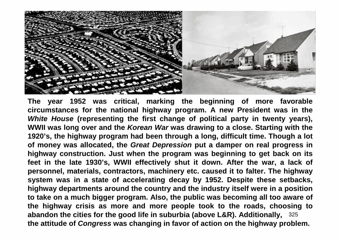
325
The year 1952 was critical, marking the beginning of more favorablecircumstances for the national highway program. A new President was in theWhite House (representing the first change of political party in twenty years),WWII was long over and the Korean War was drawing to a close. Starting with the1920’s, the highway program had been through a long, difficult time. Though a lotof money was allocated, the Great Depression put a damper on real progress inhighway construction. Just when the program was beginning to get back on itsfeet in the late 1930’s, WWII effectively shut it down. After the war, a lack ofpersonnel, materials, contractors, machinery etc. caused it to falter. The highwaysystem was in a state of accelerating decay by 1952. Despite these setbacks,highway departments around the country and the industry itself were in a positionto take on a much bigger program. Also, the public was becoming all too aware ofthe highway crisis as more and more people took to the roads, choosing toabandon the cities for the good life in suburbia (above L&R). Additionally,the attitude of Congress was changing in favor of action on the highway problem.
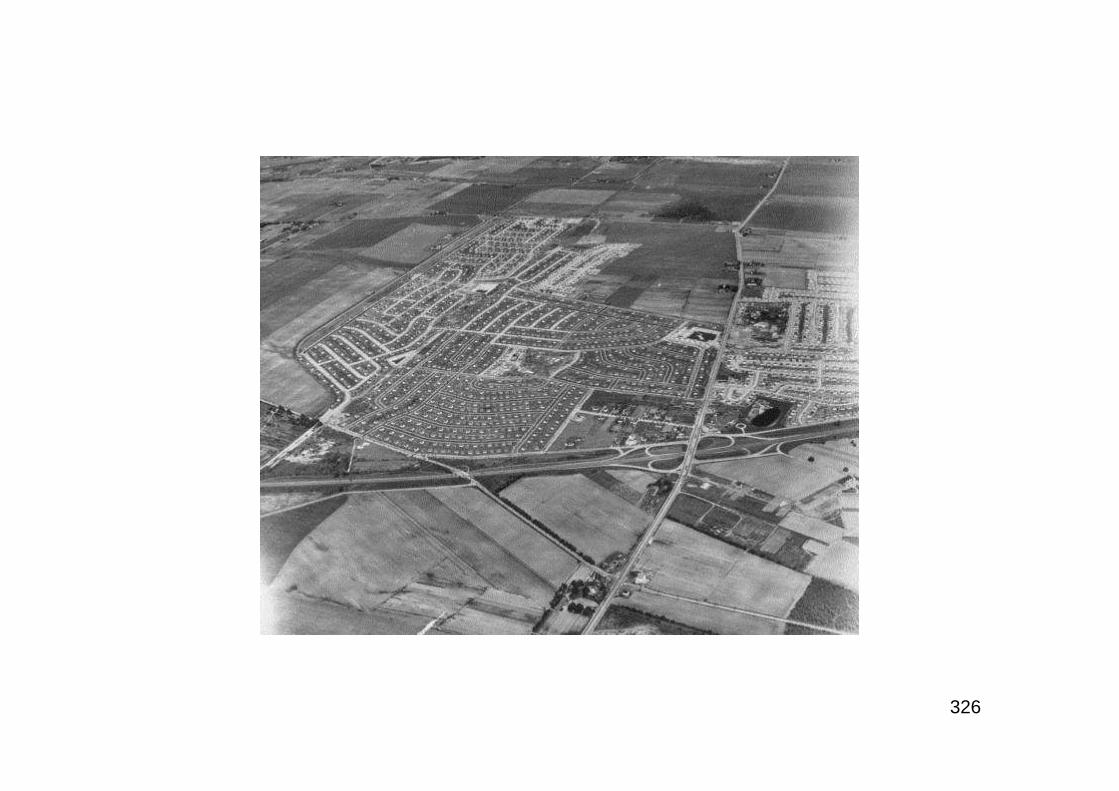
326
327
In April and May 1953, hearings which came to be known as “The NationalHighway Study” were held by the Subcommittee on Roads, Committee onPublic Works, House of Representatives, 83rd Congress. Thesubcommittee posed twelve questions requiring all witnesses to respondto each of them. The questions ranged from Federal diversion of highway-user taxes, desirability of a Federal trust fund and whether or not theFederal Government should get out of the highway program altogetherand/or phase-out BPR. Ultimately, these hearings set the stage for theneed to fund and build the Interstate Highway System, with emphasis onthe urban portions (more-so than the 1955 congressional hearings whichaccepted the need for the Interstate Highway System as a given thusspending most of the time studying suitable funding and apportionmentschemes). In effect, these hearings caused Congress to stop divertingFederal highway-user taxes. Thus, sufficient funds would be available toconsider a significantly increased highway program including theInterstate Highway System as a special, separate program.
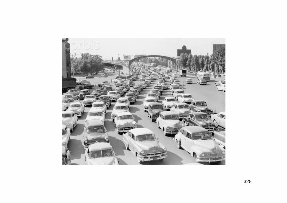
328

329
Part 6
A Grand Plan

330
The Old Convoy
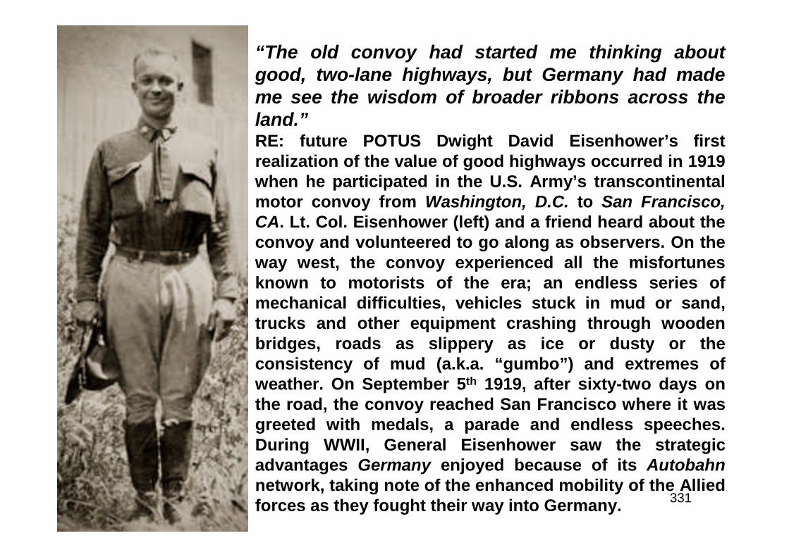
331
“The old convoy had started me thinking aboutgood, two-lane highways, but Germany had mademe see the wisdom of broader ribbons across theland.”RE: future POTUS Dwight David Eisenhower’s firstrealization of the value of good highways occurred in 1919when he participated in the U.S. Army’s transcontinentalmotor convoy from Washington, D.C. to San Francisco,CA. Lt. Col. Eisenhower (left) and a friend heard about theconvoy and volunteered to go along as observers. On theway west, the convoy experienced all the misfortunesknown to motorists of the era; an endless series ofmechanical difficulties, vehicles stuck in mud or sand,trucks and other equipment crashing through woodenbridges, roads as slippery as ice or dusty or theconsistency of mud (a.k.a. “gumbo”) and extremes ofweather. On September 5th 1919, after sixty-two days onthe road, the convoy reached San Francisco where it wasgreeted with medals, a parade and endless speeches.During WWII, General Eisenhower saw the strategicadvantages Germany enjoyed because of its Autobahnnetwork, taking note of the enhanced mobility of the Alliedforces as they fought their way into Germany.

332
“…In observing the effect of the different types of road in progress of the train, it was notedthat the trucks operated very efficiently and easily on the smooth, level types, but that onrough roads, sandy ones, or on steep grades the truck train would have practically no valueas a cargo carrier. The train operated so slowly in such places, that in certain instances itwas noted that portions of the train did not move for two hours. It was further observed thatsome of the good roads are too narrow. This compels many vehicles to run one side off thepavement in meeting other vehicles, snipping the tire, the edge of the pavement and causingdifficulty in again mounting the pavement. This is especially true in a narrow concrete road.It causes fast deterioration of the road. It was further observed that in many places excellentroads were installed some years ago that have since received no attention whatever.Absence of any effort at maintenance has resulted in roads of such rough nature as to bevery difficult of negotiating. In such cases it seems evident that a very small amount ofmoney spent at the proper time would have kept the road in good condition…D.D.Eisenhower, Lt. Col., Tank Corps, USA”RE: excerpt from his formal report on the trans-continental trip (dated November 3rd 1919)Left: caption: “The whole convoy, Utah”Right: caption: “At the Firestone Homestead, Columbiana, Ohio / Sunday, July 13, 1919, A Rest Halt / Major Brett, HarveyFirestone, Jr., Colonel Eisenhower”
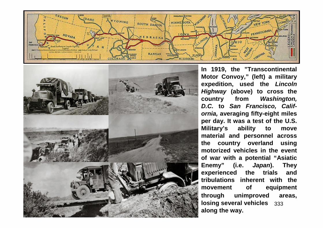
333
In 1919, the ”TranscontinentalMotor Convoy,” (left) a militaryexpedition, used the LincolnHighway (above) to cross thecountry from Washington,D.C. to San Francisco, Calif-ornia, averaging fifty-eight milesper day. It was a test of the U.S.Military’s ability to movematerial and personnel acrossthe country overland usingmotorized vehicles in the eventof war with a potential “AsiaticEnemy” (i.e. Japan). Theyexperienced the trials andtribulations inherent with themovement of equipment
through unimproved areas,losing several vehiclesalong the way.
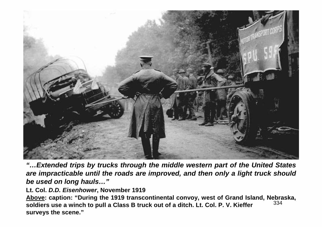
334
“…Extended trips by trucks through the middle western part of the United Statesare impracticable until the roads are improved, and then only a light truck shouldbe used on long hauls…”Lt. Col. D.D. Eisenhower, November 1919Above: caption: “During the 1919 transcontinental convoy, west of Grand Island, Nebraska,soldiers use a winch to pull a Class B truck out of a ditch. Lt. Col. P. V. Kieffersurveys the scene.”
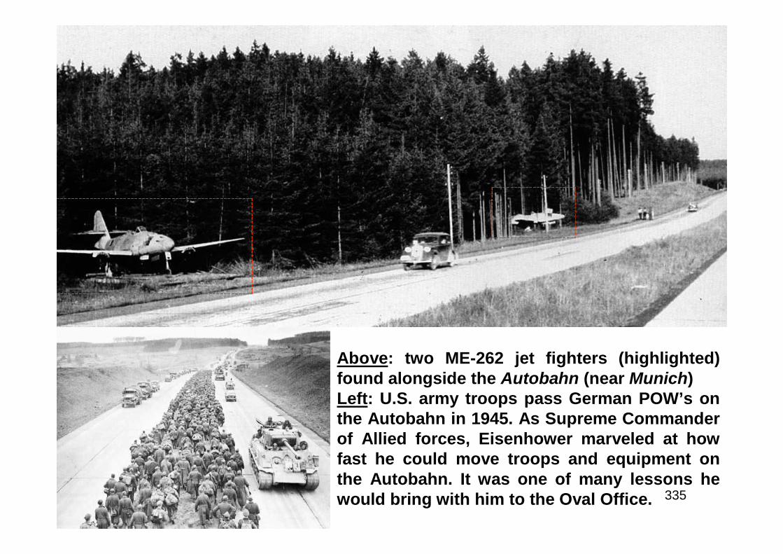
335
Above: two ME-262 jet fighters (highlighted)found alongside the Autobahn (near Munich)Left: U.S. army troops pass German POW’s onthe Autobahn in 1945. As Supreme Commanderof Allied forces, Eisenhower marveled at howfast he could move troops and equipment onthe Autobahn. It was one of many lessons hewould bring with him to the Oval Office.

336
Call to Action
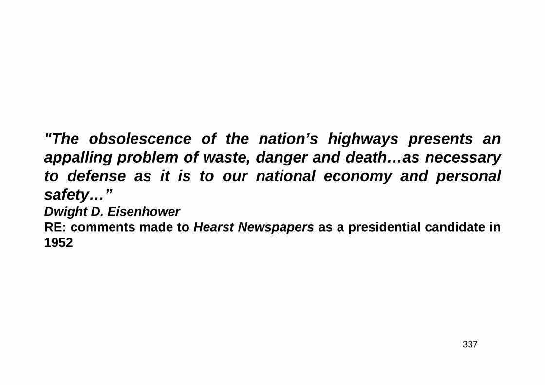
337
"The obsolescence of the nation’s highways presents anappalling problem of waste, danger and death…as necessaryto defense as it is to our national economy and personalsafety…”Dwight D. EisenhowerRE: comments made to Hearst Newspapers as a presidential candidate in1952
338
“The obsolescence of the nation’s highways presents an appalling problem of waste, death and danger.Next to the manufacture of the most modern implements of war as a guarantee of peace through strength,a network of modern roads is as necessary to defense as it is to our national economy and personalsafety. We have fallen far behind in this task - until today there is hardly a city of any size without almosthopeless congestion within its boundaries, and stalled traffic blocking roads leading beyond thoseboundaries. A solution can and will be found through the joint planning of the Federal, state and localgovernments. In this, the national government can supply leadership of the kind that is lacking today. Itmust provide an intelligent leadership to band all units of government in an efficient and honest attempt tobuild America into the great and prosperous nation it can become. New roads to meet the requirements oftoday and the foreseeable future, instead of the era when automobiles were a luxury and roads wereminor shipping lanes, will be a foundation for the progress ahead. But, the Federal Government must nottackle this problem in the position of a boss, directing the local governments how and when tax dollarscan be spent. We have had too much of a Government manned by power-hungry people attempting to telleach community what is good for it and how it should be controlled. An aim of the crusade in which I amengaged is to give to the people themselves the right to develop their nation without dictation bybureaucrats. There were 37,500 men, woman and children killed in traffic accidents last year, and thoseinjured totaled another 1,300,000. This awful total presents a real crisis to America. As a humane nation,we must end this unnecessary toll. Property losses have reached a staggering total, and insurance costshave become a real burden. Added to that is the terrific waste resulting from unnecessary wear and lossof time due to congestion. As has been pointed out by the Hearst Newspapers in tackling the alarmingproblem, there are now 53,000,000 passenger cars, trucks and buses on our streets and highways. This isan increase of about 23,000,000 vehicles since the end of World War II. We had a traffic jam back in thosedays. It is not surprising, then, that congestion today is no longer a jam. In and near most industrial areas,traffic amounts practically to a blockade. Throughout the nation, we have state highway departments,county road commissions and municipal street and traffic departments. We have in Washington theFederal Bureau of Roads. By intelligent leadership and wise planning, an integrated program can bedevised within the ability of the people to pay the cost. More than at any time in history, modern roads arenecessary to defense, and traffic is an interstate problem of concern to the Federal Government. Once adetermined and honest effort is made, this crisis, too, will be solved by the ingenuity of America. Anynewspaper which undertakes to aid and encourage the progress, prosperity and safety of thefuture is to be commended for its vision and its public spirit.”RE: statement issued by President-elect Eisenhower to Hearst Newspapers
339
“…But more specifically, our highway net is inadequate locally, and obsolete as anational system. To start to meet this problem at this session of the Congress, wehave increased by approximately 500 million dollars the Federal moneys availableto the States for road development. This seems like a very substantial sum. Butthe experts say that 5 billion dollars a year for ten years, in addition to all current,normal expenditures, will pay off in economic growth; and when we have spent 50billion dollars in the next ten years, we shall only have made a good start on thehighways the country will need for a population of 200 million people…A grandplan for a properly articulated system that solves the problems of speedy, safe,transcontinental travel - intercity communication - access highways and farm-to-market movement - metropolitan area congestion - bottlenecks and parking.”Richard M. Nixon, VPRE: excerpt from his speech made to the Governor’s Conference held at Bolton Landing, NYon July 12th 1954. President Eisenhower’s mother was seriously ill at the time thus, he couldnot attend the meeting. Instead, he asked VP Nixon to deliver the address from his ownnotes. Ike asked for a “Grand Plan” for highways extending over a ten-year period andasked the governors for their help. Shortly thereafter, he appointed General Lucius D. Clayto head a presidential advisory committee to work with the governors and other groups,hold hearings and to develop highway legislation. The fear of the country lapsing back intoeconomic depression after the Korean War was perceived as a real threat. A recession hadbegun to set in in 1949, but the Korean War served to stimulate the national economy. Astrong demand for better highways was at fever pitch and any president would have had topay attention to that clarion call. From his own experiences traveling cross-country via armytrucks after WWI, the impression the Autobahn made on him during WWII and BPRCommissioner Francis V. du Pont counseling the president that the time was right,the stage was set for real action.
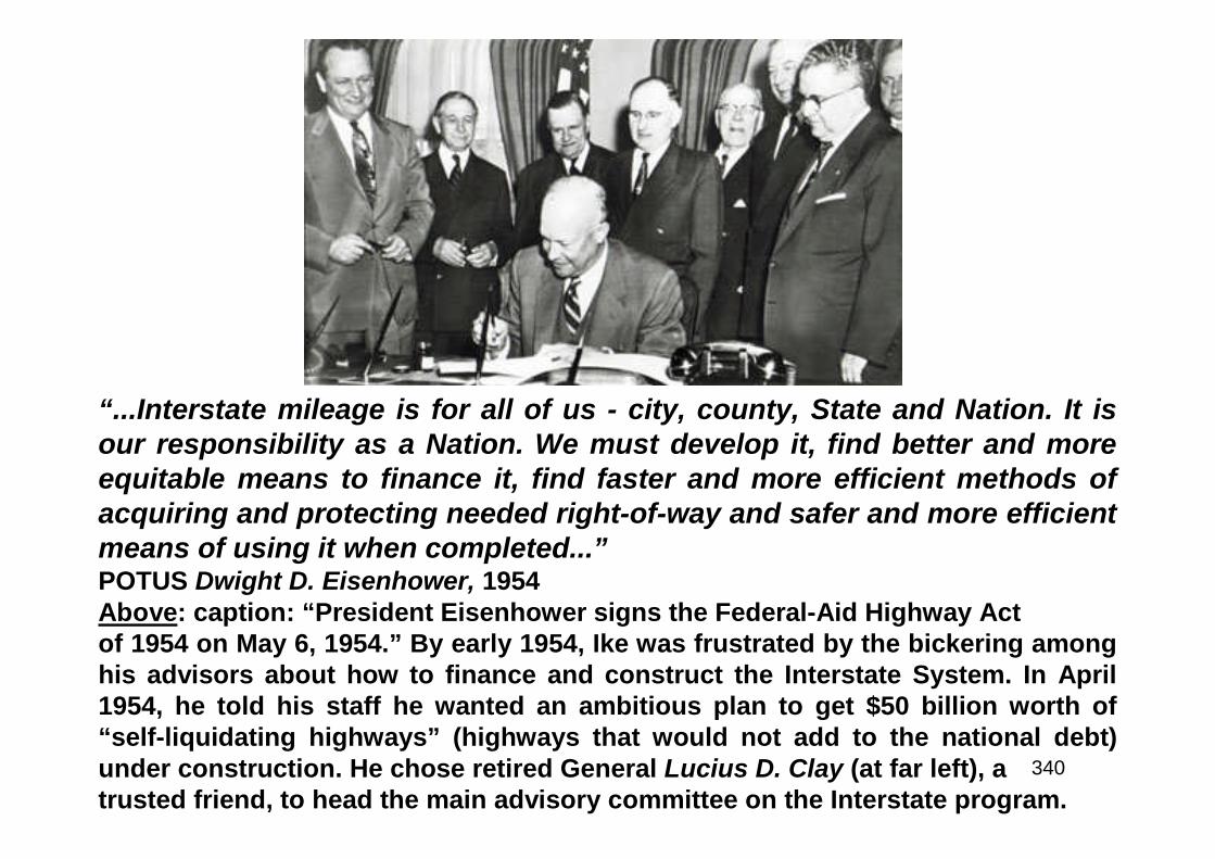
340
“...Interstate mileage is for all of us - city, county, State and Nation. It isour responsibility as a Nation. We must develop it, find better and moreequitable means to finance it, find faster and more efficient methods ofacquiring and protecting needed right-of-way and safer and more efficientmeans of using it when completed...”POTUS Dwight D. Eisenhower, 1954Above: caption: “President Eisenhower signs the Federal-Aid Highway Actof 1954 on May 6, 1954.” By early 1954, Ike was frustrated by the bickering amonghis advisors about how to finance and construct the Interstate System. In April1954, he told his staff he wanted an ambitious plan to get $50 billion worth of“self-liquidating highways” (highways that would not add to the national debt)under construction. He chose retired General Lucius D. Clay (at far left), atrusted friend, to head the main advisory committee on the Interstate program.
341
“...And now let us have a look at the Interstate problem. Since the early 20s ourefforts have been concentrated on the development of the primary system ofhighways. During the late 30s and early 40s secondary road aid became a part ofthe Federal-aid program. About 10 years ago the Interstate system was recognizedby Congress, but it had no status. It was merely the designation of a certainportion of the primary system between certain control points. No funds wereauthorized specifically for this system until 1952 when 25 million dollars wasmade available. This amount was so small when divided between the 48 States itwas not a factor. I have frequently heard it stated before the passing of the 1954act, that if the Congress would not recognize the importance of this system bymaking substantial funds available, reference thereto should be eliminated fromthe Association’s future recommendations. In 1954, however, the Congressincreased the authorization many fold, namely, to 175 million and changed thematching basis to 60-40 in order to emphasize the importance and stimulate theconstruction of an Interstate System. Were this not the case, obviously theCongress would have merely increased the authorization for the primary systemby a greater amount. Under the 1954 act we are for the first time confronted withconverting the old, inadequate primary highway system and bringing it up to mostmodern standards commensurate with the needs of not only the present, butfuture traffic…”F.V. du Pont, BPR CommissionerRE: excerpt from speech made to the AASHO in 1954
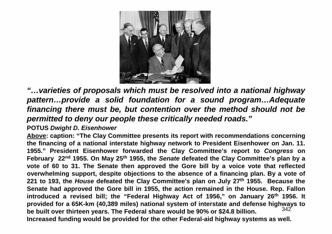
342
“…varieties of proposals which must be resolved into a national highwaypattern…provide a solid foundation for a sound program…Adequatefinancing there must be, but contention over the method should not bepermitted to deny our people these critically needed roads.”POTUS Dwight D. EisenhowerAbove: caption: “The Clay Committee presents its report with recommendations concerningthe financing of a national interstate highway network to President Eisenhower on Jan. 11.1955.” President Eisenhower forwarded the Clay Committee’s report to Congress onFebruary 22nd 1955. On May 25th 1955, the Senate defeated the Clay Committee’s plan by avote of 60 to 31. The Senate then approved the Gore bill by a voice vote that reflectedoverwhelming support, despite objections to the absence of a financing plan. By a vote of221 to 193, the House defeated the Clay Committee's plan on July 27th 1955. Because theSenate had approved the Gore bill in 1955, the action remained in the House. Rep. Fallonintroduced a revised bill; the “Federal Highway Act of 1956,” on January 26th 1956. Itprovided for a 65K-km (40,389 miles) national system of interstate and defense highways tobe built over thirteen years. The Federal share would be 90% or $24.8 billion.Increased funding would be provided for the other Federal-aid highway systems as well.
343
“A REPORT ON TOLL ROADSBPR Recommends That They Be Included in Interstate System, With Qualifications, ButReceive No Federal-Aidby NHUC Research DepartmentContinuation of existing Federal policy against tolls on Federal-aid highways and a changein the law to permit inclusion of toll roads in the Interstate System under certain conditionshave been recommended by the Bureau of Public Roads. A toll road report (H. Doc 139) wasprepared pursuant to Congressional directive in Section 13 of the Federal Aid Highway Actof 1954 with the aid of information supplied by state highway departments. The BPRrecommends that toll roads be included in the Interstate System when they meet thestandards and when they are reasonably satisfactory alternate free roads on the Federal-aidprimary or secondary systems which permit traffic to bypass the toll road. Thisrecommendation is made, the report states, to meet present-day conditions, since a numberof toll roads in operation, under construction or authorized, lie along the preferred locationof Interstate routes and duplication of these roads would generally be an economic waste.An additional 6,700 miles on the Interstate System would be feasible for toll financing at anestimated cost of $4,260 million, the report finds. This mileage is in addition to that nowadequately improved or scheduled soon to be made adequate, either as toll roads or freeroads. The greatest uncertainty affecting feasible mileage of toll financing, the report states,is as to the policies of the states and the Federal government in providing public funds forimprovement of the Interstate System. ‘Assurance of public funds to provide reasonablytimely completion of the system would soon spell the end of revenue bond financing ofroads in the system. Continuation of the present inadequate allocation of funds to thissystem, however, can only serve to increase the mileage that would be potentially feasibleas toll roads.’”RE: article related to incorporating the then-existing toll roads into the Interstate System, dated
May 1955
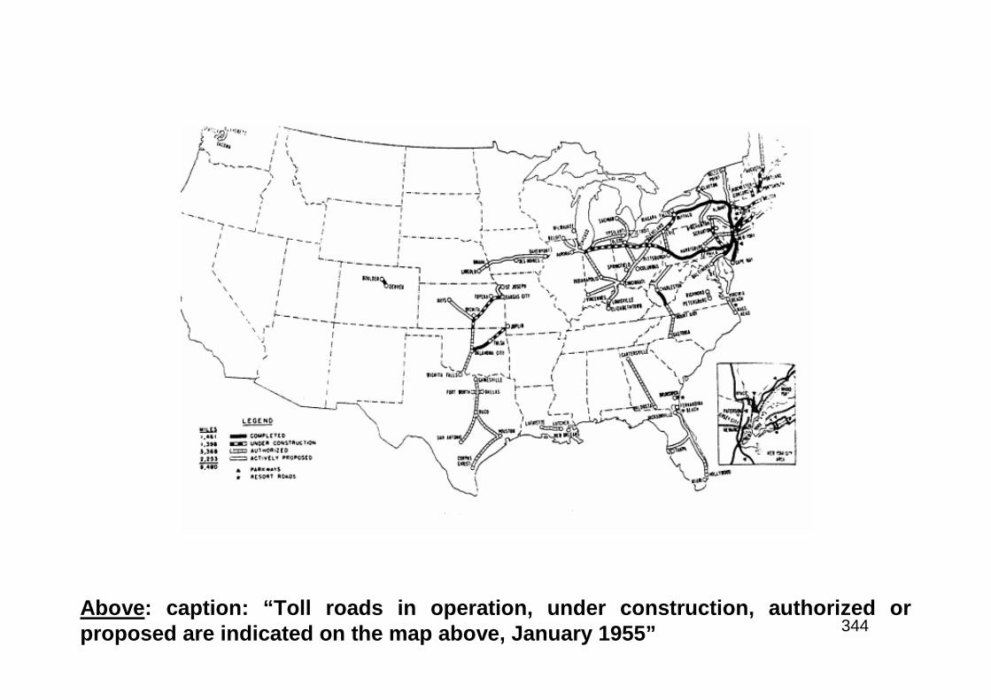
344Above: caption: “Toll roads in operation, under construction, authorized orproposed are indicated on the map above, January 1955”
345
Missouri’s No. 1 Citizen
346
“My Dear Senator Symington:In that you are on the Public Works Subcommittee, I am writing you my views on the improvement andmodernization of the highways of the United States. My interest in transportation and communication isas lively as it ever was, so that I have noted with approval the consideration being given the bills pendingin the Congress to modernize our major highways within 10 years. I repeat, I have a very great interest intransportation and communication. Every citizen agrees with me that the need to bring our roads andstreets up-to-date is urgent. The longer we wait, the greater the cost will be. Every year our outdated andworn-out roads cost us time and money; and, much more important, they cost us lives. Traffic accidentsand road congestion together cost us billions of dollars and thousands of lives every year. I have alwaysbeen interested in traffic safety. In 1946 I called a National Safety Conference to try to find a way to stopdeath and destruction by highway accidents. Safety conferences were held yearly on the call of thePresident after the first one. Since returning to Missouri, I have been saddened by the number of peoplewho die, every year, on the highways of this great State. We all know that roads properly built to meetmodern highway traffic conditions can help materially to reduce accidents. The saving of life and limbalone would justify the cost of modernizing our road system as quickly as possible. Of course, it will takea big capital outlay to build a modern highway system. Solutions to fiscal problems are never easy, but Iam sure we can all see the wisdom of this investment in the future of this great country. It is one that willbring immediate dividends in the convenience, efficiency and, above all, safety to highway travel andtransportation. Our improved standard of living and vast economic expansion, which accompanied thetremendous growth of highway transportation over the past 40 years are due in large part to the Federal-aid program first enacted in 1916, under a Democratic administration and subsequently extended andenlarged, always on a public service and not on a partisan basis. The 84th Congress will have few betteropportunities to advance the welfare of the American people than by making possible the large scale andrapid development of our highway system. I hope the Congress will take advantage of this opportunity.With kindest personal regards,Sincerely yours,Harry S. Truman”RE: on March 18th 1955, Senator Stuart Symington of Missouri submitted this letter from “Missouri’s No. 1Citizen” - former POTUS Harry S. Truman (it appeared in the Congressional Record)
347
“…This program is the largest highway program ever conceived in the world, as indeed it has to be tocatch up and keep pace with our growing population and expanding economy. The program originatedwith President Eisenhower’s message to the Governors’ Conference at Bolton Landing, N.Y., on July 12,1954. It envisioned a grand plan for a properly articulated system of highways which would solve theproblems of speedy, safe, transcontinental travel, intercity communication, access highways and farm-to-market movements as well as metropolitan congestion. Six months later, on January 11, 1955, the ClayCommittee report was published. This report became the basis for most of the bills which wereconsidered by the Congress during the ensuing six months. In the meantime, your Association hadswung into action. a brief policy statement was drafted at the meeting in Seattle in November, 1954, toserve as a general guide for legislative testimony which our Association officials were certain to be calledon to give. This policy statement was developed further in March, 1955, at a meeting of the ChiefAdministrative Officers held in Chicago…Into the six months between the issuance of the Clay Committeereport and the defeat of the road program on July 27, 1955, there were crowded many days of research,deliberation and testimony. The element of haste, considering the magnitude of the program, was verymuch in evidence. There were sincere differences of opinion within the Congress on how best to financethe program…it is important to remember that when the House of Representatives defeated the road bill,it was not voting down the program; it was voting down the tax feature. As for the program itself, there isno doubt that the need has been thoroughly established. As Commissioner Curtiss said last month, ‘thebasic elements of the highway problem have come into much sharper focus.’ He also expressedconfidence ‘that this broader, clearer comprehension will lead to early action on a scale far exceedinganything we have known in the past.’ The fact is that as a result of all the work that has been done and thetestimony that has been spread upon the record, the seeds are in the ground; if we tend them and do notlet them wither or rot, they will bring fruit in due season in the form of an expanded highway program…”George T. McCoy, AASHO PresidentRE: excerpts from his speech at the annual AASHO convention in December 1955
348
“…Considering the civil and the national defense, as well as the over-alleconomic well-being of the nation, the Interstate System of highwaysshould be accorded priority treatment and its completion accomplishedwithin a period of 10 years. A substantial, balanced construction program,however, must not be sacrificed on the other Federal-aid highwaysystems. The Interstate System should be built to meet the anticipatedtraffic demands of 20 years hence, and constructed to design standardspromulgated and approved by the American Association of State HighwayOfficials, and with the application of, and the provision for, access controlfeatures in accordance with warrants promulgated and approved by theAmerican Association of State Highway Officials. The location and designof the Interstate System should be the joint responsibility of the StateHighway Departments and the Bureau of Public Roads. The actualdetermination of the location of the routes between control points shouldbe based upon engineering studies, traffic analyses, and economiccomparisons…”America Association of State Highway Officials (AASHO), March 1955RE: excerpt from revised policy statement appearing in the April 1955 issue ofAmerican Highways
349
“…In this receptive atmosphere, the House Roads Subcommittee and theWays and Means Committee, by agreement, separately undertook todevelop the program, the one part on the legislation and the financialfeatures as another. Many features of the 1955 bills were adopted, oradapted. A Joint Committee bill was approved by the House on April 27,1956…The House-Senate Conferees developed a compromise bill by June25, and on the next day both the Senate and the House approved it byoverwhelming votes. On June 29, 1956, the President signed the bill intolaw.”RE: excerpt from AASHO’s Golden Anniversary book published in 1964. On April27th 1956, the “Federal Highway Act of 1956” passed the House by a vote of 388to 19. On May 28th and 29th, the Senate debated the Act of 1956 before approvingit by a voice vote. The House and Senate versions then went to a House-Senateconference to resolve the differences. The Federal-Aid Highway Act of 1956 thatemerged from the House-Senate conference committee included features of theGore and Fallon bills, as well as compromises on other provisions from both. OnJune 26th 1956, the Senate approved the bill by a vote of 89 to 1. Earlier in June,Eisenhower had entered Walter Reed Army Medical Center after an attack ofIleitis, an intestinal ailment. He was still in the hospital on June 29th 1956 when astack of bills was brought to him in his sickbed for his signature. One of them wasthe Federal-Aid Highway Act of 1956. He signed it without ceremony or fanfare inhis hospital room.
350
The Federal Highway Act of 1956 called for uniform interstate designstandards to accommodate traffic forecasts up to 1975. Two lanesegments, as well as at-grade intersections, were permitted on lightlytraveled segments. However, legislation later passed (in 1966) required allparts of the Interstate Highway System to be at least four lanes with no at-grade intersections regardless of traffic volume. Access would be limitedto interchanges approved as part of the original design or subsequentlyapproved by the Secretary of Commerce. Service stations and othercommercial establishments were prohibited from the Interstate right-of-way (in contrast to the franchise system used on toll roads). Toll roads,bridges and tunnels could be included in the system provided they metsystem standards and their inclusion promoted development of anintegrated system. The interstate system was expanded, but only by 1Kmiles (to 41K miles). To construct the network, $25 billion was authorizedfor FY’s 1957 through 1969. The legislation also changed the name of theInterstate System to reflect its importance to national defense: “TheNational System of Interstate and Defense Highways.”
351
“FINAL MILEAGE DESIGNATEDThe 41,000-mile Interstate System Is Now Completely ApportionedNew routes totaling 2,102 miles have been made a part of the 41,000 National System of Interstate andDefense Highways, Secretary of Commerce Weeks announced. They include the 1,000-mile expansion ofthe Interstate System authorized by the Federal-Aid Highway Act of 1956. The remaining 1,102 miles weremade possible by estimated savings in mileage resulting from adoption of more direct locations of routespreviously designated.In developing the plan for the routes, Secretary Weeks said, consideration was given to proposalsadvanced by the various state highway departments for utilization of the 1,000-mile addition to the 40,000-mile Interstate System. He added that the Department of Defense has concurred in the action. Under the1,000-mile addition authorized by Congress in 1956, four city-to-city routes were approved fordesignation:• Ellensburg, WA to the vicinity of Pendleton, OR, 132 miles;• Baton Rouge, LA eastward en-route to Mobile, AL, 91 miles;• Denver, CO to the vicinity of Cove Fort, UT, 547 miles;• Fargo, ND to Sioux Falls, SD, 230 milesThe routes chosen for designation under the original 40,000-mile authorization include five new city-to-city highways totaling 886 miles and 216 miles in or near urban areas. The city-to-city routes includingsome mileage in intermediate states are:• Canton, OH to Charlotte, NC, 431 miles;• Pittsburgh, PA to Erie, PA, 102 miles;• Ogden, UT to Echo Junction, UT, 40 miles;• Nashville, TN to Cairo, IL, 170 miles;• San Antonio, TX to Corpus Christi, TX, 143 miles.In addition, the 216 miles include: urban connections in Chicago, Philadelphia, St. Louis, Washington DC,Kansas City, Louisville, Omaha, and Duluth (MN), as well as the earmarking of mileage to providecircumferential or belt routes for cities more than 200,000 population where routes already designated failto provide such facilities.”RE: article related to the additional route mileage designated for the Interstate highway system (dated Oct. 1957)
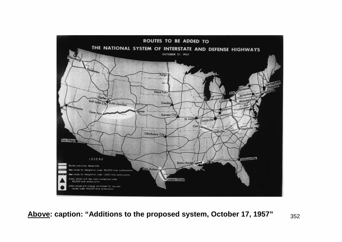
352Above: caption: “Additions to the proposed system, October 17, 1957”
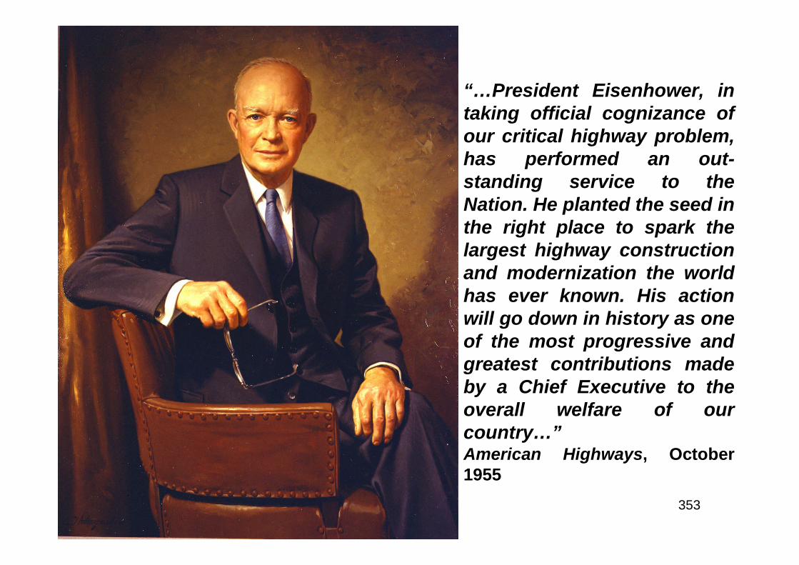
353
“…President Eisenhower, intaking official cognizance ofour critical highway problem,has performed an out-standing service to theNation. He planted the seed inthe right place to spark thelargest highway constructionand modernization the worldhas ever known. His actionwill go down in history as oneof the most progressive andgreatest contributions madeby a Chief Executive to theoverall welfare of ourcountry…”American Highways, October1955
354
“…More than any single action by the government since theend of the war, this one would change the face ofAmerica…Its impact on the American economy - the jobs itwould produce in manufacturing and construction, the ruralareas it would open up - was beyond calculation…”RE: excerpt from President Eisenhower’s 1963 memoir entitled: “Mandatefor Change 1953-1956”
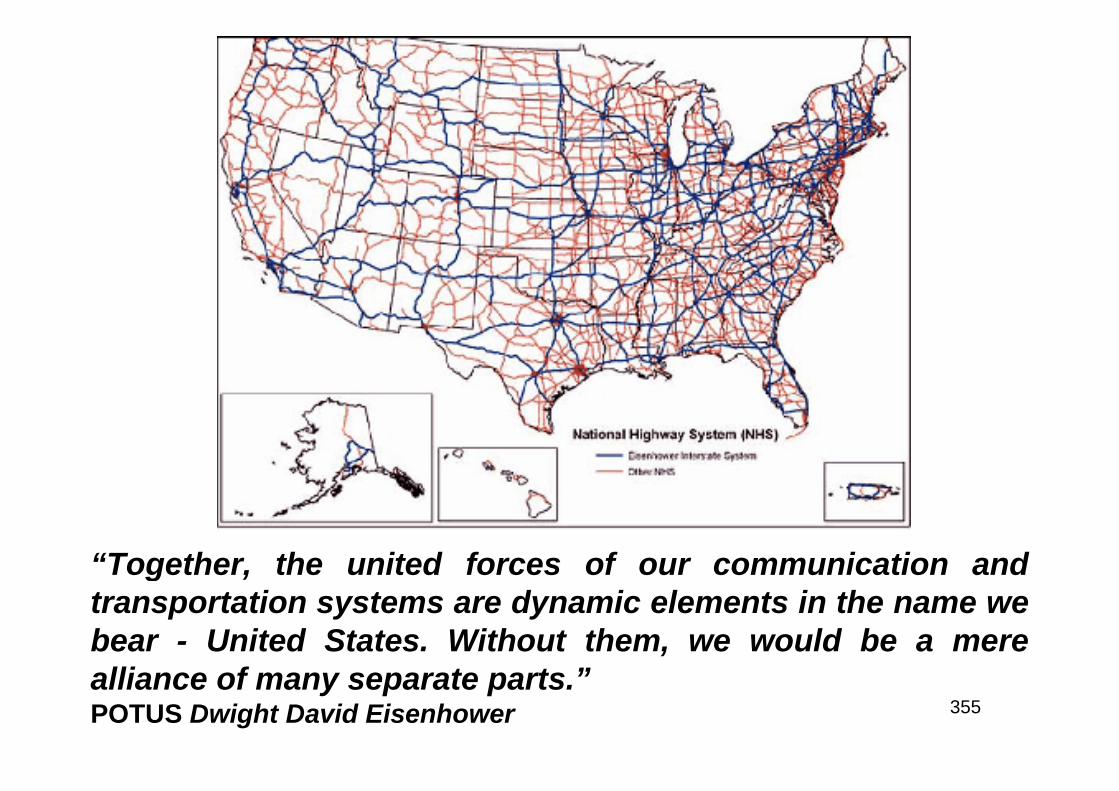
355
“Together, the united forces of our communication andtransportation systems are dynamic elements in the name webear - United States. Without them, we would be a merealliance of many separate parts.”POTUS Dwight David Eisenhower
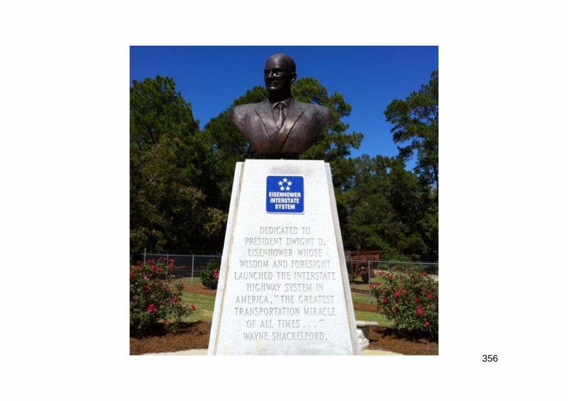
356
357
Part 7
Building the Broad Highway

358
A Flying Start
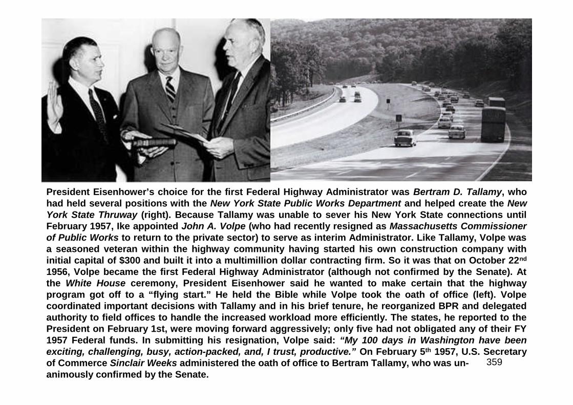
359
President Eisenhower’s choice for the first Federal Highway Administrator was Bertram D. Tallamy, whohad held several positions with the New York State Public Works Department and helped create the NewYork State Thruway (right). Because Tallamy was unable to sever his New York State connections untilFebruary 1957, Ike appointed John A. Volpe (who had recently resigned as Massachusetts Commissionerof Public Works to return to the private sector) to serve as interim Administrator. Like Tallamy, Volpe wasa seasoned veteran within the highway community having started his own construction company withinitial capital of $300 and built it into a multimillion dollar contracting firm. So it was that on October 22nd
1956, Volpe became the first Federal Highway Administrator (although not confirmed by the Senate). Atthe White House ceremony, President Eisenhower said he wanted to make certain that the highwayprogram got off to a “flying start.” He held the Bible while Volpe took the oath of office (left). Volpecoordinated important decisions with Tallamy and in his brief tenure, he reorganized BPR and delegatedauthority to field offices to handle the increased workload more efficiently. The states, he reported to thePresident on February 1st, were moving forward aggressively; only five had not obligated any of their FY1957 Federal funds. In submitting his resignation, Volpe said: “My 100 days in Washington have beenexciting, challenging, busy, action-packed, and, I trust, productive.” On February 5th 1957, U.S. Secretaryof Commerce Sinclair Weeks administered the oath of office to Bertram Tallamy, who was un-animously confirmed by the Senate.

360
The first project to begin construction under the FederalHighway Act of 1956 was the Mark Twain Expressway portionof U.S. 40 (future I-70) in St. Charles County, MO.Construction of the $1.87 million project, which included 3.1miles of bridging, grading and concrete paving (leading to anew bridge over the Missouri River) began on August 13th
1956. The Missouri State Highway Commission placed a signon the project declaring it to be the first on which actualconstruction was begun under the 1956 act (above). OnAugust 31st 1956, the Kansas State Highway Commissionawarded a contract for concrete paving of an 8-mile sectionof U.S. 40 (I-70) outside Topeka. Construction had begunbefore enactment of the 1956 law but under the new contract,paving began on September 26th with funds provided underthe new program. Joined by BPR officials, First District StateHighway Commissioner Ivan Wassberg marked the historicoccasion by scratching “9-26-56” in the fresh concrete. OnNovember 14th 1956, highway officials held a ribbon-cuttingceremony and posted a sign proclaiming the project to bethe first completed under the 1956 act (left).
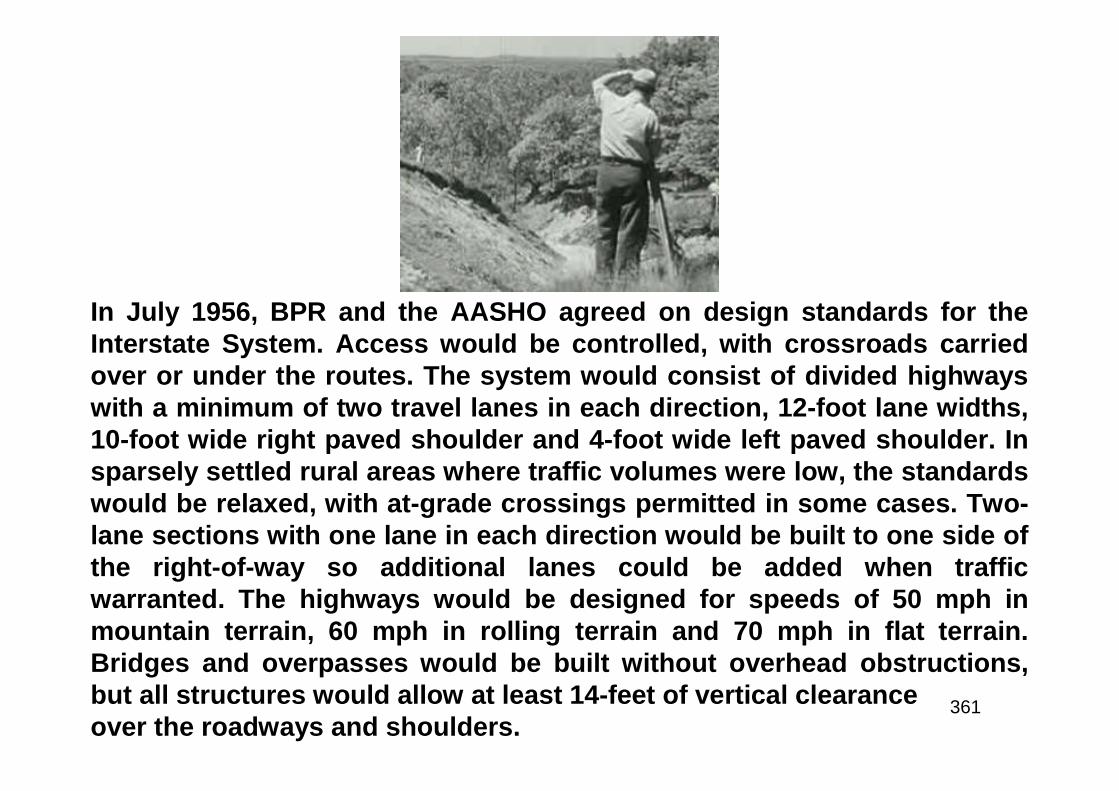
361
In July 1956, BPR and the AASHO agreed on design standards for theInterstate System. Access would be controlled, with crossroads carriedover or under the routes. The system would consist of divided highwayswith a minimum of two travel lanes in each direction, 12-foot lane widths,10-foot wide right paved shoulder and 4-foot wide left paved shoulder. Insparsely settled rural areas where traffic volumes were low, the standardswould be relaxed, with at-grade crossings permitted in some cases. Two-lane sections with one lane in each direction would be built to one side ofthe right-of-way so additional lanes could be added when trafficwarranted. The highways would be designed for speeds of 50 mph inmountain terrain, 60 mph in rolling terrain and 70 mph in flat terrain.Bridges and overpasses would be built without overhead obstructions,but all structures would allow at least 14-feet of vertical clearanceover the roadways and shoulders.
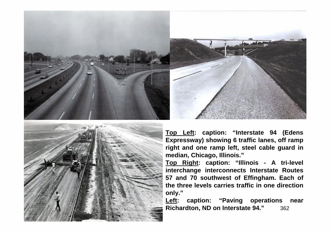
362
Top Left: caption: “Interstate 94 (EdensExpressway) showing 6 traffic lanes, off rampright and one ramp left, steel cable guard inmedian, Chicago, Illinois.”Top Right: caption: “Illinois - A tri-levelinterchange interconnects Interstate Routes57 and 70 southwest of Effingham. Each ofthe three levels carries traffic in one directiononly.”Left: caption: “Paving operations nearRichardton, ND on Interstate 94.”

363
Above: caption: “Calif-ornia - Four-level inter-change”Left: caption: “A four-level interchange at theinter-section of I-20 andI-35 in Fort Worth,Texas, weaves theramps above and belowthe roads.”
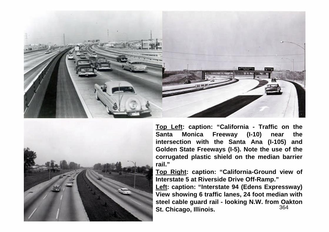
364
Top Left: caption: “California - Traffic on theSanta Monica Freeway (I-10) near theintersection with the Santa Ana (I-105) andGolden State Freeways (I-5). Note the use of thecorrugated plastic shield on the median barrierrail.”Top Right: caption: “California-Ground view ofInterstate 5 at Riverside Drive Off-Ramp.”Left: caption: “Interstate 94 (Edens Expressway)View showing 6 traffic lanes, 24 foot median withsteel cable guard rail - looking N.W. from OaktonSt. Chicago, Illinois.
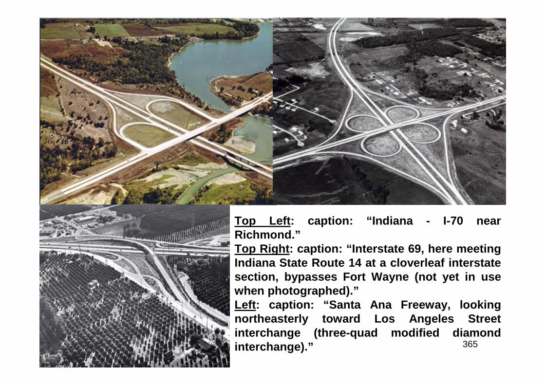
365
Top Left: caption: “Indiana - I-70 nearRichmond.”Top Right: caption: “Interstate 69, here meetingIndiana State Route 14 at a cloverleaf interstatesection, bypasses Fort Wayne (not yet in usewhen photographed).”Left: caption: “Santa Ana Freeway, lookingnortheasterly toward Los Angeles Streetinterchange (three-quad modified diamondinterchange).”

366
Left: caption: “Looking northwest along the Golden State Freewayshowing western Avenue cloverleaf in Glendale (four-quad cloverleafinterchange with collector-distributor roads).Right: caption: “Colorado - Denver Valley Highway - Interstate Route 25 atthe Speer Boulevard cloverleaf interchange. Speer Boulevard is aprincipal artery to downtown Denver.”
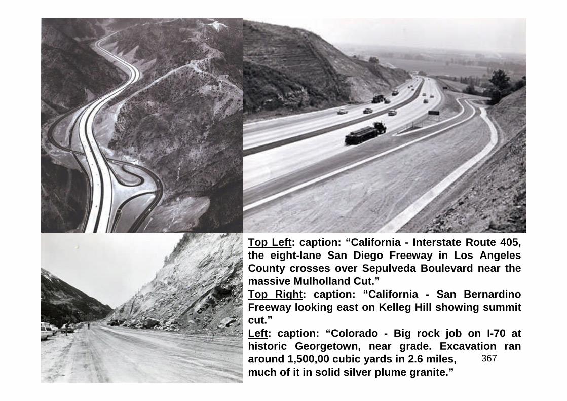
367
Top Left: caption: “California - Interstate Route 405,the eight-lane San Diego Freeway in Los AngelesCounty crosses over Sepulveda Boulevard near themassive Mulholland Cut.”Top Right: caption: “California - San BernardinoFreeway looking east on Kelleg Hill showing summitcut.”Left: caption: “Colorado - Big rock job on I-70 athistoric Georgetown, near grade. Excavation ranaround 1,500,00 cubic yards in 2.6 miles,much of it in solid silver plume granite.”
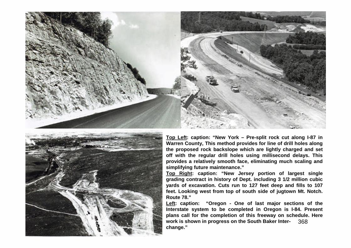
368
Top Left: caption: “New York – Pre-split rock cut along I-87 inWarren County, This method provides for line of drill holes alongthe proposed rock backslope which are lightly charged and setoff with the regular drill holes using millisecond delays. Thisprovides a relatively smooth face, eliminating much scaling andsimplifying future maintenance.”Top Right: caption: “New Jersey portion of largest singlegrading contract in history of Dept. including 3 1/2 million cubicyards of excavation. Cuts run to 127 feet deep and fills to 107feet. Looking west from top of south side of jugtown Mt. Notch.Route 78.”Left: caption: “Oregon - One of last major sections of theInterstate system to be completed in Oregon is I-84. Presentplans call for the completion of this freeway on schedule. Herework is shown in progress on the South Baker Inter-change.”
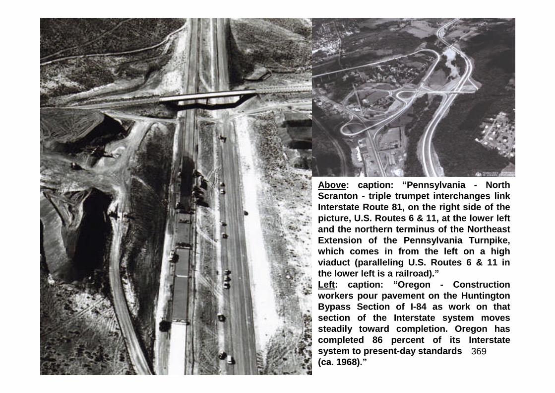
369
Above: caption: “Pennsylvania - NorthScranton - triple trumpet interchanges linkInterstate Route 81, on the right side of thepicture, U.S. Routes 6 & 11, at the lower leftand the northern terminus of the NortheastExtension of the Pennsylvania Turnpike,which comes in from the left on a highviaduct (paralleling U.S. Routes 6 & 11 inthe lower left is a railroad).”Left: caption: “Oregon - Constructionworkers pour pavement on the HuntingtonBypass Section of I-84 as work on thatsection of the Interstate system movessteadily toward completion. Oregon hascompleted 86 percent of its Interstatesystem to present-day standards(ca. 1968).”
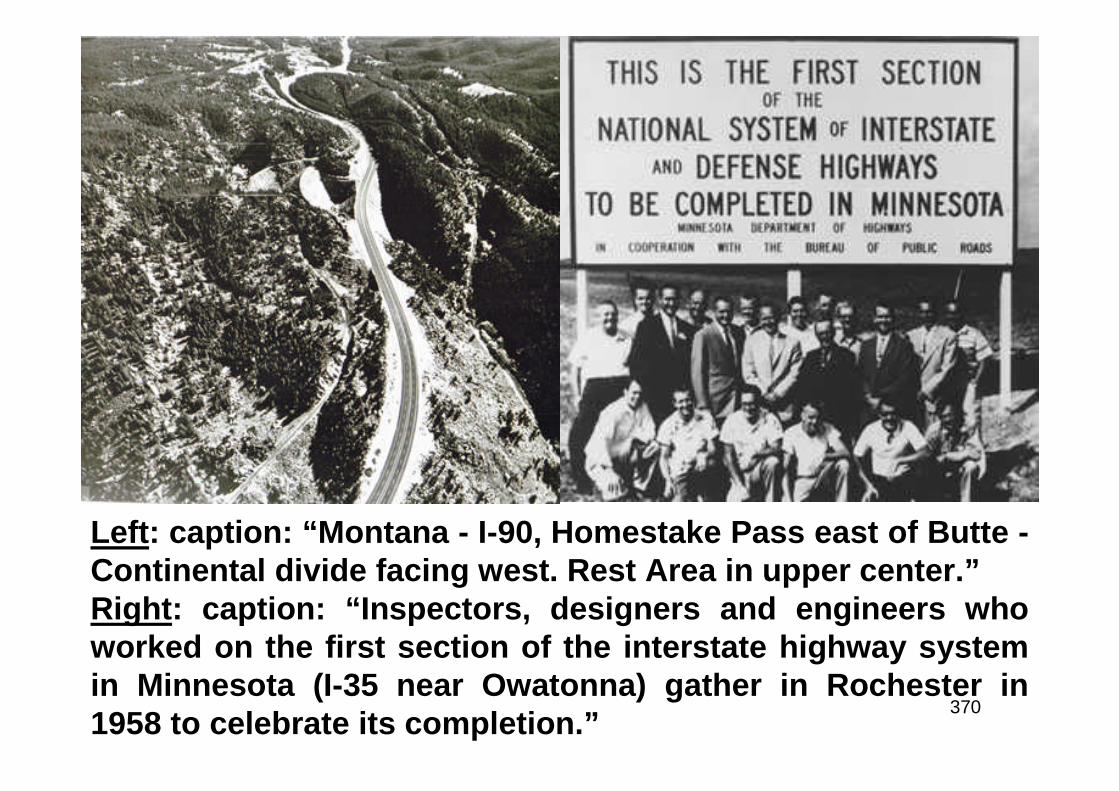
370
Left: caption: “Montana - I-90, Homestake Pass east of Butte -Continental divide facing west. Rest Area in upper center.”Right: caption: “Inspectors, designers and engineers whoworked on the first section of the interstate highway systemin Minnesota (I-35 near Owatonna) gather in Rochester in1958 to celebrate its completion.”
371
The Highway Research Board
372
The design of pavements and bridges on the Interstate Highway Systemlargely followed the results of road tests conducted by the AASHO. Thetest site in Ottawa, IL, was financed by state highway agencies, BPR, theDepartment of Defense, Automobile Manufacturers Association, AmericanPetroleum Institute, American Institute of Steel Construction, foreigncountries and U.S. materials and transportation associations. The“Highway Research Board” (HRB) administered the project. In August1956, workers began constructing seven miles of two-lane pavements inthe form of six loops and a tangent (straight), half concrete and halfasphalt. The 836 test sections employed a range of surface, base and sub-base thicknesses and included sixteen short-span bridges. Test trafficwas inaugurated on October 15th 1958, with the Dept. of Defenseproviding drivers and heavy vehicles. The road tests ended ob November30th 1960. The test data established the relationships for pavementstructural designs based on expected loadings over the life of apavement. Although the bridge findings were consistent with predictions,the road test provided the foundation for the analytical evaluation ofstresses and deflections from moving vehicles. The AASHO road test is alandmark in highway and bridge design. The straight portion of the trackis now part of I-80 in Illinois.
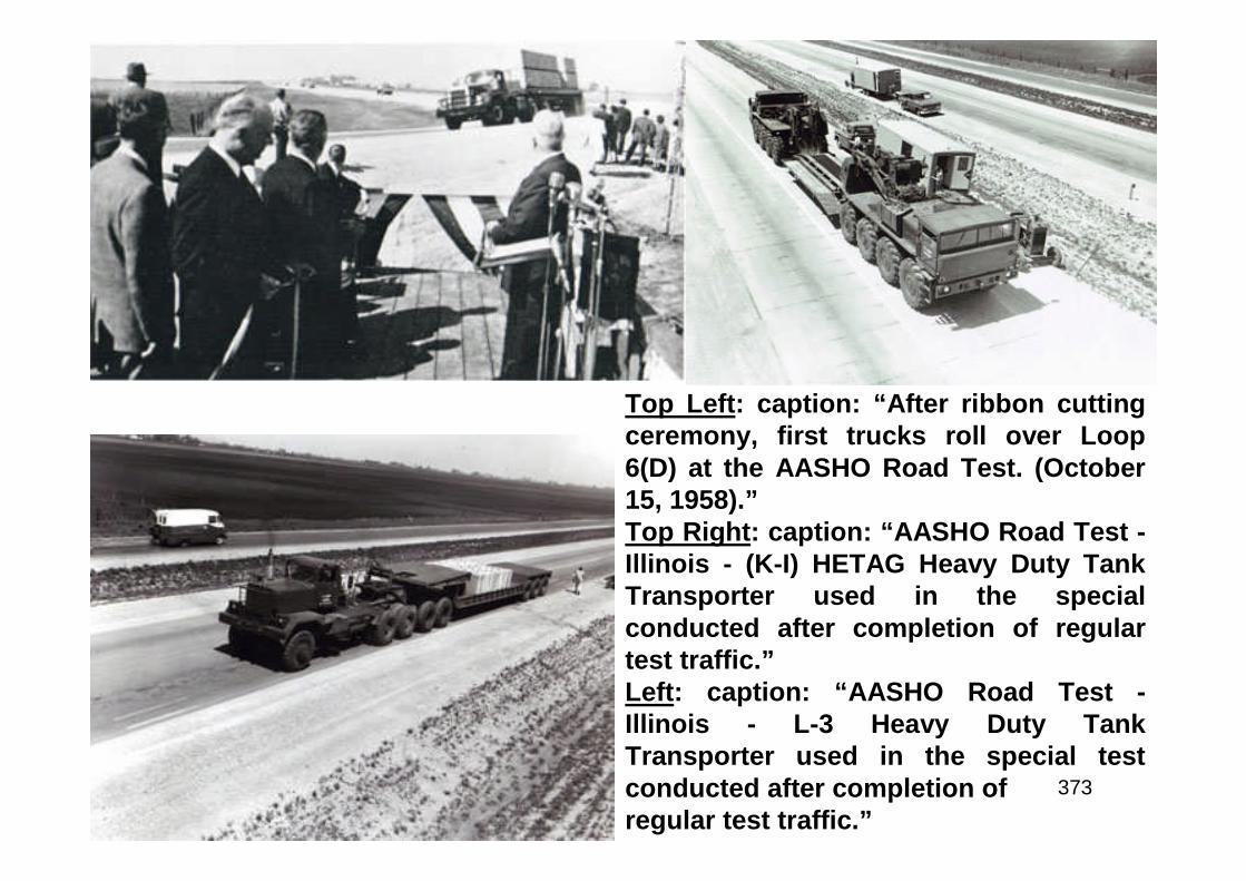
373
Top Left: caption: “After ribbon cuttingceremony, first trucks roll over Loop6(D) at the AASHO Road Test. (October15, 1958).”Top Right: caption: “AASHO Road Test -Illinois - (K-I) HETAG Heavy Duty TankTransporter used in the specialconducted after completion of regulartest traffic.”Left: caption: “AASHO Road Test -Illinois - L-3 Heavy Duty TankTransporter used in the special testconducted after completion ofregular test traffic.”
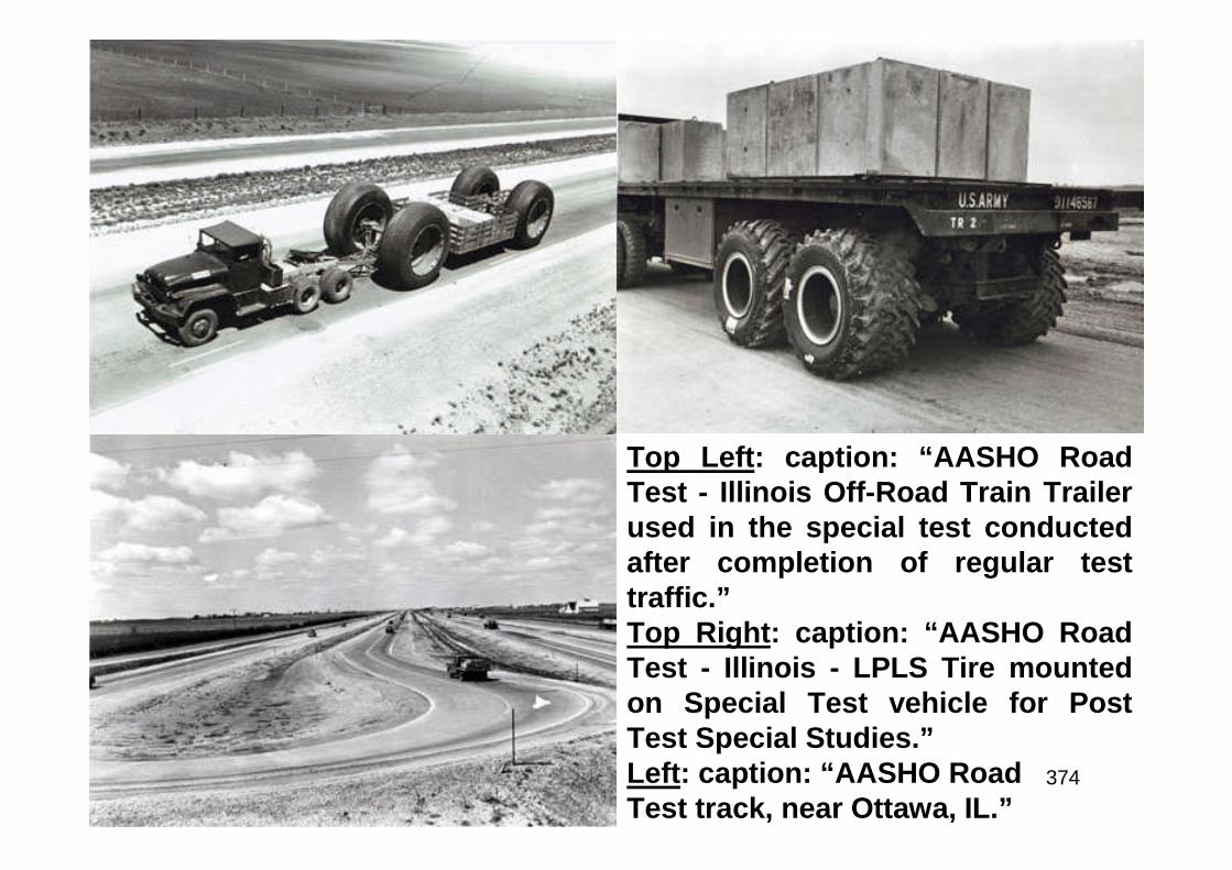
374
Top Left: caption: “AASHO RoadTest - Illinois Off-Road Train Trailerused in the special test conductedafter completion of regular testtraffic.”Top Right: caption: “AASHO RoadTest - Illinois - LPLS Tire mountedon Special Test vehicle for PostTest Special Studies.”Left: caption: “AASHO RoadTest track, near Ottawa, IL.”
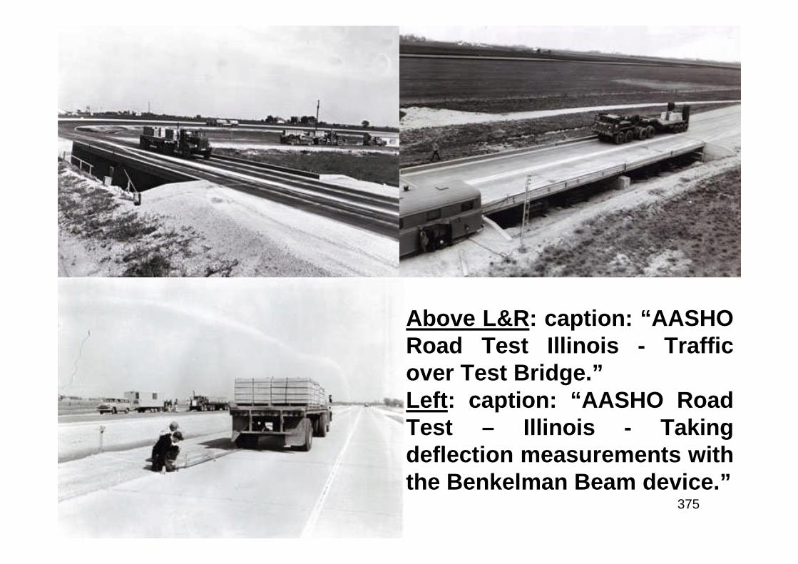
375
Above L&R: caption: “AASHORoad Test Illinois - Trafficover Test Bridge.”Left: caption: “AASHO RoadTest – Illinois - Takingdeflection measurements withthe Benkelman Beam device.”
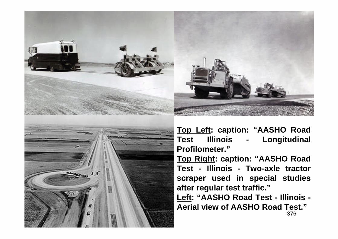
376
Top Left: caption: “AASHO RoadTest Illinois - LongitudinalProfilometer.”Top Right: caption: “AASHO RoadTest - Illinois - Two-axle tractorscraper used in special studiesafter regular test traffic.”Left: “AASHO Road Test - Illinois -Aerial view of AASHO Road Test.”
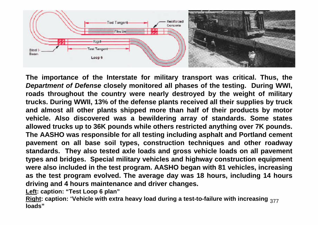
377
The importance of the Interstate for military transport was critical. Thus, theDepartment of Defense closely monitored all phases of the testing. During WWI,roads throughout the country were nearly destroyed by the weight of militarytrucks. During WWII, 13% of the defense plants received all their supplies by truckand almost all other plants shipped more than half of their products by motorvehicle. Also discovered was a bewildering array of standards. Some statesallowed trucks up to 36K pounds while others restricted anything over 7K pounds.The AASHO was responsible for all testing including asphalt and Portland cementpavement on all base soil types, construction techniques and other roadwaystandards. They also tested axle loads and gross vehicle loads on all pavementtypes and bridges. Special military vehicles and highway construction equipmentwere also included in the test program. AASHO began with 81 vehicles, increasingas the test program evolved. The average day was 18 hours, including 14 hoursdriving and 4 hours maintenance and driver changes.Left: caption: “Test Loop 6 plan”Right: caption: “Vehicle with extra heavy load during a test-to-failure with increasingloads”

378
“Much of the success ofOperation Desert Storm was dueto our logistical ability to rapidlymove troops to theater. The UShighway system supported themobilization of troops andmoved equipment and forces toUS embarkation ports – this wasKEY to successful deployment.”Lt. Gen. Kenneth Wykle, Deputy Commander inChief – U.S. Transportation CommandLeft: military convoy on the NJ Tpke.

379
Knowing Where You’re Going
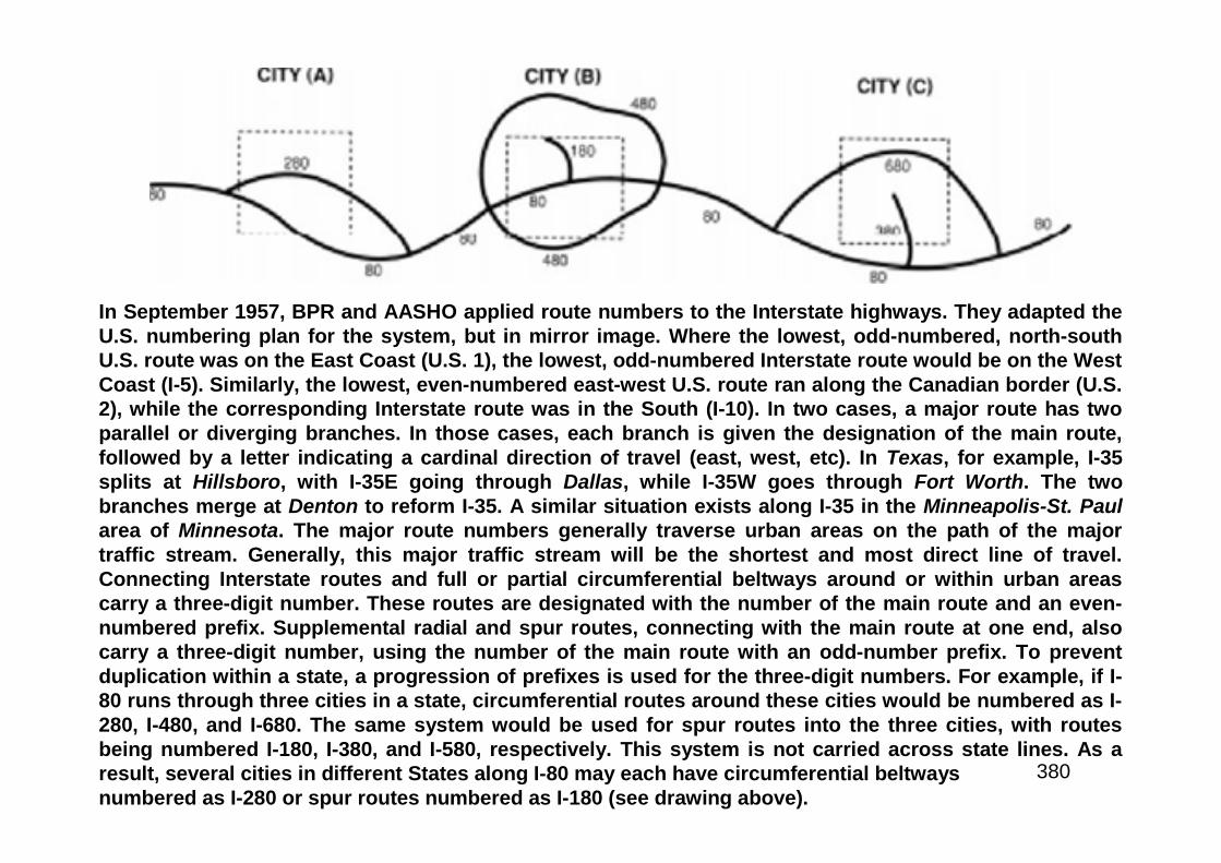
380
In September 1957, BPR and AASHO applied route numbers to the Interstate highways. They adapted theU.S. numbering plan for the system, but in mirror image. Where the lowest, odd-numbered, north-southU.S. route was on the East Coast (U.S. 1), the lowest, odd-numbered Interstate route would be on the WestCoast (I-5). Similarly, the lowest, even-numbered east-west U.S. route ran along the Canadian border (U.S.2), while the corresponding Interstate route was in the South (I-10). In two cases, a major route has twoparallel or diverging branches. In those cases, each branch is given the designation of the main route,followed by a letter indicating a cardinal direction of travel (east, west, etc). In Texas, for example, I-35splits at Hillsboro, with I-35E going through Dallas, while I-35W goes through Fort Worth. The twobranches merge at Denton to reform I-35. A similar situation exists along I-35 in the Minneapolis-St. Paularea of Minnesota. The major route numbers generally traverse urban areas on the path of the majortraffic stream. Generally, this major traffic stream will be the shortest and most direct line of travel.Connecting Interstate routes and full or partial circumferential beltways around or within urban areascarry a three-digit number. These routes are designated with the number of the main route and an even-numbered prefix. Supplemental radial and spur routes, connecting with the main route at one end, alsocarry a three-digit number, using the number of the main route with an odd-number prefix. To preventduplication within a state, a progression of prefixes is used for the three-digit numbers. For example, if I-80 runs through three cities in a state, circumferential routes around these cities would be numbered as I-280, I-480, and I-680. The same system would be used for spur routes into the three cities, with routesbeing numbered I-180, I-380, and I-580, respectively. This system is not carried across state lines. As aresult, several cities in different States along I-80 may each have circumferential beltwaysnumbered as I-280 or spur routes numbered as I-180 (see drawing above).
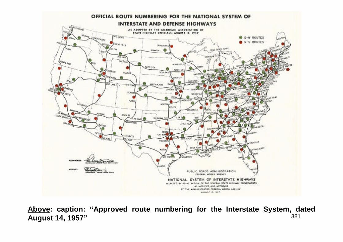
381Above: caption: “Approved route numbering for the Interstate System, datedAugust 14, 1957”
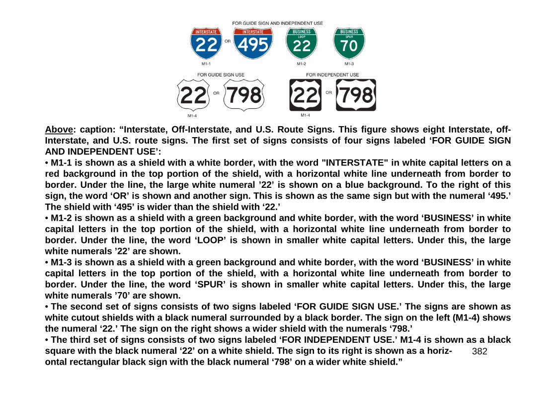
382
Above: caption: “Interstate, Off-Interstate, and U.S. Route Signs. This figure shows eight Interstate, off-Interstate, and U.S. route signs. The first set of signs consists of four signs labeled ‘FOR GUIDE SIGNAND INDEPENDENT USE’:• M1-1 is shown as a shield with a white border, with the word "INTERSTATE" in white capital letters on ared background in the top portion of the shield, with a horizontal white line underneath from border toborder. Under the line, the large white numeral ’22’ is shown on a blue background. To the right of thissign, the word ‘OR’ is shown and another sign. This is shown as the same sign but with the numeral ‘495.’The shield with ‘495’ is wider than the shield with ‘22.’• M1-2 is shown as a shield with a green background and white border, with the word ‘BUSINESS’ in whitecapital letters in the top portion of the shield, with a horizontal white line underneath from border toborder. Under the line, the word ‘LOOP’ is shown in smaller white capital letters. Under this, the largewhite numerals ’22’ are shown.• M1-3 is shown as a shield with a green background and white border, with the word ‘BUSINESS’ in whitecapital letters in the top portion of the shield, with a horizontal white line underneath from border toborder. Under the line, the word ‘SPUR’ is shown in smaller white capital letters. Under this, the largewhite numerals ’70’ are shown.• The second set of signs consists of two signs labeled ‘FOR GUIDE SIGN USE.’ The signs are shown aswhite cutout shields with a black numeral surrounded by a black border. The sign on the left (M1-4) showsthe numeral ‘22.’ The sign on the right shows a wider shield with the numerals ‘798.’• The third set of signs consists of two signs labeled ‘FOR INDEPENDENT USE.’ M1-4 is shown as a blacksquare with the black numeral ‘22’ on a white shield. The sign to its right is shown as a horiz-ontal rectangular black sign with the black numeral ‘798’ on a wider white shield.”
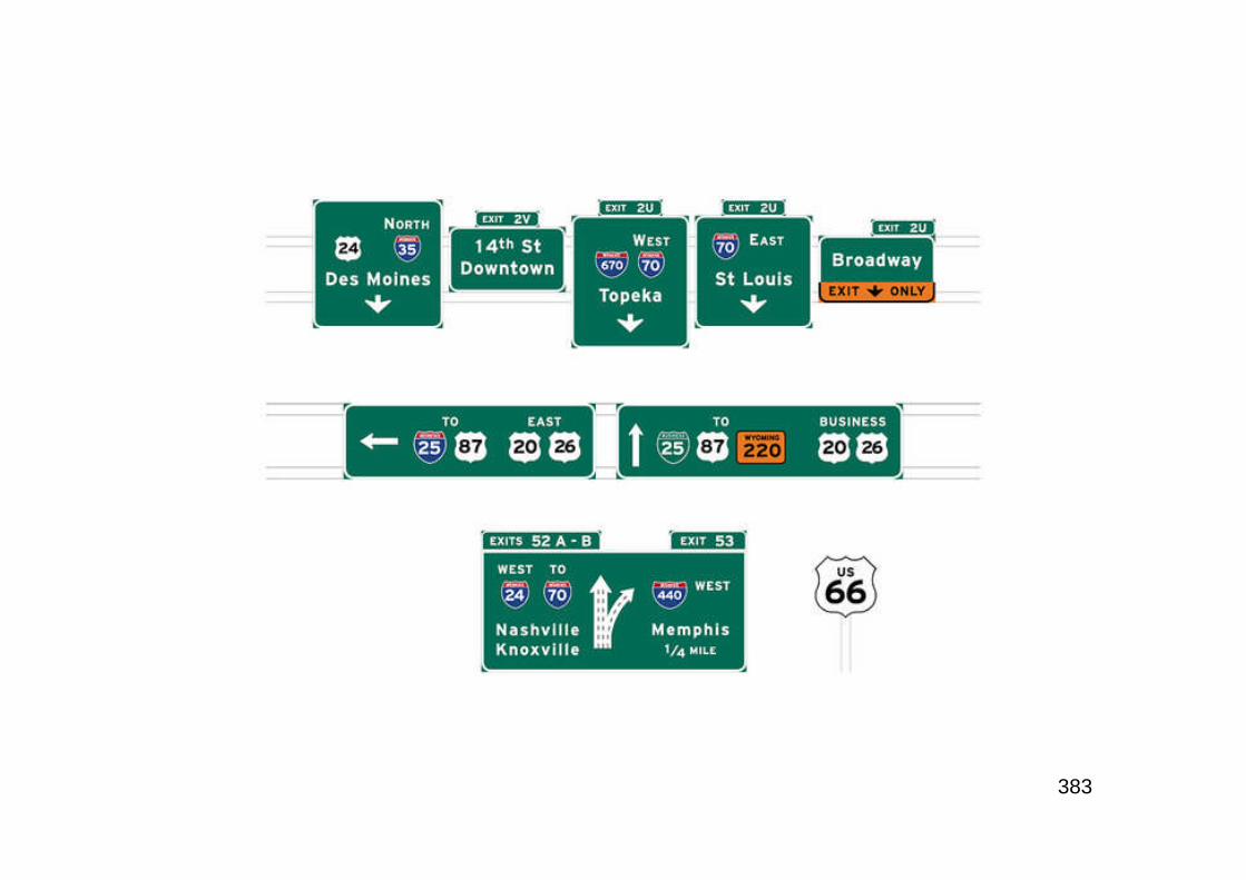
383
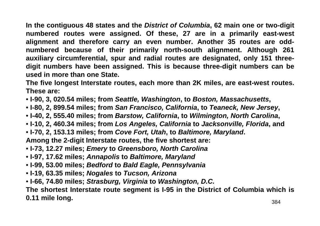
384
In the contiguous 48 states and the District of Columbia, 62 main one or two-digitnumbered routes were assigned. Of these, 27 are in a primarily east-westalignment and therefore carry an even number. Another 35 routes are odd-numbered because of their primarily north-south alignment. Although 261auxiliary circumferential, spur and radial routes are designated, only 151 three-digit numbers have been assigned. This is because three-digit numbers can beused in more than one State.The five longest Interstate routes, each more than 2K miles, are east-west routes.These are:• I-90, 3, 020.54 miles; from Seattle, Washington, to Boston, Massachusetts,• I-80, 2, 899.54 miles; from San Francisco, California, to Teaneck, New Jersey,• I-40, 2, 555.40 miles; from Barstow, California, to Wilmington, North Carolina,• I-10, 2, 460.34 miles; from Los Angeles, California to Jacksonville, Florida, and• I-70, 2, 153.13 miles; from Cove Fort, Utah, to Baltimore, Maryland.Among the 2-digit Interstate routes, the five shortest are:• I-73, 12.27 miles; Emery to Greensboro, North Carolina• I-97, 17.62 miles; Annapolis to Baltimore, Maryland• I-99, 53.00 miles; Bedford to Bald Eagle, Pennsylvania• I-19, 63.35 miles; Nogales to Tucson, Arizona• I-66, 74.80 miles; Strasburg, Virginia to Washington, D.C.The shortest Interstate route segment is I-95 in the District of Columbia which is0.11 mile long.

385
The official Interstate sign was also unveiled in September 1957. The states had submitteddesigns that AASHO then narrowed to four. Full-size versions of the signs were erected on aroad near the AASHO road test site while a special meeting of the organization wasunderway in August 1957. State highway officials were able to observe the signs in daylight,dark, rain and shine. They decided on a combination of designs submitted byMissouri and Texas - the now familiar red, white, and blue shield.
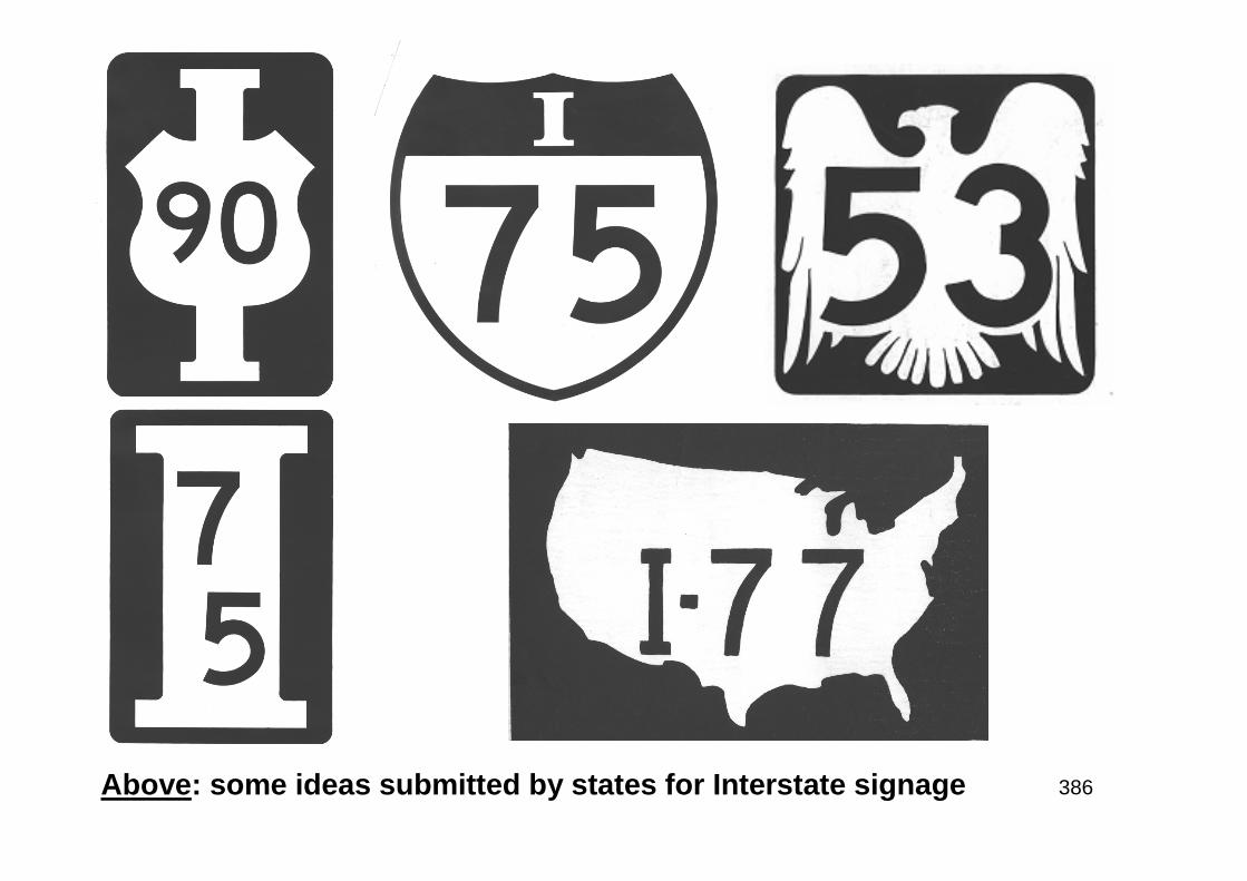
386Above: some ideas submitted by states for Interstate signage
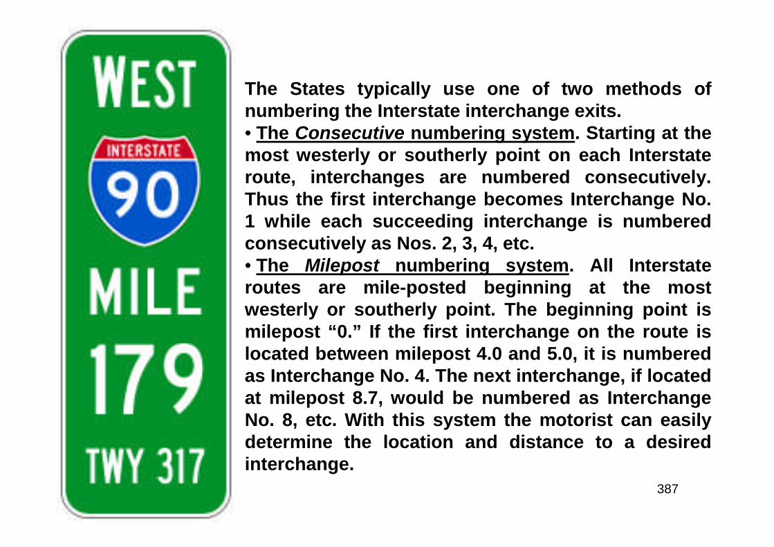
387
The States typically use one of two methods ofnumbering the Interstate interchange exits.• The Consecutive numbering system. Starting at themost westerly or southerly point on each Interstateroute, interchanges are numbered consecutively.Thus the first interchange becomes Interchange No.1 while each succeeding interchange is numberedconsecutively as Nos. 2, 3, 4, etc.• The Milepost numbering system. All Interstateroutes are mile-posted beginning at the mostwesterly or southerly point. The beginning point ismilepost “0.” If the first interchange on the route islocated between milepost 4.0 and 5.0, it is numberedas Interchange No. 4. The next interchange, if locatedat milepost 8.7, would be numbered as InterchangeNo. 8, etc. With this system the motorist can easilydetermine the location and distance to a desiredinterchange.

388
Problems & Solutions
389
As the first fiscal year of the Interstate program ended in June 1957, FederalHighway Administrator Tallamy reported that, based on engineering andeconomic studies, BPR had approved 80% of the locations within the original 40K-mile limit. Furthermore, state highway agencies completed improvements on 737miles of the Interstate System at a total cost of $173.3 million (Federal share:$117.8 million). BPR added that planning and construction were “going on at afurious pace throughout the Nation.” But Tallamy also acknowledged thatproblems had been encountered. For example, he noted that engineers and steelwere in short supply. Another problem was a requirement in the 1956 act that thestates hold public hearings to consider the economic effects of the location if aFederal-aid highway project involved bypassing or going through a city, town, orvillage. Right-of-way acquisition was another concern because so much of theInterstate System would be built on new locations. State highway agencies hadrarely needed to acquire land or to do so by eminent domain. Thus, the statesneeded new legislation, standards and appraisers - post-haste. The first problemsarose in Indiana, where speculators were buying land in the Interstate corridors toresell to the state at inflated values. However, he greatest shock of 1957 involvedthe urban routes, which - contrary to the estimate of requiring just $4 billion of thetotal $27 billion - would consume about half of the Interstate funds. Despite thereal problems and dire predictions, the highway community had much to celebrateas 1957 ended. The states broke the record in dollars invested in all highwaydevelopment by spending nearly $4.6 billion. Through December 1st 1957, morethan $1 billion in Federal and State funds had been committed to Inter-state projects, and projects totaling $247 million were completed.
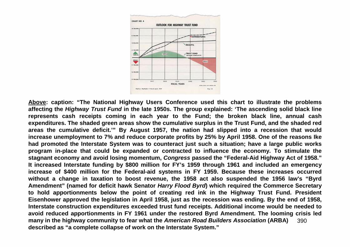
390
Above: caption: “The National Highway Users Conference used this chart to illustrate the problemsaffecting the Highway Trust Fund in the late 1950s. The group explained: ‘The ascending solid black linerepresents cash receipts coming in each year to the Fund; the broken black line, annual cashexpenditures. The shaded green areas show the cumulative surplus in the Trust Fund, and the shaded redareas the cumulative deficit.’” By August 1957, the nation had slipped into a recession that wouldincrease unemployment to 7% and reduce corporate profits by 25% by April 1958. One of the reasons Ikehad promoted the Interstate System was to counteract just such a situation; have a large public worksprogram in-place that could be expanded or contracted to influence the economy. To stimulate thestagnant economy and avoid losing momentum, Congress passed the “Federal-Aid Highway Act of 1958.”It increased Interstate funding by $800 million for FY’s 1959 through 1961 and included an emergencyincrease of $400 million for the Federal-aid systems in FY 1959. Because these increases occurredwithout a change in taxation to boost revenue, the 1958 act also suspended the 1956 law's “ByrdAmendment” (named for deficit hawk Senator Harry Flood Byrd) which required the Commerce Secretaryto hold apportionments below the point of creating red ink in the Highway Trust Fund. PresidentEisenhower approved the legislation in April 1958, just as the recession was ending. By the end of 1958,Interstate construction expenditures exceeded trust fund receipts. Additional income would be needed toavoid reduced apportionments in FY 1961 under the restored Byrd Amendment. The looming crisis ledmany in the highway community to fear what the American Road Builders Association (ARBA)described as “a complete collapse of work on the Interstate System.”
391
To maintain the construction schedule, Ike recommended a temporary1.5-cent increase in the gas tax, but the Federal-Aid Highway Act of 1959added only a penny (increasing the tax to 4 cents a gallon) through June1961. The legislation, which the President approved on September 21st
1959, also reduced FY 1961 Interstate authorizations to $2 billion, butbecause of the Byrd Amendment BPR could apportion only $1.8 billion.Critics attributed the funding imbalance to “gold-plating,” especially inurban areas. They created the term “90-itis” to describe the attitude ofstate highway officials who, they said, had no reason to be economicalbecause the Federal Government was picking up 90% of the cost. Ikeasked a member of his staff; Major General John Bragdon (U.S. Army,ret.), to study the Interstate program with attention to delineating Federalvs. State and local responsibilities in financing, planning and supervisingthe highway program. Bragdon also would be responsible for determiningways to improve coordination between planning for Federal-aid highwaysand state and local planning, especially for urban areas.
392
Urban Revolt

393
“…not a study of the real problems…jammed through Congress soblithely and lightly on a dubious pretext…a necessary part of our defenseprogram…nonsense…there is no defense against total extermination innuclear warfare, no defense except peace.”Lewis Mumford, Architectural CriticRE: his criticism of Congress for the Interstate Highway System as being poorlyplanned and conceived for urban areas. In reaction to the intensity of objectionsto the Interstate System from many quarters, in October 1958 a summit was heldat Syracuse University whereby the highway community tried to regain good will.Committees of the American Municipal Association, AASHO and HighwayResearch Board joined the university in what was dubbed the first “NationalConference on Highways and Urban Development.” Funded by the AutomotiveSafety Foundation, the conference featured highway officials and elected officials(primarily mayors) who supported the goal of making the Interstate System workfor the orderly development of urban communities. However, critics such asLewis Mumford were not invited. A “grand accounting” by which the advantagesand disadvantages of each alternative for highway users and the community wereto be evaluated was the conference’s goal.
394
“...a vast program thrown together, imperfectly conceivedand grossly mismanaged, and in due course becoming averitable playground for extravagance, waste, and cor-ruption.”The Wall Street Journal (ca. 1960)
395
“…the crisis has come. In one metropolis after another, theplans have been thrown together and the bulldozers set towork…almost any effort to think a bit about what we aredoing would help…it will be necessary to investigate theinvestigators…We may yet impart some sanity and publicpurpose to this vast enterprise…Roads can make or break aNation.”RE: in an article entitled: “New Roads and Urban Chaos” (appearing in theApril 14th 1960 issue of The Reporter magazine), author Daniel P.Moynihan - a college professor who had served on the staff of New YorkState Governor Averill Harriman, outlined his concerns over the impact ofthe Interstate System on urban areas (excerpted above). Future U.S.Senator for New York Moynihan was certain pending congressionalinvestigations would turn up corruption, incompetence and thievery andhe hoped for a serious reappraisal of the whole Interstate Highwayprogram with the coming of a new presidential administration in January1961.
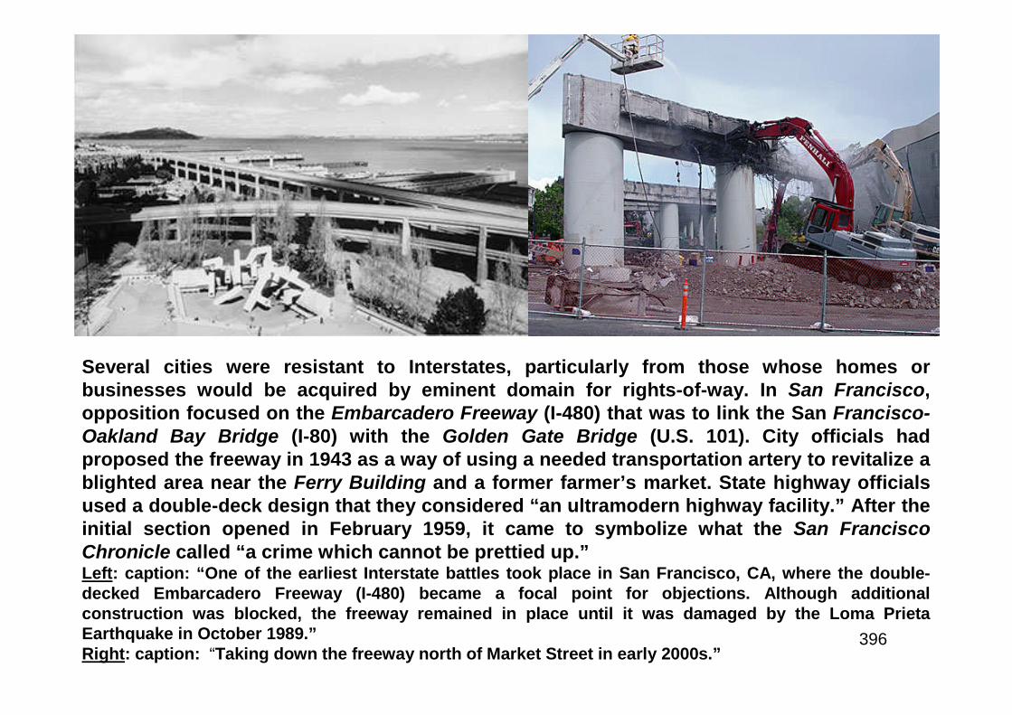
396
Several cities were resistant to Interstates, particularly from those whose homes orbusinesses would be acquired by eminent domain for rights-of-way. In San Francisco,opposition focused on the Embarcadero Freeway (I-480) that was to link the San Francisco-Oakland Bay Bridge (I-80) with the Golden Gate Bridge (U.S. 101). City officials hadproposed the freeway in 1943 as a way of using a needed transportation artery to revitalize ablighted area near the Ferry Building and a former farmer’s market. State highway officialsused a double-deck design that they considered “an ultramodern highway facility.” After theinitial section opened in February 1959, it came to symbolize what the San FranciscoChronicle called “a crime which cannot be prettied up.”Left: caption: “One of the earliest Interstate battles took place in San Francisco, CA, where the double-decked Embarcadero Freeway (I-480) became a focal point for objections. Although additionalconstruction was blocked, the freeway remained in place until it was damaged by the Loma PrietaEarthquake in October 1989.”Right: caption: “Taking down the freeway north of Market Street in early 2000s.”
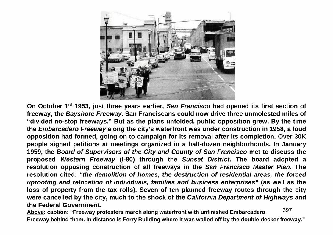
397
On October 1st 1953, just three years earlier, San Francisco had opened its first section offreeway; the Bayshore Freeway. San Franciscans could now drive three unmolested miles of“divided no-stop freeways.” But as the plans unfolded, public opposition grew. By the timethe Embarcadero Freeway along the city’s waterfront was under construction in 1958, a loudopposition had formed, going on to campaign for its removal after its completion. Over 30Kpeople signed petitions at meetings organized in a half-dozen neighborhoods. In January1959, the Board of Supervisors of the City and County of San Francisco met to discuss theproposed Western Freeway (I-80) through the Sunset District. The board adopted aresolution opposing construction of all freeways in the San Francisco Master Plan. Theresolution cited: “the demolition of homes, the destruction of residential areas, the forceduprooting and relocation of individuals, families and business enterprises” (as well as theloss of property from the tax rolls). Seven of ten planned freeway routes through the citywere cancelled by the city, much to the shock of the California Department of Highways andthe Federal Government.Above: caption: “Freeway protesters march along waterfront with unfinished Embarcadero
Freeway behind them. In distance is Ferry Building where it was walled off by the double-decker freeway.”

398
Freeway builders continuedto resurrect various routesaround and across the city,encountering heavy, per-sistent and very well-organized resistance by SanFrancisco activists. In 1964,the battle over the Pan-handle-Golden Gate ParkFreeway came to a climaxwith a May 17th 1964 rally tosave the park. On October13th 1964, in a six-to-fivevote, the San FranciscoBoard of Supervisors rej-ected the Park Freeway.Left: caption: “1948 trafficwaysplan for San Francisco, withplans for freeways crisscrossingthe city and destroying many ofits best neighborhoods.”
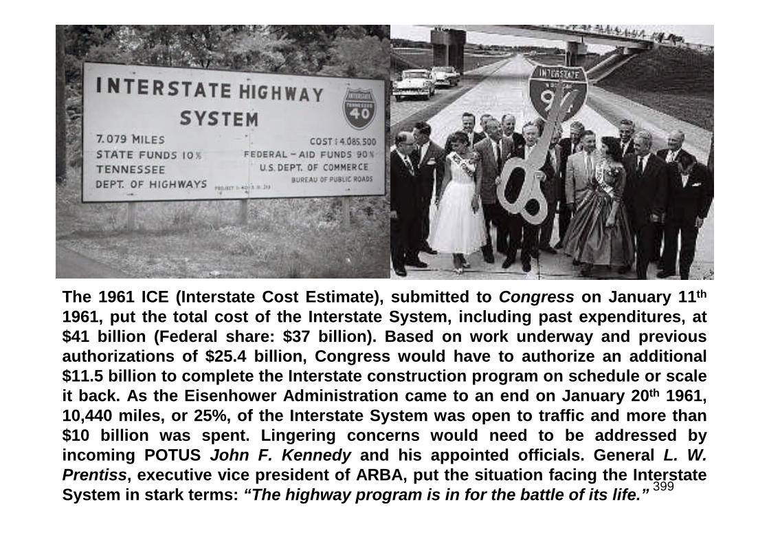
399
The 1961 ICE (Interstate Cost Estimate), submitted to Congress on January 11th
1961, put the total cost of the Interstate System, including past expenditures, at$41 billion (Federal share: $37 billion). Based on work underway and previousauthorizations of $25.4 billion, Congress would have to authorize an additional$11.5 billion to complete the Interstate construction program on schedule or scaleit back. As the Eisenhower Administration came to an end on January 20th 1961,10,440 miles, or 25%, of the Interstate System was open to traffic and more than$10 billion was spent. Lingering concerns would need to be addressed byincoming POTUS John F. Kennedy and his appointed officials. General L. W.Prentiss, executive vice president of ARBA, put the situation facing the InterstateSystem in stark terms: “The highway program is in for the battle of its life.”

400
Our Great Big Highway Bungle
401
Even as construction of the Interstate Highway System progressed at a recordpace, a looming fiscal crisis threatened to derail the schedule, if not the entireprogram. According to the 1961 ICE, Congress would have to provide anadditional $11 billion to maintain the schedule. Controversy dogged constructionin urban areas. The press repeated tales of alleged corruption and bungling thathad given the program the disparaging label: “our great big highway bungle.” OnNovember 8th 1960, Senator John F. Kennedy won the presidential election.Eisenhower and his successor were from different generations and politicalparties, but Kennedy shared Ike’s concern about the future of the National Systemof Interstate and Defense Highways, recognizing its importance to the economyand future of the nation. President-elect Kennedy selected Governor Luther H.Hodges of North Carolina to be Secretary of Commerce. Within that agency, thenew Federal Highway Administrator of BPR would be Rex Whitton. Whitton’scareer with the Missouri State Highway Agency had begun in 1920 when heaccepted a job operating a level on a survey crew for $110 a month, plus fieldexpenses. He became chief engineer in 1951, leading to his role as president ofthe AASHO in 1956. Whitton represented AASHO before Congress during thatcritical year and oversaw revision of the 1945 geometric design standards for theInterstate System. The new edition was approved in July 1956 and quicklyadopted by BPR. Whitton also had ensured in August that Missouri would havethe first project to go to contract after President Eisenhower approved theFederal-Aid Highway Act of 1956. Whitton became the third Federal HighwayAdministrator on February 10th 1961.

402
“…Increased public education is essential in the face of the negativepublicity…There is no instant panacea for the trouble besetting thehighway program…can and must be completed by 1972…give the jobeverything I have.”RE: in his first speech as Federal Highway Administrator (to a meeting of ARBA in AtlanticCity, NJ in March 1961), Whitton identified three problems that required resolution:• Funding• Scandals• Public ApathyWith funding being the priority, Whitton explained that, in 1959, President Eisenhower hadsigned legislation increasing the gas tax to 4 cents per gallon as a temporary measure thatwould expire July 1st 1961, returning the tax to 3 cents. The reduction was vigorouslyopposed by the new administration. Whitton recommended tax changes that would add $9.7billion over roughly a ten-year period, or about $900 million per year, for the Interstateprogram. On June 29th 1961, exactly five years after President Eisenhower had approved the1956 law, President Kennedy approved the “Federal-Aid Highway Act of 1961.” The new lawmade the 4-cent gas tax permanent and adjusted other excise taxes to support completionof the Interstate System on the basis of the latest ICE. It also adjusted remainingauthorizations for the system to a total of $25.2 billion over nine years. With state matchingfunds, the legislation accounted for $27 billion in funding for the remainder of the programthrough FY 1971 - the same amount Congress had allocated in 1956 to cover the total cost ofthe program. After President Kennedy signed of the 1961 act, completion of the InterstateSystem was never again in doubt.
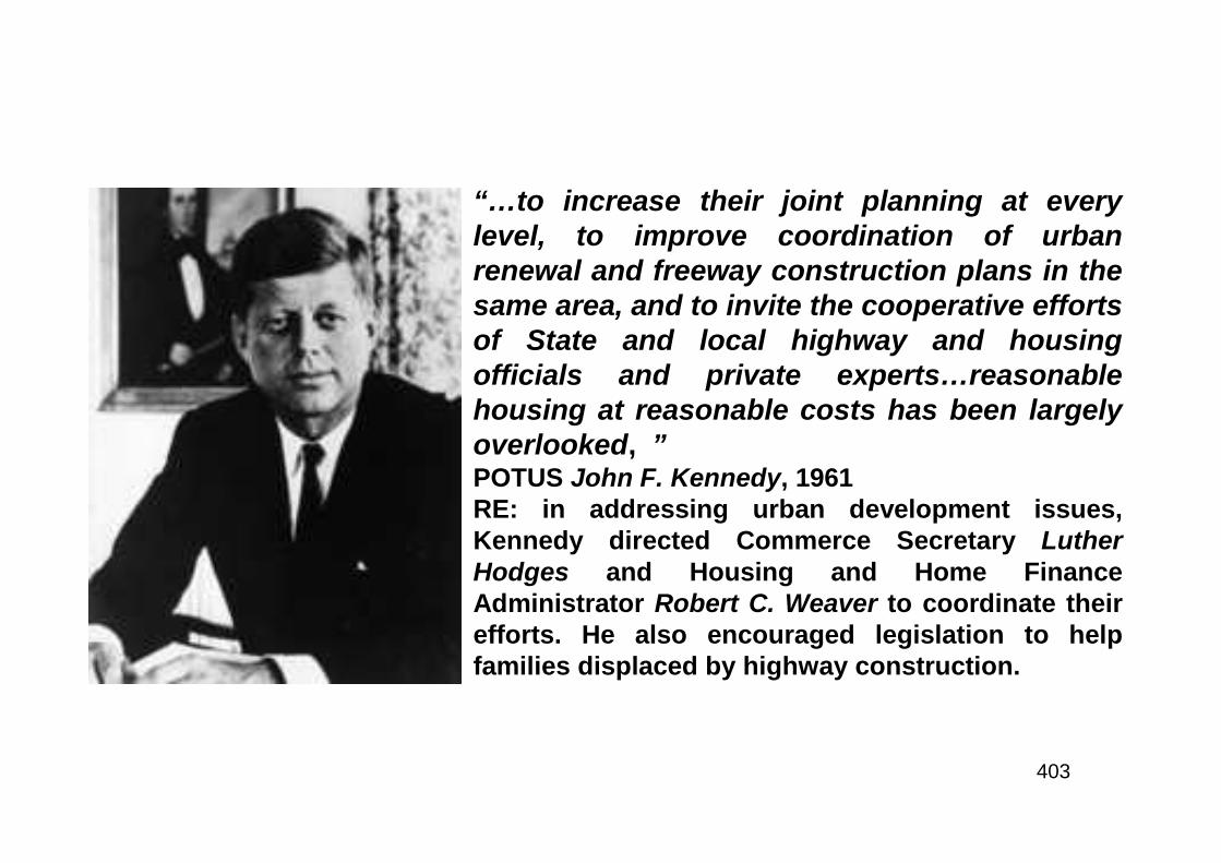
403
“…to increase their joint planning at everylevel, to improve coordination of urbanrenewal and freeway construction plans in thesame area, and to invite the cooperative effortsof State and local highway and housingofficials and private experts…reasonablehousing at reasonable costs has been largelyoverlooked, ”POTUS John F. Kennedy, 1961RE: in addressing urban development issues,Kennedy directed Commerce Secretary LutherHodges and Housing and Home FinanceAdministrator Robert C. Weaver to coordinate theirefforts. He also encouraged legislation to helpfamilies displaced by highway construction.
404
National Highway Week

405
“…Today, wherever we look throughout our country,we find that the Interstate System is spurring newindustrial and commercial development, creating newjobs, and generating new economic growth for thebenefit of all Americans.”RE: excerpt from article authored by Federal HighwayAdministrator Rex Whitton (left), appearing in Sundaynewspapers around the country in August 1964. In April 1961,President Kennedy issued a proclamation declaring that theweek of May 21st through 27th 1961 would be “NationalHighway Week.” It was an opportunity for Federal and Statehighway officials and the nation’s governors to remind thepublic of the “vital role of highway transportation in our way oflife.” Whitton began a public relations initiative to counter thebad press the Interstate program was receiving. The campaignincluded his appearance at highway openings around thecountry, each an opportunity to gain positive publicity in localnewspapers. By the time he left office in December 1966,Whitton had attended more Interstate openings than anyFederal Highway Administrator before or since. As he traveledthe country, Whitton continued to meet with the press to sharehis optimism about the future awaiting the country in the early1970’s when the Interstate System would be completed.
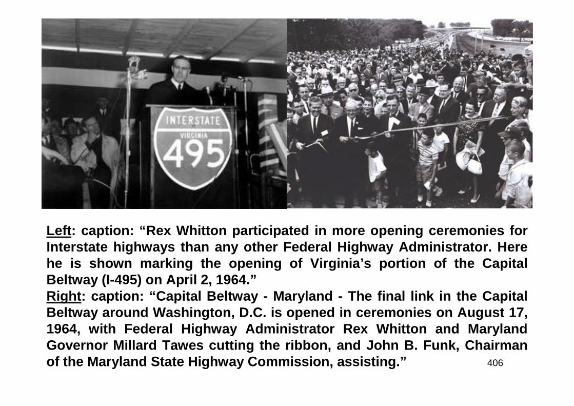
406
Left: caption: “Rex Whitton participated in more opening ceremonies forInterstate highways than any other Federal Highway Administrator. Herehe is shown marking the opening of Virginia’s portion of the CapitalBeltway (I-495) on April 2, 1964.”Right: caption: “Capital Beltway - Maryland - The final link in the CapitalBeltway around Washington, D.C. is opened in ceremonies on August 17,1964, with Federal Highway Administrator Rex Whitton and MarylandGovernor Millard Tawes cutting the ribbon, and John B. Funk, Chairmanof the Maryland State Highway Commission, assisting.”
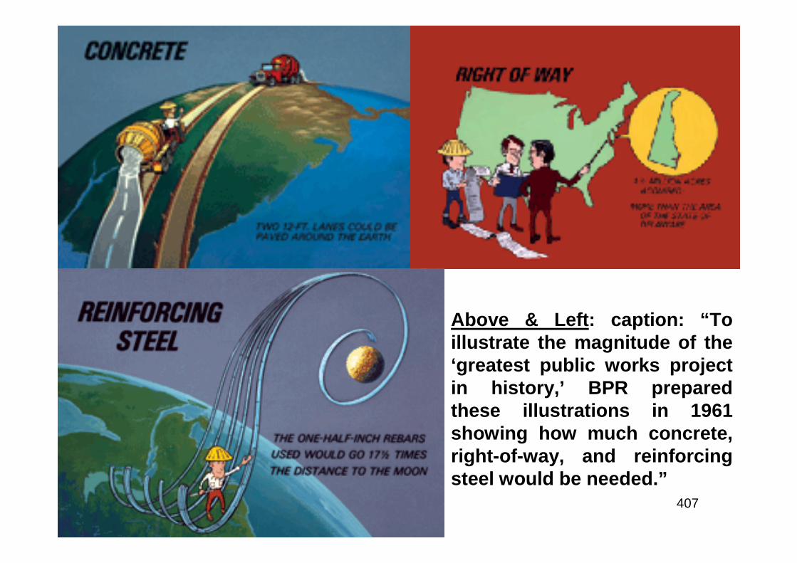
407
Above & Left: caption: “Toillustrate the magnitude of the‘greatest public works projectin history,’ BPR preparedthese illustrations in 1961showing how much concrete,right-of-way, and reinforcingsteel would be needed.”
408
The Great Highway Robbery
409
“Corruption permeates the highway program and stigmatizes the wholeroad-building industry.”Representative John A. Blatnik, Chairman - Special House Subcommitteeinvestigating corruption in the Federal-Aid Highway ProgramRE: in the February 4th 1962 issue of Parade magazine, investigative journalistJack Anderson wrote about “The Great Highway Robbery,” quoting representativeBlatnik in the article. The Blatnik committee cited examples of graft, payola, abuseof right-of-way appraisals and poor judgment, predominantly in smaller states. Inresponse, In July 1962, BPR – in cooperation with the Blatnik Committee, FBI,General Accounting Office (GAO) and state investigative units, established the“Office of Right-of-Way and Location.” The new office would be responsible forroute location and ensuring that right-of-way would be acquired properly and atfair cost. In addition, former FBI agent Joseph M. O’Connor would direct a new“Office of Audit and Investigations,” which would probe allegations of fraud, landspeculation, collusion and other irregularities as well as audit state claims forreimbursement of the Federal share of project costs. Simultaneously (beginningin May 1961), the Blatnik Committee issued reports on its findings. The reportscovered a variety of topics including highway construction practices, right-of-wayacquisition, the relationship between road contractors and state personnel as wellas disposition of right-of-way improvements. The Blatnik Committee, combinedwith policing efforts by BPR, state highway agencies and investigative agenciesdefused the crisis. The allegations would resurface in later critical articles andbooks, but the danger to the Interstate Highway program had passed.
410
“…the achievement of sound land-use patterns, theassurance of transportation facilities for all segments of thepopulation, the improvement in overall traffic flow, and themeeting of total urban transportation needs at minimumcost…consistent with adequate, comprehensive developmentplans for the metropolitan area or are based on results of acontinuing process carried on cooperatively by the Statesand local communities...will be an integral part of a soundlybased, balanced transportation system for the area involved.”RE: in March 1962, Commerce Secretary Hodges and Housing and HomeFinance Administrator Weaver reported to President Kennedy onredressing urban transportation problems, outlining their majorobjectives. Their report recommended that beginning July 1st 1965,approval of Federal-aid highway projects in any metropolitan area shouldbe contingent on a finding by the Commerce Secretary.
411
The Transportation System of Our Nation
412
“An efficient and dynamic transportation system is vital to our domesticeconomic growth, productivity, and progress. Affecting the cost of everycommodity we consume or export, it is equally vital to our ability to competeabroad. It influences both the cost and the flexibility of our defense preparedness,and both the business and recreational opportunities of our citizens…to authorizepayments not to exceed $200 in the case of individuals and families and$3,000...in the case of business concerns or nonprofit organizations displaced asa result of land acquisitions under these programs.”POTUS John F. KennedyRE: in April 1962, President Kennedy submitted a message to Congress on “TheTransportation System of our Nation.” The message covered a wide range of topics relatedto transportation. Kennedy recommended that Congress establish a long-term program ofFederal aid to urban mass transportation ($500 million over three years) in the form of directgrants to public agencies. Because highways would remain an “instrumental part” of urbantransportation, the President asked for changes in U.S. Department of Commerce policy andFederal law to bring urban Federal-aid highway construction more in line with thecomprehensive development plans for metropolitan areas. In addition, he cited SecretaryHodges’s estimate that 15K families and 1,500 businesses were being displaced byInterstate construction each year. With Federal urban renewal programs as a model,Kennedy submitted legislation to authorize compensation for displacement due to InterstateHighway construction.

413
Nothing Succeeds Like Success
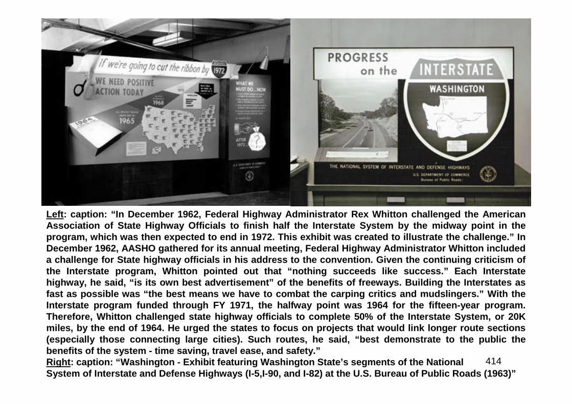
414
Left: caption: “In December 1962, Federal Highway Administrator Rex Whitton challenged the AmericanAssociation of State Highway Officials to finish half the Interstate System by the midway point in theprogram, which was then expected to end in 1972. This exhibit was created to illustrate the challenge.” InDecember 1962, AASHO gathered for its annual meeting, Federal Highway Administrator Whitton includeda challenge for State highway officials in his address to the convention. Given the continuing criticism ofthe Interstate program, Whitton pointed out that “nothing succeeds like success.” Each Interstatehighway, he said, “is its own best advertisement” of the benefits of freeways. Building the Interstates asfast as possible was “the best means we have to combat the carping critics and mudslingers.” With theInterstate program funded through FY 1971, the halfway point was 1964 for the fifteen-year program.Therefore, Whitton challenged state highway officials to complete 50% of the Interstate System, or 20Kmiles, by the end of 1964. He urged the states to focus on projects that would link longer route sections(especially those connecting large cities). Such routes, he said, “best demonstrate to the public thebenefits of the system - time saving, travel ease, and safety.”Right: caption: “Washington - Exhibit featuring Washington State’s segments of the NationalSystem of Interstate and Defense Highways (I-5,I-90, and I-82) at the U.S. Bureau of Public Roads (1963)”
415

416
The Quiet Crisis
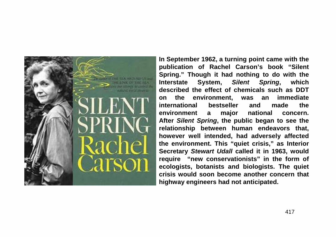
417
In September 1962, a turning point came with thepublication of Rachel Carson’s book “SilentSpring.” Though it had nothing to do with theInterstate System, Silent Spring, whichdescribed the effect of chemicals such as DDTon the environment, was an immediateinternational bestseller and made theenvironment a major national concern.After Silent Spring, the public began to see therelationship between human endeavors that,however well intended, had adversely affectedthe environment. This “quiet crisis,” as InteriorSecretary Stewart Udall called it in 1963, wouldrequire “new conservationists” in the form ofecologists, botanists and biologists. The quietcrisis would soon become another concern thathighway engineers had not anticipated.
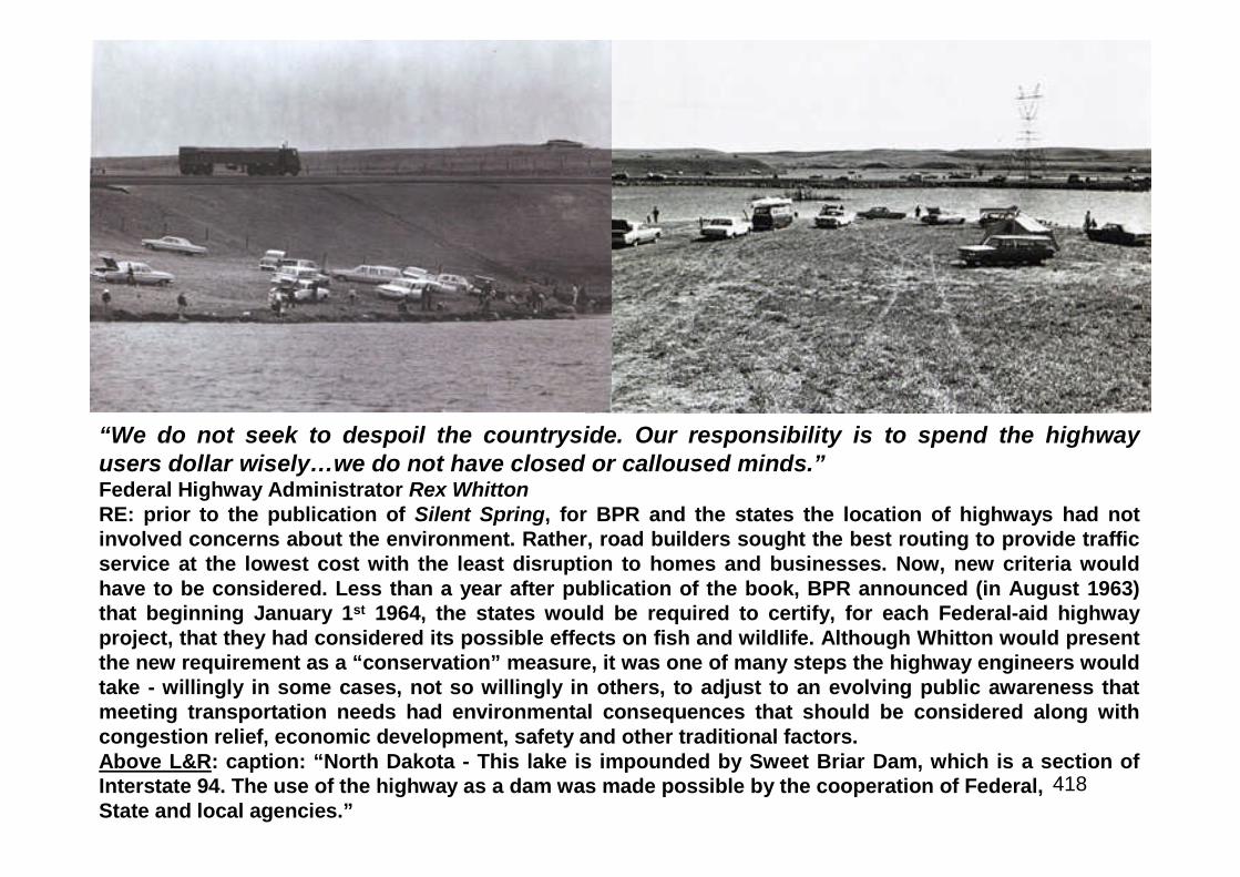
418
“We do not seek to despoil the countryside. Our responsibility is to spend the highwayusers dollar wisely…we do not have closed or calloused minds.”Federal Highway Administrator Rex WhittonRE: prior to the publication of Silent Spring, for BPR and the states the location of highways had notinvolved concerns about the environment. Rather, road builders sought the best routing to provide trafficservice at the lowest cost with the least disruption to homes and businesses. Now, new criteria wouldhave to be considered. Less than a year after publication of the book, BPR announced (in August 1963)that beginning January 1st 1964, the states would be required to certify, for each Federal-aid highwayproject, that they had considered its possible effects on fish and wildlife. Although Whitton would presentthe new requirement as a “conservation” measure, it was one of many steps the highway engineers wouldtake - willingly in some cases, not so willingly in others, to adjust to an evolving public awareness thatmeeting transportation needs had environmental consequences that should be considered along withcongestion relief, economic development, safety and other traditional factors.Above L&R: caption: “North Dakota - This lake is impounded by Sweet Briar Dam, which is a section ofInterstate 94. The use of the highway as a dam was made possible by the cooperation of Federal,State and local agencies.”

419
Partnership for Progress
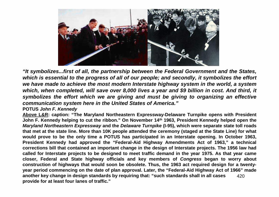
420
“It symbolizes...first of all, the partnership between the Federal Government and the States,which is essential to the progress of all of our people; and secondly, it symbolizes the effortwe have made to achieve the most modern Interstate highway system in the world, a systemwhich, when completed, will save over 8,000 lives a year and $9 billion in cost. And third, itsymbolizes the effort which we are giving and must be giving to organizing an effectivecommunication system here in the United States of America.”POTUS John F. KennedyAbove L&R: caption: “The Maryland Northeastern Expressway-Delaware Turnpike opens with PresidentJohn F. Kennedy helping to cut the ribbon.” On November 14th 1963, President Kennedy helped open theMaryland Northeastern Expressway and the Delaware Turnpike (I-95), which were separate state toll roadsthat met at the state line. More than 10K people attended the ceremony (staged at the State Line) for whatwould prove to be the only time a POTUS has participated in an Interstate opening. In October 1963,President Kennedy had approved the “Federal-Aid Highway Amendments Act of 1963,” a technicalcorrections bill that contained an important change in the design of Interstate projects. The 1956 law hadcalled for Interstate projects to be designed to meet traffic demand in the year 1975. As that year camecloser, Federal and State highway officials and key members of Congress began to worry aboutconstruction of highways that would soon be obsolete. Thus, the 1963 act required design for a twenty-year period commencing on the date of plan approval. Later, the “Federal-Aid Highway Act of 1966” madeanother key change in design standards by requiring that: “such standards shall in all casesprovide for at least four lanes of traffic.”
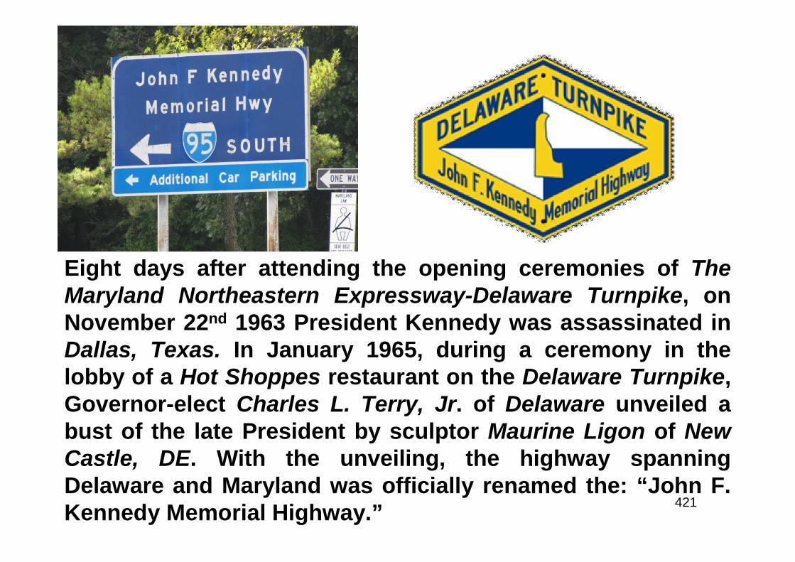
421
Eight days after attending the opening ceremonies of TheMaryland Northeastern Expressway-Delaware Turnpike, onNovember 22nd 1963 President Kennedy was assassinated inDallas, Texas. In January 1965, during a ceremony in thelobby of a Hot Shoppes restaurant on the Delaware Turnpike,Governor-elect Charles L. Terry, Jr. of Delaware unveiled abust of the late President by sculptor Maurine Ligon of NewCastle, DE. With the unveiling, the highway spanningDelaware and Maryland was officially renamed the: “John F.Kennedy Memorial Highway.”
422
A New Conservation
423
“If it’s beautifying they want, it’s beautifying they’ll get”POTUS Lyndon Baines JohnsonRE: in November 1964, President Johnson won a landslide victory overSenator Barry Goldwater. During the campaign, Lady Bird Johnson hadcomplained to her husband about the roadside junkyards they saw alongthe campaign trail. Johnson observed during the campaign thatreferences to the problem garnered applause. Astute politician that hewas, he determined to give the people what they wanted. Thus, onFebruary 8th 1965, within just three weeks of renewing his oath of office,Johnson wrote to Congress on the stewardship of the nation’s naturalbeauty. He called for “a new conservation” that included proposals forcities, rivers and trails as well as ideas for curbing pollution. Johnsondirected the Commerce Secretary to ensure that landscaping would bepart of all Interstate and Federal-aid primary and urban highways.Johnson also planned to introduce legislation on effective control ofbillboards and “unsightly, beauty-destroying junkyards and autograveyards along our highways.”
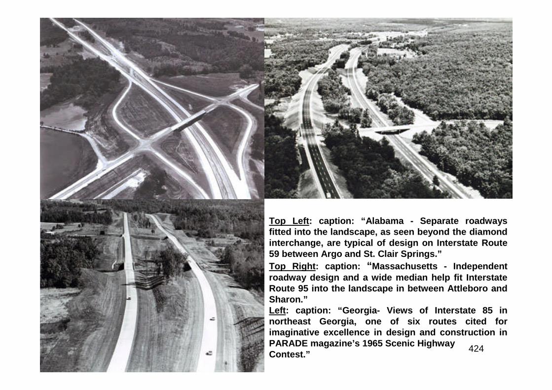
424
Top Left: caption: “Alabama - Separate roadwaysfitted into the landscape, as seen beyond the diamondinterchange, are typical of design on Interstate Route59 between Argo and St. Clair Springs.”
Top Right: caption: “Massachusetts - Independentroadway design and a wide median help fit InterstateRoute 95 into the landscape in between Attleboro andSharon.”Left: caption: “Georgia- Views of Interstate 85 innortheast Georgia, one of six routes cited forimaginative excellence in design and construction inPARADE magazine’s 1965 Scenic HighwayContest.”
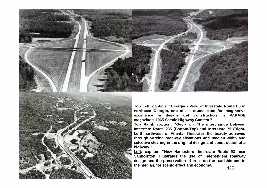
425
Top Left: caption: “Georgia - View of Interstate Route 85 innortheast Georgia, one of six routes cited for imaginativeexcellence in design and construction in PARADEmagazine’s 1965 Scenic Highway Contest.”Top Right: caption: “Georgia - The interchange betweenInterstate Route 285 (Bottom-Top) and Interstate 75 (Right-Left) northwest of Atlanta, Illustrates the beauty achievedthrough varying roadway elevations and median width andselective clearing in the original design and construction of ahighway.”Left: caption: “New Hampshire- Interstate Route 93 nearSanbornton, illustrates the use of independent roadwaydesign and the preservation of trees on the roadside and inthe median, for scenic effect and economy.
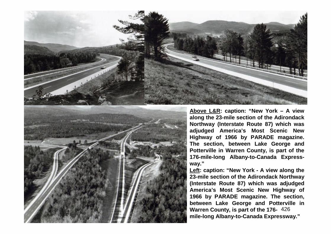
426
Above L&R: caption: “New York – A viewalong the 23-mile section of the AdirondackNorthway (Interstate Route 87) which wasadjudged America’s Most Scenic NewHighway of 1966 by PARADE magazine.The section, between Lake George andPotterville in Warren County, is part of the176-mile-long Albany-to-Canada Express-way.”Left: caption: “New York - A view along the23-mile section of the Adirondack Northway(Interstate Route 87) which was adjudgedAmerica’s Most Scenic New Highway of1966 by PARADE magazine. The section,between Lake George and Potterville inWarren County, is part of the 176-mile-long Albany-to-Canada Expressway.”
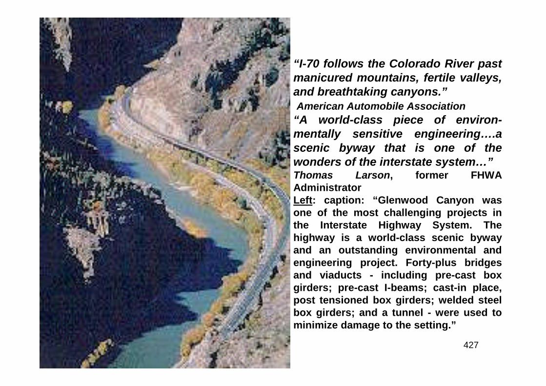
427
“I-70 follows the Colorado River pastmanicured mountains, fertile valleys,and breathtaking canyons.”American Automobile Association
“A world-class piece of environ-mentally sensitive engineering….ascenic byway that is one of thewonders of the interstate system…”Thomas Larson, former FHWAAdministratorLeft: caption: “Glenwood Canyon wasone of the most challenging projects inthe Interstate Highway System. Thehighway is a world-class scenic bywayand an outstanding environmental andengineering project. Forty-plus bridgesand viaducts - including pre-cast boxgirders; pre-cast I-beams; cast-in place,post tensioned box girders; welded steelbox girders; and a tunnel - were used tominimize damage to the setting.”
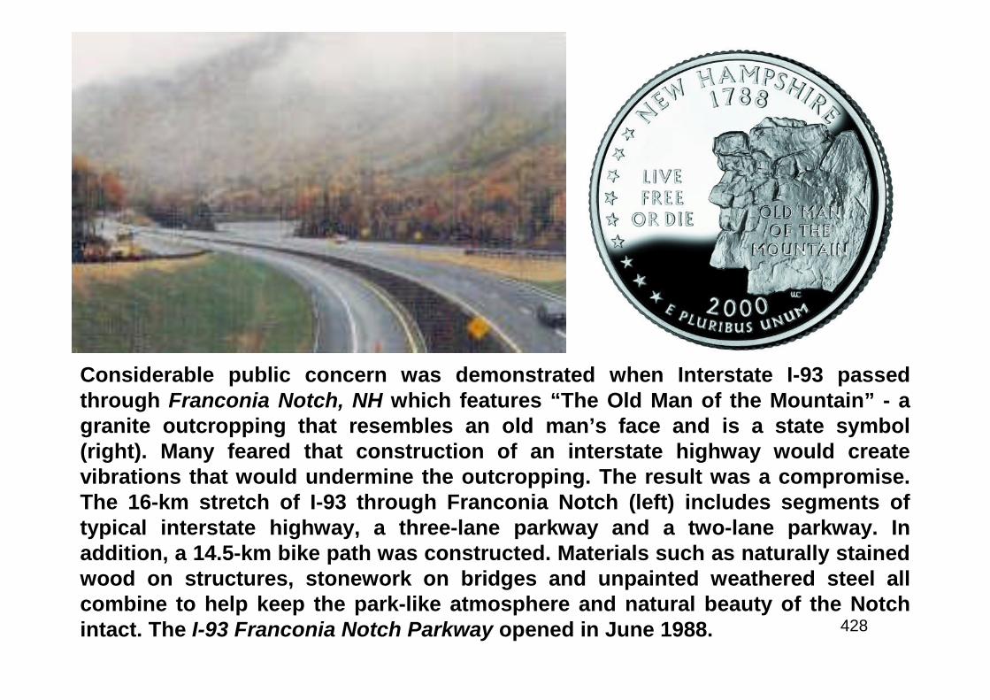
428
Considerable public concern was demonstrated when Interstate I-93 passedthrough Franconia Notch, NH which features “The Old Man of the Mountain” - agranite outcropping that resembles an old man’s face and is a state symbol(right). Many feared that construction of an interstate highway would createvibrations that would undermine the outcropping. The result was a compromise.The 16-km stretch of I-93 through Franconia Notch (left) includes segments oftypical interstate highway, a three-lane parkway and a two-lane parkway. Inaddition, a 14.5-km bike path was constructed. Materials such as naturally stainedwood on structures, stonework on bridges and unpainted weathered steel allcombine to help keep the park-like atmosphere and natural beauty of the Notchintact. The I-93 Franconia Notch Parkway opened in June 1988.
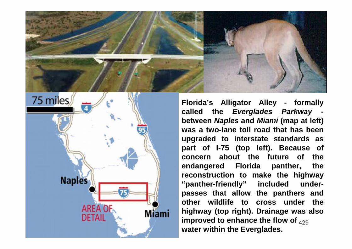
429
Florida’s Alligator Alley - formallycalled the Everglades Parkway -between Naples and Miami (map at left)was a two-lane toll road that has beenupgraded to interstate standards aspart of I-75 (top left). Because ofconcern about the future of theendangered Florida panther, thereconstruction to make the highway“panther-friendly” included under-passes that allow the panthers andother wildlife to cross under thehighway (top right). Drainage was alsoimproved to enhance the flow ofwater within the Everglades.
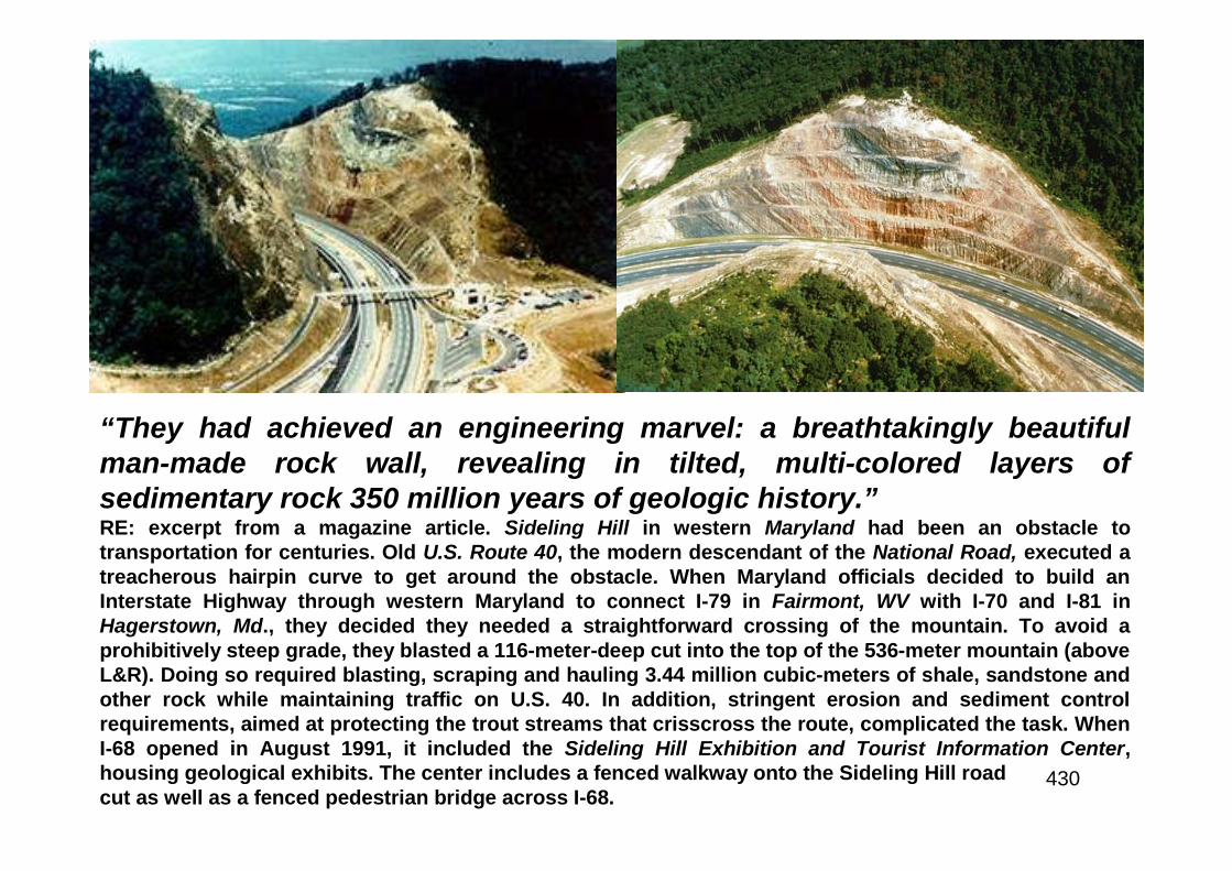
430
“They had achieved an engineering marvel: a breathtakingly beautifulman-made rock wall, revealing in tilted, multi-colored layers ofsedimentary rock 350 million years of geologic history.”RE: excerpt from a magazine article. Sideling Hill in western Maryland had been an obstacle totransportation for centuries. Old U.S. Route 40, the modern descendant of the National Road, executed atreacherous hairpin curve to get around the obstacle. When Maryland officials decided to build anInterstate Highway through western Maryland to connect I-79 in Fairmont, WV with I-70 and I-81 inHagerstown, Md., they decided they needed a straightforward crossing of the mountain. To avoid aprohibitively steep grade, they blasted a 116-meter-deep cut into the top of the 536-meter mountain (aboveL&R). Doing so required blasting, scraping and hauling 3.44 million cubic-meters of shale, sandstone andother rock while maintaining traffic on U.S. 40. In addition, stringent erosion and sediment controlrequirements, aimed at protecting the trout streams that crisscross the route, complicated the task. WhenI-68 opened in August 1991, it included the Sideling Hill Exhibition and Tourist Information Center,housing geological exhibits. The center includes a fenced walkway onto the Sideling Hill roadcut as well as a fenced pedestrian bridge across I-68.
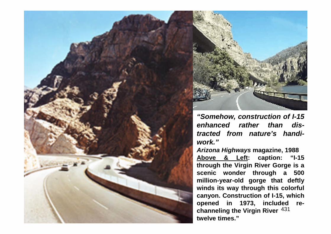
431
“Somehow, construction of I-15enhanced rather than dis-tracted from nature’s handi-work.”Arizona Highways magazine, 1988Above & Left: caption: “I-15through the Virgin River Gorge is ascenic wonder through a 500million-year-old gorge that deftlywinds its way through this colorfulcanyon. Construction of I-15, whichopened in 1973, included re-channeling the Virgin Rivertwelve times.”
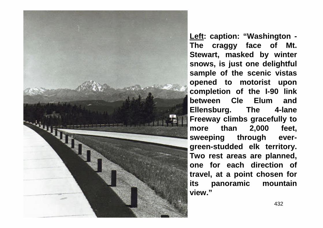
432
Left: caption: “Washington -The craggy face of Mt.Stewart, masked by wintersnows, is just one delightfulsample of the scenic vistasopened to motorist uponcompletion of the I-90 linkbetween Cle Elum andEllensburg. The 4-laneFreeway climbs gracefully tomore than 2,000 feet,sweeping through ever-green-studded elk territory.Two rest areas are planned,one for each direction oftravel, at a point chosen forits panoramic mountainview.”
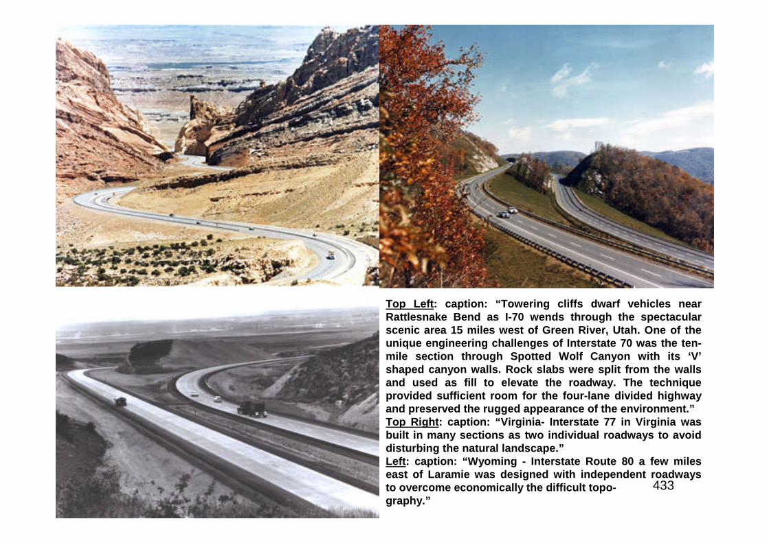
433
Top Left: caption: “Towering cliffs dwarf vehicles nearRattlesnake Bend as I-70 wends through the spectacularscenic area 15 miles west of Green River, Utah. One of theunique engineering challenges of Interstate 70 was the ten-mile section through Spotted Wolf Canyon with its ‘V’shaped canyon walls. Rock slabs were split from the wallsand used as fill to elevate the roadway. The techniqueprovided sufficient room for the four-lane divided highwayand preserved the rugged appearance of the environment.”Top Right: caption: “Virginia- Interstate 77 in Virginia wasbuilt in many sections as two individual roadways to avoiddisturbing the natural landscape.”Left: caption: “Wyoming - Interstate Route 80 a few mileseast of Laramie was designed with independent roadwaysto overcome economically the difficult topo-graphy.”
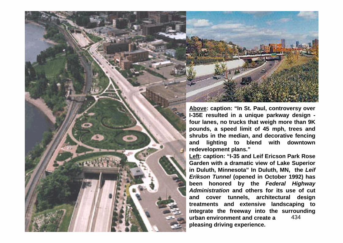
434
Above: caption: “In St. Paul, controversy overI-35E resulted in a unique parkway design -four lanes, no trucks that weigh more than 9Kpounds, a speed limit of 45 mph, trees andshrubs in the median, and decorative fencingand lighting to blend with downtownredevelopment plans.”Left: caption: “I-35 and Leif Ericson Park RoseGarden with a dramatic view of Lake Superiorin Duluth, Minnesota” In Duluth, MN, the LeifErikson Tunnel (opened in October 1992) hasbeen honored by the Federal HighwayAdministration and others for its use of cutand cover tunnels, architectural designtreatments and extensive landscaping tointegrate the freeway into the surroundingurban environment and create apleasing driving experience.
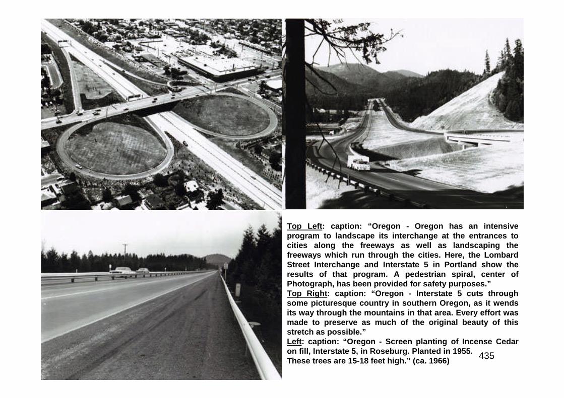
435
Top Left: caption: “Oregon - Oregon has an intensiveprogram to landscape its interchange at the entrances tocities along the freeways as well as landscaping thefreeways which run through the cities. Here, the LombardStreet Interchange and Interstate 5 in Portland show theresults of that program. A pedestrian spiral, center ofPhotograph, has been provided for safety purposes.”Top Right: caption: “Oregon - Interstate 5 cuts throughsome picturesque country in southern Oregon, as it wendsits way through the mountains in that area. Every effort wasmade to preserve as much of the original beauty of thisstretch as possible.”Left: caption: “Oregon - Screen planting of Incense Cedaron fill, Interstate 5, in Roseburg. Planted in 1955.These trees are 15-18 feet high.” (ca. 1966)
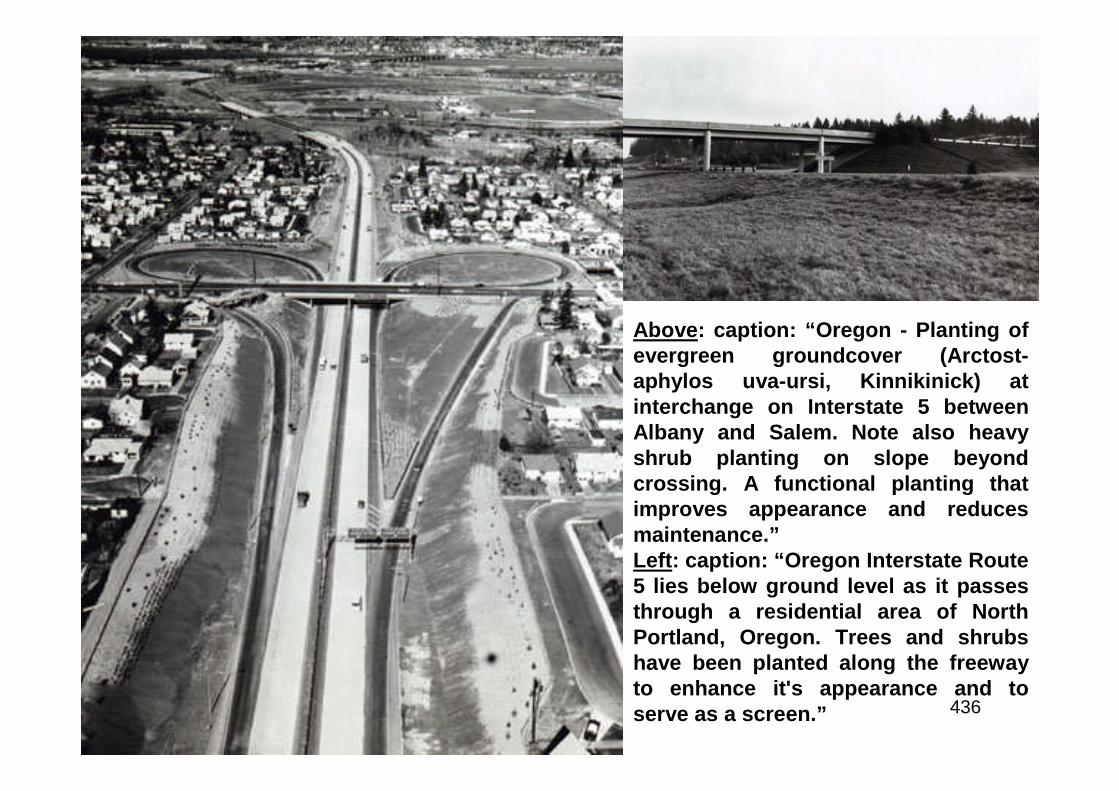
436
Above: caption: “Oregon - Planting ofevergreen groundcover (Arctost-aphylos uva-ursi, Kinnikinick) atinterchange on Interstate 5 betweenAlbany and Salem. Note also heavyshrub planting on slope beyondcrossing. A functional planting thatimproves appearance and reducesmaintenance.”Left: caption: “Oregon Interstate Route5 lies below ground level as it passesthrough a residential area of NorthPortland, Oregon. Trees and shrubshave been planted along the freewayto enhance it's appearance and toserve as a screen.”

437
Top Left: caption: “Tennessee Interstate Route40 descends the western slope of theCumberland Plateau in Tennessee midwaybetween Nashville and Knoxville. Note the ‘split-level’ independent roadway design, fitted to therough topography.”Top Right: caption: “Interstate Route 91 insouthern Vermont was designed to blend withthe scenery. Here one roadway, skirting apicturesque ledge, is at a higher elevation thanthe other.”Left: caption: “Tennessee - Federal-aid HighwaySection Slope Treatment - I-24 throughMissionary Ridge in Chattanooga.”
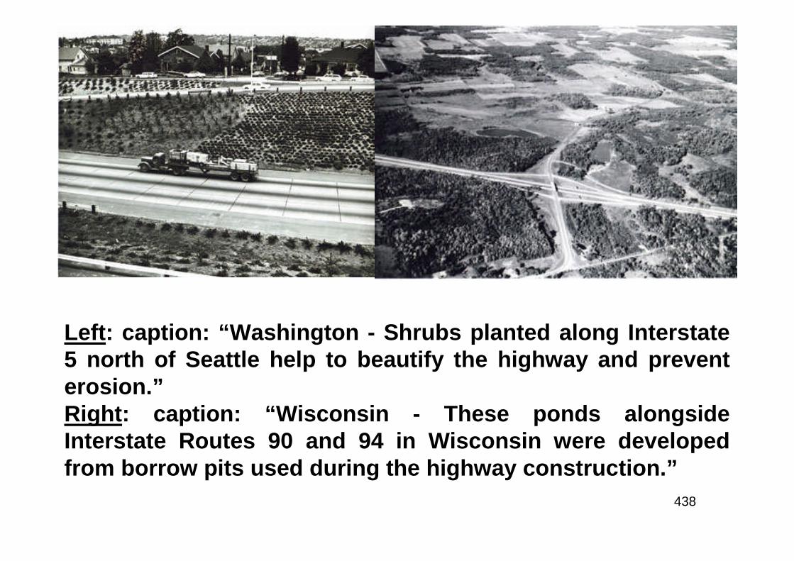
438
Left: caption: “Washington - Shrubs planted along Interstate5 north of Seattle help to beautify the highway and preventerosion.”Right: caption: “Wisconsin - These ponds alongsideInterstate Routes 90 and 94 in Wisconsin were developedfrom borrow pits used during the highway construction.”

439
Beauty Belongs to All the People
440
“…The highways must be beautiful as seen from the driver’s seat...andthey also must not be a scourge on the community through which theypass…use every skill that is available including the skills of architects,landscape architects, highway engineers, and psychologists and all theothers to create the best possible transportation system and the bestpossible urban plan for our cities…”Federal Highway Administrator Rex WhittonRE: President Johnson called for a “White House Conference on Natural Beauty” to be heldon May 24/25, 1965 in Washington, DC. BPR’s Whitton told a conference panel that“highways are for people” - a message he would repeat on many occasions. However,Johnson’s well-intentioned “America the Beautiful” initiative proved controversial when therights of private property owners clashed with the public interest. A good example werehighway billboards, which had been criticized for decades but proved difficult to control.The Federal-Aid Highway Act of 1958 had declared that control of outdoor advertising was“in the public interest.” To that end, It authorized a bonus program (with the revenue comingfrom the general Treasury rather than the Highway Trust Fund) under which states wouldreceive a 0.5% increase in the Federal share of Interstate construction costs if they agreedto control outdoor advertising. However, by 1965, only twenty states (with 25% of InterstateSystem mileage within their borders) had entered into bonus agreements. Such limitedsuccess led to the passage of the “Highway Beautification Act of 1965.” It was signed intolaw on October 22nd 1965 at the White House. After signing the bill into law, PresidentJohnson gave the pen to Lady Bird and stated: “Beauty belongs to all the people.”
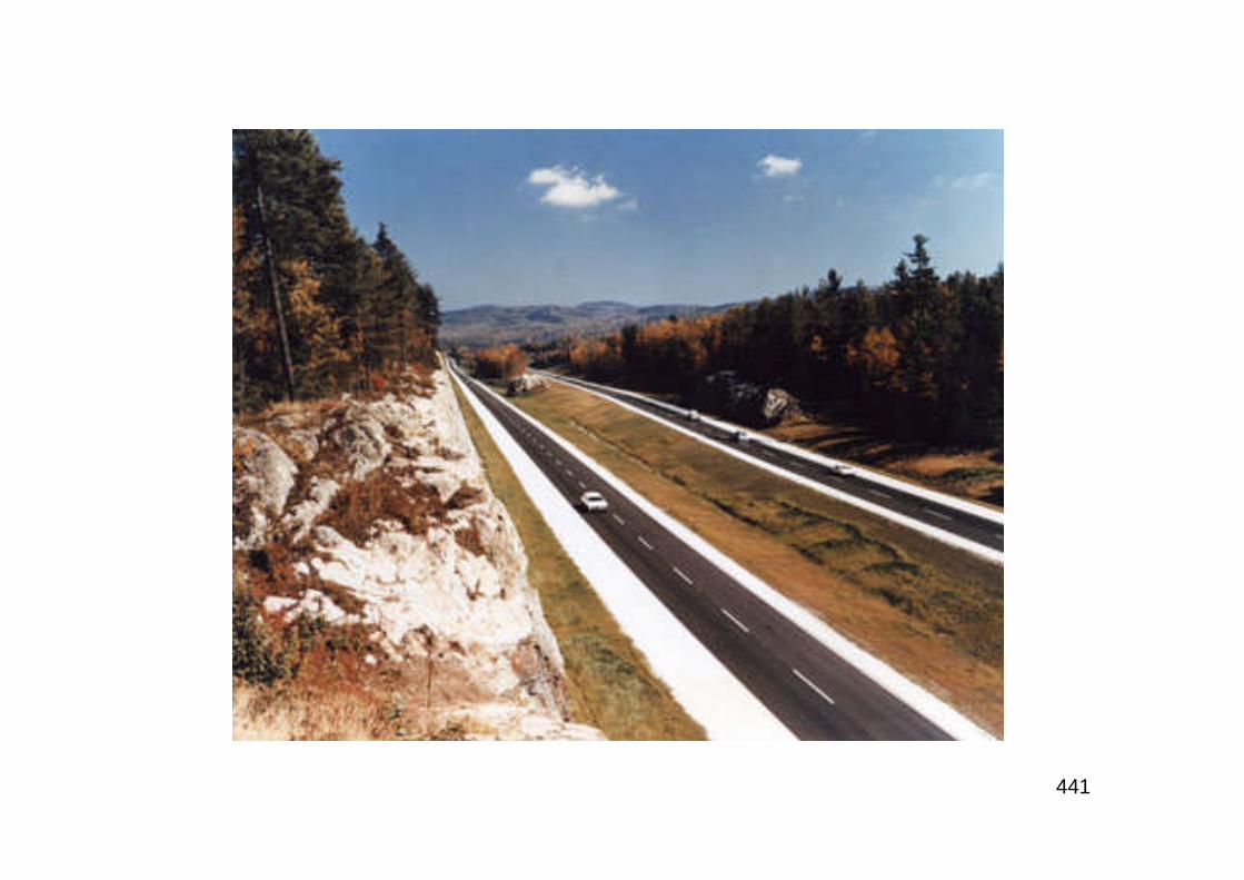
441
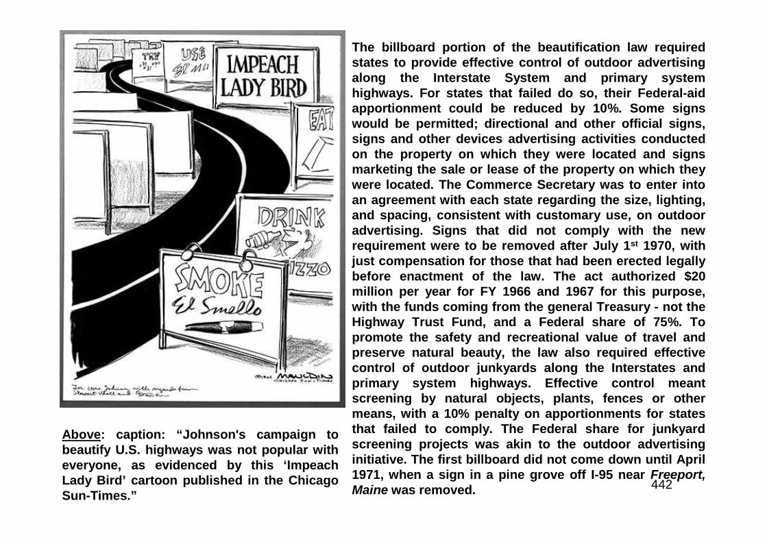
442
The billboard portion of the beautification law requiredstates to provide effective control of outdoor advertisingalong the Interstate System and primary systemhighways. For states that failed do so, their Federal-aidapportionment could be reduced by 10%. Some signswould be permitted; directional and other official signs,signs and other devices advertising activities conductedon the property on which they were located and signsmarketing the sale or lease of the property on which theywere located. The Commerce Secretary was to enter intoan agreement with each state regarding the size, lighting,and spacing, consistent with customary use, on outdooradvertising. Signs that did not comply with the newrequirement were to be removed after July 1st 1970, withjust compensation for those that had been erected legallybefore enactment of the law. The act authorized $20million per year for FY 1966 and 1967 for this purpose,with the funds coming from the general Treasury - not theHighway Trust Fund, and a Federal share of 75%. Topromote the safety and recreational value of travel andpreserve natural beauty, the law also required effectivecontrol of outdoor junkyards along the Interstates andprimary system highways. Effective control meantscreening by natural objects, plants, fences or othermeans, with a 10% penalty on apportionments for statesthat failed to comply. The Federal share for junkyardscreening projects was akin to the outdoor advertisinginitiative. The first billboard did not come down until April1971, when a sign in a pine grove off I-95 near Freeport,Maine was removed.
Above: caption: “Johnson's campaign tobeautify U.S. highways was not popular witheveryone, as evidenced by this ‘ImpeachLady Bird’ cartoon published in the ChicagoSun-Times.”
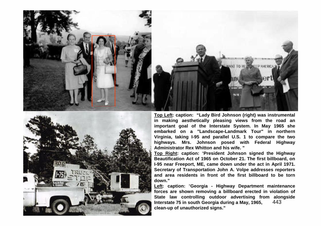
443
Top Left: caption: “Lady Bird Johnson (right) was instrumentalin making aesthetically pleasing views from the road animportant goal of the Interstate System. In May 1965 sheembarked on a "Landscape-Landmark Tour" in northernVirginia, taking I-95 and parallel U.S. 1 to compare the twohighways. Mrs. Johnson posed with Federal HighwayAdministrator Rex Whitton and his wife. ”Top Right: caption: “President Johnson signed the HighwayBeautification Act of 1965 on October 21. The first billboard, onI-95 near Freeport, ME, came down under the act in April 1971.Secretary of Transportation John A. Volpe addresses reportersand area residents in front of the first billboard to be torndown.”Left: caption: “Georgia - Highway Department maintenanceforces are shown removing a billboard erected in violation ofState law controlling outdoor advertising from alongsideInterstate 75 in south Georgia during a May, 1965,clean-up of unauthorized signs.”
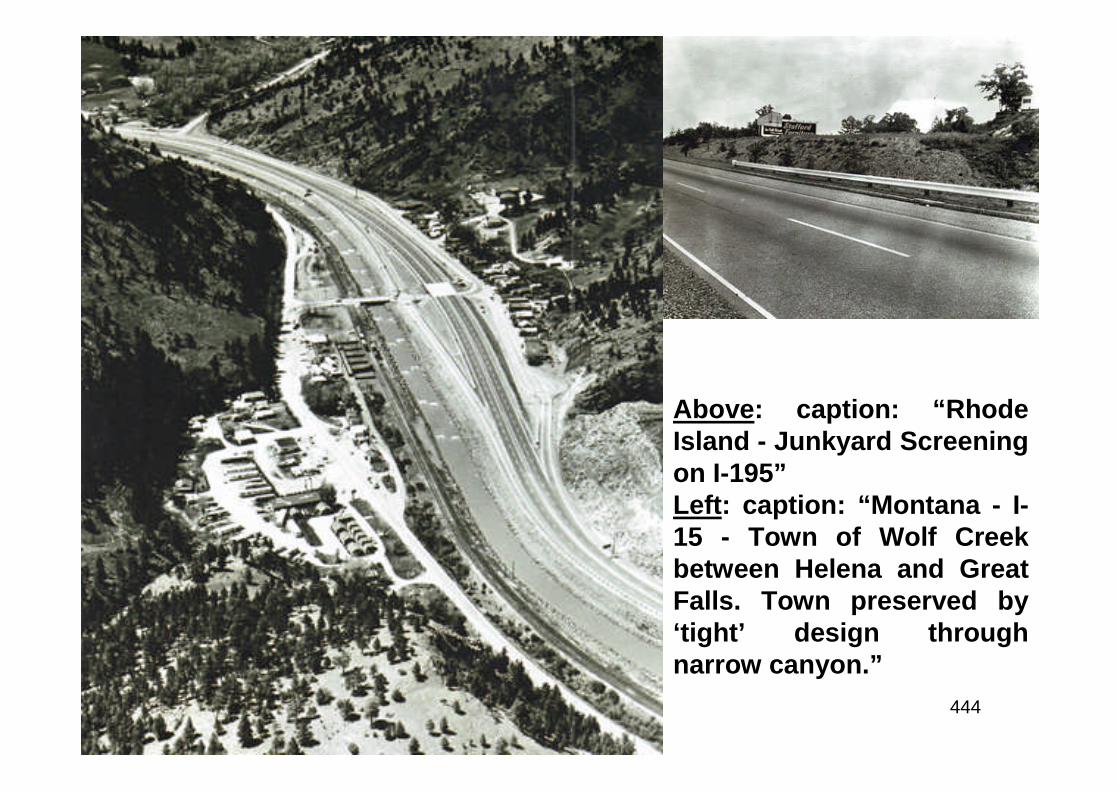
444
Above: caption: “RhodeIsland - Junkyard Screeningon I-195”Left: caption: “Montana - I-15 - Town of Wolf Creekbetween Helena and GreatFalls. Town preserved by‘tight’ design throughnarrow canyon.”
445
Part 8
A Living Legacy

446
The Web of Union
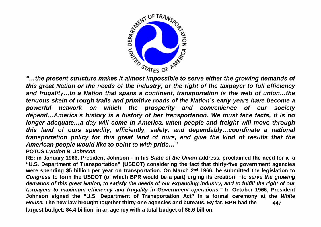
447
“…the present structure makes it almost impossible to serve either the growing demands ofthis great Nation or the needs of the industry, or the right of the taxpayer to full efficiencyand frugality…In a Nation that spans a continent, transportation is the web of union…thetenuous skein of rough trails and primitive roads of the Nation’s early years have become apowerful network on which the prosperity and convenience of our societydepend…America’s history is a history of her transportation. We must face facts, it is nolonger adequate…a day will come in America, when people and freight will move throughthis land of ours speedily, efficiently, safely, and dependably…coordinate a nationaltransportation policy for this great land of ours, and give the kind of results that theAmerican people would like to point to with pride…”POTUS Lyndon B. JohnsonRE: in January 1966, President Johnson - in his State of the Union address, proclaimed the need for a a“U.S. Department of Transportation” (USDOT) considering the fact that thirty-five government agencieswere spending $5 billion per year on transportation. On March 2nd 1966, he submitted the legislation toCongress to form the USDOT (of which BPR would be a part) urging its creation: “to serve the growingdemands of this great Nation, to satisfy the needs of our expanding industry, and to fulfill the right of ourtaxpayers to maximum efficiency and frugality in Government operations.” In October 1966, PresidentJohnson signed the “U.S. Department of Transportation Act” in a formal ceremony at the WhiteHouse. The new law brought together thirty-one agencies and bureaus. By far, BPR had the
largest budget; $4.4 billion, in an agency with a total budget of $6.6 billion.

448
The First Fifty Years are the Easiest

449
Above: caption: “BPR used this 1966 graphic to put the cost of highways inperspective and allay public displeasure. As BPR explained here, State andFederal highway taxes represented only 1.2 cents of the total 11 cents per mile itcost to own and operate an automobile back then. The figures were based on a$2,800 car driven 100,000 miles over 10 years.” Initially, Whitton and the road-building community were convinced that social and environmental issues facingthe highway program could be addressed with public relations initiatives such asthe graphic above. In late 1966, BPR chief Rex Whitton left office. During histenure as Federal Highway Administrator, he had successfully addressed theproblems that faced the National System of Interstate and Defense Highways. Bycooperating with the Blatnik Committee and strengthening BPR oversight,Whitton had helped put to rest the scandals that had cast a giant shadow over theagency he headed and gave fodder to its critics. As well, he Federal-Aid HighwayAct of 1961 placed the program on a sound financial footing that would carry itthrough to the early 1980’s. During his final presentation to the AASHO inNovember 1966, Whitton told his peers: “The first fifty years are theeasiest…you ain’t seen nothing yet.”
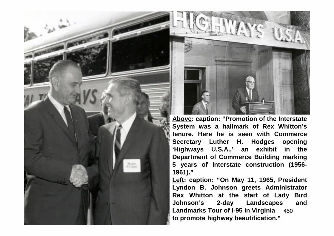
450
Above: caption: “Promotion of the InterstateSystem was a hallmark of Rex Whitton’stenure. Here he is seen with CommerceSecretary Luther H. Hodges opening‘Highways U.S.A.,’ an exhibit in theDepartment of Commerce Building marking5 years of Interstate construction (1956-1961).”Left: caption: “On May 11, 1965, PresidentLyndon B. Johnson greets AdministratorRex Whitton at the start of Lady BirdJohnson’s 2-day Landscapes andLandmarks Tour of I-95 in Virginiato promote highway beautification.”
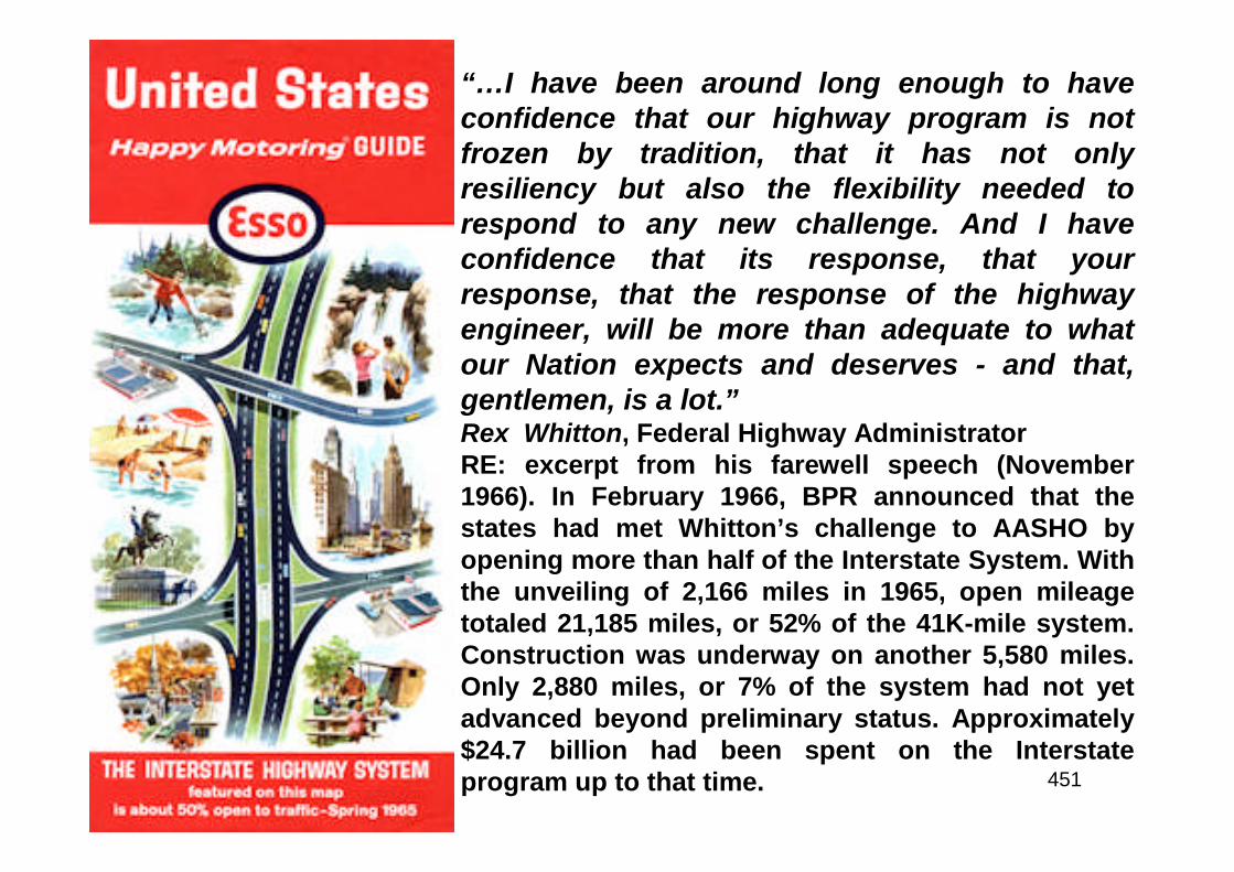
451
“…I have been around long enough to haveconfidence that our highway program is notfrozen by tradition, that it has not onlyresiliency but also the flexibility needed torespond to any new challenge. And I haveconfidence that its response, that yourresponse, that the response of the highwayengineer, will be more than adequate to whatour Nation expects and deserves - and that,gentlemen, is a lot.”Rex Whitton, Federal Highway AdministratorRE: excerpt from his farewell speech (November1966). In February 1966, BPR announced that thestates had met Whitton’s challenge to AASHO byopening more than half of the Interstate System. Withthe unveiling of 2,166 miles in 1965, open mileagetotaled 21,185 miles, or 52% of the 41K-mile system.Construction was underway on another 5,580 miles.Only 2,880 miles, or 7% of the system had not yetadvanced beyond preliminary status. Approximately$24.7 billion had been spent on the Interstateprogram up to that time.
452
The new USDOT opened for business on April 1st 1967. Theopening of the new Department meant many changes forBPR. First and foremost concerned its very name. “Bureau ofPublic Roads” had been used during two periods of theagency’s history spanning thirty-nine years (“Public RoadsAdministration” was the interim name given the agency). Theagency now became the “Federal Highway Administration”(FHWA). The renamed agency was organized into bureausheaded by directors, with the BPR name retained for one ofthem, along with the “Bureau of Motor Carrier Safety” (nowthe “Federal Motor Carrier Safety Administration”) and the“National Highway Safety Bureau” (now the “NationalHighway Traffic Safety Administration”). The agencyincreased from about 4,800 employees at the end of 1966 to5,360 employees by the end of 1967. In August 1970, FHWAeliminated the bureau structure, replacing the directors withassociate administrators and ending the use of the nameBureau of Public Roads.
453
“His national reputation as a pioneer of modern highwayconstruction not only brings honor to his memory, but also toa profession he dearly loved.”AASHTO Quarterly, July 1981RE: upon his retirement, Whitton went to work as a consultant to an engineeringfirm in Kansas City, MO. He retired in 1975. In 1976, he told FHWA News (theagency newsletter) that he and his wife enjoyed driving to auction sales forantiques. However, they avoided the freeways he had helped to build. He neverliked driving on them, he said, and now enjoyed: “driving on the little back roads,keeping a map of each one we travel.” Whitton passed away at the age of 82 onJuly 7th 1981.
454
Highways of Change
455
“…to facilitate the transition financing of the rehabilitation ofblighted areas, to employ its powers of eminent domain in thepublic interest, and to fix the standards of re-development…radical revision of the city plan…”RE: excerpt from the Interregional Highways report, 1944. The period when theInterstate Highway System was conceived in two reports to Congress; Toll Roadsand Free Roads (1939) and Interregional Highways (1944), was very different fromthe world facing the builders of the Interstate System in the 1950’s and ‘60’s. Inaccordance with the 1896 Supreme Court decision in Plessy vs, Ferguson thathad rendered “separate but equal” facilities acceptable, public accommodationsalong the nation’s roads throughout the South and adjacent states were raciallyseparate. Elsewhere, de facto segregation was commonplace. Though LBJ woulddo much to ensure civil rights (i.e. Civil Rights Act of 1964), he had little effect onthe Interstate System since the system had been planned long before the CivilRights movement gained broad public and political acceptance.
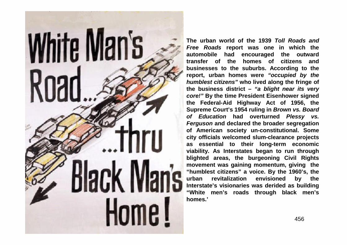
456
The urban world of the 1939 Toll Roads andFree Roads report was one in which theautomobile had encouraged the outwardtransfer of the homes of citizens andbusinesses to the suburbs. According to thereport, urban homes were “occupied by thehumblest citizens” who lived along the fringe ofthe business district – “a blight near its verycore!” By the time President Eisenhower signedthe Federal-Aid Highway Act of 1956, theSupreme Court’s 1954 ruling in Brown vs. Boardof Education had overturned Plessy vs.Ferguson and declared the broader segregationof American society un-constitutional. Somecity officials welcomed slum-clearance projectsas essential to their long-term economicviability. As Interstates began to run throughblighted areas, the burgeoning Civil Rightsmovement was gaining momentum, giving the“humblest citizens” a voice. By the 1960’s, theurban revitalization envisioned by theInterstate’s visionaries was derided as building“White men’s roads through black men’shomes.’

457
Expansion

458
The “Federal-Aid Highway Act of 1968” authorized the Interstate HighwaySystem’s expansion to 42,500 miles. An amendment designated an additional two-hundred miles for modification or revision of the basic system. Section 16 of the1968 Act provided that the USDOT Secretary may designate, as part of theInterstate System, a highway meeting all standards for Interstate highways andthat are logical additions or connections to the System. The “Federal-Aid HighwayAct of 1973” increased this to five-hundred miles. The “Surface TransportationAssistance Act of 1978” provided full Interstate construction funding for all routesdesignated under previous system adjustments. Another provision of this Actprohibited use of Interstate construction funds for the construction of any newmiles designated after passage of this Act. A section of the “National HighwaySystem Designation Act of 1995” (NHSDA) amended a section of the “Inter-modalSurface Transportation Efficiency Act of 1991” (ISTEA) to designate four highpriority corridors as future Interstate routes when the USDOT Secretarydetermines that they meet Interstate design standards and connect to an existingInterstate route. The NHSDA created no Federal financial responsibility for theseInterstate additions. A section of the “Transportation Equity Act for the 21stCentury” modified the description for three of these corridors and designated fiveadditional corridors as future parts of the Interstate System. Except for a fewmiles of added lane projects which were included in and approved as part of the1991 ICE, Interstate construction funds may not be used for adding lanes toexisting Interstate routes. However, states may use other appropriate classes ofFederal-aid funds to add additional capacity to the Interstate System.
459

460
Sunbelt Shift
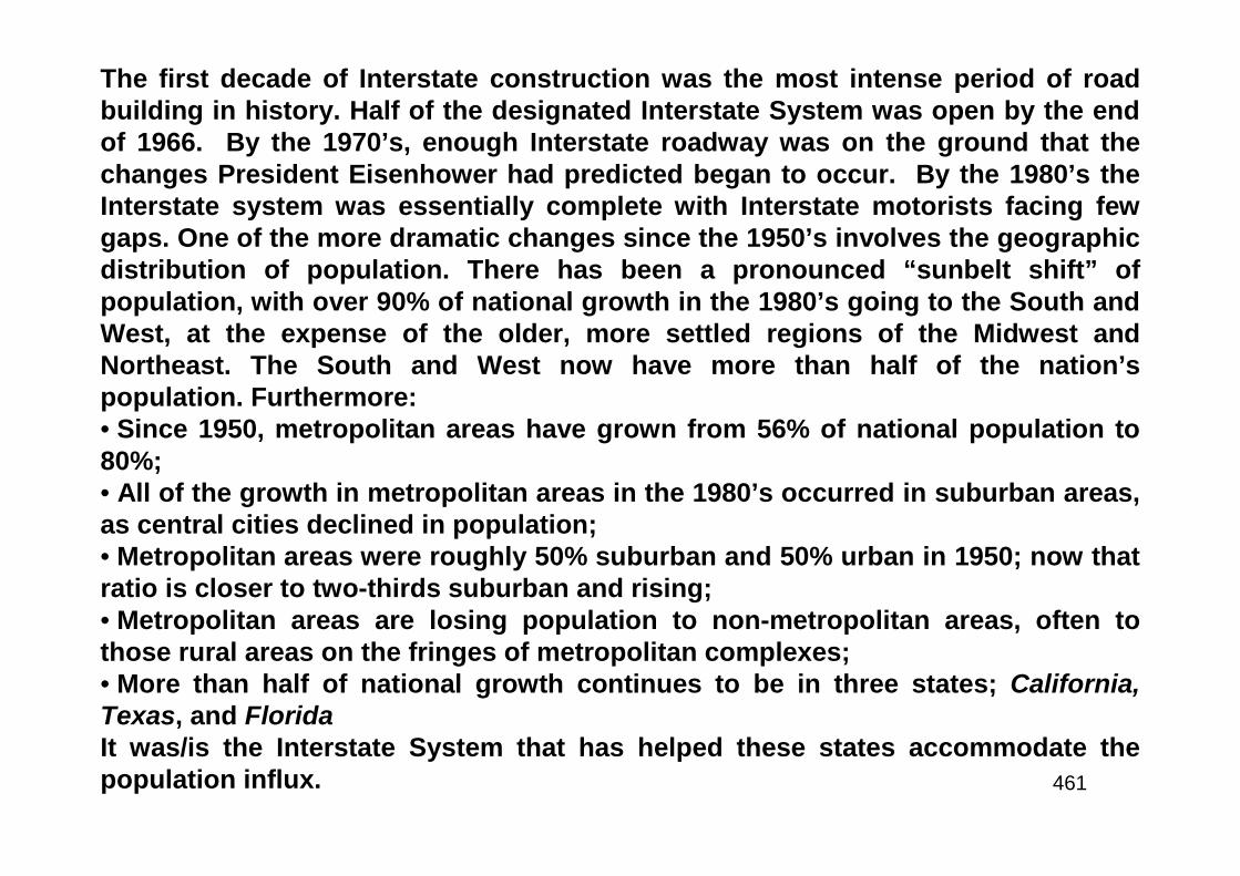
461
The first decade of Interstate construction was the most intense period of roadbuilding in history. Half of the designated Interstate System was open by the endof 1966. By the 1970’s, enough Interstate roadway was on the ground that thechanges President Eisenhower had predicted began to occur. By the 1980’s theInterstate system was essentially complete with Interstate motorists facing fewgaps. One of the more dramatic changes since the 1950’s involves the geographicdistribution of population. There has been a pronounced “sunbelt shift” ofpopulation, with over 90% of national growth in the 1980’s going to the South andWest, at the expense of the older, more settled regions of the Midwest andNortheast. The South and West now have more than half of the nation’spopulation. Furthermore:• Since 1950, metropolitan areas have grown from 56% of national population to80%;• All of the growth in metropolitan areas in the 1980’s occurred in suburban areas,as central cities declined in population;• Metropolitan areas were roughly 50% suburban and 50% urban in 1950; now thatratio is closer to two-thirds suburban and rising;• Metropolitan areas are losing population to non-metropolitan areas, often tothose rural areas on the fringes of metropolitan complexes;• More than half of national growth continues to be in three states; California,Texas, and FloridaIt was/is the Interstate System that has helped these states accommodate thepopulation influx.
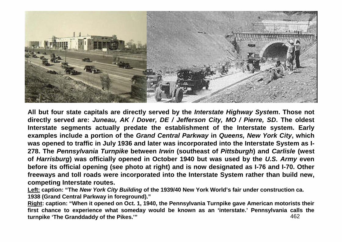
462
All but four state capitals are directly served by the Interstate Highway System. Those notdirectly served are: Juneau, AK / Dover, DE / Jefferson City, MO / Pierre, SD. The oldestInterstate segments actually predate the establishment of the Interstate system. Earlyexamples include a portion of the Grand Central Parkway in Queens, New York City, whichwas opened to traffic in July 1936 and later was incorporated into the Interstate System as I-278. The Pennsylvania Turnpike between Irwin (southeast of Pittsburgh) and Carlisle (westof Harrisburg) was officially opened in October 1940 but was used by the U.S. Army evenbefore its official opening (see photo at right) and is now designated as I-76 and I-70. Otherfreeways and toll roads were incorporated into the Interstate System rather than build new,competing Interstate routes.Left: caption: “The New York City Building of the 1939/40 New York World’s fair under construction ca.1938 (Grand Central Parkway in foreground).”Right: caption: “When it opened on Oct. 1, 1940, the Pennsylvania Turnpike gave American motorists theirfirst chance to experience what someday would be known as an ‘interstate.’ Pennsylvania calls theturnpike ‘The Granddaddy of the Pikes.’”

463
The Four R’s
464
Completion of the $129-billion designated mileage (42,793miles) in the Interstate System was a cooperative Federal-State undertaking. Each State transportation departmentmanaged its own Interstate program for location, design,right-of-way acquisition and construction of the designatedmileage. The FHWA’s role was one of oversight, review andapproval of the projects to ensure compliance with Federalrequirements. Ownership of the Interstate routes and theresponsibility for their perpetual operation and maintenancewas/is the responsibility of each state. Initially, all Interstatemaintenance responsibility was placed on the states.However, as the system aged, a separate federally fundedprogram was enacted in 1976 called the Interstate “3RProgram” (Resurfacing, Restoration & Rehabilitation). In1981, the Interstate 3R program was expanded to a “4RProgram” (with the addition of Reconstruction as an eligibleitem).
465
Cities on the Edge
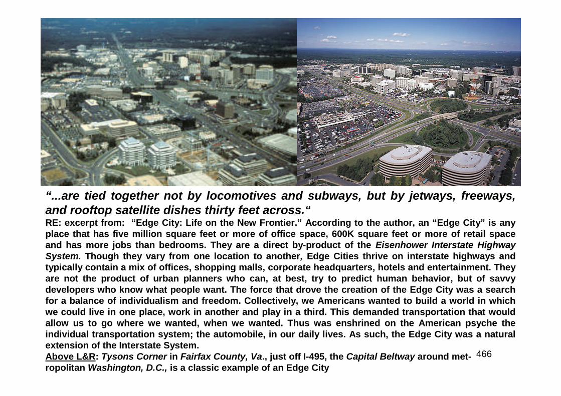
466
“...are tied together not by locomotives and subways, but by jetways, freeways,and rooftop satellite dishes thirty feet across.“RE: excerpt from: “Edge City: Life on the New Frontier.” According to the author, an “Edge City” is anyplace that has five million square feet or more of office space, 600K square feet or more of retail spaceand has more jobs than bedrooms. They are a direct by-product of the Eisenhower Interstate HighwaySystem. Though they vary from one location to another, Edge Cities thrive on interstate highways andtypically contain a mix of offices, shopping malls, corporate headquarters, hotels and entertainment. Theyare not the product of urban planners who can, at best, try to predict human behavior, but of savvydevelopers who know what people want. The force that drove the creation of the Edge City was a searchfor a balance of individualism and freedom. Collectively, we Americans wanted to build a world in whichwe could live in one place, work in another and play in a third. This demanded transportation that wouldallow us to go where we wanted, when we wanted. Thus was enshrined on the American psyche theindividual transportation system; the automobile, in our daily lives. As such, the Edge City was a naturalextension of the Interstate System.Above L&R: Tysons Corner in Fairfax County, Va., just off I-495, the Capital Beltway around met-ropolitan Washington, D.C., is a classic example of an Edge City
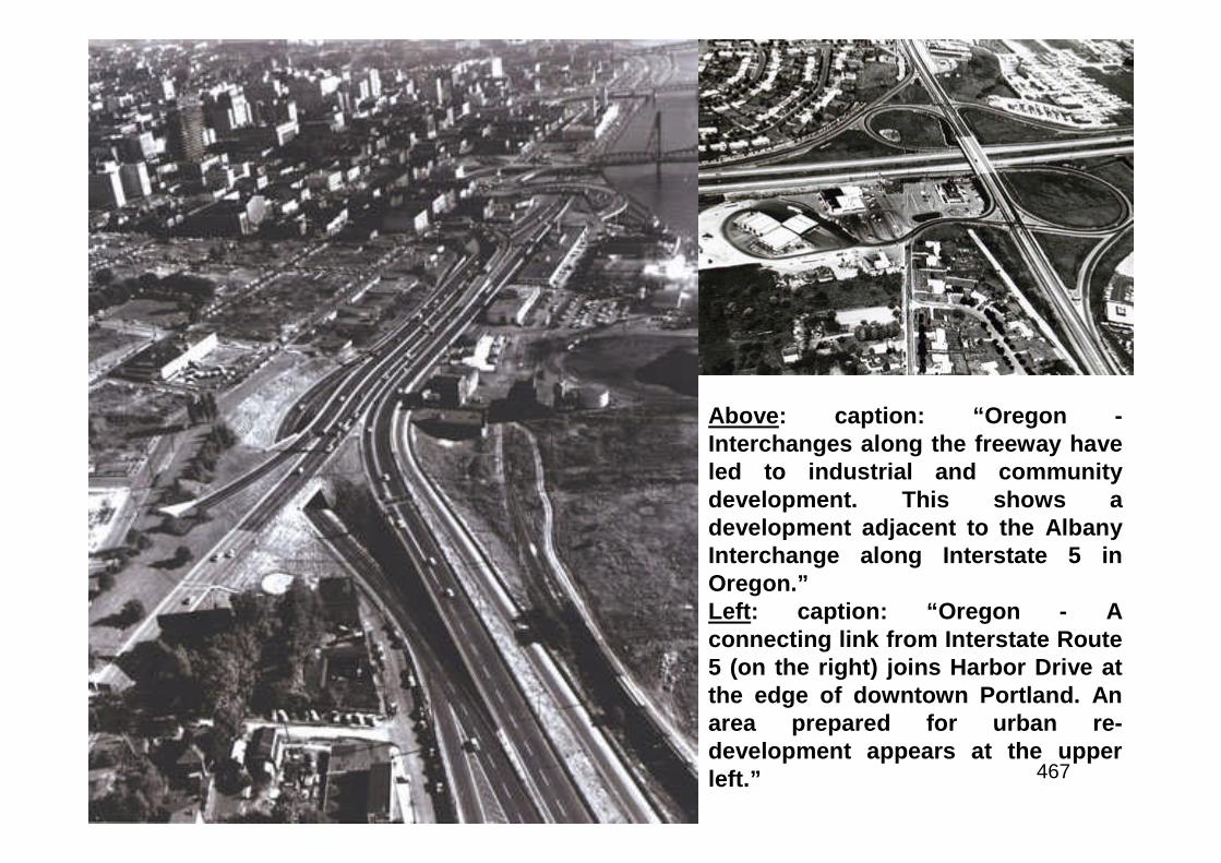
467
Above: caption: “Oregon -Interchanges along the freeway haveled to industrial and communitydevelopment. This shows adevelopment adjacent to the AlbanyInterchange along Interstate 5 inOregon.”Left: caption: “Oregon - Aconnecting link from Interstate Route5 (on the right) joins Harbor Drive atthe edge of downtown Portland. Anarea prepared for urban re-development appears at the upperleft.”
468
Freedom of the Road
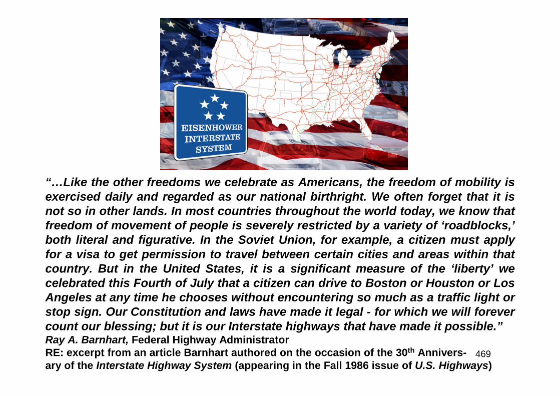
469
“…Like the other freedoms we celebrate as Americans, the freedom of mobility isexercised daily and regarded as our national birthright. We often forget that it isnot so in other lands. In most countries throughout the world today, we know thatfreedom of movement of people is severely restricted by a variety of ‘roadblocks,’both literal and figurative. In the Soviet Union, for example, a citizen must applyfor a visa to get permission to travel between certain cities and areas within thatcountry. But in the United States, it is a significant measure of the ‘liberty’ wecelebrated this Fourth of July that a citizen can drive to Boston or Houston or LosAngeles at any time he chooses without encountering so much as a traffic light orstop sign. Our Constitution and laws have made it legal - for which we will forevercount our blessing; but it is our Interstate highways that have made it possible.”Ray A. Barnhart, Federal Highway AdministratorRE: excerpt from an article Barnhart authored on the occasion of the 30th Annivers-ary of the Interstate Highway System (appearing in the Fall 1986 issue of U.S. Highways)
470
NOW, THEREFORE, I, RONALD REAGAN, President of theUnited States of America, do hereby proclaim June 26, 1986,as National Interstate Highway Day, and I call upon thepeople of the United States to observe that day withappropriate ceremonies and activities.
IN WITNESS WHEREOF, I have hereunto set my hand thisnineteenth day of June, in the year of our Lord nineteenhundred and eighty-six, and of the Independence of theUnited States of America the two hundred and tenth.
471
“There are few governmental projects that have played a more important or dramatic role inthe development of this country. Today we have an unparalleled system that is 97 percentcomplete with 41,297 miles open to the public. America is, in fact, mobility, and theInterstate system is the backbone of that mobility…The Interstate system links more than 90percent of America’s cities with populations of 50,000 or more, and many smaller towns aswell. Its importance to industry, commerce, the economy and recreation and travel cannotbe overstated… The system is a tremendous engineering achievement that maintains theeconomic growth of America. The 30th Anniversary of this peerless system is the time for allmembers of the highway community to be recognized for their contributions to thedevelopment and maintenance of our Interstate highways.”Ray A. Barnhart, Federal Highway AdministratorRE: in a formal proclamation, POTUS Ronald Reagan designated June 26th 1986 as “National InterstateHighway Day,” calling the American system of highways: “the world's largest and most successfultransportation and public works project.” In his speech, Barnhart cited the fact that in 1985 alone, 325billion miles had been traveled on the Interstates and he pointed out that although the system compriseslittle more than 1% of the nation’s total road mileage, it carries 20% of the nation’s highway traffic. OnAugust 22nd 1986, a milestone in America’s Interstate history was reached when the final section of I-80;the east-west trans-continental Interstate, was completed near Salt Lake City, Utah. The completion of thefinal 4.5 miles of I-80 marked the completion of the longest freeway in the world, running 2,908 miles fromthe George Washington Bridge in New York City to the Oakland Bay Bridge in San Francisco. By the timeof the 30th Anniversary, the system was composed of more than 40K miles of divided highways, built bynearly 2.4 billion man-hours of time. Each year, approximately 352 billion miles were traveled on thesystem with a safety record of 1.06 fatal accidents per 100 million miles traveled; less than half that talliedon the nation’s other highways.
472
Birthday Party on Wheels
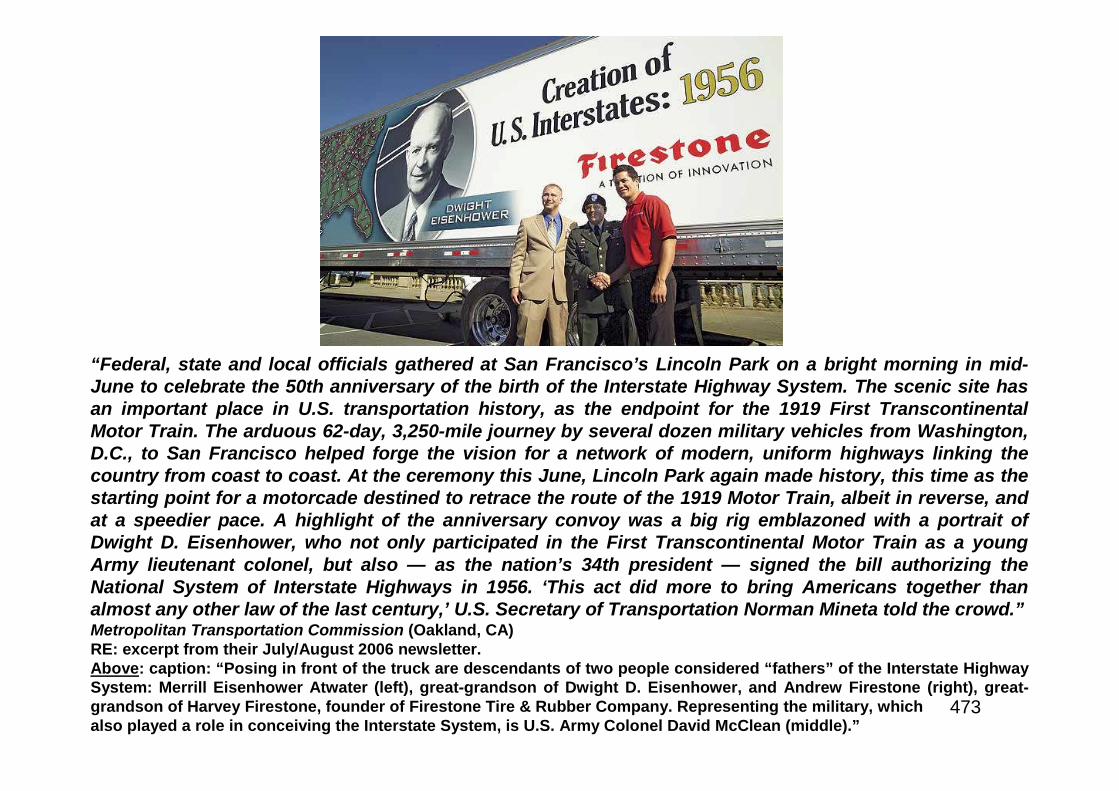
473
“Federal, state and local officials gathered at San Francisco’s Lincoln Park on a bright morning in mid-June to celebrate the 50th anniversary of the birth of the Interstate Highway System. The scenic site hasan important place in U.S. transportation history, as the endpoint for the 1919 First TranscontinentalMotor Train. The arduous 62-day, 3,250-mile journey by several dozen military vehicles from Washington,D.C., to San Francisco helped forge the vision for a network of modern, uniform highways linking thecountry from coast to coast. At the ceremony this June, Lincoln Park again made history, this time as thestarting point for a motorcade destined to retrace the route of the 1919 Motor Train, albeit in reverse, andat a speedier pace. A highlight of the anniversary convoy was a big rig emblazoned with a portrait ofDwight D. Eisenhower, who not only participated in the First Transcontinental Motor Train as a youngArmy lieutenant colonel, but also — as the nation’s 34th president — signed the bill authorizing theNational System of Interstate Highways in 1956. ‘This act did more to bring Americans together thanalmost any other law of the last century,’ U.S. Secretary of Transportation Norman Mineta told the crowd.”Metropolitan Transportation Commission (Oakland, CA)RE: excerpt from their July/August 2006 newsletter.Above: caption: “Posing in front of the truck are descendants of two people considered “fathers” of the Interstate HighwaySystem: Merrill Eisenhower Atwater (left), great-grandson of Dwight D. Eisenhower, and Andrew Firestone (right), great-grandson of Harvey Firestone, founder of Firestone Tire & Rubber Company. Representing the military, whichalso played a role in conceiving the Interstate System, is U.S. Army Colonel David McClean (middle).”
474
The I-35 Corridor
475
“The I-35 Corridor’s multimodal transportation hubs – where air, rail, river,and truck cargo converge – make I-35 ideally positioned to be a majorroute for what is expected to be increasing levels of international tradeactivity…Over the next few decades, about 65 percent of I-35 will requiremajor upgrades, however the entire route will have a continued need forrehabilitating pavements, resurfacing sections of the highway, andproviding replacements of some bridge decks. Bridge substructures andsuperstructures will also need to be maintained, requiring repairs tomaintain the integrity of the bridges.”RE: excerpt from a 1998 Federal Highway Administration report warning thatincreased truck traffic was expected to create a safety concern with bridges instates along the proposed I-35 NAFTA Superhighway, including Minnesota.The FHWA study was conducted in conjunction with the Departments ofTransportation/s in Texas, Oklahoma, Kansas, Missouri, Iowa and Minnesota, andassessed I-35 from Laredo, Texas, to Duluth, MN. A comprehensive study offreight traffic conducted by the FHWA, concluded that a large percentage of thefreight carried through Minnesota is carried by truck. According to the FHWAdata, a total of 280.7 million tons of freight moved through Minnesota in 1998, 86%by truck. Dramatic increases are projected, with freight traffic through Minnesotaexpected to double by 2035, to a total of 551.5 million tons per annum, of which88% will be carried by truck.
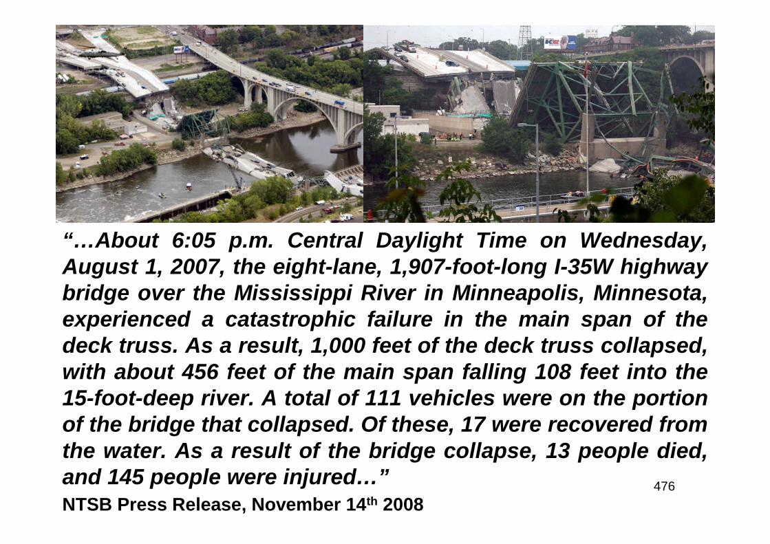
476
“…About 6:05 p.m. Central Daylight Time on Wednesday,August 1, 2007, the eight-lane, 1,907-foot-long I-35W highwaybridge over the Mississippi River in Minneapolis, Minnesota,experienced a catastrophic failure in the main span of thedeck truss. As a result, 1,000 feet of the deck truss collapsed,with about 456 feet of the main span falling 108 feet into the15-foot-deep river. A total of 111 vehicles were on the portionof the bridge that collapsed. Of these, 17 were recovered fromthe water. As a result of the bridge collapse, 13 people died,and 145 people were injured…”NTSB Press Release, November 14th 2008
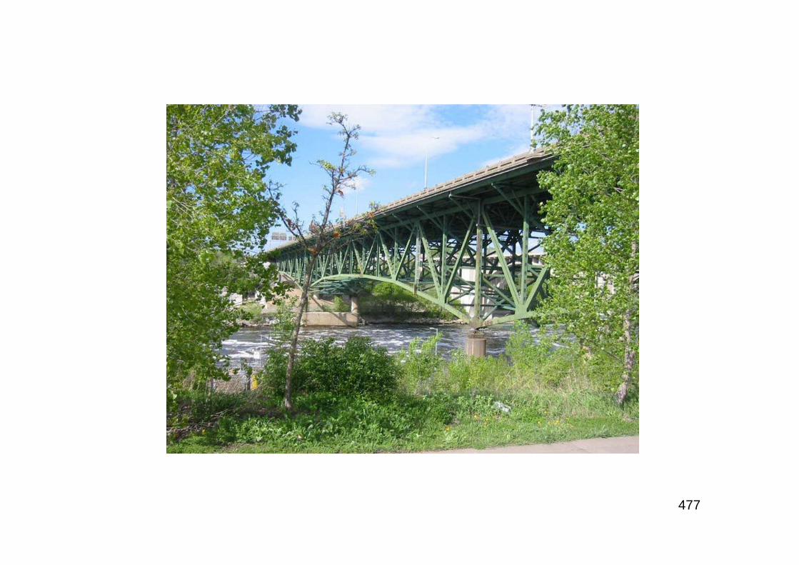
477
478
“The National Transportation Safety Board has determined the probablecause of the collapse of the I-35W bridge in Minneapolis, Minnesota, wasthe inadequate load capacity, due to a design error by Sverdrup & Parceland Associates, Inc., of the gusset plates at the U10 nodes, which failedunder a combination of (1) substantial increases in the weight of thebridge, which resulted from previous modifications, and (2) the traffic andconcentrated construction loads on the bridge on the day of the accident.Contributing to the design error was the failure of Sverdrup & Parcel’squality control procedures to ensure that the appropriate main trussgusset plate calculations were performed for the I-35W bridge and theinadequate design review by federal and state transportationofficials. Also contributing was the generally accepted practice amongFederal and State transportation officials of giving inadequate attention togusset plates during inspections for conditions of distortion, such asbowing, and of excluding gusset plates in load rating analysis…During itsinvestigation, the Safety Board learned that 24 under-designed gussetplates, which were about half the thickness of properly sized gussetplates, escaped discovery in the original review process and wereincorporated into the design and construction of the bridge…”NTSB Press Release, November 14th 2008
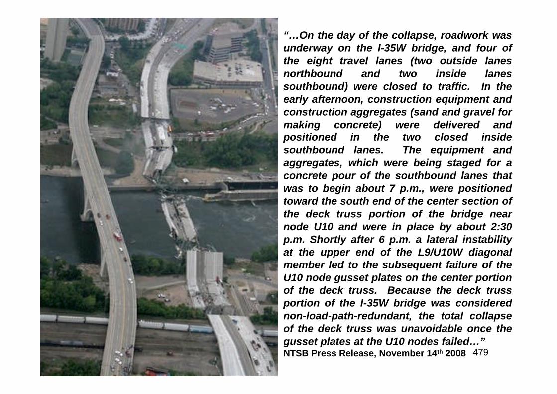
479
“…On the day of the collapse, roadwork wasunderway on the I-35W bridge, and four ofthe eight travel lanes (two outside lanesnorthbound and two inside lanessouthbound) were closed to traffic. In theearly afternoon, construction equipment andconstruction aggregates (sand and gravel formaking concrete) were delivered andpositioned in the two closed insidesouthbound lanes. The equipment andaggregates, which were being staged for aconcrete pour of the southbound lanes thatwas to begin about 7 p.m., were positionedtoward the south end of the center section ofthe deck truss portion of the bridge nearnode U10 and were in place by about 2:30p.m. Shortly after 6 p.m. a lateral instabilityat the upper end of the L9/U10W diagonalmember led to the subsequent failure of theU10 node gusset plates on the center portionof the deck truss. Because the deck trussportion of the I-35W bridge was considerednon-load-path-redundant, the total collapseof the deck truss was unavoidable once thegusset plates at the U10 nodes failed…”NTSB Press Release, November 14th 2008
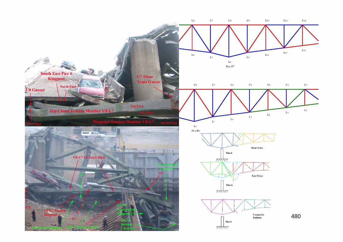
480

481
“We believe this thorough investigation should put to rest any speculation as tothe root cause of this terrible accident and provide a roadmap for improvementsto prevent future tragedies. We came to this conclusion only through exhaustiveefforts to eliminate each potential area that might have caused or contributed tothis accident…Bridge designers, builders, owners, and inspectors will never lookat gusset plates quite the same again, and as a result, these critical connectionsin a bridge will receive the attention they deserve in the design process, in futureinspections, and when bridge load rating analyses are performed. By addressingall three areas in our recommendations, we are hopeful that industry andgovernment bodies will take appropriate action and the American people cancontinue to have confidence in the safety of our nation’s bridges.”NTSB Acting Chairman Mark V. Rosenker, November 2008RE: as a result of its extensive investigation, the NTSB made nine recommendations to theFederal Highway Administration and the American Association of State Highway andTransportation Officials dealing with improving bridge design review procedures,bridge inspection procedures, bridge inspection, training and load rating evaluations
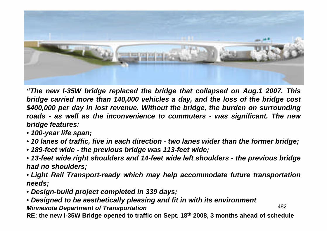
482
“The new I-35W bridge replaced the bridge that collapsed on Aug.1 2007. Thisbridge carried more than 140,000 vehicles a day, and the loss of the bridge cost$400,000 per day in lost revenue. Without the bridge, the burden on surroundingroads - as well as the inconvenience to commuters - was significant. The newbridge features:• 100-year life span;• 10 lanes of traffic, five in each direction - two lanes wider than the former bridge;• 189-feet wide - the previous bridge was 113-feet wide;• 13-feet wide right shoulders and 14-feet wide left shoulders - the previous bridgehad no shoulders;• Light Rail Transport-ready which may help accommodate future transportationneeds;• Design-build project completed in 339 days;• Designed to be aesthetically pleasing and fit in with its environmentMinnesota Department of TransportationRE: the new I-35W Bridge opened to traffic on Sept. 18th 2008, 3 months ahead of schedule

483

484
Borrowed Time
485
While the economic and social benefits realized during the first decades of the InterstateHighway System are demonstrable, the enormous load of automobiles, trucks, buses andcommercial vehicles has taken its toll on the Interstates. The collapse of the I-35 in bridge inMinneapolis in August 2007 is a sad testament to that fact. Despite the important role playedby the Interstates in the nation’s economy and quality of life, the system requires renewedinvestment. Many portions of the Interstate Highway System (IHS) are strained to capacity,increasing delays and air pollution and dampening economic activity. The InterstateHighways were built to accommodate twenty years of traffic growth. By 1985, half of thesystem had reached its design life and, by 1995, 90% of the system was twenty years old orolder. The original IHS, authorized when the nation’s population was less than 170 million, isnot much more extensive today as the nation’s population exceeds 300 million. Here aresome of the facts:• From 1982 to 1992, urban traffic congestion increased by more than 15%;• The percentage of urban interstate lane miles operating at above 80% of capacity at peakhour has nearly doubled since 1975;• Rural interstate congestion, though minimal compared to that of urban areas, continues togrow;• In 1995, 6% of interstate bridges were deemed structurally deficient by the USDOT. whichcan result in catastrophic bridge failure and loss of life. Besides the I-35 collapse in 2007,the collapse of the Mianus River Bridge on I-95 in Connecticut (1983) and the SchoharieCreek Bridge on I-95 in New York (1987) claimed thirteen lives;• In 1996, USDOT determined that approximately 60% of interstate pavements were ratedfrom fair to poor
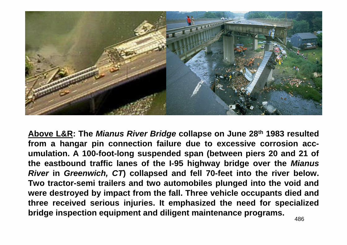
486
Above L&R: The Mianus River Bridge collapse on June 28th 1983 resultedfrom a hangar pin connection failure due to excessive corrosion acc-umulation. A 100-foot-long suspended span (between piers 20 and 21 ofthe eastbound traffic lanes of the I-95 highway bridge over the MianusRiver in Greenwich, CT) collapsed and fell 70-feet into the river below.Two tractor-semi trailers and two automobiles plunged into the void andwere destroyed by impact from the fall. Three vehicle occupants died andthree received serious injuries. It emphasized the need for specializedbridge inspection equipment and diligent maintenance programs.
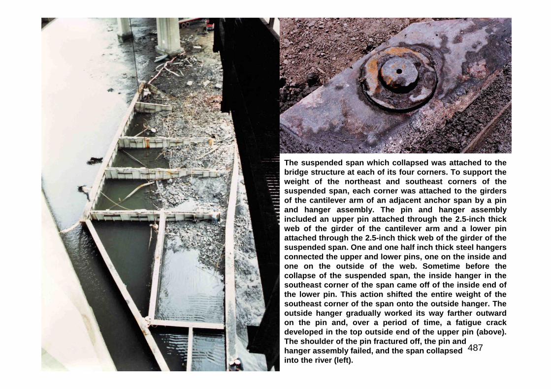
487
The suspended span which collapsed was attached to thebridge structure at each of its four corners. To support theweight of the northeast and southeast corners of thesuspended span, each corner was attached to the girdersof the cantilever arm of an adjacent anchor span by a pinand hanger assembly. The pin and hanger assemblyincluded an upper pin attached through the 2.5-inch thickweb of the girder of the cantilever arm and a lower pinattached through the 2.5-inch thick web of the girder of thesuspended span. One and one half inch thick steel hangersconnected the upper and lower pins, one on the inside andone on the outside of the web. Sometime before thecollapse of the suspended span, the inside hanger in thesoutheast corner of the span came off of the inside end ofthe lower pin. This action shifted the entire weight of thesoutheast corner of the span onto the outside hanger. Theoutside hanger gradually worked its way farther outwardon the pin and, over a period of time, a fatigue crackdeveloped in the top outside end of the upper pin (above).The shoulder of the pin fractured off, the pin andhanger assembly failed, and the span collapsedinto the river (left).
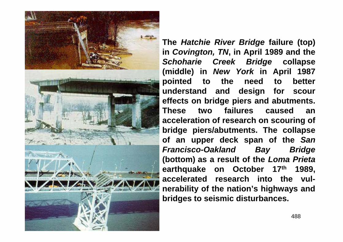
488
The Hatchie River Bridge failure (top)in Covington, TN, in April 1989 and theSchoharie Creek Bridge collapse(middle) in New York in April 1987pointed to the need to betterunderstand and design for scoureffects on bridge piers and abutments.These two failures caused anacceleration of research on scouring ofbridge piers/abutments. The collapseof an upper deck span of the SanFrancisco-Oakland Bay Bridge(bottom) as a result of the Loma Prietaearthquake on October 17th 1989,accelerated research into the vul-nerability of the nation’s highways andbridges to seismic disturbances.
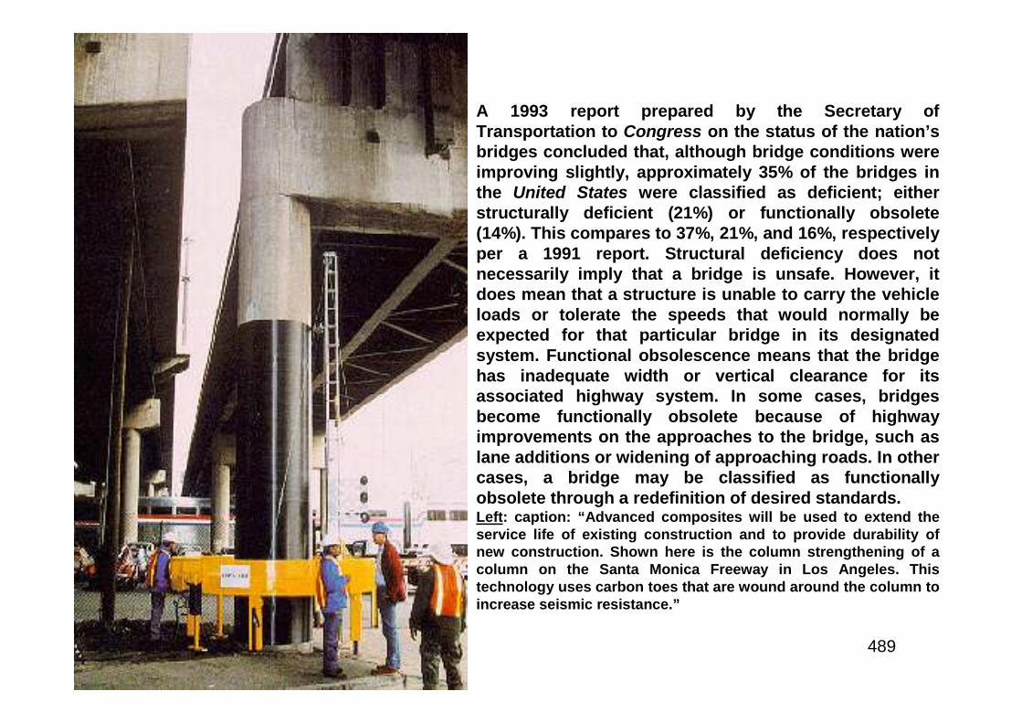
489
A 1993 report prepared by the Secretary ofTransportation to Congress on the status of the nation’sbridges concluded that, although bridge conditions wereimproving slightly, approximately 35% of the bridges inthe United States were classified as deficient; eitherstructurally deficient (21%) or functionally obsolete(14%). This compares to 37%, 21%, and 16%, respectivelyper a 1991 report. Structural deficiency does notnecessarily imply that a bridge is unsafe. However, itdoes mean that a structure is unable to carry the vehicleloads or tolerate the speeds that would normally beexpected for that particular bridge in its designatedsystem. Functional obsolescence means that the bridgehas inadequate width or vertical clearance for itsassociated highway system. In some cases, bridgesbecome functionally obsolete because of highwayimprovements on the approaches to the bridge, such aslane additions or widening of approaching roads. In othercases, a bridge may be classified as functionallyobsolete through a redefinition of desired standards.Left: caption: “Advanced composites will be used to extend theservice life of existing construction and to provide durability ofnew construction. Shown here is the column strengthening of acolumn on the Santa Monica Freeway in Los Angeles. Thistechnology uses carbon toes that are wound around the column toincrease seismic resistance.”

490
The Road More Traveled
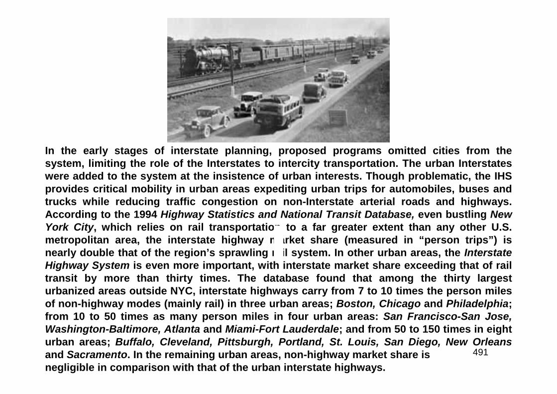
491
In the early stages of interstate planning, proposed programs omitted cities from thesystem, limiting the role of the Interstates to intercity transportation. The urban Interstateswere added to the system at the insistence of urban interests. Though problematic, the IHSprovides critical mobility in urban areas expediting urban trips for automobiles, buses andtrucks while reducing traffic congestion on non-Interstate arterial roads and highways.According to the 1994 Highway Statistics and National Transit Database, even bustling NewYork City, which relies on rail transportation to a far greater extent than any other U.S.metropolitan area, the interstate highway market share (measured in “person trips”) isnearly double that of the region’s sprawling rail system. In other urban areas, the InterstateHighway System is even more important, with interstate market share exceeding that of railtransit by more than thirty times. The database found that among the thirty largesturbanized areas outside NYC, interstate highways carry from 7 to 10 times the person milesof non-highway modes (mainly rail) in three urban areas; Boston, Chicago and Philadelphia;from 10 to 50 times as many person miles in four urban areas: San Francisco-San Jose,Washington-Baltimore, Atlanta and Miami-Fort Lauderdale; and from 50 to 150 times in eighturban areas; Buffalo, Cleveland, Pittsburgh, Portland, St. Louis, San Diego, New Orleansand Sacramento. In the remaining urban areas, non-highway market share isnegligible in comparison with that of the urban interstate highways.
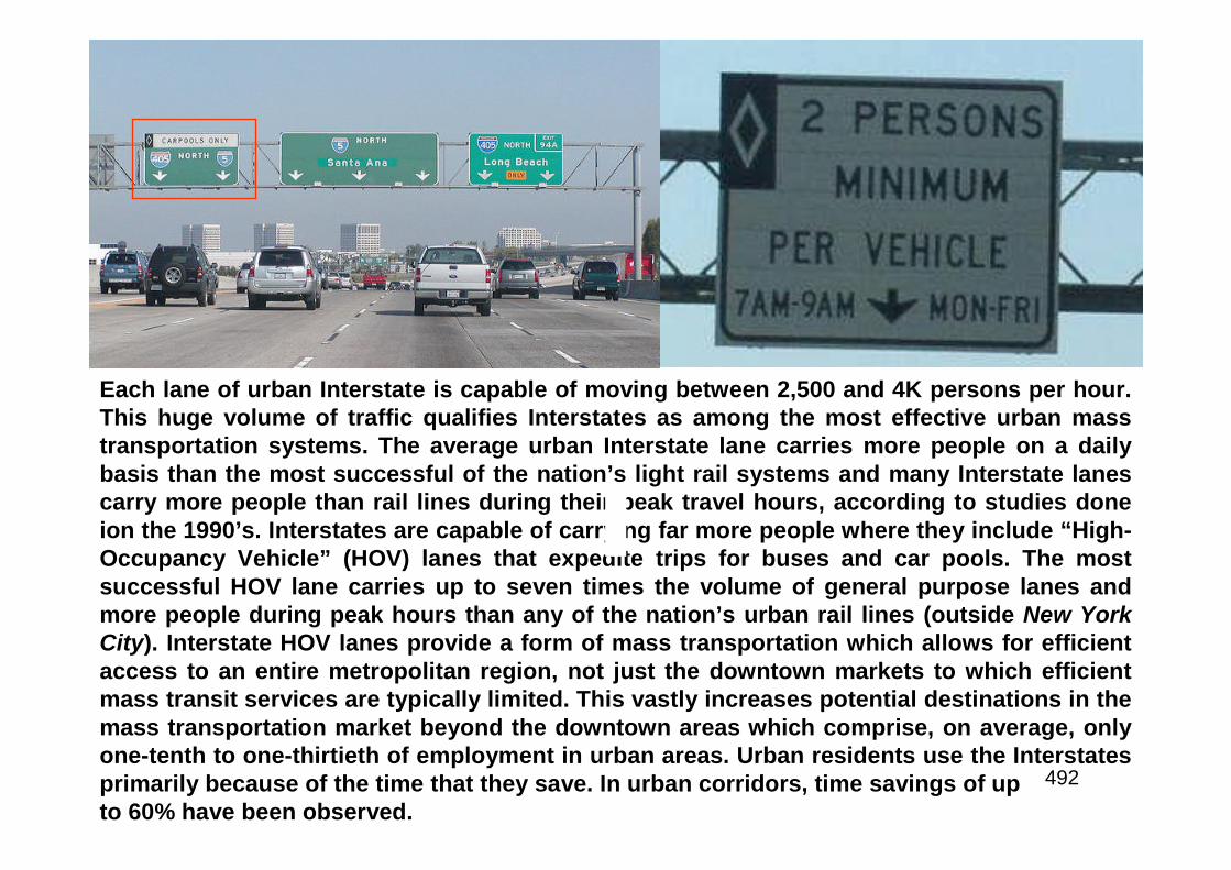
492
Each lane of urban Interstate is capable of moving between 2,500 and 4K persons per hour.This huge volume of traffic qualifies Interstates as among the most effective urban masstransportation systems. The average urban Interstate lane carries more people on a dailybasis than the most successful of the nation’s light rail systems and many Interstate lanescarry more people than rail lines during their peak travel hours, according to studies doneion the 1990’s. Interstates are capable of carrying far more people where they include “High-Occupancy Vehicle” (HOV) lanes that expedite trips for buses and car pools. The mostsuccessful HOV lane carries up to seven times the volume of general purpose lanes andmore people during peak hours than any of the nation’s urban rail lines (outside New YorkCity). Interstate HOV lanes provide a form of mass transportation which allows for efficientaccess to an entire metropolitan region, not just the downtown markets to which efficientmass transit services are typically limited. This vastly increases potential destinations in themass transportation market beyond the downtown areas which comprise, on average, onlyone-tenth to one-thirtieth of employment in urban areas. Urban residents use the Interstatesprimarily because of the time that they save. In urban corridors, time savings of upto 60% have been observed.

493
The urban Interstates are the high capacity component ofwhat has developed as the world’s most democratic,extensive, highly used, inexpensive, and flexible system ofurban mass transportation - the urban highway system. Whiletraffic congestion is increasing, the urban interstate highwaysystem has continued to perform effectively, despite the factthat the twenty year capacity growth for which they weredesigned has long since passed, in most cases. As thenumber of work trips has increased, work trip travel timeshave declined while average work trip distances haveincreased. Commuting by automobile has increased morethan 60% since 1970 but the average automobile driverspends 10% less time traveling 20% farther to work. In largepart this is due to the impact of the Interstates. The highwaycommuting system with its Interstate backbone providesquicker commutes. Even in cities with urban rail systems,highway commuting speeds are up to 30% greater than railcommuting speeds.

494
Cost Effective
495
By increasing speed and expanding access, freight costs have been reducedsubstantially. Tractor-trailer operating costs have been estimated at 17% lower onInterstate highways than other highways, according to a 1983 USDOT report. TheIHS:• Made less expensive land more accessible to the nation’s transportation systemand encouraged development;• Made “just in time” delivery more feasible, reducing warehousing costs andadding to manufacturing efficiency;• By broadening the geographical range and options of shoppers, the IHS hasincreased retail competition, resulting in larger selections and lower consumerprices;• By improving inter-regional access, the IHS has helped to create a genuinelynational domestic market with companies able to supply their products to muchlarger geographical areas less expensivelyEach of these cost reducing impacts have made both labor and capital moreefficient and this has encouraged business expansion, new investment and jobcreation. Through the years, various estimates have been made of thecontribution of the IHS to the economy, generally finding that the interstatehighway system has more than paid for itself in improved commercialproductivity.

496
Lives Saved
497
The IHS is by far the safest component of the nation’s highway systemand its use has reduced traffic accidents, saved lives and reducedinjuries. A 1994 study found the fatality rate for interstate highways isnearly 60% lower that of the rest of the system (as measured in fatalitiesper 100 million person miles). It is estimated that use of the IHS in 1994saved 6,100 lives, compared to the fatalities that would have occurred ifthere had been no Interstates. The injury rate for interstate highways ismore than 70% lower that of the rest of the system. It is estimated that useof the interstates reduced traffic related injuries by 440K and reducedtraffic accidents by more than 400 in 1994. Urban interstate fatality ratesare more than 50% lower than that of other roads, while the injury rate ismore than 70% lower. Urban interstate fatality rates are 65% lower thanrail, while injury rates are 50% lower, per the 1994 study. There is asignificant economic benefit to improved safety. Using National SafetyCouncil (NSC) estimates of the direct economic cost of traffic accidents, itis estimated that the lower interstate accident rate in 1994 produced $17.2billion in direct economic savings – nearly as much as the FederalGovernment spent on highways that year.
498

499
In October 1990, POTUS George HW Bush - whose father, SenatorPrescott Bush of Connecticut, had been a key supporter of the ClayCommittee’s plan in 1955 - signed legislation that changed the name ofthe Interstate system to the “Dwight D. Eisenhower System of Interstateand Defense Highways.” This change acknowledged Eisenhower’s pivotalrole in launching the program.Above: caption: “Unveiling the Eisenhower Interstate System sign on July 29,1993, are (from left): Rep. Nick Rahall (D-WV), John Eisenhower (PresidentEisenhower’s son), Federal Highway Administrator Rodney Slater, andRep. Norman Mineta (D-CA).”
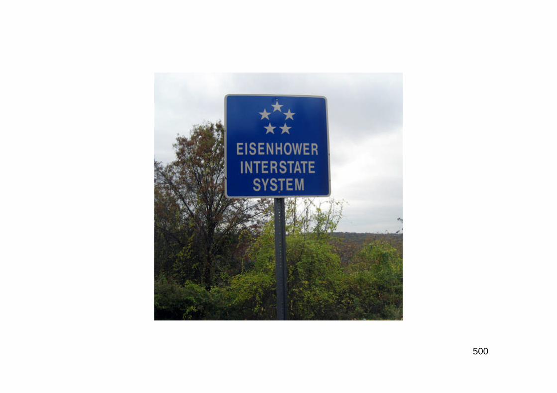
500