tC GUIDE TO - Afghanistan Digital Collections
491
If • AN HISTO ~tC GUIDE TO f .. • • •
-
Upload
khangminh22 -
Category
Documents
-
view
11 -
download
0
Transcript of tC GUIDE TO - Afghanistan Digital Collections

If
•
AN HISTO ~tC GUIDE TO
f ..
•
•
•

An Historical Guide
To Afghanistan
Nancy Hatch Dupree
Revised and Enlarged
'""""'"~~~---,~~ f i A. R. I. C. : # ooc ' I
: RECEIVED DA Tf :
: ---· nr, =-Lfc_ ___ ~ -- : .. :. ; ' 't .•
" ~ ; . ,, . i F. '"' """'""" .... " ~ ~'-· -~ N0-v.ia-Hddt... .ii ) ·-r1u
AFGHAN AIR AUTHORITY
AFGHAN TOURIST 0RGANlZATION
KABUL: 1977

First Edition: 1970 Afghan Tourist Organization Publication Number 5
Second Edition © Copyright: Nancy Hatch Dupree, 1977 .
By the same author: The Valley of Bamiyan
An Historical Guide to Kabul Herat: A Pictorial Guide
The Road to Balkh The National Museum of Afghanistan (with L. Dupree)
PRINTED BY }AGRA, LTD., TOKYO: JAPAN

Preface To THE SECOND EDITION
The Afghan Tourist Organization takes pleasure and pride to present the revised edition of the Historical Guide to Afghanistan.
The great and historical developments in the past four years in both the political and socio-economic fields coupled with the opening-up of new routes and strengthening of the structural facilities inspired the ever inspiring author to revise and up-date one of her successful works the Historical Guide to Afghanistan.
I am confident that this book, unique in its kind, will serve a meaningful purpose in travel to and within this country, and I am greatful for the interest and collaboration that the author, Nancy Hatch Dupree, has taken in development of tourism to Afghanistan, which she rightly considers as her second home.
Kabul June 1977
111
M.0. Seradj President, A TO

Preface
The Afghan Tourist Organization feels it a pleasure to present once more a new publication in the series of its guide books. This time a general guide book on Afghanistan.
Those who have enjoyed reading the previous guides to Bamiyan, Kabul, Herat and Balkh, must have been impressed by the scholarly approach, thoroughness and delightful style used by I~ ancy H. Dupree in writing these excellent guide books. I am sure that this new historical guide to Afghanistan will provide those interested in travel to Afghanistan with the needed inf ormation as well as delightful reading material.
I am grateful to Nancy Dupree for her spontaneous and long standing friendship and cooperation with our organization.
A. W. Tarzi
Kabul, 1970
V

• .Y • ·•. y
,.
• • . ~ .,
• y .
; ::
,.
::-:: .. -»: ·::.:-, ..
..
-~ . .
. ··=·
.· ..
~=
·=
..
'

Acl~nowledgements FoR THE SECOND EDITION
Each year I become increasingly indebted to the scores of scholars researching in Afghanistan. All have shared their specialties generously; some have contributed plans and pictures. In addition, diplomats, administrators, technicians, students and random travellers have been pressed into service carrying chapters as they travelled for checking and rechecking. I cannot list them all, although it would be a prestigious Who's Who of those who delight in travelling around Afghanistan.
Some, however, have given so considerably of their time and attention that I feel compelled to acknowledge a special debt of gratitude: P. Bernard, T. Higuchi, I. Kruglikova, V. Sarianidi, R. Sengupta, M. Taddei, Zemaryala:i Tarzi and W. Trousdale for many pleasant hours touring their sites and time devoted to checking relevant portions of the manuscript; Sawez Afzali, Ashraf Ghani Ahmadzai, Aziz Nairn, M. Casimir, D. Colvin, Abdul Qader Fahim, Ravan Farhadi, K. Ferdinand, B. Glatzer, Khushal Habibi, A. Janata, Ustad M. I. Khalil, Faiz Leqa, I. McArthur, D. McGaffy, MirJ Ansari, Mir Mohammad S. Skandari, G. Pedersen, R. Petocz, Sayid Qasim Rishtya, Abdul Ghafoor Seljuki, Abdul Wahab Seljuki, Abdul Wahid Seljuki, F. Sligh, Rustam Ali Sultani, and Kabir Tahiri for sharing their expertise; Anne Scarborough for supplying that crucial second copy for cutting and pasting without which we should have been hard pressed to produce a manuscript; Nasir Saberi of ABAD who permitted us to disrupt his office with a nuisance assignment and Ali Ghulami, the patient draftsman to whose considerable talents we owe the map work; Paula and Jimmie Cullen, Pat and Ted Eliot, Ian McArthur, Tom Petocz, Fran and Chip Vincent, and Gerlind and Wolfgang Wiesner the most intrepid of the traveller-checkers .
.. Vll
Vlll
1
John Thorne contributed more than many unenviable hours cutting and pasting from the first edition and feeding in new material. He worked closely with Ali Ghulami on the maps and wrote the tours on Shewaki and Guldara while engaged on the British Institute's preservation project at the Minar-i-Chakari.
Without the encouragement of Mahboub-Ullah Ozod Seradj, President of the Afghan Tourist Organization, there would be no second edition; Zalmai Roashan, Director of Publicity, shepherded the manuscript through the press. On last minute details we once again had the professional advice of Robert MacMakin who has been involved with these guides for the past thirteen years.
Checking facts, noting mileages and describing the terrain is not enough. From my husband, Louis Dupree, I draw a constant charge of excitement and enthusiasm for this land and its people. Together we find new depths and new values. I shall be well pleased if this book succeeds in conveying our continuing affection for Afghanistan.
Nancy Hatch Dupree
Kabul, July 1976

Acl~nowledgements Every one of our Afghan friends has had a part in the writing
of this guide. As they read it, it is my hope that each will recognize his particular contribution and receive my heartfelt thanks for his encouragement. Without them I should not dare put forth this work.
I am much indebted to Mr. Khalilullah, Inspector of Schools, Kandahar, for helping me unravel the complexities of Kandahar. My original visit was very badly timed but neither the intense heat nor the long days dimmed his enthusiastic response to the project. The day's work over, unanswered questions were ably dispatched by Mr. Khalilullah's father-in-law, Haji Fateh Mohammad, a well-known historian of the Kandahar area. Under their guidance the static city of my notebook came to life.
As the manuscript took shape, I turned to the professionals. Mr. Hasan Kakar, Professor of History and Mr. A. Razik Palwal, Professor of Anthropology, Kabul University, gave generously in answering questions and checking certain portions of the manuscript. For the maps I am especially grateful to Mr. Ron Coens whose talents will be readily acknowledged by all readers. Mr. Aziz Tarzi prepared the sketches for publication. Readers will recognize his name for he has contributed to each guidebook. I thank him for his continued cooperation and friendship. I should also like to thank Mr. James Farrar for contributing his artistic talents to the photographic presentation of this fascinating country. To the Institute of Archaeology go thanks for sharing their photographs of the monuments of Afghanistan.
A major crisis threatened as the manuscript neared completion only to be averted by a spontaneous gesture of friendship on the part of my good friend Maliha Amiri-Kabiri. I thank her for the many hours she spent on the manuscript.
lX

X
As I leave with my husband for another season of archaeological research in northern Afghanistan, I leave the difficult tasks of layout, final preparations for the printer, and proofing in the capable hands of Mr. Alan Kirios. It is a pleasure to acknowledge his assistance. It is also a pleasure to thank Mr. Robert MacMakin who shephered my past guidebooks through the press. A fortuitous visit to Kabul happily enabled us once again to take advantage of his professional advice.
This work is really a joint venture, shared with my husband whose encouragement, and patience, has been boundless.
Finally, once again I am happy to say thank you to Mr. Abdul W ahab Tarzi, President, Afghan Tourist Organization. His support was always there. More particularly, it is through his urging that I present this guide which I hope conveys my deep affection for Afghanistan.
Kabul June 1970
Nancy Hatch Dupree
Author's Note: Josephine Powell's photographs are included in major art books depicting this area. Although she appeared on the scene long)ifter this manuscript had gone to press, the selection of photographs was fortunately still in progress. Her professional advice was most gratefully received and her help in securing quality prints for the printers is acknowledged with deep appreciation. Her donation of photographs for use in this guide is typical of her generous nature; an eloquent statement of her affection for Afghanistan. It is an honour to present ''photographs by Josephine Powe11."
N. D.

An Historical Guide
To Afghanistan
INTRODUCTION
1 Travelling in Afghanistan 3
2 Geography for the Tourist 13
3 Sites in Perspective : An Historical Survey 19
TI-IE CENTER
4 Kabul 79
5 Around and About Kabul 105
6 Two Routes to Bamiyan 145
7 Bamiyan 153
8 Band-i-Amir 175
9 Ghazni 179
FROM THE EAST
10 Torkham to Kabul 201 XI
XU
11 J alalabad
12 Nuristan
13 Herat
FROM THE WEST
14 Obey and Chisht-i-Sharif
15 Herat to Kandahar
THE SOUTH
16 Kandahar
17 Lashkar Gah and Bost
18 Kandahar to Kabul
THE NORTHWEST
19 Herat to Maimana
20 Maiman a
21 Maimana to Mazar-i-Sharif
THE NORTH
22 Pul-i-Khumri and Surkh Kotal
23 Samangan
24 Tashkurghan
211
233
243
261
269
279
309
317
331
345
357
367
373
379

25 Mazar-i-Sharif
26 Balkh
THE NORTHEAST
27 Kunduz
28 Takhar and Badakhshan
29 Ai Khanoum
THE CENTRAL ROUTE
Xlll
389 395
405 413 431
30 Kabul to Chakhcharan: via Bamiyan 447 31 The "Minaret" of Jam 461 32 Chakhcharan to Herat 4 73
APPENDIX
A Selected Bibliography
Photo Credits
Index
MAPS
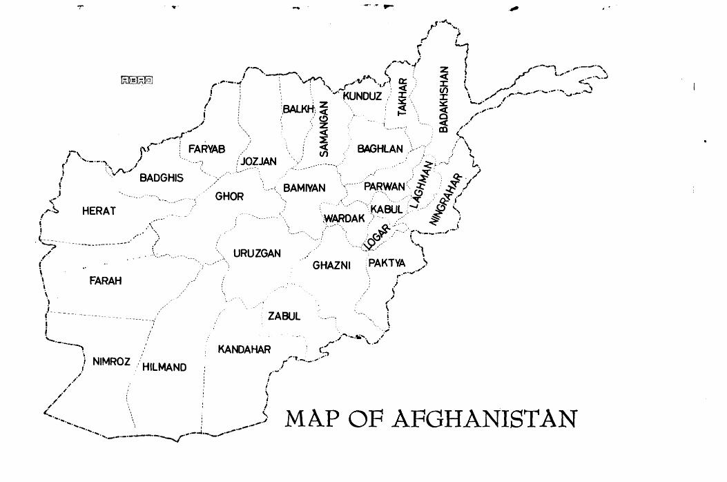
Afghanistan: Front Cover
Provinces
Ethnic Map
481 487 489
1
16

XIV
Historical Environs of Afghanistan 44 The Center 77 Kabul: Back Pocket
Ghazni 180 From the East 199 From the West 241 Herat 245 The South 277 Kandahar 280 The Northwest 329 The North 365 Tashkurghan 378 The Northeast 403 The Central Route 445
PLANS
Palace of Mas'ud III, Ghazni (Bonibaci) 184 Tapa Sardar (lsMEO) 192 Tapa-i-Shotor, Hadda (A.I.A.) 220 Principal Monuments of Lashkari Bazaar (DAF A) 313 Audience Hall, Southern Palace, Lashkari Bazaar
(DAFA) 315 Takht-i-Rustan1, Samangan (Mizuno) 375 Ai Khanoum (DAFA) 430
,.r·., ........ ! }
r' i
r- ' \ . ,..", i (
,-- .,. 1 z ! /-·--"" ,.---·, I. '·----. . (. .: - ) c..,.... '·
\ ~ 1.>.. \ ""' ·-.. ~ • .-·, • .J .,.- •• f° V; - '\. _ _,·1, \ .,.,.~. I.&.. J: ! 1 <._
Ir : ,. _r . < / (I) , ,,.-' ,.. . ._ -·.... .....) "" .. KUNOUZ .: J:.,, °' .,, .,-·-·-· · ·-..1·-; : ' ' ' ' - ' J: . ,, , . , ' ' z ' ' - - ""'.,. .
I ,' :eALKH - ' <( \ c~ ,.-·" i : I ,' ~ .~. t-,; ,• . : ·'. <' <!) - ,f ./ \ ' ' z -i. ______ ,., ~ ,· J__, ', < _, ,· .,-r \ ~ ,"' .
. -.J· ! C'AR. VAB .,,/ < BAGHLAN ,\.--" ... -··' ,' \ -, {'~ : r"' '"' ' v, . . , . f \ / ·,·-·-·~\ /\, . .,/ ·-·----( .... L~9~JAN ,.:( _____ .---····t· , ./· ( ... ~r.--.) t.-., ,i . __ .,, BADGHIS · ,, .. -. ·: ~ Q:-· " ' ·----<. BAMIYAN .,-·----·· PARWAN( ~ ~ /
<.i ~-- GHOR ·, , .. · .:. . _ / ... ,\___ -·)~ _ .,.-j..-i .~-~ HERAT \._KABUL-~"--·,.. ~ (,
I ( ... WAROAK )-·--- .. / ~ ; \ .. ( '-: ·.:,---·· :' ~Q.;·:.::_-.\,. ~ ·-·'
'\ ·---------. ; :' r::,~ _/ ._ ! ~·--·-·" . '.:.:.:.,-- ------------·- ____ .• ,-· ( '.·--<~,,/ , .... 1
/ -\:.---··.. URUZGAN .. , { -·"-.. GHAZNI : PAKTY.6:.~.,)
\ FARAH _r \ \ ·, ,, ,/ L \ ' ZABUL · __ ..... i i ·,, \ ; --~ . ./''·-.ta'. ·' '·-· -· \..J --~ .,
°' KANDAHAR C:, ,-i NIMROZ _/ HILMAND f,·,.~ ___ ., ...
/ ~/ i , i
/ ~
/.,. J ~~ ~ ........ --·~
""'-•, • .._ I .-•--""
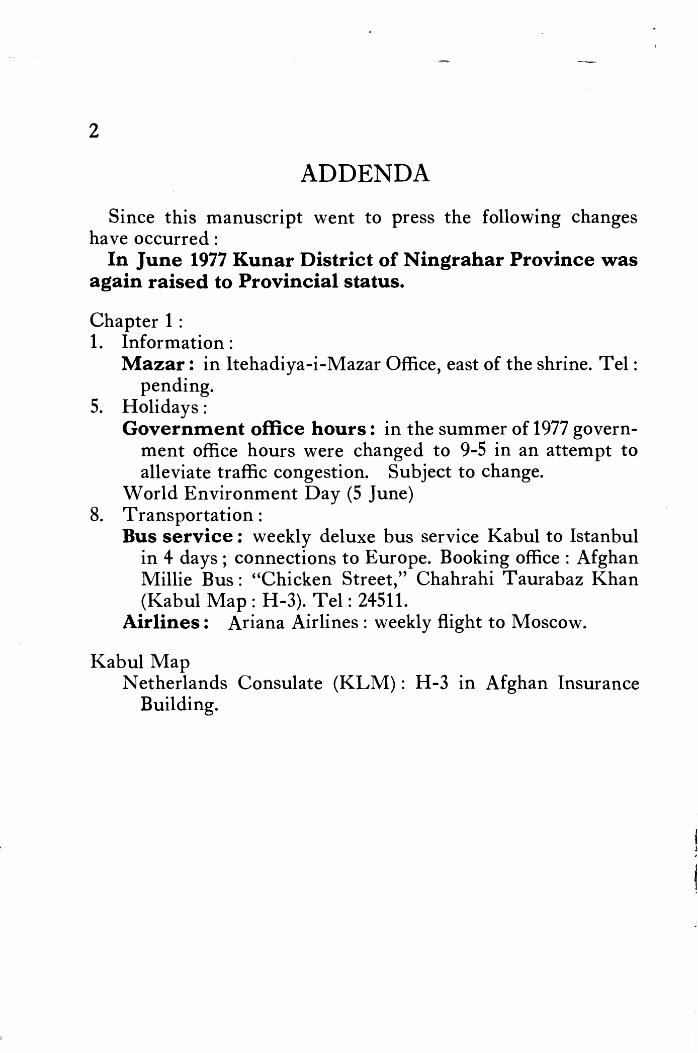
., -·---'·--__..·,.,__._..--------·--.............r ...... ...-MA.P OF AFGHANISTAN
2
ADDENDA
Since this manuscript went to press the following changes have occurred:
In June 1977 Kunar District of Ningrahar Province was again raised to Provincial status.
Chapter 1 : 1. Information :
Mazar: in Itehadiya-i-Mazar Office, east of the shrine. Tel: pending.
5. Holidays : Government office hours: in the summer of 1977 govern
ment office hours were changed to 9-5 in an attempt to alleviate traffic congestion. Subject to change.
World Environment Day (5 June) 8. Transportation :
Bus service: weekly deluxe bus service Kabul to Istanbul in 4 days; connections to Europe. Booking office: Afghan Millie Bus : "Chicken Street," Chahrahi Taurabaz Khan (Kabul Map: H-3). Tel: 24511.
Airlines: Ariana Airlines: weekly flight to Moscow.
Kabul Map Netherlands Consulate (KLM): H-3 in Afghan Insurance
Building.

1 CHAPTER 1
Travelling in Afghanistan
1. INFORMATION
Kabul: Afghan Tourist Organization, Salang Wat, Kabul, Afghanistan (Kabul Map 75: H-4). Telephone: 24464; reservations 20380. Cable: Afghantour, Kabul.
Herat: Afghan Tourist Organization, 26 Saratan Square (Herat Map). Telephone: 3210.
2. VISA INFORMATION
All visitors to Afghanistan must be in possession of a valid passport, an Afghan visa, and an international health certificate. A Tourist Visa may be obtained a·: the airport by visitors arriving at Kabul by air (200 afs. ). A Tourist Visa is valid for one month from date of entry and it may be extended at the Visa Office (Kabul Map 79: H-4) or by the Afghan Tourist Organization, Kabul.
All visitors to Afghanistan staying in a private home and not registered in a public hotel or club must register with the security authorities within 48 hours.
No exit visas are required for those holding Tourist Visas; all others must secure exit visas.
3. AIRPORT TAX
·-. , 200 afs. for those departing Afghanistan by air from the Kabul airport.
4. THIRD PARTY INSURANCE
All foreign nationals driving vehicles inside Afghanistan are required to be in possession of third party insurance. Policies may be obtained at points of entry.
3

4 AFGHANISTAN
5. HOURS AND HOLIDAYS
Friday is the weekly holiday in Afghanistan. Government offices close Thursday afternoon and Friday. Most stores in the larger towm will be closed on Friday ; some open later in the afternoon.
Government· Office Hours Saturday through Wednesday: 8: 00-12: 00; 1 : 00-4: 00 Thursday: 8 : 00-1 : 00 Friday: Closed ~ If h9liday falls on Friday, offices close Saturday. If holiday falls on Wednesday, offices close Wednesday
through Friday. During Ramazan: Saturday through Thursday 8 a.m.-
2 p.m.
Government offices also close on the following National and Religious Holidays:
National Holidays 21 March: Nawroz or New Year's Day: 1 day
Farmers' Day is celebrated at fairs exhibiting prize animals and produce in most provincial centers and at Khair Khana in Kabul ; a large fair is held at the shrine of Mazar-i-Sharif and smaller fairs take place at shrines in Kabul, such as the Ziarat-i-Sakhi (Kabul Map 43: E-5) and the Ziarat-i-Shah Shaheed below the Bala Hissar (Kabul Map 4: J-4); buzkashi games take place throughout the north, especially at Kunduz and Mazar-i-Sharif.
27 May: Independence Day: 1 day Anniversary of the Campaign at Thal, 27 May-3 June, 1919, during the War of Independence (Third AngloAfghan War); General Mohammad Nadir Khan (later King Nadir Shah) commanding.
17 July: Jeshn-i-Jamhuriat or Republic Day: 3 days Celebrates the founding of the Republic of Afghanistan in 1973. Fairs and parades in Kabul, provincial capitals and many large towns.
31 August: Pushtunistan Day: 1 day

TRAVELLING IN AFGHANISTAN 5
Parades in many provincial capitals; programme in Pushtunistan Square, Kabul (Kabul Map 35: 1-4) includes performance of the a tan ( national dance) and folksongs by school children dressed in national costume.
9 September: National Assembly Day: 1 day
15 October: J eshn-i-N ejat or Deliverance Day: 1 day Commemorates the victory of General Nadir Khan, later King Nadir Shah, over Bacha Saqao in 1929.
24 October: United Nations Dai: 1 day
International Labor Day (1 May), Students' Day (21 May), Mothers' Day (14 June), and Literacy Day (8 September) are also observed by special programmes, but offices are not closed.
Religious Holidays Religious holidays throughout the Muslim world are set ac
cording to the lunar calendar and fall 10-11 days earlier each year. Moreover, in Afghanistan, the commencement of the holiday is contingent on the actual sighting of the moon. This sometimes results in the holiday being delayed a day. The dates on which these holidays fall in 1976-1977 are given as a reference for future calculation.
Ashura: 10th day of Moharram or Martyrs Day, anniversary of the death of Husain, second son of Ali, cousin and sonin-law of the Prophet Mohammad, in the Battle of Kerbala in 680 A.D. : 1 day (1 January 1977)
Mawlud-i-Sharif, the Prophet's Birthday: 1 day (3 March 1977)
1st of Ramazan, month of fasting: 1 day (26 August 1976) Id ul-Fitr, end of Ramazan: 3 days (25-27 September 1976) ld-i-Qurban (Azha), day of sacrifice during the month of the
Haj or pilgrimage to Mecca: 4 days (1-4 December 1976) No special public celebrations take place on religious holidays.
All visit the mosque and on ld-ul-Fitr, particularly, there is much visiting between family and friends. Large quantities of sweets and cookies are consumed at this time. ld-ul-Fitr is also a time for new clothes and the children are especially gay on this occasion. On Id-i-Qurban the modern pattern is to travel out of town and Kabul is quite empty.

6 AFGHANISTAN
6. BuzKASHI
For a description of this game played on horseback by the Uzb~k and Turkoman of the north, see Chapter 27, section (6). Three annual Buzkashi events take place:
National 25 March-4 April in Kunduz and Mazar .
Provincial Championship 23 October-4 November in Kabul ·
Winter Tournament 21 December through 21 March in Kunduz
7. ACCOMMODATION
Conventional categories cannot be assigned to hotels outside Kabul. The provincial hotels have been given the following special classifications for the purposes of this guide. Conditions can, however, change almost overnight, for better or for worse, especially in the smaller hotels.
1st Class: large commercial businessmen's hotels (US $14-8 for double with bath; US $4-2 with common bath), or; small, well-managed establishments ( ca. US $20 for double room with bath). Hot water usually available at all times; heating in winter.
Varied price range: large and medium-sized hotels offering everything from rooms with private baths to dormitory-like rooms with several beds. Hot bathing water on request, usually. Generally clean and com-· fortable; the newer the hotel, the more modern the conveniences; deterioration sets in rapidly, a modern ~a~ade does not guarantee service or adequate plumbing.
Meals are served but it is wise to order considerably in advance. Amenities such as soap, towels and toilet paper are not normally provided. There is electricity at least part of the night. Average ca. US $12-5 for double room with bath; US $3-2 per person with common bath.
Good: cheap; basic services; usually no food; comfortable beds but bedding at times questionable; no private baths and often without modern plumbing or

TRAVELLING IN AFGHANISTAN
electricity. Pleasant surroundings make up for much that is lacking. About US $2-1.50 per person.
Fair: similar to Good category but without the compensating surroundings. About US $1.50 per person.
Minimum: shelter, bathing water and sanitation arrangements, but one is advised to bring sleeping bags. Charpoys ( string beds) are usually provided. About US $.50 per person.
Afghan Tourist Organization (ATO) tents on Central Route: foam rubber mattress and one blanket provided. Minimal sanitation facilities. US $4 per person per night. As of the summer of 1976 vouchers purchased from ATO (only at Kabul) were required to stay in these tents. Situation may change; inquire from A TO Herat and Kabul.
Meteorological Stations on Central Route: when no other facilities are available, these stations may often offer shelter. No bedding or other facilities provided. US $.50 per person.
C haikhana and Caravanserais: all foreign tourists are required to stay at local hotels or municipality clubs, even when accommodation is minimal. When none exist, chaikhana offer takhts ( wooden benches) or space on the floor. Some chaikhana are attached to caravanserais which often have private rooms for travellers. US $.50 per person.
Camping: no camping sites in the European sense exist. Some hotels with gardens often permit camping. US $1.50 per day.
8. TRANSPORTATION
7
Cars: with reliable drivers are provided by the Afghan Tourist Organization in Kabul.
Taxis: settle the price before engaging the taxi; generally 20 afs. for a short ride, 50 afs. for a longer ride in the city. For trips outside of Kabul, taxis charge by the seat; you may hire one or more seats for yourself depending on how much comfort you desire.

8 AFGHANISTAN
Daily bus service to: Kabul Depot Bamiyan Serai Khar Khana, near Timur Shah's mausoleum;
ca. 3 a.m. departure. ~
Ghazni Serai Ghazni, Deboree, south of UniYeisity. He rat
Istalif
Mir Wais Mai~an (Koti Sangi), west ~nd of Jadi Mir \Vais; also, opposite Pakistan Embassy, Shahr-i-Naw. Sarai Shamali, south side of Salang Wat toward western end.
Jalalabad Kandahar
Pul-i-Mahmud Khan (68: K-4). Mir Wais Maidan; also, opposite Pakistan Embassy, Shahr-i-Naw ..
Kunduz east and west end of Jade Maiwand. Foot of Bala Hissar. Lo gar
Mazar-i-Sharif east and west end of Jade Maiwand. Paghman' Panjsher
Peshawar
Mir Wais Maidan (Koti Sangi). Serai Shamali, south side of Salang Wat toward western end. west end of Jade Mai wand; aJso, opposite Shahr-iNaw petrol station east of park.
Pul-i-Khumri east and west ends of Jade Maiwand. Shibarghan east and west ends of Jade Mai wand. Tagao Serai Shamali, south side of Salang Wat toward
western end. Taluqan west end of Jade Mai wand.
Local buses and lorries carry passengers from point to point across the Central and Northern routes. Schedules are erratic; inquire at chaikhana and motorserais; long waits between connections to be expected.
Airlines: Ariana Afghan Airlines. Booking offices: next to Kabul
Hotel, tel. 24 731 ; Hotel Intercontinental, tel. 31851. To: Tehran, Beirut, Istanbul, Frankfort, Rome, Paris, Amsterdam, London; Amritsar, New Delhi; Tashkent.
Aeroflot (USSR). Booking office on Chicken Street, tel. 22030. To: Tashkent, Moscow.
Bakhtar Afghan Airlines. Booking office next to Kabul Hotel, tel. 24451. Kabul to Bamiyan and return; Kabul to Herat (Herat to Kabul) via Mazar-i-Sharif and Maimana, or via Chakhcharan; Kabul to Maimana and return; Herat to Qala-i-Naw; Kunduz to Faizabad.
Indian Airlines. Booking office south of Ministry of Foreign Affairs, tel. 22527. To: Amritsar; New Delhi.

TRAVELLING IN AFGHANISTAN 9
Iran Air. Booking office next to Park Hotel, tel. 25071. To: Tehran.
Pakistan International Airlines. Booking office in front of Spinzar Hotel in Pashtani Tajerati Bank, tel: 22155, 22166. To: Peshawar.
9. Foon With few exceptions such as most areas of N uristan and the
W akhan, chaikhana ( chai ==tea; khana ==house) or teahouses are found everywhere in Afghanistan. The term chaikhana is used by most foreigners here though the Afghans themselves refer to the teahouse as the samovar. Each town bazaar, no matter how small it may be, has a teahouse with a samovar boiling, ready to serve a hot cup of tea at a moment's notice; new roadside teahouses spring up daily as traffic increases. There is an extra charge for sugar.
All but . the smallest chaikhana will also provide some food: eggs and nan (unleavened bread) for breakfast, for instance; shorwa (soup) and pilau (rice and meat) at regular meal times. The larger chaikhana, called Otel or Restauran, serve more varied menus. The ingredients are bought and cooked fresh each day. Furthermore, the food is served directly from the pot on the fire, where it has simmered for hours, to the customer. Chances of spoilage or contamination from sitting around in the kitchen are, therefore, much less in these provincial restaurants than in the big city restaurants. Visitors are therefore encouraged to sample these dishes.
Menus vary from region to region and the regional specialties have been noted in the appropriate chapters of this guide. The standard fare consists of shorwa, pilau and qorma. The shorwa has a lamb stock and it is served with bread which is customarily broken up into the soup. The pilau is rice cooked with meat and the qorma is a vegetable side dish eaten with the pilau. Vegetab_~es vary from season to season and region to r·egion, but every kind is used. Often, the qorma will include pieces of stewed lamb, meat balls (kofta) or even qawk (partridge) in season. A special type of meat stew called chainaki ( chainak ==teapot) is cooked in teapots embedded in hot coals.
Kababs, charcoal-broiled bits of lamb and fat served on skewers, a~e fou_nd in almost all the bigger towns, but rarely in the smaller ones. Some towns a_re famous for their kabab and there are sever~l

10 AFGHANISTAN
different kinds. These have been noted in the appropriate chapters. Nan (lightly leavened, wholewheat bread) is universal, but differs
in shape and taste from region to region. There is no )llore delicious food than crisp nan, hot from the oven. The fastidious, unwilling to sample other specialties, can travel throughout Afghanistan eating nan, eggs, tea, an occasional stick of kabab and fruit, with no harm to health or palate.
10. WATER
Unboiled water without purification (iodine or halazone) is not recommended in any urban area. Water should not be drunk from the tap in hotels or private homes ; ask for boiled drinking water to be brought to the room. Even then, unless a safe source has been ascertained, it is best to use purification tablets in most cases. Delicious spring water can be found along many of the routes described; fast-flowing river water is also generally safe away from inhabited areas. Safe soft drinks bottled in Kabul may now be found in almost every town and bazaar on well-travelled routes, and in practically every hotel.
11. ITEMS TO CARRY
To make travel into the remoter areas of Afghanistan more comfortable take a selection of the following: soap, towel, mfrror, toilet paper; water purification tablets, insect powder, First Aid and basic medical kit; sleeping bag or sheet; a few food items such as cookies and hard candies for variation; drinking water; flashlight. Those travelling by their own cars should have: spare parts; spare tires; extra petrol for long trips. However, the motorserais in all major centers can, and do, perform miracles when the need arises.
12. HAMAM OR STEAMBATHS
Hot water for bathing is often difficult to come by. Each large town or provincial capital has a hamam and usually these hamam have private rooms with showers or taps and gallons of hot water, a great luxury after several hot, dusty bathless days. Take your own soap, towel and a pair of wooden clogs (nali) or rubber sandals (chaplak), all of which may be purchased in the bazaar.
13. MEDICAL FACILITIES
Pharmacies with amazingly good stocks of basic medicines are found in all major towns and cities. Hospitals and doctors
TRAVELLING IN AFGHANISTAN 11
may be found in Kabul and provincial capitals. For emergencies contact embassy in Kabul or Governor's office in provinces.
14. CLOTHING
Afghanistan has four seasons necessitating clothing appropriate for each. The south is very hot in the summer; the mountain cities very cold in winter. A light wrap for evening is always advisable, even in the summer, for diurnal changes can be great. Boots and rainwear are necessary for winter and spring.
Ladies in slacks are accepted throughout the country, but shorts and sleeveless dresses are not recommended.
15. TIMES AND DISTANCES: DIRECTION
Mullah Nasruddin was once asked how long it would take to walk to the next village. "Walk," he said. Half an hour later he came running up to say, "It will take you an hour and a half." Astonished, the traveller asked bewilderedly, "Why didn't you say so in the first place?" "I did not know how you walk," said Mullah Nasruddin.
Like the good Mullah, this author does not know how readers will travel. All times and distances in this guide were recorded in a Land Rover. Other cars, different road conditions, and different drivers will record variations. Some travellers stop often to take pictures and pick flowers; others do not. The times, therefore, give the minimum time between points; no allowance for stops is considered. ,
Two tips for determining direction: graves in Afghanistan are oriented in a north-south direction; prayer niches in mosques point due West.
16. HUNTING AND FISHING: TREKKING AND
MOUNTAINEERING
All programming currently under revision. Write or contact Afghan Tourist Organization, Kabul.
17. VISITING MOSQUES AND SHRINES
It is customary to remove one's shoes before entering a mosque or a holy shrine. Some of the larger shrines request ladies to cover the head with either a hat or a scarf. Slacks or long skirts and long sleeves are obligatory for ladies in most shrines and mosques;
12 AFGHANISTAN
shorts and sleeveless dresses are not acceptabk; men in shorts and sleeveless tops will not be permitted to enter.
An entrance fee of 20 afs. is generally charged at larger mosques and shrines; a 50 afs. fee for each camera is also often levied. When there is no entrance fee, it is appropriate to leave a small contribution with the caretaker or a member of the brotherhood attached to the shrine .
18. PHOTOGRAPHY
Before taking photographs, ask for permission; you will i:arely be refused. Individual preferences and beliefs do exist; women , especially, generally prefer not to be photographed.

CHAPTER 2
Geography for the Tourist
Afghanistan with 700,000 square kilometers (270,000 square miles), is about the size of France or Texas, and has a population officially estimated at 17.4 million. Landlocked, it lies between 29°21 '-38°30'N latitude and 60°3 l '-75°E longitude, bounded by the Soviet Union to the north and by Iran on the west. In the extreme northeast, Afghanistan has a common border with the People's Republic of China. Many Pushtun and other tribes straddle the Durand Line, drawn in 1893, to the east and south.
Rugged mountains called the Hindu Kush dominate the scenery of Afghanistan. The westernmost extension of the Karakorum and the Himalyas, the Hindu Kush Mountains begin in the Pamirs and run in a southwesterly direction for about 1920 km; 1200 mi. before petering out in the vicinity of Herat where they are known as the Parapomisus.
Midway in the Hindu Kush is the Koh-i-Baba Range with its highest peak, Shah Foladi, rising 4951 m; 16,240 ft. above sea level. The Koh-i-Baba Range contains the sources of Afghanistan's three most important rivers: the Kabul which flows east to join the Indus at Attock; the Hilmand-Arghandab' which waters the Kandahar, Lashkar Gah and Seistan areas of the south before disappearing into the marshy lakes of the Hamun-i-Hilmand, mainly in Iran; and the Hari Rud or Herat River, which flows west past Herat, and then north to form a part of the Afghan:-Iranian border, before entering the Soviet Union.
Two motorable passes cross the Hindu Kush: the Shi bar and the Salang. The Shibar (3285 m; 10,779 ft.), still unpaved, is a short, precipitous pass Qn the road from Kabul to Bamiyan via the Ghorband Valley. During the winter the Shibar can be blocked by snow. The Salang is now pierced by a tunnel at an altitude of3363 m; 11,031 ft., making the passage from Kabul to the northern plains easy in all but the severest weather.
13

14 AFGHANISTAN
The mountainous Hazarajat occupies the entire central core of Afghanistan. The Unai (3300 m; 10,827 ft.) and Hajigak (3700 1n; 12,140 ft.) Passes give entrance to this high, corrugated plateau. These two passes are on the southern route from Kabul to Bamiyan via Maidan, and the Hajigak, particularly, is often blocked by snow in the winter. There is a road, of sorts, straight across the Hazarajat from Kabul to Herat. Though it is not recommended for the casual tourist, well-prepared and adventurous travellers will find this a trip to remember (see Chapters 30-32).
Several surveys pertaining to the construction of a paved highway through the center of Afghanistan have been undertaken which seem somewhat extravagant to observers of the miracles recently wrought on either side of the massive Hazarajat obstruction. Beautiful, wide, paved highways connect Islam Qala on the AfghanIranian border with Herat (120 km; 75 mi; 1! hrs). From Herat the road runs to Kandahar, the south's major city (565 km; 353 mi; 7 hrs.), first threading through low rounded hills separated by broad valleys before entering the deserts and semi-deserts which characterize southern Afghanistan. The paved road continues southeast from Kandahar to Spin Baldak on the Afghan border (104 km; 65 mi.) and from this road a branch runs north into the central mountains where Afghanistan's capital, Kabul, sits in a valley 1797 m; 5900 ft. above sea level ( 488 km; 305 mi; 6 hrs. from Kandahar).
From Kabul the paved road generally follows the Kabul River east to the Afghan border at Torkham (244 km; 152 mi; 3! hrs.). North of Jalalabad, the east's principal city, lies Nuristan, with high mountains uniquely wooded. Paktya Province lies south of J alalabad. Paktya and N uristan are the only two areas with extensive forests in Afghanistan. Elsewhere the mountains are bare or, at the best, sparsely sprinkled with occasional conifers and pistachio.
Proceeding north from Kabul the paved road passes through the rich grape producing Koh . Daman Valley and on up through the Salang Pass to descend onto the rich steppe lands of the north called the Turkestan Plains. These vast plains stretch from the northern slopes of the Hindu Kush to the Amu Darya River (classical Oxus) and into the U.S.S.R. The Amu Darya rises in the Pamir Mountains in the east and marks much of Afghanistan's border with the Soviet Union before it turns north, almost due north of Shibarghan, to empty into the Aral Sea.

GEOGRAPHY FOR THE TOURIST 15
The ring of paved roads around Afghanistan is now broken between Shibarghan and Herat. On this unpaved road one encounters sandy deserts with dunes, extensive grasslands, rolling loess-covered hills and magnificent passes such as the Sabzak (2400 m; 7874 ft.), about 100 kilometers northeast of Herat. A stout dependable vehicle is needed, and spring travel is discouraged, but otherwise the trip from Herat to Mazar-i-Sharif is most certainly recommended to hardy travellers with a taste for roughing it. A survey of this route has been completed and paving is already in progress at the eastern end. In a few years the ring will be complete.
Afghanistan, then, has jagged snow-covered massifs at its heart, softly rounded hills protecting fertile valleys, vast steppelands, forests and a wide variety of deserts-semi, sandy, stony and salty -each with its own particular charm and fascination. The peoples who inhabit this land are even more varied. Since the dawn of history there has been a constant coming and going of diverse peoples from the east and from the west, from the north and from the south, brought to this area today called Afghanistan by conquest, by migration, by trade and by religion. Furthermore, even within Afghanistan, particularly during the last two centuries, many groups have moved from their traditional homelands into new areas. The ethnographic picture is, therefore, an intricate maze, full of interest but far too complicated for thorough dissection here.
To put it briefly, the Afghan or Pushtun homeland encompasses much of the southern and eastern areas, from Kabul to Farah. Today, the Pushtun are to be found in all major towns and cities, however, both north and south, east and west. They speak Pash to. From among the national languages of the country, Pashto and Dari (Persian) are the official languages of Afghanistan. Dari is primarily spoken by Tajik in the Koh Daman, the Panjsher Valley, and Badakhshan. In Central Afghanistan, the Hazarajat Hazara, of Turco-Mongolian origin, speak Hazaragi (like Tajiki, a Dari dialect), and the Aimaq, of Turkic origin speak Dari dialects with some Turkic vocabulary. Other Turkic peoples such as the Kirghiz, the Uzbak and Turkoman live north of the Hindu Kush. The Herat area, as would be expected from its proximity to Persia, is predominantly inhabited by Dari-speaking groups known as Herati in the urban areas and Farsiwan in the rural areas. In the

200 ...... JOO Km.
TURKOMAN
ETHNIC MAP
UZBAK ~MA~ ETHNIC
GROUPS~
M.MOGHOL
TA-TAJIK
. TU• TURKOMAN
FA• FARSIWAN
A-ARAB
Tlw TANJRI ,-....,... MA.at PUSHTUN AREA
.,-,,,,,-,_MAJOR ETHNC UNITS . ,_,
ID 1-~RANI PUSHTUN UNITS
I& l-GHILZAI PUSHTUN I.HTS
OTHER PUSHTLN TRIBES
Ute>ERLINE

GEOGRAPHY FOR THE TOURIST 17
eastern provinces one finds mainly Pushtun with the exception of the N uristani, who speak a myriad of dialects all their own, and several groups of Dardic speakers.
As far as the weather is concerned, things are much simpler. Afghanistan has four distinct seasons. Winter days from December through February are generally sunny and crisp, with several heavy snows in the mountains. Temperatures plummet as soon as the sun sets, so heavy, warm clothing is a must in Afghanistan in winter. Spring brings out the fruit blossoms, the wild flowers and green grasses everywhere during March, April and May. Afghanistan is then at its loveliest, but heavy rains make travel off the paved roads extremely hazardous. Summer days are cool and comfortable in the mountains throughout June, July and August, but very hot and dusty both north and south. Again, diurnal fluctuations are great so that light wraps for evening are almost always needed. A riot of color brightens the fall months from September through November, probably Afghanistan's ideal travelling months.

CHAPTER 3
Sites in Perspective
An Historical Survey0
PREHISTORY
Early man in Afghanistan lived on river terraces and inhabited caves and rock shelters. Countless stone tools scattered about the countryside attest to this and each year archaeological excavations add substance to the picture of life in the Afghan area during the distant past.
Lower Palaeolithic tools made more than 100,000 years ago were collected from terraces to the east of the perennial brackish lake called Dasht-i-Nawur west of Ghazni (L. Dupree, 1974). They consist mainly of quartzite tools of the following types: large flake cores, cleavers, side scrapers, choppers, adzes, hand axes and "proto-hand axes". These are the first Lower Palaeolithic tools to be identified in Afghanistan.
Ear lier, in 1966, a team of American archaeologists searching for evidence to support the theory that "N eanderthaloids possibly developed out of the East Asian strains of Java and Peking Man, and, during the lush Third Interglacial Period, spread along the foothills of the Eurasian mountains into Europe," excavated hundreds of stone tools of classic l\iliddle Palaeolithic types from a rock shelter called Darra-i-Kur near the village of Baba Darwesh not far from Kishm, in Badakhshan. (L. Dupree, director) These represent the first tools of this early period to be scientifically excavated in Afghanistan. They date ca. 50,000 years ago.
Continuing their search, the team moved west during the summer of 1969 · and found additional evidence in the foothills near Gurziwan, southeast of Maimana. The tools from Ghar-i-Gusfand Mordeh (Cave of the Dead Sheep) may be even older than those
19

20 AFGHANISTAN
from Darra-i-Kur. During the 1974 season Middle Palaeolithic tool types closely resembling those found at Darra-i-Kur were also recovered from terraces north of Dasht-i-Nawur. They include Levallois flakes, side and round scrapers, points and possible burins.
What manner of man made these tools? Ordinarily, skeletons of Neanderthal Man are found in association with the type of tools found at Darra-i-Kur. Indeed, less than 150 miles to the north, at Teshik Tash in U zbakistan, Soviet archaeologists found the skeleton of a Neanderthal child with such tools. At Darra-iKur, however, a massive temporal bone has been pronounced by experts to be essentially modern with certain Neanderthaloid characteristics. Additional evidence is needed and continued excavations are planned, but it may be that Darra-i-Kur will necessitate a reappraisal of the development of contemporary man. "North Afghanistan may well be the zone where modern Homo sapiens, or at least a variety of modern man, developed physically and began to revolutionize Stone Age technology," says Dupree.
As man ceased to be an animal chasing other animals, he began to manufacture a greater variety of more sophisticated stone tools. Upper Palaeolithic sites in Afghanistan dating from about 34,000 to 12,000 years ago illustrate this. Kara Kamar, a rock shelter 23 km; 14 mi. north of Samangan, the first Stone Age site to be scientifically excavated in Afghanistan, produced tools dating ca. 30,000 B.C. (C. Coon, 1954 ).
Evidence of Upper Palaeolithic man was subsequently expanded when other American archaeologists excavated over 20,000 stone tools from several rock shelters beside the Balkh River at Aq Kupruk in the hills some 120 km; 75 mi. south of Balkh (Dupree, 1962, 1965). The tools in this assemblage are so beautifully worked that one eminent specialist in palaeolithic technology has dubbed the tool makers of Aq Kupruk "the Michelangelos of the Upper Palaeolithic." They represent a cultural phase which endured for about 5000 years at Aq Kupruk, from ca. 20,000 to 15,000 years ago, during which someone, a man or a woman, carved the face of a man, or is it a woman?, on a small limestone pebble. This work of art is one of the earliest representations of man by man. Other representations made from bone and pottery found in Cze.choslovakia are of cmnparable age or even older; a carved stone piece fotind in France is possibly comparable in age. The face

SITES IN PERSPECTIVE 21
from Aq Kupruk smugly retains the secret of why it was carved. Does it perhaps represent an early ritual object? It was found in a hearth. (On display, National Museum, Kabul).
North of Balkh, Russian archaeologists found an extremely rich concentration of high quality Mesolithic implements on the sand dunes south of the Amu Darya ( classical Oxus River) dating ca. 10,000 B.C. (A. Vinegradov, 1969-present). Here the basic industry is microlithic with geometrics. From dunes north of Khulm, a Fren.ch archaeologist collected flints including microburins characteristic of the Epipalaeolithic, ca. 7-6500 B.c. (Ph. Gouin, 1968).
The great revolution which launched man onto the path of civilization-and eventually into the Atomic Age-took place during the Neolithic period when he learned to plant crops and domesticate animals and thus began to control his food supply.
Sculptured Head from Aq Kupruk, circa 20,000 B.C.
This revolution took place at Aq Kupruk about 9000 years ago which indicates that northern Afghanistan may indeed have been one of the early centers for the domestication of plants and animals. The evidence also supports another Dupree theory that the revolu-

22 AFGHANISTAN
tionary ideas of agriculture and herding germinated within a zone bordered by the 34th and 40th parallels of north latitude, at an altitude of about 750 m; 2461 ft. extending from Central Afghanistan through Anatolia to mainland Greece. Most Middle East Neolithic sites are found within this zone and Aq Kupruk is now added to the list.
A much later Neolithic at Darra-i-Kur, dating about 4000 years ago, ties in with sites in South Siberia and Kashmir, rather than with the much earlier Middle East sites to which Aq Kupruk relates. The Dupree Line, following the 76th longitude through Afghanistan, divides the mixed farming-herding Neolithic of the Middle East from the highland semi-nomadic Neolithic of South Siberia and Northeast ,Afghanistan, and emphasizes again the prehistoric significance of northern Afghanistan.
Another extremely interesting phenomenon was encountered in the Darra-i-Kur Neolithic. Three intentional burials of domesticated goats, one in association with fragments from two or three children's skulls, were uncovered. Here must be evidence of ritual; of a concern for the mysteries of death and what follows. It was not a unique find for Darra-i-Kur. The Neanderthal child of Teshik Tash in the Soviet Union only 150 miles to the north was encircled by seven pairs of goat horns. Nor is it a phenomenon related solely to the prehistoric. Countless shrines and graves in Afghanistan today are adorned with goat horns, symbols of strength, virility and grace.
As man gained proficiency in agriculture, he moved down from mountain caves onto the plains where planting was easier and water more plentiful. Villages emerged; cities followed.
Early peasant farming villages came into existence in Afghanistan ca. 5000 B.C., or 7000 years ago. Deh Morasi Ghundai, the first prehistoric site to be excavated in Afghanistan, lies 27 km; 17 mi. southwest of Kandahar (Dupree, 1951). Another Bronze Age village mound site with multiroomed mud-brick buildings dating from the same period sits nearby at Said Qala (J. Shaffer, 1970). Second millennium B.C. Bronze Age pottery, copper and bronze horse trappings and stone seals were found in the lowermost levels in the nearby cave called Shamshir Ghar (Dupree, 1950). In the Seistan, southwest of these Kandahar sites, two teams of American archaeologists discovered sites relating to the 2nd millennium B.C.
(G. Dales, University Museum, University of Pennsylvania, 1969, 1971; W, Trousdale, Smithsonian Institution, 1971-76).

'v ,, I ,· '\.
SITES IN PERSPECTIVE 23
· C: l\~f~Uy e finds from Deh Morasi and Said Qala tie in o... ~1\ose of re-Indus Valley sites and with those of com
parable age o the Iranian Plateau and in Central Asia, indicating ultural co cts during this very early age. Striking correlations
a s · \,;ate the parallel development of Deh Morasi with Mundigak, 51 km; 32 mi. to the north of Deh Morasi, which was excavated -by French archaeologists under the direction of JeanMarie Casal, from 1951-1958. Mundigak is a huge mound 9 m; 30 ft. high; an urban center compared to the seminomadic villages of Deh Morasi and Said Qala (end of Chapter 16).
As the great cities of the Indus Valley, such as Mohenjo-daro and Harrapa, grew, specialization necessitated the development of a complex economic base to supply them. The villages supplied the towns and the towns supplied the cities. The excavations at Deh Morasi, Said Qala and Mundigak provide much needed information regarding early economic supply networks and the beginninga of an urban civilization in the Afghan area.
Evidence that trade was not limited regionally, but extended as far afield as Ur (in modern Iraq), was recovered accidently i~ 1966 from the valley of Sai Hazara in northern Afghanistan. The Khosh Tapa (Happy Mound) Hoard consists of several gold and silver goblets, now broken into 19 fragments weighing a total of almost eight pounds, stunningly ornamented with raised geometrical designs and vigorous figures of bulls, boars and snakes. These ani1nal motifs bear tantalizing similarities stylistically with dominant Mesopotamian, Iranian, Indus Valley and Central Asian styles. Khosh Tapa lies in Baghlan Province, north of the Khawak Pass, on a once popular route linking the Middle East with Central Asia and Central Asia with the southern provinces in India. One of the more popular luxury items carried along this route was lapis lazuli from the mines of Badakhshan which are still being worked today. The two main periods of intensive lapis trade date from ca. 2300 B.c. and 1350 B.c.; the probable date of the hoard is ca. 2300 B.C. ( on display, National Museum, Kabul).
Three small mounds near Daulatabad in Faryab Province excavated by Soviet archaeologists produced fine, well-fired Bronze Age clay vases and footed vessels dating ca. 2000 B.c. (V. Sarianidi, 1969). A series of Bronze Age mounds given the· general designation of (D )ashli greatly expanded the picture of Bronze Age life ca. 1500 .B.c. north-west of Balkh. DI is a large plastered mudbrick fort-qala surrounded by farming settlements. Here utilitarian

24 AFGHANISTAN
Mother goddess figurines, right, from Mundigak, left, from Deh Morasi Ghundai, 3rd Millennium B.C. (h. 6 cm)
pottery, fine ceramics and imported wares from Iran were found together with jewelry and stone and bronze compartmented seals. Weaponry included sling balls as well as bronze and copper weapons. In an intrusive burial during the end of this period goat skeletons were found surrounded by many delicate ceramic vessels of high quality.
D3 was a much larger complex in two sections. A circular temple building 150 m; 492 ft. in diameter had an inner wall and an outer wall with nine projecting towers. Across from this temple there was a monumental palace with stepped pilasters on its outer

SITES IN PERSPECTIVE 25
fa~ade surrounded by massive walls and a moat 10 m; 33 ft. wide and 3 m; 10 ft. deep. Not far away several extensive Bronze Age graveyards are being systematically looted by illegal diggers. Bronze seals, pins, mirrors, weaponry, unguent jars and various styles of jewelry grace the sidewalks of Kabul; graceful paper-thin pottery of elegant shapes bespeaking great sophistication lie abandoned by the ravished pits.
Another three-period fanning settlement ( ca. 1300-500 B.C.) was excavated at Tillj Tepe near Shibarghan (V. Sarianidi, 1969, 1971). Fortifications are conspicuous and numerous clay missiles and bronze projectile points were found.
Deh Morasi and Mundigak also provide tantalizing evidence regarding early religious developments. Casal suggests a religious use for a large white-washed, pillared building, its doorway outlined with red, dating from the 3rd Millennium B.C. at Mundigak. At Deh Morasi there is evidence of a possible altar. Built of fireburned bricks, the shrine complex contained several objects suggesting religious ritual: goat horns, goat scapula, a goblet, a copper seal, hollow copper tubing, a small alabaster cup, and a pottery figurine of classic Zhob Valley style. These pottery figurines are generally considered to represent the mother-goddess, being at once voluptous in form, to symbolize her power over life and fertility, and, terrifyingly ugly, to symbolize equal power over death and the horrors of the dark, mysterious unknown. (On display, National Museum, Kabul)
Deh Morasi was abandoned about 1500 B.C., perhaps because of the westward shift of the river. Mundigak continued to survive and to suffer two invasions before it was abandoned about 500 years later after an existence of 2000 years. The caves of Aq Kupruk and Darra-i-Kur, however, contain evidence of continuous occupation. Indeed, retaining walls and hearths belonging to modern nomadic groups occupy the attention of the excavators as each prehistoric cave site is opened. Some men never took to a sedentary life, and still don't. Nomads have always been a part of the Afghan scene.
ARYANS AND AcHAEMENIDS (c. 1500 B.C.-330 B.C.) A pastoral, cityless, people led by heroic warriors riding two
horsed chariots came out of the north to shatter the great cities of the Indus Valley. In the sacerdotal writings of the Vedic Aryans,

26 AFGHANISTAN
the Rigveda, we read of the Kubha (Kabul) River and know of their passage through Afghanistan sometime around 1500 B.C. In the related Persian hymns of the Avesta, we read o[Bakhdi (Balkh) "the beautiful, crowned with banners" and of Zarathustra Spitama (Zoroaster), the great politico-religious leader who lived in Balkh sometime between 1000 and 600 B.C.
The Aryans found the northern plains ideal for their flocks of sheep and goats. Many settled here and prospered. As the years passed, however, the various Aryan tribes frequently fought among themselves, encouraging the subjugated indigenous tribes to rise in revolt. Predatory raids by bands of horse-riding nomads from across the Oxus added to the turmoil. Keeping the Aryan herdsmen from their grazing lands, the nomads demanded, and began to receive, tribute for grazing rights. Aryan independence seemed doomed. It was then that Zoroaster came forth to exhort the people to unite, in the name of the god Ahuramazda.
Victorious, Zoroaster then advised his followers to develop agriculture in addition to herding if they wished to remain independent and grow strong. The fertile plains of Bactria blossomed and the land prospered.
Successive waves of Aryan migrations from Trans-Oxiana, finding the Afghan area occupied by the Vedic Aryans, moved west, onto the Iranian Plateau, where they evolved from a semi-nomadic state into an extensive empire which eventually stretched from the borders of Greece to the Indus River. The Achaemenid Kings conquered in the name of Ahuramazda and Zoroastrianism was their religion.
Achaemenid campaigns into the Afghan area were undertaken by Darius I (522-486 B.c.), builder of the famous palaces of Susa and Persepolis, and are recorded on his tombstone. To facilitate trade, an imperial highway passed through Afghanistan, along virtually the same route modern highway builders have but recently paved. The excavations at Shahr-i-Kona, the old city of Kandahar, undertaken by the British Institute of Afghan Studies in 1974 (D. Whitehouse) and 1975 (A. McNicoll) indicate that by 500 B.C. Kandahar had replaced Mundigak as the major city of the south. In the north, Soviet excavations at a series of mounds given the general designation of (A)ltyn, not far from the Dashli group above Balkh, revealed a large principal administrative town and a monumental private residence in the Achaemenid style with a central court dominated by a pool or fountain. Outside the re-

SITES IN PERSPECTIVE 27
sidence there was a large columned courtyard divided into two equal sections by a line of rooms possibly used for public audiences by some grandee or noble. There is evidence of a great conflagration which burned the wooden superstructure of the portico sur-
. rounding these courtyards. Curiously, it seems to have been set just about the time of Alexander of Macedon's sojourn in northern Afghanistan. (V. Sariandi, 1972)
ALEXANDER OF MACEDON (330-327 B.C.)
Alexander the Great crushed the Achaemenid Empire. By the time he stood on the threshold of Afghanistan the last Achaemenid King, Darius III, lay dead, murdered by his Bactrian allies. Alexander's armies momentarily exulted in the belief that their task was complete; they yearned to be homeward bound. But the young, still in his twenties, conqueror dreamed of equaling, if not surpassing the conquests of Darius I. Furthermore, he smarted with anger on hearing that Bessus, murderer of Darius and chief of the Bactrians, had assumed the titles of the Achaemenid kings and was gathering an army.
In 330 B.C. Alexander started east. His direct pursuit of Bessus was, however, checked by revolt in Aria (Herat). Turning south, covering 75 miles in two days, he quickly subdued the surprised rebels and moved on into Drangiana (along the Hilmand) and from there relentlessly pushed on into Arachosia (Kandahar and Ghazni), on to Paropamisadae (Kabul-Charikar), up the Panjsher Valley and over the Khawak Pass to Drapsaka (Kunduz). The two chief cities of Bactria, Aornos (Tashkurghan) and Bactra (Balkh), surrendered without resistance in the spring of 329 B.C.
Establishing a base camp at Bactra, Alexander pursued the rebels across the Oxus. Bessus was captured, put into chains and executed. Some Bactrian chieftains offered their submission and were confirmed in their satrapies; many fought on with the aid of nomadic groups mounted on swift horses. Two years of campaigns brought less than total success. Furthermore, increasing opposition to Alexander's assumption of god-like airs, and his adoption of Persian dress and court ceremonial led to conspiracies, executions and distressing disquiet within the camp. It was time to move on and Alexander turned to the conquest of India. With characteristic haste he took only ten days to move his army back over the Hindu Kush to the Charikar area.
An estimated 27-30,000 fighting men moved at his command.
28 AFGHANISTAN
They followed the Panjsher River to its junction with the Kabul River and then moved on to J alalabad where Alexander divided this huge force, sending the main army through the Khyber Pass area while he took a small mobile force to deal with the tribes in the mountains above the Kunar River, in the area known today as N uristan. From here he passed into Swat. Campaigns in the Punjab and in Sind continued until 326 B.C. when his troops, at long last, forced a return to their homeland.
Alexander established several Alexandrias in the Afghan area and many cities in Afghanistan claim the honour of being so founded, but no conclusive archaeological evidence exists. Even Balkh, traditionally thought to be the site of Bactra, has failed to oblige the archaeologists' spades. Kandahar lays claim to being Alexandria-ad-Arachosia and the discovery there of two inscriptions in the Greek language certainly points to a flourishing Greek community living in old Kandahar. When they came, however, is still debated. Evidence to support the theory that Ai Khanoum ( discussed below) may in fact have been first established by Alexander as Alexandria-ad-Oxiana, increases with each year's excavations, however.
MAURYANS AND GRAECO-BACTRIANS (305 B.C.-48 A.D.)
Three years after Alexander left India he died in Babylon (343) B.C.) and, while his Companions fought over the division of his conquests, independent local dynasties in the east rose and prospered.
Seleucus, inheritor of Alexander's eastern conquests, came to establish his authority in Bactria (305 B.c.), but south of the Hindu Kush he lost the Kabul-Kandahar area to the Indian Mauryan Dynasty, which had united the plethora of petty kingdoms in India under their strong and able rule after Alexander left. Having received the southern provinces of Afghanistan from Seleucus in return for 500 elephants and a princess, the Mauryans confirmed local chieftains in their satrapies but continued to regard them with a keen sense of benevolent responsibility, especially during the rule of King Ashoka, the dynasty's renowned ruler who reigned from 268-233 B.C.
An Ashokan bilingual rock inscription discovered on a boulder near the old city of Kandahar in 1967 is written in Greek and in Aramaic, the official language of the Achaemenids. A lengthier

SITES IN PERSPECTIVE 29
Greek inscription, also found in the old city of Kandahar, in 1963, , provided further concrete evidence for an important Greek-speak
ing community in Kandahar in the middle of the 3rd century B.C. Many had undoubtedly come during the period of Achaemenid rule for the Achaemenids are known to have deported politically dissident Greeks to Bactria. Their number no doubt swelled during and following the advent of Alexander.
The Ashokan Rock and Pillar Edicts which spell out his precepts for a life devoted to charity and compassion toward both man and beast, are well known in India, but these Kandahar Edicts are the western-most Edicts to have been found and they are the only ones to use Greek. As such they are an exciting additional illustration of Afghanistan's traditional role in bringing together east and west.
An Ashokan inscription in Aramaic found in 1969 in Laghman Province indicates that Ashoka also thought of lands far to the west of the Afghan area. Professor Andre Dupont-Sommer of the Academie des Inscriptions et Belles-Lettres, Paris, points out that the inscription contains the phrase "At a distance of 200 'bows' this way to (the place) called Tadmor." Tadmor may be identified as Palmyra, Syria, and the inscription stood beside the highway which led from India to the Middle East. Ashoka's missionaries travelled the length of this highway and Professor Dupont-Sommer, who also worked on the Dead Sea Scrolls, theorizes that they may have provided the inspiration for such monastic orders as the Essenes, authors of the Dead Sea Scrolls, whose origins continue to mystify scholars.
Though the ideals are similar, the texts on the inscriptions found in Afghanistan are not identical to any of the texts found in India. Ashoka adapted his edicts to meet the cultural patterns of the people to whom they were addressed. Ashoka's Doctrine of Piety is put forth in the Greek text from the bilingual inscription at Kandahar:
"Ten years (of reign) having been completed, King Piodasses (Ashoka) made known (the doctrine of) Piety to men; and from this moment he has made men more pious, and everything thrives throughout the whole world. And the king abstains from (killing) living beings, and other men and those who (are) huntsmen and fishermen of the king have desisted from hunting. And if some

30 AFGHANISTAN
(were) intemperate, they have ceased from their intemperance as was in their power; and obedient to their father and mother and to the elders, in opposition to the past also in the future, by so acting on every occasion, they will live better and more happily." (Trans. by G.P. Carratelli)
For the people living south of the Hindu Kush, subject to this humanitarian influence from the east, this was a period of tranquility accompanied by prosperity.
In the north, Bactria also prospered but here the cultural orientation was toward the west and the times were turbulent instead of tranquil. A local Bactrian governor eventually declared complete independence from Seleucid rule in 250 B.C. and his successors ultimately expanded Bactrian authority below the Hindu Kush to Kabul and to the cities of the Punjab where Mauryan power had steadily declined since the death of Ashoka.
The search in Afghanistan for a genuine Bactrian city, begun in the 1920s, finally ended in 1965 when French archaeologists began excavations, now under the direction of Paul Bernard, at the mile long mound of Ai Khanoum (Moon Lady, in Uzbaki), at the confluence of the Kokcha and Oxus Rivers, northeast of Kunduz. The 627 magnificent Bactrian coins contained in the Kunduz Treasure recovered (1946) from Khist Tapa at Qala-iZal, northwest of Kunduz (now in the National Museum, Kabul), are masterful monuments to the strength of those they portray; they speak of a highly sophisticated culture.
Superbly rich Ai Khanoum yearly adds substance to our knowledge of life in Bactria during the rule of the Bactrians (Chapter 29). The lower levels of the city mound site of Emchi Tepe near Shibarghan excavated by Soviet archaeologists produced many human figurines in Bactrian style, sherds inscribed with Greek characters, plates with central ornamental medallions in relief and other artifacts permitting a dating from the end of the 4th to the end of the 2nd centuries B.C. (I. Kruglikova, 1969-70).
The Bactrian dynasties were beset in later years by internal weaknesses brought on by overextension, personal rivalries, murder and fratricide. Charred beams and great quantities of charcoal throughout the upper levels of Ai Khanoum provide mute evidence of a succession of nomadic invasions at the end of the Second Century

,
SITES IN PERSPECTIVE 31
A Coin f16 om the Kitnduz Hoard
A.D. It is hard to imagine the imperious kings of the Bactrian coins in this account of what the nomads saw as tl1ey gazed across the Oxus and considered the invasion: ''They (the Bactrians) were sedentary, and had walled cities and houses. They had no great kings or chiefs, but some cities and towns had small chiefs. Their soldiers were weak and feared :fighting. They were skillful in trade.'' (Chinese source, Shih Chi, Book 123).
Tl1e invading nomads crossed the Oxus and subme~ged Bactria about 135 B.C.; in 48 B.C. the last Greek king, Hermaeus, confined to the valley of Kabul, signed an alliance with the nomad chief, now· a king, and peacefully ended Greek rule in the Afghan area.
KUSHANS (c. 135 B.C.-241 A.D. ) ·
Restless nomadic tribes living in Central Asia had long been of concern to the rulers of Bactr .ia and their relentless encroachments into the settled areas fill the pages of the area's ear-ly history. Real nomadic political power in Afghanistan was, however, first established by the Yueh-chih who, forced · from their grazing lands on the Chinese bo1·der-, ente1· this story as a loose confederation of five

32 AFGHANISTAN
clans. United under the banner of one, the Kushan, they wrote one of history's most brilliant and exciting chapters in Afghanistan.
Kushan King Kanishka (c. 130 A.o.) was this dynasty's ·most forceful and colorful personality. The heart of his empire centered around two capitals: the summer capital of Kapisa, north of Kabul near the modern towns of Begram and Charikar, and, Peshawar, the winter capital. Far beyond this, however, from the Ganges Valley to the Gobi Desert, satellite satrapies and independent states bowed to Kushan economic and political influence.
The Second Century A.O. which saw the Kushan Empire reach its greatest heights was a fabulous era in world history: the time of the Caesars in Rome and the Han Emperors in China, both of whom avidly exchanged their most exotic products and greedily eyed the spices, gems and cosmetics of India and Ceylon, the gems and furs of Central Asia. Silk was the major item of this trade and it is reported that it sold for $800,000 a pound in the sybaritic . markets of Rome. Situated exactly midway on the great caravan route known as the Silk Route, the Kushans exploited their position and gained vast wealth and with it, great power.
In addition, during the first two centuries of the A.O. era sea trade between the northern and eastern coasts of Africa and India was brisk and prosperous. Sometime in the middle of the 1st century B.C. a Greek sailor named Hippalus discovered that he could take advantage of the monsoon winds and sail from southern Arabia to India in forty days. By 24 B.c. at least 120 ships set sail annually and by the 1st and 2nd centuries A.O. ships and fleets had become so large that they were "agitating the white foam," according to Strabo the geographer. The overland Silk Route takes its name from the most prestigious commodity traded along it. The sea route could therefore be called the Pepper Route, for though the great warehouses in the Indian ports were stocked with pearls and gems, fine fabrics and perfumes, it was the tangy spice from Malabar which was valued above all. In exchange, the merchants from Greece and Alexandria brought wine, metalwork, ceramics, glassware and slaves.
At Kapisa, political and commercial center of the Empire, French archaeologists discovered (1939) a most magnificent Kushan treasure which represents the extent and the richness of this trade in capsule form. Here, in two small rooms, exquisitely carved ivories wrought in classic Indian style were stacked side by

SITES IN PERSPECTIVE 33
side with fine Chinese lacquers and an infinite variety of Roman bronzes, bas reliefs and glass from Alexandria. Obviously, Kapisa's citizenry had fine taste, and the wealth to indulge it. (On display, National Museum, Kabul; site discussed in section (3), Chapter 5).
The rise to world prominence had wrought great changes on the nomadic Kushans. Having no traditions on which to build a settled way of life, they adapted what they found in ways best suited to their own personality. What emerged was a vibrant and indigenous culture born of the fusion of western-oriented Bactrian ideals with those from eastern-oriented India, interpreted by the forceful, free character born on the steppes of Central Asia. The result was vital and dynamic.
The massive city site of Delbarjin built on the plains northwest of Balkh during the Achaemenid/Bactrian period flourished under Kushan occupation. Wall-paintings depicting the iconography of Buddhism and Hinduism exhibit stylistic affinities with Central Asia (Chapter 21; I. Kruglikova, 1970-present). Delbarjin is a most dramatic monument to Kushan power and culture. The old city of Kandahar was also extensively occupied during this period. An unique soapstone mold depicting a winged lion on an elephant standing on a lotus includes several Buddhist motifs; a ~tupa/monastery stands on a spur overlooking the city.
The revival of the ancient religion of Buddhism by Kanishka and the attendant emergence of Gandhara art are enduring manifestations of Kushan culture. A new school of Buddhist thought stressing the miraculous life and personality of the Buddha was officially sanctioned at a great council called by Kanishka. This humanization of the Buddha led directly to a desire for a representative figure of the Buddha who had, until this time, been depicted by such symbols as a wheel, an empty throne, a riderless horse, or a foot print. East and West joined in the creation of the familiar Buddha figure and adapted it to fit Indian philosophical ide2.ls.
Scores of missionaries soon travelled the world to spread the word. They followed the caravans along the Silk Route and Buddhism spread from its homeland through Afghanistan to China and the lands of the Far East where it lives today as one of the Twentieth Century's most vibrant religions.
Along the route they established countless shrines and 1nonasteries and Afghanistan's landscape is liberally sprinkled with Bud ..

•
•
. ,
3.4 AFGI-IANI STAN
Tapa-i-Shotor , V1, Hadda . •
dhist Kushan sites: Hadda and Darunta near J alalabad; Kandahar; Maranjan, Sl}ewaki and Guldara in and near Kabul; Tope Darra, Koh-i-Mari, Shot ·orak, and Paitava in the Koh Daman; Tapa Sardar in Ghazni; Wardak; Fondukistan in the Ghorband Valley; Bamiyan ; Takht-i-Rustam in Samangan; Durman Tapa and ·Chaqalaq near Kunduz, and Tap .a Rustam and Takht-i-Rustan1 at Balkh. The most recently identified complex, dated by carbon-14 ca. 150 A.D. , sits -besi·de the lake of Ab-i-Istada, south\vest of Moqor (Dupree, 1974).
The central shrines at these religious complexes, called stupas,

SITES IN PERSPECTIVE 35
were lavishly decorated with sculptured scenes from the life of the Buddha. Fashioned from stone, stucco, or, simply from mud and straw, this indigenous art sty le, among history's most stimulating and inspiring forms, bears the name of Gandhara Art.
Kanishka' s interest in religion was, however, eclectic. On his coinage the Buddha stands as only one of a wide pantheon of gods and goddesses representing deities of Greek, Persian, Central Asian and Hindu origin. Buddhist iconography is, for instance, totally lacking at Kanishka's own temple at Surkh Kotal, just north of the Hindu Kush. Excavations began at Surkh Kotal in 1952 under the direction of Daniel Schlumberger. They have disclosed the existence of a purely indigenous religion centered around the cult of fire which may have been dedicated to the worship of Kanishka himself.
A layer of ash at Surkh Kotal speaks silently of the end of this brilliant era and the beginning of an age characterized by warring petty kingdoms. With the demise of the Great Kushans, the centers of power shift outside the area and al~ost 900 years pass before Afghanistan swings back into the spotlight.
INTERIM: SASANIAN-SAMANID
Decadence sapped the power of both China and Rome and gravely disrupted the trade upon which Kushan prosperity depended. At the same time, civil wars following Kanishka' s death so weakened the Kushans that they .fell unde-r the sway of the recently established Sasanian Empire of Per_sia. Reduced to provincial status by the middle of the 3rd century A.D. (241 A.D.)
they were subsequently swamped by a new wave of nomadic invasions from Central Asia. The Hephthalites (White Huns) came into Afghanistan about 400 A.D. and ruled for almost 200 years but little outside their ruthless destruction of Buddhist shrines is known of their Afghan sojourn. Thousands of large and small tumuli lying outside Kunduz on the plateau of Shakh Tapa have been identified as Hephthalite tombs by exploratory excavations conducted by French archaeologists under the direction of Marc Le Berre in 1963, and they may some day reveal a fuller picture of .the Hephthalites in Afghanistan. For the moment, however, we know only that local strongmen, some now Hinduized, some still adhering to Buddhism, ruled Afghanistan. Tribal independence was the fiercely protected ideal.
The advent of Hinduism is clouded with mystery but Chinese

36 AFGHANISTAN
accounts such as Hsuan-tsang's in the 7th century report Hindu kingdoms in the Kabul, Gardez and Ghazni areas. Accidental finds of marble statuary representing the elephant god Ganesh were found in the Koh Daman and Gardez and some scholars have advanced the theory that the concept of Ganesh actually originated in the Afghan area. The two statues now reside as the principal votive figures in two of Kabul's largest Hindu temples. A head of Shiva and a large fragmentary piece depicting Shiva's consort, Durga, slaying the Buffalo Demon, were accidentally retrieved from Gardez; a head of Durga, a beautifully modelled male torso and a large lingam were discovered, also accidentally, in the Tagao Valley, between Gulbahar and Sarobi. All these pieces are now in the National Museum, Kabul.
A sculptured piece representing the Sun God Surya was excavated by French archaeologists at Khair Khana on the outskirts of Kabul in 1934 (J. Carl, DAFA). Most recently, exciting new scientifically excavated evidence has come from the Italian excavations at Tapa Sardar in Ghazni (M. Taddei, IsMEO; section (7), Chapter 9) and the Japanese excavations at Tapa Skandar in the Koh Daman (T. Higuchi, Kyoto). The results of future excavations at these sites are eagerly awaited.
Just 24 km; 15 mi. southwest of Kandahar, not far from Deh Morasi Ghundai, a large cave called Shamshir Ghar, excavated by Dupree in 1950, provides a tantalizing footnote to this confused era. Occupied from the 1st century B.C. to the 13th century A.O., a particularly thick occupation level relates to the KushanoSasanian period from 300-700 A.O. It seems unreasonable that people would choose to live in a cave at a time when several large cities like Bost and Zaranj, numerous towns, and countless villages provided more comfortable conditions. Nor could periodic stops by nomads have contributed such a thick level of material. It would seem rather that this was a place of refuge used by the inhabitants of the area while the Hephthalites and Sasanians battled for supren1acy and during the early plundering raids by the Arabs which followed. Continuous political upheavals culminating in a Mongol invasion in the middle of the 13th century, the last significant occupation level at Shamshir Ghar, are amply documented by historical accounts.
Arab armies carrying the banner of Islam came out of the west to defeat the Sasanians in 642 A.o. and then they marched with

SITES IN PERSPECTIVE 37
confidence to the east. On the western periphery of the Afghan area the princes of Herat and Seistan gave way to rule by Arab governors but in the east, in the mountains, cities submitted only to rise in revolt and the hastily converted returned to their old beliefs once the armies passed.
The harshness and avariciousness of Arab rule produced such unrest, however, that once the waning power of the Caliphate becan1e apparent, native rulers once again established themselves independent. Among these the Saffarids of Seistan shone briefly in the Afghan area. The fanatic founder of this dynasty, the coppersmith's apprentice Yaqub ibn Layth Saffari, came forth from his capital at Zaranj in 870 A.O. and marched through Bost, Kandahar, Ghazni, Kabul, Bamiyan, Balkh and Herat, conquering in the name of Islam. He then marched on Baghdad (873) to chastise the Caliph for failing to adequately confirm his authority but in this he was defeated and he returned to northern Afghanistan where another local Islamic dynasty, the Samanids ruling from Bokhara (872-999), contested his authority. Yaqub succeeded in keeping his rivals north of the Oxus River but immediatelv after his death
.I
in 879 the Samanids moved to take Balkh from his brother. Suc-ceeding in 900 A.O., they moved south of the Hindu Kush and extended their enlightened rule throughout the Afghan area. Unlike the dashing, opportunistic soldier-of-fortune Y aqub, the Samanids stood for law and order, orthodoxy in Islam, and a return to cultural traditions. Balkh was a prominent Samanid town, the home of numerous poets including the beautiful but tragic poetess Rabia Balkhi whose tomb was discovered in 1964. The richly decorated remains of the mosque called No Gumbad, Nine Domes, also at Balkh, is an unique and very beautiful example of the highly sophisticated, exuberant Samanid culture.
South of the Hindu Kush, however, allegiance to Samanid authority was vague and constantly contested by revolt, especially in Seistan where a rapid succession of Yaqub's descendants ceaselessly jockeyed for position and power which they miraculously maintained, albeit tenuously, as provincial officials until 1163. Elsewhere the country was apportioned approximately thus: Bost, Ar-Rukhaj (i.e., Arachosia or Kandahar) and Ghazni were ruled by Turkic princes; Kabul by the Hindu Shahi dynasty; Tukharistan (from Balkh to Badakhshan) had numerous fortified towns with their own princes; and Khurasan, roughly encompassing

38 AFGHANISTAN
Meshed, Merv and Balkh with Herat at its center, was governed for the Samanids by a Turkic slave general.
GHAZNAVIDS (962-1186) The right of these local rulers to rule rested solely upon their
personal strength and charisma; seats of power were fair game for anyone strong enough to take them. Taking advantage of this situation, Alptigin, a Turkish slave deposed as Commander-inChief of Samanid forces in Khurasan, marched south and established himself as master of the fort of G hazni in 962 A.D. Alptigin died soon after taking Ghazni, but his successors, particularly his slave, Sebuktigin (977-997), and Sebuktigin's son, the great Sultan Mahmud (998-1030), moved out to annex Kabul (977), Bost (977-8), Balkh (994), Herat (1000) and parts of western Persia. Thus established, they then carried the banner of Islam on to India during numerous iconoclastic campaigns from which they returned laden with rich booty. Ghazni, until then an insignificant fort-town, became one of the most brilliant capitals of the Islamic world.
Great mosques and sumptuous palaces, surrounded by carefully tended gardens, rose to be adorned with the gold and gems of India. Here the era's most illustrious poets, artists, architects, philosophers, musicians, historians, artisans and craftsmen gathered under the keen patronage of the court. Two thousand five hundred elephants, symbols of the Sultan's immense power and prestige, the backbone of his army, lived in fine stables and "his court was guarded by four thousand Turkish beardless slave-youths, who, on days of public audience, were stationed on the right and left of the throne, two thousand of them with caps ornamented with four feathers, bearing golden maces, on the right hand, and the others, with caps adorned with two feathers, bearing silver maces, on the left." (Juzjani).
In the winter the court moved from chilly Ghazni to the friendly warmth of Bost, as much for the comfort and well-being of their elephants as for their own. The great arch which stands at the foot of the citadel mound at Bost attests to the imposing proportions and lavish decoration expended on the buildings of Bost. North of the fort area the plains are strewn with mounds 1narking the soldiers' quarters, Lashkar Gah, and the mile long bazaar, Lashkari Bazaar? where the tr~q~r~ who supplieq the troops had their shops.

SITES IN PERSPECTIVE 39
On the banks of the Hilmand River at Lashkari Bazaar nobles vied with one another in building pleasure villas. The monumental walls of these villas stretch for miles along the Hilmand today. They stand tall, and from a distance one anticipates the sound of music signalling the start of gay, convivial festivities. On drawing near, however, they prove but empty shells, stripped of their opulent furnishings by n1ountain 1nen fron1 G hor, maddened by insult.
The emptiness and ruin is even more apparent at Ghazni, victim of successive onslaughts, where only two minarets and the tomb of the great conqueror Sultan Mahmud still remain. From mounds of rubble at the feet of the minarets, however, Italian archaeologists, under the direction of Umberto Scerra to, have rescued impressive evidence of the splendor and glory that once radiated throughout the world from this great capital city.
GHORIDS (1148-1202) The Ghorids who delivered the death blow to the Ghaznavids
are a classic example of the sometimes independent, sometimes semi-independent local chieftains to which this discussion has ref erred so often. Living in the high mountains east of He rat where the rugged terrain discouraged outsiders from all but periodic raids for plunder, slaves or tribute, these chieftains dwelt in heavily fortified villages happily engaging in their personal contests. Fortune was a highly mecurial commodity, however, and the rise or fall of an individual was often determined by the vagaries of mere chance.
It is related, for instance, that during the time of the great Caliph Harun al-Rashid (785-809), of Arabian Nights fame, two chieftains of Ghor decided to settle their dispute over paramountcy by placing their case before the Caliph. Though they both joined the same caravan only one caught the shrewd eye of a Jewish merchant who offered, in return for exclusive trading rights in Ghor, to instruct his awkward travelling companion in the intricacies of the sophisticated court life of Baghdad. His pupil listened well during the long, slow journey and on the day of the audience the chief of the House of Shansab of Ghor moved imperiously through the complicated ceremonies, dressed 1nagnificently in robes of highest fashion. His rival, on the other hand, appeared in the "short garments which he was accustomed to

40 AFGHANISTAN
wear at home," impressing no one. And so, 1t 1s written, the "Shansabani received all of the territory of Ghor from Caliph Harun-ar-Rashid." (Juzjani, 1260 A.D.)
The historical accuracy of such tales must, of course, be questioned for when Sultan Mahmud Ghaznavi invaded Ghor in 1009 he found the people to be pagan, but the fickleness of fortune is accurately illustrated and Sultan Mahmud did negotiate with a local Shansabani chief ruling at Ahangaran where prized G ho rid arms were manufactured. By the beginning of the 12th century the Shansabani had extended their authority over the other Ghorid chiefs and their power was such that they stood almost as equals with the Ghaznavids on their southern border and the Seljuks on their northern border. Honoring this strength, Malik al-Jibal "King of the Mountain" laid out the foundations of a great capital city called Firozkoh which some believe to have been at Jam where a magnificent minaret now stands. Malik Qutubuddin was unable, however, to finish his city for he had a falling out with his brothers (he had seven) and was forced to leave for Ghazni where he was well received and well respected until Sultan Bahram Shah (1118-1152), jealous of his increasing popularity, served him with a glass of poisoned sherbet (1146 ). Fratricidal bickerings at home in Ghor were immediately set aside once this heinous insult became known and a relentless enmity between Ghor and Ghazni began, to end in the obliteration of the Ghaznavids.
One by one the brothers left their mountain capital with their armies to engage in a complicated series of maneuvers for revenge and counter-revenge: the first brother captured Ghazni and disdainfully sent his army back to Ghor whereupon the Sultan returned to torture the Ghorid to death; the second brother died on his way to revenge the new death (1149); the third, Alauddin, defeated the Sultan Bahram Shah in the vicinity of modern Kandahar (1151). The Sultan fell back in retreat upon Ghazni which "Alauddin took by storm, and during seven nights and days fired the place, and burnt it with obstinacy and wantonness ... During these seven days, the air, from the blackness of the smoke, continued as black as night; and those nights, from the flames raging in the burning city, were lighted up as light as day. During these seven days likewise, rapine, plunder and massacre were carried out with the utmost pertinacity and vindictiveness." (J uzjani)
Thus Alauddin earned the title of J ahansuz "W odd Burner".

SITES IN PERSPECTIVE 41
These scenes at Ghazni were repeated several times as the army returned to Ghor; the pleasure villas of Lashkar Gah were gutted, the countryside completely ravaged, and at Firozkoh victory towers were built of Ghazni's soil carried there on the backs of captives whose blood served as mortar.
Turbulent warfare marks the early years of this dynasty and continued until Alauddin's nephew, Ghiyasuddin (1157-1202), was raised to the throne by the Ghorid army. Under his enlightened direction the House of G hor and the Afghan area at last knew peace and prosperity, at least for a few years. Ghiyasuddin's famous brother, Muizuddin, ruled for him at Ghazni and took Ghorid rule into India, while at Bamiyan his uncle built a great city from which Ghorid authority was spread throughout the northern regions of Afghanistan and across the Oxus River as far as Kashghar. At its height the Ghorid Dynasty claimed suzerainty from India to Iraq, from Kashghar to the Persian Gulf.
Ghiyasuddin was an avid builder. The intricately decorated minaret of Jam bears his name as does the arch at the great mosque of Herat, a city he added to his domain in 1175. In this mosque the body of Ghiyasuddin Ghori lies under an unadorned tomb in a special chapel to which the faithful still come to pray.
Rivals to the north, the Khwarizm from south of the Aral Sea, enviously coveted the power and the riches of their Ghorid neighbors. As soon as death removed the strong personality of Sultan Ghiyasuddin (1202) they moved. Muizuddin tried valiantly to stem their advance but Balkh (1205) and then Herat (1206) fell before the Khwarizm Shah. Deserted by his followers, Muizuddin fled first to Ghazni, where his officers denied him entrance, and then into India where he was assassinated on the banks of the Indus. Only at Bamiyan, in the heart of the mountains, did the dynasty survive for a short while and then it too succumbed ap.d the last of the Shansabani rulers was taken north to the Khwarizm capital and there put to death in 1215.
MONGOLS (1220-1332) On the eastern borders of the Khwarizm Empire a Mongol
chieftain by the name of Temujin, later entitled Genghis Khan, was busily consolidating his power. From him the--Khwarizm Shah received the following note: "I am the ·sovereign of the sun-rise, and thou the sovereign of the sun-set. Let there be between us a

42 AFGHANISTAN
firm treaty of friendship, amity, and peace and let traders and caravans on both sides come and go, and let the precious products and ordinary commodities which may be in my territory be conveyed by them into thine, and those in thine into mine." With the notebearer he sent five hundred camels laden with gold, including a nugget of pure gold as big as a camel's neck, silver, silks, furs, sable and other "elegant and ingenious" rarities (Juzjani).
Such riches were just too tempting for the Shah's avaricious border commander. He seized the treasure and, in an attempt to prevent news of his perfidious act from reaching the ears of the Khan, killed all those accompanying the caravan. Or so he thought. He had in fact missed one young camel boy who, taking a steam bath, succeeded in escaping through the chimney to return with the fateful news to his master. Furious, Genghis Khan demanded that the Shah turn over the border commander for punishment but the Shah, sublimely confident of his supreme power, answered by returning the Khan's messengers with singed beards. Insult having thus been added to theft and murder, the flood gates opened for one of the most catastrophic episodes recorded in the annals of mankind.
Two hundred thousand Mongols marched west to chastise the Khwarizm Shah in the year 1219. By 1221 Balkh, Herat, the Seistan, Ghazni, Bamiyan and all points in between had fallen before the onslaught and " ... with one stroke a world which billowed with fertility was laid desolate, and the regions thereof became a desert and the greater part of the living dead and their skins and bones crumbling dust; and the mighty were humbled and immersed in the calamities of perdition." So says J uvaini, an eloquent eye-witness chronicler writing only thirty years later. The ruined citadel of the Shansabani capital in Bamiyan is a poignant, visual monument to the presence of Genghis Khan in Afghanistan. Its name, Shahr-i-Gholghola, "City of Noise," refers to the tumult of that final massacre during which the conqueror fulfilled a vow to kill every man, woman and child, every animal and plant in the valley of Bamiyan.
Recovery was slow. The great irrigation works which had enabled this land to produce an abundance lay broken and useless, purposely destroyed by Genghis Khan; anarchy so frightened traders that they turned to the sea, and the great cities of the desert and the plain, robbed of their livelihood, bec_ame mounds of sand.

SITES IN PERSPECTIVE 43
Only in the rich province of Khurasan was there a return to law and order under an extremely skillful local family, known as the Karts. Appointed Governors by the Mongol II-Khans of Persia in 1245, they expanded from their capital at Herat to include Kandahar (1281), prominent since the destruction of Bost by Alauddin Ghori, within their realm. When, therefore, they declared their independence in 1332 they seemed well on their way toward a long and prosperous reign. The huge bronze cauldron in the courtyard of the great mosque in Herat is a stunning example of their sophisticated tastes.
A new storm was, however, already brewing in Central Asia.
TIMURIDS (1369-1506) Part of the early career of the man who cut short Kart rule was
spent, most inauspiciously, in Kart territory. Having lost out in the game of playing one chieftain against the other in his homeland just south of Samarkand, Timur, the young adventurer, turned fugitive and fled into the protective mountains of Afghanistan. Passing stealthily past Kabul he journeyed on to Zaranj, capital of Seistan, where he took service with the city's chief, as head of a rather unsavory lot of 100 similarly outlawed companions. Fighting with legendary daring, Timur distinguished himself in battles with various rebel bands. It was during one such encounter that an arrow pierced his right leg, a wound which caused him to limp for the rest of his life for which his detractors nicknamed him Timur-i-Lang, "Timur the Lame," or Tamerlane.
Timur soon tired of the petty rebellions in Seistan and returned to the grander contests of the north where fortune favored him. Word of his prowess spread and one by one the tribes rallied to his cause; in 1369, at Balkh, he proclaimed himself supreme sovereign from Kabul to the Aral Sea and turned to conquer an empire. The Karts resisted without success and their capital city of Herat was destroyed in 1381. Following this, Timur moved on to subdue his former master in Zaranj (1383). Here fighting was fierce and the august conqueror's temper flared when his horse was shot from under him. From then on he showed no mercy and Zaranj was razed to the ground.
Today Kandaharis speak with pride of Seistan's ancient prosperity: "Once there were so many fine buildings and palaces that one could easily walk from Bost to Zaranj on the rooftops without

44
KHWARIZM
AFGHANISTAN
• Bokhara
C) p ""'\
• Samarkand • Kashghar
\
& . \ Meshed• • Merv .. • . .... \... ... ~:.:·;:::.::1 CH IN A
KHORASAN ...... ··salkh• Kunduz fKASH~
~~~~i-~uct Kabul. / • • • f Herat kabul Riv{:),)·
l Gh . ·r·· •Peshawar : aznr ..... : : . : :.... Qandahar j
, S F I~<:; T 11 N ~(I,<.. • r • · · ....... ~· ~~,~:
: Helrnon : . . :. .. . ... .... .. .. . . . . . . . . ...
Historical Environs
of Afghanistan
Delhi•

,, ,,
:p . ""' ~·
-~ · . . ·::
SITES IN PERSPECTIVE 45
•
. ~
Sl1ah.r-i-Gholghola , Sar-o-Tar , Seistan
once touching t-he ground.'' Medieval geographies speak of its remarkable prosperity, calling . it the ''garden of Asia'' and the ''granary of the East'' . And yet today its various parts are known by such names as pasht-i-Margo (Desert of Death), Dasht-iJ ehanum (Desert of Hell), and Sar-o-Tar (Desolation and Emptiness, in Baluchi). The Sar-o- Tar is covered with constantly moving sand dune-s rising to a height of 20 m; 66 ft. Experts have concluded that these may be the fastest moving sand dunes anywhere in the world: an average dune of 6 m; 20 ft. moves at an annually adjusted rate of 15 cm -; 6 in. a day.
Two extensive studies l1ave sought to determine how this came to be. A team from Bonn University carried out a multi-faceted study of medieval settlement patterns and ecological conditions from 1968- 1973 (K. Fischer, director ). The Smithsonian Institution 's (USA) programme extended from 1971- 76 (W. Trousdale , director). They have confirmed the ancient reports and dispelled the notion that Tamerlane's visitation resulted in the present desolation. On the contrary, the southern Hamun basin contains the greatest assemblage of 15th century A.D. architecture anywhere

46 AFGHANISTAN
in the Middle East. More than this, the remains speak of a sophisticated culture, of affluence permitting a rich variety of architectural forms and ornamentation, of stately manor houses containing sometimes more than sixty rooms fashioned from sun-dried and kiln-baked bricks.
The largest complex of ruins, known today as Shahr-i-Gholghola, sits in the Sar-o-Tar region. It consists of a citadel within a circular wall 15 m; 49 ft. high protected by massive outer fortifications and three moats. Water for its inhabitants, the moats, and an agricultural zone 16-19 km; 10-12 mi. wide, flowed through huge canals running from behind a barrage on the Hilmand River 80 km; 50 1ni. away.
Copper coins minted by the last two Saffarid kings before the Mongol invasion were also recovered. Going back beyond the 9th century, however, there seems to be a great void, with no indication of habitation until the end of the 3rd century A.D.
Again, from the 3rd century A.D. to the 1st century B.c. signs of occupation such as Sasanian coins and potteries stamped with the seals of Sasanian princes are present. Beyond that, another long period of abandoment is evident until the 2nd millennium B.c.
when a grandiose system for the distribution of water covering thousands of square miles with canals speaks of technological sophistication and prosperity. Fine painted potteries from this period confirm this.
In a temple abandoned at the end of the 2nd century A.D.
plastered walls were found in a remarkably well-preserved state because the building was completely filled with sand; perhaps it had actually been overwhelmed by sand. At any rate, the Seistan surveys have led archaeologists to conclude that "While it would be oversimplifying the case to ignore political and economic factors in accounting for the periodic prosperity of this region, followed by periods of desolation and emptiness lasting from 600 to perhaps 1,000 or more years, the cyclical nature of uncontrollable sanding appears to have played a major, if not the decisive, role." (Trousdale, 1975)
Genghis Khan abhorred cities and cultivated fields for he said they robbed him of grazing lands for his mounted army which he likened to a "roaring ocean". Timur, on the other hand, often rebuilt what he had once, or twice, destroyed. Herat is an example; Balkh another. From these cities the glory of the Timurids was to shine.

SITES IN PERSPECTIVE 47
The familiar series of rival family claims erupted on Timur's death in 1405. One of the major contestants was his grandson, Pir Mohammad, who held Kandahar, seat of government in the south after the destruction of Zaranj. Setting out with a large army, Pir Mohammad marched toward Samarkand, Timur's capital, sending ahead a letter outlining his reasons for believing the throne was rightfully his. The reply, written by the court's leading statesman, is perhaps one of the more candid dispatches ever penned by a diplomat: "Certainly you are the lawful heir and successor of Amir Timur, but fortune does not favour you, for if it did, you would be near the capital.'' ' Exactly. By the time Pir Mohammad arrived in Samarkand his rival was well established and "the sea of destruction flowed over his head."
Several years, many exiles and numerous murders later, Shah Rukh (Timur's youngest son) and his remarkable wife, Gawhar Shad, emerged as undisputed masters of an empire stretching from the Tigris River to the borders of China. From their capital at Herat they led a cultural renaissance by their lavish patronage of the arts, attracting to their court artists, architects and philosophers and poets acknowledged today among the world's most illustrious: Bihzad the miniaturist and Jami the poet are only two. Many exquisite examples of Timurid architecture remain in Herat today. Though ravaged by man and nature, they remain as glorious monuments to the artistic genius of their creators and an inspiration to all who view them.
Fratricidal quarrels resumed on Shah Rukh's death in 1447 and intensified after Gawhar Shad was murdered in 1457. She was well past the age of 80 ! Herat itself experienced its Golden Age under Sultan Husain Baiqara (1468-1506) but the nobles of his court, too intent upon their precious pursuit of luxury, could not be bothered with the drab responsibilities of government. Ambitious local leaders, some from within the Timurid family, some from without, seized the opportunity thus offered them and the age-old games for power began anew. As the Turkoman proverb so aptly states: "The sand of the desert is lightly blown away by a breath; still more lightly is the fortune of man destroyed.''
MoGHULS AND SAFAVIDS (1504-1709) An energetic contender in these games for power was an U zbak
youth whose early life mirrors to some extent the early life of
48 AFGHANISTAN
Timur. Shaibani Khan (1451-1510), an orphan who had spent his youth as a soldier-of-fortune helping his grandfather keep rebellious chiefs in line, had, for services rendered, been given the governorship of a few outlying provinces far to the north of the Oxus. Thus established, the erstwhile adventurer began to dream dreams of empire, and these dreams assu1ned reality after he captured Samarkand in 1500. Sultan Husain Baiqara and his nobles in Herat turned deaf ears to pleas made by their kinsmen in the Samarkand area, and one by one these tiny kingdoms fell to the U zbak and his riders.
One such was Zahiruddin Mohammad, known to history as Ba bur, through whose veins coursed the blood of both Genghis Khan and Timur. Only 17, but already ruler of the Kingdom of Ferghana, east of Samarkand, and sometime holder of Samarkand itself, he fought furiously and valiantly for his kingdom, but, with no assistance forthcoming, he was forced to flee, as others had before him, to the safety of the southern mountains in Afghanistan. In October 1504, he encamped outside Kabul, a city suffering under the rule of an usurper, whose citizenry offered him the city, if he could take it. The invitation was all Babur needed.
Victorious, he immediately began to secure what was still an extremely precarious position by deposing of rivals from within his own family and wooing the surrounding tribes. While he was so engaged Shaibani Khan continued to eat away at the Timurid empire by subduing Balkh and Kunduz. Then he struck out toward the heart, Herat. Babur responded to a hurried call for help from Sultan Husain but by the time he reached Herat he found Sultan Husain dead, the Timurid troops returned from a decisive defeat west of Maimana, and the nobles, according to Babur's own account, unconcernedly vying with one another in lavish wining and dining.
The House of Timur crumpled before the Uzbak, and Herat, easily taken in 1507, was deprived of a huge treasure but not destroyed. Babur was not in Herat when it fell. His visit had shown him clearly that it must fall, which left Kandahar the last defense between himself and his old enemy to whom he had already lost one kingdom. He hurried to Kabul to make preparations for its defense and, incidentally, to put down a rebellious step-grandmother. Then he captured Kandahar.
Kandahar was held at this time by that same usurper from whom

SITES IN PERSPECTIVE 49
Babur had taken Kabul and naturally enough he did not take kindly to Ba bur's occupation of Kandahar. The usurper called Shaibani Khan to his aid and a siege began (1507) which was lifted when Shaibani Khan received news that his haren1 in Herat was being threatened by the advance of the King of Persia who, after numerous battles, finally trapped and killed Shaibani Khan (1510) in the vicinity of Merv, downstream from Bala Murghab.
On hearing the news of Shaibani's death, Babur put all interest in Kandahar behind him and immediately marched north hoping to regain his homeland. The Uzbaks, however, though they had lost their great leader, were still strong, and Babur had reluctantly to shift his dreams from a kingdom in the north to conquest in the south. This decision earned him an empire.
Babur left Kabul for India in 1525 and from that time on Delhi and Agra formed the center of his activities. He never lost his love for Kabul, however, and asked that he be brought back to that city for burial. His favorite garden where he was buried is today known simply as Babur's Gardens.
For over 150 years after the death. of Babur (1530) the Afghan area swung on the periphery of two magnificent empires: the Moghuls of India and the Safavids of Persia. On the borders, the division was quite clear: Herat was held by the Persians; Kabul zealously maintained by the Moghuls. To the north, however, Turkic Khans pushed their authority south of the Oxus River at the expense of both empires. There were, of course, sporadic successes and a beautiful marble mosque near the tomb of Babur is dedicated to one: the capture of Balkh by the Moghul Shah J ahan in 1646. The Moghuls never succeeded in establishing any permanent influence over the north, however, and Father Benedict Goes, travelling from Lahore in 1603, clearly pinpoints Charikar as the limit of Moghul domain. For this period the most outstanding monuments in Afghanistan are Uzbak, such as the Shrine of I{hwaja Abu Nasr and the monumental arch from the madrassa built by Sayyid Subhan Quli, dating from the end of the 15th and 17th centuries respectively. They speak clearly of a continuance of Timurid Culture in the north without showing any Moghul influence.
One other remarkable Moghul monument does exist in Afghanistan. This is the Chihlzina, "Forty Steps," a stone chamber sitting at the top of some 40 steps hewn from the rock of a craggy cliff

50 AFGHANISTAN
outside Kandahar. Inside it an exquisitely carved Persian inscription records the conquests of Babur. It remains unfinished, interrupted by the interrninable game of see-saw which the Persians and the Moghuls played with Kandahar; taking it from one another through conquest or by intrigue they contested its ownership down through the 17th century.
It is per haps ,fitting to pause a moment to reflect on the fact that the unfinished Moghul record of conquests sits directly above the Ashokan edict, inscribed some two thousand years before, beseeching man to live in peace. But man is not beloved of peace as the years of turmoil which follow attest.
MIR WAIS HoTAK (1709-1715) A picture of life in the old city of Kandahar under the Timurids,
the Safavids and the Moghuls has begun to emerge since the British Institute began its excavations in 1974. Bronze ewers, imported glazed ceramics and ornate glass from Persia and imported porcelains from China speak of wide-spread trade. Locally made glazed wares in the Persian style speak of a cultural orientation toward the west.
On the whole the indigenous Pushtun tribes living in the Kandahar area were more attached to the Persians and, indeed, on those occasions when the Moghuls received the city by means other than conquest, it was disaffected Persian governors who instigated the transfer, not the tribes. The tribes were not above pitting foreigner against foreigner in order to further their attempts to better one another. However, siding sometimes with the Persians, sometimes with the Moghuls, but never with each other, they perpetuated tribal disunity and prolonged foreign domination.
The principal contenders in these tribal disputes came from the two most important Pushtun groups in the Kandahar area, the Ghilzai and the Abdali (later Durrani), between whom there was long-standing enmity. As a matter of fact, because of these quarrels, many of the turbulent Abdali had been forcibly transferred to Herat by the irritated Persians by the end of the 16th century. This left the Ghilzai paramount in Kandahar, but the dispute more hotly contested, the hatred more deeply entrenched, and revenge more fervently sought.
The Persians were adept at manipulating such machinations and their rule at Kandahar was tolerant until the court at Isfahan

l I
'
SITES IN PERSPECTIVE 51
began to sink in decadence. Mirroring this, the Persian governors of Kandahar became more and more rapacious and, in response, the tribes became more and more restless. Mounting tribal disturbances finally caught the concern of the court and they sent Gurgin, a Georgian known for his uncompromising severity toward revolt, to Kandahar in 1704. Kandahar's mayor at this time was Mir Wais Hotak, the astute and influential leader of the Ghilzai.
Gurgin, advocate of law by force, burnt, plundered, murdered and imprisoned, but the tribes would not be subdued; revolts were crushed only to break out anew and Mir Wais, credited with master-minding the rebellions, was sent to Isfahan tagged as a highly dangerous prisoner. Imagine Gurgin's surprise and dismay when Mir Wais returned to Kandahar shortly thereafter clothed in lustrous robes of honour, symbols of respect and trust. The Shah of Persia thus declared the influence of Mir Wais, not Gurgin, at the Persian court. Mir Wais had extricated himself from a very nasty situation but, more importantly, he had observed the depths of decay at Isfahan, much as ·Babur had observed it at Herat, and correctly determined that the Safavid Empire was on the brink of collapse.
Mir Wais formulated plans for disposing of the hated Gurgin; only the difficult task of waiting for the right moment remained.
The moment came in April, 1709. Because details of the assassination are varied, this discussion recounts the version popular among Kandaharis today who say that Mir Wais invited Gurgin to a picnic at his country estate at Kohkran on the outskirts of Kandahar city. Here the guests were fed all manner of rich dishes and plied with strong wines until "everyone was plunged in debauch.'' This was the moment. Mir Wais struck, killing Gurgin, and his followers killed the Georgian's escort. The rebels then marched to take possession of the citadel.
Isfahan was astounded and sent emissaries to complain. The emissaries were imprisoned. Isfahan sent armies to take the city. The armies were defeated. The Persian court then sat in stunned idleness while Mir Wais extended his authority throughout the Kandahar region. ,
If they were to remain free the tribes must be united and to this formidable task the venerable statesman devoted the rest of his life. But not many years were left for Mir Wais. He died in 1715. An imposing blue-domed mausoleum at Bagh-i-Kohkran, next

52 AFGHANISTAN
to the orchard where Gurgin was assassinated, is a fitting monument to Afghanistan's first great nationalist.
The qualities which enabled Mir Wais to lead the tribes toward a meaningful unity were not, unfortunately, inherited by his ambitious 18 year old son, Mahmud, whose visions only encompassed conquest and power. Killing his uncle, elected successor to Mir Wais, Mahmud gathered his followers and marched across Persia and seized the Safavid throne (1722). Mahmud met an early death in 1725 and was succeeded by his cousin, Ashraf, who ruled until 1730 when a new soldier-of-fortune, the Turkoman Nadir Quli Beg, ended G hilzai rule.
AHMAD SHAH DURRANI (1747-1772) While re-establishing Safavid rule in Persia, Nadir Quli Beg had
perforce to contend with Abdali incursions into Persian territory frcm the area of Herat and when, even after defeat, they persisted in stirring up periodic revolts, an exasperated Nadir moved their leaders away from Herat to Persia where they were given lands and prospered. Not a few subsequently rendered valuable assistance to Nadir in his battles at home, so valuable in fact that at one point he promised them any boon they asked. Shrewdly assessing the current situation and wisely looking to the future, they asked only that they be returned to their ancestral lands in Kandahar. The Ghilzai-Abdali feud still festered and Nadir cunningly promised them their request.
Fallowing the patterns established by successful adventurers before him, Nadir soon tired of fighting on behalf of the Saf avid Dynasty and raised himself to the throne of Persia in 1736, styling himself Nadir Shah Afshar. Two years later he set out to deliver the final blow to the G hilzai. He headed toward Kandahar and the Abdali marched with him.
At Kandahar Mir Wais' second son, Husain, had ruled with comparative peace and honour while his relatives proceeded on their conquest of Persia. Now the Kandaharis stood stoutly behind him in defense and the city held out for one year before giving way in March 1738. In the extensive ruins of Zor Shar, the Old City of Kandahar below the cliffs of the Chihlzina, one can still see the' high citadel and massive fortification walls which made it so difficult to capture. Nadir Shah abandoned the city he destroyed and built a new city named N adirabad to the south-east of Old
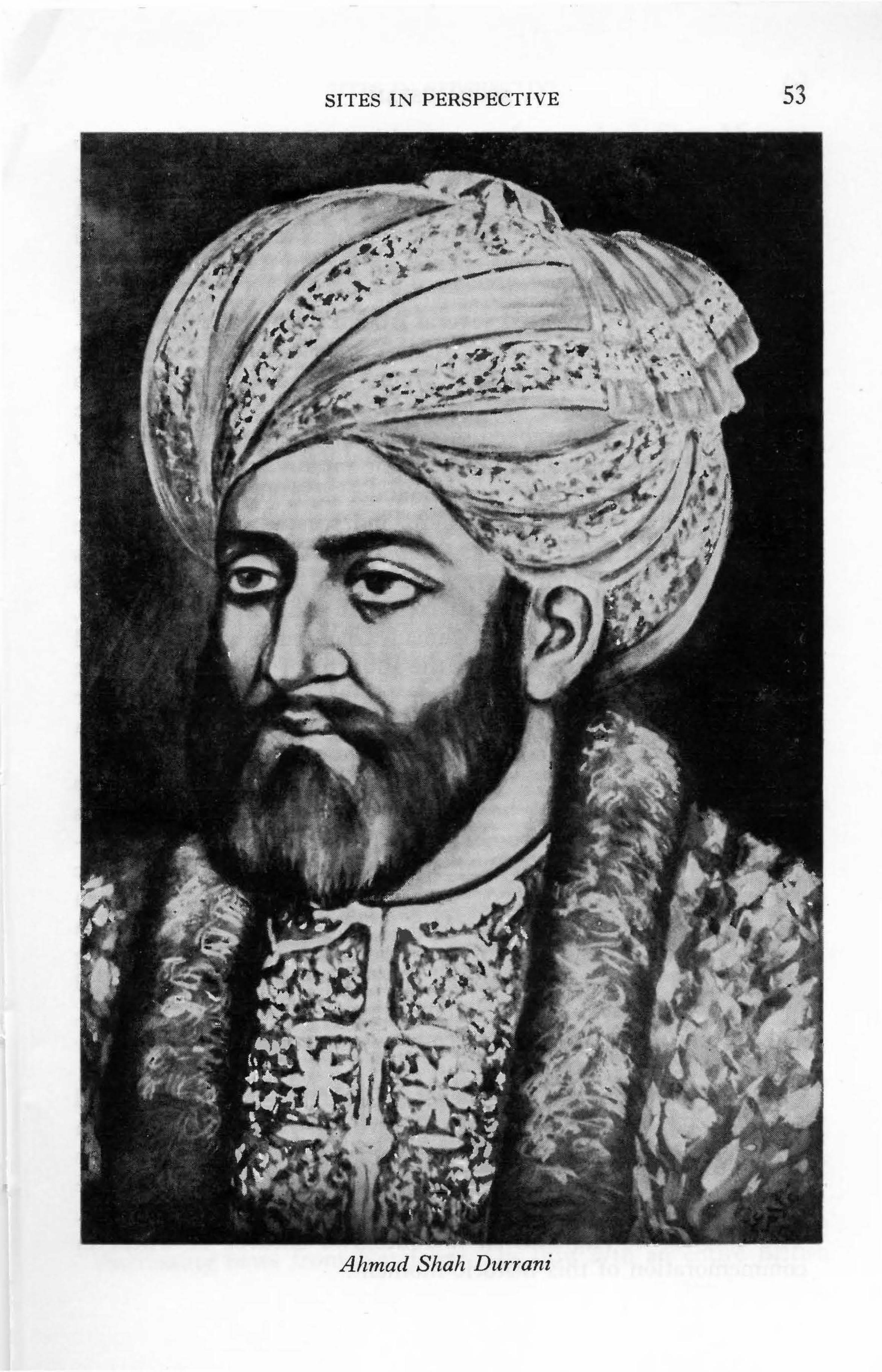
•
SITES IN PERSPECTIVE 53
~ IJ ~ • •
$ >'~ ti@· ~ ~ ~
Ahmad Sliah Durrani

54 AFGHANISTAN
Kandahar. Described by contemporaries as a "mean substitution," little remains to be seen of N adirabad today. Of lasting importance, however, was Nadir Shah's fulfillment of a promise. An Abdali chieftain was appointed governor of N adirabad and Abdali tribesmen swarmed in from Persia to occupy Ghilzai lands between Kandahar and Herat.
Nadir Shah also released several Abdali from Kandahar's pt isons, one of whom was Ahmad Khan Sadozai, the young 16 year old son of a prominent Abdali chieftain. Joining the Persian forces as a lowly orderly, the boy attracted the approving eye of the conqueror as the army moved through Kabul, on to the overthrow of the Moghul Dynasty in Delhi. Rising rapidly as a consequence, Ahmad Khan was appointed commander of 4,000 Afghans forming the Shah's personal bodyguard and trusted guardian of the treasury. But in June 1747 a group of his own Persian officers assassinated Nadir Shah Afshar, and Ahmad Khan and his troops were forced to flee, for the Persians resented and feared the Afghans. Making his way to Kandahar, Ahmad Khan joined a tribal council at the shrine of Sher Surkh, in the suburbs of Nadirabad. All at the council recognized that the time for independence had never been more favorable, if-that same "if" that had plagued them for their entire history- -if, they could unite.
Ghilzai power was broken; Husain and most of their leaders were in exile in Persia. The important division at Kandahar was now drawn between two Abdali groups, the Popalzai and the Barakzai. Haji Jamal Mohammadzai of the Barakzai was chief of the majority group, but Ahmad Khan Sadozai of the Popalzai, on the other hand, though only 25, had distinguished himself as a leader with the Persians. Moreover, he was the leader of a strong force of experienced fighting men, and, most significantly, he had the wealth of Nadir's treasury, including the Koh-i-Nur diamond, and a recently captured caravan carrying confiscated Moghul treasure from Delhi.
One of the more important events in Afghan history occurred when Haji Jamal stepped down in favor of Ahmad Khan. In a simple coronation ceremony a sheaf of wheat was placed on his head as a crown and Ahmad Khan became Ahmad Shah. The stage was set for the creation of the last genuine Afghan empire. The emblem of Afghanistan includes two sheaves of wheat in commemoration of this historic moment.

SITES IN PERSPECTIVE 55
Several campaigns against the tottering Moghuls of Lahore and Delhi (1747-1769) and Kashmir (1752) alternating with campaigns against Kabul (1747), Herat, l\1aimana and eastward through Badakhshan (1749) won for Ahmad Shah an empire and the title by which he is fondly known in Afghanistan, Ahmad Shah Baba, the Father of Afghanistan.
Cancer of the face resulting from a nose wound incurred during a battle in India brought the life of this ren1arkable man to a close at the age of 50 in 1772 and at once it seemed as though fraternal jealousies must surely undo all he had achieved. At Kandahar, the city which Ahmad Shah himself laid out to replace Nadirabad, the blue-domed mausoleum of Ahmad Shah towers over the city, a reminder of those days of glory when Kandahar was the capital of an empire. In the charming village of Sher Surkh, south-east of the city, Ahmad Shah raised a dome over the saint's tomb where he had been crowned. This rustic shrine symbolizes the simple beginnings of a tribal chief; the highly ornate mausoleum commemorates the accomplishments of an empire builder.
THE SADOZAI SHAHS (1772-1818) Grim internecine struggles, tribal revolts, and the rise of local
rulers in the Indian provinces characterize this next period of Afghanistan's history. Sadozai fought Sadozai and the Barakzai backed first one and then another with bewildering reversals. Objections to Ahmad Shah's heir-designate, his second son, Timur (1772-1793), were voiced even as the Shah lay ill in the hills to the east of Kandahar and erupted with violence on his death. In struggling for control Timur Shah so alienated the tribal elite at Kandahar that he was forced to move his capital to Kabul (1776). His entire reign was spent in quelling revolts at home and in India, a hopeless task for he was too little regarded to command a loyal following and too weak and badly organized to govern through force alone.
His irresolute lack of foresight is vividly exemplified, for instance, by the fact that at his death he left 23 sons but no heirdesignate. His own experiences should have led him to do this much at least toward preserving some semblance of order on his death. But there was no order, only chaos, as Timur Shah's unfinished mausoleum in Kabul attests. The fights began immediately and from the turmoil three sons emerged for the final

56 AFGHANISTAN
contest. The others were either defeated in battle, murdered, blinded, imprisoned and lost forever within the dungeons of Kabul's Bala Hissar, or, aligned with one or another of the major combatants.
Prince Zaman, (1793-1800) the fifth son, was the first to triumph and he occupied his father's throne in Kabul with the help of Payenda Khan, chief of the Barakzai and son of that same Haj i Jamal Mohammadzai who had stepped aside in favor of Ahmad Shah. Ousting a brother from Kandahar, Zaman Shah and his army marched on Herat where an oath of allegiance, in exchange for the governorship of Herat, was extracted from a reluctant Prince Mahmud, second son and Zaman Shah's most formidable rival at this juncture.
Thus was established a division which would persist, though with frequent shifts in the cast of characters, until the end of the 19th century: Kabul became the major seat of power; Herat remained a semi-independent state from which bids for Kabul's throne were constantly launched; Kandahar continued in a state of chaos, fought over by both Herat and Kabul. As the years of unrest eroded away the power of Kabul, the Amir of Bokhara extended his influence over the local khanates north of the Hindu Kush and, east of the Indus all effective control was lost to local Indian rulers. The empire was gone and the Sadozai struggled to maintain authority at home.
In the beginning, however, things seemed to auger well for Zaman Shah: he was able to unseat his brother, Mahmud, and force him to flee Herat; he secured a treaty with the Amir of Bokhara in which the Amir agreed to stay north of the Oxus; and he even ventured on campaigns to restore Afghan power east of the Indus, frightening the British then busily establishing an empire in India just beyond his borders. The intricacies of palace intrigue, however, proved too much for Zaman Shah and he became inextricably enmeshed by ambitious factions jealous of Payenda Khan. Highly susceptible to suggestions of conspiracy, Zaman Shah ordered the chief assassinated and thereby signaled his own downfall-Payenda Khan Barakzai also had 21 sons and the assassination focused their combined wrath on Zaman Shah's destruction.
Fateh Khan, the ablest of the Barakzai brothers, sped to join Mahmud, by then in exile in Persia, and together they proceeded

SITES IN PERSPECTIVE 57
to Kandahar. Mahmud had a very small following at this time but his new ally not only had the powerful backing of the Barakzai, but the following of other influential tribes in the Kandahar area as well. Together they secured Kandahar and advanced on Kabul from which Zaman Shah fled towards Peshawar. On the way he was captured, blinded and imprisoned in Kabul's Bala Hissar. Three years later (1803), however, Shah Mahmud took his place in these dungeons. Zaman Shah's full brother, Shah Shuja, had come to avenge his brother's disgrace, and succeeded.
Fateh Khan, on the other hand, was wooed by the new occupant of Kabul's throne, for Shah Shuja realized that he must obtain the united consent of the tribes if he was to remain master on his throne. Fateh Khan was the all important key to that consent. His story, a fantastic series of vacillations between periodic accommodation with Shah Shuja, peeved inactivity in his castle at Girishk, open rebellion as champion of both Zaman Shah's sons and Shah Mahmud's sons and renewed support of Shah Mahmud, vividly epitomizes this entire period of confusion.
Shah Shuja (1803-1809) survived for a full six years but in 1809 he was defeated by Shah Mahmud, who had been rescued from the Bala Hissar by Fateh Khan. Shah Shuja fled to exile in India. During his second reign (1809-1818) Shah Mahmud was seriously troubled by foreign incursions. The Sikhs, firmly in control at Lahore since Zaman Shah's appointment of Ranjit Singh as· governor, conspired to add Kashmir and Peshawar to their domains. The Persians wanted Herat. Fateh Khan dashed from one battle to the next and in 1818 succeeded in defeating a Persian army harassing Herat. Though victorious over the Persians, he had yet, however, to fight his way into the citadel of Herat, tenaciously held by another brother of Shah Mahmud. During this battle one of Fateh Khan's brothers, Dost Mohammad, was accused of misconduct within the governor's harem. One of the ladies complained and F ateh Khan's fate was sealed.
Shah Mahmud's son, Kamran, the offended lady's brother and a discarded protege of Fateh Khan's, had been seething with hatred and jealously for some time. He now seized upon the harem affair and convinced his father that F ateh Khan was preparing to usurp the power of the throne. Ordered to simply bring Fateh Khan to Kandahar for questioning, the obsessed youth overstepped his instructions and blinded Fateh Khan. Released,

58 AFGHANISTAN
the awful wrath of the Barakzai once again converged on Kabul from every direction. These Barakzai brought with them minor members of the royal family to sit upon the throne, for the aura of Ahmad Shah still enveloped his sons and their sons with the mantle of legitimacy, but all pretense that they were anything but puppets was discarded. Sadozai rule was at an end.
Shah Mahmud and Kamran marched from Kandahar to the defense of Kabul with Fateh Khan in tow. Daily they entreated him to stem the wrath of his brothers but their impassioned pleas were met with dignified refusals. In the frenzied panic born of the certitude of defeat, father and son stoned and hacked their blinded prisoner to pieces near Ghazni and fled to Herat. The Barakzai took Kabul.
Fateh Khan is buried at Ghazni where tombstones lie broken and neglected on his grave. The towering walls of his castle at Girishk, however, still command the empty desert. The castle stands alone, dominating the scene for miles in every direction, symbol of the individual ambitions of its former occupant who dominated the history of Afghanistan during these turbulant years.
AMIR DosT MOHAMMAD (1826-1839; 1843-1863) Once the Barakzai ceased to be advisers to the Sadozai and took
power into their own hands they were immediately faced with the very real problem of whom to select as chief. They were divided into several clusters of full brothers pitted against half-brothers, each backed by the different tribes and sub-tribes from which their father, Payenda Khan, had taken wives when he was strengthening his political control. Naturally each of these tribal groups was now anxious to see their branch reign supreme. The two most important groups were the five Kandahar Sardars whose mother was, significantly, a Ghilzai, and the five Peshawari Sardars, born of a mother from the powerful Alikozai, to whom Nadir Shah Afshar had given lands along the Hilmand.
There was also, however, a young son, Dost Mohammad Khan, whose mother was a member of the politically insignificant Qizilbash Persians, originally settled in Afghanistan by Nadir Shah Afshar to man his garrisons. Dost Mohammad had no powerful backers but he had won his own prestige on the battlefield and had been the favorite of Fateh Khan. The fact that it was his

SITES IN PERSPECTIVE 59
impetuous behavior at Herat which precipitated Fateh Khan's tragic downfall brought Dost Mohammad out first onto the field against Shah Mahmud and Kamran and it was from his capture of Kabul that they fled.
Dost Mohammad moved with assurance through a complex maze of juggleries, sometimes deferring to his elder brothers, sometimes openly revolting. Well aware of his ambitions, the brothers tried at first to confine him to the governorship of Ghazni but there was no denying his superiority after 1834 when the deposed Shah Shuja appeared before Kandahar in a desperate bid to regain the throne. Only Dost Mohammad's timely arrival prevented complete disaster for the Kandahar Sardars. On his return to Kabul Dost Mohammad formally proclaimed himself Amir at a simple coronation ceremony held at the Sia Sang mosque outside the gate to the Bala Hissar.
Though forced to concede the Amir's paramount position, his brothers held a tenacious hold on Kandahar and Peshawar. They teamed up against him whenever they could and even sided at times with his enemy, the Sikhs, who had annexed Kashmir (1819) and much Afghan territory on either side of the Indus, including Peshawar (1834 ). Balkh was seized by the Amir of Bokhara and the independent Uzbak Khanates of the north looked to him, not Kabul, as the paramount power in the north. In independent Herat, W azir Y ar Mohammad exercised strong power in the name of the debauched Shah Kamran, monarch of that city since he had shamelessly set aside his father, Shah Mahmud, in 1824.
Thus the authority of the Kingdom of Kabul did not extend very far and the Amir was surrounded on all sides by forces looking for any and every opportunity to unseat him. Moreover, a new set of adversaries soon joined this familiar roster of opponents; wily adversaries who would cast an entirely different complexion on Afghan affairs. Russia defeated Persia in 1828 and their growing political influence at the Persian court was viewed with such mistrust and concern by the British in India that the British eventually gathered a great army against the Amir of Kabul whom they accused of conspiring against them in negotiating with the Persians then besieging Herat with an army accompanied by Russian advisers.
This siege of Herat (Nov. 1837-Sept. 1838) and Persia's pene-

60 AFGHANISTAN
tration as far as Maimana was the ostensible raison d'etre for the British move against Afghanistan even though a British counter move threatening war on Persia had proved successful and ended the siege long before the army actually moved from Indian soil in February, 1839.
The British proclamation which launched the Army of the Indus into Afghanistan accused Amir Dost Mohammad of "avowed schemes of aggrandizement and ambition injurious to the security and peace of the frontiers of India" and proposed to reinstate the "usurped" Shah Shuja, then living in exile in British India. This masterful bit of knavery exploiting Shah Shuja's obsessive dreams and Sikh designs on Afghan territory was cooked up in connivance with Maharaja Ranjit Singh, the crafty, one-eyed ruler of the Sikhs. It was, however, very properly announced in perfect diplomatic fashion by a 'f ripartite Agreement signed in June, 1838. In return for Sikh aid for which, incidentally, he was to pay, Shah Shuja agreed to "disclaim all title on the part of himself, his heirs and successors, to all the territories lying on either bank of the River Indus ( including Peshawar) that may be possessed by the Maharaj a."
In addition to ceding this extensive tract of territory, Shah Shuja also willingly agreed to pay what was tantamount to tribute, so anxious was he to once again sit upon the throne of Kabul. Article 5 of the agreement states: "When the Shah shall have established his authority in Kabool and Kandahar, he will annually send the Maharaj a the following articles; viz. 55 high-bred horses, of approved colour and pleasant paces, 11 Persian scimitars, 7 Persian poniards, 25 good mules, fruits of various kinds, both dry and fresh, and sirdas or musk melons, of a sweet and delicate flavour (to be sent throughout the year), by the way of Cabool River to Peshawar; grapes, pomegranates, apples, quinces, almonds, pistahs, or chionuts, an abundant supply of each; as well as pieces of satin of every colour; chogas of fur, kim khabs wrought with
. gold and silver, and Persian carpets, altogether to the number of 101 pieces. All these articles the Shah will continue to send every year to the Maharaj a." An excellent shopping list of Afghanistan's most prized exports.
As for the British, they were not, technically, invading Afghanistan, but merely supporting Shah Shuja' s troops "against foreign interference and factious opposition.''
SITES IN PERSPECTIVE 61
Shah Shuja entered Kandahar in April, 1839 and on May 8th he was formally crowned on the plains north of the city where '' A throne and splendid canopy had been prepared for him in the center of the plain. Royal salutes were fired as he passed beyond and returned within the walls of the capital, and one hundred discharges of ordnance shook the ground when he had taken his seat on the throne. But unless I have been deceived, all the national enthusiasm of the scene was entirely confined to His Majesty's immediate retainers. The people of Kandahar viewed the whole affair with the most mortifying indifference." Captain Havelock (Vol. II, 22), with the British forces at Kandahar, thus accurately assessed the situation.
The Shah's entrance into Kabul in August of the same year was attended with the same pomp and glitter and was met with the same lack of enthusiasm. With their puppet so insecurely seated, the British decided they must stay to protect him and set about building cantonments at Kabul and Kandahar. To them they brought their wives and much of the paraphernalia of the western world with which they settled in comfortably. Amir Dost Mohammad fled to the north to try to rally the support of the Khans. Failing, he returned to Kabul, fought the British near Charikar with brilliant success, and then surprised everyone by surrendering to them. He was then courteously escorted into exile in India.
Shah Shuja sat for the second time on Kabul's throne but he neither ruled nor reigned. Small garrisons in Fateh Khan's castle at Girishk, at Kalat-i-Ghilzai, Ghazni, Charikar and J alalabad, upheld the Shah's authority but this authority extended little further than the walls of these garrisons. In the north, the U zbak Khanates went their own way. Herat, left independent as stipulated by the Tripartite Agreement, remained under W azir Y ar Mohammad who, having suffocated Kamran in March, 1842, ruled with absolute control until his death in 1852.
Resentment against the foreign presence ran deep and finally rose to engulf both the British and the Shah. The outbreak erupted within the labyrinths of Kabul's old city in October, 1841, and the tribes, led by Wazir Akbar Khan, Dost Mohammad's dashing, capable son, gathered to demand the British quit Afghanistan. In January, 1842 the retreating British army was cut to pieces on its way to J alalabad; in April the puppet Shah was murdered outside the walls of his palace.
62 AFGHANISTAN
An avenging British army did indeed return the following September to follow the rebels to their hideout at Istalif (which they burned) and to blow up the famed Kabul bazaar, but essentially, the First Anglo-Afghan War procured aught but bitter memories. Amir Dost Mohammad returned to the throne of Kabul without fanfare in January, 1843. Abandoning reconquest of his lost territories, even when the Indian Mutiny of 1857 offered a tempting opportunity, he remained true to his commitments and devoted the next twenty years to unifying the country: Kandahar (1855), Balkh and the northern Khanates (1859) and, finally, Herat (1863).
The ten month siege of Herat was the Amir's last campaign for he died within a month after taking the city in May. It was a significant victory for with it he left his heirs with a united country, a truly unique inheritance, considering the story of Afghanistan up to this point.
AMIR ABDUR RAHMAN (1880-1901) Amir Dost Mohammad carefully selected his third son, Sher
Ali, to succeed him, and earnestly enjoined his other sons to serve him faithfully, but, as in the past, only a few acquiesced, with reluctance, and the others openly challenged him. All the familiar disruptive patterns now reappear with the same devastating consequences: brother fought against brother; uncle against nephew, tribe against tribe. Herat held out against Kabul while the Khanates in the north happily resumed their play, one against the other. Beyond the borders outsiders kept the rivalries boiling. In short, between 1863 and 1880, Amir Sher Ali won and lost the throne twice (1863-1866; 1868-1879) and Russian-British hostility again brought a British army on to Afghan soil.
Despite the internal dissensions and connivance of his neighbors, Amir Sher Ali was still able to pursue an energetic series of reforms. He created a national army, laid the ground-work for collecting land taxes, began the Afghan postal system, and published Afghanistan's first newspaper. Forces gathered against him.
As the year 1878 drew to a close the sudden, uninvited arrival of a Russian Mission in Kabul precipitated the final calamitous events. Irritated when they were refused permission to send a similar mission, the British marched their troops to J alalabad, into Khost, to Kandahar and up to Kalat-i-Ghilzai; and the Second Anglo-

SITES IN PERSPECTIVE 63
Afghan War began. Ringed by enemy forces, Amir Sher Ali went north seeking promised Russian aid which failed to materialize and he died, disheartened, in Mazar-i-Sharif in February, 1879. His son, Amir Yaqub Khan, then travelled to meet with the British at Gandamak, west of J alalabad, in May, and there signed a treaty which secured for the British their long sought after permission to station a British Representative in Kabul. The treaty further stated that the Amirs of Afghanistan agreed to "henceforth conduct all relations with foreign states in accordance with the advice and wishes of the British Government."
Thus the British endeavored to control without actually annexing their prickly neighbor but less than three months later the Afghans protested this renewed British interference in their affairs by kiJling the newly arrived Representative and all but a few of his escort in their residence inside the Bala Hissar of Kabul. The massacre took place on September 3rd, 1879. This gave the British the pretext to bring their armies immediately to occupy Kabul (October) and, after the abdication of Amir Yaqub Khan, to assume direct control of the government of Kabul. General Roberts was in charge.
The country was restless and numerous engagements were launched all over the country to show their disapproval of the British presence. The British on their part desperately searched for a leader acceptable to all. It was then that Abdur Rahman rode into Afghanistan from eleven years of exile in Samarkand as a guest of the Russian Government. His talents as a strong energetic tribal leader were well known for he had fought successfully to place his father, Amir Mohammad Afzal, an elder half-brother of Amir Sher Ali, on the throne in 1866. Even when his father died a year later, Abdur Rahman continued to serve the new Amir, his uncle, Mohammad Azam, until defeat at the hands of Amir Sher Ali forced him into exile in Russia in 1868.
Sensing a propitious moment to bid for the throne, Abdur Rahman crossed over the border into Badakhshan, gathering forces as he moved south from Kishm to Charikar where, on July 20th, 1880, a tribal council proclaimed him Amir of Kabul. On August 11th, the British formally handed over to him the Kingdom of Kabul and withdrew to India.
British composure at Kabul was severely shattered, however, by distressing news from Kandahar. On July 27th an entire British

64 AFGHANISTAN
brigade had been outfought on the plains of lVIaiwand in one of the most crushing defeats ever suffered by a British army. The mortifying blow had been inflicted by Sardar Ayub Khan, son of Amir Sher Ali and full brother of Amir Yaqub Khan, who had declared himself Amir at Herat after hearing of his brother's abdication. Following up his victory at Maiwand, Ayub Khan invested Kandahar.
Swiftly mobilizing 10,000 picked men and 9000 animals, General Roberts marched from Kabul to the relief of Kandahar. Moving entirely on foot, with no wheeled transport to slow their progress, procuring supplies as they went, except for such essentials as tea, sugar, salt, rum and two hundred gallons of lime juice, they covered the 324 miles through hostile burning deserts with incredible speed and arrived in Kandahar, only 23 days later, on the 31st of August, 1880. Military strategists write with admiration of this difficult feat but the diaries of the men involved reveal some interesting attitudes. Just before arriving at Ghazni, for instance, Major Ashe writes: " ... our march up to the present time has been a veritable picnic, not unaccompanied by a rubber of whist in the afternoon, and not divested of that little duck and quail slaughter which in measure consoles our youngsters for their banishment from Hur ling ham . . . "
Arriving in Kandahar tired but in good spirits, the Kabul troops were shocked at the demoralized state of the Kandahar garrison. Undaunted, they went out the very next day to defeat Ayub Khan behind the Baba Wali Pass, to the north of the city.
In seeking arrangements which would secure for Britain if not a pro-British at least not an anti-British buffer against Russia, British policy makers contemplated giving Herat to Persia and establishing Kandahar as an independent state under another Sadozai puppet. Fortunately, these proposals were vetoed and the last British troops on Afghan soil marched from Kandahar in April, 1881.
Amir Abdur Rahman in Kabul was left to become master of his own state. He faced monumental problems of divisiveness as he candidly admits in his autobiography. " ... when I first succeeded to the throne of Kabul my life was not a bed of roses. Here began my first severe fight against my own relations, my own subjects, my own people."
Rebellions began imrnediately and continued to erupt to the

SITES IN PERSPECTIVE 65
east in the Kunar, in the north around Maimana, and in the central mountains of the Hazarajat. The Ghilzai uprising alone took two years to subdue. The Amir defeated his tribal opponents on the battlefield and then, in order to insure their fealty, resettled many of the leaders in areas far from their homelands thereby cleverly exploiting age-old traditional tribal rivalries. As he rightly surmised, the Pushtun tribesmen would fight for him, a fellow Push tun, before they would join with the U zbaks. In this way he created a loyal force of his enemies.
In addition to the tribal wars the sorely beset Amir had moreover to fight one cousin, Sardar Ayub Khan, for Kandahar and Herat (1881) and another cousin, Mohammad Is'hak for the North (1888). Finally, in 1895 when all was relatively quiescent, he moved to conquer and convert the Kafirs, "Infidels," a warlike people living in the eastern mountains to the north of J alalabad. The Kafirs had at one time impressed Alexander the Great who invited their young men to accompany him on his campaign to India. Later they had withstood the iconoclastic advances of Arab and Ghaznavid armies. They had even bested the august Tamerlane, but now at last they submitted and the Amir decreed that henceforth their land was to be known as N uristan, Land of Light.
While the Amir proceeded thus to establish his rule supreme within his own domains, foreigners hemmed him in with boundaries: a joint Russian-British Boundary Commission settled the northern boundary in 1887; the unpopular western boundary demarcated during the reign of Amir Sher Ali, was renegotiated in 1888; the British drew the equally unpopular Durand Line in 1893 to separate Afghanistan from their Indian Empire.
Mutual mistrust, especially after March, 1885 when Russian troops took the Afghan fort of Panjdeh north of Herat, led to the acceptance of Afghanistan as a buffer state. For strength and protection against further Russian advances the Amir also accepted subsidies from the British in return for which they continued to control his foreign affairs.
The Amir insisted, however, on preserving the independence of Afghanistan by maintaining absolute control over internal affairs. Though the British resented the Amir's policy of isolation and bombarded him with proposals regarding advisers, telegraphs and railroads, commercial treaties and diplomatic missions, the Amir proved adamant, preferring to develop his country on his own.

66 AFGHANISTAN
He built small forts along all major caravan routes to make once hazardous travel safe, and trade flourished. He introduced factories, schools and hospitals for which he did hire, on his own, several British technicians and a doctor, but only a select few. At the capital he built a new citadel to replace the palaces in the Bala Hissar, a heap of rubble since the days of the British occupation, their vengeful "lesson" to Kabul. Zarnegar Park in the heart of Kabul once formed part of the Amir's palace grounds, a corner where he and his favorite young wife, Bibi Halima, had adjoining bungalows. Hers, richly decorated with stucco ornamention depicting birds entwined within flowering vines, is Central Asian in design and recalls the years he spent there.
The Amir's bungalow became his mausoleum and was subsequently topped with a dome and minarets to make it an impressive structure in keeping with this dynan1ic personality who dominated the period from which modern Afghanistan emerges.
MODERN AFGHANISTAN
Amir Abdur Rahman died in 1901 in Bagh-i-Bala, his pleasure palace overlooking Kabul, and his eldest son and chosen successor, Habibullah, succeeded him without incident. The peaceful succession is an impressive tribute to the Amir's adroit handling of his recalcitrant subjects and his conniving neighbors-and his immediate family.
The new Amir's deep interest in scientific innovations led to the building of Afghanistan's first hydro-electric station at J abal usSeraj and many foreign technicians came to Kabul to assist in the foundation of new factories. Many other modernization projects were begun, including a network of roads to accommodate the first cars to be brought to this mountain kingdom. An avid sportsman, he also introduced golf to Kabul.
Above all, Amir Habibullah was a consummate statesman. This the country sorely needed, for Afghanistan was quickly assailed by both Russian and British attempts to penetrate the curtain of isolation which Amir Abdur Rahman had drawn around Afghanistan. Russia objected particularly to being denied direct communication with Afghanistan regarding non-political and commercial matters and underscored the diplomatic argument with a series of border incidents. Mutual suspicion over each other's motives finally induced these two powers to reconcile their differences. The

SITES IN PERSPECTIVE 67
Anglo-Russian Convention of St. Petersburg (1907), though it divided Persia into spheres of influence, restated official recognition of Afghanistan's position as a buffer state in the following statements: Russia declared "Afghanistan as outside the sphere of Russian influence" and Britain engaged "neither to annex nor occupy ... any portion of Afghanistan or to interfere in the internal administration of the country.''
The Convention also stipulated that the arrangements would come into force only after Britain had obtained "the consent of the Amir'' but Amir Habibullah, resentful about being negotiated over without being consulted, and also suspicious of the precedent set in carving up Persia, refused to sign the Convention. Frictions continued. Then in 1915 new worries appeared when a GermanTurkish Mission arrived in Kabul to propose a Jihad or holy war against the British in India.
For the British there was good reason for grave concern for a strong anti-British War Party surrounded the Amir. One of the more articulate members of this group, Mahmud Beg Tarzi, eloquently propounded the ideals of nationalism, independence, internal reform, and Pan .. Jslamism in his bi-monthly newspaper, Seraj-ul-Akhbar. Other supporters of the anti-British stand included N asrullah ( a conservative brother of the Amir), General Nadir Khan of the army and Prince Amanullah who was married to Mahmud Beg Tarzi's daughter. The pressures they exerted on the An1ir were powerful, but, in the tradition of his predecessor, Amir Dost Mohammad, Amir Habibullah remained faithful to his commitments even when his own people began to accuse him of betraying Islam in its hour of need. The war over, the Amir asked that Afghanistan be given control of its foreign affairs. Before a vacillating British Government answered, disgruntled forces within the country struck. Amir Habibullah was assassinated by a still unknown hand while on a hunting party outside J alalabad in February, 1919. He lies buried in a simple mausoleum in Jalalabad,
A contest for the throne involving N asrullah, various conservative elements and Prince Amanullah was won by Amanullah who· immediately set out to obtain Afghanistan's cherished goal: complete independence.
The Third Anglo-Afghan War or War of Independence began on the 3rd of May 1919 at Torkham at the entrance to the Khyber Pass. On the 28th, General Nadir Khan made a significant attack

68 AFGHANISTAN
on Thal, deep in British territory. In the meantime British aerial bombingofJalalabad and Kabul introduced an entirely new dimension to the war, one which the Afghans had never before experienced, one they did not relish. The British, for their part, were exhausted after World War I and viewed war with Afghanistan with equal distaste. Some British troops actually refused to proceed to the front, and public opinion at home was bitterly outspoken in its opposition. A cease-fire was accordingly called on June 3rd, 1919, but it took the diplomats until November, 1921, to work out the treaty which granted Afghanistan full independence.
Treaties with all manner of foreign governments were immediately entered into once independence had been won. Russian influence at Kabul quickened; the British continued suspect. On the home front, a constitution promulgated in 1923 was followed by a plethora of reform edicts concerning administration, education, social institutions, trade and industry; a crash program for modernization which stunned the nation. In 1923 Amir Amanullah assumed the title of King and in December 1927 embarked upon a tour of Europe, Persia, Turkey and the Soviet Union from which he returned in July 1928 with an intensified zeal for reform.
To complete the picture of a modern state, monumental government buildings, palaces, villas, an ornate theater, trolley-ways, cafes and triumphal arches were built at his new capital of Darulaman and in the hill resort town of Paghman. Many criticized the lavish expense this represented but it was in the realm of social reform that the King received his severest opposition. He struck too soon, too deep, into the traditional conservative fabric of the society when he took such measures as removing the veil from the women, introducing co-education and drastically curtailing the power of the religious establishment.
The first overt action against the King was taken by Shinwari tribesmen in November, 1928, when they rushed into Jalalabad and gutted the royal palace, newly redecorated with luxurious fabrics and objects from Europe. Their act sparked revolt among the Tajik of the Koh Daman, north of Kabul, led by Habibullah Ghazi, called Bacha Saqao, Son of a Water Carrier, who took possession of Kabul in January, 1929. King Amanullah and his family fled to Kandahar, leaving his brother, Enayatullah, on the throne for three days until he too left the capital. King Amanullah later left for exile in Italy where he lived until his death in 1961. He lies in a simple unadorned tomb beside his father, in Jalalabad.
SITES IN PERSPECTIVE 69
Bacha Saqao kept the throne for nine chaotic months while anarchy returned to the provinces until General Nadir Khan, hero of the War of Independence but lately in disenchanted retirement on the Riviera, gathered a tribal army and returned, with his brothers, to rescue Kabul in October 1929. Bacha Saqao was defeated and executed. A new era began.
The new king tackled every aspect of nation building at once: central authority was enforced, law and order restored, the army reorganized, revolt quelled; new schools were estab]ished, hospitals built, dams constructed, new industries begun, new roads bound Kabul with the north; a return to orthodox Islamic Law was announced, and a new Constitution (1931) was promulgated.
On the diplomatic front a return to true buffer state status was re-established: Russian personnel were dismissed, Russian proposals regarding commercial enterprises were refused, and more cordial relations were established with Britain. No British technicians were pern1itted within the country, however, so the balance was maintained. Showing no partiality, the king sent one brother, Sardar Shah Wali Khan, as ambassador to London, another, Sardar Mohammad Aziz, to serve as Afghan ambassador to Moscow.
Plenty of opposition still festered at home among some of the tribes; among King Amanullah' s adherents who believed he, or at least a direct descendent of Amir Dost Mohammad, should be restored to the throne; among the stiJl restless followers of Bacha Saqao; and among those whose power had been curtailed by the new regime. Furthermore, because of the resumption of cordial relations with Britain, King Nadir Shah was accused by some of being a puppet raised to the throne by the British to replace the too anti-British Amanullah. In the end, however, a personal vendetta ended the life of King Nadir Shah in the afternoon of November 8, 1933, when a young student stepped forward at a prize giving ceremony on the lawn of Dilkusha Palace, and shot the king. The white marble walls and shining blue dome of King Nadir Shah's mausoleum stand on a hill high above Kabul.
Nadir Shah was succeeded by his 19 year old son, Mohammad Zahir Shah (1933-1973). During the next forty years, Afghanistan won a respected place among the community of nations. A new constitution was approved (1964); universal, free elections followed. A free press came into being and was active.
Imaginative economic development programmes burgeoned dur-

70 AFGHANISTAN
ing the prime ministership of General Mohammad Daoud (1953-1963), ranging from mammoth land reclamation and hydroelectric schemes to small industries and communic -ations systems. Nations from east and west assisted in these projects. Afghanistan 's prosperity still rests, ,however, on its agriculture and exports, consisting mainly of dried fruits and nuts , qaraqul (Persian lamb) and other skins, and woolen carpets.
Dramatic changes in social institutions, of which the most spectacular was the voluntary shedding of the veil by Afghan women since 1959, were also championed during Mohammad Daoud's tenure. Today women work in all fields of business and industry · and take part in politics. Several have served as members of the cabinet~ Kabul University was established in l\1ay, 1946, and many graduates study abroad in a variety of countries, both east and west.
Founder and President of the Republic of Af glianistan, Mohammad Daoud

SITES IN PERSPECTIVE 71
Startling advances in transportation were perhaps the most remarkable developments noted by visitors to Afghanistan. Wide paved highways enabled them to travel in hours distances which used to take days. Air service to provincial cities permitted fuller, more exciting itineraries. International flights from east and west, north and south, came to Kabul's modern airport. To accommodate the steady increase in tourists, facilities were expanded and a luxury hotel was built on a crest overlooking the capital city of Kabul.
Mohammad Zahir Shah ruled for forty years but his experiment in constitutional democracy failed. On 17 July 1973 General Mohammad Daoud, with the assistance of the military, declared the monarchy overthrown and proclaimed the new Republic of Afghanistan with himself as President and Prime Minister.
On the 30th of January 1977 a Loya Jirga or Great National Assembly gathered in Kabul to consider a draft Constitution for the Republic. After fifteen days of lively debate, during which several articles were rewritten and added to reflect the thinking of the entire nation, the Assembly of almost 400 members passed a 137-article Constitution. The next day, on the 14th of February 1977, they elected Mohammad Daoud President of the Republic of Afghanistan, for a period of six years.
In foreign affairs, the Republic of Afghanistan continues the traditional non-aligned posture and refuses to join military pacts. Internally, econon1ic development has accelerated.
Thus Afghanistan moves forward and its people look for dynamic reappraisals and programmes. A pride of nationhood radiates throughout this country which offers the spectacle of an awesome scenery, the excitement of a developing present, and the fascination of a rich past. Its citizens, confident and self-reliant, are, however, Afghanistan's greatest asset. As this discussion has shown, the Afghan area has occupied a pivotal position since prehistoric times. People have come from the wild steppes of Central Asia, from Persia, and from India, some accompanied by conquering armies, others with caravans, still others bearing new religions. There is evidence of all these diverse peoples and their cultures in Afghanistan today. This makes travel here fascinating. Even so, the ruggedness of the terrain and the individualism of the people have made of them something which is very much their own, very particular-very Afghan.

72
Lower
Middle
Upper
AFGHANISTAN
CHRONOLOGICAL SUMMARY
Palaeolithic Quartzite tools found at Dasht-i-Nawur, west of Ghazni, made ca. 100,000 years ago. Stone tools dating ca. 50,000 years ago excavated north of the Hindu Kush in Badakhshan and Faryab Provinces: similar tool types recovered from Dashti-Nawur, south of the Hindu Kush. Human temporal bone recovered from Badakhshan. Flint tools dating ca. 20,000-15,000 years ago excavated from Aq Kupruk, Balkh Province; others ca. 10,000 B.C. recovered from sand dunes south of the Amu Darya, northwest of Balkh; others ca. 7-6500 B.c. from dunes north of Khulm.
Neolithic ca. 8000-2000 B.c. Introduction of domesticated grains and animals. Ex
cavated material from Aq Kupruk (Balkh) and Darrai-Kur (Badakhshan) include flint, bone and stone implements, hand-made pottery, stone vessels, shell ornaments, human burials; domesticated and wild sheep/goat/possible early cattle.
ca. 5000-1 st Millennium B.c.
522-330 B.C.
330-327 B.C.
Bronze Age Rise of village and urban communities with trade links to Mesopotamia, Iran, Indus Valley and Central Asia. Excavated and identified Bronze Age sites lo-cated in south, center, north and northeast. Largest administrative-religious center in south at Mundigak near Kandahar; in north at Dashli, northwest of Balkh. Zoroaster born in or around Balkh ca. 1000 B.c. Evidence of lucrative lapis lazuli trade found at Khosh Tapa, Baghlan Province.
Achaemenids Achaemenid campaigns into Afghan area begin with Darius I (522-486). Largest complex of this period excavated at Altyn, northwest of Balkh. Fortified establishment at Ai Khanoum.
Bactrians and Mauryans Alexander of Macedon sojourns in Afghan area after crushing Achaemenids in 331 B.c.

ca. 325-300 B.c.
305 B.C.
250 B.C.
ca. 135 B.c.
48 B.C.
ca. 130 A.O.
241 A.O.
400
ca. 565
630
642 A.O.
667
SITES IN PERSPECTIVE 73
Ai Khanoum, Takhar Province, a highly cultured Greek city according to excavated architectural and epigraphic evidence. Seleucids from Mesopotamia (modern Iraq) control Bactria north of the Hindu Kush through local satraps; Mauryans from India control south of the Hindu Kush. Rock inscriptions of edicts issued by Mauyran King Ashoka (268-233 B.c.) found in Laghman and Kandahar. Local Bactrian dynasty establishes independence from Seleucids north of the Hindu Kush; gradually move south into India; climax under Demetrius 189-167 B.c.; Kunduz hoard.
Kushans Nomads from Central Asia cross Amu Darya; a federation of five tribes. Last Bactrian king, at Kabul, succumbs to nomads, now joined under banner of the Kushans. Under Kanishka, Kushan Empire extends from Ganges Valley to Gobi Desert. Silk Route carries luxuries from Rome to China to depots in Balkh; luxury items from India include objects from Alexandria brought to India along active sea routes. Buddhism revived in India and carried through Afghan area into Central Asia. Buddhist sites located throughout east, south, center, north.
Sasanians and Hephthalites Sasanians from Persia extend control over Kushans; rule through local satraps, many of whom Kushans. Hephthalites, a new wave of nomads from Central Asia, move into northern area; gradually move south. Sasanians, in coalition with Western Turks, overcome Hephthalites; many Hephthalite princes continue to rule as vassals of the Sasanians in the Afghan area which is divided into a series of chiefdoms, some Buddhist, some Hindu. Hsuan-tsang, Buddhist pilgrim from China, travels through Afghan area and writes an account.
Arabs
Arab armies conquer Sasanians during reign of 'Umar, 2nd Caliph and founder of the Arab Empire. Arab power established in Herat and Seistan; rest

74
700s
870-d.879
900
962
998-1030
1040
1148-1205
1157-d.1202
1205
1220
133'2
1369-d.1405 1405-d. 1447
1468-d. 1506
AFGHANISTAN
of Afghan area, only sporadically subdued, continues to be ruled by local princes. Frequent revolts against Arab governors; local dynasties established throughout.
Saffarids and Samanids Yaqub ibn Layth Saffari from Seistan marches to Balkh via Bamiyan conquering in the name of Islam; Hindu Shahi of Kabul expelled. Samanids, an Islamic dynasty from Bokhara, extend authority into Afghan area.
Ghaznavids and Ghorids Ghaznavid dynasty established by Turkic slave-commander of Samanid forces in Herat area. Sultan Mahmud Ghaznavi carries Islam into India and throughout Afghan area. Seljulcs from Central Asia defeat Ghaznavids and control north around Herat and Balkh; Ghaznavids continue at Ghazni. Ghorid dynasty from central mountains gradually assumes control after Alauddin Ghori sacks Ghazni in 1151. Reign of Ghiyasuddin Ghori, builder of the ''minaret'' of Jam and Masjid-i-Jami' in Herat.
Mongols Khwarizm Shah from south of the Aral Sea conquers Ghorids at Balkh; then takes Herat. Genghis Khan conquers Khwarizm Shah; takes Balkh. Mongol armies overrun Afghan area which becomes a series of small chiefdoms nominally under Mongols ruling in Persia and Central Asia. Marco Polo journeys through in 1275. Kart Maliks of Herat establish independence from Mongols. lbn Batuta passes through in 1333.
Timurids Tamerlane; rules Timurid Empire from Samarkand. Shah Rukh, son of Tamer1ane; establishes Herat as center of empire from Tigris River to China. Cultural renascence. Sultan Husain Baiqara; Golden Age of Timurids at He rat.

1507-d. 1510
1504
1507-1747
1709-d. 1715
1722-d.1725
1730-d. 1747
1747-d. 1772
1772-d. 1793
1793-1818
1793-1800 1800-1803
1803-1809 1809-1818 1819-1973
1818-1826 1826-1839
1839-1842
SITES IN PERSPECTIVE 75
Shaibani Khan, leader of an Uzbak confederation in Central Asia; captures Herat in 1507; Timurid Empire crumbles; Shaibani Khan assassinated.
Moghuls and Safavids
Ba bur, descended from Genghis Khan and Tamerlane, takes Kabul; leaves for India in 1525 to establish Moghul Empire. Moghuls hold Kabul-Charikar area; Persian Safavids govern Kandahar-Herat from 1558; independent, and semi-independent Khanates in north jockey for power with Amir of Bokhara. Mir Wais Hotak secures independence of Kandahar from Safavids in 1709. Mahmud, son of Mir Wais, seizes Safavid throne and rules Persia; succeeded by cousin, Ashraf (d. 1730). Nadir Quli Beg (later Nadir Shah Afshar) ends Afghan rule in Persia; establishes garrisons in major Afghan cities in 1738; assassinated in Persia.
Afghan Empire to Present
Ahmad Shah Durrani establishes an Afghan Empire with capital at Kandahar extending into Punjab, Kashmir and Sind. Timur Shah, son of Ahmad Shah, moves capital to Kabul in 1776; unrest throughout empire; gradual loss of territory beyond present boundary. Sadozai Shahs, sons of Timur Shah; fratricidal struggles for throne of Kabul. Zaman Shah; deposed and blinded. Shah Mahmud, half-brother of Zaman Shah; deposed and imprisoned; escapes in 1807 with help of Fateh Khan Barakzai from Kandahar. Shah Shuja, full brother of Zaman Shah; deposed. Shah Mahmud ; deposed. Mohammadzai Amirs from family of Fateh Khan Barakzai. Barakzai brothers maneuver for control of Kabul. Amir Qost Mohammad; deposed by Shah Shuja and British army. Shah Shuja supported by British Army; First AngloAfghan War (1838-1842); assassinated after British retreat.

76
1843-d. 1863
1863-1866
1866-d. 1867
1867-1868
1868-d. 1879
1879
1880-d. 1901
1901-1919
1919-1929
1929
1929
1929-1933
1933-1973
1973
AFGHANISTAN
Amir Dost Mohammad; brings Kandahar, Herat and north under control of Kabul. Amir Sher Ali, son of Amir Dost Mohammad; fratricidal struggles; deposed. Amir Mohammad Afzal, half-brother of Amir Sher Ali. Amir Mohammad Azam, full brother of Amir Mohammad Afzal; deposed. Amir Sher Ali; initial rapprochement with British in India degenerates due to continued British-Russian concern over influence in Afghanistan; British occupy Kabul; 2nd Anglo-Afghan War (1878-1880). Amir Mohammad Yaqub, son of Amir Sher Ali; signs treaty of Gandamak by which British gain control over Afghan foreign affairs; revolts; British mission in Kabul killed; Amir Yaqub abdicates and goes to India. Amir Abdur Rahman, son of Amir Mohammad Afzal; returns from exile in Samarkand; establishes presentday boundaries. Amir Habibullah, son of Amir Abdur Rahman; initiates many modern innovations; assassinated. King Amanullah, son of Amir Habibullah; wages War of Independence (3 May-3 June 1919) vs. British; regains control of foreign affairs; intensified modernization raises revolt; abdicates and goes to Italy. King Enayatullah, half-brother of King Amanullah and eldest son of Amir Habibullah; reigns 14-17 January; abdic~tes and goes to Iran. Habibullah Ghazi (Bacha Saqao ), Tajik leader from Koh Daman takes Kabul in January; shot and hanged. King Mohammad Nadir, descended from half-brother of Amir Dost Mohammad, takes Kabul in October, 1929; assassinated. King Mohammad Zahir, son of King Mohammad Nadir; deposed.
Republic of Afghanistan Mohammad Daoud, nephew of King Mohammad Nadir; President, Prime Minister and Founder of the Republic of Afghanistan, 17 July 1973; elected President at conclusion of Constitutional LoyaJirga, 14 February 1977. , .~

I I
I \
r"' I
' ',
/ I
I
,,- ___ .:.. -
BA Ml YAN
/ /
/ /
/ /
/ /
I
/ /
THE CENTER
' I I ',
I
I
To Pul-i-Khumri
\
To Faizabad
To Jalalabad
.& -Historic Site
I GHAZNI \ \
\ I I I
I
0000 -Foot or Horse I I I ---
I
To ~ndahar

From Kabul to: Torkham Kandahar
CHAPTER 4
Kabul
He rat Mazar-i-Sharif Kunduz
Distance 224 km; 140 mi. 488 km; 305 mi.
1053 km; 658 mi. 428 km; 268 mi. 337 km; 210 mi.
Time 3f hrs. 6 hrs.
13 hrs. 7 hrs.
Sf hrs.
Population:
Altitude: Hotels:
1st Class:
Restaurants:
Tourist Office:
750,000
1797 m; 5900 ft.
see Kabul Map for locations. Hotel Intercontinental; Kabul Hotel; Spinzar Hotel Numerous small, inexpensive hotels in vicinity of Chahrahi Tauraboz Khan, popularly known as Chicken Street (Kabul Map H-3).
see end of this chapter, after Shopping.
Salang Wat. Telephone: 24464; reservations 20380. (Kabul Map 75: H-4)
KABUL, capital of Afghanistan since 1776, is a fast-growing city where tall modern buildings nuzzle against bustling bazaars and wide avenues fill with brilliant flowing turbans, gaily striped chapans, mini-skirted school girls, a multitude of handsome faces and streams of whizzing traffic.
The city is ringed with mountains, gleaming emerald green in spring; glistening white in winter. Even in summer barrenness
Chapter 4 is an abridgement of Dupree, N.H. : An Historical Guide to Kabul, 1972.
79

80 AFGHANISTAN
they have an ever-changing beauty, turning from deep purple to brilliant pink under the rising and setting sun. Two craggy ranges crowned with ancient bastions divide the city and the Kabul River flows through a narrow pass between them to meander through the heart of the city. Travellers have written glowingly of Kabul for centuries and modern visitors continue to be captivated by its lively charm.
SIGHT-SEEING
Numbers refer to Kabul Map in back pocket.
MAUSOLEUM OF AMIR ABDUR RAHMAN (22: H-4) The mausoleum of one of Afghanistan's most dynamic rulers
stands in the center of Kabul in Zarnegar (Adorned with Gold) Park. A long inscription beside the main entrance relates the story of how this building was first built by Amir Abdur Rahman (1880-1901) as a small private palace where he could relax away from court formalities. The cupola and minarets were added by his son, Amir Habibullah, after he laid his father to rest here. Amir Habibullah (1901-1919) also built the mosque beside the mausoleun1.
The home of Amir Abdur Rahman's youngest queen, Queen Halima, stands beside a grove of trees near the mausoleum, across from the gleaming fa9ade of the Ministry of Education. Richly decorated with stucco designs depicting foliated scrolls encircling birds on the exterior, its ceilings still preserve the popular painted and gilded patterns of the 19th century. This charming building is one of the last examples of the architecture of this period to remain standing in Afghanistan.
Elsewhere in the park you will note a tall cupola covering the tomb of Mohammad Ibn Ahmad-al-Hissari (d. 1430), a famous holy man of Kabul during the days of the Timurids.
The Ministry of Education sits on the north-west edge of Zarnegar Park, opposite the petrol station. The Salang Highway runs in a north-westerly direction to the south of the Ministry. The Afghan Tourist Organization (75: H-4) is located on the south side of the highway; just beyond, on the north side, the National Archives are housed in a building built ca. 1890 as a private palace for Prince Habibullah. After the prince succeeded to the

KABUL 81
Downtown Kabul
throne in 1901, this building became the Military Academy and later the Italian Embassy. Finally · it became a police garrison and slowly deteriorated until measures for its restoration were initiated in 1973. The ceilings of the east and · west halls are decorated with gilded and floral designs stenciled on tin panels; the north entrance has an elaborately carved wooden ceiling with silver capped wooden pendants, resembling a starlit sky.
ARG (1: 1-4,) Amir Abdur Rahman (1880-1901) built a new Arg (Citadel) to
replace the royal palaces in the Bala Hissar which had been de-.. molished by the · British army during the Second Anglo-Afghan
War of 1878-1880. The Arg became the home of the rulers of Afghanistan and each succeeding monarch added new buildings to the complex; the main gate dates from the time of the last monarch, Mohammad Zahir Shah. The second gate gives entrance to the Salaain Khana-i-Khas (Hall of Salutation), where kings were crowned from the time of Amir Habibullah (1901-1919); they sat in audience here on special holidays; the 1964 Constitutional Loya Jirga (G:reat National Council) met here in September.
82 AFGHANISTAN
Through the third gate one may catch a glimpse of the Dilkusha (Heart's Delight) Palace designed for Amir Habibullah in 1900 by an English architect, Mr. Finlayson. The building took ten years to complete, however, so that the Amir, known for his sharp humour, is said to have quipped, "I should have named it Heart's Despair!" King Nadir Shah was assassinated on the lawn of this palace in 1933.
On Jade Istiqlal (Independence Avenue) leading from the main gate of the Arg to the Kabul River, one finds the Minar-i-Istiqlal i (Independence Column, 26: J-4) outside the grounds of the ~ Ministry of Defense. The first monument of its kind to be erected in Kabul, it commemorates the campaign fought by General Nadir Khan_ against British forces at Thal from 27 May-3 June 1919 during the Third Anglo-Afghan War, known in Afghanistan as the War of Independence.
Pushtunistan Square (35: I-4), at the heart of modern Kabul, is also near the Arg. A large fountain and monuments depicting the Pushtunistan emblem, a rising sun behind mountains, stand in the center of this square. Pushtunistan Day is celebrated here each year on August 31st. The Khyber Restaurant, a popular meeting place for tourists, occupies one side of Pushtunistan Square on the ground floor of the Ministry of Finance; the Kabul Hotel is less than a block away.
ANCIENT CITADEL AND WALLS OF KABUL (4:J-6) The ancient walls of Kabul begin at Bala Hissar, the ancient
citadel or High Fort. Seven meters; 23 ft. high and 3.7 m; 12 ft. thick, with strategically positioned sentry towers, the walls are generally assigned to the turbulent Hephthalite period during the 5th century A.D. Succeeding dynasties added and repaired them down through the 18th century.
Kabul's Bala Hissar, rising 150 feet above the plain, witnessed most of the exciting events of Afghanistan's history up until the spring of 1880. Babur, founder of the Moghul Empire of India, lived here early in the 16th century. He loved it well, did much to embellish it, and wrote poetry extolling its commanding view. Succeeding kings alternately ruled from it or languished in its dungeons. Then, on that fateful day in September 1879, a British Representative, Sir Louis Cavagnari, and his escort, were cut down in one of its palaces on the southern side. This vivid protest

KABUL 83
against British interference in Afghan affairs brought a British army to occupy the Bala Hissar, hang rebellious chieftains from gallows erected in its courtyards, and to close its story the following spring when they demolished it as "a lasting memorial of our ability to avenge our countrymen." (General Roberts)
There is a beautiful valley to the south and south-east of the Bala Hissar where the followers of Buddhism, Hinduism and Islam have come to worship through the centuries. The remains of a large Buddhist stupa dating fron1 the Kushano-Sasanian period (3rd-4th centuries A.D.) stands outside the village of Shewaki at the southern end of this valley. The large public cemetery of Kabul spreads out below the Bala Hissar. It is called Shohada-i-Salehin (Pious Martyrs, 40: J-7) in memory of the ·first Islan1ic missionaries to Kabul who, according to legend, were killed here by the Hindu Shahi rulers then (644 A.D.) in possession of the Bala Hissar and the city of Kabul. One Hindu temple remains in this area and continues to attract the faithful. Four of Kabul's holiest Muslim shrines also dot the mountain-sides above the cemetery. You may visit them if you wish (see Kabul Guide for discussion and directions). The walls of the Bala Hissar are particularly impressive and photogenic from this side.
To the north of the Bala Hissar there is a low ridge called Tapa Maranjan (23: L-5) on the e?.stern edge of which French archaeologists excavated a Buddhist monastery (Hackin and Carl, 1933). Coins date the complex in the Kushailo-Sasanian period from the 3rd-4th centuries A.D. Statues from this excavation may be seen in the National Museum. The blue-domed mausoleum of King Nadir Shah (1929-1933) also stands on Tapa Maranjan; the cupola below shelters the tomb of his great-grandfather, Sultan Mohammad, half-brother of the Amir Dost Mohammad (1826-1863). The heights of Tapa Maranjan offer an impressive panoramic view of Kabul (road begins at north-west end, behind exhibition grounds).
The Chaman-i-Houzouri lies at the foot of Tapa Maranjan. This open field was a golf course during the reign of Amir Habi-· bullah (1901-1919). Today it is a favorite meeting ground, especially on Fridays and during holidays such as J eshn-i- J amhuriat (July 17-19), Republic Day. Occasionally spectacular competitions in tent-pegging are held here. Superb riders on gaily caparisoned horses gallop past, long lances lowered, and attempt to spear a

•
84 AFGHANISTAN
••• • ;, • ~ ($!..<.,t . ·:•,• ·=-~ ...
..
'
'
~ i.....;.. ....... ~ .
Tent Pegging on the Chaman-i-Houzouri during Jeshn
series of small pegs planted in the ground. Once a practice sport for young warriors training to ride through a rival encampment and literally bring it down upon their enemy~s heads , it is no,v an exacting sport in which riders from the Ghazni-Katawaz area ,excel. Other sports events take place in Ghazi Stadium, next to the Chaman . The Jeshn exhibition buildings and the Kabul Nandari (Theater ) stand in a ring around an artificial lake between the Chaman and Tapa Maranjan. (17: L-5)
A pot coritaining jewelry and coins dating from the 6th-4th ·Centuries B.c. which ,vas found by workmen in the Jeshn area in 1930 indicates that this playground of the 20th century may have been the heart of this city in its early beginnings. The hoard which was probably buried ca. 380 B.C. may be seen in the National Museum. ·
The large complex of modern apartment buildings to the north -0f Tapa Maranjan beside the Kabul River is Nadir Shah Mina , Kabul's extensive housing development being built with assistance from the Soviet Union . The complex is popularly known as the Microrayon.
•
·i:' ·i ~ ,::• .
. . ,;. ·:-
'
•

KABUL 85
ID GAH MOSQUE (15: J-4) Enter via north gate.
The large enclosure of the Id Gah Mosque is located just across the street from the Ghazi stadiun1. Most cities in Afghanistan have an Id Gah mosque where major religious holidays are celebrated, especially Id-ul-Fitr at the close of Ramazan, the month of fasting.
According to an inscription on the mosque walJ, Amir Abdur Rahman laid the foundation stone with his own hands in 1311 (1893-94) with much ceremony witnessed by all the leading 'ulama (bodies of religious leaders and advisors) and countless state officials. It was con1pleted in four years, in 1315. The mosque itself is 146 m; 480 ft. long and 44 m; 144 ft. wide with 76 small domes and a central dome 12 m; 40 ft. high over a room 10 m; 33 ft. square. The semi-dome in the portal screen is delicately decorated in moulded stucco depicting floral motifs and ribbed coronets characteristic of Amir Abdur Rahman' s architectural style.
In 1919 King Amanullah announced his determination to launch the War of Independence from the steps to the right of the door under this decorated semi-dome. The packed crowds in the courtyard covering an area totalling 134,008 sq. m; 439,680 sq. ft. rousingly acclaimed his decision.
PUL-1-KHISHTI MOSQUE (33: 1-5) The newly enlarged and redecorated Pul-i-Khishti Mosque,
originally built by Shah Zaman (1793-1800), stands in the center of what was the old (17th-19th centuries) city of Kabul, beside one of the oldest bridges in the city, Pul-i-Khishti (Bridge of Bricks), on Nadir Pushtun Wat (I-4). The tiles used to decorate this mosque and the flanking line of two-storied shops behind it, were made in Kabul under the supervision of a master tilemaker from the mosque workshops of Herat.
CHAHR CHATTA BAZAAR (9: 1-5) The entrance to the famed Chahr Chatta (Four Arcades)
Bazaar may be found on the left, just beyond the Pul-i-Khishti Mosque between the bridge and Jade Maiwand. Built in the 17th century, this bazaar originally consisted of four covered arcades

86 AFGHANISTAN
linked by open squares centered with fountains. The walls were brightly painted with gay floral paintings. The open squares are still easily recognizable but the bazaar was completely destroyed in 1842. This was carried out by the British in retribution for the annihilation of a British army on its way to J alalabad earlier that same year. Though it never regained its former beauty, the bazaar quickly regained its importance as the commercial center of the city and it is still the most colorful bazaar in Kabul. Turban silks, embroidered caps and vests from Kandahar, silver jewelry, and all manner of textiles may be purchased here from the tiny shops lining the cobblestone street or from the backs of numerous donkevs.
J
Continuing on Nadir Push tun Wat to Jade Maiwand one encounters the Minar-i-Maiwand (20: 1-5), a monument commemorating the Afghan defeat of a British brigade on the plains of Maiwand some 45 miles from Kandahar, on the 27th of July, 1880. The inscription is taken from a Pashto poem recounting how the Afghans were preparing for retreat when a young girl nan1ed Malalai, only that day a bride, came forward to entreat the soldiers thus: "Young love, if you do not fall in the battle of Maiwand, by God, someone is saving you for a token of shame!" (Shpoon). Upon hearing this the soldiers went forth to battle and to victory. The column was erected in 1959.
MAUSOLEUM OF TIMUR SHAH (24: 1-5) Timur Shah, son of Ahmad Shah Durrani, moved the capital of
Afghanistan from Kandahar to Kabul in 1776. His was an uneasy rule (1772-1793) and the chaos which followed his death prevented the completion of his mausoleum, a massive octagonal structure built in the style of early Moghul and Afghan kings of Delhi. It is similar in design to that of his father's mausoleum in Kandahar which is, however, ornately decorated while Timur Shah's has no decoration whatsoever. It was built in 1816-17 by Omar Khan.
SHAH-DO-SHAMSHIRA MOSQUE (37: H-5) The large two-storied mosque across the river from Timur
Shah's mausoleum stands on the site of a mosque originally <led-· icated in 1544. The present building was commissioned by King Atnanullah' s mother.

Selling Turl">an silks in tfze ·Chahr Chatta Bazaar
-- .....
·i i: !
' ,.
.. ~-~
KABUL
• .
\ •
t "' \ '
,
->:·
87 ..... .,
',:,::,
.~!I
&
.;?:
~ @ ~
Its name, meaning the l\1osque of the King of Two Swords, relates to an early legend concerning the arrival of Islam in Kabul ·. Here , it is said , an early Islamic commander fell in a heroic battle against Hindu forces protecting Kabul's holiest Hindu temple . He led the battle ,vielding a sword in each hand although he had already lost his head in the vicinity of the Bala Hissar. He was

88 AFGHANISTAN
buried on the site of the Hindu temple and his tomb, now an important ziarat (shrine) in Kabul, is located across the street from the mosque, its doorway decorated with ibex horns. A large pigeon tower stands by the entrance. Flocks of pigeons such as this are an attractive feature of many shrines throughout Afghanistan.
Memories of Hindu rule in Kabul persist in the name of the mountain above the Shah-do-Shamshira ziarat. Koh-i-Asmai is named after Asmai the Great Mother Goddess of Nature, a very ancient name dating from the Hindu Shahi period. The Hindu community of Kabul still worships at an ancient temple dedicated to this goddess, which is located near the ziarat.
BABUR'S GARDENS (3: F-7) Admission: 5 afs. per person. Beverages served at the pavilion. Swimming pool open to the public.
The gardens lying on the western slopes of the mountain called Sher-i-Darwaza, known as Babur's Gardens, have been popular since the Moghul Emperor Babur laid them out in the middle of the 16th century.
On entering, the first structure to meet the eye is the charming summer pavilion built by Amir Abdur Rah1nan (1880-1901). It is shaded by magnificent chinar (plane) trees so beloved by the Moghuls. From the graceful pillared veranda one looks down upon terraced gardens dotted with fountains. Inside, the ceilings are beautifully painted in the style of the late 19th century. Not many examples remain to be seen today.
Walking up the hill via a path once lined with stately cypress trees, one comes to the beautiful marble mosque built by the Moghul Emperor Shah Jahan in 1646 to celebrate his capture of Balkh. The mosque was restored by Italian archaeologist-architects under the direction of B. C. Bono, in 1964-66.
The modest tomb ofBabur, founder of the Moghul dynasty of India, lies on the terrace above the mosque. Babur died in Agra in 1530 but he so-loved this garden that he asked to be brought here for burial. Unrest throughout the empire, much of it occasioned by struggles for the throne between sons holding Kabul and Kandahar, prevented the immediate fulfillment of this request. At length it was his loyal Afghan wife, Bibi Mubarika (Blessed

KABUL 89
Damsel) Yusufzai, who brought him back to his beloved Kabul. For a long time another wish, that nothing cover his grave so
that the rain and the sun could beat upon it and perhaps encourage a wild flower to grow, was honored, but during the reign of King Nadir Shah the present marble stone was placed over the grave and covered with a small pavilion. The headstone dates from the time of Moghul Emperor J ahangir (17th century). A son, Mirza Rindal, and a grandson, Mohamrnad Hakim Mirza, lie beside him. A daughter, Nawab Gawhar Nisa Begum, lies to the west of the emperor; a grand-daughter, Roqia Sultan Begum, daughter of Mirza Rindal, lies on the upper terrace.
Two old cannon which used to boom forth at twelve noon every day sit on a high promontory above the gardens. A motorable road to the cannon runs up behind the walls enclosing Babur's Gardens, but it is hazardous and one should proceed with caution,
--~ preferably in a small car. The view, once arrived, is magnificent. '-------~uns were manufactured in the mashin-khana (armory and
factones) established by Amir Abdur Rahman on April 7th, 1887. The tin roof of the mashin-khana, still functioning, may be seen by the side of the Kabul River, looking east toward the center of town.
Looking off the other side of this promontory one sees a large industrial complex situated at the foot of the hill, just beyond the Gardens. This is Jangalak where many types of industrial machinery, agricultural implements, vehicle bodies, furniture, ceramics and textiles are manufactured. It opened in 1961.
CHIHLSITOON GARDENS
From Babur's Gardens: Proceed south on paved road 3 1 /2 km; 2 mi. Gateway on west side of garden wall is usually open if the main gate is closed. From National Museum: Proceed northeast on paved road parallel to Darulaman Avenue, turning left below Ministry of Justice on hill to right, 3 km.
These spacious gardens surround a state guest house called Chihlsitoon, literally meaning Forty Pillars but actually referring to the many pillars encircling a graceful pavilion-palace which Amir Abdur Rahman (1880-1901) presented to his eldest son Prince Habibullah, later Amir. A plaque commemorates this. In October 1893 the Durand Mission charged with the settlement of

90 AFGHANISTAN
the border between Afghanistan and British India was quartered here and one member wrote appreciatively of his "lordly bed upholstered in gold brocade and blue satin."
The building one sees today, however, bears no resemblance whatsoever to the original palace which Dr. John Grey, British physician to Amir Abdur Rahman, described as having "the appearance of a Greek temple with pillars around it" in 1895. This early building is said to have been built ca. 1851 on the model of a palace Timur Shah (1772-1793) had constructed in Laghman. Originally ca1led Endeki after the village perched on a promontory overlooking the gardens, Prince Habibul]ah changed the name to Chihlsitoon and during his reign he altered it considerably to suit his architectural tastes: the round "Greek temple" became a rectangular bungalow with a peaked roof spiked with tall stove pipes. Further alterations carried out during the reign of the last monarch completely obliterated the graceful concepts of its original creator. The interior is not open to the public but a very fine view of the beautifully kept gardens and the Chahrdeh (Four Villages) Valley may be had from the terrace in front of the building.
A short walk from the turn-around along a tree-lined path at the foot of the hill on which the palace stands brings one to a small garden house built by King Amanullah (1919-1929) for his children. The elaborate stucco decoration on the fa~ade is diagnostic of his period.
The squat building with a peaked roof on the hillside beside the village above the gardens is an abandoned dovecote. Elaborate pigeon towers are characteristic of Herat but very few are found in Kabul, dating mainly from the reign of Amir Habibullah (1901-1919). The interior is honeycombed with small recesses where the wild birds nested; droppings were collected for fertilizer. The high solitary pillar on a peak to the north of the dovecote was erected by the robust Amir Habibullah to commemorate a memorable climb to that exact spot.
KABUL ZOO (18: F-6) Summer Hours: Winter Hours: Open on Friday Admission: Camera:
8 a.m.-7 p.m. 9 a.in.-6 p.m.
Adults 10 afs; children 5 afs. 20 afs; movie camera 50 afs.

KABUL 91
The Kabul Zoo opened in August, 1967. Built according to modern concepts, the zoo presents Afghanistan's birds and mammals in open, natural settings for the most part. A considerable collection of fish and reptiles from all over the world was added with the opening of an aquarium in July, 1974. In addition, there is a very fine Zoological Museum at the Zoo which was reopened in May 1972 after two years of modification and expansion.
The yaks loom largest, and a tiny wildcat views visitors with an air of distrustful disdain while the bears stand and wave at viewers. The owls blink and fly to hang upside down by one foot, aping the monkeys across the way, and a huge pelican struts about, lording it over the many species of ducks and swans which share his quarters. Many types of migratory waterfowl which pass through Afghanistan in the early-spring and early-fall between South Siberia and Arabia, East Africa or India are represented, including the elegant Demoiselle Crane (Anthropoides virgo) and the Greater Flamingo (Phoenicopterus ruber roseus) which nest and raise their young in the shallow alkaline lakes of Dasht-i-Nawur west of Ghazni, at 3200 m; 10,500 ft. the world's highest breeding area of the Greater Flamingo, and at Ab-i-Istada (alt. 2100 m; 6890 ft.) east of Moqor.
The deer and mountain goat of Afghanistan are well represented. A number of Afghanistan's species are endangered and the Zoo's breeding program is of immense importance.
There are also some impressive outsiders. Two young chimpanzees, Bobby and Sue, are amongst the most popular residents at the Zoo. Silver and gold pheasants from China and other exotic birds, from Italy, Africa and India, compete with one another for attention with their resplendent plumage. A lion, a gift from Germany, has a regal run beside the Kabul River; the kangaroos from Australia have settled in nicely; the raccoons from the United States are raising a family. A three-year-old elephant presented by the Government of India arrived by air in June 1973. Elephants were a common sight in the streets of Kabul up until the 1930s, but this one is a wondrous new experience for Kabul's youngest generation. He is particularly engaging on the occasional afternoons when he plays a game of soccer with his keeper around 5: 30.
Two monuments commemorating important events in Afghanistan's modern history stand on either side of the Kabul Zoo.

92 AFGHANISTAN
The Minar-i-Elm-wa-Jahl (The Column to Knowledge and Ignorance) stands picturesquely among a pile of boulders to the east of the zoo. It was set up by King Amanullah following a rebellion in Khost in 1924-25. The names of those who fell in this struggle of knowledge (modernization) against ignorance ( traditionalism) are inscribed on the face of the rock below the monument.
The Minar-i-Abdul Wakil Khan, a monument commemorating the heroic services rendered by the Nuristani General Abdul W akil Khan to General Nadir Khan, later King Nadir Shah (1929-1933 ), against the rebel forces of Bacha Saqao, stands in the center of Deb Mazang Circle, to the west of the zoo (12: F-6).
Continue west from Dehmazang Circle to Kabul University turn left onto Jade Darulaman for National Museum.
NATIONAL MUSEUM IN DARULAMAN Saturday-Wednesday: 8: 30-12: 00; 1 : 30-4: 00 Thursday: 8: 30-1: 00 Friday: 8: 30-1: 00
Ramazan: Saturday-Wednesday: 8: 30-2: 00 Thursday & Friday: 8: 30-12: 00
Closed on holidays; see Chapter 1, section B. Entrance: 5 afs; free on Friday. Telephone: 42656
Some six miles from the center of Kabul, Darulaman was designed as a new capital city by King Amanullah in 1923. On the way from Deh Mazang Circle to the Kabul 1\1:useum via Jade Darulaman or Darulaman Avenue, one passes the Ministry of Commerce and the Parliarr1ent buildings on the right.
The impressive castle on a hill in the middle of a luxurious park at the end of Jade Darulaman was designed for King Amanullah by the French architect, M. Godard, to house the Parliament and the Secretariat. It was, however, never used for its intended purpose and is currently (1977) occupied by the Ministry of Justice.
The National Museum is located to the right at the end of Darulaman Avenue. It contains an impressive collection of artifacts illustrating Afghanistan's long story from prehistory to modern times. Of particular interest are: the prehistoric finds from all the sites mentioned in the discussion on prehistory in

'
I{ABUL 93
the section of this guide entitled: ''Sites in Perspective: An Historical Survey''; the Begram room; frescoes from the Bamiyan Valley; the Surkh Kotal inscription; the Islamic finds from Ghazni and Lashkari Bazaar; ethnic items from throughout · the country, including a fine collection of Kafir statues from Nuristan; a superb coll~ction of coins including the exquisite works of art from the Graeco-Bactrian period; an interesting collection of weapons from the last century; the latest additions to the collection from Ai Khanoum (Dupree Guide, 1974).
KABUL UNIVERSITY (C-5) The first College of Medicine in Afghanistan was established in
1932. by King Nadir Shah; subsequent faculties were joined to form Kabul University in 1946. There was no central campus, however, until 1964, when the University· moved to its present location at the foot of Koh-i-Asmai, off Jade Mir vVais. The new
A Modern Dormitory Building at Kabul University·

94 AFGHANISTAN
campus buildings were built with assistance from the U.S.A. Enrollment was 9000 in 1976.
A towering monument with black marble columns forty feet high attracts the attention as one enters the University grounds. This is the Makbara-i-Sayed Jamaluddin Afghani (21: C-5), the tomb of the 19th century protagonist of a Muslim revival. Born perhaps in the Kunar Valley in eastern Afghanistan, he is known to have been in Herat, Kandahar and Kabul from October 1866 to December 1868 while Amir Dost Mohammad's sons fought for the throne of Kabul. When Amir Sher Ali emerged triumphant in September 1868, Sayed J amaluddin petitioned repeatedly for patronage from the new government. Unsuccessful, he left for Bombay and travelled widely throughout India and on to Iran, Egypt, Turkey, England, France and Russia. As he travelled, he lectured and wrote extensively about his dream for the unification of all Muslim states into a single Caliphate. He died in Constantinople in 1897 and was buried there until January, 1945, when his body was brought to Kabul. This monument was completed in 1968.
Aliabad Hospital, established by King Nadir Shah, is situated on the hillside above the University. Turning left at the bottom of the hill one finds the gymnasium and the ultramodern dormitory buildings. Turning right you pass: the Administration Building; the Library; the Faculty of Agriculture; the Faculty of Science.
High on the hillside above the University is the blue-domed Ziarat-i-Sakhi ( 43: E-5), an important shrine of Kabul. If you are in Kabul around Nawroz (21 March) you will enjoy visiting the fair held at this shrine where the Cloak of the Prophet was kept for a few days as it was conveyed from Badakhshan to Kandahar during the reign of Ahmad Shah Durrani. (1747-1772).
BAGH-1-BALA (55: C-2)
A graceful, many domed palace glimmers on a hill to the north of the city. Called Bagh-i-Bala (High Garden), it was built by Amir Abdur Rahman (1880-1901) as a summer palace. He died here. The palace has been handsomely restored and furnished with some of the original furniture, and the stucco and mirrorstudded decoration of the interior faithfully represents the original. It is now Kabul's most attractive restaurant. The terrace affords a spectacular view of the Kabul Valley. ·

KABUL 95
KOLOLA PUSHTA (19: F-1) ·The fort of Kolola Pushta (Round Hill) sits high on a hill over
looking the residential section of Shahr-i-Naw (New City). The fort figured prominently during Bacha Saqao's battle for Kabul in 1929. His capture of this fort with its large stores of ammunition assured his success against King Amanullah. The fort is garrisoned today; no visitors.
•
• ·- ·=-- :_ ' ~
• •
. l
• .
Children Playing in Shahr-i-Naw Park

96 AFGHANISTAN
MASJID-1-HAJI YAQUB (Sherpur Mosque) (14: G-2) One of Kabul's most charming mosques is situated in the Sher
pur section of Kabul in Chahrahi Haji Y aqub. Built in 1957, it is decorated with gleaming blue tiles recalling the famous mosque of . Herat and for this reason it is often referred to as the Blue Mosque by the foreign community of Kabul. Condolence services for prominent Afghans are often held here. The mosque stands near Shahr-i-Naw Park (38: G-2) which includes a cinema house, a greenhouse, the building where women meet for condolence services, tennis courts, refreshment stands, a book kiosk and acres of lawns and trees.
SHOPPING
This is not a complete shopping guide. Only the more convenient areas and only the more interesting items are listed. The richness of Kabul's bazaars is legend: they are as fascinating today as they have always been. We recommend departing from this general guideline so that you may experience the pleasure of discovering a favorite bazaar or an unique "find."
GENERAL BAZAARS Near Spinzar Hotel (22: H-4): Antiques and handicrafts;
electrical goods; stationery; medicines; sundries; plastics; knitted goods; textiles. (28: I-5)
Nadir Pushtun Wat (28: 1-5): Household goods; radio and electrical supplies; knitted goods; fruit; wild duck and partridge ( in season); silver jewelry ( side street east of bridge); chapans; gilims ( side street west of bridge).
Chahr Chatta Bazaar (9: 1-5): Embroidered Kandahari vests; beaded and embroidered hats; turban silks; silver jewelry; textiles; crockery.
Jade Maiwand (1-5): Textiles; 2nd-hand clothing; gilim (rugs; 1st side street west of monument); household goods; film; brass and copper; paper flowers (across avenue, just . west of gilim street) ; pots and pans; crockery.
Silversmith, Kabul .....
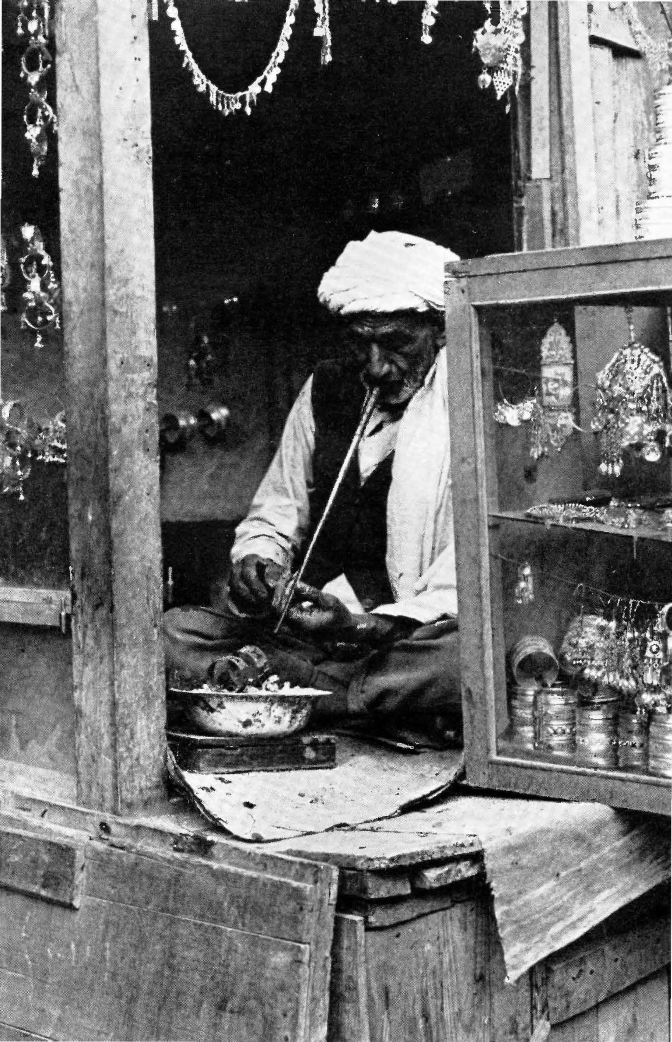
,. ~-
•• i
• t
,< - , ..
,
f ~ '"..: .f ,%~ ---<· ••
~ ' ~ ,:,,~: 0,,
~ t" e .... ;.
" if.'. }~
' ,
.........
98 AFGHANISTAN
Bagh-i-Umumi (1-5): Books and magazines; textiles, several serai specializing in sundries; 2nd-hand clothing. This broad street runs into the Mandawi, main grains bazaar. Back issues of Afghan stamps may be purchased inside the front entrance of the Central Post Office, to the east of this bazaar; a Stamp Museum will open in the rotunda in 1976.
Jade Wilayat (16: H-3): Pusteen (fur-lined embroidered coats) ; furs; jewelry; textiles; antiques; imported household items.
Chahrahi Saadarat (6: H-3): Antiques; jewlery; pusteen; stationery; sundries; suitcases; shoes; photo equipment and film.
Chahrahi Taurabaz Khan (7: H-3): Popularly known as Chicken Street: Antiques; groceries; medicines; fruits and vegetables; lstalif pottery; Herat glass; alabaster; lapis lazuli; handicrafts; rugs and carpets; dry cleaners.
Chahrahi Haji Yaqub (14: G-2): Antiques; rugs and carpets; photo equipment and film; groceries; boutiques. Note: Chahrahi literally means "four streets" and is used to describe the point where four streets meet; i.e., a square.
Mohammad Akbar Wat (K-5): Principal rug bazaar.
RESTAURANTS
Afghan Afghan Department Store (54: 1-4): quality and quantity
at low prices. Metropole Hotel ( 48 :H-4): quality at low prices. Spinzar Hotel Afghan Room (52: H-5): Afghan music,
wine ; open after 8 : 00 p.m. only. Sitara (G-2): Pizza also. Afghan music, Herati architecture,
elegant decor, quality+ quantity at reasonable prices; bar; downstairs samovar with exhibition Afghan handicrafts. One block south of west end of Shahr-i-Naw Park.
Kabab shops, opposite Park Cinema, Shahr-i-Naw Park (38: G-2), particularly Dadekhuda Charekari.
Chinese Golden Lotus (57: 1-2): music, dancing, bar. Marco Polo ( 60: G-3): European and Afghan dishes also. No. 9 Club (G-2): music, dancing, bar.

KABUL
European / Darwaz (56: H-2): Afghan dishes also; bar. Gulzar (45: G-2): German; bar.
99
Khom-i-Zargar (58: G-2): Italian; Afghan dishes also; bar. Khyber Restaurant ( 59: 1-4): Afghan dishes also; cafeteria. New Tri tone ( 50: H-3): I tali an trattoria, beer and wine. Pamir Restaurant, Intercontinental Hotel ( 44: B-2): music,
dancing, bar, occasional cabaret. Numerous restaurants serving both Afghan and European (in
cluding vegetarian) dishes between Chahrahi Taurabaz Khan and Shahr-i-Naw Park, particularly The Little Lantern and Miami.

•
I
. ' I
KABUL: Shalz-do-Shamshira Mosq ·11e - .
Delicious -t1Jghan Fruits Are a Treat for Travellers

Nuri-stani Mountaineers
A Nomadic Caravan

·, • • 111\ 1·· ' , .. , .... ..~~
If I ~ , ,
1 • ... • • , . . . ·t-. ... :1.· ;!-. j\ ', ._._ ·~·· 1·~""" 'ii.I r• ;l . I I I
)I ••• . ..
----
Band-i- A mir
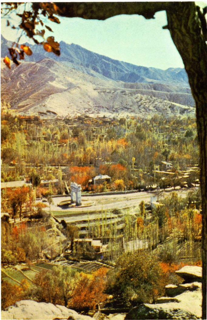

CHAPTER 5
Around and About Kabul (I) Istalif (7) Kargha Lake (2) Salang Pass (8) Tangi Gharu (3) Panjsher/Begram (9) Lataband Pass (4) Tagao (10) Bandi Ghazi (5) Qala-i-Haji Sahib (11) Guldara (6) Paghrnan (12) Shewaki
(13) Panjao-Ban1iyan
Visitors are urged to travel outside the city of Kabul and enjoy Afghanistan's magnificent countryside. There are several attractive spots in the vicinity of the city which may be visited in a day, in half a day, or even in a few hours.
(1) ISTALIF Half day tour; full day if combined with Salang Pass (2). To Istalif: 55 km; 34 mi; 1 hr; -! distance paved. Hotel: varied price range; chaikhana. Toll : 20 Afs.
The village of Istalif lies north of Kabul in the Koh Daman, a. valley ringed by barren hills dotted with villages nestled within green orchards. Istalif is one of the largest, one of the more ancient, one of the more famous and certainly one of the lovliest of these villages. A visit to Istalif combines beautiful scenery with an intro-duction to Afghan village life. (altitude: 1900 m; 6233 ft.)
One now leaves Kabul at the foot of Bagh-i-Bala (Kabul Map,. C-2). The Salang Highway under construction, however, will eventually join this road at the ancient village of Deh Kepak not far from the modern suburb of Khair Khana sprawled along the base·
~ Paghman 105

106 AFGHANISTAN
of the mountain (marker 9). A petrol station stands just beyond at the foot of a rocky spur on which French archaeologists (Carl, 1934) discovered a Brahmanic temple dating from the Hindu Shahi period during the 6th and 7th centuries A.D. The sculptured marble Sun God Surya recovered from this site may be seen in the Bamiyan Room at the National Museum, Kabul. Today, an annual Farmers' Fair is held on the open plain below the site on N awroz (21 March). Prizes are awarded to the best horses, cows, donkeys, sheep and goats, all gaily decked out for the occasion; various competitions are held.
Passing through the Khair Khana (Home of Goodness; marker 10) Pass, the road descends into the Koh Daman (Skirts of the Hills) Valley girdling the Hindu Kush. During the spring (April) and summer, no1nads pitch their black goats' hair tents on the open plain to the left as you leave the pass. They specialize in making a soft cheese which they carry to market in triangular .cloth bags suspended from their shoulders. Nowadays many prefer to take the bus rather than jog into town and therefore you may someti1nes see numerous trees along the roadside festooned with these heavy ,. cloth bags, and nomads patiently awaiting a ride. Because the bags are kept wet to keep the cheese fresh, bus drivers ·usually object to taking the bags on board, so you may also note buses similarly festooned with cheese bags.
Karizamir, an experimental farm established by Mohammad Zahir Shah (1933-1973) lies to the left of marker 17. A paved road winds through a charming landscape much frequented during the summer for picnics and by city folk out for a stroll. Many varieties of fruits, vegetables and flowers are grown here; seeds, ·saplings and potted plants may be purchased. The cattle barn behind the large green houses resembles a Swiss chalet.
The Koh Daman is renowned for its fruits and nuts such as plums, pears, apricots, figs, mulberries, cherries and almonds. Spring is an entrancing time among the orchards. The tall mulberry trees lining this route were planted during the reign of Amir Habibullah (1901-1919) who opened this road to Charikar and made it motorable after he brought the first cars to Afghanistan in 1907. The Koh Daman is most famous perhaps for its grapes and vineyards, which proliferate as you proceed toward the head -0f the valley.
You will note that many houses have extended double-storied

AROUND AND ABOUT KABUL 107
rooms with slotted walls. Called sayagi-khana these rooms contain a network of long poles from floor to ceiling which are festooned with bunches of fresh grapes. The slotted walls allow air to circulate through the fruit, turning the grapes into green raisins. During the harvest from about August through October you may also observe grapes laid out to dry in large stone-ringed plots beside the black goats' hair and white cloth tents of nomads who come to the valley to assist in the harvest. These sun-dried raisins turn a dark red. Some of the choicest varieties, such as the oliveshaped white Husaini, are carefully packed in cotton wool in small shaved-wood boxes or sealed between two clay plates and sold as a delicacy during the winter months.
Raisins and fresh grapes constitute one of Afghanistan's most important exports. During the height of the season wooden boxes filled with fresh grapes are stacked high by the roadside and long lines of trucks wait to be loaded. In September, melons are also harvested and the villagers construct picturesque round grass huts (kappa) on top of platforms in the middle of the fields where they camp out to guard the ripening crop.
At Qala Murad Beg (between markers 21/22) a riotous selection of pottery from Istalif and J alalabad may be purchased along with pieces of traditional utilitarian pottery for which this village has long been famous. The village is also a major center for the commercial cultivation of poplars. The stands are planted very close together in order that the trees may grow tall and straight for roof poles.
Beyond marker 30 the Japanese excavations at Tapa Iskander (Higuchi, 1970 to date) may be seen on a mound in the middle of the plain to the right of the road. From the 7th-9th centuries A.D. this was an important Hindu Shahi complex with both secular and religious buildings. A superb marble statue of Umamahesvara, the Hindu god Siva and his consort, from Tapa Iskander exhibits stylistic similarties with the sculptured marble piece from Khair Khana. The Hindu Shahi period is one of the least documented periods in Afghan history. Beautiful sculpture has been found accidentally from time to time over the years, but the scientific excavation of Tapa Iskander promises to shed welcome light into the murky corners of this fascinating transitional period.
Those with a keen eye may also make out a Buddhist stupa in a draw high above the excavation mound. There are many

108 AFGHANISTAN
Uma1nahesva1"a from Tapa Iskander •
•

AROUND AND ABOUT KABUL 109
Buddhist sites scattered throughout the Koh Daman dating from the 2nd to the 4th centuries A.D. when this valley was on the caravan highway known as the Silk Route along which Buddhism travelled from its homeland in India into Central Asia. Many loca1 princes converted to Buddhistn and thousands of pilgrims from Central Asia and China stayed at Buddhist monasteries strategically located along their route.
Two large schist standing Buddhas now in the foyer of the National Museum, Kabul, were accidentally found by farn1ers in a mound at Serai Khoja (also called Mir Bacha Kot; marker 33), an administrative and commercial center. Mirroring the prosperity of the valley, it grows larger and busier with each passing year. Tuesdays and Fridays are bazaar days at Serai Khoja. Kalakan (between markers 38/39) was the home of Habibul1ah Ghazi (Bacha Saqao) who deposed King Amanu11ah in January, 1929, and ruled Kabul until October, 1929. (Toll: 20 afs. Keep ticket for return trip if only going to Istalif or Charikar ).
The turnoff to Istalif is easy to spot between markers 41 /42. This unpaved road crosses the valley and winds its way up through low hills to the village cradled within lush orchards. In spring young boys stand by the roadside and offer wands of wild tulips; fruits in season are also offered with a grin. Straight from the neighboring orchards, plucked at their prime, these fruits are a treat not to be missed.
At Istalif the Takht (Throne) lies under huge plane trees and offers an impressive panoramic view of Istalif and the Koh Daman. Many picnic here today as did the Emperor Babur in the 16th century. The Ista1if Hotel is located on the outer lip of the Takht: tea is always available but meals should be ordered in advance. Those who enjoy picnicing in wilder, more natural settings will find the terraced gardens below the Takht most pleasant ( opposite side from village).
You may drive or walk to the village where you will find the main street lined with small shops selling the blue pottery for which Istalif is particularly famous. Today brown, green and yellow glazed pottery is made along with the traditional blue. The villagers also weave thin cotton prayer rugs and decorate wooden chests with intricate carvings. All these items plus a wide assortment of antiques and handicrafts may be purchased along Istalif's main street. If you are interested in watching a potter or a weaver

- - -- - -
110 AFGHANISTAN
' .,
\ :,
f -~· .. ;?!"~~ ...
, . . , r ..
"'
Tlze Village of lstalif
at work, you will be most welcome. Ask any of the shopkeepers to be your guide.
(2.) SALANG PASS and KHINJAN Salang: half day tour; · 122 km; 76 mi; 2 hrs. to tun
nel. Full day tour if combined with visit to Istalif (1) .
Khinjan: fullda)rtour; 162km; 100mi; 3 hrs.to hotel (varied price range).
Tolls: round trip to Salang, 90 afs; to Khinjan, 140 afs.
Petrol: enroute at Charikar and Khinjan.
The Salang Pass lies in the he~rt of the Hindu Kush mountains. Through it one pass.es from the Kabul and Koh Daman valleys into the northern foothills ,,lhich lead onto the Turkestan Plains.
.. This trip presents so.me of the world's most thrilling and spectacular scenery.
,.fo reach the Salang one starts at the foot of Bagh-i-Bala in Kabul and proceeds past the turnoff to Istalif (see above (1) for

AROUND AND ABOUT KABUL 111
description Kabul-Istalif). In the next large bazaar at Qara Bagh (bet. markers 44/45) the roadside stalls seaEonally display fruits from the Koh Daman. Luscious mounds of grapes nestled in baskets lined with crisp grape leaves are particularly attractive. Qara Bagh is the largest market in the valley and on bazaar days, Mondays and Thursdays, you will find a wide variety of products for sale in addition to local produce: textiles and second-hand clothing brought from Kabul, rice from Laghman, salt from Taluqan and Kunduz, krut ( dehydrated buttermilk) from the Hazarajat, ghur (unrefined sugar made from sugarcane) from Jalalabad.
Beyond Qara Bagh the vineyards give way to open, flat fields planted occasionally with wheat. Between markers 50/51 you leave Kabul Province and enter Parwan Province. The wide paved road on the right leads to the military airport at Begram ( closed to nonmilitary personnel). In the vicinity of marker 58 the small village of Tope Darra (Valley of the Stupa) comes into view on the mountainside to the left. The Buddhist stupa from which the village takes its name is well camouflaged at the head of a small ravine above the village. The evolution of the stupa and its function is discussed in Chapter 11.
As you enter Charikar (40mi; 1 hr; alt. 1600m; 5250ft.; pop. 19,000), capital of Parwan Province, at marker 63 you will note a sign on the left directing you to Gulgundai (Flower Hill) where the Arghawan Festival is held each year in late-April, earlyMay when the arghawan (Judas Tree or Red Bud) blooms. Thousands come from Kabul to picnic and enjoy the glorious blossoms which impart a purply-red glow to the entire hillside. No special ceremonies.
Chariker is noted for the manufacture of knives and scissors and because of its central position in this fertile valley it has an air of busy prosperity. It too expands annually. If this is to be your only visit to a provincial town, you will find the bazaar a fascinating adventure. Turn right at the central square and wander along the narrow busy side alleys where you will see all manner of smallscale handicrafts being made as weJl as a fascinating array of goods for sale. In April the bird bazaar is very active for the villagers practice a lot of bird netting. Some species from the Koh Daman have a brilliant, multi-colored plumage.
Leaving Charikar one passes by the headquarters of the Parwan Irrigation Project, a joint Afghanistan-People's Republic of China
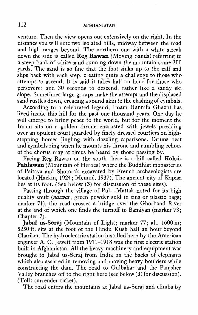
112 AFGHANISTAN
venture. Then the view opens out extensively on the right. In the distance you will note two isolated hills, midway between the road and high ranges beyond. The northern one with a white streak down the side is called Reg Rawan (Moving Sands) referring to a steep bank of white sand running down the mountain some 300 yards. The sand is so fine that the foot sinks up to the calf and slips back with each step, creating quite a challenge to those who attempt to ascend. It is said it takes half an hour for those who persevere; and 30 seconds to descend, rather like a sandy ski slope. Sometimes large groups make the attempt and the displaced sand rustles down, creating a sound akin to the clashing of cymbals.
According to a celebrated legend, Imam Hannifa Ghazni has lived inside this hill for the past one thousand years. One day he will emerge to bring peace to the world, but for the moment the Imam sits on a golden throne encrusted with jewels presiding over an opulent court guarded by finely dressed courtiers on highstepping horses jingling with dazzling caparisons. Drums beat and cymbals ring when he mounts his throne and rumbling echoes of the chorus may at times be heard by those passing by.
Facing Reg Rawan on the south there is a hill called Koh-iPahlawan (Mountain of Heroes) where the Buddhist monasteries of Paitava and Shotorak excavated by French archaeologists are located (Hackin, 1924; Meunie, 1937). The ancient city of Kapisa lies at its foot. (See below (3) for discussion of these sites).
Passing through the village of Pul-i-Mattak noted for its high quality snuff ( naswar, green powder sold in tins or plastic bags; marker 71), the road crosses a bridge over the Ghorband River at the end of which one finds the turnoff to Bamiyan ( marker 73; Chapter 7).
Jabal us-Seraj (Mountain of Light; marker 77; alt. 1600 m; 5250 ft. sits at the foot of the Hindu Kush half an hour beyond Charikar. The hydroelectric station installed here by the American engineer A. C. Jewett from 1911-1918 was the first electric station built in Afghanistan. All the heavy machinery and equipment was brought to J abal us-Seraj from India on the backs of elephants which also assisted in removing and moving heavy boulders while constructing the dam. The road to Gulbahar and the Panjsher Valley branches off to the right here (see below (3) for discussion). (Toll: surrender ticket).
The road enters the mountains at Jabal us-Seraj and climbs by
AROUND AND ABOUT KABUL 113
the side of the Salang River past numerous villages clinging to the mountainside, set off from the craggy cliffs by groves of mulberries or an occasional stand of cherry, apricot or almond trees. Here and there the river is dammed by the villagers to form quiet pools attractively bordered with willows where rustic duck decoys float during the spring and fall hunting seasons (marker 79 and bet. 80-85). The decoys are made of ordinary unsculptured pieces of wood into which crooked branches are fitted to simulate the neck and head. They are most realistic, however, and very dece1v1ng.
There is a toll gate at marker 99: 50 afs. If you are only going as far as the tunnel, keep this ticket handy and surrender it in lieu of payment at this same toll gate on your return.
The Salang Tunnel at marker 119, 1 hr. from Jabal us-Seraj, sits at an altitude of 3363 m; 11,034 ft. It is 2675 m; 8777 ft. or 2.7km; l.7mi. long and an additional 4972m; 16,313ft. of galleries were constructed to keep the approaches free of snow. The tunnel was built by the Institute of Techno Export (USSR) and the Afghan Ministry of Public Works. Work began in August 1958; it was officially opened in November 1964.
There is a simple Ski Lodge between markers 116/117 open all year round. Tea, soft drinks and wine are always available; phone ahead through the Afghan Tourist Organization for meals. The rooms are comfortable and heated in winter.
Leaving the northern exit of the Salang Tunnel, there is a dirt road immediately to the left running up a valley beside a small stream. This track is motorable for about 2.5 km. where you may leave the car and begin a pleasant trek to Hidden Lakes lying over 396 m; 1300 ft. above the tunnel. These lakes are accessible only from late spring to early autumn; high summer is the easiest time to make the climb but then you miss the drama of the snow.
A series of switchbacks takes you up a rock-strewn slope to a much steeper slope usually covered with snow. In fact, huge blocks of packed snow are "mined" from these slopes and taken to Kabul in lorries to be used instead of ice for making ice-cream and iced sherbets and for cooling drinks. Kabul has modern ice and soft drinks factories but many still prefer a traditional drink prepared by pouring flavored multi-colored syrups over shaved snow. Take this climb slowly for one may easily overexert oneself at this high altitude. At the top of the switchbacks the mountain

114 AFGHANISTAN
opens out into a broad bowl containing a snow-melt lake about an acre in extent. Except when totally snow-covered, this bowl is green and idyllic.
From here a trail continues up past the lake to a double-peaked crest sheltering a small glacial lake fed by a snow face of perpetual snow. The peak is well over 4790 m; 15,716 ft. so it should not be attempted by anyone with a hint of heart or lung trouble. From the second crest it is easy to scramble down to the Kabul end of the tunnel. Foxes, marmots, eagles and other wildlife may be encountered on this trek.
The road descends very rapidly once through the tunnel. Most notable is the fact that the mountain slopes on this northern side are sprinkled with Asian conifers; the southern slopes are bare except for the fields and groves painstakingly cultivated by the villagers. Here there are no villages to be seen until one nears the bottom of the slope where the Khinjan River flows with gathering force past numerous mulberry groves. Between markers 142/143 a track 1eads to the Khinjan River in a little valley called Firishtakan (Where the Fairies Bathe), an ideal picnic spot much frequented by fishermen, for trout abound. There are also several chaikhana along the road further down, serving pilau and qorma; beside them small shops sell large plastic bags of walnuts, dried mulberries and krut, specialities for which this area is renowned.
The Khinjan River flows to Khinjan (marker 162; 1 hr. from the tunnel) where it joins the Anderab River. (Toll: marker 159; surrender ticket). Trout fill the Khinjan and the upper reaches of the Anderab are particularly favored by fishermen. The best seasons are during June and late September-early October. Arrangements may be made through the Afghan Tourist Organization. The Khinjan Hotel with its swimming pool and cool gardens is very popular on Fridays during the summer. On other days, especially during the winter, it is best to phone ahead if you wish to have the hotel prepare a meal.
(3) PANJSHER and BEGRAM Full day tour: To Bazarak, Panjsher: 103 km; 64 mi; 3!hrs. Return via Begram; 128km; 80mi; 3hrs.
The Panjsher Valley is one of the most scenic valleys in Afghanistan. The archaeological site of Begram produced the 20th century's most spectacular finds. There are no monuments at Begram but

AROUND AND ABOUT KABUL 115
the area is imbued with a sense of history which is positively palpable.
For segment Kabul Jabal us-Seraj see above (1) and (2). At Jabal us-Seraj take sharp right up hill under Jewett's tower; then sharp left over canal on paved road passing the Afghan Cement Factory. From here a graded road continues to the outskirts of Gulbahar (Flowers of Spring) in about 15 min; turns left at a dead end and gr-adually descends toward the Panjsher River passing by villages, gardens , mulberry groves and the lush park of Baghi-Umumi (Public Gardens), a favorite picnic spot.
The bazaar is busy and colorful. Fried shir mahi (milk fish) from the Panjsher River is a tasty specialty served in chaikhana displaying the sign of the fish.
The Panjsher Valley
In the center of the bazaar, take sharp left into Band-i-Pa~jsher, the part of this bazaar marking the entrance to the Panjsher Valley, running 150 km; 93 mi. northeast and divided into an up,per and lower section by the Khawak Go·rge, about 85 km; 53 mi. above Gulbahar. The road clings to tl1e edge of a rocky cliff hanging over crystal clear waters occasionally frothing over rapids,

116 AFGHANISTAN
and wends its way through a narrow gorge where the cliffs someti1ne overhang the road. The Panjsher is a fast-flowing river of great beauty-perhaps the most beautiful river in Afghanistan. It has its moments, however, and occasionally floodwaters can block the road in late spring and early summer, April-June.
Emerging from the gorge, one passes through fertile valleys and across untilled plains. In April/June and August/September many Pushtun nomads pitch their camps on these plains. The villages of the Tajik Panjsheri cling to the hillsides surrounded by carefully tended fields of wheat, maize and sesame nourished by the waters of the river brought to them by an ingenious system of terracing and irrigation canals (jui).
Large groves of walnut and mulberry also abound. Mulberries form a highly nutritious staple in the village diet and when they ripen in July whole families turn out, the children scampering among the branches shaking the fruit onto large cloths spread out below. The fresh fruit is then spread on the flat roofs of the mud-brick houses to dry. Some of these dried berries are ground and made into hard bars called talkhan which is such a nutritious concentrate that a villager can go on a week's journey with no other food except a few bars of talkhan tucked into his cummerband. All he needs is water. Dried mulberries and walnuts were found in association with other precious objects, gold and silver ca£es filled with pearls and acquamarines, inside a Buddhist reliquary recovered from the Qol-i-Nadir stupa near Begram (on display in the Bamiyan Room, National Museum, Kabul).
Maize is dried on rooftops also, adding bright orange flashes to the landscape. No dry-farming is practiced in this valley and many picnic spots suggest themselves.
A group of pennanted graves marking the resting place of one of the celebrated Panj Pir-i-Panjsher (Five Pirs of Panjsher) sit by the roadside at Gawara some eight kilometers from the mouth of the valley. According to legend, when Sultan Mahmud of Ghazni determined to build the Band-i-Sultan Dam at Ghazni he sent messengers throughout his realm to conscript men for the project. Five hundred were recruited from the five valleys known collectively as Kachkan but five brothers asked that they might do the work alone so that so many n1en need not leave their homes and fields. The emissaries of the Sultan agreed on condition that the brothers agree to be beheaded should they fail. In the Panjsher

AROUND AND ABOUT KABUL 117
gorge, however, they were met by more of the Sultan's guards who flatly rejected the five and demanded the 500, whereupon the brothers lifted up an immense boulder with the greatest of ease and set it down upon another. The astounded guards allowed them to proceed. Arriving in Ghazni at dusk, the five brothers went immediately to the site of the dam where they asked to stay the night alone. In the morning when the Sultan and hosts of workers came out, they found a magnificent dam gloriously complete, but not a sign of the brothers. To commemorate this miracle the Sultan decreed that Kachkan should henceforth be known as the valley of the Panj (Five) Sher (Lion).
Others, however, see the name of Panjsher as a corruption of Panjhar, referring to the five tributary streams (har) which combine to farm the main river.
In the vicinity of Gawara, you will note hills sparsely sprinkled with balut (holly oak) trees. Elsewhere the slopes are bare. The Saffarid (9th century A.D.) mint city was in the Panjsher; the main mint of Sebuktigin (977-997), founder of the Ghaznavid Empire, was also here. Ibn Haukal, the 10th century Arab geographer, reported that 10,000 unruly miners cavorted in these hills and a 13th century geographer, Yakut, elaborated with tales of riotous living and whole mountainsides riddled with caverns worked by men toiling by torchlight in the bowels of the earth. The hills were denuded to feed the forges. Travelling through in the early 14th century, Ibn Battuta found no mines, no trees, only yawning, empty tunnels. He speaks, however, of the blue waters of the river. This at least remains unchanged.
A large bazaar and the administrative center of the Panjsher are located in the neighboring villages of Qabzan and Shast in the area known generally as Roka, about an hour beyond Band-iPanjsher (30 km; 19 mi.). Six kilometers beyond, the road climbs to the top of a low shoulder from which one is treated to a magnificent view of a long fertile valley dotted with villages. Bazarak lies at the far end of this view. The road continues for another two hours to Dasht-i-Rewat at the beginning of the Khawak Gorge but because of time limitations, this tour turns around at Bazarak and returns to Gulbahar.
At Band-i-Panjsher, turn to left in the Gulbahar Bazaar (right to return to Jabal us-Seraj) and take left over a barren hill and across the first iron suspension bridge built in Afghanistan. It

118 AFGHANISTAN
was designed and built by Mr. Halliday, an English engineer, and officially opened midst much pomp and ceremony by the Amir Habibullah in October 1911. From these heights one may study the architecture and layout of Gulbahar far below and contrast it with the modern complex of the Gulbahar Textile Company known locally as the Sherkat (The Company). Established with the assistance of the Federal Republic of Germany, it was one of the largest textile plants in Asia when it opened in 1960. The teahouse in this bazaar serves chainaki, a tasty lamb stew cooked in its own juices inside teapots embedded in hot coals. Petrol pump.
Jamal Agha (8 km; 5 mi. from the Sherkat) is a typical oldstyle village. Saturday is bazaar day at Jamal Agha and it is an exciting treat to visit any small village on bazaar day. Sleepy and quiet during the rest of the week, the bazaar suddenly erupts into a riot of color and bustle which lasts from early morning to just after noon.
Dehwali lies 4 km; 2! mi. ahead where the Reg Rawan, described above in section (2) after leaving Charikar, rises close-by on the left. Just beyond a large school (lycee) on the left, take a small road branching to the right. (Straight ahead to Saro bi 95 km; 60 mi; 5 hrs. See section ( 4) below). This will bring you to the Burj-i-Abdullah bridge over the Panjsher River in about 10 to 15 minutes. The long mound to the left on the far side of the river is the famous archaeological site of Kapisa (Begram). Cross the bridge, turn left at beginning of the village at the top of the hill, park at fork in road (right to Charikar) to visit the site.
The view from the top of the mound is spectacular. The Panjsher and Ghorband Rivers converge just below, and in the distance the entrance to the Panjsher Valley is clearly visible. Two great armies crossed this plain to enter the jaws of the Band-i-Panjsher: Alexander of Macedon, in the spring of 329 B.C.; and a contingent of Genghis Khan's army in 1222 A.D.
The Archaeological Survey of India plans to reopen excavations at Begran1 in 1976, but at present there is practically nothing for the layman to see of the French excavations (DAF A, 1936-40, 1941, 1946) except a portion of the outer defenses and two sections of empty pits.
If you have visited the National Museum in Kabul before coming to the site, you may, however, imagine the sumptuous palaces and the busy bazaars which would have catered to a society

AROUND AND ABOUT KABUL 119
A Carved Ivory from the Kushan Treasure at Ka pis a

120 AFGHANISTAN
capable of amassing such an array of luxurious objects. The famous Room 10 from which the Begram Treasure was recovered lies in the eastern section, beside the core of a large tower. In this very small room, which may have been a storeroom, Chinese lacquers, Graeco-Roman bronzes and plaster matrixes, Alexandrian vessels of porphyry, alabaster and glass, and exquisite Indian ivories were found neatly stacked (see Museum Guide for description). Looking across the hillocked plains to the south from the top of the mound you will note that the ancient city extended far beyond this citadel and upper fort area. The new excavations are awaited with excitement. Established as a Graeco-Bactrian city some 2000 years ago, Kapisa became the capital of a far-flung Kushan Empire during the early centuries A.D. What secrets does it still hold?
The ridge rising to the east of the mound is the Koh-i-Pahlawan (Hill of Heroes) which was a flourishing Buddhist religious center from about the 3rd century A.D. DAF A excavated several monastery /stupa complexes on its bluff. One, called Shotorak, was built especially for Chinese hostages taken by the Kushan king Kanishka. The Chinese pilgrim Hsuan-tsang stayed there in 630 A.D. and described it fully in his account of travels in Afghanistan. Fine sculptured panels from Shotorak represent an indigenous art style within the Gandharan art school (National Museum, Kabul).
From the paved road one can see how fertile this valley is, but only on winding through it is it possible to appreciate just how thick and lush the vineyards of the Koh Daman are. The road is deplorable, and meanders around quite haphazardly. On the whole, when in doubt, bear left. On reaching the graded road at a bridge, turn left to the Charikar bazaar (14 km; 9 mi; 40 min. from the site of Begram).
(4) GULBAHAR to SAROBI via TAGAO. One day tour: Kabul-Gulbahar: 84 km; 53 mi; 1 i hrs.
Gulbahar-Sarobi: 95 km; 60 mi; Si hrs. Hotel: Saro bi Petrol: Tolls:
Sherkat, Gulbahar; Saro bi 20 afs. between Kabul and Charikar 30 afs. additional if continuing to Saro bi
Permission to pass the barrier at Naglu should be obtained from the Afghan Tourist Organization, Kabul.
I

'
AROUND AND ABOUT KABUL 121
This tour is recommended for those with a yen to experience travel beyond paved roads although they may be limited in time. Fertile valleys with villages alternate with barren plains and mountain passes. There are a number of fords and several rough stretches so this trip necessitates a stout and sturdy car with high clearance.
The segment of this trip from Kabul to Gulbahar is covered above in sections (2) and (3) which take you as far as the village of Dehwali where the track to Begram leaves the main road (12 km; 7f mi; 30 min. from Gulbahar). Ten 1ninutes later (3 km.) a ford and terraced groves of mulberries announce the approach of the district center of Mahmud Raqi. There is another ford beyond the bazaar with several chaikhana, followed by more small Tajik villages tucked under trees and surrounded by fields of various grains and vegetables. Unlike the Koh Daman, this area does not produce grapes in any great quantity.
Babies in these villages wear particularly charming little hats decorated with all manner of dangling silver ornaments and tufted topknots; in the spring, 1 ittle boys and girls hustle along baby kids and lambs, carrying them by threes and fours across the fords in a welter of squirming bodies and tiny flailing hoofs.
On rising over a low pass the Panjsher River comes into view between high terraces. On the far terrace mud-walled villages sit camouflaged without a trace of greenery about them. Then the terrain becomes more and more desolate as the river knifes through a gorge and the road bends towards the steep pass at Gharaw past terraces of pebbly conglomerate (19 km; 12 mi; 45 min. from l\1ahmud Raqi). A simple mud-walled open mosque sits by a stream at the bottom of the pass. Here drivers and passengers often stop to pray before attempting the climb which can be very slippery if wet; proceed with care, taking the right fork at the mosque.
Upon the eroded plateau where the road is very rough the terrain is bleak and stony and yet in the spring there is enough greenery to support several nomadic encampments; sheep, goats, and many camels graze contentedly on the hillsides. At the pennated shrine of Jaji Baba to the left of the track you will note numerous little sticks implanted in the ground around the grave. Miniature cradles still hang between some of them, fashioned by women who have come here to pray for a child. High peaks heavily mantled with snow form a majestic backdrop.
Eight kilometers; 5 1ni, but 45 min. after climbing to the plateau

122 AFGHANISTAN
because the road is very rutted along this section, take right fork following the power lines (left to upper reaches of the Nijrao Valley), and descend to the southern edge of Nijrao where there is a fine bridge over the river. This valley is a mixed ethnic zone with Pushtun and Dardic speaking Pashai villages. The four valleys of Chahrdeh leading into Nijrao from the north are noted for the excellent pinenuts which grow wild on the hi11sides.
After passing two more small passes the road drops into the Tagao Valley inhabited mainly by Safi Pushtun villagers. Here the road hugs the barren shoulder of hills rising to the west of extensive fertile fields and groves of fruit trees, including many acres planted with pomegranates. The Tagao River running through the center of this valley is the source of its lushness. In the spring many nomads camp in this area and flocks of new born lambs tended by young girls and boys again delight the eye. Those too young to wander sit patiently during the day under black goats' hair tents or bob along tied to the backs of donkeys and camels. Older children herd the adult animals separately, bringing them to a happy, boisterous reunion at sunset.
The district center of Tagao lies another 8 km; 5 mi; 30 min. beyond. Here you will find several large chaikhana serving tasty substantial meals. Beyond the bazaar the valley becomes even more densely populated until the road leaves the valley (21 km; 13 mi; 1 hr. 15 min. from Tagao Center) and wends its way up and down, twisting through barren mountains occasionally planted with small terraced fields fed by jui (irrigation canals) leading from mountain springs. Finally, as the river enters a gorge and continues out of sight, the road leaves Parwan Province and enters Kabul Province as it makes one last climb onto a crest from which one views a broad, placid expanse of blue water in the Naglu reservoir (4 km; 2! mi; 15 min. after leaving Tagao Valley). The lake stores 304,000 acre feet or 375 million cubic meters of water.
The barrier at the top of the N aglu Dam is encountered some 6 km; 4 mi; 10 min. beyond at the top of the 110 m; 361 ft. high and 280 m; 919 ft. long dam. Descending past spillways down which the waters thunder, one reaches a bridge and the paved road after 3 km. The dam and hydroelectric plant were contructed with the assistance of the Soviet Union during the 1960s and in 1974 it reached its design capacity of 90,000 kw.
At the main Jalalabad-Kabul highway, 4 km; 2! mi. from the

AROUND AND ABOUT KABUL 123
dan1, take right to return to Kabul (70 km; 44 mi; 1 hr.); left if you wish to spend the evening at the Sar obi Hotel ( 4 km; 2-! mi; 5 min.).
(5) QALA-i-HAJI SAHIB Half day tour. Kabul-Qala-i-Haji Sahib: 25 km; 16 mi 1 ! hrs. No chaikhana
One of Afghanistan's more respected 18th century Sufi mystics taught and wrote in a tiny hamlet lying north of Kabul where one may visit his large mausoleum and a mosque uniquely decorated with bright wall-paintings. On the way there are several other holy shrines. This was the ancient highway to the north before Amir Habibullah (1901-1919) opened the present route via the Khair Khana Pass. Since little wheeled traffic passes this way today the road surface is badly rutted; sturdy cars with high clearance are therefore recommended.
Leaving 26 Saratan Circle, proceed toward the airport. Take right after 4 km; 2-! mi. to skirt around the east end of the airfield, looping back. to the west to the pre-fab factory. Take right at entrance to the factory and head for a gap in the low ridge which divides Kabul from the valley beyond. Two forks follow in rapid succession: at the first, take right (left to marble quarry); at the second, keep left (right to large Pushtun village of Tara Khel).
Beyond these forks you pass the large Tara Khel graveyard in which pennants on long poles mark the graves of Shaheed or Martyrs killed in battle; white marble headstones mark the resting places of those who fell during the First Anglo-Afghan War, 1838-1842.
A low pass divides this small valley from the wide valley beyond; the picturesque Tajik village of Deh Yahya where the Haji Sahib, Shaikh Saaduddin Ansari, was born lies at its foot. In the spring the hillsides are dotted with black goats' hair tents where baby lambs wait patiently for the return of their mothers grazing in large flocks higher up the slopes. Herds of camels also find sustenance among the rocks and boulders.
At the large village of Pai Minar (Foot of the Pillar; 4 km; 2f mi. beyond Deh Yahya) you may visit the shrine of Pacha Sahib which sits just below a saddle pass once marked by a pillar similar to that of the Min~r-i-Chakari (see (12) below). Camel caravans

124 AFGHANISTAN
and animal traffic crossed into the Kabul Valley via this pass for centuries before vehicular traffic necessarily forsook the precipitous climb.
The Pacha Sahib, Mir Zewaruddin, was a famous 18th century Sufi teacher and author of many books on mysticism; a daughter and a grand-daughter were married to Shaikh Saaduddin Ansari, the Haj i Sahib. He died in battle fighting against Nadir Shah Afshar, in 1738. His reputation for bravery is so great that it is said he fought on long after having been beheaded by his enemy.
Beyond Pai Minar pennants flutter over the otherwise unmarked mass grave of 40-50 Shaheeda, also dating from the 18th century battle with Nadir Shah Afshar. The road, however, turns to the north to pass by the ruined mausoleum of Maulana Abdul Khaleq situated at the foot of a hill on the top of which there is the very long grave of Baba Sher Vali and numerous carved gravestones of considerable antiquity.
Fron1 here one enters the Dasht-i-Qala Haji Sahib, a desert area ( dasht) bordered by the Deh Sabz ( Green Village) range on the east and the Shakar Dara (Sweet Valley) mountains beyond a low range to the west. Lush vineyards flourish just beyond the low ridge but here little greenery exists. Three kilometers after leaving Baba Sher Vali you can just make out the ruins of an old caravanserai on the right, first stage out of Kabul in the old days. Marching beside the road are pyramidal steel towers carrying electricity to Kabul from J abal us-Seraj, the first electric power station installed in Afghanistan by the American engineer A. C. Jewett from 1911-1918. A kilometer beyond there is a large sayagi khana (shade house) with slotted walls in which grapes are processed into green raisins. The vines themselves are planted behind high walls attached to the sayagi khana and watered by a karez or underground canal.
Bird watchers will delight in the many species that abound including hoopoes, skylarks and wag-tails. The song of the lark is particularly clear and melodious in the quiet of the desert. It is said in the villages that larks sing so hard and fly straight up so high that they become dizzy and plummet to earth; should a dog eat the stunned bird it is certain to go mad.
The domes of Qala-i-Haji Sahib loom in the distance a kilometer on the right. Sparse tile work on the spandrels of the mehrab projecting from the west wall and yellow and white painted de-

AROUND AND ABOUT KABUL
Colours sparkle at Qala-i-Haji Sahib · despite the mud washed down by rain and snow.
125

126 AFGHANISTAN
coration on the corner pillars give little hint of what awaits inside. The complex consists of an enclosed winter mosque on the
south, a large mosque in the center, and the octagonal, domed mausoleum on the north. A screen of open-work brick sets off the two side buildings from an extensive courtyard planted with trees and traversed by a canal carrying crystal clear water from a karez. This courtyard is enclosed by a high wall beyond which there are vineyards.
The walls of the forecourt and the interior of the central mosque are completely painted with a wealth of floral designs arranged in panels and recessed niches with pointed, scalloped arches. Small rectangular niches to hold flickering oil lamps flank the main doorway. The most spectacular designs consist of flowering bushes and vases of flowers with pomegranates or bowls of fruit and cucumbers beside them. In many ways these recall the inlaid marble decoration of the Taj Mahal in India, but these are simply painted onto the plaster surface. The domes have fallen, rain has splashed them and brought down mud from the broken superstructures, snow has piled high against them, but the colours, predominately red and orange, remain vivid and remarkably clear despite such neglect. Teahouses in many parts of Afghanistan were once painted with similar designs but this is a fast-disappearing tradition. The mosque of Qala-i-Haji Sahib is unique in its decoration.
The mausoleum of the saint sits in a small court allowing for only a narrow corridor around it; niches filled with open-work brick face the entrance on the west; on the east a series of niches with the same brick work forms the screen wall seen from the front courtyard. The wall on the north is inset with pointed niches painted with stylized flowers in yellow and red.
The octagonal mausoleum rising two stories high has four entrances with honeycombed half-domes decorated with paintings. The north entrance has a decorated tile dado and similar tile-work may be seen on the spandrels. Attached columns divide the entrances from a series of deeply recessed superimposed niches reached by staircases to the right of each entrance. Inside, the tomb of the saint is covered with rich mantles. Beside him lies his muridi-khas or chief disciple, Mir Ahmad Khan Mardanzai, a celebrated governor of Kashmir, who contributed substantially toward the building and decoration of this mosque sanctuary. Originally the

AROUND AND ABOUT KABUL 127
interior of the mausoleum was richly decorated with paintings but about twelve years ago these disappeared under an anonymous layer of whitewash.
The simple unadorned grave of Akhund Mustafa Herawi, a devoted murid (disciple) of the Haji Sahib who died five years after his master, lies in a corner to the right as one enters the mausoleum courtyard. He wrote the authorized biography of Saaduddin Ansari entitled Nasha't ul-Quds, Divine Ecstasies, under the pen name Makhlis, the Devoted.
Saaduddin Ansari was born in the village of Deh Y ahya in 1727, a descendant of a devoted companion of the Prophet Mohammad, Ma-aaz-e ibn-e Jabal of Medina, who welcomed the Prophet and his followers after their departure from Mecca in 622 A.D.,
the starting point of the Muslim era. Because of their assistance the family came to be known as Ansars or Helpers. The family left Arabia for Herat after the Arabs conquered Persia during the reign of 'Umar (634-644 A.o.), the 2nd Caliph and founder of the Arab Empire. Later on the family moved from Herat to the valley of Deh Y ahya outside Kabul.
For nine years from the age of 19, Saaduddin Ansari was subject to ecstatic hallucinations and perceptual distortions during which he uttered statements held to be blasphemous and heretical by orthodox religious leaders. Because of them he was brought to trial before Ahmad Shah Durrani in Kabul and condemned to death, but his defense so confounded the learned theologians attending the court that they sat confused and perplexed, unable to refute the young man's logic or answer his theosophical questions. As a result Ahmad Shah overruled the verdict and the young Ansari consequently journeyed to India seeking release, to no avail. He then went on a pilgrimage to Mecca and Medina and finally found peace while rneditating in the shadow of the Prophet's mausoleum in Medina.
From then on he spent his life in teaching, writing books and numerous epistles to the rulers of his day in Bokhara and Afghanistan. Believing his teachings were divinely inspired, he spoke confidently of his own worth, saying: "If Bayazid, Junayd, and Busa'id (three renowned mystics-ND) were alive today, they would become the dust of my path and would come to me begging; and I would have bestowed on them a trickle of knowledge of the reality of the beyond and would have made them kings."

128 AFGHANISTAN
He preached of an essential unity between man and God. Unlike many others, however, he viewed life in this world practically and refused to condemn wealth as a stumbling block to spiritual fulfillment: "If you possess all the wealth and property and they do not make you forgetful of God, then you are praiseworthy. If you do not have worldly property and wander about in search of it, your mind is occupied with the thought of the master and the sultan. May your garden and meadow, horse and cattle be ever increasing. If they do not make you forget God, may their number be increased by thousands.''
Such teachings attracted many murid to this tiny hamlet where the venerated Shaikh died at the age of 85, in 1812.
(6) PAGHMAN Three hour tour; may be combined with Kargha (7). To Paghman: 20 km; 12 mi; 30 min.
For those without the time to visit Istalif or the Salang, this visit to Paghman and Kargha affords a de]ightful sample of Afghanistan's countryside. Every Friday during the summer Paghman is filled with festive visitors from Kabul; during the week it is quiet and serene. (altitude: 2200 m; 7218 ft.)
There are two paved roads to Paghman. One begins at Koti Sangi (Kabul Map A-6) and forks 6.5 km; 4 mi. beyond. Take right fork; left to Kandahar. The other road (begins in front of the Polytechnic Institute (Kabul Map A-2).
Half way to Paghman from Koti Sangi you pass through the village of Khwaja Mosafer, the Place of the Holy Pilgrim. Near his shrine there is another called Ziarat-i-Shah-i-Aros, the Shrine -of the Bride and Groom. According to legend, a young couple was celebrating their wedding in the gardens around the holy man's shrine when word reached them of approaching enemies. 'The bride prayed that she and her loved one might die before ;they were captured, whereupon they were turned to stone. Numer-ous pennants raised by those who have prayed here fly above these shrines. Some believe that if a pinch of earth from the shrine is kept in the house, the house will be free of scorpions.
On entering the village of Paghman note a bridge on the left. ·This bridge leads to the pretty little village of Beg Tut where Amir Habibullah (1901-1919) built a charming summer palace on the hillside. It was later used as Afghanistan's first tuberculosis

AROUND AND ABOUT KABUL 129
sanatorium during the reign of Amir Habibullah's son, King Amanullah. The unpaved road to Beg Tut is motorable. On the way one passes King Amanullah's race course on the left.
An imposing Victory Arch stands in the central square. Built by King Amanullah (1919-1929) the arch commemorates those who fought and died in the War of Independence in 1919.
From the central square with its numerous fruit and kabab shops, continue up the hill to a second square where you will find another monument, commemorating King Amanullah's birth in Paghman. It was a gift from the students of Afghanistan and on it you will find the King's personal emblem and an emblem symbolizing education. To your right just below the square there is a large building which was the Paghman Hotel during the Amanullah period. Recently reopened it is now called the Bahar Hotel (Varied price range). It is very popular during the summer when tea and snacks are sold under gay umbrellas in the gardens. A large red mosque built in a style typical of the Amanullah period stands just uphill from the monument. The road to the left leads to an elaborate theater which was burned by accident by an overturned lantern considerably after King Amanullah had been deposed.
The road to the right passes by the Bagh-i-Umumi (Public Garden) on the left. Within these terraced gardens there is a twostoried cafe, several fountains and a bandstand where afternoon band concerts were held during Paghman's busy social season. Below the bandstand, on the terrace just above the mosque, there is a natural amphitheater, its seats now covered with grass. Parliament met here in August, 1928.
Many lovely villas on spacious estates line the road beyond the Bagh-i-Umumi. The last two houses at the top of the hill were built by Amir Habibullah's son, Enayatullah, and his second wife, the Ulya Hazrat, mother of King Amanullah. Below them, to the left of the road there is a small pillared building where Amir Habibullah met with a German-Turkish Mission in 1915. They had come to persuade Afghanistan to join in a jihad (holy war) against the British but the Amir stayed true to his position of neutrality, a position Afghanistan retains today.
Though the road deteriorates beyond this point you may keep going up the valley to the end of the road where you will find a turnoff to the left. Turn in here and leave the car to visit Darra (The Valley). These gardens are open to the public and you may

130 AFGHANISTAN
picnic beside the river under cherry trees. The cherry was introduced to the Kabul area by the Emperor Babur in the 16th century. Those from Paghman are especially delicious.
Return to the Victory Arch and take a road down hill to the left. Half a mile beyond the central square turn right to the Tapa. In comparison with Darra, these gardens are very formal. Stately trees shadow well-kept terraced lawns and flower beds border large ornamental fountains; arcades grace the lower terrace from which one is rewarded with a fine view of Kargha Lake and the city of Kabul. Beyond the city the many ranges of the Sulaiman Mountains recede into the distance. On the opposite side of the gardens from the car park steps lead down to a large swimming pool on the terrace in front of a palace built by King Zahir Shah (1933-1973). The gardens continue from here in a more natural state, dotted here and there with artificial lakes and ponds.
To return to Kabul you may continue downhill to pass by Kargha Lake, or, return to the central square and return via Koti Sangi.
(7) KARGHA LAKE One and a half hour tour: may be combined with visit to Paghman ( 6). To Kargha: 10 km; 6 mi; 10 min.
Kargha is a picturesque lake nestled within the mountains, its creation a cherished project of Mohammad Daoud, Founder and President of the Republic of Afghanistan, while he served as Prime Minister from 1953-1963.
The paved road to Kargha begins in front of the Polytechnic Institute (Kabul Map 29), passes a new housing development for military personnel and, as it climbs into the mountains, Kabul's Golf Course laid out in the gardens at the foot of the Kargha Dam. Take right fork and drive across the Dam to the Spozan1.ai (Moonlight) Restaurant. Tea and cakes or full meals are served on the terraces over looking the lake, and in the dining rooms.
(8) TANGI GHARU One and a half hour tour. To Tangi Gharu Gorge: 32 km; 20 mi; 30 min.
Those who enjoy rugged mountain scenery will be entranced by a visit to the Tangi Gharu. Afghanistan is a country of impressive gorges and the Tangi Gharu is its most spectacular.

AROUND AND ABOUT KABUL 131
One takes the road to J alalabad by the side of the Kabul River past the tannery and shoe factory, one of Kabul's earliest factory complexes ( established 1904 ). The entire plain on this side of the city, all the way to the mountains, is fast becoming modern Kabul's industrial center. There are many factories already in production: several textile plants, raisin factories, a winery and a woolen mill, among others. Recently the Municipality of Kabul set aside a large tract of land in this area for development as an Industrial Park. Kabul's new Customs House, colorfully painted shades of mauve, yellow, blue, green and beige, has floating guardhouses on each corner. Just before the road enters the mountains one passes through an extensive military installation called Pul-i-Charkhi which includes the ultra-modern Military Academy.
Half a kilometer after passing marker 30 one comes to the small dam which diverts the waters of the Kabul River into a large tunnel on the right. This is the Mahipar Gorge which has given its name to an hydroelectric project opened in 1966. The waters shoot through the mountains and drop into the power station located some eight kilometers beyond.
A large piquet house stands at the top of the Tangi Gharu. You may park here to savour this fantastic scene at leisure and then drive down three kilometers of switchbacks to the foot of the gorge in order to experience its ruggedness to the full.
(9) LATABAND PASS One day tour to Sarobi and return via Tangi Gharu (8). Kabul-Saro bi via La ta band: 72 km; 45 mi; 3 hrs; unpaved. Sarobi-Kabul via Tangi Gharu: 70km; 44mi; 1 !hrs; paved; toll 30 afs. Petrol, chaikhana and hotel at Sarobi.
This tour offers an interesting sample of Afghanistan's rugged mountainous scenery but it should not be attempted during the winter or early spring for snow and mud render the road very dangerous. The route takes you across the tops of the mountains, descends to the charming reservoir at Sarobi and then returns through the tortuous canyons at the foot of these same mountains. For segments Sarobi-Tangi Gharu see Chapter 10; Tangi GharuKabul see ( above 8).
The road runs east from the foot of Bala Hissar (Kabul Map 4: J-6) and is paved for the first 5 km; 3 mi. Paving ends at the open field of Begrami. Formerly the Golf Course, Begrami is

132 AFGHANISTAN
now principally known for the textile mills and Poultry Farm established in 1970 with assistance from the People's Republic of China. A road marker at the end of the pavement dates from the reign of Amir Habibullah (1901-1919) when this main road to India was made motorable for the first time. The Government of India presented Amir Habibullah with two motorcars when he made a state visit to India in 1907. These he brought back to Kabul via Kandahar and later his brother N asrullah purchased a RolJs Royce and a magnificent Daimler, and his son, Enayatullah, acquired several flashy models, one of which sported the prince's personal emblem on the bonnet. Finally, in addition to 30-odd private cars owned by various members of the royal family and members of court, the Amir established the Afghan Motor Company in 1912 and imported several thirty-seater buses and big vans.
Continue past the district offices at Pul-i-Begrami where the first of a series of rest houses built by Amir Habibullah sits on the left bank of the Logar River beside an old arched bridge. At the next village of Butkhak ( 18 km; 11 mi; 30 min. from Kabul) the road forks just beyond the police post. Left to Lataband Pass; right to Khord Kabul, below (10).
Lataband, meaning Mountain of Rags, gets its name from an old belief that wishes will be granted to those who hang bits of their clothing on bushes along the way. This route was improved during the Second Anglo-Afghan War (1878-1880) and used almost exclusively during the reign of Amir Abdur Rahman (1880-1901) although he expended considerable effort in attempts to open the route via the Tangi Gharu. Amir Habibullah, however, despaired over the upkeep of the Lataband road which tended to disappear each year during the spring floods. He returned to the longer, but less precipitous, route via the Khord Kabul which had been favored by the Moghuls in the 16th century and in the early 19th century. King Amanullah kept the Khord Kabul route in good motorable condition and during the reign of King Nadir Shah (1929-1933) both the Khord Kabul and the Lataband were in use. The Tangi Gharu route was finally completed and paved in 1960.
There are no historic sites beyond this fork on the Lataband; the fabulous scenery alone suffices, and when the nomads move they add much color. They prefer this route to the motor-ridden

AROUND ANP ABOUT KABUL 133
A Nomadic Camp during the Lambing Season
Tangi G haru and may be seen passing through during the spring after Nawroz (March 21) and during the fall. Baby lambs, too newly-born to negotiate the pass, are settled by the tens on the backs of camels and donkeys during the spring migrations - a sight to delight and treasure in memory.
Another memorable experience may be encountered by the lucky along this route during the spring. The little lambs do not accompany the herd to graze but are tied side by side to long ropes inside the tents. As the sun sets the shepherds return with their flocks and hearing them approach, the women untie the lambs. For the next few minutes pandemonium reigns as bleating lambs and calling ewes frantically search out each other. Most are unerring in their search but a few run in meaningless circles with gathering distress before final success; some pick the wrong mother only to be kicked away in no uncertain terms. Gradually the confusion ends and an aura of contentment prevades the atmosphere. '' ... and they were sucking, vibrating with bliss on their little , long legs, their throats stretched up, their new bodies quivering to the stream of blood-warm, loving milk." (D. H. Lawrence, The Rainbow)
134 AFGHANISTAN
(10) KHORD KABUL to BAND-I-GHAZI Primarily a picnic outing. Unpaved road. Kabul-Band-i-Ghazi: 29 km; 18 mi; 1 ! hrs.
The Band-i-Ghazi dam was built by order of King Amanullah (1919-1929). The reservoir is full, blue and quite lovely around Nawroz (March 21). Later in the year the lake dries up, robbing the valley of much of its attraction. There are no plantings on its shores but beaches offer pleasant picnic spots in the welcome warmth of the spring sun. Those who prefer shady spots will be attracted by the willow groves at the foot of the dam. The water cascades over either end of the dam and flows through the willow stands for almost the whole length of the gorge.
Take road running east from the foot of Bala Hissar (Kabul Map K-6) to Begrami (5 km; 3 mi.) where pavement ends. Just beyond Butkhak police post, veer to right; left to Lataband Pass, above (9). The road enters the Khord Kabul defile and continues at the bottom of this steep, 5-mile long pass until it climbs quickly to the reservoir of Band-i-Ghazi.
The Khord Kabul was once the habitat of large groups of urial (Ovis orientalis), and markhor (Capra falconeri megaceros) once scampered over the Lataband and Tangi Gharu passes. The numbers have dwindled dangerously in recent years as a result of over hunting, however, and consequently the whole area has been declared a protected sanctuary and no hunting is permitted. The Kabul markhor has, in fact, been declared a protected species throughout Afghanistan.
Red-coated British troops encountered their first serious resistance in this pass on the 8th of January, 1842, the third day of the retreat to J alalabad. Already demoralized by two nights spent without shelter in the snow at Begrami and Butkhak, they were further hampered within the confines of this narrow bottleneck by thousands of panicked camp followers. The scene was one of utter chaos and before the day ended three thousand perished.
The survivors camped on the plains in the vicinity of the village of Khord Kabul (Little Kabul) which sits on a bluff overlooking the river, just beyond the reservoir, on the opposite side of the river from the road.
The village of Malik Khel sits on the river's bank, opposite Khord Kabul. To reach it take road branching off to right through

AROUND AND ABOUT KABUL 135
The View from Kafir Qala, Khord Kabul
J a grove of poplars. Just beyond Malik Khel there is a conical hill called Kafir Qala (Infidel's Fort). Those who enjoy a brisk climb will find the view from Kafir Qala most rewarding . Kafir Qala does not take its name from the advent of the British in the area, though Lt . Sturt, Lady Sale's son-in-law, was buried somewhere near. The infidels referred to were most probably the Buddhists of the early centuries A.D. or the Hindu Shahi who succeeded at Kabul after the disruptive visitation of the Hephthalites in the 5th century A.D. The Hindu Shahi opposed the first Arab armies to visit Kabul in the 7th century A.D. and were not dislodged from the area until the arrival of the Ghaznavids at the end of the 10th century A.D. The village of Butkhak, Clay Idol, undoubtedly refers to a pre-Islamic settlement also.
Those interested in the British retreat route may, in dry weather , travel along it for another few kilometers ( 16 km; 10 mi; 1 hr .). The following discussion describes the road as of the spring of 1976. Winter snows and next year 's rains may change conditions completely. Proceed forewarned.

136 AFGHANISTAN
The army marched through a shallow pass opposite Malik Khel which is not motorable. Instead, the modern route continues straight ahead from the reservoir, skirting the poplar grove, for nine kilometers, where it joins the old route near Tangi Taraki, another narrow, though shorter, bottleneck pass which took additional lives. Beyond Tangi Taraki one enters an undulating area called Khak-i- Jab bar where the road deteriorates considerably. Watch carefully for sudden washouts. It is usually possible to by-pass them by turning into the riverbed. Naturally, this drive should be attempted only by those driving a Land Rover or equivalent vehicle.
Half an hour later ( 6 km.) one passes by two magnificent caravanserais, reminders of the days when this was a major highway. The serai on the left was built during the time of Amir Abdur Rahman (1880-1901); that on the right during the reign of King Amanullah (1919-1929). l
Only one kilometer of motorable road via the actual retreat r route remains. It ends at the village of Haft Kotal ( or Haft Gandao ). See Chapter 11, for discussion of route from J alalabad toward this point. Actually, all but a small portion around the Tezeen Valley is still motorable. To proceed beyond Haft Kotal is not advisable.
(11) GULDARA To Guldara: 22 km; 14 mi; 1 hr; -! distance paved.
The trip to the Valley of Guldara (Valley of Flowers) combines a pleasant drive with some exercise and an extremely interesting historic site dating from the 4th century A.D. The road is unpaved for the most part but not difficult except for the last few kilometers. Nevertheless, fairly sturdy cars are recommended for this trip. Spring rains and summer flash floods can make the road impassable.
The paved road to the Logar runs in a southerly direction from the foot of the Bala Hissar. Proceed straight ahead from the Minari-Nejat, past the petrol station and through the busy bazaar area. After 4 kms. you will pass through the village of Beni Hissar. Another 3 km; 2 mi. further along, note a precipitous spur descending from the rocky height on your left. Excavations in 1935 on the eroded promontory of this spur, named Saka after a nearby village, revealed the remains of a 5th century Buddhist religious community.
Beyond Saka, cross over the Logar River via a bridge on your

I
. ~ l
AROUND AND ABOUT KABUL 137
left called Pul-i-Takhta Sangi Nawishta (Bridge of the Pass of the Inscribed Stone). The stone referred to bore a Persian inscription recording the opening of this road during the reign of the Moghul Shah Jahan in the 17th century. It was removed by members of General Roberts' army as they fought through here and on into Kabul in October of 1879, and later set up in front of the General's quarters in Sherpur. Its fate after the departure of the British from Kabul is unknown.
Passing over the bridge ( straight ahead on paved road to Gardez, capital of Paktya Province: 126 km; 79 mi; 2! hrs., altitude 2300 m; 7546 ft.), turn right after a short climb and pass over a rather precarious bridge, then turn right again past a few newly built houses. Road to left to excavations of Saka.
The road now follows a rather large jui lined with mulberry trees. Only one other trail meets this road. Keep right.
Fifteen minutes after crossing the bridge (5 km; 3 mi.) the road rises over a pretty little pass to enter the Musaee Valley of the Logar, a particularly charming valley. Three km. after the pass you come to the village of Said Khel where you again bear to the right. A second village, Mian Khel, lies just beyond. Before entering Mian Khel take a well-defined track to the left, between a qala (high-walled residence) and a low cemetery mound.
As you head for a grove of trees sheltering the tiny village of Guldara the track becomes progressively worse. Ignore all tracks con1ing in from the left. A Land Rover or a Volkswagen should be able to make it to the village, about 2 km; 1 mi. from Mian Khel, without too much difficulty.
After Guldara you have to pick your way through a stream bed. The stupa, high on a hill at the end of the valley, soon comes into view. Bear left at a stone wall with several cairns perched on top. After a few trying moments you will be at the base of the stupa. At any time, however, you may leave the car and continue on foot .
The stupa, standing on a square platform, is composed of a square base surmounted by two cylindrical drums topped with a dome. The base is decorated with false Corinthian columns flanking, on three sides, a central niche, and on the southwest side, a staircase leading to the top of the base. Statues once occupied the niches. The decoration of the first drum is similar to that of the base but the second drum is more elaborately embellished with a

138 AFGHANISTAN
false arcade of alternating semicircular and trapezoidal arches. The motif between the arches represents the umbrella mast with which stupas are generally crowned.
The walls present a fine example of Kushan workmanship known as "diaper masonry", consisting of thin neatly placed layers of schist interspersed with large blocks of stone. The construction of the capitals is also especially interesting and most effective in its simplicity. The entire stupa was originally plastered and painted ochre-yellow with red designs.
As with all stupas, the core is a solid mass of rough stone and mud. Somewhere between one-half and three-quarters of the way up, however, a small chamber was constructed to receive the reliquary and treasure. Knowing this, early 19th century western visitors to Afghanistan cut deep gashes into each stupa with the result that one now rarely finds a stupa completely intact. Charles Masson opened this stupa and recovered gold Kushan coins and several other gold ornaments which may have been buttons.
Because of the exceptional quality of the architecture, the stupa was restored by experts from the National Museum, Kabul, with assistance from UNESCO.
The small stupa on the side of the hill is a replica of the main stupa on the summit.
To the left of the doorway of the monastery nearby, and outside it facing the stupa, there was a group of very tall standing figures. The excavators found only two large feet in situ to indicate their existence and even these have since disappeared. At the end of the entrance passageway, across the corridor, a seated Buddha sat crosslegged in a niche on a throne flanked by a standing Bodhisattva (Buddha-to-be) on the Buddha's right, an~ an elephant on his left. Red drapery hanging in graceful folds covered the Buddha's knees, and beneath the throne there were two lion masks and a molded reptile, probably a lizard. Today, however, only the empty niche remains.
From this point a central corridor encircles the entire establishment. Off this corridor there are numerous small, nearly identical rooms with domed ceilings and one small niche for a lamp or shrine figure. There is also evidence of a decorated molding made of thick mud covered with plaster encircling the ,valls. From the corridor a stairway led to the second story, now gone. From the vantage point of this upper story however (reached over a pile

AROUND AND ABOUT KABUL 139
of fill to the left of the entrance), however, one can see that the central part of the monastery was composed of a square open courtyard and that the four outer corners were built in the form of round towers to give the monastery the air of a fortress. - Conservation of this monastery is scheduled to begin in 1977;
work will be carried out by the British Institute of Afghan Studies in cooperation with the Afghan Institute of Archaeology.
From the top of the monastery, with your back to the stupa, you can easily follow the route of the ancient road which wound through a series of small valleys to your right, to the top of Takhti-Shah were the Minar-i-Chakari marks the pass. The Minar can be reached on foot from this point in about two hours. Another fork of this same trail will take you into the Khord Kabul Valley and to Band-i-Ghazi in about 3l hours. (See Shewaki and Bandi-Ghazi-Khord Kabul for descriptions of these areas: Chapter 5 (12) and (10) respectively).
(12) SHEWAKI STOPA and MINAR-1-CHAKARI Shewaki Stupa: 3 hr. tour; 17 km; 10 mi; 1 hr. to stupa. Minar-i-Chakari: 6 hr. tour; 17 km; 10 mi; 1 hr. to base of mountain. 4 km; 2 ! mi; 1 ! hr. trek to minar.
The Minar-i-Chakari (Minaret of the Wheel), an 85-foot Kushan Buddhist stambha or column of the 3rd-4th century A.D.,
stands on a mountain saddle over looking the plain of Kabul. In the area of the village of Shewaki, below the mountain called Takhti-Shah atop which the l\1inar stands, these are numbers of Buddhist stupas and other ruins dating from the same period. The largest and best-preserved stupa is called the Shewaki Stupa. These two structures are interesting examples of typical Kushan monument styles, and a visit to the Minar offers some fairly strenuous physical exercise and a magnificaent view of the Kabul area. The road and trail, however, are often impassable in winter and early spring, and a sturdy car is recommended at any time. If you climb to the 1\1:inar, take your own drinking water, as the site is dry. In summer a fairly early morning start is advisable because of the heat.
To reach the area of the ruins from Kabul, proceed from the Minar-i-Nejat below the Bala Hissar past the petrol station on your right and through the bazaar area to the village of Beni

140 AFGHANISTAN
Hissar, which you will reach after about 4 km. In the middle of the village where the main road curves to the right there is an unpaved road which leads off to the left after crossing a small bridge; take this road and proceed 2 km. to the village of Shewaki. At Shewaki cross the bridge and turn left.
Follow the road around and under a house, then continue past numerous houses and fields; ignore the 2-3 minor tracks leading to the right between houses. Three km; 2 mi. past Shewaki, turn right in another small village, down a road between orchard walls. The road leads through a cemetery and curves to the right abruptly, joining another large track on the edge of open fields stretching towards mountains on your left. In summer and fall the black tents of Ahmadzai nomads can be seen spread across this area, surrounded by camels and protected by fierce dogs; the Minar can be clearly seen standing on the mountain col high above.
Just at the beginning of another village, turn left on a small track leading across open fields towards the mountains. Pass through one tiny village and on to another, Yakhdara, where the track ends.
Before you ascend to the Minar you might want to make a short side trip to the stupa just outside the village to your right, as you face the mountain. This stupa is similar to the Shewaki Stupa but smaller and in poorer condition. If you visit this site, look to the southwest; in a narrow ravine about a kilometer away another stupa can be seen, which can also be visited.
The steep, stony trail to the Minar-i-Chakari leads up the (usually) dry streambed towards the mountain and then to the top of the low ridge running parallel to it on the left. The trail then follows this ridge to a prominent white quartz outcrop, from which it climbs more steeply, looping to the right along the mountain face and then back to the left higher up just below the Minar; for much of this detour to the right the lVIinar cannot be seen fron1 the trail. Occasional branches in the trail here all lead to the same place; when in doubt, head uphill. You should arrive, a bit winded, after an hour and twenty minutes if you are in fairly good condition, though times vary from 50 minutes to 2} hours. If you wish accompaniment on the climb a guide can probably be hired in Yakhdara, though in 1976, no one in the village spoke any foreign language.
The Minar is a solid columnar structure standing on a square

AROUND AND ABOUT KABUL 141
podium and covered with typical Kushan diaper masonry. About 3/5 of the way up the column is encircled by a prominent "denticulated" ledge, consisting of a ring of projecting flat pieces of schist supported by pairs of cut vertical pieces. Approximately 10 feet above this point the column narrows to form a rounded shoulder and short ''neck''. Just above this neck, the topmost sections consist of a bell-shaped structure surmounted by a "bowl". During the conservation project carried out by the British Institute of Afghan Studies, in cooperation with the Afghan Institute of Archaeology, in 1975-76, the remains of a further structure of undetermined nature were discovered on the very top of the Minar; it was, perhaps, the ''umbrella mast'' common to Buddhist structures in many countries.
From the base of the l\1inar, the remains of two long walls can be made out crossing the slopes behind the Minar, one running parallel to the ravine leading down to the left ( east), the other crossing the shoulder of the ridge on the opposite side of this ravine. The trail down the ravine leads to the Khord Kabul Valley; the other trail, which climbs the opposite ridge to a low saddle, leads down to Guldara, about 5 miles away. Old men in Yakhdara can relate stories of skirmishing among these ridges between the forces of Bacha Saqao and Nadir Khan, and other stories of hunting visits by Amirs Abdur Rahman and/or Amanullah ( the story varies).
The summit of the small peak to the left of the saddle where the Guldara trail disappears over the ridge is closer than it looks; climb it in an easy 20 n1inutes to the remains of a small crude stupa for a fine view of the surrounding mountains and valleys.
As you descend the trail towards your car, drop down the right side of the ridge below the white quartz outcrop, rather than the left side, to visit the Shewaki Stupa. After descending the ridge, follow any trail which continues toward the mouth of the ravine and then to the right; the stupa and a small village will soon come into view.
The Shewaki Stupa, 15 m; 49 ft. high and 15 m. in diameter, consists of a single elongated cylindrical drum ( cf. Guldara Stu pa, (11) above). A band of semicircular arches which once contained Buddhist images encircles the stupa about t of the way up, separating the rough remains of the stonework of the lower section from the fine "diaper masonry" of the upper section. Just above this
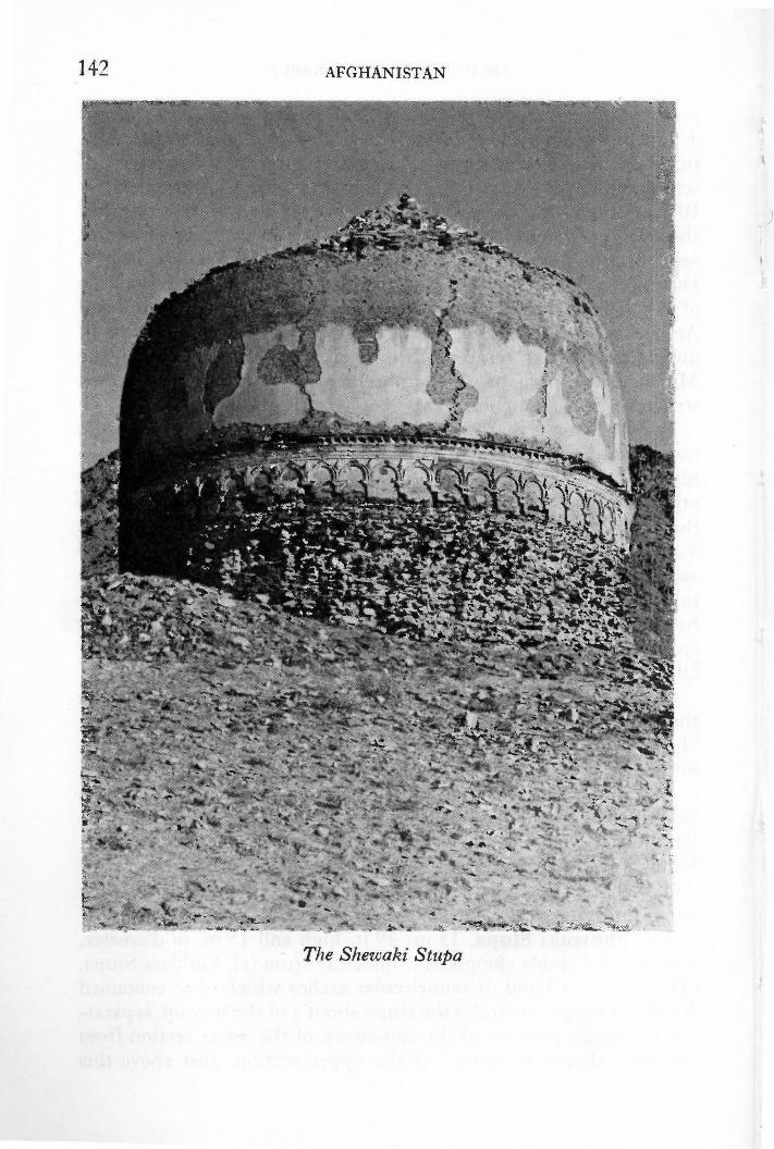
142 AFGHANISTAN
The Shewaki StupCl

AROUND AND ABOUT KABUL 143
band of "blind arcading" can be seen, in places, the remains of a denticulated ledge. These features are typical of nearly all the stupas in the Kabul area ( see Chapter 11 for discussion of stupas ).
On the north-east side, partially obliterated by the gash cut by 19th century treasure seekers in order to reach the reliquary chamber above, the remains of a very large arched niche can be seen; this niche once held the stupa's main image. The entire stupa was originally covered with lime plaster, much of which still remains.
There is a mulberry grove below the stupa where you may picnic, after which you can return to Y akhdara by following the obvious path from the nearby village to the southwest along the foot of the hills.
For those who wish to make further archaeological explorations in the area, there is a narrow valley hidden at the base of Takhti-Shaikh Barantai, the mountain to the west of the Yakhdara area. For perhaps 17 centuries the Surkh (Red) Minar, similar to the Minar-i-Chakari but smaller, stood overlooking the entrance to this valley, until it was completely destroyed in an earthquake in 1965. Within the valley are the ruins of several stupas, monasteries and walls. Take someone from Y akhdara to show you the way; as it is some distance it is better to drive there, although the track is quite bad.
(13) PANJAO and BAMIYAN Three day tour with one day at Bamiyan: 652 km; 407 mi. Kabul-Panjao: 24 7 km; 154 mi; 11-12 hrs.
Kabul-Gardandiwal 101 km; 63 mi; 3 hrs. Gardandiwal-Panjao 146 km; 91 mi; 8 ! hrs.
Panjao-Bamiyan: 168 km; 105 mi; 6 hrs. (via Band-i-Amir)
Bamiyan-Kabul: 237 km; 148 mi; 6 ! hrs. (via Shibar Pass)
Tolls: 30 afs. to Panjao via Mardan. 20 afs. on return between Charikar and Kabul.
Petro]: Panjao, Bamiyan, Charikar. Hotels: Panjao, camping; Band-i-Amir, local-style
hotels; Bamiyan, varied price range hotels.
Those with a desire to experience the excitement of travel through towering HIMuntains but without the time or the inclination to hazard the Central Route, may follow this route from Kabul

144 AFGHANISTAN
to Panjao and return via the Band-i-Amir lakes and the historic valley of Bamiyan. This tour should only be attempted during the summer and fall and the introductory remarks to Chapter 30 should be read carefully before setting out.
Proceed on the southern route to Bamiyan via the Unai Pass to Gardandiwal (Chapter 6). Do not cross the bridge on your right leading to the Hajigak Pass, but continue straight ahead on a newly graded road to the cross-roads bazaar of Awdela (Abdullah in Hazaragi) (15 km; 9! mi; 30 min.). Here the old road to Panjao runs south to the district center of Behsud, but you may continue straight ahead on the new road for another one and a half hours to the point where it ends at a ford through the Hilmand River. Four kilometers after fording the river you meet the old road from Behsud and further on a bridge over the Hilmand River. This marks the beginning of the Mullah Yakub Pass, a difficult climb with many tight hairpin bends which carry one up 470 m; 1542 ft, from 2550 m; 8367 ft. at the bridge, to 3020 m; 9909 ft. at the summit.
Beyond Mullah Yakub (37 km; 23 mi; 2 hrs.), orie reaches the even higher Kohgarden (Mountain's Neck) Pass which takes you up to 3250 m; 10,663 ft. The busy town of Panjao sits at an altitude of2804 m; 9200 ft., in the heart of the Koh-i-Baba (Grandfather Mountain) Range ( ca. 2 hrs. after the pass). The history of this area and a description of the route to Bamiyan may be found in Chapter 30. The road runs directly north through Yakawlang to Band-i-Amir, crossing high passes and lofty plateaux connecting verdant valleys dotted with villages inhabited by the Hazarajat Hazara.
Band-i-An1ir is discussed in Chapter 8; Bamiyan in Chapter 7; and the two routes from Bamiyan to Kabul in Chapter 6.

CHAPTER 6
Two Routes to Bamiyan
Kabul-Bamiyan: Distance Time (unpaved)
via the Hajigak Pass 177 km; 110 mi. 7 hrs. via the Shibar Pass 237 km; 148 mi. 61 hrs.
Altitudes: Kabul: 1797 m; 5,900 ft. Hajigak Pass: 3700 m; 12,140 ft. Shibar Pass: 3285 m; 10,779 ft. Bamiyan: 2500 m; 8,203 ft.
Petrol: via Hajigak: Maidan Shahr. via Shibar: Charikar; Ghorband Bridge; Sia Gird.
Tolls: 30 afs. via Hajigak. 20 afs. via Shibar.
Refreshments: Numerous chaikhana en route.
Air Service: Bakhtar Airlines, 4 flights weekly.
For those in a hurry, Bakhtar Airlines now offers a flight to Bamiyan. The plane flies low through the tortured mountains and the trip has been described by one blase world-traveller as being "so utterly fabulous as to be simply unforgettable." For those who have the time, the road trips are highly recomrnended. At least three days are suggested as a minimum for this trip with a side trip to Band-i-Amir (Chapter 8).
There are two routes to Bamiyan: the northern route via Charikar, and the Shi bar Pass; and the southern route, via lvlaidan and the Hajigak Pass. The author recommends going to Bamiyan via the southern route and returning via the northern route. Both trips are full of intere_st, but the Hajigak approach offers the most
145

146 AFGHANISTAN
dramatic entrance to the valley. Snow can block passes between November and June; check with Tourist Office.
THE SOUTHERN ROUTE: VIA THE HAJIGAK p ASS
This route leaves Kabul from Koti Sangi and follows the paved road to Ghazni for 30 km; 19 mi; 30 min. On coming over a small pass into the fertile Maidan Valley, the unpaved road to Bamiyan is clearly discernible on the right just past the petrol station and the toll gate. The new administrative town of Maidan Shahr is being constructed at this junction.
For two and a half hours after leaving the paved highway one lovely valley follows another, each filled with groves of mulberry and plane trees, and tiny fields carefully terraced and tended with much industry. There are numerous villages and two towns. Kotai Ashro ( also called Maidan Shar 11 km; 7 mi ; 15 min. from the turnoff), is the capital of Maidan-Wardak Province. It has a very busy bazaar. J alrez (16 km; 10 mi; 20 min. from Kotai Ashro) is a most picturesque little town with tree-lined streets and a busy bazaar. Situated in the center of the beautiful J alrez Valley which produces much foodstuffs for Kabul, its streets are often filled with large, brightly painted lorries. Somehow, the greenness of the trees and the clearness of the air in this valley make the colorful paintings glow with a special brilliance. In the fall and spring large camel caravans add their particular color and excitement to the scene.
Between Kotai Ashro and J alrez you will note the picturesque shrine of Khoja Mohammad Baba on the right with many pennants fluttering over-head. Such pennants are raised at the head of the graves of especially venerated wise-men or holy men. People in search of a boon come to these tombs to pray, asking the deceased to intercede on their behalf, and, to remind him of their petition, they tie a colored kerchief or an odd piece of cloth to the staff of a pennant as they leave. Then, when their prayers have been answered, they often return to raise yet another large pennant over the tomb. This shrine, visited especially by those with bad coughs and other respiratory troubles, has gathered more and more pennants each year, and now a Jarge mosque and madrassa (religious school) rise behind it. Other tombs in the vicinity are acquiring more and more pennants of their own and shops are opening to cater to an increasing number of pilgrims. In short

-rwo ROUTES TO BAMIYAN 141
l{hoja Mohammad Baba, once an inconspicuous grave, is developing into an important religious center.
Sarcheshma, the Fountain Head of the Kabul River, is located some 14 km; 9 mi; 20 min. beyond J alrez, less than a kilometer to the right (north) of the road. The whole area around the spot where the river gushes out of the rocky mountainside is very green and marshy. Near the Qadamjoy Jabbar-i-Tayar shrine built where the uncle of the Prophet Mohammad is said to have stood, there are four crystal clear springs swarming with sacred fish. Altogether this is an idyllic scene which will be especially savoured in the hours to come. For those who travel from Afghanistan into Pakistan by road, a visit to Sarcheshma offers the unique opportunity of seeing a major river begin and, after following it for much of its course, end, as it empties itself into the mighty Indus just above Attock, 350 km; 219 mi. beyond.
On leaving the town of Sarcheshma which lies 4 km. beyond the springs (several chaikhana) one leaves the fertile valleys behind and enters into the barren stony defiles marking the entrance to the Unai Pass (3300 m; 10,827 ft.). It takes over an hour to get through these rolling mountains for there are many ups and downs and minor passes, from each of which new vistas emerge. At first sight it will seem too much for any camera, but do not hesitate, the grandeur can be most impressively captured.
The rocky heights at the end of these mountains look down upon the valley of Gardandiwal. As you descend you may note many Lammergeier or Lamb Eagle (Gypaetus barbatus) which one often sees squatting in large groups beside the roadside, just before descending to the valley. These very large birds, related to eagles and vultures, are also known as Bearded Vultures for they have very noticable, rather comical goatees. Having a passion for bone marrow, they have been seen to carry animal bones to a height and carefully drop them onto rocks to crack them so that they can feast upon the marrow with greedy delight. At times they gorge themselves with such enthusiasm that when they are disturbed by a passing car, all they can manage are a few short hops in an aborted attempt at flight. One cannot help but smile at their predicament.
Gardandiwal ( also called Dane Sia Sang: 29 km; 18 mi; 1 ! hr. from Sarcheshma) with its flowery fields and small roadside bazaar sits on the banks of the headwaters of the Hilmand River which

148 AFGHANISTAN
originates in the K.oh-i-Baba (Grandfather of Mountains) on the left. The Hilmand River is the longest river in Afghanistan, flowing 1300 km; 813 mi. in a southwesterly loop to dissipate among a series of landlocked lakes and marshy lagoons straddling the Afghanistan-Iranian border, called the Hamun-i-Hilmand. The Koh-i-Baba is the veritable spine of the Hindu Kush and all three of Afghanistan's major river systems, the Kabul, the Hilmand-Arghandab, and the Hari Rud, originate in this range which is crowned by the Shah Foladi peak rising 4951 m; 16,244 ft. above sea level, just south of Ba1niyan.
Cross over bridge on right (straight ahead to Panjao; see Chapter 5 (13) for description) where the road pierces a rocky mountain wall. The rocky walls sometimes open onto high alpine meadows but the landscape gradually becomes more and more rugged. The high jagged peaks above the Hajigak (Little Haji, pilgrim), blue-black and shining, shimmer in the sunlight for they contain an estimated reserve of 2 billion tons of iron ore; Asia's richest deposit. The very steep descent from the Hajigak Pass (3700 m; 12,140 ft.) with its numerous hairpin bends (30 km; 19 mi; 1-l hrs. from Gardandiwal) leads to the sparkling Kalu River, known locally as the Sauzao or Green Waters. It is bordered by poplars and several charming villages. You have now left Maidan Province and entered Bamiyan Province.
There is a mining camp high above the road at the bottom of the pass and almost any black stone picked from the side of the road in its vicinity will impress you with its weight. Piles of neatly stacked rock cleared from the fields impress one with the industi;y of these Hazara farmers. In the fall you may also see the ladies weaving in open fields beside their houses. Hazara gilim ( woven carpets), brightly colored or woven in bands of natural brown and white, are much prized. There is a picturesque abandoned caravanserai some 4 km. from the foot of the pass and 3 km. beyond, just before a school perched above the road on the left, a keen eye will note several petroglyphs on a boulder sitting beside the road on the right. Some are probably of considerable antiquity. Other petroglyphs may be seen on boulders to the right of the road some 7 km. further along after passing one of the more picturesque qala in the country. It is typical of Hazara architecture in this central region, with tall tapering ribbed towers and crenel1ated walls.
After the Kalu valley the cliffs begin to close in on the road once more and finally, a little more than an hour after having left the

TWO ROUTES TO BAMIY AN 149
Hajigak (21 km; 13 mi.), the road shoots into the Pai Mori Gorge, one of the rockiest to be encountered. Jagged cliffs close in and even the road bed chews at the tires; there is no soil here. At the entrance to this gorge there is an ancient Islamic lookout tower. It is most strategically placed, in a pass so narrow that a very small contingent of troops could easily defend this entrance to the Bamiyan Valley.
The valley is still another 8 km; 5 mi; 25 min. away, however. The road passes a warm mineral spring enclosed in a concrete pool, beside a bridge, and then leaves the gorge. The still rugged landscape is now softened by fields and trees and there are a number of fine qala with large arched doorways, but the eye is caught primarily by incredible magenta cliffs. As one gazes in amazement at their color and at the weird, tortured formations, it seems suddenly that one's imagination has really taken over when large, round, decorated towers appear on the left. These are not hallucinations, however, but the outer defense works of Shahr-iZohak, called the Red City by some European writers.
On crossing a bridge at the confluence of the Kalu and Bamiyan Rivers, the Hajigak route runs into the road from the Shibar Pass. Turn left. Very fine views of the city-fort on top of the cliffs may be had from this point. (described in No. 4, Chapter 7)
The road now follows the Bamiyan River into the heart of the Bamiyan Valley to the tree- lined streets of Bamiyan (17 km; 11 mi; 30 min. from the Red City). Turn left after passing the petrol pump for the Bamiyan Hotel situated on a high plateau to the left; keep straight ahead for bazaar.
THE NORTHERN ROUTE: VIA THE SHIBAR p ASS
The road leaves the Bamiyan Valley at the foot of Shahr-iZohak and for the next 14 km; 9 mi; 20 min. it winds along beside the Bamiyan River. Note several lookout towers from ancient Isla1nic days which protected this approach to the valley. A tower in good condition stands at the fork in the road where a road marker directs you to the right for Kabul; left to Sar Khoshak, another ruined fort rivalling Shahr-i-Zohak, and the Ajar Valley. This was the main highway to the north, via Doab, until the completion of the Salang Highway in 1964. Today it meets the paved road at Doshi (178 km; 111 mi; 5 ! hrs. from Bamiyan; see end of Chapter).
The road to Kabul passes through tiny Bololah ( alt. 2400 m;

150 AFGHANISTAN
7874 ft.) and just beyond one is treated to the sight of a magnificent qala on the left. It is classic in design, like those described on the way from Kandahar to Kabul, but here in the heart of these wild mountains the walls soar upward, and the corner towers rise tall and stout to give it the appearance of an impenetrable fortress.
From here the road continues to climb, until, about an hour and a half after leaving Bamiyan, it leaves Bamiyan Province and enters Parwan Province. It soon plunges off this high plateau via a precipitous descent from the Shi bar Pass (3285 m; 10,779 ft.), the watershed of the Indus and Oxus River systems, to enter a series of gorges and valleys which become wider and more fertile. The Ghorband River gushes out of a gorge at the foot of the pass; a motorable track through the gorge leads to an idyllic picnic area. The Ghorband flows with ever increasing volume to meet the Panjsher River just beyond Charikar. There are numerous villages, some, such as the four sections of Chahrdeh Ghorband (123 km; 77 mi; 4 hrs. from Bamiyan), with attractive bazaars and chaikhana. Chahrdeh marks the end of Hazara territory. You now enter a region inhabited primarily by Tajik.
That this has long been a well-travelled route can be seen from a number of imposing, ruined caravanserais standing by the roadside. Long lines of caravans still pass this way during the spring and fall but these nomads disdainfully pass them by, to pitch their tents in the open. It was the trader and the traveller who sought the protection of these walls and they now fly by on wheels.
Several Buddhist ruins such as the famous 7th century monastery of Fondukistan are situated in the mountains here. Fondukistan, 5 km. south of Sia Gird, the next large bazaar half an hour beyond Chahrdeh, was exacvated in May 1937 by French archaeologists (Carl, 1937) who removed most of the beautiful statuary to the National Museum, Kabul. The style, typical of late Buddhist art in Afghanistan dating from the 7th-8th centuries A.D., is dominated by Indian elements reminiscent of the Gupta period : grace, sensuousness and elegance characterize the art of Fondukistan (see Museum Guide for full description).
Road and river continue to wind through the hills and one succumbs to the charms of nature until large petrol storage tanks give warning that the big cities are near and the paved road lies ahead. One joins the paved road at the northern end of the bridge over the Ghorband River some 10 km; 6 mi; 10 min. above Chari-

TWO ROUTES TO BAMIYAN 151
A Sculpture from Fondukistan in the Kabul Museum
kar. Turn right for Kabul via Charikar, a route described 1n Chapter 5, tours (2) and (1).
t BAMIY AN TO DOSHI 186 km; 117 mi; 5! hrs. Petrol pump and chaikhana at Doab.
Take the road to Kabul via the Shibar Pass. At fork situated below an ancient lookout tower 30 km; 19 mi; 40 min. from Bamiyan, take road to left into the Shikari Gorge. The gorge widens out a little 10 km; 6 mi; 30 min. from the fork where you will note the impressive ruins of a fortress known as Sar Khoshak on the mountain across the river to the left. An important segment in the defensive network built to protect Bamiyan during its

152 AFGHANISTAN
heyday as an Islamic city, the fortress rises in two levels on a rocky point high above the river. The administrative quarter consisting of a palace, mosque and residential buildings hugged the lower half of the hill; the citadel stood above. A long belt of ramparts still in amazingly good condition surrounded the entire complex, and round towers in the rampart mark the main entrance. Sar Khoshak was destroyed by Genghis Khan as he surged on towards Shahr-i-Gholghola. The view from the citadel is splendid but it is only possible to visit this site when the river is low enough to be forded on foot. There is no foot bridge.
Doab (altitude 1550 rr1; 5086 ft.) lies 52 km; 33 mi; 2 hrs. beyond the fork. Here you will find a small bazaar, a petrol pump_ and the turnoff to the Ajar Valley which begins 54 km; 34 mi; 1 hr. 45 min. beyond the petrol station at Doab. Permission to enter, to camp in the valley ($10 per person/night) or stay at the lodge ($20 per person/night) situated 13 kms; 8 mi; 30 min. beyond the mouth of the valley 1nust be obtained in Kabul from the Republic Guard in the Ministry of Defense. Fishing or hunting by permit only!
Once a royal hunting preserve, the Ajar Valley is now a wildlife reserve. Ibex (Capra ibex), urial (Ovis orientalis), leopards (Panthera pardus) and snow leopards (Panthera unica) live in Ajar. Sixteen years ago one pair of Bactrian deer (Cervus elaphus bactrianus) was brought to Ajar from the north beyond Kunduz where human encroachment into the natural habitat of these magnificent anin1als near the Amu Darya threatened their extinction. Although available habitat is limited, this valley will serve as a sanctuary for a small population of this endangered species in Afghanistan. You may see a number of these majestic deer with magnificent brambly horns in the Kabul Zoo which is also carrying out a breeding programme in an attempt to save the species.
Between Doab and Doshi (104 km; 65 mi; 21 hrs.), opposite the little village of Danestama 34 km; 21 mi. from Doab, French archaeologists (LeBerre, 1960) excavated a post-1150 A.D. madrassa (religious school) on the riverbank. This complex building had many rooms, some decorated with ceramic and ornamental stucco very much in the style of the Lashkar Gah palaces. The mehrab (prayer niche) exhibits many stylistic similarities, for instance, with the Lashkar Gah mehrab now installed in the National Museum, Kabul. Doshi is discussed in Chapter 22.

I
g
CHAPTER 7
Bamiyan
Kabul to Bamiyan: Distance Time (unpaved)
via the Haj igak Pass via the Shibar Pass
177 km; 110 mi. 237 km; 148 mi.
7 hrs. 6! hrs.
Population: 1,000
Altitudes: Kabul 1797 m; 5900 ft. 2500 m; 8203 ft. 2916 m; 9567 ft.
Bamiyan Band-i-Amir
Hotels: Bamiyan Hotel: 1st class yurts and motel; varied price range accommodation also. On plateau 3. 5 km. from Buddhas. Kutschi Hotel: Caravanserai in bazaar at foot of large Buddha; varied price range. Numerous small hotels in bazaar.
Refreshments: Bamiyan Hotel dining room.
Sports: Petrol: Air Service:
Kutschi Hotel: underground dining, Afghan . music. Numerous chaikhana in bazaar. Horses for hire. Pump on main road, east of bazaar. From Kabul: 4 flights a week.
BAMIYAN, capital of Bamiyan Province, is a small town lying at the very heart of the Hindu Kush in a beautiful valley containing one of man's most remarkable achievements-the Colossal
Chapter 7 is an up-dated abridgement of Dupree: The Valley of Bamiyan, Afghan Tourist Organization, 2nd. ed., 1967.
153

154 AFGHANISTAN
Buddhas of Bamiyan. The exquisite beauty of this serene valley tight]y embraced by towering mountains bathed in pastel colors, literally captivates all who visit it. For those interested in art and history, there are numerous sites from both the Buddhist (3rd-8th centuries A.D.) and the Islamic (13th century A.D.) periods. In addition, the intricate patterns plowed into the valley floor by the industrious people of Bamiyan provide ever-changing variety to the majestic scene.
The Colossal Buddhas of Bamiyan must be set against the back drop of the fabulous era which created them. Rome, rich and expanding, lay to the west. China, ruled with brilliance by the Han Dynasty, lay to the east. India, source of the jewels and spices coveted by all, lay to the south. The Silk Route connected these diverse capitals of luxury and, mid-way, the Kushan King Kanishka, gained wealth and power; and the Afghan area prospered.
Luxury laden caravans plodded back and forth along the northern plains to the great transshipment depots of Balkh and Tashkurghan where some turned south to cross the Hindu Kush. Half way through this arduous mountain trek they stopped to rest in the valley of Bamiyan where a busy, bustling caravanserai stood at the entrance to the Foladi Valley.
Kanishka was an astute politician who commanded respect from the Ganges River to the Gobi Desert, and he was wise in economics for he issued Kushan currency on the Roman standard thus gaining for it universal acceptance. Power and wealth, all important for the dynasty were, however, nothing compared with other facets of his remarkable character: the effects of his patronage of art and religion live today.
By the Second century A.D. when Kanishka ruled ( c. 130), Buddhism had long been supplanted by Hinduism in its homeland, India. The Buddhist philosophy, however, appealed to the great king and he called together a great council of Buddhist leaders who met in Kashmir where they sanctioned the new school of Mahayana Buddhism stressing the miraculous life and personality of the Buddha. This humanization of the Buddha, heretofore represented in art only by symbols such as an empty throne, a footprint, an empty saddle under an umbrella, or a wheel, called for a representation of the Buddha in human form. The first known such figure appears on a Kanishka coin. The earlier concept of Buddhism as simply a way of life changed dramatically as the Bud-

BAMIYAN 155
dha gradually assumed the stature of an ideal human being above common man to whom one might pray for assistance and assurance.
Kanishka's patronage encouraged a tremendous amount of activity in Gandhara, the area around Peshawar, the Kushan winter capital, where a new art style evolved. Large monasteries came into being and flourished and missionaries soon began to carry the word beyond the borders of the sub-continent. They joined the caravans and travelled to Rome and through Central Asia to China where the new philosophy and the new art forms were enthusiastically adopted; from China the new ideas spread to Southeast Asia where they remain today as one of the 20th century's most vibrant religions. So it was that Buddhism came to the Bamiyan Valley where eventually its devotees created the most spectacular images of the Buddha ever devised. Here, as the embodiment of cosmic man, the Buddha stands not so much as a god but as an extraordinary man, one who participates in human experiences but exists above them because of his oneness with moral precepts. Indeed, the Buddha never claimed to be divine.
These magnificent colossal statues, created during the 3rd-4th centuries A.D., attracted pilgrims for centuries, far beyond the time when Buddhism languished in India following the disastrous visitation of the Hephthalite Huns in the 5th century, the subsequent resurgence of Hinduism, and the arrival of iconoclastic Islam in the 7th century.
SIGHT-SEEING
(1) BUDDHIST COMPLEX, BAMIYAN VALLEY A sign in the center of the Bamiyan bazaar directs visitors to the Buddhas. There is a parking space in front of the large Buddha, but you may drive to the small Buddha, east, if you wish. Flashlight and binoculars are recommended.
To imagine the scene as it was during its moment of greatest splendor, one must close one's eyes and mind to the crumbling, pockmarked, monotone cliffs which stand before you today. Instead one must see the fac;ade decorated with realistic representations of wooden structures such as jutting roof beams, and carved doorways and windows, each painted in rich polychromatic hues.

156 AFGHANISTAN
In the niches of the colossal Buddhas, the smaller stood resplendent in a blue cloak, the larger in red, their faces and hands shining with gilt unrivaled by the glitter of countless ornaments festooned upon them. At the foot of the cliffs tall pennants fluttered above monasteries filled with myriads of yellow-robed monks, and pilgrims dressed in exotic costun1es of far off lands roamed about the entire complex.
The cliff has been crumbling for ages and since 1969 the Archaeological Survey of India (R. Sengupta, director) has carried on an extensive preservation program with the Afghan Institute of Archaeology. The height of the Small Buddha, previously reported to be 37 m; 121 ft., was corrected to 38 m; 125 ft.; that of the Large Buddha from 53 m; 175 ft. to 55 m; 180 ft. The plaster coating on the Small Buddha was cleaned and cracks filled in to prevent snow and rain from further eroding it away; steel reinforcement rods were imbedded in the cliff to hold huge severed portions; a drainage system at the top carries surface water away from the fa~ade. Inside the caves many walls were once covered with thick shiny layers of soot laid down by fires kindled by countless nomads who camped here for centuries after the complex was abandoned. French archaeologists (OAF A) removed some of the soot during their pioneering work at Bamiyan in the early 1920s and early 1930s. The current preservation programme has uncovered exciting new paintings. Preservation work at the Large Buddha is still in progress (1976).
The Small Buddha (38 meters; 125 feet high) was the first to be sculptured in these cliffs, sometime during the 3rd or very early 4th centuries A.D., though the whole question of dating this entire complex is still hotly debated. The figure was carved out of the face of the sandstone cliff and then covered with a mixture of mud and wheat straw in which the features and drapery were modeled. This in turn was smoothed over with a very fine plaster n1ade from gypsum (gatch) which was painted. The robe of the Small Buddha was blue as traces revealed during cleaning show; traces of yellow paint on the neck indicate that the now missing face and hands were similarly coloured. This would perhaps account for early eyewitness reports that the figures were gilded.
The parabolic niche in which this figure stands was once covered with paintings but most have fallen except for the heroic figure of
. the Sun God riding in his golden chariot pulled through a dark-

BAMIYAN 157
blue sky by snow-white horses, which can still be seen on the soffit of the niche.
The scene conceptualizes the relationship between the cosmos and the Buddha who is represented below as the embodiment of a Cosmic Buddha evolving from the sun in order to illuminate the world with total understanding. The iconography is syncretic, combining symbolism from Greece (Helios), Sasanian Persia (Mithra) and India (Surya). The Sun God is dressed in a long Sasanian cloak with a sword attached to the belt and he carries a scepter. This central figure is framed in a dark-red saw-toothed nimbus and the chariot with its riders bursts through the clouds. Above the nimbus there are flying geese and two truncated busts of women wearing pointed caps and holding billowing scarves over their heads. They represent the breezes which rise at sunrise and sunset. On either side of the Sun God there are two half-bird, half-human sirens, representing the deities who direct celestial music. Below them there are two winged female figures wearing helmets, each holding a shield and a spear. These may be seen as Night and Dawn, Mithra's handmaidens, as Nike Athene, or as the wives of Surya.
A complicated maze of caves and grottos encircle this central niche. These were used as sanctuaries, vestibules, assembly halls for the sanctuaries, and as small monastic cells for the monks in attendance. Many were elaborately decorated and all were reached by a complicated series of staircases. The main staircase, with its many twists and turns, encircled the central niche so that the faithful could perform the rite of circumambulation as they did at the stupas. Thanks to the preservation programme you may follow this ancient staircase today.
From the entrance situated to the east of the Buddha niche one climbs directly to a vestibule in the back wall of which there is a door leading into an assembly hall with a banquette along the north wall. Above this a large seated Buddha was painted. Trumpetsquinches in the four corners permitted a transition from the square chamber to the circular dome, a Sasanian architectural device found throughout Bamiyan and later introduced into Islan1ic architecture in India.
The paintings in the trumpet squinches on the back wall of this assembly hall consist of row upon row of sma11 seated Buddhas wearing dark monk's robes covering both shoulders. They
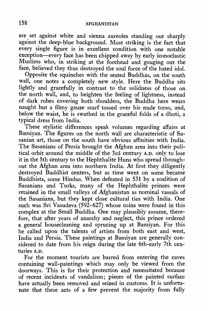
158 AFGHANISTAN
are set against white and sienna aureoles standing out sharply against the deep-blue background. Most striking is the fact that every single figure is in excellent condition with one notable exception-every face has been chipped away by early iconoclastic Muslims who, in striking at the forehead and gouging out the face, believed they thus destroyed the soul force of the hated idol.
Opposite the squinches with the seated Buddhas, on the south wall, one notes a completely new style. Here the Buddha sits lightly and gracefully in contrast to the solidness of those on the north wall, and, to heighten the feeling of lightness, instead of dark robes covering both shoulders, the Buddha here wears naught but a filmy gauze scarf tossed over his nude torso, and, below the waist, he is swathed in the graceful folds of a dhoti, a typical dress from India.
These stylistic differences speak volumes regarding affairs at Bamiyan. The figures on the north wall are characteristic of Sasanian art, those on the south have obvious affinities with India. The Sasanians of Persia brought the Afghan area into their political orbit around the middle of the 3rd century A.D. only to lose it in the 5th century to the Hephthalite Huns who spread throughout the Afghan area into northern India. At first they diligently destroyed Buddhist centers, but as time went on some became Buddhists, some Hindus. When defeated in 531 by a coalition of Sasanians and Turks, many of the Hephthalite princes were retained in the small valleys of Afghanistan as nominal vassals of the Sasanians, but they kept close cultural ties with India. One such was Sri Vasudeva (592-627) whose coins were found in this complex at the Small Buddha. One may plausibly assume, therefore, that after years of anarchy and neglect, this prince ordered a general housecleaning and sprucing up at Bamiyan. For this he called upon the talents of artists from both east and west, India and Persia. These paintings at Bamiyan are generally considered to date from his reign during the late 6th-early 7th centuries A.D.
For the moment tourists are barred from entering the caves containing wall-paintings which may only be viewed from the doorways. This is for their protection and necessitated because of recent incidents of vandalism; pieces of the painted surface have actually been removed and seized in customs. It is unfortunate that these acts of a few prevent the majority from fully

BAMIYAN 159
enjoying these works of art. The authorities hope, however, to devise more satisfactory arrangements in the near future.
A most interesting series of caves are located above and to the east of Group A, in Group A 1 which is reached via a ramp from the eastern corner of the vestibule of A, on the very outside edge of the cliff. This complex consists of a vestibule, an octagonal assembly hall, a large sanctuary and two monks' cells. The lantern roof of the assembly hall is most interesting, being one of the more elaborate examples of this unique architectural device to be seen in Bamiyan. The lantern roof is a stylistic imitation of wooden ceilings found even today in the Wakhan and in Nuristan. It was a device indigenous to Bamiyan and copied extensively throughout Central Asia and China as Buddhism and its art forms spread along the Silk Route. Literally hundreds of caves with lantern roofs may be seen in the F oladi Valley.
The sanctuary of Al no longer holds any statues but seats and pedestals are clearly marked : a more then life-sized Buddha sat in a niche facing the door and this central figure was flanked on all sides by standing Buddhas and Bodhisattvas (Buddhas-to-be). Above these there is a sculptured arcade, each arch of which once held a seated Buddha.
The multiplicity of Buddha figures follows a strict formula relating to conceptions of the cosmos. Here you see, in fact, an early architectural rendition of mystical diagrams. Slightly later painted diagrams foretelling the mandala so essential to Esoteric Buddhism as it is practiced in Nepal and Tibet today were recovered from the valley of Kakrak (below). The niches in the caves around the colossal Buddhas are always to be found in multiples of 4-8-12. The octagonal sanctuaries repeat the formula architecturally and have niches for seven major images, the doorway through which the worshipper enters serving as the final element.
Return to the vestibule of A and pass through the west wall into Group B containing a vestibule, assembly hall, two cells and a sa~ctuary with a vestibule. The ceiling of this sanctuary has another elaborate lantern roof.
Leaving Group B, one comes to the original staircase encircling the central Buddha niche which leads directly into a small but elaborately decorated cell where the ceiling paintings are well preserved. Brown-cloaked figures sit against aureoles of white outlined in yellow and blue, the whole set against a background

160 AFGHANISTAN
of celestial blue spotted with stylized white lotus blossoms, a flower n1uch favored in Buddhist art symbolizing the substance of existence. Aureoles representing varied-coloured light called "precious substances'' emanating from the bodies of the Buddhas, relate to conceptions of the cosmos. They separate the sacred from the material world.
From this small cell one continues around several short turns in the staircase to Group Bl composed of a vestibule, two sanctuaries and a cell. The sanctuary, entered via a door in the east wall of the vestibule, has large niches for a seated Buddha and standing Bodhisattvas in the lower portion, similar to A 1. In the upper portion there are four angled niches designed for seated Buddhas flanked by standing Bodhisattvas which flowed down the side projections in a most graceful manner.
In some places the walls have been cleaned down to the natural conglomerate. Here the technique may be clearly studied. The rough pebbly conglomerate was first covered with a heavy plaster of mud and straw which was in turn covered with a fine plaster of gypsum on which the paintings were executed. Interestingly, the same technique is used in many village houses today, especially in those rooms set aside for guests.
Continue up the staircase from Group Bl to the Gallery. Here you may study the molding of the Buddha's hair and the detail of the paintings on the sides and soffit of the niche. The figures on the west wall sit behind a carpet-covered balustrade in heavy silence in typical Sasanian fashion. There are both Buddhas and royal donors here. The Buddhas sit in front of aureoles, their heads ringed with nimbi, while the kings wear typical Sasanian head-dresses with flowing ribbons. A particularly richly dressed donor niay be seen in the north-west corner.
From the gallery one may also see the right arm of the colossal figure which once supported a hand raised in the attitude of protection with the palm facing outward. Excavations in a trough in the arm produced an interesting collection of painted mura_l fragments, pottery sherds, 2 reed arrows, bits of a manuscript, etc. Evidence of a violent fire covered by subsequent reparations was an extremely significant discovery. It may be that this very fire occasioned the refurbishing which seems to have taken place in the 6th-7th century A.D.
On descending the stairway on the west side, one takes the first

BAMIYAN 161
exit on the right to Group C consisting of an assembly hall and a sanctuary, each with a vestibule, and two cells. There is a single niche in the back wall for the major image outlined with a series of painted aureoles. The rest of the hall is elaborately decorated in a varied palette of burnt siena, green, lapis lazuli blue, and yellow ochre depicting flowers, trees, stylized floral sprays, cornucopias and figures of kneeling worshippers. Originally there were successive zones of sculptured figures in arcades modeled from mud mixed with straw imitating the sculptural decoration familiar to many stupas throughout Afghanistan. Corinthian capitals support the arcades topped with winged and beribboned vases, an indisputable Sasanian motif.
In the paintings on the cupola of the sanctuary west of the assembly hall a series of Buddhas dressed in somber-hued maroon robes and framed with aureoles against an azure background walk on lotus pads set among flowers; beribboned columns resting on bulbous jar-like bases rise between them. On the walls lithesome trees bend to the curve of the first tier and high niches mark the position of 3 seated and 12 standing Buddhas and Bodhisatvas.
Entirely new paintings were revealed on the walls of the vestibule to the sanctuary during the current conservation programme. On the west wall there is a large seated Buddha in the center; a Buddha stands behind the left shoulder; a pennanted stupa below. On the back wall Buddhas stand on lotus pads under trees which bend with the curve of the wall, carrying through motifs already noted in the interior decoration. Fine stupas with towering spires, pennants and tinkling bells sit between them. Far to the left elephants hold water pots, symbols of fertilization and the source of life, topped with stupas. The palette is a simple one of burnt sienna, yellow ochre and green on a white ground and the art style is entirely different from that of the interior. Here the outlines are freely drawn and then filled in giving the impression of light sketchiness which almost appears to be unfinished.
Continuing down the staircase, Group D, consisting of a vestibule and an octagonal sanctuary is found on the floor directly below Group C. Above the main niches in the sanctuary a foliated scroll molded in high relief out of mud and straw encircles the room. In each circle of the scroll there is a small seated Buddha in low relief. Below this freize Bodhi trees under which the Buddha received enlightenment spread their branches over seated

162 AFGHANISTAN
Buddhas now disappeared. They symbolize the Great Awakening. Above the foliated scroll an ornate arcade of trilobed arches is also decorated with foliated scrolls in high relief.
On the ceiling there is a very interesting lantern roof. The central hexagon is filled with a geometrical design of lozenges and triangles. On the right at the base of the central cupola note a face with conical Parthian hat and beard, in relief.
In the vestibule there are paintings of stupas with soaring chatri (umbrella) spires bedecked with pennants on the walls. Unfortunately the ceiling of this vestibule is much defaced but enough remains to tell of its original ornate decoration with many roundels outlined with pearls and centered with winged horses, boar heads and birds, some holding strings of pearls in their beaks. One roundel with a bird remains on the southwest edge. Others have been removed to the Bamiyan Room in the National Museum, Kabul. This device was taken directly from Sasanian textile designs. Here blues and yellows predominate. The fa~ade of this vestibule is the only one retaining any of its original decoration simulating jutting wooden roof beams. It is best studied from the foot of the cliff.
The room on the ground level beneath Group D to the west of the foot of the Buddha has very little trace of decoration remaining. A series of niches rise in three ranges, each decreasing in size. Here the conservationists found the only paintings of the Buddha with their faces intact. Having been covered with mud sometime in antiquity, they were spared the fate of all the others. An unique figure of a naked cupid with hands raised offering flowers to the
· -}J~ddha was also uncovered on the back wall. In between the two colossal Buddhas, the cliff is riddled with
hundreds of caves and niches. Beautiful paintings still in good condition may be studied with the aid of binoculars in some, and in one niche, to the west of the Small Buddha, one may see how these large figures were constructed: the basic form of the seated Buddha was carved out of the cliff and studded with many wooden dowels which held in place the mud and straw from which the drapery and other features were molded. The basic form and the holes made by the wooden dowels remain today.
Hsuan-tsang, the Chinese pilgrim who visited Bamiyan in 632 A.D., reported ten monasteries and over 1000 priests in attendance. Most of them were probably located between the two· standing figures.
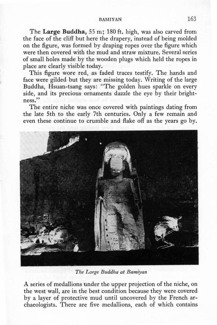
BAMIYAN 163
The Large Buddha, 55 m; 180 ft. high, was also carved from the face of the cliff but here the drapery, instead of being molded on the figure, was formed by draping ropes over the figure which were then covered with the mud and straw mixture. Several series of small holes made by the wooden plugs which held the ropes in place are clearly visible today.
This figure wore red, as faded traces testify. The hands and face were gilded but they are missing today . Writing of the large Buddha, Hsuan-tsang says: "The golden hues sparkle on every side, and its precious ornaments dazzle the eye by their brightness."
The entire niche was once covered with paintings dating from the late 5th to the early 7th centuries. Only a few remain and even these continue to crumble and flake off as the years go by.
The Large Buddha at Bamiyan
A series of medallions under the upper projection of the niche, on the west wall, are in the best condition because they were .covered by a layer of protective mud until uncovered by the French archaeologists. There are five medallions , each of which contains

164 AFGHANISTAN
three figures, one male and two females, which fly toward the central Buddha figure. A series of medallions also decorated the opposite, east, wall, but these are in very bad condition. One, however, is most interesting and worthy of study through binoculars. Here again there are three figures, but all male. In the center stands a man wearing a long, belted tunic of dark brown in the Central Asian fashion. He wears dashing leggings of panther skin which are, somewhat incongruously, both toeless and heelless. On his left a man wears a fur hat and holds a trident; on the right is a figure in yellow bearing a plate of offerings.
The paintings of the soffit may be best studied from the gallery around the head of the Buddha and from the top of the head itself. The original staircase within the cliff at the Large Buddha is no longer serviceable, but a path up the outside, west of the niche, leads directly to a small door leading into the gallery.
From the west gallery one sees the complex designs of the east wall which begin with a line of draped columns held in place by small orange-tinted faces similar to a sculptured head in the Bamiyan Room, National Museum, Kabul. This is followed below by a gay garland of flowers, and then a band in checkerboard design under which a massive row of Buddhas and kingly donors sit beneath Bodhi trees ( the rose-apple tree under which the Buddha received enlightenment) with large tri-blossomed lotuses be- · tween then1.
The figure to the far left is a kingly personage wearing medals, necklaces of pearls and a pearl diadem surmounted by three jeweled crescents, a characteristic costume worn by Sasanian royalty. An interesting Central Asian figure may be seen toward the outer face of the niche, on a level with the row of drapery. This finely drawn kneeling figure is dressed in a Central Asian belted tunic with wide flaring lapels, and wears high orange boots, also from Central Asia. On his head he balances a large tray of offerings.
From the center of the gallery one may step out onto the head of the Buddha in order to study the welter of paintings on the ceiling. It is well to sit down, or lie down, and adjust the eye to the busy scheme, for otherwise the vast crowd of figures becomes a mere jumble of confusion. Disregard the many small white circles which pockmark the ceiling. Time was when hunters delighted in using this ceiling for target practice and though this sport has fortunately been stopped, much damage has been done.

BAMIYAN 165
The scene is Paradise. Buddha and Bodhisattva figures sit on massive curtained thrones, not in the rigid yoga pose as in the row below, but gracefully and nonchalantly, with their feet crossed at the ankle. They do not wear monastic robes but flowing scarfs and jeweled necklaces instead. Between them there are pennanted stupas and capitalled columns from which rise bare busted female muscians playing cymbals for their dancer companions. West of the exit from the gallery, midway to the outer lip of the niche, an opulent female draped in diaphanous veils secured by a jeweled hip-band stands under a gracefully curved tree and stretches out her arms toward a seated Bodhisattva. Beyond this figure, further toward the outer lip, girls sit playing harps and other musical instruments.
The style of this work is very reminiscent of Indian Gupta art at its zenith and was probably executed during the 7th century A.D.
There are a number of interesting decorated caves above, and behind the Buddha niche, and around the base. The cave with a most beautiful lantern roof immediately attracts one's attention just above the entrance to the gallery. The false beams which look like wood are in reality hewn from the rock; they rest on obliquely placed pilasters with ornate capitals modeled from clay. Continuing up the path beyond the lantern roof cave, one finds a large rectangular cave with a cylindrical barrel-vault roof which is quite distinctive.
The feet of the Large Buddha are encircled with 10 caves which also date, most probably, to the 7th century flurry of refurbishing at Bamiyan. They have no paintings in them, but with the aid of a flashlight one may study a very interesting style of decoration used extensively in the Afghan area: high relief sculptured from mud and straw. The designs include: trilobed arches connected by squat pilasters with Corinthian capitals; beribboned ribbed vases sitting on the ogee of each arch; grotesque masks; foliated scrolls; bearded faces wearing conical hats; griffins; flying ducks. The grotesque masks represent Kirtimukha, the demon manifesting the terrible aspects of god. Comrnonly encountered in Hindu Shivite temples, its function was to ward off the impious and protect the devout.
The cave directly behind the statue offers the most interesting examples of this decoration. Th~ first cave on the east has a lantern

166 AFGHANISTAN
roof with decorations. Care should be taken in entering the caves on the west without adequate light for there are some dangerous pits here.
This, then, was the major Buddhist establishment in the Bamiyan Valley. Though apart from the clamour of the commercial city with its noisy, bustling caravanserais, the cliff with its colossal figures was in full view, towering above. If one is going to promote a new idea, it must be visible, dramatic. In addition, the monasteries undoubtedly derived considerable pecuniary benefit from their advantageous position close to the financial and political hub of the valley. Fa Hsien from China visited Bamiyan during the annual spring festival ca. 400 A.D. He describes sumptuous silken canopies grandly decorated with gold and silver water lillies and the special offerings of "all sorts of precious things", in addition to the king's own richly accoutred horse, which were distributed among the assembled monks.
Others, however, preferred the peace and quiet of valleys running along the base of the central plateau across from the colossal Buddhas. In the western Foladi Valley there are numerous painted caves dated variously from the 5th-6th and 6th-7th centuries A.D. Some are four and five stories high.
To visit: Two kilometers; 10 min. west of the center of the bazaar take side road to left beside a sma11 white building; double back in a southeasterly direction toward entrance to valley, passing through villages on a rough road. Four kilometers; 20 min. from the turnoff a sign directs you to the caves. Leave car and walk up hill past the village of Deh-i-Ahangaran.
In the Kakrak Valley east of the plateau there is a 6.5 m; 21 ft. standing Buddha in a niche which was discovered in 1930. The Buddha niche is also surrounded by caves but the paintings were painstakingly removed by French archaeologists and are now in the National Museun1, Kabul. They are in excellent condition for they too were covered with mud, perhaps to keep them from the eye of unsympathetic, iconoclastic invaders. The KingHunter is a particularly fine panel. He wears the same type of Sasanian headdress worn by the King-donor at the Large Buddha. Other panels depict circles of seated Buddhas repeated over and -over again, the smaller representing the miraculous emana-
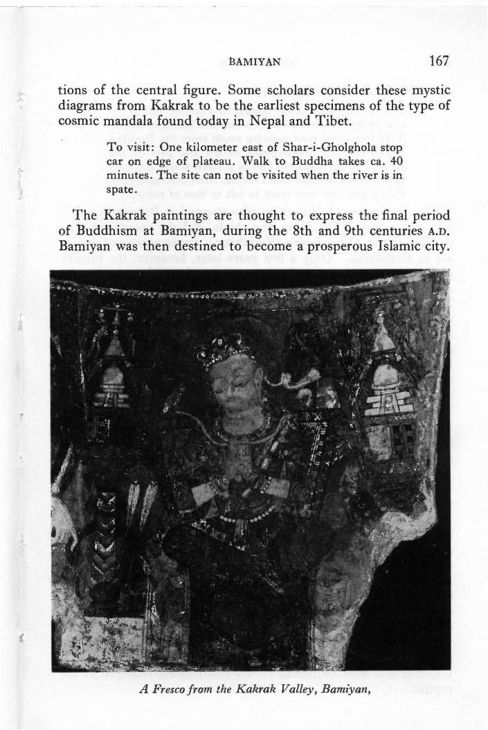
13AMIYAN 167
tions of the central figure. Some scholars consider these mystic diagr.ams from Kakrak to be the earliest specimens of the type of cosmic mandala found today in Nepal and Tibet.
To visit: One kilometer east of Shar-i-Gholghola stop car on edge of plateau. Walk to Buddha takes ca. 40 minutes. The sitt: can not be visited when the river is in. spate.
The Kakrak paintings are thought to express the final period of Buddhism at Bamiyan, during the 8th and 9th centuries A.D.
B"amiyan was then destined to become a prosperous Islamic city.
A Fresco from the Kakrak Valley, Bamiyan,
168 AFGHANISTAN
(2) SHAHR-1-GHOLGHOLA The ruins of this citadel appear as a conical hill to the east of the Governor's offices and the Bamiyan Hotel. Take tree-lined road running south from the Bamiyan Hotel; take 1st branch track to left and pass by the air field to the southern end of plateau where the road bends left to descend into a ravine. After emerging from the ravine, take next track to left to base of ruins.
The Korean monk Hui-ch'ao who stopped at Bamiyan ca. 727 A.D. writes that: "The King, the chiefs, and the people are very devoted to the Three Jewels (Buddhism); monasteries and priests are in abundance.'' Only a few years later, however, the princes of Bamiyan were reportedly first converted to Islam during the Ab bas id Caliphate in the last half of the 8th century A.D., ca. 754-785. It seems to have been but a passing conversion, undertaken for matters of expediency rather than out of any conviction. The people of Bamiyan reverted to their ancient faith and thus attracted the attention of the fanatic Saffarid Y aqub who attacked Bamiyan in 870/871 A.o. According to some accounts, in addition to destroying the temples of Bamiyan, Y aqub seized 50 gold and silver idols there which he forwarded to the Caliph in Baghdad. Some scholars discount this and believe the idols came from Kabul and were therefore Hindu rather than Buddhist. No matter, from the Ghaznavid period (962 A.D.) onward Islam took permanent hold in the valley.
The Islamic city of Bamiyan spread across the entire extent of the plateau lying south of the cliffs with the Buddhas. Today the plateau is barren except for an occasional plowed field and a village or two, but it was once dotted with magnificent villas and covered by extensive gardens. At its heart there stood a lofty citadel. This city's moment of greatest splendour occurred during the middle of the 12th century A.D. when it was ruled by the Shansabani Dynasty from Ghor which was established in Bamiyan by Fakhruddin Ghori, eldest brother of Alauddin who earned for himself the title of "World Burner" for burning Ghazni to the ground in 1151. Barred from the kingship of Ghor because his mother was a lowly Turkic slave, Fakhruddin used his considerable talents to extend his sovereignty north to Kash gar, east into Kashmir and west to Balkh, always maintaining Bamiyan as his capital.

BAMIYAN 169
Succeeding Shansabani kings of Bamiyan are described by contemporaries as patrons of learned men and dispensers of equity; members of the dynasty held influential positions at the court of the Abbasids in Baghdad. Tales of two hundred and fifty camel loads of pure gold and jewel-studded articles of gold and silver arriving at the city speak of its opulence. It was a relatively shortlived dynasty, however, and the last prince was taken north by the Khwarizm Shah and there put to death in 1215.
Bamiyan was then given to the eldest son of the Khwarizm Shah, J alaluddin, and it was he who presided over its utter destruction by Genghis Khan, just six years later, in 1221.
The climb to the top of this heap of ruins once a royal citadel is highly recommended for it commands a magnificent view of the entire valley. To the north, the Buddhist caves are clearly visible and behind them .. range upon range of mountains recede into the distance. At the foot of the citadel on this, northern side, many fields patchwork the land beside the river, forming abstract patterns in endless variation. To the east, one sees the mountains of the Kakrak Valley. Tall slender towers rise distinctly etched against the sky even in ruin; at their feet stands the Kakrak Buddha with its surrounding caves and sanctuaries. To the south rise the Koh-i-Baba mountains presided over by the snow-covered peak of Shah Foladi, tallest peak in the Hindu Kush ( 4951 m; 16,243 ft.).
Halfway between the Kakrak Valley and the citadel you will notice a handsome large qala with high walls. This is today called Saidabad and also Qala-i-Dokhtar, The Daughter's Castle, which legend has made famous. According to local legend this castle was built by Jalaluddin's daughter when she quit her father's palace in protest over his decision to marry a beautiful, young princess of Ghazni. The castle was adorned with the greatest treasures her father could provide, but so great was her anger that she determined to betray him, and the city, to Genghis Khan, as a final gesture of displeasure. The Mongol and his army were encamped in the Kakrak Valley and were having difficulty reducing the citadel. The daughter attached a note to an arrow which she shot straight into the conqueror's tent. It told him of a secret underground spring which supplied water for the citadel and it suggested he dam it up with felts. Following this suggestion, G-enghis Khan quickly brought the defenders to their knees

170 AFGHANISTAN
whereupon he entered the citadel to fullfil a vow to kill every man, woman and child, bird and animal in the valley. The screams that accompanied the final massacre gave the citadel the name by which it is known today, Shahr-i-Gholghola or the City of Noise.
J alaluddin' s daughter, unmindful of the horror taking place around her, expected to be rewarded for her act and in her castle she donned her most beautious gowns in expectation of a visit from the conqueror, Genghis Khan. He, however, simply ordered that she be stoned to death. ( As told to R. Hackin and A. A. Kohzad in 1937 by Mir Ali and a resident of Qala-i-Dokhtar ).
Whatever the truth may be, Genghis Khan did in fact leave the valley deathly quiet, and the complicated irrigation works on the plateau smashed beyond repair. His further disruption of the Central Asian trade routes and the subsequent popularity of the sea routes provided the final disastrous blow to Bamiyan. Without the passage of the caravans, it no longer had reason to prosper.
(3) DARYA AJDAHAR (Valley of the Dragon) Situated 8 km; S mi; 25 min. to the southwest of Bamiyan. Visit takes about 1-1 ! hrs. Proceed on road to Band-i-Amir; 2.5 km. from bazaar take branch track to left which goes straight to the southwest into a valley blocked by the dragon itself. There is a very steep, motorable road to the top of the dragon but because of several very sharp cutbacks, many prefer to park at the bottom and walk up.
Legend has it that n1any, many years ago a dragon took up residence in this exotically beautiful valley from where he terrorized the villagers of Bamiyan. He roamed the countryside breathing fire and devouring all that came in his way until the King struck a bargain with him: the dragon promised to stay in this valley if the King would provide him each day with one beautiful young damsel, 2 live camels, and 600 pounds of other foodstuffs. Peace returned to the valley but the homes of those forced to sacrifice their daughters were filled with sorrow.
One morning, many years later, the dragon emerged from his lair for breakfast only to find a young warrior, sword in hand, standing defensively before a ravishing young maiden. The battle began immediately and as the dragon charged, breathing huge

BAMIYAN 171
flames from his nostrils, the girl cried out to God for mercy, for she thought her hero must surely be devoured. To her amazement, j~st as she feared he would be consumed, he lifted his sword and described a circle in the air whereupon the flames fell to earth as red tulips. Furious, the dragon roared so loudly that the whole valley trembled, but his power was spent and the young man stepped forward to split the dragon in two, down the entire length of his huge body.
The young man then turned to the girl, only to find her gone. She had run back to Bamiyan to spread the news that Hazrat Ali ( cousin and son-in-law of the Prophet Mohammad, the St. George of the Muslim world) had come to deliver them. The whole valley, their King in the lead carrying rich treasure, hurried to pay honor to their deliverer, but when they arrived they found him gone, spirited away on the back of his faithful horse, Doldol.
The huge mass of the dragon blocked the exit to the valley, however, the blood still dripping from his head, and tears of remorse coursing down his cheeks. Mineral springs still issue forth today to continue the illusion. Furthermore, a large fissure over 900 feet long splits this rock to give credence to Ali's sword thrust, and, by placing an ear to this fissure one can hear the sounds of the springs below which local lore describes as the groans of the dragon. A round protuberance on the back of the dragon is said to have served as Doldol's manger, and a small shrine just below was his stall. ·
About 140 km; 88 mi. almost due south of Ban1iyan there is an identical formation, except that it is somewhat smaller. According to local legend the dragon of Bamiyan had a baby with her when she was killed. The baby fled while the fight took place but the Hazrat Ali pursued it to a point south of Behsud where he dealt it a similar blow. If anything, the baby dragon is even more realistic than its mother. Both these shrines are frequently visited by pilgrims, especially on feast days during the spring when many come to picnic on the hillsides. In personally escorting numbers of visitors to the Bamiyan dragon, I have found that initial scoffing quickly turns into genuine sympathy for this dragon who has lain here groaning, bleeding and crying through the centuries; there is something exquisitely unreal about this valley which permits one the pleasure of indulging in such fantacies.
172 AFGHANISTAN
(4) SHAHR-1-ZOHAK (City ofZohak or The Red City) 17 km; 11 mi; 30 min. east of Bamiyan at the confluence of the Bamiyan and Kalu Rivers. Take right fork for Hajigak Pass route, park at other end of small bridge. Cross Kalu River by foot bridge and proceed toward massive round tower on east side of promontory. Here you will find a wide, easy path leading to the second stage of buildings on the summit. This climb is not difficult and is highly recommended. The climb to the third stage is, however, very steep, and difficult.
This mass of impressive ruins was once the principal fortress protecting the entrance to the City of Bamiyan during the reigns of the Shansabani Kings in the 12-l 3th centuries A.O. The natural defenses afforded by the cliff had been recognized from much earlier times, as might well be expected. Archaeologists have found evidence that man had built defensive works here as early as the end of the B.C. era, and, when the Hephthalite Huns fought for possession and power within these mountains in the 6th century A.O., there was a considerable complex here. The present remains, however, are those of the fortress which withstood the advance of a Mongol army led by Genghis Khan's favorite grandson in 1221. The resistance was stout and determined and during the melee on the plain at its foot, the young commander fell mortally wounded. In revenge Genghis Khan vowed to destroy the valley, which he did, most thoroughly.
Today's visitors enter the fortress via the very pathway used by the original defenders and one can easily envision the passage of mounted cavalry, with all the attendant sounds, smells and confusion. On the way are attractively decorated towers for guards on duty. These towers had no doorways but were entered by ladders which were pulled up later to make the tower totally secure. There the soldiers stood on wooden platforms laid on heavy supporting beams, and shot their arrows through loopholes.
Beyond the towers one passes through a tunnel in the rock into the courtyard of the second stage. Massive round towers, squat and pumpkin-rib bed, guard the gateway leading into a series of rooms consisting of the main barracks. 500 soldiers were stationed here during time of peace; 2-3 thousand could be accommodated in time of crisis. Stairs lead up from the ground floor to the walkways on the ramparts from which guards surveyed the valley below.

BAMIYAN 173
On the western edge of the cliff there are a number of rooms, some with interesting decoration, some with troughs, which have led experts to hypothesize that these were perhaps the stables.
The third stage, above the barracks, consisted of warehouses, bakeries, kitchens, and other residential rooms. The view from this stage is magnificent, but the way to it should only be attempted by the most ardent enthusiasts.
The ruins are thus simply defined. But any city-fortress of glowing magenta, atop such cliffs, must of necessity have inspired romantics with tales of legendary kings and heros. So it is not surprising to learn from the inhabitants of Bamiyan that this was actually, in fact, the royal abode of Zohak. A wilder occupant for this fairyland city could hardly be found.
Zohak first appears in the Shahnama as a noble prince of Arabia, a devoted son well-beloved by his people. He became, however, possessed of the Devil who induced him to usurp his father's throne whereupon the Devil appeared disguised as a loyal subject who asked to kiss the new king on the shoulders in token of his complete submission. No sooner had he done so, and vanished, than two black serpents thrust their heads out from where the kisses had been placed. Attempts to cut them off only resulted in their immediate return and their increased demand for human brains, the only food they would accept.
At the same time that Zohak was being seduced by the Devil, civil war broke out in Iran and Zohak marched in as the champion of one faction and was enthroned as the emperor of Iran. For a thousand years his rule brought terror and chaos to the land, but then the hero Fraidun was born. After many escapades, Fraidun finally succeeded in taking Zohak prisoner whereupon he took the dragon-king to a far off mountain peak and left him there to die. The Shahnama ends the tale here but, typically, Afghan legend goes on to elaborate by saying that, deprived of their daily meal of brains, the serpents turned on Zohak, bit into his scalp and fed upon his brains until he died.

'
> •
<· . ' ·' + ' ,. ·.'
+ ,. ' '
. • 'iiii :S f .
':I:
•
' ~ ,. ~-
ll ~
l ;
·9. :r '
. .!'··
••
•

CHAPTER 8
Band-i-Amir
Route Distance Time 2 hrs. Bamiyan to Band-i-Amir 75 km; 47 mi.
Accommodations: ATO tent camp.
Refreshments:
Sports: Altitude:
Several local-style hotels offering various types of sleeping arrangements on mattresses or charpoy ( string beds) at reason-able prices. Numerous chaikhana.
Horses for hire. 2916 m; 9567 ft.
Most sturdy cars can negotiate this route though at times when small bridges are carried away, the floodwaters pose a problem for cars that are too low. This trip is not recommended for any vehicle during the spring and winter seasons.
Heading west from Bamiyan, the road passes by cultivated fields on the left and on the right you will note several cave-villages, at one of which they make quantities of pottery which is stacked by the roadside. As one approaches the end of the valley lookout towers appear on the hill tops and the mountains close in to leave just enough room for road and river to pass.
The road then breaks through to enter the wide valley of Shahidan with its small village bazaar (26 km; 16 mi; 45 min. from Bamiyan). An imposing qala (fortified residence) crowns a mound in the center of the valley. It is an impressive example of the typical architecture in this area. From Shahidan the road climbs
~ Kabre Afghan
175

176 AFGHANISTAN
to the top of the Shahidan Pass (3032 m; 9950 ft.) and on to cross a high, barren plateau where you will find a newly established chaikhana at Qargha'natu (Lots of Qarghana) which takes its name from the pincushion-like clumps growing on these undulating hills. Glowing pink when in flower, they burn with a high, intense heat when dry and are collected for fuel. Though otherwise barren, the scenery is not without beauty, for the surrounding peaks which reach heights of 3554 m; 11,660 ft. are usually tipped with snow and offer constant fascination.
In the fall, caravans with long lines of camels pass by, and, hidden behind the rolling hills, there are many semi-nomadic Pushtun settlements. This explains the appearance of a large cemetery in the midst of this seemingly uninhabited land. The local Hazara villagers ref er to the Push tun nomads as Afghans and call the cemetery Kahre Afghan, the Afghan Cemetery.
After passing the cemetery be on the watch for a branch road to the right 7 km; 4.5 mi. beyond (58 km; 36 mi; l!hrs. from Bamiyan). This is an all important turn, do not miss it. Turn right. (Straight ahead for Panjao, Chapter 30).
Before long a vivid splash of blue appears on the right, and then, in a few moments, another flash, both being portions of the lake called Band-i-Zulfiqar. Deep sapphire blue in the center, fringed with turquoise, it seems most incredible. Nothing prepares one, however, for the sudden blaze of Band-i-Haibat lying at the foot of sheer pink cliffs, just a few minutes later (16 km; 10 mi; 30 min. from fork). To describe the scene more fully would be to rob the uninitiated of the wonder and amazement it produces on all who gaze upon it-be it for the first time, or for the tenth time.
Descending by a precipitous, winding road, cross bridge ( straight ahead to Panjao) to parking and restaurant/hotel area. Since Bandi-Amir was declared Afghanistan's first National Park in September 1973, no parking or camping has been permitted near the lakes which are the source of the waters of the Balkh River.
There are five lakes in all. Standing in front of the shrine and looking far to the right one sees Band-i-Ghulaman (Dam of the Slaves), a circular lake about three.:.quarters of a mile in diameter. Band-i"'."Kambar (The Groom's Dam) lying between Band-iGhulaman ,and the shrine is now merely a dry depression or, at best, a shallow pool. The main lake with the shrine at its edge is called Band-i-Haibat (Dam of Awe). Two miles long and 500

BAND-I-AMIR 177
yards broad, it has built up its own natural dam 40 feet high. Water trickles over this dam onto the rocky platform below it, adding constantly to the accumulation of mineral deposits which must contain considerable amounts of sulphur judging from the many noticeable streaks of yellow throughout. The mineral waters of Band-i-Haibat are reputed to have miraculous healing properties and many of the pilgrims who visit here bathe in the waters and take some home in bottles. You may swim in this lake, but few care to stay in more than a few moments for the water is terribly cold.
Looking left from the shrine, one sees the Band-i-Panir (Dam of Cheese) to the right of the only small clump of trees in the valley. This is a small lake, about 150 yards across. To the left of the trees, through a break, there is another small lake called the Band-i-Pudina (The Mint Dam). The largest lake, Band-iZulfiqar (Dam of The Sword of Ali) is four miles long and lies out of sight of the shrine. This is the lake seen from the plateau. The paths to these various lakes are not difficult and those who enjoy hiking are particularly rewarded at Band-i-Amir.
The shrine beside the Band-i-Haibat, built 55 years ago, is known as the Qadamjoy Shah-i-Aulia or The Place Where Ali Stood (Shah-i-Aulia, meaning King of Saints, is one of the many titles by which Ali, cousin and son-in-law of the Prophet Mohammad, is known). The incredible existence of these jewel-like lakes in the midst of such a desolate land is, of course, attributed to miraculous causes.
There are many versions regarding their creation, all of which, however, concern Barbar, an infidel king who ruled the lands of the Hindu Kush with a heavy hand, and his confrontation with Hazrat Ali who was performing all manner of miraculous deeds within the king's territory. Barbar was also highly annoyed at the same time by the fact that although he had sent 1000 slaves to build a dan1 downstream from his capital, all their efforts had gone for naught; the river simply refused to be contained. Being thus thwarted his already irascible personality became even more overbearing and his people suff cred. One victim was a young man whose wife and children had been imprisoned bec~use he could not pay an exorbitant sum unjustly dernanded of him. In desperation he went in search of the Hazrat Ali who he found near Samangan. Together they devised a plan whereby the young man

178 AFGHANISTAN
was to bind Hazrat Ali and, without disclosing his true identity, offer him for sale to Barbar as a slave.
Barbar liked the look of the slave and agreed to purchase him for his weight in gold-on three conditions: first, the slave was to build the dam the king so much desired; secondly, he should kill the dragon of Bamiyan; and thirdly, he should bring Ali to him in chains. Furthermore, all these tasks were to be completed in one day! The court laughed mightily at the king's joke, and at the discomfort of the needy young man.
But Hazrat Ali became so angry that he strode to the mountain top and there with a mighty kick he hurled down great masses of rocks to form the Band-i-Haibat. Then he picked up his sword and with one mighty stroke sliced off another huge hunk of the mountain to form the Band-i-Zulfiqar. Meanwhile, Ali's groom, Kambar, aided his master by building the Band-i-Kambar and, because of Ali's presence, the slaves who had labored so long at last completed their task, the Band-i-Ghulaman. A nomadic woman who witnessed these fabulous deeds then presented a cheese she had just made in token of her esteem. The Hazrat Ali placed the cheese in the river where it became the Band-i-Panir where fragrant mint grows next to it at the Band-i-Pudina.
But the dam building had been too successful and downstream the villagers cried out in alarm as they watched the river become a dried up stony bed. Apprised of their fears, Ali simply drew his fingers across the Band-i-Haibat and five channels began to flow with exactly the right amount of water needed for the fields.
The dams built, Ali then proceeded to kill the dragon of Bamiyan (see Chapter 7, No. 3, Darya Ajdahar) and then he revealed himself to Barbar who was so overcome that he immediately embraced the Muslim faith.
The nomadic woman who presented the cheese for the Band-iPanir was the ancestress of the family which cares for the shrine at Band-i-Amir. Mohammad, the present caretaker, holds school classes on the upper floor of the shrine and he will be happy to show visitors around (remove shoes before entering shrine). A small contribution for the upkeep of the school and the shrine is appropriate.

CHAP1-1ER 9
Ghazni
From Ghazni to: Distance Time lf hrs. 41 hrs.
Kabul Kandahar
Population: Altitudes:
Hotel:
24,000
143 km; 89 mi. 352 km; 220 mi.
Kabul 1797 m; 5900 ft. Ghazni 2190 m; 7186 ft. Kandahar 1009 m; 3310 ft.
Ghazni Hotel: Varied price range; on main Kabul-Kandahar highway, on Kandahar side of turnoff to town of Ghazni.
Refreshments: Farokhi Restoran: serves excellent seekh kabab for which Ghazni is famous. There are two kinds of seekh kabab: tikka, plain hunks of lamb, and, Iola, ground lamb. Both are broiled over charcoal on skewers (seekh) and eaten with a sprinkling of paprika or powdered grape seed. This restaurant also serves karoyi kabab, a specialty combining kabab, eggs, tomatos, and onions which is served straight from the fire in individual, sizzling-hot iron dishes (karoyi).
Petrol: On Kabul-Kandahar highway, on Kandahar side of turnoff to town of Ghazni.
Tolls: From Kabul: 30 afs. From Kandahar: SO afs.
GHAZNI, capital of Ghazni Province, is an important market town, particularly famed for the embroidered sheepskin coats
179

Ghazni
0 . ' . . .
Tepe Sordar
Stupa
8 To
To lomb of th.e .,
n I
/ .. ··Minaret of Minaret of ' • ! Bahram Shah Sultan Mas 'ud 1ll • j
i I
I ,-;;·-·-·-·-, ..' · Palace of i / l Mas'ud 111 ·f ~---·-·_Ji
! \ i I i
/ ., .. ·
····< ..... .
\ \ Museum of 0 NI
Tomb of Sultan Mahmud

GHAZNI 181
(pusteen) currently enjoying great popularity throughout Europe and the United States. The rapidly expanding modern city lies at the foot of an impressive ruined citadel beside the Ghazni River.
A thriving Buddhist center in the 7th century A.D., Ghazni fiercely resisted the advance of an Arab army in 683 A.D. Its resistance was so famed that Y aqu b Saffari from Seistan made a special example of Ghazni when he ranged the country conquering in the name of Islam; Ghazni was razed to the ground in 869.
But Yaqub's own brother rebuilt the town which later became the dazzling capital of an empire encompassing much of northern India, Persia and Central Asia; the Ghaznavid Empire endured from 994-1160 A.D. Many iconoclastic campaigns into India were launched from this city in the hills. The Ghaznavids took Islam to India and returned with fabulous riches taken from both prince and temple god. Contemporary visitors and residents at Ghazni write with wonder of the ornateness of the buildings, the great libraries, the sumptuousness of the court ceremonies and of the wealth of precious objects owned by Ghazni's citizens. This glorious city was also razed, in 1151 by the Ghorid Alauddin. Again it flourished only to be permanently devastated, this time by Genghis Khan in 1221. Still, Ghazni's strategic position, both economically and militarily, assured its revival, albeit without its dazzling former grandeur. Through the centuries the city figures prominently as the all important key to the possession of Kabul.
The main points of interest on the road from Kabul to Ghazni are described at the end of Chapter 18.
SIGHT-SEEING
(1) THE CITADEL (Not open to public) Ghazni's citadel dominates the town and it is undoubtedly one
of the more imposing fortresses to be seen in Afghanistan. Countless pages describe this citadel, particularly during the events that took place before its walls during the First Anglo-Afghan War from 1838-1842. First one reads triumphant accounts of storming the Kabul Gate during the dark of night; the electrifying effect when dawn revealed the British flag flying from the citadel. Such elated accounts are followed by humiliating tales of surrender and horrifying recollections of those held prisoner here. Then

182 AFGHANISTAN
follows the familiar statement of retribution: " .. ·. I directed the city of Ghuznee with its citadel and the whole of its works to be destroyed . . . " (Nott)
But Ghazni continued to be the key to the possession of Kabul so its citadel was rebuilt and continued strong. Almost one hundred years later King Amanullah would make his last bid to recover the throne of Kabul beneath these walls. But tribal opposition at Ghazni proved too strong, so he was forced to leave these stout walls behind him and retire into exile in Italy.
The old city of Ghazni once clustered closely around the foot of the citadel but the new town leaves it on the fringes looking forgotten and somewhat forlorn. In addition, most of the interior lies in ruin today. It is still used as a military garrison, however, and is, therefore, not open to the public.
(2) THE MINARETS OF GHAZNI East of city, north of road to Kabul.
These two minarets are Ghazni's most famous mouments. The easternmost was built by Sultan Mas'ud III who reigned from 1099-1114; the other was raised by the last king of the dynasty, Sultan Bahram Shah (1118-1152), during whose reign the city was sacked by Alauddin of Ghor.
The minarets, now only a fraction of their original height, served as models for the spectacular tower at Jam (Chapter 31), which in turn inspired the Qutb Minar at Delhi. The intricate decoration is in raised brick, without color, and includes epigraphic friezes. in square Kufic and N askh script in addition to panels with floral and geometric designs. The minaret built by Sultan Mas'ud III is the more elaborate. Mounds of ruins at the foot of both minarets indicate that they were once a part of two large buildings. Evidence from t,hese mounds supports the theory that these buildings were mosques.
(3) PALACE OF SULTAN MAS'UD III Between minarets and Museum of Islamic Art. No photography permitted at site.
Italian archaeologists from IsMEO (Istituto Italiano per il Medio ed Estremo Oriente, G. Tucci, Director), under the direc-
The Minaret of Bahram Shah ~


184
PALACE OF
MAS)UD III
AFGHANISTAN
t I I I I I I I I I I I I I I I I I I I I I I I
\ \ Q) THRONE ROOM ~ [Jf __ _ \ \, @ SANCTUARY g d : I @VESTIBULE COURT C
0 10 .20 M. ~
\ ~ r,., <I =-~ ' I ""\.I" .r. I : : :) (I :,1 l
~ \ =8:J ~~MOSQUE :~ -=; \, I I -", "U U-=1 : ~ r1A I', (.1-----f\ I\/\ =~ ~ : I I ---·---, :] rl ir,= ! i \ ~ : ~ I I ;,::;{-1 ' LE ' I I ~ I I I l\VI ! I I I' I ; : ,., r1 1 \ ~ I I 1 ~I Lf : I I 1 1 I• I,~ \I : \ __________ _j __ '"_-~:~_tL________ C _____________ -____ : \ ·u~===::-_-_-_-_-_-:~ ---"'r----------------------------u------·------. ----"\ \
I I I 1 L-----' 1 I
I t \.-!
----------- ----- ------- ---- --- ---- - ----------------------- - - --- -- -· r t An. n_n_n_ B A z A A R : , ...... , V ---------------- --------------------. ---.. ---. -------------------:: .:.: :::z~ ... )
tion of Professor Tucci have been working at Ghazni since their first exploratory visit in 1956. During that visit a fragmented inscription bearing the name of Mas'ud III was discovered in a modest shrine near the famous minarets. Later they discovered an inscribed 1narble screen with the information that the palace was completed in 1112, further confirming the fact that the palace was at one time the court of Mas'ud III who was born in Ghazni in 1061. He ruled. here from 1099-1114. Though by this time the

GHAZNI 185
Empire had passed its prime and much territory such as Herat and Balkh had been lost, the reign of Mas'ud III was characterized by peace and stability. Known as the "Beneficent Sultan", Mas'ud could afford to indulge in the creation of a magnificent palace and here "all the affairs of the state were conducted with perfect order and regularity, and no heart had any cause of care from any quarter." (Juzjani)
Contemporary sources describe these sumptuous palaces bejeweled with booty from India. One needs to exercise considerable imagination to envision this splendor, however, for the city was razed and looted of its treasures many times. Besides this, crude brick formed the basic building material then, just as it does today throughout most of Afghanistan, and this material deteriorates rapidly when it is neglected. Even in ruin, however, the proportions are impressive. This was no single residence, but the very hub of the Ghaznavid court, a complicated complex including a throne room, government offices, soldiers' quarters, a mosque with its minaret, and pockets of gardens, in addition to the royal apartments. And in front of its gates there was a long, bustling bazaar. (see Sketch)
The heart of the complex was a large open rectangular court paved with marble which is 50 x 31 meters in extent (164 x 102 ft.). Even the footpath around this courtyard is paved with marble which gleams whitely under the intense Ghazni sun. In the center of the four walls surrounding the court there were four iwan ( deep recesses), a typical architectural form favoured by the Ghaznavids who used it in monumental proportions at Laskhkar Gah. The Ghorids, immediate successors to the Ghaznavids in the Afghan area, also found it pleasing as can be seen at the mosque at Herat which is their creation modeled on the Ghaznavid style. The iwan on the north, which included a large imposing vestibule, functioned as the moumental entranceway. Opposite, the southern iwan contained the throne room.
On the east and west there were small rooms, on either side of the central iwans, including a pillared mosque in the northwest corner. Interestingly, a large marble statue of the Hindu god Brahma was found on the threshold of this mosque, its face worn smooth by the passage of countless feet. A most graphic corroboration of the iconoclastic fervor of the Ghaznavids. (On display, National Museum, Kabul)
The court walls were gorgeously decorated. The upper portions

186 AFGHANISTAN
were embellished in terracotta and stucco in sculptured geometrical patterns which were painted yellow, red and blue. Only fragments survive but the large panel recovered from the Lashkar Gah palace which is now in the :National Museum must have been similar. At least it assists one in imagining the upper decor at Ghazni.
In imagining the lower section one is aided by the survival of some spectacular examples of the carved marble dado which skirted the entire courtyard wall. Composed of uniformly-sized, 70 cm. high (about two feet) marble slabs quarried from the hills only three miles away from the city, the dado design is in three distinct sections. At the bottom there is a narrow band of interwoven scrolls above which a wide central band is filled with an intricate and sophisticated decorative pattern composed of trefoil arches interwoven with arabesques. The supple elegance and flowing lines of this design epitomize the Ghaznavid style. According to some experts the arabesques represent cosmological trees, the arches the arch of heaven through which man is sometimes privileged to catch fleeting glimpses of the divine. At the top, the dado is completed by an epigraphic band in floriated Kufic script recounting the exalted merits of various members of the Ghaznavid dynasty. The inscription, which is 250 meters long, is not in Arabic, as was usual for this period, but in Persian, representing one of the oldest, if not the oldest, examples of epigraphic Persian.
The dado was originally painted. The inscription was in lapis lazuli blue. The background now shows traces of red but Dr. Scerra to speculates that this may have been a base and that the background was originally gilded so that the dado resembled the beautiful illuminations found in manuscripts dating from this period. Al-Utbi, a famous contemporary historian and chronicler, tells us of a hall with an alabaster skirting, of mouldings coloured like violets and roses, and of gilding for which the gold was obtained by melting down Hindu statues. With such contemporary literary reports, now supported by archaeological evidence, one can readily conjure up the gleaming white pavement of the courtyard encircled by blue and gold and the polychromatic superstructure. At last one understands these contemporary descriptions extolling "bejeweled" Ghazni and its decoration of "colours that bring to mind those of a garden in springtime."
Forty-four slabs have been left in situ at the site to help the visitor reconstruct what once was with the mind's eye. Others may be

GHAZNJ 187
The Tomb of Sultan Mahmud
seen in the Museum of Islamic Art at Ghazni , still others remain part of the construction of the modern shrine on the edge of the excavations. Only a portion of the estimated 510 have been recovered. Such plentiful use of marble is unmatched in this area and in Persia .
Having the picture of the building thus in mind , one further item should be added to complete the scene: 4000 Turkic guardsmen in brocaded tunics with jeweled daggers gleaming at their waists and feathered plumes waving from their caps. Frescoes depicting this ornamentation were recovered from the palace at Lashkar Gah and are now on exhibit at the National Museum , Kabul.
(4) MAUSOLEUM OF SULTAN MAHMUD A new entrance leads to the tomb of Sultan Mahmud (998-
1030) from the paved Kabul-Kandahar highway, 5 km ;. 3 mi. east of the city . It sits in the center of a garden suburb known during the heyday of Ghazni's prominence as Bagh-i-Firuzi, the Victory Garden. It was a favourite retreat of the great Sultan and he personally selected it for his final resting place. Today it is called

188 AFGHANISTAN
Rauza. The building which encloses the tomb is unpretentious. The tombstone is exquisitely carved of Afghan marble. Passing through a large entranceway to the side of the mausoleum, which was in fact the original entrance, one walks along shaded lanes and here and there notes water gushing forth from the mouths of marble lions and rams carved for the same purpose so many centuries ago. You may visit the Museum of Islamic Art on foot, via this lane.
(5) MUSEUM OF ISLAMIC ART AT GHAZNI Southwest of Mausoleum of Sultan Mahmud; sign onhighway.
This excellent small museum,, opened in 1966, is in the restored Mausoleum of Sultan Abdur Razaq, a superb example of 16th century Timurid architecture. The restoration was carried out under the direction of Architect A. Bruno and Mr. A. D' Amico of IsMEO It is highly recommended to all visitors to Ghazni.
Of particular interest are: the door-frame an1 screen bearing the' name of Mas'ud III which led to the identification of the palace; marble slabs from the courtyard dado at the palace and other marble carvings from various sites in the Ghazni area; objects from the House of Lusters ( end of 11th cent.- l 3th cent.), one of the magnificent villas on the mountainside which the nobles rivalled one another in building and decorating; marble animal-shaped channel mouths from the gardens around Sultan Mahmud's mausoleum; a manuscript containing the works of Sana'i, a Ghaznavid poet of great renown; objects, such as ceramic tiles, glass and. bronzes, from the Italian excavations and from other sites at Ghazni. One especially interesting motif found in Ghaznavid art and well represented by the museum's collection is the profuse use of human and animal ornamentation which is foreign to Islamic art in general. The influence of Sasanian Iran and Central Asia is here beautifully present in the representations of horsemen, dancing girls, lions, camels, elephants, deer, tazi hunting dogs, wingedlions, griffins and sphinxes.
(6) TOMB OF SEBUI{TIGIN The tomb of the father of Sultan Mahmud lies inside a small
yellow pavilion with a pointed metal roof, on the hillside north of the minarets. Sebuktigin came to Ghazni as the slave of Alptigin,

GHAZNI 189
A Shoemaker of Ghazni

190 AFGHANISTAN
the Turkic Comrnander-in-Chief of the Samanids who established Turkic rule at Ghazni in 962 A.D. Sebuktigin ruled at Ghazni from 977-997.
(7) TAPA SARDAR EXCAVATIONS The solitary hill called Tapa Sardar stands out clearly in the center of the valley on the opposite side of the main road from the minarets. Visits may be arranged through Mr. Ghulam Naqshband, Office of the Ministry of Information and Culture, Ghazni. No photographs.
Tapa Sardar, the Prince's Mound, acquired its name when Amir Habibullah chose it for a camp site. In: 1929 it was used as a gun emplacement by the supporters of Bacha Saqao when they resisted King Amanullah's last attempt to reestablish himself at Kabul. At this time the top of the hill was levelled, destroying all but the 1st and 2nd sections of an ancient Buddhist stupa.
The peripatetic Chinese pilgrim Hsuan-tsang made a few snide remarks about the religious practices in Ho-hsi-na, which some scholars have identified with Ghazni. Visiting there on his way back from India in the summer of 644 A.D., he reports its citizens sadly strayed from his concepts of orthodoxy:
"The people are naturally light-hearted and impulsive; they are crafty and deceitful. They love learning and the arts, and show considerable skill in magical sentences, but they have no good aim in view.
They daily repeat several myriads of words; their writing and language differ from those of other countries. They are very specious in vain talk, but there is little truth in what they say. Although they worship a hundred spirits, yet they also reverence the three precious ones (Buddhism). There are several hundred sangharamas (monasteries) with 1000 or so priests. They all study the Great Vehicle (Mahayana Buddhism). There are some ten stupas built by Asoka-raja, and several tens of Deva temples, in which sectaries of various denominations dwell together. (Beal, II : 284)
Exploratory excavations carried on at Tapa Sardar by IsMEO from 1959-1962 identified a stupa complex and since 1967 extensive excavations have continued under the direction of M. Taddei. In addition to uncovering some of the finest statuary in Afghanistan, these excavations have contributed enormously to a

GHAZNI 191
n1ore complete interpretation of the development of a Buddhist art style in the Afghan area, from its beginnings in the early centuries A.D. through to the last phases ca. the 8th century A.D., just prior to the advent of Islam.
The central focus of the complex is a towering central stupa 22 meters square making it the largest yet found in Afghanistan (see Chapter 11 for discussion on stupas). Interestingly, the archaeologists have determined that the enlarged lower portions of the Main Stupa are more recent than the upper sections, indicating that this religious complex enjoyed an intensely active life over a long period. The last artistic flourish occurred, in fact, as late as the 7th and 8th centuries A.D., at a time when Buddhism had largely disappeared from other parts of the Afghan area. Beyond this, the finds at Tapa Sardar confirm definite connections between the late decorative style of Afghanistan, found also at Fondukistan (Chapter 6), with the art of Central Asia.
The most dramatic evidence of this is contained in a series of chapels which surround the Main Stupa. In these there are fragrnentary remains of colossal statuary of great beauty and immense significance to the understanding of cult practices during the transition period when Hindu Shivite cults were being introduced under Hindu Shahi patronage. This remains one of the more obscure periods in Afghan history and the finds at Ghazni, together with current excavations at Tapa Iskander north of Kabul (Tour (1), Chapter 6) promise to provide exciting revelations for years to come.
To visit the excavations, one climbs the western slope to the square surrounding the Main Stupa. Five chapels line the south side of this square. Three have been excavated; two still guard their secrets. In the westernmost (Vihara 23), one may still see the decapitated body of Mahishasura, the Buffalo Demon, with its severed head lying beside it. This was once part of a composite sculpture depicting the victory of many-armed Durga, consort of Lord Shiva, over this enemy of the gods, a popular cult theme under the Hindu Shahi. A fine marble specimen may be seen in the Bamiyan Rooms of the National Museum, Kabul (Case No. 6, Side B., no. 5) and the Museum Guide gives a short account of the furious battle which took place between the two. The goddess' head is garlanded with flowers and is one of the most beautiful pieces recovered at Tapa Sardar. The fragments of her arms are

192 AFGHANISTAN
MISSION£ ARCHEOLOvlCA ITAL/ANA IN AFGHANISTAN
TAPA SARDAR - GHAZNI - 1971 {1,1s)
TOPOGRAFIA DELL' AREA SACRA E DEL," TA PA ..
DEL SANTUARIO BUDDHISTA CUJ!VI DI LIVIL~O APP_ROS!!IIMA.TI! NILLA -
-$'CAL.A f .' 50 0 ... ..,,,, .... ·"

GHAZNI 193
The Naga Chapel, Tapa Sardar
also beautifully modeled. Of great interest is the fact that the Hindu goddess' head was found at the foot of a Buddha figure standing directly opposite her; the head of the Buddha appeared beside the buffalo. Such juxtapositioning of themes in a single worship area 1s unique.
Next to the Durga chapel a more than life-sized Buddha sat on a throne but only the feet and legs up to the knees remain (Vihara 17). Gracefully worked drapery covers the knees. Next to this central chapel, in Vihara 37, two sensuously modeled nagas (snake spirits) with narrow waists emerge from a watery pool. They hold on to the stalks of a Jotus which served as the throne of a seated Buddha, now represented only by tantalizing fragments of drapery

194 AFGHANISTAN
and part of a halo in the background. Two flowers springing from the stalks served as pedestals for two Bodhisattvas. In fact, unbaked-clay sculpture fragments collected from the floor of this chapel have been painstakingly reassembled to recreate a life-sized standing Bodhisattva which once stood on the lotus pedestal to the Buddha's left. This group presents striking similarities to a piece from Fondukistan now in the museu1n at Kabul (Fondukistan Room, Case 2, no. 1 ; Museum Guide illus. 42) and fragments from Vihara 23 suggest that it too may have contained a group of sculpture representing the same subject. Polychrome paintings were also recovered from Vihara 37. These and other mural paintings restored by the archaeologists show strong stylistic affinities to Central Asian art. The Durga head is, however, strictly Indian in style.
On the north side of the Main Stupa there are two chapels. Vihara 50 contains only the feet of a colossal seated figure. East of this there is an oblong chapel (Vihara 63) containing the remains of one of the more singular sculptures yet found at Tapa Sardar, or anywhere else in Afghanistan. The reclining Buddha of Chapel 63 was originally over 15 meters; 49 feet long and represents the Buddha entering Nirvana. This robed figure lies on a simple couch; the head resting on his right hand set against two pillows. Two pasageways lead from the ambulatory around the Main Stupa into this chapel and the walkway in front of the figure is paved with a pebble n1osaic. At the head of the Buddha are the remains of the feet of some standing figures of donors or bearers of offerings. They date, however, from an earlier period, and had already been destroyed when the faithful came to worship before the great Nirvana Buddha during the last phase of Tapa Sardar' s existence.
Other passageways between Viharas 50 and 63, and outside the eastern wall of the Nirvana Chapel have also been identified and seem to throw light on the ritual of circumambulation as it was practiced at Tapa Sardar. These passages would have allowed the pilgrim to combine circumambulation of the chapel figures without disturbing the proper prescriptions for circumambulating the holiest building in the complex, the Main Stupa, which was always to be performed with the right side toward the stupa. From this the archaeologists infer that:
''the ritualistic aspects of the Buddhist cult were particularly strong at Tapa Sardar, a fact that is probably

GHAZNI
to be connected with the social groups that used to perform their rites there. We have no evidence, for instance, of those 'popular' cult objects such as miniature stupas and tablets of clay which have been found in other sites near Ghazni and belong to a period contemporary with Tapa Sardar's 1st phase.
"Indeed, we have sufficient data to surmise that the sanctuary of Tapa Sardar belonged to the upper classes since its very beginning. Also the introduction of a Hindu image such as Mahishamardini into the sanctuary seems to bear favourable witness to this hypothesis, since the marble sculptures of the Shahi period, which were certainly produced for the upper classes and the court (as it is shown by the comparatively precious medium), almost exclusively represent Hindu deities." (Taddei, 1974: 115).
195
A comparison of this 20th century analysis of the socio-religious practices at Tapa Sardar with the 7th century account quoted above, is illuminating and most exciting.
Smaller stupas alternating with statue bases, both decorated with molded representations of the Buddha, fill the ambulatory corridors on the east and south sides of the Main Stupa. They date from the last phases of construction and indeed some have been found to be unfinished. A roofed veranda supported by gilded pillars sheltered them. Polychrome decoration and gilding by the application of thin leaves of beaten gold were prominent features at this sacred complex and many of the sculptural fragments still retain vestiges of such decoration. An extremely important gilded figure of unbaked-clay sits in a niche on the western slope. To the right of this statue there was a very fine stucco figure of purely Gandharan style which is rare at Tapa Sardar. It may be assigned to the Kushan period and it has survived in beautiful condition because the shrine in which it sits had been walled up at an early period and thus escaped the terrible destruction which eventually caused the demise of the entire sanctuary.
Destruction by fearful fires is evident throughout the complex and accounts for the fact that although walls, sculpture, and the small decorated stupas and bases were originally fashioned from unbaked clay, some of them now appear as though made ofterracotta because they were "baked" by the intense conflagrations which consumed them. The fires were set, and they raged, but

196 AFGHANISTAN
there does not seem to be any evidence of willful destruction at the site. The figures toppled before the flames, but they do not seem to have been purposefully smashed. Otherwise, we should have been robbed of such masterpieces as the Durga head.
Still, the tremendous chaos created by crashing superstructures left behind an incredible amount of fused rubble and debris, ash and powdered clay, presenting enormous difficulties for the excavators. The magnificent results can but inspire visitors with profoundest admiration. Visitors are asked to remember the delicacy of these unique sculptures and approach them with care. Some are covered for protection, but each year the archaeologists ready more for public viewing. All should be grateful to them.
(8) MAUSOLEUM OF SANA'I On northwest edge of town; one kilometer from new concrete bridge over Ghazni River, on west side of old road to Kabul.
The green-domed, yellow-walled mausoleum, of Abdu'l Majid Majdud b. Adam, Sana'i, one of the more famous of the five hundred poets gathered at Ghazni, sits at the top of a large garden. He was the first of the great mystical writers, and he lived during the reign of Bahram Shah (r. 1118-1152). In spite of his fan1e, however, little is known of his personal life which is the way a mystic would prefer it, no doubt. And probably the original tomb was as sitnple as so many others in the old cemetery surrounding the mausoleum. Here you may note many interesting marble tombstones carved in the style of the Ghaznavid and succeeding periods.
Gracing the summit of the dome and long poles above numerous graves there is an interesting assortment of religious symbols fashioned from silver or from tin: the crescent moon; Allah and La illah ilia/ah (There is no god but God) in Arabic script; and the Hand of Fatima (the Prophet's daughter). The symbol of an open hand as a protection against the evil eye can be traced back to palaeolithic days, from Spain to China. It is found in relics of the Bronze Age in Sweden and in Egypt, and in a Greek vase painting of the 5th century n.c. American Indian chiefs used it as a decorative motif on their robes. To some groups in Afghanistan the hand symbolizes five leading figures in the formation of Islatn: the Prophet Mohamn1ad; Ali, cousin and son-in-law of the Prophet Mohammad; Fatima, daughter of the Prophet Mohammad and

GHAZNI 197
wife of Ali; Hasan, eldest son of Ali and Fatima; and Husain, 2nd son of Ali and, Fatima.
The mausoleum is flanked by two mosques: an enclosed room on the north used in winter, and a covered veranda on the south for use in summer. Outside the winter mosque there is an entrance to a small subterranean chihlakhana (House of Forty Days) where one may retire to meditate for a prescribed period of forty days. It is said that Sana' i often frequented this room and that his lamp is still here.
Inside the shrine, the poet's sarcophagus and four others are covered with bright mantles of cotton and velvet. The four buried with him are said to have been four of his closest disciples, the one at the foot of the tomb being Iskander, a King of Rum (Turkey) who left his kingdom to study with Sana'i.
Behind the tomb (north) there is a simple, spare prayer room with a Koran stand. Most who come to pray here, including many nomads with their families, pray in the main room, however.
On the wall behind the tomb there is a bright mural depicting a striped awning and curtained background in gold, green and blue with large red religious banners flying. Three banners stand in the corner to the right of the door to the prayer room.
The ceiling above the tomb is resplendent with religious symbolism. A large gold rectangle is centered with a blue star on which Allah and Mohammad appear in gold. In the right angles of this rectangle the artist has deftly written Ya Mohammad so that it may be read from either direction, the central d holding a star and crescent serving for both.
Outside the rectangle the Declaration of Faith, La illah illallah, Mohammad Rasool Allah (There is no god but God, and Mohammad is his Prophet)· appears on the north and south sides. On either side of the Declaration four red circles bear the names of the first four Caliphs of Islam together with their title Amir al-1\luminin (Commander of Believers), written in gold: NE, Abu Bakr (623-634 A.o.); NW, Omar (634-644 A.o.); SE, Othman (644-656 A.o.); SW, Ali (656-661 A.o.). On the east and west, Ya Mohammad again appears, flanked by blue circles bearing the names of the four archangels: NE, Mikail (Michael), the Protector; NW, Israfil, who will blow the trumpet to announce the Last Judgement; SE, Gabriel, the Messenger who transmitted the revelation of the Koran; SW, Izrail, the Angel of Death. Four

198 AFGHANISTAN
large teardrops with Blessings Be Upon Mohammad written in very elaborate calligraphy hang from each corner of the large rectangle.
When members of the brotherhood attending the shrine are present, it is appropriate to offer a donation.
SHOPPING
Pusteen: though Ghazni is the traditional home of this exotic coat of embroidered suede, most of the dealers moved to Kabul after they gained world acclaim in the 1960s. Some still rernain, however, and their prices are generally lower than in Kabul.
Antiques: genuine Ghaznavid artifacts unearthed by the farmer's plow are still found at Ghazni. Great care should be exercised, however, for many reproductions are being made. Some, such as the stone lamps and animals, have great charm and are recommended souveniers as long as they are not purchased for "genuine'' prices.
Silver: antique nomadic silver jewelry is often found in Ghazni's silver bazaar for many of the nomads come in to exchange their old pieces for new, more fashionable designs. Best buys are to be found in the spring and fall when many nomadic caravans pass through Ghazni.

FROM THE EAST
To
---
To Ghazni
A- Historic Site
/"" I • / \
I •
I \
( Kamu
j
~ )
(
"\ ./
.I
To Peshawar

CHAPTER 10
T orl~ham to Kabul
Route Distance Time Torkham-Kabul 224 km; 140 mi. 3! hrs.
Torkham-Jalalabad 74 km; 46 mi. 1 hr. J alalabad-Sarobi 80 km; 50 mi. 1 hr. · Saro bi-Kabul 70 km; 44 mi. 1 ! hrs.
Torkham-Peshawar 55 km; 34 mi. 1 hr. (Khyber Pass Toll: Rs. 4/- per car; Rs. 1/- per person. Closes at sunset.)
Altitudes: Torkham: 724 m; 2375 ft. 569 m; 1866 ft. 989 m; 3246 ft.
Petrol:
Tolls:
Hotels:
Refreshments:
Jalalabad: Sarobi: Kabul: 1797 m; 5900 ft.
Torkham; J alalabad; Sarobi
20 afs. between Torkham and J alalabad; 30 afs. between J alalabad and Kabul.
Torkham: Charpoys ( string beds) in tents. J alalabad: Hotel Spinghar, varied price range. Numerous small hotels open during winter.
Torkham: Chaikhana in profusion. J alalabad: Hotel; large restauran on main street. Saro bi: Roadside kabab shops. Chaikhana en route as noted in text.
For a few choice weeks each spring this is an idyllic entrance into Afghanistan for the craggy hills burst forth in emerald green and brilliant, red, wild poppies, spread like vibrant carpets on the valley floor, sparkle gailey. For most of the year, however, rugged
201

202 AFGHANISTAN
bleakness dominates this 13! km; Sf mi; 10 min. drive between the Customs check at Torkham and Passport check point at Dakka (toll gate: 20 afs; surrender ticket if coming from Kabul). The road leaves the lush orange orchards at Dakka and proceeds westward toward the desert between lines of long-needled tamarisk trees which are a constant feature of this landscape from the border until one enters the mountains west of Jalalabad. Low and scraggy in places, they can rise high to create cool tunnels of shade; in other places they disappear altogether, victims of the desert which conquers even their hardy will to survive.
Not far beyond Dakka (3.5 km; 2 mi.) the road climbs a gentle rise to enter a miniature valley ringed by jagged peaks each topped with its own piquet house. At their feet a military fort sits almost hidden behind a row of trees to the left. To the right, the valley opens up onto the Kabul River which makes its way through the mountains to the north of the Khyber Pass, and not through it, as it is commonly believed. This valley was the scene of spirited engagements between Afghan and British forces during the shortlived Third Anglo-Afghan War in 1919.
Leaving this valley one enters the plain. There are villages on either side of the road here, but the mud wall~. of the houses so blend with the desert that at times they are hardly noticeable. These compound walls represent a type of Afghan village architecture quite distinct from the traditional Pushtun fortified-residences called qala to be found west of J alalabad and on the road to Nimla (Chapter 11).
Behind the villages the mountains still stand but already they begin to recede. One is rarely out of sight of mountains in Afghanistan, however, and even here as the nearer hills shrink into insignificance, towering ranges appear on the far horizons: the Safid Koh (White Mountains in Dari Persian, Spin Ghar in Pashto) on the left, and, to the right, the mountains of Nuristan (Chapter 12).
Time was, until very recently, that one could dismiss the rest of the journey to J alalabad with a short comment about bleak desert expanses. Not any more. Now the desert is flushed with green as the Ningrahar Valley Authority, an Afghan-Soviet venture, proceeds towards its goal to reclaim 224,000 desert acres. The area is divided into four state farms planted primarily in citrus and olive trees, with additional acreage in other crops such as vegetables, cereals, sesame, sunflowers and sugarcane. A large modern dairy has also been established.
TORKHAM TO KABUL 203
Much planting exists around the imposing gateway to the Ghaziabad Farm, the first farm to be established (1968), located some 28 km; 17! mi. from Dakka-36 km; 22! mi. from Jalalabad. On all sides huge machines bite into the dry earth carving out wide irrigation canals which distribute water to these thirsty lands. Considerable expanses of stony wastes alternate with the reclaimed lands. From them one can imagine the monotony of former years. The road swings through a particularly desolate area of eroded hills before dipping down to the toll gate at Samar Khel ( surrender ticket; 20 afs. if coming from Kabul) 50 km; 31 mi; 40 min. from Dakka. A bright green swathe on the hill to the left marks the position of the vital siphon carrying water from the Darunta Reservoir some 30 km; 19 mi. to the west. Rushing through the siphon, the water falls, passes under the road, and, seeking its own level, rises to flow through the hills into the canals beyond.
As one nears J alalabad the tamarisk trees rise to meet high over head in an arcade. Here the bushy trees of the desert are interspersed with fir and cypress, that proudly erect evergreen so favoured by the Moghuls. The Moghuls are credited with founding the city of J alalabad and it was they who popularized this route through t~ Khyber Pass. Previous dynasties, such as the Ghaznavids, preferred to descend into India via the Gomal Pass to the east of Ghazni, or to pass to the north of the difficult Khyber into Bajaur and Swat, as did Alexander the Great.
Before one enters the city of J alalabad one passes the J alalabad airport on the left. Because of the paved road completed since 1963 with U.S. assistance, it no longer serves as a commercial airport but is used by the military, especially for training parachutists. Three kilometers beyond the airport the walls of J alalabad's military garrison can be seen through the trees on the right. In January, 1842, anxious watchers peered southwestward from the walls of this fort. Disturbing, frighteningly vague, news of retreat had come from Kabul but, if true, the army was seriously overdue. Then, on the afternoon of the 13th, a lone, weary figure on a stumbling, wounded horse, staggered toward them. It was Dr. Brydon, a surgeon, come to tell them frightful' tales about the destruction of an army in the gorges leading from Kabul to Jalalabad. A British army of 4,500 fighting men accompanied by 12,000 camp followers had left Kabul's cantonment seven days before. Thousands perished, a lucky few were taken prisoner. Dr. Brydon was the only Englishman to complete the retreat and
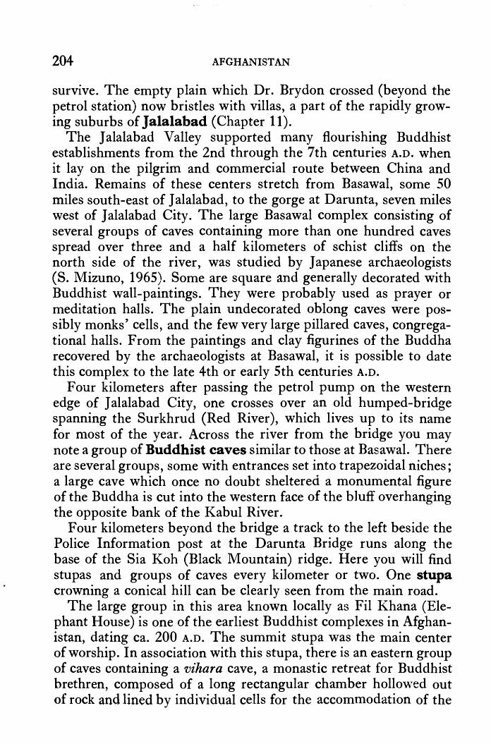
204 AFGHANISTAN
survive. The empty plain which Dr. Brydon crossed (beyond the petrol station) now bristles with villas, a part of the rapidly growing suburbs of Jalalabad (Chapter 11).
The Jalalabad Valley supported many flourishing Buddhist establishments from the 2nd through the 7th centuries A.O. when it lay on the pilgrim and commercial route between China and India. Remains of these centers stretch from Basawal, some 50 miles south-east of J alalabad, to the gorge at Darunta, seven miles west of J alalabad City. The large Basawal complex consisting of several groups of caves containing more than one hundred caves spread over three and a half kilometers of schist cliffs on the north side of the river, was studied by Japanese archaeologists (S. Mizuno, 1965). Some are square and generally decorated with Buddhist wall-paintings. They were probably used as prayer or meditation halls. The plain undecorated oblong caves were possibly monks' cells, and the few very large pillared caves, congregational halls. From the paintings and clay figurines of the Buddha recovered by the archaeologists at Basawal, it is possible to date this complex to the late 4th or early 5th centuries A.O.
Four kilometers after passing the petrol pump on the western edge of J alalabad City, one crosses over an old humped-bridge spanning the Surkhrud (Red River), which lives up to its name for n1ost of the year. Across the river from the bridge you may note a group of Buddhist caves similar to those at Basawal. There are several groups, some with entrances set into trapezoidal niches; a large cave which once no doubt sheltered a monumental figure of the Buddha is cut into the western face of the bluff overhanging the opposite bank of the Kabul River.
Four kilometers beyond the bridge a track to the left beside the Police Information post at the Darunta Bridge runs along the base of the Sia Koh (Black Mountain) ridge. Here you will find stupas and groups of caves every kilometer or two. One stupa crowning a conical hill can be clearly seen from the main road.
The large group in this area known locally as Fil Khana (Elephant House) is one of the earliest Buddhist complexes in Afghanistan, dating ca. 200 A.O. The summit stupa was the main center of worship. In association with this stupa, there is an eastern group of caves containing a vihara cave, a monastic retreat for Buddhist brethren, composed of a long rectangular chamber hollowed out of rock and lined by individual cells for the accommodation of the

TORKHAM TO KABUL 205
brothers. According to the Japanese archaeologists, this vihara is truly Indian in style and unique in Afghanistan. Beyond the vihara group there is a central group of monks' cells containing a few private shrines. On the west, there is a third group with large assembly halls in which niches held colossal major images.
Charles Masson, the Englishman who collected antiquities in Afghanistan for the East India Company from 1834-1837, recovered numerous relics from these J alalabad Valley complexes. Most notable was a gold casket embellished with eight figures in high relief and two circles of rubies from Badakhshan. It was found in the stupa of Bimaran in this area. These are, however, only some of the Buddhist centers in the J alalabad Valley. Over a thousand stupas litter the floor of the valley, the richest concentration being at Hadda, which is described fully in Chapter 11.
Leaving the J alalabad Valley behind, the road passes through a large tunnel ( opened in 1963) to run along the banks of the Darunta Reservoir where the high peaks of Nuristan are picturesquely reflected in the blue waters. The Darunta Fish-Breeding Center was established here in 1965 with the assistance of the People's Republic of China. Four types of carp are raised, attracting. large flocks of wildfowl. The reservoir is a protected area, however-no hunting is permitted.
From here cultivated fields stretch to the Kabul River on the north; a stony desert, barren and empty, extends to the foot of the mountains on the south. Flat-roofed villages appear periodically and occasionally an imposing Push tun qala (fortified residence) with four tall towers rising from the corners of a square formed by high mud walls pierced by a single doorway. Over the doorway you will note a series of glass-windowed rooms. This is the mehmankhana (guest house) where honored guests are entertained.
Many more villages and qala stand midst fertile fields and orchards to the north of the Kabul River in Laghman Province. You will find the Surkhakan Bridge ( opened in 1967) leading to Laghman at the toll gate at Karghayi (30 afs; surrender ticket if coming from Kabul; 27 km; 17 mi; 25 min. from J alalabad Center). See Chapter 11 for excursion to Mehtarlam, capital of Laghman Province.
The flat plain continues for another 25 km; 16 mi; 20 min. and as one nears the western limit the desert approaches, stones grow into boulders, and mud house-walls turn to stone. Even so,
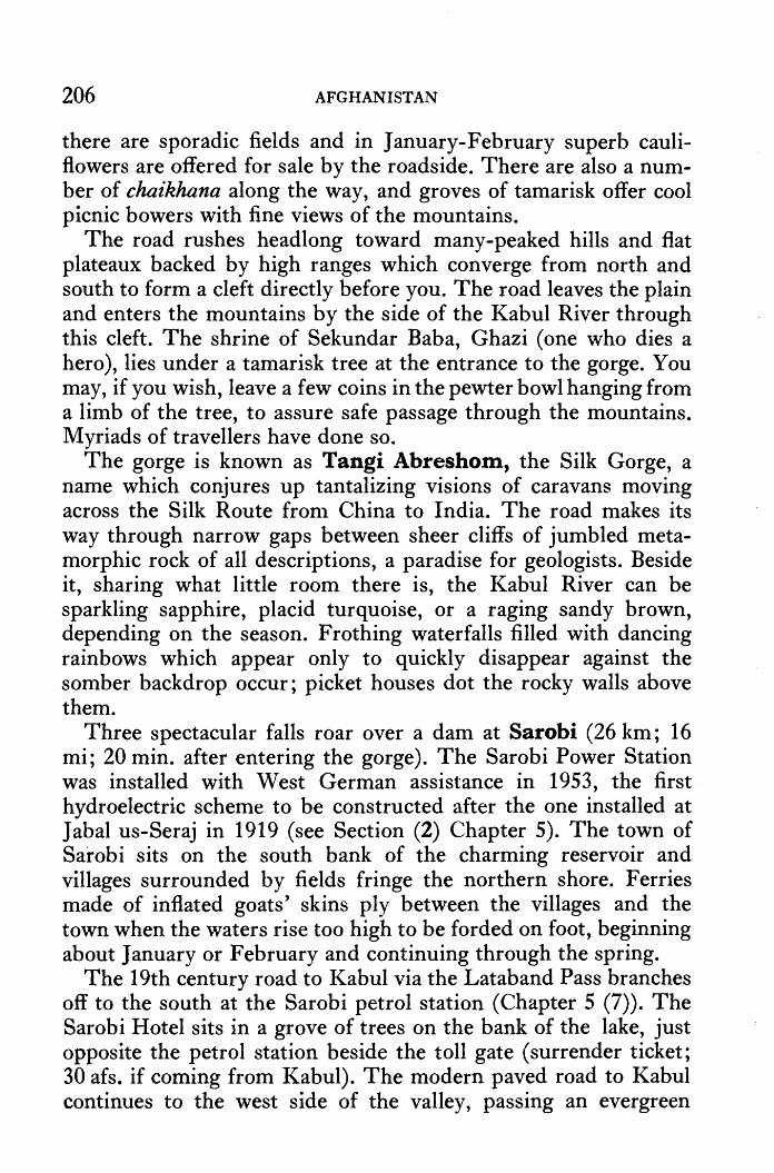
206 AFGHANISTAN
there are sporadic fields and in January-February superb cauliflowers are offered for sale by the roadside. There are also a number of chaikhana along the way, and groves of tamarisk offer cool picnic bowers with fine views of the mountains.
The road rushes headlong toward many-peaked hills and flat plateaux backed by high ranges which converge from north and south to form a cleft directly before you. The road leaves the plain and enters the mountains by the side of the Kabul River through this cleft. The shrine of Sekundar Baba, Ghazi ( one who dies a hero), lies under a tamarisk tree at the entrance to the gorge. You may, if you wish, leave a few coins in the pewter bowl hanging from a limb of the tree, to assure safe passage through the mountains. Myriads of travellers have done so.
The gorge is known as Tangi Abreshom, the Silk Gorge, a name which conjures up tantalizing visions of caravans moving across the Silk Route fron1 China to India. The road makes its way through narrow gaps between sheer cliffs of jumbled metamorphic rock of all descriptions, a paradise for geologists. Beside it, sharing what little room there is, the Kabul River can be sparkling sapphire, placid turquoise, or a raging sandy brown, depending on the season. Frothing waterfalls filled with dancing rainbows which appear only to quickly disappear against the somber backdrop occur; picket houses dot the rocky walls above them.
Three spectacular falls roar over a dam at Sarobi (26 km; 16 mi; 20 min. after entering the gorge). The Sarobi Power Station was installed with West German assistance in 1953, the first hydroelectric scheme to be constructed after the one installed at Jabal us-Seraj in 1919 (see Section (2) Chapter 5). The town of Sarobi sits on the south bank of the charming reservoir and villages surrounded by fields fringe the northern shore. Ferries made of inflated goats' skins ply between the villages and the town when the waters rise too high to be forded on foot, beginning about January or February and continuing through the spring.
The 19th century road to Kabul via the Lataband Pass branches off to the south at the Sarobi petrol station (Chapter 5 (7)). The Sarobi Hotel sits in a grove of trees on the bank of the lake, just opposite the petrol station beside the toll gate ( surrender ticket; 30 afs. if coming from Kabul). The modern paved road to Kabul continues to the west side of the valley, passing an evergreen

TORKHAM TO KABUL 207
nursery and the road leading to the Naglu Hydroelectric Project situated at the confluence of the Kabul, Panjsher and Tagao Rivers, a joint Afghan-Soviet project completed in 1967. (Special permit necessary to visit; see tour ( 4) Chapter 5).
The road to Kabul climbs steeply to a corrugated plateau, green in spring, beige during the rest of the year, from which it descends even more precipitously to shoot straight into another rocky trough by the side of the Kabul River. As the road plunges off the plateau a magnificent sight springs dramatically into view. Such sudden, dramatic appearances are characteristic of the Afghan landscape and one learns to travel with a constant sense of anticipation. Here, ferriferous materials combine to create a colorful tableau in ochre, wine, pink, slate-grey and white, each of which takes on new depth now that the blue waters of the Naglu Reservoir have begun to seep toward their feet. A village abandoned since the waters robbed it of its fields, poignantly, albeit picturesquely, completes the scene.
Wherever these tortuous mountains part, small valleys appear and wherever the valleys appear, no matter how small they may be, hardworking fanners cultivate. Villages varying in size from 5 to 50 houses rise beside fields planted with rice or corn and bordered by mulberry trees. Sometimes groves of poplars or pomegranates are planted instead. Pink oleanders blossom profusely in August; kernels of corn drying on rooftops add splashes of bright orange in October. Most recently, small roadside chaikhana tempt one to stop awhile, especially in August when melons are 1n season.
Increased agriculture in this area, as well as above the city of Kabul, reduces the flow of the river and the Mahipur Hydroelectric Project imprisons its power so that above the N aglu Reservoir the Kabul River's boulder-strewn bed is often nakedly revealed, clothed only with trickling rivulets and sluggish pools of muddy waters. Appearing to have been stricken by drought, the river was actually smitten by technology and robbed of much of its former charm. Experts, however, happily expound on the virtues of a more efficient use of waters once lost to the River Indus.
The Mahipur Hydroelectric Project, which was completed in 1966 with West German assistance, diverts the Kabul River as it comes off the Kabul Plateau and shoots it down a steep tunnel

208 AFGHANISTAN
blasted through the heart of the mountain massif on your left. The tremendous waterfall thus created turns the generators located 32 km; 20 mi; 30 min. beyond Sarobi. The small dam at the entrance to the tunnel sits some eight kilometers ahead, in a narrow gap reached via three kilometers of switchbacks which rush one perpendicularly up the mountainside. You may park at the police post perched high above this gorge called Tangi Gharu, one of Afghanistan's most spectacular sights (34 km; 21 mi; 30 min. from Kabul). The Kabul River once plunged off the plateau through this gorge but now it courses through the mountain behind except when in spring flood it eschews the restrictions of its new path, boiling and frothing to its heart's content. A greenish scar on the mountain opposite marks the location of an onyx quarry.
Leaving the police post, the road bores through several tunnels but the boulder-strewn mountains seem to grip the road ever more tightly, rising as a seemingly solid wall blocking all exit. But the road persists, twisting and turning in the rocky canyon to emerge triumphant onto the Kabul Plateau, 22 km; 14 mi; 30 min. from Kabul.
Once through, the road pushes straight toward the heart of the capital city, passing by the large military complex at Pul-i-Charkhi, the Military Academy, and Kabul's growing Industrial Estate, which includes factories for the manufacture of cotton and woolen textiles, plastics, drugs, fruit processing, wine, prefabs, bicycles, enamels, etc. Assisted by the Government of India, it has developed so rapidly that buildings now stand in an almost uninterrupted line between the city and the Military Academy, an area characterized by open wastelands only a few short years ago. The walls of the Customs House with guard-houses floating from each corner, are located on the right, just ten minutes from the center of town.
Tangi Gharu Gorge ~


Hadda Shew a
CHAPTER 11
Jalalabad Nimla
Mehtarlam
From Jalalabad to: Distance Time
2! hrs. Kabul Torkham Hadda (partly paved) Shewa (unpaved) Nimla (unpaved) Mehtarlam
150 km; 94 mi. 74 km; 46 mi. 11 km; 7 mi. 28 km; 18 mi. 42 km; 26 mi. 47 km; 29 mi.
1 hr. 20 min. 45 min. 1 ! hrs. 1 hr.
Population:
Altitudes:
31,000
Torkham: Jalalabad: Kabul:
724 m; 2375 ft. 569 m; 1866 ft.
1797 m; 5900 ft.
Hotels: Hotel Spinghar: varied price range; lovely garden; advanced reservations recommended during winter months. Numerous small hotels open during winter months.
Refreshments: Hotel Spinghar. Several large chaikhana in center of town serving varied menus. Chapli kabab, a groundmeat patty spiced with dried coriander seeds and fried in deep fat, is a J alalabad specialty sold during the cool winter and spring months.
Petrol: Two stations on outskirts of city: on the left on entering the city from Kabul, about 4 km;
211

212 AFGHANISTAN
2! mi. from the center of town; on the right on leaving J alalabad for Torkham.
JALALABAD, capital of Ningrahar Province, sits in an oasis ringed by mountains. Palaces, large gardens and tree-lined avenues speak of its long history as a royal winter capital; the recent appearance of hundreds of small villas, new mosques, and streets crowded with holiday-minded city strollers speak of Afghanistan's broadening affluence. J alalabad's popularity as a resort town is confined to winter, however, for the summers are hot and dusty. J alalabad is at its lovliest for two to three weeks after Nawroz (the Afghan New Year, 21 March). Then orange blossoms scent the air, flowers bloom riotously, birds sing and the freshness of spring pervades the atmosphere. So celebrated is the scene that every year around mid-April poets gather in J alalabad from all over Afghanistan to attend a Mushaira or Poets' Conference where they recite poems dedicated to J alalabad' s orange blossoms.
SIGHT-SEEING IN J ALALABAD
(1) SERAJ-UL-EMORAT East of Spinghar Hotel.
Jalaluddin Akbar, Moghul Emperor of India (1556-1605), founded the city of Jalalabad in 1570, giving it his name meaning Abode of Splendor. Since then Kabul's rulers have favoured its mild winter climate. Many of their palaces have disappeared. The ornate and graceful Bagh-i-Shahi (King's Gardens) built by Amir Abdur Rahman (1880-1901) on the banks of the Kabul River which has endured constant renovation is occupied by the Governor and closed to the public. Government offices occupy Bagh-iKawkab (Star Garden), to the west of Bagh-i-Shahi, where Amir Habibutlah (1901-1919) and his family lived.
The palace in the heart of the city called Seraj-ul-Emorat (Light of Buildings) was also built by Amir Habibullah, around 1910. It is reported that the Amir supervised the construction himself, standing on a raised platform and urging on the workmen with such zeal that they completed it in only 40 days.
After the Amir's assassination in 1919, this palace was used as a state guest house by his son King Amanullah (1919-1929) until it

JALABABAD 213
was looted and abandoned after tribal revolts struck J alalabad in November 1928. Only shadowy bits of decoration remain beside the west entrance; the original gas lamps stand intact. The gardens, however , offer a peaceful haven for an afternoon's stroll.
The Mausoleum of Amir Habibullah, King Enayatullah, King Amanullah and Queen Soraya
(2) MAUSOLEUM OF AMIR HABTBULLAH Across the road from the Seraj-ul-Emorat.
Amir Habibullah was assassinated on February 20th , 1919, while on a hunting trip in Qala Gosh, Laghman Province, not far from Mehtarlam (see below). He was buried on the Jalalabad golf course, golf being a game which he introduced to Afghanistan. His mau- · soleum, built by King Amanullah, consists of a simple cupolated mosque enclosed by a low balustrade tastefully open to the beauty of the extensive gardens surrounding it. The tomb is covered with a large carved tombstone of Afghan marble.
Two sons lie beside the Amir. On the east: King Enayatullah (b. 1888), eldest son of Amir Habibullah, who ruled at Kabul from 14- 17 January 1929. After leaving Kabul following the assumption of power by Habibullah Ghazi (Bacha Saqao), he lived in Tehran where he died on 12 August 1946. His body was brought to Jalalabad in 1963. On the west: King Amanullah (b. 1892), third son of the Amir. He ruled from 1919- 1929 and lived in exile in

214 AFGHANISTAN
Rome after his expulsion by Habibullah Ghazi until he died in Zurich on 26 April 1960. He was buried in J alalabad in the same year. Queen Soraya, wife of King Amanullah, lies to the south of her husband. She died in Rome in 1968.
SHOPPING IN J ALALABAD
Textiles.: Multi-designed and colored block print bedspreads are very gay.
Lacquered Wood: Lampstools, small tables, bed legs, etc. Sundries: The merchants of Jalalabad display the most incred
ible variety of goods in their tiny shops lining the main street. The extensiveness of individual inventories is most interesting to note.
EXCURSIONS
HAD DA Two hour tour. J alalabad-Hadda: 11 km; 7 mi; 20 min.
From traffic circle on south edge of Jalalabad, proceed south on paved road: 4.5 km; 3 mi; 5 min .. Turn left along north bank of canal opposite housing development, proceed 5 km; 3 mi; 10 min. on graded road to bridge over canal. Cross bridge and head for Hadda village, turning right after 1.5 km. to excavation site at Tapa-i-Shotor: admission 10 afs. per person; 50 afs. per camera; open until sunset. Large stupas stand on hills south of Tapa-i-Shotor: no admission fee to visit.
Tapa-i-Shotor at Hadda is one of Afghanistan's more exciting archaeological sites. The statuary decorating this Buddhist complex is unique. These beautiful works of art are, moreover, being preserved in situ. On the way the road passes through citrus and olive groves, part of the Ningrahar Valley Authority reclamation project.
From the 2nd to the 7th centuries A.D. the J alalabad area was one of the most sacred spots in the Buddhist world. To it came countless pilgrims from every corner of the earth to worship at its many holy temples maintained by thousands of monks and priests living in large monastery complexes.

JALALABAD 215
What made Hadda such a venerated goal for pilgrims? Fortunately we have -three eye-witness accounts written in Chinese, each of which gives a detailed list of the shrines in the area. In "the city," Na-kia-lo-a (i.e., Ningrahar), there was a stupa containing Buddha's tooth relic, and to the northeast of it another stupa and monastery where the Buddha's staff lay encased. To the west another complex contained Buddha's robe. When drought threatened the robe would be taken out whereupon the ''heavens then yielded an abundance of rain." Furthermore, it was in Ningrahar, hundreds of thousands of years ago in a far distant incarnation, that the Buddha himself received the prediction of Buddhahood.
Even during his lifetime, the Buddha visited here. He came to slay the demon dragon Gopala who was in reality the malignant spirit of a disillusioned cowherd who had committed suicide while vowing vengeance upon this land which had denied him. Hearing of the dragon's spiteful deeds, the Buddha flew through the air to the dragon's cave and there converted him. Before flying back to India, moreover, he left a luminous shadow of himself in the cave for the continued inspiration of the dragon. For centuries pilgrims came to the Cave of the Shadow seeking their own inspiration. It only appeared for a favored few, however. Next to the Cave of the Shadow there was a stupa marking the spot where the Buddha shaved his head and pared his fingernails. This stupa was attended by 700 monks living in an adjoining monastery. The list continues.
To the southeast of "the city," there were "as many as a thousand stupas'' in the land of which the city of Hilo (Hadda) was the center. Here stood the shrine containing the Buddha's skull-bone. The ceremony and wealth attendant upon these shrines is best described by the Chinese pilgrim Fa-hsien who wrote of his visit· to Hadda's principal shrine in the year 420 A.D.
"In the city of Hiro (=bone) there is a shrine which contains Buddha's skull-bone, entirely covered with gold-leaf and ornamented with the seven preciosities (gold, silver, la pis lazuli, crystal, cornelian, coral, ruby -author's note). The king of the country deeply venerates the skull-bone; and fearing lest it should be stolen, has appointed eight men of the leading families in the kingdom to hold each of them a seal, with which to seal and guard the shrine and bone. In the early

216 AFGHANISTAN
morning, when the eight have all arrived, and each one has inspected his own seal, they open the door; they next wash their hands in scented water, and then bring out the skull-bone which they place on a high altar outside the shrine, resting it on a round block of the seven preciosities and covering it with a bell made of brass, both richly studded with pearls and precious stones.
The bone is of a yellowish white colour, ova! in shape, with a length of four inches, and a convex upper side. Every day, when the bone has been brought out, those in charge of the shrine mount to a lofty upper storey, beat a drum, blow a conch and clash copper cymbals. The king, on hearing the sound, forthwith proceeds to the shrine and makes offerings of flowers and incense; after which, he and his attendants in turn bend in adoration and depart, ... Every morning the king makes offerings and worships in this manner, afterwards transacting affairs of State .... and when all the offerings have been made, the skull-bone is put back in the shrine, in which there is a pagoda of self-liberation from earthly trammels, which can be opened and closed, made of the seven preciosities and over five feet in height, to contain it.
In front of the gate to the shrine there will be found, regularly every morning~ sellers of flowers and incense, so that all who wish to make offerings may buy of all kinds. The kings of the countries around about also regularly send envoys to make offerings. The shrine stands in a square of forty paces in extent. Though the heavens should quake and the earth gaps, this spot would not move." (Giles trans.)
One hundred years later, in 520 A.D., another pilgrim, Sung-yun from Tibet, gives a substantially similar report. By this time some of Buddha's hair as well as the tooth is enshrined in J alalabad and the Buddha's staff which Fa-hsien reported as "pewter-topped" is now "covered with gold leaf." More importantly, whereas Fahsien reports that "a hundred or a thousand men would try in vain" to draw it from its wooden case, Sung-yun reports that "The weight of this staff is very uncertain, sometimes it is so heavy that a hundred men cannot raise it, and at other times it is so light that one man can lift it." The fervent convictions of earlier years were, it seems, beginning to crumble.

JALALABAD 217
One hundred years later, in 632 A.D., the most famous Chinese chronicler, Hsuen-tsang, visited at Hadda and made the familiar rounds. This time the Buddha's eye-ball is listed among the relics but the devastating depredation of the Hephthalite invasions had taken its toll and the pilgrim sadly remarks that ''The sangharamas (religious establishments) are many, but yet the priests are few; the stupas are desolate and ruined." Speaking of J alalabad he says, "Within the city is the ruined foundation of a great stupa. Tradition says that it once contained a tooth of Buddha, and that it was high and of great magnificence. Now it has no tooth, but only the ancient foundations remain.''
Hilo (Hadda) retained some of its past glory:
"It has flowers and woods, and lakes whose waters are bright as a mirror. The people of this city are simple, honest and upright. There is here a two-storied tower; the beams are painted and the columns coloured red. In the second storey is a little stupa, made of the seven precious substances; it contains the skull-bone of the Buddha; it is 1 foot 2 inches round; the hair orifices are di~tinct; its colour is a whitish-yellow. It is enclosed in a precious receptacle, which is placed in the middle of the stupa. Those who wish to make lucky or unlucky presages make a paste of scented earth, and impress it on the skull-bone; then, according to their merit, is the impression made. To prevent disputes a tariff had been fixed; it cost one gold coin to look at the skull-cap, but five to take an imprint." (Beal trans.)
Crass commercialism had arrived. Hsuen-tsang complains about how much he had to spend. 50 gold coins, 1,000 silver coins, 4 silk banners, 2 lengths of brocade and 2 cassocks were asked of him while he visited. However, the lure of the skull-cap continued to attract, and a full century later yet another Chinese pilgrim, Wuk'ung, tells of seeing the skull bone in the city of Gandhara. The vital force emanating from this valley during the early centuries A.D. had long been on the wane, however, and its busy temples were soon to be abandoned to the desert.
So it is that today the entire J alalabad valley is littered with the remains of countless Buddhist ruins. Every spot connected with the Buddha legend had its own complex of religious buildings and . monasteries built, usually, around a central, sacred stupa.
Stupas vary slightly in form from region to region and from

218 AFGHANISTAN
period to period, but generally they consist of an hemispherical '4-
dome topped with a square called an harmika, above which a series of seven circular discs or umbrellas called chatri were supported on a tall mast. According to Hsuan-tsang, this important Buddhist symbol came into being just after the Buddha attained enlighten-ment when he gave his first sermon to his first disciples in the Deer Park in Benares, India, ca. 528 B.C. After hearing the prin-ciples of the new philosophy explained, the new disciples:
"humbly asked for some object to worship. On this the • Buddha _gave them some of his hair and nail cuttings. Taking these, the merchants were about to return to their own country, when they asked the Buddha about the right way to venerate these relics. The Buddha forth-with spread out his shawl on the ground as a square napkin and he put on it his alms bowl on which he erected his mendicant's staff. Thus he placed them in order, making thereby a stupa. Taking the order, the two men went each to his own town and then according to the model which Buddha had prescribed, prepared to build a monument, and thus the very first stupa of the Buddhist religion was erected." (Beal trans.)
Later, the·stupa became more than a relic chamber and evolved into an architectural diagran1 of the cosmos in which the dome represented heaven sheltering the interior seen as the world-mountain. On top of this mountain six lower heavens existed, the fourth being the Tushita Heaven (Heaven of Pleasure) represented by the harmika. In this heaven those who have done meritorious works on earth are reborn and from it they return to earth to gain additional merit on their path to final release or Nirvana. The Buddha himself lived here before appearing in this world. The chatri, symbolizing a succession of higher heavens culminating in the ultimate paradise, are supported by a mast seen as the earth's axis which penetrates the world-mountain into the cosmic waters below.
Stupas were built, therefore, to hold relics of the Buddha, his disciples or revered saints, or, to commemorate places associated with important events in the life of the Buddha or other saints. In addition, some were built simply as tangible expressions of devotion, or to attest to a pilgrim's visit to some holy spot. These votive stupas were generally smaller than the others and many hundreds

JALALABAD 219
were frequently clustered in close rings around a large, sacred relic or memorial stupa.
At Hadda over 1000 stupas have been identified, more than half of which have been excavated. French archaeologists with DAF A excavated at Hadda from 1923-1928; Japanese archaeologists under S. Mizuno excavated a large complex of mounds at nearby Laln1a in 1965. The Afghan Institute of Archaeology began new excavations at Tapa-i-Shotor in 1965 which continue under the direction of Dr. Zemaryalai Tarzi. The Hadda finds date from the 2nd to the 8th centuries A.D., with the peak period probably in the 3rd century A.D.
As noted in the Chinese accounts given above, much treasure was frequently contained within the stupas and a succession of despoilers, beginning in the 5th century and continuing down to 19th century western "archaeologists" and 20th century souvenir hunters, have systematically looted these monuments. In 1841 Charles Masson, for instance, opened the largest stupa standing at Hadda, appropriately called Tapa Kalan or the Big Mound, which is situated on the plateau behind the Afghan excavations at Tapa-i-Shotor. From it he recovered a reliquary consisting of:
A. A large copper vessel, half filled with liquid, containing 13 copper coins, 4 brass pins, 3 silver rings, and numerous beads.
B. Inside the copper vessel (A) there was a cylindrical copper-gilt case.
C. Inside the copper-gilt case (B) there was, from the bottom up: 52 gold beads and some unguents; a large silver casket (D) with a pyramidal cover; a cylindrical mass of crystal; a second silver casket with cover containing 4 thin silver Sasanian coins, a small blue stone, and a mass of unguents.
D. In the large silver casket at the bottom of (C) there was a gold casket (E) with a cover surmounted by a large handsome jewel (sapphire?) encircled with emeralds.
E. Inside the golden casket there was a colourless liquid smelling of musk which evaporated immediately the casket was opened, 3 small beads and some unguents.

220
N
AFGHANISTAN
HADDA : Tapa-i-Shotor (1976) (Dessin de Zemaryalai Tarzi d'apres Baba Mourad Fraaghi)
F. Scattered here and there w~re besides, 312 coins, 8 rings with gems, 62 plain rings, miscellaneous beads, cylindrical cases, etc.
No wonder the grand stupas of Hadda stand ravaged and denuded!
The smaller stupas, however, because they were less impressive and buried with time, remained , and , as museum collections attest , 20th cent~ry archaeologists have found Hadda incredibly rich. Tapa-i-Shotor (Cainel's Mound) is the latest complex to reveal treasures of incomparable beauty. This large monastery complex consisted of several sections, built during three main periods following varioiis d~structions by fire and iconoclasti<;

JALALABAD 221
onslaught. The main stupa is situated to the left as one approaches the site via a flight of stairs. Before entering, note niches with statuary: a seated Buddha with two superbly modeled worshippers to his right; a seated Buddha with snakes entwined around the bottom of the throne.
Inside, the main central stupa is surrounded by many votive stupas of varying sizes and built at various periods. One has been restored so that visitors may more e.asily visualize the original form. On the base of this restored stupa note a delightfully executed scene showing a lion licking the foot of the Buddha ( on the northwest) and the classic representation of a small child offering a bowl to the Buddha (on the northeast). This may perhaps represent the Epic of Ashoka in which it is related that a small boy once reverently offered a handful of dust to the Buddha whereupon the Buddha predicted the child would be reborn as Ashoka, the great Mauryan Emperor of India from 268-233 B.c.
At the back of the central stupa, votive stupas numbers 28, 30 and 32 were built first and numbers 29 and 31 were crowded in at a later date. The older stupas underwent restoration, however, when the later stupas were added as can be seen by the similarities in the decorative panels of seated Buddhas and kneeling worshippers. The later art work shows signs of mass production, lacking the expressive life-like portrature seen in the stucco work from earlier periods at Hadda displayed in the Hadda Room of the National Museum in Kabul. Over 30,000 heads and figurines have been recovered from Hadda. The later decoration was not executed in stucco but from layers of gypsum plaster.
On stupa no. 27 some of the earlier art style is evident in the arches ending in bird heads, the atlantes supporting the arches and in one capital at the lower south-west corner which may be
· compared with three static capitals added later. Even so, the figures of family trios dressed in Central Asian dress which decorate the stupas along the south side of the central stupa are most artistic.
A particularly unique scene was revealed in niche XIII opposite stupa 27 in the south-west corner behind the main stupa.
It is referred to as the Fish Porch because of the numbers of fish and other marine figures sculptured on the floor. The watery theme is carried on up the walls with a realistic depiction of waves in which water plants, such as the lotus, blossom. Even the seated figures of Bodhisattvas (Buddhas-to-be) are clearly depicted as sit-

222 AFGHANISTAN
HADDA : The Fish Porch
ting. in the water; below the waist their garments cling to them wetly, while above the waterline they appear quite dry. A frightening creature with a fish-tail, bushy hair, pointed elfin ears, a grinning smile filled with buck teeth, and four eyes ( or is it one pair reflected in the water?), floats menacingly on one wall. The presence of snakes in connection with one of the figures suggests that the scene represents the meeting of the Buddha with the King of the Nagas (Snakes).
Room XI behind the Fish Porch has several monumental standing figures including one which was probabl y 5 m; 16 ft. tall, judging from the feet. The upper portions of all these figures are destroyed and missing, as is the case in all the side chapels around the central stupa. In fact, there is evidence that the destructors may have deliberately used these figures as targets, throwing stones to knock off heads and hands. Further , coins and other precious objects were often buried in the mud from which all these figures were fashioned; rubies and garnets were set into the
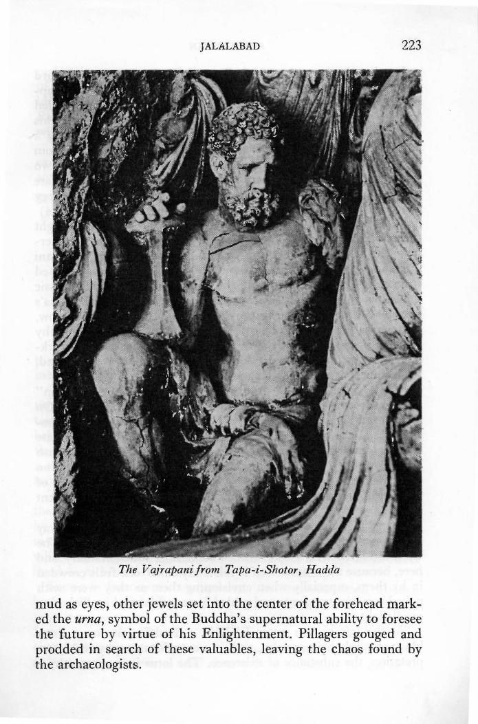
JALALABAD 223
The Vajrapanifrom Tapa-i-Shotor, Hadda
mud as eyes, other jewels set into the center of the forehead marked the urna, symbol of the Buddha's supernatural ability to foresee the future by virtue of his Enlightenment. Pillagers gouged and prodded in search of these valuables, leaving the chaos found by the archaeologists.

224 AFGHANISTAN
Leaving the central stupa hall, proceed to an open courtyard reached through a door in a wall directly opposite the main approach stairway. Some of the most beautiful sculpture yet revealed at Tapa-i-Shotor sits in a series of niches in the north wall of this courtyard. V1 , the westernmost niche in this group, contains a seated Buddha. The head has been painstakingly restored from a mass of more than 50 fragments, a chore which occupied two full months. To the left there is a Bodhisattva wearing an ornate jeweled turban and jeweled necklace. Behind this figure a very beautiful lady with an ornate hairdo holds an offering. (Seep. 34)
V 2, in the center, also contains a seated Buddha. To his right there is a superb seated figure of Vajrapani, holding a thunderbolt; the head of a lion's skin rests on his left shoulder. Vajrapani was the Buddha's bodyguard but the thunderbolt was adapted from early Hindu iconography; the lion's skin and typically classic modeling calls to mind figures of Hercules. Behind the Buddha's left shoulder a marvelously provocative young lady with narrow, sinuous waist holds an overflowing cornucopia. All the iconography at Tapa-i-Shotor is richly varied and the sensitive, delicate workmanship continues in the tradition of Bactrian art styles found, for instance, at earlier Ai Khanoum (Chapter 29).
In V 3 , to the east of V 2 , note the classic figure of a "Roman" soldier with toga pinned to the shoulder with a jeweled clasp. On the burned floor of the courtyard in front of chapels on the opposite side of the courtyard facing these niches an extremely ornate circular · diagram was miraculously preserved in the charcoal ash during the 1976 season. This season also revealed a meditation cave with paintings unique to Afghan archaeology. Because of the delicate condition of these finds they are not on view at present (1977).
Chapel EXXIV to the north of the main approach stairway has a small schist stupa (39) in the center with decorations. The walls are lined with eleven niches containing much statuary and here, because the chapel itself is relatively small, one feels crowded in by them, especially when envisioning them as they were with polychromatic vestments and gilded faces heightened by flickering candlelight.
To the left as you enter EXXIV, a Buddha sits on a lotus blossom symbolizing purity, and, in a complex metaphysical interpretation, the substance of existence. The lotus is supported by a

JALALABAD 225
pedestal ornamented with lions symbolizing the power and majesty of the Buddha's teaching. To the right as you enter, there is a lotus pedestal decorated with a particularly ornate foliated scroll. Room 69 on the south side of the complex has a large cistern lined with fine stucco. A well is located beside it.
Tapa-i-Shotor has been consistently generous and each year's excavations reveal items of consumate beauty. It is impossible for any guidebook to keep pace with Tapa-i-Shotor.
SHEWA Two and a half hour tour. Jalalabad-Shewa: 28 km; 18 mi; 45 min.
Proceed to traffic circle in center of town, turn left (north); then right. Bridge over Kabul River is on the left a few blocks beyond. Cross bridge; turn right. Paved road ends 11 km; 7 mi; 15 min. beyond bridge. Proceed straight ahead on unpaved road (right over bridge to Kama): 17 km; 11 mi; 30 min. to village of Shewa.
This pleasant drive through a picturesque landscape takes you to a typical bazaar village where you may observe skilled craftsmen making colourful lacquered boxes.
The road runs along the Kabul River, passing occasionally through villages and past large qala (fortified residences). The towering mud walls of a particularly photogenic qala 5 km; 3 mi. beyond the bridge are artistically ornamented with geometric and floral designs arranged in tall panels. The designs are made from a series of triangles carved into the wall with a spade while the mud is
1 still wet.
The paved road ends at Tangi where the Kunar River meets the Kabul River. Beyond this there are many villages surrounded by green fields and occasional citrus groves; blue mountains rise in the background. The village of Shewa is typical of many bazaar villages throughout Afghanistan, consisting of a single main street lined on either side with small shops and teahouses.
Shewa is famous for its artisans who decorate small wooden boxes, stools and bedlegs with lacquered designs. The technique requires a sure eye and steady hand. ·The lacquer comes from India in small cylindrical sticks of many colours looking like elongated lollipops. The wooden piece is placed on a lathe and as it turns the lacquer is held close to it, transferring the colour to

226 AFGHANISTAN
Lacquering wood at Shewa

JALALABAD 227
the wood in a smooth, even coating. Several colours are thus superimposed and then the artist cuts through the layers revealing each colour as required in order to form the design. If, for instance, yellow is applied first, followed by shocking pink, and finally by a royal purple, it is possible to cut away the purple to fashion a pink rose with a yellow center on a purple background, surrounded by a circlet of yellow beads on pink within narrow purple borders. Prices depend on the size of the box, the number of layers applied and the intricacy of the design. They generally range from US$1.00 to $2.00 when purchased in Shewa; the Kabul markup can be two to four times Shewa prices.
NIMLA Half day picnic outing. Jalalabad-Nimla: 42 km; 26 mi; 1 -! hrs.
Take road to Kabul. Six kilometers; 4 mi; 5 min. from traffic circle in center of town take unpaved road to left at sign to Surkhrud; 24 km; 15 mi; 45 min. beyond turnoff take right fork. An avenue of cypress trees on the right 12.5 km; 8 mi; 40 min. beyond the fork leads to the entrance to the gardens.
The Moghul garden at Nimla was laid out by the Emperor Jahangir in 1610 A.D. It is the only remaining Moghul garden in Afghanistan today. On the way the road passes through small village bazaars and through desolate, rolling hills. The road is not difficult but the surface is very rough and n10st unkind to all but the sturdiest of vehicles. In the spring, particularly, it is advisable to use a car with high clearance.
Many date palms in the gardens of Chahr Bagh (Four Gardens) catch the eye on the left 3 km. from the turnoff. Then a series of classic Push tun qala (fortified residences) consisting of four massive walls with tapering towers stationed at each corner dominate the landscape. A guest house often hangs over the single doorway into the central courtyard. In March and April poppies bloom riotously around these severe fortresses vying for attention with shimmering green wheat fields. There is a small bazaar with teahouses at Sultanpur (8 km; 5 mi; 15 min. from the turnoff). During the week-long Waisak Festival celebrated by Sikhs and Hindus in mid-April each year, thousands come from all over Afghanistan and from India to visit the temple at Sultanpur which
228 AFGHANISTAN
is sacred to the memory of Guru Nanak (1469-1538), founder of the Sikh religion. About 20,000 Hindus and 10,000 Sikhs live in Afghanistan, mainly in urban centers.
Fathehabad (12.5 km; 8 mi~ 20 min. beyond Sultanpur) is another large village with a busy bazaar. Fathehabad figures prominently in British accounts of the disastrous retreat from Kabul during the winter of 1842. Several officers who had made their way this far were killed in the vicinity; two were actually felled in the bazaar itself. Of the four who escaped from Fathehabad, three met death at Chahr Bagh, leaving only Dr. Brydon to complete the entire retreat and reach the garrison in J alalabad.
Leaving the bazaar and cultivated fields on the outskirts of the village, the road enters a flat, barren desert beyond which the Safed Koh (White Mountain) stands as a mighty backdrop. As its name suggests, this range is mantled with snow for much of the year. Take right fork 3.5 km; 2 mi; 10 min. from Fathehabad and head into barren, rolling hills followed by a succession of small valleys with terraced fields of wheat and poppies. A line of cypress trees leading to the Moghul gardens at Nimla appear on the right 12.5 km; 8 mi; 40 min. beyond the fork after passing through a small village.
Moghul love for gardens is legend. In his Memoirs, Babur, the founder of the Moghul empire, writes of many gardens he laid out in Kabul before he left for India in 1525. His successors lavished much attention on gardens in Delhi, Lahore, and Kashmir. Many of these, such as the Shalimar Gardens, are as famed today as they were then.
These Moghul gardens had a Central Asian air, combining a profuse use of wild, natural greenery with the ordered formality of canals, waterfalls and fountains. Long lines of stately cypress were planted to formally divide the order from the exuberance, and, in the peaceful seclusion of discreetly hidden pavilions, lords and ladies spent hours contemplating the beauty of their handiwork. Much of Moghul poetry and art depicts the romance of Moghul gardens.
It is said that N ur J ahan, beautiful and ambitious wife of the Emperor J ahangir (1605-1627), personally supervised the planting of each tree at Nimla. The garden is laid out in a series of regular squares marked by lines of cypress alternating with chinar (plane trees) beside wide pathways; rings of towering trees of obvious

JALALABAD 229
antiquity stand at the crossroads. The garden floor is planted with masses of narcissus, a flower for which J alalabad is famous. As the snow falls in Kabul, the narcissus appears in the bazaars to lighten winter-weary hearts with their fragrant promise of spring. After the narcissus, the iris blooms at Nimla and orange blossoms scent the air.
There is a small verandahed bungalow in the center of the garden built by Amir Habibullah (1901-1919) as a resthouse for the royal family on the road between Kabul and Jalalabad. There were seven resthouses along the route, all built in a similar style derived from bungalow architecture in British India. The Nimla bungalow is now (1976) open to visitors; you will need full camping equipment should you wish to spend the night.
Beyond the bungalow a broad canal passes through the garden in a series of waterfalls. In the masonry of each fall there are many recesses which once held small lights to illuminate the falling water at night.
The ancient road to Kabul used down through the reign of King Amanullah (1919-1929) may be followed today as far as J agdalak. From Jagdalak one can return to the paved road at Sarobi (85 km; 53 mi; 4 hrs. 45 min. from Nimla) via:
Gandamak: 11 km; 7 mi; 30 min. from Nimla Surkhrud: 15 km; 10 mi; 45 min. from Gandamak Jagdalak: 26 km; 16.5 mi; 1! hrs. from Surkhrud Sarobi: 31 km; 19.5 mi; 2 hrs. from Jagdalak
These are names which any reader familiar with the story of the British retreat will remember well. A visit brings the action vividly into focus. At Gandamak one may still see the foundations of the old British fort on the plain where the Treaty of Gandamak was signed in May, 1879, during the Second Anglo-Afghan War. The hill where British troops made their tast stand during the first war, in January 1842, rises prominently above this plain. (If proceeding beyond Gandamak, take right fork after passing through Gandamak)
An artistic old bridge with high pointed arch spanning the Surkhrud (Red River) bears this inscription:
In the reign of the impartial Shah Jahan, the founder of this bridge was Ali Mardan Khan. I asked wisdom the date of its erection, it answered, the builder of the bridge is Ali Mardan Khan. (Mohan Lal trans.)

230 AFGHANISTAN
The Moghul Emperor Shah J ahan ruled from 1628-1657 A.D. and Ali Mardan Khan was his governor at Kabul, renowned for his beautification projects in Kabul and for the famed Shalimar Gardens in Lahore which were his creation.
Holly oaks from which the Afghans constructed a barrier to tragically impede the retreating British troops in 1842, still grow in the Jagdalak pass; the sorties at Jagdalak may be easily imagined (see Bibliography for detailed contemporary accounts such as L~dy Sale's diary). Jagdalak has long been famous for its ruby mines.
Two warnings : the road deteriorates after J agdalak and should not be attempted after dark; the modern road to Sarobi leaves the old route and turns north 13 km; 8 mi; 45 min. beyond J agdalak. It is important not to miss this fork as the old route becomes impassable: take right fork and continue north. Eleven km; 7 mi; 30 min. later the road descends to the river bed and joins the road from the Lataband Pass; turn right to Sarobi (7 km; 4! mi; 15 min.).
MEHTARLAM Half day tour. Jalalabad-Mehtarlam: 47 km; 29 mi; 1 hr. Jalalabad-Shrine of Mehtar Lamak: 49 km; 31 mi; 1! hrs.
Proceed from Jalalabad on road to Kabul to the Karghai Toll Gate: 28 km; 18 mi; 30 min. Turn right before passing through toll to cross Surkhahan Bridge over the Kabul River. The road is paved to the town of Mehtarlam: 19km; 12mi; 30min. from toll gate.
For Shrine of Mehtar Lamak: turn left onto unpaved road before crossing bridge over the Alishang River: 16 km; 10 mi; 20 min. from toll gate. Keep straight at fork 2 km. beyond the turnoff. Road ends at entrance to shrine: 5 km; 3 mi; 20 min. from the turnoff.
During this drive one is treated to a lush cultivated landscape dotted with classic Pushtun qala and villages. One of the more venerated shrines in Afghanistan lies on the edge of a lonely desert not far from Mehtarlam, the capital city of Laghman Province.
The gardens at Qalat us-Seraj on the north-east edge of the town of Mehtarlam which was formerlly known as Tigiri,. offer pleasant picnic surroundings. Though the plantings flourish and
•
JALALABAD 231
are well-cared for, only an arcade and the elevator shaft of the elaborate palace built by Amir Habibullah (1901-1919), and much favoured by King Amanullah (1919-1929) as a retreat, survive. Amir Habibullah was assassinated while on a hunting trip not far from Tigiri. A small mosque dating from the reign of Amir Habibullah has some interesting floral wall-paintings typical of that period. It stands just to the right as you enter the palace grounds through a gateway piercing massive walls.
In his Memoirs, the Moghul Emperor Babur describes the province of Lamghan (now Laghman), saying it takes its name from the fact that Lord Lam, also called Lamak and Lamakan (Lamech of the Bible), the father of Noah, lies buried here.
According to traditions associated with the shrine, when Mahmud of Ghazni (998-1030) first entered this area Lamak appeared to the Sultan in a dream complaining that his resting place was forgotten and unhonoured. Following instructions given to him in the dream, Sultan Mahmud forthwith mounted a camel which was allowed to wander at will until it came to a halt and refused to budge. The Sultan dismounted, plunged his sword into the ground where a fountain of blood gushed forth. Here he built a shrine endowed with his munificence and it has continued to be highly revered to this day.
Those buried in its vicinity are assured of entering paradise and those who do service at the shrine acquire special merit. It is said, for instance, that Amir Dost Mohammad (1826-1839; 184 3-1863) was sent here by his mother as soon as he could toddle, to spend the entire day sweeping the chamber enclosing the tomb.
This chamber forms part of a building at the western edge of extensive gardens planted on a terrace above a dry river bed. Next to it there is a mosque; an open courtyard surrounded by a low wall completes the simple complex.
The tomb itself is of extraordinary length, being 15 m; 48 ft. long indicating the extraordinary sanctity of the one who lies here. Other graves of exaggerated dimensions dotting the barren and stony landscape along the roadside between the Alishang River and the shrine are said to shelter relatives of Lamak. None can compare, however, with Lot's grave near the Surkhrud south of the Kabul River which is an impressive 33 m; 108 ft. long. Other graves of more mortal proportions are scattered throughout the

232 AFGHANISTAN
The Village of Kamdesh, Nuristan
gardens. Many wives and mothets of prominent members of former royal families are included among them. Teahouses with . tables and chairs set under the trees offer refreshment.
On leaving, it is appropriate to offer a small contribution to the brotherhood tending this shrine. They are generally seated at the gateway leading into the garden.
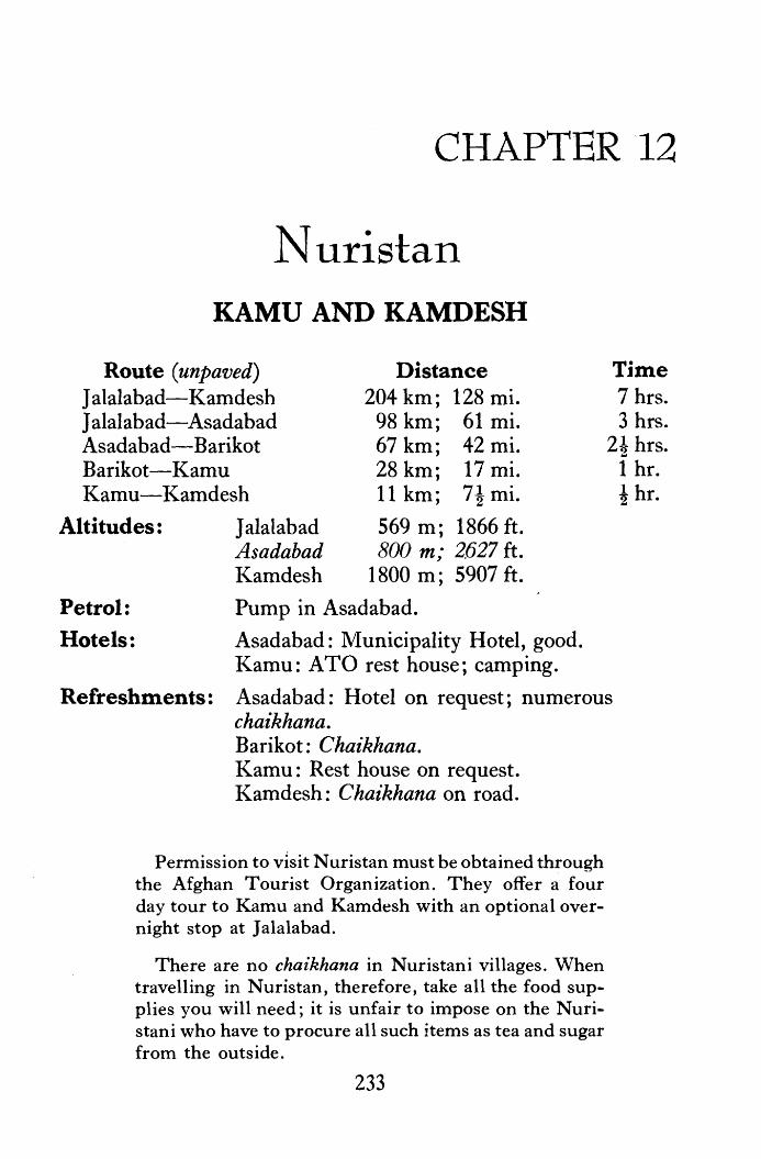
CHAPTER 12
Nuristan KAMU AND KAMDESH
Route (unpaved) J alalabad-Kamdesh J alalabad-Asadabad Asadabad-Barikot Barikot-Kamu Kamu-Kamdesh
Altitudes: J alalabad Asadabad Kamdesh
Distance 204 km; 128 mi.
98 km; 61 mi. 67 km; 42 mi. 28 km; 17 mi. 11 km; 7! mi.
569 m; 1866 ft. 800 m; 2627 ft.
1800 m; 5907 ft.
Petrol: Pump in Asadabad.
Hotels: Asadabad: Municipality Hotel, good. Kamu: ATO rest house; camping.
Time 7 hrs. 3 hrs.
2! hrs. 1 hr. ! hr.
Refreshments: Asadabad: Hotel on request; numerous chaikhana. Barikot: Chaikhana. Kamu: Rest house on request. Kamdesh: Chaikhana on road.
Permission to visit Nuristan must be obtained through the Afghan Tourist Organization. They offer a four day tour to Kamu and Kamdesh with an optional overnight stop at J alalabad.
There are no chaikhana in Nuristani villages. When travelling in N uristan, therefore, take all the food supplies you will need; it is unfair to impose on the Nuristani who have to procure all such items as tea and sugar from the outside.
233

234 AFGHANISTAN
NURISTAN offers much that is unique to the traveller in Afghanistan: heavily wooded mountains; elaborately carved wooden houses and mosques; novel wood and wrought-iron handicrafts; distinctive costumes and customs. Markhor (Capra falconeri cashmirensis) with towering spiral horns inhabit the mountains of Nuristan and snow leopard (Panthera unica) may be seen on occasion, as well as the forest dwelling b]ack bear (Selenarctos thihetanus) and rhesus macaque monkeys (Macaca mulatta). The snowcock and the magnificent monal pheasant with iridescent plumage of green and blue also make their home here. Trekking in Nuristan is particularly fascinating.
A motorable road has skirted the eastern edge of N uristan since 1959. The portion from J alalabad to Shewa is described under excursions at the end of Chapter 11. Past Shewa the road continues to run beside the Kunar to the large district town of Asadabad, formerly known as Chigaserai and, rising and falling over steep gradients, comes to Asmar (29 km; 18 mi; 1 hr. from Asadabad). A large modern fort on the site of an old castle perches on a hill at a strategic point defending the confluence of river valleys. During the next half hour (17 km; 11 mi.) to Bargum, the road is rough and hilly with many precipitous drops to the side of the river. Just beyond Bargum, before coming to Barikot, there is a difficult series of hairpin bends. Before entering the straggling village-town of Barikot you will note a Pakistani outpost on the hillside on the other side of the river. The bridge at Barikot is crucial to your visit to Nuristan for it is sometimes washed away by spring floods. It is always well to check on the state of the Barikot bridge before embarking on this trip.
Should you negotiate the crossing you will reach another series of hairpin bends just beyond, after which the road swings away to the left leaving the Kunar Valley and descends after about 2 kms. to the beautiful valley of the lower Bashgul River. Here for the most part it runs along the Bashgul on a narrow grassy track with only an occasional steep ascent before reaching Kamu.
Merdesh, 4 kms; 2f mi. beyond Kamu, is the first village you will see built in the typical N uri stani style with wooden beams alternating with rough stones chinked with mud. A typical Nuristani cantilevered footbridge connects the road with the village which is situated on the opposite bank.
The Kamdesh police post sits beside the road 7 kms; 4-! mi.

NURISTAN 235
beyond Merdesh but the village of Kamdesh is perched out of view over 610 m; 2000 ft. above the post. A steep footpath to the village shoots straight up the side of the mountain beside the post (1-1 ! hours climb); a more leisurely, less precipitous path winds up from behind the post. If you do not feel up to the climb, you may visit the village of Mandigal beside a narrow stone bridge over a tributary of the Bashgul River one kilometer fron1 the post. Although missing the spectacular house-upon-house architecture of Kamdesh, there are many houses with traditional carvings. Each design has a symbolic meaning in Kafir lore.
A partly grassy, partly narrow shaly road cut out of the mountainside where the river flows through ravines continues beyond Mandigal passing Pul-i-Rustam (16 km; 10 mi; 40 min.) and charming Bademuk through which many streams flow (8 km; 5 mi; 20 min.). The 20 kms. beyond Bademuk to the end of the road at Bargematal is also a grassy track with occasional rough patches.
The interior of Nuristan is inaccessible to all but those on foot for the trails are so difficult and precipitous, the foot-wide bridges 30 feet and more above angry frothing waters so dizzying, that horses simply cannot maneuver them. Perhaps the most dramatic account of the hazards of travelling in N uristan is told by the great Tamerlane himself. His campaign in these mountains was, as a matter of fact, a disaster. At that time the people living in these mountains were known as Kafirs (Infidels) for they had fiercely resisted conversion to Islam. Furthermore, they were mightily feared by their neighbors because of their lightening raids for slaves. To protect themselves, many of the neighboring tribes paid tribute.
When, therefore, Tamerlane was approached by the neighboring tribes and asked to rid the area of this menace, he readily acquiesed for he did not relish their blatant disregard of his supreme authority. In addition, the prospect of gaining merit by converting these heathens appealed to him. So, as he says in his autobiography, he set out with confidence. To subdue this ]ittle pocket of dissidents would be nothing for him, the World Conqueror. Confidence soon . turns to dispair as he recounts the hardships the terrain inflicted upon him. At one point, he tells us, he was reduced to being lowered down the cliffs in a basket, a maneuver unbefitting his image of himself. Equally distressing was the attempt to lower his


NUlUSTAN 237
horses down in the same manner. All but two were dashed to death against the rocks. Tamerlane ends his account of his Nuristani campaign with a prayer of thanks for his deliverance from inhospitable Kafiristan.
Centuries earlier another great wor Id conqueror encountered the Kafirs. But with a difference. Alexander the Great, when on his way to India in the 4th century B.C., prepared to besiege the city of Nysa when a delegation from the city arrived to implore him to leave them free for, they said, their city had been founded by the god Dionysus. "If you wish proof that Dionysus was our founder, here it is: this is the only place where ivy grows." (Arrian) Interestingly, modern botanists surveying in N uristan have discovered that ivy does indeed grow naturally only in the Nuristani area.
Intrigued, Alexander and his companions went into the mountains, made wreaths of the ivy, drank of the local wine and "lost their wits in true Bacchic frenzy.'' Alexander not only left these people free but invited the young men to join his army for the Indian campaign. They did, and proved their fighting quality with distinction. When Alexander was forced by his soldiers to return to Babylon, however, these stalwart warriors preferred to return to their mountain home. Many so-called "Greek" motifs and customs found in the N uristani culture may well date from this experience.
Throughout the centuries that followed, the peoples of these mountains successfully defied conquest and conversion even as Buddhism and Hinduism were replaced by iconoclastic Islam on the plains below. The Muslims labeled them Kafirs because they worshipped a wide pantheon of nature spirits and practiced other customs incompatable with the Muslim religion. For instance, for a year after death, Kafir bodies were kept in large wooden, open coffins on the hillsides. When the year was over the remains were brought to the village burial grounds with elaborate ceremony and feasting, and effigies were placed on the graves. It was believed that the soul of the departed resided in these effigies and important village councils were held in their presence so that all, past and present, could participate. A very fine collection of Kafir effigies may be seen at the museum in Kabul. The wooden grave markers
~ Kafir Grave h'Yfigy from Nuristan, in National Museum, Kabul

238 AFGHANISTAN
which attract the attention on the road from Asadabad to Kamdesh are undoubtedly stylized versions of this effigy tradition. Markers such as these are found nowhere else in Afghanistan.
In 1895/6 an army sent by Amir Abdur Rahman finally sueceded in subduing the Kafirs, converting them to Islam at the same time. When his victorious army arrived in Kabul, the Amir announced that henceforth Kafiristan, Land of the Infidel, was to be known as Nuristan, Land of Light.
Nuristan is not a separate province of Afghanistan but refers to the areas of Laghman and Ningrahar provinces inhabited by about 60,000 Nuristani. This area, approximately 5,000 square miles in extent, consists of five main valleys and numerous side valleys each inhabited by a separate tribe speaking its own language which, in many cases, are mutually unintelligible from valley to valley. These Nuristani dialects forn1 a special branch of the Indo-European language family. The variations are formidable and not yet fully studied.
There are many physical and cultural differences between the people of Nuristan and those living around them. Language is one. The fact that they prefer stools and chairs to a rug on the floor is another obvious difference. N uristani music is quite distinct as are their instruments ·among which the harp is certainly the most noticeably different. The most strikingly evident difference to all visitors, however, is the high percentage of Nuristani men and women with blue eyes and red or blond hair. The obvious question this observation elicits, "Where did the Nuristani come from?'' cannot be answered with certitude at this time, but an ever increasing number of experts, several N uristani included, are currently studying the question. Does the horse effigy, for instance, hark back to a time when they were horsemen roaming the plains of Central Asia? The experts represent a wide variety of disciplines and their findings continue to fascinate.
Nuristani men wear full white wool trousers reaching just under the knee, below which the legs are wrapped in wool puttees. An uniquely designed dagger is the most prestigious item all young men aspire to wear. When they can thrust it into a silver studded belt, they walk with pride. Nuristani women, unlike their sister Afghans who traditionally wear loose pajama-like trousers, often wear full skirts or long embroidered cloaks. They often wear the woolen puttees also, to protect their legs from brambles as they

--
NUilISTAN 239
'
·= .
.. ~-.
~. ** "' ,;
.•.
* %'
'=' ' le>.
"' :l8 i .... (
...
•
A Nuristani Gra11dmotl1er at Home
•

240 AFGHANISTAN
climb the mountains or plow the fields. Nuristani women have never worn the veil and in the villages of the interior they mingle freely with the men, participating in singing and dancing festivities. Male children often wear nothing but a goat skin tied in the middle with a string until they reach the age of about ten. Then they don a full set of clothing with ceremony.
The elite of Nuristan are the cattlemen who spend most of their time on the mountainside with their cattle and goats. Every N uristani village also has its own artisans called the Bari who keep each village self-sufficient in all except such luxury items as tea, sugar, salt, kerosene, etc. The Bari work as carpenters, house builders, silversmiths, potters and ironmongers and were formerly, in Kafir times, the slaves of the elite cattlemen. Wealth is still calculated in terms of cows, sheep and goats, and payments are made in kind, money having little value in these hills. A wooden butter bowl, for instance, is paid for by the amount of butter it holds; a prize dagger costs several cows. The National Museum, Kabul has a fine collection of these handicrafts.
Almost all N uristani villages are built on the tops of high peaks, a legacy from the days when they delighted in raiding each other's villages when they were not busy raiding their neighbors. Village feuds persist. The houses spill down the mountainside, one on top of the other, the roof of one serving as the front porch and playground of the house above. Children play vigorous games on these roofs, hanging precariously over drops of many hundreds of feet but rarely, so say their parents, do they plunge into the depths below. One moves from house to house by means of notched planks, another defensive factor, for once these "staircases" are · pulled up it is impossible to move and easy to entrap intruders.
Change is now poised on the outskirts of N uristan and even penetrates the interior as education and development projects progress. The N uristani retains his wonderful sense of personal dignity, however, and stands tall to say with pridei "I am a Nuristani.''

,,·'"'·, .... -, .J ~ I /To Tor~u~i
I I To Meshad/ ~ ,,
,,. <."
/"'U (
\ I \
• Islam Qata \
'<'o·
HERAT
HERAT
··,. .>--- - ---- --- -
, Adreskan----{ \. \ i \ \ I
I
FARAH
, ___ ---J
-- ---
FROM THE WEST
/
/',<, To Chakhcharan ·/ '
/ \ / /)
arsi /
\._ ___ - --- -\
'
A. = Historic Site
.............. ,-- "" ,-- \ I J
I "/ / / Rud ,"' I
./
I I
(
l \
\ '·
I I
I
______ ,_---,, '·-..- ......
"". \ ZaranJ
I I I
I I
I ...... . I
I l·-" I
.I ,1 NI MROZ / I
Boldak __ _,,. ,/ Spin
/• • I
i Stistan Sites / ~· I
.i \ r \
/. \
< \
HILMA ND
KANDAHAR
l \ro \ i
( \ ·,.... \ .) ...... _ -·'
., \ I .~ ...... . _J .,
·, .. ·-·-·~·-·- ·-·-· ·-.... ~---·~·- .,.,,,.-- -·
Quetta
\ I I I

CHAPTER 13
Herat
From Herat to: Distance 120 km; 75 mi. 565 km; 353 mi.
1053 km; 658 mi. 1226 km; 766 mi.
Time Islam Qala Kandahar Kabul via Kandahar Kabul via Maimana
1 ! hrs. 7 hrs.
13 hrs. 4-5 days
(partially paved) Kabul via Center
(unpaved) 963 km; 602 mi. 5 days
Population: Altitudes:
111,000 Herat: Kandahar: Kabul:
920 m; 3020 ft. 1009 m; 3310 ft. 1797 m; 5900 ft.
Hotels: Herat Hotel (17), on road to airport, 2.8 km. from Governor's office; varied price range, swimming pool. Pare Hotel (16), old, varied price range, in grove of fir trees. Mowafaq Hotel (18), near Masjid-i-Jami'; new, 1st class. Numerous small hotels; see Afghan Tourist Office (12).
Refreshments: Hotel dining rooms, on request. Three restaurants on the south side of Jadi Shahr-i-Naw, one block west of 26 Saratan Square (12), offer varied Afghan menus, Afghan music, and Afghan decor. All are upstairs: Koh-i-Nur; Pardes; New Samovar. Haider Kababi,
Chapter 13 is an up-dated abridgement of Wolfe, N.H.: Herat: A Pictorial Guide, Kabul, Afghan Tourist Organization, 1966.
243

244
Petrol:
Tolls: Air Service:
AFGHANISTAN
opposite Bank-i-1\,Iilli in Chahrsuq (10), specializes in pushti kabab, roast rib of lamb, charcoal-broiled and sprinkled with crushed grape seed (ghora-i-angur).
Near Pare Hotel (16); On road to Ghorian, west of citadel on Jadi Shahr-i-Naw just beyond large roundabout; Near Jami's tomb (4).
To Islam Qala: 30 afs. for cars.
Herat to Kabul: 4 flights a week Mazar: 3 flights a week Qala-i-Naw: once a week Maimana: once a week Chakhcharan: once a week
Tourist Office: Across from horse fountain in 26 Saratan Square (12), New City.
HERA T, capital of Herat Province, reflects the cultures of Iran, Central Asia and Afghanistan for it is the pivot around which these areas spin. Many ethnic groups, Persian, Push tun, U zbak, Turkoman, Baluch and Hazara, mingle in the crowded bazaars which display the full range of their handicrafts. In addition to this richly mixed fabric of modern Afghanistan, Herat a]so contains superlative vestiges of a brilliant past when kings and queens, acknowledged suzerains from China's borders to the Tigris River, Javished their loving attention on this city.
SIGHT-SEEING
Numbers refer to position on Herat Map.
(1) THE CITADEL (Qala-i-Ikhtiyaruddin) Built in its present form by the Kart Malik Fakhruddin in 1305
A.D. and named for another popular Kart governor, Herat' s citadel has a long and stormy history.
Genghis Khan and Tamerlane fought beneath its walls but Tamerlane's son, Shah Rukh, embellished them after 7000 men had repaired the damage wrought by his father. The citadel was the heart of the Timurid Empire for a hundred years (1405-1506) but once the empire began to disintegrate, it was constantly battered by attacks from Uzbak and Persian. In the 19th century,
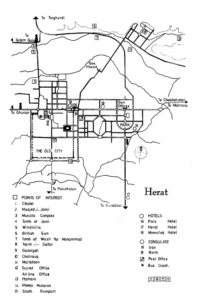
Torghundi
0 17 Herat
POINTS OF 0 I Citadel
2 Masjed_j_ Jami
3 Musalla Complex 0 HOTELS I. Tomb of Jami 16 Pare Hotel
5 Windmills 17 Her at Hotel
6 British Gun 18 Mowafaq Hotel
7 Tomb of Wazir Var Mohammad 0 8 Takht-i- Safar
CONSULATE
9 Gazargah 19 Iran B Bank
IQ Chahrsuq ~ Post Office
II Maristoon 12 Tourist Office
~ Bus Depot.
Air line Office 13 Hamam [Kl~~[]] II. Khc,qa Mubarak
15 South Rampart

246 AFGHANISTAN
Qala-i-lkhtiyaruddin, Herat
the citadel was held independent by contenders to the throne of Kabul until Amir Abdur Rahman secured its allegiance in 1881. Then, for a few brief moments in 1929 Herat's governor declared for Habibullah II, also known as Bacha Saqao, the Tajik adventurer from the Koh Daman who sat on the throne of Kabul for nine months. Troops are stationed in the fortress today and for this reason it is closed to tourists. The Republic of Afghanistan is, however, considerin g opening the citadel as a museum sometime in the near future.
The new mosque in the center of Bagh-i-lkhtiyaruddin below the citadel stands near the site of Herat's earliest mosque reputedly built during the second Caliphate of Uthman (644-656). It was repeatedly destroyed only to be rebuilt. A particularly handsome structure was erected by order of the celebrated Nizam ul-Mulkh (1017- 1092), prime minister to the Seljuk sultans for almost thirty years until he was assassinated in 1092. Descendants of the original Seljuk dynasty who settled in Herat still live in a large quarter on the east side of the square. Many distinguished writers, historians, diplomats, artists and calligraphers have come from here. The late Fikri Seljuki, for instance, was a noted historian of Herat and

HERAT 247
it is to him that we owe much of the design for the redecoration of the Masjid-i-Jami'.
In the late 1930's the governor of Herat instituted a drastic urban renewal scheme which included parks and open avenues in the vicinity of the mosque and the citadel. The old Seljukid mosque which had been refurbished by another famous prime minister, Mir Ali Sher Nawai, at the end of the 15th century during the Golden Age of the Timurids, stood in the way of park and avenue and was summarily demolished. The Selj~k community then petitioned for some land near the original site, citing the long history of Seljuk association with the building. Given a place in the park, the community subscribed to a building fund and once again a Seljuk mosque was built.
An even newer mosque is located to the south of the citadel (14). Called the Kherqa Mubarak Mosque, it enshrines a piece of the Prophet Mohammad's cloak which was willed by the Prophet to a holy man. A descendant of the holy man brought the relic to Herat about 500 years ago when a modest shrine was built. The present construction, completed in 1971, is decorated in Timurid style with mosaic tile and exterior Kufic inscriptions. The entrance portal is flanked by two slender minarets, the floor paved with green marble, and the soffit of the semi-dome joined to an arched portal screen holding the doorway is decorated with glistening fan-vaulting in glass mosaic.
On the east side of Bagh-i-Ikhtiyaruddin you may stop a moment to watch weavers weaving silk turban cloths for which Herat is justly famous.
(2) THE MASJID-1-JAMI' OR FRIDAY MOSQUE Visitors are requested to schedule their visit to this venerated place of worship between 8-12 A.M. so as not to disturb those at prayer. Admission: 20 afs.
The great mosque of Herat is one of Afghanistan's more attractive sights. The form in which it stands today was originally laid out on the site of an earlier 10th century mosque in the year 1200 by the Ghorid Sultan Ghiyasuddin. Only tantalizing fragments of Ghorid decoration remain except for a splendid portal situated to the south of the main entrance. (Enter from front garden through small door in mosque wall.)' A bold Kufic inscription, including the name of the monarch, stands in high persian-

248 AFGHANISTAN
blue relief above a soft buff background intricately designed with floral motifs in cut brick. The combination of the bright, bold straight-lined script contrasts dramatically with the graceful delicacy of the background. It is an exciting example of the artistic sophistication of the Ghorids.
This stunning decoration was hidden under Timurid decorative tile until the winter of 1964 when experts working with the Kabul Museum removed the later Timurid decoration dating from the 15th century. The upper section of the Timurid arch, lower than the Ghorid arch, has been left for interesting comparisons. Ghorid geometric patterns give way to increasingly exuberant floral patterns in the Timurid decoration; colored tile used sparingly only as an accent by the Ghorid is used to cover every inch of the architectural fa~ade by their successors.
The lavish Timurid decorative restoration covered the entire surface of the mosque but it disappeared as the unstable political climate enveloped Herat during the 400 years following Timurid rule. Photographs taken in the courtyard in the early years of the 20th century show only piles of rubble against bleak, whitewashed walls.
In 1943 an ambitious restoration program began and continues today. It is the creation of three noted Herati artists, Fikri Seljuki Herawi, Mohammad Sa'id Mashal-i-Ghori, and the accomplished calligrapher, Mohammad Ali Herawi. A visit to the mosque workshop ( to left of corridor leading from the front garden into the courtyard) is highly recommended.
The huge bronze cauldron in the courtyard dates from the reign of the Kart kings of Herat (1332-1381). It was originally used as a receptacle for sherbat ( a sweet drink) which was served to worshipers on feast days. It is now used for donations for the upkeep of the mosque.
The unadorned tomb of Sultan Ghiyasuddin (d. 1202) lies under a dome situated behind the north iwan (portal). On entering courtyard from front garden, take corridor on right; door to tomb on left; on the right there is a madrassa (religious school) where students continue a tradition active in this mosque since the 10th century. The mausoleum was redecorated in 1975. All that is left of the original decoration is a much defaced incised Kufic inscrip-
Courtyard of the Masjid-i- Jami' with Well in Foreground ....
··r·
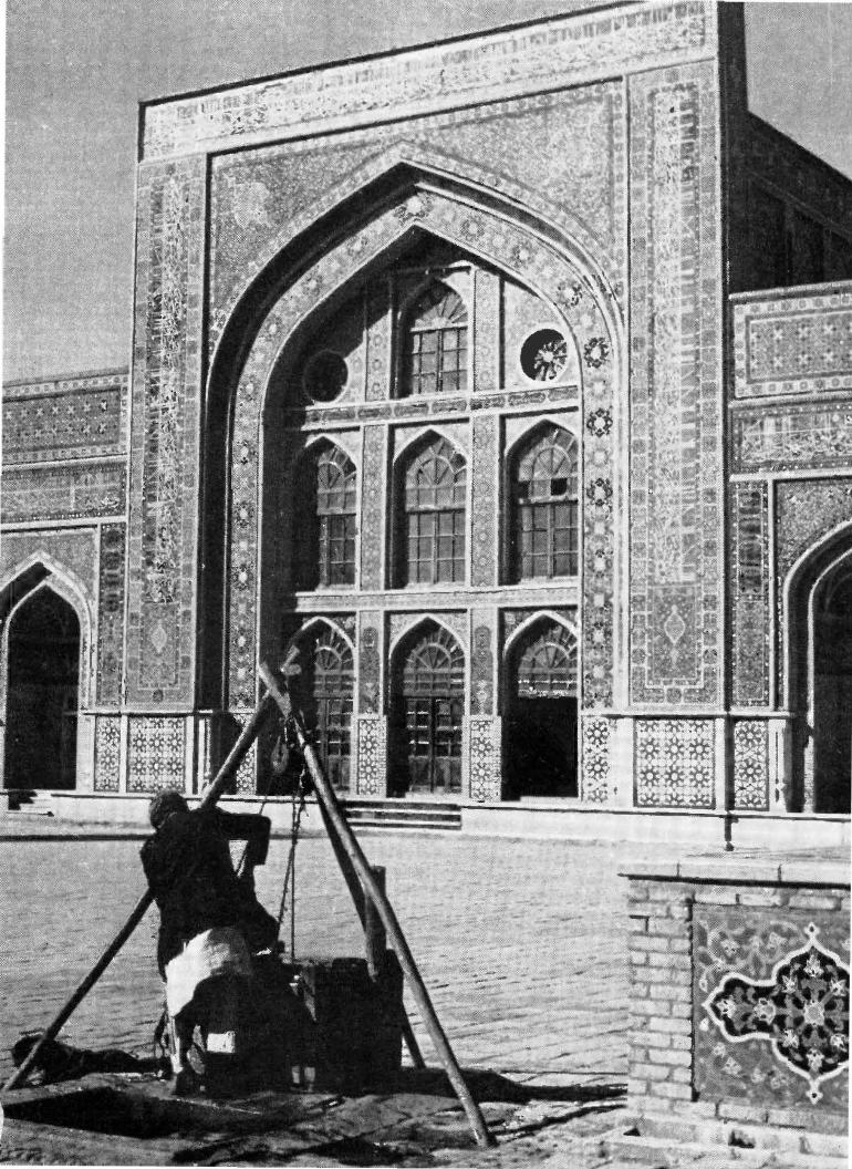

250 AFGHANISTAN
tion and bands of floral and geometric designs on the south wall. Better preserved fragments of Ghorid decoration may be seen
on the arches of the short corridors on either side of the main iwan where the mehrab (prayer niche) is let into the west wall. Here the work was executed in cut brick and molded terracotta. In the south corridor, there is a Kufic inscription with a floral background done in a distinctive angular ''brambly'' style little seen elsewhere. Above this band there are two large panels of brickwork interspersed with x-form plugs and bordered with an undulating chain of molded terracotta arabesques. Simple in concept, the use of plain unadorned brick for design and texture produces a thoroughly handsome effect which is both aesthetically pleasing and strong. Between these brick panels there is a narrower panel filled with a complicated geometric design formed by a series of buds and interconnecting tendrils.
All that is left of the splendid Timurid restoration undertaken by Sultan Husain Baiqara's prime minister Mir Ali Sher Nawai in 1498 may be found on the inside of the arcade in the southwest corner of the courtyard. The interiors of these five arches are decorated with narro,v strips of blue tile alternating with broader strips of beige brick. The bases are embellished with a bold design of stylized flowers in the form of blue tile hexagons and octagons sprinkled with tiny golden flowers. Plain pink-beige tile plaques slightly in relief fill the spaces between. The relief and the tiny flowers produce an illusion .of depth and mobility which is extremely effective.
The tall pillar in the garden in front of the mosque commemorates Afghanistan's fallen soldiers. It was erected during the prime ministership of Mohammad Daoud Khan (1953-1963).
(3) THE MUSALLA COMPLEX Today's restoration and embellishment of Herat's mosque con
tinues a tradition of architectural decoration which reached its greatest heights in Herat during the 15th century under the patronage of the Timurid Queen Gowhar Shad, wife of Shah Rukh, son of Tamerlane.
The musalla complex, designed and built (1417) under Queen Gawhar Shad's artistic direction, has been described as "the most beautiful example in colour in architecture ever devised by man to the glory of his God and himself." (Byron). Only three examples

HERAT 251
remain. Most of the buildings in this complex were purposely demolished under the direction of British troops in 1885 when a Russian attack on Herat was feared. The attack never materialized but these great works of art were irretrievably lost.
Three of the nine minarets left standing in 1885 were subsequently downed by earthquakes in 1931 and 1951. Those which remain totter precariously. One, the more simply decorated, stands beside Gawhar Shad's mausoleum which is topped by a flamboyant ribbed dome of persian-blue, set above a high drum encircled with a dazzling white Koranic inscription against a royalblue background. Tall panels bejeweled with floral decorations add to the richness of the decoration.
The interior is equally rich with painted and architectural ornamentation: a profusion of interlacing arches, fan-shaped squinches, stalactite niches, small and large domes, are delicately adorned with bands of calligraphy and all manner of floral motifs painted in lapis lazuli, rust-red and gilt. The blue pigment used in this painting was made from crushed lapis lazuli from Badakhshan. In the center are the tombstones of the Queen, her son Baisunghur and various grandsons and greatgrandsons. Gawhar Shad was murdered when she was well past the age of 80, in 1457.
The minaret which stands to the east of the mausoleum was one of a pair which stood on either side of the portal to the Queen's madrassa (religious school). The shaft is of plain brick, set horizontally, dotted with rows of large royal-blue diamonds embellished with mosaics of flowers and Arabic script. Two balconies from which the call to prayer was made ring the shaft, each heavily ornamented with deep stalactite brackets.
A second minaret stands at the far end of the garden attached to tlie northern fa~ade of a modern madrassa. There were originally four minarets like this one, standing at the four corners of Queen Gawhar Shad's musalla (place of worship) which was the quintessence of Timurid architectural decoration. The Seljuks (12th century) began to enliven the exteriors of buildings by setting broad geometrical patterns of colored brick into the plaster. The Ghorids perfected the technique of cut brick and molded terracotta, and Timurid innovations led constantly to an elaboration of design and intensification of color. Queen Gawhar Shad's musalla in Herat was the most glorious fruition of this development.

252 AFGHANISTAN
The shaft is solidly covered with lozenges outlined with strips of gleaming white faience. Bands of varying width show a vast multiplication of design. Two exquisite panels near the base permit a close study of the most delicate tile-mosaic ever devised. No plain brick is visible anywhere on this minaret and it is known that the entire surface of the musalla, which was the size of the 1\ilasjid-i-Jami', was ornamented in this most splendid technique.
Four tall minarets stand to the north of the Queen's mausoleum. They stood at the four corners of a madrassa built by Sultan Husain Baiqara (1468-1506), last of the Timurid rulers in Herat. Here a lacy network of glistening white faience seemingly tumbles over a shaft covered with light persian-blue lozenges of floral mosaic. The technique and effect is quite different from Gawhar Shad's buildings, mirroring the more effete life style of the Golden Age. The lower portions of these minarets are undecorated because they originally formed part of the main building.
All these minarets are subjected to extreme wind and sand abrasion during the period of the 120-days' wind. You will find bits and pieces of mosaic pried loose by the relentless force scattered on the plain around them. What man has not destroyed, nature seems intent on claiming. Even so, what has withstood 560 years of onslaught still gleams with a brilliance and purity of color impossible to duplicate today.
An unadorned domed structure between the two madrassas is the mausoleum of Mir Ali Sher Nawai, Sultan Husain's prime minister. He was an avid builder-restorer and is credited with building 370 mosques, colleges, hospitals, libraries, bridges and rest houses. He died in 1501 at the age of 62.
( 4) THE TOMB OF THE POET JAMI Jami was the greatest of the 15th century's poets, a titan during
a period characterized by supreme literary brilliance. His simple tomb, sheltered by a spreading pistachio tree, lies in
the garden of a mosque to the north of the minarets of Sultan Husain Baiqara.
''When you.r face is hidden from me, Like the moon hidden on a dark night, I shed stars of tears And yet my night remains dark In spite of all those shining stars."

HERAT 253,
Rug Weavers of Herat
(5) WINDMILLS Beside the garden surrounding the Tomb of Jami there is a
windmill of the type which has been a part of Herat' s landscape since the 7th century A.D. when they were first described by Arab geographers in their discussions of Khorasan. These early windmills antedate the appearance of windmills in Europe and China . The question of whether the latter were inspired by these or independently invented has not been settled by the experts but a : fair number are firmly convinced that the windmills of ancient Khorasan were the source of inspiration.
The windmills of Herat do not have the huge wheeled arms of the European model. The mill shaft rises instead from the center of the millstones and passes through the arched roof of a square mud-walled mill house. Six saHs are attached to this shaft , to each of which two reed mats are affixed. These sails spin between walls on two sides forming a well which aids in funneling the wind. They operate only during the period locally referred to as the time of the 120-days' wind, or from June through September. This is fortunately also the time of the wheat harvest. During this period the mills work day and night, renting the air with the most incredible squeals and squalls . For the rest of the year they are silent.

254 AFGHANISTAN
(6) BRITISH GUN A British cannon sporting the emblem of King George III,
dated 1802, stands on the hillside above the paved road north of the city. This gun used to stand near the minarets but since it announces 12 noon every day, it was feared its booming vibrations would soon prove disastrous to the already shaky minarets. The move took place in 1965 and those who witnessed it and all the attendant confusion remembered with awe the perserverance of those who dragged such guns up and down one mountain after another throughout the country. This is a fine momento of those 19th century games played by Russia and Britain while they sought to keep Afghanistan a neutral buffer between their imperialistic ambitions. Was this one of the guns used to shatter Gawhar Shad's masterpiece? Very probably.
(7) TOMB OF WAZIR YAR MOHAMMAD KHAN On the plain below the British gun, a jumble of marble tomb
stones, some standing, some fallen, mark the final resting place of Wazir Yar Mohammad, a key figure in these 19th century machinations. He deposed his Sadozai masters in 1842 and ruled Herat with a strong, independent hand while he played off the Persians against the Russians, the Russians against the British and the British against everyone, until he died in 1852.
(8) TAKHT-I-SAFAR, THE TRAVELLER'S THRONE -These beautiful, tree-filled gardens to the north of the city offer
a magnificent panoramic view of the city of Herat and the valley which surrounds it. Musical concerts are sometimes performed in the outdoor theater in the gardens on summer evenings. Inquire at Tourist Office.
(9) GAZARGAH The Shrine of Khwaja 'Abdulla Ansari, the celebrated Sufi poet
and philosopher who was born in Herat in 1006 and died here in 1088, is situated some three miles to the east of the city. Here Shah Rukh built many buildings which were lavishly decorated with brilliant tilework. Work began in 1425.
Crouching in front of the shrine's main portal, its nose resting lightly on its paws, there is a white marble statue of an animal, variously thought to be a lion or a dog. Local belief holds that it

HERAT 255
marks the grave of Gazargah' s architect who asked that his tombstone be fashioned in the form of a dog posed humbly in obeisance before the holy saint.
This portal and the main iwan of the interior courtyard offer the most varied examples of Timurid decoration in Herat. On one of the side walls of the main iwan, for instance, there is a bold pattern with many Chinese overtones. This is interesting in light of the fact that though Tamerlane died while leading his armies toward China, his son, Shah Rukh (1405-1447), exchanged many an1bassadors and cultural missions with the Chinese Emperor; missions came and went almost every year. One mission from China (1417) "came attended by three hundred horse" bearing all manner of rarities including patterned silks and China-ware. Interestingly, this same mission presented Shah Rukh with a painting of a white horse he had earlier sent to the Chinese Emperor. The Emperor was obviously well pleased. Silks and horses were the most prized gifts exchanged; lions and tigers the more exotic.
The portal screen soars to a height of 30 m; 98 ft. with an arcaded gallery above the arched iwan topped by two lanternturrets. This towering effect was very popular with the Timurids and stunningly adapted by the Moghuls in their majestic architecture in India.
A fifteen-foot marble pillar standing by the tomb of the saint in front of the main iwan is an exquisite example of the highly refined stonecutter's art practiced during the Timurid period. It was erected in 1454. The courtyard is filled with hundreds of beautiful headstones dating from various periods. A most remarkable sarcophagus, called the Haft Qalam (Seven Pens), is fashioned of black marble and dates from the reign of Sultan Husain Baiqara (1468-1506). The Haft Qalam is kept in a small locked chamber in the north wall. A member of the brotherhood who live at the shrine will be happy to obtain the key for you. A donation left on the stone is appropriate.
Another notable example of the stonecutter's art is the tomb of Amir Dost Mohammad which lies behind a balustrade just outside the room containing the Haft Qalam. Amir Dost Mohammad died after capturing Herat in 1863.
There are several interesting buildings in the gardens outside the main shrine. South of the entrance there is the Khana

256 AFGHANISTAN
Zarnegar (Pavilion Adorned with Gold) built during the prime ministership of Mir Ali Sher Nawai (1472-1501). It is well named for the interior is decorated with exquisite paintings of gold on a lapis lazuli blue background. They are of extremely high quality and fortunately well preserved.
The Hauz-i-Zamzam is located to the north of the shrine. This reservoir is said to have been built by Shah Rukh in 1428, at which time he ordered that several goat skins of water drawn from the holy well of Zamzam in Mecca be mixed with the spring water to increase its sanctity. According to the long inscription over the stairs, the reservoir fell into disrepair and was repaired by a pious lady of Herat in 1688/9.
Another 17th century building is the duodecagonal building with arched balconies called the Namakdan or Saltcellar because of its shape. It is used as a guest house by the leader of the brotherhood which maintains the shrine. Many blind Hafiz, men who can recite the Koran by heart, live at the shrine. They and the other members of their group teach and study the works of Herat's patron saint. Khwaja 'Abdullah Ansari composed 6,000 Arabic verses on the mysteries of the Sufi experience.
(10) CHAHRSUQ Herat's bazaars are full of fascination and color. As in most large
towns in Afghanistan, the four main bazaars of the old city come together at a central square called the Chahrsuq or Four Bazaars. This is the hub of the old city and in addition to the shops lining the streets there are several covered bazaars in the vicinity. Once common to most towns in Afghanistan, covered bazaars are now rarely to be seen outside of Herat and visitors are encouraged to include a visit to a few of these bazaars while they are in Herat.
Another monument of architectural interest is also situated in the vicinity of the Chahrsuq at the beginning of the Kandahar Bazaar. This large covered reservoir was built for the city in 1634 by a well-beloved Herati governor ruling for the Safavids of Persia. Such cisterns called sardaba ( cold water) were used to distribute water in the city. Water was brought into these high · domed brick structures through covered acquaducts from streams or springs outside the city. Today they are often empty since a piped water distribution system has been installed. Numerous oil lamps flickered in the arched recesses in the walls in the old days

HERAT 257
when this sardaba of Herat' s Chahrsuq was the pride of the city. Another fine sardaba is located to the northwest of the Masjid
i-J ami', down a side street midway on the left when approaching the mosque from the bazaar.
POL-I-MALAN (Bridge of Riches) About 12 km; 7! mi. due south of the old city.
On crossing the modern concrete bridge called Pul-i-Pushtun when driving into Herat from the airport, you may see a more graceful arched bridge downriver to the left (west). This bridge, called Pul-i-Malan, is of unknown date but its picturesque beauty has attracted admiration for many centuries. The Emperor Babur made a special point of including it on his sight-seeing tour in 1506. Caravans still choose it over the modern bridge and should you pass by while lines of camels cross Pul-i-Malan silhouetted against a setting sun, it will be a sight to be long remembered.
A popular legend attributes the bridge to Bibi Nur and her sister Bibi Hur who, it is said, devoted much time, effort and money in collecting egg shells to mix with the clay from which the bridge was built. This made it stronger than steel and Heratis delight in recounting the fate of countless modern bridges washed away by floods while Pul-i-Malan remains.
KOHSAN 105 km; 65 mi; 1 ! hrs from Herat on Islam Qala road. Partially unpaved. Tolls: 60 afs. round trip.
Several Timurid buldings may be found in the vicinity of Herat. Some, such as those at Ziaratgah (see Herat Guide for details) are difficult to reach. The student of Timurid architecture will, however, be interested in this extremely important, fairly well preserved example at Kohsan, a large village lying north of the Islam Qala road.
From the petrol station opposite Jami's tomb (4), the paved road travels west through a richly cultivated area dotted with elaborate qala (Pushtun house-type), pigeon towers used for collecting pigeon manure for the grape fields, windmills and villages of domed houses, the architectural style favored by the villagers around Herat.
The toll gate at Watal Zabed (Toll: 30 afs; 30 afs. on return) lies 35 km; 22 mi. from Herat; a modern bridge spans the Hari

258 AFGHANISTAN
Rud River 60 km; 37 ! mi. beyond the toll post. Just before the bridge there is a hill crowned by a number of pennanted tombs, on the right. Take an unpaved road at the foot of this hill. Do not attempt this road if it is muddy, or, at any time, in a car with low clearance.
The village of Kohsan, 10 km; 6 km; 20 min; off the paved road, is dominated by the high dome of a mausoleum similar to Gawhar Shad's mausoleum in Herat. The blue dome, from which most of the tile has fallen, does not seem to have been ribbed, but it sits upon a high drum as does the one in Herat. An inscription circles the drum, and the persian-blue and dark-blue decoration on the base is used sparingly against a buff brick background. U nfortunately a great deal of the decoration has fallen, victim of the bad-i-sad-o-bist-roz ( wind of 120 days, which blows from June through September) which whips at all which stands in its path. Honeycombed niches in the corbels encircling the drum retain the best preserved tile work at Kohsan.
Inside, the decoration gives the impression of being unfinished, almost as though basic grey and red stencils had been applied without the finishing touches. In the side niches there are a number of small panels set into larger panels where many different types of trees are finely drawn in blue on a white background. The variety is fascinating. As at Herat, an inscription contained in a narrow band encircles the cupola; another inscription is found in the niche facing the entrance.
There are three tombs here, one in the main hall, two in a side chamber. They have not been identified but the villagers of Kohsan. are sure that here stands the real mausoleum of Queen Gawhar Shad.
SHOPPING
Rug Bazaar: southwest corner of the Chahrsuq (10), the main square in the O]d City where the four main streets meet. Many Turkoman, producers of the famous Mauri and other tribal Turkoman carpets, live in or near Herat. If you wish to see carpets being woven, you may visit the Maristoon orphanage (11) at the foot of Takht-i-Safar.
While looking at Turkoman rugs, however, do not neglect the Baluch rugs, horse blankets and donkey bags, also sold here.

HERAT 259
The rugs, though coarser in weave, are rich in co]or and design. The horse blankets are particularly colorful. Herati Glass: A beautiful blue glass is produced by the glass blowers of Herat. Donkey beads and water cups for bird cages are the traditional products, but recently co1npote dishes and carafes have been added to the repetoire. They may be purchased at a store located on the north side of the Masjid-i-Jami' where the glass blowers work and ply their trade.
ENTERTAINMENT
Folk Theater: Local plays and variety shows in Dari are staged in the Folk Theater located at the eastern edge of 26 Saratan Square, east of Tourist Office and Public Library. Inquire about programmes from Afghan Tourist Office.

CHAPTER 14
Obey and Chisht-i-Sharif
Route (unpaved) Herat-Chisht-i-Sharif
Herat-Obey Obey-Chisht-i-Sharif
Altitudes: Herat Obey Chisht-i-Sharif
Distance 173km; 108mi. 107 km; 66 mi. 66 km; 41 mi.
920 m; 3020 ft. 1275 m; 4182 ft. 1550 m; 5086 ft.
Time 5 hrs. 3 hrs. 2 hrs.
Hotel: Obey springs: Beautiful setting; minimal facilities.
Refreshment: Obey Hotel on request with considerable advance notice. · Chaikhana in Obey bazaar
Chisht-i-Sharif bazaar
Petrol: Obey bazaar
This excursion combines a dip in warm mineral spring waters with a visit to a 12th century religious center which continues to draw thousands of pilgrims each year. En route large encampments of nomads add colour and bustle to the scene during the spring and autumn.
Take road leading east out of Herat toward Chakhcharan passing two entrances to the Herat Garrison, each with neatly lined rows of trees and many cannon, some of which are of considerable antiquity. Ten kilometers (6 mi; 10 min.) from the paved road take right fork (left to Qala-i-Naw). The wide, level plain is intensely cultivated and villages abound in which you will soon see numbers of one of Herat's more artistic and picturesque specialties.
261

262 AFGHANISTAN
Pigeon Towers, Herat
At first you may well dismiss these high rectangular and round towers as just some more towers belonging to qala (fortified residences). They are, in fact , quite extraordinary pigeon towers which perform an essential function in producing the grapes for which Herat is so famous . Pigeons in the thousands roost and nest in a maze of little niches ranged in galleries honeycombing the interior of these towers, paying rent with their droppings which are collected and used for fertilizer in the vineyards. What makes the towers so distinctive is the handsome open-brick ornamentation of the upper portions through which the pigeons enter and leave. Brick ornamentation is an Herati specialty carrying on a tradition established by the Ghorids in the 12th century A.D. The tradition of pigeon towers is some five hundred years old in the region of the Iranian plateau . Very few pigeon towers are found elsewhere in Afghanistan; none are so elaborately decorated .:
As you continue , villages and fertile fields line the banks of the Hari Rud , but between them and the low hills which frame this very wide valley the land is a waterless wasteland . Here Pushtun nomads pitch their black goats' · hair tents for several days in the

OBEY AND CHISHT-1-SHARIF 263
spring, selling wool from their newly-shorn sheep and buying supplies before setting off for summer camping grounds in the mountains near Chakhcharan and Shahrak in the center of Afghanistan. Spring is also the season for making krut ( dehydrated yoghurt) which you may see drying on top of the tents. On their return in the autumn these same nomads camp here again to stock up on grain and other supplies and sell sheep and krut before moving to winter quarters south and west of Herat.
At these times, hundreds of camels roam the plains. In the spring, large flocks of lambs and kids are an especially delightful addition. It is the custom in Afghanistan to keep the baby animals separated from their mothers except for brief periods of joyful reunion in mid-morning or late afternoon. The frantic pandemonium of these periods is an experience never to be forgotten. During the heat of the day the little ones rest in the shade of tents to which they are returned at night, to protect them from the cold and marauding wolves.
In very harsh weather the adult animals are also given shelter under these tents which are made from 6-10 long woven pieces,
· depending on the size. It takes three ladies a week to weave each piece and an average tent requires hair from about 250 goats.
In sum1ner and winter only small groups of black tents are to be seen. Villagers who own flocks camp here away from their ripening crops in summer; in winter those nomads who have lost their animals from disease or drought stay here to work as laborers until they are able to acquire new flocks.
After about 100 km; 62 mi; 2! hrs. start looking for a thick grove of pine trees on your left. 1-Iere you will find a road to the left which leads straight into the hills to the Hot Springs of Obey (straight ahead for 3 km for the town of Obey). As you enter into a gorge you will be surprised to find it full of trees, almost heavily wooded, a novel and delightful experience in Afghanistan. The narrow road twists and turns as the rocky cliffs close in and finally stop you at the parking lot in front of the springs (10 km; 6 mi; 15 min. from turnoff).
The springs sit in a narrow cleft between sheer cliffs rising rocky and bare on the west, terraced on the east. The hotel sits on these eastern terraces planted with firs, walnut and apricot trees with beds of flowers between. From the upper terrace the valley and town of Obey are visible in the far distance through a narrow cleft.

264 AFGHANISTAN
There are six baths fed by these hot springs; each has a tub literally overflowing with perpetually gushing hot water straight from the springs. The temperature is just right; the water pure and full of minerals without an offensive odour. Common with most hamam (hot baths) in Afghanistan, each bath has an anteroom with a takht or bench where one may relax after a hot bath. There are two first class baths kept in better repair, for which the charge is slightly higher (10 afs. for 1st class; 5 afs. and 3 afs. for ordinary rooms). The walls of the bath rooms and the fa~ade of the building are tastefully decorated with colourful tile and stucco in the Herati style. This building and the hotel were built by Abdullah Malikyar, Governor of Herat from 1941-1948, 1951-1954.
The springs, however, have long been famous and the nomads who winter in the Herat area believe a yearly visit to these supernatural waters is essential to their healthful well-being. During the summer the springs are visited by scores of Herati, come for a dip and a picnic in cool surroundings.
Behind the bathhouse there is a simple grave covered only with stones and grape vines, a staff festooned with small stones tied in pieces of cloth at its head. Here lies the saint who lives in the mountain tending and sending forth the hot, healthful waters. No one knows his name, but childless women and mothers without sons come here to perform a ritual. They fashion miniature cradles out of small pieces of cloth and two twigs which they place before the shrine and swing while they pray; then they bathe. Before leaving they pick up a stone from the mountain which is the saint's abode and, wraping it with the cloth cradle, tie it to the gnarled branches of the ancient grapevine, or to the staff, to remind him of their quest.
A trail beyond the shrine leads to a second spring. It is a pleasant hike through hills abounding with wild blackberries which ripen during the last weeks of September. Obey's grapes, round and plump, are almost overly sweet. Partridge may be found in numbers during the season, which is also September.
The town of Obey is 13 km; 8 mi; 25 min. from the springs. Return to the grove of trees by the main road, turn left (east). Huge black-slate grave markers stand at the entrance to the busy bazaar on the right.
Proceed straight east for Chisht-i-Sharif past fields of cotton, corn and melons. On your right some 21 km; 13 mi; 40 1nin.

OBEY AND CHISHT-I-SHARIF 265
beyond Obey bazaar you will be delighted with the sight of the village of Sar-i-Pul which is one of the more impressive examples of the beehived-domed architecture characteristic of northwestern Afghanistan. In addition, to its undulating sea of domes, Sar-i-Pul has stout walls pierced by an imposing arched gateway.
There is a roadside shrine beyond Sar-i-Pul. If the caretaker is in attendance, it is customary to give him a coin for a prayer ensuring your safe arrival. Not that the road is hazardous, just slow.
Then, about an hour and a half after having passed the shrine (35 km; 22 mi.) the somewhat incongruous sight of a huge caravanserai standing in the middle of well-tended fields comes into view on the right. It is perhaps the most superb example of this type of architectural form anywhere in Afghanistan. It is worth a visit whether you are a student of architecture or simply interested in a now-vanished way of life.
Chisht-i-Sharif is a scant three kilometers away and as you approach it across a plateau you see the two famous gumbad or domes of Chisht on the opposite plateau. The town with its meandering bazaar street sits in the ravine between these plateaux. Winding down and up, you will find an avenue of pine trees leading directly to two ruined buildings now standing in the middle of an extensive graveyard.
As is so often the case, experts argue as to the purpose of these buildings. Some speak of them as mausoleums. Others see them as parts of a grand complex of buildings, a madrassa (religious school), perhaps, with its mosque. The mutilated molded terracotta brick decoration can only speak softly of their former magnificence. The dome to the east bears a Kufic inscription in which the shafts of the script are purposefully bent in order to create a regular series of squares along the top which are filled with floral arabesques. The inscription is bordered by a plain, yet nevertheless complicated, meandering braid. Inside, the south arch is decorated with a band of interlacing polygons; the north arch with a stylized floral band.
The western building has a more ornate and monumental fa~ade consisting of a triple band of geometrics beside the doorway; next to it there is a columned and arched recess composed of two square panels filled with interlaced polygons banded by a simple braid, and a rectangular panel containing a cursive inscription with

266 AFGHANISTAN
J t
Chisht-i-Sharif

OBEY AND CHISHT-I-SHARIF 267
flowers scattered on the background. This decorative style has led some scholars to conjecture that this building may be earlier than the one to the east. Inside, there is a stucco Kufic inscription running across the tops of the pointed arches in the iwans. Here the "brambly" style found in one panel in the mosque at Herat has been used.
Stylistically, the decoration of these buildings falls into the category of the Ghorid arch in the Masjid-i- Jami' in Herat and the "minaret" of Jam (Chapter 31), both of which bear the name of Ghiyasuddin Ghori (1157-1202). A careful study of the details, however, reveals a wealth of subtle differences. This was no massproduced art, but the creation of master artists and artisans who designed, molded, cut, and fitted the millions of baked..;brick bits and pieces into a glorious whole.
Myriads of learned and pious teachers, philosophers and saints have lived and died at Chisht-i-Sharif. Many scores of others have travelled far, spreading the fame of Chisht by bearing the name Chishti. A Sufi brotherhood called Chishtiya founded by Muinuddin Mohammad Chishti who was born in Seistan in 1142 spread widely throughout India. One of its more famous members was Salim Chishti, a contemporary of the Moghul Emperor Akbar (1556-1605 A.D.). His ornate marble mausoleum in the mosque at Fatipur Sikri, not far from Agra in India, is a popular place of pilgrimage today.
On the eastern side of the pine grove there is a large mosque/ shrine built during the reign of Zahir Shah (1933-1973) to replace an older mud-brick building. It marks the resting place of Maulana Sultan Maudud Chishti who died in 1132 A.D. Each year pilgrims come to pay homage here, many of them from as far away as Pakistan and India.

, •
""" ~ $
.,
;,ffi ~
4 ,4:,::
ii• )%..:
,fu<':
. <
""".
!W
. ,;•
. :-:
'
'
•
,'
}:'" /§$.' ,· ............... •,·,·;,,~.,: .
....,.~ :::_,o... ::1;: il·' ·r,··
.,-m, %J .....
,·
·--«~ ~:-·
' ,:
•
.
r.;J . , r 1 1t" ,.,~ ., , 11~ ·
~ • ,. I ., . -~ •. ( , ' .,, ~,~ ·.
'
.t I
., f I ./ J •
'~'"- ~
,#.
J,
.,
~ '-* ),
"H.
,
•
,:
..
•.
,· / .. •
" '*
,~ -4 ~ ..
'>:
, 1A ;
,tit
"
' .,
.,
,.. A' ,;1 ,
,. r' Ill 'r
"
~ .. ' I ... ~ • •
•
• .. . "
,
•
,%;
,
'
'
~i 61 I

CHAPTER 15
Herat to Kandahar
Route Herat-Kandahar Herat-Farah Rud Farah Rud-Dilaram Dilaram-Girishk Girishk-Kandahar
Altitudes: Herat: Mir Ali: Girishk: Kandahar:
Distance 565 km; 353 mi. 203 km; 127 mi. 127 km; 80 mi. 115 km ; 71 mi. 120 km; 75 mi.
920 m; 3020 ft. 1772 m; 5814 ft. 840 m; 2756 ft.
1009 m; 3310 ft. Petrol: Farah Rud; Dilaram; Girishk.
Time 7 hrs. 2! hrs. 1 ! hrs. 1 ! hrs. 1 ! hrs.
Tolls: 50 afs. at Adreskan between Herat and Shindand.
Hotels:
Refreshments:
40 afs. at Kishk-i-N akhud between Girishk and Kandahar. Farah Rud: Varied price range, swimming pool. Dilaram: Fair Farah Rud: Hotel, on request. Dilaram: Hotel, on request. Chaikhana en route as noted in text.
Thirty-two thousand stately jack-pines, planted by Governor Abdullah Malikyar during the 1940s, escort the traveller out of Herat. On the way, about 13 km; 8 mi. after leaving the Governor's offices, one notes a roofless mausoleum by the roadside to the right. Inside, among a jumble of tombstones, two headstones mark the final resting places of the ill-fated Shah Mahmud
~ The Chihlz£na, Kandahar
269

270 AFGHANISTAN
Sadozai and his son Kamran. Shah Mahmud ruled at Kabul from 1801-1803 and again from 1809-1818 when he lost his throne to the Barakzai brothers. Fleeing to Herat he ruled that city until his son Kamran set him aside in 1821. He died in his bath in 1829 and rumour suspected that he had been murdered by his son. Power, however, rested in the hands of the wily Chief l\finister, Y ar Mohammad, who, tiring of maintaining the fa~ade, suffocated the debauched Kamran in 1842.
Passing by the Herat Airport, the pines continue as companions for 30 km; 19 mi. and then, at the Shrine of Mir Daud, they march off to the left, leaving the paved road to continue unadorned. Mir Daud was a saintly person whose family came from Multan to settle in Herat during the time of the Ghorids. His shrine acquired special importance during the time of the Timurids when the famous Minister-architect Mir Ali Sher N awai built a fortressserai or rabat here which included four series of rooms for travellers, storehouses and a central mosque. This was the first stage for travellers leaving Herat and special care was taken to make them comfortable. Mir Ali Sher Nawai was well-known for his generous construction of such public buildings. Governor Malikyar further extended the facilities and plantings at the Ziarat-i-Mir Daud from 1942-1946.
From Mir Daud the road climbs to the Mir Ali Pass ( 1772 m; 5814 ft.) and then winds through the Parapomisus Mountains to Adraskan, the flower bedecked toll post 80 km. from Herat (50 afs; surrender ticket if coming from Kandahar). Adraskan is an old town, mentioned in 13th and 14th century geographies as one of four prominent towns in the district of Sabzwar, the Green Place, which, now called Shindand (Pashto equivalent of Sabzwar ), lies 33 km; 20 mi. beyond.
Shindand (altitude: 1080 m; 3543 ft.) is a fertile valley studded with many villages of domed houses representing an architectural style particularly popular in the Herat and Kandahar areas. Pockets of villages built in this manner are, however, also found in the north. A large military airport is also located at Shindand but the valley is so vast one hardly notices it. The villages, a large caravanserai, and the fertile fields are what attract; the actual town of Shindand lies 25 km; 16 mi; 30 min. west of the highway. Although the valley now bears its Pashto name, the term Sabzw.ar is still widely used to denote something beautifully green and

HERAT TO KANDAHAR 2i1
fertile. A hen laying lots of eggs, for instance, is called sabzwari. Travellers along this route will agree that Shindand is most aptly named for after leaving this valley one is treated to only a few moments of greenness.
The highway continues to descend to Farah Rud (altitude: 790 m; 2583 ft.) where a striking apparition appears in the form of the monumental Hotel Farah Rud, 90 km; 56 mi; 1 hr. from Shindand. Bright flowers and gleaming glass beckon the traveller from the desert. Some stop, if only for a cup of tea, a meal, a bath, or a dip in the large swimming pool; most push on after filling up with petrol.
The road to Farah, capital of Farah Province (altitude 732 m; 2402 ft.) is clearly marked some 8 km; 5 mi. south of Farah Rud ( 68 km; 43 mi; 1 ! hrs. to Farah). Here you will find one of the more impressive fortresses in all Afghanistan and the town itself has considerable charm. There is a small hotel in the town.
··~-~n the vicinity, you may visit extensive medieval ruins at Kafir Qaht.-Take old road in direction of Dilaram; 8 km; 5 mi. from Farah take desert track to right; ruins cover a sugar-loaf mountain rising from the plain about 7 km; 4} mi. beyond the turnoff. Farah is the legendary birth place of Rustam, mightiest hero of the Shahnama, "Book of Kings," composed by Firdausi at Ghazni in the 11th century. Kafir Qala is said to have been the retreat of Sohrab, son of Rustam, who kidnapped one of his father's young wives and brought her here where he built her a fine palace in a tower on the mountain's highest pinnacle. Rustam came to retrieve her; Sohrab mortally wounded his father; the young lady jumped to her death from the tower; Sohrab committed suicide; and the castle was forever abandoned.
On the paved road beyond the Farah turnoff the mountain slopes are rocky and barren but the craggy pointed peaks provide an endless series of fascinating reliefs which are fondly remembered when, about an hour after leaving Farah Rud, the road leaves the mountains. From now on all is flat desert except for occasional oases which rise, sharply etched, to be greedly devoured by eyes hungry from the vast emptiness.
Dilaram, 127 km; 80 mi; 1} hrs. from Farah Rud sits beside the Khash Rud, a wide river of undeniable charm, beyond which there is a toll gate ( surrender ticket; 50 af s. if coming from Kandahar).

272 AFGHANISTAN
Beyond Dilaram (altitude: 814 m; 2673 ft.) the road rises gently toward Kandahar. Mirages glisten and fade but little else distracts the eye until the lofty fortress-castle of Girishk (altitude: 840 m; 2756 ft.) comes into view an hour and a half later (115 km; 71 mi.). Many battles were fought beneath the mighty walls of this fortress, whose most colorful occupant was undoubtedly Fateh Khan Barakzai, the indomitable "king-maker" of the early 19th century. This was his cast]e, his p1ace of refuge during the ups and downs of his eventful life.
At Girishk the road passes the Boghra canal, a very ancient canal which functions as an extremely important segment of the Hilmand Valley reclamation project, and then crosses a large bridge over the Hilmand River, one of Afghanistan's major rivers. It begins in the central Hindu Kush mountains and flows for 1300 km; 800 mi. in a southwesterly direction to disappear finally in the marshy lakes and lagoons of the Hamun-i-Hilmand on both sides of the Afghanistan-Iran border.
About 22 km; 14 mi. beyond Girishk; road signs direct you to other important segments of the Hilmand Valley Project. On the left, a sign directs you to Kajakai, the huge dam on the Hilmand River 65 km; 41 mi; ll hrs. above Girishk. This dam completed in April 1953 is 91 m; 300 ft. high; 270 m; 887 ft. long and holds back 1.5 million acre feet of water or 1. 9 billion cubic meters of water to feed the irrigation works in the Hilmand Valley. The road to the dam is graded but permission to visit Kajakai must be obtained from the Governor of Hilmand Province in Lashkar Gah. Chaikhana offer refreshment, but there are no hotel facilities at the dam.
The sign to the right directs you to Bost (Lashkar Gah) the capital of Hilmand Province, headquarters of the HilmandArghandab Valley Authority (Chapter 17).
The desert landscape along this stretch encourages one to reflect on things past since there is not much of the present to excite the imagination. One may, for example, visualize the passage of a British army in July, 1880. These men had been sent from Kandahar to Girishk to support Kandahar's pro-British governor then being threatened by an army from Herat commanded by Ayub Khan, son of Amir Sher Ali (1863-1866; 1868-1879). Two years previously the British had moved their troops into Afghanistan against Amir Sher Ali at the beginning of the Second Anglo-

HERAT TO KANDAHAR 273
Afghan War. The country had been in constant turmoil ever since: Amir Sher Ali had died in Mazar-i-Sharif after an unsuccessful attempt to persuade the Russians to make good their earlier offers of aid; his son and successor at Kabul, Amir Y aqub Khan, had been forced to sign the Treaty of Gandamak which, a1nong other things distasteful to the Afghans, granted the British a Resident in Kabul; the Resident and his escort had been killed and the British retaliated by occupying Kabul, J alalabad and Kandahar; Amir Y aqub Khan had abdicated. The throne of Kabul stood empty and Ayub Khan, Amir Yaqub's full brother, was now moving to reclaim this throne for his brother.
As Ayub's forces neared Girishk, the Governor's troops mutinied and many hastened to join Ayub. Thus weakened, the British troops were forced to fall back from Girishk toward Kandahar. On July 17th they pitched their tents on the Kandahar side of the old fort at Kishk-i-Nakhud (Toll: 40 afs: 55 km; 34 mi; 40 m.in. from Girishk-66 km; 41 mi; 1 hr. from Kandahar) which still stands strong, though empty, on the north side of town. Here spies brought in reports that Ayub Khan intended to skirt the British position and head straight for G hazni without incurring the delay of any engagements around Kandahar. The British decided to waylay him.
In the morning of July 27th, 2476 men, 749 horses and 12 guns moved out of camp at 7: 00. They moved up the river to a plain about six miles north of Kishk-i-Nakhud and two and a half miles west of the village of Maiwand where they were engaged by a portion of Ayub's forces, estimated to include 7900 men and cavalry, 30 guns, and 15,000 volunteer tribesmen. The battle began at 9: 00 a.m. and in four hours the British army was swamped:
"After my wound had been attended to, I was lying quietly in my doolie (palanquin), imagining that all was going on well as regarded the day, the idea of our losing it never entering my thoughts, when all of a sudden my doolie-bearers took up the doolie and commenced running off with me as fast as they could go, shouting as they ran along that the ghazis (Afghan warriors) were on us. I raised the curtain of the doolie and looked out, and, to my great surprise, saw a regular stampede, men and animals making off as hard as they could, all in utter

274 AFGHANISTAN
confusion-no order of any kind, but everybody evidently bent on doing the utmost to save his own life and get out of the way of danger as fast and best he could. With this object all the loads had been thrown off from the baggage animals, which were at once appropriated for riding purposes. The ground all about was, in consequence, covered with camp equipage, boxes of ammunition and treasure, mess stores, wine, etc." (Surgeon-Major Preston, Official Account, 1908, 514)
All through the night the harassed survivors stun1bled in disorder toward the safety of Kandahar's citadel. The fortunate reached it at 2 the next afternoon but 964 soldiers, 331 followers and 201 horses had perished and 174 men and 68 horses nursed their wounds. Ayub Khan was later defeated outside Kandahar on September 1st but the Battle of Maiwand was the worst defeat suffered by British arms in Asia.
One follows the fleeing men through this bleak landscape with compassionate thoughts. Jagged, weirdly shaped hills so characteristic of the Kandahar area rise to the left. These are the Shah Maqsud Mountains from which delicate green travertine used in making tasbeh (prayer beads) is mined. The famous shrine of Shah Maqsud is also located in these mountains, as is the archaeological site of Mundigak (see end of Chapter 16).
The sand dunes on the right stretch for miles, and in some lights they turn a delicate pink making them seem somehow more menacing, empty and lonely. No wonder that further south this vast desert bears the name of Dasht-i-Margo, the Desert of Death. And yet, a huge mound standing to the right about 25 rni; 16 mi. from Kishk-i-Nakhud bears silent testimony to the fact that there were once bustling cities in this area, cities extolled for their prosperity and delightful gardens. Hauz-i-Madad, an oasis about 2 km. beyond the artificial mound gives one an inkling of what once was. Hauz, meaning reservoir or well, were built especially for mosques and caravanserais, havens for weary travellers from the desert. This particular hauz at the first rabat or day's journey out of Kandahar, was built by one Madad Khan, leader of the Ishaqzai in the time of Ahmad Shah Baba (18th century). The old, very large, caravanserai can just be seen through the trees.
A double line of trees leaves Hauz-i-Madad and marches straight across the valley. They stand above the old road. The

HERAT TO KANDAHAR 275
new road strikes off independently into the desert skirting around an intensely cultivated area where domed huts, similar to those noted in the Herat and Shindand area, mingle with another distinctive architectural form, the barrel-vaulted houses built only by the Push tun of Kandahar. Many grape-drying towers, their walls slotted to allow circulating air to turn grapes into raisins, also rise above the greenery of this highly fertile va1ley. The new road joins the old road on the banks of the Arghandab River, another major river in Afghanistan. Like the Hilmand, it rises in the central Hindu Kush, and flows for 560 km; 350 mi. to join the Hilmand at the foot of Bost's citadel. As at Herat, where the traveller leaves under the cooling shade of pine trees, so at Kandahar tall pines spread their welcome shade as one passes by the Mausoleum of Mir Wais Baba, the Chihlzina, through the growing suburb of Mir Wais Maina and by the Kandahar Hotel to enter the Herat Gate, entranceway to Kandahar for travellers fro1n Herat since the city was built in 17 61.

I
I I
I I
I I
I I
I I
I I
To Pul-4-Khumrl
THE SOUTH
I I
I I
Kajakai
HILMA ND
I I / I
I I
/ (
_.,,, /
I
/ /
GHAZNI
I t-- .... _ I ,..,, '
I
I I
/ /
~ /...-' ',, \ I \-,,,. ............ , -r'
Dam I \ ,/ I / \.- I
/ I I I
I I 1 Arghandab 1
J )
' I ZABUL \ I
\ (
I .r·
I \
( "-,, ,,_~--, ' I \ I -..,
\ '? \ ./}'-.-(;-"\ ./ \ ,.-· ,_ . ./ I ,-· I ""°.) ·-· ( ,·
,J C..-·¥l, .-·
I ( To Q.urtta
·1 i I \
' ,,,. . .,,,,· \ _ . ..-·-\ .-·-·--1-._,,,.--· '-·-·-·--............ I' . ....,

CHAPTER 16
Kandahar Mundigak Shah Maqsud
From Kandahar to: Distance Time 6 hrs. 7 hrs. 1 hr.
Kabul Herat Spin Boldak (border)
488 km; 305 mi. 565 km; 353 mi. 104 km; 65 mi.
Population: 160,000 Altitudes: Herat
Kandahar Kabul
920 m; 3020 ft. 1009 m; 3310ft. 1797 m; 5900 ft.
Hotels: Kandahar Hotel (23); Varied price range. Ahmad Shah Baba, across from Kandahar Hotel; Good, swimming pool. Inexpensive hotels near Id Gah Gate. Camping at Kandahar Hotel.
Refreshments: Mir Vais Restauran, upstairs just west of Chawk. Kabab shops on Chawk serve pushti kabab, roast rib of lamb, charcoal broiled and sprinkled with crushed grape seed (ghora-i-angur ).
Petrol: Pumps on roads to Kabul and Herat.
KANDAHAR, capital of Kandahar Province, is Afghanistan's second largest city; a thriving commercial and budding industrial center. Traditionally the home of the Durrani Pushtun, the leading Pushtun group in Afghanistan, Kandahar is famed for its superlative fruits and bustling bazaars. The city remains substantially unchanged from the city laid out by Ahmad Shah Durrani, except that it too, like so many of the old cities in Afghanistan, has spilled
279

0 POINTS OF- INTEREST
1 Shahidanu Chawk
2 t,,busoleum of Ahmad Shah D.
3 .Khrrqci Sharif Ziarat
4 Arg Citadrl
5 Char Suq
6 Jame Mui Mobarak
7 Deh Khotay
8 Shrine of Hazratji Baba
9 Kandahar Museum
IO Chihlzina
11 Zor Shor
12 .Mausoleum of Mir Wais Baba
~ To Herat·,
. ~~,
~lll ·-~ ~
13 Baba 14 Sher
Vlcili
Surkh
15 Herat
16 Kabul
17 Shah
Bazaar
Bazaar
Bazaar
18 Shikarpur Bazaar
19 Sar Posha Bazaar
20 Old City Walls
21 Id Gah Mosque
22 Government Qffices
0 HOTELS
23 Kandahar Hotel
0 CONSUi.ATES
24 Pakistan
25 India
Kandahar
I
) I
\ \
\
PAVED MAIN ROADS
SECONDARY ROADS
MINOR ROADS
PATHS
~ POST OFFICE
~ BUS DEPOT.
!Pl POLICE
I H) HOSPITAL
~, I I
I
p
I I I
[ljJ / I
I I
I
···· ··· r · k .. ·rl!r····· ~--·--
. ·t··--· i
Canal
/To Air port ,
J_--~----

KANDAHAR 281
over into a Shahr-i-Naw (New City) which includes the fashionable residential section and the new government administration center.
Kandahar is hot in summer. From their inexhaustible store of legends the Kandahari explain this thus: A saint named Baba Farid, living in the hills of the Safid Koh, heard that the people of Kandahar, having become uncharitable, were refusing aid to holy persons, travellers and guests, contrary to all rules of hospitality. Travelling to Kandahar to ascertain if this deplorable state of affairs had indeed come to pass, Baba Farid roamed the streets begging for bread. Not that he needed to, for he had miraculous powers and could produce any quantity of food, at any time. He begged to test the Kandahari and they were, regrettably, found wanting. Angry, Baba Farid jumped into the river, caught a fish and held it upward toward the sun. The sun descended; the fish roasted. While the fish turned crisp and succulent, however, the people fried, water boiled in their vessels and the earth burned red hot. Baba Farid returned to the mountains of the Safid Koh never to return but the sun descends annually in perpetual castigation. Today's visitors need not fear; they will find the rules of hospitality faithfully observed, and, incidentally, the winters cold.
Ahmad Shah Durrani had trouble at first finding land on which to build his city. His own tribe had no extensive lands and others who had, such as the Alikozai and Barakzai, refused to give up their lands. Only the Popalzai finally offered him his pick of their lands. The foundations for the city were laid in June, 1761.
Once begun, the city was built with grand proportions. It was laid out in the form of a regular rectangle with a circumference of three miles; walls 30 feet thick at the bottom and 15 feet at the top, rose 27 feet high to enclose it. Outside, the walls were ringed by a moat 24 feet wide. Six mammoth gateways pierced these walls: the Id Gah Gate on the north; the Shikarpur Gate on the south; the Herat and Top Khana Gates on the west; and, the Bar Durrani and Kabul Gates on the east.
The Herat, Kabul and Shikarpur gates were named after the major towns they faced. The Bar Durrani Gate is interesting. Durrani is, of course, the name which Ahmad Shah gave to the Abdali, the large tribe to which he belonged. His own branch of this tribe, the Sadozai, was, however, small compared to the other

282 AFGHANISTAN
branches and Ahmad Shah feared the very real possibility of insurrection at home while he was away on various campaigns. With this in mind he persuaded members of his branch living near Attock to come to Kandahar where they settled in this section of the new city. They were known as the Bar (Upper, i.e. eastern) Durrani in contrast to the Lar (Lower, i.e. western) Durrani from Kandahar proper.
The Id Gah Gate led to the Id Gah Mosque on the plain to the north of the city next to a seemingly empty compound surrounded by a high wall. This is the 19th century British cemetery. The Top Khana Gate led into the section of the city which produced and sold ammunition and cannons. The Top Khana Bazaar specializes in the manufacture of gun powder even today.
The gateways were defended by double bastions and at the four angles of the rectangle there were four monumental circular towers. Between these and the gateways there were 54 smaller bastions. Kandahar was built to impress all who approached it.
These old walls of Kandahar were torn down in the 1940s, except for small portions on the east and southeast (20). The bazaars keep the old names, however, and the areas where the gates stood are still referred to as Herat Darwaza (Herat Gate), etc., as though they still stood. They still do, no doubt, in the minds of the Kandahari who are justly proud of their city and its history.
SIGHT-SEEING
(1) DA SHAHIDANU CHAWK (Martyrs Square) A Monument to Pious Martyrs (Shahidan: those who died in
battle) stands in the center of Kandahar's main square called Da Shahidanu Chawk. Flags and small cannon encircle this monument built between 1946 and 1948. All manner of wheeled and four-footed traffic revolves around this monument, including large canopied pushcarts stacked high with jingling bottles filled with brilliant, shimmering colored-sodawater. They are an especially appealing addition to the street scenes of Kandahar.
(2) MAUSOLEUM OF AHMAD SHAH DURRANI Entrance fee to view Mausoleum and the Kherqa
Sharif (3), 20 afs; interior generally open on Thursdays but at times closed to non-Muslims. Photography occasionally prohibited.

KANDAHAR 283
The most important historical n1onument in Kandahar is the mausoleum of Ahmad Shah Durrani, fondly known as Ahmad Shah Baba, Father of Afghanistan, who ruled an empire from Kandahar from 1747-1772.
The graceful octagonal monument stands on a basaltic platform, the plain beige brick exterior decorated with numerous niches of contrasting heights and depths, delicately outlined with yellow and green, green and blue, tile. Tall minarets connected by a floral balustrade top the main body of the monument and behind them yet another set of short minarets atop a series of shallow niches outlined in blue, surround a drum crowned with a dome of glistening blue tile. The soffits of the main arches are cleverly decorated in a honeycomb pattern composed of half circles centered with lapis lazuli and gold to resemble flowers.
The exterior decoration seems very spartan once one enters. (Remove shoes before entering.) Here the eye is delighted with a sumptuous richness of color and design from the gorgeous Afghan carpets on the marble floor to the brilliantly painted and gilded floral decoration of the dome. The blue-green tile with touches of yellow and brown around the base of the walls is made in Kandahar and is quite distinctive from the tilework of Herat.
On the eight cornices under the corner niches a large inscription in white on lapis blue tile extolls the virtues of Emperor Ahmad Shah Durrani:
"The king of high rank, Ahmad Shah Durrani, Was equal to Kisra in managing the affairs of his
government. In his time, from the awe of his glory and greatness, The lioness nourished the stag with her milk. From all sides in the ear of his enemies there arrived A thousand reproofs from the tongue of his dagger. The date of his departure for the house of mortality Was the year of the Hijra 1186 (1772 A.n.)"
The sarcophagus is made of Kandahari marble and covered with a gold-embroidered cloth of deep wine velvet. Beside this there is a table holding fine copies of the Koran and a glass cabinet containing a gold-inlaid helmet and gauntlets together with a septre inlaid in silver and embellished with a two-headed bird. With these Ahmad Shah Durrani went forth to battle. (A donation to the caretaker before leaving is appropriate.)

284 AFGHANISTAN
(3) DA KHERQA SHERIF ZIARAT Entrance fee to view this shrine and the adjoining
mausoleum (2), 20 afs; interior not open to pub)ic. Photography occasionally prohibited.
The shrine of the Cloak of the Prophet Mohammad adjoins Ahmad Shah Durrani's mausoleum. This is one of the holiest shrines in Afghanistan.
Ahmad Shah received the Prophet's Cloak from l\1urad Beg, Amir of Bokhara, in 1768, as part of a treaty settling the northern boundaries. The building housing this relic is architectura1ly unpretentious but its sparkling tile decoration commands attention. The shrine was repaired and the entire exterior surface embellished during the reign of Amir Habibullah while Mohammad Usman Khan was Governor of Kandahar. The foundations are paneled with delicate green Lashkar Gah marble, the walls are completely covered with tile fron1 the workshops of master tilemaker Nek Mohammad, and the arches were gilded and painted by Sufi A. Hamid in 1908. A splendid new door inlaid with lapis lazuli, Shah Maqsudi travertine, and chased silver inlaid with gold was installed in 1974.
It is not possible to view the relic. In fact, it has only been shown on rare occasions such as the time in 1929 when King Amanullah attempted to rally the tribes; and again, in 1935 when cholera raged in Kandahar, the relic was taken with ceremony to the Id Gah Mosque north of the city where special services were held.
(4) ARG (Citadel) The Arg or Citadel is said to have been bui1t during the early
years of the 19th century by Prince Kamran, son of Shah Mahmud (1800-1803; 1809-1818), while he was his father's governor at Kandahar. The offices of the Governor are still located here but only a small portion of the original layout remains. The massive curved veranda still commands an impressive view of the city, however. Standing on this veranda, looking to the right about a third of the way down the Shah Bazaar, one sees the house tops of the section where Ahmad Shah Durrani lived. This area is still called the Sadozai Kutsa (Sadozai Street) after Ahmad Shah who belonged to the Sadozai sub-tribe, and many of his descendants still live here. They will point out a crumbling wall which was the
KANDAHAR 285
great king's home. There are spice and fish shops, bakeries and butchers in the Sadozai Kutsa but, most interestingly, many bird shops as well. The Kandahari are great bird fanciers and wild birds netted by hunters are brought here before being distributed to other bazaars within the city. Pigeons are also prized and many elaborate names and games have been devised by the pigeon dealers and trainers of Kandahar, many of whom have their shops in this bazaar.
North of the Governor's offices is the Id Gah Darwaza, the gate once used exclusively by the royal family. It was restored in 1951.
(5) CHAR SUQ (Four Bazaars) The city of Kandahar was laid out by Ahn1ad Shah with amazing
regularity. The four principal bazaar streets meet in the center of the city at the Char Suq, a square once covered with a lofty dome where public proclamations were made. It is still the hub of the city, the bustle and colour heightened by numbers of gaily decorated gadi (horse drawn carriages) trotting through or waiting patiently for passengers. Each bazaar is discussed in detail at the end of this chapter under shopping.
(6) JAME MUI MOBARAK The Mosque of the Hair of the Prophet is located inside the
covered bazaar, on the left as you enter from the Kabul Bazaar. It was built by Kohendil Khan, one of the Kandahari Sardars who held sway over Kandahar during the first half of the 19th century. The Patao Canal carrying water from the Arghandab River passes through the very center of the large spacious unadorned courtyard. There is also a pavilion for weary travellers and pilgrims.
The Hair of the Prophet, acquired from the Amir of Bokhara at the same time as the Cloak of the Prophet, now encased in a golden sheath, is kept in a small chapel in the northwest corner of the courtyard behind a simple wooden barricade. It is not open to the public.
(7) DEH KHATAY Just beyond the end of the Shikarpur Bazaar, at Deh Khatay,
Clay Village, brick kilns stand on both sides of the road like forbidding sentinels, belching forth thick, black clouds of smoke.

•
AFGHANISTAN
i .$
.fl
• Potters at Work in Kandahar
Deh Khatay is always busy: kilns are packed, fired, stoked, unpacke'd and their contents loaded onto painted trucks; camels pad silently to -their appointed kilns carrying huge, swaying loads of special oily grasses used to fire the kilns; potters spin their wheels and neatly spread their pots under the sun before consigning them to the kilns. Just beyond, the basket-makers fashion tall conical baskets of thick reeds. In these, grapes from the surrounding vineyards are transported throughout Afghanistan and down to India. Deh Khatay is a photographer's delight.
(8) SHRINE OF HAZRATJI BABA Just to the north of the city, off its northeast corner at the end
of the buria (matting) bazaar, there is a charming shrine dedic~ted to a celebrated saint who lived in Kandahar more than 300 years ago. The grave of Hazratji Baba, 23 feet long to signify his greatness,. but otherwise covered solely by rock chips, is undecorated save for tall pennants at its head. The graves of the Kandahari Sardars who ruled Kandahar during much of the first half of the 19th centt1ry lie near the saint's tomb. Kohendil Khan lies to the

KANDAHAR 287
right of the saint; Mehrdil Khan to the right of Kohendil Khan. Sherdil Khan lies at the foot of the saint's tomb; Purdil to Sherdil's left. Rahmdil, the fifth brother, grandfather of Mahmud Beg Tarzi, died in exile in Iran. The graves, simply and tastefully decorated with designs formed by black and white pebbles, are marked with tall marble head and foot stones which are among the 1nore exquisite examples of the stonecutter's art to be seen in Afghanistan.
On the eastern side of the courtyard there is a hauz (reservoir) with vestiges of floral paintings on the arches. An example of stucco wall decoration may be noted inside the entranceway. Such decorative devices were very popular during the 19th century, but few examples survive.
(9) KANDAHAR MUSEUM Saturday through Wednesday open 8-12, 1-4; Thursday, 8-12.
The Kandahar Museum is located at the western end of the third block of buildings lining the main road east of the Id Gah gate. It has many paintings by the now famous Ghiyassuddin, painted while he was a young teacher in Kandahar. He is acknowledged among Afghanistan's leading artists. The Museum also has a number of memorabilia of Amir Habibullah (1901-1919) including a worn red-plush couch-palanquin set with a brass plaque which tells us this was a gift to the Amir from the people of Kandahar. The Amir suffered from gout and the staircases at his garden palace at Manzel Bagh were steep, so no doubt this gift was duly appreciated. The fa~ade of Manzel Bagh still retains interesting bits of decoration although the building is sadly in need of repair after a checkered career as palace, construction company commissary, hotel, cinema, hair dresser's salon and, currently, a depot for heavy farm equipment. It sits to the north of the main road at the petrol pump 5 km; 3 mi. east of the Chawk, on the road to Kabul.
The most outstanding object in the Kandahar Museum is a large metal receptacle consisting of two bronze coffins, possibly of Achaemenid style, joined into one large receptacle at a later period. When it was accidentally discovered in 1934 on the western edge of Shahr-i-Naw, there were two funerary urns inside it. One was made of glazed pottery and still contained cremated bones. The

288 AFGHANISTAN
other urn was made of silver and each urn was wreathed with a gar land of gold leaves in the Greek fashion. Experts have placed their burial sometime during the 2nd-1st centuries B.C. The bronze receptacle and the two urns may be seen in the Museum. The gold wreaths disappeared some years ago.
(10) CHIHLZINA (Forty Steps) 4 km.; 2.5 mi. from Da Shahidanu Chawk on road to Herat. Turn left from small bazaar into petrol storage area. No photography toward_ petrol storage area permitted.
The Chihlzina is a rock-cut chamber high above the plain at the end of the rugged chain of mountains forming the western defence of Kandahar's Old City. Forty steps, about, lead to the chamber which is guarded by two chained lions, defaced, and inscribed with an account of Moghul conquest:
"On the 13th of Shawal 928 H. (1522 A.D.) the Emperor Ba bur conquered Kandahar, and in the same year he ordered his son Mohammad Kamran Bahadur, to construct this lofty and splendid building. The excellent workmen, famed for their skills, under the charge of Shahzada Ferozbakht, finished this edifice in the year 937 H. (1531 A.D.) and when this prince delivered the rule of Kandahar unto his younger brother's hand, named Mohammad Askari, the Emperor possessed himself at the same time of Delhi. His countries extended as far on each side of the globe as that none could reach from one boundary to another, if he would travel for two years (Long list of towns). Great hopes are entertained that some more of the rich countries will fall into the Emperor's hand on account of good luck of the princes named Shah Salem, Shah Murad, Daniel Shah, Khaisru Shah, Feroz Shah. When Shah Beg Khan Kabuli was made the ruler of Kandahar, I held also a public situation in that country. My name is Mohammad Masum, the descendant of Hasan Abdal." (Mohan Lal trans.)
Space remains for the inclusion of the hoped for conquests but even as the stonecutters carved the final date, Kandahar was already a bone of contention between the Moghuls and the Persians. As a matter of fact, in the very year the author gives for the com-

KANDAHAR 289
pletion of the chamber, a Persian mission visited at Humayun's court and tried to persuade the Emperor to make good on a promise.
Court intrigue and family squabbles had driven Babur's son and successor, Humayun, into exile in Persia about 10 years after Babur died in 1530. His reoccupation of Kandahar in 1545, an all important first step in regaining the throne of Delhi, had been possible only because Persian troops accompanied him. In return for this aid Humayun had promised to give Kandahar to Persia, but in this he procrastinated and was still in possession of the city on his death in 1556. The Persians took Kandahar immediately Humayun died and from then on the city reverted to Moghul rule only through the treachery of its governors. It is not surprising, therefore, that this account of glorious Moghul conquest remains unfinished.
A new series of steps built during the administration of Governor Mohammad Anas in the 1960s eases the climb to the first plateau where the 40 steps begin. Though there is an iron railing from here up to the chamber, the steps are very steep and not recommended for anyone with a feeling against heights. For those who make the climb, the grandeur of the view across a sea of fields and orchards is ample award for their efforts. Here at last one appreciates to its fullest how rich an oasis Kandahar really is: Kandahari grapes, figs, peaches, and melons are justly famous and images of Kandahar's unsurpassed pomegranates grace the pages of many a Persian poem, so great is their reputation. In an unpublished diary an unidentified British officer serving with Shah Shuja's contingent in the Army of the Indus camped at Kandahar in August 1839 writes rapturously about the fruits of Kandahar and reports that '' A tumbler of pomegranate juice is a drink for the gods." It is indeed.
(11) ZOR SHAR (Old City) 4 km; 2.5 mi. from Da Shahidanu Chawk, on road to Herat.
The rugged cliffs from which the Chihlzina was hewn form the natural western bastion of the Old City of Kandahar which was destroyed in 1738 by Nadir Shah Afshar of Persia. The very last battle for Kandahar, however, was fought among these ruins when the armies of Amir Abdur Rahman and his cousin, Ayub Khan,

290 AFGHANISTAN
the hero of the Battle of Maiwand, faced each other here on September 22nd, 1881. Ayub watched the battle from the Chihlzina, a fact the Amir noted in his autobiography with the comment: ''It must have been disheartening to his army.'' Abdur Rahman preferred always to be with his troops. His superior generalship was evident; though Ayub gained the advantage first, dissension among his ranks led to his def eat. Many rebellious chiefs and governors had yet to be quelled by Amir Abdur Rahman as he sought to establish his control over Afghanistan, but this victory over Ayub removed his most serious opponent from the fieldAfghanistan, not just the Kingdom of Kabul, was now his. This was, in fact, the most important battle in modern Afghan history -and yet it is also the most for gotten.
The highest crests of these cliffs are crowned with towers from which other fortifications radiate to meet at the foot of the hill in an extensive maze of ruins dominated by the massive core of the former citadel. On the top is Qasri N oranje ( Orange Palace), the royal residence. A motorable road runs straight through the center of the Old City today, passing the citadel, and you may spend many an hour wandering through the ruins identifying fortifications, the four main gates, moats and other strengths of this old city. (Enter to left between shops in bazaar, just before petrol storage area at foot of Chihlzina.)
Just beyond the citadel core you will find the shrine of Mir Sahib (Spiritual Leader). Local belief attributes the destruction of this strong city-fortress to a curse put upon it by the Mir Sahib when he was evicted from his home by Sultan Husain.
Three important finds were accidently unearthed from these ruins. A huge bowl, 7 feet in diameter, carved from a solid block of dark-green serpentine was noted lying against a tree at the shrine of Sultan Wais Baba within the old city in 1872. In 1925 it was taken to the Kabul Museum where it now stands in the center of the foyer. Known as the Buddha's begging bowl because of a distinctive Buddhist motif, a lotus blossom, carved on the bottom, its existence here points to a flourishing Buddhist community in Kandahar in pre-Islamic times. Also, on a rocky spur above and slightly south of the citadel core there is a circular ruin, seemingly part of the Islamic defenses, which is in reality a Buddhist stupa dating most probably from the 3rd-5th centuries A.D. It is flanked on the south by a monastery.

KANDAHAR 291
By 1490, as two verses engraved on the inside of the bowl relate, however, the basin was being filled with sherbat for the faithful followers of Islam. The very fine inscription on the outside of the bowl gives the rules and regulations of the Madrassa (religious college) of Kandahar. This inscription dates from the 16th century.
The other two finds from the Old City of Kandahar are Ashoka inscriptions which take the story of Kandahar as a city back to the middle of the 3rd century B.c. The first, a bilingual Greek-Aramaic inscription was found in April, 1957, by a Kandahari school teacher, A.B. Ashna, whose early death a few years later is greatly pitied. The inscribed panel, only a few centimeters deep, is 55 cm. high and includes a complete Greek text of 13.5 lines, and, 8 lines of an incomplete Aramaic text. Because the texts are inscribed on a massive boulder most difficult to remove, the panel remains in situ in the courtyard of a private home. It is, therefore, inaccessible to the general public but a plaster cast may be studied at the Kabul Museum. A translation is given in the historical section of this guide book.
The second, purely Greek, inscription was found by a German doctor in November, 1963. He presented it to the Kabul Museum in January, 1964. Reportedly found in the courtyard of a mosque within the Old City, the 45 cm. high and 69.5 cm. long stone block contains 22 lines of an incomplete inscription. Like the bilingual edict, this inscription does not copy any of the Rock or Pillar Edicts of India, but it does correspond in part to the 12th and 13th Edicts of the series kno,vn as the Major Rock Edicts of Ashoka.
It also dates from the mid-3rd century B.C. It is unusual in form, however, being neither a rock nor a pillar inscription. This regularly chiseled block seems quite obviously to have belonged to some architectural structure. A religious building? A government building? Maybe a school. Piety, obedience and humility are again the major themes:
... piety and self-mastery in all the schools of thought; and he who is master of his tongue is most master of himself. And let them neither praise themselves nor disparage their neighbours in any matter whatsoever, for that is vain. In acting in accordance with this principle they exalt themselves and win their neighbours; trans-

292 AFGHANISTAN
gressing in these things they misdemean themselves and antagonize their neighbours. Those who praise themselves and denigrate their neighbours are self-seekers, wishing to shine in comparison with the others but in fact hurting themselves. It behooves to respect one another and to accept one another's lessons. In all actions it behooves to be understanding, sharing with one another all that each one comprehends. And to those who strive thus let there be no hesitation to say these things in order that they may persist in piety in evtrything.
In the eighth year of the reign of Piodasses (Ashoka), he conquered Kalinga. A hundred and fifty thousand persons were captured and deported, and a hundred thousand others were killed, and almost as many died otherwise. Thereafter, pity and compassion seized him and he suffered grievously. In the same manner wherewith he ordered abstention from living things, he has displayed zeal and effort to promote piety. And at the same time the king has viewed this with displeasure: of the Brahmins and Sramins and others practising piety who live there-and these must be mindful of the interests of the king and must revere and respect their teacher, their father and their mother and love and faithfully cherish their friends and companions and must use their slaves and dependents as gently as possibleif, of those thus engaged there, any has died or been deported and the rest have regarded this lightly, the king has taken it with exceeding bad grace. And that amongst other people there are ... (Wheeler)
Systematic excavations at the Old City initiated in 1974 by the British Institute of Afghan Studies (D. Whitehouse, 1974; A. McNicoll, 1975; S. Helms, 1976) indicate almost continuous occupation from the early 1st millennium B.C. to 1738. By 500 B.C. it would seem that Kandahar had usurped the position of major city in the south from Mundigak, situated to the northwest. During the early centuries A.D. extensive Kushan occupation is indicated until the end of the Kushano-Sasanian period (ca. 700 A.D.) when the city was largely abandoned. A soapstone mold depicting a winged lion on an elephant standing on a lotus blossom is a major find from the Kushan period. Renewed prosperity during the Ghaznavid period builds to an extensive occupation again under the Safavids and Moghuls. An ancient hamam

KANDAHAR 293
(bath) well in the center of the city was found to be filled with objects dating from the 16th-18th centuries including two bronze ewers, worked bone objects, fine white Chinese porcelain, imported blue-white glazed Persian wares, ornate glass decanters, and locally made ceramics. Dozens of lovely bowls have been restored by the archaeologists from this welter of material.
(12) MAUSOLEUM OF MIR WAIS BABA 10 km; 6 mi. from Da Shahidanu Chawk, on road to Herat.
Continuing on the road to Herat, passing the Chihlzina on the left, one proceeds along a lovely boulevard refreshingly bordered by a double stand of fir trees for which we are indebted to Governor Abdul Ghani Khan, Governor of Kandahar for ten years during the 1950s. The trees extend to Hauz-i-Madad, the first rabat or one day's journey by camel from Kandahar. 7 km; 4.5 mi. from Da Shahidanu Chawk an unpaved road on the left leads to Panjwai, near the Bronze Age sites of Deh Morasi Ghundai and Said Qala, and the cave of Shamshir G har, discussed in Chapter 3.
A little over a n1ile and a half beyond the Panjwai turnoff, a bright blue dome suddenly appears above a grove of trees on the right. This is the mausoleum of Mir Wais Hotak the Ghilzai chieftain who declared Kandahar's independence from the Persians in 1709. It is of recent construction, built during the reign of King Nadir Shah (1929-1933). Before the new mausoleum was built the tomb had no covering and was surrounded by a low mud wall, backed by a shallow-domed shrine decorated with a few goat horns. Pennants fluttered from numerous poles near the grave but it looked no different from any number of venerated shrines to be seen anywhere in the country, exemplifying the Afghan sense of equality and dislike of ostentation. Magnificent mausoleums are the exeption in Afghanistan.
This building is modeled after the mausoleum of Ahmad Shah Durrani, though it is smaller and has no interior decoration. (Remove shoes; small contribution to shrine appropriate).
The large gardens and orchards of Kohkaran where Mir Wais Baba reportedly initiated the Afghan independence revolt by assassinating the Persian Governor Gurgin, are located behind the mausoleum.
A mile and a half beyond the mausoleum, just before crossing

294 AFGHANISTAN
the Arghandab River, an unpaved road to the left leads to Bagh-iPul (Garden by the Bridge). These garden terraces among the willows by the river are very popular on Fridays and on holidays. Afghans love to picnic; they sing and dance, play games and thoroughly enjoy the natural beauty of their surroundings. Bagh-iPul can be a very gay spot. For the more sedate there is a small teahouse in the gardens built by Governor Abdul Ghani Khan.
(13) BABA W ALI 8 km; 5 mi. north of Kandahar; unpaved road.
The shrine of Baba W ali, its terraces shaded by pomegranate groves beside the Arghandab River, is also very popular for picnics and afternoon outings. The terrace in front of an elaborate teahouse, abandoned in mid-construction, affords a fine view of the valley.
British forces fought several crucial battles in this valley. On the 12th of January, 1842, the day before Dr. Brydon arrived in J alalabad to tell of the destruction of the Kabul garrison, 3500 troops under the command of General Nott marched out from Kandahar and "on clearing the pass we could see their main body drawn up about four miles on the opposite side of the river, presenting from their number (estimated at 18-20,000) and their many gay and floating banners a very imposing appearance" (Neill). The victory at Baba Wali that day was the first British success following the· humiliating Kabul retreat, but the Afghans returned time and again to express their displeasure at the failure of the British to respect their desire for independence. They played cat and mouse games leading General Nott in one direction while doubling back behind him to attack the city. On the 10th of March the Herat Gate burned and fell to the ground. On the 25th of March Neill again writes of a march beyond Baba W ali: '' As we cleared the Pass, a most beautiful spectacle presented itself ;-the sun gleamed brightly on a forest of sabres, and the whole valley glittered with the pomp of war. Our three regiments of infantry, forming a hollow square, were drawn up in the plain, in which was a host of camels; ... " The harassment continued until the British troops finally departed Kandahar on August 7th.
During the second British intrusion into Afghanistan, the last
Rug Merchants in Kandahar . ..,..


296 AFGHANISTAN
battle took place on this same plain of Baba Wali. Ayub Khan, the Victor of Maiwand who had inflicted such disastrous discomfort on the Kandahar garrison on July 27, 1880, was overcome here by the discipline of General Roberts' troops from Kabul. Although they had marched all the way from Kabul in only 23 days, the General marched his troops into battle on these plains of Baba Wali on the 1st day of September, the very morning after their arrival at Kandahar.
It is said that Baba Wa]i was the spiritual confidant of Shah Rukh Mirza of Herat (1405-1447). The charming shrine of this venerated saint is situated on the hillside above the teahouse. It has no covering, only a low enclosure, a Koran stand in one corner. There are several alms bowls hung in the garden around the shrine in which you may depost a contribution if you wish. Tall, fairskinned, jet-bearded Abdul Kayeum Sahibzada is in constant attendance at the shrine. His ancestors were charged with this responsibility "many centuries" ago and his son, Agha Lala, sits with him today learning to carry on the important family tradition.
Two of the saint's pupils are buried at the foot of his grave. One is said to have been a prince of the royal house of Egypt whose task it was to bring water from the river for the saint. One day his mother came to visit. She was horrified to find her son, son of a king, living in poverty, his shoulder a mass of sores from carrying the heavy water jar. She begged and pleaded with him to return home but he was adamant it1 his determination to serve his master. Accepting defeat, Patao, as the Queen was called, ordered a canal to be dug to bring water from the river so that at the very least his task should be lightened. The Patao Canal flows through the center of Kandahar City today. The Kandahari as will be noted throughout this discussion of their city, delight in legends, and they have one for every nook in the city.
You may return to Kandahar along the bank of the South Canal, a part of the multi-million dollar Hilmand-Arghandab Valley Authority ( Chapter 17) which aims to 1nake these deserts bloom. The dam on the Arghandab River is located some 25 km; 16 mi; 1 hr. northeast of Kandahar. Completed in February 1952, it is 44 m; 145 ft. high; 530 m; 1740 ft. long and retains 358,000 acre feet of water or 450 million cubic feet of water. Permission to visit the dam must be obtained from the Governor of Kandahar Province. No chaikhana or hotel facilities are available.
t

I
KANDAHAR 297
Returning by way of the Baba Wali Pass, note the rocky promontory to your left. A famous landmark in Kandahar, it is called Fil Koh or Elephant Mountain. From the Baba Wali side it seems well named indeed.
(14) SHER SURKH 5 km; 3 mi. south of the Shikarpur Gate; unpaved. Visit with guide.
The charming village of Sher Surkh is located southeast of the city, about a mile south of J adi Haji Jamal, in the suburbs of the old city of N adirabad. J adi Haji Jamal continues to Zakud, the homelands and mausoleum of the 18th century Barakzai chief who stepped down in favor of Ahmad Khan, later Ahmad Shah Durrani, in 1747. His son, Payenda Khan, who was murdered by Ahmad Shah's grandson, is also buried here. Payenda Khan was the father of Amir Dost J\1ohammad who was destined to take the throne from Ahmad Shah's grandsons and establish the dynasty which ruled at Kabul until 1973.
The track to the village of Sher Surkh winds its way across the Chaman (Meadow) of Salo Khan, branching off here and there to several villages. This is a rich grape growing area, there are many villages and consequently many tracks. For this reason we suggest a guide accompany you.
During the grape harvest, in summer and early fall, donkeys, seemingly minute beside loaded camels, trot jauntily across this Chaman. Both camels and donkeys carry grapes in long, darkbrown conical baskets woven of tough reeds by specialists working at Deh Khatay, just beyond the southern limit of the kilns.
The grapes are cut in the cool of early morning and packed in the baskets lined with grape leaves. As the sun sets, they are loaded onto camels ( 6 baskets to a camel) or donkeys (3 baskets) and with the deep camel bells providing a bass accompaniment for the tinkling of the donkey bells, they wend their way across the fields toward the city. To return from Sher Surkh on a late summer's afternoon is an unforgettable experience. From the mild confusion of Deh Khatay one plunges into tremendous activity in Shikarpur Bazaar where camels and donkeys jockey for position in competition with those citified sophisticates, the gadi horses, who stubbornly obstruct them. Breaking through eventually, the beleaguered animals make their way to the Baru Darwaza where

From Vineyard
'i:.;t ' ' .
... . ,
\~ .. , . ·~" .
.. . , . ~ -.... . , .
·:~{i •• < . . . •
. i·· • I
.
• \., ~ .... 'ff. , ..
~· ~ ..
-:.
··-
• • •
• ;,
·..:
•
\\\. \ '
•
• • ~.~\' ... , \ ;:.··.~· f•• .• ~~··
by Donkey
, .
..
• • •

,,
'
,:.·
' ·¥.:
. ' ~--~ w '
by Camel. • •
« .. .>.·
•.
'
' ,,
. ~
... ,..
•
'
.•. ·x
~ < 0
%: ~ ~
"'1c
' I
~
'$: ~· '
@ . ;;;..
~
qy
' •
' ' &. ® $, } " ~~
..
t :?': .. ®: ~ ( ..
'
~!& ·~0 ~ f,. w,. < m ff
• * f /. m ' fl ...iW-
" X;<-
:- , ' -~ y
•
<
. ,
•

300 AFGHANISTAN
the baskets are neatly stacked on lorries, doused with water, and hurried off through the night to the markets of Pakistan and India.
The village of Sher Surkh takes its name from the holy shrine of Sher Surkh (Red Lion) which is located here. Again a legend. Early one morning, a long time ago when this was a choice garden belonging to Ahmad I{han situated in the heart of the great city of N adirabad, a gardener was astounded to find the heads of two \ lions, one red, one green, lying under the trees. Frightened, he sent for Ahmad Khan who immediately recognized the heads as the n1etamorphic forms of two malang (itinerant mendicants) who had been given refuge in the garden some days before. Believing that this strange manifestation must surely be significant, Ahmad Khan ordered the heads buried with proper ceremony, and their graves covered with simple domed structures. Building proceeded without mishap at the grave of Sher Surkh, but the dome over the Green Lion collapsed no matter how expertly it was constructed. The prominence of the Red Lion was thus acknowledged and the tomb of the Green Lion remains uncovered. Today, how-ever, every Monday, barren won1en visit both these tombs to ask the holy men to intercede on their behalf.
Fida Mohammad, caretaker of the shrine, is descended from that gardener who first saw the lion heads. Ahmad Shah granted his family lands adjacent to the shrine, charging them with the responsibility of its care. Members of this family have cared for this important Afghan shrine ever since.
Sher Surkh' s fame in history rises from the fact that the coronation of Ahmad Shah took place here in 17 4 7. The building is said to date from his reign. Though unadorned and unpainted, it is architecturally very interesting.
SHOPPING
Kandahar's colourful bustling bazaars excite, fascinate and captivate. A leisurely walking tour of the bazaars, or an afternoon's ride through them by gadi (horse carriage), is highly recommended. The following discussion gives but the barest outline of what to look for; much more will attract your attention.
(15) HERAT BAZAAR The Herat Bazaar offers two typically Kandahari items: gay

KANDAHAR 301
multi-colored cotton-mesh bird cages and silver-wired, beaded pipestems for the chilim or water pipe. Unfortunately for tourists both of these items are bulky additions to baggage. No matter, many will be unable to resist them.
As the sun sets during the summer, the Herat Bazaar acquires an entirely new atmosphere as villagers come in with donkeys piled high with all the many varieties of grapes grown in the Kandahar area. These they arrange in artistic mounds on the curbside to tempt the passerby: the green grapes can be small and round, round and plump, or long and very sweet; the tiny little red grapes are unique and the big purple grapes are very juicy.
Proceeding toward the Char Suq one finds the entrance to the Ata Mohammad Serai on the left just before reaching the central square. Here you will find a fascinating display of beads, silks and mirrors used in embroidering the turban caps and shirts for which Kandahar is famous. Beyond this, in the open courtyard of the serai, you will find all manner of herbs and medicinal roots and plants which local hakim (doctors) prescribe for their patients. Many hakim claim to be followers of the physicians who travelled with Alexander of Macedon and call the use of medicinal plants dawa-yunani or Greek medicine. White-bearded patriarchs seated on mattresses on the upper verandas observe the bustle below and in quiet offices off these verandas influential merchants deal with the intricacies of a flourishing import-export trade, many continuing family businesses established generations ago. Other courtyards follow and you may exit from any one of them into the Shah Bazaar (17).
(16) KABUL BAZAAR The Herat Bazaar ends at the Char Suq and then becomes the
Kabul Bazaar. Silver merchants and goldsmiths display their wares in glass cases intermingled with mounds of fruits on the right; rug merchants demand your attention to the left, calling from shops on either side of the entrance to the covered bazaar called the SAR POSHA BAZAAR (19) which is filled with shoe shops. The rug merchants sell fine Mauri and Turkoman rugs from the north but do not overlook the Baluch rugs which, though of coarser quality, are lively and interesting in design and colour. Here too you wil1 find wheat and donkey bags which are woven of heavy white cotton and embroidered with colourful prin1itive

302 AFGHANISTAN
designs. They are highly artistic, adaptable to modern decor, and eminently reasonable in price.
(17) SHAH BAZAAR OR THE KING'S BAZAAR The King's Bazaar runs to the north from the Char Suq to the
Arg. Notions of every description fill these stores. To the right after you leave the Char Suq you will find another entrance to the covered bazaar where beaded and embroidered hats, embroidered shirt pieces (ghara ), embroidered velvet vests, etc. are sold. Many Afghan handicrafts are made by women, notably the carpets, but most are taken to market by their menfolk. In Kandahar, however, the women laboriously embroider hats and decorate them with shining beads, and then compete with one another in selling them. You will find them hard bargainers.
About midway in this bazaar, you will find the attractive cupolas of the Shahi J arr1e on the left. The famous Shah Maqsudi tasbeh (prayer beads) are made in an alleyway to the right of the street across from this mosque. You will find it fascinating to watch these craftsmen cut, polish and drill these tiny uniform beads by hand. It is done with the simplest of tools, a sure eye and most expert hands. These tasbeh, a famed speciality of Kandahar, are made of travertine found in the Shah Maqsud mountains to the northwest of the city. They vary in colour from light grape-green to chartreuse; price depends on colour and size. Across the street from the tasbeh shops many artisans busily make sandals fron1 old automobile tires, another interesting craft to watch. North of this street, on the Shah Bazaar, metalworkers work midst much glitter and din.
(18) SHIKARPUR BAZAAR This bazaar caters almost exclusively to household customers in
search of vegetables, pottery, and other everyday items. It is worth a visit, however, if only to enjoy the sight of long chains of dried red chilies alternating with chains of white garlic festooning the ceilings of the tiny shops, the neatly piled melons or the great variety of pottery overflowing onto the side walks. Glimpses into caravanserais filled with horses, camels and donkeys also fascinate.
Fashioning Shah Maqsudi Tasbeh ...
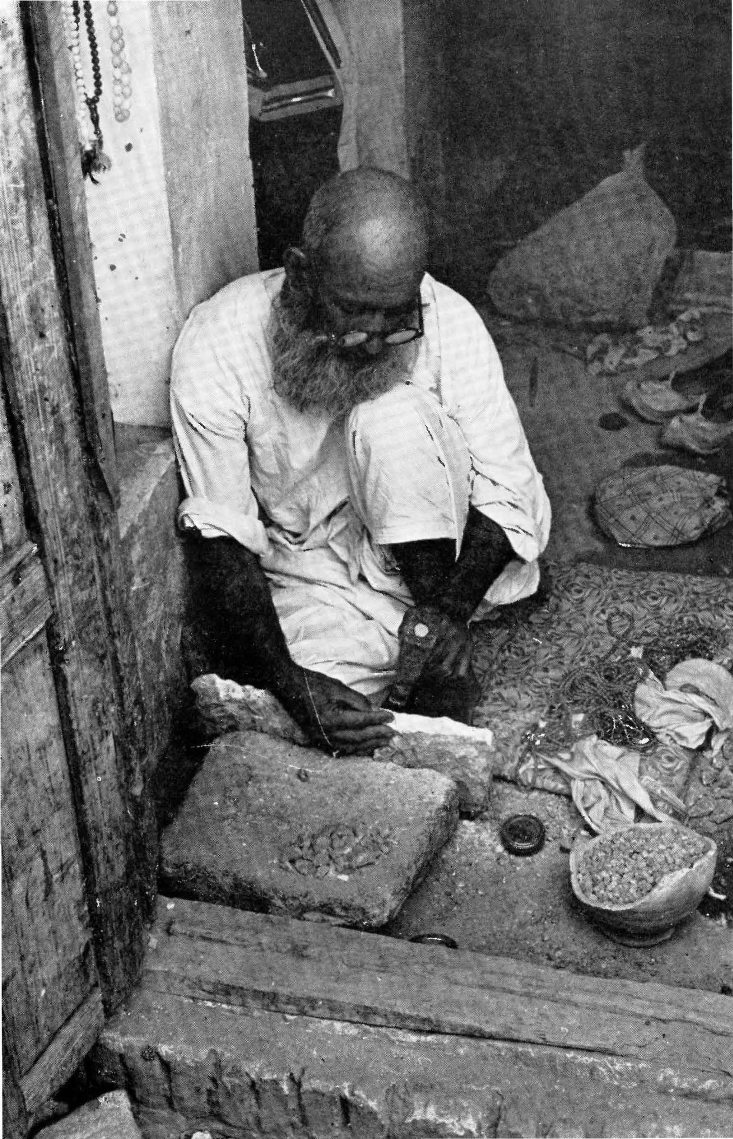
.,y.
....

304 AFGHANISTAN
EXCURSIONS
MUNDIGAK AND SHAH MAQSUD Full day, or overnight, tour. Kandahar-Mundigak: 56 km; 35 mi; 2 hrs. Mundigak-Shah Maqsud: 10 km; 6 mi; 30 min. Attractive camping site at Shah Maqsud in grove of
fir trees. Numerous chaikhana. No petrol.
This tour combines a visit to one of Afghanistan's more important archaeological sites and one of its more venerated shrines. Road conditions can change drastically from year to year.
Proceed from the Da Shahidanu Chawk toward Herat; 1.6 km; 1 mi. after crossing the bridge over the Arghandab River, turn right onto first major unpaved road where a few houses mark the junction. Keep going in a generally northeastern direction through an intensely cultivated area where many jui (irrigation canals) cut the road. About 7 km; 4.5 mi. after leaving the paved road take road to left; 5.7 km; 3.6 mi. beyond this where there is a qala (walled-residence) on the right, take another left fork onto a desert road which heads in a northerly direction toward a cleft in the mountains 10 km; 6 mi; 20 min. from the fork.
The road twists and turns in the mountains, rising to the sum1nit called the Khawk Rez (Sliding Dust) Pass which was a notorious hangout for highwaymen in the early years of the 20th century. In those days there were police posts at either end. The road descends into a vast desert landscape relieved only occasionally by villages such as Mundigak (9 km; 6 mi; 30 min. from top of pass). Two kilometers beyond the village a cairn marks the track leading to the excavation site a scant kilometer to the left (15 min. from village).
According to J.-M. Casal, the French archaeologist from DAFA who directed the excavations at this Bronze Age site from 1951-58, this area was probably first used as a camp site by a nomadic group who later settled here and introduced cultural traditions acquired from the subcontinent. The small agricultural village they established gradually evolved into a densely populated urban town related to an elaborate complex of agricultural communities sup-

KANDAHAR 305
Sculptured limestone head, from Jlt!undigak, 3rd Millennium B.C. (h. 9 cm)
porting the Indus Valley Civilization. Villages such as Deh Morasi Ghundai and Said Qala some 35 kilometers to the south helped sustain and supply Mundigak, and Mundigak contributed to the prosperity of such large cities in the Indus Valley as Harappa and Mohenjo-daro . Coining into being about 3000 B.c. Mundigak reached a splendid period of florescence ca. 2000 B.c. characterized by monumental public buildings indicative of a highly organized society composed of large nun1bers of administrati ·ve, economic, and religious specialists.
The most prominent building sits on top of a conical mound 20 meters high and 1·50 meters at its base,, the highest mound in the complex. This grandiose edifice which seems most likely to have been the city's palace-citadel sat on a brick foundati .on fronting onto a paved court . Its walls were plastered white and decorated with half cylinders of brick topped by a stepped-brick frieze. Staircases led to a now vanished superstructure and a

306 AFGHANISTAN
1nassive wall around the entire rnound indicates an effective defensive system in the heart of the city.
Some two hundred meters east of the main mound another building stood on a smaller hill. It was surrounded by a compart1nented wall faced with buttresses and inside there were various rooms containing numerous hearths and benches suggesting that this may have been the main temple in the city. Another large building stood on the west, and inner and outer walls with two meters between them connected these high spots in the city. This wall was buttressed on the outside and stout bastions stood at the main angles.
A sizeable collection of painted goblets, terracotta figurines resembling female goddesses, bulls, goats, and a dog or a pig, bone and steatite seals, flint tools, bronze and copper implements and mirrors, semi-precious jewelry, and a superb sculptured limestone head was recovered from the site. Many examples are on display at the National Museum, Kabul.
There is evidence of several destructive intrusions. After the first of these the city was quickly rebuilt and reached a new climax. After the mid-second millennium B.c. (ca. 1500 B.c.), however, the city seems to have been less densely populated and only periodic occupation by nomads and semi-nomads is indicated. It was finally abandoned ca. 1000 B.c.
The town and shrine of Shah Maqsud is only 10 km; 6 mi; 30 n1in. beyond the turnoff to the excavations. Take left fork 4 km; 2.5 mi. from excavation turnoff. This is a popular place of pilgrimage, particularly on Nawroz (21 March) and on the two major Id holidays, so you find numerous chaikhana and a "hotel" situated in a grove of fir trees. You will need full camping equipment should you decide to stay the night.
Shah Maqsud was a companion of the Hazrat Ali, cousin and son-in-law of the Prophet Mohammad and fourth orthodox Caliph of Islam. Numbers of battles were fought in the dispute which arose over the legitimacy of Ali's succession to the Caliphate, however, and Ali had arranged with his followers that in the event of his death his body was to be placed in an unmarked coffin so that his enemies might not desecrate it. Furthermore, according to the story told at Shah Maqsud, three identical coffins were to be allotted to any three of his companions who might fall with him. No one was to know who lay in which coffin and all four were to

KANDAHAR 307
be placed on camels which were to be allowed to wander at will. The coffins were then to be buried where the camels came to rest, their occupants still unidentified. Hazrat Ali's final battle took place in 661 A.D. and the four coffins were duly dispatched. Long afterwards miraculous visions revealed that the Hazrat Ali lay in Mazar-i-Sharif and his companion, Shah Maqsud, rested on this hillside. Some pilgrims, however, wonder if perhaps it is not the Hazrat Ali himself who is actually buried here.
The grave of the saint lies in a stone-paved courtyard at the base of a sacred tree under a stepped-marble base covered with silken cloths of green and red; green pennants flutter above from tall poles topped with the hand of Fatima, daughter of the Prophet and wife of Hazrat Ali, a symbol of protection; a carved marble balustrade encircles it. A second grave marks the resting place of an unknown disciple. A table with several Korans stands in the north-west corner.
In the forecourt there is a stone porch in which huge cooking vessels are stored. Affluent pilgrims and those whose prayers have been answered will sacrifice several animals and feed the faithful from these pots. The shrine is particularly patronized by those afflicted with paralysis and those possessed by evil spirits. It is appropriate to leave a donation for the shrine in bowls placed by the door for this purpose. Many dervish frequent Shah Maqsud and visitors are requested to be particularly respectful in their conduct at this most venerated shirne.
South-west of the main shrine there is a pavilion sheltering two extremely large kettledrums. As the sun begins to rise and as it sets the rythmic beat of these drums fills the valley, a ritual of many centuries going back perhaps even to the days when Mundigak flourished. In fact, it is almost certain that numbers of the scores of shrines dotting the hillside date fron1 prehistoric times.
The shrines are too numerous to describe in detail. Several circles of stones may be prehistoric graves. The shrine of Imaman contains the graves of several Imam ( those who lead congregational prayers) who officiated for Shah Maqsud. They lie to the west of the main shrine, inside a mud-walled enclosure printed with red and yellow symbols. The graves are covered with countless fragments of worked marble, many of which are of considerable antiquity. A small mud and stone enclosure between Shah Maqsud and Imaman contains the graves of Lala Malang and his brother,

308 AFGHANISTAN
Saifullah, together with a dozen or so distinguished dervishes. West of the hotel, beyond the fir trees, south of a grove of
mulberries, there is a large melon-shaped black stone encircled with small boulders. This is Hatakai (melon in Pashto) Baba. Legend relates that the Hazrat Ali was seated here with some of his followers enjoying a huge melon when the enemy appeared. As they rose to flee, Hazrat Ali turned the melon into stone so that his enemies might not be refreshed by it. As you will see, they had had time to enjoy only one slice of this luscious fruit before being forced to abandon it.

CHAPTER 17
Lasht~ar Gah and Bost
Route Kandahar-Lashkar Gah
Kandahar-Turnoff Turnoff-Lashkar Gah
(graded gravel) Lashkar Gah-Bost
(unpaved) Lashkar Gah-Palace
Population:
Altitudes:
15,000
Kandahar:
Distance 136 km; 86 mi. 92 km; 58 mi. 44 km; 28 mi.
10 km; 6 mi.
1 km.
Time 2 hrs. 1 hr. 1 hr.
20 min.
5 min.
Lashkar Gah: 1009 m; 3310 ft. 700 m; 2297 ft. 840 m; 2756 ft.
Hotels:
Girishk:
Bost Hotel: Varied price range, sw1mm1ng, tennis.
Refreshments: Chaikhana in Kishk-i-Nakhud.
Petrol:
Tolls:
Bost Hotel: On request. Large chaikhana in main bazaar of Lashkar Gah.
Pump at entrance to town from east.
40 afs. at Kishk-i-Nakhud; 80 afs. round trip.
LASHKAR GAH, capital of Hilmand Province, is built around the Hilmand-Arghandab Valley Authority which seeks to transform the deserts of the Hilmand and Arghandab Valleys into fertile fields as green as they were centuries ago before conquerors and anarchy consigned them to barren drabness. Afghan engineers began to work in the Hilmand Valley in 1910 and work con-
309
310 AFGHANISTAN
tinued throughout the 1930s as German and Japanese engineers labored with them to restore the ancient canals and build new waterways. Afghan engineers expanded the system even further during the war years and after World War II. In 1946, they were joined by an American engineering company, Morrison-Knudsen Afghanistan, Inc., under contract to the Afghan Government until 1959. The Export-Import Bank and USAID have assisted with grants, loans and technicians since 1950.
The goal is to provide the basic elements of an irrigation system which will serve about 300,000 acres of land in the Upper Hilmand Valley. As of 1976 about 250,000 acres were under cultivation. Two huge dams, the Arghandab Dam on the Arghandab River north of Kandahar and the Kajakai Dam on the Hilmand River above Girishk, have been completed. Work continues on the water distribution and drainage system, on the preparation of land for cultivation, on settlement of farmers and on the building of a small scale industrial complex to be powered by electricity from the Sarband power plant at Kajakai. Education, health and extension services develop as the project grows. The planners also envision eventual extension of the scheme to the Lower Hilmand Valley, in the vicinity of Zaranj, prosperous capital of the Seistan until it was destroyed by Tamerlane in the 14th century.
SIGHT-SEEING
(1) BOST OR QALA-1-BIST Several industrial compounds border the southern edge of Lashkar Gah. Take unpaved road running south from the Bost Hotel; road terminates at the famous arch of Bost.
Ancient Bost now lies in ruins some 10 km; 6 mi; 20 min. south of the modern administrative town. Some recognize the name of Bost in the early Zoroastrian hymns of the Avesta, in Achaemenid town lists and in First Century accounts. These references are vague and open to argument but there is no doubt that the citadel of Bost was taken by early Arab conquerors around 661 A.D.
From here they tried to take the regions of Kandahar and Kabul but the hill tribes constantly defeated them; even at Bost, Arab control was tenuous and intermittent.
From the time Bost became a mint town of the Islamic Saffarid

LASHKAR GAH AND BOST 31i
Dynasty in the 9th century, however, the city grew to become the second city of the southwest. Ibn Haukal, an Arab traveller in the middle of the 10th century, describes the city thus: "Bost is one of the principal cities in the province of Sejistan, except Zirenje, no city is larger than it. The inhabitants of Bost are polite and generous resembling in dress and manners, the people of Irak. It is a city well supplied with provisions, fruits, and dates: they trade from the city with Hindoostan.''
During the 11th century and until the middle of the 12th century, Bost prospered as the winter capital of the Ghaznavids only to be burned and looted in 1151 by the Ghorids and then completely demolished by Genghis Khan in 1220. Its gardens, however, continued to be eulogized by contemporary chroniclers until Tamerlane ravaged the irrigation system and consigned Bost to oblivion in 1383.
The gigantic mound which marks the site of Bast's citadel bespeaks its age and importance. On the summit there are vestiges of many elaborate architectural structures among which the most spectacular is a spiral staircase within a well 130 feet deep and 18 feet in diameter. From this staircase, three tiers of four circular chambers look out into the shaft through a succession of arches. Many a comfortable afternoon's rest must have been enjoyed in these chambers coolly shielded from the desert's heat.
From the summit it is easy to see why this was such an important fort: its ramparts command a magnificent view of the plains once crossed by busy highways from Khurasan (Herat), Baluchistan (Iran) and India. Also, the Arghandab River meets the Hilmand River at the foot of this citadel. At various times during its long history barges plied between Bost and Zaranj.
At the foot of the mound the ruins of the commercial city with its bazaars, serais, baths, 1nosques, etc., are clearly discernable; many of the walls still stand high. The most remarkable monument is, of course, the magnificently decorated arch which has a span of 80 feet. This arch is thought by some experts to have been constructed as a ceremonial arch across the principal approach to the citadel. It was built in the 11th century and has been restored.
The attractively decorated 12th century mausoleum known as the Ziarat-i-Shahzada Husain sits in the graveyard north of the citadel walls. The motorable road to the shrine veers to the left on leaving the citadel (1-l km.).

312 AFGHANISTAN
(2) LASHKAR GAH OR LASHKARI BAZAAR On the southern edge of the modern town an unpaved road breaks through ancient walls beside a monumental gateway (before reaching bridge over Hilmand River) ; this road leads directly to the ruins locally known as Shahr-i-Mahmud or Mahmud's City; less than one kilometer, 5 min.
When the Ghaznavid court came to Bost for the winter season, they did not live in the citadel of Bost or in its commercial city. Sultan Mahmud and his nobles built their palaces and villas to the north, grouping them in a series of clusters all along the banks of the Hilmand River, from Bost to Girishk. Most of them were, however, concentrated along a four mile stretch between the citadel at Bost and the present modern town. That the nobility did not feel the need to remain within the confines of the citadel speaks eloquently of the security the country enjoyed under early Ghaznavid rule.
The court was accompanied, of course, by a large military escort who lived in barracks and cantonments, complete with canteens and bazaars, near the palaces. This suburb of Bost, which also included the government offices, was known as al-Askaria or Lashkar Gah, the Place of the Soldiers. Later it came to be called Lashkari Bazaar, Soldiers' Bazaar.
French archaeologists with DAFA (Delegation Archeologique Fran~aise en Afghanistan) under the direction of Daniel Schlumberger excavated at Lashkari Bazaar from 1949~52. Thanks to their work we have an excellent picture of these elegant palaces as they were during their prime years.
The three most important palaces were built on a bluff overlooking the Hilmand River and of the three, the southern palace, built at the bend in the river, is the largest and most elegant. (See Sketch A) Extending for half a kilometer along the bank, the palace is built around a central court with four iwans or arched doorways. Visitors will immediately recognize the striking similarity of this architectural design to that of the great mosque in Herat. Interestingly, this popular Iranian mosque style first appears in Persia at the end of the 12th century and in Herat in 1200. However, Sultan Mahmud (998-1030) and his son Mas'ud I (1030-1041), ·accredited with the construction of this palace, built it, a secular building, at the beginning of the 11th century-almost two cen-

LASHKAR GAH AND BOST 313
PRINCIPAL MONUMENTS AT LASHKAR GAH .. --i D A FA Me m. XV m I
A. Northern Palace 8. Pigeon Tower C. Pavillion D. Central Palace
• M. Le Serre
( North
0 100 200 300 m.
H
E. Southern Palace (see Sketch B) F. Mosque G. Southern Gate H. Bazaar
Sketch A
turies earlier. The excavations at Lashkar Gah provide new evidence of incomparable value, therefore, for the student of Islamic architecture. The opportunity offered by Lashkar Gah to reconstruct Ghaznavid styles is doubly important since no buildings still stand at Ghazni, the Ghaznavid capital.
Passing through the northern iwan one enters a spacious rectangular audience hall once ringed with columns and decorated with frescoes and intricately sculptured stucco. Archaeologists clearing the audience hall were at first confronted by four meters of debris containing fragn1ents of fallen arches, epigraphic bands, bases, columns and painted, sculptured ornamentation. Similarly, large panels with epigraphic borders surrounding a welter of sculptured stucco and interlacings of cut brick were found in the debris of the southern iwan. All together they give one an inkling of the elegant decoration which once faced these barren walls. Two panels from the audience hall on display in the National Museum, Kabul, help the imagination recreate the color and profusion of delicate design which once greeted the visitor to these halls. They bore close affinities to the decoration which may be· seen today in situ on the arch at Bost.

314 AFGHANISTAN
Excitement mounted as the clearance revealed distemper paintings on the walls depicting richly garbed guardsmen, weapons at the ready in their brocaded belts, standing against a background of flowers, fruit-laden trees, birds, gazelle and other animals of the chase to which the court was particularly addicted. (The frescoes are in the National Museum, Kabul; see Sketch B for original position in audience hall). In the center of this same hall there is a rose-petalled water basin, popularly called the Queen's Bath, fed by a canal running east-west indicating that the palace had running water.
A note to the visitor. The audience hall commands a magnificent view of the river and plains beyond, which is particularly appealing on a cool summer's morning at sunrise. In fact, if you get an early start, watch the sun rise over the arch at Bost and breakfast in the audience hall, you will be amply rewarded.
Just to the south of the great audience hall (Sketch B), the excavators discovered a small mosque elaborately decorated in delicately sculptured stucco with borders of Koranic inscriptions. These panels were painstakingly removed under the direction of M. Le Berre of DAF A and the little mosque, a private chapel no doubt, has been reconstructed in an alcove at the museum in Kabul.
To the east of the palace there was a large garden with a central pavilion or gazebo. A platform centered with an octagonal basin, the foundation of the gazebo, may still be seen. A contemporary observer, Baihaqi, writes about the day 600 gazelle were rounded up and herded into this garden while Mas'ud "hunted" from the pavilion. Baihaqi also writes of the great outings on the plains when the Sultan crossed the river on a canopied barge hung with silks. He was accompanied_ by a large retinue of falconiers, muscians and keepers of his prized hunting hounds. These were no doubt tazi (Afghan hounds) used extensively by hunters in the Kandahar area to this day. The Afghan hounds raised by special nomadic groups stand lean and sleek unlike their effete, inbred cousins raised in stylish kennels. They are particularly adept in rounding up gazelle.
Evidence of some remodeling at the southern palace parallels political changes within the empire. After the powerful reigns of Sultan Mahmud and his son, the empire was shaken by revolt and the subsequent reigns of Sultan Maudud, Mas'ud III and Bahram

LASHKAR GAH AND BOST
( North
L J p p
p
p
__ u ~ I I u \_J
AUDIENCE HALL, SOUTHERN PALACE LASHKAR GAH
Entrance
P- Painting Drawn by M. Le Serre ( OAF A)
Sketch B
315
Shah (1042-1152) were troubled and insecure. So at Lashkar Gah new walls, not changing so much as securing the palace, reflect this. Then comes evidence of a great fire, evidence of the rude attack by Bahram Shah's adversary, Alauddin Ghori who came to burn Ghazni and Bost in 1151.
Evidence exists, however, of two catastrophic conflagrations. It seems probable therefore that the Ghorids could not resist these gorgeous palaces and it may be that the palace mosque is in fact their creation. Just who were the final arsonists is open to conjecture-it could have been the armies of the Khwarizm Shah around 1215 or those of Genghis Khan in 1220. Not that it really matters. The destruction was complete and the palaces were brusquely abandoned, never to be occupied again.

316 AFGHANISTAN
SHOPPING
Dolls: The Women's Welfare Society of Lashkar Gah (four blocks east of the Bost Hotel) makes a series of dolls dressed in regional costumes. The costumes are authentic in every detail and represent the national dress of both men and women in all major ethnic groups.
Embroidery: Table linens, guest towels, beaded bags and glasses cases, adult costumes, etc., are also sold at the Women's Welfare Society.
Alabaster: The Alabaster Factory is located at the southern edge of the modern town. In its showroom handcut, handpolished bowls, ashtrays, paper weights, etc. may be purchased. A tour of the factory is highly recommended.

CHAPTER 18
Kandahar to Kabul Route
Kandahar-Kabul Kandahar-Kalat-i-
G hilzai Kalat-i-Ghilzai-Moqor Moqor-Ghazni Ghazni-Kabul
Distance 488 km; 305 mi. 136 km; 85 mi.
113km; 70mi. 103 km; 65 mi. 143 km; 89 mi.
Altitudes: Kandahar: 1009 m; 3310 ft. 2190 m; 7186 ft. 1797 m; 5900 ft.
Ghazni: Kabul:
Time 6! hrs. 2 hrs.
1! hrs. ll hrs. t J hrs.
Petrol: Kalat-i-Ghilzai; Moqor; Ghazni; l\1aidan Shahr.
Tolls: 50 afs. between Kandahar and Ghazni; 30 afs. between G hazni and Kabul.
Hotels: Hotel Ghazni; varied price range. Kalat-i-Ghilzai: Zabul Hotel, minimum.
Refreshments: Ghazni, Farokhi Restaurant; chaikhana as mentioned in text.
The road from Kandahar to Kabul follows an ancient route traversed for centuries by caravans. Armies intent upon the capture of Kabul have also marched this way, obedient to the commands of such diverse conquerors as Darius the Great of Persia,. Alexander of Macedon, Sebuktigin, Mahmud of Ghazni, Ahmad Shah Durrani, Fateh Khan Barakzai, Nott and Roberts. Furthermore, almost all the villages and towns along the way are mentioned as welcome overnight havens by 19th century travellers.
317

318 AFGHANISTAN
Though modern travellers may scarcely note their existence as they speed through on a smooth, wide highway paved since 1966, many of these seemingly insignificant villages provided the scene for key events in Afghan history.
On the outskirts of Kandahar, the road forks: left fork for Kabul; the right fork goes to the Kandahar International Airport (20 km; 12 mi; 15 min.) which was opened on 1 December 1962 and Spin Boldak (104 km; 65 mi~ 1 hr. 15 min., paved) on the border.
There is not much to recommend in the next hour's ride. The road runs straight, uninterrupted by curve or rise, and heat waves mesmerize. The plains are so vast that even whole villages of domed-huts blend into the desert and become invisible. Only an old caravanserai to the right of the road some 20 kn1; 12.5 mi; 20 min. out of Kandahar is liable to capture attention and, perhaps, the photographer's eye. The decorated arched gateway facing Kandahar is very handsome.
Such abandoned serais, also called rabat or fort, stand at regular intervals representing one day's journey by camel which varied from ten to fifteen kilometers, depending on the difficulty of the terrain. Those along this route were built by Amir Abdur Rahman (1880-1901) to secure the area and permit the peaceful passage of trading caravans. In the unsettled times before he came to the throne the tribes living along this route frequently plundered passing caravans. Putting down opposition through battle and diplomacy, the Amir then maintained his control by building and garrisoning these serais, holding the village chiefs personally responsible for the protection of the caravans. The chiefs resisted vigorously but the Amir was not one to brook disobedience and his punishments were harsh. Peace gradually reigned. There is no need for these serais today for the lorries that have replaced the camels rush past to come to rest in the motorserais of the big cities; the caravanserais stand empty, serving only as crumbling reminders of Afghanistan's "wild, wild West" days.
Continuing toward Shahr-i-Safa you will note numerous villages of domed houses, sometimes referred to as beehive huts. This architectural style, so vastly different from the flat-roofed qala to be seen later between Ghazni and Kabul, begins at Kalati-Ghilzai and extends to Herat. Beehive huts are also found in pockets throughout the north. The domed mausoleum of the

KANDAHAR TO KABUL 319
esteemed Mullah Nur l\1ohammad (ca. 1800) in the hamlet of Deh Akhund is an attractive adaptation of this architectural sty le ( 50 km; 31 mi. from Kandahar). The inscription on his tomb reads:
When Mullah Nur Mohammad knew that this world is not everlasting, he left this for an eternal one, and the earth appeared dark by this loss.
The River Tarnak, a tributary of the Arghandab River, rises at Moqor and flows for 320 km; 200 mi. through this area. Narrow in parts, but widening at times to an impressive extent, it softens the landscape by permitting crops and orchards to flourish and villages to prosper. So much of its waters are diverted for irrigation, however, that sometimes not much remains and very litt]e actually flows into the Dora south of Kandahar.
An extensive stand of fir trees fitting! y announces the approach of Shahr-i-Safa (City of Purity; 62 km; 39 mi; 1 hr.) which is in Zabul Province. A ruined caravanserai sits to the right beside the toll gate (50 afs; surrender ticket if coming from Kabul) and beyond it there is a towering artificial mound which could undoubtedly reveal an interesting story if excavated. Shahr-i-Safa is sometimes referred to as Shahr-i-Sepah (Soldiers' City) by the local inhabitants who say that when Ahmad Shah Durrani set out for India he always ordered each of his soldiers to fill a cloak with sand from Kandahar. The sand was deposited here and when the army returned each man again took up a Joad of sand. By the amount of sand left, they estimated the number fallen in battle. There are a number of chaikhana here.
A solitary octagonal pillar 10 m; 33 ft. high stands to the right of the road son1e 18 km; 11 mi. beyond the toll gate. Known locally as Ghashey in Pashto, it is referred to in most western sources as Tirandaz, the Dari translation meaning The Archer. Two stories are attached to this pillar, both concerning Ahmad Shah Durrani (1747-1772). According to one story Ahmad Shah once stood upon the promontory to the left and shot an arrow precisely to this spot. Pleased with the great distance his arrow had flown, he erected this column to commemorate the feat, symbolic of his wide-spread power. The other story relates that for long it had been noted that this area marked the climatic dividing line between the warm, rainy area of Kandahar and the dryer, snowy area of Kalat-i-Ghilzai. Seeking an exact demarcation,

320 AFGHANISTAN
Ahmad Shah shot an arrow which followed the winds to this spot. The pillar is built of burnt brick so placed that they form a series of chevrons and diamonds, its only ornamentation.
The pillar does in fact stand on the edge of the flat plains of Kandahar and here the road enters low hills. Further on about 20 km; 12.5 mi. one comes to Jaldak, a charming village with a roadside fruit stand and teahouses. Zaman Shah, king in Afghanistan from 1793-1800, fought an important battle near here which gave him paramontcy over the Ghilzai Pushtun. This reinforced his right to the throne of Kabul.
Numerically, the Ghilzai are today the largest Pushtun group in Afghanistan and the heart of their homeland is at Kalat-i-Ghilzai (Fort of the Ghilzai), capital of Zabul Province, 136 km; 85 mi; 1! hrs. from Kandahar. (altitude: 1563 m; 5130 ft.) The fort of Kalat-i-Ghilzai, high on a solitary rugged hill, stands out sharply on the horizon and cannot be missed. The petrol pump stands by the roadside at the foot of the fort, to the right. The hotel and chaikhana lie behind the petrol station, on the edge of a small bazaar; the chaikhana near the petrol pump serves excellent pilau and qorma.
Nineteenth century travellers approached the land of the Ghilzai between Kalat-i-Ghilzai and Ghazni with fear and trepidation for the "much dreaded" Ghilzai Pushtun were a large, fiercely independent, aggressively valiant Afghan tribe whose daring exploits fill the pages of Afghan history. Their finest hour came early in the 18th century when their leader Mir Wais Hotak, declared independence from Persian rule and his son, Mahmud, then seized the throne of Persia in 1722. Nadir Shah Afshat later crushed the power of the Ghilzai but in their homeland, from Kandahar to Ghazni, they continued supreme and throughout the following years of Afghanistan's history he who would rule at Kabul had to secure the allegiance of the Ghilzai. Today many of them follow the traditional nomadic way of life leading large, rich caravans throughout the country. Others are prominent in government, important contributors to Afghanistan's progress.
The high mound which bears the fort upon its summit was in a fine strategic position to control the passage of supplies and communications between the important centers of Kandahar, Ghazni and Kabul. A miraculous spring of clear water on the very summit added to its strength. It is said that Nadir Shah Afshar utterly

KANDAHAR TO KABUL 321
~ ::. . . !,'.~~ ,;,:
'w • ., <
'.~
Kalat-i ·-Gl1ilzai, the Famous Fort of the Ghilzai
demolished the fortifications of Kalat-i-Ghilzai in 1738 when he made his revengeful march through Afghanistan subduing the fearful Ghilzai. A hundred years later when the confrontations between Afghanistan and Britain began, the British expended much effort in building strong fortifications on this hill. They had numerous troops stationed at Kandahar and at Kabul but here. between them lay the territory of their most ardent opponents. The Ghilzai for their part sorely hampered the British in their task , for they saw the fort as a dagger plunged into their heartland. The stories concerning the defense of this mighty fortress as told by both _ sides are legion. Each is an account of gallant warriors, valor and courage.
At Sar-i-Asp (Horse's Head ) (20 km; 12.5 mi. from Kalat-iGhilzai) a large caravanserai appears to the right of the road. This was an important halting ground in the 19th century, mentioned by many a weary traveller who entered the safety df its . walls with profound relief. Today, aside from the ruined serai, Sar-i-Asp is hardly more than a bend in the road but it was here that Zaman Shah , that same king who secured his throne at J aldak, lost the throne to his brother, Shah Mahmud , in 1800. Shah Mahmud owed his success at the battle of Sar-i-Asp to Fateh Khan Barakzai who commanded l1is troops with a heart filled with special vengeance for his father, the venerable Barakzai chieftain, Payenda Khan , had · been recently assassinated by order of Zaman Shah.

322 AFGHANISTAN
Eighteen years later, Shah Mahmud would kill the man who made him king this day at Sar-i-Asp thus bringing about his own downfall. Family feuds, plots and counterplots such as this fill the pages of 19th century Afghan history and many tortuous machinations were played out along this very road to Kabul, the key to power in Afghanistan.
Chaikhana at Naorak 14 km; 9 mi. beyond Sar-i-Asp serve a full range of refreshments. Shahjui is a small town with a busy bazaar (32 km; 20 mi; 30 min. from Naorak). A hot battle between British troops and Ghilzai tribesmen was fought here in October, 1879. Janda (30 km; 19 mi. beyond Shahjui) is an attractive roadside bazaar with an ever increasing number of chaikhana. Until August the landscape along this portion of the route during which one passes into G hazni Province is tinged with green, and the purple sage blooms prettily. Herds of camels graze on camel thorn, their tongues miraculously impervious to needle-like spines which pierce the shoes of unsuspecting wanderers. The camel thorn is collected in mid-August and piled high beside the road before being loaded onto camels and carted home for winter fuel. By September, all is quite brown.
The major town in this area is Moqor, a District Capital of Ghazni Province, which lies almost exactly n1idway between Ghazni and Kalat-i-Ghilzai (altitude: 1997 m; 6553 ft.). Because of its central position, Moqor figures prominently in early accounts by both simple travellers and military historians alike. The busy tree-lined bazaar is today hidden behind nondescript buildings on the right. The large government office building on the left was built by the people of Moqor to receive King Amanullah (1919-1929) when he returned from his European tour in July, 1928. Here he granted a large audience to the people of Moqor and told them of his trip and of his plans for the modernization of Afghanistan. Less than a year later the country rejected these programmes and rebellious forces led by Bacha Saqao swarmed into Kabul. The King fled to Kandahar in January, 1929, where he tried to rally the tribes, but they too had been alienated. He made one la~t attempt to take Ghazni, the key to repossessing Kabul, but because of opposition from the Sulaiman Khel, a powerful sub-tribe of the Ghilzai, he had to leave the walls of Ghazni behind him and return to Moqor where he spent his last night in Afghanistan. He then proceeded to Bombay and thence

KANDAHAR TO KABUL 323
to a life of exile in Italy. He died in Zurich in 1960 and lies buried at Jal ala bad beside his father, Amir Habibullah.
The petrol station at Moqor is on the left, just before entering. Leaving Moqor, you will note numbers of circular mounds of
earth looking very much like large bomb craters. Spread out in haphazard lines, they run sometimes parallel to the road, sometimes under the road, and often their progress can be traced for long distances from green fields beside the road to the mountains far to the left. These are karez (Pashto term; qanat in Dari), a highly specialized irrigation system practiced in southern Afghanistan for centuries. The system consists of a series of underground channels, often several miles long, which lead water from the mountain to the fields. The channels are constructed by means of a series of deep shafts about 20-60 feet apart which are generally about 6 feet in diameter. Sometimes they are as much as 150 feet deep. The earth from the shafts is piled around the mouth of the hole making them resemble craters. If you see a windlass over the mouth of a karez shaft, this will mean that it is being cleaned; cleared of accumulated mud and silt. Both the construction and maintenance of the karez requires a phenomenal amount of highly skilled labor and technical know-how, and, if you stop to look down one, you will realize what a hazardous occupation it is as well.
Because of the many karez, many villages thrive. Surrounded by groves of trees, they appear as oases in this desert land. Between them plots of melon and grape vines are enclosed within low walls as protection against wandering animals. Small watchtowers stand in the center of some, for two-legged prowlers are also tempted by the luscious fruits during the peak harvest periods. The villagers of this area belong to the Andar, a sub-tribe of the G hilzai. They are renowned throughout the country for their skill in building and maintaining the karez. Large artificial mounds in the area also indicate that this has been an intensely inhabited area for many centuries.
On the northern fringe of this cultivated area, about 60 km; 37.5 mi. from Moqor, one passes by the site of the great battle of Ahmed Khel, scene of fierce fighting and much slaughter between 9 and 10 on the morning of April 19, 1880. The encounter took place between three British brigades on their way from Kandahar to Kabul and thousands of Ghilzai tribesmen determined to arrest

324 AFGHANISTAN
their progress. The long British column, strung out for six miles as they marched, had been harassed by the tribesmen for days but now, with their standards planted on the crest of the mountains, drums beating, a solid flank of 12-15,000 Ghilzai two miles long, swarmed down from the hills to burst upon the advancing forces. Only with the greatest difficulty were the British able to win the day and proceed to Ghazni.
The battlefield left behind, the desert returns. Some 16 km; 10 mi. further on an attractive domed shrine to the left of the road attracts the attention. Goat horns hang over the whitewashed doorway and flags fly above the dome to mark it as the final resting place of the sainted Mullah Nanu Baba for whom this area is named. Nani, about 10 km; 6 mi. beyond the shrine where one encounters a toll gate, also bears his name ( surrender ticket; 50 afs. if coming from Ghazni). It is said that during its heyday Ghazni's suburbs stretched as far as Nani. There is not much to indicate this today, however, in the next 16 km; 10 mi. before one passes by the Hotel Ghazni and the petrol station before coming to the turnoff to Ghazni.
Before turning into the city, pause a moment to note, on the right and to the front of you, one of the most impressive examples of a qala to be seen anywhere in Afghanistan. This very large, classic Afghan dwelling, attractively nestled within its own orchard, is the ancestral home of Abdullah Malikyar, Afghan Ambassador to the United States, 1967-1977. Qala are constructed by the Pushtun throughout Afghanistan. Though the style follows an easily identifiable pattern there are many individual variations of which there are numerous extremely interesting examples between Ghazni and Kabul. Sometimes almost camouflaged against the mountains, sometimes surrounded by orchards or hedged by poplars, the high forbidding mud walls, pierced by a single doorway, enclose large rectangular courtyards where animals are stabled and supplies stored. Living quarters for the family are sometimes built along one side of the courtyard. At other times they are located in a second story above the stalls, or, in towers built on two or more of the corners. Often a balcony is constructed over the main doorway or around one of the towers. These balconies are called mehmankhana or guest rooms. Here colorful pillows are tossed out on Afghan carpets and tea is served while guest and host enjoy the view. It is a delightful custom and to have been so entertained is an unforgettable experience.
KANDAHAR TO KABUL 325
If this is your only visit to Ghazni, do by all means stop to visit this capital of the powerful Ghaznavid Empire, brilliant cultural center of the Islamic world in the 11th and 12th centuries A.D.
It will take about an hour. See Chapter 9. By-passing the city, the modern road runs straight through the
center of the valley and fron1 it, to the left, one may note: the two famous minarets of Ghazni; the tomb of Sebuktigin (977-997), father of Sultan Mahmud, sheltered by a yellow pavilion with pointed metal roof on the hillside above the minarets; the restored mausoleum of Abdur Razzak (16th century) which now houses the Museum of Islamic Art; and a long tree-lined avenue leading to the tomb of Ghazni 's most splendid ruler, Sultan Mahmud of Ghazni (998-1030).
The road then climbs the barren Shashgao Pass dividing Ghazni province from the province of Maidan-Wardak and descends to the toll gate outside the village of Shashgao (27 km; 17 mi; 20 min.) from G hazni : 30 af s; surrender ticket if coming from Kabul). Just as you enter the pass you may note a small roadside mosque on a rise to the right consisting of a simple outline of large rocks with a pile of stones marking the mehrab (prayer niche). The entranceway is situated opposite the mehrab, on the east, and the floor is covered with finely crushed stone. Such simple stone mosques may be found in most Push tun areas of Afghanistan and on routes frequented by nomads. Often they are located at either end of a difficult pass, or at the beginning of lonely, desolate regions. At the northern end of this pass there is a ruined caravanserai in which a small, attractively appointed indoor mosque remains in tolerably good condition.
An amuzing story tells how Shashgao (Six Cows) got its unusual name. It is said that one day while Abdur Rahman was fighting for the throne of Kabul on behalf of his father, he appeared outside this village riding a fiery charger. Six men of the village ran out to receive him. ''What is the name of this village?'', he demanded. Struck dumb by the awesome confrontation with one whose harsh ways with those who displeased him were already legend, the men stood silent and open-mouthed, eyes glued to the commanding figure. Losing patience, he pulled on the reins, and, as his rearing horse pawed the air, his thundering voice declaimed: "You're as stupid as a bunch of cows! I name this place Shashgao !" Spurring his horse, he galloped into the distance never to return. A nice story indicative of the Amir's enduring reputation,

326 AFGHANISTAN
but accounts by participants in the First Anglo-Afghan War (1839-1842) speak of Shashgao as being two days' march from Ghazni.
During the last days of the Second Anglo-Afghan War (1878-1880), throughout the last few days of April, 1880, thousands of British troops converged on Kabul via this route. The air was tense with apprehension. Hostile tribal activity was fearfully reminiscent of Britain's first sojourn in Afghanistan which had culminated in the massacre of an entire British army as it retreated toward Jalalabad in January, 1842. The fierce resistance already encountered at Ahmed Khel was an all too explicit expression of current tribal feeling. As they neared Kabul more and more banners fluttered from the heights and at night the hills "had a peculiar and beautiful appearance, from the thousand camp fires of the enemy gleaming like meteors in the darkness." Scouts reconnoitered, foraging parties scoured the countryside for desperately needed fodder, and long columns marched at the command of generals encamped at Shashgao, Saidabad, and Sheikhabad. Saidabad (36 km; 23 mi; 30 min. from Shashgao, altitude 2100 m; 6890 ft.) lies at the northern end of a long, fertile valley known as Haft Asyab (Seven Water Mills) which follows a barren stony plain outside Shashgao. It had already provided the scene for two important events in Afghan history. Here the powerful Barakzai leader, Fateh Khan Barakzai, blinded prisoner of Shah Mahmud and his son Kamran, was hacked to death at the end of the year 1818, signalling the rise of the Mohammadzai. It was here, too, in October, 1841, that 150 members of the British army were killed within their garrison, an early incident in the uprisings which ended so disastrously in the gorges outside Kabul on the road to Jalalabad. Today, Saidabad is a small bazaar town and district center noted primarily for its picturesque qala, and its peaceful gardens and orchards.
Sheikhabad (10 km; 6 mi; 10 min. from Saidabad; 40 km; 25 mi; 30 min. from the Maidan toll if coming from Kabul) also boasts several new qala clustered on the hillsides overlooking the bridge crossing the Logar River. Abdur Rahman won an important battle in the vicinity of this village on the 10th of May, 1866. This victory released his father, Amir Mohan1mad Afzal, from imprisonment and placed him on the throne of Kabul, displacing Amir Sher Ali, his half-brother. Amir Mohammad Afzal died within the year. He was succeeded by his full brother,

KANDAHAR TO KABUL 327
Amir l\1ohammad Azam, who was, however, soon displaced by the return of Amir Sher Ali which forced Abdur Rahman to leave for Central Asia where he spent eleven years in exile. His daring leadership was well remembered, however, when he returned in 1880 while the throne of Kabul sat empty, the country leaderless. In fact, the troops which marched on Kabul in April, 1880, would leave it the following August in the competent hands of Abdur Rahman, newly proclaimed Amir of the Kingdom of Kabul.
Beyond Sheikhabad simple, black nomadic tents dot the hillsides in striking contrast to the solid, massive qala, large herds of camels graze contentedly, and sweet-smelling purple sage blooms on the barren hills which alternate with verdant valleys. Much wheat is grown along this portion of the route and if you travel during the months of July and August, you may watch the complete harvest cycle from the initial stages of reaping, stacking and threshing to the final stages of winnowing, sieving and replowing. The largest and most luxuriant valley, Maidan, appears to the left where the unpaved road to Panjao and Bamiyan via the Unai and Haj igak Passes branches off to the left, 30 km; 19 mi; 30 min. from Kabul. ( 40 km; 25 mi; 30 min. from Sheikhabad). Maidan Shahr, the new administrative center for Maidan-Wardak Province is being built on the plain by this turnoff where there is a toll gate ( sur-
, render ticket; 30 afs. if coming from Kabul) and petrol pump. The small pass beyond brings you into Kabul Province.
Seven kilometers from the toll gate the road passes through a cut into the valley of Chawk-i-Argandeh (20 km; 12 mi. from Kabul) where Amir Dost Mohammad (1826-1839; 1843-1863) made his last stand in 1839. As Shah Shujah (1803-1808; 1839-1842) and his army escort came through the gap between two rocky ridges where today telephone poles march, they came upon 23 pieces of artillery drawn out on three sides of a square. Most were brass, and many were beautifully carved and embossed. One officer speaks with awe of "One enormous fellow, a 32-pounder, at least, (which) was pointed directly down the road up which we must have advanced." All was silent, the guns quiet and abandoned, however, for the Amir's followers had deserted, and he himself had crossed over the mountains on the left on his way to Bamiyan.
Kabul's Ski Lodge sits on the slope to the right 3 km; 2 mi. beyond the Arghandeh Valley (17 km; 10! mi. from Kabul). Ap-

328 AFGHANISTAN
proaching Kabul you may note the villages of Paghman and Beg Tut sprawled across the hillside far to the left. Amir Habibullah (1901-1919) built a charming summer palace at Beg Tut which was later used as Afghanistan's first tuberculosis sanatorium during the reign of King Amanullah (1919-1929). Paghman has been a popular summer resort since the days of the Moghul Emperor Babur in the 16th century, and probably much before. Amir Abdur Rahman brought his court here, and King Amanullah made it, his birthplace, his summet capital (see Chapter 5).
After crossing the bridge over the Chamchamast River, a tributary of the Kabul River, take right turn (left to Paghman) for Koti Sangi ( officially renan1ed Mir Wais Maidan) on the edge of Kabul.
,
-R'
,-· .... -·
\ ,.....r .J
r· I
' \ I
' \
HE RAT
HERAT
·,.,..·-"'------. ------------
r·' . ' ( ·,. r·-·-. _,· r· 'j-·
J I
' I ( Andkhoi 1
; ;" i \
' ,- . ./· ".-· '
I I
I I
\ BAU<H : I ' I ,~
I I
- . ....f·"'.j ;'° I
', \
\
\\ ~/ I I
I f ., • l
~·-·/ \ ,. . .) To Merv • r·~·
,-..... ./· . -..... Torghundi
I
/ ___ ,,,"'
To Kandahar
I ,,~,.
I I
I
BADGHIS
Chi!.ht
,--"'
I /
........ ,, I
I I
/ /
/
/ I
/
To Jam
I I
I I
I
/ I
I
I JOZJAN
----, I ,,, '
,~--,' \ \ l
I I I I
\ I
' I ..... __ /
•- Historic Site
\ I \ I ' I
\ I \ I
\ I
' I ', I
I I
....,
/
THE NORTH WEST
To Tashkurghon (Khulm)
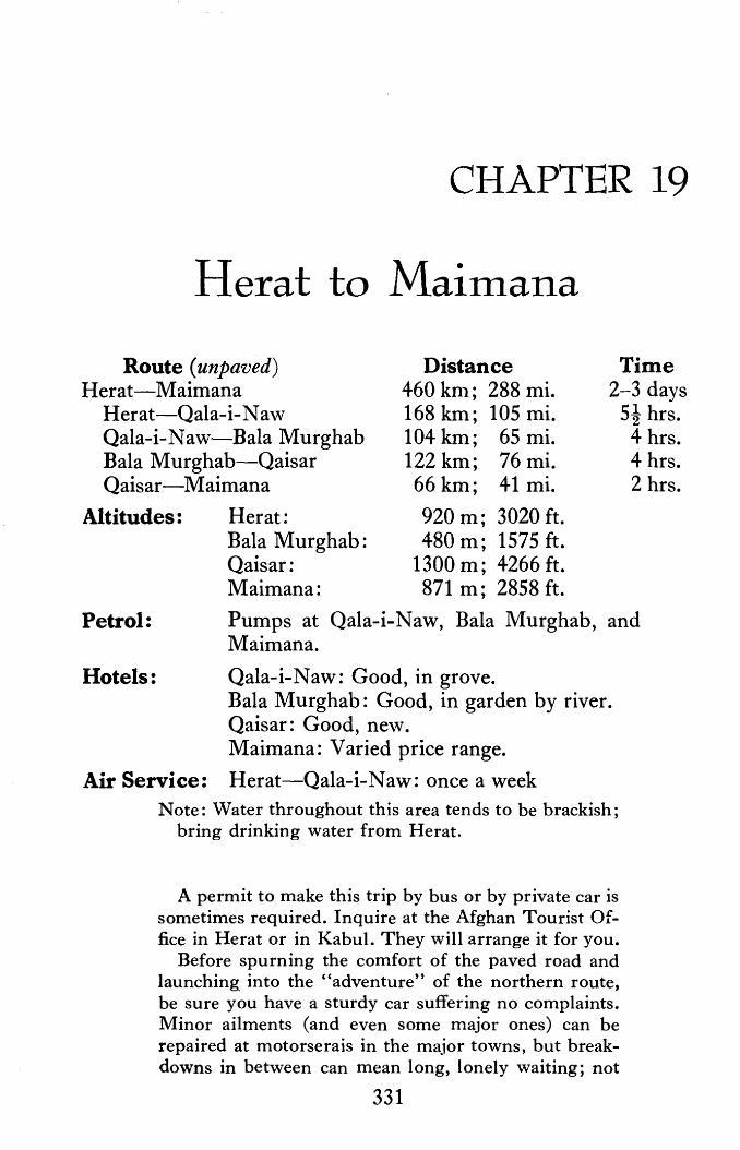
CHAPTER 19
Herat to Maimana
Route (unpaved) Herat-Maimana
Herat-Qala-i-Naw Qala-i-Naw-Bala Murghab Bala Murghab-Qaisar Qaisar-Maimana
Distance 460 km ; 288 mi. 168 km; 105 mi. 104 km; 65 mi. 122 km; 76 mi.
Time 2-3 days
Altitudes: Her at: Bala Murghab: Qaisar: Maimana:
66 km; 41 mi.
920 m; 3020 ft. 480 m; 1575 ft.
1300 m; 4266 ft. 871 m; 2858 ft.
5! hrs. 4 hrs. 4 hrs. 2 hrs.
Petrol: Pumps at Qala-i-Naw, Bala Murghab, and Maimana.
Hotels: Qala-i-Naw: Good, in grove. Bala Murghab: Good, in garden by river. Qaisar: Good, new. Maimana: Varied price range.
Air Service: Herat-Qala-i-Naw: once a week Note: \Vater throughout this area tends to be brackish;
bring drinking water from Herat.
A permit to make this trip by bus or by private car is sometimes required. Inquire at the Afghan Tourist Office in Herat or in Kabul. They will arrange it for you.
Before spurning the comfort of the paved road and launching into the "adventure" of the northern route, be sure you have a sturdy car suffering no complaints. Minor ailments (and even some major ones) can be repaired at motorserais in the major towns, but breakdowns in between can mean long, lonely waiting; not
331

332 AFGHANISTAN
much traffic plies this route. Extra petrol and spare tires are al ways a comfort as are sleeping bags and a small supply of food to supplement the daily diet of eggs and tea, qorma and pilau. From July through September melons will be available at all major stops. Those grown in the Qaisar area are justly famed for their sweetness and texture. These are somewhat akin to the honeydew found in the West. Watermelons ripen later in the season.
In the spring you are advised to forego this route and stay with the paved road. Not only is the mud deep and unbelievably sticky, not only are the passes shimmering sheets of ice, not only do little streams become unfordable torrents, but the very road itself has a disturbing habit of disappearing altogether. Days of delay, wide detours and ruffled tempers result.
Another word of caution. At no time should any portion of this road be attempted after dark. Unexpected curves, washed out patches, detours, and stream beds are difficult enough to maneuver in the daylight. They can lead to disaster in the dark. This warning applies particularly to the section between Bala Murghab and Maimana. Because of the condition of the road, mileages become almost meaningless. The meanderings of the road change almost every year depending on the damage inflicted by spring rains and floods. Consider them, therefore, as approximates. They will help in estimating petrol needs but you will soon find that it is time which has meaning, not distance.
The road east begins in Herat at the circle in front of the Governor's offices (coming from petrol station take first broad (unpaved) road to right). Passing the military cantonn1ents, 10 km; 6 mi; 10 min. from the circle, take the left fork (right to Obey), using the telephone poles as your guide. A useful rule to remember whenever travelling off the paved roads in Afghanistan: when in doubt, follow the telephone poles.
Karukh, a large town-village dramatically sheltered by tall stately pines is reached in a little over an hour (50 km; 31 mi; altude: 1341 m; 4400 ft.) out of Herat. First stop on the eastward march from Herat in the 10th century, Karukh's busy bazaar is continuously mentioned in travelogues down through the cen- · turies. One can see why, its charm is such that it is impossible not to comment upon it.
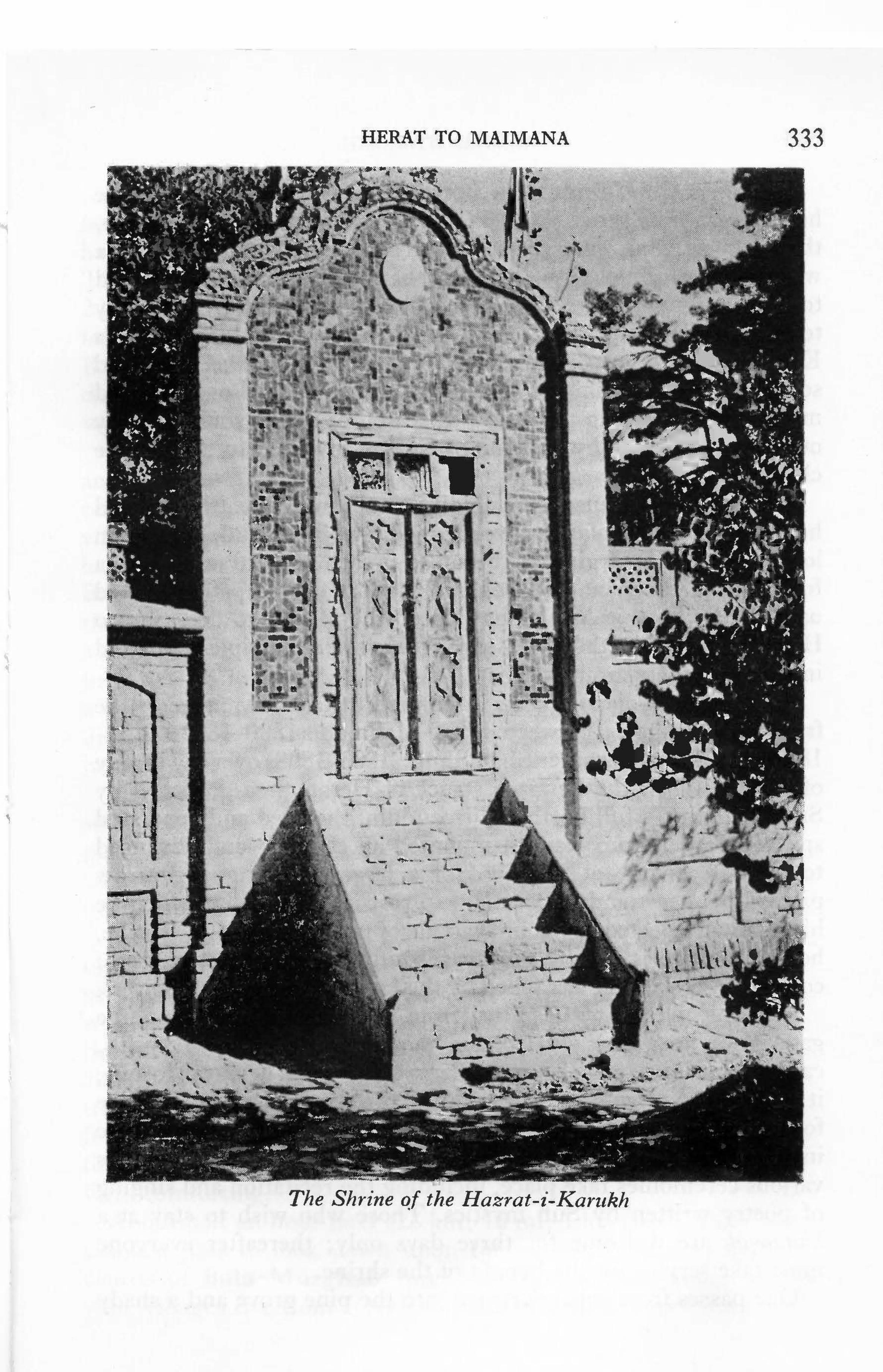
HERAT TO MAIMANA 333
' " -iJ,
' .. ~
"' ... , , .. ~ ..
. . ... ~ •
. , ~ v
k 1
~' -~ /I
l, c'· • • -•
• .. " '
w..... ..
The Shrine of the Hazrat-i ·-Karitkh •

334 AFGHANISTAN
The shrine of Hazrat Alla Berdi, Sufi ul-Islam, stands in the heart of the pine grove. Born in 1725 in the vicinity of Maimana, the young Uzbak entered the service of the Amir of Bokhara where he performed with such zeal that he was quickly promoted to high military rank. One day, however, as he led his army toward battle near Merv, the soldier was accosted by Khwaja Khizr, to whom immortality and divine wisdom had been granted so that the true worship of God might be established on earth and maintained. Roaming the wor Id in search of fitting souls to carry out his mandate, Khwaja Khizr remains invisible to all but the chosen few.
The encounter caused the soldier to abjure the battlefield and he retired to an isolated cave to meditate in solitude for seven long years. On emerging, he began to preach and attracted such a following in F erghana and Bokhara that his former patron looked upon him with a jealously that forced the Hazrat to flee, first to Herat and later to the quiet of Karukh where disciples gathered in great numbers around him.
In 1805 the Qajar Persians attempted to take advantage of the fratricidal struggles between Shah Mahmud (1800-1803; 1809-1818) and his half brother Shah Shuja (1803-1809) over the throne of Kabul. When the Persians struck at Herat, then governed by Shah Mahmud's full brother, Firozuddin, the aged and venerated spiritual leader from Karukh mounted an elephant and advanced toward the enemy at the head of a large following. An arrow pierced his heart and he was laid to rest in this garden which he himself had selected as his final abode of peace. Behind the shrine, however, there is a large graveyard said to contain the graves of countless Persian soldiers felled by the Hazrat's outraged followers.
Entering the shrine premises from the bazaar through a large gateway, note a fine old wooden mosque with openwork grills, carved doorways, panels and pillars. Used as a Friday Mosque, it is also a khanagah. frequented by the brotherhood of the shrine for retirement and spiritual exercises. Travellers may participate in the instruction given at the khanagah and on Thursday evenings various ceremonies take place, including the recitation and singing of poetry written by Sufi mystics. Those who wish to stay at a khanagah are welcome for three days only ; thereafter everyone must take service for the benefit of the shrine.
One passes from this courtyard into the pine grove and a shady

HERAT TO MAIMANA 335
avenue leads one to the uncovered tomb on a high platform surrounded by an ornate railing with decorated entrance. A twostory mosque with numerous arched recesses and honeycombed ceiling stands to the west of the shrine. As one walks in the cool of these lofty trees one is reminded of the early encounter of the young soldier with Khwaja Khizr whose abode is the spring of life and about whom it is said that wherever he stands all becomes green. His presence seems still to guide the descendants and followers of Hazrat Alla Berdi, Sufi ul-Islam.
From here a medley of tent and house types mark this as a complicated, mixed ethnic zone: black Pushtun tents alternate with distinctively barrel-vaulted tents characteristic of Baluch tastes and Pushtun qala alternate with large Farsiwan villages composed of double-storied domed houses.
Khwaja Chahrshanbe (38 km; 24 mi; 2.5 hrs. from Herat) is a charming village. Here you may enjoy a refreshing cup of tea at a chaikhana perched high above the road next to a rushing stream. Tall mulberry trees shadow a takht ( throne, platform) of pressed earth spread with gay gilim (woven rugs) and donkey bags. If you are lucky, a shepherd will entertain with flute solos. The village, say the elders, is named for a noted holy man (Khwaja, a descendant of Abu Bakr, the 1st Caliph) who died near here a long time ago on Wednesday (Chahrshanbe ). It seems possible also that the venerated holy man may have come from the town of Chahrshanbe, a prominent 19th century caravan town west of Maimana. Naming towns- for their principal bazaar day was once a common practice. Doshanbe (Monday) in Boviet Central Asia is a modern example.
Leaving Khwaja Chahrshanbe, high mountains leaving just enough space for road and river to pass, their slopes only occasionally dotted with fields of wheat or bejeweled by green springs, tower above you. Nothing, however, prepares one for the breathtaking sight which springs forth unexpectedly from the summit of the Subzak Pass (114 km; 71 mi; 3f hrs. from Herat: altitude 2400 m; 7874 ft.) Pastel pinks dominate this vast panorama of hidden valleys, purple shadows and lofty peaks crowned with slate-grey talus slopes. The magenta cliffs on the west are hap-. hazardly sprinkled with gnarled, dark-green pistachio and juniper which the high winds have whipped into exotic shapes. They add dimension to the scene and clear azure skies provide the perfect

336 AFGHANISTAN
backdrop. In mid-July, tiny wild flowers of lustrous lavender, clustered in n1asses like big soft cushions, splash their color across the hillsides at the summit. Above them tall spiked flowers blossom handsomely yellow and satin-brown. Curiously, these same flowers change to delicate shades of pink and white as the road descends.
As you descend via a very steep road full of hairpin bends, you enter Badghis Province. From here be on the alert for circular ooy (U zbaki term for yurt, portable domed hut, called khergah in Dari), with peaked, black felt roofs above reed matting encircling a wooden lattice frame. Easily taken down and loaded onto two camels, the ooy reflects the nomadic past of the Hazara Aimaq, Turk01nan and Uzbak who inhabit the area you will now travel. Other yurt-dwelling groups are encountered along the Central Route. Nowadays, most of these groups live in mud houses during the winter, moving out into ooy during the hot summer months. In this area some pitch their tents on the mountain tops near their fields during the wheat and melon harvests; others simply move into their own backyards. Ooy are not to be confused with chapari which are also to be seen along this route. The chapari, though circular and covered with black felt like the ooy, are considerably smaller, less substantial-looking structures, with rounded rather than peaked roofs. They are used as temporary she1ters by those working in the fields.
Laman (17 km; 10.5 mi; 45 min. from the summit of Sabzak Pass), the first village after leaving the pass, has a chaikhana serving good qorma and pilau. You will note that the nan (lightly leavened whole wheat bread) served in the north is round and considerably thicker than the flat, oval loaves made by the Pushtun. Laman marks the western boundary of predominantly Hazara Aimaq settlement.
During the next hour to Qala-i-Naw (47 km; 29 mi.) the scenery is rugged but several small villages are tucked in between massive granite outcrops and many black tents, ooy and chapari perch on the hilltops. In the fall months you will note that the roof-tops of the mud houses are used for drying fruits and vegetables for the winter: onions, squash, tomatoes, and particularly melons. Qorma made from kandak-i-Maimana, dried melon from this area, is considered to be a great delicacy. Agriculture in this area, however, is primarily non-irrigated, dry-farmed wheat and barley.
Qala-i-Naw (New Castle: altitude 900 m; 2953 ft; population

HERAT TO MAIMANA 337
An Uzbak ooy or yurt.
ca. 20,000) is the capital of Badghis Province, a province created during the reorganizatio ·n of the provincial system in 1964. It sits near the eastern limit of Hazara Aimaq country. The tremendous bustle of activity in the long rows of the new bazaar shops speak well of its thriving, expanding position, bearing out a prediction, made in the summer of 1845 by the French soldier-of-fortune, General Ferrier, that the small town of Qala-i-Naw wo11ld, in the course of time, beco1ne ''a flourishing place.''
Badghis Province is the pistachio center of the north and during the first and second weeks in September everyone goes out to pick pistachios. The trees grow wild, are public property, and all are entitled to pick the nuts during this period . As a result the harvest season is a holiday season and few remain behind in the towns and villages. Even government officials move to the hills, taking their offices with them , to supervise the harvesting .
Leaving Qala-i-Naw the road winds through gently rolling hills still green through July but dry thereafter until the next spring . Up until August, therefore, this is an idyllic early morning drive but later in the year on looking back from the top of the pass upon

338 AFGHANISTAN
a vast expanse of undulating, barren, dusty-beige mountains, one gets an eerie, lonely feeling of having been suddenly catapulted into outer space. This feeling is soon dispelled, however, by the appearance of Moghur Village (25 km; 16 mi; 45 min. from Qala-iN aw) in a wide fertile valley. Many large nomadic groups camp in the vicinity of this extensive domed village sprawled across the valley floor. The huge old caravanserai mentioned by 19th century travellers stands empty, but you may stop for a cup of tea at a chaikhana beside a flour n1ill. Very early in the morning there is a lot of activity here as camels, horses and donkeys come in with loads of grain to be ground. After the harvest is in, in September, the mill grinds away busily all day long.
From Moghur to Bala Murghab, though you have now left the really mountainous country, the road still traverses rugged country, opening only occasionally into tree-filled valleys with some cultivation. Huge balls of tumbleweed roll along the road, and pert jerboas and pikas sit up with curious faces to watch you pass. These highly specialized desert fauna are admirably adapted to their environment. Their coloring makes them hardly visible until they move, which they do with incredible speed. The jerboa have tails in some cases twice the length of their bodies and their hind legs are several times longer than their front legs. These incongruous physical traits are bound to bring a smile. And yet there is a purpose: "Their long wiry tails with a terminal 'brush' serve a treble purpose-a balance in movement, a rudder in turning, and in repose they use them as we use a shooting stick" (Carruthers, 1949). They dig holes which may be as deep as three feet, thus avoiding the extreme fluctuations i11: temperature their habitat is subject to. These burrows usually have only one entrance, except for a bolt-hole, opened only in extreme emergency, and, liking privacy, they often close the front door. They hibernate in winter.
The pika is rotund, with no tail to speak of and short, round ears. They are constantly busy collecting loads of grass as big as themselves, whistling while they work. Both may suddenly decide on a game of "chicken." Dashing madly between the wheels they dive headlong into their holes on the other side of the road like puffs of dust. Such hectic activity may prove unsettling for the driver, perhaps, but they seldom miss.
Half an hour (9 km; 6 mi.) out of Moghur you have a choice. You may take a road swinging up over the hill on your left to

HERAT TO MAIMANA 339
follow a very scenic route through wild pistachio country. It is beautiful but be sure your brakes are in order and keep a steady hand on the wheel because the descent is extremely precipitous. This route meets the other one in 25 km; 16 mi; 1 hr., about 2 kms. above the ancient bridge described below. If you elect to follow the easier but longer route, you will come to the Murghab River in about 30 km; 19 mi; 1 i hrs. where the road leaves the desert area and comes into a long fertile valley liberally sprinkled with villages.
The high arch of a ruined brick bridge at the end of this valley and the crumbling towers on the cliffs above it are picturesque reminders of the Timurids (15th century) who built many pleasure villas along the course of this river. These ruins are reputed to have formed part of the summer residence of Sultan Husain Baiqara of Herat (1468-1506). Local legend, however, has it that there was once a prince living in this valley who desired to build a dam here. A princess from the valley below came to protest, the prince fell in love, and the princess demanded a bridge rather than a dam as the price of her hand. The prince built the bridge, but died on the way to claim his princess. There is a chaikhana by the bridge.
Passing through the narrow gap spanned by the bridge, you soon see an eroded plain rising above the river on the right, with pistachio-sprinkled hills above. In the fall, this plain is literally covered with huge encampments of black nomad tents divided by deep arroyos into groups of anywhere from 50 to 5 tents each.
The roadside grave of Shaikh Mohammad Diwana (Diwana meaning eccentric) sits beside, or more precisely, in the middle of, the road some 40 minutes beyond the bridge. In 1975 the grave was tended by the amiable Taj Mohammad Diwana, a Baluch from the far southwestern corner of Afghanistan. His animated tales about how he arrived from Nad-i-Ali to assu1ne the trials and tribulations of attending the Shaikh' s shrine were well worth a few coins as a donation. This portion of the road is particularly tortuous so the ma Zang' s ( derwish' s) prayers for a safe arrival were comforting.
About half an hour later (28 km; 18 mi; 1 hr. from bridge) you climb a pass to look down upon the extensive gardens and orchards of Bala Murghab spread out in lush greenness before you. Villages rise from acres and acres of cotton, maize drying on

340 AFGHANISTAN
roofs adds a splash of bright orange. Nomad tents sit in pockets here and there. You pass close to many of the encampments in this area and you may see the ladies weaving gilim on looms stretched low along the ground in between the tents. This half hour drive (14 km; 9 mi.) to the petrol pump at Bala Murghab is full of fascination.
Bala Murghab (population: ca. 16,000), an Afghan enclave in the north, has mushroomed in the last five years and a whole new bazaar section now lies on the main road beyond the petrol pump. There are several large chaikhana, the last one on the right before a small streatn crosses the road being particularly spacious with large takhts ( sitting platforms) shaded with reed matting and vines. The meals are as attractive as the setting. The new prosperity is one more chapter in its long and eventful history.
Bala Murghab (Upper Murghab), was called Marv-ar-Rud by 10th century Arab geographers. They described it as a very large and prosperous city, a miniature Merv, the then fabulous city down river about 160 miles to the north. Bala Murghab itself had four suburbs, each large enough to have a Friday Mosque and the whole was surrounded by fertile country thickly planted in gardens and vineyards. Even in the 14th century, despite the Mongol invasions, Bala Murghab flourished, but eventually Tamerlane reduced it to ruins.
Nevertheless, in the 19th century, Bala Murghab was again an important town and the mound marking the site of its fort lies to the right of the bazaar beside a large school on the way to the hotel ( turn right at end of bazaar before fording stream, then left and right again for one kilometer to bank of river, left to hotel situated in a garden; camping also). Forts such as these figure prominently in all 19th century accounts of travel through this area for each fort commander considered each and every passerby fair game. He examined and re-examined all goods and animals, sometimes delaying caravans for days as he taxed and re-taxed, according to momentary whims and fancies. Payment was also exacted for protective passage from one fort to the next. Indeed, strong escorts were an absolute necessity for huge bands of Turkoman ranged the hills and valleys, plundering caravans and carrying off men, women and children for sale in the slave markets of Bokhara. When they ran out of caravans, they carried off entire villages. Vambery, the Hungarian who passed by on his donkey

\
HERA T TO MAIMAN A 34-1 ,. ~. ,. • 19!; 1 ~ •• ... • ~
/
' '·
~ \ ~,, ' , .•.
~
'@ . .;,(
,
~ • ll
{ ~ " ~ ~ 1 ' t
• , . ','
• , :,,... .... ~
,. ~
, ' «
>,;; "«
,',
< ' -~
~
""' ;,; <
[ -
,
' .
;,&1F( SU i
,•..,:"'l..< .!:!!_ <A &,~· ·. : ·~ ' ~ 11> -.,_ ,_:;.. • -~
Me1idi·ng slioes on bazaar day .

342 AFGHANISTAN
in 1863, disguised as an impoverished holyman, gives a vivid account of the hardships he and his companions suffered along this route and the absolute panic the appearance of Turkoman riders caused one and all.
Vambery reports passing through several silent villages ravaged by the Turkoman between Bala Murghab and Qaisar, the next major town, 114 km; 71 mi; 4 hrs. from Bala Murghab. Today, of course, the Turkoman tribes of the north are important and respected contributors to Afghanistan. Their carpets are unsurpassed and they own large flocks of qaraqul sheep, both major hard-currency export commodities for the nation. Today on the road between Bala Murghab and Qaisar, therefore, instead of empty villages, there are now many fertile valleys and several prosperous towns.
Leaving Bala Murghab one fords a small stream, passing the entrance to the old bazaar on the left. Then the road leaves the northern spurs of the Parapomisus and enters the rolling hills of Turkistan which consist of a series of long valleys with low hills on either side, some covered only with low scrub, some tilled in the vicinity of domed villages. The first large bazaar is at Ghormach (69 km; 43 mi; 2 hrs. 15 min. beyond Bala Murghah) where the road passes through a busy bazaar with several chaikhana. On bazaar days (Wednesday, or Chahrshanbe) the street is very crowded and you will see many Turkoman men with rugs for sale thrown over their shoulders. This scene repeats itself in the Checheqtu bazaar, 32 km; 20 mi; 45 min. further along. Between Ghormach and Checheqtu you leave Badghis Province and enter Faryab Province. From here to Maimana (and continuing east to Takhar Province) the area is predominantly Uzbak, with Turkoman inhabiting the lands to the north along the Amu Darya.
During the next two hours to Qaisar (21 km; 13 mi; 30 min. from Checheqtu) you are liable to meet large flocks of sheep and goats composed of both qaraquli (persian lamb), with distinctive curled tails, and long-legged turki sheep, with unbelievably fat tails. Several types of fat-tailed sheep are raised throughout Afghanistan and the oil made from the tail ( roga:t-i-dumba) is especially prized for cooking. Tall, longhaired goats with magnificent horns often preceed the flock. These lead goats, seeming to sense their important chore, move with solemn majesty in front

HERAT TO l\1AIMANA 343
A S/1ah Buz or King Goat Lead1:ng a Herd Across the Dasht-i-La1:Zi
of the flock and evidence definite annoyance when their followers scatter at the sound of approaching vehicles.
Huge tnastiff-like dogs called sag-i-ramah or herd dogs also trot possessively al-ong with the flocks. They delight . in ferociously attacking passing vehicles. They take their duties most seriously and it is wise never to approach a nomadic camp or a flock of .sheep too closely without being accompanied by a shepherd or someone from the camp. The dogs will ignore you when convinced all is well, but they will not hesitate to attack if they think their charges are threatened. They are well trained. Should you find yourself beset by one of these dogs, pick up a stone, or pretend to if none are available, and he will stay at a safe distance, content for the moment to bark. The barki.ng will bring the owner.
Poplar t·rees line the road as it passes through sever.al ''suburbs'' before reaching the central square of Qaisar which has also experienced considerable expansion within the last five years. A fresh melon and a cup of tea are most refreshing after this long and dusty drive.
About half an hour out of Qaisar you enter Maimana District .
344 AFGHANISTAN
and the road rises and dips through hills again, passing through Almar (34 km; 21 mi; 50 min. from Qaisar) where a peach-tinted "marble" is found. It is actually an iron-stained travertine. The school boys at Almar fashion all manner of articles from this stone: ash trays, paper weights, bowls, sweetdishes and just plain "objets," all looking as though they were made of sugar candy. They may be purchased at the school from the headmaster.
Almar is less than an hour (32 km; 20 mi; 45 min.) from Maimana.
' t ~
t I i
J·i I

CHAPTER 20
Maimana
~; From Maimana to: Distance Time (unpaved)
Herat 460 km; 288 mi. 2 to 3 days Mazar-i-Sharif 341 km; 213 mi. 10-11 hrs.
Population: 20,000
Altitudes: Herat 920 m; 3020 ft. Maimana 871 m; 2858 ft. Mazar-i-Sharif 377 m; 1237 ft.
Hotel: Maimana Hotel: Varied price range.
Refreshments: Maimana Hotel, on request. Chaikhana on central square.
Petrol: Eastern edge of town, on river bank beside road to Mazar.
Air Service: Kabul-Maimana: 2 flights a week. Herat-Maimana: once a week.
MAIMANA, capital of Faryab Province, is a large commercial town, center of a province famed for horse breeding, qaraqul sheep, carpets, melons and grapes.
The town is of ancient origin. According to the Arab geographer Yakut (13th cent.) the city was first settled by Israelites sent here from Jerusalem by Nebuchadnezzar. Prospering within the orbit of Samanid renaissance, it was one of the n1any flourishing towns which studded the plains from Herat to the mountains of Badakhshan before the Mongol invasions engulfed the area. Ravaged, most of the cities perished, only a few, like Maimana, revived.
By the end of the 19th century, Maimana was one of the Uzbak
345

•
'
. ·~ . ,. r •
•
~-
·~:?<'
It·
' •
., ..
'" i '•
~ ,,.
'Oijl)lt,
...
.... ~ • • '
~.$ >
w. X
J.:, '%l . p~
t 'fl 1t
,
"'
•
•
~·
<
•
. ..
• • I
a-:\ • ... ~
...
'
•
~,
•
•
-
~- ~~
~. ·i..~ :Y. ~ ~~ "'.IS:
•
, · - 4
'" '
t
•
,< ,. ~·
•
• ,,
' ':,: .
,. ... ·~~ ,~ ,.
•
'
~ --,4{
"
•
•
•
,
.. . J
,,
• •
,·~ •
• ,,,
r .... • • - \
•
•
I
•

MAIMAN A 347
Khanates in northern Afghanistan: Maimana, Gurziwan, Darzab, Andkhoi, Shibarghan, Saripul, Aqcha, Balkh, Kunduz, Khulm, Badakhshan. These khanates varied in size from year to year and from ruler to ruler, mirroring the personal charisma of each Khan, but Maimana always remained among the largest; at times even Balkh came within its orbit.
Sometimes independent, at other times semi-independent, the predominate Uzbak Khans constantly jockeyed for power amongst themselves while, at the same time, they played clever games of politics with both Bokhara and Kabul by professing allegiance first to one and then the other. Ahmad Shah Durrani gave Maimana to a friend, a soldier-of-fortune named Haji Khan, who kept the peace well during the 18th century. On his death Maimana was weakened by fratricidal wars, poison-administering wives and complex harem affairs. Finally in 1846, it fell into the web spread by Wazir Yar Mohammad of Herat. Nevertheless, Maimana's Khan, alone among the northern Khans, fiercely resisted paying homage to the great Amir Dost Mohammad and celebrated the Amir's death in 1863 by capturing several Afghan towns in the vicinity and defiantly decorating his fortress gates with the scalps of 300 Afghans.
Five years later Abdur Rahman (later Amir) laid siege to Maimana but not until 1876, during the second reign of Amir Sher Ali, did the city fall to the Afghans. Maimana' s citizens suffered harshly for their resistance; but they remained proud. When Abdur Rahman appealed to Maimana to support him in his bid for Kabul's throne, the city dared withhold it. Further, they arrested his messengers.
Proclaimed Amir in 1880, Abdur Rahman then turned to chastize Maimana. Dilawar Khan, W ali of Maimana, appealed to both Russia and Britain but soon realized neither would respond with aid. From then on he devoted his attention to the defense of his city and succeeded in repulsing the Amir's troops in 1882. Pleased, he proclaimed himself fully independent. Displeased, the Amir, two years later, sent two armies against Maimana: 1220 men from Herat and 500 from Balkh. Maimana, the last of the Uzbak Khanates of Afghan Turkestan, submitted in April, 1884.
The city, as may well be imagi~ed given the above history, was
~ Frying Fish on Bazaar Day in a Village Near Maimana

-
348 AFGHANISTAN
,I
,. < , ~
I
. ., ::>-,r.: . J
. ";,.; ·~· . . ... <
. . .. .._
Schoolgirls Parade in National Costumes During ]eshn
once strongly walled and surrounded by a moat but it is now an open city with wide avenues and busy bazaars, and , the central park replaces the citadel. Early 20th century photographs show that the citadel was very much like Herat's, with thick walls and towers which, however, here flared at the bottom in a novel manner. The towers flanking the central portal were even more unique, rocket-like, rising to a peak, with a columned balcony · hung out over the gateway in between them. In the center of the fortress a single tower stood tall above the outer walls, a flag implanted on its crown . All this has been reduced .to an anonymous mound crowned by a large cinema.
During ,Jeshn-i-Jamhuriat (Republic Day Festival, July 17- 20), the park takes on a truly festive air. Brilliantly decorated pavilions built by major government departments and merchant groups, encircle the big field on the northwest side of the park where permanent viewing stands are built into the side of this mound once a citadel. For three days the school children of Maimana march and sing and dance here, to the delight of all of Maimana and half the population of the surrounding villages. On the final

MAIMAN A 349
evening, fireworks erupt from the field to burst triumphantly overhead. On the southwest, a temporary bazaar miraculously appears almost overnight. It disappears even more precipitously; on the fourth morning nothing remains. For the three days of its existence, however, all is lively colour and happy festivity. Here the chaikhana, fish and kabab stands and innumerable hawkers' stalls are fashioned from gilims of every color and design. The Uzbak ladies of Maimana are famous gilim weavers and Jeshn offers an unusual opportunity to study the great wealth of imagination and artistry which has earned them their reputation.
Mornings and afternoons the carousels revolve with hardly a moment's respite and candy sellers, their baskets piled high with bright, shimmering baubles, do a brisk business. By night one is seduced by optimistic calls from the gambling tables standing under the glare of petromax lanterns; music from the chaikhana beckons. One can spend a most pleasant evening moving from one to another hearing a wide range of Afghan music for each chaikhana presents a special group of performers and dancers. Many are local favourites, others are professionals from Kandahar, Herat or Badakhshan, come to Maimana especially for the occasion. The compelling clash of cymbals and the martial air of trumpets are liable to woo one from the chaikhana, however. They come to announce the beginning of the sircas (circus) which pitches its large tent on the northeast side of the park. The sircas changes with time and more and more skits and songs are now presented, replacing the acrobats and animal acts so popular a few years ago. No matter, the skits direct their satire to such basic human foibles that even without a knowledge of Dari one can follow developments with a smile. J eshn is a time of fun all over Afghanistan.
SIGHT-SEEING
There are no sites of historical interest in Maimana. One enjoys instead the life of the city, wandering through its interesting bazaars and sitting in the chaikhana with its hospitable citizens. There is a small museum in the school south of the Maimana Hotel, on the corner of the Mandawi Bazaar. Contact Cultural Officer if caretaker not in attendance.
A very fine view of the whole valley may be had from the Takht-i-Shah, high on a hill to the south of the city. Proceed to

350 AFGHANISTAN
the village of Imam Sahib (5 km; 10 min. south of Maimana), and ask for directions. There is a narrow and very steep, but nevertheless motorable, road to a pavilion on the summit.
SHOPPING
Monday and Thursday are bazaar days in Maimana. Though most stores selling notions, dry goods, textiles and rugs stay open during the rest of the week, specialists from the surrounding villages come in to town only on bazaar days. There is lots more to see and buy when they are in town, and Maimana is filled with pleasant, colorful commotion.
Though the city has been completely rebuilt, the main bazaars follow those of yesteryear and, with one exception, popularly retain the old names in favor of the official names newly bestowed upon them. As is typical of once-walled towns there were four gates named for the important towns they faced. Once through the gate one rode through a bazaar carrying the same name of the gate, straight to the citadel or a central square. In Maimana the bazaar running northeast from the park is still called Bazaar-i-Darwaze Mazar; that running southwest, Bazaar-i-Dar- / waze Herat. The small bazaar on the northwest is known as Raste Arab Khana for it leads into the section inhabited by the descendants of the original Arab settlers in Maimana. No one admits to speaking any Arabic today, however. Opposite this, on the southeast side of the town, Jade Nadir Pash tun carries the new name given it at the time Maimana acquired its new look.
Though each bazaar has small shops with staples and sundries, each has its specialty:
BAZAAR-1-DARW AZE MAZAR has most of the local specialties such as very handsome chapan, the overly long-sleeved coats so fashionable throughout the north. The cotton summer chapan made in Maimana are particularly noteworthy. These same shops also sell vests and gopicha, an Uzbak coat-type which fastens to one side at the neck.
The rug stores are situated across the street from the chapan shops. No qalin (tied rugs) are made in Maimana itself, but these shops have a wide selection of carpets from Daulatabad, a famous rug center just north of Maimana, and Shahkh, near Qaisar, to the west. In addition, one may often find good buys

MAIMAN A 351
in othe_r tribal Turkoman rugs such as the Mauri and the Qizil Ayak. The rug shops also offer a wide selection of Uzbak gilim (woven rugs) which are a local specialty. They also display numbers of donkey bags, bildow (narrow woven pieces used for yurt decorations) and namad, felt rugs. Ranging from black to grey, occasionally a prized white, namad are decorated with floral and geometric designs in bright, hot pink, yellow, orange and white. When used as roofing for the yurts, the decorated side is turned toward the inside to enhance the colorful interior festooned with long strings of pompoms, woven bands, some narrow, some wide, all gayly exuberant. Almost every walled compound in the suburbs of Maimana contains a yurt (pronounced ooy in Uzbaki) for summer living. The namad are made by specialists in the village of W enchalat across the river from Maimana and are available in quantity only on bazaar days when they may be purchased on almost any sidewalk and off the backs of numerous donkeys. Besides these various types of rugs the rug dealers also offer saddles and finely embroidered hats for sale.
Saddles may also be purchased on a small side street off this bazaar, to the east, where several stores offer a variety of horse trappings, saddle blankets, and tools for making gilim. The lethal-looking combs with curved handles used in this craft are particularly interesting.
Beyond this side street, on the main bazaar, metalworkers make a great racket at their trade to the right, and leatherworkers work silently to the left. Beyond them are the carpenter shops where another regional specialty, painted chests, may be purchased. The tall wooden chests riotously decorated with traditional floral designs, are bright red with touches of yellow, blue, green and white. Cradles, sewing machine stools, shelves and coat racks are similarly painted.
JADE PUSHTUN has most of the crockery and textile shops, some interesting chaikhana, secondhand clothing stores, and numerous tailoring establishments. Patches of color piled high under the trees on the sidewalk cannot fail to attract attention. These are small, and larger too, plastic covered wooden boxes with mirrors and cut-out designs studded onto the fronts. These are made in the vicinity of Maimana also; they are hard to resist.
BAZAAR-1-DARWAZE HERAT has some interesting stores with such miscellany as attractive donkey trappings. The qaraqul

•
352 AFGHANISTAN
•
Itinerant Woodworkers Display Their Wares on Bazaar Day in Gi,rziwan
MAIMAN A 353
shops are on the corner, facing the park. The pottery shops are down at the opposite ( southern) end. Across from the pottery shops a side street runs west. This is the Mandawi bazaar where most foodstuffs are sold. There is an interesting store here in the rice and buria (matting) serai which turns old, discarded namad into very comfortable-looking saddle pads for donkeys. The Museum is located in the school at the end of this bazaar. It has some extremely interesting ethnographic items, some excellent old local textiles, Ghaznavid bronzes, coins, and interesting miscellany.
Arab Khana is a short bazaar but here you find shops piled high with shoes. The design is uniquely typical of Maimana and the workmanship of highest quality. Itinerant shoemakers who make an interesting laced shoe worn by peasants sit outside the park wall at the Darwaze Mazar on bazaar days. During the melon season you will no doubt visit the Arab Khana for several big melon shops are located on the corner. It is not necessary to look for a specific store, however. During the season, grapes and melons are piled high on the sidewalks of each and every bazaar in Maimana. Both are highly esteemed throughout Afghanistan.
EXCURSIONS
Darre Zang, Valley of the Waterfall, may be reached in about 5 hours from Maimana. Take road running north from Maimana toward Shirin Tagao, and then take right fork (about 1.5 kilometers beyond the petrol station after fording the river) to Bel Cherag. There are several winding passes through rolling loesscovered hills and numerous small roadside bazaars where refreshments are available. At Zarshoy (36 km; 22.5 mi; 1 hr. from Maimana) local-style accommodation is also available.
Turn right in center of Bel Cherag bazaar (56 km; 35 mi; 2 hrs. from Maimana) for the valley of Gurziwan and the district town of Sarchakon (19 km; 12 mi; 1 hr. from Bel Cherag). There are n1any picturesque villages nestled under walnut trees in this area. Springs of both cold and hot water bubble by the roadside. A little less then 9 km. before reaching Sarchakon the road exits from a rocky trough and crosses the river to climb to the valley. The rock-shelter of Ghar-i-Gusfand Mordeh is located in the limestone cliff on the left ( east) at this exit. Possible Mousterian ( ca. 50-30, 000 B.c.) tools were recovered from this shelter by

354 AFGHANISTAN
American archaeologists (Dupree, 1970), but further excavations are needed; the shelter is fully the size of a football field. In the valley to the left beyond the rock-shelter open-air sites on terraces produced Neolithic flint implements dating ca. 6000 B.c.
More recently, Gurziwan (Gurz: Holder of the Mace) was the seat of an independent Uzbak Khanate along with Maimana, Saripul, Andkhoi, Aqcha, Balkh, Khulm, Aibak, and Kunduz. The story of the rise and fall, the twists and turns of these rulers as they manipulated one another while jockeying for power during the 17th and 18th centuries is packed with action too involved for this account. Coins minted by the ruler of Gurziwan have been found and as one nears the heart of the valley one can see how ideally the terrain lends itself. Easily defensible, sufficient unto itself, a forceful leader, the Holder of the Mace, could rule with immunity.
Thursday is bazaar day when color and spectade overwhelms the new town of Sarchakon built in 1972. Lines of horsemen as far as the eye can see begin to converge on the bazaar at dawn when the soft light sets the colorful cha pan and gilim aglow. The procession continues until mid-morning, the central square fills with villagers and itinerant peddlars, and lorries stand by to load the rich produce of this fertile valley.
In August some of the richest, most colorful nomadic groups pass through Gurziwan.
The drive to the 40 m; 131 ft. high waterfall at Darr-e Zang (22 km; 14 mi; 1.5 hrs. from Gurziwan) is beautiful, especially the last section which runs through extensive walnut groves, but it should not be attempted without a strong vehicle and a stouthearted driver.
In the summer of 1975 it was just possible to proceed from Bel Cherag to Darzab and thence to Shibarghan. The passes are steep and for much of its length the road traverses the river bed. Darzab (43 km; 27 mi; 1.5 hrs. from Bel Cherag) is a very large, truly fabulous, eminent]y picturesque village-town splashed across a steep hillside. There is an unfinished Club; and a large seraichaikhana which offers accommodation. The road is often closed, however, so be sure to check in Bel Cherag. Also, do not fail to take a crucial left turn 23. 7 km; 14. 8 mi; 40 min. beyond Bel Cherag ( 6.5 km; 4 mi; 10 min. beyond the large, fascinating village of Kandiyan). The road to Saripul is impassable.

MAIMAN A 355
Darre Zang

356 AFGHANISTAN
Beyond Darzab one leaves the mountains for the plains and deserts. In September many yurts are pitched in the cotton fields next to large villages. Black goats' hair tents also abound, making this an extremely interesting ethnographic venture. Darzab to Shibarghan is about 113 km; 70 mi; 4 hrs. but it is hard to be exact. Once in the desert many tracks suggest themselves. How long and how far all depends on which track you take-and how often you get lost !

CHAPTER 21
Maimana to Mazar-i-Sharif
Route: ( via Andkhoi)
Maimana-Mazar-i-Sharif Maimana-Andkhoi * Andkhoi-Shibarghan * * Shibarghan-Mazar-i-Sharif
(via Dasht-i-Laili)
Distance
341 km; 213 n1i. 138 km; 86 mi. 69km; 43mi.
134 km; 84 mi.
Maimana-Mazar-i-Sharif 300 km; 188 mi. Maimana-Shibarghan * 166 km; 104 mi.
*unpaved **paving in progress
Altitudes: Maimana: 871 m; 2858 ft. Daulatabad: 425 m; 1395 ft. Andkhoi: 310 rn; 1017 ft. Shibarghan: 330 m; 1083 ft. Mazar-i-Sharif: 377 m; 1237 ft.
Hotels: Shirin Tagao: unfinished; camping. Andkhoi: Varied price range, old.
Time
10! hrs. 6 hrs. 2! hrs. 2 hrs.
10 hrs. 8 hrs.
Shibarghan: in center of Central Park; varied pnce range, new.
Refreshments: Large chaikhana serving qorma, pilau and, occasionally, kabab at all major points.
Petrol: Pumps at all major points except Shirin Tagao and Daulatabad.
Tolls: between Shiberghan and Aqcha.
There are two routes from Maimana to Mazar-i-Sharif, both difficult. The first, used by most lorries, cuts across the Dasht-
357

358 AFGHANISTAN
i-Laili, a desert, from Daulatabad to Shibarghan. The second, the northern route described below, makes a wide loop to pass through Andkhoi before turning south to Shibarghan. Most maps show a third route via Bel Cherag and Sari pul. This is absolutely impassable.
Proceeding north from Maimana the road passes through several valleys. The most famous is Shirin Tagao (50 km; 31 mi; 2 hrs. from Maimana) named for the river which flows through this area. I ts fruits and vegetables are highly touted and there is a fine bazaar with several good chaikhana. The hotel is not yet completed, but one may camp most comfortably in its big garden beside the river.
The fertile valleys alternate with rolling dust-colored hills, their contours gently rounded by thick deposits of loess from Central Asia. Myriads of jerboas and pikas make their homes in these deposits. Their dartings help break the monotony. Bare and dusty in the summer and fall, in the spring all is velvety green, superb pasturage for the many thousands of sheep and horse raised here. The nomads come out of the mountains to the south of Maimana in August. For twenty days the early morning hours are filled with the sound of their camel bells and the cheerful commotion of their passing. These are among the most colorful caravans to be seen anywhere in Afghanistan.
The turnoff to the large town of Daulatabad, nestled under a dense mantle of trees, appears on the right 70 km; 44 mi; 3 hrs. from Maimana. Daulatabad is famed for its carpets. The most popular Daulatabad design is composed of large octagons known as fil pai ( elephant's feet) filled with groups of four trefoils surrounded by stylized impressions of the comb used in rug making. Interspersed between the fil pai, on a field of deep red, the artistweavers often include the stylized outlines of a hook, another tool essential to their craft. The common tools of the trade thus form an integral part of this exquisite art. Nature is also represented. Gul-i-Badam or almond flowers, often appear in the border designs of these rugs.
If you wish to take the desert route across the Dasht-i-Laili to Shibarghan, it is best to engage a guide at Daulatabad. If not you may find yourself wandering hopelessly like poor Majnun of the popular folktale for which the desert is named. Majnum loved Laila but Laila's father opposed their marriage. So rejected,

MAIMANA TO MAZAR-I-SHARIF 359
Majnun went crazy with love and wandered into the desert alone and friendless. This was too much for Laila for she pitied the poor boy so she followed him, taking her pet dog as a companion. They found Majnun, but so far had he passed beyond sanity that he fell in love with the dog the minute he saw them, leaving Laila no alternative but to return, alone, to her home and the life her father had decreed for her.
Actually, this so-called desert is far greener than the landscape encountered on the way to Andkhoi, even at the height of the summer. Most of it is rolling hills and it is such prized pasturage that the main track is closed during the major grazing months so that vehicles may not disturb the thousands of animals which come to graze here. There are numerous alternate routes, however. As a matter of fact, tracks go off in so many directions that the usual four hours necessary to travel between Daulatabad and Shibarghan can stretch to double that, or more, if one gets lost. Guides may be engaged at chaikhana in Daulatabad or Shibarghan, depending on which way you are going, or, through the police commandants in either city.
Those proceeding to Andkhoi will find that as the melon fields and raisin towers of Daulatabad disappear, the wilderness begins. Sand dunes rise above the plain, small thickets of thorn clutch at all that passes, and under the wheels a sea of powdery sand rises in waves over the front of the car; as a solid wall behind. The driver has two choices. He may follow the deeply tunneled lorry ruts and wince as the high center track scrapes loudly at the delicate underpinnings of the car. Or, tiring of this nerve-wracking exercise, he may lift one wheel onto the center track, and thus inclined at an impossible angle, careen along, slipping and swerving. Drivers, I am told, prefer slithering at an incline, but passengers, certain of instantly turning turtle, find it equally painful. So, alternating between scraping and slithering, one pushes on and only those who have negotiated the sandy wilderness of northern Afghanistan can truly appreciate the pleasure of returning to just plain, ordinary, bumpy, ruts.
Andkhoi (population 28,000), in the heart of Turkoman country, is a collection center of qaraqul and many types of Turkoman rugs. Saruq, Qara Tekke and Sulaiman are only a few of the important Turkoman tribal rugs to be found in the rug serais of Andkhoi.

360 AFGHANISTAN
Both the Turkoman and the Uzbak are great caroms enthusiasts. In the large upstairs chaikhana in the center of Andkhoi contests continue in never ending play as contestants come and go. The tall, handsome Turkoman play with great good humor, applauding shots well sunk, teasing mercilessly when one goes awry.
Mentioned in medieval Arab sources from the 10th and 12th centuries, Andkhoi continued prosperous down through the Timurid period (14-15th centuries A.D.). Rich caravans from the west, via Herat, and from the east, coming through Balkh, met at Andkhoi before proceeding to Samarkand, Tamerlane's splendidly rich capital. It is said that Tamerlane came here in 1380. Already master of the north, he came seeking an omen from Andkhoi's celebrated saint. Where now should he lead his victorious armies? For answer, the saint unceremoniously tossed a sheep's breastbone at the august ruler. Tamerlane was, however, well pleased for to him this was a signal for the conquest of Khurasan. Was not rich Khurasan the veritable breastbone of the habitable world? Herat, the heart of Khurasan, fell to Tamerlane in 1381.
During the reign of Tamerlane's son, Shah Rukh (1405-1447), several diplomatic missions to and from China passed through Andkhoi. The Chinese listed Andkhoi as a separate state, together with Herat and Badakhshan, Bokhara and Samarkand and described it as "a city surrounded by great villages, it lies in a fertile, well-watered, and well-populated plain, and has the reputation of being a pleasant place. Between 1400 and 1416 An-du-huai (Andkhoi) used to send tribute together with Ha-lie (Herat) .... " The ambassadors from the Afghan area and their colleagues from Central Asia presented horses, lions and leopards to the Chinese emperor. He reciprocated with gifts of silks, gauze, hemp and silver.
Remaining tolerably prosperous until the mid-19th century, the city fell on evil times when it became dependent upon Bokhara for this encouraged W azir Y ar Mohammad of Herat to lay siege to it in 1845. He left the city a pile of rubble which, even so, became the center of a long, deadly tug-of-war between Bokhara and Maimana. The town finally came under direct Afghan administration in 1881 during the reign of Amir Abdur Rahman (1880-1901). The old citadel lies in ruins on the northeast edge of town.
Huge storage tanks and modern housing settlements, about
1 !
I
(
E I

MAIMANA TO MAZAR-I-SHARIF 361
20 km; 13 mi. before reaching Shibarghan, apprise one of the approaching capital of J ozjan Province, once a prosperous independent Khanate. Jozjan was the name of a most populous western district of Balkh during the Middle Ages and Shaburkhan (Shibarghan) was the capital of this extremely fertile province in the 9th century.
In the 13th century, just before the Mongol holocaust, although the political seat had already been shifted to Maimana, Shibarghan continued to prosper and its bazaars were filled with all manner of exotic merchandise, amongst which the hides were of high quality and exported to faraway lands. Many caravans passed through Shibarghan even after the passage of Genghis Khan. In 1275, for instance, a particularly famous traveller put up at one of its serais. Marco Polo, after recounting the perils of the waterless deserts he had just crossed, described his arrival at Sapurgan "which is plentifully supplied with every kind of provision, and is particularly celebrated for producing the best melons in the world.'' His description stands today for the melons of Shibarghan are still celebrated and this busy town, fast becoming a city, speaks of great prosperity. Today's prosperity comes largely from its natural gas fields, discovered in 1960. Gas from these fields is carried north some 200 km; 125 mi. to the Soviet Union via a pipeline. In the neighborhood of Kelift it passes over the Amu Darya via a pipeline 660 m; 2166 ft. long suspended 12 m; 39 ft. above the river. Inaugurated in 1974, it has an annual carrying capacity of 4 to 6 billion cubic meters. Another line carries gas east to the thermal and chemical fertilizer plants in Mazar-i-Sharif, also inaugurated in 1974.
Aqcha (altitude 296 m; 971 ft: 50 km; 31 mi; 45 min.) the next large town along the route from Maimana to Mazar-i-Sharif is a very attractive Turkoman town with several fine chaikhana at the beginning of its broad main avenue. Aqcha is a new town, like all these capitals of former khanates; the vicissitudes they suffered during the past century left nothing much of the old. One hates to see what little was left indiscriminately subjected to the bull-
\. dozer, but at Aqcha at least, out of the clutches of city planners so busy in the larger cities, an undeniable charm already imbues the new. The silver bazaar is particularly interesting for the Turkoman are extremely fond of jewelry and buy a great deal of it for their womenfolk. Aqcha is particularly fascinating on bazaa,r

-
362 AFGHANISTAN .
• <
,.
.,
'
Bronze Age Seals from the North.
days: Monday and Thursday . The town lies slightly north ·of a traffic circle on the main road.
Leaving Aqcha, one crosses the Turkestan Plains, flat and seemingly endless, extending from the foothills of the Hindu Kush on your right, to the Amu Darya out of sight on your left. However, here and there on the left you will note m.ounds which seem alien to the plain and, indeed, they are artificial. Farther north, about 40 km; 25 mi. or so, mounds rise starkly out of the barren desert to a height of 15 m; 49 ft. and more. The flat wastes between them are strewn with potsherds, all that remains of the small villages which surrounded and main·tained once-great cities. Wind whipping across these flatlands have literally blown the villages away, leav"ing only heavy pieces of broken pots to speak of their being!
The Afghan-Soviet Archaeological Mission probes (since 1969) into the mystery of these mounds and each year the picture becomes clearer, more dramatic. From the sand dunes south of the Amu Darya comes evidence of an extremely rich concentration of Mesolithic and Neolithic settlements as far back as 10,000 B.c. (A. Vinegradov). Moving a 1.itt1.e south of these, lJronze Age (1500- 800 B.c.) man not on~y farmed extensively but built monu-
..
MAIMANA TO MAZAR-I-SHARIF 363
mental palace/administrative centers and complex circular temples. These people fashioned highly artistic objects of bronze and fine, graceful pottery of great sophistication. Many of these objects they took to the grave with them. The graveyards are extensive, barely visible as hillocks on the plain. But where are the water systems that allowed for such prosperity? The search goes on (Dashli; V. Sarianidi).
Prosperity continued. While the Achamenids flourished on the Iranian plateau, here on the plain new cities were built (500-300 B.c.) and their leading citizens built many-roomed villas surrounding courtyards embellished with cool pools in the center of them. Outside, grand columned pavilions graced the landscape (Altyn; V. Sarianidi). But such wealth invites destruction, and evidence of violent fires shrouds the upper layers of these mounds. Oddly, the fires seem to have raged just about the time Alexander of Macedon passed this way.
The Dashli and Altyn mounds are small compared to Delbarjin Tepe looming up to the south of them (I. Kruglikova, Director). A city mound site 15 meters high, Delbarjin came into being during the Achaemenid period when its citizens built temples and adorned them with Greek motifs during the heyday of GraecoBactrian rule. Wall-paintings and a meter-high statue of Hercules are among the more spectacular finds of this period. As the city hit its peak in the 1st-6th centuries A.D., massive fortifications and a citadel inside a central walled city appear. At the same time, the Kushans brought Buddhism to the city, building stupas and painting the walls with Buddhist motifs. As they penetrated India, they returned to add Hindu motifs. One of the more superb murals represents Siva with his consort, Parvati, on his knee, sitting by the bull Nandi.
The Hephthalites from Central Asia replace the Kushans. Their buildings are meager in comparison and gradually the city dies and is abandoned; fields turn to desert.
Again, another shift to the south took place for some still unknown reason. A misuse of natural resources? Whatever, the walls of the next great city in this area soon appear to your left as you pass Balkh (Chapter 26). Balkh too was abandoned, for Mazari-Sharif (Chapter 25). Where to next?

To Kelift
I I I I I I I \
/ B.!\.LKH ) I I \ I I '
1 I Surkh Kotal~ , I I
'\ i SAMANGAN / \ I t \ I I \ I ', I /
'y --------; .,,, __ /,,.,To Bamiyan \, .,, -...... -'-----
J
I I \ ' -~
\ \
A- Historic Site
,,,.,,,..---...., \, _______ l
I I.. ',
I
Pul-i-Khumri I
\ /' --, 'i J
I I I I
BAGHLAN
,.,...I / ...- / .,,,- /
/ / / (
/ ' '
/ I \ ' '\
I
I I
' -~ '- ,,/ I
KABUL f
/
// To Jalalabad ------, r \ I
\ I ,_,,
THE NORTH

CHAPTER 22
Pul-i-Khumri and Surl~h Kotal
From Pul-i-Khumri to: Distance Time Kabul 230 km; 144 mi. Surkh Kotal Mazar-i-Sharif Kunduz
12 km; 7 mi. 202 km; 126 mi. 107 km; 67 mi.
4 hrs. 15 min. 2! hrs. 1 ! hrs.
Population: Altitudes:
Hotels:
Refreshment:
Petrol:
Tolls:
25,000
Kabul 1791 m; 5900ft. Salang 3363 m; 11,134ft. Pul-£-Khumri 625 m; 2050 ft. Samangan 1070 n1; 3510 ft. Salang Pass: Ski lodge. Khinjan: Good, swimming pool. Pul-i-Khumri: Varied price range.
Roadside cha£khana. On request at all hotels.
Charikar; Jabal us-Seraj; Khinjan; Pul-iKhumri (2.5 km. south of Central Square, be-
fore entering city from Kabul).
70 afs. between Kabul-Khinjan.
PUL-1-KHUMRI ties together the roads from Kabul, Kunduz, and Mazar-i-Sharif. Near-by Surkh Kotal is one of Afghanistan's
Chapter 22 is an abridged discussion from Dupree : The Road to Balkh, Kabul, Afghan Tourist Organization, 1967.
367

368 AFGHANISTAN
n1ost important archaeological sites dating from the Kushan period during the early centuries A.D.
Leaving Kabul, the road passes through the Koh Daman, climbs up to bore through the Hindu Kush and enters Baghlan Province before descending to Khinjan ( see Chapter 5 (1) and (2), for full description of this section of the route).
Doshi lies 20 minutes beyond Khinjan (22 km; 14 mi; altitude 820 m; 2690 ft.) The Anderab River joins the Surkh Ab (Red River) at Doshi and the unpaved road from Bamiyan via Doab joins the paved road at this point (see end of Chapter 6). Doshi is, therefore, a busy little town; a favorite truck stop with a large chaikhana. The imposing villa on top of a spur overlooking the valley is the home of the Sayid-i-Kayan family, religious leaders of the Ismailiya Hazara who inhabit the hills between here and Bamiyan. The huge peacock surmounting the villa is a religious symbol representing the invisible imam, religious leader, for whom the Agha Khan officiates. On Thursday afternoons and Fridays during the winter, impromptu buzkashi games are occasionally played on the reaped fields beside the river behind the bazaar.
Pul-i-Khumri ( corruption of Pul-i-Qumri referring to a bridge built by the lady Qumri) lies 40 min. beyond Doshi ( 46 kn1; 29 mi.). The road runs beside the river which changes its name here and becomes the Darya Pul-i-Khumri, leaving it only momentarily to cross a barren plain. During the melon season (July/September), temporary grass huts are put up along the roadside to protect the mountains of melons brought in from surrounding villages to be loaded onto trucks and taken to market. Melons as "big as a horse's head" impressed Ye-lu Ch'u Ts'ai, Genghis Khan's Chinese minister in the 13th century. Early 9th century Arab accounts relate how melons from the northern Afghan area were packed in snow inside lead molds and sent to grace the table of the Caliph in Baghdad.
In addition to its pivotal position on the communication routes serving the north, several important industrial complexes are located at Pul-i-Khumri, including the Ghori hydroelectric station, a textile plant, and the Ghori Cement Factory. Extensive experimental farms are also located near the city and the Karkar coal mines are not far away. The busy bazaar reflects its position at the huh of so much activity.
The large Pul-i-Khumri Hotel is located one mile west of the

PUL-I-KHUMRI AND SURKH KOTAL 369
circle (on right just beyond bridge). It has spacious gardens filled with roses in the spring and it is always popular, and consequently often full. Should you be unable to engage a roon1 here, the Baghlan Sugar Klub, only twenty minutes away on the road to Kunduz, also has comfortable and pleasant accommodations.
Leaving Pul-i-Khumri via the paved road running north from the Central Square, take left over bridge at marker 236 (straight ahead for Kunduz, Chapter 27). On the opposite side of the river you will note the gardens and baths of Pul-i-Khumri's mineral Hot Springs which lie to the left on the river's bank, between the bridge and the cement factory. The showers are open to the public.
While bulldozers levelled the spur to the left just beyond the bridge in order to build a Club for the Cement Factory, fragments of a near life-sized clay horse and rider were discovered. By the time the archaeologists arrived at Wazirabad, however, not much was left but evidence of architecture and numerous bits of decorative horse-trappings, plus the booted foot of the rider. It was probably another religious complex in association with Surkh Kotal.
SURKH KOTAL (Red Pass) Take paved road north out of the Central Square, Puli-Khumri; at marker 236 turn left onto paved road to Mazar-i-Sharif; just past marker 245 take unpaved road to left; proceed 3 kms. to foot of monumental staircase beside road to left (15 min.). Path to temple excavations on the summit runs up south side of hill.
Surkh Kotal, site of a great religious temple founded by Kanishka, Great King of the Kushans, circa 130 A.D. is one of Afghanistan's most important archaeological sites. Destroyed by fire during political unrest following Kanishka's death, the temple was restored and then again burned, this time by the Hephthalities, nomadic rivals and ultimate successors to the Kushans in the Afghan area.
Excavations by DAFA, begun in 1952 under the direction of M. Daniel Schlumberger, have revealed a temple standing in a large paved courtyard surrounded by a colonnaded portico. Leading to the temple standing on a hill high above the plain, there is an impressive staircase, built in five flights, each with a large terrace.

-
AFGHANISTAN
Stati1e of Ki1tg Kanishka excavated from Surklz Kotal

PUL-1-KHUMRI AND SURKH KOTAL 371
The significance of this site increases as each year passes. First there was the discovery of a large inscription written in cursive Greek script in the Kushan language (now in the foyer of the National Museum, Kabul), which created great excitement for it was the first lengthly inscription in the Kushan language ever found. Another inscription, originally a facing for the third terrace, is being pieced together, block by block, in the Museum.
Indications are that some form of Fire Cult was practiced here and the discovery of a huge headless statue near the altar (now in the foyer of the Kabul Museum), identified as Kanishka because of its striking resemblance to the figure on Kanishka' s coins, has led to the speculation that the temple was dedicated to the worship of Kanishka himself as god-king. Much is known about the deeds of this greatest of all Kushan kings. His political might, his revival of dying Buddhism, his interest in Western as well as Eastern thought, his eclectic use of thirty-three gods and goddesses from both worlds on his coinage, his economic astuteness in placing his kingdom on the Roman gold standard, his munificent patronage of the arts-all this is well documented. The man behind these deeds is a nebulous shadow, however, and even the date of his being can only be hedgingly given as circa 130 A.O. To see him as the god-king of n1ighty Surkh Kotal adds immeasurably to the image of a vigorous, dynamic, self-assured, egotistic man.
Most recently, new discoveries at Bactrian Ai Khanoum, fitted together with evidence from Surkh Kotal, have given new meaning to long pondered problems regarding the development of Gandhara art. At Surkh Kotal the Classical elements, directly inspired we now know by Bactria itself, mix with Persian motifs, but there is no evidence of India at the temple itself. About two kilometers east of Surkh Kotal, on a direct line with the staircase, however, there was a Buddhist temple with monumental figures and decorated pilasters (now in the National Museum, Kabul). This was, therefore, the experimental ground where the Bactrian Classical, the Persian and the Central Asian mixed. From here it moved to mix with the spirit and forms of India thereby creating one of the more expressive art forms the world has ever known. The art and architecture of Surkh Kotal, so intimately connected with the Great King had, no doubt, a particularly persuasive influence on the development of Gandhara art.
Directly across the road from Surkh Kotal archaeologists ex-
372 AFGHANISTAN
cavated a small garrison fort on top of a hil1 crowned with ruins called Kona Masjid (Old Mosque). Occupied during the Kushano-Sasanian period after Surkh Kotal had been abandoned and before the advent of Islam, i.e., from the late 3rd-7th centuries A.D., the garrison was responsible for the security of the main north-south route which passed at its foot. An unique ceramic rhyton in the form of a horned goat supporting a human head was recovered from this site (now in National Museum, Kabul.).
If you do not have time to visit Surkh Kota1, you may see the monumental staircase rising 55 m; 180 ft. up a hill to the left of the n1ain road. Fields of cotton cover this wide valley.
Passing the toll gate at Cheshma Shir (Milk Spring; marker 250/251, 30 afs.), a wide uncultivated plain appears in the middle of which one leaves Baghlan Province to enter Samangan Province (marker 264). In the spring these plains offer superb pasturage and -nomadic encampments enliven the scene. Beyond the toll gate at Ak Robat (White Fort; marker 271, surrender ticket) the mountains gradually close in on the road which climbs through rolling loess hills sprinkled with wild pistachio. In the distance a sheer craggy wall rises to the right; to the left, range follows range into infinity. The panorama may be enjoyed to its full from a lookout (between markers 282/283) at the top of the pass (1400 m; 4593 ft.). The old caravan route avoided this pass and ran along the foot of the mountains, from Ak Robat to Aibak.
Lalmi or dry farming is practiced on these hillsides and the scenery becomes more and more lush as you descend into the valley of Samangan (Chapter 23).

CHAPTER 23
Samangan (Aibal~)
From Samangan to: Distance Time 5 hrs. ! hr. ! hr.
li hr.
Kabul Pul-i-Khumri Tashkurghan (Khulm) Mazar-i-Sharif
312 km; 195 mi. 82 km; 51 mi. 60 km; 38 mi.
120 km; 76 mi.
Population:
Altitudes:
Hotel:
5,000
Pul-i-Khumri Samangan Khulm
625 m; 2050 ft. 1070 m; 3510 ft. 456 m; 1496 ft.
Aibak Hotel: to right on paved road into town; Fair.
Refreshments: Excellent chaikhana and kabab shops in bazaar.
Petrol: On main road to Mazar-i-Sharif.
Tolls: 30 afs. between Pul-i-Khumri and Samangan.
SAMANGAN, capital of Samangan Province, is a 1nost ancient city near which there is an important Buddhist site dating from the 4th-5th centuries A.D. Early Arab geographers list Siminhan among the largest cities in the Afghan area and when Genghis Khan destroyed the city, its buildings extended to the foot of the mountains. Tamerlane's chroniclers reported it to be still in ruins in the 14th century but rich soil assured its revival and it was again a prominent caravan depot in the 19th century when it was called Aibak. Today, many continue to refer to it by this name even though it officially regained its ancient name in 1964.
Chapter 23 is an ·abridged discussion from Dupree: The Road To Balkh 1
Kabul, Afgh~n Tourist Organization, 1967.
373

374 AFGHANISTAN
Though the modern paved road now swings around the outskirts of the town, ( turnoff at marker 310), the bazaars still hum with activity. Many wide, wooden benches spread with brightly striped gilim line the road north of the Central Square. Here you will find scores of travellers who have stopped off for a relaxing cup of tea or for some of Samangan' s highly extolled kabab. The bazaar is particularly full and colorful on Thursday, bazaar day in Samangan. Good buys: embroidered caps (kola) and bright, long-sleeved coats (chapan).
SIGHT-SEEING
STOPA AND MONASTERY OF TAKHT-1-RUSTAM Proceed south from Central Square, turn right (west)
at sign marked "Takht-i-Rustam." Follow lane through village until you emerge onto open, barren area (about 2 kms.). The high hill in front is the stupa; steep motorable road to top. Monastery in hill to left.
The extremely interesting Buddhist stupa at Samangan is known locally as Takht-i-Rustam (Rustam's Throne). Rustam, the hero of Firdausi's great epic the Shahnama (Book of Kings), written in Ghazni c. 1010 A.D., married the beauteous daughter of the King of Samangan, Tahmina. He celebrated the event, so says local legend, by drinking wine from the basin atop the stupa. Throughout Afghanistan many unnatural mounds of unusual shape are associated with the life of this most popular hero and bear his name.
A Japanese archaeological mission under the direction of Professor Seiichi l\1izuno, excavated here in 1959 and 1960. From them one learns that this complex was a thriving Buddhist community during the 4th and 5th centuries A.D.
Cave 1 ( on west or left as you face the hill, see sketch) consists of an anteroom and a large round room with two niches originally sheltering statues of the Buddha. The ceiling is most remarkable, being carved to resemble a lotus blossom in full bloom.
Cave 2 has two entrances leading into a long double corridor with a vaulted ceiling. Off the main rectangular chamber there are numerous individual cells once used by Buddhist monks as retreats.
Cave 3 is similar to Cave 1 and also held a Buddha statue. Cave 4, a series of four small rooms, served as the bathhouse
for the community and the adjoining Cave 5 as a lavatory.

SAMANGAN (AIBAK)
THE CAVE MONASTERY
AT TAKHT-1-RUSTAM
R O C K
• Cave 2, with Cells for Monks
375
after Mizuno
The stupa cave crowns the hill in front of the monastery. Rockcut stupas such as this were popular in India, the home of Buddhism, as early as the 1st century B.c., but this one is absolutely unique in size and construction. The dome-shaped structure of highly polished limestone, 8 meters high and 28 meters across, is encircled by a two-meter wide passageway at its foot which was used by pilgrims for circumambulation.
The relic chamber in most conventional stu pas was generally placed about three-quarters of the way up the stupa, and sealed. Since this stupa was carved frorn solid rock, the relic chamber was located in the square harmika on the summit. The harmika originally supported the staff of the chatri or umbrella with which all stupas were embellished.
This stupa-monastery complex at Samangan was most probably destroyed by the Hephthalites c. 460 A.O.
Leaving the fertile valley of Samangan, the road heads towards the mountains again. Looking to the left (west) in the vicinity of marker 333, one may note the passage between two rocky ridges leading to the village of Hazrat Sultan. A number of archaeological sites ranging from the Upper Palaeolithic to Islamic are located near this village which was on the main caravan highway until the paved road was put through in 1970. The cave of Kara Kamar, excavated by Carlton Coon in 1954, was the first Palaeolithic site excavated in Afghanistan. It produced stone tools dating from 30-10,000 B.C. The nearby open-air site of Kok-jar yielded a collection of Upper Palaeolithic (15-10,000 B.c.) stone tools closely

376 AFGHANISTAN
resembling the tool industry of Aq Kupruk which lies in the hills some 100 miles further west.
Kushan and Islamic remains have been identified by Italian (S. Puglisi, 1962) and Japanese (S. Mizuno, 1962) archaeologists. The nucleus of more than 200 multi-room, multi-story rock cavedwellings at Hazar Sum date from the early centuries A.D. when Takht-i-Rustam flourished. It is quite possible that this complex gave the name Samangan, meaning "cave-dwellers" in the Uzbaki dialect, to the area. Declining after the 3rd century A.D., the center witnessed a recovery in the 7th century and 40 mounds covered with vestiges of Islamic architecture and pottery speak of a flourishing caravan depot. It fell victim to the passage of Genghis Khan in the middle of the 13th century, never to recover.
At the turnoff to Hazrat Sultan (marker 334), an abandoned caravanserai stands by the roadside and the little shrine of Imam Sahib crowns a tall spur on the left. Childless women make the long climb to the shrine before dawn and spend the early hours before light in solitary prayer. Beyond this the road passes by glacial terraces laid down during the Pleistocene over a million years ago. The valleys become progressively narrower, the mountains higher and more rugged, their slopes tinged with colours of many hues. Here you will delight in your first encounter with domed villages, a picturesque architectural style characteristic of the north.
The new Cheshma Hayat (Spring of Life) Hotel sits on the bank of the Tashkurghan River in the midst of this spectacular scenery (between markers 357/358, 15 minutes before Khulm). The spring opened while the road was being built and because of its miraculous appearance it has acquired a reputation for being most efficacious. I ts name also assures its popularity for only the waters of Cheshma Hayat give eternal life. The search for the real spring is long and arduous, however, and the way is shrouded in darkness. Only one man has ever found the true spring, the immortal, green-robed Khwaja Khizr, who alone can show others the way. He roams the world in an invisible state, appearing from time to time to the lost and needy in the guise of an old man with a long, white beard. Pilgrims to this spring hope they may 1neet him here, for he makes his home at the veritible Cheshma Hayat.
The legend of Khwaja Khizr (Kidr) is primarily associated with

i • l I
-\
SAMANGAN (AIBAK) 377
a story found in Sura 18: 59-81 in the Koran which is, however, related to the Gilgamesh epic, the Alexander romance and the legend of Elijah and Rabbi Joshua in rabbinical lore. All concern the search for immortality which is to be obtained from a spring issuing forth from beneath a rock marking the spot where the oceans of earth meet the oceans of heaven. Cheshma Hayat at Tashkurghan certainly fits this description admirably.
Under the management of the municipality of Khulm, the Cheshma Hayat Hotel offers comfortable year-round lodging with meals on request; swimming during the summer in the hot mineral springs; showers. An impressive red outcrop appears beyond the spring at marker 361 announcing the approach of the Tang-iTashkurghan Gorge (marker 363-364) through which road and river shoot between precipitous rocky walls 1000 feet high, hardly 40 feet apart. High, jagged peaks continue to dominate the landscape for a short while, but gradually lush orchards and the domed architecture of Khulm's suburbs take over. Beyond the town (Chapter 24) uninterrupted flat plains stretch as far as the eye can see. You are now on the Turkestan Plains, the southernmost extension of the Central Asian steppelands and grasslands.

378
To Kabul To M:lzar
AFGHANISTAN
Tashlmrgban
To Bala Hissar
I =Covered Strut
' -To
~ To Kurduz
Bala Hissar
Alter P. Centlivrt

CHAPTER 24
T ashl~urghan (Khulm)
From Tashkurghan to: Distance Time 5£ hrs. 1 ! hrs.
Kabul Pul-i-Khumri Samangan Maiar-i-Sharif
Population: Altitudes:
Hotel: Refreshments:
Petrol: Tolls:
22,000
372 km; 232 mi. 142 km; 89 mi. 60 km; 38 mi. 60 km; 38 mi.
.3. h 4 r. ! hr.
Samangan 1070 m; 3510 ft. Khulm: 456 m; 1496 ft. Mazar-i-Sharif 377 m; 1237 ft.
Kholm (sic) Hotel: east of toll gate; Good.
Chaikhanas on entrance to bazaar. Hotel, on request.
On main highway.
20 afs. between Khulm and Mazar-i-Sharif.
TASHKURGHAN (Stone Fort) officially regained its ancient name of Khulm in 1964 when the Government of Afghanistan reapportioned the provinces of Afghanistan. The name Tashkurghan, however, persists. This is an important commercial town famed for its fruits, especially figs and pomegranates, and its handicrafts, particularly ironwork and lacquerware.
The actual site of ancient Khulm is a barren mound some seven miles to the north of the present city. The Chinese pilgrim Hsuantsang is the first to write of Khulm which he says was a city three kilometers in circumference when he visited it in 630 A.D. Ruled
Chapter 24 is an abridged discussion from Dupree: The Road to Balkh, Kabul, Afghan Tourist Organization, 1967.
379

380 AFGHANISTAN
by a Turkic king, it had two Buddhist monasteries. During medieval times, it was a central pivot on the commercial route of the north sometimes dependent on Balkh, sometimes on Badakhshan. Genghis Khan destroyed it in the 13th century and when Marco Polo passed this way a few years later in 1275 he wrote: ''the people have all fled to strong places in the mountains, in order to secure themselves against the predatory attacks of lawless marauders by whom these districts are overrun.''
Revival came during the prosperous epoc spanning Timurid and Moghul rule when Khulm came under the control of Bokhara until Ahmad Shah Durrani (17 4 7-1772) established the frontier between Bokhara and Afghanistan at the Amu Darya (Oxus River) in 1768. Ahmad Shah built a new city on the site of the present town but on his death the Afghans lost their hold on the north. Then the old city of Khulm became the capital of an independent Uzbak chieftain, Qilich Ali Beg, who ruled supreme from Ghor to Kunduz. His was the mightiest Uzbak Khanate of the north from 1786-1817.
Rival khanates, especially Kunduz, constantly intruded into his territory, however, wrecking special havoc by blocking and diverting the city's water supply. Reluctantly, Qilich Ali Beg abandoned the vulnerable old city on the plains for the new city protected by mountains. On his death Kunduz rose to the fore during the reign of Murad Beg. In 1839, however, Mir Wali, Qilich Ali's son, reestablished Khulm's paramount position. Amir Dost Mohammad finally broke the power of Khulm during his second reign (1843-1863) when he extended Afghan control to Balkh and into Badakhshan. The center of political power was shifted first to Balkh and then to Mazar-i-Sharif. Khulm never regained any political power, but commercially it never lost its importance, and remains today an important transshipment point of the north.
SIGHT-SEEING
(1) BAZAARS Tashkurghan's bazaar is its most exciting attraction. In fact, it
is the last traditional Central Asian bazaar left in Afghanistan and no one knows how long it will survive although it has been declared a national treasure not to be destroyed. The natural lure of improved facilities in Shahr-i-Naw (New City) growing around the

TASHKURGHAN (KHlJLM) 381
'
T ASHKURGHAN : The Covered Bazaar
•

382 AFGHANISTAN
outskirts will, no doubt, be hard for many to resist. As yet, however, a stroll through the sprawling maze of streets and many covered bazaars is a fascinating ethnographic adventure. The complex composition of the population consists mainly of Tajik and Uzbak but Turkoman and Pushtun may also be seen. Each section specializes in selling and manufacturing: silver, clothing, ironwork, lacquerware, carpentry, wholesale grains, etc.
The large domed Tim bazaar is of special interest. Four covered passageways lead into an octagonal area covered by a lofty cupola made of mud-brick gaily painted with floral designs and inset with antique Chinese saucers formerly sold in Chinese Turkestan. An especially large plate adorns the summit of the dome. Sixteen small shops hardly larger than niches let into the side walls of the octagon specialize in the sale of embroidered turban caps (kola). In the late 19th century, moneylenders carried on their trade on the raised platform in the center of the Tim. Today, this platform is a welter of colourful embroideries. Tim bazaars are typically Central Asian, and similar ones in Bokhara and Samarkand are described in the writings of 19th century travellers. The Tashkurghan Tim bazaar was constructed in 1845 by Mir Wali, son of Qilich Ali Beg. The dome was badly cracked during an earthquake in 1976, and numbers of the saucers were dislodged.
(2) BALA HISSAR The citadel on a high hill south of the city was built after 1768
when Ahmad Shah Durrani established the new city of Tashkurghan. It was still occupied at the end of the 19th century but today it is only a mass of ruins. From it, however, one is treated to a magnificent view of the city with its lush orchards and the Turkestan Plains beyond.
(3) BAGH-1-JAHANAMA East of toll gate and south of hotel.
This palace built in 1890-92 by Amir Abdur Rahman was restored in 1975 for use as a museum but it was so severely damaged by earthquake in the spring of 1976 that its future now remains undecided. The palace is Central Asian in style and sits in the middle of an orchard atop terraced gardens surrounding a
The Tim Bazaar, Tashkurghan ~

I
,>. #
• '
•
.. Jr'
I
·7 t·
it 0
' . -~:·='*" -~X-
•

384 AFGHANISTAN
reflecting pool. The monumental carved wooden door into the palace grounds is especially worthy of note.
Abdur Rahman was appointed Governor of Tashkurghan by his father, the Viceroy of Balkh, in 1853, when Abdur Rahman was
· but thirteen years old. One of his first official acts was to suspend taxes, a move which brought his father in a hurry. It took him three months to gather the missing funds. Enraged, the young governor resigned, but he never lost his fondness for this city.
Permission may be obtained to climb to the roof of the palace for a fine panoramic view. The mound lying on the barren plain due north beyond the greenery surrounding the town _marks the site of the old city of Khulm.
SHOPPING
Lacquered wood: lamp stools, coat racks, cradles, slingshots, bedsteads, etc.
Uzbak embroidery: wall-hangings, tray covers, prayer cloths, turban caps.
Dagger-like knives in leather sheaths. Fresh and dried fruits, especially figs, apricots and pomegranates. Nougat candy with walnuts and/or sesame seeds.
There is little to note between Tashkurghan and Mazar-iSharif. Mountains rise on the south; the flat Turkestan Plains run to the horizon on the north. Occasional mounds and hillocks mark the site of ancient villages and towns dating in great part to about 2000 years ago. A wide road sweeps off to the north between markers 398/399 leading to the new river port and bridge at Hairatan which has practically replaced the Oxus crossing at Kelift northwest of Balkh which is mentioned by travellers since ancient times. (Special permission required). The turnoff to the airport is on the left at marker 417, 11 km; 7 mi. before entering Mazar-i-Sharif (Chapter 25) at marker 428.

I
• •
B11zkashi Ho, ~seman with the Bi,z (Goat)
..
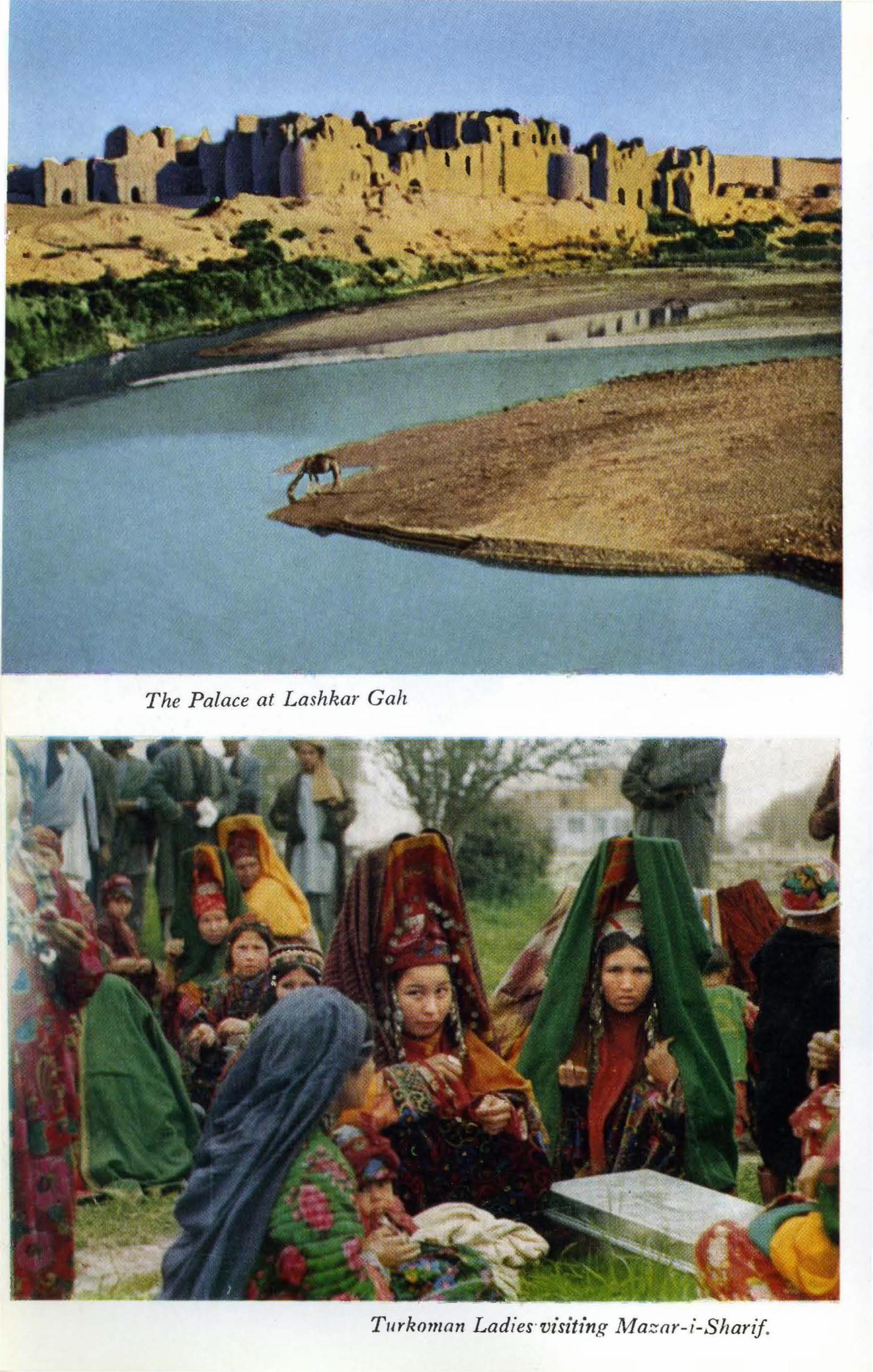
<
,
The Palace at Lashkar Gali
T11rko111an Ladies·visiting Maznr-i-Shartf .

. "
A Tea/101,sc Resta111"a11t i11 Af aza1·-i-Sha1·if
Masjid-i-Haj1 Pzyada'(Masjid-i~No Gumbad), Balklz.

I
•
•
flf' , I
MAIMAN A: A Sweets-seller d1,rin(f! Jesl1n.

CHAPTER 25
Mazar-i-Sharif
From Mazar-i-Sharif to: Distance Time 7 hrs. ! hr.
Kabul Tashkurghan Balkh Aqcha Shibarghan
Population: Altitudes:
Hotels:
Restaurants:
77,000
428 km; 268 mi. 60 km; 38 mi. 18 km; 11 mi. 80 km; 50 mi.
132 km; 83 mi.
Tashkurghan . 456 m; 1497 ft. Mazar-i-Sharif 377 m; 1237 ft. Balkh 357 m; 1171 ft. Aqcha 296 m; 971 ft.
15 min. 1 hr.
1 ! hrs.
Caravanserai Hotel: 1st class yurts with private baths; 2 blocks south of Central Square. Balkh Nights Hotel: half km. north of Central Square; garden, varied price range. Hotel Mazar-i-Sharif: 2 blocks west of Central Square; varied price range, meals on request. Many small local-style hotels just off Central Square. Bakhdi Restoran: on west side of Central Square; one of the best typically Afghan restaurants in the country; varied menu of Afghan dishes; good view of shrine from window-side tables; bright interior decor. Yousef Restoran: to right on road running directly west from Central Square; varied menu Afghan dishes. Caravanserai Hotel: Afghan and European menu.
Chapter 25 is an abridged discussion from Dupree: The Road Tu Balkh, Kabul, Afghan Tourist Organization, 1967.
389

390 AFGHANISTAN
Mantu, a meat-filled steam dumpling, is an Uzbak specialty served during the cool months. Ashak, a ravioli-like pasta filled with leeks and topped with meat sauce and sour cream. Burani, fried eggplant with sour cream, a favorite all over Afghanistan, is well prepared in Mazar during the summer eggplant season. All of these dishes may be ordered with or without the sour cream (chaka).
Petrol: At circle on entering city from the east; west of Hotel Mazar-i-Sharif.
Tolls: 20 afs. between Tashkurghan and Mazar-i-Sharif.
Air Service: Kabul-Mazar: 3 flights a week. Herat-Mazar: 3 flights a week.
MAZAR-I-SHARIF, capital of Balkh Province, is a busy commercial city, a major depot and transshipment point for qaraqul (persian lamb) and agricultural produce. Mazar is also becoming an important industrial city with a thermal power station (36,000 kw), chemical fertilizer plant (105,000 tons urea annually), textile, raisin factories, and modern tanneries. Two-storied, glass-fronted shops surround a large Central Square from which wide avenues radiate in accordance with the accepted precepts of modern city planners. The old city has completely disappeared.
Rising resplendent from the center of the Square is the magnificent shrine for which the city is named, Mazar-i-Sharif, the Tomb of the Exalted. Here lies Hazrat Ali, cousin and son-in-law of the Prophet Mohammad, the fourth orthodox Caliph of Islam. It is visited by countless pilgrims throughout the year and particularly on Nawroz (21 March) when the great Janda (religious banner) is raised to announce the beginning of spring and the coming of the New Year. Thousands upon thousands come to Mazar at Nawroz to celebrate the Guli Surkh (Red Blossom; Tulip) Festival, symbolizing the blossoming of hopes for continued prosperity. This is Afghanistan's most elaborately celebrated festival: a great fair is held in the gardens around the shrine and buzkashi games are played on the maidan (plain) south of the city.
Only an insignificant village when it was declared the capital

•
..
~ ;-~ ..
MAZAR- I-SHARIF
,. .. •. ,:,,,·
• .., ' ..
t' . .
/ ... •
'
~·i. •
'
Raising the Janda qn N awroz
391 . "'I -: ··•··
. ""
V
of Afghan Turkestan in 1866, the history of Mazar-i-Sharif is one of continuous , prosperous growth. The master plan for Maza1·-iSharif calls for a five-fold expansion.
SIGHT-SEEING
(1) SHRINE OF HAZRAT ALI Rauza Shahe Welayatmaab (Ultimate Saint)
Entrance fee: 20 afs; camera 50 afs . Inner shrine closed to non-Muslims. Ladies should wear headscarf or hat , slacks or long skirts and top with sleeves; men, long trot1sers and top with sleeves. Wednesday is ladies' day; men usually not permitted to enter.
Hazrat Ali was assassinated in 661 A.D. and buried at Kufa, Iraq, not far from Baghdad. Local tradition , however, relates that
•
•

'
•
392 AFGHANISTAN
. . ~ $Ji
>.i/911; ,,· it
.. [
The Shrine of Hazrat Ali, Mazar-i-Shari ~f .
his followers, fearing his enemies would take revenge upon the body, placed the remains of the Caliph on the back of a white she-camel which wandered until she fell, exhausted ,. on this spot, where the body was buried.
All knowledge of the final resting place was lost until the beginning of the 12th century when its existence was revealed to a mullah in a dream. The great Seljuk Sultan, Sanjar, ordered a shrine built here in 1136.
Genghis Khan destroyed this buildin .g, having heard there was great treasure beneath its pillars, and again the grave lay un-1narked until a second revelation occurred during the reign of the Timurid Sultan Husain Baiqara. He also ordered an elaborate shrine constructed, in 1481. None of the 15th century decoration remains but modern restoration has returned the building to its original shimmering beauty and it stands today as the most beautiful building in Afghanistan. Not the least of its charm are thousands of white pigeons who make their home here. Local belief has it that should a gray pigeon join the flock, it will become totally white in just 40 days, so holy is the site.
Three great entranceways, the most elaborate being the main

MAZAR-I-SHARIF 393·
gate on the south, lead into a spacious courtyard where thousands gather to pray, especially during the Nawroz festivities. On the west there is a beautifully decorated mosque of modern construction. The exquisite Afghan carpets here were especially \voven for this mosque.
The tomb of Hazrat Ali lies within the inner chamber of the central shrine , covered with a richly embroidered cloth. The walls and ceiling of this room are profusely decorated, the artistry of Aslam Khan Kabuli and Adam Khan Ghaznavi who completed the work during the reign of Amir Sher Ali (1863- 1879).
Amir Sher Ali is buried outside the west door to the shrine. Just south of his tomb, there is a small chapel containing the tombs of several other members of Amir Dost Mohammad's family. The largest tomb in this group is that of another of the Amir's illustrious sons, Mohammad Akbar· Khan who was buried here at his own request in 1843. This was the son who played such
. ~-f ' -~
""'t.: "~">A~.-.·>~- :. ·~cm.~~-~ (
i;i: I
'
C'liildreti Ride a F err,~s fVheel on Nawroz in Mazar-i-Sharif
•

394 AFGHANISTAN
a prominent role during the First Anglo-Afghan War of 1838-1842.
In the courtyard, between the shrine and the mosque, note the square platform encircled with a wrought iron fence. This platform holds the flagpole during the Nawroz festivities. The Janda flies for 40 days.
SHOPPING
Rugs and Carpets: Many shops lining the eastern side of the Central Square. In addition to traditional Turkoman and Baluch carpets, Uzbak gilim, which are woven, not tied, with a profusion of designs and a wealth of color, are also found. Horse blankets and camel blankets, some embroidered, and donkey bags, including bright red felt bags embroidered in black, add to the fascination of these displays.
Chapans: Extreme northwest corner of Central Square. These overly long-sleeved coats worn by Afghan men are especially prized when made in Mazar. Made of cotton or silk ( abreshom ), quilted for winter and single weight for summer, the favorite colors are green with narrow red or black stripes; gold with black; dark blue with red; and the popular green, silver and fuchsia, in wide stripes.
EXCURSIONS
Balkh: Archaeological and historical sites (Chapter 26); 18 km; 11 mi ; 15 min.
Aqcha: Monday and Thursday bazaar days (Chapter 21, p. 361); 84 km; 53 n1i; 1 hr; early mornings to ca. 1 : 00 p.m.

CHAPTER 26
From Balkh to: Distance 18km; 11 mi.
113 km; 71 mi.
Time 15 min. 1 ! hrs.
Mazar-i-Sharif Shibarghan
Population: Altitudes:
Hotel: Petrol:
10)000
Mazar-i-Sharif Balkh Aqcha Shibarghan
377 m; 1237 ft. 357 m; 1171 ft. 296 m; 971 ft. 330 n1; 1083 ft.
Hotel Balkh: Good; meals on request.
In town on Central Square.
BALKH, today a growing town in Balkh Province, is a town of prodigious antiquity where Zoroaster preached sometime between 1000 and 600 B.c. Licentious rites celebrated at the shrine to Anahita, Goddess of the Oxus, attracted thousands during the 5th century B.c.; Alexander the Great chose it for his base from 329-327 B.c., and in the early centuries A.O., under the Kushans, when Buddhism was practiced throughout Afghanistan, many holy Buddhist temples flourished in Balkh. For several hundreds of years scores of Buddhist pilgrims flocked to worship at the feet of ''a figure of Buddha, lustrous with noted gems'' as it was described by Hsuan-tsang, the Chinese pilgrim-traveller-chronicler who passed through in the 7th century A.O., just before the arrival of a· new religion from the west, Islam.
The Arabs, the bearers of Islam, called Balkh the Mother of
Chapter 26 is an up-dated discussion from Dupree: The Road To Balkh, Afghan Tourist Organization, 1967.
395

396 AFGHANISTAN
Towns, so impressed were they with its importance and its magnificence. By the 9th century two score Friday Mosques stood within the city which was paramount among the cities ruled by the Samanid Dynasty (873-999) from their capital at Bokhara. During this period of cultural revitalization Balkh was the home of some of the more famous names in early Persian literature, including the beautiful star-crossed Rabi'a Balkhi, first woman of the Islamic period to compose poems in Persian.
Embellished by the Ghaznavids and the Seljuks, who claimed it in 1040, Balkh continued as an intellectual and spiritual mecca. Mawlana J alaluddin Balkhi, known in the west as Rumi, was born in Balkh in 1207, son of a renowned Sufi teacher. Perhaps the most eminent Sufi poet of all time, Jalaluddin Balkhi's Mathnawi is considered by many to be the greatest poem ever written in the Persian language.
Balkh's glorious history closed in 1220 when 10,000 mounted men following Genghis Khan rode through and left it utterly devastated. The Great Khan's grandson stopped by for a little lion hunting in 1256, but Hulagu pitched his tents of gold cloth secured by solid gold pegs on the plain, for the desolation was so complete that even one hundred years later (1333) Ibn Battuta found the entire area "in ruins."
Balkh did, nevertheless, lie on an important trade route and eventually it won recovery under the enlightened rule of Shah Rukh and his Queen, Gawhar Shad, of Herat. After their deaths Bokhara and Kabul fought for control of the north. Ahmad Shah Durrani (1747-1772) finally established the frontier on the Amu Darya in 1768 and Balkh became the seat of successive GovernorsGeneral of Afghan Turkestan trying valiantly to impose their rule on independent-minded Uzbak chieftains. Chronically rampant malaria and distressingly frequent outbreaks of cholera made their task difficult. In the end, Balkh was abandoned for Mazar-i-Sharif if· 1866, after which it languished, a mean and forgotten village, until modernization schemes launched in the 1930s and 1940s ushered in a new era of prosperity.
Midway between Mazar-i-Sharif and Balkh (markers 434/435; 5 min. from Mazar), the road passes through the ruins of Takhti-Pul. This was once an elite suburb of Balkh built by Amir Afzal Khan in 1855 while he governed Afghan Turkestan for his father, Amir Dost Mohammad. Escaping from the pestilential

BALKH < y •
~ 'ti • :~. f~ fl' tiff!
The Shrine of Kl1waja Parsa
.. •
397
¥7
*· (.*w,, .< ~

398 AFGHANISTAN
climate of Balkh, the court built spacious two-storey houses in Takht-i-Pul surrounded by flowering gardens and orchards. From the upper stories they enjoyed a view of the mountains and the fresh breezes which blew from them. Amir Abdur Rahman (1880-1901), Afzal Khan's son, maintained the capital at Mazar and Takht-i-Pul became a strong, fortified cantonment enthusiastically described by the Amir's British physician, Dr. Grey, when he inspected the hospital here in 1889. A jumble of ruined houses behind a protective wall on the north, massive walls cut by the modern road, and the dome of a mosque are all that survive today. The interior of the mosque is richly decorated with floral panels painted in bright reds and blues, with touches of green. Stalactite niches and plaster panels sculptured with arabesques, foliated scrolls and rosettes add to the complexity of its decor. The plain mud-plastered dome rises from plowed fields today, giving no hint of its inner splendor.
SIGHT-SEEING
(1) SHRINE OF KHWAJA ABU NASR PARSA Situated in the center of Balkh' s Central Park, this shrine was
built in memory of a distinguished theologian who taught at the college in Herat established by Firuza Begam, mother of Sultan Husain Baiqara. The Timurid ladies of Herat vied with the men in their patronage of the arts and learning. Khwaja Parsa later settled in Balkh and died here in 1460. Built in the late Timurid style, its blue dome, fluted and resting on stalactite corbels 25 m; 80 ft. above the ground, sits above a colorfully tiled octagonal base. The portal is flanked by magnificent corkscrew pillars. Preservation of the badly deteriorated fa~ade and dome was initiated in June 197 4, with the assistance of the Archaeological Survey of India.
(2) MADRASSA (COLLEGE) OF SAYID SUBHAN QULI KHAN
Built in the 17th century by a great scholar of Balkh, this magnificent fragment of what was a huge academic establishment bespeaks the renaissance of Balkh during the Timurid and Uzbak periods. The interior of the arch is elaborately embellished with

BALKH 399
decorative architectural motifs popular in Herat during the height of the Timurid period.
(3) TOMB OF RABI'A BALKHI The tomb of this tragic poetess lies to the south of the Parsa
Shrine. Here she spent her last fainting moments writing a poem with blood that trickled slowly from wrists slashed by an irate brother. Poems to a slave lover had brought her here to die and the dungeon which became her tomb was discovered in 1964 .. Scholars 1nay look askance at the newly designated shrine, questioning its authenticity, but young girls come to ask the poetess for inspiration in solving their own romantic problems. As they leave, they tie a strip of cloth to the bars through which one views the underground tomb, to remind her of their quest. The poetry of Rabi' a Balkhi continues to live in the hearts of Afghanistan's young lovers.
( 4) BALA HISSAR The massive ruins of ancient Balkh lie to the north of the
Central Park. Here one may pick up bits and pieces of glazed pottery from the Timurid period, and before, including pieces of Chinese pottery, for great caravans laden with the luxuries of the world, stopped here.
The crumbling walls encircling the fort area were built for the most part in the Timurid period upon earlier foundations which may go back to the Kushan period in the early centuries A.D.
The great knot of ruins to the east was the Arg or Citadel. Several teams of archaeologists from France (DAFA: 1924-25,
under the direction of M. Alfred Foucher; 1947-48 and 1955-56, under the direction of M. Daniel Schlumberger) and the United States (R. Young, 1953) have dug at Balkh looking for the more ancient city. No conclusive evidence has yet been discovered, however, and some scholars think the really ancient city must have been at another spot. The search continues.
(5) THE SOUTHERN WALLS Early Balkh expanded to the south from the Bala Hissar area,
then continued to grow to the east, and then west, the whole surrounded by n1assive walls with stout towers which are very well preserved on the south. The new approach to Balkh from the

400 AFGHANISTAN
paved road runs straight through these walls which are particularly photogenic in the early morning light.
(6) TOP-1-RUSTAM AND TAKHT-1-RUSTAM Two mounds standing by the south shoulder of the paved road
at the turnoff to the town of Balkh are all that remain of the sumptuous monastery and stupa described by the Chinese pilgrim Hsuan-tsang in 630 A.D. A 61 m; 200 ft. high stupa sat atop the easternmost mound, today called Top-i-Rustam. The mound to the west of the unpaved road which separates these two mounds, today called Takht-i-Rustam, was crowned by a convent housing several sacred relics of the Buddha: his washing basin covered with gold and precious gems, a tooth, and his broom with jewelencrusted handle. The figure of the Buddha in the monastery was "lustrous with noted gems, and the hall in which it stands is also adorned with precious substances of rare value. This is the reason why it has often been robbed by chieftains of neighbouring countries, covetous of gain." (Hsuan-tsang) The process continues, for today the villagers take bricks from these mounds for their own building, and earth for their fields. They have long been abandoned, for even by the time Hsuan-tsang visited Balkh, Buddhism was slowly dying out. The city still had over a hundred Buddhist monasteries but the pious pilgrim has this to say about the monks in attendance: "so irregular are they in morning and night in their duties, that it is hard to tell saints fron1 sinners."
(7) MASJID-1-HAJI PIYADA (MASJID-1-NO GUMBAD) This exquisitely ornamented mosque is the earliest Islamic
monument yet identified in Afghanistan. Built during the early years of the 9th century A.D. when the first local Islamic dynasties were asserting their independence from the harsh rule of Arabic governors, it coupled outside influences with local ingenuity. As such it continued a tradition ·mentioned throughout this history, from the Achaemenid (Delbarjin Tepe, northwest of Balkh), Graeco-Bactrian (Ai Khanoum), and Kushano-Sasanian (Balkh), periods. Few datable examples of mosque architecture exist any where in the world from this early period. Only a handful featuring an architectural plan with nine domes (No Gumbad) are scattered throughout the former Arab Empire, from Balkh to Cairo to Toledo in Spain, dating from the 9th to the 12th centuries A.D.

BALKH 401
The mosque is not large, being only 10 m; 33 ft . . square. It was originally covered by nine domes but the domes have fallen and the floor is now buried under more than a meter of rubble · which also encases the lower half of the columns which supported the domes. On the north co1·ner, howeve1·, the present ground level is a little lower permitting one to note that the columns stand on bases above which there is a wide band of decorated stucco nar-
The Masji·d-i-No Gumbad 'in Balkh

402 AFGHANISTAN
rower in diameter than either the shaft or the base. The northeast fa9ade with an arcade of three arches was the original entrance but it is now blocked by later constructions.
The elegantly carved stucco decoration is the wonder and the beauty of this mosque. The capitals of the columns and the arches which span them exhibit an infinite variety of geometric and abstract floral designs: vine-scrolls twist around grape-leaves forming circles and semicircles, squares, rectangles, and polygons within borders of pearls, hatchings, mazes and meanders. On the capitals pairs of palmettes frame trefoil lotus blossoms and plump pomegranates sprout at their base.
Sasanian styles and traditions suggest themselves and the most striking comparisons may be made with the carved stucco decoration at Samarra, the short-lived capital of the Abbasid Caliphate north of Baghdad. Samarra flourished from 836 A.D. to 890 A.D.,
the period to which scholars have assigned the construction of this n1osque. Time has taken its toll at San1arra and it is difficult to fully determine architectural styles. Here at the Masjid-i-Haji Piyada the form and elegance of style and decoration are remarkably preserved, though nature's wear is yearly more visible.
A modest shrine of modern construction is attached to the north wall. Local belief holds that here lies Ka'b, an early 7th century resident of Balkh who converted from Judaism to Islam. In the open courtyard in front of the shrine there are a number of tombstones, many elaborately carved, dating from the 11th through the 17th centuries A.D.
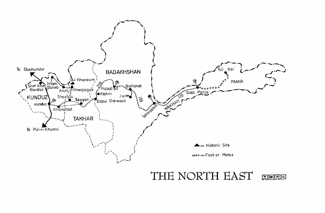
To
, __ _
To Pul-i-Khumri
. ..._.·-·-·, , . ( '.
i J ~· I . . _,.
I v·,.
' "\ BADAKHSHAN
)
\ l ,, .
I . )
r·..,..·-· ~ .- ....... -., r-li ,· 8 . . . / .
J • U,1 ·01 (. .,,,..-,, -. 1 ".,... ~ . l .f ., ~ . ., • 0
., 0 ° C PAMIR ·-.)
' l r ..... ; ~· 00 0 0 0 0 0 0 ..._•
. .-,· Qala Panja .'° ·--·-·-·-·, . .i \ ./ ,i.<J ,·-·-'
", Babu ·" / ,......~ ,..r · .J X'r . \ ~~ ... \~~ ·" \ C..,'' '-\" _...._, \ ~°' r-
1 ""'~ .r·~ TAKHAR ,___ _,. "
\ ___ ---, ", ·' \ : (r '-
\ I / \ ) /
,,, I \ _,.-,....- I
... - "' I I •= Historic Site I \ I ,,-, ) ,, ' / ', ( oooo=Foot or Horse
L.,--... .J
THE NORTH EAST
CHAPTER 27
Kunduz
From Kunduz to: Kabul Pul-i-Khumri Khanabad ( unpaved) Taluqan (unpaved) Faizabad (unpaved)
Population: 46,000
Distance 337 km; 210 mi. 107 km; 67 mi. 26 km; 16 mi. 72 km; 45 mi.
259 kin; 162 mi.
Time 6 hrs. 2 hrs.
30 min. 1 ! hrs. 2 days
Altitudes: Pul-i-Khumri: 625 m; 2050 ft. 400 m; 1313 ft. 800 Ill; 2625 ft.
Kunduz: Taluqan:
Hotels: Baghlan: Sugar Klub; Varied price range, new. Kunduz: Spinzar Hotel; Varied price range, garden. Municipality Hotel; Varied price range.
Refreshments: Baghlan: Sugar Klub, meals on request. Kunduz: Spinzar Hotel, meals on request. Serveral large restauran in main bazaar.
Petrol: Baghlan: Marker 265, north of town. Kunduz: One mile from town on road to Kabul.
Tolls: 20 afs. between Baghlan and Kunduz at marker 277/78.
Air Service: Kunduz-Faizabad: 3 flights a week.
KUNDUZ, capital of Kunduz Province, is a happy town. Jaunty, high-stepping horses bedecked with scarlet pompoms, mirrors and luxurious chauri (fluffy yak-tail whisks) trot by tall stately
Chapter 27 is an up-dated discussion from Dupree: The Road to Balkh, Afghan Tourist Organization, 1967.
405

406 AFGHANISTAN
camels wearing custom-made trappings embroidered with blue and white beads, and they toss their heads impatiently at honking trucks headed for Kabul. The trucks carry all manner of goods from Europe picked up at Sher Khan Bandar, the river port on the Oxus River, 60 km; 37 mi; 1 hr. from Kunduz (by special permit only). Add to this a welter of colorful chapans (long striped coats of red, gold and blue) and shops piled high with e1nbroidered hats, rugs and horse trappings-this is the brilJiant kaleidoscope which is Kunduz.
The tremendous air of prosperity is new for as recent]y as the begin~ing of this century the Kunduz area was a swamp famed principally for its malarial mosquitos. Reclamation projects, cotton plantation and the assistance of the World Health Organization are responsible for this incredible transformation.
The road to Kunduz branches off from the road to Mazar-iSharif just north of Pul-i-Khumri (5 km; 3 mi.), passing through a heavily cultivated area around Baghlan, capital of Baghlan Province. Medieval geographers called this area Baylan, but even more interestingly, the Surkh Kotal inscription (Chapter 22) includes the word Bagolange which closely resembles an Old Iranian word for temple altar or sanctuary. Baghlan, meaning province of the sanctuary, takes its name, therefore, from Kanishka's temple which flourished in the 2nd century A.D.
Baghlan (pop: 29,000; alt. 500 m; 1641 ft.) is actually divided into two sections. The first (24 km; 15 mi; 20 min. from Pul-iKhumri) is built around the Sugar Company established in 1939, and is mainly commercial. The Sugar Klub has been lavishly renovated recently and offers very comfortable lodging. The Baghlan Cheese Company produces delicious cheeses of various sorts.
Driving through extensive fields of sugar beet and cotton, one reaches the Administrative Center of Baghlan at marker 262 (9 km; 6 mi; 10 min.). The Governor's Office stands on the top of a mound called Cham Qala, an ancient Buddhist monastery during the Kushan period ca. 2nd-3rd centuries A.D. While digging the foundations for the office building, several fine sculptured limestone friezes depicting scenes from the life of the Buddha were found which are now on display in the National Museum, Kabul.
Leaving Baghlan, the fertile fields gradually give way to plains dotted with mounds still guarding the remains of other ancient towns and villages. As the road approaches the low mountains

KUNDUZ 407
softened by loess deposits which separate Kunduz from these plains, it meets a river and together they wind through low passes. In the spring these hills offer superb pasturage and large herds of horses may often be seen grazing beside the river. Horses from this area have been prized for centuries: Alexander of Macedon replenished his cavalry while he was here in the 4th century B.C.;
the Kushans sent horses from here as gifts to the emperors of China in the early centuries A.D., a tradition which continued into the 15th century when horses were included among the valuable gifts presented to the Ming Emperor of China by envoys from the Afghan area.
Breaking through the mountains at the toll gate at Aliabad (between markers 309/10, surrender ticket; 47 km; 29 mi; 1 hr. from Baghlan: 27 km; 17 mi; 30 min. from Kunduz), the road passes through a long stretch of barren country before extensive fields of cotton appear. Genghis Khan's Chinese minister, Y e-lu Ch'u Tsai, wrote in his report of travels through this area in 1219-1224 that the people of Kunduz wore clothes made from wool which grew in the ground, i.e., cotton. It was not until 1925, however, when an enterprising young Afghan, Abdul Aziz, discovered that the Soviet Union was desperately in need of cotton, that extensive cultivation began. The effects of this programme can now be seen in the large tracts of cotton growing all along the north from the borders of Badakhshan to Qala-i-Naw. Harvesting begins after the wheat is in, in 1nid-October, when women and girls join their menfolk in the fields. Their red head shawls bobbing like blossoms in the field are a happy addition to the busy fall scene.
A large cotton company, the Spinzar (White Gold, in Pashto) Company, was established in Kunduz in 1936. In 1975, the harvest from Kunduz, Takhar and Baghlan provinces exceeded 90,000 tons. In addition, the factory produces soap and edible oils and, most important, nutritious animal fodder. Tours on request.
SIGHT-SEEING
(1) BALA HISSAR (High Fort) Proceed north from Central Circle, on road to Sher Khan Bandar; ruins easily visible on outskirts of town, to right.
This was the fortress and residence of the redoubtable Murad

408 AFGHANISTAN
Beg, Uzbak ruler of Kunduz in the mid-19th century. Taking over as paramount ruler of the north when his ally-rival Qilich Ali Beg of Khulm (Tashkurghan) died in 1817, he raided annually as far as Ghor for slaves to till his lands; all but a few would succumb to the mosquito before the year was out. Murad Beg's power was respected even by the Amir of Kabul, Dost Mohammad, who dared not trespass on this northern territory without the permission of Kunduz' chief; Englishmen cooled their heels in Kabul until Murad Beg was pleased to receive them. Power in the northern khanates was ephemeral, however, dependent upon the personal charisma of the man and his manipulation of events. Absolute for many years, Murad Beg was, in 1839, outmaneuvered by his rival's son, Mir Ali son of Qilich Beg, and once again power· returned to Khulm.
The general outlines of the fort, its moat and citadel, are easy to make out but nothing remains within. A very fine view of the Turkestan Plains may be had from the citadel. Excavations by Japanese archaeologists (1963) revealed layers of Islamic material with only a few Kushan potsherds at the lowest level.
(2) MASJID-1-MOMIN Outside south wall of citadel.
Tradition states that this simple mosque was built by the eunuch Momin who dared question his master as to what he might do with his blighted life. The Amir so admired the young man for his courage in asking such a question that he promised Momin all the money he could spend, for the rest of his life. Grateful, Momin built this mosque and the vaulted reservoir beside it. The glazed-tile decoration of the minarets is Moghul in style. A pennanted grave opposite the northeast minaret marks the resting place of Shaikh Mohammad Ibrahim from Mecca who was robbed and murdered in this garden some forty years ago while he was collecting funds for his madrassa ( religious school) in Mecca. Pilgrims from Kunduz who go to Mecca during the month of the Haj still visit the Sheikh's family to express their regret.
(3) TAKHARISTAN MADRASSA Western end of main bazaar street.
This large madrassa (religious school) with a student body of 150 young men is officially accredited and grants degrees in Islamic
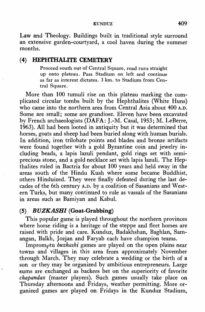
KUNDUZ 409
Law and Theology. Buildings built in traditional style surround an extensive garden-courtyard, a cool haven during the summer months.
( 4) HEPHTHALITE CEMETERY Proceed south out of Central Square, road runs straight up onto plateau. Pass Stadium on left and continue as far as interest dictates. 3 km. to Stadium from Central Square.
More than 100 tumuli rise on this plateau marking the complicated circular tombs built by the Hephthalites (White Huns) who came into the northern area from Central Asia about 400 A.D.
Some are small; some are grandiose. Eleven have been excavated by French archaeologists (DAFA: J.-M. Casal, 1953; M. LeBerre, 1963). All had been looted in antiquity but it was determined that horses, goats and sheep had been buried along with human burials. In addition, iron trilobate points and blades and bronze artifacts were found together with a gold Byzantine coin and jewelry including beads, a lapis lazuli pendant, gold rings set with semiprecious stone, and a gold necklace set with lapis lazuli. The Hepthalites ruled in Bactria for about 100 years and held sway in the areas south of the Hindu Kush where some became Buddhist, others Hinduized. They were finally defeated during the last decades of the 6th century A.D. by a coalition of Sasanians and Western Turks, but many continued to rule as vassals of the Sasanians in areas such as Bamiyan and Kabul.
(5) BUZKASHI (Goat-Grabbing) This popular game is played throughout the northern provinces
where horse riding is a heritage of the steppe and fleet horses are raised with pride and care. Kunduz, Badakhshan, Baghlan, Samangan, Balkh, J ozjan and Faryab each have champion teams.
Impromptu buzkashi games are played on the open plains near towns and villages in this area from approximately November through March. They may celebrate a wedding or the birth of a son or they may be organized by ambitious entrepreneurs. Large sums are exchanged as backers bet on the superiority of favorite chapandaz (master players). Such games usually take place on Thursday afternoons and Fridays, weather permitting. More organized games are played on Fridays in the Kunduz Stadium,

410 AFGHANISTAN
The Kunduz Team Plays for the Championship in Kabul
again, weather pern1itting. Usually about twenty to thirty horses and riders play, but sometimes hundreds, even thousands, of horses ride in. The chapandaz form the nucleus while substitute horses mill around the periphery, ready to join in. This is a practical part of their training. ·
The game is easily described, not easily played. A decapitated calf weighing somewhere in the vicinity of 150 pounds is placed in a circle before tl1e judges. The object of the game is simply to pick up the carcass and ride around a specified point, which may be as much as a mile away, and return to deposit it once again in the circle in front ot' the judges. There are two teams, each of which endeavors to releave the other of their bloody burden.
The tremendous skill and electrifying excitement engendered by daring riders atop glistening horses, sometimes galloping flat out, sometimes rearing with flailing hoofs above an opponent, make th ·e game irresistibly compelling. Horse and rider train together for years and are idolized as all true champions should be.

• •
KUNDUZ I
.( ~~ . - ~9:.W;;,.. __ (·~' •. ~ ·~ ., <>;..;... ", •• i v.,. \_., '(!\..,., ~.'
A Tajik lady from ·the north weaves gilim/or saddle bags .
•
SHOPPING
1. Rugs. Rugs, gilim, camel bags and donkey bags are sold in shoos· at the western end of the 1nain street and at the entrance ... to the horse bazaar. The Uzbak gilim (woven rug) from Kun-duz are very fine and renowned throughout Afghanistan for their quality and design.
2(! Horse Bazaar. Everything from good ,uck· charms and studded accoutrement for the horse , to .;boots and riding costumes for the rider , may be purchased in the bazaar running south from the main street , one block before reaching the main circle. Long scarfs knitted of the soft under-hair of wild ungulates which roam the mountains , are a particularly attractive buy in this bazaar. Called pat-i-alzu , they are a specialty brought in from Badakhshan .
3. Textiles. Chapan silks and Uzbak tie-die silk in bright colours may be purchased in a bazaar on a side street west of the rnain highway running north frotn the Central Square.

412 AFGHANISTAN
4. Hats. Shops piled high with high quality, colorfully embroidered Uzbak hats (kola) are situated on the northeast side of the Central Circle.
S. Coats. Chapan, the multi-colored, overly long-sleeved coats worn by most men on the streets of Kunduz are sold in shops located on the northeast side of the Central Circle. Chapan are made of either silk or cotton and may be single weight or padded. These same shops also sell gopicha, a typically U zbak coat-type which fastens to one side at the neck. Gopicha are usually made of plain brown cotton material, but sometimes in olive or red; most are padded. Recently corduroy has become popular. .
6. Boots. Knee- high, soft leather boots popular among the horse-riding Uzbaks of Kunduz are made and sold on the southwest side of the Central Circle. I

CHAPTER 28
Route (unpaved) Distance Kunduz-Faizabad
Kuriduz-Taluqan Taluqan-Kishn1 Kishm-Faizabad
262 km; 164 mi. 72 km; 45 mi. 75 km; 47 mi.
115 km; 72 mi. 68 km; 42 mi.
159 km; 99 mi.
Time 2 days 1 ! hrs. 4 hrs.
Si hrs. 3 hrs. 8 hrs.
Faizabad-J urm Faizabad-Ishkashim *
*(by special permit only)
Population: Taluqan-10,000 Faizabad-10,000
Altitudes: Kunduz 400 m; 1313 ft. Taluqan 800 m; 2625 ft. Faizabad 1200 m; 3937 ft. Ishkashim 2618 n1; 8590 ft.
Hotels: Khanabad: Good. Taluqan: Hotel Spinzar, beside river; good. Kishm: Good. Atin J alao: Caravanserai. Faizabad: Overlooking river; varied price range.
Refreshments: On request at all hotels.
Petrol:
Air Service:
Taluqan, Atin Jalao, Faizabad: chaikhana.
Regular pumps: Khanabad, on detour road. Taluqan, east edge of town on road to Faizabad. Kishm, west edge of town. Faizabad, east edge of town on road to Ishkashim. Occasional shortages of supply.
Kunduz-Faizabad, 3 flights a week.
413
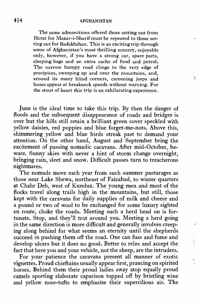
414 AFGHANISTAN
The same admonitions offered those setting out from Herat for Mazar-i-Sharif must be repeated to those setting out for Badakhshan. This is an exciting trip through some of Afghanistan's most thrilling scenery, enjoyable only, however, if you have a strong car, spare parts, sleeping bags and an extra cache of food and petrol. The narrow bumpy road clings to the very edge of precipices, sweeping up and over the mountains, and, around its many blind corners, careening jeeps and buses appear at breakneck speeds without warning. For the stout of heart this trip is an exhilarating experience.
June is the ideal time to take this trip. By then the danger of floods and the subsequent disappearance of roads and bridges is over but the hills still retain a brilliant green covet; speckled with yellow daisies, red poppies and blue forget-me-nots. Above this, shimmering yellow and blue birds . streak past to demand your attention. On the other hand, August and September bring the excitement of passing nomadic caravans. After mid-October, beware. Sunny skies with never a hint of storm change overnight, bringing rain, sleet and snow. Difficult passes turn to treacherous nightmares.
The nomads move each year from such summer pasturages as those near Lake Shewa, northeast of Faizabad, to winter quarters at Chahr Deh, west of Kunduz. The young men and most of the flocks travel along trails high in the mountains, but still, those kept with the caravans for daily supplies of n1ilk and cheese and a pound or two of wool to be exchanged for some luxury sighted en route, choke the roads. Meeting such a herd head on is fortunate. Stop, and they'll trot around you. Meeting a herd going in the same direction is more difficult and generally involves creeping along behind for what seems an eternity until the shepherds succeed in pushing them off the road. One can fuss and fume and develop ulcers but it does no good. Better to relax and accept the fact that here you and your vehicle, not the sheep, are the intruders.
For your patience the caravans present all manner of exotic vignettes. Proud chieftains usually appear first, prancing on spirited horses. Behind them their proud ladies sway atop equally proud camels sporting elaborate caparison topped off by bristling wine and yellow nose-tufts to emphasize their supercilious air. The
·, i

T AKHAR AND BADAKHSHAN 41.5
A Yoitng Girl Leading A Nomadic Caravan
reins are often draped with scarlet, gold or emerald brocade but nothing outshines the riders beneath dark shawls heavily embroid- ered with gold. Beneath each shawl pounds of silver and gold jewelry jingles and dark eyes sparl{le, often with annoyance at the inconvenience wheeled traffic causes.
In the fall the caravans travel mainly by night, stopping about six in the morning to set up can1p. In the spring they take advantage of the sun's warmth and travel by day, sle~ping by their
· fires at night. The encampments generally consist of from three to fifty tents. The women set up and take down the tents, and while watching them at their tasks one notes they dress in velvet with swirling gold-embroidered hems. Wine, green and royal blue are the favored colours. The caravans that pass this route are amongst the wealthiest in Afghanistan.
The road to Taluqan leaves the. ·Central Square of Kunduz ru·nning due east (straight ahead coming fro·m Hotel) through rice fields planted in May/June ~ In October, when t·he reaping and threshing take place, there is a tremendous air of busy prosperity. Next to the fields in which Work progresses many workers erect


TAKHAR AND BADAKHSHAN 417
temporary huts made of rice-straw which are very photogenic. You may also observe them parching the rice in large iron cauldrons preparatory to husking. The picturesque waterpowered rice pounders have, however, largely disappeared from this area within the last ten years.
For about five-ten minutes (5-9 km.) after leaving the trees and gardens around Kunduz, the plateau humped with the tumuli of Hephthalite tombs is clearly visible to the right ( see Chapter 27). Below, horses graze in the reaped fields. This area is famed for both its rice and its horses.
Khanabad (population 18,000; altitude 590 m; 1937 ft.) lies 26 km; 16 mi; 30 min. beyond Kunduz. The new road detours around the city. It is, however, one of the more fascinating towns in· Afghanistan. The large tree-covered bazaars are always full of activity and the chaikhana balconies over hanging the Khanabad River, a tributary of the Oxus, are hard to resist. The center of town is only two kilometers from the detour turnoff.
The road forks at the little crossroads bazaar of Chogah Bala (12 km; 7 mi; 10 min. beyond the turnoff into Khanabad) where there are several chaikhana decorated with gay wall-paintings, a tradition which is unfortunately fast disappearing. Floral motifs, especially the Tree of Life, pomegranate trees heavy with fruit, feathery trees laden with flowers, stylized flowers and geometrics, are most popular. Sometimes teapots appear, dotted here and there amongst the flowers, or forming a lower border.
It is also with regret that it is now advisable to direct you to proceed straight ahead instead of taking the left fork. The new road under construction is level, straight, smooth and fast, permitting arrival in Taluqan within an hour (34 km; 21 mi. from Chogha Bala) instead of a bone-jarring three and a half hours. It passes through rice fields and one misses the spectacular views of the Taluqan River which the old road overhangs.
Taluqan, capital of Takhar Province since 1964 when Qataghan Province was divided into the three provinces of Baghlan, Kunduz, and Takhar, has rapidly outgrown its artificial newness. The trees have grown; the bazaars have gained a prosperous look of permanency and bazaar days (Monday and Thursday) sparkle with all the color and excitement of a movie spectacular. If you are
~ A Saddler of Khanabad

418 AFGHANISTAN
lucky, you will encounter the Town Crier, dressed in flamboyant robes. In the old days before the transister radio, the Town Crier was an essential communicator of news. Today, he largely passes on information about local events. Town Criers, a Central Asian tradition, are particularly characteristic of the bazaar towns of the north, especially in areas inhabited by Uzbaks. Taluqan sits at almost the eastern extremity of U zbak territory which extends far to the west, between Bala Murghab and Maimana.
In the Taluqan bazaar you may purchase very fine alacha, the narrow cotton material used in making chapans. The designs and colours, particularly a mustard-yellow and a wine-red, of Taluqan's alacha are prized throughout Afghanistan. Both tikka and shami kababs are tastefully prepared in Taluqan, and in the winter fried river fish are a nice change, especially when combined with delicious pears also available at this season.
Next to the new city, the old city to the west by the riverside now looks like a small village. This old city is of considerable antiquity, however, and was described in 1275 by the Venetian merchant-traveller, Marco Polo, as "a castle called Taikhan, where there is a great corn-market, and the country round is fine and fruitful. _The hills that lie to the south of it are large and lofty. They all consist of white salt, extremely hard, with which the people for a distance of thirty days' journey round, come to provide themselves, for it is esteemed the purest that is found in the world. It is so hard, that it can be broken only by great iron hammers. The quantity is so great that all the countries of the earth might be supplied from thence." 100 pound blocks of salt are still quarried from Taluqan's mines and represent one of Afghanistan's most important mineral resources. Donkeys laden with Taluqan's salt trot through the bazaars and truckloads are carried to Kunduz and Kabul.
BADAKHSHAN Coming from the direction of the Hotel in Taluqan, turn right
at a roundabout in the center of town and left at the sign to Faizabad. The petrol station is located on the eastern edge of town.
Forty minutes out of Taluqan (15 km; 9.5 mi.) the road passes through a shady grove sheltering the shrine of a venerated soldier from the Panj sher valley who died here in battle against the famous Ibrahim Beg, leader of the basmachi guerrillas fighting against

TAKHAR AND BADAKHSHAN 419
Soviet troops attempting to establish Soviet rule in Central Asia. Ibrahim Beg frequently sought refuge in Afghan territory, thereby endangering Afghan-Soviet relations. In December 1930, therefore, the Afghans sent a force against the guerrillas; Ibrahim Beg was driven across the border, captured and executed. This shrine was constructed by order of the commander of the Afghan forces, Shah Mahmud, brother of King Nadir Shah (1929-1933), in appreciation.
Leaving the plains of Taluqan, one again encounters high mountains gently rounded by heavy loess deposits which are 300 meters and 1000 feet deep in some places. The loess begins to blow in from· Central Asia by the end of July. Hanging in the air it imparts a monotonous buff hue to everything on the landscape and as it settles, it sticks with incredible tenacity. Annoying as it may be grating between the teeth, it brings great richness to this area renowned for its grains and fruits. The trout which inhabit these cold, snow-fed streams are also famous. Farkhar is particularly favored by fishermen and many are the tall stories one hears from those who have fished these streams. Arrangements may be made through the Afghan Tourist Organization, Kabul, for fishing trips in the Farkhar area.
Those travelling to Faizabad, however, must be careful not to be mesmerized by the Monet-like landscape, especially in the spring when the valley is carpeted with red poppies or, 30 km; 19 mi; 1 hr. from Taluqan, they will miss the shaky, worn sign pointing left to Faizabad. Having made the turn it will immediately appear that the sign was in reality a horrible hoax for there is no road, just a boulder-strewn river bed. But take heart and follow the tracks of those who have preceded you; with the telephone poles as your guide you can only end up at Faizabad.
In 1975 the road surface was considerably deteriorated, but an ambitious road building program is envisioned, so hopefully better time may be made in the future. One passes by several small villages and two major ones, Austan Tapa (13 km; 8 mi.; 1 hr. from the fork) and Khalefgan (8 km; 5 mi; 40 min. from Austan Tapa), before entering a winding pass to drop down into the little village of Chinar-i-Gunjeshkan (Sparrow's Chinar: 13 km; 8 mi; 50 min. from Khalefgan) with its small roadside teahouse almost hidden under a gigantic chinar tree. This marks the TakharBadakhshan border. Looking across the valley, an area of swamp

Ch11rn-ing Butter i·n a Goatskin
Spinning Cotton

·'Jif" . ' ••
..
<
• •
, '
. .., ... ( "" . ._ • 4
,. lt
• '~, i · 0
~ t s\ ~~ ' ·i ~;J
I.I: #4
~ #1· > ' ~ ,.
'« .•
';i:f ~ -~ ,.
~ 8;l;:
~ ~ ,:; t:
# « ~ • ®'
.,<!l
~-
A Yoz,n~!f lV!usici·an of Baba Darwes/1
422 AFGHANISTAN
overbank deposits during the glacial period, you will spot the tiny village of Baba Darwesh tucked under another imposing chinar tree. In the limestone cliffs to the right you can see the cave called Darra-i-Kur from which the first evidence of Middle Palaeolithic Man (50,000 years ago plus) in Afghanistan was recovered by American archaeologists in 1966.
From the top of the next pass the eye delights in the sight of the green valley of Kishm ( alt. 960 m; 3150 ft. 11 km; 7 mi; 30 min. from Chinar-i-Gunjeshkan) formerly called Mashad, Place of the Martyred. As you descend from the low pass you will note a small shrine to the left surrounded by a nondescript pressedmud wall. Only tall pennants attract attention. Here lies Sultan Sayyid who· was killed at this spot in the 11th century A.D. On the hillside opposite the shrine there is a mineral spring of purest water which, according to local legend, represents the tears of the martyr's faithful camel. Sultan Sayyid was the brother of Nasir-iKhusrau, the famous mystic-poet enshrined at Hazrat Sayyid beyond Jurm (see below).
Marco Polo stopped at Kishm and after describing its river and its porcupines continues: "when a man leaves this city, he travels three days without finding a house, or anything to eat or drink, being obliged to carry provisions with him." Today, as then, the terrain after leaving Kishm becomes progressively more rugged as the road winds in and out following the Kokcha River. In its upper reaches the river is spanned by narrow, incredulous, swinging bridges. They lead to small groups of houses and invisible qishlaq (villages) tucked away in the mountains, but here one does feel alone. The scenery brings to mind the plight of the King of Kashghar who fled into Badakhshan while being "chased like a mad dog" (Juvaini) by a Mongol army. Taking a wrong turn, he was caught in a dead end valley and captured. Having seen the terrain, one sympathizes.
Today's route is a geologist's paradise and undoubtedly among Afghanistan's most spectacular scenery. Road builders are hard at work, however, constructing a new route directly from Kishm to Faizabad across the highlands. Again, one regrets having to leave the river, but vehicular traffic does not take kindly to the tortuous paths carved by rivers.
Should you wish to experience life in a caravanserai, you may stop for the night at the village of Atin Jalao ( 43 km; 27 mi; 2
TAKHAR AND BADAKHSHAN 423
hrs. from Kishm). From the guest rooms on the second floor, you watch the busy activity of settling in the horses for the night in the stables directly below you. When all is ready the big gateway is closed and bolted and small groups of men gather around trays of pilau and tea to swap stories about the day on the trail. Outside, there is a vast stillness. When the nomads are on the move, this silence intensifies all the little noises made by thousands of resting sheep and the sudden shrill cries of their shepherds bounce from hill to hill. They keep each other alert this way, and hopefully pursuade the wolves to stay beyond their flocks.
Views of the Kokcha River from the mountain passes which follow beyond A tin J alao are particularly beautiful. Often the river divides into arms dotted with little islands where in September/ October, when the waters are low, you may observe several types of gold mining operations in progress. Some simply pan it by the side of the river, others construct complex sluices on the islands to lead the water across sheep skins to catch the precious fragments. In other areas the mountains recede and thus give room for broad valleys with fields and villages.
On approaching Faizabad, the road passes across a wide open meadow where the airport is located (11 km; 7 mi; 30 min. from Faizabad). At the far end you will note a sign pointing to the Eagle's Eyrie, a rocky mound overlooking the river where government officials and their families come with friends for picnicking or an afternoon's stroll. Then the mountains come together again, immediately forming a narrow ravine forcing the road to cling to the very edge of the cliff high above the town nestled within green orchards on the opposite side of the river. The hotel sits on a bluff; cross bridge to dead end in bazaar, turn left, and left again. The bazaar of F aizabad is narrow and over a kilometer long. Shopping specialities include colourful knitted "ski" socks and a luxuriously soft, tawny material called pat-i-ahu knitted from the soft underhair of ungulates which roam these hills. Faizabad is also known for its high quality cumin, and for walnuts and apricots. Demolition of a considerable portion of the old bazaar began in 197 5 ; the new city will span both sides of the river, down river from the hotel.
F aizabad, meaning Blessed Abode, takes its name from the fact that in 1691 the Cloak of the Prophet Mohammad was brought to this recently established capital of Mir Yar Beg, orie of a long

•
424 .AFliHANIST AN
TJ1e hazards of trai,elling in BadakJ1sl1an !
•
succession of independent rulers in Badakhshan. The cloak, how-ever, was later (1768) acquired by Ahmad Shah Durrani and now resides in Kandahar. Several other towns, such as Baharak and Kishm in addition to those now mere mounds on the landscape, have claimed the status of capital for short periods as individual fortunes shone with the success of charismatic leaders. The history of Badakhshan is, however, one of extreme . complexity stemming from the ruggedness of the terrain and the independent nature of its inhabitants who tolerated outsiders . only momentarily and -even then kept them in frustrated isolation in the lower valleys.
Early Chinese (including that indefatigable Chinese pilgrim, Hsuan-tsang, who was detained here for over a month in 644 A.D.
while he waited for the passes to China to open), Arabic and Persian sources all speak of Badakhshan as a specific area. In 1220/21 the Mongols ''sent armies into the whole of Badakhshan and all that country, and conquered and subjugated the people, some by kindness, but most by severity;'' (Juvaini). Tamerlane repeated the exercise .in 1368. Local chieftains ruled, however, and periodically revolted. One such revolt in 1412 caused Tamerlane's son and successor, Shah Rukh of Herat, to establish a more direct
..

TAKHAR AND BADAKHSHAN 425
control, for during his reign an important trade route traversed these passes. To keep the route open and to protect the merchants from whom lucrative taxes were collected, both Herat and China exchanged several embassies with Badakhshan. Babur, the Moghul, continued the policy of keeping an eye on the local chieftains and the Emperor Humayun spent nine years here as governor for his father.
As the center of the Moghul Empire shifted to Delhi and Agra in India, however, all control over the north dissipated and local chiefs reasserted their independence which they kept for all practical purposes until the reign of Amir Abdur Rahman began. When Abdur Rahman came out of exile in Central Asia and made his bid for the throne of Kabul, Badakhshan supported his cause and he entered Afghanistan first through this territory, gathering forces as he moved. Kishm was an especially important recruiting area. Later, differences of opinion compelled the Amir to reaffirm his authority by force in 1889.
SPECIAL PERMIT TO TRAVEL BEYOND FAIZABAD MUST
BE OBTAINED IN l{ABUL
Baharak (42 km; 26 mi; 2 hrs. from Faizabad; alt. 1480 m; 4856 ft.) was an ancient capital of Badakhshan when it was an independent territory. The Mayor's Club sits on a hill in a lovely grove of trees before reaching the bazaar ( sharp left after crossing a small bridge; large school on right). One needs camping equipment to stay here, and no food of any sort is provided. Crystal clear mountain streams offer many idyllic spots in the vicinity.
In the center of the Baharak valley there is a small hill ringed by a line of trees running along a jui (irrigation canal) at its foot. Known as the Mountain of Shirin-o-Farhad, local folktales cellebrate it as the venue of the love affair between Shirin, Queen of Armenia, and Farhad, a handsome young engineer who undertook the difficult task of building the jui in return for the beautiful Queen's hand. The story has a very ancient· oral tradition which was first written down by the Persian poet Nizami in 1180 as a part of his long tale Khusrau-o-Shirin. In this literary version, Shirin, then a princess, is engaged to Khusrau, then a prince living in Ctesi phon on the banks of the Tigris River. Before the marriage takes place, however, the death of Khusrau's father makes

426 AFGHANISTAN
him a king, and the death of Shirin' s mother makes her a queen. Consequent political squabbles cause Shirin to retire to a remote valley where she finds herself considerably inconvenienced by the fact that her castle sits in a barren tract and much effort is needed to bring milk from sheep grazing in a fertile valley on the other side of the mountain.
Then it is that her advisers suggest she request a renowned engineer to build a jui through the mountain so that milk could be conveyed by it directly to the castle. She calls the young man and gives the order from behind a curtain. He falls in love with her voice, and she with him. News of this love affair reaches Khusrau who immediately sends a false message to Farhad informii:ig him of the death of Shirin. Distraught, the youth splits his skull with his spade. The literary versions, of which many followed that of Nizami's, carry on at great length to an eventual reconciliation between Khusrau and Shirin.
In the valley of Baharak, however, the oral tradition continues with its own flourish. Here Farhad is said to have been asked to open a spring in the mountain and lead the waters to the desert. He is on the verge of accomplishing this and winning his maiden when a distressed and jealous Khusrau consults an old sorceress. She advises him first to spread the rumor that the king, with all the labour and resources at his disposal, would construct a reservoir for the people of the valley. Then the old crone tells him to spread out quantities of reed matting near Farhad's jui and sprinkle them lightly with a little water so that when hit by the first rays of light at dawn, they would shine like a large body of water. The ruse works and Farhad, thinking he has been outdone by his rival, splits his skull in desperation, and as his spade falls from his lifeless hand a spring gushes forth. I ts waters still nourish this fertile valley. Shirin, however, on seeing the body of her loved one, stabs herself and falls beside him. Hearing of this, Khusrau dies of remorse whereupon the sorceress realizes the tragedy her machinations have wrought and swallows . poison.
Beyond the Club the road forks; the left fork goes through a large bazaar and joins the detour on the other side. Four km; 2.5 mi. beyond the bazaar take the road over the bridge spanning the Warduj River, a tributary of the Kokcha River, to visit Jurm; bear left to continue to Ishkashim (see end of Chapter).

TAKHAR AND BADAKHSHAN 427
Petroglyplz near Jurm
Superb trout fishing may be enjoyed in the Zar Deyo Valley less than an hour out of Baharak. At dead end in the Baharak bazaar turn right, cross a small 1·ui, turn left down a narrow lane, cross a small stream and turn sharp left to enter the mouth of the valley. Trout pools appear after about half an hour; the track continues up the valley for another two hours or so, depending on annual flood patterns.
There is a spectacular 75 m; 246 ft. high waterfall at Aq Shira an hour (25 km; 16 mi.) out of Baharak off the road to Ishkashim. Take road to Ishkashim . Do not cross bridge to Jurm but continue on the road to Ishkashim for 19 km; 12 mi. beyond this first bridge to a second bridge at. which you take a sharp left onto a motorable track. The waterfall with a perpetual rainbow at its foot is located 2 km. beyond the turnoff, near the village of Aq Shira.
At JurDl (26 km; 16 mi; 1 hr. from Baharak; altitude 1540 m; 5053 ft.) you will need camping equipment. No food is provided at the club. There are several large Moghol villages between Baharak and Jurm. Older members of this ethnic group who migrated from Ghor during the 20th century to settle in various small pockets

428 AFGHANISTAN
throughout the north speak some Mongolian, but on the whole they have largely adapted to the language and culture of the peoples with whom they now live. Chung, about 3 kilometers from the bridge, is a particularly attractive and active Moghol village.
On a huge boulder by the side of a bridge over the Kokcha River some 11 km; 7 mi. south of J urm you will find numbers of petroglyphs. For the next four kilometers, as a matter of fact, the whole valley is strewn with boulders covered with petroglyphs depicting men with bows and arrows, wild goats, and one unique motif showing a snake swallowing a goat while the sun shines above. It is an amazing and extraordinary collection, most of which is of prehistoric origin.
The shrine of the 11th ~entury mystic-poet, Nasir-i-Khusrau, sits on a great mass of conglomerate high above the ancient valley of Yamgan, now called Hazrat Sayyid (56 km; 35 mi; 3 hrs. from Jurm). Originally from Balkh, Nasir-i-Khusrau travelled (1045-1052) with his brother and an Indian slave boy to Mecca and Egypt where he converted to the Ismailiya faith, then patronized by the Fatimid Dynasty of Egypt. Ostracized for his new faith which orthodox religious leaders looked on as a form of heresy, Nasir-i-Khusrau left Balkh and travelled to Badakhshan where the ruler welcomed him and gave him haven in Y amgan. He established a school to which disciples flocked, and left behind a highly acclaimed Diwan, or collection of poems.
The famed lapis lazuli mines of Badakhshan are only about 40 kilometers south of Hazrat Sayyid; the motorable road ends 20 kilometers beyond Hazrat Sayyid. Lapis lazuli from Badakhshan was exported to both Egypt and Mesopotamia as early as the 4th millennium B.c. Beads, pendants of many shapes, rings, seals, · fish, bulls, rams, ibex, eagles and even· monkeys excavated from Mesopotamian sites, prove that a lucrative trade existed between Badakhshan and the lands of· the Tigris River as early as 3500 B.C. Lapis lazuli was so prized, in fact, that an involved synthetic was produced for the less affluent. Babylonian physicians al~o inincluded crushed lapis as a magic potion in their prescriptions.
Badakhshan has lon·g been famous for rubies as well. Marco Polo relates that when he passed through Badakhshan at the end of the 13th century, the King of Badakhshan prohibited the. sale or export of rubies in any form not, as one might su~mise, because of their rarity, but because of their abundance. He was
I
C
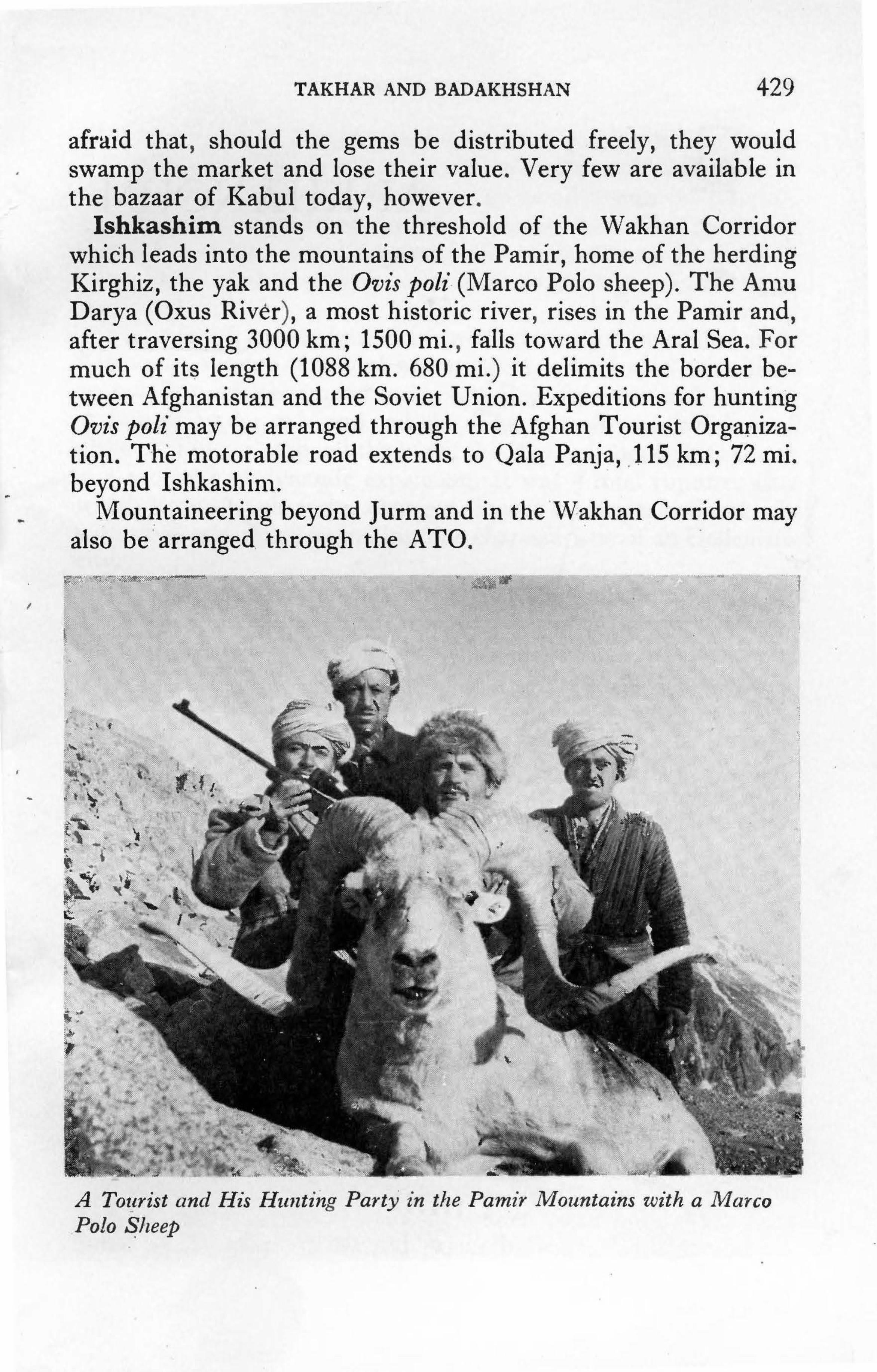
'
...
..
I
I
-
TAKHAR AND BADAKHSHAN 429
afraid that , should the gems be distributed freely, they would swamp the market and los.e their value. Very few are· available in the bazaar of Kabul today, however .
Ishkashim. stands on the threshold of the Wakhan Corridor which leads into the mountains of the Pamir, home of the herding Kirghiz, the yak and the Ovis poli-(Marco Polo sheep). The An1u Darya (Oxus River), a most historic river , rises in the Pamir and, after traversing 3000 km; 1500 mi. , falls toward the Aral Sea. For much of it~ length (1088 km. 680 mi.) it delimits the border between Afghanistan and the Soviet Union. Expeditions for hunting Ovis poli may be arranged through the Afghan Tou .rist Organization. The motorable road extends to Qala Panja, .115 km; 72 mi. beyond Ishkashin1 .
Moui:itaineering beyond Jurm and in the ·w~khan Corridor may also be · arranged . through the ATO.
,,, '!'' ~0''::i:·;··,~~ ,,.,.. . ·· ~::. .. . (
... :~x· ~. tj t~ • • •
. ~ ,
' •
' '
' . > '
. ~
A Tot!rist and His Hii1zting Party ,in tlie Pamir Mountai ·ns with a Ma ·rco Polo ~lieep
•
•
' .
j /.
l
.•
•

"'
• ••
-~ • ., • '11 ,
•
• .......
•
~ . \ •,i. ~ ~ ~ .. ~,. ·.I; . ... '
i-i' ·.: \ . ' • <
•
: ... ~ , .
•
....... •
•
• •
-
~--... '
~-.
•
•
-· . / .... ,. , ..
• '
( · ' I ' , ......
; • . l l
\ , .. , • • ' . ~ ... , .
•
•
... . . • •• I ..
• .. ' ..
•
• t .......
• • , .... /
•
• ;
• •
'
•
' - .
" r \ b,. .......
-~ 1 , .. ··"'''1 . ·-.. ·' ~--·-.~
•
,_-1:AIS
.. • • . tr
• ~ ·'
•
•
•
. ,.
;
.. •
•
., .. " , I\ #
•
•
•
••
•
•
,·-
•
•
•
'" ·' ~ • • ' . , t,. )n L' ' • • --.~ 'J'iF!
•
•
•
. .
. . .
• '
' : ;! I •
' • • • ,.4
• . • " ' , • •
'
• ,,, .. . \. <· w \ .• ' ' " " '
• •
\
;
\\
•
• ,
' ••
'
. - / - , . .,, t • ..
•'
• • • • .
:;...
.. ,., ,,
>
..... _
, •
• •
• -• •
• ••
• ,, • • ., •
..,
•
•
. ' :
" •• ·:
' .
.,
•
\ •
I
• •
' •
N j
-:,,.:. , . . ·-
••
/
'
• '
,
., . • ~
' . : .
1 I
·,
•
•
•
•
•
. I
, ..
.. ' .
' •
\\ f . . t' \" I . . . ' ~ ~
I \
,
•
•
•
•
•
•
•
• •
•
•
(
/"/ • J
' .
, ., . \ , .
. •
•
•
,·
' ' .
• • I • ' •
••
, . • ., , ·
.. -~
..
"'. ""'· ... ~~ \
' \
I
' • l
• ..
- \
.. •
. • .,,., I.;.>: •
'
' .----.. -"
.._,,. --... ' .., • • i...:.
. •
'
•
' •
• ••
•
•
' •
,
•
'
,
•
•
,.
• ... "
•
•
.. •
•
•
•
•
•
. ..
..
•
'
•
. . .. ~"""'--.,-~_ .. ,,r-...... ...ifiljt ~~ ¢¢"'!.!iii ;·"'·"""- :2:f • •
.. ..
•
•
•> • • • "" .,.,., ----· , .. ~-.. ......... ,.- -... .....
Ill.. _ • .:;:.; .. .... ., ..... • ' ..., • ¥ 'J,;.'f" -'• --~ '"' ""X!' ~ ...• ,N: ~;~
... , ~ - Jt ~ ., ..
I ' •,./
• r
(; •
• • •
(,
'/' • .... •
·:"t •
., • .. , .
' •
,, ....
•
•• t
./
.,.
• •
• •
• • •
'
•
' •'
•
•
'
•
.,
• ·' ' ,
•
•
• , ... , ~
•
•
•
•
:,
.,
• ·, • ~.
• •
' 1 •
l .. .. . .:) • ••
•• .... - ..
· ...... ,,.~···· ... .,...........,,,
• •
C
.. ... ,,
.,
•
" '{./ •
I
•
:
,

CHAPTER 29
Ai Khanoum
Permission to visit the excavations at Ai Khanoum must , be obtained in Kabul from the Ministry of Foreign Affairs and the Ministry of Interior after arrangement with the Director of the French Archaeological Mission (DAFA). No unauthorized persons are permitted to pass the border police post barrier at Dasht-i-Qala.
' Kunduz-Ai Khanoum via Dasht-i-Archi: 100 km; 63 mi; 4 hrs. Prlceed north from Central Square in Kunduz on road to Sher Khan Bandar; take right at sign to Archi (17 km; 10 mi. from Kunduz). There are many tracks. A guide is advisable.
Taluqan-Ai Khanoum: 75 km; 47 mi; 3! hrs. Drive west from Taluqan in direction of Khanabad on old road. At the village of Shoratu (15km; 10 mi; 4Smin.) turn right to Khwajaghar (39km; 24mi; 2 hrs. from Shoratu). On entering Khwajaghar, turn right, pass petrol tanks, to Dasht-i-Qala and Ai Khanoum (21 km; 13 mi; 1 hr.) Hotel: Cotton Klub at Khwajaghar.
ALEXANDER of Macedon's sojourn through Afghanistan is one of the more romanticized episodes in Afghan history. The march in 330-329 B.c. from Herat through Kandahar and over the Hindu Kush to the Turkestan Plains was marked with resounding victories. As he moved on, the young commander left behind garrisons to secure his rear and these small nuclei of colonizers gradually acquired many aspects of the cultures in which they found themselves, creating new cultures. The area south of the Hindu Kush was early subjected to strong influences from India, but in the north a strong western orientation continued under local Bactrian dynasties until the closing years of the B.c. era.
In 1946 some soldiers engaged in building a barracks at Qala-i-
431

432. AFGHANISTAN
The Site of Ai Klzanoitm
Zal, some 90 km; 56 mi. northwest of Kunduz, accidentally came upon a clay pot containing a cache of over 600 coins. Each one an obj et d'art in itself, these coins may safely be counted among the most superb coins ever minted . In addition , the double decadrachmas issued by King Amynta$, ca. 120 B.c. , each weighing 84 grams, are the largest Greel{ coin$ ever discovered (on display, National Museum , Kabul). Regal portraits with autocratic expres ·sions adorn the obverses; the reverses bear rep·resentations of such Greek deities as Zeus , Hercules , and Athena.
Such men must have resided midst some luxury. Where were their cities and towns, their palaces and temples? Archaeologists searched, but almost twenty years were to pass before they were rewarded. Ai Khanoum (Moon Lady in Uzbaki) has been kind in its revelations and each year since 1965 when DAFA determined to concentrate all their efforts at Ai Khanoum , the site has produced some new exciten1ent. Such richness , however , has its drawbacks as Paul Berna1·d, the current director, wryly explains : '' Today's answers to last year's questions simply pose ~ew ques-tions for next year .'' ·

AIKHANOUM 433
Everything about Ai Khanoum is monumental. The site itself is a triangle extending for two kilometers in a north-south direction, one and a half kilometers from east-west, along the left bank of the Amu Darya at its confluence with the Kokcha River. The rivers gave natural protection on two sides and a 60 m; 197 ft.high rocky, loess-covered' natural mound crowned with a citadel, the acropolis, guarded the east. Only the plain on the northeast was open to intrusion, and here a moat and a massive rampart with enormous bastion towers 20 m; 66 ft. around were built to protect the lower city lying between the citadel mound and the Oxus River. Masonery platforms to hold heavy ladders and siege machinery at the foot of the towers speak of intense military activity; of riches within, and enemies without.
Hills leading to mountainous Badakhshan rise some 10 km; 6 mi. to the east and directly across the Oxus from the site sheer, rocky cliffs shoot straight up from the river's edge. Looking through the gap between these ranges, the plains of Central Asia stretch as far as the eye can see. Alexander spent two years on these plains and suffered numerous setbacks at the hands of swift mounted horsemen roaming the steppe. He could not but have been impressed by the uniquely strategic position of this tract of land and it may be that he himself ordered the establishment of a colony at the confluence of these rivers to protect the defile, an open back-door to the prosperous province of Bactria stretching westward from the Kokcha to the vicinity of Maimana. As yet there is no conclusive proof of this, but there are enough hints to allow one the pleasure of believing so.
Specialized studies being conducted by Jean-Claude Gardin and his associates to determine the natural and human environment in which Ai Khanoum was born, and the ecological developments which contributed to its florescence, and its demise, have revealed the fact that before the Macedonian conquest a fortified establishment with two concentric walls, the outer being some 800 m; 2625 ft. in circumference, stood on the riverbank, some two kilometers north of Ai Khanoum. A similar round Achaemenid site has been identified by Russian archaeologists northwest of Balkh. In addition to this military post, the plain of Ai Khanoum, extending 40 km; 25 mi. north-south and 10 km; 6 mi. east-west, shows evidence of pre-Hellenistic canals which sustained small villages of agriculturalists, as well as groups of herders.

434 AFGHANISTAN
The Heroon of Kineas The earliest structure yet identified within the city is an heroon
or funerary monument which an inscription written in Greek identifies as the tomb of Kineas. Because of its prominent position at the heart of the city, it is thought likely that here rests the founder of the city. Architectural and epigraphic evidence permits a dating ca. 325-300 B.c.
Inscriptions found on a base which supported a stele at the heroon of Kineas date from the first half of the 3rd century B.c., or ca. 300-250 B.C. There are two texts. One, written in a script influenced by cursive Greek, tells us that the stele carrying a transcription of Delphic precepts had been placed here by a gentleman by the name of Clearchos, who had himself copied them in Delphi. The stele with the maxims has disappeared but the second text on the base, written in a more ornamental script, gives the last in the series, perhaps because the engraver ran out of space on the main stele. It reads as follows:
As children, learn good manners. As young men, learn to control the passions. In middle age, be just. In old age, give good advice. Then die, without regret.
Clearchos was a pupil of Aristotle's and was well known for his interest in oriental lore and scholarly pursuits. That he chose to erect such a stele in Ai Khanoum strongly suggests that the -citizens of this town were educated in Greek, and that they were highly cultured. Furthermore, in placing a monumental stele with Delphic precepts in the most prominent place in the city we may ·see an attempt by these Greek colonists to unite and remain strong by adhering to the ideals of their own culture while they lived :some 5000 miles away from their homeland, surrounded by an alien culture and menaced by nomadic attack.
A second funerary monument dating from the middle of the 3rd century B.C. was located 150 m; 492 ft. to the north of the heroon of Kineas. Though badly pillaged, it is clear that this monument was built to house a vaulted stone crypt below the ground to which one descended by a steep staircase. Two stone sarcophagi and ten skeletons were recovered. All the grave furni-

Al KHANOUM 435 •
The Inscript ·i·on at the Heroon of Kineas at Ai · Khanoum
ture, however, had been removed by the pillagers, and, due to the absence of any inscription, the names of those interred here remain anonymous. Similarly, most of the superstructure had been removed for building material, but from the scant remains
..
it is possible to visualize a graceful structure in the form of a small Greek temple built on top of a three-stepped podium ringed by columns. Ionic capitals adorned the columns in the vestibule .
The Teniple Inside the Walls A wide, arrow-straight central avenue traversed the lower city,
from the main gateway in the ramparts to the banks of the Kokcha River. About midway, Ai Khanoum's main temple, a square building 19 m; 62 ft. on each side, stood on a three-stepped platform at the back of a court opening directly onto the avenue which constituted tl1e sanctuary proper.
Five building periods have been identified in the sanctuary. The main construction period, however, spans the early years of the 3rd century when Bactria ,vas a part of the Seleucid Empire ruled by Alexander's successors from their capitals in Syria (Antioch) and Mesopotamia (Seleucus-on-the-Tigris) . This was a period of maximum cultural diffusion, when religious and architectural traditions moved ea.sily along busy routes of commerce.

436 AFGHANISTAN
Though local satraps governing Bactria for the Seleucids were thus strongly influenced by cultural elements emanating from the occident, oriental influences continued and strengthened after one of the satraps, Diodotos, declared himself independent of Seleucid rule ca. 250 B.C. So we find that this temple is distinctly oriental in its architectural form, and decidedly non-Greek in its conception.
It was built on a high three-stepped podium. A monumental staircase led from the court to a vestibule preceding a central chapel flanked by two sacristies. Three statues, male and female, of unbaked clay and stucco stood on both sides of the door to the central chapel in which a colossal cult figure stood against the back wall. Only fragments of it remain. In accordance with a specifically Greek technique, the feet and hands of the cult figure were apparently made of marble, the rest probably modeled in unbaked clay around a central wooden armature. One of the sandaled feet which was recovered exhibits the best qualities of Hellenistic sculpture and the sandal itself is a typically Greek style popular in the 3rd century B.c. Furthermore, the winged thunderbolt decorating the sandal suggests a connection with Zeus. It does not seen probable, however, that a purely Greek divinity would have been housed in a temple so oriental in its form.
It seems more likely that the cult figure of Ai Khanoum was a syncretic creation combining the attributes of both Greek and Oriental deities. The Greek Zeus, for instance, with the Iranian equivalent, Ahura-Mazda?
Although not a single inscription or votive figurine was found at the temple, excavations did reveal that libations formed an important part of the ritual practiced at the temple. At the rear of the temple, at the foot of the podium, several dozens of unbroken ceramic vessels had been buried upside down, after the libations had been offered. The impregnation of the soil while calling upon a fertility goddess has very ancient antecedents throughout Afghanistan. Moreover, an open canal, fed from a main canal beside the central avenue and crossing the eastern part of the sanctuary, indicates that water was very important to the ritual practiced here.
The only object recovered from this temple which bears the specific image of a deity is a silver plaque ornamented in gold -relief representing the goddess Cybele crossing a mountainous tract in a chariot drawn by a pair of lions. Winged Nike (Victory)

AI KHANOUM 437
stands beside her and a priest in a long robe and pointed cap holds an umbrella over the goddess' head; another burns incense on a stepped altar. An anthropomorphically represented symbol of the sun hangs in the sky together with a lunar crescent and a star ( on display in the Begram Room, National Museum, Kabul). The subject and iconography is typically Greek but the style has a strong Oriental flavour. The Cybele plaque dating from the beginning of the 3rd century B.C. was found in the southern sacristy under the floor of a later building period so there is no way of knowing if it originally hung in the temple or whether it was brought here from elsewhere in the city by later inhabitants.
The Palace Administrative Quarter Ai Khanoum experienced a period of great opulence when the
civic heart of the city was a palace covering an area of three hectares (7! acres). One entered the palace through an impressively large courtyard bordered on four sides with porticos having 118 stone columns. Beyond this one entered a hall with 18 columns, ranged in 3 rows of 6 each, leading to a grand room with painted walls decorated with wooden pilasters and lion-head appliques of unbaked clay. These decorative elements reveal a composite art style although Greek influences predominate, particularly in the elaborate pseudo-Corinthian capitals which gave the stone columns of the-· hall a height of 9 m; 30 ft.
Beyond the grand room one passed into a corridor surrounding a square area divided into four equal sections by two more corridors forming a cross. Certain of these rooms were decorated with stone pilasters and it may he that this was the official public quarters of Ai Khanoum' s leading potentate. Certainly, they were more grandiose than the two residential quarters to the west where one finds Doric columns in a portico. There is no evidence of any stone pilasters in this section, and even the walls were left in part without plaster and covered merely with mud mixed with straw.
These residential rooms were built on the south side of a large open courtyard, and they were arranged in separate suite-like groups providing considerable privacy for each. Most particularly, one is struck by the scrupulous geometric plan and by the excessive amount of space devoted to corridors, a feature common to all the residential buildings at Ai Khanoum.
The number and design of the bathrooms in the two residential

•
•
438 AFG·HANISTAN
~ '• ~; .. ~
<- •
I
1• lr~ ,, · .-,;.--·,;, l ..... ~· ~,.,,.,.,. .......:·;~X-,,c ..... ~~~C 'o•u «-" ~~
Pseitdo-Corintl1·ian Capital, Ai Khanoum
sections is also of interest. Water for the baths was apparently brought in by hand , and heated in stoves which also served the kitchens located next to the baths. The waste water was then removed by drains built into the floor. . Bathing was obviously important to the life-style of the time,
and the walls of these rooms were covered with red plaster, the floors .paved with smooth stone blocks. Moreover, the baths had vestibules paved ,vith pebble mosaic , some simple in design but one , in the southern quarter of the palace, very elaborately decorated . Alrr1ost 6 m ;_ 20 ft. square, this flooring displays a central star motif within . a square ornamented with curvaceous palmettes in the corners. Around this square there is an outer .frieze embellished witl1 4 crabs, 4 dolphins, 4 hippocampus and 4 sea dragons with _swirling tails sporting heads of horned dogs. This mosaic and all the residential quarters at the palace date from ca. 150 B.c., ,,;hen the last modifications to the palace were made.
The general conception and mo11umentality of this palace are definite!)' oriental with parallels an1ong Achaemenid palaces. Other elements wer·e derived from local traditions of the Achaemenid period. T·here is a certain ostentatiousness to this palace at Ai Khanoum , where the ornateness started at the entrance and

AIKHANOUM 439
decreased proportionally the further one moved away from the public rooms.
Theater and Gymnasium (Palaestra) Was there perhaps a need to impress, a need to put on a brave
face toward a hostile outside world? Other structures in the city were grandiose to the extreme. The theater, cut into the face of the acropolis mound, between the temple and the main gate, was designed to seat about 5000. A gymnasium was built across from the theater in the northwest section of the city, overlooking the Oxus. A square 100 m; 328 ft. on a side, it is one of the largest palaestras in the antique world. According to an inscription, it was protected by Hermes and Hercules, a thoroughly Greek tradition.
Could the city have had enough athletes, or could it have drawn large enough audiences to warrent such mammoth structures?
The Temple Outside the Walls Furthermore, another temple stood on a three-stepped podium
outside the city wall, just to the right of the gateway to the city. It stood inside a huge enclosure of impressive dimensions through which a wide avenue flanked by two courtyards on either side passed. This avenue led to a staircase leading directly into the main chapel, which, like the inner temple, was flanked by minor chapels. The temple faced north, toward the territory of the city's antagonists, and anyone approaching the city had to pass by it on their way to the only gateway into the city. It was certainly designed to awe all visitors and herald the power of both the city's gods and its rulers.
Whatever the reason for this monumentality, Ai Khanoun1 was built to endure. The survey on the plain has revealed that during the Graeco-Bactrian period, the whole plain, from the river to the foothills, was dotted with hamlets sustained by an extensive irrigation system. This remarkable grid of canals expanded the ear lier irrigation system in order to fulfill what appears to have been a deliberate and ambitious regional development programme designed to support a great urban center and permit it to flourish. At its zenith, in the middle of the 2nd century B.c., Ai Khanoum was a military garrison, an emporium and an administrative and cultural center controlling a wide area. It was, in other words, the Kunduz of its day.

440 AFGHANISTAN
Manor Outside the Walls Such development no doubt required considerable organization
and supervision and it is probable that while the city installed and maintained the irrigation system, individual Greek colonists set themselves up as landlords and exploited the land with the aid of tenants selected from the local population. A private house located 150 m; 492 ft. outside the north rampart covers a rectangular area measuring 108.5 x 72.5 m; 355 X 238 ft., which speaks of considerable affluence. Another house of similar size sits 300 m; 984 ft. to the northeast. It is possible to see these as. manorial estates, and the floor plan of these private dwellings is analogous with that at the south villa inside the city, on the Kokcha, consisting of an open courtyard on the north side; living quarters on the south. These living quarters are similar to private apartments built on three sides of a central square salon with its own vestibule completely encircled by a wide corridor. Doors facilitated easy communication within each apartment, but only the corridor offered access to the apartments and to the central room, suggesting a type of seculsion or at least a penchant for privacy.
Baths and kitchens with a red-clay fireplace between, lie to the south of the central salon. Two stone columns in the vestibule facing the garden courtyard were topped by pseudo-Corinthian capitals of Graeco-oriental origin similar to the ones in the south portico of the grand court at the palace. From this association the manor is dated to the 3rd century B.c., at the time when the city must have launched its ambitious development schemes.
This manor, the southern villa, and the residential assemblage at the palace are non-Greek in their floor plans possessing more affinity to the palaces of the Achaemenids, as, for instance, Darius' palace at Persepolis. Certainly the builders of Ai Khanoum were influenced by the new culture in which they found themselves, a culture embued with impressive grandeur and opulence, aesthetically appealing, and sufficiently imposing. It is especially interesting that Achaemenid official palace architecture was adapted by the aristocracy of Ai Khanoum for their domestic dwellings.
Necropolis Outside the Walls A family sepulchre dating from the first half of the 3rd century
B.c. in the necropolis outside the city wall, at the northeast foot

AI KHANOUM 441
of the acropolis, produced some tantalizing insights into the ethnic composition of the colonists and their life-style. The tomb held four sarcophagi of baked brick, and numerous funerary jars to which the bones were transferred when space in a sarcophagus was needed. The inscriptions on these jars include the family nan1es of the deceased and from them it is surmised that the aristocracy of Ai Khanoum came primarily from Macedonia and Northern Greece. The name of Kineas, the possible founder of Ai Khanoum, supports this hypothesis.
One beautiful grey-schist toilet box decorated in geometric designs of inlaid coloured stone was recovered from this sepulchre. The material was undoubtedly an import, for no schist is available from the immediate vicinity, but a vast quantity of vases made of this schist found at Ai Khanoum are proof that such vessels were actually made in Ai Khanoum. The interior of this particularly handsome toilet box compartmented into three sections radiating from a round central compartment, is almost identical to the Buddhist reliquaries of the later Kushan period. The one recovered from Qol-i-Nader (on display in the Bamiyan Room, National Museum, Kabul) is one example of the adaptation of a domestic utensil design for religious purposes.
Twenty-nine fragments of white limestone found in front of the door to the sepulchre were fitted together to form a plaque 57 cm. high on which there is the image of a nude youth in high relief.
The first stone statue found at Ai Khanoum, however, was found in the gymnasium and represented a 72 cm. high ( ca. 2 ft.) hermae surmounted by a magnificent bust of a bearded old man (on display in the Begram Room, National Museum, Kabul). He was perhaps the magistrate in charge of the gymnasium sometime in the 3rd-2nd century B.C. The workmanship is of such remarkably high quality that it confirms the belief that the engravers of the superlative Bactrian coins were no isolated phenon1enon, but part of a vital artistic milieu which inspired later Buddhist artists of the Kushan period in the early centuries A.D.
This evidence reverses the ear lier hypothesis that the Hellenistic influences seen in Gandharan art came from Rome, and Roman artisans working in the area. It is now evident that the origins of this dynamic art style are rooted in this part of Central Asia, in Bactria.
442 AFGHANISTAN
Another limestone statuette 35 cm. high, also representing a nude young man in the form of an athelete wearing a wreath in his hair, was left unfinished. A bone figurine of a nude female figure in hieratic pose, has moveable arms, and represents the first image of a local goddess to be found at Ai Khanoum. It is typical of fertility goddesses found throughout Central Asia, from prehistoric times on down. A bronze statuette representing a beardless Hercules crowning himself was executed in more rustic style. Hercules was an immensely popular hero, particularly in this form as a young man, an image found on the coins of several Bactrian and Indo-Greek kings, and in general throughout the Hellenistic Orient.
Other finds of high artistic value are the plaster casts found at the southern villa within the city, which, like those found at Begram, were made from matrixes molded on the decoration of vases and other metalic objects. Taken originally from older metal art pieces, they were sold as replicas and as models and enjoyed considerable popularity. The casts found at Ai Khano um date from the end of the 3rd century B.c. and are amongst the most ancient known. Those found at Begram, for instance, are generally dated to the 1st century B.c. In both cases, the purely Greek character of the style and iconography leaves little doubt of their occidental origin. The terracotta mold of a young lady in very high relief, a goddess or a queen, is one of the more beautiful objects recovered from Ai Khanoum.
A minor landslide below the gymnasium led to the discovery of a charming fountain through which water still trickles past enchanting stone spouts fashioned in the form of a dolphin's head, a lion's head, and a Greek comedy masque.
The circumstances surrounding the burial of two caches of coins touch on the story of the sudden obliteration of this city. Under a small mound of earth disguised by two over-turned stone mortars, in a room just west of the columned hall at the palace, 677 silver Indian punch mark and ingot coins, and 6 silver IndoGreek coins minted by King Agathocles (ca. 180-170 B.c.) were found. Most had been hastily poured into a drinking gourd, some had simply been thrown into the fill from a shallow hole dug to conceal the gourd. This hurried burial took place during the last catastrophe which signaled the city's final abandonment in the 1st century B.c. The composition of the hoard would indicate,

AIKHANOUM 443
however, that it had been amassed and buried once before, at the end of Agathocles' reign, when the security of Bactria was so shaken that people set aside their precious metals as reserves. Sixty-three tetradrachmas discovered in the rubbish at the manor house outside the walls contain samples of the coinage of Bactria's kings from the time of Alexander down to the reign of Eucratides (ca. 171-150 B.c.).
Evidence of tremendous fires in all the major buildings at Ai Khanoum speaks of a violent intrusion, a nomadic raid in all probability, which spread ruin, toppling columns and burying structures under ash and rubble. This catastrophe which took place ca. 130 B.C. stopped the life of this city as it stood at its prime, at a moment of dynamic expansion. It was a total rupture, after which its entire character changed. It was no longer a Greek city with civil and religious institutions characteristic of an Hellenistic city.
The new inhabitants had no interest in rebuilding the city. They simply built mundane structures on top of the ruins, gathering building materials from the debris of the glorious structures built by their predecessors. The stone columns of the palace for instance, consisted of a series of drums set one upon the other and held in place with iron and bronze clamps. The new inhabitants hacked at the fallen columns in order to extract the metal, leaving the portico and hall a sea of stone fragments. It is from this sea that the archaeologists have painstakenly restored many capitals.
The temple beside the main avenue was transformed into a shop with storerooms, the gymnasium was reoccupied by artisans and a room in the palace became a foundry. Outside, on the plain, numbers of sites containing both Greek and Kushan pottery in association with one another sit beside the canals installed during the Bactrian period. This indicates that the canal system escaped the destruction which leveled the urban city. Here small groups of pastoral nomads and migratory farmers stayed behind to till the land while others of their group crossed over the Hindu Kush to acquire power, amass riches and build cities of their own, such as Kanishka's capital at Begram.
It was a time of constant upheavals, and the last inhabitants of Ai Khanoum experienced a similar sudden catastrophe as the hasty burial of the cache in the old palace indicates. This second no-

444 AFGHANISTAN
madic intrusion which took place at the beginning of the first century B.C. ushered in the final pillage and closes the history of a city, already partly in ruins, a scant 200 years after it had come into being and grown with such m9numental confidence.
Ai Khanoum offers, therefore, the con1plete history of an Asian Greek city with its own Oriental traits, from its beginnings, through its grandeur, to its destruction and abandonment. Much light is shed on what was a glorious, yet hazily known era, and on the equally murky transition into the Kushan period, an era of equal fascination. The site has told us n1uch. Years of excavation to come will tell us more. Someday, perhaps, Ai Khanoum may even reveal her true name.

('· .... ( :,.--·-,
/ ,: j (
j ',,
To Mrshad ,.
·'' l!>lam O.ala
HERAT
\ ·, HERAT
i i -\ ',. ,,,,. . .J---------- ------- -----
1· ~
\ )
' \ ( l FARAH ~ .; \ < ...._ __________ _
To Torghundi
To Maimana
Tai....c:irt1
_.,,,----- ......
/
"
To Kandahar
,,, )>-'
/
,--- ... ,,,----
,,,,'
GHOR
,,""
' '; \ (
'------,,,
/ I
------,---
BAMIYAN
Yak~wlang \
............. ---........
To Pul-i- Khumrl
~
To Ghazni
•- Historic Site
THE CENTRAL ROUTE

CHAPTER 30
Kabul to Chal~hcharan via Bamiyan
Route (unpaved) Kabul-Chakhcharan
Kabul-Bamiyan via U nai Bamiyan-Panjao Panjao-Lal Lal-Chakhcharan
Kabul-Panjao direct
Altitudes: Bamiyan Yakawlang Panjao Chakhcharan
Distance 575 km; 359 mi. 177 km; 110 mi. 168 km; 105 mi. 99 km; 62 mi.
131 km; 82 mi. 247 km; 154 mi.
2500 m; 8204 ft. 2615 m; 8580 ft. 2804 m; 9200 ft. 2250 m; 7382 ft.
Hotels: Bamiyan: see Chapter 7. Band-i-Amir: see Chapter 8. Panjao : Meteorological Station
Time 3 days 6 hrs. 6 hrs. 4 hrs. 4 hrs. 11-12 hrs.
Afghan Tourist Organization tents. Lal: A TO tents. Chakhcharan: Hotel, fair.
ATO tents.
Refreshments: Bamiyan and Kutschi hotels in Bamiyan. Chaikhana/restauran at all stops.
Petrol: Maidan Shahr; Bamiyan; Panjao; Chakhcharan.
Air Service: To Chakhcharan from Kabul: 2 flights a week. Herat: once a week.
Only the adventurous should set out to cross Afghani-
447

448 AFGHANISTAN
stan via the Central Route. Even these adventurous souls are entreated to make sure they have a hardy vehicle, or preferably two, plenty of spare parts and a towcable, hardy drivers, a cache of food, extra petrol, warm camping equipment and, above all, an infinite enthusiasm for roughing it. They are also urged to read the introductory remarks to Chapter 19 with care and attention. Note, furthermore, that this route is normally only open from approximately June through October. It is always best to check with the Afghan Tourist Organization before departing, for road conditions vary from year to year according to the weather. This said, may I assure the properly prepared and equipped that the trip is highly rewarding and guaranteed to be memorable.
Note: driving times depend on drivers, the strength of vehicles, and the condition of the road, which in turn depends on the season. Some travellers have recorded times extending 1-3 hours beyond those given here which indicate minimum driving time required and do not allow for extended stops. The first day should enable you to adjust the times to your particular circumstances. In any event, one should always be prepared for camping.
One of the fastest growing transportation phenomena taking place in Afghanistan today is the proliferation of the Waz, a small four-wheel-drive truck imported from the Soviet Union. These intrepid little vehicles may be seen all along the Central and Northern Routes, and way into remote Badakhshan. They are to buses and lorries what Land Rovers and Jeeps are to cars. For those who do not wish to attempt these routes on their own, it is possible to catch a ride with a Waz or, in some cases, groups have hired one for this trip. They may be found in the Shamali and Bamiyan bus serais in Kabul, or in the serais of Bamiyan. In 1976 the price fluctuated around 2000-2500 afs. (US$ 35-45), a day for car, driver, and petrol. Needless to say, one should check the condition of the vehicle carefully, particularly the state of the four-wheel-drive and the tires.
This discussion takes you via Bamiyan and Band-iAmir. It is also possible to go direct to Panja.p the first day, a 11-12 hour trip discussed in Chapter 5 (13).
For the segment Kabul-Bamiyan-Band-i-Amir, see

KABUL TO CHAKHCHARAN
Chapters 6, 7, and 8. You can easily leave Bamiyan at a reasonable time in the morning, have lunch at Band-iAmir, and still arrive in Panjao before dark without being overly exhausted. One should leave Band-i-Amir, however, no later than 1: 00 p.m., for this is no road to be travelling after dark.
449
Leaving Band-i-Amir, the road winds through a barren canyon from which it climbs to a plateau. From now on you will be presented tangible evidence for some interesting statistics. Threequarters of Afghanistan is occupied by mountains; only about 3% of its land area is cultivated. Of this cultivated 3% only onequarter is irrigated; the rest depends on lalmi or unirrigated dryfarming. So it is that though the landscape is seemingly barren, especially in late September and October after the harvest is in, there is actually much evidence of lalmi farming.
Lalmi consists mostly of wheat and barley and throughout this Central Route one gazes in wonder at the industrious cultivation of these steep, waterless slopes. Dry-farming, of course, is dependent upon the right amount of rain and snow at the right time of the year and since so much of this area is farmed in this manner it is particularly vulnerable to the capriciousness of nature. When drought hits, the entire area suffers heavily. The massive grandeur and stark strength of these ranges is almost intimidating, but, in fact, they represent one of the n1ore fragile eco-systems anywhere in the world.
About 25 minutes after leaving the lakes one reaches the edge of the plateau and here an exhilarating sight presents itself. So sudden, so unexpected is the appearance of a vast open valley sheltering fertile fields and groves of trees far below the road, that it quite takes one's breath away. There are numbers of such pleasant shocks to come.
Descending by the side of a small trickle of water, one arrives at the village of Firoz Bahar (20 km; 12 1ni; 40 1nin. from Bandi-Amir), an emerald in a setting of rocky cliffs tinged with variegated shades of reds and pinks. Here the trickle of water from the mountains becomes a river and the road bores through fields beside it to the end of the valley where it again enters a narrow gorge. Then it rises and soon another spectacular view presents itself, a melody of meandering river, villages, and green fields.
The ruins of forts and lookout towers totter on top of colourful

450 AFGHANISTAN
cliffs. In writing the first significant account of the Afghan area in the English language, in 1808, Mountstuart Elphinstone reported that some of the forts in Central Afghanistan were so inaccessible that a11 visitors were obliged to be drawn up by ropes. A trifle exaggerated, but the way to them is certainly far from simp]e.
The road enters Nayak and the Bazaar of Yakawlang along an avenue of trees (33 km; 20-! mi; 1 hr. from Band-i-Amir). This is the administrative center of the district of Yakawlang which lies in the heart of the Koh-i-Baba (Grandfather Mountain) Range. The bazaar with numerous chaikhana lies behind the massive walls of a serai enclosing the government compound.
Just beyond Y akawlang another rocky gorge appears. This is a repeated pattern on this route which consists essentially of a chain of valleys linked by gorges and high passes. Worzak valley lies 5 km; 10 min. beyond Nayak; Sauzao 11 km; 25 min. beyond W orzak and Anda 8 km; 15 min. beyond Sauzao. High passes with steep descents connect them. The mightiest of these is that of Shahtu (30 km; 19 mi; 1 hr. from Yakawlang; altitude 3350 m; 10,991 ft.) from which one passes into Panjao district of Bamiyan Province. A bubbling spring on the northern slope of Shahtu is a fine place to replenish your water supply.
The Moghul Emperor Babur was one of the most perceptive and engaging travel writers on Afghanistan. His account of his journey from Chakhcharan to Y akawlang during the winter of 1506/07 is particularly detailed, because it was so memorable. The snow began to fall while they were encamped at Chakhcharan; as they left, it reached above the horses' knees. Three days later it reached up above the stirrups. Their guide lost the road never to find it again and one and all, Babur included, dismounted to pack down the snow, dragging the horses ·over the trodden portions until they sank up to their shoulders to stand immobile until new segments were hardened for them.
And on they went, losing men and beast to the cold, until they reached Yakawlang-"To pass from the cold and the snow into such a village and its warm houses, on escaping from want and suffering, to find such plenty of good bread and fat sheep as we did, is an enjoyment that can be conceived only by such as have suffered similar hardships, or endured such heavy distress." In his whole eventful life, Babur recalls only four other instances of

KABUL TO CHAKHCHARAN 451
-~ s ,
The Slzalztu Pass
such intense ''passing from distress to ease; from suffering to enjoyment." (Vol. II: 22)
As you wend your way among these valleys linked by rising plateaux, you may find the pattern repetitious, b·ut not a moment is without interest. On looking back from high passes one sees vast panoramas of undulating pastel ridges accented with ridges of startling white. Mineral springs, some hot, some cold, bubble by the roadside and streak the 'hillsides with their colourful deposits, new dragons in the making.
Descending to the valleys, you will note that these Hazara . villages are not walled in as they are in so much of Afghanistan. The village of Katah Sang (Between Stones) is aptly named for it is hard to distinguish the man-made structures from nature's . creations. The houses are built mostly of stone-, sometimes covered. with a thin coating of mud, and occasionally- the upper portions : are made of pise or pressed mud. Roofs are flat and piled high with straw, grasses from the hillsides and manure cakes for winter fuel. Fodder for the animals is also stored in this manner. The · winters are long and hard and these villages are cut off from outside contact for about five months out of every year.
The road passes through another typical villag~ called Deo

452 AFGHANISTAN
Khana (Home of the Great Devil) 15 km; 9 mi; 40 min. after crossing the Shahtu Pass. It has an awesome look about it befitting its name, but those who live here good-naturedly admit to being baffled as to the origin of its name. During September and October, after the harvest is in, these villagers busy themselves with a number of crafts, including weaving gilim (rugs) and woolen textiles. Of particular interest is the production of barak, a warm fabric from which coats and vests are made.
Barak is woven on a horizontal loom stretched low along the ground, using a single strand of handspun wool instead of the multiple strands used when weaving gilim. The Hazara ladies use a simple, smooth egg-shaped stone as a weight when they spin instead of the wooden spindles used in many other areas. You will note many of these ladies spinning as they walk along the road or gossip in the fields. After the material is woven, either in solid natural colours or with narrow stripes, the whole piece is soaked with hot water and kneaded for five or more hours on a flat stone laid over a fire. In th is way the material acquires a soft, felt-like texture. While the women spin and weave, the men knead the material by treading on it.
Panjao (Five Rivers) lies 16 km; 10 mi. 35 min. beyond Deo Khana and its busy bazaar marks the junction of three major routes: from Bamiyan, from Kabul, and from Chakhcharan. There are several places to eat, the chaikhana nearest the petrol station serving particularly good qorma and pilau. To reach the Meteorological Station and the Afghan Tourist Organization tents which are on the opposite side of the river, follow road beyond the petrol pump turning to the right through a grove of poplar trees. On crossing the bridge, turn right to the station; the road to Lal bears slightly to the left. The nights in Panjao can be very cold, especially toward the end of the season.
Panjao lies at the heart of the Hazarajat, home of villagedwelling Hazarajat Hazara farmers who are not, as commonly believed, the descendants of Genghis Khan's hordes. In the Persian dialect of Hazaragi spoken by the Hazara, the term "Hazara" refers to people with property, or settlers and colonists. It would seem, therefore, that these peop!e of Turko-Mongolian origin came into the Afghan area from Central Asia as peaceful cultivators during the period when Genghis Khan's son, Chagatai, administered the area, and in subsequent groups during later
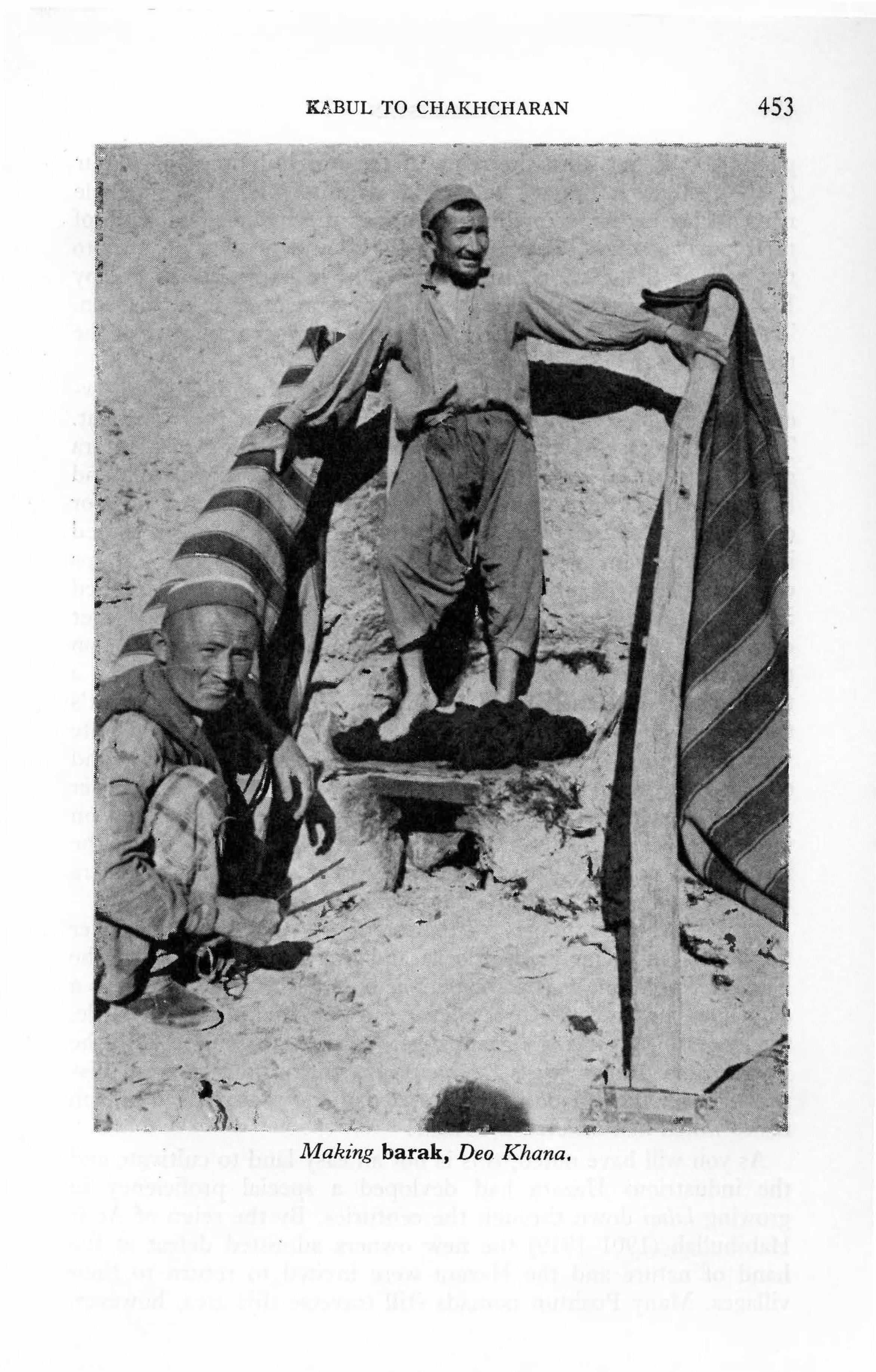
Kl.,BUL TO CHAKHCHARAN 453
•
1
'
.,. ~ ~-· .4} ~
. ~
Mak ·ing barak, Deo. Khana . •
'

454 AFGHANISTAN
periods. It is not until the reign of the Moghul Emperor Babur (1504-1530) that literary references definitely identify a people named Hazara living in this area under the independent rule of their own leaders. They maintained this independence down to the end of the 19th century, staunchly resisting all efforts by Kabul's monarchs to subdue them. They were often in opposition. Their bravery and physical strength plus the inaccessibility of the terrain made them invulnerable.
When Amir Abdur Rahman came to the throne in 1880, however, he was determined to settle the question of the Hazarajat. Taking advantage of a growing disunity among the various Hazara groups, he wooed some by distributing presents, allowances and lucrative posts. From others he attained tribute in exchange for continuing local independence. Interestingly, barak was a prized item included among these tribute payments. Still, some groups continued recalcitrant and the Amir's vaunted temper exploded in 1891 when he sent in the largest body of troops he had ever employed. About 100,000 levies and regular troops marched on the Hazarajat from various directions, but the Hazara put up a tremendous resistance and at times besieged the government's troops for long periods. The entire economy of the Afghan state was disrupted in order to procure the great quantities of grain and other supplies needed to sustain this army. Many supplies never reached them, for the supply caravans were often plundered on the way. Seeing the terrain, one realizes what an advantage the Hazara had over those unacquainted with it. In addition, cholera raged among the troops from May through September 1892.
By 1893 the advantage of superior fire power finally won over the knives and daggers, flintlocks and muskets employed by the Hazara. The Amir's workshop in Kabul had to work 24 hours a day, however, in order to achieve victory. After the final battle, the leaders of the Hazara groups were taken to Kabul, and, in the Behsud and Panjao areas, particularly, entire villages were dispersed and their lands distributed amongst various Pushtun tribes which had assisted the Amir.
As you will have noted, this is not an easy land to cultivate and the industrious Hazara had devloped a special proficiency in growing lalmi down through the centuries. By the reign of Amir Habibullah (1901-1919) the new owners admitted defeat at the hand of nature and the Hazara were invited to return to their villages. Many Pushtun nomads still traverse this area, however,

KABUL TO CHAKHCHARAN 455
for the pasturage is superb. You will certainly pass many of these nomadic groups in the fall as they move from the high mountains to more hospitable winter quarters in Ghazni, Logar and Paktya provinces, in the east and south.
Leaving Panjao, the road quits the Koh-i-Baba Range and turns west to bore into the central massif of the Hindu Kush. Large round or chimney-shaped clay storage bins on the roofs of houses in this area are particularly characteristic. Pass follows pass and just beyond the large secondary school in the village of Akhzarat, one of the larger villages in Panjao District (32 km; 20 mi; 1! hrs. from Panjao), a new green hue on the mountain slopes blends with the familiar palette of pinks and reds. Watchtowers perched on peaks to left and right are bound to attract your attention. Again, Mr. Elphinstone gives us an interesting glimpse into life in the Hazarajat while it was still independent: ''Each village is defended by a high tower, capable of containing ten or twelve men, and full of loop-holes. There is a kettle-drum in each, and in time of peace, a single man remains in the tower, to sound an alarm. I have heard a gathering of the Hazara described: one of these drums was beat, and the sound was taken up, and repeated from hill to hill. The Hazara armed in haste, and rushed out, till at last a force of two to three thousand men was assembled at the point of attack.'' (Vol. II: 210)
The descent from the top of the Akhzarat Pass (3316 m; 10,880 ft.) is very steep. Beyond, take the right fork through the bazaar of Dahne Kharqol (Donkey Valley) and after passing over the summit of the Kirman Pass, ignore a road on the north side of the valley and stay in the center, following the telephone poles. The road gets progressively worse here; the landscape barren and dusty. You have now left Bamiyan Province and entered Lal District of Ghor Province. You have also just crossed the watershed between the Hari Rud and Hilmand River systems. The district town of Lal-o-Sar J angal lies over one more pass (99 km; 62 mi; 3 hrs. 45 min. from Panjao; altitude 2800 m; 9187 ft.).
It is possible to break the journey at this halfway point, if you so desire. The Afghan Tourist Organization tents and the Meteorological Station are situated on the western edge of the town. The long bazaar has many chaikhana serving a variety of dishes and fruit.
Soon after leaving Lal it is necessary to ford the Lal River, a

456 AFGHANISTAN
tributary of the Hari Rud, which is snowbound until April, in flood until June and only passable from June to November when the cycle repeats itself. Then a series of eight passes, some with very tight switchbacks, begin, one following the other approximately every ten minutes, at intervals of from two to nine kilometers. When wet, they can be treacherous and these factors account for the short interval in which travel via the Central Route is feasible.
Final1y, one reaches the small bazaar of Garmao, which has a chaikhana ( 42 km; 26 mi; 1 i hrs. from Lal), situated in a fertile valley between two passes. The Garmao Pass marks the beginning of the territory inhabited by the Aimaq, a Dari (with much Turkic vocabulary) speaking group, who are probably of Turkic origin although their physical type exhibits mixture with the Tajik people of the Paropamisus with whom they now live. "Aimaq" is not an ethnic term, therefore, but a Turkish word for clan or tribe, and there are several groups of Aimaq. Generally speaking, the term differentiates this basically semi-nomadic people from the sedentary Tajiks and the nomadic Pushtun around them. When exactly they came into the area is open to conjecture, but they have been regarded as a separate group since at least the early 16th century for the Emperor Babur lists them as such in his memmrs.
After leaving Chakhcharan you will be delighted by the sight of large Airriaq summer camps composed of colourfully decorated yurts and distinctive black goats' hair tents which differ significantly in shape from those used by the Pushtun. (seep. 462)
Daulatyar (Place of Government) lies over the second pass (23 km; 14 mi; 50 min. from Garmao; altitude 2475 m; 8120 ft.). A large caravanserai to the south of the road has an interesting history. Abandoned, it was purchased by an extended family and now serves as the residence of five brothers and five cousins, a total of 40 persons. It has thus been spared the fate of so many crumbling caravanserai which dot the landscape of Afghanistan, victims of the replacement of the trading camel caravan by motorized vehicles. During the 19th and early 20th centuries a large number of important caravan routes intersected at Dau]atyar and it is mentioned by all travellers who wrote of their passage through these mountains. Today, one can quite easily pass it by with hardly a notice.
The valley of Daulatyar, however, is green and fertile as it is
KABUL TO CHAKHCHARAN 457
nourished by the Hari Rud on which it sits. The Hari Rud, one of Afghanistan's major river systems flows almost due west for about 650 km; 406 mi. and the route here described will follow it as far as Herat, where it turns north to become a part of the Afghan-Iranian border for about 100 miles before entering the Soviet Union. The mountains lining the Hari Rud form the backbone of the Paropamisus Range, the western extension of the Hindu Kush. At Daulatyar one leaves the highest mountain knot but there are many more mountains to come.
Proceeding through this wide and verdant valley, one reaches the pretty little village of Shinia (16 km; 10 mi. 30 min. from Daulatyar) where there is a chaikhana. According to local tradition, the towers on the mountain peaks and the decorative old bridge were built by Hazrat Ali, creator of the Band-i-Amir lakes. In the sumn1er these plains are usually picturesquely sprinkled with Aimaq yurt encampments. Soon the road quits the river to run through a barren stretch softened only by lalmi cultivation and then suddenly it turns a sharp corner, drops into a stony river bed and rushes headlong onto the bank of the Hari Rud which has by this time acquired considerably more volume.
Still, one does not folJow the river for long, and again the road meanders, climbing and falling, passing through Badgah (The Windy Place) on a plain swept by winds from all sides. There is a chaikhana in Badgah but little cultivation eases the eye as the road rises to an open plateau which appears particularly vast and expansive because of the confined mountainous terrain one has traversed for so many hours since leaving Bamiyan.
In late June and early July you are liable to encounter massive flocks of animals being led through these hills toward Kabul. They come from the animal market which is held each year on a gentle slope on the south side of the road just before it enters the town of Chakhcharan (13 km; 8 mi; 30 min. after rising to the plateau). For about three weeks the Aimaq and the Durrani Pushtun nomads from the vicinity of Farah and Herat bring in animals, selling their old animals and buying young ones to rejuvenate their flocks. The big buyers, however, are mainly from Kabul and eastern Pushtun butchers. Nowadays many of the big company representatives fly in or come by bus, buy their stocks and send them to the east with shepherds. It takes the flocks about three months to reach their destinations.
This is about all there is left of the great nomad bazaars which

458 AFGHANISTAN
used to be held at Abul and Gomal, about half a day's horseback ride away from Chakhcharan, one north and the other south of the Hari Rud. Since the provincial capital was moved to Chakhcharan in 1961, these nomad bazaars have ceased to function, except for the seasonal animal market which is a very exciting experience should you pass through when it is being held.
Though the big nomad bazaars are gone, numbers of Pushtun trading nomads still traverse these mountains. You will pass 1nany of their caravans along the way. Large commercial caravans are undergoing various modernization processes, however. For instance, many of the nomadic traders have purchased lorries, or Waz, and established large transport companies operating out of serais in the major cities. Either way, by camel or by lorry, the trade is immensely lucrative and profits of 100% are common, 200% or more by no means unknown. The Hazara and Aimaq supply wheat, clarified butter and other dairy products, and woven materials to the nomads. The nomads bring cloth, refined sugar, tea and other city bazaar items unavailable in the central mountains, and they often derive considerable profit from extending credit. Some nomads even own lands acquired after 1893 or in return for unpaid credit and loans. Few farm the land, and they come mainly to collect rents, mostly in kind, from their tenant farmers after the fall harvest. You will meet numbers of these trading nomads in Chakhcharan as 1ate as September and October, by which time most are on their way to the warmer eastern provinces of Paktya and Logar. Some come from as far away as Qala-i-N aw in the north.
The town of Chakhcharan was newly built (1959) on a treeless plain on the south bank of the Hari Rud. A large ruined fortress lies on the north bank. Called Qala Kassi, it was, along with Firozkoh, Qala Ahangaran and Tulak, a major stronghold during the Ghorid period (1148-1202) and continued to be an important town until 1961 when the provincial capital of Ghor was officially transferred from Taiwara to Chakhcharan. The new capital was given the name by which the whole general area has been known since at least the 15th century. The Emperor Babur refers to Chakhcharan repeatedly. Today, only a few families make their home in the old fortress of Qala Kassi.
Anticipating the completion of the Asian Highway by which one will be able to hurtle along a paved road from Europe to the

KABUL TO CHAKHCHARAN 459 ......
, . .
Nomad Trader from Qala-i-Naw in the Bazaar of Chakhcharan. -
Far East, via Chakhcharan, the town planners construct grandiose models for the future rich material for guidebook writers to come. For the moment, this author will speed you on your way to points west.


CHAPTER 31
The "Minaret" of Jam
Three Routes to Jam 1) From Chakhcharan, via
Distance Time 113 km; 71 mi. 4! hrs.
Ghar-i-Payon 2) From Shahrak (Chapter 32) 66 km; 41 mi. 4 hrs. 3) From Herat, via Kamenj 313 km; 196 mi. 12 hrs.
Altitudes: Chakhcharan : 2250 m; 7382 ft. Jam: 1830 m; 6004 ft. Shahrak: 2380 m; 7809 ft. Chisht: 1550 m; 5086 ft.
Accommodations: Jam: camping facillities.
Refreshments:
Shahrak: A TO tents; n1eteorological station; chaikhana.
Obey: Hotel: Good
Jam: Chaikhana in village. Shahrak: Chaikhana. Obey: Hotel, on request with consider
able advance notice.
Please be advised that all information on the routes to the ''minaret'' is subject to change-drastic change. On reading the description of route 1) via Ghar-i-Payon, it will be obvious that weather and maintenance are crucial to its use. Weather can cause the routes from Shahrak and Kamenj to be closed as well. Up-to-date information from the Afghan Tourist Organization in Kabul or Herat, or from the authorities in Chakhcharan or Shahrak should therefore be sought before embarking
~ The '' M-inaret'' of Jam
461
462 AFGHANISTAN
on this particular adventure. Proposals to repair the bridges at Jam and outside Chist were under active consideration in 1976.
The ''hotel'' which was built at the foot of the ''minaret'' has no beds or bedding, food or cooking facilities. It simply offers shelter and you will need all your own equipment. Food is available, however, in the village of Jam.
1) ToJamfromChakhcharan viaGhar-i-Payon: 113 km; 71 .. 4 1 h m1, 2 rs.
This new road was begun under the Food for Work Programme after serious drought hit this area in 1971. Under this scheme of the World Food Programme, an international organization jointly sponsored by the United Nations Development Programme (UNDP) and the Food and Agriculture Organization (FAO), workers are paid scarce food commodities in return for roadwork which was still in progress in 197 5.
To follow this route, cross to the north bank of the Hari Rud via a bridge beside the Chakhcharan Hotel and take first sharp left underneath the ruined fortress of Qala Kassi. The road continues along the high bank of the river permitting one to enjoy to the full the intense beauty of its pools and eddies ranging from brillant sapphire to deep turquoise. The road then continues along rocky cliffs into a gorge from which one emerges onto a plateau with sandy patches which can cause difficulties for all but the strongest vehicles. One hour later (24 km; 15 mi.) one reaches the village of Alandar in the neighborhood of which there are a number of caves reminiscent of those at Bamiyan. Although there is evidence of occupation, no wall-paintings or architectural decoration has yet been identified. On reaching a small mill seemingly in the middle of the road, take left fork. Further on, take a right fork into barren rolling hills and another right to descend into the valley of Barra Khana (Sheep Fold) where lookout towers crown the hilltops (15 km; 10 mi; 25 min. from Alandar).
In this extensive valley you will note numerous yurts pitched near and between villages. Cone-shaped, the yurts are roofed with felt secured to roof poles by broad, decorative bands. Under the .roof the wooden lattice walls are covered with reed matting which the Aimaq often decorate with painted geometrical designs. In-

THE "MINARET" OF JAM 463
terestingly, similar patterns decorate the yurts used by the Kirghiz in the extreme northeast regions of Afghanistan. Instead of painting on the decoration, however, the Kirghiz wrap each reed with different colours of wool to form the design. Just why no evidence of this type of decoration is to be found between the Aimaq of Central Afghanistan and the Kirghiz is a mystery for scholars to unfold. Also worth nothing are the artistically carved wooden doors which give entrance to the yurts.
Smaller, less substantial cook-tents covered with black fabric woven from goats' hair instead of felt usually stand beside the more solid dwellings. The reed matting around these is not decorated, nor are they as peaked at the top since the roof poles of the cooktents are merely tied together instead of being set into curious crown-shaped wooden topknots. Sometimes the top-most felt of the dwelling yurt is set aside for added ventilation and light. Then the crown-shaped disc is clearly visible enabling one to better understand the difference in shape between the Aimaq yurt and the Uzbak-Turkoman yurts of the north. The roof poles of the northern yurts are also set into a wooden disc which is, however, more rounded, lacking the crown construction. An unique portable dwelling used only by the Taimani Aimaq is the rectangular black goats' hair tent which one occasionally sees pitched amongst the round yurts.
The Aimaq are a semi-nomadic people who move out of their mud-house villages (qishlaq) after the spring planting in late March to take their flocks into the hills to temporary settlements called yilaq. Returning to their villages for a short time to plant melons and vegetables in April-May, they then retrace their steps to the yilaq where they stay until the August harvest begins. Making their way back to their villages once again, they continue to live in yurts until after the harvest is in. Only then do they dismantle them and move into mud-houses for the winter.
Much activity takes place around these yurt encampments such as the Taimani camps in the Barra Khana Valley. The women spin wool for gilim (woven carpets) and qalin (tied carpets). Others fluff wool by beating it with two supple sticks, for use in spinning and for making the felt used for rugs and yurt coverings. Still others busy themselves with dyeing wool for the rugs and in sewing and mending clothes. Another important chore is the production of krut, a dehydrated buttermilk product which can

464 AFGHANISTAN
be reconstituted during the cold winter months by simply adding boiling water. Krut is one of the most nutritious foods eaten in Afghanistan.
You will encounter many men, women and whole families on horseback in this area. Pass them with care for these horses are as yet unused to motor vehicles and they can be very feisty. This is particularly true should you meet them in a narrow pass and special consideration should be shown when a foal trots along with its mother. If you can stop to let them pass, do so. Otherwise the foal is liable to panic and run for miles in the opposite direction, causing all manner of consternation. Such consideration will be appreciated by both man and beast and grateful smiles are ample payment for a lost minute or two.
Once the yurt villages of Barra Khana are left behind, one passes through another desolate area until (32 km; 20 mi; 1 hr. later) the lush clover fields of Cheshme Sakina (Sakina's Spring) appear to delight the eye. Indeed, they are so intensely green they seem to be made of plastic, and meadows glow against red cliffs while the sun turns poplar leaves into glittering baubles of gold.
The freshness of Cheshme Sakina sustains one as again the road climbs to the top of a steep pass from which another idyllic scene soothes the eye. Far below horses gallop over the green meadows of Majerkanda nestled in a small valley ringed with hills of variegated hues (2 km; 15 min. from Cheshme Sakina). On descending, take road to left.
Tangia and Dahne Choqur follow before reaching the relatively large village of Ghar-i-Payon (Lower Cave) some 10 km; 6 mi; 30 min. beyond the summit of the pass. If you feel the road has been difficult up to this point you are earnestly advised to go no further. From here the mountains begin to close in and driving is difficult.
The last village before Jam is Beidon Sar-i-Lok (17 km; 10.5 mi; 45 min. from Ghar-i-Payon) and this is your last chance to turn back. From here the road enters a sheer rock canyon and descends continuously and steeply for the next 8 km; 5 mi. The road is just wide enough to accommodate the tires of a car and there are no places to turn around, no places to pass. The gradient is so steep that it is next to impossible to imagine any vehicle, no matter how strong, successfully clitnbing up this gorge. One wonders who conceived of turning this horse trail into a road for ve-
THE "MINARET" OF JAM 465
hides. More importantly, one wonders how long it will be kept passable, for winter snows and spring floods will surely damage it considerably. Do not, therefore, attempt this road from the Jam side, and be sure to question thoroughly before attempting it from the Chakhcharan side. Chances are that once you are in the canyon you will meet no living soul to off er succour.
Proceed, therefore, knowing that you have been warned. It is an exciting adventure but only for the stouthearted and those equipped with a strong vehicle. Alternatively, one can proceed from Ghar-i-Payon by horseback or on foot, should you be so inclined.
Having successfully descended, one enters a grove of apricot trees and almost immediately the road comes to the north bank of the Hari Rud. Turn left, and in a few minutes the famous ''n1inaret'' of Jam towers above you on the right, on the opposite bank of the river.
Your adventure may not be over. A bridge was built a few hundred yards below the "minaret" but it was soon carried away by spring floods and it was still out in the fall of 1975. Until such time as it is repaired it is necessary to ford the river which even in late September is still high enough to rush under the doors. Some vehicles have taken as much as two hours to succeed. And do not forget, there is no turning back up the canyon.
So you can see why I am reluctant to recommend this route without grave reservations, even though it is both beautiful and highly dramatic.
2) To Jam from Shahrak: 66 km; 41 mi; 4-5 hrs. (Information courtesy of ATO and kind friends, for this author made the trip in 1975 via the above canyon.)
This is much the easiest and safest route to Jam, though even this one has three difficult passes. The mountains in the area between Shahrak and Jam rise to about 3500 m; 11,500 ft. and the valleys lie at altitudes between 2500 and 3000 meters; 8-10,000 ft. Proceed to Shahrak according to routes described in Chapter 32.
About 10 km; 6t mi; 25 min. east of Shahrak (on road to Chakhcharan) watch for tracks leading to a side road to the village of Sarcheshma, situated some 6 kms. north of the river. This is the first village on the road to Jam and in a good season the river is easily fordable; some, however, have found it impassable. The

466 AFGHANISTAN
Ghouk (Frog) Pass follows about 13 km; 8 mi. beyond Sarcheshma; the Gazzak Pass after another 12 km; 7.5 mi. "Gazzak," ref erring to the swelling engendered by an infected wound, aptly describes this difficult pass.
It is not easy to identify the point at which a side road doubles back from the main Kamenj-Herat road to swing up and over the Garmao Pass, about 3 km. beyond Gazzak, some 3 hrs. from Shahrak. There is a meadow in a bowl-like valley on the left, and the pass towers above the road to the right. The large village of Ghouk through which the Kamenj road passes is 4 km; 15 min. beyond this turnoff. Should you reach this village, ask for directions. Hopefully some type of marker will be placed at this crucial junction in the near future. On the other hand, there are hardly any other side roads, so you should not have too much trouble.
Ascend the Garmao Pass with caution. Because of its difficulty, the tracks of several alternate routes take off in various directions marking prior experiments by harried drivers. They all lead to the summit; generally speaking take the one with the least grade. The pretty little village of Jam lies in the midst of fruit orchards about an hour from the turnoff at the foot of the pass (18 km; 11 mi.) The ''minaret'' stands on the river bank 5 km; 15 min. beyond the village. Invisible until it rises just before you framed in a narrow cleft between two mountains, its sudden appearance seems to be a miraculous mirage. This is without doubt the most dra1natic approach to the "minaret" of J a1n.
3) To Jam from Herat via Kamenj: 2 days. The entire route from Jam to Herat is fully discussed at the end
of this chapter following the description of the "minaret." A one night stop-over at Obey or camping midway is recommended. Otherwise you will arrive too exhausted to savour the initial view of the "minaret."
A PLEA TO ALL VISITORS
Please do not drive up to the base of the "minaret" and please park as far away from it as possible. This priceless monument is already leaning at a precarious angle, tottering on the very brink of the river which yearly cuts away at its foundations. The rumbling of your vehicle may easily prove to be its downfall. The fact

THE "MINARET" OF JAM 467
that it has stood for 800 years is due in large part to its splendid isolation. Now that it has been made accessible, we ask you to treat this monument with considered respect. Thank you.
THE "MINARET"
News of the existence of this most spectacular monument was first announced in 1943 by the Governor of Herat, Abdullah Malikyar, but it was not until 1957 when Ahmad Ali Kohzad, President of the Afghan Historical Society, and Andre Maricq of DAFA, visited the site that the full significance of this astounding discovery was appreciated.
The 213 foot; 65 meter "minaret" stands alone on the south bank of the Hari Rud in a lonely, remote valley closely surrounded on all sides by towering barren mountains. Only the Qutb Minar in Delhi, directly inspired by the Jam minaret, stands higher, at 238 feet. The "minaret" of Jam is, therefore, the second highest minaret in the world. More importantly, it is the only well-preserved architectural monument from the Ghorid period and as such it is of immense importance for students of medieval Islamic architecture.
The slender, tapering tower rises from an octagonal base 47 feet in diameter. Built in three cylindrical tiers marked by projecting corbeled balconies it is topped by a six-arched circular arcade. It is constructed of fired brick and the first tier of 120 feet is elaborately ornamented in moulded buff-colored brick relief. The ornamentation, contained in eight vertical panels corresponding to the octagonal base, consists of a wide variety of geometric and floral designs. In design and execution the ''Minaret'' of Jam recalls the minaret built by Mas 'ud I I I (1099-1114) at Ghazni which served as its model.
Winding around the designs of the first tier, passing from one panel to another, there is an epigraphic band containing the entire text of the 19th Sura of the Koran, a long Sura entitled Maryam which speaks of Mary and the Virgin Birth, of Prophets Abraha1n, Isaac, Jacob, Moses, Aaron, Ishmael and Enoch, and, of Adam and Noah. It relates how they were guided by the revelations of the Merciful, warns unbelievers of the punishments of Hell and promises those who embrace the Faith the glories of the Garden of Eden.

468 AFGHANISTAN
Just below the first balcony, a monumental Kufic inscription rises in brilliant tones of persian-blue above the buff background. This, the only colour on the surface, proclaims the name of the ruler responsible for its creation: "Ghiyasuddin Mohammad ibn Sam, Sultan l\1agnificent ! King of Kings!" Within this band the architect, "Ali, son of ... , " included his name is smaller letters. His name also appears on the second drurn which, like the third, is less elaborately ornamented with Kufic inscriptions, and on the bottom of the octagonal base.
Inside the "minaret" there is a double-spiral staircase. This interesting architectural creation consists of two distinctly separate staircases which rise, one above the other, to the level of the first balcony. Narrow windows, cunningly placed so as not to interfere with the exterior design, filter in light and offer breathtaking views of the valley.
Thus the tower is easily described. But what of its purpose? The experts argue. To some it stands on the site of ancient Firozkoh, capital of the Ghorid Dynasty (1148-1202). They point out that the name of this dynasty's most outstanding ruler, Ghiyasuddin (1157-1202), shines forth from the tower and that a seminomadic tribe living in the vicinity of J an1 call themselves Firozkohi. The smallness of the valley, its inaccessibility, and the absence of significant architectural remains cause others to reject this theory. Contemporary accounts describe Firozkoh as a large, bustling city. Surely, they argue, if this was in fact Firozkoh, there should be more than the remains of a small fortress and a few watchtowers to the north of the river. Could these be built of Ghazni's soil and the blood of captive citizens as the ancient historians report? Doubting scholars see Taiwara, south of Shahrak (Chapter 32) as a more convincing site for the ancient city.
The absence of ruins at the base of the tower also leads some to question if indeed this was a mosque minaret. The 1natter of an entrance also remains unsolved. At present one enters through a hole broken into one side of the tower. The staircases do, however, continue below ground giving credence to a local legend that once a tunnel ran from the tower, under the river, to the fortress. Debris as yet blocks the archaeologists from ascertaining the terminus of the staircases. Others see the brick work on the opposite bank as part of a bridge which might have connected directly with an entrance to the tower.

THE "MINARET" OF JAM 469
If it was not a mosque minaret, what was it? Some have suggested it was a victory tower. But why would such an elaborate edifice for this purpose be built in what must have been, even in those days. a remote corner? Others suggest that this may have been a sacred place of pre-Islamic days, and that this tower was built to proclaim the victory of Islam as well as the majesty of Ghiyasuddin. Many venerated Muslim shrines in Afghanistan today are built on sites sacred to pre-Isla1nic religions. The selection of the 19th Sura is interesting in this context. Also, Italian archaeologists working on stabilizing the minaret in 1962 found many stones carved with Hebrew letters strewn about the mountainside about a kilometer south of Jam. These memorial tablets, dating mainly from 1149-1215, belong to a crumbling Jewish cemetery and bear witness to the existence of a Hebrew community in the vicinity of Jam during the heyday of Ghorid rule. They also throw an interesting light on the story related by J uzjani regarding the rise of the House of G hor as presented in the historical section of this guide.
Scholars have n1any years of learned dispute before then1 at Jam.
}AM TO HERAT
Route (unpaved) Distance Time Jam-Herat 313 km; 196 mi. 12 hrs.
J an1-Chisht-i-Sharif 129 km; 80 mi. 7 hrs. Chisht-i-Sharif-Obey 66 km; 41 mi. 2 hrs. Obey-Herat 107 km; 67 mi. 3 hrs.
Altitudes: Chisht: 1550 m; 5086 ft. Obey: 1275 m; 4182 ft. Herat: 920 m; 3020 ft.
Petrol: Obey bazaar. Hotel: Obey Springs: Good Refreshments: Chaikhana in Chisht-i-Sharif and Obey. Hotel
at Obey Springs, meals on request.
The route you follow on leaving the "minaret" depends on road conditions. You may have to retrace your way to Shahrak and proceed via Shindand (Chapter 32). The road running north from Shahrak to Chisht-i-

470 AFGHANISTAN
Sharif (120 km; 75 mi.) which used to be the main road to Herat has been closed for several years, but enquiries should be made.
The 2-day route via Kamenj and Obey described below is a pleasant route but two factors may prevent you from following it: landslides, and a ford across the Hari Rud just before reaching Chisht-i-Sharif which limits the use of the route to the fall months when the water volume is lowest. Be sure to gather up-to-date information. It is a long way back should you find the river unfordable.
Take the road running south from the "minaret" through orchards surrounding the village of Jam (5 km; 15 min.) and over the Garmao (Warm Water) Pass. At the bottom of the pass (23km; 14.5 mi; 1 hr. from the "minaret" turn right (north) to the village of Ghouk. The road crosses and recrosses the Garmao River, a tributary of the Hari Rud, but it should not give you any trouble as it is a small stream. At one point you will note the rubble and deep verticle scars gouged out by huge boulders dislodged from the mountain-side now sitting beside, and in, the road. This tremendous landslide caused by an earthquake a few years ago is the type of natural occurance which can suddenly close the road for undetermined periods.
One reaches the Hari Rud 8 km; 5 mi; 15 min. beyond Ghouk and the road runs above the Taimani Aimaq village of Kamenj hidden within dense fruit orchards on the opposite side of the river. Kamenj produces some of the best fruits in Afghanistan: crisp, tangy apples, peaches so succulent they resemble ice cream, luscious pears and juicy pomegranates. People come from miles around to purchase these fresh fruits of Kamenj and very little reaches the bazaars of Kabul. The village does, however, export large quantitites of dried apricots, walnuts and almonds. Traders come from as far away as Ghazni Province to purchase these items bringing with them cloth, shoes, sugar, tea and other luxury items. They set up shop in white tents in the village and exchange their goods for the fruits and nuts. One other export item for which Kamenj is famous is the cumin which grows wild on the hillsides.
The road does not run through the village, but passes on the opposite bank to come to a pass with tight switchbacks from the summit of which one sees the river far below. Gradually one

THE "MINARET" OF JAM 471
descends to the village of Dahne Margah on the riverbank. By this time you have left Ghor Province and entered Herat Province.
A series of small villages follow. Fruit trees and melon fields abound, and pistachio trees grow wild on the mountain slopes. In September 197 5 a landslide in this area necessitated fording the river twice, a detour which added an extra two hours to the trip because of deep sands on the opposite bank. These are the types of obstructions one must be prepared to encounter when venturing on these little travelled routes.
Leaving the river about an hour out of Dahne Margah, the road climbs another difficult pass and descends to the village of Dahne Hazarak, which means Little Fortress. After passing a plain where weird geological formations rise on the left, crossing the Hari Rud which can only be forded in the fall, and winding up yet another pass, the road descends to the large village of Darya Takht (9 km; 6 mi; 40 min. from Hazarak; altitude 1655 m; 5430 ft.) As the children run down to watch you ford a small river, you will be delighted to note a sartorial specialty made by little girls who wear wide bibs of beads hanging from high collars down to the waist. It is a most attractive fashion.
The next 37 km; 23 mi. to Chisht-i-Sharif (altitude 1550 m; 5086 ft.) can be covered in a little over an hour, indicating that one is now traversing the waning western extremity of the Paropamisus Range which finally peters out between Chisht and Obey. The rugged terrain is now behind you although the road surface still leaves much to be desired. About 19 km; 12 mi; 40 min. from Darya Takht you may take a side road to the left for about half a kilometer to visit Pul-i-Sher Khash, an old bridge built, it is said, during the reign of King Amanullah (1919-1929). It is a pleasant spot for a picnic.
Half an hour beyond the bridge (18 km; 11 mi.) an avenue of tall pine trees beckons one to two ruined buildings, a madrassa (religious school) with its mosque perhaps, attributed to Ghiyasuddin Ghori (1157-1202). The moulded terracotta brick decoration is sadly damaged and the Kufic inscriptions mutilated, but there is a certain strength in the workmanship which is very compelling. For those who have been to Jam, the comparisons are most interesting. (see p. 265 ff.)
The village of Chisht-i-Sharif with its winding bazaar, the administrative centre of the district of the same name, lies in a

472 AFGHANISTAN
deep ravine between two plateaux. During the trip from Chisht to Obey note particularly the finely preserved caravanserai to the south, some two kilometers out of Chisht. The scenery is pastoral with fields of cotton, melons and corn, and domed villages characteristic of the Herat area dot the landscape. In the late afternoon herds of cattle head home, swimming the Hari Rud on their way. The large walled village of Sar-i-Pul with its imposing arched gateway is impressive and picturesque ( 45 km; 28 mi; 1.5 hrs. from Chisht-i-Sharif). It sits on the opposite bank of the river.
Huge black-slate grave markers stand at the entrance to the Obey Bazaar (21 km; 13 mi; 45 min. beyond Sar-i-Pul). Turn left for the bazaar; continue straight ahead to the hotel and hot springs of Obey (13 km; 8 mi; 20 min.).
See Chapter 14 for discussion of the springs and route from Obey to Herat.
CHAPTER 32
Chal~hcharan to Herat via Shindand
Route ( unpaved) Distance Chakhcharan-Herat 492 km; 308 mi.
Chakhcharan-Shahrak 121 km; 76 mi. Shahrak-Tulak 67 km; 42 mi. Tulak-Farsi 72 km; 45 mi. Farsi-Shindand 120 km; 75 mi. Shindand-Herat (paved) 112 km; 70 mi.
(Information courtesy A TO and kind friends)
Time 2 days 5 hrs.
2i hrs. 4 hrs.
6! hrs. 2 hrs.
Altitudes: Chakhcharan 2250 m; 7382 ft. Shahrak 2380 m; 7809 ft. Shindand 1080 m; 3543 ft.
Petrol: Shahrak and Tulak in bazaar; irregular supply Shindand; 10 miles south of junction with paved road.
Toll: 50 afs. between Shindand and Herat
Accommodation: A TO camps: for current location of camps enquire at Afghan Tourist Office in Kabul or Herat. Chaikhana at all stops.
Refreshment: Chaikhana at all stops.
Ahangaran (The Blacksmiths), a small village-town on the Hari Rud 22 km; 14 mi; 1 hr. west of Chakhcharan was once one of the principal fortresses of Ghor when this territory was ruled
473

474 AFGHANISTAN
by a series of nominally tributary non-Muslim mountain chieftains. As its name suggests, Ahangaran was noted for its armaments including coats of mail, shields, cuirasses, steel caps and other war materials forged from extensive iron deposits. During the 10th century, we are told, these hills abounded in timber to feed the forges.
Samanid rulers at Bokhara claimed suzerainty over Ghor but their control was tenuous and in 994 A.D. they bequeathed it to Sebuktigin of Ghazni in grateful recognition of his assistance against rebellious army commanders at Herat. Sebuktigin had to confirm his control by a series of invasions, however, and his son, the renowned Sultan Mahmud (998-1030 A.D.) was similarly defied on several occasions.
One of Sultan Mahmud's more persistant antagonists was Amir Mohammad Suri of Ahangaran who, relying on the strength of his fortress and the natural protection provided by mountain barriers, withheld tribute and waylaid caravans. The Sultan sent an army of horse and foot to chastize the Ghorid but they made little headway until the Sultan took to the field himself. At first, even his leadership failed to bring success and at last he was reduced to subterfuge. Feigning retreat, the Sultan lured the Ghorids out of their fortress whereupon he wheeled about and swamped them.
On the way to Ghazni it is said that Amir Mohammad sucked poison from his signet ring, so great was his humiliation at being brought a prisoner from his mountain fastness. Tribute flowed in, and the Islamization of Ghor began. Subsequent chiefs of Ghor rose to rule with growing independence, however, during the reign of Sultan Mahmud's son, Masud I (1035-1041 A.D.).
In 1151 it was Alauddin of Ghor who sacked Ghazni, bringing the Ghaznavid dynasty effectively to a close. Then these fortresses of Ghor rose to stand at the heart of an empire stretching far into India and Central Asia. One needs considerable imagination, however, to conjure up this once mighty fortress out of the small ruins which remain today.
Far more exciting are the numbers of white yurts colourfully decorated with reed matting painted with abstract designs which belong to the Firozkhoi Aimaq who make their summer camps here (see Chapter 31 for a discussion). Firozkoh is the name extended to the entire Daulatyar-Chakhcharan-Shahrak area in which Firozkoh, the famed 12th century capital city of the Ghorid

CHAKHCHARAN TO HERAT 475
Aimaq encampment west of Chakhcharan . Note rectangular Taimani tent.
Empire, was supposedly located as discussed below. "Firozkohi Aimaq" simply refers to those Aimaq inhabiting this area, distinguishing them thereby from the Taimani Aimaq inhabiting the area from Obey and Chisht-i-Sharif, along the upper reaches of the Hari Rud around Jam.
As usual in Afghanistan, nothing can be so simply categorized. On leaving Ahangaran, the road parts company with the Hari Rud and, swinging south through a barren and waterless tract, climbs to 3185 m; 10,450 ft. over the Shuturkhun (Camel's Blood) Pass, so called because it is said camels bleed in their efforts to cross it (8 km; 5 mi. from Ahangaran). From the heights of the Band-i-Bayan in the Safeed Koh Range (White Mountain) one looks down onto the extensive plain of Tarbulagh . Here there are usually scores of richly decorated Firozkohi yurts interspersed with the distinctive rectangular black goats' hair tents characteristic of the Taimani Aimaq. Taimani settlements will, in fact, be noted as far west as Tulak and Farsi. These bustling encampments provide boundless fascination and the excitement of the present far surpasses any imaginings of the past.
Should mighty fortresses be of special interest, however, you

476 AFGHANISTAN
will find the turnoff to a particularly spectacular one on the left some 60 km; 37 mi; 2! hrs. out of Ahangaran. The track to Taiwara in the heart of the Sia Koh (Black Mountain) Range is easily missed, so keep an eye out for a group of three buildings at Dulaina: the telephone exchange to the south; a storeroom and chaikhana to the north of the road. Telephone poles from the exchange will lead you to Taiwara. The road is long and arduous; it may take you as much as 7-8 hours to cover the 135 km; 84 mi. from the Dulaina turnoff.
Some scholars argue convincingly in identifying Taiwara with Firozkoh (Turquoise Mountain), the Ghorid capital described by the contemporary historian Minhajuddin J uzjani when the dynasty was at its height under Ghiyasuddin Ghori (1157-1202):
"The Kasr (Palace-fortress) is an edifice the likes of which is not to be found in any country or any capital -a Kasr in height and area, and with buttresses, balconies, and turrets; and of such configuration as no generation hath made manifest. Over that Kasr are placed five pinnacles inlaid with gold ... , and also two gold humae, each of about the size of a camel." (humae, a fabulous bird of good omen which proclaims a crown for each man it overshadows-ND)
In addition, J uzjani tells us a huge gold ring and heavy gold chain plus two great gold kettledrums were housed in the Friday Mosque of Firozkoh, along with many other articles of rarity seized as booty by Ghiyasuddin's brother in India.
Juzjani's translator, Major Raverty, wryly suggests that the historian had a tendency to exaggerate. And yet, the city which was the abode of the man whose patronage inspired such architectural gems as the "minaret" of Jam could certainly have been so splendid that exaggeration was required in attempting to describe it.
In 1222 the armies of Genghis Khan made their second attempt on Firozkoh. Hearing that the first had failed, J uzjani reports Genghis Khan to have decreed: "From whence have these people whom I have killed come to life again? On this occasion my commands are on this wise, that the heads of people shall be separated from their bodies, in order that they may not come to life again.'' He sent the army back while snow still lay on the ground. They
• .l ~ (
B .5

CHAKHCHARAN TO HERAT 477
reached Ahangaran, and then went on to so thoroughly destroy Firozkoh that the whereabouts of this fabulous seat of a powerful empire is still unknown. It was somewhere in the area. Taiwara at least lends itself to the imagination.
The provincial capital of Ghor Province until 1961, the present town itself is quite small: about 75 shops and a few government offices, part inside thick battlemented walls with stout round towers, part outside. In the summer, nomad traders pitch black goats' hair tents to the left of the entrance to the walled city, and some shops from inside move out beside them into white tents. A plethora of tailoring establishments operate in this little tent bazaar. Villagers from miles around come in to have new clothing stitched for the men in the farnily. The ladies sew their own at home. During Jeshn (17 July), leading khans and government officials set up white tents with gaily decorated interiors in the park to the right of the entrance to the town. Each vies with the other in providing hospitality. Should you visit Taiwara at this time, you will experience Afghan hospitality to its fullest.
Less spectacular ruined towers and fortifications are scattered throughout Ghor, especially to the west of the heartland along the ancient approach route. As the mountains dwindle, so the man-made defences proliferate. Most are composed of round towers, sometimes 15-20 m; 50-65 ft. tall, ornamented with various geometric designs. Today, no one knows their history and the once invincible bastions are often little more than melted mounds. A little less than midway between the turnoff at Dulaina and the town of Shahrak you will find Hauz-i-Bangi (Reservoir of Bang, an intoxicating drink) which one friend with a sense of humour has kindly informed me is ''more exciting for its name than for the ruins to be seen there.''
Having swung up and down fourteen passes since leaving Chakhcharan, one arrives at Shahrak which also has little excitement to offer. A British officer in 1885 and the German geologist, Trinkler, who passed through in 1923, both describe it as a small post inhabited by 4-5 mounted postal carriers. For the route to Jam from Shahrak, see Chapter 31 (2).
In a series of mounds along the roadside in the nearby barren valley of Dolak, archaeologists found evidence that this area was at least moderately flourishing during the Ghorid period (Leshnik, 1965), and, at Pul-i-Zak, also in the vicinity of Shahrak, evidence

478 AFGHANISTAN
of isolated late-Hephthalite or Kushano-Sasanian occupation was excavated (Dupree and Fisher, 1960). Sasanian occupation material was also discovered outside Ahangaran (Leshnik). As yet, however, it is impossible to say with certainty who the ancient people of Ghor were although many surmise that they were Tajik. Nor is it known what religion they practiced before Islamization began. Was it Buddhism as practiced by the Kushans to the east, or Zoroastrianism favoured by the Sasanians in the west? al-U thi, historian of Sultan Mahmud who lived in Ghazni ( d. 1035), claims the ruler Sultan 1\1:ahmud deposed was a Hindu. Or could it have been an indigenous religion venerating mountains, rivers, or the confluence of rivers such as that which occurs at the spot where the ''minaret'' of Jam stands today? Having seen the awesome majesty of Ghor's landscape, one wonders.
Those proceeding to Shindand will find more ruins and houses with interesting brick decoration at Tulak, a district center of Ghor Province (67 km; 42 mi; 2-! hrs. fron1 Shahrak; altitude 2250 m; 7382 ft). This little town with a pleasant bazaar hidden behind rows of trees was another important fortress belonging to early G horid chieftains and it too was attacked in 1222 by an army of 40,000 horse led by one of Genghis Khan's own sons. During the attack one of 1,ulak' s more gallant defenders was that same Minhajuddin Juzjani who later wrote the Tabakat-i-Nasiri which stands today as the principal source of our knowledge about the Ghorids. He wrote it in 1260 while living in Delhi, having left Tulak about three years after the Mongol attack.
Between Tulak and Farsi, a district town in Farah Province (72 km; 45 mi; 3 hrs. from Tulak; altitude 2270 m; 7448 ft.), the landscape is relatively monotonous and there are a series of small passes where the going is rough, and one high pass aptly called the Kafter Khana or Dovecote. Farsi is a good point to break this journey for although the high passes are all behind you the road surface really deteriorates, especially in the valleys where the road is badly defaced by uncovered irrigation canals. All greenery falls away, and the desert takes over. Yurt encampments disappear completely and are replaced by black goats' hair tents of the Pushtun nomads and domed mud-brick village houses characteristic of the Herat and northern regions. The mountains disappear about 50 km; 31 1ni. before reaching the paved road, and here at least there is one minor compensation-the road seems to improve a little.

CHAKHCHARAN TO HERAT 479
Durrani (Nurzay) nomadic encampment in the Farah Region
Still, on reaching the paved road, one cannot but recall the Emperor Babur's ~ogent comments on reaching Yakawlang, for no one who has not experienced long days bumping, or as it is phrased in Dari slang, "Jamping," across the Central Route of Afghanistan, can possibly appreciate the intense enjoyment of "passing from distress to ease."
The track from Ghor hits the paved road about 10 km; 6 mi. north of Shindand approximately 23 mi; 15 mi. from the toll gate (50 afs) at Adraskan. For Shindand-Herat (122 km; 70 mi; 2 hrs .. ) see Chapter 15.

A Selected Bibliography
This is a highly personalized selection based on various considerations such as availability, readability, and reliability. In short, these are some of the books I have enjoyed most while learning about Afghanistan. For an extensive bibliography see: Donald N. Wilber's Annotated Bibliography of Afghanistan, Human Relations Area Files, New Haven (3rd. ed.), 1968. For a discussion on the current explosion in Afghan studies and a listing of the incredible number of books pub]ished on Afghanistan from 1965-1975, see L. Dupree, AUFS Reports South Asia Series, XX (4), 1976. Abdur Rahman Khan (Sultan Mahomed Khan, ed.). The Life of
Abdur Rahman, Amir of Afghanistan. 2 vols. London: John Murray, 1900.
Adamec, Ludwig W. Afghanistan, 1900-1923. A Diplomatic History. Berkeley: University of California Press, 1967.
Adamec, Ludwig. Afghanistan's Foreign Affairs to the Mid-20th Century: Relations with Russia, Germaay, and Britain. Tucson: University of Arizona Press, 1974.
Afghanistan, quartely magazine published by the Afghan Historical Society, Kabul, since 1946.
Afghanistan Journal, quarterly magazine published by the Akademische Druk-u. Verlagsanstalt, Graz, Austria, since 1974.
Allchin, R. and N. Hammad (eds.) The Archaeology of Afghanistan, (in press).
Arrian' s Life of Alexander the Great ( de Selincourt, trans.). Baltimore: Penguin Books, 1958.
Au boyer, Jeannine. The Art of Afghanistan. Middlesex: Paul Hamlyn, 1968.
Babur (Leyden and Erskine, trans.). Memoirs of Zehir-ed-Din Babur. London: Oxford University Press, 1921. (Talbot, ed., Lahore: The Book House, 1968; A. Beveridge trans. of 1922,
481

482 AFGHANISTAN
London: Luzac Co., 1969 and New Delhi: Orienta] Books, 1970.)
Bell, Marjorie Jewett. An American Engineer in Afghanistan: From the Letters and Notes of A. C. Jewett. Minneapolis: Minnesota University Press, 1948.
Bernard, Paul. Yearly excavation reports on Ai Khanoum in Comptes Rendus d' Academie des Inscriptions et Belles-Lettres, Paris; Bull. de l' Ecole Franfaise d' Extreme-Orient, Paris.
Bombaci, Alessio. The Kufic Inscription in Persian Verses in the Court of the Royal Palace of Mas'ud III at Ghazni. Rome: lsMEO. (lstituto Italiano Per il Medio ed Estremo Oriente ), 1966.
Bosworth, Clifford E. The Ghaznavids. Their Empire in Afghanistan and Hastern Iran 994:1040. Edinburgh: Edinburgh University Press, 1963.
Bosworth, Clifford E. Sistan Under the Arabs, From the Islamic Conquest to the Rise of the Saffarids (30-250/651-864 A.D.).
Rome: Isl\1EO, 1968. Browne, Edward G. A Literary History of Persia. Cambridge:
Cambridge University Press, 1928. Burnes, Sir Alexander. Cabool in 1836-7 and 8, Being the Personal
Narrative of a Journey to, and Residence in, that City. London: 1842. (Lahore: Ferozsons, 1964; Graz: Akademische Druk-u. Verlagsanstalt, 1973, with introduction by M. Klimberg).
Byron, Robert. The Road to Oxiana. London: Jonathan Cape, 1937. (London: John Lehmann, 1950; London: Jonathan Cape, 1966).
Caroe, Olaf. The Pathans 550 B.C.-A.D. 1957. London: Macmillan and Co. Ltd., 1958.
Carruthers, Douglas. Beyond the Caspian. Edinburgh: Oliver and Boyd, 1949.
Centlivres-Demont, Micheline. Popular Art in Afghanistan: Paintings on Mosques, Tea-houses and Trucks. Graz: Akademische Druk-u. Verlagsanstalt, 1976. German edition also.
Centlivres, Pierre. Un Bazar d'Asie Centrale (Tashkurghan). Wiesbaden: Ludwig Reichert Verlag, 1972.
Delegation Archeologique Franc;aise en Afghanistan (DAF A). Memoires. 21 vols. Paris (except Vol. XII and XIII, Cairo), 1928- present.
Dupree, Louis. Shamshir Ghar: Historic Cave Site in Kandahar

A -SELECTED BIBLIOGRAPHY 483
Province, Afghanistan. New York: Anthropological Papers of the American Museum of Natural History 46, no. 2, 1958.
Dupree, Louis. Deh Morasi Ghundai: A Cha/eolithic Site in SouthCentral Afghanistan. New York: Anthropological Papers of the American Museum of Natural History 50, no. 2, 1963.
Dupree, Louis. Afghanistan. Princeton: Princeton University Press, 1973.
Dupree, Louis. American Universities Field Staff Reports, Southeast Asia Series. New York: AUFS, 1959- (continuing series).
Dupree, L. and L. Albert (eds.) Afghanistan in the 1970s. New York and London, Praeger, 1974.
Dupree, N., Louis Dupree and A. A. Motamedi. The National Museum of Afghanistan: A Pictorial Guide. Kabul: Afghan Tourist Organization, 1974.
Dupree, Nancy H. Kabul: City at the Crossroads. New York: Asia Society, 197 5.
East and West, journal of the Istituto Italiano Per ii Medio ed Estremo Oriente, (IsMEO), Rome.
Elphinstone, Mountstuart. An Account of the Kingdom of Caubul. London: Longman, Hurst, and John Murray, 1815. (Graz: Akademische Druk-u. Verlagsanstalt, 1969, with introduction by A. Janata; Karachi: Oxford University Press, 1972, with introduction by Sir Olaf Caroe).
Eyre, Lt. Vincent. The Military Operations at Cabul, 1841-4-2. London: John Murray, 1843.
Fa-hsien (Giles, trans.). The Travels of Fa-hsien. London. Ferdinand, Klaus. Nomadism in Afghanistan, with an Appendix
on milk products in Viehwirtschaft und Hirtenkultur. Ethnographische Studien. (L. Foldes, ed.). Budapest: Akademiai Kiado, 1969: 127-160.
Ferdowsi (Levy, trans.). Shah-Nama: The Epic of the Kings. London: Routledge and Kegan Paul, 1967.
Ferrier, J.P. (Jesse, trans.). Caravan Journeys and Wanderings inPersia, Afghanistan, Turkistan and Beloochistan. London: John Murray, 1857. (Westmead, England: Gregg International Publishers, 1971 ).
Ferrier, J.P. (Jesse, trans.). History of the Afghans. London:· John Murray, 1858. (Westmeed, England: Gregg International Publishers, 1971).
Frances, Jack. Tribal Rugs from Afghanistan. London, 1973.

484 AFGHANISTAN
Golombek, Lisa. The Timurid Shrine at Gazar Gah. Toronto: Museum of Ontario Occas. Paper 15, University of Toronto, 1969.
Golombek, Lisa. Abbasid Mosque at Balkh in Oriental Art, vol. 15: 173-189, 1969.
Gregorian, Vartan. The Hmergence of Modern Afghanistan. Palo Alto: Stanford University Press, 1969.
Grey, John Alfred. My Residence at the Court of the Amir. London: Richard Bentley, 1895.
Habibullah, Amir. My Life from Brigand to King, Autobiography of Amir Habihullah Ghazi (Bacha Saqao). London: Sampson Low, Marston and Co., Ltd., 1929.
Hammond, Norn1an (ed.) South Asian Archaeology. London: Duckworth, 1973.
Hookham, Hilda. Tamerlaine the Conqueror. London: Hodder and Stoughton, 1962.
Hsuan-tsang (Beal, trans.). Si-Yu-Ki. Buddhist Records of the Western World. London: Trtibner and Co., 1884.
Juvaini (Boyle, trans.). The History of the World Conqueror ( Genghis Khan). 2 vols. Manchester: Manchester University Press, 1958.
Juzjani (Raverty, trans.). Tabaqat-i-Nasiri (History of the Ghorid Period). 2 vols. London: 1881. (New Delhi: Oriental Books, 1970).
Kakar, M. Hasan. Afghanistan: A Study in Internal Political Development: 1880-1896. Lahore: Punjab Educational Press, 1971.
Kruglikova, Irina T. Delbarjin. Moscow: Academy of Sciences, 1974. (In Russian, French summary); vol. 2, 1977.
Kyoto University monographs on Japanese excavations in Afghanistan with English summaries.
Lal, Mohan. Life of the Amir Dost Mohammad Khan of Kabul. 2 vols. London: Longman, Brown, Green and Longman, 1846. (Karachi: Oxford University Press, in press, with introduction by N. Dupree).
Leshnik, Lorenz S. Kushano-Sassanian Ceramics from Central Afghanistan in Berliner ]ahrbuch fur Vor-und Frugheschichte,
7: 311-334, 1967. Leshnik, Lorenz S. Ghor, Firuzkoh and the Minar-i- Jam 1n
Central Asiatic Journal, vol. xii, no. 1 : 36-49, 1968.

A SELECTED BIBLIOGRAPHY 485
Lockhart, Laurence. The Fall of the Sa/ avi Dynasty and the Afghan Occupation in Persia. Cambridge, England: Cambridge University Press, 1958.
Lunt, J. Bokhara Burnes. London: Faber and Faber, 1969. Macrory, Patrick. Signal Catastrophe: The Retreat from Kabul
1842. London: I-Iodder and Stoughton, 1966. (Published as The Fierce Pawns in the USA)
Marco Polo (Komroff, ed.). The Travels of Marco Polo. New York: The Heritage Press, 1934.
Norris, J. A. The First Afghan War 1838-1842. Cambridge: Cambridge University Press, 1967.
Mirsky, Jeannette. The Great Chinese Travelers. New York: Pantheon Books, 1964.
O'Bannon, G. W. The Turkoman Carpet. London: Duckworth, 1974.
Parpagliolio, Maria T. S. Kabul: The Bagh-i-Babur. Rome: IsMEO, 1972.
Poullada, Leon. Reform and Rebellion in Afghanistan, 1919-1929. Ithaca and London: Cornell University Press, 1973.
Prawdin, Michael. Builders of the Moghul Empire. London: George Allen and Unwin, 1963.
Roberts, Field-Marshal Lord. Forty-One Years in India. London: Macmillan and Co., 1921.
Robertson, George S. The Kafirs of the Hindu-Kush. London: Lawrence and Bullen, Ltd., 1896. (New York and London: Johnson Reprint, 1970; Karachi: Oxford University Press, 197 4, with introduction by L. Dupree)
Rosenfield, John M. The Dynastic Arts of the Kushans. Berkeley: University of California, 1966.
Rowland, B. and Frances Rice. Art in Afghanistan: Objects from the Kabul Museum. The Penguin Press, 1971.
Sale, Lady F. Journal of the Disasters in Afghanistan, 1841-2. London: John Murray, 1843. (London: Longmans, Green and Co. Ltd., 1969, edited by P. Macrory)
Singh, Ganda. Ahmad Shah Durrani. Father of Modern Afghanistan. Bombay: Asia Publishing House, 1959.
Stewart, Rhea. Fire in Afghanistan: 1914-1929. New York: Doubleday, 1973.
Taddei, Maurizio. on Tapa Sardar in South Asian Archaeology. London: Duckworth, 1973; Leiden: E. J. Brill, 1974.
486 AFGHANISTAN
Trousdale, \Villiam. on Sar-o-Tar in The Illustrated London News 2911(263): 91-93, 1976.
Vambery, Arminius. Travels in Central Asia. London: John l\1urray, 1864. (New York: Arno Press, 1973)
Wheeler, Sir Mortimer. Flames Over Persepolis: Turning-point in History. New York: Reynal and Company, Inc., 1968.
Wood, John. A Personal Narrati1)e of a Journey to the Source of the River Oxus by the Route of the Indus, Kabul, and Badakhshan. London: John Murray, 1841. (W estn1ead, England: Gregg International Publishers Limited, 1971)
Y ate, A. C. Travels with the Afghan Boundary Commission. London: William Blackwood and Sons, 1887.
Y ate, C. E. Northern Afghanistan. London: ,villiam Blackwood and Sons, 1888.

PHOTO CREDITS
Afghan Institute of Archaeology: 34 ; 222 ; 223 ; 401 Afghan Films: 53; 93; 391 Afghan Tourist Organization: 84 ; 87 ; 163 ; 189 ; 232 Bedford, J. : 9 5 Casimir, M: 479 DAFA: 370; 432; 435; 438 Dupree, L.: Frontispiece; front dust-jacket; rear dust-jacket: 12 ;
24; 101a; 102ab; 103; 110; 115; 135; 183;209;268;298a; 299ab; 303; 321; 348; 362; 385; 386ab; 387a; 388; 393; 397; 410; 424; 427; 460
Dupree, N.: 125; 174; 213; 226; 239; 246; 253; 262; 266; 286; 295; 298b; 333; 337; 341; 343; 346; 352; 355; 411; 415; 420ab; 421; 451; 453; 459; 475
Farrar, J.: 104; 133 ; 236 Goodrich, H.: 249 L. Hobkiek: 101b Higuchi, T. : 108 IsMEO: 194 Klineburger, C.: 429 Life Magazine: From color slide courtesy Life Magazine: 21 Powell, J.: 31 ; 97 ; 119 ; 151 ; 167 ; 381 ; 383 ; 416 Suleiman, M.: 387b Sultan Hamid: 70 ; 81 Thorne, J.: 142; 392 Vincent Jr., R.: 45 W akili, K. : 187
487

INDEX Prominent Personalities and Major Sites
For other major areas see Table of Contents
A
Abdur Rahman, Amir 62-6, 76, 80, 85, 88-9, 94, 238, 246, 289, 318, 325-6, 382,454
Achaemenid 25-7, 72, 287, 363, 400, 433, 438, 440
Ahmad Shah Durrani 52-5, 75, 94, 127, 281-4, 300, 319, 396, 424
Ai Khanoum 28, 30, 72-3, 93, 224,371, 400,431-444
Ajar Valley 152 Alexander of Macedon 27, 65, 72,
118,237,317,363,395,407,431 Amanullah, King 67-8, 76, 85, 92,
129, 132, 182, 190, 213 Amu Darya 14, 21, 27, 30-1, 37,
41, 49, 150, 361,383,429 Andkhoi 347,357,359 Aqcha 347,361,389,394 Arab 36-7, 6 5, 7 3 , 13 5, 181, 310,
400 Arghandab 275,296,311 Ashoka 28-9, 50, 73,291
B
Babur, Emperor 48, 75, 82, 88, 228,231,288,425,450,456
489
Bacha Saqao-Habibullah Ghazi Bactria 27-8, 30, 73, 93, 363, 371,
400, 4 31 , 4 3 3, 441 Badakhshan 15, 19,23,37,55,63,
72, 94, 347, 380, 413, 418-429, 433, 448
Baghlan 23, 72, 372, 406 Bala Murghab 339 Balkh 20-1, 24, 26-8, 33-4, 37-8,
41-3, 46, 48, 62, 72-4, 88, 34 7, 380,383,389, 395-403
Balkhi, Rabi'a 37, 396, 399 Bamiyan 37, 41-2, 93, 143, 145,
151, 153-170, 447 Begram 32, 93, 118-20, 442-3 Bost 36-8, 41, 43, 93, 152, 275,
309-316, 386 Bronze Age 22-5, 72, 304, 362 Buddhism 33, 73, 83, 107, 135,
137-43, 150, 154, 190, 204, 214, 290,363,371,374,380,395,400, 406, 409, 441
Buzkashi 6, 385, 390, 409
C
Chakhcharan 244, 263, 447, 450, 457, 462, 473
Charikar 27, 32, 49, 61, 63, 75, 111, 150

490 INDEX
China 13, 31-2, 35, 47, 50, 73, 120, 154-5, 159, 166, 215, 244, 255, 293, 360, 382, 400
D
Darre Zang 3 53 Darulaman 68,. 92 Darzab 347, 354 Daoud, President 70-1, 76, 130 Delbarjin 33, 363, 400 Dost Mohammad, Amir 57-62,
75-6, 231,255,327,380
F
Faizabad 12, 405, 413, 423 Farah 271, 478 First Anglo-Afghan War 60, 86,
75,134-6,181,203,294,366,394
G
Gandhara 33, 35, 120, 371, 441 Gawhar Shad 47, 250-1, 396 Genghis Khan 41, 46, 74, 118,
152, 169,181,311,376,380,392, 396, 407, 452, 476, 478
Ghazni, Ghaznavid 27, 37-9, 42, 58. 61, 65, 74, 84, 91, 93, 135, 179-198, 292, 311-12, 396, 467 see Sultan Mahmud
Ghiyasuddin Ghori 41, 74, 247-8, 267, 468, 476, see Ghor
Ghor, Ghorid 39, 41, 74, 168, 181, 247-50, 267, 270, 315, 455, 468, 473, 477-8
Gulbahar 112, 115, 117, 120 Guldara 34, 136-139 Gurziwan 19, 352, 354
H
Habibullah, Amir 66, 80-3, 123, 132,212-3, 229,231,287
Habibullah Ghazi 5, 68, 76, 95, 109, 190~ 246
Hadda 34, 214-225 Hajigak Pass 14, 145, 148 Hari Rud 13, 148, 262, 457, 465,
470-2 Hazarajat 14-5, 65, 452 Hazrat Ali 171, 177, 197, 306-7,
390-1, 457 Hephthalite 35, 73, 135, 155, 158,
217, 363, 369, 375, 409 Herat 13-5, 27, 37-8, 41-3, 46-9,
52, 55-9, 61-2, 73-5, 243-259, 311-2, 44 7, 461, 4 78
Hilmand 13, 27, 39, 144, 147-8, 272, 275, 296, 309, 311-2
Hinduism 33, 35-7, 73-4, 83, 87-8, 106, 135, 155, 158, 168, 191, 193,227,363,409,478
Hsuan-tsang 36, 73, 120, 162, 190,217,379,395,400,424
I
India 23, 28, 32, 35, 41, 60, 73-4, 76, 154, 157, 165, 311
lstalif 62, 105, 109
J Jalalabad 14, 28, 34, 61-3, 65, 67-
. 8, 86, 201-5,211-225 Jam 41, 74, 182, 267, 461, 465-6,
467-469, 478 Jurm 413, 427

INDEX 491
K
Kabul 14, 37-8, 43, 48-9, 55-?, 61-4,66-8, 71,73-6,79-101
Kabul River 13, 26, 131, 147-8, 202, 204-8, 225
Kajakai Dam 272 · Kandahar 14, 22, 26-9, 34, 36-7,
43. 47-59, 61-5, 68, 73, 75, 86, 88, 96, 279-303
Kanishka, King 32-3, 35, 73, 120, 154, 369-71, 406,443
Kapisa see Begram karez 124, 323 Kargha Lake 130 Karizamir 106 Karukh 332-35 Khanabad 405, 417 Khord Kabul 132, 134-5 Khwaja Kizr 334, 376 Koh Daman 14-5, 34, 36, 76,
105-6, 111-2 Kunduz 30, 34-5, 48, 73, 347,
380, 405-412, 413,439 Kushan 31, 73, 120, 138-9, 195,
292,363,369,376,395,399,400, 406-7, 441, 443-4,478
L
lalmi 372, 449 lapis lazuli 23, 409, 428 Lashkargah see Bost Lataband Pass 131, 206, 230
M
Maimana 19, 55, 60, 244, 345-353
Maiwand, Battle of 64, 86, 273, 290, 296
Marco Polo 74, 361, 380, 418, 422, 428
Masjid-i-Haji Piyada· 37,387,400 Mehtarlam (Laghman) 29, 205,
230 Minar-i-Chakari 123, 139-40 Moghuls 48-50, 54-5, 75, 82, 88-
9, 132,212,227-8,230,267,288, 292, 380, 425
Mundigak 23-5, 72, 292, 304-5 Museums: Ghazni 188; Kabul
92 ; Kandahar 287
N
Nadir Shah, King 4, 5, 67, 69, 76, 82-3, 89, 92-3
Naglu 122, 207 Neolithic 21, 72, 354, 362 Nimla 202, 227 Ningrahar Valley Authority 202 nomads 102, 132-3, 176, 262,
325,343,358,414,423,458,463, 477-9
Nuristan 14, 17, 65, 93, 102, 159, 233-240
0
Oxus River see Amu Darya
p
Paghman 68, 104, 128-30, 328 Palaeolithic 19, 72, 353, 375, 422 Panjao 143, 447, 452 Panjsher 15, 27, 114, 121, 150,
207, 385
Q
Qala-i-Haji Sahib 123-8 Qala-i-Naw 244, 331, 336

492 INDEX
s Sabzak Pass 15, 335 Salang Pass 13, 110, 113, 149 Samanid 37, 74, 396, 474 Sarobi 120, 131, 201, 206, 229 Sasanian 35-6, 73, 83, 157, 166,
402, 478 Second Anglo-Afghan War 62,
76, 82, 229, 272, 294, 323, 326 Seistan 22, 37, 42-6, 73, 310-1 Shah Maqsud 274, 302, 304-5 Shewaki 34> 83, 139, 141-3 Shibar Pass 13, 145, 149-50 Shibarghan 14-5, 25, 347, 357,
361,389 Sikhs 57, 60, 227 stupa 34, 107, 111, 137, 139, 191,
204,217,290,363,374,400 Sultan Mahmud 38, 40, 187, 231,
312, 317, 474 see Ghazni Surkh Kotal 93,367,369,406
T
Tagao 36,120,122,207
Taluqan 413, 417 Taiwara 476 Tamerlane 43, 46, 65, 74-5, 235,
310-1, 3 60 see Timurid Tangi Gharu 130-1, 132, 208 Tapa Sardar, Ghazni 34, 36, 190 Timurid 43-7, 74, 80, 244, 247,
250-2,254-7,270,380,392,396, 398, 424 see Tamerlane
u Unai Pass 14, 147 Uzbak Khanates 59, 62, 347, 354,
380, 396, 408, 418
w War of Independence 4, 67, 85,
202
y
yurts 336, 356, 462, 474-5, 478
z Zoroaster 26, 395

I, r
t.l r,, •' •
Lake Shewa, Badakhshan