Soil erosion rates in rangelands of northeastern Patagonia: A dendrogeomorphological analysis using...
8
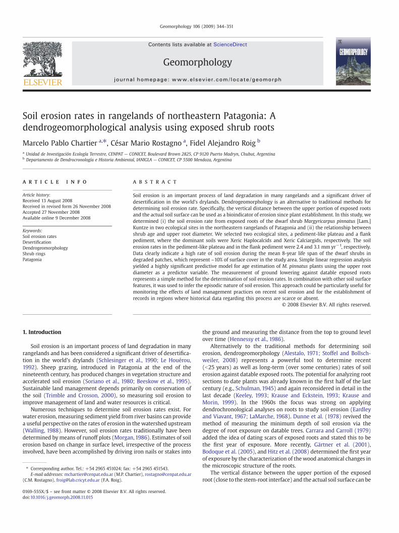
Soil erosion rates in rangelands of northeastern Patagonia: A dendrogeomorphological analysis using exposed shrub roots Marcelo Pablo Chartier a, ⁎, César Mario Rostagno a , Fidel Alejandro Roig b a Unidad de Investigación Ecología Terrestre, CENPAT — CONICET, Boulevard Brown 2825, CP 9120 Puerto Madryn, Chubut, Argentina b Departamento de Dendrocronología e Historia Ambiental, IANIGLA — CONICET, CP 5500 Mendoza, Argentina abstract article info Article history: Received 13 August 2008 Received in revised form 26 November 2008 Accepted 27 November 2008 Available online 9 December 2008 Keywords: Soil erosion rates Desertification Dendrogeomorphology Shrub rings Patagonia Soil erosion is an important process of land degradation in many rangelands and a significant driver of desertification in the world's drylands. Dendrogeomorphology is an alternative to traditional methods for determining soil erosion rate. Specifically, the vertical distance between the upper portion of exposed roots and the actual soil surface can be used as a bioindicator of erosion since plant establishment. In this study, we determined (i) the soil erosion rate from exposed roots of the dwarf shrub Margyricarpus pinnatus [Lam.] Kuntze in two ecological sites in the northeastern rangelands of Patagonia and (ii) the relationship between shrub age and upper root diameter. We selected two ecological sites, a pediment-like plateau and a flank pediment, where the dominant soils were Xeric Haplocalcids and Xeric Calciargids, respectively. The soil erosion rates in the pediment-like plateau and in the flank pediment were 2.4 and 3.1 mm yr −1 , respectively. Data clearly indicate a high rate of soil erosion during the mean 8-year life span of the dwarf shrubs in degraded patches, which represent ~10% of surface cover in the study area. Simple linear regression analysis yielded a highly significant predictive model for age estimation of M. pinnatus plants using the upper root diameter as a predictor variable. The measurement of ground lowering against datable exposed roots represents a simple method for the determination of soil erosion rates. In combination with other soil surface features, it was used to infer the episodic nature of soil erosion. This approach could be particularly useful for monitoring the effects of land management practices on recent soil erosion and for the establishment of records in regions where historical data regarding this process are scarce or absent. © 2008 Elsevier B.V. All rights reserved. 1. Introduction Soil erosion is an important process of land degradation in many rangelands and has been considered a significant driver of desertifica- tion in the world's drylands (Schlesinger et al., 1990; Le Houérou, 1992). Sheep grazing, introduced in Patagonia at the end of the nineteenth century, has produced changes in vegetation structure and accelerated soil erosion (Soriano et al., 1980; Beeskow et al., 1995). Sustainable land management depends primarily on conservation of the soil (Trimble and Crosson, 2000), so measuring soil erosion to improve management of land and water resources is critical. Numerous techniques to determine soil erosion rates exist. For water erosion, measuring sediment yield from river basins can provide a useful perspective on the rates of erosion in the watershed upstream (Walling, 1988). However, soil erosion rates traditionally have been determined by means of runoff plots (Morgan, 1986). Estimates of soil erosion based on change in surface level, irrespective of the process involved, have been accomplished by driving iron nails or stakes into the ground and measuring the distance from the top to ground level over time (Hennessy et al., 1986). Alternatively to the traditional methods for determining soil erosion, dendrogeomorphology (Alestalo, 1971; Stoffel and Bollsch- weiler, 2008) represents a powerful tool to determine recent (b 25 years) as well as long-term (over some centuries) rates of soil erosion against datable exposed roots. The potential for analyzing root sections to date plants was already known in the first half of the last century (e.g., Schulman, 1945) and again reconsidered in detail in the last decade (Keeley, 1993; Krause and Eckstein, 1993; Krause and Morin, 1999). In the 1960s the focus was strong on applying dendrochronological analyses on roots to study soil erosion (Eardley and Viavant, 1967; LaMarche, 1968). Dunne et al. (1978) revived the method of measuring the minimum depth of soil erosion via the degree of root exposure on datable trees. Carrara and Carroll (1979) added the idea of dating scars of exposed roots and stated this to be the first year of exposure. More recently, Gärtner et al. (2001), Bodoque et al. (2005), and Hitz et al. (2008) determined the first year of exposure by the characterization of the wood anatomical changes in the microscopic structure of the roots. The vertical distance between the upper portion of the exposed root (close to the stem-root interface) and the actual soil surface can be Geomorphology 106 (2009) 344–351 ⁎ Corresponding author. Tel.: +54 2965 451024; fax: +54 2965 451543. E-mail addresses: [email protected] (M.P. Chartier), [email protected] (C.M. Rostagno), [email protected] (F.A. Roig). 0169-555X/$ – see front matter © 2008 Elsevier B.V. All rights reserved. doi:10.1016/j.geomorph.2008.11.015 Contents lists available at ScienceDirect Geomorphology journal homepage: www.elsevier.com/locate/geomorph
Transcript of Soil erosion rates in rangelands of northeastern Patagonia: A dendrogeomorphological analysis using...
Geomorphology 106 (2009) 344–351
Contents lists available at ScienceDirect
Geomorphology
j ourna l homepage: www.e lsev ie r.com/ locate /geomorph
Soil erosion rates in rangelands of northeastern Patagonia: Adendrogeomorphological analysis using exposed shrub roots
Marcelo Pablo Chartier a,⁎, César Mario Rostagno a, Fidel Alejandro Roig b
a Unidad de Investigación Ecología Terrestre, CENPAT — CONICET, Boulevard Brown 2825, CP 9120 Puerto Madryn, Chubut, Argentinab Departamento de Dendrocronología e Historia Ambiental, IANIGLA — CONICET, CP 5500 Mendoza, Argentina
⁎ Corresponding author. Tel.: +54 2965 451024; fax:E-mail addresses:[email protected] (M.P. Cha
(C.M. Rostagno), [email protected] (F.A. Roig).
0169-555X/$ – see front matter © 2008 Elsevier B.V. Adoi:10.1016/j.geomorph.2008.11.015
a b s t r a c t
a r t i c l e i n f oArticle history:
Soil erosion is an importan Received 13 August 2008Received in revised form 26 November 2008Accepted 27 November 2008Available online 9 December 2008Keywords:Soil erosion ratesDesertificationDendrogeomorphologyShrub ringsPatagonia
t process of land degradation in many rangelands and a significant driver ofdesertification in the world's drylands. Dendrogeomorphology is an alternative to traditional methods fordetermining soil erosion rate. Specifically, the vertical distance between the upper portion of exposed rootsand the actual soil surface can be used as a bioindicator of erosion since plant establishment. In this study, wedetermined (i) the soil erosion rate from exposed roots of the dwarf shrub Margyricarpus pinnatus [Lam.]Kuntze in two ecological sites in the northeastern rangelands of Patagonia and (ii) the relationship betweenshrub age and upper root diameter. We selected two ecological sites, a pediment-like plateau and a flankpediment, where the dominant soils were Xeric Haplocalcids and Xeric Calciargids, respectively. The soilerosion rates in the pediment-like plateau and in the flank pediment were 2.4 and 3.1 mm yr−1, respectively.Data clearly indicate a high rate of soil erosion during the mean 8-year life span of the dwarf shrubs indegraded patches, which represent ~10% of surface cover in the study area. Simple linear regression analysisyielded a highly significant predictive model for age estimation of M. pinnatus plants using the upper rootdiameter as a predictor variable. The measurement of ground lowering against datable exposed rootsrepresents a simple method for the determination of soil erosion rates. In combination with other soil surfacefeatures, it was used to infer the episodic nature of soil erosion. This approach could be particularly useful formonitoring the effects of land management practices on recent soil erosion and for the establishment ofrecords in regions where historical data regarding this process are scarce or absent.
© 2008 Elsevier B.V. All rights reserved.
1. Introduction
Soil erosion is an important process of land degradation in manyrangelands and has been considered a significant driver of desertifica-tion in the world's drylands (Schlesinger et al., 1990; Le Houérou,1992). Sheep grazing, introduced in Patagonia at the end of thenineteenth century, has produced changes in vegetation structure andaccelerated soil erosion (Soriano et al., 1980; Beeskow et al., 1995).Sustainable land management depends primarily on conservation ofthe soil (Trimble and Crosson, 2000), so measuring soil erosion toimprove management of land and water resources is critical.
Numerous techniques to determine soil erosion rates exist. Forwater erosion, measuring sediment yield from river basins can providea useful perspective on the rates of erosion in thewatershed upstream(Walling, 1988). However, soil erosion rates traditionally have beendetermined bymeans of runoff plots (Morgan, 1986). Estimates of soilerosion based on change in surface level, irrespective of the processinvolved, have been accomplished by driving iron nails or stakes into
+54 2965 451543.rtier), [email protected]
ll rights reserved.
the ground and measuring the distance from the top to ground levelover time (Hennessy et al., 1986).
Alternatively to the traditional methods for determining soilerosion, dendrogeomorphology (Alestalo, 1971; Stoffel and Bollsch-weiler, 2008) represents a powerful tool to determine recent(b25 years) as well as long-term (over some centuries) rates of soilerosion against datable exposed roots. The potential for analyzing rootsections to date plants was already known in the first half of the lastcentury (e.g., Schulman, 1945) and again reconsidered in detail in thelast decade (Keeley, 1993; Krause and Eckstein, 1993; Krause andMorin, 1999). In the 1960s the focus was strong on applyingdendrochronological analyses on roots to study soil erosion (Eardleyand Viavant, 1967; LaMarche, 1968). Dunne et al. (1978) revived themethod of measuring the minimum depth of soil erosion via thedegree of root exposure on datable trees. Carrara and Carroll (1979)added the idea of dating scars of exposed roots and stated this to bethe first year of exposure. More recently, Gärtner et al. (2001),Bodoque et al. (2005), and Hitz et al. (2008) determined the first yearof exposure by the characterization of thewood anatomical changes inthe microscopic structure of the roots.
The vertical distance between the upper portion of the exposedroot (close to the stem-root interface) and the actual soil surface can be

Fig. 1. Study area in northeastern rangelands of Patagonia, Argentina.
345M.P. Chartier et al. / Geomorphology 106 (2009) 344–351
used as an indicator of soil erosion since plant establishment (Villalba,2000). Age determination of exposed roots enables one to assess themagnitude of soil loss over time as well as to develop detailedchronologies of the geomorphologic events. Eardley and Viavant(1967) used exposed tree roots to determine the rate of landscapedenudation in an area north of Cedar Breaks National Monument,Utah; and LaMarche (1968) used the same techniques to determinerates of slope degradation in theWhite Mountains of California. Thesestudies involved long-lived species of pines, but shrub species thatshow similar root growth characteristics should provide equallyreliable data for shorter time periods.
In principle, roots of all tree and shrub species could be used for thedetermination of soil erosion rates (Gärtner et al., 2001). In this sense,trees and other plants having annual ring structures (including dwarfshrubs, shrubs, and herbs) (Schweingruber and Poschlod, 2005) canplay a key role in many dendrogeomorphological studies. However,according to Winchester et al. (2007), apart from the work of Gerset al. (2001), plants other than trees have been largely ignored bydendrogeomorphologists.
In the Patagonian rangelands, soil erosion has been considered themain soil degradation process and is cited as the main cause ofdesertification (del Valle et al., 1998). However, few studies, generallyplanned for no more than 3 years, have determined the rate of soilerosion (Rostagno et al., 1999). The high cost and long time framesneeded for the traditionalmethodsmay be the primary reasons for thedendrogeomorphological approach. The use of exposure and datableshrub roots to document the soil loss rates offers new options for thestudy of erosion in rangelands.
The objectives of this study are (i) to determine the soil erosionrate from exposed roots of the dwarf shrub Margyricarpus pinnatus[Lam.] Kuntze in two ecological sites in the northeastern rangelands ofPatagonia and (ii) to assess the relationship between the age and theupper root diameter of this species. If the age of M. pinnatus could bedetermined from its upper root diameter, the assessment of the soilerosion rate from areas characterized by this species could be quicklyand directly determined in the field. This work represents part of aregional effort to identify soil erosion indicators to assess themagnitude and rate of the erosion process in Patagonia.
2. Study area
Field work was carried out in the Punta Ninfas area in thenortheastern rangelands of Patagonia, Argentina (Fig. 1). The climateis arid and windy with a mean annual precipitation of 258 mm(1995–2004) (Chartier and Rostagno, 2006), a mean annual atmo-spheric temperature of about 12.5 °C, and an evapotranspiration of680 mm (Barros, 1983). The highest mean wind velocity (6 m s−1)occurs during summer when SW winds are dominant (data from theweather station located in Puerto Madryn, 50 km westward of thestudy area) (CENPAT, 2005).
In this area we selected two contiguous ecological sites, apediment-like plateau and a flank pediment, that differed in soiltype and vegetation physiognomy and composition, although grazingmanagement was similar. Beeskow et al. (1987) described apediment-like plateau as an erosional surface of low relief coveredby alluvium that locally are called “mesetas” or plateaus, whereasflank pediments (as described by Fidalgo and Riggi, 1970) are shortslope transport surfaces, generally developed between a plateaucovered by a gravel mantle and a lower zone with a base levelcontrolled by a playa lake. The dominant soils in the pediment-likeplateau (1–5% slope) and in the flank pediment (2–3% slope) are XericHaplocalcids and Xeric Calciargids, respectively. The Xeric Haplocalcidis a deep, fine sandy loam, well- to moderately well-drained,moderately permeable soil. The Xeric Calciargid is moderately deepwith a sandy clay loam Bt horizon (10 to 15 cm thick) and a calcic Bkhorizon 20 to 30 cm thick, moderately drained, with a moderate to
slow permeability. The bulk density of the A horizons for theHaplocalcids and Calciargids was 1.20 and 1.24 Mg m−3, respectively.Classification of soils was according to the Soil Survey Staff (1999).
The dominant plant community in the flank pediment is shrub-grass steppe (Fig. 2). Chuquiraga avellanedae Lorentz (quilembai) isthe dominant shrub, and the perennial grasses Stipa tenuis Phil.(flechilla) and Piptochaetium napostaense [Speg.] Hackel ap Stuckert(flechilla negra) are the dominant herbaceous species. The pediment-like plateau is characterized by grass with scattered shrub steppe,where S. tenuis and S. speciosa Trin. and Rupr. (coirón amargo) are thedominant grass species and Mulinum spinosum [Cav.] Pers. (neneo)the dominant shrub.
In the study area, no fire has been recorded during the last50 years. Wind and water erosion are important geomorphicprocesses structuring the patchy soil and vegetation. Sheep grazingfor wool production is the main use of these rangelands wherecontinuous grazing is practiced extensively at moderate to heavyintensity (0.3 sheep ha−1) in paddocks commonly exceeding 2500 hain size (Beeskow et al., 1995).
3. Material and methods
3.1. Growth ring measurement and M. pinnatus chronology
In a first step to verify the annual formation of growth rings ofM. pinnatus, sampling was undertaken within an exclosure in thespring of 2004. Grazing was excluded for a 10-year period in theexclosure. The exclosure was located ca. 3000 m from the sampledareas, in similar terrain and soils. Fifteen M. pinnatus plants wererandomly selected inside the exclosure. In the laboratory, the plantswere transversely sectioned by sawing at the upper root portion, atthe stem–root interface (Fig. 3), to ensure that the pith and firstannual growth ring were included (Ferguson, 1964). The root crosssections were allowed to air-dry for ~30 days and then sandedsequentially with 60, 80, 320, 600, and 1500 grit sanding belts.
Next, the slices of root samples were photographed at a resolutionof 72 dpi using a digital camera mounted on a binocular scope at 10 to50 power. The ImageJ 1.37v software (Rasband, 2006) was used todetermine the ring widths with a precision of 0.01 mm. To determine

Fig. 3. (A) Lateral view of M. pinnatus indicating the location of upper root portionwhere cross sections were taken. (B) Cross section of an M. pinnatus exposed root withclearly defined growth rings. The black and white bars indicate the early and late woodof a growth ring, respectively.
Fig. 2. (A) Photograph showing a general view of the flank pediment site in the Punta Ninfas rangelands, northeastern Patagonia. The dominant plant community is shrub-grasssteppe. (1) A degraded patch dominated byM. pinnatuswith exposed roots is denoted by the dashed line. (2) The adjacent undegradedmatrix where perennial grasses dominate. (B)Detail of an M. pinnatus dwarf shrub with exposed root (h).
346 M.P. Chartier et al. / Geomorphology 106 (2009) 344–351
pointer years, the ring widths of the selected M. pinnatus werecrossdated using the skeleton plot method (Stokes and Smiley, 1968;Schweingruber et al., 1990). Crossdating ensured that patterns of ringwidths were matched among several series to identify the correctformation date for every ring in all samples (Swetnam et al., 1985).Finally, a master chronology was obtained as a comparison pattern ofthe ring width to verify the ring counting in the age determination.
3.2. Sampling and erosion rate determination
The sampling was carried out in the grazed area during spring of2004 and early summer of 2005. The proportion of the total study areacovered by degraded, eroding patches was determined as a basis forestimating the spatial extent of the erosion process (Fig. 2). In eachecological site, four 200-m transects were randomly located todetermine the cover of degraded patches by using the lengthinterception method (Mueller-Dombois and Ellenberg, 1974). Thedegraded patches were clearly identified in the field by the presenceof several signs of soil erosion, such as an incipient desert pavement,grass plants, and gravels in pedestal, vesicular crust, a high percentageof bare ground and exposed roots of woody plants. To establish arelationship between accelerated erosion and soil surface character-istics, we determined the cover of M. pinnatus dwarf shrubs, grasses,litter, gravels, and bare soil of the degraded patches and the adjacentundegraded matrix using five 50×50-cm quadrats (subsamples) perpatch.
In order to determine the erosion rate in the degraded patches ofeach ecological site, we selected the first five intercepted patchesalong each of the four transects. In each of these patches, we selectedthe three individuals of M. pinnatus with the highest and thinnestexposed root. For each selected plant (n=120), the distance betweenthe upper root portion and the soil surface was measured with a ruler.These plants were harvested, put in a plastic bag, and taken to thelaboratory to be prepared following the same methodology asdescribed above. Then, the age of each plant was determined bysimply counting annual growth rings contained in the transversesections using a binocular scope at 10 to 50 power. A minimum of
three radii per sample were counted by using one section per plant.The mean annual soil erosion rate was determined by dividing theheight of the exposed root by the numbers of years the plant has lived.Upper root diameters were measured with a caliper across transversesections, and regression analysis was used to test for relationshipbetween upper root diameter and dwarf shrub age. Voucher speci-mens were deposited in the Centro Nacional Patagónico — CONICET,Jardín Botánico de la Patagonia Extraandina, Puerto Madryn, Argen-tina (CNP-JBPE 2512).

Fig. 4. Shrub-ring chronology based on the mean (standard error) annual growth ring index (black line) and corresponding number of samples (dashed line) for the M. pinnatusgrowing within the exclosure at the Punta Ninfas area, northeastern Patagonia.
347M.P. Chartier et al. / Geomorphology 106 (2009) 344–351
3.3. Data analysis
A chronology for M. pinnatus was developed from 15 ring widthmeasurement series following standard procedures described byStokes and Smiley (1968). After visual crossdating of the preparedsamples, ring widths were measured to the nearest 0.01 mm.
The quality of this crossdating was verified by means of theCOFECHA program (Holmes, 1983). Similarities between the chron-ologies were evaluated using correlation coefficients for the commoninterval 1992–2004. We evaluated the quality of the chronology usingthe mean sensibility and the standard deviation (Fritts, 1976).
The statistical difference in the dwarf shrub age (year), the heightof exposed root (mm), and the soil erosion rate (Mg ha−1 yr−1)between ecological sites was tested by a balanced, nested analysis ofvariance. To compare the cover of degraded patches between sites, afixed effect one-way analysis of variance was employed. Regressionanalysis was performed to determine the relationship between ageand upper root diameter of M. pinnatus dwarf shrub. Upper rootdiameter was the predictor variable and age the dependent variable insimple linear regression analyses. An F-test for homogeneousvariances and an analysis of covariance were performed to comparethe slopes and Y-intercepts, respectively, for the age predictionmodels from pediment-like plateau and flank pediment study sites(Sokal and Rohlf, 1981). Significant levels were determined at P≤0.05.
4. Results
4.1. Margyricarpus pinnatus chronology
The transverse sections at the upper root portion of M. pinnatusproduced recognizable annual growth rings (Fig. 3). The vessels ofmajor diameter were located in the earlywood, but they decreased insize as they entered the latewood zone forming a semiring porositypattern. In the boundary between two vegetative periods, the vascular
Fig. 5. Different surface cover factors (mean and standard error) for the undegraded and degNinfas rangelands, Patagonia.
tracheids were clearly distinguished from the vessels formed at thebeginning of the cambial activity.
Similarities in the ring patterns were confirmed from the cross-dating skeleton plots of 15 M. pinnatus dwarf shrubs growing withinthe exclosure. The chronology obtained using the plants harvested inthe exclosure covers the period 1992–2004 and is based on the meanannual growth ring index of 15 dwarf shrubs (Fig. 4). The ring widthranged from aminimum of 0.13 to amaximumof 1.46mmyr−1 (mean0.47, standard error 0.02) and showed a positive trend with dwarfshrub age. The statistics used tomeasure the quality of the chronologyindicate a common signal in the interannual variations of radial growthamong the individual samples that integrated the chronology. Thechronology showed a high (r-bar=0.77) correlation among the 15dwarf shrubs. The mean sensitivity of standardized ring width indicesfor standard chronologywas 0.30, and the standard deviationwas 0.16.
4.2. Cover and surface characteristics of M. pinnatus patches
The mean cover of degraded patches was 10.4% (S.E. 2.3) for thepediment-like plateau and 8.9% (S.E. 1.7) for the flank pediment andwas not statistically different between them (PN0.61, n=8). A total of26 and 33 degraded patches were intercepted in the pediment-likeplateau and in the flank pediment, respectively.
Stands of M. pinnatus dwarf shrubs were included into eitherundegraded matrix or degraded patches, and they were common inboth the pediment-like plateau and the flank pediment study sites.Degraded patches were characterized by exposed roots of M. pinnatusassociated with a low grass and litter cover and a high gravel and baresoil cover (Fig. 5).
4.3. Soil erosion rate
The mean age of the individuals of M. pinnatus harvested in thedegraded patches was similar in the two ecological sites (Table 1).
raded patches in (A) the pediment-like plateau and (B) the flank pediment at the Punta

Fig. 6. Upper root diameter–age relationship of M. pinnatus dwarf shrubs harvested inthe degraded patches of the two ecological sites in the Punta Ninfas rangelands,northeastern Patagonia.
348 M.P. Chartier et al. / Geomorphology 106 (2009) 344–351
However, the mean height of the exposed roots and therefore themean soil erosion rate was significantly greater in the flank pedimentthan the pediment-like plateau (Pb0.05, n=40).
Based on the cover of degraded patches, we estimate that themeasured erosion rate pertains to about 10% of the area in eachecological site. The erosion occurred during the mean life span(~8 years) of the M. pinnatus individuals harvested.
4.4. Relationship between age and upper root diameter
The comparison of linear regression parameters, F-tests forequality of slopes (F(1,100;0.95)=1.59, P=0.21, n=104) and Y-inter-cept (F(1,101;0.95)=0.55, P=0.46, n=104), showed that the age-upper root diameter relationship of M. pinnatus was not significantlydifferent between ecological sites. Accordingly, we developed onlyone age prediction model of this dwarf shrub on the study area, aspresented in Fig. 6. Thus, the simple linear regression analysis yieldedthe following significant predictive model for the annual growth ringsestimation:
Shrub age (years)=2.95 (S.E. 0.56)+2.03 (S.E. 0.18) upper rootdiameter (mm); (R2=0.56, Pb0.0001, n=104).
5. Discussion
5.1. Margyricarpus pinnatus chronology
The analysis of the transverse root sections of M. pinnatuspresented an accurate chronology based on annual ring widthmeasurements of 15 dwarf shrubs selected from the ungrazed(exclosure) area. However, some portions of root transverse sectionsshowedwedge rings as observed for Empetrum rubrum dwarf shrub inthe austral Patagonia (Roig, 1988). The transverse root sectionsshowed eccentric growth, and the more external rings were oftenlaid down in waves. As common with many desert shrubs (Ginzburg,1963), the root–stem interface of M. pinnatus tends to segment andsplit with age or with the death of some cambium tissue in droughtconditions. This feature reveals the importance in using a completetransversal section for dendrochronological analysis in this dwarfshrub species.
Because the canopy of M. pinnatus dwarf shrub is browsed bysheep and probably by wild herbivores, dendrochronological studiesbased on aerial portions of the plant could be biased to the absence ofthe first rings in the stem cross section. Thus, the use of superficial orsubterranean parts of plants for dendrochronological analysisbecomes relevant in grazed and/or burned areas.
The ring widths found in M. pinnatus, ranging between 0.13 and1.46 mmyr−1, were within the range reported for other desert shrubs(Webber, 1936). However, the mean ring width of M. pinnatus(0.47 mm) was lower than the mean radial growth of 0.82 mmreported by Vasek (1980) for Larrea tridentata, a tall shrubcharacteristic of the Mojave Desert in California, or 0.83 mm reportedbyMilton et al. (1997) for Pteronia pallens, a typical dwarf shrub of theKaroo rangelands of South Africa.
Table 1Mean (standard error) values of physical and dendrochronological parameters of M.pinnatus dwarf shrub to estimate the soil erosion rate at the Punta Ninfas rangelands,Patagonia.
Site (dominant soil) Individual agedetermination (yr)
Height of theexposed root (mm)
Soil erosion rate(mm yr−1)
Pediment-like plateau(Xeric Haplocalcids)
8.3 (0.4) 19.1 (1.5)⁎ 2.4 (0.2)⁎
Flank pediment(Xeric Calciargids)
9.3 (0.8) 26.4 (2.2) 3.1 (0.3)
⁎ Symbols indicate significant statistical differences (Pb0.05, n=40) betweenecological sites.
In the years 1996 and 2001, a large decrease in ring width wasevident (Fig. 4). Because soil erosion and grazing were insignificant inthe exclosure area, the decrease in ring width might have beencontrolled by precipitation as has been found for other shrubs growingin southern Patagonia (Roig,1988). In thesewater-limited ecosystems,the rain falling and stored in the soil profile before the beginning ofthe growing period is of fundamental importance for plant growth.Hence, the lower radial growth of the main root ofM. pinnatus in 1996and 2001 was coincident with a precipitation decrease of about 40%for the April to December months relative to the precipitationrecorded for the same months during the previous two years. Inthese ecosystems the water recharge into the soil profile occursmainly during the fall and winter (Ares et al., 1990). On the basis ofthis preliminary study, we conclude that M. pinnatus produces annualgrowth rings and that the width of the rings is in part influenced bywater availability.
5.2. Cover and surface characteristics
In the two ecological sites, a reduction in perennial grass cover wasevident in patches where M. pinnatus dominates (see Fig. 5). Thisreduction was more marked in those patches where M. pinnatus wasassociated with evidence of soil erosion. Moreover, the degradedpatches dominated by M. pinnatus with exposed roots additionallypresented other signs of accelerated soil erosion, such as incipientdesert pavement, vesicular crust, and plants with pedestals, mainlyindividuals of Stipa tenuis, the dominant perennial grass in the area.Because the root system ofM. pinnatus dwarf shrub is characterized bya deep, main root, we speculate that some individual plants may beaccessing available water deep in the soil profile, resulting indifferential survival rates compared with the grass species (Noy-Meir, 1973; Schlesinger and Gill, 1980).
In this context, soil erosion may create a mosaic of land conditionsthat represents the various states of soil loss or gain (Pickup, 1985).The continuous soil loss eventually changes a functional landscapethat efficiently captures, retains, and utilizes water and nutrients intoa dysfunctional one that no longer can efficiently capture theseresources (Tongway and Ludwig, 1997).
5.3. Soil erosion rate
The soil erosion rate in the degraded patches characterized by M.pinnatus with exposed roots was significantly different betweenecological sites (Table 1). The soil erosion rate was 1.3 times higherin the flank pediment than in the pediment-like plateau site. Thisdifference can be mainly attributed to the more favorable soilsuperficial conditions recorded in the pediment-like plateau ascompared with the flank pediment (Fig. 5). The higher ground covermay account for the greater protection from raindrop impact and the

349M.P. Chartier et al. / Geomorphology 106 (2009) 344–351
lowerwater andwind erosion rates (Schlesinger et al.,1990;Whitford,2002). In contrast, soils with less surface protection and hydrologicallimitations in the subsurface horizons can promote higher runoffproduction and soil erosion, as occurs in the Xeric Calciargids (Chartierand Rostagno, 2006).
Our data clearly indicate that soil erosion was severe during themean 8-year life span of the sampled plants. Wind and water erosion,accelerated by sheep grazing, have probably been important processesin generating the degraded patches dominated by M. pinnatus. As inother semiarid rangelands of Patagonia, the rate of soil erosion hasincreased as a consequence of unsustainable grazing managementpractices (Soriano et al., 1980; Ares et al., 1990; Parizek et al., 2002;Chartier and Rostagno, 2006). The erosion rate in the degradedpatches, which represent about 10% of surface cover of the study area,was equivalent to 28.8 and 38.4 Mg ha−1 yr−1 of sediment in thepediment-like plateau and the flank pediment, respectively. Theserates were about two times greater than the maximum soil loss ratepreviously reported for some Patagonian rangelands (Rostagno et al.,1999). The earlier study examined soil erosion under natural rainfallconditions by means of runoff plots in a nearby region and reportedmaximum soil loss values of 16 Mg ha−1 yr−1 for an erosion scarplandform. In the same area, Coronato and del Valle (1993) estimatedsediment yield using the Universal Soil Loss Equation predictionmodel (Wischmeier and Smith, 1978) and reported maximumextreme values of 11.3 Mg ha−1 yr−1.
The soil loss rate currently estimated in the degraded patches withM. pinnatus was between 5.7 and 7.7 times greater than the soil losstolerance (T-value) of 5 Mg ha−1 yr−1 cited in the literature forrangeland soils (USDA Soil Conservation Service, 1992). Based onprevious studies in the Punta Ninfas rangelands (Beeskow et al., 1995;Chartier and Rostagno, 2006), we consider that degraded patches, inwhich the A horizon has not been totally eroded, represent anunstable and transitional ecological state. Without managementintervention to halt soil erosion, this transitional state will likelychange into a severely degraded and stable state characterized by awell-developed desert pavement with little or no perennial grasscover.
In northeastern Patagonia rangelands, as in other arid and semiaridecosystems, the decrease in the cover of perennial grasses generallyresults in an acceleration of the soil erosion process from positivefeedbacks. The feedback mechanism maintains or reinforces thedegraded plant community and limits reversal to the previous plantcommunity (Scheffer et al., 2001; van de Koppel et al., 2002).
Fig. 7. (A) Alternative models (1 — linear, 2 — logarithmic, and 3 — logistic) for the soil erosPunta Ninfas rangelands. (B) Typical situation with respect to degraded patches including (1individual of Chuquiraga avellanedae with its root exposed (h3). Note the incipient desert p
Technologies to estimate and monitor soil erosion are needed tohelp prescribe management practices so as to maintain existingrangelands in an ecologically healthy state and to return degradedrangelands to a resource-conserving condition. The use of datableexposed shrub roots may serve as a quantitative indicator of soilerosion rate. Moreover, this approach, although less precise thancontinuous monitoring, represents a simple, rapid method forestimating recent soil erosion rates without the need for expensiveinstrumentation.
5.4. Inferences about the soil erosion dynamic
We present three possible models to describe the dynamic of theerosion process in degraded patches dominated by M. pinnatus(Fig. 7A).
(i) The linear model would indicate a constant soil erosion rateduring the period indicated by the age of the M. pinnatus withexposed root. However, the soil resistance and the erosivity ofthe erosion agents (wind and rainfall) show a high interannualvariation (Rostagno et al., 1999). Thus, we speculate that thetotal soil loss as indicated by the height of the exposed rootsmust be accounted for by a few, large events as shown inmodels (ii) and (iii).
(ii) The logarithmic model would indicate an early soil stabilityperiod where the establishment of M. pinnatus individualsoccurs, followed by a short period with a high soil erosion ratejust before our sampling. This model does not adequatelyreflect the erosion process because the 3-to-4 years oldestablished perennial grass (1) shown in Fig. 7B indicate astability period.
(iii) We suggest that the logistic model best reflects the dynamic ofsoil erosion in Fig. 7A. The short stability period during the firstyears after the plant establishment would allow theM. pinnatusindividual to develop a deep root system and guarantee itssurvival under the stressful conditions produced by the soilerosion process and the removal of the upper fine, lateral roots(2 in Fig. 7B). Years with relatively low rainfall can lead tolowered competitive potential of grasses (Schlesinger et al.,1990). The collapse of the perennial grasses results in a sparsecover of shrubs (Parizek et al., 2002) and acceleration of soilerosion. This sequence may have occurred in the year 1996 inthe study area, soon after the establishment of the M. pinnatus
ion dynamics in the degraded patches as indicated by the height of exposed root in the) grass tussock of Stipa tenuis, (2) M. pinnatuswith its root exposed (h2), and (3) youngavement developed on the soil surface.

350 M.P. Chartier et al. / Geomorphology 106 (2009) 344–351
(Fig. 7A). This catastrophic behavior has been described by vande Koppel et al. (1997) to explain the occurrence of alternativevegetation states in terrestrial grazing systems. In addition, thepresence of recently established perennial grasses (1 in Fig. 7B)in the present soil surface level would indicate a stability periodafter intense soil loss.
5.5. Root diameter and age relationship
Simple linear regression analysis yielded a highly significantpredictive model for age estimation of M. pinnatus plants at thePunta Ninfas rangelands using the upper root diameter as a predictorvariable (Fig. 6). The predictive models for the Haplocalcid andCalciargid soils were not significantly different. However, we expectedthe higher soil erosion rate recorded in the Calciargids wouldnegatively affect plant development and lead to reduced rootdiameter for a given plant age relative to plants growing onHaplocalcids. The great stress produced by grazing and soil erosioncould have masked the effects of soil type.
Dunne et al. (1978) described the exposure of tree roots as a rapidmeans of field measurement of soil erosion. With suitable species, acalibration curve between the age of shrub and the root diameter atground level can be developed. This predictable response could beused to determine soil erosion rate in a nondestructive and rapidsampling. Thus, range managers can use this method to identify areasthat are in an unstable ecological state (i.e., a state characterized byhigh soil erosion rate) requiring a change in grazing management.However, a given relationship between upper root diameter and agemay only be valid within a given area and should be determined fordifferent ecological sites or environmental conditions (e.g., climaticconditions).
6. Conclusion
The results of our study demonstrate that the short-term local soilerosion rate from exposed roots of M. pinnatus can be determinedwith an acceptable precision in the rangelands of northeasternPatagonia. In the degraded patches of the two ecological sites,covering ca. 10% of the study area, the soil erosion rates recordedduring the mean life span (~8 years) of the M. pinnatus sampledplants were well above (from 6 to 8 times) the assigned soil losstolerance value for rangeland soils.
The regression model using the root diameter as an independentvariable accurately predicted the age of dwarf shrubs for the studyarea and could be used to determine soil erosion rates in anondestructive and rapid sampling.
The present study confirms the usefulness and importance ofdendrogeomorphological studies regarding the soil erosion possesses.The measurement of ground lowering against datable exposed rootsrepresents an advantageous method for a soil erosion estimate. Thisapproach could be particularly useful for monitoring the effects ofland management practices on soil erosion and for the establishmentsof records in regions where historical data regarding this process arescarce or absent.
Acknowledgements
The authors want to express their gratitude to the CONICET(National Council for Scientific Research) for financial support and tothe Jardín Botánico de la Patagonia Extraandina of the Centro NacionalPatagónico— CONICET (PuertoMadryn, Argentina) for theM. pinnatusbotanical determination. We are especially grateful to Brandon T.Bestelmeyer for many valuable suggestions that contributed to theimprovement of the manuscript. We also address our thanks to Dr.Markus Stoffel and three anonymous reviewers for their commentsand helpful suggestions on previous versions of this manuscript.
References
Alestalo, J., 1971. Dendrochronological interpretation of geomorphic processes. Fennia105, 1–140.
Ares, J., Beeskow, A.M., Bertiller,M.B., Rostagno, C.M., Irisarri,M.P., Anchorena, J., Defossé,G.E., Merino, C.A., 1990. Structural and dynamic characteristics of overgrazed landsof northern Patagonia, Argentina. In: Breymeyer, A. (Ed.), Managed Grasslands:Regional Studies. Elsevier, Amsterdam, The Netherlands, pp. 149-175.
Barros, V., 1983. Atlas del potencial eólico de la Patagonia. Contribución No. 69. CentroNacional Patagónico, Puerto Madryn, Argentina. 80 pp.
Beeskow, A.M., del Valle, H.F., Rostagno, C.M., 1987. Los sistemas fisiográficos de laregión árida y semiárida de la provincia de Chubut. Secretaria de Ciencia yTecnología Bariloche, Río Negro, Argentina, pp. 33–37.
Beeskow, A.M., Elissalde, N.O., Rostagno, C.M., 1995. Ecosystem change associated withgrazing intensity on the Punta Ninfas rangelands of Patagonia, Argentina. Journal ofRange Management 48, 517–522.
Bodoque, J.M., Díez-Herrero, A., Martín-Duque, J.F., Rubiales, J.M., Godfrey, A., Pedraza, J.,Carrasco, R.M., Sanz, M.A., 2005. Sheet erosion rates determined by usingdendrogeomorphological analysis of exposed tree roots: two examples fromcentral Spain. Catena 64, 81–102.
Carrara, P.E., Carroll, T.R., 1979. The determination of erosion rates from exposed treeroots in the Piceance Basin, Colorado. Earth Surface Processes 4, 307–317.
CENPAT, 2005. Estación meteorológica. Área de física ambiental. CENPAT-CONICET.(available at http://www.centropatagonico.com).
Chartier, M.P., Rostagno, C.M., 2006. Soil erosion thresholds and alternative states innortheastern Patagonian rangelands. Rangeland Ecology andManagement 59, 616–624.
Coronato, F.R., del Valle, H.F., 1993. Methodological comparison in the estimate of fluvialerosion in an arid closed basin of northeastern Patagonia. Journal of AridEnvironments 24, 231–239.
del Valle, H.F., Elissalde, N.O., Gagliardini, D.A., Milovich, J., 1998. Status of desertificationin the Patagonian region: assessment and mapping from satellite imagery. Arid SoilResearch and Rehabilitation 12 (2), 1–27.
Dunne, T., Dietrich, W.E., Brunengo, J., 1978. Recent and past erosion rates in semi-aridKenya. Zeitschrift für Geomorphologie N. F. Suppl. 29, 130–140.
Eardley, A.J., Viavant, W., 1967. Rates of Denudation as Measured by Bristlecone Pines,Cedar Breaks, Utah. Special Studies, vol. 21. Utah Geological and MineralogicalSurvey, Cedar Breaks, Utah, pp. 3–13.
Ferguson, C.W., 1964. Annual rings in big sagebrush. Papers of the Laboratory of Tree-Ring Research No. 1. The University of Arizona Press, Tucson.
Fidalgo, F., Riggi, J.C., 1970. Consideraciones geomórficas y sedimentológicas sobre losRodados Patagónicos. Revista de la Asociación Geológica Argentina 25 (4), 430–443.
Fritts, 1976. Tree-ring and Climate. Academic Press, London. 567 pp.Gärtner, H., Schweingruber, F.H., Dikau, R., 2001. Determination of erosion rates by
analyzing structural changes in the growth pattern of exposed roots. Dendrochro-nologia 19 (1), 81–91.
Gers, E., Florin, N., Gärtner, H., Glade, T., Dikau, R., Schweingruber, F.H., 2001. Applicationof shrubs for dendrogeomorphological analysis to reconstruct spatial and temporallandslide movement patterns. A preliminary study. Zeitschrift für GeomorphologieN.F. Suppl.-Bd. 125, 163–175.
Ginzburg, C., 1963. Some anatomic features of splitting of desert shrubs. Phytomor-phology 13, 92–97.
Hennessy, J.T., Keis, B., Gibbens, R.P., Tromble, J.M., 1986. Soil sorting by forty-five yearsof wind erosion on a southern New Mexico range. Soil Science Society of AmericaJournal 50, 3.
Hitz, O.M., Gärtner, H., Heinrich, I., Monbaronet, M., 2008. Application of ash (Fraxinusexcelsior L.) roots to determine erosion rates in mountain torrents. Catena 72,248–258.
Holmes, R.L., 1983. Computer-assisted quality control in tree-ring dating and measure-ment. Tree-Ring Bulletin 43, 69–78.
Keeley, J.E., 1993. Utility of growth rings in the age determination of chaparral shrubs.Madroño 40, 1–14.
Krause, C., Eckstein, D., 1993. Dendrochronology of roots. Dendrochronologia 11, 9–23.Krause, C., Morin, H., 1999. Root growth and absent rings in mature black spruce and
balsam fir, Quebec, Canada. Dendrochronologia 16–17, 21–35.LaMarche Jr., V.C., 1968. Rates of Slope Degradation as Determined from Botanical
Evidence, White Mountains, California. U.S. Geological Survey Professional Paper352-I. U.S. Government Printing Office, Washington DC, pp. 341–377.
Le Houérou, H.N., 1992. An overview of vegetation and land degradation in world aridlands. In: Dregne, H.E. (Ed.), Degradation and Restoration of Arid Lands.International Center for Arid and Semi-Arid Lands Studies, Texas Tech University,Lubbock, USA, pp. 127–163.
Milton, S.J., Gourlay, I.D., Dean, W.R., 1997. Shrub growth and demography in arid Karoo,South Africa: inference fromwood rings. Journal of Arid Environments 37, 487–496.
Morgan, R.P.C., 1986. Soil Erosion and Conservation. Longman, New York.Mueller-Dombois, D., Ellenberg, H., 1974. Aims and Methods of Vegetation Ecology.
Wiley and Sons, New York.Noy-Meir, I., 1973. Desert ecosystem: environment and producers. Annual Review of
Ecology and Systematic 4, 25–52.Parizek, B., Rostagno, C.M., Sottini, R., 2002. Soil erosion as affected by shrub
encroachment in northeastern Patagonia. Journal Range Management 55, 43–48.Pickup, G., 1985. The erosion cell — A geomorphic approach to landscape classification
in range assessment. The Australian Rangeland Journal 7, 114–121.Rasband, W.S., 2006. ImageJ. National Institutes of Health, Bethesda, MD, USA.
(available at http://rsb.info.nih.gov/ij/).Roig, F.A., 1988. Growth conditions of Empetrum rubrum Vahl. ex Will. in the south of
Argentina. Dendrochronologia 6, 43–59.

351M.P. Chartier et al. / Geomorphology 106 (2009) 344–351
Rostagno, C.M., Coronado, F., Puebla, D., del Valle, H.F., 1999. Runoff and erosion in fiveland units of a closed basin of northeastern Patagonia. Arid Soil Research andRehabilitation 13, 281–292.
Scheffer, M., Carpenter, S., Foley, J.A., Folke, C., Walker, B., 2001. Catastrophic shifts inecosystems. Nature 413, 591–596.
Schlesinger, W.R., Gill, D.S., 1980. Biomass, production, and changes in the availability oflight, water, and nutrients during development of pure stands of the chaparralshrub, Ceanothus megacarpus, after fire. Ecology 61, 781–789.
Schlesinger, W.H., Reynolds, J.F., Cunningham, G.L., Huennke, L.F., Jarrell, W.M., Virginia,R.A., Whitford, W.G., 1990. Biological feedbacks in global desertification. Science247, 1043–1048.
Schulman, E., 1945. Root growth-rings and chronology. Tree-ring Bulletin 12, 2–5.Schweingruber, F.H., Poschlod, P., 2005. Growth rings in herbs and shrubs: life span, age
determination and ítem anatomy. Forest Snow and Landscape Research 79 (3),195–415.
Schweingruber, F.H., Eckstein, D., Serre-Bachet, F., Bräker, O.U., 1990. Identification,presentation and interpretation of event years and pointer years in dendrochro-nology. Dendrochronologia 8, 9–39.
Soil Survey Staff, 1999. Soil taxonomy: a basic system of soil classification for makingand interpreting soil surveys. Agricultural Handbook 436, USDA Soil ConservationService. U.S. Government Printing Office, Washington, DC.
Sokal, R.R., Rohlf, F.J., 1981. Biometry. Freeman, San Francisco, CA.Soriano, A., Sala, O.E., León, R., 1980. Vegetación actual y vegetación potencial en el
pastizal de coirón amargo (Stipa spp.) del SW del Chubut. Boletín de la SociedadArgentina de Botánica 19, 309–314.
Stoffel, M., Bollschweiler, M., 2008. Tree-ring analysis in natural hazards research — anoverview. Natural Hazards and Earth System Sciences 8, 187–202.
Stokes, M.A., Smiley, T.L., 1968. An Introduction to Tree-Ring Dating. University ofChicago Press, Chicago, IL, USA.
Swetnam, T.W., Thompson, M.A., Sutherlan, E.K., 1985. Using dendrochronology tomeasure radial growth of defoliated trees. Agriculture Handbook 639. U.S.Department of Agriculture, Washington, DC.
Tongway, D.J., Ludwig, J.A., 1997. The nature of landscape dysfunction in rangelands. In:Ludwig, J., Tongway, D., Freudenberger, D., Noble, J., Hudgkinson, K. (Eds.),
Landscape Ecology, Function and Management: Principles from Australia's Range-lands. CSIRO Publishing, Melbourne, Australia.
Trimble, S.W., Crosson, P., 2000. Land use: U.S. soil erosion rates — myth and reality.Science 14, 248–250.
USDA Soil Conservation Service, 1992. National Soil Survey Interpretations Handbook.U.S. Government Printing Office, Washington, DC.
van de Koppel, J., Rietkerk, M., Weissing, F.J., 1997. Catastrophic vegetation shifts and soildegradation in terrestrial grazing systems. Trend in Ecology and Evolution 12,352–356.
van de Koppel, J., Rietkerk, M., van Langevelde, F., Kumar, L., Klausmeier, C.A., Fryxell, J.M., Hearne, J.W., van Andel, J., de Ridder, N., Skidmore, A., Stroosnijder, L., Prins, H.H.T., 2002. Spatial heterogeneity and irreversible vegetation change in semiaridgrazing systems. American Naturalist 159, 209–218.
Vasek, F.C., 1980. Creosote bush: long-lived clones in the Mojave Desert. AmericanJournal of Botany 67, 246–255.
Villalba, R., 2000. Métodos en dendrogeomorfología y su potencial uso en América delSur. In: Roig, F.A. (Ed.), Dendrocronología en América Latina. EDIUNC, Mendoza,Argentina, pp. 103–134.
Walling, D.E., 1988. Measuring sediment yield from river basins. Chapter 3. In: Lal, R.(Ed.), Soil Erosion Research Methods. Soil and Water Conservation Society, Ankeny,IA, pp. 39–73.
Webber, I.E., 1936. The woods of sclerophyllous and desert shrubs of California.American Journal of Botany 23, 181–188.
Whitford, W.G., 2002. Ecology of Desert Systems. Academic Press, New York.Winchester, V., Gärtner, H., Bezzi, M., 2007. Dendrogeomorphological applications. In:
Kalvoda, J., Goudie, A.S. (Eds.), Geomorphological Variations: On the Occasion ofthe 150th Anniversary of Geography and Geoecology. Faculty of Science, CharlesUniversity, Prague, The Czech Republic, pp. 182–203.
Wischmeier, W.H., Smith, D.D., 1978. Predicting rainfall erosion losses: a guide toconservation planning. Agriculture Handbook 537. U.S. Department of Agriculture,Washington, DC.