SITE OPTIONS: SURFACE PARKING
527
SITE OPTIONS: SURFACE PARKING
-
Upload
khangminh22 -
Category
Documents
-
view
2 -
download
0
Transcript of SITE OPTIONS: SURFACE PARKING

S I T E O P T I O N S : S U R F A C E P A R K I N G
montenegro
Typewritten Text
Attachment A
montenegro
Typewritten Text
montenegro
Typewritten Text
montenegro
Typewritten Text
montenegro
Typewritten Text

S I T E O P T I O N S : S T R U C T U R E D P A R K I N G

S I T E O P T I O N S : U N D E R G R O U N D P A R K I N G

Consulting Services Agreement between [Rev:2.13.2014] DATE City of South San Francisco and _______________ Page 1 of 15
CONSULTING SERVICES AGREEMENT BETWEEN THE CITY OF SOUTH SAN FRANCISCO AND
NAME OF CONSULTANTS THIS AGREEMENT for consulting services is made by and between the City of South San Francisco (“City”) and _______________ (“Consultant”) (together sometimes referred to as the “Parties”) as of _______________ (the “Effective Date”). Section 1. SERVICES. Subject to the terms and conditions set forth in this Agreement, Consultant shall provide to City the services described in the Scope of Work attached as Exhibit A, attached hereto and incorporated herein, at the time and place and in the manner specified therein. In the event of a conflict in or inconsistency between the terms of this Agreement and Exhibit A, the Agreement shall prevail.
1.1 Term of Services. The term of this Agreement shall begin on the Effective Date and shall end on _______________, the date of completion specified in Exhibit A, and Consultant shall complete the work described in Exhibit A prior to that date, unless the term of the Agreement is otherwise terminated or extended, as provided for in Section 8. The time provided to Consultant to complete the services required by this Agreement shall not affect the City’s right to terminate the Agreement, as provided for in Section 8.
1.2 Standard of Performance. Consultant shall perform all services required pursuant to this
Agreement in the manner and according to the standards observed by a competent practitioner of the profession in which Consultant is engaged in the geographical area in which Consultant practices its profession. Consultant shall prepare all work products required by this Agreement in a substantial, first-class manner and shall conform to the standards of quality normally observed by a person practicing in Consultant's profession.
1.3 Assignment of Personnel. Consultant shall assign only competent personnel to perform
services pursuant to this Agreement. In the event that City, in its sole discretion, at any time during the term of this Agreement, desires the reassignment of any such persons, Consultant shall, immediately upon receiving notice from City of such desire of City, reassign such person or persons.
1.4 Time. Consultant shall devote such time to the performance of services pursuant to this
Agreement as may be reasonably necessary to meet the standard of performance provided in Sections 1.1 and 1.2 above and to satisfy Consultant’s obligations hereunder.
Section 2. COMPENSATION. City hereby agrees to pay Consultant a sum not to exceed ____________________, notwithstanding any contrary indications that may be contained in Consultant’s proposal, for services to be performed and reimbursable costs incurred under this Agreement. In the event of a conflict between this Agreement and Consultant’s proposal, attached as Exhibit A, regarding the amount of compensation, the Agreement shall prevail. City shall pay Consultant for services rendered pursuant to this Agreement at the time and in the manner set forth herein. The payments specified below shall be the only payments from City to Consultant for services rendered pursuant to this Agreement.
montenegro
Typewritten Text
montenegro
Typewritten Text
Attachment B

Consulting Services Agreement between [Rev:2.13.2014] DATE City of South San Francisco and _______________ Page 2 of 15
Consultant shall submit all invoices to City in the manner specified herein. Except as specifically authorized by City, Consultant shall not bill City for duplicate services performed by more than one person. Consultant and City acknowledge and agree that compensation paid by City to Consultant under this Agreement is based upon Consultant’s estimated costs of providing the services required hereunder, including salaries and benefits of employees and subcontractors of Consultant. Consequently, the parties further agree that compensation hereunder is intended to include the costs of contributions to any pensions and/or annuities to which Consultant and its employees, agents, and subcontractors may be eligible. City therefore has no responsibility for such contributions beyond compensation required under this Agreement.
2.1 Invoices. Consultant shall submit invoices, not more often than once per month during the term of this Agreement, based on the cost for services performed and reimbursable costs incurred prior to the invoice date. Invoices shall contain the following information:
Serial identifications of progress bills (i.e., Progress Bill No. 1 for the first invoice,
etc.); The beginning and ending dates of the billing period; A task summary containing the original contract amount, the amount of prior
billings, the total due this period, the balance available under the Agreement, and the percentage of completion;
At City’s option, for each work item in each task, a copy of the applicable time entries or time sheets shall be submitted showing the name of the person doing the work, the hours spent by each person, a brief description of the work, and each reimbursable expense;
The total number of hours of work performed under the Agreement by Consultant and each employee, agent, and subcontractor of Consultant performing services hereunder, as well as a separate notice when the total number of hours of work by Consultant and any individual employee, agent, or subcontractor of Consultant reaches or exceeds eight hundred (800) hours, which shall include an estimate of the time necessary to complete the work described in Exhibit A;
The amount and purpose of actual expenditures for which reimbursement is sought;
The Consultant’s signature.
2.2 Monthly Payment. City shall make monthly payments, based on invoices received, for services satisfactorily performed, and for authorized reimbursable costs incurred. City shall have thirty (30) days from the receipt of an invoice that complies with all of the requirements above to pay Consultant. City shall have no obligation to pay invoices submitted ninety (90) days past the performance of work or incurrence of cost.
2.3 Final Payment. City shall pay the last ten percent (10%) of the total sum due pursuant to
this Agreement within sixty (60) days after completion of the services and submittal to City of a final invoice, if all services required have been satisfactorily performed.

Consulting Services Agreement between [Rev:2.13.2014] DATE City of South San Francisco and _______________ Page 3 of 15
2.4 Total Payment. City shall pay for the services to be rendered by Consultant pursuant to this Agreement. City shall not pay any additional sum for any expense or cost whatsoever incurred by Consultant in rendering services pursuant to this Agreement. City shall make no payment for any extra, further, or additional service pursuant to this Agreement.
In no event shall Consultant submit any invoice for an amount in excess of the maximum
amount of compensation provided above either for a task or for the entire Agreement, unless the Agreement is modified prior to the submission of such an invoice by a properly executed change order or amendment.
2.5 Hourly Fees. Fees for work performed by Consultant on an hourly basis shall not exceed
the amounts shown in Exhibit A. 2.6 Reimbursable Expenses. Reimbursable expenses are specified below, and shall not
exceed _____________________. Expenses not listed below are not chargeable to City. Reimbursable expenses are included in the total amount of compensation provided under this Agreement that shall not be exceeded.
2.7 Payment of Taxes. Consultant is solely responsible for the payment of employment taxes
incurred under this Agreement and any similar federal or state taxes. Contractor represents and warrants that Contractor is a resident of the State of California in accordance with California Revenue & Taxation Code Section 18662, as may be amended, and is exempt from withholding. Contractor accepts sole responsible for verifying the residency status of any subcontractors and withhold taxes from non-California subcontractors as required by law.
2.8 Payment upon Termination. In the event that the City or Consultant terminates this
Agreement pursuant to Section 8, the City shall compensate the Consultant for all outstanding costs and reimbursable expenses incurred for work satisfactorily completed as of the date of written notice of termination. Consultant shall maintain adequate logs and timesheets in order to verify costs incurred to that date.
2.9 Authorization to Perform Services. The Consultant is not authorized to perform any
services or incur any costs whatsoever under the terms of this Agreement until receipt of authorization from the Contract Administrator.
Section 3. FACILITIES AND EQUIPMENT. Except as set forth herein, Consultant shall, at its sole cost and expense, provide all facilities and equipment that may be necessary to perform the services required by this Agreement. City shall make available to Consultant only the facilities and equipment listed in this section, and only under the terms and conditions set forth herein. City shall furnish physical facilities such as desks, filing cabinets, and conference space, as may be reasonably necessary for Consultant’s use while consulting with City employees and reviewing records and the information in possession of the City. The location, quantity, and time of furnishing those facilities shall be in the sole discretion of City. In no event shall City be obligated to furnish any facility that may involve

Consulting Services Agreement between [Rev:2.13.2014] DATE City of South San Francisco and _______________ Page 4 of 15
incurring any direct expense, including but not limited to computer, long-distance telephone or other communication charges, vehicles, and reproduction facilities. Section 4. INSURANCE REQUIREMENTS. Before beginning any work under this Agreement, Consultant, at its own cost and expense, unless otherwise specified below, shall procure the types and amounts of insurance listed below against claims for injuries to persons or damages to property that may arise from or in connection with the performance of the work hereunder by the Consultant and its agents, representatives, employees, and subcontractors. Consistent with the following provisions, Consultant shall provide Certificates of Insurance, attached hereto and incorporated herein as Exhibit B, indicating that Consultant has obtained or currently maintains insurance that meets the requirements of this section and under forms of insurance satisfactory, in all respects, to the City. Consultant shall maintain the insurance policies required by this section throughout the term of this Agreement. The cost of such insurance shall be included in the Consultant's bid. Consultant shall not allow any subcontractor to commence work on any subcontract until Consultant has obtained all insurance required herein for the subcontractor(s).
4.1 Workers’ Compensation. Consultant shall, at its sole cost and expense, maintain Statutory Workers’ Compensation Insurance and Employer’s Liability Insurance for any and all persons employed directly or indirectly by Consultant. The Statutory Workers’ Compensation Insurance and Employer’s Liability Insurance shall be provided with limits of not less than ONE MILLION DOLLARS ($1,000,000) per accident. In the alternative, Consultant may rely on a self-insurance program to meet those requirements, but only if the program of self-insurance complies fully with the provisions of the California Labor Code. Determination of whether a self-insurance program meets the standards of the Labor Code shall be solely in the discretion of the Contract Administrator (as defined in Section 10.9). The insurer, if insurance is provided, or the Consultant, if a program of self-insurance is provided, shall waive all rights of subrogation against the City and its officers, officials, employees, and volunteers for loss arising from work performed under this Agreement.
4.2 Commercial General and Automobile Liability Insurance.
4.2.1 General requirements. Consultant, at its own cost and expense, shall maintain commercial general and automobile liability insurance for the term of this Agreement in an amount not less than ONE MILLION DOLLARS ($1,000,000.00) per occurrence, combined single limit coverage for risks associated with the work contemplated by this Agreement. If a Commercial General Liability Insurance or an Automobile Liability form or other form with a general aggregate limit is used, either the general aggregate limit shall apply separately to the work to be performed under this Agreement or the general aggregate limit shall be at least twice the required occurrence limit. Such coverage shall include but shall not be limited to, protection against claims arising from bodily and personal injury, including death resulting there from, and damage to property resulting from activities contemplated under this Agreement, including the use of owned and non-owned automobiles.

Consulting Services Agreement between [Rev:2.13.2014] DATE City of South San Francisco and _______________ Page 5 of 15
4.2.2 Minimum scope of coverage. Commercial general coverage shall be at least as broad as Insurance Services Office Commercial General Liability occurrence form CG 0001 or GL 0002 (most recent editions) covering comprehensive General Liability and Insurance Services Office form number GL 0404 covering Broad Form Comprehensive General Liability. Automobile coverage shall be at least as broad as Insurance Services Office Automobile Liability form CA 0001 (ed. 12/90) Code 8 and 9. No endorsement shall be attached limiting the coverage.
4.2.3 Additional requirements. Each of the following shall be included in the
insurance coverage or added as a certified endorsement to the policy:
a. The insurance shall cover on an occurrence or an accident basis, and not on a claims-made basis.
b. Any failure of Consultant to comply with reporting provisions of the policy
shall not affect coverage provided to City and its officers, employees, agents, and volunteers.
4.3 Professional Liability Insurance.
4.3.1 General requirements. Consultant, at its own cost and expense, shall maintain for the period covered by this Agreement professional liability insurance for licensed professionals performing work pursuant to this Agreement in an amount not less than ONE MILLION DOLLARS ($1,000,000) covering the licensed professionals’ errors and omissions. Any deductible or self-insured retention shall not exceed ONE HUNDRED FIFTY THOUSAND DOLLARS $150,000 per claim.
4.3.2 Claims-made limitations. The following provisions shall apply if the professional
liability coverage is written on a claims-made form:
a. The retroactive date of the policy must be shown and must be before the date of the Agreement.
b. Insurance must be maintained and evidence of insurance must be
provided for at least five (5) years after completion of the Agreement or the work, so long as commercially available at reasonable rates.
c. If coverage is canceled or not renewed and it is not replaced with another
claims-made policy form with a retroactive date that precedes the date of this Agreement, Consultant must provide extended reporting coverage for a minimum of five (5) years after completion of the Agreement or the work. The City shall have the right to exercise, at the Consultant’s sole cost and expense, any extended reporting provisions of the policy, if the Consultant cancels or does not renew the coverage.

Consulting Services Agreement between [Rev:2.13.2014] DATE City of South San Francisco and _______________ Page 6 of 15
d. A copy of the claim reporting requirements must be submitted to the City prior to the commencement of any work under this Agreement.
4.4 All Policies Requirements.
4.4.1 Acceptability of insurers. All insurance required by this section is to be placed with insurers with a Bests' rating of no less than A:VII.
4.4.2 Verification of coverage. Prior to beginning any work under this Agreement,
Consultant shall furnish City with complete copies of all policies delivered to Consultant by the insurer, including complete copies of all endorsements attached to those policies. All copies of policies and certified endorsements shall show the signature of a person authorized by that insurer to bind coverage on its behalf. If the City does not receive the required insurance documents prior to the Consultant beginning work, it shall not waive the Consultant’s obligation to provide them. The City reserves the right to require complete copies of all required insurance policies at any time.
4.4.3 Notice of Reduction in or Cancellation of Coverage. A certified endorsement
shall be attached to all insurance obtained pursuant to this Agreement stating that coverage shall not be suspended, voided, canceled by either party, or reduced in coverage or in limits, except after thirty (30) days' prior written notice by certified mail, return receipt requested, has been given to the City. In the event that any coverage required by this section is reduced, limited, cancelled, or materially affected in any other manner, Consultant shall provide written notice to City at Consultant’s earliest possible opportunity and in no case later than ten (10) working days after Consultant is notified of the change in coverage.
4.4.4 Additional insured; primary insurance. City and its officers, employees, agents,
and volunteers shall be covered as additional insureds with respect to each of the following: liability arising out of activities performed by or on behalf of Consultant, including the insured’s general supervision of Consultant; products and completed operations of Consultant, as applicable; premises owned, occupied, or used by Consultant; and automobiles owned, leased, or used by the Consultant in the course of providing services pursuant to this Agreement. The coverage shall contain no special limitations on the scope of protection afforded to City or its officers, employees, agents, or volunteers.
A certified endorsement must be attached to all policies stating that coverage is
primary insurance with respect to the City and its officers, officials, employees and volunteers, and that no insurance or self-insurance maintained by the City shall be called upon to contribute to a loss under the coverage.
4.4.5 Deductibles and Self-Insured Retentions. Consultant shall disclose to and
obtain the approval of City for the self-insured retentions and deductibles before

Consulting Services Agreement between [Rev:2.13.2014] DATE City of South San Francisco and _______________ Page 7 of 15
beginning any of the services or work called for by any term of this Agreement. Further, if the Consultant’s insurance policy includes a self-insured retention that must be paid by a named insured as a precondition of the insurer’s liability, or which has the effect of providing that payments of the self-insured retention by others, including additional insureds or insurers do not serve to satisfy the self-insured retention, such provisions must be modified by special endorsement so as to not apply to the additional insured coverage required by this agreement so as to not prevent any of the parties to this agreement from satisfying or paying the self-insured retention required to be paid as a precondition to the insurer’s liability. Additionally, the certificates of insurance must note whether the policy does or does not include any self-insured retention and also must disclose the deductible.
During the period covered by this Agreement, only upon the prior express written authorization of Contract Administrator, Consultant may increase such deductibles or self-insured retentions with respect to City, its officers, employees, agents, and volunteers. The Contract Administrator may condition approval of an increase in deductible or self-insured retention levels with a requirement that Consultant procure a bond, guaranteeing payment of losses and related investigations, claim administration, and defense expenses that is satisfactory in all respects to each of them.
4.4.6 Subcontractors. Consultant shall include all subcontractors as insureds under its policies or shall furnish separate certificates and certified endorsements for each subcontractor. All coverages for subcontractors shall be subject to all of the requirements stated herein.
4.4.7 Wasting Policy. No insurance policy required by Section 4 shall include a
“wasting” policy limit. 4.4.8 Variation. The City may approve a variation in the foregoing insurance
requirements, upon a determination that the coverage, scope, limits, and forms of such insurance are either not commercially available, or that the City’s interests are otherwise fully protected.
4.5 Remedies. In addition to any other remedies City may have if Consultant fails to provide
or maintain any insurance policies or policy endorsements to the extent and within the time herein required, City may, at its sole option exercise any of the following remedies, which are alternatives to other remedies City may have and are not the exclusive remedy for Consultant’s breach:
a. Obtain such insurance and deduct and retain the amount of the premiums for such
insurance from any sums due under the Agreement;

Consulting Services Agreement between [Rev:2.13.2014] DATE City of South San Francisco and _______________ Page 8 of 15
b. Order Consultant to stop work under this Agreement or withhold any payment that becomes due to Consultant hereunder, or both stop work and withhold any payment, until Consultant demonstrates compliance with the requirements hereof; and/or
c. Terminate this Agreement.
Section 5. INDEMNIFICATION AND CONSULTANT’S RESPONSIBILITIES. Consultant shall indemnify, defend with counsel selected by the City, and hold harmless the City and its officials, officers, employees, agents, and volunteers from and against any and all losses, liability, claims, suits, actions, damages, and causes of action arising out of any personal injury, bodily injury, loss of life, or damage to property, or any violation of any federal, state, or municipal law or ordinance, to the extent caused, in whole or in part, by the willful misconduct or negligent acts or omissions of Consultant or its employees, subcontractors, or agents, by acts for which they could be held strictly liable, or by the quality or character of their work. The foregoing obligation of Consultant shall not apply when (1) the injury, loss of life, damage to property, or violation of law arises wholly from the gross negligence or willful misconduct of the City or its officers, employees, agents, or volunteers and (2) the actions of Consultant or its employees, subcontractor, or agents have contributed in no part to the injury, loss of life, damage to property, or violation of law. It is understood that the duty of Consultant to indemnify and hold harmless includes the duty to defend as set forth in Section 2778 of the California Civil Code. Acceptance by City of insurance certificates and endorsements required under this Agreement does not relieve Consultant from liability under this indemnification and hold harmless clause. This indemnification and hold harmless clause shall apply to any damages or claims for damages whether or not such insurance policies shall have been determined to apply. By execution of this Agreement, Consultant acknowledges and agrees to the provisions of this Section and that it is a material element of consideration. In the event that Consultant or any employee, agent, or subcontractor of Consultant providing services under this Agreement is determined by a court of competent jurisdiction or the California Public Employees Retirement System (PERS) to be eligible for enrollment in PERS as an employee of City, Consultant shall indemnify, defend, and hold harmless City for the payment of any employee and/or employer contributions for PERS benefits on behalf of Consultant or its employees, agents, or subcontractors, as well as for the payment of any penalties and interest on such contributions, which would otherwise be the responsibility of City. Section 6. STATUS OF CONSULTANT.
6.1 Independent Contractor. At all times during the term of this Agreement, Consultant shall be an independent contractor and shall not be an employee of City. City shall have the right to control Consultant only insofar as the results of Consultant's services rendered pursuant to this Agreement and assignment of personnel pursuant to Subparagraph 1.3; however, otherwise City shall not have the right to control the means by which Consultant accomplishes services rendered pursuant to this Agreement. Notwithstanding any other City, state, or federal policy, rule, regulation, law, or ordinance to the contrary, Consultant and any of its employees, agents, and subcontractors providing services under this Agreement shall not qualify for or become entitled to, and hereby agree to waive any and all claims to, any compensation, benefit, or any incident of employment by City, including

Consulting Services Agreement between [Rev:2.13.2014] DATE City of South San Francisco and _______________ Page 9 of 15
but not limited to eligibility to enroll in the California Public Employees Retirement System (PERS) as an employee of City and entitlement to any contribution to be paid by City for employer contributions and/or employee contributions for PERS benefits.
6.2 Consultant No Agent. Except as City may specify in writing, Consultant shall have no
authority, express or implied, to act on behalf of City in any capacity whatsoever as an agent or to bind City to any obligation whatsoever.
Section 7. LEGAL REQUIREMENTS.
7.1 Governing Law. The laws of the State of California shall govern this Agreement. 7.2 Compliance with Applicable Laws. Consultant and any subcontractors shall comply with
all laws applicable to the performance of the work hereunder. 7.3 Other Governmental Regulations. To the extent that this Agreement may be funded by
fiscal assistance from another governmental entity, Consultant and any subcontractors shall comply with all applicable rules and regulations to which City is bound by the terms of such fiscal assistance program.
7.4 Licenses and Permits. Consultant represents and warrants to City that Consultant and
its employees, agents, and any subcontractors have all licenses, permits, qualifications, and approvals, including from City, of what-so-ever nature that are legally required to practice their respective professions. Consultant represents and warrants to City that Consultant and its employees, agents, any subcontractors shall, at their sole cost and expense, keep in effect at all times during the term of this Agreement any licenses, permits, and approvals that are legally required to practice their respective professions. In addition to the foregoing, Consultant and any subcontractors shall obtain and maintain during the term of this Agreement valid Business Licenses from City.
7.5 Nondiscrimination and Equal Opportunity. Consultant shall not discriminate, on the
basis of a person’s race, religion, color, national origin, age, physical or mental handicap or disability, medical condition, marital status, sex, or sexual orientation, against any employee, applicant for employment, subcontractor, bidder for a subcontract, or participant in, recipient of, or applicant for any services or programs provided by Consultant under this Agreement. Consultant shall comply with all applicable federal, state, and local laws, policies, rules, and requirements related to equal opportunity and nondiscrimination in employment, contracting, and the provision of any services that are the subject of this Agreement, including but not limited to the satisfaction of any positive obligations required of Consultant thereby.
Consultant shall include the provisions of this Subsection in any subcontract approved by the Contract Administrator or this Agreement.

Consulting Services Agreement between [Rev:2.13.2014] DATE City of South San Francisco and _______________ Page 10 of 15
Section 8. TERMINATION AND MODIFICATION.
8.1 Termination. City may cancel this Agreement at any time and without cause upon written notification to Consultant.
Consultant may cancel this Agreement for cause upon 30 days’ written notice to City and shall include in such notice the reasons for cancellation.
In the event of termination, Consultant shall be entitled to compensation for services performed to the date of notice of termination; City, however, may condition payment of such compensation upon Consultant delivering to City all materials described in Section 9.1.
8.2 Extension. City may, in its sole and exclusive discretion, extend the end date of this Agreement beyond that provided for in Subsection 1.1. Any such extension shall require a written amendment to this Agreement, as provided for herein. Consultant understands and agrees that, if City grants such an extension, City shall have no obligation to provide Consultant with compensation beyond the maximum amount provided for in this Agreement. Similarly, unless authorized by the Contract Administrator, City shall have no obligation to reimburse Consultant for any otherwise reimbursable expenses incurred during the extension period.
8.3 Amendments. The parties may amend this Agreement only by a writing signed by all the
parties. 8.4 Assignment and Subcontracting. City and Consultant recognize and agree that this
Agreement contemplates personal performance by Consultant and is based upon a determination of Consultant’s unique personal competence, experience, and specialized personal knowledge. Moreover, a substantial inducement to City for entering into this Agreement was and is the professional reputation and competence of Consultant. Consultant may not assign this Agreement or any interest therein without the prior written approval of the Contract Administrator. Consultant shall not assign or subcontract any portion of the performance contemplated and provided for herein, other than to the subcontractors noted in the proposal, without prior written approval of the Contract Administrator.
8.5 Survival. All obligations arising prior to the termination of this Agreement and all
provisions of this Agreement allocating liability between City and Consultant shall survive the termination of this Agreement.
8.6 Options upon Breach by Consultant. If Consultant materially breaches any of the terms
of this Agreement, City’s remedies shall include, but not be limited to, the following:
8.6.1 Immediately terminate the Agreement;

Consulting Services Agreement between [Rev:2.13.2014] DATE City of South San Francisco and _______________ Page 11 of 15
8.6.2 Retain the plans, specifications, drawings, reports, design documents, and any
other work product prepared by Consultant pursuant to this Agreement; 8.6.3 Retain a different consultant to complete the work described in Exhibit A not
finished by Consultant; or 8.6.4 Charge Consultant the difference between the cost to complete the work
described in Exhibit A that is unfinished at the time of breach and the amount that City would have paid Consultant pursuant to Section 2 if Consultant had completed the work.
Section 9. KEEPING AND STATUS OF RECORDS.
9.1 Records Created as Part of Consultant’s Performance. All reports, data, maps, models, charts, studies, surveys, photographs, memoranda, plans, studies, specifications, records, files, or any other documents or materials, in electronic or any other form, that Consultant prepares or obtains pursuant to this Agreement and that relate to the matters covered hereunder shall be the property of the City. Consultant hereby agrees to deliver those documents to the City upon termination of the Agreement. It is understood and agreed that the documents and other materials, including but not limited to those described above, prepared pursuant to this Agreement are prepared specifically for the City and are not necessarily suitable for any future or other use. City and Consultant agree that, until final approval by City, all data, plans, specifications, reports and other documents are confidential and will not be released to third parties without prior written consent of both parties unless required by law.
9.2 Consultant’s Books and Records. Consultant shall maintain any and all ledgers, books
of account, invoices, vouchers, canceled checks, and other records or documents evidencing or relating to charges for services or expenditures and disbursements charged to the City under this Agreement for a minimum of three (3) years, or for any longer period required by law, from the date of final payment to the Consultant to this Agreement.
9.3 Inspection and Audit of Records. Any records or documents that Section 9.2 of this
Agreement requires Consultant to maintain shall be made available for inspection, audit, and/or copying at any time during regular business hours, upon oral or written request of the City. Under California Government Code Section 8546.7, if the amount of public funds expended under this Agreement exceeds TEN THOUSAND DOLLARS ($10,000.00), the Agreement shall be subject to the examination and audit of the State Auditor, at the request of City or as part of any audit of the City, for a period of three (3) years after final payment under the Agreement.
9.4 Records Submitted in Response to an Invitation to Bid or Request for Proposals. All responses to a Request for Proposals (RFP) or invitation to bid issued by the City become the exclusive property of the City. At such time as the City selects a bid, all proposals

Consulting Services Agreement between [Rev:2.13.2014] DATE City of South San Francisco and _______________ Page 12 of 15
received become a matter of public record, and shall be regarded as public records, with the exception of those elements in each proposal that are defined by Consultant and plainly marked as “Confidential,” "Business Secret" or “Trade Secret."
The City shall not be liable or in any way responsible for the disclosure of any such proposal or portions thereof, if Consultant has not plainly marked it as a "Trade Secret" or "Business Secret," or if disclosure is required under the Public Records Act.
Although the California Public Records Act recognizes that certain confidential trade secret information may be protected from disclosure, the City may not be in a position to establish that the information that a prospective bidder submits is a trade secret. If a request is made for information marked "Trade Secret" or "Business Secret," and the requester takes legal action seeking release of the materials it believes does not constitute trade secret information, by submitting a proposal, Consultant agrees to indemnify, defend and hold harmless the City, its agents and employees, from any judgment, fines, penalties, and award of attorneys fees awarded against the City in favor of the party requesting the information, and any and all costs connected with that defense. This obligation to indemnify survives the City's award of the contract. Consultant agrees that this indemnification survives as long as the trade secret information is in the City's possession, which includes a minimum retention period for such documents.
Section 10 MISCELLANEOUS PROVISIONS.
10.1 Attorneys’ Fees. If a party to this Agreement brings any action, including arbitration or an action for declaratory relief, to enforce or interpret the provision of this Agreement, the prevailing party shall be entitled to reasonable attorneys’ fees in addition to any other relief to which that party may be entitled. The court may set such fees in the same action or in a separate action brought for that purpose.
10.2 Venue. In the event that either party brings any action against the other under this
Agreement, the parties agree that trial of such action shall be vested exclusively in the state courts of California in the County San Mateo or in the United States District Court for the Northern District of California.
10.3 Severability. If a court of competent jurisdiction finds or rules that any provision of this
Agreement is invalid, void, or unenforceable, the provisions of this Agreement not so adjudged shall remain in full force and effect. The invalidity in whole or in part of any provision of this Agreement shall not void or affect the validity of any other provision of this Agreement.
10.4 No Implied Waiver of Breach. The waiver of any breach of a specific provision of this
Agreement does not constitute a waiver of any other breach of that term or any other term of this Agreement.

Consulting Services Agreement between [Rev:2.13.2014] DATE City of South San Francisco and _______________ Page 13 of 15
10.5 Successors and Assigns. The provisions of this Agreement shall inure to the benefit of and shall apply to and bind the successors and assigns of the parties.
10.6 Use of Recycled Products. Consultant shall prepare and submit all reports, written
studies and other printed material on recycled paper to the extent it is available at equal or less cost than virgin paper.
10.7 Conflict of Interest. Consultant may serve other clients, but none whose activities within
the corporate limits of City or whose business, regardless of location, would place Consultant in a “conflict of interest,” as that term is defined in the Political Reform Act, codified at California Government Code Section 81000 et seq.
Consultant shall not employ any City official in the work performed pursuant to this Agreement. No officer or employee of City shall have any financial interest in this Agreement that would violate California Government Code Sections 1090 et seq. Consultant hereby warrants that it is not now, nor has it been in the previous twelve (12) months, an employee, agent, appointee, or official of the City. If Consultant was an employee, agent, appointee, or official of the City in the previous twelve (12) months, Consultant warrants that it did not participate in any manner in the forming of this Agreement. Consultant understands that, if this Agreement is made in violation of Government Code §1090 et.seq., the entire Agreement is void and Consultant will not be entitled to any compensation for services performed pursuant to this Agreement, including reimbursement of expenses, and Consultant will be required to reimburse the City for any sums paid to the Consultant. Consultant understands that, in addition to the foregoing, it may be subject to criminal prosecution for a violation of Government Code § 1090 and, if applicable, will be disqualified from holding public office in the State of California.
10.8 Solicitation. Consultant agrees not to solicit business at any meeting, focus group, or
interview related to this Agreement, either orally or through any written materials. 10.9 Contract Administration. This Agreement shall be administered by _________________
("Contract Administrator"). All correspondence shall be directed to or through the Contract Administrator or his or her designee.
10.10 Notices. All notices and other communications which are required or may be given under
this Agreement shall be in writing and shall be deemed to have been duly given (i) when received if personally delivered; (ii) when received if transmitted by telecopy, if received during normal business hours on a business day (or if not, the next business day after delivery) provided that such facsimile is legible and that at the time such facsimile is sent the sending Party receives written confirmation of receipt; (iii) if sent for next day delivery to a domestic address by recognized overnight delivery service (e.g., Federal Express); and (iv) upon receipt, if sent by certified or registered mail, return receipt requested. In each case notice shall be sent to the respective Parties as follows: Consultant
___________________________

Consulting Services Agreement between [Rev:2.13.2014] DATE City of South San Francisco and _______________ Page 14 of 15
___________________________ ___________________________ ___________________________
City:
City Clerk City of South San Francisco 400 Grand Avenue South San Francisco, CA 94080
10.11 Professional Seal. Where applicable in the determination of the contract administrator, the first page of a technical report, first page of design specifications, and each page of construction drawings shall be stamped/sealed and signed by the licensed professional responsible for the report/design preparation. The stamp/seal shall be in a block entitled "Seal and Signature of Registered Professional with report/design responsibility," as in the following example.
Seal and Signature of Registered Professional with report/design responsibility.
10.12 Integration. This Agreement, including all Exhibits attached hereto, and incorporated
herein, represents the entire and integrated agreement between City and Consultant and supersedes all prior negotiations, representations, or agreements, either written or oral pertaining to the matters herein.
10.13 Counterparts. This Agreement may be executed in multiple counterparts, each of which
shall be an original and all of which together shall constitute one agreement. 10.14 Construction. The headings in this Agreement are for the purpose of reference only and
shall not limit or otherwise affect any of the terms of this Agreement. The parties have had an equal opportunity to participate in the drafting of this Agreement; therefore any construction as against the drafting party shall not apply to this Agreement.
The Parties have executed this Agreement as of the Effective Date. CITY OF SOUTH SAN FRANCISCO Consultants ____________________________ _____________________________________ City Manager NAME:

Consulting Services Agreement between [Rev:2.13.2014] DATE City of South San Francisco and _______________ Page 15 of 15
TITLE: Attest: _____________________________ Krista Martinelli, City Clerk Approved as to Form: ____________________________ City Attorney 2051688.4

Consulting Services Agreement between DATE City of South San Francisco and ____________ - Exhibit A Page 1 of 1
EXHIBIT A
SCOPE OF SERVICES

Consulting Services Agreement between DATE City of South San Francisco and____________ -Exhibit B Page 1 of 1
EXHIBIT B
INSURANCE CERTIFICATES

f:\15459-04 ssf puc pre design\r-reports\program\lcc program memo draft 2017-02-15.docx
G R O U P 4
A R C H I T E C T U R E
R E S E A R C H +
P L A N N I N G , I N C
211 L INDEN AVENUE
SO. SAN FRANCISCO
C A 9 4 0 8 0 U S A
T : 6 5 0 8 7 1 0 7 0 9
F : 6 5 0 8 7 1 7 9 1 1
w w w . g 4 a r c h . c o m
J O N A T H A N H A R T M A N
A R C H I T E C T
D A W N E . M E R K E S
A R C H I T E C T
D A V I D S C H N E E
A R C H I T E C T
A N D R E A G I F F O R D
A R C H I T E C T
C A R O L Y N C A R L B E R G
G A R Y C H I N G
A R C H I T E C T
J I L L E Y R E S
A R C H I T E C T
D A N I E L L A R O S S A
A R C H I T E C T
W I L L I A M L I M
A R C H I T E C T
T E R E S A R O M
16 February 2017
P R O J E C T SOUTH SAN FRANCISCO MEASURE W PROJECTS
S E N T V I A Regular Mail / Ground
T O P I C LIBRARY & COMMUNITY CENTER PROGRAM
1 . I n t r o d u c t i o n
The purpose of this memorandum is to summarize the programming process and describe the emerging program vision for South San Francisco’s new joint Library and Community Center (“LCC”, “the Center”).
PROJECT OVERVIEW
Project Purpose
This programming process is the latest phase of more than two years of work by City staff, stakeholders, and the community to envision and plan for the future of its facilities.
In 2014, South San Francisco-based Group 4 Architecture, Research + Planning, Inc. was commissioned to conduct a feasibility study for expanding the Municipal Services Building (MSB) – which currently houses Parks & Recreation, the Police Department, and Fire Station #63 – as well as the Main Library. After analysis of options including renovation/expansion or replacement of these facilities on their current separate sites, City Council decided that the best solution was for these departments to be co-located on a shared civic campus.
The feasibility study included the development of high-level placeholder building and site programs, created for the purpose of understanding the overall scope of the proposed civic campus, the site area required to accommodate the program components, and associated project budgets. This work formed part of the basis for Measure W, a half-cent sales tax to support expanded services and facilities approved in November 2015 by South San Francisco voters.
Programming Process Summary
The placeholder program for the new civic campus included a joint library and community center facility of approximately 85,500 square feet. In 2016, following the passage of Measure W, the City commissioned Group 4 to work with the Library and Parks & Recreation to develop and refine the program vision.
montenegro
Typewritten Text
Attachment C

16 February 2017 Memorandum Page 2
Page 2
Group 4 worked collaboratively with a core team of City Library and Parks & Recreation staff, meeting multiple times to review options and project development. The process also included meetings with other City staff focused on specific topics, as well as public meetings where hundreds of community members provided input about their vision and priorities for the new LCC.
PROGRAM MODEL
The placeholder program was based on a co-located model, in which the Library and Parks & Recreation departments would operate more or less independently within the shared building. The total program size for these functions evolved from the needs for an expanded Main Library, the replacement of the recreation facilities and Council Chambers in the MSB, and funding available to support the project. Some spaces were added or modified to reflect updated needs, but extensive evaluation of the type, quantity, and organization of spaces was beyond the scope of the feasibility study.
The program refinement process began with discussion of opportunities within the co-location model, and an exploration of what an integrated collaborative model might look like. The vision for the collaborative model developed by the Library and Parks & Rec over the course of this programming process has broad and significant implications for services, operations, and facilities.
Out of this process emerged a vision of a collaborative model to:
Improve communication and coordination in service provision. Each department provides services to address community needs, although in different ways. One big difference is that Parks & Rec uses a revenue-generation model for much of its programming, while the Library does not charge for service. The Library and Parks & Rec department explored a collaborative model that leverages these differences to complement each other rather than compete. For example, the Library could provide programs on an introductory or drop-in basis, while Parks & Rec could offer a series of classes focusing on skill building.
Increase community awareness of services. In their current separate facilities, each department has loyal customers who may not be aware of complementary services provided by the other. Collaboration in a joint location will support increased awareness and enhanced cross-promotion of services.
Provide a seamless service experience. Where appropriate, staff can be cross-trained in order to increase operational capacity – for example, at the lobby welcome desk. This will also enhance customer service, empowering staff with information and answers to meet a greater range of customer needs.
For the building program, this collaborative model offers the opportunity to minimize duplication of spaces between the Library and Parks & Rec programs. For example, the Library has a periodic, but not daily, need for program space that can accommodate large (or very large) groups. In a collaborative model, the Library can schedule access to the larger program/event spaces managed by Parks & Rec, eliminating the need to provide duplicate space.

16 February 2017 Memorandum Page 3
Page 3
By minimizing duplication of space, this collaborative program model opened up the opportunity to consider new services and spaces not anticipated in the feasibility study program, such as performing arts and fitness facilities, within the overall target building size.
2 . P r o g r a m S u m m a r y
This section includes a brief narrative description of significant program elements for the LCC, which are grouped as follows:
Shared Spaces Library Program Parks & Recreation Program Staff Spaces Options
Note that program elements and spaces are organized generally by function, but do not necessarily imply required adjacency relationships.
Tables summarizing the program space allocations are included as an attachment to this memorandum. It should be noted that all program square foot area recommendations are targets. The design process for the LCC will confirm or modify these as appropriate in order to optimize space, service, and operations within the opportunities and constraints of the site.
SHARED SPACES
The Hub
The Hub is where most visitors will enter the building, providing the opportunity to see all that the Center has to offer and make decisions about where to go first. It will be a highly active area, with people moving through it all day individually and in groups. It will also be the setting for impromptu socialization as friends and neighbors meet while coming and going from the Center.
The City administers a robust public art program that significantly contributes to the cultural richness of South San Francisco. The Hub is one of many opportunities in the LCC to feature significant commissioned or acquired art work. It also can provide opportunities for community art, culture, and history displays.
Entry/Lobby – This is an inviting, welcoming space. The lobby may also serve as pre-function space for large meeting/event spaces such as the Council Chambers. As such, adjacency to the public restrooms is required to support use outside of Center hours.
Welcome Desk – This staffed information point should be highly visible to visitors upon entering the Center. Visitors will be able to ask questions, pick up program flyers and catalogs, and even sign up for recreation programs and library cards.

16 February 2017 Memorandum Page 4
Page 4
Café – The café will provide casual seating and the ability to purchase refreshments, which are an important part of creating a comfortable, appealing place for the community. The City has not yet decided upon a preferred operational strategy for the café – e.g., whether vending machines, a mobile coffee cart, or a full coffee bar, as well as whether or not to contract with an outside vendor.
Friends Store/Storage – The Friends of Parks & Recreation and the Friends of the Library will have a joint retail presence in the Hub. Volunteers will stock and maintain attractive displays of items for purchase, such as art, used books, merchandise with the City logo, etc. The store should be able to be secured when volunteers are not in attendance. Conveniently accessible storage is required for efficient re-stocking and inventory management.
Copy Center – This will provide self-service equipment and work space for community members to make copies and print documents.
The Forum
This large, flexible program space is envisioned as the successor to the Atrium in the MSB. It will be used for a wide variety of activities, including recreation and library programs and community/ private rentals. Between scheduled events, it is envisioned as an inviting place for people to sit and work, read, socialize, or even watch movies.
Primary scheduling and management of the Forum will be by Parks & Recreation. The Library will use this space for large programs and events exceeding the capacity of the Library Program Room. Sufficient storage is required for all chairs, tables, and equipment for the Forum – chairs and tables should not need to be stacked within the public space.
Council Chambers and Support
This suite is the successor to the Council Chambers and support space in the MSB. It will be available for recreation and library programming as well as community/ private rentals between City meetings. Close/ direct access from The Hub and restrooms is encouraged to facilitate evening meetings.
Council Chambers – Primary scheduling and management of the Council Chambers will be by Parks & Recreation. This will be a flat floor, flexible space without fixed seating. Sufficient storage is required so that chairs and tables do not need to be stacked within the space. It is desirable for the dais area to be securable when not in use for City meetings in order to minimize setup/breakdown of the staff desks, technology, etc.
Council Support – This is a suite of spaces to support Council functions, including a closed session room with sufficient capacity for Council and staff; kitchenette; storage; etc. It also includes work space for City staff who need a place to temporarily work, make copies, print out materials, etc.

16 February 2017 Memorandum Page 5
Page 5
LIBRARY PROGRAM
This Library Program section does not include staff offices and other back-of-house areas; refer to the Staff Program for these spaces.
Library Core
In general, this program group includes spaces associated with the collection, seating, and technology – all of which will grow significantly over what is provided in the current Main Library.
The Exchange – The Exchange is a dynamic, constantly-changing marketplace of new and popular materials, information, and resources. It will prominently feature new and high-interest print and media material; a diverse range of seating choices with access to power for customer devices; and library technology. Holds and self-checkout stations will be located in this area.
Generations – Separate, distinctly-branded spaces will be provided for Adults, Teens, and Children – each with a highly browsable collection, a variety of seating, and technology. Quiet reading space will be included in the Adult section. The Children’s Library will include space for children’s programming.
Collaboration Spaces – Rooms for group work will be provided in a range of sizes, from small rooms for tutoring pairs and quiet study, to conference rooms for larger meetings.
Project Read – The Library’s literacy program will enjoy expanded space for its collection and resources, along with a dedicated room for intake and tutoring.
Discovery Center
Spaces in this program group are envisioned under the Library’s umbrella, but may not necessarily need to be co-located with core Library spaces. As an independently operable suite of spaces, the Discovery Center can reduce the need for staff supervision when not in use for library programs – and also provide the opportunity for cross-staffing/cross-programming by Parks & Rec. Organization and adjacencies among these spaces will be refined with the design team.
Library Program Room – With an occupancy of up to 100, this flexible space will be used daily for a variety of library programs. If possible, it should be divisible for increased flexibility. It will be dedicated to and primarily managed by the Library.
Technology Lab/Classroom – This space will be set up and equipped for technology training and programming, although it may be made available for open/drop-in use between programs.
Tinker Space – This flexible space will provide technologies, tools, materials, and staff support for hands-on learning and creativity, including arts and crafts, tinkering with electronics, etc. A desk/ small office should be provided for staff in this space.

16 February 2017 Memorandum Page 6
Page 6
PARKS & RECREATION PROGRAM
This Parks & Recreation Program section does not include administration/ staff offices or support spaces; refer to the Staff Program for these spaces. Recreation-oriented program options and the Preschool option are described later in this memorandum.
P+R Core Program
This program group provides more – and more diverse – spaces to support significantly expanded recreation programming compared to what is currently possible at the MSB.
Flexible Program Spaces – A variety of flexible, well-equipped spaces will be provided to support programs of different types and sizes. Copious storage is required for the furniture and equipment in order to support maximum flexibility. The ability to subdivide larger spaces is encouraged. The design team will work with Parks & Rec to determine the specific finishes and equipment appropriate for the activity planned for each space.
Dance Studios – Two dance studios will be provided in different sizes, with appropriate finishes (e.g., sprung floors, barres, mirrors, etc.) and storage. Changing rooms and a Dance program office are also included.
Social Hall – This will be highly popular for community and private rentals as well as for recreation programming. It will be an attractive, well-appointed space that can support both auditorium-style uses and banquet setups. A full kitchen will be provided to support catering/food preparation; Parks & Rec intends to also use this kitchen for classes and demonstrations, so it should be designed with space for observers. Sufficient storage is required to accommodate all tables, chairs, and other furniture, as well as equipment (e.g., AV cart) and a portable platform.
See the Shared Spaces section for descriptions of the Forum and Satellite City Hall.
STAFF PROGRAM
The program model envisions co-location of administrative and program staff from both departments in order to support collaborative service planning, program development, and scheduling. There will be a shared reception area with staff from both departments to serve visitor needs. Staff will share access to a suite of collaboration/ meeting rooms as well as support spaces (lounge, lockers, etc.).
This programming process did not delve deeply into the specifics of space, adjacencies, FFE, and other design requirements for staff/ back-of-house functions. The design team should work closely with Library and Parks & Rec to refine the requirements for this area.

16 February 2017 Memorandum Page 7
Page 7
PROGRAM OPTIONS
The Shared Spaces, Library Program, Parks & Rec Program, and Staff Program together form a “base” program for the LCC that represents the shared vision about size, organization, and function of these spaces.
The LCC program working group also explored a variety of options for new or enhanced spaces that could be incorporated into the LCC program. The vision is that the LCC would incorporate one of the following options in addition to the base program. Guiding the City through the selection process for a preferred option is beyond the scope of this programming process, and is envisioned to be part of the design scope.
Option A – Cultural Arts
The centerpiece of the Cultural Arts option is a “black box” theater, in response to significant stakeholder and community demand for performance space. The black box theater program includes dressing rooms and modern, well-equipped space for lighting, sound, and recording controls. The goal is to design the theater so that it be part of the LCC’s overall pool of program, gallery, and rental spaces when not in use for performances. The black box theater should be designed for independent operations from the rest of the center, which may require a separate entrance, restrooms, etc.
The Cultural Arts option could also provide a more formal “gallery” for art, local history, and cultural displays, in addition to display space included in the Hub.
Option B – Fitness
There is also significant community interest in fitness and active recreation space. While the LCC is not envisioned to incorporate a gymnasium (which is planned for the Orange Memorial Park expansion), there is an opportunity to create a fitness center to expand active recreation programming. A fitness center could enjoy a close adjacency to the Dance Studios, creating an active recreation zone with shared/ enhanced changing rooms.
Option C – Opportunities
As a community, South San Francisco has a long history as the home of industry and innovation. South City develops strong partnerships with the businesses and entrepreneurs that contribute to a robust local economy. There is an opportunity to provide space and resources that complement (but not compete with) the South San Francisco Conference Center, which is in high demand both locally and regionally. There is also an opportunity to develop partnerships that increase community access to education, such as partnerships with SFSU to host in-person and/or distance learning programs at the LCC.
A sample program focused on opportunities and innovation could include additional medium/ large, flexible classroom spaces and conference and collaboration rooms. Flexible “gallery” space could also be developed for occupancy by service partners.

16 February 2017 Memorandum Page 8
Page 8
PRESCHOOL OPTION
Parks & Recreation is exploring strategies to meet the community’s significant demand for licensed preschool programs. As an option, it may be possible to develop up to three preschool classrooms and associated support spaces at the LCC, in addition to one of the Options A-C listed above. Outside play space would also be required that can be secured/ restricted during preschool program hours. The Preschool would be an independently operable module within the LCC.
As an alternative, the City is evaluating the option of repurposing the current Main Library building as a preschool facility once the LCC is opened.
3 . S I T E P R O G R A M
Library and Parks & Recreation staff also explored concepts for programming the LCC site. The amount of site area available will depend on the parking strategy for the campus (on-grade, parking structure, subterranean under-building); the City has not yet determined its preferred strategy.
Three site program emphases were discussed – Community Gathering, Active, and Park. Common to all options is the Centennial Trail, with variations on how it connects to and through the site. In all options, the LCC site will also provide much-needed playground and park space for residents of the Sunshine Gardens neighborhood. Enhanced/dedicated playground space will also be required in any of the options if the Preschool program is included at the LCC site.
Staff have expressed a preference for the amenities and programming opportunities described in the Community Gathering site program option.
Site Program Option 1 – Community Gathering
To foster community gathering and reflect the civic quality desired for the LCC, a large flexible use plaza forms the heart and connective tissue of the site, tying into the building entry and parking. Loose furniture and perhaps a water feature integrated into the paving system would welcome informal and casual recreational use of the plaza. The plaza would also support several hundred people for programmed events, with a raised platform/ seat wall to act as an exterior “stage.” A large meadow would extend the capacity of the plaza to support informal lounging and picnicking as well as programs such as movie nights.
To prevent too much cross traffic during outdoor events, the Centennial Trail will pass through close to the LCC building. This will allow the plaza and meadow to extend uninterrupted from Antoinette to the LCC, and provide activity and movement along the long building façade.
Site Program Option 2 – Active
Should the fitness option be pursued in the LCC program, the outdoor space could be designed to complement and extend that emphasis with spaces and features to promote activity and wellness. A pedestrian loop could intersect the Centennial Trail, with small structures, equipment, and features to support various exercises. An open lawn inside the loop would be ideal for active recreation and casual sports. The playground would emphasize design and equipment for activity.

16 February 2017 Memorandum Page 9
Page 9
The Centennial Trail could be located closer to Antoinette, creating a pedestrian zone and gathering space between the Trail and the building entrance.
Site Program Option 3 – Park
This option introduces a stronger landscaping and park language to the site, creating a sanctuary within this very urban area. An undulating Centennial Trail and walking trail would define various landscaped zones for passive recreation, reading, and small group gathering. The spaces along the ground floor of the LCC would engage the trails and open spaces through terraces and gardens, allowing programs and classes to spill out and enjoy the park-like atmosphere of the site.

SSF LIBRARY/COMMUNITY CENTER PROGRAMMING Group 4 Architecture Research + Planning, Inc.
SUMMARY PROGRAM Net SF Req'ts/Notes
SHARED 10,940 The Hub 3,000
Entry/lobby 2,000 Welcome/info desk 100 Café 300 operational model TBD
Friends store/storage 500 joint P+R and Library Friends
Copy center 100
The Forum 3,200 see P+R Program
Forum 3,200 large, flexible space
Council Chambers & Support 4,740 see P+R Program
Chambers, AV, storage 3,750 Council spaces 640 City staff space 350
LIBRARY 22,550 Library Core 19,050 see Library Program
The Exchange/Marketplace 4,000 Children's Library 6,000 includes children's program space
Teen Zone 2,000 Adult Library 5,000 Collaboration Spaces 1,650 six rooms - various sizes
Project Read 400 see Staff Program for Project Read staff space
Discovery Center 3,500 see Library Program
Library program room 1,600 up to 100 occupants
Technology lab/classroom 800 Tinker/maker space 1,100
PARKS + REC 17,600 Classrooms/Program Rooms 9,600 see P+R Program
Classrooms - large 4,800 four rooms; includes storage
Classrooms - medium 2,000 two rooms; includes storage
Dance rooms 2,800 two rooms + office, support
Social Hall 8,000 see P+R Program
Social hall/banquet space 6,000 Kitchen, storage, etc. 2,000
STAFF + SUPPORT 11,370 Staff 11,370 Refer to Staff Program
Library 5,810 P+R 2,900 Shared and support 2,660
TOTAL PROGRAM - BASESubtotal NSF 62,460 Net to Gross - 25% 19,540 Includes restrooms, mech/elec, infrastructure, etc.
Total Base Program 82,000
WITH OPTIONSOption A - Cultural Arts 85,500 Black box theater + exhibit gallery
Option B - Health + Wellness 85,500 Fitness center + enhanced changing rooms
Option C - Opportunities 85,500 Additional collaboration/ gallery/ flex space
ADD Preschool 91,500 3 classrooms + staff/support space
* NOTE: All spaces and sizes to be confirmed with design team. Size +/- 15% can be considered on program.
G:\15459‐04 SSF PUC Pre Design\D‐Documents\Program\Measure W Program ‐ G4 DRAFT 2/17/2017

SSF LIBRARY/COMMUNITY CENTER PROGRAMMING Group 4 Architecture Research + Planning, Inc.
LIBRARY PROGRAM SPACESQty. - Base
Size Ea. Net SF
Library Core 19,050 Req'ts/NotesThe Exchange
Circ/info desk 200 Holds/self-check 300 Collection 1,500 new/popular materials; mediaSeating 1,500 variety - counter, lounge, tableTechnology 500 open stations
Subtotal 4,000
Generations - Collections, Seating, TechnologyChildren's Library 6,000 incl. storytelling spaceTeen Zone 2,000 Adult Library 5,000 incl. quiet reading
Subtotal 13,000
Collaboration SpacesGroup - small @150 3 150 450 occupancy 2-4 eachGroup - medium @300 2 300 600 occupancy 6-8 eachGroup - large @600 1 600 600 occupancy 12-16 each
Subtotal 6 1,650
Project Read - Public AreaTutoring room 1 300 300 occupancy 6-8Literacy collection 100 Program staff/ storage - see Staff program
Subtotal 1 400
Discovery Center 3,500 Req'ts/NotesDiscovery Center low end high end
Library program room - dedicated 1 1,200 1,600 occupancy up to ~100; incl. storageTechnology lab/classroom 1 600 800 classroom setup; incl. storageTinker space 1 800 1,100 incl. storage
Subtotal 3 2,900 3,500
* NOTE: All spaces and sizes to be confirmed with design team. Size +/- 15% can be considered on program.
G:\15459‐04 SSF PUC Pre Design\D‐Documents\Program\Measure W Program ‐ G4 DRAFT 2/17/2017

SSF LIBRARY/COMMUNITY CENTER PROGRAMMING Group 4 Architecture Research + Planning, Inc.
P+R PROGRAM SPACESQty - Base
Size Ea. Net SF
Park & Rec Core 17,600 Req'ts/NotesFlexible
Classrooms - large 4 1,200 4,800 like Belloni/ Peterson/ Butterfly; incl. stor.
Classrooms - medium 2 1000 2,000 like Weber; incl. stor.
Subtotal 6 6,800
DanceDance studio - large 1 1,600 incl. storage
Dance studio - medium 1 800 incl. storage
Office/changing/support 400 Subtotal 2 2,800
Social HallSocial hall/banquet space 1 6,000 Kitchen, storage, etc. 2,000 incl. demonstration kitchen
Subtotal 1 8,000
The Forum 3,200 Req'ts/NotesForum
Forum 1 3,000 MSB Atrium successor
Forum storage 1 200 Subtotal 1 3,200
City Council Chambers & Support 4,740 Req'ts/NotesCouncil Chambers
Dais 300 Audience 1 2,700 flexible; seating not fixed
TV/IT room 300 Storage 450
Subtotal 1 3,750
Council SupportCouncil closed session room 1 500 500 ~8-10 around table + observers
Kitchenette 80Council restroom 60 single occ.
Subtotal 1 640
City Staff SpaceClerk satellite office 1 150 150Open/flexible work area 160Copy/print 40
Subtotal 350
* NOTE: All spaces and sizes to be confirmed with design team. Size +/- 15% can be considered on program.
G:\15459‐04 SSF PUC Pre Design\D‐Documents\Program\Measure W Program ‐ G4 DRAFT 2/17/2017

SSF LIBRARY/COMMUNITY CENTER PROGRAMMING Group 4 Architecture Research + Planning, Inc.
STAFF PROGRAM Qty. Type Size Ea. Net SF
Shared Spaces - Lib+PR 3 wksta 2,660 Req'ts/NotesShared Reception
P&R reception counter staff 2 Open 50 100Library counter staff 1 50 50Public side of counter 1 100 100
Meetings/CollaborationSmall conference 2 150 300 occupancy 2-4
Medium conference 2 300 600 occupancy 6-8
Large conference 1 600 600 occupancy 12-16
Shared Flexible WorkWorkstations - unassigned 2 Open 40 80 interns, volunteers, surge
SupportLounge/break room 1 200 200Lockers 1 100 100Mailroom 1 150 150Print/copy 1 80 80Storage 1 300 300
Library Staff 30 wksta 5,810 Req'ts/NotesAdministration
Director 1 Office 200 200Assistant Director 1 Office 150 150Management Analyst 1 Office 120 120Library Admin Assistant 1 Open 80 80Admin. secure storage 1 150 150 confidential materials; safe
Technical ServicesTS/Adult Services Manager 1 Office 120 120Workstations 4 Open 80 320AMH/sorting room 1 900 900Workroom 1 500 500
Branch Patron Services/Branch Mgr 1 Office 120 120Workstations 4 Open 80 320Program storage 1 150 150
Children's ServicesCS Manager 1 Office 120 120Workstations - assigned 4 Open 80 320Program storage 1 150 150
ReferenceReference Manager 1 Open 80 80Workstations 4 Open 80 320Program storage 1 100 100
LiteracyProject Read Manager 1 Open 80 80Workstations 5 Open 80 400 3 FT coordinators + 2 PT
Literacy intake/tutoring 1 100 100Program storage 1 100 100
Flexible/UnassignedFuture positions TBD 2 Open 80 160 tech learning + history/digital specialists
Workstations - flexible 3 Open 50 150 interns, volunteers, special proj. coord./sta
Circulation Allowance 20% 600 allowance for circulation in office/work areas
Park & Rec Staff 9 wksta 2,900 SF Req'ts/NotesAdministration
Director 1 Office 200 200Manager 1 Office 150 150Admin II 1 Open 80 80Cultural Arts Specialist 1 Open 80 80
RecreationSupervisors 2 Office 120 240Management Analyst 1 Office 120 120Coordinator - rentals 1 Office 120 120Coordinator 1 Open 80 80Program storage 1 150 150 n.i. seasonal, etc.
Flexible/UnassignedFuture positions TBD 1 Open 80 80 special events coordinator
Workstations - flexible 2 Open 50 100 clerks; interns; offsite coordinators
Circulation Allowance 20% 300 allowance for circulation in office/work areas
Rec Storage 1,200 no adjacency required with staff area
Workstations by DepartmentLibrary 30 assigned worksta. 5,810 plus 5 flexible/growth
PR 9 assigned worksta. 2,900 plus 3 flexible/growth
Shared PR/Lib 3 reception worksta. 2,660 plus 2 flexible/shared
42 assigned worksta. 271 SF gross density - SF/assigned workstation7 flex/non-assigned worksta5 collab. spaces 8 staff per collaboration space (avg)
* NOTE: All spaces and sizes to be confirmed with design team. Size +/- 15% can be considered on program.
G:\15459‐04 SSF PUC Pre Design\D‐Documents\Program\Measure W Program ‐ G4 DRAFT 2/17/2017

SSF LIBRARY/COMMUNITY CENTER PROGRAMMING Group 4 Architecture Research + Planning, Inc.
OPTIONS A, B, CQty - Base
Size Ea. Net SF
OptionsOption A - Cultural Arts
Black Box theater 1 1,600 performance + audience
Dressing rooms 300 Light/sound/recording rooms 300 Theater storage 300 Gallery - flexible 300 art, history, cultural….
Subtotal 1 2,800 NSF
3,500 GSF
Option B - FitnessFitness center 1 2,000 Enhanced changing rooms 500 (see P+R Dance changing rooms)
Storage 300 Subtotal 1 2,800 NSF
3,500 GSF
Option C - OpportunitiesLab/classrooms - large 1 1,100 1,100 Lab/classrooms - medium 1 800 800 Conference rooms 1 300 300 one medium or two small
Gallery - flexible 600 partners
Subtotal 2 2,800 NSF
3,500 GSF
* NOTE: All spaces and sizes to be confirmed with design team. Size +/- 15% can be considered on program.
G:\15459‐04 SSF PUC Pre Design\D‐Documents\Program\Measure W Program ‐ G4 DRAFT 2/17/2017

SSF LIBRARY/COMMUNITY CENTER PROGRAMMING Group 4 Architecture Research + Planning, Inc.
PRESCHOOL PROGRAM Qty. Size SF Ext. SF
PRESCHOOL PROGRAM - BASEClassrooms
Classrooms 3 750 2,250 20 child occupancy; raised platformRestrooms 3 100 300 2 toilets per classroomKitchen 3 100 300 1 per classroomStorage 3 100 300 1 per classroom
Subtotal 3,150
Office/Support SpaceEntry Lobby/Reception 1 300 300 Controlled entryConference Room 1 150 150 6 people Isolation Space 1 50 50 Room for child to lay downLaundry Room 1 100 100Admin Office 1 150 150Teacher Work Area 3 100 300 1 workstation per classroomTeacher Workroom 1 150 150Teacher Lounge 1 150 150 KitchenTeacher Restroom 1 60 60 Unisex
Subtotal 1,410
Preschool @ PUC TotalsNet Assignable Square Footage: 4,560Net-to-Gross (20%) 1,440Total SF 6,000
Outdoor SpaceOutdoor Play Area 1 4,500 4,500 75 sf per child, drinking fountain
Subtotal 4,500
G:\15459‐04 SSF PUC Pre Design\D‐Documents\Program\Measure W Program ‐ G4 DRAFT 2/17/2017

SSF LIBRARY/COMMUNITY CENTER PROGRAMMING Group 4 Architecture Research + Planning, Inc.
OptionsOption A - Community Gathering
Events Plaza Performance, audience, loose furniture, tents
Performance Platform/Seatwall Inpromptu stage, two-sided (to building or plaza)
Tranquil Meadow Park-like, flexible for infrequent large events
Centennial Trail Along building
Preschool Playground* Contingent on preschool @PUC
Option B - ActiveFitness Loop Curated loop of interactive outdoor fitness equipment and signage
Sports Meadow Open grass area for small scale active and passive recreation
Centennial Trail Bike and running path. Engage building and site programs
Community Playground Large play structures for Sunshine Gardens
Preschool Playground* Contingent on preschool @PUC
Option C - Park
Art Yards Outdoor workspace and gallery for P&R classrooms and Library makerspace
Reading Gardens and Terraces Tranquil, landscape spaces with varying degrees of light, sound, and privacy
Walking Trail Connect and disconnect from building. Connect gardens and terraces
Centennial Trail Bike and running path. Meander through site and landscaping
OUTDOOR SPACE OPTIONS A, B, C
G:\15459‐04 SSF PUC Pre Design\D‐Documents\Program\Measure W Program ‐ G4 DRAFT 2/17/2017

montenegro
Typewritten Text
Attachment D
montenegro
Typewritten Text
montenegro
Typewritten Text
montenegro
Typewritten Text
montenegro
Typewritten Text


montenegro
Typewritten Text
Attachment E

ENVIRONMENTAL SITE ASSESSMENT
Former South San Francisco Redevelopment Agency Parcels North of Chestnut Avenue
South San Francisco, California 94080
CSS Project No: 6897
August 26, 2016
Prepared for
The City of South San Francisco Engineering Division
315 Maple Avenue South San Francisco, California 94080
Prepared By
CSS ENVIRONMENTAL SERVICES, INC. 100 Galli Drive, Suite 1
Novato, California 94949


iii CSS Environmental Services, Inc.
TABLE OF CONTENTS
EXECUTIVE SUMMARY .......................................................................................................... 1
1.0 INTRODUCTION .................................................................................................................. 4
1.1 PURPOSE .......................................................................................................................... 4 1.2 SCOPE OF WORK .............................................................................................................. 5 1.3 EXCLUSIONS .................................................................................................................... 5 1.4 REPORT ORGANIZATION .................................................................................................. 5 1.5 SITE LOCATION AND LEGAL DESCRIPTION ....................................................................... 6
2.0 SITE DESCRIPTION ............................................................................................................ 7
2.1 CURRENT AND FUTURE LAND USES ................................................................................. 7 2.2 ADJOINING PROPERTIES ................................................................................................... 7 2.3 GEOLOGIC AND HYDROGEOLOGIC SETTING .............. ERROR! BOOKMARK NOT DEFINED. 2.4 METEOROLOGICAL INFORMATION ................................................................................... 8
3.0 SITE HISTORY ..................................................................................................................... 9
3.1 CHAIN OF TITLE ............................................................................................................... 9 3.2 HISTORICAL RECORDS REVIEW ....................................................................................... 9 3.2.1 SUMMARY OF HISTORICAL SITE USES ............................................................................ 14 3.2.2 SUMMARY OF HISTORICAL ADJOINING PROPERTY USES ................................................ 15 3.3 POTENTIAL ENVIRONMENTAL CONDITIONS RELATED TO SITE HISTORY REVIEW .......... 16
4.0 SITE RECONNAISSANCE ................................................................................................. 18
4.1 SITE OBSERVATIONS DURING SITE RECONNAISSANCE .................................................. 18 4.2 ADJOINING PROPERTY OBSERVATIONS DURING SITE RECONNAISSANCE ....................... 19 4.3 POTENTIAL ENVIRONMENTAL CONDITIONS RELATED TO SITE RECONNAISSANCE ......... 19
5.0 ENVIRONMENTAL RECORDS SURVEY ...................................................................... 21
5.1 RESULTS OF ENVIRONMENTAL RECORDS REVIEW FOR THE SUBJECT PROPERTY ........... 21 5.2 RESULTS OF ENVIRONMENTAL RECORDS REVIEW FOR THE ADJOINING PROPERTIES ..... 24 5.3 RESULTS OF ENVIRONMENTAL RECORDS REVIEW FOR VICINITY PROPERTIES ............... 26 5.4 POTENTIAL ENVIRONMENTAL CONDITIONS RELATED TO ENVIRONMENTAL RECORDS
SURVEY ..................................................................................................................................... 27
6.0 SITE OWNER INTERVIEW .............................................................................................. 30
7.0 SUMMARY AND CONCLUSIONS ................................................................................... 31
8.0 OPINION OF COSTS FOR POTENTIAL ENVIRONMENTAL CONDITIONS ........ 34
REFERENCES ............................................................................................................................ 35

iv CSS Environmental Services, Inc.
APPENDICES APPENDIX A FIGURES, SITE PHOTOGRAPHS, AND PARCEL INFORMATION APPENDIX B HISTORICAL BACKGROUND INFORMATION APPENDIX C EDR DATAMAP REPORT APPENDIX D AGENCY ENVIRONMENTAL RECORDS APPENDIX E OWNER INTERVIEW INFORMATION APPENDIX F LIMITATIONS AND UNCERTAINTY

1 CSS Environmental Services, Inc.
EXECUTIVE SUMMARY
This Phase I Environmental Site Assessment (ESA) was performed by CSS Environmental Services, Inc. (CSS) in order to evaluate whether a recognized environmental condition exists at parcels of land owned by the former South San Francisco Redevelopment Agency north of Chestnut Avenue in South San Francisco, herein referred to as the Site. The term recognized environmental condition is defined by the American Society for Testing and Materials (ASTM) as follows:
“In defining a standard of good commercial and customary practice for conducting an environmental site assessment of a parcel of property, the goal of the processes established by this practice is to identify recognized environmental conditions. The term recognized environmental conditions means the presence or likely presence of any hazardous substances or petroleum products on a property under conditions that indicate an existing release, a past release, or a material threat of a release of any hazardous substances or petroleum products into structures on the property or into the ground, ground water, or surface water of the property. The term is not intended to include de minimis conditions that generally do not present a material risk of harm to public health or the environment and that generally would not be the subject of an enforcement action if brought to the attention of appropriate governmental agencies. Conditions determined to be de minimis are not recognized environmental conditions.”
The term potential environmental condition is applied by CSS to de minimis conditions that, while they do not present the risk of bringing a possible enforcement action upon the Site owner, they present the risk of creating an environmental condition that might limit future development scenarios such as residential use or the development of groundwater resources, or the presence of hazardous materials that may require special disposal during any future development. The Phase I ESA was performed by CSS in consideration of standard practice for Environmental Site Assessments as described in ASTM designation E 1527-13. CSS has noted any significant variances to ASTM in the report. Based on information gathered through the ESA, no recognized environmental condition is identified. CSS’s relevant findings regarding potential environmental conditions are summarized below. The reader is referred to the body of this document for more detail. The Site has a long history of use, and the following historical uses of the Site are identified as potential environmental conditions for the purposes of the Phase I ESA based upon the Site history review described in Section 3 of this ESA. Each of these has been further evaluated in the environmental records review of Section5:
Agricultural Use (1925 and earlier), Electric Passenger Railroad Use (1903-1949), Automobile Sales and Service (1956-2011),

2 CSS Environmental Services, Inc.
Golf Practice Course/Range (1965-1981), Automobile Parking Lot (1965-2009) and Contractor Staging (1998-2006).
A reconnaissance of the Site and vicinity was conduct on July 27, 2016. No potential environmental conditions were identified during the Phase I ESA for the Site based upon the site reconnaissance described in Section 4 of this ESA. During the environmental records review portion of this ESA, described in Section 5, potential environmental conditions were identified for the following Site Parcels: Parcel 1, Former Ron Price Motors, 1 Chestnut Avenue. This former automobile sales and service facility operated fuel USTs (1 diesel, 2 gasoline, and 1 waste oil) until they were permanently closed by removal in May of 1991. The San Mateo Environmental Health Services Division inspected their removal and found the “tanks in general good condition, no holes.” Environmental records relating to the removal of USTs, subsequent fuel contaminated soils remediation and groundwater monitoring were identified. The Site received a “no further action” letter and was closed by SMEHSD in 1996. In addition, a Phase I ESA was conducted for Parcel 1 and a Limited Phase II ESA was also conducted, both in 2007. The following potential environmental conditions are identified for Parcel 1 as a result of the environmental records review:
Based on the age of the building lead-based paint and asbestos may have used in its
construction, a lead and asbestos survey is recommended if the building is slated for renovation or demolition.
Low levels of petroleum hydrocarbons may be found in soils and pavement on the property which may prohibit their recycling/reuse and may require special disposal during future development.
Parcel 3, 1010 El Camino Real. Parcel 3 does not appear in the environmental records database. In 2005 a Phase I ESA and a Limited Phase II ESA were conducted for Parcel 3. The following potential environmental condition is identified for Parcel 3 as a result of the environmental records review:
Parcel 3 may be impacted with historical aerially deposited lead from vehicle emissions
along the adjoining heavily traveled El Camino Real. Lead was found in surface soils at a concentration of 280 mg/Kg exceeding the environmental screening level (ESL) of 80 mg/Kg for residential use but below the commercial land use ESL of 320 mg/Kg.
In addition, petroleum hydrocarbons in the diesel range (TPH-DRO) were found here at a maximum concentration of 360 mg/Kg. The residential land use ESL for TPH-DRO is 240 mg/Kg and its commercial land use ESL is 1,200 mg/Kg.
Lead and TPH-DRO present in surface soils at Parcel 3 represent a potential environmental condition as their concentrations exceed their respective residential ESLs. Further investigation of the source, nature and extent of lead and TEPH-DRO and the removal of any objectionable materials from Parcel 3 may be required if residential redevelopment is

3 CSS Environmental Services, Inc.
desired. The presence of lead and TPH-DRO in soils may additionally prohibit their recycling/reuse and may require special disposal during any future development.
During the environmental records review portion of this ESA, described in Section 5, potential environmental conditions at the Site were identified due to adjoining or vicinity sites. The risk of off-site sources impacting the Site is not one of bringing a possible enforcement action upon the Site owner, as regulatory agencies do not pursue innocent landowners whose underlying groundwater has been impacted by an off-site source. Rather, the risk is of creating an environmental condition at the Site that might limit future development scenarios such as residential use or the development of groundwater resources. None of these potential environmental conditions due to off-site sources is considered likely to pose a significant risk of creating a recognized environmental condition to the Site. San Francisco Water Department, Current BART Right-Of-Way. This property adjoins Site Parcel 3 to the west and Site Parcel 2 to the east and the presumed source(s) of contamination is upgradient with respect to assumed groundwater flow. In about 2012 the San Francisco Water Department installed a multi-level monitoring well on their property east of El Camino Real and discovered tetrachloroethylene (PCE, a typical dry cleaning solvent) contamination in groundwater. San Mateo County has directed voluntary investigations to determine the source of contamination by a number of former dry cleaners in the vicinity including Norge Village at 1155 El Camino Real, Carriage Cleaners at 1121 El Camino Real, and My Cleaners at 1053 El Camino Real.
Former Acutech Auto, 45 Chestnut Ave. This property adjoins the Site Parcel 1 (1 Chestnut Ave) to the east. Soil contamination from gasoline range hydrocarbons was discovered during the removal of USTs in November 1991. A groundwater monitoring well was installed on the property where groundwater was encountered at a depth of about 23 feet. The site’s environmental consultant assumed the groundwater flow direction at this site is easterly toward Colma Creek and away from the Site. Based on the results of subsequent monitoring San Mateo County closed the site and issued a letter of no further action in 2003. Their closure documents note that “An unknown amount of hydrocarbon impacted soil remains in the subsurface at the site in the vicinity of the former tank pit around 13 to 14-feet bgs. City of South San Francisco Building Department has been notified that should excavation or development of the property be proposed that may encounter impacted soil or groundwater, San Mateo County Environmental Health Division must be notified as required by Government Code Section 65850.2.2.” The former tank pit is located within a few feet of Site Parcel 1. Should development of Site Parcel 1 include excavation along its eastern property line, subsurface soils and/or groundwater may be found to contain petroleum hydrocarbon compounds from 45 Chestnut Avenue likely resulting in special disposal of excavated soils. These conclusions are based on the information gathered and described in this report, and are subject to the exclusions of Section 1.3 and the limitations and uncertainties presented in Appendix F.

4 CSS Environmental Services, Inc.
1.0 INTRODUCTION This report presents the results of a Phase I Environmental Site Assessment (ESA) of parcels of land owned by the City of South San Francisco Redevelopment Agency located north of Chestnut Avenue and east of El Camino Real in South San Francisco. The general location of the parcels is shown on the attached Figure 1, and in detail on Figure 2. In this report, CSS has numbered the parcels 1 through 3 for convenience and they are collectively referred to as the Site. The objective of the ESA was to identify historical or current activities at the Site and surrounding properties which could have contributed to, or currently contribute to, the degradation of the environmental quality of the Sites’s soil and/or groundwater, thereby representing a recognized environmental condition. The term recognized environmental condition is defined by the American Society for Testing and Materials (ASTM) as follows:
“In defining a standard of good commercial and customary practice for conducting an environmental site assessment of a parcel of property, the goal of the processes established by this practice is to identify recognized environmental conditions. The term recognized environmental conditions means the presence or likely presence of any hazardous substances or petroleum products on a property under conditions that indicate an existing release, a past release, or a material threat of a release of any hazardous substances or petroleum products into structures on the property or into the ground, ground water, or surface water of the property. The term is not intended to include de minimis conditions that generally do not present a material risk of harm to public health or the environment and that generally would not be the subject of an enforcement action if brought to the attention of appropriate governmental agencies. Conditions determined to be de minimis are not recognized environmental conditions.”
The term potential environmental condition is applied by CSS to de minimis conditions that, while they do not present the risk of bringing a possible enforcement action upon the Site owner, they present the risk of creating an environmental condition that might limit future development scenarios such as residential use or the development of groundwater resources, or the presence of hazardous materials that may require special disposal during any future development. 1.1 Purpose This report was prepared by CSS Environmental Services, Inc. (CSS) for The City of South San Francisco Engineering Division for their purposes in the prospective sale of the Site. The City intends to transfer the properties to a Successor Agency to the Former Redevelopment Agency of South San Francisco at a fair market value and place some of the properties on the open market. The South San Francisco Redevelopment Agency along with all 400 California redevelopment agencies was dissolved by order of the California Supreme Court in a decision issued on December 29, 2011. Together the City intends future development of the properties as a mixed-use, transit oriented development and open space. The goal of the Phase I ESA is to identify any environmental contamination and remediation for the Site.

5 CSS Environmental Services, Inc.
1.2 Scope of Work The Phase I ESA was performed by CSS in consideration of standard practice for Environmental Site Assessments as described in ASTM designation E 1527-13. The purpose of this practice is to define good commercial and customary practice in the United States of America for conducting an ESA of a parcel of commercial real estate with respect to the range of contaminants within the scope of the Comprehensive Environmental Response, Compensation and Liability Act (CERCLA) and petroleum products. As such this is intended to permit a user to satisfy one of the requirements to qualify for the innocent landowner defense to a CERCLA liability. The scope of work for the Phase I ESA included aerial photograph reviews; reviews of historic Sanborn insurance maps; a review of site setting sources; a site reconnaissance; an interview with a site owner representative; a review of information contained in regulatory agency lists, interviews with regulatory agency representatives, and reviews of regulatory agency documents through the GeoTracker and Envirostor databases and the libraries of CSS. 1.3 Exclusions The ASTM Phase I ESA standard practice excludes the assessment of the following potential environmental hazards as they are excluded from CERCLA and should nevertheless entitle the user to the innocent purchaser defense, assuming that other requirements of the defense are met:
Asbestos Containing Materials Lead Based Paint Radon Mold Lead in Drinking Water
Determining the precise boundaries of the Site is outside of the scope of this ESA although every care has been made to ensure that the assessment of potential environmental conditions and recognized environmental conditions extends to most recent configuration of the parcels. A drawing prepared by Sandis for the City of South San Francisco dated May 18, 2016 and entitled “Proforma ALTA/NSPS Survey” is considered by this ESA to represent the Site. The Site properties are shown in general detail on the attached Figure 2 Site Parcels. CSS has numbered the parcels 1 through 3 for convenience. A more specific legal description of the properties is provided in Section 1.5 below. 1.4 Report Organization The ESA is described in Sections 1 through 7. Site location and vicinity maps are presented on Figures 1 and 2 found in Appendix A. Appendix A also contains site reconnaissance photographs from the July 27, 2016 site visit. Appendix B of this ESA contains historical information including aerial photographs, historic photographs, topographic maps, and Sanborn Fire Insurance Company

6 CSS Environmental Services, Inc.
maps. The Environmental Data Resources, Inc. (EDR) DataMap™ 1 Chestnut Ave report of Site and vicinity sites appearing under various regulatory lists are included as Appendix C. Selected information gathered from agency environmental record reviews are included as Appendix D. Owner interview records are presented in Appendix E and the limitations and uncertainties to which this report is subject are provided as Appendix F. 1.5 Site Location and Legal Description The Site is located in the Colma Creek valley and is entirely within the limits of the City of South San Francisco in San Mateo County, California. A site location map is included as Figure 1 and a more detailed Site Parcels map is included as Figure 2. Aerial views of the Site are also included in Appendix A. The boundary of the Site is located north of Chestnut Avenue, west of Mission Road and east of El Camino Real. The Bay Area Rapid Transit (BART) right-of-way, owned by City and County of San Francisco Water Department passes east of Parcels 1 and 2 and west of Parcel 3. CSS understands the Site includes the following San Mateo County Assessor Parcel Numbers (APNs), with approximate parcel acreages reported:
Parcel 1, 1 Chestnut Ave APN 011-322-030 1.65 AC Parcel 2, No Address APN 093-312-060/093-312-050 8.54 AC Parcel 3, 1010 El Camino Real APN 011-326-030 0.56 AC
Every care has been made to ensure that the assessment of potential environmental conditions extends to the most recent configurations of the Site, as described herein. A drawing prepared by Sandis for the City of South San Francisco dated May 18, 2016 and entitled “Proforma ALTA/NSPS Survey” is considered by this ESA to represent the Site. Site vicinity landmarks include the El Camino Real (Highway 82) west of the Site and the channeled Colma Creek which crosses the Site. The underground Bay Area Rapid Transit (BART) railway divides the Site. The San Francisco Bay is located about 1½-miles east and San Francisco International Airport about 2-miles southeast, of the Site.

7 CSS Environmental Services, Inc.
2.0 SITE DESCRIPTION
2.1 Current and Future Land Uses Parcel 1 is developed with a commercial building and paved parking lot presently used by Pet Club as a retail pet supply business. Parcels 2 and 3 are undeveloped except for minor paved parking areas. Photographs of various Site features are shown in Photos 1 through 23 of Appendix A. 2.2 Adjoining Properties A reconnaissance of the area surrounding the site was conducted on July 27, 2016 and included observation of the surrounding sites, as could be observed without encroaching on private property. Parcel 1 and Parcel 3 are located on the north side of Chestnut Avenue. Antoinette Land separates Parcel 1 and Parcel 2. East and north of Parcel 1 and north of Parcel 2 are apartment buildings. Colma Creek and the adjoining Centennial Way Trail meander through Parcel 2. Northwest of Parcel 2 and north of Parcel 3 is Kaiser Hospital and its associated parking garage. East of Parcel 2 is Mission Road. The BART right-of-way passes between Parcel 2 and Parcel 3. The tracks for BART are underground near the Site; however an above ground BART vent facility is present with a paved access road. West of Parcel 3 is El Camino Real; a primary vehicular arterial of the San Francisco Peninsula which is mostly commercial oriented but also has multi-family developments along its frontages. 2.3 Geologic and Hydrogeologic Setting The City of South San Francisco is located on the San Francisco Bay Peninsula in a region dominated by Quaternary sediments and bedrock of the Jurassic/Cretaceous Franciscan Assemblage. The Site is located in the low-lying Colma Creek Valley southwest of the base of the southern slope of Signal Hill which itself is located in the San Bruno Mountain foothills. Native surface sediments consist locally of Holocene alluvium and bay sediments consisting primarily of silty sand, silt or sandy silt Quaternary in age. These sediments may overlie unconsolidated, well sorted fine to medium-grained sands of the extensive Pleistocene Colma Formation. Bedrock of the Franciscan Assemblage can be expected to be encountered within 100 feet below ground surface. This formation is comprised primarily of highly folded and fractured sedimentary and metamorphic rock. Major faults in the vicinity of the Site include the northwest trending Hillside Fault approximately 1-mile north of the site, the San Bruno Fault approximately 1-mile south of the Site, and the San Andreas Fault located about 2-miles southwest of the Site. The Site lies at an average elevation of about 40 feet above mean sea level. Area topography slopes gently to the southeast in general and toward Colma Creek locally. West of the Site the El Camino Real is situated on a bench which rises more steeply above the Site. Parcel 3 of the Site, fronting El Camino Real, is sloped steeply to the East. The channeled Colma Creek crosses the Site, passing diagonally from the west side of Parcel 2 as it travels to the southeast. Colma Creek empties to the

8 CSS Environmental Services, Inc.
San Francisco Bay about 2 miles east-southeast of the Site. The shallow groundwater flow direction reported for a number of Site vicinity sites is toward the Colma Creek channel. The depth to groundwater is approximately 20 feet. The portions of the Site immediately adjoining Colma Creek and northeast of Colma Creek appear to be located within the FEMA 100-year flood zone. 2.4 Meteorological Information The daily high and low temperatures (annual averages) in South San Francisco zip code 94080 are 65º F and 50º F, respectively. The average annual precipitation is 20.1 inches. Meteorological information was obtained from Weather.com.

9 CSS Environmental Services, Inc.
3.0 SITE HISTORY
3.1 Chain of Title A chain of title search was not performed as part of the scope of this ESA however CSS has some knowledge of the recent title history. Parcel 1 is thought to have been acquired from Ron Price in 2008. Parcel 2 and Parcel 3 are thought to have been acquired from the San Francisco Public Utilities Commission (SFPUC) in 2008. Parcel 3 is thought to have previously been owned by Charles and Lana Petrocchi, who swapped this Parcel with the SFPUC for property south of Chestnut Avenue in about 2006. 3.2 Historical Records Review To establish the history of the Site and vicinity the resources noted below were consulted. Copies of many of these records may be found attached in Appendix B.
Historic records (Hist) were reviewed at the historical archives of the South San Francisco Public Library and included photographs, maps, journals, newspaper articles and a transcribed 1981 interview with a life-time resident, Amadeo Sola, who recalled local events and South San Francisco features dating to the early 1900’s. A number of historic photos are reproduced and annotated in Appendix B.
Aerial photographs (Aerial Photos) from 1943, 1946, 1956, 1965, 1968, 1974, 1982, 1993, 1998, 2005, 2006, 2009, 2010 and 2012 covering the Site, and representative portions of vicinity properties, were reviewed by CSS and are attached in Appendix B.
Historic topographic maps (Topo Maps) from 1896, 1899, 1915, 1939, 1947, 1950, 1956, 1968, 1973, 1980, 1995, 1996 and 2012 including representative portions of the Site and surrounding areas were also reviewed by CSS and are attached in Appendix B.
Sanborn Fire Insurance Company maps (Sanborn Maps) do not cover the Site. Limited coverage of vicinity properties in CSS’s library were reviewed for the years 1925, 1950, 1956 and 1970.
City Directories (City Directories) with listings on Chestnut Avenue for the years 1970, 1977, 1980, 1985, 1992, 1995, 1999, 2003, 2008 and 2013 were reviewed by CSS and are attached in Appendix B.
An Environmental Site Assessment of a 1.12 Mile Corridor Owned by the San Francisco Public Utilities Commission was prepared by CSS Environmental Services dated October 7, 2005. The ESA was prepared for the South San Francisco Redevelopment Agency and supported their purchase of a number of Site parcels. This document was reviewed by CSS.
A Phase I Environmental Site Assessment of 1 Chestnut Avenue was prepared by Basics Environmental dated September 28, 2007 for Ron Price Motors. This document was reviewed by CSS.
A Phase I Peer Review and Limited Phase II Environmental Site Assessment was prepared by CSS Environmental Services dated December 3, 2007 for the South San Francisco Planning Division. This document was reviewed by CSS.

10 CSS Environmental Services, Inc.
The observations from these resources regarding the history of the Site are detailed in the table below:
Date-Source
Observations
Circa 1776-Hist The historic El Camino Real, "The King's Highway" passes on or near the Site. Its path appears to follow the present El Camino Real south of the Site and Mission Road north of the Site. The Historic El Camino Real was built in the 18th century to help protect Spanish landholdings in California and link the Catholic missions, pueblos and presidios that existed between San Diego and Sonoma. 18th century Spanish missions were located in San Francisco, Santa Clara and San Jose.
1863-Hist Southern Pacific Railroad (SP) constructed a rail line and operated steam engine passenger service on their property (Present BART right-of-way) adjoining the Site between about 1863 and 1928. Later, SP transported freight on this rail line. Stations served by SP near the Site (as reported in 1903) included Holy Cross Station (about 1-mile north of the Site), and Baden Station (very near and possibly on the Site near the present Mission Road and Oak Ave intersection)
1896 and 1899-Topo Maps
This historical topographic maps show the “Southern Pacific RR” line that is adjoining and west of the Site. “Baden Sta.” is labeled on the map. Baden Station appears to be at the present Mission Road at Oak Avenue intersection and is thought to be very near and possibly on the Site. Oak Ave and Mission Road are the only roads shown in the Site vicinity at this time. Mission Road appears to follow it present course at the northeast side of the Site, then along the present Antoinette Lane and along the present El Camino Real south of the Site. Structures are shown on these topo maps and none appear to be on Site. A branch rail line (probably the original South San Francisco Land and Improvement Company rail line constructed in about 1891) is shown heading east from Baden Station into South San Francisco along the current location of Railroad Avenue.
1903-Hist
Also see Historic Photo 1
Rail service was extended into San Mateo by the United Railroads of San Francisco including construction of a dual track railway on the Site. This rail line will be known for many years as the 40 line. The portion of the railway along the Site was described in 1906 as “built through a private right of way” and was immediately adjacent and west of the Southern Pacific (SP) Railroad (present BART subway Right-of-way owned by the City of San Francisco). Photo 1 shows typical 40 line and SP line trains passing along their parallel rights of way.
1915-Topo Map This historical topographic map shows now further developments near the Site including El Camino Real along its present course as are streets at the present locations of Mission Road, Oak Street and Willow Street (which once extended to Mission Road). The United Interurban railway can be seen adjoining the SP Railroad shown in the 1899 Topo Map, and passes through the Site. Compared to that map, further substantial developments are now present in downtown South San Francisco.
1916-Hist Also see Historic
Photo 2
The South San Francisco Railroad (see 1899) was rerouted from Railroad Avenue to Grand Avenue and along a new extension of Grand Avenue to Mission Road meeting the San Francisco and San Mateo Electric Railway (nee United Railroads of San Francisco) west of Mission Road and the SP line at a new station known as Leipsic Station. Leipsic Station is thought to have been north of the Site. A historic undated photograph of Leipsic Station can be found in Appendix A.
1919-Hist A reorganization of the United Railroads of San Francisco results in the Market Street Railway taking the San Francisco and San Mateo Electric Railway.

11 CSS Environmental Services, Inc.
Date-Source
Observations
1925-Sanborn Maps and Hist, Circa 1930 Hist.
Photos
See Sanborn Map 1,
Map 1A, and Historic Photo 3 of Appendix A
An April 1925 Sanborn Map does not cover the Site, presumably because it is undeveloped. El Camino Real and Mission Road meet at a “Y” intersection just south of the Site. Historic Photo 3 shows a view from Mission Road toward El Camino Real near the Site from about this time. A portion of the Market Street Railway south of the site is shown as the “Market Street Ry. (Electric)” and is approximately 100-feet in width. Adjoining this to the east is the “Southern Pacific R.R. (Valencia Colma Branch).” The present Orange Park south of the Site is noted as “Park Reserve” and is described as “Flat Ground Partly Covered With Thick Brush”. South of the Site at the former intersection of El Camino Real and Mission Road, the Sanborn map shows a “Standard Oil of California – South San Francisco Service Station”. Northwest of the Site, across El Camino Real the Sanborn Map shows the “Baden Farm”. According to an oral history, the property north of the current location of Chestnut Avenue included marshes (near Colma Creek) and farmland.
1928-Hist In 1928, after providing nearly 60-years of service, the Southern Pacific railroad adjoining the Site, became a secondary line, transporting freight instead of passengers. The SP line will eventually become the current BART Right-of-way.
1943-Aerial Photo This aerial photograph shows the entire Site. Colma Creek appears to be at its present location. Mission Road can be seen east of the northern portion of the Site and following the present Antoinette Lane to intersect with El Camino Real south of the Site. The parallel Site Market Street Railway and adjoining SP rail lines can be seen winding between Mission Road and El Camino Real. The Site appears primarily as marshland south of Colma Creek and farmland north of Colma Creek.
1946-Aerial Photo The Site appears unchanged from 1943. Chestnut Ave appears to be a trail or unpaved road.
1947-Topo Map and Hist
The Site appears undeveloped. The Colma Creek channel appears in its present location. Mission Road cuts through the Site along what is now Antoinette Lane. Chestnut Ave appears to be a dirt trail or unimproved road. The Site’s rail line is noted as the San Francisco Municipal Railroad, parallel and west of the Southern Pacific Railroad. No named railroad stations are noted.
1949-Hist The San Francisco Municipal Railway, who succeeded the Market Street Railway as the Site railway owner in 1944, ceased all service to the San Francisco Peninsula and its use is abandoned.
1950-Sanborn Maps
See Sanborn Maps
2 and 2A
Only portions of properties south of the Site are shown. Chestnut does not yet extend across the south end of the Site to El Camino Real, or it may be unimproved or a trail. Mission Road meets El Camino Real at a “Y” intersection south of the Site. At this time the former location of the Standard Oil service station south of the Site is shown as the construction yard of R.G. Clifford Construction Co. with areas noted as for welding, plating, storage, tractor house, and garage. South of the Site the Southern Pacific Railroad is shown as Colma Branch and Orange Park which is noted on the Sanborn Map as “Park Reserve” and “flat ground covered with thick brush.”

12 CSS Environmental Services, Inc.
Date-Source
Observations
Circa early 1950’s-Hist
Chestnut Avenue is extended to El Camino Real and the former intersection of Mission Road and El Camino Real is significantly changed. Mission Road is aligned along the present Antoinette Lane as before but now ends at a “T” intersection at Chestnut Avenue instead of continuing to El Camino Real. An automobile service and fueling station is constructed on the corner lot immediately southeast of the new intersection of Chestnut and El Camino Real at 998 El Camino Real. Operators over the years included Union Oil, South City Gas and Auto Repair, and Petrocchi Bros. The former location of Standard Oil of California Service Station in 1925, later R.G. Clifford Construction Co (see 1950 Sanborn), is now over 100 feet south of Chestnut Avenue near Twelvemile Creek, following the reconfiguration of the intersection. The Station appears to have been at the present locations of the South City Car Wash at 988 El Camino Real (east of the present car wash facility) and at the present location of Burger King at 972 El Camino Real south of the Site.
1956-Aerial Photo, Sanborn Map, Topo Map
and Hist
The aerial photo and topo map shows a clear view of the new configuration of El Camino Real and the extension of Chestnut Avenue to El Camino Real described above, however the Sanborn map does not reflect these changes and Sanborn coverage does not include the Site. Colma Creek appears in its present channel alignment throughout the air photo and topo map extents. There appears to be development occurring on the 1 Chestnut Ave parcel of the Site in the aerial photo and the topo map shows a structure. Historical records indicate that property is the future Ron Price Motors facility, incorporated in 1956. The Market Street railway is no longer shown on the topo map, only the adjoining Southern Pacific railway. Orange Memorial Park is shown on the topo map. The Sanborn Map continues to show structures at the former location of the Standard Oil of California Service Station but it no longer bears the R.G. Clifford Construction Co identifier seen in 1950. East of the Site appear agricultural fields and an athletic field (baseball diamond) can be seen in the aerial photo.
1965-Aerial Photo and Hist
The following changes are seen in the Siter vicinity in 1965 as compared to 1956. The north end of the Site Parcel 2, straddling Colma Creek, appears to be in use as a practice golf course. The Site building at 1 Chestnut Ave is present as are buildings on adjoining parcels to the north and east. A structure is visible on the Site north of the northeast corner of El Camino Real and Chestnut Avenue on Site Parcel 3 which fronts El Camino. Later, the Dante Cecchini Realty office (incorporated in 1983) is located here with address 1010 El Camino Real. The Bell Market Center, located west across El Camino Real from the Site is now present.
1968-Topo Map This topo map shows the developments in the vicinity of the Site seen in the 1965 air photo.
1973-Topo Map Kaiser Hospital has been constructed northwest of the Site as compared to 1968, and the Chestnut Shopping Center is now present south of the Site. A service station building at 998 El Camino Real (southeast of the intersection of Chestnut and El Camino is shown as existing from the 1956 photo revision.

13 CSS Environmental Services, Inc.
Date-Source
Observations
1974-Aerial Photo A presumed golf driving range or clubhouse structure is present at the north end of the
Site Parcel 2. Mission Road continues to appear following the present course of Antoinette Lane. The Site’s 1 Chestnut Ave parcel (Parcel 1) is clearly paved and has parked automobiles. The southern portion of Site Parcel 2 across Antoinette Lane from Site Parcel 1 (Ron Price Motors) and north to the end of Antoinette Lane appears paved with parked vehicles. Chestnut Shopping Center is now present to the south across Chestnut Ave from the Site.
1980-Topo Map Mission Road has been modified to its present alignment east of Colma Creek where it intersects with Chestnut Avenue. Its old alignment is now Antoinette Lane which dead ends just south of Colma Creek.
1981-Hist In a transcribed 1981 interview with a life-time SSF resident, Amadeo Sola described a golf range located at the northern end of the Site. In the 1965 aerial photo the area (northern portion of Site Parcel 2) appears as a practice course with visible sand traps.
1982-Aerial Photo The appearance of the northern end of Site Parcel 2 is no longer consistent with a golf driving range or practice course. Across Antoinette Land to the west of 1 Chestnut are numerous parked vehicles. An apartment complex adjoining the Site to the north of Site Parcel 2 has been constructed and the Kaiser Hospital parking structure is now present to the northwest.
1985-City Directory
1 Chestnut Avenue is listed in the city directory under Ron Price Volkswagen and Subaru and Regal Auto Body.
1992-City Directory
1 Chestnut Avenue is listed in the city directory under Ron Price Volkswagen and Mazda and Regal Price Auto Body.
1993-Aerial Photo The Site appears unchanged from 1982. South of the Site the South City Car Wash at 988 El Camino Real can be seen. Burger King at 972 El Camino Real has been developed south of the car wash. Comparing earlier air photos, the former location of the Standard Oil of California station from 1925, appears to be at the present locations of the South City Car Wash (east of the present car wash facility) and at the present location of Burger King.
1996-Topo Map This topo map shows the Site and vicinity as urban without details of structures. The SP railroad is no longer indicated.
1998-Aerial Photo and Hist
Numerous automobiles are parked on the southern portion of Site Parcel 2 west of Antoinette Lane. Otherwise the Site and vicinity appear largely unchanged from 1993. North of this and south of Colma Creek there appears to be contractor equipment stored on the Site. BART Times reported that construction began on the BART-SFO extension project taking BART subway rail service from Colma Station to San Francisco International Airport along the former Southern Pacific right-of-way adjoining the Site.
2005-Aerial Photo and Phase I ESA
The current BART vent facility is present adjoining Site; otherwise the Site appears largely unchanged since 1998. Ron Price Motors is present and in operation at 1 Chestnut Ave. Across Antoinette Lane and north about 100 yards the southern portion of Site Parcel 2 is paved and used for vehicle parking by Ron Price Motors. North of this to Colma Creek the Site is unpaved but graded and appears in use by a number of contractors for equipment staging and storage yards. North of Colma Creek the Site appears overgrown except for a small unused parking lot at the very north end of Site Parcel 2. The Site’s Parcel 3 fronting El Camino Real has two billboards and a small building housing the Dante Cecchini Realty office at 1010 El Camino Real.
2006-Aerial Photo Contractor equipment storage on Site Parcel 2 northwest of Antoinette Lane is no longer evident.
14 CSS Environmental Services, Inc.
Date-Source
Observations
2006-2008-Hist The Redevelopment Agency of the City of South San Francisco purchases Site
properties from the San Francisco Public Utilities Agency; these include the former San Francisco Municipal Railway. In 2008 they also purchase the 1 Chestnut Ave parcel and leased it back to Ron Price Motors for a period of three years.
2009-Aerial Photo Contractor equipment storage and Ron Price Motors vehicle parking west and northwest of Antoinette Lane are no longer evident. The former gas station at 998 El Camino Real (most recently South City Gas) appears to have been demolished.
2009-Hist The Site’s Parcel 1 at 1 Chestnut Ave parcel is leased to Red Cart Market, Inc doing business as Pet Club Stores. This is the current use of this parcel. The Dante Checchini Realty office building and billboards previously on Site Parcel 3 at 1010 El Camino Real does not appear to be present.
2010-Aerial Photo The Site appears unchanged from 2009. 2012-Aerial Photo The Site appears unchanged from 2010.
3.2.1 Summary of Historical Site Uses Through this historical review it is thought that Site historical uses have included the following:
Circa 1776, Historic Highway. The historic El Camino Real, "The King's Highway" passes on or near the Site. Its path follows the present El Camino Real south of the Site, along the present Antoinette Lane, then along Mission Road north of the Site. The Historic El Camino Real was built in the 18th century to help protect Spanish landholdings in California and link the catholic missions, pueblos and presidios that existed between San Diego and Sonoma. 18th century Spanish missions were located in San Francisco, Santa Clara and San Jose.
Circa 1925 and earlier, Agricultural Use. Portions of the Site were reportedly farms. 1903-1949, Electric Passenger Railroad Use. Electric passenger train service was operated
on dual track railway along the Site in succession by United Railroads of San Francisco, the Market Street Railway, and the San Francisco Municipal Railway. This rail line was known for many years as the 40 line. The portion of the railway along the Site was described in 1906 as “built through a private right of way” and was immediately adjacent and west of the Southern Pacific (SP) Railroad (present BART subway Right-of-way). An SP station (Baden Station) is thought to have been on or near the Site at the present intersection of El Camino Real and Oak Ave. No railway maintenance yards were identified on or near the Site.
Circa 1956-2011, Automobile Sales and Service. The Parcel 1 building is constructed. For many years Ron Price Motors automobile sales and service facilities were present on the Site Parcel 1 at 1 Chestnut Avenue. Ron Price Motors also maintained a parking lot on the southernmost portion of Site Parcel 2 west of Antoinette Lane, presumably under lease from the SFPUC.
Circa 1965-1981, Golf Practice Course/Range. A practice golf course and/or driving range was located at the northern end of Site Parcel 2, north of Antoinette Lane and Colma Creek.

15 CSS Environmental Services, Inc.
Circa 1965-2009, Commercial Office. At Site Parcel 3 (1010 El Camino Real), near the northeast corner of El Camino Real and Chestnut Avenue, a structure was present fronting on El Camino Real. This was Dante Cecchini Realty’s office from 1983 to 2009.
Circa 1965-2009, Automobile Parking Lot. North of Chestnut Avenue and west of Antoinette Lane the southernmost portion of the Site Parcel 3 is paved and is used by Ron Price Motors for automobile parking.
Circa 1998-2006, Contractor Staging. On Site Parcel 3 Immediately north of the paved area (see 1965-2009 above) and south of Colma Creek a number of contractors used unpaved portions of the Site for equipment staging and storage yards. This appears to coincide with the advent of construction of the BART subway on a linear parcel adjoining the Site.
3.2.2 Summary of Historical Adjoining Property Uses Based upon the site history reviews, adjoining property historical uses have included the following:
1863-circa 1980’s, Railroad Use. Steam and later diesel engine passenger and freight train service on the Southern Pacific Railroad (present BART) adjoining the Site.
1903-1949, Electric Passenger Railroad Use. Electric passenger train service was operated on dual track railway along the Site in succession by United Railroads of San Francisco, the Market Street Railway, and the San Francisco Municipal Railway. This rail line was known for many years as the 40 line. The portion of the railway along the Site was described in 1906 as “built through a private right of way” and was immediately adjacent and west of the Southern Pacific (SP) Railroad (present BART subway Right-of-way). The linear portion of the former railway running along the Site is presently owned by the City of South San Francisco (not the City of South San Francisco Redevelopment Agency.)
Pre-1925-1956, Agricultural Use. A number of properties adjoining the Site were in agricultural use until about 1956.
Pre-1925-Present, Residential Use. Various properties adjoining the Site have been in residential use since prior to 1925.
Pre-1925-circa 1950’s, Automobile Service Station. An automobile service station is located south of the Site. This Standard Oil station was located at the former intersection of El Camino Real and Mission Road in about 1925 but by 1950 was a contractor’s yard. Its former location is thought to be presently occupied by portions of the present South City Car Wash at 988 El Camino Real and Burger King at 972 El Camino Real.
Circa 1950-Present, Portion of an Automobile Service Station. Chestnut Avenue is extended to El Camino Real and the former intersection of Mission Road and El Camino Real is significantly changed. Mission Road is rerouted to the east of Colma Creek. An automobile service and fueling station (South City Gas & and Auto Repair) is constructed at 998 El Camino Real south of Site Parcel 3 and later a car wash facility (South City Car Wash) is constructed at 988 El Camino Real. Operators of the service station included Union Oil, South City Gas and Auto Repair, and Petrocchi Bros. The structures at 998 El Camino Real were removed in about 2009.
Circa 1973-Present, Medical Facility. Kaiser Hospital (1200 El Camino Real) operates west and north of the Site. Its parking garage, south of the hospital, west of the northern
16 CSS Environmental Services, Inc.
portion of Site Parcel 2, and north of Site Parcel 3, appears to have been constructed between around 1982.
Circa 1965-Present, Commercial Use. East of Site Parcel 1 at 45 Chestnut Avenue is a commercial office, formerly Accutech Auto and presently the Westborough Pet Hospital.
Circa 1965-Present, Retail Sales. The Bell Market Center, west of the Site across El Camino Real contains retail shops.
Circa 1965-Present, Residential Use. Apartments adjoin the Site north and east of the 1 Chestnut parcel and north of northern end of the Site.
Circa 1973-Present, Retail Sales. The Chestnut Shopping Center, south of Site Parcel 1 across Chestnut Avenue contains retail shops.
3.3 Potential Environmental Conditions Related to Site History Review Based upon the Site History Review, the following Site uses are retained as being of concern for a potential environmental condition at the Site:
Electric Passenger Railroad Use (1903-1949) – Railroads are frequently the subject of investigation for contaminants including those associated with waste oils: petroleum hydrocarbons, heavy metals, polychlorinated biphenyls (PCBs), and semi-volatile organic compounds (SVOCs) due to the former practice of spraying waste oil for weed control. This potential environmental condition was evaluated in a 2005 Phase II ESA performed at Parcel 2 and Parcel 3 described in Section 5. The Phase II included the collection and analysis of surface soil samples for such potential contaminants.
Agricultural Use (1925 and earlier), Golf Practice Course/Range (1965-1981) – Agricultural chemical use associated with agriculture and the maintenance of a golf practice course/range on could represent a recognized environmental condition. The specific history of agricultural chemical usage during this period is not known, however, historically, persistent organochlorine pesticides with long half-lives such as Dieldrin and Aldrin, DDT and DDE, and Lindane were in wide agricultural use until the 1970’s and, based on the history of agricultural use, such pesticides may be present in Site soils and sediments, particularly on Parcel 2. Due to their widespread use these chemicals are practically ubiquitous to agricultural soils and sediments. In trace concentrations they are rarely the cause of mandated clean-up actions. This potential environmental condition was evaluated in a 2005 Phase II ESA performed at Parcel 2 and Parcel 3 described in Section 5. The Phase II included the collection and analysis of surface soil samples for such organo-chlorine pesticides.
Automobile Service Facility (Circa 1956-2011) – The Ron Price Motors facility on Site Parcel 1 could represent a recognized environmental condition. Use of petroleum hydrocarbon compounds, their wastes, and related hazardous materials may have been released to Site soils and/or groundwater by surface spills or leaks from underground storage tanks (USTs). Contaminants associated with this use include petroleum hydrocarbons, heavy metals, and SVOCs. This was evaluated through the Environmental Records Survey in Section 5. A 2007 Phase II ESA for Site Parcel 1 is also described in Section 5.

17 CSS Environmental Services, Inc.
Automobile Parking and Contractor Staging (Circa 1974-2009) – Automobile parking (c1974-2009) and construction equipment parking (c1998-2006), particularly in unpaved areas, present a potential environmental condition due to possible leaking vehicle fluids onto Site soils. Contaminants associated with this use include petroleum hydrocarbons, heavy metals, and SVOCs. This potential environmental condition was evaluated in a 2005 Phase II ESA performed at Parcel 2 and Parcel 3 described in Section 5. The Phase II included the collection and analysis of surface soil samples for such potential contaminants.

18 CSS Environmental Services, Inc.
4.0 SITE RECONNAISSANCE A reconnaissance of the Site and visual survey of properties in the vicinity was conducted on July 27, 2016 in order to assess whether there were any site features that might indicate the presence of an environmental condition. Prominent Site and vicinity features are shown on the aerial photo of Figure 2 and selected scenes of the Site at the time of the site reconnaissance may be found in Photos 1 through 23 of Appendix A. 4.1 Site Observations During Site Reconnaissance Much of the Site is presently vacant. CSS saw no evidence of remaining railroad tracks from the former railroad use of the Site (San Francisco Municipal Railway) and adjoining BART (SP Railroad) right-of-way. Surface soils observed along the Site are generally well compacted and include fine-grained native silts, sand and loam and import aggregate base fill. Improvements to the Site include:
Parcel 1 at 1 Chestnut Avenue has a Pet Club store. The parcel is improved with an approximately 27,000 square foot single story commercial building. The building is constructed of concrete and wood framing on a concrete slab foundation with concrete and stucco exterior walls. The lot is paved and contains landscaped areas. Utilities including water, electric, natural gas and sewage service are present.
The southern portion of Parcel 2 is improved with a paved parking lot and fencing. Electric lighting is present for the parking lot. The lot appears unused.
The bicycle and pedestrian Centennial Way Trail crosses the Site along Colma Creek. The trail is paved and electric lighting is present. A pedestrian bridge extends across Colma Creek near Mission Road.
At the north end Parcel 2 near Mission Road is a small paved parking lot. The lot has a fence and closed gate at its entrance from Mission Road and appears unused.
Near the south end of Parcel 3 is a narrow section of pavement facing El Camino Real. The Parcel is otherwise overgrown and has a very steep grade change from its frontage on El Camino Real down to the lower elevation of Parcels 1 and 2.
The following indicators of a potential environmental condition due to the usage or release of hazardous materials or petroleum products were not visually or physically observed to be present at the Site during CSS’s site reconnaissance:
Storage Tanks or drums Strong pungent or noxious odors, Pools or sumps containing liquids likely to be hazardous substances or petroleum products, Electrical or hydraulic equipment known or likely to contain PCBs, Stains or corrosion on floors, walls or ceilings other than by water, Pits, ponds or lagoons, Stained soil or pavement, other than from incidental dripping vehicle fluids, Stressed vegetation,
19 CSS Environmental Services, Inc.
Liquid discharges other than stormwater to drains, ditches or streams, Indications of fill or grading which suggest a trash or other solid waste disposal source, Groundwater monitoring wells, or Septic Systems.
The developed portions of the Site and vicinity were observed to be served by commercial utilities (gas, electric, and water) and by a municipal sewer system. 4.2 Adjoining Property Observations During Site Reconnaissance The Site and adjoins portions of the BART subway, an electric train line that extends from San Francisco to just south of the San Francisco International Airport. The tracks for BART are underground through the Site area; however a venting facility is present which is accessed via a paved roadway from Antoinette Lane across from the 1 Chestnut Ave parcel. Title to this property is listed as “SF Water Department”. A BART Station is located about ½-mile north of the north end of the Site. A linear parcel west of BART is the former San Francisco Municipal Railway circa 1903-1949. It is presently owned by the City of South San Francisco and not the South San Francisco Redevelopment Agency. This parcel is vacant with no indications of the former electric railway. Site vicinity features include the following: Significant developments adjoining the Site include the following:
EAST: Immediately East of Parcel 1 (1 Chestnut Ave) are a veterinary hospital (45 Chestnut) and an apartment building (41 Chestnut). To the east the Parcel 2 is adjoined by Mission Road and government office buildings.
WEST: Parcel 1 is adjoined to the west by Antoinette Lane and the BART right-of-way. Parcel 3 is adjoined to the west by El Camino Real and commercial properties including Bell Market Center, Parcel 2 is adjoined by the BART right-of-way including a vent structure.
SOUTH: South of the Site is Chestnut Avenue, and the Chestnut Shopping Center. The former 998 El Camino Real gas station property is vacant.
NORTH: North of Parcel 1 are apartment buildings including the Antoinette Apartments (924 Antoinette Lane). North of Parcel 2 are apartments (1107 Mission Road). Kaiser Hospital parking garage is north of Parcel 3 on El Camino Real.
4.3 Potential Environmental Conditions Related to Site Reconnaissance Around the Site there is some evidence of trash debris (e.g. paper, empty cans, bottles, and plastic containers) especially on Site Parcel 3. There are covered soil piles on an adjoining property near the BART vent station. Examination by CSS during the site reconnaissance did not reveal evidence of hazardous materials releases, e.g. soil staining, related to these materials.

20 CSS Environmental Services, Inc.
Potential environmental conditions were evaluated in a 2005 Limited Phase II Environmental Site Assessment (Phase II ESA) of Parcel 2 and Parcel 3 and a 2007 Limited Phase II ESA of Parcel 1. These included the collection and analysis of near surface soil samples for Parcels 2 and Parcel 3 and 5-foot samples for Parcel 1. Analyses included a wide range of potential contaminants. The results of that Phase II are discussed in further detail in Section 5.

21 CSS Environmental Services, Inc.
5.0 ENVIRONMENTAL RECORDS SURVEY CSS engaged the services of Environmental Data Resources, Inc. (EDR) to conduct searches of selected federal, state and local environmental information databases for sites or conditions of potential hazardous materials releases at, or in the vicinity of, the Site. The records searched and search distances were specified to a one-quarter to one- mile distance from the Site depending upon the type of record and encompassed more than 50 databases providing information on vicinity sites with underground tanks, landfills, mine operations, cleanup sites, hazardous materials and wastes, and similar topics. An EDR Radius Map™ Report with GeoCheck (EDR Report) was generated, dated July 22, 2016, EDR Report ID #4681925.2s, and is included in Appendix C. The government records searched are describing on pages GR-1 through GR-45 of the EDR Report. Only Parcel 1 of the subject Site appears in the EDR Report. Searches for records were also made through the California State Water Resources Control Board’s GeoTracker web-based geographic information system database of groundwater contamination sites to assess the existence of conditions of potential environmental concern relating to the Site or vicinity properties. A GeoTracker map of the Site vicinity and printouts for various vicinity sites are included in Appendix D. The GeoTracker website is available at http://geotracker.waterboards.ca.gov. Environmental records were identified for the Site’s Parcel 1 – 1 Chestnut Avenue which is discussed below. In addition, prior Phase I and Limited Phase II ESA’s for all three parcels were reviewed and the findings of those reports are discussed. A number of vicinity or adjoining properties with environmental records, most identified by review of the EDR Report and later researched on GeoTracker, are also discussed below. The city of South San Francisco is known as the Industrial City. It is therefore not surprising that more than 60 sites are identified by the EDR Report within the one-quarter, one-half or one-mile search distance from the Site. Many of the sites listed in the environmental database are listed strictly due to their storage and/or disposal of hazardous wastes. Generation and disposal of hazardous wastes indicates hazardous materials use but does not necessarily indicate that there has been a release of hazardous materials to the environment. Those sites of most interest to the Site are those adjoining the Site or those with documented releases to groundwater which may lay up-gradient of the Site with respect to groundwater flow. Based upon the records from Site vicinity sites, shallow groundwater flow follows local topography at a shallow gradient and is generally toward the Colma Creek channel from the west and south-southeast east of Colma Creek at a generally shallow gradient. 5.1 Results of Environmental Records Review for the Subject Property The following hazardous materials release sites or suspected sites with existing environmental conditions were identified during the environmental records review on the Site:
22 CSS Environmental Services, Inc.
1. Parcel 1, Former Ron Price Motors, 1 Chestnut Avenue. This former automobile sales and service facility occupied 1 Chestnut Avenue (currently Pet Club). This facility formerly operated fuel USTs (1 diesel, 2 gasoline, and 1 waste oil) until they were permanently closed by removal in May of 1991. The San Mateo Environmental Health Services Division inspected their removal and found the “tanks in general good condition, no holes.” The facility had a Hazardous Materials Business Plan on file with the SMEHSD describing their use and proper disposal practices for hazardous materials typical of the automobile service and repair performed there. They received clean SMEHSD inspection reports annually for over 10 years. The property appears on GeoTracker as a completed cleanup site closed effective 1/8/96. A copy of this record is attached in Appendix D. In September 2007, Basics Environmental completed a Phase I ESA of the property for Ron Price Motors. They identified de minimus conditions: the removed fuel and waste oil USTs that received closure, noting that low levels of petroleum hydrocarbons were detected in soils near the former USTs. Following the removal of USTs a groundwater monitoring well was installed near the waste oil UST excavation pit. Groundwater was found at a depth of about 20 feet. Groundwater was monitored for four consecutive quarters from the single well and no detectable concentrations of petroleum hydrocarbon compounds were found. Metals were detected at low levels. The monitoring well was destroyed under permit in 1995 and in 1996 SMEHSD closed the site cleanup case. Basics identified recognized environmental conditions consisting of staining of concrete surfaces in various locations at the facility. They recommended the performance of subsurface sampling to evaluate the stains and conditions near underground hydraulic lifts within the service department. Basics also noted that based on the age of the building lead-based paint and asbestos may have used in its construction, they recommended an asbestos survey if the building is slated for renovation or demolition. In 2007 CSS prepared a report “Results of Phase I Peer Review and Limited Phase II Environmental Site Assessment” for the property. The Limited Phase II ESA included drilling borings at the locations noted by Basics as recognized environmental conditions, collecting soil samples from depths of about 5-feet and testing the soil samples for hydrocarbon contaminants, halogenated volatile organic compounds (typical solvents), polynuclear aromatic semi-volatile compounds and metals typically associated with waste oils. All results were below environmental screening levels (ESLs) for residential land use. CSS concluded that no recognized environmental condition is found at this property related to the surface staining. Low levels of petroleum hydrocarbons may be found in soils and pavement on the property which may prohibit their recycling/reuse and may require special disposal during future development.

23 CSS Environmental Services, Inc.
2. Parcel 2. Parcel 2 does not appear in the environmental records database. In 2005 CSS prepared a report “Environmental Site Assessment of a 1.12 Mile Corridor Owned by the San Francisco Public Utilities Commission in South San Francisco” supporting the City of South San Francisco Redevelopment Agency’s prospective purchase of this and other properties then owned by the SFPUC. That report identified historic uses of the property for electric passenger railroad use (1903-1949), agricultural use (1925 and earlier), as a golf practice course/range (1965-1981) and automobile parking and contractor staging (Circa 1965-2005) as potential environmental concerns for typical railroad contaminants, agricultural chemicals and motor vehicle fluids. CSS performed a limited Phase II ESA, consisting of the collection of four shallow soil samples (2-4 inches in depth) from the property. The samples were composited by the laboratory and analyzed for: Total Extractable Petroleum Hydrocarbons (TEPH), with Silica Gel clean-up (for the
removal of non-petroleum organics), by EPA 8015M. Results were reported for diesel range organics (DRO defined as carbon numbers 10-28) and for the heavier motor oil range petroleum hydrocarbons.
Semi-Volatile Organic Compounds (SVOCs) by EPA 8270C. SVOCs include poly-nuclear aromatic compounds such as the more hazardous constituents of middle distillate and heavy petroleum hydrocarbons such as diesel and motor oil.
Organochlorine Pesticides by EPA 8081. Polychlorinated Biphenyls (PCBs) by EPA 8082. Resource Conservation and Recovery Act (RCRA) metals by EPA 6010B/7471A. The
tested metals include those 8 metals for which there is an associated hazardous waste toxicity characteristic: o Arsenic, o Barium, o Cadmium, o Chromium (total), o Lead, o Selenium, o Silver, and o Mercury
Hexavalent Chromium (aka, Chrome VI) by EPA 7196A. This test was later added to the suite of analyses after receiving initial total chrome results from the RCRA metals test. The hexavalent form of chromium has more hazardous properties that the more common trivalent form of chromium. The RCRA metals test (EPA 6010B) reports only total chrome and does not distinguish between its various forms.
Based on the results from 2005, CSS identified a potential environmental condition “TEPH-DRO (diesel range hydrocarbon) was found in surface soils at a concentration of 120 mg/Kg, slightly in excess of the (then promulgated) residential and commercial ESL of 100 mg/Kg. This ESL is based upon the protection of drinking water resources from leaching, which may be subject to enforcement action from regulatory agencies. The component ESL considered protective of human health in a residential setting however is 400 mg/Kg, so residential or commercial redevelopment is not precluded based upon the detected concentration.” Since

24 CSS Environmental Services, Inc.
the time of their report, the residential ESL for TEPH-DRO has been revised to 240 mg/Kg, so no recognized environmental condition is found at Parcel 2.
3. Parcel 3, 1010 El Camino Real. Parcel 3 does not appear in the environmental records database. In 2005 CSS prepared a report “Environmental Site Assessment of a 1.12 Mile Corridor Owned by the San Francisco Public Utilities Commission in South San Francisco” supporting the City of South San Francisco Redevelopment Agency’s prospective purchase of this and other properties. Parcel 3 was then owned by the Petrocchi Family. That report identified historic uses of the property as the site of a potential electric passenger railroad station (1903-1949), potential agricultural use (1925 and earlier), and automobile parking, with potential environmental concerns for typical railroad contaminants, agricultural chemicals and motor vehicle fluids. CSS performed a limited Phase II ESA, consisting of the collection of eight shallow soil samples (2-4 inches in depth) from the property. The samples were composited in two groups by the laboratory and analyzed for the same list of potential contaminants as they applied at Parcel 2. Based on the results from 2005, CSS identified a potential environmental condition at Parcel 3 where “lead was found in surface soils at concentrations (280 mg/Kg) exceeding the ESL of 150 mg/Kg for residential use….Further investigation of the source, nature and extent of lead and the removal of any objectionable materials from these parcels may be required if future residential development is desired. Parcel 3 may be impacted with historical aerially deposited lead from vehicle emissions along the adjoining heavily traveled El Camino Real.” Since the time of their report the ESLs for lead have been revised to 80 mg/Kg for residential land use and 320 mg/Kg for commercial land use. In addition petroleum hydrocarbons in the diesel range (TPH-DRO) were found here at a maximum concentration of 360 mg/Kg. The residential land use ESL for TPH-DRO is 240 mg/Kg and its commercial land use ESL is 1,200 mg/Kg. Lead and TPH-DRO present in surface soils at Parcel 3 represent a potential environmental condition as their concentrations exceed their respective residential environmental screening levels. Further investigation of the source, nature and extent of lead and TEPH-DRO and the removal of any objectionable materials from these parcels may be required if residential re-development is desired. The presence of lead and TPH-DRO in soils may prohibit their recycling/reuse and may require special disposal during any future development.
5.2 Results of Environmental Records Review for the Adjoining Properties The following hazardous materials release sites or suspected sites with existing environmental conditions were identified during the environmental records review as adjoining the Site:

25 CSS Environmental Services, Inc.
1. San Francisco Water Department, Current BART Right-Of-Way. This property adjoins the Site Parcel 2 to the west and Site Parcel 3 to the east and the presumed source(s) of contamination is upgradient with respect to assumed groundwater flow. In about 2012 the San Francisco Water Department installed a multi-level monitoring well on their property east of El Camino Real and discovered tetrachloroethylene (PCE, a typical dry cleaning solvent) contamination in groundwater. San Mateo County has directed voluntary investigations to determine the source of contamination by a number of former dry cleaners including Norge Village at 1155 El Camino Real, Carriage Cleaners at 1121 El Camino Real, and My Cleaners at 1053 El Camino Real. The risk of off-site sources impacting the Site is not one of bringing a possible enforcement action upon the Site owner, as regulatory agencies do not pursue innocent landowners whose underlying groundwater has been impacted by an off-site source. Rather, the risk is of creating an environmental condition at the Site that might limit future development scenarios such as residential use or the development of groundwater resources. None of these potential environmental conditions due to off-site sources is considered likely pose a significant risk of an environmental condition to the Site.
2. Former Accutech Auto, 45 Chestnut Ave. This property adjoins the Site Parcel 1 (1 Chestnut Ave) to the east. Soil contamination from gasoline range hydrocarbons was discovered during the removal of USTs in November 1991. A groundwater monitoring well was installed on the property where groundwater was encountered at a depth of about 23 feet. The site’s environmental consultant assumed the groundwater flow direction at this site is easterly toward Colma Creek and away from the Site. Based on the results of subsequent monitoring San Mateo County closed the site and issued a letter of no further action in 2003. Their closure documents note that “An unknown amount of hydrocarbon impacted soil remains in the subsurface at the site in the vicinity of the former tank pit around 13 to 14-feet bgs. City of South San Francisco Building Department has been notified that should excavation or development of the property be proposed that may encounter impacted soil or groundwater, San Mateo County Environmental Health Division must be notified as required by Government Code Section 65850.2.2.” The former tank pit is located within a few feet of Site Parcel 1. Should development of Site Parcel 1 include excavation along its eastern property line, subsurface soils and/or groundwater may be found to contain petroleum hydrocarbon compounds from 45 Chestnut Avenue likely resulting in special disposal of excavated soils. The risk of off-site sources impacting the Site is not one of bringing a possible enforcement action upon the Site owner, as regulatory agencies do not pursue innocent landowners whose underlying soil or groundwater has been impacted by an off-site source. Rather, the risk is of creating an environmental condition at the Site that might limit future development scenarios such as residential use or the development of groundwater resources.

26 CSS Environmental Services, Inc.
5.3 Results of Environmental Records Review for Vicinity Properties The following hazardous materials release sites or suspected sites, researched on GeoTracker, with existing environmental conditions were identified during the environmental records review as within about ¼-mile of the Site and upgradient with respect to groundwater flow. Copies of selected agency environmental records may be found in Appendix F.
1. Grand Avenue Gas, 1086 Grand Avenue. This site is located at the northeast corner of Mission Road and Grand Avenue and about 100 yards northeast of the north end of the Site Parcel 2 where both the Site and the gas station site are east of Colma Creek. The reported depth to groundwater at this site is about 28 feet and its reported flow direction is to the east-northeast toward the San Francisco Bay, away from the Site. A former fueling and service station was operated at this location until 2011. During UST removals in 2011 gasoline related petroleum hydrocarbons were detected in site soils and later groundwater. The site is currently an active leaking underground fuel tank (LUFT) cleanup site under the lead of San Mateo County. The risk of off-site sources impacting the Site is not one of bringing a possible enforcement action upon the Site owner, as regulatory agencies do not pursue innocent landowners whose underlying groundwater has been impacted by an off-site source. Rather, the risk is of creating an environmental condition at the Site that might limit future development scenarios such as residential use or the development of groundwater resources. None of these potential environmental conditions due to off-site sources is considered likely pose a significant risk of an environmental condition to the Site.
2. Contreras Painting, 1090 Grand Avenue. This site is located northeast of the northeast corner of Mission Road and Grand Avenue and less than ¼-mile northeast of the north end of the Site Parcel 2 where both the Site and the Contreras Painting site are east of Colma Creek. The site adjoins the Grand Avenue Gas site. The reported depth to groundwater at this site is about 16 feet and its reported flow direction is to the eastward toward the San Francisco Bay, away from the Site. A residential property, subsurface investigations were performed to delineate contamination from the alleged unauthorized discharge of paint and solvent onto the exposed ground surface beginning in 2002. The site had four groundwater monitoring wells and groundwater flow was reported to the south-southeast with a depth to groundwater of about 10 feet. The constituents of concern at this site were mineral spirits, gasoline range hydrocarbons and associated volatile compounds. In 2011 the environmental enforcement case was closed by the SMEHSD who issued a letter of no further action. As the site’s reported groundwater flow direction is not towards the Site and the leaking UST case has been closed by the SMEHSD, this site is not considered to pose a significant risk of an environmental condition to the Site.

27 CSS Environmental Services, Inc.
3. Former Chevron Station 9-1626, 1198 Mission Road. This site is located about ¼-mile north of the north end of the Site where both the Site Parcel 2 and the former Chevron station site are east of Colma Creek. The reported depth to groundwater at this site is about 25 feet and its flow direction is to the northwest toward Colma Creek. A fueling and service station were operated at this location between about 1950 and 1986 when five USTs (4 gasoline and 1 waste oil UST) were removed from the site. Subsequently an environmental investigation, monitoring, and, in 1995, a site remediation program were performed by the facility operator under the lead of the SMEHSD. In 2006 the environmental enforcement case was closed by the SMEHSD and issued a letter of no further action. As the site’s reported groundwater flow direction is away from the Site and the leaking UST case has been closed by the SMEHSD, this site is not considered to pose a significant risk of an environmental condition to the Site.
5.4 Potential Environmental Conditions Related to Environmental Records Survey Potential environmental conditions are identified at the Site as a result of the environmental records survey including the EDR Report, GeoTracker record search, and review of prior environmental assessments.
1. Parcel 1, Former Ron Price Motors, 1 Chestnut Avenue. This former automobile sales and service facility occupied 1 Chestnut Avenue (currently Pet Club). This facility formerly operated fuel USTs (1 diesel, 2 gasoline, and 1 waste oil) until they were permanently closed by removal in May of 1991. The San Mateo Environmental Health Services Division inspected their removal and found the “tanks in general good condition, no holes.” The facility had a Hazardous Materials Business Plan on file with the SMEHSD describing their use and proper disposal practices for hazardous materials typical of the automobile service and repair performed there. They received clean SMEHSD inspection reports annually for over 10 years. The property appears on GeoTracker as a completed cleanup site closed effective 1/8/96. A copy of this record is attached in Appendix D. In September 2007, Basics Environmental completed a Phase I ESA of the property for Ron Price Motors. They identified de minimus conditions: the removed fuel and waste oil USTs that received closure, noting that low levels of petroleum hydrocarbons were detected in soils near the former USTs. Following the removal of USTs a groundwater monitoring well was installed near the waste oil UST excavation pit. Groundwater was found at a depth of about 20 feet. Groundwater was monitored for four consecutive quarters and no detectable concentrations of petroleum hydrocarbon compounds were found. Metals were detected at low levels. The monitoring well was destroyed under permit in 1995 and in 1996 SMEHSD closed the site cleanup case.

28 CSS Environmental Services, Inc.
Basics identified recognized environmental conditions consisting of staining of concrete surfaces in various locations at the facility. They recommended the performance of subsurface sampling to evaluate the stains and conditions near underground hydraulic lifts within the service department. In 2007 CSS performed a Limited Phase II ESA investigation of these areas that included drilling borings and collecting soil samples. All results were below environmental screening levels (ESLs) for residential land use. CSS concluded that no recognized environmental condition is found at this property related to the surface staining. Basics also noted that based on the age of the building lead-based paint and asbestos may have used in its construction, they recommended a lead and asbestos survey if the building is slated for renovation or demolition. Low levels of petroleum hydrocarbons may be found in soils and pavement on the property which may prohibit their recycling/reuse and may require special disposal during future development.
2. Parcel 3, 1010 El Camino Real. Parcel 3 does not appear in the environmental records
database. In 2005 CSS prepared a report “Environmental Site Assessment of a 1.12 Mile Corridor Owned by the San Francisco Public Utilities Commission in South San Francisco” supporting the former City of South San Francisco Redevelopment Agency’s prospective purchase of this and other properties. Parcel 3 was then owned by the Petrocchi Family. That report identified historic uses of the property as the site of a potential electric passenger railroad station (1903-1949), potential agricultural use (1925 and earlier), and automobile parking as potential environmental concerns for typical railroad contaminants, agricultural chemicals and motor vehicle fluids. CSS performed a limited Phase II ESA, consisting of the collection of four shallow soil samples (2-4 inches in depth) from the property. Based on the results from 2005, a potential environmental condition is identified at Parcel 3: lead was found in surface soils at concentrations (280 mg/Kg) exceeding the current ESL of 80 mg/Kg for residential use. The detected concentrations do not exceed the lead ESL of 320 mg/Kg for commercial use. Further investigation of the source, nature and extent of lead and cadmium and the removal of any objectionable materials from these parcels may be required if future development is desired. Parcel 3 may be impacted with historical aerially deposited lead from vehicle emissions along the adjoining heavily traveled El Camino Real.” In addition, petroleum hydrocarbons in the diesel range (TPH-DRO) were found here at a maximum concentration of 360 mg/Kg. The residential land use ESL for TPH-DRO is 240 mg/Kg and its commercial land use ESL is 1,200 mg/Kg. Lead and TPH-DRO present in surface soils at Parcel 3 represents a potential environmental condition as they are present at concentrations exceeding their residential ESLs. Further investigation of the source, nature and extent of lead and TEPH-DRO and the removal of any objectionable materials from Parcel 3 may be required if residential redevelopment is

29 CSS Environmental Services, Inc.
desired. The presence of lead and TPH-DRO in soils may additionally prohibit their recycling/reuse and may require special disposal during any future development.
A potential environmental condition is identified through the environmental records survey: several adjoining or vicinity hazardous materials release sites were identified with the potential to create an environmental condition at the Site as a result of surface, e.g. surface water, or subsurface, e.g. groundwater, transport of contaminants from these facilities. None of these is considered likely to present a recognized environmental condition to the Site. These facilities, described in more detail earlier in this section, are as follows:
San Francisco Water Department, Current BART Right-Of-Way. This property adjoins Site Parcel 3 to the west and Site Parcel 2 to the east and the presumed source(s) of contamination is upgradient with respect to assumed groundwater flow. In about 2012 the San Francisco Water Department installed a multi-level monitoring well on their property east of El Camino Real and discovered tetrachloroethylene (PCE, a typical dry cleaning solvent) contamination in groundwater. San Mateo County has directed voluntary investigations to determine the source of contamination by a number of former dry cleaners in the vicinity including Norge Village at 1155 El Camino Real, Carriage Cleaners at 1121 El Camino Real, and My Cleaners at 1053 El Camino Real.
Former Acutech Auto, 45 Chestnut Ave. This property adjoins the Site Parcel 1 (1 Chestnut Ave) to the east. Soil contamination from gasoline range hydrocarbons was discovered during the removal of USTs in November 1991. A groundwater monitoring well was installed on the property where groundwater was encountered at a depth of about 23 feet. The site’s environmental consultant assumed the groundwater flow direction at this site is easterly toward Colma Creek and away from the Site. Based on the results of subsequent monitoring San Mateo County closed the site and issued a letter of no further action in 2003. Their closure documents note that “An unknown amount of hydrocarbon impacted soil remains in the subsurface at the site in the vicinity of the former tank pit around 13 to 14-feet bgs. City of South San Francisco Building Department has been notified that should excavation or development of the property be proposed that may encounter impacted soil or groundwater, San Mateo County Environmental Health Division must be notified as required by Government Code Section 65850.2.2.” The former tank pit is located within a few feet of Site Parcel 1. Should development of Site Parcel 1 include excavation along its eastern property line, subsurface soils and/or groundwater may be found to contain petroleum hydrocarbon compounds from 45 Chestnut Avenue likely resulting in special disposal of excavated soils.
The risk of off-site sources impacting the Site is not one of bringing a possible enforcement action upon the Site owner, as regulatory agencies do not pursue innocent landowners whose underlying groundwater has been impacted by an off-site source. Rather, the risk is of creating an environmental condition at the Site that might limit future development scenarios such as residential use or the development of groundwater resources. None of these potential environmental conditions due to off-site sources is considered likely to pose a significant risk of creating a recognized environmental condition to the Site.

30 CSS Environmental Services, Inc.
6.0 SITE OWNER INTERVIEW
During the ESA an interview was conducted by CSS on August 19, 2016 with Mr. Michael Lappen, Economic Development Coordinator for the City of South San Francisco, as the Site property owner representative. Mr. Lappen was aware of the Site history having been involved in the purchase of Site parcels from the SFPUC and Ron Price. He recalled the former use of Parcel 1 at 1 Chestnut Avenue by Ron Price Motors and their former USTs and hazardous materials storage as well as the hydrocarbon stained pavement surfaces there. He also recalled the presence of metals in surface soils at Parcel 3 at 1010 El Camino Real. No additional potential environmental conditions were identified at the Site as result of the Site owner interview.

31 CSS Environmental Services, Inc.
7.0 SUMMARY AND CONCLUSIONS
CSS has performed a Phase I Environmental Site Assessment of the Site in consideration of the scope and limitations of ASTM Practice E1527-13. Determining the precise boundaries of the Site is outside of the scope of this ESA although every care has been made to ensure that the assessment of potential environmental conditions and recognized environmental conditions extends to the most recent configuration of the parcels. A drawing prepared by Sandis for the City of South San Francisco dated May 18, 2016 and entitled “Proforma ALTA/NSPS Survey” is considered by this ESA to represent the Site. The Site properties are shown in general detail on the attached Figure 2 Site Parcels. CSS has numbered the parcels 1 through 3 for convenience. A more specific legal description of the properties is provided in Section 1.5. The Site has a long history of use, and the following historical uses of the Site are identified as potential environmental conditions for the purposes of the Phase I ESA based upon the Site history review described in Section 3 of this ESA. Each of these has been further evaluated in the environmental records review of Section5:
Agricultural Use (1925 and earlier), Electric Passenger Railroad Use (1903-1949), Automobile Sales and Service (1956-2011), Golf Practice Course/Range (1965-1981), Automobile Parking Lot (1965-2009) and Contractor Staging (1998-2006).
A reconnaissance of the Site and vicinity was conduct on July 27, 2016. No potential environmental conditions were identified during the Phase I ESA for the Site based upon the site reconnaissance described in Section 4 of this ESA. During the environmental records review portion of this ESA, described in Section 5, potential environmental conditions were identified for the following Site Parcels: Parcel 1, Former Ron Price Motors, 1 Chestnut Avenue. This former automobile sales and service facility operated fuel USTs (1 diesel, 2 gasoline, and 1 waste oil) until they were permanently closed by removal in May of 1991. The San Mateo Environmental Health Services Division inspected their removal and found the “tanks in general good condition, no holes.” Environmental records relating to the removal of USTs, subsequent fuel contaminated soils remediation and groundwater monitoring were identified. The Site received a “no further action” letter and was closed by SMEHSD in 1996. In addition, a Phase I ESA was conducted for Parcel 1 and a Limited Phase II ESA was also conducted, both in 2007. The following potential environmental conditions are identified for Parcel 1 as a result of the environmental records review:

32 CSS Environmental Services, Inc.
Based on the age of the building lead-based paint and asbestos may have used in its construction, a lead and asbestos survey is recommended if the building is slated for renovation or demolition.
Low levels of petroleum hydrocarbons may be found in soils and pavement on the property which may prohibit their recycling/reuse and may require special disposal during future development.
Parcel 3, 1010 El Camino Real. Parcel 3 does not appear in the environmental records database. In 2005 a Phase I ESA and a Limited Phase II ESA were conducted for Parcel 3. The following potential environmental condition is identified for Parcel 3 as a result of the environmental records review:
Parcel 3 may be impacted with historical aerially deposited lead from vehicle emissions
along the adjoining heavily traveled El Camino Real. Lead was found in surface soils at a concentration of 280 mg/Kg exceeding the environmental screening level (ESL) of 80 mg/Kg for residential use but below the commercial land use ESL of 320 mg/Kg.
In addition, petroleum hydrocarbons in the diesel range (TPH-DRO) were found here at a maximum concentration of 360 mg/Kg. The residential land use ESL for TPH-DRO is 240 mg/Kg and its commercial land use ESL is 1,200 mg/Kg.
Lead and TPH-DRO present in surface soils at Parcel 3 represent a potential environmental condition as their concentrations exceed their respective residential ESLs. Further investigation of the source, nature and extent of lead and TEPH-DRO and the removal of any objectionable materials from Parcel 3 may be required if residential redevelopment is desired. The presence of lead and TPH-DRO in soils may additionally prohibit their recycling/reuse and may require special disposal during any future development.
During the environmental records review portion of this ESA, described in Section 5, potential environmental conditions at the Site were identified due to adjoining or vicinity sites. The risk of off-site sources impacting the Site is not one of bringing a possible enforcement action upon the Site owner, as regulatory agencies do not pursue innocent landowners whose underlying groundwater has been impacted by an off-site source. Rather, the risk is of creating an environmental condition at the Site that might limit future development scenarios such as residential use or the development of groundwater resources. None of these potential environmental conditions due to off-site sources is considered likely to pose a significant risk of creating a recognized environmental condition to the Site. San Francisco Water Department, Current BART Right-Of-Way. This property adjoins Site Parcel 3 to the west and Site Parcel 2 to the east and the presumed source(s) of contamination is upgradient with respect to assumed groundwater flow. In about 2012 the San Francisco Water Department installed a multi-level monitoring well on their property east of El Camino Real and discovered tetrachloroethylene (PCE, a typical dry cleaning solvent) contamination in groundwater. San Mateo County has directed voluntary investigations to determine the source of contamination by a number of former dry cleaners in the vicinity including Norge Village at 1155 El Camino Real, Carriage Cleaners at 1121 El Camino Real, and My Cleaners at 1053 El Camino Real.

33 CSS Environmental Services, Inc.
Former Acutech Auto, 45 Chestnut Ave. This property adjoins the Site Parcel 1 (1 Chestnut Ave) to the east. Soil contamination from gasoline range hydrocarbons was discovered during the removal of USTs in November 1991. A groundwater monitoring well was installed on the property where groundwater was encountered at a depth of about 23 feet. The site’s environmental consultant assumed the groundwater flow direction at this site is easterly toward Colma Creek and away from the Site. Based on the results of subsequent monitoring San Mateo County closed the site and issued a letter of no further action in 2003. Their closure documents note that “An unknown amount of hydrocarbon impacted soil remains in the subsurface at the site in the vicinity of the former tank pit around 13 to 14-feet bgs. City of South San Francisco Building Department has been notified that should excavation or development of the property be proposed that may encounter impacted soil or groundwater, San Mateo County Environmental Health Division must be notified as required by Government Code Section 65850.2.2.” The former tank pit is located within a few feet of Site Parcel 1. Should development of Site Parcel 1 include excavation along its eastern property line, subsurface soils and/or groundwater may be found to contain petroleum hydrocarbon compounds from 45 Chestnut Avenue likely resulting in special disposal of excavated soils.
These conclusions are based on the information gathered and described in this report, and are subject to the exclusions of Section 1.3 and the limitations and uncertainties presented in Appendix F.

34 CSS Environmental Services, Inc.
8.0 OPINION OF COSTS FOR POTENTIAL ENVIRONMENTAL CONDITIONS During the conduct of this Phase I ESA, potential environmental conditions were identified for Site Parcel 1 and Site Parcel 3 where environmental remediation may be necessary during development. Contamination may be found in soils and/or pavement on these properties which may prohibit their recycling/reuse and may require special disposal during future development. This section presents an opinion of costs associated with the potential environmental conditions. Parcel 1, Former Ron Price Motors, 1 Chestnut Avenue. This Phase I ESA identifies the following potential environmental conditions for Parcel 1:
Based on the age of the building lead-based paint and asbestos may have used in its
construction, a lead and asbestos survey is recommended if the building is slated for renovation or demolition.
Low levels of petroleum hydrocarbons may be found in soils and pavement on the property which may prohibit their recycling/reuse and may require special disposal during future development.
Cleanup costs considered for this Parcel include the performance of a lead and asbestos survey, and the potential abatement of lead and asbestos prior to building demolition. Costs also include testing, transportation and special disposal of contaminated pavement, debris and soil that may be encountered during building demolition and subsurface excavation for redevelopment. In our opinion the costs associated with these activities for Parcel 1 is in the range of $230,000 to $600,000. Parcel 3, 1010 El Camino Real. This Phase I ESA identifies the following potential environmental conditions for Parcel 3:
Lead and TPH-DRO present in surface soils at Parcel 3 represent a potential environmental condition as their concentrations exceed their respective environmental screening levels for residential land use. Further investigation of the source, nature and extent of lead and TEPH-DRO and the removal of any objectionable materials from Parcel 3 may be required if residential redevelopment is desired. The presence of lead and TPH-DRO in soils may additionally prohibit their recycling/reuse and may require special disposal during any future development.
Cleanup costs considered for this Parcel include the performance further investigation, and the testing, transportation and special disposal of contaminated pavement, debris and soil that may be encountered during subsurface excavation for redevelopment. In our opinion the costs associated with these activities for Parcel 3 is in the range of $80,000 to $240,000.

REFERENCES American Society for Testing and Materials, Designation E1527-13 Standard Practice for
Environmental Site Assessments: Phase I Environmental Site Assessment Process, 2014. Basics Environmental, Inc., Phase I Environmental Report 1 Chestnut Avenue, South San Francisco, California 94080, September 28, 2007. California Regional Water Quality Control Board, San Francisco Bay Region, Screening for
Environmental Concerns at Sites with Contaminated Soil and Groundwater, November, 2007.
CSS Environmental Services, Inc., Environmental Site Assessment of a 1.12 Mile Corridor Owned
by the San Francisco Public Utilities Commission in South San Francisco, California 94080, October 7, 2005.
CSS Environmental Services, Inc., Results of Phase I Peer Review and Limited Phase II
Environmental Site Assessment of the Property at 1 Chestnut St, South San Francisco, California CSS Project No:6511, December 3, 2007.
Environmental Data Resources, Inc., EDR Radius Map™ Report with GeoCheck®: City of South
San Francisco Phase I Update with Historical Aerial Photograph Report, Historical Topographic Map Report, and Sanborn MapReport SFPUC 1.12 Mile Corridor, South San Francisco, CA, July, 2016.
Lawrence Berkeley National Laboratory, Protocol for Determining Background Concentrations of
Metals In Soil at LBNL, August 1995. San Mateo County Health Services Agency, Environmental Health Services Division (SMEHSD)
Various Agency Files reviewed, May 26, 2005. Sandis Civil Engineers, Proforma Alta/NSPS Survey Map, May 18, 2016. South San Francisco Public Library, various resources, 2005-2016. South San Francisco Historical Society, various resources, 2005-2016. United States Environmental Protection Agency, Region 9, Regional Screening Levels (RSLs), May,
2016. World-wide web, including the following
http://www.geotracker.waterboards.ca.gov http://www.weather.com

APPENDIX A
Figures, Site Photographs, and Parcel Information

1Si
te L
ocat
ion
Map
Parc
els
Nor
th o
f Che
stnu
t Ave
Sout
h Sa
n Fr
anci
sco,
CA
940
80
6897
8/18
/16
Fig
1A
S
SITE

PARCEL 11 Chestnut Ave
APN 011-322-030
PARCEL 2APN 093-312-060,APN 093-312-050
PARCEL 31010 El Camino Real
APN 011-326-030
CSS ENVIRONMENTAL SERVICES, INC.
FIGURE
2 SITE PARCELS
Parcels North of Chestnut AveSouth San Francisco, CA 94080
AS8/18/166897
REVISEDDATEJOB NO. BY

Photographic Log SSF Phase I Parcels North of Chestnut Ave
Page 1 of 13
Photo 1 – View North toward Parcel 1

Photographic Log SSF Phase I Parcels North of Chestnut Ave
Page 2 of 13
Photo 2 – Inside view of structure at Parcel 1, looking north

Photographic Log SSF Phase I Parcels North of Chestnut Ave
Page 3 of 13
Photo 3 – Inside view of structure at Parcel 1, looking east

Photographic Log SSF Phase I Parcels North of Chestnut Ave
Page 4 of 13
Photo 4 – View of improvements at Parcel 1, looking southeast
Photo 5 – View of improvements at Parcel 1, looking along east property line

Photographic Log SSF Phase I Parcels North of Chestnut Ave
Page 5 of 13
Photo 6 – View to north from Parcel 1 to Parcel 2 across Antoinette Lane
Photo 7 – View to south from Bart ROW across southern portion of Parcel 2

Photographic Log SSF Phase I Parcels North of Chestnut Ave
Page 6 of 13
Photo 8 – View to east from Bart ROW across southern portion of Parcel 2
Photo 9 – View to northeast from Bart ROW across central portion of Parcel 2

Photographic Log SSF Phase I Parcels North of Chestnut Ave
Page 7 of 13
Photo 10 – View to north along adjoining property – BART vent facility in background
Photo 11 – View to NW of western side of Parcel 2, adjoining BART vent facility in background

Photographic Log SSF Phase I Parcels North of Chestnut Ave
Page 8 of 13
Photo 12 – View of Parcel 2 looking south
Photo 13 – Colma Creek and Centennial Way Trail through Parcel 2, Kaiser garage in background

Photographic Log SSF Phase I Parcels North of Chestnut Ave
Page 9 of 13
Photo 14 – Colma Creek with Parcel 2 on right
Photo 15 – View to north of north end of Parcel 2 from south of Colma Creek

Photographic Log SSF Phase I Parcels North of Chestnut Ave
Page 10 of 13
Photo 16 – Stockpiles and well on BART Right-of-Way
Photo 17 – North portion of Parcel 2 looking south

Photographic Log SSF Phase I Parcels North of Chestnut Ave
Page 11 of 13
Photo 18 – North portion of Parcel 2 looking southwest
Photo 19 – West edge of Parcel 2, Centennial Trail, Colma Creek and Kaiser in background

Photographic Log SSF Phase I Parcels North of Chestnut Ave
Page 12 of 13
Photo 20 – West edge of Parcel 2 near north end, trail, Colma Creek and Kaiser in background
Photo 21 – Northwest corner of Parcel 2

Photographic Log SSF Phase I Parcels North of Chestnut Ave
Page 13 of 13
Photo 22 – Northeast corner of Parcel 2, small paved area
Photo 23 – Northern portion of Parcel 2 looking east toward Mission Road


APPENDIX B
Historical Background Information

Historic Photo 1 40 Line and SP Line – September 1942, location unknown.

Historic Photo 2 Leipsic Station in South San Francisco, undated

Historic Photo 3 Old Mission Road looking toward El Camino Real, undated

The EDR Aerial Photo Decade Package
Inquiry Number:
6 Armstrong Road, 4th floor Shelton, CT 06484Toll Free: 800.352.0050 www.edrnet.com
City of South San Francisco - Phase I Update
1 Chestnut Street
South San Francisco, CA 94080
July 25, 2016
4681925.9

Contact:EDR Inquiry #
Search Results:
Disclaimer - Copyright and Trademark Notice
EDR and its logos (including Sanborn and Sanborn Map) are trademarks of Environmental Data Resources, Inc. or its affiliates. All other trademarks used herein arethe property of their respective owners.
page-
Environmental Data Resources, Inc. (EDR) Aerial Photo Decade Package is a screening tool designed to assistenvironmental professionals in evaluating potential liability on a target property resulting from past activities. EDR’sprofessional researchers provide digitally reproduced historical aerial photographs, and when available, provide one photoper decade.
When delivered electronically by EDR, the aerial photo images included with this report are for ONE TIME USEONLY. Further reproduction of these aerial photo images is prohibited without permission from EDR. For moreinformation contact your EDR Account Executive.
Year Details SourceScale
EDR Aerial Photo Decade Package Site Name: Client Name:
2012 1"=500' Flight Year: 2012 USDA/NAIP
2010 1"=500' Flight Year: 2010 USDA/NAIP
2009 1"=500' Flight Year: 2009 USDA/NAIP
2006 1"=500' Flight Year: 2006 USDA/NAIP
2005 1"=500' Flight Year: 2005 USDA/NAIP
1998 1"=500' Flight Date: September, 06 1998 USDA
1993 1"=500' Acquisition Date: July, 10 1993 USGS/DOQQ
1982 1"=500' Flight Date: August, 16 1982 USDA
1974 1"=500' Flight Date: June, 26 1974 USGS
1968 1"=500' Flight Date: April, 18 1968 USGS
1956 1"=500' Flight Date: September, 08 1956 USGS
1946 1"=500' Flight Date: July, 29 1946 USGS
1943 1"=500' Flight Date: October, 11 1943 USDA
07/25/16
City of South San Francisco - Phase I UpdateCSS Environmental Svcs.1 Chestnut Street 100 Galli DriveSouth San Francisco, CA 94080 Novato, CA 94949
4681925.9 Aaron Stessman
This Report contains certain information obtained from a variety of public and other sources reasonably available to Environmental Data Resources, Inc. It cannotbe concluded from this Report that coverage information for the target and surrounding properties does not exist from other sources. NO WARRANTYEXPRESSED OR IMPLIED, IS MADE WHATSOEVER IN CONNECTION WITH THIS REPORT. ENVIRONMENTAL DATA RESOURCES, INC. SPECIFICALLYDISCLAIMS THE MAKING OF ANY SUCH WARRANTIES, INCLUDING WITHOUT LIMITATION, MERCHANTABILITY OR FITNESS FOR A PARTICULAR USEOR PURPOSE. ALL RISK IS ASSUMED BY THE USER. IN NO EVENT SHALL ENVIRONMENTAL DATA RESOURCES, INC. BE LIABLE TO ANYONE,WHETHER ARISING OUT OF ERRORS OR OMISSIONS, NEGLIGENCE, ACCIDENT OR ANY OTHER CAUSE, FOR ANY LOSS OF DAMAGE, INCLUDING,WITHOUT LIMITATION, SPECIAL, INCIDENTAL, CONSEQUENTIAL, OR EXEMPLARY DAMAGES. ANY LIABILITY ON THE PART OF ENVIRONMENTALDATA RESOURCES, INC. IS STRICTLY LIMITED TO A REFUND OF THE AMOUNT PAID FOR THIS REPORT. Purchaser accepts this Report "AS IS". Anyanalyses, estimates, ratings, environmental risk levels or risk codes provided in this Report are provided for illustrative purposes only, and are not intended toprovide, nor should they be interpreted as providing any facts regarding, or prediction or forecast of, any environmental risk for any property. Only a Phase IEnvironmental Site Assessment performed by an environmental professional can provide information regarding the environmental risk for any property.Additionally, the information provided in this Report is not to be construed as legal advice.Copyright 2016 by Environmental Data Resources, Inc. All rights reserved. Reproduction in any media or format, in whole or in part, of any report or map ofEnvironmental Data Resources, Inc., or its affiliates, is prohibited without prior written permission.
4681925 9 2

4681925.9
2012
= 500'

4681925.9
2010
= 500'

4681925.9
2009
= 500'

4681925.9
2006
= 500'

4681925.9
2005
= 500'

4681925.9
1998
= 500'

4681925.9
1993
= 500'

4681925.9
1982
= 500'

4681925.9
1974
= 500'

4681925.9
1968
= 500'

4681925.9
1956
= 500'

4681925.9
1946
= 500'

4681925.9
1943
= 500'


EDR Historical Topo Map Report
Inquiry Number:
6 Armstrong Road, 4th floor Shelton, CT 06484Toll Free: 800.352.0050 www.edrnet.com
with QuadMatch™
City of South San Francisco - Phase I Update
1 Chestnut Street
South San Francisco, CA 94080
July 22, 2016
4681925.4

EDR Historical Topo Map Report
EDR Inquiry #
Search Results:
P.O.# Project:
Maps Provided:
Disclaimer - Copyright and Trademark Notice
EDR and its logos (including Sanborn and Sanborn Map) are trademarks of Environmental Data Resources, Inc. or its affiliates. All other trademarks used herein are the property of their respective owners.
page-
Coordinates:
Latitude: Longitude: UTM Zone: UTM X Meters: UTM Y Meters: Elevation:
Contact:
Site Name: Client Name:
2012
1996
1995
1980
1973
1968
1956
1950
1947
1939
1915
1899
1896
07/22/16
City of South San Francisco - Phase I UpdateCSS Environmental Svcs.1 Chestnut Street 100 Galli DriveSouth San Francisco, CA 94080 Novato, CA 94949
4681925.4 Aaron Stessman
EDR Topographic Map Library has been searched by EDR and maps covering the target property location as provided byCSS Environmental Svcs. were identified for the years listed below. EDR’s Historical Topo Map Report is designed to assistprofessionals in evaluating potential liability on a target property resulting from past activities. EDRs Historical Topo MapReport includes a search of a collection of public and private color historical topographic maps, dating back to the late1800s.
6897 37.65844 37° 39' 30" NorthCity of South San Francisco -122.436474 -122° 26' 11" West
Zone 10 North549704.874168068.6742.99' above sea level
This Report contains certain information obtained from a variety of public and other sources reasonably available to Environmental Data Resources, Inc. It cannotbe concluded from this Report that coverage information for the target and surrounding properties does not exist from other sources. NO WARRANTYEXPRESSED OR IMPLIED, IS MADE WHATSOEVER IN CONNECTION WITH THIS REPORT. ENVIRONMENTAL DATA RESOURCES, INC. SPECIFICALLYDISCLAIMS THE MAKING OF ANY SUCH WARRANTIES, INCLUDING WITHOUT LIMITATION, MERCHANTABILITY OR FITNESS FOR A PARTICULAR USEOR PURPOSE. ALL RISK IS ASSUMED BY THE USER. IN NO EVENT SHALL ENVIRONMENTAL DATA RESOURCES, INC. BE LIABLE TO ANYONE,WHETHER ARISING OUT OF ERRORS OR OMISSIONS, NEGLIGENCE, ACCIDENT OR ANY OTHER CAUSE, FOR ANY LOSS OF DAMAGE, INCLUDING,WITHOUT LIMITATION, SPECIAL, INCIDENTAL, CONSEQUENTIAL, OR EXEMPLARY DAMAGES. ANY LIABILITY ON THE PART OF ENVIRONMENTALDATA RESOURCES, INC. IS STRICTLY LIMITED TO A REFUND OF THE AMOUNT PAID FOR THIS REPORT. Purchaser accepts this Report "AS IS". Anyanalyses, estimates, ratings, environmental risk levels or risk codes provided in this Report are provided for illustrative purposes only, and are not intended toprovide, nor should they be interpreted as providing any facts regarding, or prediction or forecast of, any environmental risk for any property. Only a Phase IEnvironmental Site Assessment performed by an environmental professional can provide information regarding the environmental risk for any property.Additionally, the information provided in this Report is not to be construed as legal advice.Copyright 2016 by Environmental Data Resources, Inc. All rights reserved. Reproduction in any media or format, in whole or in part, of any report or map ofEnvironmental Data Resources, Inc., or its affiliates, is prohibited without prior written permission.
4681925 4 2

page
Topo Sheet KeyThis EDR Topo Map Report is based upon the following USGS topographic map sheets.
-
2012 Source Sheets
2012San Francisco South
7.5-minute, 24000
1996 Source Sheets
1996San Francisco South
7.5-minute, 24000Aerial Photo Revised 1993Edited 1996
1995 Source Sheets
1995San Francisco South
7.5-minute, 24000Photo Inspected 1995Aerial Photo Revised 1995
1980 Source Sheets
1980San Francisco South
7.5-minute, 24000Photo Revised 1980Aerial Photo Revised 1979
4681925 4 4

page
Topo Sheet KeyThis EDR Topo Map Report is based upon the following USGS topographic map sheets.
-
1973 Source Sheets
1973San Francisco South
7.5-minute, 24000Photo Revised 1973Aerial Photo Revised 1973
1968 Source Sheets
1968San Francisco South
7.5-minute, 24000Photo Revised 1968Aerial Photo Revised 1968
1956 Source Sheets
1956San Francisco South
7.5-minute, 24000Aerial Photo Revised 1956
1950 Source Sheets
1950San Francisco South
7.5-minute, 24000Aerial Photo Revised 1946
4681925 4 5

page
Topo Sheet KeyThis EDR Topo Map Report is based upon the following USGS topographic map sheets.
-
1947 Source Sheets
1947San Francisco South
7.5-minute, 24000Aerial Photo Revised 1946
1939 Source Sheets
1939San Mateo
15-minute, 62500Aerial Photo Revised 1939
1915 Source Sheets
1915San Mateo
15-minute, 62500
1899 Source Sheets
1899San Mateo
15-minute, 62500
4681925 4 6

page
Topo Sheet KeyThis EDR Topo Map Report is based upon the following USGS topographic map sheets.
-
1896 Source Sheets
1896San Mateo
15-minute, 62500
4681925 4 7

Historical Topo Map
page
SITE NAME: ADDRESS:
CLIENT:
This report includes information from the following map sheet(s).
-
EW
SW S SE
NW N NE
2012
0 Miles 0.25 0.5 1 1.5
City of South San Francisco - Phase I Update1 Chestnut StreetSouth San Francisco, CA 94080CSS Environmental Svcs.
TP, San Francisco South, 2012, 7.5-minute
4681925 4 8

Historical Topo Map
page
SITE NAME: ADDRESS:
CLIENT:
This report includes information from the following map sheet(s).
-
EW
SW S SE
NW N NE
1996
0 Miles 0.25 0.5 1 1.5
City of South San Francisco - Phase I Update1 Chestnut StreetSouth San Francisco, CA 94080CSS Environmental Svcs.
TP, San Francisco South, 1996, 7.5-minute
4681925 4 9

Historical Topo Map
page
SITE NAME: ADDRESS:
CLIENT:
This report includes information from the following map sheet(s).
-
EW
SW S SE
NW N NE
1995
0 Miles 0.25 0.5 1 1.5
City of South San Francisco - Phase I Update1 Chestnut StreetSouth San Francisco, CA 94080CSS Environmental Svcs.
TP, San Francisco South, 1995, 7.5-minute
4681925 4 10

Historical Topo Map
page
SITE NAME: ADDRESS:
CLIENT:
This report includes information from the following map sheet(s).
-
EW
SW S SE
NW N NE
1980
0 Miles 0.25 0.5 1 1.5
City of South San Francisco - Phase I Update1 Chestnut StreetSouth San Francisco, CA 94080CSS Environmental Svcs.
TP, San Francisco South, 1980, 7.5-minute
4681925 4 11

Historical Topo Map
page
SITE NAME: ADDRESS:
CLIENT:
This report includes information from the following map sheet(s).
-
EW
SW S SE
NW N NE
1973
0 Miles 0.25 0.5 1 1.5
City of South San Francisco - Phase I Update1 Chestnut StreetSouth San Francisco, CA 94080CSS Environmental Svcs.
TP, San Francisco South, 1973, 7.5-minute
4681925 4 12

Historical Topo Map
page
SITE NAME: ADDRESS:
CLIENT:
This report includes information from the following map sheet(s).
-
EW
SW S SE
NW N NE
1968
0 Miles 0.25 0.5 1 1.5
City of South San Francisco - Phase I Update1 Chestnut StreetSouth San Francisco, CA 94080CSS Environmental Svcs.
TP, San Francisco South, 1968, 7.5-minute
4681925 4 13

Historical Topo Map
page
SITE NAME: ADDRESS:
CLIENT:
This report includes information from the following map sheet(s).
-
EW
SW S SE
NW N NE
1956
0 Miles 0.25 0.5 1 1.5
City of South San Francisco - Phase I Update1 Chestnut StreetSouth San Francisco, CA 94080CSS Environmental Svcs.
TP, San Francisco South, 1956, 7.5-minute
4681925 4 14

Historical Topo Map
page
SITE NAME: ADDRESS:
CLIENT:
This report includes information from the following map sheet(s).
-
EW
SW S SE
NW N NE
1950
0 Miles 0.25 0.5 1 1.5
City of South San Francisco - Phase I Update1 Chestnut StreetSouth San Francisco, CA 94080CSS Environmental Svcs.
TP, San Francisco South, 1950, 7.5-minute
4681925 4 15

Historical Topo Map
page
SITE NAME: ADDRESS:
CLIENT:
This report includes information from the following map sheet(s).
-
EW
SW S SE
NW N NE
1947
0 Miles 0.25 0.5 1 1.5
City of South San Francisco - Phase I Update1 Chestnut StreetSouth San Francisco, CA 94080CSS Environmental Svcs.
TP, San Francisco South, 1947, 7.5-minute
4681925 4 16
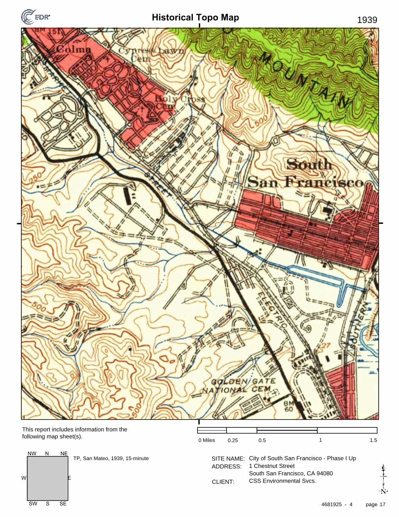
Historical Topo Map
page
SITE NAME: ADDRESS:
CLIENT:
This report includes information from the following map sheet(s).
-
EW
SW S SE
NW N NE
1939
0 Miles 0.25 0.5 1 1.5
City of South San Francisco - Phase I Update1 Chestnut StreetSouth San Francisco, CA 94080CSS Environmental Svcs.
TP, San Mateo, 1939, 15-minute
4681925 4 17

Historical Topo Map
page
SITE NAME: ADDRESS:
CLIENT:
This report includes information from the following map sheet(s).
-
EW
SW S SE
NW N NE
1915
0 Miles 0.25 0.5 1 1.5
City of South San Francisco - Phase I Update1 Chestnut StreetSouth San Francisco, CA 94080CSS Environmental Svcs.
TP, San Mateo, 1915, 15-minute
4681925 4 18
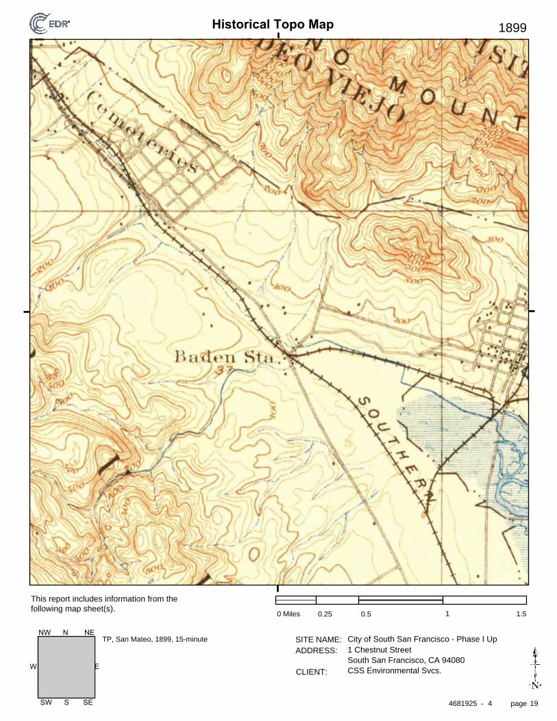
Historical Topo Map
page
SITE NAME: ADDRESS:
CLIENT:
This report includes information from the following map sheet(s).
-
EW
SW S SE
NW N NE
1899
0 Miles 0.25 0.5 1 1.5
City of South San Francisco - Phase I Update1 Chestnut StreetSouth San Francisco, CA 94080CSS Environmental Svcs.
TP, San Mateo, 1899, 15-minute
4681925 4 19

Historical Topo Map
page
SITE NAME: ADDRESS:
CLIENT:
This report includes information from the following map sheet(s).
-
EW
SW S SE
NW N NE
1896
0 Miles 0.25 0.5 1 1.5
City of South San Francisco - Phase I Update1 Chestnut StreetSouth San Francisco, CA 94080CSS Environmental Svcs.
TP, San Mateo, 1896, 15-minute
4681925 4 20

City of South San Francisco - Phase I Update
1 Chestnut StreetSouth San Francisco, CA 94080
Inquiry Number: 4681925.5July 27, 2016
The EDR-City Directory Image Report
6 Armstrong RoadShelton, CT 06484800.352.0050www.edrnet.comEnvironmental Data Resources IncEnvironmental Data Resources IncEnvironmental Data Resources IncEnvironmental Data Resources Inc

TABLE OF CONTENTS
SECTION
Executive Summary
Findings
City Directory Images
Thank you for your business. Please contact EDR at 1-800-352-0050
with any questions or comments.
Disclaimer - Copyright and Trademark Notice
This Report contains certain information obtained from a variety of public and other sources reasonably available to Environmental Data Resources, Inc. It cannot be concluded from this Report that coverage information for the target and surrounding properties does not exist from other sources. NO WARRANTY EXPRESSED OR IMPLIED, IS MADE WHATSOEVER IN CONNECTION WITH THIS REPORT. ENVIRONMENTAL DATA RESOURCES, INC. SPECIFICALLY DISCLAIMS THE MAKING OF ANY SUCH WARRANTIES, INCLUDING WITHOUT LIMITATION, MERCHANTABILITY OR FITNESS FOR A PARTICULAR USE OR PURPOSE. ALL RISK IS ASSUMED BY THE USER. IN NO EVENT SHALL ENVIRONMENTAL DATA RESOURCES, INC. BE LIABLE TO ANYONE, WHETHER ARISING OUT OF ERRORS OR OMISSIONS, NEGLIGENCE, ACCIDENT OR ANY OTHER CAUSE, FOR ANY LOSS OR DAMAGE, INCLUDING, WITHOUT LIMITATION, SPECIAL, INCIDENTAL, CONSEQUENTIAL, OR EXEMPLARY DAMAGES. ANY LIABILITY ON THE PART OF ENVIRONMENTAL DATA RESOURCES, INC. IS STRICTLY LIMITED TO A REFUND OF THE AMOUNT PAID FOR THIS REPORT. Purchaser accepts this Report "AS IS". Any analyses, estimates, ratings, environmental risk levels or risk codes provided in this Report are provided for illustrative purposes only, and are not intended to provide, nor should they be interpreted as providing any facts regarding, or prediction orforecast of, any environmental risk for any property. Only a Phase I Environmental Site Assessment performed by an environmental professional can provide information regarding the environmental risk for any property. Additionally, the information provided in this Report is not to be construed as legal advice.
Copyright 2016 by Environmental Data Resources, Inc. All rights reserved. Reproduction in any media or format, in whole or in part, of any report or map of Environmental Data Resources, Inc. or its affiliates is prohibited without prior written permission.
EDR and its logos (including Sanborn and Sanborn Map) are trademarks of Environmental Data Resources, Inc. or its affiliates. All other trademarks used herein are the property of their respective owners.

EXECUTIVE SUMMARY
DESCRIPTION
Environmental Data Resources, Inc.’s (EDR) City Directory Report is a screening tool designed to assist environmental professionals in evaluating potential liability on a target property resulting from past activities. EDR’s City Directory Report includes a search of available city directory data at 5 year intervals.
RESEARCH SUMMARY
The following research sources were consulted in the preparation of this report. A check mark indicates where information was identified in the source and provided in this report.
Year Target Street Cross Street Source
2013 Cole Information Services
2008 Cole Information Services
2003 Cole Information Services
1999 Cole Information Services
1995 Cole Information Services
1992 Cole Information Services
1985 Haines Criss-Cross Directory
1980 Haines Criss-Cross Directory
1977 Haines Criss-Cross Directory
1970 Haines Criss-Cross Directory
RECORD SOURCES
EDR is licensed to reproduce certain City Directory works by the copyright holders of those works. The purchaser of this EDR City Directory Report may include it in report(s) delivered to a customer. Reproduction of City Directories without permission of the publisher or licensed vendor may be a violation of copyright.
4681925- 5 Page 1

FINDINGS
TARGET PROPERTY STREET
1 Chestnut StreetSouth San Francisco, CA 94080
Year CD Image Source
CHESTNUT AVE
2013 pg A1 Cole Information Services
2008 pg A2 Cole Information Services
2003 pg A3 Cole Information Services
1999 pg A4 Cole Information Services
1995 pg A6 Cole Information Services
1992 pg A7 Cole Information Services
1985 pg A8 Haines Criss-Cross Directory
1985 pg A9 Haines Criss-Cross Directory
1980 pg A10 Haines Criss-Cross Directory
1977 pg A11 Haines Criss-Cross Directory
1970 pg A12 Haines Criss-Cross Directory
4681925- 5 Page 2

FINDINGS
CROSS STREETS
No Cross Streets Identified
4681925- 5 Page 3

City Directory Images

-
CHESTNUT AVE
Cole Information Services
4681925.5 Page: A1
SourceTarget Street Cross Street
2013
1 SOUTH SAN FRANCISCO FLORIST LINKS10 WELLS FARGO20 ROUND TABLE PIZZA22 WINGSTOP CHESTNUT26 CHESTNUT CLEANERS30 SAFEWAY36 TONY RAMOS
UNITED STATES GOVERNMENT40 HIS TACKLE SHOP41 CHARLOTTE LITTLEWOOD
DOUG ALLENHAROLD BRADFORDHYUN PARKL DELMONTELOUIE LAMONTOSCAR CASTILLOROBERTO CHAVEZROSALBA RODRIGUEZSHELONG YANG
65 CHIRACHAISAKUL RARINCHUAN KAIDOLORES ESPINOZAFIDEL BAUTISTAFLO TORREYJAMES HENDERSONJIE YANJOE CHANJOHN SIACOTOSLEO QUINILYDIA DELROSARIOLYDIA DUBONMAGDALENA PUQUIRREMARIA MEUSEMARTHA FLORESMIRIAM CRUZOPAL RAYASANTOS RAMOSXIAN ZHONGYA ZHAOYUAN WU
80 CITY OF SOUTH SAN FRANCISCO85 MARGARET PENA87 ALFREDO PENA89 JACINTA LEON91 SHELLY NUNEZ93 OCCUPANT UNKNOWN

-
CHESTNUT AVE
Cole Information Services
4681925.5 Page: A2
SourceTarget Street Cross Street
2008
1 ENTERPRISE RENT A CARRON PRICE MOTORS INC
10 WELLS FARGO20 BAHADUR S SHOKER
ROUND TABLE PIZZASHAHEED CORP
26 CHESTNUT CLEANERS41 DANIEL RIVERA
EDGAR GOMEZFRED DEGUZMANHYUN PARKL DELMONTELESTER REYESLUCIANO STEFANIOTTO LEMUSWAR SHEIN
45 OCCUPANT UNKNOWN65 AMI CHAND
CHUAN KAICHUNYI CHANCONSUELO DUBONCYNTHIA BORLONGANDAMIANA CASTEDOFREDERICK BAUTISTAJAMES HILLSJOHN SIACOTOSJOONG KIMKATHRYN HOLMESLYDIA DELROSARIOMARGARITA CAYLAOMARTHA FLORESMARY MORESCOMIGUEL MADRIGALNJAT LIOEROMAN FERRERROSE CARIASSANTOS RAMOSSHARON HENDERSONTEODORO RICARDOXIAN ZHONGYA ZHAO
85 FRED PENA87 ALFREDO PENA89 OCCUPANT UNKNOWN90 ALAIN ALFONSO91 MICHAEL STATE93 TIM EMERT

-
CHESTNUT AVE
Cole Information Services
4681925.5 Page: A3
SourceTarget Street Cross Street
2003
1 OCCUPANT UNKNOWNPRICE RON SUBARUPRICES USED CARSRON PRICE MOTORSRON PRICE VOLKSWAGEN
10 OCCUPANT UNKNOWNWELLS FARGO BANK
26 CHESTNUT CLEANERS30 SAFEWAY FOOD & DRUG36 OCCUPANT UNKNOWN41 ESTELA LEMUS
FRED DEGUZMANLUCIANO STEFANIMICHAEL REESEROSAURA BASSEPTSATEKI NAUFAHU
65 AGRESTI & ASSOCS INC85 FRED PENA87 ALFREDO PENA89 JOHN LEON90 ALAIN ALFONSO91 MICHAEL STATE

-
CHESTNUT AVE
Cole Information Services
4681925.5 Page: A4
SourceTarget Street Cross Street
1999
1 MAZDA SOUTH SAN FRANCISCOPRC RON VOLKSWAGEN SUBARU MAZDA FROM SAN FRANCISCPRICE RON SUBARUPRICE RON VOLKSWAGEN SUBARU MAZDARON PRICE VOLKSWAGEN SUBARU MAZDASUBARU SALES & SERVICE SOUTH SAN FRANCISCOVOLKSWAGEN AUTHORIZED DEALERS
20 ROUND TABLE PIZZA26 CHESTNUT CLEANERS30 SAFEWAY FOOD & DRUG SOUTH SAN FRANCISCO40 EUREKABANK BRANCH OFFICES41 DANIEL RIVERA
DOUG ALLENHAROLD BRADFORDHYUN PARKL DELMONTELUCIANO STEFANIOTTO LEMUSREYNO FERNANDEZ
45 OCCUPANT UNKNOWN65 AMI CHAND
CHUAN KAICHUNYI CHANCONSUELO DUBONDAMIANA CASTEDOFREDERICK BAUTISTAJAMES HILLSJOHN SIACOTOSJOONG KIMLYDIA DELROSARIOMARGARITA CAYLAOMARIA MEUSEMARTHA FLORESMARY MORESCOMIGUEL MADRIGALNJAT LIOEOPAL RAYAROMAN FERRERSANTOS RAMOSSHARON HENDERSONTEODORO RICARDOXIAN ZHONGYA ZHAO
80 CALIFORNIA WATER SERVICE COMPANY BROADMOOR COLMA &SOUTH SAN FRANCISCO CITY OF WATER SERVICE
85 SIGRID RICARD87 ALFREDO PENA89 OCCUPANT UNKNOWN90 ALAIN ALFONSO91 MICHAEL STATE

(Cont'd)
-
CHESTNUT AVE
Cole Information Services
4681925.5 Page: A5
SourceTarget Street Cross Street
1999
93 OCCUPANT UNKNOWN
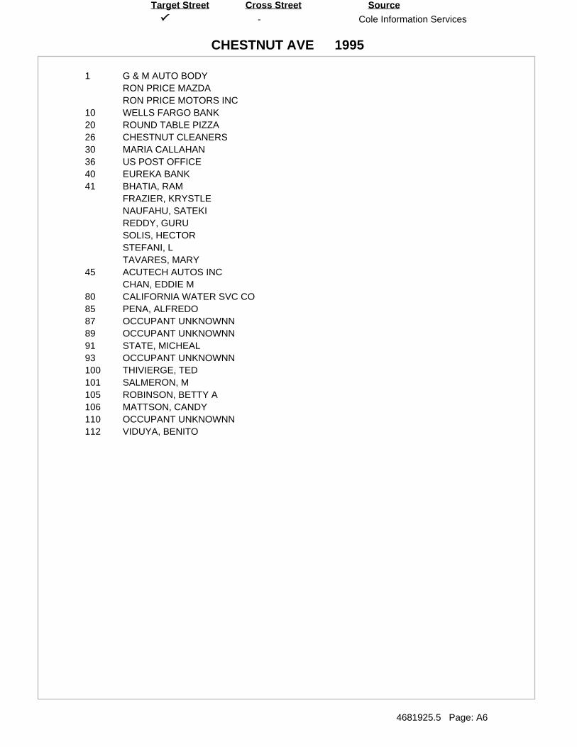
-
CHESTNUT AVE
Cole Information Services
4681925.5 Page: A6
SourceTarget Street Cross Street
1995
1 G & M AUTO BODYRON PRICE MAZDARON PRICE MOTORS INC
10 WELLS FARGO BANK20 ROUND TABLE PIZZA26 CHESTNUT CLEANERS30 MARIA CALLAHAN36 US POST OFFICE40 EUREKA BANK41 BHATIA, RAM
FRAZIER, KRYSTLENAUFAHU, SATEKIREDDY, GURUSOLIS, HECTORSTEFANI, LTAVARES, MARY
45 ACUTECH AUTOS INCCHAN, EDDIE M
80 CALIFORNIA WATER SVC CO85 PENA, ALFREDO87 OCCUPANT UNKNOWNN89 OCCUPANT UNKNOWNN91 STATE, MICHEAL93 OCCUPANT UNKNOWNN100 THIVIERGE, TED101 SALMERON, M105 ROBINSON, BETTY A106 MATTSON, CANDY110 OCCUPANT UNKNOWNN112 VIDUYA, BENITO

-
CHESTNUT AVE
Cole Information Services
4681925.5 Page: A7
SourceTarget Street Cross Street
1992
1 REGAL PRICE ATO BDYRON PRICE MAZDASUBARU SALES&SERVVOLKSWAGEN R PRICE
20 ROUND TABLE PIZZA26 CHESTNUT CLEANERS30 SAFEWAY STR36 US POSTAL SV40 EUREKABANK41 DIXON, MOSES
HERNANDEZ, LUCYSTEFANI, L
45 ACUTECH AUTOS80 SSF CTY WATER SERV85 PENA, ALFREDO93 GALLEGOS, EDUARDO100 PALOMBA, A110 HUTCHISON, RALPH J

-
CHESTNUT AVE
Haines Criss-Cross Directory
4681925.5 Page: A8
SourceTarget Street Cross Street
1985

-
CHESTNUT AVE
Haines Criss-Cross Directory
4681925.5 Page: A9
SourceTarget Street Cross Street
1985

-
CHESTNUT AVE
Haines Criss-Cross Directory
4681925.5 Page: A10
SourceTarget Street Cross Street
1980

-
CHESTNUT AVE
Haines Criss-Cross Directory
4681925.5 Page: A11
SourceTarget Street Cross Street
1977

-
CHESTNUT AVE
Haines Criss-Cross Directory
4681925.5 Page: A12
SourceTarget Street Cross Street
1970

Certified Sanborn® Map Report
Inquiry Number:
6 Armstrong Road, 4th floor Shelton, CT 06484Toll Free: 800.352.0050 www.edrnet.com
City of South San Francisco - Phase I Update
1 Chestnut Street
South San Francisco, CA 94080
July 25, 2016
4681925.3

Certified Sanborn® Map Report
Certified Sanborn Results:
Disclaimer - Copyright and Trademark Notice
EDR and its logos (including Sanborn and Sanborn Map) are trademarks of Environmental Data Resources, Inc. or its affiliates. All other trademarks used herein are the property of their respective owners.
page-
The Sanborn Library includes more than 1.2 millionfire insurance maps from Sanborn, Bromley, Perris &Browne, Hopkins, Barlow and others which trackhistorical property usage in approximately 12,000American cities and towns. Collections searched:
Library of Congress
University Publications of America
EDR Private Collection
The Sanborn Library LLC Since 1866™
Limited Permission To Make Copies
Sanborn® Library search results
Certification #
Contact:EDR Inquiry #
Site Name: Client Name:
PO #
Project
07/25/16
City of South San Francisco - Phase I UpdateCSS Environmental Svcs.1 Chestnut Street 100 Galli DriveSouth San Francisco, CA 94080 Novato, CA 94949
4681925.3 Aaron Stessman
The Sanborn Library has been searched by EDR and maps covering the target property location as provided by CSS Environmental Svcs.were identified for the years listed below. The Sanborn Library is the largest, most complete collection of fire insurance maps. The collectionincludes maps from Sanborn, Bromley, Perris & Browne, Hopkins, Barlow, and others. Only Environmental Data Resources Inc. (EDR) isauthorized to grant rights for commercial reproduction of maps by the Sanborn Library LLC, the copyright holder for the collection. Resultscan be authenticated by visiting www.edrnet.com/sanborn.
The Sanborn Library is continually enhanced with newly identified map archives. This report accesses all maps in the collection as of theday this report was generated.
A04E-4CF2-8DF8
6897
City of South San Francisco
UNMAPPED PROPERTY
This report certifies that the complete holdings of the Sanborn Library,LLC collection have been searched based on client supplied targetproperty information, and fire insurance maps covering the target propertywere not found.
Certification #: A04E-4CF2-8DF8
CSS Environmental Svcs. (the client) is permitted to make up to FIVE photocopies of this Sanborn Map transmittal and each fire insurance map accompanying thisreport solely for the limited use of its customer. No one other than the client is authorized to make copies. Upon request made directly to an EDR Account Executive,the client may be permitted to make a limited number of additional photocopies. This permission is conditioned upon compliance by the client, its customer and theiragents with EDR's copyright policy; a copy of which is available upon request.
This Report contains certain information obtained from a variety of public and other sources reasonably available to Environmental Data Resources, Inc. It cannotbe concluded from this Report that coverage information for the target and surrounding properties does not exist from other sources. NO WARRANTYEXPRESSED OR IMPLIED, IS MADE WHATSOEVER IN CONNECTION WITH THIS REPORT. ENVIRONMENTAL DATA RESOURCES, INC. SPECIFICALLYDISCLAIMS THE MAKING OF ANY SUCH WARRANTIES, INCLUDING WITHOUT LIMITATION, MERCHANTABILITY OR FITNESS FOR A PARTICULAR USEOR PURPOSE. ALL RISK IS ASSUMED BY THE USER. IN NO EVENT SHALL ENVIRONMENTAL DATA RESOURCES, INC. BE LIABLE TO ANYONE,WHETHER ARISING OUT OF ERRORS OR OMISSIONS, NEGLIGENCE, ACCIDENT OR ANY OTHER CAUSE, FOR ANY LOSS OF DAMAGE, INCLUDING,WITHOUT LIMITATION, SPECIAL, INCIDENTAL, CONSEQUENTIAL, OR EXEMPLARY DAMAGES. ANY LIABILITY ON THE PART OF ENVIRONMENTALDATA RESOURCES, INC. IS STRICTLY LIMITED TO A REFUND OF THE AMOUNT PAID FOR THIS REPORT. Purchaser accepts this Report "AS IS". Anyanalyses, estimates, ratings, environmental risk levels or risk codes provided in this Report are provided for illustrative purposes only, and are not intended toprovide, nor should they be interpreted as providing any facts regarding, or prediction or forecast of, any environmental risk for any property. Only a Phase IEnvironmental Site Assessment performed by an environmental professional can provide information regarding the environmental risk for any property.Additionally, the information provided in this Report is not to be construed as legal advice.
Copyright 2016 by Environmental Data Resources, Inc. All rights reserved. Reproduction in any media or format, in whole or in part, of any report or map ofEnvironmental Data Resources, Inc., or its affiliates, is prohibited without prior written permission.
4681925 3 2
APPENDIX C
EDR Radius Map™ Report

FORM-LBC-CHM
®kcehCoeG htiw tropeR ™paM suidaR RDE ehT
6 Armstrong Road, 4th floorShelton, CT 06484Toll Free: 800.352.0050www.edrnet.com
City of South San Francisco - Phase I Update1 Chestnut StreetSouth San Francisco, CA 94080
Inquiry Number: 4681925.2sJuly 22, 2016

SECTION PAGE
Executive Summary ES1
Overview Map 2
Detail Map 3
Map Findings Summary 4
Map Findings 8
Orphan Summary 185
Government Records Searched/Data Currency Tracking GR-1
GEOCHECK ADDENDUM
Physical Setting Source Addendum A-1
Physical Setting Source Summary A-2
Physical Setting SSURGO Soil Map A-6
Physical Setting Source Map A-9
Physical Setting Source Map Findings A-11
Physical Setting Source Records Searched PSGR-1
TC4681925.2s Page 1
Thank you for your business.Please contact EDR at 1-800-352-0050
with any questions or comments.
Disclaimer - Copyright and Trademark Notice
This Report contains certain information obtained from a variety of public and other sources reasonably available to Environmental DataResources, Inc. It cannot be concluded from this Report that coverage information for the target and surrounding properties does not exist fromother sources. NO WARRANTY EXPRESSED OR IMPLIED, IS MADE WHATSOEVER IN CONNECTION WITH THIS REPORT. ENVIRONMENTALDATA RESOURCES, INC. SPECIFICALLY DISCLAIMS THE MAKING OF ANY SUCH WARRANTIES, INCLUDING WITHOUT LIMITATION,MERCHANTABILITY OR FITNESS FOR A PARTICULAR USE OR PURPOSE. ALL RISK IS ASSUMED BY THE USER. IN NO EVENT SHALLENVIRONMENTAL DATA RESOURCES, INC. BE LIABLE TO ANYONE, WHETHER ARISING OUT OF ERRORS OR OMISSIONS, NEGLIGENCE,ACCIDENT OR ANY OTHER CAUSE, FOR ANY LOSS OF DAMAGE, INCLUDING, WITHOUT LIMITATION, SPECIAL, INCIDENTAL,CONSEQUENTIAL, OR EXEMPLARY DAMAGES. ANY LIABILITY ON THE PART OF ENVIRONMENTAL DATA RESOURCES, INC. IS STRICTLYLIMITED TO A REFUND OF THE AMOUNT PAID FOR THIS REPORT. Purchaser accepts this Report "AS IS". Any analyses, estimates, ratings,environmental risk levels or risk codes provided in this Report are provided for illustrative purposes only, and are not intended to provide, norshould they be interpreted as providing any facts regarding, or prediction or forecast of, any environmental risk for any property. Only a Phase IEnvironmental Site Assessment performed by an environmental professional can provide information regarding the environmental risk for anyproperty. Additionally, the information provided in this Report is not to be construed as legal advice.
Copyright 2016 by Environmental Data Resources, Inc. All rights reserved. Reproduction in any media or format, in wholeor in part, of any report or map of Environmental Data Resources, Inc., or its affiliates, is prohibited without prior written permission.
EDR and its logos (including Sanborn and Sanborn Map) are trademarks of Environmental Data Resources, Inc. or its affiliates. All othertrademarks used herein are the property of their respective owners.
TABLE OF CONTENTS

EXECUTIVE SUMMARY
TC4681925.2s EXECUTIVE SUMMARY 1
A search of available environmental records was conducted by Environmental Data Resources, Inc (EDR).The report was designed to assist parties seeking to meet the search requirements of EPA’s Standardsand Practices for All Appropriate Inquiries (40 CFR Part 312), the ASTM Standard Practice forEnvironmental Site Assessments (E 1527-13) or custom requirements developed for the evaluation ofenvironmental risk associated with a parcel of real estate.
TARGET PROPERTY INFORMATION
ADDRESS
1 CHESTNUT STREETSOUTH SAN FRANCISCO, CA 94080
COORDINATES
37.6584400 - 37˚ 39’ 30.38’’Latitude (North): 122.4364740 - 122˚ 26’ 11.30’’Longitude (West): Zone 10Universal Tranverse Mercator: 549706.1UTM X (Meters): 4167863.8UTM Y (Meters): 43 ft. above sea levelElevation:
USGS TOPOGRAPHIC MAP ASSOCIATED WITH TARGET PROPERTY
5641126 SAN FRANCISCO SOUTH, CATarget Property Map:2012Version Date:
AERIAL PHOTOGRAPHY IN THIS REPORT
20140608Portions of Photo from:USDASource:

4681925.2s Page 2
E39 CHEVRON STATION 9038 1 WESTBOROUGH BLVD RCRA NonGen / NLR, HAZNET Higher 349, 0.066, SSE
E38 ROTOMETALS INC 980-82 HARRISON ENVIROSTOR Higher 342, 0.065, SSE
G37 MY CLEANERS 1053F EL CAMINO LUST, SLIC, FINDS, San Mateo Co. BI, EMI, ECHO Higher 324, 0.061, SSE
G36 1053 EL CAMINO REAL EDR Hist Cleaner Higher 324, 0.061, SSE
G35 KRAGEN AUTO PARTS ST 1059 EL CAMINO REAL San Mateo Co. BI, HAZNET Higher 323, 0.061, SSE
E34 SOUTH CITY CAR WASH 988 EL CAMINO REAL San Mateo Co. BI Higher 303, 0.057, SSE
F33 KAISER PERMANENTE ME 1200 EL CAMINO REAL RCRA-LQG, HIST UST, FINDS, San Mateo Co. BI, EMI,... Higher 302, 0.057, SW
F32 KAISER HOSPITAL 1200 EL CAMINO REAL UST Higher 302, 0.057, SW
F31 KAISER FOUNDATION HO 1200 EL CAMINO REAL CA FID UST Higher 302, 0.057, SW
F30 KAISER HOSPITAL 1200 EL CAMINO REAL SWEEPS UST Higher 302, 0.057, SW
C29 SAFEWAY STORE #777 30 CHESTNUT San Mateo Co. BI Lower 282, 0.053, ESE
C28 26 CHESTNUT AVE EDR Hist Cleaner Lower 271, 0.051, ESE
C27 CHESTNUT CLEANERS 26 CHESTNUT San Mateo Co. BI, HAZNET Lower 271, 0.051, ESE
C26 CHESTNUT CLEANERS 26 CHESTNUT AVENUE RCRA-SQG, FINDS, DRYCLEANERS, EMI, ECHO Lower 271, 0.051, ESE
E25 998 EL CAMINO REAL EDR Hist Auto Higher 269, 0.051, SSE
E24 SOUTH CITY GAS & AUT 998 EL CAMINO REAL HIST UST, CA FID UST, San Mateo Co. BI Higher 269, 0.051, SSE
E23 UNION OIL SERVICE ST 998 EL CAMINO REAL SWEEPS UST Higher 269, 0.051, SSE
E22 SOUTH CITY GAS 998 EL CAMINO REAL UST Higher 269, 0.051, SSE
D21 1086 GRAND AVE EDR Hist Auto Higher 181, 0.034, North
D20 LOUISE BRUSCO 1086 GRAND AVE LUST, HAZNET Higher 181, 0.034, North
D19 GINO’S AUTOMOTIVE 1086 GRAND AVE CA FID UST Higher 181, 0.034, North
D18 GRAND AVENUE OLYMPIA 1086 GRAND San Mateo Co. BI Higher 181, 0.034, North
D17 MOBIL SERVICE STATIO 1086 GRAND AVE HIST UST Higher 181, 0.034, North
D16 GINO’S AUTOMOTIVE 1086 GRAND AVE LUST, SWEEPS UST Higher 181, 0.034, North
D15 CONTRERAS PAINTING 1090 GRAND LUST, SLIC, San Mateo Co. BI Higher 141, 0.027, NNW
C14 AUTO STUDIO 45 CHESTNUT CA FID UST Lower 94, 0.018, SE
C13 AUTO STUDIO 45 CHESTNUT HIST UST Lower 94, 0.018, SE
C12 AUTO STUDIO 45 CHESTNUT SWEEPS UST, San Mateo Co. BI Lower 94, 0.018, SE
C11 ACUTEC AUTOS 45 CHESTNUT AVENUE LUST, HIST CORTESE Lower 94, 0.018, SE
B10 BART CHESTNUT AVENUE 995 ANTOINETTE San Mateo Co. BI Lower 14, 0.003, SE
B9 FORZA TELECOM-PH8 CH 955 ANTOINETTE LANE EMI Lower 1 ft.
A8 1 CHESTNUT AVE EDR Hist Auto TP
A7 RON PRICE MOTORS 1 CHESTNUT AVE HAZNET TP
A6 RON PRICE 1 CHESTNUT AVE SWEEPS UST, HIST UST, RCRA NonGen / NLR, FINDS,... TP
A5 RON PRICE MOTORS 1 CHESTNUT LUST, CA FID UST, San Mateo Co. BI, HIST CORTESE TP
A4 1 CHESTNUT AVE CHMIRS TP
A3 RON PRICE MOTORS 1 CHESTNUT AVE RGA LUST TP
A2 RON PRICE MOTORS 1 CHESTNUT RGA LUST TP
A1 RON PRICE MOTORS 1 CHESTNUT RGA LUST TP
MAPPED SITES SUMMARY
Target Property Address:1 CHESTNUT STREETSOUTH SAN FRANCISCO, CA 94080
Click on Map ID to see full detail.
MAP RELATIVE DIST (ft. & mi.)ID DATABASE ACRONYMS ELEVATION DIRECTIONSITE NAME ADDRESS

4681925.2s Page 3
N78 RON DUPRATT FORD 132 NORTH FIRST STRE Notify 65 Higher 1075, 0.204, SE
Q77 PG&E: LAWNDALE SUBST OFF EL CAMINO REAL, San Mateo Co. BI Higher 1059, 0.201, SSE
P76 T CERRUTI & CO 150 OAK San Mateo Co. BI Higher 1055, 0.200, ENE
P75 OAK FARM LTD 150 OAK AVE SWEEPS UST Higher 1055, 0.200, ENE
N74 STAN THE ROOF MAN IN 103 1ST ST LUST, HIST UST, HIST CORTESE Higher 1033, 0.196, SE
N73 STAN THE ROOF MAN 103 1ST LUST, SWEEPS UST, San Mateo Co. BI Higher 1033, 0.196, SE
N72 A 1 CONVERTER 101 1ST San Mateo Co. BI Higher 1033, 0.196, SE
N71 GREG LEONARDS GARAGE 107 1ST San Mateo Co. BI Higher 1032, 0.195, SE
N70 DALAND BODY SHOP INC 15-17 FIRST San Mateo Co. BI Higher 1025, 0.194, SSE
69 TONI AMBUS, D.D.S. 100 ARROYO San Mateo Co. BI Higher 1022, 0.194, SSW
N68 ALL TRANSMISSIONS 66 A San Mateo Co. BI Higher 984, 0.186, SE
O67 JUNIPERO SERRA NURSE 125 CHESTNUT AVENUE HIST UST Higher 973, 0.184, East
O66 FINLEY CONSTRUCTION 125 CHESTNUT LUST, HIST CORTESE Higher 973, 0.184, East
N65 MOTT & ALLEN 49-A MOSS ST RCRA NonGen / NLR Lower 956, 0.181, SE
M64 T MOBILE WEST CORPOR 91 WESTBOROUGH San Mateo Co. BI Higher 906, 0.172, South
L63 ESTATE OF FRANK GIGL 932 EL CAMINO REAL San Mateo Co. BI, HAZNET Lower 780, 0.148, SE
L62 CHEVRON, FORMER STAN 972 EL CAMINO REAL LUST Lower 598, 0.113, SE
K61 MUNICIPAL SERVICES B 33 ARROYO HIST UST Higher 593, 0.112, South
K60 CITY OF SSF FIRE STA 33 ARROYO San Mateo Co. BI Higher 593, 0.112, South
K59 MUNICIPAL SERVICES B 33 ARROYO DR SWEEPS UST Higher 593, 0.112, South
J58 FIELD OFFICE 80 CHESTNUT AVENUE HIST UST, CA FID UST Lower 586, 0.111, ESE
J57 CALIFORNIA WATER SER 80 CHESTNUT AVE SWEEPS UST Lower 586, 0.111, ESE
J56 CALIFORNIA WATER SER 80 CHESTNUT San Mateo Co. BI Lower 586, 0.111, ESE
55 HILLS OF ETERNITY ME 1299 EL CAMINO REAL San Mateo Co. BI, NPDES Higher 582, 0.110, West
I54 CHEVRON 9-1626 1198 OLD MISSION LUST Higher 497, 0.094, NNW
I53 7-ELEVEN INC. STORE 1136 MISSION San Mateo Co. BI Higher 458, 0.087, NNW
E52 PACIFIC BELL 965 EL CAMINO REAL RCRA-SQG, FINDS, ECHO Higher 448, 0.085, SSE
I51 JOHN R. DOLLARD, D.D 1135 MISSION San Mateo Co. BI Higher 431, 0.082, NNW
F50 WESTMED AMBULANCE 1165 EL CAMINO REAL San Mateo Co. BI Higher 410, 0.078, SSW
F49 NORGE VILLAGE CLEARN 1155 EL CAMINO REAL LUST Higher 391, 0.074, SSW
F48 NORGE VILLAGE CLEANE 1155 EL CAMINO REAL SLIC Higher 391, 0.074, SSW
H47 GRAND AUTO INC 1103 EL CAMINO REAL San Mateo Co. BI Higher 359, 0.068, South
H46 1121 EL CAMINO REAL EDR Hist Cleaner Higher 355, 0.067, South
H45 CARRIAGE CLEANERS 1121 EL CAMINO REAL LUST, SLIC, San Mateo Co. BI, DRYCLEANERS, EMI Higher 355, 0.067, South
E44 WESTBOROUGH CHEVRON 1 WESTBOROUGH BLVD SWEEPS UST Higher 349, 0.066, SSE
E43 WESTBOROUGH KWIK SER 1 WESTBOROUGH San Mateo Co. BI Higher 349, 0.066, SSE
E42 90381 1 WESTBOROUGH BLVD HIST UST Higher 349, 0.066, SSE
E41 WESTBOROUGH CHEVRON 1 WESTBOROUGH BLVD CA FID UST Higher 349, 0.066, SSE
E40 1 WESTBOROUGH BLVD EDR Hist Auto Higher 349, 0.066, SSE
MAPPED SITES SUMMARY
Target Property Address:1 CHESTNUT STREETSOUTH SAN FRANCISCO, CA 94080
Click on Map ID to see full detail.
MAP RELATIVE DIST (ft. & mi.)ID DATABASE ACRONYMS ELEVATION DIRECTIONSITE NAME ADDRESS

4681925.2s Page 4
Y117 DELANO NURSERY 541 CHESTNUT LUST, SLIC, HIST UST, HIST CORTESE Higher 2542, 0.481, NE
Y116 SILVER TERRACE NURSE 525 CHESTNUT LUST, SLIC, HIST CORTESE Higher 2388, 0.452, NE
U115 CITY GARAGE 736 TENNIS DR LUST, SWEEPS UST Lower 2309, 0.437, ESE
U114 SOUTH SAN FRANCISCO 736 TENNIS LUST, HIST CORTESE Lower 2309, 0.437, ESE
113 MANTEGANI SITE 735 COMMERCIAL AVENU ENVIROSTOR, SLIC, VCP Lower 2291, 0.434, ESE
X112 HILLSIDE BOULEVARD E UNKNOWN HILLSIDE BLV SLIC Lower 2285, 0.433, ESE
X111 SFIA - SAN FRANCISCO MCDONNELL RD & ROAD SLIC Lower 2285, 0.433, ESE
X110 SFIA - SHELL OIL SFO SFO, SOUTH FRONTAGE SLIC Lower 2285, 0.433, ESE
X109 (FORMER US STEEL FAC CROSS OYSTER POINT @ SLIC, DEED Lower 2285, 0.433, ESE
W108 MCLELLAN NURSERY 1450 EL CAMINO REAL HIST CORTESE Higher 2279, 0.432, NW
W107 MCLELLAN NURSERY 1450 EL CAMINO RL LUST Higher 2279, 0.432, NW
V106 CHEVRON 9-0248 687 EL CAMINO REAL LUST Higher 2266, 0.429, SSE
V105 CHEVRON 9-0248 687 EL CAMINO REAL LUST, HIST CORTESE Higher 2266, 0.429, SSE
V104 CHEVRON 9-5669 698 EL CAMINO REAL LUST, HIST UST Higher 2174, 0.412, SSE
V103 CHEVRON 9-5669 698 EL CAMINO REAL LUST, SWEEPS UST, San Mateo Co. BI Higher 2174, 0.412, SSE
V102 CHEVRON 698 EL CAMINO REAL HIST CORTESE Higher 2174, 0.412, SSE
V101 SHELL SERVICE 710 EL CAMINO REAL LUST, San Mateo Co. BI, HAZNET Higher 2097, 0.397, SSE
V100 SHELL OIL CO 710 EL CAMINO RCRA-SQG, FINDS, HIST CORTESE, ECHO Higher 2097, 0.397, SSE
V99 EL CAMINO/ORANGE 710 EL CAMINO REAL LUST, HIST UST Higher 2097, 0.397, SSE
U98 PARCELS NORTHWEST OF 781 TENNIS DRIVE LUST, SLIC Lower 2044, 0.387, ESE
S97 SAN FRANCISCO GARDEN 1400 EL CAMINO REAL LUST, San Mateo Co. BI Higher 1387, 0.263, WNW
T96 WEST ORANGE LIBRARY 840 WEST ORANGE AVEN LUST Higher 1331, 0.252, South
T95 SSF WEST ORANGE LIBR 840 ORANGE LUST, San Mateo Co. BI Higher 1331, 0.252, South
T94 WEST ORANGE LIBRARY 840 W ORANGE AVE LUST, HAZNET Higher 1331, 0.252, South
P93 UCCELL, GEORGE 919 GRAND AVE San Mateo Co. BI Higher 1290, 0.244, ENE
T92 CALIFORNIA GOLF CLUB 844 WEST ORANGE AVEN LUST Higher 1258, 0.238, South
T91 CALIFORNIA GOLF CLUB 844 ORANGE LUST, San Mateo Co. BI Higher 1258, 0.238, South
T90 CALIFORNIA GOLF CLUB 844 W ORANGE AVE LUST, HIST UST Higher 1258, 0.238, South
T89 CALIFORNIA GOLF CARS 1515 E WASHINGTON RCRA-SQG, SWEEPS UST, FINDS, HIST CORTESE, ECHO Higher 1258, 0.238, South
T88 CALIFORNIA GOLF CLUB 844 W ORANGE AVE CA FID UST Higher 1258, 0.238, South
N87 DAYTONA AUTO BODY SH 136 A S LINDEN AVE RCRA-SQG Higher 1222, 0.231, SE
S86 BROADMOOR LUMBER AND 1350 EL CAMINO REAL LUST, HIST CORTESE, NPDES Higher 1199, 0.227, WNW
S85 BROADMOOR LUMBER COR 1350 EL CAMINO REAL LUST, SWEEPS UST, HIST UST, San Mateo Co. BI Higher 1199, 0.227, WNW
S84 BROADMOOR LUMBER COM 1350 EL CAMINO REAL CA FID UST Higher 1199, 0.227, WNW
R83 91626 1198 OLD MISSION RD HIST UST Higher 1182, 0.224, NW
R82 CHEVRON 9-1626 1198 OLD MISSION LUST, HIST CORTESE Higher 1182, 0.224, NW
Q81 JIM GRIFFIN & SON BR 872 EL CAMINO REAL San Mateo Co. BI Higher 1172, 0.222, SSE
M80 CLUB VIEW 849 ORANGE San Mateo Co. BI Higher 1128, 0.214, South
Q79 DALAND BODY SHOP 890 EL CAMINO REAL RCRA-SQG, FINDS, San Mateo Co. BI, EMI, ECHO Higher 1087, 0.206, SSE
MAPPED SITES SUMMARY
Target Property Address:1 CHESTNUT STREETSOUTH SAN FRANCISCO, CA 94080
Click on Map ID to see full detail.
MAP RELATIVE DIST (ft. & mi.)ID DATABASE ACRONYMS ELEVATION DIRECTIONSITE NAME ADDRESS

4681925.2s Page 5
122 TY’S ELECTRIC, INC. 440 NORTH FIRST STRE Notify 65 Lower 5199, 0.985, ESE
Z121 GUY F ATKINSON COMPA 10 ORANGE HIST CORTESE Lower 2637, 0.499, ESE
Z120 GUY F ATKINSON COMPA 10 ORANGE LUST, San Mateo Co. BI Lower 2637, 0.499, ESE
Z119 GUY F. ATKINSON CO. 10 W ORANGE AVE LUST Lower 2577, 0.488, ESE
Y118 DELANO NURSERY 541 CHESTNUT LUST, San Mateo Co. BI Higher 2542, 0.481, NE
MAPPED SITES SUMMARY
Target Property Address:1 CHESTNUT STREETSOUTH SAN FRANCISCO, CA 94080
Click on Map ID to see full detail.
MAP RELATIVE DIST (ft. & mi.)ID DATABASE ACRONYMS ELEVATION DIRECTIONSITE NAME ADDRESS

EXECUTIVE SUMMARY
TC4681925.2s EXECUTIVE SUMMARY 6
TARGET PROPERTY SEARCH RESULTS
The target property was identified in the following records. For more information on thisproperty see page 8 of the attached EDR Radius Map report:
EPA IDDatabase(s)Site
RON PRICE MOTORS1 CHESTNUTS SAN FRANCISCO, CA
N/ARGA LUST
RON PRICE MOTORS1 CHESTNUTSOUTH SAN FRANCISCO, CA
N/ARGA LUST
RON PRICE MOTORS1 CHESTNUT AVESOUTH SAN FRANCISCO, CA
N/ARGA LUST
1 CHESTNUT AVE1 CHESTNUT AVESOUTH SAN FRANCISCO, CA
N/ACHMIRSOES Incident Number: 6-5030
RON PRICE MOTORS1 CHESTNUTSOUTH SAN FRANCISCO, CA 94080
N/ALUSTStatus: Completed - Case ClosedFacility Status: Case ClosedFacility Id: 550087Facility Status: 9- Case ClosedGlobal Id: T0608100429Global ID: T0608100429date9: 1/8/1996
CA FID USTFacility Id: 41000430Status: I
San Mateo Co. BIFacility Id: FA0017760
HIST CORTESEReg Id: 41-0453
RON PRICE1 CHESTNUT AVESOUTH SAN FRANCISCO, CA 94080
CAD981441959SWEEPS USTComp Number: 550102
HIST USTFacility Id: 00000010403
RCRA NonGen / NLREPA ID:: CAD981441959
FINDSRegistry ID:: 110002707027
ECHO
RON PRICE MOTORS1 CHESTNUT AVESO. SAN FRANCISCO, CA 94080
N/AHAZNET

EXECUTIVE SUMMARY
TC4681925.2s EXECUTIVE SUMMARY 7
GEPAID: CAD132029687
1 CHESTNUT AVE1 CHESTNUT AVESOUTH SAN FRANCISCO, CA 94080
N/AEDR Hist Auto
DATABASES WITH NO MAPPED SITES
No mapped sites were found in EDR’s search of available ("reasonably ascertainable ") governmentrecords either on the target property or within the search radius around the target property for thefollowing databases:
STANDARD ENVIRONMENTAL RECORDS
Federal NPL site list
NPL National Priority ListProposed NPL Proposed National Priority List SitesNPL LIENS Federal Superfund Liens
Federal Delisted NPL site list
Delisted NPL National Priority List Deletions
Federal CERCLIS list
FEDERAL FACILITY Federal Facility Site Information listingSEMS Superfund Enterprise Management System
Federal CERCLIS NFRAP site list
SEMS-ARCHIVE Superfund Enterprise Management System Archive
Federal RCRA CORRACTS facilities list
CORRACTS Corrective Action Report
Federal RCRA non-CORRACTS TSD facilities list
RCRA-TSDF RCRA - Treatment, Storage and Disposal
Federal RCRA generators list
RCRA-CESQG RCRA - Conditionally Exempt Small Quantity Generator
Federal institutional controls / engineering controls registries
LUCIS Land Use Control Information System

EXECUTIVE SUMMARY
TC4681925.2s EXECUTIVE SUMMARY 8
US ENG CONTROLS Engineering Controls Sites ListUS INST CONTROL Sites with Institutional Controls
Federal ERNS list
ERNS Emergency Response Notification System
State- and tribal - equivalent NPL
RESPONSE State Response Sites
State and tribal landfill and/or solid waste disposal site lists
SWF/LF Solid Waste Information System
State and tribal leaking storage tank lists
INDIAN LUST Leaking Underground Storage Tanks on Indian Land
State and tribal registered storage tank lists
FEMA UST Underground Storage Tank ListingAST Aboveground Petroleum Storage Tank FacilitiesINDIAN UST Underground Storage Tanks on Indian Land
State and tribal voluntary cleanup sites
INDIAN VCP Voluntary Cleanup Priority Listing
State and tribal Brownfields sites
BROWNFIELDS Considered Brownfieds Sites Listing
ADDITIONAL ENVIRONMENTAL RECORDS
Local Brownfield lists
US BROWNFIELDS A Listing of Brownfields Sites
Local Lists of Landfill / Solid Waste Disposal Sites
WMUDS/SWAT Waste Management Unit DatabaseSWRCY Recycler DatabaseHAULERS Registered Waste Tire Haulers ListingINDIAN ODI Report on the Status of Open Dumps on Indian LandsDEBRIS REGION 9 Torres Martinez Reservation Illegal Dump Site LocationsODI Open Dump Inventory
Local Lists of Hazardous waste / Contaminated Sites
US HIST CDL Delisted National Clandestine Laboratory RegisterHIST Cal-Sites Historical Calsites DatabaseSCH School Property Evaluation ProgramCDL Clandestine Drug Labs

EXECUTIVE SUMMARY
TC4681925.2s EXECUTIVE SUMMARY 9
Toxic Pits Toxic Pits Cleanup Act SitesUS CDL National Clandestine Laboratory Register
Local Land Records
LIENS Environmental Liens ListingLIENS 2 CERCLA Lien Information
Records of Emergency Release Reports
HMIRS Hazardous Materials Information Reporting SystemLDS Land Disposal Sites ListingMCS Military Cleanup Sites ListingSPILLS 90 SPILLS 90 data from FirstSearch
Other Ascertainable Records
FUDS Formerly Used Defense SitesDOD Department of Defense SitesSCRD DRYCLEANERS State Coalition for Remediation of Drycleaners ListingUS FIN ASSUR Financial Assurance InformationEPA WATCH LIST EPA WATCH LIST2020 COR ACTION 2020 Corrective Action Program ListTSCA Toxic Substances Control ActTRIS Toxic Chemical Release Inventory SystemSSTS Section 7 Tracking SystemsROD Records Of DecisionRMP Risk Management PlansRAATS RCRA Administrative Action Tracking SystemPRP Potentially Responsible PartiesPADS PCB Activity Database SystemICIS Integrated Compliance Information SystemFTTS FIFRA/ TSCA Tracking System - FIFRA (Federal Insecticide, Fungicide, & Rodenticide Act)/TSCA (Toxic Substances Control Act)MLTS Material Licensing Tracking SystemCOAL ASH DOE Steam-Electric Plant Operation DataCOAL ASH EPA Coal Combustion Residues Surface Impoundments ListPCB TRANSFORMER PCB Transformer Registration DatabaseRADINFO Radiation Information DatabaseHIST FTTS FIFRA/TSCA Tracking System Administrative Case ListingDOT OPS Incident and Accident DataCONSENT Superfund (CERCLA) Consent DecreesINDIAN RESERV Indian ReservationsFUSRAP Formerly Utilized Sites Remedial Action ProgramUMTRA Uranium Mill Tailings SitesLEAD SMELTERS Lead Smelter SitesUS AIRS Aerometric Information Retrieval System Facility SubsystemUS MINES Mines Master Index FileUXO Unexploded Ordnance SitesDOCKET HWC Hazardous Waste Compliance Docket ListingCA BOND EXP. PLAN Bond Expenditure PlanCortese "Cortese" Hazardous Waste & Substances Sites ListCUPA Listings CUPA Resources ListENF Enforcement Action ListingFinancial Assurance Financial Assurance Information Listing

EXECUTIVE SUMMARY
TC4681925.2s EXECUTIVE SUMMARY 10
HWP EnviroStor Permitted Facilities ListingHWT Registered Hazardous Waste Transporter DatabaseMINES Mines Site Location ListingMWMP Medical Waste Management Program ListingNPDES NPDES Permits ListingPEST LIC Pesticide Regulation Licenses ListingPROC Certified Processors DatabaseUIC UIC ListingWASTEWATER PITS Oil Wastewater Pits ListingWDS Waste Discharge SystemWIP Well Investigation Program Case ListFUELS PROGRAM EPA Fuels Program Registered Listing
EDR HIGH RISK HISTORICAL RECORDS
EDR Exclusive Records
EDR MGP EDR Proprietary Manufactured Gas Plants
EDR RECOVERED GOVERNMENT ARCHIVES
Exclusive Recovered Govt. Archives
RGA LF Recovered Government Archive Solid Waste Facilities List
SURROUNDING SITES: SEARCH RESULTS
Surrounding sites were identified in the following databases.
Elevations have been determined from the USGS Digital Elevation Model and should be evaluated ona relative (not an absolute) basis. Relative elevation information between sites of close proximityshould be field verified. Sites with an elevation equal to or higher than the target property have beendifferentiated below from sites with an elevation lower than the target property.Page numbers and map identification numbers refer to the EDR Radius Map report where detaileddata on individual sites can be reviewed.
Sites listed in bold italics are in multiple databases.
Unmappable (orphan) sites are not considered in the foregoing analysis.
STANDARD ENVIRONMENTAL RECORDS
Federal RCRA generators list
RCRA-LQG: RCRAInfo is EPA’s comprehensive information system, providing access to data supportingthe Resource Conservation and Recovery Act (RCRA) of 1976 and the Hazardous and Solid Waste Amendments (HSWA)of 1984. The database includes selective information on sites which generate, transport, store, treat and/ordispose of hazardous waste as defined by the Resource Conservation and Recovery Act (RCRA). Large quantitygenerators (LQGs) generate over 1,000 kilograms (kg) of hazardous waste, or over 1 kg of acutely hazardouswaste per month.
A review of the RCRA-LQG list, as provided by EDR, and dated 12/09/2015 has revealed that there is 1
EXECUTIVE SUMMARY
TC4681925.2s EXECUTIVE SUMMARY 11
RCRA-LQG site within approximately 0.25 miles of the target property.
PageMap IDDirection / Distance Address Equal/Higher Elevation ____________________ ________ ___________________ _____ _____
KAISER PERMANENTE ME 1200 EL CAMINO REAL SW 0 - 1/8 (0.057 mi.) F33 48
RCRA-SQG: RCRAInfo is EPA’s comprehensive information system, providing access to data supportingthe Resource Conservation and Recovery Act (RCRA) of 1976 and the Hazardous and Solid Waste Amendments (HSWA)of 1984. The database includes selective information on sites which generate, transport, store, treat and/ordispose of hazardous waste as defined by the Resource Conservation and Recovery Act (RCRA). Small quantitygenerators (SQGs) generate between 100 kg and 1,000 kg of hazardous waste per month.
A review of the RCRA-SQG list, as provided by EDR, and dated 12/09/2015 has revealed that there are 5 RCRA-SQG sites within approximately 0.25 miles of the target property.
PageMap IDDirection / Distance Address Equal/Higher Elevation ____________________ ________ ___________________ _____ _____
PACIFIC BELL 965 EL CAMINO REAL SSE 0 - 1/8 (0.085 mi.) E52 83 DALAND BODY SHOP 890 EL CAMINO REAL SSE 1/8 - 1/4 (0.206 mi.) Q79 108 DAYTONA AUTO BODY SH 136 A S LINDEN AVE SE 1/8 - 1/4 (0.231 mi.) N87 127 CALIFORNIA GOLF CARS 1515 E WASHINGTON S 1/8 - 1/4 (0.238 mi.) T89 129
PageMap IDDirection / Distance Address Lower Elevation ____________________ ________ ___________________ _____ _____
CHESTNUT CLEANERS 26 CHESTNUT AVENUE ESE 0 - 1/8 (0.051 mi.) C26 36
State- and tribal - equivalent CERCLIS
ENVIROSTOR: The Department of Toxic Substances Control’s (DTSC’s) Site Mitigation and BrownfieldsReuse Program’s (SMBRP’s) EnviroStor database identifes sites that have known contamination or sites for whichthere may be reasons to investigate further. The database includes the following site types: FederalSuperfund sites (National Priorities List (NPL)); State Response, including Military Facilities and StateSuperfund; Voluntary Cleanup; and School sites. EnviroStor provides similar information to the informationthat was available in CalSites, and provides additional site information, including, but not limited to,identification of formerly-contaminated properties that have been released for reuse, properties whereenvironmental deed restrictions have been recorded to prevent inappropriate land uses, and riskcharacterization information that is used to assess potential impacts to public health and the environment atcontaminated sites.
A review of the ENVIROSTOR list, as provided by EDR, and dated 05/02/2016 has revealed that there are 2 ENVIROSTOR sites within approximately 1 mile of the target property.
PageMap IDDirection / Distance Address Equal/Higher Elevation ____________________ ________ ___________________ _____ _____
ROTOMETALS INC 980-82 HARRISON SSE 0 - 1/8 (0.065 mi.) E38 69Facility Id: 38330089Status: No Further Action
PageMap IDDirection / Distance Address Lower Elevation ____________________ ________ ___________________ _____ _____
MANTEGANI SITE 735 COMMERCIAL AVENU ESE 1/4 - 1/2 (0.434 mi.) 113 163Facility Id: 70000073Status: Certified

EXECUTIVE SUMMARY
TC4681925.2s EXECUTIVE SUMMARY 12
State and tribal leaking storage tank lists
LUST: The Leaking Underground Storage Tank Incident Reports contain an inventory of reportedleaking underground storage tank incidents. The data come from the State Water Resources Control Board LeakingUnderground Storage Tank Information System.
A review of the LUST list, as provided by EDR, and dated 03/14/2016 has revealed that there are 37 LUST sites within approximately 0.5 miles of the target property.
PageMap IDDirection / Distance Address Equal/Higher Elevation ____________________ ________ ___________________ _____ _____
CONTRERAS PAINTING 1090 GRAND NNW 0 - 1/8 (0.027 mi.) D15 23Facility Id: 559177Facility Status: 9- Case ClosedGlobal ID: T0608106763
GINO’S AUTOMOTIVE 1086 GRAND AVE N 0 - 1/8 (0.034 mi.) D16 25Status: Open - Site AssessmentGlobal Id: T10000003112
LOUISE BRUSCO 1086 GRAND AVE N 0 - 1/8 (0.034 mi.) D20 32Facility Id: 550207Facility Status: 3B- Preliminary Assessment UnderwayGlobal ID: T00000003112
MY CLEANERS 1053F EL CAMINO SSE 0 - 1/8 (0.061 mi.) G37 63Facility Id: 559210Facility Status: 3B- Preliminary Assessment UnderwayGlobal ID: TI0000003589
CARRIAGE CLEANERS 1121 EL CAMINO REAL S 0 - 1/8 (0.067 mi.) H45 76Facility Id: 559212Facility Status: 3B- Preliminary Assessment UnderwayGlobal ID: TI0000005163
NORGE VILLAGE CLEARN 1155 EL CAMINO REAL SSW 0 - 1/8 (0.074 mi.) F49 82Facility Id: 559219Facility Status: 3B- Preliminary Assessment UnderwayGlobal ID: T10000007001
CHEVRON 9-1626 1198 OLD MISSION NNW 0 - 1/8 (0.094 mi.) I54 85Facility Status: Post remedial action monitoring
FINLEY CONSTRUCTION 125 CHESTNUT E 1/8 - 1/4 (0.184 mi.) O66 99Status: Completed - Case ClosedFacility Status: Case ClosedFacility Id: 550046Facility Status: 9- Case ClosedGlobal Id: T0608100215Global ID: T0608100215date9: 7/9/1992
STAN THE ROOF MAN 103 1ST SE 1/8 - 1/4 (0.196 mi.) N73 103Facility Status: Case Closeddate9: 8/10/2000
STAN THE ROOF MAN IN 103 1ST ST SE 1/8 - 1/4 (0.196 mi.) N74 104Status: Completed - Case ClosedFacility Id: 550118Facility Status: 9- Case ClosedGlobal Id: T0608100696
EXECUTIVE SUMMARY
TC4681925.2s EXECUTIVE SUMMARY 13
Global ID: T0608100696
CHEVRON 9-1626 1198 OLD MISSION NW 1/8 - 1/4 (0.224 mi.) R82 117Status: Completed - Case ClosedFacility Id: 550012Facility Status: 9- Case ClosedGlobal Id: T0608100114Global ID: T0608100114
BROADMOOR LUMBER COR 1350 EL CAMINO REAL WNW 1/8 - 1/4 (0.227 mi.) S85 121Facility Status: Case Closeddate9: 7/3/1995
BROADMOOR LUMBER AND 1350 EL CAMINO REAL WNW 1/8 - 1/4 (0.227 mi.) S86 123Status: Completed - Case ClosedFacility Id: 540147Facility Status: 9- Case ClosedGlobal Id: T0608100084Global ID: T0608100084
CALIFORNIA GOLF CLUB 844 W ORANGE AVE S 1/8 - 1/4 (0.238 mi.) T90 131Facility Id: 550190Facility Id: 550111Facility Status: 9- Case ClosedGlobal ID: T0608140024Global ID: T0608100653
CALIFORNIA GOLF CLUB 844 ORANGE S 1/8 - 1/4 (0.238 mi.) T91 132Facility Status: Case Closeddate9: 10/4/2000
CALIFORNIA GOLF CLUB 844 WEST ORANGE AVEN S 1/8 - 1/4 (0.238 mi.) T92 133Status: Completed - Case ClosedGlobal Id: T0608140024Global Id: T0608100653
WEST ORANGE LIBRARY 840 W ORANGE AVE S 1/4 - 1/2 (0.252 mi.) T94 136Facility Id: 550164Facility Status: 9- Case ClosedGlobal ID: T0608191183
SSF WEST ORANGE LIBR 840 ORANGE S 1/4 - 1/2 (0.252 mi.) T95 137Facility Status: Case Closeddate9: 8/9/2001
WEST ORANGE LIBRARY 840 WEST ORANGE AVEN S 1/4 - 1/2 (0.252 mi.) T96 138Status: Completed - Case ClosedGlobal Id: T0608191183
SAN FRANCISCO GARDEN 1400 EL CAMINO REAL WNW 1/4 - 1/2 (0.263 mi.) S97 139Status: Completed - Case ClosedFacility Status: Case ClosedFacility Id: 550078Facility Status: 9- Case ClosedGlobal Id: T0608100456Global ID: T0608100456date9: 8/7/1991
EL CAMINO/ORANGE 710 EL CAMINO REAL SSE 1/4 - 1/2 (0.397 mi.) V99 142Status: Completed - Case ClosedFacility Id: 550018Facility Status: 9- Case Closed

EXECUTIVE SUMMARY
TC4681925.2s EXECUTIVE SUMMARY 14
Global Id: T0608100490Global ID: T0608100490
SHELL SERVICE 710 EL CAMINO REAL SSE 1/4 - 1/2 (0.397 mi.) V101 147Facility Status: Pollution Characterization
CHEVRON 9-5669 698 EL CAMINO REAL SSE 1/4 - 1/2 (0.412 mi.) V103 149Facility Status: Pollution Characterization
CHEVRON 9-5669 698 EL CAMINO REAL SSE 1/4 - 1/2 (0.412 mi.) V104 152Status: Completed - Case ClosedFacility Id: 550010Facility Status: 9- Case ClosedGlobal Id: T0608100145Global ID: T0608100145
CHEVRON 9-0248 687 EL CAMINO REAL SSE 1/4 - 1/2 (0.429 mi.) V105 157Status: Completed - Case ClosedFacility Id: 550088Facility Status: 9- Case ClosedGlobal Id: T0608100144Global ID: T0608100144
CHEVRON 9-0248 687 EL CAMINO REAL SSE 1/4 - 1/2 (0.429 mi.) V106 158Facility Status: Case Closeddate9: 12/19/2001
MCLELLAN NURSERY 1450 EL CAMINO RL NW 1/4 - 1/2 (0.432 mi.) W107 159Status: Completed - Case ClosedFacility Id: 559011Facility Status: 9- Case ClosedGlobal Id: T0608178422Global ID: T0608178422
SILVER TERRACE NURSE 525 CHESTNUT NE 1/4 - 1/2 (0.452 mi.) Y116 176Status: Completed - Case ClosedFacility Id: 550146Facility Id: 559008Facility Status: 9- Case ClosedGlobal Id: T0608100893Global ID: T0608100893Global ID: T0608171378
DELANO NURSERY 541 CHESTNUT NE 1/4 - 1/2 (0.481 mi.) Y117 178Status: Completed - Case ClosedFacility Id: 559007Facility Id: 550102Facility Status: 9- Case ClosedGlobal Id: T0608100291Global ID: T0608152524
DELANO NURSERY 541 CHESTNUT NE 1/4 - 1/2 (0.481 mi.) Y118 181Facility Status: Case Closeddate9: 9/14/1993
PageMap IDDirection / Distance Address Lower Elevation ____________________ ________ ___________________ _____ _____
ACUTEC AUTOS 45 CHESTNUT AVENUE SE 0 - 1/8 (0.018 mi.) C11 18Status: Completed - Case ClosedFacility Id: 550089Facility Status: 9- Case Closed

EXECUTIVE SUMMARY
TC4681925.2s EXECUTIVE SUMMARY 15
Global Id: T0608151808Global ID: T0608151808
CHEVRON, FORMER STAN 972 EL CAMINO REAL SE 0 - 1/8 (0.113 mi.) L62 92Status: Completed - Case ClosedFacility Id: 550196Facility Status: 9- Case ClosedGlobal Id: SL0608123509Global ID: SL0608123509
PARCELS NORTHWEST OF 781 TENNIS DRIVE ESE 1/4 - 1/2 (0.387 mi.) U98 141Facility Id: 559204Facility Status: 3B- Preliminary Assessment UnderwayGlobal ID: TI0000002366
SOUTH SAN FRANCISCO 736 TENNIS ESE 1/4 - 1/2 (0.437 mi.) U114 171Status: Open - Site AssessmentFacility Id: 550110Facility Status: 9- Case ClosedGlobal Id: T0608100598Global ID: T0608100598
CITY GARAGE 736 TENNIS DR ESE 1/4 - 1/2 (0.437 mi.) U115 175Facility Status: Case Closeddate9: 8/21/2003
GUY F. ATKINSON CO. 10 W ORANGE AVE ESE 1/4 - 1/2 (0.488 mi.) Z119 182Facility Id: 550120Facility Status: 9- Case ClosedGlobal ID: T0608100701
GUY F ATKINSON COMPA 10 ORANGE ESE 1/4 - 1/2 (0.499 mi.) Z120 182Status: Completed - Case ClosedFacility Status: Case ClosedGlobal Id: T0608100701date9: 5/27/1997
SLIC: SLIC Region comes from the California Regional Water Quality Control Board.
A review of the SLIC list, as provided by EDR, and dated 03/14/2016 has revealed that there are 12 SLIC sites within approximately 0.5 miles of the target property.
PageMap IDDirection / Distance Address Equal/Higher Elevation ____________________ ________ ___________________ _____ _____
CONTRERAS PAINTING 1090 GRAND NNW 0 - 1/8 (0.027 mi.) D15 23Facility Status: Completed - Case ClosedGlobal Id: T0608106763
MY CLEANERS 1053F EL CAMINO SSE 0 - 1/8 (0.061 mi.) G37 63Facility Status: Open - Site AssessmentGlobal Id: T10000003589
CARRIAGE CLEANERS 1121 EL CAMINO REAL S 0 - 1/8 (0.067 mi.) H45 76Facility Status: Open - Site AssessmentGlobal Id: T10000005163
NORGE VILLAGE CLEANE 1155 EL CAMINO REAL SSW 0 - 1/8 (0.074 mi.) F48 82Facility Status: Open - Site AssessmentGlobal Id: T10000007001
SILVER TERRACE NURSE 525 CHESTNUT NE 1/4 - 1/2 (0.452 mi.) Y116 176

EXECUTIVE SUMMARY
TC4681925.2s EXECUTIVE SUMMARY 16
Facility Status: Completed - Case ClosedGlobal Id: T0608171378
DELANO NURSERY 541 CHESTNUT NE 1/4 - 1/2 (0.481 mi.) Y117 178Facility Status: Completed - Case ClosedGlobal Id: T0608152524
PageMap IDDirection / Distance Address Lower Elevation ____________________ ________ ___________________ _____ _____
PARCELS NORTHWEST OF 781 TENNIS DRIVE ESE 1/4 - 1/2 (0.387 mi.) U98 141Facility Status: Open - Site AssessmentGlobal Id: T10000002366
(FORMER US STEEL FAC CROSS OYSTER POINT @ ESE 1/4 - 1/2 (0.433 mi.) X109 160Facility Id: SL20261879
SFIA - SHELL OIL SFO SFO, SOUTH FRONTAGE ESE 1/4 - 1/2 (0.433 mi.) X110 161Facility Status: Open - Assessment & Interim Remedial ActionGlobal Id: SL0002020085
SFIA - SAN FRANCISCO MCDONNELL RD & ROAD ESE 1/4 - 1/2 (0.433 mi.) X111 162Facility Status: Open - RemediationFacility Id: SL18251672Global Id: SL18251672
HILLSIDE BOULEVARD E UNKNOWN HILLSIDE BLV ESE 1/4 - 1/2 (0.433 mi.) X112 163Facility Status: Completed - Case ClosedFacility Id: 41S0057Global Id: SLT2O321212
MANTEGANI SITE 735 COMMERCIAL AVENU ESE 1/4 - 1/2 (0.434 mi.) 113 163Facility Status: Open - Site AssessmentFacility Id: 41S0057Global Id: SL0608169862
State and tribal registered storage tank lists
UST: The Underground Storage Tank database contains registered USTs. USTs are regulated underSubtitle I of the Resource Conservation and Recovery Act (RCRA). The data come from the State Water ResourcesControl Board’s Hazardous Substance Storage Container Database.
A review of the UST list, as provided by EDR, and dated 03/14/2016 has revealed that there are 2 UST sites within approximately 0.25 miles of the target property.
PageMap IDDirection / Distance Address Equal/Higher Elevation ____________________ ________ ___________________ _____ _____
SOUTH CITY GAS 998 EL CAMINO REAL SSE 0 - 1/8 (0.051 mi.) E22 34Facility Id: 41--017750
KAISER HOSPITAL 1200 EL CAMINO REAL SW 0 - 1/8 (0.057 mi.) F32 48Facility Id: 41--434343
EXECUTIVE SUMMARY
TC4681925.2s EXECUTIVE SUMMARY 17
State and tribal voluntary cleanup sites
VCP: Contains low threat level properties with either confirmed or unconfirmed releases and theproject proponents have request that DTSC oversee investigation and/or cleanup activities and have agreed toprovide coverage for DTSC’s costs.
A review of the VCP list, as provided by EDR, and dated 05/02/2016 has revealed that there is 1 VCP site within approximately 0.5 miles of the target property.
PageMap IDDirection / Distance Address Lower Elevation ____________________ ________ ___________________ _____ _____
MANTEGANI SITE 735 COMMERCIAL AVENU ESE 1/4 - 1/2 (0.434 mi.) 113 163Status: CertifiedFacility Id: 70000073
ADDITIONAL ENVIRONMENTAL RECORDS
Local Lists of Registered Storage Tanks
SWEEPS UST: Statewide Environmental Evaluation and Planning System. This underground storage tanklisting was updated and maintained by a company contacted by the SWRCB in the early 1990’s. The listing is nolonger updated or maintained. The local agency is the contact for more information on a site on the SWEEPSlist.
A review of the SWEEPS UST list, as provided by EDR, and dated 06/01/1994 has revealed that there are 11 SWEEPS UST sites within approximately 0.25 miles of the target property.
PageMap IDDirection / Distance Address Equal/Higher Elevation ____________________ ________ ___________________ _____ _____
GINO’S AUTOMOTIVE 1086 GRAND AVE N 0 - 1/8 (0.034 mi.) D16 25Status: ATank Status: AComp Number: 550026
UNION OIL SERVICE ST 998 EL CAMINO REAL SSE 0 - 1/8 (0.051 mi.) E23 34Status: ATank Status: AComp Number: 550091
KAISER HOSPITAL 1200 EL CAMINO REAL SW 0 - 1/8 (0.057 mi.) F30 47Status: ATank Status: AComp Number: 550154
WESTBOROUGH CHEVRON 1 WESTBOROUGH BLVD SSE 0 - 1/8 (0.066 mi.) E44 75Status: ATank Status: AComp Number: 550054
MUNICIPAL SERVICES B 33 ARROYO DR S 0 - 1/8 (0.112 mi.) K59 91Status: ATank Status: AComp Number: 550164
STAN THE ROOF MAN 103 1ST SE 1/8 - 1/4 (0.196 mi.) N73 103

EXECUTIVE SUMMARY
TC4681925.2s EXECUTIVE SUMMARY 18
Comp Number: 550119
OAK FARM LTD 150 OAK AVE ENE 1/8 - 1/4 (0.200 mi.) P75 106Status: AComp Number: 550186
BROADMOOR LUMBER COR 1350 EL CAMINO REAL WNW 1/8 - 1/4 (0.227 mi.) S85 121Status: AComp Number: 550012
CALIFORNIA GOLF CARS 1515 E WASHINGTON S 1/8 - 1/4 (0.238 mi.) T89 129Status: ATank Status: AComp Number: 550042
PageMap IDDirection / Distance Address Lower Elevation ____________________ ________ ___________________ _____ _____
AUTO STUDIO 45 CHESTNUT SE 0 - 1/8 (0.018 mi.) C12 20Status: AComp Number: 550140
CALIFORNIA WATER SER 80 CHESTNUT AVE ESE 0 - 1/8 (0.111 mi.) J57 89Comp Number: 550066
HIST UST: Historical UST Registered Database.
A review of the HIST UST list, as provided by EDR, and dated 10/15/1990 has revealed that there are 12 HIST UST sites within approximately 0.25 miles of the target property.
PageMap IDDirection / Distance Address Equal/Higher Elevation ____________________ ________ ___________________ _____ _____
MOBIL SERVICE STATIO 1086 GRAND AVE N 0 - 1/8 (0.034 mi.) D17 30Facility Id: 00000039512
SOUTH CITY GAS & AUT 998 EL CAMINO REAL SSE 0 - 1/8 (0.051 mi.) E24 35 KAISER PERMANENTE ME 1200 EL CAMINO REAL SW 0 - 1/8 (0.057 mi.) F33 48
Facility Id: 00000019818
90381 1 WESTBOROUGH BLVD SSE 0 - 1/8 (0.066 mi.) E42 74Facility Id: 00000061803
MUNICIPAL SERVICES B 33 ARROYO S 0 - 1/8 (0.112 mi.) K61 92Facility Id: 00000030181
JUNIPERO SERRA NURSE 125 CHESTNUT AVENUE E 1/8 - 1/4 (0.184 mi.) O67 101Facility Id: 00000011811
STAN THE ROOF MAN IN 103 1ST ST SE 1/8 - 1/4 (0.196 mi.) N74 104Facility Id: 00000010425
91626 1198 OLD MISSION RD NW 1/8 - 1/4 (0.224 mi.) R83 120Facility Id: 00000062098
BROADMOOR LUMBER COR 1350 EL CAMINO REAL WNW 1/8 - 1/4 (0.227 mi.) S85 121 CALIFORNIA GOLF CLUB 844 W ORANGE AVE S 1/8 - 1/4 (0.238 mi.) T90 131
Facility Id: 00000009103
PageMap IDDirection / Distance Address Lower Elevation ____________________ ________ ___________________ _____ _____
AUTO STUDIO 45 CHESTNUT SE 0 - 1/8 (0.018 mi.) C13 22

EXECUTIVE SUMMARY
TC4681925.2s EXECUTIVE SUMMARY 19
Facility Id: 00000013410
FIELD OFFICE 80 CHESTNUT AVENUE ESE 0 - 1/8 (0.111 mi.) J58 90
CA FID UST: The Facility Inventory Database contains active and inactive underground storage tanklocations. The source is the State Water Resource Control Board.
A review of the CA FID UST list, as provided by EDR, and dated 10/31/1994 has revealed that there are 8 CA FID UST sites within approximately 0.25 miles of the target property.
PageMap IDDirection / Distance Address Equal/Higher Elevation ____________________ ________ ___________________ _____ _____
GINO’S AUTOMOTIVE 1086 GRAND AVE N 0 - 1/8 (0.034 mi.) D19 32Facility Id: 41003627Status: A
SOUTH CITY GAS & AUT 998 EL CAMINO REAL SSE 0 - 1/8 (0.051 mi.) E24 35Facility Id: 41002753Status: A
KAISER FOUNDATION HO 1200 EL CAMINO REAL SW 0 - 1/8 (0.057 mi.) F31 48Facility Id: 41000358Status: A
WESTBOROUGH CHEVRON 1 WESTBOROUGH BLVD SSE 0 - 1/8 (0.066 mi.) E41 73Facility Id: 41003372Status: A
BROADMOOR LUMBER COM 1350 EL CAMINO REAL WNW 1/8 - 1/4 (0.227 mi.) S84 121Facility Id: 41000117Status: A
CALIFORNIA GOLF CLUB 844 W ORANGE AVE S 1/8 - 1/4 (0.238 mi.) T88 129Facility Id: 41000623Status: A
PageMap IDDirection / Distance Address Lower Elevation ____________________ ________ ___________________ _____ _____
AUTO STUDIO 45 CHESTNUT SE 0 - 1/8 (0.018 mi.) C14 23Facility Id: 41000049Status: A
FIELD OFFICE 80 CHESTNUT AVENUE ESE 0 - 1/8 (0.111 mi.) J58 90Facility Id: 41001500Status: I
Local Land Records
DEED: The use of recorded land use restrictions is one of the methods the DTSC uses to protectthe public from unsafe exposures to hazardous substances and wastes .
A review of the DEED list, as provided by EDR, and dated 06/06/2016 has revealed that there is 1 DEED site within approximately 0.5 miles of the target property.
PageMap IDDirection / Distance Address Lower Elevation ____________________ ________ ___________________ _____ _____
(FORMER US STEEL FAC CROSS OYSTER POINT @ ESE 1/4 - 1/2 (0.433 mi.) X109 160

EXECUTIVE SUMMARY
TC4681925.2s EXECUTIVE SUMMARY 20
Status: OPEN - VERIFICATION MONITORINGEnvirostor ID: SL20261879
Other Ascertainable Records
RCRA NonGen / NLR: RCRAInfo is EPA’s comprehensive information system, providing access to data supportingthe Resource Conservation and Recovery Act (RCRA) of 1976 and the Hazardous and Solid Waste Amendments (HSWA)of 1984. The database includes selective information on sites which generate, transport, store, treat and/ordispose of hazardous waste as defined by the Resource Conservation and Recovery Act (RCRA). Non-Generators donot presently generate hazardous waste.
A review of the RCRA NonGen / NLR list, as provided by EDR, and dated 12/09/2015 has revealed that there are 2 RCRA NonGen / NLR sites within approximately 0.25 miles of the target property.
PageMap IDDirection / Distance Address Equal/Higher Elevation ____________________ ________ ___________________ _____ _____
CHEVRON STATION 9038 1 WESTBOROUGH BLVD SSE 0 - 1/8 (0.066 mi.) E39 70
PageMap IDDirection / Distance Address Lower Elevation ____________________ ________ ___________________ _____ _____
MOTT & ALLEN 49-A MOSS ST SE 1/8 - 1/4 (0.181 mi.) N65 98
Hazardous Materials Business Plan, Hazardous Waste Generator, Underground Storage tanks
A review of the San Mateo Co. BI list, as provided by EDR, and dated 06/02/2016 has revealed that there are 36 San Mateo Co. BI sites within approximately 0.25 miles of the target property.
PageMap IDDirection / Distance Address Equal/Higher Elevation ____________________ ________ ___________________ _____ _____
CONTRERAS PAINTING 1090 GRAND NNW 0 - 1/8 (0.027 mi.) D15 23Facility Id: FA0027447
GRAND AVENUE OLYMPIA 1086 GRAND N 0 - 1/8 (0.034 mi.) D18 31Facility Id: FA0017691Facility Id: FA0040824Facility Id: FA0045160Facility Id: FA0045538
SOUTH CITY GAS & AUT 998 EL CAMINO REAL SSE 0 - 1/8 (0.051 mi.) E24 35Facility Id: FA0017750
KAISER PERMANENTE ME 1200 EL CAMINO REAL SW 0 - 1/8 (0.057 mi.) F33 48Facility Id: FA0040822Facility Id: FA0004897
SOUTH CITY CAR WASH 988 EL CAMINO REAL SSE 0 - 1/8 (0.057 mi.) E34 60Facility Id: FA0013116
KRAGEN AUTO PARTS ST 1059 EL CAMINO REAL SSE 0 - 1/8 (0.061 mi.) G35 60Facility Id: FA0015788
MY CLEANERS 1053F EL CAMINO SSE 0 - 1/8 (0.061 mi.) G37 63Facility Id: FA0017819
WESTBOROUGH KWIK SER 1 WESTBOROUGH SSE 0 - 1/8 (0.066 mi.) E43 75Facility Id: FA0017716
CARRIAGE CLEANERS 1121 EL CAMINO REAL S 0 - 1/8 (0.067 mi.) H45 76

EXECUTIVE SUMMARY
TC4681925.2s EXECUTIVE SUMMARY 21
Facility Id: FA0010480
GRAND AUTO INC 1103 EL CAMINO REAL S 0 - 1/8 (0.068 mi.) H47 81Facility Id: FA0017845
WESTMED AMBULANCE 1165 EL CAMINO REAL SSW 0 - 1/8 (0.078 mi.) F50 83Facility Id: FA0028411
JOHN R. DOLLARD, D.D 1135 MISSION NNW 0 - 1/8 (0.082 mi.) I51 83Facility Id: FA0026540
7-ELEVEN INC. STORE 1136 MISSION NNW 0 - 1/8 (0.087 mi.) I53 85Facility Id: FA0055315
HILLS OF ETERNITY ME 1299 EL CAMINO REAL W 0 - 1/8 (0.110 mi.) 55 86Facility Id: FA0008982
CITY OF SSF FIRE STA 33 ARROYO S 0 - 1/8 (0.112 mi.) K60 91Facility Id: FA0008507
T MOBILE WEST CORPOR 91 WESTBOROUGH S 1/8 - 1/4 (0.172 mi.) M64 98Facility Id: FA0045322
ALL TRANSMISSIONS 66 A SE 1/8 - 1/4 (0.186 mi.) N68 101Facility Id: FA0002692Facility Id: FA0040490
TONI AMBUS, D.D.S. 100 ARROYO SSW 1/8 - 1/4 (0.194 mi.) 69 102Facility Id: FA0026577
DALAND BODY SHOP INC 15-17 FIRST SSE 1/8 - 1/4 (0.194 mi.) N70 102Facility Id: FA0053957
GREG LEONARDS GARAGE 107 1ST SE 1/8 - 1/4 (0.195 mi.) N71 103Facility Id: FA0027996
A 1 CONVERTER 101 1ST SE 1/8 - 1/4 (0.196 mi.) N72 103Facility Id: FA0016561
STAN THE ROOF MAN 103 1ST SE 1/8 - 1/4 (0.196 mi.) N73 103Facility Id: FA0017773
T CERRUTI & CO 150 OAK ENE 1/8 - 1/4 (0.200 mi.) P76 107Facility Id: FA0023041
PG&E: LAWNDALE SUBST OFF EL CAMINO REAL, SSE 1/8 - 1/4 (0.201 mi.) Q77 107Facility Id: FA0026105
DALAND BODY SHOP 890 EL CAMINO REAL SSE 1/8 - 1/4 (0.206 mi.) Q79 108Facility Id: FA0017814
CLUB VIEW 849 ORANGE S 1/8 - 1/4 (0.214 mi.) M80 116Facility Id: FA0045158
JIM GRIFFIN & SON BR 872 EL CAMINO REAL SSE 1/8 - 1/4 (0.222 mi.) Q81 117Facility Id: FA0017840Facility Id: FA0045324
BROADMOOR LUMBER COR 1350 EL CAMINO REAL WNW 1/8 - 1/4 (0.227 mi.) S85 121Facility Id: FA0017680
CALIFORNIA GOLF CLUB 844 ORANGE S 1/8 - 1/4 (0.238 mi.) T91 132Facility Id: FA0017705
UCCELL, GEORGE 919 GRAND AVE ENE 1/8 - 1/4 (0.244 mi.) P93 136Facility Id: FA0026867
PageMap IDDirection / Distance Address Lower Elevation ____________________ ________ ___________________ _____ _____
BART CHESTNUT AVENUE 995 ANTOINETTE SE 0 - 1/8 (0.003 mi.) B10 18

EXECUTIVE SUMMARY
TC4681925.2s EXECUTIVE SUMMARY 22
Facility Id: FA0058285
AUTO STUDIO 45 CHESTNUT SE 0 - 1/8 (0.018 mi.) C12 20Facility Id: FA0017790
CHESTNUT CLEANERS 26 CHESTNUT ESE 0 - 1/8 (0.051 mi.) C27 43Facility Id: FA0017864Facility Id: FA0040943
SAFEWAY STORE #777 30 CHESTNUT ESE 0 - 1/8 (0.053 mi.) C29 47Facility Id: FA0002566
CALIFORNIA WATER SER 80 CHESTNUT ESE 0 - 1/8 (0.111 mi.) J56 89Facility Id: FA0017727
ESTATE OF FRANK GIGL 932 EL CAMINO REAL SE 1/8 - 1/4 (0.148 mi.) L63 97Facility Id: FA0037239
DRYCLEANERS: A list of drycleaner related facilities that have EPA ID numbers. These are facilitieswith certain SIC codes: power laundries, family and commercial; garment pressing and cleaners’ agents; linensupply; coin-operated laundries and cleaning; drycleaning plants except rugs; carpet and upholster cleaning;industrial launderers; laundry and garment services.
A review of the DRYCLEANERS list, as provided by EDR, and dated 02/08/2016 has revealed that there are 2 DRYCLEANERS sites within approximately 0.25 miles of the target property.
PageMap IDDirection / Distance Address Equal/Higher Elevation ____________________ ________ ___________________ _____ _____
CARRIAGE CLEANERS 1121 EL CAMINO REAL S 0 - 1/8 (0.067 mi.) H45 76EPA Id: CAL000265661
PageMap IDDirection / Distance Address Lower Elevation ____________________ ________ ___________________ _____ _____
CHESTNUT CLEANERS 26 CHESTNUT AVENUE ESE 0 - 1/8 (0.051 mi.) C26 36EPA Id: CAD981632862
EMI: Toxics and criteria pollutant emissions data collected by the ARB and local air pollutionagencies
A review of the EMI list, as provided by EDR, and dated 12/31/2014 has revealed that there is 1 EMI site within approximately 0.001 miles of the target property.
PageMap IDDirection / Distance Address Lower Elevation ____________________ ________ ___________________ _____ _____
FORZA TELECOM-PH8 CH 955 ANTOINETTE LANE 0 - 1/8 (0.000 mi.) B9 18Facility Id: 22000
HIST CORTESE: The sites for the list are designated by the State Water Resource Control Board [LUST],the Integrated Waste Board [SWF/LS], and the Department of Toxic Substances Control [CALSITES]. Thislisting is no longer updated by the state agency.
A review of the HIST CORTESE list, as provided by EDR, and dated 04/01/2001 has revealed that there are 14 HIST CORTESE sites within approximately 0.5 miles of the target property.

EXECUTIVE SUMMARY
TC4681925.2s EXECUTIVE SUMMARY 23
PageMap IDDirection / Distance Address Equal/Higher Elevation ____________________ ________ ___________________ _____ _____
FINLEY CONSTRUCTION 125 CHESTNUT E 1/8 - 1/4 (0.184 mi.) O66 99Reg Id: 41-0226
STAN THE ROOF MAN IN 103 1ST ST SE 1/8 - 1/4 (0.196 mi.) N74 104Reg Id: 41-0736
CHEVRON 9-1626 1198 OLD MISSION NW 1/8 - 1/4 (0.224 mi.) R82 117Reg Id: 41-0121
BROADMOOR LUMBER AND 1350 EL CAMINO REAL WNW 1/8 - 1/4 (0.227 mi.) S86 123Reg Id: 41-0089
CALIFORNIA GOLF CARS 1515 E WASHINGTON S 1/8 - 1/4 (0.238 mi.) T89 129Reg Id: 41-0687
SHELL OIL CO 710 EL CAMINO SSE 1/4 - 1/2 (0.397 mi.) V100 145Reg Id: 41-0514
CHEVRON 698 EL CAMINO REAL SSE 1/4 - 1/2 (0.412 mi.) V102 149Reg Id: 41-0153
CHEVRON 9-0248 687 EL CAMINO REAL SSE 1/4 - 1/2 (0.429 mi.) V105 157Reg Id: 41-0152
MCLELLAN NURSERY 1450 EL CAMINO REAL NW 1/4 - 1/2 (0.432 mi.) W108 160Reg Id: 41-0972
SILVER TERRACE NURSE 525 CHESTNUT NE 1/4 - 1/2 (0.452 mi.) Y116 176Reg Id: 41-0954Reg Id: 41-0974Reg Id: 41-1140
DELANO NURSERY 541 CHESTNUT NE 1/4 - 1/2 (0.481 mi.) Y117 178Reg Id: 41-1141Reg Id: 41-0305
PageMap IDDirection / Distance Address Lower Elevation ____________________ ________ ___________________ _____ _____
ACUTEC AUTOS 45 CHESTNUT AVENUE SE 0 - 1/8 (0.018 mi.) C11 18Reg Id: 41-0007
SOUTH SAN FRANCISCO 736 TENNIS ESE 1/4 - 1/2 (0.437 mi.) U114 171Reg Id: 41-0626
GUY F ATKINSON COMPA 10 ORANGE ESE 1/4 - 1/2 (0.499 mi.) Z121 184Reg Id: 41-0741
Notify 65: Listings of all Proposition 65 incidents reported to counties by the State Water ResourcesControl Board and the Regional Water Quality Control Board. This database is no longer updated by thereporting agency.
A review of the Notify 65 list, as provided by EDR, and dated 09/10/2015 has revealed that there are 2 Notify 65 sites within approximately 1 mile of the target property.
PageMap IDDirection / Distance Address Equal/Higher Elevation ____________________ ________ ___________________ _____ _____
RON DUPRATT FORD 132 NORTH FIRST STRE SE 1/8 - 1/4 (0.204 mi.) N78 108
PageMap IDDirection / Distance Address Lower Elevation ____________________ ________ ___________________ _____ _____
TY’S ELECTRIC, INC. 440 NORTH FIRST STRE ESE 1/2 - 1 (0.985 mi.) 122 184

EXECUTIVE SUMMARY
TC4681925.2s EXECUTIVE SUMMARY 24
EDR HIGH RISK HISTORICAL RECORDS
EDR Exclusive Records
EDR Hist Auto: EDR has searched selected national collections of business directories and has collectedlistings of potential gas station/filling station/service station sites that were available to EDRresearchers. EDR’s review was limited to those categories of sources that might, in EDR’s opinion, includegas station/filling station/service station establishments. The categories reviewed included, but were notlimited to gas, gas station, gasoline station, filling station, auto, automobile repair, auto service station,service station, etc. This database falls within a category of information EDR classifies as "High RiskHistorical Records", or HRHR. EDR’s HRHR effort presents unique and sometimes proprietary data about pastsites and operations that typically create environmental concerns, but may not show up in current governmentrecords searches.
A review of the EDR Hist Auto list, as provided by EDR, has revealed that there are 3 EDR Hist Auto sites within approximately 0.125 miles of the target property.
PageMap IDDirection / Distance Address Equal/Higher Elevation ____________________ ________ ___________________ _____ _____
Not reported 1086 GRAND AVE N 0 - 1/8 (0.034 mi.) D21 33 Not reported 998 EL CAMINO REAL SSE 0 - 1/8 (0.051 mi.) E25 36 Not reported 1 WESTBOROUGH BLVD SSE 0 - 1/8 (0.066 mi.) E40 73
EDR Hist Cleaner: EDR has searched selected national collections of business directories and has collectedlistings of potential dry cleaner sites that were available to EDR researchers. EDR’s review was limited tothose categories of sources that might, in EDR’s opinion, include dry cleaning establishments. The categoriesreviewed included, but were not limited to dry cleaners, cleaners, laundry, laundromat, cleaning/laundry, wash& dry etc. This database falls within a category of information EDR classifies as "High Risk HistoricalRecords", or HRHR. EDR’s HRHR effort presents unique and sometimes proprietary data about past sites andoperations that typically create environmental concerns, but may not show up in current government recordssearches.
A review of the EDR Hist Cleaner list, as provided by EDR, has revealed that there are 3 EDR Hist Cleaner sites within approximately 0.125 miles of the target property.
PageMap IDDirection / Distance Address Equal/Higher Elevation ____________________ ________ ___________________ _____ _____
Not reported 1053 EL CAMINO REAL SSE 0 - 1/8 (0.061 mi.) G36 62 Not reported 1121 EL CAMINO REAL S 0 - 1/8 (0.067 mi.) H46 81
PageMap IDDirection / Distance Address Lower Elevation ____________________ ________ ___________________ _____ _____
Not reported 26 CHESTNUT AVE ESE 0 - 1/8 (0.051 mi.) C28 46

EXECUTIVE SUMMARY
TC4681925.2s EXECUTIVE SUMMARY 25
Due to poor or inadequate address information, the following sites were not mapped. Count: 2 records.
Site Name Database(s)____________ ____________
COLMA HILLSIDE DISPOSAL SITE ODISOUTH SAN FRANCISCO RECYCLING CENT ENVIROSTOR

EDR Inc.EDR Inc.EDR Inc.EDR Inc.EDR Inc.EDR Inc.EDR Inc.EDR Inc.EDR Inc.EDR Inc.EDR Inc.EDR Inc.EDR Inc.EDR Inc.EDR Inc.EDR Inc.EDR Inc.EDR Inc.EDR Inc.EDR Inc.EDR Inc.EDR Inc.EDR Inc.EDR Inc.EDR Inc.EDR Inc.EDR Inc.EDR Inc.EDR Inc.EDR Inc.EDR Inc.EDR Inc.EDR Inc.EDR Inc.EDR Inc.EDR Inc.EDR Inc.EDR Inc.EDR Inc.EDR Inc.
110
kV

EDR Inc.EDR Inc.EDR Inc.EDR Inc.EDR Inc.EDR Inc.EDR Inc.EDR Inc.EDR Inc.EDR Inc.EDR Inc.EDR Inc.EDR Inc.EDR Inc.EDR Inc.EDR Inc.EDR Inc.EDR Inc.EDR Inc.EDR Inc.EDR Inc.EDR Inc.EDR Inc.EDR Inc.EDR Inc.EDR Inc.EDR Inc.EDR Inc.EDR Inc.EDR Inc.EDR Inc.EDR Inc.EDR Inc.EDR Inc.EDR Inc.EDR Inc.EDR Inc.EDR Inc.EDR Inc.EDR Inc.

MAP FINDINGS SUMMARY
SearchTargetDistance Total
Database Property(Miles) < 1/8 1/8 - 1/4 1/4 - 1/2 1/2 - 1 > 1 Plotted
STANDARD ENVIRONMENTAL RECORDS
Federal NPL site list
0 NR 0 0 0 0 1.000NPL 0 NR 0 0 0 0 1.000Proposed NPL 0 NR NR NR NR 0 0.001NPL LIENS
Federal Delisted NPL site list
0 NR 0 0 0 0 1.000Delisted NPL
Federal CERCLIS list
0 NR NR 0 0 0 0.500FEDERAL FACILITY 0 NR NR 0 0 0 0.500SEMS
Federal CERCLIS NFRAP site list
0 NR NR 0 0 0 0.500SEMS-ARCHIVE
Federal RCRA CORRACTS facilities list
0 NR 0 0 0 0 1.000CORRACTS
Federal RCRA non-CORRACTS TSD facilities list
0 NR NR 0 0 0 0.500RCRA-TSDF
Federal RCRA generators list
1 NR NR NR 0 1 0.250RCRA-LQG 5 NR NR NR 3 2 0.250RCRA-SQG 0 NR NR NR 0 0 0.250RCRA-CESQG
Federal institutional controls /engineering controls registries
0 NR NR 0 0 0 0.500LUCIS 0 NR NR 0 0 0 0.500US ENG CONTROLS 0 NR NR 0 0 0 0.500US INST CONTROL
Federal ERNS list
0 NR NR NR NR 0 0.001ERNS
State- and tribal - equivalent NPL
0 NR 0 0 0 0 1.000RESPONSE
State- and tribal - equivalent CERCLIS
2 NR 0 1 0 1 1.000ENVIROSTOR
State and tribal landfill and/orsolid waste disposal site lists
0 NR NR 0 0 0 0.500SWF/LF
State and tribal leaking storage tank lists
38 NR NR 19 9 9 0.500 1LUST
TC4681925.2s Page 4

MAP FINDINGS SUMMARY
SearchTargetDistance Total
Database Property(Miles) < 1/8 1/8 - 1/4 1/4 - 1/2 1/2 - 1 > 1 Plotted
0 NR NR 0 0 0 0.500INDIAN LUST 12 NR NR 8 0 4 0.500SLIC
State and tribal registered storage tank lists
0 NR NR NR 0 0 0.250FEMA UST 2 NR NR NR 0 2 0.250UST 0 NR NR NR 0 0 0.250AST 0 NR NR NR 0 0 0.250INDIAN UST
State and tribal voluntary cleanup sites
0 NR NR 0 0 0 0.500INDIAN VCP 1 NR NR 1 0 0 0.500VCP
State and tribal Brownfields sites
0 NR NR 0 0 0 0.500BROWNFIELDS
ADDITIONAL ENVIRONMENTAL RECORDS
Local Brownfield lists
0 NR NR 0 0 0 0.500US BROWNFIELDS
Local Lists of Landfill / SolidWaste Disposal Sites
0 NR NR 0 0 0 0.500WMUDS/SWAT 0 NR NR 0 0 0 0.500SWRCY 0 NR NR NR NR 0 0.001HAULERS 0 NR NR 0 0 0 0.500INDIAN ODI 0 NR NR 0 0 0 0.500DEBRIS REGION 9 0 NR NR 0 0 0 0.500ODI
Local Lists of Hazardous waste /Contaminated Sites
0 NR NR NR NR 0 0.001US HIST CDL 0 NR 0 0 0 0 1.000HIST Cal-Sites 0 NR NR NR 0 0 0.250SCH 0 NR NR NR NR 0 0.001CDL 0 NR 0 0 0 0 1.000Toxic Pits 0 NR NR NR NR 0 0.001US CDL
Local Lists of Registered Storage Tanks
12 NR NR NR 4 7 0.250 1SWEEPS UST 13 NR NR NR 5 7 0.250 1HIST UST 9 NR NR NR 2 6 0.250 1CA FID UST
Local Land Records
0 NR NR NR NR 0 0.001LIENS 0 NR NR NR NR 0 0.001LIENS 2 1 NR NR 1 0 0 0.500DEED
Records of Emergency Release Reports
0 NR NR NR NR 0 0.001HMIRS
TC4681925.2s Page 5
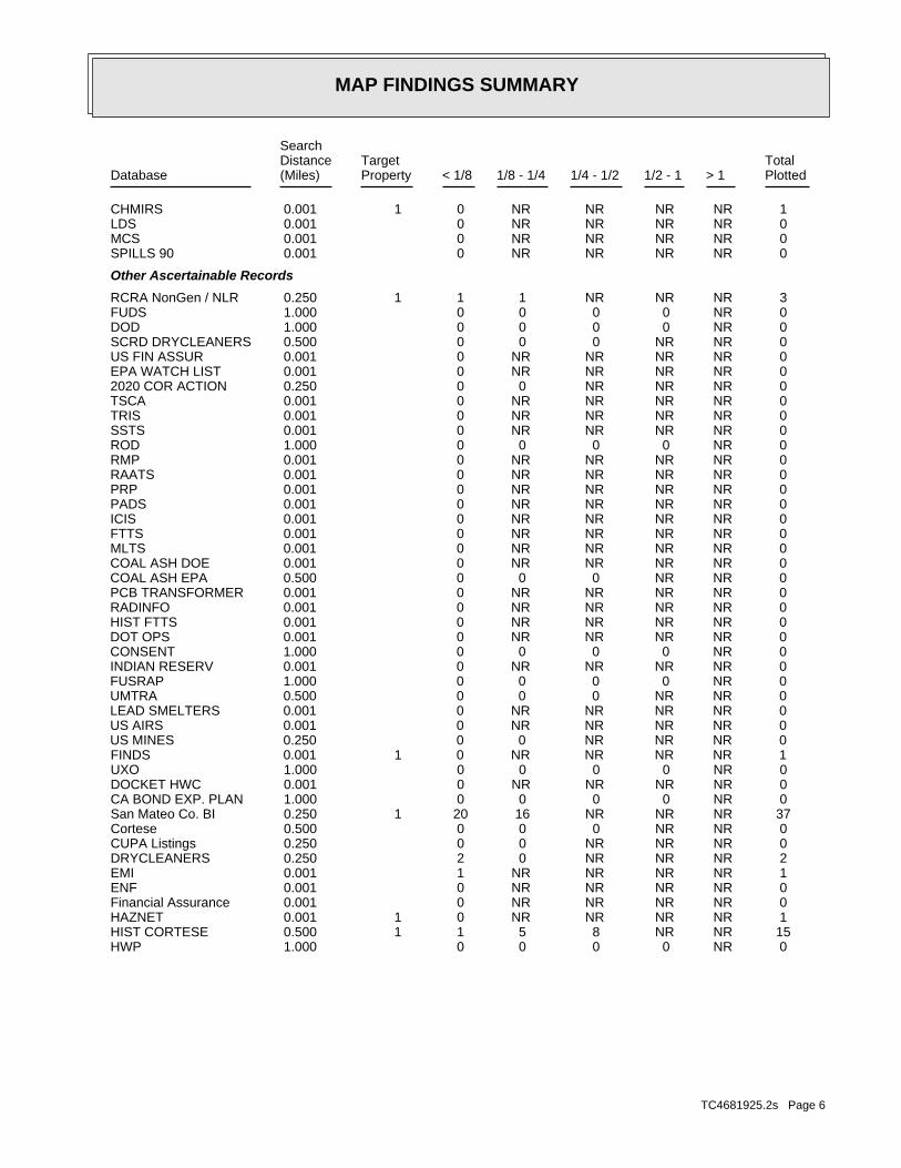
MAP FINDINGS SUMMARY
SearchTargetDistance Total
Database Property(Miles) < 1/8 1/8 - 1/4 1/4 - 1/2 1/2 - 1 > 1 Plotted
1 NR NR NR NR 0 0.001 1CHMIRS 0 NR NR NR NR 0 0.001LDS 0 NR NR NR NR 0 0.001MCS 0 NR NR NR NR 0 0.001SPILLS 90
Other Ascertainable Records
3 NR NR NR 1 1 0.250 1RCRA NonGen / NLR 0 NR 0 0 0 0 1.000FUDS 0 NR 0 0 0 0 1.000DOD 0 NR NR 0 0 0 0.500SCRD DRYCLEANERS 0 NR NR NR NR 0 0.001US FIN ASSUR 0 NR NR NR NR 0 0.001EPA WATCH LIST 0 NR NR NR 0 0 0.2502020 COR ACTION 0 NR NR NR NR 0 0.001TSCA 0 NR NR NR NR 0 0.001TRIS 0 NR NR NR NR 0 0.001SSTS 0 NR 0 0 0 0 1.000ROD 0 NR NR NR NR 0 0.001RMP 0 NR NR NR NR 0 0.001RAATS 0 NR NR NR NR 0 0.001PRP 0 NR NR NR NR 0 0.001PADS 0 NR NR NR NR 0 0.001ICIS 0 NR NR NR NR 0 0.001FTTS 0 NR NR NR NR 0 0.001MLTS 0 NR NR NR NR 0 0.001COAL ASH DOE 0 NR NR 0 0 0 0.500COAL ASH EPA 0 NR NR NR NR 0 0.001PCB TRANSFORMER 0 NR NR NR NR 0 0.001RADINFO 0 NR NR NR NR 0 0.001HIST FTTS 0 NR NR NR NR 0 0.001DOT OPS 0 NR 0 0 0 0 1.000CONSENT 0 NR NR NR NR 0 0.001INDIAN RESERV 0 NR 0 0 0 0 1.000FUSRAP 0 NR NR 0 0 0 0.500UMTRA 0 NR NR NR NR 0 0.001LEAD SMELTERS 0 NR NR NR NR 0 0.001US AIRS 0 NR NR NR 0 0 0.250US MINES 1 NR NR NR NR 0 0.001 1FINDS 0 NR 0 0 0 0 1.000UXO 0 NR NR NR NR 0 0.001DOCKET HWC 0 NR 0 0 0 0 1.000CA BOND EXP. PLAN 37 NR NR NR 16 20 0.250 1San Mateo Co. BI 0 NR NR 0 0 0 0.500Cortese 0 NR NR NR 0 0 0.250CUPA Listings 2 NR NR NR 0 2 0.250DRYCLEANERS 1 NR NR NR NR 1 0.001EMI 0 NR NR NR NR 0 0.001ENF 0 NR NR NR NR 0 0.001Financial Assurance 1 NR NR NR NR 0 0.001 1HAZNET 15 NR NR 8 5 1 0.500 1HIST CORTESE 0 NR 0 0 0 0 1.000HWP
TC4681925.2s Page 6

MAP FINDINGS SUMMARY
SearchTargetDistance Total
Database Property(Miles) < 1/8 1/8 - 1/4 1/4 - 1/2 1/2 - 1 > 1 Plotted
0 NR NR NR 0 0 0.250HWT 0 NR NR NR NR 0 0.001MINES 0 NR NR NR 0 0 0.250MWMP 0 NR NR NR NR 0 0.001NPDES 0 NR NR NR NR 0 0.001PEST LIC 0 NR NR 0 0 0 0.500PROC 2 NR 1 0 1 0 1.000Notify 65 0 NR NR NR NR 0 0.001UIC 0 NR NR 0 0 0 0.500WASTEWATER PITS 0 NR NR NR NR 0 0.001WDS 0 NR NR NR 0 0 0.250WIP 1 NR NR NR NR 0 0.001 1ECHO 0 NR NR NR 0 0 0.250FUELS PROGRAM
EDR HIGH RISK HISTORICAL RECORDS
EDR Exclusive Records
0 NR 0 0 0 0 1.000EDR MGP 4 NR NR NR NR 3 0.125 1EDR Hist Auto 3 NR NR NR NR 3 0.125EDR Hist Cleaner
EDR RECOVERED GOVERNMENT ARCHIVES
Exclusive Recovered Govt. Archives
0 NR NR NR NR 0 0.001RGA LF 3 NR NR NR NR 0 0.001 3RGA LUST
170 0 1 38 46 70 15- Totals --
NOTES:
TP = Target Property
NR = Not Requested at this Search Distance
Sites may be listed in more than one database
TC4681925.2s Page 7

MAP FINDINGSMap IDDirection
EDR ID NumberDistanceEPA ID NumberDatabase(s)SiteElevation
2003 RON PRICE MOTORS 1 CHESTNUT2005 RON PRICE MOTORS 1 CHESTNUT2006 RON PRICE MOTORS 1 CHESTNUT2007 RON PRICE MOTORS 1 CHESTNUT
RGA LUST:
Site 1 of 8 in cluster A
Actual:43 ft.
Property S SAN FRANCISCO, CA Target 1 CHESTNUT N/AA1 RGA LUSTRON PRICE MOTORS S114678446
2008 RON PRICE MOTORS 1 CHESTNUT2009 RON PRICE MOTORS 1 CHESTNUT2010 RON PRICE MOTORS 1 CHESTNUT2011 RON PRICE MOTORS 1 CHESTNUT2012 RON PRICE MOTORS 1 CHESTNUT
RGA LUST:
Site 2 of 8 in cluster A
Actual:43 ft.
Property SOUTH SAN FRANCISCO, CA Target 1 CHESTNUT N/AA2 RGA LUSTRON PRICE MOTORS S114678447
1993 RON PRICE MOTORS 1 CHESTNUT AVE1994 RON PRICE MOTORS 1 CHESTNUT AVE1995 RON PRICE MOTORS 1 CHESTNUT AVE1996 RON PRICE MOTORS 1 CHESTNUT AVE1997 RON PRICE MOTORS 1 CHESTNUT AVE1998 RON PRICE MOTORS 1 CHESTNUT AVE2000 RON PRICE MOTORS 1 CHESTNUT AVE2002 RON PRICE MOTORS 1 CHESTNUT AVE
RGA LUST:
Site 3 of 8 in cluster A
Actual:43 ft.
Property SOUTH SAN FRANCISCO, CA Target 1 CHESTNUT AVE N/AA3 RGA LUSTRON PRICE MOTORS S114678445
Not reportedTime Notified: Not reportedAgency Incident Number: Not reportedAgency Id Number: Not reportedProperty Use: Not reportedDate Completed: Not reportedOES Time: Not reportedOES Date: 08/23/2006OES notification: 6-5030OES Incident Number:
CHMIRS:
Site 4 of 8 in cluster A
Actual:43 ft.
Property SOUTH SAN FRANCISCO, CA Target 1 CHESTNUT AVE N/AA4 CHMIRS S109035225
TC4681925.2s Page 8

MAP FINDINGSMap IDDirection
EDR ID NumberDistanceEPA ID NumberDatabase(s)SiteElevation
The caller is reporting black smoke coming from aDescription: Not reportedComments: Not reportedFatals: Not reportedInjuries: Not reportedEvacs: Not reported#3 Vessel >= 300 Tons: Not reported#2 Vessel >= 300 Tons: Not reported#1 Vessel >= 300 Tons: Not reported#3 Pipeline: Not reported#2 Pipeline: Not reported#1 Pipeline: 0Number of Fatalities: 0Number of Injuries: 0Evacuations: Not reportedSubstance #3: Not reportedSubstance #2: 0Unknown: 0.000000Gallons: UnknownSubstance: Not reportedE Date: Oil FieldSite Type: NoContained: Not reportedAmount: San Mateo County Environmental HealthAdmin Agency: 8/23/2006 12:00:00 AMIncident Date: CitizenAgency: 2006Year: Not reportedDate/Time: Not reportedOther: Not reportedMeasure: Not reportedType: Not reportedWhat Happened: Not reportedContainment: UnknownCleanup By: Not reportedSpill Site: Not reportedWaterway: Not reportedWaterway Involved: Not reportedFacility Telephone: Not reportedReport Date: Not reportedReporting Officer Name/ID: Not reportedCompany Name: Not reportedCA DOT PUC/ICC Number: Not reportedVehicle Id Number: Not reportedVehicle State: Not reportedVehicle License Number: Not reportedVehicle Make/year: Not reportedOthers Number Of Fatalities: Not reportedOthers Number Of Injuries: Not reportedOthers Number Of Decontaminated: Not reportedResponding Agency Personel # Of Fatalities: Not reportedResponding Agency Personel # Of Injuries: Not reportedResp Agncy Personel # Of Decontaminated: Not reportedMore Than Two Substances Involved?: Not reportedProperty Management: Not reportedEstimated Temperature: Not reportedSurrounding Area: Not reportedTime Completed:
(Continued) S109035225
TC4681925.2s Page 9

MAP FINDINGSMap IDDirection
EDR ID NumberDistanceEPA ID NumberDatabase(s)SiteElevation
is hazardous. pressure washer. the caller believes this smoke
(Continued) S109035225
05/07/1991Status Date: Open - Case Begin DateStatus: T0608100429Global Id:
01/08/1996Status Date: Completed - Case ClosedStatus: T0608100429Global Id:
Status History:
6503726298Phone Number: [email protected]: SAN MATEOCity: 2000 ALAMEDA DE LAS PULGASAddress: SAN MATEO COUNTY LOPOrganization Name: JACOB MADDENContact Name: Local Agency CaseworkerContact Type: T0608100429Global Id:
Not reportedPhone Number: Not reportedEmail: OAKLANDCity: 1515 CLAY ST SUITE 1400Address: SAN FRANCISCO BAY RWQCB (REGION 2)Organization Name: Regional Water BoardContact Name: Regional Board CaseworkerContact Type: T0608100429Global Id:
Contact:
Click here to access the California GeoTracker records for this facility:
Not reportedSite History: Waste Oil / Motor / Hydraulic / LubricatingPotential Contaminants of Concern: SoilPotential Media Affect: Local AgencyFile Location: 550087LOC Case Number: 41-0453RB Case Number: SAN MATEO COUNTY LOPLocal Agency: JMCase Worker: SAN MATEO COUNTY LOPLead Agency: 01/08/1996Status Date: Completed - Case ClosedStatus: LUST Cleanup SiteCase Type: -122.433528900146Longitude: 37.6559484183271Latitude: T0608100429Global Id: STATERegion:
LUST:
Site 5 of 8 in cluster AHIST CORTESE
Actual:43 ft.
Property San Mateo Co. BISOUTH SAN FRANCISCO, CA 94080Target CA FID UST1 CHESTNUT N/AA5 LUSTRON PRICE MOTORS 1000128427
TC4681925.2s Page 10

MAP FINDINGSMap IDDirection
EDR ID NumberDistanceEPA ID NumberDatabase(s)SiteElevation
4155899788Facility Phone: Not reportedSIC Code: Not reportedCortese Code: CAC000555Regulated ID: UTNKIRegulated By: 41000430Facility ID:
CA FID UST:
SAN MATEO CO. LUSTEDR Link ID: SAN MATEO CO. LUSTCase Type: 011322030APN Number: T0608100429Global ID: 9- Case ClosedFacility Status: 550087Facility ID: SAN MATEORegion:
SAN MATEO CO. LUST:
Not reportedDate Post Remedial Action Monitoring Began: Not reportedDate Remediation Action Underway: Not reportedPollution Remediation Plan Submitted: Not reportedPollution Characterization Began: Not reportedPreliminary Site Assesment Began: Not reportedPrelim. Site Assesment Wokplan Submitted: LUSTOversight Program: Not reportedDate Leak Confirmed: UnknownLeak Source: UnknownLeak Cause: OMHow Discovered: 550087Case Number: Case ClosedFacility Status: Not reportedFacility Id: 2Region:
LUST REG 2:
Monitoring Report - QuarterlyAction: 12/31/1993Date: RESPONSEAction Type: T0608100429Global Id:
Leak ReportedAction: 05/07/1991Date: OtherAction Type: T0608100429Global Id:
Leak DiscoveryAction: 09/25/1991Date: OtherAction Type: T0608100429Global Id:
Notice of Responsibility - #1Action: 08/14/1991Date: ENFORCEMENTAction Type: T0608100429Global Id:
Regulatory Activities:
RON PRICE MOTORS (Continued) 1000128427
TC4681925.2s Page 11

MAP FINDINGSMap IDDirection
EDR ID NumberDistanceEPA ID NumberDatabase(s)SiteElevation
41-0453Reg Id: LTNKAReg By: 41Facility County Code: CORTESERegion:
HIST CORTESE:
INACTIVEFacility Status: UNDERGROUND TANK - GENERALDescription: PR0022638Record Id: UNDERGROUND TANK - GENERALProg Element Code: FA0017760Facility ID: SAN MATEORegion:
INACTIVEFacility Status: STORES HAZ MAT <1,199GAL,9,999LB,4,799CFDescription: PR0023555Record Id: STORES HAZ MAT <1,199GAL,9,999LB,4,799FT3Prog Element Code: FA0017760Facility ID: SAN MATEORegion:
INACTIVEFacility Status: GEN 26-50 TONS HAZ WASTE /YRDescription: PR0011538Record Id: GEN 26-50 TONS HAZ WASTE /YRProg Element Code: FA0017760Facility ID: SAN MATEORegion:
San Mateo Co. BI:
InactiveStatus: Not reportedComments: Not reportedEPA ID: Not reportedNPDES Number: Not reportedDUNs Number: Not reportedContact Phone: Not reportedContact: SO. SAN FRANCISCO 94080Mailing City,St,Zip: Not reportedMailing Address 2: 1 CHESTNUT AVEMailing Address: Not reportedMail To:
RON PRICE MOTORS (Continued) 1000128427
Not reportedTank Status: 41-000-550102-000001SWRCB Tank Id: Not reportedOwner Tank Id: Not reportedCreated Date: Not reportedAction Date: Not reportedReferral Date: Not reportedBoard Of Equalization: Not reportedNumber: 550102Comp Number: Not reportedStatus:
SWEEPS UST:
ECHOSite 6 of 8 in cluster AFINDS
Actual:43 ft.
Property RCRA NonGen / NLRSOUTH SAN FRANCISCO, CA 94080Target HIST UST1 CHESTNUT AVE CAD981441959A6 SWEEPS USTRON PRICE 1000128428
TC4681925.2s Page 12

MAP FINDINGSMap IDDirection
EDR ID NumberDistanceEPA ID NumberDatabase(s)SiteElevation
Not reportedNumber Of Tanks: WASTE OILContent: WASTESTG: OILTank Use: Not reportedActive Date: 1000Capacity: Not reportedTank Status: 41-000-550102-000004SWRCB Tank Id: Not reportedOwner Tank Id: Not reportedCreated Date: Not reportedAction Date: Not reportedReferral Date: Not reportedBoard Of Equalization: Not reportedNumber: 550102Comp Number: Not reportedStatus:
Not reportedNumber Of Tanks: CLEAN OILContent: PRODUCTSTG: OILTank Use: Not reportedActive Date: 550Capacity: Not reportedTank Status: 41-000-550102-000003SWRCB Tank Id: Not reportedOwner Tank Id: Not reportedCreated Date: Not reportedAction Date: Not reportedReferral Date: Not reportedBoard Of Equalization: Not reportedNumber: 550102Comp Number: Not reportedStatus:
Not reportedNumber Of Tanks: DIESELContent: PRODUCTSTG: M.V. FUELTank Use: Not reportedActive Date: 10000Capacity: Not reportedTank Status: 41-000-550102-000002SWRCB Tank Id: Not reportedOwner Tank Id: Not reportedCreated Date: Not reportedAction Date: Not reportedReferral Date: Not reportedBoard Of Equalization: Not reportedNumber: 550102Comp Number: Not reportedStatus:
4Number Of Tanks: REG UNLEADEDContent: PRODUCTSTG: M.V. FUELTank Use: Not reportedActive Date: 10000Capacity:
RON PRICE (Continued) 1000128428
TC4681925.2s Page 13

MAP FINDINGSMap IDDirection
EDR ID NumberDistanceEPA ID NumberDatabase(s)SiteElevation
1 CHESTNUT AVEFacility address: RON PRICEFacility name: 09/09/1986Date form received by agency:
RCRA NonGen / NLR:
Click here for Geo Tracker PDF:
NoneLeak Detection: Not reportedContainer Construction Thickness: WASTE OILType of Fuel: WASTETank Used for: 00010000Tank Capacity: 1981Year Installed: 4Container Num: 004Tank Num:
NoneLeak Detection: Not reportedContainer Construction Thickness: Not reportedType of Fuel: PRODUCTTank Used for: 00010000Tank Capacity: 1981Year Installed: 3Container Num: 003Tank Num:
NoneLeak Detection: Not reportedContainer Construction Thickness: DIESELType of Fuel: PRODUCTTank Used for: 00010000Tank Capacity: 1981Year Installed: 2Container Num: 002Tank Num:
NoneLeak Detection: Not reportedContainer Construction Thickness: UNLEADEDType of Fuel: PRODUCTTank Used for: 00000550Tank Capacity: 1981Year Installed: 1Container Num: 001Tank Num:
0004Total Tanks: S. SAN FRANCISCO, CA 94080Owner City,St,Zip: #1 CHESTNUT AVE.Owner Address: RON PRICE MOTORSOwner Name: 0000000000Telephone: RON PRICEContact Name: CAR DEALERSHIPOther Type: OtherFacility Type: 00000010403Facility ID: STATERegion: http://geotracker.waterboards.ca.gov/ustpdfs/pdf/0002C1FE.pdfURL: 0002C1FEFile Number:
HIST UST:
RON PRICE (Continued) 1000128428
TC4681925.2s Page 14

MAP FINDINGSMap IDDirection
EDR ID NumberDistanceEPA ID NumberDatabase(s)SiteElevation
110002707027Registry ID:
FINDS:
No violations foundViolation Status:
NoUsed oil transporter: NoUsed oil transfer facility: NoUsed oil Specification marketer: NoUsed oil fuel marketer to burner: NoUser oil refiner: NoUsed oil processor: NoUsed oil fuel burner: NoFurnace exemption: NoOn-site burner exemption: NoUnderground injection activity: NoTreater, storer or disposer of HW: NoTransporter of hazardous waste: NoRecycler of hazardous waste: NoMixed waste (haz. and radioactive): NoU.S. importer of hazardous waste:
Handler Activities Summary:
Not reportedOwner/Op end date: Not reportedOwner/Op start date: OperatorOwner/Operator Type: PrivateLegal status: (415) 555-1212Owner/operator telephone: Not reportedOwner/operator country: NOT REQUIRED, ME 99999 NOT REQUIREDOwner/operator address: NOT REQUIREDOwner/operator name:
Not reportedOwner/Op end date: Not reportedOwner/Op start date: OwnerOwner/Operator Type: PrivateLegal status: (415) 555-1212Owner/operator telephone: Not reportedOwner/operator country: NOT REQUIRED, ME 99999 NOT REQUIREDOwner/operator address: RON PRICEOwner/operator name:
Owner/Operator Summary:
Handler: Non-Generators do not presently generate hazardous wasteDescription: Non-GeneratorClassification: 09EPA Region: Not reportedContact email: (415) 555-1212Contact telephone: USContact country: SOUTH SAN FRANCISCO, CA 94080 1 CHESTNUT AVEContact address: ENVIRONMENTAL MANAGERContact: SOUTH SAN FRANCISCO, CA 94080 CHESTNUT AVEMailing address: CAD981441959EPA ID: SOUTH SAN FRANCISCO, CA 94080
RON PRICE (Continued) 1000128428
TC4681925.2s Page 15

MAP FINDINGSMap IDDirection
EDR ID NumberDistanceEPA ID NumberDatabase(s)SiteElevation
http://echo.epa.gov/detailed_facility_report?fid=110002707027DFR URL: 110002707027Registry ID: 1000128428Envid:
ECHO:
corrective action activities required under RCRA.program staff to track the notification, permit, compliance, andand treat, store, or dispose of hazardous waste. RCRAInfo allows RCRAevents and activities related to facilities that generate, transport,Conservation and Recovery Act (RCRA) program through the tracking ofRCRAInfo is a national information system that supports the Resource Environmental Interest/Information System
RON PRICE (Continued) 1000128428
San MateoFacility County: RecyclerMethod Decode: Unspecified organic liquid mixtureCat Decode: .3127Tons: RecyclerDisposal Method: Unspecified organic liquid mixtureWaste Category: Not reportedTSD County: CAD009452657TSD EPA ID: Not reportedGen County: SOUTH SAN FRANCISCO, CA 940803228Mailing City,St,Zip: 1 CHESTNUT AVEMailing Address: Not reportedMailing Name: 6503449192Telephone: RONALD M PRICEContact: CAD132029687GEPAID: 1998Year: S113002553envid:
San MateoFacility County: RecyclerMethod Decode: Unspecified organic liquid mixtureCat Decode: .0000Tons: RecyclerDisposal Method: Unspecified organic liquid mixtureWaste Category: Not reportedTSD County: CAD009452657TSD EPA ID: Not reportedGen County: SOUTH SAN FRANCISCO, CA 940803228Mailing City,St,Zip: 1 CHESTNUT AVEMailing Address: Not reportedMailing Name: 6503449192Telephone: RONALD M PRICEContact: CAD132029687GEPAID: 1999Year: S113002553envid:
HAZNET:
Site 7 of 8 in cluster A
Actual:43 ft.
Property SO. SAN FRANCISCO, CA 94080Target 1 CHESTNUT AVE N/AA7 HAZNETRON PRICE MOTORS S113002553
TC4681925.2s Page 16

MAP FINDINGSMap IDDirection
EDR ID NumberDistanceEPA ID NumberDatabase(s)SiteElevation
San MateoFacility County: RecyclerMethod Decode: Waste oil and mixed oilCat Decode: .0834Tons: RecyclerDisposal Method: Waste oil and mixed oilWaste Category: Not reportedTSD County: CAD980887418TSD EPA ID: Not reportedGen County: SOUTH SAN FRANCISCO, CA 940803228Mailing City,St,Zip: 1 CHESTNUT AVEMailing Address: Not reportedMailing Name: 6503449192Telephone: RONALD M PRICEContact: CAD132029687GEPAID: 1994Year: S113002553envid:
San MateoFacility County: RecyclerMethod Decode: Waste oil and mixed oilCat Decode: .2085Tons: RecyclerDisposal Method: Waste oil and mixed oilWaste Category: Not reportedTSD County: CAD980887418TSD EPA ID: Not reportedGen County: SOUTH SAN FRANCISCO, CA 940803228Mailing City,St,Zip: 1 CHESTNUT AVEMailing Address: Not reportedMailing Name: 6503449192Telephone: RONALD M PRICEContact: CAD132029687GEPAID: 1995Year: S113002553envid:
RON PRICE MOTORS (Continued) S113002553
1 CHESTNUT AVEAddress: 2003Year: RON PRICE MOTORSName:
1 CHESTNUT AVEAddress: 2002Year: RON PRICE MOTORSName:
EDR Historical Auto Stations:
Site 8 of 8 in cluster A
Actual:43 ft.
Property SOUTH SAN FRANCISCO, CA 94080Target 1 CHESTNUT AVE N/AA8 EDR Hist Auto 1015115185
TC4681925.2s Page 17

MAP FINDINGSMap IDDirection
EDR ID NumberDistanceEPA ID NumberDatabase(s)SiteElevation
4.6252e-005Part. Matter 10 Micrometers and Smllr Tons/Yr: 4.8179e-005Particulate Matter Tons/Yr: 3.524e-006SOX - Oxides of Sulphur Tons/Yr: 0.002020523NOX - Oxides of Nitrogen Tons/Yr: 0.000628724Carbon Monoxide Emissions Tons/Yr: 0.000102882Reactive Organic Gases Tons/Yr: 0.000117334Total Organic Hydrocarbon Gases Tons/Yr: Not reportedConsolidated Emission Reporting Rule: Not reportedCommunity Health Air Pollution Info System: BAY AREA AQMDAir District Name: 4899SIC Code: BAAir District Name: 22000Facility ID: SFAir Basin: 41County Code: 2014Year:
EMI:
Site 1 of 2 in cluster B1 ft.
Relative:Lower
Actual:39 ft.
< 1/8 SOUTH SAN FRANCISCO, CA 94080955 ANTOINETTE LANE N/A
B9 EMIFORZA TELECOM-PH8 CHESTNUT HEAD END S118494551
ACTIVEFacility Status: STORES HAZ MAT <219GAL,1,999LB, 879CFDescription: PR0080808Record Id: STORES HAZ MAT <219GAL,1,999LB, 879FT3Prog Element Code: FA0058285Facility ID: SAN MATEORegion:
San Mateo Co. BI:
14 ft. Site 2 of 2 in cluster B0.003 mi.
Relative:Lower
Actual:37 ft.
< 1/8 SOUTH SAN FRANCISCO, CA 94080SE 995 ANTOINETTE N/AB10 San Mateo Co. BIBART CHESTNUT AVENUE VENTILATION STRUCTURE (CHS) S117976201
Local Agency WarehouseFile Location: 550089LOC Case Number: 41-0007RB Case Number: SAN MATEO COUNTY LOPLocal Agency: JMCase Worker: SAN MATEO COUNTY LOPLead Agency: 05/13/2003Status Date: Completed - Case ClosedStatus: LUST Cleanup SiteCase Type: -122.432844Longitude: 37.656265Latitude: T0608151808Global Id: STATERegion:
LUST:
94 ft. Site 1 of 8 in cluster C0.018 mi.
Relative:Lower
Actual:29 ft.
< 1/8 SOUTH SAN FRANCISCO, CA 94080SE HIST CORTESE45 CHESTNUT AVENUE N/AC11 LUSTACUTEC AUTOS S101308778
TC4681925.2s Page 18

MAP FINDINGSMap IDDirection
EDR ID NumberDistanceEPA ID NumberDatabase(s)SiteElevation
05/13/2003Date: ENFORCEMENTAction Type: T0608151808Global Id:
Leak ReportedAction: 11/21/1991Date: OtherAction Type: T0608151808Global Id:
Leak DiscoveryAction: 11/21/1991Date: OtherAction Type: T0608151808Global Id:
* Historical Enforcement - #1Action: 11/21/1991Date: ENFORCEMENTAction Type: T0608151808Global Id:
Regulatory Activities:
11/21/1991Status Date: Open - Verification MonitoringStatus: T0608151808Global Id:
11/21/1991Status Date: Open - Case Begin DateStatus: T0608151808Global Id:
05/13/2003Status Date: Completed - Case ClosedStatus: T0608151808Global Id:
Status History:
6503726298Phone Number: [email protected]: SAN MATEOCity: 2000 ALAMEDA DE LAS PULGASAddress: SAN MATEO COUNTY LOPOrganization Name: JACOB MADDENContact Name: Local Agency CaseworkerContact Type: T0608151808Global Id:
Not reportedPhone Number: Not reportedEmail: OAKLANDCity: 1515 CLAY ST SUITE 1400Address: SAN FRANCISCO BAY RWQCB (REGION 2)Organization Name: Regional Water BoardContact Name: Regional Board CaseworkerContact Type: T0608151808Global Id:
Contact:
Click here to access the California GeoTracker records for this facility:
Not reportedSite History: GasolinePotential Contaminants of Concern: Other Groundwater (uses other than drinking water)Potential Media Affect:
ACUTEC AUTOS (Continued) S101308778
TC4681925.2s Page 19

MAP FINDINGSMap IDDirection
EDR ID NumberDistanceEPA ID NumberDatabase(s)SiteElevation
41-0007Reg Id: LTNKAReg By: 41Facility County Code: CORTESERegion:
HIST CORTESE:
SAN MATEO CO. LUSTEDR Link ID: SAN MATEO CO. LUSTCase Type: 011322090APN Number: T0608151808Global ID: 9- Case ClosedFacility Status: 550089Facility ID: SAN MATEORegion:
SAN MATEO CO. LUST:
Soil and Water Investigation ReportAction: 01/13/2004Date: RESPONSEAction Type: T0608151808Global Id:
Closure/No Further Action Letter - #2Action:
ACUTEC AUTOS (Continued) S101308778
Not reportedTank Status: 41-000-550140-000002SWRCB Tank Id: Not reportedOwner Tank Id: Not reportedCreated Date: Not reportedAction Date: Not reportedReferral Date: Not reportedBoard Of Equalization: Not reportedNumber: 550140Comp Number: Not reportedStatus:
4Number Of Tanks: REG UNLEADEDContent: PRODUCTSTG: M.V. FUELTank Use: Not reportedActive Date: 10000Capacity: Not reportedTank Status: 41-000-550140-000001SWRCB Tank Id: Not reportedOwner Tank Id: Not reportedCreated Date: Not reportedAction Date: Not reportedReferral Date: Not reportedBoard Of Equalization: Not reportedNumber: 550140Comp Number: Not reportedStatus:
SWEEPS UST:
94 ft. Site 2 of 8 in cluster C0.018 mi.
Relative:Lower
Actual:29 ft.
< 1/8 S SAN FRANCISCO, CA 94080SE San Mateo Co. BI45 CHESTNUT N/AC12 SWEEPS USTAUTO STUDIO S103946679
TC4681925.2s Page 20

MAP FINDINGSMap IDDirection
EDR ID NumberDistanceEPA ID NumberDatabase(s)SiteElevation
Not reportedNumber Of Tanks: Not reportedContent: Not reportedSTG: Not reportedTank Use: Not reportedActive Date: Not reportedCapacity: Not reportedTank Status: Not reportedSWRCB Tank Id: Not reportedOwner Tank Id: 10-13-88Created Date: 02-03-94Action Date: 02-03-94Referral Date: Not reportedBoard Of Equalization: 9Number: 550140Comp Number: ActiveStatus:
Not reportedNumber Of Tanks: REG UNLEADEDContent: PRODUCTSTG: M.V. FUELTank Use: Not reportedActive Date: 400Capacity: Not reportedTank Status: 41-000-550140-000004SWRCB Tank Id: Not reportedOwner Tank Id: Not reportedCreated Date: Not reportedAction Date: Not reportedReferral Date: Not reportedBoard Of Equalization: Not reportedNumber: 550140Comp Number: Not reportedStatus:
Not reportedNumber Of Tanks: REG UNLEADEDContent: PRODUCTSTG: M.V. FUELTank Use: Not reportedActive Date: 5000Capacity: Not reportedTank Status: 41-000-550140-000003SWRCB Tank Id: Not reportedOwner Tank Id: Not reportedCreated Date: Not reportedAction Date: Not reportedReferral Date: Not reportedBoard Of Equalization: Not reportedNumber: 550140Comp Number: Not reportedStatus:
Not reportedNumber Of Tanks: REG UNLEADEDContent: PRODUCTSTG: M.V. FUELTank Use: Not reportedActive Date: 10000Capacity:
AUTO STUDIO (Continued) S103946679
TC4681925.2s Page 21

MAP FINDINGSMap IDDirection
EDR ID NumberDistanceEPA ID NumberDatabase(s)SiteElevation
INACTIVEFacility Status: UNDERGROUND TANK - GENERALDescription: PR0011565Record Id: UNDERGROUND TANK - GENERALProg Element Code: FA0017790Facility ID: SAN MATEORegion:
San Mateo Co. BI:
AUTO STUDIO (Continued) S103946679
4Container Num: 004Tank Num:
Stock InventorLeak Detection: Not reportedContainer Construction Thickness: PREMIUMType of Fuel: PRODUCTTank Used for: 00010000Tank Capacity: 1981Year Installed: 3Container Num: 003Tank Num:
Stock InventorLeak Detection: Not reportedContainer Construction Thickness: REGULARType of Fuel: PRODUCTTank Used for: 00010000Tank Capacity: 1981Year Installed: 2Container Num: 002Tank Num:
Stock InventorLeak Detection: Not reportedContainer Construction Thickness: UNLEADEDType of Fuel: PRODUCTTank Used for: 00010000Tank Capacity: 1981Year Installed: 1Container Num: 001Tank Num:
0004Total Tanks: SO. SAN FRANCISCO, CA 94080Owner City,St,Zip: 45 CHESTNUTOwner Address: EDDIE M. CHAN/CRISTOBAL P. SANOwner Name: 4158717797Telephone: EDDIE CHANG/CRIS SANTIAGOContact Name: SERVICE STATIONOther Type: OtherFacility Type: 00000013410Facility ID: STATERegion: http://geotracker.waterboards.ca.gov/ustpdfs/pdf/0002BE4E.pdfURL: 0002BE4EFile Number:
HIST UST:
94 ft. Site 3 of 8 in cluster C0.018 mi.
Relative:Lower
Actual:29 ft.
< 1/8 SOUTH SAN FRANCISCO, CA 94080SE 45 CHESTNUT N/AC13 HIST USTAUTO STUDIO U001594734
TC4681925.2s Page 22

MAP FINDINGSMap IDDirection
EDR ID NumberDistanceEPA ID NumberDatabase(s)SiteElevation
Click here for Geo Tracker PDF:
Stock InventorLeak Detection: Not reportedContainer Construction Thickness: WASTE OILType of Fuel: WASTETank Used for: 00000000Tank Capacity: 1981Year Installed:
AUTO STUDIO (Continued) U001594734
ActiveStatus: Not reportedComments: Not reportedEPA ID: Not reportedNPDES Number: Not reportedDUNs Number: Not reportedContact Phone: Not reportedContact: SO. SAN FRANCISCO 94080Mailing City,St,Zip: Not reportedMailing Address 2: 45 CHESTNUTMailing Address: Not reportedMail To: 4150000000Facility Phone: Not reportedSIC Code: Not reportedCortese Code: Not reportedRegulated ID: UTNKARegulated By: 41000049Facility ID:
CA FID UST:
94 ft. Site 4 of 8 in cluster C0.018 mi.
Relative:Lower
Actual:29 ft.
< 1/8 SO. SAN FRANCISCO, CA 94080SE 45 CHESTNUT N/AC14 CA FID USTAUTO STUDIO S101623104
559177Lead Agency Case Number: SAN MATEO COUNTY LOPLead Agency: T0608106763Global Id: 06/23/2011Status Date: Completed - Case ClosedFacility Status: STATERegion:
SLIC:
SAN MATEO CO. LUSTEDR Link ID: SAN MATEO CO. LUSTCase Type: 011301070APN Number: T0608106763Global ID: 9- Case ClosedFacility Status: 559177Facility ID: SAN MATEORegion:
SAN MATEO CO. LUST:
141 ft. Site 1 of 7 in cluster D0.027 mi.
Relative:Higher
Actual:52 ft.
< 1/8 San Mateo Co. BISOUTH SAN FRANCISCO, CA 94080NNW SLIC1090 GRAND N/AD15 LUSTCONTRERAS PAINTING S106034879
TC4681925.2s Page 23

MAP FINDINGSMap IDDirection
EDR ID NumberDistanceEPA ID NumberDatabase(s)SiteElevation
indicated up to 48,000 "g/L TEPHms, 180 "g/L 1,2,4-TMB, 75 "g/L samples from borings B4 and B5 near the south end of the trench B8. However, laboratory analytical results of grab groundwater soil samples collected from 2.5 to 15 feet depth from borings B1 to indicated no detectable levels of TEPHms or VOCs in the set of 22 8015M and VOCs by EPA Method 8260B. Laboratory analyses results collected from the borings were analyzed for TEPHms by EPA Method southeast to southwest of the trench. Soil and groundwater samples northeast of the trench. Borings B5 to B8 were completed on-site completed on the neighboring property at 1082 Grand Avenue, east to of 8 soil borings, B1 to B8, respectively. Borings B1 to B4 were November 2004 a subsurface investigation that included the drilling evaluate the extent of soil and groundwater impact, GEI conducted in naphthalene, 110 "g/L 1,3,5-TMB, and 94 "g/L 1,2,4-TMB. To further indicated 43,000 micrograms per liter ("g/L) TEPHms, 130 "g/L taken from below the floor of the south segment of the trench 66 "g/kg iso-PB. The analytical results of a grab groundwater sample n-PB, 100 "g/kg xylenes, 91 "g/kg sec-BB, 90 "g/kg ethylbenzene and "g/kg 1,3,5-TMB, 520 "g/kg naphthalene, 250 "g/kg n-BB, 150 "g/kg mg/kg TEPHms, 7,500 micrograms per kilogram ("g/kg) 1,2,4-TMB, 2,500 trench, confirmation soil analytical results indicated up to 4,900 groundwater at approximately 16 feet bgs. In the south segment of the identified below 5 feet depth extending into first encountered segment of the over-excavated trench. Residual VOC-impacted soil was indicated that VOC-impacted soil remained around and below the south of the excavated trench. The results of confirmation sampling Confirmation soil samples were collected from the floor and sidewalls paint spattered area was performed in September and October 2003. (n-PB), trichloroethene (TCE) and xylenes.Remedial excavation of the ethylbenzene, iso-propylbenzene (iso-PB), toluene, n-propylbenzene (1,3,5-TMB), n-butylbenzene (n-BB), sec-butylbenzene (sec-BB), 1,2,4-trimethylbenzene (1,2,4-TMB), 1,3,5-trimethylbenzene detected in the soil samples: acetone, naphthalene, (mg/kg) of TEPHms in the soil samples. The following VOCs were Analytical results indicated up to 7,300 milligrams per kilogram 8015M, and volatile organic compounds (VOCs) by EPA Method 8260B. spirits (TEPHms) by Environmental Protection Agency (EPA) Method were analyzed for total extractable petroleum hydrocarbons as mineral maximum 1.33 feet below ground surface (feet bgs). The soil samples were collected in the paint-spattered area from ground surface to a and solvent onto the exposed ground surface. Shallow soil samples area had allegedly been impacted by unauthorized discharges of paint along the northeast side of the building at 1090 Grand Avenue. This December 2002, GEI collected soil samples in a paint-spattered area professional interpretations made in the referenced report. In responsibility for the accuracy of the statements made or any Quarterly Groundwater Monitoring, San Mateo County does not take Extracted from GEI’s August 19, 2008 Report on Second Quarter 2008Site History: Stoddard solvent / Mineral Spriits / DistillatesPotential Contaminants of Concern: Other Groundwater (uses other than drinking water)Potential Media Affected: Local AgencyFile Location: Not reportedRB Case Number: SAN MATEO COUNTY LOPLocal Agency: JMCase Worker: Cleanup Program SiteCase Type: -122.437002Longitude: 37.66053Latitude:
CONTRERAS PAINTING (Continued) S106034879
TC4681925.2s Page 24

MAP FINDINGSMap IDDirection
EDR ID NumberDistanceEPA ID NumberDatabase(s)SiteElevation
INACTIVEFacility Status: GENERATES & RECYCLES WASTE OIL/SOLVENTDescription: PR0043612Record Id: GENERATES and RECYCLES WASTE OIL/SOLVENTProg Element Code: FA0027447Facility ID: SAN MATEORegion:
San Mateo Co. BI:
Click here to access the California GeoTracker records for this facility:
groundwater sampled from borings B9 and B10, respectively. B10. Laboratory analyses indicated 12 "g/L and 6.2 "g/L of PCE in organics in the grab groundwater samples from off-site borings B9 and indicated no detectable levels of petroleum hydrocarbons or volatile Except for traces of tetrachloroethene (PCE), the analytical results groundwater monitoring wells (MW-1 to MW-4) were installed on-site. were completed in June 2006 on 1082 Grand Avenue, and four (4) 1090 Grand Avenue, South San Francisco, CA. Two borings (B9 and B10) Investigation and 2006 Groundwater Monitoring, Contreras Painting, report dated May 8, 2007, Report on Continuing Subsurface performed further groundwater investigation as documented in GEI degradation of residual petroleum hydrocarbons. In 2006, GEI Pleasant Hill, California to facilitate natural attenuation and Oxygen Release Compound (ORC) manufactured by Regenesis, LTD. of excavated trench with clean backfill. During backfilling, GEI applied 3.8 "g/L n-BB. In February 2005 GEI supervised the backfilling of the ethylbenzene, 9.7 "g/L iso-PB, 8.9 "g/L sec-BB , 8.2 "g/L n-PB and naphthalene, 61 "g/L 1,3,5-TMB, 52 "g/L xylenes, 12 "g/L
CONTRERAS PAINTING (Continued) S106034879
T10000003112Global Id:Contact:
Click here to access the California GeoTracker records for this facility:
detected in saturated soil. Site Opened 7/5/2011, based on soil contamination (10,000 ppm TPH-G)Site History: GasolinePotential Contaminants of Concern: Soil, Under InvestigationPotential Media Affect: State Records CenterFile Location: 550207LOC Case Number: Not reportedRB Case Number: SAN MATEO COUNTY LOPLocal Agency: JMCase Worker: SAN MATEO COUNTY LOPLead Agency: 07/05/2011Status Date: Open - Site AssessmentStatus: LUST Cleanup SiteCase Type: -122.437230348587Longitude: 37.6603566472157Latitude: T10000003112Global Id: STATERegion:
LUST:
181 ft. Site 2 of 7 in cluster D0.034 mi.
Relative:Higher
Actual:52 ft.
< 1/8 S SAN FRANCISCO, CA 94080North SWEEPS UST1086 GRAND AVE N/AD16 LUSTGINO’S AUTOMOTIVE S102269377
TC4681925.2s Page 25

MAP FINDINGSMap IDDirection
EDR ID NumberDistanceEPA ID NumberDatabase(s)SiteElevation
Verbal CommunicationAction: 08/05/2011Date: RESPONSEAction Type: T10000003112Global Id:
Staff Letter - #20130312Action: 03/12/2013Date: ENFORCEMENTAction Type: T10000003112Global Id:
Site Assessment ReportAction: 06/28/2013Date: RESPONSEAction Type: T10000003112Global Id:
Site Assessment Report - Regulator RespondedAction: 05/30/2014Date: RESPONSEAction Type: T10000003112Global Id:
Pilot Study / Treatability Workplan - Regulator RespondedAction: 03/21/2014Date: RESPONSEAction Type: T10000003112Global Id:
Site Investigation Workplan - Regulator RespondedAction: 06/17/2013Date: RESPONSEAction Type: T10000003112Global Id:
Regulatory Activities:
07/05/2011Status Date: Open - Site AssessmentStatus: T10000003112Global Id:
07/05/2011Status Date: Open - Case Begin DateStatus: T10000003112Global Id:
Status History:
6503726298Phone Number: [email protected]: SAN MATEOCity: 2000 ALAMEDA DE LAS PULGASAddress: SAN MATEO COUNTY LOPOrganization Name: JACOB MADDENContact Name: Local Agency CaseworkerContact Type: T10000003112Global Id:
Not reportedPhone Number: Not reportedEmail: OAKLANDCity: 1515 CLAY ST SUITE 1400Address: SAN FRANCISCO BAY RWQCB (REGION 2)Organization Name: Regional Water BoardContact Name: Regional Board CaseworkerContact Type:
GINO’S AUTOMOTIVE (Continued) S102269377
TC4681925.2s Page 26

MAP FINDINGSMap IDDirection
EDR ID NumberDistanceEPA ID NumberDatabase(s)SiteElevation
REMEDIATIONAction Type: T10000003112Global Id:
Staff Letter - #20131127Action: 11/27/2013Date: ENFORCEMENTAction Type: T10000003112Global Id:
Staff Letter - #20110825Action: 08/25/2011Date: ENFORCEMENTAction Type: T10000003112Global Id:
Notice of Responsibility - #20110708Action: 07/08/2011Date: ENFORCEMENTAction Type: T10000003112Global Id:
Staff Letter - #20151022Action: 10/22/2015Date: ENFORCEMENTAction Type: T10000003112Global Id:
Leak ReportedAction: 06/16/2011Date: OtherAction Type: T10000003112Global Id:
Leak DiscoveryAction: 05/09/2011Date: OtherAction Type: T10000003112Global Id:
Staff Letter - #20121205Action: 12/05/2012Date: ENFORCEMENTAction Type: T10000003112Global Id:
Staff Letter - #20120904Action: 09/04/2012Date: ENFORCEMENTAction Type: T10000003112Global Id:
Monitoring Report - Semi-AnnuallyAction: 02/15/2016Date: RESPONSEAction Type: T10000003112Global Id:
Staff Letter - #20140812Action: 08/12/2014Date: ENFORCEMENTAction Type: T10000003112Global Id:
Preliminary Site Assessment ReportAction: 03/02/2012Date: RESPONSEAction Type: T10000003112Global Id:
GINO’S AUTOMOTIVE (Continued) S102269377
TC4681925.2s Page 27

MAP FINDINGSMap IDDirection
EDR ID NumberDistanceEPA ID NumberDatabase(s)SiteElevation
550026Comp Number: ActiveStatus:
SWEEPS UST:
Staff Letter - #20111117Action: 11/17/2011Date: ENFORCEMENTAction Type: T10000003112Global Id:
Staff Letter - #20111020Action: 10/20/2011Date: ENFORCEMENTAction Type: T10000003112Global Id:
Site Assessment Report - Regulator RespondedAction: 03/22/2013Date: RESPONSEAction Type: T10000003112Global Id:
CAP/RAP - Feasibility Study ReportAction: 11/21/2014Date: RESPONSEAction Type: T10000003112Global Id:
Soil and Water Investigation Workplan - Regulator RespondedAction: 11/16/2012Date: RESPONSEAction Type: T10000003112Global Id:
Preliminary Site Assessment Workplan - Addendum - Regulator RespondedAction: 11/08/2011Date: RESPONSEAction Type: T10000003112Global Id:
Preliminary Site Assessment Workplan - Regulator RespondedAction: 11/30/2011Date: RESPONSEAction Type: T10000003112Global Id:
Leak StoppedAction: 05/09/2011Date: OtherAction Type: T10000003112Global Id:
Staff Letter - #20140130Action: 01/30/2014Date: ENFORCEMENTAction Type: T10000003112Global Id:
Staff Letter - #20110705Action: 07/05/2011Date: ENFORCEMENTAction Type: T10000003112Global Id:
ExcavationAction: 05/24/2011Date:
GINO’S AUTOMOTIVE (Continued) S102269377
TC4681925.2s Page 28

MAP FINDINGSMap IDDirection
EDR ID NumberDistanceEPA ID NumberDatabase(s)SiteElevation
Not reportedNumber Of Tanks: REG UNLEADEDContent: PSTG: M.V. FUELTank Use: 04-22-94Active Date: 4000Capacity: ATank Status: 41-000-550026-000003SWRCB Tank Id: 2Owner Tank Id: 10-13-88Created Date: 04-22-94Action Date: 04-22-94Referral Date: Not reportedBoard Of Equalization: 9Number: 550026Comp Number: ActiveStatus:
Not reportedNumber Of Tanks: REG UNLEADEDContent: PSTG: M.V. FUELTank Use: 04-22-94Active Date: 4000Capacity: ATank Status: 41-000-550026-000002SWRCB Tank Id: 3Owner Tank Id: 10-13-88Created Date: 04-22-94Action Date: 04-22-94Referral Date: Not reportedBoard Of Equalization: 9Number: 550026Comp Number: ActiveStatus:
3Number Of Tanks: REG UNLEADEDContent: PSTG: M.V. FUELTank Use: 04-22-94Active Date: 5000Capacity: ATank Status: 41-000-550026-000001SWRCB Tank Id: 1Owner Tank Id: 10-13-88Created Date: 04-22-94Action Date: 04-22-94Referral Date: Not reportedBoard Of Equalization: 9Number:
GINO’S AUTOMOTIVE (Continued) S102269377
TC4681925.2s Page 29

MAP FINDINGSMap IDDirection
EDR ID NumberDistanceEPA ID NumberDatabase(s)SiteElevation
Click here for Geo Tracker PDF:
VisualLeak Detection: Not reportedContainer Construction Thickness: WASTE OILType of Fuel: WASTETank Used for: 00000280Tank Capacity: 1956Year Installed: 4Container Num: 004Tank Num:
Visual, Stock Inventor, Pressure TestLeak Detection: Not reportedContainer Construction Thickness: UNLEADEDType of Fuel: PRODUCTTank Used for: 00005000Tank Capacity: 1973Year Installed: 3Container Num: 003Tank Num:
Visual, Stock Inventor, Pressure TestLeak Detection: Not reportedContainer Construction Thickness: REGULARType of Fuel: PRODUCTTank Used for: 00006000Tank Capacity: 1956Year Installed: 2Container Num: 002Tank Num:
Visual, Stock Inventor, Pressure TestLeak Detection: Not reportedContainer Construction Thickness: 06Type of Fuel: PRODUCTTank Used for: 00006000Tank Capacity: 1956Year Installed: 1Container Num: 001Tank Num:
0004Total Tanks: LOS ANGELES, CA 90017Owner City,St,Zip: 612 SOL. FLOWER STREETOwner Address: MOBIL OIL CORPORATIONOwner Name: 4155881865Telephone: BERNARD J. LIBERTOContact Name: Not reportedOther Type: Gas StationFacility Type: 00000039512Facility ID: STATERegion: http://geotracker.waterboards.ca.gov/ustpdfs/pdf/0002C086.pdfURL: 0002C086File Number:
HIST UST:
181 ft. Site 3 of 7 in cluster D0.034 mi.
Relative:Higher
Actual:52 ft.
< 1/8 SOUTH SAN FRANCISCO, CA 94080North 1086 GRAND AVE N/AD17 HIST USTMOBIL SERVICE STATION U001594801
TC4681925.2s Page 30

MAP FINDINGSMap IDDirection
EDR ID NumberDistanceEPA ID NumberDatabase(s)SiteElevation
STORES MV FUELS OR WASTE ONLYProg Element Code: FA0045160Facility ID: SAN MATEORegion:
INACTIVEFacility Status: GENERATES & RECYCLES WASTE OIL/SOLVENTDescription: PR0058136Record Id: GENERATES and RECYCLES WASTE OIL/SOLVENTProg Element Code: FA0045160Facility ID: SAN MATEORegion:
INACTIVEFacility Status: UNDERGROUND TANK - GENERALDescription: PR0056657Record Id: UNDERGROUND TANK - GENERALProg Element Code: FA0040824Facility ID: SAN MATEORegion:
INACTIVEFacility Status: STORES MV FUELS OR WASTE ONLYDescription: PR0056656Record Id: STORES MV FUELS OR WASTE ONLYProg Element Code: FA0040824Facility ID: SAN MATEORegion:
INACTIVEFacility Status: GENERATES & RECYCLES WASTE OIL/SOLVENTDescription: PR0056658Record Id: GENERATES and RECYCLES WASTE OIL/SOLVENTProg Element Code: FA0040824Facility ID: SAN MATEORegion:
INACTIVEFacility Status: UNDERGROUND TANK - GENERALDescription: PR0022589Record Id: UNDERGROUND TANK - GENERALProg Element Code: FA0017691Facility ID: SAN MATEORegion:
INACTIVEFacility Status: STORES MV FUELS OR WASTE ONLYDescription: PR0004248Record Id: STORES MV FUELS OR WASTE ONLYProg Element Code: FA0017691Facility ID: SAN MATEORegion:
INACTIVEFacility Status: GENERATES & RECYCLES WASTE OIL/SOLVENTDescription: PR0023718Record Id: GENERATES and RECYCLES WASTE OIL/SOLVENTProg Element Code: FA0017691Facility ID: SAN MATEORegion:
San Mateo Co. BI:
181 ft. Site 4 of 7 in cluster D0.034 mi.
Relative:Higher
Actual:52 ft.
< 1/8 SOUTH SAN FRANCISCO, CA 94080North 1086 GRAND N/AD18 San Mateo Co. BIGRAND AVENUE OLYMPIAN S117398535
TC4681925.2s Page 31

MAP FINDINGSMap IDDirection
EDR ID NumberDistanceEPA ID NumberDatabase(s)SiteElevation
INACTIVEFacility Status: UNDERGROUND TANK - GENERALDescription: PR0059794Record Id: UNDERGROUND TANK - GENERALProg Element Code: FA0045538Facility ID: SAN MATEORegion:
INACTIVEFacility Status: STORES MV FUELS OR WASTE ONLYDescription: PR0058137Record Id:
GRAND AVENUE OLYMPIAN (Continued) S117398535
ActiveStatus: Not reportedComments: Not reportedEPA ID: Not reportedNPDES Number: Not reportedDUNs Number: Not reportedContact Phone: Not reportedContact: SO. SAN FRANCISCO 94080Mailing City,St,Zip: Not reportedMailing Address 2: 1086 GRAND AVEMailing Address: Not reportedMail To: 4155881865Facility Phone: Not reportedSIC Code: Not reportedCortese Code: Not reportedRegulated ID: UTNKARegulated By: 41003627Facility ID:
CA FID UST:
181 ft. Site 5 of 7 in cluster D0.034 mi.
Relative:Higher
Actual:52 ft.
< 1/8 SO. SAN FRANCISCO, CA 94080North 1086 GRAND AVE N/AD19 CA FID USTGINO’S AUTOMOTIVE S101593958
LOUISE BRUSCOContact: CAC002661677GEPAID: 2011Year: S112982694envid:
HAZNET:
SAN MATEO CO. LUSTEDR Link ID: SAN MATEO CO. LUSTCase Type: 011301080APN Number: T00000003112Global ID: 3B- Preliminary Assessment UnderwayFacility Status: 550207Facility ID: SAN MATEORegion:
SAN MATEO CO. LUST:
181 ft. Site 6 of 7 in cluster D0.034 mi.
Relative:Higher
Actual:52 ft.
< 1/8 SOUTH SAN FRANCISCO, CA 94080North HAZNET1086 GRAND AVE N/AD20 LUSTLOUISE BRUSCO S112982694
TC4681925.2s Page 32

MAP FINDINGSMap IDDirection
EDR ID NumberDistanceEPA ID NumberDatabase(s)SiteElevation
San MateoFacility County: Other TreatmentMethod Decode: Other empty containers 30 gallons or moreCat Decode: 6Tons: Other TreatmentDisposal Method: Other empty containers 30 gallons or moreWaste Category: Not reportedTSD County: CAD009466392TSD EPA ID: Not reportedGen County: SOUTH SAN FRANCISCO, CA 940802661Mailing City,St,Zip: 635 PALM AVEMailing Address: Not reportedMailing Name: 6505888265Telephone:
LOUISE BRUSCO (Continued) S112982694
1086 GRAND AVEAddress: 2012Year: SMOGZONE TEST ONLY STATIONName:
1086 GRAND AVEAddress: 2006Year: GRAND AVENUE OLYMPIC GAS & AUTO REPAName:
1086 GRAND AVEAddress: 2005Year: GRAND AV OLYMPIC GAS & AUTO REPAIRName:
1086 GRAND AVEAddress: 2004Year: GRAND AV OLYMPC GAS & AUTO RPRName:
1086 GRAND AVEAddress: 2003Year: GRAND AVE OLYMPIC GAS AUTHName:
1086 GRAND AVEAddress: 2002Year: GRAND AV OLYMPC GAS & AUTO RPRName:
1086 GRAND AVEAddress: 2001Year: GRAND AV OLYMPC GAS & AUTO RPRName:
1086 GRAND AVEAddress: 2000Year: GRAND AVENUE OLYMPIC GAS & AUTO REPAIRName:
1086 GRAND AVEAddress: 1999Year: GRAND AVENUE OLYMPIC GAS & AUTO REPAIRName:
EDR Historical Auto Stations:
181 ft. Site 7 of 7 in cluster D0.034 mi.
Relative:Higher
Actual:52 ft.
< 1/8 SOUTH SAN FRANCISCO, CA 94080North 1086 GRAND AVE N/AD21 EDR Hist Auto 1015147729
TC4681925.2s Page 33

MAP FINDINGSMap IDDirection
EDR ID NumberDistanceEPA ID NumberDatabase(s)SiteElevation
-122.43422Longitude: 37.65513Latitude: SAN MATEO COUNTYPermitting Agency: 41--017750Facility ID:
UST:
269 ft. Site 1 of 13 in cluster E0.051 mi.
Relative:Higher
Actual:48 ft.
< 1/8 SAN FRANSISCO, CA 94080SSE 998 EL CAMINO REAL N/AE22 USTSOUTH CITY GAS U003782645
10-13-88Created Date: 04-22-94Action Date: 04-22-94Referral Date: Not reportedBoard Of Equalization: 9Number: 550091Comp Number: ActiveStatus:
Not reportedNumber Of Tanks: REG UNLEADEDContent: PSTG: M.V. FUELTank Use: 04-22-94Active Date: 12000Capacity: ATank Status: 41-000-550091-000002SWRCB Tank Id: 4523-RU-1Owner Tank Id: 10-13-88Created Date: 04-22-94Action Date: 04-22-94Referral Date: Not reportedBoard Of Equalization: 9Number: 550091Comp Number: ActiveStatus:
3Number Of Tanks: REG UNLEADEDContent: PSTG: M.V. FUELTank Use: 04-22-94Active Date: 12000Capacity: ATank Status: 41-000-550091-000001SWRCB Tank Id: 4523-SU-1Owner Tank Id: 10-13-88Created Date: 04-22-94Action Date: 04-22-94Referral Date: Not reportedBoard Of Equalization: 9Number: 550091Comp Number: ActiveStatus:
SWEEPS UST:
269 ft. Site 2 of 13 in cluster E0.051 mi.
Relative:Higher
Actual:48 ft.
< 1/8 S SAN FRANCISCO, CA 94080SSE 998 EL CAMINO REAL N/AE23 SWEEPS USTUNION OIL SERVICE STATION 4523 S103678057
TC4681925.2s Page 34

MAP FINDINGSMap IDDirection
EDR ID NumberDistanceEPA ID NumberDatabase(s)SiteElevation
Not reportedNumber Of Tanks: WASTE OILContent: WSTG: OILTank Use: 04-22-94Active Date: 520Capacity: ATank Status: 41-000-550091-000003SWRCB Tank Id: 4523-WO-1Owner Tank Id:
UNION OIL SERVICE STATION 4523 (Continued) S103678057
Not reportedEPA ID: Not reportedNPDES Number: Not reportedDUNs Number: Not reportedContact Phone: Not reportedContact: SO. SAN FRANCISCO 94080Mailing City,St,Zip: Not reportedMailing Address 2: 998 EL CAMINO REALMailing Address: Not reportedMail To: 4150000000Facility Phone: Not reportedSIC Code: Not reportedCortese Code: Not reportedRegulated ID: UTNKARegulated By: 41002753Facility ID:
CA FID UST:
Click here for Geo Tracker PDF:
Not reportedLeak Detection: Not reportedContainer Construction Thickness: Not reportedType of Fuel: Not reportedTank Used for: Not reportedTank Capacity: Not reportedYear Installed: Not reportedContainer Num: Not reportedTank Num:
Not reportedTotal Tanks: Not reportedOwner City,St,Zip: Not reportedOwner Address: Not reportedOwner Name: Not reportedTelephone: Not reportedContact Name: Not reportedOther Type: Not reportedFacility Type: Not reportedFacility ID: Not reportedRegion: http://geotracker.waterboards.ca.gov/ustpdfs/pdf/0002C3CC.pdfURL: 0002C3CCFile Number:
HIST UST:
269 ft. Site 3 of 13 in cluster E0.051 mi.
Relative:Higher
Actual:48 ft.
< 1/8 San Mateo Co. BISOUTH SAN FRANCISCO, CA 94080SSE CA FID UST998 EL CAMINO REAL N/AE24 HIST USTSOUTH CITY GAS & AUTO REPAIR S101593917
TC4681925.2s Page 35

MAP FINDINGSMap IDDirection
EDR ID NumberDistanceEPA ID NumberDatabase(s)SiteElevation
INACTIVEFacility Status: UNDERGROUND TANK - GENERALDescription: PR0022630Record Id: UNDERGROUND TANK - GENERALProg Element Code: FA0017750Facility ID: SAN MATEORegion:
INACTIVEFacility Status: STORES MV FUELS OR WASTE ONLYDescription: PR0023578Record Id: STORES MV FUELS OR WASTE ONLYProg Element Code: FA0017750Facility ID: SAN MATEORegion:
INACTIVEFacility Status: GENERATES & RECYCLES WASTE OIL/SOLVENTDescription: PR0011626Record Id: GENERATES and RECYCLES WASTE OIL/SOLVENTProg Element Code: FA0017750Facility ID: SAN MATEORegion:
San Mateo Co. BI:
ActiveStatus: Not reportedComments:
SOUTH CITY GAS & AUTO REPAIR (Continued) S101593917
998 EL CAMINO REALAddress: 2003Year: SOUTH CITY GAS & AUTO REPAIRName:
EDR Historical Auto Stations:
269 ft. Site 4 of 13 in cluster E0.051 mi.
Relative:Higher
Actual:48 ft.
< 1/8 SOUTH SAN FRANCISCO, CA 94080SSE 998 EL CAMINO REAL N/AE25 EDR Hist Auto 1015690802
Small Small Quantity GeneratorClassification: 09EPA Region: Not reportedContact email: (415) 871-7523Contact telephone: USContact country: SOUTH SAN FRANCISCO, CA 94080 26 CHESTNUT AVEContact address: MINA AMADIOContact: CAD981632862EPA ID: SOUTH SAN FRANCISCO, CA 94080 26 CHESTNUT AVEFacility address: CHESTNUT CLEANERSFacility name: 02/25/1994Date form received by agency:
RCRA-SQG:
271 ft. ECHOSite 5 of 8 in cluster C0.051 mi. EMI
Relative:Lower
Actual:28 ft.
< 1/8 DRYCLEANERSSOUTH SAN FRANCISCO, CA 94080ESE FINDS26 CHESTNUT AVENUE CAD981632862C26 RCRA-SQGCHESTNUT CLEANERS 1000389043
TC4681925.2s Page 36

MAP FINDINGSMap IDDirection
EDR ID NumberDistanceEPA ID NumberDatabase(s)SiteElevation
RCRAInfo is a national information system that supports the Resource
facilities.generators, transporters, and treatment, storage, and disposalprovides California with information on hazardous waste shipments forCalifornia Hazardous Waste Tracking System - Datamart (HWTS-DATAMART) Environmental Interest/Information System
110001171641Registry ID:
FINDS:
No violations foundViolation Status:
NoUsed oil transporter: NoUsed oil transfer facility: NoUsed oil Specification marketer: NoUsed oil fuel marketer to burner: NoUser oil refiner: NoUsed oil processor: NoUsed oil fuel burner: NoFurnace exemption: NoOn-site burner exemption: NoUnderground injection activity: NoTreater, storer or disposer of HW: NoTransporter of hazardous waste: NoRecycler of hazardous waste: NoMixed waste (haz. and radioactive): NoU.S. importer of hazardous waste:
Handler Activities Summary:
Not reportedOwner/Op end date: Not reportedOwner/Op start date: OperatorOwner/Operator Type: PrivateLegal status: (415) 555-1212Owner/operator telephone: Not reportedOwner/operator country: NOT REQUIRED, ME 99999 NOT REQUIREDOwner/operator address: NOT REQUIREDOwner/operator name:
Not reportedOwner/Op end date: Not reportedOwner/Op start date: OwnerOwner/Operator Type: PrivateLegal status: (415) 871-7523Owner/operator telephone: Not reportedOwner/operator country: SOUTH SAN FRANCISCO, CA 94080 26CHESTNUT AVEOwner/operator address: CHESTNUT CLEANERSOwner/operator name:
Owner/Operator Summary:
hazardous waste at any time waste during any calendar month, and accumulates more than 1000 kg of hazardous waste at any time; or generates 100 kg or less of hazardous waste during any calendar month and accumulates less than 6000 kg of Handler: generates more than 100 and less than 1000 kg of hazardousDescription:
CHESTNUT CLEANERS (Continued) 1000389043
TC4681925.2s Page 37

MAP FINDINGSMap IDDirection
EDR ID NumberDistanceEPA ID NumberDatabase(s)SiteElevation
41County Code: 1990Year:
0Part. Matter 10 Micrometers and Smllr Tons/Yr: 0Particulate Matter Tons/Yr: 0SOX - Oxides of Sulphur Tons/Yr: 0NOX - Oxides of Nitrogen Tons/Yr: 0Carbon Monoxide Emissions Tons/Yr: 0Reactive Organic Gases Tons/Yr: 1Total Organic Hydrocarbon Gases Tons/Yr: Not reportedConsolidated Emission Reporting Rule: Not reportedCommunity Health Air Pollution Info System: BAY AREA AQMDAir District Name: 7216SIC Code: BAAir District Name: 3461Facility ID: SFAir Basin: 41County Code: 1987Year:
EMI:
6508717523Region Code: 2Owner Fax: 940803229Mailing Zip: CAMailing State: SOUTH SAN FRANCISCOMailing City: Not reportedMailing Address 2: 26 CHESTNUT AVEMailing Address 1: EUN YOUNG KIM/OWNERMailing Name: 6508717523Contact Telephone: Not reportedContact Address 2: 26 CHESTNUT AVEContact Address: EUN YOUNG KIM/OWNERContact Name: 6508717523Owner Telephone: Not reportedOwner Address 2: 26 CHESTNUT AVEOwner Address: EUN YOUNG KIMOwner Name: Not reportedFacility Addr2: Not reportedInactive Date: NoFacility Active: 04/10/1987Create Date: Power Laundries, Family and CommercialSIC Description: 7211SIC Code: Drycleaning and Laundry Services (except Coin-Operated)NAICS Description: 81232NAICS Code: CAD981632862EPA Id:
DRYCLEANERS:
HAZARDOUS AIR POLLUTANT MAJOR
corrective action activities required under RCRA.program staff to track the notification, permit, compliance, andand treat, store, or dispose of hazardous waste. RCRAInfo allows RCRAevents and activities related to facilities that generate, transport,Conservation and Recovery Act (RCRA) program through the tracking of
CHESTNUT CLEANERS (Continued) 1000389043
TC4681925.2s Page 38
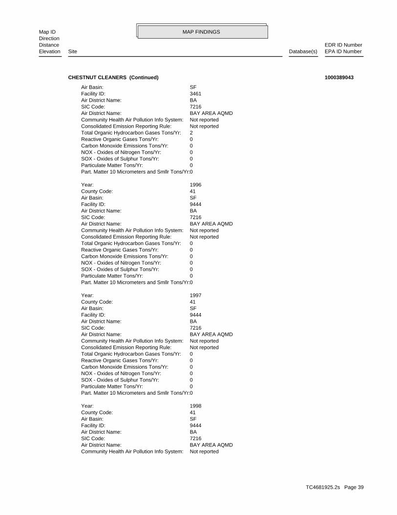
MAP FINDINGSMap IDDirection
EDR ID NumberDistanceEPA ID NumberDatabase(s)SiteElevation
Not reportedCommunity Health Air Pollution Info System: BAY AREA AQMDAir District Name: 7216SIC Code: BAAir District Name: 9444Facility ID: SFAir Basin: 41County Code: 1998Year:
0Part. Matter 10 Micrometers and Smllr Tons/Yr: 0Particulate Matter Tons/Yr: 0SOX - Oxides of Sulphur Tons/Yr: 0NOX - Oxides of Nitrogen Tons/Yr: 0Carbon Monoxide Emissions Tons/Yr: 0Reactive Organic Gases Tons/Yr: 0Total Organic Hydrocarbon Gases Tons/Yr: Not reportedConsolidated Emission Reporting Rule: Not reportedCommunity Health Air Pollution Info System: BAY AREA AQMDAir District Name: 7216SIC Code: BAAir District Name: 9444Facility ID: SFAir Basin: 41County Code: 1997Year:
0Part. Matter 10 Micrometers and Smllr Tons/Yr: 0Particulate Matter Tons/Yr: 0SOX - Oxides of Sulphur Tons/Yr: 0NOX - Oxides of Nitrogen Tons/Yr: 0Carbon Monoxide Emissions Tons/Yr: 0Reactive Organic Gases Tons/Yr: 0Total Organic Hydrocarbon Gases Tons/Yr: Not reportedConsolidated Emission Reporting Rule: Not reportedCommunity Health Air Pollution Info System: BAY AREA AQMDAir District Name: 7216SIC Code: BAAir District Name: 9444Facility ID: SFAir Basin: 41County Code: 1996Year:
0Part. Matter 10 Micrometers and Smllr Tons/Yr: 0Particulate Matter Tons/Yr: 0SOX - Oxides of Sulphur Tons/Yr: 0NOX - Oxides of Nitrogen Tons/Yr: 0Carbon Monoxide Emissions Tons/Yr: 0Reactive Organic Gases Tons/Yr: 2Total Organic Hydrocarbon Gases Tons/Yr: Not reportedConsolidated Emission Reporting Rule: Not reportedCommunity Health Air Pollution Info System: BAY AREA AQMDAir District Name: 7216SIC Code: BAAir District Name: 3461Facility ID: SFAir Basin:
CHESTNUT CLEANERS (Continued) 1000389043
TC4681925.2s Page 39

MAP FINDINGSMap IDDirection
EDR ID NumberDistanceEPA ID NumberDatabase(s)SiteElevation
0SOX - Oxides of Sulphur Tons/Yr: 0NOX - Oxides of Nitrogen Tons/Yr: 0Carbon Monoxide Emissions Tons/Yr: 0Reactive Organic Gases Tons/Yr: 0Total Organic Hydrocarbon Gases Tons/Yr: Not reportedConsolidated Emission Reporting Rule: Not reportedCommunity Health Air Pollution Info System: BAY AREA AQMDAir District Name: 7216SIC Code: BAAir District Name: 12519Facility ID: SFAir Basin: 41County Code: 2001Year:
0Part. Matter 10 Micrometers and Smllr Tons/Yr: 0Particulate Matter Tons/Yr: 0SOX - Oxides of Sulphur Tons/Yr: 0NOX - Oxides of Nitrogen Tons/Yr: 0Carbon Monoxide Emissions Tons/Yr: 0Reactive Organic Gases Tons/Yr: 0Total Organic Hydrocarbon Gases Tons/Yr: Not reportedConsolidated Emission Reporting Rule: Not reportedCommunity Health Air Pollution Info System: BAY AREA AQMDAir District Name: 7216SIC Code: BAAir District Name: 12519Facility ID: SFAir Basin: 41County Code: 2000Year:
0Part. Matter 10 Micrometers and Smllr Tons/Yr: 0Particulate Matter Tons/Yr: 0SOX - Oxides of Sulphur Tons/Yr: 0NOX - Oxides of Nitrogen Tons/Yr: 0Carbon Monoxide Emissions Tons/Yr: 0Reactive Organic Gases Tons/Yr: 0Total Organic Hydrocarbon Gases Tons/Yr: Not reportedConsolidated Emission Reporting Rule: Not reportedCommunity Health Air Pollution Info System: BAY AREA AQMDAir District Name: 7216SIC Code: BAAir District Name: 12519Facility ID: SFAir Basin: 41County Code: 1999Year:
0Part. Matter 10 Micrometers and Smllr Tons/Yr: 0Particulate Matter Tons/Yr: 0SOX - Oxides of Sulphur Tons/Yr: 0NOX - Oxides of Nitrogen Tons/Yr: 0Carbon Monoxide Emissions Tons/Yr: 0Reactive Organic Gases Tons/Yr: 0Total Organic Hydrocarbon Gases Tons/Yr: Not reportedConsolidated Emission Reporting Rule:
CHESTNUT CLEANERS (Continued) 1000389043
TC4681925.2s Page 40

MAP FINDINGSMap IDDirection
EDR ID NumberDistanceEPA ID NumberDatabase(s)SiteElevation
SFAir Basin: 41County Code: 2005Year:
0Part. Matter 10 Micrometers and Smllr Tons/Yr: 0Particulate Matter Tons/Yr: 0SOX - Oxides of Sulphur Tons/Yr: 0NOX - Oxides of Nitrogen Tons/Yr: 0Carbon Monoxide Emissions Tons/Yr: 0Reactive Organic Gases Tons/Yr: 0.236Total Organic Hydrocarbon Gases Tons/Yr: Not reportedConsolidated Emission Reporting Rule: Not reportedCommunity Health Air Pollution Info System: BAY AREA AQMDAir District Name: 7216SIC Code: BAAir District Name: 12519Facility ID: SFAir Basin: 41County Code: 2004Year:
0Part. Matter 10 Micrometers and Smllr Tons/Yr: 0Particulate Matter Tons/Yr: 0SOX - Oxides of Sulphur Tons/Yr: 0NOX - Oxides of Nitrogen Tons/Yr: 0Carbon Monoxide Emissions Tons/Yr: 0Reactive Organic Gases Tons/Yr: 0Total Organic Hydrocarbon Gases Tons/Yr: Not reportedConsolidated Emission Reporting Rule: Not reportedCommunity Health Air Pollution Info System: BAY AREA AQMDAir District Name: 7216SIC Code: BAAir District Name: 12519Facility ID: SFAir Basin: 41County Code: 2003Year:
0Part. Matter 10 Micrometers and Smllr Tons/Yr: 0Particulate Matter Tons/Yr: 0SOX - Oxides of Sulphur Tons/Yr: 0NOX - Oxides of Nitrogen Tons/Yr: 0Carbon Monoxide Emissions Tons/Yr: 0Reactive Organic Gases Tons/Yr: 0Total Organic Hydrocarbon Gases Tons/Yr: Not reportedConsolidated Emission Reporting Rule: Not reportedCommunity Health Air Pollution Info System: BAY AREA AQMDAir District Name: 7216SIC Code: BAAir District Name: 12519Facility ID: SFAir Basin: 41County Code: 2002Year:
0Part. Matter 10 Micrometers and Smllr Tons/Yr: 0Particulate Matter Tons/Yr:
CHESTNUT CLEANERS (Continued) 1000389043
TC4681925.2s Page 41

MAP FINDINGSMap IDDirection
EDR ID NumberDistanceEPA ID NumberDatabase(s)SiteElevation
Not reportedConsolidated Emission Reporting Rule: Not reportedCommunity Health Air Pollution Info System: BAY AREA AQMDAir District Name: 7216SIC Code: BAAir District Name: 19842Facility ID: SFAir Basin: 41County Code: 2008Year:
0Part. Matter 10 Micrometers and Smllr Tons/Yr: 0Particulate Matter Tons/Yr: 0SOX - Oxides of Sulphur Tons/Yr: 0NOX - Oxides of Nitrogen Tons/Yr: 0Carbon Monoxide Emissions Tons/Yr: .0468062Reactive Organic Gases Tons/Yr: .067Total Organic Hydrocarbon Gases Tons/Yr: Not reportedConsolidated Emission Reporting Rule: Not reportedCommunity Health Air Pollution Info System: BAY AREA AQMDAir District Name: 7216SIC Code: BAAir District Name: 12519Facility ID: SFAir Basin: 41County Code: 2007Year:
0Part. Matter 10 Micrometers and Smllr Tons/Yr: 0Particulate Matter Tons/Yr: 0SOX - Oxides of Sulphur Tons/Yr: 0NOX - Oxides of Nitrogen Tons/Yr: 0Carbon Monoxide Emissions Tons/Yr: 0Reactive Organic Gases Tons/Yr: .067Total Organic Hydrocarbon Gases Tons/Yr: Not reportedConsolidated Emission Reporting Rule: Not reportedCommunity Health Air Pollution Info System: BAY AREA AQMDAir District Name: 7216SIC Code: BAAir District Name: 12519Facility ID: SFAir Basin: 41County Code: 2006Year:
0Part. Matter 10 Micrometers and Smllr Tons/Yr: 0Particulate Matter Tons/Yr: 0SOX - Oxides of Sulphur Tons/Yr: 0NOX - Oxides of Nitrogen Tons/Yr: 0Carbon Monoxide Emissions Tons/Yr: 0Reactive Organic Gases Tons/Yr: 0Total Organic Hydrocarbon Gases Tons/Yr: Not reportedConsolidated Emission Reporting Rule: Not reportedCommunity Health Air Pollution Info System: BAY AREA AQMDAir District Name: 7216SIC Code: BAAir District Name: 12519Facility ID:
CHESTNUT CLEANERS (Continued) 1000389043
TC4681925.2s Page 42

MAP FINDINGSMap IDDirection
EDR ID NumberDistanceEPA ID NumberDatabase(s)SiteElevation
http://echo.epa.gov/detailed_facility_report?fid=110001171641DFR URL: 110001171641Registry ID: 1000389043Envid:
ECHO:
0Part. Matter 10 Micrometers and Smllr Tons/Yr: 0Particulate Matter Tons/Yr: 0SOX - Oxides of Sulphur Tons/Yr: 0NOX - Oxides of Nitrogen Tons/Yr: 0Carbon Monoxide Emissions Tons/Yr: 4.6806199999999999E-2Reactive Organic Gases Tons/Yr: 6.7000000000000004E-2Total Organic Hydrocarbon Gases Tons/Yr: Not reportedConsolidated Emission Reporting Rule: Not reportedCommunity Health Air Pollution Info System: BAY AREA AQMDAir District Name: 7216SIC Code: BAAir District Name: 19842Facility ID: SFAir Basin: 41County Code: 2010Year:
0Part. Matter 10 Micrometers and Smllr Tons/Yr: 0Particulate Matter Tons/Yr: 0SOX - Oxides of Sulphur Tons/Yr: 0NOX - Oxides of Nitrogen Tons/Yr: 0Carbon Monoxide Emissions Tons/Yr: 0Reactive Organic Gases Tons/Yr: 6.7000000000000004E-2Total Organic Hydrocarbon Gases Tons/Yr: Not reportedConsolidated Emission Reporting Rule: Not reportedCommunity Health Air Pollution Info System: BAY AREA AQMDAir District Name: 7216SIC Code: BAAir District Name: 19842Facility ID: SFAir Basin: 41County Code: 2009Year:
0Part. Matter 10 Micrometers and Smllr Tons/Yr: 0Particulate Matter Tons/Yr: 0SOX - Oxides of Sulphur Tons/Yr: 0NOX - Oxides of Nitrogen Tons/Yr: 0Carbon Monoxide Emissions Tons/Yr: 0Reactive Organic Gases Tons/Yr: .067Total Organic Hydrocarbon Gases Tons/Yr:
CHESTNUT CLEANERS (Continued) 1000389043
GENERATES and RECYCLES WASTE OIL/SOLVENTProg Element Code: FA0017864Facility ID: SAN MATEORegion:
San Mateo Co. BI:
271 ft. Site 6 of 8 in cluster C0.051 mi.
Relative:Lower
Actual:28 ft.
< 1/8 SOUTH SAN FRANCISCO, CA 94080ESE HAZNET26 CHESTNUT N/AC27 San Mateo Co. BICHESTNUT CLEANERS S113008393
TC4681925.2s Page 43

MAP FINDINGSMap IDDirection
EDR ID NumberDistanceEPA ID NumberDatabase(s)SiteElevation
Not reportedTSD County: CA0000084517TSD EPA ID: Not reportedGen County: SOUTH SAN FRANCISCO, CA 940803229Mailing City,St,Zip: 26 CHESTNUT AVEMailing Address: Not reportedMailing Name: 6508717523Telephone: EUN YOUNG KIM/OWNERContact: CAD981632862GEPAID: 2008Year: S113008393envid:
San MateoFacility County: (H010-H129) Or (H131-H135) Storage, Bulking, And/Or Transfer Off Site--No Treatment/ReoveryMethod Decode: Liquids with halogenated organic compounds >= 1,000 Mg./LCat Decode: 0.175Tons: (H010-H129) Or (H131-H135) Storage, Bulking, And/Or Transfer Off Site--No Treatment/ReoveryDisposal Method: Liquids with halogenated organic compounds >= 1,000 Mg./LWaste Category: Not reportedTSD County: CA0000084517TSD EPA ID: Not reportedGen County: SOUTH SAN FRANCISCO, CA 940803229Mailing City,St,Zip: 26 CHESTNUT AVEMailing Address: Not reportedMailing Name: 6508717523Telephone: EUN YOUNG KIM/OWNERContact: CAD981632862GEPAID: 2008Year: S113008393envid:
HAZNET:
ACTIVEFacility Status: STORES HAZ MAT <219GAL,1,999LB, 879CFDescription: PR0056857Record Id: STORES HAZ MAT <219GAL,1,999LB, 879FT3Prog Element Code: FA0040943Facility ID: SAN MATEORegion:
ACTIVEFacility Status: GENERATES <27 GAL/YEARDescription: PR0056858Record Id: GENERATES <27 GAL/YEARProg Element Code: FA0040943Facility ID: SAN MATEORegion:
INACTIVEFacility Status: STORES HAZ MAT <219GAL,1,999LB, 879CFDescription: PR0004306Record Id: STORES HAZ MAT <219GAL,1,999LB, 879FT3Prog Element Code: FA0017864Facility ID: SAN MATEORegion:
INACTIVEFacility Status: GENERATES & RECYCLES WASTE OIL/SOLVENTDescription: PR0011579Record Id:
CHESTNUT CLEANERS (Continued) S113008393
TC4681925.2s Page 44

MAP FINDINGSMap IDDirection
EDR ID NumberDistanceEPA ID NumberDatabase(s)SiteElevation
SOUTH SAN FRANCISCO, CA 940803229Mailing City,St,Zip: 26 CHESTNUT AVEMailing Address: Not reportedMailing Name: 6508717523Telephone: EUN YOUNG KIM/OWNERContact: CAD981632862GEPAID: 2007Year: S113008393envid:
San MateoFacility County: (H010-H129) Or (H131-H135) Storage, Bulking, And/Or Transfer Off Site--No Treatment/ReoveryMethod Decode: Liquids with halogenated organic compounds >= 1,000 Mg./LCat Decode: 0.21Tons: (H010-H129) Or (H131-H135) Storage, Bulking, And/Or Transfer Off Site--No Treatment/ReoveryDisposal Method: Liquids with halogenated organic compounds >= 1,000 Mg./LWaste Category: Not reportedTSD County: CA0000084517TSD EPA ID: Not reportedGen County: SOUTH SAN FRANCISCO, CA 940803229Mailing City,St,Zip: 26 CHESTNUT AVEMailing Address: Not reportedMailing Name: 6508717523Telephone: EUN YOUNG KIM/OWNERContact: CAD981632862GEPAID: 2007Year: S113008393envid:
San MateoFacility County: (H010-H129) Or (H131-H135) Storage, Bulking, And/Or Transfer Off Site--No Treatment/ReoveryMethod Decode: Liquids with halogenated organic compounds >= 1,000 Mg./LCat Decode: 0.175Tons: (H010-H129) Or (H131-H135) Storage, Bulking, And/Or Transfer Off Site--No Treatment/ReoveryDisposal Method: Liquids with halogenated organic compounds >= 1,000 Mg./LWaste Category: Not reportedTSD County: CA0000084517TSD EPA ID: Not reportedGen County: SOUTH SAN FRANCISCO, CA 940803229Mailing City,St,Zip: 26 CHESTNUT AVEMailing Address: Not reportedMailing Name: 6508717523Telephone: EUN YOUNG KIM/OWNERContact: CAD981632862GEPAID: 2008Year: S113008393envid:
San MateoFacility County: (H010-H129) Or (H131-H135) Storage, Bulking, And/Or Transfer Off Site--No Treatment/ReoveryMethod Decode: Liquids with halogenated organic compounds >= 1,000 Mg./LCat Decode: 0.175Tons: (H010-H129) Or (H131-H135) Storage, Bulking, And/Or Transfer Off Site--No Treatment/ReoveryDisposal Method: Liquids with halogenated organic compounds >= 1,000 Mg./LWaste Category:
CHESTNUT CLEANERS (Continued) S113008393
TC4681925.2s Page 45

MAP FINDINGSMap IDDirection
EDR ID NumberDistanceEPA ID NumberDatabase(s)SiteElevation
58 additional CA_HAZNET: record(s) in the EDR Site Report.Click this hyperlink while viewing on your computer to access
San MateoFacility County: (H010-H129) Or (H131-H135) Storage, Bulking, And/Or Transfer Off Site--No Treatment/ReoveryMethod Decode: Liquids with halogenated organic compounds >= 1,000 Mg./LCat Decode: 0.21Tons: (H010-H129) Or (H131-H135) Storage, Bulking, And/Or Transfer Off Site--No Treatment/ReoveryDisposal Method: Liquids with halogenated organic compounds >= 1,000 Mg./LWaste Category: Not reportedTSD County: CA0000084517TSD EPA ID: Not reportedGen County:
CHESTNUT CLEANERS (Continued) S113008393
26 CHESTNUT AVEAddress: 2010Year: CHESTNUT CLEANERSName:
26 CHESTNUT AVEAddress: 2008Year: CHESTNUT CLEANERSName:
26 CHESTNUT AVEAddress: 2007Year: CHESTNUT CLEANERSName:
26 CHESTNUT AVEAddress: 2006Year: CHESTNUT CLEANERSName:
26 CHESTNUT AVEAddress: 2005Year: CHESTNUT CLEANERSName:
26 CHESTNUT AVEAddress: 2004Year: CHESTNUT CLEANERSName:
26 CHESTNUT AVEAddress: 2003Year: CHESTNUT CLEANERSName:
26 CHESTNUT AVEAddress: 2002Year: CHESTNUT CLEANERSName:
26 CHESTNUT AVEAddress: 2001Year: CHESTNUT CLEANERSName:
EDR Historical Cleaners:
271 ft. Site 7 of 8 in cluster C0.051 mi.
Relative:Lower
Actual:28 ft.
< 1/8 SOUTH SAN FRANCISCO, CA 94080ESE 26 CHESTNUT AVE N/AC28 EDR Hist Cleaner 1015029769
TC4681925.2s Page 46

MAP FINDINGSMap IDDirection
EDR ID NumberDistanceEPA ID NumberDatabase(s)SiteElevation
26 CHESTNUT AVEAddress: 2012Year: CHESTNUT CLEANERSName:
26 CHESTNUT AVEAddress: 2011Year: CHESTNUT CLEANERSName:
(Continued) 1015029769
ACTIVEFacility Status: STORES MV FUELS OR WASTE ONLYDescription: PR0071577Record Id: STORES MV FUELS OR WASTE ONLYProg Element Code: FA0002566Facility ID: SAN MATEORegion:
ACTIVEFacility Status: GENERATES <27 GAL/YEARDescription: PR0071578Record Id: GENERATES <27 GAL/YEARProg Element Code: FA0002566Facility ID: SAN MATEORegion:
San Mateo Co. BI:
282 ft. Site 8 of 8 in cluster C0.053 mi.
Relative:Lower
Actual:28 ft.
< 1/8 , CA 94080ESE 30 CHESTNUT N/AC29 San Mateo Co. BISAFEWAY STORE #777 S117397312
1Number Of Tanks: DIESELContent: PSTG: M.V. FUELTank Use: 04-22-94Active Date: 12000Capacity: ATank Status: 41-000-550154-000001SWRCB Tank Id: EMERGENCYOwner Tank Id: 07-07-92Created Date: 04-22-94Action Date: 04-22-94Referral Date: Not reportedBoard Of Equalization: 1Number: 550154Comp Number: ActiveStatus:
SWEEPS UST:
302 ft. Site 1 of 7 in cluster F0.057 mi.
Relative:Higher
Actual:56 ft.
< 1/8 S SAN FRANCISCO, CA 94080SW 1200 EL CAMINO REAL N/AF30 SWEEPS USTKAISER HOSPITAL S102269311
TC4681925.2s Page 47

MAP FINDINGSMap IDDirection
EDR ID NumberDistanceEPA ID NumberDatabase(s)SiteElevation
ActiveStatus: Not reportedComments: Not reportedEPA ID: Not reportedNPDES Number: Not reportedDUNs Number: Not reportedContact Phone: Not reportedContact: SO. SAN FRANCISCO 94080Mailing City,St,Zip: Not reportedMailing Address 2: 1924 BROADWAYMailing Address: Not reportedMail To: 4157422000Facility Phone: Not reportedSIC Code: Not reportedCortese Code: Not reportedRegulated ID: UTNKARegulated By: 41000358Facility ID:
CA FID UST:
302 ft. Site 2 of 7 in cluster F0.057 mi.
Relative:Higher
Actual:56 ft.
< 1/8 SO. SAN FRANCISCO, CA 94080SW 1200 EL CAMINO REAL N/AF31 CA FID USTKAISER FOUNDATION HOSPITAL S101593739
-122.43841Longitude: 37.65799Latitude: SAN MATEO COUNTYPermitting Agency: 41--434343Facility ID:
UST:
302 ft. Site 3 of 7 in cluster F0.057 mi.
Relative:Higher
Actual:56 ft.
< 1/8 SAN FRANSISCO, CA 94080SW 1200 EL CAMINO REAL N/AF32 USTKAISER HOSPITAL U003782671
[email protected] email: (650) 742-3016Contact telephone: Not reportedContact country: SOUTH SAN FRANCISCO, CA 94080 EL CAMINO REALContact address: GERALD L VILLORENTEContact: SOUTH SAN FRANCISCO, CA 94080 EL CAMINO REALMailing address: CAD981426950EPA ID: SOUTH SAN FRANCISCO, CA 94080 1200 EL CAMINO REALFacility address: KAISER FOUNDATION HOSPITAL - SO SAN FRANCISCO MED CTRFacility name: 03/01/2014Date form received by agency:
RCRA-LQG:
ECHO302 ft. EMISite 4 of 7 in cluster F0.057 mi. San Mateo Co. BI
Relative:Higher
Actual:56 ft.
< 1/8 FINDSSOUTH SAN FRANCISCO, CA 94080SW HIST UST1200 EL CAMINO REAL CAD981426950F33 RCRA-LQGKAISER PERMANENTE MEDICAL CENTER 1000380347
TC4681925.2s Page 48

MAP FINDINGSMap IDDirection
EDR ID NumberDistanceEPA ID NumberDatabase(s)SiteElevation
IGNITABLE WASTE. Waste name: D001. Waste code:
NoUsed oil transporter: NoUsed oil transfer facility: NoUsed oil Specification marketer: NoUsed oil fuel marketer to burner: NoUser oil refiner: NoUsed oil processor: NoUsed oil fuel burner: NoFurnace exemption: NoOn-site burner exemption: NoUnderground injection activity: NoTreater, storer or disposer of HW: NoTransporter of hazardous waste: NoRecycler of hazardous waste: NoMixed waste (haz. and radioactive): NoU.S. importer of hazardous waste:
Handler Activities Summary:
Not reportedOwner/Op end date: 01/14/1971Owner/Op start date: OperatorOwner/Operator Type: PrivateLegal status: Not reportedOwner/operator telephone: Not reportedOwner/operator country: Not reported Not reportedOwner/operator address: KAISER FOUNDATION HOSPITALSOwner/operator name:
Not reportedOwner/Op end date: 01/14/1971Owner/Op start date: OwnerOwner/Operator Type: PrivateLegal status: (510) 271-5800Owner/operator telephone: Not reportedOwner/operator country: OAKLAND, CA 94612 KAISER PLAZAOwner/operator address: KAISER FOUNDATION HOSPITALSOwner/operator name:
Owner/Operator Summary:
100 kg of that material at any time hazardous waste during any calendar month, and accumulates more than from the cleanup of a spill, into or on any land or water, of acutely of any residue or contaminated soil, waste or other debris resulting kg of acutely hazardous waste at any time; or generates 100 kg or less hazardous waste during any calendar month, and accumulates more than 1 waste during any calendar month; or generates 1 kg or less of acutely cleanup of a spill, into or on any land or water, of acutely hazardous residue or contaminated soil, waste or other debris resulting from the during any calendar month; or generates more than 100 kg of any calendar month; or generates more than 1 kg of acutely hazardous waste Handler: generates 1,000 kg or more of hazardous waste during anyDescription: Large Quantity GeneratorClassification: 09EPA Region:
KAISER PERMANENTE MEDICAL CENTER (Continued) 1000380347
TC4681925.2s Page 49

MAP FINDINGSMap IDDirection
EDR ID NumberDistanceEPA ID NumberDatabase(s)SiteElevation
09/22/2010Date form received by agency:
MITOMYCIN C OXY-5-METHYL-, [1AS-(1AALPHA, 8BETA, 8AALPHA, 8BALPHA)]- (OR) 6-AMINO-8-[[(AMINOCARBONYL)OXY]METHYL]-1,1A,2,8,8A,8B-HEXAHYDRO-8A-MET AZIRINO [2’,3’:3,4]PYRROLO[1,2-A]INDOLE-4,7-DIONE,. Waste name: U010. Waste code:
ARSENIC OXIDE AS2O3 (OR) ARSENIC TRIOXIDE. Waste name: P012. Waste code:
MIXTURES. BOTTOMS FROM THE RECOVERY OF THESE SPENT SOLVENTS AND SPENT SOLVENT MORE OF THOSE SOLVENTS LISTED IN F001, F002, F004, AND F005; AND STILL SOLVENTS, AND A TOTAL OF TEN PERCENT OR MORE (BY VOLUME) OF ONE OR CONTAINING, BEFORE USE, ONE OR MORE OF THE ABOVE NONHALOGENATED NONHALOGENATED SOLVENTS; AND ALL SPENT SOLVENT MIXTURES/BLENDS MIXTURES/BLENDS CONTAINING, BEFORE USE, ONLY THE ABOVE SPENT ALCOHOL, CYCLOHEXANONE, AND METHANOL; ALL SPENT SOLVENT ACETATE, ETHYL BENZENE, ETHYL ETHER, METHYL ISOBUTYL KETONE, N-BUTYL THE FOLLOWING SPENT NONHALOGENATED SOLVENTS: XYLENE, ACETONE, ETHYL. Waste name: F003. Waste code:
CADMIUM. Waste name: D006. Waste code:
IGNITABLE WASTE. Waste name: D001. Waste code:
Large Quantity GeneratorClassification: KAISER PERMANENTE MEDICAL CENTER - SOUTH SAN FRANCISCOSite name: 03/05/2012Date form received by agency:
Historical Generators:
MITOMYCIN C OXY-5-METHYL-, [1AS-(1AALPHA, 8BETA, 8AALPHA, 8BALPHA)]- (OR) 6-AMINO-8-[[(AMINOCARBONYL)OXY]METHYL]-1,1A,2,8,8A,8B-HEXAHYDRO-8A-MET AZIRINO [2’,3’:3,4]PYRROLO[1,2-A]INDOLE-4,7-DIONE,. Waste name: U010. Waste code:
ARSENIC OXIDE AS2O3 (OR) ARSENIC TRIOXIDE. Waste name: P012. Waste code:
MIXTURES. BOTTOMS FROM THE RECOVERY OF THESE SPENT SOLVENTS AND SPENT SOLVENT MORE OF THOSE SOLVENTS LISTED IN F001, F002, F004, AND F005; AND STILL SOLVENTS, AND A TOTAL OF TEN PERCENT OR MORE (BY VOLUME) OF ONE OR CONTAINING, BEFORE USE, ONE OR MORE OF THE ABOVE NONHALOGENATED NONHALOGENATED SOLVENTS; AND ALL SPENT SOLVENT MIXTURES/BLENDS MIXTURES/BLENDS CONTAINING, BEFORE USE, ONLY THE ABOVE SPENT ALCOHOL, CYCLOHEXANONE, AND METHANOL; ALL SPENT SOLVENT ACETATE, ETHYL BENZENE, ETHYL ETHER, METHYL ISOBUTYL KETONE, N-BUTYL THE FOLLOWING SPENT NONHALOGENATED SOLVENTS: XYLENE, ACETONE, ETHYL. Waste name: F003. Waste code:
MERCURY. Waste name: D009. Waste code:
KAISER PERMANENTE MEDICAL CENTER (Continued) 1000380347
TC4681925.2s Page 50

MAP FINDINGSMap IDDirection
EDR ID NumberDistanceEPA ID NumberDatabase(s)SiteElevation
D002. Waste code:
IGNITABLE WASTE. Waste name: D001. Waste code:
Small Quantity GeneratorClassification: KAISER PERMANENTE MEDICAL CENTERSite name: 02/12/2008Date form received by agency:
L-PHENYLALANINE, 4-[BIS(2-CHLOROETHYL)AMINO]- (OR) MELPHALAN. Waste name: U150. Waste code:
DAUNOMYCIN ,8,9,10-TETRAHYDRO-6,8,11-TRIHYDROXY-1-METHOXY-, (8S-CIS)- (OR) 8-ACETYL-10-[(3-AMINO-2,3,6-TRIDEOXY)-ALPHA-L-LYXO-HEXOPYRANOSYL)OXY]- 5,12-NAPHTHACENEDIONE,. Waste name: U059. Waste code:
2-OXIDE (OR) CYCLOPHOSPHAMIDE 2H-1,3,2-OXAZAPHOSPHORIN-2-AMINE, N,N-BIS(2-CHLOROETHYL)TETRAHYDRO-,. Waste name: U058. Waste code:
BENZENEBUTANOIC ACID, 4-[BIS(2-CHLOROETHYL)AMINO]- (OR) CHLORAMBUCIL. Waste name: U035. Waste code:
MITOMYCIN C OXY-5-METHYL-, [1AS-(1AALPHA, 8BETA, 8AALPHA, 8BALPHA)]- (OR) 6-AMINO-8-[[(AMINOCARBONYL)OXY]METHYL]-1,1A,2,8,8A,8B-HEXAHYDRO-8A-MET AZIRINO [2’,3’:3,4]PYRROLO[1,2-A]INDOLE-4,7-DIONE,. Waste name: U010. Waste code:
MIXTURES. BOTTOMS FROM THE RECOVERY OF THESE SPENT SOLVENTS AND SPENT SOLVENT MORE OF THOSE SOLVENTS LISTED IN F001, F002, F004, AND F005; AND STILL SOLVENTS, AND A TOTAL OF TEN PERCENT OR MORE (BY VOLUME) OF ONE OR CONTAINING, BEFORE USE, ONE OR MORE OF THE ABOVE NONHALOGENATED NONHALOGENATED SOLVENTS; AND ALL SPENT SOLVENT MIXTURES/BLENDS MIXTURES/BLENDS CONTAINING, BEFORE USE, ONLY THE ABOVE SPENT ALCOHOL, CYCLOHEXANONE, AND METHANOL; ALL SPENT SOLVENT ACETATE, ETHYL BENZENE, ETHYL ETHER, METHYL ISOBUTYL KETONE, N-BUTYL THE FOLLOWING SPENT NONHALOGENATED SOLVENTS: XYLENE, ACETONE, ETHYL. Waste name: F003. Waste code:
MERCURY. Waste name: D009. Waste code:
LEAD. Waste name: D008. Waste code:
CORROSIVE WASTE. Waste name: D002. Waste code:
IGNITABLE WASTE. Waste name: D001. Waste code:
Large Quantity GeneratorClassification: KAISER PERMANENTE MEDICAL CENTERSite name:
KAISER PERMANENTE MEDICAL CENTER (Continued) 1000380347
TC4681925.2s Page 51

MAP FINDINGSMap IDDirection
EDR ID NumberDistanceEPA ID NumberDatabase(s)SiteElevation
SILVER. Waste name: D011. Waste code:
MERCURY. Waste name: D009. Waste code:
CADMIUM. Waste name: D006. Waste code:
REACTIVE WASTE. Waste name: D003. Waste code:
CORROSIVE WASTE. Waste name: D002. Waste code:
IGNITABLE WASTE. Waste name: D001. Waste code:
Large Quantity GeneratorClassification: KAISER PERMANENTE MEDICAL CENTERSite name: 03/29/2006Date form received by agency:
1,3-BENZENEDIOL (OR) RESORCINOL. Waste name: U201. Waste code:
PHENOL. Waste name: U188. Waste code:
BENZENEBUTANOIC ACID, 4-[BIS(2-CHLOROETHYL)AMINO]- (OR) CHLORAMBUCIL. Waste name: U035. Waste code:
MIXTURES. BOTTOMS FROM THE RECOVERY OF THESE SPENT SOLVENTS AND SPENT SOLVENT MORE OF THOSE SOLVENTS LISTED IN F001, F002, F004, AND F005; AND STILL SOLVENTS, AND A TOTAL OF TEN PERCENT OR MORE (BY VOLUME) OF ONE OR CONTAINING, BEFORE USE, ONE OR MORE OF THE ABOVE NONHALOGENATED NONHALOGENATED SOLVENTS; AND ALL SPENT SOLVENT MIXTURES/BLENDS MIXTURES/BLENDS CONTAINING, BEFORE USE, ONLY THE ABOVE SPENT ALCOHOL, CYCLOHEXANONE, AND METHANOL; ALL SPENT SOLVENT ACETATE, ETHYL BENZENE, ETHYL ETHER, METHYL ISOBUTYL KETONE, N-BUTYL THE FOLLOWING SPENT NONHALOGENATED SOLVENTS: XYLENE, ACETONE, ETHYL. Waste name: F003. Waste code:
SILVER. Waste name: D011. Waste code:
MERCURY. Waste name: D009. Waste code:
LEAD. Waste name: D008. Waste code:
CHROMIUM. Waste name: D007. Waste code:
CORROSIVE WASTE. Waste name:
KAISER PERMANENTE MEDICAL CENTER (Continued) 1000380347
TC4681925.2s Page 52

MAP FINDINGSMap IDDirection
EDR ID NumberDistanceEPA ID NumberDatabase(s)SiteElevation
Large Quantity GeneratorClassification: KAISER PERMANENTE MEDICAL CENTERSite name: 03/15/1996Date form received by agency:
Large Quantity GeneratorClassification: KAISER PERMANENTESite name: 03/21/1996Date form received by agency:
Large Quantity GeneratorClassification: KAISER PERMANENTESite name: 09/01/1996Date form received by agency:
Large Quantity GeneratorClassification: KAISER PERMANENTE MEDICAL CENTERSite name: 03/04/1999Date form received by agency:
Large Quantity GeneratorClassification: KAISER HOSPITAL SOUTH SAN FRANCISCOSite name: 10/12/2000Date form received by agency:
Large Quantity GeneratorClassification: KAISER HOSPITAL SOUTH SAN FRANCISCOSite name: 02/12/2002Date form received by agency:
PHENOL. Waste name: U188. Waste code:
MIXTURES. BOTTOMS FROM THE RECOVERY OF THESE SPENT SOLVENTS AND SPENT SOLVENT MORE OF THOSE SOLVENTS LISTED IN F001, F002, F004, AND F005; AND STILL SOLVENTS, AND A TOTAL OF TEN PERCENT OR MORE (BY VOLUME) OF ONE OR CONTAINING, BEFORE USE, ONE OR MORE OF THE ABOVE NONHALOGENATED NONHALOGENATED SOLVENTS; AND ALL SPENT SOLVENT MIXTURES/BLENDS MIXTURES/BLENDS CONTAINING, BEFORE USE, ONLY THE ABOVE SPENT ALCOHOL, CYCLOHEXANONE, AND METHANOL; ALL SPENT SOLVENT ACETATE, ETHYL BENZENE, ETHYL ETHER, METHYL ISOBUTYL KETONE, N-BUTYL THE FOLLOWING SPENT NONHALOGENATED SOLVENTS: XYLENE, ACETONE, ETHYL. Waste name: F003. Waste code:
SILVER. Waste name: D011. Waste code:
IGNITABLE WASTE. Waste name: D001. Waste code:
Large Quantity GeneratorClassification: KAISER FOUNDATION HOSPTIALSite name: 03/30/2004Date form received by agency:
PHENOL. Waste name: U188. Waste code:
MITOMYCIN C OXY-5-METHYL-, [1AS-(1AALPHA, 8BETA, 8AALPHA, 8BALPHA)]- (OR) 6-AMINO-8-[[(AMINOCARBONYL)OXY]METHYL]-1,1A,2,8,8A,8B-HEXAHYDRO-8A-MET AZIRINO [2’,3’:3,4]PYRROLO[1,2-A]INDOLE-4,7-DIONE,. Waste name: U010. Waste code:
KAISER PERMANENTE MEDICAL CENTER (Continued) 1000380347
TC4681925.2s Page 53
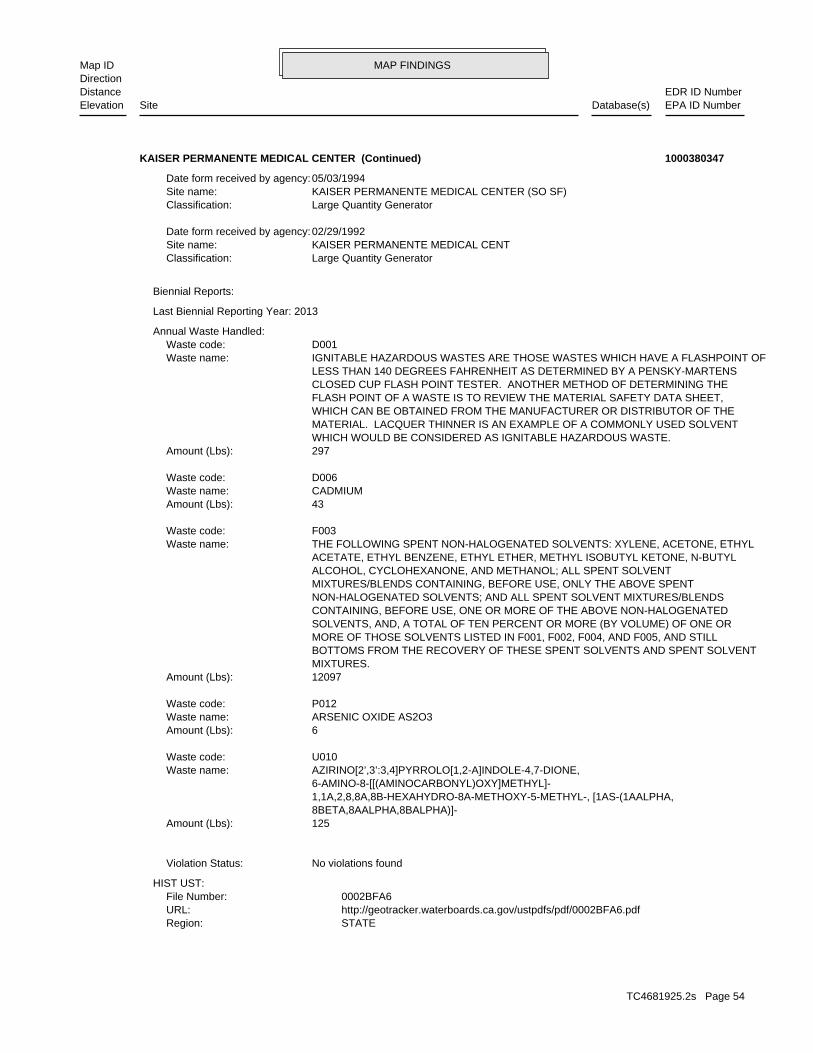
MAP FINDINGSMap IDDirection
EDR ID NumberDistanceEPA ID NumberDatabase(s)SiteElevation
STATERegion: http://geotracker.waterboards.ca.gov/ustpdfs/pdf/0002BFA6.pdfURL: 0002BFA6File Number:
HIST UST:
No violations foundViolation Status:
125Amount (Lbs): 8BETA,8AALPHA,8BALPHA)]- 1,1A,2,8,8A,8B-HEXAHYDRO-8A-METHOXY-5-METHYL-, [1AS-(1AALPHA, 6-AMINO-8-[[(AMINOCARBONYL)OXY]METHYL]- AZIRINO[2’,3’:3,4]PYRROLO[1,2-A]INDOLE-4,7-DIONE,Waste name: U010Waste code:
6Amount (Lbs): ARSENIC OXIDE AS2O3Waste name: P012Waste code:
12097Amount (Lbs): MIXTURES. BOTTOMS FROM THE RECOVERY OF THESE SPENT SOLVENTS AND SPENT SOLVENT MORE OF THOSE SOLVENTS LISTED IN F001, F002, F004, AND F005, AND STILL SOLVENTS, AND, A TOTAL OF TEN PERCENT OR MORE (BY VOLUME) OF ONE OR CONTAINING, BEFORE USE, ONE OR MORE OF THE ABOVE NON-HALOGENATED NON-HALOGENATED SOLVENTS; AND ALL SPENT SOLVENT MIXTURES/BLENDS MIXTURES/BLENDS CONTAINING, BEFORE USE, ONLY THE ABOVE SPENT ALCOHOL, CYCLOHEXANONE, AND METHANOL; ALL SPENT SOLVENT ACETATE, ETHYL BENZENE, ETHYL ETHER, METHYL ISOBUTYL KETONE, N-BUTYL THE FOLLOWING SPENT NON-HALOGENATED SOLVENTS: XYLENE, ACETONE, ETHYLWaste name: F003Waste code:
43Amount (Lbs): CADMIUMWaste name: D006Waste code:
297Amount (Lbs): WHICH WOULD BE CONSIDERED AS IGNITABLE HAZARDOUS WASTE. MATERIAL. LACQUER THINNER IS AN EXAMPLE OF A COMMONLY USED SOLVENT WHICH CAN BE OBTAINED FROM THE MANUFACTURER OR DISTRIBUTOR OF THE FLASH POINT OF A WASTE IS TO REVIEW THE MATERIAL SAFETY DATA SHEET, CLOSED CUP FLASH POINT TESTER. ANOTHER METHOD OF DETERMINING THE LESS THAN 140 DEGREES FAHRENHEIT AS DETERMINED BY A PENSKY-MARTENS IGNITABLE HAZARDOUS WASTES ARE THOSE WASTES WHICH HAVE A FLASHPOINT OFWaste name: D001Waste code:
Annual Waste Handled:
Last Biennial Reporting Year: 2013
Biennial Reports:
Large Quantity GeneratorClassification: KAISER PERMANENTE MEDICAL CENTSite name: 02/29/1992Date form received by agency:
Large Quantity GeneratorClassification: KAISER PERMANENTE MEDICAL CENTER (SO SF)Site name: 05/03/1994Date form received by agency:
KAISER PERMANENTE MEDICAL CENTER (Continued) 1000380347
TC4681925.2s Page 54

MAP FINDINGSMap IDDirection
EDR ID NumberDistanceEPA ID NumberDatabase(s)SiteElevation
GEN 1-5 TONS HAZ WASTE/YRDescription: PR0024198Record Id: GEN 1-5 TONS HAZ WASTE/YRProg Element Code: FA0004897Facility ID: SAN MATEORegion:
INACTIVEFacility Status: STORES HAZ MAT <1,199GAL,9,999LB,4,799CFDescription: PR0056653Record Id: STORES HAZ MAT <1,199GAL,9,999LB,4,799FT3Prog Element Code: FA0040822Facility ID: SAN MATEORegion:
San Mateo Co. BI:
HAZARDOUS WASTE BIENNIAL REPORTER
HAZARDOUS AIR POLLUTANT MAJOR
corrective action activities required under RCRA.program staff to track the notification, permit, compliance, andand treat, store, or dispose of hazardous waste. RCRAInfo allows RCRAevents and activities related to facilities that generate, transport,Conservation and Recovery Act (RCRA) program through the tracking ofRCRAInfo is a national information system that supports the Resource
facilities.generators, transporters, and treatment, storage, and disposalprovides California with information on hazardous waste shipments forCalifornia Hazardous Waste Tracking System - Datamart (HWTS-DATAMART) Environmental Interest/Information System
110000831486Registry ID:
FINDS:
Click here for Geo Tracker PDF:
Vapor Sniff WellLeak Detection: Not reportedContainer Construction Thickness: DIESELType of Fuel: PRODUCTTank Used for: 00012000Tank Capacity: 1984Year Installed: 1Container Num: 001Tank Num:
0001Total Tanks: OAKLAND, CA 94606Owner City,St,Zip: 1924 BROADWAYOwner Address: KAISER FOUNDATION HOSPITAL (ADOwner Name: 4158760453Telephone: MR. NORM PETERSONContact Name: HOSPITALOther Type: OtherFacility Type: 00000019818Facility ID:
KAISER PERMANENTE MEDICAL CENTER (Continued) 1000380347
TC4681925.2s Page 55

MAP FINDINGSMap IDDirection
EDR ID NumberDistanceEPA ID NumberDatabase(s)SiteElevation
8062SIC Code: BAAir District Name: 4047Facility ID: SFAir Basin: 41County Code: 2004Year:
0Part. Matter 10 Micrometers and Smllr Tons/Yr: 0Particulate Matter Tons/Yr: 0SOX - Oxides of Sulphur Tons/Yr: 1NOX - Oxides of Nitrogen Tons/Yr: 0Carbon Monoxide Emissions Tons/Yr: 0Reactive Organic Gases Tons/Yr: 0Total Organic Hydrocarbon Gases Tons/Yr: Not reportedConsolidated Emission Reporting Rule: Not reportedCommunity Health Air Pollution Info System: BAY AREA AQMDAir District Name: 8062SIC Code: BAAir District Name: 4047Facility ID: SFAir Basin: 41County Code: 2003Year:
0Part. Matter 10 Micrometers and Smllr Tons/Yr: 0Particulate Matter Tons/Yr: 0SOX - Oxides of Sulphur Tons/Yr: 0NOX - Oxides of Nitrogen Tons/Yr: 0Carbon Monoxide Emissions Tons/Yr: 1Reactive Organic Gases Tons/Yr: 2Total Organic Hydrocarbon Gases Tons/Yr: Not reportedConsolidated Emission Reporting Rule: Not reportedCommunity Health Air Pollution Info System: BAY AREA AQMDAir District Name: 8062SIC Code: BAAir District Name: 4047Facility ID: SFAir Basin: 41County Code: 1990Year:
EMI:
ACTIVEFacility Status: UNDERGROUND TANK - GENERALDescription: PR0022668Record Id: UNDERGROUND TANK - GENERALProg Element Code: FA0004897Facility ID: SAN MATEORegion:
ACTIVEFacility Status: STORES HAZ MAT <31999GAL,223999LB, 111999CFDescription: PR0023586Record Id: STORES HAZ MAT <31999GAL,239999LB, 111999FT^3Prog Element Code: FA0004897Facility ID: SAN MATEORegion:
ACTIVEFacility Status:
KAISER PERMANENTE MEDICAL CENTER (Continued) 1000380347
TC4681925.2s Page 56

MAP FINDINGSMap IDDirection
EDR ID NumberDistanceEPA ID NumberDatabase(s)SiteElevation
.119Carbon Monoxide Emissions Tons/Yr: .0359781Reactive Organic Gases Tons/Yr: .043Total Organic Hydrocarbon Gases Tons/Yr: Not reportedConsolidated Emission Reporting Rule: Not reportedCommunity Health Air Pollution Info System: BAY AREA AQMDAir District Name: 8062SIC Code: BAAir District Name: 4047Facility ID: SFAir Basin: 41County Code: 2007Year:
.018544Part. Matter 10 Micrometers and Smllr Tons/Yr: .019Particulate Matter Tons/Yr: .003SOX - Oxides of Sulphur Tons/Yr: .266NOX - Oxides of Nitrogen Tons/Yr: .056Carbon Monoxide Emissions Tons/Yr: .0184074Reactive Organic Gases Tons/Yr: .022Total Organic Hydrocarbon Gases Tons/Yr: Not reportedConsolidated Emission Reporting Rule: Not reportedCommunity Health Air Pollution Info System: BAY AREA AQMDAir District Name: 8062SIC Code: BAAir District Name: 4047Facility ID: SFAir Basin: 41County Code: 2006Year:
.044896Part. Matter 10 Micrometers and Smllr Tons/Yr: .046Particulate Matter Tons/Yr: .009SOX - Oxides of Sulphur Tons/Yr: .633NOX - Oxides of Nitrogen Tons/Yr: .138Carbon Monoxide Emissions Tons/Yr: .042835Reactive Organic Gases Tons/Yr: .051Total Organic Hydrocarbon Gases Tons/Yr: Not reportedConsolidated Emission Reporting Rule: Not reportedCommunity Health Air Pollution Info System: BAY AREA AQMDAir District Name: 8062SIC Code: BAAir District Name: 4047Facility ID: SFAir Basin: 41County Code: 2005Year:
0.04392Part. Matter 10 Micrometers and Smllr Tons/Yr: 0.045Particulate Matter Tons/Yr: 0.009SOX - Oxides of Sulphur Tons/Yr: 0.612NOX - Oxides of Nitrogen Tons/Yr: 0.133Carbon Monoxide Emissions Tons/Yr: 0.0401616Reactive Organic Gases Tons/Yr: 0.048Total Organic Hydrocarbon Gases Tons/Yr: Not reportedConsolidated Emission Reporting Rule: Not reportedCommunity Health Air Pollution Info System: BAY AREA AQMDAir District Name:
KAISER PERMANENTE MEDICAL CENTER (Continued) 1000380347
TC4681925.2s Page 57

MAP FINDINGSMap IDDirection
EDR ID NumberDistanceEPA ID NumberDatabase(s)SiteElevation
2011Year:
0.016Part. Matter 10 Micrometers and Smllr Tons/Yr: 0.0163934426229508Particulate Matter Tons/Yr: 0SOX - Oxides of Sulphur Tons/Yr: 0.22700000000000001NOX - Oxides of Nitrogen Tons/Yr: 5.0000000000000003E-2Carbon Monoxide Emissions Tons/Yr: 0.0133872Reactive Organic Gases Tons/Yr: 0.016Total Organic Hydrocarbon Gases Tons/Yr: Not reportedConsolidated Emission Reporting Rule: Not reportedCommunity Health Air Pollution Info System: BAY AREA AQMDAir District Name: 8062SIC Code: BAAir District Name: 4047Facility ID: SFAir Basin: 41County Code: 2010Year:
1.5976000000000001E-2Part. Matter 10 Micrometers and Smllr Tons/Yr: 0.0163688524590163Particulate Matter Tons/Yr: 0SOX - Oxides of Sulphur Tons/Yr: 0.22700000000000001NOX - Oxides of Nitrogen Tons/Yr: 5.0000000000000003E-2Carbon Monoxide Emissions Tons/Yr: 0.0133872Reactive Organic Gases Tons/Yr: 0.016Total Organic Hydrocarbon Gases Tons/Yr: Not reportedConsolidated Emission Reporting Rule: Not reportedCommunity Health Air Pollution Info System: BAY AREA AQMDAir District Name: 8062SIC Code: BAAir District Name: 4047Facility ID: SFAir Basin: 41County Code: 2009Year:
.03904Part. Matter 10 Micrometers and Smllr Tons/Yr: .04Particulate Matter Tons/Yr: 0SOX - Oxides of Sulphur Tons/Yr: .548NOX - Oxides of Nitrogen Tons/Yr: .119Carbon Monoxide Emissions Tons/Yr: .0359781Reactive Organic Gases Tons/Yr: .043Total Organic Hydrocarbon Gases Tons/Yr: Not reportedConsolidated Emission Reporting Rule: Not reportedCommunity Health Air Pollution Info System: BAY AREA AQMDAir District Name: 8062SIC Code: BAAir District Name: 4047Facility ID: SFAir Basin: 41County Code: 2008Year:
.03904Part. Matter 10 Micrometers and Smllr Tons/Yr: .04Particulate Matter Tons/Yr: 0SOX - Oxides of Sulphur Tons/Yr: .548NOX - Oxides of Nitrogen Tons/Yr:
KAISER PERMANENTE MEDICAL CENTER (Continued) 1000380347
TC4681925.2s Page 58

MAP FINDINGSMap IDDirection
EDR ID NumberDistanceEPA ID NumberDatabase(s)SiteElevation
BAY AREA AQMDAir District Name: 8062SIC Code: BAAir District Name: 4047Facility ID: SFAir Basin: 41County Code: 2014Year:
0.037Part. Matter 10 Micrometers and Smllr Tons/Yr: 0.04Particulate Matter Tons/Yr: 0SOX - Oxides of Sulphur Tons/Yr: 0.524NOX - Oxides of Nitrogen Tons/Yr: 0.113Carbon Monoxide Emissions Tons/Yr: 0.0309579Reactive Organic Gases Tons/Yr: 0.037Total Organic Hydrocarbon Gases Tons/Yr: Not reportedConsolidated Emission Reporting Rule: Not reportedCommunity Health Air Pollution Info System: BAY AREA AQMDAir District Name: 8062SIC Code: BAAir District Name: 4047Facility ID: SFAir Basin: 41County Code: 2013Year:
0.037Part. Matter 10 Micrometers and Smllr Tons/Yr: 0.037909836066Particulate Matter Tons/Yr: 0SOX - Oxides of Sulphur Tons/Yr: 0.524NOX - Oxides of Nitrogen Tons/Yr: 0.113Carbon Monoxide Emissions Tons/Yr: 0.0309579Reactive Organic Gases Tons/Yr: 0.037Total Organic Hydrocarbon Gases Tons/Yr: Not reportedConsolidated Emission Reporting Rule: Not reportedCommunity Health Air Pollution Info System: BAY AREA AQMDAir District Name: 8062SIC Code: BAAir District Name: 4047Facility ID: SFAir Basin: 41County Code: 2012Year:
0Part. Matter 10 Micrometers and Smllr Tons/Yr: 0Particulate Matter Tons/Yr: 0SOX - Oxides of Sulphur Tons/Yr: 0.524NOX - Oxides of Nitrogen Tons/Yr: 0.113Carbon Monoxide Emissions Tons/Yr: 0.0309579Reactive Organic Gases Tons/Yr: 0.037Total Organic Hydrocarbon Gases Tons/Yr: Not reportedConsolidated Emission Reporting Rule: Not reportedCommunity Health Air Pollution Info System: BAY AREA AQMDAir District Name: 8062SIC Code: BAAir District Name: 4047Facility ID: SFAir Basin: 41County Code:
KAISER PERMANENTE MEDICAL CENTER (Continued) 1000380347
TC4681925.2s Page 59

MAP FINDINGSMap IDDirection
EDR ID NumberDistanceEPA ID NumberDatabase(s)SiteElevation
http://echo.epa.gov/detailed_facility_report?fid=110000831486DFR URL: 110000831486Registry ID: 1000380347Envid:
ECHO:
0.011718523Part. Matter 10 Micrometers and Smllr Tons/Yr: 0.012206794Particulate Matter Tons/Yr: 7.6015e-005SOX - Oxides of Sulphur Tons/Yr: 0.163977845NOX - Oxides of Nitrogen Tons/Yr: 0.035649003Carbon Monoxide Emissions Tons/Yr: 0.011516884Reactive Organic Gases Tons/Yr: 0.01182866Total Organic Hydrocarbon Gases Tons/Yr: Not reportedConsolidated Emission Reporting Rule: Not reportedCommunity Health Air Pollution Info System:
KAISER PERMANENTE MEDICAL CENTER (Continued) 1000380347
ACTIVEFacility Status: STORES HAZ MAT <219GAL,1,999LB, 879CFDescription: PR0004556Record Id: STORES HAZ MAT <219GAL,1,999LB, 879FT3Prog Element Code: FA0013116Facility ID: SAN MATEORegion:
ACTIVEFacility Status: GENERATES <27 GAL/YEARDescription: PR0011750Record Id: GENERATES <27 GAL/YEARProg Element Code: FA0013116Facility ID: SAN MATEORegion:
San Mateo Co. BI:
303 ft. Site 5 of 13 in cluster E0.057 mi.
Relative:Higher
Actual:46 ft.
< 1/8 SOUTH SAN FRANCISCO, CA 94080SSE 988 EL CAMINO REAL N/AE34 San Mateo Co. BISOUTH CITY CAR WASH INC S117397559
ACTIVEFacility Status: STORES MV FUELS OR WASTE ONLYDescription: PR0004592Record Id: STORES MV FUELS OR WASTE ONLYProg Element Code: FA0015788Facility ID: SAN MATEORegion:
ACTIVEFacility Status: GENERATES & RECYCLES WASTE OIL/SOLVENTDescription: PR0011782Record Id: GENERATES and RECYCLES WASTE OIL/SOLVENTProg Element Code: FA0015788Facility ID: SAN MATEORegion:
San Mateo Co. BI:
323 ft. Site 1 of 3 in cluster G0.061 mi.
Relative:Higher
Actual:56 ft.
< 1/8 SAN FRANCISCO, CA 94080SSE HAZNET1059 EL CAMINO REAL N/AG35 San Mateo Co. BIKRAGEN AUTO PARTS STORE #1100 S113756148
TC4681925.2s Page 60

MAP FINDINGSMap IDDirection
EDR ID NumberDistanceEPA ID NumberDatabase(s)SiteElevation
Not reportedCat Decode: 0.005Tons: (H010-H129) Or (H131-H135) Storage, Bulking, And/Or Transfer Off Site--No Treatment/ReoveryDisposal Method: Not reportedWaste Category: SacramentoTSD County: CA0000084517TSD EPA ID: San FranciscoGen County: SPRINGFIELD, MO 658020000Mailing City,St,Zip: 233 S PATTERSON AVEMailing Address: Not reportedMailing Name: 4175204589Telephone: John BoundsContact: CAL000187010GEPAID: 2013Year: S113756148envid:
Not reportedFacility County: Include On-Site Treatment And/Or Stabilization) Landfill Or Surface Impoundment That Will Be Closed As Landfill( ToMethod Decode: Not reportedCat Decode: 0.1125Tons: Include On-Site Treatment And/Or Stabilization) Landfill Or Surface Impoundment That Will Be Closed As Landfill( ToDisposal Method: Not reportedWaste Category: 99TSD County: UTD991301748TSD EPA ID: San FranciscoGen County: SPRINGFIELD, MO 658020000Mailing City,St,Zip: 233 S PATTERSON AVEMailing Address: Not reportedMailing Name: 4175204589Telephone: John BoundsContact: CAL000187010GEPAID: 2013Year: S113756148envid:
Not reportedFacility County: (H010-H129) Or (H131-H135) Storage, Bulking, And/Or Transfer Off Site--No Treatment/ReoveryMethod Decode: Not reportedCat Decode: 0.015Tons: (H010-H129) Or (H131-H135) Storage, Bulking, And/Or Transfer Off Site--No Treatment/ReoveryDisposal Method: Not reportedWaste Category: Santa ClaraTSD County: CAD059494310TSD EPA ID: San FranciscoGen County: SPRINGFIELD, MO 658020000Mailing City,St,Zip: 233 S PATTERSON AVEMailing Address: Not reportedMailing Name: 4175204589Telephone: John BoundsContact: CAL000187010GEPAID: 2013Year: S113756148envid:
HAZNET:
KRAGEN AUTO PARTS STORE #1100 (Continued) S113756148
TC4681925.2s Page 61

MAP FINDINGSMap IDDirection
EDR ID NumberDistanceEPA ID NumberDatabase(s)SiteElevation
16 additional CA_HAZNET: record(s) in the EDR Site Report.Click this hyperlink while viewing on your computer to access
San FranciscoFacility County: Organics Recovery Ect Other Recovery Of Reclamation For Reuse Including Acid Regeneration,Method Decode: Unspecified oil-containing wasteCat Decode: 0.025Tons: Organics Recovery Ect Other Recovery Of Reclamation For Reuse Including Acid Regeneration,Disposal Method: Unspecified oil-containing wasteWaste Category: Not reportedTSD County: WIR000029751TSD EPA ID: Not reportedGen County: SPRINGFIELD, MO 658011156Mailing City,St,Zip: PO BOX 1156Mailing Address: Not reportedMailing Name: 4175204589Telephone: JAMI GAYContact: CAL000187010GEPAID: 2011Year: S113756148envid:
San FranciscoFacility County: Organics Recovery Ect Other Recovery Of Reclamation For Reuse Including Acid Regeneration,Method Decode: Unspecified oil-containing wasteCat Decode: 0.025Tons: Organics Recovery Ect Other Recovery Of Reclamation For Reuse Including Acid Regeneration,Disposal Method: Unspecified oil-containing wasteWaste Category: Not reportedTSD County: WIR000029751TSD EPA ID: Not reportedGen County: SPRINGFIELD, MO 658011156Mailing City,St,Zip: PO BOX 1156Mailing Address: Not reportedMailing Name: 4175204589Telephone: JAMI GAYContact: CAL000187010GEPAID: 2011Year: S113756148envid:
Not reportedFacility County: (H010-H129) Or (H131-H135) Storage, Bulking, And/Or Transfer Off Site--No Treatment/ReoveryMethod Decode:
KRAGEN AUTO PARTS STORE #1100 (Continued) S113756148
1053 EL CAMINO REALAddress: 2001Year: MY CLEANERS SOUTH CITYName:
EDR Historical Cleaners:
324 ft. Site 2 of 3 in cluster G0.061 mi.
Relative:Higher
Actual:56 ft.
< 1/8 SOUTH SAN FRANCISCO, CA 94080SSE 1053 EL CAMINO REAL N/AG36 EDR Hist Cleaner 1014971391
TC4681925.2s Page 62

MAP FINDINGSMap IDDirection
EDR ID NumberDistanceEPA ID NumberDatabase(s)SiteElevation
1053 EL CAMINO REALAddress: 2010Year: MY CLEANERS SOUTH CITYName:
1053 EL CAMINO REALAddress: 2009Year: MY CLEANERSName:
1053 EL CAMINO REALAddress: 2004Year: MY CLEANERS SOUTH CITYName:
1053 EL CAMINO REALAddress: 2003Year: MY CLEANERS SOUTH CITYName:
1053 EL CAMINO REALAddress: 2002Year: MY CLEANERS SOUTH CITYName:
(Continued) 1014971391
Click here to access the California GeoTracker records for this facility:
Site opened 2/28/12Site History: Tetrachloroethylene (PCE), Trichloroethylene (TCE), Vinyl chloridePotential Contaminants of Concern: Under Investigation Aquifer used for drinking water supply, Indoor Air, Soil, Soil Vapor,Potential Media Affected: All Files are on GeoTracker or in the Local Agency DatabaseFile Location: Not reportedRB Case Number: SAN MATEO COUNTY LOPLocal Agency: JMCase Worker: Cleanup Program SiteCase Type: -122.436189651489Longitude: 37.6553538394861Latitude: 559210Lead Agency Case Number: SAN MATEO COUNTY LOPLead Agency: T10000003589Global Id: 02/29/2012Status Date: Open - Site AssessmentFacility Status: STATERegion:
SLIC:
SAN MATEO CO. LUSTEDR Link ID: SAN MATEO CO. LUSTCase Type: 010400250APN Number: TI0000003589Global ID: 3B- Preliminary Assessment UnderwayFacility Status: 559210Facility ID: SAN MATEORegion:
SAN MATEO CO. LUST:
ECHO324 ft. EMISite 3 of 3 in cluster G0.061 mi. San Mateo Co. BI
Relative:Higher
Actual:56 ft.
< 1/8 FINDSSOUTH SAN FRANCISCO, CA 94080SSE SLIC1053F EL CAMINO N/AG37 LUSTMY CLEANERS 1004443091
TC4681925.2s Page 63

MAP FINDINGSMap IDDirection
EDR ID NumberDistanceEPA ID NumberDatabase(s)SiteElevation
0Particulate Matter Tons/Yr: 0SOX - Oxides of Sulphur Tons/Yr: 0NOX - Oxides of Nitrogen Tons/Yr: 0Carbon Monoxide Emissions Tons/Yr: 0Reactive Organic Gases Tons/Yr: 0Total Organic Hydrocarbon Gases Tons/Yr: Not reportedConsolidated Emission Reporting Rule: Not reportedCommunity Health Air Pollution Info System: BAY AREA AQMDAir District Name: 7216SIC Code: BAAir District Name: 8575Facility ID: SFAir Basin: 41County Code: 1996Year:
0Part. Matter 10 Micrometers and Smllr Tons/Yr: 0Particulate Matter Tons/Yr: 0SOX - Oxides of Sulphur Tons/Yr: 0NOX - Oxides of Nitrogen Tons/Yr: 0Carbon Monoxide Emissions Tons/Yr: 0Reactive Organic Gases Tons/Yr: 0Total Organic Hydrocarbon Gases Tons/Yr: Not reportedConsolidated Emission Reporting Rule: Not reportedCommunity Health Air Pollution Info System: BAY AREA AQMDAir District Name: 7216SIC Code: BAAir District Name: 5464Facility ID: SFAir Basin: 41County Code: 1990Year:
EMI:
INACTIVEFacility Status: STORES MV FUELS OR WASTE ONLYDescription: PR0004220Record Id: STORES MV FUELS OR WASTE ONLYProg Element Code: FA0017819Facility ID: SAN MATEORegion:
INACTIVEFacility Status: GENERATES <27 GAL/YEARDescription: PR0011546Record Id: GENERATES <27 GAL/YEARProg Element Code: FA0017819Facility ID: SAN MATEORegion:
San Mateo Co. BI:
HAZARDOUS AIR POLLUTANT MAJOR Environmental Interest/Information System
110001197990Registry ID:
FINDS:
MY CLEANERS (Continued) 1004443091
TC4681925.2s Page 64

MAP FINDINGSMap IDDirection
EDR ID NumberDistanceEPA ID NumberDatabase(s)SiteElevation
8575Facility ID: SFAir Basin: 41County Code: 2000Year:
0Part. Matter 10 Micrometers and Smllr Tons/Yr: 0Particulate Matter Tons/Yr: 0SOX - Oxides of Sulphur Tons/Yr: 0NOX - Oxides of Nitrogen Tons/Yr: 0Carbon Monoxide Emissions Tons/Yr: 0Reactive Organic Gases Tons/Yr: 0Total Organic Hydrocarbon Gases Tons/Yr: Not reportedConsolidated Emission Reporting Rule: Not reportedCommunity Health Air Pollution Info System: BAY AREA AQMDAir District Name: 7216SIC Code: BAAir District Name: 8575Facility ID: SFAir Basin: 41County Code: 1999Year:
0Part. Matter 10 Micrometers and Smllr Tons/Yr: 0Particulate Matter Tons/Yr: 0SOX - Oxides of Sulphur Tons/Yr: 0NOX - Oxides of Nitrogen Tons/Yr: 0Carbon Monoxide Emissions Tons/Yr: 0Reactive Organic Gases Tons/Yr: 0Total Organic Hydrocarbon Gases Tons/Yr: Not reportedConsolidated Emission Reporting Rule: Not reportedCommunity Health Air Pollution Info System: BAY AREA AQMDAir District Name: 7216SIC Code: BAAir District Name: 8575Facility ID: SFAir Basin: 41County Code: 1998Year:
0Part. Matter 10 Micrometers and Smllr Tons/Yr: 0Particulate Matter Tons/Yr: 0SOX - Oxides of Sulphur Tons/Yr: 0NOX - Oxides of Nitrogen Tons/Yr: 0Carbon Monoxide Emissions Tons/Yr: 0Reactive Organic Gases Tons/Yr: 0Total Organic Hydrocarbon Gases Tons/Yr: Not reportedConsolidated Emission Reporting Rule: Not reportedCommunity Health Air Pollution Info System: BAY AREA AQMDAir District Name: 7216SIC Code: BAAir District Name: 8575Facility ID: SFAir Basin: 41County Code: 1997Year:
0Part. Matter 10 Micrometers and Smllr Tons/Yr:
MY CLEANERS (Continued) 1004443091
TC4681925.2s Page 65

MAP FINDINGSMap IDDirection
EDR ID NumberDistanceEPA ID NumberDatabase(s)SiteElevation
0Total Organic Hydrocarbon Gases Tons/Yr: Not reportedConsolidated Emission Reporting Rule: Not reportedCommunity Health Air Pollution Info System: BAY AREA AQMDAir District Name: 7216SIC Code: BAAir District Name: 8575Facility ID: SFAir Basin: 41County Code: 2003Year:
0Part. Matter 10 Micrometers and Smllr Tons/Yr: 0Particulate Matter Tons/Yr: 0SOX - Oxides of Sulphur Tons/Yr: 0NOX - Oxides of Nitrogen Tons/Yr: 0Carbon Monoxide Emissions Tons/Yr: 0Reactive Organic Gases Tons/Yr: 0Total Organic Hydrocarbon Gases Tons/Yr: Not reportedConsolidated Emission Reporting Rule: Not reportedCommunity Health Air Pollution Info System: BAY AREA AQMDAir District Name: 7216SIC Code: BAAir District Name: 8575Facility ID: SFAir Basin: 41County Code: 2002Year:
0Part. Matter 10 Micrometers and Smllr Tons/Yr: 0Particulate Matter Tons/Yr: 0SOX - Oxides of Sulphur Tons/Yr: 0NOX - Oxides of Nitrogen Tons/Yr: 0Carbon Monoxide Emissions Tons/Yr: 0Reactive Organic Gases Tons/Yr: 0Total Organic Hydrocarbon Gases Tons/Yr: Not reportedConsolidated Emission Reporting Rule: Not reportedCommunity Health Air Pollution Info System: BAY AREA AQMDAir District Name: 7216SIC Code: BAAir District Name: 8575Facility ID: SFAir Basin: 41County Code: 2001Year:
0Part. Matter 10 Micrometers and Smllr Tons/Yr: 0Particulate Matter Tons/Yr: 0SOX - Oxides of Sulphur Tons/Yr: 0NOX - Oxides of Nitrogen Tons/Yr: 0Carbon Monoxide Emissions Tons/Yr: 0Reactive Organic Gases Tons/Yr: 0Total Organic Hydrocarbon Gases Tons/Yr: Not reportedConsolidated Emission Reporting Rule: Not reportedCommunity Health Air Pollution Info System: BAY AREA AQMDAir District Name: 7216SIC Code: BAAir District Name:
MY CLEANERS (Continued) 1004443091
TC4681925.2s Page 66

MAP FINDINGSMap IDDirection
EDR ID NumberDistanceEPA ID NumberDatabase(s)SiteElevation
0Part. Matter 10 Micrometers and Smllr Tons/Yr: 0Particulate Matter Tons/Yr: 0SOX - Oxides of Sulphur Tons/Yr: 0NOX - Oxides of Nitrogen Tons/Yr: 0Carbon Monoxide Emissions Tons/Yr: 0Reactive Organic Gases Tons/Yr: .108Total Organic Hydrocarbon Gases Tons/Yr: Not reportedConsolidated Emission Reporting Rule: Not reportedCommunity Health Air Pollution Info System: BAY AREA AQMDAir District Name: 7216SIC Code: BAAir District Name: 8575Facility ID: SFAir Basin: 41County Code: 2006Year:
0Part. Matter 10 Micrometers and Smllr Tons/Yr: 0Particulate Matter Tons/Yr: 0SOX - Oxides of Sulphur Tons/Yr: 0NOX - Oxides of Nitrogen Tons/Yr: 0Carbon Monoxide Emissions Tons/Yr: 0Reactive Organic Gases Tons/Yr: 0Total Organic Hydrocarbon Gases Tons/Yr: Not reportedConsolidated Emission Reporting Rule: Not reportedCommunity Health Air Pollution Info System: BAY AREA AQMDAir District Name: 7216SIC Code: BAAir District Name: 8575Facility ID: SFAir Basin: 41County Code: 2005Year:
0Part. Matter 10 Micrometers and Smllr Tons/Yr: 0Particulate Matter Tons/Yr: 0SOX - Oxides of Sulphur Tons/Yr: 0NOX - Oxides of Nitrogen Tons/Yr: 0Carbon Monoxide Emissions Tons/Yr: 0Reactive Organic Gases Tons/Yr: 0.169Total Organic Hydrocarbon Gases Tons/Yr: Not reportedConsolidated Emission Reporting Rule: Not reportedCommunity Health Air Pollution Info System: BAY AREA AQMDAir District Name: 7216SIC Code: BAAir District Name: 8575Facility ID: SFAir Basin: 41County Code: 2004Year:
0Part. Matter 10 Micrometers and Smllr Tons/Yr: 0Particulate Matter Tons/Yr: 0SOX - Oxides of Sulphur Tons/Yr: 0NOX - Oxides of Nitrogen Tons/Yr: 0Carbon Monoxide Emissions Tons/Yr: 0Reactive Organic Gases Tons/Yr:
MY CLEANERS (Continued) 1004443091
TC4681925.2s Page 67

MAP FINDINGSMap IDDirection
EDR ID NumberDistanceEPA ID NumberDatabase(s)SiteElevation
7216SIC Code: BAAir District Name: 8575Facility ID: SFAir Basin: 41County Code: 2010Year:
0Part. Matter 10 Micrometers and Smllr Tons/Yr: 0Particulate Matter Tons/Yr: 0SOX - Oxides of Sulphur Tons/Yr: 0NOX - Oxides of Nitrogen Tons/Yr: 0Carbon Monoxide Emissions Tons/Yr: 0Reactive Organic Gases Tons/Yr: 0.10100000000000001Total Organic Hydrocarbon Gases Tons/Yr: Not reportedConsolidated Emission Reporting Rule: Not reportedCommunity Health Air Pollution Info System: BAY AREA AQMDAir District Name: 7216SIC Code: BAAir District Name: 8575Facility ID: SFAir Basin: 41County Code: 2009Year:
0Part. Matter 10 Micrometers and Smllr Tons/Yr: 0Particulate Matter Tons/Yr: 0SOX - Oxides of Sulphur Tons/Yr: 0NOX - Oxides of Nitrogen Tons/Yr: 0Carbon Monoxide Emissions Tons/Yr: 0Reactive Organic Gases Tons/Yr: .101Total Organic Hydrocarbon Gases Tons/Yr: Not reportedConsolidated Emission Reporting Rule: Not reportedCommunity Health Air Pollution Info System: BAY AREA AQMDAir District Name: 7216SIC Code: BAAir District Name: 8575Facility ID: SFAir Basin: 41County Code: 2008Year:
0Part. Matter 10 Micrometers and Smllr Tons/Yr: 0Particulate Matter Tons/Yr: 0SOX - Oxides of Sulphur Tons/Yr: 0NOX - Oxides of Nitrogen Tons/Yr: 0Carbon Monoxide Emissions Tons/Yr: .0614768Reactive Organic Gases Tons/Yr: .088Total Organic Hydrocarbon Gases Tons/Yr: Not reportedConsolidated Emission Reporting Rule: Not reportedCommunity Health Air Pollution Info System: BAY AREA AQMDAir District Name: 7216SIC Code: BAAir District Name: 8575Facility ID: SFAir Basin: 41County Code: 2007Year:
MY CLEANERS (Continued) 1004443091
TC4681925.2s Page 68

MAP FINDINGSMap IDDirection
EDR ID NumberDistanceEPA ID NumberDatabase(s)SiteElevation
http://echo.epa.gov/detailed_facility_report?fid=110001197990DFR URL: 110001197990Registry ID: 1004443091Envid:
ECHO:
0Part. Matter 10 Micrometers and Smllr Tons/Yr: 0Particulate Matter Tons/Yr: 0SOX - Oxides of Sulphur Tons/Yr: 0NOX - Oxides of Nitrogen Tons/Yr: 0Carbon Monoxide Emissions Tons/Yr: 7.0558599999999999E-2Reactive Organic Gases Tons/Yr: 0.10100000000000001Total Organic Hydrocarbon Gases Tons/Yr: Not reportedConsolidated Emission Reporting Rule: Not reportedCommunity Health Air Pollution Info System: BAY AREA AQMDAir District Name:
MY CLEANERS (Continued) 1004443091
PROJECT WIDECompleted Area Name:Completed Info:
Envirostor ID NumberAlias Type: 38330089Alias Name: APNAlias Type: 3753027Alias Name: APNAlias Type: 3753-027Alias Name: NMAPotential Description: 31000-NOConfirmed COC: NONE SPECIFIED No Contaminants foundPotential COC: NONEPast Use: 3753-027, 3753027APN: -122.4038Longitude: 37.77781Latitude: Not reportedFunding: NONE SPECIFIEDSite Mgmt Req: NORestricted Use: EPA - PASISpecial Program: 11Senate: 17Assembly: Cleanup BerkeleyDivision Branch: Mark PirosSupervisor: Not reportedProgram Manager: SMBRPLead Agency: SMBRPRegulatory Agencies: NONPL: 0.5Acres: EvaluationSite Type Detailed: EvaluationSite Type: Not reportedSite Code: 01/13/2009Status Date: No Further ActionStatus: 38330089Facility ID:
ENVIROSTOR:
342 ft. Site 6 of 13 in cluster E0.065 mi.
Relative:Higher
Actual:44 ft.
< 1/8 SAN FRANCISCO, CA 94107SSE 980-82 HARRISON N/AE38 ENVIROSTORROTOMETALS INC S101482022
TC4681925.2s Page 69

MAP FINDINGSMap IDDirection
EDR ID NumberDistanceEPA ID NumberDatabase(s)SiteElevation
Not reportedSchedule Revised Date: Not reportedSchedule Due Date: Not reportedSchedule Document Type: Not reportedSchedule Sub Area Name: Not reportedSchedule Area Name: Not reportedFuture Due Date: Not reportedFuture Document Type: Not reportedFuture Sub Area Name: Not reportedFuture Area Name:
FACILITY IDENTIFIED ID FROM 1954 POLK DIRECTORYComments: 09/28/1981Completed Date: * DiscoveryCompleted Document Type: Not reportedCompleted Sub Area Name: PROJECT WIDECompleted Area Name:
SITE SCREENING DONE NEED MORE INFOComments: 06/01/1988Completed Date: Site ScreeningCompleted Document Type: Not reportedCompleted Sub Area Name: PROJECT WIDECompleted Area Name:
Not reportedComments: 01/12/2009Completed Date: PA/SI ReassessmentCompleted Document Type: Not reportedCompleted Sub Area Name:
ROTOMETALS INC (Continued) S101482022
877-386-6044Owner/operator telephone: USOwner/operator country: SAN RAMON, CA 94583 PO BOX 6004Owner/operator address: CHEVRON USAOwner/operator name:
Owner/Operator Summary:
Handler: Non-Generators do not presently generate hazardous wasteDescription: Non-GeneratorClassification: 09EPA Region: [email protected] email: 877-386-6044Contact telephone: USContact country: SAN RAMON, CA 94583 PO BOX 6004Contact address: KATHY NORRIS SLUSHERContact: SAN RAMON, CA 94583 PO BOX 6004Mailing address: CAR000116624EPA ID: SOUTH SAN FRANCISCO, CA 94080 3162 1 WESTBOROUGH BLVDFacility address: CHEVRON STATION 90381Facility name: 03/13/2013Date form received by agency:
RCRA NonGen / NLR:
349 ft. Site 7 of 13 in cluster E0.066 mi.
Relative:Higher
Actual:48 ft.
< 1/8 SOUTH SAN FRANCISCO, CA 94080SSE HAZNET1 WESTBOROUGH BLVD CAR000116624E39 RCRA NonGen / NLRCHEVRON STATION 90381 1005441201
TC4681925.2s Page 70

MAP FINDINGSMap IDDirection
EDR ID NumberDistanceEPA ID NumberDatabase(s)SiteElevation
Not reportedTSD County: CAD009452657TSD EPA ID: Not reportedGen County: San Ramon, CA 94583Mailing City,St,Zip: PO BOX 6004Mailing Address: Not reportedMailing Name: 9258425931Telephone: Kathy NorrisContact: CAR000116624GEPAID: 2004Year: 1005441201envid:
HAZNET:
No violations foundViolation Status:
BENZENE. Waste name: D018. Waste code:
IGNITABLE WASTE. Waste name: D001. Waste code:
Small Quantity GeneratorClassification: CHEVRON STATION 90381Site name: 05/16/2002Date form received by agency:
Historical Generators:
NoUsed oil transporter: NoUsed oil transfer facility: NoUsed oil Specification marketer: NoUsed oil fuel marketer to burner: NoUser oil refiner: NoUsed oil processor: NoUsed oil fuel burner: NoFurnace exemption: NoOn-site burner exemption: NoUnderground injection activity: NoTreater, storer or disposer of HW: NoTransporter of hazardous waste: NoRecycler of hazardous waste: NoMixed waste (haz. and radioactive): NoU.S. importer of hazardous waste:
Handler Activities Summary:
Not reportedOwner/Op end date: 07/20/2009Owner/Op start date: OperatorOwner/Operator Type: PrivateLegal status: Not reportedOwner/operator telephone: USOwner/operator country: Not reported Not reportedOwner/operator address: KATHY NORRIS SLUSHEROwner/operator name:
Not reportedOwner/Op end date: 07/20/2009Owner/Op start date: OwnerOwner/Operator Type: PrivateLegal status:
CHEVRON STATION 90381 (Continued) 1005441201
TC4681925.2s Page 71

MAP FINDINGSMap IDDirection
EDR ID NumberDistanceEPA ID NumberDatabase(s)SiteElevation
0.41Tons: Not reportedDisposal Method: Aqueous solution with total organic residues less than 10 percentWaste Category: Not reportedTSD County: CAD009452657TSD EPA ID: Not reportedGen County: San Ramon, CA 94583Mailing City,St,Zip: PO BOX 6004Mailing Address: Not reportedMailing Name: 9258425931Telephone: Kathy NorrisContact: CAR000116624GEPAID: 2003Year: 1005441201envid:
San MateoFacility County: RecyclerMethod Decode: Aqueous solution with total organic residues 10 percent or moreCat Decode: 0.17Tons: RecyclerDisposal Method: Aqueous solution with total organic residues 10 percent or moreWaste Category: Not reportedTSD County: CAD009452657TSD EPA ID: Not reportedGen County: San Ramon, CA 94583Mailing City,St,Zip: PO BOX 6004Mailing Address: Not reportedMailing Name: 9258425931Telephone: Kathy NorrisContact: CAR000116624GEPAID: 2003Year: 1005441201envid:
San MateoFacility County: RecyclerMethod Decode: Other organic solidsCat Decode: 0.01Tons: RecyclerDisposal Method: Other organic solidsWaste Category: Not reportedTSD County: CAD982444481TSD EPA ID: Not reportedGen County: San Ramon, CA 94583Mailing City,St,Zip: PO BOX 6004Mailing Address: Not reportedMailing Name: 9258425931Telephone: Kathy NorrisContact: CAR000116624GEPAID: 2004Year: 1005441201envid:
San MateoFacility County: RecyclerMethod Decode: Aqueous solution with total organic residues less than 10 percentCat Decode: 0.23Tons: RecyclerDisposal Method: Aqueous solution with total organic residues less than 10 percentWaste Category:
CHEVRON STATION 90381 (Continued) 1005441201
TC4681925.2s Page 72
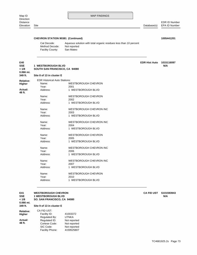
MAP FINDINGSMap IDDirection
EDR ID NumberDistanceEPA ID NumberDatabase(s)SiteElevation
San MateoFacility County: Not reportedMethod Decode: Aqueous solution with total organic residues less than 10 percentCat Decode:
CHEVRON STATION 90381 (Continued) 1005441201
1 WESTBOROUGH BLVDAddress: 2010Year: WESTBOROUGH CHEVRONName:
1 WESTBOROUGH BLVDAddress: 2007Year: WESTBOROUGH CHEVRON INCName:
1 WESTBOROUGH BLVDAddress: 2006Year: WESTBOROUGH CHEVRON INCName:
1 WESTBOROUGH BLVDAddress: 2005Year: WESTBOROUGH CHEVRONName:
1 WESTBOROUGH BLVDAddress: 2004Year: WESTBOROUGH CHEVRON INCName:
1 WESTBOROUGH BLVDAddress: 2003Year: WESTBOROUGH CHEVRON INCName:
1 WESTBOROUGH BLVDAddress: 2002Year: WESTBOROUGH CHEVRONName:
1 WESTBOROUGH BLVDAddress: 2001Year: WESTBOROUGH CHEVRONName:
EDR Historical Auto Stations:
349 ft. Site 8 of 13 in cluster E0.066 mi.
Relative:Higher
Actual:48 ft.
< 1/8 SOUTH SAN FRANCISCO, CA 94080SSE 1 WESTBOROUGH BLVD N/AE40 EDR Hist Auto 1015116097
4159525807Facility Phone: Not reportedSIC Code: Not reportedCortese Code: Not reportedRegulated ID: UTNKARegulated By: 41003372Facility ID:
CA FID UST:
349 ft. Site 9 of 13 in cluster E0.066 mi.
Relative:Higher
Actual:48 ft.
< 1/8 SO. SAN FRANCISCO, CA 94080SSE 1 WESTBOROUGH BLVD N/AE41 CA FID USTWESTBOROUGH CHEVRON S101593943
TC4681925.2s Page 73

MAP FINDINGSMap IDDirection
EDR ID NumberDistanceEPA ID NumberDatabase(s)SiteElevation
ActiveStatus: Not reportedComments: Not reportedEPA ID: Not reportedNPDES Number: Not reportedDUNs Number: Not reportedContact Phone: Not reportedContact: SO. SAN FRANCISCO 94080Mailing City,St,Zip: Not reportedMailing Address 2: P. O. BOX 5004Mailing Address: Not reportedMail To:
WESTBOROUGH CHEVRON (Continued) S101593943
Stock InventorLeak Detection: 0000370Container Construction Thickness: Not reportedType of Fuel: PRODUCTTank Used for: 00010000Tank Capacity: Not reportedYear Installed: 3Container Num: 003Tank Num:
Stock InventorLeak Detection: 0000370Container Construction Thickness: Not reportedType of Fuel: WASTETank Used for: 00001000Tank Capacity: Not reportedYear Installed: 2Container Num: 002Tank Num:
Stock InventorLeak Detection: 0000370Container Construction Thickness: Not reportedType of Fuel: PRODUCTTank Used for: 00010000Tank Capacity: Not reportedYear Installed: 1Container Num: 001Tank Num:
0004Total Tanks: SAN FRANCISCO, CA 94105Owner City,St,Zip: 575 MARKETOwner Address: CHEVRON U.S.A. INC.Owner Name: 4155883159Telephone: ZANETTI, CHARLESContact Name: Not reportedOther Type: Gas StationFacility Type: 00000061803Facility ID: STATERegion: http://geotracker.waterboards.ca.gov/ustpdfs/pdf/0002BCB1.pdfURL: 0002BCB1File Number:
HIST UST:
349 ft. Site 10 of 13 in cluster E0.066 mi.
Relative:Higher
Actual:48 ft.
< 1/8 SO SAN FRANCISCO, CA 94080SSE 1 WESTBOROUGH BLVD N/AE42 HIST UST90381 U001594720
TC4681925.2s Page 74

MAP FINDINGSMap IDDirection
EDR ID NumberDistanceEPA ID NumberDatabase(s)SiteElevation
Click here for Geo Tracker PDF:
Stock InventorLeak Detection: 0000370Container Construction Thickness: Not reportedType of Fuel: PRODUCTTank Used for: 00010000Tank Capacity: Not reportedYear Installed: 4Container Num: 004Tank Num:
90381 (Continued) U001594720
ACTIVEFacility Status: UNDERGROUND TANK - GENERALDescription: PR0022606Record Id: UNDERGROUND TANK - GENERALProg Element Code: FA0017716Facility ID: SAN MATEORegion:
ACTIVEFacility Status: STORES MV FUELS OR WASTE ONLYDescription: PR0023559Record Id: STORES MV FUELS OR WASTE ONLYProg Element Code: FA0017716Facility ID: SAN MATEORegion:
ACTIVEFacility Status: GENERATES <27 GAL/YEARDescription: PR0038036Record Id: GENERATES <27 GAL/YEARProg Element Code: FA0017716Facility ID: SAN MATEORegion:
San Mateo Co. BI:
349 ft. Site 11 of 13 in cluster E0.066 mi.
Relative:Higher
Actual:48 ft.
< 1/8 SOUTH SAN FRANCISCO, CA 94080SSE 1 WESTBOROUGH N/AE43 San Mateo Co. BIWESTBOROUGH KWIK SERV S117397687
ATank Status: 41-000-550054-000001SWRCB Tank Id: 1Owner Tank Id: 10-13-88Created Date: 04-26-94Action Date: 04-26-94Referral Date: Not reportedBoard Of Equalization: 3Number: 550054Comp Number: ActiveStatus:
SWEEPS UST:
349 ft. Site 12 of 13 in cluster E0.066 mi.
Relative:Higher
Actual:48 ft.
< 1/8 S SAN FRANCISCO, CA 94080SSE 1 WESTBOROUGH BLVD N/AE44 SWEEPS USTWESTBOROUGH CHEVRON S106798329
TC4681925.2s Page 75

MAP FINDINGSMap IDDirection
EDR ID NumberDistanceEPA ID NumberDatabase(s)SiteElevation
Not reportedNumber Of Tanks: REG UNLEADEDContent: PSTG: M.V. FUELTank Use: 04-26-94Active Date: 10000Capacity: ATank Status: 41-000-550054-000003SWRCB Tank Id: 3Owner Tank Id: 10-13-88Created Date: 04-26-94Action Date: 04-26-94Referral Date: Not reportedBoard Of Equalization: 3Number: 550054Comp Number: ActiveStatus:
Not reportedNumber Of Tanks: PLUS UNLEADEContent: PSTG: M.V. FUELTank Use: 04-26-94Active Date: 10000Capacity: ATank Status: 41-000-550054-000002SWRCB Tank Id: 138597Owner Tank Id: 10-13-88Created Date: 04-26-94Action Date: 04-26-94Referral Date: Not reportedBoard Of Equalization: 3Number: 550054Comp Number: ActiveStatus:
3Number Of Tanks: REG UNLEADEDContent: PSTG: M.V. FUELTank Use: 04-26-94Active Date: 10000Capacity:
WESTBOROUGH CHEVRON (Continued) S106798329
SLIC:
SAN MATEO CO. LUSTEDR Link ID: SAN MATEO CO. LUSTCase Type: 010391080APN Number: TI0000005163Global ID: 3B- Preliminary Assessment UnderwayFacility Status: 559212Facility ID: SAN MATEORegion:
SAN MATEO CO. LUST:
355 ft. EMISite 1 of 3 in cluster H0.067 mi. DRYCLEANERS
Relative:Higher
Actual:72 ft.
< 1/8 San Mateo Co. BISOUTH SAN FRANCISCO, CA 94080South SLIC1121 EL CAMINO REAL N/AH45 LUSTCARRIAGE CLEANERS S105265759
TC4681925.2s Page 76

MAP FINDINGSMap IDDirection
EDR ID NumberDistanceEPA ID NumberDatabase(s)SiteElevation
SOUTH SAN FRANCISCOMailing City: Not reportedMailing Address 2: 1121 EL CAMINO REALMailing Address 1: ALEX YIMailing Name: 6508732286Contact Telephone: Not reportedContact Address 2: 1121 EL CAMINO REALContact Address: ALEX YIContact Name: 0000000000Owner Telephone: Not reportedOwner Address 2: 1121 EL CAMINO REALOwner Address: SUK KIMOwner Name: Not reportedFacility Addr2: Not reportedInactive Date: NoFacility Active: 01/30/2003Create Date: Power Laundries, Family and CommercialSIC Description: 7211SIC Code: Drycleaning and Laundry Services (except Coin-Operated)NAICS Description: 81232NAICS Code: CAL000265661EPA Id:
DRYCLEANERS:
INACTIVEFacility Status: STORES HAZ MAT <219GAL,1,999LB, 879CFDescription: PR0004331Record Id: STORES HAZ MAT <219GAL,1,999LB, 879FT3Prog Element Code: FA0010480Facility ID: SAN MATEORegion:
INACTIVEFacility Status: GENERATES & RECYCLES WASTE OIL/SOLVENTDescription: PR0011647Record Id: GENERATES and RECYCLES WASTE OIL/SOLVENTProg Element Code: FA0010480Facility ID: SAN MATEORegion:
San Mateo Co. BI:
Click here to access the California GeoTracker records for this facility:
Site opened 9/19/2013. Out of compliance. RP unresponsive.Site History: Tetrachloroethylene (PCE), Trichloroethylene (TCE), Vinyl chloridePotential Contaminants of Concern: Under InvestigationPotential Media Affected: All Files are on GeoTracker or in the Local Agency DatabaseFile Location: Not reportedRB Case Number: SAN MATEO COUNTY LOPLocal Agency: JMCase Worker: Cleanup Program SiteCase Type: -122.437031645921Longitude: 37.656596843669Latitude: 559212Lead Agency Case Number: SAN MATEO COUNTY LOPLead Agency: T10000005163Global Id: 09/19/2013Status Date: Open - Site AssessmentFacility Status: STATERegion:
CARRIAGE CLEANERS (Continued) S105265759
TC4681925.2s Page 77

MAP FINDINGSMap IDDirection
EDR ID NumberDistanceEPA ID NumberDatabase(s)SiteElevation
0Part. Matter 10 Micrometers and Smllr Tons/Yr: 0Particulate Matter Tons/Yr: 0SOX - Oxides of Sulphur Tons/Yr: 0NOX - Oxides of Nitrogen Tons/Yr: 0Carbon Monoxide Emissions Tons/Yr: 0Reactive Organic Gases Tons/Yr: 1Total Organic Hydrocarbon Gases Tons/Yr: Not reportedConsolidated Emission Reporting Rule: Not reportedCommunity Health Air Pollution Info System: BAY AREA AQMDAir District Name: 7216SIC Code: BAAir District Name: 9125Facility ID: SFAir Basin: 41County Code: 1995Year:
0Part. Matter 10 Micrometers and Smllr Tons/Yr: 0Particulate Matter Tons/Yr: 0SOX - Oxides of Sulphur Tons/Yr: 0NOX - Oxides of Nitrogen Tons/Yr: 0Carbon Monoxide Emissions Tons/Yr: 0Reactive Organic Gases Tons/Yr: 1Total Organic Hydrocarbon Gases Tons/Yr: Not reportedConsolidated Emission Reporting Rule: Not reportedCommunity Health Air Pollution Info System: BAY AREA AQMDAir District Name: 7216SIC Code: BAAir District Name: 3515Facility ID: SFAir Basin: 41County Code: 1987Year:
0Part. Matter 10 Micrometers and Smllr Tons/Yr: 0Particulate Matter Tons/Yr: 0SOX - Oxides of Sulphur Tons/Yr: 0NOX - Oxides of Nitrogen Tons/Yr: 0Carbon Monoxide Emissions Tons/Yr: 0Reactive Organic Gases Tons/Yr: 0Total Organic Hydrocarbon Gases Tons/Yr: Not reportedConsolidated Emission Reporting Rule: Not reportedCommunity Health Air Pollution Info System: BAY AREA AQMDAir District Name: 7216SIC Code: BAAir District Name: 864Facility ID: SFAir Basin: 41County Code: 1987Year:
EMI:
Not reportedRegion Code: 2Owner Fax: 940803207Mailing Zip: CAMailing State:
CARRIAGE CLEANERS (Continued) S105265759
TC4681925.2s Page 78

MAP FINDINGSMap IDDirection
EDR ID NumberDistanceEPA ID NumberDatabase(s)SiteElevation
7216SIC Code: BAAir District Name: 12597Facility ID: SFAir Basin: 41County Code: 1999Year:
0Part. Matter 10 Micrometers and Smllr Tons/Yr: 0Particulate Matter Tons/Yr: 0SOX - Oxides of Sulphur Tons/Yr: 0NOX - Oxides of Nitrogen Tons/Yr: 0Carbon Monoxide Emissions Tons/Yr: 0Reactive Organic Gases Tons/Yr: 0Total Organic Hydrocarbon Gases Tons/Yr: Not reportedConsolidated Emission Reporting Rule: Not reportedCommunity Health Air Pollution Info System: BAY AREA AQMDAir District Name: 7216SIC Code: BAAir District Name: 11626Facility ID: SFAir Basin: 41County Code: 1998Year:
0Part. Matter 10 Micrometers and Smllr Tons/Yr: 0Particulate Matter Tons/Yr: 0SOX - Oxides of Sulphur Tons/Yr: 0NOX - Oxides of Nitrogen Tons/Yr: 0Carbon Monoxide Emissions Tons/Yr: 0Reactive Organic Gases Tons/Yr: 1Total Organic Hydrocarbon Gases Tons/Yr: Not reportedConsolidated Emission Reporting Rule: Not reportedCommunity Health Air Pollution Info System: BAY AREA AQMDAir District Name: 7216SIC Code: BAAir District Name: 11626Facility ID: SFAir Basin: 41County Code: 1997Year:
0Part. Matter 10 Micrometers and Smllr Tons/Yr: 0Particulate Matter Tons/Yr: 0SOX - Oxides of Sulphur Tons/Yr: 0NOX - Oxides of Nitrogen Tons/Yr: 0Carbon Monoxide Emissions Tons/Yr: 0Reactive Organic Gases Tons/Yr: 1Total Organic Hydrocarbon Gases Tons/Yr: Not reportedConsolidated Emission Reporting Rule: Not reportedCommunity Health Air Pollution Info System: BAY AREA AQMDAir District Name: 7216SIC Code: BAAir District Name: 9125Facility ID: SFAir Basin: 41County Code: 1996Year:
CARRIAGE CLEANERS (Continued) S105265759
TC4681925.2s Page 79

MAP FINDINGSMap IDDirection
EDR ID NumberDistanceEPA ID NumberDatabase(s)SiteElevation
0Carbon Monoxide Emissions Tons/Yr: 0Reactive Organic Gases Tons/Yr: 0Total Organic Hydrocarbon Gases Tons/Yr: Not reportedConsolidated Emission Reporting Rule: Not reportedCommunity Health Air Pollution Info System: BAY AREA AQMDAir District Name: 7216SIC Code: BAAir District Name: 12597Facility ID: SFAir Basin: 41County Code: 2003Year:
0Part. Matter 10 Micrometers and Smllr Tons/Yr: 0Particulate Matter Tons/Yr: 0SOX - Oxides of Sulphur Tons/Yr: 0NOX - Oxides of Nitrogen Tons/Yr: 0Carbon Monoxide Emissions Tons/Yr: 0Reactive Organic Gases Tons/Yr: 0Total Organic Hydrocarbon Gases Tons/Yr: Not reportedConsolidated Emission Reporting Rule: Not reportedCommunity Health Air Pollution Info System: BAY AREA AQMDAir District Name: 7216SIC Code: BAAir District Name: 12597Facility ID: SFAir Basin: 41County Code: 2001Year:
0Part. Matter 10 Micrometers and Smllr Tons/Yr: 0Particulate Matter Tons/Yr: 0SOX - Oxides of Sulphur Tons/Yr: 0NOX - Oxides of Nitrogen Tons/Yr: 0Carbon Monoxide Emissions Tons/Yr: 0Reactive Organic Gases Tons/Yr: 0Total Organic Hydrocarbon Gases Tons/Yr: Not reportedConsolidated Emission Reporting Rule: Not reportedCommunity Health Air Pollution Info System: BAY AREA AQMDAir District Name: 7216SIC Code: BAAir District Name: 12597Facility ID: SFAir Basin: 41County Code: 2000Year:
0Part. Matter 10 Micrometers and Smllr Tons/Yr: 0Particulate Matter Tons/Yr: 0SOX - Oxides of Sulphur Tons/Yr: 0NOX - Oxides of Nitrogen Tons/Yr: 0Carbon Monoxide Emissions Tons/Yr: 0Reactive Organic Gases Tons/Yr: 0Total Organic Hydrocarbon Gases Tons/Yr: Not reportedConsolidated Emission Reporting Rule: Not reportedCommunity Health Air Pollution Info System: BAY AREA AQMDAir District Name:
CARRIAGE CLEANERS (Continued) S105265759
TC4681925.2s Page 80

MAP FINDINGSMap IDDirection
EDR ID NumberDistanceEPA ID NumberDatabase(s)SiteElevation
0Part. Matter 10 Micrometers and Smllr Tons/Yr: 0Particulate Matter Tons/Yr: 0SOX - Oxides of Sulphur Tons/Yr: 0NOX - Oxides of Nitrogen Tons/Yr: 0Carbon Monoxide Emissions Tons/Yr: 0Reactive Organic Gases Tons/Yr: 0.189Total Organic Hydrocarbon Gases Tons/Yr: Not reportedConsolidated Emission Reporting Rule: Not reportedCommunity Health Air Pollution Info System: BAY AREA AQMDAir District Name: 7216SIC Code: BAAir District Name: 12597Facility ID: SFAir Basin: 41County Code: 2004Year:
0Part. Matter 10 Micrometers and Smllr Tons/Yr: 0Particulate Matter Tons/Yr: 0SOX - Oxides of Sulphur Tons/Yr: 0NOX - Oxides of Nitrogen Tons/Yr:
CARRIAGE CLEANERS (Continued) S105265759
1121 EL CAMINO REALAddress: 2004Year: CARRIAGE CLEANERSName:
1121 EL CAMINO REALAddress: 2003Year: CARRIAGE CLEANERSName:
1121 EL CAMINO REALAddress: 2002Year: CARRIAGE CLEANERSName:
1121 EL CAMINO REALAddress: 2001Year: CARRIAGE CLEANERSName:
EDR Historical Cleaners:
355 ft. Site 2 of 3 in cluster H0.067 mi.
Relative:Higher
Actual:72 ft.
< 1/8 SOUTH SAN FRANCISCO, CA 94080South 1121 EL CAMINO REAL N/AH46 EDR Hist Cleaner 1014976606
PR0011563Record Id: GENERATES and RECYCLES WASTE OIL/SOLVENTProg Element Code: FA0017845Facility ID: SAN MATEORegion:
San Mateo Co. BI:
359 ft. Site 3 of 3 in cluster H0.068 mi.
Relative:Higher
Actual:69 ft.
< 1/8 SOUTH SAN FRANCISCO, CA 94080South 1103 EL CAMINO REAL N/AH47 San Mateo Co. BIGRAND AUTO INC S117397770
TC4681925.2s Page 81

MAP FINDINGSMap IDDirection
EDR ID NumberDistanceEPA ID NumberDatabase(s)SiteElevation
INACTIVEFacility Status: STORES HAZ MAT <219GAL,1,999LB, 879CFDescription: PR0004259Record Id: STORES HAZ MAT <219GAL,1,999LB, 879FT3Prog Element Code: FA0017845Facility ID: SAN MATEORegion:
INACTIVEFacility Status: GENERATES & RECYCLES WASTE OIL/SOLVENTDescription:
GRAND AUTO INC (Continued) S117397770
Click here to access the California GeoTracker records for this facility:
Case opened 5/28/2015Site History: Tetrachloroethylene (PCE), Trichloroethylene (TCE)Potential Contaminants of Concern: Aquifer used for drinking water supply, Under InvestigationPotential Media Affected: All Files are on GeoTracker or in the Local Agency DatabaseFile Location: Not reportedRB Case Number: SAN MATEO COUNTY LOPLocal Agency: JMCase Worker: Cleanup Program SiteCase Type: -122.43797Longitude: 37.65706Latitude: 559219Lead Agency Case Number: SAN MATEO COUNTY LOPLead Agency: T10000007001Global Id: 05/28/2015Status Date: Open - Site AssessmentFacility Status: STATERegion:
SLIC:
391 ft. Site 5 of 7 in cluster F0.074 mi.
Relative:Higher
Actual:71 ft.
< 1/8 SOUTH SAN FRANCISCO, CA 94080SSW 1155 EL CAMINO REAL N/AF48 SLICNORGE VILLAGE CLEANERS (FORMER) S117898015
SAN MATEO CO. LUSTEDR Link ID: SAN MATEO CO. LUSTCase Type: 010391180APN Number: T10000007001Global ID: 3B- Preliminary Assessment UnderwayFacility Status: 559219Facility ID: SAN MATEORegion:
SAN MATEO CO. LUST:
391 ft. Site 6 of 7 in cluster F0.074 mi.
Relative:Higher
Actual:71 ft.
< 1/8 SOUTH SAN FRANCISCO, CA SSW 1155 EL CAMINO REAL N/AF49 LUSTNORGE VILLAGE CLEARNERS (FORMER) S117896768
TC4681925.2s Page 82

MAP FINDINGSMap IDDirection
EDR ID NumberDistanceEPA ID NumberDatabase(s)SiteElevation
INACTIVEFacility Status: STORES HAZ MAT <219GAL,1,999LB, 879CFDescription: PR0047182Record Id: STORES HAZ MAT <219GAL,1,999LB, 879FT3Prog Element Code: FA0028411Facility ID: SAN MATEORegion:
San Mateo Co. BI:
410 ft. Site 7 of 7 in cluster F0.078 mi.
Relative:Higher
Actual:71 ft.
< 1/8 SOUTH SAN FRANCISCO, CA 94080SSW 1165 EL CAMINO REAL N/AF50 San Mateo Co. BIWESTMED AMBULANCE S117398276
INACTIVEFacility Status: GENERATES <27 GAL/YEARDescription: PR0051050Record Id: GENERATES <27 GAL/YEARProg Element Code: FA0026540Facility ID: SAN MATEORegion:
San Mateo Co. BI:
431 ft. Site 1 of 3 in cluster I0.082 mi.
Relative:Higher
Actual:57 ft.
< 1/8 SOUTH SAN FRANCISCO, CA 94080NNW 1135 MISSION N/AI51 San Mateo Co. BIJOHN R. DOLLARD, D.D.S. S117398046
THE PACIFIC TELEPHONE AND TELEGRAPH COOwner/operator name:Owner/Operator Summary:
hazardous waste at any time waste during any calendar month, and accumulates more than 1000 kg of hazardous waste at any time; or generates 100 kg or less of hazardous waste during any calendar month and accumulates less than 6000 kg of Handler: generates more than 100 and less than 1000 kg of hazardousDescription: Small Small Quantity GeneratorClassification: 09EPA Region: Not reportedContact email: Not reportedContact telephone: USContact country: Not reported Not reportedContact address: Not reportedContact: SAN JOSE, CA 95113 2 NORTH SECOND ST ROOM 1125Mailing address: CAT080021264EPA ID: SOUTH SAN FRANCISCO, CA 94080 965 EL CAMINO REALFacility address: PACIFIC BELLFacility name: 09/01/1996Date form received by agency:
RCRA-SQG:
448 ft. Site 13 of 13 in cluster E0.085 mi.
Relative:Higher
Actual:44 ft.
< 1/8 ECHOSOUTH SAN FRANCISCO, CA 94080SSE FINDS965 EL CAMINO REAL CAT080021264E52 RCRA-SQGPACIFIC BELL 1000251287
TC4681925.2s Page 83

MAP FINDINGSMap IDDirection
EDR ID NumberDistanceEPA ID NumberDatabase(s)SiteElevation
and treat, store, or dispose of hazardous waste. RCRAInfo allows RCRAevents and activities related to facilities that generate, transport,Conservation and Recovery Act (RCRA) program through the tracking ofRCRAInfo is a national information system that supports the Resource
facilities.generators, transporters, and treatment, storage, and disposalprovides California with information on hazardous waste shipments forCalifornia Hazardous Waste Tracking System - Datamart (HWTS-DATAMART) Environmental Interest/Information System
110002949864Registry ID:
FINDS:
No violations foundViolation Status:
Large Quantity GeneratorClassification: PACIFIC BELLSite name: 01/19/1981Date form received by agency:
Historical Generators:
NoUsed oil transporter: NoUsed oil transfer facility: NoUsed oil Specification marketer: NoUsed oil fuel marketer to burner: NoUser oil refiner: NoUsed oil processor: NoUsed oil fuel burner: NoFurnace exemption: NoOn-site burner exemption: NoUnderground injection activity: NoTreater, storer or disposer of HW: NoTransporter of hazardous waste: NoRecycler of hazardous waste: NoMixed waste (haz. and radioactive): NoU.S. importer of hazardous waste:
Handler Activities Summary:
Not reportedOwner/Op end date: Not reportedOwner/Op start date: OperatorOwner/Operator Type: PrivateLegal status: (415) 555-1212Owner/operator telephone: Not reportedOwner/operator country: NOT REQUIRED, ME 99999 NOT REQUIREDOwner/operator address: NOT REQUIREDOwner/operator name:
Not reportedOwner/Op end date: Not reportedOwner/Op start date: OwnerOwner/Operator Type: PrivateLegal status: (415) 555-1212Owner/operator telephone: Not reportedOwner/operator country: NOT REQUIRED, ME 99999 NOT REQUIREDOwner/operator address:
PACIFIC BELL (Continued) 1000251287
TC4681925.2s Page 84

MAP FINDINGSMap IDDirection
EDR ID NumberDistanceEPA ID NumberDatabase(s)SiteElevation
http://echo.epa.gov/detailed_facility_report?fid=110002949864DFR URL: 110002949864Registry ID: 1000251287Envid:
ECHO:
corrective action activities required under RCRA.program staff to track the notification, permit, compliance, and
PACIFIC BELL (Continued) 1000251287
ACTIVEFacility Status: STORES MV FUELS OR WASTE ONLYDescription: PR0076282Record Id: STORES MV FUELS OR WASTE ONLYProg Element Code: FA0055315Facility ID: SAN MATEORegion:
San Mateo Co. BI:
458 ft. Site 2 of 3 in cluster I0.087 mi.
Relative:Higher
Actual:58 ft.
< 1/8 SOUTH SAN FRANCISCO, CA 94080NNW 1136 MISSION N/AI53 San Mateo Co. BI7-ELEVEN INC. STORE #22498 S117398817
1/1/1965Date Post Remedial Action Monitoring Began: Not reportedDate Remediation Action Underway: Not reportedPollution Remediation Plan Submitted: Not reportedPollution Characterization Began: Not reportedPreliminary Site Assesment Began: Not reportedPrelim. Site Assesment Wokplan Submitted: LUSTOversight Program: Not reportedDate Leak Confirmed: UnknownLeak Source: UnknownLeak Cause: OMHow Discovered: 550012Case Number: Post remedial action monitoringFacility Status: Not reportedFacility Id: 2Region:
LUST REG 2:
497 ft. Site 3 of 3 in cluster I0.094 mi.
Relative:Higher
Actual:58 ft.
< 1/8 S SAN FRANCISCO, CA 94080NNW 1198 OLD MISSION N/AI54 LUSTCHEVRON 9-1626 S105030261
TC4681925.2s Page 85

MAP FINDINGSMap IDDirection
EDR ID NumberDistanceEPA ID NumberDatabase(s)SiteElevation
Not reportedOPERATOR CONTACT TITLE: Not reportedOPERATOR CONTACT NAME: Not reportedOPERATOR ZIP: Not reportedOPERATOR STATE: Not reportedOPERATOR CITY: Not reportedOPERATOR ADDRESS: Not reportedOPERATOR NAME: Not reportedFACILITY CONTACT EMAIL: Not reportedFACILITY CONTACT PHONE EXT: Not reportedFACILITY CONTACT PHONE: Not reportedFACILITY CONTACT TITLE: Not reportedFACILITY CONTACT NAME: Not reportedPLACE SIZE UNIT: Not reportedPLACE SIZE: Not reportedSTATUS DATE: Not reportedSTATUS CODE NAME: Not reportedPROCESSED DATE: Not reportedRECEIVED DATE: 94014Discharge Zip: CaliforniaDischarge State: COLMADischarge City: 1299 El Camino RealDischarge Address: Home of Peace CemeteryDischarge Name: Not reportedTermination Date Of Regulatory Measure: Not reportedExpiration Date Of Regulatory Measure: 03/08/2016Effective Date Of Regulatory Measure: Not reportedAdoption Date Of Regulatory Measure: ConstructionProgram Type: 2 41C375593WDID: Not reportedPlace Id: EnrolleeRegulatory Measure Type: 2009-0009-DWQOrder No: 469772Regulatory Measure Id: 2Region: 0Agency Id: ActiveFacility Status: CAS000002Npdes Number:
NPDES:
ACTIVEFacility Status: STORES MV FUELS OR WASTE ONLYDescription: PR0004934Record Id: STORES MV FUELS OR WASTE ONLYProg Element Code: FA0008982Facility ID: SAN MATEORegion:
ACTIVEFacility Status: GENERATES <27 GAL/YEARDescription: PR0012148Record Id: GENERATES <27 GAL/YEARProg Element Code: FA0008982Facility ID: SAN MATEORegion:
San Mateo Co. BI:
582 ft.0.110 mi.
Relative:Higher
Actual:71 ft.
< 1/8 COLMA, CA 94014West NPDES1299 EL CAMINO REAL N/A55 San Mateo Co. BIHILLS OF ETERNITY MEMORIAL PARK S102267771
TC4681925.2s Page 86

MAP FINDINGSMap IDDirection
EDR ID NumberDistanceEPA ID NumberDatabase(s)SiteElevation
CaliforniaDischarge State: COLMADischarge City: 1299 El Camino RealDischarge Address: Home of Peace CemeteryDischarge Name: 05/22/2014Termination Date Of Regulatory Measure: Not reportedExpiration Date Of Regulatory Measure: 10/04/2013Effective Date Of Regulatory Measure: Not reportedAdoption Date Of Regulatory Measure: ConstructionProgram Type: 2 41C367905WDID: Not reportedPlace Id: EnrolleeRegulatory Measure Type: 2009-0009-DWQOrder No: 441577Regulatory Measure Id: 2Region: 0Agency Id: TerminatedFacility Status: CAS000002Npdes Number:
Not reportedTERTIARY SIC: Not reportedSECONDARY SIC: Not reportedPRIMARY SIC: Not reportedCERTIFICATION DATE: Not reportedCERTIFIER TITLE: Not reportedCERTIFIER NAME: Not reportedRECEIVING WATER NAME: Not reportedDIR DISCHARGE USWATER IND: Not reportedCONSTYPE WATER SEWER IND: Not reportedCONSTYPE UTILITY IND: Not reportedCONSTYPE UTILITY DESCRIPTION: Not reportedCONSTYPE TRANSPORT IND: Not reportedCONSTYPE RESIDENTIAL IND: Not reportedCONSTYPE RECONS IND: Not reportedCONSTYPE OTHER IND: Not reportedCONSTYPE OTHER DESRIPTION: Not reportedCONSTYPE INDUSTRIAL IND: Not reportedCONSTYPE GAS LINE IND: Not reportedCONSTYPE ELECTRICAL LINE IND: Not reportedCONSTYPE COMMERTIAL IND: Not reportedCONSTYPE COMM LINE IND: Not reportedCONSTYPE CABLE LINE IND: Not reportedCONSTYPE BELOW GROUND IND: Not reportedCONSTYPE ABOVE GROUND IND: Not reportedEMERGENCY PHONE EXT: Not reportedEMERGENCY PHONE NO: Not reportedCONSTYPE LINEAR UTILITY IND: Not reportedDEVELOPER CONTACT TITLE: Not reportedDEVELOPER CONTACT NAME: Not reportedDEVELOPER ZIP: Not reportedDEVELOPER STATE: Not reportedDEVELOPER CITY: Not reportedDEVELOPER ADDRESS: Not reportedDEVELOPER NAME: Not reportedOPERATOR TYPE: Not reportedOPERATOR CONTACT EMAIL: Not reportedOPERATOR CONTACT PHONE EXT: Not reportedOPERATOR CONTACT PHONE:
HILLS OF ETERNITY MEMORIAL PARK (Continued) S102267771
TC4681925.2s Page 87

MAP FINDINGSMap IDDirection
EDR ID NumberDistanceEPA ID NumberDatabase(s)SiteElevation
Not reportedTERTIARY SIC: Not reportedSECONDARY SIC: Not reportedPRIMARY SIC: Not reportedCERTIFICATION DATE: Not reportedCERTIFIER TITLE: Not reportedCERTIFIER NAME: Not reportedRECEIVING WATER NAME: Not reportedDIR DISCHARGE USWATER IND: Not reportedCONSTYPE WATER SEWER IND: Not reportedCONSTYPE UTILITY IND: Not reportedCONSTYPE UTILITY DESCRIPTION: Not reportedCONSTYPE TRANSPORT IND: Not reportedCONSTYPE RESIDENTIAL IND: Not reportedCONSTYPE RECONS IND: Not reportedCONSTYPE OTHER IND: Not reportedCONSTYPE OTHER DESRIPTION: Not reportedCONSTYPE INDUSTRIAL IND: Not reportedCONSTYPE GAS LINE IND: Not reportedCONSTYPE ELECTRICAL LINE IND: Not reportedCONSTYPE COMMERTIAL IND: Not reportedCONSTYPE COMM LINE IND: Not reportedCONSTYPE CABLE LINE IND: Not reportedCONSTYPE BELOW GROUND IND: Not reportedCONSTYPE ABOVE GROUND IND: Not reportedEMERGENCY PHONE EXT: Not reportedEMERGENCY PHONE NO: Not reportedCONSTYPE LINEAR UTILITY IND: Not reportedDEVELOPER CONTACT TITLE: Not reportedDEVELOPER CONTACT NAME: Not reportedDEVELOPER ZIP: Not reportedDEVELOPER STATE: Not reportedDEVELOPER CITY: Not reportedDEVELOPER ADDRESS: Not reportedDEVELOPER NAME: Not reportedOPERATOR TYPE: Not reportedOPERATOR CONTACT EMAIL: Not reportedOPERATOR CONTACT PHONE EXT: Not reportedOPERATOR CONTACT PHONE: Not reportedOPERATOR CONTACT TITLE: Not reportedOPERATOR CONTACT NAME: Not reportedOPERATOR ZIP: Not reportedOPERATOR STATE: Not reportedOPERATOR CITY: Not reportedOPERATOR ADDRESS: Not reportedOPERATOR NAME: Not reportedFACILITY CONTACT EMAIL: Not reportedFACILITY CONTACT PHONE EXT: Not reportedFACILITY CONTACT PHONE: Not reportedFACILITY CONTACT TITLE: Not reportedFACILITY CONTACT NAME: Not reportedPLACE SIZE UNIT: Not reportedPLACE SIZE: Not reportedSTATUS DATE: Not reportedSTATUS CODE NAME: Not reportedPROCESSED DATE: Not reportedRECEIVED DATE: 94014Discharge Zip:
HILLS OF ETERNITY MEMORIAL PARK (Continued) S102267771
TC4681925.2s Page 88

MAP FINDINGSMap IDDirection
EDR ID NumberDistanceEPA ID NumberDatabase(s)SiteElevation
ACTIVEFacility Status: STORES HAZ MAT <1,199GAL,9,999LB,4,799CFDescription: PR0023572Record Id: STORES HAZ MAT <1,199GAL,9,999LB,4,799FT3Prog Element Code: FA0017727Facility ID: SAN MATEORegion:
ACTIVEFacility Status: GENERATES & RECYCLES WASTE OIL/SOLVENTDescription: PR0068511Record Id: GENERATES and RECYCLES WASTE OIL/SOLVENTProg Element Code: FA0017727Facility ID: SAN MATEORegion:
INACTIVEFacility Status: UNDERGROUND TANK - GENERALDescription: PR0022613Record Id: UNDERGROUND TANK - GENERALProg Element Code: FA0017727Facility ID: SAN MATEORegion:
San Mateo Co. BI:
586 ft. Site 1 of 3 in cluster J0.111 mi.
Relative:Lower
Actual:33 ft.
< 1/8 SOUTH SAN FRANCISCO, CA 94080ESE 80 CHESTNUT N/AJ56 San Mateo Co. BICALIFORNIA WATER SERVICE CO S117397694
1Number Of Tanks: REG UNLEADEDContent: PRODUCTSTG: M.V. FUELTank Use: Not reportedActive Date: 2000Capacity: Not reportedTank Status: 41-000-550066-000001SWRCB Tank Id: Not reportedOwner Tank Id: Not reportedCreated Date: Not reportedAction Date: Not reportedReferral Date: Not reportedBoard Of Equalization: Not reportedNumber: 550066Comp Number: Not reportedStatus:
SWEEPS UST:
586 ft. Site 2 of 3 in cluster J0.111 mi.
Relative:Lower
Actual:33 ft.
< 1/8 S SAN FRANCISCO, CA 94080ESE 80 CHESTNUT AVE N/AJ57 SWEEPS USTCALIFORNIA WATER SERVICE CO S106034849
TC4681925.2s Page 89

MAP FINDINGSMap IDDirection
EDR ID NumberDistanceEPA ID NumberDatabase(s)SiteElevation
InactiveStatus: Not reportedComments: Not reportedEPA ID: Not reportedNPDES Number: Not reportedDUNs Number: Not reportedContact Phone: Not reportedContact: SO. SAN FRANCISCO 94080Mailing City,St,Zip: Not reportedMailing Address 2: 80 CHESTNUT AVEMailing Address: Not reportedMail To: 4155883175Facility Phone: Not reportedSIC Code: Not reportedCortese Code: CAC000556Regulated ID: UTNKIRegulated By: 41001500Facility ID:
CA FID UST:
Click here for Geo Tracker PDF:
Not reportedLeak Detection: Not reportedContainer Construction Thickness: Not reportedType of Fuel: Not reportedTank Used for: Not reportedTank Capacity: Not reportedYear Installed: Not reportedContainer Num: Not reportedTank Num:
Not reportedTotal Tanks: Not reportedOwner City,St,Zip: Not reportedOwner Address: Not reportedOwner Name: Not reportedTelephone: Not reportedContact Name: Not reportedOther Type: Not reportedFacility Type: Not reportedFacility ID: Not reportedRegion: http://geotracker.waterboards.ca.gov/ustpdfs/pdf/0002BC80.pdfURL: 0002BC80File Number:
HIST UST:
586 ft. Site 3 of 3 in cluster J0.111 mi.
Relative:Lower
Actual:33 ft.
< 1/8 SOUTH SAN FRANCISCO, CA 94080ESE CA FID UST80 CHESTNUT AVENUE N/AJ58 HIST USTFIELD OFFICE S101593864
TC4681925.2s Page 90

MAP FINDINGSMap IDDirection
EDR ID NumberDistanceEPA ID NumberDatabase(s)SiteElevation
1Number Of Tanks: DIESELContent: PSTG: M.V. FUELTank Use: 04-22-94Active Date: 2500Capacity: ATank Status: 41-000-550164-000001SWRCB Tank Id: 12Owner Tank Id: 05-10-91Created Date: 05-11-94Action Date: 05-11-94Referral Date: Not reportedBoard Of Equalization: 4Number: 550164Comp Number: ActiveStatus:
SWEEPS UST:
593 ft. Site 1 of 3 in cluster K0.112 mi.
Relative:Higher
Actual:71 ft.
< 1/8 S SAN FRANCISCO, CA 94080South 33 ARROYO DR N/AK59 SWEEPS USTMUNICIPAL SERVICES BUILDING S106798014
ACTIVEFacility Status: TIER I: TANK STOR CAP =>1,320 & <5,000 GALDescription: PR0076028Record Id: 2352Prog Element Code: FA0008507Facility ID: SAN MATEORegion:
ACTIVEFacility Status: STORES MV FUELS OR WASTE ONLYDescription: PR0027444Record Id: STORES MV FUELS OR WASTE ONLYProg Element Code: FA0008507Facility ID: SAN MATEORegion:
INACTIVEFacility Status: UNDERGROUND TANK - GENERALDescription: PR0022671Record Id: UNDERGROUND TANK - GENERALProg Element Code: FA0008507Facility ID: SAN MATEORegion:
San Mateo Co. BI:
593 ft. Site 2 of 3 in cluster K0.112 mi.
Relative:Higher
Actual:71 ft.
< 1/8 SOUTH SAN FRANCISCO, CA 94080South 33 ARROYO N/AK60 San Mateo Co. BICITY OF SSF FIRE STATION #63 S117397359
TC4681925.2s Page 91

MAP FINDINGSMap IDDirection
EDR ID NumberDistanceEPA ID NumberDatabase(s)SiteElevation
Click here for Geo Tracker PDF:
Pressure TestLeak Detection: Not reportedContainer Construction Thickness: DIESELType of Fuel: PRODUCTTank Used for: 00000200Tank Capacity: 80Year Installed: 2Container Num: 001Tank Num:
0001Total Tanks: SO S F, CA 94080Owner City,St,Zip: 400 GRAND AVEOwner Address: CITY OF SO SAN FRANCISCOOwner Name: 0000000000Telephone: J DIANIContact Name: MUNICIPALITYOther Type: OtherFacility Type: 00000030181Facility ID: STATERegion: http://geotracker.waterboards.ca.gov/ustpdfs/pdf/0002BD7E.pdfURL: 0002BD7EFile Number:
HIST UST:
593 ft. Site 3 of 3 in cluster K0.112 mi.
Relative:Higher
Actual:71 ft.
< 1/8 SOUTH SAN FRANCISCO, CA 94080South 33 ARROYO N/AK61 HIST USTMUNICIPAL SERVICES BLDG U001594802
perimeter of the site, and an oil storage and gasoline pump in the Map1 depicts three aboveground storage tanks along the southwest 1925 as a Standard Oil San Francisco Substation. The 1925 Sanborn made in the referenced report. The site was originally developed in accuracy of the statements made or any professional interpretations Installation, San Mateo County does not take responsibility for the Extracted from CRA’s November 6, 2009 Work Plan for WellSite History: GasolinePotential Contaminants of Concern: Other Groundwater (uses other than drinking water), SoilPotential Media Affect: Local AgencyFile Location: 550196LOC Case Number: Not reportedRB Case Number: SAN MATEO COUNTY LOPLocal Agency: JMCase Worker: SAN MATEO COUNTY LOPLead Agency: 03/30/2012Status Date: Completed - Case ClosedStatus: LUST Cleanup SiteCase Type: -122.432456016541Longitude: 37.6540967142614Latitude: SL0608123509Global Id: STATERegion:
LUST:
598 ft. Site 1 of 2 in cluster L0.113 mi.
Relative:Lower
Actual:41 ft.
< 1/8 SOUTH SAN FRANCISCO, CA 94080SE 972 EL CAMINO REAL N/AL62 LUSTCHEVRON, FORMER STANDARD OIL SUBSTATION S109286042
TC4681925.2s Page 92

MAP FINDINGSMap IDDirection
EDR ID NumberDistanceEPA ID NumberDatabase(s)SiteElevation
detected in soil was 1,300 mg/kg in boring B-8 at 5 fbg. The maximum extensive subsurface obstructions. The highest TPHd concentration groundwater. Proposed borings B-5 and B-6 were abandoned due to and vertical extent of hydrocarbon concentrations in soil and ASTs and oil storage and gasoline dispenser to determine the lateral borings B-7 through B-10 adjacent to and downgradient from the former Subsurface Investigation: On behalf of Chevron, CRA advanced soil hydrocarbons in soil and groundwater across the site. March 2009 16, 2009. The work plan proposed six soil borings to investigate Plan and it was approved by the SMCHS in their letter dated January Chevron, CRA submitted the July 1, 2008 Subsurface Investigation Work the SMCHSs March 20, 2008 letter. July 2008 Work Plan: On behalf of Unauthorized Contamination Site Report for the site as requested in Release: On behalf of Chevron, CRA submitted the May 6, 2008 Standard Oil and Hanks Rental properties. May 2008 Unauthorized approximately five feet south of the property line between the former historically associated with Standard Oil. The UST was located the UST, "Buehler Tank & Welding", was not identified as a brand the Hanks Rentals property. In addition, the manufacturer’s plate on El Camino Real. The UST is likely related to previous operations at associated with the former Standard Oil station that operated at 972 Board environmental screening levels (ESLs) for soil. The UST is not were below San Francisco Bay Region-Regional Water Quality Control 800-gallon UST. All petroleum hydrocarbons and metal concentrations approximately 10 fbg beneath the western and eastern ends of the the SMCHS, CRA staff collected two compliance soil samples at observe the UST removal and collect soil samples. At the direction of Hanks Rentals Property. On behalf of Chevron, CRA was onsite to 2008, PSI removed one undocumented 800-gallon UST from the adjacent Hanks Rentals Underground Storage Tank (UST) Removal: In February Chevron Environmental Management Company (Chevron). February 2008 On June 21, 2007, the SMCHS issued a Notice of Responsibility to based on PSIs April 6, 2007 report. June 2007 SMCHS Correspondence: Gigli. The second letter requested further site characterization Action Agreement with the former property owner, the Estate of Frank System (SMCHS) issued two letters. The first letter was a Remedial Action Agreement: On April 24, 2007, the San Mateo County Health soil samples from both borings B-3 and B-4. April 2007 Remedial typically related to gasoline and diesel fuels were also detected in or MTBE. Several other volatile organic compounds (VOCs) that are boring B-4 contained 370 mg/kg TPHd, 1,200 mg/kg TPHg, and no benzene tertiary butyl ether (MTBE). The soil sample collected at 5 fbg in hydrocarbons as gasoline (TPHg), and 21 mg/kg benzene, but no methyl hydrocarbons as diesel (TPHd), 4,800 mg/kg total petroleum B-3 contained 1,300 milligrams per kilogram (mg/kg) total petroleum borings B-1 and B-2. The soil sample collected at 10 fbg in boring in any of the borings. No hydrocarbons were detected in soil from to the Former Standard Oil Substation. No groundwater was encountered PSIs February 27, 2007 Phase I Environmental Assessment (ESA) related investigate the recognized environmental conditions identified in borings B-1 through B-4 to approximately 20 feet below grade (fbg) to Gigli, Professional Service Industries (PSI), Inc. advanced soil Boring Investigation: In March 2007, on behalf of the Estate of Frank current Burger King restaurant was constructed. March 2007 Soil and these operations could also be a potential source. In 1984, the Maps depict construction/contractors yards located on the property southeastern portion the property. The 1950, 1956, and 1970 Sanborn
CHEVRON, FORMER STANDARD OIL SUBSTATION (Continued) S109286042
TC4681925.2s Page 93

MAP FINDINGSMap IDDirection
EDR ID NumberDistanceEPA ID NumberDatabase(s)SiteElevation
Monitoring Report - AnnuallyAction: 05/15/2011Date: RESPONSEAction Type: SL0608123509Global Id:
Regulatory Activities:
03/09/2010Status Date: Open - Verification MonitoringStatus: SL0608123509Global Id:
05/15/2008Status Date: Open - Site AssessmentStatus: SL0608123509Global Id:
04/11/2007Status Date: Open - Site AssessmentStatus: SL0608123509Global Id:
03/29/2007Status Date: Open - Case Begin DateStatus: SL0608123509Global Id:
03/30/2012Status Date: Completed - Case ClosedStatus: SL0608123509Global Id:
Status History:
6503726298Phone Number: [email protected]: SAN MATEOCity: 2000 ALAMEDA DE LAS PULGASAddress: SAN MATEO COUNTY LOPOrganization Name: JACOB MADDENContact Name: Local Agency CaseworkerContact Type: SL0608123509Global Id:
Not reportedPhone Number: Not reportedEmail: OAKLANDCity: 1515 CLAY ST SUITE 1400Address: SAN FRANCISCO BAY RWQCB (REGION 2)Organization Name: Regional Water BoardContact Name: Regional Board CaseworkerContact Type: SL0608123509Global Id:
Contact:
Click here to access the California GeoTracker records for this facility:
hydrocarbon concentration trend data. wells onsite to establish groundwater flow, gradient, and petroleum scope of work are to install a network of groundwater monitoring was detected in soil or groundwater. The objectives of the proposed delineated onsite. No benzene was detected in groundwater. No MTBE in boring B-7 at 4.5 fbg. The TPHd and TPHg concentrations are B-10. The only benzene concentration detected in soil was 0.16 mg/kg Low or no TPHg concentrations were detected in borings B-8, B-9, and TPHg concentration detected was 3,700 mg/kg in boring B-7 at 4.5 fbg.
CHEVRON, FORMER STANDARD OIL SUBSTATION (Continued) S109286042
TC4681925.2s Page 94

MAP FINDINGSMap IDDirection
EDR ID NumberDistanceEPA ID NumberDatabase(s)SiteElevation
ENFORCEMENTAction Type: SL0608123509Global Id:
Monitoring Report - QuarterlyAction: 11/15/2010Date: RESPONSEAction Type: SL0608123509Global Id:
Monitoring Report - QuarterlyAction: 08/15/2010Date: RESPONSEAction Type: SL0608123509Global Id:
Soil and Water Investigation ReportAction: 06/05/2009Date: RESPONSEAction Type: SL0608123509Global Id:
Closure/No Further Action Letter - #20120330Action: 03/30/2012Date: ENFORCEMENTAction Type: SL0608123509Global Id:
Unauthorized Release FormAction: 05/15/2008Date: RESPONSEAction Type: SL0608123509Global Id:
Staff Letter - #20111227Action: 12/27/2011Date: ENFORCEMENTAction Type: SL0608123509Global Id:
Soil and Water Investigation ReportAction: 03/10/2010Date: RESPONSEAction Type: SL0608123509Global Id:
Staff Letter - #20080320AAction: 03/20/2008Date: ENFORCEMENTAction Type: SL0608123509Global Id:
Staff Letter - #20080320BAction: 03/20/2008Date: ENFORCEMENTAction Type: SL0608123509Global Id:
Staff Letter - #20080320AAction: 03/20/2008Date: ENFORCEMENTAction Type: SL0608123509Global Id:
Notice of Responsibility - #20070621Action: 06/21/2007Date: ENFORCEMENTAction Type: SL0608123509Global Id:
CHEVRON, FORMER STANDARD OIL SUBSTATION (Continued) S109286042
TC4681925.2s Page 95

MAP FINDINGSMap IDDirection
EDR ID NumberDistanceEPA ID NumberDatabase(s)SiteElevation
Request for Closure - Regulator RespondedAction: 06/30/2011Date: RESPONSEAction Type: SL0608123509Global Id:
Leak ReportedAction: 04/11/2007Date: OtherAction Type: SL0608123509Global Id:
Staff Letter - #20110113Action: 01/13/2011Date: ENFORCEMENTAction Type: SL0608123509Global Id:
Soil and Water Investigation WorkplanAction: 07/10/2008Date: RESPONSEAction Type: SL0608123509Global Id:
Electronic Reporting Submittal DueAction: 05/15/2008Date: RESPONSEAction Type: SL0608123509Global Id:
Staff Letter - #20090717Action: 07/17/2009Date: ENFORCEMENTAction Type: SL0608123509Global Id:
Staff Letter - #2009610Action: 06/10/2009Date: ENFORCEMENTAction Type: SL0608123509Global Id:
Soil and Water Investigation WorkplanAction: 11/10/2009Date: RESPONSEAction Type: SL0608123509Global Id:
Monitoring Report - QuarterlyAction: 02/15/2011Date: RESPONSEAction Type: SL0608123509Global Id:
Well Destruction ReportAction: 06/27/2012Date: RESPONSEAction Type: SL0608123509Global Id:
Staff Letter - #20100415Action: 04/15/2010Date: ENFORCEMENTAction Type: SL0608123509Global Id:
Staff Letter - #20090116Action: 01/16/2009Date:
CHEVRON, FORMER STANDARD OIL SUBSTATION (Continued) S109286042
TC4681925.2s Page 96

MAP FINDINGSMap IDDirection
EDR ID NumberDistanceEPA ID NumberDatabase(s)SiteElevation
SAN MATEO CO. LUSTEDR Link ID: SAN MATEO CO. LUSTCase Type: 014011250APN Number: SL0608123509Global ID: 9- Case ClosedFacility Status: 550196Facility ID: SAN MATEORegion:
SAN MATEO CO. LUST:
Staff Letter - #20091110Action: 11/10/2009Date: ENFORCEMENTAction Type: SL0608123509Global Id:
Leak DiscoveryAction: 03/29/2007Date: OtherAction Type: SL0608123509Global Id:
CHEVRON, FORMER STANDARD OIL SUBSTATION (Continued) S109286042
San MateoFacility County: (H010-H129) Or (H131-H135) Storage, Bulking, And/Or Transfer Off Site--No Treatment/ReoveryMethod Decode: Other empty containers 30 gallons or moreCat Decode: 0.5Tons: (H010-H129) Or (H131-H135) Storage, Bulking, And/Or Transfer Off Site--No Treatment/ReoveryDisposal Method: Other empty containers 30 gallons or moreWaste Category: Not reportedTSD County: CAD009466392TSD EPA ID: Not reportedGen County: SAN MATEO, CA 944023510Mailing City,St,Zip: 1777 BOREL PL STE 100Mailing Address: Not reportedMailing Name: 6505736363Telephone: RAY LAGUMARSINOContact: CAC002626891GEPAID: 2008Year: S112967998envid:
HAZNET:
INACTIVEFacility Status: UNDERGROUND TANK - GENERALDescription: PR0054080Record Id: UNDERGROUND TANK - GENERALProg Element Code: FA0037239Facility ID: SAN MATEORegion:
San Mateo Co. BI:
780 ft. Site 2 of 2 in cluster L0.148 mi.
Relative:Lower
Actual:42 ft.
1/8-1/4 SOUTH SAN FRANCISCO, CA 94080SE HAZNET932 EL CAMINO REAL N/AL63 San Mateo Co. BIESTATE OF FRANK GIGLEY S112967998
TC4681925.2s Page 97

MAP FINDINGSMap IDDirection
EDR ID NumberDistanceEPA ID NumberDatabase(s)SiteElevation
INACTIVEFacility Status: STORES MV FUELS OR WASTE ONLYDescription: PR0058931Record Id: STORES MV FUELS OR WASTE ONLYProg Element Code: FA0045322Facility ID: SAN MATEORegion:
San Mateo Co. BI:
906 ft. Site 1 of 2 in cluster M0.172 mi.
Relative:Higher
Actual:51 ft.
1/8-1/4 SOUTH SAN FRANCISCO, CA 94080South 91 WESTBOROUGH N/AM64 San Mateo Co. BIT MOBILE WEST CORPORATION SF03183A S117398587
Not reportedOwner/Op end date: Not reportedOwner/Op start date: OperatorOwner/Operator Type: PrivateLegal status: (415) 555-1212Owner/operator telephone: Not reportedOwner/operator country: NOT REQUIRED, ME 99999 NOT REQUIREDOwner/operator address: NOT REQUIREDOwner/operator name:
Not reportedOwner/Op end date: Not reportedOwner/Op start date: OwnerOwner/Operator Type: PrivateLegal status: (415) 555-1212Owner/operator telephone: Not reportedOwner/operator country: NOT REQUIRED, ME 99999 NOT REQUIREDOwner/operator address: DENNIS SANCHEZOwner/operator name:
Owner/Operator Summary:
Handler: Non-Generators do not presently generate hazardous wasteDescription: Non-GeneratorClassification: 09EPA Region: Not reportedContact email: (415) 621-8900Contact telephone: USContact country: SAN FRANCISCO, CA 94103 49 A MOSS STContact address: ENVIRONMENTAL MANAGERContact: SAN FRANCISCO, CA 94103 MOSS STMailing address: CAD981452071EPA ID: SAN FRANCISCO, CA 94103 49-A MOSS STFacility address: MOTT & ALLENFacility name: 03/11/1986Date form received by agency:
RCRA NonGen / NLR:
956 ft. Site 1 of 9 in cluster N0.181 mi.
Relative:Lower
Actual:42 ft.
1/8-1/4 SAN FRANCISCO, CA 94103SE 49-A MOSS ST CAD981452071N65 RCRA NonGen / NLRMOTT & ALLEN 1000390690
TC4681925.2s Page 98
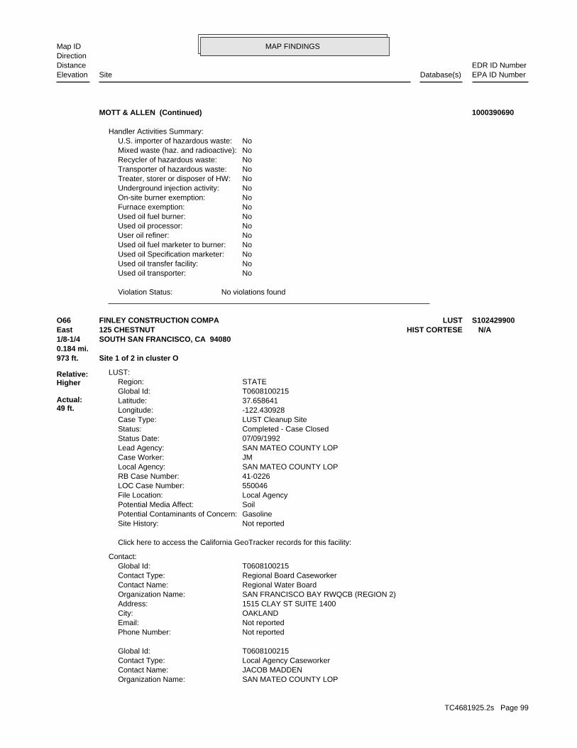
MAP FINDINGSMap IDDirection
EDR ID NumberDistanceEPA ID NumberDatabase(s)SiteElevation
No violations foundViolation Status:
NoUsed oil transporter: NoUsed oil transfer facility: NoUsed oil Specification marketer: NoUsed oil fuel marketer to burner: NoUser oil refiner: NoUsed oil processor: NoUsed oil fuel burner: NoFurnace exemption: NoOn-site burner exemption: NoUnderground injection activity: NoTreater, storer or disposer of HW: NoTransporter of hazardous waste: NoRecycler of hazardous waste: NoMixed waste (haz. and radioactive): NoU.S. importer of hazardous waste:
Handler Activities Summary:
MOTT & ALLEN (Continued) 1000390690
SAN MATEO COUNTY LOPOrganization Name: JACOB MADDENContact Name: Local Agency CaseworkerContact Type: T0608100215Global Id:
Not reportedPhone Number: Not reportedEmail: OAKLANDCity: 1515 CLAY ST SUITE 1400Address: SAN FRANCISCO BAY RWQCB (REGION 2)Organization Name: Regional Water BoardContact Name: Regional Board CaseworkerContact Type: T0608100215Global Id:
Contact:
Click here to access the California GeoTracker records for this facility:
Not reportedSite History: GasolinePotential Contaminants of Concern: SoilPotential Media Affect: Local AgencyFile Location: 550046LOC Case Number: 41-0226RB Case Number: SAN MATEO COUNTY LOPLocal Agency: JMCase Worker: SAN MATEO COUNTY LOPLead Agency: 07/09/1992Status Date: Completed - Case ClosedStatus: LUST Cleanup SiteCase Type: -122.430928Longitude: 37.658641Latitude: T0608100215Global Id: STATERegion:
LUST:
973 ft. Site 1 of 2 in cluster O0.184 mi.
Relative:Higher
Actual:49 ft.
1/8-1/4 SOUTH SAN FRANCISCO, CA 94080East HIST CORTESE125 CHESTNUT N/AO66 LUSTFINLEY CONSTRUCTION COMPA S102429900
TC4681925.2s Page 99

MAP FINDINGSMap IDDirection
EDR ID NumberDistanceEPA ID NumberDatabase(s)SiteElevation
SAN MATEORegion:SAN MATEO CO. LUST:
Not reportedDate Post Remedial Action Monitoring Began: Not reportedDate Remediation Action Underway: Not reportedPollution Remediation Plan Submitted: Not reportedPollution Characterization Began: Not reportedPreliminary Site Assesment Began: Not reportedPrelim. Site Assesment Wokplan Submitted: LUSTOversight Program: Not reportedDate Leak Confirmed: UnknownLeak Source: UnknownLeak Cause: OMHow Discovered: 550046Case Number: Case ClosedFacility Status: Not reportedFacility Id: 2Region:
LUST REG 2:
Notice of Responsibility - #1Action: 07/09/1992Date: ENFORCEMENTAction Type: T0608100215Global Id:
Leak ReportedAction: 06/22/1989Date: OtherAction Type: T0608100215Global Id:
Leak DiscoveryAction: 06/22/1989Date: OtherAction Type: T0608100215Global Id:
Monitoring Report - OtherAction: 05/06/1992Date: RESPONSEAction Type: T0608100215Global Id:
Regulatory Activities:
06/22/1989Status Date: Open - Case Begin DateStatus: T0608100215Global Id:
07/09/1992Status Date: Completed - Case ClosedStatus: T0608100215Global Id:
Status History:
6503726298Phone Number: [email protected]: SAN MATEOCity: 2000 ALAMEDA DE LAS PULGASAddress:
FINLEY CONSTRUCTION COMPA (Continued) S102429900
TC4681925.2s Page 100

MAP FINDINGSMap IDDirection
EDR ID NumberDistanceEPA ID NumberDatabase(s)SiteElevation
41-0226Reg Id: LTNKAReg By: 41Facility County Code: CORTESERegion:
HIST CORTESE:
SAN MATEO CO. LUSTEDR Link ID: SAN MATEO CO. LUSTCase Type: 011312250APN Number: T0608100215Global ID: 9- Case ClosedFacility Status: 550046Facility ID:
FINLEY CONSTRUCTION COMPA (Continued) S102429900
Click here for Geo Tracker PDF:
NoneLeak Detection: Not reportedContainer Construction Thickness: UNLEADEDType of Fuel: PRODUCTTank Used for: 00001000Tank Capacity: 1978Year Installed: 1Container Num: 001Tank Num:
0001Total Tanks: SO SAN FRANCISCO, CA 94080Owner City,St,Zip: 125 CHESTNUT AVENUEOwner Address: HENRY RISSOOwner Name: 4155834949Telephone: Not reportedContact Name: NURSERY-WHOLESALEOther Type: OtherFacility Type: 00000011811Facility ID: STATERegion: http://geotracker.waterboards.ca.gov/ustpdfs/pdf/0002BF24.pdfURL: 0002BF24File Number:
HIST UST:
973 ft. Site 2 of 2 in cluster O0.184 mi.
Relative:Higher
Actual:49 ft.
1/8-1/4 SOUTH SAN FRANCISCO, CA 94080East 125 CHESTNUT AVENUE N/AO67 HIST USTJUNIPERO SERRA NURSERY U001594791
COND EXEMPT - SQ TREATMENTDescription: PR0037825Record Id: COND EXEMPT - SQ TREATMENTProg Element Code: FA0002692Facility ID: SAN MATEORegion:
San Mateo Co. BI:
984 ft. Site 2 of 9 in cluster N0.186 mi.
Relative:Higher
Actual:43 ft.
1/8-1/4 SOUTH SAN FRANCISCO, CA 94080SE 66 A N/AN68 San Mateo Co. BIALL TRANSMISSIONS S117398529
TC4681925.2s Page 101

MAP FINDINGSMap IDDirection
EDR ID NumberDistanceEPA ID NumberDatabase(s)SiteElevation
ACTIVEFacility Status: STORES HAZ MAT <219GAL,1,999LB, 879CFDescription: PR0056472Record Id: STORES HAZ MAT <219GAL,1,999LB, 879FT3Prog Element Code: FA0040490Facility ID: SAN MATEORegion:
ACTIVEFacility Status: GENERATES & RECYCLES WASTE OIL/SOLVENTDescription: PR0056473Record Id: GENERATES and RECYCLES WASTE OIL/SOLVENTProg Element Code: FA0040490Facility ID: SAN MATEORegion:
INACTIVEFacility Status: STORES HAZ MAT <219GAL,1,999LB, 879CFDescription: PR0024103Record Id: STORES HAZ MAT <219GAL,1,999LB, 879FT3Prog Element Code: FA0002692Facility ID: SAN MATEORegion:
INACTIVEFacility Status: GENERATES & RECYCLES WASTE OIL/SOLVENTDescription: PR0004196Record Id: GENERATES and RECYCLES WASTE OIL/SOLVENTProg Element Code: FA0002692Facility ID: SAN MATEORegion:
INACTIVEFacility Status:
ALL TRANSMISSIONS (Continued) S117398529
INACTIVEFacility Status: GENERATES <27 GAL/YEARDescription: PR0050849Record Id: GENERATES <27 GAL/YEARProg Element Code: FA0026577Facility ID: SAN MATEORegion:
San Mateo Co. BI:
1022 ft.0.194 mi.
Relative:Higher
Actual:63 ft.
1/8-1/4 SOUTH SAN FRANCISCO, CA 94080SSW 100 ARROYO N/A69 San Mateo Co. BITONI AMBUS, D.D.S. S117398050
GENERATES <27 GAL/YEARDescription: PR0074543Record Id: GENERATES <27 GAL/YEARProg Element Code: FA0053957Facility ID: SAN MATEORegion:
San Mateo Co. BI:
1025 ft. Site 3 of 9 in cluster N0.194 mi.
Relative:Higher
Actual:47 ft.
1/8-1/4 SOUTH SAN FRANCISCO, CA 94080SSE 15-17 FIRST N/AN70 San Mateo Co. BIDALAND BODY SHOP INC S117976164
TC4681925.2s Page 102

MAP FINDINGSMap IDDirection
EDR ID NumberDistanceEPA ID NumberDatabase(s)SiteElevation
ACTIVEFacility Status:
DALAND BODY SHOP INC (Continued) S117976164
INACTIVEFacility Status: GENERATES <27 GAL/YEARDescription: PR0046040Record Id: GENERATES <27 GAL/YEARProg Element Code: FA0027996Facility ID: SAN MATEORegion:
San Mateo Co. BI:
1032 ft. Site 4 of 9 in cluster N0.195 mi.
Relative:Higher
Actual:44 ft.
1/8-1/4 SOUTH SAN FRANCISCO, CA 94080SE 107 1ST N/AN71 San Mateo Co. BIGREG LEONARDS GARAGE S117398244
INACTIVEFacility Status: GENERATES & RECYCLES WASTE OIL/SOLVENTDescription: PR0024227Record Id: GENERATES and RECYCLES WASTE OIL/SOLVENTProg Element Code: FA0016561Facility ID: SAN MATEORegion:
San Mateo Co. BI:
1033 ft. Site 5 of 9 in cluster N0.196 mi.
Relative:Higher
Actual:44 ft.
1/8-1/4 SOUTH SAN FRANCISCO, CA 94080SE 101 1ST N/AN72 San Mateo Co. BIA 1 CONVERTER S117397651
SWEEPS UST:
Not reportedDate Post Remedial Action Monitoring Began: Not reportedDate Remediation Action Underway: Not reportedPollution Remediation Plan Submitted: Not reportedPollution Characterization Began: Not reportedPreliminary Site Assesment Began: Not reportedPrelim. Site Assesment Wokplan Submitted: LUSTOversight Program: Not reportedDate Leak Confirmed: UnknownLeak Source: UnknownLeak Cause: OMHow Discovered: 550118Case Number: Case ClosedFacility Status: Not reportedFacility Id: 2Region:
LUST REG 2:
1033 ft. Site 6 of 9 in cluster N0.196 mi.
Relative:Higher
Actual:44 ft.
1/8-1/4 San Mateo Co. BISOUTH SAN FRANCISCO, CA 94080SE SWEEPS UST103 1ST N/AN73 LUSTSTAN THE ROOF MAN S103893155
TC4681925.2s Page 103

MAP FINDINGSMap IDDirection
EDR ID NumberDistanceEPA ID NumberDatabase(s)SiteElevation
INACTIVEFacility Status: UNDERGROUND TANK - GENERALDescription: PR0022650Record Id: UNDERGROUND TANK - GENERALProg Element Code: FA0017773Facility ID: SAN MATEORegion:
San Mateo Co. BI:
1Number Of Tanks: REG UNLEADEDContent: PRODUCTSTG: M.V. FUELTank Use: Not reportedActive Date: 500Capacity: Not reportedTank Status: 41-000-550119-000001SWRCB Tank Id: Not reportedOwner Tank Id: Not reportedCreated Date: Not reportedAction Date: Not reportedReferral Date: Not reportedBoard Of Equalization: Not reportedNumber: 550119Comp Number: Not reportedStatus:
STAN THE ROOF MAN (Continued) S103893155
OAKLANDCity: 1515 CLAY ST SUITE 1400Address: SAN FRANCISCO BAY RWQCB (REGION 2)Organization Name: Regional Water BoardContact Name: Regional Board CaseworkerContact Type: T0608100696Global Id:
Contact:
Click here to access the California GeoTracker records for this facility:
Not reportedSite History: GasolinePotential Contaminants of Concern: SoilPotential Media Affect: Local AgencyFile Location: 550118LOC Case Number: 41-0736RB Case Number: SAN MATEO COUNTY LOPLocal Agency: JMCase Worker: SAN MATEO COUNTY LOPLead Agency: 08/10/2000Status Date: Completed - Case ClosedStatus: LUST Cleanup SiteCase Type: -122.4314116Longitude: 37.6534095Latitude: T0608100696Global Id: STATERegion:
LUST:
1033 ft. Site 7 of 9 in cluster N0.196 mi.
Relative:Higher
Actual:44 ft.
1/8-1/4 HIST CORTESESOUTH SAN FRANCISCO, CA 94080SE HIST UST103 1ST ST N/AN74 LUSTSTAN THE ROOF MAN INC U001594840
TC4681925.2s Page 104

MAP FINDINGSMap IDDirection
EDR ID NumberDistanceEPA ID NumberDatabase(s)SiteElevation
VERNON S WALIGORAContact Name: ROOFING CONTRACTOROther Type: OtherFacility Type: 00000010425Facility ID: STATERegion: http://geotracker.waterboards.ca.gov/ustpdfs/pdf/0002BBD0.pdfURL: 0002BBD0File Number:
HIST UST:
SAN MATEO CO. LUSTEDR Link ID: SAN MATEO CO. LUSTCase Type: Not reportedAPN Number: T0608100696Global ID: 9- Case ClosedFacility Status: 550118Facility ID: SAN MATEORegion:
SAN MATEO CO. LUST:
Leak ReportedAction: 08/09/1992Date: OtherAction Type: T0608100696Global Id:
Leak DiscoveryAction: 08/09/1992Date: OtherAction Type: T0608100696Global Id:
Notice of Responsibility - #1Action: 07/31/1997Date: ENFORCEMENTAction Type: T0608100696Global Id:
Regulatory Activities:
08/09/1992Status Date: Open - Case Begin DateStatus: T0608100696Global Id:
08/10/2000Status Date: Completed - Case ClosedStatus: T0608100696Global Id:
Status History:
6503726298Phone Number: [email protected]: SAN MATEOCity: 2000 ALAMEDA DE LAS PULGASAddress: SAN MATEO COUNTY LOPOrganization Name: JACOB MADDENContact Name: Local Agency CaseworkerContact Type: T0608100696Global Id:
Not reportedPhone Number: Not reportedEmail:
STAN THE ROOF MAN INC (Continued) U001594840
TC4681925.2s Page 105

MAP FINDINGSMap IDDirection
EDR ID NumberDistanceEPA ID NumberDatabase(s)SiteElevation
41-0736Reg Id: LTNKAReg By: 41Facility County Code: CORTESERegion:
HIST CORTESE:
Click here for Geo Tracker PDF:
Visual, Stock InventorLeak Detection: 3/8Container Construction Thickness: UNLEADEDType of Fuel: PRODUCTTank Used for: 00000550Tank Capacity: 1950Year Installed: 1Container Num: 001Tank Num:
0001Total Tanks: SO SAN FRANCISCO, CA 94080Owner City,St,Zip: 101 1ST ST.Owner Address: ARTHUR E LUNDBURGOwner Name: 4157611132Telephone:
STAN THE ROOF MAN INC (Continued) U001594840
Not reportedTank Status: 41-000-550186-000002SWRCB Tank Id: Not reportedOwner Tank Id: Not reportedCreated Date: Not reportedAction Date: Not reportedReferral Date: Not reportedBoard Of Equalization: Not reportedNumber: 550186Comp Number: Not reportedStatus:
2Number Of Tanks: REG UNLEADEDContent: PRODUCTSTG: M.V. FUELTank Use: Not reportedActive Date: 500Capacity: Not reportedTank Status: 41-000-550186-000001SWRCB Tank Id: Not reportedOwner Tank Id: Not reportedCreated Date: Not reportedAction Date: Not reportedReferral Date: Not reportedBoard Of Equalization: Not reportedNumber: 550186Comp Number: Not reportedStatus:
SWEEPS UST:
1055 ft. Site 1 of 3 in cluster P0.200 mi.
Relative:Higher
Actual:60 ft.
1/8-1/4 SSF, CA 94080ENE 150 OAK AVE N/AP75 SWEEPS USTOAK FARM LTD S106930045
TC4681925.2s Page 106

MAP FINDINGSMap IDDirection
EDR ID NumberDistanceEPA ID NumberDatabase(s)SiteElevation
Not reportedNumber Of Tanks: Not reportedContent: Not reportedSTG: Not reportedTank Use: Not reportedActive Date: Not reportedCapacity: Not reportedTank Status: Not reportedSWRCB Tank Id: Not reportedOwner Tank Id: 07-09-92Created Date: 11-04-93Action Date: 11-04-93Referral Date: Not reportedBoard Of Equalization: 3Number: 550186Comp Number: ActiveStatus:
Not reportedNumber Of Tanks: REG UNLEADEDContent: PRODUCTSTG: M.V. FUELTank Use: Not reportedActive Date: 1500Capacity:
OAK FARM LTD (Continued) S106930045
INACTIVEFacility Status: UNDERGROUND TANK - GENERALDescription: PR0026100Record Id: UNDERGROUND TANK - GENERALProg Element Code: FA0023041Facility ID: SAN MATEORegion:
INACTIVEFacility Status: BUSINESS PLAN - GENERALDescription: PR0033473Record Id: BUSINESS PLAN - GENERALProg Element Code: FA0023041Facility ID: SAN MATEORegion:
San Mateo Co. BI:
1055 ft. Site 2 of 3 in cluster P0.200 mi.
Relative:Higher
Actual:60 ft.
1/8-1/4 SOUTH SAN FRANCISCO, CA 94080ENE 150 OAK N/AP76 San Mateo Co. BIT CERRUTI & CO S117397845
PR0037649Record Id: STORES MV FUELS OR WASTE ONLYProg Element Code: FA0026105Facility ID: SAN MATEORegion:
San Mateo Co. BI:
1059 ft. Site 1 of 3 in cluster Q0.201 mi.
Relative:Higher
Actual:49 ft.
1/8-1/4 SOUTH SAN FRANCISCO, CA 94080SSE OFF EL CAMINO REAL, SE/HI N/AQ77 San Mateo Co. BIPG&E: LAWNDALE SUBSTATION S117976086
TC4681925.2s Page 107

MAP FINDINGSMap IDDirection
EDR ID NumberDistanceEPA ID NumberDatabase(s)SiteElevation
ACTIVEFacility Status: STORES MV FUELS OR WASTE ONLYDescription:
PG&E: LAWNDALE SUBSTATION (Continued) S117976086
Not reportedIncident Description: Not reportedIssue Date: Not reportedDischarge Date: Not reportedFacility Type: Not reportedBoard File Number: Not reportedStaff Initials: Not reportedDate Reported:
NOTIFY 65:
1075 ft. Site 8 of 9 in cluster N0.204 mi.
Relative:Higher
Actual:43 ft.
1/8-1/4 DIXON, CA 94080SE 132 NORTH FIRST STREET N/AN78 Notify 65RON DUPRATT FORD S100225691
Not reportedOwner/Op end date: Not reportedOwner/Op start date: OwnerOwner/Operator Type: PrivateLegal status: (415) 555-1212Owner/operator telephone: Not reportedOwner/operator country: NOT REQUIRED, ME 99999 NOT REQUIREDOwner/operator address: PERA ARMANDOOwner/operator name:
Owner/Operator Summary:
hazardous waste at any time waste during any calendar month, and accumulates more than 1000 kg of hazardous waste at any time; or generates 100 kg or less of hazardous waste during any calendar month and accumulates less than 6000 kg of Handler: generates more than 100 and less than 1000 kg of hazardousDescription: Small Small Quantity GeneratorClassification: 09EPA Region: Not reportedContact email: (415) 588-1764Contact telephone: USContact country: SOUTH SAN FRANCISCO, CA 94080 890 EL CAMINO REALContact address: ENVIRONMENTAL MANAGERContact: SOUTH SAN FRANCISCO, CA 94080 EL CAMINO REALMailing address: CAD981378797EPA ID: SOUTH SAN FRANCISCO, CA 94080 890 EL CAMINO REALFacility address: DALAND BODY SHOP INCFacility name: 02/04/1986Date form received by agency:
RCRA-SQG:
1087 ft. ECHOSite 2 of 3 in cluster Q0.206 mi. EMI
Relative:Higher
Actual:48 ft.
1/8-1/4 San Mateo Co. BISOUTH SAN FRANCISCO, CA 94080SSE FINDS890 EL CAMINO REAL CAD981378797Q79 RCRA-SQGDALAND BODY SHOP 1000151941
TC4681925.2s Page 108

MAP FINDINGSMap IDDirection
EDR ID NumberDistanceEPA ID NumberDatabase(s)SiteElevation
ACTIVEFacility Status: GENERATES & RECYCLES WASTE OIL/SOLVENTDescription: PR0011542Record Id: GENERATES and RECYCLES WASTE OIL/SOLVENTProg Element Code: FA0017814Facility ID: SAN MATEORegion:
San Mateo Co. BI:
HAZARDOUS AIR POLLUTANT MAJOR
corrective action activities required under RCRA.program staff to track the notification, permit, compliance, andand treat, store, or dispose of hazardous waste. RCRAInfo allows RCRAevents and activities related to facilities that generate, transport,Conservation and Recovery Act (RCRA) program through the tracking ofRCRAInfo is a national information system that supports the Resource
facilities.generators, transporters, and treatment, storage, and disposalprovides California with information on hazardous waste shipments forCalifornia Hazardous Waste Tracking System - Datamart (HWTS-DATAMART) Environmental Interest/Information System
110001195279Registry ID:
FINDS:
No violations foundViolation Status:
NoUsed oil transporter: NoUsed oil transfer facility: NoUsed oil Specification marketer: NoUsed oil fuel marketer to burner: NoUser oil refiner: NoUsed oil processor: NoUsed oil fuel burner: NoFurnace exemption: NoOn-site burner exemption: NoUnderground injection activity: NoTreater, storer or disposer of HW: NoTransporter of hazardous waste: NoRecycler of hazardous waste: NoMixed waste (haz. and radioactive): NoU.S. importer of hazardous waste:
Handler Activities Summary:
Not reportedOwner/Op end date: Not reportedOwner/Op start date: OperatorOwner/Operator Type: PrivateLegal status: (415) 555-1212Owner/operator telephone: Not reportedOwner/operator country: NOT REQUIRED, ME 99999 NOT REQUIREDOwner/operator address: NOT REQUIREDOwner/operator name:
DALAND BODY SHOP (Continued) 1000151941
TC4681925.2s Page 109

MAP FINDINGSMap IDDirection
EDR ID NumberDistanceEPA ID NumberDatabase(s)SiteElevation
0Particulate Matter Tons/Yr: 0SOX - Oxides of Sulphur Tons/Yr: 0NOX - Oxides of Nitrogen Tons/Yr: 0Carbon Monoxide Emissions Tons/Yr: 1Reactive Organic Gases Tons/Yr: 1Total Organic Hydrocarbon Gases Tons/Yr: Not reportedConsolidated Emission Reporting Rule: Not reportedCommunity Health Air Pollution Info System: BAY AREA AQMDAir District Name: 7532SIC Code: BAAir District Name: 5611Facility ID: SFAir Basin: 41County Code: 1995Year:
0Part. Matter 10 Micrometers and Smllr Tons/Yr: 0Particulate Matter Tons/Yr: 0SOX - Oxides of Sulphur Tons/Yr: 0NOX - Oxides of Nitrogen Tons/Yr: 0Carbon Monoxide Emissions Tons/Yr: 1Reactive Organic Gases Tons/Yr: 1Total Organic Hydrocarbon Gases Tons/Yr: Not reportedConsolidated Emission Reporting Rule: Not reportedCommunity Health Air Pollution Info System: BAY AREA AQMDAir District Name: 7532SIC Code: BAAir District Name: 5611Facility ID: SFAir Basin: 41County Code: 1993Year:
0Part. Matter 10 Micrometers and Smllr Tons/Yr: 0Particulate Matter Tons/Yr: 0SOX - Oxides of Sulphur Tons/Yr: 0NOX - Oxides of Nitrogen Tons/Yr: 0Carbon Monoxide Emissions Tons/Yr: 1Reactive Organic Gases Tons/Yr: 1Total Organic Hydrocarbon Gases Tons/Yr: Not reportedConsolidated Emission Reporting Rule: Not reportedCommunity Health Air Pollution Info System: BAY AREA AQMDAir District Name: 7532SIC Code: BAAir District Name: 5611Facility ID: SFAir Basin: 41County Code: 1990Year:
EMI:
ACTIVEFacility Status: STORES HAZ MAT <219GAL,1,999LB, 879CFDescription: PR0004258Record Id: STORES HAZ MAT <219GAL,1,999LB, 879FT3Prog Element Code: FA0017814Facility ID: SAN MATEORegion:
DALAND BODY SHOP (Continued) 1000151941
TC4681925.2s Page 110

MAP FINDINGSMap IDDirection
EDR ID NumberDistanceEPA ID NumberDatabase(s)SiteElevation
5611Facility ID: SFAir Basin: 41County Code: 1999Year:
0Part. Matter 10 Micrometers and Smllr Tons/Yr: 0Particulate Matter Tons/Yr: 0SOX - Oxides of Sulphur Tons/Yr: 0NOX - Oxides of Nitrogen Tons/Yr: 0Carbon Monoxide Emissions Tons/Yr: 1Reactive Organic Gases Tons/Yr: 1Total Organic Hydrocarbon Gases Tons/Yr: Not reportedConsolidated Emission Reporting Rule: Not reportedCommunity Health Air Pollution Info System: BAY AREA AQMDAir District Name: 7532SIC Code: BAAir District Name: 5611Facility ID: SFAir Basin: 41County Code: 1998Year:
0Part. Matter 10 Micrometers and Smllr Tons/Yr: 0Particulate Matter Tons/Yr: 0SOX - Oxides of Sulphur Tons/Yr: 0NOX - Oxides of Nitrogen Tons/Yr: 0Carbon Monoxide Emissions Tons/Yr: 1Reactive Organic Gases Tons/Yr: 1Total Organic Hydrocarbon Gases Tons/Yr: Not reportedConsolidated Emission Reporting Rule: Not reportedCommunity Health Air Pollution Info System: BAY AREA AQMDAir District Name: 7532SIC Code: BAAir District Name: 5611Facility ID: SFAir Basin: 41County Code: 1997Year:
0Part. Matter 10 Micrometers and Smllr Tons/Yr: 0Particulate Matter Tons/Yr: 0SOX - Oxides of Sulphur Tons/Yr: 0NOX - Oxides of Nitrogen Tons/Yr: 0Carbon Monoxide Emissions Tons/Yr: 1Reactive Organic Gases Tons/Yr: 1Total Organic Hydrocarbon Gases Tons/Yr: Not reportedConsolidated Emission Reporting Rule: Not reportedCommunity Health Air Pollution Info System: BAY AREA AQMDAir District Name: 7532SIC Code: BAAir District Name: 5611Facility ID: SFAir Basin: 41County Code: 1996Year:
0Part. Matter 10 Micrometers and Smllr Tons/Yr:
DALAND BODY SHOP (Continued) 1000151941
TC4681925.2s Page 111

MAP FINDINGSMap IDDirection
EDR ID NumberDistanceEPA ID NumberDatabase(s)SiteElevation
0Total Organic Hydrocarbon Gases Tons/Yr: Not reportedConsolidated Emission Reporting Rule: Not reportedCommunity Health Air Pollution Info System: BAY AREA AQMDAir District Name: 7532SIC Code: BAAir District Name: 5611Facility ID: SFAir Basin: 41County Code: 2002Year:
0Part. Matter 10 Micrometers and Smllr Tons/Yr: 0Particulate Matter Tons/Yr: 0SOX - Oxides of Sulphur Tons/Yr: 0NOX - Oxides of Nitrogen Tons/Yr: 0Carbon Monoxide Emissions Tons/Yr: 0Reactive Organic Gases Tons/Yr: 1Total Organic Hydrocarbon Gases Tons/Yr: Not reportedConsolidated Emission Reporting Rule: Not reportedCommunity Health Air Pollution Info System: BAY AREA AQMDAir District Name: 7532SIC Code: BAAir District Name: 5611Facility ID: SFAir Basin: 41County Code: 2001Year:
0Part. Matter 10 Micrometers and Smllr Tons/Yr: 0Particulate Matter Tons/Yr: 0SOX - Oxides of Sulphur Tons/Yr: 0NOX - Oxides of Nitrogen Tons/Yr: 0Carbon Monoxide Emissions Tons/Yr: 1Reactive Organic Gases Tons/Yr: 1Total Organic Hydrocarbon Gases Tons/Yr: Not reportedConsolidated Emission Reporting Rule: Not reportedCommunity Health Air Pollution Info System: BAY AREA AQMDAir District Name: 7532SIC Code: BAAir District Name: 5611Facility ID: SFAir Basin: 41County Code: 2000Year:
0Part. Matter 10 Micrometers and Smllr Tons/Yr: 0Particulate Matter Tons/Yr: 0SOX - Oxides of Sulphur Tons/Yr: 0NOX - Oxides of Nitrogen Tons/Yr: 0Carbon Monoxide Emissions Tons/Yr: 1Reactive Organic Gases Tons/Yr: 1Total Organic Hydrocarbon Gases Tons/Yr: Not reportedConsolidated Emission Reporting Rule: Not reportedCommunity Health Air Pollution Info System: BAY AREA AQMDAir District Name: 7532SIC Code: BAAir District Name:
DALAND BODY SHOP (Continued) 1000151941
TC4681925.2s Page 112
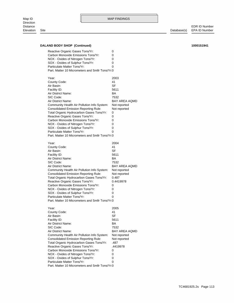
MAP FINDINGSMap IDDirection
EDR ID NumberDistanceEPA ID NumberDatabase(s)SiteElevation
0Part. Matter 10 Micrometers and Smllr Tons/Yr: 0Particulate Matter Tons/Yr: 0SOX - Oxides of Sulphur Tons/Yr: 0NOX - Oxides of Nitrogen Tons/Yr: 0Carbon Monoxide Emissions Tons/Yr: .4419978Reactive Organic Gases Tons/Yr: .487Total Organic Hydrocarbon Gases Tons/Yr: Not reportedConsolidated Emission Reporting Rule: Not reportedCommunity Health Air Pollution Info System: BAY AREA AQMDAir District Name: 7532SIC Code: BAAir District Name: 5611Facility ID: SFAir Basin: 41County Code: 2005Year:
0Part. Matter 10 Micrometers and Smllr Tons/Yr: 0Particulate Matter Tons/Yr: 0SOX - Oxides of Sulphur Tons/Yr: 0NOX - Oxides of Nitrogen Tons/Yr: 0Carbon Monoxide Emissions Tons/Yr: 0.4419978Reactive Organic Gases Tons/Yr: 0.487Total Organic Hydrocarbon Gases Tons/Yr: Not reportedConsolidated Emission Reporting Rule: Not reportedCommunity Health Air Pollution Info System: BAY AREA AQMDAir District Name: 7532SIC Code: BAAir District Name: 5611Facility ID: SFAir Basin: 41County Code: 2004Year:
0Part. Matter 10 Micrometers and Smllr Tons/Yr: 0Particulate Matter Tons/Yr: 0SOX - Oxides of Sulphur Tons/Yr: 0NOX - Oxides of Nitrogen Tons/Yr: 0Carbon Monoxide Emissions Tons/Yr: 0Reactive Organic Gases Tons/Yr: 0Total Organic Hydrocarbon Gases Tons/Yr: Not reportedConsolidated Emission Reporting Rule: Not reportedCommunity Health Air Pollution Info System: BAY AREA AQMDAir District Name: 7532SIC Code: BAAir District Name: 5611Facility ID: SFAir Basin: 41County Code: 2003Year:
0Part. Matter 10 Micrometers and Smllr Tons/Yr: 0Particulate Matter Tons/Yr: 0SOX - Oxides of Sulphur Tons/Yr: 0NOX - Oxides of Nitrogen Tons/Yr: 0Carbon Monoxide Emissions Tons/Yr: 0Reactive Organic Gases Tons/Yr:
DALAND BODY SHOP (Continued) 1000151941
TC4681925.2s Page 113

MAP FINDINGSMap IDDirection
EDR ID NumberDistanceEPA ID NumberDatabase(s)SiteElevation
7532SIC Code: BAAir District Name: 5611Facility ID: SFAir Basin: 41County Code: 2009Year:
0Part. Matter 10 Micrometers and Smllr Tons/Yr: 0Particulate Matter Tons/Yr: 0SOX - Oxides of Sulphur Tons/Yr: 0NOX - Oxides of Nitrogen Tons/Yr: 0Carbon Monoxide Emissions Tons/Yr: .5423654Reactive Organic Gases Tons/Yr: .58Total Organic Hydrocarbon Gases Tons/Yr: Not reportedConsolidated Emission Reporting Rule: Not reportedCommunity Health Air Pollution Info System: BAY AREA AQMDAir District Name: 7532SIC Code: BAAir District Name: 5611Facility ID: SFAir Basin: 41County Code: 2008Year:
0Part. Matter 10 Micrometers and Smllr Tons/Yr: 0Particulate Matter Tons/Yr: 0SOX - Oxides of Sulphur Tons/Yr: 0NOX - Oxides of Nitrogen Tons/Yr: 0Carbon Monoxide Emissions Tons/Yr: .5423654Reactive Organic Gases Tons/Yr: .58Total Organic Hydrocarbon Gases Tons/Yr: Not reportedConsolidated Emission Reporting Rule: Not reportedCommunity Health Air Pollution Info System: BAY AREA AQMDAir District Name: 7532SIC Code: BAAir District Name: 5611Facility ID: SFAir Basin: 41County Code: 2007Year:
0Part. Matter 10 Micrometers and Smllr Tons/Yr: 0Particulate Matter Tons/Yr: 0SOX - Oxides of Sulphur Tons/Yr: 0NOX - Oxides of Nitrogen Tons/Yr: 0Carbon Monoxide Emissions Tons/Yr: .5423654Reactive Organic Gases Tons/Yr: .58Total Organic Hydrocarbon Gases Tons/Yr: Not reportedConsolidated Emission Reporting Rule: Not reportedCommunity Health Air Pollution Info System: BAY AREA AQMDAir District Name: 7532SIC Code: BAAir District Name: 5611Facility ID: SFAir Basin: 41County Code: 2006Year:
DALAND BODY SHOP (Continued) 1000151941
TC4681925.2s Page 114

MAP FINDINGSMap IDDirection
EDR ID NumberDistanceEPA ID NumberDatabase(s)SiteElevation
0Carbon Monoxide Emissions Tons/Yr: 0.2284722Reactive Organic Gases Tons/Yr: 0.278Total Organic Hydrocarbon Gases Tons/Yr: Not reportedConsolidated Emission Reporting Rule: Not reportedCommunity Health Air Pollution Info System: BAY AREA AQMDAir District Name: 7532SIC Code: BAAir District Name: 5611Facility ID: SFAir Basin: 41County Code: 2012Year:
0Part. Matter 10 Micrometers and Smllr Tons/Yr: 0Particulate Matter Tons/Yr: 0SOX - Oxides of Sulphur Tons/Yr: 0NOX - Oxides of Nitrogen Tons/Yr: 0Carbon Monoxide Emissions Tons/Yr: 0.2284722Reactive Organic Gases Tons/Yr: 0.278Total Organic Hydrocarbon Gases Tons/Yr: Not reportedConsolidated Emission Reporting Rule: Not reportedCommunity Health Air Pollution Info System: BAY AREA AQMDAir District Name: 7532SIC Code: BAAir District Name: 5611Facility ID: SFAir Basin: 41County Code: 2011Year:
0Part. Matter 10 Micrometers and Smllr Tons/Yr: 0Particulate Matter Tons/Yr: 0SOX - Oxides of Sulphur Tons/Yr: 0NOX - Oxides of Nitrogen Tons/Yr: 0Carbon Monoxide Emissions Tons/Yr: 0.5423654Reactive Organic Gases Tons/Yr: 0.57999999999999996Total Organic Hydrocarbon Gases Tons/Yr: Not reportedConsolidated Emission Reporting Rule: Not reportedCommunity Health Air Pollution Info System: BAY AREA AQMDAir District Name: 7532SIC Code: BAAir District Name: 5611Facility ID: SFAir Basin: 41County Code: 2010Year:
0Part. Matter 10 Micrometers and Smllr Tons/Yr: 0Particulate Matter Tons/Yr: 0SOX - Oxides of Sulphur Tons/Yr: 0NOX - Oxides of Nitrogen Tons/Yr: 0Carbon Monoxide Emissions Tons/Yr: 0.5423654Reactive Organic Gases Tons/Yr: 0.57999999999999996Total Organic Hydrocarbon Gases Tons/Yr: Not reportedConsolidated Emission Reporting Rule: Not reportedCommunity Health Air Pollution Info System: BAY AREA AQMDAir District Name:
DALAND BODY SHOP (Continued) 1000151941
TC4681925.2s Page 115

MAP FINDINGSMap IDDirection
EDR ID NumberDistanceEPA ID NumberDatabase(s)SiteElevation
http://echo.epa.gov/detailed_facility_report?fid=110001195279DFR URL: 110001195279Registry ID: 1000151941Envid:
ECHO:
0Part. Matter 10 Micrometers and Smllr Tons/Yr: 0Particulate Matter Tons/Yr: 0SOX - Oxides of Sulphur Tons/Yr: 0NOX - Oxides of Nitrogen Tons/Yr: 0Carbon Monoxide Emissions Tons/Yr: 0.335899487Reactive Organic Gases Tons/Yr: 0.335899487Total Organic Hydrocarbon Gases Tons/Yr: Not reportedConsolidated Emission Reporting Rule: Not reportedCommunity Health Air Pollution Info System: BAY AREA AQMDAir District Name: 7532SIC Code: BAAir District Name: 5611Facility ID: SFAir Basin: 41County Code: 2014Year:
0Part. Matter 10 Micrometers and Smllr Tons/Yr: 0Particulate Matter Tons/Yr: 0SOX - Oxides of Sulphur Tons/Yr: 0NOX - Oxides of Nitrogen Tons/Yr: 0Carbon Monoxide Emissions Tons/Yr: 0.2284722Reactive Organic Gases Tons/Yr: 0.278Total Organic Hydrocarbon Gases Tons/Yr: Not reportedConsolidated Emission Reporting Rule: Not reportedCommunity Health Air Pollution Info System: BAY AREA AQMDAir District Name: 7532SIC Code: BAAir District Name: 5611Facility ID: SFAir Basin: 41County Code: 2013Year:
0Part. Matter 10 Micrometers and Smllr Tons/Yr: 0Particulate Matter Tons/Yr: 0SOX - Oxides of Sulphur Tons/Yr: 0NOX - Oxides of Nitrogen Tons/Yr:
DALAND BODY SHOP (Continued) 1000151941
ACTIVEFacility Status: GENERATES <27 GAL/YEARDescription: PR0058133Record Id: GENERATES <27 GAL/YEARProg Element Code: FA0045158Facility ID: SAN MATEORegion:
San Mateo Co. BI:
1128 ft. Site 2 of 2 in cluster M0.214 mi.
Relative:Higher
Actual:64 ft.
1/8-1/4 SOUTH SAN FRANCISCO, CA 94080South 849 ORANGE N/AM80 San Mateo Co. BICLUB VIEW S117398569
TC4681925.2s Page 116

MAP FINDINGSMap IDDirection
EDR ID NumberDistanceEPA ID NumberDatabase(s)SiteElevation
ACTIVEFacility Status: STORES MV FUELS OR WASTE ONLYDescription: PR0058938Record Id: STORES MV FUELS OR WASTE ONLYProg Element Code: FA0045324Facility ID: SAN MATEORegion:
ACTIVEFacility Status: GENERATES & RECYCLES WASTE OIL/SOLVENTDescription: PR0058939Record Id: GENERATES and RECYCLES WASTE OIL/SOLVENTProg Element Code: FA0045324Facility ID: SAN MATEORegion:
INACTIVEFacility Status: STORES MV FUELS OR WASTE ONLYDescription: PR0004256Record Id: STORES MV FUELS OR WASTE ONLYProg Element Code: FA0017840Facility ID: SAN MATEORegion:
INACTIVEFacility Status: GENERATES <27 GAL/YEARDescription: PR0011559Record Id: GENERATES <27 GAL/YEARProg Element Code: FA0017840Facility ID: SAN MATEORegion:
San Mateo Co. BI:
1172 ft. Site 3 of 3 in cluster Q0.222 mi.
Relative:Higher
Actual:49 ft.
1/8-1/4 SOUTH SAN FRANCISCO, CA 94080SSE 872 EL CAMINO REAL N/AQ81 San Mateo Co. BIJIM GRIFFIN & SON BRITISH S117398589
Not reportedSite History: GasolinePotential Contaminants of Concern: Other Groundwater (uses other than drinking water)Potential Media Affect: Local Agency WarehouseFile Location: 550012LOC Case Number: 41-0121RB Case Number: SAN MATEO COUNTY LOPLocal Agency: JMCase Worker: SAN MATEO COUNTY LOPLead Agency: 10/25/2005Status Date: Completed - Case ClosedStatus: LUST Cleanup SiteCase Type: -122.439713Longitude: 37.661982Latitude: T0608100114Global Id: STATERegion:
LUST:
1182 ft. Site 1 of 2 in cluster R0.224 mi.
Relative:Higher
Actual:68 ft.
1/8-1/4 SOUTH SAN FRANCISCO, CA 94080NW HIST CORTESE1198 OLD MISSION N/AR82 LUSTCHEVRON 9-1626 S110060437
TC4681925.2s Page 117

MAP FINDINGSMap IDDirection
EDR ID NumberDistanceEPA ID NumberDatabase(s)SiteElevation
T0608100114Global Id:
In Situ Physical/Chemical Treatment (other than SVE)Action: 02/07/1995Date: REMEDIATIONAction Type: T0608100114Global Id:
Leak ReportedAction: 05/15/1986Date: OtherAction Type: T0608100114Global Id:
Leak DiscoveryAction: 10/02/1989Date: OtherAction Type: T0608100114Global Id:
Monitoring Report - QuarterlyAction: 08/15/2004Date: RESPONSEAction Type: T0608100114Global Id:
Regulatory Activities:
05/15/1986Status Date: Open - Verification MonitoringStatus: T0608100114Global Id:
05/15/1986Status Date: Open - Case Begin DateStatus: T0608100114Global Id:
10/25/2005Status Date: Completed - Case ClosedStatus: T0608100114Global Id:
Status History:
6503726298Phone Number: [email protected]: SAN MATEOCity: 2000 ALAMEDA DE LAS PULGASAddress: SAN MATEO COUNTY LOPOrganization Name: JACOB MADDENContact Name: Local Agency CaseworkerContact Type: T0608100114Global Id:
Not reportedPhone Number: Not reportedEmail: OAKLANDCity: 1515 CLAY ST SUITE 1400Address: SAN FRANCISCO BAY RWQCB (REGION 2)Organization Name: Regional Water BoardContact Name: Regional Board CaseworkerContact Type: T0608100114Global Id:
Contact:
Click here to access the California GeoTracker records for this facility:
CHEVRON 9-1626 (Continued) S110060437
TC4681925.2s Page 118

MAP FINDINGSMap IDDirection
EDR ID NumberDistanceEPA ID NumberDatabase(s)SiteElevation
SAN MATEORegion:SAN MATEO CO. LUST:
UnknownAction: 10/10/2005Date: RESPONSEAction Type: T0608100114Global Id:
Other Report / DocumentAction: 08/01/2005Date: RESPONSEAction Type: T0608100114Global Id:
Request for ClosureAction: 09/30/2004Date: RESPONSEAction Type: T0608100114Global Id:
Monitoring Report - QuarterlyAction: 08/15/2005Date: RESPONSEAction Type: T0608100114Global Id:
Monitoring Report - QuarterlyAction: 08/15/2003Date: RESPONSEAction Type: T0608100114Global Id:
Staff Letter - #20050330Action: 03/30/2005Date: ENFORCEMENTAction Type: T0608100114Global Id:
Staff Letter - #20050707Action: 07/07/2005Date: ENFORCEMENTAction Type: T0608100114Global Id:
Staff Letter - #20040708Action: 07/08/2004Date: ENFORCEMENTAction Type: T0608100114Global Id:
Staff Letter - #19970609Action: 06/09/1997Date: ENFORCEMENTAction Type: T0608100114Global Id:
Closure/No Further Action Letter - #20051025Action: 10/25/2005Date: ENFORCEMENTAction Type: T0608100114Global Id:
Notice of Responsibility - #1Action: 09/29/1992Date: ENFORCEMENTAction Type:
CHEVRON 9-1626 (Continued) S110060437
TC4681925.2s Page 119

MAP FINDINGSMap IDDirection
EDR ID NumberDistanceEPA ID NumberDatabase(s)SiteElevation
41-0121Reg Id: LTNKAReg By: 41Facility County Code: CORTESERegion:
HIST CORTESE:
SAN MATEO CO. LUSTEDR Link ID: SAN MATEO CO. LUSTCase Type: 011202010APN Number: T0608100114Global ID: 9- Case ClosedFacility Status: 550012Facility ID:
CHEVRON 9-1626 (Continued) S110060437
Not reportedType of Fuel: PRODUCTTank Used for: 00007000Tank Capacity: 1956Year Installed: 3Container Num: 003Tank Num:
Stock InventorLeak Detection: 0000170Container Construction Thickness: Not reportedType of Fuel: PRODUCTTank Used for: 00003000Tank Capacity: 1956Year Installed: 2Container Num: 002Tank Num:
Stock InventorLeak Detection: 0000170Container Construction Thickness: Not reportedType of Fuel: PRODUCTTank Used for: 00004000Tank Capacity: 1956Year Installed: 1Container Num: 001Tank Num:
0004Total Tanks: SAN FRANCISCO, CA 94105Owner City,St,Zip: 575 MARKETOwner Address: CHEVRON U.S.A. INC.Owner Name: 4159520109Telephone: JUNER, ROBERT AContact Name: Not reportedOther Type: Gas StationFacility Type: 00000062098Facility ID: STATERegion: http://geotracker.waterboards.ca.gov/ustpdfs/pdf/0002BCCD.pdfURL: 0002BCCDFile Number:
HIST UST:
1182 ft. Site 2 of 2 in cluster R0.224 mi.
Relative:Higher
Actual:68 ft.
1/8-1/4 SO SAN FRANCISCO, CA 94080NW 1198 OLD MISSION RD N/AR83 HIST UST91626 U001594722
TC4681925.2s Page 120

MAP FINDINGSMap IDDirection
EDR ID NumberDistanceEPA ID NumberDatabase(s)SiteElevation
Click here for Geo Tracker PDF:
Stock InventorLeak Detection: 0000100Container Construction Thickness: Not reportedType of Fuel: WASTETank Used for: 00000550Tank Capacity: 1956Year Installed: 4Container Num: 004Tank Num:
Stock InventorLeak Detection: 0000250Container Construction Thickness:
91626 (Continued) U001594722
ActiveStatus: Not reportedComments: Not reportedEPA ID: Not reportedNPDES Number: Not reportedDUNs Number: Not reportedContact Phone: Not reportedContact: SO. SAN FRANCISCO 94080Mailing City,St,Zip: Not reportedMailing Address 2: 1350 EL CAMINO REALMailing Address: Not reportedMail To: 4150000000Facility Phone: Not reportedSIC Code: Not reportedCortese Code: Not reportedRegulated ID: UTNKARegulated By: 41000117Facility ID:
CA FID UST:
1199 ft. Site 1 of 4 in cluster S0.227 mi.
Relative:Higher
Actual:66 ft.
1/8-1/4 SO. SAN FRANCISCO, CA 94080WNW 1350 EL CAMINO REAL N/AS84 CA FID USTBROADMOOR LUMBER COMPANY S101623108
Not reportedPrelim. Site Assesment Wokplan Submitted: LUSTOversight Program: Not reportedDate Leak Confirmed: UnknownLeak Source: UnknownLeak Cause: Tank ClosureHow Discovered: 540147Case Number: Case ClosedFacility Status: Not reportedFacility Id: 2Region:
LUST REG 2:
1199 ft. Site 2 of 4 in cluster S0.227 mi. San Mateo Co. BI
Relative:Higher
Actual:66 ft.
1/8-1/4 HIST USTSOUTH SAN FRANCISCO, CA 94080WNW SWEEPS UST1350 EL CAMINO REAL N/AS85 LUSTBROADMOOR LUMBER CORP S103879228
TC4681925.2s Page 121

MAP FINDINGSMap IDDirection
EDR ID NumberDistanceEPA ID NumberDatabase(s)SiteElevation
Not reportedTank Num:
Not reportedTotal Tanks: Not reportedOwner City,St,Zip: Not reportedOwner Address: Not reportedOwner Name: Not reportedTelephone: Not reportedContact Name: Not reportedOther Type: Not reportedFacility Type: Not reportedFacility ID: Not reportedRegion: http://geotracker.waterboards.ca.gov/ustpdfs/pdf/0002BC3E.pdfURL: 0002BC3EFile Number:
HIST UST:
Not reportedNumber Of Tanks: Not reportedContent: Not reportedSTG: Not reportedTank Use: Not reportedActive Date: Not reportedCapacity: Not reportedTank Status: Not reportedSWRCB Tank Id: Not reportedOwner Tank Id: 10-13-88Created Date: 02-03-94Action Date: 02-03-94Referral Date: Not reportedBoard Of Equalization: 9Number: 550012Comp Number: ActiveStatus:
1Number Of Tanks: LEADEDContent: PRODUCTSTG: M.V. FUELTank Use: Not reportedActive Date: 1000Capacity: Not reportedTank Status: 41-000-550012-000001SWRCB Tank Id: Not reportedOwner Tank Id: Not reportedCreated Date: Not reportedAction Date: Not reportedReferral Date: Not reportedBoard Of Equalization: Not reportedNumber: 550012Comp Number: Not reportedStatus:
SWEEPS UST:
Not reportedDate Post Remedial Action Monitoring Began: Not reportedDate Remediation Action Underway: Not reportedPollution Remediation Plan Submitted: Not reportedPollution Characterization Began: Not reportedPreliminary Site Assesment Began:
BROADMOOR LUMBER CORP (Continued) S103879228
TC4681925.2s Page 122

MAP FINDINGSMap IDDirection
EDR ID NumberDistanceEPA ID NumberDatabase(s)SiteElevation
ACTIVEFacility Status: STORES HAZ MAT <1,199GAL,9,999LB,4,799CFDescription: PR0004198Record Id: STORES HAZ MAT <1,199GAL,9,999LB,4,799FT3Prog Element Code: FA0017680Facility ID: SAN MATEORegion:
ACTIVEFacility Status: GENERATES & RECYCLES WASTE OIL/SOLVENTDescription: PR0044753Record Id: GENERATES and RECYCLES WASTE OIL/SOLVENTProg Element Code: FA0017680Facility ID: SAN MATEORegion:
INACTIVEFacility Status: UNDERGROUND TANK - GENERALDescription: PR0025551Record Id: UNDERGROUND TANK - GENERALProg Element Code: FA0017680Facility ID: SAN MATEORegion:
San Mateo Co. BI:
Click here for Geo Tracker PDF:
Not reportedLeak Detection: Not reportedContainer Construction Thickness: Not reportedType of Fuel: Not reportedTank Used for: Not reportedTank Capacity: Not reportedYear Installed: Not reportedContainer Num:
BROADMOOR LUMBER CORP (Continued) S103879228
Not reportedSite History: GasolinePotential Contaminants of Concern: SoilPotential Media Affect: Local AgencyFile Location: 540147LOC Case Number: 41-0089RB Case Number: SAN MATEO COUNTY LOPLocal Agency: JMCase Worker: SAN MATEO COUNTY LOPLead Agency: 07/03/1995Status Date: Completed - Case ClosedStatus: LUST Cleanup SiteCase Type: -122.441376Longitude: 37.661273Latitude: T0608100084Global Id: STATERegion:
LUST:
1199 ft. Site 3 of 4 in cluster S0.227 mi.
Relative:Higher
Actual:66 ft.
1/8-1/4 NPDESSOUTH SAN FRANCISCO, CA 94080WNW HIST CORTESE1350 EL CAMINO REAL N/AS86 LUSTBROADMOOR LUMBER AND PLYWOOD CO U001594743
TC4681925.2s Page 123

MAP FINDINGSMap IDDirection
EDR ID NumberDistanceEPA ID NumberDatabase(s)SiteElevation
SAN MATEO CO. LUSTEDR Link ID: SAN MATEO CO. LUSTCase Type: 010292270APN Number: T0608100084Global ID: 9- Case ClosedFacility Status: 540147Facility ID: SAN MATEORegion:
SAN MATEO CO. LUST:
Notice of Responsibility - #1Action: 01/08/1990Date: ENFORCEMENTAction Type: T0608100084Global Id:
Leak ReportedAction: 01/08/1992Date: OtherAction Type: T0608100084Global Id:
Leak DiscoveryAction: 01/08/1992Date: OtherAction Type: T0608100084Global Id:
Regulatory Activities:
01/08/1990Status Date: Open - Case Begin DateStatus: T0608100084Global Id:
07/03/1995Status Date: Completed - Case ClosedStatus: T0608100084Global Id:
Status History:
6503726298Phone Number: [email protected]: SAN MATEOCity: 2000 ALAMEDA DE LAS PULGASAddress: SAN MATEO COUNTY LOPOrganization Name: JACOB MADDENContact Name: Local Agency CaseworkerContact Type: T0608100084Global Id:
Not reportedPhone Number: Not reportedEmail: OAKLANDCity: 1515 CLAY ST SUITE 1400Address: SAN FRANCISCO BAY RWQCB (REGION 2)Organization Name: Regional Water BoardContact Name: Regional Board CaseworkerContact Type: T0608100084Global Id:
Contact:
Click here to access the California GeoTracker records for this facility:
BROADMOOR LUMBER AND PLYWOOD CO (Continued) U001594743
TC4681925.2s Page 124

MAP FINDINGSMap IDDirection
EDR ID NumberDistanceEPA ID NumberDatabase(s)SiteElevation
Not reportedCONSTYPE LINEAR UTILITY IND: Not reportedDEVELOPER CONTACT TITLE: Not reportedDEVELOPER CONTACT NAME: Not reportedDEVELOPER ZIP: CaliforniaDEVELOPER STATE: Not reportedDEVELOPER CITY: Not reportedDEVELOPER ADDRESS: Not reportedDEVELOPER NAME: OtherOPERATOR TYPE: [email protected] CONTACT EMAIL: Not reportedOPERATOR CONTACT PHONE EXT: 650-761-1515OPERATOR CONTACT PHONE: Not reportedOPERATOR CONTACT TITLE: Ted SchlosserOPERATOR CONTACT NAME: 94080OPERATOR ZIP: CaliforniaOPERATOR STATE: South San FranciscoOPERATOR CITY: 1350 El Camino RealOPERATOR ADDRESS: Broadmoor Lomber CoOPERATOR NAME: [email protected] CONTACT EMAIL: Not reportedFACILITY CONTACT PHONE EXT: 650-761-1515FACILITY CONTACT PHONE: Not reportedFACILITY CONTACT TITLE: Ted SchlosserFACILITY CONTACT NAME: 52PLACE SIZE UNIT: 3PLACE SIZE: 11/13/1996STATUS DATE: ActiveSTATUS CODE NAME: 11/13/1996PROCESSED DATE: 5/9/2008RECEIVED DATE: Not reportedDischarge Zip: Not reportedDischarge State: Not reportedDischarge City: Not reportedDischarge Address: Not reportedDischarge Name: Not reportedTermination Date Of Regulatory Measure: Not reportedExpiration Date Of Regulatory Measure: Not reportedEffective Date Of Regulatory Measure: Not reportedAdoption Date Of Regulatory Measure: Not reportedProgram Type: 2 41I012645WDID: Not reportedPlace Id: IndustrialRegulatory Measure Type: Not reportedOrder No: 182920Regulatory Measure Id: 2Region: Not reportedAgency Id: Not reportedFacility Status: Not reportedNpdes Number:
NPDES:
41-0089Reg Id: LTNKAReg By: 41Facility County Code: CORTESERegion:
HIST CORTESE:
BROADMOOR LUMBER AND PLYWOOD CO (Continued) U001594743
TC4681925.2s Page 125

MAP FINDINGSMap IDDirection
EDR ID NumberDistanceEPA ID NumberDatabase(s)SiteElevation
Not reportedFACILITY CONTACT EMAIL: Not reportedFACILITY CONTACT PHONE EXT: Not reportedFACILITY CONTACT PHONE: Not reportedFACILITY CONTACT TITLE: Not reportedFACILITY CONTACT NAME: Not reportedPLACE SIZE UNIT: Not reportedPLACE SIZE: Not reportedSTATUS DATE: Not reportedSTATUS CODE NAME: Not reportedPROCESSED DATE: Not reportedRECEIVED DATE: 94080Discharge Zip: CaliforniaDischarge State: South San FranciscoDischarge City: 1350 El Camino RealDischarge Address: Broadmoor Lumber Co.Discharge Name: Not reportedTermination Date Of Regulatory Measure: Not reportedExpiration Date Of Regulatory Measure: 11/13/1996Effective Date Of Regulatory Measure: Not reportedAdoption Date Of Regulatory Measure: IndustrialProgram Type: 2 41I012645WDID: Not reportedPlace Id: EnrolleeRegulatory Measure Type: 97-03-DWQOrder No: 182920Regulatory Measure Id: 2Region: 0Agency Id: ActiveFacility Status: CAS000001Npdes Number:
Not reportedTERTIARY SIC: Not reportedSECONDARY SIC: 1411-Dimension StonePRIMARY SIC: Not reportedCERTIFICATION DATE: Not reportedCERTIFIER TITLE: Not reportedCERTIFIER NAME: Not reportedRECEIVING WATER NAME: Not reportedDIR DISCHARGE USWATER IND: Not reportedCONSTYPE WATER SEWER IND: Not reportedCONSTYPE UTILITY IND: Not reportedCONSTYPE UTILITY DESCRIPTION: Not reportedCONSTYPE TRANSPORT IND: Not reportedCONSTYPE RESIDENTIAL IND: Not reportedCONSTYPE RECONS IND: Not reportedCONSTYPE OTHER IND: Not reportedCONSTYPE OTHER DESRIPTION: Not reportedCONSTYPE INDUSTRIAL IND: Not reportedCONSTYPE GAS LINE IND: Not reportedCONSTYPE ELECTRICAL LINE IND: Not reportedCONSTYPE COMMERTIAL IND: Not reportedCONSTYPE COMM LINE IND: Not reportedCONSTYPE CABLE LINE IND: Not reportedCONSTYPE BELOW GROUND IND: Not reportedCONSTYPE ABOVE GROUND IND: Not reportedEMERGENCY PHONE EXT: Not reportedEMERGENCY PHONE NO:
BROADMOOR LUMBER AND PLYWOOD CO (Continued) U001594743
TC4681925.2s Page 126

MAP FINDINGSMap IDDirection
EDR ID NumberDistanceEPA ID NumberDatabase(s)SiteElevation
Not reportedTERTIARY SIC: Not reportedSECONDARY SIC: Not reportedPRIMARY SIC: Not reportedCERTIFICATION DATE: Not reportedCERTIFIER TITLE: Not reportedCERTIFIER NAME: Not reportedRECEIVING WATER NAME: Not reportedDIR DISCHARGE USWATER IND: Not reportedCONSTYPE WATER SEWER IND: Not reportedCONSTYPE UTILITY IND: Not reportedCONSTYPE UTILITY DESCRIPTION: Not reportedCONSTYPE TRANSPORT IND: Not reportedCONSTYPE RESIDENTIAL IND: Not reportedCONSTYPE RECONS IND: Not reportedCONSTYPE OTHER IND: Not reportedCONSTYPE OTHER DESRIPTION: Not reportedCONSTYPE INDUSTRIAL IND: Not reportedCONSTYPE GAS LINE IND: Not reportedCONSTYPE ELECTRICAL LINE IND: Not reportedCONSTYPE COMMERTIAL IND: Not reportedCONSTYPE COMM LINE IND: Not reportedCONSTYPE CABLE LINE IND: Not reportedCONSTYPE BELOW GROUND IND: Not reportedCONSTYPE ABOVE GROUND IND: Not reportedEMERGENCY PHONE EXT: Not reportedEMERGENCY PHONE NO: Not reportedCONSTYPE LINEAR UTILITY IND: Not reportedDEVELOPER CONTACT TITLE: Not reportedDEVELOPER CONTACT NAME: Not reportedDEVELOPER ZIP: Not reportedDEVELOPER STATE: Not reportedDEVELOPER CITY: Not reportedDEVELOPER ADDRESS: Not reportedDEVELOPER NAME: Not reportedOPERATOR TYPE: Not reportedOPERATOR CONTACT EMAIL: Not reportedOPERATOR CONTACT PHONE EXT: Not reportedOPERATOR CONTACT PHONE: Not reportedOPERATOR CONTACT TITLE: Not reportedOPERATOR CONTACT NAME: Not reportedOPERATOR ZIP: Not reportedOPERATOR STATE: Not reportedOPERATOR CITY: Not reportedOPERATOR ADDRESS: Not reportedOPERATOR NAME:
BROADMOOR LUMBER AND PLYWOOD CO (Continued) U001594743
CAD982414237EPA ID: SOUTH SAN FRANCISCO, CA 94080 136 A S LINDEN AVEFacility address: DAYTONA AUTO BODY SHOPFacility name: 09/01/1996Date form received by agency:
RCRA-SQG:
1222 ft. Site 9 of 9 in cluster N0.231 mi.
Relative:Higher
Actual:46 ft.
1/8-1/4 SOUTH SAN FRANCISCO, CA 94080SE 136 A S LINDEN AVE CAD982414237N87 RCRA-SQGDAYTONA AUTO BODY SHOP 1000417547
TC4681925.2s Page 127

MAP FINDINGSMap IDDirection
EDR ID NumberDistanceEPA ID NumberDatabase(s)SiteElevation
Large Quantity GeneratorClassification: DAYTONA AUTO BODY SHOPSite name: 03/07/1990Date form received by agency:
Historical Generators:
NoUsed oil transporter: NoUsed oil transfer facility: NoUsed oil Specification marketer: NoUsed oil fuel marketer to burner: NoUser oil refiner: NoUsed oil processor: NoUsed oil fuel burner: NoFurnace exemption: NoOn-site burner exemption: NoUnderground injection activity: NoTreater, storer or disposer of HW: NoTransporter of hazardous waste: NoRecycler of hazardous waste: NoMixed waste (haz. and radioactive): NoU.S. importer of hazardous waste:
Handler Activities Summary:
Not reportedOwner/Op end date: Not reportedOwner/Op start date: OwnerOwner/Operator Type: PrivateLegal status: (415) 555-1212Owner/operator telephone: Not reportedOwner/operator country: NOT REQUIRED, ME 99999 NOT REQUIREDOwner/operator address: PASTOR N CHAVEZOwner/operator name:
Not reportedOwner/Op end date: Not reportedOwner/Op start date: OperatorOwner/Operator Type: PrivateLegal status: (415) 555-1212Owner/operator telephone: Not reportedOwner/operator country: NOT REQUIRED, ME 99999 NOT REQUIREDOwner/operator address: NOT REQUIREDOwner/operator name:
Owner/Operator Summary:
hazardous waste at any time waste during any calendar month, and accumulates more than 1000 kg of hazardous waste at any time; or generates 100 kg or less of hazardous waste during any calendar month and accumulates less than 6000 kg of Handler: generates more than 100 and less than 1000 kg of hazardousDescription: Small Small Quantity GeneratorClassification: 09EPA Region: Not reportedContact email: Not reportedContact telephone: USContact country: Not reported Not reportedContact address: Not reportedContact:
DAYTONA AUTO BODY SHOP (Continued) 1000417547
TC4681925.2s Page 128

MAP FINDINGSMap IDDirection
EDR ID NumberDistanceEPA ID NumberDatabase(s)SiteElevation
No violations foundViolation Status:
DAYTONA AUTO BODY SHOP (Continued) 1000417547
ActiveStatus: Not reportedComments: Not reportedEPA ID: Not reportedNPDES Number: Not reportedDUNs Number: Not reportedContact Phone: Not reportedContact: SO. SAN FRANCISCO 94080Mailing City,St,Zip: Not reportedMailing Address 2: 844 W ORANGE AVEMailing Address: Not reportedMail To: 4150000000Facility Phone: Not reportedSIC Code: Not reportedCortese Code: Not reportedRegulated ID: UTNKARegulated By: 41000623Facility ID:
CA FID UST:
1258 ft. Site 1 of 8 in cluster T0.238 mi.
Relative:Higher
Actual:77 ft.
1/8-1/4 SO. SAN FRANCISCO, CA 94080South 844 W ORANGE AVE N/AT88 CA FID USTCALIFORNIA GOLF CLUB OF S F S101623109
NOT REQUIRED, ME 99999 NOT REQUIREDOwner/operator address: CAL CORPOwner/operator name:
Owner/Operator Summary:
hazardous waste at any time waste during any calendar month, and accumulates more than 1000 kg of hazardous waste at any time; or generates 100 kg or less of hazardous waste during any calendar month and accumulates less than 6000 kg of Handler: generates more than 100 and less than 1000 kg of hazardousDescription: Small Small Quantity GeneratorClassification: 09EPA Region: Not reportedContact email: Not reportedContact telephone: USContact country: Not reported Not reportedContact address: Not reportedContact: CAD144169497EPA ID: PASADENA, CA 91104 1515 E WASHINGTONFacility address: CALIFORNIA GOLF CARS INCFacility name: 09/01/1996Date form received by agency:
RCRA-SQG:
1258 ft. ECHOSite 2 of 8 in cluster T0.238 mi. HIST CORTESE
Relative:Higher
Actual:77 ft.
1/8-1/4 FINDSPASADENA, CA 91104South SWEEPS UST1515 E WASHINGTON CAD144169497T89 RCRA-SQGCALIFORNIA GOLF CARS INC 1000252203
TC4681925.2s Page 129

MAP FINDINGSMap IDDirection
EDR ID NumberDistanceEPA ID NumberDatabase(s)SiteElevation
LEADEDContent: PSTG: M.V. FUELTank Use: 04-22-94Active Date: 2500Capacity: ATank Status: 41-000-550042-000001SWRCB Tank Id: Not reportedOwner Tank Id: 10-13-88Created Date: 04-22-94Action Date: 04-22-94Referral Date: Not reportedBoard Of Equalization: 1Number: 550042Comp Number: ActiveStatus:
SWEEPS UST:
No violations foundViolation Status:
Large Quantity GeneratorClassification: CALIFORNIA GOLF CARS INCSite name: 08/29/1986Date form received by agency:
Historical Generators:
NoUsed oil transporter: NoUsed oil transfer facility: NoUsed oil Specification marketer: NoUsed oil fuel marketer to burner: NoUser oil refiner: NoUsed oil processor: NoUsed oil fuel burner: NoFurnace exemption: NoOn-site burner exemption: NoUnderground injection activity: NoTreater, storer or disposer of HW: NoTransporter of hazardous waste: NoRecycler of hazardous waste: NoMixed waste (haz. and radioactive): NoU.S. importer of hazardous waste:
Handler Activities Summary:
Not reportedOwner/Op end date: Not reportedOwner/Op start date: OperatorOwner/Operator Type: PrivateLegal status: (415) 555-1212Owner/operator telephone: Not reportedOwner/operator country: NOT REQUIRED, ME 99999 NOT REQUIREDOwner/operator address: NOT REQUIREDOwner/operator name:
Not reportedOwner/Op end date: Not reportedOwner/Op start date: OwnerOwner/Operator Type: PrivateLegal status: (415) 555-1212Owner/operator telephone: Not reportedOwner/operator country:
CALIFORNIA GOLF CARS INC (Continued) 1000252203
TC4681925.2s Page 130

MAP FINDINGSMap IDDirection
EDR ID NumberDistanceEPA ID NumberDatabase(s)SiteElevation
http://echo.epa.gov/detailed_facility_report?fid=110002668854DFR URL: 110002668854Registry ID: 1000252203Envid:
ECHO:
41-0687Reg Id: LTNKAReg By: 41Facility County Code: CORTESERegion:
HIST CORTESE:
corrective action activities required under RCRA.program staff to track the notification, permit, compliance, andand treat, store, or dispose of hazardous waste. RCRAInfo allows RCRAevents and activities related to facilities that generate, transport,Conservation and Recovery Act (RCRA) program through the tracking ofRCRAInfo is a national information system that supports the Resource Environmental Interest/Information System
110002668854Registry ID:
FINDS:
1Number Of Tanks:
CALIFORNIA GOLF CARS INC (Continued) 1000252203
Not reportedOther Type: OtherFacility Type: 00000009103Facility ID: STATERegion: http://geotracker.waterboards.ca.gov/ustpdfs/pdf/0002BC73.pdfURL: 0002BC73File Number:
HIST UST:
SAN MATEO CO. LUSTEDR Link ID: SAN MATEO CO. LUSTCase Type: 013250070APN Number: T0608100653Global ID: 9- Case ClosedFacility Status: 550111Facility ID: SAN MATEORegion:
SAN MATEO CO. LUSTEDR Link ID: SAN MATEO CO. LUSTCase Type: 013250070APN Number: T0608140024Global ID: 9- Case ClosedFacility Status: 550190Facility ID: SAN MATEORegion:
SAN MATEO CO. LUST:
1258 ft. Site 3 of 8 in cluster T0.238 mi.
Relative:Higher
Actual:77 ft.
1/8-1/4 SOUTH SAN FRANCISCO, CA 94080South HIST UST844 W ORANGE AVE N/AT90 LUSTCALIFORNIA GOLF CLUB U001594744
TC4681925.2s Page 131

MAP FINDINGSMap IDDirection
EDR ID NumberDistanceEPA ID NumberDatabase(s)SiteElevation
Click here for Geo Tracker PDF:
NoneLeak Detection: Not reportedContainer Construction Thickness: REGULARType of Fuel: PRODUCTTank Used for: 00001000Tank Capacity: Not reportedYear Installed: 2Container Num: 002Tank Num:
NoneLeak Detection: Not reportedContainer Construction Thickness: REGULARType of Fuel: PRODUCTTank Used for: 00000550Tank Capacity: Not reportedYear Installed: 1Container Num: 001Tank Num:
0002Total Tanks: SO. SAN FRANCISCO, CA 94080Owner City,St,Zip: 844 W. ORANGE AVEOwner Address: CALIFORNIA GOLF CLUBOwner Name: 4157610210Telephone: Not reportedContact Name:
CALIFORNIA GOLF CLUB (Continued) U001594744
INACTIVEFacility Status: UNDERGROUND TANK - GENERALDescription: PR0022598Record Id: UNDERGROUND TANK - GENERALProg Element Code: FA0017705Facility ID: SAN MATEORegion:
San Mateo Co. BI:
Not reportedDate Post Remedial Action Monitoring Began: Not reportedDate Remediation Action Underway: Not reportedPollution Remediation Plan Submitted: Not reportedPollution Characterization Began: Not reportedPreliminary Site Assesment Began: Not reportedPrelim. Site Assesment Wokplan Submitted: LUSTOversight Program: Not reportedDate Leak Confirmed: UnknownLeak Source: UnknownLeak Cause: OMHow Discovered: 550111Case Number: Case ClosedFacility Status: Not reportedFacility Id: 2Region:
LUST REG 2:
1258 ft. Site 4 of 8 in cluster T0.238 mi.
Relative:Higher
Actual:77 ft.
1/8-1/4 SOUTH SAN FRANCISCO, CA 94080South San Mateo Co. BI844 ORANGE N/AT91 LUSTCALIFORNIA GOLF CLUB OF S F S105033155
TC4681925.2s Page 132

MAP FINDINGSMap IDDirection
EDR ID NumberDistanceEPA ID NumberDatabase(s)SiteElevation
ACTIVEFacility Status: STORES HAZ MAT <1,199GAL,9,999LB,4,799CFDescription: PR0023567Record Id: STORES HAZ MAT <1,199GAL,9,999LB,4,799FT3Prog Element Code: FA0017705Facility ID: SAN MATEORegion:
ACTIVEFacility Status: GENERATES & RECYCLES WASTE OIL/SOLVENTDescription: PR0011636Record Id: GENERATES and RECYCLES WASTE OIL/SOLVENTProg Element Code: FA0017705Facility ID: SAN MATEORegion:
CALIFORNIA GOLF CLUB OF S F (Continued) S105033155
6503726298Phone Number: [email protected]: SAN MATEOCity: 2000 ALAMEDA DE LAS PULGASAddress: SAN MATEO COUNTY LOPOrganization Name: JACOB MADDENContact Name: Local Agency CaseworkerContact Type: T0608140024Global Id:
Not reportedPhone Number: Not reportedEmail: OAKLANDCity: 1515 CLAY ST SUITE 1400Address: SAN FRANCISCO BAY RWQCB (REGION 2)Organization Name: Regional Water BoardContact Name: Regional Board CaseworkerContact Type: T0608140024Global Id:
Contact:
Click here to access the California GeoTracker records for this facility:
Not reportedSite History: GasolinePotential Contaminants of Concern: Other Groundwater (uses other than drinking water)Potential Media Affect: Local Agency WarehouseFile Location: 550190LOC Case Number: Not reportedRB Case Number: SAN MATEO COUNTY LOPLocal Agency: JMCase Worker: SAN MATEO COUNTY LOPLead Agency: 08/17/2006Status Date: Completed - Case ClosedStatus: LUST Cleanup SiteCase Type: -122.436351Longitude: 37.652743Latitude: T0608140024Global Id: STATERegion:
LUST:
1258 ft. Site 5 of 8 in cluster T0.238 mi.
Relative:Higher
Actual:77 ft.
1/8-1/4 SOUTH SAN FRANCISCO, CA 94080South 844 WEST ORANGE AVENUE N/AT92 LUSTCALIFORNIA GOLF CLUB OF SAN FRANCISCO S108200241
TC4681925.2s Page 133

MAP FINDINGSMap IDDirection
EDR ID NumberDistanceEPA ID NumberDatabase(s)SiteElevation
10/03/2005Date: OtherAction Type: T0608140024Global Id:
Soil and Water Investigation ReportAction: 08/24/2006Date: RESPONSEAction Type: T0608140024Global Id:
Soil and Water Investigation WorkplanAction: 02/07/2006Date: RESPONSEAction Type: T0608140024Global Id:
Electronic Reporting Submittal DueAction: 02/07/2006Date: RESPONSEAction Type: T0608140024Global Id:
Soil and Water Investigation WorkplanAction: 02/07/2006Date: RESPONSEAction Type: T0608140024Global Id:
Staff Letter - #20051115BAction: 11/15/2005Date: ENFORCEMENTAction Type: T0608140024Global Id:
Leak ReportedAction: 11/10/2005Date: OtherAction Type: T0608140024Global Id:
Leak DiscoveryAction: 10/04/2005Date: OtherAction Type: T0608140024Global Id:
Regulatory Activities:
06/05/2006Status Date: Open - Verification MonitoringStatus: T0608140024Global Id:
11/15/2005Status Date: Open - Site AssessmentStatus: T0608140024Global Id:
10/03/2005Status Date: Open - Case Begin DateStatus: T0608140024Global Id:
08/17/2006Status Date: Completed - Case ClosedStatus: T0608140024Global Id:
Status History:
CALIFORNIA GOLF CLUB OF SAN FRANCISCO (Continued) S108200241
TC4681925.2s Page 134

MAP FINDINGSMap IDDirection
EDR ID NumberDistanceEPA ID NumberDatabase(s)SiteElevation
SAN MATEOCity: 2000 ALAMEDA DE LAS PULGASAddress: SAN MATEO COUNTY LOPOrganization Name: JACOB MADDENContact Name: Local Agency CaseworkerContact Type: T0608100653Global Id:
Not reportedPhone Number: Not reportedEmail: OAKLANDCity: 1515 CLAY ST SUITE 1400Address: SAN FRANCISCO BAY RWQCB (REGION 2)Organization Name: Regional Water BoardContact Name: Regional Board CaseworkerContact Type: T0608100653Global Id:
Contact:
Click here to access the California GeoTracker records for this facility:
Not reportedSite History: GasolinePotential Contaminants of Concern: SoilPotential Media Affect: Local AgencyFile Location: 550111LOC Case Number: 41-0687RB Case Number: SAN MATEO COUNTY LOPLocal Agency: JMCase Worker: SAN MATEO COUNTY LOPLead Agency: 10/04/2000Status Date: Completed - Case ClosedStatus: LUST Cleanup SiteCase Type: -122.439052Longitude: 37.654008Latitude: T0608100653Global Id: STATERegion:
Notice of Responsibility - #20051115AAction: 11/15/2005Date: ENFORCEMENTAction Type: T0608140024Global Id:
Staff Letter - #20060406Action: 04/06/2006Date: ENFORCEMENTAction Type: T0608140024Global Id:
Staff Letter - #20051115CAction: 11/15/2005Date: ENFORCEMENTAction Type: T0608140024Global Id:
Closure/No Further Action Letter - #20060817Action: 08/17/2006Date: ENFORCEMENTAction Type: T0608140024Global Id:
Leak StoppedAction:
CALIFORNIA GOLF CLUB OF SAN FRANCISCO (Continued) S108200241
TC4681925.2s Page 135

MAP FINDINGSMap IDDirection
EDR ID NumberDistanceEPA ID NumberDatabase(s)SiteElevation
Notice of Responsibility - #1Action: 01/14/1993Date: ENFORCEMENTAction Type: T0608100653Global Id:
Leak ReportedAction: 04/22/1986Date: OtherAction Type: T0608100653Global Id:
Leak DiscoveryAction: 01/14/1993Date: OtherAction Type: T0608100653Global Id:
Regulatory Activities:
04/22/1986Status Date: Open - Case Begin DateStatus: T0608100653Global Id:
10/04/2000Status Date: Completed - Case ClosedStatus: T0608100653Global Id:
Status History:
6503726298Phone Number: [email protected]:
CALIFORNIA GOLF CLUB OF SAN FRANCISCO (Continued) S108200241
INACTIVEFacility Status: UNDERGROUND TANK - GENERALDescription: PR0039858Record Id: UNDERGROUND TANK - GENERALProg Element Code: FA0026867Facility ID: SAN MATEORegion:
San Mateo Co. BI:
1290 ft. Site 3 of 3 in cluster P0.244 mi.
Relative:Higher
Actual:70 ft.
1/8-1/4 SOUTH SAN FRANCISCO, CA 94080ENE 919 GRAND AVE N/AP93 San Mateo Co. BIUCCELL, GEORGE S117398084
Not reportedAPN Number: T0608191183Global ID: 9- Case ClosedFacility Status: 550164Facility ID: SAN MATEORegion:
SAN MATEO CO. LUST:
1331 ft. Site 6 of 8 in cluster T0.252 mi.
Relative:Higher
Actual:82 ft.
1/4-1/2 SOUTH SAN FRANCISCO, CA 94080South HAZNET840 W ORANGE AVE N/AT94 LUSTWEST ORANGE LIBRARY S112866164
TC4681925.2s Page 136

MAP FINDINGSMap IDDirection
EDR ID NumberDistanceEPA ID NumberDatabase(s)SiteElevation
San MateoFacility County: RecyclerMethod Decode: Other empty containers 30 gallons or moreCat Decode: 5.0000Tons: RecyclerDisposal Method: Other empty containers 30 gallons or moreWaste Category: Not reportedTSD County: CAD009466392TSD EPA ID: Not reportedGen County: SOUTH SAN FRANCISCO, CA 940830000Mailing City,St,Zip: 400 GRAND AVEMailing Address: Not reportedMailing Name: 6508296660Telephone: CITY OF SOUTH SAN FRANCISCOContact: CAC001085408GEPAID: 1999Year: S112866164envid:
HAZNET:
SAN MATEO CO. LUSTEDR Link ID: SAN MATEO CO. LUSTCase Type:
WEST ORANGE LIBRARY (Continued) S112866164
PR0022676Record Id: UNDERGROUND TANK - GENERALProg Element Code: FA0008513Facility ID: SAN MATEORegion:
INACTIVEFacility Status: STORES MV FUELS OR WASTE ONLYDescription: PR0025893Record Id: STORES MV FUELS OR WASTE ONLYProg Element Code: FA0008513Facility ID: SAN MATEORegion:
San Mateo Co. BI:
Not reportedDate Post Remedial Action Monitoring Began: Not reportedDate Remediation Action Underway: Not reportedPollution Remediation Plan Submitted: Not reportedPollution Characterization Began: Not reportedPreliminary Site Assesment Began: Not reportedPrelim. Site Assesment Wokplan Submitted: LUSTOversight Program: Not reportedDate Leak Confirmed: UnknownLeak Source: UnknownLeak Cause: OMHow Discovered: 550164Case Number: Case ClosedFacility Status: Not reportedFacility Id: 2Region:
LUST REG 2:
1331 ft. Site 7 of 8 in cluster T0.252 mi.
Relative:Higher
Actual:82 ft.
1/4-1/2 SOUTH SAN FRANCISCO, CA 94080South San Mateo Co. BI840 ORANGE N/AT95 LUSTSSF WEST ORANGE LIBRARY S105481874
TC4681925.2s Page 137

MAP FINDINGSMap IDDirection
EDR ID NumberDistanceEPA ID NumberDatabase(s)SiteElevation
INACTIVEFacility Status: STORES HAZ MAT <219GAL,1,999LB, 879CFDescription: PR0060160Record Id: STORES HAZ MAT <219GAL,1,999LB, 879FT3Prog Element Code: FA0045584Facility ID: SAN MATEORegion:
INACTIVEFacility Status: UNDERGROUND TANK - GENERALDescription:
SSF WEST ORANGE LIBRARY (Continued) S105481874
Completed - Case ClosedStatus: T0608191183Global Id:
Status History:
6503726298Phone Number: [email protected]: SAN MATEOCity: 2000 ALAMEDA DE LAS PULGASAddress: SAN MATEO COUNTY LOPOrganization Name: JACOB MADDENContact Name: Local Agency CaseworkerContact Type: T0608191183Global Id:
Not reportedPhone Number: Not reportedEmail: OAKLANDCity: 1515 CLAY ST SUITE 1400Address: SAN FRANCISCO BAY RWQCB (REGION 2)Organization Name: Regional Water BoardContact Name: Regional Board CaseworkerContact Type: T0608191183Global Id:
Contact:
Click here to access the California GeoTracker records for this facility:
Not reportedSite History: DieselPotential Contaminants of Concern: Other Groundwater (uses other than drinking water)Potential Media Affect: Local AgencyFile Location: 550164LOC Case Number: 41-1289RB Case Number: SAN MATEO COUNTY LOPLocal Agency: JMCase Worker: SAN MATEO COUNTY LOPLead Agency: 08/09/2001Status Date: Completed - Case ClosedStatus: LUST Cleanup SiteCase Type: -122.4361444Longitude: 37.6533282Latitude: T0608191183Global Id: STATERegion:
LUST:
1331 ft. Site 8 of 8 in cluster T0.252 mi.
Relative:Higher
Actual:82 ft.
1/4-1/2 SOUTH SAN FRANCISCO, CA 94080South 840 WEST ORANGE AVENUE N/AT96 LUSTWEST ORANGE LIBRARY S103957383
TC4681925.2s Page 138

MAP FINDINGSMap IDDirection
EDR ID NumberDistanceEPA ID NumberDatabase(s)SiteElevation
Leak ReportedAction: 06/24/1999Date: OtherAction Type: T0608191183Global Id:
Notice of Responsibility - #1Action: 09/07/1999Date: ENFORCEMENTAction Type: T0608191183Global Id:
Regulatory Activities:
06/24/1999Status Date: Open - Case Begin DateStatus: T0608191183Global Id:
08/09/2001Status Date:
WEST ORANGE LIBRARY (Continued) S103957383
SAN MATEO COUNTY LOPOrganization Name: JACOB MADDENContact Name: Local Agency CaseworkerContact Type: T0608100456Global Id:
Not reportedPhone Number: Not reportedEmail: OAKLANDCity: 1515 CLAY ST SUITE 1400Address: SAN FRANCISCO BAY RWQCB (REGION 2)Organization Name: Regional Water BoardContact Name: Regional Board CaseworkerContact Type: T0608100456Global Id:
Contact:
Click here to access the California GeoTracker records for this facility:
Not reportedSite History: GasolinePotential Contaminants of Concern: SoilPotential Media Affect: Local AgencyFile Location: 550078LOC Case Number: 41-0480RB Case Number: SAN MATEO COUNTY LOPLocal Agency: JMCase Worker: SAN MATEO COUNTY LOPLead Agency: 08/07/1991Status Date: Completed - Case ClosedStatus: LUST Cleanup SiteCase Type: -122.442Longitude: 37.6616Latitude: T0608100456Global Id: STATERegion:
LUST:
1387 ft. Site 4 of 4 in cluster S0.263 mi.
Relative:Higher
Actual:65 ft.
1/4-1/2 SOUTH SAN FRANCISCO, CA 94080WNW San Mateo Co. BI1400 EL CAMINO REAL N/AS97 LUSTSAN FRANCISCO GARDEN MART S103472861
TC4681925.2s Page 139

MAP FINDINGSMap IDDirection
EDR ID NumberDistanceEPA ID NumberDatabase(s)SiteElevation
SAN MATEO CO. LUSTCase Type: Not reportedAPN Number: T0608100456Global ID: 9- Case ClosedFacility Status: 550078Facility ID: SAN MATEORegion:
SAN MATEO CO. LUST:
Not reportedDate Post Remedial Action Monitoring Began: Not reportedDate Remediation Action Underway: Not reportedPollution Remediation Plan Submitted: Not reportedPollution Characterization Began: Not reportedPreliminary Site Assesment Began: Not reportedPrelim. Site Assesment Wokplan Submitted: LUSTOversight Program: Not reportedDate Leak Confirmed: UnknownLeak Source: UnknownLeak Cause: OMHow Discovered: 550078Case Number: Case ClosedFacility Status: Not reportedFacility Id: 2Region:
LUST REG 2:
Notice of Responsibility - #1Action: 07/20/1990Date: ENFORCEMENTAction Type: T0608100456Global Id:
Leak ReportedAction: 07/20/1990Date: OtherAction Type: T0608100456Global Id:
Leak DiscoveryAction: 07/20/1990Date: OtherAction Type: T0608100456Global Id:
Regulatory Activities:
07/20/1990Status Date: Open - Case Begin DateStatus: T0608100456Global Id:
08/07/1991Status Date: Completed - Case ClosedStatus: T0608100456Global Id:
Status History:
6503726298Phone Number: [email protected]: SAN MATEOCity: 2000 ALAMEDA DE LAS PULGASAddress:
SAN FRANCISCO GARDEN MART (Continued) S103472861
TC4681925.2s Page 140

MAP FINDINGSMap IDDirection
EDR ID NumberDistanceEPA ID NumberDatabase(s)SiteElevation
INACTIVEFacility Status: UNDERGROUND TANK - GENERALDescription: PR0026096Record Id: UNDERGROUND TANK - GENERALProg Element Code: FA0023040Facility ID: SAN MATEORegion:
San Mateo Co. BI:
SAN MATEO CO. LUSTEDR Link ID:
SAN FRANCISCO GARDEN MART (Continued) S103472861
Click here to access the California GeoTracker records for this facility:
Investigation Peticides above ESL’s were detected. including the subject property parcels. During a July 2010 phase II subdivided and a portion sold to the City of South San Francisco, Mazzanti relocated to Pescadero, California and their property was property to the north of the subject property. In the early 1990s carnation nursery. Mazzanti also operated greenhouses on an adjoining between 1956 and 1965 by Mazzanti Carnation Inc. as a greenhouse The subject property parcels are thought to have been developedSite History: Herbicides Chlordane, Endrin, Other Insecticides / Pesticide / Fumigants /Potential Contaminants of Concern: SoilPotential Media Affected: All Files are on GeoTracker or in the Local Agency DatabaseFile Location: Not reportedRB Case Number: SAN MATEO COUNTY LOPLocal Agency: JMCase Worker: Cleanup Program SiteCase Type: -122.429269552231Longitude: 37.655379321534Latitude: 559204Lead Agency Case Number: SAN MATEO COUNTY LOPLead Agency: T10000002366Global Id: 08/11/2010Status Date: Open - Site AssessmentFacility Status: STATERegion:
SLIC:
SAN MATEO CO. LUSTEDR Link ID: SAN MATEO CO. LUSTCase Type: 014041170/ 180APN Number: TI0000002366Global ID: 3B- Preliminary Assessment UnderwayFacility Status: 559204Facility ID: SAN MATEORegion:
SAN MATEO CO. LUST:
2044 ft. Site 1 of 3 in cluster U0.387 mi.
Relative:Lower
Actual:22 ft.
1/4-1/2 SOUTH SAN FRANCISCO, CA 94083ESE SLIC781 TENNIS DRIVE N/AU98 LUSTPARCELS NORTHWEST OF ORANGE PARK S110505123
TC4681925.2s Page 141

MAP FINDINGSMap IDDirection
EDR ID NumberDistanceEPA ID NumberDatabase(s)SiteElevation
06/02/1987Status Date: Open - Site AssessmentStatus: T0608100490Global Id:
06/02/1987Status Date: Open - Case Begin DateStatus: T0608100490Global Id:
06/24/2005Status Date: Completed - Case ClosedStatus: T0608100490Global Id:
Status History:
6503726298Phone Number: [email protected]: SAN MATEOCity: 2000 ALAMEDA DE LAS PULGASAddress: SAN MATEO COUNTY LOPOrganization Name: JACOB MADDENContact Name: Local Agency CaseworkerContact Type: T0608100490Global Id:
Not reportedPhone Number: Not reportedEmail: OAKLANDCity: 1515 CLAY ST SUITE 1400Address: SAN FRANCISCO BAY RWQCB (REGION 2)Organization Name: Regional Water BoardContact Name: Regional Board CaseworkerContact Type: T0608100490Global Id:
Contact:
Click here to access the California GeoTracker records for this facility:
Not reportedSite History: Waste Oil / Motor / Hydraulic / LubricatingPotential Contaminants of Concern: SoilPotential Media Affect: Local Agency WarehouseFile Location: 550018LOC Case Number: 41-0514RB Case Number: SAN MATEO COUNTY LOPLocal Agency: JMCase Worker: SAN MATEO COUNTY LOPLead Agency: 06/24/2005Status Date: Completed - Case ClosedStatus: LUST Cleanup SiteCase Type: -122.4302Longitude: 37.6516Latitude: T0608100490Global Id: STATERegion:
LUST:
2097 ft. Site 1 of 8 in cluster V0.397 mi.
Relative:Higher
Actual:66 ft.
1/4-1/2 SOUTH SAN FRANCISCO, CA 94080SSE HIST UST710 EL CAMINO REAL N/AV99 LUSTEL CAMINO/ORANGE U001594759
TC4681925.2s Page 142

MAP FINDINGSMap IDDirection
EDR ID NumberDistanceEPA ID NumberDatabase(s)SiteElevation
T0608100490Global Id:
Monitoring Report - QuarterlyAction: 02/15/2005Date: RESPONSEAction Type: T0608100490Global Id:
Monitoring Report - QuarterlyAction: 08/15/2004Date: RESPONSEAction Type: T0608100490Global Id:
Monitoring Report - QuarterlyAction: 05/15/2004Date: RESPONSEAction Type: T0608100490Global Id:
Monitoring Report - QuarterlyAction: 01/15/2004Date: RESPONSEAction Type: T0608100490Global Id:
Monitoring Report - QuarterlyAction: 11/15/2003Date: RESPONSEAction Type: T0608100490Global Id:
Monitoring Report - QuarterlyAction: 08/15/2003Date: RESPONSEAction Type: T0608100490Global Id:
Leak ReportedAction: 06/02/1987Date: OtherAction Type: T0608100490Global Id:
Leak DiscoveryAction: 06/02/1987Date: OtherAction Type: T0608100490Global Id:
Staff Letter - #20030917Action: 09/17/2003Date: ENFORCEMENTAction Type: T0608100490Global Id:
Staff Letter - #20021219Action: 12/19/2002Date: ENFORCEMENTAction Type: T0608100490Global Id:
Closure/No Further Action Letter - #20050624Action: 06/24/2005Date: ENFORCEMENTAction Type: T0608100490Global Id:
Regulatory Activities:
EL CAMINO/ORANGE (Continued) U001594759
TC4681925.2s Page 143

MAP FINDINGSMap IDDirection
EDR ID NumberDistanceEPA ID NumberDatabase(s)SiteElevation
PRODUCTTank Used for: 00008000Tank Capacity: 1971Year Installed: 3Container Num: 003Tank Num:
Stock Inventor, 10Leak Detection: 1/4Container Construction Thickness: UNLEADEDType of Fuel: PRODUCTTank Used for: 00008000Tank Capacity: 1971Year Installed: 2Container Num: 002Tank Num:
Stock Inventor, 10Leak Detection: 12Container Construction Thickness: WASTE OILType of Fuel: WASTETank Used for: 00000550Tank Capacity: 1971Year Installed: 1Container Num: 001Tank Num:
0005Total Tanks: ANAHEIM, CA 92803Owner City,St,Zip: P.O. BOX 4848Owner Address: SHELL OIL COMPANYOwner Name: 4158736141Telephone: A.G.B., INC.Contact Name: Not reportedOther Type: Gas StationFacility Type: 00000028583Facility ID: STATERegion: http://geotracker.waterboards.ca.gov/ustpdfs/pdf/0002C2CC.pdfURL: 0002C2CCFile Number:
HIST UST:
SAN MATEO CO. LUSTEDR Link ID: SAN MATEO CO. LUSTCase Type: 014031180/370APN Number: T0608100490Global ID: 9- Case ClosedFacility Status: 550018Facility ID: SAN MATEORegion:
SAN MATEO CO. LUST:
Notice of Responsibility - #1Action: 07/31/1997Date: ENFORCEMENTAction Type: T0608100490Global Id:
CAP/RAP - Other ReportAction: 11/17/2003Date: RESPONSEAction Type:
EL CAMINO/ORANGE (Continued) U001594759
TC4681925.2s Page 144

MAP FINDINGSMap IDDirection
EDR ID NumberDistanceEPA ID NumberDatabase(s)SiteElevation
Click here for Geo Tracker PDF:
Stock Inventor, 10Leak Detection: 1/4Container Construction Thickness: PREMIUMType of Fuel: PRODUCTTank Used for: 00006000Tank Capacity: 1971Year Installed: 5Container Num: 005Tank Num:
Stock Inventor, 10Leak Detection: 1/4Container Construction Thickness: REGULARType of Fuel: PRODUCTTank Used for: 00008000Tank Capacity: 1971Year Installed: 4Container Num: 004Tank Num:
Stock Inventor, 10Leak Detection: 1/4Container Construction Thickness: REGULARType of Fuel:
EL CAMINO/ORANGE (Continued) U001594759
Not reportedOwner/operator country: NOT REQUIRED, ME 99999 NOT REQUIREDOwner/operator address: NOT REQUIREDOwner/operator name:
Owner/Operator Summary:
hazardous waste at any time waste during any calendar month, and accumulates more than 1000 kg of hazardous waste at any time; or generates 100 kg or less of hazardous waste during any calendar month and accumulates less than 6000 kg of Handler: generates more than 100 and less than 1000 kg of hazardousDescription: Small Small Quantity GeneratorClassification: 09EPA Region: Not reportedContact email: (713) 241-2258Contact telephone: USContact country: HOUSTON, TX 772104453 P O BOX 4453Contact address: SONDRA BIENVENUContact: HOUSTON, TX 772104453 P O BOX 4453Mailing address: CAD981401680EPA ID: SAN FRANCISCO, CA 94103 710 EL CAMINOFacility address: SHELL OIL COFacility name: 04/08/1998Date form received by agency:
RCRA-SQG:
2097 ft. Site 2 of 8 in cluster V0.397 mi. ECHO
Relative:Higher
Actual:66 ft.
1/4-1/2 HIST CORTESESAN FRANCISCO, CA 94103SSE FINDS710 EL CAMINO CAD981401680V100 RCRA-SQGSHELL OIL CO 1000288613
TC4681925.2s Page 145
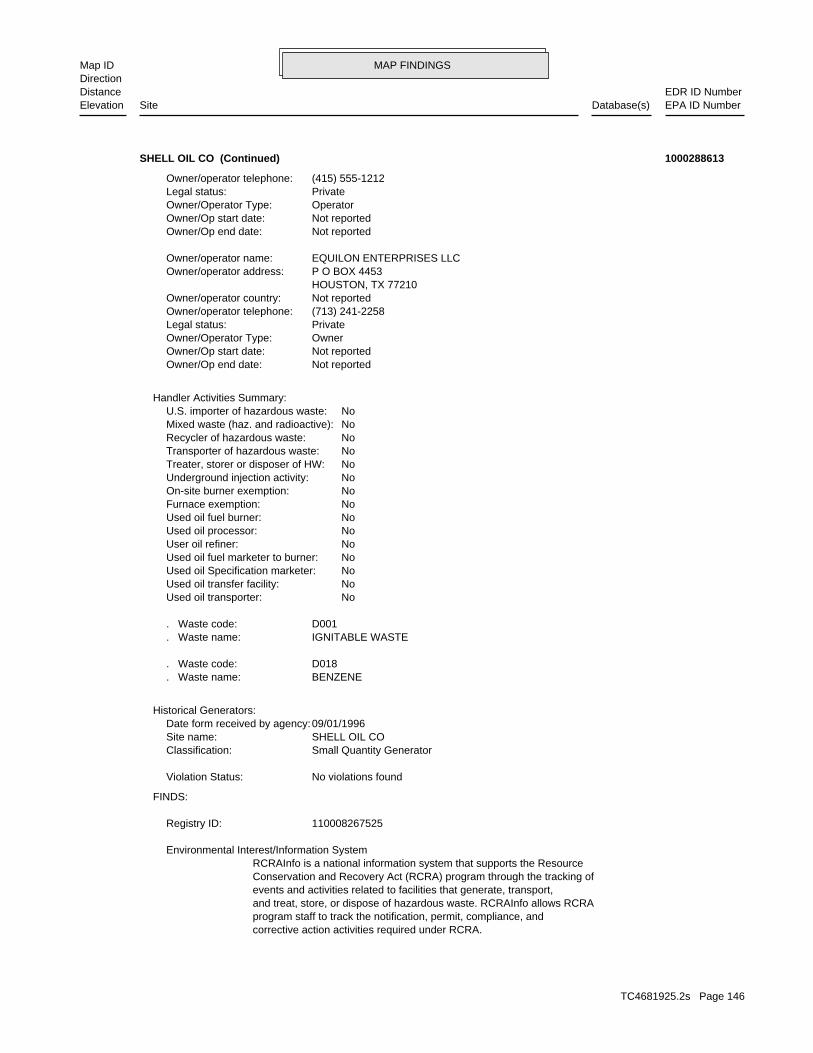
MAP FINDINGSMap IDDirection
EDR ID NumberDistanceEPA ID NumberDatabase(s)SiteElevation
corrective action activities required under RCRA.program staff to track the notification, permit, compliance, andand treat, store, or dispose of hazardous waste. RCRAInfo allows RCRAevents and activities related to facilities that generate, transport,Conservation and Recovery Act (RCRA) program through the tracking ofRCRAInfo is a national information system that supports the Resource Environmental Interest/Information System
110008267525Registry ID:
FINDS:
No violations foundViolation Status:
Small Quantity GeneratorClassification: SHELL OIL COSite name: 09/01/1996Date form received by agency:
Historical Generators:
BENZENE. Waste name: D018. Waste code:
IGNITABLE WASTE. Waste name: D001. Waste code:
NoUsed oil transporter: NoUsed oil transfer facility: NoUsed oil Specification marketer: NoUsed oil fuel marketer to burner: NoUser oil refiner: NoUsed oil processor: NoUsed oil fuel burner: NoFurnace exemption: NoOn-site burner exemption: NoUnderground injection activity: NoTreater, storer or disposer of HW: NoTransporter of hazardous waste: NoRecycler of hazardous waste: NoMixed waste (haz. and radioactive): NoU.S. importer of hazardous waste:
Handler Activities Summary:
Not reportedOwner/Op end date: Not reportedOwner/Op start date: OwnerOwner/Operator Type: PrivateLegal status: (713) 241-2258Owner/operator telephone: Not reportedOwner/operator country: HOUSTON, TX 77210 P O BOX 4453Owner/operator address: EQUILON ENTERPRISES LLCOwner/operator name:
Not reportedOwner/Op end date: Not reportedOwner/Op start date: OperatorOwner/Operator Type: PrivateLegal status: (415) 555-1212Owner/operator telephone:
SHELL OIL CO (Continued) 1000288613
TC4681925.2s Page 146

MAP FINDINGSMap IDDirection
EDR ID NumberDistanceEPA ID NumberDatabase(s)SiteElevation
http://echo.epa.gov/detailed_facility_report?fid=110008267525DFR URL: 110008267525Registry ID: 1000288613Envid:
ECHO:
41-0514Reg Id: LTNKAReg By: 41Facility County Code: CORTESERegion:
HIST CORTESE:
SHELL OIL CO (Continued) 1000288613
INACTIVEFacility Status: UNDERGROUND TANK - GENERALDescription: PR0022609Record Id: UNDERGROUND TANK - GENERALProg Element Code: FA0017721Facility ID: SAN MATEORegion:
INACTIVEFacility Status: STORES HAZ MAT <219GAL,1,999LB, 879CFDescription: PR0023566Record Id: STORES HAZ MAT <219GAL,1,999LB, 879FT3Prog Element Code: FA0017721Facility ID: SAN MATEORegion:
INACTIVEFacility Status: GENERATES & RECYCLES WASTE OIL/SOLVENTDescription: PR0011530Record Id: GENERATES and RECYCLES WASTE OIL/SOLVENTProg Element Code: FA0017721Facility ID: SAN MATEORegion:
San Mateo Co. BI:
Not reportedDate Post Remedial Action Monitoring Began: Not reportedDate Remediation Action Underway: Not reportedPollution Remediation Plan Submitted: 1/1/1965Pollution Characterization Began: Not reportedPreliminary Site Assesment Began: Not reportedPrelim. Site Assesment Wokplan Submitted: LUSTOversight Program: Not reportedDate Leak Confirmed: UnknownLeak Source: UnknownLeak Cause: OMHow Discovered: 550018Case Number: Pollution CharacterizationFacility Status: Not reportedFacility Id: 2Region:
LUST REG 2:
2097 ft. Site 3 of 8 in cluster V0.397 mi.
Relative:Higher
Actual:66 ft.
1/4-1/2 HAZNETSOUTH SAN FRANCISCO, CA 94080SSE San Mateo Co. BI710 EL CAMINO REAL N/AV101 LUSTSHELL SERVICE S105194476
TC4681925.2s Page 147
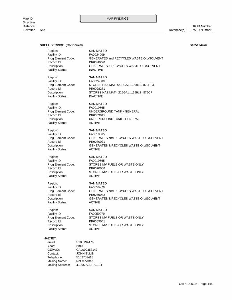
MAP FINDINGSMap IDDirection
EDR ID NumberDistanceEPA ID NumberDatabase(s)SiteElevation
41805 ALBRAE STMailing Address: Not reportedMailing Name: 5102703418Telephone: JOHN ELLISContact: CAL000358143GEPAID: 2013Year: S105194476envid:
HAZNET:
ACTIVEFacility Status: STORES MV FUELS OR WASTE ONLYDescription: PR0069041Record Id: STORES MV FUELS OR WASTE ONLYProg Element Code: FA0050279Facility ID: SAN MATEORegion:
ACTIVEFacility Status: GENERATES & RECYCLES WASTE OIL/SOLVENTDescription: PR0069042Record Id: GENERATES and RECYCLES WASTE OIL/SOLVENTProg Element Code: FA0050279Facility ID: SAN MATEORegion:
ACTIVEFacility Status: STORES MV FUELS OR WASTE ONLYDescription: PR0070030Record Id: STORES MV FUELS OR WASTE ONLYProg Element Code: FA0010865Facility ID: SAN MATEORegion:
ACTIVEFacility Status: GENERATES & RECYCLES WASTE OIL/SOLVENTDescription: PR0070031Record Id: GENERATES and RECYCLES WASTE OIL/SOLVENTProg Element Code: FA0010865Facility ID: SAN MATEORegion:
ACTIVEFacility Status: UNDERGROUND TANK - GENERALDescription: PR0069045Record Id: UNDERGROUND TANK - GENERALProg Element Code: FA0010865Facility ID: SAN MATEORegion:
INACTIVEFacility Status: STORES HAZ MAT <219GAL,1,999LB, 879CFDescription: PR0028271Record Id: STORES HAZ MAT <219GAL,1,999LB, 879FT3Prog Element Code: FA0024009Facility ID: SAN MATEORegion:
INACTIVEFacility Status: GENERATES & RECYCLES WASTE OIL/SOLVENTDescription: PR0028270Record Id: GENERATES and RECYCLES WASTE OIL/SOLVENTProg Element Code: FA0024009Facility ID: SAN MATEORegion:
SHELL SERVICE (Continued) S105194476
TC4681925.2s Page 148

MAP FINDINGSMap IDDirection
EDR ID NumberDistanceEPA ID NumberDatabase(s)SiteElevation
Not reportedFacility County: (H010-H129) Or (H131-H135) Storage, Bulking, And/Or Transfer Off Site--No Treatment/ReoveryMethod Decode: Not reportedCat Decode: 0.1251Tons: (H010-H129) Or (H131-H135) Storage, Bulking, And/Or Transfer Off Site--No Treatment/ReoveryDisposal Method: Not reportedWaste Category: AlamedaTSD County: CAD980887418TSD EPA ID: San MateoGen County: FREMONT, CA 945383120Mailing City,St,Zip:
SHELL SERVICE (Continued) S105194476
41-0153Reg Id: LTNKAReg By: 41Facility County Code: CORTESERegion:
HIST CORTESE:
2174 ft. Site 4 of 8 in cluster V0.412 mi.
Relative:Higher
Actual:65 ft.
1/4-1/2 SOUTH SAN FRANCISCO, CA SSE 698 EL CAMINO REAL N/AV102 HIST CORTESECHEVRON S110060587
Not reportedCreated Date: Not reportedAction Date: Not reportedReferral Date: Not reportedBoard Of Equalization: Not reportedNumber: 550051Comp Number: Not reportedStatus:
SWEEPS UST:
Not reportedDate Post Remedial Action Monitoring Began: Not reportedDate Remediation Action Underway: Not reportedPollution Remediation Plan Submitted: 1/1/1965Pollution Characterization Began: Not reportedPreliminary Site Assesment Began: Not reportedPrelim. Site Assesment Wokplan Submitted: LUSTOversight Program: Not reportedDate Leak Confirmed: UnknownLeak Source: UnknownLeak Cause: OMHow Discovered: 550010Case Number: Pollution CharacterizationFacility Status: Not reportedFacility Id: 2Region:
LUST REG 2:
2174 ft. Site 5 of 8 in cluster V0.412 mi.
Relative:Higher
Actual:65 ft.
1/4-1/2 San Mateo Co. BIS SAN FRANCISCO, CA 94080SSE SWEEPS UST698 EL CAMINO REAL N/AV103 LUSTCHEVRON 9-5669 S105030597
TC4681925.2s Page 149

MAP FINDINGSMap IDDirection
EDR ID NumberDistanceEPA ID NumberDatabase(s)SiteElevation
PETROLEUMTank Use: Not reportedActive Date: 12000Capacity: Not reportedTank Status: 41-000-550051-000004SWRCB Tank Id: Not reportedOwner Tank Id: Not reportedCreated Date: Not reportedAction Date: Not reportedReferral Date: Not reportedBoard Of Equalization: Not reportedNumber: 550051Comp Number: Not reportedStatus:
Not reportedNumber Of Tanks: REG UNLEADEDContent: PRODUCTSTG: M.V. FUELTank Use: Not reportedActive Date: 10000Capacity: Not reportedTank Status: 41-000-550051-000003SWRCB Tank Id: Not reportedOwner Tank Id: Not reportedCreated Date: Not reportedAction Date: Not reportedReferral Date: Not reportedBoard Of Equalization: Not reportedNumber: 550051Comp Number: Not reportedStatus:
Not reportedNumber Of Tanks: REG UNLEADEDContent: PRODUCTSTG: M.V. FUELTank Use: Not reportedActive Date: 10000Capacity: Not reportedTank Status: 41-000-550051-000002SWRCB Tank Id: Not reportedOwner Tank Id: Not reportedCreated Date: Not reportedAction Date: Not reportedReferral Date: Not reportedBoard Of Equalization: Not reportedNumber: 550051Comp Number: Not reportedStatus:
6Number Of Tanks: PRM UNLEADEDContent: PRODUCTSTG: M.V. FUELTank Use: Not reportedActive Date: 10000Capacity: Not reportedTank Status: 41-000-550051-000001SWRCB Tank Id: Not reportedOwner Tank Id:
CHEVRON 9-5669 (Continued) S105030597
TC4681925.2s Page 150

MAP FINDINGSMap IDDirection
EDR ID NumberDistanceEPA ID NumberDatabase(s)SiteElevation
PR0022605Record Id: UNDERGROUND TANK - GENERALProg Element Code: FA0017714Facility ID: SAN MATEORegion:
ACTIVEFacility Status: STORES MV FUELS OR WASTE ONLYDescription: PR0004320Record Id: STORES MV FUELS OR WASTE ONLYProg Element Code: FA0017714Facility ID: SAN MATEORegion:
ACTIVEFacility Status: GENERATES <27 GAL/YEARDescription: PR0038037Record Id: GENERATES <27 GAL/YEARProg Element Code: FA0017714Facility ID: SAN MATEORegion:
San Mateo Co. BI:
Not reportedNumber Of Tanks: PREMIUM UNLEContent: PRODUCTSTG: PETROLEUMTank Use: Not reportedActive Date: 12000Capacity: Not reportedTank Status: 41-000-550051-000006SWRCB Tank Id: Not reportedOwner Tank Id: Not reportedCreated Date: Not reportedAction Date: Not reportedReferral Date: Not reportedBoard Of Equalization: Not reportedNumber: 550051Comp Number: Not reportedStatus:
Not reportedNumber Of Tanks: PREMIUM UNLEContent: PRODUCTSTG: PETROLEUMTank Use: Not reportedActive Date: 12000Capacity: Not reportedTank Status: 41-000-550051-000005SWRCB Tank Id: Not reportedOwner Tank Id: Not reportedCreated Date: Not reportedAction Date: Not reportedReferral Date: Not reportedBoard Of Equalization: Not reportedNumber: 550051Comp Number: Not reportedStatus:
Not reportedNumber Of Tanks: REGULAR UNLEContent: PRODUCTSTG:
CHEVRON 9-5669 (Continued) S105030597
TC4681925.2s Page 151

MAP FINDINGSMap IDDirection
EDR ID NumberDistanceEPA ID NumberDatabase(s)SiteElevation
ACTIVEFacility Status: UNDERGROUND TANK - GENERALDescription:
CHEVRON 9-5669 (Continued) S105030597
T0608100145Global Id:
02/27/1989Status Date: Open - Case Begin DateStatus: T0608100145Global Id:
04/09/2007Status Date: Completed - Case ClosedStatus: T0608100145Global Id:
Status History:
6503726298Phone Number: [email protected]: SAN MATEOCity: 2000 ALAMEDA DE LAS PULGASAddress: SAN MATEO COUNTY LOPOrganization Name: JACOB MADDENContact Name: Local Agency CaseworkerContact Type: T0608100145Global Id:
Not reportedPhone Number: Not reportedEmail: OAKLANDCity: 1515 CLAY ST SUITE 1400Address: SAN FRANCISCO BAY RWQCB (REGION 2)Organization Name: Regional Water BoardContact Name: Regional Board CaseworkerContact Type: T0608100145Global Id:
Contact:
Click here to access the California GeoTracker records for this facility:
Not reportedSite History: GasolinePotential Contaminants of Concern: Other Groundwater (uses other than drinking water)Potential Media Affect: Local Agency WarehouseFile Location: 550010LOC Case Number: 41-0153RB Case Number: SAN MATEO COUNTY LOPLocal Agency: JMCase Worker: SAN MATEO COUNTY LOPLead Agency: 04/09/2007Status Date: Completed - Case ClosedStatus: LUST Cleanup SiteCase Type: -122.4294Longitude: 37.6504Latitude: T0608100145Global Id: STATERegion:
LUST:
2174 ft. Site 6 of 8 in cluster V0.412 mi.
Relative:Higher
Actual:65 ft.
1/4-1/2 SOUTH SAN FRANCISCO, CA 94080SSE HIST UST698 EL CAMINO REAL N/AV104 LUSTCHEVRON 9-5669 U001594724
TC4681925.2s Page 152

MAP FINDINGSMap IDDirection
EDR ID NumberDistanceEPA ID NumberDatabase(s)SiteElevation
Other Report / DocumentAction: 04/15/2005Date: RESPONSEAction Type: T0608100145Global Id:
Soil and Water Investigation ReportAction: 01/16/2004Date: RESPONSEAction Type: T0608100145Global Id:
Staff Letter - #20030723Action: 07/23/2003Date: ENFORCEMENTAction Type: T0608100145Global Id:
Staff Letter - #20050224Action: 02/24/2005Date: ENFORCEMENTAction Type: T0608100145Global Id:
* Verbal Communication - #20050413Action: 04/13/2005Date: ENFORCEMENTAction Type: T0608100145Global Id:
Staff Letter - #20040330Action: 03/30/2004Date: ENFORCEMENTAction Type: T0608100145Global Id:
Closure/No Further Action Letter - #20070409Action: 04/09/2007Date: ENFORCEMENTAction Type: T0608100145Global Id:
Staff Letter - #20060907Action: 09/07/2006Date: ENFORCEMENTAction Type: T0608100145Global Id:
Staff Letter - #20060620Action: 06/20/2006Date: ENFORCEMENTAction Type: T0608100145Global Id:
Notice of Responsibility - #1Action: 02/27/1989Date: ENFORCEMENTAction Type: T0608100145Global Id:
Regulatory Activities:
11/02/2005Status Date: Open - Verification MonitoringStatus: T0608100145Global Id:
03/26/1998Status Date: Open - Site AssessmentStatus:
CHEVRON 9-5669 (Continued) U001594724
TC4681925.2s Page 153

MAP FINDINGSMap IDDirection
EDR ID NumberDistanceEPA ID NumberDatabase(s)SiteElevation
RESPONSEAction Type: T0608100145Global Id:
Other Report / DocumentAction: 11/01/2005Date: RESPONSEAction Type: T0608100145Global Id:
UnknownAction: 12/14/2006Date: RESPONSEAction Type: T0608100145Global Id:
Other WorkplanAction: 08/21/2006Date: RESPONSEAction Type: T0608100145Global Id:
Other Report / DocumentAction: 01/01/2006Date: RESPONSEAction Type: T0608100145Global Id:
Request for ClosureAction: 04/19/2006Date: RESPONSEAction Type: T0608100145Global Id:
Soil and Water Investigation ReportAction: 11/03/2004Date: RESPONSEAction Type: T0608100145Global Id:
Staff Letter - #20031103Action: 11/03/2005Date: ENFORCEMENTAction Type: T0608100145Global Id:
Staff Letter - #20040805Action: 08/05/2004Date: ENFORCEMENTAction Type: T0608100145Global Id:
ExcavationAction: 03/18/1994Date: REMEDIATIONAction Type: T0608100145Global Id:
Leak ReportedAction: 12/06/1989Date: OtherAction Type: T0608100145Global Id:
Leak DiscoveryAction: 12/06/1989Date: OtherAction Type: T0608100145Global Id:
CHEVRON 9-5669 (Continued) U001594724
TC4681925.2s Page 154

MAP FINDINGSMap IDDirection
EDR ID NumberDistanceEPA ID NumberDatabase(s)SiteElevation
Request for ClosureAction: 06/08/2004Date: RESPONSEAction Type: T0608100145Global Id:
Soil and Water Investigation ReportAction: 12/12/2003Date: RESPONSEAction Type: T0608100145Global Id:
Monitoring Report - QuarterlyAction: 05/15/2004Date: RESPONSEAction Type: T0608100145Global Id:
Monitoring Report - QuarterlyAction: 11/15/2005Date: RESPONSEAction Type: T0608100145Global Id:
Monitoring Report - QuarterlyAction: 11/15/2004Date: RESPONSEAction Type: T0608100145Global Id:
Staff Letter - #20000809Action: 08/09/2000Date: ENFORCEMENTAction Type: T0608100145Global Id:
Monitoring Report - QuarterlyAction: 05/15/2005Date: RESPONSEAction Type: T0608100145Global Id:
Monitoring Report - QuarterlyAction: 05/15/2006Date: RESPONSEAction Type: T0608100145Global Id:
Monitoring Report - QuarterlyAction: 11/15/2003Date: RESPONSEAction Type: T0608100145Global Id:
Monitoring Report - QuarterlyAction: 05/15/2003Date: RESPONSEAction Type: T0608100145Global Id:
Monitoring Report - QuarterlyAction: 11/15/2002Date: RESPONSEAction Type: T0608100145Global Id:
Monitoring Report - QuarterlyAction: 05/15/2002Date:
CHEVRON 9-5669 (Continued) U001594724
TC4681925.2s Page 155

MAP FINDINGSMap IDDirection
EDR ID NumberDistanceEPA ID NumberDatabase(s)SiteElevation
Click here for Geo Tracker PDF:
Stock InventorLeak Detection: 0000250Container Construction Thickness: Not reportedType of Fuel: PRODUCTTank Used for: 00010000Tank Capacity: 1977Year Installed: 3Container Num: 003Tank Num:
Stock InventorLeak Detection: 0000250Container Construction Thickness: Not reportedType of Fuel: PRODUCTTank Used for: 00010000Tank Capacity: 1977Year Installed: 2Container Num: 002Tank Num:
Stock InventorLeak Detection: 0000250Container Construction Thickness: Not reportedType of Fuel: PRODUCTTank Used for: 00010000Tank Capacity: 1977Year Installed: 1Container Num: 001Tank Num:
0003Total Tanks: SAN FRANCISCO, CA 94105Owner City,St,Zip: 575 MARKETOwner Address: CHEVRON U.S.A. INC.Owner Name: 4155898419Telephone: BRENNAN, JAMES JContact Name: Not reportedOther Type: Gas StationFacility Type: 00000062797Facility ID: STATERegion: http://geotracker.waterboards.ca.gov/ustpdfs/pdf/0002BCFF.pdfURL: 0002BCFFFile Number:
HIST UST:
SAN MATEO CO. LUSTEDR Link ID: SAN MATEO CO. LUSTCase Type: 014032220APN Number: T0608100145Global ID: 9- Case ClosedFacility Status: 550010Facility ID: SAN MATEORegion:
SAN MATEO CO. LUST:
CHEVRON 9-5669 (Continued) U001594724
TC4681925.2s Page 156

MAP FINDINGSMap IDDirection
EDR ID NumberDistanceEPA ID NumberDatabase(s)SiteElevation
Notice of Responsibility - #1Action: 08/20/1991Date: ENFORCEMENTAction Type: T0608100144Global Id:
Regulatory Activities:
08/02/1991Status Date: Open - Case Begin DateStatus: T0608100144Global Id:
12/19/2001Status Date: Completed - Case ClosedStatus: T0608100144Global Id:
Status History:
6503726298Phone Number: [email protected]: SAN MATEOCity: 2000 ALAMEDA DE LAS PULGASAddress: SAN MATEO COUNTY LOPOrganization Name: JACOB MADDENContact Name: Local Agency CaseworkerContact Type: T0608100144Global Id:
Not reportedPhone Number: Not reportedEmail: OAKLANDCity: 1515 CLAY ST SUITE 1400Address: SAN FRANCISCO BAY RWQCB (REGION 2)Organization Name: Regional Water BoardContact Name: Regional Board CaseworkerContact Type: T0608100144Global Id:
Contact:
Click here to access the California GeoTracker records for this facility:
Not reportedSite History: GasolinePotential Contaminants of Concern: Other Groundwater (uses other than drinking water)Potential Media Affect: Local AgencyFile Location: 550088LOC Case Number: 41-0152RB Case Number: SAN MATEO COUNTY LOPLocal Agency: JMCase Worker: SAN MATEO COUNTY LOPLead Agency: 12/19/2001Status Date: Completed - Case ClosedStatus: LUST Cleanup SiteCase Type: -122.430739402771Longitude: 37.6499684371396Latitude: T0608100144Global Id: STATERegion:
LUST:
2266 ft. Site 7 of 8 in cluster V0.429 mi.
Relative:Higher
Actual:69 ft.
1/4-1/2 SOUTH SAN FRANCISCO, CA 94080SSE HIST CORTESE687 EL CAMINO REAL N/AV105 LUSTCHEVRON 9-0248 S110060584
TC4681925.2s Page 157

MAP FINDINGSMap IDDirection
EDR ID NumberDistanceEPA ID NumberDatabase(s)SiteElevation
41-0152Reg Id: LTNKAReg By: 41Facility County Code: CORTESERegion:
HIST CORTESE:
SAN MATEO CO. LUSTEDR Link ID: SAN MATEO CO. LUSTCase Type: Not reportedAPN Number: T0608100144Global ID: 9- Case ClosedFacility Status: 550088Facility ID: SAN MATEORegion:
SAN MATEO CO. LUST:
Leak ReportedAction: 08/02/1991Date: OtherAction Type: T0608100144Global Id:
Leak DiscoveryAction: 08/29/1991Date: OtherAction Type: T0608100144Global Id:
CHEVRON 9-0248 (Continued) S110060584
Not reportedDate Post Remedial Action Monitoring Began: Not reportedDate Remediation Action Underway: Not reportedPollution Remediation Plan Submitted: Not reportedPollution Characterization Began: Not reportedPreliminary Site Assesment Began: Not reportedPrelim. Site Assesment Wokplan Submitted: LUSTOversight Program: Not reportedDate Leak Confirmed: UnknownLeak Source: UnknownLeak Cause: OMHow Discovered: 550088Case Number: Case ClosedFacility Status: Not reportedFacility Id: 2Region:
LUST REG 2:
2266 ft. Site 8 of 8 in cluster V0.429 mi.
Relative:Higher
Actual:69 ft.
1/4-1/2 S SAN FRANCISCO, CA 94080SSE 687 EL CAMINO REAL N/AV106 LUSTCHEVRON 9-0248 S105030592
TC4681925.2s Page 158

MAP FINDINGSMap IDDirection
EDR ID NumberDistanceEPA ID NumberDatabase(s)SiteElevation
* Historical Enforcement - #1Action: 12/26/1996Date: ENFORCEMENTAction Type: T0608178422Global Id:
Regulatory Activities:
11/21/1996Status Date: Open - Case Begin DateStatus: T0608178422Global Id:
05/11/2000Status Date: Completed - Case ClosedStatus: T0608178422Global Id:
Status History:
6503726298Phone Number: [email protected]: SAN MATEOCity: 2000 ALAMEDA DE LAS PULGASAddress: SAN MATEO COUNTY LOPOrganization Name: JACOB MADDENContact Name: Local Agency CaseworkerContact Type: T0608178422Global Id:
Not reportedPhone Number: Not reportedEmail: OAKLANDCity: 1515 CLAY ST SUITE 1400Address: SAN FRANCISCO BAY RWQCB (REGION 2)Organization Name: Regional Water BoardContact Name: Regional Board CaseworkerContact Type: T0608178422Global Id:
Contact:
Click here to access the California GeoTracker records for this facility:
Not reportedSite History: Not reportedPotential Contaminants of Concern: SoilPotential Media Affect: Local AgencyFile Location: 559011LOC Case Number: Not reportedRB Case Number: SAN MATEO COUNTY LOPLocal Agency: JMCase Worker: SAN MATEO COUNTY LOPLead Agency: 05/11/2000Status Date: Completed - Case ClosedStatus: LUST Cleanup SiteCase Type: -122.445545196533Longitude: 37.661299413638Latitude: T0608178422Global Id: STATERegion:
LUST:
2279 ft. Site 1 of 2 in cluster W0.432 mi.
Relative:Higher
Actual:78 ft.
1/4-1/2 SOUTH SAN FRANCISCO, CA 94080NW 1450 EL CAMINO RL N/AW107 LUSTMCLELLAN NURSERY S109285757
TC4681925.2s Page 159

MAP FINDINGSMap IDDirection
EDR ID NumberDistanceEPA ID NumberDatabase(s)SiteElevation
SAN MATEO CO. LUSTEDR Link ID: SAN MATEO CO. LUSTCase Type: Not reportedAPN Number: T0608178422Global ID: 9- Case ClosedFacility Status: 559011Facility ID: SAN MATEORegion:
SAN MATEO CO. LUST:
ExcavationAction: 04/01/1998Date: REMEDIATIONAction Type: T0608178422Global Id:
Leak ReportedAction: 11/21/1996Date: OtherAction Type: T0608178422Global Id:
MCLELLAN NURSERY (Continued) S109285757
41-0972Reg Id: LTNKAReg By: 41Facility County Code: CORTESERegion:
HIST CORTESE:
2279 ft. Site 2 of 2 in cluster W0.432 mi.
Relative:Higher
Actual:78 ft.
1/4-1/2 SOUTH SAN FRANCISCO, CA 94080NW 1450 EL CAMINO REAL N/AW108 HIST CORTESEMCLELLAN NURSERY S103396252
Not reportedDate Post Remedial Action Monitoring Began: Not reportedDate Remedial Action Underway: Not reportedDate Remediation Plan Submitted: Not reportedDate Pollution Characterization Began: Not reportedDate Preliminary Site Assessment Began: Not reportedDate Prelim Site Assmnt Workplan Submitted:Not reportedDate Confirmed:Not reportedLeak Source:Not reportedLeak Cause:DVAHow Discovered:Not reportedLocal Case #:Not reportedDate Closed:Post remedial action monitoringFacility Status:SL20261879Facility ID:2Region:
SLIC REG 2:
2285 ft. Site 1 of 4 in cluster X0.433 mi.
Relative:Lower
Actual:22 ft.
1/4-1/2 SOUTH SAN FRANCISCO, CA 94080ESE DEEDCROSS OYSTER POINT @ HWY 101 N/AX109 SLIC(FORMER US STEEL FACILITY) - THE S106235218
TC4681925.2s Page 160

MAP FINDINGSMap IDDirection
EDR ID NumberDistanceEPA ID NumberDatabase(s)SiteElevation
04/28/1998Deed Date(s): YCovenant Uploaded:SWRCBAgency:OPEN - VERIFICATION MONITORINGStatus:SLICSite Type:Not reportedSub Area:Not reportedArea:SL20261879Envirostor ID:
03/09/2006Deed Date(s): YCovenant Uploaded:SWRCBAgency:OPEN - VERIFICATION MONITORINGStatus:SLICSite Type:Not reportedSub Area:Not reportedArea:SL20261879Envirostor ID:
DEED:
(FORMER US STEEL FACILITY) - THE (Continued) S106235218
Not reportedDate Preliminary Site Assessment Began: Not reportedDate Prelim Site Assmnt Workplan Submitted:Not reportedDate Confirmed:Not reportedLeak Source:Not reportedLeak Cause:Not reportedHow Discovered:Not reportedLocal Case #:Not reportedDate Closed:Not reportedFacility Status:Not reportedFacility ID:2Region:
SLIC REG 2:
Click here to access the California GeoTracker records for this facility:
Not reportedSite History: Not reportedPotential Contaminants of Concern: Not reportedPotential Media Affected: Not reportedFile Location: 2179.7032RB Case Number: Not reportedLocal Agency: RLCase Worker: Cleanup Program SiteCase Type: -122.380175008539Longitude: 37.6061693815266Latitude: Not reportedLead Agency Case Number: SAN FRANCISCO BAY RWQCB (REGION 2)Lead Agency: SL0002020085Global Id: 12/29/2009Status Date: Open - Assessment & Interim Remedial ActionFacility Status: STATERegion:
SLIC:
2285 ft. Site 2 of 4 in cluster X0.433 mi.
Relative:Lower
Actual:22 ft.
1/4-1/2 SOUTH SAN FRANCISCO, CA ESE SFO, SOUTH FRONTAGE RD N/AX110 SLICSFIA - SHELL OIL SFO SATELLITE PLANT, SOUTH SF (FORMER) S106234844
TC4681925.2s Page 161

MAP FINDINGSMap IDDirection
EDR ID NumberDistanceEPA ID NumberDatabase(s)SiteElevation
Not reportedDate Post Remedial Action Monitoring Began: Not reportedDate Remedial Action Underway: Not reportedDate Remediation Plan Submitted: Not reportedDate Pollution Characterization Began:
SFIA - SHELL OIL SFO SATELLITE PLANT, SOUTH SF (FORMER) (Continued) S106234844
Not reportedDate Post Remedial Action Monitoring Began: Not reportedDate Remedial Action Underway: Not reportedDate Remediation Plan Submitted: Not reportedDate Pollution Characterization Began: Not reportedDate Preliminary Site Assessment Began: Not reportedDate Prelim Site Assmnt Workplan Submitted:Not reportedDate Confirmed:Not reportedLeak Source:Not reportedLeak Cause:DVAHow Discovered:Not reportedLocal Case #:Not reportedDate Closed:Remedial action (cleanup) UnderwayFacility Status:SL18251672Facility ID:2Region:
SLIC REG 2:
Click here to access the California GeoTracker records for this facility:
Not reportedSite History: 1,1,1-Trichloroethane (TCA), Aviation, Diesel, GasolinePotential Contaminants of Concern: Other Groundwater (uses other than drinking water), SoilPotential Media Affected: Regional BoardFile Location: SL18251672RB Case Number: Not reportedLocal Agency: RLCase Worker: Cleanup Program SiteCase Type: -122.386526479486Longitude: 37.6241524469716Latitude: Not reportedLead Agency Case Number: SAN FRANCISCO BAY RWQCB (REGION 2)Lead Agency: SL18251672Global Id: 07/01/1995Status Date: Open - RemediationFacility Status: STATERegion:
SLIC:
2285 ft. Site 3 of 4 in cluster X0.433 mi.
Relative:Lower
Actual:22 ft.
1/4-1/2 SOUTH SAN FRANCISCO, CA 94128ESE MCDONNELL RD & ROAD 6 OR SAN BRUNO AVE & N/AX111 SLICSFIA - SAN FRANCISCO INTERNATIONAL AIRPORT S106235142
TC4681925.2s Page 162

MAP FINDINGSMap IDDirection
EDR ID NumberDistanceEPA ID NumberDatabase(s)SiteElevation
Not reportedDate Post Remedial Action Monitoring Began: Not reportedDate Remedial Action Underway: Not reportedDate Remediation Plan Submitted: Not reportedDate Pollution Characterization Began: Not reportedDate Preliminary Site Assessment Began: Not reportedDate Prelim Site Assmnt Workplan Submitted:Not reportedDate Confirmed:Not reportedLeak Source:Not reportedLeak Cause:Not reportedHow Discovered:Not reportedLocal Case #:Not reportedDate Closed:Leak being confirmedFacility Status:41S0057Facility ID:2Region:
SLIC REG 2:
Click here to access the California GeoTracker records for this facility:
Not reportedSite History: Not reportedPotential Contaminants of Concern: Not reportedPotential Media Affected: Not reportedFile Location: 41S0057RB Case Number: Not reportedLocal Agency: UUUCase Worker: Cleanup Program SiteCase Type: -122.425794019464Longitude: 37.653378392949Latitude: Not reportedLead Agency Case Number: SAN FRANCISCO BAY RWQCB (REGION 2)Lead Agency: SLT2O321212Global Id: 01/01/1970Status Date: Completed - Case ClosedFacility Status: STATERegion:
SLIC:
2285 ft. Site 4 of 4 in cluster X0.433 mi.
Relative:Lower
Actual:22 ft.
1/4-1/2 SOUTH SAN FRANCISCO, CA ESE UNKNOWN HILLSIDE BLVD N/AX112 SLICHILLSIDE BOULEVARD E NURSERY S106235001
SMBRP, RWQCB 2 - San Francisco Bay, SAN MATEO COUNTYRegulatory Agencies: NONPL: 0.81Acres: Voluntary CleanupSite Type Detailed: Voluntary CleanupSite Type: 201499Site Code: 02/20/2007Status Date: CertifiedStatus: 70000073Facility ID:
ENVIROSTOR:
2291 ft.0.434 mi.
Relative:Lower
Actual:36 ft.
1/4-1/2 VCPSOUTH SAN FRANCISCO, CA 94080ESE SLIC735 COMMERCIAL AVENUE N/A113 ENVIROSTORMANTEGANI SITE S106235000
TC4681925.2s Page 163

MAP FINDINGSMap IDDirection
EDR ID NumberDistanceEPA ID NumberDatabase(s)SiteElevation
goal. However, it was unable to completely degrade the dieldrin concentrations at the Site to levels below the Site specific cleanup bioremediation technique has successfully degraded the total DDT Fieldwork completed. Confirmation sampling indicates theComments: 01/09/2007Completed Date: FieldworkCompleted Document Type: Not reportedCompleted Sub Area Name: PROJECT WIDECompleted Area Name:
pesticide soil contamination from the former nursery at the site. oversight on the investigation and potential cleanup of residual Property owner entered into a Voluntary Cleanup Agreement for DTSCComments: 10/18/2005Completed Date: Voluntary Cleanup AgreementCompleted Document Type: Not reportedCompleted Sub Area Name: PROJECT WIDECompleted Area Name:
Completed Info:
Envirostor ID NumberAlias Type: 70000073Alias Name: Project Code (Site Code)Alias Type: 201499Alias Name: GeoTracker Global IDAlias Type: SL0608169862Alias Name: EPA (FRS #)Alias Type: 110033608585Alias Name: APNAlias Type: 014022490Alias Name: APNAlias Type: 014-022-0500Alias Name: APNAlias Type: 014-022-0490Alias Name: APNAlias Type: 014-022-0480Alias Name: APNAlias Type: 014-022-0470Alias Name: APNAlias Type: 014-022-0460Alias Name: Alternate NameAlias Type: 735 Commercial AvenueAlias Name: SOILPotential Description: DDD DDE DDT DieldrinConfirmed COC: DDD DDE DDT DieldrinPotential COC: NURSERYPast Use: 014022490 014-022-0460, 014-022-0470, 014-022-0480, 014-022-0490, 014-022-0500,APN: -122.4247Longitude: 37.65602Latitude: Responsible PartyFunding: NONE SPECIFIEDSite Mgmt Req: NORestricted Use: Voluntary Cleanup ProgramSpecial Program: 13Senate: 22Assembly: Cleanup BerkeleyDivision Branch: Denise TsujiSupervisor: Not reportedProgram Manager: SMBRPLead Agency:
MANTEGANI SITE (Continued) S106235000
TC4681925.2s Page 164

MAP FINDINGSMap IDDirection
EDR ID NumberDistanceEPA ID NumberDatabase(s)SiteElevation
Not reportedCompleted Sub Area Name: PROJECT WIDECompleted Area Name:
DDT/DDE/DDD. Report documents the nexts undertaken to breakdown dieldrin andComments: 02/20/2007Completed Date: Removal Action Completion ReportCompleted Document Type: Not reportedCompleted Sub Area Name: PROJECT WIDECompleted Area Name:
to three weeks. time than estimated. Site will be re-evaluated in approximately two than anticipated. The process requires more fertilizer, lime, and concentrations in the soil. However, the process is taking longer The bioremediation process is working in reducing the pesticideComments: 09/13/2006Completed Date: Removal Action Completion ReportCompleted Document Type: Not reportedCompleted Sub Area Name: PROJECT WIDECompleted Area Name:
Factor and other soil amendments. population will return to normal levels with the depletion of the are met. No excavation is required and the soil microorganism soil. Confirmation samples will be collected to ensure cleanup levels required to achieve the cleanup goals of DDT and dieldrin in the amendments are applied the soil, approximately two months will be Mantegani Property Site. After the Factor and other necessary soil chemicals of concern, such as the pesticides detected at the occurring microorganisms ability to degrade chlorinated carbon chain the soil. Factor is a soil amendment that increases the naturally amendments and Factor enhances the natural bio-attenuation rate of bio-remediation technology that with the application of select soil The recommended and approved removal action is the use of aComments: 02/10/2006Completed Date: Removal Action WorkplanCompleted Document Type: Not reportedCompleted Sub Area Name: PROJECT WIDECompleted Area Name:
Public Participation Unit approved Fact Sheet for public distributionComments: 12/22/2005Completed Date: Fact SheetsCompleted Document Type: Not reportedCompleted Sub Area Name: PROJECT WIDECompleted Area Name:
languages. outreach information was not required to be translated into any Hispanic and Asian residents in the surrounding area, however residential housing. There is a significant population of both Community Survey and Profile completed. The area is mostlyComments: 12/22/2005Completed Date: Community ProfileCompleted Document Type: Not reportedCompleted Sub Area Name: PROJECT WIDECompleted Area Name:
cleanup represents a risk of 5 x 10^-6. revised to a 95% UCL of 125 parts per billion from 30 ppb. The new concentrations at the Site. The dieldrin site cleanup goal has been
MANTEGANI SITE (Continued) S106235000
TC4681925.2s Page 165

MAP FINDINGSMap IDDirection
EDR ID NumberDistanceEPA ID NumberDatabase(s)SiteElevation
PROJECT WIDECompleted Area Name:
goal of a 10 ^(-6) risk factor. and DDT. Soil remediation results indicate Site cleanup reached the Documents the in-situ bioremediation of soil impacted with dieldrinComments: 02/20/2007Completed Date: CertificationCompleted Document Type: Not reportedCompleted Sub Area Name: PROJECT WIDECompleted Area Name:
letter was prepared by DTSC to explain the cost overrun. Realized project costs have gone over the estimated project cost. AComments: 01/05/2007Completed Date: Other ReportCompleted Document Type: Not reportedCompleted Sub Area Name: PROJECT WIDECompleted Area Name:
January 5, 2006. soil samples will be collected in the area of that sample the week of a dieldrin concentration higher than the cleanup goal. Additional concentrations are dropping. Only one the eleven samples collect had The December 20, 2006 sampling indicates that the dieldrinComments: 12/20/2006Completed Date: Removal Action Completion ReportCompleted Document Type: Not reportedCompleted Sub Area Name: PROJECT WIDECompleted Area Name:
soil pH will be adjusted upward with lime. goal. Further sampling is required. Soil pH has dropped again, the Dieldrin concentrations are is still elevated above the site cleanupComments: 10/30/2006Completed Date: Removal Action Completion ReportCompleted Document Type: Not reportedCompleted Sub Area Name: PROJECT WIDECompleted Area Name:
soil pH is too low and needs to be adjusted upward. Lime was added. Dieldrin still above the site cleanup goal. It was determined thatComments: 09/27/2006Completed Date: Removal Action Completion ReportCompleted Document Type: Not reportedCompleted Sub Area Name: PROJECT WIDECompleted Area Name:
Soil dieldrin concentration is still above the Site Cleanup goalComments: 08/01/2006Completed Date: Removal Action Completion ReportCompleted Document Type: Not reportedCompleted Sub Area Name: PROJECT WIDECompleted Area Name:
Dieldrin concentrations are still elevated.Comments: 07/12/2006Completed Date: Removal Action Completion ReportCompleted Document Type: Not reportedCompleted Sub Area Name: PROJECT WIDECompleted Area Name:
Dieldrin concentrations remain above the site cleanup goal.Comments: 06/12/2006Completed Date: Removal Action Completion ReportCompleted Document Type:
MANTEGANI SITE (Continued) S106235000
TC4681925.2s Page 166

MAP FINDINGSMap IDDirection
EDR ID NumberDistanceEPA ID NumberDatabase(s)SiteElevation
Not reportedDate Remediation Plan Submitted: Not reportedDate Pollution Characterization Began: Not reportedDate Preliminary Site Assessment Began: Not reportedDate Prelim Site Assmnt Workplan Submitted:Not reportedDate Confirmed:Not reportedLeak Source:Not reportedLeak Cause:Not reportedHow Discovered:Not reportedLocal Case #:Not reportedDate Closed:Leak being confirmedFacility Status:41S0057Facility ID:2Region:
SLIC REG 2:
Click here to access the California GeoTracker records for this facility:
Not reportedSite History: * Pesticides/HerbicidesPotential Contaminants of Concern: SoilPotential Media Affected: Not reportedFile Location: Not reportedRB Case Number: DEPARTMENT OF TOXIC SUBSTANCES CONTROLLocal Agency: JNCase Worker: Cleanup Program SiteCase Type: -122.42529Longitude: 37.656442Latitude: 70000073Lead Agency Case Number: DEPARTMENT OF TOXIC SUBSTANCES CONTROLLead Agency: SL0608169862Global Id: 07/10/2003Status Date: Open - Site AssessmentFacility Status: STATERegion:
SLIC:
Not reportedSchedule Revised Date: Not reportedSchedule Due Date: Not reportedSchedule Document Type: Not reportedSchedule Sub Area Name: Not reportedSchedule Area Name: Not reportedFuture Due Date: Not reportedFuture Document Type: Not reportedFuture Sub Area Name: Not reportedFuture Area Name:
Not reportedComments: 08/09/2006Completed Date: Letter - DemandCompleted Document Type: Not reportedCompleted Sub Area Name: PROJECT WIDECompleted Area Name:
between December 30, 2005 and January 30, 2006. NOE approved for public review. Public Comment Period is scheduledComments: 02/10/2006Completed Date: CEQA - Notice of ExemptionCompleted Document Type: Not reportedCompleted Sub Area Name:
MANTEGANI SITE (Continued) S106235000
TC4681925.2s Page 167

MAP FINDINGSMap IDDirection
EDR ID NumberDistanceEPA ID NumberDatabase(s)SiteElevation
Not reportedCompleted Sub Area Name: PROJECT WIDECompleted Area Name:
Completed Info:
Envirostor ID NumberAlias Type: 70000073Alias Name: Project Code (Site Code)Alias Type: 201499Alias Name: GeoTracker Global IDAlias Type: SL0608169862Alias Name: EPA (FRS #)Alias Type: 110033608585Alias Name: APNAlias Type: 014022490Alias Name: APNAlias Type: 014-022-0500Alias Name: APNAlias Type: 014-022-0490Alias Name: APNAlias Type: 014-022-0480Alias Name: APNAlias Type: 014-022-0470Alias Name: APNAlias Type: 014-022-0460Alias Name: Alternate NameAlias Type: 735 Commercial AvenueAlias Name: SOILPotential Description: 30006,30007,30008,30207Confirmed COC: 30006, 30007, 30008, 30207Potential COC: NURSERYPast Use: 014022490 014-022-0460, 014-022-0470, 014-022-0480, 014-022-0490, 014-022-0500,APN: 37.65602 / -122.4247Lat/Long: Responsible PartyFunding: NORestricted Use: 02/20/2007Status Date: CertifiedStatus: Voluntary Cleanup ProgramSpecial Programs Code: 13Senate: 22Assembly: 201499Site Code: Cleanup BerkeleyDivision Branch: Denise TsujiSupervisor: Not reportedProject Manager: DTSC - Site Cleanup ProgramLead Agency Description: SMBRPLead Agency: SMBRP, RWQCB 2 - San Francisco Bay, SAN MATEO COUNTYCleanup Oversight Agencies: NONational Priorities List: 0.81Acres: NONE SPECIFIEDSite Mgmt. Req.: Voluntary CleanupSite Type Detail: Voluntary CleanupSite Type: 70000073Facility ID:
VCP:
Not reportedDate Post Remedial Action Monitoring Began: Not reportedDate Remedial Action Underway:
MANTEGANI SITE (Continued) S106235000
TC4681925.2s Page 168

MAP FINDINGSMap IDDirection
EDR ID NumberDistanceEPA ID NumberDatabase(s)SiteElevation
The bioremediation process is working in reducing the pesticideComments: 09/13/2006Completed Date: Removal Action Completion ReportCompleted Document Type: Not reportedCompleted Sub Area Name: PROJECT WIDECompleted Area Name:
Factor and other soil amendments. population will return to normal levels with the depletion of the are met. No excavation is required and the soil microorganism soil. Confirmation samples will be collected to ensure cleanup levels required to achieve the cleanup goals of DDT and dieldrin in the amendments are applied the soil, approximately two months will be Mantegani Property Site. After the Factor and other necessary soil chemicals of concern, such as the pesticides detected at the occurring microorganisms ability to degrade chlorinated carbon chain the soil. Factor is a soil amendment that increases the naturally amendments and Factor enhances the natural bio-attenuation rate of bio-remediation technology that with the application of select soil The recommended and approved removal action is the use of aComments: 02/10/2006Completed Date: Removal Action WorkplanCompleted Document Type: Not reportedCompleted Sub Area Name: PROJECT WIDECompleted Area Name:
Public Participation Unit approved Fact Sheet for public distributionComments: 12/22/2005Completed Date: Fact SheetsCompleted Document Type: Not reportedCompleted Sub Area Name: PROJECT WIDECompleted Area Name:
languages. outreach information was not required to be translated into any Hispanic and Asian residents in the surrounding area, however residential housing. There is a significant population of both Community Survey and Profile completed. The area is mostlyComments: 12/22/2005Completed Date: Community ProfileCompleted Document Type: Not reportedCompleted Sub Area Name: PROJECT WIDECompleted Area Name:
cleanup represents a risk of 5 x 10^-6. revised to a 95% UCL of 125 parts per billion from 30 ppb. The new concentrations at the Site. The dieldrin site cleanup goal has been goal. However, it was unable to completely degrade the dieldrin concentrations at the Site to levels below the Site specific cleanup bioremediation technique has successfully degraded the total DDT Fieldwork completed. Confirmation sampling indicates theComments: 01/09/2007Completed Date: FieldworkCompleted Document Type: Not reportedCompleted Sub Area Name: PROJECT WIDECompleted Area Name:
pesticide soil contamination from the former nursery at the site. oversight on the investigation and potential cleanup of residual Property owner entered into a Voluntary Cleanup Agreement for DTSCComments: 10/18/2005Completed Date: Voluntary Cleanup AgreementCompleted Document Type:
MANTEGANI SITE (Continued) S106235000
TC4681925.2s Page 169

MAP FINDINGSMap IDDirection
EDR ID NumberDistanceEPA ID NumberDatabase(s)SiteElevation
Not reportedCompleted Sub Area Name: PROJECT WIDECompleted Area Name:
January 5, 2006. soil samples will be collected in the area of that sample the week of a dieldrin concentration higher than the cleanup goal. Additional concentrations are dropping. Only one the eleven samples collect had The December 20, 2006 sampling indicates that the dieldrinComments: 12/20/2006Completed Date: Removal Action Completion ReportCompleted Document Type: Not reportedCompleted Sub Area Name: PROJECT WIDECompleted Area Name:
soil pH will be adjusted upward with lime. goal. Further sampling is required. Soil pH has dropped again, the Dieldrin concentrations are is still elevated above the site cleanupComments: 10/30/2006Completed Date: Removal Action Completion ReportCompleted Document Type: Not reportedCompleted Sub Area Name: PROJECT WIDECompleted Area Name:
soil pH is too low and needs to be adjusted upward. Lime was added. Dieldrin still above the site cleanup goal. It was determined thatComments: 09/27/2006Completed Date: Removal Action Completion ReportCompleted Document Type: Not reportedCompleted Sub Area Name: PROJECT WIDECompleted Area Name:
Soil dieldrin concentration is still above the Site Cleanup goalComments: 08/01/2006Completed Date: Removal Action Completion ReportCompleted Document Type: Not reportedCompleted Sub Area Name: PROJECT WIDECompleted Area Name:
Dieldrin concentrations are still elevated.Comments: 07/12/2006Completed Date: Removal Action Completion ReportCompleted Document Type: Not reportedCompleted Sub Area Name: PROJECT WIDECompleted Area Name:
Dieldrin concentrations remain above the site cleanup goal.Comments: 06/12/2006Completed Date: Removal Action Completion ReportCompleted Document Type: Not reportedCompleted Sub Area Name: PROJECT WIDECompleted Area Name:
DDT/DDE/DDD. Report documents the nexts undertaken to breakdown dieldrin andComments: 02/20/2007Completed Date: Removal Action Completion ReportCompleted Document Type: Not reportedCompleted Sub Area Name: PROJECT WIDECompleted Area Name:
to three weeks. time than estimated. Site will be re-evaluated in approximately two than anticipated. The process requires more fertilizer, lime, and concentrations in the soil. However, the process is taking longer
MANTEGANI SITE (Continued) S106235000
TC4681925.2s Page 170

MAP FINDINGSMap IDDirection
EDR ID NumberDistanceEPA ID NumberDatabase(s)SiteElevation
Not reportedSchedule Revised Date: Not reportedSchedule Due Date: Not reportedSchedule Document Type: Not reportedSchedule Sub Area Name: Not reportedSchedule Area Name: Not reportedFuture Due Date: Not reportedFuture Document Type: Not reportedFuture Sub Area Name: Not reportedFuture Area Name:
Not reportedComments: 08/09/2006Completed Date: Letter - DemandCompleted Document Type: Not reportedCompleted Sub Area Name: PROJECT WIDECompleted Area Name:
between December 30, 2005 and January 30, 2006. NOE approved for public review. Public Comment Period is scheduledComments: 02/10/2006Completed Date: CEQA - Notice of ExemptionCompleted Document Type: Not reportedCompleted Sub Area Name: PROJECT WIDECompleted Area Name:
goal of a 10 ^(-6) risk factor. and DDT. Soil remediation results indicate Site cleanup reached the Documents the in-situ bioremediation of soil impacted with dieldrinComments: 02/20/2007Completed Date: CertificationCompleted Document Type: Not reportedCompleted Sub Area Name: PROJECT WIDECompleted Area Name:
letter was prepared by DTSC to explain the cost overrun. Realized project costs have gone over the estimated project cost. AComments: 01/05/2007Completed Date: Other ReportCompleted Document Type:
MANTEGANI SITE (Continued) S106235000
MTBE / TBA / Other Fuel Oxygenates, GasolinePotential Contaminants of Concern: Other Groundwater (uses other than drinking water)Potential Media Affect: Local Agency WarehouseFile Location: Not reportedLOC Case Number: 41-0626RB Case Number: SAN MATEO COUNTY LOPLocal Agency: RLCase Worker: SAN FRANCISCO BAY RWQCB (REGION 2)Lead Agency: 12/20/2011Status Date: Open - Site AssessmentStatus: LUST Cleanup SiteCase Type: -122.42815Longitude: 37.655431325Latitude: T0608100598Global Id: STATERegion:
LUST:
2309 ft. Site 2 of 3 in cluster U0.437 mi.
Relative:Lower
Actual:22 ft.
1/4-1/2 SOUTH SAN FRANCISCO, CA 94083ESE HIST CORTESE736 TENNIS N/AU114 LUSTSOUTH SAN FRANCISCO CORPO S101303302
TC4681925.2s Page 171

MAP FINDINGSMap IDDirection
EDR ID NumberDistanceEPA ID NumberDatabase(s)SiteElevation
02/26/1991Status Date: Open - Verification MonitoringStatus: T0608100598Global Id:
12/20/2011Status Date: Open - Site AssessmentStatus: T0608100598Global Id:
12/19/2011Status Date: Open - Reopen CaseStatus: T0608100598Global Id:
02/26/1991Status Date: Open - Case Begin DateStatus: T0608100598Global Id:
08/21/2003Status Date: Completed - Case ClosedStatus: T0608100598Global Id:
Status History:
6503726298Phone Number: [email protected]: SAN MATEOCity: 2000 ALAMEDA DE LAS PULGASAddress: SAN MATEO COUNTY LOPOrganization Name: JACOB MADDENContact Name: Local Agency CaseworkerContact Type: T0608100598Global Id:
Not reportedPhone Number: [email protected]: OAKLANDCity: 1515 CLAY STREET, SUITE 1400Address: SAN FRANCISCO BAY RWQCB (REGION 2)Organization Name: RANDY LEEContact Name: Regional Board CaseworkerContact Type: T0608100598Global Id:
Contact:
Click here to access the California GeoTracker records for this facility:
(Additional Site Assessment Report, February 20, 2014) Accutite removed a 1,000-gallon gasoline UST from the subject site. over-excavated and disposed of at a landfill. In November 1997, the site. Following tank removal, hydrocarbon-impacted soil was 500-gallon waste oil underground storage tank (UST) was removed from drinking water resource management zone. In April 1987, one Board has designated groundwater beneath the site as a significant southeast of the site. The California Regional Water Quality Control of the site. The San Francisco Bay is approximately two miles nearest surface water is Colma Creek, approximately 500 ft southwest elevation is approximately 25 feet above mean sea level (msl). The site is adjacent to the northern boundary of a City park. Site Avenue. Surrounding properties are predominantly residential, and the is located on Tennis Drive near the intersection of West Orange The subject site formerly functioned as a City corporation yard andSite History:
SOUTH SAN FRANCISCO CORPO (Continued) S101303302
TC4681925.2s Page 172

MAP FINDINGSMap IDDirection
EDR ID NumberDistanceEPA ID NumberDatabase(s)SiteElevation
T0608100598Global Id:
Leak ReportedAction: 02/26/1991Date: OtherAction Type: T0608100598Global Id:
Leak DiscoveryAction: 01/20/1993Date: OtherAction Type: T0608100598Global Id:
Site Visit / Inspection / SamplingAction: 05/24/2012Date: ENFORCEMENTAction Type: T0608100598Global Id:
13267 RequirementAction: 03/28/2012Date: ENFORCEMENTAction Type: T0608100598Global Id:
13267 Monitoring ProgramAction: 01/01/2015Date: ENFORCEMENTAction Type: T0608100598Global Id:
Technical Correspondence / Assistance / OtherAction: 09/23/2013Date: ENFORCEMENTAction Type: T0608100598Global Id:
MeetingAction: 03/27/2012Date: ENFORCEMENTAction Type: T0608100598Global Id:
Site Visit / Inspection / SamplingAction: 04/10/2012Date: ENFORCEMENTAction Type: T0608100598Global Id:
Staff LetterAction: 12/19/2011Date: ENFORCEMENTAction Type: T0608100598Global Id:
MeetingAction: 11/15/2011Date: ENFORCEMENTAction Type: T0608100598Global Id:
Correspondence - Regulator RespondedAction: 12/12/2013Date: RESPONSEAction Type: T0608100598Global Id:
Regulatory Activities:
SOUTH SAN FRANCISCO CORPO (Continued) S101303302
TC4681925.2s Page 173

MAP FINDINGSMap IDDirection
EDR ID NumberDistanceEPA ID NumberDatabase(s)SiteElevation
07/03/2012Date: RESPONSEAction Type: T0608100598Global Id:
Soil and Water Investigation Workplan - Regulator RespondedAction: 08/15/2013Date: RESPONSEAction Type: T0608100598Global Id:
Technical Correspondence / Assistance / OtherAction: 12/09/2013Date: ENFORCEMENTAction Type: T0608100598Global Id:
UnknownAction: 09/30/2003Date: RESPONSEAction Type: T0608100598Global Id:
Staff Letter - #20030624Action: 06/24/2003Date: ENFORCEMENTAction Type: T0608100598Global Id:
Notice of Responsibility - #1Action: 03/04/1993Date: ENFORCEMENTAction Type: T0608100598Global Id:
Closure/No Further Action Letter - #3Action: 08/21/2003Date: ENFORCEMENTAction Type: T0608100598Global Id:
13267 RequirementAction: 05/15/2013Date: ENFORCEMENTAction Type: T0608100598Global Id:
Notification - Public Notice of Case ClosureAction: 05/19/2015Date: ENFORCEMENTAction Type: T0608100598Global Id:
Soil and Water Investigation ReportAction: 12/20/2002Date: RESPONSEAction Type: T0608100598Global Id:
Site Assessment ReportAction: 08/10/1993Date: RESPONSEAction Type: T0608100598Global Id:
Other Report / DocumentAction: 03/21/2003Date: RESPONSEAction Type:
SOUTH SAN FRANCISCO CORPO (Continued) S101303302
TC4681925.2s Page 174
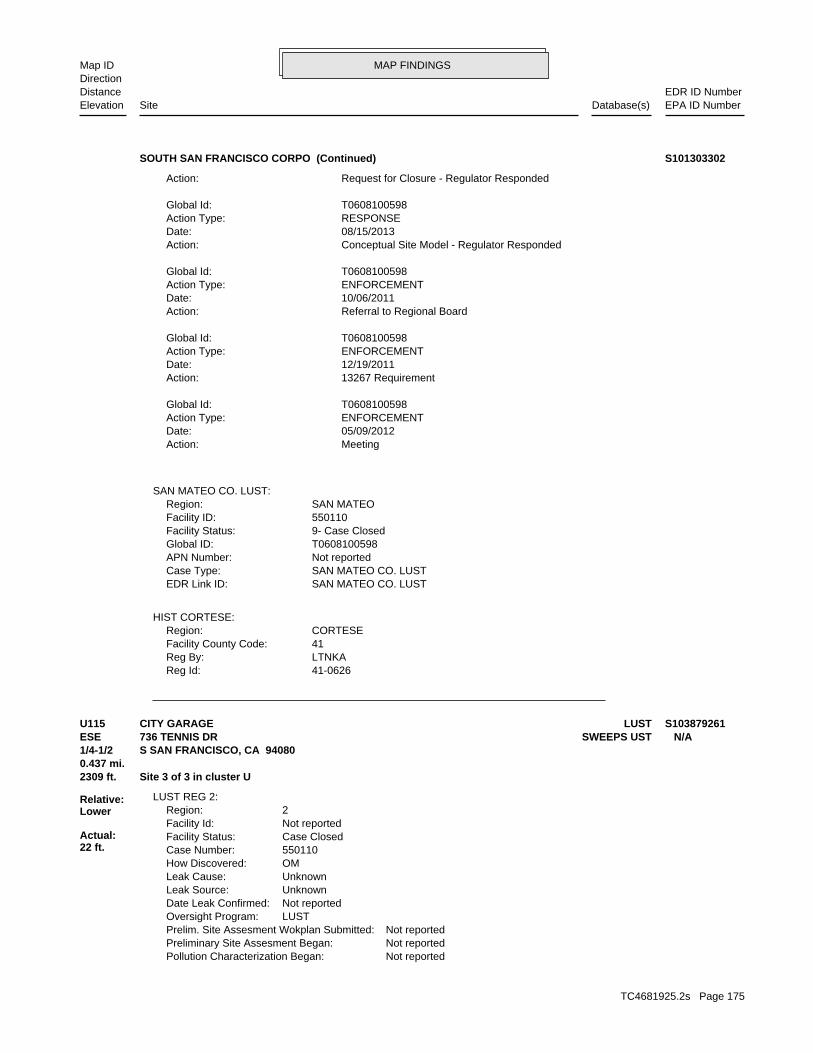
MAP FINDINGSMap IDDirection
EDR ID NumberDistanceEPA ID NumberDatabase(s)SiteElevation
41-0626Reg Id: LTNKAReg By: 41Facility County Code: CORTESERegion:
HIST CORTESE:
SAN MATEO CO. LUSTEDR Link ID: SAN MATEO CO. LUSTCase Type: Not reportedAPN Number: T0608100598Global ID: 9- Case ClosedFacility Status: 550110Facility ID: SAN MATEORegion:
SAN MATEO CO. LUST:
MeetingAction: 05/09/2012Date: ENFORCEMENTAction Type: T0608100598Global Id:
13267 RequirementAction: 12/19/2011Date: ENFORCEMENTAction Type: T0608100598Global Id:
Referral to Regional BoardAction: 10/06/2011Date: ENFORCEMENTAction Type: T0608100598Global Id:
Conceptual Site Model - Regulator RespondedAction: 08/15/2013Date: RESPONSEAction Type: T0608100598Global Id:
Request for Closure - Regulator RespondedAction:
SOUTH SAN FRANCISCO CORPO (Continued) S101303302
Not reportedPollution Characterization Began: Not reportedPreliminary Site Assesment Began: Not reportedPrelim. Site Assesment Wokplan Submitted: LUSTOversight Program: Not reportedDate Leak Confirmed: UnknownLeak Source: UnknownLeak Cause: OMHow Discovered: 550110Case Number: Case ClosedFacility Status: Not reportedFacility Id: 2Region:
LUST REG 2:
2309 ft. Site 3 of 3 in cluster U0.437 mi.
Relative:Lower
Actual:22 ft.
1/4-1/2 S SAN FRANCISCO, CA 94080ESE SWEEPS UST736 TENNIS DR N/AU115 LUSTCITY GARAGE S103879261
TC4681925.2s Page 175

MAP FINDINGSMap IDDirection
EDR ID NumberDistanceEPA ID NumberDatabase(s)SiteElevation
1Number Of Tanks: REG UNLEADEDContent: PSTG: M.V. FUELTank Use: 04-26-94Active Date: 1000Capacity: ATank Status: 41-000-550163-000001SWRCB Tank Id: 1Owner Tank Id: 05-09-91Created Date: 05-11-94Action Date: 05-11-94Referral Date: Not reportedBoard Of Equalization: 4Number: 550163Comp Number: ActiveStatus:
SWEEPS UST:
1/1/1965Date Post Remedial Action Monitoring Began: Not reportedDate Remediation Action Underway: Not reportedPollution Remediation Plan Submitted:
CITY GARAGE (Continued) S103879261
Not reportedPhone Number: Not reportedEmail: OAKLANDCity: 1515 CLAY ST SUITE 1400Address: SAN FRANCISCO BAY RWQCB (REGION 2)Organization Name: Regional Water BoardContact Name: Regional Board CaseworkerContact Type: T0608100893Global Id:
Contact:
Click here to access the California GeoTracker records for this facility:
Not reportedSite History: GasolinePotential Contaminants of Concern: SoilPotential Media Affect: Local AgencyFile Location: 550146LOC Case Number: 41-1140RB Case Number: SAN MATEO COUNTY LOPLocal Agency: JMCase Worker: SAN MATEO COUNTY LOPLead Agency: 04/29/1996Status Date: Completed - Case ClosedStatus: LUST Cleanup SiteCase Type: -122.4292372Longitude: 37.6621349Latitude: T0608100893Global Id: STATERegion:
LUST:
2388 ft. Site 1 of 3 in cluster Y0.452 mi.
Relative:Higher
Actual:121 ft.
1/4-1/2 HIST CORTESESOUTH SAN FRANCISCO, CA 94080NE SLIC525 CHESTNUT N/AY116 LUSTSILVER TERRACE NURSERY S104161813
TC4681925.2s Page 176

MAP FINDINGSMap IDDirection
EDR ID NumberDistanceEPA ID NumberDatabase(s)SiteElevation
Completed - Case ClosedFacility Status: STATERegion:
SLIC:
SAN MATEO CO. LUSTEDR Link ID: SAN MATEO CO. LUSTCase Type: Not reportedAPN Number: T0608171378Global ID: 9- Case ClosedFacility Status: 559008Facility ID: SAN MATEORegion:
SAN MATEO CO. LUSTEDR Link ID: SAN MATEO CO. LUSTCase Type: Not reportedAPN Number: T0608100893Global ID: 9- Case ClosedFacility Status: 550146Facility ID: SAN MATEORegion:
SAN MATEO CO. LUST:
Leak ReportedAction: 12/29/1995Date: OtherAction Type: T0608100893Global Id:
Leak DiscoveryAction: 12/06/1995Date: OtherAction Type: T0608100893Global Id:
Notice of Responsibility - #1Action: 01/03/1996Date: ENFORCEMENTAction Type: T0608100893Global Id:
Regulatory Activities:
12/06/1995Status Date: Open - Case Begin DateStatus: T0608100893Global Id:
04/29/1996Status Date: Completed - Case ClosedStatus: T0608100893Global Id:
Status History:
6503726298Phone Number: [email protected]: SAN MATEOCity: 2000 ALAMEDA DE LAS PULGASAddress: SAN MATEO COUNTY LOPOrganization Name: JACOB MADDENContact Name: Local Agency CaseworkerContact Type: T0608100893Global Id:
SILVER TERRACE NURSERY (Continued) S104161813
TC4681925.2s Page 177

MAP FINDINGSMap IDDirection
EDR ID NumberDistanceEPA ID NumberDatabase(s)SiteElevation
41-1140Reg Id: LTNKAReg By: 41Facility County Code: CORTESERegion:
41-0974Reg Id: LTNKAReg By: 41Facility County Code: CORTESERegion:
41-0954Reg Id: LTNKAReg By: 41Facility County Code: CORTESERegion:
HIST CORTESE:
Click here to access the California GeoTracker records for this facility:
Not reportedSite History: Not reportedPotential Contaminants of Concern: SoilPotential Media Affected: Local AgencyFile Location: 41-0954RB Case Number: SAN MATEO COUNTY LOPLocal Agency: JMCase Worker: Cleanup Program SiteCase Type: -122.429186Longitude: 37.662315Latitude: 559008Lead Agency Case Number: SAN MATEO COUNTY LOPLead Agency: T0608171378Global Id: 06/06/1996Status Date:
SILVER TERRACE NURSERY (Continued) S104161813
Not reportedSite History: GasolinePotential Contaminants of Concern: SoilPotential Media Affect: Local AgencyFile Location: 550102LOC Case Number: 41-0305RB Case Number: SAN MATEO COUNTY LOPLocal Agency: JMCase Worker: SAN MATEO COUNTY LOPLead Agency: 09/14/1993Status Date: Completed - Case ClosedStatus: LUST Cleanup SiteCase Type: -122.429242Longitude: 37.662917Latitude: T0608100291Global Id: STATERegion:
LUST:
2542 ft. Site 2 of 3 in cluster Y0.481 mi. HIST CORTESE
Relative:Higher
Actual:130 ft.
1/4-1/2 HIST USTSOUTH SAN FRANCISCO, CA 94080NE SLIC541 CHESTNUT N/AY117 LUSTDELANO NURSERY U001594751
TC4681925.2s Page 178

MAP FINDINGSMap IDDirection
EDR ID NumberDistanceEPA ID NumberDatabase(s)SiteElevation
SAN MATEO CO. LUSTEDR Link ID: SAN MATEO CO. LUSTCase Type: 011402450APN Number: T0608152524Global ID: 9- Case ClosedFacility Status: 559007Facility ID: SAN MATEORegion:
SAN MATEO CO. LUST:
Notice of Responsibility - #1Action: 12/31/1991Date: ENFORCEMENTAction Type: T0608100291Global Id:
Leak ReportedAction: 12/31/1991Date: OtherAction Type: T0608100291Global Id:
Leak DiscoveryAction: 12/31/1991Date: OtherAction Type: T0608100291Global Id:
Regulatory Activities:
12/31/1991Status Date: Open - Case Begin DateStatus: T0608100291Global Id:
09/14/1993Status Date: Completed - Case ClosedStatus: T0608100291Global Id:
Status History:
6503726298Phone Number: [email protected]: SAN MATEOCity: 2000 ALAMEDA DE LAS PULGASAddress: SAN MATEO COUNTY LOPOrganization Name: JACOB MADDENContact Name: Local Agency CaseworkerContact Type: T0608100291Global Id:
Not reportedPhone Number: Not reportedEmail: OAKLANDCity: 1515 CLAY ST SUITE 1400Address: SAN FRANCISCO BAY RWQCB (REGION 2)Organization Name: Regional Water BoardContact Name: Regional Board CaseworkerContact Type: T0608100291Global Id:
Contact:
Click here to access the California GeoTracker records for this facility:
DELANO NURSERY (Continued) U001594751
TC4681925.2s Page 179

MAP FINDINGSMap IDDirection
EDR ID NumberDistanceEPA ID NumberDatabase(s)SiteElevation
PRODUCTTank Used for: 00000575Tank Capacity: 1980Year Installed: 2Container Num: 002Tank Num:
NoneLeak Detection: Not reportedContainer Construction Thickness: REGULARType of Fuel: PRODUCTTank Used for: 00000575Tank Capacity: 1970Year Installed: 1Container Num: 001Tank Num:
0002Total Tanks: SO. SAN FRANCISCO, CA 94080Owner City,St,Zip: 541 CHESTNUT AVE.Owner Address: DELANO NURSERY INC.Owner Name: 4155882751Telephone: ANDREW L. NICOLINIContact Name: NURSERYOther Type: OtherFacility Type: 00000031565Facility ID: STATERegion: http://geotracker.waterboards.ca.gov/ustpdfs/pdf/0002BE08.pdfURL: 0002BE08File Number:
HIST UST:
Click here to access the California GeoTracker records for this facility:
Not reportedSite History: Polychlorinated biphenyls (PCBs)Potential Contaminants of Concern: SoilPotential Media Affected: Local AgencyFile Location: Not reportedRB Case Number: SAN MATEO COUNTY LOPLocal Agency: JMCase Worker: Cleanup Program SiteCase Type: -122.429286Longitude: 37.662904Latitude: 559007Lead Agency Case Number: SAN MATEO COUNTY LOPLead Agency: T0608152524Global Id: 06/25/1996Status Date: Completed - Case ClosedFacility Status: STATERegion:
SLIC:
SAN MATEO CO. LUSTEDR Link ID: SAN MATEO CO. LUSTCase Type: 011402450APN Number: T0608100291Global ID: 9- Case ClosedFacility Status: 550102Facility ID: SAN MATEORegion:
DELANO NURSERY (Continued) U001594751
TC4681925.2s Page 180

MAP FINDINGSMap IDDirection
EDR ID NumberDistanceEPA ID NumberDatabase(s)SiteElevation
41-0305Reg Id: LTNKAReg By: 41Facility County Code: CORTESERegion:
41-1141Reg Id: LTNKAReg By: 41Facility County Code: CORTESERegion:
HIST CORTESE:
Click here for Geo Tracker PDF:
NoneLeak Detection: Not reportedContainer Construction Thickness: UNLEADEDType of Fuel:
DELANO NURSERY (Continued) U001594751
INACTIVEFacility Status: UNDERGROUND TANK - GENERALDescription: PR0026493Record Id: UNDERGROUND TANK - GENERALProg Element Code: FA0003719Facility ID: SAN MATEORegion:
San Mateo Co. BI:
Not reportedDate Post Remedial Action Monitoring Began: Not reportedDate Remediation Action Underway: Not reportedPollution Remediation Plan Submitted: Not reportedPollution Characterization Began: Not reportedPreliminary Site Assesment Began: Not reportedPrelim. Site Assesment Wokplan Submitted: LUSTOversight Program: Not reportedDate Leak Confirmed: UnknownLeak Source: UnknownLeak Cause: OMHow Discovered: 550102Case Number: Case ClosedFacility Status: Not reportedFacility Id: 2Region:
LUST REG 2:
2542 ft. Site 3 of 3 in cluster Y0.481 mi.
Relative:Higher
Actual:130 ft.
1/4-1/2 S SAN FRANCISCO, CA 94080NE San Mateo Co. BI541 CHESTNUT N/AY118 LUSTDELANO NURSERY S105034430
TC4681925.2s Page 181

MAP FINDINGSMap IDDirection
EDR ID NumberDistanceEPA ID NumberDatabase(s)SiteElevation
SAN MATEO CO. LUSTEDR Link ID: SAN MATEO CO. LUSTCase Type: Not reportedAPN Number: T0608100701Global ID: 9- Case ClosedFacility Status: 550120Facility ID: SAN MATEORegion:
SAN MATEO CO. LUST:
2577 ft. Site 1 of 3 in cluster Z0.488 mi.
Relative:Lower
Actual:22 ft.
1/4-1/2 SOUTH SAN FRANCISCO, CA ESE 10 W ORANGE AVE N/AZ119 LUSTGUY F. ATKINSON CO. U001594782
6503726298Phone Number: [email protected]: SAN MATEOCity: 2000 ALAMEDA DE LAS PULGASAddress: SAN MATEO COUNTY LOPOrganization Name: JACOB MADDENContact Name: Local Agency CaseworkerContact Type: T0608100701Global Id:
Not reportedPhone Number: Not reportedEmail: OAKLANDCity: 1515 CLAY ST SUITE 1400Address: SAN FRANCISCO BAY RWQCB (REGION 2)Organization Name: Regional Water BoardContact Name: Regional Board CaseworkerContact Type: T0608100701Global Id:
Contact:
Click here to access the California GeoTracker records for this facility:
Not reportedSite History: GasolinePotential Contaminants of Concern: Other Groundwater (uses other than drinking water)Potential Media Affect: Local AgencyFile Location: 550120LOC Case Number: 41-0741RB Case Number: SAN MATEO COUNTY LOPLocal Agency: JMCase Worker: SAN MATEO COUNTY LOPLead Agency: 05/27/1997Status Date: Completed - Case ClosedStatus: LUST Cleanup SiteCase Type: -122.424008Longitude: 37.6552001Latitude: T0608100701Global Id: STATERegion:
LUST:
2637 ft. Site 2 of 3 in cluster Z0.499 mi.
Relative:Lower
Actual:30 ft.
1/4-1/2 SOUTH SAN FRANCISCO, CA 94080ESE San Mateo Co. BI10 ORANGE N/AZ120 LUSTGUY F ATKINSON COMPANY OF CAL S105033394
TC4681925.2s Page 182
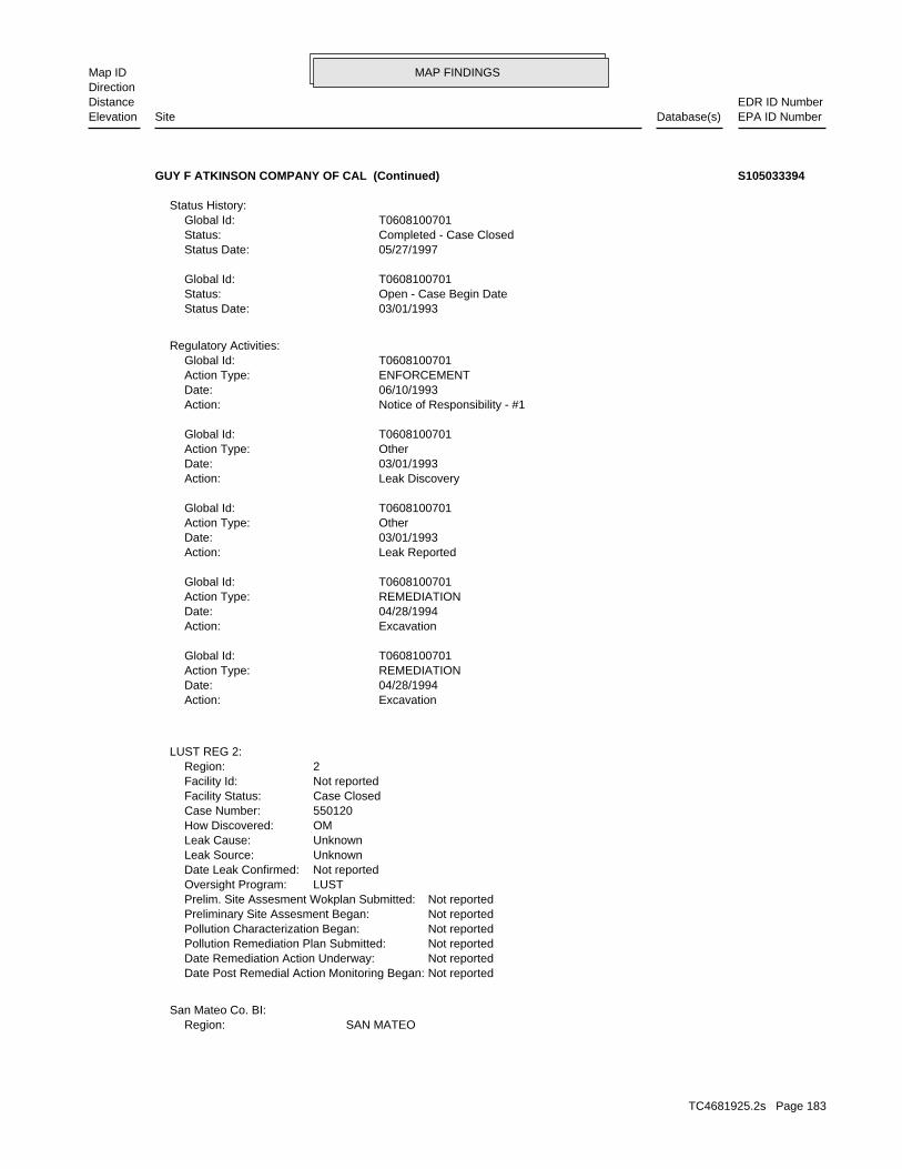
MAP FINDINGSMap IDDirection
EDR ID NumberDistanceEPA ID NumberDatabase(s)SiteElevation
SAN MATEORegion:San Mateo Co. BI:
Not reportedDate Post Remedial Action Monitoring Began: Not reportedDate Remediation Action Underway: Not reportedPollution Remediation Plan Submitted: Not reportedPollution Characterization Began: Not reportedPreliminary Site Assesment Began: Not reportedPrelim. Site Assesment Wokplan Submitted: LUSTOversight Program: Not reportedDate Leak Confirmed: UnknownLeak Source: UnknownLeak Cause: OMHow Discovered: 550120Case Number: Case ClosedFacility Status: Not reportedFacility Id: 2Region:
LUST REG 2:
ExcavationAction: 04/28/1994Date: REMEDIATIONAction Type: T0608100701Global Id:
ExcavationAction: 04/28/1994Date: REMEDIATIONAction Type: T0608100701Global Id:
Leak ReportedAction: 03/01/1993Date: OtherAction Type: T0608100701Global Id:
Leak DiscoveryAction: 03/01/1993Date: OtherAction Type: T0608100701Global Id:
Notice of Responsibility - #1Action: 06/10/1993Date: ENFORCEMENTAction Type: T0608100701Global Id:
Regulatory Activities:
03/01/1993Status Date: Open - Case Begin DateStatus: T0608100701Global Id:
05/27/1997Status Date: Completed - Case ClosedStatus: T0608100701Global Id:
Status History:
GUY F ATKINSON COMPANY OF CAL (Continued) S105033394
TC4681925.2s Page 183

MAP FINDINGSMap IDDirection
EDR ID NumberDistanceEPA ID NumberDatabase(s)SiteElevation
INACTIVEFacility Status: UNDERGROUND TANK - GENERALDescription: PR0022656Record Id: UNDERGROUND TANK - GENERALProg Element Code: FA0017781Facility ID:
GUY F ATKINSON COMPANY OF CAL (Continued) S105033394
41-0741Reg Id: LTNKAReg By: 41Facility County Code: CORTESERegion:
HIST CORTESE:
2637 ft. Site 3 of 3 in cluster Z0.499 mi.
Relative:Lower
Actual:30 ft.
1/4-1/2 SOUTH SAN FRANCISCO, CA ESE 10 ORANGE N/AZ121 HIST CORTESEGUY F ATKINSON COMPANY S101308798
Not reportedIncident Description: Not reportedIssue Date: Not reportedDischarge Date: Not reportedFacility Type: Not reportedBoard File Number: Not reportedStaff Initials: Not reportedDate Reported:
NOTIFY 65:
5199 ft.0.985 mi.
Relative:Lower
Actual:42 ft.
1/2-1 DIXON, CA 94080ESE 440 NORTH FIRST STREET N/A122 Notify 65TY’S ELECTRIC, INC. U000070847
TC4681925.2s Page 184

ORPHAN SUMMARY
City EDR ID Site Name Site Address Zip Database(s)
Count: 2 records.
COLMA 1007443894 COLMA HILLSIDE DISPOSAL SITE SAND HILL ROAD OFF HILLSIDE BL ODIS SAN FRANCISCO S101482226 SOUTH SAN FRANCISCO RECYCLING CENT BEHIND 551 RAILROAD 94080 ENVIROSTOR
TC4681925.2s Page 185

To maintain currency of the following federal and state databases, EDR contacts the appropriate governmental agencyon a monthly or quarterly basis, as required.
Number of Days to Update: Provides confirmation that EDR is reporting records that have been updated within 90 daysfrom the date the government agency made the information available to the public.
STANDARD ENVIRONMENTAL RECORDS
Federal NPL site list
NPL: National Priority ListNational Priorities List (Superfund). The NPL is a subset of CERCLIS and identifies over 1,200 sites for prioritycleanup under the Superfund Program. NPL sites may encompass relatively large areas. As such, EDR provides polygoncoverage for over 1,000 NPL site boundaries produced by EPA’s Environmental Photographic Interpretation Center(EPIC) and regional EPA offices.
Date of Government Version: 03/07/2016Date Data Arrived at EDR: 04/05/2016Date Made Active in Reports: 04/15/2016Number of Days to Update: 10
Source: EPATelephone: N/ALast EDR Contact: 07/07/2016Next Scheduled EDR Contact: 10/17/2016Data Release Frequency: Quarterly
NPL Site Boundaries
Sources:
EPA’s Environmental Photographic Interpretation Center (EPIC)Telephone: 202-564-7333
EPA Region 1 EPA Region 6Telephone 617-918-1143 Telephone: 214-655-6659
EPA Region 3 EPA Region 7Telephone 215-814-5418 Telephone: 913-551-7247
EPA Region 4 EPA Region 8Telephone 404-562-8033 Telephone: 303-312-6774
EPA Region 5 EPA Region 9Telephone 312-886-6686 Telephone: 415-947-4246
EPA Region 10Telephone 206-553-8665
Proposed NPL: Proposed National Priority List SitesA site that has been proposed for listing on the National Priorities List through the issuance of a proposed rulein the Federal Register. EPA then accepts public comments on the site, responds to the comments, and places onthe NPL those sites that continue to meet the requirements for listing.
Date of Government Version: 03/07/2016Date Data Arrived at EDR: 04/05/2016Date Made Active in Reports: 04/15/2016Number of Days to Update: 10
Source: EPATelephone: N/ALast EDR Contact: 07/07/2016Next Scheduled EDR Contact: 10/17/2016Data Release Frequency: Quarterly
NPL LIENS: Federal Superfund LiensFederal Superfund Liens. Under the authority granted the USEPA by CERCLA of 1980, the USEPA has the authorityto file liens against real property in order to recover remedial action expenditures or when the property ownerreceived notification of potential liability. USEPA compiles a listing of filed notices of Superfund Liens.
Date of Government Version: 10/15/1991Date Data Arrived at EDR: 02/02/1994Date Made Active in Reports: 03/30/1994Number of Days to Update: 56
Source: EPATelephone: 202-564-4267Last EDR Contact: 08/15/2011Next Scheduled EDR Contact: 11/28/2011Data Release Frequency: No Update Planned
TC4681925.2s Page GR-1
GOVERNMENT RECORDS SEARCHED / DATA CURRENCY TRACKING

Federal Delisted NPL site list
Delisted NPL: National Priority List DeletionsThe National Oil and Hazardous Substances Pollution Contingency Plan (NCP) establishes the criteria that theEPA uses to delete sites from the NPL. In accordance with 40 CFR 300.425.(e), sites may be deleted from theNPL where no further response is appropriate.
Date of Government Version: 03/07/2016Date Data Arrived at EDR: 04/05/2016Date Made Active in Reports: 04/15/2016Number of Days to Update: 10
Source: EPATelephone: N/ALast EDR Contact: 07/07/2016Next Scheduled EDR Contact: 10/17/2016Data Release Frequency: Quarterly
Federal CERCLIS list
FEDERAL FACILITY: Federal Facility Site Information listingA listing of National Priority List (NPL) and Base Realignment and Closure (BRAC) sites found in the ComprehensiveEnvironmental Response, Compensation and Liability Information System (CERCLIS) Database where EPA Federal FacilitiesRestoration and Reuse Office is involved in cleanup activities.
Date of Government Version: 11/13/2015Date Data Arrived at EDR: 01/06/2016Date Made Active in Reports: 05/20/2016Number of Days to Update: 135
Source: Environmental Protection AgencyTelephone: 703-603-8704Last EDR Contact: 07/06/2016Next Scheduled EDR Contact: 10/17/2016Data Release Frequency: Varies
SEMS: Superfund Enterprise Management SystemSEMS (Superfund Enterprise Management System) tracks hazardous waste sites, potentially hazardous waste sites,and remedial activities performed in support of EPA’s Superfund Program across the United States. The list wasformerly know as CERCLIS, renamed to SEMS by the EPA in 2015. The list contains data on potentially hazardouswaste sites that have been reported to the USEPA by states, municipalities, private companies and private persons,pursuant to Section 103 of the Comprehensive Environmental Response, Compensation, and Liability Act (CERCLA).This dataset also contains sites which are either proposed to or on the National Priorities List (NPL) and thesites which are in the screening and assessment phase for possible inclusion on the NPL.
Date of Government Version: 03/07/2016Date Data Arrived at EDR: 04/05/2016Date Made Active in Reports: 04/15/2016Number of Days to Update: 10
Source: EPATelephone: 800-424-9346Last EDR Contact: 04/05/2016Next Scheduled EDR Contact: 08/01/2016Data Release Frequency: Quarterly
Federal CERCLIS NFRAP site list
SEMS-ARCHIVE: Superfund Enterprise Management System Archive
TC4681925.2s Page GR-2
GOVERNMENT RECORDS SEARCHED / DATA CURRENCY TRACKING

SEMS-ARCHIVE (Superfund Enterprise Management System Archive) tracks sites that have no further interest underthe Federal Superfund Program based on available information. The list was formerly known as the CERCLIS-NFRAP,renamed to SEMS ARCHIVE by the EPA in 2015. EPA may perform a minimal level of assessment work at a site whileit is archived if site conditions change and/or new information becomes available. Archived sites have been removedand archived from the inventory of SEMS sites. Archived status indicates that, to the best of EPA’s knowledge,assessment at a site has been completed and that EPA has determined no further steps will be taken to list thesite on the National Priorities List (NPL), unless information indicates this decision was not appropriate orother considerations require a recommendation for listing at a later time. The decision does not necessarily meanthat there is no hazard associated with a given site; it only means that. based upon available information, thelocation is not judged to be potential NPL site.
Date of Government Version: 03/07/2016Date Data Arrived at EDR: 04/05/2016Date Made Active in Reports: 04/15/2016Number of Days to Update: 10
Source: EPATelephone: 800-424-9346Last EDR Contact: 04/05/2016Next Scheduled EDR Contact: 08/01/2016Data Release Frequency: Quarterly
Federal RCRA CORRACTS facilities list
CORRACTS: Corrective Action ReportCORRACTS identifies hazardous waste handlers with RCRA corrective action activity.
Date of Government Version: 12/09/2015Date Data Arrived at EDR: 03/02/2016Date Made Active in Reports: 04/05/2016Number of Days to Update: 34
Source: EPATelephone: 800-424-9346Last EDR Contact: 06/30/2016Next Scheduled EDR Contact: 10/10/2016Data Release Frequency: Quarterly
Federal RCRA non-CORRACTS TSD facilities list
RCRA-TSDF: RCRA - Treatment, Storage and DisposalRCRAInfo is EPA’s comprehensive information system, providing access to data supporting the Resource Conservationand Recovery Act (RCRA) of 1976 and the Hazardous and Solid Waste Amendments (HSWA) of 1984. The databaseincludes selective information on sites which generate, transport, store, treat and/or dispose of hazardous wasteas defined by the Resource Conservation and Recovery Act (RCRA). Transporters are individuals or entities thatmove hazardous waste from the generator offsite to a facility that can recycle, treat, store, or dispose of thewaste. TSDFs treat, store, or dispose of the waste.
Date of Government Version: 12/09/2015Date Data Arrived at EDR: 03/02/2016Date Made Active in Reports: 04/05/2016Number of Days to Update: 34
Source: Environmental Protection AgencyTelephone: (415) 495-8895Last EDR Contact: 06/30/2016Next Scheduled EDR Contact: 10/17/2016Data Release Frequency: Quarterly
Federal RCRA generators list
RCRA-LQG: RCRA - Large Quantity GeneratorsRCRAInfo is EPA’s comprehensive information system, providing access to data supporting the Resource Conservationand Recovery Act (RCRA) of 1976 and the Hazardous and Solid Waste Amendments (HSWA) of 1984. The databaseincludes selective information on sites which generate, transport, store, treat and/or dispose of hazardous wasteas defined by the Resource Conservation and Recovery Act (RCRA). Large quantity generators (LQGs) generateover 1,000 kilograms (kg) of hazardous waste, or over 1 kg of acutely hazardous waste per month.
Date of Government Version: 12/09/2015Date Data Arrived at EDR: 03/02/2016Date Made Active in Reports: 04/05/2016Number of Days to Update: 34
Source: Environmental Protection AgencyTelephone: (415) 495-8895Last EDR Contact: 06/30/2016Next Scheduled EDR Contact: 10/17/2016Data Release Frequency: Quarterly
TC4681925.2s Page GR-3
GOVERNMENT RECORDS SEARCHED / DATA CURRENCY TRACKING

RCRA-SQG: RCRA - Small Quantity GeneratorsRCRAInfo is EPA’s comprehensive information system, providing access to data supporting the Resource Conservationand Recovery Act (RCRA) of 1976 and the Hazardous and Solid Waste Amendments (HSWA) of 1984. The databaseincludes selective information on sites which generate, transport, store, treat and/or dispose of hazardous wasteas defined by the Resource Conservation and Recovery Act (RCRA). Small quantity generators (SQGs) generatebetween 100 kg and 1,000 kg of hazardous waste per month.
Date of Government Version: 12/09/2015Date Data Arrived at EDR: 03/02/2016Date Made Active in Reports: 04/05/2016Number of Days to Update: 34
Source: Environmental Protection AgencyTelephone: (415) 495-8895Last EDR Contact: 06/30/2016Next Scheduled EDR Contact: 10/17/2016Data Release Frequency: Quarterly
RCRA-CESQG: RCRA - Conditionally Exempt Small Quantity GeneratorsRCRAInfo is EPA’s comprehensive information system, providing access to data supporting the Resource Conservationand Recovery Act (RCRA) of 1976 and the Hazardous and Solid Waste Amendments (HSWA) of 1984. The databaseincludes selective information on sites which generate, transport, store, treat and/or dispose of hazardous wasteas defined by the Resource Conservation and Recovery Act (RCRA). Conditionally exempt small quantity generators(CESQGs) generate less than 100 kg of hazardous waste, or less than 1 kg of acutely hazardous waste per month.
Date of Government Version: 12/09/2015Date Data Arrived at EDR: 03/02/2016Date Made Active in Reports: 04/05/2016Number of Days to Update: 34
Source: Environmental Protection AgencyTelephone: (415) 495-8895Last EDR Contact: 06/30/2016Next Scheduled EDR Contact: 10/17/2016Data Release Frequency: Varies
Federal institutional controls / engineering controls registries
LUCIS: Land Use Control Information SystemLUCIS contains records of land use control information pertaining to the former Navy Base Realignment and Closureproperties.
Date of Government Version: 05/28/2015Date Data Arrived at EDR: 05/29/2015Date Made Active in Reports: 06/11/2015Number of Days to Update: 13
Source: Department of the NavyTelephone: 843-820-7326Last EDR Contact: 05/16/2016Next Scheduled EDR Contact: 08/29/2016Data Release Frequency: Varies
US ENG CONTROLS: Engineering Controls Sites ListA listing of sites with engineering controls in place. Engineering controls include various forms of caps, buildingfoundations, liners, and treatment methods to create pathway elimination for regulated substances to enter environmentalmedia or effect human health.
Date of Government Version: 09/10/2015Date Data Arrived at EDR: 09/11/2015Date Made Active in Reports: 11/03/2015Number of Days to Update: 53
Source: Environmental Protection AgencyTelephone: 703-603-0695Last EDR Contact: 05/25/2016Next Scheduled EDR Contact: 09/12/2016Data Release Frequency: Varies
US INST CONTROL: Sites with Institutional ControlsA listing of sites with institutional controls in place. Institutional controls include administrative measures,such as groundwater use restrictions, construction restrictions, property use restrictions, and post remediationcare requirements intended to prevent exposure to contaminants remaining on site. Deed restrictions are generallyrequired as part of the institutional controls.
Date of Government Version: 09/10/2015Date Data Arrived at EDR: 09/11/2015Date Made Active in Reports: 11/03/2015Number of Days to Update: 53
Source: Environmental Protection AgencyTelephone: 703-603-0695Last EDR Contact: 05/25/2016Next Scheduled EDR Contact: 09/12/2016Data Release Frequency: Varies
TC4681925.2s Page GR-4
GOVERNMENT RECORDS SEARCHED / DATA CURRENCY TRACKING

Federal ERNS list
ERNS: Emergency Response Notification SystemEmergency Response Notification System. ERNS records and stores information on reported releases of oil and hazardoussubstances.
Date of Government Version: 03/28/2016Date Data Arrived at EDR: 03/30/2016Date Made Active in Reports: 05/20/2016Number of Days to Update: 51
Source: National Response Center, United States Coast GuardTelephone: 202-267-2180Last EDR Contact: 06/28/2016Next Scheduled EDR Contact: 10/10/2016Data Release Frequency: Annually
State- and tribal - equivalent NPL
RESPONSE: State Response SitesIdentifies confirmed release sites where DTSC is involved in remediation, either in a lead or oversight capacity.These confirmed release sites are generally high-priority and high potential risk.
Date of Government Version: 05/02/2016Date Data Arrived at EDR: 05/04/2016Date Made Active in Reports: 06/21/2016Number of Days to Update: 48
Source: Department of Toxic Substances ControlTelephone: 916-323-3400Last EDR Contact: 05/04/2016Next Scheduled EDR Contact: 08/15/2016Data Release Frequency: Quarterly
State- and tribal - equivalent CERCLIS
ENVIROSTOR: EnviroStor DatabaseThe Department of Toxic Substances Control’s (DTSC’s) Site Mitigation and Brownfields Reuse Program’s (SMBRP’s)EnviroStor database identifes sites that have known contamination or sites for which there may be reasons to investigatefurther. The database includes the following site types: Federal Superfund sites (National Priorities List (NPL));State Response, including Military Facilities and State Superfund; Voluntary Cleanup; and School sites. EnviroStorprovides similar information to the information that was available in CalSites, and provides additional site information,including, but not limited to, identification of formerly-contaminated properties that have been released forreuse, properties where environmental deed restrictions have been recorded to prevent inappropriate land uses,and risk characterization information that is used to assess potential impacts to public health and the environmentat contaminated sites.
Date of Government Version: 05/02/2016Date Data Arrived at EDR: 05/04/2016Date Made Active in Reports: 06/21/2016Number of Days to Update: 48
Source: Department of Toxic Substances ControlTelephone: 916-323-3400Last EDR Contact: 05/04/2016Next Scheduled EDR Contact: 08/15/2016Data Release Frequency: Quarterly
State and tribal landfill and/or solid waste disposal site lists
SWF/LF (SWIS): Solid Waste Information SystemActive, Closed and Inactive Landfills. SWF/LF records typically contain an inve ntory of solid waste disposalfacilities or landfills. These may be active or i nactive facilities or open dumps that failed to meet RCRA Section4004 criteria for solid waste landfills or disposal sites.
Date of Government Version: 05/16/2016Date Data Arrived at EDR: 05/18/2016Date Made Active in Reports: 06/21/2016Number of Days to Update: 34
Source: Department of Resources Recycling and RecoveryTelephone: 916-341-6320Last EDR Contact: 05/18/2016Next Scheduled EDR Contact: 08/29/2016Data Release Frequency: Quarterly
State and tribal leaking storage tank lists
TC4681925.2s Page GR-5
GOVERNMENT RECORDS SEARCHED / DATA CURRENCY TRACKING

LUST REG 6L: Leaking Underground Storage Tank Case ListingFor more current information, please refer to the State Water Resources Control Board’s LUST database.
Date of Government Version: 09/09/2003Date Data Arrived at EDR: 09/10/2003Date Made Active in Reports: 10/07/2003Number of Days to Update: 27
Source: California Regional Water Quality Control Board Lahontan Region (6)Telephone: 530-542-5572Last EDR Contact: 09/12/2011Next Scheduled EDR Contact: 12/26/2011Data Release Frequency: No Update Planned
LUST REG 9: Leaking Underground Storage Tank ReportOrange, Riverside, San Diego counties. For more current information, please refer to the State Water ResourcesControl Board’s LUST database.
Date of Government Version: 03/01/2001Date Data Arrived at EDR: 04/23/2001Date Made Active in Reports: 05/21/2001Number of Days to Update: 28
Source: California Regional Water Quality Control Board San Diego Region (9)Telephone: 858-637-5595Last EDR Contact: 09/26/2011Next Scheduled EDR Contact: 01/09/2012Data Release Frequency: No Update Planned
LUST REG 8: Leaking Underground Storage TanksCalifornia Regional Water Quality Control Board Santa Ana Region (8). For more current information, please referto the State Water Resources Control Board’s LUST database.
Date of Government Version: 02/14/2005Date Data Arrived at EDR: 02/15/2005Date Made Active in Reports: 03/28/2005Number of Days to Update: 41
Source: California Regional Water Quality Control Board Santa Ana Region (8)Telephone: 909-782-4496Last EDR Contact: 08/15/2011Next Scheduled EDR Contact: 11/28/2011Data Release Frequency: Varies
LUST REG 7: Leaking Underground Storage Tank Case ListingLeaking Underground Storage Tank locations. Imperial, Riverside, San Diego, Santa Barbara counties.
Date of Government Version: 02/26/2004Date Data Arrived at EDR: 02/26/2004Date Made Active in Reports: 03/24/2004Number of Days to Update: 27
Source: California Regional Water Quality Control Board Colorado River Basin Region (7)Telephone: 760-776-8943Last EDR Contact: 08/01/2011Next Scheduled EDR Contact: 11/14/2011Data Release Frequency: No Update Planned
LUST REG 6V: Leaking Underground Storage Tank Case ListingLeaking Underground Storage Tank locations. Inyo, Kern, Los Angeles, Mono, San Bernardino counties.
Date of Government Version: 06/07/2005Date Data Arrived at EDR: 06/07/2005Date Made Active in Reports: 06/29/2005Number of Days to Update: 22
Source: California Regional Water Quality Control Board Victorville Branch Office (6)Telephone: 760-241-7365Last EDR Contact: 09/12/2011Next Scheduled EDR Contact: 12/26/2011Data Release Frequency: No Update Planned
LUST: Geotracker’s Leaking Underground Fuel Tank ReportLeaking Underground Storage Tank Incident Reports. LUST records contain an inventory of reported leaking undergroundstorage tank incidents. Not all states maintain these records, and the information stored varies by state. Formore information on a particular leaking underground storage tank sites, please contact the appropriate regulatoryagency.
Date of Government Version: 03/14/2016Date Data Arrived at EDR: 03/16/2016Date Made Active in Reports: 05/16/2016Number of Days to Update: 61
Source: State Water Resources Control BoardTelephone: see region listLast EDR Contact: 06/14/2016Next Scheduled EDR Contact: 09/26/2016Data Release Frequency: Quarterly
TC4681925.2s Page GR-6
GOVERNMENT RECORDS SEARCHED / DATA CURRENCY TRACKING

LUST REG 5: Leaking Underground Storage Tank DatabaseLeaking Underground Storage Tank locations. Alameda, Alpine, Amador, Butte, Colusa, Contra Costa, Calveras, ElDorado, Fresno, Glenn, Kern, Kings, Lake, Lassen, Madera, Mariposa, Merced, Modoc, Napa, Nevada, Placer, Plumas,Sacramento, San Joaquin, Shasta, Solano, Stanislaus, Sutter, Tehama, Tulare, Tuolumne, Yolo, Yuba counties.
Date of Government Version: 07/01/2008Date Data Arrived at EDR: 07/22/2008Date Made Active in Reports: 07/31/2008Number of Days to Update: 9
Source: California Regional Water Quality Control Board Central Valley Region (5)Telephone: 916-464-4834Last EDR Contact: 07/01/2011Next Scheduled EDR Contact: 10/17/2011Data Release Frequency: No Update Planned
LUST REG 4: Underground Storage Tank Leak ListLos Angeles, Ventura counties. For more current information, please refer to the State Water Resources ControlBoard’s LUST database.
Date of Government Version: 09/07/2004Date Data Arrived at EDR: 09/07/2004Date Made Active in Reports: 10/12/2004Number of Days to Update: 35
Source: California Regional Water Quality Control Board Los Angeles Region (4)Telephone: 213-576-6710Last EDR Contact: 09/06/2011Next Scheduled EDR Contact: 12/19/2011Data Release Frequency: No Update Planned
LUST REG 3: Leaking Underground Storage Tank DatabaseLeaking Underground Storage Tank locations. Monterey, San Benito, San Luis Obispo, Santa Barbara, Santa Cruz counties.
Date of Government Version: 05/19/2003Date Data Arrived at EDR: 05/19/2003Date Made Active in Reports: 06/02/2003Number of Days to Update: 14
Source: California Regional Water Quality Control Board Central Coast Region (3)Telephone: 805-542-4786Last EDR Contact: 07/18/2011Next Scheduled EDR Contact: 10/31/2011Data Release Frequency: No Update Planned
LUST REG 2: Fuel Leak ListLeaking Underground Storage Tank locations. Alameda, Contra Costa, Marin, Napa, San Francisco, San Mateo, SantaClara, Solano, Sonoma counties.
Date of Government Version: 09/30/2004Date Data Arrived at EDR: 10/20/2004Date Made Active in Reports: 11/19/2004Number of Days to Update: 30
Source: California Regional Water Quality Control Board San Francisco Bay Region (2)Telephone: 510-622-2433Last EDR Contact: 09/19/2011Next Scheduled EDR Contact: 01/02/2012Data Release Frequency: Quarterly
LUST REG 1: Active Toxic Site InvestigationDel Norte, Humboldt, Lake, Mendocino, Modoc, Siskiyou, Sonoma, Trinity counties. For more current information,please refer to the State Water Resources Control Board’s LUST database.
Date of Government Version: 02/01/2001Date Data Arrived at EDR: 02/28/2001Date Made Active in Reports: 03/29/2001Number of Days to Update: 29
Source: California Regional Water Quality Control Board North Coast (1)Telephone: 707-570-3769Last EDR Contact: 08/01/2011Next Scheduled EDR Contact: 11/14/2011Data Release Frequency: No Update Planned
INDIAN LUST R7: Leaking Underground Storage Tanks on Indian LandLUSTs on Indian land in Iowa, Kansas, and Nebraska
Date of Government Version: 10/09/2015Date Data Arrived at EDR: 02/12/2016Date Made Active in Reports: 06/03/2016Number of Days to Update: 112
Source: EPA Region 7Telephone: 913-551-7003Last EDR Contact: 04/29/2016Next Scheduled EDR Contact: 08/08/2016Data Release Frequency: Varies
TC4681925.2s Page GR-7
GOVERNMENT RECORDS SEARCHED / DATA CURRENCY TRACKING

INDIAN LUST R8: Leaking Underground Storage Tanks on Indian LandLUSTs on Indian land in Colorado, Montana, North Dakota, South Dakota, Utah and Wyoming.
Date of Government Version: 10/13/2015Date Data Arrived at EDR: 10/23/2015Date Made Active in Reports: 02/18/2016Number of Days to Update: 118
Source: EPA Region 8Telephone: 303-312-6271Last EDR Contact: 04/27/2016Next Scheduled EDR Contact: 08/08/2016Data Release Frequency: Quarterly
INDIAN LUST R9: Leaking Underground Storage Tanks on Indian LandLUSTs on Indian land in Arizona, California, New Mexico and Nevada
Date of Government Version: 02/25/2016Date Data Arrived at EDR: 04/27/2016Date Made Active in Reports: 06/03/2016Number of Days to Update: 37
Source: Environmental Protection AgencyTelephone: 415-972-3372Last EDR Contact: 04/27/2016Next Scheduled EDR Contact: 08/08/2016Data Release Frequency: Quarterly
INDIAN LUST R10: Leaking Underground Storage Tanks on Indian LandLUSTs on Indian land in Alaska, Idaho, Oregon and Washington.
Date of Government Version: 01/07/2016Date Data Arrived at EDR: 01/08/2016Date Made Active in Reports: 02/18/2016Number of Days to Update: 41
Source: EPA Region 10Telephone: 206-553-2857Last EDR Contact: 04/29/2016Next Scheduled EDR Contact: 08/08/2016Data Release Frequency: Quarterly
INDIAN LUST R1: Leaking Underground Storage Tanks on Indian LandA listing of leaking underground storage tank locations on Indian Land.
Date of Government Version: 10/27/2015Date Data Arrived at EDR: 10/29/2015Date Made Active in Reports: 01/04/2016Number of Days to Update: 67
Source: EPA Region 1Telephone: 617-918-1313Last EDR Contact: 04/29/2016Next Scheduled EDR Contact: 08/08/2016Data Release Frequency: Varies
INDIAN LUST R4: Leaking Underground Storage Tanks on Indian LandLUSTs on Indian land in Florida, Mississippi and North Carolina.
Date of Government Version: 02/05/2016Date Data Arrived at EDR: 04/29/2016Date Made Active in Reports: 06/03/2016Number of Days to Update: 35
Source: EPA Region 4Telephone: 404-562-8677Last EDR Contact: 04/26/2016Next Scheduled EDR Contact: 08/08/2016Data Release Frequency: Semi-Annually
INDIAN LUST R6: Leaking Underground Storage Tanks on Indian LandLUSTs on Indian land in New Mexico and Oklahoma.
Date of Government Version: 12/11/2015Date Data Arrived at EDR: 02/19/2016Date Made Active in Reports: 06/03/2016Number of Days to Update: 105
Source: EPA Region 6Telephone: 214-665-6597Last EDR Contact: 04/29/2016Next Scheduled EDR Contact: 08/08/2016Data Release Frequency: Varies
INDIAN LUST R5: Leaking Underground Storage Tanks on Indian LandLeaking underground storage tanks located on Indian Land in Michigan, Minnesota and Wisconsin.
Date of Government Version: 02/17/2016Date Data Arrived at EDR: 04/27/2016Date Made Active in Reports: 06/03/2016Number of Days to Update: 37
Source: EPA, Region 5Telephone: 312-886-7439Last EDR Contact: 04/27/2016Next Scheduled EDR Contact: 08/08/2016Data Release Frequency: Varies
TC4681925.2s Page GR-8
GOVERNMENT RECORDS SEARCHED / DATA CURRENCY TRACKING

SLIC: Statewide SLIC CasesThe SLIC (Spills, Leaks, Investigations and Cleanup) program is designed to protect and restore water qualityfrom spills, leaks, and similar discharges.
Date of Government Version: 03/14/2016Date Data Arrived at EDR: 03/16/2016Date Made Active in Reports: 05/16/2016Number of Days to Update: 61
Source: State Water Resources Control BoardTelephone: 866-480-1028Last EDR Contact: 06/14/2016Next Scheduled EDR Contact: 09/26/2016Data Release Frequency: Varies
SLIC REG 1: Active Toxic Site InvestigationsThe SLIC (Spills, Leaks, Investigations and Cleanup) program is designed to protect and restore water qualityfrom spills, leaks, and similar discharges.
Date of Government Version: 04/03/2003Date Data Arrived at EDR: 04/07/2003Date Made Active in Reports: 04/25/2003Number of Days to Update: 18
Source: California Regional Water Quality Control Board, North Coast Region (1)Telephone: 707-576-2220Last EDR Contact: 08/01/2011Next Scheduled EDR Contact: 11/14/2011Data Release Frequency: No Update Planned
SLIC REG 2: Spills, Leaks, Investigation & Cleanup Cost Recovery ListingThe SLIC (Spills, Leaks, Investigations and Cleanup) program is designed to protect and restore water qualityfrom spills, leaks, and similar discharges.
Date of Government Version: 09/30/2004Date Data Arrived at EDR: 10/20/2004Date Made Active in Reports: 11/19/2004Number of Days to Update: 30
Source: Regional Water Quality Control Board San Francisco Bay Region (2)Telephone: 510-286-0457Last EDR Contact: 09/19/2011Next Scheduled EDR Contact: 01/02/2012Data Release Frequency: Quarterly
SLIC REG 3: Spills, Leaks, Investigation & Cleanup Cost Recovery ListingThe SLIC (Spills, Leaks, Investigations and Cleanup) program is designed to protect and restore water qualityfrom spills, leaks, and similar discharges.
Date of Government Version: 05/18/2006Date Data Arrived at EDR: 05/18/2006Date Made Active in Reports: 06/15/2006Number of Days to Update: 28
Source: California Regional Water Quality Control Board Central Coast Region (3)Telephone: 805-549-3147Last EDR Contact: 07/18/2011Next Scheduled EDR Contact: 10/31/2011Data Release Frequency: Semi-Annually
SLIC REG 4: Spills, Leaks, Investigation & Cleanup Cost Recovery ListingThe SLIC (Spills, Leaks, Investigations and Cleanup) program is designed to protect and restore water qualityfrom spills, leaks, and similar discharges.
Date of Government Version: 11/17/2004Date Data Arrived at EDR: 11/18/2004Date Made Active in Reports: 01/04/2005Number of Days to Update: 47
Source: Region Water Quality Control Board Los Angeles Region (4)Telephone: 213-576-6600Last EDR Contact: 07/01/2011Next Scheduled EDR Contact: 10/17/2011Data Release Frequency: Varies
SLIC REG 5: Spills, Leaks, Investigation & Cleanup Cost Recovery ListingThe SLIC (Spills, Leaks, Investigations and Cleanup) program is designed to protect and restore water qualityfrom spills, leaks, and similar discharges.
Date of Government Version: 04/01/2005Date Data Arrived at EDR: 04/05/2005Date Made Active in Reports: 04/21/2005Number of Days to Update: 16
Source: Regional Water Quality Control Board Central Valley Region (5)Telephone: 916-464-3291Last EDR Contact: 09/12/2011Next Scheduled EDR Contact: 12/26/2011Data Release Frequency: Semi-Annually
TC4681925.2s Page GR-9
GOVERNMENT RECORDS SEARCHED / DATA CURRENCY TRACKING

SLIC REG 6V: Spills, Leaks, Investigation & Cleanup Cost Recovery ListingThe SLIC (Spills, Leaks, Investigations and Cleanup) program is designed to protect and restore water qualityfrom spills, leaks, and similar discharges.
Date of Government Version: 05/24/2005Date Data Arrived at EDR: 05/25/2005Date Made Active in Reports: 06/16/2005Number of Days to Update: 22
Source: Regional Water Quality Control Board, Victorville BranchTelephone: 619-241-6583Last EDR Contact: 08/15/2011Next Scheduled EDR Contact: 11/28/2011Data Release Frequency: Semi-Annually
SLIC REG 6L: SLIC SitesThe SLIC (Spills, Leaks, Investigations and Cleanup) program is designed to protect and restore water qualityfrom spills, leaks, and similar discharges.
Date of Government Version: 09/07/2004Date Data Arrived at EDR: 09/07/2004Date Made Active in Reports: 10/12/2004Number of Days to Update: 35
Source: California Regional Water Quality Control Board, Lahontan RegionTelephone: 530-542-5574Last EDR Contact: 08/15/2011Next Scheduled EDR Contact: 11/28/2011Data Release Frequency: No Update Planned
SLIC REG 7: SLIC ListThe SLIC (Spills, Leaks, Investigations and Cleanup) program is designed to protect and restore water qualityfrom spills, leaks, and similar discharges.
Date of Government Version: 11/24/2004Date Data Arrived at EDR: 11/29/2004Date Made Active in Reports: 01/04/2005Number of Days to Update: 36
Source: California Regional Quality Control Board, Colorado River Basin RegionTelephone: 760-346-7491Last EDR Contact: 08/01/2011Next Scheduled EDR Contact: 11/14/2011Data Release Frequency: No Update Planned
SLIC REG 8: Spills, Leaks, Investigation & Cleanup Cost Recovery ListingThe SLIC (Spills, Leaks, Investigations and Cleanup) program is designed to protect and restore water qualityfrom spills, leaks, and similar discharges.
Date of Government Version: 04/03/2008Date Data Arrived at EDR: 04/03/2008Date Made Active in Reports: 04/14/2008Number of Days to Update: 11
Source: California Region Water Quality Control Board Santa Ana Region (8)Telephone: 951-782-3298Last EDR Contact: 09/12/2011Next Scheduled EDR Contact: 12/26/2011Data Release Frequency: Semi-Annually
SLIC REG 9: Spills, Leaks, Investigation & Cleanup Cost Recovery ListingThe SLIC (Spills, Leaks, Investigations and Cleanup) program is designed to protect and restore water qualityfrom spills, leaks, and similar discharges.
Date of Government Version: 09/10/2007Date Data Arrived at EDR: 09/11/2007Date Made Active in Reports: 09/28/2007Number of Days to Update: 17
Source: California Regional Water Quality Control Board San Diego Region (9)Telephone: 858-467-2980Last EDR Contact: 08/08/2011Next Scheduled EDR Contact: 11/21/2011Data Release Frequency: Annually
State and tribal registered storage tank lists
FEMA UST: Underground Storage Tank ListingA listing of all FEMA owned underground storage tanks.
Date of Government Version: 01/01/2010Date Data Arrived at EDR: 02/16/2010Date Made Active in Reports: 04/12/2010Number of Days to Update: 55
Source: FEMATelephone: 202-646-5797Last EDR Contact: 07/07/2016Next Scheduled EDR Contact: 10/24/2016Data Release Frequency: Varies
TC4681925.2s Page GR-10
GOVERNMENT RECORDS SEARCHED / DATA CURRENCY TRACKING

UST: Active UST FacilitiesActive UST facilities gathered from the local regulatory agencies
Date of Government Version: 03/14/2016Date Data Arrived at EDR: 03/16/2016Date Made Active in Reports: 05/04/2016Number of Days to Update: 49
Source: SWRCBTelephone: 916-341-5851Last EDR Contact: 06/14/2016Next Scheduled EDR Contact: 09/26/2016Data Release Frequency: Semi-Annually
AST: Aboveground Petroleum Storage Tank FacilitiesA listing of aboveground storage tank petroleum storage tank locations.
Date of Government Version: 08/01/2009Date Data Arrived at EDR: 09/10/2009Date Made Active in Reports: 10/01/2009Number of Days to Update: 21
Source: California Environmental Protection AgencyTelephone: 916-327-5092Last EDR Contact: 07/07/2016Next Scheduled EDR Contact: 10/10/2016Data Release Frequency: Quarterly
INDIAN UST R5: Underground Storage Tanks on Indian LandThe Indian Underground Storage Tank (UST) database provides information about underground storage tanks on Indianland in EPA Region 5 (Michigan, Minnesota and Wisconsin and Tribal Nations).
Date of Government Version: 11/05/2015Date Data Arrived at EDR: 11/13/2015Date Made Active in Reports: 01/04/2016Number of Days to Update: 52
Source: EPA Region 5Telephone: 312-886-6136Last EDR Contact: 04/27/2016Next Scheduled EDR Contact: 08/08/2016Data Release Frequency: Varies
INDIAN UST R4: Underground Storage Tanks on Indian LandThe Indian Underground Storage Tank (UST) database provides information about underground storage tanks on Indianland in EPA Region 4 (Alabama, Florida, Georgia, Kentucky, Mississippi, North Carolina, South Carolina, Tennesseeand Tribal Nations)
Date of Government Version: 02/05/2016Date Data Arrived at EDR: 04/29/2016Date Made Active in Reports: 06/03/2016Number of Days to Update: 35
Source: EPA Region 4Telephone: 404-562-9424Last EDR Contact: 04/26/2016Next Scheduled EDR Contact: 08/08/2016Data Release Frequency: Semi-Annually
INDIAN UST R1: Underground Storage Tanks on Indian LandThe Indian Underground Storage Tank (UST) database provides information about underground storage tanks on Indianland in EPA Region 1 (Connecticut, Maine, Massachusetts, New Hampshire, Rhode Island, Vermont and ten TribalNations).
Date of Government Version: 10/20/2015Date Data Arrived at EDR: 10/29/2015Date Made Active in Reports: 01/04/2016Number of Days to Update: 67
Source: EPA, Region 1Telephone: 617-918-1313Last EDR Contact: 04/29/2016Next Scheduled EDR Contact: 08/08/2016Data Release Frequency: Varies
INDIAN UST R9: Underground Storage Tanks on Indian LandThe Indian Underground Storage Tank (UST) database provides information about underground storage tanks on Indianland in EPA Region 9 (Arizona, California, Hawaii, Nevada, the Pacific Islands, and Tribal Nations).
Date of Government Version: 02/25/2016Date Data Arrived at EDR: 04/27/2016Date Made Active in Reports: 06/03/2016Number of Days to Update: 37
Source: EPA Region 9Telephone: 415-972-3368Last EDR Contact: 04/27/2016Next Scheduled EDR Contact: 08/08/2016Data Release Frequency: Quarterly
TC4681925.2s Page GR-11
GOVERNMENT RECORDS SEARCHED / DATA CURRENCY TRACKING

INDIAN UST R10: Underground Storage Tanks on Indian LandThe Indian Underground Storage Tank (UST) database provides information about underground storage tanks on Indianland in EPA Region 10 (Alaska, Idaho, Oregon, Washington, and Tribal Nations).
Date of Government Version: 01/07/2016Date Data Arrived at EDR: 01/08/2016Date Made Active in Reports: 02/18/2016Number of Days to Update: 41
Source: EPA Region 10Telephone: 206-553-2857Last EDR Contact: 04/29/2016Next Scheduled EDR Contact: 08/08/2016Data Release Frequency: Quarterly
INDIAN UST R6: Underground Storage Tanks on Indian LandThe Indian Underground Storage Tank (UST) database provides information about underground storage tanks on Indianland in EPA Region 6 (Louisiana, Arkansas, Oklahoma, New Mexico, Texas and 65 Tribes).
Date of Government Version: 12/03/2015Date Data Arrived at EDR: 02/04/2016Date Made Active in Reports: 06/03/2016Number of Days to Update: 120
Source: EPA Region 6Telephone: 214-665-7591Last EDR Contact: 04/29/2016Next Scheduled EDR Contact: 08/08/2016Data Release Frequency: Semi-Annually
INDIAN UST R8: Underground Storage Tanks on Indian LandThe Indian Underground Storage Tank (UST) database provides information about underground storage tanks on Indianland in EPA Region 8 (Colorado, Montana, North Dakota, South Dakota, Utah, Wyoming and 27 Tribal Nations).
Date of Government Version: 01/26/2016Date Data Arrived at EDR: 02/05/2016Date Made Active in Reports: 06/03/2016Number of Days to Update: 119
Source: EPA Region 8Telephone: 303-312-6137Last EDR Contact: 04/29/2016Next Scheduled EDR Contact: 08/08/2016Data Release Frequency: Quarterly
INDIAN UST R7: Underground Storage Tanks on Indian LandThe Indian Underground Storage Tank (UST) database provides information about underground storage tanks on Indianland in EPA Region 7 (Iowa, Kansas, Missouri, Nebraska, and 9 Tribal Nations).
Date of Government Version: 09/23/2014Date Data Arrived at EDR: 11/25/2014Date Made Active in Reports: 01/29/2015Number of Days to Update: 65
Source: EPA Region 7Telephone: 913-551-7003Last EDR Contact: 04/29/2016Next Scheduled EDR Contact: 08/08/2016Data Release Frequency: Varies
State and tribal voluntary cleanup sites
VCP: Voluntary Cleanup Program PropertiesContains low threat level properties with either confirmed or unconfirmed releases and the project proponentshave request that DTSC oversee investigation and/or cleanup activities and have agreed to provide coverage forDTSC’s costs.
Date of Government Version: 05/02/2016Date Data Arrived at EDR: 05/04/2016Date Made Active in Reports: 06/21/2016Number of Days to Update: 48
Source: Department of Toxic Substances ControlTelephone: 916-323-3400Last EDR Contact: 05/04/2016Next Scheduled EDR Contact: 08/15/2016Data Release Frequency: Quarterly
INDIAN VCP R7: Voluntary Cleanup Priority LisitngA listing of voluntary cleanup priority sites located on Indian Land located in Region 7.
Date of Government Version: 03/20/2008Date Data Arrived at EDR: 04/22/2008Date Made Active in Reports: 05/19/2008Number of Days to Update: 27
Source: EPA, Region 7Telephone: 913-551-7365Last EDR Contact: 04/20/2009Next Scheduled EDR Contact: 07/20/2009Data Release Frequency: Varies
TC4681925.2s Page GR-12
GOVERNMENT RECORDS SEARCHED / DATA CURRENCY TRACKING

INDIAN VCP R1: Voluntary Cleanup Priority ListingA listing of voluntary cleanup priority sites located on Indian Land located in Region 1.
Date of Government Version: 07/27/2015Date Data Arrived at EDR: 09/29/2015Date Made Active in Reports: 02/18/2016Number of Days to Update: 142
Source: EPA, Region 1Telephone: 617-918-1102Last EDR Contact: 07/01/2016Next Scheduled EDR Contact: 10/10/2016Data Release Frequency: Varies
State and tribal Brownfields sites
BROWNFIELDS: Considered Brownfieds Sites ListingA listing of sites the SWRCB considers to be Brownfields since these are sites have come to them through the MOAProcess.
Date of Government Version: 02/29/2016Date Data Arrived at EDR: 03/07/2016Date Made Active in Reports: 05/04/2016Number of Days to Update: 58
Source: State Water Resources Control BoardTelephone: 916-323-7905Last EDR Contact: 06/15/2016Next Scheduled EDR Contact: 09/19/2016Data Release Frequency: Varies
ADDITIONAL ENVIRONMENTAL RECORDS
Local Brownfield lists
US BROWNFIELDS: A Listing of Brownfields SitesBrownfields are real property, the expansion, redevelopment, or reuse of which may be complicated by the presenceor potential presence of a hazardous substance, pollutant, or contaminant. Cleaning up and reinvesting in theseproperties takes development pressures off of undeveloped, open land, and both improves and protects the environment.Assessment, Cleanup and Redevelopment Exchange System (ACRES) stores information reported by EPA Brownfieldsgrant recipients on brownfields properties assessed or cleaned up with grant funding as well as information onTargeted Brownfields Assessments performed by EPA Regions. A listing of ACRES Brownfield sites is obtained fromCleanups in My Community. Cleanups in My Community provides information on Brownfields properties for which informationis reported back to EPA, as well as areas served by Brownfields grant programs.
Date of Government Version: 03/21/2016Date Data Arrived at EDR: 03/22/2016Date Made Active in Reports: 07/13/2016Number of Days to Update: 113
Source: Environmental Protection AgencyTelephone: 202-566-2777Last EDR Contact: 06/22/2016Next Scheduled EDR Contact: 10/03/2016Data Release Frequency: Semi-Annually
Local Lists of Landfill / Solid Waste Disposal Sites
WMUDS/SWAT: Waste Management Unit DatabaseWaste Management Unit Database System. WMUDS is used by the State Water Resources Control Board staff and theRegional Water Quality Control Boards for program tracking and inventory of waste management units. WMUDS is composedof the following databases: Facility Information, Scheduled Inspections Information, Waste Management Unit Information,SWAT Program Information, SWAT Report Summary Information, SWAT Report Summary Data, Chapter 15 (formerly Subchapter15) Information, Chapter 15 Monitoring Parameters, TPCA Program Information, RCRA Program Information, ClosureInformation, and Interested Parties Information.
Date of Government Version: 04/01/2000Date Data Arrived at EDR: 04/10/2000Date Made Active in Reports: 05/10/2000Number of Days to Update: 30
Source: State Water Resources Control BoardTelephone: 916-227-4448Last EDR Contact: 05/06/2016Next Scheduled EDR Contact: 08/22/2016Data Release Frequency: No Update Planned
SWRCY: Recycler DatabaseA listing of recycling facilities in California.
TC4681925.2s Page GR-13
GOVERNMENT RECORDS SEARCHED / DATA CURRENCY TRACKING

Date of Government Version: 03/15/2016Date Data Arrived at EDR: 03/16/2016Date Made Active in Reports: 05/09/2016Number of Days to Update: 54
Source: Department of ConservationTelephone: 916-323-3836Last EDR Contact: 06/14/2016Next Scheduled EDR Contact: 09/26/2016Data Release Frequency: Quarterly
HAULERS: Registered Waste Tire Haulers ListingA listing of registered waste tire haulers.
Date of Government Version: 04/07/2016Date Data Arrived at EDR: 04/12/2016Date Made Active in Reports: 06/01/2016Number of Days to Update: 50
Source: Integrated Waste Management BoardTelephone: 916-341-6422Last EDR Contact: 05/13/2016Next Scheduled EDR Contact: 08/22/2016Data Release Frequency: Varies
INDIAN ODI: Report on the Status of Open Dumps on Indian LandsLocation of open dumps on Indian land.
Date of Government Version: 12/31/1998Date Data Arrived at EDR: 12/03/2007Date Made Active in Reports: 01/24/2008Number of Days to Update: 52
Source: Environmental Protection AgencyTelephone: 703-308-8245Last EDR Contact: 04/27/2016Next Scheduled EDR Contact: 08/15/2016Data Release Frequency: Varies
ODI: Open Dump InventoryAn open dump is defined as a disposal facility that does not comply with one or more of the Part 257 or Part 258Subtitle D Criteria.
Date of Government Version: 06/30/1985Date Data Arrived at EDR: 08/09/2004Date Made Active in Reports: 09/17/2004Number of Days to Update: 39
Source: Environmental Protection AgencyTelephone: 800-424-9346Last EDR Contact: 06/09/2004Next Scheduled EDR Contact: N/AData Release Frequency: No Update Planned
DEBRIS REGION 9: Torres Martinez Reservation Illegal Dump Site LocationsA listing of illegal dump sites location on the Torres Martinez Indian Reservation located in eastern RiversideCounty and northern Imperial County, California.
Date of Government Version: 01/12/2009Date Data Arrived at EDR: 05/07/2009Date Made Active in Reports: 09/21/2009Number of Days to Update: 137
Source: EPA, Region 9Telephone: 415-947-4219Last EDR Contact: 07/20/2016Next Scheduled EDR Contact: 10/07/2016Data Release Frequency: No Update Planned
Local Lists of Hazardous waste / Contaminated Sites
US HIST CDL: National Clandestine Laboratory RegisterA listing of clandestine drug lab locations that have been removed from the DEAs National Clandestine LaboratoryRegister.
Date of Government Version: 05/04/2016Date Data Arrived at EDR: 06/03/2016Date Made Active in Reports: 07/13/2016Number of Days to Update: 40
Source: Drug Enforcement AdministrationTelephone: 202-307-1000Last EDR Contact: 05/31/2016Next Scheduled EDR Contact: 06/13/2016Data Release Frequency: No Update Planned
HIST CAL-SITES: Calsites DatabaseThe Calsites database contains potential or confirmed hazardous substance release properties. In 1996, CaliforniaEPA reevaluated and significantly reduced the number of sites in the Calsites database. No longer updated by thestate agency. It has been replaced by ENVIROSTOR.
TC4681925.2s Page GR-14
GOVERNMENT RECORDS SEARCHED / DATA CURRENCY TRACKING

Date of Government Version: 08/08/2005Date Data Arrived at EDR: 08/03/2006Date Made Active in Reports: 08/24/2006Number of Days to Update: 21
Source: Department of Toxic Substance ControlTelephone: 916-323-3400Last EDR Contact: 02/23/2009Next Scheduled EDR Contact: 05/25/2009Data Release Frequency: No Update Planned
SCH: School Property Evaluation ProgramThis category contains proposed and existing school sites that are being evaluated by DTSC for possible hazardousmaterials contamination. In some cases, these properties may be listed in the CalSites category depending on thelevel of threat to public health and safety or the environment they pose.
Date of Government Version: 05/02/2016Date Data Arrived at EDR: 05/04/2016Date Made Active in Reports: 06/21/2016Number of Days to Update: 48
Source: Department of Toxic Substances ControlTelephone: 916-323-3400Last EDR Contact: 05/04/2016Next Scheduled EDR Contact: 08/15/2016Data Release Frequency: Quarterly
CDL: Clandestine Drug LabsA listing of drug lab locations. Listing of a location in this database does not indicate that any illegal druglab materials were or were not present there, and does not constitute a determination that the location eitherrequires or does not require additional cleanup work.
Date of Government Version: 12/31/2015Date Data Arrived at EDR: 05/10/2016Date Made Active in Reports: 06/17/2016Number of Days to Update: 38
Source: Department of Toxic Substances ControlTelephone: 916-255-6504Last EDR Contact: 07/07/2016Next Scheduled EDR Contact: 10/24/2016Data Release Frequency: Varies
TOXIC PITS: Toxic Pits Cleanup Act SitesToxic PITS Cleanup Act Sites. TOXIC PITS identifies sites suspected of containing hazardous substances where cleanuphas not yet been completed.
Date of Government Version: 07/01/1995Date Data Arrived at EDR: 08/30/1995Date Made Active in Reports: 09/26/1995Number of Days to Update: 27
Source: State Water Resources Control BoardTelephone: 916-227-4364Last EDR Contact: 01/26/2009Next Scheduled EDR Contact: 04/27/2009Data Release Frequency: No Update Planned
US CDL: Clandestine Drug LabsA listing of clandestine drug lab locations. The U.S. Department of Justice ("the Department") provides thisweb site as a public service. It contains addresses of some locations where law enforcement agencies reportedthey found chemicals or other items that indicated the presence of either clandestine drug laboratories or dumpsites.In most cases, the source of the entries is not the Department, and the Department has not verified the entryand does not guarantee its accuracy. Members of the public must verify the accuracy of all entries by, for example,contacting local law enforcement and local health departments.
Date of Government Version: 05/04/2016Date Data Arrived at EDR: 06/03/2016Date Made Active in Reports: 07/13/2016Number of Days to Update: 40
Source: Drug Enforcement AdministrationTelephone: 202-307-1000Last EDR Contact: 05/31/2016Next Scheduled EDR Contact: 09/12/2016Data Release Frequency: Quarterly
Local Lists of Registered Storage Tanks
SWEEPS UST: SWEEPS UST ListingStatewide Environmental Evaluation and Planning System. This underground storage tank listing was updated andmaintained by a company contacted by the SWRCB in the early 1990’s. The listing is no longer updated or maintained.The local agency is the contact for more information on a site on the SWEEPS list.
TC4681925.2s Page GR-15
GOVERNMENT RECORDS SEARCHED / DATA CURRENCY TRACKING

Date of Government Version: 06/01/1994Date Data Arrived at EDR: 07/07/2005Date Made Active in Reports: 08/11/2005Number of Days to Update: 35
Source: State Water Resources Control BoardTelephone: N/ALast EDR Contact: 06/03/2005Next Scheduled EDR Contact: N/AData Release Frequency: No Update Planned
UST MENDOCINO: Mendocino County UST DatabaseA listing of underground storage tank locations in Mendocino County.
Date of Government Version: 06/07/2016Date Data Arrived at EDR: 06/09/2016Date Made Active in Reports: 06/23/2016Number of Days to Update: 14
Source: Department of Public HealthTelephone: 707-463-4466Last EDR Contact: 06/01/2016Next Scheduled EDR Contact: 09/12/2016Data Release Frequency: Annually
HIST UST: Hazardous Substance Storage Container DatabaseThe Hazardous Substance Storage Container Database is a historical listing of UST sites. Refer to local/countysource for current data.
Date of Government Version: 10/15/1990Date Data Arrived at EDR: 01/25/1991Date Made Active in Reports: 02/12/1991Number of Days to Update: 18
Source: State Water Resources Control BoardTelephone: 916-341-5851Last EDR Contact: 07/26/2001Next Scheduled EDR Contact: N/AData Release Frequency: No Update Planned
CA FID UST: Facility Inventory DatabaseThe Facility Inventory Database (FID) contains a historical listing of active and inactive underground storagetank locations from the State Water Resource Control Board. Refer to local/county source for current data.
Date of Government Version: 10/31/1994Date Data Arrived at EDR: 09/05/1995Date Made Active in Reports: 09/29/1995Number of Days to Update: 24
Source: California Environmental Protection AgencyTelephone: 916-341-5851Last EDR Contact: 12/28/1998Next Scheduled EDR Contact: N/AData Release Frequency: No Update Planned
Local Land Records
LIENS: Environmental Liens ListingA listing of property locations with environmental liens for California where DTSC is a lien holder.
Date of Government Version: 06/02/2016Date Data Arrived at EDR: 06/07/2016Date Made Active in Reports: 07/20/2016Number of Days to Update: 43
Source: Department of Toxic Substances ControlTelephone: 916-323-3400Last EDR Contact: 06/02/2016Next Scheduled EDR Contact: 09/19/2016Data Release Frequency: Varies
LIENS 2: CERCLA Lien InformationA Federal CERCLA (’Superfund’) lien can exist by operation of law at any site or property at which EPA has spentSuperfund monies. These monies are spent to investigate and address releases and threatened releases of contamination.CERCLIS provides information as to the identity of these sites and properties.
Date of Government Version: 02/18/2014Date Data Arrived at EDR: 03/18/2014Date Made Active in Reports: 04/24/2014Number of Days to Update: 37
Source: Environmental Protection AgencyTelephone: 202-564-6023Last EDR Contact: 04/26/2016Next Scheduled EDR Contact: 08/08/2016Data Release Frequency: Varies
DEED: Deed Restriction Listing
TC4681925.2s Page GR-16
GOVERNMENT RECORDS SEARCHED / DATA CURRENCY TRACKING

Site Mitigation and Brownfields Reuse Program Facility Sites with Deed Restrictions & Hazardous Waste ManagementProgram Facility Sites with Deed / Land Use Restriction. The DTSC Site Mitigation and Brownfields Reuse Program(SMBRP) list includes sites cleaned up under the program’s oversight and generally does not include currentor former hazardous waste facilities that required a hazardous waste facility permit. The list represents deedrestrictions that are active. Some sites have multiple deed restrictions. The DTSC Hazardous Waste ManagementProgram (HWMP) has developed a list of current or former hazardous waste facilities that have a recorded landuse restriction at the local county recorder’s office. The land use restrictions on this list were required bythe DTSC HWMP as a result of the presence of hazardous substances that remain on site after the facility (orpart of the facility) has been closed or cleaned up. The types of land use restriction include deed notice, deedrestriction, or a land use restriction that binds current and future owners.
Date of Government Version: 06/06/2016Date Data Arrived at EDR: 06/07/2016Date Made Active in Reports: 07/20/2016Number of Days to Update: 43
Source: DTSC and SWRCBTelephone: 916-323-3400Last EDR Contact: 06/07/2016Next Scheduled EDR Contact: 09/19/2016Data Release Frequency: Semi-Annually
Records of Emergency Release Reports
HMIRS: Hazardous Materials Information Reporting SystemHazardous Materials Incident Report System. HMIRS contains hazardous material spill incidents reported to DOT.
Date of Government Version: 06/24/2015Date Data Arrived at EDR: 06/26/2015Date Made Active in Reports: 09/02/2015Number of Days to Update: 68
Source: U.S. Department of TransportationTelephone: 202-366-4555Last EDR Contact: 06/28/2016Next Scheduled EDR Contact: 10/10/2016Data Release Frequency: Annually
CHMIRS: California Hazardous Material Incident Report SystemCalifornia Hazardous Material Incident Reporting System. CHMIRS contains information on reported hazardous materialincidents (accidental releases or spills).
Date of Government Version: 04/11/2016Date Data Arrived at EDR: 04/27/2016Date Made Active in Reports: 06/17/2016Number of Days to Update: 51
Source: Office of Emergency ServicesTelephone: 916-845-8400Last EDR Contact: 04/27/2016Next Scheduled EDR Contact: 08/08/2016Data Release Frequency: Varies
LDS: Land Disposal Sites ListingThe Land Disposal program regulates of waste discharge to land for treatment, storage and disposal in waste managementunits.
Date of Government Version: 03/14/2016Date Data Arrived at EDR: 03/16/2016Date Made Active in Reports: 05/16/2016Number of Days to Update: 61
Source: State Water Qualilty Control BoardTelephone: 866-480-1028Last EDR Contact: 06/14/2016Next Scheduled EDR Contact: 09/26/2016Data Release Frequency: Quarterly
MCS: Military Cleanup Sites ListingThe State Water Resources Control Board and nine Regional Water Quality Control Boards partner with the Departmentof Defense (DoD) through the Defense and State Memorandum of Agreement (DSMOA) to oversee the investigationand remediation of water quality issues at military facilities.
Date of Government Version: 03/14/2016Date Data Arrived at EDR: 03/16/2016Date Made Active in Reports: 05/16/2016Number of Days to Update: 61
Source: State Water Resources Control BoardTelephone: 866-480-1028Last EDR Contact: 06/14/2016Next Scheduled EDR Contact: 09/26/2016Data Release Frequency: Quarterly
TC4681925.2s Page GR-17
GOVERNMENT RECORDS SEARCHED / DATA CURRENCY TRACKING

SPILLS 90: SPILLS90 data from FirstSearchSpills 90 includes those spill and release records available exclusively from FirstSearch databases. Typically,they may include chemical, oil and/or hazardous substance spills recorded after 1990. Duplicate records that arealready included in EDR incident and release records are not included in Spills 90.
Date of Government Version: 06/06/2012Date Data Arrived at EDR: 01/03/2013Date Made Active in Reports: 02/22/2013Number of Days to Update: 50
Source: FirstSearchTelephone: N/ALast EDR Contact: 01/03/2013Next Scheduled EDR Contact: N/AData Release Frequency: No Update Planned
Other Ascertainable Records
RCRA NonGen / NLR: RCRA - Non Generators / No Longer RegulatedRCRAInfo is EPA’s comprehensive information system, providing access to data supporting the Resource Conservationand Recovery Act (RCRA) of 1976 and the Hazardous and Solid Waste Amendments (HSWA) of 1984. The databaseincludes selective information on sites which generate, transport, store, treat and/or dispose of hazardous wasteas defined by the Resource Conservation and Recovery Act (RCRA). Non-Generators do not presently generate hazardouswaste.
Date of Government Version: 12/09/2015Date Data Arrived at EDR: 03/02/2016Date Made Active in Reports: 04/05/2016Number of Days to Update: 34
Source: Environmental Protection AgencyTelephone: (415) 495-8895Last EDR Contact: 06/30/2016Next Scheduled EDR Contact: 10/17/2016Data Release Frequency: Varies
FUDS: Formerly Used Defense SitesThe listing includes locations of Formerly Used Defense Sites properties where the US Army Corps of Engineersis actively working or will take necessary cleanup actions.
Date of Government Version: 01/31/2015Date Data Arrived at EDR: 07/08/2015Date Made Active in Reports: 10/13/2015Number of Days to Update: 97
Source: U.S. Army Corps of EngineersTelephone: 202-528-4285Last EDR Contact: 06/10/2016Next Scheduled EDR Contact: 09/19/2016Data Release Frequency: Varies
DOD: Department of Defense SitesThis data set consists of federally owned or administered lands, administered by the Department of Defense, thathave any area equal to or greater than 640 acres of the United States, Puerto Rico, and the U.S. Virgin Islands.
Date of Government Version: 12/31/2005Date Data Arrived at EDR: 11/10/2006Date Made Active in Reports: 01/11/2007Number of Days to Update: 62
Source: USGSTelephone: 888-275-8747Last EDR Contact: 07/15/2016Next Scheduled EDR Contact: 10/24/2016Data Release Frequency: Semi-Annually
FEDLAND: Federal and Indian LandsFederally and Indian administrated lands of the United States. Lands included are administrated by: Army Corpsof Engineers, Bureau of Reclamation, National Wild and Scenic River, National Wildlife Refuge, Public Domain Land,Wilderness, Wilderness Study Area, Wildlife Management Area, Bureau of Indian Affairs, Bureau of Land Management,Department of Justice, Forest Service, Fish and Wildlife Service, National Park Service.
Date of Government Version: 12/31/2005Date Data Arrived at EDR: 02/06/2006Date Made Active in Reports: 01/11/2007Number of Days to Update: 339
Source: U.S. Geological SurveyTelephone: 888-275-8747Last EDR Contact: 07/15/2016Next Scheduled EDR Contact: 10/24/2016Data Release Frequency: N/A
SCRD DRYCLEANERS: State Coalition for Remediation of Drycleaners ListingThe State Coalition for Remediation of Drycleaners was established in 1998, with support from the U.S. EPA Officeof Superfund Remediation and Technology Innovation. It is comprised of representatives of states with establisheddrycleaner remediation programs. Currently the member states are Alabama, Connecticut, Florida, Illinois, Kansas,Minnesota, Missouri, North Carolina, Oregon, South Carolina, Tennessee, Texas, and Wisconsin.
TC4681925.2s Page GR-18
GOVERNMENT RECORDS SEARCHED / DATA CURRENCY TRACKING

Date of Government Version: 03/07/2011Date Data Arrived at EDR: 03/09/2011Date Made Active in Reports: 05/02/2011Number of Days to Update: 54
Source: Environmental Protection AgencyTelephone: 615-532-8599Last EDR Contact: 05/20/2016Next Scheduled EDR Contact: 08/29/2016Data Release Frequency: Varies
US FIN ASSUR: Financial Assurance InformationAll owners and operators of facilities that treat, store, or dispose of hazardous waste are required to provideproof that they will have sufficient funds to pay for the clean up, closure, and post-closure care of their facilities.
Date of Government Version: 09/01/2015Date Data Arrived at EDR: 09/03/2015Date Made Active in Reports: 11/03/2015Number of Days to Update: 61
Source: Environmental Protection AgencyTelephone: 202-566-1917Last EDR Contact: 05/18/2016Next Scheduled EDR Contact: 08/29/2016Data Release Frequency: Quarterly
EPA WATCH LIST: EPA WATCH LISTEPA maintains a "Watch List" to facilitate dialogue between EPA, state and local environmental agencies on enforcementmatters relating to facilities with alleged violations identified as either significant or high priority. Beingon the Watch List does not mean that the facility has actually violated the law only that an investigation byEPA or a state or local environmental agency has led those organizations to allege that an unproven violationhas in fact occurred. Being on the Watch List does not represent a higher level of concern regarding the allegedviolations that were detected, but instead indicates cases requiring additional dialogue between EPA, state andlocal agencies - primarily because of the length of time the alleged violation has gone unaddressed or unresolved.
Date of Government Version: 08/30/2013Date Data Arrived at EDR: 03/21/2014Date Made Active in Reports: 06/17/2014Number of Days to Update: 88
Source: Environmental Protection AgencyTelephone: 617-520-3000Last EDR Contact: 05/09/2016Next Scheduled EDR Contact: 08/22/2016Data Release Frequency: Quarterly
2020 COR ACTION: 2020 Corrective Action Program ListThe EPA has set ambitious goals for the RCRA Corrective Action program by creating the 2020 Corrective ActionUniverse. This RCRA cleanup baseline includes facilities expected to need corrective action. The 2020 universecontains a wide variety of sites. Some properties are heavily contaminated while others were contaminated buthave since been cleaned up. Still others have not been fully investigated yet, and may require little or no remediation.Inclusion in the 2020 Universe does not necessarily imply failure on the part of a facility to meet its RCRA obligations.
Date of Government Version: 04/22/2013Date Data Arrived at EDR: 03/03/2015Date Made Active in Reports: 03/09/2015Number of Days to Update: 6
Source: Environmental Protection AgencyTelephone: 703-308-4044Last EDR Contact: 05/12/2016Next Scheduled EDR Contact: 08/22/2016Data Release Frequency: Varies
TSCA: Toxic Substances Control ActToxic Substances Control Act. TSCA identifies manufacturers and importers of chemical substances included on theTSCA Chemical Substance Inventory list. It includes data on the production volume of these substances by plantsite.
Date of Government Version: 12/31/2012Date Data Arrived at EDR: 01/15/2015Date Made Active in Reports: 01/29/2015Number of Days to Update: 14
Source: EPATelephone: 202-260-5521Last EDR Contact: 06/24/2016Next Scheduled EDR Contact: 10/03/2016Data Release Frequency: Every 4 Years
TRIS: Toxic Chemical Release Inventory SystemToxic Release Inventory System. TRIS identifies facilities which release toxic chemicals to the air, water andland in reportable quantities under SARA Title III Section 313.
TC4681925.2s Page GR-19
GOVERNMENT RECORDS SEARCHED / DATA CURRENCY TRACKING

Date of Government Version: 12/31/2014Date Data Arrived at EDR: 11/24/2015Date Made Active in Reports: 04/05/2016Number of Days to Update: 133
Source: EPATelephone: 202-566-0250Last EDR Contact: 05/24/2016Next Scheduled EDR Contact: 09/05/2016Data Release Frequency: Annually
SSTS: Section 7 Tracking SystemsSection 7 of the Federal Insecticide, Fungicide and Rodenticide Act, as amended (92 Stat. 829) requires allregistered pesticide-producing establishments to submit a report to the Environmental Protection Agency by March1st each year. Each establishment must report the types and amounts of pesticides, active ingredients and devicesbeing produced, and those having been produced and sold or distributed in the past year.
Date of Government Version: 12/31/2009Date Data Arrived at EDR: 12/10/2010Date Made Active in Reports: 02/25/2011Number of Days to Update: 77
Source: EPATelephone: 202-564-4203Last EDR Contact: 04/25/2016Next Scheduled EDR Contact: 08/08/2016Data Release Frequency: Annually
ROD: Records Of DecisionRecord of Decision. ROD documents mandate a permanent remedy at an NPL (Superfund) site containing technicaland health information to aid in the cleanup.
Date of Government Version: 11/25/2013Date Data Arrived at EDR: 12/12/2013Date Made Active in Reports: 02/24/2014Number of Days to Update: 74
Source: EPATelephone: 703-416-0223Last EDR Contact: 06/07/2016Next Scheduled EDR Contact: 09/19/2016Data Release Frequency: Annually
RMP: Risk Management PlansWhen Congress passed the Clean Air Act Amendments of 1990, it required EPA to publish regulations and guidancefor chemical accident prevention at facilities using extremely hazardous substances. The Risk Management ProgramRule (RMP Rule) was written to implement Section 112(r) of these amendments. The rule, which built upon existingindustry codes and standards, requires companies of all sizes that use certain flammable and toxic substancesto develop a Risk Management Program, which includes a(n): Hazard assessment that details the potential effectsof an accidental release, an accident history of the last five years, and an evaluation of worst-case and alternativeaccidental releases; Prevention program that includes safety precautions and maintenance, monitoring, and employeetraining measures; and Emergency response program that spells out emergency health care, employee training measuresand procedures for informing the public and response agencies (e.g the fire department) should an accident occur.
Date of Government Version: 08/01/2015Date Data Arrived at EDR: 08/26/2015Date Made Active in Reports: 11/03/2015Number of Days to Update: 69
Source: Environmental Protection AgencyTelephone: 202-564-8600Last EDR Contact: 04/25/2016Next Scheduled EDR Contact: 08/08/2016Data Release Frequency: Varies
RAATS: RCRA Administrative Action Tracking SystemRCRA Administration Action Tracking System. RAATS contains records based on enforcement actions issued under RCRApertaining to major violators and includes administrative and civil actions brought by the EPA. For administrationactions after September 30, 1995, data entry in the RAATS database was discontinued. EPA will retain a copy ofthe database for historical records. It was necessary to terminate RAATS because a decrease in agency resourcesmade it impossible to continue to update the information contained in the database.
Date of Government Version: 04/17/1995Date Data Arrived at EDR: 07/03/1995Date Made Active in Reports: 08/07/1995Number of Days to Update: 35
Source: EPATelephone: 202-564-4104Last EDR Contact: 06/02/2008Next Scheduled EDR Contact: 09/01/2008Data Release Frequency: No Update Planned
TC4681925.2s Page GR-20
GOVERNMENT RECORDS SEARCHED / DATA CURRENCY TRACKING

PRP: Potentially Responsible PartiesA listing of verified Potentially Responsible Parties
Date of Government Version: 10/25/2013Date Data Arrived at EDR: 10/17/2014Date Made Active in Reports: 10/20/2014Number of Days to Update: 3
Source: EPATelephone: 202-564-6023Last EDR Contact: 05/12/2016Next Scheduled EDR Contact: 08/22/2016Data Release Frequency: Quarterly
PADS: PCB Activity Database SystemPCB Activity Database. PADS Identifies generators, transporters, commercial storers and/or brokers and disposersof PCB’s who are required to notify the EPA of such activities.
Date of Government Version: 07/01/2014Date Data Arrived at EDR: 10/15/2014Date Made Active in Reports: 11/17/2014Number of Days to Update: 33
Source: EPATelephone: 202-566-0500Last EDR Contact: 07/15/2016Next Scheduled EDR Contact: 10/24/2016Data Release Frequency: Annually
ICIS: Integrated Compliance Information SystemThe Integrated Compliance Information System (ICIS) supports the information needs of the national enforcementand compliance program as well as the unique needs of the National Pollutant Discharge Elimination System (NPDES)program.
Date of Government Version: 01/23/2015Date Data Arrived at EDR: 02/06/2015Date Made Active in Reports: 03/09/2015Number of Days to Update: 31
Source: Environmental Protection AgencyTelephone: 202-564-5088Last EDR Contact: 07/07/2016Next Scheduled EDR Contact: 10/24/2016Data Release Frequency: Quarterly
FTTS: FIFRA/ TSCA Tracking System - FIFRA (Federal Insecticide, Fungicide, & Rodenticide Act)/TSCA (Toxic Substances Control Act)FTTS tracks administrative cases and pesticide enforcement actions and compliance activities related to FIFRA,TSCA and EPCRA (Emergency Planning and Community Right-to-Know Act). To maintain currency, EDR contacts theAgency on a quarterly basis.
Date of Government Version: 04/09/2009Date Data Arrived at EDR: 04/16/2009Date Made Active in Reports: 05/11/2009Number of Days to Update: 25
Source: EPA/Office of Prevention, Pesticides and Toxic SubstancesTelephone: 202-566-1667Last EDR Contact: 05/20/2016Next Scheduled EDR Contact: 09/05/2016Data Release Frequency: Quarterly
FTTS INSP: FIFRA/ TSCA Tracking System - FIFRA (Federal Insecticide, Fungicide, & Rodenticide Act)/TSCA (Toxic Substances Control Act)A listing of FIFRA/TSCA Tracking System (FTTS) inspections and enforcements.
Date of Government Version: 04/09/2009Date Data Arrived at EDR: 04/16/2009Date Made Active in Reports: 05/11/2009Number of Days to Update: 25
Source: EPATelephone: 202-566-1667Last EDR Contact: 05/20/2016Next Scheduled EDR Contact: 09/05/2016Data Release Frequency: Quarterly
MLTS: Material Licensing Tracking SystemMLTS is maintained by the Nuclear Regulatory Commission and contains a list of approximately 8,100 sites whichpossess or use radioactive materials and which are subject to NRC licensing requirements. To maintain currency,EDR contacts the Agency on a quarterly basis.
Date of Government Version: 03/07/2016Date Data Arrived at EDR: 03/18/2016Date Made Active in Reports: 04/15/2016Number of Days to Update: 28
Source: Nuclear Regulatory CommissionTelephone: 301-415-7169Last EDR Contact: 05/06/2016Next Scheduled EDR Contact: 08/22/2016Data Release Frequency: Quarterly
TC4681925.2s Page GR-21
GOVERNMENT RECORDS SEARCHED / DATA CURRENCY TRACKING

COAL ASH DOE: Steam-Electric Plant Operation DataA listing of power plants that store ash in surface ponds.
Date of Government Version: 12/31/2005Date Data Arrived at EDR: 08/07/2009Date Made Active in Reports: 10/22/2009Number of Days to Update: 76
Source: Department of EnergyTelephone: 202-586-8719Last EDR Contact: 06/09/2016Next Scheduled EDR Contact: 09/19/2016Data Release Frequency: Varies
COAL ASH EPA: Coal Combustion Residues Surface Impoundments ListA listing of coal combustion residues surface impoundments with high hazard potential ratings.
Date of Government Version: 07/01/2014Date Data Arrived at EDR: 09/10/2014Date Made Active in Reports: 10/20/2014Number of Days to Update: 40
Source: Environmental Protection AgencyTelephone: N/ALast EDR Contact: 06/10/2016Next Scheduled EDR Contact: 09/19/2016Data Release Frequency: Varies
PCB TRANSFORMER: PCB Transformer Registration DatabaseThe database of PCB transformer registrations that includes all PCB registration submittals.
Date of Government Version: 02/01/2011Date Data Arrived at EDR: 10/19/2011Date Made Active in Reports: 01/10/2012Number of Days to Update: 83
Source: Environmental Protection AgencyTelephone: 202-566-0517Last EDR Contact: 04/26/2016Next Scheduled EDR Contact: 08/08/2016Data Release Frequency: Varies
RADINFO: Radiation Information DatabaseThe Radiation Information Database (RADINFO) contains information about facilities that are regulated by U.S.Environmental Protection Agency (EPA) regulations for radiation and radioactivity.
Date of Government Version: 07/07/2015Date Data Arrived at EDR: 07/09/2015Date Made Active in Reports: 09/16/2015Number of Days to Update: 69
Source: Environmental Protection AgencyTelephone: 202-343-9775Last EDR Contact: 07/07/2016Next Scheduled EDR Contact: 10/17/2016Data Release Frequency: Quarterly
HIST FTTS: FIFRA/TSCA Tracking System Administrative Case ListingA complete administrative case listing from the FIFRA/TSCA Tracking System (FTTS) for all ten EPA regions. Theinformation was obtained from the National Compliance Database (NCDB). NCDB supports the implementation of FIFRA(Federal Insecticide, Fungicide, and Rodenticide Act) and TSCA (Toxic Substances Control Act). Some EPA regionsare now closing out records. Because of that, and the fact that some EPA regions are not providing EPA Headquarterswith updated records, it was decided to create a HIST FTTS database. It included records that may not be includedin the newer FTTS database updates. This database is no longer updated.
Date of Government Version: 10/19/2006Date Data Arrived at EDR: 03/01/2007Date Made Active in Reports: 04/10/2007Number of Days to Update: 40
Source: Environmental Protection AgencyTelephone: 202-564-2501Last EDR Contact: 12/17/2007Next Scheduled EDR Contact: 03/17/2008Data Release Frequency: No Update Planned
HIST FTTS INSP: FIFRA/TSCA Tracking System Inspection & Enforcement Case ListingA complete inspection and enforcement case listing from the FIFRA/TSCA Tracking System (FTTS) for all ten EPAregions. The information was obtained from the National Compliance Database (NCDB). NCDB supports the implementationof FIFRA (Federal Insecticide, Fungicide, and Rodenticide Act) and TSCA (Toxic Substances Control Act). SomeEPA regions are now closing out records. Because of that, and the fact that some EPA regions are not providingEPA Headquarters with updated records, it was decided to create a HIST FTTS database. It included records thatmay not be included in the newer FTTS database updates. This database is no longer updated.
TC4681925.2s Page GR-22
GOVERNMENT RECORDS SEARCHED / DATA CURRENCY TRACKING

Date of Government Version: 10/19/2006Date Data Arrived at EDR: 03/01/2007Date Made Active in Reports: 04/10/2007Number of Days to Update: 40
Source: Environmental Protection AgencyTelephone: 202-564-2501Last EDR Contact: 12/17/2008Next Scheduled EDR Contact: 03/17/2008Data Release Frequency: No Update Planned
DOT OPS: Incident and Accident DataDepartment of Transporation, Office of Pipeline Safety Incident and Accident data.
Date of Government Version: 07/31/2012Date Data Arrived at EDR: 08/07/2012Date Made Active in Reports: 09/18/2012Number of Days to Update: 42
Source: Department of Transporation, Office of Pipeline SafetyTelephone: 202-366-4595Last EDR Contact: 05/04/2016Next Scheduled EDR Contact: 08/15/2016Data Release Frequency: Varies
CONSENT: Superfund (CERCLA) Consent DecreesMajor legal settlements that establish responsibility and standards for cleanup at NPL (Superfund) sites. Releasedperiodically by United States District Courts after settlement by parties to litigation matters.
Date of Government Version: 12/31/2014Date Data Arrived at EDR: 04/17/2015Date Made Active in Reports: 06/02/2015Number of Days to Update: 46
Source: Department of Justice, Consent Decree LibraryTelephone: VariesLast EDR Contact: 07/15/2016Next Scheduled EDR Contact: 10/10/2016Data Release Frequency: Varies
BRS: Biennial Reporting SystemThe Biennial Reporting System is a national system administered by the EPA that collects data on the generationand management of hazardous waste. BRS captures detailed data from two groups: Large Quantity Generators (LQG)and Treatment, Storage, and Disposal Facilities.
Date of Government Version: 12/31/2013Date Data Arrived at EDR: 02/24/2015Date Made Active in Reports: 09/30/2015Number of Days to Update: 218
Source: EPA/NTISTelephone: 800-424-9346Last EDR Contact: 05/27/2016Next Scheduled EDR Contact: 09/05/2016Data Release Frequency: Biennially
INDIAN RESERV: Indian ReservationsThis map layer portrays Indian administered lands of the United States that have any area equal to or greaterthan 640 acres.
Date of Government Version: 12/31/2005Date Data Arrived at EDR: 12/08/2006Date Made Active in Reports: 01/11/2007Number of Days to Update: 34
Source: USGSTelephone: 202-208-3710Last EDR Contact: 07/15/2016Next Scheduled EDR Contact: 10/24/2016Data Release Frequency: Semi-Annually
FUSRAP: Formerly Utilized Sites Remedial Action ProgramDOE established the Formerly Utilized Sites Remedial Action Program (FUSRAP) in 1974 to remediate sites whereradioactive contamination remained from Manhattan Project and early U.S. Atomic Energy Commission (AEC) operations.
Date of Government Version: 03/11/2016Date Data Arrived at EDR: 03/15/2016Date Made Active in Reports: 06/03/2016Number of Days to Update: 80
Source: Department of EnergyTelephone: 202-586-3559Last EDR Contact: 05/09/2016Next Scheduled EDR Contact: 08/22/2016Data Release Frequency: Varies
UMTRA: Uranium Mill Tailings SitesUranium ore was mined by private companies for federal government use in national defense programs. When the millsshut down, large piles of the sand-like material (mill tailings) remain after uranium has been extracted fromthe ore. Levels of human exposure to radioactive materials from the piles are low; however, in some cases tailingswere used as construction materials before the potential health hazards of the tailings were recognized.
TC4681925.2s Page GR-23
GOVERNMENT RECORDS SEARCHED / DATA CURRENCY TRACKING

Date of Government Version: 09/14/2010Date Data Arrived at EDR: 10/07/2011Date Made Active in Reports: 03/01/2012Number of Days to Update: 146
Source: Department of EnergyTelephone: 505-845-0011Last EDR Contact: 05/23/2016Next Scheduled EDR Contact: 09/05/2016Data Release Frequency: Varies
LEAD SMELTER 1: Lead Smelter SitesA listing of former lead smelter site locations.
Date of Government Version: 11/25/2014Date Data Arrived at EDR: 11/26/2014Date Made Active in Reports: 01/29/2015Number of Days to Update: 64
Source: Environmental Protection AgencyTelephone: 703-603-8787Last EDR Contact: 07/08/2016Next Scheduled EDR Contact: 10/17/2016Data Release Frequency: Varies
LEAD SMELTER 2: Lead Smelter SitesA list of several hundred sites in the U.S. where secondary lead smelting was done from 1931and 1964. These sitesmay pose a threat to public health through ingestion or inhalation of contaminated soil or dust
Date of Government Version: 04/05/2001Date Data Arrived at EDR: 10/27/2010Date Made Active in Reports: 12/02/2010Number of Days to Update: 36
Source: American Journal of Public HealthTelephone: 703-305-6451Last EDR Contact: 12/02/2009Next Scheduled EDR Contact: N/AData Release Frequency: No Update Planned
US AIRS (AFS): Aerometric Information Retrieval System Facility Subsystem (AFS)The database is a sub-system of Aerometric Information Retrieval System (AIRS). AFS contains compliance dataon air pollution point sources regulated by the U.S. EPA and/or state and local air regulatory agencies. Thisinformation comes from source reports by various stationary sources of air pollution, such as electric power plants,steel mills, factories, and universities, and provides information about the air pollutants they produce. Action,air program, air program pollutant, and general level plant data. It is used to track emissions and compliancedata from industrial plants.
Date of Government Version: 10/20/2015Date Data Arrived at EDR: 10/27/2015Date Made Active in Reports: 01/04/2016Number of Days to Update: 69
Source: EPATelephone: 202-564-2496Last EDR Contact: 06/22/2016Next Scheduled EDR Contact: 10/10/2016Data Release Frequency: Annually
US AIRS MINOR: Air Facility System DataA listing of minor source facilities.
Date of Government Version: 10/20/2015Date Data Arrived at EDR: 10/27/2015Date Made Active in Reports: 01/04/2016Number of Days to Update: 69
Source: EPATelephone: 202-564-2496Last EDR Contact: 06/22/2016Next Scheduled EDR Contact: 10/10/2016Data Release Frequency: Annually
US MINES: Mines Master Index FileContains all mine identification numbers issued for mines active or opened since 1971. The data also includesviolation information.
Date of Government Version: 02/09/2016Date Data Arrived at EDR: 03/02/2016Date Made Active in Reports: 04/15/2016Number of Days to Update: 44
Source: Department of Labor, Mine Safety and Health AdministrationTelephone: 303-231-5959Last EDR Contact: 06/02/2016Next Scheduled EDR Contact: 09/12/2016Data Release Frequency: Semi-Annually
US MINES 2: Ferrous and Nonferrous Metal Mines Database ListingThis map layer includes ferrous (ferrous metal mines are facilities that extract ferrous metals, such as ironore or molybdenum) and nonferrous (Nonferrous metal mines are facilities that extract nonferrous metals, suchas gold, silver, copper, zinc, and lead) metal mines in the United States.
TC4681925.2s Page GR-24
GOVERNMENT RECORDS SEARCHED / DATA CURRENCY TRACKING

Date of Government Version: 12/05/2005Date Data Arrived at EDR: 02/29/2008Date Made Active in Reports: 04/18/2008Number of Days to Update: 49
Source: USGSTelephone: 703-648-7709Last EDR Contact: 06/03/2016Next Scheduled EDR Contact: 09/12/2016Data Release Frequency: Varies
US MINES 3: Active Mines & Mineral Plants Database ListingActive Mines and Mineral Processing Plant operations for commodities monitored by the Minerals Information Teamof the USGS.
Date of Government Version: 04/14/2011Date Data Arrived at EDR: 06/08/2011Date Made Active in Reports: 09/13/2011Number of Days to Update: 97
Source: USGSTelephone: 703-648-7709Last EDR Contact: 06/03/2016Next Scheduled EDR Contact: 09/12/2016Data Release Frequency: Varies
FINDS: Facility Index System/Facility Registry SystemFacility Index System. FINDS contains both facility information and ’pointers’ to other sources that contain moredetail. EDR includes the following FINDS databases in this report: PCS (Permit Compliance System), AIRS (AerometricInformation Retrieval System), DOCKET (Enforcement Docket used to manage and track information on civil judicialenforcement cases for all environmental statutes), FURS (Federal Underground Injection Control), C-DOCKET (CriminalDocket System used to track criminal enforcement actions for all environmental statutes), FFIS (Federal FacilitiesInformation System), STATE (State Environmental Laws and Statutes), and PADS (PCB Activity Data System).
Date of Government Version: 07/20/2015Date Data Arrived at EDR: 09/09/2015Date Made Active in Reports: 11/03/2015Number of Days to Update: 55
Source: EPATelephone: (415) 947-8000Last EDR Contact: 06/08/2016Next Scheduled EDR Contact: 09/19/2016Data Release Frequency: Quarterly
UXO: Unexploded Ordnance SitesA listing of unexploded ordnance site locations
Date of Government Version: 10/25/2015Date Data Arrived at EDR: 01/29/2016Date Made Active in Reports: 04/05/2016Number of Days to Update: 67
Source: Department of DefenseTelephone: 571-373-0407Last EDR Contact: 06/20/2016Next Scheduled EDR Contact: 10/03/2016Data Release Frequency: Varies
DOCKET HWC: Hazardous Waste Compliance Docket ListingA complete list of the Federal Agency Hazardous Waste Compliance Docket Facilities.
Date of Government Version: 03/01/2016Date Data Arrived at EDR: 03/03/2016Date Made Active in Reports: 04/05/2016Number of Days to Update: 33
Source: Environmental Protection AgencyTelephone: 202-564-0527Last EDR Contact: 05/25/2016Next Scheduled EDR Contact: 09/12/2016Data Release Frequency: Varies
CA BOND EXP. PLAN: Bond Expenditure PlanDepartment of Health Services developed a site-specific expenditure plan as the basis for an appropriation ofHazardous Substance Cleanup Bond Act funds. It is not updated.
Date of Government Version: 01/01/1989Date Data Arrived at EDR: 07/27/1994Date Made Active in Reports: 08/02/1994Number of Days to Update: 6
Source: Department of Health ServicesTelephone: 916-255-2118Last EDR Contact: 05/31/1994Next Scheduled EDR Contact: N/AData Release Frequency: No Update Planned
CORTESE: "Cortese" Hazardous Waste & Substances Sites ListThe sites for the list are designated by the State Water Resource Control Board (LUST), the Integrated WasteBoard (SWF/LS), and the Department of Toxic Substances Control (Cal-Sites).
TC4681925.2s Page GR-25
GOVERNMENT RECORDS SEARCHED / DATA CURRENCY TRACKING

Date of Government Version: 03/28/2016Date Data Arrived at EDR: 03/30/2016Date Made Active in Reports: 05/09/2016Number of Days to Update: 40
Source: CAL EPA/Office of Emergency InformationTelephone: 916-323-3400Last EDR Contact: 06/28/2016Next Scheduled EDR Contact: 10/10/2016Data Release Frequency: Quarterly
DRYCLEANERS: Cleaner FacilitiesA list of drycleaner related facilities that have EPA ID numbers. These are facilities with certain SIC codes:power laundries, family and commercial; garment pressing and cleaner’s agents; linen supply; coin-operated laundriesand cleaning; drycleaning plants, except rugs; carpet and upholster cleaning; industrial launderers; laundry andgarment services.
Date of Government Version: 02/08/2016Date Data Arrived at EDR: 02/24/2016Date Made Active in Reports: 04/01/2016Number of Days to Update: 37
Source: Department of Toxic Substance ControlTelephone: 916-327-4498Last EDR Contact: 06/02/2016Next Scheduled EDR Contact: 09/19/2016Data Release Frequency: Annually
EMI: Emissions Inventory DataToxics and criteria pollutant emissions data collected by the ARB and local air pollution agencies.
Date of Government Version: 12/31/2014Date Data Arrived at EDR: 03/22/2016Date Made Active in Reports: 05/09/2016Number of Days to Update: 48
Source: California Air Resources BoardTelephone: 916-322-2990Last EDR Contact: 06/22/2016Next Scheduled EDR Contact: 10/03/2016Data Release Frequency: Varies
ENF: Enforcement Action ListingA listing of Water Board Enforcement Actions. Formal is everything except Oral/Verbal Communication, Notice ofViolation, Expedited Payment Letter, and Staff Enforcement Letter.
Date of Government Version: 05/25/2016Date Data Arrived at EDR: 05/27/2016Date Made Active in Reports: 07/20/2016Number of Days to Update: 54
Source: State Water Resoruces Control BoardTelephone: 916-445-9379Last EDR Contact: 07/20/2016Next Scheduled EDR Contact: 10/07/2016Data Release Frequency: Varies
Financial Assurance 1: Financial Assurance Information ListingFinancial Assurance information
Date of Government Version: 04/25/2016Date Data Arrived at EDR: 04/29/2016Date Made Active in Reports: 06/21/2016Number of Days to Update: 53
Source: Department of Toxic Substances ControlTelephone: 916-255-3628Last EDR Contact: 07/20/2016Next Scheduled EDR Contact: 10/07/2016Data Release Frequency: Varies
Financial Assurance 2: Financial Assurance Information ListingA listing of financial assurance information for solid waste facilities. Financial assurance is intended to ensurethat resources are available to pay for the cost of closure, post-closure care, and corrective measures if theowner or operator of a regulated facility is unable or unwilling to pay.
Date of Government Version: 05/25/2016Date Data Arrived at EDR: 06/01/2016Date Made Active in Reports: 07/20/2016Number of Days to Update: 49
Source: California Integrated Waste Management BoardTelephone: 916-341-6066Last EDR Contact: 05/25/2016Next Scheduled EDR Contact: 08/29/2016Data Release Frequency: Varies
HAZNET: Facility and Manifest DataFacility and Manifest Data. The data is extracted from the copies of hazardous waste manifests received each yearby the DTSC. The annual volume of manifests is typically 700,000 - 1,000,000 annually, representing approximately350,000 - 500,000 shipments. Data are from the manifests submitted without correction, and therefore many containsome invalid values for data elements such as generator ID, TSD ID, waste category, and disposal method. Thisdatabase begins with calendar year 1993.
TC4681925.2s Page GR-26
GOVERNMENT RECORDS SEARCHED / DATA CURRENCY TRACKING

Date of Government Version: 12/31/2014Date Data Arrived at EDR: 10/14/2015Date Made Active in Reports: 12/11/2015Number of Days to Update: 58
Source: California Environmental Protection AgencyTelephone: 916-255-1136Last EDR Contact: 07/15/2016Next Scheduled EDR Contact: 10/24/2016Data Release Frequency: Annually
HIST CORTESE: Hazardous Waste & Substance Site ListThe sites for the list are designated by the State Water Resource Control Board [LUST], the Integrated Waste Board[SWF/LS], and the Department of Toxic Substances Control [CALSITES]. This listing is no longer updated by thestate agency.
Date of Government Version: 04/01/2001Date Data Arrived at EDR: 01/22/2009Date Made Active in Reports: 04/08/2009Number of Days to Update: 76
Source: Department of Toxic Substances ControlTelephone: 916-323-3400Last EDR Contact: 01/22/2009Next Scheduled EDR Contact: N/AData Release Frequency: No Update Planned
HWP: EnviroStor Permitted Facilities ListingDetailed information on permitted hazardous waste facilities and corrective action ("cleanups") tracked in EnviroStor.
Date of Government Version: 05/23/2016Date Data Arrived at EDR: 05/25/2016Date Made Active in Reports: 07/20/2016Number of Days to Update: 56
Source: Department of Toxic Substances ControlTelephone: 916-323-3400Last EDR Contact: 05/25/2016Next Scheduled EDR Contact: 09/05/2016Data Release Frequency: Quarterly
HWT: Registered Hazardous Waste Transporter DatabaseA listing of hazardous waste transporters. In California, unless specifically exempted, it is unlawful for anyperson to transport hazardous wastes unless the person holds a valid registration issued by DTSC. A hazardouswaste transporter registration is valid for one year and is assigned a unique registration number.
Date of Government Version: 04/11/2016Date Data Arrived at EDR: 04/12/2016Date Made Active in Reports: 06/01/2016Number of Days to Update: 50
Source: Department of Toxic Substances ControlTelephone: 916-440-7145Last EDR Contact: 07/13/2016Next Scheduled EDR Contact: 10/24/2016Data Release Frequency: Quarterly
MINES: Mines Site Location ListingA listing of mine site locations from the Office of Mine Reclamation.
Date of Government Version: 03/15/2016Date Data Arrived at EDR: 03/16/2016Date Made Active in Reports: 05/09/2016Number of Days to Update: 54
Source: Department of ConservationTelephone: 916-322-1080Last EDR Contact: 06/14/2016Next Scheduled EDR Contact: 09/26/2016Data Release Frequency: Varies
MWMP: Medical Waste Management Program ListingThe Medical Waste Management Program (MWMP) ensures the proper handling and disposal of medical waste by permittingand inspecting medical waste Offsite Treatment Facilities (PDF) and Transfer Stations (PDF) throughout thestate. MWMP also oversees all Medical Waste Transporters.
Date of Government Version: 05/25/2016Date Data Arrived at EDR: 06/07/2016Date Made Active in Reports: 07/20/2016Number of Days to Update: 43
Source: Department of Public HealthTelephone: 916-558-1784Last EDR Contact: 06/07/2016Next Scheduled EDR Contact: 09/19/2016Data Release Frequency: Varies
NPDES: NPDES Permits ListingA listing of NPDES permits, including stormwater.
TC4681925.2s Page GR-27
GOVERNMENT RECORDS SEARCHED / DATA CURRENCY TRACKING

Date of Government Version: 05/16/2016Date Data Arrived at EDR: 05/18/2016Date Made Active in Reports: 06/23/2016Number of Days to Update: 36
Source: State Water Resources Control BoardTelephone: 916-445-9379Last EDR Contact: 05/18/2016Next Scheduled EDR Contact: 08/29/2016Data Release Frequency: Quarterly
PEST LIC: Pesticide Regulation Licenses ListingA listing of licenses and certificates issued by the Department of Pesticide Regulation. The DPR issues licensesand/or certificates to: Persons and businesses that apply or sell pesticides; Pest control dealers and brokers;Persons who advise on agricultural pesticide applications.
Date of Government Version: 06/06/2016Date Data Arrived at EDR: 06/07/2016Date Made Active in Reports: 07/20/2016Number of Days to Update: 43
Source: Department of Pesticide RegulationTelephone: 916-445-4038Last EDR Contact: 06/07/2016Next Scheduled EDR Contact: 09/19/2016Data Release Frequency: Quarterly
PROC: Certified Processors DatabaseA listing of certified processors.
Date of Government Version: 03/15/2016Date Data Arrived at EDR: 03/16/2016Date Made Active in Reports: 05/09/2016Number of Days to Update: 54
Source: Department of ConservationTelephone: 916-323-3836Last EDR Contact: 06/14/2016Next Scheduled EDR Contact: 09/26/2016Data Release Frequency: Quarterly
NOTIFY 65: Proposition 65 RecordsListings of all Proposition 65 incidents reported to counties by the State Water Resources Control Board and theRegional Water Quality Control Board. This database is no longer updated by the reporting agency.
Date of Government Version: 09/10/2015Date Data Arrived at EDR: 01/05/2016Date Made Active in Reports: 02/12/2016Number of Days to Update: 38
Source: State Water Resources Control BoardTelephone: 916-445-3846Last EDR Contact: 06/30/2016Next Scheduled EDR Contact: 10/03/2016Data Release Frequency: No Update Planned
UIC: UIC ListingA listing of wells identified as underground injection wells, in the California Oil and Gas Wells database.
Date of Government Version: 02/12/2016Date Data Arrived at EDR: 03/16/2016Date Made Active in Reports: 06/13/2016Number of Days to Update: 89
Source: Deaprtment of ConservationTelephone: 916-445-2408Last EDR Contact: 06/16/2016Next Scheduled EDR Contact: 09/26/2016Data Release Frequency: Varies
WASTEWATER PITS: Oil Wastewater Pits ListingWater officials discovered that oil producers have been dumping chemical-laden wastewater into hundreds of unlinedpits that are operating without proper permits. Inspections completed by the Central Valley Regional Water QualityControl Board revealed the existence of previously unidentified waste sites. The water board?s review found thatmore than one-third of the region?s active disposal pits are operating without permission.
Date of Government Version: 04/15/2015Date Data Arrived at EDR: 04/17/2015Date Made Active in Reports: 06/23/2015Number of Days to Update: 67
Source: RWQCB, Central Valley RegionTelephone: 559-445-5577Last EDR Contact: 07/15/2016Next Scheduled EDR Contact: 10/24/2016Data Release Frequency: Varies
WDS: Waste Discharge SystemSites which have been issued waste discharge requirements.
TC4681925.2s Page GR-28
GOVERNMENT RECORDS SEARCHED / DATA CURRENCY TRACKING

Date of Government Version: 06/19/2007Date Data Arrived at EDR: 06/20/2007Date Made Active in Reports: 06/29/2007Number of Days to Update: 9
Source: State Water Resources Control BoardTelephone: 916-341-5227Last EDR Contact: 05/20/2016Next Scheduled EDR Contact: 09/05/2016Data Release Frequency: Quarterly
WIP: Well Investigation Program Case ListWell Investigation Program case in the San Gabriel and San Fernando Valley area.
Date of Government Version: 07/03/2009Date Data Arrived at EDR: 07/21/2009Date Made Active in Reports: 08/03/2009Number of Days to Update: 13
Source: Los Angeles Water Quality Control BoardTelephone: 213-576-6726Last EDR Contact: 06/24/2016Next Scheduled EDR Contact: 10/10/2016Data Release Frequency: Varies
ECHO: Enforcement & Compliance History InformationECHO provides integrated compliance and enforcement information for about 800,000 regulated facilities nationwide.
Date of Government Version: 09/20/2015Date Data Arrived at EDR: 09/23/2015Date Made Active in Reports: 01/04/2016Number of Days to Update: 103
Source: Environmental Protection AgencyTelephone: 202-564-2280Last EDR Contact: 06/22/2016Next Scheduled EDR Contact: 10/03/2016Data Release Frequency: Quarterly
FUELS PROGRAM: EPA Fuels Program Registered ListingThis listing includes facilities that are registered under the Part 80 (Code of Federal Regulations) EPA FuelsPrograms. All companies now are required to submit new and updated registrations.
Date of Government Version: 05/24/2016Date Data Arrived at EDR: 05/25/2016Date Made Active in Reports: 07/13/2016Number of Days to Update: 49
Source: EPATelephone: 800-385-6164Last EDR Contact: 05/25/2016Next Scheduled EDR Contact: 09/05/2016Data Release Frequency: Quarterly
EDR HIGH RISK HISTORICAL RECORDS
EDR Exclusive Records
EDR MGP: EDR Proprietary Manufactured Gas PlantsThe EDR Proprietary Manufactured Gas Plant Database includes records of coal gas plants (manufactured gas plants)compiled by EDR’s researchers. Manufactured gas sites were used in the United States from the 1800’s to 1950’sto produce a gas that could be distributed and used as fuel. These plants used whale oil, rosin, coal, or a mixtureof coal, oil, and water that also produced a significant amount of waste. Many of the byproducts of the gas production,such as coal tar (oily waste containing volatile and non-volatile chemicals), sludges, oils and other compoundsare potentially hazardous to human health and the environment. The byproduct from this process was frequentlydisposed of directly at the plant site and can remain or spread slowly, serving as a continuous source of soiland groundwater contamination.
Date of Government Version: N/ADate Data Arrived at EDR: N/ADate Made Active in Reports: N/ANumber of Days to Update: N/A
Source: EDR, Inc.Telephone: N/ALast EDR Contact: N/ANext Scheduled EDR Contact: N/AData Release Frequency: No Update Planned
EDR Hist Auto: EDR Exclusive Historic Gas StationsEDR has searched selected national collections of business directories and has collected listings of potentialgas station/filling station/service station sites that were available to EDR researchers. EDR’s review was limitedto those categories of sources that might, in EDR’s opinion, include gas station/filling station/service stationestablishments. The categories reviewed included, but were not limited to gas, gas station, gasoline station,filling station, auto, automobile repair, auto service station, service station, etc. This database falls withina category of information EDR classifies as "High Risk Historical Records", or HRHR. EDR’s HRHR effort presentsunique and sometimes proprietary data about past sites and operations that typically create environmental concerns,but may not show up in current government records searches.
TC4681925.2s Page GR-29
GOVERNMENT RECORDS SEARCHED / DATA CURRENCY TRACKING

Date of Government Version: N/ADate Data Arrived at EDR: N/ADate Made Active in Reports: N/ANumber of Days to Update: N/A
Source: EDR, Inc.Telephone: N/ALast EDR Contact: N/ANext Scheduled EDR Contact: N/AData Release Frequency: Varies
EDR Hist Cleaner: EDR Exclusive Historic Dry CleanersEDR has searched selected national collections of business directories and has collected listings of potentialdry cleaner sites that were available to EDR researchers. EDR’s review was limited to those categories of sourcesthat might, in EDR’s opinion, include dry cleaning establishments. The categories reviewed included, but werenot limited to dry cleaners, cleaners, laundry, laundromat, cleaning/laundry, wash & dry etc. This database fallswithin a category of information EDR classifies as "High Risk Historical Records", or HRHR. EDR’s HRHR effortpresents unique and sometimes proprietary data about past sites and operations that typically create environmentalconcerns, but may not show up in current government records searches.
Date of Government Version: N/ADate Data Arrived at EDR: N/ADate Made Active in Reports: N/ANumber of Days to Update: N/A
Source: EDR, Inc.Telephone: N/ALast EDR Contact: N/ANext Scheduled EDR Contact: N/AData Release Frequency: Varies
EDR RECOVERED GOVERNMENT ARCHIVES
Exclusive Recovered Govt. Archives
RGA LF: Recovered Government Archive Solid Waste Facilities ListThe EDR Recovered Government Archive Landfill database provides a list of landfills derived from historical databasesand includes many records that no longer appear in current government lists. Compiled from Records formerly availablefrom the Department of Resources Recycling and Recovery in California.
Date of Government Version: N/ADate Data Arrived at EDR: 07/01/2013Date Made Active in Reports: 01/13/2014Number of Days to Update: 196
Source: Department of Resources Recycling and RecoveryTelephone: N/ALast EDR Contact: 06/01/2012Next Scheduled EDR Contact: N/AData Release Frequency: Varies
RGA LUST: Recovered Government Archive Leaking Underground Storage TankThe EDR Recovered Government Archive Leaking Underground Storage Tank database provides a list of LUST incidentsderived from historical databases and includes many records that no longer appear in current government lists.Compiled from Records formerly available from the State Water Resources Control Board in California.
Date of Government Version: N/ADate Data Arrived at EDR: 07/01/2013Date Made Active in Reports: 12/30/2013Number of Days to Update: 182
Source: State Water Resources Control BoardTelephone: N/ALast EDR Contact: 06/01/2012Next Scheduled EDR Contact: N/AData Release Frequency: Varies
COUNTY RECORDS
ALAMEDA COUNTY:
Contaminated SitesA listing of contaminated sites overseen by the Toxic Release Program (oil and groundwater contamination fromchemical releases and spills) and the Leaking Underground Storage Tank Program (soil and ground water contaminationfrom leaking petroleum USTs).
Date of Government Version: 04/12/2016Date Data Arrived at EDR: 04/14/2016Date Made Active in Reports: 06/01/2016Number of Days to Update: 48
Source: Alameda County Environmental Health ServicesTelephone: 510-567-6700Last EDR Contact: 07/07/2016Next Scheduled EDR Contact: 10/24/2016Data Release Frequency: Semi-Annually
TC4681925.2s Page GR-30
GOVERNMENT RECORDS SEARCHED / DATA CURRENCY TRACKING

Underground TanksUnderground storage tank sites located in Alameda county.
Date of Government Version: 04/06/2016Date Data Arrived at EDR: 04/14/2016Date Made Active in Reports: 06/01/2016Number of Days to Update: 48
Source: Alameda County Environmental Health ServicesTelephone: 510-567-6700Last EDR Contact: 07/07/2016Next Scheduled EDR Contact: 10/24/2016Data Release Frequency: Semi-Annually
AMADOR COUNTY:
CUPA Facility ListCupa Facility List
Date of Government Version: 06/06/2016Date Data Arrived at EDR: 06/09/2016Date Made Active in Reports: 06/21/2016Number of Days to Update: 12
Source: Amador County Environmental HealthTelephone: 209-223-6439Last EDR Contact: 06/02/2016Next Scheduled EDR Contact: 09/19/2016Data Release Frequency: Varies
BUTTE COUNTY:
CUPA Facility ListingCupa facility list.
Date of Government Version: 06/02/2016Date Data Arrived at EDR: 06/03/2016Date Made Active in Reports: 06/21/2016Number of Days to Update: 18
Source: Public Health DepartmentTelephone: 530-538-7149Last EDR Contact: 07/07/2016Next Scheduled EDR Contact: 10/24/2016Data Release Frequency: No Update Planned
CALVERAS COUNTY:
CUPA Facility ListingCupa Facility Listing
Date of Government Version: 04/29/2016Date Data Arrived at EDR: 05/03/2016Date Made Active in Reports: 06/17/2016Number of Days to Update: 45
Source: Calveras County Environmental HealthTelephone: 209-754-6399Last EDR Contact: 06/27/2016Next Scheduled EDR Contact: 10/10/2016Data Release Frequency: Quarterly
COLUSA COUNTY:
CUPA Facility ListCupa facility list.
Date of Government Version: 05/25/2016Date Data Arrived at EDR: 05/26/2016Date Made Active in Reports: 06/17/2016Number of Days to Update: 22
Source: Health & Human ServicesTelephone: 530-458-0396Last EDR Contact: 05/23/2016Next Scheduled EDR Contact: 08/22/2016Data Release Frequency: Varies
CONTRA COSTA COUNTY:
TC4681925.2s Page GR-31
GOVERNMENT RECORDS SEARCHED / DATA CURRENCY TRACKING

Site ListList includes sites from the underground tank, hazardous waste generator and business plan/2185 programs.
Date of Government Version: 05/24/2016Date Data Arrived at EDR: 05/26/2016Date Made Active in Reports: 07/20/2016Number of Days to Update: 55
Source: Contra Costa Health Services DepartmentTelephone: 925-646-2286Last EDR Contact: 05/02/2016Next Scheduled EDR Contact: 08/15/2016Data Release Frequency: Semi-Annually
DEL NORTE COUNTY:
CUPA Facility ListCupa Facility list
Date of Government Version: 04/08/2016Date Data Arrived at EDR: 05/03/2016Date Made Active in Reports: 06/22/2016Number of Days to Update: 50
Source: Del Norte County Environmental Health DivisionTelephone: 707-465-0426Last EDR Contact: 04/29/2016Next Scheduled EDR Contact: 08/15/2016Data Release Frequency: Varies
EL DORADO COUNTY:
CUPA Facility ListCUPA facility list.
Date of Government Version: 02/22/2016Date Data Arrived at EDR: 02/24/2016Date Made Active in Reports: 04/01/2016Number of Days to Update: 37
Source: El Dorado County Environmental Management DepartmentTelephone: 530-621-6623Last EDR Contact: 05/02/2016Next Scheduled EDR Contact: 08/15/2016Data Release Frequency: Varies
FRESNO COUNTY:
CUPA Resources ListCertified Unified Program Agency. CUPA’s are responsible for implementing a unified hazardous materials and hazardouswaste management regulatory program. The agency provides oversight of businesses that deal with hazardous materials,operate underground storage tanks or aboveground storage tanks.
Date of Government Version: 04/04/2016Date Data Arrived at EDR: 04/06/2016Date Made Active in Reports: 05/04/2016Number of Days to Update: 28
Source: Dept. of Community HealthTelephone: 559-445-3271Last EDR Contact: 07/13/2016Next Scheduled EDR Contact: 10/17/2016Data Release Frequency: Semi-Annually
HUMBOLDT COUNTY:
CUPA Facility ListCUPA facility list.
Date of Government Version: 03/16/2016Date Data Arrived at EDR: 03/21/2016Date Made Active in Reports: 05/04/2016Number of Days to Update: 44
Source: Humboldt County Environmental HealthTelephone: N/ALast EDR Contact: 05/23/2016Next Scheduled EDR Contact: 09/05/2016Data Release Frequency: Varies
IMPERIAL COUNTY:
TC4681925.2s Page GR-32
GOVERNMENT RECORDS SEARCHED / DATA CURRENCY TRACKING

CUPA Facility ListCupa facility list.
Date of Government Version: 04/26/2016Date Data Arrived at EDR: 04/28/2016Date Made Active in Reports: 06/17/2016Number of Days to Update: 50
Source: San Diego Border Field OfficeTelephone: 760-339-2777Last EDR Contact: 07/20/2016Next Scheduled EDR Contact: 10/07/2016Data Release Frequency: Varies
INYO COUNTY:
CUPA Facility ListCupa facility list.
Date of Government Version: 09/10/2013Date Data Arrived at EDR: 09/11/2013Date Made Active in Reports: 10/14/2013Number of Days to Update: 33
Source: Inyo County Environmental Health ServicesTelephone: 760-878-0238Last EDR Contact: 05/23/2016Next Scheduled EDR Contact: 09/05/2016Data Release Frequency: Varies
KERN COUNTY:
Underground Storage Tank Sites & Tank ListingKern County Sites and Tanks Listing.
Date of Government Version: 03/01/2016Date Data Arrived at EDR: 03/03/2016Date Made Active in Reports: 05/09/2016Number of Days to Update: 67
Source: Kern County Environment Health Services DepartmentTelephone: 661-862-8700Last EDR Contact: 05/09/2016Next Scheduled EDR Contact: 08/22/2016Data Release Frequency: Quarterly
KINGS COUNTY:
CUPA Facility ListA listing of sites included in the county’s Certified Unified Program Agency database. California’s Secretaryfor Environmental Protection established the unified hazardous materials and hazardous waste regulatory programas required by chapter 6.11 of the California Health and Safety Code. The Unified Program consolidates the administration,permits, inspections, and enforcement activities.
Date of Government Version: 05/25/2016Date Data Arrived at EDR: 05/27/2016Date Made Active in Reports: 06/22/2016Number of Days to Update: 26
Source: Kings County Department of Public HealthTelephone: 559-584-1411Last EDR Contact: 05/23/2016Next Scheduled EDR Contact: 09/05/2016Data Release Frequency: Varies
LAKE COUNTY:
CUPA Facility ListCupa facility list
Date of Government Version: 04/26/2016Date Data Arrived at EDR: 04/27/2016Date Made Active in Reports: 06/17/2016Number of Days to Update: 51
Source: Lake County Environmental HealthTelephone: 707-263-1164Last EDR Contact: 04/18/2016Next Scheduled EDR Contact: 08/01/2016Data Release Frequency: Varies
LOS ANGELES COUNTY:
TC4681925.2s Page GR-33
GOVERNMENT RECORDS SEARCHED / DATA CURRENCY TRACKING

San Gabriel Valley Areas of ConcernSan Gabriel Valley areas where VOC contamination is at or above the MCL as designated by region 9 EPA office.
Date of Government Version: 03/30/2009Date Data Arrived at EDR: 03/31/2009Date Made Active in Reports: 10/23/2009Number of Days to Update: 206
Source: EPA Region 9Telephone: 415-972-3178Last EDR Contact: 06/15/2016Next Scheduled EDR Contact: 07/04/2016Data Release Frequency: No Update Planned
HMS: Street Number ListIndustrial Waste and Underground Storage Tank Sites.
Date of Government Version: 03/30/2016Date Data Arrived at EDR: 04/01/2016Date Made Active in Reports: 05/09/2016Number of Days to Update: 38
Source: Department of Public WorksTelephone: 626-458-3517Last EDR Contact: 07/07/2016Next Scheduled EDR Contact: 10/24/2016Data Release Frequency: Semi-Annually
List of Solid Waste FacilitiesSolid Waste Facilities in Los Angeles County.
Date of Government Version: 04/18/2016Date Data Arrived at EDR: 04/20/2016Date Made Active in Reports: 06/01/2016Number of Days to Update: 42
Source: La County Department of Public WorksTelephone: 818-458-5185Last EDR Contact: 07/19/2016Next Scheduled EDR Contact: 10/31/2016Data Release Frequency: Varies
City of Los Angeles LandfillsLandfills owned and maintained by the City of Los Angeles.
Date of Government Version: 01/01/2016Date Data Arrived at EDR: 01/26/2016Date Made Active in Reports: 03/22/2016Number of Days to Update: 56
Source: Engineering & Construction DivisionTelephone: 213-473-7869Last EDR Contact: 07/18/2016Next Scheduled EDR Contact: 10/31/2016Data Release Frequency: Varies
Site Mitigation ListIndustrial sites that have had some sort of spill or complaint.
Date of Government Version: 03/29/2016Date Data Arrived at EDR: 04/06/2016Date Made Active in Reports: 06/13/2016Number of Days to Update: 68
Source: Community Health ServicesTelephone: 323-890-7806Last EDR Contact: 07/13/2016Next Scheduled EDR Contact: 10/31/2016Data Release Frequency: Annually
City of El Segundo Underground Storage TankUnderground storage tank sites located in El Segundo city.
Date of Government Version: 03/30/2015Date Data Arrived at EDR: 04/02/2015Date Made Active in Reports: 04/13/2015Number of Days to Update: 11
Source: City of El Segundo Fire DepartmentTelephone: 310-524-2236Last EDR Contact: 07/13/2016Next Scheduled EDR Contact: 10/31/2016Data Release Frequency: Semi-Annually
City of Long Beach Underground Storage TankUnderground storage tank sites located in the city of Long Beach.
Date of Government Version: 11/04/2015Date Data Arrived at EDR: 11/13/2015Date Made Active in Reports: 12/17/2015Number of Days to Update: 34
Source: City of Long Beach Fire DepartmentTelephone: 562-570-2563Last EDR Contact: 01/25/2016Next Scheduled EDR Contact: 05/09/2016Data Release Frequency: Annually
TC4681925.2s Page GR-34
GOVERNMENT RECORDS SEARCHED / DATA CURRENCY TRACKING

City of Torrance Underground Storage TankUnderground storage tank sites located in the city of Torrance.
Date of Government Version: 04/05/2016Date Data Arrived at EDR: 04/26/2016Date Made Active in Reports: 06/01/2016Number of Days to Update: 36
Source: City of Torrance Fire DepartmentTelephone: 310-618-2973Last EDR Contact: 07/07/2016Next Scheduled EDR Contact: 10/24/2016Data Release Frequency: Semi-Annually
MADERA COUNTY:
CUPA Facility ListA listing of sites included in the county’s Certified Unified Program Agency database. California’s Secretaryfor Environmental Protection established the unified hazardous materials and hazardous waste regulatory programas required by chapter 6.11 of the California Health and Safety Code. The Unified Program consolidates the administration,permits, inspections, and enforcement activities.
Date of Government Version: 03/02/2016Date Data Arrived at EDR: 03/07/2016Date Made Active in Reports: 05/04/2016Number of Days to Update: 58
Source: Madera County Environmental HealthTelephone: 559-675-7823Last EDR Contact: 05/23/2016Next Scheduled EDR Contact: 09/05/2016Data Release Frequency: Varies
MARIN COUNTY:
Underground Storage Tank SitesCurrently permitted USTs in Marin County.
Date of Government Version: 04/07/2016Date Data Arrived at EDR: 04/26/2016Date Made Active in Reports: 06/01/2016Number of Days to Update: 36
Source: Public Works Department Waste ManagementTelephone: 415-499-6647Last EDR Contact: 06/30/2016Next Scheduled EDR Contact: 10/17/2016Data Release Frequency: Semi-Annually
MERCED COUNTY:
CUPA Facility ListCUPA facility list.
Date of Government Version: 02/26/2016Date Data Arrived at EDR: 03/01/2016Date Made Active in Reports: 05/04/2016Number of Days to Update: 64
Source: Merced County Environmental HealthTelephone: 209-381-1094Last EDR Contact: 06/15/2016Next Scheduled EDR Contact: 09/05/2016Data Release Frequency: Varies
MONO COUNTY:
CUPA Facility ListCUPA Facility List
Date of Government Version: 05/25/2016Date Data Arrived at EDR: 06/01/2016Date Made Active in Reports: 06/22/2016Number of Days to Update: 21
Source: Mono County Health DepartmentTelephone: 760-932-5580Last EDR Contact: 05/25/2016Next Scheduled EDR Contact: 09/12/2016Data Release Frequency: Varies
MONTEREY COUNTY:
TC4681925.2s Page GR-35
GOVERNMENT RECORDS SEARCHED / DATA CURRENCY TRACKING

CUPA Facility ListingCUPA Program listing from the Environmental Health Division.
Date of Government Version: 03/15/2016Date Data Arrived at EDR: 03/18/2016Date Made Active in Reports: 05/04/2016Number of Days to Update: 47
Source: Monterey County Health DepartmentTelephone: 831-796-1297Last EDR Contact: 05/23/2016Next Scheduled EDR Contact: 09/05/2016Data Release Frequency: Varies
NAPA COUNTY:
Sites With Reported ContaminationA listing of leaking underground storage tank sites located in Napa county.
Date of Government Version: 12/05/2011Date Data Arrived at EDR: 12/06/2011Date Made Active in Reports: 02/07/2012Number of Days to Update: 63
Source: Napa County Department of Environmental ManagementTelephone: 707-253-4269Last EDR Contact: 05/25/2016Next Scheduled EDR Contact: 09/12/2016Data Release Frequency: No Update Planned
Closed and Operating Underground Storage Tank SitesUnderground storage tank sites located in Napa county.
Date of Government Version: 01/15/2008Date Data Arrived at EDR: 01/16/2008Date Made Active in Reports: 02/08/2008Number of Days to Update: 23
Source: Napa County Department of Environmental ManagementTelephone: 707-253-4269Last EDR Contact: 05/25/2016Next Scheduled EDR Contact: 09/12/2016Data Release Frequency: No Update Planned
NEVADA COUNTY:
CUPA Facility ListCUPA facility list.
Date of Government Version: 04/18/2016Date Data Arrived at EDR: 05/06/2016Date Made Active in Reports: 06/17/2016Number of Days to Update: 42
Source: Community Development AgencyTelephone: 530-265-1467Last EDR Contact: 04/29/2016Next Scheduled EDR Contact: 08/15/2016Data Release Frequency: Varies
ORANGE COUNTY:
List of Industrial Site CleanupsPetroleum and non-petroleum spills.
Date of Government Version: 05/01/2016Date Data Arrived at EDR: 05/17/2016Date Made Active in Reports: 06/21/2016Number of Days to Update: 35
Source: Health Care AgencyTelephone: 714-834-3446Last EDR Contact: 05/09/2016Next Scheduled EDR Contact: 08/22/2016Data Release Frequency: Annually
List of Underground Storage Tank CleanupsOrange County Underground Storage Tank Cleanups (LUST).
Date of Government Version: 05/01/2016Date Data Arrived at EDR: 05/17/2016Date Made Active in Reports: 06/21/2016Number of Days to Update: 35
Source: Health Care AgencyTelephone: 714-834-3446Last EDR Contact: 05/09/2016Next Scheduled EDR Contact: 08/22/2016Data Release Frequency: Quarterly
TC4681925.2s Page GR-36
GOVERNMENT RECORDS SEARCHED / DATA CURRENCY TRACKING

List of Underground Storage Tank FacilitiesOrange County Underground Storage Tank Facilities (UST).
Date of Government Version: 05/01/2016Date Data Arrived at EDR: 05/11/2016Date Made Active in Reports: 06/01/2016Number of Days to Update: 21
Source: Health Care AgencyTelephone: 714-834-3446Last EDR Contact: 05/11/2016Next Scheduled EDR Contact: 08/22/2016Data Release Frequency: Quarterly
PLACER COUNTY:
Master List of FacilitiesList includes aboveground tanks, underground tanks and cleanup sites.
Date of Government Version: 03/07/2016Date Data Arrived at EDR: 03/09/2016Date Made Active in Reports: 05/04/2016Number of Days to Update: 56
Source: Placer County Health and Human ServicesTelephone: 530-745-2363Last EDR Contact: 06/15/2016Next Scheduled EDR Contact: 09/19/2016Data Release Frequency: Semi-Annually
RIVERSIDE COUNTY:
Listing of Underground Tank Cleanup SitesRiverside County Underground Storage Tank Cleanup Sites (LUST).
Date of Government Version: 04/13/2016Date Data Arrived at EDR: 04/15/2016Date Made Active in Reports: 05/09/2016Number of Days to Update: 24
Source: Department of Environmental HealthTelephone: 951-358-5055Last EDR Contact: 06/20/2016Next Scheduled EDR Contact: 10/03/2016Data Release Frequency: Quarterly
Underground Storage Tank Tank ListUnderground storage tank sites located in Riverside county.
Date of Government Version: 04/13/2016Date Data Arrived at EDR: 04/15/2016Date Made Active in Reports: 06/01/2016Number of Days to Update: 47
Source: Department of Environmental HealthTelephone: 951-358-5055Last EDR Contact: 06/20/2016Next Scheduled EDR Contact: 10/03/2016Data Release Frequency: Quarterly
SACRAMENTO COUNTY:
Toxic Site Clean-Up ListList of sites where unauthorized releases of potentially hazardous materials have occurred.
Date of Government Version: 02/02/2016Date Data Arrived at EDR: 04/06/2016Date Made Active in Reports: 06/01/2016Number of Days to Update: 56
Source: Sacramento County Environmental ManagementTelephone: 916-875-8406Last EDR Contact: 07/06/2016Next Scheduled EDR Contact: 10/17/2016Data Release Frequency: Quarterly
Master Hazardous Materials Facility ListAny business that has hazardous materials on site - hazardous material storage sites, underground storage tanks,waste generators.
Date of Government Version: 02/02/2016Date Data Arrived at EDR: 04/06/2016Date Made Active in Reports: 06/01/2016Number of Days to Update: 56
Source: Sacramento County Environmental ManagementTelephone: 916-875-8406Last EDR Contact: 07/05/2016Next Scheduled EDR Contact: 10/17/2016Data Release Frequency: Quarterly
SAN BERNARDINO COUNTY:
TC4681925.2s Page GR-37
GOVERNMENT RECORDS SEARCHED / DATA CURRENCY TRACKING

Hazardous Material PermitsThis listing includes underground storage tanks, medical waste handlers/generators, hazardous materials handlers,hazardous waste generators, and waste oil generators/handlers.
Date of Government Version: 06/09/2016Date Data Arrived at EDR: 06/10/2016Date Made Active in Reports: 07/20/2016Number of Days to Update: 40
Source: San Bernardino County Fire Department Hazardous Materials DivisionTelephone: 909-387-3041Last EDR Contact: 05/09/2016Next Scheduled EDR Contact: 08/22/2016Data Release Frequency: Quarterly
SAN DIEGO COUNTY:
Hazardous Materials Management Division DatabaseThe database includes: HE58 - This report contains the business name, site address, business phone number, establishment’H’ permit number, type of permit, and the business status. HE17 - In addition to providing the same informationprovided in the HE58 listing, HE17 provides inspection dates, violations received by the establishment, hazardouswaste generated, the quantity, method of storage, treatment/disposal of waste and the hauler, and informationon underground storage tanks. Unauthorized Release List - Includes a summary of environmental contamination casesin San Diego County (underground tank cases, non-tank cases, groundwater contamination, and soil contaminationare included.)
Date of Government Version: 09/23/2013Date Data Arrived at EDR: 09/24/2013Date Made Active in Reports: 10/17/2013Number of Days to Update: 23
Source: Hazardous Materials Management DivisionTelephone: 619-338-2268Last EDR Contact: 06/02/2016Next Scheduled EDR Contact: 09/19/2016Data Release Frequency: Quarterly
Solid Waste FacilitiesSan Diego County Solid Waste Facilities.
Date of Government Version: 10/31/2015Date Data Arrived at EDR: 11/07/2015Date Made Active in Reports: 01/04/2016Number of Days to Update: 58
Source: Department of Health ServicesTelephone: 619-338-2209Last EDR Contact: 07/20/2016Next Scheduled EDR Contact: 10/07/2016Data Release Frequency: Varies
Environmental Case ListingThe listing contains all underground tank release cases and projects pertaining to properties contaminated withhazardous substances that are actively under review by the Site Assessment and Mitigation Program.
Date of Government Version: 03/23/2010Date Data Arrived at EDR: 06/15/2010Date Made Active in Reports: 07/09/2010Number of Days to Update: 24
Source: San Diego County Department of Environmental HealthTelephone: 619-338-2371Last EDR Contact: 06/02/2016Next Scheduled EDR Contact: 09/19/2016Data Release Frequency: No Update Planned
SAN FRANCISCO COUNTY:
Local Oversite FacilitiesA listing of leaking underground storage tank sites located in San Francisco county.
Date of Government Version: 09/19/2008Date Data Arrived at EDR: 09/19/2008Date Made Active in Reports: 09/29/2008Number of Days to Update: 10
Source: Department Of Public Health San Francisco CountyTelephone: 415-252-3920Last EDR Contact: 05/06/2016Next Scheduled EDR Contact: 08/22/2016Data Release Frequency: Quarterly
TC4681925.2s Page GR-38
GOVERNMENT RECORDS SEARCHED / DATA CURRENCY TRACKING

Underground Storage Tank InformationUnderground storage tank sites located in San Francisco county.
Date of Government Version: 11/29/2010Date Data Arrived at EDR: 03/10/2011Date Made Active in Reports: 03/15/2011Number of Days to Update: 5
Source: Department of Public HealthTelephone: 415-252-3920Last EDR Contact: 05/06/2016Next Scheduled EDR Contact: 08/22/2016Data Release Frequency: Quarterly
SAN JOAQUIN COUNTY:
San Joaquin Co. USTA listing of underground storage tank locations in San Joaquin county.
Date of Government Version: 04/06/2016Date Data Arrived at EDR: 04/08/2016Date Made Active in Reports: 05/04/2016Number of Days to Update: 26
Source: Environmental Health DepartmentTelephone: N/ALast EDR Contact: 06/15/2016Next Scheduled EDR Contact: 10/03/2016Data Release Frequency: Semi-Annually
SAN LUIS OBISPO COUNTY:
CUPA Facility ListCupa Facility List.
Date of Government Version: 05/23/2016Date Data Arrived at EDR: 05/24/2016Date Made Active in Reports: 06/21/2016Number of Days to Update: 28
Source: San Luis Obispo County Public Health DepartmentTelephone: 805-781-5596Last EDR Contact: 05/23/2016Next Scheduled EDR Contact: 09/05/2016Data Release Frequency: Varies
SAN MATEO COUNTY:
Business InventoryList includes Hazardous Materials Business Plan, hazardous waste generators, and underground storage tanks.
Date of Government Version: 06/02/2016Date Data Arrived at EDR: 06/07/2016Date Made Active in Reports: 06/22/2016Number of Days to Update: 15
Source: San Mateo County Environmental Health Services DivisionTelephone: 650-363-1921Last EDR Contact: 05/27/2016Next Scheduled EDR Contact: 09/26/2016Data Release Frequency: Annually
Fuel Leak ListA listing of leaking underground storage tank sites located in San Mateo county.
Date of Government Version: 03/14/2016Date Data Arrived at EDR: 03/15/2016Date Made Active in Reports: 05/09/2016Number of Days to Update: 55
Source: San Mateo County Environmental Health Services DivisionTelephone: 650-363-1921Last EDR Contact: 06/08/2016Next Scheduled EDR Contact: 09/26/2016Data Release Frequency: Semi-Annually
SANTA BARBARA COUNTY:
CUPA Facility ListingCUPA Program Listing from the Environmental Health Services division.
TC4681925.2s Page GR-39
GOVERNMENT RECORDS SEARCHED / DATA CURRENCY TRACKING
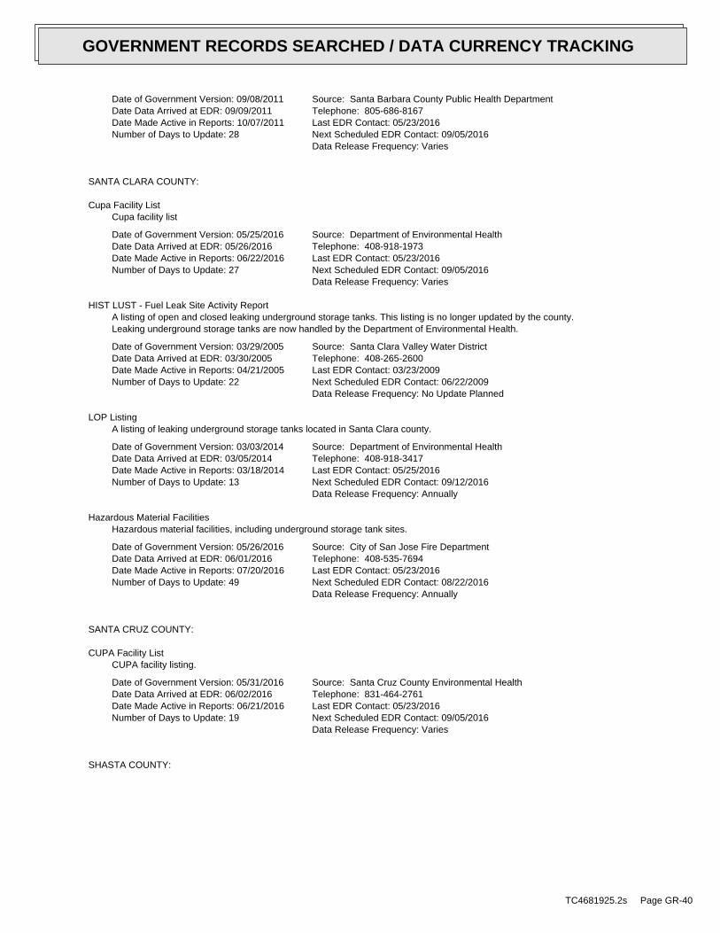
Date of Government Version: 09/08/2011Date Data Arrived at EDR: 09/09/2011Date Made Active in Reports: 10/07/2011Number of Days to Update: 28
Source: Santa Barbara County Public Health DepartmentTelephone: 805-686-8167Last EDR Contact: 05/23/2016Next Scheduled EDR Contact: 09/05/2016Data Release Frequency: Varies
SANTA CLARA COUNTY:
Cupa Facility ListCupa facility list
Date of Government Version: 05/25/2016Date Data Arrived at EDR: 05/26/2016Date Made Active in Reports: 06/22/2016Number of Days to Update: 27
Source: Department of Environmental HealthTelephone: 408-918-1973Last EDR Contact: 05/23/2016Next Scheduled EDR Contact: 09/05/2016Data Release Frequency: Varies
HIST LUST - Fuel Leak Site Activity ReportA listing of open and closed leaking underground storage tanks. This listing is no longer updated by the county.Leaking underground storage tanks are now handled by the Department of Environmental Health.
Date of Government Version: 03/29/2005Date Data Arrived at EDR: 03/30/2005Date Made Active in Reports: 04/21/2005Number of Days to Update: 22
Source: Santa Clara Valley Water DistrictTelephone: 408-265-2600Last EDR Contact: 03/23/2009Next Scheduled EDR Contact: 06/22/2009Data Release Frequency: No Update Planned
LOP ListingA listing of leaking underground storage tanks located in Santa Clara county.
Date of Government Version: 03/03/2014Date Data Arrived at EDR: 03/05/2014Date Made Active in Reports: 03/18/2014Number of Days to Update: 13
Source: Department of Environmental HealthTelephone: 408-918-3417Last EDR Contact: 05/25/2016Next Scheduled EDR Contact: 09/12/2016Data Release Frequency: Annually
Hazardous Material FacilitiesHazardous material facilities, including underground storage tank sites.
Date of Government Version: 05/26/2016Date Data Arrived at EDR: 06/01/2016Date Made Active in Reports: 07/20/2016Number of Days to Update: 49
Source: City of San Jose Fire DepartmentTelephone: 408-535-7694Last EDR Contact: 05/23/2016Next Scheduled EDR Contact: 08/22/2016Data Release Frequency: Annually
SANTA CRUZ COUNTY:
CUPA Facility ListCUPA facility listing.
Date of Government Version: 05/31/2016Date Data Arrived at EDR: 06/02/2016Date Made Active in Reports: 06/21/2016Number of Days to Update: 19
Source: Santa Cruz County Environmental HealthTelephone: 831-464-2761Last EDR Contact: 05/23/2016Next Scheduled EDR Contact: 09/05/2016Data Release Frequency: Varies
SHASTA COUNTY:
TC4681925.2s Page GR-40
GOVERNMENT RECORDS SEARCHED / DATA CURRENCY TRACKING

CUPA Facility ListCupa Facility List.
Date of Government Version: 03/18/2016Date Data Arrived at EDR: 03/21/2016Date Made Active in Reports: 05/04/2016Number of Days to Update: 44
Source: Shasta County Department of Resource ManagementTelephone: 530-225-5789Last EDR Contact: 05/23/2016Next Scheduled EDR Contact: 09/05/2016Data Release Frequency: Varies
SOLANO COUNTY:
Leaking Underground Storage TanksA listing of leaking underground storage tank sites located in Solano county.
Date of Government Version: 03/14/2016Date Data Arrived at EDR: 03/22/2016Date Made Active in Reports: 05/09/2016Number of Days to Update: 48
Source: Solano County Department of Environmental ManagementTelephone: 707-784-6770Last EDR Contact: 06/08/2016Next Scheduled EDR Contact: 09/26/2016Data Release Frequency: Quarterly
Underground Storage TanksUnderground storage tank sites located in Solano county.
Date of Government Version: 03/14/2016Date Data Arrived at EDR: 03/21/2016Date Made Active in Reports: 05/04/2016Number of Days to Update: 44
Source: Solano County Department of Environmental ManagementTelephone: 707-784-6770Last EDR Contact: 06/08/2016Next Scheduled EDR Contact: 09/26/2016Data Release Frequency: Quarterly
SONOMA COUNTY:
Cupa Facility ListCupa Facility list
Date of Government Version: 04/05/2016Date Data Arrived at EDR: 04/08/2016Date Made Active in Reports: 05/04/2016Number of Days to Update: 26
Source: County of Sonoma Fire & Emergency Services DepartmentTelephone: 707-565-1174Last EDR Contact: 07/07/2016Next Scheduled EDR Contact: 10/10/2016Data Release Frequency: Varies
Leaking Underground Storage Tank SitesA listing of leaking underground storage tank sites located in Sonoma county.
Date of Government Version: 04/01/2016Date Data Arrived at EDR: 04/05/2016Date Made Active in Reports: 05/09/2016Number of Days to Update: 34
Source: Department of Health ServicesTelephone: 707-565-6565Last EDR Contact: 06/24/2016Next Scheduled EDR Contact: 10/10/2016Data Release Frequency: Quarterly
SUTTER COUNTY:
Underground Storage TanksUnderground storage tank sites located in Sutter county.
Date of Government Version: 06/02/2016Date Data Arrived at EDR: 06/07/2016Date Made Active in Reports: 06/23/2016Number of Days to Update: 16
Source: Sutter County Department of AgricultureTelephone: 530-822-7500Last EDR Contact: 06/02/2016Next Scheduled EDR Contact: 09/19/2016Data Release Frequency: Semi-Annually
TUOLUMNE COUNTY:
TC4681925.2s Page GR-41
GOVERNMENT RECORDS SEARCHED / DATA CURRENCY TRACKING

CUPA Facility ListCupa facility list
Date of Government Version: 05/03/2016Date Data Arrived at EDR: 05/10/2016Date Made Active in Reports: 06/17/2016Number of Days to Update: 38
Source: Divison of Environmental HealthTelephone: 209-533-5633Last EDR Contact: 07/20/2016Next Scheduled EDR Contact: 10/07/2016Data Release Frequency: Varies
VENTURA COUNTY:
Business Plan, Hazardous Waste Producers, and Operating Underground TanksThe BWT list indicates by site address whether the Environmental Health Division has Business Plan (B), WasteProducer (W), and/or Underground Tank (T) information.
Date of Government Version: 03/28/2016Date Data Arrived at EDR: 04/29/2016Date Made Active in Reports: 06/17/2016Number of Days to Update: 49
Source: Ventura County Environmental Health DivisionTelephone: 805-654-2813Last EDR Contact: 04/25/2016Next Scheduled EDR Contact: 08/08/2016Data Release Frequency: Quarterly
Inventory of Illegal Abandoned and Inactive SitesVentura County Inventory of Closed, Illegal Abandoned, and Inactive Sites.
Date of Government Version: 12/01/2011Date Data Arrived at EDR: 12/01/2011Date Made Active in Reports: 01/19/2012Number of Days to Update: 49
Source: Environmental Health DivisionTelephone: 805-654-2813Last EDR Contact: 06/28/2016Next Scheduled EDR Contact: 10/17/2016Data Release Frequency: Annually
Listing of Underground Tank Cleanup SitesVentura County Underground Storage Tank Cleanup Sites (LUST).
Date of Government Version: 05/29/2008Date Data Arrived at EDR: 06/24/2008Date Made Active in Reports: 07/31/2008Number of Days to Update: 37
Source: Environmental Health DivisionTelephone: 805-654-2813Last EDR Contact: 05/13/2016Next Scheduled EDR Contact: 08/22/2016Data Release Frequency: Quarterly
Medical Waste Program ListTo protect public health and safety and the environment from potential exposure to disease causing agents, theEnvironmental Health Division Medical Waste Program regulates the generation, handling, storage, treatment anddisposal of medical waste throughout the County.
Date of Government Version: 03/28/2016Date Data Arrived at EDR: 04/29/2016Date Made Active in Reports: 06/22/2016Number of Days to Update: 54
Source: Ventura County Resource Management AgencyTelephone: 805-654-2813Last EDR Contact: 04/25/2016Next Scheduled EDR Contact: 08/08/2016Data Release Frequency: Quarterly
Underground Tank Closed Sites ListVentura County Operating Underground Storage Tank Sites (UST)/Underground Tank Closed Sites List.
Date of Government Version: 02/26/2016Date Data Arrived at EDR: 03/17/2016Date Made Active in Reports: 05/04/2016Number of Days to Update: 48
Source: Environmental Health DivisionTelephone: 805-654-2813Last EDR Contact: 06/16/2016Next Scheduled EDR Contact: 09/26/2016Data Release Frequency: Quarterly
YOLO COUNTY:
TC4681925.2s Page GR-42
GOVERNMENT RECORDS SEARCHED / DATA CURRENCY TRACKING

Underground Storage Tank Comprehensive Facility ReportUnderground storage tank sites located in Yolo county.
Date of Government Version: 04/12/2016Date Data Arrived at EDR: 04/19/2016Date Made Active in Reports: 06/01/2016Number of Days to Update: 43
Source: Yolo County Department of HealthTelephone: 530-666-8646Last EDR Contact: 06/30/2016Next Scheduled EDR Contact: 10/17/2016Data Release Frequency: Annually
YUBA COUNTY:
CUPA Facility ListCUPA facility listing for Yuba County.
Date of Government Version: 04/29/2016Date Data Arrived at EDR: 05/03/2016Date Made Active in Reports: 06/17/2016Number of Days to Update: 45
Source: Yuba County Environmental Health DepartmentTelephone: 530-749-7523Last EDR Contact: 04/29/2016Next Scheduled EDR Contact: 08/15/2016Data Release Frequency: Varies
OTHER DATABASE(S)
Depending on the geographic area covered by this report, the data provided in these specialty databases may or may not becomplete. For example, the existence of wetlands information data in a specific report does not mean that all wetlands in thearea covered by the report are included. Moreover, the absence of any reported wetlands information does not necessarilymean that wetlands do not exist in the area covered by the report.
CT MANIFEST: Hazardous Waste Manifest DataFacility and manifest data. Manifest is a document that lists and tracks hazardous waste from the generator throughtransporters to a tsd facility.
Date of Government Version: 07/30/2013Date Data Arrived at EDR: 08/19/2013Date Made Active in Reports: 10/03/2013Number of Days to Update: 45
Source: Department of Energy & Environmental ProtectionTelephone: 860-424-3375Last EDR Contact: 05/13/2016Next Scheduled EDR Contact: 08/29/2016Data Release Frequency: No Update Planned
NJ MANIFEST: Manifest InformationHazardous waste manifest information.
Date of Government Version: 12/31/2013Date Data Arrived at EDR: 07/17/2015Date Made Active in Reports: 08/12/2015Number of Days to Update: 26
Source: Department of Environmental ProtectionTelephone: N/ALast EDR Contact: 07/11/2016Next Scheduled EDR Contact: 10/24/2016Data Release Frequency: Annually
NY MANIFEST: Facility and Manifest DataManifest is a document that lists and tracks hazardous waste from the generator through transporters to a TSDfacility.
Date of Government Version: 05/01/2016Date Data Arrived at EDR: 05/06/2016Date Made Active in Reports: 06/17/2016Number of Days to Update: 42
Source: Department of Environmental ConservationTelephone: 518-402-8651Last EDR Contact: 05/06/2016Next Scheduled EDR Contact: 08/15/2016Data Release Frequency: Annually
TC4681925.2s Page GR-43
GOVERNMENT RECORDS SEARCHED / DATA CURRENCY TRACKING

PA MANIFEST: Manifest InformationHazardous waste manifest information.
Date of Government Version: 12/31/2014Date Data Arrived at EDR: 07/24/2015Date Made Active in Reports: 08/18/2015Number of Days to Update: 25
Source: Department of Environmental ProtectionTelephone: 717-783-8990Last EDR Contact: 07/18/2016Next Scheduled EDR Contact: 10/31/2016Data Release Frequency: Annually
RI MANIFEST: Manifest informationHazardous waste manifest information
Date of Government Version: 12/31/2013Date Data Arrived at EDR: 06/19/2015Date Made Active in Reports: 07/15/2015Number of Days to Update: 26
Source: Department of Environmental ManagementTelephone: 401-222-2797Last EDR Contact: 06/06/2016Next Scheduled EDR Contact: 09/05/2016Data Release Frequency: Annually
WI MANIFEST: Manifest InformationHazardous waste manifest information.
Date of Government Version: 12/31/2015Date Data Arrived at EDR: 04/14/2016Date Made Active in Reports: 06/03/2016Number of Days to Update: 50
Source: Department of Natural ResourcesTelephone: N/ALast EDR Contact: 06/13/2016Next Scheduled EDR Contact: 09/26/2016Data Release Frequency: Annually
Oil/Gas PipelinesSource: PennWell CorporationPetroleum Bundle (Crude Oil, Refined Products, Petrochemicals, Gas Liquids (LPG/NGL), and SpecialtyGases (Miscellaneous)) N = Natural Gas Bundle (Natural Gas, Gas Liquids (LPG/NGL), and Specialty Gases(Miscellaneous)). This map includes information copyrighted by PennWell Corporation. This informationis provided on a best effort basis and PennWell Corporation does not guarantee its accuracy nor warrantits fitness for any particular purpose. Such information has been reprinted with the permission of PennWell.
Electric Power Transmission Line DataSource: PennWell CorporationThis map includes information copyrighted by PennWell Corporation. This information is provided on a besteffort basis and PennWell Corporation does not guarantee its accuracy nor warrant its fitness for anyparticular purpose. Such information has been reprinted with the permission of PennWell.
Sensitive Receptors: There are individuals deemed sensitive receptors due to their fragile immune systems and special sensitivityto environmental discharges. These sensitive receptors typically include the elderly, the sick, and children. While the location of allsensitive receptors cannot be determined, EDR indicates those buildings and facilities - schools, daycares, hospitals, medical centers,and nursing homes - where individuals who are sensitive receptors are likely to be located.
AHA Hospitals:Source: American Hospital Association, Inc.Telephone: 312-280-5991The database includes a listing of hospitals based on the American Hospital Association’s annual survey of hospitals.
Medical Centers: Provider of Services ListingSource: Centers for Medicare & Medicaid ServicesTelephone: 410-786-3000A listing of hospitals with Medicare provider number, produced by Centers of Medicare & Medicaid Services,a federal agency within the U.S. Department of Health and Human Services.
Nursing HomesSource: National Institutes of HealthTelephone: 301-594-6248Information on Medicare and Medicaid certified nursing homes in the United States.
Public SchoolsSource: National Center for Education StatisticsTelephone: 202-502-7300The National Center for Education Statistics’ primary database on elementaryand secondary public education in the United States. It is a comprehensive, annual, national statisticaldatabase of all public elementary and secondary schools and school districts, which contains data that arecomparable across all states.
TC4681925.2s Page GR-44
GOVERNMENT RECORDS SEARCHED / DATA CURRENCY TRACKING
Private SchoolsSource: National Center for Education StatisticsTelephone: 202-502-7300The National Center for Education Statistics’ primary database on private school locations in the United States.
Daycare Centers: Licensed FacilitiesSource: Department of Social ServicesTelephone: 916-657-4041
Flood Zone Data: This data, available in select counties across the country, was obtained by EDR in 2003 & 2011 from the FederalEmergency Management Agency (FEMA). Data depicts 100-year and 500-year flood zones as defined by FEMA.
NWI: National Wetlands Inventory. This data, available in select counties across the country, was obtained by EDRin 2002, 2005 and 2010 from the U.S. Fish and Wildlife Service.
State Wetlands Data: Wetland InventorySource: Department of Fish & GameTelephone: 916-445-0411
Current USGS 7.5 Minute Topographic MapSource: U.S. Geological Survey
STREET AND ADDRESS INFORMATION
© 2015 TomTom North America, Inc. All rights reserved. This material is proprietary and the subject of copyright protectionand other intellectual property rights owned by or licensed to Tele Atlas North America, Inc. The use of this material is subjectto the terms of a license agreement. You will be held liable for any unauthorized copying or disclosure of this material.
TC4681925.2s Page GR-45
GOVERNMENT RECORDS SEARCHED / DATA CURRENCY TRACKING

TC4681925.2s Page A-1
geologic strata.of the soil, and nearby wells. Groundwater flow velocity is generally impacted by the nature of theGroundwater flow direction may be impacted by surface topography, hydrology, hydrogeology, characteristics
2. Groundwater flow velocity. 1. Groundwater flow direction, and
Assessment of the impact of contaminant migration generally has two principal investigative components:
forming an opinion about the impact of potential contaminant migration.EDR’s GeoCheck Physical Setting Source Addendum is provided to assist the environmental professional in
2012Version Date:5641126 SAN FRANCISCO SOUTH, CATarget Property Map:
USGS TOPOGRAPHIC MAP
43 ft. above sea levelElevation:4167863.8UTM Y (Meters): 549706.1UTM X (Meters): Zone 10Universal Tranverse Mercator: 122.436474 - 122˚ 26’ 11.31’’Longitude (West): 37.65844 - 37˚ 39’ 30.38’’Latitude (North):
TARGET PROPERTY COORDINATES
SOUTH SAN FRANCISCO, CA 940801 CHESTNUT STREETCITY OF SOUTH SAN FRANCISCO - PHASE I UPDATE
TARGET PROPERTY ADDRESS
®GEOCHECK - PHYSICAL SETTING SOURCE ADDENDUM®

TC4681925.2s Page A-2
should be field verified.on a relative (not an absolute) basis. Relative elevation information between sites of close proximitySource: Topography has been determined from the USGS 7.5’ Digital Elevation Model and should be evaluated
SURROUNDING TOPOGRAPHY: ELEVATION PROFILES
Ele
vatio
n (f
t)E
leva
tion
(ft)
TP
TP0 1/2 1 Miles
✩Target Property Elevation: 43 ft.
North South
West East
90
102
11077
1099255
615443
52
71
110
135
153
168
184
216
273200
194 167
151
139
124
117
103
52 43 41
46
53
61
82 79
85
105
105
General ESEGeneral Topographic Gradient:TARGET PROPERTY TOPOGRAPHY
should contamination exist on the target property, what downgradient sites might be impacted.assist the environmental professional in forming an opinion about the impact of nearby contaminated properties or,Surface topography may be indicative of the direction of surficial groundwater flow. This information can be used toTOPOGRAPHIC INFORMATION
collected on nearby properties, and regional groundwater flow information (from deep aquifers).sources of information, such as surface topographic information, hydrologic information, hydrogeologic datausing site-specific well data. If such data is not reasonably ascertainable, it may be necessary to rely on otherGroundwater flow direction for a particular site is best determined by a qualified environmental professionalGROUNDWATER FLOW DIRECTION INFORMATION
®GEOCHECK - PHYSICAL SETTING SOURCE SUMMARY®

TC4681925.2s Page A-3
Not Reported1/4 - 1/2 Mile South6W1/4 - 1/2 Mile WNW4E1/4 - 1/2 Mile SEA3Not Reported1/4 - 1/2 Mile SSEA1
GENERAL DIRECTIONLOCATIONGROUNDWATER FLOWFROM TPMAP ID
hydrogeologically, and the depth to water table.authorities at select sites and has extracted the date of the report, groundwater flow direction as determinedflow at specific points. EDR has reviewed reports submitted by environmental professionals to regulatoryEDR has developed the AQUIFLOW Information System to provide data on the general direction of groundwater
AQUIFLOW®
Search Radius: 1.000 Mile.
Not found Status:1.25 miles Search Radius:
Site-Specific Hydrogeological Data*:
* ©1996 Site−specific hydrogeological data gathered by CERCLIS Alerts, Inc., Bainbridge Island, WA. All rights reserved. All of the information and opinions presented are those of the cited EPA report(s), which were completed undera Comprehensive Environmental Response Compensation and Liability Information System (CERCLIS) investigation.
contamination exist on the target property, what downgradient sites might be impacted.environmental professional in forming an opinion about the impact of nearby contaminated properties or, shouldof groundwater flow direction in the immediate area. Such hydrogeologic information can be used to assist theHydrogeologic information obtained by installation of wells on a specific site can often be an indicatorHYDROGEOLOGIC INFORMATION
YES - refer to the Overview Map and Detail MapSAN FRANCISCO SOUTH
NATIONAL WETLAND INVENTORYNWI ElectronicData CoverageNWI Quad at Target Property
0650620007B - FEMA Q3 Flood data0603110012B - FEMA Q3 Flood data0650620002B - FEMA Q3 Flood data0603160000B - FEMA Q3 Flood data0603110025B - FEMA Q3 Flood data0603170000B - FEMA Q3 Flood dataAdditional Panels in search area:
0650620001B - FEMA Q3 Flood dataFlood Plain Panel at Target Property:
YES - refer to the Overview Map and Detail MapSAN MATEO, CA
FEMA FLOOD ZONEFEMA FloodElectronic DataTarget Property County
and bodies of water).Refer to the Physical Setting Source Map following this summary for hydrologic information (major waterways
contamination exist on the target property, what downgradient sites might be impacted.the environmental professional in forming an opinion about the impact of nearby contaminated properties or, shouldSurface water can act as a hydrologic barrier to groundwater flow. Such hydrologic information can be used to assistHYDROLOGIC INFORMATION
®GEOCHECK - PHYSICAL SETTING SOURCE SUMMARY®

TC4681925.2s Page A-4
For additional site information, refer to Physical Setting Source Map Findings.
Not Reported1/2 - 1 Mile SE18SE1/2 - 1 Mile ESEC17SE1/2 - 1 Mile ESEC16NW1/2 - 1 Mile ESEC15SW1/2 - 1 Mile NE14Not Reported1/2 - 1 Mile SSE11Not Reported1/2 - 1 Mile NE10Not Reported1/4 - 1/2 Mile SE8ENE1/4 - 1/2 Mile WNW7
GENERAL DIRECTIONLOCATIONGROUNDWATER FLOWFROM TPMAP ID
®GEOCHECK - PHYSICAL SETTING SOURCE SUMMARY®

TC4681925.2s Page A-5
Map, USGS Digital Data Series DDS - 11 (1994).of the Conterminous U.S. at 1:2,500,000 Scale - a digital representation of the 1974 P.B. King and H.M. BeikmanGeologic Age and Rock Stratigraphic Unit Source: P.G. Schruben, R.E. Arndt and W.J. Bawiec, Geology
ROCK STRATIGRAPHIC UNIT GEOLOGIC AGE IDENTIFICATION
Stratifed SequenceCategory:CenozoicEra:QuaternarySystem:QuaternarySeries:QCode: (decoded above as Era, System & Series)
at which contaminant migration may be occurring.Geologic information can be used by the environmental professional in forming an opinion about the relative speedGEOLOGIC INFORMATION IN GENERAL AREA OF TARGET PROPERTY
move more quickly through sandy-gravelly types of soils than silty-clayey types of soils.characteristics data collected on nearby properties and regional soil information. In general, contaminant plumesto rely on other sources of information, including geologic age identification, rock stratigraphic unit and soilusing site specific geologic and soil strata data. If such data are not reasonably ascertainable, it may be necessaryGroundwater flow velocity information for a particular site is best determined by a qualified environmental professionalGROUNDWATER FLOW VELOCITY INFORMATION
®GEOCHECK - PHYSICAL SETTING SOURCE SUMMARY®

EDR Inc.EDR Inc.EDR Inc.EDR Inc.EDR Inc.EDR Inc.EDR Inc.EDR Inc.EDR Inc.EDR Inc.EDR Inc.EDR Inc.EDR Inc.EDR Inc.EDR Inc.EDR Inc.EDR Inc.EDR Inc.EDR Inc.EDR Inc.EDR Inc.EDR Inc.EDR Inc.EDR Inc.EDR Inc.EDR Inc.EDR Inc.EDR Inc.EDR Inc.EDR Inc.EDR Inc.EDR Inc.EDR Inc.EDR Inc.EDR Inc.EDR Inc.EDR Inc.EDR Inc.EDR Inc.EDR Inc.
3
1
2
3
0 1/16 1/8 1/4 Miles

TC4681925.2s Page A-7
> 0 inchesDepth to Watertable Min:
> 0 inchesDepth to Bedrock Min:
Not ReportedCorrosion Potential - Uncoated Steel:
Hydric Status: Not hydricSoil Drainage Class:
water table, or are shallow to an impervious layer.Class D - Very slow infiltration rates. Soils are clayey, have a highHydrologic Group:
Soil Surface Texture:
Urban landSoil Component Name:
Soil Map ID: 2
Max: Min: Min: Max: Not reportedNot reportedvariable59 inches 0 inches 1
Soil Layer Information
Boundary Classification Saturatedhydraulicconductivitymicro m/sec
Layer Upper Lower Soil Texture Class AASHTO Group Unified Soil Soil Reaction(pH)
> 0 inchesDepth to Watertable Min:
> 0 inchesDepth to Bedrock Min:
Not ReportedCorrosion Potential - Uncoated Steel:
Hydric Status: Not hydric
Well drainedSoil Drainage Class:
textures.moderately well and well drained soils with moderately coarseClass B - Moderate infiltration rates. Deep and moderately deep,Hydrologic Group:
variableSoil Surface Texture:
OrthentsSoil Component Name:
Soil Map ID: 1
in a landscape. The following information is based on Soil Conservation Service SSURGO data.for privately owned lands in the United States. A soil map in a soil survey is a representation of soil patternsSurvey (NCSS) and is responsible for collecting, storing, maintaining and distributing soil survey informationThe U.S. Department of Agriculture’s (USDA) Soil Conservation Service (SCS) leads the National Cooperative Soil
DOMINANT SOIL COMPOSITION IN GENERAL AREA OF TARGET PROPERTY
®GEOCHECK - PHYSICAL SETTING SOURCE SUMMARY®

TC4681925.2s Page A-8
opinion about the impact of contaminant migration on nearby drinking water wells.professional in assessing sources that may impact ground water flow direction, and in forming anEDR Local/Regional Water Agency records provide water well information to assist the environmental
LOCAL / REGIONAL WATER AGENCY RECORDS
Max: Min: Min: 0Max: 0.01 Not reportedNot reported 5 inches 0 inches 1
Soil Layer Information
Boundary Classification Saturatedhydraulicconductivitymicro m/sec
Layer Upper Lower Soil Texture Class AASHTO Group Unified Soil Soil Reaction(pH)
> 0 inchesDepth to Watertable Min:
> 0 inchesDepth to Bedrock Min:
Not ReportedCorrosion Potential - Uncoated Steel:
Hydric Status: Not hydricSoil Drainage Class:
water table, or are shallow to an impervious layer.Class D - Very slow infiltration rates. Soils are clayey, have a highHydrologic Group:
Soil Surface Texture:
Urban landSoil Component Name:
Soil Map ID: 3
Max: Min: Min: 0Max: 0.01 Not reportedNot reported 5 inches 0 inches 1
Soil Layer Information
Boundary Classification Saturatedhydraulicconductivitymicro m/sec
Layer Upper Lower Soil Texture Class AASHTO Group Unified Soil Soil Reaction(pH)
®GEOCHECK - PHYSICAL SETTING SOURCE SUMMARY®

TC4681925.2s Page A-9
1/2 - 1 Mile NWCADW60000005295 191/2 - 1 Mile South3548 B131/2 - 1 Mile South3544 B121/4 - 1/2 Mile SSECADW60000005922 91/4 - 1/2 Mile SSW3552 51/4 - 1/2 Mile ESE19611 2
STATE DATABASE WELL INFORMATION
LOCATIONFROM TPWELL IDMAP ID
Note: PWS System location is not always the same as well location.
No PWS System Found
FEDERAL FRDS PUBLIC WATER SUPPLY SYSTEM INFORMATION
LOCATIONFROM TPWELL IDMAP ID
No Wells Found
FEDERAL USGS WELL INFORMATION
LOCATIONFROM TPWELL IDMAP ID
1.000State DatabaseNearest PWS within 0.001 milesFederal FRDS PWS1.000Federal USGS
WELL SEARCH DISTANCE INFORMATION
SEARCH DISTANCE (miles)DATABASE
®GEOCHECK - PHYSICAL SETTING SOURCE SUMMARY®

EDR Inc.EDR Inc.EDR Inc.EDR Inc.EDR Inc.EDR Inc.EDR Inc.EDR Inc.EDR Inc.EDR Inc.EDR Inc.EDR Inc.EDR Inc.EDR Inc.EDR Inc.EDR Inc.EDR Inc.EDR Inc.EDR Inc.EDR Inc.EDR Inc.EDR Inc.EDR Inc.EDR Inc.EDR Inc.EDR Inc.EDR Inc.EDR Inc.EDR Inc.EDR Inc.EDR Inc.EDR Inc.EDR Inc.EDR Inc.EDR Inc.EDR Inc.EDR Inc.EDR Inc.EDR Inc.EDR Inc.
0
11 60
1 1 201 0 0 0
10
80
1 0 8 0
1 0 4 0
1 0 40
10
00
1
0 00
9 60
96
09
20
0
88
0
88
0
680
8 4 0
84
0
8 4 0
880
0
8 0 0
76
0
7 6 0
72
0
72
0
68
06
80 6 8 06
40
64
0
6 4 0
6
60
0
60
0
6 0 0
60
0
5 6 0
56 0
5 6 0
56
0
5 2 0
52
0
5 2 0
52
0
4 8 0
48
0
4 8 0
48
0
44
0
4 4 0
4 4 0 44
0
40
0
40
0
40
0
4 0 0
40
0
0
36
0
36 0
36
0
36
0
3 2 0
32
0
3 2 0
5 6 05 2 04 8 04 4 0
4 4 0
4 0 0
4 00
3 6 0
3 6 0
3 2 0
3 2 0
28
0
2 8 0
2
8 0
2 8 0
2 8 0
2 8 0
2 8 0
2 40
24
0
2 4 0
2 4 0
2
4 0
2 4 0
2 0 0
2 0 0
2 0 0
2 0 0
20
0
40
60 06
00
32
0
240
2 0 02 0 0
2 0 0
2 00
0 0
5
60
2 0 0
20
0
2 0 0
5 60
56
0
5
20
56
0
00
52
0
5 6 0
5 6 0
2 0
0
5 2 0
4 8
4 8 0
48
0
48
0
4 4 044
0
44
0
4 4 0
4 4 0
4 0 0
4 0 0
4 00
4 00
40
03 6 0
3
6 0
3 6 0
36 0
3 6 0
36
0
3 2 0
32
0
3 2 0
3
2 0
3 2 0
2 8 0
28
0
28
0
2
8 0
2 8 0
2 8 0
28
0
24
0
2
4 0
2 40
24
0
2 4 0
2 4 0
2 40
20
0
2 0 02 0 0
16
0
1 6 0
1 6 0
16
0
1 6 0
16
0
1 6 0
16
0
1 60
16
0
1 6 0
1 6 0
12
0
1 2 0
1 2 0
1 2 0
1 2 0
1 2 0
120
1 2 0
1 2 0
1 2 0
1 2 0
1 2 0
8 0
8 0
8 08 0
8 0
8 0
8 08
0
8 0
8 0
80
40
4 0
4 0
4 0
40
CA

TC4681925.2s Page A-11
DIBROMOCHLOROMETHANE (THM)Chemical:3.27 UG/LFindings:08-FEB-12Sample Collected:
BROMOFORM (THM)Chemical:2.02 UG/LFindings:08-FEB-12Sample Collected:
BROMODICHLORMETHANE (THM)Chemical:3.06 UG/LFindings:08-FEB-12Sample Collected:
NITRATE (AS NO3)Chemical:10.502 MG/LFindings:07-FEB-12Sample Collected:
NITRATE (AS NO3)Chemical:10.267 MG/LFindings:31-JAN-12Sample Collected:
1,2,3-TRICHLOROPROPANEChemical:1.2e-002 UG/LFindings:24-JAN-12Sample Collected:
NITRATE (AS NO3)Chemical:10.711 MG/LFindings:24-JAN-12Sample Collected:
NITRATE (AS NO3)Chemical:9.106 MG/LFindings:18-JAN-12Sample Collected:
NITRATE (AS NO3)Chemical:13.983 MG/LFindings:07-DEC-11Sample Collected:
TOTAL TRIHALOMETHANESChemical:6.3 UG/LFindings:29-NOV-11Sample Collected:
SOUTH SAN FRANCISCOArea Served:14710Connections:56200Pop Served:
SAN JOSE, CA 95108P O BOX 1150
Organization That Operates System:CALIFORNIA WATER SERVICE-S SAN FRANCISCOSystem Name:4110009System Number:STATION 01 - AFTER FILTERSource Name:
10 Feet (1/10 Second)Precision:373925.5 1222551.8Source Lat/Long:Active TreatedWell Status:Well/GroundwaterWater Type:WELL/AMBNTStation Type:04District Number:San MateoCounty:4110009009FRDS Number:ENGUser ID:4110009-009Prime Station Code:
Water System Information:
2ESE1/4 - 1/2 MileLower
19611CA WELLS
Date: 01/07/1993Average Water Depth: Not ReportedDeep Water Depth: 20.24Shallow Water Depth: 5.38Groundwater Flow: Not ReportedSite ID: 41-0453A1
SSE1/4 - 1/2 MileHigher
68777AQUIFLOW
Map IDDirectionDistanceElevation EDR ID NumberDatabase
®GEOCHECK - PHYSICAL SETTING SOURCE MAP FINDINGS®

TC4681925.2s Page A-12
NITRATE (AS NO3)Chemical:13. MG/LFindings:22-MAR-11Sample Collected:
NITRATE (AS NO3)Chemical:14. MG/LFindings:16-MAR-11Sample Collected:
TOTAL TRIHALOMETHANESChemical:3.3 UG/LFindings:09-MAR-11Sample Collected:
DIBROMOCHLOROMETHANE (THM)Chemical:1.34 UG/LFindings:09-MAR-11Sample Collected:
NITRATE (AS NO3)Chemical:14. MG/LFindings:08-MAR-11Sample Collected:
NITRATE (AS NO3)Chemical:14. MG/LFindings:01-MAR-11Sample Collected:
NITRATE (AS NO3)Chemical:14. MG/LFindings:22-FEB-11Sample Collected:
NITRATE (AS NO3)Chemical:14. MG/LFindings:15-FEB-11Sample Collected:
NITRATE (AS NO3)Chemical:14. MG/LFindings:15-FEB-11Sample Collected:
TOTAL TRIHALOMETHANESChemical:3.7 UG/LFindings:09-FEB-11Sample Collected:
DIBROMOCHLOROMETHANE (THM)Chemical:1.59 UG/LFindings:09-FEB-11Sample Collected:
NITRATE (AS NO3)Chemical:14. MG/LFindings:08-FEB-11Sample Collected:
NITRATE (AS NO3)Chemical:12. MG/LFindings:01-FEB-11Sample Collected:
1,2,3-TRICHLOROPROPANEChemical:2.5e-002 UG/LFindings:31-JAN-11Sample Collected:
NITRATE (AS NO3)Chemical:13. MG/LFindings:27-JAN-11Sample Collected:
TOTAL TRIHALOMETHANESChemical:3.7 UG/LFindings:12-JAN-11Sample Collected:
DIBROMOCHLOROMETHANE (THM)Chemical:1.44 UG/LFindings:12-JAN-11Sample Collected:
BROMOFORM (THM)Chemical:1.07 UG/LFindings:12-JAN-11Sample Collected:
NITRATE (AS NO3)Chemical:13.795 MG/LFindings:11-JAN-11Sample Collected:
NITRATE (AS NO3)Chemical:12.912 MG/LFindings:04-JAN-11Sample Collected:
TOTAL TRIHALOMETHANESChemical:19.3 UG/LFindings:08-FEB-12Sample Collected:
CHLOROFORM (THM)Chemical:10.86 UG/LFindings:08-FEB-12Sample Collected:
®GEOCHECK - PHYSICAL SETTING SOURCE MAP FINDINGS®

TC4681925.2s Page A-13
NITRATE (AS NO3)Chemical:10.98 MG/LFindings:21-JUN-11Sample Collected:
TOTAL TRIHALOMETHANESChemical:4.9 UG/LFindings:14-JUN-11Sample Collected:
CHLOROFORM (THM)Chemical:1.26 UG/LFindings:14-JUN-11Sample Collected:
DIBROMOCHLOROMETHANE (THM)Chemical:1.63 UG/LFindings:14-JUN-11Sample Collected:
BROMOFORM (THM)Chemical:1.1 UG/LFindings:14-JUN-11Sample Collected:
NITRATE (AS NO3)Chemical:8.925 MG/LFindings:14-JUN-11Sample Collected:
NITRATE (AS NO3)Chemical:11.197 MG/LFindings:08-JUN-11Sample Collected:
NITRATE (AS NO3)Chemical:14.239 MG/LFindings:01-JUN-11Sample Collected:
1,2,3-TRICHLOROPROPANEChemical:1.6e-002 UG/LFindings:24-MAY-11Sample Collected:
NITRATE (AS NO3)Chemical:11.717 MG/LFindings:24-MAY-11Sample Collected:
NITRATE (AS NO3)Chemical:12.256 MG/LFindings:17-MAY-11Sample Collected:
NITRATE (AS NO3)Chemical:14.58 MG/LFindings:10-MAY-11Sample Collected:
NITRATE (AS NO3)Chemical:16. MG/LFindings:03-MAY-11Sample Collected:
MANGANESEChemical:21.1 UG/LFindings:03-MAY-11Sample Collected:
TOTAL TRIHALOMETHANESChemical:1.2 UG/LFindings:01-MAY-11Sample Collected:
NITRATE (AS NO3)Chemical:13. MG/LFindings:13-APR-11Sample Collected:
TOTAL TRIHALOMETHANESChemical:4.4 UG/LFindings:13-APR-11Sample Collected:
CHLOROFORM (THM)Chemical:1.91 UG/LFindings:13-APR-11Sample Collected:
DIBROMOCHLOROMETHANE (THM)Chemical:1.13 UG/LFindings:13-APR-11Sample Collected:
BROMODICHLORMETHANE (THM)Chemical:1.02 UG/LFindings:13-APR-11Sample Collected:
NITRATE (AS NO3)Chemical:14. MG/LFindings:05-APR-11Sample Collected:
NITRATE (AS NO3)Chemical:13. MG/LFindings:29-MAR-11Sample Collected:
®GEOCHECK - PHYSICAL SETTING SOURCE MAP FINDINGS®

TC4681925.2s Page A-14
NITRATE (AS NO3)Chemical:8.907 MG/LFindings:04-OCT-11Sample Collected:
TOTAL TRIHALOMETHANESChemical:3.2 UG/LFindings:30-SEP-11Sample Collected:
DIBROMOCHLOROMETHANE (THM)Chemical:1.2 UG/LFindings:30-SEP-11Sample Collected:
NITRATE (AS NO3)Chemical:13.506 MG/LFindings:21-SEP-11Sample Collected:
MANGANESEChemical:141. UG/LFindings:21-SEP-11Sample Collected:
NITRATE (AS NO3)Chemical:17.758 MG/LFindings:13-SEP-11Sample Collected:
NITRATE (AS NO3)Chemical:11.652 MG/LFindings:08-SEP-11Sample Collected:
NITRATE (AS NO3)Chemical:10.449 MG/LFindings:09-AUG-11Sample Collected:
TOTAL TRIHALOMETHANESChemical:3.2 UG/LFindings:04-AUG-11Sample Collected:
DIBROMOCHLOROMETHANE (THM)Chemical:1.15 UG/LFindings:04-AUG-11Sample Collected:
NITRATE (AS NO3)Chemical:10.591 MG/LFindings:02-AUG-11Sample Collected:
NITRATE (AS NO3)Chemical:10.423 MG/LFindings:26-JUL-11Sample Collected:
NITRATE (AS NO3)Chemical:10.224 MG/LFindings:19-JUL-11Sample Collected:
TOTAL TRIHALOMETHANESChemical:7. UG/LFindings:13-JUL-11Sample Collected:
CHLOROFORM (THM)Chemical:1.77 UG/LFindings:13-JUL-11Sample Collected:
DIBROMOCHLOROMETHANE (THM)Chemical:1.97 UG/LFindings:13-JUL-11Sample Collected:
BROMOFORM (THM)Chemical:1.65 UG/LFindings:13-JUL-11Sample Collected:
BROMODICHLORMETHANE (THM)Chemical:1.48 UG/LFindings:13-JUL-11Sample Collected:
NITRATE (AS NO3)Chemical:13.018 MG/LFindings:13-JUL-11Sample Collected:
1,2,3-TRICHLOROPROPANEChemical:1.6e-002 UG/LFindings:11-JUL-11Sample Collected:
NITRATE (AS NO3)Chemical:10.83 MG/LFindings:05-JUL-11Sample Collected:
NITRATE (AS NO3)Chemical:10.793 MG/LFindings:28-JUN-11Sample Collected:
®GEOCHECK - PHYSICAL SETTING SOURCE MAP FINDINGS®

TC4681925.2s Page A-15
NITRATE (AS NO3)Chemical:9.287 MG/LFindings:03-APR-12Sample Collected:
NITRATE (AS NO3)Chemical:10.795 MG/LFindings:27-MAR-12Sample Collected:
NITRATE (AS NO3)Chemical:10.14 MG/LFindings:20-MAR-12Sample Collected:
NITRATE (AS NO3)Chemical:2.664 MG/LFindings:13-MAR-12Sample Collected:
TOTAL TRIHALOMETHANESChemical:3.2 UG/LFindings:06-MAR-12Sample Collected:
DIBROMOCHLOROMETHANE (THM)Chemical:1.19 UG/LFindings:06-MAR-12Sample Collected:
NITRATE (AS NO3)Chemical:10.915 MG/LFindings:06-MAR-12Sample Collected:
NITRATE (AS NO3)Chemical:10.63 MG/LFindings:28-FEB-12Sample Collected:
NITRATE (AS NO3)Chemical:9.6 MG/LFindings:21-FEB-12Sample Collected:
NITRATE (AS NO3)Chemical:4.6 MG/LFindings:21-FEB-12Sample Collected:
NITRATE (AS NO3)Chemical:10.408 MG/LFindings:14-FEB-12Sample Collected:
ARSENICChemical:. 4.237 UG/LFindings:05-MAR-14Sample Collected:
NITRATE (AS NO3)Chemical:. 10.588 MG/LFindings:04-MAR-14Sample Collected:
NITRATE (AS NO3)Chemical:10.108 MG/LFindings:25-FEB-14Sample Collected:
NITRATE (AS NO3)Chemical:10.123 MG/LFindings:18-FEB-14Sample Collected:
NITRATE (AS NO3)Chemical:10.089 MG/LFindings:11-FEB-14Sample Collected:
TOTAL TRIHALOMETHANESChemical:3.6 UG/LFindings:05-FEB-14Sample Collected:
CHLOROFORM (THM)Chemical:1.63 UG/LFindings:29-NOV-11Sample Collected:
DIBROMOCHLOROMETHANE (THM)Chemical:1.87 UG/LFindings:29-NOV-11Sample Collected:
BROMOFORM (THM)Chemical:1.83 UG/LFindings:29-NOV-11Sample Collected:
NITRATE (AS NO3)Chemical:17.29 MG/LFindings:29-NOV-11Sample Collected:
NITRATE (AS NO3)Chemical:15.613 MG/LFindings:15-NOV-11Sample Collected:
®GEOCHECK - PHYSICAL SETTING SOURCE MAP FINDINGS®

TC4681925.2s Page A-16
BROMOFORM (THM)Chemical:1.02 UG/LFindings:24-MAY-12Sample Collected:
BROMODICHLORMETHANE (THM)Chemical:1.11 UG/LFindings:24-MAY-12Sample Collected:
NITRATE (AS NO3)Chemical:11.289 MG/LFindings:22-MAY-12Sample Collected:
MANGANESEChemical:230. UG/LFindings:22-MAY-12Sample Collected:
NITRATE (AS NO3)Chemical:11.172 MG/LFindings:15-MAY-12Sample Collected:
NITRATE (AS NO3)Chemical:10.788 MG/LFindings:08-MAY-12Sample Collected:
NITRATE (AS NO3)Chemical:10.937 MG/LFindings:01-MAY-12Sample Collected:
1,2,3-TRICHLOROPROPANEChemical:1.5e-002 UG/LFindings:25-APR-12Sample Collected:
NITRATE (AS NO3)Chemical:11.106 MG/LFindings:24-APR-12Sample Collected:
NITRATE (AS NO3)Chemical:10.894 MG/LFindings:17-APR-12Sample Collected:
TOTAL TRIHALOMETHANESChemical:3.3 UG/LFindings:12-APR-12Sample Collected:
ARSENICChemical:. 3.552 UG/LFindings:05-MAY-14Sample Collected:
NITRATE (AS NO3)Chemical:. 2.575 MG/LFindings:30-APR-14Sample Collected:
TOTAL TRIHALOMETHANESChemical:. 3.6 UG/LFindings:15-APR-14Sample Collected:
DIBROMOCHLOROMETHANE (THM)Chemical:. 1.34 UG/LFindings:15-APR-14Sample Collected:
NITRATE (AS NO3)Chemical:. 10.469 MG/LFindings:25-MAR-14Sample Collected:
NITRATE (AS NO3)Chemical:. 10.376 MG/LFindings:18-MAR-14Sample Collected:
CHROMIUM, HEXAVALENTChemical:. 3.5 UG/LFindings:18-MAR-14Sample Collected:
NITRATE (AS NO3)Chemical:. 10.185 MG/LFindings:11-MAR-14Sample Collected:
TOTAL TRIHALOMETHANESChemical:. 2.5 UG/LFindings:05-MAR-14Sample Collected:
DIBROMOCHLOROMETHANE (THM)Chemical:1.21 UG/LFindings:12-APR-12Sample Collected:
NITRATE (AS NO3)Chemical:10.086 MG/LFindings:10-APR-12Sample Collected:
®GEOCHECK - PHYSICAL SETTING SOURCE MAP FINDINGS®

TC4681925.2s Page A-17
CHROMIUM, HEXAVALENTChemical:. 2.2 UG/LFindings:16-JUL-14Sample Collected:
NITRATE (AS NO3)Chemical:. 9.607 MG/LFindings:15-JUL-14Sample Collected:
ARSENICChemical:. 2.645 UG/LFindings:15-JUL-14Sample Collected:
NITRATE (AS NO3)Chemical:. 9.19 MG/LFindings:09-JUL-14Sample Collected:
1,2,3-TRICHLOROPROPANEChemical:. 3.e-002 UG/LFindings:09-JUL-14Sample Collected:
TOTAL TRIHALOMETHANESChemical:. 3.3 UG/LFindings:04-JUN-14Sample Collected:
DIBROMOCHLOROMETHANE (THM)Chemical:. 1.18 UG/LFindings:04-JUN-14Sample Collected:
DIBROMOCHLOROMETHANE (THM)Chemical:1.48 UG/LFindings:12-JUN-12Sample Collected:
BROMOFORM (THM)Chemical:1.03 UG/LFindings:12-JUN-12Sample Collected:
BROMODICHLORMETHANE (THM)Chemical:1.04 UG/LFindings:12-JUN-12Sample Collected:
NITRATE (AS NO3)Chemical:10.654 MG/LFindings:12-JUN-12Sample Collected:
MANGANESEChemical:340. UG/LFindings:07-JUN-12Sample Collected:
NITRATE (AS NO3)Chemical:10.592 MG/LFindings:06-JUN-12Sample Collected:
TOTAL TRIHALOMETHANESChemical:4.3 UG/LFindings:24-MAY-12Sample Collected:
COPPERChemical:. 53.939 UG/LFindings:04-JUN-14Sample Collected:
ARSENICChemical:. 5.427 UG/LFindings:04-JUN-14Sample Collected:
NITRATE (AS NO3)Chemical:. 3.266 MG/LFindings:20-MAY-14Sample Collected:
TOTAL TRIHALOMETHANESChemical:. 3.8 UG/LFindings:20-MAY-14Sample Collected:
DIBROMOCHLOROMETHANE (THM)Chemical:. 1.31 UG/LFindings:20-MAY-14Sample Collected:
BROMODICHLORMETHANE (THM)Chemical:. 1.1 UG/LFindings:20-MAY-14Sample Collected:
1,2,3-TRICHLOROPROPANEChemical:. 1.e-002 UG/LFindings:20-MAY-14Sample Collected:
DIBROMOCHLOROMETHANE (THM)Chemical:1.56 UG/LFindings:24-MAY-12Sample Collected:
®GEOCHECK - PHYSICAL SETTING SOURCE MAP FINDINGS®

TC4681925.2s Page A-18
BROMODICHLORMETHANE (THM)Chemical:. 1.1 UG/LFindings:13-AUG-14Sample Collected:
NITRATE (AS NO3)Chemical:. 2.757 MG/LFindings:12-AUG-14Sample Collected:
CHROMIUM, HEXAVALENTChemical:. 2.1 UG/LFindings:06-AUG-14Sample Collected:
NITRATE (AS NO3)Chemical:. 9.798 MG/LFindings:05-AUG-14Sample Collected:
NITRATE (AS NO3)Chemical:. 9.633 MG/LFindings:29-JUL-14Sample Collected:
NITRATE (AS NO3)Chemical:. 8.968 MG/LFindings:22-JUL-14Sample Collected:
TOTAL TRIHALOMETHANESChemical:. 3.1 UG/LFindings:16-JUL-14Sample Collected:
DIBROMOCHLOROMETHANE (THM)Chemical:1.05 UG/LFindings:20-NOV-12Sample Collected:
1,2,3-TRICHLOROPROPANEChemical:1.3e-002 UG/LFindings:31-OCT-12Sample Collected:
NITRATE (AS NO3)Chemical:11.082 MG/LFindings:07-AUG-12Sample Collected:
NITRATE (AS NO3)Chemical:10.931 MG/LFindings:31-JUL-12Sample Collected:
1,2,3-TRICHLOROPROPANEChemical:1.5e-002 UG/LFindings:24-JUL-12Sample Collected:
NITRATE (AS NO3)Chemical:10.952 MG/LFindings:24-JUL-12Sample Collected:
NITRATE (AS NO3)Chemical:10.982 MG/LFindings:17-JUL-12Sample Collected:
TOTAL TRIHALOMETHANESChemical:3.6 UG/LFindings:11-JUL-12Sample Collected:
DIBROMOCHLOROMETHANE (THM)Chemical:1.3 UG/LFindings:11-JUL-12Sample Collected:
NITRATE (AS NO3)Chemical:10.403 MG/LFindings:10-JUL-12Sample Collected:
NITRATE (AS NO3)Chemical:10.659 MG/LFindings:05-JUL-12Sample Collected:
NITRATE (AS NO3)Chemical:10.796 MG/LFindings:26-JUN-12Sample Collected:
NITRATE (AS NO3)Chemical:10.028 MG/LFindings:19-JUN-12Sample Collected:
TOTAL TRIHALOMETHANESChemical:4. UG/LFindings:12-JUN-12Sample Collected:
DIBROMOCHLOROMETHANE (THM)Chemical:. 1.2 UG/LFindings:16-JUL-14Sample Collected:
®GEOCHECK - PHYSICAL SETTING SOURCE MAP FINDINGS®

TC4681925.2s Page A-19
TOTAL TRIHALOMETHANESChemical:2.5 UG/LFindings:16-JAN-13Sample Collected:
NITRATE (AS NO3)Chemical:14.874 MG/LFindings:15-JAN-13Sample Collected:
NITRATE (AS NO3)Chemical:17.265 MG/LFindings:08-JAN-13Sample Collected:
NITRATE (AS NO3)Chemical:15.998 MG/LFindings:03-JAN-13Sample Collected:
NITRATE (AS NO3)Chemical:16. MG/LFindings:26-DEC-12Sample Collected:
NITRATE (AS NO3)Chemical:17.613 MG/LFindings:18-DEC-12Sample Collected:
TOTAL TRIHALOMETHANESChemical:1.3 UG/LFindings:11-DEC-12Sample Collected:
DIBROMOCHLOROMETHANE (THM)Chemical:. 1.28 UG/LFindings:16-SEP-14Sample Collected:
NITRATE (AS NO3)Chemical:. 9.653 MG/LFindings:09-SEP-14Sample Collected:
CHROMIUM, HEXAVALENTChemical:. 2.2 UG/LFindings:04-SEP-14Sample Collected:
NITRATE (AS NO3)Chemical:. 9.634 MG/LFindings:26-AUG-14Sample Collected:
NITRATE (AS NO3)Chemical:. 9.707 MG/LFindings:19-AUG-14Sample Collected:
ARSENICChemical:. 2.645 UG/LFindings:18-AUG-14Sample Collected:
TOTAL TRIHALOMETHANESChemical:. 5.4 UG/LFindings:13-AUG-14Sample Collected:
MANGANESEChemical:30.3 UG/LFindings:11-DEC-12Sample Collected:
NITRATE (AS NO3)Chemical:9.039 MG/LFindings:11-DEC-12Sample Collected:
NITRATE (AS NO3)Chemical:10.684 MG/LFindings:04-DEC-12Sample Collected:
MANGANESEChemical:32.9 UG/LFindings:04-DEC-12Sample Collected:
MANGANESEChemical:54.3 UG/LFindings:28-NOV-12Sample Collected:
TOTAL TRIHALOMETHANESChemical:3.1 UG/LFindings:20-NOV-12Sample Collected:
CHLOROFORM (THM)Chemical:. 1.9 UG/LFindings:13-AUG-14Sample Collected:
DIBROMOCHLOROMETHANE (THM)Chemical:. 1.4 UG/LFindings:13-AUG-14Sample Collected:
®GEOCHECK - PHYSICAL SETTING SOURCE MAP FINDINGS®

TC4681925.2s Page A-20
NITRATE (AS NO3)Chemical:9.789 MG/LFindings:12-MAR-13Sample Collected:
MANGANESEChemical:21.9 UG/LFindings:05-MAR-13Sample Collected:
NITRATE (AS NO3)Chemical:9.502 MG/LFindings:05-MAR-13Sample Collected:
NITRATE (AS NO3)Chemical:13.768 MG/LFindings:26-FEB-13Sample Collected:
NITRATE (AS NO3)Chemical:13.729 MG/LFindings:20-FEB-13Sample Collected:
TOTAL TRIHALOMETHANESChemical:2.6 UG/LFindings:12-FEB-13Sample Collected:
NITRATE (AS NO3)Chemical:14.571 MG/LFindings:12-FEB-13Sample Collected:
NITRATE (AS NO3)Chemical:14.617 MG/LFindings:05-FEB-13Sample Collected:
NITRATE (AS NO3)Chemical:14.294 MG/LFindings:29-JAN-13Sample Collected:
TOTAL TRIHALOMETHANESChemical:. 4.1 UG/LFindings:02-OCT-14Sample Collected:
DIBROMOCHLOROMETHANE (THM)Chemical:. 1.58 UG/LFindings:02-OCT-14Sample Collected:
BROMOFORM (THM)Chemical:. 1.17 UG/LFindings:02-OCT-14Sample Collected:
URANIUM (PCI/L)Chemical:. 1.015 PCI/LFindings:02-OCT-14Sample Collected:
COPPERChemical:. 52.415 UG/LFindings:02-OCT-14Sample Collected:
ARSENICChemical:. 2.864 UG/LFindings:02-OCT-14Sample Collected:
NITRATE (AS NO3)Chemical:. 9.617 MG/LFindings:30-SEP-14Sample Collected:
NITRATE (AS NO3)Chemical:. 9.599 MG/LFindings:23-SEP-14Sample Collected:
NITRATE (AS NO3)Chemical:. 9.607 MG/LFindings:16-SEP-14Sample Collected:
ARSENICChemical:. 3.181 UG/LFindings:16-SEP-14Sample Collected:
TOTAL TRIHALOMETHANESChemical:. 3.3 UG/LFindings:16-SEP-14Sample Collected:
1,2,3-TRICHLOROPROPANEChemical:2.6e-002 UG/LFindings:24-JAN-13Sample Collected:
NITRATE (AS NO3)Chemical:14.634 MG/LFindings:23-JAN-13Sample Collected:
®GEOCHECK - PHYSICAL SETTING SOURCE MAP FINDINGS®

TC4681925.2s Page A-21
NITRATE (AS NO3)Chemical:. 10.311 MG/LFindings:13-NOV-14Sample Collected:
TOTAL TRIHALOMETHANESChemical:27.7 UG/LFindings:11-APR-13Sample Collected:
CHLOROFORM (THM)Chemical:22.5 UG/LFindings:11-APR-13Sample Collected:
DIBROMOCHLOROMETHANE (THM)Chemical:1.32 UG/LFindings:11-APR-13Sample Collected:
BROMOFORM (THM)Chemical:1.35 UG/LFindings:11-APR-13Sample Collected:
BROMODICHLORMETHANE (THM)Chemical:2.52 UG/LFindings:11-APR-13Sample Collected:
NITRATE (AS NO3)Chemical:13.579 MG/LFindings:11-APR-13Sample Collected:
NITRATE (AS NO3)Chemical:9.645 MG/LFindings:02-APR-13Sample Collected:
NITRATE (AS NO3)Chemical:9.84 MG/LFindings:26-MAR-13Sample Collected:
NITRATE (AS NO3)Chemical:9.944 MG/LFindings:19-MAR-13Sample Collected:
TOTAL TRIHALOMETHANESChemical:3.2 UG/LFindings:12-MAR-13Sample Collected:
TOTAL TRIHALOMETHANESChemical:. 2.4 UG/LFindings:12-NOV-14Sample Collected:
URANIUM (PCI/L)Chemical:. 1.074 PCI/LFindings:04-NOV-14Sample Collected:
ARSENICChemical:. 2.283 UG/LFindings:04-NOV-14Sample Collected:
NITRATE (AS NO3)Chemical:. 14.683 MG/LFindings:04-NOV-14Sample Collected:
NITRATE (AS NO3)Chemical:. 14.082 MG/LFindings:28-OCT-14Sample Collected:
NITRATE (AS NO3)Chemical:. 12.926 MG/LFindings:21-OCT-14Sample Collected:
NITRATE (AS NO3)Chemical:. 14.349 MG/LFindings:14-OCT-14Sample Collected:
CHROMIUM, HEXAVALENTChemical:. 3.9 UG/LFindings:08-OCT-14Sample Collected:
NITRATE (AS NO3)Chemical:. 13.354 MG/LFindings:07-OCT-14Sample Collected:
1,2,3-TRICHLOROPROPANEChemical:. 2.5e-002 UG/LFindings:07-OCT-14Sample Collected:
DIBROMOCHLOROMETHANE (THM)Chemical:1.18 UG/LFindings:12-MAR-13Sample Collected:
®GEOCHECK - PHYSICAL SETTING SOURCE MAP FINDINGS®

TC4681925.2s Page A-22
NITRATE (AS NO3)Chemical:15.553 MG/LFindings:29-MAY-13Sample Collected:
NITRATE (AS NO3)Chemical:15.505 MG/LFindings:21-MAY-13Sample Collected:
NITRATE (AS NO3)Chemical:15.206 MG/LFindings:14-MAY-13Sample Collected:
TOTAL TRIHALOMETHANESChemical:2.7 UG/LFindings:08-MAY-13Sample Collected:
DIBROMOCHLOROMETHANE (THM)Chemical:1.14 UG/LFindings:08-MAY-13Sample Collected:
NITRATE (AS NO3)Chemical:14.224 MG/LFindings:07-MAY-13Sample Collected:
NITRATE (AS NO3)Chemical:15.05 MG/LFindings:30-APR-13Sample Collected:
NITRATE (AS NO3)Chemical:15.074 MG/LFindings:16-APR-13Sample Collected:
1,2,3-TRICHLOROPROPANEChemical:2.3e-002 UG/LFindings:15-APR-13Sample Collected:
ARSENICChemical:. 2.22 UG/LFindings:07-JAN-15Sample Collected:
NITRATE (AS NO3)Chemical:. 11. MG/LFindings:30-DEC-14Sample Collected:
NITRATE (AS NO3)Chemical:. 10.791 MG/LFindings:21-DEC-14Sample Collected:
NITRATE (AS NO3)Chemical:. 10.761 MG/LFindings:16-DEC-14Sample Collected:
NITRATE (AS NO3)Chemical:. 15.261 MG/LFindings:09-DEC-14Sample Collected:
CHROMIUM, HEXAVALENTChemical:. 2.5 UG/LFindings:08-DEC-14Sample Collected:
TOTAL TRIHALOMETHANESChemical:. 2.6 UG/LFindings:04-DEC-14Sample Collected:
DIBROMOCHLOROMETHANE (THM)Chemical:. 1.04 UG/LFindings:04-DEC-14Sample Collected:
ARSENICChemical:. 2.514 UG/LFindings:04-DEC-14Sample Collected:
NITRATE (AS NO3)Chemical:. 10.782 MG/LFindings:02-DEC-14Sample Collected:
NITRATE (AS NO3)Chemical:. 10.594 MG/LFindings:25-NOV-14Sample Collected:
CHROMIUM, HEXAVALENTChemical:. 3.7 UG/LFindings:20-NOV-14Sample Collected:
NITRATE (AS NO3)Chemical:. 10.418 MG/LFindings:18-NOV-14Sample Collected:
®GEOCHECK - PHYSICAL SETTING SOURCE MAP FINDINGS®

TC4681925.2s Page A-23
CHLOROFORM (THM)Chemical:2.13 UG/LFindings:08-JUL-13Sample Collected:
DIBROMOCHLOROMETHANE (THM)Chemical:1.5 UG/LFindings:08-JUL-13Sample Collected:
BROMODICHLORMETHANE (THM)Chemical:1.06 UG/LFindings:08-JUL-13Sample Collected:
NITRATE (AS NO3)Chemical:10.788 MG/LFindings:02-JUL-13Sample Collected:
NITRATE (AS NO3)Chemical:10.829 MG/LFindings:25-JUN-13Sample Collected:
NITRATE (AS NO3)Chemical:10.959 MG/LFindings:18-JUN-13Sample Collected:
TOTAL TRIHALOMETHANESChemical:2.6 UG/LFindings:11-JUN-13Sample Collected:
DIBROMOCHLOROMETHANE (THM)Chemical:. 1.01 UG/LFindings:11-FEB-15Sample Collected:
NITRATE (AS NO3)Chemical:. 10.272 MG/LFindings:10-FEB-15Sample Collected:
CHROMIUM, HEXAVALENTChemical:. 3.8 UG/LFindings:03-FEB-15Sample Collected:
NITRATE (AS NO3)Chemical:. 10.916 MG/LFindings:03-FEB-15Sample Collected:
NITRATE (AS NO3)Chemical:. 10.846 MG/LFindings:27-JAN-15Sample Collected:
1,2,3-TRICHLOROPROPANEChemical:. 2.e-002 UG/LFindings:26-JAN-15Sample Collected:
NITRATE (AS NO3)Chemical:. 10.839 MG/LFindings:20-JAN-15Sample Collected:
NITRATE (AS NO3)Chemical:. 10.848 MG/LFindings:13-JAN-15Sample Collected:
TOTAL TRIHALOMETHANESChemical:. 2.7 UG/LFindings:07-JAN-15Sample Collected:
DIBROMOCHLOROMETHANE (THM)Chemical:. 1.03 UG/LFindings:07-JAN-15Sample Collected:
NITRATE (AS NO3)Chemical:. 9.9 MG/LFindings:07-JAN-15Sample Collected:
CHROMIUM, HEXAVALENTChemical:. 3.8 UG/LFindings:07-JAN-15Sample Collected:
DIBROMOCHLOROMETHANE (THM)Chemical:1.04 UG/LFindings:11-JUN-13Sample Collected:
NITRATE (AS NO3)Chemical:15.486 MG/LFindings:11-JUN-13Sample Collected:
NITRATE (AS NO3)Chemical:15.971 MG/LFindings:06-JUN-13Sample Collected:
®GEOCHECK - PHYSICAL SETTING SOURCE MAP FINDINGS®

TC4681925.2s Page A-24
NITRATE (AS NO3)Chemical:. 10.761 MG/LFindings:17-MAR-15Sample Collected:
NITRATE (AS NO3)Chemical:. 10.86 MG/LFindings:10-MAR-15Sample Collected:
CHROMIUM, HEXAVALENTChemical:. 3.9 UG/LFindings:04-MAR-15Sample Collected:
TOTAL TRIHALOMETHANESChemical:. 2.5 UG/LFindings:04-MAR-15Sample Collected:
NITRATE (AS NO3)Chemical:10.658 MG/LFindings:27-AUG-13Sample Collected:
NITRATE (AS NO3)Chemical:10.432 MG/LFindings:20-AUG-13Sample Collected:
NITRATE (AS NO3)Chemical:10.373 MG/LFindings:13-AUG-13Sample Collected:
TOTAL TRIHALOMETHANESChemical:5. UG/LFindings:07-AUG-13Sample Collected:
CHLOROFORM (THM)Chemical:2.16 UG/LFindings:07-AUG-13Sample Collected:
DIBROMOCHLOROMETHANE (THM)Chemical:1.23 UG/LFindings:07-AUG-13Sample Collected:
NITRATE (AS NO3)Chemical:9.792 MG/LFindings:06-AUG-13Sample Collected:
NITRATE (AS NO3)Chemical:9.949 MG/LFindings:30-JUL-13Sample Collected:
NITRATE (AS NO3)Chemical:10.833 MG/LFindings:23-JUL-13Sample Collected:
1,2,3-TRICHLOROPROPANEChemical:1.8e-002 UG/LFindings:18-JUL-13Sample Collected:
NITRATE (AS NO3)Chemical:11.49 MG/LFindings:18-JUL-13Sample Collected:
NITRATE (AS NO3)Chemical:10.888 MG/LFindings:09-JUL-13Sample Collected:
TOTAL TRIHALOMETHANESChemical:5.6 UG/LFindings:08-JUL-13Sample Collected:
NITRATE (AS NO3)Chemical:. 11.373 MG/LFindings:03-MAR-15Sample Collected:
ARSENICChemical:. 2.264 UG/LFindings:03-MAR-15Sample Collected:
NITRATE (AS NO3)Chemical:. 10.651 MG/LFindings:24-FEB-15Sample Collected:
NITRATE (AS NO3)Chemical:. 10.844 MG/LFindings:17-FEB-15Sample Collected:
TOTAL TRIHALOMETHANESChemical:. 2.6 UG/LFindings:11-FEB-15Sample Collected:
®GEOCHECK - PHYSICAL SETTING SOURCE MAP FINDINGS®

TC4681925.2s Page A-25
TOTAL TRIHALOMETHANESChemical:3.5 UG/LFindings:01-OCT-13Sample Collected:
NITRATE (AS NO3)Chemical:. 10.183 MG/LFindings:05-MAY-15Sample Collected:
NITRATE (AS NO3)Chemical:. 12.677 MG/LFindings:28-APR-15Sample Collected:
1,2,3-TRICHLOROPROPANEChemical:. 2.e-002 UG/LFindings:28-APR-15Sample Collected:
MANGANESEChemical:. 54.18 UG/LFindings:22-APR-15Sample Collected:
NITRATE (AS NO3)Chemical:. 10.731 MG/LFindings:21-APR-15Sample Collected:
CHROMIUM, HEXAVALENTChemical:. 4.1 UG/LFindings:15-APR-15Sample Collected:
NITRATE (AS NO3)Chemical:. 10.828 MG/LFindings:14-APR-15Sample Collected:
TOTAL TRIHALOMETHANESChemical:. 2.6 UG/LFindings:07-APR-15Sample Collected:
NITRATE (AS NO3)Chemical:. 3.835 MG/LFindings:07-APR-15Sample Collected:
DIBROMOCHLOROMETHANE (THM)Chemical:1.23 UG/LFindings:01-OCT-13Sample Collected:
NITRATE (AS NO3)Chemical:10.787 MG/LFindings:01-OCT-13Sample Collected:
NITRATE (AS NO3)Chemical:10.469 MG/LFindings:24-SEP-13Sample Collected:
NITRATE (AS NO3)Chemical:10.915 MG/LFindings:17-SEP-13Sample Collected:
CHROMIUM, HEXAVALENTChemical:3.4 UG/LFindings:10-SEP-13Sample Collected:
NITRATE (AS NO3)Chemical:10.822 MG/LFindings:10-SEP-13Sample Collected:
TOTAL TRIHALOMETHANESChemical:3.4 UG/LFindings:09-SEP-13Sample Collected:
DIBROMOCHLOROMETHANE (THM)Chemical:1.2 UG/LFindings:09-SEP-13Sample Collected:
NITRATE (AS NO3)Chemical:15.805 MG/LFindings:04-SEP-13Sample Collected:
ARSENICChemical:. 2.427 UG/LFindings:07-APR-15Sample Collected:
NITRATE (AS NO3)Chemical:. 10.358 MG/LFindings:31-MAR-15Sample Collected:
NITRATE (AS NO3)Chemical:. 10.344 MG/LFindings:24-MAR-15Sample Collected:
®GEOCHECK - PHYSICAL SETTING SOURCE MAP FINDINGS®

TC4681925.2s Page A-26
CHROMIUM, HEXAVALENTChemical:3.4 UG/LFindings:10-DEC-13Sample Collected:
NITRATE (AS NO3)Chemical:10.679 MG/LFindings:10-DEC-13Sample Collected:
ARSENICChemical:2.993 UG/LFindings:10-DEC-13Sample Collected:
NITRATE (AS NO3)Chemical:10.612 MG/LFindings:04-DEC-13Sample Collected:
TOTAL TRIHALOMETHANESChemical:3.1 UG/LFindings:04-DEC-13Sample Collected:
DIBROMOCHLOROMETHANE (THM)Chemical:1.19 UG/LFindings:04-DEC-13Sample Collected:
NITRATE (AS NO3)Chemical:10.622 MG/LFindings:26-NOV-13Sample Collected:
NITRATE (AS NO3)Chemical:10.655 MG/LFindings:19-NOV-13Sample Collected:
NITRATE (AS NO3)Chemical:. 10.84 MG/LFindings:26-MAY-15Sample Collected:
NITRATE (AS NO3)Chemical:. 10.626 MG/LFindings:19-MAY-15Sample Collected:
NITRATE (AS NO3)Chemical:. 10.781 MG/LFindings:12-MAY-15Sample Collected:
CHROMIUM, HEXAVALENTChemical:. 3.8 UG/LFindings:07-MAY-15Sample Collected:
TOTAL TRIHALOMETHANESChemical:. 1.7 UG/LFindings:06-MAY-15Sample Collected:
NITRATE (AS NO3)Chemical:10.648 MG/LFindings:13-NOV-13Sample Collected:
NITRATE (AS NO3)Chemical:10.731 MG/LFindings:05-NOV-13Sample Collected:
CHROMIUM, HEXAVALENTChemical:3.5 UG/LFindings:05-NOV-13Sample Collected:
NITRATE (AS NO3)Chemical:4.782 MG/LFindings:29-OCT-13Sample Collected:
NITRATE (AS NO3)Chemical:10.858 MG/LFindings:22-OCT-13Sample Collected:
1,2,3-TRICHLOROPROPANEChemical:1.5e-002 UG/LFindings:17-OCT-13Sample Collected:
NITRATE (AS NO3)Chemical:13.089 MG/LFindings:17-OCT-13Sample Collected:
CHROMIUM, HEXAVALENTChemical:3.4 UG/LFindings:09-OCT-13Sample Collected:
NITRATE (AS NO3)Chemical:10.742 MG/LFindings:08-OCT-13Sample Collected:
®GEOCHECK - PHYSICAL SETTING SOURCE MAP FINDINGS®

TC4681925.2s Page A-27
Date: 07/12/1991Average Water Depth: Not ReportedDeep Water Depth: Not ReportedShallow Water Depth: Not ReportedGroundwater Flow: WSite ID: 41-04804
WNW1/4 - 1/2 MileHigher
68822AQUIFLOW
Date: 05/08/1992Average Water Depth: 20Deep Water Depth: Not ReportedShallow Water Depth: Not ReportedGroundwater Flow: ESite ID: 41-0007A3
SE1/4 - 1/2 MileLower
69060AQUIFLOW
DIBROMOCHLOROMETHANE (THM)Chemical:1.26 UG/LFindings:05-FEB-14Sample Collected:
CHROMIUM, HEXAVALENTChemical:. 3.6 UG/LFindings:05-FEB-14Sample Collected:
NITRATE (AS NO3)Chemical:10.551 MG/LFindings:04-FEB-14Sample Collected:
ARSENICChemical:4.147 UG/LFindings:04-FEB-14Sample Collected:
NITRATE (AS NO3)Chemical:15.966 MG/LFindings:28-JAN-14Sample Collected:
NITRATE (AS NO3)Chemical:16.075 MG/LFindings:21-JAN-14Sample Collected:
CHROMIUM, HEXAVALENTChemical:5.3 UG/LFindings:16-JAN-14Sample Collected:
1,2,3-TRICHLOROPROPANEChemical:2.5e-002 UG/LFindings:16-JAN-14Sample Collected:
TOTAL TRIHALOMETHANESChemical:4.2 UG/LFindings:14-JAN-14Sample Collected:
DIBROMOCHLOROMETHANE (THM)Chemical:1.59 UG/LFindings:14-JAN-14Sample Collected:
BROMOFORM (THM)Chemical:1.23 UG/LFindings:14-JAN-14Sample Collected:
NITRATE (AS NO3)Chemical:14.621 MG/LFindings:14-JAN-14Sample Collected:
ARSENICChemical:2.278 UG/LFindings:14-JAN-14Sample Collected:
NITRATE (AS NO3)Chemical:19.214 MG/LFindings:09-JAN-14Sample Collected:
NITRATE (AS NO3)Chemical:10.011 MG/LFindings:22-DEC-13Sample Collected:
NITRATE (AS NO3)Chemical:10.536 MG/LFindings:17-DEC-13Sample Collected:
®GEOCHECK - PHYSICAL SETTING SOURCE MAP FINDINGS®

TC4681925.2s Page A-28
San MateoCounty name:41County id:ObservationWell use descrip:1Well use id:’CUP 36 MW 455’Local well name:Not ReportedState well numbe:376347N1224264W001Site code:-122.432114Longitude:37.65209Latitude:5922Objectid:
9SSE1/4 - 1/2 MileHigher
CADW60000005922CA WELLS
Date: 01/21/1999Average Water Depth: Not ReportedDeep Water Depth: 28Shallow Water Depth: 26Groundwater Flow: Not ReportedSite ID: 41-07368
SE1/4 - 1/2 MileHigher
68704AQUIFLOW
Date: 11/21/1996Average Water Depth: Not ReportedDeep Water Depth: 56Shallow Water Depth: 37Groundwater Flow: ENESite ID: 5590117
WNW1/4 - 1/2 MileHigher
68823AQUIFLOW
Date: 08/07/1986Average Water Depth: 59Deep Water Depth: Not ReportedShallow Water Depth: Not ReportedGroundwater Flow: Not ReportedSite ID: 5501116
South1/4 - 1/2 MileHigher
50558AQUIFLOW
Not ReportedArea Served:Unknown, Small SystemConnections:Unknown, Small SystemPop Served:
Not ReportedOrganization That Operates System:
CALIFORNIA GOLF CLUBSystem Name:4100544System Number:WELL 01Source Name:
100 Feet (one Second)Precision:373915.0 1222616.0Source Lat/Long:Active RawWell Status:Well/GroundwaterWater Type:WELL/AMBNT/MUN/INTAKEStation Type:71District Number:San MateoCounty:4100544001FRDS Number:41CUser ID:03S/05W-20L01 MPrime Station Code:
Water System Information:
5SSW1/4 - 1/2 MileHigher
3552CA WELLS
Map IDDirectionDistanceElevation EDR ID NumberDatabase
®GEOCHECK - PHYSICAL SETTING SOURCE MAP FINDINGS®

TC4681925.2s Page A-29
WELL 01-14Source Name:UndefinedPrecision:373900.0 1222600.0Source Lat/Long:Active UntreatedWell Status:Well/GroundwaterWater Type:WELL/AMBNT/MUN/INTAKE/SUPPLYStation Type:04District Number:San MateoCounty:4110009002FRDS Number:ENGUser ID:03S/05W-20K03 MPrime Station Code:
Water System Information:
B13South1/2 - 1 MileHigher
3548CA WELLS
TETRACHLOROETHYLENEChemical:9.76 UG/LFindings:08-JUL-08Sample Collected:
SOUTH SAN FRANCISCOArea Served:14710Connections:56200Pop Served:
SAN JOSE, CA 95108P O BOX 1150
Organization That Operates System:CALIFORNIA WATER SERVICE-S SAN FRANCISCOSystem Name:4110009System Number:WELL 01-18Source Name:
UndefinedPrecision:373900.0 1222600.0Source Lat/Long:Active UntreatedWell Status:Well/GroundwaterWater Type:WELL/AMBNT/MUN/INTAKE/SUPPLYStation Type:04District Number:San MateoCounty:4110009005FRDS Number:ENGUser ID:03S/05W-20F01 MPrime Station Code:
Water System Information:
B12South1/2 - 1 MileHigher
3544CA WELLS
Date: 04/15/1992Average Water Depth: 45.34Deep Water Depth: Not ReportedShallow Water Depth: Not ReportedGroundwater Flow: Not ReportedSite ID: 55001811
SSE1/2 - 1 MileHigher
69091AQUIFLOW
Date: 10/09/1992Average Water Depth: 32Deep Water Depth: Not ReportedShallow Water Depth: Not ReportedGroundwater Flow: Not ReportedSite ID: 00013910
NE1/2 - 1 MileHigher
68635AQUIFLOW
CADW60000005922Site id:North Central Region OfficeDwr region:80236Dwr region id:Westside BasinBasin desc:’2-35’Basin code:
®GEOCHECK - PHYSICAL SETTING SOURCE MAP FINDINGS®

TC4681925.2s Page A-30
19NW1/2 - 1 MileHigher
CADW60000005295CA WELLS
Date: 05/17/1993Average Water Depth: Not ReportedDeep Water Depth: 22.81Shallow Water Depth: 18.68Groundwater Flow: Not ReportedSite ID: 41-053218
SE1/2 - 1 MileHigher
68584AQUIFLOW
Date: 05/27/1997Average Water Depth: Not ReportedDeep Water Depth: 14.63Shallow Water Depth: 6.26Groundwater Flow: SESite ID: 550120C17
ESE1/2 - 1 MileLower
50649AQUIFLOW
Date: 05/27/1997Average Water Depth: Not ReportedDeep Water Depth: 14.63Shallow Water Depth: 6.26Groundwater Flow: SESite ID: 550120C16
ESE1/2 - 1 MileLower
50652AQUIFLOW
Date: 09/11/1998Average Water Depth: Not ReportedDeep Water Depth: 12.65Shallow Water Depth: 12.40Groundwater Flow: NWSite ID: 41-0626C15
ESE1/2 - 1 MileLower
50560AQUIFLOW
Date: 08/21/1995Average Water Depth: Not ReportedDeep Water Depth: 31.11Shallow Water Depth: 29.75Groundwater Flow: SWSite ID: 41-089714
NE1/2 - 1 MileHigher
50551AQUIFLOW
1,2-DICHLOROPROPANEChemical:2.87 UG/LFindings:10-JAN-06Sample Collected:
SOUTH SAN FRANCISCOArea Served:14710Connections:56200Pop Served:
SAN JOSE, CA 95108P O BOX 1150
Organization That Operates System:CALIFORNIA WATER SERVICE-S SAN FRANCISCOSystem Name:4110009System Number:
®GEOCHECK - PHYSICAL SETTING SOURCE MAP FINDINGS®

TC4681925.2s Page A-31
CADW60000005295Site id:North Central Region OfficeDwr region:80236Dwr region id:Westside BasinBasin desc:’2-35’Basin code:San MateoCounty name:41County id:ObservationWell use descrip:1Well use id:’CUP 23 MW 440’Local well name:Not ReportedState well numbe:376521N1224321W001Site code:-122.448271Longitude:37.666899Latitude:5295Objectid:
®GEOCHECK - PHYSICAL SETTING SOURCE MAP FINDINGS®

TC4681925.2s Page A-32
Not ReportedNot ReportedNot ReportedNot ReportedBasementNot ReportedNot ReportedNot ReportedNot ReportedLiving Area - 2nd Floor0%0%100%0.350 pCi/LLiving Area - 1st Floor
% >20 pCi/L% 4-20 pCi/L% <4 pCi/LAverage ActivityArea
Number of sites tested: 2
Federal Area Radon Information for Zip Code: 94080
: Zone 3 indoor average level < 2 pCi/L. : Zone 2 indoor average level >= 2 pCi/L and <= 4 pCi/L. Note: Zone 1 indoor average level > 4 pCi/L.
Federal EPA Radon Zone for SAN MATEO County: 2
29294080
______________________> 4 pCi/LNum TestsZipcode
Radon Test Results
State Database: CA Radon
AREA RADON INFORMATION
®GEOCHECK - PHYSICAL SETTING SOURCE MAP FINDINGSRADON
®

TOPOGRAPHIC INFORMATION
USGS 7.5’ Digital Elevation Model (DEM)Source: United States Geologic SurveyEDR acquired the USGS 7.5’ Digital Elevation Model in 2002 and updated it in 2006. The 7.5 minute DEM correspondsto the USGS 1:24,000- and 1:25,000-scale topographic quadrangle maps. The DEM provides elevation datawith consistent elevation units and projection.
Current USGS 7.5 Minute Topographic MapSource: U.S. Geological Survey
HYDROLOGIC INFORMATION
Flood Zone Data: This data, available in select counties across the country, was obtained by EDR in 2003 & 2011 from the FederalEmergency Management Agency (FEMA). Data depicts 100-year and 500-year flood zones as defined by FEMA.
NWI: National Wetlands Inventory. This data, available in select counties across the country, was obtained by EDRin 2002, 2005 and 2010 from the U.S. Fish and Wildlife Service.
State Wetlands Data: Wetland InventorySource: Department of Fish & GameTelephone: 916-445-0411
HYDROGEOLOGIC INFORMATION
AQUIFLOW Information SystemR
Source: EDR proprietary database of groundwater flow informationEDR has developed the AQUIFLOW Information System (AIS) to provide data on the general direction of groundwater
flow at specific points. EDR has reviewed reports submitted to regulatory authorities at select sites and hasextracted the date of the report, hydrogeologically determined groundwater flow direction and depth to water tableinformation.
GEOLOGIC INFORMATION
Geologic Age and Rock Stratigraphic UnitSource: P.G. Schruben, R.E. Arndt and W.J. Bawiec, Geology of the Conterminous U.S. at 1:2,500,000 Scale - A digitalrepresentation of the 1974 P.B. King and H.M. Beikman Map, USGS Digital Data Series DDS - 11 (1994).
STATSGO: State Soil Geographic DatabaseSource: Department of Agriculture, Natural Resources Conservation Service (NRCS)The U.S. Department of Agriculture’s (USDA) Natural Resources Conservation Service (NRCS) leads the nationalConservation Soil Survey (NCSS) and is responsible for collecting, storing, maintaining and distributing soilsurvey information for privately owned lands in the United States. A soil map in a soil survey is a representationof soil patterns in a landscape. Soil maps for STATSGO are compiled by generalizing more detailed (SSURGO)soil survey maps.
SSURGO: Soil Survey Geographic DatabaseSource: Department of Agriculture, Natural Resources Conservation Service (NRCS)Telephone: 800-672-5559SSURGO is the most detailed level of mapping done by the Natural Resources Conservation Service, mappingscales generally range from 1:12,000 to 1:63,360. Field mapping methods using national standards are used toconstruct the soil maps in the Soil Survey Geographic (SSURGO) database. SSURGO digitizing duplicates theoriginal soil survey maps. This level of mapping is designed for use by landowners, townships and countynatural resource planning and management.
TC4681925.2s Page PSGR-1
PHYSICAL SETTING SOURCE RECORDS SEARCHED

LOCAL / REGIONAL WATER AGENCY RECORDS
FEDERAL WATER WELLS
PWS: Public Water SystemsSource: EPA/Office of Drinking WaterTelephone: 202-564-3750Public Water System data from the Federal Reporting Data System. A PWS is any water system which provides water to at
least 25 people for at least 60 days annually. PWSs provide water from wells, rivers and other sources.
PWS ENF: Public Water Systems Violation and Enforcement DataSource: EPA/Office of Drinking WaterTelephone: 202-564-3750Violation and Enforcement data for Public Water Systems from the Safe Drinking Water Information System (SDWIS) after
August 1995. Prior to August 1995, the data came from the Federal Reporting Data System (FRDS).
USGS Water Wells: USGS National Water Inventory System (NWIS)This database contains descriptive information on sites where the USGS collects or has collected data on surfacewater and/or groundwater. The groundwater data includes information on wells, springs, and other sources of groundwater.
STATE RECORDS
Water Well DatabaseSource: Department of Water ResourcesTelephone: 916-651-9648
California Drinking Water Quality DatabaseSource: Department of Public HealthTelephone: 916-324-2319The database includes all drinking water compliance and special studies monitoring for the state of California
since 1984. It consists of over 3,200,000 individual analyses along with well and water system information.
OTHER STATE DATABASE INFORMATION
California Oil and Gas Well LocationsSource: Department of ConservationTelephone: 916-323-1779Oil and Gas well locations in the state.
RADON
State Database: CA RadonSource: Department of Health ServicesTelephone: 916-324-2208Radon Database for California
Area Radon InformationSource: USGSTelephone: 703-356-4020The National Radon Database has been developed by the U.S. Environmental Protection Agency(USEPA) and is a compilation of the EPA/State Residential Radon Survey and the National Residential Radon Survey.The study covers the years 1986 - 1992. Where necessary data has been supplemented by information collected atprivate sources such as universities and research institutions.
EPA Radon ZonesSource: EPATelephone: 703-356-4020Sections 307 & 309 of IRAA directed EPA to list and identify areas of U.S. with the potential for elevated indoorradon levels.
TC4681925.2s Page PSGR-2
PHYSICAL SETTING SOURCE RECORDS SEARCHED

OTHER
Airport Landing Facilities: Private and public use landing facilitiesSource: Federal Aviation Administration, 800-457-6656
Epicenters: World earthquake epicenters, Richter 5 or greaterSource: Department of Commerce, National Oceanic and Atmospheric Administration
California Earthquake Fault Lines: The fault lines displayed on EDR’s Topographic map are digitized quaternary fault lines,prepared in 1975 by the United State Geological Survey. Additional information (also from 1975) regarding activity at specific faultlines comes from California’s Preliminary Fault Activity Map prepared by the California Division of Mines and Geology.
STREET AND ADDRESS INFORMATION
© 2015 TomTom North America, Inc. All rights reserved. This material is proprietary and the subject of copyright protectionand other intellectual property rights owned by or licensed to Tele Atlas North America, Inc. The use of this material is subjectto the terms of a license agreement. You will be held liable for any unauthorized copying or disclosure of this material.
TC4681925.2s Page PSGR-3
PHYSICAL SETTING SOURCE RECORDS SEARCHED

APPENDIX D
Agency Environmental Records

Map data ©2016 GoogleReport a map error50 m
1 chestnut ave, south san francisco Map Address
SITES CURRENTLY VISIBLE ON MAP 6 SITES LISTED EXPORT THIS LIST TO EXCELSITE NAME GLOBAL ID STATUS ADDRESS CITYACUTEC AUTOS T0608151808 COMPLETED - CASE CLOSED 45 CHESTNUT AVENUE SOUTH SAN FRANCISCOCARRIAGE CLEANERS (FORMER) T10000005163 OPEN - SITE ASSESSMENT 1121 EL CAMINO REAL SOUTH SAN FRANCISCOFINLEY CONSTRUCTION CO T0608100215 COMPLETED - CASE CLOSED 125 CHESTNUT SOUTH SAN FRANCISCOMY CLEANERS (FORMER) T10000003589 OPEN - SITE ASSESSMENT 1053 EL CAMINO REAL SOUTH SAN FRANCISCONORGE VILLAGE CLEANERS (FORMER) T10000007001 OPEN - SITE ASSESSMENT 1155 EL CAMINO REAL SOUTH SAN FRANCISCORON PRICE MOTORS T0608100429 COMPLETED - CASE CLOSED 1 CHESTNUT SOUTH SAN FRANCISCO
Page 1 of 1GeoTracker
8/19/2016http://geotracker.waterboards.ca.gov/map/?CMD=runreport&myaddress=1+chestnut+ave%2C+south+san+francisco

Map data ©2016 GoogleReport a map error50 m
1 chestnut ave, south san francisco Map Address
SITES CURRENTLY VISIBLE ON MAP 4 SITES LISTED EXPORT THIS LIST TO EXCELSITE NAME GLOBAL ID STATUS ADDRESS CITYBROADMOOR LUMBER & PLYWOOD CO T0608100084 COMPLETED - CASE CLOSED 1350 EL CAMINO REAL SOUTH SAN FRANCISCOCONTRERAS PAINTING T0608106763 COMPLETED - CASE CLOSED 1090 GRAND SOUTH SAN FRANCISCOFINLEY CONSTRUCTION CO T0608100215 COMPLETED - CASE CLOSED 125 CHESTNUT SOUTH SAN FRANCISCOGRAND AVENUE GAS T10000003112 OPEN - SITE ASSESSMENT 1086 GRAND AVENUE SOUTH SAN FRANCISCO
Page 1 of 1GeoTracker
8/26/2016http://geotracker.waterboards.ca.gov/map/?CMD=runreport&myaddress=1+chestnut+ave%2C+south+san+francisco

RON PRICE MOTORS (T0608100429) - (MAP) SIGN UP FOR EMAIL ALERTS
1 CHESTNUTSOUTH SAN FRANCISCO, CA 94080SAN MATEO COUNTYLUST CLEANUP SITEPRINTABLE CASE SUMMARY / CSM REPORT
CLEANUP OVERSIGHT AGENCIESSAN MATEO COUNTY LOP (LEAD) - CASE #: 550087
CASEWORKER: JACOB MADDENSAN FRANCISCO BAY RWQCB (REGION 2) - CASE #: 41-0453
CASEWORKER: Regional Water Board
* DENOTES A SUBMITTAL WAS AUTO-RECEIVED
Regulatory ProfileCLEANUP STATUS - DEFINITIONS
COMPLETED - CASE CLOSED AS OF 1/8/1996 - CLEANUP STATUS HISTORY
POTENTIAL CONTAMINANTS OF CONCERNWASTE OIL / MOTOR / HYDRAULIC / LUBRICATING
POTENTIAL MEDIA OF CONCERNSOIL
FILE LOCATIONLOCAL AGENCY
BENEFICIAL USEGW - GROUNDWATER RECHARGE
DWR GROUNDWATER SUB-BASIN NAMEWestside (2-35)
RB WATERSHED NAMESouth Bay - San Mateo Bayside (204.40)
Site History
No site history available
Cleanup Action Report
NO CLEANUP ACTIONS EXIST
Regulatory Activities * Indicates a revised due dateACTION TYPE ACTION ACTION DATE RECEIVED / ISSUE DATE
[VIEW DOCS] RESPONSE REQUESTED - REPORTS Monitoring Report - Quarterly 12/31/1993 12/31/1993 LEAK ACTION Leak Discovery 9/25/1991 NOTICES Notice of Responsibility - #1 8/14/1991 8/14/1991 LEAK ACTION Leak Reported 5/7/1991
Site Maps and Boring Logs (GEO_MAP and GEO_BORE)
NO SITE MAP SUBMITTALS FOUND FOR THIS FACILITY.
Site Documents
NO SITE DOCUMENT SUBMITTALS FOUND FOR THIS FACILITY.
Monitoring Reports
TITLE TYPE SUBMITTED BY DOCUMENT DATE SIZE
RESULTS OF 4 QUARTERS OF GROUNDWATER MONITORING -
MONITORING REPORT - QUARTERLY
CHARLES ICE (REGULATOR) 12/31/1993 874 KB
Page 1 of 2GeoTracker
8/25/2016http://geotracker.waterboards.ca.gov/profile_report.asp?global_id=T0608100429


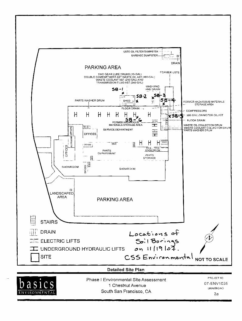

C S S ENVIRONMENTAL SERVICES. INC
ENVIRONMENTAL SITE ASSESSMENT Of a 1.12 Mile Corridor Owned by the
San Francisco Public Utilities Commission in South San Francisco, California 94080
CSS Project No: 6307
Prepared for
The City of South San Francisco Department of Economic and Community Development
400 Grand Avenue South San Francisco, California 94080
Prepared by
CSS ENVIRONMENTAL SERVICES, INC 100 Galli Drive, Suite 1
Novato, California 94949
October 7,2005
Aaron N. Stessman, P.E., R.E.A. Principal Engineer

40 CSS Environmental Services, Inc.
• ESL – the presented ESL is for shallow soils, residential land use, where groundwater is a potential source of drinking water.
• Human Health ESL – the ESL presented here is the component soil ESL for the protection of human health from direct exposure in a residential land use scenario. This value ignores potentially more conservative ESL components such as the protection of terrestrial and aquatic biota or the protection of drinking water resources from leaching.
• Commercial ESL – the ESL presented here is for shallow soils, commercial land use, where groundwater is a potential source of drinking water. This ESL does not consider the extended exposure times of the residential use scenario.
The U.S. EPA has promulgated Preliminary Remediation Goals (PRGs) for numerous hazardous materials. PRGs are human health risk-based concentrations derived from standardized equations, combining exposure information assumptions and EPA toxicity data. PRGs should be viewed as Agency guidelines, not legally enforceable standards. They are used for site screening and as initial cleanup goals if applicable. The EPA Region 9 PRGs are presented in the tabulated results. Each of the eight metals tested occur in nature and may be found in the background due to geologic sources. Published background values for these metals in colluvium/fill are presented from the Lawrence Berkeley National Laboratory (LBNL) August 1995 document: “Protocol for Determining Background Concentrations of Metals in Soil at LBNL” for the purposes of comparison. 7.2 Results for Soil Samples The locations of soil samples can be found on annotated aerial photographs of the Corridor presented as Figures 8 through 11 of Appendix A. STL’s certified analytical reports, field notes from sample collection can be found in Appendix E. Summaries of the results are presented in this section as Table 1: TEPH, PCBs and SVOC Compounds; Table 2: Organochlorine Pesticides; and Table 3: Metals Concentrations in Surface Soil Samples. In summary the results show that many of these compounds are present at low to moderate concentrations in surface soils and that the detected compounds are consistent with Corridor and/or adjoining property historical uses. The following compounds were found at concentrations that exceed their ESL: • TEPH-Diesel Range Organics: Found in samples from Parcels 5 and 6. • TEPH-Motor Oil: Found in samples from Parcel 5. • Arsenic: Found in samples from Parcel 5, but at concentration below LBNL background values. • Cadmium: Found in samples from Parcel 4, but at concentrations within 12% of LBNL
background values. • Total Chromium: Found in samples from Parcel 2, but at concentrations below LBNL
background values. • Lead: Found in samples from Parcels 3 and 4.

41 CSS Environmental Services, Inc.
As discussed below, depending upon desired land uses, the presence of these compounds may necessitate further investigation and the removal and replacement of surface soils prior to development. The City should consider requiring the San Francisco PUC to remove such objectionable surface soils as a condition of purchase.
Table 1: TEPH, PCB, and SVOC Concentrations in Surface Soil Samples
TEPH PCB SVOC
Sam
ple
Iden
tifica
tion
& P
arce
l Lo
catio
n
DRO,
C10
-C28
(m
iddl
e dist
illate
s)
RL=
1.0 m
g/kg
Mo
tor O
il (re
sidua
l fue
ls)
RL=
50 m
g/kg
Ar
oclo
r 126
0 RL
= 0.0
50 m
g/kg
All o
ther
PCB
s RL
=0.05
0 mg/
kg
Fluo
rant
hene
RL
= 0.0
67-1
.7 m
g/kg
Al
l oth
er S
VOC’
s RL
= 0.0
67-8
.3 m
g/kg
SS-1A,B,C,D 57 310 ND ND ND ND SS-2A,B,C,D 12 85 ND ND 0.080 ND SS-3A,B,C,D 51 410 ND ND ND ND SS-4A,B,C,D 59 390 0.072 ND ND ND SS-5A,B,C,D 360 1,900 ND ND ND ND SS-6A,B,C,D 120 440 ND ND ND ND ESL1 100 500 0.220 0.220 40 - Human Health ESL2 400 1,000 0.220 0.220 460 -
Commercial ESL3 100 1,000 0.740 0.740 40 - PRG4 - - 0.220 0.220 2,300 -
Table 2: Organochlorine Pesticides in Surface Soil Samples
Sam
ple
Iden
tifica
tion
& P
arce
l Lo
catio
n
DDT
RL =
20 µ
g/kg
Toxa
phen
e RL
= 10
00 µ
g/kg
Chlo
rdan
e (Te
chni
cal)
RL =
500 µ
g/kg
alpha
- Ch
lord
ane
RL =
20 µ
g/kg
gam
ma -
Chl
orda
ne
RL =
20 µ
g/kg
All o
ther
OP
‘s RL
= 20
µg/
kg
SS-1A,B,C,D ND ND ND ND ND ND SS-2A,B,C,D ND ND ND ND ND ND SS-3A,B,C,D ND ND ND ND ND ND SS-4A,B,C,D 21 ND ND ND ND ND SS-5A,B,C,D 26 ND ND 36 45 ND SS-6A,B,C,D ND ND ND ND ND ND ESL1 1,600 0.42 440 440 440 -
Human Health ESL2 1,600 460 440 440 440 -
Commercial ESL3 4,000 0.42 1,700 1,700 1,700 -
PRG4 1,700 0.44 1,600 220* 220* -

42 CSS Environmental Services, Inc.
Table 3: Metal Concentrations in Surface Soil Samples
Sam
ple
Iden
tifica
tion
& P
arce
l Lo
catio
n
Arse
nic
RL =
1 mg/
kg
Bariu
m
RL =
1 m
g/kg
Cadm
ium
RL
= 0.
5 mg/
kg
Tota
l Chr
omiu
m
RL =
1 m
g/kg
Hex
avale
nt C
hrom
ium
R
L = 0
.20 m
g/kg
Lea
d R
L =
1 mg/
kg
Selen
ium
RL
= 2
mg/
kg
Silve
r RL
= 1
mg/
kg
Mer
cury
R
L =
0.05 m
g/kg
SS-1A,B,C,D 3.2 160 1.2 39 ND 15 ND ND 0.67 SS-2A,B,C,D 4.2 120 1.4 62 ND 13 ND ND 0.077 SS-3A,B,C,D 4.7 110 1.5 55 ND 200 ND ND 0.084 SS-4A,B,C,D 5.3 99 1.9 34 ND 280 ND ND 0.29 SS-5A,B,C,D 9.3 31 1.1 31 ND 62 ND ND 0.062 SS-6A,B,C,D 4.0 120 1.1 49 ND 19 ND ND 0.054 ESL1 5.5 750 1.7 58 1.8 150 10 20 3.7
Human Health ESL2 5.5 1,000 1.7 58 1.8 150 76 76 3.7
Commercial ESL3 5.5 1,500 7.4 58 1.8 750 10 4.0 10
PRG4 0.39 5,400 37 210 30 150 390 390 23
LBNL Background5 14 358.8 1.5 91.4 -- 14.7 5.6 1.7 0.3
1 ESL – Environmental screening level for shallow soils, residential land use, and groundwater is a potential source of drinking water, from “Screening for Environmental Concerns at Sites with Contaminated Soils and Groundwater,” February 2005, California RWQCB, San Francisco Bay Region. ESLs are agency guidelines and not legally enforceable standards. 2 Human Health ESL – Residential land use, shallow soil ESL considering only human health protection, from “Screening for Environmental Concerns at Sites with Contaminated Soils and Groundwater,” February 2005, California RWQCB, San Francisco Bay Region. 3 Commercial ESL – Commercial/industrial land use, shallow soil ESL, and groundwater is a potential source of drinking water, from “Screening for Environmental Concerns at Sites with Contaminated Soils and Groundwater,” February 2005, California RWQCB, San Francisco Bay Region. 4 PRG – United States Environmental Protection Agency, Region 9, Preliminary Remediation Goals (October 2004) for residential soils used for evaluating and cleaning up contaminated sites. The PRGs are risk-based concentrations that consider human health protection and are intended to assist risk assessors and others in initial screening-level evaluations of environmental measurements. PRGs are agency guidelines and not legally enforceable standards. Cal-Modified PRGs (arsenic, lead) are included for those chemicals where Cal-EPA values are "significantly" more protective. Value for PCBs is “unspeciated mixture, high risk, e.g. Aroclor 1254”. 5LBNL Background – Background metals concentrations published for “Colluvium and Fill” from the document Protocol for Determining Background Concentrations of Metals In Soil at Lawrence Berkeley National Laboratory, August 1995. Values are the statistical Upper 95% Confidence Limit (UCL) for 97 samples.


APPENDIX E
Owner Interview Information

ASTM Transaction Screen - 2016
City of South San Francisco – Former Redevelopment Agency Parcels North of Chestnut Ave Page 1 of 11
Property Address: 1 Chestnut Ave, 1010 El Camino Real and two properties without address South San Francisco, CA 94080 Legal Description: APNs 011-322-030, 011-326-030, 011-312-050 and 011-312-060 Owned by the South San Francisco
Redevelopment Agency Property is: Commercial store (Pet Club) at 1 Chestnut Ave, otherwise undeveloped. Leased by: Red Cart Market Inc.
1a. Is the property used for an industrial use? Owner Occupants Preparer Yes ___ No _X__ Unk ___ Yes ___ No ___ Unk ___ Yes ___ No _X__ Unk ___ 1b. Is any adjoining property used for an industrial use? Owner Occupants Preparer Yes ___ No _X___ Unk ___ Yes ___ No ____ Unk ___ Yes ___ No _X__ Unk ___
Property Information
Property Inquiry

ASTM Transaction Screen - 2016
City of South San Francisco – Former Redevelopment Agency Parcels North of Chestnut Ave Page 2 of 11
2a. Did you observe evidence or do you have any prior knowledge that the property has been used for an industrial use in the past? Portions of the property were formerly railroad and may have included a station. Owner Occupants Preparer Yes _X__ No _____ Unk ___ Yes ___ No ____ Unk ___ Yes _X _ No _ ___ Unk ___ 2b. Did you observe evidence or do you have any prior knowledge that any adjoining property has been used for an industrial use in the past? Portions of the adjoining property were formerly railroad and currently contain BART subway and venting station. Owner Occupants Preparer Yes _X__ No _____ Unk ___ Yes ___ No _____ Unk ___ Yes _X_ No ____ Unk ___ 3a. Is the property used as a gasoline station, motor repair facility, commercial printing facility, dry cleaners, photo developing laboratory,
junkyard or landfill, or as a waste treatment, storage, disposal, processing, or recycling facility? Owner Occupants Preparer Yes ___ No __X__ Unk ___ Yes ___ No ____ Unk ___ Yes ___ No _X__ Unk ___ 3b. Is any adjoining property used as a gasoline station, motor repair facility, commercial printing facility, dry cleaners, photo developing
laboratory, junkyard or landfill, or as a waste treatment, storage, disposal, processing, or recycling facility? Chestnut Cleaners at 26 Chestnut Ave is located across Chestnut Ave south from the Site Owner Occupants Preparer Yes _X__ No ____ Unk ___ Yes ___ No ____ Unk ___ Yes _X_ No ____ Unk ___ 4a. Did you observe evidence or do you have any prior knowledge that the property has been used as a gasoline station, motor repair facility,
commercial printing facility, dry cleaners, photo developing laboratory, junkyard or landfill, or as a waste treatment, storage, disposal, processing, or recycling facility ?
Ron Price Motors formerly occupied 1 Chestnut Ave and was an automobile sales and service facility Owner Occupants Preparer Yes _X__ No ____ Unk ___ Yes ___ No ____ Unk ___ Yes _X__ No ____ Unk ___

ASTM Transaction Screen - 2016
City of South San Francisco – Former Redevelopment Agency Parcels North of Chestnut Ave Page 3 of 11
4b. Did you observe evidence or do you have any prior knowledge that any adjoining property has been used as a gasoline station, motor repair facility, commercial printing facility, dry cleaners, photo developing laboratory, junkyard or landfill, or as a waste treatment, storage, disposal, processing, or recycling facility ?
South City Gas and Auto Repair formerly occupied 998 El Camino Real, Acutec Motors formerly occupied 45 Chestnut Ave Owner Occupants Preparer Yes _X__ No ____ Unk ___ Yes ___ No ____ Unk ___ Yes _X_ No ____ Unk ___ 5a. Are there currently any damaged or discarded automotive or industrial batteries, or pesticides, paints, or other chemicals in individual
containers of greater than 5 gal (19 L) in volume or 50 gal (190 L) in the aggregate, stored on or used at the property or at the facility? Owner Occupants Preparer Yes ___ No _X__ Unk ___ _ Yes ____ No ___ Unk ___ Yes ____ No _X__ Unk ___ 5b. Did you observe evidence or do you have any prior knowledge that there have been previously any damaged or discarded automotive or
industrial batteries, or pesticides, paints, or other chemicals in individual containers of greater than 5 gal (19 L) in volume or 50 gal (190 L) in the aggregate, stored on or used at the property or at the facility?
The former Ron Price Motors had batteries and chemicals associated with their automobile repair operations, they are no longer present.
Owner Occupants Preparer Yes _X__ No ____ Unk ___ Yes ___ No ____ Unk ___ Yes _X__ No ____ Unk ___ 6a. Are there currently any industrial drums (typically 55 gal (208 L)) or sacks of chemicals located on the property or at the facility? Owner Occupants Preparer Yes ____ No _X__ Unk ___ Yes ____ No ___ Unk ___ Yes ____ No _X__ Unk ___
. 6b. Did you observe evidence or do you have any prior knowledge that there have been previously any industrial drums (typically 55 gal (208
L) or sacks of chemicals located on the property or at the facility? The former Ron Price Motors had drums of new and used oils and fluids associated with their automobile repair operations. Owner Occupants Preparer Yes _X__ No ____ Unk ___ Yes ___ No ____ Unk ___ Yes _X__ No ____ Unk ___

ASTM Transaction Screen - 2016
City of South San Francisco – Former Redevelopment Agency Parcels North of Chestnut Ave Page 4 of 11
7a. Did you observe evidence or do you have any prior knowledge that fill dirt has been brought onto the property that originated from a contaminated site?
Owner Occupants Preparer Yes ___ No _X___ Unk ___ Yes ___ No ____ Unk ___ Yes ___ No _X___ Unk ___ 7b. Did you observe evidence or do you have any prior knowledge that fill dirt has been brought onto the property that is of an unknown
origin? Owner Occupants Preparer Yes ___ No __X__ Unk ___ Yes ___ No ____ Unk ___ Yes ___ No _X___ Unk ___ 8a. Are there currently any pits, ponds, or lagoons located on the property in connection with waste treatment or waste disposal? Owner Occupants Preparer Yes ___ No _X___ Unk ___ Yes ___ No ____ Unk ___ Yes ___ No _X___ Unk ___ 8b. Did you observe evidence or do you have any prior knowledge that there have been previously, any pits, ponds, or lagoons located on the
property in connection with waste treatment or waste disposal ? Owner Occupants Preparer Yes ___ No _X___ Unk ___ Yes ___ No ____ Unk ___ Yes ___ No _X___ Unk ___ 9a. Is there currently any stained soil on the property? Owner Occupants Preparer Yes ___ No _X__ Unk ____ Yes ___ No ____ Unk ___ Yes ___ No __X__ Unk ___

ASTM Transaction Screen - 2016
City of South San Francisco – Former Redevelopment Agency Parcels North of Chestnut Ave Page 5 of 11
9b. Did you observe evidence or do you have any prior knowledge that there has been previously any stained soil on the property? No stained soil but concrete/pavement has some staining at the former Ron Price Motors Owner Occupants Preparer Yes ___ No _X___ Unk ___ Yes ___ No ____ Unk ___ Yes ___ No _X___ Unk ___ 10a. Are there currently any registered or unregistered storage tanks (above or underground) located on the property? Owner Occupants Preparer Yes ____ No _X__ Unk ___ Yes ____ No ___ Unk ___ Yes ____ No _X__ Unk ___
10b. Did you observe evidence or do you have any prior knowledge that there has been previously any registered or unregistered storage tanks
(above or underground) located on the property ? The former Ron Price Motors had 1x10K gal diesel, 1x10K gal gasoline, 1x1K gal gasoline and 1x500 gal oil USTs removed in 1991 Owner Occupants Preparer Yes _X__ No ____ Unk ___ Yes ___ No ____ Unk ___ Yes _X__ No ____ Unk ___ 11a. Are there currently any vent pipes, fill pipes, or access ways indicating a fill pipe protruding from the ground on the property or adjacent
to any structure located on the property? Owner Occupants Preparer Yes ___ No __X__ Unk ___ Yes ___ No ____ Unk ___ Yes ___ No _X___ Unk ___ 11b. Did you observe evidence or do you have any prior knowledge that there have been previously any vent pipes, fill pipes, or access ways
indicating a fill pipe protruding from the ground on the property or adjacent to any structure located on the property ? Vent pipes would have been associated with the USTs formerly located at the Ron Price Motors facility Owner Occupants Preparer Yes _X__ No ____ Unk ___ Yes ___ No ____ Unk ___ Yes _X__ No ____ Unk ___

ASTM Transaction Screen - 2016
City of South San Francisco – Former Redevelopment Agency Parcels North of Chestnut Ave Page 6 of 11
12a. Is there currently evidence of leaks, spills or staining by substances other than water, or foul odors, associated with any flooring, drains, walls, ceilings, or exposed grounds on the property?
Owner Occupants Preparer Yes ___ No _X___ Unk ___ Yes ___ No ____ Unk ___ Yes ___ No _X___ Unk ___ 12b. Did you observe evidence or do you have any prior knowledge that there have been previously any leaks, spills or staining by substances
other than water, or foul odors, associated with any flooring, drains, walls, ceilings, or exposed grounds on the property? Oil staining of concrete was noted in various areas of the former Ron Price Motors facility during a 2007 Environmental Site Assessment
Owner Occupants Preparer Yes _X__ No ____ Unk ___ Yes ___ No ____ Unk ___ Yes _X__ No ____ Unk ___ 13a. If the property is served by a private well or non-public water system, is there evidence or do you have prior knowledge that contaminants have been identified in the well or system that exceed guidelines applicable to the water system? Not applicable. Owner Occupants Preparer Yes ___ No ___ Unk ___ Yes ___ No ___ Unk ___ Yes ___ No ___ Unk ___ 13b. If the property is served by a private well or non-public water system, is there evidence or do you have prior knowledge that well has been designated as contaminated by any government environmental/health agency? Not applicable. Owner Occupants Preparer Yes ___ No ___ Unk ___ Yes ___ No ___ Unk ___ Yes ___ No ____ Unk ___ 14. Does the owner or occupant of the property have any knowledge of environmental liens or governmental notification relating to past or
recurrent violations of environmental laws with respect to the property or any facility located on the property? Owner Occupants Preparer Yes ___ No _X___ Unk ___ Yes ___ No ____ Unk ___ Yes ___ No _X___ Unk ___

ASTM Transaction Screen - 2016
City of South San Francisco – Former Redevelopment Agency Parcels North of Chestnut Ave Page 7 of 11
15a. Has the owner or occupant of the property been informed of the past existence of hazardous substances or petroleum products with
respect to the property or any facility located on the property? Prior environmental investigations have detected hydrocarbons and metals (lead) on the various Site properties Owner Occupants Preparer Yes __X_ No ____ Unk ___ Yes ___ No ____ Unk ___ Yes _X__ No ____ Unk ___ 15b. Has the owner or occupant of the property been informed of the current existence of hazardous substances or petroleum products with
respect to the property or any facility located on the property? Prior environmental investigations have detected hydrocarbons and metals (lead) on the various Site properties Owner Occupants Preparer Yes _X__ No ____ Unk ___ Yes ___ No ____ Unk ___ Yes _X__ No ____ Unk ___ 15c. Has the owner or occupant of the property been informed of the past existence of environmental violations with respect to the property or
any facility located on the property? San Mateo County Environmental Health opened a case related to the USTs formerly located at the former Ron Price Motors facility. The case was closed in 1993 following the removal of the USTs. Owner Occupants Preparer Yes _X__ No ____ Unk ___ Yes ___ No ____ Unk ___ Yes _X__ No ____ Unk ___ 15d. Has the owner or occupant of the property been informed of the current existence of environmental violations with respect to the property
or any facility located on the property? Owner Occupants Preparer Yes ___ No _X___ Unk ___ Yes ___ No ____ Unk ___ Yes ___ No __X__ Unk ___ 16. Does the owner or occupant of the property have any knowledge of any environmental site assessment of the property or facility that
indicated the presence of hazardous substances or petroleum products on, or contamination of, the property or recommended further assessment of the property?
Prior environmental investigations have detected hydrocarbons and metals (lead, cadmium) on the various Site properties Owner Occupants Preparer Yes _X__ No ____ Unk ___ Yes ___ No ____ Unk ___ Yes _X__ No ____ Unk ___

ASTM Transaction Screen - 2016
City of South San Francisco – Former Redevelopment Agency Parcels North of Chestnut Ave Page 8 of 11
17. Does the owner or occupant of the property know of any past, threatened, or pending lawsuits or administrative proceedings concerning a release or threatened release of any hazardous substance or petroleum products involving the property by any owner or occupant of the property?
Owner Occupants Preparer Yes ___ No __X__ Unk ___ Yes ___ No ____ Unk ___ Yes ___ No __X__ Unk ___ 18a. Does the property discharge waste water (not including sanitary waste or storm water) onto or adjacent to the property and/or into a storm
water system? Owner Occupants Preparer Yes ___ No _X___ Unk ___ Yes ___ No ____ Unk ___ Yes ___ No _X___ Unk ___ 18b. Does the property discharge waste water (not including sanitary waste or storm water) onto or adjacent to the property and/or into a
sanitary sewer system? Owner Occupants Preparer Yes ___ No __X__ Unk ___ Yes ___ No ____ Unk ___ Yes ___ No _X___ Unk ___ 19. Did you observe evidence or do you have any prior knowledge that any hazardous substances or petroleum products, unidentified waste
materials, tires, automotive or industrial batteries, or any other waste materials have been dumped above grade, buried and/or burned on the property?
Owner Occupants Preparer Yes ___ No _X___ Unk ___ Yes ____ No ___ Unk ___ Yes ____ No _X__ Unk ___ 20. Is there a transformer, capacitor, or any hydraulic equipment for which there are any records indicating the presence of PCBs? Owner Occupants Preparer Yes ___ No _X___ Unk ___ Yes ___ No ____ Unk ___ Yes ___ No __X__ Unk ___

ASTM Transaction Screen - 2016
City of South San Francisco – Former Redevelopment Agency Parcels North of Chestnut Ave Page 9 of 11
21. Do any of the following Federal government record systems list the property or any property within the circumference of the area noted
below? The subject property is not listed as under active site investigation/remediation, see the Phase I ESA for information regarding vicinity sites. Federal NPL site list - within 1.0 mile (1.6 Km)? Yes ___ No ____ Federal CERCLIS list - within 0.5 mile (0.8 Km)? Yes ___ No ____ Federal CERCLIS NFRAP site list – property and adjoining properties? Yes ___ No ____ Federal RCRA CORRACTS facilities list - within 1.0 mile (1.6 Km)? Yes ___ No ____ Federal RCRA non-CORRACTS TSD facilities list - within 0.5 mile (0.8 Km)? Yes ___ No ____ Federal RCRA generators list - property and adjoining properties? Yes ___ No ____ Federal ERNS list - property only? Yes ___ No ____ 22. Do any of the following state record systems list the property or any property within the circumference of the area noted below? The subject property is not listed as under active site investigation/remediation, see the Phase I ESA for information regarding vicinity sites. State lists of hazardous waste sites identified for investigation or remediation: State – Equivalent NPL - within 1.0 mile (1.6 Km)? Yes ___ No ____ State – Equivalent CERCLIS - within 0.5 mile (0.8 Km)? Yes ___ No ____ State landfill and/or solid waste disposal site lists - 0.5 mile (0.8 Km)? Yes ___ No ____ State – leaking UST sites - within 0.5 mile (0.8 Km)? Yes ___ No ___ State – registered UST lists - property and adjoining properties? Yes ___ No ___
23. Based upon a review of fire insurance maps or consultation with the local fire department Yes ___ No _X__ serving the property, all as specified in the guide, are there any buildings or other improvements on the property or on an adjoining property identified as having been used for an industrial use or uses likely to lead to contamination of the property ?
Government Records/Historical Sources Inquiry

ASTM Transaction Screen - 2016
City of South San Francisco – Former Redevelopment Agency Parcels North of Chestnut Ave Page 10 of 11
The preparer of the transaction screen questionnaire must complete and sign the following. The Owner questionnaire was complete by: Michael Lappen City of South San Francisco Economic Development Coordinator Relationship to site: Property Owner Representative Relationship to user: User The Occupant questionnaire was complete by: None Relationship to site: Lessee Relationship to user: Same
The Site Visit questionnaire was complete by: Aaron Stessman, PE CSS Environmental Services, Inc Principal Engineer Preparer's relationship to site: None Preparer's relationship to user: Consultant The Government Records and Historical Sources Inquiry questionnaire was complete by: Aaron Stessman, PE CSS Environmental Services, Inc Preparer's relationship to site: None Preparer's relationship to user: Consultant
Certifications

ASTM Transaction Screen - 2000
City of South San Francisco – Former Redevelopment Agency Parcels North of Chestnut Ave Page 11 of 11
If the preparer(s) is different from the user, complete the following. Name of User: User’s Address: User’s Phone number: Copies of the completed questionnaires have been filed at: Preparer’s office. Copies of the completed questionnaires have been mailed or delivered to: User Additional Representations
Conflict Certification
CSS Environmental Services, Inc has no present or contemplated future ownership interest or financial interest in the real estate that is the subject of this assessment, and CSS has no personal interest with respect to the subject matter of the assessment or the parties involved. Further, CSS has no relationship with the property or the owners thereof which would prevent an independent analysis of the environmental and other conditions of the property.
Bank Reliance
The City of South San Francisco may rely on the information, findings, conclusions and recommendations provided in this report.
Preparer represents that to the best of the preparer's knowledge the above statements and facts are true and correct and to the best of the preparer's actual knowledge no material facts have been suppressed or misstated. ________________________________________ _______________ Preparer's Signature Date

APPENDIX F
Limitations and Uncertainty

LIMITATIONS AND UNCERTANITY
This report was prepared by CSS Environmental Services, Inc. in general accordance with the accepted principals and standards of practice of consultants providing similar services at the time the project was conducted and within the scope of service outlined in our written proposal and/or verbal communication. It should be recognized that the definition and evaluation of environmental conditions, and information provided by others either written or verbal is a difficult and inexact science. Judgments leading to conclusions and recommendations generally are made with an incomplete knowledge of the conditions present. Any opinions presented apply to site conditions existing at the time of the inspection and/or document review and those reasonably foreseeable; they cannot necessarily apply to site changes made of which the inspector/reviewer could not observe and has not had the opportunity to evaluate. Changes in the conditions of the Site can occur with time, because of the natural process or the works of man. It is further possible that variations and/or changes in the site conditions could exist beyond the points explored for this investigation. Also, changes in environmental quality could occur sometime in the future do to variations in operating conditions, rainfall, temperature or other factors. Changes in applicable environmental, engineering and construction standards and practices can also occur as the result of legislation or from the broadening of knowledge. Accordingly, the data and documents presented in the scope of work may be invalidated, wholly or in part, by changes beyond the control of CSS Environmental Services, Inc. If the client wishes to reduce uncertainty beyond the level associated with the scope of work, CSS Environmental Services, Inc. should be notified for additional consultation. The discussion and recommendations presented in this report are based on information which may include: 1) information and data provided by third party consultants, 2) the testing performed at, or samples collected from, the site, 3) the observations of field personnel, 4) the results of laboratory analyses, 5) reports by others, and 6) interpretations of federal, state, and local regulations and/or ordinances. Any conclusions presented are based on the assumption that conditions do not deviate from those observed during the assessment. It is understood that other conditions may exist at the site that could not be identified from the limited information discovered within the scope of the assessment. The comments and recommendations should not be construed as a guarantee that all safety, health, or environmental hazards that exist at the subject site are identified in this report.

montenegro
Typewritten Text
Attachment F
montenegro
Typewritten Text
montenegro
Typewritten Text

Attachment G
ANTICIPATED COMMUNITY CIVIC CAMPUS ELEMENTS*
Type of Space Purpose and Size
Performance space • 100-seat theater
Exhibit space • 300 square feet of gallery space
Social space • 3,000 square feet of informal social space
• Library reading rooms and seating areas for children, teens, and adults
• Library collaboration spaces
Program spaces • 6,000-square foot social hall, frequent rentals
• 1,600-square-foot library program room
• 1,100-square-foot maker space “Tinker Lab”
• 800-square-foot technology lab
Classrooms • Four large classrooms (1,200 square feet)
• Two medium-sized classrooms (1,000 square feet)
• One large dance studio (1,600 square feet)
• One medium dance studio (800 square feet)
Retail • 300-square-foot café
• 500-square-foot Friends of the Library store
Civic • 3,000-square-foot council chambers, flexible for City programming and rentals
• City Council support spaces
Preschool* • Three 20-child classrooms
• Staff workspace and support space
• Secure outdoor play space for 60 children
Staff space • Library offices and workstations
• Parks and Recreation Department offices and workstations
• Shared reception, collaboration, and breakout space
• Space for future staff growth
Storage and building support • Building and program storage
• Building systems, restrooms
Outdoor space • Building rooftops: up to 6,000 square feet of usable rooftop area
• Events plaza: for day-to-day informal gathering and seating with the ability to hostperiodic special events for 350–500 people
• Meadow: for casual gathering and passive recreation
• Centennial Trail: connection to the existing trail with a bike and running path
Parking • Up to 294 spaces, both underground and aboveground