SCPDA-Guyana-1.pdf - Equator Initiative
15
Equator Initiative Case Studies Local sustainable development solutions for people, nature, and resilient communities Guyana SOUTH CENTRAL PEOPLE’S DEVELOPMENT ASSOCIATION (SCPDA) Empowered lives. Resilient nations.
-
Upload
khangminh22 -
Category
Documents
-
view
2 -
download
0
Transcript of SCPDA-Guyana-1.pdf - Equator Initiative

Equator Initiative Case StudiesLocal sustainable development solutions for people, nature, and resilient communities
Guyana
SOUTH CENTRAL PEOPLE’S DEVELOPMENT ASSOCIATION (SCPDA)
Empowered lives. Resilient nations.

UNDP EQUATOR INITIATIVE CASE STUDY SERIESLocal and indigenous communities across the world are advancing innovative sustainable development solutions that work for people and for nature. Few publications or case studies tell the full story of how such initiatives evolve, the breadth of their impacts, or how they change over time. Fewer still have undertaken to tell these stories with community practitioners themselves guiding the narrative. The Equator Initiative aims to fill that gap.
The Equator Initiative, supported by generous funding from the Government of Norway, awarded the Equator Prize 2015 to 21 outstanding local community and indigenous peoples initiatives to reduce poverty, protect nature, and strengthen resilience in the face of climate change. Selected from 1,461 nominations from across
126 countries, the winners were recognized for their achievements at a prize ceremony held in conjunction with the United Nations Convention on Climate Change (COP21) in Paris. Special emphasis was placed on the protection, restoration, and sustainable management of forests; securing and protecting rights to communal lands, territories, and natural resources; community-based adaptation to climate change; and activism for environmental justice. The following case study is one in a growing series that describes vetted and peer-reviewed best practices intended to inspire the policy dialogue needed to take local success to scale, to improve the global knowledge base on local environment and development solutions, and to serve as models for replication.

KEY FACTSEquator Prize Winner
2015
Founded
1992
Location
South and Southcentral Rupununi, Guyana
Beneficiaries
17 Wapichan villages with a population of approximately 9,000 people
Areas of focus
Land rights and tenure security, biodiversity conservation, sustainable forestry, environmental education
Sustainable Development Goals Addressed
EQUATOR PRIZE 2015 WINNER FILM
PROJECT SUMMARYA federation of Wapichan communities in Guyana, South Central People’s Development Association (SCPDA), has developed a unified land use plan and a ‘living digital map’ of their traditional lands to promote secure land rights and socioecological resilience. Community mapping teams create territorial maps that are used to make land claims and devise land use plans for the forest, mountain, savannah, and wetland ecosystems that fall within the territory of the 17 Wapichan communities. More than 100 intercommunity agreements have been reached on the sustainable use of natural resources, the protection of wildlife, and the conservation of forests. Field research, smart phones, GPS units, and a community drone are used to detect deforestation and other environmental damage caused by illegal logging and mining. The common Land Use Plan, adopted by all 17 Wapichan villages in 2012, builds on local traditional knowledge and includes a collective vision and priority activities.
The designations employed and the presentation of material on this map do not imply the expression of any opinion whatsoever on the part of the Secretariat of the United Nations or UNDP concerning the legal status of any country, territory, city or area or its authorities, or concerning the delimitation of its frontiers or boundaries.

4
BACKGROUND AND CONTEXT
The Wapichan territory
The Wapichan territory in the southwest part of Guyana is one of the country’s most biologically rich and diverse areas. It encompasses the Upper Essequibo basin as well as the extensive Rupununi savannah. The area is comprised of diverse ecosystems, including: tropical rainforest; tropical dry forest, which is home to extremely rare and endemic bird species; mountains with altitudes ranging from 305 to 915 metres; and seasonally-flooding wetland ecosystems, which create a passage between the Essequibo drainage basin and the Amazon basin. This mosaic of habitats harbours endangered and endemic species of mammals, birds and fish, and the northwestern part of the territory has been declared an Important Bird Area (IBA).
Nearly 9,000 people live in 15 indigenous Wapichan villages, one mixed Wapichan and Makushi village, and one mixed Wapichan and Wai Wai village. Local traditional livelihoods depend on small-scale subsistence farming using ancestral rotational farming in forest areas and within dry forest areas of the savannah. In addition, some families close to the savannah have adopted free-range cattle rearing. Hunting, fishing, and foraging are also traditional practices that sustain local livelihoods. In addition, several of the villages have developed women’s groups that produce snacks, condiments, and fruit juices for sale from titled and traditional lands with support from South Central Peoples Development Association (SCPDA) for starting their small businesses. Small-scale artisanal mining is another source of income and is practiced with a shovel and spade and without the use of chemicals.
The Wapichan territory has been affected by both outbound and inbound migration. On the one hand, changes in the local economy and personal aspirations have caused many women and youth to seek temporary paid work in cities like Georgetown on the coast of Guyana or Boa Vista in neighbouring Brazil. On the other hand, non-local miners have arrived in search of gold around the Marudi Mountain within the traditional lands of Aishalton and neighbouring villages.
The Wapichan communities in the Rupununi region have a collective system of customary tenure where the land is held by all villages, with each of them having jurisdiction over its own area. Under this system, established through traditional and written agreements between Village Councils, most families have three settlement sites including one house in the village, one farm or ranch homestead, and hunting and fishing camps.
Many areas of the savannah, mountain, forest, fishing, and hunting grounds are customarily shared between villages and all Wapichan have rights to enjoy these areas, provided they do not squander resources or abuse the rights of others. However, if they wish to cut lumber or conduct any commercial resource use, permission needs to be requested from the respective village authorities.
The political history of the Rupununi began with colonial dispossession and has since led to unfulfilled land claims and the deliberate misinterpretation of understood customary land uses. While long-standing land rights claims are formally designated as ‘State lands’ under the national legislation, under customary law they are still owned by the villages that continue to use and occupy the land.
5
South Central People’s Development Association origin and structure
SCPDA builds upon a long history of working for land rights. Representing one of the four main tribes that make up the Amerindian population in Guyana, Wapichan ancestors sought to secure land rights as far back as British colonial times and again after independence through submissions to the Amerindian Lands Commission in 1967. In the 1970s, it became clear that the government had not provided adequate titles – those received covered only 15 percent of the claimed territory. This led elders to begin renewed efforts to place land rights on the agenda, and to the formation of SCPDA in 1992. To this day, SCPDA maintains its core goal of securing land rights for Wapichan communities, as well as its founding objectives of promoting sustainable livelihoods and natural resource use.
SCPDA is governed by a Board of Directors who are all senior and respected persons from their villages. The South
Central and South Rupununi District Toshaos Council (DTC) serves as SCPDA’s advisory body and is made up of elected community leaders and senior councillors from all the Wapichan villages. Community members and elected bodies are thus actively involved in SCPDA’s decision-making and work planning through SCPDA meetings and meetings of the Toshaos Council.
SCPDA employs three people in part-time roles: a project coordinator, a finance officer, and a mapping technician. In addition, the organization hires local people from the villages to undertake specific tasks in support of their community-based projects, including land and forest monitors, meeting facilitators, translators (between the native Wapichan language and English), and extension workers.

6
LOCAL CHALLENGES
Land tenure
While Guyana was still a British colony, the law assumed that all lands not already allocated to settlers could be treated as Crown Lands, owned and administered by Britain. At first, special status was conceded to the Aboriginal Indians of the colony by recognizing their traditional rights and privileges. However, as competing interests began to move inland, these rights were progressively curtailed.
In 1965, as a condition of independence, the colonial British government insisted that indigenous peoples of the country should be granted legal ownership or rights of occupancy over areas and reservations, or parts of them, where any tribe or community of Amerindians was ordinarily resident or settled. This condition included other legal rights, such as the right to passage to any other lands where, by tradition or custom, they enjoyed freedoms and permissions corresponding to rights of that nature. In partial fulfilment of this legal obligation, the Amerindian Lands Commission was established in 1966 to conduct a comprehensive review of Indigenous peoples’ land situations and documented land claims.
However, when community titling did eventually begin in the Rupununi, the Commission recommended areas substantially smaller than the territorial claims made by the peoples of the area to the Commission. Furthermore, when the government introduced later land titles, in 1991, and after all these were passed, Guyana’s Indigenous peoples had re-gained less than one third of the land area that the Amerindian Lands Commission had recommended. Hence, many indigenous land claims still remain unsettled within the country almost 50 years after Britain made indigenous titling a condition for independence.
Today, Wapichan land rights are threatened by competing large-scale road projects and external plans for logging, mining, and agribusiness development, which could exploit local resources and jeopardize conservation efforts in the area. The urgency of the work on land rights became especially apparent in the last decade, as the government announced plans for new road projects, mining development, logging, and agribusiness development.
Mining and illegal encroachment on Wapichan land
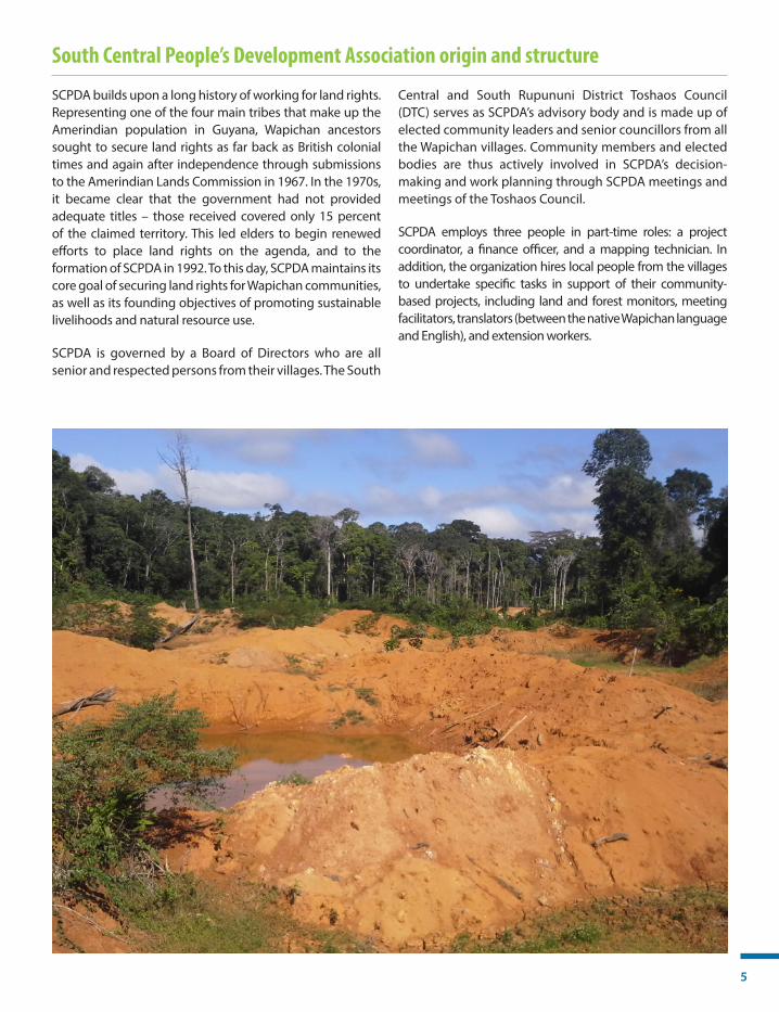
In recent years, many non-local miners, often operating illegally, have entered the Wapichan territory to extract gold around Marudi Mountain within the traditional lands of Aishalton and neighbouring villages. Small- and medium-scale gold mining, as well as industrial logging, contribute to deforestation and greenhouse gas emissions, and threaten the welfare of local land, water resources, and sacred cultural heritage sites.
Mining concessions have also been issued by the government in the Marudi Mountain area without the agreement of the villages, and there are plans to sanction a full mining settlement at Marudi against the wishes of the indigenous communities. The Wapichan
people have actively represented their rights over the years to challenge destructive and top-down mining, and they have been successfully achieved mine closure on several occasions. However, in 2015, an invigorated gold rush caused concern about mining exploitation at Marudi Mountain. Pressure to develop the land and a gold rush in the southern part of the Wapichan territory have degraded the local environment and caused water pollution, deforestation, social disruption, and damage to traditional hunting and fishing grounds.
The Wapichan people have sent direct communications to the government calling for a suspension of all mining activities until community land rights are secured and

7
proper mechanisms are put in place for free prior and informed consent (FPIC) and the protection of fragile ecosystems and watersheds. However, the government is still issuing mining claims within Wapichan traditional
lands and sacred mountains without prior consultation with the communities. According to SCPDA, this activity is destroying major headwaters within their territory.
Climate change
Wapichan villages and territory have experienced substantial variation in season patterns, including prolonged drought, severe floods, and loss of the flooding season. Specifically, the dry seasons have become longer and more severe and the seasonal floods due in April to July are inconsistent. The drought and loss of seasonal floods has resulted in the drying up of lakes, pools, and wetlands, which has resulted in species migration. This has also caused severe negative impacts on fish spawning grounds, leading to a significant decline in the abundance of fish in local creeks and rivers. The extended dry periods have also increased the risk of destructive wildfires that can burn out of control, lasting for days or even weeks, and have affected the tropical dry forest in the savannah and the forest along the Kanukus Mountains.
Farming and ranching have also been affected by the persistent drought, which has degraded local food security, community health, and livelihoods. Communities have noted that cassava cuttings are prone to dry out. This situation makes new plantings of the field difficult and leads to crop loss from lack of moisture and a shortage of cassava cuttings. In the grazing grounds, there is a shortage of water for cattle and horses, causing a growing incidence of animal deaths due to dehydration. In Wapichan villages, people suffer water shortage as local wells dry up and small creeks and pools run dry without the seasonal floods to replenish water resources.

8
LOCAL RESPONSES
Digital mapping
Over the past 26 years, Wapichan village leaders, SCPDA, and DTC have collaborated on a prolonged campaign to legally secure untitled village land. In 1994, former President of Guyana, Cheddi Jagan, challenged the Wapichan people to provide evidence to show how they use the land and the communities’ ability to manage, develop, and administrate the local natural resources.
In response, SCPDA initiated several actions. In 2000, SCPDA and the Wapichan villages pioneered community-led terrestrial planning in Guyana with an interactive community digital mapping project to document the Wapichan villages’ traditional land tenure and to highlight the cultural value and significance of the land to the local communities. Mapping of Indigenous Peoples and Local Communities’ (IPLC) territories is an important activity, both for identifying occupation of land as well as for supporting the conservation and sustainable use of natural resources.
Through this project, local community members and youth are trained in the use of handheld GPS units, interview techniques, and field log book maintenance in order to record for each GPS point land use information, cultural importance, history, and other observations. After 17 years of mapping, tens of thousands of GPS points had
been collected and this information is then input into a map database that is updated every year.
In 2016, following publicity from receiving the Equator Prize, the Government of Guyana, through the Ministry of Indigenous Peoples’ Affairs (MOIPA), entered into formal lands talks with the South Rupununi District Council (SRDC), made up of all 17 Wapichan village councils that SCPDA works with, to resolve the land claims. So far, the government has agreed to accept all maps produced by SCPDA as evidence.
In addition, SCPDA obtained a commitment from the President of Guyana, David Granger, to enter into formal talks for a land settlement process to legally secure Wapichan territory. Formal discussions with the government began in early 2016 and, so far, draft bills have been submitted to cabinet for land issues in Katoonarib, Sawariwau, and Parabara, and the Wapichan communities are awaiting response. Presently, government-level action is especially needed for a fair and transparent process for titling land extensions and land security. In response, SCPDA has been conducting outreach activities towards the government on these issues and assisting communities to justify their land title extension applications using maps printed by the mapping unit.
KEY IMPACTS
Digital mapping
■ Maps have been provided to 17 villages. ■ By 2017, over 40,000 GPS points had been collected by local mappers and dozens of log books
completed. ■ 17 communities have trained community monitors who are equipped with a smart phone to collect
data including GPS positions, encroachments, and any evidence that environmental regulations are not being adhered to.

9
Land use planning
Parallel to the digital mapping project, SCPDA began research on land use and the sustainable use of biological resources in Wapichan territory. From this research, SCPDA, in collaboration with all 17 communities, developed a common Land Use Plan between 2007 and 2012 entitled ‘Thinking together for those coming behind us. An outline plan for the care of Wapichan territory in Guyana’, which includes a collective vision and agreed priority activities in the fields of health, food security, education, cultural integrity, and sustainable livelihoods.
As a result of the 2012 common Land Use Plan, all SCPDA’s communities identified a common goal to establish a Wapichan Conserved Forest that would encompass over 1.4 million hectares of rainforest. A proposal was submitted to the Ministry of Indigenous Peoples’ Affairs by SCPDA and the Wapichan villages, through their land claims, to establish a Wapichan Conserved Forest with
inter-community agreements on actions to secure land rights, promote sustainable use of resources, and enable self-determined community development. A formal government response is still awaited.
The communities also united to set up more than 100 local community conserved areas to protect specific sites and habitats including spawning grounds, wildlife habitats, cultural and spiritual heritage sites, and extractive reserves for the sustainable production of resources for crafting and construction materials and medicines. Based on the maps and Land Use Plan, since 2013 SCPDA has brokered more than 100 intercommunity agreements on the use of natural resources that are still in force. The intercommunity agreements identify community-conserved sites to protect valuable habitats for rare species, fish spawning grounds, wildlife breeding and reproduction grounds, and fragile water sources in creek heads.
KEY IMPACTS
Land use planning
■ Proposal submitted to the Ministry of Indigenous Peoples’ Affairs to establish a 1.4 million-hectare Wapichan Conserved Forest.
■ 100 community conserved areas established to protect key sites for ecological, cultural, and spiritual heritage.
■ 100 intercommunity agreements brokered on the use of natural resources in Wapichan territories. ■ Starting in 2013, the Toshaos Council of the Wapichan territory has held yearly meetings with
government officials to discuss the process to legally secure their land.

10
Monitoring of natural resources
In a complementary strategy to monitor land use and illegal encroachment, in 2013 SCPDA began working with the DTC and Wapichan villages to develop an innovative programme using smart phones, field visits, and drones to watch over local lands and document illegal resource use. This example of community-based monitoring and information systems unites Wapichan traditional knowledge with innovative technologies to track their local land and resource use. The strategy is two-pronged, involving direct action on the ground by local monitoring teams and aerial photography of Wapichan lands by drones.
First, information collected by local monitoring teams in the field using smart phone technology, funded by the NGO The Size of Wales, provides detailed data about land use change that is channelled to Village Councils and government authorities to enable corrective action.
Second, a community-owned drone, built with support from the NGO Digital Democracy, takes high-resolution pictures of forest loss, wildfires, and illegal resource use, complementing and backing-up the communities’ findings on the ground. Actions and pictures taken by the community drone have supported the Guyana Defence Force to sanction illegal resource users and prompted action by the Environmental Protection Agency and the Guyana Geology and Mines Commission to control illegal mining on Parabara village lands, where it has been halted, as well as around Marudi Mountain. The outlook is not optimistic for Marudi Mountain, however, where a small miners’ association and Romanex, a Canadian company, have entered into a mediation process. So far, only the communities have adhered to this process and little progress has been achieved.
KEY IMPACTS
Monitoring of natural resources
■ In 2018, community monitors will be equipped with water testing tools to monitor water pollution. ■ Two women are community monitors and other women are actively involved in helping gather
information for the monitoring programme. ■ Three drones are being used to monitor the Wapichan territory.

11
Adaptive climate change action
The Wapichan communities, Village Councils, and SCPDA are collectively addressing climate change impacts by taking adaptive actions such as adjusting traditional practices and implementing new resource use rules. In response to prolonged drought, reduced water availability, and dry soil conditions, nursery farms have been re-opened deeper in the forest on the former farming grounds of Wapichan ancestors, where additional moisture is preserved. The cassava cuttings and crop seeds from these areas are now being used to supply Wapichan farmers with farms on the bush edge and in savannah woodland farming areas.
In addition, the UNDP-Implemented Global Environment Facility Small Grants Programme (SGP) awarded a grant to SCPDA to implement a project safeguarding Katoonarib’s bush island forests through farming in the savannah from 2014-2015. The project aimed to demonstrate savannah farming as an alternative to shifting cultivation, which can
contribute to deforestation and climate change. Through this project, the community learned how to grow cassava in the savannah, a practice that provided vegetables for the Hot Meal Programme for children in the village.
As a complementary strategy, new ‘Village Rules’ have been formulated to foster sustainable resource use and prevent wastage and contamination of water sources. The extended dry season in particular has reduced water resources and affected local agriculture and livelihoods. Communities have responded by digging deeper water pools for cattle and horses and safeguarding pools that are used by livestock in the local rivers. Wapichan villages are also drafting community-based fire control agreements for the development of a fire management plan in the savannah areas, including reactivation of the customary practices for the safe use of fire that minimizes burning during the dry season in order to better manage grazing areas.
KEY IMPACTS
Adaptive climate change actions
■ 15 nursery farms have been established in the forest. ■ 4 hectares of savannah farming have been implemented in 2014-2015 as an alternative to shifting
cultivation using SGP funds. ■ 17 community-based fire management agreements have been implemented.

12
POLICY IMPACTS
National policy impacts
Through collective efforts involving the Wapichan villages, Village Councils and DTC, SCPDA has been involved in the development of national and international policies affecting Wapichan communities and their environment. At the national level, SCPDA has worked with DTC and Wapichan villages to successfully prevent agricultural lease sales on Wapichan village lands. The Guyana Forestry Commission (GFC) has committed, since 2016, to refrain from issuing industrial logging concessions over the upper Essequibo rainforest within Wapichan territory. SCPDA is also engaging with the Guyana Geology and Mines Commission to discuss the potential annulment of mining blocks in Wapichan land title extension areas, but this has yet to happen.
Work by Wapichan villages and leaders have influenced Guyana’s Low Carbon Development Strategy (LCDS) and
village representatives have been active in the Amerindian Land Titling Project (ALT), which was initiated in 2013 to address concerns relating to Amerindian land rights. Crucially, through SCPDA statements and representation, the government of Guyana has recognized the need to address the land rights of Amerindian Villages as part of the LCDS. In 2016, the government agreed to amend the ALT and to also consider amendments to the Amerindian Act 2006, which has several loopholes and discriminatory provisions in relation to Amerindian land rights.
SCPDA has received both national and international recognition for their innovative programmes and work. In February 2016, the Guyanese Ministry of the Presidency awarded SCPDA a Medal of Service in recognition of their work on sustainable land use planning and community-based forest monitoring.
Contributions to global agenda
At the international level, SCPDA, and the DTC have been engaged in the Convention on Biological Diversity (CBD) and the United Nations Framework Convention on Climate Change (UNFCCC) policy processes since 2005. SCPDA’s work at the international level, facilitated by allies like Forest Peoples Programme (FPP), has directly influenced the CBD adoption of a work programme on customary sustainable use in 2015 (CBD Article 10c). SCPDA’s engagement in these global fora has been gender-sensitive, with three Wapichan women representing SCPDA internationally. In 2015, SCPDA became a formal CBD partner to assist with initiatives and actions that promote CBD Aichi Targets
14 and 18 on restoration and protection of ecosystems, protection of traditional knowledge, and customary sustainable use of biological resources.
In addition, there is a mutually supportive relationship between community-based sustainable forest manage-ment and various Sustainable Development Goals (SDGs), including initiatives to develop plans for sustainable use of land and natural resources, implement adaptive measures to a changing climate, and protect traditional land rights from illegal encroachments.

13
SCALABILITY AND SUSTAINABILITY
Replicability
SCPDA is planning to replicate its work and innovation with other indigenous peoples in Guyana. Work to adapt the land use monitoring tools to monitor mineral and timber supply chains is planned for mid-2018 in collaboration with the Amerindian Peoples Association, FPP, and the Rainforest Foundation-US (RF-US). To facilitate replication of the initiative, SCPDA has translated key documents into Spanish and Portuguese and these have been shared in
international fora as well as in community meetings in Venezuela. Strategies shared included the organization’s mobile mapping unit approach, as well as their land use monitoring tools and collective land use planning. Their work is shared in great depth through side events at CBD and UNFCCC, events associated with the Satoyama Initiative, and pieces prepared by international journalists.
Scalability
The Wapichan experience of land use planning for sustainable resource use, grounded in traditional knowledge and customary law, has been widely shared nationally and globally. Increasing recognition by the
Government of Guyana provides an important mechanism for SCPDA’s work to be scaled up to address ancestral land rights, protect and conserve local land, and promote sustainable livelihoods throughout Guyana.
Sustainability
SCPDA’s work and programmes receive reliable grassroots support and engagement from local Wapichan villages because the focus of the work is aligned with community interests and concerns for land rights, sustainable development, and environmental conservation. Cultural sustainability is ensured through the organization’s work both in English and in native Wapichan language to enable the full involvement of elders and people whose first language is not English in project activities.
SCPDA currently depends on external donor support for the majority of its work. The organization recognizes the need to diversify its funding sources and is considering different models of funding, including local fundraising efforts in the villages. SCPDA continues to pursue partnerships and funding from international organizations, foundations, and private donors to expand access to their monitoring and mapping technologies.
FUTURE PLANS ■ Conducting joint monitoring with indigenous peoples on the Brazilian side of the Takatu River, which
forms the border between Brazil and Guyana. This area is experiencing increased mining activity. ■ Training 17 villages on human rights, international law, and other laws applicable to the Wapichan
and their land struggle.

14
PARTNERSSCPDA has worked with various partners and donors that have provided technical support and contributions to various programmes including:
■ Forest Peoples Programme (FPP): Contributes funding provided by allies such as SwedBio at Stockholm Resilience Centre; The United Kingdom’s Department of International Development’s Forests, Markets, Governance and Climate Change (FGMC) Programme; and the Rainforest Foundation-US.
■ Digital Democracy: Supported the building of a community-owned drone to take high-resolution pictures of forest loss, wildfires, and illegal resource use.
■ The Size of Wales: Provided funds used to train community members in the use of GPS and smart phones in order to collate data about the territory. Funds also used to support the construction of Wapichan schools.
■ UNDP-Implemented GEF Small Grants Programme (SGP): SGP has provided financial and technical support to SCPDA for the project ‘Safeguarding Katoonarib’s bush island forests through farming in the savannah’ in Guyana.
SOURCES AND FURTHER RESOURCESEquator Initiative, Equator Prize 2015. Local Voices for Global Climate Change Action, 2015. Available online here.
Equator Initiative, South Central People’s Development Association, 2017. Available online here.
Forest Peoples Programme (FPP), Wapichan People in Guyana Present Territorial Map and Community Proposals to Save Ancestral Forests, 2012. Available online here.
Forest Peoples Programme (FPP), Thinking Together for Those Coming Behind Us. An Outline Plan for the Care of Wapichan Territory in Guyana, 2012. Available online here.
Griffith, T. and Anselmo, L., Indigenous Peoples and Sustainable Livelihoods in Guyana: An Overview of Experiences and Potential Opportunities, 2010. Available online here.
MacDonald, K., ‘“No Trespassing”: Changing and Contested Rights to Land in the Guyanese Amazon’, Journal of Latin American Geography, 2016. Available online here.
Marks, N., How the Wapichan People Won the Equator Prize, Guyana Chronicle, 2015. Available online here.
SCPDA. South Central People’s Development Association Facebook Page. Available online here.
The GEF Small Grants Programme (SGP), Safeguarding Katoonarib’s Bush Island Forests through Farming in the Savannah, 2012. Available online here.
United Nations Guyana, South Central People’s Development Association Awarded Equator Prize in Shulinab Village, Region #9, Guyana, 2016. Available online here.
World Rainforest Movement, Guyana: Empowerment of Indigenous Peoples through Participatory Mapping. Available online here.

ACKNOWLEDGEMENTSThe Equator Initiative acknowledges with gratitude Faye Fredericks and Nicholas Fredericks. All photo credits courtesy of South Central People’s Development Association (SCPDA). Maps courtesy of the United Nations Geospatial Information Section and Wikipedia.
EditorsEditor-in-Chief: Anne VirnigContributing Editor: Maria G. Caram
WriterMarcela Torres
DesignKimberly Koserowski
Suggested CitationUnited Nations Development Programme. 2018. South Central People’s Development Association (SCPDA), Guyana. Equator Initiative Case Study Series. New York, NY.
Equator InitiativeSustainable Development ClusterUnited Nations Development Programme (UNDP)304 East 45th Street, 15th Floor New York, NY 10017www.equatorinitiative.org
The United Nations Development Programme (UNDP) is the UN’s global development network, advocating for change and connecting countries to knowledge, experience and resources to help people build a better life.
The Equator Initiative brings together the United Nations, governments, civil society, businesses and grassroots organizations to recognize and advance local sustainable development solutions for people, nature and resilient communities.
©2018 Equator Initiative All rights reserved
Empowered lives. Resilient nations.