Scottish tourist : being a guide to the picturesque scenery and ...
668
-
Upload
khangminh22 -
Category
Documents
-
view
2 -
download
0
Transcript of Scottish tourist : being a guide to the picturesque scenery and ...


X,K.F
?1
S.ITV OF GUELPH LIBRARY
3 11 A A 010A02b3 1
The LibraryRE5TRDDA 865. S36 1860The Scottish tourist
"w-anajuriNGi
1

Date due


ii \2 LIBRARY
UNIVERSITY OF CUELPH

PREFACE.
In preparing the Twentieth Edition of The Scottish Tourist
tor the press, the work has been subjected to a thorough revision.
A large part of it has been rewritten, much new matter has been
introduced, and the whole plan has been remodelled.
The great aim has been to give clear and precise accounts of
all that is likely to interest an intelligent traveller desirous of
making himself acquainted with the Picturesque Scenery, Cities
and Towns, Historical Places, Works of Art, and Antiquities of
Scotland. Where descriptions by writers of eminence, or of
acknowledged accuracy, were available, they have been freely
adopted ; where the Editor had to trust to his own pen, he has
endeavoured to make his words as few and simple as possible.
Especial pains, it will be seen, have been taken throughout to
inform the stranger in what way he may best reach the objects
which he may wish to visit.
No effort has been spared to insure accuracy of information.
Every page has been submitted to the correction of one or more
persons resident among the scenes which it describes ; and the
Geological, Statistical, Historical, and Archaeological detail? have

IV PREFACE.
been contributed or revised by writers who have made these sub-
jects their special study.
The Publishers have to express their acknowledgments to Hie
many tourists and correspondents who have favoured them with
notes and suggestions. Similar communications for the next
edition of the work will be thankfully received.
TWEEDDALE COURT,
Edinburgh, July 1860.

CONTENTS.
I. EDINBURGH AND ITS NEIGHBOURHOOD.Page
Edinburgh, 1
Situation, Climate, and Population—General Features—The OldTown—The New Town—The South Side—How to see Edinburgh—The Castle and Old Town— The Regalia— Holyrood Palace,
Chapel, and Park—The West End—Granton—Trinity, . . 1-60
Leith—Newhaven—Restalrig, 60-62
Neighbourhood of Edinburgh :
—
Craigjiillar Castle—Criciiton and Borthwick Castles—Lasswade—Melville Castle—Dalhousie Castle—Dalkeith—Dalkeith Palace—Newbattle Abbey—Hawthornden—Roslin Chapel and Castle—The Pentlands, Habbie's How, and Penicuik—Penicuik House—Portobello— Musselburgh— Burntisland— Aberdour— Inchcolm—Inchkeith, ........... 62-76
Edinburgh to Queensferry, Hopetoun House, Inverkeithing, andDunfermline, . . 77-81
Edinburgh to Stirling, by the Frith of Forth, .... 82-84
II. GLASGOW AND ITS NEIGHBOURHOOD.
Glasgow, . 8f>
Neighbourhood of Glasgow :
—
Hamilton—Hamilton Palace—Bothwell—Bothwell Castle—Lanarkand the Falls of Clyde, ....... 103-112
The Clyde below Glasgow and its Watering-Places :—
Glasgow to Greenock by Steamboat—Dumbarton—Port-Glasgow—Greenock, 113-117
River Steamboat Routes from Greenock :
—
Helensburgh and Garelochhead—Loch Long, Arrochar, and Loch-
goilhead—Dunoon and Rothesay—Largs and Millport—Arran, 118-128
a 2

VI CONTENTS.
III. SOUTH-EASTERN COUNTIES.
Pag*
Edinburgh to Dunbak, Dunse, and Berwick-upon-Tweed, by the
North British Railway, 129
Edinburgh to Haddington, 141
Edinburgh to Dirleton, North Berwick, the Bass Bock, andTantallon Castle, ill
Edinburgh to Galashiels and Melrose, by the North British
Railway, and to Abbotsford and Dryburgh Abbey, . .148
Melrose to Kelso, Coldstream, Norham, and Berwick-uron-
Tweed, by Railway, 101
Melrose to Hawick, by Railway, 170
Neighbourhood of Hawick, 171
Excursion into Liddesdale, 174
Melrose to Jedburgh, by Railway or by Road, . . . 175
Edinburgh to Peebles, by the Peebles Railway, and to Invkr-
leithen and Selkirk, 179
Selkirk to the Vales of Ettrick and Yarrow, and St Mary'sLoch, 182
IV. SOUTH-WESTERN COUNTIES.
Edinburgh to Linlithgow, Falkirk, and Glasgow, by the Edin-
burgh and Glasgow Railway, 185
Edinburgh to Carstairs, by the Caledonian Railway, . . . 192
Glasgow to Carstairs, by the Caledonian Railway, . . . 194
Carstairs to Moffat and Carlisle, by the Caledonian Railway, . 194
Moffat to the Grey Mare's Tail, Birkhill, Loch Skene, andSt Mary's Loch, 199
Glasgow to Paisley and Greenock, by Railway, . . . 204
Glasgow to Ayr and the Land of Burns ; and to Maybole,Culzean Castle, and Girvan, 205
Glasgow to Kilmarnock, Dumfries, and Carlisle, by the South-
western Railway, 215
Dumfries to Dalbeattie, Castle-Douglas, Gatehouse, Newton-Stewart, Glenluce, Stranraer, and Portratrick, . . 224
Castle-Douglas to Kirkcudbright and Dundrennan Abbey, 225
Castle-Douglas to New Galloway, Loch Ken, and Glenkens, 227
Newton-Stewart to Wigtown, Whithorn, and Glenluce, . 229

CONTENTS. Vll
V. MIDDLE HIGHLANDS AND LAKES.
Page
Edinburgh or Glasgow to Stirling, by Eailway, . . . 233
Stirling to the Vale of Devon, Dollar, Castle Campbell, the
Rumbling Bridge, the Devil's Mill, and the Caldron Linn, 242
Stirling to Bridge op Allan, Dunblane, and Perth, by the Scot-
tish Central Eailway, 246
Stirling to Callendar, 252
Callendar to Aberfoyle and Loch of Menteith, Loch Ard,
and Loch Chon, 255
Callendar to the Trosachs, Loch Katrine, Loch Lomond,
and Glasgow, 260
Routes from Glasgow to the Highlands, by Loch Lomond, . 277
Callendar to Loch Lubnaig, Balquhidder, Lochearnhead,Killin, Loch Tay, Taymouth, Dunkeld, and Perth, . . 278
Excursion from Dunkeld to the Loch of Lows and Blairgowrie, 294
Dunkeld to the Pass of Killiecrankie and Blairathole, . 295
Districts of the Tummel and Rannoch, . .... 301
Lochearnhead to Perth, by St Ftllans, Comrie, Crieff, andMethven, 304
The Neighbourhood of Perth, 313
VI. WEST HIGHLANDS AND ISLES.
Glasgow to Inveraray, 319
I. Glasgow to Inveraray by Lochgoilhead, . . . 319
II. Glasgow to Inveraray by Tarbet on Loch Lomond, andby Arrochar on Loch Long, 320
Inveraray to Oban, by Loch Awe, 323
Glasgow to Oban, by the Clyde, the Kyles of Bute, and theCrinan Canal, 330
Oban to Staffa and Iona, 337
Glasgow or Oban to the Isle of Skye, 356
Tour to the Principal Objects of Interest in Skye, . . 359
Portree, Prince Charles Edward's Cave, the Storr Mountains,and quiraing, 364
Portree to Kingsburgh, Uig, Duntulm Castle, TrotternishPoint, Loch Staffin, and back to Portree, . . . 367

viii CONTENTS.
Page
Oban to Portree, Gairloch, the West Coast op Ross-shire, and
the Outer Hebrides, 371
Oban to Fort-William, Fall of Foyers, and Inverness, by Cale-
donian Canal, 377
Fort-William, or Oban, to Ballachulish and Glencoe, and to
TnE Head of Loch Lomond, 389
Glasgow to Arran and Kintyre, and to Islay and Juba, etc., 394
VII. NORTH HIGHLANDS AND LAKES.
Blairathole, through Glen Tilt, to Braemar, . . . 401
Blairathole to Inverness, by the Highland Road, . . . 402
Neighbourhood of Inverness, -Ill
Inverness to Culloden Field, Clava, Kilravock, Cawdor, Camp-
beltown, and Fort-George, 412
Inverness to Inverfarikaig and the Falls of Foyers, . . 41f>
Inverness to Beauly, and to the West Coast of Ross-shire by
the River Beauly, 416
Beauly to Dingwall, 419
Cross Routes through Ross-shire from the East to the West
Coast, 421
1. Dingwall to Strathpeffer, Applecross, Strome Ferry, Lochalsh,
and the Isle of Skye, 421
2. Cross Road to Ullapool, and the Districts of Loch Broom, and
Dundonnell, 423
3. Cross Road, by Loch Maree, to Poolewe, through Gairloch, 424
Roads through the Black Isle to Cromarty, .... 42.r>
Dingwall to Invergordon and Tain, by the Mail Coach, . 426
Tain to Dornoch, Golspie, AVick, and Thurso, by the Mail Coach, 430
Sutherland, 440
Thurso to Tongue and Durness, 441
Golspie to Lairg and Loch Inver, 444
Loch Inver to Scourie and Durness, 117
bonarbridge to lairg and tongue, 449
Helmsdale to Melvich, 400

CONTENTS. IX
VIII. NORTH-EASTERN COUNTIES.
Page
Edinburgh, by Ladybank, to Cupar-in-Fife, and Dundee, by the
Edinburgh, Perth, and Dundee Railway, 451
Perth, by Ladybank, to Edinburgh, by Edinburgh, Perth, and
Dundee Railway, . 466
Edinburgh to St Andrews, by Edinburgh, Perth, and Dundee
Railway, 468
Dundee to Perth, by Railway, 476
Dundee to Arbroath, by Railway, 477
Perth to Forfar, Brechin, Montrose, and Aberdeen, by the Scot-
tish North-Eastern Railway, 479
Aberdeen, 485
Aberdeen to Aboyne (by the Deeside Railway), and to Ballater,
LOCHNAGAR, BALMORAL, AND CASTLETOWN OF BRAEMAR (byCoach), 493
Ballater to Lochlee, Edzell Castle, and Brechin, . .' 501
Braemar to the Linn of Corrymulzie, the Linn of Quoich, theLinn of Dee, Benmacdhui, Loch Aven, etc., .... 506
The Castletown of Braemar, to Rothiemurchus, on the GreatHighland Road, 510
The Castletown of Braemar to Blairathole, by Glen Tilt, . 511
The Castletown of Braemar to Perth, by the Spittal of Glenshee, 511
Aberdeen to Elgin and Inverness, by the Great North of Scotland
and the Aberdeen and Inverness Junction Railways, . . . 512
Geology and Natural History of Scotland 529
Index, 535


^tgi^T^JiEF£R£MCi:S
*d ; 1 Parliament House, Advocates' & Signet Libraries.~ ' 2 County Hall.—3 Royal Exchange.
4 Royal Institution.
5 Register Office & Wellington Statue,
6 Inland Revenue Office. 7 Post
8 National Gallery. 9 Royal Observatory.
10 National Monument. 11 Nelson'
12 Playfair's Monument. 13 Dugald14 Bnrns's Monument.15 Hume Monument.16 Political Martyrs' Monument.17 Scott Monument.18 Melville's Monument.19 George IV. Statue.
20 Pitt Statue.
21 Duke of York Statue.
21 a Knox's House.22 College and Museum.23 Royal High School.
24 Edinburgh Academy.25 Physicians' Hall.
26 Moray House.27 Normal School.
28 School of Arts.
29 "Surgeons' Hall.
34 Antiquarian Museum38 Corn Exchange.42 Free Church. College.
44 Queen Street Hall.
46 Assem. Rooms& I
~
47 Queen's Theatre.Calton Convening ]
51 Agricultural Museum.52 Merchant Hall.
MiiȤi

EDINBURGH AND ITS ENVIKONS.
HOTELS.Douglas's, 35 Pt Andrew Square.
The British, 70 Queen Street.
[These are first-class family hotels.]
The Royal (M'Gregor's), 53 Princes St.
The Queen's, 131 Princes Street.
Addison's, 112 Princes Street.
Clarendon, 104 Princes Street.
Graham's, 8 Princes Street.
Waterloo (R ampling's),24Waterloo Place.The Caledonian, 1 Castle Street.
The Star, 36 Princes Street.
New Roval (Lambre's), 18 Princes Street.
Hotel FranCais, 100 Princes Street.
The Bedford Hotel, 83 Princes Street.
North British, 21 Princes Street.
The Balmoral, 91 Princes Street.
COMMERCIAL HOTELS.The Crown, 11 Princes Street.
The Turf, 3 Princes Street.
The Bridge, 1 Princes Street.
The London (Murray's), 4 St Andrew Sq.
The Resent, 14 Waterloo Place.
The Ship, 7 East Register Street.
The National, 8 West Register Street.
DINING HOUSES AND TAVERNS.Doull & Co., 60 Princes Street.
Cafe Royal, 37 West Register Street.
The Rainbow, 46 North Bridge.Prince of Wales, 46 West Register Street.
Paterson's, 21 Fleshmarket Close.
TEMPERANCE HOTELS.The Waverley (Cranston's), 43 Princes St-
The Albion(Philp's), 28 St James' Square-Johnston's, 20 Waterloo Place,
Milne's, 24 Greenside Street.
Jaap's, 3 South St Andrew Street.
LUNCHEON ROOMS.Blair's, 37 George Street.
Littlejohn's, 33 Leith Street.
PUBLIC NEWS ROOMS.Harthill's, 1 S. Hanover St.—Id. eachvisit.Philosophical Institution, 4 Queen Street.
Strangers free for ten days, on beingintroduced by a Member,
TELEGRAPH OFFICES.
68 Princes Street, and Parliament House.
The list prefixed to the Post-Office Directory will guide the stranger to any street
of which he may be in search, while Oliver & Boyd's New Edinburgh Almanac will
supply him with lists of all the public institutions and their officers.
There are Cab stances at all the railway stations and at convenient points through-
out the town. The drivers are bound to carry a table of fares, and to show it whenasked. A cab may be engaged either by distance or by time at the hirer's option.
In the first case, the fare, generally speaking, is Is. for a distance not exceeding a
mile and a-half, and 6d, for every additional half mile, half-fare returning; and in
the latter, the fare is Is. for the first half-hour, and 6d. for every succeeding quarter
of an hour. The fare for an airing in the country is 6d. for every ten minutes ; andthe hire for a whole day, 15s. Double fare is charged from twelve o'clock at nighttill seven o'clock in the morning. The hirer pays the tolls. There is no charge for
luggage under 100 lbs. ; above that weight 6d. is chargeable.
Omnibuses ply along the chief thoroughfares within the town—from Morningsideby the College to the west end of Princes Street, and from Newington to Stockbridge—as well as to Leith and Portobello. Railway trains run to these last two places andto Granton. Information as to the time must be sought in the Time Tables of the
nr-ith,

KMSMURGH
—
Ol.l) TOWN.
SITUATION, CLIMATE, AND POPULATION.
EDINBURGH, the metropolis of Scotland— "Britain's other eye,"
as it was Btyled by Ben Jonson, the "Modern Athens," as it has
been called in more recent days—is picturesquely situated on the
southern bank of the Frith of Forth, from which it is distant about
two miles. Its distance from London by railway is 400. and by sea
480 miles. It stands in 55° 57' 20" north latitude, and 3° 10' 30"
west longitude. The mean average summer temperature is 58°, the
mean winter temperature 37°, the mean temperature of the year 47°
Fahrenheit. The mean annual fall of rain is about 24 inches. Theprevailing winds are the west and south-west, but in the spring
months a cold cutting east wind generally prevails. Inclusive of
Leith, the Scottish capital had 191,221 inhabitants in 1851, so that
in point of population it ranks as the second city of Scotland, the
sixth of Great Britain, and the seventh of the United Kingdom.
Social and Industrial State.—Few large towns owe so little as Edinburghto trade and manufactures. The prosperity of the city is due chiefly to
its being the capital of Scotland, and as such a seat of law, government, andeducation. The Booh trade is the largest which it possesses. In 1858, it had31 publishers (one firm employing 336 persons), 53 printers not publishers
(one employing 120 men), 50 engravers and lithographic printers (one, the
largest geographical establishment in the United Kingdom, employing 150
Persons), 28 bookbinders, 3 typefounders (one, probably the largest in the
Jnited Kingdom, employing 310 persons). There were in the neighbour-
hood 17 paper-mills, each of the larger employing from 200 to 300 persons.
There were 28 brassfounders and manufacturers of gas apparatus, one
employing 275, another 188 persons ; 20 brewers, one employing 131 men
;
three distillers, one employing 120 men ; 14 nurserymen and florists, oneemploying 150 persons. The North British Rubber Company, at the Castle
Mills, employed 540 persons (160 men and 380 women) in the manufacture
of India rubber goods.
General Features.—Extending about two miles from north to
south, and the same distance from east to west, the city has so
many commanding objects on every side that there is perhaps no
large town in the world where a visiter runs less risk of losing his
way. The Castle on the west, and the Calton Hill, Salisbury
Crags, and Arthur's Seat on the east, rise as landmarks at every
turn, while two long deep hollows divide the city into three great
districts, occupying three parallel ridges—the Old Town, the NewTown, and the South Side.
THE OLD TOWN.
The central and highest ridge, to which the city was confined
for ages, has one long street, about a mile from east to west, running

NEW TOWN SOUTH BIDE. 3
long its crest, with countless narrow lanes and alleys descending
its declivities on either side; ''so that, upon the whole," says
Edinburgh's best historian, Hugo Arnot, " it bears a striking re-
semblance to a turtle"— less patriotic writers have suggested a
herring— " of which the Castle is the head, the High Street the
ridge of the back, the wynds and closes the shelving sides, and
the Palace of Holyroodhouse the tail." In the hollow on the
south side of this central ridge, and running parallel with the High
Street, is the narrow and squalid thoroughfare of the Cowgate,
which at one period, before the extension of the city, was the
residence of nobles and judges, but is now abandoned to the poorest
of the community. It is spanned by two bridges, the South Bridge,
with one open arch, and George the Fourth Bridge, of three lofty
arches. On the north side of the Old Town, is a valley, once
partly filled with wrater, called the North Loch, now laid out in
gardens— traversed lengthwise by the Edinburgh and Glasgow
Railway, and crossed by the North Bridge, Waverley Bridge, and
the Mound. It separates ancient from modern Edinburgh.
THE NEW TOWN.
The building of the New Town began in 17G7, upon a regular
plan by James Craig, a nephew of the poet Thomson. One long-
terrace, Princes Street, looks southwards upon the " dusky grandeur"
of the Old Town ; another, Queen Street, gazes northwards to the
waters of the Forth and the hills beyond ; midway between lies the
spacious breadth of George Street, with St Andrew Square at one
end, and Charlotte Square at the other. Little more than forty
years served for the completion of this design. But the town still
extended, first occupying the northern slope beyond the QueenStreet Gardens, and eventually crossing the Water of Leith to the
broad plain which lies between that stream and the sea ; next running
westwards in Maitland Street, Athole Crescent, and Coates Crescent
;
then expanding itself to the north-west, in the princely quarter of
which Moray Place is the centre ; again stretching eastwards in the
terraces which half encircle the Calton Hill ; and, lastly, branching
off anew to the north-west in Clarendon Crescent and Eton Terrace.
THE SOUTH SIDE.
Meanwhile, before a stone was laid on these northern ridges, the
city had begun to press southwards to the table-land beyond the
valley occupied by the Grassmarket and the Cowgate. The first

4 EDINBURGH—HOW TO SEE IT.
erections in the South Side, as this part of Edinburgh is called,
were Argyle Square and Brown Square, on the nearest verge of the
plateau. Beyond, but still to the north side of the Meadows. GeorgeSquare and Buccleuch Place succeeded—the former begun in 1766.
They have been followed, at intervals, by Newington and the Grange,
to the south of the Meadows, and by Morningside, Greenhill, and
Merchiston, to the south of Bruntsfield Links.
Architectural Peculiarities.—Separate or self-contained houses, as they arehere called, are ahundant enough; but the majority of the people live in
what they term flats, that is, floors or storeys, separate tenements withinthe same party-walls and under the same roof, each entering by its own doorfrom a passage common to all, and thence, called a common stair. Whenthe tenement is entered directly from the street, it goes by the name ofa, main door. The arrangement of flats is not unusual in the two northerncounties of England, and has latterly begun to appear in London. It haslong obtained on the Continent; the stage of Paris differs little from the //Wof Edinburgh. One common stair serves often, even in modern Edinburgh,to give access to as many as six or eight flats, each having its own bell-
handle and small brass plate on the margin of the street door. In the OldTown there were instances in the last century of houses,—or lands, as hugepiles of this kind are still called—of fourteen storeys, which, on the compu-tation of two flats in each storey, one family in each flat, and five persons in
each family, would have shown a population of 140 persons under one roof.
The highest houses now to be seen—those on the north side of the HighStreet—do not contain more than twelve storeys.
How to see Edinburgh.—A good deal may be seen even in one
day, if it be well and fully employed. Two or three days may suffice
for an active and diligent visiter to make a rapid survey of the chief
objects of interest within the city ; and other two or three days will
enable him to extend his glance to the more notable places in the
immediate environs. But most tourists will find a week no more
than enough for the town, while the neighbourhood will afford pro-
fitable occupation for about an equal period. The stranger who has
but a few hours at his disposal, and wishes to make the most of them,
should get into an open carriage, with fresh horses, and after driv-
ing through the New Town by George Street, Charlotte Square,
Maitland Street, Donaldson's Hospital, the Dean Bridge, Randolph
Crescent, Great Stuart Street, Moray Place, Donne Terrace, Glou-
cester Place, Royal Circus, Heriot Row, Queen Street, York Place,
and St Andrew Square, should proceed along Princes Street, the
Lothian Road, and the Castle Terrace to the Castle. Let him then
pass along the whole length of the Pligh Street and the Canongate
to Holyrood. From this point the Queen's Drive will take him
round Arthur's Seat, to the entrance of the Queen's Park from the
Dalkeith Road. Passing along Preston Street, Clerk Street, and
Nicolson Street, he will reach the College. Thence turning westward

THE CASTLE. 5
by South College Street and Teviot Row, he may visit Ileriot's
Hospital. Afterwards returning by Forrest Road, George the
Fourth Bridge, part of the High Street, the North Bridge, and
Leith Street, to Leith Walk, he may proceed by the Royal Terrace
and Regent Terrace to the opening (at the back of the High School)
of the carriage road round the Calton Hill. Having made the
circuit of that eminence, a short drive along Waterloo Place will
conduct him to Princes Street, and so conclude a route by which
an opportunity has been afforded him of seeing the greater part of
Old and New Edinburgh. All this may be accomplished between
breakfast and dinner.
THE CASTLE AND OLD TOWN.
The Castle.—The first place to which the tourist should go is
the Castle. From the New Town he has a choice of two ways to
it—the North Bridge and the Mound. (1.) Starting from the east
end of Princes Street, opposite the General Register House, he
may cross the North Bridge southward to the High Street ; and
then, turning to the right, walk westward along the High Street
—passing the Royal Exchange on the right, and the Tron Church,
St Giles's Church, the Parliament Close or Square, the County
Buildings, and the Victoria Church or General Assembly Hall,
on the left—until he reach the Castle. (2.) Starting from about
the middle of Princes Street, opposite to Hanover Street, he maygo along the Mound and Bank Street, southward— passing the
Royal Institution, the National Gallery, the East Princes Street
Gardens, and the Bank of Scotland on the left ; and the WestPrinces Street Gardens, the New College or Free Church College,
and the tall eleven-storey houses of North Bank Street on the
right—until he reach the High Street ; and, turning to the right,
walk westward along that street to the Castle. The visiter whowishes to see the Scottish Regalia must turn aside to the City Cham-bers, 10 Royal Exchange, 291 High Street, where orders for admis-
sion to the Crown Room are to be had, free of charge, every week-
day from a quarter past eleven till three o'clock. They are available
only for the day on which they are given out, and as the numberissued each day is limited, the stranger will do well to make early
application.
Issuing from the narrow gorge where the houses terminate on the
Castle Hill, the visiter finds himself on the Esplanade—once the fash-
ionable promenade of Edinburgh—in full front of the most prominent
and picturesque object in every view of the city
—
The Castle.

() EDINBURGH-—THE CASTLE.
This {'anions historical fortress—which even the prejudice of Dr
Johnson owned to be "a great place," is perched on a huge mass
of basaltic greenstone, rising more than 400 feet above the level of
the sea. lis defences, none of which are of great antiquity or of
much Btrength for modern warfare, enclose a space of about seven
English acres. It is capable of accommodating 2000 mem but the
garrison rarely exceeds a single regiment.
From the Esplanade, the Castle is entered through a w<
palisade terminating outwards in an angle, and having a gate at
each side. Behind this Is a broad deep fosse crossed by a draw-
bridge, which leads to an arched gateway and the Strong entrance-
gate of the Castle, flanked on each side by a small battery. This
gateway has supplanted one of the nth century, removed
since 1800, which was surmounted by a panel of two large blocks,
representing in reliefa number ofmilitaryweapons and artillery. One
ofthese blocks is nowplaced over the entrance to the Ordnance Office;
the other is in the National Museum of Antiquities. Inside the
on the left hand, are a straw-shed and officers1 guard-room, with
some fragments of the ancient peel, all lying immediately under the
Half-Moon Battery. The road, winding along the north side of the
rock, passes through a second gateway, beyond which, on the right
hand, is the soldiers' guard-room; and on the left are a few trees
overshadowing the road, and refreshing the eye of the visiter with
an unlooked for glimpse of greenwood. Immediately in front is a
massive gate hung in a strongly arched gateway, with grooves for
two portcullises. The building above was formerly topped with
battlements, but was subsequently converted into a state prison.
On its eastern wall, immediately above the gateway, there is a plain
panel with two hounds in bas-relief, the supporters of the arms
of the Duke of Gordon, who was governor of the Castle at the
Revolution in 1688.
Within the gateway, on the left, is a long flight of steps, which
leads to the Half-Moon Battery, the Quadrangle, and the Crown
Koom. On the opposite side are the carpenter and armourer's
shops, and the Arcjijle Battery, so named from the greatest chief
of the race of MaeCailin More, John Duke of Argyle and Green-
wich, Commander of the Forces in Scotland in the year 1715. It
is mounted with twelve-pounders, eighteen-pounders, and twenty-
four-pounders, and has about midway a short flight of steps, and
a port leading to a small platform containing what is now a .^hot-
yard, on the battlements of which is placed one of the iron grates
anciently used for beacons or balefires to warn the country of the

MONS MEG—ST .MARGARETS CHAPEL. t
approach of " our old enemies of England." Next to this battery, on
the north-west corner of the rock, is a cluster of barn-like build-
ings for stores, magazines, and arsenals. Among these are a
bomb-proof powder magazine, and an armoury capable of containing
30,000 stand of arms, in which also are preserved a few specimens
of ancient armour. The causewayed road, leading down to the
armoury, is lined on the south by a belt of trees, immediately above
which are the governor's house, a barrack, and the Ordnance Office.
Above the entrance to the latter is the carved stone panel already
noticed as formerly surmounting the old gateway at the drawbridge.
A continuation of the roadway round the north and west sides of
the armoury, magazine, and new barracks, opens up a fine view to
the westward.
Ascending towards the Citadel, the visiter will observe, on his
right hand, a huge ungainly pile of modern barracks, built on the
site of what was formerly called the Hawkhill. In front are Drury's
Battery, erected by an engineer of that name in 1689, and a small
prison-house built in 1840, parts of the Castle to which visiters are
not admitted. On the right is a small building called the hay-loft,
and, in front, the gateway of the Citadel.
Within this gateway, on the left, are a circular water-tank of
iron, and the engine-house. A few steps from this lead to the BombBattery or High Battery, now partly pulled down to make way for
a new armoury, and on which were mounted two howitzers and the
famous antique cannon called Mons Meg. This great piece of
ordnance—some points of whose history are inscribed on its modern
carriage—is composed of longitudinal bars of hammered iron, girt
with hoops of the same metal. It is thirteen feet in length, and
twenty inches in calibre at the muzzle. Beside it lie some of the
large stone balls which were fired from it.
" Mons ~Mcg "—sometimes called simply " Mons," and at other times," Great Mag," and " the great iron murderer Muckle Meg "— is believed to
have been forged about the middle of the fifteenth century. It was usedby King James IV., in 1497, in his expedition into England in favour of theimpostor Perkin Warbeck ;—by Queen Mary of Guise, in 1558, at the celebra-
tion of the marriage of her daughter, the ill-starred Mary Queen of Scots,
with the Dauphin of France, on which occasion there is record of a paymentfor bringing back the bullet from Wardie Moor to the Castle (a distance oftwo miles) ;—and finally in 1682, when the Duke of York, afterwards KingJames VII., visited Edinburgh, on which occasion the cannon burst.
Close to the High or Bomb Battery, on the east and south, stood
till lately the chapel of the Castle, on the site of which it is pro-
posed to erect an armoury. Here—on the highest point of the
Castle-rock, 437 feet above the level of the sea—still stands the

M EDINBURGH—Tin: CASTLE.
little Romanesque or Norman chapel, known by the name of Saint
Margaret, the queen of Malcolm Canmore. It consists of a chancel
about 16 feet long and 10 wide, and a semicircular apse about 10
feet long and 9 wide. It has lately undergone restoration, bo as to
render it serviceable as a baptistery for the garrison. It is the
oldest edifice, civil or ecclesiastical, now remaining in the Scottish
metropolis, having been built in the reign of King David I. (1124-
1153). Queen Margaret died In the Castle in 1093.
The High or Bomb Battery affords the widest and noblest of the
many varied and tar-spreading views which are to be had from the
Castle-rock. From this point, with a clear sky, may be seen, extended
like a map at the feet of the spectator, nearly the whole of the NewTown and part of the Old, the rocky diadem of Salisbury Crags, the
lion-shaped Arthur's Seat, part of the long ridge of the LammermoorHills in East Lothian, the distant cone of North Berwick Law, and
the still more distant Bass Rock and Isle of May. Nearer at hand,
midway in the Frith of Forth, is [nchkeith, and beyond stretch the
Fife and Perthshire hills, from Largo Law and the Lomonds on
the east, to the Ochils and the remote mountain-peaks of Menteith
and the Lennox on the west. On the Edinburgh shore are the
heights of Cramond, Corstorphine, and others. In the Frith beyond
Cramond, towards the Fife coast, is Inchcolm, the site of an abbey
of the twelfth century.
Descending from the High or Bomb Battery, and turning to the
left, the visiter proceeds between St Margaret's Chapel on one side
and some outhouses on the other, to the Half-Moon Battery, which
looks to the east, immediately above the Castle gate, and is mounted
with eighteen-pounders and twenty-four-poundcrs. Behind this
battery is the master gunner's store—within its area are the old
drawr-well of the Castle, said to be 110 tcet deep, and three large
water-tanks. Upon the battlements is another of the iron grates
for the balefires used of old as signals in time of war.
From the embrasures of the Half-Moon Battery, part of the same
view is to be seen as from the High or Bomb Battery, and from
four of them much of the city on the south, and, beyond, a wide
stretch of country towards the Lammermoors. When King George
IV. visited Edinburgh in 1822, he came in procession from Holy-
rood to the Castle, and ascended the ramparts of the Half-Moon
Battery to show himself to the people.
Immediately adjoining the Half-Moon Battery is the Quadrangle,
which is here entered at the north-east corner. The east side,
which is next to the battery, was the Palace of the Castle, and is

THE CASTLE REGALIA. V
the oldest part of the modern buildings, bearing the two dates of
15G6 and 1615, the latter being that of its repair or restoration for
B visit by King James VI. It contains the Canteen, the Crown-
room, and the room called Queen Mary's, in which King James VI.
is said to have been born. The south side, which, as well as part
of the cast side, is built on the very edge of the rock, contains a
large hall, in which, it is said, the Scottish parliaments were oc-
casionally held : it is now occupied as an Hospital. On the west
is a range of barracks built in the reign of King George I., and on
the north another but more recent range, now unroofed and gutted,
in order to be converted into a Chapel and Chapel School. Under the
former, on the west side, and immediately adjoining Drury's Battery,
is the entrance to a range of vaults which were used during the
last and present century for the confinement of French prisoners.
The Regalia are shown in the small apartment called the
Crown-room every day, except Sunday, between 12 and 3 o'clock.
Admission— as has been already stated— is obtained by tickets
issued gratuitously at the City Chambers. " The Honours "
—
as the ensigns of royalty were styled in old Scottish phraseology
—are displayed on a table, protected by an iron grating, in the
centre of a room lighted by lamps. They consist of (1.) The
Crown, of which the under part, composed of two circles of gold
set with precious stones, is supposed to have been made in
the reign of King Robert Bruce, and to have been worn by his
son David II. ; and the upper, composed of two imperial arches
crossing each other and surmounted by a cross of gold, is knownto have been added by King James V.
; (2.) The Sceptre (which
the last-named prince ordered to be made), a hexagonal rod of
silver, 39 inches long, with an embossed capital supporting three
figures of saints, and surmounted by a large crystal globe, which is
itself surmounted by a smaller globe topped by an oriental pearl
;
and (3.) The Sword of State (presented to King James IV. byPope Julius II. in 1507), a blade about 3 feet 9 inches in length,
with a handle, including the pommel, 15 inches long, and a scabbard
of crimson-velvet covered with filigree work. These memorials of
Scottish royalty were, at the Union in 1707, deposited in the Crown-
room in the strong oak chest, which is still to be seen here. It
was afterwards supposed that they had been removed to London.
In 1818, a commission was appointed for opening the Crown-
room and box, when the Regalia were found, along with a silver
rod or mace surmounted by a crystal globe, which is known to
A 2

10 EDINBURGH -QUEEM MART B BOOM.
the Lord Treasurer's badge of office, and is now ex-
hibited in the Crown-room. The other jewels shown here are,
Lden collar of the order of the Carter, given by Queen
Elizabeth to King Jamea VI. ; the Saint I c badge of that
order, supposed to have been appended to the collar; the Saint
Andrew, having en one side a figure of that saint, and on the <
the badge of the Thistle, and tinder a secret opening a miniature
f the queen of King James VI.; and a ruby ring worn by Kin-
Charles I. at his coronation. All tl bequeathed to Kin-
George IV. by Cardinal York, the last male descendant of Kin-
James VII.. and in 1830 were sent by King William IV. to be
deposited with the Regalia.
Close by the Crown-room is the apartment called Queen Mary*
Boom, in which, it is affirmed, that unfortunate pri] birth,
on the 19th of June 1560, to the son who in the following summer
succeeded her on the Scottish throne, and in lGCKi ascending the
throne of England, became the first King of Great Britain. The
chamber—which beyond its associations has little to detain the
visiter—is open daily, free of charge. It is a small closet, of irre-
gular shape, measuring about eight feet square, and lighted by one
window. The panelling has been renewed, but the ceiling is old.
A copy of rude verses commemorating the Kings birth is inscribed
on the" walls. " This cabinet," says Miss Strickland, " was perhaps.
at that time, part of the Queen's chamber, or for,
recess where her bed stood, for it is scarcely large enough to have
admitted her personal attendants, much less the numerous witi
who must have been present to verify the birth of the I
crown. Nor is it likely that her physicians would have allowed
her to be stifled in so small an apartment in the month of dune
when there were spacious rooms in the same suite. The
tale of the little prince being lowered from the window down the
steep rock, a few days after his birth, is untrue."
On the side of the overhanging precipice on the north, there is
the fragment of a ruined tower, known as Wallaces Cradle, and at
the bas°c of the rock immediately below, is a ruin called II allact $
Tower--both names being corruptions of Wellhouse. The tower
contains a spring of water, and is supposed to be the point at
which the old city wall met the rock, and at the same time served
as one of the outer defences of the Castle.
Issuing from the Castle gate, the stranger regains the Esplanade.
From its north wall he looks down upon the Princes Street Gar-
dens and the Edinburgh and Glasgow Railway, now occupying tie

THE ESPLANADE HISTORY OF THE CASTLE. 11
ground on which stood the North Loch—a sheet of water said to
have been formed about 14G0, for the defence of that side of the
town. Here are supposed to have been the Royal Gardens in the
time of King David 1. (1124-1153). And here in the time of King
David 11. (13*29-1371) was the place of tournaments and single
combats. Near a bronze statue of the Duke of York, by Campbell,
without the north wall of the Esplanade, stands a Runic done pillar,
brought from Denmark or Sweden as part of the ballast of a vessel,
and bearing an inscription, which has been thus interpreted : Alii
ENGRAVED THIS STONE IN MEMORY OF IllALM HIS FATHER. GODBEST HIS son.. From the south or opposite side of the Esplanade,
the stranger looks down on the site of the King's Stables or lloyal
Mews, and the ancient tilting-ground, now covered by the squalid
houses of the West Port. The rock at this point has been laid
bare by modern excavations, and will reward the examination of
the geologist.
IL'story.— In 1093, while St Margaret, wife ofMalcolm Canmore, laya corpse
within its walls, the Castle was besieged by Donald Bane, the brother of herhusband. The garrison, escaping by a postern on the west side of the reck,
bore the remains of their mistress to Dunfermline, under shelter of a densefog, which the credulity of that age regarded as miraculous. The castle wasoccupied by the English in 1296, retaken and dismantled by Randolph in 1313,
repaired by Edward 111., surprised by William Bullock and the Knightof Liddesdale in 1341, captured by Albany for the rescue of James HI. in
1482, and taken by the Regent Morton from Kirkcaldy of Grange, who held
it for Queen Mary, in 1573. In 1640, the Castle, besieged by the Cove-nanters under General Leslie, surrendered after a blockade of some months.Its next siege, by Oliver Cromwell in 1650, lasted for three months, whenthe Castle was "yielded on honourable terms. Its strength at the timewas such that, on the testimony of the Protector himself, " if it had notcome as it did, it would have cost very much blood." The last siege of
much note was in 1689, when, after being held for several weeks by the
Duke of Gordon for King James VII., it was surrendered to the officers ofKing William HI. The small postern on the west side, at which Claver-
house, Viscount Dundee, after clambering up the precipice, held his mem-orable conference with the Duke of Gordon in 1689, has been walled up, buti:s outline can still be traced on close inspection.
'• He spurr'd to the foot of the proud Castle rock,
And with the gay Gordon he gallantly spoke;' Let Mons Meg and her marrows speak twa words or threelor the love of the bonnet of Bonny Dundee !
'
The Gordon demands of him whither he goes
—
' Where'er shall direct me the shade of Montrose!Your Grace in short space shall hear tidings of me,Or that low lies the bonnet of Bonny Dundee.' "
Sir W. Scott—Doom of Devorgoil.
During the Earl of Mar's insurrection, in 1715, the seizure of the Castle wasattempted without success; and a similar effort failed in 1745, when the city
was occupied by Prince Charles Edward. A cannon-ball, said to have been

in
entrance
12 EDINBURGH—THE CASTLE HILL.
discharged from the Castle on the latter occasion, may still he seen fixed
the wall of an old house on the Castle Hill, on the south side of the entrai
to the Esplanade.
THE Castle Hill.—Descending from the Castle, the visiter
passes on the left, at the north-east corner of the Esplanade, the
Water Reservoir, rebuilt in 1851, to which water for the supply of
the city is conveyed from the valleys of the Portland Hills, distant
from three to seven miles south-west. On the same side of the
street is Short's Observatory, a popular exhibition, with a tower com-
manding an extensive view. North of the Reservoir, and accessible
from the Castle Hill by Ramsay Lane, which passes the Edinburgh
Original Bagged or Industrial School arc Ramsay Gardens and
Ramsay Lodge, the latter built by Allan Ramsay, author of the
" Gentle Shepherd," as a residence for himself. The poet, it is said,
complained to the witty Lord Elibank, that the building had been
likened to a goose-pie. " Well, Allan;' Baid his Lordship, " now
that I see you in it, I think the wags are not far wrong." Ramsay
died here in 1757, at the age of seventy-three.
On the same side of the Castle Hill, within the grounds of the Free Church
College, stood the range of houses containing the residence of Queen Mary
of Gmse (wife of James V.) Between Blair's and Brown s ( loses (Nos. 404
and 398), on the south side of the street, is a tall and massive pile ofbuilding,
with a battlement overlooking the Grassmarket on the south, supposed to
have been the residence of the ducal family of Gordon and certainly in-
habited by the first duchess, Lady Elizabeth Howard (d. 1732), noted for her
Jacobitism.
The south side of the street called the Castle Hill is terminated by
the. Victoria Church, or Assembly Hall, which fronts the Lawnmarket,
and now marks the site of the entrance to the old West Bow. It
was built in 1844, at a cost of £16,000, as a hall for the General
Assembly of the Church of Scotland. It is in the Decorated or
Second-Pointed style, with a beautiful spire, and was designed by
the late Mr Gillespie Graham. On the north or opposite side of
the street, is the Assembly Hall of the Free Church, a building in
the Perpendicular or Third-Pointed style, erected in 1858-59, at
a cost of £7000, after a design by Mr Bryce. It has a handsome
hall, measuring 90 feet by 52, exclusive of the galleries, with room
for from 1600 to 1800 persons.
The West Bow was a steep zig-zag narrow lane, gradually
widening at each end, which led from the Lawnmarket to the
Grassmarket. At the entrance to the short descent which now
represents the upper end of the Bow there remain on the east side
some of its old picturesque buildings with their wooden gables, while

THE GRASSMARKET THE LAWNMARKET. 13
on the west side stands St John's Free Church, built in 1843-44 from
a design, in the Pointed style, by Mr David Cousin. Beyond this,
to the west, on the same side of the Castle Terrace, are St Columbds
Church (Episcopal), built in 1843 in the First -Pointed style, by MrJohn Henderson, and The Normal Institution of the Church of
Scotland, in the Elizabethan style.
The West Bow contained the dwelling-house of the wizard Major Weir,
who was executed in 1670 between Edinburgh and Leith ;—the old Edinburgh
Assembly Room, which stood at an angle of the Bow, where the city wall
crossed the street, and where was the gate from which the street was named
;
—and the house of Colonel James Gardiner (killed at the battle of Preston-
pans in 1745), whose Life has been written by Doddridge.
The GRASSMARKET.—Amidst the irregular piles, ancient and
modern, which line this wide and busy expanse, the New Corn Ex-
change towers conspicuous on the south side. It is an iron and
glass shed, 152 feet long and 98 feet broad, in three spans, roofed
witli glass tiles. The end next the street is a facade in the Italian
style, with a campanile at the west end. It was erected in 1849,
and was designed by Mr David Cousin. At the east end of the
Grassmarket, on a spot now marked by paving stones arranged in
the shape of a St Andrew's cross, long stood the common gallows.
At this spot many of the Cameronians or Covenanters suffered
death between the Restoration and the Revolution. The Grass-
market was the scene of the Porteous Mob. In 1736, a smuggler
named Wilson was hanged here. On some slight provocation,
John Porteous, captain of the City Guard, ordered his men to fire
on the spectators, of whom six were killed and eleven wounded.
For this act Porteous was tried and condemned to death ; but was
reprieved, which so enraged the people that they dragged him
from the Tolbooth, and hanged him on a dyer's pole near the
usual place of execution in the Grassmarket. The tragedy is com-
memorated by Sir Walter Scott in his " Heart of Mid-Lothian."
At the south-west corner of the Grassmarket was one of the gates
of the city, termed the West Port,—a name still borne by the street
which runs westward from that point, and which has acquired a bad
notoriety from the murders by Burke and Hare in 1827.
The Lawnmarket.—Returning from the Grassmarket by the
West Bow, the visiter finds himself at the west end of The Lawn-
market, a portion of the town still retaining some strongly marked
features of former days.
From its north side several narrow lanes lead into James's Court, whoselofty buildings face the Mound, and in which were the flats occupied by

] [ EDINBURGH- THE BIGH STREET.
David 1!um , ^ hfetorian, and by James Boswell the biographer of Dr
SamuelJohnson and his entertainer while a Edinburgh in 1*78. I >>'"-
markable and interesting " land " was, mth the one adjoining it, destroyed
v ,i,, in L857. Thesfuareof^ *as built m the beginning of
jhteenth century on the site. of several old closes, in one of which
lived that well-known judge and industrious annalist, Sir John Lauder,
Ltl°^^t(™%) leading fi , the Lawnmarket to the Mound,
a a house « ith the date L622, which was the residence about the middle
lit century of Ladv Eleanor Campbell, the mdow-of John second
Earl of Stair, from whom the lane is named Lady stun- * < U»e. In Barters
v,, Ik) Burns lodged in 1786, in the first fl : d the house entered
h^; ^fcontainedthe of Mr Clement Little
teethe founder of the University Library; of Oliver romwel ^durmg
.art of the time IiEdinburgh; oi Kobert ( alien, ra^ed to the
bench in 1709: and of the notorious deacon William Brodie, hanged for
bu?glar^in 1788, on a gibbet into which he had introduced the drop or trap-
door in nlace of the more primitive ladder.
On he same side of the Lawnmarket, where George the Fourth Bridge
(bSuinli^anproached by Melbourne Plac ,t^™*£™
it the onenine of which sir Ge >rge Lockharl oi i arnwath. Lord President
of tie Court of Session, was shot on Sunday, 31st March 1689, by Cmesley
of Dairy.
On the north side of the Lawnmarket, in Bank Street, imme-
diately opposite the entrance to George the Fourth Bridge, is the
Bank of Scotland, built in 1806, from a design in the Italia^ style
by the late Mr Robert Reid, at an expense of about £/ 5,000, on
ground sloping abruptly towards the Princes Street Gard
The Bank of Scotland was established in 1695, its projector bemg Mr
Toln I land, a London merchant, as the chief projector of the Bank oi
England" founded a year before, was Mr William Paterson, a Scotsman.
The Museum of the Highland and Agricultural Society of Scot-
land-erected in 1839 on the west side of George the Fourth
Bridge-contains a large collection of models of agricultural imple-
ments, and specimens of timber, seeds, plants, and minerals Here
Is one of Raeburn's finest paintings -a portrait ot the late Mr
Macdonald of St Martins. No charge is made for admission.^
Farther south, on the east side of George the Fourth Bridge is a
Conareaationalist Church in the Byzantine style, built m 1859 from
the designs of Mr Hay of Liverpool. On the opposite side of the
bridge is a Reformed Presbyterian Church in the Pointed style,
erected in 1800.
The County /^-situated at the north-east corner of the entrance
to George the Fourth Bridge-was built in 1817 at an expense of
£15,000, from a design in the Greek style by the late Mr A. Elliot.
The narrow lane which separates the County Hall from Melbourne Place
is ail S now remains of Shrtal'l Wynd, where stood Joluuue I

st Giles's cathedral. ir>
. frequented in the last century by Ferguson and Burns, and in the
present by Campbell and Wilson.
The ToJbooth—rendered famous by Sir Walter Scott under its fanciful
name of The Heart ofMid-Lothian—stood until 1817 on the south sido of the
High Street, between the site, of the County Hall and St Ciiles's Church, its
south-east corner approaching the north-west corner of the latter. It was a
tall heavy pile of several storeys, having on the south side two round tur-
i one of which was the chief entrance, and on the west a projection
containing shops, above which Avas a platform where criminals were executed.
iteway, and the massive door and lock of the old Tolbooth were buiit
Walter Scott into the west end of his house of Abbotsford.
Advocate's Close (No. 3.r>7), on the opposite or north side of the High Street,
was long a favourite abode oH Edinburgh lawyers. It contains the residence
of Sir James Stewart of Goodtrees, Lord Advocate between 1692 and 1713,
from whom it was named ; an early residence of Andrew Crosbie, the
"Pleydell" of "Guy Mannering;" and the residence of John Scougal, a
painter of the seventeenth century, for some time the only one in Scotland.
In Warriston's Close (No 3-23) was the residence of Sir Thomas Craig, an
eminent feudal lawyer (6. 1538, d. 1608), and of his nephew Sir Archibald
Johnston of Warriston, afterwards Lord Warriston (executed in 1663), from
whom the close received its name. It was widened and otherwise improved
in 1852, and contains the extensive printing office of Messrs William and
Robert Chandlers. Writers Court (No. 315) is associated with some of the
scenes in "Guy Mannering."A row of buildings containing shops, the LucJcenboolhs, ran along the
centre of the street, at the east end of which was a house containing the
shop latterlv occupied by Allan Ramsay (who here in 1725 established the
first circulating library in Scotland), and at a still later date the shop of MrWilliam Creech (b. 1745, d. 1815), the publisher of works by Lord Karnes,
Adam Smith, David Hume, Henry Mackenzie, and Kobert Burns. On the
south side of the street, filling up the spaces between the buttresses of the
old church of St Giles, were the small shops known as the Krames, removedin 1817.
St Giles's Cathedral—erected for the most part about the
middle and end of the fifteenth century in that peculiar form of the
Second-Pointed style which obtained in Scotland—was nearly rebuilt,
so far as the exterior is concerned, between 1830 and 1832. From the
centre rises a square tower 161 feet in height, terminating in a small
spire supported on an imperial crown formed by eight Hying but-
tresses, springing from the parapet, and richly crocketed. This fine
lantern, the only part of the outside which escaped the recent resto-
ration, was partially rebuilt in the beginning of the seventeenth
century. After the Reformation the church was partitioned into
four,—the Old Church, or south transept; the choir, called the
New or High Church; part of the nave, called West St Giles's, or
the Tolbooth Church (from its vicinity to the Tolbooth) ; and the
remaining limb on the north side called the Little Church, the
Xew North Church or Haddo's Hole Church, from a small cham-
ber above its porch called the Priest's Room, having been used
as the prison, in 1644, of Sir John Gordon of Haddo, ancestor of

16 EDINBURGH—THE PARLIAMENT CLOSE,
the Earls of Aberdeen. As the building is now disposed, the prin-
cipal entrance and Lobby are in the north transept and under the
central tower ; the south transept or Old Church was in the begin-
ning of the present century fitted up as a place of meeting for the
General Assembly, but is now superseded by the Victoria Hall,
although still used as a church ; the choir (the only part except the
tower that retains anything of its original form) is stdl the High
Church; and the nave forms but one church under the name of
West St Giles's. In the High Church are seats for the Lord High
Commissioner of the sovereign, for the Lord Provost and the Magis-
trates of the city, and for the Judges of the Court of Session, who
attend service here in their robes of office.
From the twelfth to the middle of the fifteenth century, the church of
St (Is w imply the parish church of Edinburgh. In 1466 Kine James
III erected it toto a collegiate church. About fifty years afterwards it had
for its Provost Gavin Douglas the poet. In 1559 the altars were ,estroyed,
a d the ehaplainvies fell into disuse, while the vessels and relics of the eh u eh
Cong whtoH^the arm of St Giles with its silver case bequeathed be-
W460 v William Preston of Gorton, and devoutly kissed by King dames
I V?, during one of the pageants which signalized his marriage withjthe.Wcess Margaret of England in 1503) were sold ley the
fig**"•
s ^j^^celebrated reformer John Knox was appointed parish minister of St Giles .lie
SJ22 have officiated in the Old Church. On the 3d of March 1603, King
SSESVl before crossing the Tweed to take possession the English crownS sermon b? Mr John Hall in St Giles's Church (probably the High
ChSoh), andml his famous farewell oration, in which heE""^™£his ancient kingdom once in every three years. In 6321,
when King Charles
I erected the bishopric of Edinburgh, he appointed the old chuich ot bt
Giles to be the cathedral church of the new diocese. A\ hen the same mon-
arch In 1637'wished to introduce a liturgy into the Scottish Church the first
attem t to read it in the church of St Giles was followed by he well-known
n^Taid to have been commenced ley the throwing of a-ooUtJj head of
ho officiating- dean by Jenny Geddes. In 1643 the hoiemn league aim
Covenant was rigned by the English commissioners within the church of St
("
In Hm south transept, or Old Church, is the burying-pkice ofJames Stewart,
Eari of Murray^'Te godly Regent'' of Scotland, who was assassinated m
1570 by Ham i ton of Bothwellhaugh, and of the great Marquess of Montrose
behealed aftie Cross in 1650. In the choir is the ancient burial-place of
the Napiers of Merchiston and Wr.ghtshouses.stretched
The Parliament Close, in its original form, consisted of a line
of buildings rnnning along the top of the declivity towards the
Cowgate (on which side some houses are said to have been fifteen
storeys high), and of other two ranges at right angles to the former,

THE PARLIAMENT HOUSE. 17
meeting the Luckenbooths at each end of St Giles's, and leaving
between only two narrow lanes.
These lofty piles perished in "the great fire " of 1700, but were replaced
by others of nearly equal height, in one of which the notorious Colonel Irancis
Ukarteris (who died in 1732) lived when in Edinburgh. At the west end
of the church stood the New Tolbooth or Laigh Council-House, erected m1562, in which parliaments and meetings of privy council were held, and to
which prisoners were frequently brought before execution. Here also were
the house and shop of George Heriot, the founder of the hospital to which he
has given name. In a goldsmith's shop here, the great portrait-painter
Sir Henry Raeburn {b. 1756, d. 1823) served an apprenticeship. In 1824 the
east and part of the south side of the Parliament Close were burnt down,
but were in no long time afterwards rebuilt in their present form.
The Close, or Square as it is now more commonly called, has on its
south and west sides the Parliament House, the Courts of Session
and Justiciary, the Advocates' Library, the Crown Office, and the
Office of AVorks and Public Buildings, and on the east the Union
Bank, the Exchequer Chambers, and Police Office. These build-
ings are in the Italian style, after a design by the late Mr Reid
;
and it must ever be regretted that they were allowed to supersede
the original front of the Parliament House and the Exchequer
—
so characteristic as that was of the peculiar type of renaissance
which prevailed in Scotland towards the middle of the seventeenth
century.
In the centre of the Parliament Close is a good equestrian
statue of King Charles IL, erected in 1685. The name of the
sculptor has not been preserved.
The entry to the Parliament House is in the south-west angle of
the square. This "Westminster Hall " of Scotland was built between
the years 1631 and 1639, at a cost of more than £11,000. It is 122
feet 'long, 49 broad, and about 60 feet high. Its great charm is the
noble roof of open oak timber. The Avails, once tapestried and
studded with pictures, are now bald and bare. The floor, of inlaid
oak, is modern. The painted window in the south end is also mo-
dern : of this unfortunate work it has been remarked, that the
figure of Justice was no doubt meant to be symbolical of the pro-
ceedings which usually take place within the hall, but as the full
front of the face and figure are seen from the inside only by looking
out through the bars of the window, the effect is to display Justice
shut out, and vainly trying to get in.
At the north end of the hall is a statue, by Chantrey, of Henry Dundas,
first Viscount Melville {b. 1741, d. 1811). On the east side are a statue,
by Roubiliac, of Duncan Forbes of Culloden, Lord President from 1737 to
1748 ; a statue, by Mr John Steell, of Lord Jeffrey [b. 1773, d. 1850) ; a

IS BDINBUBGH THE ADVOCATES LIBRARY.
gtatue, by Chantrey, of Robert Blair of Avonton, Lord President from 1W)8
to i8n. On »ide is a statue, by Chantrey, of Robert Dundaa of
Arniston, Lord Chief Baron of Exchequer from L801 to 1819. The hall,
which now Berves only as the vestibule of the Law Courts, was the pi
of the Parliaments of Scotland—all the members of which sat in one
i 19 to 1707.
At the south end of the Parliament House are the five court-
rooms of the five Lords Ordinary; and on the east Bide arc court-
rooms for the First Division, for the Second l)irisin,t, and for the
Court of Justiciary.
In the corridor which connects the Parliament House with the two divisions
ofthe Court of Session are the following portraits:—Archbishop Spottiswoode
id. 1639); Sir Thomas Hope of Craighall {d. 1646 ; Sir George Mackenzie of
/. 1691 ; Sir George Lockharl of Carnwath, Lord President oi
the Court of Session 1685-88; Sir Hew Dalrymple of North Berwick, Bart.,
Lord President of the Court of Session 1698-1737; Duncan Forbes oi Cul-
lent of the Court of Session 1737-47; Robert Duni
i, Lord President of the Court of Session 17!-IDundasoi
Arniston (his b< a , L rd Pr Ldent of the Court of Sessi m L760-87. The
portrait in the centre is that of David Boyle of Shewalton, Lord Jn
Generaland Lord President ofthe Court of Session 1841-52, by Sir J. Watson
Gordon. .. .
At the end of the corridor a stair leads down to the Library of tl
before the Supreme Courts, containing about 10,000 volumes, chiefh
and historical. The principal hall has a bust of the late Lord Justice-General
hy the late Patric Park. A large room in which the society hold
their meetings has a portrait of James Bremner, formerly president ol the
society, hy Raeburn.
From the west side ofthe Parliament House a|
is to The
Advocates' Library. Hero are portraits of Sir Walter Pfingle,
Lord Newhall 1718-36; William, Earl of Mansfield, Lord Chief-
Justice ofEngland,byMartin; Andrew Crosbie,Advocate,Vice-Dean
of Faculty 1784-85 ; and Patrick Robertson, Lord Robertson 1843-
1855, by Sir J. Watson Gordon. This collection of books, by far the
largest in Scotland, fills a suite of rooms on the same Level with the
Parliament House, and a somewhat intricate range of apartments be-
low. The library was founded in 1G82, at the instance of the then
Lord Advocate, Sir George Mackenzie—the " bluidy Mackenzie" of
ronian legends, "that noble wit of Scotland," as he appeared
in the royalist eyes of the poet Dryden. The number of printed
volumes was returned to the House of Commons in 1848 as 148,000
—it is now about 160,000; the number of manuscripts about 2000.
The books are the property of the Faculty of Advocates, and are
lent o^rt only to members of that body; but their use is very
liberally permitted within the walls to all men of letters. The library
contains the £ statue of Sir Walter Scott, by the Belf-
taught sculptor Grreenshields ; and marble busts of King George

THE PARLIAMENT HOUSE—SIGNET LIBRARY. 19
II.: of Baron Hume (d. 1838), the nephew of the historian, and
himself a writer of note on Scottish criminal law ; of the Honour-
able Henry Erskine (d. 1817); of Francis Jeffrey (d. 1850); and of
Lord Rutherfurd {d. 1854).
The Mamisenpts are chiefly Scottish. There are a few charters of the
twelfth and following centuries, and the largest collection to be seen in any-
one place of chartularies of religious houses in Scotland before the Reforma-tion. There are many original letters and state papers of tin 1 sixteenth andseventeenth centuries, and the collection is rich in illustrations of Scottish
history, heraldry, genealogy, and topography. It contains a few illuminatedhooks, and sonic early texts of classic writers. Among the former are
(1.) A Vulgate, written about 12G0; (2.) A Corpus Juris, about 1310; (3.)
Another copy of the same book, about 13G0; (4.) A Book of Orisons, in 1512.
The original manuscript of Waverley is to be seen in a glass case, with someother rarities, in the apartment down stairs which contains the statue ofScott.
Of the printed bodies the most remarkable are the first Bible, printed at
Mayence, by Paust and Guttenberg; the Vulgate, printed by Janson at
Venice in 1470; the Aberdeen Breviary, and other works from the press of"Walter Chapman and Andrew Millar; Avho in 1507 introduced printing into
Scotland. The collection altogether is believed to contain more rare Scotchbooks than any other library.
The eminent scholar Thomas Euddiman was librarian from 1730 to 1752;
and David Hume, the historian, from 1752 to 1757.
Here is preserved a pennon which is said to have been carried by theEarl Marischal of Scotland at the battle of Flodden in 1513. Here also is a
considerable collection of coins and medals. The Library is one of the five
entitled by Act of Parliament to a copy of every work published in theUnited Kingdom.
A door in the north-west corner of the Parliament House leads
to the Library of Writers to the Signet, extending from St
Giles's Church to the County Buildings, and having its chief entrance
at the north-east end. This collection of books was begun in 1778,
and contains about GO,000 volumes,—thus ranking as the third
library in Edinburgh, and the fifth in Scotland. It occupies two
spacious apartments, one above the other—the upper, one of the
finest rooms in the city, measuring nearly 140 feet in length, andnearly 40 in breadth, with a range of twelve pillars on either side.
In the great staircase are the following portraits :— (1.) Charles Hope ofGranton [d. 1851), Lord President, by Sir J. Watson Gordon.— (2.) DavidBoyle, Lord Justice-General, and Lord President {d. 1853), by Sir John
q Gordon.— (3.) Robert Blair of Avonton, Lord President (d. 1811),duplicate, by Raeburn.— (4.) James Anderson, W.S., author of the "Dip-lomata et Numismata Scotiae" (d. 1728), painted by John Vandrebank.
—
ndrew Fletcher of Milton, Lord Justice-Clerk, and Principal Keeperof the Signet [d. 1766), by Allan Ramsay. Immediately under this por-trait is a marble bust of Sir James Gibson -Craig of Riccarton, Bart.,
W-8. [d. 1850), by Macdonald.— (6.) Sir James Stewart of Goodtrees, LordAdvocate (d. 1713), by Sir John Medina.—
-(7.) Patrick Grant of Elchies,
one of the Lords of Session (d. 1754), by Allan Ramsay.— (8.) DavidHume, Professor of Scots Law, afterwards one of the Barons of Exchequer

20 EDINBURGH—THE ROYAL EXCHANGE.
;i 18381 duplicate, by liaeburn. Immediately under this portrait is i
,Lw l ii Coll- Mackenzie of Portmore, Deputy-Keeper oi the Signet
'"wV' l.v nmhcll.-ii'.) George Dallas uf St Martini, W.S., author oi
„., ne of the Lo?ui oi Session [d. 1765), by the younger Medina.
-mTSai Havot Euntingdon, Keener of the Si,„ct ta 1742, and one
of the Lords of Session (rf. L755), a copy, by Coimo ^ejander.
Lmone the MSS. in the Library is a finely illuminated Lite of Christ, in
English, written about 1430 for an Archbishop ol Canterbury.
At the south-eastern corner of the Parliament Square is The Union
Bank of Scotland, established under that name in 1829 but repre-
senting the bank of Forbes, Hunter, & Co. established m 1773, as
that in its turn represented the bank established in the early part
of the eighteenth century by the father of Thomas Courts, so well
known as a London banker, and as the husband of the actress who
on his death married the Duke of St Albans The head of the firm
of Forbes, Hunter, & Co. from 1773 till his death in 1806, was
Sir William Forbes, Bart, of Fitsligo, author of the Life.of Dr
Beattie" His " Memoirs of the Banking House " over which he so
ably presided were printed for private circulation in 1859, and have
since been published.
The large block of building at the north-east corner of the Par-
liament Square, to which it presents one face while it shows another
to the High Street, is The Police Office, erected in 184J
On the opposite side of the High Street is The Royal Exchange,
built between 1754 and 1761, at a cost of £31,457. It is a square
pile in the Italian style, with a court in the centre :the south side
is a low colonnade with a flat roof; the north side, whichj» the
principal part of the building, is 60 feet high m front, and 100 feet
high at the back. This is the seat of the municipal government ot
the city In the council-room are full-length portraits of Sir James
SpittalfLord Provost from 1833 to 1837, by Mr Colvin Smith;
and
of Adam Black, M.P., Lord Provost from 1843 to 1848, by Sir
John Watson Gordon.
^"arg d" o ,
Lf toMe the who!e district within the parlumentary
boundaS' the subordinate corporations of the Canongate, Calton, and
Portsburgh being suppressed.

THE HIGH STREET—THE CROSS. 21
The High Street.—Between St Giles's Church on the west and
the Netherbow on the east extended what was properly termed TheHigh Street, although that name is now given to the whole street
between the Castle and Canongate. Near its upper extremity, on
the south side, and nearly opposite the Koyal Exchange, stood
The Cross.Dun-Edin's Cross, a pillar'd stone,
Rose on a turret octagon
;
(But now is razed that monument,Whence royal edict rang,
And voice of Scotland's law was sentIn glorious trumpet clang.
O ! be his tomb as lead to leadUpon its dull destroyer's head !
—
A minstrel's malison is said.) Marmion, canto v.
The site of the Cross is now marked by an eight-sided radiated
figure formed by the stones of the causeway.
The building, which was in the Scotch renaissance style, measured about16 feet in diameter and 15 feet in height, and consisted of a platform sup-
ported on eight arches, every arch but one being surmounted by a medallionhead, and the arch facing the east (above which were the town's arms) form-ing the entrance. In the centre was a stair leading to the roof or platform,
from which proclamations were made, and from which sprang a column afoot and a half in diameter, and upwards of 20 feet in height, having a richly
ornamented capital with a crowned battlement, surmounted by a unicorn hold-ing an iron cross.
Previously to the year 1617 the Cross stood a little to the westward. Inthat year the old Cross was taken down, apparently in order to widen thestreet, before the visit of King James VI., and a new one, surmountedby the old pillar, built on the site now marked in the street. It seems to
have remained nearly in its original state till the year 1756, when, by orderof the Town Council, it was removed as an encumbrance. The pillar wasaccidentally broken ; but Lord Somerville acquired most of the fragments,and re-erected it in the park of his house of Drum, about three miles southfrom Edinburgh, where it is still preserved. Four of the heads, the city
arms, and a stone basin from which wine flowed on high holidays, are now at
Abbotsford.In the Old Assembly Close (No. 170) stood the town mansion of Lord
Duxie, president of the Court of Session in 1642, and hero of the ballad in
the " Border Minstrelsy," named " Christie's Will."The Covenant Close (No. 162) is supposed to have taken its name from one
or other of " the Covenants " having been signed here between 1638 and1643. Towards the end of the last century the alley contained a tavernwhich was the resort of the young lawyers. " They be good enough to
drink in," said Walter Scott when rallied in 1788 on the shabbiness of hiscorduroy breeches ;
" let us go and have some oysters in the Covenant Close."The Black Turnpike, a mansion which stood immediately west of the Tron
Church, at the head of a lane named Peebles Wynd, was in 1567 the resi-
dence of Sir Simon Preston of Craigmillar, then provost of Edinburgh ; andhere Queen Mary was kept captive for one night after her surrender at Car-berry. It was afterwards the property of George Heriot.
In the old land at the head of Craig's Close (No. 265), on the north side ofthe High Street, stands the printing-office of the old typographer AndrewHart [d. 1621), subsequently of Provost Creech (d. 1815), a publisher of notein his day, and latterly of Mr Archibald Constable {b. 1776, d. 1826), so well

22 EDINBURGH—THE TRON CHURCH.
known in the annals of modern literature. It is now the office of tin
(Ionian Mercury.Old Stamp Office Close.—A house on th i of the Old Si imp Office
No. 221), whirh was at one time known as Fortune's Tavern, 1
the lasl century the residence of Alexander ninth Ear] of Eglinton [d. L729)and his countess Susanna [d. 1780), a lady of great personal charms, to whomAllan Ramsay dedicated his "Gentle Shepherd," and who in 177.; was visited
at Auchans in Ayrshire by Dr Johnson and Boswell on their return from theWestern [sles.
In the third storey, Immediately above the entrance to the Flesh(No. L99), Henry Dundas, first Viscount Melville, commenced his
legal practice and spent some years of hiI life.
Immediately below the Fleshmarket Close, a new carriage-way, calledLord Cochburn Street, gives access, from the south side of the town to therailway station a! Waverley Brid
In The Cap and Feather Close, a lane removed in the formation of NorthBridge Street, was born in 1750 the Scottish poet Eobert Ferguson.
The Tron Church—which fronts the High Street, and occupies
an angle at the entrance to Hunter Square on the west, and to the
South Bridge on the east—was so named from its neighbourhood to
the spot where the tron (or beam for weighing goods, called the Salt
Tron) was at one time placed. The church was opened in 1G47, but
was not quite finished till 1G63. It is in the Scotch renaissance style
—Grothic struggling with Italian—and was built at a cost of about
£6000. In the great fire of 1824 the old character- istic tower was
burned down: it was replaced in 1828 by the present spire, which is
1G0 feet high. An inscription on tho church records these events.
From Hunter Square, behind the Tron Church, where Merchants'
Hall is situated, Blair Street leads down the declivity into THECowgate, which it meets a little west from the South Bridge.
The narrow lane called the College Wynd (formerly styled the Wyndof St Mary in the Field), which leads from the Cowgate on tho south, wasonce the only access to the old University: at its top stood the house,now removed, in which Sir Walter Scott was born on the 15th August 1771.
Where the Cowgate is now spanned by George the Fourth Bridge, there stoodon the south side till 1829 a court of massive old houses named MerchantCourt, which contained the residence of Thomas first Earl of Haddington(b. 1563, d. 1G37), President of the Court of Session, and Secretary of Statefor Scotland under King James VI., by whom he was familiarly termed" Tarn o' the Cowgate." In the same house was said to have been the resi-
dence of the French embassy in Queen Mary's time, and on the opposite
side of the street was an old edifice known as the French ambassador'schapel, removed with the former at the building of the bridge. Behind thechapel stood the house, removed along with it, in which Henry Mackenzie," the Man of Feeling," was born in 1 7 15. West of George the Fourth Bridge,
on the south side of the Cowgate, is Magdalene Chapel, founded in th &ginning of the sixteenth century on the site of an older foundation namedthe Maison Diem. The windows still retain fragments of the ancient stained
glass. The chapel, which has a pleasing little tower, is remarkable as that
in which John Craig, the colleague of John Knox, preached in 1560, in
which the General Assembly was held in 1578, when Andrew Melville was

THE HIGH STREET—OLD HOUSES. 23
chosen moderator, and in which the body of the Earl of Argyll, executed in
L685, lay for some days before it was conveyed to the family burying-place
at Kilmun. Among the buildings opposite Magdalene Chapel are the man-lion of Sir Thomas Hope [d. ltMo), Lord Advocate under Charles I.
Proceeding down the High Street, on the right or south side, after passing
Niddry Street, is the narrow and gloomy alley of BldehfriaTs' Wynd (96 HighStreet), at the foot of which stands a large building, built and inhabited in
the beginning of the sixteenth century by Archbishop Beaton of Glasgow,and in more modern times occupied by Dr Abernethy Drummond of Haw-thornden, a prelate in the Episcopal Church in Scotland from 1787 to 1809.
In this wynd there were also the mansion of the Earl of Morton,—a housepartly occupied by the Cameronians as a place of worship after the Revolu-tion ; and an Episcopal chapel founded in 1722, and demolished in 1822,
which was attended by Dr Johnson when in Edinburgh in 1773. In anotherhouse in an upper floor, was at one time the only place of worship of the
Roman-catholics in Edinburgh, and that to which, about the end of the last
century, the Comte d'Artois (afterwards Charles X. of France) resorted
during his residence at Holyrood. The house at the head of the wynd, on the
le, was the residence of John Preston of Fentonbarns, Lord Presidentof the Court of Session from 1609 to 1616.
A little farther down, on the same side of the street, is South Gray's or the
Mint Close, half-way down which, on the right, is the United Industrial
School, and a little farther, on the left, an entrance to St Patrick's Church(Roman-catholic), an edifice in the Italian style, with a spire. It was built
for an Episcopal church in 1771-74, at a cost of £7000. On the walls of the
apse, on the east side, containing the altar, Runciman painted (1) The Ascen-sion
; (2) Christ and the Woman of Samaria; (3) The Return of the Prodigal
Son; (4) Moses
; (5) Elias. Close by is the Presbytery House, a turreted
building of about the end of the sixteenth century, which was at one time thetown mansion of the Earls of Selkirk, and was towards the end of the last
century occupied by Professor Rutherford, the uncle of Sir Walter Scott,
who, when a boy, often visited him here. At the foot of the close is the old
Mint or Cunzie House, built about 1574, and afterwards enlarged in the formof a square. It was used as a place of coinage till the Union of the twokingdoms in 1707, and was a sanctuary for debtors. The apartments of themaster were afterwards occupied by the eminent physician Dr William Cullen(b. 1710, d. 1790), whose son, Robert, Lord Cullen [d. 1810), a distinguishedlawyer and judge, was born here.
At No. 50 is Hyiulford's Close, near the head of which is the house occupied,towards the end of the last century, by Lady Maxwell of Monreith, themother of the sprightly Jane, Duchess of Gordon (d. 1812).At the head of The Fountain Close (No. 28), on the west side, is a house
supposed to have been that of Thomas Bassendyne, a printer of the sixteenthcentury. On the front is inscribed a verse from the third chapter of Genesis,—"in sudore vultus tui veceris pane tuo "—corresponding with the text ofGuttenberg's Bible, printed in 1455. It is placed between two heads in highrelief— those of the Emperor Septimius Severus and his wife Julia—believedto be pieces of Roman sculpture.
On the same side (No. 16) is Tweeddale Court, in which was the town resi-
dence of the Marquesses of Tweeddale. Here, in 1806, William Begbie, porterto the British Linen Company's Bank, whose office was then within the Court,was stabbed in the narrow entry on his return from Leith with a parcel ofbank-notes, amounting to £4392, with which the assassin, who was neverdiscovered, made his escape. The buildings in Tweeddale Court have for
the last forty years been occupied by the publishers of this volume.In the Netherbow lived the father of William Falconer, author of the
beautiful poem of the " Shipwreck :" the poet himself lived and was probablyborn (in 1730) in the same place.

2 I EDINBURGH—THE NETHERBOW.
On the north side, KialocWs Close (No. 14'.); is ohiefly remarkable for tl*^
lofty wooden-fronted tenement at its head faoing the High Street, whereAllan Ramsay previously to 1725 composed and published his poems u at thosign of the Mercury."About half-way down Cai-rubbcr's Close (No. 135) is St Paul's Chapel, built
in 1788 by members of the Episcopal Church in Scotland. At the bottomof the close Allan Ramsay built a playhouse, now designated WhitefieldChanel. The close contains the old dwellings of many of Burns 's companions.
Bishop's Close (No. 129) is so named from the house of John Bpottiswoode,Archbishop of St Andrews from 1615 to 1639. This house, in which HenryDundee first Viscount Melville was born in 1741, was burnt down in 1814.
The Netuerbow—one of the. city gates which still gives nameto a portion of the High Street—was removed, in 1764, by order
of the town-council. On the north side, the House of John Knox—now probably one of the oldest in the city—is conspicuous both
by its picturesque appearance and by its projection into the street.
It has three storeys of solid masonry, with wooden balconies in
front of the upper two. Above the old entrance, which was in
the corner, is the following inscription :
—
Lvfe . God . abofe . al . and . yi . nychtbovr . as yi . self.
Immediately above is a figure in relief representing Moses (errone-
ously fancied to be intended for the Reformer), with his right hand
pointing upwards to a stone, on which is carved a representation of
the sun, with the name of the Deity inscribed in Greek, Latin, and
English, and his left resting on a tablet, such as is usually supposed
to represent the stone tables of the law. The second storey, accessible
by two narrow spiral staircases, is supposed to be that which was
occupied by John Knox.
It is open, at a charge of sixpence, on Wednesdays and Saturdays, from10 a. m. to 4 p. m. Before the Reformation, it belonged to George Durie, last
abbot of Dunfermline, and is supposed to have been his town residence. In1559 or 1560 it was assigned by the magistrates to John Knox as his mansewhen he was appointed first Protestant minister of Edinburgh, and in 1561they ordered the dean of guild to fit up within it a "studye of dailies," withwindows and other conveniences. This study was " above the hall," whichwas entered by the main door, and was some years ago occupied as a barber's
6hop. In this house, in 1571, the reformer narrowly escaped death by amusket-ball, which was fired through the window of the room in which hesat, and lodged in the roof; and in this house he died in 1572.
The building was repaired in 1850. On its east side is John Knox's Church,
a modern Gothic edifice belonging to the Free Church.
The Canongate—the ancient burgh of the Augustinian Canons
of Holyrood—extends from the Netherbow to the precincts of the
Palace, and for centuries was the court end of the town. From the
central street, which is a continuation of High Street, there diverge
on either hand numerous lanes, in which—narrow, dark, and dirty

THE CANONGATE—OLD HOUSES. 25
as they now are—at one period were the residences of many of the
nobles and gentry of the north. Even in the middle of the last cen-
tury it counted among its inhabitants two dukes, sixteen earls, two
countesses, seven barons, seven lords of session, thirteen baronets,
four military officers, and five men eminent in learning or science.
St Mary's Wynd, on the south side of the street, took its name from a con-
vent of Cistercian nuns dedicated to the Virgin Mary, which stood near thehead of the lane, but every vestige of which has long been removed.
Leith Wynd, exactly opposite, -was so named because, when the Netherbowwas the principal entrance to Edinburgh, this was the chief road to the portof Leith.
At the foot of Leith "Wynd, on the west side, and without the walls both ofEdinburgh and of the Canongate, stood Trinity College Church and Trinity
Hospital, built about 1-462 by Mary of Gueldres, the widow of King JamesII. In 1845 the hospital was removed to make room for the North British
Railway, and in 1848 the church was taken down for the same purpose. Thestones of the latter have been preserved with a view to its re-erection. Thechurch, which was altogether the finest building of the Scotch Middle-Pointedstyle, had a choir and aisles of three bays, with a continuous polygonal ter-
mination ; a south porch ; a north chantry chapel ; and a north and southtransept. A square tower at the intersection was left unfinished, and thenave was never begun.About the middle of St Mary's Wynd is Boyd's Entry, and at 276 Canon-
gate is Boyd's Close, both giving access to the place in which, till the end ofthe last century, stood the White Horse Inn, the house at which, as Boswellrecords, Dr Johnson, accompanied by Mr Scott (afterwards Lord Stowell),
arrived in 1773.
In New Street, which runs from the Canongate to its North Back, and thename of which indicates its modern formation, were the dwellings of HenryHome, Lord Karnes [d. 1782), and of Sir David Dalrymple, Lord Hailes (d.
1792) . On the east side are the works of the Edinburgh Gas Company (estab-
lished in 1818), with a chimney 325 feet high.
At the head of Big Jack's Close (No. 233) is a lofty tenement, once theresidence of the Countess of Eglinton before mentioned, and at another timethe dwelling of David Hume. In a court behind it stood formerly the townmansion of Sir Thomas Dalyell of Binns (c?.1685)
—" Old Tom of Muscovy "
—commander of the forces in Scotland in the reign of King Charles II.
A little below New Street, on the opposite side of the Canongate, a circle
in the causeway marks the site of St John's Cross, at which King Charles I.
in 1633 knighted the provost of Edinburgh. Near this is the Old PlayhouseClose (No. 196), in which was a theatre, built in 1747, but not licensed till
1767 : in 1769 it was superseded by the theatre in Shakspeare Square, which,again, was finally closed in 1859, its site being required for the new Post-office.
St John Street—running southward from the Canongate, and so namedfrom St John's Cross—was in the last century the residence of many personsof family or fortune. The learned and eccentric Lord Monboddo {d. 1799),lived at No. 13. Near the top of the street lived the sister of Smollett (MrsTelfer), who was visited by him in this house. In St John Street, in 1818,lived James Ballantyne, the printer ; and here, at those dinners which Lock-hart has so graphically described, he read to his guests the best passages inthe Waverley Novels about to issue from his press. Here is the MasonLodge of the Canongate Kihoinning, which had Burns for its poet-laureate.Near the south end of St John Street is St Andrew's Church (Episcopal), asmall Romanesque edifice, built in 1856 from a design by Mr Bryce.

26 EDINBURGH—THE CANONGATE.
A little below St John Street stands the house (No. 172) known
originally aa Lady Some's Lodging, and latterly as Moray House.
It is easily distinguished by its heavy stone balcony, and its wide
gate flanked by pyianridieally topped pillars. It was built about
1G98 by Mary, Countess Dowager of Home; became in 1G4j the
property of her daughter Margaret, Countess of Moray ;was in 1G48
occupied by Oliver Cromwell, who here received some of the
leaders of the Covenant ; and in 1 650 was the scene of the marriage
of Lord Lome with the eldest daughter of the Earl of Moray, on
which occasion the nuptial party beheld from the balcony the
captive Marquess of Montrose drawn, bound and bareheaded, m a
cart, to the Tolbooth of Edinburgh.
In this mansion, it is said, were held in 1706 many deliberations relating
to the TreT'y of Union. At that time u «n, occupied by James first Ear of
Seafield In the terraced garden behind is a small summer-houae, w which
it is fab ed that the commissioners began to sip. the treaty, when tiny were
compelled by the violence of the mob to withdraw for greater secrecy to hecompeiieu uy i e
lmt & treat wfta Blgnea
STesSS.^fmldn^t now occupied by the Free Church Normal
SCOn°the north side of the Canongate (No. 181), and nearly opposite Moray
House is he Magdalene Asylum, the entry to which is by an arched gate-
way and iron gate. It was opened in 1807, and accommodates about fifty
inmates.
Immediately below the Magdalene Asylum, on the same side of
the street, is the Canongate Tolbooth, a picturesque building of the
seventeenth century, with corner turrets, a smaU spire, a clock fixed
in a wooden projection, and an outside stair leading to the principal
door.avp. fln arch below the tower, the entrance to the Tolbooth Wynd (No.
cZ£££32Ei oth ,, oTtL devotee, called " The Sweet Stag*, of
r£I«?™whose testimony against the names of the months and of the days
in Scotland.
Immediately to the east of the Tolbooth are the Canongate Church
and Churchyard-the former a huge ungainly edifice, built m

THE CANONGATE—OLD HOUSES. 27
1G87-89, at a cost of £2400, by command of King James VII., in
order that he might turn the parish church of the Abbey of Holy-
rood to other uses.
In the churchyard are buried Dr Adam Smith, author of the " Wealthof Nations " (d. 1790) ; Professor Dugald Stewart [d. 1828) ; George Drum-mond, six times provost of Edinburgh, founder of the New Town and tho
Royal Infirmary [d. 1766) ; Bishop Keith, author of the " History of the Af-fairs of Church and State in Scotland" (d. 1757) ; Alexander Campbell, authorof " Albyn's Anthology" (d. 1824) ; and Robert Ferguson the poet (d. 1774),over whose grave a monument was erected in 1787 by Robert Burns. Thebuilding immediately to the east of the burying-ground is the CanongateBurgh School.
Milton House, (No. 90) stands within an enclosure on the south side of the
Canongate. It was built towards the middle of the last century by AndrewFletcher of Milton, Lord Justice-Clerk from 1735 to 1748, and a judge in
the Court of Session, with the title of Lord Milton, from 1724 till his deathin 1765.
A little farther down on the same side of the street is Queensberry House—a large sombre mansion enclosing three sides of a court, erected chiefly byWilliam third Earl and first Duke of Queensberry, who died here in 1695. It
was the frequent residence of his son James the second duke— the last LordHigh Commissioner to the Scottish Parliament, and one of the chief pro-moters of the Union. Here in 1698 was born his son and successor Charles,and here, in 1729, that " good duke" abode for a time, together with his
duchess, the wild, witty, and beautiful Catherine Hyde—the granddaughterof the great Clarendon—commemorated by Prior, Pope, Swift, Gay, andHorace Walpole. Here their Graces were visited by the poet Gay—their
patronage of whose " Beggars' Opera" was the cause of their exile from thecourt. Here, in May 1747, died Fieldmarshal John second Earl of Stair
;
and here also, in July 1761, died Archibald the first and last Duke of Dou-glas. In 1801, the fourth Duke of Queensberry— " Old Q."—ordered thehouse to be dismantled and sold. It was bought by the government for abarrack—was afterwards a fever hospital—and is now a, House of Refuge.A short way below the Canongate Church, on the same side of the street,
is Panmure Close (No. 129), at the bottom of which is Panmure House, occu-pied about 1750 by William Maule, nephew of the Earl of Panmure attainted
in 1716, and himself created an Irish Earl in 1743. From 1778 to 1790 it wasthe residence of Dr Adam Smith, author of the " Wealth of Nations."
Farther down, and nearly opposite Queensberry House, is a tall old man-sion, styled Whitefbrd House, near which stood the town residence of theEarls of Winton. Between it and the street is a small lath and plaster
building, occupied in last century as a tavern by one Janet Hall, or JennyHa', and frequented by the poet Gay during his visit to Queensberry House.Callendar House, adjoining Whiteford House, was the residence of DugaldStewart [d. 1828), with whom Lord John Russell, while a student at the uni-versity, lived here.
At the bottom of Davidson's or the WJiite Horse Close (31 Canongate),entered by an old gateway, is The Wliite Horse Inn, a building of aboutthe beginning of the seventeenth century, and once, it is said, the principalhm of the place.
In the centre of the street, between the Horse Wynd on the south
and the Watergate on the north, stood the ancient Girth Cross—one of the limits of the sanctuary of Holyrood. At the head of the

28 EDINBURGH—IIOLYROOD.
Horse Wynd is a Free Church with its school, in the modern Pointed
style. Immediately behind is a building styled the Court-house of
the Abbey—where debtors are admitted to the privileges of sanctuary
—along the north wall of which are remains of the arches of the
ancient Gateway or Forework of Holyrood, taken down about 1755.
IIOLYROOD PALACE, CHAPEL, AND PARK.
On Saturdays the Chapel and the more ancient portion of the Palace are open
without charge : on other week-days the charge for admission 8 sixpence «£* I*r-
son. The Queen's apartments are not shown without a special order from the Lord
Chamberlain.
The Palace of Holyrood, which stands immediately to the
south-west of the Chapel Royal, upon part of the site of the an-
cient Abbey, is a foursided structure, enclosing an area or court of
94 feet square. The front, which looks to the west, measures
215 feet in length; and from each end projects a large oblong
battlemented tower, four storeys high, with a round conical-roofed
turret at each of the three outer angles. The northern tower, the
only remnant of the original Palace, was begun in the latter years
of the reign of King James IV., and was completed by his son
and successor King James V. (1513-42) : it is about 40 feet in
breadth by about 80 feet in length. Between these towers is
a flat-roofed curtain or screen, two storeys high, in the centre of
which is the chief gateway surmounted by the royal arms, and
by a small clock-tower or cupola terminating in an imperial crown
of stone. The interior of the quadrangle, along which runs a piazza
of nine arches on each side, is three storeys in height except on the
west : it is ornamented with pilasters, and is a not unpleasing example
of the Scotch renaissance style towards the close of the seventeenth
century The Palace was completed nearly in its present form,
between the years 1671 and 1679, from the designs of Sir William
Bruce of Kinross. An inscription on the pier at the north-west
corner of the piazza—" fon. be. ro. milne. m. m. i. JVL. 1671"—
records the name of the master-mason by whom the modern part of
the Palace was built: he was ancestor of Robert Mylne, the architect
of Blackfriars Bridge, London.
Entering the Palace by the great gateway, the visiter turns to the
left and passing along the piazza reaches the door which leads by a
flight of stairs to The Picture Gallery—" a long, low, and ill-pro-
portioned apartment," as Sir Walter Scott describes it, " hung with
pictures, affirmed to be the portraits of kings, who, if they ever
flourished at all, lived several hundred years before the invention of

IIOLYROOD—THE PALACE. 29
painting in oil-colours." Elsewhere the novelist speculates on the
reason " why the kings should be each and every one painted with
a nose like the knocker of a door." This room, which is 150 feet
in length, 24 in breadth, and 20 in height, extends along nearly the
whole north side of the Palace. The paltry portraits of the Scotch
sovereigns hung upon its walls, 100 in number, were painted be-
tween 1684 and 1686, by Jacob de Witt, a painter, imported
from Holland for the purpose : he completed the work within two
years, and was paid the sum of £240, for which he had to find the
canvass and other materials. Several of the pictures were cut by
EOLIROOD PALACE.
the bloodless sabres of Hawley's dragoons after their defeat by the
Highland army at Falkirk in 1745. In The Picture Gallery the
Peers of Scotland meet to elect the sixteen nobles by whom they
are represented in the House of Lords of the United Kingdom ; and
Her Majesty's Lord High Commissioner to the General Assembly
of the Church of Scotland here holds his levees and receptions.
Returning to the staircase, the visiter passes by a door on his left
hand into a suite of three rooms, two of which are in the old, and
one (hung with tapestry, on which is figured the miraculous appear-
ance of the cross to Constantine the Great) in the modern part of
the Palace. These apartments—which belong to the Duke of
Hamilton, the hereditary Keeper of the Palace, but have of late
received the foolish name of Lord Darnley's Rooms— contain
portraits of several members of the ducal family of Hamilton, of

80 EDINBURGH—HOLYEOOD—QUEEN MARY'S ROOM.
the Regent Murray, of Cardinal Beaton,rand of John Knox— the
two last manifestly spurious. By far the most interesting picture
in the Palace is an altar-piece brought here from Hampton Court
in 1858. It contains portraits of King -lames III., his Queen (Mar-
garet of Denmark), and Sir Edward Bonkil, provost of Trinity
College Church, at whose expense it was painted about 1480 by an
artist whose name has not been discovered.
Again ascending the staircase, the visiter reaches the third Boor of
the old tower, which is occupied by what he is asked to call Queen
Mary's Apartments^ although it is by no means certain whether the
rooms as they now are be of so old a date. The furniture, armour,
apparel, and other trumpery, which are shown as Queen Mary's and
Darnley's, are undoubtedly spurious. The first apartment, which has
quite recently received the name of Queen Mary 1
s Audience Chamber^
measures 24 feet by 22, and is hung with faded tapestry : it con-
tains a bed in which, it is said, King Charles slept in 1G33, his
great-grandson Prince Charles Edward in 1745, and the Duke of
Cumberland in 174G. Conjecture has fixed upon this room as the
scene of the memorable meetings between Queen Mary and John
Knox. It was at the close of the third interview in May 1563 that
the Reformer admonished the ladies of the court in words which
anticipated the speech of Hamlet :
—
" Ah, fair ladies, bow pleasant were this life of yours, if it should ever abide, andthen in the end we might pass to heaven with all this gay gear! But fie on that
knave Death, that will come whether ye will cr not ; and when he hath laid on the
arrest, then foul worms will be busy with the flesh, be it never so fair and tender;
and the silly soul, I fear, shall be so feeble, that it can neither carry with it gold,
garnishing, targeting, pearl nor precious stones."
The next room into which the visiter is shown has been lately des-
ignated Queen Mary's Bedroom, although the panelled ceiling bears
the initials of her grandson or great-grandson. It measures 22 feet
by 18, and is hung with tapestry representing the story of Phaeton.
A small door on the north side, half hidden by the tapestry, opens
on a narrow spiral stair or turnpike, by which the murderers of
Riccio are supposed to have entered. Here is shown what is called
Queen Mary's Bed,—that " old rag of the seventeenth century"
which Miss Agnes Strickland is positive that " Mary Stuart never
condescended to admit into any of her state chambers, much less to
honour it with her own especial use."
From the south-west corner of this apartment, a small narrow
door opens into what has been styled Queen Mary's Dressing-room
—a closet often feet square, hung with decayed tapestry.
From the opposite or north-east corner, close by the entrance

UOLYROOD THE QUEEN'S APARTMENTS. 31
from the narrow winding staircase, a door leads into what has been
named Queen Mcanfa Suppmg-room—the supposed scene of the first
act in the murder of David Riccio on the 9th March 15G6.
" On Saturday evening, about seven o'clock, the Earl of Morton and Lord Lindsaywith a hundred and titty nun bearing torches and weapons, occupied the court of the
Palace, seized the gates without resistance, and closed them against all hut their
own friends. At this moment Mary was at supper in a small closet or cabinet whichentered from her bed-chamber. She was attended by the Countess of Argyll, the
Commendator of Holyrood, Beaton master of the household, Arthur Erskine captain
of the guard, and her secretary Riccio. The bed-chamber communicated by a secret
turnpike stair with the king's apartment below, to which the conspirators had beenadmitted ; and Darnley, ascending this stair, threw up the arras which concealed its
opening in the wall, entered the little apartment where Mary sat, and, casting his
arm fondly round her waist, seated himself beside her at table. A minute hadscarcely passed when Ruthven, clad in complete armour, abruptly broke in. Thisman had just risen from a sick-bed, his features were sunk and pale from disease,
his voice hollow, and his whole appearance haggard and terrible. Mary, who was then6ix months gone with child, started up in terror, commanding him to be gone ; butere the words were uttered, torches gleamed in the outer room, a confused noise of
voices and weapons was heard, and the next moment George Douglas, Car of Faudon-6ide, and other conspirators, rushed into the closet. Ruthven now drew his dagger,
and calling out that their business was with Riccio, made an effort to seize him;whilst this miserable victim, springing behind the queen, clung to her gown, and in
his broken language called out, "Giustizia, Giustizia ! sauve ma vie, Madame, sauvema vie !
" All was now uproar and confusion ; and though Mary earnestly imploredthem to have mercy, they were deaf to her entreaties : the table and lights werethrown down: Riccio was stabbed by Douglas over the queen's shoulder; Car of
Faudonside [who afterwards married John Knox's widow], one of the most fei'ocious
of the conspirators, held a pistol to her breast ; and whilst she shrieked with terror,
their bleeding victim was torn from her knees, and dragged, amidst shouts and execra-
tions, through the queen's bedroom to the entrance of the presence chamber. HereMorton and his men rushed upon him, and buried their daggers in his body. Soeager and reckless were they in their ferocity, that in the struggle to get at him theywounded one another ; nor did they think the work complete till the body wasmangled by fifty-six wounds, and left in a pool of blood, with the king's dagger stick-
ing in it, to show, as was afterwards alleged, that he had sanctioned the murder."
—
Tytler'sJIistory of Scotland, vol. v. pp. 343-45.
Dark stains are shown on the floor near the outer door of what is
called Queen Mary's Ante-room, where the Italian is supposed to
have been butchered ; and if it were certain that the boards are
those which were trodden by the murderers, one might easily imagine
that the traces were the ineffaceable marks of Riccio's blood. Thevisiter need scarcely be reminded of the attempt to remove them by
the Infallible Detergent Elixir of Messrs Scrub and Rub, which Sir
Waiter Scott has recorded in the prefatory chapter to " The Fair
Maid of Perth."
The Queen's Apartments—which, as has been said, are not
shown without special order from the Lord Chamberlain—are in the
east and south sides of the quadrangle. The chief rooms are on the
second floor : the main entrance is by a door opening from the south-
western corner of the piazza ; but there is another entrance bya flight of steps leading from the garden on the east side of the
Palace to the Picture Gallery. The apartments include a Breakfast-
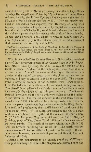
32 EDINBURGH—HOLYROOD THE CHAPEL ROYAL.
room (24 feet by 20), a Morning Drawing-room (35 feet by 32), an
Evening Drawing-Room (35 feet by 32), a Throne or Dining Room(G5 feet by 32), the Prince Consort's Drawing-room (52 feet by
26), and a State Bedroom (28 feet by 30). They are mostly pan-
elled in oak (which was imported from Holland), or hung with
tapestry : the plaster ceilings (executed by English workmen), which
bear the initials of Charles II., are rich and elaborate ; and some of
the chimney-pieces show fair carving (the work of Dutch hands).
In the Throne-room is a full length portrait of King George IV.
in a Highland dress, by Wilkie : it was painted on the occasion of
that monarch's visit to Holyrood in 1822.
Besides the apartments of the Duke of Hamilton, the hereditary Keeper of
the Palace, on the second and third floors of the west and north sides ofthe quadrangle, the Duke of Argyll has a suite of apartments on the third floor
of the east side.
"What is now called The Chapel Royal of Holyrood is the ruined
nave of the conventual church of the Canons Regular of St Augus-
tine, planted here by King David I. towards the middle of the
twelfth century. A glance at the building will show that it is of
various dates. A small Romanesque doorway at the eastern ex-
tremity of the wall of the south aisle is the oldest portion now re-
maining, and may be referred to about the year 1150. The western
front, a beautiful example of the transition from Romanesque to
First-Pointed, and the northern wall, are about forty years later.
The First-Pointed pillars which divide the nave from the aisle were
built towards the middle of the thirteenth century. The Second-
Pointed buttresses on the north wall were added about the middle
of the fifteenth. The central windows in the west front were in-
serted about 1500, it is believed by a foreign architect. Between
them is a panel commemorating the repairs made by King Charles
I. in 1633, and prophesying the " stablishment of the throne of his
kingdom for ever." In the south-east corner of the ruin is a rude
vault, into which have been gathered the remains of King James
V. {d. 1542), his queen Magdalene of France (d. 1537), Mary of
Gueldres, queen of King James IT. (d. 1463), and other members of
the royal family. The length of the nave, within the walls, is 127
feet; its breadth (including the aisles), 59. The north-western
tower measures 23 feet on either side, and is 52 feet high. It con-
tains a marble statue, in a recumbent position, of Robert, Viscount
Belhaven (d. 1639).
Among other monuments in the church are those of Wishart,
Bishop of Edinburgh (d. 1671), the chaplain and biographer of the

IIOLYROOD—HISTORY OF THE PALACE. 33
great Marquess of Montrose ; and of Sir John Sinclair of Ulbster
(d. 1835), the projector and editor of The Statistical Account of Scot-
land.
History of the Abbey.— The Abbey of Holyrood was founded in 1128, for
Canons Regular of the order of St Augustine, by King David I. Its first site
was in the Castle, whence it was finally removed to this spot before 1200. Par-
liaments were held in it by King John Baliol in 1295, and by his son Edwardin 1333. " Old John of Gaunt, time-honoured Lancaster," was entertained in
it in 1381. Four years afterwards, it was burned by King Richard II. In1400, King Henry IV. spared it because it had given refuge to his father.
It was burned by the English invaders in 1544, and again in 1547. Thebuildings were not repaired before the Reformation (1560), and from that timetill 1672 the Abbey Church was used as the parish church of the Canongate.In that year it was appropriated as the Chapel Koyal by King Charles II.,
and in 1687 King James Yll., who had previously used the Picture Galleryas a private chapel, ordered the old church of the Abbey to be set apart for
the Roman-catholic service and for the installation of the Knights of the
Thistle, and the present church of the Canongate to be built for the parish-
ioners. At the Revolution in 1688 the populace broke into the Chapel Royal,plundered and burned it, and scattered on its paved floor the relics in the
royal vault. It seems to have been left in neglect till the year 1758, whenit was repaired and roofed by the Barons of Exchequer. The new roof beingcovered with heavy flags, fell down in 1768, and by its fall destroyed the
pillars of the north aisle. The rubbish was removed in 1776 ; and the re-
mains of King James V., his queen Magdalene, and others, were ascertained
to be in the royal vault. The great eastern window, built after the demoli-tion of the choir and transepts by Commendator Bothwell, about 1570, wasblown down by a storm in 1795, and after the year 1816 was restored fromits own fragments.
History of the Palace.— Long previous to the erection of the Palace, theAbbey of Holyrood was the occasional abode of our monarchs. The founderof the Palace was James IV. ; and in 1501 the north-west tower was in pro-
gress of erection under the superintendence of Leonard Logy. In 1503, thenuptials of King James IV. with the Princess Margaret of England werecelebrated at Holyrood. This marriage is the subject of Dunbar's beautiful
poem of the " Thrissill and the Rose." During the minority of King JamesV., Holyrood was the occasional residence of the Regent Albany. In 1534,at the instance of Cardinal Beaton, then abbot of Arbroath, an ecclesiastical
commission for the trial of heretics was held at Holyrood, at which King JamesV. was present. In 1537, his first queen, Magdalene, was buried in the Abbeychurch, forty days after her arrival from France. In 1538, his second queen,Mary of Guise, was crowned at Holyrood ; and in 1542, King James himselfwas interred in the church. In 1544, Edinburgh was invaded by the Earl ofHertford, when the palace, the abbey, and part of the church were destroyed.By the year 1561, the Palace was again a large and commodious building. Inthat year Queen Mary returned from France, and took up her court in Holy-rood, which continued to be her chief residence until she was sent captive to
Lochleven in 1567. Her son, King James VL, dwelt much at Holyrood. Herehe entertained, in 1586, his discordant nobles, and effected an apparent recon-ciliation among them. It was for a time deserted on his accession to the Eng-lish crown in 1603, but he once more paid it a visit in 1617. It was repairedand occupied by King Charles I., who was crowned in the Chapel Royal in
June 1633, by Archbishop Spottiswoode of St Andrews. In 1641, the sameking lived in it for about three months. In 1650, after the battle of Dunbar,it was occupied by a party of Cromwell's soldiers, and during their occupancyit was either by accident or design nearly destroyed by fire. It was partially
B2

34 EDINBURGH—QUEEN'ri PARK.
repaired by Cromwell in 1658 and L659; but the buildings then erectedwensubsequently removed. Between L67J and L679, the present Palace wasbuilt by King Charles [I. In L679, 1680, and L681, it was occupied byJames, Duke of York. It docs not appear to have been again used, ex-
cept for the meetings of the Scottish peers after the Union when electing
their parliamentary representatives, till the years 17-1") and 17 16, whenit was successively occupied by Prince Charles Edward and the Duke of
Cumberland.From 1795 to 1799, Holyrood was the residence ofthe exiled prince, Charles,
Count d'Artois, afterwards Charles X. of France, and subsequently of the
Duohess de Ghrammont, who died in the Palace in 1803. After the visit of
George IV. in 1822, the sum of £24,000 was voted by parliament for repair-
ing the Palace. On Charles the Tenth's second exile, from Prance in L830,
he returned to Holyrood with a numerous suite, and occupied till 1835 his
former apartments on the east side of the quadrangle.
In front of the Palace is a fountain, erected in 1859, on the
model of one in the centre of the quadrangle at Linlithgow, in the
Scotch renaissance style of the middle of the sixteenth century.
It is an octagon, surrounded by a basin of 25 feet diameter, and
rising to a height of 35 feet, and is divided into three tiers or ranges,
surrounded by quaint figures, chiefly modelled by Mr Thomas of
London. In the garden on the north side of the Palace is a sun-
dial of stone, commonly called Queen Marys Dial, although it bears
the initials of King Charles I. and his queen Henrietta Maria, and
is known to have been erected in 1635.
The Queen's Park, or Holyrood Park, extending north, east,
and south from the Palace, includes the semicircular precipices of
Salisbury Crags, with the adjoining hill of Arthur's Seat, an area
altogether of nearly five miles. On the north slope of Salisbury
Crags, nearly opposite to the garden gate of the Palace, is St
Margaret's Well, a Second-Pointed vault of the end of the fifteenth
century, which originally stood about a mile to the east, and after
being buried under the North British Railway, was removed here
in 1859-60. Between Salisbury Crags and Arthur's Seat is the
valley called the Hunter's Bog. The highest point of SALISBUBY
Crags is at the Cat Nick, about 570 feet above the level of
the sea. The footpath in front of Salisbury Crags, called the
Radical Road, formed in 1820, gives a fine view of the Old Town,
with the long vista of the Frith of Forth and the range of the
Pentlands.
" If I were to choose a spot," says Sir Walter Scott, " from which the rising or set-
ting sun could be seen to the greatest possible advantage, it would be that wild path
winding around the foot of the high belt of semicircular rocks called Salisbury Crags.
The prospect commands a close-built, high-piled city, stretching itself out beneath
in a form which, to a romantic imagination, may be supposed to represent that of a

queen's park—Arthur's seat—queen's drive. 35
dragon ; now, a noble arm of the sea, with its rocks, isles, distant shores, and boundary
of mountains; and now, a fair and fertile champaign country, varied with hill, dale,
and rock, and skirted by the picturesque ridge of the Pentland mountains."—Heart
oj Mid-Lothian, chap. viii.
The noble height of Arthur's Seat seems to have been so named,
at an early date, from some forgotten ineident in the story of the
groat hero of old British romance. From several points of view
it resembles a lion couchant. On its north-west shoulder, under a
precipitous rock, are the ruins of St Anthony ]
s Chapel, of the history
of which nothing is known beyond the fact that it was a popular
shrine about the end of the fifteenth century.
" A bettor site for such a building," says Sir Walter Scott, "could hardly havebeen selected; for the chapel, situated among the rude and pathless cliffs, lies in a
.von in the immediate vicinity of a rich, populous, and tumultuous capital;
and the hum of the city might mingle with the orisons of the recluse, conveying as
little of worldly interest as if it had been the roar of the distant ocean."—Heart ofMid-Lothian, chap. xv.
Below is St Anthony's Well, celebrated in Scottish ballad
—
" Now Arthur's Seat shall be my bed,
The sheets shall ne'er be pressed by me,Saint Anton's Well shall be my drink,
Since my true love's forsaken me."
Between St Anthony's Chapel and the Duke's Walk—so named
from King James VII., whose favourite promenade it was when as
Duke of York he dwelt at Holyrood (1679-81)—a sheet of water
was formed in 1857 called St Anthony's Loch. Near the east end
of the Duke's Walk is a spot on which was a pile of stones called
MuschaCs Cairn, marking the scene of the tragical story of Nicol
Muschat, who here murdered his wife in 1720, as told by Sir Walter
Scott in the " Heart of Mid-Lothian."
A carriage-way called The Queen's Drive—commenced in 1844
—winds round Arthur's Seat, and commands magnificent views in
all directions from the German Ocean to the Ochil Mountains, in-
cluding the whole south coast of Fife with its numerous little sea-
ports, the Frith of Forth and its islands as far up as Queensferry,
the coast of Haddingtonshire and of Mid-Lothian from North Ber-
wick Law round the Bay of Musselburgh, and the wide undulating
landscape bounded on the south and west by the Lammermoors, the
Moorfoots, and the Pentlancls. The top of Arthur's Seat—from
which in a clear sky more or less of ten counties may be descried
—is most easily reached from a point on the Queen's Drive imme-
diately to the west of the small loch or tarn of Dunsappy. It is
822 feet above the sea-level.
At the foot of Arthur's Seat, on the south, lie the pretty village
and loch of Duddingston, connected with Edinburgh by a carriage -

36 EDINBURGH—THE SOUTH SIDE.
way through the Queen's Park, which at one point passes close
under a precipitous mass of basaltic pillars called Samson's Ribs.
The parish church, of which the well known landscape painter, the Rev.John Thomson Id. 1840) was minister, overlooks Dttddinggton Loch, which is
about a mile and a quarter in circumference, and a great resort of skaters da-ring frost. At the gate <>f the churchyard still hang the Jongs, an iron collar,
which served as the parish pillory. The church has remains of Roman-esque work in the chancel, chancel arch, nave, and south west doorway.South-west from the loch is the mansion oi Prestonfeld (Dick Cunningham,Bart.) South-east from it stands Duddinaston House, a seat of the Marquessof Abercorn, erected in 1768, from a design in the Grecian style by Sir W.( 'lumbers. Close by is Cauvhi's Hospital, for the maintenance and education
of twenty-six boys, the sons of " respectable but poor teachers and poor buthonest farmers." It was founded by Louis Cauvin, a French teacher in
Edinburgh, and afterwards a farmer at Duddingston, who died in 1825.
The Queen's Park and the precincts of tho Palace are the "Sanctuary"of Holyrood for insolvent debtors, who are here safe from their creditors for
twenty-four hours, after which a " Protection " issued by the Bailie of theabbey must be obtained. The debtors, or " Abbey Lairds,*' as they wereironically designated, are at liberty to pass beyond the boundaries of the" Sanctuary " on Sundays. Alterations in the law, however, have renderedresort to this refuge much less frequent than of old, and most of the debtors'
residences have been removed.Salisbury Crags and Arthur's Seat have a great many attractions for the
geologist and botanist. They indicate almost every interesting point in the
position of the trap formation. The variety of plants will amply rewardresearch.
THE SOUTH SIDE.
This quarter of the town may be reached from the Queen's Park.
From Princes Street the approach is by the North Bridge, the
South Bridge, and Nicolson Street. On the west side of the South
Bridge lies Adam Square, built after a design of the architect of
that name. Here is a statue of James Watt by Mr Slater, in front
of the School of Arts. South from Adam Square, and close beside
it, on the same side, is
The UNIVEBSITY, a quadrangular building, in the Italian style,
358 feet in length from east to west, and 255 in breadth from south
to north. The exterior was designed by Adam, the interior of the
quadrangle by the late Mr Playfair. Above the entrance—admirable
for its chaste and massive grandeur— is a panel with this inscrip-
tion:—"ACADEMIA JACOBI VI. SCOTORUM PEGIS ANNO POST
Christum natum mdlxxxii Instituta; annoque mdcclxxxix
renovari coepta, regnante georgio iii. principe munificen-
tissimo; Urbis Edinensis Praefecto Thoma Elder; Acad-EMIAE PRIMARIO GULIELMO ROBERTSON; ArCIIITECTO IiOBERTO
Adam." Pound the interior of the quadrangle runs a terrace and
balustrade, from which the various apartments are entered. The

THE SOUTH SIDE—THE UNIVERSITY. 37
east end is chiefly occupied by class-rooms, the Theological Library,
and the hall of the Senatus ; the south side by the Library ; the
west end by the Museum ; and the north side by class-rooms.
History of the University.—The south-east portion of the University waserected on the site of the house called " Kirk o' Field," in which KingHenry (Darnley) was murdered in 1507. About the year 1556, Robert Reid,
bishop of Orkney, bequeathed to the Town Council of Edinburgh 8000 merksScots to found a college. That body, in 1563, purchased the ground on whichthe University stands, but were not able till the year 1581 to make a fair
commencement. A charter of King James VI., dated in 1582, confirming
a previous one by Queen Mary, gave, for the erection and support of thecollege, all the property belonging to the suppressed chantries and monas-teries within the city. In 1583, the Town Council appointed Mr Robert Rol-lock, professor in St Salvador's College, St Andrews, to be lecturer, and in
1586 he was nominated principal. In 1620, the regents or professors num-bered only six or seven. In the course of a century the number was little
more than doubled, being in 1708 only fifteen. Till that date each pro-
fessor carried his class through all the different branches, Greek and Latin,
mathematics, and philosophy. The study of medicine, introduced in 1685,was from 1721 conducted by a succession of eminent professors, who grad-ually won for this University the distinction of being, perhaps, the bestmedical school in Europe. Among those whose names have shed a lustre
upon it, may be mentioned, Archbishop Leighton, the Monros, Cullen,Black, the Crregories, Fergusson, Maclaurin, Stewart, Blair, Robertson,Leslie, Wilson, Lee, and Sir William Hamilton. The original class-roomswere for two centuries in mean edifices, and at last were found so inconvenientthat in 1768 it was resolved to rebuild the University. The foundation-
stone was laid in 1789. The want of funds prevented the erection of morethan the front and the north-east angle till 1815, when an annual sum of£10,000 for ten years was voted by Parliament. The quadrangle was thencompleted in its present state, although the edifice is not yet finished accord-ing to the original design, which includes a dome above the grand entrance.The University has a Principal and thirty-two professors, teaching in the
four faculties of Theology, Arts, Law, and Medicine. The winter session
commences in the beginning of November, and terminates in the end ofApril ; the summer session commences in the beginning of May, and closes
in the end of July.The Library. [Admission is given to the Upper Hall on Mondays, Wednes-
days, and Fridays, by orders issued gratuitously at the Council Chambers,Royal Exchange].—This consists of a lower and upper storey, the lowercontaining a reading room, and rooms for the ordinary business of the Li-brary, the upper being almost entirely occupied by a noble hall nearly 200feet in length. The number of volumes is more than 100,000. Among themanuscripts are the marriage-contract of Queen Mary of Scotland with theDauphin of France, in 1558 ; a protest against the decree of the Council ofConstance in 1417 for burning John Huss, to which are attached the seals of150 Bohemian and Moravian noblemen ; a few oriental manuscripts ; and a fine
copy of Fordun's Scotichronicon. Among the illuminated MSS. are a Breviaryin octavo, executed in England, about 1420-30 ; a Breviary in folio, also donein England, about 1430-40 ; a Virgil, written in Paris, about 1475 ; and a Bookof Orisons, also done in France, about 1470-80. Among the printed volumesare copies of some of the oldest English versions of the Scriptures, and oneof the three or four extant copies of the Aberdeen Breviary, one of the first
books printed in Scotland. Here are a statue of Burns by Flaxman, re-
moved from his monument on the Calton Hill, and an autograph copy of his

38 EDINBURGH—THE KOYAL INFIRMARY.
famous lyric, " Boots, wha ha'e." Behind the Btatue is the table used by
Napoleon Bonaparte as a dining-table during bis exile in 81 Helena.
The Museum. [Admission sixpence ; free on Saturdays.]—This interest-
ing and valuable collection fills two large rooms, ;i lower and an upper,
each about ninety feet ion-, the upper furnished with an interior gallery
running completely round, and with two external galleries on one side,
the lower on the level of the room, and the upper on that of the interior
gallery,. In the lower apartment are Stuffed specimen-, chiefly of tin' class
of animals termed Mammalia', and in the upper, with its three galleries, are,
3000 specimens of birds, a large collection of insects, and several cabinets of
minerals, metals, corals, and Bhells. Almost every specimen of whatever
kind is labelled, so that visiters require no guide in examining the collection.
A building for The Industrial Museum of Scotland is about to be erected
behind the University, at the south-east corner of Argyle Square.
ArgyU Square, at 'one time the residence of nobility and gentry, was one
of the' first places built in this part of the town. At the north-east corner
is the Gaelic Church, and. westward of it, Minto House, a training institution
of the Scottish Episcopal Church. Brown Square, to the west of Argyle
Square, contained the residence id' .Miss Jane Elliot of Minto, authoress of
one of the songs known as the " Flowers of the Forest." and is associated with
some of the scenes and personages in Sir Walter Scott's tale of Redgauntlet.
The western side of it was taken down in 183(3, to make way for George IV.
Bridge.
The ROYAL INFIRMARY, which is approached by Infirmary Street,
opposite the north-east corner of the University, is a plain building
of three stories, 210 feet long, with wings projecting 70 feet in front.
In a niche on the outside, is a statue of King George II., and in
the entrance-hall a bust of Provost George Drummond, the first
great promoter of the institution. The building was commenced
in 1738, and finished in 1745. In addition to the original structure,
the old High School, the old Hall of the College of Surgeons, and
other buildings in Surgeon Square, all adjoining the Infirmary on the
east, have been attached to it, and are used as a Surgical Hospital,
a Fever Hospital, and a Lock Hospital. The number of patients
treated yearly is about 3500; the annual expenditure about £11,000.
The Phrenological Museum, 1 Surgeon Square, is open to the public every
Saturday afternoon from 1 to 6, free of charge : strangers are admitted
^LadvYester's Church, on the north side of Infirmary Street, was founded
and endowed in 1647 by Dame Margaret Ker, Lady Tester. The building
then erected was removed in 1803, and the present church erected on its site.
Royal College of Surgeons. [Admission by order from a
member.]—Passing the University, and proceeding southwards by
Nicolson Street, the visiter will observe on the left the Hall of the
College of Surgeons (incorporated in 1788), a handsome building of
the Ionic order. It was erected in 1833 from a design by the late
Mr Playfair, at an expense of £20,000. It has a large and very
valuable anatomical museum.

THE GREYFRIARS' CHURCHES AND CEMETERY. 39
Farther on, in the same street, is the Wind Asylum, -which consists of twobuildings a few doors apart—one for females, the other for males. It owesits origin to the blind poet Dr Blacklock id. 1791), and to Mr David Miller,
a blind teacher in Edinburgh. The building was commenced in 1792 bythe exertions of Dr David Johnston, minister of North Leith (a bust of
whom appears above the principal door).
Alison Square, now an obscure place, lying between Kicolson Square andthe Potterrow, contains the house in which lived Mrs M'Lehose, the " Cla-
rinda" of Burns. In this square also Thomas Campbell, the poet, lodged
while composing the " Pleasures of Hope."Objects further South.—The chief objects of interest south of Nicolson
Square are the church in which Dr Jamieson, author of the Scottish Diction-
ary, officiated, on the west side of Nicolson Street ; the Public Dispensary
in" West Richmond Street ; the church in which Dr M'Crie, the biographerof John Knox, preached, in Davie Street ; the Lancasterian School, in the
same street ; Hope Dark Chinch on the west, and Newington Free Churchon the east side of Clerk Street ; St Peter's Episcopal Church, in LuttonPlace, built in 1859-60 from a design in the Pointed style by Mr Slater of
London ; and Robertson's Academy for toys, in East Preston Street, built
in 1856-57 from a design in the Pointed style by Mr Bryce.
The Greyfriars.—The chief entrance to the Greyfriars is op-
posite Brown Square, at the south end of George IV. Bridge. Thechurches and their cemetery occupy the grounds of a monastery of
Franciscans or Greyfriars, founded about 1430. About the year
1613, the church now known as the Old Greyfriars—the ancient
church of the monastery—was repaired to accommodate the in-
creasing population of the city. Within its walls and in the surround-
ing cemetery the National Covenant was signed in 1638. In the
churchyard were confined the Covenanters who were taken captive
at the battle of Bothwell Bridge in 1679. In 1650, the interior of
the church was burned by the soldiers of Cromwell. In 1721,
another church was built beside it, which took the name of the NewGreyfriars. In 1845, both churches were set on fire by an over-
heated flue. The new church was speedily repaired, but the old
remained a ruin till 1857, when it was restored, and fitted up with
windows of poor stained glass.
Among those who have been buried in the Greyfriars' churchyard are thelearned George Buchanan [d. 1582), the exact site of whose grave is unknown;William Couper, bishop of Galloway (d. 1619) ; Alexander Henderson [d.
1646), moderator of the memorable General Assembly at Glasgow in 1638;John Mylne, master mason to the king (d. 1667) ; Sir George Mackenzie ofRosehaugh [d. 1691) ; George Jameson, the Scotch Vandyck (d. 1644) ; AllanRamsay, the poet (d. 1757) ; Dr Hugh Blair {d. 1800) ; Principal WilliamRobertson, the historian (d. 1793) ; Dr Archibald Pitcairn [d. 1713) ; ThomasRuddiman, the grammarian (d. 1757) ; Professor Colin Maclaurin (d. 1746) ;
Henry Mackenzie, the Man of Feeling {d. 1831) ; Dr M'Crie, the biographerof John Knox [d. 1835). On the east wall of the churchyard, near the lowergate, is the Covenanters' Monument with an inscription in rhyme, and under-neath the following statement: — "From May 27, 1661, that the nobleMarquess of Argyll suffered, to the 17th February 1688, that Mr James

40 EDINBURGH—IIEHIOt's HOSPITAL.
Kenwick suffered, were executed at Edinburgh about one hundred of noble-men, gentlemen, ministers, and others, noble martyrs for Jesus Christ.
The most pari of them lie here."
From the Q-reyfriars to Laoriston runs Forrest Road. Between it and the(l rev friars Churchyard stands on the right the Charity Workhouse, or CityParish Poorhouse, with accommodation tor about 700 paupers.On the opposite side of the road, in the angle which it forms with Bristo
Place, stands the Free New North Church, a building in the Pointed .style,
designed by the late Mr Thomas Hamilton. Immediately behind is Tltc
Daricn House, erected in 1G95 for the use of the Darieo Company, a bodyorganized for the purpose of establishing a settlement on the Isthmus of Da-rien, and trading with Africa and the Indies. The house was subsequentlyused as an asylum for pauper lunatics ; and here, in 1774, died the unfortu-
nate poet Kobert Ferguson.
Heriot's Hospital. [Admission by order from the Treasurer's
Chambers, 11 Royal Exchange.]—To the south-west of theGreyfriars
Churches is George Heriot's Hospital— the best example of the
peculiar style ©f renaissance which obtained in Scotland during the
first half of the seventeenth century, and altogether perhaps the
finest building in Edinburgh. The architects are believed to have
been two Scotchmen, William Wallace and William Aytoun. It is a
quadrangle of three storeys, with square towers (of four storeys sur-
mounted with turrets) at the angles. Each of its 200 windows has
a different ornamental device. The front looks to the north, where
is the main entrance surmounted by a tower : over the gateway
are the arms of the founder, and a monogram of all the letters of his
name. The gateway leads into a court 94 feet square, above the inner
entrance of which is a full-length statue of the founder (hewn by
Robert Mylne, master-mason to King Charles II.) On the south
side is the chapel, the interior of which has been modernized, after a
design by the late Mr Gillespie Graham. On the ground floor of
the south-west angle is the room in which the governors meet —aspacious low-roofed apartment, containing a portrait of the founder
(a copy by Scougal), and some articles of furniture said to have be-
longed to him. Among other portraits in the building are those of
the founder's father (1590); of the founder himself (1589); of
William Aytoun, master mason (about 1G50) ; of John Carmichael,
treasurer (1762-1780), by Martin ; of James Jackson, treasurer
(1793-1804), by Raeburn (himself educated here); and of DrJames Hamilton, physician (1773-1835), by Dyce. The Chapel,
the Governors' Room, the Dining Hall, the Dormitories, the Li-
brary, and the Lavatory, are the only parts shown to visiters.
The whole building is surrounded by a terrace and balustrade. In
1833, a lodge was erected at the principal gate on the south—
a
kind of miniature representation of the Hospital. The Governors


heriot's HOsriTAL—watson's hospital. 41
arc the Town Councillors and City Clergymen. The benefits
of the institution are restricted to the sons of deceased or de-
cayed burgesses of Edinburgh, and a few others who are admitted
through a right of presentation conferred on benefactors.
George Heriot (the "jingling Geordie" of the "Fortunes of Nigel")
was born in Edinburgh about 1563, and followed his father's trade of a
goldsmith. In 1597, he was appointed goldsmith to Queen Anne, andshortly afterwards to her husband James VI. On the King's accession to
the English crown Heriot went to London, where he was continued in
his appointment as court-jeweller and money-lender, and acquired a large
fortune. He died in 1624, and by his will, dated the previous year, left
the whole of his property for the erection of an hospital. The sum real-
ized was £23,625.The building was commenced in 1628, and was nearly completed in
1650, at the cost of £30,000 sterling. It was seized by Cromwell for the
accommodation of his sick soldiers. In 1659 it was opened by the ad-
mission of thirty boys. The number now maintained and educated is 180,
who are superintended by a house-governor and eleven masters. Theboys are not admitted under seven or above ten years of age, and leave at
fourteen, when they receive an annual apprentice fee of £10 for five
years : some of them receive bursaries to defray their expenses at the
University. The annual revenue, which in 1766 was only £1966, was in
1837, £11,235, leaving in that year a surplus of £3099. This has since
been applied to the support of seminaries known as Heriot Schools, whichthe Governors were empowered to erect by the Act 6th and 7th WilliamIV. cap. 25. There are eight of these juvenile schools, to four of whichare attached infant schools. No fees are charged ; the schools are open to
the children of all poor inhabitants, those of burgesses having a preference,
and they are attended by about 3000 boys and girls. The yearly revenueof the Hospital is now about £15,000. Much of the ground on which the
streets, crescents, squares, and terraces of the New Town are built, be-
longs to it.
George Watson's Hospital.—Opposite the south entrance
to Heriot's Hospital is another institution of the same kind,
founded by George Watson, merchant in Edinburgh. It is a
large plain building of three storeys, with projecting wings.
Watson died in 1723, and, stimulated by the example of Heriot, left
£12,000 for the clothing, maintenance, and education of the sons and grand-sons or relatives of decayed merchants in Edinburgh. In 1738, his bequesthad increased to £20,000, and the building was commenced. In 1741, it
was finished at an expense of £5000, and opened for the admission of boys.The number supported and educated in the institution is eighty-six. Theofficials are a house-governor, seven masters, and a matron. Applicantsfor admission must be above seven and under ten years of age. A certainnumber of boys, of seven and under twelve years of age, are admitted asday scholars. On leaving the house the inmates receive an annual appren-tice fee of £10 for five years, and if unmarried a premium of £50 on attain-
ing twenty-five years of age, and producing testimonials of good behaviour.Boys who attend the University are allowed £20 per annum for six years.The Governors are the Master and twelve Assistants of the MerchantCompany, five Members of the Town Council, and the minister of the OldChurch parish.

42 EDINBURGH—THE MEADOWS.
The Merchant Maiden Hospital stands a short distance-
west of George Watson's Hospital, and is accessible by Lauriston
Lane. It was built in 1816, and has an Ionic portico in front.
Its length is 180 feet, and its breadth about GO.
The institution was founded in 1695 by the Merchant Company, in con-junction with Mrs Mary Erskine, the widow of James Hair, druggist inEdinburgh, for the maintenance and education of daughters or otherfemale relatives of merchant burgesses of Edinburgh, of ministers of thecity, or of benefactors and governors of the Hospital. About 100 girls,
admitted between the ages of seven and eleven, and dismissed at seven-teen, receive a good education ; and each, on leaving, receives the sum of
£9, 6s. 8d. The Governors are the Master of the Merchant Company, theEarl of Mar, five Town Councillors, and fifteen others.
Opposite the south end of Forrest Road an avenue leads to TheMeadows, a park of about 65 acres, surrounded by a walk a mile
and a half in circumference, and divided about the middle b}r an-
other in a line with the avenue, both shaded with trees. It was
formerly a lake or marsh, called the South or Borough Loch, and
was drained about the middle of last century by Thomas Hopeof Rankeillour, from whom it got the name of Hope Park. Theeastern division is used by the citizens for games and gymnastic
exercises, and also as a field for exercise by the Royal Com-pany of Archers, and at the north-east corner of the grounds in
Buccleuch street is Archers' Hall. The members of this company,
incorporated by a charter of Queen Anne, have the privilege of
acting as body-guard to the sovereign within the city and for some
miles around. At the western end of The Meadows a road was
made in 1857, running from Home Street to The Melville Drive,
a carriage-way along the south side of the Meadows, from which
there is access through Preston Street to the Queen's Park. In
Lauriston Place, to the north-west of the Meadows, are the Cattle
Markets, which are entered by a large arched gateway, and from
which there is an excellent view of the Castle. On the opposite side
of Lauriston Place is a Unit d Presbyterian Church, in the Pointed
style, erected in 1859. On the west side of Lauriston Street is a
large Roman-catholic Church, in the Italian style, built in 1859-GO.
George Square—the largest in Edinburgh—lies immediately to
the east of the avenue leading from Forrest Road to the Meadows.
It was one of the earliest places built on the south side of the
town, and in the end of the last century was inhabited by many of
the nobility and gentry. The father of Sir Walter Scott occu-
pied the house at No. 25, and there the illustrious novelist spent
the greater part of his youth. At a later period the house No. 4

GEORGE SQUARE—MERCHISTON—MORNING SIDE. 43
Was occupied by Dr Jamieson, author of a Dictionary of the Scot-
tish Language. Henry Dundas, first Viscount Melville, died in
the house, No. 57, 58. At No. 7 Charles Street—which opens
from the north-east corner of the square—Francis Jeffrey was
born (23d October 1773). His first house was also in this neigh-
bourhood—an upper floor in No. 18 Buccleuch Place, on the south
side of the square. It was here that on a stormy winter even-
ing, in 1802, the Edinburgh Review was projected by Jeffrey, Syd-
ney Smith, John Allen, Francis Horner, and Lord Brougham. In
a floor of the same house died, in 1857, Mrs Johnstone, authoress
of " Clan Albyn," " Meg Dods' Cookery," and other popular works.
To the south-east of the Meadows lies Sciennes Street, vulgarly theSheens, so named from a convent of Dominican nuns dedicated to StCatherine of Sienna, founded here in 1517. Only a small fragment of oneof the buildings remains. To the south of the Sciennes stands GrangeHouse, in which Principal Eobertson, the historian, died in 1793. It is
now occupied as a school : it is a fair example of the turreted Scotch manor-house of the seventeenth century. Near it is the Grange Cemetery, in
which are interred Lord Dunfermline (d. 1858) ; Dr Thomas Chalmers(d. 1817) ; Hugh Miller, the geologist (d. 1856) ; and Mrs Johnstone abovementioned.
Passing from the Sciennes along the south side of the Meadows, by theTrades Maiden Hospital, we reach the open space named Bruntsjield Links,part of the ancient Borough Muir, a favourite resort of golf-players. Onits south side are Warrender House and Park, and the Convent of St Mar-garet, a Poman-catholic nunnery, built from a design by the late Mr Gil-
lespie Graham.Gillespie's Hospital and Selwol.—On the west side of Bruntsfield Links
are Gillespie's Hospital and School, the former occupying the site of theinteresting old mansion of Wrightshouses, a seat of the family of Napier.The founder of the hospital was a tobacco and snuff manufacturer in Edin-burgh, who by his will, dated in 1796, devised the greater part of a largefortune to endow an hospital for the maintenance of indigent old men andwomen, and a school for the education of poor boys. The hospital, erected in
1802, generally contains about forty-five men and women, who at their ad-
mission must have attained the age of fifty-five. In the school upwards oftwo hundred boys are instructed in reading, writing, and arithmetic. Theyare not admissible under six nor above twelve years of age, and are entitled
to remain three years. The Governors are the Master, twelve Assistants,and Treasurer of the Merchant Company, and seven others.
Meuchiston Castle.—About half a mile south of Gillespie's Hospital,close to the hamlet of Boroughmuirhead, is Merchiston Castle, a square towerof the fifteenth century, interesting as the property and residence of JohnNapier, the illustrious inventor of the Logarithms. The philosopher was bornin 1550, succeeded his father Sir Alexander in 1608, and died at MerchistonCastle in 1617. His eldest son was created Lord Napier in 1627. Duringthe civil war which raged in the minority of James VI. the tower sustainedfrequent sieges.
A short distance south of Merchiston Castle is Morningside, a suburb ofelegant villas. Here is the house of Churchhill, built by Dr Thomas Chal-mers, in which he died (31st May 1847). The whole of this district waspart of the Borough Muir ; and on the wall, on the east side of the publicroad (a few yards north from the Church), is the " Bore Stone," in which

44 EDINBURGH—NEW TOWN.
King James IV. planted his standard in 1513, when he mustered his army
for Flodden. On as iron panel placed below the stone are inscribed the
lines in which Scott lias commemorated it in Marmion.
Boyd Edinburgh Lunatic Asylum.—This huge, ungainly building uonthe Bouth west or Biorningside, and was opened for patients in 1813. 1 he
expense of the erection altogether has been more than £80,000. It con-
tains from .
r)00 to GOO persons, and is one of the best managed institutions
of the kind. , . , , ,
Braid and Blackford Hills.--These eminences, now cultivated almost to
the summit, are about a mile to the south of Morningside. Sir W alter
Scott has commemorated the " furzy hills of Braid," the scenes of his school-
boy rambles, and represents Marmion as surveying Edinburgh and the sur-
rounding scenery from the summit of Blackford :—
" Blackford ! on whose uncultured breast,
Among the broom, and thorn, and whin,
A truant boy, I sought the nest,
Or listed, as I lay at rest,
While, rose, on breezes thin,
The murmur of the city crowd,
And, from his steeple jangling loud,
Saint Giles's mingling din.
Now, from the summit of the plain,
Waves all the hill with yellow grain;
And o'er the landscape as 1 look,
Nought do I see unchanged remain,
Save the rude cliffs and chiming brook.
To me they make a heavy moanOf early friendships past and gone."
A road runs along the ridge of the Braid Hills from east to west—that
is, from Liberton to Morningside. It commands some noble views ot the
city and the Frith of Forth. At its east end is the Tower of Liberton, a
small but very good specimen of the Scotch peel or fortalice of the end
of the fifteenth century. It is vaulted throughout, and has a cape house
and stone roof. The entrance was by a doorway in the first floor, reached,
as it would seem, by a ladder.'
,
In a picturesque little glen between Blackford and Braid Hills is Braid
Hermitage (Gordon, Esq.), a modern mansion embosomed among trees near
the rivulet of the Braid Burn. In the neighbourhood, close to the road,
is the Buck Stane, on which the Laird of Penicuik is bound to blow three
blasts of a horn when the king comes here to hunt. Hence the motto ot
the family
—
Freefor a blast.
THE NEW TOWN.
The Calton Hill.—The most prominent object in the " New
Town "is the Calton Hill (350 feet above the sea level), com-
manding a magnificent view of the city, of the Frith of Forth, the
hills of Perthshire, the coast of Fife, and the coast and hills ot
East Lothian.
On the north-west side of the Calton is the populous suburb,
of Greenside,
built on grounds which belonged to the Carmelites or White Friarsj,
an-
ciently the site of a chapel dedicated to the Holy Cross. Near it was a
cross called the Rood of Greenside, where David Stratoun and Norman
Gourlay were burned as heretics in 1534.
On the north side of the Calton Hill stands Greenside Chvrch, a modern
Pointed building, and below, upon the same side, beyond the Great London


NEW TOWN—CALTON HILL—HIGH SCHOOL. 45
Etoad, are Leopold Place, Windsor Street, Hillside Crescent, etc. Midwaybetween its base and summit, around one-half of its circumference, runs
the handsome range of the Royal Terrace on the north, Carlton Terrace onthe east, and Regent Terrace on the south—all built from designs, in the
Italian stylo, by the late Mr Playfair. Immediately under Regent Terraceis the Regent Road, the eastern entrance to the city. Still farther down is
the New CaJton Burying-ground ; and through this part of the hill runs the
tunnel of the North British Railway.
The High School.—This beautiful structure is in the centre of
the south side of the Calton Hill, lacing the road. It was built in
1825-29 from a design by the late Mr Thomas Hamilton (d. 1858)
at an expense of about £30,000. The main building extends nearly
270 feet in front, having in the centre a grand hexastyle Doric
portico. On each side is a corridor, the entablature supported
by six Doric columns. The hall is 75 feet in length and 43 feet
in breadth. The school has a Rector, four classical Masters, and
other teachers—all appointed by the Town Council.
Nelson's Monument.—On the highest point of the hill, overlook-
ing the High School, is a clumsy monument, built by subscription,
in honour of the hero of Trafalgar. It is a circular tower upwards
of 100 feet in height, with a stair inside, surmounted by a lower and
upper battlement—giving it the resemblance of a gigantic butter-
churn. A time-ball at the top of the flagstaff falls at one o'clock,
p. iff., to indicate the time by the Observatory clock at Greenwich.
The view from the summit (for access to which there is a charge
of threepence) commands the peak of Ben Lomond on the west
;
the Ochils, the Lomond Hills, the coast of Fife, the Frith of Forth
and its islands, on the north ; the Bass Rock, North Berwick Law,
the German Ocean, and the coast of East Lothian, on the east
;
and, on the south, the Lammermoors, the Moorfoots, and the Pent-
lands. At the foot of the tower are three of the guns taken from
the Russians at Bomarsund and Sebastopol.
National Monument.—This unfinished edifice was designed
to commemorate the soldiers who fell in the great war which wasterminated by the battle of Waterloo in 1815. The foundation
was laid in 1822 during the visit of King George IV., and the
building—of which only twelve columns have been raised—wasintended to be a copy of the Parthenon at Athens.
The Royal Observatory.—This elegant building, which is a depen-
dency of the University, is from a design by the late Mr Playfair.
It is in the form of a cross, is in the Italian style, with four porticos,
and is surmounted by a dome. The length of each member of the

46 EDINBURGH—THE PRISON.
CTOSi is 62 feet. The old Observatory, an unseemly structure onthe south-west angle of the enclosing wall, was erected in 177G.
Professor PJayfa^s Monument.—On the south-east comer of the
wall which surrounds the Observatory, is a square erection, orna-
mented by Grecian pilasters, in honour of John Playfair, Professor
of Natural Philosophy in the University of Edinburgh, who died in
1819, and is buried in the cemetery on the south-west side of theCal-
ton rock. It was designed by his nephew, William Henry Playfair
(d. 1857), the architect of many of the finest buildings in Edinburgh.
Professor Dugald Stewart's Monument.—This beautiful ceno-
taph, designed by the late Mr Playfair, is an imitation of the Cho-ragic monument of Lysicrates at Athens, and was finished in 1831.
It is a circular temple, with a stone urn in the centre, and is com-memorative of Dugald Stewart, Professor of Moral Philosophy in
the University of Edinburgh, who died in 1828, in his 7Gth year,
and is buried in the Canongate Churchyard.
Burns'* Monument, on an isolated eminence in front of tho
Regent Terrace, opposite the east end of the High School, is a
circular temple on a quadrangular basement, surmounted by twelve
Corinthian columns, with an entablature, cornice, and cupola. It
was designed by the late Mr Thomas Hamilton. A statue of
Burns intended to be placed in it is now in the College Library.
Hume's Monument.—In the older and western Calton ceme-
tery is a circular tower, in which are interred David Hume the
historian (d. 1776), and his nephew and namesake Baron Humeof the Scottish Exchequer, author of " Commentaries on the Lawof Scotland" (d. 1838).
Reformers' Monument.—In the same cemetery is an obelisk erected
to the memory of Muir, Palmer, and others, who, in 1794, were
tried and banished for their political opinions.
The Prison.—The three large castellated edifices now knowngenerally as the Prison of Edinburgh are on the south side of the
Calton Hill. The western building, close to the cemetery and
Waterloo Place, superseded the Tolbooth in the Lawnmarket,
and was erected in 1817, from the design of the late Mr Archibald
Elliot. It is 196 feet in length by 40 feet in breadth, and is four
storeys in height. Behind, on a precipice overlooking the Can-
ongate, is the Governor's residence, also in the castellated style.
The middle edifice, of a semicircular form, erected in 1796, after a
plan by Mr Robert Adam, was for some years used as a Bridewell.

PRINCES STREET—GENERAL REGISTER HOUSE. 47
The eastern structure, finished in 1847, from the design of Mr
Robert Brown, is of four storeys, with towers on the east gable.
Waterloo Place commences at the termination of the Kegent
Road between the Jail and the ascent to the Calton Hill, and has
on each side of it the Old Calton Burying-ground. To this suc-
ceeds,-upon the north side, the Calton Convening Room and the
Waterloo Hotel and Rooms ; and, on the south side, the Post
Office, and Inland Revenue Office.
The Regent Bridge, in the centre of Waterloo Place, spans the
Lower Calton or St Ninian's Row. On each side is a triumphal
arch, surmounted by an entablature and inscription. The ground
on which this and ''the neighbouring buildings are erected cost
about £52,000. The bridge was completed in 1819, and opened
by Prince Leopold, afterwards King of the Belgians.
Adjoining Waterloo Place, on the south side of the street, was
Shakspeare Square, in front of which stood the Theatre Royal,
a somewhat mean-looking structure erected in 1769, and now
(1860) about to be demolished to make way for a new Post Office,
a large and handsome building in the Italian style.
The General Register House, a fine edifice in the Italian
style, fronts the North Bridge at the eastern termination of
Princes Street. It was built from a design by Adam, and mea-
sures 200 feet in length and 120 feet in breadth. The foundation
was laid in 1776, and the building completed in 1822. It is a
parallelogram, with four triangular courts in the centre, which
are the open spaces on the sides of a central circular edifice
surmounted by a lead-covered dome fifty feet in diameter. In
front is an equestrian bronze statue of the Duke of Wellington,
the work of Mr John Steell, erected in 1852. Behind the old or
chief Register House is a new Register House, also in the Italian
stvle, built in 1859-60, at a cost of £26,440. In the Register
Houses are kept the ancient historical muniments, the registers
of births, deaths, and marriages, and the legal and judicial records
of Scotland.
Admission to the Register House may he ohtained on payment of a gra-
tuity to the porter. Among the more remarkahle documents shown here
are (1.) The Letter of the Scottish Barons to the Pope in 1320 ; (2.) The
Acts of Settlement of the Scottish Crown upon the Stewarts in 1371 and
1373 : (3.) A series of Charters hy the Scottish Kings from King David I.
(d. 1153) to King James VI. (d. 1625) ; 4. King Robert Bruce s Deathbed
Letter to his Son, in 1329;
(5.) Lists of the Jewels of Mary Queen of Scots,
in 1567, with marginal notes and a postscript in the Queen s own hand;

48 EDINBURGH—PRINCES STREET.
(0.) The Treaty of Union with England in 1707. Here is a fine portraitby Raeburn of Lord Frederick Campbell, Lord Clerk-Register from 1767to 1816. Here also is a colossal marble statue of King George III. by theHon. Anne Damcr.A small fragment of an ancient thoroughfare on the west of the Register
House still retains the name of Gabriel's Road. Before the formation ofthe New Town it was a conntry road skirted by hedges, meadows, and cornfields. It was in the beginning of the eighteenth century the scene of afearful tragedy, long remembered in Edinburgh—the murder of two boysby their tutor, a probationer of the Established Church. The deed wasdone on a Sunday in the broad light of day; and the murderer beingcaught in the acl -or as the phrase ran, with the red hand—was, accordingto the existing law, hanged within an hour. A short distance up thislane, on the right, was Ambrose's Tavern, the scene of the Nodes Am-brosiance of Blackwood's Magazine. It was demolished in 1858 to makeroom for the new Register House.
PRINCES Street— the favourite promenade of the Scottish
capital— extends from the North Bridge to the Lothian Road,and is about a mile in length. It commands a view of thepicturesque piles of the Old Town and Castle rising high abovethe intervening valley, with its beautiful gardens. The gardenseast of the Mound are open to the public every day till dusk
;
those on the west, being private property, are accessible only by akey, which may, however, be obtained by strangers without muchdifficulty from the shopkeepers or hotels in Princes Street. In
proceeding westward, along Princes Street, the first and mostconspicuous object is
—
The Scott Monument. [Charge for admission to the Galleries,
Twopence.]—This imitation of the great crosses of the Middle Ageswas erected between 1840 and 1844, at an expense of £15,650, in
honour of the great Scottish novelist. The design wtis by GeorgeM. Kemp, a self-taught architect, who died before this triumphof his skill was completed. It is 180 feet in height. In themiddle is a marble statue of Scott, in a sitting attitude, writh oneof his favourite dogs stretched at his feet—the work of Mr JohnSteell. In the niches are sandstone statues of some of the moreprominent personages in the works of the novelist and poet.
The Royal Institution stands on the north end of the Mound,fronting Hanover Street. It is from a design by the late Mr Phi y-
fair, in the Greek-Doric style. On the four corners are sphynx-like
figures couchant, and above the front entrance facing Princes Street
is a colossal sandstone statue of the Queen, by Mr John Steell.
The building, which was commenced in 1823, and cost £40,000,
has a range of fluted columns on each side, with a double row to

PRINCES STREET


ROYAL INSTITUTION MUSEUM OF ANTIQUITIES. i!)
the north front. It contains the National Museum of Antiquities,
a Gallery o^l Casts, a School of Art, and the rooms of the Society
of Antiquaries of Scotland, of the Royal Society of Edinburgh, of
the Board of Trustees for Manufactures, and of the Fishery Board.
In the Royal Society 's Booms arc portraits of Professor John Robinson,
by Raeburn; of Sir Walter Scott, by Mr Graham Gilbert; of JamesWatt ; and of Henry, Duke of Buccleuch, Sir James Hull, and Sir ThomasHakdougall Brisbane, by Sir John Watson Gordon.
The National Museum of the Antiquaries of Scotlandis open, free of charge, every Tuesday, Wednesday, and Saturday,
and at a charge of sixpence every Thursday and Friday. It was
formed by the Society of Antiquaries of Scotland (incorporated by
a charter from the Crown in 1780), and was removed hither in 1859,
when it became the property of the nation. It contains manyobjects of great interest, specimens of ancient art, weapons, im-
plements, ornaments, dress, and historical relics. They are ar-
ranged in five classes : 1. Egyptian and other foreign antiquities;
2. Early Scottish antiquities of stone ; 3. Early Scottish antiquities
of bronze ; 4. Romano-Scottish antiquities ; 5. Middle-age and mis-
cellaneous antiquities. Conspicuous in the room is the " Maiden,"
or Scottish guillotine, by which Morton, Argyll, and so manyother noble and distinguished persons were beheaded in the six-
teenth and seventeenth centuries. There are several inscribed
altars from the Roman Wall between the Forth and Clyde (built
in the year 140), and casts of sculptured and inscribed stones in
different parts of Scotland, believed to have been erected before
the twelfth century. Among the few pictures is an infant Christ,
inscribed " Opus Felicis de Scotia, 1488." Here are copies of the
National Covenant of 1638, subscribed by Montrose, Argyll,
Rothes, Loudoun, and others. There is a large collection of coins
and medals. All the objects are labelled.
The Sculpture Gallery (which is open only to students in the
School of Art) contains casts of the Ghiberti Gates at Florence,
of the Elgin Marbles, of almost all the celebrated statues of anti-
quity, and of the collection of casts of Greek and Roman busts
made at Rome by the Albacini family.
A few yards south of the Royal Institution, and in the centre of
the Mound, stands the National Gallery of Scotland, built
in 1850-54, at a cost of £40,000, from a design by the late MrPlayfair, in the Greek-Ionic style. The sides have hexastyle
porticos in the centre, and there are two smaller tetrastyle por-
C

50 EDINBURGH—THE NATIONAL GALLERY,
tiros at each end. There are two suites of rooms, the easternbeing Bet apart for the annual exhibition of the Royal ScottishAcademy open from February to May- admission, 1
ticket, r>s.), and the western for the National Gallery of Paiand Sculpture,
The National Gallery op Scotland is open, free of charge,every Tuesday, Wednesday, and Saturday; and at a fee of sixpenceevery Thursday and Friday. Among the chief pictures are thi
lowing (the numbers being those which are affixed in the Gall
By Vandyck (i. 1699, d I The Lomellini Family (injured by el.«drestoring^. (1881 Whole length Portrait of an Italian Nobleman & Armour!(140) Martyrdom ol Bt Sebastian (the figure of the martyr injured by overing.) (42) A Duchess of Savoy.
By Paris Bobdone (ft 1500, d. 1570).—(160) A Lady at her Toilet.Br Titian (6. H77,,/. 1676) on bis School, n(oneoffourpanels, n is said, painted for a bed of the Emperor Charles \ ptrait(166) The Virgin and Child, with a I
ByFba Sebabtiako di l Piobibo b I 185, d. 1547 .— T I > Bacchus and Ariadne
}5y Justus -
(ft 15<>7, ,/. 1681).—(61) Portrait of Alessandro FairBy GABOFALO (ft 1481, d. 1559).-(140, Christ driving th fromthe Temple.
By Dirk Van- Delen (ft 1635).—(62) An Architectural Pii -iresBy Gaspab Po .-• no.
i —(132) A Landscape with J i
ByGiacomo Bassano(&. 1510, d. 1692).—(49) Portrait of a S oator. ( 153) Christdriving the Money Changers from the Temple.
By Gueboino (ft 1590, d. 1666).—1 164) The Virgin and Child and St John.By Palma Veccbio (ft 1510. d. 1565).—(68) The Adoration of the Shepherds.By Pordenone (ft 1484, d. 1539).—(131) Christ on the Mount of Olives.By Tintoretto (ft 1512, d. 1594).—(40, 44) Portraits of Vem ti Senators. (148
135, 149) Summer, Autumn, and Winter. (161) Portrait of a Venetian SenatorBy GlOBGIONE (6. 1477, d. 1511).—(137) A small Portrait.By Morinello, or by Caravaggio.— (134.) A Shepherd Boy Singing with a Pii
in his hand.Br Bebnazzako (1520-30).—(159) A rich Landscape.By Pakbolpho Besohi (ft. 1643, d. 1699). 153) \ Battle Piece.By Francesco Furini (ft 1601, d. 1646).—(48, 52; Heads of St Sebastian and of a
Poetess.
By Jan Miel (b. 1599, d. 1634) or ry Caravaggio.—(53) A Seaport with FiguresBy Jan Both (b. 1610, d. 1650).—(59) A Landscape. , 192) A Lands* ai e in a warmMorning Light, with Figures. (176) A Landscape w ith small Figures.
By Blisabbtta Sibam (ft n.—(73) St John.By Canaletto (ft 1697, d. 1768).—(151) View in Venice.By Lodovico Caracci (b. 1555, d. 1619).—(63) The Death of Ab( I.
By Bpagholetto (ft 1593, d. 1656).—(50) A Mathematician. (64) Martyrdom of stSebastian.
By Snydehs (6. 1579, d. 1657).—(75) A Bear Hunt.By Adrian VANDES Were (ft 1659, d. 1722) or by Bartholomew Vander B
(163) A Burgomaster and his Wife (injured by cleaning).By Ferdinand Bol (ft 1610, d. 1681).—(158) Portrait of Professor Von Atten.ByTiepolo(6. 1692, d. 1769).—(150)The FindingofMoses. (57)Antonyand Cleopatra.By I'.onifacio Veneziano (ft, 1494, d. 1553).—(156) The Last Supper.By Cornelius Huysman (ft 1648, d. 1727).—(43) A Landscape with Cattle and
Figures.By WILLIAM Dy0E.—(211) Tnfant Hercules.By II. VY. Williams (d. 1829).—(209) Temple of Minerva at Sunium. (341) Par-thenon of Athens. (342) Athens from the East. (343-366) Views in G reece, Italy.Wales, and Scotland.
By the Rev. John Thomson of Duddinoston (ft 1778, d. 1840).—(119) Bruce'sCastle of Turnberry. (91) Glenfeshie.
By Sir William Allan (ft 1782, d. 1850).—(CS) The Black Dwarf.

THE NATIONAL GALLERY. 51
Kv Snt John Watson Gordon.—(26) Portrait of the late Peter Spalding. (29)
Portrait of the late Lord Rutherfurd. (21) Portrait of the late Lord Cockburn.7 Portrait of Sir William Gibson-Craig of Kiecarton, Dart. (12) Portrait of Sir
William Johnston of Kirkhill.
By William Etty ('-. 1787, d. 1849).—Five Pictures : (88) Judith about to kill Holo-fernes; (89) Judith's Attendant listening at the Tent
; (90) -Judith issuing fromthe Tent with the Head of Holofernes; (207) Woman interceding for the Van-quished; (122) Benaiah slaying the two Lion-like Men ofMoab.
By Sir David Wilkie [b. 1789, d. lsll).—(208) Sketch for his Picture of John Knoxdispensing the Sacrament at Calder House.
By Brkbb \not (&. 1606, d. 167-4).—(195) A thickly-wooded Landscape. (197) A hilly
Landscape.By Hobbbma (b. 1611).—(215) A Woodland Scone. (179) A wooded Landscape with
r, on which is a 1! >at with three Men.By Vaxobb Meulen b. U'.:U. (/. 1690).—(20o) A Landscape, with Louis XIV. in a
Carriage, with a numerous Suite.
By Gbeuze.— 206) Interior of a Cottage, with Figures.By An ; i.—(216) A rocky Landscape) with Figures.P.y Cabel DUJARDEN (6. 1640, d. 1678).—(186) A hilly Landscape, with two Horse-men and other Persons halting at the Door of a Wine-house, on the Banks of aplacid Biver. 2 M
|A Smith at his Forge shoeing the Hind-foot of an Ox.
By GlULlO Romano (6. 1192. d. 1516) or Peter Van Bloemer (b. 1649, d. 1719).—[Ill) Part of the Battle of Constantine and Maxentius.By ,1 \ EL (b. 1636, d. 1681).—(187) Woodland, with Figures angling in a
Pool. (200) Landscape, with Figures painted by Wouvermans.By Domeniciuno (b. 1581, d. 1611).—(169) Martyrdom of St Andrew. (173) WoodedLandscape with a naked Figure.
By Wattbau (6. 1684, d. 1721).—(370) French Pastoral.
By Pynackbb (b. 1621, d. 1673).—(188) Depths of a Forest at Morning, with Hillsin the Distance, and a Boy with a Cow and Dog in the Foreground.
By Procaccini (b. 1548, d. 1626).—(170) The dead Christ, with St Mary Magdaleneon one hand, and Annals on the other.
By Jan i.i: Due (b. 1636).—(178) A Card Party.By Ghisoi.fi (b. 1623, d. 1683).—(194 and 204) Two Pictures of Bnins and Frag-ments of Sculpture, with Figures.
By Swydebs (b. 1579, d. 1657) or Hondius.—(175) A Wolf-hunt. (1S5) A Boar-hunt.By Adbian Van-dkvelde (b. 1639, d. 1672).—(198) A Landscape with Shepherdsand Cows. (182) A Landscape, with Cattle in the Foreground, and a Woman onan Ass.
By Paul Veronese (b. 1530, d. 1588).—(168) Venus and Adonis.By Peteb NeefS (b. 1570. d. 1651).—(203) Interior of a Church.By Jan Steem (6. 1636,4.1639).—(184) A Sick Lady in Bed, the Doctor, and her Maid.By Richard Wilson (b. 1713, d. 1782).— (55) A Landscape. (191) An Italian
Landscape.By Giorgione or by Piett.o della Vecchia.—(165) A Youth and a Maiden.By 3 llvatob Rosa (6. 1615, d. 1673).—(167) A wild Scene with Robbers.By David Tenibbs the Younger (b. 1610, d. 1694).—(181) A Woman on Horse-
bark. (202) Peasants playing at Skittles in the Courtyard of an Inn,By William Vandeyelde (b. 1633, d. 1707).— (180) A calm Sea, with Fishing-
boats.
By .1 \n Lingelbach (6. 1625, d. 1687).—(189) A Landscape, with a Waggon haltingat the Door of an Inn.
By Bebohbm fh. 1621. d. 1687).—(199) A hilly Landscape at Evening, with Waterin the Foreground, in which there are two Cows and a Goat.
By Lb Boubquignok (6. 1661, d. 1706).—(217 and 218) Two Skirmishes of Cavalry.By Gaspab Poussin (b. 1613, d. 1675) ob by Julius Frans van Bloemen.—(171)A Land Storm with Figures.
By Guido Reni (b. 1565, d. 1642).—(172) An Ecce Homo, or Christ crowned withThorns.
By Vander Heyden (b. 1637, d. 1712).—(190) A Wood with Stags.
By Ludolb Backih-ysen (/;. 1631, d. 1709).— (183) A Sea in a rising Gale, withSmall Craft making for Harbour.
By Pannini (b. 1691, d. 1764).—(36) Interior of St Peter's at Rome. (45) Interiorof the Ancient Basilica, St Paul's.
By Velasquez (b. 1599, d. 1660).—(38) Portrait of Don Balthazar Carlos.By James Drummond.—(104) The Porteous Mob.By Gainsborough (b. 1727, d. 1788).—(333) Portrait of the Hon. Mrs Graham, wife
of Lord Lynedoch—a picture of signal excellence.

52 EDINBURGH—THE NATIONAL GALLERY.
I?v .John- G-rahau Oii.hkrt.—(20) Portrait of Bir John Watson Gordon. (29) Por-trait of J. Gibson, k.a. (110) Portrait of an [talian Noble.
By Francis Graht. Ill) Portrait of a Jew Rabbi.BtGroboi Hakvkv. (soi Dawn revealing the New World to Columbus. (369)Robbers melting silver Plate.
My R. s. I. w dbr.1121 ) Christ Teaching Humility.
By Sib Thomas Lawbekck (6. L769, d. 1830).— (9) Portrait of Lady CharlotteCampbell Bury). (28) Lady Hamilton.
My J. F. Lewis. -(267 820) Studies In Water Colours Bhowing the more strikingpeculiarities of the Venetian, Spanish, Dutch, and Flemish Bchi
By Hob \ no M'Ci 1 1 o» b. 96 [nverlochy « lastle.
My .1. Noel Paton.—(85) Quarrel between Oberon and Titania. (99] Reconciliationof < (beron and Titania.
My Sib Bene* Rabbi b* (6. 1766, d. 1823).- (882 Portrait of Professor Wilson. (335)Portrait of Dr Adam of the Higb School. (11* Portrait of a Lady. (16) Portraitof Admiral John .Maitiand. (25) Portrait of the Artist's Son. (31) Porti.M rs R. Scott Moncrieff.
P.v Allan 1! \m<\y (h. 1709, d. 1784).—(1) Portrait of David Hume the Historian.BY SlB JOSHl \ REYNOLDS (b. 1723, d. 1792).—(4H) Portrait of the Hon. Captain
Hamilton. (325) Unfinished Portrait of the Right Hon. Edmund Burke.My David Roberts. -(116) Rome at Sunset, from the Convent of San Onofrio.P.v Colvtn Smith.—(32) Portrait of the late Lord Justice Clerk Hope when Deanof Faculty. (337) Portrait of Robert Becond Viscount Melville.
BY Andbew Wilson.—(ft. 1780, d. 1848).—(109) View at Tivoli. (113) Ruins ofHadrian's Villa near Tivoli.
Sculpture.
My SAMUEL Joseph (d. 1850).—(16) Bust of Sir D. Wilkie. (17) Bust of Henry, LordBrougham and Vaux.
My Patric Park (b. 1809, d. 1855).—(18) Must of his Wife.My John Stbell.—<191) Bust of the late David Scott.
The Sculptures in the Torrie Collection—numbering fifty-six in all—consist ofsome small antique torsos; of a number of copies (some in marble, others in bronze)from celebrated antique marbles; of specimens of the renaissanct : and of vases ofporphyry, marble, and granite. Among the antique torsos may be mentioned
(7) A draped Female in Parian marble.
(8) A draped Figure in Greek marble, with the Head and Limbs reclined.
Conspicuous at the head of the Mound stands the Free Church,
College or New College, founded in L846, a structure in the Eliza-
bethan style, designed by the late Mr Playfair, consisting of a
quadrangle, 84 feet by 56 within the walls, ^it h two centre towers
121 feet in height, and one at the north-east corner, 95 feet in
height. From this point there is a fine view.
No. 82 Princes Street, nearly opposite the foot of the Mound, is
the large and elaborately ornamented Insurance office of the Life
Association of Scotland, designed (in the Italian style) by the late
Sir Charles Barry and by Mr Rhind. Next to it, on the west, No.
85, is the New Club, an association of the same character as the
London clubs. The building, which is in the Italian style, was
designed by Mr Burn.
At the west end of Princes Street is St John's Church (Epis-
copal), a building in the Third-Pointed style, erected in 1818, from
a design by Mr Burn, at a cost of more than £18,000. It has a
western tower, but no choir. The windows are filled with stained
glass of no great merit.


THE WEST END DONALDSON'S HOSPITAL. $3
South from St John's Church is St Cuthbert's or the West Church,
erected is ITS'.) on the site of an ancient church, which was granted
to the canons of Ilolyrood, by their founder King David I., about
the year 1128. It is a large plain building with a spire, in the
Italian style.
The Lothian Bond, running southwards from the west end of Princes
Street, gives access to the Caledonian Railway, the Union Canal Basin (or
Port-Hopetoun) and the Southern Suburbs of the city. Along its line on
the west side, commencing at the north or Princes Street end, are Free
roe's Ckurch (in the Romanesque style), St Cuthbert's Charity Worh-
cfown St Cuthbert's Lane), the Riding School, the Scottish Institute
Ivil, Commercial, and Military Education, and the Caledonian Railway' Terminus.
THE WEST END.
Under this head may be ranked all the streets, squares, and
places west of Great King Street, Queen Street, George Street,
and Princes Street. The most remarkable are the Royal Circus,
Mora// Place (built from designs, in the Italian style, by the late
Mr Gillespie Graham), Ainslie Place, Randolph Crescent, Clarendon
Crescent, Charlotte Square, Melville Street, Manor Place, Coates
Crescent, Athole Crescent, and Rutland Square. These contain the
finest residences in Edinburgh. In the house No. 24 Moray Place,
Lord Jeffrey lived for many years, and here he died in 1850.
At No. 5 Ainslie Place, Dugald Stewart, the metaphysician, died
in 1828. In Melville Street is a bronze statue, by Mr Steell, of
the second Viscount Melville (d. 1851), erected in 1857.
About a mile from the west end of Princes Street, on the north side
of the Glasgow Road, stands Donaldson's Hospital, perhaps the
finest modern edifice in Scotland. Admission is given on Tuesdays
and Fridays, by order from a director. It was built in 1842-50, from
a design of the late Mr W. H. Playfair, and is a large quadrangle in
the Elizabethan style, 270 feet square without walls, of two storeys
in height, with towers of three storeys at the corners. The main
entrance on the south is through a tower of four storeys, 121 feet
in height. The chapel, which projects from the north side, has
windows of stained glass. The institution was founded by James
Donaldson, printer, who died in 1830, leaving about £210,000 for
the endowment of an hospital for the maintenance and education
of poor boys and girls. There are about 180 children in it, of
whom 70 are deaf and dumb. They are admitted between the
ages of six and nine, and leave when fourteen.
Returning from Donaldson's Hospital, by Maitland Street, Manor

54 EDINBURGH DEAN CEMETERY—HOSPITALS.
Place, Melville Street, and Lynedoch Place, we roach the DeanBridge, a structure of four arches, thrown over the Water of
Leith, at the height of 10G feet above its bed. The length of
the bridge is 447 feet, the breadth 39, and the span of each arch
96. It was built from a design by the late Mr Telford. Fromthe parapet we see, on the south, the ha lens of MorayPlace; and under these, close; to the river, a small Doric, temple
erected over St Bernard'* 107/, a mineral spring of some repute.
Beyond the Dean Bridge are, on one side, the handsome ranges
of Clarendon Crescent and Eton Terrace, and on the other, Trinity
(Episcopal) Church, a building in the Third-Pointed style, de-
signed by Mr John Henderson. On the west, to the north of
the river, is the poor hamlet named Water of Leith. Immediately
above is the Dean Cemetery, in which are buried Lord Jeffrey
(d. 1850), Lord Cockburn (d. 1854), Lord Eutherfurd (d. 1854),
Professor "Wilson (d. 1854), and Thomas Thomson {d. 1852), a
learned Scottish antiquary. Lord Rutherfurd's pyramidal tombwas designed by the late Mr Playfair ; Lord Cockburn's tomb, byMr Bryce. Near them is the tomb of Mr James Buchanan, of
Glasgow, designed by Mr William Brodie, sculptor.
Following the old Queensferry Road, leading from the DeanBridge, by the old village of Belts Mills, along the south bank of
the Water of Leith, and crossing that stream, the visiter reaches
the gate of the Orphan Hospital, after passing the southern en-
trance to the Dean Cemetery. The hospital is of oblong form,
with a Tuscan portico in front, surmounted by two square open
towers. It was built in 1833 from a design by the late Mr ThomasHamilton, at an expense of £16,000, and can accommodate 200
children. They are admitted at the age of seven, and leave at the
age of ten.
Opposite is John Watson's Institution, built in 1828 from a de-
sign in the Italian style by Mr Burn. In 1759, Mr John Watson,
Writer to the Signet, bequeathed the residue of his estate to trus-
tees, who were to apply the whole to pious and charitable purposes
within the city. In 1822, an Act of Parliament was obtained em-
powering the present erection for the maintenance and education
of poor and destitute children. They are admitted between the
ages of seven and nine, and leave when fourteen. To the north
of this building is
Stewart's Hospital, erected in 1849-51, from a design in the
Elizabethan style by Mr David Rhind. The founder, Mr Daniel
Stewart of the Scottish Exchequer, who died in 1814, left the

WEST END—ST GEORGE'S CHURCH. 55
residue of his fortune, amounting to about £13,000, to accumulate
for the erection and endowment of an hospital, for the maintenance
an.l education of boys whose parents are not able to support them.
They are admitted between the ages of seven and ten, and leave
when fourteen.
About a mile beyond the Dean Bridge, on the north side of the Queens-ferry Road, is Craigleith Quarry, from which the greater part of the New-Town of Edinburgh was built. To the west of it there branch off on the
south of the Queensferry Road two cross roads, the one leading to Itavclston,
a frequent haunt of iSir Walter Scott in his boyhood, and the other to Craig-
crook Castle, long the summer residence of the late Lord Jeffrey. TheRavelston road leads to a footpath across the bill to Corstorphine, whichcommands some tine views of Edinburgh, the Frith of Forth, and the
Pentlands. In Corstorphine, about three miles w^est from Edinburgh, is aScotch Second-Pointed collegiate church of the close of the fifteenth cen-
tury. Here are several monuments of the Foresters, its founders.
Returning from the Dean Bridge by Randolph Cliff, Melville
Place, and Randolph Place (in which is St Cecilia's Hall, erected
in 1851 for the Association for the Revival of Sacred Music),
we come to the back of St George's Church, at either side of
which a narrow lane leads into Charlotte Square. This massive
building is an imitation, on a small scale, of St Paul's in London.
The front is 112 feet in length, and the height of the church and
dome together 160 feet. It was built in 1814, from a design bythe late Mr Robert Reid, at an expense of £33,000.
George Street extends, in a line parallel to Princes Street, from
Charlotte Square on the west to St Andrew Square on the east. Alittle way east from the former it is crossed by Castle Street, from
which there is a good view of the Castle on the south, and of the
coast of Fife on the north. Sir Walter Scott lived for many years
in the house No. 39 North Castle Street. The house No. 98
George Street is the Hall of the Grand Mason Lodge of Scotland,
built in 1858-59, from a design by Mr Bryce. At all the openings
in George Street, to the north, the passer-by obtains a view of the
Frith of Forth and the shores of Fife.
A colossal bronze Statue of Pitt, by Chantrey, was erected in
1833 in the centre of Frederick Street where it intersects GeorgeStreet.
The Assembly Rooms and Music Hall are on the south side of
George Street, between Frederick Street and Hanover Street.
The building, which is in the Italian style, with a portico in front,
was erected in 1787, and contains an Assembly Room, 92 feet
long, 42 wide, and 40 high. The Music Hall behind, built in 1843
at a cost of £10,000, is 108 feet long by 91 broad; it contains a

58 EDINBURGH—GEORGE STREET—ST ANDREW SQUARE.
large organ, and an orchestra capable of accommodating a hundred
performers.
The colossal bronze Statue <f King George IV., by Chantrey,
at the intersection of George Street by Hanover Street, Mas
erected in 1832, to commemorate his Majesty's visit to Edinburgh
in 1822.
At an angle formed by George Street and Hanover Street, on
the north side of the former, stands the Clydesdale Bank, built in
1842, from a design in the Italian style by Mr Bryce.
A little to the east of this bank, on the same side of the street,
stands St Andrew's Church, built in the Italian style in 1781, the
first church erected in the New Town. Its tall spire contains a
chime of eight fine-toned bells. It was here that the General
Assembly of the Church of Scotland was held in 1843, when the
secession of the Free Church took place.
The Commercial Bank, erected in 1847, from a design in the
Grecian style by Mr David Rhind, stands opposite St Andrew's
Church. It has a portico, with columns of the Corinthian order,
35 feet in height, and a pediment adorned by fifteen emblematical
figures in high-relief, the work of Mr A. H. Ritchie.
At the east end of George Street is St Andrew Square, under
which runs the tunnel of the Granton Railway, terminating at the
Scotland Street station. In the centre of the square is Melville's
Monument, 150 feet in height, erected in 1827, from a design by MrBurn, chiefly by the subscriptions of naval gentlemen, in honour of
Henry Dundas first Viscount .Melville. It is a copy of Trajan's
Pillar at Rome, but the column is fluted. This square is now prin-
cipally occupied by banks, hotels, and insurance offices, but at one
period it contained the town residences of many of the nobility and
gentry. On the west side of the square is a building in the Italian
style, which was the Edinburgh Branch of the ill-starred Western
Bank, opened in 1849 and closed in 1857 ; it is now the office of
the Scottish Widows' Fund Assurance Society. At the south-west
corner, entering from St David Street, is a house built in 1770 by
David Hume, the historian, who died here in 1776. On the easl
side is the National Bank of Scotland, instituted in 1825. Beside
it, on the north, is the British Linen Company's Bank, established
in 1746, an imposing edifice, in the Grecian style, designed by MrBryce, and conspicuous by the colossal figures surmounting it, re-
presenting Agriculture, Science, Art, Manufacture, Commerce, and
Navigation. The building, in the Italian style, within the recess
in the centre, on the east side of the square, is the Royal Bank,

QUEEN'S THEATRE YORK PLACE. 57
instituted in 1727. It was originally erected as a town residence bySir Lawrence Dundas (d. 1781), father of the first Lord Dundas.
In front is a bronze statue by Campbell, erected in 1835, of John
fourth Earl of Hopetoun (d. 1823), in Roman costume, leaning on
a charger pawing the ground. The house on the north side of
the square, at the corner next St Andrew Street, was the man-
sion-house of David Stewart eleventh Earl of Buchan (d. 1829),
in which the Society of Antiquaries was instituted in 1780. In
the third flat of No. 21, at the corner of North St David Street,
was born (in 1778) Henry, Lord Brougham.
Beyond St Andrew Square—communicating with it by Clyde-
Street and Elder Street, and with the east end of Princes Street,
by East Register Street—is St James's Square, from which a steep
street descends to the head of Leith Walk, called Little King Street,
at the foot of which, on the north side, stands the Queen's Theatre
and Opera-House, built from a design in the Italian style by MrBryce, on the site of the Adelphi Theatre burned down in 1854.
It can hold 1700 persons.
The building in the Third-Pointed style, next to it on the north,
within a recess in Broughton Street, is St Mary's Church, erected in
1813. It is the principal place of worship of the Roman-catholics
in Edinburgh.
Picardy Place, the short street on the east, in a line with York
Place, occupies nearly the site of an old village named Picardy, in
which a body of French refugees attempted about the year 1686
to establish a silk manufactory. At the north-east corner of York
Place, close to Broughton Street, stands St Paul's Church (Epis-
copal), a building in the Third-Pointed style, 123 feet by 73, erected
in 1818 from a design by the late Mr Elliott, at a cost of £13,500.
It is an imitation of St Mary's Church at Beverley. It has at
the angles four small octagonal towers, in one of which is a bell
which is said to have belonged to Holyrood Abbey. The eastern
window is rilled with stained glass. At No. 5, on the south side
of the same street, is St George's Church (Episcopal), built in 1794,
from a design in the Pointed style by Adam, at a cost of £3000.
Passing down Broughton Street, we come, on the left, to the CatholicApostolic Church, and a little below it, at the corner of Albany Street, to achurch belonging to the (Jongregationalists. On the opposite side of thestreet is Free St Mary's Church, a building in the Third-Pointed style,
erected in 1859-60 from the designs of Mr J. T. Rochead of Glasgow. Belowthis is one of the Heriot Schools, erected in 1 855. Beyond are the BrovglitonMarkets, near the western entrance to which, in Dublin Street, is a BaptistChurch, built in 1857, from the design (in the Second-Pointed style) ofMessrs Peddie and Kinnear. On the east side of Broughton Street, oppo-
c2

58 EDINBURGH—QUEEN STREET.
site Barony Street, is BroughUm Place, at the north-west corner of which is
St JauH 8*8 Episcopal ( 'liiij'i /, and at the easl end a large church of the United
Presbyterians, with a Doric portico. At the north end of BeUevue Crescent,
is St Mary's Church, erected in 1824, from a design by Mr Thomas Drown.
It has a portico of six Corinthian columns, supporting a pediment, over
which is a spire 1G8 feet high.
The Zoological Gardens. [Admission daily from nine o'clock till dusk, on
payment of is.]— Opposite St .Mary's Church is Claremont Street^ leading
to Broughton Park, in which are the Zoological Gardens, opened in 18-40,
and containing a concert-room, and a small collection of animals.
Stretching westward in a line with York Place, is the terrace
of Queen Street, having gardens in front. The houses command a
fine view of the Frith of Forth and the coast of Fife. Nearly at
the foot of North St David Street (but entering from St Andrew
Square) is a Free Church in the Pointed style, built in 1857 from
a design by Mr Bryce. At No. 4 Queen Street, are the apart-
ments of the Philosophical Institution,- -an association organized in
1832, and remodelled in 184G, for the delivery of popular lectures
and the establishment of a library, newsroom, and evening cla
The building next to it, known as Queen Street Hall (erected in
1847, from a design in the Italian style by Mr Peddie), contains
a large room for public meetings, and the theological class-rooms
of the United Presbyterian Church. A few doors westward is the
Hall of the Royal College of Physicians, with a portico on which
are figures of JEsculapius, Hippocrates, and the goddess Hygeia,
erected, from a design in the Grecian style by the late Mr Thomas
Hamilton, in 1845. A little to the west of the Physicians' Hall
(at No. 14) is the United Service Club, instituted in 1835. Still
farther west, after passing Hanover Street, are the Office for the
Schemes of the Established Church of Scotland, and, after passing
Frederick Street, Free St Lukes Church (in the Pointed style).
North from Queen Street, in the line of Frederick Street, Howe Street,
and St Vincent Street, at the lower extremity of the latter, stands St Ste-
phen's Church, a massive irregularly shaped building, with a square tower
102 feet in height. It was erected in 1828, from a design in the Italian
style by the late Mr Playfair, at an expense of £21,000. Beside it, on the
west, is St Vincent's Church, a small Episcopal chapel in the Pointed style,
erected in 1857.
Parallel with Queen Street, but separated from it by the Queen Street
Gardens, is Heriot Row, in which the house No. 6 was the residence of the
venerable Henry Mackenzie, "the Man of Feeling" [d. 1831).
In Henderson Row is The Deaf and Dumb Institution. [Admission every
Tuesday and Friday, between 12 and 1 o'clock, by order from a director.]
—This "charity was established in 1810, and the present building was after-
wards erected at a cost of .€7000. It is capable of accommodating above
100 inmates, but in general contains about 70. Nearly opposite is Free
St Bernard's Church and School, in the Pointed style, and immediately on

EDINBURGH ACADEMY—ROYAL BOTANICAL GARDEN. [>'J
the left, as we proceed eastward, a spacious enclosure, at the north side of
which stands
The Edinburgh Academy, established in 1824, and incorporated
by royal charter. The building, designed by Mr Burn, cost-
upwards of £14,000. The institution is superintended by fifteen
directors chosen from the subscribers. The education is con-
ducted by a rector and four masters for the classics, and teachers
of English, French and German, Writing and Arithmetic,
Mathematics, etc.
Ca nanm ill*.—From Henderson Row on the east of the Academy we pass,
by Brandon Sfcrv • t northwards, to Canonmills Bridge, which spans the almostdry bed of the Water of Leith. To the south of the bridge is all that re-
mains of the ancient village of Canonmills, so called from its old proprie-
tors the canons of liolyrood, on whom the territory was bestowed byRing David I. in 1128. On the left, after crossing the bridge, is a fantastic
group of buildings originally erected for the manufacture of pas fromoil, and occupied by the General Assembly of the Free Church from 1843till 18f>6. We now enter Inverleith Bon,', a range of detached residences
nearly a mile in length on the left, with Warriston Crescent and HowardPlace on the right. A short distance brings us to
The Royal Botanical Garden. [Admission daily, free of
charge, from 6 to 6, except to the hothouses, which are seen only on
Wednesdays and Saturdays from 12 to 4 o'clock. Strangers are
admitted to the hothouses any day by an order from the super-
intendent.]—The garden covers 17 acres, and contains a large
number of native plants, and hothouses filled with exotics. Thecollection of heaths is particularly good. The Palm-house is, with
one exception, the largest in the island. The grounds contain a
house for the superintendent, the class-room of the Professor of
Botany in the Edinburgh University, and a large botanical mu-
seum. In the centre is a small monument to Linnseus, erected
by the late Dr John Hope, professor of botany.
The Warriston Cemetery, opened in 1843, has in the centre a small Pointedchapel for the service of the Episcopal Church.
Granton [Hotel : Hull's] .—A mile north-west from the end of InverleithRow, or half a mile west from Trinity, is Granton. This is now the principal
ferry for Fife and the northern counties. The enormous works which havemade this the best harbour in the Frith of Forth, have been constructedat the charge of the Duke of Buecleueh, who is proprietor of the neigh-bouring e>tate of Caroline Park. The central pier, built between 1835 and184"). is about 1700 feet long, varying in breadth from 80 to 160 feet. Abranch line from the Caledonian 1'ailway runs along the western break-water. The Edinburgh, Perth, and Dundee Railway, to which the ferryto Burntisland belongs, has a station on the east side of the central pier.
The eastern breakwater is not yet completed. The London, Aberdeen andInverness and Shetland, Stirling, and Burntisland steamers, sail from theharbour. There are trains almost every hour between Granton pier andEdinburgh. The walk of about three miles along the beach, from Granton

60 I. KITH.
to Cramond, gives beautiful views of the Frith. There is a carriage roadfrom Cramond to Edinburgh, the distance being a little more than 5 miles.
Tkimtv.— Ahout half a mile north from the end of Inverleith Row, orhalf a milt' cast from Qranton, is the village of Trinity, with a range ofvillas overlooking the sea. It is a station of the Edinburgh, Perth, andDundee Railway, and there arc trains to and from it every hour. Its ChainPier, 171 feel Long, now little used, was constructed by Sir Samuel Brown,in L821, at an expense of £4000. Here is a small Episcopal Church, built
from a design in the Second -Pointed style by Mr Hay of Liverpool.
LEITH.
[Inns: Shin Inn. and Old Shi]) Inn, Shore. Telegraph Office: 26 Bernard Street. 1
Leith, the seaport of Edinburgh, from which it is distant about
a mile and a half, may be reaehed either by train from Princes
Street to the Citadel, or by omnibus every six minutes from
the Tron Church, from the north end of the Mound in Princes
Street, or from the General Register House.
The town of Leith (anciently called Tnverleith) stands on both banks of
the Water of Leith, at its confluence with the Frith of Forth. Its popula-
tion in 1851 amounted to 30, (.)19. The town, principally situated on thesouth side of the river, is irregularly built, with narrow crooked streets anddirty lanes; but some of the modern streets have a hotter appearance. Thepublic buildings are not numerous. Leith was formerly governed by the
magistrates of Edinburgh, but in 1833 the town was made an independentparliamentary burgh. Its civic affairs are now managed by a provost, four
bailies, a treasurer, and ten councillors. The port lias a considerable trade
witli the Baltic and the north of Europe, and has extensive shipbuilding
yards, rope-works, glass-works, and other manufactories. The value of
British produce and manufactures exported from it in L858 was £825,836:in the same year it had a customs revenue of £479,621, and L81 registered
vessels, with a tonnage of 29,390.
The principal thoroughfare of Leith is the Kirhgate, on the west
side of which is the Trinity House, erected in 1817. Its object
is the relief of the poor belonging to the Incorporation of Mariners.
The hall contains portraits of Queen Mary of Guise and of Lord
Duncan (the hero of Camperdown), a curious old view of the
town of Leith, and the late Mr David Scott's painting of Vasco
de Gama passing the Cape. On the opposite side of the street is
South Leith Church, a restored Second-Pointed edifice of the
fifteenth century, with a modern tower. The churchyard con-
tains the grave of the Rev. John Home (d. 1808), author of the
tragedy of " Douglas," to whose memory a small monument has
been erected on the southern wall of the church.
Procee ling down the shore or quay, tin; most ancient part of the town,
we come to the lower drawbridge, at the west end of which is the Custom

LEITII. 61
. a large building in the Grecian style, erected in 1812, at an expenseof t' 12,000.
The Harbour, which is tidal, extends about three quarters of a mile, but
having been found insufficient, wet docks have been erected at various times.
The Docks.—The oldest dry dock was constructed in 1710, a little abovethe upper drawbridge on the north bank of the river. Of the more moderndocks, the Inner two, each 250 yards by 100, were commenced in 1800 andfinished in 1817. To seaward of them are three dry or graving docks, each136 feet by 70. On the south is a range of warehouses. All these withthe drawbridges cost about £290,000. The third or outer dock was begunin 1849, at an estimated expense of £135,000. A large new dry dock, onthe east of the old or eastern pier, was begun in 1859.
Piers.—The piers are favourite promenades, and afford good views ofEdinburgh and the Frith of Forth. The eastern, the longer of the two,
h about three quarters of a mile in length.
The MartcUo Tower, near the north end of the eastern pier breakwater,was built during the last war with France for a protection to the harbour,at an expense, it is said, of £17,000.At the east end of Bernard Street, and foot of Constitution Street, stand
the Exchange Buildings, a large structure in the Grecian style, three storeyshigh, ornamented with Ionic pillars, and erected at a cost of £16,000. It
contains an assembly room, a news room, and a sale room. Here theomnibuses for Edinburgh arrive and depart ; and a little below is the station
of the Edinburgh, Musselburgh, and Dalkeith Railway. Proceeding upConstitution Street we come to St John's Church, built in 1772 as a chapelof ease to South Leith. Above this church, at an angle of one of the inter-
sections of Constitution Street, stands the Court House or Town Hall, erectedin 1828. Next is the Post Office, a plain building. Opposite is St Marie'sChurch (Roman-catholic), a modern Pointed building. St James's EpiscopalChurch, an unpretending building, is farther up the street, nearly oppositethe back of South Leith Churchyard. It is about to be replaced by a largeredifice, in the Pointed style, designed by Mr G. G. Scott of London.The common known as Leith Thinks, a favourite resort of golfers, lies
immediately east of the town. At its south-west corner is the GrammarSchool or High School, a neat building of two storeys, erected in 1806.Adjoining to it is a Chapel belonging to the United Presbyterian Church,with a heavy portico in front, erected in 1828. Around the Links areseveral well-built streets, and at its eastern termination are Seqfield Baths,erected in 1813, at an expense of £8000. At the west corner of the Linksis Watt's Hospital, founded by Mr John Watt, a Leith merchant, who diedin 1828, for about thirty poor persons.
St Thomas's Church, at the head of Sheriff Brae, south from the TolboothWynd, was, with a manse, schoolhouse, and an hospital for incurables (ten
inmates) behind it, erected in 1840, at the sole expense (£10,000) of SirJohn Gladstone of Fasque, Bart. (d. 1851), a native of Leith, from a designby Mr John Henderson of Edinburgh.The Citadel stood in North Leith, and covered a considerable ax'ea. No
vestige of it now remains, except an archway and a few yards of parapetwall. Here are the Mariners1 Church and School, erected in 1840, from adesign by 31 r Henderson ; and the terminus and station-house of the Edin-burgh and Leith Railway.
Leith Fort, on the west of North Leith, was erected in 1779, when thepirate Paul Jones threatened the town. It was afterwards enlarged, and is
now a barrack for the Koyal Artillery.
North Leith Church stands near the Fort in Madeira Street. It is a largebuilding with portico and columns, and a spire about 160 feet high. Begunin 1814, from a design in the Italian style by Mr William Burn, it was

02 NEIGHBOURHOOD OF EDINBURGH—CRAIGMILLAB CASTLE.
Dot completed before L826, at an expense of £12,000. The old church,
called A7 Ninia-ris Chapel, built in 1493, stands in a by-streel near the west
end of the upper drawbridge, and is now used as a granary.
On the north side of the road to Bonnington is North Lath Free Church
with a spire about 160 feet high, built in L859, from a design in the German
Pointed style, by Mr Campbell Douglas of Glasgow.
Nf.wiiavex.—To the west of Leitb, beyond the Fort, is the fishing village
of NewKaven, with one or two inns, where excellent fish-dinners may be bad.
The picturesque dress of the Newhaven fish-women will not escape the notice
of a stranger. The place was founded by King James IV. .1 188-1513),
who here built larger ships than had ever been seen in the Scottish navy.
RESTAiiMG.—About a mile to the south-east of Leith is the village of
[rig, forcenturies the property of the Logans. It was in 1604 sold hy
them to Lord Balmerino, by whose descendant it was forfeited in 174b;after
which, it became the property of the Earls of Moray. There arc some
remains of the old mansion-house on the margin of a precipice above the
small lake of Lochend. The parish church of Restabrig was erected hy
King James III. into a collegiate church for a dean and prebendaries
before the year 1487. The shrine of its patron saint, St Triduana, long a
famous resort of pilgrims, was ordered to be rased "as a monument of
idolatry" by the first General Assembly of the Reformed Church in 1560.
The Second-Pointed choir remained roofless till the year 1836, when it was
fitted up as a chapel of the Established Church. On its south side is the
crypt of St Triduana's chapel (built about 1488), and afterwards used as the
burying-place of the Logans and Lords Balmerino. It contains what is
supposed to be the only old example of the four-centred arch in Scotland.
Close to Restalrig are Piershilt Barracks, for cavalry, built in 1793, a
mile east of the Calton Hill. Adjoining the barracks is the straggling
roadside hamlet of Jock's Lodye.
NEIGHBOURHOOD OF EDINBURGH.
Craigmillar Castle.—About two miles and a half south of
Edinburgh, to the left of the old road to Dalkeith, stand the ruins
of Craigmillar Castle, on a rocky eminence commanding a fine
view of the city, Salisbury Crags, Arthur's Seat, the Frith of
Forth, the coast* of Fife, and the Moorfoot and Pentland Hills.
The place is shown by a guide, who is to be found at the gate of
The Inch, on the road from Edinburgh to Craigmillar. The
barmkin or outer wall, which has fine bold machicoulis sup-
porting a parapet, displays the armorial hearings of the Prestons,
the ancient proprietors* On the south the great rectangular
tower, built early in the fifteenth century—the oldest part of the
castle—springs from a perpendicular rock, and in the hollow
beneath are the remains of the orchard, fish-pond, and garden.
In this tower is the great hall, a lofty vaulted chamber, on which
vestiges of old fresco may still be seen. East of the outer wall is
a small chapel built in the sixteenth century. Craigmillar was
the prison of John, Earl of Mar (d. 1479), a younger brother ot

CUICHTON AND BORTHWICK CASTLES. G.'J
James III. Here James V. resided for some time during his
minority (1510-33), when an epidemic caused his removal from
Edinburgh Castle. The English, in 1543 and 1547, severely
damaged the pile, but it was soon repaired. It was afterwards
the occasional resort of Queen Mary (15C2-G7). A hamlet in
the neighbourhood is said to have received the name of Little
France from Queen Mary's French domestics having lodged there
while she was a guest at the Castle. Craigmillar was, about the
time of the Restoration, acquired by Sir John Gilmour, Lord
President of the Court of Session, who in 1061 built the range of
apartments on the west side, and otherwise altered or enlarged
the pile. It now belongs to his descendant, Walter Little Gil-
mour, Esq.
Upwards of a mile inland is the village of Gilmerton, with a population ofabout 500. Here is a large cave, containing a series of apartments hewnfrom the solid rock about 1720 by a blacksmith named Paterson, who in-
habited it with his family. At Buroichousc, on the Peebles road, threemiles from Edinburgh, is an extensive limestone quarry of fresh waterformation, containing numerous specimens of fossil fishes and impressionsof ferns and other plants. At St Catherine's, a mansion near Burdiehouse,is a mineral well with oily bituminous matter floating on the surface of
the water.
Crichtox and Borthwjck Castles.—These piles, two of the
finest castle ruins in Scotland, may he easily reached from the
Fushiebridge and Gorebridge stations of the Hawick branch of the
North British Railway. Crichton Castle is between two and
three miles due east from Fushiebridge and Gorebridge.
'• That castle rises on the steepOf the green vale of Tyne;
And far beneath where slow they creepFrom pool to eddy, dark and deep,Where alders moist and willows weep,You hear her streams repine.
The towers in different ages rose;Their various architecture showsThe builders' various hands :
A mighty mass that could oppose,When deadliest hatred fired its foes,
The vengeful Douglas' bands."Itairmion, Canto iv.
It is a large quadrangle of buildings of various dates and of ir-
regular height. At the north-west angle rises the donjon or keep,
a square tower of the fifteenth century, with an oubliette or dun-geon termed the Massiemore, accessible only by a square hole in
its vaulted roof. In 1836, the south-west angle was struck bylightning, and the whole south side fell to the ground. Theeastern front of the interior of the quadrangle is of stones cut into
pointed facets. 4L

64 NEIGHBOURHOOD OF EDINBURGH—LASBWADE.
The castle was the residence and property of the celebrated Chancellor
Crichton, who died in L455. On me forfeiture of William, third Lord
Crichton, in l 184, ir was granted to Sir John Ramsay of Balmain, one of
the favourites of King James 111., and on his fall, in 1488, it passed to
Patrick Hepburn, third Lord Hailes, great-grandfather of Queen Mary's
third husband, James fourth Earl of Bothwell.
Near the castle is its ruined chapel ;and at a short distance to the north-
ward stands the old church of Crichton, a Second-Pointed structure consist-
ing of a choir, transept, and part of a nave. It was originally the parish
church; and, in 1449, was erected by Chancellor Crichton into a collegiate
church, with a provost, nine prebendaries, and two choristers.
A pleasant footpath of about a mile and a half leads from
Crichton to a knoll washed by the Gore Water, on which stands
the massive pile of Borthwick Castle, the finest example which
now remains of the Scotch square tower of the fifteenth century.
It is nearly a hundred feet high, 74 feet long, and G8 feet broad,
and is of ashlar within and without. Its vaulted hall still retains
traces of old painting—the towers and pinnacles of a castle
—
under which is written, The Temple of Honour. It has a fine
Second-Pointed fireplace, with a pyramidal hood, rich cornice
with foliage, and double shafts. Near the fireplace is a canopied
recess or niche, which probably served for the sideboard. Arange of corbels shows where a floor resting upon them divided
the hall into two chambers. In the thickness of the east wall of
the upper chamber, at its southern extremity, is the chapel, a
semicircularly arched recess, with a piscina and aumbrye, lighted
by a small square-headed altar window on the east.
Till the beginning of the iifteenth century the knoll on which the castle
is built was known as the Mute of Locherwart. In 1430, Sir William of
Borthwick received a license from King James I. to build and fortify the
castle. It was more than once visited by Queen Mary in the time of John
fifth Lord Borthwick, who appears to have been a friend to Loth well. Hither
in 1567 she retired with Bothwell four weeks after their marriage, and four
days afterwards she escaped from the castle in male attire, eluding with
difficulty the confederated lords, who invested the tower with nearly 1000
horsemen. In 1650, the governor of the castle (supposed to be John eighth
Lord Borthwick) defended it for some time against Oliver Cromwell, until
the latter brought his artillery to play on it. The effect of this cannonade
is still visible on the eastern wall. The place now belongs to the Borth-
wicks of Crookston, a branch of the ancient family, who also possess the
autograph letter in which Cromwell summoned Lord Borthwick to sur-
Near the castle is the old church of Borthwick or Loclierworth, with
a ruined Norman chancel and apse, in the latter of which is an arched
recess, in the Second- Pointed style, containing a tomb with recumbent
effigies of a knight and lady. Dr liobertson, the historian, was born in the
manse of Borthwick in 1721.
Lasswade. [Coach from 4 Princes Street four times a-day.]—
This pretty village is six miles south of Edinburgh. It lies on

DALKEITH. 65
the banks of the North Esk, and has on the south of that river
a large paper-mill, and on the north a carpet and damask manu-factory, employing about 100 persons. Situated amid beautiful
scenery, and in the neighbourhood of many interesting jobjects,
Lasswade is a favourite summer resort. In one of its many villas
Sir Walter Scott spent the earlier summers of his married life
(1798-1804). The old church has remains of Romanesque work.
In the churchyard are buried the poet William Drummond of
Hawthornden (rf. 1G49) ; Henry Dundas first Viscount Melville
(</. 1811) ; John Clerk of Eldin (d. 1812), author of the " Essay
on Naval Tactics," and his son, the well-known wit John Clerk,
a judge of the Court of Session, with the title of Lord Eldin
(d. 1832).
Melville Castle, a large castellated mansion, the seat of
Viscount Melville, adjoins Lasswade in the vale of the North Esk,
and was built, about the beginning of the present century, byHenry first Viscount Melville, on the site of an old castle of the
same name, which was visited by Queen Mary.
Daliiousie Castle, the seat of the Marquess of Dalhousie, is
three miles south-west from Dalkeith, and two miles south-east
from Lasswade. From the latter it is approached through the
village of Bonnyrigg. It is a large building engrafted on anancient square tower, and preserving in its more recent parts the
castellated form of the olden time.
The Daliiousie family (made Barons in 1618, Earls in 1633, and Mar-quesses in 18-49) are descended from Sir Alexander Ramsay of Dalhousieor Dalwolsy, a gallant knight, who in 1343 was dragged from the churchof Hawick, where he was holding his court as Sheriff of Roxburgh, by SirWilliam Douglas, the Knight of Liddesdale, by whom he was imprisonedin the Castle of Hermitage, and starved to death.
Dalkeith. [Inns : Cross Keys ami Buck's Head. Railway, andCoach from 4 Princes Street four times a-day.]—The town of Dal-
keith, six miles south of Edinburgh, finely situated on an elevated
ridge between the North and the South Esk, is one of the chief
grain markets in Scotland. It was made a burgh of barony about
1500, and has a population of 5086. In the immediate vicinity,
is the Eskbank station of the Hawick Railway, from which ashort branch leads to a station in the town. The Parish Church—a restored Second-Pointed structure of the fourteenth or fifteenth
century—has a ruined chancel with an apsidal termination, in
which is a monument of one of the old Douglases of Dalkeith.

CG NEIGHBOURHOOD OP EDINBURGH—DALKEITH PA]
Dalkeith Palace [open, when the family is absent, on Wed-nesdays and Saturdays] is the principal residence of the Dukeof Buccleuch, and stands on a steep bank of the North Esk in a
beautiful park of more than a thousand acres. At the principal
gate, at the east end of the High Street of Dalkeith, is St MarysChurch (Episcopal)—a rich and costly edifice, in the Second-
Pointed style, erected in 1845 from a design hy Mr Burn. Thechancel has a good stained glass window hy Ward, of Soho. Theservice is ehoral. The Palace is a large and commodious hut
plain edifice, built at many different times. The front, which is
in the same style of Scotch renaissance as Ilolyrood and Drum-lanrig, was erected about 1700 by Anne, Duchess of Buccleuch and
Monmouth, commemorated in the " Lay of the last Minstrel."
" In pride of power, in In : uty's bloom,
'er Momnoul I nub."
The Palace contains many interesting works of art, among whichmay be mentioned :
In the Entrance Hall: A pnrtrr.it of King George IV. by Sir David Wilkic.
In the Marble Hall: A marble statue of the Duke of Wellington, by Campbell.A landscapej « ith a temple, trees, and the Apostle St Philip and the Eunuch, onthe left, a bridge in the centre, and the sea with the island of Capri on the right,by Claude Lorraine.
In the Staircase : A portrait of Sir Nicholas Carew, master of the horse to KingHenry VIII. by Holbein. A fragment of a burned picture, attributed to Titian.
In the Breakfast-room: Views of Venice, by (Juardi, or by Bernardo Bellotto. TheBaths of Titus, and Roman Ruins, by Panniui. Torso of an antique femali
tue, in Parian marble, with thi ired : found in England,
In the Gallery: Portraits of the Duke of Montagu and of the Duchess of Montagu,by Gainsborough. Portrait of Elizabeth, Duchess of Buccleuch, and other family
portraits, by sir Joshua Reynolds. A boy with a dog, by Sir Joshua Reynolds.A landscape with a sea-view, by Claude Lorraine. A \. led landscape, by Ruys-daeL A stag-hunt, by Wouvermans. A landscape, by Wynants. A whole-length male portrait, by Vandyck. A female portrait, by Rembrandt. A land-
scape, by Joseph Vernet. An altar-pieci , with six figures, by Andrea del Sarto.
In the Drawing-room: Six views of Venice, painted for the Buccleuch family, byCanaletto. A view of Montagu House, Whitehall (the Duke of Buccleuch'sLondon mansion), by Canaletto.
In other Booms: A landscape, by S ilvator Rosa. Portraits of two boys, I
A portrait of Henry Dundas first Viscount Melville, by Raeburn. Four land-
scapes, by Thomson' of Duddiugston.
The old castle was the scat of the Grahams, from whom it passed
by marriage, in the fourteenth century to Sir William Douglas,
ancestor of the Earls of Morton. When the abode of the Dou-
glases it was visited by Froissart about 1380. In the middle of
the sixteenth century, it was the principal residence of the Regent
Morton, and known as the Lion's Den, in allusion to his unscrup-
ulous and violent temper. In 1633, Charles I. spent a night in
the castle, and was sumptuously entertained by William seventh
Earl of Morton, Lord Treasurer of Scotland, who in 1(542 sold


HAWTHORNDEN—ROSLIN. G7
the castle and barony to the trustees of Francis second Earl of
Buceleuch, father of the Duchess Anne. General Monk fixed
his head-quarters at Dalkeith in 1G54, and occupied the castle
for five years, during which he held the chief military commandin Scotland, living in comparative retirement. One of his sons
is buried in the ruined chancel of the parish church. In 1822,
King George IV., and in 1842, Queen Victoria, were entertained
in Dalkeith Palace. The beauty of the park is greatly heightened
by the serpentine windings of the two Esks, which meet about a
mile below the Palace.
A mile south from Dalkeith, on the South Esk, in a finely
wooded park, is Newbattle Abbey, the seat of the Marquess of
Lothian, a large square building, erected on the site of a Cistercian
Monastery founded by King David I. in 1140. It contains a
collection of family portraits and other paintings, particularly a
Titian, a Murillo, and several Vandycks. There is a valuable
library. George IV. visited Newbattle Abbey in 1822.
EDINBURGH TO HAWTHORNDEN AND ROSLIN.
Hawthornden is open on Tuesdays, Wednesdays, and Saturdays, to visiters, en-tering by the Hawthornden gate only, where they must provide themselves with
ts, for each of which sixpence is charged. The gate is close by the railwaystation. The visiter for whom a walk of two miles is not too much, should, afterseeing the grounds of Hawthornden, go to Roslin, whence he may return to Edin-burgh by a coach from the village, or by rail from the Roslin station of the PeeblesRailway.
Eleven miles from Edinburgh by rail, on the south side of the
North Esk, is the mansion of Hawthornden (Sir James WalkerDrummond, Bart.), beautifully placed on a lofty precipitous rock
overhanging the bed of the river. The " classic Hawthornden "
was the seat of the poet and historian William Drummond(d. 1649), by whom his paternal residence was repaired in 1638.
Here he was visited in 1618 by Ben Jonson, who travelled
hither on foot from London and passed some weeks with him.In the rock below the house are several artificial caves, said to
have been places of refuge in the wars of Wallace and Bruce.In one of these a good specimen of the old two-handed swordis shown. Drummond is said to have composed some of his
poems in an adjoining retreat called the Cypress Grove. Visiters
may pass through the Hawthornden grounds towards Roslin;
but no one coming from Roslin is allowed to enter the Haw-thornden grounds ; nor is any one, after passing the west gate
of the Hawthornden grounds, allowed to return again that way.The path to Roslin is through very beautiful scenery, along the
banks of the Esk. The distance is scarcely two miles.

68 neighbourhood or Edinburgh—roslin.
ROSLIN CHAPEL AND CASTJ.K.
A coach leaves 1 Princes Street. Edinburgh, daily in Miimner in tlio forenoon,
returning In the afternoon, allowing ample time to visit the Castle and Chapel.
The village, which is about a mile and a halffrom the Boslin station of the Peebles
Railway, lias two inns.
About two miles above Ilawthornden, seven from Edinburgh
by the road, and thirteen by rail, on the bank of the rocky and
beautifully wooded North Esk, is the pretty village of Rutin,
with its unique Chapel and old Castle, perhaps more frequently
visited than any other place in the environs of Edinburgh.
Eoslin, made a burgh of barony in 1456, has about 400 inhab-
itants. A little to the south-west of it is a large gunpowder
manufactory. On the north is the Moor of Roslin, on which,
in February 1302, the Scots under John Comyn, the Guardian
of Scotland, and Sir Simon Fraser, defeated the English thrice
in one day.
Roslin Chapel stands on a high bank, sloping to the North
Esk, immediately north of the castle. It was built towards the
end of the fifteenth and in the beginning of the sixteenth centuries
in a style of Pointed architecture peculiar to itself. It is said to
have been the work of foreign masons ; and, as Mr Rickman has
remarked, " it is certainly unlike any other building in Great
Britain of its age." It perhaps shows the earliest traces of re-
naissance to be found on this side of the Alps. The exterior is
comparatively ineffective ; and the interior, with its profusion of
elaborate decorations, is a thing as much to marvel at as to
admire. The building consists of a choir with lateral aisles of
five bays ; a continuous east aisle of one bay ; a retro-choir of
one bay ; and a sub-chapel, occupying a declivity on the east,
the roof of which is continuous with the area of the choir. Anave and transepts appear to have been included in the plan ;
but
the eastern walls of the transepts alone have been built. " There
is a small clerestory," says Mr Rickman, " the piers are short
and round, but variously reeded, channelled, and otherwise en-
riched ; they support in some parts straight-lined stone imposts,
covered with carving of small figures and other ornaments ;the
arches are some round, others pointed ; there are several square-
headed apertures ; the ornamental flowers and other small enrich-
ments are profusely scattered over the work, and while some are
very minute, others are remarkably large, and they are varied as
to their style of carving." Of the numerous pictorial mouldings
the following are the chief :—The Crucifixion, on one of the

ROSLIN CHAPEL AND CASTLE. 60
capitals of the north aisle ; the Heavenly Host, some of whomare represented as performing on the bagpipe, on the corbels of the
ribs of the retro-choir ; the Works of Charity and Mercy, on the
east side of a transom of the south aisle ; the Vices, on the west
face of the same ; and the Martyrdom of St Sebastian, and St
Christopher bearing the infant Saviour, on the west face of the
choir-arch. Between two of the pillars arc said to be interred in
their armour twelve barons of Roslin ; such was the huge stature
of the last laird that the pillars had to be pared away before he
could be laid in the tomb of his ancestors.
The chapel, dedicated to St Matthew the Apostle, was founded
in 1446 by William St Clair, Earl of Orkney and Caithness, for
a provost, six prebendaries, and two choristers. The building was
not finished when he died in 1484. It was defaced by an Edin-
burgh mob in 1688. An old tradition affirmed that when a baron
of Roslin died, the church of St Matthew was lighted up by a
supernatural illumination. In his ballad of " Rosabelle," Sir
Walter Scott refers to this superstitious belief.
Roslin Castle, which gives name to one of the finest of Scottish
melodies, stands on a steep rocky peninsula east of the village,
separated from the higher ground on which the village stands bya deep ravine, once, it is said, the bed of the North Esk, which
now winds round the other side. With the exception of a modernand still habitable building dated 1622, the building consists of
three tiers of strong vaults, and of some shattered fragments of
the buildings that crowned the peninsula. It was the ancient
seat of the Sinclairs or St Clairs, who lived here in great splen-
dour. In 1544, the castle was much injured by the English, onwhich occasion it would appear that the old approach by a bridge
across the Esk was destroyed. In 1650, it was stormed andtaken by General Monk.
Roslin was long a favourite haunt of the gypsies. The author of the" Genealogy of the Saintclairs of Roslin," writing about 1690, relates thatSir "William Sinclair, who was made Lord Justice-General of Scotland, in
1559, " returning from Edinburgh to Roslin, delivered once an Egyptianfrom the gibbet on the Burghmuir ; upon which account the whole body ofgypsies were, of old, accustomed to gather in the stanks [i.e. ditches] ofRoslin every year, where they acted several plays during the months ofMay and June. There are two towers which were allowed them for theirresidence, the one called Robin Hood, the other Little John." In 1628,the Privy Council ordered the gypsies to be expelled from Roslin, " wherethey have a peaceable abode," it is said, "as if they were lawful subjects."

70 NEIGHBOURHOOD OF EDINBURGH.
TIIK PENTLANDS, HABBIE's HOW, AND PENICUIK.
I, Penieutt from I Princes Street, every rooraing.retarnta
the afternoon. Penicuik is also a station on the Peebles Railwaj.
I he distance is
10 mil( by which the coach runs to I enicuik is that
to the :> Liberton hill; the one here d the afreot road to
How.
Leaving Edinburgh by the head of Bruntsfield Links, the
tourist will observe on the right the square tower of MerchUton
Castle, where Napier the inventor of the Logarithms was born in
1550. Passing Morningside, two miles from the city, on the left
is the Hermitage of Braid surrounded by woods, through which
runs Braid Hum.' Beyond the Buckstoue, at a short distance on
the right, is Comiston Bouse (Forrest, Bart.). At some distance,
on the same side, on the north slope of the Pentlands,.is the modern
Pointed castle of Drcghom embosomed in wood. Near it is the
village of CoKnton, on the Water of Leith, which here traverses a
deep and picturesque dell near the base of the Pentlands, lour miles
from Edinburgh. In the immediate neighbourhood is Colinton
Home. On the left, at some distance, is MortonhaH (Trotter, Esq.).
The Pentland Hills begin four miles south-west of Edinburgh,
and extend a considerable distance towards the west and south.
The principal eminences, known as the Black Hill, the Hare
Hill, Carnethy, and Easter and Wester Kipp, vary in height
from 1500 to 1900 feet above the level of the sea. The rocks are
chic fly trap, porphyry, greenstone, and clinkstone. Veins of jas-
per and nodules of agate are common, and many beautiful alpine
and other plants are found in the range. The hills are partially
cultivated on the slopes, but are chiefly used for sheep pasturage.
On the right, not far from the sixth milestone, in a beautiful glen,
lies the mansion of Woodhouseke, formerly called Fulford (James
Tytler, Esq.). Four miles from it, on a rock washed by the North
Esk, a little below its confluence with the water of Glencorse, are
the ruins of the old house of Woodhouselee, belonging, in the
sixteenth century, to Hamilton of Bothwellhaugh, in right of his
wife, the daughter of Oliver Sinclair the favourite of King James
V. 'it is said that Hamilton was deprived of the estate by the
Regent Moray, and his wife turned out of doors; and that it
was in revenge for this that he shot the Regent at Linlithgow in
1570. Beyond the hamlet of Eatter or Upper Howgate is Glen-
corse House (Lord Justice Clerk Inglis). On the right is the vale
of Glencorse, and, farther south, the House of Muir, where a great
cattle tryst is held. Near the latter is Bullion Green, where the
Covenanters were defeated by General Dalyell, in November 1GG6.
The spot is marked by a monument with an inscription.
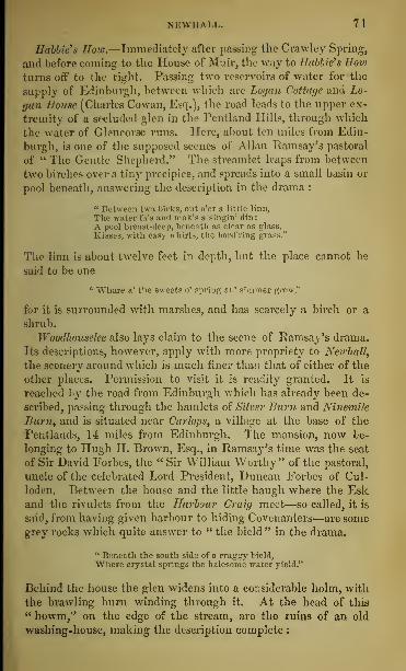
NEWHALL. 71
Hobbies How.—Immediately after passing the Crawley Spring,
and before coming to the House of Muir, the way to nubble's Howturns off to the right. Passing two reservoirs of water for the
supply of Edinburgh, between which are Logan Cottage and Lo-
gan House (Charles Cowan, Esq.), the road leads to the upper ex-
tremity of a secluded glen in the Pentland Hills, through which
the water of Glencorse runs. Here, about ten miles from Edin-
burgh, is one of the supposed scenes of Allan Ramsay's pastoral
of " The Gentle Shepherd." The streamlet leaps from between
two birches over a tiny precipice, and spreads into a small basin or
pool beneath, answering the description in the drama :
" Between twa birks, out o'er a little linn,
The water fa's and mak's a singin' din;
A pool breast-deep, beneath as clear as class.
Kisses, with easy whirls, the bord'ring grass.''
The linn is about twelve feet in depth, but the place cannot be
said to be one
'• Whare a' the sweets o' spring an' simmer grow,"
for it is surrounded with marshes, and has scarcely a birch or a
shrub.
Woodhouselee also lays claim to the scene of Ramsay's drama.
Its descriptions, however, apply with more propriety to Newhall,
the scenery around which is much finer than that of either of the
other places. Permission to visit it is readily granted. It is
reached by the road from Edinburgh which has already been de-
scribed, passing through the hamlets of Silver Burn and Ninemile
Burn, and is situated near Carlops, a village at the base of the
Pentlands, 14 miles from Edinburgh. The mansion, now be-
longing to Hugh H. Brown, Esq., in Ramsay's time was the seat
of Sir David Forbes, the " Sir William Worthy" of the pastoral,
uncle of the celebrated Lord President, Duncan Forbes of Cul-
loden. Between the house and the little haugh where the Eskand the rivulets from the Harbour Craig meet—so called, it is
said, from having given harbour to hiding Covenanters—are somegrey rocks which quite answer to " the bield" in the drama.
" Beneath the south side of a craggy bield,
"Where crystal springs the halesome water yield."
Behind the house the glen widens into a considerable holm, with
the brawling burn winding through it. At the head of this
" howm," on the edge of the stream, are the ruins of an old
washing-house, making the description complete :
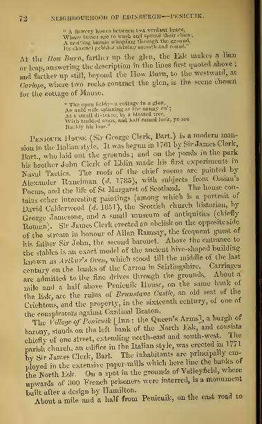
72 NEIGHBOURHOOD OF EDINBURGH—PENICUIK.
" a flowery howm between twa verdant braes,
Where laeaefl use to wash and Bpread their claee;
A trotting burnie dimpling through the ground,
its channel pebbles Bhlning Bmooth and round.
At the How Burn, ferther up the glen, the Esk makes a linn
or leap answering the description in the lines first quoted above ;
and farther up still, beyond the How Burn, to the westward, at
Carbp*, where two rocks contract the glen, is the scene chosen
for the cottage of Mause.
" The open field ;—a cottage in a glen,
An auld wife Bpinning at the sunny en;
At a small distance, by a Masted tree.
With faulded anus, and half raised look, ye see
Bauldy his lane."
Penicuik House (Sir George Clerk, Bart.) is a modern man-
sion in the Italian style. It was begun in 1761 by Sir James Clerk,
Bart who laid out the grounds ; and on the ponds m the park
his brother John Clerk of Eldin made his Erst experiments in
Naval Tactics. The roofs of the chief rooms are painted by
Alexander Runciman {d. 1785), with subjects from Ossian's
Poems, and the life of St Margaret of Scotland. The house con-
tains other interesting paintings (among which is a portrait ot
David Calderwood (rf. 1651), the Scottish church historian, by
Georo-c Jamesone, and a small museum of antiquities (chiefly
Roman) Sir James Clerk erected an obelisk on the opposite side
of the stream in honour of Allan Ramsay, the frequent guest of
his father Sir John, the second baronet. Above the enhance to
the stables is an exact model of the ancient hive-shaped building
known as Arthur's Oven, which stood till the middle of the last
century on the banks of the Carron in Stirlingshire. Carriages
are admitted to the fine drives through the grounds. About a
mile and a half above Penicuik House, on the same bank ot
the Esk, are the ruins of Brunstane Castle, an old seat of the
Crichtons, and the property, in the sixteenth century, of one of
the conspirators against Cardinal Beaton.
The Villaqc of Penicuik [Inn : the Queen's Arms], a burgh ot
baronv, stands on the left bank of the North Esk and consists
chiefly of one street, extending north-east and south-west. The
parish church, an edifice in the Italian style, was erected m 1771
by Sir James Clerk, Bart. The inhabitants are principally em-
ployed in the extensive paper-mills which here line the banks of
the North Esk. On a spot in the grounds of Vallcyfield, where
upwards of 300 French prisoners were interred, is a monument
built after a design by Hamilton.
About a mile and a half from Penicuik, on the east road to

TORTOBELLO—MUSSELBURGH. 73
Edinburgh, are Greenlaw Barrack.?, an extensive group of build-
ings partly of wood, used as a military prison.
Portobello. [Inn : Portobello Hotel, Bath Street."]—This
favourite resort for sea-bathing is three miles east of Edinburgh
by coach or railway. It has a population of 3497. The beach,
of fine smooth sand, with a gentle slope, is nearly half a mile
long, and has a terrace called The Prince of Wales Promenaderunning along it for 840 feet. Besides an Established church, there
are a Free church, an Episcopal church, a Roman-catholic chapel,
a United Presbyterian church, an Independent church, and
others. The first house built was a small cottage in the HighStreet, nearly opposite Regent Street, erected by a sailor, whohad fought under Admiral Vernon, and named his box Porto-
bello, in commemoration of the capture of that town in 1739.
The fantastic tower, chiefly of brick, at the end of Tower Street on thebeach, contains sculptures and other relics of old houses in Edinburgh,removed at the building of the South Bridge.
Musselburgh. [Inn : Musselburgh Arms, High Street.]—This
ancient burgh, which in 1851 had a population of 7092, stands at
the mouth of the Esk. It is six miles from Edinburgh by rail-
way, and three miles east of Portobello, and includes Fisherrow,
a large suburb, with which it is connected by three bridges. Themodern or New Bridge, of five arches, was built, from a design byRennie, in 1806-7. Beside it is a monument to Dr Moir, the
Delta of Blackwood's Magazine, a native of Musselburgh, who died
in 1851. About 220 yards higher up stands the Old Bridge, of
three arches, built, it would seem, in the fourteenth, and repaired
or enlarged in the sixteenth century. It is steep and narrow, andhad at one time a gate in the centre, some traces of which still
exist. Above is the viaduct to the station of the North British
Railway. In the north angle of the High Street is the Jail, erected
about 1590, attached to which are the Assembly Room and the TownHall, surmounted by a steeple, upon the dial of the clock of whichis the date 1496. In front is the Cross, a stone pillar on a square
pedestal. At the west end of the High Street is a house whichfigures in " Humphrey Clinker," as that in which Smollett
was received by Commissioner Cardonnell. For a notice of
Inveresk, which may be regarded as a suburb of Musselburgh, see
page 131.
Extending a mile along the shore is the spacious common known asMusselburgh Links, on which is a race-course, constructed in 1816. Thegrounds are a favourite resort for the game of golf. Here, in 1638, the Mar-
D

74 NEIGHBOURHOOD OF EDINBURGH—PINKIE—BURNTISLAND.
<Vu^ of Hamilton, oommkaioaer JVo„, fharl.-s I., was met.^X
Vjrl-TiV 1^11*1^
Covenanters; and here, in L650, Cromwell encamped his infantry intern-
, rv a. acks after Ins victory at Dunbar, while his cavalry ^quar-tered in the town. The snot on which hia own texri was pitched is s nil
Sed oul opposite UndeUHouse. At one end of the Links stoodLa
Eel with aPhermitege, dedicated to " I fur Lady of Loretto, famous fo.
^pilgrimages made to it before the Reformation. Near the site of the
*Sfi tow^%^e1^1ilentarv burgh in 1188, m* long . burgh of
regdfty,hTlduTofthe Ibbev of Dunfermline In L201 ^magnates of
Scotland assembled al Musselburgh to swear fealtyto the infant son ofKing
WSk Tnonn B Rudolph, Earl of Moray and Warden of Scotland, nephew of
Kmg Robert Bruce, Sied in Musselburgh in 1332. The old house in which
KeXdhui last stood on the south side of the ffigh Street till about
180 () On its site is the Aitcheson's Haven Operative Mason Lodge.
At the s uth-east entrance of the town is PiKKlB Hones, the sea of
SiTArehibald Hope, Bart., a tine specimen of Scotch castellated «chrtec-
Sre The squau! tower is said to Save been a residence of the Abboteo
DunfermlineTwhohad large possessions here, and™^*w7™*2?5the end of the fifteenth centary. The resl of the buihjing was the work of
Alexander Seton, Earl of Dunfermline, Chancellor ol Scotland, who died
£j™n%2 The fountain in the courtyard is a.very, intereating example
of Scotch renaissance. The painted gallery in the interior is equally worthy
of at entioTKS£ Charles Edward was its occupant for one oight after^hMvictory at
Prestonnans. His bedroom, which is still shown, has a fine roof. he
SlefielTof Pinkie, where the Scottish forces were defeated by the Pro-
tec or Somerset in 1547, is to the south and east of Pinkie House. In and
Is clrCnlim, where Queen Mary surrendered to the confederated no-
^ the welt, of Fishcrrow is the house of New Hailes formerly the seat
of Sir David Dalrymple, Lord Ilailes, author of the « Annals of Scotland
[d. 1792). His library is still preserved here.
Burntisland. [Inn : Forth Hotel.]—Burntisland, situated on
a peninsula of the Frith of Forth, five miles from Granton, with
which there is regular steam communication, is the first station
across the Frith on the Edinburgh, Perth, and Dundee Bulwty.
It was made a royal burgh in 1541, and has a population of 2724.
Its nearness to the capital, its fine sandy beach, and agreeable
walks, render it a popular bathing-place. The pier is accessible
at all times of the tide ; and the harbour is the best on the south
coast of Fife. The parish church, built about 1592 is said to
have moved the censure of Archbishop Laud, who saw it in 163o,
and in allusion to its square form, said that it were hard to tell,
in a church of such a shape, where to place the altar There is
a tradition that it was built after the plan of a Dutch architect.
The ruins of the more ancient parish church at Kirkton, about
halfa mile to the north, seem to show traces of Romanesque work.
The town is well sheltered from the north by the lulls of Dun-
cam 734 feet, and the Binn, 631 feet above the sea. lhe top ot

ABERDOUR INCHCOLM. < 9
Dunearn, which has been fortified by a rampart of loose stones,
commands a noble view. On an eminence to the west, overlook-
ing the harbour and pier of Burntisland, is Rossend Castle, part of
which seems to be of the sixteenth century. In 1538, it w;is
granted by the Abbey of Dunfermline to the Duries of that Ilk,
whose arms are upon it ; and from them it passed to the well-
known Kirkcaldy of Grange. A pleasant footpath leads westward
along the seashore to Aberdour, a distance of something more than
three miles.
AcERnoun. [Inn : Aberdour Hotel.]—The pretty little village
of Aberdour, on the Fife coast, 8 miles north-west of Edinburgh,
and 3 \ west of Burntisland, is a favourite summer resort. Asteamer plies daily between it and Leith, from the beginning of
June to the end of September. The ruins of Aberdour Castle
(Earl of Morton), chiefly of the seventeenth century, stand on
a bank at the head of the little bay. Near them is the ruin of the
old parish church, showing one or two Romanesque traces, but
principally Second-Pointed, of about the middle of the fifteenth
century. To the east of the village is a beautiful white sandy bay,
fringed with trees. To the south, in the Frith, at the distance of
about a mile, is the island of Inchcolm. Three miles to the west,
in the midst of a fine park, is Donibristle Rouse (Earl of Moray),
built about 1720, and partly destroyed by fire in 1858. The ap-
proach from Aberdour along the shore of the Frith commandsnoble views of Edinburgh and the Mid-Lothian coast. On the
left, about a mile and a half from Aberdour, at the water's edge,
are the ruins of the old parish church of Dalgety, with a singular
building in the renaissance style at the west end, the work of
Alexander Seton, Earl of Dunfermline, Chancellor of Scotland
(d. 1G22), who lies buried within it. Near Donibristle House theu Bonnie Earl of Moray " was murdered, among the rocks on the
beach, by the retainers of the Earl of Huntly in 1592. Abouttwo miles west from Aberdour, on the road to Dunfermline,
on the banks of Otterstoun Loch, a pretty little sheet of water,
are Otterstoun House (Mowbray, Esq.) and Cockairney (LadyMowbray). Immediately to the north of Aberdour is Hillside
(Wotherspoon, Esq.), and about two miles beyond, to the north-
east, is the wooded hill of Killella, commanding fine views of the
Forth.
Inchcolm—or Saint-Colm's Inch, as it is called by Shakspeare
—may be visited by boat from Aberdour, from which it is sepa -

76 NEIGHBOURHOOD OF EDINBURGH—INCHOOLM—INCH KEITH.
rated by the channel of Mortimer's Deep, about a mile broad.
It is about half a mile in Length, and about a hundred and fifty
yards across, where widest. " Of the many beautiful spots in
the vicinity of the Scottish metropolis," says Professor J. Y.
Simpson, in the Proceedings of the Antiquaries of Sn,tl,n,<l,
" there is perhaps none which surpasses this little island in the
charming and picturesque views that are obtained from it." It
contains the ruins of an Abbey of Austin Canons founded by
King Alexander I. in the year 1123. There are slight traces of
Romanesque work, but the church and chapter-house are chiefly
First-Pointed. The most ancient building on the isle is a little
oratory—about 20 feet long and 7 broad—where a hermit votary
of St Columba served before the foundation of the Abbey. This
" capellula" is of the same type with the Irish oratory of Gal-
lerus, and may perhaps date from the ninth or tenth century.
It has been recently restored. There is a coped tombstone,
probably of the twelfth century, on a knoll to the south-west of
the abbey. One fragment of an ancient sculptured pillar lies in
the chapter-house, and another has been built into the tower.
Walter Bower, the continuator of John of Fordun's Scoti-Chroiii-
con, was made Abbot of St Colm's Inch in 1418.
1nvhkeith.— This island, the property of the Duke of Buccleuch, is part
of the Fifeshire parish of Kin-horn. It is nearly three miles in circum-
ference, has a rocky, irregular surface of miniature hill and glen, and is
difficult of access, except by a small quay on the south. It has excellent
pasturage for horses and sheep. On the highest point is a lighthouse, with
a revolving light, appearing at its brightest once every minute, and seen
at the distance of eighteen nautical miles. The lighthouse is on the site
of a fort erected by the English in the reign of Edward VI., and captured
by the French auxiliaries in the service of the Queen Dowager, Mary of
Guise, in 1549. St Adamnan, the successor and biographer oi St ( olumba,
is said to have founded a church in the island in the eighth century. Ineh-
keith has been supposed to be the urbs Qiudi of Venerable Bede.
Inchgarvic—This rocky islet lies in the middle of the passage, between
South and North Queensferry. In the reign of King .lames IX. it was
granted to Dundas of Dundas, who undertook to erect on it a fortalice for
the protection of the navigation. This fortalice, the remains of which are
on the west end of the islet, was subsequently used as a state prison. The
adjoining modern square tower with defences on the summit of the rock,
now also in ruins, was garrisoned by a few soldiers so lately as the end of
the last century. To the westward lies the Bimar Bock, marked by a beacon.
Inchmickery, the little rock or island in the frith between Cramond Island
and lnchcolm, belongs to the estate of Granton. It has a surface of about
two acres, overspread at certain seasons with the eggs of the tern {btcrna
hirundo).

DALMENY PARK AND CHURCH. 77
EDINBURGH TO QUEENSFERRY, HOPETOUN HOUSE,INVERKEITHING, AND DUNFERMLINE.
Coaches from No. 4 Princes Street run by South and through North Queensferryand Inverkeithing to Dunfermline, a distance of sixteen miles,— to Soutli Queens-ferry t\ ur times a-day in summer, and to Dunfermline three times a-day all theyear round. Hopetoun House lies off the road, about three miles west from SouthQueensferry. Dunfermline may lie readied also by the Edinburgh, Perth, andDundee Railway, as well as by the Stirling steamers from Granton, which call at
Limekilns, whence there is an omnibus to Dunfermline.
Leaving Edinburgh by Princes Street and Queensferry Road,
the coach crosses Dean Bridge, overlooking the village of Water
of Leith, and having at its north-west corner Trinity Episcopal
Church (see page 5-4). Below, on the right, is St Bernard's Well.
The coach passes on the right, Clarendon Crescent, and on the
left Stewart's Hospital. Craigleith Quarry, on the right, supplied
most of the fine white freestone with which the houses in the
New Town of Edinburgh are built. Two miles out, on the left,
is the finely placed mansion of Ravelston (Keith Murray, Esq.).
Next is seen, also on the left, Craigcrook Castle (John Hunter,
Esq.), once the residence of Lord Jeffrey, delightfully situated
beneath the wooded hill of Corstorphine. Two miles farther, on
the right, in the middle of a large park, is Barnton House (Hon.Mrs Ramsay), and half a mile beyond the coach crosses the Al-
mond by Cramond Bridge, and on the left passes New Saughton
(Earl of Morton) and Craigiehall (Hope Vere, Esq.). The village
of Cramond, 5^ miles from Edinburgh, is situated in a romantic
hollow on the east side of the Almond, at its junction with the
Forth. The road now passes Dalmeny Park, the seat of the Earl
of Rosebery, a handsome modern mansion, in the Pointed style
of architecture. The beautiful grounds are open to the public
on Mondays. On other days admission can be obtained only byorder. About half a mile from Dalmeny House, on the shore of
the Forth, are the ruins of Barnbougle Castle, long the seat of the
Mowbrays. It was bought in 1662 by Sir Archibald Primrose
of Carrington, Lord Clerk Register of Scotland, the founder of
the Rosebery family, whose residence it was until about 1815,
when Dalmeny Park was built. About a mile west is an ancient
mound called the Earl Cairnie, about 500 feet in circumference.
Nothing is known of its age or purpose.
Seven miles from Edinburgh, on the left, is Dalmeny Parish
Church, a small Romanesque edifice of the middle of the twelfth
century. It consists of a nave (44 feet long by 17 wide), a chan-
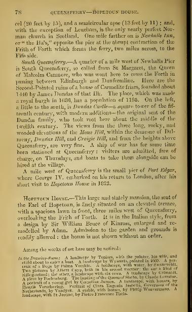
QUEENSFERRY—tOPETOUN HOUSE.
eel (20 feet by 15), and a semicircular apse (13 feet by 11) ; and,
with the exception of Leuchars, is the only nearly perfect Nor-
man church in Scotland. One mile farther on is NewhalU Inn,
or " the lla's," opposite the pier at the abrupt contraction of the
Frith of Forth -which forms the ferry, two miles across, to the
Fife side.
South Queensferry.—A quarter of a mile west of Newhalls Pier
is South Queensferry, so called from St Margaret, the Queen
of Malcolm Canmore, who was wont here to cross the Forth in
passing between Edinburgh and Dunfermline. Here are the
Second-Pointed ruins of a house of Carmelite friars, founded about
1440 by James Dundas of that Ilk. The place, which was made
a royal burgh in 1G36, has a population of 1195. On the left,
a little to the south, is Dundas Castle—& square tower of the fif-
teenth century, with modern additions—the original seat of the
Dundas family, who took root here about the middle of the
twelfth century. The views from the three long, rocky, and
wooded elevations of the Mons Hill, within the demesne of Dal-
meny, Dundas Hill, and Craigie Hill, and from the heights above
Queensferry, are very fine. A ship of war has for some time
been stationed at Queensferry : visiters are admitted, free of
charge, on Thursdays, and boats to take them alongside can be
hired at the village.
A mile west of Queensferry is the small pier of Port Edgar,
where George IV. embarked on his return to London, after his
short visit to Hopetoun House in 1822.
Hopetoun House.—This large and stately mansion, the seat of
the Earl of Hopetoun, is finely situated on an elevated terrace,
with a spacious lawn in front, three miles west of Queensferry,
overlooking the Frith of Forth. It is in the Italian style, from
a design by Sir William Bruce of Kinross, enlarged and re-
modelled by Adam. Admission to the garden and grounds is
readily allowed : the house is not shown without an order.
Among the works of art here may be noticed
:
In the Drawing-Boom: A landscape by Teniers, with the painter, hk wife, and
child about to enter a boat. A landscape by Wynunts. painted m 1669. A por-
trait of a Doge bv Palma Vecchio. A landscape, with water, by Swanevr dt
Two pictures by Albert Cuyp, both in his second manner; the one a kind <>f
riding-sehool ; the other, a landscape with six cows. A landscape by Gnmaloi.
A piece by I'oclemburg. The landingof the Queen of Sheba, byChwde Lorraine.
A portrait of a young girl by Cornelius Jansen. A landscape, with houses by
llenrik Verschuring. Portrait of Clara Eugenia Isabella, (.overness of the
Netherlands, by Vandyck. A stable, with horses, by Philip ^ ouvennaus. Alandscape, with St Jerome, by Pietro Francesco Thola.

ABERCORN—INVERKEITHING. 79
In the Saloon: The Adoration of the Shepherds by Rubens (bought by LordHopetovn In (ionoa for £1000). Throe sportsmen with dogs, in a landscape, byTitian. Two pictures by Vandyck: Christ as Ecce Homo; and a whole-length,life-size portrait, said to he of Spinola. Portrait of his grandmother by Rem-brandt, pain tod in 1(>;>o'. A soa-piooo by Ludolf Backhuysen. A small sea-
piece by William Vandevelde. interior of a house hy Thomas Wyck. TheTemptation of Bt Anthony by Teniers. A whole-length, life-size portrait of theMarquess of Hamilton by Myteus.
To the west of Hopetoun House, and almost within the park,
are the pretty village, church, and churchyard of Abercorn^ on
the site of the Saxon monastery of Abercurnaig, founded, as
we learn from Bede, in the seventh century. There are remains
of Romanesque work in the church ; and two fragments of whatseem to have been sculptured pillars are built into the north
wall. There is a coped tombstone, probably of the twelfth cen-
tury, in the churchyard. The site of the castle of Abercorn,
which, in 1455, was held out for the Douglases against KingJames II., is still shown. The Fife coast opposite is indented byseveral beautiful bays, one of which, about a mile north-west of
North Queensferry, is called St Margarets Hope, from QueenMargaret, it has been conjectured, being driven thither by a
storm, in her flight from England after the Conquest. It is still
one of the chief harbours of refuge on the east coast, and during
easterly gales large numbers of vessels seek shelter here.
The village of North Queensferry , situated on a promontory, is on theold line of road from Edinburgh to Perth, and has an excellent pier. Onthe Ferry Hills, above the promontory, called The Cruicks, Cromwellfought the battle of Inverkeithing in 1(551.
Rosyth Castle, about three miles to the west, is a ruined square tower,of the sixteenth century, standing on a rock on the shore, connected by acauseway with the mainland.
Two miles from North Queensferry is Inverkeithing, on a pleasanteminence overlooking a land-locked tidal bay of the Frith of Forth. Thetown, which was made a royal burgh in the reign of David I. (1124-53),has a population of 1852. It consists of one spacious street, intersected
by several others of inferior width, with a number of houses fronting theharbour. The Town-house, erected in 1770, contains, besides the Town-hall, the Jail. The Parish Church is a modern Pointed edifice, withan old western tower in the Second-Pointed style, containing a veryperfect baptismal font of late Second-Pointed work.
The country between Inverkeithing and Dunfermline, a distance offour miles, is pleasant. A large stone on the west side of the road,near Pitreavie, is called " St Margaret's stone," from some forgottenincident in the life of the Queen of Malcolm Canmore.
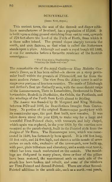
SO DUNFERMLINE—ABBEY,
DUNFERMLINE.
[Inns: New, Royal.]
This ancient town, the seat of the damask and diaper table-
linen manufactures of Scotland, has a population of 13,850. It
is built upon a rising ground stretching from east to west, upwardsof 270 feet above the level of the Frith of Forth, from which it
is three miles inland. The ground slopes sharply towards the
south, and soon flattens, so that what is called the Nethertown
stands upon a plain. Although not made a royal burgh till 1588,
it was for centuries before a favourite residence of the Scottish
sovereigns
—
•• The king sits In Dunfermline toun,Drinking the blade-red wine."
The remarkable site of the royal Castle—or King Malcolm Can-move's Tower, as it has been called—is shown on a steep penin-
sular knoll within the grounds of Pittencrieff, not far from the
more modern Palace. The view from the Abbey tower is said to
range over portions of fourteen counties. The castle of Edinburghand Arthur's Seat are distinctly seen, with the more distant range
of the Lammermoors, Tinto in Lanarkshire, Benlomond in Dum-bartonshire, Benledi in Perthshire, the Ochils, the Pentlands, and
the windings of the Forth from Leith almost to Stirling.
The Abbey was founded by St Margaret and King Malcolm,
between 1070 and 1093, for Benedictines brought from Canter-
bury. No portion of the original Romanesque presbytery with
its semicircular apse, the part first built, now remains. It was
taken down about the year 1250, to make way for a large and
beautiful First-Pointed choir, with transepts and lady chapel,
which again was replaced, in the year 1820, by the erection nowoccupied as the parish church, built in the Pointed style from the
designs of Mr Burn. The Romanesque nave, which was conse-
crated in 1150, has fortunately been spared. It is 106 feet long,
55 feet wide, and 54 feet high, and shows a noble arcade of seven
arches on each side, exclusive of the tower-arch, now built up,
with poor, plain triforium and clerestory, and a south-west tower,
which has been much modernized on the outside. The mould-
ings are disfigured in many places, three or four of the pillars
have been restored, the easternmost arch on each side of the
arcade has been broken and rebuilt, and some of the windows
are First-Pointed and Second-Pointed. There are other Second-
Pointed additions in the north side, such as a north-west porch,

DUNFERMLINE—ABBEY—PALACE. 8 1
and a tower at the end of the north aisle. The enormous but-
tresses, which so deform the exterior, on both sides, appear to
have been built in the sixteenth century, when their support
was found necessary to save the walls from falling.
Dunfermline was long the place of sepulture of the Scottish princes.
Here were interred St Margaret (d. 1093) ; her husband King Malcolm[d. 1093^; their sons King Edgar \d. 1107), King Alexander I. (d. 1124),
and King David I. [d. 1153); King Malcolm the Maiden (rf. 1165);King Alexander III. (d. 1286); King Robert Bruce (d. 1329); his wife,
Queen Elizabeth (d. 1327); his nephew, Sir Thomas Randolph, Earl of
Moray, Warden of Scotland (d. 1332);Queen Annabella, wife of King
Robert III. (d. 1401) ; and Robert, Duke of Albany, Governor of Scotland
(d. 1419).
No monument of any of these personages can now be identified. A slab
of blue marble, at the east end of the modern parish church, is shown as the
tombstone of St Margaret. Her bones were enshrined in the choir on her can-
onization in 1250, and continued to be venerated here until the Reformation.
Part of them then found their way to the Escurial in Spain, and part weredeposited in the Scotch College of Douay, where they were lost or destroyed
at the French Revolution in 1789. The tomb of King Robert Bruce wasdiscovered in 1818, in digging the foundations of the modern parish church
;
its site is marked by a large slab under the pulpit ; and the event has beencommemorated by the words king : kobekt : the : bruce wrought into
the balustrade of the church tower.
Of the conventual buildings, which stood to the south of the AbbeyChurch, the stately ruins of the Refectory, or Frater-Hall, only now remain.They are in the Second-Pointed style, not later probably than 1400, andmeasure 120 feet in length. The remarkable west window, obviously of
more modern date, may be referred to the close of the fifteenth or be-ginning of the sixteenth century.
The Palace, which is now separated from the Fratry by a narrow road-
way, was originally, it would seem, a part of the monastic buildings. It is
beautifully situated on the brink of a deep woody ravine. The ruin is
about 200 feet long. The older and lower portions are about the same date
as the Fratry ; the rest of the building appears to be of the sixteenth cen-
tury. King Charles I. and his sister, the Princess Elizabeth, were bornwithin its walls.
St Margaret's Cave is on the same side of the glen, on the edge of
which the Palace stands, but about a quarter of a mile to the northward.It is now a shallow recess in the rock, but is said to have been much deepereven within the memory of man.
Next to the ruins of the Abbey and Palace, the chief buildings
are, the Town-house, erected in 1769 ; the County Buildings, in
1808; the Burgh High School, in 1817 ; the Maclean Schools;
Muir Hall; the Poor House ; the Prison in the Town-green;Trinity Episcopal Church; and a large United Presbyterian Church,
built for the well-known Ralph Erskine, with his statue on a
pedestal in front, in Queen Anne Street. The streets, thoughgenerally rather narrow and irregular, are well built. One of
the power-loom factories (St Leonard's) employs more than 1000persons.

82 EDINBURGH TO STIRLING, BY STEAMBOAT.
EDINBURGH TO STIRLING, BY THE FRITH OF FORTH.
A steamer Bails every day, except Sunday, from Granton Pier to Alloa and Stir-ling, calling off North Qneenaferry, ( barleeton, Crombie Point, Bo'ness, Kincardine,Uloa, and Cambnskenneth, and returning the Bame day to Granton. The distancefrom Granton to Stirling is about fifty miles. See I
Trains run from Waverley Bridge Station to Granton almost every hour till nineat night.
\ Lsiters to the Bumbling Bridge, and other places in that neighbourhood, shouldland at Alloa.
Leaving Granton, the tourist will perceive, 3 miles west of Burntisland,on the north or Fife slime, the village of Ah rdour
twith its small well-shel-
tered harbour, and the ruins uf Aberdour Castle (Karl of Morton . A little to
the west 18 the island of [NCHCOLM, with the ruins of its twelfth centurymonastery (see page 75). Next are seen 8t Colme House, the ruins of Dahj<t>iChurchy and Donibristle Houst (Karl of Moray), then the little seaport of jot
David's, and the entrance to the tidal Bay ofInverheithing, the coast in this
quarter being bounded by the sleep cliffs at North Queer^ferry.On the south or Edinburgh side are Caroline Park, Granton House,
Mni,-house, Broomfield, and Lauriston Castle (Miss Macpherson Grant ofAberlour), formerly the property of the famous financial projector JohnLaw, who died in 1729. Cramond Island next appears; and on the shore,
on the eastern side of the Almond, where that river discharges itself into
the Frith of Forth, is the village of Cramond, -»\ miles west of Edinburgh.Near the village is Cramond House (C. Halkett Craigie [nglis, Esq.), anda little farther west, Dalmeny Park (Earl of Rosebery), with the ruins of
Barnbougle Castle, close upon the shore.
The steamer now approaches South and North Queensferry, where thefrith contracts, having in the strait between them the fortified islet of Inch-
garvie (page 7G). On an isolated rocky point on the west side of St Mar-l's Hope, about a mile northwest of North Qneensferry, are the ruins
of Rosyth Castle, once the seat of the Stuarts of Rosyth, from whom, it is
said, the mother of Oliver Cromwell was descended. Near this, on thesouth side, is Port Edgar (see page 78). Beyond South Queensferryis Dundas Castle (Dundas of Dundas) ; and farther on, on the same side,
and about a mile from the shore, is Hopetoun House, the beautiful seat
of the Karl of Hopetoun (see page 78). Opposite this princely residence,
the frith again expands. Next, on the south side, are Abereorn Church,and beyond it Blackness Castle, which is supposed to mark the eastern
extremity of the Roman wall of Antoninus. It was long one of the state-
prisons of Scotland. Next are passed Carriden House (Hope, Esq.), Kirk-
grange, Salt Pans, and, farther up, Borrowstounwess, pronounci d Bo'ness,
enveloped in smoke. In 1851 it had a population of 2645; and in 1858 acustoms revenue of £721, and 60 registered vessels, with a tonnage of 5G24.
In 1858 it shipped coastways 108,093 tons of coals, and exported abroad128,952 tons, the latter being of the declared value of £05,895. Two miles
above is the Duke of Hamilton's seat of Kinniel House, the residence of
the celebrated metaphysician Dugald Stewart from 1807 to 1828. Thenext place of mark, on the south side, is GRANGEMOUTH, at the entrance of
the Forth and Clyde Canal. It is a custom-house port, with a revenue, in
1858, of £14,657, and 57 registered ships, measuring 90-12 tons. In the sameyear it exported abroad 37,797 tons of coals, of the declared value of £16,830.In this neighbourhood are the large iron-works of the Carron Company.On the north side, opposite Blackness, is the village of Brucehanen, and,
close by, the village and small port of Limekilns. The Karl of Elgin's
fine mansion of Broomhall next appears, in the neighbourhood of his lord-
ship's village of Charleston, with its extensive limeworks. Here is a pier
where the steamer receives and debarks passengers to and from Dunferm-line, four miles inland. Next is Crombie Point, with its small pier and

EDINBURGH TO STIRLING, BY STEAMBOAT. bo
hamlet, beyond which is the village of Torri/bum. Here is Torn/ House(WemyiB, Esq. oi' Wemrss Castle), a fine seat on the sloping heights behind.
Adjoining Torryburn village is the hamlet of Newmiua.The cottages of Low Vaueyfield next appear on the shore ; and behind is
the mansion of Vcdleyfield Hous< (Sir Ilcm-y Preston, Bart), on the elevated
grounds. Next is CtJLROSB, Standing pleasantly on a sloping bank, amid gar-
dens and fruit trees, four miles west of Crombie Point. This place, made aroyal burgh in loSS, was long famous for its manufacture of girdles for bak-ing oat-cakes. It has a population of 605, and has been long in a state ofdecay. The Abbey of St Mart/ and St Serf of Culross was founded for Cister-
cians, about the year 1217, by the Earl of Fife. Portions of the conventualbuildings still remain ; they are in the First-Pointed style. The cruciformchoir of the conventual church, which was in the same style, has been mo-dernized. What was the central, but is now a western tower, has been pre-
served entire ; it is in the Second- Pointed style. Near the centre of the townboss J/oiis<>, a three-Storeyed mansion within a walled court, built by
Sir George Bruce of Kinloss between 1597 and 1611. A room in the upper-most storey, in the east end, has an alcove ceiling of wood, divided into 18
panels, each having a painting of a virtue, or moral quality, with a Latinmotto, and an English couplet. At the east end of the town, on the shore,
are the vestiges of St Mango's Chapel, built on the spot where, accordingto old legends, the founder and patron saint of Glasgow was born early in
the sixth century. He was educated at Culross, under St Serf, who had amonastery here. West of Culross, close on the shore, is the seat of Castle-
hlll. of old, it is said, called Dunnemarle (Miss Erskine). Farther west is
Blair Castle (Miss Dundas), a handsome modern mansion. About a milefarther is Sands House (Johnstone, Esq.).
Three miles west of Culross, on the same side, is Kincardine, a thrivingport, with some trade in shipbuilding, and a population of 2697. A little
beyond is TulUallan Castle (Countess Flahault, Baroness Keith), an elegantmodern edifice, near the ruins of an interesting example of the fortified
mansion-house of the fifteenth century. Next are Kennet Pans, Kilbagie,
and, inland, Kennet House (Bruce, Esq. of Kennet). Nearly opposite, onthe south or Stirlingshire side, is Dunmore Park, the fine seat of the Earlof Dunmore, containing a large and interesting collection of pictures.* On
* Among the pictures at Dunmore Park may be mentioned the following :
In the Billiard Boom: Psyche and Cupid, by Al, ssandro Turchi. A hilly land-scape, by Gaspar Poussiii. Portrait of Admiral Capello, by Tintoretto. Josephand Potiphar's Wife, by Giuseppe Porta. Two landscapes, by Jacob Iluysdael.A landscape, by Artus Yander Neer. A large landscape, by Nicolas Poussin.
In the Gallery: The Virgin and Child, Joseph and St John, by Jnnocenzo da Imola.Full-length portraits of King Charles I. and Queen Henrietta Maria, by DanielMytens.
In the Drawing-Rnom : A landscape, by Ilobbema. The Adoration of the Shepherds,by Titian, or one of his school. Portrait of a boy, with hat and feathers, by Van-der Heist, or by Cuyp. Peasants with an ox, by Velasquez. Soldiers maltreat-ing peasants, by Rubens. Dice-players, by Le Nain. A boy holding a horse, byCuyp. Two landscapes, by Gaspar Poussin. A boy with a sword, by Sir JoshuaReynolds. An altar-piece with wings, by Albert Durer, or by Walther vanA -sen. The Visitation, by Lodovico Carracci. Music and the Graces, by Par-migiano. A portrait "fa man, by Titian. A landscape, by Sebastian del Piombo.
i rait of Cardinal Soderini, by Allessandro Allori. The Virgin and Child, withSt John, St Catherine, and Joseph, by Giulio Romano. The Virgin and Child,by Giacomo Fraucia. The Conversion of St Paul, by Giulio Romano. Christ onthe Mount of Olives, by Marcello Venusti. The Virgin and Child, by GiovanniPedrini. The Virgin, St John, and the Magdalene, by Annihale Carracci.
In the Dining-Room: Portrait of a gentleman in Highland costume, by Sir JoshuaIN ynolds. Full-length portrait of Queen Henrietta Maria, by Vandyck. Alandscape, by Pynaker. A large landscape, with Hagar and Ishmael, by Sal-vator Rosa. The Finding of Moses, by Tintoretto. Martyrdom of St Catherineby Paul Veronese. Perseus and Andromeda, by Vandyck.

84 EDINBURGH TO STIRLING, BY STEAMBOAT.
the north, towards Alloa, is the county town of Clackmannan, and besideit, on the west, B tall Bqtuure tower of the fifteenth century, long the scat of
the Braces of Clackmannan. Farther inland, on the same side, two miles
from the Forth, is Shaw Park, a seat of the Earl of Mansfield. A little
farther on, on the same side, is Alloa, a flourishing town and seaport,
with some large breweries and distilleries, and in the neighbourhood ofseveral large collieries. In 1851 it had a population of 6676, and in 1858a customs revenue of £4260, and 7 5 registered vessels, with a tonnage of
16,038. In 1858 it shipped coastways 15,850 tons of coals, and exportedabroad 71,864 tons, the latter being of the declared value of £23,029. Close
by is Alloa Tower (Earl of Mar), another of the tall square fifteenth cen-
tury keeps so common in Scotland. On leaving Alloa, the crooks or wind-ings of the river, known as the J. nils of Forth, are entered. So tortuous
does the stream become, that the distance of Alloa from Stirling is bywater about 12 miles, and by land no more than 7. Two flat islands
are now passed, the one, called AUoa Inch, the other farther up the river
known as Tullibody Inch. The channel is navigable on either side of the
islands. On the north bank, the mansion of Tullibody, a seat of Lord Aber-cromby, is seen among the trees, with the range of the Ochils in the back-
ground. A mile and a half above Alloa, on the south bank, is the mansionof Throak on the riverside; and above is Polmaise (Murray, Esq.). On-wards, upon the north bank, are the ruins of Camiu;ski:nm:tii Abbey,founded about 1147, for Austin canons, by King David 1. Here KingRobert Bruce held a famous parliament after the victory of Bannockburn
;
and here King Janus I II. was buried in 1488. All that remains of the
Abbey is a tower and a doorway in an isolated wall, in the First-Pointed
style. The rocky eminence behind is The Abbey Craig. There is a foot-
path from the Abbey to Stirling, across the peninsula through the Abbeyvillage, and by a ferry over the Forth. The steamer lands the passengers
at Stirling Shore, as the small quay below the town is called. From Stirling
the tourist may return to Edinburgh either by the steamer or by railway.


WLAm&W
''^7
/>
Jl i
fill
M^SPhys
7rr
>cv
/ C/.W £\
y.f \yrI \i
-i__A
p—CL
*m •
4 urrn ^ ^^^otI 1

GLASGOW AND ITS ENVIRONS.
HOTELS.Queen's, 40 George Square.
Royal. 50 George Square.
George, 74 George Square.
North British Imperial. 1 N. Queen St.
Caledonian, 52 George Square.
Buck's Head, 61 Argyle Street.
Globe, 29 George Square.
Victoria, 15 West George Street.
Tontine, 28 Trongate.Regent, 2 Oswald Street.
COMMERCIAL HOUSES.
Crow, 20 George Square.
Albion, 74 Argyle Street.
The Rose, 109 Argyle Street.
Soho and Thistle, 41 Glassford Street.
Albert, 63 Wilson Street.
Star, 72 Glassford Street.
RESTAURANTS asd TAVERNS.
Queen's, 136 Buchanan Street.
Ferguson and Forrester, 36 BuchananStreet.
M'Lerie, 108 St Vincent Street.
Wilson, 10 Nile Street.
Luncheon and Sandwich Rooms, Lang,
73 Queen Street.
TEMPERANCE HOTELS.London, 29 Maxwell Street.
Franklin, 14 George Square.
Aitken's, 108 Argyle Street.
M'Culloch's, 10 Bridge Street.
COFFEE-HOUSES.Commercial, 72 Wilson Street.
Angus's, 127 Argyle Street.
Steel's, 90 Argyle Street.
Waverley, 18 George Square.
NEWS ROOMS.Royal Exchange, Queen Street. Free
to strangers for four weeks, if intro-
duced.Tontine, Exchange, 14 Trongate. Free
to strangers for four weeks, if intro-
duced.Telegraph,26 Glassford St. Id. per visit.
Athenaeum, 110 Ingram Street. Mem-bers only.
TELEGRAPH OFFICES.
Electric —Royal Exchange Buildings,
and Caledonian Station, BuchananStreet. The latter open all night.
British and Magnetic,—24 Royal Ex-
change Square and Greenock Rail-
way Station.
Railway Stations.-" Edinburgh and Glasgow," station for Edinburgh, the Nor h,
Helensburgh, and Loch Lomond, at head of Queen Street, George Square ; _Cale-
donian " station for the south, at Port-Dundas, head of Buchanan Street ;station for
Greenock and Ayr (station of Glasgow and South-Western), at Bridge Street, south
side of Broomielaw or Glasgow Bridge ;station for Hamilton and Barrhead at south
side station, Ayr Road, head of Main Street, Gorbals, continuation of Stockwell
Street, across the river.
Coach and Horse Hirers.-Walker, at Tontine, Cross; Wylie and Lochhead 42
Mitchell Street; Menzies,124 ArgyleStreet; Scott, Croall, & Co., 356 Parliamentary
Road.
1. As Edinburgh, the political capital of Scotland, is the memo-
rial of much of its past history and the type of its intellectual
culture, Glasgow, its commercial capital, is the emblem of its
business activity and of the vast material and mechanical progress

8G GLASGOW SITUATION AND CLIMATE.
characteristic of the present time. Although not destitute of his-
torical and picturesque attractions, it is not to these that the trav-
eller must chiefly look when he visits the western metropolis.
Its interest is to be found mainly in the spectacle of great energydirected to commercial and mechanical pursuits, and raising whatwas for centuries a village, gathered under the wing of a cathedral,
to a mighty city, with nearly half a million of inhabitants.
Glasgow is situated on both sides of the river Clyde, but chiefly
on the northern bank, in latitude 55° 51' 32" N., and longitude4° 17
/ 54" W., upon ground which, though rising considerably
to the north side of the river, appears, when compared with the
site of Edinburgh, to be almost level. Its distance from the deep
sea water of the Frith of Clyde is about twenty miles, and from
the North Channel about four times that distance. Its greatest
diameter is from east to west, being, inclusive of the suburbs, about
five miles. The country immediately around is somewhat flat,
but the range called the Campsie Hills forms a screen to the north
at the distance of six or eight miles, and towards the south and
south-west are the hilly districts of Lanarkshire and Renfrewshire.
The climate of Glasgow is mild, the mean temperature being about47*75°, a little above that of Edinburgh. The air is moist, but
the quantity of rain is not so great as is popularly supposed.
According to tables kept during the first thirty years of this cen-
tury, the average annual fall was about 22-328 inches.
The general plan of the city will be easily understood by a glance
at the map. It will be seen that the Clyde intersects it from east
to west much in the same manner as the Thames intersects Lon-don, and that the longer and more important streets run parallel
to the river on its north side, with the exception of its oldest and
in former times principal street, the High Street, which has a di-
rection at right angles to the others, beginning at the high ground
near the Cathedral at the north-eastern corner of the city, and
running directly south at right angles to most of the other leading
thoroughfares. The latter, taking them in succession northwards
from the river, are, first, Great Clyde Street and the Broomielaw
;
and, second, the Trongate with its western continuation Argyle
Street (broad and busy streets), and its eastern continuation called
the Gallowgate, forming the main artery of the business life of
Glasgow. Next to the north, but considerably shorter, is Ingram
Street, passing eastwards from the front of the Iloyal Exchange.
The next line is St Vincent Street, composed almost exclusively
of mercantile and professional offices and private dwellings. Then

GENERAL DESCRIPTION OF THE CITY. 87
comes George Street, a street of great length, divided into east
and west by George Square, the western division consisting also
of places of business and private houses. Still farther north, Bath
Street, to the west, almost entirely composed of private houses,
and Cathedral Street and Stirling's Road, to the east, extend in
one continuous line across the city. After this is Sauchiehall
Street, leading to the north-western district of the city and the
New or AVest End Park, around which handsome streets and ter-
races are rapidly springing up, and continued to the east under
the name of the Parliamentary Road, leading to the north-eastern
districts around St Rollox.
The chief lines cutting these at right angles are, (1.) the High
Street, already mentioned, beginning near the Cathedral, passing
the University, and, with its continuation the Saltmarket, familiar
to all readers of Rob Roy, terminating on the river at the western
extremity of "the Green," the ancient public park of Glasgow;
(2.) As we proceed westward, Stockwell Street, leading from the
river to the Trongate, extends under the name of Glassford Street,
to Ingram Street; (3.) Maxwell and Queen Streets ; and (4.) Dixon
Street and St Enoch Square, passing from the river, across Argyle
Street, to Buchanan Street, one of the fashionable promenades of
the city. Add to these, (5.) Jamaica Street, a crowded thorough-
fare running from Glasgow Bridge (the lowest of the bridges
which cross the Clyde) northward to Argyle Street, and continued,
under the names of Union and Renfield Streets, to the Caledonian
Station.
The tourist, by keeping in his mind's eye these few leading
lines, will have no difficulty in finding any part of the city which
is worthy of his attention. The portion which lies to the eastward
of the High Street, and also the greater part of that which is on
the south side of the river, he may safely neglect.
Glasgow is not so distinctly divided into old and new town as
Edinburgh ; at the same time, one cannot fail to be struck with the
contrast between the din and bustle of the Trongate, equal almost
to those of the Strand, the gay and animated aspect of BuchananStreet, and the teeming population and squalor of the High Street,
on the one hand ; and the repose and magnificence of the new and
fashionable streets, squares, and terraces at the west end, on the
other. The extremes of wealth and luxury, and of poverty and
degradation, appear in close contiguity. The wealth, however, is
not that of the secure and leisured classes, but wealth in the act of
being made, not without its enjoyments and its displays, but still

88 GLASGOW ITS HISTORY.
attended with all the hurry and anxiety of production. Nobodylounges or saunters. The inhabitants, from the great capitalist
down to the thousand mechanics who trudge along the streets at
their appointed hours, all appear to have some appointment to
keep, some definite business to perform.
2. History.—The origin of Glasgow is ecclesiastical. The Cathe-dral—founded about the, middle of the sixth century by St Kentigernor Mango, the founder also of St Asaph in Wales—gathered around it agradually increasing village or cluster of huts. This little hamletseems to have survived the commotions of the ninth and two followingcenturies, which proved fatal to its parent church. About the year1116 the see of Glasgow was restored, and the town entered on a newcareer of prosperity. It was made a tree laugh under the Bishopabout llTo, with a weekly market, to which, a few years afterwards,was added a yearly fair of eight days, which still survives. A monas-tery of Dominicans or Blackfriars was planted in the town about1240. A University—the second in Scotland— was founded in 1451.At the same time the town, which had hitherto been a burgh of bar-ony, received the ampler privileges of a burgh of regality. Hut its
magistrates were still appointed by the Bishop of Glasgow. Not in-
deed till 1636 did it obtain the right of choosing its own rulers, andthe other immunities of a royal burgh. It does not appear to havebeen represented in Parliament before 1546. From that time it in-
creased so rapidly that in 1587 it ranked as the fifth burgh in Scot-
land, Edinburgh being the first, Dundee the second, Perth the third,
and Aberdeen the fourth. A writer on the trade of Scotland, in 1651
,
says that, with the exception of the teachers and students in the col-
lege, all the inhabitants of Glasgow were traders. He speaks of their
voyages to Ireland, France, and Nonvay; adding, that " the mercan-tile genius of the people is strong, if they were not checked and keptunder by the shallowness of their river, every day more and morefilling up, so that no vessel of any burden can come up nearer the townthan fourteen miles." The town had at that time 12 vessels; in 1692it had 15 ships and 8 lighters ; and the yearly value of its foreign trade
was estimated at £205,000 Scots.
Nowhere in Scotland was the Union with England in 1707 morevehemently opposed than in Glasgow
;yet no city of Scotland was to
reap such substantial benefits from that measure. Its merchantsreadily availed themselves of the trade with the English colonies,
now first thrown open to them, and an extensive traffic in tobaccowas developed, forming indeed, for a considerable period, the principal
business of the city. The merchants of Glasgow, at this time con-
sisting chiefly of the younger sons of the landed gentry, were in their
own opinion a select class, and drew a marked line of distinction be-
tween themselves and the retail dealers.*
* Their manners and customs were still extremely primitive in 1740; the homesof the wealthier classes contained only one public room; shopkeepers locked theirshops during their breakfast and dinner hours; business was transacted in public-houses; and on Sundays officials, called Compur<jators,\vere employed by the magis-trates to perambulate the streets during divine service, and apprehend every per-son they met. In 1749, the first shoe-shop made its appearance, and in tho same

GLASGOW ITS COMMERCE. 89
The modern history of Glasgow is entirely a history of trade andmanufactures. The traffic in tobacco was interrupted by the Ame-rican war (1773-83). It was succeeded by the West Indian trade.
Meanwhile the cotton manufacture was rapidly extending: the
power -loom was introduced in 1773; and in 1792 the steam-en-
gine was first used in a spinning factory. The great chemical workof St Rollox, which now covers more than sixteen acres, was founded
in 1800. The first steamer began to ply on the Clyde in 1812.
The East Indian trade commenced in 1815. The manufacture of
iron is of more recent date. Iron shipbuilding and marine steam-
engine making are still later. " Glasgow now unites within itself"
—
it has been remarked by the city chamberlain, Dr Strang—" a portion
of the cotton-spinning and weaving manufactures of Manchester, of
the printed calicoes of Lancashire, the stuffs of Norwich, the shawlsand mouselines of France, the silk-throwing of Macclesfield, the flax-
spinning of Ireland, the carpets of Kidderminster, the iron and en-
gineering works of Wolverhampton and Birmingham, the pottery andglassmaking of Staffordshire and Newcastle, the shipbuilding of Lon-don, the coal- trade of the Tyne and Wear, and all the handicrafts
connected with or dependent on the full development of these. Glas-
gow has also its distilleries, breweries, chemical works, tanworks, dye-works, bleachfields, and paper manufactories, besides a vast numberof staple and fancy handloom fabrics. Glasgow, in its commercialrelations, trades with every quarter of the globe, and its merchantsdeal in all the various products of every country. Wrhen one branchof manufacture or trade is dull, another may be prosperous, and henceGlasgow never feels any of those universal depressions which so fre-
quently occur in places limited to one or two branches of manufactureor commerce." Such has been the rapid progress of Glasgow, that its
population has increased from 77,058 in 1801 to 329,097 in 1851 ; its
customs from £3124 in 1812 to £801,894 in 1858; its registered ship-
ping from 1957 tons in 1810 to 228,873 tons in 1858 ; its post-office
revenue from £27,598 in 1810 to £66,888 in 1858. The value of its
exports of British and Irish produce and manufactures in 1858 was£5,193,164.
3. In making the tour of Glasgow, we shall suppose the stranger
to start from George Square, the most central point, and wheremost of the hotels are to be found. He should proceed at once
to the Cathedral, passing along East George Street, to the HighStreet, and then turning to the left and ascending that thoroughfare
until, at the height of about 100 feet above the Clyde, he reaches
the front of the old minster, which is open to the public free of
year an abortive attempt was made to establish "a caravan," which should carrypassengers twice a-week between Edinburgh and Glasgow. Foot pavements beganin 1776 ; covered sewers in 1790; and it was not till 1806 and 1808, when the Glas-gow Water Company and the Cranston Water Company were formed, that therewas any general supply of water, the inhabitants, before that time, carrying thewater to their houses from public wells and a few private pumps. There was nopaid police force until 1800, the citizens performing the duty of night -watchingthemselves. There was no pawnbroker's shop until 1813. Gas was introduced in1817.

90 GLASGOW—THE CATHEDRAL.
charge, except on Tuesdays and Thursdays, when there is a charge
of twopence.
The Cathedral, in its general aspect, lias been well described bySir Walter Scott:
" Situated in a populous town, this ancient and massive pile has the
appearance of the most sequestered solitude. Divided from the build-
ings of the city on one side, on the other it is bounded by a ravine, at
the bottom of which, and invisible to the eye, murmurs a wanderingrivulet [the Molendinar Burn], adding, by its gentle noise, to the im-posing solemnity of the scene. On the opposite side; of the ravinerises a steep hank covered with fir-trees closely planted, whose duskyshade extends itself over the cemetery with an appropriate and gloomyeffect. The churchyard itself has a peculiar character ; for thoughin reality extensive, it is small in proportion to the number of respect-
able inhabitants who are interred within it, and whose graves are al-
most all covered with tombstones. There is therefore no room for the
long lank grass which, in most cases, partially clothes the surface of
those retreats where the wicked cease from troubling and the wearyare at rest. The broad flat monumental stones are placed so close
to each other, that the precincts appear to he flagged with them, and,
though roofed only by the heavens, resemble the door of one of our
old English churches, where the pavement is covered with sepulchral
inscriptions."
—
Rob Roy, chap. xix.
The Catiiedral;which is almost altogether in the First-
Pointed style, consists of a choir of five bays, a retro-choir or lady
chapel of two bays, north and south transepts both remarkably
short, a central tower and spire, a nave of eight bays, a rectangular
chapter-house at the north-cast angle of the choir, crypts under the
choir, retro-choir, chapter-house, and botli transepts, and an ex-
tension of the crypt of the north transept, which there had been
an intention to lengthen into four bays. The extreme length of
the building is not quite 300 feet ; its greatest breadth (exclusive
of the unfinished prolongation of the south transept), not quite 85
;
the height of the nave, 05 feet; of the choir, 60; of the spire,
225 feet. The crypt was founded by Bishop Joceline in 1181,
and consecrated in 1197. " It is not equalled by any in the
kingdom," says Mr Rickman ;" it is from the fall of the ground
well lighted, and is an uncommonly rich specimen of Early English ; the piers and groining are of the most intricate character,
the most beautiful design, and excellent execution." Four piers
in the centre of the crypt mark the site of the tomb or shrine of
St Kentigern, which was destroyed at the Reformation. The
choir was completed by Bishop William of Bordington before
1258. The tower was built before 1280: the spire which sur-
mounted it was originally of wood, but having been struck by

CATHr ASGOW


GLASGOW THE CATHEDRA I,. 91
lightning about 1400, the stone spire as we now see it was begun
by Bishop William of Lauder (1408-25), and finished by-
Bishop John Cameron (1425-47). During their episcopates
also were built the crypt of the chapter-house and the chapter-
house itself. The nave had been in progress from about 1300,
and was finished before 1480. The rood-screen, the stairs which
lead down to the great crypt, and the extension of the crypt of
the south transept, were the work of Robert Blacader, who rilled
the see from 1484 to 1508, and in 1491 obtained its erection into
an archbishopric, with the sees of Galloway, Argyle, and the Isles
for its suffragans. The foundations of two western towers were
laid, but before they were completed, the Reformation arrived.
The Cathedra], which now suffered a long period of neglect and
decay, was afterwards parcelled out into four places of worship.
About 1824 the attention of the Government began to be directed
to the edifice, and from that time the work of restoration was
steadily and successfully carried on till it was completed in 1857.
In the same year a proposal was made to fill the windows of the
Cathedral with stained glass, and the four large windows having
been undertaken by the Government, the Duke of Hamilton, the
Corporation, and the Messrs Baird of Gartsherrie, the remaining
windows were almost immediately contributed by gentlemen of
the city and neighbourhood, and are now being completed, chiefly
from the designs of Munich artists. The windows already (1860)
put in are the great west window by the Messrs Baird, and the
great window in the north transept by the Duke of Hamilton, with
a good many of the windows in the crypt. In August 1849, the
Cathedral was visited by the Queen and the Prince Consort.
History.—The history of the Cathedral is not less memorable thanits architecture is beautiful. " Ancient story," writes Mr JosephRobertson, in The Quarterly Review, " associates its site with thefirst preaching of the faith in Scotland. Here the cross was planted,
and here was ground blessed for Christian burial by a Christian bishop,
while Iona was yet an unknown island among the western waves,while the promontory of St Andrews was the haunt of the wild boarand the seamew, and only the smoke of a few heathen wigwamsascended from the rock of Edinburgh. The ground which St Ninianhallowed, and St Kentigern chose for the seat of his religion, washonoured also by the footsteps of St Columba, who came hither in
pilgrimage from his island monastery, singing hymns in honour ofthe Apostle of Strathclyde. With these vestiges of the holy men ofold we may mingle the associations of ancient romance which at-
tach to the spiritual capital and royal tombs of the kingdom of
Arthur and Merlin, of Aneurin and Taliesin. The edifice which
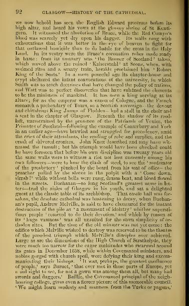
92 GLASGOW HISTORY OF THE CATHEDRAL.
we now behold has seen the English Edward prostrate before its
high altar, and heard his vows at the gloomy shrine of St Kenti-gern. It witnessed the absolution of Bruce, while the Red Cumyn'sblood was scarcely yet dry upon his dagger. Its walls rang withexhortations that it was better in the eye of heaven to tight for
that outlawed homieide than to do battle for the cross in the iloly
Land. In its vestry were tin; Brace's coronation robes made readyin haste: from its treasury was 'the Banner of Scotland' taken,which waved above the ruined ' Kaiserstuhl ' at Scone, when, withmaimed rites and a scanty train, heralds proclaimed him ' RobertKing of the Scots.' In a more peaceful age its chapter-house andcrypt sheltered the infant convocations of the university, in whichSmith was to teach doctrines that have changed the policy of nations,and Watt was to perfect discoveries that have subdued the elementsto be the ministers of mankind. It has seen a king serving at its
altars; for as the emperor was a canon of Cologne, and the Frenchmonarch a prebendary of Tours, so a Scottish sovereign—the devoutand chivalrous King James of Flodden—had a stall in the choir anda seat in the chapter of Glasgow. Beneath the shadow of its rood-loft, unrestrained by the presence of the Patriarch of Venice, thePrimates of Scotland—following the example of Canterbury and Yorkin an earlier age—have braAvled and struggled for precedency, amidthe cries of their attendants, the rending of robe and surplice, and thecrash of shivered croziers. John Knox described and may have wit-
nessed the tumult ; but his triumph would have been checked couldhe have foreseen that before his own discipline was twenty years oldthe same walls were to witness a riot not less unseemly among his
own followers—were to hear the clash of steel, to see the ' moderatorof the presbytery ' plucked by the beard from his seat of office—thepreacher pulled by the sleeve in the pulpit with a ' Come down,sirrah !' while without bells were rung, drums beat, and blood flowedin the streets. Buchanan—so long Scotland's greatest name in let-
ters—trod the aisles of Glasgow in his youth, and sat a delighted
guest at the classic table of its archbishop. That castle hall -was for-
saken, the desolate cathedral was hastening to decay, when Buchan-an's pupil, Andrew Melville, is said to have clamoured for the instant
destruction of the pile as ' a monument of idolatry ' whither supersti-
tious people ' resorted to do their devotion,' and which by reason of
its 'huge vastness' was all unsuited for the stern simplicity of or-
thodox rites. But the time of the old minster was not yet come : the
edifice which Melville wished to destroy was reserved to be the theatre
of the proudest triumph which Melville's disciples ever achieved.
Large as are the dimensions of the High Church of Strathclyde, theywere much too narrow for the eager multitudes who swarmed aroundits gates in December 1638, while within Covenanted ministers, andnobles gorged with church spoil, were defying their king and excom-municating their bishops. k It was, perhaps, the greatest confluence
of people,' says Burnet, ' that ever met in these parts of Europe, yet
a sad sight to see, for not a gown was among them all, but many hadswords and daggers.' Baillie, the Covenanted principal of the neigh-
bouring college, gives even a fiercer picture of this memorable council.1 We might learn modesty and manners from the Turks or pagans,'

THE CATHEDRAL THE NECROPOLIS. 93
he breaks out ;' our rascals, without shame, in great numbers make
such din and clamour in the house of the true God, that if they usedthe like behaviour in my chamber, I would not be content till theywere thrust down stairs.' Such was the characteristic disorder amidwhich the ' Jericho of prelacy ' was cast down, and l the curse of Kielthe Bethelite ' thundered against all who should attempt its rebuilding'.
But the exaltation of that day was not to prove lasting. A brief
course of fifteen years saw the Assembly of the Covenanted Kirk in-
vaded by theocratic enthusiasts yet wilder than themselves—saw the
members inarched in silence to the foot of the gallows-tree, and there
dismissed with an ominous warning of the destiny which awaitedthem should they seek to meet again. Before that scene was acted
on the Burgh Moor of Edinburgh, Cromwell had sat in the HighChurch of Glasgow, listening for three hours to the impotent railing
of Mr Zachary Boyd, smiling at the impatient rage of his captains
who spoke of pistolling the preacher, and taking a more ingeniousrevenge by subjecting Mr Zachary to a private homily longer anddrearier than his own. Glasgow echoed the universal delight whichhailed the Restoration; yet amid that joyous tumult a voice washeard from the depths of her cathedral crypt prophesying woe andlamentations—Cargill, the rugged confessor of a relentless Covenant,sparing not to denounce the faithless king even on the first ' oak-apple day ' of his reign. A few years pass, and, in the choir above,the low sweet voice of Leighton is heard in those angelic strains
of eloquence and devotion which haunted the memory of his hearers
to their dying day. A few years more, and the Cathedral is beset bya surging crowd of Cameronians—fanatic wanderers from the hills,
whose wrath will not tarry for the slow retribution of the law, butwho are there, at their own hand, to purge the temple of God of ' theprelatical intruders,' as ' dumb dogs,' ' Erastians,' ' schismatics,' ' Cov-enant-breakers,' and ' soul-murderers.' Yet a few years more, andprobably from the pulpits of the minster, as certainly from otherpulpits in the town, the people are stirred up to armed tumult againstthat union with England which has made their little burgh a great
and wealthy city, and covered their river with the trade of nations."— The Quarterly Review, June 1849, pp. 134-137.
To the east of the Cathedral, beyond the Molendinar Burn, is
the Glasgow Necropolis, formerly the " Fir Park," a large and
picturesque burial-ground, formed by the corporation of the Mer-
chants' House, in 1833. It commands an extensive view of the
city and the river. Of its many monuments one of the most con-
spicuous is a Doric column with a statue of John Knox.
To the south of the Cathedral is the parish church of TheBarony\ erected in 1801, perhaps one of the worst specimens of
ecclesiastical architecture in the kingdom. To the west, on the
site of the Archbishop's Palace or Castle, is the Royal Infirmary,
built in 1792-94 from the design of Adam.Descending the High Street, the tourist will find, within a short

04 GLASGOW—THE UNIVERSITY.
distance of its upper end, on his left hand, the dingy but somewhatpicturesque front of
The University.—The University of Glasgow, founded byBishop William Turnbull, was ratified by a bull of Pope Nicholas
V. in 1451. For a few years the lectures and other business wenton partly in a house called Tfa$ Old Pedagogy, the ruins of whichare still shown on the south side of the liottenrow
; partly in the
neighbouring monastery of the Blackfriars, where theology andCanon law were taught; and partly in the chapter-house and crypt
Of the Cathedral. In 14G0, James first Lord Hamilton endoweda College on the site of the present buildings. The older portions
of these were erected between the years 1632 and 1666: the nameof the architect is not preserve^, but the style is that of Heriot's
Hospital and other contemporary buildings in Scotland. The first
or outer quadrangle has aina>sive stone staircase, erected in 1690,
leading up to the Fore Common Hall, a large panelled room
containing a few portraits. There is a second or inner quadrangle,
and then a third, in which stands The Hmtierian Museum, a Doric
building, erected in 1804 from the designs of the late Mr William
Stark of Edinburgh, at a cost of about £12,000. It contains a valu-
able museum of natural history and anatomy, a small gallery of pic-
tures by the old masters, a collection of rare manuscripts and books.
coins and medals, etc., left to the professors in trust by the celebrated
DrWilliam Hunter, who wasborn in the neighbouring parish of East
Kilbride in 1718, and died in London in 1783. Admission is had by
a professor's order, or payment of a shilling. The coins and medals
are only shown in the presence of two professors. A fourth quad-
rangle contains professors' houses. Behind the university build-
ings is a pleasant park of some extent, the supposed scene of the
duel in "liob Roy," between Francis and Rashleigh Osbaldistone.
The University has a Principal, twenty-two Professors, and a Lecturer.
The professors wear black, the students of the Faculty of Arts scarlet gowns.The session begins on the fir>t Monday of November, and ends on the last
day of April. There are about thirty bursaries or exhibitions for aboutseventy students ; and the Principal and Professors have besides the nomi-nation to a number of exhibitions in Balliol College, Oxford. The Univer-sity Library contains about 80,000 volumes; the Hunterian Museum about
12,000. Among the men of eminence who have studied or taught here,
maybe mentioned Bishop William Elphinstone {d. 1514) ; John .\lajor (d.
about 1549); John Spottiswoode [d. 1585); Andrew .Melville (d. 1622 ;
James Melville {d. 1615) ; Kobert Boyd of Trochrig (d. 1627) ; JohnCameron (d. 1625) ; Zachary Boyd {d. 1653) ; Kobert Baillie (d. 1662) ; JamesDalrymple first Viscount of Stair (d. 1695) ; Gilbert Burnet, bishop of
Salisbury (d. 1715) ; Dr John Douglas, bishop of Salisbury [d. 1807) ; Dr
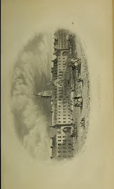
;^n


THE HUNTERIAN MUSEUM THE HIGH STREET. 95
Robert Simson {d. 1768) ; Francis Hutcheson (d. 1747) ; Dr William Hunter(d. 178:5); Dr Thomas Keid [d. 1781); Dr James Moor {d. 1779); Dr AdamSmith [d. L790) ; Dr William Cullen {d. 1790) ; Dr Joseph Black [d. 17 l
J'J)
;
Dr Matthew Baillie [d. 1823) ; Professor John Millar {d. 1801); Francis
Jeffrey (</. 1850) ; John Gibson Lockhart {d. 1854) ; Sir William Hamilton
B56).
Among the pictures in the Hunterian Museumare—1. Landscapeby Philip
Jo Koniiu'k : 2 Portrait of Dr Hunter, by Sir Joshua Reynolds; :s. Studyof a Head, by Rubens, for his picture of the Woman taken in Adultery;4. The Entombment, by Rembrandt ; 5. Dead Stag and Provisions, bySnyders; 6. Scene from the story of Laomedon king of Troy, with Nep-tune and Apollo, by Salvator Rosa.
Among the illuminated manuscripts are—A Psalter in small folio, sup-
posed to have been done in England in the twelfth century; the Con-solations of Philosophy by Boethius,a folio of the fourteenth century ; TenBooks of Livy, about 1450
;Quintus Curtius, supposed to have been exe-
cuted in Lombardyin 1520-30; a French translation of Boccaccio's work onthe Lives of Eminent Men and Women, about 1480 ; a folio Breviary, sup-
posed to be about 1400 ; Life of Christ, in four folio volumes ; the Apo-calypse, folio, two volumes, about the end of the fifteenth century.
In the Hunterian Museum are a marble statue of James Watt byChantrey ; and a small model of Newcomen's steam-engine, with this in-
scription : " In 1 765, James Watt, in working to repair this model belongingto the Natural Philosophy Class in the University of Glasgow, made the
discovery of a separate condenser, which has identified bis name with that
of the steam-engine."
The tourist should now pass down the whole length of the
High Street, and then turn to the right along the Trongate.
The High Street, descending southwards from the Cathedral
and University buildings, constitutes the original back-bone
of the older portion of Glasgow. Its point of junction with
the Trongate, Gallowgate, and Saltmarket, is the cross of Glas-
gow. This is perhaps the most picturesque point of view in the
whole city. To the north we have the dingy old High Street • to
the south the Saltmarket, once the residence of many a wealthy
citizen, but now inhabited by the lowest of the population ; east-
ward stretch the Gallowgate and London Street, the former being,
before railway times, the chief entrance to Glasgow from the east.
To the west is the Trongate, one of the finest old streets in the
kingdom. At the point of junction is the Cross Steeple, a square
tower, which originally formed part of the Tolbooth, the ancient
prison and council-chamber of Glasgow, built in 1626-27. It
terminates in flying buttresses supporting a crown, like the tower
of St Giles in Edinburgh, of King's College in Aberdeen, and of
St Nicholas in Xewcastle-on-Tyne. Adjoining this tower is the
Town-hall, a large building with a front of Ionic pilasters resting
on a basement of arches. It includes the Tontine Hotel andCoffee-room. This building was begun about the year 1736, and

im; GLASGOW—THE TRONGATE—THE GREEN.
formed, during what may be called the middle period of thehistory of Gkggow, the principal place for public meetings ofbusiness or pleasure. The hall, which is 55 feet in length, 34 in
breadth, and 25 in height, contains portraits of the Kings of GreatBritain, beginning with .lames VI., and several other pictures,anion- which is a portrait of Archibald third Duke of Argyll, inthe robes of the Justice-general of Scotland, painted by AllanRamsay. In the street in front of the hall is a bronze equestrianstatue of William III., erected in 1735, at the expense of JamesMacKae, a citizen of Glasgow, who had been governor of thepresidency of Madras. At the corner of Nelson Street is a hand-some pile of buildings in the Scotch Baronial style, recent]
v
erected from the designs of Mr J. T. Rochead,and on the oppositeside of the Trongate is The Tron Church Steeple, 126 feet high,built in 1G37. Behind it is the Tron Church, erected in 1794, toreplace the Laigh Church, or Our Lady Collcyr, an edifice of theearly part of the sixteenth century. Between the Trongate andthe river are The Wynds, a maze of dingy closes or alleys, bearinga general resemblance to those of the old town of Edinburgh,except that they arc upon more level ground, and are perhapseven more squalid.
4. The tourist may now proceed along the Trongate and ArgyleStreet as far as Queen Street, or he may turn to the river by Stock-
well Street, an old street leading from the Trongate on the south,
and then along the river to the Green. At the southern end of
the Saltmarket, and fronting the Green, is The South Prison, alarge building in the Grecian style, containing two court-roomsfor the Circuit Court of Justiciary and a prison for criminals. It
was built in 1814, at a cost of £34,800, from the design of the late
Mr William Stark.
The Green of Glasgow is a large park on the north bank of the
river, at the south-eastern corner of the city, and, notwithstanding
the frequent murkiness of the atmosphere from smoke, has con-
siderable beauty. It contains an area of about 136 acres of grass
and pleasant walks. A conspicuous object is an obelisk, erected
in 1806, at a cost of £2000, in honour of Nelson. It was on the
Green, in the year 1765, that James Watt, as he himself relates,
made the discovery which has rendered his name so illustrious.
"One Sunday afternoon, I had gone to take a walk in the Green of Glasgow, andwhen about half-way between the Herd's House and Arn's Well, my thoughts hav-ing been naturally turned to the experiments I had been engaged in for savingheat in the cylinder, at that part of the road the idea occurred to me, that, as steamwas an elastic vapour, it would expand, and rush into a previously exhausted space
;


THE ROYAL EXCHANGE—THE BANKS. 97
and that if I wore to produce a vacuum in a separate vessel, and open a communi-eatton between the steam in the cylinder and the exhausted vessel, such would bethe consequence."
Between the Green and the Gallowgate is St Andrew's Square, in
the middle of which is St Andrew's Church, built in the Italian
style, between the years 1739 and 1756. It is copied, with the
exception of the spire, from Gibb's Church of St MartinVin the-
Fields in London.
5. On returning toward the centre of the city by the Trongate,
Argyle Street, and Queen Street, the traveller will find himself in
front of the Royal Exchange, in the midst of a group of objects
of interest, all within a short distance of each other, in QueenStreet, Buchanan Street, Ingrain Street, and the short streets lead-
ing from these.
The Royal Exchange (Queen Street, fronting Ingram Street)
may be looked upon as the heart of modern Glasgow, the com-
mune forum, where all men meet and discuss the business and
gossip of the day. It is a fine building, in the Grecian style,
erected in 1829, from the designs of Mr David Hamilton, at a cost
of £50,000. The great room is 130 feet in length, and 60 in
breadth. It is open from 7 A. M. to 10 P. M., contains newspapers
of all countries, commercial lists, and periodicals, and is open to
strangers, if introduced, for four weeks, free of charge. In front
of the Exchange is a bronze equestrian statue of the Duke ofWellington^ by Marochetti, with reliefs on the pedestal of the
battles of Assaye and Waterloo, etc. : it was erected in 1844, at a
cost of nearly £10,000. On each side of the Exchange, an arch
leads from Queen Street, which is in front of the building, to
Buchanan Street at its back. In the immediate vicinity are most
of the banks,—the National Bank (Queen Street), a richly orna-
mented building, in the Italian style ; the Royal Bank (behind
the Exchange, and close to Buchanan Street), in the Italian style,
designed by Mr Elliot ; the British Linen Company's Bank, oppo-
site the Exchange, in the Italian style, from the design of MrDavid Hamilton ; and the Union Bank, and the Bank of Scot-
land (Ingram Street), the former a model of the temple of
Jupiter Stator at Home. The Commercial Bank, designed byMr Rhind of Edinburgh, stands near the corner of Gordon Street
and Buchanan Street ; the City of Glasgow Bank, designed by MrRobert Black, on the east side of Virginia Street ; and the Clydes-
dale Bank, m the premises formerly occupied by the Western
Bank (which stopped payment in 1857), designed by Mr David
E

98 GLASGOW PUBLIC BUILDINGS.
Hamilton, on tlio oast side of Miller Street. The warehouses
of Messrs Campbell, corner of Brunswick and Ingram Streets, de-
signed by Mr K. W. Billings; and the large pile in South HanoverStreet and George Square, erected by the notorious firm of Mac-donald & Co., who failed in 1857, with a debt to the Western Bankof £422,000, are also in the vicinity.
In Ingram Street is HutekesorCa Hospital, a large building, with
an octagonal spire, endowed for the maintenance of aged persons
and the education of boys, by two brothers, George and ThomasHutcheson, lawyers in Glasgow, who died in 1639-41. It has an
annual revenue of about £3000. In the same street is an Assemblyand Concert room, built in 179G, and enlarged in 1807. It is
leased to the Glasgow Athenamm, an institution for popular lec-
tures on literature and science, and containing a Library and
Reading-room. Towards the east end of Ingram Street is St
David's, or The BanCt-hom Church, erected about 1820 from a
design in the Pointed style by Mr Thomas Rickman. In Glass-
ford Street is the Trades' House, built in 171*1 from a design by
Robert Aclam : it has a hall for the meeting of the fourteen
incorporated trades, 70 feet in length, 35 in breadth, hung with
armorial bearings of the trades, and civic portraits. Adjoining
is the Trades' House School, founded in 1808. In Wilson Street
opposite is the City and County Buildings, erected in 1842-45, at
a cost of about £64,000, from a design, in the Italian style, byMessrs Clark and Bell, containing the Council -room, where the
meetings of the town-council are held; the Council Record Office;
the chambers of the procurator-fiscal, or local public prosecutor
;
the chambers of the sheriffs, sheriff-clerk, procurator-fiscal for the
county, etc. In Hutcheson Street adjoining is the Merchants' House,
built in 1843, at a cost of £10,300 : at the entrance to the hall is
a statue, by Gibson, of the late Mr Kirkman Finlay of Castle
Toward. At the corner of George Square and South Hanover
Street is the Post Office, begun to be built in 1851. In an obscure
street (South Albion Street), are the Police buildings, and at 90
Candleriggs Street, a very large edifice called the City Hall, muchused for public meetings, and capable of containing from 3000 to
4000 persons.
Proceeding from the Exchange, along Buchanan Street, the tra-
veller will observe, at the intersection of St Vincent Street, an
equestrian statue of the Queen by Marochetti, erected in com-
memoration of her Majesty's visit to Glasgow in 1849. Opposite
is the Western Club, at the intersection of George Street with

the m'lellan gallery. 99
Buchanan Street, from a design in the Italian style by Mr David
Hamilton. Close beside it is St George's Church, with a spire 180
feet high, built in 1807, from a design in the Italian style by MrWilliam Stark.
Turning to the right we again find ourselves in George Square,
close to the station of the Edinburgh and Glasgow Railway. In
this square will be noticed a sitting statue in bronze of James Watt
by Chantrey, and a colossal statue in bronze of Sir John Moore
(who was the son of a Glasgow physician, and born in the house
called Donald's Land in the Trongate) by Flaxman. In the centre
is a column, 80 feet high, surmounted by a statue of Sir Walter
Scott, and at the north-western corner, a statue of Sir 11. Peel by
Mr Moasman of Glasgow.
G. Having exhausted the historical and business portions of the
city, the tourist should make the circuit of the western portion,
where the upper classes chiefly dwell. The long lines of WestGeorge Street and St Vincent Street, with their immediate vici-
nity, were for some time the fashionable quarters, but they have
now begun to yield that distinction to the streets and terraces
which are spreading out with astonishing rapidity to the west
and north-west. By following the Sauchiehall Road westward,
the stranger will soon find himself in the heart of this the most
handsome district of the town, and in the vicinity of the beautiful
new park which has been planned by Sir Joseph Paxton, whohas skilfully availed himself of the natural advantages of the spot,
which are very great. It is needless to give specific directions
to the tourist for the exploration of this part of the city, for it is
easily found, and, once found, needs no guide.
The M'Lellan Gallery, or Corporation Hall, in Sauchiehall
Street, contains an extensive collection of pictures left to the public
by the late Mr Archibald M'Lellan, coachmaker, who died in 1854,
to which have since been added a considerable number of pictures,
the gift of Mr William Euing of Glasgow, and others.
Among them may be mentioned the following :
—
Albert Cuyp, Christ's
Entry into Jerusalem; a large landscape, attributed to Lancret (probablyPater) ; Landscape, with cow being milked, by Adrian Vandevelde; Sleep-ing child contemplated by the Virgin, by Murillo, from the collection
of Lucien Bonaparte ; Rothenhammer, a Bacchanal ; Frank Floris, an alle-
gorical subject ; Jacob lluysdael, View of the town and lake of Katwych;
Sir D. Wilkie, first preparation for a Portrait of Queen Victoria; Wou-vermans, a landscape ; Patenter, Adoration of the kings ; Ludolf Back-hvysen, View of a seacoast, with a storm ; Landscape by Wynants,with figures by Wouvermans ; Hobbema, Landscape, with dark wood in theforeground, and light cornfield in the background ; Berghem, Landscape, with

100 GLASGOW—THE BOTANIC GARDENS.
shepherd and two cows ; William Vandevelde, a fine Beapiece, with ship
firing a gun ; Virgin and Child, on the right St Joseph, on the left St
Catherine, St George, and the Baptist, said to be Cima da Conegliano;
Teniers, Peasants before a house ; Adrian Vander M '</;/'. Dalilab catting
off" Samson's hair ; David Vinckeboom, a Landscape, with figures by h'othen-
hammcr ; JA/iijcthach, a Landscape, with rocks; II Cdvaliere d'Arpino, St
Michael subduing Satan, an original repetition of the picture in the Bridge-
water Gallery ; Philip Wbuvermans, Landscape, with grey and brown horse
under a tree; Paris Bordone, Virgin and Child, and Sr George, Magdalene
and St John the Baptist pointing to the Lamb; CamiUo Procaccini, Virgin
and ( !hild, etc- ; Caspar Netscher, Portrait of a lady ; Hobbema, Landscape
;
Claude Lorraine, Landscape; Qarofah, copy of his St Augustin in the
National Gallery; Giorgionc, Virgin and Child ; Jan Both, Landscape ;St
Catherine in an ecstasy, by Carofalo ; Mabuee, Fragment of an altar-piece;
Patenici, Virgin ; Baroccio, Virgin and Child in clouds, a free study from
the Madonna di Foligno ; Jacob Ruysch, a bunch of flowers ; Jacob Ruys-
dael, a woody landscape; Teniers, the Visitation; the plundering of a vil-
lage; Jan Breughel, two landscapes; Sir J. Reynolds, Study from nature of
the woman for the picture of the " School for Scandal," in Lord Lans-
downe's collection ; Honderoeter, Poultry ; Ludolf Backhuysen, a storm;
Domenichino. Land-cape, with St Jerome; Artus Vander Neer, a winter
landscape ; William Vandevelde, a seapiece ; Hobbema, Landscape, with
cottage and country people ; Gaspar Poussin, land-cape, with two figures;
Teniers, Landscape, with cattle; Jan Steen, Children skating; Ludolf
Backhuysen, small seapiece ; Nicolas Maas, AVomen by a cradle. \\ ith child;
Joseph Vernet, " a genuine and pretty picture;" Jan le Due, Tavern, with
figures; Paul Veronese, Europa on the Bull; Valentin, the incredulity of
St Thomas; Vandyck, Charles I. and Henrietta Maria; Benjamin West,
Virgin and Child, and St Joseph ; William Van Aelst, Dead fowls;William
Vandevelde, Seapiece ; Lingelbach a small picture ; Lenain, Boy with
sheep ; Vandyck, Henrietta Maria, an allegorical representation ;Venetian
School of time of Titian, Christ on the Mount of Olives.
Here is a marble statue of William Pitt by Flaxman.
The Botanic Gardens are situated to the north-west of the
city, on the Great Western Road, on the banks of the Kelvin, which
is easily reached by St George's Road, diverging at right angles from
the Sauchiehall Road. They are open free to the operatives in
the week of Glasgow fair in July, Mr Campbell of Tillichewan
Castle having given £500 for this yearly boon. The astronomical
Observatory, formerly situated in the open space behind the Uni-
versity buildings, has been removed to the neighbourhood of the
Botanic Gardens.
7. The Clyde and the Broomielaw.—The Clyde will be best
seen by following its course from the Green to the lower end of the
harbour, or, at all events, passing from Argyle Street by Jamaica
gtreet— a very bustling thoroughfare— to Glasgow Bridge, and
thence downwards. There are five bridges across the Clyde within
the limits of the city: an iron one in the Green, of recent erection;
Hutchesontown Bridge, at the foot of the Saltmarket (built in
1829, from the designs of Mr Robert Stevenson) ; Victoria Bridge,

THE BROOMIELAW—CHURCHES. 101
at the foot of Stockwell Street (rebuilt on the site of a bridge of
the fifteenth century, in 1851, from the designs of Mr Walker of
London); a suspension bridge, near the foot of Dixon Street;
and lowest, Glasgow Bridge, at the foot of Jamaica Street. This
last, finished in 1835, at a cost of £34,000, from a design by MrTelford, has seven arches, faced with Aberdeen granite, is 560 feet
in length, and 60 feet in width over the parapets. Immediately
below this bridge is the harbour, or The Broo?nielmv, as it is called,
extending more than a mile down the river, and including an area
of nearly sixty acres. Thronged with vessels of every description,
it conveys a striking impression of energy and mercantile pros-
perity ; and we must remember in addition, that little more than
nfty years ago the river had scarcely sufficient water to float an
ordinary herring-boat, and has been brought into its present con-
dition by unremitting exertion. The depth at high water was
originally not more than 3 J feet : it is now about 20 feet ; and the
breadth of the stream has been more than doubled. The river is
under the charge of parliamentary trustees. The length of quay-
wall is 3860 yards, and along this vessels are ranged often three
or four abreast. In 1823, the length of the quays was no morethan 865 yards, the area of the harbour being nine acres, and the
revenue £8380, or £9, 13s. 9d. for each yard of quay. In 1858,
the revenue was £78,783, or £20, 8s. 2d. for each yard of quay.
The ordinary expenditure in the same year was £75,958 ; the ex-
traordinary expenditure, £64,724; the debt, £1,070,335. In the
year ending 30th June 1858, 15,941 vessels (with a tonnage of
1,386,200) entered the harbour; and 17,831 vessels (with a ton-
nage of 1,532,000) sailed from the harbour. The number of iron
vessels launched on the Clyde in 1858 was 60 ; their tonnage, 40,522.
8. Churches.—Glasgow to the stranger may appear to be abun-
dantly supplied with places of worship for all sects. Still the
supply is believed to fall short of what is desirable for her teeming
population. The churches most worthy of notice, in an architec-
tural point of view, are, the Cathedral or High Church ; the Inde-
pendent Chapel, corner of Holland and Bath Streets, a richly de-
corated modern building in the Pointed style ; St John's Free Church(George Street) ; the Eam's-horn, or St David's (head of Candle-
riggs) ; St Andrew's Koman-catholic Church (Great Clyde Street)
;
St Andrew's (St Andrew Square) ; St John's (Gallowgate), for
some time the church of Dr Chalmers; the " Park Church" (MrCaird's); Sandyford Church (Mr Macduff's) ; the Free ChurchCollege and Church (Dr Buchanan's) ; Elgin Place Independent

102 GLASGOW—HIGH SCHOOL—INFIRMARY—THEATRES.
Church, corner of Pitt Street and Bath Street ; and a United Pres-
byterian Church at the top of St Vincent Street.
i
9. Educational Institution*.—The University has been already
noticed. The Andersonian Institution in East George Street is
directed chiefly to the teaching of the medical and physical
sciences. It was founded and endowed in 1795 by John Ander-
son, Professor of Natural Philosophy in the Glasgow University.
It possesses a good library and collection of scientific apparatus.
Immediately behind the Andersouian Institution is the High
School, in old times called the " Grammar School," the chief
classical school of Glasgow. The Mechanics'1
Institution 'North
Hanover Street) was founded in 1823 by the mechanics of Glas-
gow, for instruction in the elementary principles of science. The
Athenaum (occupying the Assembly Rooms in Ingram Street) is
an institution for popular lectures, with a library. The Normal
School of the Established Church (City Road) is a large building.
In the same neighbourhood is the Normal School of the Free
Church.
10. Charitable Institutions.—The Royal Infirmary, in the im-
mediate vicinity of the Cathedral, was built in 1792. The Blind
Asylum is to the north of the Royal Infirmary. The Deaf and
Dumb Institution, Magdalene Asylum, and Lock Hospital, arc all
in the immediate vicinity. The Royal Lunatic Asylum, at G art-
navel, about a mile beyond the Botanical Gardens, to the west, a
large building designed by Mr C. Wilson, accommodates nearly
500 patients. The House of Refuge is near the North Prison, in
Duke Street.
11. Theatres.— (1.) The Theatre Royal, in Dunlop Street, a short
street leading south from Argyle Street. (2.) The Princes Theatre,
in West Nile Street. Both are under the same management.
12. Manufacturing and Commercial Establishments. — The
Chemical Works of St Rollox, the property of tin 1 Messrs Tennant,
cover an area of sixteen acres under roof. They contain more
than 100 furnaces, the smoke of nearly all of which is carried off
by a single gigantic chimney 450 feet in height. The large iron-
works of the Messrs Baird are at Gartsherrie, about ten miles to
the south-east of Glasgow. The Goran Ironworks (Dixon), on
the south side of the city, arc well worthy of a visit;application
for orders to be made at the office, 1 Dixon Street. The Vidcan
Foundry, for the manufacture of machinery, particularly of marine
steam-engines, and the shipbuilding yards of Messrs Tod and
M-Gregor, and of Mr Napier, also require for admission an order

NEIGHBOURHOOD OF GLASGOW HAMILTON. 103
from the proprietors. There is a class of large retail establish-
ments in Glasgow well deserving of a visit; we may mention as
an excellent specimen those of Messrs Campbell and Company, No.
44 Buchanan Street and 29 Ingram Street.
NEIGHBOURHOOD OF GLASGOW.
Hamilton, Bothwell, and Lanark.—The only objects of much in-
terest eastwards from Glasgow are the town and palace of Hamilton,
Bothwell Bridge and Castle, the town of Lanark, and the Falls of
the Clyde. It is possible to accomplish all this in one day,
returning to Glasgow or proceeding to Edinburgh in the even-
ing ; but we should recommend two days to be devoted to it,
passing the night at Hamilton. Several trains run to and from
Hamilton on the Caledonian line daily (from the south side station),
a distance of 10 miles. Pedestrians, who are pressed for time, mayleave the railway at Blantyre Station (8£ miles), and walk, by the
suspension bridge over the Clyde, to Bothwell Castle and Bridge,
and thence to Hamilton Palace. There are also trains to Ud-dingstone (7£ miles from Glasgow) ; and omnibuses from West Nile
Street, or London Street, Glasgow, several times every day, bywhich the tourist may be put down at the gate of Bothwell Castle.
Proceeding by railway towards Hamilton, the traveller follows
the course of the river Clyde upwards. In the immediate vicinity
of Glasgow, after passing the Green, he will find the old burgh of
Rutherglen (or, as it is pronounced, Rugleri), with a bridge over
the Clyde, built by subscription in 1775. In the twelfth century,
when Rutherglen obtained its charter as a royal burgh, it hadlarger privileges than Glasgow. It has a population of 6947.
Beyond Rutherglen is the village of Cambuslang, not far from
which is the basaltic hill of Dechmont, the summit of which, 600
feet high, commands a fine view.
HAMILTON. [Inns : Commercial, King's Arms, Bruce Arms.]
—Hamilton, a pretty town situated on the burn or streamlet of
Cadyow, about a mile from the confluence of the river Avon with
the Clyde, is the capital of the middle ward or subdivision of
Lanarkshire. It was made a parliamentary burgh in 1833, andhas a population of 9620. It has manufactures of cambric and
lace ; and in the vicinity are many coal and iron mining villages.
Close to the town is
—

104 NEIGHBOURHOOD OF GLASGOW HAMILTON.
Hamilton Palace, the seat of the Duke of Hamilton, the Pre-
mier Peer of Scotland, a large building in the Grecian style, remo-delled and enlarged between the years 1822 and 1840, after designs
by Mr David Hamilton of Glasgow. The north front is 2G4 feet in
length and three storeys in height, with a wing to the west, 100feet long. The entrance is through a fine portico of a double rowof fluted Corinthian pillars, each of a solid stone, 25 feet high.
The interior of the palace can only be seen by tourists who haveprovided themselves with an introduction. The apartments moreespecially worthy of notice are, the Egyptian Hall, the old dining-
room, the " Duchess staircase," the music-room, the picture-gallery
(120 feet by 20), the " Tribune," the old state-rooms, the " Beck-ford library" (formerly the property of Mr Beckford, author of
Yathek), the new dining-room, library, sitting-room, grand en-
trance-hall, black marble staircase, and new state-rooms.
Among the works of art may be mentioned :—(In the Large Staircase)Large altar-piece by Girolamo da* Libri, the Virgin and Child under a tree,St Augustin and other saints—three singing angels below. Statue of theVenus of the Capitol, in Parian marble.— (In the Hall) Large altar-piece bySandro Botticelli, formerly in the church of Pietro Maggiore at Florence,said to have been painted for Matteo Palmieri. A black limestone mantel-piece, sculptured at Florence about 1470. Busts of Napoleon L, of thetenth Duke of Hamilton, and others. A Florentine mosaic table.
—
(In tlte
Gallery) Daniel in the Lions' Den, by Rubens. Portrait of William Feild-ing, Earl of Denbigh, by Vandyck, in a hunting costume. Two portraitsby Mytens. Portrait of a lady, attributed by Dr Waagen to Cornelius deVos.—(In the Dining Saloon) Portrait of Philip IV. of Spain, by Velasquez,full length. Duchess of Richmond, by Vandyck, her son as Cupid. Oneof the beauties of Charles IL's court, by Sir Peter Lely. Charles I. onhorseback, by Vandyck. The four Fathers of the Church, by Pietro dellaVecchia. Napoleon, by David, executed for the tenth duke. Antique bustof a Venus. Bust of the dying Alexander, in porphyry. The group ofthe Laocoon, in bronze. A large tripod of giallo-antico.— (In the MusicBoom) Henriette of Lothringen, by Vandyck. Judith with the head ofHolofernes, by Lucas Cranach. An antique hero, by Salvator Bosa. Largemoonlight piece by Artus Vander Neer. Portrait of Albert Durer, byhimself. Stale and female portraits, said to be by Andrea Mantegna.Moses striking the rock, by Tintoretto. Adoration of the Magi, by Pietroda Cortona. Male portrait by Tintoretto— (In the Picture Gallery—FirstBoom) Circumcision of Christ, Luca Signorelli, a large altar-piece with tenfigures. Landscape with herd of cattle in the water, by Berghem. Philip II.with Fame kneeling before him, by Titian. Portrait of an Admiral, byTintoretto. Pietro da Cortona, Christ appearing to the Magdalene, and Elea-zcr with Rachel at the well. An allegory, said to be by Pontormo, butthought by Dr Waagen to be by the rare master Ubertini. Female portraitby Cornelius de Vos. Dutch Canal, a small picture, by Jan Van Qoven.Landscape with grey horse, by Isaac Van Ostade. Bazzi, Christ with StSebastian and St Roch. The Resurrection of Christ, by Bonifazio. Maleportrait, by Girolamo da Sante Croce. The stoning of St Stephen, byPhilip de Champagne. The Misers, by Qucntin Matsys. A table with aporphyry slab.— (Second Boom) Nicholas Poussin, the Entombment, a fine

HAMILTON PALACE. 105
composition of six figures. The Cumean Sibyl, by Lodomco Caracci. In-
terior of a Cottage, with figures, by Adrian Brouwer. Gaspar Poussin, a
thunderstorm. 'Hie Almighty appearing to Noah after the Deluge, GiacomoBeusano. Landscape with flock of sheep, by Caspar Poussin. Venus rising
from the sea, by Rubens. A table of Florentine mosaics, with a casket. Acabinet which belonged to Marie Antoinette. A slab of malachite, with avase of green porphyry. Bronze statuettes on lapis-lazuli pedestals.
—
(Third
Room) !St John the Baptist as a child sleeping, by Murillo. Centaurs, byRubens. Landscape by Hobbema. Male portrait, said to be by Albert Durer.Pontormo, portrait of Gaston de Medici. Magdalene, by Annibale Caracci.
Cosmo I. and his wife Isabella, by Angela Bronzino. Male portrait, GiovanniBaptista Moroni. Visit of the Queen of Sheba to Solomon, by Tintoretto.
John the Baptist reproving Herod, by Domcnichino. Stable, with womanmilking a cow, by Tmiers. A large bowl of oriental agate onyx, set in
gold and enamel. A casket which belonged to Cardinal Mazarin. Twotables with slabs of Plasma di Smeraldo, the borders of breccia.— (In the
Cabinet) Portrait of young man in red dress, by Antonella da Messina, 1474.
Charlatan preaching to a set of beggars, by Franz de Paidla Ferg. Tenters,
view of his country house. Job Berkheyden, exterior of a church. Por-trait of Pope Clement VII. by Sebastian del Piombo. A quiet sea, WilliamVandevelde. A landscape by Philip Wouvermans. Adoration of theKings, by Mabuse.— (In the Sitting-Boom near the Library) Ascension, byTintoretto. Allegorical picture, by Palma Giovane. Hippomenes andAtalanta, by Giorgione. Virgin and Child, by Francesco Francia, or byLo Spagna. Presentation in the Temple, Tintoretto. Giacomo Bassano,Joseph discovering himself to his brethren. Assumption of the Virgin,
Schidone. Pcrino del Vaga, portrait of a knight. A black marble chimney-piece. Two columns of Lumachetto marble. A Florentine cabinet, withworks in pietra-dura. A modern cabinet, with flowers a la Sevres, withNapoleon's two sisters, each as Venus with Cupid, painted upon it.
—
(In the
Boudoir of the Neio State-Rooms) Adoration of the Kings, by Fra FilippoLipipi, from the Beckford collection. Summer and Autumn, two smallpictures by Andrea Mantegna. Sebastian del Piombo, The Transfiguration,
inscribed 1518, with a sentence purporting that it was originally presentedto the Fmperor Charles V. Christ driving the Money changers from theTemple, by Marcello Venusti. Angelo Bronzino, portrait of Isabella, wifeof Cosmo 1. Life-size portrait of the Empress Catherine II., presented to
the tenth duke during his residence in St Petersburg.
—
(In the Marble Hall)
A copy in marble of the Borghese Gladiator, the Apollo Belvidere, and theDiana of Versailles ; of the Mercury of the Vatican (called the Antinous)and of the Hercules with the Telephon, Avhich was executed for Mary deMedici ; two porphyry vases ; and two large vases of oriental alabaster.
—
[In the Marble Staircase) At the inner side of the doors, two colossal Atlasesin bronze, supporting the entablature ; on each side of the stairs, porphyrybusts of Augustus and Vespasian.
—
The Library contains many rare andbeautiful books and manuscripts, among which may be noticed, a folio
Greek Gospel of the 12th century, an illuminated Greek MS. of the 14thcentury ; a large folio Gospel of the 9th century ; a Psalter written at
Hildesheim in the 13th century ; a Commentary on the Code of Justinian,written in the 14th century ; an illuminated Vulgate ; an illuminated copyof La Diviua Commedia ; an Antiphonary, executed for Pope Leo X.about 1520.
Within the grounds is a Mausoleum, designed in the Italian
style by Air Bryce of Edinburgh, consisting of a circular mass
springing from a quadrangular basement, and enclosing a richly
decorated chapel, under which are the vaults. Terraced stairs
e 2

106 NEIGHBOURHOOD OF GLASGOW CADYOW FOREST.
lead on either hand from the river front to a platform, on which
are colossal lions by Mr A. H. Ritchie of Edinburgh. Below, on
the basement, arc emblematic figures representing Life, Death, and
Eternity. On a plain slab, over the entrance to the chapel, the
beautiful door of which is especially worthy of notice, is the
inscription :—" Hoc monumentum sibi et suis extrurendum curavit
Alexander dux Ilamiltonii decimus."
The park surrounding the palace is extensive and the trees fine;
but a more interesting object is the remnant of the ancient FOREST
OpCadyow, to which access may generally be had by tickets issued
at the Duke's office in Hamilton. This remarkable tract is several
hundred acres in extent, and is covered with huge oaks in a state
of venerable decay ; most of them consisting of enormous hollow
trunks, with a few fantastic green branches still struggling, as it
were, for life. Some measure thirty-six feet in circumference, and
one near Wood House, called " The Boss Tree," is capable of con-
taining seven or eight men in its cavity. The space is walled in,
and contains a herd of wild cattle, of a breed which has been sup-
posed to represent the aboriginal race by which the forests of
Scotland were inhabited, and is alluded to by Sir Walter Scott in
his ballad of " Cadyow Castle," written after a visit to Hamilton
Palace in 1801:
" Mightiest of all the heasts of chaseThat roam in woody Caledon,
Crashing the forest in his race,
The mountain-hull comes thundering on
Fierce on the hunter's quiver'd handlie rolls his eyes of swarthy glow
;
Spurns with black hoof and horn the sand,
And tosses high his mane of snow."
These cattle are of a middle size, witli fine limbs and great ac-
tivity. Their colour is perfectly white, with black ears, muzzles,
horns, and hoofs. The Earl of Tankcrville has a herd of simi-
lar animals, and there are a few at Taymouth, the seat of the
Marquess of Breadalbane, in Perthshire. The ruins of Cadyow
Castle are situated on the banks of the Avon, and consist of a
few mouldering vaults, some scanty traces of the moat and draw-
bridge, and the remains of a chapel. It was formerly the residence
of the family of Hamilton, and was dismantled during the civil
wars in the time of Queen Mary. Cadyow is the original name
of the district now called Hamilton.
Chatdhemult, another building within the Forest, is to be seen
on the banks of the Avon, nearly opposite Cadyow. Its name is

BOTHWELL BRIDGE AND CASTLE. 107
derived from an estate in France, possessed by the ancestors of
the Dukes of Hamilton, and still forms one of the titles of the
family. The building, which was erected about 1732, is a model
of the citadel of Chatelherault in Poitou. Its interior has some
specimens of French decorative art of the age of Louis XIV.In the neighbourhood of Hamilton are the terraced gardens of
Bamcluiih, the property of Lady Ruthven ; they are said to have
been the work ofJohn Hamilton of Barncluith, about theyearl583.
Bothwell.—The village, bridge, castle, and church of Bothwell
may be visited either before proceeding to Hamilton, by leaving
the railway at Blantyre or Uddingstone, or by omnibus, as indi-
cated above: or, should the tourist choose to go to Hamilton at
once from Glasgow, he may, after seeing Hamilton, drive or walk
back to Bothwell, a distance of two miles. Should he mean after-
wards to visit Lanark, he should begin with Bothwell.
Botha-ell Bridge, about a mile to the south of the village, is the
scene of the well-known battle between the Covenanting insur-
gents and the royal troops under Monmouth and Claverhouse, on
Sunday, the 22d June 1679, in which the former were defeated,
with 400 slain and some 1200 taken prisoners. The bridge, which
was then only 12 feet in breadth, with a gate in the middle, was
desperately defended by 300 of the Covenanters under Hackston
of Rathillet. The battle is commemorated in a contemporary
ballad in Scott's " Border Minstrelsy," and is described in his
tale of Old Mortality. It is figured in an old picture in Hamilton
Palace. About a mile north of the village is
Bothwell Castle. [Admission, by the great gateway, on
Tuesdays and Fridays, from 11 A.M. to 4 p.m.]—This large struc-
ture in what is called the "Edwardian" style, was built about the
year 1300, and has long been in ruins. The front to the south is
flanked by huge round towers (one of them containing a draw-
well), and extends along a bank overhanging the Clyde about 234
feet. The greatest breadth of the pile is about 100 feet. At the end
are the remains of the chapel. The stair leading to the top of the
western tower (which commands a good view) is tolerably entire,
and may be ascended. The gateway was in the middle of the
north wall. The ditch may still be traced. In the time of the warof independence with Edward I. of England, this castle belonged
to Sir Andrew Murray of Bothwell, one of the most faithful ad-
herents of Wallace. It wras given by King Edward I. to Aylmerde Valence, Earl of Pembroke, who commanded the English
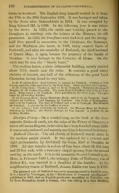
108 NEIGHBOURHOOD OF GLASGOW BOTHWELL.
forces in Scotland. The English king himself resided in it from
the 17th to the 20th September 1301. It was besieged and taken
by the Scots after Bannockbnrn in 1314. It was occupied by-
King Edward III. in 1336. In the following year it was taken
by the Scots. In 1370, the castle and lordship passed to the
Douglases in marriage with the heiress of the Murray s, its old
possessors. In 1455, the Douglases were forfeited, and the strong-
hold then passed in succession to the Crichtons, the Ramsays,
and the Hepburns (the latter, in 1488, being created Earls of
Bothwell), and after the attainder of Bothwell, the third husband
of Queen Mary, it again became the property of the family of
Douglas. It now belongs to the Countess of Home. On the
walls mayT be seen the " bloody heart."
The modern house, a plain substantial building, mostly erected
about 1710, stands near the ruins. It contains a good manypictures of interest, one-half of the collection of the great LordClarendon having found its way here.
In the Breakfast-Room : Lord Lindsay, in armour, by Vandyck. Portrait of NellGwynn, and four other portraits by Sir Peter Lely. Three portraits by Lingeler.
In the Dining-Room: Charles I., said to be by Vandyck. Margaret, Duchess ofDouglas, by Sir Joshua Reynolds. The great Earl of Strafford, said to be by Van-dyck. King- James I., by Vandyck. Five portraits by Sir Peter Lely. Two por-traits by Sir Godfrey Kneller.In the Drawing-Room: Queen Henrietta Maria, said to be by Vandyck. Lady
Paulett, by Vandyck. Lord Banning, by Vandyck. The Duke of Buckingham,said to be by Vandyck. The Earl of Holland, said to be by Vandyck. Mrs Howard,by Vandyck. A portrait by Sir Godfrey Kneller.
In the Library: Lord Cromwell, by Holbein. Sir Thomas More, by Holbein.Erasmus, by Holbein. Sir Walter Kaleigh, by Van Somers. A portrait by SirGodfrey Kneller.
Blantyre Priory.—On a wooded crag, on the bank of the river
opposite Bothwell castle, are the ruins of the Priory of Blantyre, a
house of Canons Regular, believed to have been founded about 1240.
It was poorly endowed, and scarcely anything is known of its history.
Bothwell Church.—The old church of Bothwell stands close to
the modern parish church. It was endowed for a provost andeight prebendaries, by Archibald the Grim, Earl of Douglas, in
1398. All that remains is a choir of four bays, about 55 feet long
and 23 feet wide7with a mortuary chapel opening from the second
east bay on the north. It is in the geometric Second-Pointed style.
Here, in February 1400-1, the unhappy Duke of Rothesay, son of
Robert III., was married to a daughter of the founder. In the
neighbouring manse of Bothwell, Joanna Baillie was born in 1763.
The pleasant vale of Bothwell was early commemorated in Scottish song.It is related by Verstegan, in his " Restitution of Decayed Intelligence,"
published in 1605, that an English gentleman travelling in Palestine, notfar from Jerusalem, heard a woman, who was sitting at a door dandling

LANARK AND TIIE FALLS OF THE CLYDE. 109
her child, singing " Bothwell Bank, thou hloomest fair :" " the gentleman
hereat exceedingly wondered, and forthwith in English saluted the woman,who joyfully answered him, and told him that she was a Scotchwoman, andcame first from Scotland to Venice, and from Venice thither, where her
fortune was to be the wife of an officer under the Turk."
LANARK AND THE FALLS OF THE CLYDE.
The town of Lanark and the Falls of the Clyde may be visited
either from Glasgow or Edinburgh by the Caledonian Railway, or
from Hamilton or Glasgow during the summer months by a stage
eoach which runs daily from Glasgow (from the Tontine in the
Trongate). From Hamilton, Lanark may also be reached by walk-
ing (two miles) or by taking the omnibus to the Motherwell station
on the main line of the Caledonian Railway ; or, should the tourist
have sufficient leisure, by the carriage road from Hamilton to
Lanark, following pretty closely the course of the river Clyde
upwards, a distance of 14 miles. This road—on which during the
summer months there is a stage coach daily to and from Lanark
—
passes through one of the few districts in Scotland which are
famous for apple orchards. The whole drive is rich and beautiful.
Half a mile from Hamilton it crosses the Avon. Upon the right
is Barnchdth ; and on the opposite bank of the Clyde, half a mile
farther on, is Dalziel House. A mile beyond the bridge of Avon,
a road branches off on the right, leading through Douglasdale to
Carlisle.* The road to Lanark now gradually descends to the
river, on the opposite bank of which is Cambusnethan. Aboutsix miles from Hamilton, the road from Edinburgh to Ayr crosses
the Clyde at Garion Bridge, near which Lord Belhaven has a seat
of the same name. Seven miles beyond Hamilton is the village of
Dalserf, with Dalserf House on the left, and Milburn House, on a
bold bank, on the right. On the other side of the river are
* Twelve miles from Hamilton, by this road, is Lesmahagow, the site of a veryancient Priory dedicated to St Machute, whose relics were here preserved. Noremains of the building now exist.
Six miles beyond Lesmahagow, on the road to Carlisle, stood Douglas Mill, a well-known inn, now demolished. Two miles from its site, but on the road to Ayr, is
Douglas Castle, an unfinished mansion built in the middle of the eighteenth cen-tury near the site of the original fortress of the heroic house of Douglas, of whichonly one ruined tower has been spared. Near the castle is the town of Douglas,with a population of about 2000. The streets are narrow and irregular. In thecentre of the town stands the ancient parish church, dedicated to St Bride. Thereremains only a fragment of the nave, but the choir is still comparatively entire.It is in the Second-Pointed style, but with some First-Pointed characteristics. Itis 43 feet long and 24 feet wide, and contains the once beautiful but now sadly de-faced monuments of (1.) the Good Sir James of Douglas, slain in Andalusia in 1330,on his pilgrimage to the Holy Land with Bruce's heart; (2.) Archibald, Duke ofTouraine and Earl of Douglas, who died in 1438 ; (3.) James, Duke of Touraine andEarl of Douglas, who died in 1433-44 ; and (4.) his wife Dame Beatrice Sinclair. Thefirst two monuments are on the north, the last two on the south side of the chancel.Douglas may be reached also from Lanark, or from the Lamington or Abington
stations of the Caledonian Railway, from which it is about 12 miles distant.

110 NEIGHBOURHOOD OF GLASGOW—LANARK.
Broumlee, and Mauldsli Castile, once the scat of the Marls of Ilynd-
ford, a title which has been extinct since 1817. The house, which
was built in 1793 from a design by Robert Adam, stands on ahead-
land projecting into the valley. Onwards are the houses of Millon-
Lockkari (on a promontory half encircled by the Clyde) and
Waygateshaw. About two miles and a half beyond Dalserf the
road crosses the river Netlian. near its junction with the Clyde.
Here are the ruins of Craignethan or Draffen Cattle, the " Tillie-
tudlem" of Old Mortality, where Queen Mary is said to have
slept for a night or two between her escape from Lochleven and
her defeat at Langside. Farther on is the village of Crossford.
Carfin House is seen on the north side of the river. The road
next passes through the village of Hazelbank, and enters the woods
of Stonebyres upon the right. The valley now begins to narrow,
and the banks grow more precipitous, as the tourist approaches
the Fall ofStonebyres, where the Clyde, here a large stream, is pre-
cipitated in three line falls over a height of about 70 feet. About
a mile beyond, after passing Killbanh, Clydesville, and Kirkfield on
the right, and Sunny&ide on the left, the road passes through the
village of Kirkfieldbank, crosses the Clyde by an old bridge of three
arches, and winding up the side of a hill with Castlebank on the
right, and Baronald and Lanark House on the left, reaches Lanark.
Lanark [Inns : Clydesdale, Caledonian, Black Bull, Commer-
cial], the county town of Lanarkshire, a royal burgh dating from
the reign of David I. (1124-53), has a population of 5305. In
Hope Street are the County Buildings and three churches. In the
High Street are the modern Parish Church (with a statue of Wal-
lace in a niche of the spire) and the Town Hall. Beside the rail-
way station are St Leonard's Church, the Grammar School, and the
Roman-catholic Church. This last was erected in 1859, at the
charge ofMr Monteith of Carstairs, from a design by Mr G. Goldie,
in the early Second-Pointed style. It measures 112 feet by 52,
and has a nave with aisles, a chancel, mortuary chapel, and tower,
with attached sacristy and manse. There is a fresco of the Last
Judgment, by Mr II. E. Doyle ; and most of the windows have
stained glass. The ruins of the Old Parish Church are about a
quarter of a mile to the south-east of the town. It was a large
building in the First-Pointed style, dedicated to St Kcntigern:
little of the choir has been spared beyond the arch which divided
it from the nave ; the remains of the latter are a north arcade of
six arches, and a south wall with a range of lancet windows, and a
shafted doorway. In the churchyard lies the old traveller William


LANARK FALLS OF THE CLYDE. Ill
Lithgow, who was born in the parish in 1583, and died about 1640.
On a small mount, called the Castle Hill, between the town and the
river, at the foot of the street called the Castlegate, stood a royal
castle, ot' which no trace is now to be seen. Near the town are the
remains of two Roman camps ; the largest, near Cleghorn House,
is GOO yards long and 420 wide, with a redoubt at the south-west
; the other is upon the moor of Lanark, on the opposite
side of the Mouse, within a mile of a third and more perfect campto the south of Corbiehall, near Carstairs House.
Falls of the Clyde.—At Lanark conveyances and guides
can be hired to the Falls, which arc three in number, besides the
small one of Dundaff Linn. That of Stonebyres has already been
noticed. Probably the best way to visit the others is to proceed
first to that which is farthest up the river, called Bonnington
Linn, about two miles from the town. At the lodge of Bon-
nington House (Sir Charles Ross) will be found a path, overhung
with wood, leading along the top of the bank, past the Corra
Linn, and terminating at Bonnington Linn. The river, which is here
of considerable volume, suddenly precipitates itself over a rock
about thirty feet in height. About half a mile farther down is
the second Fall, Corra Linn, which is perhaps the finest of all,
but is broken into three separate falls, in all about eighty feet
in height. The best viewris from the seat on the verge of the cliff
opposite, but, to be fully enjoyed, the Fall should be seen from every
possible point. It shows to more advantage immediately after a
moderate rain than when the river is in full flood. On a rock
overhanging the Fall is a sort of pavilion, erected by Sir JamesCarmichael of Bonnington in 1708 ; and opposite are the ruins of
the Castle of Corra. To the right of the ruins is Corehouse, from
which that distinguished lawryer, George Cranstoun, took the title
of Lord Corehouse, under which he sat on the bench of the Court
of Session from 1826 till his death in 1839. There is a good view
of Bonnington Fall from the park of Corehouse, near the Castle
of Corra. A little below Corra is a fall of a few feet in height,
called Dundaff Linn. Near it is a rock called Wallace's Chair,
where that warrior is fabled to have hidden himself. In a dell
within sight of Dundaff Linn are the manufacturing village andcotton mills of Neio Lanark, the scene of one of the early social
experiments of the late Robert Owen.
At the Carlland Crags, a picturesque rocky defile, through whichflows the Mouse, a tributary of the Clyde, about a mile to the west
of Lanark, is a cave which bears Wallace's name. Here he is said

112 NEIGIinOURHOOD OF GLASGOW THE LEE PENNY.
to have concealed himself after one of his earliest exploits—the slay-
in-- in 1207 of the English sheriff who had been set over the district.
The dell is spanned by a bridge of three arches, 140 feet above the
stream. In this neighbourhood (on the south side of the Mouse,
above the Cartland Crags) is Jerviswoode, which about 1640 becamethe property of the father of Robert Baillie ofJerviswoode, executed,
for his opposition to the government of King Charles II., in 1684.
Farther up, and on the other side of the river, is Cleghorn House.
Lee House (Lockhart, Bart.), a handsome modern mansion, re-
modelled in the castellated style from the designs of the late MrGillespie Graham, is about a mile and a half from Cartland Crags,
to the north-west. Here is preserved the Lee Penny, a curious
relic, to which popular belief once attached supernatural virtues.
It is said to have been in the possession of the Lockhart family
since the beginning of the 14th century, having been given by a
Saracen lady to Simon Lockhart of Lee, who accompanied the GoodSir James of Douglas on his mission to Jerusalem with the heart of
King Robert Bruce. It is a silver coin of the reign of Edward I.,
in which is set a little triangular dark red stone. A small silver
chain is attached to it, and it is kept in a gold box of modern date,
—a gift to the father of Count Lockhart by the Empress Maria
Theresa. It was borrowed by the corporation of NeAvcastle so
late as the reign of Charles I., when the plague raged in that town,
under a bond for a large sum ; and so convinced were the citizens
of its value, that they offered to forfeit the sum in order to retain it.
Sir Thomas Lockhart of Lee about the same time was accused by the
Presbytery of Lanark for using it in the cure of diseased cattle, but
was acquitted by the Provincial Synod of Glasgow, on the under-
standing " that the custom is only to cast the stone in some water,
and give the diseased cattle thereof to drink, and that the same is
done without using any words such as charmers use in their un-
lawful practices," and " that in nature there are many things seen
to work strange effect whereof no human wit can give a reason, it
having pleased God to give unto stones and herbs a special virtue
for the healing of many infirmities in man and beast." It suggested
to Sir Walter Scott the chief incident in his romance of " The
Talisman." In the park at Lee House are two remarkable trees :
an oak called the Pease Tree, 60 feet high, 30 feet in circumference,
containing 1460 cubic feet of wood, and able to hold ten persons in
its hollow trunk ; and a larch 100 feet high and 18 feet in girth.
By a branch of the Caledonian Railway, terminating in Lanark,
the tourist may proceed to Edinburgh, to Glasgow, or to Carlisle.

113
THE CLYDE BELOW GLASGOW, AND ITS
WATERING-PLACES.
Steamers sail from the tipper part of the Broomielaw daily for all places on theFrith of Clyde. Those who are hurried may save about an hour by taking thetrain to Greenock from the station at Bridge Street, south end of Broomielaw Bridge.The steamei's which sail to places below Greenock touch there, and some of themare in direct correspondence with the railway trains. At Greenock, the steamersdivide themselves into two great lines; the one keeping the right or north shoreby Dunoon, and Innellan, to Rothesay and Ardrishaig; the other keeping the left
or south shore by Gourock, Largs, and Millport, to Arran and Ayr.Tourists wishing to go from Glasgow to Helensburgh and Loch Lomond may
either take the steamer to Helensburgh, or proceed by rail from the Edinburgh andGlasgow Station, head of Queen Street.
GLASGOW TO GREENOCK, BY STEAMBOAT.
Miles.
Upper Broomielaw, river-steamers'berth, at bridge, north side.
Campanile Tower of Sailors' Home,on right.
Lower Broomielaw—seagoing steam-ers' berth, on right.
Napier Dock, where Cunard steamersare fitted, up with their engines,on right.
Lancefield Quay, for heavy screwsteamers, on right.
New and most powerful crane onClyde, on right.
Thomson's Yard, on left, a little
below Broomielaw.Napier's Yard below it, on same
side.
Mouth of Kelvin, on right.
Tod and M'Gregor's Yard, on left.
Govan Church and Spire, on left.
Burgh of Partick, on right.Gartnavel, on right.
Whiteinch Building-yards, on right.Shieldhall, on left, 2 miles belowGovan.
Jordanhill (Smith, Esq.), on right.House of Scotstown (Miss Oswald),on right.
Elderslie House (Spiers, Esq.), onleft.
5 Renfrew Wharf and Ferry, on left.
Blythswood House (Campbell, Esq.),on left.
Inchinan, 1\ mile below Renfrew.Yoker Lodge, on right.Dalmuir, on right. Near this, inthe garden of Mount Blow House.is an ancient sculptured pillar ofstone.
Park (J. Henderson, Esq.), on left.
Miles.Duntocher Heights and Factories(Dunn, Esq.), on right.
Dalnotter House, on right.
Erskine Steam Ferry here across
Clyde.Erskine House (Lord Blantyre), on
left.
Kilpatrick Hills, on right, and, at
their base, Kilpatrick village, sup-posed birthplace of St Patrick.
A mile below this is Bowling,where the Forth Canal enters theClyde, and a little lower, quays,basin, and railway station for LochLomond.
12 Dunglass Point, western termina-tion of Roman Wall.
Dunglass Castle in ruins.
Obelisk to Henry Bell, first steamnavigator on Clyde, on right.
Auchentorlie House, on right.
Hill of Dunbuck, on right.
Obelisk to Lord Blantyre, accident-
ally shot at Brussels, 1830, on left.
Bishopton House, on left.
14 Dumbarton Castle, on right.
Hills of Erskine, on left.
Finlayston House (formerly Earls ofGlencairn), on left.
Helenslee(P. Denny, Esq.), on right.
Port-Glasgow and Newark Castle,
on left.
21 Greenock, on left, If hour's sail fromGlasgow. At Custom House Quay,steamer calls for passengers.
Helensburgh, on right, 4 miles across,
2\ hours' sail from Glasgow.Greenock Wood Hospital, for mer-
chant mariners, on left.
Fort Matilda, on left.
The Clyde below Glasgow includes a stretch of water nearly
sixty miles in length, from Glasgow Bridge to the Island of Arran,
beyond which it merges into the North Channel. The country,

1 1 I THE CLYDE AND ITS WATERING-PLACES.
as the tourist proceeds downwards, is for the first five or six
miles comparatively flat, and richly cultivated. It then begins to
become more hilly and picturesque, particularly on the northern
bank, and before Bowling IS reached, where the oMuarv widens
considerably, that shore has become mountainous. The other
is formed of much lower and less distinctly formed hills, whose
slopes are well cultivated, while at their base are numerous \illas,
and the newly built village of Langbank. A few miles below
Greenock, the frith contracts, and having hitherto had a west or
north-west direction, suddenly bends to the south. "We have then
on the left, immediately below Gourock, heights somewhat bleak
and moorland ; next, as soon as the Cloch Lighthouse is passed,
the well wooded grounds around Ardgowan, Wemyss Bay, Largs,
and Fairlie ; then the cultivated district of Ayrshire to the south,
while to the right is the high moorland above Dunoon and Inncl-
lan, the Island of Bute and the rugged peaks of Arran ; beyond
which are the lower hills of the Mull of Kintyre, a long peninsula
of Argyllshire. The geologist will recognise, as he proceeds,
first the alluvial plains, then, as he nears Bowling, the picturesque
trap and basalt hills; along the southern shore, below Gourock,
he will distinguish the long strata of red sandstone below the
coal measures, with occasional eruptions of trap, and to the north
the unmistakable forms of the mica schist mountains of Dumbar-tonshire and Argyllshire ; while, in the Island of Arran, he will
detect the rugged peaks of the granite, which there, breaking
through the sedimentary rocks that clothe its sides, forms the
upper part of Goatfell and its companions.
Starting from Glasgow Bridge, the steamer passes through the
long lines of vessels lying at the Broomielaw, in front of large
shipbuilding establishments. After the more crowded part of
the river is passed, the track is between pleasant shores studded
with villas. On the north bank are Jordanhill (Smith, Esq.)
;
Scotstown (Miss Oswald) ; on the south, after the village and
church of Govan, Shieldhatt; Elderslie (Spiers, Esq.); and
Blythsivood House (Campbell, Esq.). Above the latter is Renfrew
Ferry, near the town of Renfrew-, dating as a royal burgh from
1396, and having a population of 2977. Then, on the south side,
comes Erskine House, a large modern building, in the Italian
style, the seat of Lord Blantyre. The scenery here becomes
more hilly and picturesque. The pretty wooded hills and village
of Old Kilpatrich (where St Patrick is said to have been born
about the year 387) appear on the right. Most of the steamers


DUMBARTON PORT-GLASGOW. 115
stop cat the upper and lower quays at Bowling, near to which are
two good inns (Frisky Hall and the Sutherland Anns), and where
passengers for Locli Lomond may land, and join the train to
Balloch at the lower extremity of the loch. The Forth and
Clyde Canal has its western outlet at Bowling. Close below
the lower quay, on a rocky promontory jutting into the Clyde,
stand the ivy-clad ruins of Dunglase Castle, and a monument to
Henry Bell, who launched the Comet of four horse-power, the
first steamer on the Clyde, in January 1812. The Roman Wall,
built in the reign of Antoninus Pius, stretched from Kilpatrick
or Dunglass on the west to near Blackness on the east.
DUMBARTON Rock and Cast/enow come into view, at the junction
of the Leven (the outlet of Loch Lomond) and the Clyde. Therock is of trap, rising perpendicularly from the river to a height
of more than 200 feet. It appears in history as early as the
sixth century. It was then called Alcluyd, and was the capital
of the Welsh or British Kingdom of Strathcluyd. The castle
was the great stronghold of the ancient Earls of Lennox, until
it was surrendered by them to the crown about the year 1238.
Fifty years afterwards it fell into the hands of England at the
beginning of the competition for the Scottish crown. In 1309,
it was taken by Bruce, by means of stratagem. Froissart
describes it about sixty years afterwards as a strong castle
standing in the marches " against the Wild Scots," as the High-
landers were long called. In the civil wars in the time of
Queen Mary, it was held for her by Lord Fleming after her
dethronement, in 15G7. It was taken from him, in 1571, bya handful of troops under Captain Crawford of Jordanhill, whoscaled the walls on a dark and stormy night. During the civil
wars of the seventeenth century it changed masters several times.
The fortifications and buildings which now crown the rock are
comparatively modern : they are kept by a small garrison.*
The adjoining town of Dumbarton has considerable shipbuilding
yards. It was made a royal burgh in 1222, and its population
in 1851 was 5545. About a mile west from Dumbarton, on a
wooded knoll, on the north side of the road to Cardross, stood
the castle of Cardross, where King Robert Bruce died on the
7th of June 1329. Tobias Smollett, the novelist, was born at
Dalquhurn, in the parish of Cardross, in 1721.
Port-Glasgow. [Inns: Black Bull, Queen's Hotel.]—Port-
Glasgow, on the left bank of the river, which has now ac-
* See below, pp. 276, 277.

1 10 THE CLYDE AND ITS WATERING-PLACES.
quired considerable breadth, was founded by the magistrates of
Glasgow in 1GG2 to be the seaport of Glasgow. But it is nowalmost superseded by Greenock on the one hand, and, through
means of the artificial deepening of the river, by Glasgow itself
on the other. It was made a burgh of barony in 1775, and a
parliamentary burgh in 1833. In 1851 it had a population of
G986 ; and in 1858 a customs revenue of £G6,G80 (entitling it
to rank as the sixth port in Scotland), and 62 registered vessels,
measuring 4902 tons. It has shipbuilding yards, sailcloth manu-
factories, a ropework, and a sugar refinery. A range of villas
lately erected on the brink of the hill behind, add much to the
appearance of the place as seen from the river. Beside the town
is Newark Castle, originally belonging to the Dennistouns, then to
the Maxwells, and now to the Schaw Stewart family. It is a square
tower of the fifteenth century, with a turreted building of the end
of the sixteenth century. Over the door is the inscription, " Theblessing of God be hereon: 1597." A short distance westward
from Port-Glasgow is the thriving town of
GREENOCK,
[Inns : Tontine, White Hart, Royal.]
the second or third seaport in Scotland (taking rank after Glasgow,
and disputing precedence with Leith). In 1851 it had a popula-
tion of 36,G89 ; and in 1858 a customs revenue of £654,694, and
424 registered vessels, measuring 90,285 tons. Its exports of
British and Irish produce and manufactures amounted, in 1858,
to £545,989. It has large sugar-works, shipbuilding yards, and
iron-foundries. It was made a burgh of barony in 1635, and a
parliamentary burgh in 1833. The docks and harbours cover
about twenty-five acres. The town stretches along the shore for
two miles, the land behind rising gently for about a mile, when it
springs abruptly to a height of 800 feet.
" The magnificence of the prospect from the hill hehind the towns of Greenock andPort-Glasgow"—said Pennant towards the end of the last century—"and even fromthe quays of these towns, deserves notice. Immediately before you is the river
Clyde, having all the appearance of a fresh-water lake (as the outlet to the sea is notvisible) with numbers of large and small vessels sailing upon it. Next to this, theopposite coast of Dumbarton and Argyleshire, abounding in gentlemen's seats,
meets the eye ; and the prospect is terminated by the western range of the Gram-pian mountains, at unequal distances, and so rugged and ragged on the tops, that,
by way of contrast, they are called here by the emphatical name of the Duke ofArgyll's Boiuling Green"
Conspicuous on the quay is the Custom House, a building in the
Grecian style, erected in 1818, at a cost of £30,000, from designs

GREENOCK. 117
by Mr Burn. The Exchange, finished in 1814, at an expense of
£7000, has two spacious assembly rooms. Behind is the Sugar
Exchange, formerly a theatre, built by the dramatist, Stephen
Kemble. A handsome new Theatre and Concert Room have been
erected at the west end of the town. The Town Hall and Public
Offices, designed in 1765 by James Watt, have been enlarged bysubsequent additions ; and a new town hall, with seats for 3000
persons, has been lately erected. The Jail, a castellated edifice,
was built in 1808 ; the Hospital or Infirmary, about the same
time ; and the News Room, at the corner of Cathcart Square, in
1820. The old mansion-house of Greenock, once the residence of
the Schaws, the " superiors" of the place (or lords of the manor),
is on a height overhanging the town upon the south. In 1851,
Sir Michael Robert Schaw Stewart, Bart, of Ardgowan, made a
gift to the town of about twelve acres, which have been laid out in
two public parks, one called The Well Park, the other The Wel-
lington Park. James Watt, the great improver of the steam-
engine, was born in Greenock, on the 19th of January 1736, in a
house the site of which is now occupied by a more modern building,
The Watt Tavern, the last house but one from the east end of the
south side of Dalrymple Street. In The Watt Monument in Union
Street, erected from the designs of Mr Blore, are a scientific library,
the gift of Watt, a marble statue of him by Chantrey, and a por-
trait of him by Sir W. Beechey. In the burial-ground of the
West Kirk is the grave of Burns's " Highland Mary," who died
here in 1786. Here also is the grave of John Wilson, author ofu The Clyde," a descriptive poem : he was master of the grammar
school of Greenock from 1767 to 1787, and on being appointed to
the office was taken formally bound by the magistrates and minister
to abandon " the profane and unprofitable art of poem-making."
A beautiful cemetery of 41 acres has been laid out at the west end
of the town.
On the high ground to the south of Greenock are The Shaws Water Worlcs,
constructed in 1827, at a cost of £52,000, from the plans of Mr James Thornof Rothesay. From an artificial lake of nearly 300 acres, a canal of 6J mileslong is carried along the sides of the hills at a height of about 520 feet abovethe Clyde, until it reaches the neighbourhood of the town, when it dis-
charges its waters in a succession of falls, which turn several mills, one of
them having a wheel of 70 feet in diameter. The self-acting sluices of the
reservoir are regarded as a triumph of engineering skill.
In front of Greenock is the anchorage-ground called The Tail
of the Bank. Up to this point the Clyde is navigable for ships of
any size at any hour of the tide.

118 THE CLYDE AND ITS WATERING-PLACES.
RIVER STEAMBOAT ROUTES FROM GREENOCK.*
From Greenock there are lour lines of river steamers— (1.) ToHelensburgh and Garelochhead
; (2.) To Loch Long, Arrochar,
and Lochgoilhead; (3.) To Dunoon and Rothesay; (4.) To La
Millport, and Arran.
(1.) To Helensburgh and Garelochhead.—Opposite to Grecn-
oek, stretching along the north shore of the Clyde, is the watering-
place of Helensburgh [Inns : The Queen's, formerly the Baths1
Hotel, and Tontine], so named from the wife of Sir James Coi-
quhoun of Luss, by whom it was founded in 1777. It was madea burgh of barony in 1802, and had a population in 1851 of 2841.
There is a railway between it and Glasgow; and roads lead from
it to Loeh Lomond, to the Gareloch, and to Loch Long. Helens-
burgh lies at the mouth of the Gareloch, a branch of the Clyde,
stretching westward some eight miles between the peninsula of
lloseneath and the mainland. The shores are high but not moun-tainous, the eastern side being thickly studded with villas. Artlcn-
caple Castle (the Duchess Dowager of Argyll) is situated at the
entrance of the loch, in the immediate neighbourhood of Helens-
burgh. About 4 mile.- farther up, on the same side of the loch,
is West Skandon, the beautiful scat of Mr Napier, the great iron-
shipbuilder of Glasgow, who, to energy and enterprise in business,
adds the merit of being an extensive and well-informed collector
of works of art. About a mile and a half to the west of Helens-
burgh, on the way to Shandon, is the pretty village of How. Thepeninsula of Roseneath, belonging to the Duke of Argyll, is beauti-
fully wooded. Roseneath Castle, at the south point, stands near the
site of an old mansion burned down in 1802: it is an unfinished
building, designed by Mr Brown in the Italian style, and measuring
184 feet in length and 121 feet in breadth. The stables, designed
by Mr Nasmyth of Edinburgh, are 280 feet in length, with a tower
90 feet high. Towards the south-west corner of the peninsula of
Roseneath are the new sea-bathing villages of Kilcreggan and Cove.
On the west side of Gareloch, opposite Row Point, is the village of
Roseneath. At the head of the loch is the village of Gareloch-head (four hours' sail from Glasgow), from which the road passes
across the high ground of the isthmus to Loch Long, and then
* There are deep-sea steamers, (1.) between Greenock and Ayr, Girvan, andStranraer; (2.) between Greenock and Liverpool; (3.) between Greenock and Corkand Waterford; (4.) between Greenock and Dublin; (5.) between Greeneck andBelfast; (6.) between Greenock and Port Rush and Londonderry; (7.) betweenGreenock and the West Highlands and Islea of Scotland.

LOCH LONG ARROCHAR LOCHGOILHEAD. 119
proceeds up the eastern shore of that lake to Arrochar. Theroad from Helensburgh is continued from Garclochhead, by Rose-
neath, to Kilcreggan and Cove. Before reaching Roseneath, a
branch road, but hardly tit for carriages, leads across to Loch
Long, about three miles above Cove.
(2.) To Loch Long, Arrochar, and Lochgollhead.— Leaving
Greenock and Gourock, the steamer crosses to the peninsula of
Roseneath, and calling at the watering-places of Kilcreggan and
Cove, enters Locn Long, the grandest of all the Clyde lochs.
Loch Long* branches off from the Frith of Clyde, and stretches
northwards nearly 24 miles, a tract of clear deep water, two miles
broad, separating the counties of Dumbarton and Argyle. WhenHaco, king of Norway, invaded Scotland in 12G3, he detached
sixty ships to this lake with a part of his army, who carried their
boats across the isthmus to Loch Lomond, and ravaged its banks
and the country round. The steamer calls first at Blairmore, on
the west side of the loch opposite to Cove, and next at Ardentinny
—commemorated in the verse of Tannahill and Rogers—lying in
a beautiful creek on the west side of the estuary, at the mouth of
Glenfinnart, through which there is a wild and picturesque road to
Loch Eclc, whence the tourist may go southwards to Kilmun and
Dunoon, or westwards to Strachur, on the banks of Loch Fyne,
within five miles of Inveraray. About seven miles from its mouth,
Loch Long is divided by the rocky ridge of Argyll's Bowling
Green into two, the longer arm keeping the name of Loch Long,
the shorter taking that of Loch Goil. From the point of sepa-
ration upwards, Loch Long is narrowed to about a mile in width.
It terminates at the foot of Ben Arthur, overhanging the hamlet of
Arrochar, about 4^ hours' sail from Glasgow. Arrochar, which
has both a public and a private hotel, and is a favourite summerresidence, is finely situated at the head of the loch, commanding a
good view of that noble arm of the sea, with the surrounding
woods and hills. The banks rise boldly from the water's edge, into
rugged or precipitous elhTs, clothed with wood, or lifting their
bare scalps to the sky. The most conspicuous object is Ben Arthur,
in Glencroe, 2863 feet high, named ' ; the Cobbler," from its fan-
ciful resemblance to a shoemaker at work. The district roundArrochar was formerly the territory of the clan Macfarlane, andmany of the name still dwell here. Their rendezvous was at Loch
* For the information of strangers it may be well to observe, that in Scotlandall arms of the sea which advance far inland, as well as fresh-water lakes, arecalled lochs.

120 THE CLYDE AND ITS WATERING-PLACES.
Sloy, which was their war-cry. Arrochar is now the property of
Sir James Colquhoim of Lass, Bart. A road leads eastward
from it to Tarbet Hotel, on Loch Lomond, a distance of 1£ mile,
where a steamer calls several times a-day. Another road (on whichthere isa coach during the tourists
1
season' leads wot ward, through
the wild solitude of Glencroe, to Inveraray, a distance of 24 miles.
The Loch Long steamer stops long enough at Arrochar to allow
time for a hasty walk to Loch Lomond.Lock Goil, about five miles long, is scarcely inferior in gran-
deur to Loch Long, the mountains which rise abruptly from its
banks being about 3000 feet high. One striking feature is that,
owing to the bend at its entrance, and the bold headlands there,
it seems as if the steamer were landlocked by lofty and precipitous
mountains, with no visible outlet. The " dark and stormy water "
of Loch Goil is the scene of Campbell's plaintive ballad of " LordUllin's Daughter." On the left, not far from the mouth, on a rock
stretching into the water, are the ruins of Carriclc Castle, a high
square tower, a stronghold of the Campbells in the beginning of
the sixteenth century, of which the Duke of Argyll is hereditary
keeper. The village of Lociigoiliiead stands, as its name denotes,
at the extremity of the loch, with Drimsynie House (It. Living-
ston, Esq.), among the woods, on the left. It is picturesquely
placed among mountains, the most conspicuous of which are BenBheula, so called, it has been conjectured, from the richness of its
verdure ; Ben Lochan, from a fresh-water lake at its base ; BenLuibhain, abounding in herbs ; Ben Diolad, the hill of the saddle
;
and Ben Donoch, the hill of one field. From the village, a road
(on which there is a coach during the tourists' season) leads through
Hell's Glen to St Catherine's on Loch Fyne (a distance of eight
miles), where there is a ferry to Inveraray (see p. 319).
(3.) To Dunoon and Rothesay.—On leaving Greenock, the steamer
touches at Gourock, and then crosses towards the Holy Loch,
passing Strone at the point of the ridge which divides the Holy
Loch from Loch Long, and Kilmun, which lies on the north side
of the former estuary, opposite to the village of Sandbank. The
Holy Loch (three hours' sail from Glasgow) will repay a visit ; and
the river Eachaig, which flows into its upper extremity, from a
fine inland lake (Loch Eck), is picturesque, and abounds in trout,
sea-trout, and salmon. The Holy Loch takes its name from the
monastery founded at Kilmun upon its eastern shore, about the
seventh century, by St Mund. A collegiate church, some vestiges
of which still remain, was founded upon its site in 1442, by Sir

BUTE ROTIIESAY. 121
Duncan Campbell of Lochaw, ancestor of the ducal family of
Argyll, which has its burying-place here. The vault contains the
remains of Archibald first Marquess of Argyll, beheaded in 1661.
Immediately below the entrance to the Holy Loch is the Kirn, and
beyond this the village of Dunoon, the largest watering-place on
the Clyde. Here, on a conical mount, are a few faint traces of
Dunoon Castle, a royal fortress which is mentioned as early as the
thirteenth century. To the south of Dunoon is Iunellan, another
and more modern watering-place. A few miles beyond are TowardPoint, on which there is a lighthouse, and Toward Castle,^ large mo-
dern house, the seat of A. S. Finlay, Esq., M.P. The ruins of the
old castle of the Lamonts are seen on an eminence on the right.
The opposite coast on the right is that of Bute, and here at the
bottom of a beautiful bay stands Rothesay, the capital of the
island. [Plotels : Queen's, West Bay ; Royal, in Albert Place
;
Bute Arms, on the Pier ; Victoria, in Victoria Street ; Temperance
Hotel, at the Quay Head.]—It was made a royal burgh in 1400,
and had a population in 1851 of 7104. It has some cotton ma-
nufactures, and a considerable herring fishery. In the centre of
the town are the ruins of the Castle of Rothesay—a circular
court, of uncertain age, which had at one time been flanked
by four round towers ; a more modern square tower erected in
the beginning of the sixteenth century; and a chapel with tra-
ceried windows in the Second-Pointed style. The whole wasoriginally surrounded by a moat, of which traces may still be seen.
The fortress was besieged by the Norsemen in 1228, and again in
1263. It was taken by Bruce in 1313. King Robert III. died in it
on the 4th of April 1406 ; and it continued to be the occasional re-
sidence of the Scottish kings for a century afterwards. In 1398, the
eldest son ofKing Robert III. was created Duke of Rothesay, and
the title is still borne by the Prince of Wales. One of the Scotch
heralds has the style of Rothesay Herald. About a mile to the south
of the town are the parish church and the ruins of St Mary's Church,
which after the Reformation was the cathedral of the diocese of the
Isles. Only the choir (about 30 feet long and 20 feet wide) remains :
it is in the First-Pointed style, and contains some sepulchral monu-
ments apparently of the end of the fourteenth and beginning ofthe
fifteenth centuries. Mountstuart, a plain modern building, the
seat of the Marquess of Bute, to whom great part of the island
belongs, is about four miles south from Rothesay. The north-
eastern and north-western shores of the island are described in
the voyage from Glasgow to Oban (p. 331, 332).
F

122 THE CLYDE AND ITS WATERING-PLACES.
The island of Bora, about 18milea long, and from three to five miles
wide, has a population of 9351. The climate is mild and equable,
and peculiarly favourable Pot invalids Buffering from diseases of the
chest. Besides Rothesay, there are three hamlets Kilehattan, on abay
on the south side of the island; Port-Bannatyne, a fishing village in
Karnes Bay, about 2 1, miles north from Rothesay; and Kerrycroy,
near Mountstuart. Near Port-Bannatyne (now begun to be called
Kamesburgh) is Karnes Castle, a tower of the fifteenth century with
later additions. At this point two roads diverge—one leading along
the shore to Buttock Point, the northern extremity of the island, eight
miles from Rothesay; another leading westward by Karnes Hill (875
feet high, the greatest elevation in the island) to Ettrick Bay, a beau-
tiful inlet, on the opposite shore from Rothesay, from which it is about
five miles distant. Hence a road leads southward to Upper Adrosca-
dale (where there are the remains of a hill-fort) and to St Xmian's Bay
(where there are vestiges of a First-Pointed chapel) or St Niman's
Point, opposite to the little island of Inchmamoch, which was once, it
is said, the seat of a monastery. The ruins of its Romanesque church
were destroyed about 1820. At the census of 1851, the islet had a
population of 35 souls. .„.,.,From Rothesay a road leads south -westwards to Loch racl (the
largest of six little lakes in the island ,Dunagoil, and Kilehattan
Bay and thence northwards by Mountstuart to Rothesay, a distance mall of about fifteen miles. At Dunagoil there is a vitrified fort on the
top of a rock, rising perpendicularlv from the sea to a height of 50 feet.
About two miles north from the head of Kilehattan Bay are the vestiges
of a church dedicated to St Chattan, a bishop of the sixth or seventh cen-
tury who gave name as well to the bay of Kilehattan, as to the loftiest
eminence in the south end of the island, the hill of Smdhe Chatam,
520 feet high. About two miles south from Kilehattan Bay are the in-
teresting ruins of the Romanesque Church of St Blanc, the nephew of
St Chattan. They stand on a mound, 500 feet in circumference, and
apparently artificial, surrounded by a rude wall of large unhewn stones
The nave is about 50 feet long and 17 wide; the chancel, about28
feet long and 14 feet wide. The east end of the chancel is an addition
in the First-Pointed style. The burying-ground contains one or two
old crosses : it seems to have been divided into two terraces, the upper
of which is said to have been for men, the lower for women. In the
neighbouring wood there is an ancient circular building, of uncertain
use called The Devil's Caldron. It is 33 feet 6 inches in diameter
;
the' walls, of unhewn stones, are 8 feet 6 inches thick, and about
5 feet high.
(4.) To Largs, Millport, and Arran.—Vyon leaving Greenock,
the steamer passes a long row of villas, and a small battery. Two
miles west from Greenock are the villages of Gourock and Ashton.
On the height above them is Gourock House (General Darroch),
a modern castellated building. Farther to the west are the old
tower of Leven (once a seat of the Sempill family), and the modern
mansions of Leven House and Leven Castle. A mile beyond is
the Cloch Lighthouse, directly opposite to Dunoon. The coast

LARGS MILLrORT THE CUMBRAES. 123
now trends southward. Ardgowan, the scat of Sir Michael Schaw
Stewart, Bart., is seen upon the left; and farther down is the se-
cluded hamlet of Innerkip. Two miles beyond is the modern
watering-place of Wemyss Bay, with a good hotel. Half a mile
beyond is Kelly House, and a mile farther on is Skelmorlie Castle,
a seat of the Earl of Eglinton. Then comes Knock Point, behind
which is the green cone of the Knock Hill. A little way on, but
inland, is Brisbane House (Charles Thomas Brisbane, Esq.). Next,
stretching along the shore, overhung by finely wooded hills on
the east, is
Largs [Inns, Brisbane Arms, and White Hart], a burgh of ba-
rony, with a population in 1851 of 2824. The plain to the south of
the village is shown as the field of battle between the Norsemen and
the Scots in 1203, when the Norse fleet of 160 vessels having landed
or been driven ashore, the invaders were attacked and defeated.
The view from Largs is striking: the mountains of Argyle are seen
to the north ; the open sea, with the distant Ailsa Craig, to the
south ; and the islands of Cumbrae, Bute, and Arran, to the west.
About two miles to the south of Largs is Kelburn Castle, a seat
of the Earl of Glasgow. It was built chiefly in the seventeenth
century, and stands on the brink of a dell in which there is a
waterfall about fifty feet high. A little beyond is the hamlet of
Fairlic, with a ruined square tower once the seat of the family
of Fairlie of that Ilk.
From Largs the steamer proceeds to Millport [Inns, Millport,
Cumbrae], a much frequented bathing-place, on the larger of the
two islands called The Cumbrae s. Here is the Garrison, a
modern building, the seat of the Dowager Countess of Glasgow.
Beside it isjCumbrae College (Episcopal), built in 1850 from the
designs of Mr Butterfield of London. It is in the Second-Pointed
style, and consists of a church, a school, and a hall for the vice-
provost, canons, and scholars.
The island of Big or Meihle Cumbrae belongs to the Marquess of
Bute and the Earl of Glasgow. It has a population of 1266. It
is a parish of itself; and one of its clergymen in the last century is
said, in his prayers, to have been in the habit of speaking of " the
island of Cumbrae, with the adjacent islands of Great Britain and
Ireland." The views from the high ground above Millport are not
surpassed by any on the Clyde. On the eastern shore, and well seen
from the steamer during the passage from Largs, are two curious
whinstone dykes, stretching across the strip of land that extends from
the sandstone cliffs to the water's edge, and reaching a considerable
height above the present level of the shore. The more northerly has,
from some points of view, a striking resemblance to a lion couchant.

124 THE CLYDE AND ITS WATERING-PLACES.
Wee or Little (Jumbrae—separated from the larger but lower island
by a strait of about a mile in width—is about two miles long andone broad, and had a population in 1851 of nine persons. It was adeer park in the fifteenth and sixteenth centuries, and lias morerecently been a rabbit warren. It belongs to the Earl of Eglinton.There is a modern lighthouse on the west side, and on the summit ofthe island (at a height of about 700 feet above tin- sea are the ruins
of an old lighthouse. On an islet off the eastern shore is a ruinedsquare tower, built by the Earls of Eglinton in the sixteenth century.North from it, near the top of the hill, are the ruins of St Bey1* ( 'hapel.
On the opposite mainland of Ayrshire are the ruins of PortmCastle, a square tower of the fifteenth or sixteenth centuries.
From the Cumbraes, the steamer sails straight to Arrau, a distanee
of about ten miles.
ARRAN.
There are steamers from Greenock, by Largs and Millport, to Arran.Steamers ply between Arran and Ardrossan (on tbe opposite coast of Ayrshire'),
from which there is communication by railway with Glasgow, and by steamers withGlasgow and Belfast. The Glasgow and Campbelton steamers call off Loch Ranzaduring June, July, August, and September. See Time "Tables.
This island is about twenty-two miles long, and seven broad,
and had a population in 1851 of 5857. The southern half is
cultivated and comparatively uninteresting, but the northern
has a great variety of wild and picturesque mountain-scenery.
The steamer touching first at the hamlet of Corrie, where there
is a very comfortable inn, calls at Springbank, in Brodick Bay,
and then proceeds to Lamlash, about six miles to the south. There
are good hotels at both the latter places. The Douglas Hotel at
Springbank (formerly called Invercloy) is most conveniently situ-
ated for visiting the chief places of interest in the island. There
is a good inn at Lagg, lately built by the Duke of Hamilton,
for the accommodation of visiters to the southern districts of the
island.
About a mile and a half from the hotel at Springbank is BrodickCastle, a seat of the Duke of Hamilton, to whom nearly the whole
island belongs. The castle has lately been enlarged and remod-
elled, from designs in the Scotch castellated style by the late MrGillespie Graham. The original fortress figures in the Bruce\s
wars, about 1306 ; and part of the present building is supposed
to have been erected in the time of Cromwell, who had a garri-
son here.
There is a drive round the coast from Brodick to Loch Ranza,
an inlet of the sea at the northern extremity of the island ; another
from Brodick across the island to a point on its western coast, at
the " Blackwater foot;" and a third, leading to the more cultivated

ARRAN—LOCH RANZA—LAMLASIT. 125
district in the south, passing through the villages of Lamlash and
Whiting Bay.
Those who cannot walk pretty well should make the excursion
to Loch RANZA, a distance of fifteen miles, by carriages or ponies.
Such as can walk well should proceed from Sannox to Loch Ranza
by the shore. In this way they will have an opportunity of seeing
the Blue Rocks, the Fallen Rocks, the Cock of Arran, aaAScndan
Point. Passing the hamlet of Corrie, and the entrance to the
savage scenery of Glen Sannox, the carriage road leaves the shore
for a little, and becoming somewhat steep, opens upon Loch Ranza,
a scene of great beauty. On a narrow neck of land, which runs
half-way across the loch, stands a square tower, once a castle of
the Scottish kings. The place, which has a comfortable inn, is a
considerable fishing station. Tt is possible to drive for short dis-
tances into the valley of Glen Sannox by diverging a little from
the main road. On arriving at a work for crushing sulphate ot
baryta, the carriage-road terminates ; but a walk of a few miles
farther up the glen will amply repay the tourist.
The carriage-road across the island affords some magnificent but
more distant views of the mountains ; and the scene, looking
across the Sound of Kilbrannan, an arm of the sea separating
Arran from the peninsula of Kintyre, is very beautiful. There is
a remarkable cave, hollowed out by nature from the sandstone
of the shore, not far from the termination of this road, called
" King's Cove," which is said to have sheltered King Robert Bruce
in the°winter of 1306-7. Other caves in the neighbourhood have
lately received the names of the "King's Kitchen," the "King's
Cellar," and the " King's Stable." There are some rude carvings (of
modem dale) representing men on horseback, hounds, and a stag,
upon the interior walls of the first cave. At Tormore, about a
mile north from the King's Cove, are two concentric circles of
unhewn stone pillars—the one containing twelve stones, the other
eight. Near them are a number of similar pillars, about fifteen
feet high. On Drumidoon Point, about a mile south from the
King's Cove, are the ruins of a rude fort, on a promontory about
300°feet above the sea. At Shisken, about two miles inland,
is an old burying-ground, where St Molaissi is said to have been
buried.
The road to Lamlash and onward towards the southern ex-
tremity of the island, is picturesque and pretty for the first few
miles, but it is scarcely desirable for the tourist to pursue it be-
vond Lamlash, or at the utmost beyond the farther village, called

126 THE CLYDE AND ITS WATERING-PLACES.
Whiting Bay. At Lamlash, the tourist should ascend the Rom Hill,
Dunfinn, and D/nnhwn, all within easy access from the hotel.
There are two waterfalls on Ashdale burn in the neighbourhood of
Whiting Hay.
Opposite Lamlash, in the middle of the li;i v. is IIoi.v [SLE, amassof trap rocks intermixed with sandstone, about two miles long and
half a mile wide. It rises in some parts to the height of about 1000
feet. The ancient name of the islet, Island Molioa (corrupted Into
Lamlash, and transferred to the neighbouring village), was derived
from St Lasrecui or Molaissi, a Scoto-Trish saint of the sixth or
seventh century, who made this rock his abode. His cave is still
shown, with his bed of stone, his table of stone, and his well. Onthe walls of the cave is a Runic inscription, probably of the twelfth
century, which has not yet been satisfactorily read. The mansion-
house is let in summer for bathing quarters.
Goatfell. — It is only to the pedestrian that Arran fully
displays her savage beauties. Goatfell (2877 feet above the sea-
level) rises immediately above the castle of Brodick. It is not
of difficult ascent, and has the advantage of being much less
marshy than most of the Scottish mountains. There is a foot-
path from the back of what was formerly the inn, which can easily
be traced for at least half the ascent. After that point it almost
disappears, but the summit is easily gained by getting completely
upon the ridge which overhangs the valley to the north-east of
the mountain, and then proceeding along its crest upwards. The
group of serrated peaks, in the immediate foreground, and the
alternation of mountain and water to the north and west, form a
remarkable scene, more picturesque than that presented by the
summit of many mountains of much greater height. Should the
tourist have active limbs and enjoy perfect freedom from that
giddiness which is sometimes produced by looking from a height,
we recommend him, instead of returning by the same route, to
proceed from the summit of Goatfell in a direction nearly north,
by scrambling along the ridge, called the " Saddle," which sepa-
rates the head of Glen Rosa (the valley which passes in a curve
round the west and north-west of the mountain) from Glen
Sannox (the glen which opens to the eastward). Let him proceed
almost to the farther extremity of this ridge, and he will there
find, at its lowest point, a place where he can descend into Glen
Sannox. By walking the whole length of that valley, he will reach
the public road which passes along the coast, where he must turn
to the right, taking rest and refreshment at Carrie, and he will

ARRAN—AILSA CRAIG. 127
arrive at Brodick before nightfall. This, however, ought to be
attempted only by those who have had some experience in moun-
tain rambles. Others may walk from Brodick to the head of Glen
Rosa, and make a separate excursion to Glen Sannox, taking a
carriage, if necessary, to the baryta works, as ^dy described.
Loch Iorsa, a mountain tarn to the west of Goatfell, affords
excellent fishing; and the various streams in the island though
their common trout are small, abound in autumn with beautiful
sea-trout, which ascend, for the purpose of feeding, with every flow
of the tide.
(leolom, of Arran.-The geologist will find this island an epitome
of ^lol-v containing portions of almost every formation
"vh ch occms in die kingdom, and so arranged as to form one of the
me felds in the worldlbr the elementary ^dy of the science
The whole central mass of the mountains composing the half of the
isln I to c no h f Brodick, is formed of a rather coarse-grained
lr i e The Cer portion of the sides of this mass, nearly all round,
fs clo bed with the mica schist and the other slaty formations. Rest-
„S to the south and south-west of the general mass, is a
STthe^red sandstone, stretching across the island from the
north side of Brodick Bay to the west coast; and another smallei
po don o? "he same formation reposes directly on the ^amte at a
point of the coast immediately north of the village of ComeJ
he
anticlinal axis will he found at a point about the middle of^the las
mentioned portion of old red sandstone. From the southern ex
Sermtv of the latter to the middle of Brodick Bay, the coast is com-
posX strata of sandstone belonging to the coal measures of which
formation there is also a considerable mass on the west coast ot the
island at King's Cove, the walls of which are formed o it.
The lnlf of the island lying to the south of Brodick and of the
tra^^rntdleaSng toVackwater foot, *«^&£$gigneous rocks, chiefly porphyritic, and trap, the latte! bemg very
various in nature. This region, however, being thickly clothed with
Ion and venation, is much more difficult of investigation than the
northern Set. Along the coast, and running up the sides of some
of^e glens, from the middle of Brodick Bay to the south-east corner
of the island, the igneous mass rests on strata of what is generally
known as the new red sandstone.
\n ^ Cr viG.-Tn the mouth of the Frith of Clyde, between the coasts
of Ayrshire and Kintyre, at least eight miles from the^nearest point
on the Ayrshire coast", stands the huge mass of Atl^Graj cove ed
on the summit with heath and grass, and rising to the height of 1140
feet above the sea. Its circumference is upwards of two miles, and it
s the abode of rabbits, and the resort of solan geese, gulls gannets,
and myriads of other seafowl. As seen from the north-west its shape is
roundW cumbrous. On the north its appearance is conical. On the
north-west it has perpendicular amorphous chfts 200 or 6W teet in
height; on the other sides it declines by a rapid grassy slope to the

128 THE CLYDE AILSA CRAIG.
soa, tho surface being covered with fragments fallen from the rock,
which is traversed in several parts by Large wins of greenstone andbasalt. The rock is surrounded by deep water, exeept Oil the south-east,
where the accumulation of debris lias formed a kind of beaeh. On the
east side, less than half-way up, are the remains of an old scpiare
tower, of the history of which nothing is certainly known; and 200feot below the summit are springs of water. The Marquees of Ailsa,
who takes from it his title of marquess in the peerage of the UnitedKingdom, is the proprietor. Before the Reformation the rock is said
to have belonged to the Abbey of Crossraguel.


SrTrfl^'
faim
SOUTH EASTERN
COUNTIES.ml> ar
;»,\)
^ X cIcmgform^
u^-
XrTt'/il
>m\%
•777// /7
w%-;c;tf ^&tu2^^tfg^
}^S#
SS m:^O
-sy

SOUTH-EASTEBN COUNTIES.
EDINBURGH TO DUNBAR, DUNSE, AND BERWICK-UPON-TWEED,
BY THE NORTH BRITISH RAILWAY.
Miles.Tunnel under shoulder of Calton II ill
Holyrood Palace. Salisbury Crags,Arthur's Seat, and Ruins of St An-thony's Chapel, on right
Piershill Barracks, on right.
3 Portobello—8J Joppa.Hawick line diverges to south.Musselburgh, 3 miles eastward.
61 Inveresk.Prestongrange(Suttie, Bart.), on left.
Preston Tower, on left.
91 Tranent station.
Prestonpans, on seacoast, on left.
Stiell's Hospital, on right.Seton House and Chapel, on left.
13} Longniddry station.
Passengers forH ADDiNGTON(18milesfrom Edinburgh) change carriageshere. Branch line on right.
Gosford House (Earl of Wemyss), onleft.
Ruins of Redhouse Castle, on left.
Column on top of Garleton Hills,betwixt main line and branch, tomemory of 4th Earl of Hopetoun.
Ballencrieff(Lord Elibank), on right.
17J Drem junction.Branch line for North Berwick
(4£ miles), by Dirleton.North Berwick Law, and Bass Rock,on left.
Gilmerton House (Kinloch, Bart.).21 East Fortune station.
Newbyth House(Baird, Bart.), on left.
231 East Linton station.Smeaton House (Hepburn, Bart.), on
left.
Traprain or Dunpender Law, onright.
Hailes Castle, in ruins (Charles Dal-rymple, Esq.), on right.
Phant issie farm (T. Mitchell Innes,Esq.), on left.
Tyninghame (Earl of Haddington),on left.
Stenton Church spire, to south-west.Biel House (Right Hon. R. A. C. N.
Hamilton), on right.
Belton House (J. G. Hay, Esq.), onright.
View of Frith of Forth, the Bass,and Isle of May, on left.
Belhaven, on left.
Miles.
29} Dunbar.Ruins of Dunbar Castle.
Lochend House (Warrender, Bart.),
burned down, on right.
Broxmouth (Duke of Roxburghe), onleft.
Spott, and Spott village, on right.
Doon Hill, on right, site of battles ill
1296 and 1650.
Barneybill (Capt. Sandilands), andEast Barns, on left.
Thurston (Hunter, Esq.), on right.
Blackcastle Hill, on right.
33f Innerwick station.
Ruins of Innerwick Castle, on right.
Dunglass Viaduct, across DunglassDean.
Dunglass House (Hall, Bart.).
361 Cockburnspath station." Fast Castle, on left (Wolfs Crag of
Bride of Lammermuir), and StAbb's Head. Fast Castle only seenfrom the railway, just before reach-ing the station.
Scenery of Peaths or Pease.Cove harbour, on left.
Cockburnspath Tower.Peaths or Pease Bridge.Penmanshiel Tunnel.
41} Grant's House station.
Renton House (Stirling, Bart.), onleft.
Houndwood Church.Houndwood House (Mrs Coulson).
46} Reston junction.Point whence best to visit FastCastle and St Abb's Head.Ruins of Coldingham Priory (3£miles to left).
Passengers for Dunse (9 miles, byChirnside and Edrom) change car-riages here.
Edington Castle, ruins.
Prenderguest( Balfour, Esq. of Whit-tinghame), on right.
50} Ayton station.
Ayton Castle (Capt. Innes).Eyemouth, 3 miles distant.
52 Burnmouth station.
Greystonelees and Habchcster Hill,
on right.Ruins of Lamberton Kirk, on right.
57$ Berwick-upon-Tweed.
f2

130 SOUTH-EASTERN COUNTIES PORTOBELLO.
The Railway station, under the North Bridge of Edinburgh, is in the jointoecupancj of the North British and the Edinburgh and Glasgow lines. The entranceto the Booking Offices ia from JVaverleg Bridge, near the Scot! Monument. Thedeparture platform of the North British line Is on the left-hand Bide In descending;the right Bide being occupied by the line to Glasgow and the weBt. Prom thi
of the platform, trains arc every few minutes taking their departure In Bummer forPortobello, Musselburgh, Dalkeith, etc. There arc refreshment-roomsand traiting-rooms.
The first things seen on emerging from the station are the
monuments in the Calton Burying-ground, and the castellated
walls of the Prison of Edinburgh, on the left (see page 46). Atunnel, 420 yards in length, under the shoulder of the Calton
Hill, issues upon a street viaduct, carried through the houses to
the north of Holyrood—the ruin of the Abbey Church or Chapel
Royal, and the turreted quadrangle of the Palace, being relieved
against the dark precipices of Salisbury Crags, the ruin of St
Anthony's Chapel, and the green slopes of Arthur's Seat on the
right, confronted on the left by the fine terrace on the Calton
Hill. The detached houses of Abbeyhill, Norton Place, andComely Green terminate the city in this direction. On the op-
posite side, marked out by a line of trees in the Queen's Park, is
the Duke's Walk, already described (page 35), leading from
Parson's Green (Mitchell Innes, Esq.) and
The Queen's Station, at St Margaret's, to the Palace. This is
a private railway station for her Majesty's use, during her pro-
gress to and from Balmoral, when the Court generally spends a
night in Holyrood. The Railway workshops are on the left, at
St Margaret*s. Beyond, also on the left, is Lochend, a small sheet
of water with a high cliff at one end, on which is a fine modernfarm-steading. The Second-Pointed church and churchyard of
Restalrig, the former recently restored, are seen, upon the left,
among the trees and houses a little east from Lochend. On the
same side is the turreted mansion of Craigentinny. Close upon
the line, on the right, are the Cavalry Barracks of Piershill, or
" Jock's Lodge," screened off by a high stone wall. The line,
crossing a wooden viaduct and stone bridge, reaches the watering
place of
Portobello, described at page 73. Here the Hawick line di-
verges on the right to the south. The Berwick line continues
eastward by Joppa, a sort of extension of Portobello, on the left
;
Duddingston (page 35) being visible in the distance on the right,
and the ruins of Craigmillar Castle (page 62) on the height
beyond. From the Railway embankment, the old mansion of
Brunstane House is seen among trees on the right. In an adjoin-
ing wood is "the Routing Well," which occasionally gives out

IN V1.R1.SK FRESTONPANS TRANENT. 131
a sort of moaning noise, believed to foretell a coming storm.
On the left are the mansion and park of New Hailcs, wherethe library of its former proprietor, the learned Sir David Dal-
rymple, Bart., Lord Ilailes (rf. 1702), is preserved ; and the
bouse of Stoneyhill, where the notorious Colonel Francis Charteris
died in 1732. Approaching the valley of the Esk, through highly
cultivated fields, displaying the best characteristics of Scottish
farming, conspicuous on an i.-olated height upon the left, is the
parish church of Inveresk, a large and plain square edifice, built
in 1804, its spire being a landmark in the Frith of Forth. It
stands upon the site of a Roman station ; and remains of Romanaltars and baths have at different times been dug up in the neigh-
bourhood. An altar, discovered in 1565, had this inscription,
Apollini Granico Quintus Lucius Sabinianus, Proc. Aug., votumsusceptum solvit lubens merito.
Inveresk Station burrows into a deep cutting south-east of the
church. There is a good view from the churchyard, whereCromwell planted a battery, and in which lies buried Dr David
Macbeth Moir—the Delta of Blackwood's Magazine—one of the
sweetest of the modern minor poets of Scotland. He was born
at Musselburgh in 1798, and died in 1851. The hamlet of
Inveresk consists chiefly of villas.
There is a pleasing peep up the Esk towards Dalkeith, 2J miles distant,
through the woods of the Duke of Buccleuch's park, previous to approach-ing Inveresk station. The line here traverses the battle-ground of Pinkie,where the Protector Somerset defeated the Scots with terrible slaughter in,
1547. Considerably to the right is Carberry Hill, the scene of QueenMary's surrender to her insurgent nobles in 1567. Carberry House is sit-
uated on the slope of the height. At Pinkie House (Sir A. Hope, Baronet),on the left, a good example of the Scottish castle of the seventeenthcentury, Prince Charles Edward lodged the night after the battle of Pres-tonpans in 1715 (see p. 74). The village of Prestonpans, or Salt-Preston,lies about a mile north of the line, close to the shore of the Frith of Forth[Inn: Queen's Arms]. Nearer the railway, on the left, Drummore House(Aitchison, Esq.), Preston Grange (Sir G. G. Suttie, Baronet), Preston Vil-lage, Tower, and Cross, are conspicuous, with Schawls Hospital (for the edu-cation of poor boys). Preston Tower was the abode of the ancestors of thegreat scholar and philosopher, Sir William Plamilton, Bart, of Preston andFingalton (d. 185(5). It is a square tower of about the end of the fifteenth
century, with an addition of the seventeenth century planted on the top of it.
On the right, immediately beyond Tranent Station, is BanktonHouse, the residence of the famous Colonel Gardiner, whose Life
by Doddridge is so well known He fell at the battle of Pres-
tonpans—fought here near the village of Meadowmill, on the
21st September 1745—and was buried at the west end of Tranent
church. The house, destroyed by fire a few years ago, has been

132 SOUTH-EASTERN COUNTIES SETON.
rebuilt : an obelisk to his memory was erected in 1854, on thelawn in front of it. Three miles from Tranent is Winton House,built by George third Earl of Winton, in 1619, an excellent
example of the Scotch renaissance of that date. The village ofTranent (with a population of 2090, chiefly colliers) stands onthe rising ground, a little way off on the right ; and farther on,
also on the right, is Stiell's Hospital, where a few boys andgirls arc maintained and educated within the walls, and about140 children are taught in a free day school.
On the left are Seton House and Chapel. Seton House (the
Earl of Wemyss and March) was built in the beginning of this
century, in what was then supposed to be the English baronial
style, on the site of the princely old mansion, or palace (as
it was often called, after the Scotch fashion), of the Setons,
Earls of Winton, forfeited in 1715. A stone, projecting fromthe circular turret at the south-west corner of the old gardenwall, is shown as the seat on which King James VI. rested, onthe 5th of April 1G03, while the funeral procession of Robertseventh Lord Seton and first Earl of Winton (which here
met him on his journey to London to take possession of the
English throne) passed onwards to Seton Chapel. Seton Chapel
is an interesting example of the Scotch Second-Pointed style
of about the year 1500 : it has a choir of three bays, with athree-sided apse ; a north chantry ; transepts of two bays ; anda low square tower, surmounted by an unfinished eight-sided
spire. It contains several monuments of its old lords, bywhom it was endowed for a provost, six prebendaries, two chor-
isters, and a clerk. On the right, embosomed among trees, is
St Germains House (David Anderson, Esq.), a modern mansionon the site of an hospital founded in the thirteenth century.
On the high road from Edinburgh to Haddington, to the south
qf the line, is Gladsmuir Kirk, of which Principal Robertson was
minister from 1743 to 1758 : he wrote here his " History of
Scotland."
At Longniddry Station a branch line diverges, on the right, to
Haddington (see p. 141). On the left is a new gate (designed byMr Billings) to Gosford House (the Earl of Wemyss and March),
the dome of which may be seen rising above the woods of the
fine park in which it stands. Here are two mansions standing
beside each other on the shore of the Frith of Forth—a modern
one, in the Italian style, built from the design of Adam about
1800. but not yet occupied ; and the old irregular Scotch house
(chiefly of the end of the seventeenth and beginning of the

GOSFORD HOUSE BALLENCRIEFF DREM. 133
eighteenth century), which it was meant to supplant, but in
which the family still live. Among the many pictures here maybe mentioned the following :
In the small room next the Drawing-Room : Two views of the plain and town of
Haarlem, by Jacob Rnysdael ;—Lot and his Daughters, by Adrian Vander Werf
;
—One of the series of the Harlot's Progress (the Upsetting of the Tea-table), byHogarth;—A large landscape, by Artois;—An old copy of the Misers, probablyby QiKiitin Matsys.
In the Drawing-Room : A small picture (two men with tobacco-pipes, and a womanwith a beer-glass), by Tenters;— St Anthony at the mouth of his cave, by Teniersthe Elder;—A landscape, by Claude Lorraine;—The Baptism of Christ, byNicholas Poussin;—The Infant Saviour, as the Good Shepherd, probably byMurillo;—A large Sea-piece, by William Vandevclde;—Portrait of a man ofmiddle ago. by Velasquez ;—A hunting party, by Heinrich Mommers;—Peasantsin the open air. by David Ryckaert;—Mooniight, by Artus Vander Neer;—Twoviews of Dutch canals, by Jan Van Goyen;—The Virgin, Child, and St John, byPerugino;—Portrait of a Pope, by Andrea Sacchi;—Fragment of a triumphalprocession, by Giulio Romano;—A landscape, by Jan Vander Heyden;—
A
Hermit, by David Van Tol;—A landscape with figures, probably by Berghem;
—
A female head, by one of the school of Leonardo da Vinci ;—Portrait of a lady, bySir Peter Lely;—A winter landscape, by Jacob Ruysdael;—Interior of a churchby candlelight, by Peter Neefs;—A landscape with figures, by Salvator Rosa.
In the Staircase: A landscape, by Jacob Ruysdael;—Poultry, by Melchior Honde-koelter ;—Head of a young saint, by Hans Memling ;—A portrait of Descartes.
In the Dining-Boom : A large landscape, by Hobbema ;—Vertumnus and Pomona,by Jordaens, or by Rubens;—Two small portraits, by Jansen Van Ceulen;—Por-trait of a man, with a landscape background, by Giorgione, or by FrancescoDomenici ;—The proverb, "As the fathers sung, so whistle the sons," by Jordaens
;
—A stag-hunt, and other two pictures, by Snyders ;—The Virgin and Child, byCarlo Maratti.
In advancing from Longniddry, on the left, Redhouse Castle,
built by the Laings in the sixteenth century, now in ruins, and
the Spittal of Gosford, are seen before entering the cutting ; on
emerging from which, and advancing along the embankment a
view is obtained of Gosford House, of the Frith beyond, North
Berwick Law, the Bass Rock, the islets of Fidra, the Lamb, and
Craigleithyihe distant Isle of May, the coast of Fife, and in front
the beautiful bay of Tyninghame.
On a commanding position on the right, Lord Elibank's man-sion of Ballencrieff stands surrounded by old trees. A distant
view is here caught of the villages of Aberlady and Gulane. Thenext point is
Drcm Junction and North Berwick Branch (see p. 144). Thelittle hamlet of Drem was in the thirteenth century the property
of the Knights Templars. It has the remains of a chapel, called
St John's Chapel. Traces of ancient dwellings, surrounded by a
ditch and ramparts, are discoverable on a low conical hill, a little
to the south.
The line next passes on the left the roofless walls of Fenton
Tower. On the right is Athelstaneford village, about a mile to the

l.'U BOUTH-EABTEBN COUNTIES—EAST LINTON.
west of Qilmerton House (Sir David Kinloch, Bart.). RobertBlair, the author of the "Grave," was minister of Athelstaneford
from 1731 till his death in 1746, when he was succeeded by JohnHome, the author of " Douglas," who resigned the charge in 1757.
An obelisk to the memory of Blair has lately been erected on the
village green.
At East Fortune, a station 21 miles from Edinburgh, New-byth House (Sir David Baird, Bart.) appears on the left. It
was the birthplace of Sir David Baird, the hero of Seringapatam
(6. 1757, d, 1828).
At East Linton Station, 23^ miles from Edinburgh, a woodenbridge carries the line across the Tyne, which here makes a fall
or linn over a ledge of rocks. Hence the name of the village
Linton [i.e. linn town). On the left is Smeaton House (Sir T.
B. Hepburn, Bart.). On the right is the steep and rocky hill
of Traprain Law, formerly called Dunpender, with remains of
earthen ramparts and ancient dwellings on its top, which is
about 700 feet above the sea, and commands an interesting view.
Almost under its shadow, on a steep bank of the Tyne, are the
ruins of the castle of Hailes, the ancient seat of the Hepbnrns,
Earls of Bothwell. This was one of the places to which Both-
well carried Queen Mary in 15G7. To the east of the line ap-
pears at some distance a finely wooded bay, at the mouth of the
Tyne, on the north bank of which, embowered among wood, is
the handsome modern mansion of Tyninghame (Earl of Hadding-
ton), built from a design in the Elizabethan style by Mr Burn.
Close beside it are the meagre remains (the chancel arch and apse
arch) of the fine Romanesque church of Tyninghame, built about
1150 on the site of a seventh or eighth century monastery founded
by St Baldred. About three miles southward from East Linton is
WlrittingLanie House (Balfour, Esq.), a modern erection, in the
Italian style, designed by Mr Burn, with a fine park and gardens.
In the park are the remains of the old castle of Whittinghame,
where the plot for the murder of Darnley was first hatched.
Passing from East Linton, on the left the fine farm-steading of Phantassie
comes into view : here John liennie {b. 1761, d. 1821), the engineer of the
Plymouth Breakwater, was born. Opposite Gateside, a cutting conducts
the line past Nineivar on the right, and through the avenue of Biel Ji
(Right Hon. R. A. C. N. Hamilton), also on the right, situated in a beau-
tiful and secluded dell. The tower of Stenton Church is seen to the south-
west, overtopping the trees. In its neighbourhood is the artificial lake of
Presmennan, a still, soft, and beautiful sheet of water at the northern base .if
the Lammcrmoors. On the right is Belton House (J. O.l lav, Esq.), beauti-
fully situated ina winding glen, among silver firs 200 years old. On the left,
under the height that crowns the shore, lies LkUiaven, environed with villas.

DUNBAK. K'/5
DUNBAR.
[Inn : St George.]
Is 29 miles from Edinburgh, and the same distance from Berwick-
upon-Tweed. It was made a royal burgh in the reign of King
David II. (1329-71); and has a population of 3038. It is a
prosperous fishing station for white fish, herrings, and crabs.
The parish church, in front of the station, has a tower 117 feet high,
built in 18-20. from which five counties nuiy he distinguished. The churchcontains a stately marble monument, 26 feet high by 12 broad, in memoryof George Home, Earl of Dunbar (d. 1611), Lord High Treasurer of Scot-
land in the reign of King James YI.
The ruins ofDunbar Castle—mere fragments, without, any archi-
tectural expression—stand upon a ledge of rock projecting into
the sea, beside Victoria Harbour, excavated in 1844 at a cost of
£14,000, and deepened and improved in 1860 at a cost of £35,000.
The harbour and the gun-battery which protects it are founded
upon a range of basaltic columnar rocks called the Isle. Close
beside, at the north end of the principal street, are the Barracks,
a large modern building, for about fifty years a residence of the
Earls of Lauderdale, and lately purchased by the Government
for a barrack.
The Castle of Dunbar—which from the end of the eleventh centurywas the chief seat of the ancient Earls of March—was long deemed im-pregnable. In 1338, when besieged by the Earl of Salisbury, it wassuccessfully defended for nearly five months by the heroic Countess of
March, nicknamed Blade Agnes, a daughter of Sir Thomas Randolph, Earlof Moray. Hither in 1567 liothwell retreated with Queen Mary. It wasdismantled by the Regent Murray after the queen's surrender at Carberry.Two battles, disastrous for Scotland, were fought near Dunbar. In 1296,
the army of King John Baliol was defeated, and 10,000 Scots slain hereby the English under the Earl of Surrey. One of the " crowning mercies"of Oliver Cromwell, was his decisive victory here over the Scottish armyunder David Leslie, on the 3d September 1650. To the right of the line
may be seen the distant ridge of eminences (the chief being the DoonHill),on which Leslie's army was posted, while Cromwell's camp was at Brox-mouth, his headquarters being in the old mansion.
Rising in gentle gradations from the seashore, the face of the
neighbouring country is pleasing, while in the background are the
bold high coast of St Abb's Head to the east, the Lammermoorson the south, and westward, Traprain Law or Dunpender, NorthBerwick Law, and the Garleton Hills. In the foreground are
the Frith of Forth and the Bass, and beyond the Isle of May andthe distant hills of Fife and Angus.
In leaving Dunbar, the train passes, on the right, the ruins
of Lochend House (Sir John Warrender, Bart.), burned down in

136 SOUTH-EASTERN COUNTIES FAST CASTLE.
1850, and on the left, the Duke of Roxburghe's mansion of Brox-
mouth, in the grounds of which is Cromwell's Mount, where, it is
said, the Protector, as he watched the ill-advised descent of
Leslie's forces from the heights of Doon Hill, exclaimed, "TheLord hath delivered them into our hands." On the right is the
village of Spott, where a witch was burned so lately as 1G98.
Spott House is romantically situated on a rock in a glen. On the
left of the line is Barneghill (Captain Sandilands), and the village
of East Barns. Next is Skateraw village, with Innerwick Castle
concealed in a neighbouring hollow. The next station is
Innerwick. A little beyond it, on the right, among the trees
on an eminence on one side of a glen, are the ruins of Innerwick
Castle, an ancient inheritance of the Stewarts and subsequently
of the Ham il tons. On the opposite bank of the glen stood
Thornton Tower, a fortalice of the Homes. Both were attacked
and laid in ruins by the Protector Somerset during his invasion
of Scotland in 1547. Among the extensive woods to the west
stands Thurston House (J. W. Hunter, Esq.) The line nowcrosses Dunglass Dean by
The Dunglass Viaduct, of six arches, the centre one being
135 feet in span, and 124 above the stream. From this point
there is a fine view of the rocky and wooded dell of Dunglass
Burn. The tower of Dunglass House (Sir James Hall, Bart.)
appears above the trees in which it is embosomed. It occupies
the site of an old stronghold of the Homes, where in 1G40, while
Thomas second Earl of Haddington was reading to a number of
his Covenanting kinsmen a letter which he had received from
General Leslie, they were all blown up with gunpowder, it is
supposed by an English page who thrust a redhot iron into a
powder -barrel, and was killed with the rest. The embank-ment, here 40 feet in height, is continued to
Cockburnspath Station, by a stone skew bridge. In approach-
ing this station the tourist, looking to the left, may catch not
only a glimpse of the Pease Bridge, down the ravine towards the
sea, but of the ocean itself and of Fast Castle—the " Wolf's Crag"
of the "Bride of Lammermoor"—beetling on the point of a pre-
cipitous promontory immediately to the west of St Abb's Head,
at an elevation of 70 feet above the sea.
Fast Castle, separated from the mainland by a ditch of 24 feet, crossed
only by a drawbridge, was long considered impregnable. But it was taken
from the Scots in July 1333 by a party of Englishmen under Sir Robert
Benhall. About the beginning of the fifteenth century it was acquired bythe Homes. In 1410, Sir Patrick Dunbar, a younger son of George tenth
Earl of March, with a hundred men, took it by surprise in the night from the

ST ABB'S HEAD COCKBURNSPATH. 137
English governor. In 1549, an English garrison was again surprised andoverpowered in it by some Scottish youths hired by the English governor to
cany in provisions. In 1570, it surrendered to Sir William Drury and 2000English pikemen, at the first summons, for the small garrison consisted onlyof ten men. Ten years afterwards, it came into the possession of Logan of
Restalrig, by marriage with Sir Patrick Home's daughter. It was the
place to which Logan and the other Cowrie conspirators meant to carryKing James VI. In July 1596, the celebrated Napier of Mcrchiston,
inventor of the logarithms, entered into a contract with Logan to come to
East Castle, and use "all craft and ingyne" to discover treasure said to behidden there. Perched on a majestic cliff, the ruin is a fine object for the
pencil. It may be visited from Cockburnspath station (where a carriage
may be hired), but it is most readily accessible from lleston station.
.St Abb's Head (about 3 miles north of the village of Coldingham), is abold range of rugged precipices nearly 300 feet in height, the eastern ter-
mination of the Lammermoors. Upon the grassy summit—a neck of land
of five acres—the vestiges of a church built on the site of St Abb's or
Ebba's nunnery (founded in the seventh century) are to be seen. A light-
house is now building on the headland, which commands a noble view ofthe coast from the Bell Rock, and the Bedhead in Angus, on the north, to
Bamborough Castle and the Eearn Islands on the south.
At the little village of Cockburnspath there is a good roadside
inn for persons visiting the scenery of the Pass of Pease. An old
market cross still occupies the centre of the village, called bythe country people Coppersmith, or for shortness Co'spath. Abouthalf a mile from the station is The Cove, a small but very pic-
turesque boat-harbour, where a boat can be hired for 20s. (on
two days' notice to the station master) to visit Fast Castle and
St Abb's Head. About three miles east from the village, on a
height overlooking the sea, are the ruins of the little Romanesquechurch of St Helens. On the post-road close by the Dean are
the ruins of Cockburnspath Tower, held by the Dunbar family
till about 1435, and afterwards by the Homes. The Pease Bridge,
built in 178^ for the road from Edinburgh to London by Berwick-
on-Tvveed, has four arches, and is 300 feet in length, 16 feet wide
between the parapet walls, and 123 feet above the Pease Burn.Cromwell eyed the pass, which it spans, with apprehension. " Oneman," said he, " to hinder is better than twelve to make way."The line now passes through the range of the Lammermoors
by Penmanshiel Tunnel (260 yards long), and arrives at Grant's
House Station, so called from a solitary roadside inn built here bya Highlander named Grant, when the post-road was made. Therivers Whitadder and Eye, well known trouting streams, are best
reached from this station. The line, here at its highest level
(221 feet above the terminus at Edinburgh), proceeds along the
valley of the Eye, whose windings it five times overleaps, passing
Benton House (Stirling, Bart.), on the left, where some remains

l.°>8 B9UTH-EASTERN COUNTIES—DUNSE.
of Ronton Tower maybe seen, north-east of the present mansion.
Thence its course is by ffoundwood ('h urvh a.m\ lloundwood House
(Mrs S. Coulson). The next station is
Reston Junction (whence a branch of nine miles diverges onthe right to Dunse] at the end of the village of Reston, three
miles from Ayton, and three and a half from the village andPriory of Coldingham.
From this station, Fast Castle (p. 136) and St Abb's Head (p. 137) are mostreadily accessible. It is also the best point for visiting the remains of the
PeioeV of COLDINGH \m, -I miles to the left of the line. Founded by St
Abb in the, seventh century, on the neighbouring headland which still
bears her name, it was restored on its present site by King Edgar about1098, and became one of the wealthiest of the Scottish religions houses.
Part of the choir, forming the northern wall and eastern gable of the parishchurch, is all that remains of the ancient edifice: " Semi-Norman without,lapsing almost into First-Pointed within," as Mr Muir has described it,
it affords a fine example of the great change in architectural style whichmarked the close of the twelfth century. During the restoration of thechurch in 1855, the graves of two of the Triors were brought to light, andtheir tombstones are now shown, along with a fragment of one of their
sandals. One stone is inscribed Arnalam Prior, the other Badviphvs Prior
de Coldingham. Prior Arnold, who ruled the monks from 1202 to 120K,
was found wrapped in a leather shroud; his predecessor Ralph was buriedin sackcloth.
The Branch line from Reston to Dunse diverges to the south-west, andcrosses the Whitadder above Chirnside paper-mill, by a stone bridge of five
arches, near which is
Chirnside Station, about a mile and a half from the village of the samename, having about 600 inhabitants. There is a good Romanesque doorwayin the church. Towards the south is the village of Allanton, and the man-sions and grounds of Ninewells (the ancestral house of David Hume, the
historian) and Blaokadder. From Chirnside village the tourist has a
fine view of the extensive and richly cultivated valley of the Tweed,\\ ith its dark and lofty background of the Cheviots. Three miles farther,
on this branch line, is
Edrom Station, so named, it has been conjectured, by a corruption fromAdder-ham, " the hamlet on the Adder," which well describes its position,
overlooking the stream of the Whitadder. The church has some interest-
ing Romanesque work. The next station is
Dunse [Inn: White Swan], the real capital of Berwickshire, although
Greenlaw, eight miles farther inland, is nominally the county town. Dunsehas a population of 2567. It is situated on the southern declivity of DunseLaw, an eminence rising 500 feet above the broad and fertile valley of the
Merse, which stretches away from its base towards Berwick-upon-Tweed.
Near the Law, Dunse Castle (William Hay, Esq.) occupies a commandingposition. Dunse, which is a favourite resort of anglers, is supposed to have
been the birthplace of Johannes Duns Scotus, the great metaphysician and
theologian of the thirteenth century, called the " most subtle doctor." Hedied at Cologne in 1308. Here also were born, in 1676, Thomas Boston,
author of the " Fourfold State of Man;" and, in 1772, Dr Thomas M'Crie,
the biographer of Knox ; Dr Abraham Robertson (d. 1826), Begin- Prof
of Astronomy at Oxford; and Sir John Pirie, Lord Mayor of London in
1842-43. The house where Boston was born is still pointed out. JohnBlack, editor of The Morning Chronicle from 1819 till 1814, was born in

AYTON EYEMOUTH. 139
1783, in i hind's cottage a few miles from Dunse. The view from DunseLaw (on which the Covenanters, 20,000 in number, encamped in 1639), is va-
ried and extensive. To the south are Wedderhurn Castle, on the site of the
old house where "the seven spears" were horn and hied, and Nisbct House(Lord Sinclair), near which the battle of Nishet was fought in 1310; to the
north-east is Broom House, where the Chevalier de la Bastie was slain bythe Homes in 1
.">1 7 ; to the west are l.imgton House, and heyond it Polwarth
Church, where, in 1684, Sir Patrick Hume was nourished in his conceal-
ment by Lady Grizzel Baillie.
On the north side of Cochburn Laic, about three miles north from Dunse,and about a mile east from Abbey St BatJians, are the interesting remains of
an ancient building, of unhewn and uncemented stones, called Eden's Hall.
It is circular m shape, and about 90 feet in diameter : the wall varies in thick-
ness from 15 to 20 feet. It is surrounded by ditches and hy ramparts of earth
and stone ; and there are trenches round the top of the hill on which it stands.
Leaving Reston Station, the main line passes the ruins of Eding-
ton Castle, dismantled by the Earl of Surrey in 1497 ; the valley of
the JIarburn ; on the right, Prenderguest House (Balfour, Esq.
of Whittinghame), and, on the left, Peelwalls (Mrs Dickson).
Ayton Station is next reached. The town, nearly half a mile
distant, is finely situated on the river Eye. In the immediate
vicinity, embowered in fine woods, is the handsome modern man-sion of Captain Innes, built on the site of " old Ayton Castle
"
mentioned in Ford's drama of Perkin Warbeck." Surrey. Can they
Look on the strength of Cunderstine defaced,The glory of Heydon Hall devasted?Of Edington cast down ? the pile of FuldenOverthrown, and this the strongest of their forts,
Old Ayton Castle, yielded and deniolish'd,
And yet not peep abroad?"Act IV. Scene 1 (Gifford's Ford, vol. ii. p. 79).
Eyemouth, three miles distant, the seaport of the district, takes its namefrom its situation at the mouth of the Eye, about two miles and a half south-
east from St Abb's Head. The town is built round a very pretty little
bay, extending from the Fort on the north to the mouth of the harbour onthe south. ThfTFort commands an extensive sea-view. The bay is formedby the promontory called CromicelVs Fort, a singular mass of conglomerate,rising 80 feet perpendicularly from the sea, and protected in front by theHurler ridge of rocks, round either extremity of which vessels pass in
reaching the harbour. In the immediate neighbourhood is Netherbyres
Howe, built by the late Captain Sir Samuel Brown, R.N., with its little
tension bridge (the converse of the suspension bridge), stretching fromrock to rock across the Eye. In the channel of the river, in the groundsof Netherbyres, the geologist will find huge strata of the grauwackeformation (which crops out on the adjacent Bummouth shore) twisted orturned down from a vertical position, and arched or bent over into thehorizontal. The port of Eyemouth was known as early as the reign ofAlexander II. (1214-49), when the monks of Coldingham resorted to it.
Eyemouth, though he had no connexion with it, gave the title of baron in
the Scottish peerage to the great Duke of Marlborough, from 1682, till his
death in 1722. The nearest point for reaching Eyemouth from the railwayis Burnmouth Station ; but as all the trains stop at Ayton Station, fromwhich Eyemouth is three miles distant, that is most convenient for tourists.

140 SOUTH-EASTERN COUNTIES—BERWICK-UPON-TWEED.
Burnmouth Station.—The fishing village of Burnmouth is ro-
mantically situated along the beach, beneath the shadow of lofty
rocks, on which there is a coast-guard station. Here the line,
running along the margin of precipitous cliffs, lias the sea on the
left for several miles. On the right, arc Creystonelees and J/ab-
chester Hi//, the latter crowned with the remains of a hill-fort.
Farther on, to the right, are the ruins of Lamberton Church.
Lamherton Toll-house was for some time the rival in the east of
Gretna in the west, in the celebration of runaway marriages.
About three miles from Berwick, the line passes an old stone
dyke, the march between England and Scotland It then runs
through cultivated meadows, where half a century ago was a
barren moor. On the Magdalene Fields stands, on the left, the
old " Bell Tower" of the ancient ramparts, which seem to have
extended beyond the line of the present Elizabethan fortifications.
The train emerges upon the high bank of the Tweed occupied bythe ruin of Berwick Castle, and pauses at the Caatlegate terminus, fromwhich a stupendous bridge leads across the river to the York, New-castle, and Berwick line, with its branch from Tweedmouth to Kelsoalong the opposite shore. The view from the bridge is striking. West-ward may be seen Hume Castle and the Eildon Hills, llalidon Hill,
where the Scots were defeated by the English in 1333, is close at hand.The distant Cheviots rise on the south-west. To the east are the port of
Berwick on one side of the Tweed, and the villages of Tweedmouth andSpittal on the other, and beyond, to the south-east, Bamborough Castle,
and the Fearn Islands. The bridge itself, built in 1847-50, cost £200,000;it is 2160 feet in length, 26 feet in width, 126 feet above the bed of the
river, and has 28 arches, each 61 A feet in span.
From the suburb of Castle-gate, the traveller enters Mary-gate or theHigh Street at the Scotch-gate, a massive archway.
BERWICK-UPON-TWEED.[Inns: Red Lion, King's Anns.]
This ancient town stands on a declivity close to the Tweed,
half a mile from its entrance into the sea. It is 23| miles
from Kelso, 57^ miles from Edinburgh, and 65g from New-castle, by railway. It has a population (including the suburbs
of Tweedmouth and Spittal) of 15,094. It is in general well
built, and the principal streets are wide and commodious. TheTown Hall and Court House, in the centre of the High Street, is a
handsome structure (built about 1755), with a portico, and a spire
150 feet high. A bridge, 1164 feet in length and 17 in width,
with fifteen arches, built in 1601-25, connects Berwick with
its suburbs, Tweedmouth, and Spittal. The harbour, which is
indifferent, is sheltered by a long pier, at the head of which there
is a lighthouse. The High Church, built in the time of the
Commonwealth, has neither spire nor tower : it has lately been

HADDINGTON. 141
restored and decorated. The Dissenting chapels are numerous,
and among them may be mentioned Dr Cairns's new church,
on Wallace Green. Among the other public edifices are a jail, a
grammar school, the corporation free schools, the British schools,
a corn exchange, the assembly rooms, and a subscription library.
The town is surrounded by broad walls, part of which afford
a pleasant promenade. Of the more ancient fortifications few
traces remain. The present walls were erected in the reign of
Queen Elizabeth, and are about a mile and three quarters in
circumference, forming an irregular pentagon. Large quantities
of salmon, caught in the Tweed, are sent to London.; and the
town has a considerable trade in corn. Towards the close of the
thirteenth century, it was spoken of as so wealthy and populous
that it might be called " another Alexandria." It was then,
doubtless, the greatest commercial town in North Britain. It
belonged to Scotland, with one or two brief exceptions, until
1333. During the next century and a half it repeatedly changed
masters; but in 1482 it finally passed into the hands of the Eng-lish, along with the territory called " Berwick Bounds," lying to
the north and west of the town. In 1551, it was made a free
burgh, independent either of England or of Scotland ; and as such
it is still a county of itself.
EDINBURGH TO HADDINGTON.[Inn at Haddington : The George.]
Proceeding by the North British Railway (see p. 129) as far as Longnid-dry, passengers there change carriages for Haddington. The branch line,
striking off on the right, skirts the west slope of the Garleton Hills, on thetop of one of which, the Byres Hill, is a lofty monument to the memory ofJohn fourth Earl of Hopetoun (6. 176.5, d. 1823), highly distinguished as ageneral in the Peninsular war. On the right are Seton Hill, Wheatrig,Coteburn, Elvmgston, Laverock Law, and Trabrown ; the latter the estate
of the ancestors of George Heriot ; on the left, Coates, Bangley, Hunting-don, Fairneylaw, and Alderston (J. Aitchison, Esq.). The county town ofEast Lothian is then approached. On the right of the road from the sta-
tion, which is outside the town, on the west, is a monument, erected in
1813, to Robert Ferguson, Esq. of Raith, M.P.; it is a Grecian Doric fluted
column, surmounted by a colossal statue, and supported by four figures
representing Justice, Geology, Art, and Agriculture.
Haddington is pleasantly situated on the left bank of the Tyne,which, rising westwards in the parish of Crichton, flows into
the sea at Tyninghame. On the left of the High Street are the
Corn Exchange, built in 1854, from a design by Mr Francis
Farquharson ; and the County Buildings, erected in 1833, from adesign in the Elizabethan style by Mr Burn. The latter con-
tain portraits of George eighth Marquess of Tweeddale, by Sir

142 S0UT1I-FASTKRN COUNTIES—HADDINGTON.
John Watson Gordon ; of Sir James Gardiner, Bart. (d. 1830), by
Mr John Symc ; and of Sheriff Law, by Sir Henry Raelmrn.
The ancient Pari.sk Church, one of the largest and finest in Scot-
land, stands on the north bank of the Tyne. It is in the Second-
Pointed style, and measures about 210 feet in length, having a
choir and aisles of four bays (built about 14(55 and now ruinous);
a nave and aisles of five bays (now used as the parish church);
south and north transepts (both roofless) ; a square tower, about
90 feet high, at the intersection (now ruinous) ; and a chantry
on the north side of the choir. The west front shows traces of
the peculiarities which the Scotch Second-Pointed style borrowed
from France. The chantry on the north of the choir, which is
not open to the public, is the burial-place of the Maitland family
(whose chief scat was long at Lethington, now called Lennox-
Love, about a mile south from Haddington). Here are the tomb of
Lord Chancellor Maitland (d. 1595), with a metrical epitaph
by King James VI., and the sumptuous monument of the Dukeof Lauderdale (b. 161G, d. 1682). In the churchyard is the
gravestone of the Reverend John Brown [b. 1722, d. 1787), an
eminent Dissenting divine, author of the " Self-Interpreting
Bible" and of the " Absurdity and Perfidy of Toleration."
The suburb of the Nungate, separated from the town by the Tyne, derives
its name from a Cistercian nunnery, founded about 1178, by the Countess
Ada, mother of King Malcolm the Maiden and King William the Lion,
about a quarter of a mile eastward from the town. In this nunnery, of
which there are now no remains, the Scottish parliament met, during the
siege of Haddington in 1548, and ratified the proposed marriage of MaryQueen of Scots with the Dauphin of France. At the north-east end of
the Nungate stands the roofless ruin of St Martins Church, a small plain
Komanesque building of about the middle of the twelfth century. TheTyne is noted for its floods ; and a brass plate at the east corner of the
High Street records its memorable rise of 17 feet on the 6th October 1775-
The inhabitants of Haddington have suffered from fire as well as flood ; and
a disastrous conflagration which occurred about two hundred years ago,
through the carelessness of a nursemaid, has long been commemorated bythe following rude lines, recited through the streets by the bellman on NewYear's eve :
—
" A' guid men's servants, where'er ye be,
Keep coal and candle for charitie !
Baith in your kitchen and your ha',
Keep weel your fires whate'er befa'
!
In bakehouse, brewhouse, barn, or byre,
I warn you a' keep weel your fire
;
For oftentimes a little sparkBrings mony hands to mickle wark
!
Ye nourices that ha'e bairns to keep,See that ye fa' nae sound asleep,
For losin' o' your guid renown,And banishing ye this burrow's town.'Tis for your sakes that I do cry,
Take warning a' you neighbours by."
Haddington appears as a royal burgh in the reign of King David

HADDINGTON—LETHINGTON TESTER BOHALL. 143
I. (1125-53). Situated in the heart of East Lothian, perhaps the
best-farmed county in Britain, its Friday's weekly corn market
is one of the greatest in Scotland. Breweries, tanneries, foundries,
weaving, distilling, and the manufacture ofagricultural implements,
arc the chief sources of employment. It has a population of 3883.
About a mile south from Haddington is Lethington Park or Lennox-Love(Lord Blantyre). It is a square tower of the fifteenth century, with altera-
tions and additions, of various dates, from the sixteenth century down-wards. It takes its modern name of Lennox-Love from having beenbought by Alexander fifth Lord Blantyre, with the money bequeathed to
him in 1702 by his kinswoman, the beautiful Frances Stuart, third wife ofCharles sixth Duke of Lennox. Her portrait by Lely is shown here along
With some other interesting family pictures. The name of " The Politician's
Walk,"given to an avenue in the park, is regarded as a memorial of one of
the most famous of the old lords of Lethington—the Secretary Maitlandof Queen Mary's time. John, Duke of Lauderdale, was born at Lethingtonin 1616. At no great distance is Coalstoun (the Marquess of Dalhousie).
A mile east of Haddington is Amisficld (Earl of Wemyss and March),originally called Nevmills, a large modern building in the Italian style,
standing on a beautiful bank of the Tyne, embosomed among noble old
trees. Here are some good paintings.
Four miles to the south is the little village of Gifford, which at one timeclaimed the honour of giving birth to John Knox, who, there is now ondoubt, was born in 1505 in the Giffardgate, a suburb of Haddington. Yester
House (the Marquess of Tweeddale), a large modern mansion, stands on thebanks of the Yester, in the midst of a noble park. Immediately behind it,
are the Second-Pointed remains of the Collegiate Church of Yester or StBothans, founded about 1420 by Sir William Hay, of Locherworth andYester, for a provost, six prebendaries, and two choristers. About a mileto the south is the ancient Castle of Yester, alluded to in Marmion, cantoiii. stanza xix. Mr Joseph Robertson thus describes it in the Archaeological
Journal: " I can recall at this moment only one castle in Scotland whichcan be proved to be of so old a date as the middle of the thirteenth century.' In the year 1267,' says John of Fordun, ' died Hugh Giffard of Yester,
whose castle, at least its pit and donjon, were, according to old legends, built
by demoniac art : for there is a wonderful cave beneath the ground, of ad-mirable construction, stretching far into the earth, and commonly called
Bohall.' The -Bohall, or Hall of Goblins, still remains to attest the accu-racy of description of the Father of our Scottish Chroniclers. The Lordof Yester chose for the site of his stronghold a steep peninsular mound,washed by the Hopes burn on the one hand, and by a tributary of thatstreamlet on the other. The situation had every advantage except one— water within the precincts of the castle ; and it was to obtain this thatthe subterranean passage was hewn, which excited the terrors of the EastLothian peasantry in the thirteenth century. From a vaulted hall, whichis itself below the natural surface of the soil, a vaulted staircase of six-and-thirty steps winds downwards into the bowels of the earth, until, at thelevel of the neighbouring brooks, a never-failing supply of water is reached.The masonry of the work is not surpassed by any railway tunnel which I
have had an opportunity of seeing. In other respects, the edifice is too muchruined to be very instructive ; but enough remains to show that the style wasFirst-Pointed, and that the decoration was of the same character as the orna-mentation of the Scottish churches of the same time." Hob Goblin's Hall,as it is called, can only be seen by permission from Yester House, where thekey of the vault is kept ; and visiters must take lights with them.

144 SOUTn-EASTERN COUNTIES DIRLETON.
EDINBURGH TO DIRLETON, NORTH BERWICK, THEBASS ROCK, AND TANTALLON CASTLE.
Proceeding by the North British Railway (sec p. 129) as far as DremJunction, the tourist there strikes off to the left by the branch to North Ber-
wick. This branch, which is H- miles iii length, passes by Muirton, FentonBarns, Dirleton, and Ferrygate, on the left; and by Newhouse, Kingston,
Sydserf, and the ruins of Fenton Tower, to North Berwick abbey and town,
on the right. The only intermediate station is for
Dirleton—about a mile and a half to the north of the railway,
and two miles from North Berwick—one of the prettiest country
villages in Scotland, with a fine triangular green, on one side
of which is a comfortable inn, while on another, on a rock
overgrown with evergreens and ivy, rises the stately ruin of
Dirleton Castle, surrounded by a beautiful garden. Visiters
are admitted on Thursdays. About a mile to the north is the mo-
dern mansion of Archerjield (Right Hon. R. A. C. N. Hamilton).
" Dirleton Castle," writes Mr J . H. Parker, in his Domestic Architecture
of the Middle Ages, " is a fine ruin of a plain Edwardian castle, probably built
aboutl300. The moat is perfect, and the drawbridge may be distinctly traced
[on the south side] . In the lower part of the building there is the usual series
of vaulted chambers for store-rooms and other purposes. The chief pecu-
liarity is, that the hall and the kitchen were on the top of the building. Thekitchen is tolerably perfect and has two large fireplaces, with an oven by
the side of one of them, and two wells, one for water, the other for pulling up
provisions by a windlass from the store-rooms below. There is a buttery
hatch, and there are the usual small rooms between the kitchen and the
hall, probably used as the buttery and pantry, according to the custom of
the period. The hall is in ruins, merely the lower part of the walls re-
maining, excepting at the end next the kitchen, and in this end wall there
is an arched recess ornamented with an ogee* canopy and pinnacles, very
much like a tomb in the wall of a church. This was probably the side-
board. Another apartment has considerably more ornament than the rest,
and was probably the lord's chamber, though some think it was the chapel,
but it has a fireplace and a water drain. There is a dungeon for the con-
finement of a prisoner, the only entrance to which is by a shaft in the thick-
ness of the wall from the guard-chamber above, with evident traces of a
trap-door or grating ; in the upper part of this shaft is a loophole, so placed
as to give air to the dungeon, but far above reach. From the side of the
shaft is a short passage in the thickness of the wall, with^a few steps lead-
ing up to the garderobe which has a drain into the moat."
Dirleton, in the twelfth century, belonged to the great family of DeVallibus or De Vaux. After a long defence in 1298, it surrendered to An-
thony Beck, the warlike Bishop of Durham, whose English soldiers were
able to subsist on the pease and beans growing in the fields. The Haly-
burtons, who acquired it by marriage of the heiress of the De Vaux about
1340, were about 1440 created Lords of Dirleton. From them, about 1520,
it passed by marriage to the Ruthvens, who seem to have promised it to
Logan of Restalrig, as a temptation to join in the Gowrie Conspiracy in 1600.
" I care not," he said, " for all the land I have in this kingdom, in case I
get a grip [*. e. grasp] of Dirleton, for I esteem it the pleasantest dwelling
in Scotland." In 1G50, the place was captured by Monk from a garrison of
mosstroopers. It became, after the Restoration, the property of Sir John

NORTn BERWICK THE BASS ROCK. 145
Nisbet of Dirleton, a Judge of the Court of Session from 1664 till 1677,
author of the law-book called " Dirleton's Doubts," pronounced by a brother
judge, "to be better than some people's certainties.*' The representative
of his family, the Right Hon. R. A. C. Nisbet Hamilton, now possesses
it. The view from the ruins embraces, on one side, a wide stretch of the
fertile and well-wooded country of East Lothian, and on the other a broadexpanse of the Frith of Forth, with the tive rocky islets of Ebris, Fidra.
the Lamb. Craig]eith, and the Bass, stretching along the southern shore,
the Isle of May in the distance, and North Berwick Law near at hand.Two miles and a half west from Dirleton, towards the promontory of
Gulane Point, lies the village of Qtdtme, with the ruins of a Romanesqueparish church dedicated to St Andrew. It is said that King James VI..
whose " Counterblast against Tobacco" was published in 1616. removed the
last vicar ot' Culane from his benefice for no other misdemeanour than that
of smoking. The links; about Gulane and Dirleton swarm with rabbits. Thetraining oi racehorses is pursued here.
North Berwick [Inns: Royal, and Dalrymple Arms] was
made a royal burgh in the reign of King Robert III. (1390-1406).
It has a population of 863, many of whom are employed in
the fisheries. It is much frequented for sea-bathing, and con-
tains some handsome villas and houses, many ot* them occupied
by inhabitants of Edinburgh as summer residences. Duringthe herring season, the little harbour is a scene of great acti-
vity. Close to the railway station, on the right, are the scanty
ruins of a building of the sixteenth century, erected on the site of
North Berwick Abbey, a Cistercian nunnery, founded by the Earls
of Fife about the middle of the twelfth century. Near the
harbour are the remains of the old parish church which wasdedicated to St Andrew : it was believed to be a favourite resort of
witches about 1600. About a mile and a half south from the
town is North Berwick House (Sir Hew Dalrymple, Bart.). Xorth
Berwick Law, a beautiful conical-shaped hill, rising to the height
of 612 feet above the level of the sea, is visible on all sides from a
great distance. It is about half a mile south from the town, andis of easy ascent. The view from the summit is very fine, ranging
from St Abb's Head on the south, to Fife Ness and the Lomondson the north, and to Arthur's Seat and the Pentlands on the west.
The great objects of interest in the neighbourhood are The Bassand Tantallon Castle. In visiting them the tourist should pro-
ceed from North Berwick either by the sands and rocks, if at
low water, or by the road, if the tide be full, to Canty Bay, a dis-
tance of about two miles. Here boats may be hired to The BassRock, which is two miles from the shore. It rises perpendicularly
350 feet above the level of the sea, and is about a mile in circum-
ference. The only access is by stairs, through the old fortifications
on the south-east, built wThere the rock shelves down to the wrater.

1 10 SOUTIl-F.ASTKKX COUNTIES THE BASS.
A strong cast or south-east wind often makes landing impracticable.
The tourist can hardly fail to note the resemblance between this
rock at the mouth of the eastern Frith (the Forth) and Ailsa Craig
at the mouth of the western Frith of Scotland (the Clyde). Hemay observe a farther likeness between North Berwick Law,Arthur's Seat, Edinburgh Castle, Stirling Castle, and Dumbarton.
The surface of the Bass, about seven acres in extent, is
pastured by a few sheep, the mutton of which is said to bepeculiarly delicate. The Gannet or Solan goose [Suta alba) resorts
annually to the Bass as breeding ground. The birds build their
nests, or rather lay their eggs (for two or three twigs or a little
dry seaweed can scarcely be called a -nest), on the surface of the
rock, which is especially worthy of a visit during the season of
incubation from July to August or September, the birds all this
time being so tame as to allow the approach of visiters. Thenumber of breeding pairs is estimated at from 5000 to G000, each
laying generally but one egg. The young birds are killed chiefly
for the feathers and fat ; the bodies, which were once in repute
as a whet, are still an article of food among' the lower orders.
The earliest recorded tenant of the rock was St Baldre.d, a religious soli-
tary, who is supposed to have lived' in the seventh century. It is describedby the learned Alcuin (b. 726, d. 804), the friend and counsellor of Charle-magne, in his poem on the bishops and saints of York :
—
" Est locus undoso circumdattis undiqnc ponto,Rupibus horrendis praerupto et margine septus,
In quo belli potens terreno in corpore milesSaepius aerias vincebat, Baltbere, tnrinas."
It was long the property of the Lauders of the Bass, but was bought by thecrown for £4000 in 1671, and became a State Prison. Here Blackadder,Peden, and other political or religious prisoners suffered confinement. Thecell in which Blackadder died in 1685 is still pointed out. The Bass was the
last place that held out for King James VII. in Scotland, having been seized
by a handful of his adherents in 1691, and kept till 1694, when they surren-
dered to the frigates of King William, on honourable terms. The landing-
place was commanded by a small fort, the remains of which and of the bar-
racks for the garrison, their lonely and circumscribed garden plots, etc., are
observable on either hand on winding up the steep and tortuous ascent
to the summit. The fortifications were partially demolished in 1701, andfive years afterwards the rock became the property of Sir Hew Dalryinple
of North Berwick.
Half a mile farther along the coast from Canty Bay is Tan-tallon Castle, the key of which may be had at the farmsteading
on the way. The castle stands on a lofty and precipitous headland,
washed on three sides by the sea. Above the outer gate, the
tourist may note a stone on which the " bloody heart" of the
Douglases is sculptured. The place is first mentioned in record
about 1350, and the oldest portions of the existing pile are prob-
ably of about that date, although they are so much ruined that


TANTALLON CASTLE. 147
scarcely enough architectural character is left to fix their age with
precision. Sir Walter Scott has well described the castle :
—
' But scant three miles the band had rode,
When o'er a height they pass'd,
And, sudden, close before them show'dHis towers, Tantallon vast;
Broad, massive, high, and stretching far,
And held impregnable in war.On a projecting rock, they rose,
And round three sides the ocean flows;
The fourth did battled walls enclose,
And doubled mound and fosse.
By narrow drawbridge, outworks strong,Through studded gates, an entrance long,
To the main court they cross.
It was a wide and stately square:Around were lodgings, fit and fair,
And towers of various form,Which on the court projected far,
And broke its lines quadrangular.Here was square keep, there turret high,Or pinnacle that sought the sky,Whence oft the warder could descry
The gathering ocean storm.
I said, Tantallon's dizzy steepHung o'er the margin of the deep.Many a rude tower and rampart thereRepell'd the insult of the air,
Which, when the tempest vex'd the sky,Half breeze, half spray, came whistling by.Above the rest, a turret squareDid o'er its Gothic entrance bear,Of sculpture rude, a stony shield
;
The Bloody Heart was in the field,
And in the chief three mullets stood,The cognizance of Douglas blood.The turret held a narrow stair,
Which, mounted, gave you access whereA parapet's embattled rowDid seaward round the castle go
;
Sometimes in dizzy steps descending,Sometimes in mrrow circuit bending.Sometimes in platform broad extending,Its varying circle did combineBulwark, and bartisan, and line,
And bastion, tower and vantage-coign;Above the booming ocean leantThe far-projecting battlement;The billows burst, in ceaseless flow,
Upon the precipice below.Where'er Tantallon faced the land,Gateworks and walls were strongly mann'd;No need upon the sea-girt side
;
The steepy rock, and frantic tide,
Approach of human step denied;And thus these lines, and ramparts rude,Were left in deepest solitude."
From about the end of the fourteenth century, Tantallon wasone of the chief castles of the Douglases. It was taken fromthem, after a siege of some length, in 1529. They recovered it
about 1542. It was captured by the Covenanters in 1639, and wasagain besieged and taken by Cromwell in 1651. About the be-

148 SOUTH-EASTERN COUNTIES. TANTALLON.
ginning of the eighteenth century, Sir Hew Dalrymple, Lord
President of the Court of Session, from l(>i)« till 17o7, bought
the castle, with the barony of North Berwick, from the Duke of
Douglas, and it now belongs, with the Bass Mock, to his descendant,
Sir Hew Dalrymple of North Berwick, Bart.
A few scraggy trees to the south-west of Tantallon mark the
site of the old mansion-house, of Gleghornie, said to be the birth-
place of Dr John Mair, or Major, author of the Be Rebus Qestil
Scotorum, a history of Scotland, printed at Paris in 1521.
The tourist may return to Canty Bay by a broad greensward
path along the top of the cliffs, affording beautiful views ;or he
may proceed a mile farther east to the ruined house of Auldhame,
from which he will see the picturesque marine residence of Sea-
cliff (Mr Laidley). By descending to the detached rock called
The Gegan, immediately below Auldhame, he will enjoy a noble
view of the German Ocean, Seacliff, Tantallon Castle, the Bass,
the Isle of May, and the coast of Fife. He may return to North
Berwick by the road, or by the rocks, if the tide is low.
EDINBURGH TO GALASHIELS AND MELROSE,BY THE NORTH BRITISH RAILWAY,
AND TO ABBOTSFORD AND DRYBURGH ABBEY.
Maes.3 Portobello, 3.V Joppa.
Line to Hawick on the right.
U Niddrv. Branch line to Musselburgh." Village of Niddry, a mile inland on
right.
5? Millerhill. Branch to Edmonstone.
Dalkeith Palace (Duke of 13uccleuch),
on left.
8 Eskbank for Dalkeith.
Newbattle village on left.
Newbattle Abbey (Marquess of Lo-
thian).
9 Dalhousie station.
Dalhousie Castle (Marquess of Dal-" housie), on right.
View of Pentland Hills, on right.
Rains of the Byres Castle, on left.
Gorebridge station.
Arniston House (Dundas, Esq.), on
right.
Borthwick village.
Crichton Castle, ruins, on left.
Fushiebridge station.
Borthwick Castle, ruins, on right.
Tyuehead station.
12
13
16
192 Hen.'t station.
Crookston (Borthwick, Esq.), on left.
22J Fountainhall station.
Biirnhonse (Thomson, Esq.), on left.
Torquhan (Mrs Colvin), on left.
Pirn (Tait, Esq.), on right.
Miles.Ewes Castle, ruins, on right.
26J Stow station. Koad to Lauder, ti
miles.
Torsonce (Inglis, Esq.).
Cross Luggate Water.Tunnel, 400 yards long.
29j Bowland Bridge station.
Bowland House (Walker, Esq.).
Torwoodlee iPringle, Esq.).
Buckholmside.Gala House (Scott, Esq.), on right.
.•;.",', ( w.\siin i.s Junction." Branch to Selkirk.Langhaugh Villa Clark, Esq.) on left.
Line along bank >>f'Gala.
Gala Hill woods in distance.
Cross Tweed at Bridgend.
Woods of Abbotsford, on right.
The Pavilion (Lord Somerville), on
left.
Tollhouse,—rond to left leads to
Abbotsfouu, 3 miles west from Mel-
rose.
Darnick village.
Huntly Burn, on right.
Chiet'swood, on right.
37J Melkosic.Melrose Abbey.Eildon Hills, on right.
Dryburgh Abbey, 4 miles east from
Melrose.

EDINBURGH TO MELROSE AND ABBOTSFORD. 149
Melrose Abbey, Abbotsford, and Drytrargh Abbey, may be visited from Edin-burgh in one day. At .Melrose (87} miles distant), tbere is a station on tbe NortliBritish Railway; Abbotsford is S miles westward from it, and Dryburgh 4 mileseastward. Tourists proceeding to Melrose by an early train may see the Abbeythere, and by hiring a conveyance visit Abbotsford and Dryburgh, returning to
Edinburgh In the evening. Newtown of St Boswell's Station, the next station after
passing Melrose, is only about a mile from Dryburgh.Parties by excursion trains must make application for admission to Abbotsford,
at least a week beforehand, to Mr Jeffrey, Abbotsford, by Melrose.Abbotsford—Days of Admission.—From April to October, both inclusive, every
day except Sunday, from ID \. M. till dusk. In November, February, and March,Wednesdays and Fridays, from 10 \. M. till dusk. No admission in December andJanuary. No party of visiters must exceed ten in number.
Abbotsford may he reached from Galashiels, either by the Selkirk railway, whichhas a station (Abbotsford Terry) about a mile from the house; or by one of tworoads—the shorter, by a ford in the Tweed, about 1$ mile; the longer, by the Car-lisle road (passing an obelisk to the. memory of Mungo Park, the African traveller),
a beautiful drive, live miles. Conveyances can be hired at Galashiels.
Leaving Edinburgh from the station under the North Bridge,
the train passes Portobello, already described (see pp. 73, 130).
Near Joppa, the line to Hawick diverges to the right, and at the
station of Niddry, opposite Brunstane House, a branch strikes off
to Musselburgh.
The railway, after passing the northern skirts of Dalkeith Park,
crosses the Nortli Esk and reaches the Eskbank Station, on the
west side of the town of Dalkeith. Next, on the left, comes the
village of Newbattle, from which a gateway leads into the fine
park of Newbattle Abbey (Marquess of Lothian), on the margin of
the South Esk.
In the vicinity of Dalhousie Station are the mansion of Harden-green, the modern Pointed parish church of Cockpen, and on the
rising ground the straggling village of Bonnyrigg, near Lasswade.
From the lofty viaduct across the South Esk is seen, on the right,
Dalhousie Castle (Marquess of Dalhousie), partly ancient, partly
modern.
Near Gorebridge Station, on the right, are the ruins of ShankHouse (said to have been the residence of Sir George Mackenzie,Lord Advocate of Scotland in the reigns of King Charles II. andKing James VII.) ; on the left the ruins of the Byres Castle, andon the right the large gunpowder manufactory of Stobbs Mill. Onthe left, in the distance, is the hill called the Roman Camp, fromthe Roman entrenchments upon its summit. At some distance
on the right are the woods of Arniston House (Dundas, Esq.),
looking down on the deep glen of the North Esk, where the ruin
of the Second-Pointed parish church of Temple is a memorial of
the chief seat of the Knights Templars in Scotland. The familyof Dundas of Arniston has been singularly distinguished. Sir
James Dundas, a judge of the Court of Session from 1662 to 1665,
was the father of Robert Dundas, a judge of the Court of Session

1 50 SOUTH-EASTERN COUNTIES GALA WATER.
from 1G89 to 1720, who was the father of Robert Dundas, Lord
President from 1748 to 1753, who was the father of Robert
Dundas, Lord President from 1700 to 1787, who was the father
of Robert Dundas, Chief Baron of Exchequer from 1801 to 1810.
Henry Dundas first Viscount Melville, again, was the son of the
first and brother of the second Lord President Dundas. Borthwick
and Crichton Castles, in ruins, have already been described, page
03 ; the former is on the right, the latter on the left, of
the line.
The railway now passes the stations of Fushiebridge, Tynehead,
and Heriot, and at HerioCs Cleuch crosses the Gala, and for somedistance runs alongside of it, in the pleasant valley commemo-rated in the ballad of " Braw, braw lads of Gala Water." FromFountainhall Station, in a pastoral district, the train runs bySymington, Pirn, and the ruins of Ewes Castle, on the Luggate
Water, and arrives at
Stow Station, beside the old and irregularly built village of Stow,
with a building containing a town hall, reading room, and library,
lately erected at the cost of Mr Mitchell Innes of Stow. Theparish anciently bore the name of Wedale, " the vale of woe,"
and belonged to the bishops of St Andrews, who had a residence
here. A little south of Stow is the mansion of Torsonce (Inglis,
Esq.). The line now passes a tunnel 400 yards long, and soon
reaches
Bowland Bridge Station, in the vicinity of the mansion and park
of Bowland (W. S. Walker, Esq.). Passing Torwoodlee (Pringle,
Esq.), on a bank overhanging the Gala, Leebrae (Lees, Esq.),
and Buckholmside, the line enters Galashiels.
GALASHIELS.
[Hotels: Abbotsford Arms, Commercial.]
This thriving seat of woollen manufactures dates as a burgh of
barony from the year 1599, and had a population in 1851 of 5918.
The town is nearly equally divided between Roxburghshire and
Selkirkshire, standing in a valley through which the Gala flows,
spanned by two stone and two wooden bridges. It has two
United Presbyterian churches, an Established church, a Free
ehurch, an Episcopal church, and a Roman-catholic church.
It is noted for its " tweeds," tartans, and shawls. It has fifteen
factories, in twelve of which steam is partly used, and three are
worked altogether by steam.
On the south of Galashiels is Gala House (Scott, Esq.). The environs
are studded with elegant villas. There is a good view from Gala hill,
looking towards Melrose, of the windings of the Tweed hef'ore the river

GALASHIELS DARNICK—MELROSE. 151
ffisairoetra above Drygrange. The whole vale abounds with historical and
Son^interest A short distance from Galashiels, towards the south-
L remains of the Cat-rail, a primitive earthwork of uncertain
(: ; ,1 is in tolerable preservation from Mossileeto the KinklliH, two
miles distant. The Kink Vort commands avlew of the yales of the Iweed
, th , Ettrick, with the Pass of the Gala, and seems to have been strongly
^fended by a stone rampart, a deep fosse, a bulwark of^ Protectmg
.,11 the approaches, and some outlying works. 1- rom the.neighbouring hill
1 e r is i <t 1 wider view over ureal part of Roxburghshire, Selkirkshire,
Mid-1 otluai and Berwickshire! There isa beautiful drive from Gakshiels
by Kink, Fairnalie, Robin's Nest (the retreat of the Edinburgh Fishing
Club), Yair. Ashiestiel, and Caddon. There is a railway from Galashiels
to Selkirk.
Leaving Galashiels, the railway runs parallel with the Gala.
On the left is the villa of Langhaugh (Clerk, Esq.), after passing
which on the right, at some distance, arc seen the woods of Gala
Hill From the same side of the railway, before crossing the Tweed
by a viaduct of five arches, the tourist gets a momentary glimpse
of the house and woods of Abbotsford. On the north bank of the
Tweed is The Pavilion, the beautiful seat of Lord Somerville, apd,
further on, between the railway and the river, is Darnick, formerly
B village of Melrose Abbey, and still having one of the square peel
towers with which the Border was so thickly studded before the
union of the English and Scottish crowns in 1603. Sir Walter
Scott—who wished much to buy the place—has described it in the
" Monastery."
The hamlet of Bridgend, near Darnick, where the line crosses the Tweed,
was so called from a bridge (now destroyed) which was erected^y David L,
to afford a passage to his abbey of Melrose. The bridge led to the>,Girtl-
gate, a road to the Soutra Hills, through the valley of the Allan or Elwand
Water, on which, about three miles from its mouth are the three old tower,
of HilLp, Langshaw, and Colmslie, the latter of which is the reputed Cilen-
dearg of the " Monastery." Between Darnick and the Tweed is.Skirrmsh-
hill where, in 1526, there was a conflict between the Earl of Angus and
Scott of Buccteuch, to obtain possession of the person of James V
.
On the right are seen the three conical peaks of the Eildon
Hills* The train now reaches the station at
MELROSE.
[Hotels: George, King's Arms, Railway Hotel.]
Charge for carriages from the George Hotel, Melrose.
From Melrose to Abbotsford (3 miles), waiting and returning, for a one-horse
carriage 5s. ; for a two-horse carriage, 7s. 6d.
From Melrose to Dryburgh, waiting and returning the near way, by Newtown, and
* On the side of the Eildons is a large barrow, called The Bourgo. On the north-
easter" Summit are vestiges of a camp, fortified with two ditches and earthen mounds,
more than an le and a half in circuit, and having a level space near the centre.
Ft is easily accessible from Melrose Station, and the view will repay the ascent.
There are appearances on the Eildon Hills of parallel terraces, as many as six-
teen In number^ running round the hills, and rising one above another, like the
steps of a stair.

L52 SOUTH-EASTERN COUNTIES—MELROSE.
to tho water-side— for one home ami carriage, o\s. ; two horses, 9s. But if by Bemer-side, and returning by Newtown, 7s. 64 and n»s. <;<i. respectively. Dietanoe byNewtown about 1 miles, and by Bemerside about 6}.
If persons wish to viNit both places, and prefer taking 1 >< < 1 1 1 roads or the cir-
cuitous route—via Newtown st BoswelTs, Mertoun Bridge, Bemerside, Gattonside,and crossing the Tweed at Melrose Bridge on their way to Abbotsford, and thenreturning to Melrose—the charge is i.">s. for one horse, and 18s. 6d. for two horses,or 1 1^. and 21s. If the party exceed four.
The charge to Bowhill and Newark Castle and back to Melrose is, for one horse,14s. ; for two horses, 21s.Drivers are paid about 8d. .i-inile for two horses, and something less for one. In
paying them for short distances where they are kept waiting, the distance bothgoing and returning is usually reckoned.
Melrose is situated on the south bank of the Tweed at the base
of the Eildon Hills, and is connected by an iron bridge with the
village of Gattonside, embosomed in gardens and orchards. It
has a population of 966. In the middle of the market-place is
the Cross, about 20 feet high, with a unicorn supporting the arms
of Scotland. The parish church is conspicuous by its spire on
the west ; nearly opposite is a neat Free church ; and on the
rising ground beyond is the Episcopal church. The surrounding
landscape is one of great beauty. But the object of paramount
interest is the ruined Cistercian Abbey, founded by King David I.
in 1136, not far from the site of an older and scarcely less famous
monastery, founded by St Aidan of Lindisfarne in the middle of
the seventh century.
The history of Melrose may be given in the words of Mr Joseph Robert-
son in The Quarterly Review: " The most beautiful, not only of the Scot-
tish Second-Pointed churches, but of all the northern fanes of whateverage, is Melrose. The splendour of Middle Age romance which Scott has
thrown around the place has almost obliterated its older and holier renown,when it was described by Bede as the home of the meek Eata, the pro-
phetic Boisil, the austere Cuthbert; when, with Coldingham, and Aber-corn, and Tyningham, it was the lain]) of that Anglo-Saxon Lothian, which,
deriving its own faith from Iona, sped the glad gift to many an English
province, and even sent a missionary across the seas to become the apostle
of the Austrasian tribes on the Meuse, the Waal, and the Rhine. Thelight of Melrose had long been quenched, when, in the middle of the twelfth
century, St David bestowed the territory on a colony of white-robed Cis-
tercians from Rievaux. The site of the ancient shrine, on a lovely bankalmost encircled by the Tweed, was still marked by a chapel, which bore
tho name of St Cuthbert, and was the frequent resort of pilgrims. Rut the
new monks chose their dwelling some little distance above, on the plain
between the river and the skirts of ' Eildon \s triple height.' They dug the
foundations of their church in the year 1136, and it was consecrated
before the summer of 1146 was at an end. This fabric was laid in
ruins during the Wars of the Succession (1291-1325), the scourge of which
fell so heavy on the Border abbeys that the monks and novices of wealthy
Kelso, though their house escaped destruction, were driven to beg food and
clothing among the more fortunate monasteries remote from the English
inarch. The rebuilding of Melrose, as we now see it, received the especial
patronage of Bruce, and occupied almost his latest thoughts. In 1326, he
made a grant to the monastery, for the fabric of its new church, of all the

MELROSE ABBEY ITS HISTORY AND RUINS. 153
feudal casualties and crown issues of Teviotdale, until they should amountto two thousand pounds sterling—a sum equal to more than fifty thousandpounds in the present day. 'The good Sir .lames of Douglas' was ap-
pointed steward and warden of the bequest ; and the king, from his death-
bed at Cardross on the Clyde, addressed a letter to his son and suecessor,
entreating him, in the teiulerest terms, and by the most solemn adjurations,
to Bee that the grant received liberal fulfilment, and that 'all love, honour,and privilege be rendered for evermore to the monastery of Melrose, whichhe himself had in such pious affection that he had appointed his heart to beburied within its walls.' This remarkable letter [which is to be seen in the
Register House at Edinburgh] was written on the 11th of May, and theking expired on the 7th of dune 1329 ; so that it must have been suddenly,and in the last stages of his loathsome malady, that the innocent blood of
Comyn ami the unfulfilled vow of penance rose before his soul, and he re-
solved that his dead heart should be borne by the Knight of Douglas onthat pilgrimage to the Holy Land which his living feet had failed to accom-plish. But the memorable death of the good Sir James frustrated the
King's dying wish ; and the heart, brought back from the Andalusianbattle-held, was by Randolph entombed at Melrose ' with great worship.'
The new building seems for a time to have proceeded slowly. The grantof King Robert was renewed by David II. in 1370, in terms which showthat no considerable portion of the two thousand pounds had then beenreceived ; and indeed it appears that the full amount of the bequest hadnot been completed even in 1399. Great part of the edifice, however, musthave been built before that time, by the help doubtless of the opulent rev-
enues which the abbey enjoyed from other sources. The character of its
architecture—graceful symmetry, lavish profusion of ornament, exquisite
delicacy of workmanship—has been familiar to every one since the publi-
cation of the ' Lay of the Last Minstrel,' which presents the structure in
lines so admirably true that they have passed as definitions into the hand-books of the ecclesiologists. It is less generally remembered that duringmost part of the century in which this glory of Scottish art was built,
Teviotdale was an English county, and the monks of Melrose were liege-
men of the English king."
What remains of Melrose are the chief portions of the conventual churchand some fragments of the cloister. The Cloister appears to have been asquare 150 feet deep, having a spacious arcade or piazza on all the four
sides, and the conventual buildings on the east, west, and north sides.
The Church had a presbytery, 24 feet in length ; a choir of two arches;
north and south-transepts ; a square tower at the intersection ; and a nave,latterly of 8 arches, but at one time, it would seem, of 11 or 12. The ruinmeasures altogether 251 feet in length from east to west ; the length of the.
transept is 115J feet ; the breadth of the nave and aisles 89 feet ; and theheight of the square tower, 84 feet.
The approach is through the cemetery, on the south side, to an entrancein the gable of the south transept. Over this richly decorated doorway is
a beautiful window of five lights, with the tracery entire, 24 feet in height,and 16 feet in breadth. On the west side of the transept is a stair leadingto the triforium and the roof. It opens from a square-headed doorway,above which is a shield, displaying two compasses and what are commonlydescribed as fleur-de-lis, with the inscription, now a good deal defaced:
" sa : gays : ye : co>irASS : even : about :
sa : TRUTH : and : eaute : do : but : doubte :
be : iialde : to : ye : hexde : quoth : johne : morvo :"
On a panel on the south side of the same door is another inscription, which,when entire, ran thus
:
g2

154 SOUTH-EASTERN COUNTIES MELROSE.
" JOHNNE : MOROW : BOM : tvm : CALLEF : WAS : i
:
AND : BOBS : IN : PABYSBE : CBRTAHLY :
AND : HAD : in : kki'Ym: : AL : mason : WXBX '.
OP : sani andkoys : Tin: : BYE : kvkk :
OP : GXAB0W : mki.kos : and : PABLAT :
OF : NYDDYSDAYU. : and : of : cai.WAY :
pray : to : <;oi> : and : maki : BATHAND : SWEET : SANT : JOHNNE : TO I KEIP : THIS
HALT : kykk : PEA : BKA1TH."
One of the key-stones of the roof of this transept has a shield displaying
two abbot's crosiers in Baltire, with two stringed hunting horns, and the
letters a H, indicating that this part of the work was huilt hetween 1448
and 1460, when Andrew Hunter, confessor to King James II. and Lord
Treasurer of Scotland, was abbot.
The south aisle in the western limb of the church opens by an arcade,
responding to that which divides it from the nave, on a continuous range
of very beautiful chapels covered with a lean-to roof on the outside, but
individually vaulted and separated by a wall from each other within.
The western gable is ruined, and the west end of the nave is roofless.
( hi the westmost buttress on the south side is a large tablet with the arms
of Scotland, and the date anno Domini 1505.
The presbytery, or east end of the choir, has been well described by Sir
Walter Scott
:
" By a steel-clenched postern door,
They entered now the chancel tall
;
The darken'd roof rose high aloof
On pillars lofty, and light, and small.
The key-stone that lock'd each ribbed aisle
Was a fleur-de-lys or a quatre-feuille
:
The corbels were carved, grotesque and grim,
And the pillars with cluster'd shafts so trim.
With base and with capital flourish'd around,
Seem'd bundles of lances which garlands had bound.
" The moon on the east oriel shone
Through slender shafts of shapely stone
By loliaged tracery combined
:
Thou -wouldst have thought some fairy's hand
'Twixt poplars straight the osier wandIn many a freakish knot had twined;
Then framed a spell, when the work was done,
And changed the willow wreaths to stone."
This great eastern window—57 feet high and 28 broad—seems to have
been filled with Third-Pointed tracery, now much mutilated.
King Alexander II. was buried at Melrose in 1249, and a large marble
slab, without any inscription, is shown in the presbytery as the place of
his tomb. Here also the heart of King Robert Bruce was buried about 1331.
Amon^ the many Douglases who chose their burial at Melrose were Sir
William Douglas, the " dark Knight of Liddesdale," who starved Sir Alex-
ander Ramsay of Dalwolsey in Hermitage Castle, and was himself killed
while hunting in Ettrick Forest in 1353 ; and James second Earl of Douglas,
who was slain at the battle of Otterburn in August 1388. A stone ni the
choir is shown as marking the grave of St Waltheof, the stepson ol King
David I., and abbot of Melrose from 1147 till his death in 11^9._
The abbey was ruined by the English under the Earl of Hertford in
1545 and was never repaired. In 1618, a vault of rude masonry was
thrown over a part of the nave, from which the roof had fallen, in order

MELROSE TO ABIiOTSFORD. 155
that it might bo occupied as the parish cluirch. .The ruins subsequentlyfurnished materials for building the village prison, and for repairing mills
and sluices. The stone figures in the carved niches of the walls, buttresses,
and pinnacles, escaped destruction till 1649, when they were demolished bythe Covenanters as monuments of idolatry.
Melrose Abbey was granted by Queen Mary, in 1566, to her future hus-band dames fourth Karl of Bothwell, and at his forfeiture, in 1567, revertedto the Crown. It is now the property of the Duke of Buccleuch.
MELROSE TO ABBOTSF011D.
Leaving Melrose by the road to Selkirk, about a mile from the
former, the tourist crosses Huntly Burn, where a road, striking
off to the left, leads to Chiefswood, the residence during Sir WalterScott's lifetime of his son-in-law and daughter, the late Mr andMrs Locklmrt. Passing through the village of Darnick, already
described, and taking the road on the left from the Tollhouse,
the tourist will soon reach the Abbotsford woods. A gate uponthe right-hand side of the road leads through a short avenue to
the house, which is situated on a bank, on the south side of the
Tweed, overlooking the sweep of the river near its junction with
the Gala. With the exception of the site, the river flowing
beneath, and the beautiful haugh on the opposite bank, backed
by the green hills of Ettrick Forest, Abbotsford owes all its attrac-
tions to its celebrated founder. Before he bought the place in
1811, it was known by the name of Cartley Hole. The title of
Abbotsford was adopted from a tradition that the abbots of Mel-
rose often crossed the river by a ford here.
Sir Walter Scott gradually transformed a small farm-house,
with a kail-yard on one side and a barn on the other, into a" romance in stone and lime,"—rearing at intervals his pictur-
esque towers, and planting the grounds with characteristic skill.
" My heart clings to the place I have created ;" he said, " there
is scarce a tree on it that does not owe its being to me." Theestate lies chiefly towards the south, and includes a sheet of
water known as Cauldshiels Loch* from which issues the rivulet
of Huntly Burn, traversing the Rhymer's Glen, in which Thomas
* It was on the height overhanging the northern side of this sheet of water, that,while struggling with languor and dojection in the autumn of 1817, Scott wrote thefollowing beautiful lines.
—
" The sun upon the Weirdlaw Hill,
In Ettrick's vale, is sinking sweet;The westl; nd wind is hush and still
—
The lake lies sleeping at my feet.
Yet not the landscape to mine eyeBears those bright hues that once it bore;
Though evening, with her richest dye,Flames o'er the bills of Ettrick's shore;

1 56 SOUTII-EASTEKN COUNTIF.f
—ABBOT8FORD.
the Rhymer was believed to hold converse with the Queen of
Fairyland.
Tourists approach Abhotsfbrd by a private footpath leading from the public roadfrom Melrose to b room in the boose set aside for their reception, called the• Tourists' Room ;" whence they are conducted to the study, the Library, theDrawing-room, the Armoury, the Dining-room, and the Entrance Hall, returningby the study to the Tourists' I loom.
On the entrance gateway are hung the jouga—an iron collar
padlocked round the neck, and formerly used as a sort of pillory
—brought from Threave Castle, a ruined stronghold of the
Douglases, in Galloway. Passing under this gateway, the man-sion comes full in view, with its fantastic gables, irregularly
projecting windows and chimneys, balconies, and turrets. Mostof the details and decorations were copied or collected fromwell-known Scottish buildings. Thus the gateway is copied from
that at Linlithgow Palace, the roof is an imitation of a roof in
Roslin Chapel, a chimney-piece is a copy of a recess in the cloister
of Melrose Abbey ; there is a postern from the " Heart of Mid-
Lothian," or Tolbooth of Edinburgh, and the walls of the entrance
are panelled with oak from the Palace of Dunfermline.
The Study, which opens from the Library, is a small room con-
taining a writing table, a plain black leather arm-chair, a few books,
family pictures, cabinets, shields, and old swords. Entering from
this apartment is a small closet where, locked in a glass case,
are the clothes which Sir Walter Scott wore before his death—
a
white hat, green coat, striped vest, and drab trousers—his yeo-
manry uniform, his costume as a member of the Celtic Society,
and his walking-stick and forest pruning-hook.
The Library, the largest room in the house, has a roof of richly
carved oak, after models from Melrose and Roslin. It contains
about 20,(.'00 volumes, many of them rare and curious. Here
are the Stratford bust of Shakspeare, Chantrey's bust of Sir
Walter Scott, a silver urn (filled with bones from Athens) gifted
by Lord Byron in 1815, two chairs said to have been made for
the Vatican, and other interesting articles.
The Drawing-room, lofty and fitted up with cedar, contains
some antique ebony chairs presented by George IV., and some
richly carved cabinets.. Among the pictures here are Amias
" With listless look along the plainI see Tweed's silver current glide,
And coldly mark the holy faneOf Melrose rise in ruin'd pride.
The quiet lake, the balmy air,
The hill, the stream, the tower, the tree,—Are they still sneh as once they were,Or is the dreary change in me?"


ADBOTSFORD PICTURES AND ARMS. 157
Camrood's painting of the head of Queen Mary on a charger,
the day after her execution;
portraits of Essex, Oliver Crom-well, Charles II., Claverhouse, Charles XII. of Sweden, the poet
Dryden (by Sir Peter Lely) ; and some family portraits, amongwhich are one of Sir Walter Scott, and another of his great-
grandfather, styled " Beardie," from leaving his beard unshaven
after the execution of Charles I. It was in this room that Sir
Walter Scott breathed his last, after his return from Italy, on the
21st September 1832. " It was a beautiful day," says Mr Lock-
hart, " so warm, that every window was wide open, and so per-
fectly still, that the sound of all others most delicious to his ears,
the gentle ripple of the Tweed over its pebbles, was distinctly
audible as we knelt around the bed, and his eldest son kissed
and closed his eyes."
The Armoury is a narrow arched apartment, stretching across
the house, with a stained glass window at each end. It is filled
with armour and weapons, among which may be mentioned RobRoy's gun, with his initials on a silver plate let into the barrel
;
an iron mask, said to have been worn by Wishart the martyr at
the stake, to prevent his addressing the people ; the sword of
the first Marquees of Montrose, presented to him by Charles I. ;
a pistol of John Graham of Claverhouse, Viscount of Dundee;
the pistols of the Emperor Napoleon, found in his carriage after
the battle of Waterloo ; the hunting-flask of James VI. ; whatare called Roman spears, found near Melrose ; Hofer's blunder-
buss, presented by Sir Humphry Davy ; matchlocks of the fifteenth
century, and thumbikins used for torture.
The Armoury communicates with the Dining-room, a hand-
some apartment, with a roof of carved work, painted in imitation
of oak, having coats of arms in the panels.
Adjoining the dining-room is a small Breakfast Parlour, whichoverlooks the Tweed on the one side and the hills of Ettrick
and Yarrow on the other. It contains one or two old cabinets,
a few works of poetry and fiction, and some water-colour
drawings by Turner, and Thomson of Duddingston, designed
for the " Provincial Antiquities of Scotland." Above the mantel-
piece is an oil painting of Fast Castle by Thomson of- Dud-dingston.
The Hall, nearly 40 feet in length, is filled with ancient curi-
osities, chiefly warlike. Between the arches of the roof are shields
of the armorial bearings of Sir Walter's ancestors, and the families
with which he was allied ; and round the cornice is a double
line of escutcheons of Douglases, Scotts, Maxwells, Elliots, and
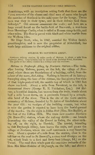
158 SOUTH-EASTERN COUNTIES—OLD MELROSE.
Armstrongs, with an inscription setting forth that these are the
" coat armories of the clanns and chief men of name who keepit
the marches of Scotland in the auld tyme for the kynge. Trewe
men war they in their tyme, and in their defence God them
defendyt." Old armour ornaments the walls ; and here are a
large sword found on the battle-field of Bosworth, a war-horn
from Hermitage Castle, what is called a Roman camp-kettle, and
other relics. The floor is paved with black and white marble from
the Western Isles.
Mr Hope Scott, who, in 1847, married Sir Walter Scott's
granddaughter, and is now the proprietor of Abbotsford, has
made large additions to the original edifice.
MELROSE TO DRYBURGH ABBEY.
Newtown railway station, 3J miles south of Melrose, is about a mile fromDryburgh Abbey. Conveyances may be hired at the Railway Hotel, Newtown.The guide to the Abbey resides in a cottage near the entrance.
Melrose to Dryburgh Abbey, by Newtown Station.—The train,
after leaving Melrose, passes, on the left, the village of New-
stead, where there are foundations of a building, called, from the
colour of the stone, Red Abbey. Nothing is known of its history.
Sweeping along the base of the Eildons, the line gives a fine view
of that triple-peaked hill, the middle top of which is 13G1 feet
above sea-level. About a mile from Newstead, to the left, is
Ravenswood House (George K. E. Fairholme, Esq.). Old Mel-
rose, a beautiful domain, but unseen from the train, stands about
half a mile lower down, on a peninsula formed by a remark-
able bend of the river. This is the site of the more ancient
monastery of Melrose, founded by St Aidan of Lindisfarne about
the year G35 : no vestiges of the building remain, but what
is now the garden is reputed to have been the burial-ground
of the monks. On the right is Eildon Hall (Hon. Mrs Baillie), at
the foot of the Eildon Hills. The train now reaches Newtown
(St BoswelPs) station, where the railway divides ; one branch
descending the valley of the Tweed to Kelso, the other strik-
ing off, on the right, to Hawick. The tourist, intending
to visit Dryburgh Abbey, here leaves the train, and passes the
village of Newtown, where the road commands a very beautiful
view. About a quarter of a mile from the station, close to the
toll-bar on the road to St Boswell's, a cross road diverges on the
left, which leads to a ford and ferry-boat (charge, Id.) on the
Tweed. The road then winds past the extensive orchards of the
Hon. Mrs Biber-Erskine of Dryburgh, on the left; and about a

DRYBURGn ABBEY SCOTT's TOMB. 159
mile distant, on the north hank of the river, is Dryburgh House.
Beyond are the ruins of Dryburgh Abbey.
Melrose to Dryburgh Abbey, by Bemersyde,—This road, though
about two miles longer than the other, has many attractions, as
the Tweed is nowhere more charming than here. The tourist
crosses the Tweed at Fly Bridge, and the Leader at Drygrange
Bridge, which commands lovely views both up and down the
water. It is situated a short distance above the junction of the
Leader with the Tweed ; and the valleys of the two streams at
this point present many beautiful features, including the grounds
of Drygrange House (T. Tod, Esq.), and Gledswood (Meiklam,
Esq.). From Leader Bridge the tourist approaches Bemersyde.
The road, as it passes Bemersyde Hill, gives a noble view of the
vale of Melrose, the Tweed, the Eildons, and the distant Cheviots.
Bemersyde House, for nearly 700 years the seat of the family of
llaig, is pleasantly placed within a mile of Old Melrose. Aprophecy, ascribed to Thomas the Rhymer, long quoted, has not
yet been falsified :
—
" Betyde, betyde, whate'er betyde,There'll aye be a Haig in Bemersyde."
The ruins of Dryburgh Abbey stand on a richly wooded pen-
insula, formed by a bend of the Tweed. The chapter-house,
refectory, kitchen, dormitories, and a small building called St
Modan's Chapel, adjoining the chapter-house, are in the transition
from Romanesque to First-Pointed ; the presbytery, choir, and
transepts of the conventual church are First-Pointed ; and the
nave (great part of which was restored about the middle of the
fourteenth century) is early Second-Pointed. The presbytery is
36 feet long ; the choir is of two arches ; the nave, of six
arches, is 190 feet long and 75 broad.
The grave of Sir Walter Scott is in St Mary's Aisle, in the north
transept. He had his burial-place here, in right of his grand-
mother, Barbara Haliburton, third daughter of Thomas Hali-
burton of Newmains, who bought Dryburgh in 1700. Scott wasburied on the 26th September 1832. The remains of Lady Scott
had been laid in the same place in 1826, and in 1847 the tombwas opened to receive the ashes of their son, Colonel Sir WalterScott, who died off the Cape of Good Hope. In 1854, Mr J. G.
Lockhart, Scott's son-in-law and biographer, was laid by his side.
" Dryburgh," says Mr Cosmo Innes, " since it became the grave
of Scott, has been invested with a new interest. It was preferred
by him, that his own remains might mingle with those of his
material ancestors, the Haliburtons. But it was, in any view,

1G0 SOUTH-EASTERN COUNTIES DRYBURGII.
a fitting place of sepulture for the Great Minstrel of the Scottish
Border. There, amidst the dust of the powerful De Morvilles,
and many a holy abbot and monk of old, and surrounded by the
ashes of his own ' rough elan,' under walls scorched in many a
Border foray, in the heart of the valley he loved so well, and of
the scenes he sung, lie the mortal remains of that mighty master
who has thrown a charm over the country, its history, and its
traditions, that will live as long as themselves."*
Dryburgh Abbey was founded in L150 by King David I. and Hugh deMoreville, Constable of Scotland, for monks of the Praemonstratensianorder, broughl from Alnwick in Northumberland. In 1332, the Abbeywas burnt by the English, who again gave it to the flames in 1544.
Dryburgh House, on the south side of the ruins, belongs to the lion. MrsBiber-Erskine, granddaughter of the twelfth Earl of Buchan.A wretched colossal sandstone statue of Sir William Wallace, erected by
the eleventh Ear] of Buehan, stands on a high hill overlooking the Tweed,from which there is a line view of the surrounding country.
Melrose to EablstON [Coach daily: distance four miles],—A pleasant ex-
cursion may be made from Melrose to Earlston, on the Leader water, a streamcelebrated in the song of " Leader haughs and Yarrow." The road windsup the stream from Drygrange Bridge, through the woods of Drygrange,and past Cowdi nknowes (R. Cotesworth, Esq.), an old mansion at the foot of
the hill of the same name, on which still flourishes the " bonnie, bonniebroom" celebrated in song. Earlston, anciently Ercildoun, was, at the
close of the thirteenth century, the residence of Thomas Learmonth, or
Thomas the Rhymer, in whose prophecies all Scotland long firmly believed.
The remains of what is called his castle, known as the Rhymer's Tomer, are
still to be seen at the west end of the village, and in the front wall of the
parish church is a stone bearing the inscription
—
" Auld Rhymer's race lies in this place."
He is the reputed author of the metrical romance of " Sir Tristrem," whichwas published by Sir Walter Scott in 1804. In the village is a manu-factory of blankets and plaidings ; and the " Earlston ginghams " are well
known. In the neighbourhood is the handsome modern mansion of Meller-
stain (Earl of Haddington).In ascending the Leader, at a short distance from Earlston, is seen, on
the left bank of the stream, Carolside (Mitchell Innes, Esq. of Stow) ; and a
little farther up, on the opposite bank, the fine residence of Chapel-on-
Leader (W. Fairholme, Esq.). Six miles from Earlston is Laudek, whichwas made a royal burgh in 1494, and has a population of 1105. It wasat the Bridge of Lauder (now removed), that the Earl of Angus (Archi-
bald Bell-the-Cat) and the mutinous Scotch nobles hanged six of the fa-
vourites of James III. in 1482. Close to the town is Thirlestaine Castle,
the seat of the Earl of Lauderdale, surrounded by a noble park, onthe right bank of the Leader. It was built chiefly in the reign of KingCharles II., and contains some interesting family portraits, among whichmay be mentioned those of Sir Kichard Maitland, a poet of the sixteenth
century, and of Maitland of Lethington, Queen Mary's secretary.
* Liber S. Mariae de Dryburgh, p. xxxvii.

161
MELROSE TO KELSO, COLDSTREAM, NORHAM, ANDBERWICK-UPON-TWEED,
BY RAILWAY.
Miles from Melrose.1 Newstead village, on left.
Eildon Hills, on right.
Ravenswood House, on left.
Gledswood House, on left.
Bemersytle House, on left.
Eildon Hall House (Hon. Mrs Bail-
lie), on right.
3} Newtown (St Boswell's station),
Hawick Junction, on right.
Newtown village, on left.
Dryburgb Abbey, on left.
Mainbill House, on right.
Eiliston House, on right.
St lSoswell's Church, on left.
St Boswell's Cottage, on left.
Benrig House (Munro, Esq.), on left.
St Boswell's Bank House (Fairfax,
Bart.), on left.
6J Maxton station.
Maxton Village and Church, on left.
Mertoun House (Lord Polwarth), onleft.
Littledean Tower, ruin, on left.
Smailholm Tower, ruin, on left.
Rutherford farmhouse, on right.
8| Rutherford station.
Makerstoun House, on left,
llf Roxburgh station (Jedburgh Junc-tion), on right.
Roxburgh village, on left.
Wallace's Tower, ruin, on left.
Sunlaws Caves, on left.
Cross Teviot on viaduct of 15 arches.
Roxburgh Castle, ruins, on left.
Floors Castle (Duke of Roxburghe).L4j Maxwellheugh and Kelso station.
Kelso, 1 mile, on left.
Miles from Kelso.Railway for Berwick on south side
of Tweed, across Kelso Bridge.
Pinnacle Hill.
Wooden (Admiral Scott).
3 Sprouston station.
G Carham, first station on Englishground.
March Burn in vicinity—Division of
the two kingdoms.Carham Church and Carham Hall,
on left.
Wark Castle site, 1£ mile from Car-ham.
The Hirsel (Earl of Home), on left
of Tweed.West Learmouth viaduct of seven
arches.
11 Cornhill station, for Coldstream, 1
mile.Flodden Hill, 4 miles south-east.
17 Norham station.
Ruins of Norham Castle, on Englishside of Tweed.
Church of Ladykirk, on Scottish side
of Tweed.19 Velvet Hall station.
Paxton House (Home, Esq.), onScottish side of Tweed.
Union Suspension Bridge.Ord House, on right. East Orel vil-
lage.
23 Tweedmouth station.
Spittal, | of a mile east.
Main line joined here.
Cross Tweed by railway bridge, 21G0
feet long.
24 Berwick-ufon-Tweed.
For the route between Melrose and Newtown, see p. 158.
At Newtown station [Inn: Railway Hotel], the line to Ha-
wick branches off. The village of St Boswell's [Hotel : Buc-
cleuch Arms], about a mile from the station, is so named from
St Boisil (d. 664), prior of the older monastery of Melrose, and
preceptor of St Cuthbert of Durham. The place is noted for a
great annual fair on the 18th of July, which generally rules the
price of Border wool for the season. It is the principal market
for sheep and lambs in the south of Scotland, and is attended by
an immense concourse of people. The Duke of Buccleuch's ken-
nels are to the south of the village. Near it is Lessudden House
(Mrs Scott), an old Border stronghold of the Scotts of Raeburn.
Starting from the station, the train for Kelso passes Benrig (T.

si (UTH-E \ BT ERN COUNTIES— B MA CLHOLM TOWER.
M. Munro, Esq.), Maatton Cottage (Misses Williamson Ramsay),and St BotwelTs Bank (Fairfax, Bart.). Three miles from New-town is Maxton Station, Below Maxton village is Mertoun House
(Lord Polwarth), on the opposite or north hank of the Tweed,
surrounded by an extensive park.
There is much to attract in this part of the Tweed. The river makesthree crooks or bends one of which washes the beautiful peninsula of OldMelrose, a second sweeps round Dryburgh Abbey, and the third almostencircles the site of Mertoun parish church. The ground rises in undulat-
ing outlines east and north from the river, diversified with hedge-rows andwoods, exhibiting broad haugh and precipitous bank.
The line proceeding onwards, gives a view, on the left, of the
ruins of Littledean Tower, the ancient residence of the Kerrs of
Nenthorn. Conspicuous beyond it, amid a wild cluster of rocks,
is Smailholm Tower, a high square pile, now quite ruinous. This
old Border keep was surrounded by an outer-wall enclosing a
court-yard, now demolished. It is defended on three sides by pre-
cipices and a morass, the only access being by a steep and rugged
path on the west. It belongs to Lord Polwarth, the lineal de-
scendant of the Scotts of Harden. The tower and the " flowery
crags" of Smailholm have been celebrated by Sir Walter Scott in
his ballad of " the Eve of St John."
The neighbouring farm-house of SandyJcnoive, then occupied by his pater-
nal grandfather, was the residence of Sir Walter Scott for several years of
his childhood between 1773 and 1778. "It is here," he writes, "that I
have the first consciousness of existence." He has described the scene in
the introduction to the third canto of " Marmion."
" Then rise those crags, that mountain tower,
Which charm'd my fancy's wakening hour. . . .
It was a barren scene, and wild,
Where naked cliffs were rudely piled
;
But ever and anon betweenLay velvet tufts of loveliest green
;
And well the lonely infant knewRecesses where the wall-flower grew,And honeysuckle loved to crawlUp the low crag and ruin'd wall
;
I deem'd such nooks the sweetest shadeThe sun in all his round survey'd
;
And still I thought tint shatter'd towerThe mightiest work of human power;And marvell'd, as the aged hindWith some strange tale bewitch'd my mind,Of forayers, who, with headlong force,
Down from that strength had spurr'd their horse,
Their southern rapine to renewFar in the distant Cheviots blue,
And, home returning, filled the hall
With revel, wassail-rout, and brawl."
" The view from Smailholm Tower," says Mr Lockhart, " takes in a
wide expanse of the district, in which, as has been truly said, every field
has its battle, and every rivulet its song. Mertoun, the principal seat of

BMAILHOLM TOWER MAKERSTOUN—ROXBURGH. 1G3
the Harden family, with its noble proves ; nearly in front of it, across the
Tweed, Lessudden, the comparatively small but still venerable and stately
abode of the Lairds of Raehnrn ; and the hoary Abbey of Dryburgh, sur-
rounded with yew-trees as ancient as itself, seem to lie almost below the feet
of the spectator. Opposite him rise the purple peaks of Eildon, the tradi-
tional scene of Thomas the Rhymer's interview with the Queen of Faerie;
behind are the blasted peel which the seer of Erceldoun himself inhabited,1 the Broom of the Cowdenknowes,' the pastoral valley of the Leader, andthe bleak wilderness of Lammermoor. To the eastward, the desolate gran-
deur of Hume Castle breaks the horizon, as the eye travels toward the
range of the Cheviots. A few miles westward, Melrose, ' like some tall
rock with lichens gray,' appears clasped amidst the windings of the Tweed;and the distance presents the serrated mountains of the (Jala, the Ettrick,
and the Yarrow, all famous in song. Such were the objects that had paintedthe earliest images on the eye of the last and greatest of the Border Min-strels."
A mile below Rutherford Station is a view to the left of the
beautiful seat of Makerstoun House, below which, at Trow Craigs,
the Tweed is so closely pent in by rocks, that the angler can
almost step from bank to bank. The house, surrounded with
fine old woods, has an extensive prospect to the south ; and the
now deserted observatories, fitted up by its late proprietor, Gen-eral Sir Thomas Makdougall Brisbane, Bart., who died in January
1860, are well known in the annals of astronomical discovery.
The train next reaches
Roxburgh Station, at the upper end of the village of Roxburgh,
standing on a pleasant southerly slope, on the left bank of
the Teviot, which separates it from a wooded mound called The
Pleahill, not far from the remains of a primitive fort, called Ring-
ley Hall. To the north, at some distance, may be discerned the
scanty remains of the ancient Castle of Roxburgh, on a woodedgreen mound on the margin of the Teviot, near its junction with
the Tweed. From Roxburgh station to Maxwellheugh station,
the line traverses some of the most beautiful scenery in Scotland.
On the opposite bank from Roxburgh station is Sun laws (W.Scott Kerr, Esq.), a handsome modern mansion in the Elizabethan
style, with a lofty tower.
A short distance above, on the banks of the Teviot, are the Caves ofSunlaws, in a steep cliff rising from the river. Passengers by the railwayto Jedburgh can see into them. There are similar excavations at Grahams-law, at Ancrum, at Ilundalee near Jedburgh, and elsewhere in the district.
On the left of the railway embankment is a ruin known by the variousnames of Roxburgh Tower, Sunlaws Tower, Merlin's Cave, and Wallace'sTower, but as to which history and tradition are equally silent.
The railway crosses the Teviot by a lofty viaduct of 15 arches.
For the next mile and a half the line makes a wide sweep within
view of the river, and from a long embankment are seen towards
the north Floors Castle, the fine seat of the Duke of Roxburghe,

I'll SOUTH-EASTERN COUNTIES—KELSO.
surrounded with woods, and the ruined Castle of Hume, once the
seat of the great Earls of Home, standing conspicuous on a hill,
overlooking the whole district of the Merse and great part of
Teviotdalc. Immediately on the right is the farmhouse of Mni-
sondicu, so called from a preceptory or hospital of the twelfth
century, which stood at Old Maisondieu, within the heautiful
grounds of Sir G. S. Douglas, Bart, of Springwood Park. A deep
cutting succeeds, and the line, after passing under the puhlic road
to Hawick, reaches the Kelso station at Maxwellheugh.
The name of this village sufficiently marks its site, zheugh in the ancient
barony of Maxwell Situated on the south bank of the Tweed, directly
opposite to Kelso, it may be considered as a suburb of that town.
The road from the station to Kelso, passing a gigantic poplar
and the fine gateway of Springwood Park, crosses the bridge over
the Tweed into
KELSO.
[Hotels: Cross Keys, Queen's Head, Red Lion, White Swan, Black Swan,
Temperance.]
This, the best-built town on the east Border, is finely situated
on the Tweed, opposite the confluence of the Teviot. It has a
population of 4783, and has five bank offices. There are two
Established churches, two United Presbyterian churches, a Free
church, an Episcopal church, and a Reformed Presbyterian church.
The name, anciently written Kalclw, Calhou, Calchou, Kellesowe, and
Kelchou, is supposed to be derived from a steep precipice containing abun-
dance of gypsum, and other calcareous earths, on which a part of the burgh
is built, still known as the ChalJcheugh.
On the east side of the spacious market-place stands the Town
Hall, with an Ionic portico, surmounted by a balustrade and dome.
On the terrace on the Chalkheugh are the Kelso Library, contain-
ing 8000 volumes, and the interesting Museum of the Tweedside
Physical and Antiquarian Society (shown gratuitously on Mon-
days, Wednesdays, and Fridays).
The bridge connecting Kelso with Maxwellheugh was built in
1803, at a cost of about £18,000, from a design by Rennie. It
is 494 feet in length, each of its five elliptical arches being 72
feet in span, and the greatest height from the foundation (15 feet
below the bed of the river) 57 feet. The view from the bridge is
exceedingly beautiful. Immediately on the north lies the town,
with the majestic ruins of its ancient abbey, and the handsome
modern mansion of Ednam House (Mrs Robertson) ; a mile and
a half to the north-west rises Floors Castle; in front arc two islets
in the Tweed ; and between the Tweed and the Teviot arc the

KELSO ABBEY—ITS RUINS AND HISTORY. 1G5
beautiful peninsula of Friars* or St James's Green, and the ruins
of Roxburgh Castle, a mile and a quarter distant. On the south-
west, within a fine bend of the Teviot, are the mansion and de-
mesne of Springwood Park (Sir George S. Douglas, Bart.) ; a little
to the eastward, close upon the view, rises the finely shaped Pin-
micle Hill ; while away in the background are the conspicuous
ruins of Hume Castle, the hills of Stitchel and Mellerstain, the
triple heights of Eildon, Penielheugh, and the remote and lofty
mountain range beyond.
The view from Chalkheugh Terrace, showing quite a labyrinth of streams,
is scarcely less prized than that from Kelso Bridge. But the widest andfinest view of all is from the mansion of Pinnacle Hill, on the wooded pre-
cipitous cliffs that overhang the town and river.
The great object of interest in Kelso is its ruined Abbey, founded
by King David I. in 1128. " In the midst of the modern town,"
says Mr Cosmo Innes, " the Abbey Church stands alone, like someantique Titan predominating over the dwarfs of a later world.
Its ruins exhibit the progression of architecture that took place
over Scotland and England between the middle of the twelfth
and the middle of the thirteenth centuries. What remains of
the choir affords a good specimen of the plain Romanesque style,
not of the earliest character, but such as prevailed in England
before 1150, and in Scotland perhaps a little later. The western
front is later Romanesque, probably of the latter half of the
twelfth century ; and the great western doorway, of which but
a fragment remains, must have been a fine specimen of the period
which produced the richest architecture of the circular arch. Ofthe same period nearly is the arcade of intersecting arches ; and
lastly, the tower springs from arches marking the first years of
the thirteenth century, when the Romanesque style had passed
into the Early English or First-Pointed." *
In the year 1113, David I., then Prince of Cumbria, brought a colony ofthirteen reformed Benedictine monks from the newly founded abbey ofTiron in France, and planted them beside his Forest castle of Selkirk.
After his accession to the throne, in 1124, he removed the monks from Sel-
kirk, which he declared to be "unsuitable for an abbey," and establishedthe monastery "at the church of the Blessed Virgin on the bank of theTweed, beside Roxburgh, in the place called Calkou." The monks came to
Kelso in 1126, and two years afterwards laid the foundation of their con-ventual church.
In the Wars of the Succession (1291-1325), Kelso suffered so much thatits monks and novices had to beg their bread among the other religious
houses. In 1545, Teviotdale was wasted by an English army of 12,000 menunder the Earl of Hertford, when the east and north sides of the stately
* Liber S. Mariae de Calchou, pp. xlix. 1.

L66 SOUTH-EASTERN COUNTIES—KELSO.
tower were shattered by cannon, and the choir almost levelled to the ground.
The building seems never to have heen repaired.
The length of the transept within the walla is 72 feet; the breadth, 23feet; the height of the central tower 91 feet, the breadth, 23 feet; the
height of* the pointed arches under the towei', 45 feet; the width, 17 feet;
the diameter of the columns in the choir, 7 feet.
In 1605, the abbey was granted by the crown to Sir Robert Ker of Cess-ford, and it now belongs to his descendant, the Duke of Roxburghe.In 1851, Mrs Robertson of Ednam llouac presented a public park of nearly
ten acres to the inhabitants of Kelso, along with £500, to complete the
approaches, lay out the walks, and otherwise improve the grounds. It is
named Skedden Park, in honour of the lady's nephew, Robert Hhedden, Esq.
(d. 1851), the owner and commander of the yacht Nancy Dawson, whichrendered essential service in the search for Sir John Franklin, and wasthe only yacht that ever rounded Point Barrow, and circumnavigatedthe globe.
ENVIRONS OF KELSO.
Among the objects of interest in the neighbourhood of Kelso is FLOORSCastee, the princely seat of the Duke of l'oxburghe, occupying a high andbeautiful site on the north or left bank of the Tweed, a mile above the town.
Erected in 1718, from a design by Sir John Vanbrugh, the architect of
Blenheim, it was greatly enlarged and improved by the present Duke, after
the plans of the late Mr Playfair of Edinburgh. Admission to the groundsmay be obtained by application at the Bank of Scotland's branch office at
Kelso.On the opposite bank are the ruins of Roxburgh Castle. A few frag-
ments of walls are all that remain of a stronghold so memorable in the
annals of Border warfare. King James II., while besieging it, was killed
by the bursting of a cannon in 1460, and a holly-tree within the park, a
short distance below Floors Castle, is said to mark the place where he fell.
" No other spot of Scotch ground," says Mr Cosmo Lines, in his preface
to the Liber S. Marine de Calchou, " has witnessed such changes as the river
bank where Teviot falls into Tweed. A town once stood there of suchimportance as to form one of that remarkable Burgher Parliament, knownas ' the Court of the Four Burghs of Scotland,' of which not a house, not
a trace remains. Still earlier, and long before the kindred people dwelling
on the opposite sides of the Tweed had learned to look on each other as
aliens and enemies, the great Princes of Northumberland had built a castle
there, which became a favourite dwelling of Earl David, afterwards KingDavid I. Even after southern Northumbria had been severed from Scot-
land, the castle continued one of the chief royal residences, where courts
and councils and parliaments were held, ambassadors and legates were en-
tertained, and a royal mint was established, during the reigns of David's
grandsons, and down to the end of that long period of prosperity and peace
which terminated for Scotland with the reign of King Alexander III."
Three miles along the road leading north from Kelso towards the village
of Stitchel, is Newton Don House (C. Balfour, Esq.), pleasantly situated
on the wooded banks of the Eden, which, flowing through Ednam, pre-
cipitates itself over the rock of Stitchel Linn, and joins the Tweed at Eden-mouth. Four miles from Kelso, on a height overlooking the whole country
to the Cheviot Hills, is Stitchel House (David Baird, Esq.). To the west
of Stitchel, a mile farther from Kelso, is Nenthorn House (F. L. Roy, Esq.).
Three miles from Kelso, to the north-east, is the pleasant village of Ednam,or Edenham, the birthplace of Thomson, the author of " The Seasons."
On the way to it from Kelso, numbers of villas, amid gardens and shrub-
beries, appear, among which may be mentioned Hend&rsyde Park (John

THE TWEED—WARE CASTLE COLDSTREAM. 167
W:ihlie, Esq.), containing a library of 18,000 volumes, and a large and in-
teresting collection of pictures and other works of art. A short distance
from Kelso is the Race Course, one of the finest in Great Britain, a mile anda quarter in circumference, and sixty feet in breadth. On the west side is aStand, of polished stone, with a double tier of galleries. A little in ad-
vance, on the high ground to the left, is Sydenham (Sir William Dickson,Bart.), and soon afterwards is reached the village of Ednam. The parish
chureh, of which the father of Thomson was minister, and the manse, are
from the public road. On Fairney Hill, a rising ground on the estate
ot' Bendersyde, is an obelisk, erected in 1820 by the members of the Thom-son Club, with the inscription—" Erecteo in memory or James Thomson,Al IIIOR OF ' THE SEASONS,' BORN AT EDNAM, IItH SEPTEMBER, A.D. 1700."
There is a railway from Kelso by Melrose to Jedburgh. The road, ten mileslong, proceeds by the villages of Maxwellheugh and Heiton, crossing the romanticKale, an excellent trouting stream, and passing (at a short distance to the right)
'vr, an old stronghold of the Scotts of Buccleuch, and the villages of Eckfordand Crailiug.
KELSO TO COLDSTREAM AND BEKWICK-UPON-TWEED.
The railway runs on the south side of the Tweed through a
finely cultivated district. Leaving Kelso, and passing PinnacleHill
and Wooden (Admiral Scott), a modern castellated mansion, the
train reaches Sprouston Station, a village, with a population of 420,
two miles and a half from Kelso. Of the parish of Sprouston, the
eloquent Dr Andrew Thomson (6. 3779, d. 1831 ) was minister from
1802 to 1808, and on the occasion of a false alarm of an invasion
by the French, he is said to have led a volunteer troop of his
parishioners to Kelso. The church and manse of Sprouston are
the last which the railway passes on Scottish ground.
The next station is at the rural English village of Carham.,
near the streamlet of the March Burn, which divides the twokingdoms. It is so narrow that a person can easily place one
foot on Scottish and the other on English ground. A mile anda half from Carham, on the Northumberland side of the river,
upon a round knoll, are the scanty remains of Wark Castle,
long prominent in the annals of border strife. About two miles
from it, on the Scottish side of the Tweed, surrounded by fine
old woods, is The Hirsel, the seat of the Earl of Home, whoseancestors had large territories, and were long powerful on the
eastern borders. At West Learmouth, a lofty viaduct of seven
arches commands a beautiful view to the north of the Tweed,the town of Coldstream, and the mansion and park of Lees (Sir
John Marjoribanks, Bart.).
Cornhill Station is one mile from
COLDSTREAM.
[Inns: Newcastle Arms, Commercial, Black Bull.]
This neatly built town has a population of about 2000, and is
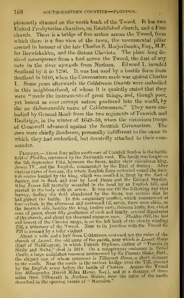
168 BOUTH-EASTEBS COUNTIES FLODDEN.
pleasantly situated on the north hank of the Tweed. It has two
United Presbyterian churches, an Established church, and a Free
church. There is a bridge of five arches across the Tweed, from
which there is a fine view of the town, the monumental pillar
erected in honour of the late Charles S. Marjoribanks, Esq., M.P.
for Berwickshire, and the distant Cheviots. The place long de-
rived consequence from a ford across the Tweed, the first of any
note in the river upwards from Norham. Edward I. invaded
Scotland by it in 1296. It was last used by a hostile force from
Scotland in 1G40, when the Covenanters made war against Charles
I. Some years afterwards the Coldstream Guards were embodied
in this neighbourhood, of whom it is quaintly stated that they
were " made the instruments of great things, and, though poor,
yet honest as ever corrupt nature produced into the world, by
the no dishonourable name of Coldstreamers." They were em-
bodied by General Monk from the two regiments of Fenwick and
Hesilrigge, in the winter of 1049-50, when the victorious troops
of Cromwell advanced against the Scottish Covenanters. The
men were chiefly Borderers, personally indifferent to the cause in
which they had embarked, but devotedly attached to their com-
mander.
Flodden.—About four miles south-east of Cornhill Station is the battle-
field of Flodden, traversed by the Newcastle road. The battle was fought on
the 9th September 1513, between the Scots, under their chivalrous king,
James IV., and the English, commanded by the Earl of Surrey. After
various turns of fortune, the whole English force collected round the Scot-
tish centre headed by the king, which was assailed in front by the Earl of
Surrey, and in flank and rear by Lord Dacre and Sir Edward Stanley.
King James fell mortally wounded in the head by an English bill, and
pierced in the body with an arrow. It was not till the following day that
Surrey, finding the field abandoned by the Scots, was certain that he
had gained the battle. In this sanguinary conflict, which commenced at
four o'clock in the afternoon and continued till seven, there were slain, on
the Scottish side, besides the king, twelve earls, thirteen lords, five eldest
sons of peers, about fifty gentlemen of rank and family, several dignitaries
of the church, and about ten thousand common men. Flodden Hill, the last
and lowest of the Cheviot range, is on the left bank of the slowly winding
Till, a tributary of the Tweed. Near to its junction with the Tweed the
Till is crossed by a lofty viaduct.
About a mile and a half from Coldstream eastward are the ruins of the
church of Lennel, the old name of the parish, near which is Lennel Hotue
(Earl of Haddington), in which Patrick Brydone, author of "Travels in
Sicily and Malta," died in 1818. On a conspicuous eminence is Ttmsiel
Castle, a large unfinished mansion commenced by Sir Francis Blake, Hart.,
the elegant seat of whose successor is Tillmouth House, a short distance
to the south. Near the castle is the ancient bridge over the '1 ill, crossed
by the English army before the battle of Flodden. Across the I weed
lies MUnegraden (Uavid Milne Home, Esq.), and at a distance ot three
miles from Tillmouth is Norham Station, near the ruins of the castle
described in the opening verses of " Marmion."

NORIIAM. CASTLE AND CHURCH—LADYKIRK. 169
Norh til Castle, seven miles from Berwick, stands on a steep bank over-
hanging the Tweed, and consists of a lofty tower of the twelfth century,
and of some shattered fragments of building enclosed by two moats and an
outer and inner wall. The tower or donjon was founded in 1121 by Bishop
Flambard of Durham, and his masonry may still he traced in the south-
east corner, in about thirty feet of the south side, and in the whole east
side. It was taken by King David 1. of Scotland in 1136, and again, after
a long riege, in L138. About 1160 it was repaired by Bishop Pudsey of
Durham, who rebuilt the whole western wall of the tower, and added on
every side to its height. King John of England was here in 1209, in 121 1.
and 1213. On the two former occasions he met King William the Lion.
In 1215, the castle was unsuccessfully besieged for forty days by King
Alexander 11.. who. in 1210. here met the Papal Legate. King Edward 1.
resided much here in 1290 and 12'.) I, when arbitrating on the claims of
the competitors tor the Scottish crown. The west gate was rebuilt in
1408. King James 1 V. unsuccessfully besieged the castle for fifteen days
in 1407. lie took it in 1513, and made it his headquarters until he fell at
Flodden. The wall of the inner bailey of the castle, with its gateway and
deep moat, may still be traced. The outer wall of the outer bailey is less
perfect. There are some vestiges of the outer moat made in 1495.
In Norham Church, which is chiefly in the late Romanesque style, King
Edward I. sat upon his throne in 1290, to hear the claims of the compe-
titors for the Scottish crown. Here also a treaty of peace between England'
and Scotland was signed in 1551._
On the high bank opposite, on the Scottish side of the river, are the an-
cient parishes of Upscttlinqtoii and Homdean, united into the modern parish
of Ladvkirk. The church of Lndijhirh is an interesting example of the
Scottish Second-Pointed style. It was built about 1500, and consists of a
chancel with a three-sided apsidal termination, transepts, nave, and belfry,
all roofed within and without by solid groining and masonry. The history
of the building is recorded on a tablet : D. O. M. Hanc aedem Beatae Virgiui
Marine sacram ah indyto Jacobo Quarto Scotorum Bege, anno post Christum
natum M.D. exstructam, et deinde temporis vetustate accolarunique injuria^
collapsam, etiampene ruinis involutam, jam tandemfundi paroehialis domini
sua pecunia instaurandam curarunt. Denique campanili addito Gulielmus
Bobertson a Lad>/kirk ornandam curavit MDCCXLIII. In the open field
called Holywcll-'haugh, King Edward I. heard the claims of the com-
petitors for the Scottish crown in June 1291. In 1559, a treaty of peace
between England and Scotland was signed in the church of St Mary of
Upsettlington or Ladykirk.
The train next arrives at Velvet Hall Station.—On the north or oppo-
site bank of the Tweed is Paxton House (Home, Esq.), with a collec-
tion of paintings ; and in the immediate neighbourhood is the Union
Suspension Bridge, erected by Captain Sir Samuel Brown, E.N., in 1820,
the first of its kind in the United Kingdom. Proceeding eastward, to the
right of the line are Ord House. (J. (irieve, Esq.) and the village of East
Ord. A short distance beyond is Tweedmouth Station, at the village of
the same name. Three quarters of a mile east, is the small fishing
village of Spltial, so named from an hospital for lepers founded here be-
fore the middle of the thirteenth century. At this station the Berwick
and Kelso Railway joins the main line, and making a circuit round Tweed-
mouth, crosses the Tweed by a bridge of 28 arches, 2160 feet long and 126
above the stream, and arrives at Berwick-upon-Tweed, already described
(pp. 140, 141).

170 SOUTH -F.ASTKRN COUNTIES—MINTO.
MELROSE TO HAWICK V>\ RAILWAY.The tourist for Hawick proceeds to the junction at New town St Boswell's
Station, as already described 'p. 168). Here the line turns southward, withthe farms of MuluhiU and lllllhni on the left, and on the right, at a little
distance, Halidean, with the vestiges of an old tower, and Dearer, Oamieston,Thornielaw, Ellieston^ Broadside, and Longnewton. The heights of TAUiard's
Edge, seen to the, loft, in the parish of Ancrnni, arc Cabled to derive their
name from a Scottish damsel whose courage helped to gain the victory wonby the Karl of Angus at Ancrum Moor, in 1545, over the English underSir Ralph Eure and Sir Brian Latoun. Her monument, long since brokenand defaced, is said to have borne the following inscription :
" Fair maiden Lylliard lies under this stane,
Little was her stature, but great Mas her fame;Upon the English locus she laid mony thumps,And, when her legs were cutted aff, she fought upon her stumps."
The name of LiUiarcVs Edge can be traced to the twelfth century.
About three miles from Newtown Station, near the straggling
village of Li/Hesleaf, on the Ale Water (an excellent trouting
stream), is the mansion house of Riddell (Mark Sprott, Esq.).
The line crosses the Ale Water at Whapland Mill, Greenend and
Sandystones being on the left. The banks of the Ale Water—in
many places finely wooded with tall trees, in others "o'erhungwith
birk or odorous broom," or rising in precipitous cliffs—are very
picturesque. The train, passing Pinnacle to the left, next reaches
New Belses Station ; and, passing Old Belses, the village of
Lilliesleaf, Greenhouse, and Wellbridge on the right, Rawflat and
Standhill on the left, the line runs to the left of the Minto Hills,
two finely rounded eminences of bright green sward. Minto
Crags, a bold mass of igneous rock, rising several hundred feet
above the Teviot, are to the east of the Earl of Minto's park.
Sir Walter Scott has commemorated them :
"On Minto crags the moonbeams glint,
Where Barnhill hewed his bed of flint;
Who flung his outlawed limbs to rest
Where falcons hang their giddy nest.
'Mid cliff's from whence his eagle eyeFor many a league his prey could sj.y,
Cliff's doubling on their echoes borne,The terrors of the robber's horn,Cliff's which for many a later year,
The warbling Doric reed shall hear,When some sad swain shall teach the grove,Ambition is no cure for love."
On the south-eastern slope of the Minto Hills are the church
and village of Minto, and in a secluded spot on the terraced
margin of a fine artificial lake is Minto House, the stately resi-
dence of the Earl of Minto. The park is easily reached from
Hassendean Station, and permission to see it is readily granted.
The next station is Hassendean, four miles from Hawick.

HASSENDEAN HAWICK THE MOTE HILL. 171
The first of the Scotts of Hassendean, who appears in record,
was Sir Alexander Scott, son of Robert Scott of Buccleuch, whowas slain at Flodden in 1513. Satchells, the rhyming historian
of the family, alludes to him in the lines,
•• Hassendean came -without a call,
The ancicntest house among them all."
Sir Walter Scott's ballad of " Jock of Hazeldean " will readily
recur to the reader. On leaving Hassendean Station, the line
comes immediately within sight of the Teviot at Teviot Bank,
and accompanies the stream all the way to
HAWICK.
[Hotels: The Tower, Crown, and Commercial."]
This busy and thriving town is situated on a hill-side and
haugh, at the junction of the Slitrig and the Teviot. The place,
which seems to have been a burgh of barony from an early
period, and can show a crown charter of 1545, had a population
in 1851 of 6683. " The Tower Inn" takes its name from the old
tower of the barony, part of which still remains : in the end of
the seventeenth and beginning of the eighteenth century it was
the residence of Anne, Duchess of Buccleuch and Monmouth. It
was in the church of Hawick, in 1342, that Sir Alexander Ram-say of Dalhousie, Sheriff of Teviotdale, was seized by Sir William
Douglas, the Knight of Liddesdale, and carried wounded and
bleeding to Hermitage Castle, where he was thrown into a dun-
geon and starved to death. Of the modern buildings, the mostremarkable are, the Parish Church, built from a design byMr Burn ; the Episcopal Church (St Cuthbert's), a fine edi-
fice in the Pointed style, built, at the sole charge of the Duke of
Buccleuch, from the designs of Mr G. Gilbert Scott of London
;
Wilton Parish Church, designed by Mr Emmet of London ; the
Royal Bank branch office ; and the Commercial Bank branch office.
The Mote or Moot Hill, at the head of the town, is a mound of earth in
the shape of a truncated cone, 312 feet in circumference at the base, 117 at
the top, 30 in height Its name shows it to have been the ancient seat ofthe manorial courts. It is alluded to by Scott in "The Lay of the LastMinstrel
1 '
—
" Dimly he view'd the moat-hill's mound,Where Druid shades still flitted round."
NEIGHBOURHOOD OF HAWICK.
A mile and a half above Hawick, conspicuous on the brow of
an eminence, on the right bank of the Teviot, stands the square
tower of Goldielands, a tolerably entire Border fortalice of the
fifteenth or sixteenth century. Nearly opposite, the Teviot is

172 SOUTH-EASTERN COUNTIES HARDEN.
met by the Borthwick water, on the bank of which is HardenCastlb, the ancient residence of the Scotts of Harden, now repre-
sented by Lord Polwarth. It is embosomed in wood, and over-
hangs a deep precipitous glen, which was the receptacle of the
cattle which the famous Border chieftain, Wat of Harden, drove
home from his raids. He lived about 15G0, and his bugle-horn is
shown at Mertoun House. In one of his forays he carried oft'
a
nameless infant, who was reared by the Lady of Harden, and is
said to have been the author of not a few of the Border songs. In
his " Scenes of Infancy," Leyden thus alludes to this foundling :
•• What fair, half-veiled, leans from her latticed hall,
When: red tin' wavering gleams of torchlight fall?
'Tis Yarrow's fairest Flower who, through the gloom,Looks wishful lor her lover's dancing plume.Amid the piles of spoil that stre\v*d the ground,Her ear, all anxious, caught a wailing sound
;
With trembling haste the lovely matron tlew,
And from the hurried heaps an infant drew!Scared at the light, his feeble hands lie flungAround her neck, and to her bosom clung;While beauteous Mary soothed in accents mild,His fluttering soul, and kissed her foster child.
Of milder mood the gentle captive grew,Nor loved the scenes that scared his infant view
;
In vales remote, from camps and castles far.
He shunn'd the fearful, shuddering joy of war.Content the loves of simple swains to sing,
Or wake to fame the harp's heroic string;
He lived o'er Yarrow's Flower to shed the tear,
To strew the holly leaves o'er Hardcn's bier.
But none was found above the minstrel's tomb,Emblem of peace, to bid the daisy bloom
;
He, nameless as the race from whence he sprung,Sung other names, and left his own unsung."
The lobby of Harden Castle is paved with marble ; the ceiling of
the old hall shows some rich stucco-work ; and the mantelpiece of
one of the rooms has an earl's coronet, with the letters W. I-]. T.,
the initials of " Walter, Earl of Tarras," a title derived from the
small but romantic river of that name in Eskdale, and conferred,
in 1660, for life, on Walter Scott of Highchester, who married
the eldest daughter of Francis, Earl of Buccleuch.
About a mile and a half beyond Goldielands Tower, and nearly
three miles from Hawick, on the opposite side of the Teviot, on a
steep bank overlooking the road, is Branxholm House, the prin-
cipal scene of " The Lay of the Last Minstrel." About the middle
of the fifteenth century it became the seat of the Scotts of Buc-
cleuch, and in 1570 was blown up with gunpowder by the Eng-lish. It was immediately rebuilt, as appears from inscriptions on
the building still preserved. One runs : Sir W. Scott of Branx-
heim, knyght, oe [i.e. grandson"] of Sir William Scott of Kirkurd,
knyghtfbegan the work upon the 24 of March e 1571 years, quha de-
BRANXIIOLM GILNOCKTE. 173
partit at God's plcisnur the 17 April 1574. Another runs : DameMargaret Douglas his spous completit the foresaid work in October
1576. Over an arched doorway is the legend :
—
In varhi is nocht nature hes brought that sal last «//,
Thairfore serve God, keip veil the rod, thyfame sal nocht dekay.
Sir Valter Scot of Branxholme knyght, Margaret Douglas 1571.
The only portion of the original castle remaining is part of a
square tower.
Ten miles from Hawick, on the coach road to Carlisle, on the
right, is Carlenrig Chapel, where John Armstrong of Gilnockie, a
famed Border freebooter, and his followers, were hanged in 1530.
They were buried near the place, in a now deserted churchyard,
where their graves are still pointed out. Armstrong's tower of
Gilnockie, about three miles below Langholm, is now roofless, but
the walls are still entire, measuring about 60 feet by 46.
When King James V. came of age, he found it necessary to repress
the violence of the Borderers, whose depredations during his minorityhad risen to a greater height than ever. He accordingly collected anarmy of about 10,000 men, chiefly cavalry, " to danton the thieves
of Teviotdale, Annandalc, Liddesdale, and other parts of the country."
About the beginning of June 1529, he left Edinburgh for Ettrick
Forest and Ewesdale. He successively seized and executed Cockburnof Henderland and Adam Scott of Tushielaw, two noted freebooters,
the latter so powerful as to be commonly called "the King of theBorder." Armstrong of Gilnockie, induced, it is said, by the private
advice of some of the courtiers, presented himself before the King.M He was," says Lindsay of Pitscottie, " the most redoubted chieftain
that had been, for a long time, on the Borders either of Scotland or
England. He rode ever with twenty-four able gentlemen, well horsed
;
yet he never molested any Scottishman. But it is said, that, from the
Borders to Newcastle, every man, of whatsoever estate, paid himtribute to be free of his trouble. He came before the King, with his
foresaid number, richly apparelled, trusting that, in the free offer ofhis person, he should obtain the King's favour. But the King, seeinghim and his men so gorgeous in their apparel, with so many bravemen under a tyrant's commandment, forwardly turning him about,lie bade take the tyrant out of his sight, saying, ' What wants thatknave that a King should have?'* But John Armstrong madegreat offers to the King, that he should sustain himself, with forty
gentlemen, ever ready at his service, on their own cost, withoutwronging any Scottishman ; secondly, that there was not a subjectin England, duke, carl, or baron, but, within a certain day, he shouldbring him to his majesty, either quick or dead. At length, he seeingno hope of favour, said very proudly, ' It is folly to seek grace at agraceless face : but (said he) had I known this, I should have lived
on the Borders, in despight of King Harry and you both ; for KingHarry, I know, he would downweigh my best horse with gold, to
* Lord Byron refers to this question of King James, in a note to the 48th stanzaof the 3d canto of Childe Harold.

174 SOUTH-EASTERN COUNTIES—LIDDE8DALE.
know that T was condemned to die this day.' " His fate is the sub-ject of a well-known Border ballad, which thus concludes:
—
" John iininici'd was at Carlenrig,And all his gallant companie,
Bat Sootland'e heart was ne'er sae waeTo see sae mony brave men die.
r>< can e they saved their country deirFree Englishmen ! Nane were sae banld,
While Johnie lived on the I! nder-syile,
Nane o' them durst come near his hauld."
The road to Langholm, 22 miles south of Hawick, crosses the IViap
Hills, through a paBfi or opening in the ridge, in which standi thesolitary inn of Mosspaul, and passes through the glen of The Ewe*.The situation of Langholm is very beautiful. The Ewes and the
Wauchope here join the Esk from opposite sides. Near the villageis LaiKjInilii) Loage, a seat of the Duke of Buecleuch. On the hill
behind the village stands a monument to Sir John Malcolm, and in the
market-place there is a statue of his brother Sir Pulteney Malcolm,both horn in the neighbourhood. Archie Armstrong, the court jesterof King James VI., is believed to have been born at Langholm.William .Jnlius Mickle (6. 1734, d. 1788), the translator of Camocns'Lusiad, was born in the old manse of Langholm, on the site of the
ancient castle of the Lindsays, on the picturesque banks of the
Wauchope Water.
EXCURSION INTO LIDDESDALE.
Liddesdale, the district watered by the Liddel, an excellent trouting
stream, presents little to attract the eye, but much to interest theimagination. It was long one of the most inaccessible valleys in
Scotland, but is now about to be traversed by the Hawick and Carlisle
railway.
The banks of the Blackburn show some waterfalls ; one 37£ feet
in height and 20 in breadth ; another, 3l£ in height and 3G in breadth.
On a haugh are the ruins of Mangerton Tower, the chief stronghold
of the warlike Border clan of the Armstrongs, who possessed the
greater part of Liddesdale and the Debateable Land. Opposite to it,
on the western side of the Liddel, is Ettleton churchyard, with someancient tombstones ; and near it a cross, said to commemorate oneof the Armstrongs of Mangerton. On the hill above are the remainsof the castle of " Jock o' the Syde," brother of Armstrong of Man-gerton. A noted mosstrooper in the reign of Mary Queen of Scots,
he is the subject of one of the longest of the old Border ballads.
Sir Richard Maitland of Lethington, in a poetical " Complaint aganis
the Thievis of Liddisdaill," thus speaks of him :
" He is weel kenned, Johne of the Syde,A greater thief did never ryde;
He never tyres
For to break byres
;
Ower muir and myres,Ower gude ane guide."
Above Mangerton is the modem village of New Castleton, 20 miles
south of Hawick, on a haugh on the right bank of the Liddel ; it
was founded about 1790 by Henry third Duke of Buccleuch, and con-
tains two long streets of neat houses, each having its plot of ground

LIDDESDALE—CASTLETON HERMITAGE. 175
attached. About two miles farther up is the parish Church of CaMle-
ton, deriving its name from a village, no longer in existence, built
under the shelter of a castle, which stood on the summit of a precipice,
100 feet in height, on the east bank of the Liddel, and is said to havebeen founded by Kanulph de Soulis in the reign of David I. Its
rampart still remains entire. The manse of Castleton was the birth-
place of Dr John Armstrong, the author of the " Art of PreservingHealth" (6. 1709, d. 1779).
The most interesting historical object in Liddesdale is HermitageCastle—one of the largest and strongest fortresses on the Border
—
15 miles from Hawick, and about 5 miles north from New Castleton.
It stands on the banks of the Hermitage water, and consists of atall quadrangular tower, protected by a ditch and strong rampart.
Within a few yards of it are the ruins of the castle chapel, surroundedby a burving-ground still occasionally in use. The castle was built
by the De Soulises, probably about the middle of the thirteenth century.
On their forfeiture, in the reign of King Robert Bruce, it was givento the Douglases, and from them it passed about 1490 to the Hepburns,Earls of Bothwell. On the forfeiture of Bothwell, Queen Mary's hus-
band, it was given to Francis Stewart, with the title of Earl of Bothwell,and on his attainder, in the reign of James VI., it became the property
of the Buccleuch family, who still possess it. In one of its dungeons,Sir Alexander Ramsay of Dalhousie was starved to death by Sir
William Douglas, the Knight of Liddesdale, in 1342. In October 1566,when in possession of the Earl of Bothwell—at the time he was severely
wounded in an attempt to seize Elliot of the Parke, a desperatefreebooter—it was visited by Queen Mary. She rode across themountainous and then almost trackless region between Teviotdaleand Liddesdale, attended by only a few followers, returning the sameday to Jedburgh.From the valley of the Hermitage, the pedestrian may either make
his way over the hills to Hawick by what is called Queen Mary's road,
or cross over to the road which leads from New Castleton to Jedburgh.
MELROSE TO JEDBURGH BY RAILWAY, OR BY ROAD.
Passengers by railway from Melrose to Jedburgh proceed, by the line
which has been already described, to Roxburgh Station (p. 103). Herethe branch line runs southwards and passes Old Ormiston and Nesbit, on thenorth bank of the Teviot. Samuel Rutherford (6. 1600, d. 1661), an emi-nent Scotch Covenanting divine, was a native of the parish of Nesbit. Thehamlet of Nesbit is situated at the base of the hill of Penielheugh, 774 feet
above the sea-level, having remains of entrenchments on its top, which is
surmounted by a cylindrical column, 150 feet high, built by the sixthMarquess of Lothian and his tenants, in commemoration of the battle ofWaterloo. It commands a view of nearly all the valley of the Teviot, andof some of the finest portions of the Tweed. The next station is Jed/ootBridge, and then comes Jedburgh.The road from Melrose to Jedburgh (13J miles) passes the village of
Newstead, one mile, on the left, and the Eildon Hills on the right ; New-town St Boswell's, two miles and three quarters ; Lessudden Village and StBo6well's Green, three miles and three quarters, and then strikes off to theright, by a long straight ascent, to Ancrum Moor, (p. 170), with the ridge

176 SOUTH-EASTERN COUNTIES JEDBURGH.
called Lilliard'fl Edge immediately in front. The view from the hill, look-ins back, is extensive and picturesque. From the descent on the other side
:i distant view of the Cheviots is obtained. PenieVieugh and its Waterloopillar are Been 013 the left, and on the right i- Am rum HotlM (Sir WilliamScott, Bart.
,delightfully situated amid some of the oldest trees in the
district. One mile farther on, and ten miles from Melrose, is AncrumBridge^ over the Teviot. The Ale Water hers makes a curve; before its
junction with the Teviot ; hence the name of the village of Ancrum, fromAlneromb, signifying the crook of the Ain or Ale. A quarter of a mileeastward on the left, near Ne>hit, is Mounteviot, a modern seat of the Mar-quess of Lothian, in the midst of a large park. On the right is Cheaters(Ogil'vie, Esq.). The mad now crosses Teviot Bridge. Proceeding east-
ward the vale ofathe Jed is entered, and at a short distance from JedfooiBridge are traces of what is supposed to be a Koman road, extending in
a northerly direction, till it is lost in the grounds of Mounteviot. Bonjed-toorth hamlet, two miles below Jedburgh, is on a ridge overlooking thejunction of the Jed with the Teviot: it is supposed to occupy tin; site of aRoman station. The contemporary ballad of The Raid of the Reidsvnre(fought on Carter Fell in July 1575), in enumerating the Scotch clans, says
'• Beanjeddarl bauldly made him boon'WT" a' the Turnbulls, strong and stout;
The Rutherfoords, wi' grit renown,Convoyed the toun of Jethart out."
A short distance westward are the mansion and park of Bonjedtoorth (the
Marquess of Lothian). At the curve of the road to the south of Bonjedworthwoods, a fine view of Jedburgh is obtained, the ancient abbey tow (ringabove the houses, while in the distance "the Dunian" or " Beacon Hill
"
raises its round form, commanding a wide and beautiful view of the sceneryof the Border.
JEDBURGH,
[Hotels: The Spread Eagle, The Harrow.]
The county-town of Roxburghshire, and the seat of the Sou-
thern Circuit Court of Justiciary, is situated on the north side of
the Jed, in a beautiful and well wooded valley. It has a popu-
lation of 3615, and is the terminus of a branch of the North
British Railway. It is 11| miles south-west of Kelso, 10 miles
cast of Hawick, and 12 miles from the English Border.
Jedburgh appears among the possessions of the see of Lindis-
farne about the year 830. It was made a royal burgh by David
I. (1124-53), and was one of the four burghs which consti-
tuted the municipal parliament of Scotland. Its ancient castle,
which stood on the site of what is now the County Prison, was a
favourite royal residence, and a frequent object of contention be-
tween England and Scotland. Here the Earl Henry, son of KingDavid I., dated charters before 1152. Here King Malcolm the
Maiden died in 11G5. Here King William the Lion granted manycharters between 11G5 and 1214. Here King Alexander II. dis-
banded an army in 1217. Here King Alexander III. concluded
peace with England in 1258. Here he had a son born to him in
1263 ; and here in 1285 he married the beautiful Jolct or Jo-

JEDBURGH—THE ABBEY. 177
laiuie, daughter of the Count of Drcux in Flanders. The splen-
did nuptials were abruptly terminated by the appearance of one
of the maskers in the guise of a skeleton. About 1318, Jedburgh
Castle was taken from the English, and bestowed by King Robert
Bruce upon the Good Sir James of Douglas. It was retaken bythe English in 1333, who kept it until about 1342. They again
recovered it in 1346, and held it along with great part of the
neighbouring country until 1409. Lest it should once more fall
into the hands of the English, it was immediately demolished.
The modern Jedburgh Castle, a large castellated pile, is the
chief prison of the county of Roxburgh. It is a conspicuous ob-
ject in the landscape, and commands a wide and interesting view.
h\ front of it is the street now called the Castlegate, anciently
known as the Townhead.
A house in which Queen Mary is said to have lodged in
October and November 1560, on her memorable journey to
see Bothwell at Hermitage, is in the Bachgate, to the east of
the High Street. It is a large thick-walled building with small
windows. What is shown as the Queen's apartment is a small
room in the third storey ; some of the tapestry which is sup-
posed to have covered the walls is still preserved.
The town, which is well built, has four streets crossing at
right angles near the County Hall, erected in 1811. The Epis-
copal Church is a small but beautiful building in the Pointed
style. The Grammar School was distinguished in the seventeenth
century : Thomson, the author of the " Seasons," was a pupil in it.
The ruined Abbey stands on the south side of the town, on a
bank overhanging the Jed. It was founded for Canons Regular
of the order of St Augustin (brought from Beauvais in France)
in 1118, by the Earl David, who six years afterwards ascended
the Scottish throne as King David I. It seems to have been
raised from a Priory to an Abbey about 1152. In the wars of
the Succession (1291-1325) the lead was stripped from its roof,
and the buildings were so ruined that the canons had to take
refuge for a time in English monasteries. The edifice suffered
much in 1523, when Jedburgh was stormed by the English
under the Earl of Surrey ; and in 1544 it was so injured by the
English under the Earl of Hertford, that it was never repaired.
What now remains is the ruined conventual church, about 230
feet in length. It has a presbytery of 32 feet in length ; a choir
of two arches ; north and south transepts ; a square tower, of
100 feet in height ; and a nave of nine arches. The lower parts
of the tower, and the two arches to the east of it, are Roman-

178 SOUTH-EASTEBM COUNTIES—JEDBUEGH.
esque ; tlie nave is transition from Romanesque to First-Pointed ;
the presbytery is First-Pointed ; and the upper storey of the
tower and parts of the north transept are Second-Pointed. Thenave is now occupied as the parish church. In the north tran-
sept are the tombstones of the Kers of Fernihirst, ancestors of
the Marquesses of Lothian. Near the tower is the grave of DrThomas Somerville (b. 1741, d. 1830), minister of the parish for
sixty-four years, and the author of "A History of Great Britain
during the reign of Queen Anne." There is a good view fromthe balcony of the tower, extending to the Carterfcll mountainon the south, and ranging over Teviotdale and the vale of the Jed.
Jedburgh is vulgarly pronounced as ifwritten Jcthart. Before the
union of the crowns in 1G03 it was noted for its battle-axes, which
werehencecalledJethart staves. The bravery oi'thc burghers decided
the conflict of the Red Swire, one of the last fought on the Borders,
and their proud war-cry was
—
JetharCs here ! Jet/tart Justice was
a phrase denoting that persons were first hanged and then tried
—
a procedure not uncommon among the Wardens of the Borders.
Near Jedburgh, from which it is approached by a fine avenue
of stately trees, is Hartrigge, formerly called Stewartfield, the
modern seat of Lord Chancellor Campbell. Close to the man-sion is a sculptured stone pillar, displaying indistinct outlines of
animals ; it formerly stood at the end of the bridge at Jedburgh,
near the suburb of the Bonyate.
The scenery of the Jed is very pleasing for several miles above
the town. Opposite Altai's Factory, on the south bank of the
river, is a section, interesting to geologists for the remarkable
junction of the greywacke formation with the old red sandstone,
first noticed by Dr Hutton in 1709. About a mile from the
town, on the Jed-Water road, is the Capon Tree, a venerable oak,
standing in a meadow near the third bridge, opposite llundalee
Mill. The trunk is 21 feet in circumference near the ground,
and the branches cover an area 92 feet in diameter. Another
relic of Jed Forest is the King of the Wood, about 300 yards to
the south of the Capon Tree.
A short distance beyond the fourth bridge is the glen of the
Lintalee burn, the supposed scene of the victory gained about
1317 by the Good Sir James of Douglas over the English under
the Earl of Arundel and Sir Thomas de Richmont. Douglas is
said to have occupied a strong position, where the cottage of Lin-
talee now stands, defended on the east by the precipitous banks
of the Jed, on the north by the deep ravine through which Lin-
talee burn flows into the Jed, and on the south by the glen of

THE JED—I1UNDALEE CAVES—FERNIHIRST. 179
Blackburn, among the hazel bushes of which Douglas placed his
bowmen in ambuscade, and so forcing the English to fight at
groat disadvantage, drove them back with great loss. The poet
Burns loved to wander here in what he calls a " fairy scene." TheHundalee Caves, in the neighbourhood of Jedburgh, are supposed
to have been artificial retreats for concealment in times of peril.
The principal cave is accessible from the edge of the cliff, and,
though now exposed to view, must have been a secure retreat whenthe rock was less broken, and the brushwood more abundant.
Fernihirst Castle stands embosomed among wood, on the right
bank of the Jed, about a mile beyond the Capon Tree, and twomiles beyond Jedburgh by the road, a short distance east of
the fourth bridge. It is said to have been built in 1490 bySir Thomas Ker of Kersheugh or Fernihirst (ancestor of the Mar-quess of Lothian, to whom it now belongs). In 1523, it was takenby the English, under the Earl of Surrey, who reported that it
" stood marvellous strongly within a great wood." In 1549, it
was retaken from the English by the Scots and their French allies.
It was repaired in 1598, and is now occupied as a farmhouse.
EDINBURGH TO PEEBLES, BY THE PEEBLES RAILWAY,AND TO INVERLEITHEN, AND SELKIRK.
Selkirk is most speedily reached from Edinburgh by the branch of the NorthBritish Railway to Galashiels, which has been already described (page 148), andby the brancli line from Galashiels to Selkirk—the whole distance from Edinburghbeing 39J miles. Another route is to Peebles by railway, and thence to Inver-leithen and Selkirk. An omnibus runs in connection with the railway fromPeebles to Inverleithen (6 miles), but there is no public conveyance between Inver-leithen and Selkirk (11J miles).
The railway from Edinburgh to Peebles proceeds from the Waverley BridgeStation, Princes Street. The distance is 27 miles; and the stations on the line arePortobello (3 miles), Niddry (U), Eskbank (8), Bonnyrig (10), Hawthornden (11),
Roslin (13), Penicuik (15), Leadburn (17), whence a coach runs to Bomanno and WestLinton; Eddleston (23), Peebles (27). The first half of the line has been alreadydescribed (see page 67) ; the second half runs through a district in which there is notmuch to interest the tourist.
Route : Peebles to Inverleithen and Selkirk.
Miles.
Neidpath Castle, a mile west.Road proceeds eastwards along north-
ern bank of Tweed.Kerfield House (NichoL Esq.).Kingsmeadows and Haystoune (Hay,
Bart.), on opposite bank of river.
Horsbrugh Castle (ruins). NetherIlorsbrugh, in ruins.
Kailzie.
Cardrona (Williamson, Esq.).
Glenormiston (Wm. Chambers,Esq.).6 Inverlkitiiex.
Traquair House (Earl of Traquair),and " Bush aboon Traquair," in
vicinity.
Pirn (Colonel Horsbrugh), on right.
Miles.Walkerburn (Bnllantyne, Esq.).
Enter Selkirkshire.9 Holylee (Ballantyne, Esq.), on left.
10 Elibank Tower (ruins), opposite.
12 Ashiestiel, on right, on oppositebank of Tweed.
13 Cross Caddon water.Clovenfords village. Road from Ed-inburgh joins.
15 Fairnielee, on left.
Yair (Pringle, Esq. of Whytbank).Yair Bridge. Tweed crossed.
Sunderland Hall (Plummer, Esq.),
on left.
17 Cross the Ettrick.Selkirk.

I 'SO SOUTH-EASTERN COUNTIES—PEEBLES.
PEEBLES.
[Inns: Tontine Hotel, Commercial; Crown.]
The county town of Peebles is finely placed in the midst of an amphi-theatre of hills, on the north bank of the Tweed, near the junction of theEddleston Water, it has a population of 1982. st Kentigern, or Mungo,seems to hare had ;i churoh here aboul the year 600. The place was madea royal burgh in the reign of King David I. (1124-53), and can showcharters from the time of King Robert Bruce. It was a favourite residenceof the earlier Scottish kings, who had a castle on a mound where the pariahchurch now stands. Its Beltane, or May-day fair, is the subject of a poem,which has heeu ascrihed to King James I. (1406-47). It begins
—
' "At Beltan^ when ilk body boundsTo Peebles to the play
To bear the singing and the sounds,The solace, sooth to say."
The Tweed, the Eddleston, and other trouting streams, make Peebles afavourite resort of anglers. There is a Bowling Green immediately behindthe parish church
; and the town has an ancient silver arrow, which is oc-
casionally shot for by the Royal Company of Scottish Archers, in whosecustody it has been tor many years.
The old town of Peebles lias one main or High Street, with a few lesser
streets, and a number of lanes and closes. Two bridges, one of stone of asingle arch, the other of timber for foot passengers, connect the old townand the new. At the west end of The Green is Tweed Bridge, a structure
of unknown antiquity, with five arches on the river, and three smaller oneson the bank. It was originally only eight feet broad, but it was consid-
erably widened in 1834. The view from it is very fine. On the south side
of the High Street are the Town Hall, built in 1753, and the Tontine Hotel.
At the west end of the High Street is the Parish Church, with a spire,
built in 1784; and near it, on the north, are the Count// Hull, built in the
Pointed style in 1844, and the County Prison.
Conspicuous on the south side of the High Street is the Chambers Insti-
tution, comprising a library of about 13,000 volumes, a museum, a suite of
reading rooms, a gallery of art, and a public hall. The main buildingbelongedsuccessively to the church of the Holy Cross of Peebles, to the Hays, !
of Tweeddale, to the Douglases, Earls of March, and to William fourth dukeof Queensberry (Old Q), from wdiom, in 1781, it passed into the possession
of James Reid, provost of Peebles. It was finally bought by WilliamChambers, Esq. of Glenormiston, the senior partner of the firm of MessrsW. & R. Chambers, publishers, for purposes of social improvement, andpresented by him as a free gift to his native town in 1859. In the quadran-gular courtyard, measuring 108 feet long by 57 feet broad, is placed the
old cross of Peebles.
A small projecting building in the High Street, opposite to the head of
Northgate, is shown as the surgery of Mungo Pari, the African traveller,
who practised in Peebles during the years 1801 and 1802: his dwelling-
house was at the head of the Brig-gate. At the head of the old town are
the scanty ruins of the ancient Parish Church of St Andrew. Abort a
quarter of a mile to the eastward, almost overlooking the railway station.
are the First-Pointed ruins of the Cross Church, founded by King Alexan-
der III. on the spot where a stately cross was discovered in 1201, beside
an ancient tombstone inscribed Locus Sancti Nicholai ejriscopi.
The ruins of Neiupath Castle stand a mile west of the town, on a rockyheight on the north bank of the Tweed, at the lower end of a wide semi-
circular bend of the river. The fine old trees which surround it were, in

NEIDPATH INVERLEITHEN TRAQUAIR. 1 8 I
1795, cut down by William fourth Duke of Queensberry— an outrage whichdrew from Wordsworth an indignant sonnet
:
Many hearts deploredThe fate of these old trees; and oft with painThe traveller, at this day, will stop and gazeOn wrongs which Nature scarcely seems to heed :
For sheltered places, bosoms, nooks, and bays,And the pure mountains, and the gentle Tweed,And the green silent pastures, yet remain."
The edifice consists of a square tower, with Avails eleven feet thick, built
in the fifteenth century, and of a larger and more modern building. Thesouth wall of the old tower has fallen, and its fragments strew the bankbelow. The family of Tweeddale acquired Neidpath by the marriage,
about 1320, of Sir Gilbert J lay, of Locherworth, with a daughter and co-
heiress of Sir Simon Eraser who defeated the English at Koslin in Feb-ruary 1302-3, and was hanged at London in 1306. In 1686, John second
Earl and first Marquess of Tweeddale sold Neidpath to William third Earl
and first Duke of Queensberry ; and in 1810 it passed to the Earl of
Wemyss, aa heir of the Earldom of March. The castle is the reputed
scene of a love passage which forms the subject of Sir Walter Scott's ballad
of the " Maid of Neidpath."The road from Peebles to Inverleithen runs along the northern bank of
the Tweed. A short distance from Peebles, on the right, is Kerfield House(Nichol, Esq.), and on the south side of the Tweed are Kingsmeadows andHaystoune (Hay, Bart.) Farther on, on the same side, are Kailzie, andCardrona (Williamson, Esq.) ; and on the left of the road are the ruins
of Horsbrugh Castle and Nether Horsbrugh, and the mansion of Glenormiston
(William Chambers, Esq.) Two miles beyond the latter, but not visible
from the road, is the parish church of Inverleithen • and, about a quarter
of a mile from the junction of the Leithen Water with the Tweed, is the
prettily placed village of
INVERLEITHEN,
[Inn: Riddel's.]
In a hollow on the banks of the Leithen, with wooded hills on the east
and west. It was brought into repute as a summer resort and watering-
place by its mineral springs, and its real or fancied likeness to the spa in
Scott's romance of " St Ponan's Well." Lodging-houses are plentiful, andfor the angler the place has many attractions in the Leithen, the Tweed,the Quair, and St Mary's Loch. The mineral wells, two in number, are
on the side of Lee Penn, immediately behind the village ; they are of asaline nature, like those of the Bridge of Allan, but much weaker.About two miles from Inverleithen, on the south side of the Tweed, is
Traquair House, the seat of the Earl of Traquair, on the left bank of the
Quair, on a plain immediately above its confluence with the Tweed. It
consists of a tower, probably of the fifteenth century, with additions of thetime of King Charles I. There is a fine old avenue, with a gateway, on thesouth. The " Bush aboon Traquair," celebrated in song, once a considerablethicket of natural birches, is now represented by some meagre trees, on aknoll overlooking the Quair. In the twelfth and thirteenth centuries, Tra-quair was a frequent residence of the Scottish kings, who had a forest here.
After leaving Inverleithen, at a short distance on the right is The Pirn(Col. Horsbrugh), and three miles farther the road enters Selkirkshire, orthe "Forest," passing Holylee (Ballantyne, Esq.) on the left. The ruins ofElibank Toiver stand on the slope of a hill, a little distance from the river.
Two miles onwards, on the right, is the beautifully situated mansion ofAshiestiel, the country residence of Sir Walter Scott from 1792 to 1810.

182 SOUTH- EASTERN COUNTIES—SELKIRK.
In this seat of his kinsman, tlio. late Sir James Russell, he oommenoed bis
brilliant literary career. Here \b a bridge across the Tweed, with as archof 136 feel span.
A mile beyond Ashiestiel, Oaddon Water is crossed, and at Clovenfordsvillage the road joins that from Edinburgh to Selkirk. Two miles farther
is tlic almost ruinous house of Fairnielee^ on the left, and, on the oppositeside, the mansion of Taw (Pringle, Esq. of Whytbank). At Tair Bridgethe Tweed is crossed, at one of the most picturesque parts of its course.A mile beyond the bridge \& Sunderland Eau [Plummer, Esq.), on the left.
Leaving the hanks of the Tweed, the n>ad, at the distance of two miles,s the Ettrick, and half a mile farther is
SELKIRK.
[Inns : Dryden's County Hotel, The Fleece.]
The county town of Selkirk stands on an eminence overlooking the Ettrick,near its junction with the Farrow. The only public building is the TownHuff, which has a spire 1 10 feet high. In front of it is a statue in freestoneof Sir Walter Scott, by Mr A. S. Ritchie, erected in 1839 at the expense offriends and neighbours in the county, of which he was sheriff from 1800 till
his death in 1832. Near the east cud of the town, a freestone statue ofMungo Park, the African traveller, a native id' the parish, was erected in 1 859 :
it is the work of a self-taught sculptor, .Mr A. Currie, of Darnick. Selkirkis of great antiquity, [ts castle, of which every trace has long vanished,appears in record hefore 1124. In 1113, the Earl David, afterwards KingDavid I., founded here a Tyronensian monastery, which a few years after-
wards he removed to Kelso. Selkirk was a royal httrgh at least as earlyas the reign of King Robert I. (1306-29). There is a tradition that theburghers followed King dames I V. to Flodden, and brought back a standardwhich is still shown, and that the king knighted the town-clerk, \,
sword is in the possession of his lineal descendant in the town. The staple
trade of the place was shoemaking; hence the burgesses were popularlyknown as '•' the souters of Selkirk." When a new burgess was made, abirse, or bunch of hog's bristles, went round with the cup of welcome,and being dipped into the wine was drawn through the mouth. Sir
Walter Scott notes that when Prince Leopold of Haxe-Coburg was admitteda burgess in 1819, he hinted to the bailie that " the birse ought only to belicked symbolically ; and so he flourished it three times before his mouth,but witliout touching it with his lips, and the Prince followed his exampleas directed." Selkirk has a population of 3314. It was long mean-look-ing and ill-built, but it is now a pretty rural town. The manufactures arechiefly of tweeds and hosiery. In the neighbourhood is the residence ofThe Haining, delightfully situated amid woods, with a lake (partly artificial)
in front.
SELKIRK TO THE VALES OF ETTRICK AND YARROW,AND ST MARY'S LOCH.
VALE OF THE ETTRICK.Leaving Selkirk by the road westward, and turning up the south-east
bank of the Ettrick, the tourist, from the high level of the road, overlooks
the plain of Philipluutgh, which stretches, on the opposite side of the river,
from Selkirk to the j miction of the Ettrick and Yarrow. On the upperpart of this plain, the Marquess of Montrose was surprised and utterly
routed by the Covenanting forces under General David Leslie, on the 13th
September 1645. The house in which Montrose is said to have slept on the
night before the battle is still shown in Selkirk. After the battle he fled upthe Vale of the Yarrow, aud across the Minchmoor to Peebles.

VALES OF THE ETTRICK AND THE YARROW. 183
The Ettrick receives the Yarrow at Carterhai«jli, the supposed scene of
the ballad of " Tamlane," in the vicinity of Philiphaugh. From the roadopposite the month of the Yarrow, there is a beautiful view of the man-nous and parks of liowhill (the Duke of Buccleuch) and Philiphauyh (Mur-ray, Esq.). Still following the south-cast bank of the stream, above Carter-
haogh, the first object is Oafovood 7Wer, the fabled abode of the famouswizard Michael Scott. Some miles beyond, after passing the village of
Ettrick Bridgend, is Deloraine, which gave the title of Earl to Lord HenryScott, third son of the unfortunate Duke of Monmouth and the DuchessAnne ofBuccleuch : the peerage became extinct at the death of his grandsonHenry, the fourth earl, in 1807. A few miles farther up the vale, is the
ruinous tower of Thtshielato, once the abode of a noted Border family of free-
booters, one of whom, Adam Scott, styled the " King of the Borders," washanged by James V*. in 1530. Near the tower is a small but comfortable inn.
The Rankle Born enters the Ettrick from the south-east, nearly opposite
Tushulau\ above which is a bridge leading into a lonely vale, where ofold stood the manor place of Buccleuch, from which the chief of the noblefamily of Scott takes the titles of duke, earl, and baron of Buccleuch. Ina deep ravine, near the road which leads towards Hawick from the two soli-
tary homesteads which now bear the names of Easter and Wester Buc-cleuch, is the spot where, according to the legend, the buck in the cleuch
was slain, from which the place had its name.Before coming to the Kankle Burn on the left, a path on the right leads
across the hills to " Tibby Shiels' " Inn, at the upper end of St Mary's Loch.Two miles above Tushielaw, on the same side of the Ettrick, is the old
tower of Thirlstane, in ruins, surrounded by a few venerable ash trees. Inthe vicinity, embosomed amid woods, is the modern Thirlstane Castle, theseat of Lord Napier, who represents the ancient family of the Scotts ofThirlstane, and the Napiers of Merchiston near Edinburgh. On the oppo-site side of the Ettrick is the tower of Gamescleuch, built about the end ofthe sixteenth century, by Simon, called Long Spear, second son of JohnScott of Thirlstane.
A mile and a half farther up is the parish church of Ettrick with its
secluded burying-ground, in which is the grave of Thomas Boston, authorof the " Fourfold State of Man," long one of the most popular of Scotchbooks of divinity. He was minister of the parish from 1707 till his deathin 1732. In an old cottage, which till lately stood at Ettrick Hall, abouta quarter of a mile from the church, was born James Hogg, the EttrickShepherd, who died in 1835, in his 63d year, at Altrive, in the Vale of Yar-row. A plain headstone, erected by his widow, marks his grave in theneighbouring churchyard. The road is continued for about eight miles be-yond Ettrick church, to a point about two miles from a road to Moffat, andthe Beattock Station, on the Caledonian Railway.
VALE OF THE YARROW.A coach from Selkirk, once or twice a week in summer, from the. County Hotel,
Selkirk, runs to St Mary's Loch in the morning after the arrival of first train fromEdinburgh, returning in the evening.
The tourist, leaving Selkirk, and crossing the Ettrick, about half a milefrom the town, proceeds through the plain of Philiphaugh, and, about twomiles from Selkirk Bridge, enters the " Vale of Yarrow," of which Burnshas said that
" Yarrow to many a sangO'er Scotland rings."
Besides " The Dowie Dens o' Yarrow," " Mary Scott, the Flower o' Yar-row," " Thy braes were bonnie, Yarrow stream," and the " Braes ofYarrow," by Hamilton of Bangour, there are Wordsworth's fine verses of

184 BOUTH-RABTEBN COUNTIES—YARROW.
" V;irn>\v l^ii^. i^-itt-tl,"" " Yarrow Visited," and " Yarrow Revisited. " Thefirst object on the right is Ph&iphaugh House (Murray, Esq.), delightfully
Bituatea upon an eminence overlooking Carterhaagh and the junction of theKm irk and farrow. Next cornea Bowhill, perched amidst thriving woodson the hillside to the left, a beautiful residence of the Duke of Buccleuch,A mile farther up, on the BOUtfa side of the Harrow, are the ruins of
Newark Castle. If the tourist wishes to visit Bowhill and Newark Castle,
he must either cross the river beyond Philiphaugh, or go on as far
as Yarrowford, crossing there, and returning southwards on the other side.
Or starting from Selkirk, he may keep the east Bide of the Bttrick, andafterwards crossing it, take the road on the south hank of the Yarrow.Newark Castle is finely placed on a peninsular mound, amid wild andsequestered Bcenery. Wordsworth, in his " Yarrow Visited,'' notices the" shattered front of Newark's tower, renowned in border story." It is alarge square tower, with surrounding wall and flanking turrets, believed
to liave been built by James III. about 1476. It was part of the dowryof his Queen, Margaret of Denmark, and now belongs to the Duke of
Buccleuch. It was the residence, about 1700, of Anne Duchess of Buc-cleuch and Monmouth, and it is here that " the Last Minstrel " i- made to
pour forth his " Lay" to the Lady of Buccleuch. General Leslie, after the.
battle of Philiphaugh, executed here a number of his prisoners; heme a
spot near the castle is fabled to have received the name of the SlainMan's Lee. Nearly opposite to Newark, on the right, at Fowlshiels, is therootless cottage by the roadside where MungO Park, the African traveller,
was horn in 1771, and where he resided previously to his setting out on his
last fatal expedition in 1805. Passing on through the richly wooded glen,
Broadmeadoivs [Pringle, Esq.) is seen on the right, and afterwards the" Bmall
village of Yarrowford; to the north of which, on the hillside, is TheHangingshaw (Johnstone, Esq.), on the site of an old castle, the.scene of theballad of the " Outlaw Murray,'' printed in the " Border Minstrelsy."
As the tourist leaves the wooded part of the valley, its pastoral character
becomes more marked, but no object of note meets his eye until he reachesthe church and manse of Yarrow, about five miles above Newark Castle.
The church is said to have been built in 1640. On the slope of the hill to
the right, westward of the church, are three upright stones, the westmost of
which has a rude Latin inscription, not yet fully deciphered. These stones
are probably as old as the ninth or tenth century; but they are believed in
the neighbourhood to commemorate the combat between the young menof the families of Tushielaw and Thirlstane in Ettrick, celebrated in the
old song of the " Dowie Dens o' Yarrow," and in a modern ballad by the
Ettrick Shepherd. Three miles above the church, the farm of Mount Ben-
ger, formerly occupied by the poet, is passed on the right ; and a short distance
farther is the Cordon .Inns Inn, about thirteen miles from Selkirk, where a
bridge on the Yarrow leads to Altrive, his last residence. At Chapelhope,
six miles beyond, a monument to his memory was erected in 1860.
Onwards is the wild and solitary vale of the Douglas Water, issuing fromthe hills in the north, and noted for its trout fishing. Tradition here places
the scene of the Dovglas Tragedie, and seven large stones on the neighbour-
ing heights are said to mark the graves of the seven brothers. The ballad it-
self by its mention of "St Mary's Kirk'' and "St Mary's Loch," obviously
points to this locality. Two miles up the Douglas Water is Blockhouse
Tower. The tourist now approaches /St Mary's Loch, which, with the route
from Moffat and the Beattock station, on the Caledonian Kail way, is elsewhere
described (pp. 199-202). At the opposite extremity of the lake is the well-
known inn of "Tibby Shiels," from which a road leads over the mountains
into the vale of the Ettrick. From the Cordon Arms another road leads to
the vale of the Tweed at Peebles.


mSanhitL.Mlsuth.
jurax
mm
4>oii>hug&f\
pal'
Ti/rnkrnyM'.i
Girv an?
nm
Vj^M^Zki
Vcthnelliruftnt,
X/'l
inc/i
-'m"-' tm> J "', ^,,7°A x\
pfa
J-a^
wvLfutf"
**CP*
S^»=
fX <^
p/:\«w
"Vl
ZVHHft
•kjcrrwrin
""%:$
"'-«
nl'i/r;-.
Poft/WL
,iMu
TfnL>
U^KPalbtii&,
lAtUI,,
7,
.<*(rfiWmaii >>> 4
ihimIW^afi,
3EiU. l 4'f«iJlt ,Hrm
SOUTHWESTERN &BurrowKd ,..,-«
COUNTIES.
. o

SOUTH-WESTEBN COUNTIES.
EDINBURGH TO GLASGOW,BY THE EDINUUKGH AND GLASGOW RAILWAY.
Miles.Lino runs through Princes StreetGardens, Bast and West.
Castle rock, on left.
Tunnel.Donaldson's Hospital, on right.Cross Water of Leith.
Corstorphine Hill, on right.
Pentland Hills, on left.
31 Corstorphine station.
S| Gogai station.
8| Batho station (for Bathgate).Kirkliston, about 2 miles, on right.
Newliston House (Hog, Esq.), onright.
Viaduct over the Almond, of 36arches.
Enter Linlithgowshire.Niddry Castle, ruins, on right.
Tunnel.Winchhurgh station.
Winchburgh cuttings.
Tower on the Binns Hill, on right.
Linlithgow Palace, Chukch, andLAKE, on right.
17? Linlithgow station.
Miles.
18;V Linlithgow Bridge hamlet.Cross viaduct over Avon.Enter Stirlingshire.
22J Polmont Junction (for Stirling, onScottish Central Line).
Tunnel.
25J Falkirk.Glimpses of Union Canal, right and
left.
30£ Greenhill Junction(for Scottish Cen-tral Railway).
31| Castlecary station.
Whinstone cuttings.
35| Croy station.
41 Campsie Junction (for Kirkintillochand Campsie).
Campsie Hills, on right.
Ben Lomond, in the distance onright.
44 Bishopbriggs station.
45J Cowlairs. (Tickets taken.)Workshops of Edinburgh and Glas-gow Railway.
Inclined Plane and Tunnel.
47J Glasgow.
From the terminus of the Edinburgh and Glasgow Railway at
Waverley Bridge, near the east end of Princes Street, the line
runs through the East and West Princes Street Gardens, with
the Scott Monument and the long terrace of Princes Street on
the right, and the towering masses of the Old Town, the Bank ofScotland, the Free Church College, and the precipitous Castle Rock,
on the left. Emerging from the tunnel, at the west end of the
town, Donaldson's Hospital is conspicuous on the right. TheWater of Leith is then crossed, and the wooded range of Corstor-
phine Hill, 474 feet above sea-level, with its numerous mansions
and villas, is seen on the north side of an undulating plain, extend-
ing to the base of the Pentlands, on the south.
The first station on the right is Corstorphine, more than a mile
to the south of the village of Corstorphine, where there is a
Second-Pointed collegiate church of about the end of the fifteenth
century, with several monuments of the Foresters (ancestors of
H2

186 SOUTH-WESTERN COUNTIES—BATHGATE.
the Earl of Verulam), by whom it was founded. On the left
arc Saughton Hall and old Saughton House.
Passing the station of Gogar, on the right are Kellerttain
(Logan White, Esq.), Miliburn Tower (Foulis, Bart.), Hanky,Gogar Mount, and Ingliston House; and on the left, Gogar Bank,Batho House, Ashley, Ratho village, Hatha Hall, and Norton House.
Between two and three miles from Gogar Station, and about the
same distance from Ratho Station, is Dalmahoy House, the fine
seat of the Earl of Morton, with a park of about 1000 acres, to
which admission is freely granted. Entering by the cast gate at
the toll-bar, a lake is passed on the left, and on the banks of a
romantic glen is the old mansion of Addiston. The view of
Edinburgh Castle from the park is very striking. The mansioncontains a good library, and some interesting pictures, amongwhich are contemporary portraits of Mary, Queen of Scots, andof the Regent Morton (rf. 1581). Here are shown a screen said
to have been worked by Queen Mary, the Regent Morton's Bible,
and one of several sets of the keys of Lochlcven Castle, said to
have been thrown into the lake when Queen Mary escaped in
1568. Near the gate, on the Mid-Calder road, within the park,
is St Mary's Episcopal Chapel, a handsome little building in the
Pointed style, opened in 1850. On the opposite side of the
road, without the park, are schools connected with the chapel.
About a mile to the eastward of Dalmahoy is Eiccarton House
(Sir W. Gibson-Craig, Bart.), with some interesting pictures.
About a mile to the westward of Dalmahoy is Hatton House,
a half-deserted mansion, chiefly of the end of the seventeenth
century.
There is a branch line from Ratho to Bathgate, by Broxburn (llj miles
from Edinburgh), Houston (12| miles) , and Livingstone (15| miles) . A little,
east of Livingstone Church stands the Peel of Livingstone the old abode of
the once powerful family of Livingstone, with high ramparts and deepditches full of water.
Bathgate (18J miles from Edinburgh) was made a burgh of barony in
1663. It has a population of 33-11, principally employed in weaving ofcotton goods for the Glasgow manufacturers, in the lime and coal works in
the vicinity, and in the manufacture of oils and candles from the Bogheadcoal. The town consists of two parts, the old and the new. The old townis built on a steep ridge, and the streets are narrow and crooked. The newtown is on a more regular plan, and has a better appearance. The town
has a weekly market on Wednesday, and seven fairs. Here Professor .1. Y.
Simpson of Edinburgh, the discoverer of chloroform, was born. In the
neighbourhood are the traces of a castle which was granted by King Robert
Bruce, in dowry with his daughter Marjory, to Walter the Steward of Scot-
land. There is a Romanesque doorway in the ruined church at Kirkton of
Bathgate. From Bathgate there is a branch line to Slamannan, eight miles
from Falkirk, running through a country rich in minerals.

KIRKLISTON KIDDRY CASTLE LINLITHGOW. 187
On the main line from Edinburgh to Glasgow, about two miles to the north
of Ratlio Station, is the village of Kirkliston, formerly called Temple-Liston,
from its having been the property of the. Knights Templars. The parish
church has some remains of late. Romanesque work; the rich doorway onthe south is especially worthy of note. Here is the grave of Field •Marshal
John second Karl of Stair {!>. 1673, d. 1747). About a mile east from Kirk-
liston is Carlowrie Castle (Hutcheson, Esq.), a modern mansion designed byMr Rhind. Close beside it, in a field on the opposite or east bank of the
Almond, is a rough unhewn pillar, known as the Catstane,ty feet above the
ground, and 1U Feet in circumference, with the inscription in oc tvmvloiacet vf.tt VICT. Nothing is known of its history. The bridge whichhere crosses the Almond is said by some writers to have been the scene
of Bothwell'a abduction of Queen Mary on the 24th of April 1567; butothers place the event at the western suburb of Edinburgh, then called
Foulbrigs, now known as Eountainbridge.
Proceeding westward, on the right is Newliston House (Hog,
Esq.), where Field-Marshal John second Earl of Stair lived
from 1720 to 1742, occupying himself in agricultural experi-
ments and in planting wood. He is said to have arranged some
groups of trees at Newliston in such a way as to show the position
of the British troops in one of Marlborough's great victories over
the French. Before arriving at Winchburgh Station, on the right,
is the ruin of Niddry Castle, a square tower of the fifteenth cen-
tury, in which Queen Mary halted after her escape from Loch-
leven, on the 2d of May 1563. It then belonged to her faithful
adherent the Lord Seton.
The railway crosses the valley of the Almond by a viaduct of 36 arches,
each of 50 feet span, and varying from 60 to 65 feet in height. It next
crosses the road to Glasgow by seven arches of equal dimensions. Onward to
the west it is carried by deep cuttings through the Winchburgh ridges, andnext passes through a tunnel 360 yards in length. It then runs through arichly cultivated district, passing, on the right, a tower on the BinnsHill, overlooking Binns House (Dalyell, Bart.), the paternal inheritance
of General Thomas Dalyell [d. 1685)—" Old Tom of Muscovy," as KingCharles II. used to call him. Beyond, on the right, on the top of Bon-vintjton hill, is a pillar 75 feet high, in memory of Brigadier-General the
Honourable Adrian Hope, who fell in the late revolt in India. Passing onthe left a Poorhouse, built in 1856, with accommodation for 262 paupers,
the train reaches
LINLITHGOW.[Inn: Star and Garter; Red Lion.]
The county town of Linlithgow, pleasantly situated in a hollow
along the south side of Linlithgow Loch, has a population of 4213.
It would seem to have been made a royal burgh by King David
I. (1124-53), and in 13G8 became one of the four burghs whichconstituted the municipal parliament of Scotland. The townconsists of a long narrow street called the High Street, with a
suburb stretching in nearly a parallel line along the higher
ground, between the Union Canal and the Railway. There

] 88 SOUTH-WESTERN COUNTIES—LINLITHGOW.
arc a few houses of the sixteenth and seventeenth centuries,
the most conspicuous being a square tower close by the railway
station. Nothing certain is known of its history, but it is supposedto have belonged to the Knights Hospitallers, whose chief seat in
Scotland was at Torphichen, four miles south westward. Shoe-making, the chief trade, employs several hundred persons.
Tanning and currying are carried on to some extent, and in the
immediate neighbourhood there are a large distillery, glue works,and a paper mill.
The Town Housevna built in 1668. Here are the sheriff-court house,and town-hall. The County Buildings, behind, are plain in the exterior:the hall has portraits of John fourth Earl of Hopetoun, by Sir HenryRaeburn, and of his brother, General Sir Alexander Hope, M.P., by Sir
John Watson Gordon. In front is the Cross Well, a six-sided structure,probably built about 1540, rebuilt in 1620, and again restored in
1805 by Robert Gray, a one-handed stone-mason. It is adorned withgrotesque figures and bends, from the mouths of which are Mater-discbarges. St Michael's Well, rebuilt in 1720, has a figure of the arch-
angel on the top, and the inscription " St Michael is kinde to strangers."A popular rhyme long commemorated " Lithgow for wells, Glasgow for
hells, Falkirk for beans and pease."
The Palace and St Michael's Church, the great objects of interest in
Linlithgow, stand on a huge gravel mound, between the town and the lake.
"Linlithgow Palace," says Mr J. II. Parker in his Domestic Architecture
of the Middle Ages, uis a magnificent ruin, in a beautiful situation, and re-
minds the traveller of Heidelberg. It is a quadrangular pile of buildingenclosing a large court-yard : the walls are perfect but rootless. Three sides
of the quadrangle are of the fifteenth or sixteenth century, and in the Flam-boyant style ; the fourth side bears the dates 1619, 1620, and is in the style
of that period. In the centre of the courtyard is a handsome fountain ofthe sixteenth century, in a ruinous state. Similar fountains appear to havebeen much used in Scotland. The entrance gateways have vaults, of theusual Flamboyant character, but plain; over the principal entrance are
niches and canopies of ornamented work, with [restored] heraldic devices.
There arc staircase turrets in all the four corners of the quadrangle, twobelonging to the Flamboyant work, and two to the late work ; there is also
another stair-turret in the centre of the Jacobean front. The principal
apartments are all on the first floor, including the hall and the chapel, andthe kitchen is near the lower end of the ball, on the same level. Thechapel has a fine range of Flamboyant windows, single lights, tall and nar-
row, splayed to a narrow strip of wall, on each side of which is a niche withbracket and canopy; the images are destroyed. The sills of the windowsare about ten feet from the ground, and the windows themselves are abouttwenty feet high by two wide."
" Of Linlithgow, the finest altogether of our Scottish Palaces," writes MrJoseph Robertson, in a paper on the history of Scottish architecture in the
A rcha ohgical Journal, "the larger and better part belongs to the first half
of the sixteenth century. What it possesses of foreign aspect is doubtless
due, along with the foreign features of Stirling and Falkland, to the French
masons who were their builders. In Linlithgow, I may add, the ornament-
ation partook of the spirit of allegory which runs through the contemporarypoetry of Dunbar, Gavin Douglas, and Sir David Lindsay. The now emptyniches above the grand gateway in the eastern side of the quadrangle were.

LINLITHGOW PALACE, LAKE, AND CHURCH. 189
filled with statues of a pope, to represent the church; a knight, to indicate
the gentry ; and a labouring man, to symbolize the commons,—each havinga scroll above his head on which were inscribed a few words of legend, nowirretrievably lost. All this I learn from records of the year 1535, whichfarther show that this group, together with the group of the Salutation of
the Virgin upon the other side of the quadrangle, and certain unicorns and• lion upon the outer gateway, were brilliantly painted. The external useof gaudy colour survived in Scotland to a comparatively late date. In therecords of the year 1629, for instance, 1 find a sum charged for 'paintingand laying over with oil-colour, and for gilding the whole fore face of thenew work [that is, the north side of the quadrangle built by King JamesVI.], and likewise for gilding and laying over with oil-colour the FourOrders [that is, the four orders of knighthood held by King James V.]above the outer gate, and for laying over the two unicorns and gilding
them.' In each of the five windows of the chapel was a figure or imageof pieced work or mosaic glass. The painted glass of the five windows ofthe Lion Chamber [now vulgarly called the Parliament Hall] was put in
in the same year, 1535."
The Palace was habitable until 174G, when it was set on fire hy thedragoons quartered in it, and it was never repaired. Here King James V.was born in 1512, and his daughter, Qeeen Mary, in 1542. A room, in
which it is said the latter first saw the light, is pointed out. The name of" Queen Margaret's Bower" has, since the publication of Sir Walter Scott's11 Marmion," been given to what was formerly called " the Tyler's Tower,"a portion of the building which may be referred to the reign of King JamesIII. (1460-88), along with the apartments called his bedroom and dressing-
room, and the groined chamber under the hedroom.The Lion Chamber is 100 feet in length, 30 in width, and nearly 35 feet
in height. The Chapel is 57 feet in length, and 30 feet in breadth. Theinternal court is 90 feet by 87 feet. Externally, the quadrangle is 175 feet
from east to west, 165 feet from north to south, and 96 feet in height at thenorth-east end.
On the east side of the Palace are the foundations of a peel or castle, built
by King Edward I. of England about 1301, and dismantled by King KobertBruce about 1313. Scanty as the remains are, they show quite distinctly
the features of the Edwardian style.
The Lake, which lies to the north and west of the Palace, is a prettysheet of water, about a mile in length and a fourth of a mile at the greatestbreadth. Sir Walter Scott has praised the beauty of the place in" Marmion: "
—
" Of all the palaces so fair,
Built for the royal dwelling,In Scotland, far beyond compare,Linlithgow is excelling:
And in its park in jovial JuneHow sweet the merry linnet's tune,How blithe the blackbird's lay!
The wild buck bells from ferny brake,The coot dives merry in the lake,The saddest heart might pleasure takeTo see a scene so gay."
Immediately to the south of the Palace is St Michael's Church, one of thelargest and finest parish churches in Scotland. It is in the Second-Pointedstyle, and has a nave, and a choir with a three-sided apsidal termination,side aisles, three chantry chapels (one, apparently of late date, on the southof the choir, and two placed like transepts on the north and south of theeast bay of the nave), a south-west porch, and a square western tower of fourstages, which was formerly surmounted by an open crown, like St Giles s

190 SOUTH-W I STl.KN COUNTIES LINLITHGOW.
Church at Edinburgh, King's College at Aberdeen, and St Nicholas's
Church, at Newcastle-on-Tyne. The church, which is of eight hays, is 181
feel long and <;.r> feet broad, within the walls. " There are various parts of
this church," says Mr Kickman, " which evince the connexion of Scotland
with France: the west door is double, With square heads to each, and a
window over the door in the same arch ; and there are various circular-headed
parts ofperpendicular character."' It was built to replace a church conse-
crated in 12 12, and burned down in 1424. The tower has a fine hell, weigh-ing about half a ton, and inscribed " Lyrdiihgw villa me fecit voeor AlmaMaria. Domini Jacobi quartz tempore magnifici. Anna milleno ijuai/rin-
geno nonageno." This church was the scene of the pageant thai framedKing James IV. against the war which closed so fatally on the field of
Plodden (9th September 1513). The story cannot be better told than
in the words of Lindsay of Pitscottie :
—
" The King came to Lithgow very sad and dolorous, making his devotion
to (iod, to send him good chance and fortune in his voyage. In the mean-time there came a man, clad in a blue gown, in at the kirk door, and belted
about him in a roll of linen cloth ; a pair of brotekings [buskins] on his
feet, to the great of his legs ; with all other hose and clothes conform thereto.
But he had nothing on his head but syde [long] red yellow hair behind andon his hafifets [checks] which wan down to his shoulders; but his forehead
was bald and bare. He seemed to be a man of two-and-fifty years, with a
great pike-staff in his hand, and came first forward among the lords, crying
and speiring [asking] for the King, saying he desired to speak with him,
till at the last he came where the King was sitting in the desk at his
prayers. But when he saw the King he made him little reverence or
salutation, but leaned down grovelling on the desk before him, and said to
him in this manner, as after follows :— ' Sir King, my mother hath sent meto you, desiring you not to pass, at this time, where thou art purposed
;
for if thou does, thou wilt not fare well in thy journey, nor none that
passeth with thee. Further she bade thee mell [meddle] with no woman,nor use their counsel, nor let them touch thy body, nor thou theirs ; for,
if thou do it, thou wilt be confounded and brought to shame.' By this manhad spoken these words unto the King's grace, the evening sang was near
done, and the King paused on these words, studying to give him an answer.
But, in the meantime, before the King's eyes, and in the presence of all
the lords that were about him for the time, this man vanished away, andcould no ways be seen or comprehended, but vanished away as he had beena blink of the sun or a whip of the whirlwind, and could no more be seen.
I heard say, Sir David Lindsay, Lyon Herald, and John Inglis the mar-
shal, who were at that time young men and special servants to the King's
grace, were standing presently beside the King, who thought to have laid
hands on this man, that they might have speired [asked] further tidings
at him. But ail for nought ; they could not touch him, for he vanished
away betwixt them, and was no more seen." The passage has been finely
versified by Sir Walter Scott in his Marmion (canto iv. stt. xiv.-xvii.) MrJoseph Robertson has shown in the Quarterly Review (vol. lxxxv., p. 144)
that it is little more than a copy of an incident which is recorded by the
English annalists to have befallen King Henry 11. in the chapel of St
Piran at Cardiff, in the year 1172.
The Regent Murray was assassinated in Linlithgow by Hamilton of Both-
wcllhaugh (on the 23d of January 1570). The site of the house from winch
the fatal shot was fired, and which belonged to Archbishop Hamilton of St
Andrews, is still pointed out. A carabine of the seventeenth or eighteenth
century is shown at Hamilton Palace as that with which the deed was done.
The event is the subject of Sir Walter Scott's fine ballad of " CadyowCastle." In 1661, the Solemn League and Covenant was burnt at the Cross

MANUEL—FALKIRK—CASTLECARY. 191
of Linlithgow, as in other places of Scotland, with every mark of indignity
and contemptAt the hamlet of Linlithgow Bridge, about a mile west of the burgh, on
the banks of the Avon, a battle was fought in 1536 between the Earl of
Angus, who had possession of the person of James V., then a minor, and
the Karl of Lennox, who was killed by Sir James Hamilton of Finnart, at
a spot long known as Lennox's ('aim. Here was the Priory of Manuel or
Emmanuel, a convent of Cistercian nuns founded by King Malcolm the
Maiden in 1156, and dedicated to the Virgin. The only part remaining is
the. west gable of the church; it is in the First-Pointed style. Half a
mile north of the parish church of Muiravonside is the old Castle of Almond,formerly a scat of the Earls of Linlithgow and Callcndar.
The first station after passing Linlithgow is Polmont Junction, where the
trains for Stirling and Perth, by the Scottish Central Railway, are detachedfrom the Edinburgh and Glasgow carriages, and where also the Slamannan(mineral) line branches off to Airdrie on the left. After proceedingthrough a long tunnel the train next reaches
FALKIRK (STATION).
[Inns : The Red Lion, The Crown.]
The station is about half a mile from the town, to which there are omnibuses.
Falkirk, now a large and prosperous place, but long a small burgh of rega-
lity under the Earls of Callcndar and Linlithgow, was made a parliamentaryburgh in 1833. It is the seat of a sheriff-substitute, and has a populationof 8752. In the principal street, which is well built, and about half a mile in
length, is the Town House, with a spire 130 feet high. The Parish Church,
a large edifice, was erected on the site of a very old fabric in 1810. Falkirkis famous for its " Trysts," or cattle and sheep markets, the largest in
Scotland, held in the vicinity. There is a view from the hill behind thetown, which was declared by Bruce, the Abyssinian traveller, whose man-sion of Kinnaird is in the neighbourhood, not to be exceeded in extent andgrandeur by any that he had seen. On this hill, three miles to the east
of the town, is a stone called Wallace's Stone, supposed to mark wherethe Scottish army, under "Wallace, was posted before the battle, in
which the English under Edward I. completely defeated the Scottish forces
in 1298. Sir John Graham, the sworn friend of Wallace, and Sir JohnStewart, both killed in the conflict (believed to have been fought to the
north of the town), were buried in Falkirk churchyard, where their
graves are still shown.The Muir of Falkirk, for centuries literally a moor, on the side of the
hill, was the scene of a battle in January 1746 between the royal forces
under General Hawley, and the Highlanders under Prince Charles Edward,in which the former were defeated. The tomb of Colonel Monro of Foulis,who fell in the battle, is in Falkirk churchyard.Two miles north-west from Falkirk are the Carron Iron Works, on the
banks of the Carron, about three miles from its junction with the Forth.Here are blast or smelting furnaces, steam engines, and machinery drivenby water ; and engines, machinery, and every description of cast-iron goodsare manufactured on a great scale. Admission is readily granted on appli-cation to the resident managers.About 4i miles beyond Falkirk is the Scottish Central Railway Station
at Creenhill, where trains from the north to Glasgow join the Edinburghand Glasgow Railway.Castlecary, the first station beyond Grcenhill Junction, was one of the
principal stations on the Wall of Antonine (or Graham's Like, as it wasvulgarly called), erected A. D. 140, by the Koman general, Lollius Urbicus,

1!>2 SOUTH-WESTERN COUNTIES—CA MI'S! E.
OT088 the isthmus between the Forth and the Clyde. It was about 27 mileslong;, Btretohing from Camden or from Kinniel on the Forth, to Old Kil-petrick or to Dunglass Castle on the Clyde. It had a ditch about 20 feetdeep, and 10 wide
;a wall or rampart of faith and stone about 20 feet high,
and 24 feet thick at the base; and a paved road within the. rampart. Itwas strengthened by nineteen forts (one of which was at Castlecary), andby intermediate watch-towers. The most perfect fragments of the wall areat Elf Hill, or the moor of Bonnieside, about a mile and a half beyondCastlecary; in the grounds at Bantaskine House; in the nark at Callendar,near Falkirk; and on the slopes of Inveravon, not far from the railwaystation at Polmont.
After passing t 'asUecary, the line runs through deep cuttings of whinstonetill it arrives at Cray, (1U miles from Glasgow,) the station for Kilsyth.The next station is Campsie Junction, where a branch strikes off on theright to Kirkintilloch (which has a population of 6342), and Lennoxtown (whichhas a population of 3108), for Campsie. The terminus is at Lennoxtovm, nearthe fine modern mansion of Lennox Castle (Viscountess Strangford), on thebrow of a precipitous and wooded hill, about 500 feet above the picturesquevalley of the GRazert. The village of Campsie is romantically situated, abouta mile and a half beyond Lennoxtown, at the base of Campsie Fells, tworidges of lofty hills, the highest 1500 feet above the level of the sea. Hereis a large chemical work. Campsie Glen is a favourite holiday resortfrom Glasgow. At the village of Campsie there is a hotel, at the foot ofthe glen, whence the round of the romantic scenery, including two pictur-esque waterfalls, can be made in about an hour.Half-way between Campsie Junction and Bishopbriggs Station, the distant
peak of Ken Lomond comes into view on the north-west, or right of the train,
in an opening of the Campsie Hills. At Cowlairs, at the beginning of aninclined plane, about 2000 yards in length, the tickets are collected. Hereare the workshops of the Edinburgh and Glasgow Railway Company. Pass-ing through a tunnel, 1143 yards in length, with a lew openings for air andlight, the train arrives at Glasgow.
EDINBURGH TO CARSSTAIliS
BY THE CALEDONIAN RAILWAY.
Miles.
Terminus in Lothian Road.Tunnel under Gardner's Crescent.Dairy House, on right.
Wall of Dairy Cemetery, on right.Donaldson's Hospital, on right.
Corstorphine Hill, on right.
Merchiston Castle, on left.
G-orgie Mills, on right.
PentlandIIills,inbackground,onleft.2 Slateford station.
Railway viaduct parallel to Union Ca-nal aqueduct over Water of Leith.
Slateford village and bridge.Ilailes.
.3 Kingsknowe (for Juniper Green).Raberton House, on left.
5i Currie station.
Village of Currie, on left.
Dalmahoy House (Earl of Morton),on right.
Hatton, and Ronnington, on right.
Old Tower of Lennox, on left.
Line passes near Dalmahoy Crags,660 and 680 feet hitrh.
Miles.
10 Mid ('alder station.
Meadowbank (Maconochie Wel-wood, Esq.), on left.
Kirknewton Church, on left.
Bast Calder village, 2 miles distant,
on right.
Mid Calder village, and late Second-Pointed church, and ('aider House(Lord Torphichen), 3 miles distant.
on right.
15 Harhurn station (for West Calder;.
Linhouse viaduct over the Lin.Cobbinshaw water reservoir, on left.
21} Auchengray station.~ Wilsontown Iron Works, on right.
Ampherlaw mansion, on left.
Dippool water.Sand embankment, 2J miles long.
26 Carnwath station.
Moors and mosses.^Yhite Loch, on left.
27J Cakstaius Junction.Rranch lines from Edinburgh »ndGlasgow join line to Carlisle.

iTRRIE—MID-CALDER—CABNWATH. 193
Starting from the terminus in the Lothian Road, the line passes by a
tunnel under part of Gardner's Crescent. On the right is Dairy House,
partly modern, once the inheritance of Chiesley of Hairy, who assassinated
Sir George Lockhart of Carnwath, Lord President of the Court of Session,
in L689. On the same side is Donaldson's Hospital; and in the distance.
overlooking a richly cultivated vale, are the villas on the wooded slopes of
Oorstorphine Hill, at the base of which are the village and Second-Pointed
church of Oorstorphine. ( >n the south is Mi rchiston t 'astle, and in the back-
ground are the Pentland Hills. At the first station,
Slateford, there is a railway viaduct parallel to the aqueduct of the UnionCanal, 'over the Water of Leith. The little village of Slateford is in the
vale below. The viaduct is of 14 arches, each 30 feet span, elevated -40 feet
above the water. Craiglockhart, RedhaU, Colinton, and Hailes House are
passed on the left, ami at Kingsknowe passengers leave the train for the
village of Juniper Green, on the Water of Leith. On the left, as the train
procei ion House, in which Charles X. lived for a short time
after the French Revolution of 1830. On the right is Riccarton House (Sir
W. Gibson-Craig, Bart.), with some interesting pictures.
On the left, in the vicinity of Carrie Station, is the small village of
Currie, pleasantly situated on the Water of Leith. On the right, after
leaving the station, avcHahnahoy (Earl of Morton), Hatton, and Ronnmgton.On the left, the ruined square tower of Lennox; and the modern houseof CurriehiU (Marshall, Esq., a judge of the Court of Session, with the
title of Lord Curriehill), of old the seat of Sir John Skene {b. 1530, d. 1612),
the editor of the " Regiam Majestatem," and of his son, Sir James Skene,
Lord President of the Court of Session from 1626 till his death in 1633. Onthe same side are the houses of Ravelrig and Malleny. The line passes, on
the left, the rugged heights of Dalmahoy Crags, 660 and 680 feet aboveel, and skirts, on the same side, the park of Mcadoicbanh (Maconochie
Wei wood, Esq.).
Close to Mid Culler Station is the parish church of Kirhieivton, and on
the right, about a mile and a half distant, in the lower grounds, is the hamlet
of East Odder. The village of Mid Colder, also on the right, about twomiles and a half from the station, has the choir, apse, vestry, and tower
of a parish church built about 1530—a good example of the later Scottish
Second-Pointed style. Close beside it is Colder House (LordTorphichen),
with a portrait of John Knox, and some other pictures of interest. Knoxis ^aid here to have administered the Sacrament of the Lord's Supperfor the first time in Scotland according to the Reformed rites.
Passing onwards along the base of the Pentlands, through a pastoral
district, the Linhouse viaduct is crossed over the Linhouse burn. Theview from this point is very fine. The Edinburgh and Glasgow Railwayviaduct over the Almond is conspicuous in the fertile vale below on the
north-east: Edinburgh Castle and Arthur Seat are seen in the distance to
the north-east; and the Frith of Forth and the Ochils in the backgroundto the north. The village of West Colder is about three miles distant, onthe right.
The line, leaving the water reservoir of Cobbin&haw on the left, passes
through a bleak, moorish district, to the Auchengray station. But the
barren surface covers valuable minerals. There is a branch railway to the
WiUontoum Iron Works, nearly three miles to the right. About 2£ miles
from Auchenpray, is the mansion of Ampherlaw, on the left. The Dippool
Water, which joins the Mouse, is seen meandering under the railway.
Carnwath Station is reached by an embankment of sand, 40 feet wide,
20 feet deep, and 2£ miles long, through a flow moss. The village of Carn-
wath, about a mile distant, inhabited chiefly by weavers, is a poor place, in
the midst of barren heath and moss. It was made a burgh of barony in
I

191 SOUTH-WESTERN COUNTIES—AIRDRIE.
1451, and has the remains of a Second-Pointed collegiate church, foundedin 1424 by the Somerville8, the traces of whose castle of Couthalley are to
I).' Been to tin- north of tin- village.
At Qar8taira Junction the forks or branches from Edinburgh and Glasgowinert the main line to Carlisle. Not far from the station are the village ofGaratoira, and Corato/bra House [Robert Monteith, Esq.), a fine modernmansion near the sit.' ofa castle built by the bishops of ( ; lasgow abonl L300-
GLASGOW TO CAESTAIRS.I'.V CALEDONIAN RAILWAY.
Prom the terminus at the, head of Buchanan Street, the line, proceeds hy
the following stations: Steps Road \\\ miles) ; Gamkirk [6), where thereis a large fire-brick and pottery work; Gartcosh (7|) ; Gartsherrie (8?);and Coatbridge (10). The largest iron-works in Scotland are those or theMessrs Baird at Gartsherrie. There are large iron-works also at Coat
bridge (whichhas a population of 8564),andat Carnbroe, Colder, Dundyvan,and Langloan in the neighbourhood.Two miles from Coatbridge, in the centre of the threat coal and iron field
of Lanarkshire, stands AlfiDRIE, on a rising ground near two rivulets. It
made a parliamentary burgh in 183:5, and has a population of 14,435,chiefly miners and colliers. It is the seat of a sheriff-substitute. Tinchief public buildings, exclusive of the churches, are the Town Hbuae,surmounted by a spire, and the County Buildinga erected at a cost of morethan .£8000. There are trains twice a-day from Airdrie 1 Anomnibus runs four or five times a-day between Airdrie and the railwaystation at Coatbridge; and once a-day between Coatbridge and Bathgate,passing through Airdrie. Trains run twice a-day on the Slamannan rail-
way, between the Rawyards Station, Airdrie. and Borrowstounness.The stations on the line from Coatbridge are Whifflet (lOf miles from
Glasgow), Holytown (13), and Motherwell Junction (15J). Here the Clydesdale branch from Glasgow, on the south or Gorbals side of the Clyde,passing Rutherglen (2 miles), Cambuslang (4), Uddingston (7) joins" the
main line, two miles from Hamilton. Prom Motherwell Station there
are omnibuses to and from Hamilton, and a mineral line to Lesmahagow.From Motherwell, the stations are Wishaw (18 miles from Glasgow),Overtown (19J), Carluke (22A), Braidwood (24), Cleghorn Junction (28J).Passengers for Lanark leave the train at the Cleghorn Junction, three milesfrom Carstairs.
CARSTAIHS TO MOFFAT AND CARLISLE.BY CALEDONIAN RAILWAY.
Miles from Glasgow.Clyde Boat Ferry viaduct.
Westniw House (Carmichael An-struther, Bart.), on right.
Covington Castle, ruins, on left.
Branch to Biggar and Bronghton,on left, constructing, June I860.
Quothquan Law, beyond the Clyde.M\ Thankerton station.
Road, from Biggar to Lanark, bybridge across the river.
38 Symington station.
Tinto Hill, on right.
Fatlips Castle, on right.
Miles from Glasgow.41£ Lamington station.
Wiston village, Dungavel Hill.
Hardington House (Macqneen,Esq.), Roberton village, and Dun-eaton Water, on right.
Lamington, Woodend, and Clyth 's
Bridge, on left
462 Abington station.
Glengonar Water.
48J Crawford roadside station.
Crawford Castle, ruins, on leftI'm Hi Id mansion, on left.
Leadhills, on right.

BIGGAR— TINTO HILL—LAM1NGTON. 195
a from Glasgow.Klvanfoot station.
Lowther mountains, on right.
Upper Howcleuch, on left,balf-way
between Edinburgh and Carlisle.
Lino crosses and recrosBes turnpikeroad and Evan Water.
Redhouse, Howcleuch, Raecleuch,and Greenhill, on left.
Greakin, Middlegill, and Rivoxwaters, on right.
Lino skirts Evan Water for S miles.
Beattock (for Moffat, two miles;,
Omnibus waiting.Beattock Hotel, J mile from station.
Kirkpatrick-Juxta Church,on right.Craigielands, on right.
Line crosses Annan Water byviaduct at Cogrie, traversingAnnandale.
Wamphray station, on Annanholm.Village of Wamphray, a mile dis-
tant, on left.
Raehills woods (Hope JohnstoneEsq. of Annandale I, on right.
Dinwoodie (Jardine, Esq.).
Netherclengh station.
Jardine Hall (Jardine, Bart.).
Applegarth, on right.
Dryfe Water viaduct.
Dryfesdale Manse and Old Church-yard, on right.
Lockerbie House, on left.
Lockerbie.Lockerbie Hill, on east of town.Lochmaben,4 miles distant, on right.
Castlemiik (Jardine, Esq.), on right.
Miles from Glasgow.Knoekhill and Hoddam Castle
(Sharpe, Esq.), on right.
Tundergarth and Birrenswark Hill,
on left.
S4-\ Ecclefechan station.~ Vale of Mein waterMiddlebie, on left.
8S Kirtlebridge viaduct.
Springkell (Maxwell, Bart.), on left.
Braes and Elderbeck, on left.
Wyseby and Wodehouse Tower,on left.
Bonshaw, Robgill, The Cove, Manseand Church of Kirkpatriek-Fleiu-ing, and Mossknow, on right.
91 1 Kirkpatrick-Fleming station.~Springfield hamlet, on right.
Line crosses river Sark.
96 Gretna Junction.South-Western Railway and branch
of Liddesdale Railway (not yetopened), join line on right andleft.
Skiddaw and Keswick ranges seen.
Solway Moss.98£ Floriston station.
" Lennoxtown.. Gariston Suspension Bridge opened
to view.Line crosses the Esk.Embankment across Rockcliffe tarn.
100£ Rockcliffe station.
Laurie's Hill, Houghton House, andKingsmuir, on left.
Line crosses Eden.105 Carlisle.
Proceeding southwards by a viaduct over the Clyde, at Clyde Boat Ferry,
the railway runs for some distance through a thinly-peopled district. Onthe right are Westraw House (Carmichael Anstruther, Bart.), and Pittenain
Church and Village. On the left are large holms, affording excellent
pasture, but liable to injury from floods of the Clyde. Near the line onthe left are the ruins of Covington Castle, once a seat of the Lindsays.
Diverging to the left is a branch line (not yet opened, June 1860) to Biggar—a small town, three miles from the main line, consisting chiefly of a longwide street. It has the remains of a Second-Pointed collegiate church
—
a very plain cruciform building, with a three-sided apsidal termination
—
founded by Malcolm, Lord Fleming, in 1546, for a provost, eight pre-
bendaries, and four choristers.
The first station from Carstairs is Thanlerton, a small village on theClyde, where the old road from Biggar to Lanark crosses the river by abridge. Beyond the Clyde is seen Quothquan Law, rising, green to thesummit, 600 feet above the river. There is a large rough stone on thehill, with a hollow in the centre, to which the name of Wallace's Chairhas been given. The next station is Symington, 33£ miles from Edinburghand 38£ from Glasgow. Opposite, Tinto IKll rises on the right, 2350 feet
above the level of the sea. The view from the summit extends from the
Atlantic to the German Ocean—from Goatfell in Arran on the west, to
the. Bass Pock on the east, with glimpses, in a clear day, of the mountainsof the north of England and of the north of Ireland. At the base of Tintoand close to the line are the ruins of Fatlips Castle.
At Lamington station, Tinto and its companions are still prominent in

196 SOUTH-WESTERN COUNTIES—MOFFAT.
their pastoral solitude. Proceeding onwards, on the right, are the smallvillage of Wiston, Dungavel Hill, HardingUm House (Macqueen, Esq.),
Rciberton village, and the Duneaton, a tributary of the civic, issuing fromCcnmtable. On the left are Lamington and Woodend, and on the right
Clyde's Bridge. The QUngonar water, rising in the Leadhills, runs into
the Clyde a little ahove Abmgton, a neat village, and a favourite rendezvousI'm- coursing matches.
Passing Little <HIL ('"Id Chapel, and Bidewood, and the Glengonar,which receives the Camp and Mialock rivulets, one mile and a halt fromAbington is the roadside station of Crawford, on the left of which are *wuthe ruins of Crawford Castle, long the seat of the Lindsays, created Earlsof Crawford in 1398. The mansion of BeUfield is on the "left
;and on the
right, some miles from the line, are the rich lead-mines of Leadhills, the
birthplace, in L686, of Allan Ramsay, author of " The (jlentle Shepherd."Passing the next station,
Elvanfoot, at the mouth of the Elvan water, the green Lowther mountainsare seen, on the right, rising 2522 feet ahove sea-level. At a short distance
from the station, the Elvan water, and the Edinburgh and Carlisle road
are crossed by a wooden viaduct of three arches, each a hundred feet in span.
Near this lonely spot the J'otrlm'd and the Ihn r swell the Elvan. The line
runs upward along the hank of the Little Clyde, passing what i- considered
one of the sources of the Clyde. Upper Howcleuch, on the left, is halfwayfrom Edinburgh to Carlisle. The line several times crosses and recrosses
the turnpike road and the Evan water, a tributary of the Annan. On the
left are Itedhouse, Howcleuch, llacdcuch, and Gra nhill, at no great distance
from the source of the Tweed. Onwards, on the right, arc (In shin.
MiddUgiU, and Rivox waters. After skirting the right bank of the Evanwater for eight miles, Jkattoclc station is reached. Here there is a refresh-
ment room, and about a quarter of a mile distant is the Beattock Hotel.
An omnibus is in waiting for passengers to Moffat, about two miles dis-
tant.
MOFFAT.
[Hotels: Annandale Arms; Mrs Cranston's Private Hotel.]*
The road from Beattock station to the pleasant village of Moffat passe-
close by Loch-hoiise Tower, a square pile of the fifteenth century, whichbelonged to the Johnstones of Corehead. From two points of the road,
fronting the two walls of the tower, there is a fine echo. A quarter of a
mile further on are three pillars of unhewn stone, called the "threestannin' stanes," of whose history nothing is known.
The village of Moffat is Gl ^ miles from Edinburgh, 65 from
Glasgow, 21 from Dumfries (with which it communicates
by a stage coach), and lias a population of 1491. It is beau-
tifully situated on a slight acclivity (about 370 feet above the
sea-level), at the base of a finely-wooded conical eminence called
the Gallow Hill. It is well sheltered on all sides, except the south,
to which it slopes. The houses are built chiefly of dark grey-
wacke. In the centre of the town is the High Street, from which
other streets and lanes diverge. Here are the chief hotels, and
a building with a Doric portico, containing an Assembly Room,
» Messrs Muir and Begg, booksellers, in the village, keep lists of lodgings to let

MOFFAT THE WELL IIARTFELL SPA. 197
used also as a Reading Room, Concert Room, and Milliard Room.
Beside it are The Baths, and at the back is a public bowling-green.
The village has an Established Church, a Free Church, and a
United Presbyterian Church ; and in summer and autumn the
service of the Episcopal Church is celebrated in a school-house.
There are two circulating- libraries. The Academy, or GrammarSchool, was endowed in 1639 by Dr Robert Johnstone, author of
a Latin history of Scotland during the reign of King James VI.
In the churchyard lie John Loudoun Macadam, the great road
improver, and John Finlay (d. 1810), author of " Wallace of
Ellerslie," and other poems.
Moffat Well, or Spa* discovered in 1653, and extolled in
a Latin pamphlet in 1659, is a mile and a half to the north
of the village. It issues from the Common Craig at the side
of the hill. The new Well-road, leading to it, is the favourite
walk of the place, and here are some of the best villas. Moreor less shaded by fine old trees, it winds gently up the hill,
not far from the picturesque channel of the Well Bum, until
it reaches the Well House, on a precipice overhanging the Well
Burn, which here makes a pretty little fall. From the Com-mon Craig, a short distance beyond the Well House, there is
a fine view of Annandale. There is another pleasant walk to
the Well by the old road, leading by the side of the Gallow
Hill, above the new road, into which it afterwards descends.
From the Gallow Hill there is a fine view of Moffat and the sur-
rounding country. A charming footpath, about a mile and a
half long, winds round the hill near the top, which abounds with
blaeberry bushes. The river Annan skirts the west side of the
village, and there is a shady walk along its bank.
There are two springs which yield the sulphureous mineral water.One of them is used for drinking; the other is conveyed to Moffatin pipes for the supply of the baths. The springs rise from one ofthe bedsof shale and anthracite which occur among the greywacke of the district.
The water which they yield is beautifully clear and sparkling, hut fromthe rather disagreeable smell of its characteristic ingredient, sulphurettedhydrogen, it is at first unpleasant to drink. It is useful in many forms ofchronic disease, as rheumatism, gout, and dyspepsia, and in some forms ofliver and kidney diseases. When drinking is combined with the baths it
is efficacious in skin diseases.
Moffat has a chalybeate mineral spring in a valley near the baseof Hartfell. It is called the Hart/ell Spa, and was discovered in 1748.It is four miles from Moffat, and is reached by the Edinburgh road,which leaves Moffat at the town-head. The road runs alongside theAnnan, here a comparatively small stream, but watering a tract of fertile
* During the season, an omnibus runs from the Annandale Arms Hotel everymorning to the Spa, and returns after waiting about an hour.

198 BOOTH-WESTERN COUNTIES—MOFFAT.
meadow land. On the way to the spa, the mansion-house of Qr<
is passed; shortly after which, the road turns to the right at Braefoot,proceeding up the Autkencat Burn, through a beautiful and well woodedravine, at the top of which, after passing Borne old levels made in
of Copper, is the Spa. It i- covered over by a small, rude, stone hut, theentrance to which is now nearly filled up by the debris from the hill
side. The spring, not very abundant, is derived from the pyritous alumof the district, by means of the surface water from the mom
dissolving the salts contained in the Bhale : it is, therefore, alwiin wet weather. The principal constituents of tie' water are sulphates ofiron, alumina, lime, and magnesia. It is a valuable toni • remi dy, ami is usedi:i all diseases accompanied with debility and deficiency of blood. Thewater can he had in the village ; hut it does not keep well beyond a few(Jays, even in closed bottles.
llartfell may he ascended on horseback, nearly all the way up, hythe farm of Newton, where a guide can he procured. A two hours' walkwill bring a pedestrian to the summit, 2635 feet above the level of thesea, and commanding a noble view of the great mountain range whichextends from Northumberland to Loch Ryan in Wigtownshire, and includesWhitecomb (2685 feet) ; Broadlaw (2741) ; Ettrick Pen (2258] ; (tucensberry(225 (
J) ; Saddleback, nearly two miles south-east of Hartfell ; and Loch-raig. Saddleback is very narrow at the top; but the tourist must not be-
lieve that a person may bestride it, like a saddle, and see two beautiful
streamlets tricklingaway from its opposite sides. The hill called Black ('rati
or Eagle's Crag, on the, south side of it, is singularly wild. The return
from Hartfell may be either by Common Craig, and Moffat WeU, or by the
desolate pass ofBlack's Hope, Caplegill, and Moffat Water, around of aboutfourteen miles.
A third spa is the Qarple, in ( rarple Grlen, about a mile north of BeattockHotel, on the other side of the Evan, which is crossed from the (llasgowroad by a wooden bridge. The water is of the same nature, and has the
same kind of source as the Hartfell Spa, with this difference, that here therain, after acting on the alum shale, does not issue in a spring, but simplygathers into pools. The supply of the water, therefore, depends wholly onrain : it is very irregular, and is on that account now little used. Withinthe angle formed by the Evan and the Garple are the ruins of the castle of
Ai/chincass, a large quadrangular building covering an acre of ground, once,
it is said, the fortress of King .Robert Bruce's nephew, Sir Thomas Randolph{d. 1332), Earl of Moray and Regent of Scotland.
The DeviVs Beef Tub is five miles northward from Moffat, at the side of
the new Edinburgh road, which winds up Errichstanebrae, It is otherwise
called the Marquess of AnnandaWs Beef Stand, and is described by Sir
Walter Scott in his " Redgauntlet." It is an immense hollow, formed bythe approach of four hills towards each other, round which the Edinburghroad winds.
Tlie Beld Craig, a fine scene in the wooded gorge of one of the tribu-
taries of the Annan, is three miles south-east from Moffat. The visiter
proceeds along the old Carlisle road (passing Burnerieff, a seat of LordRollo) for nearly 2h miles, and then turns up a path through a field on the
left. The way is "by the right-hand glen, by the footpath along the side
of the stream. On the left, a short way up the glen, is the Beld Craig.
a high bare cliff, over which a small streamlet continually falls. Atthe head of the glen, there is a tine fall or linn, formed by the stream
rushing down from the high ground above through the rocks where it
has cut for itself an outlet. A rustic bridge is thrown across the water,
from which the fall is seen to most advantage. The little glen altogether

MOFFAT LOCHWOOD—GREY MARE'S TAIL. 190
ireet spot, overshadowed with high cliffs, clothed with wood to their
.summits.*
The ruins of Lochtoood Castle, surrounded by old oaks, are about sevenmiles from Moffat. The castle, an erection 01 the fifteenth century, wasthe ancient seat of the Johnstones. King James VI. is reported to havesaid that "the man who built Lochwood, though outwardly honest, mustbave been a knave in his heart." Visiters usually proceed by the Loch-maben road to the castle, and, passing through the forest, return by the
Dumfries road. Another favourite drive is to llaehills, the seat of J. «J.
Hope Johnstone, Esq., eight miles from Moffat, on the Dumfries road.
Permission is freely given to enter the grounds and approach the house.
MOFFAT TO THE GREY MARE'S TAIL, BIRKHILL, LOCH SKENE,
AND ST MARY'S LOCH.
The distance from Moffat to the Grey Mare's Tail is nearly 10 miles, to Rirkhill
11, and to St Mary's Loch 15. Loch Skene is about 2 miles eastward from Birk-hill. across the moors.This excursion, the most interesting which can be made from Moffat, requires an
entire day. At Birkhill Cottage, tourists will find accommodation in a humble way;at St Mary's Loch is "Tibby Shiels''' well-known and comfortable small inn. Nocoach runs regularly on the road; but occasionally, during the summer months,an omnibus makes the route—going from Moffat and returning in one day. Touristshiring a vehicle, may start from Moffat between 9 and 10 a.m., see the waterfall onthe route, lunch at St Mary's Loch, and get back to Moffat between 6 and 7 p.m.
The deep, pastoral valley of Moffatdale, traversed by the Moffat Water,leads to the lofty fall known as the Grey Mare's Tail, issuing from LochSkene, at the base of Whitecomb. On leaving Moffat a mile eastward fromthe village, is Frencliland Tower, a little off the road, built by French of
Frenchland about 1500. It is now part of the Dttmcrieff estate, belongingto Lord Rollo. Ascending Craigie Hill, from which there is a good view,the tourist, leaving on the right the woods of Dumcrieff, follows the roadto Selkirk, and. crossing a small brook called Craigie Burn, soon enters a
fine glen beautifully wooded. The hills on the left at this point rise to agreat height, and are covered with wood to the top. Here, three miles
from Moffat, is Craigiebum Wood, sung by Burns :
—
" Sweet fa's the eve on Craigiebum wood,And blythe awakes the morrow,
But a' the pride o' the spring's returnCan yield me nocht but sorrow.''
The Craigie Burn joins the water of Moffat from the north. At a turnof the road, a short distance beyond Craigie Burn, a fine view is obtainedof Moffatdale, with its high green hills rising and falling on either side, asit gradually narrows towards the north. Descending into the valley, thetourist proceeds along the banks of the water for several miles until hereaches a bridge thrown across the stream coming from the Grey Mare'sTail. On his way he passes Capelgill, and, beyond the river, Bodsbeck onthe right, the scene of the Ettrick Shepherd's tale of The Brownie of Beds-led:, and on the left the lofty Saddleback.
The (ir.KY Make's Tail is on the north-west side of the glen, about amile and a half on the Moffat or east side of BirlhiU. The Fall, about 400feet high, is reached by a rugged footpath along the bank of the stream,
* In the vicinity of Moffat there is plenty of sport for anglers. Trouts abound in
the Annan, the Moffat, and the other rivers, and burns. Loch Skene and St Mary'sLoch are favourite, resorts. Permission to fish in the Moffat, Annan, and otherstreams, may be had by application to Mr Muir, bookseller.

200 BOl rH-WB8TBR» COUNTIES—LOCH SKENE.
which brings the tourist to a platform in frcnt of it. about thirty feet
above the bottom of the caldron. Here visiters generally halt, but thefull effect of the scene can hardly be realized on] it be madet<> the foot of the fall. The tourist may then gaze upwards upon theavalanche of sprav— truly a sublime sight, and not the less bo thai it
wants all the usual accompaniments of cascade scenery. Here are oeith< i
trees nor flowers nor bridges, only the black rocks, tufted with ferns, projecting upwards in bare mountain grandeur. The tourist Bhould if possiblevisit the fall after heavy rains. A Bhort distance from it is a holloaspace known as the Oiants Grave, a sort of trench, which has the appear-ance of a battery designed to command the pass.
Anglers will be amply rewarded by a day's fishing in Loch Bkekb, to
which the best path is by BirhkiU. the loch is 1100 yards in length, WOyards in breadth, and more than 1000 feet above sea-level. A rockon its surface was long the abode of eagles, now rare in the south of Scolland. The BC( a i \ is Bavage and gloomy, and the utter loneliness is re-
markably impressive. No sight or sound of living thing is here, unless,perhaps, a solitary heron watching, from the shore of the little islet, themotions of its prey, or the shrill note of the plover, angry at the intrusion
of its solitary domain. The lake is within a mile of the point where thecounties of Dumfries, Selkirk, and Peebles meet, and within a mile anda half of the source of the Yarrow. The trout are large, and in highrepute with the visiters at .Moffat.
Sir Walter Scott has well described both the loch and the fall :
' Some ruder and more Bavage scene,lake that which frowns round dark l.och-Skene.There eagles scream from isle to shore;Down all the rocks the torrents roar;O'er the hlack waves incessant driven,Dark mists infect the Bummer In a\ en .
Through the rude harriers of the lake,Away its hurrying waters break,Faster and whiter dash and curl,
Till down yon dark abyss they hurl.
Risi ^ the fog-smoke white as snow,Thunders the viewless stream below,Diving, as if condemned to laveSome demon's subterranean cave,Who, prisoned by enchanter's spell*
Shakes the dark rock with groan and yell
Where, deep, deep, down, and far within,Toils with the rocks the roaring linn
;
Then, issuing forth one foamy wave,And wheeling round the Giant's GraveWhite as the snowy charger's tail,
Drives down the pass of Moffatdale."
Before coming to BirJchiU Cottage, at a short distance from the road onthe left, is a huge gully in the hill, where there is a fall called DoWs Linn,over a precipice of great height. Although the fall is much less than the
Urey Mare's Tail, the scenery of the valley is perhaps grander. Near the
linn was a cave, now fallen in, where the Covenanters or Cameroniansoften sought refuge. On the hill above, still called the Watch /I ill, a sentinel
was posted to give notice of the approach of the soldiers. BirhhiU is noted
in the legends of the Covenanters as, the place where four of them are
said to have been shot by order of Claverhouse. DoWs Limn, the I
Mare's Tail, the Garple Linn, and Hart/ell Spa, have considerable interest
for the geologist, the black shale containing nearly a dozen species .4' grapto
lites, BOme of them in great abundance.A little beyond Birkhill is the highest part of the road between Va>
row and Moffatdale, distant from Selkirk 23 miles ; from Moffat, 11 ;and

MOFFATDALE—LOCI1 OF THE LOWES—ST MARY'S LOCH. 201
from the Beattock Station of the Caledonian Railway, 13. Here the MoffatWdtertak.es its rise, running westward ; while close at hand is the source of
the Yarrow, which flows eastward to Selkirk. A few miles east from Birk-
hill, the Yarrow expands into the Loch of the Lowes, about three-fourths
of a mile in length, a quarter of a mile broad, and about 12 fathoms deep.
At the head of the loch are the farms of Risk nhqpe(
u where Cameronthundered ami where Renwick poured") on the cast, and Chapclhope (wherea monument has been raised to James Hogg, tbe Ettrick Shepherd) onthe west. Again narrowing into a river tor a little, way, the Yarrow oncemore expands into StMabi's LOCH, about four miles in length and onein breadth, tbe depth in some places being nearly 30 fathoms. The twolakes, which seem originally to have been one, lie imbedded amid hills
rising green to their summits. Of St Mary's Loch, which appears placid
in the pastoral solitude, Wordsworth .-ays:
• Through all her depths St Mary's lakeis visibly delighted,
For not a, feature of those hills
Is in the mirror slighted."
Sir Walter Scott, in the introduction to the second canto of Marmion,well describes " lone St Mary's silent lake:"
" Nor fen, nor sedge,
Pollute the pure lake's crystal edge
;
Abrupt and sheer, the mountains sink
At once upon the level brink
;
And just a trace of silver sandMarks where the water meets the land.
Far in the mirror, bright and blue,
Each hill's huge outline you may view;Shaggy with heath, but lonely bare,
Nor tree, nor bush, nor brake is there,
Save where, of land, yon slender line
Bears thwart the lake the scattered pine.
Yet even this nakedness has power,And aids the feeling of the hour :
Nor thicket, dell, nor copse you spy,Where living thing concealed might lie
;
Nor point, retiring, hides a dell,
Where swain, or woodman lone, might dwell
:
There's nothing left to Fancy's guess
—
You see that all is loneliness
:
And silence aids—though these steep hills
Send to the lake a thousand rills
;
In summer tide, so soft they weep,The sound but lulls the ear asleep
;
Your horse's hoof-tread sounds too rude,So stilly is the solitude."
St Mary's Loch, the Yarrow, and their tributary streams, abound withtrout, and are much frequented by anglers, whose resting-place is the little
comfortable inn, kept by the well-known " Tibby Shiels," between the twolochs, close by a monument to the Ettrick Shepherd erected in 1860. Wherethe Meggat flows into St Mary's Loch, there is a Free Church, opened byDr Chalmers in 18-46. On the south of St Mary's Loch, opposite the farmof Dryhope, is the farm steading of Bowerhope, and behind it, the lofty andprecipitous Bowerhope Law, celebrated in song by the Ettrick Shepherd.At the head of the lake, above the old tower are the broken and rugged fern
hills of Chapelhope, one of the retreats of the persecuted Covenanters. Moredistant, and peeping over them, is the huge precipice of Carrifron in Moffat-dale, and towering above the latter, though less distant, is the pointedsummit of the Whitecomb, or " Comb of Polmoody." A little way up thevale of Megyetdale, opening upon the loch on the west side, along which
i2

202 80UT1I-W 0UNTIE8
—
ANNANDAI.r..
the pablio road runs, u Henderlamd Goalie, a ruinous tower, formerly the
abodeofCockburnofHenderland,a Border freebooter, whom KingJamesV.hanged over his own gate in L529. The ballad of the Lament of the Border
Widow has been supposed to deplore the (ate of this marauder; but Pro-
i Avium avows his conviction that it is nothing more than "a skilful
adaptation of the old English ballad of 'The Lady turned Serving Man,'
printed in L< rcy's Beligues " At the north end of the lake is Drykopt Tower,
a tall square keep, the birthplace of .Mary Scott, the " Flower of Yarrow,"
a daughter of Scott of Dryhope. she married Walter Scott of Harden,
and by this alliance was an ancestress of Sir Walter Scott. A mile we-t
ward is the site of Mary's < 'hapd, a solitary cemetery still used. Within it
is a small mound, called Binram's Crass, with a few stones on the summit.
the reputed -rave ofi- a wizard priest," who was nol Mil;', red to be interred
-•in company of holy dust." The Vale*of the Yarrow and the route to
Selkirk have already been described (pages 183 >184)-
BEATTOCK TO CARLISLE.
From Beattoclc Station, the Caledonian Kail way, in going towards Carlisle,
traverses some cuttings, and on passing the church of Kirkpatriek-Juxta, the
mansion of Graigielands (Colvin, Esq.), and the farm of Marchbatik Wood(Miss Mope Johnstone), on the right, gives a fine viewalong the valleyofthe
Moffat Water. A 1 1 r another cutting, the line crosses the Annanat Cogrit
or Qogrie, by a wooden viaduct resting on stone piers, to Wamphray Bhmon,situated on Annanholm, with the village of Wamphray, upwards of a mile
distant on the left, and on the right the woods of the fine domain of Baehills
(Hope Johnstone, Esq. of Annandale). On Wamphray Water are three
rails, known by the names of the Pot, the Washing-Tub, and DubVs Caldron.
The parish church of Wamphray is in a deep woody recess on the banks of
the stream, and a little farther down is Wamphray House, embosomed in
firs. Proceeding from the Wamphray Station, a fine view is obtained of
the windings of the Annan by Girthhcad Dal die, at
which is a roadside station and village on the right. The glen andwood of
the Kinnel at St Anns Bridge, near Johnstone, are very picturesque.
Nethercleugli Station—approached through an angle of the enclosures
of Dimooodie (Jardine, Esq.)—is nearly opposite the elegant mansion of
Jardine Hall (Jardine, Bart., of Applegarth). A run for a mile from Netht r-
clcugh, passing Applegarth on the rigid, leads to the Dryfe Water viaduct.
Dryfesdale manse and old churchyard arc on the right, and Lockerbie JBJoust
on the left. The railway next" intersects the market-town or village of
Lockerbie [Inns: King's Arms, Blue Bell].
This place is celebrated for its fairs and markets, especially the fair held
in August, the largest lamb fair in Scotland, when from 30,000 to 40,000
lambs are often on the ground. On the east, the town is flanked by Lock-
erbie Ili/I, which commands glimpses of the fine scenery of the Milk
Water. Lockerbie is twelve miles and a half from Dumfries (with which
it has communication by stage coach), ten miles from Annan, and six from
Ecclefechan.Four miles from Loch rbie Station, on the right, is the ancient royal burgh
oi Lochmaben, surrounded with lakes (page
Leaving Lockerbie station, the line, after crossing the water of Jft
which an interesting glimpse may be caught), passes on the right the man-
sion of Castlemilk (Jardine, Esq.), and after ascending the BreekonhiU incline,
opens upon a beautiful view of Repentance Lover, Hoddam Castle (Sharpe,
Esq.), Knockhill, Woodcockair, the vale of the Annan, the Solway Frith,
,-nd the Cumberland hills. On the left the heights of Tunderoarth and
liirrenswark Hill are prominent. The latter has two Koman camps, which

BIRRENSWARK—GRETNA Ci KEEN—CARLISLE. 203
deserve the especial attention of the antiquary. The larger camp, -which is
on the southern slope of the hill, encloses an area 900 feet in length, andGOO feet in breadth, and has two ramparts separated by a ditch. Thesmaller camp, on the northern slope of the hill, is of the same Length as the
other, but only of half the width. The top of the hill, which shows the
remains of what was probably an aboriginal place of strength, commandsa view of the valley of the Annan from Moffat to the Solway Frith; the
hills of Northumberland, as far as the sources of the Tyne ; the low countryof Cumberland, to the Fells of Keswick, with tin' towering Skiddaw, onthe east. At Birrens, a little to the south of Middlebie Church, about anhours -walk from Birrenswark A7
///, there are indistinct traces of a Romanstation, wlure several inscribed altars and other Roman remains have beenfound.
The village of EJcclefechan (18 miles from Dumfries and 6 from Annan)has long been in repute for the manufacture of ginghams ; and has a monthlyfair or market. It is the birthplace of DrCurrie(6. 1756, d. 1805), the bio-
grapher of Burns, and of Mr Thomas Carlyle, the biographer of Oliver
Cromwell and Frederick the Great. After passing several cuttings, the
line debouches on the vale of the Mein Water by the village of Middlebie
on the left, and Bumfoot (Irving. Esq.) on the right.
At Kiriiebridge is the largest viaduct on the line. Two cross-roads are
carried over the cutting on a bridge of 120 feet span. On the left are themansions of SpringheU (Maxwell, Bart.), Braes, and Eldcrbeck, the two latter
nearest the railway. For a mile and a half the line runs along the ridge
of the east bank of the Kirtlc, a tributary of the Solway, commemoratedby Wordsworth, in his ballad of " Ellen Irwin, or the Braes of Kirtle"On the wooded bank below are Bonshaw and the tower of Robgill; belowis the villa of Wyseby ; and on the left is the high-perched ruin of Wode-house TNear KirJcpatrick-Fleming Station, prominent on the right are the quarries
and mansion of The Cove (Ogilvy, Esq.), the manse and church of Kirh-patrich-Fleming, and the mansion of Mosshnow (Col. Graham), emboweredamong woods. Near the village of Sprinejjield, about three miles beyond,is the hamlet of Gretna Green, long renowned for clandestine marriages,now put an end to by act of parliament.A quarter of a mile beyond, the river Sarh, here the boundary between
England and Scotland, is crossed by a bridge of two arches. At GretnaJunction Station, where the line of the Glasgow and South-Western Rail-
way joins from Annan and Dumfries, on the right, the Skiddaw and Keswickmountain-ranges are seen to rise as if near at hand. The works here werenearly the most difficult on the line, traversing the Solway Moss, a spongysoil, but not altogether irreclaimable for agricultural purposes. Telford's
great work, the Gariston Suspension Bridge, next comes into sight. Crossingthe Esk, there is a wide and extensive view, having in the distance a monu-ment to the late Sir John Malcolm, C.C.B. ( Irossing Bockcliffe tarn by anembankment, and passing lloctoliffc Station (four miles from Carlisle) and
.
'$ Hill, Houghton House, and Kingsmvir, on the left, by alternate
embankments and excavations, the line crosses the Eden, and gently curv-ing round the north-west of the Cathedral and Castle of CARLISLE, entersthe terminus of the Citadel Station at Court-House Square. Four railwaysmeet at Carlisle, the Caledonian, the Lancaster and Carlisle, the Newcastleand Carlisle, and the Maryport and Carlisle lines.

204 BOl TH-WESTERN COUNTIE8—PAISLEY.
GLASGOW TO PAISLEY AND GREENOCK, i:v RAILWAYI Miles.
P [bley. 12 Bishopton.Mil. .
•JO Po• i..
' luston. i
, Langbank.
Greenock may be reached either by railway from the terminus in Biat the south end of Glasgow Bridge, or by steamer down the Clyde. I
perhaps the more pleasant and interesting route, but it takes nearly two bonra,«hiic the train, uliieh inns ev< ry bour to suit the Bea-going steamers, makijourney in aboul halt' the time. Persons going by the deep-sea Bteamers, n boto secure another hour in Glasgow, or are behind time for the vessel there, mirailway overtake it at Greenock.
Leaving Glasgow from the terminus in Bridge Street, tin- train sweepspast factories, ironworks, foundries, and villas. Three miles from I
are seen the ruins of Crookston Castle, crowning the summit of a woodedslope overhanging the southern bank of the White ''art in Renfrewshire.The. place took its name from Robert Croc, an Anglo-Norman baron of thetwelfth century. In the fourteenth century, the barony became the property of the, Stewarts, afterwards Lords of Darnley, and Earls of Lennox.Crookston Castle now belongs to Sir .John Maxwell" of Nether-Polli k, Hart.Near it are Hawkhead, the elegant mansion of the Earl ^\' Glasgow, andCrookston HaU (R. Kerr, Esq.), a handsome modern mansion. The first
station from Glasgow is
Paislky. [Inn : The Kose and Thistle.]—This busy manufacturing town,which has a population of 47,952, was made a parliamentary burgh in I
It is situated on the White Cart, three miles from the junction of that riverand the Black Cart with the Clyde. The more ancient part stands on adeclivity, where there was a Roman station, vestiges of which were visiblein the eighteenth century. The streets are narrow, tortuous, and irregular,handsome houses being" often flanked by poor thatched cottages. TheNew Town, on the site of the gardens of the Abbey, was planned by James,eighth Earl of Abercorn (d. 1789), the proprietor of the ground on whichit stands. He named most of the streets from the manufactures of theplace; and thus Paisley has Gauze, Thread, Cotton, Shuttle, Silk, 31uslii>.
and Inkle Streets. The Cart, which flows through the town, is crossed bythree stone bridges, and a railway viaduct, near the County Buildings, alarge square edifice, in the castellated style, built in 1820, at a cost of£28,000. The staple manufactures are shawls, cotton thread, starch, andsoap. Paisley was long the seat of a busy trade in linen and muslin wares,sewing thread, and silk and linen gauze. It was the birthplace of Alex-ander Wilson, the American ornithologist (b. 1766, d. 1813) ; of RobertTannahill, the song-writer (6. 1774, d. 1810) ; and of Professor John Wilson,of Edinburgh, author of the " Isle of Palms," the " Christopher .North" oi
Jilackwood's Magazine (b. 1785, d. 1854).The great object of interest is the First-Pointed Abbey, founded about
the year 1163, by Walter Fitz-Alan, Steward of Scotland, for Cluniacmonks whom he brought from Wenlock in Shropshire. It was dedicatedto the Blessed Virgin, St James, St Mirrine (an Irish confessor who seemsto have been held in reverence at Paisley from the seventh or eighthcentury), and St Milburga (a Saxon princess venerated at Wen'The choir (123 feet long) and the transepts are in ruins; the former ha-BOme sedilia, and the latter the remains of a large window of eight lights,which are worthy of examination. The nave, which is of six bays, andhas north and south aisles, is used as the parish church. The west fronthas much merit, and the interior has a good effect. Under the clere-story windows are a row of large ungainly corbels, believed to be nearly

PAISLEY ABBEY—KILWINNING ABBEY. 205
if not altogether unique. On the south side of the church there are someremains of the cloisters. Here also (a a large chapel, called St Mirrine's
AisU or The Sounding Aisle, on the outside of the church, opposite to the
north transept. It appears to have opened, by two arches, into the central
tower now destroyed. The north side of the chapel is First-Pointed, the rest
Second-Pointed of ahout the middle of the iifteenth century, at which period
several additions and alterations seem to have been made in other parts of
the church. " Thechapel," says Mr Muir, in his Ecclesiastical Architecture
of the South of Scotland, " has a rib-vaulted roof of three hays, an east win-dow of four lights, a doorway in the west front, with a four-light windowover it, a piscina in the south side, and a tahle of curious sculptures, chiefly
representations of what are supposed to be the seven sacraments, in the
lower part of the east wall. The internal walls are set with vaulting-shafts,
and the floor within the upper bay rises in four steps to the east end, butthere are no traces of the altar." Nearly in the centre of the chapel there-
is a very rich altar or high tomb, with a recumbent female figure, and a
projecting niche-canopy over her head. It is supposed to he a work of the
end of the fourteenth or the beginning of the fifteenth century, and to markthe grave of one of the wives of the Stewards, not a few of whom wereburied in the abbey which they founded.
The neighbourhood of Paisley has some interesting scenery. TheBraes of Qleniffer are celebrated in Tannahill's song; and there is an old
castle at Staneley, now an island in the reservoir which supplies the burghwith water.
Three miles from Paisley is Houston Station. On the left of the line,
between this and Bishopton, the next station, is Rosslands. A fine view of
the double-crested rock of Dumbarton now opens up. A ridge of solid whin-stone rock here divides the low land from the Clyde, through which the
railway passes for a distance of 2300 yards. In the middle of the ridge
are two tunnels, one of them 320 and the other 340 yards long. The nextstation is Langbank. The railway, passing close to Port- Glasgow (see page1 15), and its villas, soon reaches its terminus at Greenock (page 116).
GLASGOW TO AYE AND THE LAND OF BUENS; AND TOMAYBOLE, CULZEAN CASTLE, AND GLRVAN.
The distance from Glasgow to Ayr by railway is 40 miles. The branchto Ayr leaves the main line of the South-Western Bailway at Dairy Junc-tion, the route to which is described at page 216. Three miles beyond is
Kilwixnixg Station (14 miles from Ayr, 26 from Glasgow). The ancienttown of Kilwinning (Inn : Eglinton Arms) takes its name from St Winningor Winnoc, a bishop or abbot of the seventh or eighth century, still com-memorated here in St Winning's Well, in Caerwinning Hill, and in ayearly fair on St Winning's day. Here is a gable of the south transept,
with one or two other fragments, of the First-Pointed conventual church ol
an abbey, founded in 1140, by Hugh de Morville, lord of Cunningham, andConstable of Scotland, for monks of the Tyronensian Order, whom hebrought from Kelso. The town, which has a population of 3265, is dis-
tinguished in the traditions of freemasonry as the place where that mys-tery was first introduced in Scotland, the Kilwinning Lodge being considered the parent of all the Scotch lodges. The town is the rendezvous ofa company of archers, which is said to date from 1503. The members meetannually, in July, to practise shooting at the Papingo or Popinjay, a sport
described by Sir AValter Scott in his " Old Mortality." One mile fromKilwinning, in the middle of a beautiful park, is PJglinton Castle, the fine
seat of the Earl of Eglinton and Winton, built, in the English castellated

206 SOUTH- WKSTEIIN COUNTMSfi—A ELDBO0SAN.
style, by Hugh, the twelfth Earl, about 1800. Here, in L839, was held the
famous u Eglinton Tournament,' at which Prince Louis Napoleon, now
Emperor of the French, was of the knights.* Haifa mile beyond
Kilwinning are the Eglinton Iron Worka (Messrs Baird). Three miles
farther on, the line crosses the Qarnock, and afterwards the Irvine, before
the train reaches.
Irvine Station (Inns: Bang's Anns, Eglinton Arms). Irvine, which was
made a royal burgh in L308, had in 1853 a population of 7."):;!, and in L868
a customs revenue of £928, and 124 registered vessels, with a tonn
19,909. It stands near the mouth of the Irvine, above a fine bend
of the stream, before its junction with the Garnock. The main street,
in which is the Tovm House, is broad and spacious, with diverging streets
and alleys. A good bridge connects the town with a suburb of uniform
rows of houses, chiefly inhabited by sailors. There is a late Romanesque
doorway in a ruinous house in the Seagate, which is said to have been a
mansion of the earls of Eglinton. Irvine was the birthplace of John Gait
(6. 1779, d. 1839), author of "Annals of the Parish," and of the poet .lames
Montgomery (6. 1772, d. 1854). It was here also, from June 1781 to
March 1782, that the poet Burns struggled to earn a livelihood as a
flax-dresser, until his Bhop was burned to the ground. The principal trade
of the place is in coal, of which in 1858 it shipped coastways 242,321
tons, and exported abroad 110,635 tons, the latter being of the declared
value of £36, ,
. ,
Proceeding from Irvine, the tourist will perceive, on the
the eastle of Dundonald, on a rising ground about two miles distant. Since
1669 it has given the title of earl to the family of Cochrane; but the castle
itself, and five roods of land are all that now remain to them of their
once large domains in Ayrshire. Dundonald of old belonged to the Stewarts.
and K . N. died here in 1390. Boswell, who visited it with
Dr Johnson, in 1773, says that " it stands on a beautiful rising ground,
which is seen al a great distance on several quarters, and from which there
is an extensive prospect of the rich district of Cunningham, the western
sea, the Isle of Arran, and a part of the northern coast of Ireland. It has
long been unroofed ; and, though of considerable size, we could not, by
any power of imagination, figure it as having been a suitable habitation for
majesty. Dr Johnson, to irritate my old Scottish enthusiasm, was very
jocular on the homely accommodation of King Bob; and roared and laughed
till the ruins echoed." Near it are the remains of an ancient church,
popularly called " Our Lady's Kirk of Kyle," to which King dames IV.
was wont to make offerings. About five miles from Irvine, and six miles
from Ayr, is the seaport of
Troon (inns: Portland Arms, Commercial), with a population ot 2404.
It is a place of resort for sea-bathing, and has an excellent harbour.
constructed by the Duke of Portland, at a cost of more than £50,000.
It exports large quantities of coals. Farther south, on the left, is P uMarton
House, a seat of the Duke of Portland, amid extensive woods. North of
Troon, and west of Dundonald, on a small eminence, stands the picturesque
pile of Auchans House, a good example of the turreted Scotch manor
* From Kilwinning there is a short branch line to Ardrossan, by Stevenston and
Saltcoats At Stevenston, which Las a population of 2095, and commands a fin
of the Frith of civile, Messrs Merry and Cunninghame have large iron-*
Saltcoats has a population of 4338. A mile and a half from Saltcoats is the Ho
Lng Beapori i Iinn : Eglinton Anns), where there are excellent bathing
re The place, which has a population of 2071, is altogether ofmodern origin.
It was projected by Hugh twelfth Earl of Eglinton, and built on a regular plan.
Its harbour, constructed between 1806 and 1819, at a cost ot nearly tloo,00o, its
piers, and its dock I ossan one of the best seaports on OiIb pari
There are Bteamers from Ardrossan to Arran (14 miles) and to Belfast (8.
miles). See Time 1

AYR THE BRIGS PUBLIC BUILDINGS. 207
place of the year 1044, with the remains of a small orchard, which onceproduced a fine pear, well-known in Scotland hy the name of Auchans.In 1773, Dr Johnson visited Auchans, then occupied by the once beautiful
Susanna Countess of Eglinton, to whom Allan Kanisay dedicated his Gentle
Shepherd; she died here in 1 780, in her ninety-first year. Two miles anda half farther are Monkton Station and village (with remains of a late
Romanesque church), on the sca^-hore. A mile onward is Prestivick, anancient burgh of barony, and a curious specimen of an old decayed Scottish
town. Two miles and a half beyond, is the county town of
AYR.[Hotels: King's Arms, Star.]
The burgh and seaport of Ayr is situated at the mouth of
the Water of Ayr, on the south-east shore of the Frith of
Clyde. The river divides the town from its suburbs of Newtonand Wallacetown, and is crossed by two bridges, the Auld Brig
and the New Brig. The former, built in the thirteenth century,
is now used only by foot passengers. The latter was opened in
1788. Its erection suggested to Burns his dialogue between The
Brigs of Ayr, published in 1787. The " Auld Brig" taunts his
new neighbour :
—
" I doubtna, frien', ye'll think ye're nae sheepshank,Alice ye were streekit o'er frae bank to bank!But gin ye be a brig as auld as me
—
Tho,' faith, that day 1 doubt ye'll never see
—
There'll be, if that date come, I'll wad a boddle,
Some fewer whigmaleeries in your noddle."
The " New Brig" answers with disdain,
—
'• Auld Vandal, ye but show your little mense,Just much about it wi' your scanty sense;Will your poor, narrow footpath of a street,
"Where twa wheelbarrows tremble when they meet
—
Your ruin'd, formless bulk o' stane and lime,
Compare wi' bonny brigs o' modern time?"
Every one knows the poet's fond panegyric upon Ayr,
—
" Auld Ayr, whom ne'er a town surpassesFor honest men and bonnie lasses."
In Wellington Square, one of the finest in any country town in Scotland, is
a statue of the gallant Brigadier-General Neill, a native and landowner of thecounty of Ayr, who fell at Lucknow in 1857. Here also are the CountyBuildings, after the model of the Temple of Isis at Rome, the front entrancedecorated with columns quarried in the Island of Arran. The upper storeyhas two halls—the Justiciary Hall and the Count]/ Hall, the latter containingportraits of Hugh twelfth Earl of Eglinton [d. 1819), of George fourth Earlof Glasgow {(l. 18-13), and of the late Mr Hamilton of Sundrum. Behindis the County Jail near the sea. The Tovn's Public Building*, at the junc-tion of the High Street and Sandgate Street^ the; latter in a line with the NewBridge, contain an Assembly Room and a Public Reading Room ; they are sur-
mounted by a spire 226 feet high. In the centre of the east side of theHigh Street is Wallace's Tower, 115 feet high, on the site of an old edifice
bo called : in front of it is a statue of Wallace, by the self-taught sculptorWilliam Thom. At the corner of another street is another homely statueof Wallace, in armour of more recent date than his time. The town is

208 SOUTH-WESTERN COUNTIES—AYR.
full oflegends about him, derived from Blind Harry's romance. A place onthe south-east side of the town, near the Townhead quarry, is known aa
the Barnso/Ayr, when- be is tallied to have burned about 500 English.Here is the station of the South-Western Railway, and of its branchDalmellington, Maybole, and Girvta. Beside it." to the east, is the KyUCombination Poorhouse, built in I860, vrith accommodation for 253 inmates.The views from the hay of Ayr are very fine. To the wot are the
distant coast of Ireland, the huge Ailaa Craig, and the lofty peaks of Arran.To the north-west are the Cumbroe isles, the hills of Bute, and themountains of Argyle. On the north, in a clear sky, the summit ofJJen LomondWAX he de-eried.
Ayr was made a royal burgh in 1202, by Kin-- William the I. ion. In
whom a castle (of which no traces now remain; was huilt at the mouth ofthe river. Although thus ancient, Ayr has scarcely any old buildings.Of St John the Baptist's <Jhvrch, a huge pile, in which King Robert Bruceheld a parliament, the only remaining portion is a comparatively moderntower, with one or two fragments of Romanesque work. It has latelybeen enlarged, and converted into a castellated dwelling-h0US6. (Yomweflconverted the church info an armoury, and erected a Fort on the, adjoiningground. Of this large and strong citadel, intended to overawe the south-west of Scotland, there are scarcely any remains except some portions of
the rampart. The Old t 'hurch, surrounded by a burying-ground, behind the
High Street, v\as built in 1(554, on the site of the < freyfriars' Convent.and has since been used as one of the two parish churches". The other, the
Wew Church, at the head of Cathcart street, was erected in lsio at anexpense of £6000. In Fort Green arc the barracks, and opposite, on the
shore, are, a magazine and store-house. In iSandgate there is a free Church;
in FuUarton Street, near Wellington Square, there is an Episcopal church;
and on the Newton and Wallacetown side of the river are two Establishedchurches, two Free churches, a Roman-catholic, a United Presbyterian, anIndependent, an Original Secession, and a Reformed Presbyterian church.The only Moravian chapel in Scotland is in Ayr.Ayr was long a sort of provincial capital, containing the winter re-
sidences of many of the county families. A house in a by-street leadinginto the Sand-Fort, is shown as the birthplace (in 1G4G) of Count AnthonyHamilton, author of the Memoirs of Graramont ; but it would seem that
he was born at Koscrea, in the county of Tipperary. The burgh of Ayrhad, in 1851, a population of 17,624 ; and, in 1858, a customs revenue of
£5092, and thirty-nine registered vessels, with a tonnage of 4834. Steamersply between Ayr and Glasgow, Ayr and Campbelton (38£ miles), and Ayrand Stranraer (47 miles). There are stage coaches, once a-week (on Tues-day), to Straiton and Crossbill, and twice a-week (on Tuesday and Friday),to Ochiltree and Cumnock.
BURNS'S BIRTHPLACE, ALLOWAY KIRK, BURNg'S MONUMENT, ETC.
Two miles south of Ayr, passing on the left Roselle House, is the
clay-built cottage in which Robert Burns was born, on the 25th
January 1759, and in which the first seven years of his life were
passed. It is close by the roadside, on the right, a short distance
above the old bridge across the Boon. When the poet was born
it stood alone ; it now forms nearly the centre of a row. Theplace, now used as a public-house, is carefully preserved, and a
comfortable apartment has been added at the west end, for the
accommodation of visiters. The poet is said to have been born

* $?


ALLOWAY KIRK BURNS'S MONUMENT. 209
in the kitchen, and the site of the bed is pointed out in a small
ivcess. The bedstead itself was sold for twenty guineas, and is
now at BrownhiUInn, near Thornhill, in Dumfriesshire.
In the immediate neighbourhood of the cottage are the ruins of
" A ttoway*s auld haunted Kirk," immortalized by Burns in his
'• lam o' Shantcr (written in 1700) :
"
'• Thai hour, o' nit'lit's black arch the keystane,
That dreary hoar Tain mounts his boast in;
Ami sic a nicht lie taks the road in,
As ne'er puir sinner was abroad in.
The wind blew as 'twad blawn its last;
The rattling show'rs rose on the blast:
The speedy gleams the darkness swallow'd,I. oud. deep, and lang. the thunder bellow'd
;
That nicht a child might understandThe deil had business on his handBefore him Doon pours all his floods;
The doubling storm roars through the woods;The lightnings Hash from pole to pole,
Near and more near the thunders roll;
When, glimmering thro' the groaning trees,
Kirk Alloway seern'd in a bleeze."*
The little church, which shows some First-Pointed work of the
thirteenth century, has long been roofless, the oaken rafters having
been removed bit by bit by relic-hunters, or carried off to makesnuff-boxes. The walls, however, are well preserved, and the
bell is still at the east end. In 1784, the poet's father was buried
in the churchyard, now a crowded place of sepulture. Alittle to the west of it, within the grounds of Doonbrae Cottage, is
the well mentioned by Burns, where stood the thorn on which" Mungo's mither hanged hersel'." It is now a cistern in a retired
spot among lofty trees. In the neighbourhood is Cambusdoon
(Baird, Esq.), formerly called Craigweil.
Not far from the ruins of Alloway Kirk is the Old Bridge of
Doon ; and immediately below, between it and the Kirk, is the
New Bridge. At the end of the latter is an inn. Between the twobridges, on an elevated platform on the east bank of the Doon, is
Burns's Monument. A short distance from it, a solitary tree,
enclosed within a paling, marks the site of
" the cairn
Where hunters fand the murder'd bairn."
The monument was built in 1820-23, from a design in the
Greek style, by the late Mr T. Hamilton of Edinburgh, at a cost
of about £3300. In a chamber on the ground floor are several
* " It is necessary." says Mr Robert Chambers, " for those who survey the groundin reference to the poem, to be informed that the old road from Ayr to this spot,
by which Burns supposed his hero to have approached Alloway Kirk, was consid-erably to the west of the present one, which, nevertheless, has existed since beforethe time of Burns."

210 SOUTH-WESTERN COUNTIES—THE DOON.
editions of the poet's works, a copy of the portrait of Burns by
Xasmith, the Bible, in two volumes, which Burns gave to his
Highland Mary in 17^(>, and other interesting memorials. Onthe fly-leaf of the first volume of the Bible is written, by Burns,lk And ye shall not swear by my name falsely ; 1 am the Lord.
—Lev. xix. 12 ;" on the second volume is written, " Thou shalt
not forswear thyself, hut shalt perform unto the Lord thine oath-.
—Mat. v. 33 ;" and both are inscribed " Robert Burns, Mossgiel."
in one of them is preserved a lock of the hair of Mary Campbell,
whose Bibles, given by her mother to another daughter, were
bought from her family at Montreal, in 1840, for <£25, on con-
dition that they should he deposited here. In a secluded nook of
the grounds are Thorn's statues of " Tarn o' Shanter and Souter
Johnny." On the roadside, a little to the north of the Monu-ment, is a modern Pointed church, for the new parish of Alloway.
Burns has made the "banks and braes o' bonny Doon"'1
known in every quarter of the world. On its left bank, a
short distance west of Alloway Kirk, is the old castle of
Newark, almost rebuilt by the Marquess of Ailsa. It stands
on the side of Brown Carrick Hill, 024 feet high, the view from
which is very interesting. In ascending it from the Mains of
Blairstone, a large whinstone is passed, on which is the fanciful
representation of a cross, said, in the seventeenth century, to
have been made by a forgotten saint of the eighth or ninth cen-
tury, and more lately fabled to have been made by the sword of
Sir William Wallace.
Nearly two miles south-east of the birthplace of Burns, on a gentle slope
rising to the east of Doonliolm House, is the farm of Mount Ofypkant, whichthe poet's father rented from 1766 till 1777.
It was while he lived here, between his seventh and seventeenth years,
that Burns received the greater part of his education. " Nothing," writes
his younger brother, Gilbert, " could be more retired than our general
manner of living at Mount Oliphant ; we rarely saw anybody but the
members of our own family. There were no boys of our own age, or near
it, in the neighbourhood. . . . Robert read books with an avidity and
* The Doon flows from the beautiful mountain-lake of Loch Doon,.about eight
miles long by about three-quarters of a mile broad, on the confines of Ayr-
shire and Kirkcudbright. On an islet in the lake are the ruins of a castle whichappears in record as early as 130G, and was a place of importance until the begin-
ning of the seventeenth century. The lake has plenty of excellent trout, and is
the frequent resort of anglers in May, ,!une, and July. On issuing from LochDoon, the stream takes way through Ness Glen, which abounds In romantic
iv. Through the liberality of the proprietor, the Hon. Colonel MacadamCathcart of Craigengillan, the tourist is permitted to take the footpath along the
of the river, from the loch through the glen to Dalmellington, a distance < f
four miles. Dalmellington, which is in the neighbourhood of coal and iron works,
is fifteen miles from Ayr, with which it has communication by railway. The Dal-
mellington innkeepers supply boats, boatmen, rods, and tackle, for fishing in the
loch.

BUBN8—MOUNT 0I.IPI1ANT
—
LOCHLEA. 21 1
interest scarcely to be equalled. . . . No book was so voluminous as to
slacken his industry, or so antiquated as to dash his researches. . . . Mybrother was about thirteen or fourteen, when my father, regretting that
we wrote bo ill, sent us. week about, during a summer quarter, to the parish
school of Dalrymple, which, though between two and three miles distant,
was the nearest to us, that Ave might have an opportunity of remedyingthis defect. . . . The summer after we had been at Dalrymple school, myfather sent Robert to Ayr, to revise his English grammar. . . . He hadbeen there only one week, when he was obliged to return, to assist at theharvest. When the harvest was over, he went back to school, where heremained two weeks; and this completes the account of his school educa-tion, excepting one summer quarter, some time afterwards, that he attendedthe parish school of Kirkoswald (where he lived with a brother of mymother's) to learn surveying." Mr Murdoch, his teacher, says :
" In 1772,I was appointed to the English school at Ayr; and, in 1773, Robert Burnscame, for three weeks, to board and lodge with me, for the purpose of re-
vising English grammar, etc., that he might be the better qualified to in-
struct his brothers and sisters at home. . . . He took such pleasure in
learning, ami I in teaching, that it was difficult to say which of tlie twowas the most zealous in the business. . . . But now the plains of MountOliphant began to whiten, and Robert was summoned to . . . the sickle
;
. . . and, although but about fifteen, I am told that he performed the workof a man." But misfortunes attended the family. " The farm," saysBurns himself, " proved a ruinous bargain, and to clench the misfortunewe fell into the hands of a factor. My indignation yet boils at the recollec-
tion of that scoundrel factor's insolent, threatening letters, which used to
set us all in tears, lie has sat for his picture in the tale of the ' TwaDogs' [written in 1786:
" ' I've noticed, on our Laird's court day,And mony a time my heart's been wae,Puir tenant bodies, scant o' casb,How they maun thole a factor's snash;He'll stamp and threaten, curse and sw<^ar,'
He'll apprehend them, poind their gear;While they maun stan', wi' aspect humble,An' hear it a', and fear an' tremble.' "
]
"My father," he continues, "was advanced in life when he married; I
was the eldest of seven children ; and he, worn out by early hardships,was unfit for labour. . . . We lived very poorly. . . . This kind of life
—the cheerless gloom of a hermit, with the unceasing moil of a galleyslave—brought me to my sixteenth year, a little before which period I
first committed the sin of rhyme." Of these days he has written:
—
" I mind it weel, in early date,
When I was beardless, young, and blate,
And first could thrash the corn,Or haud a yokin' o' the pleugh
;
An' tho' forfaughten sair enough,Yet unco proud to learn.
E'en then a wish, I mind its power,A wish that to my latest hour
Shall strongly heave my breast,That I, for puir auld Scotland's sake,
Some useful plan or book could make,Or sing a sang at least."
Seven miles north-east of Ayr, on the right bank of the Faile water,stands the village of Tarbolton, three miles from which is the farm of LorJi-
lea, where Burns lived with his father from 1777 to 1784—from his seven-teenth to his twenty-fourth year. In 1780, he established a Bachelors' Clubin the village, and three years afterwards he became a member of the Free

212 BOOTH-WESTERN COUNTIES—TARBOLTON.
mason Lodge there. The house in which the lodge used to meet is still
pointed out. Bis " Farewell to the Brethren of st James's Lodge, Tarbolton," is among his poems. Be is said to have recited it, at a meetingof the fraternity, *hen he thought himself on the point of leaving Scotlandfor Jamaica. It thus begins :
" Adieu ! a heart-warm, fund adieu'
Dear brothers of the mystic tie !
Ye favoured, ye enlighten d few,Companions of my social joy
;
Tho1
I to foreign lands must hie,
Panning Fortune's Blidd'ry ba',
With melting heart, and brimful eye,I'll mind yon still, tho' farawal''
Tlie lodge still exists, possessing some minute-, of its meetings signed byBurns. It is said that he wr.de his satire of " Death and Dr Bornl k,"after attending a convivial meeting of the brethren, in thespring of 1785, toburlesque the parish schoolmaster, named Wilson, who sold groceries anddrugs, and advertised that " Advice would be given in common disorders al
the shop, gratis." Driven from Tarbolton by the laugh raised against himby Burns, and having lost both his scholars and his patients, Wilson re-
moved to Glasgow, and was appointed session-clerk of Gorbals, where hewas often heard to bless the day on which he had fallen under the lash ofBurns.
_Within two hundred yards of the village of Tarbolton is
•' Willie's Mill," mentioned in the poem
—
" I was come round about the hill,
And todlin down on Willie's mill,
Betting my staff wi' a' my skill,
To keep me sicker;Tho' leeward whyles, against my will,
I took a bicker.
I there wi' Something did forgather,That put me in an eerie swither;An awfh1 scythe, out-ower ae shouthcr,
Clear-dandling, hang;A three-taed leister on the ither
Lay, large and lang.
Its stature seem'd lang Scotch ells twa,The queerest shape that e'er I saw."
Three quarters of a mile south-east of Tarbolton is the mansion of CoUa-field, in Burns's time the residence of Colonel Bugh Montgomery, who be-came, in 1797, twelfth Karl of Eglinton. Burns calls it " the castle o'
Montgomery" in bis exquisite lines on the death of Mary Campbell, his" Highland Mary," who was a dairymaid or byreswoman at Coilsfield.
Bis beautiful lyric, "To Mary in Heaven." was written in October 1789,on the anniversary of the day on which be heard of her death. MrLockhart thus describes the circumstances in which it was composed :
" Burns spent that day, though labouring under cold, in the usual work of
the harvest, and apparently in excellent spirits. But, as the twilight
deepened, he appeared to grow very sad about something; and at length
wandered out into the barnyard, to which bis wife, in her anxiety. I'd
lowed him, entreating him in vain to observe that frost had set in, and to
return to the fireside. On being again and again requested to do so, hepromised compliance; but still remained where be was, striding up anddown slowdy and contemplating the sky, which was singularly (dear andstarry. At last Mrs Burns found him stretched on a mass of straw, withhis eyes fixed on a beautiful planet, 'that shone like another moon,' andprevailed on him to come in. He immediately, on entering the house,

MONTGOMERY CASTLE DUNURE CASTLE MAYBOLE. 213
called for his desk, and wrote exactly as they now stand, with all the ease
ofone copying- from memory, the sublime and pathetic verses, beginning
" Thou ling* ring star, with less'ning ravt
That lov'st to greet the early morn,Again thou usher'st in the dayMy Mary from my soul was torn.
O Mary! dear departed shade!Where is thy place of blissful rest?
st thou thy lover lowly livid?
Hear'st thou the groans that rend his breast?"
Coilsfield lias since been bought by William Paterson, Esq., and is nowcalled Montgomery Castle. It is a modern bouse in the Italian style.
On the coast, about two miles and a half to the south of Ayr, and half-
way between the month of the Boon and the Heads of Ayr, is Urceneuid or
Itall, gaunt pile, upon the margin of the sea. Five miles
farther, also on the seashore, are the ruins of Dunure Castle, perched on
the brink of a projecting rock. It was one of the strongholds of the Ken-nedys, and has been in ruins since the seventeenth century. It is remarkable
as being the place where the Commendator of the Abbey of Crossraguel
was imprisoned by Gilbert fourth Earl of Cassillis, in 1570, and roasted
before a slow tire until he had surrendered to him the abbey lands.•• Iknedieitc! Jesus Maria /" cried the earl, "you are the most obstinate
man that ever 1 saw ! If I had known that you had been so stubborn, I
would not for a thousand crowns have handled you so. I never did so to
man before you." The perpetrator of this outrage was commonly called
"the King of Carrick;" and for centuries the Kennedys, of whom the
Earls of Cassillis were the chiefs, ruled in the south-western shires with
such a high hand that it was said of them,
" 'Twixt Wigtown and the town of Ayr,And laigh down by the cruives o' Cree,
Ye shall not get a lodging there,
Except ye court a Kennedy."
In 1602, Sir Thomas Kennedy of Culzean, uncle of the earl of Cassillis,
was assassinated by Mure of Auchindrane and his son, while returning to
his house in Maybole. This crime, for which the Mures were not brought
to justice until 1611, is the theme of Sir Walter Scott's "Auchindrane,or the Ayrshire Tragedy."
AYR TO MAYBOLE, CULZEAN CASTLE, AND GIRVAN.
Leaving Ayr, the train passes on the left Castlehill (Ballantyne, Esq.),
and Bdle-isle : and on the right Doonholm (Blackburn, Esq.) and Auchin-drane (Cathcart, Esq.), both overhanging the Doon, and embowered in
trees. Farther on, after passing Dalrymple station, appear on the right,
Old Auchindrane (Smith, Esq.) and Monhwood. (Paterson, Esq.), both uponthe high banks of the Doon. Beyond Cassillis station, Cassillis House(Marquess of Ailsa) is seen on the left, towering over the Doon, whichwashes its base, with the beautiful green hill of Cassillis Dovmans (a
scene of fairy revel, commemorated by Burns in his " Hallowe'en"), rising
behind on the south-east.
Maybole (Inn : King's Arms), nine miles from Ayr by railway, the
reputed capital of Carrick, is pleasantly situated on a declivity sloping
to the east. It has a population of 7615. The most prominent buildingis the Castle, near the middle of the town, once the residence of the Earls
of Cassillis, and now of the Marquess of Ailsa's factor. Here, it is said,
Lady Jane Hamilton, Countess of Cassillis (d. 1642), a daughter of the
first Earl of Haddington, was confined for life by her husband, John

214 SOUTH-WESTERN COUNTIES— I I LZEAN.
>ixth Earl of Cassillis, styled " the grave and solemn earl," for eloping withthe gipsy leader, John Faa,—a tradition which is the theme of a wellknown Scottish ballad. The story has been shown to he wholly untrue.A tradition, which may be bjore trustworthy, bears that the Town Hall,
i nhrous old pile al tie- cross, was the residence of the lairds of Blairquhan; the Black House, of the Kennedys of Knockdow; tin- 117////' BothJim, of the lairds of Kilhenzie; tin- warden of Eden, and the house al
tached, of the Abbots of Crossraguel ;and tli.it the Red Linn Inn \-
1562, the scene of the famous theological debate of three days between JohnKnox and the abbot of Crossraguel, Quentin Kennedy, uncle of the fourthMarl of Cassillis. A house in the Kirk Wynd is said to have belonged to
Kennedy of Baltimore; and a large mansion with a garden, now the prop-erty of the Union Bank, was the residence of Sir Thomas Kennedyof Culzean, who was murdered by the Mures of Auchindrane. The SecondPointed ruins of the < 'ollegiah uhureh, founded in 1441 by Sir Gilbert kennedy of Diinure, for a provost and three prebendaries, are in the centreof the burgh. They have been turned into a burying-place.Two miles south-west of Mayhole are the Second- Pointed ruins of
Cbossbaguel Abbet, founded for Cluniac monks from Paisley, byDuncan, Karl of Carries!, about the year 1240. They consist of theconventual church, 1(50 feet long, without aisles or transepts; of thechoir (which IS somewhat wider than the nave, from which it is dividedby a gabled wall) having a three sided apsidal termination; of a nearlyperfect chapter-house; and of a fortified gat sway, a cm-helled and torretedtower of the early part of the sixteenth century.
Culzean Castle.—On the eoast, west from Maybole, is 'astle,
the large and stately seat of the Marquess of Ailsa (Earl of Cassillis,
in the peerage of Scotland), standing on a precipitous basaltic rock, aboutLOO feet in height, overhanging the sea. It was built by David tenth Earlof Cassillis, in 1777, from a design, in what has been called the Englishbaronial style, by Robert Adam, who also planned the stables and farm-houses at a short distance from the castle. The principal apartments havea fine view of the whole Frith of Clyde, and Ailsa Craig. Below the castle,
on the land side, are the terraced gardens of the old house of Culzean;
and on the seaside the Coves of Culzean, three in number, the largest
being about 50 feet high. They Avere a place of refuge, after the Revolu-tion, for Sir Archibald Kennedy of Culzean, whose hand had been heavyupon the Covenanters. Burns, in his " Hallowe'en," thus speaks of Culzeanand The Cove :
—
"Upon that night, when fairies light,
On Cassillis downans dance,Or offer the leys, in Bplendid blaze,On sprightly coursers prance;
Or for Culzean the route is ta'en.
Beneath the moon's pale beams;There, up the Cove, to stray and roveAmong the rocks and streams,
To sport that night.*'
South of Culzean, on a point of land, washed on three sides by tie
near Turnberry Lodge, about six miles north of Girvan, stand the shattered
fragments of Tuknuerry Castle, one of the chief seats of King RobertBruce, who inherited it from his mother, Marjory or Martha. Countess of
Carrick in her own right. It is related that in the year 1271, soon after
the death of her first husband, when out hunting, she met Robert Bruce,
Lord of Annandale, riding through her domains, and was so struck with
his appearance that she took him to her castle of Turnberry, and, marry-ing him, became, three years afterwards, the mother of the most illustrious
of the Scottish kings. When, after one of his many defeats by the English,


TURNBBRRY—GIRVAN—SOUTH-WESTERN RAILWAY. 2J 5
he wa^ larking in Arran, a fire lighted in the neighbourhood of Turn-berry was mistaken by Bruce as the signal for him to land and attemptthe recovery of the castle from the English. Little remains of the build-
ing but its lower vaults. It now belongs to the Marquess of Ailsa.
Oirvtm (Inn: King's Arms), to which the railway now extends, is aburgh of barony, with a population of 8569, pleasantly situated on a fine
bay at the mouth of the Girvan water. Steamers p]y four times a-weekbetween Girvan and Glasgow; there are trains three or four times a-daybetween Girvan and Ayr
;and there are stage coaches daily between Girvan
and Newton-Stewart, and between Girvan and Stranraer. Ailsa Craig,
which is about ten miles distant, may be visited by boat from this place.
(See page 127).
GLASGOW TO KILMARNOCK, DUMFRIES, AND CARLISLE.BY THE SOUTH-WESTERN RAILWAY.
Train starts from south side of Glasgow Bridge.
Miles.4 Crookston Castle, in ruins, on left.
7 Taislkv. Gaol on left.
Blderslie village, on left.
10 Johnstone.Johnstone Castle, 1 mile south of
town.lUMilliken Park House (Napier, Bt.).
Kilharchr.ii.
Cochrane-Mill station.
Elliston Tower, on left.
16j Lochwinnoch station.
Castlesemple (Harvey, Esq.), onright.
Castlesemple Loch, on right.
Lochwinnoch village, on right.
Ban Castle, on right.
Barr House (Macdowell, Esq.).
173 Beith station—village 1 mile.
19| Kilbirnie.Kilbirnie Loch.Castle of Kilbirnie.
-- j Dairy, nearly surrounded by Gar-nock, Rye, and Caaf waters.
From Dairy Junction, f of a milefarther on, branch line to Kil-winning, Irvine, Troon, Monkton,Ayr, Maybole, and Girvan.
Cunninghamhead station.
29i Stewarton.33* Kilmarnock.
,
36] Hurlford.Branch line to Galston, 39 miles,Loudoun Castle (Marquess of
Hastings), and Newmilns, 41miles from Glasgow.
4,3 Mauchline (for Catrine).Ballochmyle Bridge across the Ayr.Ballochmyle House (Boyd Alex-ander, Esq.).
Barskimming House.Catrine House (Campbell, Esq.).
Mossgiel Farm, 1 mile X. of town.
47J Auchinleck station. AuchinleckHouse, 3 miles west.
Branch line to Lugar, 60$ miles, andMuirkirk, 57j' from Glasgow.
Miles.
49£ Old Cumnock.Confluence of Lugar and Glassnock.Dumfries House (Marquess of Bute),
in neighbourhood.55 New Cumnock, on the Afton.
62| Kirkconnel station.
Nithsdale entered.631 Sanquhar.
Sanquhar Castle, ruins, in neigh-bourhood.
Elliock. One of the supposed birth-places of the Admirable Crichton,1 mile.
Wanlockhead Village, 1380 feet.
74J Carron Bridge. Morton Castle on left
.
77i Thornhill.Visiters to Drumlanrig Castle, 4
miles off, on right, leave txain here.
80J Closeburn.Queensberry Hill, 2000 feet.
"Wallace Hall, on right.
Crichup Linn and Closeburn Hall,in neighbourhood.
84 Auldgirth. Bridge over the Nith.Friars' Carse, on right.
Dalswinton (M'Alpine Leny, Esq.),
on left.
Burns's Farm of Ellisland, inneighbourhood.
Tower of Lag, ruins, near.
88J Holywood station.
Junction of Nith and Cluden.Lincluden Abbey, 2 miles from
Dumfries.92 Dumfries.
Lochar Moss, 10 miles in length.Comlongan (Earl of Mansfield), on
left.
1001 Ruthwell.103| Cummertrees.
Kinmont House (Marquess ofQueensberry).
Hoddam Castle (Sharpe, Esq.).107* Annan.116 Gretna.125 Carlisle.
216 SOUTH-WESTERN COUNTIES—LOCHWINNOCH.
The t isi at Edinburgh wishing to boc Dumfries, may proceed by the Cale-donian Railway to Beattock Btation, and thence by Btage-coach to Dumfries; or bythe Caledonian Railway to the Gretna Junction, and thence by the South-WesternRailway to Dumfries.
The route as far as Paisley has been already described (see pages 204-.")).
1 1 fit- the line to Greenocfc branches off from the South-Western Railway,and runs almost parallel with the Clyde.
Johnstone, a thriving manufacturing town, 32 miles from Paisley, is
pleasantly situated on the Black Cart river. It has a population of 5872.About a mile south of the town is Johnstone Castle, a handsome modemseat
; to the we-t is MiU'ihni House [Napier, Bart.), an eleganl mansion, in
the Grecian style. One mile from Johnstone is the straggling villa
Elderslie, near the site of the house in which, it is supposed, Sir WilliamWallace was born, about 1260.
Little more than a mile from Johnstone is Kitbarchon, with a popula-tion of 21!;;, mostly engaged in weaving. In a niche of the town's steeplethere was placed, in L822, a statue of Habbie Simpson, the piper of Kilbarchan, who died about the beginning of the seventeenth century, andis commemorated in a contemporary poem, by Robert Sempill of Bell
Passing Cochrane-MiM Station, ana the ruins of EUiston Tower^ on theleft, the tourist arrives at Lochwinnoch Station, near the manufacturing townof Lochwinnoch (Inns : Black Bull, Wheat Sheaf,, on the banks of what is
now called Castlesemple Loch. The lake, formerly much larger, cover-more than 200 acres, and has three small wooded islands. On the northbank is the mansion of CastlesempU (Harvey, Esq.), with a park of about1000 acres. Here are the remains of a late Second-Pointed CoUe\Church, with a three-sided apsidal termination, founded by John first LordSempill, in 1504, for a provost, six prebendaries, and two choristers, inthe neighbourhood is Barr /louse (Macdowell, Esq.).
Beith Station is rather more than a mile from the thriving village ofBeiih (Inn: Saracen's Head), which has a population of 4012, and is
regularly built on rising ground. In the neighbourhood is the ruin of
Qiffen Castle, an old seat of the Montgomery family. Next comesKilbirnie Station, near the village of Kilbirnie, which has a population of3399. It stands on the banks of the Oarnock, within a mile of KiRrimuLoch, a fine sheet of water, about two miles in length and half a mile in
breadth. The Castle of Kilbimie, an ancient seat of the Earls of Craw-ford, is near the more modern edifice destroyed by tire about the middleof the last century.
The train next arrives at Dairy Station, near the prettily situated vil-
lage of Dairy, with a population of 2706. [Inn : White Hart.] Here are
the Blair Iron Works. In the neighbourhood is a cave on the farm of
Aitchinsheith, covered with 30 feet of sojl and rock, and crowned with wood,the interior resembling the aisle of a Pointed church, 44 feet above the bedof a rivulet which joins the GamocJc. From Dairy .1 miction, three quarters
of a mile farther on, there is a branch line to Kilwinning, Irvine, Troon.
Monkton, Ayr, Maybole, and Girvan.
The main line now takes a southerly direction, and about a mile fromDairy Junction, the tourist has a view of Eglinton Castle (Earl of Eglintonand Winton). Passing Cunninghamhead Station, about three miles from8tewarton,& manufacturing town, with a population of 3164, long noted for
the production of Highland and regimental bonnets, the train reaches
Kilmarnock [Inns: the George, the Black Bull.]—This, the largest
town in Ayrshire, having a population of 21,443, was made a parliamentaryburgh in 1833. It stands in a low situation, on both sides of the Kilmar-nock Water. It was long noted for the manufacture of broad flat bonnets

LOUDOUN MAUCHLINE MOSSGIEL AUCIIINLECK. 217
vitv generally worn before hats were introduced, and of the red and bluestriped night-caps, known as Kilmarnock cowls. It has now a manufactureof imitation Brussels and Turkey carpets, of worsted shawls, and of hootsand shoes for exportation, besides some large printworks and foundries.Within ;i mile to the north-east of the town are the ruins of the Cattle ofDmm, an ancient seat of the Boyds, Earls of Kilmarnock. The original
edition of the poems of Burns was printed in Kilmarnock, in July 1786.The town has a statue of Sir James Shaw, Lord Mayor of London in 1806-7,who was horn here.
Two miles onward is the station of Hurlford, on the banks of the Irvinewater, beside the Portland Iron Works. Last of Hurlford, on a branchline are the villages of Oalston with a population of 2538, chiefly weaversand labourers, ami Netomilns, with a population of 2211, noted for finemuslin manufactures. Between Galston and Newmilns, is Loudoun Castle(Marquess of Hastings), finely placed on a rising ground, commanding awide view. To the east of Newmilns is Loudoun. Hill, where King RobertBruce, in 1307, defeated the English under Aymer de Valence, Earl ofPembroke.Mauchline Station is near the village of Mauchline [Inns: Black Bull and
Loudoun Hotel], situated on the south side of Mauchline Hill. It has twomanufactories of wooden snuff-boxes, cigar-cases, etc. The inhabitants,numbering about 2000, are also employed in weaving cotton goods. In thehouse of Mauchline, beside the half-fortified tower called Mauchline Castle,is the room in which Burns is said to have written his satirical poemThe Calf," in 1786, and to have been married to his " bonnie Jean.
1 '
About a mile north from the town is Mossgiel,* a farm of 118 acres,which he sub-leased, for £90 a-year, from Mr Gavin Hamilton, writer, whoresided in the house beside Mauchline Castle. In Burns's time (1784-86),the farmhouse of Mossgiel had only a kitchen and a small room. Thehomely dwelling was occupied by his brother Gilbert till 1800. Thechange-house of Agnes Gibson, known as " Poosey Nancy," the scene of•' The Jolly Beggars," still stands opposite the churchyard gate. Thechurchyard was the scene of the " Holy Fair." The railway station standson the western limit of the site of a conflict between the two parties ofthe Covenanters in 1648, known as the skirmish of Mauchline Muir. Abouta mile south from the Mauchline station the line crosses the river Ayr bythe Ballochmyle Bridge, a fine viaduct of five arches, the middle arch being192 feet high, and 184 feet in span. It commands a beautiful view. Onthe east are the Braes of Ballochmyle, Ballochmyle House (Boyd Alexander,Esq.), Catrine House (Campbell, Esq.), and Lorn Castle (Sommerville,Esq.) ; and on the west are Barskimming House and the " bonny banks ofAyr." The train next reaches
AvchinZeck Station, at the village of Auchinleck, locally pronouncedAffleck. On the east of the village is Airdsmoss, noted as a haunt of theCovenanters, and for a skirmish between the Royal troops and the Cove-nanters, on the 20th July 1680, when the Covenanting leader, the famousfield preacher, Richard Cameron, was killed. Near the end of what wasformerly the Moss, but is now throughout its whole length of about tenmiles studded with coal-pits and miners' houses, is a monument erectedto his memory and that of eight others who fell with him. On a rockon the banks of the Lugar are the ruins of the old castle of Auchin-leck. In the neighbourhood stood the mansion or " Place " of Auchinleck,
* About two miles from Mossgiel, on the northern bank of the Ayr, between Cat-rine and Howford Bridge, are the Braes of Ballochmyle, the scene of Burns's songof "The Lass of Ballochmyle," written on the sister of Cl-ud Alexander, Esq.. whohad purchased that estate, once the property of the Whitefoords, an old family,which gave birth to Caleb Whitefoord, a wit and satirical poet, whose character ishappily delineated by Goldsmith in " The Retaliation." He died in 1809.
218 B0UTH-WE8TERM COUNTIES—N1THSDALE.
which was visited by Dr Johnson in 177:5, when he waa received by
Boswell's father, a judgein the Court of Session, with the title oi Lord
Auchinleck. "1 was less delighted," said Johnson, " wdth the elegance <»t
the modern mansion than with the sullen dignity of the old castle: I
olambered with Mr Boswell anion- the rnins, which afforded Btntang
images of ancient life. Here, in the ages of tumult and rapine, the laird
aurprised and killed by the neighbouring chief, who perhaps mighj
have extinguished the family, had he not, in a few days, been seized and
hanged, together with his sons, by Douglas, who came with his forces to
the relief of Auchinleck." The present Auchinleck House (Lady Boswell]
[g a i , i;, the Grecian style. Ochiltree Hou8< is in the n
bourhood. The scenery on the Lugar is here very pretty, the rocky hanks
high. Theiv is a branch hm from Auchinleck
,,, / Works, and to the populous village of Muvrktrk, which
stands «u. the right bank of the Ayr. 30 miles from Glasgow by the road.
Eere are iron works, and tile and lime works. uThe next station on the main line is Old Cumnock [Inn: Dm.
Armsl, beautifully situated at the confluence of the Lugar and[the Glass-
nock and noted for its manufacture of wooden snuff-boxes. It has a popu-
i of 3770. The viaduct across the Lugar, near the station, has four-
tcen arches, one of them 150 feet high. In the neighbourhood is Dumfries
House, the seat of the Marquessof Bute, in the midst of a large and well
wooded nark. Five miles and a half farther on is New Cumnock, on the
Afton, a tributary of the Nith. Like Old Cumnock, this village is inre-
unte for its manufacture of wooden snuff-boxes.
The valley of the Nith begins in this quarter at the foot of ( orsa
Hill where 'the, river is about L5 feel broad, .shadow, sluggish, and tinged
with moss. The tourist, passing iStation, in the upper part oi
Nithsdale, a mountainous district, little of which is arable, next arrives at
Sanquhar, made a royal burgh in 1598, and having a population of 2381.
"it has little more than one long street, in which is the Town House, erected
by the last Duke of Queensberry [d. 1810). In the neighbourhood is the
picturesque ruin of Sanquhar Castle, the seat of a branch of the once power-
ful family of Crichton. About a mile distant is the mansion of EUnock,
which contends with Cluny Castle in Perthshire for the honour of having
been the birthplace of " the Admirable Crichton ft. 1560, d. 1582).
The country here is mountainous, the Ntth on either side being bounded
by hills In the distance is seen Waaloclhead (near Leadlalls) 1380 icet
above the level of the sea, a wild and pastoral region. Fhe miners
are an isolated community, all more or less related by marriage. 1 Q
next station, Carronbrul;^ is near the hamlet of that name at Carrm.-
foot, where the Carron enters the Nith. About two miles from it is the
large and interesting ruin of Morton CastU, finely placed on the banks of a
small artificial lake. It was built about the year 1300, in what is called
" the Edwardian style ", of castle architecture, and seems to have belonged
to Brace's nephew, Sir Thomas Randolph, Earl of Moray and Lord of
Annandale. It is now the property of the Duke of Buccleuch. llnee
^TL'ZlaTs^atSn, at the village of ThornhiU, on an eminence overlo. k
ing the Nith, on the high road from Glasgow to Carlisle. he streets;are
wide, and in the centre is the Cross, erected by the last Duke oi Qu
berry {d. 1810), surmounted by a Pegasus and the ^leensberryar.ns 1 here
is a fine sculptured cross, about ten feet high, probably oi ^twelfth
century, in a field on the south side of the road from Thornlull to Penpont,
on the west bank of the Nith.. n .,ni
Not quite four miles from Thomhdl is the princely residence, oi Dm li
LAHBIG Cabtlb (the Duke of Buccleuch and C>ueensherry) a large square
pile, built, between 1675 and 1688, by the first Duke ot Queen.-berry, in

DRUMLANRIG—CLOSEBURN—ELLISLAND—DALSWINTON. 219
that stylo i
• which prevailed in Scotland at the close of the
seventeenth century, and of which the Palace of Holvrood is a familiar
example. The Duke, who is said to have slept in it only one night, wroteon the bundle of building accounts—" The dcil pyke out his ecu that looks
herein." The castle fronts the north, and is altogether a noble edifice.
The beautiful grounds around it are admirably kept. " The beauties of
Drumlanrig," says Pennant, " are not confined to the highest part of the
grounds; the walks, for a very considerable way by the sides of the Kith,
abound with most picturesque and various scenery. Below the bridge the
Bides are prettily wooded, but not remarkably lofty; above, the viewsbecome wildly magnificent. The river runs through a dee]) and rockychannel, bounded by vast wooded cliffs, that rise suddenly from its margin;and the prospect down from the summit is of a terrific depth, increased bythe rolling of the black waters beneath. Two views are particularly fine :
one of quick repeated, but extensive, meanders amidst broken, sharp-
pointed rocks, which often divide the river into several channels, inter-
rupted by short and foaming rapids, coloured with a moory tint ; the
other is of a long strait, narrowed by the sides, precipitous and wooded,approaching each other equidistant, horrible from the blackness and fury
of the river, and the fiery red and black colours of the rocks, that have all
the appearance of having sustained a change by the rage of another ele-
ment."' Drumlanrig is most easily reached from Thornhill, where convey-ances may be hired at either of the two inns.
/ Hill, 2140 feet in height, is conspicuous from this part of theline. On the right of Closeburn Station is Wallace Hall, or School,
founded in 1723, from a bequest of £1600 by John Wallace, a Glasgowmerchant, and a native of the parish. Near the station is CloseburnChurch, with the manse. Closeburn Hall (Misses Baird) is a fine modernbuilding in the Grecian style. Not far from it is the old Castle of Close-
bum, till 1783 the seat of the family of Kirkpatrick, from a branch ofwhich the Empress of the French is descended. It is a square tower of
the fifteenth century, about 50 feet high ; the rooms are vaulted, and, byan unusual arrangement, the fireplaces are in the middle of the tower. It
is still inhabited. The fall of Criclmp or Creehope Linn, in this neighbour-hood, is about 90 feet high, and is so narrow at the top that it might be
- leaped across. Here the Covenanters found a secure refuge : a seat,
in firm of a chair, cut out by nature in the rock, is called The Sutor's Seat.
After passing the station of Auldgirth, near Auldgirth Bridge over the Kith,
the scenery of NithsdoJe opens in its rich and varying beauty. Plere, for twomiles, the river is contracted into a pass crossed by the Auldgirth Bridge,
after which the hills re: ede, leaving the course uninterrupted to the Solway.All this quarter of the environs of Dumfries abounds with interesting
objects. About seven miles from the town 'is the farm-house of Ellisland,
where Burns resided for about three years (1788-91), while tenant of thefarm. It is pleasantly situated on the Nith, and was formerly part of theestate of Datsvyinton. Immediately north of it, on the right of the line, is
Friars < 'arae, which, in the days of Burns, belonged to lviddell of Glcnrid-dell, in whose house the poet was a frequent guest. At Ellisland he wrote" The Whistle," " Tarn O'Shanter," and the address " To Mary in Heaven."Opposite, on the left of the line, is the handsome modern mansion ofDcugunnton (M'Alpine Leny, Esq.), with a lake in the park, on which thefirst experiments in propelling vessels by steam were made by the thenproprietor, Patrick Miller, Esq. Allan Cunningham (6. 1785, d. 1842), thepoet, was brought up in the village of Dalswinton. Not far from this, inthe parish of Dunscore, is the Tower ofLag, now a ruin, long the residenceof the ancient family of Grierson. The last occupant was Sir Robert Grier-son, created a baronet in 1685, a keen persecutor of the Covenanters, sup-posed to be the Sir Kobert Redgauntlet of Sir Walter Scott's romance.

220 SOUTH- WESTERN COUNTIES—LINCLUDEN.
The iu-xi station, within four miles of Dumfries, is Holyvoood, the bite ofa Praemonstratensian abbey founded about 1160, everyvestige of whichhas disappeared. The last remains were used in 1778 for building the parishchurch, in which two of the bells are preserved. This may be describedas the centre of the most beautiful part of Nithsdale. The Nith here re
ceivesthe Cluden,an excellent trouting stream, with salmon said to bethicker and shorter in the body and head than those of the Nith.About two miles from Dumfries, on the banks of the ( 'ludt a, is the ruin of
LlNCLDDEN Aimi.v, or LlNCLUDEN COLLEGE, a favourite haunt of linrns.who has introduced its name into more than one ofhis pieces. It was foundedfor Benedictine nuns by LJchtred, Lord of Galloway, about L160, but transformed into a collegiate church about 1400 by Archibald third Earl ofDon-las. The building is in the Second-Pointed style. Mr Rickmandescribes it as " a small but beautiful church. The tracery of the windows.'he adds, " has been much mutilated; but enough remains to show that it
was \er\ good. There isa fine door, a rich monument [of Margaret, Countessof Douglas [d. about I 130), daughter of King Robert III.], some very beauti-ful stalls, and a water drain in the chancel, which was separated from thenave by a screen of late and singular character. There are a tower andsome vaults, with several ruined walls connected with the chapel on thenorth side. This chapel deserves attention for its singularity of forms in theround arch with Decorated details." The best view of the scene is from awooded conical eminence behind. Adjoining the ruin is Lincluden Hou$e.
DUMFRIES.[Inns: King's Arms, Commercial.]
The county town of Dumfries, which dates as a royal burghfrom the reign of King David I. (1124-51), had in 1851 a popu-lation of 13,166, and in 1858 a customs revenue of about £'9000,
and 127 registered vessels, with a tonnage of 15,538. It is 73miles from Edinburgh, 1)2 from Glasgow, and 33 from Carlisle.
Called the " Queen of the South " by the inhabitants, and
described by Burns as
" Maggie by the banks o' Nith,A dame wi' pride eneuch,"
it is beautifully situated on the right bank of the Nith, opposite
to the suburb of Maxwelltown in Kircudbrightshire, with which
it is connected by two bridges. The old bridge, built by the
Lady Devorgilla of Galloway (d. 1289), the mother of KingJohn Baliol, and the foundress of New Abbey, is one of the
most ancient in Scotland. It has been reduced from thir-
teen to six arches, and is now open only to foot passengers. It
led to the Franciscan convent, also founded by the Lady Devor-
gilla, on a height washed on the north and west by the Nith, the
only memorial of which is the alley called the Friars* Vermel.
The handsome modern bridge was built in 1793-95. The princi-
pal street, called the High Street, extends three quarters of a mi It-
parallel to the Nith, a river which adds much to the beauty of
the town. In the market-place is a Doric column, erected in
1780 to the memory of Charles, third Duke of Queensberry

DUMFRIES BURNS's GRAVE AND HOUSE. 221
h. 1098, d. 1778). The Crichton Royal Institution, or Lunatic
Asylum, a fine edifice in the Grecian style to the east of the town,
is so named from Dr Crichton of Friars' Carse, a native of San-
quhar, who left £100,000 to his widow for charitable purposes.
It was opened in 1839, having been built at a cost of £61,000,
and has accommodation for 322 patients. Connected with it is
The Southern Counties Asylum, for pauper lunatics.
At the south end of the town is St Michael's Church, with a lofty
spire, built in 1745. In its cemetery lie the ashes of RobertBurns, beneath a Mausoleum built in 1815 from a design by MrThomas F. Hunt of London, at a cost of £1450. In the interior
is a marble, by Turnerelli, representing the genius of Scotland
finding Burns at the plough and flinging over him her inspiring
mantle. Burns died in Dumfries on the 21st July 1790. Thehouse in which he spent the first eighteen months of his five years'
residence in the town was a first floor of three small apartments
in what was then called the Wee Vennel, and is now called BankStreet. In May 1793, he moved into a house of two floors, in
what was then called the Mill Vennel or Mill-hole Brae, and is nowcalled Burns Street. Here he died, and here his widow lived till
1834, when she died in the same room in which her husbandexpired thirty- eight years before. The furniture, which wasthen sold by auction, brought such prices that a table-cloth wasknocked down for £5, 7s., a kitchen-chair for £3, 8s., and aneight-day clock for £35. In 1850, the house was purchased bythe poet's son, Lieut.-col. William Nicol Burns.
Before the union of the crowns in 1603, Dumfries was fre-
quently wasted by forays from England. In 1583, a strong
building, called the " New Wark," which stood in the centre of
Queensherry Square, was founded as a defence against the Bor-derers. The Castle, a place of note in the thirteenth century,
stood a short way south of the town, at a place known as Castle-
dyke, overlooking a beautiful bend of the Nith. It was in Dum-fries, before the high altar of the church of the Franciscans, onthe 10th February 1306, that Red John Cumyn, Lord of Bade-noch, was assassinated by King Robert Bruce. The site of the
church is supposed to have been near the spot called Greyfriars'
Lane, in Buccleuch Street. Sir Christopher Seton, Bruce's
brother-in-law, was in 1306 hanged by Edward I. at a place, it
is said, to the east of the town, called Christy's Mount.When King James VI. was at Dumfries in 1617, on his return from his
Scottish progress, he presented the burgesses with a small silver gun, "asilver tube about seven inches in length, and hardly as thick as the commonclass of pistols." The anniversary of " the Siller Gun " was an annual shoot-

222 BOOTH-WESTERN COTJNTIE8—DUMFRIES.
in- match on the King's Holm, upwards <.f a mile from the town, i i
Nith. and is the subject of a poem by Mayne, a native of the piIn 1707, a party or CoYenanters burned the Articles of Union at the i
of Dumfries. In 1715, the Jacobite insurgents under the Viscountmure, afterwards beheaded on the TowerhiU of London, for high-trencamped on tin- heights of Tinwald, and threatened to attack th1745-46, Prince Charles Edward, in returning from England, passed throughDumfries on his march to Glasgow, and took with him 61100 of a i
i levied from the inhabitants, carrying along with him Pro\ -t Cros-bie, father of Mr Andrew Crosbie, adv< "Councillor Pleydell
"
of Sir Walter Scott's " Guy Mannering," and Riddel! of Glenriddell, ashostages for payment of the rest. They e caped within b
of the town. The Prince is said to have lodged in the Commercial Inn, onthe south side of the High Html.
ENVIRONS or DUMFRIES.The scenery around Dumfries is generally admired. On the cast Jof the
amphitheatre in which the town stands are the woodi d heights of Mbuse-watd; and on the west are the lofty summits of the Criffel ridge, bothenclosing a nearly level plain of a regular oval figure. A 'mile and a halffrom the town are two perpendicular rocks known as the " MaCrags" Two miles north-west is the picturesque height of ChmOorbeUy Hill is on the Maxwclltown or Galloway side of the Nith.Three miles west of Dumfries is Terregles House, a large old mansion,
once the seat of the Maxwells, Earls of Nithsdale, a title attainted in L716,in the person of William, fifth Karl. The story of his escape from theTower, when under Bentenee of death, is well known from the interestingnarrative by his wife, Lady Winifred Herbert, daughter of the Marquessof Powys. Queen Mary spent one or two days at terregles in May I
as she tied from Langside to England.The Duke of Buccleuch's seat of I)mm!unrig Castle is Lest visited from
ThornMU Station, from which it is distant four miles; Thornhill itself
being 15^ miles from Dumfries by railway.
About seven miles south of Dumfries, on the west bank of the estuaryof the Nith, are the picturesque ruins of New oh Sweetheart Abbky,founded for Cistertian monks in 1275 by the Lady Devorgildaughter of the Lord of Galloway, ami wife of John Baliol (d. 1269)of Barnard Castle, the father of King John Baliol. It took its name ofSweetheart, from being the place where the foundress enshrined herhusband's heart, which, so long as she lived, she carried in her ),•
embalmed in a casket of ivory. Scarcely anything remains beyond the
ruins of the conventual church, 194 feet in length, and 102 feet broad at
the transepts, with a central tower upwards of 90 feet high. " The char-
acter of the work," says Mr Biekman, "is a transition from Early Englishto Decorated ; there are some lancet windows, and some with fine early
tracery ; the west end is a fine composition. The plan was a cross, withaisles to the nave and transepts, and none to the choir. There are somestone stalls, and a water drain, but mutilated. These ruins are not so muchknown as they ought to be for the excellence of their composition anddetails." They stand in the centre of a level field called the Precinct^ still
partly enclosed by an old wall. Near them, but on higher ground, com-manding an extensive view, is a ruin called the Abbot's Tom r. immediatelyto the south rises Criffel, 1830 feet above sea level, near the summit of whichIs a spring of pure water, beside a heap of stones known as Douglas's Cairn.
Nearly opposite to New Abbey, and eight miles from Dumfries, on the
eastern shore of the estuary of the Nith, is Caeblavebock Castle, the
ruined stronghold of the Maxwells, Earls of Nithsdale. it is now the
property of their descendant, Lord Herries of Terregles. It appears in

< ALRLAYEKOCK—LOC1IMABEX—RUTHWELL. 223
history as early as the year 1300, when it was besieged and taken by KingEdward I. of England. A contemporary chronicle of the, siege, written
in Norman verse by Walter of Exeter, a Fransisean friar, was printed by the
late Sir Harris Nicolas. " Caerlaverock was so strong a castle," says this
eyewitness, " that it did not fear a siege, therefore the King came himself,
because it would not consent to surrender. But it was always furnished
for its defence, whenever it was required, with men, engines, and provisions.
Its shape was like that of a shield, for it had only three sides all round,
with a tower on each angle ; but one of them was a double one, so high, so
long, and so large, that un ler it was the gate, with a drawbridge, well madeand Btrong, and a sufficiency of other defences. It had good wall - andditches, filled to the edge with water; and 1 believe there never was seen
a castle so beautifully situated, for at once could be seen the Irish sea
towards the west, and" to the north a fine country surrounded by an arm of
the sea, so that no creature born could approach it on two sides withoutputting himself in danger of the sea.'' The castle still keeps its triangular
shape, but little or nothing of the structure of 1300 remains beyond the
entrance gateway and its two flanking towers. The pile was dismantled in
n afterwards restored. In 1424, it became the prison of
Murdoch, Duke of Albany, from whom, it is said, the round tower at the
western angle has been called " Murdoch's Tower." It stood a second siepre
by the English in 1570. It was repaired by the Earl of Nithsdale in 1638,
when the greater part of what now remains was built. The front to the
courtyard which is of this date is an interesting example of Scottish
renaissance. A panel let into the wall above the entrance gateway, showsthe crest of the Maxwells, with the date of the last repairs, and the mottoof the family, " I bid ye fair."
The road from Dumfries to Lochmabex, a distance of eight miles, runsnorth-eastward. The ruins of Tortlwrwald Castle, a square tower of the fif-
teenth century, stand on a bank, overlooking the moss, on the right of theroad. Burns celebrates Lochmaben as " Marjory of the mony lochs," andthe burgh, as seen from the west, appears completely surrounded by water.
The lakes are eight ; the ninth, known as the GrwmmeU Loch, having beendrained, is now a meadow. They all abound with trout, pike, and perch
;
and the Castle Loch and the Mill Loch contain that rare fish the vendace.
On a promontory jutting out into the Castle Loch are the ruins of the Castle
of Lochmaben, a large and once strong fortress, the oldest parts of whichseem to be of the fourteenth century. A knoll, on the outskirts of the
burgh, is shown as the site of the older castle of the Bruces, who, as Lordsof Annandale, had their chief seat here from about the year 1130 to their
accession to the crown in 1306. The tower of the parish church has twoold bells, one of them inscribed.
DUMFRIES TO CARLISLE.
The railway from Dumfries to Carlisle traverses the Lochar Moss, tenmiles in length and from two to three in breadth. The first station fromDumfries is RUTHWELL, before approaching which, on the right, is Com-longan, an old castellated building, a seat of the Earl of Mansfield, surroundedby extensive woods. In the garden of the manse at Ruthwett is a finely
sculptured stone cross, 18 feet high, inscribed with texts from the Vulgate,and with lines from an Anglo-Saxon poem, still extant in manuscriptat Vercelli in Italy. The cross, which is believed to be of the eighthcentury, has been described by the late Mr J. M. Kemble, as u themost beautiful as well as the most interesting relic of Teutonic antiquity."
It was thrown down and broken, as "a monument of idolatry," by order ofthe General Assembly of the Church of Scotland in 1642. It was piecedtogether and set up again in 1802, by the late Dr H. Duncan, minister of

221 BOUTH-WESTERN COUNTIES—ANNAN.
the parish, who also made B model of it, now in the National Museum ofthe Antiquaries of Scotland at Edinburgh,A mile to the weal of the village of Clarencefield is the watering-place
of Brow. Here is a chalybeate spring, of considerable local repute; andhere the poor cottage is pointed out, m which Burns spent some of thelast days of his life (4th to 18th duly 1796), in the vain endeavour to
invigorate bis shattered constitution. A stone table is also shown at
which, it is said, David fifth Viscount Stonnont drank good luck to hisson the Hon. William Murray, on the eve of his departure, in L730, to
commence that brilliant career at the English bar which made him LordChief Justice of England and Earl of Mansfield.The train next reaches Cummertrees Station, one of the prettiest \i!
in Dumfriesshire.
North-west of Annan is the fine modern man-ion of Kinmotmt House(Marquess of Queensberry . built at a cost of £40,000; and beyond it is
Hodaam Castle (Sharpe, Esq.), a lofty tower, the upper Btages of whichoverhang upon a corbel-course, and have angle turrets and an embattledparapet. <>n a hill south of it is a square structure called the Tower ofRepentance, 25 feet high. The next station, 16 miles from Dumfries, is
Annan. [Inns: Queensberry Arms ; Commercial.] It was made a royal
burgh in 1 r>:JS, and has a population of 4570. It stands on the eastern hankof the Annan, near its junction with the Solway Frith. The town is neat.
well built, and the streets wide. At tin; west end are the Town Houseand Markets. The bridge over the river was built in 1824, to replace anolder erection. The site of the ancient castle, formerly a residence of theHruces, Lords of Annandale, is in the parish churchyard. The history ofAnnan is a continued series of misfortunes, occasioned by its vicinity to
the English Borders. The only station between Annan and Carlisle is
(rretna, which has been already noticed (page 203).
DUMFRIES TO DALBEATTIE,* CASTLE-DOUGLAS, GATE-HOUSE, NEWTON-STEWART, GLENLUCE, STRANRAER,AND PORTPATRICK.
Railway to Castle-Douglas, and thence a Coach runs to Stranraer.
Miles by Railway,lJ Maxwelltown.
6 Lochanhead
Miles by Railway. Miles by Railway.Si Killywhan.
'
14i Dalbeattie.
lOj Kirkgunzeon. 19.§ Castle-Douglas.
The railway crosses the Nith about half a mile above MaxtoeUtovm(formerly called Bridgend), on the Kirkcudbright or Galloway side of the
river. Maxwelltown, made a burgh of barony in 1810, has a population of
about 3500, and contains an Established church and a Free church. Jt lias
two iron foundries. To the south of the town is Corbel!;/ /fill, with an
observatory on its top, commanding a fine view of Dumfries and the
neighbourhood. The line runs through a highly cultivated country till it
* Dumfries to Dalbeattie, by Kirkbean (26 miles).—This is a pleasant and pictur-
esque road of about twenty-six miles along the coast. The tourist, leaving Dum-fries by the suburb of Maxwelltown, proceeds southward along the estuary of the
Nith, by a road which fur eight miles skirts a fine range of hills, terminated bj
Crifftl (1830 feet high), commanding extensive views. At the base is the village of
New Abbey, with the interesting ruin ofSweetheart Abbey (page 222). <>n the opposite
shore is the ruin of Caerlaverock Castle (page 223). A few miles farther, on the
left, is Carsethorn, the seaport of Dumfries; and next is the pleasant village "f
Kirkbean. Farther south is Southerness or Salterness, a sea-bathing resort, at whichthere is a lighthouse. Near Southerness, on the property of Arbigland, is the cot-
tage in which the famous Paul Jones was born in 1747. To the north-west is the
thriving and pleasantly situated town of Dalbeattie, on Dalbeattie Burn (page 286The river Urr is thus far navigable for small 6loops.
DALBEATTIE MOAT OF URR CASTLE-DOUGLAS. 225
approaches the hilly district. Near Kirkgufatean station is the old tower of
Drwncultran, and in the same parish are other two old castles, Corrah, built
by Sir John Maxwell, and Barclosh, once the seat of the family of Herries.
Dalbeattie station commands a fine view of the vale of the Urr. Thethriving burgh of Dalbeattie [Inns: Maxwell Arms, Commercial], situated
on the Dalbeattie bum, a short way above its confluence with the water
of Urr, has a population of about 2000. It has a granite polishing work, a
paper mill, and an iron foundry. On the west bank of the I'rr, about twomiles to the north-west ol' Dalbeattie, anil a mile below the parish church of
Crr, is the remarkable Moat of I ~r>\ a mount, partly or altogether artificial,
probably the largest work of its kind in Scotland. Nothing is known of its
history, but it is conjectured to have been used as a place of judicature.
Galloway abounds in objects of this sort : one called The Crofts Mound,finely situated in the neighbouring parish of Crossmichael, is well pre-
served. Crossing the water of Urr, and proceeding onwards, the train
arrives at Castle- Douglas, whence the tourist intending to visit Stranraer
must proceed by coach. The railway to Portpatrick, now in process of
construction, is expected to be opened to Newton-Stewart and Stranraer in
the course of the present year (1860).
Castle-Doihjlas [Inns: Douglas Arms ; Commercial] is a thriving little
town, with a large weekly market, at the north end of the lake of Carling-
w;irk, a beautiful sheet of water studded with wooded islets. It was origin-
ally called Causewayend, from its position at the end of a causeway or
paved road leading from the bank of the lake to one of its islands. Thename of Causewayend was superseded by that of Carlingwai k, which again,
in 1790, when it was made a burgh of barony, was exchanged for that of
Castle-Douglas. The Episcopal church, in the Pointed style, is a pleasing
little building. The castle of Threave, a ruined stronghold of the Doug-lases, stands on an island formed by the Dee, a mile and a half to the westof the town. A large square tower, of hard schistose stone, surroundedby a wall, which has a strong gateway and three small circular towers, is
all that remains of a castle which in 1455 James, ninth Earl of Douglas, held
out for a time against the crown. The chief seats near Castle-Douglas are
Carlingvoarh and Dildavm. To the south is Qelston Castle, built by thelate Sir William Douglas, and to the south-east Emespie House (J. Mackie,Esq., M.P.).
OASTLE-DOUGLAS TO KIRKCUDBRIGHT AND DUNDRENNANABBEY.
Dundrennan Abbey m^y be visited, either (1.) from Dalbeattie station, by the coachto Avchencairn, eight miles, from which the Abbey is distant five miles ; or (2.) fromCastle-Douglas station, by the coach to Kirkcudbright, 9J miles, and thence to theAbbey six miles. Neither from Auchencairn nor from Kirkcudbright is there anypublic conveyance to Dundreunan, so that the tourist must walk or hire a vehiclefor that part of the way. At Dundrennan there is a small inn.
(1.) Auchencairn, [Inns : Scott's ; Commercial] on the road from Dalbeattie,
is a secluded village on the north-west extremity of the beautiful Bay ofAuchencairn, which at low water is an uninterrupted bed of firm sand. Inthis quarter is Balcary Bay, with the island of Hcston in the foreground.*Southward of Auchencairn the road is comparatively uninteresting, though
commanding fine views of the Solway Frith and the Cumberland coast.
At length the secluded valley of Dundrennan is reached, the village andthe ruined abbey (described p. 227) being conspicuous in the landscape.
* A walk to Balcary Point, and thence along the shore to the caves of JJarlocco,overlooking the Solway Frith, will repay the tourist. All this coast abounds withbays and caves, long the resort of smugglers. The bold and lofty headlands, andthe iron-bound coast, are admirably delineated by Sir Walter Scott in "Guy Man-nering," as the scenery of Ellangowan.
K 2

22G BOUTH-WBSTBBS COUNTIB8—KIKKCUDBKIGHT.
(2.) Proceeding from Castfo-Douglas, three miles south is the Bridge of I
where there is gome pleasing Bcenery. The Dee [a dark coloured stream,
as its name implies), issuing from Loch Dee, on the borders of Ayrshire,
traverses the whole stevrartry of Kirkcudbright, dividing it into two equal
parts. Falling into Loch Ken, it is joined by the largerriver Ken. by
which that lake is formed, and becoming a dee,., broad, and rapid stream,
falls into the Solway frith, after a C0UT86 of about lo mile-.
Opposite' the parish church of Tongland, about two milis from k
cudbri^ht, are the Tongland Rapids, where the river makes several fells.
Immediately below, it is crossed by an old bridge of two arches, from
which there is a hue view of the falls. A little further down is Tongland
Lynn, supposed to be the scenery depicted in the allegorical poem of the
" Cherrie and Slae," published in 1607. A short distance below, the river
is spanned by a bridge of one arch of 110 feet, built of freestone from
Arran, at a cost of £7000. Beside the parish church are the traces oi
Tongland Abbey, founded for Pr»monstratensian monks, by Fergus,
Lord of Galloway, about the year 1150. Towards the end of the reign of
King James IV., about the year 1507, it had for its abbot an Italian doe-
tor, who, believing that he had discovered the art of flying, tried his wingfl
inaflight from the ramparts of Stirling, and broke both his thighbones.
The story is the subject of a satire by the contemporary poet, Dunbar.
A little below Tongland new bridge, the Dee receives the waters of the
Tarff, and, two miles beyond, sweeps past the burgh of Kirkcudbright.
Two miles from Kirkcudbright, on the west side of the Tarff is the village
of Twynholm, half concealed in a glen. Below the confluence of the Tarn"
and the Dee is Cumstone Castle (Stuart Maitland, Esq.)- IIere also :n'
('
the ruins of the old castle of Ounutime, where the Scottish poet. Alex-
ander Montgomery, wrote the " Cherrie and the Slae."
Kirkcudbright [Inns: Royal; Commercial] stands on the south-east
side of the Dee, near the junction of that river with the Solway Frith. It
gave shelter for a time to the bones of St Cuthbert of Durham, from whom
it takes its name. It was made a royal burgh in 1455. and has a population
of 2778. It is the head town of the stewartry of Kirkcudbright, and as such
the residence of the Steward-substitute. The two most conspicuous build-
ings are the parish church and the castle of the Lords Kirkcudbright, a
large turrcted pile built about 1580. The harbour is excellent, and the Dee
is navigable for two miles above the town.* The chief object ol attraction
in the neighbourhood is
St Maky's Isle, about a mile below the town, the beautiful seat ot the
Earl of Selkirk, on a promontory, the shore of which is dry on both sides at
low water. The famous Paul J ones landed on St Mary's Isle in 17/8, in t.ie
hope of carrying off the Earl of Selkirk. His lordship was absent, and the
countess could offer no resistance. All his silver plate was taken to the
ships, but it was afterwards returned. St Mary's Isle was the seat of a
Priory founded by Fergus, Lord of Galloway, in the reign of David l.
It has been demolished ; but near its site there remains an eight-sided
* From the year 1633, Kirkcudbright conferred the title of baron, in the Scottish
peerage, on the ancient family of Maclellan of Bombie. Jul,.., third Lord Kirkcud-
bright, who succeeded to the title in 1653, was a zealous royalist, and rained an
infantry regiment for the service of Charles 1
prietor of the parish, and it is said that he depoi
Dunrod compelling the inhabitants to accompany him to Ireland, whence it is
supposed they never returned. His loyalty brought him under the ban of Crom-
well, and his estate was almost ruined by fanes. He died in MA.and his suc-
cessors in the peerage never afterwards possessed an acre of the ancestral property.
One of ten was the " Lord Kilcoubrie* who is notice,! by Goldsmith as keeping
a glove-shSp in Edinburgh. This gentleman was merely the claimant of the it e,
which has been dormant since the decease of Camden-Grey, the niuth lord, is lbJii.
At that time he was sole pro-
ted the villages of Galtway and

DUNDRENNAN LOCH KEN NEW GALLOWAY. 227
Second-Pointed fount, with an inscription on the margin, and animalsand shields sculptured on the sides. A cave near the harbour was often
the repository of contraband goods when the coast was visited by the " DirkHatteraiks" of the last century.A mile and a half from the shore of the Solway Frith, and six miles
from Kirkcudbright, are the ruins of Dundbennan Abbey, on the westbank of a rivulet, near the hamlet of Dundrennan. It was founded for
Cistercian monks (brought from Rievaux in Y'orkshire) by Fergus, Lord ofGalloway, in 11-12. The church, partly late Romanesque, but chiefly First-
Pointed, was cruciform, with a central tower said to have been 200 feet
high. The nave, of six hays, had aisles on both sides, and was 120 feet in
length, and 55 feet in breadth. The transept was 120 feet in length, and46 feet in breadth. The choir was 47 feet in length, and 25 feet in width.The last event in Queen Mary's career in Scotland is connected with Dun-drennan. So soon, says the contemporary narrative of Lord Herries, as
the Queen saw the day lost at Langside (on the 13th May 1568), " she wascarried from the field by the Lords Herries, Fleming, and Livingston. Sherode all night, and did not halt until she came to Sanquhar. From thenceshe went to Terregles, the Lord Herries' house, where she staid some fewdays, and then, against her friends' advice, she resolved to go to England.So she embarked at a creek [called Bumfoot] near Dundrennan, in Gal-loway, and carried the Lord Herries to attend her with his counsel, andlanded at [Workington near] Cockermouth in Cumberland [on the 16thMay 1568]."
GLENKENS.
Fourteen miles from Castle-Douglas, at the intersection of the roadsnorthward from Kirkcudbright to Ayrshire, and westward from Dumfriesto Newton-Stewart, is Neto Galloway [Inn: The Kenmure Arms], in thepleasant vale of Glenkens, on the right bank of the Ken. It was madea royal burgh in 1629, and has a population of 447. It consists ofone street,
with two diverging alleys, and has neither trade nor manufactures. Atthe centre or cross is the Town House, surmounted by a spire. A sort ofsuburb, called the Mains of Kenmure, lies scattered to the north-west,towards the granite bridge of five arches across the Ken.
This river, which rises on the borders of Ayrshire, and traverses thedistrict of Glenkens, expands below New Galloway into Loch Ken, nearlyten miles in length and one in breadth. The scenery on the banks of theKen and Loch Ken is very fine. The waters are well stocked with salmon,trout, perch, and pike. The last-named fish reaches a great size, one ofseventy-two pounds having been caught here. Half a mile south of NewGalloway, on a lofty mound at the head of the lake, is Kenmure Castle (Hon.Mrs Bellamy Gordon), with an avenue of old lime trees. It was the seatof the Gordons, Viscounts Kenmure and Lords of Lochinvar, a peeragecreated in 1633, forfeited in 1716, restored in 1824, and dormant since thedeath of Adam, ninth Viscount, in 1847. The building, which seems to
be chiefly of the seventeenth century, has some handsome apartments.Finely situated, close upon the eastern edge of the lake, is the ruinoushouse of Manners, supposed to have been the birthplace of Thomas Gor-don (d. 1750), a political writer in the pay of Sir Robert Walpole, editor of*
" The Independent Whig," and translator of Tacitus and Sallust. Farthersouth, on the western shore of the lake, near the viaduct of the Portpatrickrailway, is the wooded promontory of Airds, where the hapless John Lowe[b. at Kenmure 1750, d. 1798) wrote his sweet song of " Mary's Dream."A few miles north-east from >iew Galloway, at Lochinvar, a smaller lake, arethe remains of an old castle of the Gordons. About two miles north-west

228 sol hi-\\t.sti.i:n counties—GLENKENS.
of New Galloway is Qlenlee House (Wellwood Maxwell, Esq.), In a finepark, stud. led with large i ak trees, and surrounded by hills intersected bydeep romantic glens. Among other places of interest in the neighbourhood are. Holm House, on the rocky banks of the Garple, Dear the little
tillage of Balmaclellan, where there is a mote-hill; Barscobe Castle, inruins, anion- old limes and tall silver firs, near the Holy Linn ; BaVxngtar,Knoeknalling, and Earlston.
Glenkens is the name generally given to the northern district of thestewartry ofKirkcudbright. " Thousands," wrotethe late Mr afacDiarmidof Dumfries, in the Scrap Book, "have visited Glenkens, a district described as the Grampians oi Galloway, and alike celebrated for the wildgrandeur of the scenery, and the feudal power and exploits of the noblehouse of Kenmure. In summer and autumn this interesting district presuits a most inviting prospect, whether to the sportsman or more con-templative visiter, with its fine amphitheatre of bills, amidst which theScottish eagle still fixes his eyry, and boundless slopes of the lovelies!
heather, where even the patient sheep find but a scanty meal. In the fore-
ground Is the broad and beautiful expanse of the Ken, here hurrying alongwith the rapidity of a mountain stream ; and there settling into the quiettranquillity of an extensive lake
; at one place washing the granite base ofLaurin, and at another nourishing the luxuriant reeds near Kenmure Castle,
where the teal and the wild duck, the coot and the heron, enjoy a little
world of their own, and hardly seem to look upon man as an enemy. Noris it only in summer or autumn that the Glenkens afford a rich treat to theadmirers of mountain scenery. In winter, too. when the new-fallen snowlevels all the features of an ordinary landscape, it is delightful to see thefanners and shepherds hurrying with their curling Btones to the neigh-bouring loch or river, and forgetting all the evils of high rents ami falling
markets in an anxiety to distinguish themselves in tin- manly sport." Thedistrict abounds in lochs and streams. The best trout are found in Loch-invar and Loch Brack. The angler who visits Loch Dungeon, while hetills his basket with trout, and perhaps a char or two, will see also sometine and impressive scenery. A number of large rocking stones have beenlately discovered on the bleak sides and near the top of Cairnsmore of Dee,a.s well as on the granite range between the Ken and the Dee.
CASTLE-DOUGLAS TO GATEHOUSE AND NEWTON-STEWAKT.
Fifteen miles south-west from Castle-Douglas, and 33 from Dumfries, is
Gatehouse of Fleet [Inn: Foster's], a small modern town, neatly built,
and pleasantly situated on both sides of the Fleet, which is navigable thus
for. The larger portion is on the east side of the river, which is crossed
by ahandsome bridge. South from Gatehouse is Colly House, the beautiful
mansion of Murray Stewart, Esq., built of granite in 1763, from a design
by Robert Mylne, the architect of Blackfriars' Bridge at. London. Thebuilding, which was much altered about 1835, stands in the midst of a fine
park.
Leaving Gatehouse by the bridge across the Fleet, the tourist passes onthe right the square tower of Cardoness, on a tongue of land looking to-
wards the bay at the mouth of the river. Near it, en the top of Trusty's
Hill, 300 feet above the sea-level, are the remains of a vitrified fort, en-
closing an area 30 paces long and 20 broad. Outside the rampart on the
south, is a rock, inscribed with some of the symbolical figures found onso many of what are called " the Sculptured Stones of Scotland." In a
valley, a mile from the road, are the ruins of Aniooth Church (built in 1626),
where Samuel Rutherford [d. 1661), a famous Covenanting divine, was once
minister. A granite obelisk, 55 feet in height, has been erected to his me-mory on a hill to the north-east of the farmhouse of Boreland. The

C REETOW N—N EWTON-STEWART WIGTOWN
.
229
country all along has a pleasant appearance. At Iiavenshall, six miles fromGatehouse, are some interesting eaves. A mile farther on is KirkdaUHouse (.Major Rainsford llannay), on the right, well placed on a height.
It Is in the Italian style, from a design by Adam.Five miles beyond, the coach reaches Crectoirn, or Ferrytoion of Cree,
at the mouth of the Tree, on the east side of Wigtown Bay. The town,made, a burgh of barony in 1791, is irregularly built, but the port has goodanchorage. Dr Thomas Brown, the well-known moral philosopher, washorn in the manse here, in 1778, and buried in the old Kirkmabreckchurchyard in 1820. In the vicinity are quarries of beautiful granite. In
the immediate neighbourhood of Creetown is Barholme, Fifty miles westof Dumfries, i-
Newton-Stewart [Inns: Galloway Arms, Grapes], on the right bankof the Cree, over which there is a handsome bridge. The town, which wasfounded about 1701, has a population of 2599, and some trade in the tanningand currying of leather. It consists chiefly of one long street, with the
Town /louse in the centre. A little to the north of Siew ton-Stewart is
the village of Minmgaff, at the mouth of the Pinkiln water. There is alarge and fine yew tree in the churchyard. In the interior of the parish,
are about twenty lochs and lochlets, most of them embosomed among wildand cheerless hills. Loch Trool, about 14 miles north from Newton-Stewart,from which it is easily reached, is a picturesque little lake, a mile and threequarters long. About four miles to the north-east of Newton-Stewart, thehill of Cairnsmuir rises 2329 feet above the sea,
NEWTON-STEWART TO WIGTOWN, WHITHORN, AND GLENLUCE.
A coach runs from Wigtown to Stranraer (32 miles) by Glenluce and Port-William.
About seven miles south of Newton-Stewart is Wigtown, on thewestern bank of Wigtown Bay, the estuary of the Cree. It was made a royalburgh in 14G9, and had in 1851 a population of 2232, and in 1858 a cus-
toms revenue of £33, and fifty-one registered ships, with a tonnage of 2913.It stands upon elevated ground, about 200 feet above sea-level, near themouth of the liladenoch water. Seen from a distance it has a pleasantappearance. The interior is remarkably clean, and the houses are in
general well built. In the main street is an enclosed parallelogram,'250 yards long, the centre presenting the green level sward of a bowling-green ; having at one end a circular range of terraces. On the street, at
the upper end of the rectangle, is a market-cross, and at the oppositeextremity is the Town House, surmounted by a tower. The parish churchls a new building. In the old churchyard is a stone to the memoryof Margaret M'Lauchlan, an old woman, and Margaret Wilson, a girl
of eighteen, who, it is believed, were tied to a stake and drowned in theliladenoch in May 1685, by sentence of the Court of Justiciary, for refusingto disown "the Apologetical Declaration," by which the more extremeCovenanters repudiated the authority of the King, and declared war againsthim.* It has been doubted if the two women were put to death : Wodrow
* The story may he told in the words of Lord Macaulay :—" They were carriedto a spot which the Solway overflows twice a-day, and were fastened to stakes fixedin the sand, between high and low water-mark. The elder sufferer was placed nearto the advancing flood, in the hope that her last agonies might terrify the youngerinto submission. The sight was dreadful. But the courage of the survivor wassustained by an enthusiasm as lofty as any that is recorded in martyrology. Shesaw the sea draw nearer and nearer, but gave no sign of alarm. She prayed andnang verses of psalms till the waves choked her voice. When she had tasted thebitterness of death she was, by a cruel mercy, unbound and restored to life. When»he came to herself, pitying friends and neighbours implored her to yield. ' Dear

230 BOUTB-WEBTBBN COUNTIES—WI11TIIOUN.
and Walker, in telling the story, admit that its truth was denied at the
time, and the public records prove that both women were reprieved^ and
thai tli*- elder made her peace with the Government by confessing the jus-
tice <>t' her sentence, ami with her whole heart and soul renouncing the" Apologetical Declaration" as a traitorous manifesto, tending to nothingbut rebellion and sedition, and quite contrary to the written Word of (iod.
Aii obelisk has lately been erected to their memory on the lull aboveWigtown, which commands a wide view.
I >n the other side of the Bladenoch water, up which the tide flows twomiles, is the small harbour of Baldoon. The old castle of Baldoon,situated on the Bladenoch, once the seat of the Dunbars, and now the
property of the Earl of Galloway, was the scene of an incident in the story
which suggested Sir Walter Scott's "Bride of Lammermoor." About a
mile beyond, on the main road, is the village of Kirhinner, with its pic-
turesque church. From the hill above the village is a tine view of Wig-town, with the Stewartry hills in the background. Near Kirkinuer the road
diverges into three lines, the eastward passing Oarlieston and QaUowayHouse, and afterwards proceeding along the coast to the Isle of Whithorn.
The middle road from near Kirkinuer passes Sorby Place, the residence,
from the reign of King James IV. till the latter part of the seventeenth
century, of the family of Hannay. It is within a mile of the village of
Sorby, which is four and a half miles north of Whithorn, and six south
of Wigtown.The west road from near Kirkinner leads to Port- William, passing by the
modem mansion ofBarnbarroch Il>>u*e (Vans Agnew, Esq.). Farther on is
Doioalton Loch, three miles in circumference, and from 5 to 20 feet deep.
It is sometimes called Longcastle Loch, from the vestiges of a fortalice or
tower, on an island of about thirty acres on the west side. A stream fromthe lake, intersecting the parish of Sorby, falls into Wigtown Bay at Oar-
lieston, after a course of between four and five miles.
Proceeding along the east road, the tourist passes Innerwell Point , a small
headland a mile and a half north from Eggcruess Point, on which are tiie
vestiges of Eggerness Castle. The small seaport of Qariieston is built in
the form of a crescent, at the head of the bay or inlet of Garlieston. On the
south of the town are the extensive Avoods surrounding QaUoway Howe(Earl of Galloway), built about 1770, and commanding a wide and interest-
ing view, with the mountains of Cumberland and the Isle of Man in the
distance. Farther south, between Bigg Bay and Port Allan, is Grttggle-
ton Castle, a dilapidated ruin, on a precipitous site projecting into the
bay, about 200 feet high. It was built by John Cumyn third Earl of
Buchan, Constable of Scotland, who, in 1291-92, had license from KingEdward I. to dig in the mines of the Isle of Man for lead to cover the
eight towers in his castle of Cruggleton in Galloway. A broken arch, and
the foundations of some walls, are all that now remain of the building. Thelittle ruined church of Cruggleton has a Romanesque chancel and nave.
Four miles from Galloway House is Wiiithokn (Inns: Grapes, Gallo-
way Arms). It was made a royal burgh in the reign of King Robert I.
(1306-29), and has a population of 1G52. It is the birthplace of Mr J.
li. M'Culloch, the political economist. On the west side of the principal
street stand the Town House and Jail, with a spire and bells.
Whithorn is interesting as being the site of the first Christian church in
Margaret, only say, God save the King !' The poor girl, true to her stem theology,
gasped out, 'May God save him, if it be God's will.' Her friends crowded roundthe presiding officer. ' .She has said it: indeed, sir, she lias said it.' "Will shetake the abjuration?' he demanded. 'Never!' she exclaimed. ' 1 am Christ's
;
let me go !' And the waters closed over her for the last time.''
—
Hittory ofEngland,chap, iv., vol. i., pp. 498-99, edit. 185 L
WHITHORN—THE TOWN T11E ISLE—ST NINIAN. 231
Scotland. " Venerable Bede," says Mr Joseph Robertson, in The Quarterly•. " relates that the first tribes of North Britain who turned from their
idols to worship the true God owed their conversion to the British bishop,
Nynias or Ninian. lie had studied at Koine, and on that headland of Cal-
loway, where he chose the chief seat of his mission, ' he built a church of
Btone, in a way unusual among the Britons.1
It was dedicated by him to St
Martin of Tours, from whom he obtained masons to shape its wails after
the Roman fashion, in this ' AVliito House,' as it was named, the body of
St Ninian had its rest, with the bodies of many other saints ; and for ages
the place continued to be famous, not only in North Britain, but throughout
the Anglo-Saxon kingdoms, and among the races of Ireland. Even fromGaol were letters sent to ' the brethren of St Ninian at Whithorn,' written
by the most accomplished scholar of his age—Alcuin, the, divine and the
philosopher, the historian and the poet— ' the confidant of Charlemagne,' to
use the words of M. Uuizot, 'his councillor and intellectual prime-minister.'
In more modern times, the ancient shrine was renowned as a pilgrimage,
whither kings and princes, churchmen and warriors, with people from manyrealms, came by sea and land to make their devotions." St Ninian died at
Whithorn, or ' Candida Casa,' as the name was Latinized, about the year 432.
It seems doubtful whether his church stood in the town of Whithorn, or
in the Isle of Whithorn, about three miles to the south-east ; but upon the
whole the preponderance of evidence is in favour of the latter. It is, however,certain that his relics were enshrined in the conventual church of a Prioryfounded in the town of Whithorn, for Praemonstratensian monks, by Fergus,Lord of Calloway, about 1140. Of this church, which soon afterwards be-
came the cathedral of Whithorn or Calloway, enough remains to show that
it was without aisles, and about 74 feet in length ; the west end, with a fine
doorway on the south, being Romanesque, the rest of the building beingFirst-Pointed. "The chancel," says a writer in the Lives of the EnglishSaints, " occupies the site of much more ancient buildings, which had beenthe crypt, as it would seem, of an extensive church ; for there are largevaults of old and rude masonry around, which rise higher than the level ofthe chancel floor. These," he contends, " must have been part of the original
church of St Ninian, of the fourth century, or built by the Saxons in theeighth century, and it would be interesting to ascertain whether they are
not really part of a church, the building and date of which are so markedin the ecclesiastical history of Scotland."
Three miles south-east of the town is the Isle of Whithorx, with acommodious harbour. The islet, which is now joined to the mainland by acauseway, has an area of about 40 acres. A village, built partly on theisle, partly on the mainland, has about 450 inhabitants. The Isle ofWhithorn, as has been said, disputes with the town of Whithorn for thesite of the first Christian temple in Scotland. The little building on theIsle, which claims to represent the Candida Casa, or " White House," built
by St Ninian at the close of the fourth century, is described by Mr Muirin his Ecdesiological Notes, as standing " upon a green slope of the shore,
close to the village, with its eastern gable directed athwart the Solway,from which it must be a conspicuous landmark. The plan is a simpleoblong, externally about 38 feet in length ; and the material, which hasbeen supplied from the neighbouring rocks, and used without dressing, is
a species of grey and buff-coloured clay-slate, which, from its laminatedtexture, is found in the walls of the building split into pieces of everyimaginable thickness. The remains of a Pointed window in the east end,a small opening in the west gable, another in each of the side walls, two orthree niches near the east end, and a rough square-shaped bracket in thesouth side of the east window, comprise the few broken and weather-beaten features of a building remarkable for nothing but its extreme rude-ness, simplicity of form, and stinted dimensions. On what authority the

232 SOUTH-WESTERN COUNTIES—STRANRAER.
ground it Btands <>n a regarded as the site of st Ninian's Church, it wouldhii in vain to inquire. A small part of the supposed foundation of the
venerable ' White House' itself i^ still visible above the turf, on arising
ground north-\ve>t of the present building. The stones are the clay-slate of
the vicinity, ami (what is curious, anil perhaps important to know, they are
not bedded as in modern masonry, hut raised vertically on edge, with their
broader faces at right angles with the ground."The road from Isle of Whithorn to Glenluce, after passing 01
parish church, GHauerton //<>ns< Stewart, Esq.), and Myrton o/Monreith,near which is Monreith House Maxwell, Bart.), runs along the southshore from .Monreith Hay. Onward is the thriving seaport of
PorPWUUam, founded about the year 1770 by Sir William Maxwell of
Monreith, after whom it was named. Proceeding DOrth-west, the head of
the bay is reached, where, at low water, there is a sandy beach of half a
mile in breadth. A short distance inland is the village of Glenluce,
mentioned below.
NEWTON-STEWART TO GLENLUCE, STRANRAER, ANDPORTPATRICK.
About sixteen miles south-west from Newton-Stewart, on the road to
Stranraer, is the village of Glenluce, on the banks of the Luce.North-west of the. village, about a mile and a half up the vale, are the re-
mains of Glenluce Abbey, founded by Roland, Lord of Galloway, about1190, for Cistercian monks, brought from Melrose. The ruins cover morethan an acre, but are so shattered that their architectural character is
almost obliterated. There are traces of First-Pointed. The chapter-
house, which is Second- Pointed, is nearly entire: it is square, with anenriched roof supported by a clustered pillar in the centre.
Ten miles westward from Glenluce, across the neck of land betweenLuce Bay and Loch Ryan, is Strankaer [Inns: George, Commercial, andKing's Arms], at the head of the bay of Loch Ryan. It was made a royal
burgh in 1617 ; and had in 1851 a population of o738, and in 1858 a cus-
toms revenue of £93, and thirty registered ships, with a tonnage of 1196.
The streets are very irregularly built ; the Town Hall, in George Street,
is a neat edifice ; and the pier is commodious. An old building, origin-
ally the residence of Kennedy of Chapel, is in the centre of the town.The fishing in Loch Ryan is principally for white fish and oysters.
Four miles east from Stranraer are the ruins of Castle-Kennedy, beauti-
fully situated between two lakes, surrounded by fine old woods, and open to
the public on every day except Sunday. About two miles south-east fromStranraer is GuVkorn House, the modern seat of the Earl of Stair.
On a peninsula of the little lake of Soulseat, about four miles south-east
of Stranraer, are the vestiges of the Abbey of Soulseat, called in Latin" Sedes Animarum," and " Monasterium Viridis Stagni," or "the Abbeyof the Green Lake," founded by Fergus, Lord of Galloway, about 1140,
for monks of the Praemonstratensian order. It was the parent of the moreopulent Priory of Whithorn and of the Abbey of Holywood.
Abouteightmilessouth-westof Stranraer is PoRTPATRlCK, with a harbourplanned by Kennie. and constructed at a cost of upwards of £130,000. Thereis a submarine telegraph between Portpatrick and Donaghadee in Ireland,
a distance of 21& miles. Most of the houses are of modern erection. In
the vicinity is Dunskey Castle (Hunter Blair, Bart.) ; and some miles north-
wards is Loclmaw Castle (Agnew, Bart.).

MIDDLE HIGHLANDS AND LAKES.
FROM EDINBURGH OR GLASGOW TO STIRLING,BY RAILWAY.
From Edinburgh to Stirling, is 36 miles; from Glasgow to Stirling, 29£ miles
—
the trains from both cities meeting at Larbert Station, 8 miles from Stirling.
Steamers ply regularly on the Frith of Forth between Granton Pier and Stirling,
making the passage in about four hours. See above, p. 82.
The fine scenery of Loch Lomond and the Trosachs may be visited with greatrase. The Forth and Clyde Railway from Stirling brings passengers (who may leave
Edinburgh by the morning train) to Balloch at the foot of Loch Lomond within threehours, at a moderate cost, taking them back—after time for getting to the topof Benlomond or for sailing to the head of the lake—by the train which reachesEdinburgh in the evening. Loch Katrine and the Trosachs, again, are readily
reached by the Dunblane and Callendar line; passengers being able to leave Edin-burgh, and return to it the same day, after spending a long forenoon at LochKatrine. The same thing can be done from Glasgow, Stirling, Bridge of Allan,or Perth. From Glasgow, Balloch may be reached by railway direct.
But tourists from Edinburgh or Glasgow, who can command so much time, shoulddevote two days to the tour, passing the night at the Trosachs Hotel.During the summer months the railways issue through and return tickets on
conditions which will he seen in their Time. Tables.
The train from Edinburgh proceeds, by the Edinburgh and Glasgow Railway(see pages 1S5-91), from the Waverley Bridge, near the east end of Princes Street,
as far as Pohnont Station (22 J miles), where its junction with the Stirlingshire Mid-land, communicating with the Scottish Central Railway, takes place. After leavingPolmont the train passes Grakamston, a suburb of Falkirk, in the neighbourhoodof which is Callendar Bouse (Forbes, Esq.), formerly the seat of the Earls of Cal-lendar, forfeited in 1746, and proceeds to Larbert Station, where it is joined by theGlasgow division of the Scottish Central train.
Passengers from Glasgow proceed from the terminus at the head of Queen Street,
passing in succession the stations at Bishopbriggs, Campsie Junction, Croy, andCastlecary, as far as the Greenhill Junction of the Edinburgh and Glasgow Rail-way with the Scottish Central (17$ miles from Glasgow). After crossing the UnionCanal, with Port-Downie, its shipping basin, on the right, the train passes thevillage of Camelon, and at Larbert joins the Edinburgh division of the train for
Stirling. A junction is here also formed with the branch line to Alloa Ferry.At Larbert there is a branch line from the Scottish Central Railway to Denny
[Tun : Commercial].
Larbert Station (2£ miles from Falkirk and 8 from Stirling), pleas-
antly situated near the Carron, which is crossed by a viaduct bridge,
is the best point for reaching the great Falkirk Cattle Trysts, held on
Stenhouse Muir, three miles from Falkirk. In Larbert churchyard,James Bruce (b. 1730, d. 1794), the Abyssinian traveller, is buried, andnear the manse a cast-iron pillar is erected to his memory. In the neigh-
bourhood is Kinnaird house, his birthplace and patrimonial residence :
here are many curiosities collected by him in his travels. A little beyondlarbert are two conical mounds, each sixty feet high, called the hills of
Dunipace. They were at one time supposed from their name (Dunes pacts,
the hills of peace) to have been erected as monuments of a peace concluded

234 MIDDLE HIGHLANDS AN!) LAKES—BANNOCKBUBN.
between the Romans and Caledonians; but it is now ascertained that
iral, not artificial.
The train next passes through the Torwood, in the centre of which I
known as Wallace's Oak, traditionally said to have sheltered
. I his compatriots. In the vicinityis a square fie] I. marked out
where Mr Donald Car-ill, the Covenanter, in L680 excommuni-
cated Charles II. and his brother the I >uk«- of Sfork. Bannockburn II
on the 1' ' of the Line, was for a day or two the headquarters of Prince
Charles Edward in L746. It was Then the property of Sir Hugh Pater-
son, Bart., a zealous Jacobite. The tourist will now obtain a view ot
Stirling in the distance, with the Castle and the Abbey Craig rifling promi-
nently into sight. Five and a half miles from Larhert is
Bannockburn Station.—The thriving village of Bannockburn^ noted iy>-
i tartans, has a population of 2627. It is in-
i ; >d by the Bannoi k rivulet or burn, which, after a winding course of
a few miles, falls into the Forth at -Manor.
( )n the -round between the banks of the Bannoclc and the village of St
Kiniam, was foughl the great battle of Bannockburn, on the 24th June
1314, which secured the' independence of Scotland. The English army
under Kin- Edward II. amounted to about 100,000 nun, while the Scot-
tish forces under Kin- Robert Bruce did not exceed 40,000. The
Scottish line exl i the Bannock, near Milton Mill, to a marsh
between C ies Hill, having HaWert Marsh and Milton
Marsh in front. At a place called BrocVs Brae, on the footpath ot
the road from Stirling to Kilsyth, is still to be <r^n the Bore Shun,
surrounded by an iron railing, in which the Scottish standard was
fixed. In a "plain within a mile of Stirling, and close to the Bmall
village of Xewhuuse, stand two large stones, near which there was a
skirmish, on the evening preceding the battle, between a body of Scottish
spearmen, commanded by Randolph, and a detachment of English horse-
men under Sir Robert Clifford, in which the former was victorious, and
the latter was slain. On the west of the line occupied by the Scots is
Gillies Hill. It is said to owe its name to a remarkable manoeuvre which
finally decided the battle. AVestward of the hill is a valley where Bruce
had stationed his baggage with the fjillies or servants of the camp and their
followers. These, amounting to about 15,000, advanced to the summit ot
the hill, when the English, taking them for a fresh army coming to the
support of the Scots, were thrown into confusion and fled from the field.*
On quitting Bannockburu Station, the line crosses the Bannock, and
brings into view, on the left, the whole field of battle. The tourist next
passes the village of .,.«.«St Xinians, vulgarly called St Rincjans, about a mile from Stirling, and
* The ground was formerly called the New Park of Stirling, and is now partly
open, and partly covered by copsewood and marshy ground. Bruce divided Ins
forces into four bodies, three in a line in front; the fourth behind as a reserve. ^ir
Edward Bruce, and Keith, Earl Marischal, commanded the right win?; the (.nod Mr
James of Douglas and the young Stewart the centre; and Randolph, Earl of Moraj .
the left. Tie/Kin- had the reserve to the northward. In front ot his position Bruce
du" pits about one foot broad and two or three deep, and covered them Witt sods,
etc!; to the south the ground was marshy and wooded. The English archers, oppo-
site the right wing of the Scots, began the attack; but Keith having taken bis
cavalry round by the Milntown bog, put them to the rout. The English cavalry
on their right next came to the attack, and fell into Bruce\s snare. 1 he main bodies
then engaged in closo and long-contested battle, victory not declaring either way
till the servants and train appeared on the Gillies mil, when the English gave way.
It is in tradition that the well-known Scottish tune of • Hey I tutti, tatti. was
Bruce's march at the battle. To this air Burns adapted his spirit-stirring I
" Scots wha hae wi' Wallace bled."

ST XINIAXS—STIRLING—THE CASTLE.
included within the parliamentary boundaries of that burgh. It eon
of a long, narrow, old-fashioned street. Its principal manufactures art- the
tanning of leather and the making of nails—a staple trade also in Milntownand the neighbouring villages. The old parish
1
church, which seems to
have been Second-Pointed, was ruined by an explosion of gunpowder in
1746, on the retreat of the Highland army after the battle of Falkirk,
when the steeple only escaped; it is a short distance from the present
church, which was erected soon afterwards. About two miles from the vil-
. at Little Canglar, on the east side of the streamlet of SAUCHEEBUBN,IS the site of the battle fought between King dames III. and his insurgent
nobility, on 11th June 1 188. Beaton's Mill, in the vicinity, where the king
is said to have been stabbed to death, is still shown to the traveller. Onthe upper walls is the date 1667, when it was repaired. As he approaches
Stirling the tourist obtains a glimpse of one of the curves of the Forth, andthe country on every side has a beautiful and well cultivated appearance.
STIRLING.
[Hotels: Campbell's (late Gibb's), Golden Lion ; Campbell's Royal.]
Stirling is 86 miles from Edinburgh, 29$ from Glasgow, by railway, 11 from Fal-kirk, through the luxuriant carse, 33 from Perth, and 16 from Callendar. It is
about four hours' sail from Granton Pier by steamer on the Frith of Forth. Thereis a railway from Stirling to Callendar; and there are coaches from Callendar to
the Trosachs Hotel (8£ miles), and to Loch Katrine (10 miles). From Stirling (byrailway) to Balloch, at the foot of Loch Lomond, is 30 miles. Aberfoyle and LochArd may be visited from Stirling (see p. 255).
lu summer several interesting excursions—each occupying a single day—can bemade by the tourist, who establishes his headquarters at Stirling, Bridge of Allan,or Perth. See Railway Time Tables and Daily Excursion Arrangements.
The county town of Stirling has a population of 12,837. It is
situated on the southern bank of the Forth, on the sloping ridge
of a hill which, at its western end, terminates in a precipitous
rock, 220 feet above the plain, crowned by the Castle, long con-
sidered the key of the Highlands. At a distance the towrn bears a
resemblance to the old town of Edinburgh, the leading features
being similar, though on a smaller scale and less strongly marked.
The Broad Street, wide and spacious, but very steep, running
along the ridge of the hill from the Castle, still preserves a good
deal of its ancient appearance. To the north several new streets
have been built, and in the suburbs on the south, on the road
to St Niniam, there are many elegant villas on both sides of
the way, which is overshadowed by lofty trees. More recently
a number of handsome houses have sprung up in the west end.
The most conspicuous object is the Castle, " whose birth tradition
notes not."" In all ages it must have been a place of import-
ance, as the fords and bridges in the neighbourhood afforded
* It was of old occasionally called Snowdoun. Sir David Lindsay of the Mount,the youthful companion of King James V., thus rhymes his farewell to it :
—
" Adieu, fair Snawdoun, with thy towers high,Thy Chapel Royal, Park, and Table Round
;
May, June, and July, would I dwell in theeWere I a man, to bear the birdes sound,YVhilk doth againe thy royal rock rebound."

236 MIDDLE HIGHLANDS AND LAKES—STIRLING.
the easiest communication between the northern and southern
parts of Scotland. "The Forth bridles the wild Highlander"was a Baying that had its Bignincancy in the fact that Stirling
commanded the passage of the river.
Early in the twelfth century, Stirling Castle appears aa a royal residence.William the lion died in it in L214. In the straggle with the Englishmonarchs, it frequently changed masters. In L299, it was surrendered to
the Scots. The year following, it was retaken by the English after an obstinatc defence liv Sir William Oliphant, the. governor. In 1303, the Scot.-,
under the command of Sir .John Soulis, again got possession of it, whenOliphant resumed the command. In the subsequent year, it sustained a
second siege. It was battered by artillery, stones of 200 pounds weightbeing used as halls, which made vast breaches in the ramparts ; but it wasnot till the garrison were reduced to a handful that Oliphant surrendered.It remained in possession of the English for ten years. It was to relieveit from the, siege by Edward Bruce, in 1314, that "Edward II. advanced to
Bannockburn, when the great battle of that name was fought. The Eng-lish garrison witnessed from its walls the disastrous rout of their monarch,and next day surrendered to Bruce. During the wars of Edward [II.
(1332-46), it was successively taken and retaken.
Stirling Castle was a favourite abode of the Stewart kings. .lames IV.was born here in 147-1. Here .lames V. was crowned in 1 "d:5, when eigh-teen months old. Here his daughter Mary was crowned in 1543, when tenmonths old. Here her son .lames VI. was crowned in 1567, when thirteen
months old. Queen Mary was often at Stirling after her return from Prance.Her first visit was on 13th September 1561, and her lasi in April l.
r>t>7.
when she went to see her infant son. King James V !. spent his minorityin the castle, under the tuition of George Buchanan. Both he and his son,
Prince Henry, were baptized in it. In 1051, it was besieged and taken byGeneral Monk. The last siege which it sustained was in 17 hi, whenGeneral Blakeney baffled all the attempts of the Highland army to reduce it.
The Castle is approached by Broad Street and Upper Castle
Street. A spacious esplanade leads to a drawbridge across a deep
fosse. Next is the guardhouse ; above which are a battery and
another fosse. All these outworks are of the reign of QueenAnne. The original entrance then appears, formerly defended
by four circular towers, two of whicli remain, but much reduced
in height. Immediately within this gateway, the Upper Port
Battery extends to the north-east. From this point, from Queen
Anne's Battery on the left, from the French Battery, erected
about 1556, and from the Governor's Garden, at the north-west
corner of the castle, as well as from other points which the
tourist will have no difficulty in discovering, there are noble
views. On a clear day may be seen in the distance, to the east,
the Lammermoors and Portlands, Edinburgh Castle, Arthur\s
Scat, the Saline Hills and the Lomonds of Fife. In the fore-
ground, are the town and its bridges, the Abbey Craig, the
ruined tower of Cambuskenneth Abbey, the woods of Airthrey,

STIRLING—THE CASTLE—THE PALACE. 237
and the Bridge of Allan. Beyond is a vast and well-cultivated
plain, adorned with woods, mansions, and hamlets, watered bythe Forth (the circuitous course of which has been compared
to the folds of a huge serpent), and bounded on the north bythe beautiful Ochils. Southward are the village of SI Ninians
and the field of Bannockbum, with the peak of Tinto, and the
Oampsie Hills, in the distance. To the west is the Vale ofMenteithy with the wooded knoll and house of Craigforth, in
the foreground, and in the distance a whole wilderness of moun-tains, conspicuous among which are Ben Lomond, the Three
Cobblers, Craigmore, Benvurly, Ben Achray, Benvenue, BenCruachan, the Braes of Callendar, Ben A'an, Benledi, Stobanian,
Benmore, Camvar, Stuckachroan, and Ben Voirlich.
The tourist next enters the lower court of the Castle, contain-
ing The Palace, begun by James V. about 1540, and finished byQ,ueen Mary about 1565, in the earliest style of Scottish re-
naissance. It is said to have been built by a French architect,
Nicholas le Roy, and has features which Mr Rickman has charac-
terized as " nearly, if not quite, as curious as Roslin Chapel."
It is quadrangular, having three fronts richly ornamented with
recessed panels, pilasters, corbels, grotesque statues, string-
course and cornice. Most of the figures are now much defaced,
and the beautiful cornice has been mutilated by the insertion of
modern windows. The hollow or small interior square court of
the Palace is called the Lion's Den, and is said to have been the
place where the royal lions were kept. The Palace is nowoccupied as a barrack.
On the east side of the upper square or principal court is the
Parliament Hall, 120 feet long. It is believed to have been
erected by King James III. about 1480 ; but has unhappily been
so modernized as to retain little of its original character. On the
north side of this square is the Chapel Royal, built by James VI.
in 1594, for the baptism of his son, Prince Henry. It is nowused as a storeroom and armory.
An apartment, in the north-west corner of the upper square,
formerly shown as the Douglas Room, was destroyed by an
accidental fire in 1856. Here, in 1452, King James II. slew
William eighth Earl of Douglas, who had formed a rebellious
association with the Earls of Crawford and Ross, from which herefused to withdraw, when the king, saying, " If you will not
break the bond, I shall," stabbed him to the heart. The Douglas
Room has been restored ; a large star, with iron rays, saved from
the fire, being replaced in the ceiling.

238 MIDDLE HIGHLANDS 8TIRLING.
There is a good view bo the w< -t from what has been called the Ladies'Look-out, behind the Palace. En the northern corner of the castl<
long dark archway, under the master gunner's house, leading to the Nether\ where is the powder magazi d to be the mosl ancient part
of the From this point tl ip path leading down to thevillage of !:••, h, « ailed Boua ngeich, or the " Windy Pass." By this path it
is said that Jam is \ ., whose affability and love of justice procured for himthe ( ndearing title of " King of die ." frequently issued, to travel
in disguise through the country, under the name of the "Oudeman ofBallengeich."*Opposite the castle, on the north are the Oowling ETt7fa,t the walks around
which command noble views. < )n the northern extremity, near the bridge,small mount named Hurly Hacket, when; the young nobles of ihe
court amused themselves bysliding down the steep descent OD the skulls ofcows or horses. Sir David Lindsay, in his " Complaynt of the Papingo,"says of the youthful sports of King James V.
—
i gart him ravel at the rakket,Sum hurlit him to the, hurly hakket."
This mount was the Heading Hill, where Murdoch, Duke of Albany, theking's uncle, and formerly Regent of the kingdom, and bis two sons, Walterand Alexander Stewart, with Earl of Lennox, his father-in-law,
were sacrificed to the stern justice of James I. in 1425. It is in allusion to
this and to the murder of the Earl of Douglas by James II., that in " the
Lady of the Lake " Douglas is thus made to address Stirling,
—
• Ye towers! within whose circuit dread,A Douglas, by his sovereign, bled,
And thou, sad and fatal mound I
That oft hast heard the death-axe sound,As on the noblest of the landTell the stern headsman's bloody hand."
South-west of the castle lies the King's Park, surrounded by a wall,
where deer were formerly kept. At the east end were the gardens, the
ground occupied by which is now little better than a marsh, though vesi
of the walks and parterres, and stumps of fruit trees are still visible.
Here is a knoll called The King's Knot. Around the gardens are thevestiges of a ditch, in the CastleMll is a hollow called the Valley, con-
taining about an acre, where it is supposed that tilts and tournament;;
were held ; and adjoining it, on the south, is a small craggy mount called
The Ladies' Hill, on which the ladies were seated, to observe and applaudthe valour of the combatants.
This piece of ground is now included in the Stirling Cemetery, whichcontains several statues of Scottish divines and martyrs, .sculptured byMr Handyside Ritchie of Edinburgh, at the charge chiefly of Mr WilliamDrummond of Stirling. Among them are figures of John Knox, AndrewMelville, Alexander Henderson, James (iuthrie, Margaret Wilson andher sister, James Renwick, and Ebenezer Erskine.
From the Wolf Crag, round the southern side of the Castle Rock, stretches
F.i1
',, i oilstone's Road, or the Bach Walk, formed about sixty years ago by MrEdmonstone of Cambus-Wallace. This pleasant promenade gives some tine
views.
* Two humorous songs, "The Gaberlunzie Man," and " "We'll gang nae maira-roving," are said to have been written by the king, on his amorous adventures,when travelling in the garb of a beggar. The word gudeman, the Scottish formof goodman, means master or bead of a family.
t On the brow of the nearest eminence are remains of a low rampart, extendingin aline parallel to the Upper Port Ikdtery—the vestige of works raised againstthe castle in 1746 by the Highland army.

STIRLING—MAR'S WARR—ARGYLL'S LODGING. 239
I Character ofthe Castlehill.—lAkB the wooded cone of Craigforthand the Abbey Craig in the neighbourhood, the Castle Hock consists prin-
cipally of a greenstone trap, resting on sandstone, alternating with slate
clay. •• Tin 1 compact dark bluish black greenstone," says Professor Nicol,
"of this hill contains numerous irregular masses of felspar resemblingsienite. and is associated with a little tufa. On the northern side Dr Mac-culloch has described a very interesting section of the igneous and stratified
At the head of the Broad Street is the ruined mansion knownas Mar's Wark, a fine example of the earlier Scottish renaissance,
built by the Regent Mar, about the year 1570. The following
inscriptions are placed over three of its entrances :
—
Easpy, speik furtb and Bpair noclit.
Considder veilL I cair nocht.
The moir I stand on oppin hichtMi faults moir subject ar to sicbt.
I pray al takaris on this lugingVitb gentel ee to gif thair jugingj
Above the great gateway are the royal arms of Scotland, andon the flanking polygonal towers are those of the Earl andCountess of Mar.
On the east side of the Castle Wynd is Argyll's Lodging,
begun in 1632 by Sir William Alexander of Menstrie, the
poet, secretary to Charles I., who created him Earl of Stirling.
In 1640 it was acquired by the Earl of Argyll; it wTas en-
larged in 1674 ; and in 1681 James, Duke of York, afterwards
James VII., was entertained here by that ill-fated Earl of Argyllwho died on the scaffold four years afterwards. In the beginningor* the present century Argyll's Lodging was purchased by the
government. It is now a military hospital.
In Broad Street is the Town House, erected in 1701, witha tower, containing a set of music bells. Behind are the
Jail and the Justiciary and Sheriff Courts, with the Council( 'hamber, on the first floor. In the Court House are full-length
portraits of King George I., King George II., and Queen Caroline
(said to be copies from Hampton Court), and some of the oakcarvings of the time of King James V., known as the " Stirling
Heads," which at one period decorated the palace. In the CouncilHouse is preserved the " Stirling jug," the ancient legal standardmeasure of Scotland. In front of the Court House is the unicornof Scotland, which once surmounted the old market-cross, nowdestroyed.
The most populous and interesting part of the town stands
on the gradual ascent of the hill which runs up towards the
Castle. In the lower part, called King Street, is the Corn Ex-

240 MIDDLE HIGHLANDS AND LAKES STIRLING.
change, a large building. In its vicinity, looking down Kinu'
Street, and forming the commencement of Baker and Spittat
Streets, is the Athencvum, with a lofty spin' and circular front.
On the ground floor are shops ; in the upper storeys are a newsroom, to which strangers are admitted, and a subscription library,
founded in 1 805. In front of the Athenaeum is a statue of Wallace,
erected at the expense of Mr William Drummond.At the head of John Street, in the upper part of the town, not
far from the castle, is the Prison, built in 1848, a large castel-
lated pile, the elevated situation of which renders it conspicuous
from the river. Here also is the Greyfriars or High Chuuch,erected by James IV. about 1494, in the Second-Pointed style, but
with some Third- Pointed features. It consists of a nave, choir,
and apse, with a square western tower. " The nave," says MrRickman, " is low, with round piers and moulded arches pointed
;
some good Decorated windows, and a small clerestory with round-
headed windows. The chancel, which seems of later date than
the nave, is lofty, with fine piers and arches ; the cast end octagon,
with a curious ancient stone ceiling; the windows modernized
and patched ; the buttresses bold and ornamented with niches."
In 1G5G, it was divided by a partition wall, into what are nowcalled the East and West Churches. In 15G7, it was the scene of
the coronation of James VI., then only thirteen months old, the
coronation sermon being preached by John Knox. In 1651, the
tower was taken possession of by General Monk ; it was again
occupied by the Highlanders after the battle of Falkirk in 174(5.
Being fired on from the castle on both occasions, it is marked by
bullets in many places.
Opposite the High Church, and overlooking the walks on the
south side of the castle, is Cowan's Hospital, founded in 1G39 by
John Cowan, a merchant of the town, for the maintenance of
twelve decayed members of the guildry. A statue of the founder
is prominent on the edifice. SpittaPs Hospital, for decayed trades-
men, was founded by Robert Spittal, master tailor to James IV.
A house in the Back Bow has the following inscription :" This
house is fovndit for svpport of the pvir be Robert Spittal, taillyovr
to King Jaemes the 4, in anno 1530, R. S." Spittal also built a
bridge over the Bannock at Bannockburn, and another over the
Teith above Doune Castle. In the inscription on the latter lie
is called " tailor to Queen Margaret." A third hospital, Allan's,
in Spittal Street, was founded in 1724, by John Allan, writer,
for the education of the male children of poor and indigent trades-
men. There is, besides, Cunningham''s Mortification, by Alexander


STERLING —CAMBUSKENNETH—ABBEY CRAIG. 241
Cunningham, merchant, for the education of the male children
of guild-brethren and mechanics.
On the slope of the hill, conspicuous from the railway station,
is the North Free Church, a modern building, in the Pointed
style, with a fine spire, designed by the Messrs Hay of Liverpool.
Farther along from the Free Church, and nearer the bridge, in
a handsome new United Presbyterian Church. St Mary's Epis-
copal Church, a small modern Pointed structure, stands at the
foot of the slope.
Stirling has tour bridges over the Forth. The Old Bridge, of
four arches, is of unknown antiquity. It was for centuries the
only access for wheeled conveyances between the south and north
of Scotland. In 1745, General Blakeney, governor of the castle,
ordered the south arch to be destroyed, to retard the advance of
the Highlanders, who, however, passed the Fords ofFrew, ten miles
farther up the river. The narrowness and inconvenience of this
structure rendered necessary the erection of the New Bridge,
of five arches, built in 1831, from a design by the late Mr Robert
Stevenson, the engineer of the Bell Rock Lighthouse. A third
bridge (of timber) is that of the Scottish Central Railway ; and a
fourth (also of timber) is that of the Stirling and Dunfermlineline. All are within a stonecast of each other.
NEIGHBORHOOD OF STIRLING.
The ruins ofCambuskenketh Abbey are within a mile of Stirling. Cross-ing Stirling Bridge, and turning down the side of the river, the tourist,
a short distance west of .the village of Craigmill, reaches a road leadingsouthward, which will conduct him to the ruins, situated on a peninsulaformed by the Forth. The Abbey was founded by King David I. in 1147,for Canons Regular of St Augustin. Here King James 111. (d. 1488)and his queen, Margaret of Denmark (d. 1487), were buried. The tower,70 feet high, and some parts of the walls, both in the Early English or Fir.-t-
Pointed style, are all that remain of this once stately structure. TheAbbey was given by James VI. to his schoolfellow John seventh Earl ofMar, who conferred it on his son, Sir Alexander Erskine, in whose family it
remained till 1709. when it was bought by the corporation of Stirling" as
trustees for Cowan's Hospital. The key of the tower is kept in a neigh-bouring cottage, and the view from the top will repay the ascent. A fewyards from the tower are the abbey dovecote and burying-ground. Thetourist may return to Stirling by a ferry across the Forth, leading to afootpath by Queenskaugk.
Near the ruins of Cambuskenneth Abbey is the Abbey Ckaig, to
the summit of which, 260 feet above the Forth, there are various wind-ing paths. This is the intended site of a monument to Sir WilliamWallace. It commands a view of great variety, extent, and beauty,including Stirling castle and town to the west, and in front thevillage of Bridge of Allan. Kising from the east towards the west, theAbbey Craig, like Stirling Castle and Craigforth, terminates in an abruptcraggy precipice ; it consists of greenstone resting on sandstone, a coarse
L

242 MIDDLE HIGHLANDS AM) LAKES—THE OCIIU.s.
limestone, and ironstone. Near it the Scottish army is said to have beenposted under Wallace, when the Ear] of Surrey and Hugh de Cressinghamadvanced to the battle of Stirling, in September 1297. The only bridgeat that time over the Forth was of timber, and BO narrow that only twom n could pass abreast The stratagem which Wallace is said to haveadopted was to allow a considerable number of the English to cross with-out Opposition. The wooden beams, which had been purposely sawn, andwere only supported by frail bolts, fell with a crash, and precipitated the
armed masses into the river. At the same time the Scots made a furious
attack upon that part of the English army which had made good the pas-
sage, and routed them with dreadful carnage. Lord Hailes discredits the
supposed stratagem as "a story too childish to he repeated, and which heonly mentions to show how our historians, from the love of the, marvellous.have depreciated the glory due to the valour of their countrymen." Thesite of the bridge id still a ford, exhibiting at low water some vestiges ofthe old piles.
Dkmy\t orDwnyat, the nearest and most accessible of the Ochil I/ills, commauds a noble view over the basin of the Forth and its tributaries, it is
L345 feet above the level of the sea, and, advancing a little from the con-
tiguous range, breaks down in steep, rocky cliffe into the plain. Thesummit may be reached in about two hours from Stirling, by crossing the
Forth at the bridge, and walking eastwards as far as Logie < !hurch, wherea road to the left leads to the hill. The highest of the Ochil summits,Bencleuch, or the Hill of Alva, is 2352 feet above the sea-level.
STIRLING TO THE VALE OF DEVON, DOLLAR, CASTLECAMPBELL, RUMBLING BRIDUE, DEVILS MILL, ANDCALDRON LINN.
From Stirling or Bridge of Allan the tourist, by hiring a conveyance, may makea pleasant, day's excursion to Castle Campbell, the Rumbling Bridge, and the Fails ofDevon, all well worth visiting.
The speediest way to reach these places is by the Stirling and Dunfermline Rail-way to Tillicoultry. At Tillicoultry, an omnibus for Dollar is in waiting.sengers from Bridge of Allan may join the train from Stirling to Tillicoultry atCausewayhead Station. See Time Tables.
By the Road.
Miles.
4 Cross the Forth by Stirling Bridge.1 1 Causewayhead Village, at foot of
Abbey Craig.Road to Blairlogie strikes off to right.
•2 Airthrey Castle (Lord Abercromby)on left.
Logie Church and road to Demyat,on left.
34 Blairlogie on left.
f>" Menstrie.Bfiddleton Carse House, on right.
Distillery of Ulenochil, on right.
Bencleuch, on left.
G4, Alva Village.7~ Cross Alva Burn.74. Alva House (Johnstone, Esq.) on an
eminence, on left.
Devon Iron Works, on right.
Ruin of Sauchie Tower, on right.
9 Tillicoultry.
Miles.
Omnibus for Dollar, about threemiles off.
9$ Lodge of Tillicoultry nouse (Ward-law Ramsay. Bgq. .
10J Harvicston (Sir Andrew Orr).
Tait's Tomb, on right.
12 Dollar.Broomrigg House (Leishman, Esq.),
on left.
Castle Campbell, about a mile fromDollar.
14 Arndean House (Wylie, Esq.), onright.
Devonshaw (Graham, Esq.).
Cowden House (Hon. 11 . < i.nilvv), onleft.
Road straight on to Milnathort byYetts of Muckhart. Road to Rum-bling Bridge turns to right.
16 Rumbling Bkidoe Inn.

THE OGHILS—ALVA—TILLICOULTRY—IIARVIESTON. 243
1 ho drive from Stirling to Dollar by the road, along the base of the
Ochil Hills, has been described by the late Dr Maccnlloch as " exceededin beauty by very few lines in Scotland of equal length ; singular too as
it is beautiful : bounded on one hand by a lofty and continuous wall of
green and cultivated and wooded mountain, and on the other lookingover a wide and open expanse of country, which dazzles the eye by the
richness of its wood and cultivation."
Crossing Stirling Bridge, the tourist proceeds eastward along the northside of tho Abbey Craig (see p. 241), passing the villages of Blairlogie andMenstrie. Beyond the latter, on the right, are the mansion-house of
Middleton Carse, and the distillery of Glenochil. On the left is Bencleuch(2352 feet). The snow strip, which here often lies in the hollows of the
hills far into the summer, has the name of " Lady Alva's Web." Thefarmhouse of Myrcton, at its base, was for more than half a centuryoccupied by Mrs Thomson, a sister of Mungo Park, the African traveller ;
and it was here that in September 1804 he took farewell of his wife andfamily, when setting out on his last journey to Africa.
The foreground of the Ochil range is here seen to be intersected by deepand narrow glens, watered by tributaries of the Devon, and divided into
three separate hills, called Wood Hill, Middle Hill, and West Hill. Atthe base of the latter, seven miles from Stirling, stands the busy manu-facturing village of A Ivu, with a population of 3058. Craigleith, a highperpendicular rock on the brow of the West Hill of Alva, was of oldremarkable for its falcons, which still breed in a cleft on the southside of the rock. In the neighbourhood of Alva is Strude Glen, a romanticpass in the Ochils ; its sides are hemmed in by rocky walls for abouthalf a mile, when, abruptly curving, the ravine terminates in a basin,
enclosed by high perpendicular rocks, into which falls a noisy stream,its brink overhung by a drooping elm. A vein of silver ore was wroughtin this part of the Ochils in the beginning of the eighteenth century,and in 1759 an unsuccessful attempt was made to renew the workings.On a beautifully wooded eminence projecting from the base of WoodHill, which rises 1620 feet above sea-level, stands Alva House (Johnstone,Esq.). The drive through the grounds is open to the public.
On the right of the road are the Devon Iron Works and the ruin ofSauchie Tower, anciently the residence of the Shaws of Sauchie, nowbelonging to the Earl of Mansfield. Immediately beyond the east gateof Alva House is the village of Tillicoultry, on the right bank of the Devon.It has a population of 3217, and a considerable manufacture of shawls,plaidings, and other woollen stuffs. At the railway station here, an om-nibus waits for passengers to Dollar, three miles distant, and conveyancescan be had to the Rumbling Bridge and the Falls of Devon (7 miles),by application to the station-master. About half a mile north-east ofthe village is Tillicoultry House (Wardlaw Ramsay, Esq.). On the right,
about a quarter of a mile eastward of the village, is the handsome parishchurch of Tillicoultry, and, a mile farther, the elegant castellated resi-
dence of Harvieston (Sir Andrew Orr), erected in 1804 by the late Craw-ford Tait, Esq., father of the present Bishop of London. Burns the poet,while on a visit to Mr Tait at Harvieston, met Miss Charlotte Hamilton(afterwards Mrs Adair), the sister of his early friend Mr Gavin Hamiltonof Mauchline, and made her the subject of two of his best songs—" Howpleasant the banks of the clear winding Devon," and " Sweetest maidon Devon's banks,"—the latter, his last production, written only ninedays before his death. On the right, at a turn of the road, is seen " Tait'sTomb," the family burial-place, on the bank of the river, surrounded bywood.

24 1 MIDDLE HIGHLANDS AND LARKS—DOLLAR.
DOLLAR.
[Cnptle Campbell Hotel.]
Pleasantly situated on a rising ground, the village of Dollar is noted forits academy, erected in 1819 from a bequest of nearly £90,000, by Capt.JohnM'Nab of Mile-end, Stepney, a native of the parish. It IB an elegantDoric building, 186 feet long and 63 broad, with a portico of six columnsfacing the south-west. It was erected at a cost of about £10,000 from adesign by the late Mr Playfair of Edinburgh. There are masters for
classical literature, Hebrew, French, Italian, German, mathematics, na-tural philosophy, botany, drawing, geography, etc. Eastward of theacademy is a botanical garden. At the east end of the village is theparish church, and at the opposite end of the main street i3 the Freechurch, both commodious modern buildings.
Nearly a mile to the north of Dollar is the ruined pile, built chiefly in
the fifteenth century, called
CASTLE CAMPBELL,
Also known as the Glonm, or the Castle of Gloom, one of the residences
of the Earls of Argyll before 16-15, when it was burned, and the wholeadjacent territory laid waste, by the Marquess of Montrose, or rather
by his allies the Macleans and Ugilvies. it stands on a mound, havingon three sides a deep and beautifully wooded ravine of the Ochils, andgirdled by two mountain-brooks, the Celtic nanus of which, it is be-
lieved, signify the Water of Care and the Burn 6f Sorrow. Uniting in
front of the castle, they are said to form the Wafer of Dolour. Sur-
rounded on all sides by hills, some of which are wooded to their summits,the whole scenery— a mixture of the beautiful, the romantic, and tho
desolate—has a picturesque, and, in certain states of the weather and sky,
a somewhat gloomy effect. The ruin overlooks the Vale of the Devon,the windings of the Forth, the Tower of Clackmannan, and Stirling
Castle, with the mountain heights beyond. The square tower, whichseems to have been built about the middle of the fifteenth century, hasmachicoulis, and round corner turrets corbelled out from the parapet
;
the windows are small and square-headed, the doorways being round-
headed. A range of corbels in the hall shows that it was divided by a
floor into two storeys, each with windows and fireplaces : the vaulted
roof has moulded ribs. The castle is accessible on the east by a carriage-
way, and on the west by a small footpath. Beyond the walls the footing
is narrow and precarious. In 1489, the name of the castle was, by act
of Parliament, changed from Castle Gloom to Castle Campbell. HereJohn Knox preached the tenets of the Reformation in 1556, when the
guest of the fourth Earl of Argyll, the first man of rank in Scotland
who embraced the Protestant doctrines ; and a small knoll is pointed
out where the Reformer dispensed the Sacrament of the Lord's Supper,
on one of the first occasions when it was celebrated in Scotland accord-
ing to the Reformed rites. Castle Campbell, about the beginning of the
present century, became the property of the late Crawford Tait, Esq. of
Harvieston. It is now, with that estate, the property of Sir AndrewOrr, Lord Provost of Glasgow from 1854 to 1857.
On the west of the castle is a chasm or fissure in the rock overhanging
the glen, called Kemp's Score or Cut. To the north rises the hill called
the White Wisp, on which have been found pebbles of value ; and to the
southward is another bill called the King's Seat. In the glen to the west,
a short, way above the castle, there is a picturesque waterfall.
Two miles cast of Dollar, on the right of tho road, is Arudean House
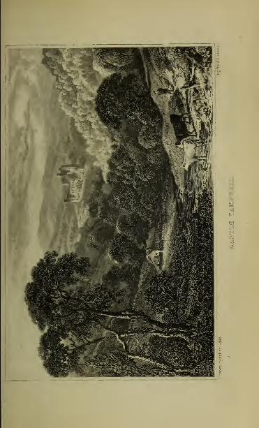


THE DEVON—RUMBLING BRIDGE—CALDRON LINN. 245
(Ccorge Wylie, Esq.), and, beyond it. Devonshaiv (W. Graham, Esq.).
To the south-east appears the elevated summit of Drumglow, 1215 feet
above the level of the sea. Half a milo farther, to the left, is CowdenHouse (Hon. H. Ogilvy), and from Cowden Lodge tho road leads to Mil-
nathort, by the village of Yetts of Muckhart, so called, it is said, frombeing the gate or entrance into the pass of Glendevon, through the Ochils.
THE BUMBLING BRIDGE AND THE CALDRON LINN.
[Rumbling Bridge Inn, Mrs Murray's.]
At Cowden Lodge the tourist takes the road to the right, and shortly
reaches the Rumbling Bridge Inn (about 7 miles from the Tillicoultry
Station, and -1 miles from Dollar), in the vicinity of the Falls ofDevon. Aguide to the tails may be procured at the inn. At no great distance is
the village of Crook of Devon, so named from the river making here a
singular bend or turn, from east to west.
A few yards from the inn, and a mile and a half below Crook of
Devon, is the cascade known as the Devil's Mill, approached by a foot-
path leading through the trees. Here the Devon, after traversing arocky channel, enters a deep basin in the rock, from which the waterdescends into a cavity, and is whirled about with violence, constantly
beating against the sides of the rock, the noise resembling that of awater-mill at work. This, the first of the Falls of Devon, and the least
considerable of them, is best seen from the south bank of the river. Inthe top of one of the detached masses of rock, a water-worn hollow,
three feet in diameter, is called The Devil's Punch Bowl. Near it is acavern named The Pigeon's Cave.About 330 yards farther down the river is the Bumbling Bridge, a
small arch, spanning a deep and gloomy chasm. Here the rocks rise to
the height of 86 feet, and approach so near as to be connected by abridge of 22 feet span. It was built in 1713 by William Gray, a stone-
mason of Saline, and is only 13 feet wide. Gray's Arch, as it is called,
has no parapets, and though it required some fortitude to walk across
this bridge even in the daytime, it was used for upwards of a hundredyears by persons both on foot and on horseback, by night and by day.In 1816, a handsome new bridge was erected over the old one, at an ele-
vation of 120 feet above the stream. The scene below, as seen from thebridge, is very fine. Forcing its way among huge fragments of rock,the river makes a loud rumbling noise ; hence the name of the bridge.
The best view of the finely wooded cliffs connected by the RumblingBridge is from a little eminence immediately opposite, upon the southbank of the river. Here the deep, dark chasm through which the Devonflows is seen in one vast cleft, torn as it were asunder by some terrible
convulsion.
On the high ridge or right bank of the river, on the west of the bridge,a beautiful walk (accessible only by permission of the proprietor) withinthe grounds of Blairhill (Alexander Haig, Esq.) leads to
THE CALDRON LINN.
But the public pathway is across the bridge on the left bank of the river,
through the estates of the Baroness Keith and the Rev. John Dempster,at whose joint expense it was made.
After crossing the bridge, Aldie Castle, the ancient seat of the Mercersof Aldie, and now the property of their representative, Baroness Keithand Countess de Flahault, is seen upon the left. As the tourist proceedsby the side of the river, here gliding gently along, the distant roar of

246 MEDDLE HIGHLANDS AND LAKES—THE I
waters breaks gradually upon his ear, becoming at every step louder andlouder, until about a mile below the bridge the channel of the rivorsuddenly contracts, and he comes in sight of the celebrated Caldron JAm,Hero are two cataracts, distant from each other 28 yards. The uppertall is 34 f< . t in height, declining a little from the perpendicular. Therocks rising out of the channel seem broken into every sort of fantastic,shape, one of them resembling a pillar horizontal at the top, by whichmany persons have passed from one side to the other. The lowermostcascade, M feet id height, falls in one unbroken sheet without touchin-the chit, and the whiteness of the dashing water forms a line contrast tothe black basaltic rocks.Between these falls the river has scooped out three round cavities, hav-
ing the appearance of lar#e caldrons or boilers. In the first the water isperpetually agitated as if it were boiling. In the second it is coveredwith a constant foam. In the third, which is the largest, being 22 feet indiameter, it appears as if spread out in a largo cooler, being as placid asan inland lake. These cavities are separated from each other by ledgesof rock, and communicate by apertures about middle depth formed'bythe action of the water. The lowest caldron has an aperture like a dooror large window hewn out of the rock, through which the rapid torrenttails over a mass of perpendicular rocks into a deep and wooded glenwith a noise winch is heard at some distance. The height of the rockis nearly 90 feet, that of tho fall 45 feet. In rainy seasons the CaldronLinn is particularly striking.The most complete view is from the bottom of the great fall, where it
has the appearance of a prodigious fountain gushing from the solid rock.It is seen to most advantage between one and two o'clock in the after-noon, when the sun shines directly in front of it, A vapour ascendsfrom tho pool, which in sunshine exhibits all the colours of the rainbow.Upon one occasion, a fox which was closely pursued by a pack of houndsled them along the bank of the river till he reached the boiling caldron,which he crossed. The dogs attempted to follow, but being unacquainted'with the path, they fell, one after another, into the caldron and weredrowned.
STIRLING TO BRIDGE OP ALLAN, DUNBLANE, ANDPERTH,
BY THE SCOTTISH CENTRAL RAILWAY.
Miles.
5 Bridge ofAllan. Grounds ofKeir(Stir-ling,Esq.) open to public on Fridays
Tunnel.Kippenross mansion and park (Stir-
ling, Esq.), a mile south of Dun-blane. Open Wednesdays andSaturdays.
6 Dunblane. First-Pointed Cathedral.Sheriffmuir, two miles north-east oftown.
7 1 Kinbuck station.
11 Greenloaning station.
Roman Camp at Akdoch, a mile anda quarter on left.
15 Blackford.Gleneagles (Earl of Camperdown),on
right.
Miles.huins of Kincardine and TaHibardine
Mrs.
17$ Crieff Junction for Crieff. Stations.Tullibardine 2£, Muthill 6, Iligh-landman 7 A, Crieff 9 miles.
19$ Auchterarder station.
23i Dunning station.
26 Forteviot station. Ancient Scottishcapital.
Birks of Tnvermay, on right.Dupplin Castle (Earl ofkinnoull),on
29 Forgandenny station.
Moncrieff Tunnel, a mile and a quar-ter long.
03 Pbbth.

BRIDGE OF ALLAN KKI1!. 247
The tourist may proceed from Stirling cither byroad or by railway to the
Bridge of Allan, throe miles distant. Omnibuses run regularly betweenthe two places. Crossing Stirling Bridge, the road proceeds throughfertile meadows, and about halt-way passes the little village of
CauaewayTiead, at the foot of the Abbey Craig, with some handsomevillas and a population of about 200. lialf a mile farther on, a road to
Blairlogie strikes off on the right, and at a short distance, also on the
right, is Airtkrey Castle, a seat of Lord Abercromby.Proceeding by railway, the train crosses the Forth on a timber viaduct
(of three inches, supported on stone piers), which gives a Glimpse of the old
and new bridges above, and a good view down the Forth by the ruins of
Cambuskenneth Abbey.
BRIDGE OF ALLAN.
[Hotels: riiilp's (The Royal); Anderson's (The Queen's).]
By railway, the Bridge of Allan is 39 miles from Edinburgh, 32i from Glasgow,3 from Stirling. 3 from Dunblane; 5£ from Doune, and 13 from Callendar. By road,
the distance from Bridge of Allan to"the Rumbling Bridge is 17 ; to Aberfoyle, 18.
Vehicles can be hired at the hotels.
In summer several interesting excursions, each occupying a single day, canbe made by the tourist, who establishes his headquarters at Stirling, Bridge of
Allan, or Perth. See Railway Time Tables and Daily Excursion Arrangements for
the summer of 1860.
This pleasant spa, a favourite resort of invalids, stands on the
banks of the Allan, a tributary of the Forth. Its central posi-
tion, easy access, great natural beauties, pure air, mild climate,
and vicinity to the mineral wells of Airtkrey, have all contributed
to the prosperity of the place, which since 1837, when the first
house of the new village was erected, has increased with marvel-
lous rapidity. Situated at the southern base of the western
termination of the Ochil Hills, it is well sheltered from the north
and east winds, having a mean annual temperature of about 52 \
It takes its name from the bridge across the river Allan, whichbounds it on the west. It has an Established Church, a FreeChurch, an Episcopal Church, and a United Presbyterian Church.There are two excellent hotels, a concert-room, a billiard-room,
and a bowling-green.
The waters of the Airtkrey Mineral Wells flow from four dis-
tinct springs, and are collected in one cistern in the pump-roomon the hill at the back of the Royal Hotel. The waters are
aperient and anti-scrofulous, the chief ingredients, as ascertained
by analysis in 1853, being the chlorides of sodium, calcium, andmagnesium, and the sulphate of lime. No fewer than 50,000 per-
sons are said annually to visit Bridge of Allan.
The fine pleasure-grounds of Keir, the seat of William Stirling,
Esq., M.P., are, by the liberality of the proprietor, open to
the public every Friday from 2 to 6 o'clock p.m. The mansion,
which is modern, is one of the most interesting in Scotland. The

->5s MIDDLE HIGHLANDS and LAKES— KEIR.
library is especially worthy of notice: it occupies three apart-ments, is two Btoreya in height,ia lined with cedar, and decoratedwith mottoes in almost every language of Europe. Among thepictures may be mentioned
—
^Zwb^^^PMi^Tv^l^,^^ :
- S:li,lN•,,ls,;l Md Kl " 1 '"^ by
P » i v' .
" !'\'.N "' >1,:u "' by Rabens; Don Ferdlnando, brother of
i Ulip IV., by Caspar de < rayer; Pour sketches of boys at play, by Goya!/'\?
l
't?"'lnr''
:"T,he ViT" !
amenting " Vl '- ""' body of cin-ist. by Morales:-A:m;
»^tleman,byCarenno;-Portrall of herself, bySofonisbaWnw "
a, '" ;,
nt
°(,fU8triajMil " "<• Pbilip m. of Spain and a companionR V f 'V-"
' r l'n " (
'V:;s
-'>' Pant°Ja : The Vil^" crowned, by ZurbaianPortrait ofhisflrft vnfe, Katharine Brandt, by RubinB; Portrait of his master
BtzS&rtZt i V h°rtrait
'/>
U ,,m" k'
by Iran < 1 " ,ls RoclasJ-Marriageof
oii£; i\'
i ^Sa^U;~Pvrt^i< of bimself,byJnan Fernandez Nava£ete,called M Mudo;—The ^ irgin, by Alonso Cano.
r*^v%!£?%r'~i?Stw!±?f ^l?mwrt1'
by talker;-Two landscapes with cattleby Philip Backert£-The Virgin and Child, by Albano; -Throe men and aMi1
?" ;l ^^5- f
Satyr, by Jordaens; The Raptfcm of Christbj Pan Veronese;-Two Angels, by Alonso Cano;-A girl, by Watteaul IIlrU b? 1 -' 1
';' Bignorolli ;- A land cape, bj Gaspar Poussm ;--A landscape withBgures, by Wouvermans;—Ecce Homo, by II Padovanino.Lithe ^wmgRoom>-A. large landscape, by Teniers;—The Finding of Moses, byNicolas Poussinj-The Virgin, Child, St Peter, and St Paul, by GaudenzfoFerrari ;-A landscape, by Gaspar Poussin ;-A small but beautiful picture by
C laud, Lorrame ;-Two girls in a boat, with a youth rowing, by Lavinia Fontena^-Christ visiting the sisters at Bethlehem, by Jan Steen ;-A scene in the historyofa Roman Emperor, by Rubens ;-St John the Evangelist, by Guido Reni :—
A
landscape, by Isaac van Ostade. '
Tn the Dining Room:—Portrait of Miss Helen Stirling (6. 1808, d. 1822) bv SirHenry Raeburn. />•»/»«
In the Library:—Portrait of Sir Walter Scott, by Sir John Watson Gordon.
On the north of the village are the house and grounds ofWesterton Park, belonging to Col. Sir James Alexander, whosucceeded his brother, Major Henderson, in 1857.
Visiters to the Bridge of Allan should go to the top of the Abbey Craig(see p. 241), trom which there is a very extensive and beautiful view or ifdesirous to climb a higher hill, to the top of Demy at (see p. 242), fromwhich there is one of the finest views in Scotland. The bottom of the hillcan be reached in a carriage, and the ascent is not difficult.
In the neighbourhood of the Bridge of Allan are several very pleasantwalks,.particularly through Airthrey Wood, and by the banks of the Allan,along the Daren (dark-hidden) road to Dunblane.To the north of the village, the Allan, a fine trouting stream, cele-
brated in the song of" The Banks of Allan Water," is remarkable for itsromantic beauty, rushing in a rapid stream through a deep glen shadedwith wood. It rises near Gleneagles, in the parish of Blackford, andtraversing the vale, to which it gives the name of Strathallan, passesJUunblane, and enters the Forth a short distance above Stirling bridge,below the confluence of the Teith.Half a mile westward from Bridge of Allan are Lecropt church and
manse, be lutifully situated among wood.The railway, about a mile to the north of the station, crosses the Allan,
and passes the grounds of Kippenross. Half a mile farther on, upon theright, across the Allan is


DUNBLANE—THE CATHEDRAL. 249
DUNBLANE.
[Inn: Stirling Anns.]
The ancient but humble city of Dunblane takes its namefrom St Blane, a bishop of the seventh or eighth century, said to
have been born in Bute, and educated in Ireland. Its streets
are narrow, and the houses irregular ; but the view from
the railway is picturesque enough. Behind the sparkling stream
and wooded banks of the Allan, rise the gray ruins of the vener-
able cathedral, "looking tranquillity," from among the old trees
which surround them. The bishopric of Dunblane, a foundation
of unknown antiquity, was restored about 1140 by David I.,
when the lower part of the Romanesque square tower was built.
The see received new endowments about 1240, when most part of
the present cathedral was erected in the First-Pointed style.
Until the fifteenth century the patronage of the bishopric was in
the hands of the Earls of Strathearn, from whom it passed to the
crown. The earliest notice of Dunblane is in the middle of the
ninth century, when it was burned by the Britons or Welsh of
Strathclyde, whose kingdom had the Forth for its northern
boundary. The town has a population of about 2000, and is
the seat of one of the sheriff-substitutes of Perthshire. It has an
Established Church, a Free Church, an Episcopal Church, and
a United Presbyterian Church.
The Cathedral of St Blane consists of a roofless and partly ruinousnave, with an arcade on each side, of eight arches of unequal span
;
of a choir (used as the parish church) of six bays without aisles ; andof a square tower (128 feet high), on the south side of the nave. Thelength of the building is 216 feet, and its breadth 56 feet. The gen-eral style is First-Pointed, of much merit; but there are several
additions and alterations of later date; and the first four stages of thetower are Romanesque. The north aisle of the nave is prolonged to
the eastward so as to form a chapter-house, now used as a vestry.
In this finely groined chamber are stone effigies of an earl and acountess of Strathearn. Here also are a few of the carved woodenstalls of the prebendaries. In the choir there is a tomb of a bishopunder a decorated arch, with short shafts and flowered capitals.
Of the bishops of Dunblane, the two of most note were Clement,a Dominican friar, during whose episcopate (1233-58) most part of thecathedral was built, and the learned and pious Robert Leighton, whoheld the see from 1661 till 1672 when he was translated to Glasgow.He was long remembered at Dunblane as the "Good Bishop;"and a retired shady walk, near the river, which he frequented, is still
known as the " Bishop's Walk." He bequeathed his library to theclergy of the diocese. It appears from the old catalogue compiled byBishop Douglas, still extant, that Bishop Leighton's books amounted
l2

250 MIDDLE HIGHLANDS AND LAKES—DUNBLANE.
to 1 100 volumes; but the library has since been more than doubled,partly by donations and partly by purchase, and now exceeds 3000rolumes. rhe public have the use of the books on payment of asmall subscription.
The Bishops Palace was to the Bouth of the cathedral, on the edgeei the declivity towards the river, and a lew i r the wall-still remain.
At Cromlix, two miles north of Dunblane, is a mineral springof the same nature (sulphate of iron being added) as that atAirthrey. During the summer months, the water is broughtevery morning to a lodge in the immediate vicinity of Dun-blane. In Balhaldie House, on the east side of the town, is aroom where Prince Charles Edward slept, on his march south-wards in 1745 ; while at Allan Bank, adjoining the Bishop's gar-den, his opponent, the Duke of Cumberland, had his quarters in
1746, on his march to Culloden. Beyond is St Mary's E] iscopalChurch, a neat First-Pointed modern structure, with a schooland parsonage-house.
About a mile to the south of Dunblane are the fine mansionand park of Kippevross, the seat of John Stirling, Esq. of Kippen-davie. Here is a large plane-tree, measuring in girth, close tothe ground, 42 feet, and where the branches separate 27 feet.
It is supposed to be 450 years old. The grounds are open tothe public on Wednesdays and Saturdays. Nearer Dunblane, onthe north-east side, is Holmehill, the residence of James Stirling,Esq. Three miles north-west from Dunblane, in a romanticsituation, stands the old Castle of Kilbryde, once a seat of theEarls of Mcnteith, but since 1GG9 the property of the family ofSir James Campbell of Aberuchill, Bart.
SiiERiFFMuin.—Two miles north-east of Dunblane is the battle-fieldof Sheriff)// uir, fought on the Kith iNovember 1715, between the royaltroops under the Duke of Argyll and the insurgent Highlanders underthe Earl of Mar. After the battle the duke retired to Dunblane, andthe earl to Ardoch, both claiming the victory, which was in realityachieved by Argyll, who succeeded in covering Stirling, and so prevented Mar from passing the Forth. The number of the slain was about800 of the insurgents and 600 of the royal army. The peculiarity ofthe conflict was that the right division of each army defeated the 'leftdivision of the other; so that while the insurgents pursued the royaltroops almost into Stirling, the latter chased their opponents into Strathearn. The renowned Rob Roy was present as a dependant of Argyll,and is supposed to have been useful in informing the duke of the enemy'smovements. He took no active part in the engagement, of which, as thecontemporary ballad says,
ie say that we wan,And some Bay that they wan,And some say that nane wan ava', man."
Leaving Dunblane by railway, the first station is Kinbuck. Fnrtlu r

ARDOCH—AUCHTERARDER—DUNNING—FORTEVIOT. 2.r) 1
on, along the course of the Allan water, is Greenloaning station. A mile
and a half from it, on the left, are Ardoch House and grounds (Geo.Home Drummond, Esq.)- The Komax Camp at Ardoch is perhaps the
most entire in Britain. Its area is an oblong ofabout 500feetby about 420
feet. The prcctorium, which is not in the centre, is a square, each side
being from 60 to 70 feet. The situation is remarkably well chosen; onthe south-east side is a deep morass, and on the west side the banks of
the water of Knaick rise perpendicularly to the height of about 50 feet.
Around are great ditches, those on the east, five in number, being about55 varus in breadth. In 1724, part of the camp was destroyed by GeneralWade's great military road northward from Stirling. Adjoining this
camp are three larger encampments, more slightly fortified. In ArdochJ/ouse is an urn, dug from the prcetorium, containing ashes and asmall piece of a human skull. In the University of Glasgow, there
is a stone which was dug up at Ardoch about 16'b'O, with an inscrip-
tion recording that it was erected by the heirs of a centurion of the First
Cohort of the Spanish Stipendiaries. From Ardoch there was a cause-
way, now covered with heath, leading to Kemp or Camp Castle, a small
fort defended by a double rampart and ditch, on the top of the muir of
Orchil, two miles north of Ardoch.About two miles north-eastward of Greenloaning, on the lands of
Carsebreck, is a curling pond of 60 acres, constructed by the RoyalCaledonian Curling Club for their grand annual matches at this nationalwinter sport.
After passing Blackford station, on the right is Glcneagles (Earl of
Camperdown). Upon an eminence fronting Gleneagles are the vestiges
of a small lvoman camp. Farther on are the ruins of Kincardine Castle
and Tullibardine Castle, on opposite sides of the branch railway to Crieff.
The former was burned during the civil wars of the seventeenth century,and has never been rebuilt. The latter was the seat of the Earls of Tulli-
bardine, who, long after they came to the titles of Athole, had a re-
sidence here. In 1715, Tullibardine Castle was garrisoned by a partyof the Earl of Mar's army, and taken by the Duke of Argyll. Before the
rebellion of 1745, it was occupied by Lord George Murray, but since thattime it has been allowed to go to ruin.
Two miles and a half beyond Blackford is the CrieffJunction station,
where passengers for Crieff change carriages. About two miles farther is
Auchterarder station, near the village of Auchterarder, with a populationof "2520. The country here traversed by the railway in the lower part of
Strathearn, though well cultivated, is uninteresting. The train nextreaches Dunning station, near the village of Dunning, which has aRomanesque church tower, about 75 feet high. The next station is
Forteviot, where the Scotch kings had their residence in the ninthcentury. Its site has been washed away by the May ; but somesculptured stones, which may have been coeval with it, are still shown.On the right are the " Birks of Invermay " (celebrated in the poetry of
Mallet), the property of Alexander Hepburn Murray Belshes, Esq. Onthe left, as the train advances, is Dupplin Castle (Earl of Kinnoull).The next station is Forgandenny. near which, on the right, are Condie
(L. Oliphaut, Esq.), Rossie (R. Oliphant, Esq.), and Freeland (LadyRuthven). A little further on, the line crosses the river Earn, and nearMoncrieff, passes through a tunnel of rock a mile and a quarter in length,
aud reaches Perth. (See p. 308.)
The Scottish Centra!, the Scottish North-Eastern (Aberdeen, Forfar,Perth), and the Edinburgh, Perth, and Dundee Railways, all convergehere, in one large station.

.MIDDI.K HIGHLANDS AND LAKES—THE FORTH,
STIRLING TO CALLENDAR.There la a railway from Stirling to Callendar. During the summer and autumn
months a coach runs daily between Stirling (starting from the Koyal HotelTrosachs, and Loch Katrine, by Bridge of Allan, Doune, and Callendar
Miles. Etoi n m ao \i>.
1 • imigforth, on left
2 Cross the Forth, at the Bridge ofDrip.Road passes through Moss of Kin-
cardine.
5 Ochtertyre House (Sir David Dun-das), on right.
6 Blair-Drummond (Home Drummond,Esq.), on right.
G KincardineChurch (modern Pointed),on left.
Road branches into two, that to left
leading to Thoinhill, Port of M, n
teith, and Aberfoyle ; take roadto right.
7£ Cross Bridge of Teith. Deanstonc Hon works, on left; ruined Castleof Doune, on right.
S !>,•:
9iBurn of Cambus and Cambus Wal-lace or Doune Lodge
i Bar! of Mo-ra; . on right.
11 Lanrick Castle (Jardine, Esq.). on left.
1 U Cambusmore House Bd i is Buchanan),on left.
Cross.Keltie Water, a good angliugstream.
16 CALLBNDAB.
Mile-;. BOUT1 SJ l: Wi.w \v.
.; Bridge of Allan. Grounds of KeirStirling, Esq.) open on Fridays.
Tunnel.Kippenross mansion ami park (Stir-
ling, Esq.) l mil.' south of Dun-blane, open on Wednesdays andSaturdays.
"> Dunblane—First-Pointed Cathedral(Archbishop Leighton's), on right.
Kilbryde Castle, on an eminence, onright.
Argaty House and woods, on right.10J Doune.
nbus Wallace, or Doune Lodge(Earl of Moray), on right
13 Lanrick Castle (Jardine, Esq.), onopposite bank of Teith, on Left.
lane passes behind hamlet of Druin-vaich.
! 1 Ballachallan, on margin of Teith.1 C Cainbusmon; House (Buchanan,
Esq.), on left.
Cross Keltic Water.The Gart (Skinner, Esq.), on left.
Callendar.Coaches at Callendar for Loch Ka-
trine and Loch Tay.
16
Should the tourist start from Bridge of Allan, he will pursue his route west-ward along the high road, passing on the right Keir Mains, the residence of thefactor on the Keir estate, and two miles onward, on the same side, situated onan eminence, Kilbryde Castle, three miles from Dunblane. Farther on, also to
the right, is Argaty House, embedded in woods, the distant prospect on the northbeing bounded by the dark heathy hills of Slymaback and Uamvar. At a turn of
the road, Doune Castle and the new church of Kilmadock, having the noble back-ground of Hen Lomond and Benledi, suddenly burst upon the view. After descendingan incline, on the left are passed the old and new houses of Newton, now called
Inverardoch (Campbell, Esq.); and five miles from Bridge of Allan a new bridgeo\ er the stream of the Ardoch is crossed.
The road from Stirling to Doune winds round the Castle rock, and.proceeding up the valley of the Forth, passes on the left the grounds anamansion of Crait/forth, once a seat of the family of Callendar, and twomiles from Stirling crosses the Forth at the Bridge ofDrip. It then runs for
several miles through what is still called the Moss ofKincardine, reclaimedby Lord Karnes, towards the end of last century, rich corn fields nowoccupying the greater part of what was a bleak morass. Four miles
from Stirling, a road on the right leads to Ochtertyre House (Sir DavidDundas), and a short distance onwards is the mansion of Blair Drumviond, formerly the seat of Lord Karnes (d. 1782), now of Henry HomeDrummond, Esq. Half a mile farther, near the church of Kincardine, a
modern Pointed building, the road branches into two, that to the left lead-
ing to Thornhill, Port of Menteith, and Aberfoyle, and that to the right
to Deanston, where there are large cotton works,* to Doune, and to
* The cotton works at Deanston, a mile from 1 )< une, on the other side of the bridge,
were begun in 1785 by the Messrs Buchanan of Carston, the eldest of whom

©y«liE TO THE TRISMUS, IQCH LOMOND &c,
^ iil ;olmsu.Mi £ tmlnugh.


DEANSTON—DOUNE CASTLE. 253
Callendar. Eight miles from Stirling the road crosses a bridge over the
Toith, and enters Doune.In proceeding from Stirling or Bridge of Allan (see pages "247-250) by
railway, \\t Dunblane, the First-Pointed cathodral,once the church of the
good Archbishop Leighton, appears on the right ; after which the tourist
passes, on the right, Kilbryde, Argaty, etc., above described (p. 252), andreaches
Doune Station [Woodside Inn J.— The pleasant village of Doune,
situated near the confluence of the Teith and Ardoch, is surrounded byfine scenery. It has a market-cross, and a modem Pointed churchthe parish church of Kilmadock), with a handsome tower. It was for-
merly noted fur the manufacture of Highland pistols and Highland purses,
and for the dressing of skins. The interesting ruin of Doune Castlestands on a steep bank formed by the Teith and the Ardoch. Its reputedfounder was Murdoch, Duke of Albany, beheaded at Stirling in 1425.
At one corner of the front is a largo square tower 80 feet in height, andanother, of less size, is behind the opposite extremity. A strong wall,
nearly forty feet high, forms the edifice into a quadrangle. The prin-
cipal room between the towers is 70 feet long ; an apartment in the
larger tower is 45 by 30 feet, and the fireplace in the kitchen wouldshelter a score of persons beneath the chimney. A ponderous gratedgate appears within a heavy iron-studded folding door ; and althoughroofless, the walls are entire. Doune was the occasional residence of twosuccessive Dukes of Albany, Regents of Scotland, and in the sixteenthcentury was the resort of Queen Margaret, the widow of James IV.In 1745, it was occupied by Macgregor of Glengyle, surnamed Glun Dimor Black Knee, from a large black mole on one of his knees. He was anephew of Hob Roy, and held the Castle for Prince Charles, placinga twelve-pounder at one of the windows, and several swivels on the par-apets. A party of royalist volunteers, one of whom was John Home, theauthor of M Douglas," ventured from Edinburgh as far as the Teith, andwere captured by Glengyle, who confined them in Doune Castle. Asevery attempt to escape by force or treaty was hopeless, they resolvedto twist their bedding into ropes, and descend from the Avails duringthe night. Home and four others reached the ground in safety, butthe rope broke short with the fifth, a tall corpulent man. The sixth,
an Englishman, slid down as far as he could reach, and, dropping tothe ground, dislocated his ankle, and was severely bruised. His com-panions carried him off, and in the morning the Highlanders sought invain for the fugitives. Glengyle and Stuart of Ballachallan held DouneCastle all the time that Prince Charles was in England.On the bridge over the Teith, half a mile from Doune, is the following
inscription, still legible (we modernize the spelling) :— " In God is all
my trust, said Spittel. The tenth day of September, in the year of God,1535 years, founded was this bridge by Robert Spittel, tailor to the mostnoble Princess Margaret, Queen to King James the Fourth."
was the agent in Glasgow of Sir Richard Arkwright for the sale of his cotton-twist. The abundant supply of water in the Teith suggested to Mr Buchanan theidea of here placing a cotton spinning-mill. In 1808, the works passed into thehands of Messrs James Finlay <Sc Co. of Glasgow, with whom Mr ArchibaldP.uchanan was connected. His nephew, Mr James Smith, for some years the man-ager of the works, was celebrated for his mechanical and agricultural inventionsand improvements, and for his introduction of the system of " thorough draining."He died at Kin^encleuch in 1850. The farm which he occupied is to the south ofthe works. Permission to see the great water-wheels, each having a power equal to80 horses, and second to none in Scotland except the great wheel at Greenock, maybe had from Mr Finlay, the resident partner, or from the superintendent.

254 MIDDLE HIGHLANDS AND LAXE&— CALLENDAR. '
Proceeding by railway to Callendar, a mile and a half beyond Douneon the rirfit, is ( ambus Wallace or Doune Lodge, a seat of the Earl ofMoray. Farther in advance, on the left, bnt'not Been cither from then.ad or from (ha railway, are the rnins of the old church of Kilmudock.1 hreo miles beyond Doune, the line passes Lanrick ( astle.on the oppositebank of the leith, the elegant seat of Mr Jardine, formerly of Sir JohnMurray M'Gregor, Hart., the chief of the Clan Gregor. The grounds areopen to tourists. Behind the small hamlet of Drumvaich. halfwaybetween Doune and Callendar, in a hollow on the margin of theleith, is\BaUaohaUan, and half a mile farther, on the left, is CambusmoreHouse (.diss Uuchiinan), embosomed in woods, through which flows thekeltic, one of the best fronting streams in the district. It was hereand.at Newton, now named Inverardoch, in the immediate neighbour-hood, that Sir \\ alter Scott in his youth passed some months of severalsummers. " Here," says Dr Graham, in his " Sketches of Perthshire,"on the outskirts of Benvoirlich and Uamvar, with lienlcdi full in
his eye on the west, and within an easy ride of the wonders of'LochKatrine, he might have satiated his poetic imagination with the sublimein external nature, and with the heroic in the study of the ancient Celticcharacter." Prince Charles, in his retreat to the north, slept a night atCambusmore House.
Crossing the Keltie by a bridge opposite the park of Cambusmore,the tourist passes on the left The Gart (Holt Skinner, Esq., formerlyAdmiral Sir Houston Stewart), where Lord John Russell spent the sum-mer of 1852, and a short way beyond reaches
CALLENDAR.
[Hotels: Dreadnought, Star.]
There are coaches from Callendar during the rammer months, in connexion withthe railway—to the Trosachu Hotel (8£ miles) and Lech Katrine (10 miles)—to I
and Crieff (34 miles,—to Lochearnhead, Killin (22 mileB)Kemnore, and Dunkeld (62 miles). There is a railway between Callendar and Stir-ling; and a coach runs daily between the two places.
The pleasant village of Callendar, a place of great resort duringthe summer months, is situated at the base of Benledi, below thejunction of the two branches of the Teith flowing from LochLubnaig and Loch Vennachar. It extends along both sides of theroad, and a bridge of* three arches across the Teith, commandinga fine view, connects the old and new parts of the village. It
has an Established Church, a Free Church, and an EpiscopalChurch.
^
At the east end of the village is the villa of The Roman Camp(Lady Willoughby d'Eresby), pleasantly situated on the banksof the Teith. Here are earthworks supposed at one time to beRoman entrenchments, but now believed to be natural, notartificial.
From the south bank of the river—where there are somebeautifully situated residences, Teithside, Mansfield, East Mains,and The Manse,—there is a noble view. On the right, toweringabove the village, and sheltering it from the north, are the Crags

CALLBNDAB—BENLEOI—BRIDGE OF BRACKLIN. 2.r.,r»
of Callendar, partly covered with pines, the commencementof a long ridge of breccia or pudding-stone, stretching forty miles
north-eastward, in a nearly direct line to the Tay at Campsie
Linn. In the background on the left are the woods of Gartchonzie.
Beyond these to the right is the Pass of Lcny, the supposed scene
of meeting between Dugald Dalgetty and the Earl of Menteith,
in the " Legend of Montrose." The mighty Benledi, 3009 feet
above the sea-level, bounds the prospect to the west. Nearits summit is Lochan-nan-Corp, " the little lake of dead bodies,"
so called from a whole funeral party, crossing from Glenfinlas,
having been drowned by its ice giving way. The mountain is
composed of mica-slate on the north-west, and clay-slate, or
rather grey wacke, on the south-east declivity, both being inter-
sected by veins of quartz and felspar.
The ascent of Benledi is generally made from Portnellan, 1\miles from Callendar. The tourist crosses Callendar Bridge,
and a mile and a quarter farther on Gartchonzie Bridge, on the
right, then turning to the left passes Coilantogle Ford—" Clan
Alpine's outmost guard"—and on arriving at Portnellan, half a
mile farther, on the north side of Loch Vennachar, proceeds upthe hill to the right. The view from the top is peculiarly
grand.
A mile north of Callendar is the Bridge ofBracMin, where the
Keltie has worked a channel for itself through the solid rock. After
a succession of falls, the boiling waters are finally precipitated in
one unbroken sheet, from a height of about fifty feet, into the
pool beneath. Over the chasm is thrown a narrow rustic bridge
of oak, with hand-rails. By crossing the bridge, and descending
a steep covered with coppice-wood, near the top of the falls, a posi-
tion is gained from which they may be seen to advantage. Froman eminence a little above, there is a wide prospect of the whole
vale of the Teith and Loch Vennachar.
CALLENDAR TO ARERFOYLE AND LOCH OF MENTEITH,LOCH ARD, AND LOCH CHON.
The tourist may make this excursion by hiring a conveyance from Callendar toAberfoyle (11 miles), and proceeding thence to Locli Ard, which is about a mileand a half farther on. In this case he should return to Callendar, and proceedthence to the Trosachs; for if he crosses the hill from Aberfoyle to theTrosachs (5 miles), he loses the finest scenery of the " Chase," in the " Ladyof the Lake," which li^s along the route, afterwards described, from Callendar tothe Trosachs.For these reasons, the excursion to Aberfoyle, Loch Ard, etc., is perhaps better
made from Stirling as a starting-point—the tourist in this case proceeding bv theForth and Clyde Railway to the Bucklyvie Station for Aberfoyle. By giving a

_>;>»; MlDDLi: HIGHLANDS AND LAKES—MKXTKITII.
day's notice to the station-master al Blenteith and Bucklyvie, or the hotel-keeperat Aberfoyle, conveyances may be bad, which enable tourists to see the Lake ofIfentelth as they pass along the road. He may then either proceed to Callendar by *hired conveyance, or ret urn to Stirling by rail, and afterwards go on to Callendar byCOach or by railway.
The district may also be readily visited from Balloch on Loch Lomond, whencetourists may proceed by railway to either of thu stations of Bucklyvie or Port ofBfenteith, mentioned above. See Time. Tables.
BOl i B i BOM Cai.i.i.miak.
Miles.
Cross Callendar Bridge—takeroad to right.
8 Loch Kuskie, on left.
A Ruins of Rednock Castle, on right.
Rednock House (Graham stilling,
Esq..).
i; Three roads meet. Road to rightleads to the LOOH ><v Mi \ i
Ii
I:i.
5$Portof Menteith, Church and Manon left.
Gartmore mausoleum, on margin oflake.
7 Head of Lake. Two roads me. t
take road to right. Best view-point of lake.
Gartmore House (Graham, Esq.), onrising ground to west.
11 Village, of ABERFOTLB, on right.
Avondhu, orForth, skirts road on left.
.Junction of Duchray with Forth.Church andChurchyard ofAberfoyle,on south side of the valley.
Mountain-path across Craigvad, 5imiles to opening of the Trosachs.
Miles.
Branch road on right to Bridge ofTurk. From summit of Craigvad,magnificent view of "Lady of theLake" scenery.
Pass of Aberfoyle, under Craigmore,byroad westward ofhamlet. Moun-tain heights on left; Craigmoremountain on right.
12 Lower LOCH Abd—Ben Lomond in
background.Foot of Loch Aid—Ben Lomond in
front. Benoehrie, on right.
Boats procured at eastern extremityof lake.
Road along the northern shore ofthe lake, passing Loch Ard Lodge(Dick. .
Ledard Waterfall, near head of lake,
northern side.
17 I. in ii CHOK.21 Loch Arklet.
b Katrine, eastwards, on right.
26 Inversnaid, on Loch Lomond, west-wards, to left.
Starting from Callendar, and crossing Callendar Bridge, the
tourist takes the second road to the right. Two miles farther on,
and four from Callendar, he passes the ruins of Rednock Castle.
Next is Rednock House (Graham Stirling, Esq.); and a road to
the right, where three roads meet, conducts to the Loch of
Menteitii, a beautiful sheet of water. Oval in form, it is
about six miles in circumference. The northern shore is clad
profusely with stately oaks, Spanish chestnuts, and old plane-
trees. Some of the chestnut trees are 17 feet in circumference
at 6 feet above the ground. The lake has three islands.
The largest and most easterly, called Inchmahome, or the" Isle of St Colmoc," contains the ruins of a First -Pointed
priory, consisting of part of the choir, one arch of the tower, and
two arches of the nave, embosomed in ancient trees. The bury-
ing-ground has long been used as a place of sepulture by several
old families, and in the choir are sculptured figures of an Earl
and Countess of Menteith, a title which has been dormant since
1694. The priory, of unknown antiquity, was founded for
Austin Canons Regular. In September 1547, Queen Mary, then
only five years of age, found an asylum here after the disastrous

LOCH OF MENTEITH—GAETMORE—ABERFOYLE. 257
battle of Pinkie, and here she remained till her removal to
France in the following February. Immediately to the south-
west of Inehmahome lies the smaller island of Talla, on which
stood the residence of the Earls of Menteith, the ancient lords of
the district. Its surface is covered with ruins. On the smallest
island, called The Dog's Isle, the earls are said to have had their
dog-kennel, while their stables were on the western shore
of the lake
At its north-east angle are the church, manse, and parish school
of Port ofMenU ith, 3j miles from the Port of Menteith station of
the Forth and Clyde Junction Railway. Here is a good inn,
where a boat may be hired for sailing on the lake, which affords
excellent fishing. Close to the margin of the water is the
modern cemetery of the family of Graham of Gartmore, whose
seat, Gartmore House, contains pictures by Rubens, Salvator
Rosa, Claude Lorraine, and Hogarth. The mansion, which is
modern, crowns a rising ground to the west of the lake, in the
peninsula between the Avon Dhu and the Keltie, and commandsa view of the great plain of the Forth, about 30 miles in extent.
Four miles to the west is the village of
ABERFOYLE,
rendered classical by Sir Walter Scott in his novel of " Rob Roy."At the Kirktown, a mile or so below Lower Loch Ard, there
is an excellent hotel—the " Bailie NicolJarvie"—lately erected
by the Duke of Montrose.
Above the Aberfoyle hotel, the Duchray, the southern head-
water of the Forth, forms a confluence with the northern parent
stream, which for five miles of its course is called the Avon Dhu,or Black River. The name seems to have been given to the
water from the dark shadows of the oak and birch covered
mountains which overhang it, and on all sides, enclose the vale of
Aberfoyle. The rocks of the higher mountains are chiefly mica-
slate. Lower down, immense blocks of breccia form vast perpen-
dicular precipices and round projections, some of which, at the
eastern extremity of the lower lake, are of great height. The old
red sandstone conglomerate is succeeded, towards Loch Chon, bygreywacke, sometimes schistose, clay-slate, and mica-slate, the
last continuing to the summit of Ben Lomond. The district
abounds in rare botanical plants, and in Loch Ard the water-lily
and the lobelia grow in great profusion.
The best point of view is from the Duinhill, an eminence near
the ford of Alinan. Eastward are seen the windings of the Forth,

258 KIDDLE HIGHLANDS AND LAKES—LOCH AR1>.
the Locli of Menteith, Rednock House, Cardross, the great Moss
of Kincardine, Stirling Castle, and the Ochils. Westward are
the Vale of Aberfoyle, and the opening of Loch Ard, with BenLomond in the background. On the north, the ragged
mountain of Oraigmore shows a grand precipice about 1 ()()(>
feet high, from which immense masses of rock occasionally
fall, and in their descent leave ruts on the ground like the
channel of a river. Beyond it, to the west, is the celebrated
J'ass of Aberfoyle. Here a party of Cromwell's soldiers was
repulsed by the Highlanders, headed by Graham of Duchray,
whose castle, situated a little to the southward, had been given
to the flames by the English troops. The church and church-
yard of Aberfoyle are on the south side of the valley. Near the
east end of the churchyard, a tombstone with a Latin inscription
marks the grave of the last Episcopal clergyman of the parish,
the Reverend Robert Kirk, the translator of the Psalter into
Gaelic verse, and the subject of a strange fairy legend recorded in
one of the notes to " Rob Roy." The manse, which stands on a
height to the south-east of the church, was the birthplace of
Professor Richardson of Glasgow (d. 1814), and the residence of
the late Reverend Dr Patrick Graham, long minister of the
parish, author of " Sketches of Perthshire."
From the inn, a road, passable for carriages, leads across the
hill of Craigvad, or the Wolfs Cliff, 5h miles, to the opening of
the Trosachs. It is a wild and mountainous track, but the
tourist will be more than rewarded for the roughness of the way by
the view from the summit of the hill. The whole scenery of the
" Lady of the Lake" lies beneath his feet, and the approach to the
Trosachs is especially fine. A branch road to the right strikes off
to the Bridge of Turk. To the south, a road proceeds from Aber-
foyle Inn, by Gartmore and Drymen, to Dumbarton, 22 miles.
A short distance west of the inn, Loch Ard opens pictu-
resquely to the view, with Ben Lomond in the background, and
Benochrie on the right, clothed with wood and cultivated fields.
The soft aspect of this lake and the placid beauty of the scenery
are very pleasing. It is divided into an upper and lower sheet
connected by a stream about 200 yards long. The lower lake,
the smaller of the two, is scarcely a mile in length and about
half a mile in breadth. The upper lake is three miles long
and one and a half broad. A fine view of it is obtained from a
rising ground near its lower extremity, where a footpath strikes
off to the south into the wood overhanging the stream. But to
see it, in almost its whole extent, the tourist should proceed to a

LOCH ARD—LEDARD—LOCH CIIOX. 259
height about two miles up its eastern side, a little way below
what is called the Priest's Point, or Craig. The banks on the
north and west sides show meadows, cornfields, and farmhouses;
while, on the left, are thick clumps of wood, from the heights to
the water's edge. About a mile up the lake, near its southern
shore, are seen a cluster of rocky islets, on one of which, St Malo,
are the remains of a chapel ; and on another, Dundochil, the ruins
of a stronghold, said to have been built by Murdoch, Duke of
Albany. For the convenience of anglers, Mr Dick of Loch ArdLodge has erected a pavilion on Dundochil Isle, and boats are
at all times on hire, on moderate terms, at the eastern end of the
lake. The Duke of Montrose is the sole proprietor of the lake,
which contains excellent trout, and is much resorted to byanglers, especially in April and May. Several beautiful villas
have lately been erected on its banks.
The road passes along the northern margin of the lake, under a
ledge of perpendicular rock from thirty to fifty feet high. This
is the path pursued by Bailie Nicol Jarvie and Francis Osbaldiston
in the novel of " Rob Roy." At the west end of the rock there
is a remarkable echo. On a line of ten syllables being spoken
with a firm voice, the words are returned across the lake, andrepeated, with equal distinctness, from the woods, a quarter of
a mile distant, on the east.
Near the head of the lake, on the northern side, is the
romantic waterfall of Ledard, mentioned both in " Waverley"and in " Rob Roy." In the latter it is thus graphically described :
" The brook, hurling its waters downwards from the moun-tain, had in this spot encountered a barrier rock, over whichit had made its way by two distinct leaps. The first fall—across
which a magnificent old oak, standing out from the farther bank,
partly extended itself, as if to shroud the dusky stream of the
cascade—might be about 12 feet high. The broken waters werereceived in a beautiful stone basin almost as regular as if hewn bya sculptor, and after wheeling around its flinty margin, theymade a second precipitous dash through a dark and narrow chasmat least fifty feet in depth, and from thence, in a hurried butcomparatively a more gentle course, escaped to join the lake."
A footpath across the hill leads to Rowardennan on Loch Lomond.Abouttwo miles north-westward ofupper Loch Ard isLocH Chon,
a secluded and romantic lake, somewhat more than three miles in
length and one in breadth, skirted on the north by woods of
ash and oak, and finely fringed towards the west with aged birches.
On the south it is bounded by a precipitous mountain, at least

260 MIDDLE HIGHLANDS AND LAKES—LOCH ARKLET.
village
1500 feet high, from the side of which, in wet weather, a consid-
erable stream glides rapidly down over a ledge of schistose rock,
from a height of about 1000 feet. On a small islet in the
lake a number of herons annually build their nests,—a tokenthat there is plenty of fish. Extensive operations were carried
on here during the formation of the Glasgow Water Works in
1857-59. The mining operations were especially laborious,
and the blasting of rocks was such that a neigbbourin
of huts received the name of " Sebastopol."
The road, proceeding north-west from the head of Loch Chon,
reaches a place called Skia-n'iuiar, or " the ridge of yew-trees,"
which is the highest ground not mountainous in this district
between the eastern and the western seas. On the south of the
road, Loch ArJclet is seen stretching out its gloomy waters,
darkened by the shadow of Ben Lomond.A fine view is soon obtained of the western extremity of Loch
Katrine, half a mile farther on, with the mountains on the
western margin of Loch Lomond and the Cobbler at the head of
Loch Long. This road leads the tourist to the Inn of Stronach-
lachar, at the head of Loch Katrine, distant about ten miles from
Aherfoyle Hotel. Hence he may proceed cither eastward bysteamer to the Trosachs, or westward over a barren tract, five
miles long, by Glen Arklet, to Inversnaid, on Loch Lomond.
CALLENDAR TO THE TROSACHS, LOCH KATIMXE,LOCH LOMOND, AND GLASGOW,
Thoro is a coach, passing the hotels at Bridge of Turk and Trosachs, to thewharf at Loch Katrine. Thence there is a steamer to the head of Loch Katrine,between which and the steamer at Inversnaid on Loch Lomond there is an omnibus.There is a steamer up and down Locli Lomond to Balloch pier, whence then' is a
railway to Glasgow direct (all in connexion). Or the tourist may go from Ballochby railway to Howling on the Clyde, and thence by steamer to Glasgow. FromTarbet on Loch Lomond tourists may proceed to Arrochar at the head of LochLong, and there take the steamer to Glasgow. See Railway Time Tables.
Route.
Miles.Leaving Callendar, junction of Lnb-naig and Vennachar on west, form-ing the Teith.
1 Kilmahog village. Road on right
to Pass of Leny and Loch Lubnaig.Keep road to left.
Bochastle on left.
Gartchonzie.2|Coilantogle Ford— Bridge across
river.", Looh Vennachajb on left.
ltoad along margin of Lake. Mil-town cascade on right.
Blairgary islet.
Miles.Invertrossach mansion (Macnagh-
ten, Esq.), and Woods of Dnilater.
P. o it for lake may be hired at DuilaterFarm.
5i Lanrick Mead, Clan Alpine place of
muster, on left.
Duncraggan village, on left
New Trosachs Hotel (Maclntyre's).old Burying-ground, on right.
7 Bridge of Turk.Road strikes off on right to Glcn-
tinlas.
LOCH Aciikay—Trosachs church onleft.


flj
ill

THE TEIT1I—BOCIIASTLE—LOCH VENNACHAR. 261
Miles.
sachs Hotel,or Inn of Ardcheana-ehrochdaii (M'Gregor's), on right.
Opening of Tuos.uus, or BristledTerritory.
Benvenue on left of Pass. BenA'an on right.
Defile ofBeal-an-Duine. Remarkableecho from rocka on left.
10 Wharf at foot of Lorn Katrine.Ellen's [ale.
Cotr-nan-Uriskin, or Goblin's rave,and Beal-ach-nam-ho, or Pass ol
Cattle, on south-eastern sideoflake.Footpath along northern shore to
Glengyle, and on to head of LochLomond, at Inverarnan.
17 C'oalhims Pier. Head of Loch Ka-trine (Stronachlachar Hotel).
Tunnel through mountain, nearsouth-western end of lake, conveyswater of loch, by aqueduct of 34miles, to Glasgow.
10.; Loch Arklet, on left.
•21 Ruins of Inversnaid Fort, on right.
Miles.
Inversnaid (Hotel), OD LOCB Lomond.Inverarnan (Hotel), head of LochLomond, starting point for coachroutes through (llenfalloch.
Rob Roy's Cave at Craigrostan.Return to InversnaidTarbet Hotel, west side of Loch Lo-mond, for Loch Long, Inveraray, etc.
Rob Roy's Rock or Prison, 4 milesfrom Rowardeuuan, at the base ofRen Lomond.
Ben Lomond Pier, Rowardennan(Hotel), east side of Loch.
Ascent of Rkn Lomond, 4 miles,made from this point or from In-versnaid.
Luss village and hotel, west side of
Loch.Balmaha, east side of Loch.Buchanan House (Duke ofMontrose),on same side.
Balloch at foot of Loch Lomond, for
the Clyde,Glasgow, Stirling,Perth,Edinburgh, etc.
There are two roads from Callendar, the north and the south.
The former, as being the more picturesque, and the one along
which the coaches run, should have the preference.
The tourist, on leaving Callendar, will observe, at a short distance
to the west, the junction of the Lubnaig and Vennachar, forming
the Teith; and not very far above it, Little Leny, an ancient bury-
ing-place of the Buchanans. He then passes through the village
of Kilmahog, one mile from Callendar, pleasantly situated on the
banks of the Lubnaig, across which a bridge leads to Bochastle
Heath, as the plain stretching away from the Crags of Callendar
is called. Leaving the valley of Bochastle on the left, the coach,
half a mile from the toll-bar, approaches the " torrent's sound-
ing shore" of Gartchonzie," Which, daughter of three mighty lakes,
From Vennachar in silver breaks,Sweeps through the plain, and ceaseless minesOn Bochastle the mouldering lines,
Where Rome, the empress of the world,Of yore her eagle wings unfurled."—[See p. 254.]
A short distance westward is Coilantogle Ford, where the
combat took place between Roderick Dhu and Fitz-James.
A bridge has been erected over the river near the place where it
was forded of old. Loch Vennachar (" the lake of the fair
valley") now bursts upon the sight. It is five miles in length
by one and a half in breadth, and has two islets, one near the
eastern extremity, and the other farther west, named Eilan-a-
Vroin (" the island of lamentation ").*
* The farmer at Duilater keeps a boat for hire by persons wishing either to fhhor to sail on the lake.

262 MIDDLE HIGHLANDS AND LAKES—BENLEDI.
The tourist lias now Benkdi on the right, and the lake onthe left, darkened by its broad shadow :
Stern and st« ep,The hill sinks down upon the dHere Vennachar in silver flows,
There, ridge on ridge, BenledJ rose;Ever the uollow path twined onBeneath steep hank ami threatening atone
;
An hundred men might Indd thi
With hardihood against a host.The rugged mountain's scanty cloakWas dwarfish shruhs of hirchand oak,With Shingles hare, and cliffs D61And patches bright of bracken green,And heather black that (raved so high,It held the copse in rivalry.But when; the lake slept deep and still,
Dank osiers fringed the swamp and hill
;
And o('t both path and hill were tornWhere wintry torrent down had borne,And heap'd upon tin; cumbered landIts wreck of gravel, rocks, and sand."
The tourist, passing along the margin of the lake, will per-ceive at Milltown, a mile and a half from its western extremity,on the right, a cascade facing the south, formed by a mountaintorrent. A short way on, at Blairyary, the western islet is seen,with the mansion of Invertrossach (xAlacnaghtcn, Esq.), and thewoods of Duilater.
Proceeding onwards, the tourist arrives at the wooded bank-called Coille-a-bhroin (pronounced Coille-a-vroin) or "the wood oflamentation," so called from a tradition, that here a water-kelpieappeared to a number of children in the shape of a Highlandpony, and gradually lengthening itself, took them all on its back,and then dashed with them under the waters. Passing the westernextremity of the lake, Lanrick Mead, the place of muster of ClanAlpine, is seen to the south-west
:
" Then Roderick, with impatient look,From Brian's band the symbol took:1 Speed, Malise, speed !
' he said, and gaveThe crosslet to his henchman brave.' The muster place be Lanrick Mead :
Instant the time : speed, Malise, speed !
'
"
It will be observed that there is here a level piece of groundamid a vast surrounding array of mountains, rocks, and woods,intermingled with lakes, and intersected by streams—a fit-
ting place for the muster of a clan ; and it was from theisolated hill on the right that, as described in the poem, at the" whistle shrill " of their chieftain, to the astonishment of Fitz-
James," Instant, through copse and heath, aroseBonnets and spears, and bended bows
;

l.OCIl ACHRAY—BRIDGE OF TURK—GLENFINLAS. 263
On right, on left, above, below,Bprung up at once the lurking foe;
From Bhlnglea gray their lances start.
The bracken bush sends forth the dart,
The rushes and the willow wandAre bristling into axe and brand,And every tuft o( broom gives life
To plaided warrior arm'd for strife."
From an eminence about a mile beyond Loch Vennachar, tliere
is a good view of the river as it issues from Loch Achray,and holds a slow and winding course through a broad green
meadow. In front lies the lonely parent lake itself, overlooked
by mountains and copsewood. Soon after the tourist passes the
romantic village of Duncraggan (the "stronghold on the rock"),
the " huts " of which" peep, like moss-grown rocks, half seen,
Half hidden in the copse so green."
It was at Duncraggan that the henchman bearing the fiery cross
is said to have rushed into the abode of " Angus, the heir of
Duncan's line," as he was preparing to bury his father :
" Before the dead man's bier he stood,
Held forth the cross besmear'd with blood;
1 The muster place is Lanrick mead,Speed forth the signal! clansmen, speed !'"
Passing the New Trosachs Hotel, and on the right an old bury-
ing-ground, still used, the tourist descends upon the
BRIDGE OF TURK.*
Hotel : The New Trosachs (MTntyre's).
This large hotel. Gh miles from Callendar, and 2>\ from Loch Katrine, is situatedat Duncraggan, about a quarter of a mile on the Callendar side of the Bridge ofTurk. An omnibus runs between it and the steamer on Loch Katrine. The landlordkeeps a boat for the accommodation of persons desirous of sailing on Loch Achray.
It is at Bridge of Turk that Fitz-James is described as losing
sight of all his companions in the chase.
" Few were the stragglers, following far,
That reached the lake of Vennachar
;
And when the Bridge of Turk was won,T!)'' headmost horseman rode alone."
Pursuing the direct road from Bridge of Turk, the tourist ad-
* Here a road strikes off on the right to Glenfmlas ("glen of green sward"), aroyal forest, of which the Earl of Moray is hereditary keeper. It is a lonely tractabout ten miles in length, enclosed by lofty mountains, the verdant sides of which arescantily sprinkled with brushwood and dwarfish trees, and watered by innumerablestreamlets. About a mile from the Bridge of Turk, on the road to this glen, thetourist reaches a deep and narrow ravine, on the left side of which, down the per-pendicular face of the rock, the river Turk thunders in a fine cascade,
" Whose waters their wild tumult toss
Adown the black and craggy bossOf that huge cliff, whose ample vergeTradition calls ' the Herds Targe? "
In a romantic grotto, in a shelf of this rock, one of the outlawed Macgregors is

26 1 MIDDLE HIGHLANDS AND LAKES BENVEN1 i:.
vances along the bold north shore of Loch Achray (the " lake of
the level field"), about a mile in length, and scarcely half a
mile in breadth. It is skirted the whole way with wood of lux-
uriant growth, extending far up the sides of the precipitous rocks
which ascend from its edge
—
the copsewood gray,That \wi\es and weeps on Loch Achray."
The opposite shore presents little more than gray rocks and the
dark rich tint of the heather blossoms. The road soon readies
an elevation of 50 feet above the lake, and winds along the steep
sides of the crag. The lake is here partially concealed from
view by an intervening screen of copsewood, but on reaching a
headland that juts into the lake, it is again revealed, and grander
objects than any he has yet seen present themselves to the view
of the tourist. At a short distance on the left he beholds the
huge outline of Benvenue, while the Trosachs, in wild disorder,
fill up the space between Benvenue's great northern shoulder and
the base oi Ben A'an, with its thunder-splintered pinnacle. Thescene expands still more when the tourist arrives at the second
promontory. Here Benvenue's fractured rocks appear more rugged
and varied, as if cleft by the force of lightning. A mile and a
half on the right appears Ben~A'an, with its bold, weather-
beaten crest of rock. The various forms of the Trosachs nowbecome more wild and undefinablc. About the middle of the
lake, on the right of the road, is seen the Trosachs Manse, and
near the western extremity of the lake, on the left of the road,
is the little modern structure of the Trosachs Church. A little
westward, on the right, the tourist reaches the Trosachs Hotel, or
Inn of Ardcheanochrochdan ("the high end of the knoll"), a
large and well-appointed house, built in 1849, at the expense
of Lord Willoughby d'Eresby, after designs by Mr Kennedy of
London.
said to have taken refuge. He was supplied with food by an adventurous High-land girl, who lowered it to him in a basket from the edge of the precipice above
;
lie procured water for himself by letting down a flagon into the black pool beneaththe fall.
Sir W alter Scott made this lonely glen the scene of one of his earliest ballads." Glenfinlas, or Lord Ronald's Coronach," published in M. C. Lewis's "Talesof Wonder," in 1801. It was founded on the following tradition. Two High-land hunters had been, after nightfall, regaling themselves in a solitary hutin the glen with venison and whisky, when one of them expressed a regret that
there were no lasses present to add to their enjoyment. lie had scarcely uttered
the words, when two beautiful females, dressed in green, appeared before them,dancing and singing. One of them lured the hunter who had wished for the society
of the fair to follow her out of the hut, and next morning his companion, on makinga search, found his bones in the forest, where he had been destroyed by the syren.

THE TROSACHS. 265
THE TROSACHS.Hotel: The Trosachs, or Inn of Ardcheanochrochdan (M'Gregor's).
An omnibus runs between the hotel and the steamer on Loch Katrine, from whichit is distant about \] mile. Its distance from Callendar is 8} miles. On applicationat the hotel, boats may be bad for fishing and for sailing on Lochs Achray andKatrine.
For routes to the Trosachs and Loch Lomond, from Edinburgh and Glasgow, see
page 233.
From Callendar or Stirling, tourists can easily visit the interesting district
of Menteith (see page 255), comprehending Aberfoyle, the Lake of Menteith, LochArd, and Loch Chon. They can visit the same district from the Trosachs or theBridge of Turk, by a rough mountainous road, 5A miles in length (p. 258).
A short distance onwards from the hotel are the Trosachs (in
Gaelic, "the Bristled Territory"), which form the entrance into
the romantic pass between Loch Achray and Loch Katrine.
On the left rises Benvenue, 2800 feet above the level of the sea,
and on the right Ben A'an, with its storm-riven rocky summit,
1800 feet high." High on the south, huge BenvenueDown on the lake in masses threwCrags, knolls, and mounds, confus'dly hurl'd,
The fragments of an earlier world."
Ben A'an, can be ascended, on the south side, to within 500 feet
of its summit. It then becomes pyramidal, and terminates in a
cone-like point.
The Trosachs themselves must be seen to be fully understood.
All is chaos, " confusion worse confounded." Sir Walter Scott's
description is not less correct than graphic :
—
" The western waves of ebbing dayRoll'd o'er the glen their level way
;
Each purple peak, each flinty spire,
Was bath'd in floods of living fire.
But not a setting beam could glowWithin the dark ravines below,Where twined the path, in shadow hid.
Round many a rocky pyramid,Shooting abruptly from the dell
Its thunder-splinter'd pinnacle
;
Round many an insulated mass,The native bulwarks of the pass,
Huge as the tower which builders vainPresumptuous piled on Shinar's plain.
The rocky summits, split and rent,
Form'd turret, dome, or battlement,Or seem'd fantastically set
With cupola or minaret,Wild crests as pagod ever deck'd,
Or mosque of Eastern architect.
Nor were these earth-born castles bare,
Nor lack'd they many a banner fair
;
For, from their shiver'd brows display'd,
Far o'er the unfathomable glade,
All twinkling with the dewdrops sheen,The briar-rose fell in streamers green,And creeping shrubs, of thousand dyes,
Waved in the west wind's summer sighs.

2GG MIDDLE HIGHLANDS AND LAKES—TROSACIIS.
Boon Nature scattered, free and wild,Bach plant or Bower, the mountain's child.Here eglantine embalm'd the air,
Hawthorn and hazel mingled there;The primroae pale, and riolet Bower,Found In each cliff a narrow bower;Foxglove mid nightshade, side by aide,
Emblems of punishment and pride,Group'd their dark hues uiiii every stainThe weather-beaten crags retain.
With boughs that quaked at every breath.Gray birch and aspen wept l» math
;
Aloft, the ash and warrior oak( ast anchor in the rifted rock
;
And, higher yet, the pine tree lump:His shattered trunk, and frequent dung.Where Beem'd the cliffs to meet on high,His boughs athwart the narrowM sky.Highest of all, where white peaks glanced,Where glist'ning streamers waved and danced,The wanderer's eye could barely viewThe summer heaven's delicious blue
;
Bo wondrous wild, the whole might seemThe scenery of a fairy dream."
Of old the access to Loch Katrine from the east was by a
footpath over a steep crag, in crossing which the tourist had to
trust to the help of a rope. At the beginning of the present
century a good road was cut through this wonderful labyrinth
of mountains, rocks, and woods, which, from end to end, is
rather more than a mile in length. On the right of the road is a
deep morass, termed the Witches' Bog. In the heart of the great
gorge is a rugged and gloomy defile, between two ramparts of
rocks, overhung with shruhs and old trees, the place where, in
the " Lady of the Lake," the stag escaped from his pursuers,
—
" dashing down a darksome glen,Soon lost to hound and hunter's ken,In the deep Trosacbs' wildest nook,His solitary refuge took."
Here Fitz-James's " gallant gray" fell exhausted :
—
" Stumbling in the rugged dell,
The gallant horse exhausted fell.
The impatient rider strove in vainTo rouse him with the spur and rein;For the good steed, bis labours o'er,
Stretcb'd his stiff limbs to rise no more !
"
On the left is a range of rocks, remarkable for the distinctness
of their echo, repeating syllables several times, if deliberately
uttered.
This defile is called Beal-an-Duine, from a skirmish which tookplace in it between the Highlanders and a party of Cromwell's soldiers,
one of whom was killed. His grave is still pointed out on tho spot
where he fell. To revenge his death, his comrades resolved to plunderthe small island at the end of the lake, called Ellen's Isle, where tho
women and children of the natives were concealed. As the only boat
upon the lake was at the island, one of the soldiers swam off to bring it


THE TR0SACH3—LOCH KATRINE. 2G7
away ; but on his arrival at the beach, a heroine of the namo of HelenStewart sprang from behind a rock, and severed his head from his bodywith a dirk, when the English soldiers abandoned the enterprise
Issuing from the defile the tourist reaches a narrow inlet, aud
a few paces farther Loch Katrine hursts upon the view.
LOCH KATRINE.
In the summer months a screw steamer sails up and clown Loch Katrine to andfrom the omnibus in connexion with the steamer on Loch Lomond, and generally
makes three or four trips daily. In connexion with the steamer on Loch Katrinea coach runs from Callendar, an omnibus from the hotel at the Bridge of Turk, andone from the Trosachfl Hotel. Boats may bo had at the wharf, for visiting Ellen's
Isle, and sailing upon the lake.
One great charm of the Trosachs is the suddenness with
which Loch Katrine presents itself, and the beauty of the scene
at the little creek which it forms,
—
'• A narrow inlet, still and deep,
Affording scarce such breadth of brimAs served the wild duck's brood to swim."'
The waters here, though of transparent clearness, take a murkyhue, from the deep shadows of Benvenue. Ellen's Isle by and
by makes its appearance, like a grove, scarcely to be distinguished
from the shores of the lake.
As he proceeds along the path cut out of the rock, whichoverlooks the gloomy abyss, the tourist should turn round,
and survey the deep defile from which he has emerged. Re-suming his route, a little on the left he has before him the lofty
Benvenue, skirted at its base with green meadows, partially
shaded by aged trees, and formerly clothed, to nearly two-thirds of
its height, with birch, mountain-ash, and every variety of copse-
wood, its rugged sides deeply furrowed by wintry torrents. Thetourist soon reaches the pebbly strand, opposite Ellen's Isle,
after which he gains the summit of a " beaked promontory,"
about a mile beyond the farm of Brianchoel, where the lake is
at its greatest breadth. The road, which is no longer fit for
carriages, leads westward along the northern shore of the loch
to Glengyle, and is continued on to the head of Loch Lomond at
Inverarnan.
Loch Katrine is about nine miles in length, one in average
breadth, and in some places 488 feet deep. Its form is serpen-
tine. Towards its western extremity, the banks are rocky andprecipitous, and, like the eastern shores, covered with copse-
wood, and beautifully diversified. Here are two or three richly
wooded islands. On one of them are the remains of a castle
said to have been built by the Macgregors. The finest and

268 MIDDLE HIGHLANDS AND LAKES—BENVENUE.
most varied views of the lake and its scenery are to be had froma boat on the bosom of the lake itself. It is only thus that its
numerous bays, headlands, and rocky promontories can be seen
in all their romantic grandeur. Ellen's /*/<>, where Fits-Jameshad his first interview with Ellen, is within a few minutes' sail
of the wharf from which the steamer starts. The tourist is per-
mitted to visit it, and there is a landing-place for boats. Fromits highest rock the riven sides of Ben A'an and Bcncenue return
a distinct echo.
When in the boat the tourist should shoot across to Coir-nan-
Uriskin, or the Goblin's Cave, on the south-eastern side of the lake
immediately opposite the islet. It is approached from the shore
by a steep and narrow defile, and is a vast circular hollow in
Benvenue, at least GOO yards in diameter at the top, and gradually
narrowing towards the bottom, enclosed on all sides by steep
rocks, and almost shut out from the light of day by the shade of
the neighbouring crags.
" Suspended cliffs, with hideous sway,Seem'd nodding o'er the cavern grey.From such a den the wolf had Bpning,In such the wild cat leaves her young."
The interior of the cave is very striking ; and here the angel-
hymn of Ellen " was raised to heaven in pensive sighs."
" No murmur waked the solemn still,
Save tinkling of a fountain rill;
But when the wind chafed with the lake,
A sullen sound would upward break."
The cave takes its name from the belief that it was the abode of the
Urisks, or shaggy men,—a race of sprites akin to the lowland brownie,and the English Robin Goodfellow. Here Douglas concealed his daughterwhen he removed her from Roderick Dhu's island.
" Yet Douglas and his daughter fair
Sought for a space their safety there.
Grey Superstition's whisper dreadDebarr'd the spot to vulgar tread."
At one period it was the haunt of outlaws.
Farther up the mountain, and across its northern shoulder,
800 feet above the lake, is Bealach-nam-bo, or " the Pass of
Cattle."" Above the Goblin Cave they go,
Through the wild pass of Beal'-nam-bo."
The pass may be reached from the cave, through a narrow
opening made by the fall of a large portion of the rock. Thedefile, which has evidently been formed by the disruption of the
northern shoulder of the mountain, is lined on each side by vast
precipices. It is overhung with aged birches and copsewood ;

BEALACII-NAM-RO LOCH KATRINE. 269
and " the whole comprises," says Sir Walter Scott, " the most
sublime piece of scenery that the imagination can conceive." Byone of the channels formed by the wintry torrent, the tourist,
if he is adventurous enough, may reach the summit of the moun-tain, where he will be amply repaid for his labour by a vast and
varied view.
On reaching the west end of the loch, passengers are landed at
Coalbarns pier, where an omnibus is waiting to convey them to
Inversnaid, on the eastern shore of Loch Lomond, about five
miles distant. Opposite to Coalbarns pier is the Hotel of Stron-
aciilaciiar, where carriages may be hired. There is a carriage-
road to Aberfoyle (p. 260).
To the south of the hotel, near the south-western corner of the
lake, is a tunnel through Benvenue conveying the water of LochKatrine to the city of Glasgow ; and it was here, on the 14th of
October 1859, that the Glasgow Water Works were inaugurated
by the Queen and the Prince Consort. Loch Katrine is 360
feet above the sea ; and the rugged district, of 34 miles in
extent, which lies between the loch and Glasgow has been pene-
trated by tunnels, crossed by aqueducts, or traversed by iron pipes,
conveying to the commercial capital of Scotland 50,000,000 gallons
of water a-day. The tunnel leading from Loch Katrine is 8 feet
in diameter, 2325 yards in length, and 600 feet below the surface
of the mountain through which it passes. It is the first of a
series of seventy tunnels, of the same diameter, measuring in the
aggregate 13 miles in length, the longest, 2650 yards in length,
being at the southern extremity of the works. Loch Katrine,
Loch Vennachar, and Loch Drunkie, are all laid under contribu-
tion, either for the supply of the city, or for affording an increased
and more regular supply in dry seasons to the river Teith, belowLoch Vennachar, as compensation for the water led away to
Glasgow. The total area of these lochs is upwards of 4000 acres,
containing, within the limits to which they may be drawn off,
160,000,000 cubic feet of water. The works were completed in
about three years and a half, under the management of Mr J.
F. Bateman, engineer. Their cost was between £600,000 and£700,000 ; and the total cost of the undertaking, including the
purchase of the works of the old Water Companies, about
£1,500,000. The population thus supplied with pure water fromLoch Katrine is more than 500,000.
From Coalbarns or Stronachlachar there is a good road througha wild and desolate district to Inversnaid, on the eastern shore of
Loch Lomond. A short distance onward, the gloomy little lake

270 MIDDLE HIGHLANDS AND LAKES IN 7EBBNAID.
called Loch Arklet appears on the left, completely overshadowed
by the mighty Ben Lomond. In Qlen Arklet a house now in ruins
is pointed out as that in which Helen Macgregor, the wife of
Roh Roy, is said to have been born. A little to the north, ona kind of elevated esplanade, where a rustic bridge crosses an
impetuous torrent, are the ruins of Tnversnaid Fort, erected in
1713 to overawe the Macgregors under Rob Roy. In 17H5, the
fort was surprised and taken by him, and the fortifications
destroyed. Re-fortified in 17-15, it was again taken by his
nephew Ghlune Dhu. After Culloden, it was repaired and again
garrisoned, and here the renowned General Wolfe was for sometime stationed, when a subaltern in the Buffs. A mile farther
is the Hotel of fnversnaid, where there is a fine cascade, of about
thirty feet, on the stream of the Arkill, which flows from Loch
Arklet into Loch L>omond. This is the scene of Wordsworth'ssweet verses "To a Highland Girl :"
—
" And these grey rocks; this household lawn;These trees, a veil just half withdrawn
;
This fall ofwater that doth makeA murmur near the silent lake
;
This little bay, a quiet road
That holds in shelter thy abode," etc.
LOCH LOMOND.
[Hotels: Invorsnaid, Inverarnan, Tarbet, Rowardennan, Lues, and Balloch.]
The tour of Loch Lomond is very frequently made by embarking at P>alloch pierat the foot of the loch, and in this way the islands are seen to must advantage.From Glasgow, Balloch pier can be reached by railway direct, via Dumharton, or
by one of the Clyde steamers to Bowling, and thence by railway. From Edin-burgh, Stirling, or Perth, Balloch may be reached, via the Forth and Clyde Railwayfrom Stirling. Return tickets may be had for making the tour from "these placesto the head of the lake and back in one day. See Time Tail's. For additional
information see page 277.
Tourists, for the various routes by coach through Glenfalloch, afterwards par-
ticularized, leave the steamer at Inverarnan at the head of the loch. Tarbet is
the landing-place for other routes, afterwards mentioned.
The length of Loch Lomond is variously estimated at from 25
to 30 miles. Its breadth varies in different places. At Balloch it is
narrow for some way, soon expanding on each side, but espe-
cially on the eastern, attaining, near its southern extremity, a
breadth of seven or eight miles, after which the shores begin to
approach, now narrowing, then widening, and again narrow-
ing, till the lake, near Glenfalloch, is reduced to a narrow-
strip of water. The variety and grandeur of the scenery are,
perhaps, unrivalled in Great Britain. Above all towers Ben
Lomond, extending north and south in massive slopes, the
conical summit soaring 3192 feet above the level of the sea, and
31G0 above the surface of the loch. This " lake full of islands,"
—

LOCH T.OMOND—CRAIGROSTAN—GLENFALLOCH. 271
there arc thirty scattered over its surface, of different sizes, most
of the large ones being finely wooded,—was long believed to have" fish without fins, waves without wind, and a floating island."
This last wonder is not wholly discredited by modern science.
The bed of Loch Lomond is in general a soft mud, the deposit
of the adjoining mountains. North of the village of Luss the
depth o the lake is at least 600 feet ; at other places farther
north it varies from 396 to 480 and 540 feet. At Faskin, the
depth is GO fathoms ; two miles north of Tarbet it is 80 fathoms.
In the northern parts, where it is deepest, the lake never freezes.
South of Luss, towards Bulloch, the depth is seldom so much as
120 feet.
The tourist from Loch Katrine embarking at Inversnaid first
makes the round of the upper and narrower reach of LochLomond. At Craigrostan, on the eastern side of the lake, someway to the north of Inversnaid, is Rob Roy's Cave, said to have
been used by him as a place of refuge. There is a tradition
that a cavern in this part of the mountain, probably the very
same retreat, afforded shelter to King Robert Bruce and his
companions, after his defeat by Maedougal of Lorn at Dairy in
Strathfillan in 1306. Here, it is said, the fugitive monarch waskept warm in the night by a flock of goats, a circumstance
which caused him afterwards to make a law that all goats should
be freed from grass mail or rent—a pleasing story, if only it were
true. Next day, the King and his followers set out in quest of
food, and as they wandered in the adjacent forests they were metby the Earl of Lennox, who was ignorant till then of the fate of
his sovereign.
Beyond Inversnuid the lake gradually narrows to A rdlu ie, near
the mouth of Glenfulloch, where two tiny rivulets fall into it.
Towards the north end, the scenery is not unlike that of the
finest parts of the Danube. The mountains seem in some places
as if they were about to close over the lake, which winds betweenthem narrowed to the semblance of a river. The bare and rugged
tops of the hills, which here rise to a great height, are often
wrapped in mist and cloud, and for a great part of the year are
covered with snow. At the northern extremity is InverarnanInn.
Here tourists land who wish to proceed by coach through Glenfalloch(see page '277). From the head of the loch there is a footpath by Glen-gyle, along the northern side of Loch Katrine, to the Trosachs.
After leaving Inverarnan, at the head of the lake, the steamer
calls at Inversnaid, and then proceeds to

272 MIDDLE HIGHLANDS AND LAKES—TARBET.
TAEBET,
on the western bank, where there is an excellent and com-modious hotel.
Tarbet is the landing-place for tourists who intend to proceed to Arrochar,at the head of Loch Long, to catch the steamer for Glasgow ;* or whowish to go by coach to Oban, via Arrochar, Glencroe, and Inveraray (seepage 3"20). The road from Tarbet to Arrochar runs nearly doe west,through an opening between the mountains, and is shaded by trees,
forming a pleasant walk of a mile and a half.
Nearly opposite Tarbet, and four miles from Rowardennan, at the
base of Ben Lomond, is Rob Roy's Rock or Prison, about thirty feet
above the water's edge—the place where that outlaw was accus-
tomed to keep those who were unwilling to pay him "black
mail" or protection money. Fastening a rope round their
waists, it is said, he gave them a few plunges in the lake,
which generally had the effect of making the most stubborn com-ply with his demands.
From Tarbet the steamer proceeds to Ben Lomond pier at Row-ardennan, on the eastern side of the loch, a distance of six miles.
At Rowardennan there is an inn, from which the ascent of
BEN LOMOND(3192 feet) is usually made.f It may also be climbed from Inversnaid
;
but that path, although shorter, is steeper and much more difficult thanthe other, and tourists must perform the task altogether on foot. FromTarbet tourists may be ferried over, and get on to this latter route, theboat awaiting them on their descent. Unless the ascent be made fromRowardennnan, it is desirable to have a guide, and one will readily befound at any of the starting places.
At Rowardennan ponies may be hired, which can be used till almostat the summit, a distance of four miles. The autumn is the mostfavourable time for making the ascent, the air being then less chargedwith vapours than in the hot months of summer. Any one who hasclimbed such a mountain must know how greatly its breaks and chasmsdeceive the eye. What from a distance seems one unbroken surface,
upon your approach appears divided by impassable valleys ; an unheardrill becomes a roaring torrent, and a gentle slope is found to be an un-saleable cliff.
From the lower slopes of the hill the tranquil waters and
green islands of the lake are seen to great advantage. On the
opposite shore is the village of Luss, embosomed among trees,
nestled at the foot of green hills. In the distance to the south
are the Vale of Leven, Dumbarton Castle, and the Frith of Clyde.
The higher ridges are green, wet, and boggy. As the top is
* This route is described in reverse, at pp. 113-20.
t From Inveruglass to Rowardennan there is a ferry, and from Rowardennan afootpath runs across the southern end of the mountain, by the north of Loch Ard,to the road leading from Aberfoyle to the head of Loch Katrine.

BEN LOMOND—LOCH LOMOND. 273
neared, the ascent becomes more irregular, rocky, and precipi-
tous. The summit once attained
—
" from whose fair browThe bursting prospect spreads around"
—
the view, if the sky bo clear, is magnificent in the extreme.
Eastward are seen Stirling Castle, the hills and valleys of Stir-
lingshire, with the windings of the Forth, Edinburgh Castle,
Arthur Seat, and the Pentland Hills. Southward may be dis-
tinguished nearly the whole county of Lanark, the rich vale of the
Clyde, the distant peak of Tinto, the Loudoun and Cumnock hills,
the Frith of Clyde, and the islands of Bute, Arran, the Cumbraes,
and Ailsa Craig. Westward and northward are seen mountains
piled on mountains in countless succession—Ben Voirlich, BenCruachan, Ben Nevis, Ben Lawers, Benledi, Benmore, and
Schiehallion ; and, far away on the south-west, the Paps of Jura
in Argyleshire, and Goatfell in the island of Arran. The fan-
tastic mountain of Ben Arthur, or the Cobbler, in Glencroe, is
comparatively near at hand.
The north-east side of the mountain presents a precipice of
about 2000 feet, down which few tourists will look without
some sensation of terror.* As in most Scotch mountains, the more
precipitous sides of Ben Lomond are toward the north and west.
Ben Lomond consists of numerous ridges of rock, rising above eachother, and terminating in an irregular cone. It is composed of mica-slate highly quartzoze, intermixed with talc-slate, and intersected byveins of greenstone and felspar porphyry. The botanist has here a rich
treat in the sudden transition from the common plants of the plain to therare plants of the alpine regions. The alpine lady's mantle, the cinque-foil, and procumbent silver-weed, distinguished by its tridentate greenleaves, grow upon all the upper part of the mountain. The moss catchfly,
the leaves of which form a beautiful green turf, like a carpet, variegatedwith a fine purple flower, grows in large patches ; and about halfway upthe south-east of the mountain the cloudberry is found in great quantities.
The mountain belongs to the Duke of Montrose.Loch Lomond contains about thirty islands, most of which, and about
two-thirds of the loch itself, are in the county of Dumbarton, the rest,
with the right bank, being in Stirlingshire. In ascending the loch thesteamer keeps almost exactly in the line of division between the twocounties It may be useful to mention the islands, as the steamer pur-sues its course downward, from Inversnaid. Three miles from the upperextremity of the lake is a wooded islet, called Illan-a-Vhu, in which acavity is pointed out, bearing the name of the " Hermit's Cave." On this,
and on another islet, two miles farther south, are the ruins of old castles,
once, it is said, strongholds of "the wild Macfarlane's plaidedclan." Untilthe steamer reaches Ross Island, south from the ferry between Inveruglass
* The descent, however, can be made with safety through a deep ravine to thefarmhouse of Comar, whence there is a good Highland road along the shores ofLoch Ard to Aberfoyle, seven miles.
M 2

'274 MIDDLE BGHLANDS A\l> LAKES -LOCH LOMOND.
and Rowardennan, the breadth of the lake never exceeds a milo. Beyondthat point it gradually beoomea wider. Inch Lonaig, the Brat island of
any Bize which the Bteamer reaches in going south, is about a mile long
and nearly half a mile broad. It has long been used as ;i deer park by
the Colqunouns of Luss, to whom it belongs. One half of the island is
covered by a natural wood of old yew. South from it is Inch Conag or
( onachan, which is not inhabited. To the west of it is Irieh Ttnanagh(or "Monk's [aland"), nearly a mile in length and three furlongs in
breadth. It lies not far from Camstraddan (longthe residence ofa branchof the Colquhoun family, now represented by Her Majesty's Conanl-
General in Egypt), between the village of Luss and Rossdhu, the seat of
Sir James Colquhoun of Colquhoun and Luss, Bart. Its highest point,
Tomnaclag, or " the Hill of the Bell," commands a fine view. It is steep,
with a higher surface than any of the other islets, is mostly covered
with copsewood, and is the residence of a family, who cultivate a por-
tion of it. The boat crossing the lake from Luss has these islands on
the right.
Midway between the western and the eastern banks of the lake is
Inch Cruin (or the Round Island), more than a mile long, and about
three furlongs broad, at one period the site of a private lunatic asylum.
To the south-west of it, almost level with the water, is Inch Mone (or
the Mossy Isle), abounding in swamps and morasses, and frequented by
wild fowl ; and to the east of it Inch Fail (the Long Island), partially
wooded, with a fertile soil, and inhabited. The steamer passes, on the
right, Inch Cardach, Buckinch,a,nd Inch Carrachan.
South-east from Inch Fad, on the left, the steamer skirts Inch
Cailleach,-' the I .-land of Old Women," so called, it is supposed, from the
nunnery founded here by St Kentigcrna in the seventh or eighth century.
This is one of the most beautiful of the islands which lie on the lake
" As quietly as spots of skyAmong the evening clouds.
- '
It belongs to the Duke of Montrose. Tt ivas the burial|lace of the
Macgregors, and is still a place of sepulture of the parish of Buchanan,
to which it belongs, and which originally boro its name. Here the
parish church stood till the year 1621. Sir Walter Scott makes RobRoy promise Bailie Nicol Jarvie payment of his debt, " upon the hali-
dome of him that sleeps beneath the gray stane at Inch Cailleach." Op-
posite the north-ea>t corner of the island, the steamer stops to land pas-
sengers at Balmaha (see Lady of the Lake, c. iv, stanza 4, and notes), a
well-known pass, through which many a foray has descended into the
Lennox. Here tourists sometimes land, when proceeding op the loch,
and pursue their journey through the pass and along the banks of the
loch toRowardennan.The little island of Clare-inch is next approached, from which the
Buchanans took their slogan or war-cry. farther south is Inch Aber,
not far from the confluence of the Endrick water, which enters the
lake from Strathcndriek in Stirlingshire, in the neighbourhood of Buch-
anan Castle. Due west from Clare Inch is Inch aalbraith, with the
ruins of a castle, once the residence of the Galbraiths. In the centre,
where the loch is broadest, are Craig-inch and, east of it, Torr-inch, each
about a mile long, and covered with oaks. South from them is Inch
Murrin, the largest of the islands. These three form, with Inch Cailleach ,
a belt of islets from south-west to north-east, in a straight line across
the broadest part of the lake. Inch Murrin lies opposite to Mid Ross;
it is two miles long and one broad, belongs to the Duke of Montrose,
and has a deer park and a hunting lodge, where a keeper resides. Atthe west end, surrounded by oaks, are the ruins of a castle of the great

LOCH LOMOND—BALLOCH—THE LEVEN. 275
Earls of Lennox, who, besides Dumbarton Castle, had another scat at
Bulloch Castle, at the south end of the lake. On reaching tho north-east point of Inch Murrin, opposite to the mouth of Olenfruin* tho eye,
ranging from tho mouth of the Eiulrick on the cast, to a little belowthe mouth of tho Finlas on the west, surveys the loch in its greatestbreadth. From tho point now reached by the steamer a very fine viewis obtained of tho fair and fertile vale of tho Endrick.The left bank of the loch, it may be added, belongs principally to Sir
James Colquhoun of Luss, portions being held also by the families ofSmollett and Buchanan ; the right bank north of the Endrick belongsentirely to the Duke of Montrose ; south of the Endrick, it is dividedamong Lady Leith Buchanan of Ross Priory, Mr Findlay of BoturichCastle, and Mr Dcnnistoun Brown of Balloch Castle.
From Rowardcnnan the steamer crosses over to the village of
Luss (nine miles from Helensburgh, on the Clyde), delightfully
situated on a headland jutting into the lake. There is a very
fine view from Stronebrae, to the north of the village. At Luss
there is a good hotel, and small boats are readily procured.
The steamer then proceeds to Balmaha. On the southern banks
a number of headlands, called Rosses, diversify the scenery, such
as Nether Ross, Middle Ross, Ross Finlas, and Ross Arden. At the
south end of the lake the hills have a soft and pastoral appearance,
and the scenery becomes altogether more " tame and domestic."
The steamer now lands the tourist at
BALLOCH,whence he may proceed either by train to Glasgow direct, or bytrain to Bowling, and thence by steamer to Glasgow.
Stirling, Perth, and Edinburgh, are easily reached from Balloch bythe Forth and Clyde Railway, and the lines in connexion with it—thedistance from Balloch to Stirling being 30 miles. There are stations for
Aberfoyle, Loch Ard, etc. (see page 257) ; but there is comparativelylittle of interest in the district through which it passes.
The tourist, taking the railway at Balloch for Glasgow, proceeds
through the vale of the Leven, celebrated by Smollett in his well-
known " Ode to Leven Water." Its hanks are now whitened bynumerous print-fields and dye-works. Passing on the right, onthe west side of the river, TiUichewan Castle (W. Campbell, Esq.),
a fine modern Pointed structure, situated on an eminence amidextensive woods, the train, a mile and a half from Balloch, reaches
* Overhanging the entrance to Glen/ruin, or "Vale of Lamentation," near thesouthern extremity of Loch Lomond, are the ruins of the Castle of Bannachra, ofold the abode of the Colquhouns. .Between this sept and the Macgregors a fiercebattle took place in Gleufruin in 1602, when 200 of the Colquhouns were slain.
After the conflict the Macgregors murdered 80 youths of the Lennox, whom curiosityhad led to witness the fight. The clan Gregor were in consequence proscribed bylaw, their lands confiscated, and their very name suppressed. Their proscriptionwas not formally rescinded till 1755. In 1640, the chief of the Colquhouns wasmurdered in the Castle of Bannachra by one of the clan Macfarlane.
" Proudly our pibroch has thrilled in Glenfruin,And Bannachra' s groans to our slogan replied."

276 MIDDLE HIGHLANDS AND LAKES DUMBARTON.
Alexandria Station, on the west bank of the Leven. This
village has a population of 3781, chiefly occupied in the neigh-
bouring print-fields and dye-works. On the other side of the
river is the village of Bonhill, with a population of 2327. On the
right is Bonhitt House (Smollett), and, farther on, Cordate House.
One mile beyond is
Renton Station. The thriving village of Renton, with a popu-lation of 2398, chiefly occupied in the print-fields and dye- works,
was so named from a lady, commemorated in " HumphreyClinker," who married one of the Smollett family. Near it is
Dalquhurn House, not far from the spot where Tobias Smollett,
the novelist, was born in 1721 ; and at the end of the village, onthe right, is a Tuscan column, crowned by a vase, erected to his
memory by his cousin-german, James Smollett of Bonhill, with a
Latin inscription by Dr Samuel Johnson.
Dumbarton [Hotels : The Ship, King's Arms], fourteen miles
from Glasgow, stands on a kind of promontory formed by the
Leven, which is navigable at high water for three miles above
its confluence with the Clyde, and is crossed, to the pretty
suburb of Bridgend, by a bridge of five arches, the centre one
being C2 feet in span, and the whole 300 feet long. The town,
which was made a royal burgh in 1222, has a population of 554.5.
It has considerable trade in shipbuilding.
Dumbarton Castle, a conspicuous object on the Clyde, commands theriver, and was long considered the key of the West Highlands. Thetrap rock on which it stands, about 260 feet in height, and about a milein circumference at the base, is at high water nearly surrounded by theClyde and the Leven. The mass is isolated, and seems as if detachedfrom the hill of Dumbiick, a mile distant, by some great convulsionof nature. Cleft about the centre, it presents two conical summits.It is entered by the gate at the base, and within the rampart are theguardhouse and apartments for officers. A long flight of stairs leads to
the place where the rock divides, and here are barracks for the gar-rison, a battery, and a well of excellent water. Above what was for-
merly the governor's house is the hospital. Facing the Clyde are several
batteries mounted with cannon. In the apartment known as the armoury,a large two-handed sword is shown as having belonged to Wallace.What is supposed to be the true Scottish thistle, the emblem of the
country, grows luxuriantly on the rock. The access to the higher peak is
steep, but the views amply repay the ascent. Northward is seen LochLomond, embedded in rugged mountains, among which Ben Lomond is
distinguished by its huge bulk and pointed summit. Looking across
the estuary of the Clyde, Port-Glasgow and Greenock appear on the oppo-
site shore, stretching along the base of a precipitous ridge. To the west are
the high mountains of Argylo. Eastward is the fertile valley of the Clyde.
The windings of the river can be distinctly traced ; and, in a clear day, the
smoke of Glasgow is seen like a dark cloud upon the verge of the horizon.
Dumbarton appears in record as early as the sixth century. It wasthen called Alcluyd,and was the capital of the Welsh or British kingdom

DUMBARTON CASTLE—CARDROSS—BOWLING. 277
of Strathcluyd. The castle was the great stronghold of the ancient Earls
of Lennox, until it was surrendered by them to the crown about the year1238. It fell into the hands of England at the beginning of the compe-tition for the crown. In 130!), it was taken by Bruce, by means of strat-
agem. Froissart describes it about sixty years afterwards as a strongcastle standing in the marches " against the Wild Scots," as the High-landers were long called. In the civil wars in the time of Queen Mary,it was held for her by Lord Fleming after her dethronement in 1567.
From him it was taken in 1571, by scaling the walls, on a dark andstormy night, by a handful of troops under Captain Crawford of Jordan-hill. During the civil wars of the seventeenth century it changed mastersseveral times.
About a mile west from Dumbarton, on a wooded knoll, on the northside of the road to Cardross, stood the castle of Cardross, where KingRobert Bruce died on the 7th of June 1329.
From Dumbarton the railway runs along the wooded shores of
the Clyde to Bowling, the entrance of the Forth and Clyde Canal.
The train proceeds from Bowling to Dalmuir, where there is a
large paper manufactory, and then to Glasgow.
ROUTES FROM GLASGOW TO THE HIGHLANDS, BY LOCH LOMOND.
Tourists may book through from Glasgow for any of the four following routes, thescenery on which is elsewhere described :
—
Daily from Queen Street station, Glasgow, by railway, to Balloch pieron Loch Lomond (where passengers from Stirling join) ; thence by steamerto Tarbet (where passengers for Oban branch off—Route IV.) ; thenceto Inversnaid (the port where passengers from Stirling, Callendar, theTrosachs, and Loch Katrine, join), and thence to Inverarnan at thehead of the loch, Avhere coaches are waiting.
I. Daily, by Glenfalloch, Crianlarich, Killin, Loch Tay, Kenmore, andTaymouth, to Aberfeldy,
II. Daily, by Glenfalloch, Crianlarich, Strathfillan, Tyndrum Inn,Orchy Bridge, Inverouran, through the Marquess of Breadalbane's deerforest of the Black Mount, the Moor of Rannoch, Kingshouse Inn
—
passing near General Wade's Old Military Road, best known as theDevil's Staircase—and through Glencoe and by Ballahulish, along thebanks of Loch Eil to Fort-William.From Fort-William tourists may proceed by the daily steamer on the
Caledonian Canal to Inverness.
III. Monday, Wednesday, and Friday—by Glenfalloch, Crianlarich,Tyndrum, Dalmally, and Taynuilt, to Oban.
IV. From Tarbet, daily—by Arrochar, Glencroe, Inveraray, and LochAwe, to Oban.
Passengers going North from Inveraray join at Tarbet (on Loch Lomond) forFort-William, Inverness, or Aberfeldy.Passengers going North from Stirling, Callendar, and Loch Katrine, join at
Inversnaid (on Loch Lomond) for Oban, Fort-William, and Inverness.Passengers going from Aberfeldy, Killin, and from Crieff, join at Crianlarich for
Oban, Fort-William, and Inverness.Passengers going South from Fort-William or from Oban may branch off at
Crianlarich, and proceed by the coaches for Killin and Aberfeldy, or they mayland at Inversnaid (on Loch Lomond) for the Trosachs, Callendar, and Stirling.
Tourists who join these lines of conveyance at points on the route, will obtaintickets from the guards in attendance.

278 middle highlands and lakes—callendak.
CALLENDAR TO LOCH kUBNAIG, HALQUIIIDDER, LOCII-BARNHEAD, K1LLIN, LOCH BAT, TAYMOUTH, DUNKELD,AND PERTH.
DUNKELD TO »HB PASS OF KILLIECLAN k n; AND BLA1RATHOLE.DISTRICTS OF THE II "MM EL AND BANNOCH.
Miles.Junction of the Lubnaig and Venna^
char, forming the Teith, on left.
Leny House [Buchanan Hamilton,Esq.), on right.
1 Kilrnahog village.•_' Pass of Leny.8 Sit.' of St Bride's Chapel, on left,
t Lot II LUBN \l'i.
6 Hill of Ardchullarie— ArdchuliarieHouse formerly residence ofBrucethe Abyssinian traveller).
7$ Strathire.to Kiqgshouse Inn.
Road north onwards to Lochearn-nead— left to Lochs Voil andDoine.
12 Braes of Balquiiidder—Rob Roy'sGraye.
14 LociiKAiiMii: \i>.
Kdinample Castle (MarquBreadalbanej and Palls, li milefrom Lochoarnbead Hotel.
Loch Earn, 7 miles long.
Defile oiP G-ienogle.Leeks: here road joins that fromTyndrum.
Glendochart«—Achtyne (Marquess ofBreadalhane). on north.
Road .crosses three bridges over theDochart.
Island' of Inch-buie. Tomb of theMacnabs.
Auchmore House,at head ofLochTay.22 Kii.mn.23 1'. ridge of Locby inn.
25 Falls of Lochy.Loch Tay, 15 miles long, and fromone to two broad.
Road passes along northern shore.
Finlarig Castle) ruins. Bnrialplaceof the Earls of Breadalbane.
Mih^.Ben Lawers (4015 feet), Ben More towestward.
Lawers Inn and Ferry—Waterfalls;; miles from inn.
Isle of Loch Tay, on right.
Falls of Acharn, half a mile off theroad on south side of Loch Tay.
88 Kenmore.Tav.muitii Castlk.Valley of Glenlyon.Boad proceeds by south hank of Tay.Bolfracks (residence of Lord Breadal-
bane's (actor), on right.II' \ BKfii i
i ,d"5 Falls of Monera near.Two roads to Port of Lofrierait,On road on south bank ofTav, Crand-
tully Castle (Stewart, Bart, of
Murthly), on right.
On road on north hank of Tay. man-sion sot' Kill iec ha -sie.Clnny, I'.dra-
dynate, Derculich, Clochfoldicli,
Pindynate, PitcastIe,Tullieponrie,Pitnacree, and Balleehin MajorStewart), and Eastertyre, in suc-cession, on left.
52$ Logierait.Kinnaird House (Duke of Athole)
—
River Tay, on left.
Dalguise (Stewart, Esq.), on right.Inver, birthplace of Neil l
Bridge across river Brian, at Inver.Road to Amulree, through Strath-braan, strikes off to right.
Road crosses the Tay by bridge of 7arches.
60J Dunkf.ld. Birnam railway terminus.Cathedral, Craig Vinean, Craigie-
barns, Dunkeld House, the Braan,( >ssian's Hall and Cave—RumblingBridge.
To Blairgowrie, 12 miles to the east.
Coaches, in connexion with the railway, run to Dunkeld, by Killin and Kenmore;
and to Crieff, by St Fillans aud Conirie.
Proceeding westward from Callendar, along the Lochearnhcad
road, on the left is seen the confluence of the Lubnaig and Ven-
nachar, forming the Teith. Keeping the north bank of the
Lubnaig, the tourist passes Leny House (Buchanan Hamilton,
Esq.) on the right, delightfully situated at the foot of the Leny
Hills, and the hamlet of Kilmahog, where is a cemetery, in which

S3 ha v
&* &


PASS OF LBNY—LOCH LUBNAIG—BALQUHIDDER. liV
formerly was a parish church dedicated to St Chug, of whose
history little or nothing is certainly known, except that he was
here held in great veneration. Before approaching Loch Lub-
naig, the tourist enters the Pass of Long, so finely described by
Sir Walter Scott in the opening of " The Legend of Montrose."
The road winds round the north-east base of Ben Ledi, passing
a small romantic knoll on the left, where stood the chapel of St
Bride, alluded to in the " Lady of the Lake,"
where Teitli's young waters roll,
Betwixt him ami a wooded knoll,
That graced the sable strath with green,
The chapel of Saint Bride was seen."
Here the Fiery Cross, borne up the Pass of Leny by young Angus
of Duncraggan, was delivered by him to Norman of Armandave,
who, leaving his unwedded bride, sped with it onwards along
the shores of Loch Lubnaig (or "the crooked lake"), which ap-
pears in view three miles beyond Callendar. About a mile from
the narrow defile which forms the pass is the farm of Tombea,
the residence of Norman's bride, and on the west side of the loch
the hill of Armandave throws its broad shadow over it. Stern
grandeur is the characteristic of the scenery around Loch Lub-
naig, which is nearly 5 cj miles long, but nowhere exceeds half
a mile in breadth. It abounds in trout, of about a quarter of a
pound in weight ; but the angler cannot always rely on getting
a boat. The road is fringed by birch, hazel, and pine. Abouthalf way up the east side of the lake is the hill of Ardchullarie,
and at its base ArdchulJarie House, the property of William Stir-
ling, Esq. of Keir, M.P., long the summer residence of Brucethe Abyssinian traveller, who here, it is said, prepared the account
of his travels for publication. On the other side, at a bend of
the loch, an enormous rock rises perpendicularly from the water,
called Oraig-na-cohelig. Two and a half miles from Ardchullarie
the coach passes the village of Strathire or Nineveh, commemor-ated by Scott
—
" Benledl saw the cross of fire,
That glanced like lightning up Strathire."
After passing Loch Lubnaig, at a place called Kingshouse,
where there is an inn, the road to the right leads to Lochearn-
head, and turns off on the left to Lochs Voil and Doine, and" the Braes of Balquhidder," famed for their pasturage. RobRoy lies buried in the chancel of the church of Balquhidder, andhis grave is still pointed out. It is marked by a stone (taken
from some much older tomb), on which are sculptured a man,a sword, dogs, and deer. He is said to have survived the year

280 MIDDLE HIGHLANDS AND LAKES—LOCH EARN.
1738, and to have died at a good old age. It was a visit to th"i9
spot in 1803 that led to Wordsworth's fine stanzas on "Rob Roy's
Grave:"—"A famous man is Robin Hood,The English ballad-singer's joy I
And Scotland lias a thief as good,An outlaw of as daring mood.She has her brave Bob Roy !"
Loch Doinc, a small but very picturesque loch, is an expansion of
the same river, the Balbhaig, which afterwards forms Loch Voil andLoch Lubnaig. When in Hood, Ijoch Doinc becomes one sheet of
water with Loch Voil, from the upper part of which it is at other
times separated by a broad green meadow. Loch Foil is about
three miles long and one mile broad. Solitude and silence are
the characteristics of this region, where little presents itself to
the eye but bold, lofty, green hills, and scarcely a humandwelling is to be seen. At the lower end of Loch Voil stands
the beautiful mansion of Stronvar (David Carnegie, Esq.) ; and
to the west is the entrance to the little known but romantic
Glen Buckie and Glen Dhu.
About 14 miles beyond Callendar, on the road to the right of the
Kingshouse Inn, the tourist reaches
LOCHEARNHEAD,[Hotel: M'Crostms.]
situated, as its name denotes, at the head of Loch Earn. Abouta mile and a half from the hotel, near the south-west corner
of the lake, stands the ancient castle of Edinampie, the pro-
perty of the Marquess of Breadalbane, in a narrow glen, beauti-
fully wooded, where there is a fine waterfall. The Ample is
suddenly precipitated in two streams over a projecting shelf of
rock into a deep chasm, where they unite and rush over a second
precipice. The picturesque burialplace of the Campbells of
Monzie overhangs the fall.
Loch Earn, seven miles long, and about nineteen in circum-
ference, is of such depth, that it was never known to freeze.
A road passes along each side of the lake, but the traveller should
proceed along the one on the north shore, upon which the coach
for Comrie and Crieff runs. On this road, about three miles
from the inn, are the Falls of Glenbcith and the Trooper's Fall,
both of which will repay a visit. Looking across the lake, the
chain of mountains screening the view southward appears to
open ; and the vista thus presented is closed by the huge mass of
Ben Voirlich, rising 3180 feet above the water. The house of
Ardvoirlich (Stewart, Esq.), the Darlinvaroch of the " Legend of

LOCH EARN—STRATIIEARN— GLENOGLE. 281
Montrose," is situated at no great distance from its base upon the
margin of the lake. Contiguous to Ben Voirlich on the west is
the unshapely hill of Stuck-a-chroan, and to the south is the
deer forest of Glenartney.
At the foot of Loch Earn is a small wooded island, said to be wholly orpartly artificial, once the hold of some outlaws of the name of Neish,whose history is as brief as it is tragical. They had waylaid some of theClan Macnab, and robbed them on their way from the Low country.The Macnabs, transporting a boat from Loch Tay across the mountainsto Loch Earn, landed at midnight on the island and put the Neishes to
the sword.
About half a mile from Loch Earn is Dundurn, an ancient burialplaceof the Stewarts of Ardvoirlich ; and between it and the lake there is aconical rock, about 300 feet high, called Dunfillan, on the top of whichis a sort of seat in the rock, called St Fi/lan's Chair, with two cavities
beside it, said to have been worn by St Fillan's knees in prayer.
Stretching eastward from the lake lies Stratheam, deriving its
name from the river Earn, which issues from the eastern ex-
tremity of the lake. It unites with richness of soil and pastoral
beauty much that is highly interesting to the naturalist and the
geologist. It was an early seat of the Scottish kings, and at a
later period gave title to the only Earl Palatine in Scotland.
From Lochearnhead there are two routes to Perth, the longer by LochTay, Dunkeld, etc. ; the shorter by Comrie and Crieff (page 304). Wefirst describe the former route.
Leaving Lochearnhead for Killin, a distance of eight miles, the
road enters the deep defile of Glenogle, a wild and sterile tract,
hemmed in by the rocky sides of mountains, from which vast
fragments have fallen, and lie scattered beneath. One of these,
propped by some rude masonry, is said to mark the spot wherea man was slain by a chief of the Macnabs. The savage gloomof the defile, especially at nightfall, is highly imposing. Theroad now begins to open on the wild region of Breadalbane,
whose mountains are ranged before us as we emerge from the
pass. In the north-east rises Ben Lawers, 3984 feet in height,
from which a succession of craggy hills is seen to stretch west-
ward ; and opposite to these appear the majestic Benmore, or
"the great mountain," 3819 feet in height, Sto-bincan of nearly
equal height, and the distant summit of Benlui. The road
enters Glendochart, and at a place called Leeks joins the road fromTyndrum.
The tourist who wishes to vary the route may at Leeks take theroad, on the left hand, and proceed westward—passing Achlyne, a seatof the Marquess of Breadalbane—along the romantic banks of LochDochart to Crianlarich inn (12 miles), and thence through Glenfalloch

282 MIDDLE HIGHLANDS AM) LAKES—KILLIN.
to Invcrarnan (7 miles), where there is a hotel, at the head of LochLomond, at -which tho steamer calls. Or at Crianlarich inn lie maymeet the coaches from Inverarnan, proceeding; cither to Fort-Williamthrough Glencoe, or to Oban by Loch Awe (see page 324).
Proceeding along- the road towards the right, in a north-
easterly direction, the tourist passes through a fine strath or
valley, along which the romantic Dochart holds its course. Ap-proaching the village of Killin, three bridges are crossed over the
J)ochart, which is here divided by ledges of rock into as manybranches, and rolls down with great force over vast masses of
stone, forming short but quickly repeated falls. At this point of
the river is the fir-covered island of Inch-buie, on which is seen
the arched gateway of the tomb of the Lairds of Macnab, whohad their residence at Kinnell, a short way towards the south.
From Inch-buie there is a good view of the rapids of the Dochart.
Here Auchmore House, at the head of Loch Tay, comes in view.
KILLIN.
[Inn : Killin Hotel (M'Tavish's), near Loch Tay.]
There are coaches from Killin to Callendar; from Killin to Inverarnan, on LocbLomond; from Killin to Crieff, by Lochearnheatl, St Fillans, and Comriej and fromKillin to Dunkeld, by Kenmore and Aberfeldy.
The romantic village of Killin, eight miles from Lochearnhcad,
is situated at the head of Lock Tay, on the banks of the Dochart,
near its junction with the Lochy, in a fertile and well-cultivated
plain, adorned by nearly all that gives a charm to natural scenery.
The village is large, though straggling, and is principally inhabited
by crofters and farm-labourers. It has two bank-offices and sev-
eral good shops. Killin, in Gaelic, is conjectured to signify the
burialplace of the linn or pool ; but the inhabitants interpret the
name to mean the burialplace of Fingal, and one of his supposed
graves is in the neighbourhood. Of Killin, Dr Macculloch says,
" You cannot move three yards without meeting a new landscape.
A busy artist might here draw a month and not exhaust it." Ahill behind the manse, called Stroneclachlan, gives a very pictur-
esque view.
The Falls of the Lochy, about three miles from Killin, or two
from the bridge of Lochy [Inn : Cameron's], consist of six cata-
racts, in two groups, with a deep circular pool between. A good
view of the whole may be got from the top of a rock which
overhangs the lower series.
Loch Tay is about fifteen miles in length and from one to two
in breadth, with a depth computed at from fifteen to a hundred
fathoms. It was supposed, like many other lochs in the High-

KILLIN—LOCH TAY—BEN LAWERS. 283
lands, to be incapable of freezing, but during the intense cold of
1771, it was frozen over in one part, from side to side, in a single
night. It has been subject at times to extraordinary agitations,
ebbing and flowing with such force as to leave the bed of the
river which issues from it nearly dry for a few minutes.
On each ride of the lake is a road from Killin to Kenmore. Thenorth road, sixteen miles Ion;::, is the best for carriages ; but by tourists
on foot or horseback the south road, although two miles longer, shouldbe preferred, as affording fine views of Ben Lowers. On the south road,
about seven miles from Killin, there is a small inn, and tourists can beferried aoross the loch to Lawers. The south road leads also to the fine
waterfall oi' Acharn, which rushes over a huge precipice into the lake
about two miles west from Kenmore. The tourist who chooses the northroad should not neglect to visit this cataract after he has reached Ken-more. He will obtain a good view of it from the hermitage.
Proceeding along the northern shore of Loch Tay, the tour-
ist passes the old Castle of Finlarig, amid venerable oaks,
large chestnuts, and ash-trees. It is an old seat of the Camp-bells of Glenurchy. The Black Book of Taymouth records
that Sir Colin Campbell, the third Knight of Glenurchy, whodied in 1523, "biggit the chapel of Finlarg to be a burialplace
for himself and his posterity ;" and that Sir Duncan Campbell,
the seventh knight of Glenurchy, who died in 1631, " biggit the
Castle of Finlarg, pitt [dungeon] and office houses thereof, re-
paired also the chapel thereof, and decored the same inwardly
with pavement and painting, for the bigging and workmanshipwhereof he gave ten thousand pounds."
The road continues to be beautifully skirted with wood for a
considerable distance, and the farmhouses, though humble, are
prettily grouped along the sides of the hill ; while the opposite
shore, less populous and less fertile, but finely wooded, showspicturesquely along its whole extent. About half way between
Killin and Kenmore the tourist passes a circle of standing stones,
and, indeed, such circles, with ruins of circular buildings, from
thirty to forty feet in diameter, occur along the whole tract. Theroad now winds along the base of Ben Lawers, and twelve miles
from Killin enters the woods of Taymouth. Ben Lawers is 4015feet above the level of the sea, and of comparatively easy ascent.
The view from its summit is one of the most varied, extensive,
and magnificent in the British Islands.
To the botanist Ben Lawers presents a most interesting field. Amongstother very rare plants, the Gentian a nivalis has been found upon it.
Its geological formation, is principally mica-slate. "Some beds," saysProfessor Nicol, "approach to gneiss ; others, where granular quartzprevail, to sandstone ; whilst chlorite-slate occupies a conspicuous placeboth in this hill and the associated ridge."

-S 1 MIDDLE HIGHLANDS AND LAKES
—
KENMORE.
At Lowers, at the foot of the mountain, there is a small inn,
with a ferry across the loch. Four miles farther is a road on the
lift to Glen/yon, leading to Lock Rannoch, and, by a steep road
over the shoulder of Schiehallion, and along the north bank of
Loch Tummel, to the Pass of Killiecrankie and Blairathole.
The road now approaches Kewriore, and passes on the right,
not far from the shore, the pretty isle of Loch Tay, tufted withtrees, which shade the ruins of a Priory, said to have been foundedin 1122 by King Alexander I., whose consort Sybilla, the illegiti-
mate daughter of Henry I. of England, was buried here.
The priory is supposed to have been a dependency of the Abbey ofScone. The Earls of Breadalbane succeeded to the right, possessed bythe ancient owners of the isle, of fishing in the lake at all times of theyear. Tradition says that its last inhabitants were three nuns, who cameabroad once a-year to a fair in Kenmore, which is still called Fiell natn'ban naomb, or the Holy Women's Market. To this island, during thecivil wars of the seventeenth century, the Campbells retreated at theapproach of Montrose, and held it out against him. He laid the countrywaste with fire and sword, and ultimately took and garrisoned the island,which was in 1654 surrendered to General Monk. This island-priory is
the scene of the funeral of the Captain of Clan Quhele, described by SirWalter Scott in the " Fair Maid of Perth."
The tourist proceeds across a handsome bridge over the Tay,just below its discharge from the lake, and enters
KENMORE,[Hotel : The Breadalbane Arms.]
a neatly built village, with an excellent inn, from which there is
an interesting view of the village itself, and of the mountain
scenery in front of it.
At a little distance from the village of Kenmore, on a plain
in the centre of a noble park, many miles in circuit, stands the
Marquess of Breadalbane's princely residence of
TAYMOUTH CASTLE.
Strangers are freely admitted to the park, when accompanied by a guide. Thecastle may be seen from 10 to 12 noon, and from 4 to 6 afternoon.
It is a modern building, in what has been called the English
Baronial style, of a quadrangular form, four storeys high, and
flanked at the corners by round towers. The interior is very
handsome. The Grand Staircase is probably the finest in Scot-
land. The visiter, ascending to the first floor, and turning to the
left, is ushered into a small square ante-room, where there is a
full-length portrait of the present Marquess, in the Highland
dress. He then enters the Breakfast Room, where, among other
pictures, are a large battle-piece, a bird-catcher, a portrait of " the


TAYMOUTH CASTLE. 285
good Lady Glcnorchy " (d. 1786), and what is called a portrait of
the Regent Moray, in a Highland dress, but is obviously a por-
trait of some one who lived a century afterwards. In the Dinir,g
Room is one of Rubens's finest works—" St John Baptist's head
brought to Herod on a charger." Among the pictures in the
room which is next shown, are portraits of John fourth Earl and
first Marquess of Breadalbane (6. 1762, d. 1834), and his Mar-
chioness (d. 1845), by Sir Joshua Reynolds. The Baron's Hall,
with its great window of stained glass, gives a lively idea of old
feudal grandeur. The Library is 42^ feet long by 19 wide and
17 in height. There is a good Picture Gallery, Taymouth being
able to boast of the best collection to be found in any one place
of the works of George Jamesone (6. 1587, d. 1644), the " Scot-
tish Vandyck," as he has been somewhat too ambitiously called.
In the south-west tower is a large family tree, ornamented with
portraits, and inscribed, " The Genealogie of the Hous of Glenur-
quhic, quhairof is descendit sundrie nobill and worthie Housis,
1635. G. Jamesone, faciebat." Other portraits by Jamesoneare those of John Lord Leslie (1633); Thomas Lord Binning
(1636) ; James Marquess of Hamilton (1636) ; Anna Marchioness
of Hamilton (1636) ; William Earl Marischal (1637) ; John Earl
of Kinghorn (1637) ; Sir Robert Campbell (1641—two pictures)
;
Sir John Campbell (1642—two pictures) ; William Earl of Airth
(1637); John Lord Napier (1637); John Earl of Mar (1637);the Earl of Loudoun (1637) ; a girl with a goldfinch (1641). Thepicture gallery and the library were the Queen's sitting-rooms
during her sojourn at Taymouth in 1842. On that occasion
the castle and grounds were illuminated by many thousands of
coloured lamps, and bonfires blazed on the neighbouring heights.
Near the castle are two oak and two pine trees, planted by the
Queen and the Prince Consort.
To the right of the great quadrangle of the castle stands a wing of theoriginal edifice, called Balloch Castle, from the Gaelic word Bealach, agap, mouth, or opening into a glen or valley. It was built by Sir ColinCampbell, the sixth Knight of Glenorchy, who died here in 1583, " tiewas a great justiciar all his time," says The Black Book of Tat/mouth," through the quhilk he sustained the deadly feud of the Clan Gregor along space. And besides that he caused execute to the death manynotable lymmers, he beheaded the Laird of Macgregor himself at Ken-more, in the presence of the Earl of Athole, the Justice Clerk, and sundryother noblemen." Some of the escutcheons of arms with which Sir Colinornamented his castle are still preserved at one of the park gates ofTaymouth.
The valley in which Taymouth stands has a picturesque opening
in the direction of Loch Tay, about a mile towards the south-

28G MIDDLE HIGHLANDS AND LAKES—TAYMOUTH.
west. On entering- tlie park the tourist will be struck by the
contrast betwixt the rugged wilderness lie lias just traversed
and the smooth green lawn on which he treads. The Tay, issu-
ing from the lake, sweeps majestically through the whole
extent of the pleasure grounds, and is joined about a mile he-
low by the Lyon, flowing rapidly in a north-eastern direction.
The grounds are upwards of two miles long and one mile broad.
They are hounded on the south by the road from Kenmore to
Aherfeldy ; on the north, by the road from Kenmore to Weem.Within the park, and along the winding banks of the river,
broad terraces are formed for nearly five miles, shaded by lofty
trees, " where scarce a sunbeam wanders through the gloom ;
"
they extend a mile along the south bank of the river, and about
three miles on the other side, being connected by what is called
The Chinese Bridge,
There is a noble view from the hill in front of the castle.
On the north Drummond Hill overlooks the lawn at Taymouth.Eastward are the hills of Dull, shooting up from Glen/yon, lost in
the distance among the Crags of Weem. Westward, on the
right, is Ben Lawers, rising pre-eminent over the neighbouring
mountains. On the left the scene is of a gentler character. Thecentre in the extreme distance is occupied by the double-crested
Benmore. In the foreground is Kenmore, with the church, river,
and bridge ; and beyond the lake are promontories and fertile
tracts of land extending to a great distance until lost amongthe mountains. Immediately behind the bridge, and near the
shore, is an islet, on which are the fragments of the Priory already
noticed, almost hid by trees.
The Dairy and the Rock Lodge deserve the attention of the
tourist. The latter contains an interesting collection of the
natural curiosities of the district. Two miles west from Kenmoreis the fine waterfall of Acharn (see p. 283.)
The picturesque valley of Glenlyon may be entered from Kenmore or
from Aber/cldy, and the higher part of it from the Killin road. Garth
Castle stands upon a promontory at the confluence of two streams which(running in deep rocky channels) join the Glenmore water about a mile
above its confluence with the Lyon. The course of the Lyon, from the junc-
tion of the Kilfin and Fortingall, presents a variety of beautiful landscapes.
and from Fortingall the valley stretches up by Jleyacrnie Castle to Lo< h
Lyon, tllcnhjon House is beautifully situated.
Leaving Kenmore for Alerfeldy (six miles), the coach proceeds
along the south bank of the Tay, through one of the finest and
richest valleys in the Highlands, stretching from Taymouth to

STRATIITAY—ABERFELDY—FALLS OF MONESS. 287
Logicrait, a distance of twelve miles, and consisting of deep,
rich, alluvial land in a high state of cultivation. The Tay rolls
its majestic stream through the centre of this beautiful strath,
at times seen in all its amplitude, among broad and level fields,
and occasionally eluding the sight by gliding round the base of
mountains, or under the shade of forests. In the higher portions
of the hilly ridges which bound Strathtay on each side, groves,
rocks, heath, and pasture, are picturesquely mingled ; and torrents
are heard among the dark woods precipitating themselves over
crags into the valley beneath.
Three miles and a half below Kenmore, the house of Bol-
fracks, the residence of the Marquess of Breadalbane's factor, sur-
rounded by trees, appears upon the right ; and a mile farther on,
Castle Menzies (Menzies, Bart.) is seen upon the opposite side
of the Tay—the rising woods above, and the rugged crags whichpeer out between, forming a fine background. Far up the hill
are the remains of a hermitage, two sides being of live rock and
two of masonry, to which a chief of the family of Menzies re-
tired, about the year 1400, in disgust with the world, after re-
signing his patrimony to a younger brother. A little farther on
is Aberfeldy.
The road from Kenmore to Aberfeldy, on the north side of the
river, is much admired. It passes the village of Weem, wherethere is an inn, about a mile from Aberfeldy.
ABERFELDY.
[Hotel : Breadalbane Arms.]
There are coaches from Aberfeldy to Crieff, to Dunkeld, to Killin, to Callendar,and to Loch Lomond.
This thriving village, where there is a good hotel, stands near
the Falls of Moness, which have been pronounced an epitome
of everything that can be admired in waterfalls. They were
sung by Burns, who visited them in 1787
—
" The braes ascend like lofty wa's,
The foaming stream deep-roaring fa's,
O'erhung Mi' fragrant spreading shaws,The birks of Aberfeldy.
" The hoary cliffs are crown'd wi' flowers,
"White o'er the linn the burnie pours,And, rising, weets wi' misty showersThe birks of Aberfeldy."
The falls are three in number. The lowest and finest is about a mile,
and the upper a mile and a half, to the south of the village. A foot-
path leads along the side of a deep glen till the visiter reaches,
on the left, the first cascade, which flows down a natural flight of

288 MIDDLE HIGHLANDS AND LAKES—STRATIITAY.
steps in the rock, making a pattering noise. Advancing along thebottom of the glen, he arrives at a deep gorge upon the right, scoopedout by the stream, and terminated by a succession of falls overa perpendicular height of about 100 feet, and almost overarched withfrowning rocks, and tr.es which project from their crevici 9. Ascendinga zigzag walk, he crosses the first cascade, and proceeds among the woodstowards the summit of the hill, where from the verge of a precipice ofabout 50 feet, another cataract tumbles in one vast sheet into a deep hollow,whence the stream rushes furiously, and is lost in the deep gloom of thewood beneath. Some mineral springs recently discovered here, on analyza-tion have been found to resemble those of Harrowgate or Tnnbridge.On the south side of the Tay, on an eminence, is Moness House (Col.
S. H. Murray). There is a noble view from the hill of Farrachel, twomiles from Aberfeldy. Anglers will find good trout fishing in the Tay,and in several of the lochs in the vicinity.
From Aberfeldy, the tourist may choose between two roads
to Dunkeld. That on the right or south bank of the Tay gives
the best view of the opposite and more fertile bank of the river.
Following this road, about two miles and a half from Aberfeldy,
the old house of Grandtully Castle (Stewart of Grandtully, Bart.)
appears upon the right, said by Sir Walter Scott to have a greater
resemblance to his Tullyveolan than any other edifice. Aboutfour miles beyond, is the inn of Sketeuran or Grandtully, whichhas the privilege of fishing on some of the best parts of the Tay.
A little beyond is the hamlet of Balnaguard, the scene of the
late Mrs Brunton's novel of " Self- Control." A mile farther on
is Balnamuir ; and less than half a mile beyond Balnamuir, near
a few houses on the river bank, known as the Port of Logierait,
the two roads from Aberfeldy run into one.
Following the road from Aberfeldy, on the north or left bankof the Tay, the tourist crosses the bridge over the river built byGeneral Wade. After this a succession of modern mansions
appear on the left, viz. Killiechassie, Cluny, Edradynate, Der-
culich, Clochfoldich, Findynate, Pitcastle, Tulliepourie (near which
are a Free Church and an Episcopal Church), Pitnacren, Ballechin
House (Major Stewart), and Eastertyre (Mrs Campbell). Beyondthis a little way, about eight miles and a half from Dunkeld,
beautifully situated on a tongue of land formed by the junction
of the Tay and the Tummel, stands the village of Logierait, with
a commodious inn. Before the hereditary jurisdictions were
abolished in 1747, Logierait was the seat of justice for the district
of Athole. The courthouse and jail were not taken down till
about 1820. About half a mile from the village are the ruins of
a castle surrounded by a fosse, said to have been occupied by
King Robert III. The narrow pass which leads to it is called
Glaic-an-Righ, or " The King's Pass." A little to the west of


/

LOGIERAIT—DUNKELD. 289
the ruins is the Gallows Hill, commanding a fine view. About a
quarter of a mile from the village there is a ferry across the
Tummel, to the road from Dunkeld to Pitlochrie. Logierait was
the birthplace of Dr Adam Ferguson (b. 1724, d. ]816), author
of the " History of Civil Society." Here Rob Roy made his
escape after being seized by the Duke of Athole in 1717, and
here Charles Edward kept the prisoners taken at Prestonpans, in
1746. There is a ferry across the Tay at the village, leading to
the Port of Logierait, already mentioned, where the two roads
from Aberfeldy meet. The parish church and the manse are in
the immediate neighbourhood of the village. Logierait is the
point from which an excursion (see pages 295-303) may most
conveniently he made to the Braes of Tullymet, the Pass of Killie-
crankie, and Strath Tummel and Rannoch—the district of Hogg's
Jacobite song of " Bonnie Prince Charlie"
—
" Cam ye by Athol, lad wi' the philabeg,Dunn by the Tummel, or banks o' the Garry?"
About a mile from the Port of Logierait, on the road to Dun-keld, is Balmacneil, beyond which, on the left, is Kinnaird (the
Duke of Athole), romantically situated beneath an overhanging
rock, near a well and the ruins of a chapel, both dedicated to St
Lawrence. A little farther on, upon the right, are the village
and house of Dalyuise (Stewart, Esq.) ; and three miles beyond,
the road passes through the village of Inver, the birthplace of
Neil Gow b. 1727, d. 1807 . Near it is an old oak on the bankof the river, under which he is said to have composed many of his
Scottish airs. On the other side of the village a bridge spans the
Braan ; and immediately beyond it, a road to Amulree, through
Strath Braan, branches off to the right. A little farther on is the
entrance to Dunkeld by a fine bridge of seven arches over the
Tay, built in 1809 at the joint cost of the Duke of Athole and
the Government.
DUNKELD.
[Hotels: Athole Arms; Royal Hotel; Birnam Hotel, at Railway Station.]
The distance from Dunkeld by railway to Perth is 15£ miles. Omnibuses- awaitthe arrival and departure of the trains.
There are coaches from Dunkeld to Pitlochrie ; from Dunkeld to Inverness, 102miles, by Pitlochrie, Killiecrankie, Blairathole, Dalwhinnie, and Aviemore; fromDunkeld to Aberfeldy, Kenmore, Killin, and Callendar ; and from Dunkeld to Crieff,
by Amulree.Guides to the grounds, appointed by the Duke of Athole, will conduct tourists
over that portion of them which is open to the public. For a single person, orfor a party of two, the charge is 2s. 6d. ; and if the party exceeds that number Is.
for each person.
Dunkeld is beautifully situated on the northern bank of the
Tay, close to the river, with a finely wooded hill immediately

200 MIDDLE HIGHLANDS AND LAKES—DUNKELD.
behind in the centre of a valley, surrounded on all sides bymountains less lofty than the central Grampians, but broken and
shattered into the most picturesque forms, and wooded to their
summits. The city (for such it is) has a population of 1104,
and consists of two streets, the principal one running parallel
with the river, and intersected by several smaller streets or
lanes ; and the other extending from the bridge nearly to the
gate of Dunkeld House. It is a place of great antiquity, dating
probably from the seventh or eighth century, and claiming to
be the ecclesiastical capital of Scotland during the ninth andtenth centuries. About 1130, King David I. made it the seat
of a bishopric, of which the Culdees of the ancient abbey were
the chapter.
The most interesting object is the Cathedral, overlooking the
river. It has a choir of six bays without aisles, a nave with anarcade on each side of eight arches of unequal span, a western
tower, and a chapter-house. The choir is chiefly First-Pointed;
the rest of the building is Second-Pointed, with some Scotch
peculiarities, such as the circular piers of the nave. In the
south aisle of the nave is a tomb of one of the bishops, and near
the door which leads from the nave into the choir (now used as
the parish church) is the monument of the Wolf of Badenoch,
who burned the cathedral of Elgin in 1390. It is inscribed :
" Hie jacct Alexander Senescallus comes de Buchan et dominus
de Badenach bone memorie qui obiit xx die mensis Februarii
anno Domini mccclxxxxiiii." The history of the cathedral maybe told in the words of Mr Joseph Robertson :
—
"Dunkeld—reposing on the margin of the majestic Tay, In the deepbosom of wood, crag, and mountain—was early chosen as a religious home.Both St Columba and St Cuthbert appear in its traditions ; it seems to
have preceded St Andrews as the seat of the primate or ' High Bishop ofAlbany ;
' and it could boast that among its lay-abbots in the eleventhcentury was numbered the progenitor of a race of kings. The annals ofthe modern cathedral were written on the eve of the .Reformation by the
Abbot of Cambuskenneth. The aisle-less choir was built between 1318and 1337 by 'Master Robert the mason,' during the pontificate of Williamof Saint-Clair, that stout warrior whom Bruce is said to have styled 'his
own bishop.' The great eastern window was filled with coloured glass byJohn of Peebles, who ruled the see from 1377 to 1396. The rest of the
choir was glazed by his successor, who died in 1437. The foundations of
the nave were laid in 1406 by Bishop Robert of Cardeny, who carried the
work as high as the second tier of arches, commonly called the 'blind
storey'—leaving its completion to Bishop Lauder, by whom the cathedral
was dedicated in 1464. Bishop Lauder built also the great tower and the
chapter-house between 1470 and 1477. In the latter year the diocesansynod was held at Dunkeld for the first time, the clergy hitherto havingbeen compelled, by terror of the Highland ' cateran,' to meet in the church

DUNKELD—THE CATHEDRAL. 291
of the Friars of Mount Cannel at Tullilum, under the walls of Perth.Hut a few years before, an Athole chief hurst into the cathedral on the
Bolemn festival of Pentecost, and the bishop, who was celebrating highmass, only escaped the swords and arrows of the Clan Donnoquhy by clam-bering to the rafters of the choir. This minster was a scene, of violence
to the last. When the most illustrious of its prelates, Gawin Douglas
—
he who' in a barbarous age
Gave to rude Scotland Virgil's page—
'
came to take possession of his throne in 1516, he was opposed by a showerof shot from the cathedral tower and bishop's palace; and it was not until
the power of his still mighty house had been gathered from Fife and Angusthat he obtained access to his church—'thanks to the intercession of St
Columba,' says the chronicle, 'without loss of life or limb.'"
—
Scottish
Abbeys and Cathedrals in the Quarterly Reviewfor Juno 1849.
It has been asserted in a hundred books that on a tombstone in
the cathedral might be read a rhyming epitaph to the memory of
a person called Margaret Scott, who died in 1728. But in point
of fact the epitaph was never inscribed on any tombstone. It
was handed about in manuscript, as a Jacobite pasquil, until it
found its way into print. It begins :
—
" Stop, passenger, until my life you've read
—
The living may get knowledge by the dead.Five times five years I lived a virgin life
;
Five times five years I was a virtuous wife
;
Ten times five years I lived a widow chaste
;
Now, tired of this mortal life, I rest.
I, from my cradle to my grave, have seenSeven mighty kings of Scotland and a queen !
Two times five years the Commonwealth I saw
;
Ten times the subjects rise against the law," etc. etc.
At the end of the Cathedral are two of the largest larches in Britain, andthe first ever brought into Scotland. They were planted in 1737, hav-ing been first treated as greenhouse plants, when introduced from theTyrol by Mr Menzies of Culdares. Finding, by transferring them to thelawn, that they resisted the cold of a Scottish winter, numerous planta-tions were formed of this valuable tree. John fourth Duke of Athole—who succeeded in 1774 and died in 1830—planted more than 30,000,000trees, chiefly larches, covering more than 11,000 acres.
At the gate of the churchyard are twro large stones, "with shape-
less sculpture decked," representing men and beasts. Nothing
is known of their history or meaning, but they are believed to be
as old, at least, as the eleventh or twelfth century.
From the bridge towards the north there is a good view of the
Cathedral and the city, with the wroods beyond skirting the river,
to the foot of Craig Vinean. The varied outline of Craigiebarns,
one continuous range of darkly wooded hills, rising about 1000feet above the level of the sea, now swelling to the light, andagain subsiding in deep shadowy recesses, fills up the distance.

292 MIDDLE HIGHLANDS AND LAKES—DUNKELD.
Ascending Craigiebarns, a grand view is obtained of the vale of
Athole westward, terminated by the blue ranges of the central
Grampians. Eastward, a chain of lakes stretches between Dun-keld and Blairgowrie, while in the far distance, eastward andsouthward, the horizon is bounded by undulating ranges of moun-tains, among which Dunsinane is conspicuous.
Leaving the bridge, the tourist turns northwards by a well-
built street, and arrives at the lodge and gateway leading to the
mansion of the Duke of Athole. A new residence, on a great
scale, was begun by John the fourth Duke, but was interrupted
by his death in ] 830, and has never been resumed. The pleasure-
grounds around Dunlceld House, if the neighbouring .forests be
included, have about fifty miles of walks, and thirty miles of
rides and drives.
Crossing the Tay by a boat, the tourist is usually taken by the
guide to the banks of the Braan. At the village of Inver, the
ruins of the small thatched house where Neil Gow the celebrated
Scottish violinist (6. 1727, d. 1807) lived, are pointed out. BelowInver, the Braan, descending from Loch Freuchie near Amulrce,joins the Tay. A path through the woods, along the banks of
the stream, leads to Ossian's Hall, about a mile beyond the village.
ossian's hall
may be described in the words of the late Miss Wordsworth :
—
" The waterfall, by a loud roaring, warned us when we must expectit. We were first, however, conducted into a small apartment where thegardener desired us to look at the picture of Ossian, which, while he wastelling the history of the young artist who executed the work, disap-
peared, parting in the middle—flying asunder, as by the touch of magic
—
and lo ! we are at the entrance of a splendid apartment, which wasalmost dizzy and alive with waterfalls, that tumbled in all directions
;
the great cascade, opposite the window which faced us, being reflected in
innumerable mirrors upon the ceiling and against the walls."
The stream of the Braan, by the narrowing of its rock-bound
sides, is compressed within very narrow limits ; when, taking a
sudden turn, it is agitated by a double resistance, and foams over
huge rocks reclining one upon the broken edge of the other. Atthe bottom is a deep abyss, in which the waters are whirled
rapidly round. The sides and ceiling of Ossian's Hall are lined
with mirrors, which reflect the waterfall, and represent it some-
times as running upwards, at other times horizontally over head.
Wordsworth, who visited the place in 1814, has an indignant
poem upon " this intrusive pile, ill graced with baubles of theatric
taste :"—
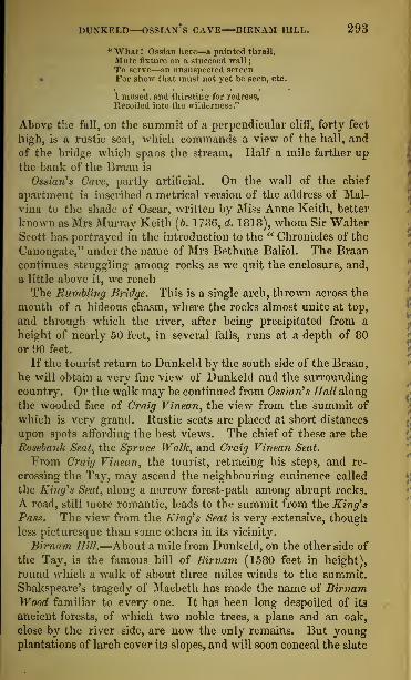
DUNKELD—OSSIAN's CAVE BIRNAM HILL. 293
" What ! Ossian here—a painted thrall,
Mute fixture on a stuccoed wall
;
To serve—;»n unsuspected screen• For show that must not yet be seen, etc.
I mused, and thirsting for redress,
Recoiled into the wilderness."
Above the fall, on the summit of a perpendicular cliff, forty feet
high, is a rustic seat, which commands a view of the hall, and
of the bridge which spans the stream. Half a mile farther upthe bank of the Braan is
Ossian $ Care, partly artificial. On the wall of the chief
apartment is inscribed a metrical version of the address of Mal-
vina to the shade of Oscar, written by Miss Anne Keith, better
known as Mrs Murray Keith (6. 1736, d. 1818), whom Sir WalterScott has portrayed in the introduction to the " Chronicles of the
Canongate," under the name of Mrs Bethune Baliol. The Braan
continues struggling among rocks as we quit the enclosure, and,
a little above it, we reach
The Bumbling Bridge. This is a single arch, thrown across the
mouth of a hideous chasm, where the rocks almost unite at top,
and through which the river, after being precipitated from a
height of nearly 50 feet, in several falls, runs at a depth of 80
or 90 feet.
If the tourist return to Dunkeld by the south side of the Braan,
he will obtain a very fine view of Dunkeld and the surrounding
country. Or the walk may be continued from Ossian's Hall along
the wooded face of Craig Vinean, the view from the summit of
which is very grand. Rustic seats are placed at short distances
upon spots affording the best views. The chief of these are the
Rosebank Seat, the Spruce Walk, and Craig Vinean Seat.
From Craig Vinean, the tourist, retracing his steps, and re-
crossing the Tay, may ascend the neighbouring eminence called
the King's Seat, along a narrow forest-path among abrupt rocks.
A road, still more romantic, leads to the summit from the King's
Pass. The view from the King's Seat is very extensive, thoughless picturesque than some others in its vicinity.
Birnam Hill.—About a mile from Dunkeld, on the other side of
the Tay, is the famous hill of Birnam (1580 feet in height),
round which a walk of about three miles winds to the summit.
Shakspeare's tragedy of Macbeth has made the name of BirnamWood familiar to every one. It has been long despoiled of its
ancient forests, of which two noble trees, a plane and an oak,
close by the river side, are now the only remains. But youngplantations of larch cover its slopes, and will soon conceal the slate

29 I MIDDLE HIGHLANDS AND LAKES—BLAIRGOWRIE.
quarries that now so deeply sear them. From the top of BirnamHill a nohle view is obtained of the valley of the Tay and the
forest around Dunkeld ; while from the northern side may be
seen the pap-shaped Hill of Dunsinane, south-east on the borders
of Forfarshire, distant in a straight line twelve miles. At the
foot of Birnam hill is the Birnam railway terminus, beside which is
the Birnam Hotel, about three quarters of a mile from the bridge
of Dunkeld.
The grounds of Murthhj Castle, a fine modern edifice in the Elizabethanstyle (Stewart of Grandtully, Hart.), are about four miles and a half to
the south-east of Dunkeld, on the other side of the Tay. Quite close to
the new building is the old castle of Murthly, with a chapel, which hasbeen restored and elegantly fitted up for the rites of the Roman-catholicchurch. The grounds are worthy of a visit, and strangers are freely
admitted.
EXCURSION FROM DUNKELD TO THE LOCH OF LOWS ANDBLAIRGOWRIE.
There is a railway from Blairgowrie to Perth. From Blairgowrie an interestingtour may be made by the Spitted of Glenshee, Braemar, and Balmoral to Aberdeen.Coaches run from Blairgowrie to Castleton of Braemar and Balmoral, via Bridge ofCally and Spittal of Glenshee, every alternate day during tbe months of July,August, and September.
A pleasant excursion may be made in the course of a day from Dun-keld to Blairgowrie, distant twelve miles to the east. The road windsalong the base of the Grampians, and, on the south, the country opens to
the vale of Stormont. About two miles from Dunkeld the road passesthe Loch of Lows. A mile beyond this is Butterstone L,och ; and fourmiles farther on is the Loch of Cluny, having a small island near thesouthern shore, on which is the ancient Castle of Cluny (Earl of Airlie),
believed to be the birthplace of the Admirable Crichton (b. 1560, d. 15K2).
The mansion of Forneth (Speid, Esq.) overlooks the castle. Anothermile conducts the tourist to the Lsoch of Marlie. On the north side is
Kinloch (Whitson, Esq. of Parkhill), and behind it Baleid (Campbell,Esq.), while the grounds of Marlie bound it on the east. Near the houseof Marlie (Brown, Esq.) are the church and inn of Marlie or Kinloch.Passing Ardblair on the right, and just before entering Blairgowrie, twomiles beyond Marlie, is Newton House.Blairgowrie (Hotels : M'Laren's, Queen's) occupies an advantageous
site on the west bank of the Ericht, a good stream for trout
Craighall is two miles north from Blairgowrie. Crossing the bridge
over the Ericht, which from its rapidity has acquired the name of the" ireful Ericht," the road winds along the east side of the river, havingParkhill on the right. On the opposite side, where the Ljornty joins the
Ericht, the bed and sides of the river become picturesque. At a short
distance below the mansion of Craighall (Rattray, Esq.), romantically
perched on the top of a high cliff is another bridge. Here the rocks oneach side of the river rise about 200 feet above its bed : the west side
consists of a perpendicular rock 700 feet in length and 220 in height, as
smooth as if it had been chiselled. It is called Craig-lioch.

DIN KELD—DOWALLY—LOGIERAIT. 295
DUNKELD TO THE PASS OF KILLIECRANKIE AND BLAIRATHOLE.
Route.
Miles.Road proceeds through narrow ra-
vine of King's Pass.
King's Seat and Craigiebarns Moun-tains.
5 Dowally.Dalguiso(Str\vart, Esq.); Glenalbert;
Kinnaird (Duke of Athole . in suc-
cession, on opposite side ofTay.
8J Logierait, near confluence of Tay andTiunmel.
Road along east hank of Tuminel
;
piss Tuuimet House (Dick, Esq.).
10 Moulineam Inn.Croftinlom (Capt Murray): Dona-vourd (Macfarlane, Esq.) ; both onright.
Middlehaugh (Fergusson, Esq.), onleft.
Dunfallandy (Miss Ferguson) onleft.
13 Piti.ochrif.—By bridge over Garry,districts of Rannoch and Tummelreached.
Spout Dhu (Black Spout) Waterfall.Ben-y-Vracky, 3 miles to north.
Miles.Moulin village (1 mile) and ruins ofMoulin Castle on road to right.
Road northwards through narrow val-
ley— skirts of Ben-y-Vracky onright.
Fascally woods and grounds (A.Butter, Esq.), on left.
For Loch and Falls of Tummel, crossbridge of Garry, about three milesabove Pitlochrie.
Road proceeds by left bank of Garry.16 Pass of Kilmecrankie.
Scene of battle, north end of Pass,near which guide who keeps keyto gates lives. Charge, Is.
Killiecrankie Cottage (Mrs Hay),on left.
Urrard House (Capt. B. Stewart),near which Dundee fell, on right.
Strathgarrie House (Mrs Col. Stew-art), on south bank of river.
Lude(MTnroy, Esq.)
19J Free Church. Bridge of Tilt Hotel.Cross Bridge of Tilt.
20 Blairathole. (Hotel).
On leaving Dunkeld, the hills on either side of the Tay approach
towards each other, and Craigiebarns and Craig Vinean show a
precipitous and picturesque aspect. The road, proceeding through
the narrow ravine of the King's Pass, has been cut with great
labour and expense along the bottom of the King's Seat, a large
wooded rock which overhangs the river at a considerable height.
For ten miles after leaving Dunkeld, the hills wherever the
ground was unsuited for the plough, were planted with larches
and Scotch firs by John fourth Duke of Athole (d. 1830). Theroad is in some places skirted by beeches and elms, the remains
of an older forest.
Five miles north of Dunkeld the tourist reaches Dowally vil-
lage and church, near a small lake of the same name, at whichare some remains of one of those circles of standing stones, whichhave been called Druidical. The road is here skirted by oaks
and coppice, and on the opposite side of the river are seen, in suc-
cession, the mansions of Dalguise (Stewart, Esq.) ; Glenalbert;
and Kinnaird (Duke of Athole). Among the hills, about twomiles to the eastward, is Ordie, a small loch, noted for its trout.
On the tongue of land formed by the confluence of the Tayand the Tummel stands the village of Logierait (see p. 288),
with its inn, 8§ miles north of Dunkeld. Half a mile farther,
on a bank near Tummel Ferry, a mile above its junction with

296 MIDDLE HIGHLANDS AND LAKES—PITLOCHRIE.
the Tay, are the vestiges of a castle said to have been a
residence of Robert III. (see p. 208).
Proceeding along the east bank of the Tummel, the tourist
passes TuUimet House (Dick, Esq.), to the right of the village of
Ballinluig, where the road from Logierait, by the ferry across the
Tummel, joins the main road. In the vicinity are the Braes ofTuUimet, which give name to a favourite Scottish tunc.
Moulinearn Inn is next reached, and then the traveller passes,
on the right, Crofiinloan (Capt. Murray), and Donavourd(Macfarlane, Esq.) ; and on the left, Middlehaugh (Fergus-
son, Esq.), and Dunfallandy (Miss Ferguson). Here the river
makes a sudden turn, and forms several small islands. A mile
farther on, the tourist arrives at
PITLOCHEIE.
[Hotel : Fisher's.]
From Pitlochrie a road to the right leads, by Moulin (1 mile), through GlenBriarachan and Strathardle to Spittal of Glenshee (26 miles), and Castletown of
Braemar (41 mile3.)
A little farther on, a road to the left leads to Fall of Tummel and Lochs Tummeland Rannoch (p. 301).
Pitlochrie is a neat village with a savings bank, three branch-
banks, a dye-work and a brewery. The population does not
exceed 400 ; but its healthy situation and fine scenery attract
many visiters in summer, who have the privilege of fishing in the
neighbouring lochs and streams. Comfortable lodgings are to
be had in the village.
A mile east of Pitlochrie is a waterfall, nearly 100 feet in
height, called Spout-dhu, or the "Black Spout," formed bythe Edradour Burn. Nearly all the streams in this neighbourhood
show cascades. Three miles to the north, Ben-y-Vracky, which
terminates the vale of Athole on the one hand, and the strath of
Garry on the other, is seen rising 3000 feet above the level of
the sea.
The tourist who has time to spare should visit the village of
Moulin, " than which," says the late Dr Macculloch, " it would
be difficult to point out one more picturesque : an irregular
mixture of houses, and mills, and bridges, and falling waters,
and noble trees—a careless profusion of the elements of rustic
landscape." Near it are the ruins of the Castle ofMoulin, and the
houses of Balledmund (Ferguson, Esq.) and Balnakilly (Stewart,
Esq.). The fields around the village, forming the How of Moulin,
a mile and a half long, and half a mile broad, are among the most
fertile in the Perthshire Highlands, and have been called the

PASS OF KILLIECRANKIE. 297
"Garden of Athole." The Rev. Dr Duff, the eloquent East
Indian missionary, was born at Balnakilly, near Moulin.
Proceeding northward the strath beginsto narrow, and the scenery
becomes wild and alpine. On the left of the road, the house of
Fascally (Archibald Butter, Esq.) comes into view, beauti-
fully situated on a meadow, surrounded by wooded and
singularly shaped mountains, screened on one side by trees,
and washed on the other by the Tummel a short distance below
its junction with the Garry. In this neighbourhood is the Fall
of the Tummel,—described at p. 301,—which the tourist will do
well to visit.
The mountains now close in on both sides of the narrow vale
of the Garry, and the road, carried along a slope of the ridge
on the left bank of that river, enters the
PASS OF KILLIECRANKIE.
The Pass is best seen from a path which leads off the c irriage-road on the left
after passing Fascally, and again joins it farther on. The tourist, travelling on foot
or in a hired conveyance, should not fail thus to view it. A guide is generallyto be found in the neighbourhood.
This memorable defile is about a mile and a half in length.
The hilis, rising abruptly on each side, are overhung with
birches clinging to the rocks so profusely as to produce, even
at noonday, the haziness of twilight. Only a glimpse now andthen of the river is obtained, although its hoarse tumultuous
roar is heard, as it forces its impetuous way along the deep and
rugged channel below. At one place it is seen rolling headlong
over a precipice, into a deep dark pool, which it lashes into foam.
So savage is the scene that, in 1746, when the only roadway wasa footpath overhanging a huge precipice, a body of Hessian troops,
appalled at its aspect, refused to march through the pass.
Near the north end was fought, on the 27th of July 1689, the
battle of Killiecrankie, between the Highland army, com-manded by Graham of Claverhouse, Viscount Dundee, and the
troops of King William, under General Mackay. Two places
are shown as the spot where Dundee fell—the garden behindUrrard House (Capt. B. Stewart,) on the right, and a rudestone, called Tombh Clavers, in the immediate neighbourhood.
The conflict itself cannot be better described than in the words of
Lord Macaulay :
—
"It was past seven o'clock. Dundee gave the word. The Highlanders droppedtheir plaids. The few who were so luxurious as to wear rude socks of untannedhide spurned them away. It was long remembered in Lochaber that Lochiel tookoff what probably was the only pair of shoes in his clan, and charged barefoot atthe head of his men. The whole line advanced firing. The enemy returned the
N 2

298 MIDDLE HIGHLANDS AND 1.AKKS—KILLIECKAXKIE.
fire and did much execution. When only small space was left between the armies,the Highlanders Bnddenly Bung away their firelocks, dre* their broadswords, andrushed forward with a tearful yell. The Lowlanders prepared to receive the shock;but this was then a long and au k ward process; and the soldiers were still rumblingwith the muzzles of their guns and the bandies ol their bayonets, when the. wholehood of Macleans, Macdonalds, and Camerons came down, in two minutes thebattle was lost and won. The ranks of Balfour's regiment broke. He was clovendown while struggling in the press. Ramsay's men turned their hacks and dropp id
their arms. Mackas's own foot were swept away hy the furious onset of theCamerons. His brother and nephew excited themselves in vain to rally the men.The former was laid dead on the ground hy a stroke from a claymore. The latter,
with eight wounds in his body, made his way through the tumult and carnage tohis uncle's side. Even in that extremity Mackay retained all his self possession.He had st ill i hi.' hope. A charge of horse might recover the day ; for of horse thebravest Highlanders were Supposed to stand in awe. But he called on the In rse in
vain. Iiclhaven indeed behaved like a gallant gentleman: hut his troopers,appalled by the rout of the infantry, galloped off in disorder: Annandale's nunfollowed! all was over; and the mighty torrent ofredcoats and tartans went ravingdown the valley to the gorge of Killiecrankie.''—History ofEngland, chap .xiii.
Before reaching the grounds of Urrard, the road passes the
picturesque village of Aldgirnag, and crosses the Girnag by a
narrow bridge. A footpath leads up to the Falls of the Girnag,
which the tourist will do well to visit.
Beyond the Pass, the valley gradually opens to the north, and
on its terraces, some of which are shaded by stately trees,
among other villas, are, on the south side of the river, Killie-
crankie Cottage (Mrs Hay), Strathgarrie House (Mrs Col.
Stewart), and Shierglass, on the left. As the road advances, the
mansion of Lude (M'Inroy, Esq.), situated amid thick woods, is
seen at the northern extremity of a ridge of hills stretching from
the north. The road descends into the opening valley, and, after
crossing the river at the Bridge of Tilt, where there is a good
hotel, enters the wide and fertile plain of
RLAIRATIIOLE.
[Hotel: Duke of Athole Arms.]
The village of Blairathole is within a short distance of the
rivers Tilt and Garry, and has an excellent hotel. The old
village, a mile off, stands on a rising ground, and here are the
picturesque ruins of the old parish church, with a vault under
the choir, where lie the remains of the Viscount Dundee, whofell mortally wounded in the moment of his victory at Killie-
crankie. His bones are said to have been found quite entire
about the year 1335.
Blair Castle, the principal seat of the Duke of Athole, is
a long building of three storeys. It stands on an eminence on
the banks of the Bannavie, surrounded by trees of great age and
size, the most remarkable of which are the larches, next to the
two patriarchal trees at Dunkeld, among the finest in Britain.

r.LAIRATHOLE—BLAIR CASTLE AND PARK. 299
The date of the first erection of the castle is uncertain, but the
oldest part of the building, called The ComyrCs Tower, may probably
be referred to the close of the thirteenth century. Formerly a
place of great strength, Blair Castle was, from its situation, animportant military post. In 1G44, it was garrisoned by the Mar-quess of Montrose, who was here joined by a large body of Athole
Highlanders, whose bravery helped him to the victory of Tipper-
muir. In 1653, it was taken by storm by Colonel Daniel, one of
Cromwell's officers. In 1G89, it was held by an officer of Vis-
count Dundee, on behalf of King James VII. ; and an attempt
to besiege it, made by Lord Murray, son of the Marquess of
Athole, led to the battle of Killiecrankie. In 1746, it wasgallantly defended by Sir Andrew Agnew against the High-landers, who retired from it a few weeks before the battle of
Culloden. In 1750, its turrets and battlements were removed bythe Duke of Athole, when, also, the height of the building wasreduced from five storeys to three. In September 1844, the
Queen and the Prince Consort spent three weeks here, repeatedly
visiting the Falls of the Tummel and the Bruar, the Pass of
Killiecrankie, and the other objects of interest in the neigh-
bourhood.
The large and well wooded park is intersected by dells andravines, hollowed from the solid rock by streams, forming, in
some places, fine cataracts.* In the background is seen the vast
outline of Ben-y-Gloe, " the Mountain with the Veil," that is, of
clouds and snow, having four separate summits—the highest, Carn-nan-Gabhar, or " the Mountain of Goats," 3725 feet above sea-
level. There is a grand prospect down the Garry, where Ben-y-Vrackie rises pre-eminent among the hills near the eastern outlet
of the pass of Killiecrankie. The summit of the far distant
Schiehallion is seen overtopping the southern ridges ; and west of
Ben-y-Gloe rise the heights of Athole, bounded on the north byBendeiry, or " the Red Mountain" (3550 feet high), so called froma vein of soft red granite which intersects it.
Footpaths, gravel walks, and green drives have been formed in
the park. Some of the paths hewn along the face of the rocks,
which hem in the rivers Bannavie and Tilt, are very picturesque.
What is called the Hercules Walk leads to the margin of the
Tilt and to a grotto below the bridge, where a branch of the
Burn of Fender pours over a high cliff, in a cascade called The
* A nohle view is to be had from the top of the Hill of Tulloch, on the opposite-bank of the Garry ; and the tourist, if he can spare time, should not fail to makethe ascent, which is quite easy.

300 MIDDLE HIGHLANDS AND LAKES—ATHOLE.
York, after the Hon. Robert Hay Drummond, Archbishop of Yorkfrom 1701 till 1776. This fall is best seen from the grotto ; under-
neath is the roaring torrent of the Tilt running wildly among the
hollow caverns of the rocks that rise like ramparts from its banks.
On the opposite side, and about half a mile farther up, are the
Falls of the Fender, three in number. There are pretty
good footpaths to them. At the first the stream falls thirty feet
between two perpendicular walls of limestone into the Tilt. Ashort way farther up is another, where a great body of the
water gushes through a deep ravine, overhung with trees andunderwood, while a portion of the stream is divided from the
principal waterfall, and spouting over a jutting rock is scattered
into a shower of foam in its descent. At the uppermost andfinest fall, the stream appears tumbling amid trees and over
rocks, and being joined by another stream that darts from the
bank, throws itself down a steep declivity into a deep hollow,
and sweeps wildly down the narrow glen.
The neighbouring grounds of Lude (M'Inroy, Esq.) give somenoble views of the vale of Atholc. They are well laid out, and
are open to strangers. The modern mansion stands on the site of
the house in which Prince Charles Edward was entertained in
1745, on his march towards Edinburgh. Lude long belonged to
a branch of the Robertsons or Clan Donnochy, and their repre-
sentative has a harp which is said to have been a gift to the family
from Queen Mary.Four miles to the westward, and a short distance from the
public road, are the fine bold Falls of the Bruar.* This
mountain stream, rising in the skirts of Bendeirg, has a peculiarly
rugged channel, the rocks being worn into the most grotesque
shapes by the impetuous current. At the Lower Falls, over
which a bridge is throwrn, the river, rushing through an arch
worn out in the rock, plunges into a deep black pool beneath,
where it lingers as if courting a respite from its troubles, and then
hurries onward to join the Garry, a short distance below the Bridge
ofBruar Inn. A good road leads, along the brink of the ravine,
to the Upper Falls. Here an alpine bridge is thrown across the
stream, on the southern side of which the cataract is seen to the
greatest advantage. It has three falls or breaks, the lowest 100
feet in unbroken descent, and each of those above it 50, the whole
height of the fall being 200 feet. In 1787, John the fourth Dukeof Athole, in compliance with Burns's " Humble Petition of Bruar
* Tourists going towards Inverness, will save time by visiting the Falls on the
route (p. 402).

GLEN TILT—STRATH TUMMEL—LOCH TUHMBL. 301
Water," covered the sloping banks with pines, through which
numerous walks have been formed.
From Blairathole there is a very interesting road, partly carriage-
way, partly footpath, through Glen Tilt to Castletown of Braemar, a dis-
tance of about 28 miles (see p. 401). The scenery is somewhat peculiar-
few of the Highland valleys showing such a long unbroken stretch. There
is a carriage-way for about eight miles from Blairathole to the forest
lodge of the Duke of Atholo. Beyond this, on the left, are the Falls of
the Tarff,and that stream has to be forded, which, unless it be in flood, is
an easy task. After passing the watershed between the Tilt and the
Dee, about "20 miles from Blairathole, the tourist reaches a carriage-road
which leads from a shooting lodge of Lord Fife, by the Linn of Dee, andthe Falls of Corriemulzie to Castletown of Braemar, where there are twogood inns. Glen Tilt has attractions as well for the botanist as the
geologist. From the high ground at its head there is a noble view of
Potteudewau, Cairntoul, Braeriach, Ben Macdhui, and the other
grisly cliffs which guardThe infant rills of Highland Dee."
DISTRICTS OF THE TUMMEL AND RANNOCH.
These districts may he conveniently visited either from Blairathole or fromPitlochrie (pages 298 and 296).
Near the entrance of the Pass of Killiecrankie from the south, a bridge over theGarry leads to the Fall of the Tumniel and to Loch Rannoch. A gate near thebridge opens into a path leading to the river, whence the best view of the fall is
obtained.From Pitlochrie the Fall of the Tumniel is most readily reached by crossing the
bridge there.
At the ferry below Blairathole, a road along the river-side runs to the westwardof Garry Bridge, and there meets the Tummel road.
From the bridge over the Garry, near the entrance of the Pass of Killie-
crankie, there is an excellent carriage road to the wild districts of theTummel and Rannoch, entering the grounds of Bonskeid at the openingof the valley of Fincastle. To see the Fall of the Tummel to the best
advantage, the tourist should go along a path from a gate near the bridge.
The river descends from a height of 16 feet. To the north-west of the
Fall is a cave of difficult access in the face of a precipitous rock. Here aparty of the Macgregors were surprised during their proscription ; somewere killed upon the spot ; others climbed up into a tree growing out of
the face of the rock, which their pursuers hewed down, and so preci-
pitated them into the river.
Near Bonskeid House (Stuart, Esq.), the Tummel, showing a con-tinued succession of rapids, rushes over a channel confined within lofty
banks shaded by woods. About two miles within the valley is the man-sion of Fincastle. Proceeding along the northern bank of the river,
the road passes Alean on the left, and on the opposite side Duntanlich,near the eastern extremity of Loch Tummel. It here ascends a steep
eminence, where a noble prospect bursts upon the sight. Loch Tummel,three miles long, and at the west end about two-thirds of a mile broad,with its bold headlands and long retiring bays, its sloping banks terminat-
ing in broad and wavy ridges, appears encompassed by forests and moun-tains. On the opposite shore the rugged heights of Ferragon and thehuge Schiehallion rise in full view.
The tourist proceeds by the north side of Loch Tummel, and near the

302 MIDDLE HIGHLAHD8 AM) LAKES—BANNOCH.
western extremity passes Portnellan. About 4 miles farther, and 16from Blairathole, at the Bridge of Tummel //m, where post-horses canbo hired, the road from Crieff to Dalnacardoeh, 10 miles distant, crosses.In the midst of beautiful scenery, on the south side of the valley, standsFou /louse (Sir Robert Meuzies, Bart.). The face of the country con-tinues mountainous to Mount Alexander, or Dun Alastair (of old theseat of Robertson of Struan, the chief ofthe Clan Donnoehy or Robertsons,now belonging to General Sir John NTDona Id, G.C.B.), half-way to Kin-loch-Rannoch. On the opposite side of the river is Crossmount (Mac-donald, Esq. of St Martin's).
A good but steep mountain road over a spur of Schiehallion leadsfrom the Bridge of Tummel through a picturesque country, emergingfrom Glenlyon, and joining tho road to Kenmore, 13 miles, passing theruins of Gurtli Castle (a high square keep, standing on a narrow rockypromontory, between two mountain streams), the inn of Coshieville, andthe village ofFortingall. Here there is a good inn ; and here is a famousyew tree, believed to be the largest and oldest in Scotland. The Lyon is
crossed by a bridge, and the road leads some miles farther along thenorth bank of Loch Tay to Kenmore. In dry weather the road fromTummel Bridge to Kenmore can be shortened, by about 5 miles, by pass-ing the river at a ford to the east of Coshieville, but when the river is
high this ford cannot be depended on, and is sometimes dangerous.Starting from Tummel Bridge and proceeding westward, Loch Ran-
noch appears. This wild and desolate lake, which abounds in trout andchar, occupies about 10 miles of a narrow valley, nearly 20 miles inlength, and from 2 to 2i miles in breadth. Its shores are indented bywooded points of laud running far into the water. The mountains onthe north side are high, and their steep sides partially cultivated. Thereare good roads on both sides of the loch, but the ride up the south sideis by much the more pleasing. The mountains here form another lofty
range, covered far up their sides with a forest of natural pine, birch,and fir, called " The Black Wood of Rannoch," now falling into decay.In the far west, the snowy peaks of Gleucoe and Glenethe are seen atthe distance of 40 miles.
The Moor of Rannoch is one of the largest and dreariest wastes in
Scotland, 16 or "20 miles long, and nearly as wide, presenting a vast
expanse of boggy heath, and a long, sinuous, black lake, called LochLuydan. It lies between the great central mountain-range of Scotlandand the commencement of the range which runs down at right anglesfrom it to the Clyde at the Kyles of Bute.
The tourist passes I^ochgarry House, and, on the opposite bank of theTummel, Dalchosnie (General Macdonald), and Jnverchaddan (Stuart,
Esq.), the latter situated at the foot of a rock overlooking the loch. Atthe eastern extremity of the latter is the village of Kinloch-Rantioch,where there is a good inn, which has the privilege of fishing in the loch.
The view from this point westward is very fine. Looking eastward, the
village forms the foreground. On the left is a bold precipice, downwhich descends a brawling torrent, and on the right is the huge Schiehal-
lion, isolated from the surrounding mountains, and towering to a height
of ,3533 feet. After the disastrous battle of Methven, King Robert Bruceand his queen are said to have found a refuge near its northern skirts.
Proceeding along the south side of the loch, which is wooded, and pass-
ing Carie, at the distance of six miles from Kinloch-Rannoch, is the hunt-
ing-seat of Dall. Five miles farther, at the western extremity or head of
the loch, is the village of George's Town, where there is a good inn.
About a mile from the latter placo is Barracks, now a shooting-lodge,
but garrisoned by troops for some time after 1745. A short way beyond

DUNKELD TO PERTH. 303
the head of the loch is Rannoch Lodge, the residenco of the DowagerLady Menzies. There are two islands on the loch, which near its headreceives the waters of Loch Luydan on the west, and of Loch Erieht onthe north. After crossing the Bridge of Gatver, the village of Tighnuline,
or Tynalin, is reached. Here there is an inn, and in summer a coachruns between this and Weem, near Aberfcldy, by Tummel Bridge andKinloch. A path proceeds westwards by the north of Loch Luydan to
Kingshouse in Glencoe, whence the tourist can proceed by BallachulishFerry to Fort-William, and thence by the Caledonian Canal to Inver-
ness, or take the road leading southwards.
DUNKELD TO PERTH.
By Coach or Railway, 15J miles.
Miles.
11$ Luncarty Station.
13 Line crosses Almond.Scone Palace (Earl of Mansfield), on
opposite side of Tay.Few House (Nicliol, Esq.) and Tul-
loch Printfield, on right.
15i Perth.
Miles.Line skirts base of Birnam Hill.
SiMurtlily Station—Murthly Castle(Stewart. Burt.)
6i Bankfoot village, on right.Linn of Campsie, on left.
84 Stanley Junction." Line crosses Shochie and Ordie.Battlefield of Luncarty.
The coach-road, along the left bank of the Tay, is through a fertile and wellcultivated district, by the church of Caputh, the village of Meikleour, the bridge of
Isla, the village of Guildtown, and Old Scone.
On leaving Dunkeld for Perth, the tourist crosses the seven-
arched bridge over the Tay (foot-passengers paying a halfpenny
pontage), and, passing the Birnam Hotel, takes the train at Bir-
nam railway terminus, a distance of about a mile and a half.
Omnibuses run to and from the station.
The line skirts the base of Birnam Hill, already described
(pages 293, 294), and the train soon reaches Murthly station, near
Murthly Castle, the beautiful residence of Sir William Stewart of
Grandtully, Bart. (p. 294). As the train proceeds, it passes, on
the right, unseen from the railway, the straggling village of Bank-
foot, on the old coach road. About four miles to the westward
is Tulliebelton (Colonel Richardson Robertson). Here, near the
place of his birth, there is a monument to the late Robert
Nicliol, a poet and journalist.
The next station is Stanley Junction, at a village with cotton-
spinning mills, the property of Samuel Howard, Esq., employing
nearly 1000 hands. Near it is the Linn of Campsie, where the
Tay expands and falls over a ridge of rocks which jut out like
piers, and partly intercept the water in its passage to the linn,
forming a fine cascade, the only one in the whole course of the
river. This is the cataract referred to in " The Fair Maid of
Perth," as the scene of M'lan's death. About a mile farther,
the Ordie and Shochie, excellent trouting streams, are crossed.

304 MIDDLE HIGHLANDS AND LAKES—STRATIIEARN.
A mile on is Luncarty station, between which and the river is
the supposed battlefield of Luncarty—where it is said there was a
conflict between the £fcots and the Danes in the tenth century
—
now the site of an extensive bleachfield close to the Tay. Nearly
opposite, on the east side of the Tay, are the Stormontfield ponds
for breeding salmon. About a mile and a half farther, the
line crosses the river Almond. On the opposite (that is the
west) side of Tay the tourist will descry the Palace of Scone, a
seat of the Earl of Mansfield. Passing Tulloch printfield, and
Few House (Nichol, Esq.) on the right, the train reaches Perth.
LOCHEARNIIEAD TO PERTH, BY ST FILLANS, COMRIE,CRIEFF, AND METHVEN.
A coach runs along this route in summer as far as Crieff, starting from Callendarin connexion with the Railway. A coach runs between Comrie and Crieff, twicea-day, all the year round.
Route.
Miles.
Road passes within half a mile to thenorth of the falls of Glenbeichand the Trooper's Fall, and thenthrough thick woods, on northernside of Loch Earn.
Ardvoirlk-h (Stewart, Esq.), aboutmiddle of lake, on south side.
Falls of Edinample, near south-westcorner of the lake.
7 St Fillans village and inn.
Hill of Dun Fillan, east of village,
and Aheruchill Hills, on right.
9i Dunira (Sir D. Dundas, Bart.), on left.
Dalchonzie (Skene, Esq.), on right.
Aberuchill Castle (G-. C. Dewhurst,Esq.), on right.
Drumearn (Drummond, Esq.).
13 Comrie.Comrie Hbuse (Dundas, Bart.), close
to village.
Miles.Confluence of Lednock and Earn.Hill of Dunmore—Monument to Lord
Melville.
Devil's Caldron and Spout Rolla, falls
• on Lednock at foot of hill.
Hi Lawers House (Williamson, Esq.),on left.
15J Clathick (Colquhoun, Esq.), on left.
Road to Strowan (Graham Stirling,
Esq.), on right.
1GJ Monivaird Church.Obelisk to Sir David Baird, on aneminence, to the right.
18 Ochtertyre (Sir W. Keith Murrav,Bart.), on left.
Cross River Turret.
19J Crieff.
Drummond Castle, 2 miles south.
80$ Methven.From Methven to Perth, (see p. 310.)
The road from Lochearnhead to Perth runs through the pleasant andinteresting vale of Strathearn, a distance of 37 miles. There are goodroads along both sides of the loch ; the one taken by the coach is on thenorthern shore. Proceeding along it (see p. 280), nearly seven miles,
the tourist, a little beyond the farther extremity of the loch, enters
St Fillans, formerly Portmore or Mickle Port. This pretty little village,
in which there is an inn, exhibits an air of comfort and cleanliness too sel-
dom met with in the Highlands. East from St Fillans is the green conical
hill of Dun-Fillan, about 600 feet in height. On the summit is a rockknown as St Fillan's Chair, and near it are two small cavities in the rock,
said to have been worn by his knees, so incessantly was he engaged in
prayer. Close by Dun-Fillan is the loftier and more picturesque hill ofthe Binean of Dundurn.The road continues along the banks of the Earn, between thick forests

ABERUCIIILL—COMRIR—GLEN TURRET. 305
of pines and larches. These confine the view to the broken ridges of moun-tains seen in perspective. At length a vista opens to the left, and discloses
the fine modern mansion of Dunira (Sir David Dundas, Bart.), on arising ground, at the head of a green lawn, commanding a wide andpicturesque view. This is the place to which Pitt's colleague, HenryDundas first Viscount Melville, retired from public life. The house whichhe occupied stood about 300 yards to the east of the present one.
Beyond Dunira the hills become craggy and bare. A mile and a half
from Dunira, Dalchonzie is seen upon the right, and Aberuchill Castle
(G. C. Dewhurst, Esq.) upon the same side. This castle, which hasreceived some modern additions and improvements, was built in 1602, andwas the scene of a sanguinary feud between the Campbells and the Mac-gregors. The avenues leading to the castle are very fine. A little abovethe garden is a deep glen, into which a mountain stream descends in
beautiful cascades. A wooden bridge thrown across the first fall com-mands a full view of the stream and of the successive pools (darkenedby overhanging trees and shrubs), in which the waters are whirled roundin circling eddies.
The valley enlarges as the mountains recede from the road. Twomiles farther on, and 13 from Lochearnhead, the road enters the pictu-
resquely situated village ofComrie [Inn : Sinclair's Hotel]. It stands upon the north bank of tho
Earn, at its confluence with the Ruchill* Close to the village standsComrie House, upon the east side of which the Lednock pours its rapidstream towards the Earn. Upon the summit of the hill called Dunmoreis an obelisk of granite seventy-two feet in height, erected to the memoryof the first Viscount Melville. At the bottom of the hill is the Devil's
Caldron, which the tourist will do well to see. Here the Lednock rushing,for the space of 100 feet, between walls of smooth solid rock, upwards oftwenty feet in height, and only four or five feet apart, plunges into a darkgulf. The Lednock has another fine fall called Spout Rolla, about twomiles above the Devil's Caldron. For many years this neighbourhoodhas been subject to earthquakes, sometimes accompanied with an alarm-ing noise.
A mile and a half beyond Comrie is the mansion of Lawers (William-son, Esq.), on the left, among large pine trees ; and a mile beyond,Clathick (Colquhoun, Esq.) is seen upon the same side. Further on is aroad to Stroican (Graham Stirling, Esq.), and half a mile beyond Clathickthe road passes Monivaird Church. Southward, on an eminence, is amonument to Sir David Baird, Bart., the hero of Seringapatam ; and amile and a half beyond is the finely situated house of Ochtertyre (Sir W.Keith Murray, Bart,). Here, in 1 787, Burns wrote his song of " Blythe,blythe, and merry was she," on Miss Euphemia Murray of Liutrose, the" Flower of Strathmore."The river Turret is crossed about a mile from Ochtertyre. It rises
in a small lake called Loch Turret, among the hills to the north, andtraverses a romantic vale, Glen Turret, celebrated in song by Burns, whovisited it in 1787, and wrote also a set of verses " On scaring some water-fowl in Loch Turret." Several paths conduct from the bridge to theloch, along the sides of the glen, and overlook the turbulent stream as it
tumbles over rocks, or plunges into deep ravines, forming a succession ofcascades.From the Bridge of Turret the road winds along the brow of a wooded
hill for the space of a mile, and then enters the town of
* Half a mile south of Comrie, on the level plain of Dealginross, are the vestiges ofa Roman camp, conjectured to have been of a size sufficient to accommodate 8000foot and 3000 horse.

306 MIDDLE HIGHLANDS AND LAKES—CRIEFF.
CRIEFF.
[Inns: Drummond Arms, Commercial.]
There is a railway from Crieff to Perth, by the Crieff Junction and Scottish Cen-tral linos (2U miles). From Crieff to Perth, by road is 17 miles. There are coachesin summer from Crieff to Loohearnhead (20 miles), by Comrie and st Fill ins; fromCrieff to Dnnkeld by Amulree (22 miles); from Crieff to Aberfeldy (24 miles); fromCrieff to Brethren ill miles); and thence to Perth by railwa
Crieff standing on a gently rising ground, and well sheltered from theeast winds, has three streets, meeting in a square, in which there is awell surrounded by lime trees. It has a population of 3824. Aboutfifty yards east of the Town House is a sandstone pillar covered withsculpture, as old probably as the twelfth century. On one side is a richlyornamented cross. An iron staple let into the stone had probably servedto hang the "joogs" or pillory. Here is St Margaret'* College (Epis-copal), for the education of young ladies. North of the town is a well-house, into which the waters of a saline spring have lately been conductedfrom Cowgask. They are of the same nature as those at Dunblane andBridge of Allan, and of nearly equal strength with the former. By alate analysis the water was found to contain the chlorides of calcium,sodium, and magnesium, and the sulphate and phosphate of lime.
Crieff was burned in 1715 by the Highland army, and narrowly escapedthe same fate in 174.5, the Highlanders bearing an old grudge to "thekind gallows of Crieff," referred to in Waverley, on which so many oftheir marauding forefathers had been hung by the stewards of Strathearn,who held their courts here.The views from the Knock of Crieff, and the other isolated hills in the
neighbourhood, one of which bears the name of Glower-o'er-him, arevery interesting. About a mile from Crieff is Ferntower House (LordAbercromby), where is Tippoo Saib's sword, presented to Sir DavidBaird at Seringapatam. Here also is Wilkie's painting of " The Findingof the Body of Tippoo." A delightful path along the banks of theEarn, called " Lady Mary's Green Walk," leads to Tomachastle, afinely wooded eminence, three miles from Crieff, on which an obelisk of
I
Aberdeen granite, 84 feet high, has been raised to the memory of Sir
David Baird.
Drummond Castle and itsFlower-Gardens.—The great object of interest
at Crieff is Drummond Castle, with its beautiful flower-gardens, oncethe residence of the Earls of Perth, now the property of their descendantLady Willonghby d'Eresby. The entrance gate is two miles south of
Crieff, on the road to Muthill, and the castle is approached by a nobleavenue, a mile long, running through the large deer park. Carriagesare allowed to drive up to the castle, which is shown to visiters, and the
grounds are open to the public. The castle, which is a modern building,
stands upon a rocky eminence, and commands a fine view of Strathearn.It contains portraits of James V., Queen Mary, James VI., Charles I.,
with his Queen and their children, and Charles II., a good many familypictures, and some interesting furniture. Behind are the ruins of a moreancient castle, built by John first Lord Drummond in 14.01, at the foot
of the pine-clad hill of Turleum (1400 feet in height). The finely woodedpark extends two miles either way ; on the north is an extensive arti-
ficial sheet of water, encircled by fine oaks. The beautiful terraced
flower gardens on the south side of the castle, ornamented with statuary,
were the work of the first and second Earls of Berth in the first half of
the seventeenth century. At Drummond Castle the Queen and the
Prince Consort spent three days in 1842.

AMULREE—INCHAFFRAY—METIIVEN. 307
About two miles beyond the entrancc-gato of Drnmmond Castle is
the neat and thriving village of Muthil/, which is reached through a fine
avenue of beech, chestnut, and lime trees. Here are the ruins of aFirst- Pointed Church, with a Romanesque Tower about 70 feet high.
A mile to the south, the public road passes Culdees Castle (Speir, Esq.),
aud then descending the bank at Bishop Bridge, crosses the river ofMach-anu, noted for its excellent trout. On the summit of the Muir ofCurryourthe road reaches the park of Orchil House, and then diverging to the left,
runs in a direct line along the military road formed by General Wadeabout 1724. It then leads right through the Roman camp at Ardoch,and crossing the bridge over tho Knaick, passes the village of Bracoone mile from Greenloaning Station.
Excursion to Amuhee.— A pleasant excursion may be made fromCrieff northward to Amulree, twelve miles. The road after twice cross-
ing the Turret and two of its tributary streams, reaches the finely
situated village of Monzie, close to which is Monzie Castle (Johnstone,Esq.), with a park containing some fine old larches, one of them morethan nineteen feet in girth. From Monzie the road passes for threemiles along a bare moor, and after the picturesque grounds of GlenAlmond (Patton, Esq.) appear, strikes to the left up the Sma' Glen.Beyond Corrymuckloch Inn, a comfortable small hotel, is the Inn ofAmulree, near to which is Loch Freuchie, famous for its trout. Passingthis inn, at Milton, the road on the left goes on to Aberfeldy, 12 miles,
and that on the right to Dunkeld, 10 miles.
From Crieff there is a beautiful drive up the Sma,' Glen, and onwardsthrough Strathbruan to Dunkeld. The Suia' Glen is the " Glen-Alrnainor Narrow Glen" of Wordsworth's lines
—
" In this still place, remote from men,Sleeps Ossian, in the Narrow Glen;In this still place, where murmurs onBut one meek streamlet, only one," etc.
Leaving Crieff* for Perth, the road passes Ferntower^ on the side ofa richly wooded hill ; and a little farther on another road leads off on theleft to Monzie. A mile beyond this is Culloquhey (Maxton, Esq.), afterwhich appears Inchbrakie (Major Grseme), and next a gateway, leadingon the right to Abercairney (Charles Home Drummond Moray, Esq.),the noble mansion of the descendant, on the female side, of theEarls of Strathearn. Further on, the road enters the village of FoulisWester, where there is a cross covered with hieroglyphics. A milebeyond this the road looks down on the scanty First-Pointed remains ofthe Abbey of Inchaffray, which was founded for Canons Regular of theorder of St Augustin, about 1200, by Gilbert, Earl of Strathearn andMatilda de Aubegni, his Countess. A mile further on is Gorlhy(Mercer, Esq.), shortly after which are the woods of Balgowan, the resi-
dence formerly of Lord Lynedoch (now Thomson, Esq.).Two miles farther on, stands the village of Methven [Inn : Star], with
Methven Castle (Smythe, Esq.) a little to the north (see p. 317).For the railway to Perth, 8 miles in length, see page 316.
* A branch line leads from Crieff to the Crieff Junction on the Scottish CentralRailway, by Highlandman station (a mile and a half from Crieff); Muthil (4 miles);Tullibardine (6$ miles); and Crieff Junction Station (9£ miles), which is 15J milesfrom Perth.

308 MIDDLE HIGHLANDS AND LAKES—PERTH.
PERTH.[Hotels: Royal George, Salutation, Star, British, Exchange.]
The distance from Perth by railway to Stirling, is 33 miles ; from Perth to Edin-burgh by Stirling, 69} miles; from Perth to Edinburgh by the Perth and Dundeeline, crossing the ferry on the Frith of Forth, 46 miles; from Perth to Glasgow byStirling. 62J miles ; from Perth to Dunkeld, 16i miles; from Perth to Crieff by theScottish Central and Crieff Junction lines, 24i miles; from Perth to Aluthven, 8miles, from which a coach runs in summer to CrieffSeveral Interesting excursions, each occupying a clay, may he made by the tourist,
who establishes his headquarters at Stirling, Bridge of Allan, or Perth. SeeRailway Time Tables.
Perth, sometimes called " The Fair City," and anciently St
Johnstown, is finely situated on the west bank of the Tay,upon a wide plain, divided into the North and South Inches,
each about a mile and a half in circumference. The inhabitants
have a fanciful legend that when Agricola and his army, in ad-
vancing into the country of the Caledonians first beheld the
Tay, and the plain upon which Perth now stands, they wereso struck with their resemblance to the Tiber and Rome that
they exclaimed, in a transport of enthusiasm, Ecce Tiber! Ecce
Campus Martius !*
Perth was often the residence of the Scottish monarchs, whomade their abode in the Blackfriars or Dominican monastery, onthe north side of the town, and held many parliaments there.
The oldest part of the city is clustered around St John's church, or
stretches along the banks of the river ; it consists of four parallel
streets extending westward from the Tay
—
Mill Street, High Street,
South Street, and Canal Street—intersected by numerous cross
streets, lanes and alleys. On the east side of the town is the Tay;
on the south and north are the broad, green Inches or mea-dows ; and on the west is the town moor, fringed with villas
and suburban dwellings. On the North Inch, in front of Rose
Terrace, is the Face Course; the South Inch has some fine old
trees which form an avenue on the public road from Edinburgh;
and both Inches have ground for golf. Fronting the South Inch
are King's Place and Marshall Place, intersected by several
streets, and on the west are the villas of St Leonard's Bank, the
General Railway Station, and a little farther west the new Poor
House. On the river side of the South Inch is the Harbour,
and on the opposite or east side of the river is the suburb of
* Sir Walter Scott prefixed the following epigrammatic motto to his " Fair Maidof Perth:"
" Behold the Tiber ! the vain Roman cried,
Viewing the ample Tay from Baiglie's side;
But where's the Scot that would the vaunt repay,And hail the puny Tiber for the Tay ?
"


m

perth—st joiin's church. 309
Bridgendythrough which roads lead westward to the Highlands
in one direction, and eastward to Dundee on the other.
The High Street is hroad and spacious. At the east end of it,
beside the old shore, are the Town Hall, erected in 1696, and the
Police Office. Near them, on the terrace of the river, is a statue of
Sir Waiter Scott. In High Street is the Guild Hall; and in Par-
liament Close, off that street, the Freemasons' Hall, erected in
1818, on the site of what was said to be the old parliament house.
Between High Street and South Street, in a large open area,
on the west side of St John's Street, stands St John's Church,
the ancient parish church of Perth. It is in the Second-Pointed
style, but has lost much of its original character in a recent res-
toration. It is 207 feet in length, and now contains three parish
churches, known as the East, the Middle, and the West churches.
The central square tower, part of the original edifice, is sur-
mounted by a spire.
Before the Reformation, St John's church contained as many as thirty-
nine altars. In 1336, Edward III. is said by some Scotch chronicles to
have stabbed his brother the Duke of Cornwall before its high altar;
but the English historians record that the duke died a fair death.The two great historical events connected with St John's church arethe sermon preached by John Knox, which caused the destruction ofthe monasteries, in 1559; and the General Assembly in 1618,which enactedthe Five Articles of Perth. The former will best be told in Knox's ownwords (the spelling only being modernized) :
—
" The preachers before had declared how odious was idolatry in God's presence
;
what commandment he had given for the destruction of the monuments thereof;what idolatry and what abomination was in the mass. It chanced the next day,which was the eleventh of May, after the sermon which was vehement againstidolatry, that a priest, in contempt, would go to the mass; and, to declare his mal-apert presumption, he would open up a glorious tabernacle which stood upon thehigh altar. There stood beside certain godly men, and, amongst others, a youngboy, who cried with a loud voice, ' This is intolerable, that when God by his wordhath plainly condemned idolatry, we shall stand by and see it used in despite.'
The priest, hereat offended, gave the child a great blow ; who, in anger, took up astone, and casting at the priest, did hit the tabernacle and break down an image.And immediately the whole multitude that were about cast stones, and put handsto the said tabernacle, and to all other monuments of idolatry, which they de-spatched before the tenth man [i. e. one man in ten] in the town was advertised(for the most part were gone to dinner). Which noised abroad, the whole multi-tude convened, not of the gentlemen, neither of them that were earnest professors,but of the rascal multitude, who, finding nothing to do in that church, did runwithout deliberation to the Gray and Black Friars; and notwithstanding that theyhad within them very strong guards kept for their defence, yet were their gatesincontinent burst up. The first invasion was upon the idolatry; and thereafterthe common people began to seek some spoil, and, in very deed, the Gray Friarswas a place so well provided, that unless honest men had seen the same, we wouldhave feared to have reported what provision they had. Their sheets, blankets,beds, and coverings were such as no earl in Scotland hath the better: their naperywas fine. They were but eight persons in convent, and yet had eight puncheonsof salt-beef (consider the time of the year, the eleventh day of May), wine, beer,and ale, besides store of victuals effeiring [i. e. corresponding] thereto. The likeabundance was not in the Black Friars ; and yet there was more than became menprofessing poverty. The spoil was permitted to the poor : for so had the preach-ers before threatened all men, that, for covetousness' sake, none should put their

310 MIDDLE HIGHLANDS AND LAKES—PERTH.
hand to such a reformation, that no honest man was enriched thereby the value ofCAt- Their conscience so moved them thai thej Buffered those Hypocrites
j^HKhc friars] to take away what they could of that which was in their pi.
Tie Prior of Charter House was permitted to take away with him even so muchgold and silver as he was well able to carry. So were "men's consciences beforebeaten with the word, that they had no respect to their own particular profit, butonly to abolish idolatry, the plac is, and monuments there..!': in which they wereso busy, and so laborious, that within two days, these three great places, monu-ments of idolatry, to wit, the Gray and Black Thieves, and Charter House Monks(a building of a wondrous cost and greatness), were so destroyed, that the wallsonly did remain of all these great edifications. Which reported' to the Queen, shewas so enraged that she did vow utterly to destroy St Johnstown, man, woman,and child, and to consume the same by fire, and thereafter to salt it, in sign of aperpetual desolation."
—
Knoafa //i.stor/j of the Reformation in Scotland, vol. i. pp. 320-324. {Mr David Laing's edit. Edinb. 1846.)
To the west of St John's Church is the City Hall, close to thepublic markets. In St Joints Street are the Central Bank of
Scotland, a handsome edifice of three storeys, finished in 1847;
and a branch of the Bank of Scotland. In George Street are
branches of the British Linen Company, and of the Union Bankof Scotland. In South Street are branches of the CommercialBank of Scotland ; and in High Street, of the National Bank of
Scotland, and of the Royal Bank of Scotland, opposite George
Street.
At the west end of the High Street, in St PauVs Square, is StPaul's Church, with a fine spire, built in 1807 at a cost of £7000.In Princes Street, leading from South Street towards the SouthInch, is St John's Episcopal Church, built in the Pointed style, in
1851. Near the North Inch is St Xinian's Cathedral, the choir
and transept of an unfinished cathedral, in the Pointed style, for
the diocese of St Andrews, Dunkeld, and Dunblane.
At the north end of George Street is the Marshall Monument,erected in 1824 by subscription to the memory of Mr ThomasMarshall, Lord Provost of Perth. The building is circular, orna-
mented by an Ionic portico, and surmounted by a dome. In the
interior are halls for a Public Library, and for the Museum of the
Literary and Antiquarian Society of Perth, which contains a small
collection of antiquities, and a few pictures by old masters, pre-
sented by the Marquess of Breadalbane, the most striking- being
a painting of Prometheus chained to the rock. During June,
July, August, and September, the museum is open daily fromone to three o'clock, at a charge of sixpence.
In the centre of Rose Terrace, fronting the North Inch, are the
Public Seminaries, built in 1807, from a design by Mr Burn, at
a cost of about £7000. Here are seven schools, all under the
patronage of the town-council, and salaried from the burghfunds.
The County Buildings, a Grecian edifice close to the river, on

PERTH—PUBLIC BUILDING?. 311
the site of Gowrie House, was built in 1810 from a design by
Smirke, at a cost of £32,000. It is situated in Tay Street, at the
foot of Canal and South Streets. It has a portico of twelve fluted
columns. The County Hall, in the south wing, contains portraits
of Sir George Murray, G.C.B., member for the county in six par-
liaments (1820-3-4), by Pickersgill ; of General Graham of Bal-
gowan, G.C.B. (created Lord Lynedoch in 1814), member for the
county from 171)4 till 1807, by Sir Thomas Lawrence; and of
John fourth Duke of Athole (d. 1830), also by Sir Thomas Law-rence. A tea or card room in the upper storey has a portrait of
the famous violinist Neil Gow (d. 1807), by Sir Henry Raeburn.
In the centre of the building is the Justiciary Hall. Behind,
toward the Spygate, is the prison for criminals and debtors, with
an underground passage leading from the governor's house at the
entrance-gate to the bar of the Justiciary Hall.
Below is the Water Reservoir, designed by the late Professor
Anderson of St Andrews, then rector of Perth Academy, and
erected in 1830 at the expense of nearly £14,000. A plentiful
supply of pure water is obtained from a filtering bed, 800 feet in
length, in the gravel of the Tay, at the upper end of the Friarton
or MoncriefF Island. The Gas Works, in Canal Street, constructed
in 1824 at a cost of £19,000, were also built under the superin-
tendence of Professor Anderson.
On the south side of the avenue of the South Inch, about half a
mile from the city, is the Perth Penitentiary, or General Prison
for Scotland, capable of containing between 900 and 1000 pris-
oners. It is erected on the space of ground formerly used as a
depot for French prisoners. Hither all criminals condemned to
imprisonment for six months or upwards are removed. The build-
ing is adapted to the separate system of prison discipline, and has
four wings, each four storeys in height, radiating from a centre.
Each wing contains 184 cells, with four rooms for warders, andeight punishment cells in the sunk floor. Each cell is 13 feet
long and from 0| to 8^ feet wide. They are built in two ranges,
divided by a corridor 15 feet wide and 220 feet long, and of the
whole height of the four storeys. The building is lighted with
gas, and each cell has one light. The prison is under the man-agement of the General Board of Directors of Prisons in Scot-
land, and is maintained at an average cost of about £15,000a-year.
The Bridge of Perth, long the only one over the Tay betweenPerth and Dunkeld, has nine arches, and measures 880 feet in
length, with a carriage-way 18 feet broad, and a foot pavement

312 MIDDLE HIGHLANDS AND LAKES—PERTH.
four feet wide. It was built in 1771, after a design by Sineaton,
at the expense of £26,631. There is a bridge, for the Perth andDundee Railway, lower down the river.
A short distance beyond the Bridge of Perth, leaving the road
to Scone Palace on the left, and the parish church of Kinnoull
(built in 182G) on the right, with the suburb of Bridgend, is the
Royal Lunatic Asylum, erected at a cost of £'53,852, chiefly from
a bequest by Mr James Murray of Tarsappie. The building,
which is on the north-west side of Kinnoull Hill, is in the Doric
style ; it was opened in 1827, and has room for about 200
patients.
At the extremity of South Street is King James Sixth's
Hospital, of three storeys. The original hospital was demolished
by Cromwell's soldiers in 1C52, to supply materials for their
citadel. The present edifice, erected in 1750, stands near the
site of a Carthusian Monastery (the only one in Scotland),
founded by King James I. in 1429. Near it is St Leonard?*
Church, built in 1834 at a cost of £2500, at the head of King
Street, entering from Canal Street, where, besides the old Gas
Work, is St Stephen's Church. In York Place is the County and
City Infirmary, erected in 1836-37, from a design by Mr W. M.
Mackenzie, the city architect. It accommodates nearly sixty
patients. On the opposite side of York Place is a Free Secession
Church, built in 1850, at a cost of £1600, from designs, in the
Romanesque style, by Mr Andrew Heiton, the city architect.
Further west, on the grounds of Tullilum, is a Poorhouse, with
accommodation for 300 inmates, built in 1860, from designs by
the same architect, at a cost of more than £10,000. At the
junction of Kinnoull and Athole Streets is the Theatre Royal, built
in 1820 ; and at the west end of Athole Street are the Barracks,
constructed in 1705, either for cavalry or for infantry.
Perth is a town of great antiquity. It seems to have been a royal
burgh in the reign of King David I. (1124-53) ; and mention is made of
its schools as early as 1213. From its situation on the bank of the Tay,
only a few feet above the stream, " the Fair City" has at different times
suffered much from inundations. In one of these, it is said, King William
the Lion and his attendants narrowly escaped ; and there is record of
destructive floods in 1621, 1773, 1814, and 1847. Between 1201 and 1459
fourteen parliaments were held in Perth. The walls of the city were re-
built in 1298 by Edward I. of England; and in 1310 the town was besieged
and taken by King Robert Bruce.
In September 1396, a memorable combat was fought on the North
Inch between thirty men of the clan Quhele and the same number of the
clan Kay, in presence of King Robert III. One of the clan Quhele
having been absent, from illness or fear, a smith or armourer of Perth,
uamed Harry Wyud, popularly known as the Gow Chrom, orkk Bandy-

PERTH THE HARBOUR. 313
fogged Smith," supplied his place, fighting, as he himself said, for hisu ain hand.'' This event is the foundation of Sir Walter Scott's novel
of "The Fair Maid of Perth." In 1437, James I. of Scotland wasassassinated in the Blackfriars monastery here by the Earl of Athole andhis nephew Sir Robert Graham. His body was interred in the church of
the Carthusian Monastery, or " House of the Valley of Virtue," whichhe had founded eight years before, and which was still unfinished at his
death. Here also were interred his Queen and Margaret Tudor, Queenof James IV., and mother of James V. Every vestige of the building hasdisappeared, the edifice having been destroyed at the Reformation, alongwith the Blackfriars
1 Monastery, founded by Alexander II. in 1231; aconvent of Whitefriars or Carmelites, founded in the reign of Alexander111. (1249-86) ; and a convent of Franciscans or Greyfriars, founded in
1460 by Laurence first Lord Oliphant.In 1545-46 five men and a woman were burned for heresy at Perth.
The Reformation in Scotland may be said to have commenced at Perth.On the 11th May 1559, John Knox, seven days after his return to Scot-
land, preached a sermon in St John's church before many of the principal
nobility, when the people were so strongly excited that, as has alreadybeen related, they broke down the altars and images in the church, anddestroyed all the monasteries in the town.
In 1600, Perth was the scene of the Gowrie conspiracy, one of the mostmys-terious events in the history of Scotland. In 1601, King James VI.was made a burgess of Perth, at the Cross in the North Street, and sub-scribed the Guildry-Book—a ceremony performed by King Charles I. in
1 633, and by Queen Victoria and Prince Albert in 1 84*2. In 161 8, a GeneralAssembly of the Church, held in St John's church under the presidency ofArchbishop Spottiswoode of St Andrews, enacted the famous Five Articles
of Perth, requiring the observance of Christmas, Good Friday, Easter,Ascension Day, and Whitsunday, enjoining kneeling at the communion,etc. In 1644, Perth was seized by the Marquess of Montrose, after thebattle of Tippermuir ; and in 1645, General Baillie and the Covenantingforces occupied the city. In 1651, Cromwell erected a fort or citadel onthe South Inch. In 1715, Perth was the headquarters of the Pretenderand the Earl of Mar ; and in 1745, the town was for some time occupiedby the forces of Prince Charles Edward.
Perth, the capital of a fertile, wealthy, and enterprising district,
has a population of 23,835. Its chief manufactures are ginghams,
muslins, shawls, cottons and linens. There are distilleries, brew-eries, cornmills, iron-foundries, coach-manufactories, shipbuilding
yards, tanneries, dye-works, rope-works and brick and tile works.
In 1834, an act of parliament was obtained for improving the
Harbour on the shore of the South Inch, and now vessels of 300tons can reach Perth, which before was not accessible by ships
of more than 60 or 70 tons. It ranks as the seventh or eighth
port in Scotland, having in 1858 a customs revenue of £18,042,and fifty-eight sailing vessels with a tonnage of 4G96.
THE NEIGHBOURHOOD OF PERTH.
Crossing the Tay by the great stone bridge, and passing throughthe suburb of Bridgend, along the road which leads eastward to
314 MIDDLE HIGHLANDS AM) LAKES—HDLL OF MONCBDEFF.
Dundee, the tourist reaches a path which winds, by a cave called
The Dragon Hole, to the top of Kinnoull Hill, G32 feet above the
Tay. This precipitous eminence is finely wooded, and commands
a noble view. A carriage-road, called Montagu's Walk, winding
along the north side, leads to the summit. There is a footpath
eastward along the brow of the hill to a carriage-way which
leads to Kin fauns Castle, the grandly placed mansion of Lord
Gray, built in 1822 from a design by Smirke. It has a good
library, a statue gallery, and some interesting pictures, amongwhich is Guercino's Denial of Christ by Peter. There is kept
here a large two-handed sword, said to have belonged to one of
the fabulous companions of Wallace, a Sir Thomas Longueville,
called " The Red Reaver." The tourist may return to Perth by
a footpath along the face of the hill.
The Hill of Moncrieff, which lies to the south of Perth, is
Avorthy of a visit. Wooded to the summit, which is 7-50 feet
above the sea, it is easy of access by a carriage-road, and the
views from it have been pronounced by Pennant to be "the glory
of Scotland." Towards the cast, the Carse of Gowrie is seen
extended for twenty miles, skirted on one side by a chain of hills,
and on the other by a majestic river. Near the mouth of the
estuary, the town of Dundee and Broughty Castle are distinctly
seen in a clear day. Northward is Perth, and a wide and richly
varied landscape stretching to the Grampians ; and to the west
Strathearn, bounded by the far distant hills of Menteith. At the
base of the hill is Moncreiffe House (Moncreiffe, Bart.), a large
square mansion, chiefly of the seventeenth century, with a fine
park. Less than a mile beyond it is the pretty little village of
Bridge ofEarn, a favourite watering-place. The Pitkaithley wells,
which are in the immediate neighbourhood, are of the same nature
with the Airthrey wells at the Bridge of Allan.
Sir Walter Scott, in the " Fair Maid of Perth," has given a description
of the view from a spot called the Wicks of Baiglte, " being a species of
niche at which the traveller arrived, after a long stage from Kinross,
through a waste and uninteresting country, and from which, as forming
a pass over the summit of a ridgy eminence, which he had gradually sur-
mounted, he beheld stretching beneath him the vale of the Tay, traversed
by its ample and lordly stream ; the town of Perth, with its two large
meadows or Inches, its steeples, and its towers ; the hills of Moncrieff
and Kinnoull, finally rising into picturesque rocks, partly clothed with
woods ; the rich margin of the river studded with elegant mansions ; and
the distant view of the huge Grampian mountains, the northern screen of
this exquisite landscape. The alteration of the road, greatly, it must be
owned, to the improvement of general intercourse, avoids this magnificent
point of view, and the landscape is introduced more gradually and par-
tially to the eye, though the approach must be still considered as extremely

SCONE PALACE AND ABBEY THE MOOT HILL. 3 1 5
beautiful. There is yet, wo believe, a footpath left open, by which thestation at the Wicks of Baiglie may be approached ; and the traveller,
by quitting his horse or equipage, and walking a few hundred yards, maystill compare the real landscape with the sketch which we have attemptedto give."
Scone Palace, the seat of the Earl of Mansfield, is situated in
an extensive lawn, on the eastern bank of the Tay, two miles
and a half from Perth. It is not shown without an order fromLord Mansfield's agent in Perth. It was erected in the be-
ginning of the present century on the site of an older palace,
begun by the Earl of Gowrie, and completed in 1606 by Sir
David Murray of Gospatrick, Lord Scone and Viscount Stor-
mont, the ancestor of the present owner. The picture-gallery
is 160 feet in length, and contains a good many interesting
paintings, among which is a stag-hunt, in which James VI.
is introduced. Among the furniture are a bed of flowered
crimson velvet, said to have been wrought by Queen Maryat Lochleven ; and another, of light orange-coloured damasksatin, said to have belonged to James VI. The view from
the parapet to the wrest is very fine, embracing the wooded banks
of the Tay in the foreground, the Tay itself, the town of Perthin the centre, and the encircling Grampians at the distance of
fifteen miles in the background. In the park stands the marketcross of the ancient village of Scone, a narrow upright stone, 13
feet high, sculptured at the top.
The Abbey of Scone, a foundation of unknown antiquity, wasplanted with Austin Canons Regular, by King Alexander I., in
1115. It was the place of the coronation of the Scottish kings.
Here were crowmed Malcolm Canmore in 1057 ; Malcolm the
Maiden in 1153 ; William the Lion in 1165 ; Alexander II. in
1214 ; Alexander III. in 1249 ; John Baliol in 1292 ; Robert I.
(Bruce) in 1306 ; David II. in 1331 ; Edward Baliol in 1333;
Robert II. (Stewart) in 1371 ; Robert III. in 1390 ; and Charles
II. in 1651. The lia-fail, or ancient coronation-stone, was re-
moved to Westminster in 1296 by Edward I., and now forms
part of the chair in which the British sovereigns are crowned,
thus fulfilling the ancient prophecy that wherever it should bo
carried there the Scots should reign :
—
" Ni fjilhit fatum, Scoti, quocunque locatum,Invenient lapideiu, regnare tenentur ibidem."
The Abbey was sacked by a mob from Perth in 1559. TheMoot Ilill which stood beside it is still shown.
The old village of Scone has been removed, and its site is now

316 MIDDLE HIGHLANDS AND LAKES INVEBMAY.
part of the park of the modern palace. New Scone is at some
distance from it.
Dupplin Castle.—Four miles south-west of Perth, and a mile to
the right of the Forgandenny Station of the Scottish Central
Railway, is Dupplin Castle, the seat of the Earl of Kinnonll, on
the north hank of the Earn, surrounded by noble trees. It was
rehuilt, after having been nearly consumed by fire in 1827.
Here are a good library and a picture-gallery. At Dupplin Moor
the Scottish army, under the Earl of Mar, were surprised and
defeated by Edward Baliol and the English in 1332.
Seven miles from Perth, and half a mile to the east of the
Forteviot Station [Inn: Rutherford], is Invermay (Belshes,
Esq ) celebrated in Scottish song for its « birks." The House of
Invermay stands at the base of the Ochils, from which the May
descends in a rocky channel, its steep banks clothed with birches.
At the place called the Humble Bumble, the stream rushes
violently through a deep and narrow channel, between two
rocks which almost meet at the top. A little above this is the
Linn of Muckersy, where the river makes a beautiful cascade of
thirty feet in height. Above the fall is a small deserted Roman-
catholic chapel, and a short distance farther, within the hills,
is the village of Ardargie, near which are the vestiges oi a
Roman camp. From Invermay a road across the strath and the
brido-e of Forteviot leads to Dupplin. At Ilaly Hill, near the
junction of the May with the Earn, stood a palace of the Pictish
and Scottish kings.
HUNTINGTOWER, METHVEN, AND LYNEDOCIT.
There is a railway from Perth to Almond Bank (3 miles) and Methven (S miles).
There's a coach, in summer, from Methven to Crieff (11* miles), see p. 307.
Leaving Perth by railway, the tourist proceeds westward,
passing on* the right, about a mile from the town Few House,
and Tulloch bleachfield and printfield. About a mile farther on
is the ancient Castle of Ruthven, the name of which (on the
proscription of the Ruthvens after the Gowrie conspiracy m
1600) was changed into Huntingtower. It consists of two square
towers, built at different times, but now joined by more modern
buildings. The top of one of the towers is called the Maiden s
Leap, from a tradition that a daughter of the first Earl of Gowrie
spran- nine feet four inches over a chasm sixty feet deep, alight-
ing safely on the battlements of the opposite tower, to escape
detection by her mother in a love affair with a gentleman of

MET1IVEN—LYNEDOCII—GLENALMOND COLLEGE. 317
inferior rank. This castle was the scene of the affair known in
Scottish history as the " Raid of Ruthven."
The Earl of Gowrie and other barons having formed the design of
freeing James VI., when a youth, from his favourites the Duke of Len-nox and the Earl of Arran, in August 1582, inveigled him into this castle
on his return from a hunting-match in Athole. When about to depart,
he was stopped by his nobles, who presented a memorial of their
grievances. He endeavoured to free himself from their restraint, and onbeing prevented burst into tears ; when the Master of Glammis observedthat it was " better for children to weep than bearded men."Two miles to the south of Ruthven Castle is the plain of Tippermuir,
where the first battle was fought between the Marquess of Montroseand the Covenanters, on 1st September 1644, in which the latter weredefeated.
About a mile from the village of Methven [Inn : Star], which
lias a population of about 2000, is the fine mansion of Methven
Castle, the seat of W. Smythe, Esq., near the loch of Methven.
In the grounds is the Pepperwell oak, 18 feet in girth a yard
from the ground, and 234 feet in the circumference of its
branches. Here Bruce sustained a signal defeat, in 1306, from
the English commander, Aymer de Valence, Earl of Pembroke.
In the ancient castle of Methven, of which there are now no
remains, Queen Margaret, widow of James IV., died in 1539.
Crossing the Almond, a mile beyond, is Lynedoch Cottage,
formerly the residence of Lord Lynedoch, the hero of Barrosa.
Within the grounds at Burn Braes, in a secluded spot called DronachHavgh, are shown the graves of "Bessie Bell and Mary Gray."
" O Bessie Bell and Mary Gray,They were twa bonnie lasses;
They biggit a bower on yon burn brae,
And theekit it ower wi' rashes."
Bessie Bell, according to tradition, was the daughter of the laird of Kin-vaid, in the neighbourhood of Perth, and Mary Gray of the laird ofLynedoch. When the plague of 1645 broke out, they retired to a tem-porary dwelling here, living in complete seclusion. A young gentlemanof Perth, an admirer of both, visited them in their solitude, for the pur-pose of supplying them with food ; but, unhappily, communicated to
them the fatal pestilence from which they had fled. According to thecustom of the period, they were buried in the place where they died, atthe foot of a knoll in the Dronach Haw/h, about half a mile west ofLynedoch Cottage, on the banks of the Almond.
For the road from Crieff to Methven (see p. 307).
Trinity College, Glenalmond, stands about two miles north-west
of Methven, on the bank of the Almond. It consists of two de-
partments—a school for boys on the model of the great English
public schools ; and a seminary for the clergy of the Episcopal
Church in Scotland. The buildings, which are in the Tudor style,

318 MIDDLE HIGHLANDS AND LAKES PERTH, ETC.
cost about £42,000, and wore designed by Mr John Hendersonof Edinburgh
;they make two Bides of a quadrangle, the third
side being filled by the chapel (a copy from that of Morton Col-lege at Oxford), which was consecrated in 1851, and has windowsof stained glass. The grounds cover twenty acres, and the site is
one of great beauty. There is a small inn, about half a milefrom the college.
EXCURSIONS FROM PERTH BY RAILWAY, ETC.
At Perth return-tickers are issued daily to DunMil, and from that pointthe tourist will find coaches (in connexion with the trains) running to iber-feldy and CaUendar (pages 287 and 254), Pithehrie, and Blairathole,—passing through the romantic and historical Pass of KUlieerankie.An excursion may also he made by rail to Blairgowrie, whence an inter-
esting tour may be made by the Spittalof Olcnshee, Braemar, and Balmoralto Aberdeen (described in reverse, under North-Eastern Counties).From Methven a coach runs to Crieff; and from Crieff there is a beautiful
drive up the Smd1
Glen, and onwards through Strathbraan to Dunkeld,whence the tourist may return to] Perth by rail (see p. 307).
Glammis ('astir, 27 miles from "Perth, may be conveniently visited fromthe Glammis station, on the Scottish North-Eastern Railway.
Other short tours, which may be conveniently made from Perth, are indicatedin the Skeleton Tours at the beginning of the volume.

ieiderable iieigftt, passes tnrougu a wnu iuvmc


WEST HIGHLANDS AND ISLES.
GLASGOW TO INVERARAY.
There arc several ways of reaching Inveraray from Glasgow. One is by steamerhgoilhead, thence by coach to St Catherine's on Loch Fyne, and by steamer
across to Inveraray—all in connexion. The steamer leaves Glasgow every morning,reaches Loehgoilhead after four hours' sail, and the passengers arrive at Inverarayin about two hours more.Another route to Inveraray—hy which a coach runs in summer, starting from
Tarbet— is from Tarbet on Loch Lomond, and by Arrochar on Loch Long, pass-ing through the valley of Glencroe— the distance this way, from Arrochar to
Inveraray, being 20i miles. One or two parts of the road are so steep that pass-
's generally prefer to walk them. Tarbet is reached by railway from Glasgowto 1 :.il loth, on Loch Lomond, and thence by steamer. A steamer sails every morningfrom ( rlasgow for Arrochar : thus the tourist can either take the coach on its startingfrom Tarbet, or join it when it arrives at Arrochar, a distance of about a mile anda half.
Inveraray may also be reached from Glasgow, either by steamer, by sailing
through the Kyles of Bute, and up Loch Fyne (see Tour "Glasgow to Oban," pages330-33); or by the Holy Loch, Loch Eck, Strachur, and crossing Creggan's ferryat Loch Fyne. On this latter route no conveyance runs between Holy Lochand Loch Fyne, and the tourist must either hire one at Kilmun or walk.
The two best routes from Glasgow to Inveraray, are (i.) byLoch Long and Loehgoilhead
;(n.) by Loch Lomond, Arrochar,
and Glencroe.
I. GLASGOW TO INVERARAY, BY LOCHGOILHEAD.
Miles from Glasgow.23 Steamer touches at Gourock, on left,
then crosses to
26 Kilcreggan, at mouth of Loch Long.28 Cove.32 Klairmore, on west side of Loch Long.35 Ardentinny, on same side.
Loch Goil—scene of ballad of " Lordl'llin"s Daughter."
Ruins of Carrick Castle, on left.
16 Lochgoilhead village—DrimsynieHouse (Livingston, Esq.), on left.
Miles from Glasgow.Coach for St Catherine's Ferry onLoch Fyne.
Hell's Glen.Hill Road, highest point, view ofLoch Fyne.
Road to right leads to CairndowInn.
53 St Catherine's, where steamer is inwaiting to cross the loch.
56 IXVEKARAY.
The voyage down the Clyde as far as Greenock, and thence to
Loehgoilhead, has already been described (pages 113-20).
At Lochgoilhead, where there is a hotel, a coach is waiting to
receive passengers, and take them to St Catherine's Ferry, onLoch Fyne, eight miles distant. The road, crossing a hill of con-
siderable height, passes through a wild ravine called HeWs

320 WEST HIGHLANDS AND ISLES—LOCH LONG.
Clen ;* on emerging from which, after a long steep ascent,
the highest point is gained, and a long stretch of Loch Fyne,with the village and castle of Inveraray, bursts upon the sight.
Proceeding onwards, a road to the right leads to CairndowInn, and another interesting view is obtained of Loch Fyne andInveraray, with the hill of Duncuaich and the ruins of Dun-deraw Castle. At a distance of about twenty miles are seen the
double peaks of Ben Cruachan, the highest mountain in Argyll-
shire, 3u'70 feet above the sea-level. The road on the lei't leads
to St Catherine's, where a steamer is waiting to carry passengers
across the loch, two miles, to Inveraray.
Loch Fyne, a long arm of the sea, celebrated for its herrings,
extends from the Frith of Clyde, between the isles of Bute andArran, in a north-easterly direction. It is about 40 miles long,
and varies from a mile and a half to more than three miles in
breadth, expanding at Inveraray into a fine bay, fringed with
woods and surrounded by mountains. About half-way up the
loch, to the westward, are Loch Gilp and the Crinan Canal.
II. GLASGOW TO INVERARAY, BY TARBET ON LOCU LOMOND, AND BYARROCHAR ON LOCII LONG.
11
Miles.
Ardkinglass (Callander, Esq.), on left.
Cairndow Inn.Road due north to Lend of Loch Fyne.Ruins ofDunderaw Castle.
Keep road to right, and at StronePoint note the view of Invi rarayCastle and town, Hill of Dun-cuaich, Loch Fyne.
Cross bridge of Shiia.Keep road to left, along shore of loch
.
Cross the Aray by a bridge.24 Inveraray.
Miles.2 Arrochar.
From Arrochar, road proceeds roundhead of Loch Long.
Cross Water of Taing. Road alongshores of loch.
Ardgarten House (Campbell, Esq.).
8 Glencbob.Water of Croe on left. Ren Arthur
on right.
11 Rest-and-bc-Thankful.Loch Restal, on left.
Glcnkinglass valley.
On leaving Arrochar, the road winds round the head of Loch
Long, in a north-west direction, and crosses the Water of Taing;
after which it takes a sudden turn to the south-west, and con-
tinues its course along the shores of Loch Long, until it reaches
Ardgarten House (Campbell, Esq.), pleasantly situated amongtrees. It then turns to the right, and enters the dreary and
desolate Glencuoe. This wild, rugged valley is about six miles
in length, and in lonely and savage grandeur is perhaps second
only to the more famous Glencoe. The road, having the water of
Croe on the left, and the lofty cobbler-shaped peak of Ben Arthur
(2863 feet) on the right, ascends gradually for about three miles,
* This glen is divided by a chain of hills from Glencroe, for which, three miltsfrom Locht/oilhead, a path branches off on the right, and leads on to it, a little to thecast of the pass of Rest-and-be- Thankful.

GLENCROE LOCH FYNE—INVERARAY. 321
and then winds up the side of the mountain to the summit of
the pass, whore is a stone seat, on which is inscribed : "Rest-and-
be-Thankful. This road was made in 174G, by the 24th regi-
ment, Lord Ancrum colonel, Duroure major. Repaired by the
23d regiment, 17G8." 4 '
Descending from Rest-and-be-Thankful, the tourist has the
gloomy tarn of Loch Restal on the left, from which issues a
stream making a succession of falls over the rocks t that impede
its course. The road now turns nearly due west through the
lonely valley of Glenkinglass ; and about three miles farther, a
view of Loch Fyne is obtained through an opening in the moun-tains. The road passes Ardlringlass (Callander, Esq.) on the left,
situated upon a peninsula, and then, turning short to the right,
reaches Cairndow Inn, where there is a ferry for foot-passengers,
saving about three miles of the distance to Inveraray.
From this point the road continues almost due north to the
head of Loch Fyne, where, turning to the left, it leads downthe western bank of the loch, until it reaches the ruins of
Dunderaw Castle, a square tower, built in 159G by the chief of
the small sept of the Macnanghtans, on a rocky headland pro-
jecting into the loch. Two miles farther on, the road turns
to the right ; and, at Strone Point, Inveraray Castle, with its plea-
sure grounds, the richly wooded hill of Duncuaich, the town andshipping of Inveraray, and a great expanse of Loch Fyne, burst
upon the sight. Crossing the bridge of Shira, from which the
neighbouring glen takes its name, and rounding the bay, the road
takes to the left, along the shore of the loch, amidst lofty trees,
and, crossing the Aray by a handsome bridge, reaches
INVERARAY.
[Hotels: Argyll Arms, at the Castle Gate; The George. Private lodgings can beeasily procured.]
There are coaches during the summer from Inveraray to Oban ; and from Inverarayto Tarb 't on Loch Lomond, by Glencroe and Arrochar. There is a steamer from In-veraray to St Catherine's; a coach from St Catherine's to Lochgoilhead ; and asteamer from Lochgoilhead to Greenock and Glasgow. A steamer sails daily in
summer and autumn, and twice a-week in winter, from Inveraray to Glasgow byArdrishaig and the Kyles of Bute.By the liberality of the Duke of Argyll, Inveraray Castle and its fine park are
open to the public.
The situation of Inveraray, the county town of Argyllshire, is
* Before coming to Rest-and-be-Thankful, a path strikes off on the left to theroad leading north from Lochgoilhead.
t The rocks consist almost entirely of mica-slate, shining like silver, beauti-fully undulated, and in many parts intermixed with quartz. In the bed of therivulet are considerable numbers of granitic pebbles, with pebbles of schistus full
of crystals of garnet.
o2

322 WEST HIGHLANDS AND ISLES— INYl.KAIIAY.
very beautiful. It has a population of 11G4, and was made a
burgh of barony in 1474, a royal burgh in 1554, and again in
1639 and 1G48. But the inhabitants hold their houses and
-aniens under leases from the Duke of Argyll, or as tenants at
will. The town consists of a street, running nearly east and west,
in the centre of which stands the parish church, and of a row of
neatly built houses, fronting the hay.
In an open space, near the middle of the town, is a sculptured
Stone Cross, about 8 feet high, with this inscription :" Ilec est
crux nobilium virorum, vidilicet, Dondcani Meic Gyllichomyhan,
Patricifilii ejus, et Maelmore filii Patrici, qui hanc crucem fieri
faciebat" It was made probably about. the year 1400: the
family of MacGillacomghan, whose grave it had marked, seem to
have 'been the early possessors of Inveraray ; and it was pro-
bably removed to its present site from the old burying-ground
of Kilmalew, which is close by. The vulgar belief is that it was
brought from Iona, along with all the sculptured crosses in all
the churchyards of Argyllshire. In a garden near the church is
a small obelisk, commemorative of several gentlemen of the name
of Campbell, who were put to death in 1G85, for taking part in
the ill-planned insurrection of the Earl of Argyll in that year.
The chief trade of Inveraray is the herring-fishery in Loch
Fyne. The town's arms show a herring in a net, with the
motto, Semper tibi pendeat halec. The Loch Fyne herring has a
peculiar delicacy.
The Castle of Inveraray, the chief seat of the Duke of
Argyll, stands on a level terrace in front of Glen Aray, on the
south bank of the river and about half a mile from the town.
It is a large quadrangular edifice of two storeys, on a sunk floor,
flanked with round overtopping towers, and surmounted by a
square winged pavilion. It was commenced in 174G, by Archibald
the third duke, from a design by the elder Adam, its foundation
stone being inscribed, in allusion to Culloden, Dux Cumbriae
nobis haec otia fecit. It is built, in what was then considered the
castellated Gothic style, of a chlorite-slate, brought from the
other side of the loch, of a blue-grey colour. A shower of rain
turns it almost black, but an hour of sunshine restores it to its
original hue. The great hall or saloon is lighted from the
top, and connected by arches with the staircases on each side of
it. In the arches are two groups of statuary, the one represent-
ing Paetus and Arria, the other Perseus and Andromeda. The
hall is decorated with some old Highland arms, and 150 muskets

INVERARAY—DUNCUAICH—ESSACHOSAN. 323
sent from London to arm the Campbells in 1745, and used bythem at Culloden. The principal apartments are ranged round
the hall, on the first floor ; the second storey being occupied bybedrooms. The drawing-room has some fine pieces of Gobelin
tapestry. The pictures are chiefly family portraits: among themmay be mentioned a painting of the battle of Culloden, with the
Duke of Cumberland (a striking likeness) in the foreground, and
portraits of Sir Colin Campbell, the knight of Lochow, the first
Marquess of Argyll (beheaded in 1661), his son the Earl of Argyll
(beheaded in 1685), the first and third Dukes of Argyll, a Dukeof Hamilton, General Conway, Lady Charlotte Bury, Lord Fre-
derick Campbell, in his robes as Lord Clerk Register (by Gains-
borough), King George III., and Queen Charlotte.
The old castle of Inveraray, built or rebuilt in 1432, by Sir ColinCampbell of Gleuurchy, uncle and guardian of the first Earl of Argyll,stood near the site of the modern building, on the right bank of the Aray
.
It was pulled down in 1760.
The park is of great extent and equal beauty. A little way upthe Aray is Carlunan Linn, a finely wooded waterfall. Crossing
a bridge over the Aray, a path winds up the hill of Duncuaich,
shooting up its conical form to the height of 700 feet, thickly
clothed with trees almost to its summit, which is surmounted bya rude watchtower, commanding a noble view. A long avenue of
beeches leads round the base of Duncuaich to Glenshira—a pleasant
pastoral valley—and the little tarn of the Duloch.
On the other side of the town is the charming glen of Essa-
chosan, the way to which is by an iron gate between the
town house and the principal inn, opening into a long avenueof aged elms. On the road is a fine beech called the " Marriage
Tree," from its trunk separating into two stems a few feet above
the ground, and again uniting twenty feet higher. At the end of
the glen, which is beautifully wooded throughout, is a pretty
waterfall. In this glen, mines of nickel ore have recently been
wrought.
INVERARAY TO OBAX, BY LOCH AWE.There are coaches daily in summer from Inveraray to Oban, by Kilchurn Castle
<ind Dalmally, and round the north end of Loch Awe, making the journey in aboutright hours. Occasionally a coach runs from Inveraray to Port-Sonachan Ferry,where passengers cross Loch Awe, another coach meeting them on the otherBide ; but, by this route, although about ten miles shorter, much of the finescenery is lost.
The coach from the head of Loch Lomond, by Tyndrum to Oban, joins this routeat Dalmally

32 I WEST HIGHLANDS AND ISLES—LOCH AWE.
Milrs.
Road proceeds up Glen Amy, -t miles,
through thick woods.Lorn Aw r.
11 Cladicb Inn. Favourite station for
anglers. Boats can be hired.Innistrynich.Port - Sonachan ferry, hotel, and
post-office on road to left.
K.ILCHUBN CASTLE, ruins, on rockypromontory, on left.
16 Dalmally inn.
Road on right to Tyndrum (12 miles)mil head of Loch Lomond -">'
Miles.•-'7 A Cross Bridge of Awe, view of Loch
Etlve.Village of Bunawe northwards,
whence asc< nt to Ben Cbttacb im
usually made.—Inverawe Houseat hase.
Road from Muckairn, south-east, to
Loch Awe anil ferry of Port-Sonachan (see p. '.vi:>j.
30 Taynnilt inn.
Loch Etive, on right3G Connul forty, ami sea- waterfall at
certain states of the tide.
on left to Oban. DUNBTABFHAOE CABTLB.Glenurchy church and manse. Across Loch Etive, Lochnell House
18 Cross river Strae. (Campbell, Esq.), in ruins, and in(orry farmhouse. the distance, Barcaldine Castle,'in
Road skirts base of Hen Cruachan.23 Pass of Cruachan, :i miles long.
Cliff of Craiganuni, on left.
Rocks ami Pass of Brandir.
ruins.
1)i:xollyCasti.e,2 miles beyond Dun-Btaffnage ('Admiral M'Dougall).
40 Oban.
The road up Glen Aray skirts the river A ray throughout its
whole length, about nine miles. This small but beautiful stream
has three tine waterfalls. Tracing its course upwards, at a point
where it is shut in by thick woods and rocky banks, is the fall
of Carlunan Linn. About 2^ miles from the town is another.
Half a mile farther is the finest cascade of the three, the fall of
Linne ghlutain.
The road, especially for the first four miles, is thickly wooded,
chiefly with oak and birch. Two miles farther on, it winds
up a steep and irregular hill, on surmounting which a grand
view is obtained of
LOCH AWE,
and the magnificent screen of mountains which enclose it, with
the lofty Ben Cruachan immediately opposite. The road then
descends to the hamlet of Cladich, where there is an inn, a
favourite station for anglers in Loch Awe and the streams in
the neighbourhood, and near which there is a fine waterfall.
Boats may be hired at the inn. Immediately beyond Cladich a
point of land runs into Loeh Awe, called Innistrynich, the pro-
perty of the late Mr M'Alister.
At Cladich a road to the right leads by Dalmalli/, sixteen miles from Inveraray,round the head of Loch Awe
;while another on the left leads to the ferry of /' >
'-
Sonachan, three miles from Cladich, crossing Loch Awe, by which the distance is
Bhortened about ten miles. The latter road skirts the water of Nainl in the forest of
Muckairn, and joins the other at Taynuilt, but the scenery is very inferior.
Loch Awe is about twenty-six miles in length, with an average
breadth of one mile, although in some places it does not exceed
half a mile. It is surrounded by mountains finely wooded, and,

LOCH AWE—PORT-SONACHAN—KILCHURN. 325
like many of the Scottish lakes, its surface is studded with small
islands, beautifully tufted with trees. The chief beauty of LochAwe lies between its northern extremity and Port-Sonachan
(Hotel: McMillan's, where also is the post-office of the district),
about six miles down its eastern shore. The scenery here is ex-
ceedingly fine. The hotel has the right of fishing in the loch, in
which are found salmon, trout, eels, and other freshwater fish.
The lake discharges itself by the river Awe into Loch Etive at
Bunawe ferry.
On the isle of InnishuU are the ruins of the old parish church of Innis-
hail, and of a building which is said to have been a Cistercian nunnery.Before the Reformation there was a chapel in the island dedicated to StFyndoc. The cemetery contains tombstones of the Macarthurs, whoof old inhabited the opposite shores of Loch Awe. On Innis-Chonnel,eight miles south-west of Port-Sonachan, are the ivy-mantled ruins of acastle, the ancient seat of the Lords of Lochow, and subsequently of the
Earls of Argyll. It appears in record in 1361, and in 1493 seems to havebeen the chief messuage of the Campbells. At Innis-Errech, close to it,
are the vestiges of a chapel, and a cemetery still used. On Eilean-an-tagart (i. e., the Priest's Isle) are traces of a building supposed to havebeen the abode of one of the ecclesiastics who served in the churches ofthe lake. On Innis-Fraoch, or Fraoch Eilean, a small island near thenorth end of the lake, stand the ruins of a stronghold of the Macnaghtans.In the year 12(>7, King Alexander III. granted the keeping of his castle
and island of Frechelan to Gilbert M'Nachdan and his heirs, who werebound to build and repair it at the king's cost as often as need was, andto keep it safely for the king's use, so that, as often as he should come to
it, the cattle should be given up to him well-appointed, that he mightdwell in it at his pleasure.
The road onwards to DalmaUy (distant six miles) is at first
shaded with trees, and the stately ruins of Kilchurn Castleshortly appear on a rock, which at one time was probably an
island, at the eastern extremity of the lake.
The scene has been well described by the sister of the poet Wordsworth,in a passage which he prints as a preface to his " Address to KilchurnCastle upon Loch Awe :"—" From the top of the hill a most impressivescene opened upon our view— a ruined castle on an island at some dis-
tance from the shore, backed by a cove of the mountain Cruachan, downwhich came a foaming stream. The castle occupied every foot of theisland that was visible to us, appearing to rise out of the water ; mistsrested upon the mountain-side, with spots of sunshine ; there was awild desolation in the lower grounds, a solemn grandeur in the moun-tains, and the castle was wild yet stately— not dismantled of turrets
—
nor the walls broken down, though obviously a ruin." The castle seemsto have been built, about 1440, by Sir Colin Campbell, the first Knight ofGlenurchy, or, as some say, by his lady during his absence at Rhodes.Here the third Knight of Glenurchy died in 1523. The sixth Knight,who died in 1583, built the four round towers at the corners, and therange of chambers on the north side. In 1643, Sir Robert Campbell ofGlenurchy repaired the high tower and the lower wall, at a cost of 2000merks.

o,2G WT.ST HIGHLANDS AND ISLES—LOCI I AWE.
Towards the close of the fifteenth century, when the power of tho Camp-
bells lay along the shares of Loch Awe, it is said that ono of them, when
fighting in Moray against superior numbers, cried out in his distress,
'Sfada glaodh <>' Loohow, 'Sfaaa oabhair <>' Chlan Dhuins, that is,*1
;ir cry' to Lochow, and a distant help to the Campbells." The saying
ne afterwards to be used in a boastful spirit, as if the domains of the
tribe lay beyond the reach of an enemy.
Near the head of Loch Awe, a little to the eastward, sixteen
miles north from Inveraray, is
DALMALLY.[Inn : Jarratt's.]
The village commands a beautiful view of the vale of Glenurchy.
Its churchyard was one of the burying- places of the ClanGregor,
and contains several old tombstones of Macintyres, Macnaghtans,
and Campbells.
The road on the right leads to Tyndrum (12 miles eastward)
and the head of Loch Lomond, and that on the left to Oban. The
latter is to be followed. Leaving Dalmally, the church and manse
of Glenurchy—anciently called Clachan Dysart—are passed ;and
the road takes a long Bweep round the head of Loch Awe. Two
miles onward, it crosses by a bridge the river Strae, which flows
down the gloomy vale of Glenstrae, at one period the inheritance of
the Macgregors, on the right. Up this glen, a cataract, after heavy
rain, may be seen from the road, tumbling down, from successive
falls' a height of about 200 feet. In time of drought it is a mere
The road passes the farmhouse of Corry, and, turning west-
ward, skirts the woody base of Ben Cruachan* Having left
Dalmally seven miles behind, Loch Awe comes full in view, and
its islands and ruins are seen to great advantage. The road now
enters the Pass of Cruachan, where King Robert Bruce gained
his victory over Macdougal of Lorn, in 1309.
" This pass," says Mr Allan, " is about three miles in length. Its east
side is bounded by almost inaccessible steeps, the crags rising in some
places almost perpendicularly from the water At the north end of this
barrier, and at the termination of the pass, lies that part of the chit
which is called Craiganuni. At its foot the arm of the lake generally
contracts to a very narrow space, and at length terminates at two rocks
called the rocks of Brandir, which form a straight channel, something
resembling the lock of a canal. From this outlet there is a continual
descent toward Loch Etive, and hence the river Awe pours out its
current in a furious stream, foaming over a bed cumbered with masses
of granite and whinstone."
* To ideologists Ben Cruachan is very interesting. It is composed of red or
crev cranite with porphyry veins, and near the hottom is found clay-slate and
E325^t**MiAKveins 'of quartz On the top the sea-pink .rows lux-
uriantly It is believed that before rain and other changes of weathei wrandii are
heard to issue from Ben Cruachan, Beu Doran, and some other Highland mountain..

l.r.N CRUACHAN—LOCH ETIVE—ARDCIIATTAX. 327
About two miles farther, the road crosses the river Awe, by a
stone bridge, the scene of Sir Walter Scott's touching tale of
the " Highland Widow." From this point a view is obtained
of Loch Etive. Two miles and a half farther the tourist arrives
at the picturesquely placed inn of Taynuilt, fourteen miles from
Dalmally. The village itself is small and ill built. On an
eminence near the inn is a rude monument to the memory of
Lord Nelson. About a mile to the north, at the village of Bunawethere is a ferry across Loch Etive, and near it are furnaces erected
in 1753, for the smelting of iron ore, brought from England for
the sake of the wood as fuel.
Bex Ciu achan is usually ascended from Bunawe. It rises to
the height of 3G70 feet, and its circumference at the base is
upwards of 20 miles. On the south the ascent is gentle nearly
to the summit, where it rises abruptly, and divides into twopoints, each having the form of a sugar-loaf. The ascent is
tedious, requiring four or five hours ; but the view will morethan repay the toil. It ranges over the Avhole archipelago of the
West Isles from Islay to Skye. Betwixt the Awe and the road
at the base of the hill is Lnverawe House.
Leaving Taynuilt, the road descends to the wooded shores of
Loch Etive, a navigable inlet of the sea, about 15 miles in length.
The scenery here is very striking, and above Bunawe ferry
assumes a character of still greater grandeur. The upper portion
of the loch stretches a distance of ten miles, in the direction of
the mountain Buachaille Etive (2537 feet), near the head of
Glencoe. Numerous creeks and bays indent its shores.
On the north side of the loch, three miles from Taynuilt, are
the remains of the grandly placed Priory of Ardchattan.* Theconventual church, which is rude and very ruinous, is in the First-
Pointed style ; it has no aisles, and is about 70 feet long by 30
broad. There are a few fragments of the monastic buildings.
The burying-ground has some interesting old tombstones. ThePriory was founded in 1230, for monks of the order of Val des
Choux, by Duncan Makcoull, supposed to have been a kinsmanof the Lord of Lorn. Part of the Prior's house, on the south-
west of the church, is inhabited by the proprietor (Popham, Esq.).
Seven miles from Taynuilt the road reaches Connal Ferry,
where the loch contracts, and at ebb tide presents the unusual
spectacle of a sea waterfall. A ridge of rugged and uneven rocks
extends across two-thirds of the narrow channel ; while through
* To examine Ardchattan Priory the tourist should cross Loch Etive by ConnalFerry. Further north is Barcaldine Castle (Cameron, Esq.).

328 WEST HIGHLANDS AND ISLES—DUNSTAFFNAGE.
the remaining part the tide forces itself with great rapidity,
until it gains the level of the reef. In spring tides, and at half
ebb, the current pours down with a loud noise.
The road now takes a south-westerly direction, and two miles
beyond Connal Ferry the ruins of
Dunstaffnage Castle, s;iid to have been the seat of the Dal-
riadic race of the Scottish kings, are seen surmounting a bold
promontory jutting into the lake. Here, it is said, for a time waspreserved the famous lia-Jail or coronation-stone, the palladium
of Scotland, brought, according to the old legend, from Spain to
Ireland, from Ireland to Scotland, and removed by Kenneth Mac-alpin from Dunstaffnage to Scone about 850 (see p. 315). It is nowplaced in the chair of King Edward the Confessor in Westminster
Abbey, having been conveyed to England by Edward I. Dun-staffnage Cast/a is an irregular structure, of a square form, 87 feet
within the walls, with round towers at three of the angles. Theaverage height is 66 feet, the walls are nine feet thick, and the
circumference of the promontory on which it stands 300 feet.
The entrance is by a narrow staircase. In 1309, King RobertBruce having defeated the Lords of Argyll and Lorn, took the
castle of Dunstaffnage, and placed a garrison in it. In 1322, he
granted the keeping of it to a Campbell. A small house within
the walls bears the date of 1725. Dunstaffnage now belongs to
Sir Angus Campbell, Bart., but the Duke of Argyll is hereditary
keeper of the castle. One or two brass guns, bearing the
date of 1534, recovered from a vessel of the Spanish Armadalost in the Sound of Mull, are to be seen on the castle-wall,
from which there is a noble view. Near the castle is an inte-
resting fragment of a First-Pointed Chapel, about 70 feet long,
with narrow lancet windows, and a good deal of ornamental
work towards the east end. On the south side of it is a rock
with a remarkable echo.
Four miles from Dunstaffnage, and two miles north from
Connal Ferry, on the bay of Ardnamuckinish, is the site of the
fabled Scottish or Pictish capital of Berigonium*
* It lies between two hills, called Dwi-l\[acsmochan and Dun-bhailrcn-Righ. Theplace has been described by Pennant: " It was at best such a city as C»sar foundin our island at the time of his invasion; an oppidum, or fortified toivn, placed in
a thick wood, surrounded with a rampart or fort, a place of retreat from invaders.
Along the top of the beach is a raised mound, the defence against a sudden landing.
This, from the idea of here having been a city, is styled Straid-a^mhargai, ot .Market
Street. Within this are two rude erect columns, about 6 feet high, and 9A in girth.
The hill, called Dun-bhaH-an-Myh, pronounced Dun-valire, ' the Hill of the King'sTown,' is surrounded by circular trenches." Dun-Macsniochan is an eminence,having two flattened summits, distant about 120 yards from one another, and eachsurrounded by a vitrified wall, the one about 100, the other about 100 yards in
circumference.

DUNOLLY CASTLE—OBAN. 329
The ruins of Barcaldine Castle (a tower of four store3rs, built
between 1594 and 3 609, by Sir Duncan Campbell of Glenurchy),
are at no great distance, and almost immediately under the eye
are the ruins of Lochnell House (Campbell, Esq.), burned down a
few years ago.
Two miles beyond Dunstaffnage, the picturesque ruins of
Dunolly Castle are seen upon the right, perched on a high
basaltic rock overhanging Loch Etive, and precipitous on three
sides. It has been conjectured to be the Dunolla which, as the
Irish Annals record, was built in 714 by Selbac, King of the
Dalriads. Of the more modern castle, which, from the middle of
the fifteenth century, was the seat of the MacCoulls or Mac-Dougals, little more than part of the donjon or keep now remains.
Beneath the old stronghold of the family is the modern mansion
of their descendant. On the shore, about a quarter of a mile
from it, is the Clach-na-Con, or Dog's Pillar, a large upright
mass of plum-pudding stone, to which Fingal is fabled to have
chained his dog Braan. The celebrated " Brooch of Lorn," torn,
in the battle at Dalree in 1306, from King Robert Bruce, is pre-
served at Dunolly; it has been engraved more than once, and a
cast of it is in the National Museum of the Antiquaries of Scotland
at Edinburgh. A mile farther the tourist arrives at
OBAN.
[Hotels and Inns : Caledonian, King's Arms, Argyll Arms, George, Oban Hotel.There are many well-kept lodging-hou^s.]
Oban (signifying in Gaelic the "White Bay") is a pleasant
summer residence and very popular watering-place. It stands
at the head of a semicircular bay, from 12 to 24 fathoms deep,
sheltered from every wind, and affording excellent anchorage for
ships of every size. The houses are white-washed, and being
regularly built, the streets clean, and the seabeach pleasant,
the town has a very cheerful aspect. Situated midway between
the Caledonian and the Crinan Canals, and near the opening
of the great Loch Linnhe, Oban is quite in the track of coasting
vessels passing from north to south through the Sound of Mull,
and in summer forms the rallying point of tourists wishing
to explore the western parts of Argyllshire and the southern
and central Hebrides. From its central position, Oban has
been called the "Charing Cross" of the Highlands. Theneighbourhood has many attractions, and the climate is mild
and healthy.
The village, which has a population of 1742, is divided into

330 \\ EST HIGHLANDS AND ISLES—OP. AN.
two by a small stream. To the east of the village stands the
Established church, a neat structure. Conspicuous, on the face
of the rising ground behind, is the Free Church, designed by the
late Mr Pugin, with a square tower and pointed spire. The townhas an Episcopal church, a United Presbyterian church, and an
Independent church. There arc two branch-bank offices, a
stamp office, several insurance offices, and a reading-room andcirculating library.
There is a fine view from the hill behind the town. " Tothe west," wrote the late James Wilson, in his Voyage Roundthe Coast of Scotland, " are the mountains of Mull, and the
opening of the lengthened Sound, with portions of Kerrera and
the Maiden Island, almost at our feet ; north-westwards the
green Lismore, backed by bolder ranges of the misty Morven,with the Linnhe Loch receding into the far distance ; while the
lofty heights of Appin and Barcahline rise behind the bright
broad bosom of Loch Etive, which ascends far inland, laving the
base of many a mighty mountain, till it retires a * shy Winander'behind the dark gigantic masses of Ben Cruachan. To the
south are countless isles, nameless or hard to name, but all most
fair to look upon."
Oban has constant communication by steamers with Glasgow, Greenock,Tobermory, and Inverness ; and in summer there are steamers to JStaii'a,
lona, Skye, Stornoway, and Liverpool.
GLASGOW TO OBAN,BY THE CLYDE, THE KVLES OF BUTE, AND THE CRINAN CANAL.
The Time Tables and Advertisements for the month should be consulted for the
sailings of the steamer to Oban and to Inverness, which are from four to six timesa-week, in the mornings, from Glasgow Bridge Wharf, calling at Greenock for
passengers by the train from Glasgow. In favourable weather, passengers for the
Crinan Canal arrive at Ardrishaig about one o'clock, pass through the canal, em-bark in another steamer at Crinan before four, when dinner is served; and arrive
in Oban about half-past six.
Passengers for Inverness direct, proceed by the same steamer to Fort-William, or
to Corpach, a few miles farther north, to which places it continues its route
three or four times a-week. Staying at the former place all night, or, which is
preferable, going on to Corpach and thence by the omnibus (awaiting the arrival
of the steamer) to the Lochiel Arms hotel, at Bannavie, about a mile distant,
tourists proceed by the Caledonian Canal next morning. The omnibus from Fort-
William arrives at Bannavie about 8.30 p.m.
Miles from Glasgow.23 For Tabular Route to Greenock, see
(page 113).
Gourock.Ashton, on left.
Leven Tower, in ruins, on left.
Mouths of Loch Long and HolyLoch, on right.
Cloch Light, on left.
30 Dunoon Village and Castlehill.
Miles from Glasgow.Steamer sails along Bawkio Bay.Ardgowan (Schaw Stewart, Bart.), on
left.
Slopes of Cowall, on right.
Indian, on right.
Wemyss Bay, & Kelly House, OH left
.
Castle of Skelmorlie, and KnockCastle, on left.
Largs, on left.

KYLES OF BUTE—PORT-BANNATYNE—KAMESBURGII. 331
utiles from Glasgow.Toward Point and Lighthouse.Toward Castle (Finlay, Esq., M.P.),and ruins of old Castle, on right.
40 Rothesay.Fort-Bannatyne (or Kamesburgh),
on left. Raines Castle.
50 Ktlrs of Bute, Loch Striven onright.
Sonthhall House (Campbell, Esq.).
Colintraive pier.
The Burnt Isles, three rooky islets.
Loch Ridden, on north. EilangherigIsland.
Kuban Point.Tier of Taynahruieh.Inchmarnock island, on left.
Ardlamont Point, on right.
Peninsula of Kintyre, on left.
Hills of Arran, on south.
Skipness Point and Castle, on left.
Lament House (Lamout of Lamout),on right.
C5 Tarbert. Seat ofLoch Fyne herringfishery. Passengers landed herefor Kintyre and Islay.
Ruins of Castle founded by KingRobert Bruce.
Barmore House (Campbell, Esq. ofStonefield), on left.
Inverneil (Capt. Campbell).Maoldhu mountain.
75 Ardrishaig. Here Crinan Canalopens into Loch Gilp.
Kilmory Castle (Orde, Bart.), onright.
Lochgilphead, on right.Crinan Canal. Track-boat.Christ Church (Episcopal) andBishop of Argyll's residence.
Auchindarroch House (Campbell,Esq.). Road to coast of Lorn andAppin on right.
'Cairnban Inn, about half-way.t;:lton More (Malcolm, Esq. ofPol-
talloch), on right.
Miles from Glasgow.Ballenaoh village. Road on left to
Keils Ferry.Old village of Crinan, on right.
Duntroon Castle.
SI PoBT Crinan. Steamer in waiting.Duntroon Castle (Malcolm, Esq. of
Poltalloch), on right.
Loch Craignish (on right).
Steamer rounds Craignish Point.Doras-mor, or Great Gate.Jura, and Scarba, in sight, to the
left. Corryvreckan whirlpool be-tween.
Islands of Shuna and Luing, north.Steamer coasts shores of Nether
Lorn.Sound of Luing. Steamer proceedsbetween islands of Luing andScarba.
View of Benmore, 3185 feet, highestmountain in Mull.
Blackmill Bay. Lunga island op-posite.
Balnahaimh, Slate island, on left.
Garvelloch and Ilachaneuve (withbee-hive houses) to the west.
Sound of Cuan, between Luing andSeil.
111 Easdale, Slate island.
Coast of Seil skirted, on right.
Innish-Capel Island.
Mountains of Mull seen seaward.Hills of Morven in the distance.,Ardincaple Point.Ardincaple House (Macdougal, Esq.).
Loch Feochan, on right, 3 miles on.Church and Manse of Kilninver.Ben Cruachan, seen far inland.Kerrera Island, with Gylen Castlein ruins.
Sound of Kerrera.Mansion of Macdougal of Galanach,on right.
Horse-Shoe Bay, on left.
112 Oban.
The voyage to Rothesay (3J hours' sail from Glasgow) has
already been described (pages 113, etc.).
Three miles from Rothesay, the steamer enters the Kyles ofBute, a narrow strait, about eight miles in length, which separates
the northern portion of the island of Bute from the mainland of
Argyllshire. Two arms of the sea run off towards the north,
called Loch Striven and Loch Ridden. Loch Striven opens full
before the tourist on the right, and affords a view of some fine
scenery. Near it is Southhall House (Campbell, Esq.).
About two miles from Rothesay, upon the coast of Bute, is Port-
Bannatyne Bay, and the pleasant watering-place of Port-Banna-tyne, or, as it now begins to be called, Kamesburgh. At the head

WEST HIGHLANDS AND ISLES—TABBERT.
of the bay is Karnes Castle, and near it an old tower, the ancient
seat of the Bannatynes.
Three miles beyond Loch Striven is the ferry of Colintraive.
The passage here narrows into the size of a small river, and the
hills seem as if they were continuous. Here lie three rocky islets,
with the appearance of having once been exposed to the action
of fire, whence their name of the Burnt Islands. On the mostnortherly of them are the remains of a vitrified fort. A short
way farther on, at the mouth of Loch Ridden* which now opens
to view, appears the small isle of Ealan-Gheirrig, commonlycalled Eilangreig, with the remains of a strong castle of the fif-
teenth century, which was garrisoned by the Earl of Argyll in
1685, during his invasion of Scotland in concert with the Duke of
Monmouth's rising in England.
After quitting the tortuous channel of the eastern Kyles,
which are terminated by Euban Point, the steamer holds a
southerly course, and touches at Taynabruich Pier ; then, round-
ing the bold point of Ardlamont, the southern extremity of
Cowal, on the mainland, it sweeps into Loch Fyne, which opens
into the Sound of Kilbrannan. On the left is now seen the
beautiful island of Lnchmarnock, about a mile long, with a popu-
lation of 35. On its west side are strata of coral and shells ; it
contains the traces of a chapel, dedicated to St Marnoch. AtSkipness Point is seen Skipness Castle, on the peninsula of Kin-
tyre. It is a square tower of four storeys, still inhabited, having
two small projecting quadrangular towers, and surrounded
by a wall, 7 feet thick, 33 high, and 450 long. It appears
as a place of importance in the fifteenth century. Beside it is
a First-Pointed chapel, built in the thirteenth century ; it was
dedicated to St Columba, and measures about 80 feet in
length by about 20 feet in breadth. The majestic mountains
of Arran are seen on the south, and on the right is the House
of Lamont (Lamont, Esq. of Lamont). A little farther on is
Skate 1stand.
The coast of Kintyre on the left is wild and precipitous, and
at East Tarbert, where the steamer calls, appears especially
barren. The picturesque and busy fishing village of Tarbert
[Inn : Islay Arms], eight miles from the Point of Ardlamont, is
situated at the head of East Loch Tarbert, upon an isthmus a
mile in breadth, which divides the long peninsula of Kintyre
* Ormidale, at the head of Loch Ridden, has a pier and hotel, erected by the late
Colonel Campbell of Ormidale. At the head of Lochridden is the fine and fertile
valley of Glendaruel.

ARDRISHAIG—LOCHGILPHEAD—CRINAN CANAL. 33o
from Knapdale. The entrance to the harbour is by a narrow
and circling passage, between low ridges of projecting cliffs.
Perched upon a lofty rock on the left are the ruins of a castle
built by King Robert Bruce about 1320. Tarbert is the chief
scat of the Loch Fyne herring fishery.
Two miles from East Tarbert, on the left, is Barmore House,
the seat of Mr Campbell of Stonefield, a fine mansion in the
Elizabethan style of architecture, designed by the late Mr Play-
fair. The coast gradually softens towards Inverneil (Captain
Campbell). Opposite, on the Cowal side of the loch, is Kilfinnan
Church. Within three miles of the basin of the Crinan Canal
is MaoldhUy the extremity of the mountain Sliamhgaoil, on which
Ossian'a Diarmid is fabled to have been killed.
Entering the mouth of Lock Gilp, the steamer reaches Ar-drishaig. Two miles from it, on the right, is Lochgilphead,
with a population of about 1700 [Inn : Argyll Hotel], at the
northern extremity of the loch, and near the south end of the
Crinan Canal. The village has an Established church, a Free
church, a Baptist church, and a Reformed Presbyterian church.
AKDRISHAIG.
[Hotels: Finly's Hotel; Johnston's Family Hotel.]
Passengers here leave the steamer for the track-boat on the Crinan Canal. Thecanal, which is nine miles in length, with fifteen locks, cut chiefly through a schistose
formation, was made for the purpose of saving the circuitous passage of 70 milesround the Mull of Kiutyre. It is navigated by a light track-boat, drawn by twohorses, in about two hours. Many passengers prefer to walk part of the way,which can easily be dune, within the time that the boat takes to pass through
;
but inquiry should he made at what places to leave and rejoin the boat. Of thefifteen locks, eight are used in ascending from Ardrishaig, at the east end, and theremainder in descending to Crinan at the wrest end, where passengers re-embarkin another steamer.*
On entering the sea-lock, on the right is Kilmory (Orde, Bart.),
and near the village of Lochgilphead, Christ Church (Episcopal),
a modern Pointed building, and Bishoptown, the Bishop of Ar-
* Tourists for Inveraray leave the canal basin at the Point of Ardrishaig. Pass-ing the Point of Silver Craigs, the steamer proceeds up Loch Fyne. On the right,
about five miles from Ardrishaig, are Otter House and the Ferry of Otter. Near to
the ferry is Baltimore House (Campbell, Esq.). Three miles farther, upon the left,
is Lochgair House (Paterson Campbell, Esq.), and at the distance of* other threemiles, upon the same side, is Minard Castle (Hamilton, Esq.). Opposite are the ruinsof Castle Lachlan, a square tower of the fifteenth century, the ancient seat of thelfaclachlans of Strathlachlan, with the elegant modern mansion of the samename (Maclachlan of Maclachlan). Next appears, on the left, Crarae Inn, and twomiles farther, on the same side, Goatfield and a deserted iron foundry. Three milesbeyond is Creggaris Ferry, on the left, across Loch Fyne to Strachur. Four milesfarther, on the right, is St Catherine's Ferry (page 320), and at some distance upthe loch is seen the house of Ardkinglass. As the steamer approaches Inveraraythe view of the castle and surrounding scenery is very striking.

334 WEST EIGHLANDS AND tSLES—CRINAH CANAL.
gyll's residence. Within a short distance, on the north side of
the Canal, is Auchindarroch House, at one time called Oalcjhld
(Campbell, Esq.), both names having the same meaning. Thecanal passes through an extensive marsh, and on the right is
a road running towards Oban, through the beautiful valley of
Strathmore, by Kilnanchanaich. At Cairnban, nearly half-way,
is M'Lean's hotel, a good station for anglers, there being excellent
trout fishing in the many small loehs in the neighbourhood. Ona rising ground to the right of the great Crinan Moss, which is
watered by the river Add, is Calton More (John Malcolm, Esq. of
Poltalloch), a large and beautiful modern mansion, in a fine park.
Near it is St Coiumba's Church, (Episcopal), a modern Pointed
building. On the conical hill of Dunadd are the remains of a
primitive fort, of an oval shape, measuring 90 feet by 45. Passing
the village of BaUenach—whence there is a road, on the left, to
Keils Ferry, the landing-place from the island-roads through
Jura and Islay—the boat enters the bay or loch of Crinan.
Before leaving the canal, the old village of Crinan is seen on a
rock on the right, and beyond it Diuitroon Castle, a fine old
edifice, overhanging the sea, formerly belonging to a branch of
the Campbells. At the west end of the canal, and 24 miles from
Oban, is the new village of Port-Crinan, where the last lock on
the canal discharges its waters into the Sound of Jura. Here are
an inn and a light-house.
A steamer is in waiting to convey passengers to Oban. Immediately on startin-,
dinner is served.
At Port-Crinan, boats arc readily procured for visiting Jura, Islay, Colonsay, andOransay.
As the steamer passes out of Loch Crinan, the modernized
castle of Duntroon (Malcolm, Esq. of Poltalloch), is a con-
spicuous object on the right. Al*o on the right is Loch Craig-
nish, running north-eastward into the rugged and irregular
territory of Nether Lorn, with a chain of islets stretching paral-
lel to the shores, wooded with clumps of fir, ash, oak, and birch,
picturesquely interspersed with greensward. Rounding Craignish
Point, with its castle, the steamer sails through the Doras-mor
or Great Gate, between Craignish Point and the islet of Garbh-
reisa, the largest of a group stretching south-west from the ex-
tremity of this peninsula. A strong and rapid tide flows through
"the Great Gate." Jura with its three lofty "paps," Scarba,
and even the mountains of Mull, are now seen in the distance on
the left. Langa lies north of Scarba ; and in the narrow and
rocky strait in front, between Scarba and Jura, is the famous

COKRTTEECKAN—ILACHANEUVE—EASDALE. 66!)
whirlpool of CorryvrecJcan. Scott, in his Lord of the Isles, speaks of
" Scarba's isle, whose tortured shoreStill rings to Corrjh reckan's roar,
And lonely Colonsay."
Campbell has commemorated—in his Gertrude of Wyoming—"The distant isles that hear the loud Corbrechtan roar."
lie adds, in a note—" On the shores of Argyllshire I have often
listened with great delight to the sound of this vortex at the dis-
tance of many leagues. When the weather is calm, and the
adjacent sea scarcely heard on these picturesque shores, its sound
—which is like the sound of innumerable chariots—creates a
magnificent and fine effect."
The steamer crossing the Sound of Jura has, on the right, the
island of Luing, stretching northward far beyond the small
wooded island of Shuna, separated from it on the east by a nar-
row sound, through which, in boisterous weather, the steamer
generally passes. In crossing from Crinan to Luing, after passing
Craignish Point on the right, Little Loch Craignish is seen, with
Craignish Castle at its head. Beyond, on the right, the Sound of
Shuna opens up, leading to the picturesque scenery of Loch Mel-
fort. Here is a large gunpowder manufactory.
In Luing there are slate quarries belonging to the Marquess of
Breadalbane, and on the top of a hill are the remains of a rude
fort. Beyond the Point of Luing two miles, Blackmill Bay is
reached, and the small island of Lunga is seen on the other side.
Opposite to Blackmill Bay there is a fine farm-steading, and a
little to the north, on the mainland, is Ardmaddy Castle (Mar-
quess of Breadalbane). Proceeding three miles north, on the left,
is the islet of Balnahaimh, and westward the islands of Garvelloch
and Ilachaneuve. On the latter (" the Isle of Saints") are the
interesting remains of a church and monastery, probably of the
seventh century, built of unhewn and uncemented stones. Be-
tween the northern extremity of Luing and the island of Sell vims
the Sound of Cuan, through which the tide flows with immenseforce and rapidity, so that great skill is requisite in making the
passage.
Seil, an island about four miles long and two broad, is separ-
ated from the mainland by a strait of a few yards in breadth,
called the Sound of Clachan, across which a bridge of 70 feet
span has been thrown, to maintain communication between the
island and the mainland of Nether Lorn. Near a bold point onthe west side of Seil is the nearly circular island of Easdale,
about a mile and a half in diameter, with a population of 571.

336 WEST HIGHLANDS AND ISLES—KERRERA.
The slate quarries here have l>een worked for nearly two cen-
turies, and one of them is now 120 feet under the level of the sea.
Four or five millions of slates are still annually produced.
After passing Easdale, the steamer skirts, on the right, the
coast of Seilf which presents a perpendicular face of rock, hencath
which the sea rolls with a tremendous swell. A short wayfarther on is the islet of Inch or Innish-Ca/ir/ ; and seaward are
seen the dark mountains of Mull. The hills of Morven also
come into view in the distance. Beyond Ardincaple Point, is the
house of Ardincaple (Macdougal, Esq.). Opposite to it arc somesmall islands, one of them named Dun, from the resemhlance
which the rocks on its summit hear to a fortress.
Three miles farther on is Loch Feochan on the right, with the
church and manse of Kilninver upon its shore. Here a view is ob-
tained of the great Ben-Cruachan, with its "cleft head," far
inward.
Northward is the long island of Kerrera, which forms a natural
breakwater to the hay of Oban, with the tall grey tower of Gylen
Castle, an old stronghold on a lofty seacliff, at its southern point.
The island, four miles in length and two in breadth, is about
five miles from Mull, and one from the mainland. It has a popu-
lation of 1G4. The island is hilly, and in many places exhibits
singular junctions of the rocks. The lowest is clay-slate cropping
out on the coast, and overlaid by red sandstone and conglomerate,
and both of them broken through and covered by trap. Withthe exception of the shores, it has no features of interest, except
the noble views which it gives of the Bay of Oban, the Sound ofMull, the grand range of mountains enclosing Loch Linnhe, and
the distant peaks of Ben Cruachan. From 'Kerrera there is a
ferry to Auchnacraig in Mull.
Alexander II. died on Kerrera on the 8th of July 1249, when prepar-ing to invade the western islands, then under the dominion of Haco, Kinsof Norway, The spot on which he expired is on the shore of a bay still
called Dalrigh, or the King's Field. The island was the place of rendez-
vous, where Haco, in the year 12C3, met the island chieftains, under their
Prince, Dugal the son of Ruari, previous to his defeat at Largs.
The steamer now entering the Sound of Kerrera, passes, on the
right, the mansion of Mr Macdougal of Galnnach, and two miles
farther, Horse-Shoe Bay on the left, a little farther on arriving at
at the pier at Oban, built in 1836 at the expense of the Marquess
of Breadalbane, one of the proprietors of the village.

LISMORE DUART CASTLE. 337
OBAN TO STAFFA AND IONA.
One day suffices for visiting both these places, and for making the circuit of theIsland of Mull; the steamer sailing from Oban in the morning of every Tuesday,Thursday, and Saturday, and returning the same evening, about seven o'clock.
The steamer waits an hour at Staffa,and another at Iona; at both places passengersare landed in small boats belonging to the steamer.The steamer occasionally takes the outer passage by the south-west promontory
of the Ross of Mull, directly to Iona and Stafl'a, returning by the Sound of Mull.The tourist wishing to proceed to Iona through Mull, first crosses to Kerrera,
there takes the ferry-boat to Auclmacraig. and goes by land, by Craiganure,to Salin,
near Aros (17 miles from Auchnaeiuig). whence there is a road (of about four miles)across the island to Loch-nan-Keal, and to Ulva terry (seven miles from Loch-nan-Keal\ an eighth of a mile broad. Five miles from the ferry, at the west end of the isle
of Ulva. is the small island of tiometra, to which the tourist can walk at ebb tide. AtGometra, a boat can be hired to Staffa (4 miles), and to Iona (9 miles from Staffa).
A better overland route is by leaving the steamer at Craiganure (2 miles fromDuart),and by walking or hiring a conveyance from Craiganure inn, through Glen-more, to Iona ferry, half a mile broad. The distance from Craiganure to Iona is
about 34 miles.
Leaving the pier at Oban, and rounding the point of Dunolly,
the steamer passes Kerrera on the left, at the mouth of the bay,
and crosses the wide expanse of Loch Linnhe, having on the
right the fertile island of Lismore, signifying in Gaelic " the
great garden," a mass of limestone, ten miles long by two broad,
stretching along the base of the Morven hills, between the open-
ing of Loch Linnhe and that of the Sound of Mull. It has a
population of 1250. About 3 miles from the north end of
the island is the modernized cathedral of the diocese of Argyll,
built in the fourteenth century. " The Second-Pointed cathedral
of St Moluac," says a writer in the Quarterly Review for June1849, " the seat of the bishops of a diocese which was dismem-
bered from Dunkeld in the beginning of the thirteenth century,
is perhaps the humblest in Britain. It is less than 60 feet in
length, by 30 in breadth : it has no aisles, and seems to have hadneither transepts nor nave." It is now used as the parish church.
About four miles to the west of it, perched on a high rock, are
the ruins of Auchindown Castle, the ancient residence of the
bishops of Argyll, who were frequently called bishops of Lis-
more. On the southern point of Lismore there is a lighthouse,
showing a fixed light, visible for 15 nautical miles. On the
west side of the island are the remains of Castle Coeffin or
Kaven, built in the fifteenth century.
Pursuing its course north-westward, the steamer nears the roman-tic ruins of Duart Castle, on a bold headland forming the north-east
promontory of the island of Mull. This ancient stronghold of
the Macleans consists of a large square tower of the fifteenth
century, and of some more modern buildings, forming, with a
high wall on the south, a quadrangle of about 120 by 80 feet.

338 WEST HIGHLANDS AND ISLES—MULL.
Duart was granted to Lachlan Macgilleon by the Lord of the Isles
in 1390. Off the eastle at low water is seen, at the mouth of the
Sound of Mull, the Lady Rock, on which, about the year 1530,
one of the Macleans of Duart placed his wife Elizabeth, daughter
of Archibald Earl of Argyll, that she might perish at floodtide.
Unknown to her husband, she was rescued by some of her
father's dependents. Maclean was allowed to perform the cere-
mony of a mock funeral, but shortly afterwards was slain by the
lady's brother, Sir John Campbell, who married the heiress of
Cawdor in Nairnshire, and was the first of that family. On this
story Miss Joanna Baillie founded her drama of the " FamilyLegend," and Mr Thomas Campbell his poem of "Glenara."
The Island of Mull is the third in size of the Western Islands. It hasa population of 7485 ; is 30 miles in extreme length and 25 miles in
breadth ; and is bounded by Morven, Loch Sunart, and Ardnamurchanon the north and north-east, on the south by the Frith of Lorn, andon the west by the Atlantic. So much is the island indented by baysand inlets, that the coast line measures upwards of 300 miles. Thesoil, where not covered with rocks, heath, and swampy morasses, is
chiefly of loam and clay ; and though hemp, flax, oats, barley, andpotatoes are cultivated, the produce is not sufficient to support theinhabitants, whose chief occupation is the rearing of black cattle andsheep. Their hardy small nags are said to have been improved by a cross
with some horses which happened to be on board the Florida, one of thevessels of the Spanish Armada, wrecked near Tobermory. The highestmountain is Benmore, to the south of Loch-nan-Keal, rising 3185 feet, ofeasy ascent, and commanding a magnificent view of the neighbouringislands. Bentealluidh, to which sailors give the name of the Sugar-Loaf,also commands a noble prospect of the western archipelago ; but the
inland scenery is not attractive. On all the great mountains of the
island are numerous herds of deer, with large coveys of grouse, blackfowl, and other game. The freshwater lakes are numerous, the largest
being Loch Frisa.
The geological formation of the island is very interesting. Lias lime-
stone is abundant on the south coast, and coal has been found with it in
some places. A strip of lias forms the shore of Gribon, east of Inch-Ken-neth. There are also great beds of fine sandstone. At the promontoryof the Ross there is a mass of red granite, followed on the east by quartzrock, mica-slate, and gneiss. The whole upper portion of the island consists
of trap rock of various kinds, usually disposed in flat terraces, and in manyplaces, especially on the south coast near Carsaig, forming fine columnar?>recipices. Near Ardtun, the trap overlies tertiary beds containingeaves of plants. There are many caves in the island ; the most remark-able are on the western coast, in the district of Gribon, called the LadderCave and Mackinnon's Cave. The latter was visited by Dr Johnson in 1773.
The steamer now bears up the Sound of Mull, a long, nar-
row, winding channel of great depth, which divides the island of
Mull from the mainland of Scotland. The tourist sees on the
right the district of Morven, and on the left the mountainous
coast of Mull. On almost every cape and promontory are frag-

SOUND OF MULL ARDTORNISH CASTLE. 330
monts of shattered castles. In fine weather a grander and moreimpressive scene than the Sound of Mull can scarcely be imagined.
But the passage in stormy weather is difficult and dangerous,
from the conflicting tides and the sudden gusts of wind which
sweep down from the mountains. In clear moonlight the sail is
especially charming, when'• Awaked before the rushing prowThe mimic fires of ocean glow,Those lightnings of the wave;
Wild sparkles crest the broken tides,
And flashing round the vessel's sides
With elvish lustre lave."
The views from most points in the Sound are very striking. Tothe south-east appear the huge mountains of Lorn, among which
Ben Cruachan raises its enormous bulk ; to the north are the
hills of Ardnamurchan ; and to the north-east is the distant
Ben Nevis.
Close to the ruins of Duart Castle is a fine bay, and on the right is
seen the opening of the Linnhe loch, which separates Lismore from
Mofven. Farther on, upon the left, is the church of Craiganure,
and, in front, upon the opposite coast, appears the ancient keep
of Ardtornish, on a grassy knoll overhanging the sea. In
the " rugged halls" of this castle Sir Walter Scott has laid the
opening scenes of his poem of " The Lord of the Isles : "
—
Ardtornish, on her frowning steep,
'Twixt cloud and ocean hung,Hewn in the rock, a passage there,
Sought the dark fortress by a stair,
So straight, so high, so steep,
With peasant's staff, one valiant handMight well the dizzy pass have manned'Gainst hundreds armed with spear and brand,And plunged them in the deep."
Ardtornish Castle was one of the principal strongholds of the Lords ofthe Isles. Here they assembled what have been called their parliaments
;
here John, Lord of the Isles, died in 1380 ; and here John, Earl of Rossand Lord of the Isles, granted, in 1461, a commission to his cousinsRonald of the Isles, and Duncan, Archdean of the Isles, empoweringthem to negotiate a treaty with Edward IV. of England. Of the ancientcastle there now remains little beyond the keep and some fragments ofthe outer walls.
Above the ruins of the castle is Ardtornish House ; and uponthe opposite shore is Scallasdale, or Macalister's Bay, where there
is good anchorage. Farther on, upon the right, the steamer
passes the mouth of the beautiful Loch Aline, stretching four
miles inland. Its shores are fringed with copsewood, and at its
head are the ruins of Kin-Loch Aline Castle, said to have beenbuilt by the sept of M'Innes, descended, it would seem, from the
Lords of the Isles. The church of Keill is passed on the right,

340 WEST HIGHLANDS AND ISLES MULL.
and farther up the Sound Loch Aline House (Sinclair, Esq.) is
seen upon the same side, and Pennggowan upon the left. Ahoutmidway up the Sound the steamer enters the Bag of Aros,on the Mull shore, with the ruined castle of Aros, a massiveoblong edifice, measuring about 90 feet by 3G, perched on thesummit of a high rocky peninsula, at the mouth of a streamletfalling into the sea. This was one of the strongholds of the Lordsof the Isles as early as the fifteenth century. At Salin, in thevicinity, is a small inn, at which travellers may procure horses to
the head of the inlet of Loch-nan-Keal, four miles distant, and to
Ulva ferry, seven miles farther ; crossing which, they may pro-
ceed either by land or water to the little island of Gometra, the
point of embarkation for Staffa and Iona.
Nearly opposite Aros, on the Morven or mainland shore, is
Killundine Castle, and onwards is Morven Kirk. Drimnin House(Lady Gordon), where there is a Roman-catholic chapel, built
by the late Sir Charles Gordon, is then seen on the same side.
Looking up the Sound, the hills of Ardnamurchan appear in
the distance.
Seven miles beyond Aros, and thirty miles from Oban, the
steamer reaches
TOBERMORY,
Or Marg's Well* [Hotel: the Mull], the only town in Mull,
the seat of one of the sheriff- substitutes for Argyllshire.
The town was founded about 1788 by the British Society
for encouraging Fisheries, and is well built, encircling the
extremity of a fine bay, one of the safest harbours in the WesternIslands, being protected from the Sound of Mull by Calve Island,
stretching nearly across the entrance. A little south from the
town is St Marges Loch, between two wooded hills, on the banks
of which is the elegant mansion of Drurnfin (Captain Campbell).
The harbour of Tobermory, situated on the route of the steamers
between the Clyde and the islands of Skye and Lewis, has com-munication with Oban several times a-week.
The Florida, one of the vessels of the Spanish Armada, was
destroyed opposite the harbour of Tobermory, under the direction
of Maclean of Duart, in 1588. The timber of the exploded
ship occasionally appears, and a small fragment was pre-
sented to George IV. in 1822 by Sir Walter Scott. Several
attempts to raise the sunken treasure were more or less successful,
and some of the guns were recovered. One or two of them,
' So named from a spring near the village, beside a chapel, now in ruins, dedi-
cated to the Virgin Mary.
MULL TOBERMORY MINGARY CASTLE. 341
bearing the date of 1584, may be seen on the ruined ramparts of
Dunstaffnage. The Earl of Argyll landed with his followers at
Tobermory in 1085, in his ill-starred invasion of Scotland in
concert with the Duke of Monmouth's expedition against Eng-land. About two miles north from Tobermory is Bloody Bay, so
called, it is supposed, from its having been the scene of a sea-
fight, in the year 1480, between the followers of John, Lord of
the Isles, and his natural son Angus of the Isles, in which the
latter had the victory. On Buna Gall, a small promontory whichforms the southern shore of the bay, is a lighthouse, built in 1857.
It shows a fixed red light towards the sea on the north, a fixed
green light towards Sterks Rocks on the north-east and south-east,
and a fixed white light towards the Sound of Mull on the south.
The walk along the cliff from Tobermory to the lighthouse gives
noble views of the Sound.
On leaving Tobermory the entrance to Loch Sunart is passed
on the right, stretching inland towards Loch Linnhe, and sepa-
rating the mainland districts of Ardnamurchan and Morven.The long and bold promontory of Ardnamurchan next appears,
the westernmost point of the mainland of Scotland ; a light-
house has been built upon it, showing a fixed light visible fromN.E. by E.f E. to S.W. by S. north-westerly. On the northern
shore, seven miles from Tobermory, are seen the " sternly placed"
ruins of Mingary Castle, now called Castle Biddell, a fortalice
built by the Maclans, a sept of the Macdonalds, on a projecting
and precipitous rock 24 feet in height, overhanging the Sound of
Mull. The castle is of three storeys, and measures 50 feet in length
;
it is surrounded by a high wall, built on the brink of the precipice.
It was visited by King James IV. in 1493 ; besieged and takenby Sir Donald of the Isles in 1517 ; besieged by Maclean of
Duart in 1589; taken by Colkitto in 1644, and unsuccessfully
besieged immediately afterwards by the Marquess of Argyll.
The bluff promontory of Cailleach on the coast of Mull nowpresents itself. It was while residing as tutor in a family at
Sunapol, near the Point of Cailleach, that Campbell is said to havecomposed most of the " Pleasures of Hope ;" but another account
places the scene of its composition at Dunie House, near Crinan,
where on calm evenings he could hear the distant roar of Corry-vreckan.
The steamer now rounds the Isle of Mull. The majestic
swell of the Atlantic is felt as the vessel breasts the waters.
Westward of Cailleach lie " the sandy Coir and " the wild Tiree,"
islands divided from each other by a narrow strait, less than

o42 WEST HIGHLANDS AND IflLES—TIBEE.
two miles in width. Coll, the more northerly of the two, is
ahout fourteen miles in length, and two and a half in hreadth,
and has a population of 1100. It is seven miles from Mull. DrJohnson, in his " Tour through the Hebrides," in 1773, was re-
ceived here with true Highland hospitality by M'Lean, the
young chief, who, as he records, " while these pages are pre-
paring to attest his virtues, perished in the passage between Ulvaand Inch Kenneth." Tiree is twelve miles long, and ahout four
broad, and has a population of 8709. The soil is exceedingly
fertile, and the island is so low and level that, looked at from the
sea dividing it from Mull, the Atlantic wave is seen to break high
over its western shores ; hence Celtic legends describe it as " the
kingdom whose summits are lower than the waves." The" green pastures" of Tiree—the Terra Ethica of Adamnan, the
biographer of St Columba—were the special appanage of " the
black-stoled brethren" of Iona ; and the island abounds in eccle-
siastical remains, among which may be noted the beautiful monu-mental cross, inscribed Soror Anna Abbatissa de Y, in the
churchyard at Sorohy. Fartber away to the northward are Muck(signifying the " Island of Swine") ; the grand mountain-screens
of Rum ; and the high abrupt Scuir of Eigg*
Five miles north-west of Staffa, stretching in nearly a contin-
uous line for five miles, from north-west to south-east, is the
group called the Treshinish Isles, including Bach-beg,t Bach-
more, Linga, Fladda, Cairnburg-more, Cairnburg-beg, Duncroit,
Scerna, Caeregralish, Graphnland, the Eagle Isles, and the Irish-
man's Isle. Their shores, with little exception, show perpen-
dicular cliffs, from 40 to 60 feet in height. The isles, which
are uninhabited pasture-grounds, are attached to the farm of
Treshinish in the neighbouring island of Coll. On Cairnburg-
more, or the Greater Cairnburg, are the remains of a strong
castle, which, in 1249, was held for the King of Norway against
the Scotch king. It was afterwards one of the chief strong-
* Eigg is of easy access on the east side. It is one of the islands geologically
included in the trap catalogue. The singularly shaped mountain-peak, or rather
stupendous columnar promontory, on the southern side, known as the Scuir of Eigg,
is supposed to be 1340 feet above sea-level. " The whole of this promontory," says
the late Professor Jameson, "is perfectly mural, and extends for upwards of a mile
and a half, and rises to a height of several hundred feet. It is entirely columnar,
and the columns rise in successive ranges until they reach the summit, where,
from their great height, they appear, when viewed from below, diminutive. Staffa
is an object of the greatest beauty and regularity; but it has not the extent of
sublimity of the Scuir of Eigg." the population of the island of Eigg is 461 ; of
Rum, 162; of Muck, 53.
t Bach, the most conspicuous of the Treshinish chain, is remarkable for a hill
springing abruptly from its flat plain, having a resemblance to a tall -crowned
broad-brimmed hat ; hence it is popularly called the Dutchman's Cap.


ULVA INCH KENNETH STAFFA. 343
holds of the Lords of the Isles, from whom it passed to the
M'Leans.
To the oast of the Treshinish Isles are Ulva and Gometra, at
the opening of Loch-nan-Keil, an extensive bay, which almost divides
the island of Mull into two parts. These islands present ranges ofterraces attaining an elevation in Gometra of about 800, and in Ulvaof 1300 or 1400 feet ; and the south-western shores of both are skirted
with basaltic pillars, although on a smaller scale than those of Staffa.
Ulva, which has a population of 204, commands a grand view of themountains which bound Loch-nan-Keal. On the south side of Ulva thereis a cave GO feet long, 58 broad, and 30 in average height, having anarched entranco in the face of an abrupt rock, with a span of 37 feet.
About a mile to the north a mountain-stream tumbles in one unbrokendescent from a rock 60 feet in height, directly into the sea. Near to
Ulva House (which stands close by the old house of Ulva, where DrJohnson was entertained in 1773 by the last Macquarrie of Ulva),there is an inn, where boats are in readiness to convey the tourist to
Staffa and other islands.
South of Ulva is the little green island of Inch Kenneth, lying close uponMull, with a population of 10. Here, in 1773, Dr Johnson was entertainedby Sir Allan Maclean and his daughters, in a group of cottages, of whichthe walls are still to be seen. The Doctor commemorated the island in
an elegant Latin ode, which was rendered into English verse by the late
Sir Daniel Sandford. The church, dedicated to St Kenneth or Kenny, is
now ruined and roofless ; it measures 60 feet in length by 30 in breadth.
The steamer now holds on her course towards the marvellous
basaltic mass of
STAFFA.
On the steamer's arrival at Staffa, passengers are landed by Ulva boatmen, whoare in waiting, and whose dexterity saves the boat from being driven against therocks by the heavy surf which breaks upon the shore. The boatmen also act asguides to the island, which is rented by the steamboat proprietors.
The island of Staffa (so named, it is supposed, from the words
staff, a pillar, and a or ey, an island, as if it were " the
island of pillars") is about two miles in circumference; its
length being one mile, and its breadth a quarter of a mile. Its
form is irregularly oval, presenting an uneven table-land resting
on cliffs of varied height, the whole being more or less columnar.
The greatest elevation is towards the south-west, where the cliffs
are 144 feet high.
Staffa was first visited by Sir Joseph Banks in 1772, and his accountwas printed in Pennant's " Tour in Scotland," published in 1774. Be-fore that time it was utterly unknown. In a voyage to Iceland, SirJoseph had been driven by stress of weather into the Sound of Mull, andthere met an Irish gentleman named Leach, who informed him that,on the previous day, he had accidentally seen one of the greatest wondersof the world, of which his Highland friends in the vicinity seemed to bealtogether ignorant. Fortunately, the curiosity of Sir Joseph Banks wasexcited, and the exploration of Staffa was the result.

3 1 I WEST HIGHLANDS AND ISLES STAFFA.
The island is composed of three distinct beds of trap rock of
different characters. The lowest is a ledge of rock ofconglomerate
trap or tufa ; the next is the great columnar range of basalt, the
principal source of the beauty and interest of the island ; and the
upper stratum is a mass of amorphous or shapeless basalt, inter-
mixed with small columns. Its surface is covered with a rich
verdure, and in summer affords pasture to cattle.
The whole exterior of Staffa, and the arches, sides, and floor-
ings of the caves, strikingly resemble artificial structures, and
have been described by architectural terms. The caves are so
extensive that they may be said almost to perforate the*island.
Those on the north and south sides display neither beauty nor
magnitude, and five on the north-east are chiefly noted for the
loud noise which the sea makes in their recesses. Proceeding to-
wards the south from the landing-place on the east side, the tourist
is first taken to
1. The Scallop or Clamshell Cave, so called from its supposed re-
semblance to a clamshell. It is 130 feet long, 18 broad, and 30
high, contracting towards its termination. On the left of the
entrance, it is composed of pillars extending from 40 to 50 feet
without a joint, and bent like the ribs of a ship; on the right, of
broken ends of columns, like the surface of a honeycomb.
2. The Bouachaillie, or " the Herdsman." On the shore, and
detached from the Clamshell Cave, is the beautiful rock or islet
of this name, about 30 feet high, consisting of a mass of small
columns resting against each other, and meeting till they form a
conical body, which appears to lie on a bed of curved horizontal
columns visible only at low water.
3. The Great Colonnade and Causeway. Immediately beyond
this spot the columnar range becomes erect, and extends, in one
continued series, along the whole face of the cliff, forming the
grand facade of the island.* Between the base of the cliff and
the sea intervenes the Great Causeway, formed of broken ends of
columns, increasing in breadth as it proceeds, and reaching to the
entrance of what has been called
4. FingaFs Cave. On rounding the south-eastern promontory
the great cave, Uaimh Binn, the " Musical Cave," or Fingal's
Cave, comes into view, with its majestic arch, stupendous pillars,
and deep green waters. Within it the broken range of col-
umns forming the exterior causeway is continued on each side,
and on the eastern side the pavement admits of access almost to
* To enable visiters to pain access to the surface of the island, a wooden stairwith a railing has been erected by the steamboat company.

STAFFA—FINGAL'S CAVE. 345
the farthest extremity. The footing, however, even with the aid
of a rope to hold by, is precarious and slippery. The length of
the cave is 2-7 feet. The entrance, which resembles a pointed
arch, is 66 feet high and 42 feet wide. This breadth continues to
nearly the inner extremity, where it is reduced to 22 feet. Thecolumns which bound the interior sides of the cave are perpen-
dicular, and being frequently broken and grouped in a variety of
ways, have a very picturesque effect. The height of the pillars
on the western side is 36 feet, on the eastern 18. The roof in
some places is formed of rock, and in others of the broken ends
of pillars, from the interstices of which project stalactites, whose
various beautiful tints resemble mosaic work. As the sea never
ebbs entirely out, the only floor of this cave is the beautiful green
water.
Tourists should take a boat into this august natural cathedral,
"Where, as to shame the temples deck'dBy skill of earthly architect,
Nature herself, it seems, would raise
A minster to her Maker's praise."
In calm weather it is accessible by boat in all states of the tide. The finest
views are obtained on the right of the entrance from the end of thecauseway about low water, which is the most favourable period for view-ing the cave, and, if possible, with the morning sun. From this position
also the front presents a solid mass of great breadth of surface. Otherviews of the opening of the great cave, scarcely less striking, may be pro-cured from the western smaller causeway.One hurried steamboat excursion to Staffa is not enough to enable the
tourist to realize all its beauties and grandeur. The wonders of Fingal'sCave in particular, and its " pillar'd vestibule," and " roofembowed," will
grow with each successive visit. Wordsworth's sonnet will be found onlytoo true :
—" We saw, hut surely in the motley crowd,
Not one of us has /eh the far-famed sight;How could we feel it? each the other's blight,
Hurried and hurrying, volatile and loud.
O, for those motions only that inviteThe ghost of Fingal to his tuneful cave,By the breeze entered, and wave after wave,
Softly embosoming the timid light
!
And by one votary, who at will might standGazing and take into his mind and heart,
With undisturbed reverence, the effect
Of those proportions, where the Almighty handThat made the worlds, the Sovereign Architect,
Has deigned to work, as if with human art !
"
Proceeding westward, the height of the columns gradually
increases as they recede from the great cave, their altitude being
54 feet at low water.
5. The Boat Cave. The next opening, situated nearly in the
central part of the range, is the Boat Cave, so called from being
F 2
34G WEST HIGHLANDS AND ISLES STAFFA.
accessible only by sea, and that only in calm weather and at highwater. It is of small dimensions, and consists of a long opening,
like the gallery of a mine. Its height is about 1(5 feet abovehigh water, its breadth 12 feet, and its length 150. The sides
and roof are smooth and destitute of beauty, but the symmetryof the columnar range above it is greater even than near Fingal's
Cave.
6. MacKinnon's, or, as it is sometimes called, The Scarfs1
or
Cormorants1
Cave, from the birds which frequent it in great num-bers, lies at the western extremity of the great south-western faee
of the island, and is easy of access by a small boat. Its height is
60 feet, its breadth 4H, and its length 224. It presents a large
square opening, and terminates in a gravelly beach, where a boat
may be drawn up. Situated in the lower conglomerate rock, the
roof and walls are uniform and smooth ; and although it possesses
neither the symmetry nor the magnificence of the great cave,
the range of columns over the front is very beautiful, being
hollowed into a concave recess, while the upper part presents a
sort of geometric ceiling. Within this cave the movement of
the boat's oar excites the luminous gleam of the floating medusa,lighting up with a beautiful natural brilliance the surrounding
gloom, while the slightest sound calls an echo from the vaulted
roof, and the discharge of firearms reverberates like thunder.
On the north-east coast there are five small caves, remarkable for thesounds which are heard when the sea breaks into them, resembling thedistant discharges of heavy ordnance ; but passengers by the steamerhave no time to visit these, the Boat Cave, or Mackinnon's Cave. There is
no habitation of any kind upon the island; and, however interesting it
may be to the geological tourist, there is scarcely anything to arrest
the attention of the botanist. Its only inhabitants are seafowl, such aswhite gulls, kittywakes, and others having a lofty perch. " The stormypetrel," says Mr Keddie, " known to mariners by the name of MotherGary's Chicken, and the great northern diver, are occasionally observedon the rock. Guillemots, auks, puffins, and razor-bills, congregate here,
and are seen swimming and diving after fish, or sitting in clamorousgroups upon the headlands."
After an hour's delay, the steamer sails from Staffa for Iona, a
distance of nine miles. About an hour's sail brings the tourist
to " that illustrious island," as Dr Johnson styles it, " which was
once the luminary of the Caledonian regions, whence savage clans
and roving barbarians derived the benefits of knowledge and the
blessings of religion." The steamer anchors off Port St Ronain,
in front of the village, a row of about forty thatchedhouses on
the shore.

10NA—THE ISLAND.
IONA.
347
On the arrival of the steamer, two large boats come off for visiters to the island.
The only landing place is a rude pier, running out from a shallow sandy bay, andat all tunes slippery and inconvenient to walk upon.On landing, visitors wore formerly surrounded by troops of ragged and unwashed
children, who importuned them to purchase, tor a few pence, as charms and relics
of the island, sholls. pebbles, and bits of felspar—a practice alluded to in one of
Wordsworth's three Sonnets on Iona. Now, a bench for this traffic is set up withinthe Nunnery.Guides are ready to show the ruins and monuments.There is no inn; but lodgings, of a homely kind, can be had in the village.
Iona belongs to the Duke of Argyll, who derives a rental of about £400 a-yearfrom it. It has a population of 604.
Iona, as seen from the sea, is a tame and bare expanse of tree-
less sward and low-browed rock. It stretches N. E. and S. W.,is about three miles in length, and varies in breadth from a mile
to a mile and a half. Its area, which Venerable Bede computed
at " five families," and the Anglo-Saxon Chronicle at " five
hides of land," is estimated at 2000 imperial acres, of which
600 are cultivated, the rest being hill pasture, morass, and
rocks. The surface, which is very uneven, consists for the most
part of small patches of greensward, alternating with rocky pro-
jections, which in the northern half of the island are more high
and craggy, being intersected by deep ravines, but in the southern
half, where the general level is higher, are more continuous, pre-
senting an undulating expanse of gray, barren waste. " Such,"
says the parish clergyman, " is the heat of summer, and the warmnature of the soil, that Iona produces more early crops than most
parts of Great Britain, for although the inhabitants do not con-
clude their barley-sowing until after the middle of June, they
have harvest in August." This peculiarity of the island wasobserved as early as the sixth century, and was in that age re-
garded as miraculous. The highest ground is near the northern
extremity, where the round hill of Dunii rises 330 feet above
the sea. There are several other eminences, but none of themreaches 200 feet. The square tower of the Cathedral, the chief
ruin, is among the first objects to catch the eye of the tourist.
" Even at a distance," says the late Dr Macculloch, "the aspect of theCathedral, insignificant as its dimensions are, produces a strong feeling ofdelight in him who, long coasting the rugged and barren rocks of Mull,or buffeted by turbulent waves, beholds its tower first rising out of thedeep
;giving to this desolate region an air of civilisation ; and recalling
the existence of that human society which, presenting elsewhere no visible
traces, seems to have abandoned those rocky shores to the cormorant andthe sea-gull."
The name of this celebrated island is written Ioua in the oldest manu-

348 WEST HIGHLANDS AND ISLES—ION A.
scripts ; and its modern appellation of Iona has arisen from the mistakeof an n for an u. Throughout the Dark and Middlo Ages, it was mostcommonly called /, lo, Ko, Hy%
//i, //a, or V, that is simply " the isl-
and," or lcolmkill, or 1-Columb-Kitte, that is " the island of Columba ofthe Churches."St Columba, the great apostle of the Scots and Picts, was born at
Gartan, a wild district in Donegal in Ireland, on the 7th of December521. Both his parents were of families reigning as petty kings in
Ireland and the west of Scotland. He studied at Muville under StFinnian, the bishop; at Clonard under St Finnian, the abbot; and atGlasnevin along with St Comgall, St Ciaran, and St Cainnech. Hofounded in 546, when he had reached his twenty-fifth year, the mon-astery of Derry, and in 553 the monastery of Durrow, which washis chief institution in Ireland. Having been excommunicated at theinstance of a hostile prince in 561, he resolved to quit Ireland; and in
563, when in his forty-second year, he sailed with twelve companions to
the west of Scotland, possibly on the invitation of his kinsman Conall,the son of Comghall, who then reigned over that district. He seems to
have had a grant of the island of Ion a, as well from this king as fromBruidi, the son of Melchon, king of the Picts. He is supposed to havelanded on the south end of tho island, at the spot now culled Port <tn-
Chuirach, " so named," says a writer in 1701, " from the ship that Co-lumbkill and his associates came in from Ireland to that place: thelength of the curuchan or ship is marked at the head of the harbourupon the grass between two httlo pillars of .stone, set up to show thesame, which is three score of feet, which was the exact length of thecurachan or ship." Having established his monastery in Iona, St Co-lumba applied himself to the conversion of tho northern Picts, and in nolong time brought them to the Christian faith. He died in the attitudeof prayer before the altar of his church in Iona, on the morning of Sun-day the 9th of June 597. His life was written briefly by Cuimine Ailbhe,abbot of Iona from iihl to 669, and at more length by Adamnan, abbot ofIona from 679 to 704. Both lives are preserved, and have been often
printed. The last and incomparably the best edition of the Life by Adam-nan is that of the Rev. Dr Reeves, vicar of Lusk ; it was printed at
Dublin in 1857, for the Bannatyne Club and the Irish ArchaeologicalSociety, and contains all that profound learning and unwearied researchcan collect regarding St Columba and Iona.The monastery of Iona was long regarded as the mother church of the
Pictish kingdom. It was held in great reverence also by the Scots, bothof Ireland and of Britain, and by the Saxons of the north of England,who owed their conversion to missionaries from Iona. Here kings wereinaugurated, hither with saints and warriors they came in pilgrimage,and here with saints and warriors they chose their burial. For two cen-turies after the death of St Columba, Iona was scarcely second to anyseminary of religion and letters within the circuit of the British Isles.
The scourge of war then fell upon it, and its influence gradually decayed.In 795, it was first burned by the heathen Norsemen. It was burned asecond time in 802. Sixty-eight of its inmates were martyred in 806.
There was a second martyrdom, in which St Blaithmac perished, in 825.
In 854, the Abbot of Iona was martyred, when on his way to Rome.The island was once more wasted by the Norsemen, on a Christmas even-ing, in 986, when the abbot and fifteen of his monks were slain. Ahundred years afterwards, the monastery began to bo repaired by tho
pious bounty of St Margaret, the queen of Malcolm Canmore. In 1097,
it was visited by Magnus the Barefooted, king of Norway, who is said to
have opened the " lesser church of St Columbkille," that is, probably, a

IONA ITS HISTORY ST MARY'S NUNNERY. 349
chapel built over the supposed tomb of the saint. The island was now-annexed to Norway, along with the rest of the Hebrides, and so becamesubject to the Bishop of Alan and the Archbishop of Drontheim. In 1156,it was ceded with other islands to Sonierled of Argyll, and by his counsel,
in 1164, the office of Abbot of Iona was offered to Flaherty O'Brolchan,lay Abbot of Derry, but refused by him at the instigation of the Irish
princes and bishops. But some office of honour in the monastery wouldseem to have been accepted by a kinsman, who died in 1202, leavingon the capital of one of the pillars of the cathedral-tower the inscription(now partly defaced), Donaldvs Obrokhan fecit hoc opvs. In 1203, thepossession of the island was disputed between the Bishop of Man andthe Bishops of the north of Ireland. The Manx bishop began to build amonastery in the centre of the island, but the Irish ecclesiastics pulled it
down, and bestowed the office of abbot upon Awley O'Freel, the abbotof Derry. The island soon afterwards fell under the rule of the Scotchking ; its abbey was peopled with Clugniac monks ; and a nunnery ofAustin canonesses was planted on its shore. About 1498, it became theseat of the Bishop of the Isles, who had the abbey-church for his cathe-dral, and the monks for his chapter.No intelligent visiter will need to be told that no building now remains
on the island which can be associated with its first and most distinguishedoccupants. " The monastery," says Mr Joseph Robertson,* " which StColumba founded in Iona, in the middle of the sixth century, is called byan old writer, ' gloriosum ccenobium.' That it was so, in one sense, noperson will question who traces on the map how large was the region ofEngland which its Scottish missionaries and their Saxon disciples built
up in the Christian faith. But its glory was not material : the only pas-sage in Cumin or Adamnan, from which we can infer anything as to thebuildings on ' that illustrious island which was once the luminary of theCaledonian regions,' speaks of the Apostle of the Scots as sending forthhis monks to gather ' bundles of twigs to build their hospice.'
"
In visiting the ruins, the tourist is generally taken first to
St Mary's Nunnery, a graceful little church, built probably
about the year 1175, during the period of transition from Ro-manesque to First-Pointed. The chancel, 20 feet by 19 feet
wide, had a groined roof, with moulded ribs springing from cy-
lindrical corner shafts. The nave, 38 feet long by 19 feet wide,
has a shafted Romanesque doorway on the north-west, and a
north aisle of three round arches. In a line with this aisle, ex-
tending a little eastward of the chancel, and entering from it, is
a small chapel with a vaulted roof, above which is an apartment,
which was probably the residence of an ecclesiastic.
Beside the church is a cemetery called Cladh Ronain, or Ronan'sburial-ground. Within the church is the tomb of the prioress, AnnaMTerlet, who died in 1543: it is inscribed: Hie jacet Domina AnnaDonaldi Terleli filia, quondam Priorissa de Iona, que obiit anno m" d' xl*iii°. Ejus animam Altissimo commendamus. Sculptured upon it is afigure of the prioress, with two angels smoothing her pillow, and a mir-ror and a comb, above her head, and the legend Sancta Maria, ora pro
* The Quarterly Review, vol. lxxxv. p. 111.

350 WEST HIGHLANDS AND ISLES—IONA.
me, at lior feet. The sculptures arc now a good deal defaced, and the stoneis broken. Another inutihited stone, also within the church, is inscribed:Jlie jacet Mariota Jilia Jdhannu Lauohlain dumini de . Outside thechurch are several tombstones, with combs, mirrors, and scissors, cutupon them.
From the Nunnery, a rudely paved road, fifteen feet wide,
runs northward to Reilig Orun. It is called Straid na marbh, or" street of the dead." On its east side, a little south of the vil-
lage, is a sculptured cross, eleven feet high, which has received
(but how or why is unknown) the name of M'Lean's Cross.
There is a foolish fable, that it was one of 300 crosses which stood
upon the island until the Reformation, when the Synod of Argyll
ordered sixty of them to be cast into the sea, and the rest werecarried off to be set up as tombstones in every churchyard of
Argyllshire.
Passing the manse of the Free Church minister, Reilig Oran,or " the Burial-place of St Oran," is reached. This, the an-
cient graveyard of the monastery, probably received the nameof St Oran, a kinsman of St Columba, because he was the first
who was buried in it. Here, it is said, were interred a long line
of Scottish kings, from the sixth to the close of the eleventh cen-
tury ; here certainly Ecgfrid, king of Northumbria, was buried
in 684; Codred, king of the Isles, in 1188; and Haco Ospac,
king of the Isles, in 1228. Of none of these kings do any monu-ments remain. The oldest tombstones are two with Irish in-
scriptions, one bearing the words Or' ar anmin Eogain, that is,
" a prayer on the soul of Eogain ;" the other bearing the words
Or' do Mailputaric, that is, " a prayer for Mailpataric." This last
is probably the tombstone of Maelpatric Obanain, bishop of Conuor,
who died in Iona in 1174. Of the other tombstones, the most
remarkable are those of Mackinnons, Macleans, and Macquarries.
" The celebrated ridges called Iomaire na'n Rigrean, or ' Graves
of the Kings,' " wrote Sir Walter Scott, when he visited the island
in 1814, " can now scarce be said to exist, though their site is
still pointed out. Undoubtedly the thirst of spoil, and the fre-
quent custom of burying treasure with the ancient princes, oc-
casioned their early violation : nor am I any sturdy believer in •
their being regularly ticketed off by inscriptions with the tombs
of the kings of Scotland, of Ireland, of Norway, and so forth. If
such inscriptions ever existed, I should deem them the work of
some crafty bishop or abbot, for the credit of his diocese or con-
vent. Macbeth is said to have been the last king of Scotland
here buried : sixty preceded him, all doubtless as powerful in

IONA REIL1G ORAN THE TOMPS. 351
their day, but now unknown
—
carent quia vate sacro. A fewweeks' labour of Shakspeare, an obscure player, has done morefor the memory of Macbeth than all the gifts, wealth, and monu-ments of this cemetery of princes have been able to secure to the
rest of its inhabitants." The belief that Iona had been the bury-
ing-place of the Scottish kings is alluded to by Shakspeare, whenhe says that " the gracious Duncan " was
" Carried to Cobris-kill,
The sacred storehouse of his predecessors,
And guardian of their hones."
So also Collins, in his beautiful Ode on the Superstitions of the
Highlands, speaks of Iona as the place
where beneath the showery westThe mighty kings of three fair realms are laid."
The distinction which Iona enjoyed as a place of sepulture mayhave been acquired partly from the veneration in which the isl-
and was held in a rude age as the sanctuary of piety and learning,
and partly from a belief in an ancient Gaelic prophecy, thus
translated by the late Dr Smith of Campbelton :
—
" Seven years before that awful day,When time shall be no more,
A watery deluge shall o'ersweepHibernia's mossy shore.
The green-clad Isla, too, shall sink
;
While, with the great and good,Columba's happier isle shall rearHer towers above the flood."
There are nine rows of remarkable tombstones in the Heilig Oran.The first row, nearest the gate, contains the tombstone of a Macleod,with the figures of a galley, and an armed Highlander; also a stonegreatly worn, with the figure of a pilgrim with staff and wallet. In thesecond row are a large double stone with four crosses, and one of theridge-shaped stones, in the form of a coffin of three sides, frequentlyfound here. The third row is called " The Ridge of the Kings."Formerly, it is pretended, there were three little chapels here, bearinginscriptions which showed that they were the tombs of the kings of Scot-land, Ireland, and Norway ; but only traces of their foundations nowremain. Tt was long affirmed that these covered subterraneous vaultsor chambers ; but this was proved to be a delusion by the excavationsmade by the Iona Club in 1833. In this third row are two bishops'tombs, distinguished by croziers. The fourth row contains the twomonuments bearing inscriptions in the ancient Irish character, whichhave been already noticed, as well as several stones having crossesof various kinds carved upon them. One of these, a rough block ofred granite, is fabled to cover the grave of a king of France. Thefilth row contains, with several other elegantly carved stones, a monu-ment of four priors of Iona, all of one clan ; it is inscribed : Hie jucentquatuor priores de Y, ex una natione, videlicet, Johannes, Huyonius,Patricias in decretis olim bacularius, et alter Hugonius qui obiit annoDomini millesimo quingentesimo. In the sixth row, at the end of

352 WEST HIGHLANDS AND ISLES IONA.
the line, near to St Oran's Chapel, is a stone hollowed into the form of
a basin containing several stones—twelve is said to have been the number—which every pilgrim, in ancient times, considered it incumbent upon him
to turn thrice round according to the course of the sun. The stones were
called Clacha-brath,thc first word being the Gaelic for stone, and the second
denoting " the end of the world," which, according to the superstition,
was not to arrive till the cavity was worn through. The stones were also
turned in the basin for the purpose of procuring a fair wind for a sea-
voyage. The seventh row contains the monuments of Maclean of Duart,
Maclean of Coll, and Maclean of Lochbuy, who are represented as cased
in armour. The last-mentioned chief is the celebrated Eoghan-a-chinn-
bhig, or u Ewen the Headless," whose ghost is said to appear when any
member of his sept of the Macleans is dying. The eighth row has a
stone on which a stag-hunt is figured. The ninth row contains no stones
of consequence.
Beside this ancient burial-ground, and within the same en-
closure, stand the ruins of St Oran's Chapel, the oldest church
now in the island, dating probably from the close of the eleventh
century. It is 30 feet long by ic feet wide. There is no east
window, its place being supplied by two narrow lights in the side
walls near the east gable. The western doorway has the semi-
circular arch and beak- headed ornament of the Romanesque style.
Dr Reeves supposes that it was " the larger Columcille chapel,"
and the fruit of the pious bounty of St Margaret, who died
in 1093. Under a canopied recess in the interior, lies the lower
part of the cross of Abbot Mackinnon, whose tomb and monu-
ment are in the cathedral ; the cross is inscribed : Hec est crux
Lachlanni MacFingone et ejusjilii Iohannis abbatis de Hy facta
anno Domini m° cccclxxix. A tombstone, elaborately sculptured,
is pointed out as that of Oran, the friend and associate of
Columba : it is at least six centuries after his time. The
tomb of Macquarrie of Ulva is in the centre of the chapel : it
shows a man in full armour. Near the canopied recess is a tomb
of one of the Lords of the Isles, bearing- a galley, with this in-
scription : Hie jacet corpus Angusii filii Domini Angusii Mac-
Domnill de Ha. By the side of the chief of Ulva, lies Maclean of
Grulin, with a sword and belt sculptured on his stone. Here
also, in a corner, is the tombstone of a son of an Earl of Argyll,
said to be the only Campbell buried on the island.
Returning to the causeway, and proceeding northwards to the
Cathedral, the first object which presents itself on entering the
enclosure is St Martin's Cross, a richly sculptured pillar of com-
pact mica schist, 14 feet high, 18 inches broad, and 6 inches thick.
It3 history is unknown, but it may be assigned to a period not
later than the thirteenth century. Not far from it is the frag-
ment of another cross, called St John's, overthrown from its

IONA TIIE CATHEDRAL. 353
pedestal. A little to the north of it lies the broken shaft of a
third cross ; and the socket of a fourth is shown on the eminence
called Torr Abb, or the Abbot's Mound, opposite the west entrance
to the cathedral.
The Cathedral, otherwise called St Mary's Church, and in Gaelic
Eaclus Mor, or " the Great Church," is an edifice chiefly of the
early part of the thirteenth century. It consists of nave, transepts,
central tower, and choir, with a sacristy on the north side of the
choir, and side chapels on the south. The style is chiefly First-
Pointed, but there are some Romanesque features, and some
Second- Pointed insertions. The length from east to west is about
115 feet, the breadth 24, and the length of the transepts 70. Thetower, about 75 feet high, is divided into three stories, and sup-
ported by four arches resting on pillars about 10 feet high and 8|-
in circumference, on the capitals of which are sculptured several
grotesque figures similar to many found in Ireland. On the
capital of the south-east column, near the angle of the south
transept and choir, are the remains of the inscription Donaldvs
Obrolchan fecit hoc opvs, indicating, it would seem, that this part
of the building was the work of an Irish ecclesiastic, who died in
1202. The belfry windows in the tower are large square open-
ings, filled on the outside with screens of tracery, every one of
a different pattern from the other. Within, the openings are
divided by a double-banded cylindrical shaft, with a somewhatpeculiar capital and base.
The high altar, which was of white marble veined with grey,
has disappeared piecemeal, having been carried off in a super-
stitious belief that its fragments were a safeguard from shipwreck.
On the north side of the altar is the tomb of Abbot Mackinnon,who died in 1500, exhibiting a recumbent figure in his robes,
with a crozier in his hand, and four lions at the angles, the stone
being supported by four pedestals, about a foot high : it is in-
scribed Hicjacet Iohannes MacFingone abbas de Y qui obiit annoDomini millesimo quingentesimo : cujus animae propitietur DeusAlti.ssimus. Amen. On the opposite side of the choir is the
monument in freestone, much defaced, of Abbot Kenneth Mac-kenzie. In the centre of the chancel is the the tomb of Macleodof Macleod, the largest tombstone in Iona ; it seems at one period
to have had a brass. Here also is the tombstone of Macleanof Ross of Mull, the chief of a sept called "the race of the iron
sword." Ships, swords, and armorial bearings, with rude bas-
reliefs of warriors, and sometimes dogs crouching at their feet,
are the principal objects on the sculptured tombs.

354 WEST HIGHLANDS AND ISLES—IONA.
Close by the cathedral, on the north, are the ruins of the
conventual or monastic buildings, of which what is called the
Chapter House is the most remarkable. Over it is said to have
been the Library. Near the west entrance, apparently beside
the adjacent angle of the cloister, was a small chamber called
St Columba's Tomb. A short distance to the south-east of the
Cathedral are the ruins of Caibcal Muire, or St Mary's Chapel,
apparently of about the same size as St Oran's Chapel. Near
the chapter house, on the north-east, is a nameless chapel, 33 feet
long by 16 feet wide. Beside it are the remains of the Teach an
Epscoip, or the bishop's house, the gardens and grounds being still
enclosed. At a short distance from it is shown a spot where the
sacred Black Stones of Iona, on which the Highland chiefs swore
to observe contracts and alliances, are said to be concealed.
Of the other places of note in the island, may be mentioned
the faint vestiges of the Cobhan Cuildich, or " Culdee's Cell," in
a hollow between Dunii and Dunbhuirg ; the Laithrichean, that
is, "foundations or ruins," believed to be the remains of by far
the oldest buildings in Iona, in a small bay lying west from
Port-a-Churraich ; the rude hill fort of Dunbhuirg; and the
Gleann-an-Teampull, or " Glen of the Church," in the middle of
the island, believed to be the site of the monastery which was
destroyed by the Irish clergy in 1 203. But the short stay of the
steamer precludes a visit to these objects.
Iona does not present many points of interest to the geologist. Thegreater part of the island consists of gneiss, in which, at Bloody Bay, a
bed of limestone is found. The eastern side of the island, along the Sound,
is formed of black slate, difficult to be worked and too coarse for useful
purposes. The marble of Iona is now nearly exhausted. It was gene-
rally of a white colour and dull lustre, but in some parts dove-coloured,
or spotted with green and black, from a mixture of serpentine and stea-
tite. Pebbles of serpentine, jasper, and violet-coloured quartz abound
on the shore, especially in the bay at Port-na-Currach. Red granite,
like that in the Ross of Mull, is seen in the reefs along the Sound and in
other parts of the island.
The island has a parish school and two churches, one of the
Established Church, another of the Free Church, each with a
manse or parsonage.
In returning to Oban, the steamer passes the small headlands
in the Sound of Icolmkill, about three-fourths of a mile
broad and three miles long. Although deep enough for the
largest ships, it is dangerous from its sunken rocks and
its islets ; the most conspicuous of the latter is Soa on the
south-west. In the distant south arc seen the islands of Colon-

SOUND OF ICOLMKILL MULL LOCHBUY. 355
say, Oronsay, Islay, and Jura. The steamer now sails along the
southern shore of Mull. From Ardalanash Point to Shiaba the
coast exhibits a series of gneiss and slaty rocks. Between Inni-
more and Carsaig, the trap, which sets in at Shiaba, farther to the
south, overlies a bed of sandstone and coal. What is called The
Nun's Cave at Innimore has a cross cut upon one of its sides;
nothing is known of its history. To the east are the basaltic
cliffs of Carsaig, and the Carsaig Arches, a pyramidal mass of
rock, on the shore, which is perforated through the centre by a
fantastically-shaped arch, while on the summit stands the soli-
tary shaft of a basaltic pillar. Near it another lofty cliff has
been tunnelled by the waves into an arch of gigantic proportions
and pleasing outline. On one side, the arch reaches to the water's
edge ; the other side, towards the land, shows a fine range of
basaltic pillars.
As the steamer proceeds, there are magnificent views of the
mountains of Mull and the islands to the southward, as well as
of the mountain-ranges on the mainland. The south-east coast
of Mull is intersected by two inlets of the sea, Lochbuy* and Loch
Speive. From Innimore to Lochbuy, high cliffs extend eastward.
Entering the Sound of Kerrera, the steamer passes the shores
of the island of the same name, and soon reaches Oban.
* The old castle of Lochbuy (the Yellow Loch) and the modern mansion, Moy, hothsituated at the head of the loch, are the property of the chief of one of the septs ofthe clan of Maclean. Near it is the bay referred to by Sir Walter Scott in the" Lord of the Isles," where King Robert Bruce, accompanied by his brother Edwardand his sister Isabella, cast anchor, when
-" the lights of eve were past,
And louder sung the western blast,
On rocks of Inninmore."
A crag is pointed out, overhanging the sea, where, according to a vulgar legend,the following tragedy was acted. Maclean of Lochbuy had a great hunt, and to
grace the festivity his lady attended, with her only child, an infant in the nurse's
arms. The deer, driven by the hounds, and hemmed in by surrounding rocks,
flew to a narrow pass, the only outlet which they could find. Here the chief hadplaced one of his followers to prevent the passage of the deer; but the herdrushed onwards with such impetuosity that the poor man could not withstandthem. In the rage of the moment, Maclean ordered him to be scourged in theface of the clan, which, in those times, was considered a punishment worse thandeath. The clansman, burning with anger and revenge, on being released, rushedforward, plucked the infant heir of Lochbuy from the hands of the nurse, and bound-in,' to the rocks, stood on an almost inaccessible cliff projecting over the water.Amidst the screams of the mother, the chief implored the man to give him backhis son. The other replied that the only condition on which he would consent to
restore the child was that Maclean should submit to the same ignominious punish-ment which had been inflicted on himself. The chief consented, and to the grief
and astonishment of the clan, submitted to the scourge. The man looked on witha smile of fiendish gratification ; and then, lifting the child high in the air, sprungwith him into the sea below.

350 WEST HIGHLANDS AND ISLES SOUND OF MULL.
GLASGOW OR OBAN TO THE ISLE OF SKYE.
Steamboats sail from Glasgow to Skyc, round the Mull of Kintyre, twice a-weekion Monday and Thursday) during the summer and autumn, and "nee a-weekdaring the rest of the year. They call at Oban on the morning of the second day,arrive at Tobermory about noon, and at Broadford in Skyc about 9 p.m. FromBroadford the Bteamer proceeds to Portree. See Time Tables.Tourists proceeding to Skyc, and desirous of avoiding a night at sea, should take
the steamer at Glasgow for Ardrishaig, and thence sail through the C'rinan Canalto Oban, by the route already described (p:ige 330)—remaining at < >ban all night.Skye is also accessible by the following routes, by which the sea voyage from
Ohania avoided. Those from Bannavie and Heauly are only for pedestrians:
—
From Bannavie, by Arisaig (p. 382.)—From Laggan, by Shiel Inn, Kyle-Rheaferry, or Kyle- Akin ferry (p. 383.)—From Invennoriston, by Shiel Inn, and Kyle-Rhea or Kyle-Akin ferries (p. 385.)—From Heauly, by the Falls of Kilinorack, andthe west coast of Ross-shire (p. 416).—From Dingwall, by the mail-coach, which runsthree days a-week, by Strathpeffer, Jeantown, Strome ferry, and ferry at ReraigInn, to Kyle-Akin. From the ferry, the mail-coach runs to Fortree. This lastroute is a very fine one.
Miles from Oban.20 Tobermory.
Mouth of Loch Sunart, on right.Mingary, or Riddell Castle, ruins,
on right.
30 Ardn ami: i:( ii an Point& Lighthouse.Islands of Coll and Tiree, on S.W.Islands of Muck, Eigg, and Rum, in
front.
Steamer touches at Faskadale, oncoast of Ardnamurchan.
Steamer crosses opening of LochMoidart.
Loch Aylort, on right.Loch-nan-Uagh (the Loch of Caves),on right.
Rock where Prince Charles Edwardlanded in 1745 still pointed out.
40 Arisaig. Steamer calls here twicea-week.
Arisaig Cottage (Astley, Esq.).
Steamer enters Sound of Sleat.45 Armadale Castle (Lord Macdonald),
on S.E. shore of Skye.
Miles from Oban.Manse of Sleat, on left.
Sleat Parish Church, on left.
Knock Castle, ruins, on left.
50 Isle Ornsay.Loch Ilourn, on right.
Ben Screel, in distance, on right.
Steamer passes up Bay of Gi.hnelg.60 Kirktown of Glenelg, on right.
,Bernera barracks, ruins, on right.
Kyle-Rhf.a ferry, passed.Road to Broadford (12 miles) fromwest side of ferry, and to Shiel Inn(10 miles) from east side.
Steamer enters Loch Alsh.65 Balmacara House (Matheson, Esq.
M.P.), on right.
Balmacara Inn, and post-office.
Steamer calls here.Castle Maol, ruins, on Skye coast.
70 Kyle-Akin village (Hotel : King'sArms) and ferry.
Steamer touches here.78 Broadford.
The steamer, leaving Oban in the morning, sails up the Sound of
Mull, and calls at Tobermory. The passage through the Sound has
already been described in the voyage to Staffa and Iona (p. 337).
Crossing the mouth of Loch Sunart—which opens to the north-
east, and, though little visited, displays along its sides some beau-
tiful scenery—the dark -blue promontory of Ardnamurchan is
seen, extending to the westward. Between Ardtornish Point
and the Bay of Tobermory, the breadth of the Sound averages from
a mile and a half to two miles, but here it increases to four or
five miles ; and as the steamer approaches the bluff headlands on
the north-western coast of Mull, the long swelling wave of the
Atlantic rolls in from the north-west, creating the heaviest sea
encountered in the voyage.

MOIDART BORRODALE ARTSAIG. 357
Passing Mingary Castle (page 341), on the right, the steamer
doubles Ardnamurchan Point (the "Point of the Great Seas"),
with its lighthouse, leaving, on the south-west, the twin islands
of Co//, and Tiree, the lowest and flattest of the Hebrides ; andhaving ahead the islands of Muck, Eigg, and Rum (page 342).
After touching at Faskadale, the steamer crosses the opening of
Loch Moidart, where are two small islands, Teona or Shona, andRishka, covered with birch and larch. At the upper extremity
of the loch stands the house of Kin loch-Moidart (W. Robertson
Macdonald, Esq.) ; on the south shore are the ruins of Castle Tirim
or Tioram, on a low peninsular rock, sometimes completely sur-
rounded by the sea. This was the ancient stronghold of the
Clanranald Macdonalds ; to save it from falling into the hands of
their hereditary enemies, the Campbells, it was burnt by Ranald
of Clanranald, at the breaking out of the rebellion of 1715, whenhe departed with his clan to join the Earl of Mar.
Loch Aylort, another narrow arm of the sea, studded with
rocky islets, next appears; and, beyond it, Loch-nan-Uagh, that
is, " the Loch of the Caves," between the district of Moidart
and the district of Arisaig. It was in the Bay of Loch-nan-
Uagh that Prince Charles Edward, on his arrival from France to
contend for the crown of his ancestors, cast anchor on the morn-ing of the 25th July 1745. On landing, he took up his abode
at Borrodale, a farm belonging to Clanranald—then occupied as
tenant by Angus Macdonald, who received him and his suite with
a hearty welcome. The rock on which he stepped from the boat
is still pointed out with respect. At Borrodale also the Prince
found refuge after the battle of Culloden.
The steamer rounding the Point of Arisaig, which lies between
Loch-nan-Uagh, on the south, and Loch-nan-Gaul, or " the Loch
of the Strangers," on the north, calls twice a-week at Arisaig, on
the north bank of Loch-nan-Gaul, immediately opposite the Isle
of Eigg, from which it is distant 8 miles. At Arisaig there is an
inn ; a few scattered houses form the village ; and on the face of
the hill towards the north a Roman-catholic chapel has been
erected. In the vicinity is Arisaig Cottage (Astley, Esq.). Theold ferry from Arisaig to Armadale in Skye is now scarcely used,
that of Kyle-Rhea in Glenelg, which is only about half a-mile in
breadth, being preferred.
The Sound of Sleat is now entered, and in passing up it the
tourist will see, on the south-eastern shore of Skye, opposite the
inlet of Loch Nevish in the mainland, Armadale Castle (Lord
Macdonald), a modern Pointed edifice, built of freestone found

358 WEST HIGHLANDS AND ISLES—BKTE.
on the island, and surrounded by thriving woods.* About a mile
to the north of Armadale Castle stands the Manse of Sleat. Belowthe manse the Parish Church is seen, embosomed in a clump of
trees. The ruins of Knock Castle, an old square keep, appear
a little to the northward on a rocky promontory ; and three
miles beyond is Isle Ornsay, with a small inn and an admirable
natural harbour, thoroughly sheltered. It is visited by the Glasgowsteamers to and from Portree, and has constant communicationwith the north of Skye and the south-west of the mainland.
There is a road from it to Broad ford, a distance of nine miles.
Opposite, on the right, Loch Hourn runs 20 miles inland, separat-
ing Knoydart from Glenelg, in the mainland of Inverness-shire. Ofits mountains the most conspicuous is Ben Screel, 3196 feet above
the sea.
The steamer passes up the Bay of Glenelg, giving a fine view of
its green hills on the right. Picturesquely situated on the bay is
the Kirktown of Glenelg, a village of one street, beside which are
the ruins of Bernera barracks, built by the Government after the
battle of Glenshiel in 1722. A little more than a mile beyond,
the steamer passes the ferry of Kyle-Rhea, or " King's Kyle," a
narrow channel, where the current is very strong. At either side
of the ferry is a solitary public-house. From the western side, a
hill-road leads to Broadford, twelve miles distant ; and from the
eastern side, there is a road to Shiel Inn, a distance of eleven miles.
At the upper end of Kyle-Rhea, the steamer enters Loch Ahh,from the head of which Loch Ling, or L>och Loung, and Loch
Dutch, branch off in opposite directions, presenting on the mapsomething like the outline of a pair of antlers. Loch Ling is
* From Armadale there is a road across the hill, a distance of about six miles, to
Tarskveg, near which are the interesting ruins of the fort of Dunscaich (the fort
of Sgathach), built on a broad lofty round rock on the south side of Loch Eishart
:
one-half of the rock is washed by the waves, the other half is surrounded by adeep moat, over which a drawbridge was thrown, being the only access to the fort.
At a short distance stands a tall stone, which the inhabitants point out as thestone to which Cuchullin was wont to tie his dog Loath.A fine view of the Cuchullin or Cullin Hills is obtained from the summit of the
hill above Armadale, or from the highest part of the cart-road leading from Arma-dale to Tarskveg. There is a small, homely inn at Ardvasar, near Armadale.At Tarskveg the tourist may occasionally find a boat to take him to the SparCave, which stands directly opposite, on the west side of the bay or loch called
Loch Slapin; and thence he can proceed to Loch Scavaig, Cuchullin Hills, LochCoruisk, and through Glen Sligachan to the inn near the head of Loch Sligachan, as
afterwards described. The Spar Cave is nine, and Dunscaich Castle seven miles
from Ardvasar, when approached by Tarskveg, a populous district of croft-farms onthe south-west end of the island ; while the distance of these places from Ardvasarby Broadford is upwards of thirty miles. The tourist, however, cannot be recom-mended to take this route. There is no certainty of getting a boat at Tarksvcgto take him across to the Spar Cave; and sometimes the sea runs very high.
Provisions would require to be taken—there being no inn of any kind betweenArdvasar and Sligachan.

BROADFORD THE SPAR CAVE. 359
the northern boundary of the peninsula of Kintail; Loch Duich
runs up among the mountains for about six miles, in a south-
eastern direction, into the parish of Glenshiel, having a smaller
branch called the Little Loch. On the southern bank of Loch
Ling is the small fishing village of Domic, where there is a ferry.
Near it, on a rocky islet, backed by a noble range of hills, are
the stately ivy-clad ruins of Ellandonan Castle, the ancient strong-
hold of the Mackenzies, created Earls of Seaforth in 1623, and
forfeited in 1716.
Proceeding westward the steamer passes, on the northern shore
of Loch Alsh, Bahnacara House (A. Matheson, Esq. of Ardross,
M.P.) and Balmacara Inn, near which there is a post-office. Thesteamer calls at this point. The hill of Bein-na-Caillich (2387feet high) and ruins of Castle Maol are seen on the Skye coast,
close to the fishing village of Kyle-Akin, where there is a ferry
with a substantial pier, at which the steamer touches. Here there
is a good hotel [The King's Arms]. Eight miles farther the
steamer calls at the little village of Broadford, where there is an
inn. In sailing from Loch Alsh to Broadford there are very fine
views of the Red Hills and Cuchullin Hills in Skye, and beyond
Kyle-Akin to the north-east also of the mouth of Loch Carron
and Loch Kishorn with a very grand background of mountains.
TOUR TO THE PRINCIPAL OBJECTS OF INTEREST IN SKYE.
BROADFORD TO THE SPAR CAVE, LOCH SCAVAIG, CUCHrJLLIN HILLS,
LOCH CORUISK, AND GLEN SLIGACHAN, TO SLIGACHAN INN.
Broadford [Inn : M'Kenzie's] is perhaps the hest starting place for tourists inSkye. The principal objects of interest in the island may be seen in one tour,
from Broadford to Sligachan Inn, occupying eleven or twelve hours. Provisionsshould be taken.
Starting from Broadford, the tourist, taking a guide with him, proceeds acrossthe parish of Strath, otherwise Strathswordle, to Torran, a hamlet near thehead of Loch Slapin, a distance of five miles. Here he hires a boat to take himto the Spar Cave and Loch Scavaig. As the sea often dashes with violence intothe Spar Cave, the approach, especially at high water, is at times difficult, andvisiters require to be carried from the boat by the boatmen. For this, or anyother service at the cave, they are not entitled to make any extra charge. Fromthe Cave the boat sails round the promontory of Strathaird, to Loch Scavaig,whence the tourist should visit Loch Coruisk, distant a quarter of a mile from thelanding-place. From this loch he can proceed by a hill-path, from which the viewis magnificent, to Glen Sligachan; but a better, or at least a much easier plan, is to
return to the boat and sail to Camusanary farmhouse, from which a path leads to
Glen Sligachan This path leads through Glen Sligachan to the inn near the headof Loch Sligachan. If the tourist intends to proceed by this route, he should for-
ward his luggage to that inn beforehand ; the innkeeper sends ponies and a guideto Camusanary when requested to do so, and he ought to be asked to keep beds.From Camusanary to Sligachan inn, the distance is about eight miles.
Four miles from the head of Loch Slapin, on its north shore,

360 WEST HIGHLANDS AND ISLES—SKYE.
is Kilmarec ; and two miles farther, on the same side, the boat
arrives at the entrance of the famousSpar Cave of Strathaird at the head of a long, straight,
deep, narrow excavation, made by the sea in the face of a lofty
perpendicular range of cliffs. Through this natural avenue, 30feet in breadth, 500 in length, and 100 in height, the visiter
gradually ascends, until he reaches the mouth of the cave, whichis shaped like a Pointed arch, and opens on a passage so darkthat torch or candle light becomes indispensable. The passage
from the mouth of the cave is 9 feet broad, and from 15 to
20 in height. It is level for GO feet, and then there is a steep
ascent for 55 feet. At this distance there is a level of a fewfeet, and thus far the sides of the passage are quite black.
But beyond this is another ascent of 28 feet, white as a glacier,
to which it bears a close resemblance. At the bead of this pass
the breadth is 8 feet, and above is a vaulted roof, 12 feet high, of
dazzling brightness. The right side of the arch is sustained bya regular Gothic column, shooting from the side, under three-
fourths of its circumference. Proceeding along this passage the
walls appear covered with beautiful incrustations, and its roof
fretted with sparry icicles. It gradually enlarges to ]0 feet in
width and 40 in height, when, all at once, the visiter enters a
saloon of singular splendour. The open space, suddenly enlarged
to 20 feet in diameter, is nearly circular, and is covered with snow-
white incrustations, sparkling like gems. The bottom is filled
with water, and resembles a large marble basin or pool, surrounded
by an infinite variety of grotesque figures of spar, while from
the roof hang countless shining stalactites. There is a con-
tinual dripping of water from the roof, and the whole surface
is covered with moisture. " On the inner side of this wall,"
says one writer, " the rock has assumed a fanciful and gigantic
resemblance to a human figure, which, in its robes of pure white,
looks like the watchful but motionless guardian giant of this
beauteous sparry grotto."
The scenery in the neighbourhood of the cave is singularly
wild. Rounding Strathaird Point, with the low and rocky island
of Soa on the left, the tourist passes into Loch Scavaig.
Loch Scavaig and the Cuchullin or Cullin Hills.—Enter-
ing Loch Scavaig a scene of gloomy and savage grandeur meets the
view. " The traveller," says the late Dr Macculloch, " whose ob-
ject is picturesque beauty, should enter it from Strathaird. In this
direction the view from the sea is extremely fine, the dark ridge of
the Cuchullin, with all itsspiry and serrated projections, flanked by

SKYE—LOCII SCAVAIG—LOCH CORUISK. 361
the equally dark and lofty ridge of Blaven (Gaelic Blabhein),
forming a varied and rugged outline on the sky." As the boat
pursues its way along the coast, a cave on the right is pointed out
where Prince Charles Edward is said to have found refuge dur-
ing his wanderings, in the interval between his defeat at Culloden
and his escape to France.
At the head of Loch Scavaig, from which it is separated by a
narrow strip of land, is Loch Corriskin, usually called LochCoruisk. Its distance from the landing-place is a quarter of a
mile. It is a narrow lake, about two miles in length, andfrom its edge, on all sides, rise naked, lofty, and precipitous
mountains. It has been well described by Sir Walter Scott,
who visited it in 1814:
—
"Advancing up a huddling and riotous brook, we found ourselves in amost extraordinary scene : we lost sight of the sea almost immediatelyafter we bad climbed over a low ridge of crags, and were surrounded bymountains of naked rock of the boldest and most precipitous character.
The ground on which we walked was the margin of a lake, which seemedto have sustained the constant ravage of torrents from these rude neigh-bours. The shores consisted of huge strata of naked granite, here andthere intermixed with bogs, and heaps of gravel and sand piled in theempty watercourses. Vegetation there was little or none ; and the moun-tains rose so perpendicularly from the water-edge, that Borrowdale, or evenGlencoe, is a jest to them. We proceeded a mile and a half up this deep,dark, and solitary lake, which was about two miles long, half a mile broad,and is, as we learned, of extreme depth. A Highland boy told us the lakewas popularly called the Water Kettle. The proper name is Loch Corri-skin, from the deep corrie or hollow, in the mountains of Cuilin, whichaffords the basin for this wonderful sheet of water. It is as exquisite a
je scene as Loch Katrine is a scene of romantic beauty. After havingpenetrated so far as distinctly to observe the termination of the lake underan immense precipice, which rises abruptly from the water, we returned,and often stopped to admire the ravages which storms must have made in
these recesses, when all human witnesses were driven to places of moreshelter and security. Stones, or rather large masses, and fragments ofrocks of a composite kind, perfectly different from the strata of the lake,
were scattered upon the bare rocky beach, in the strangest and most pre-carious situations, as if abandoned by the torrents which had borne themdown from above. Some lay loose and tottering upon the ledges of thenatural rock, Avith so little security that the slightest push moved them,though their weight might exceed many tons. These detached rocks, orstones, were chiefly what is called plum-pudding stones. The bare rocks,which formed the shore of the lake, were a species of granite. The oppo-site side of the lake seemed quite pathless and inaccessible, as a hugemountain, one of the detached ridges of the Cuilin hills, sinks in a profoundand perpendicular precipice down to the water. On the left-hand side,
which we traversed, rose a higher and equally inaccessible mountain, thetop of which strongly resembled the shivered crater of an exhausted vol-
cano. I never saw a spot in which there was less appearance of vegetationof any kind. The eye rested on nothing but barren and naked crags, andthe rocks on which we walked by the side of the loch, were as bare as thpavements of Cheapside. There are one or two small islets in the loch,
Q

3G2 WEST HIGHLANDS AND ISLES—SKY K.
which seem to bear juniper, or some such low bushy shrub Upon the
Whole, though I have Been many scenes of more extensive desolation, 1
never witnessed any in which it pressed more; deeply upon the eye and the
heart than at Loch Corriskin ; at the same time that its grandeur elevated
and redeemed it from the wild and dreary character of utter barrenness."
It is interesting to compare this description, written at the
moment, with the verses in which Scott afterwards commemo-rated a scene which impressed him so deeply :
"For rarely human eye lias knownA scene so stern as that dread lake,
With its dark ledge of barren stone.
Seems that primeval earthquake's swayHath rent a strange and shatter'd way
Through the rude bosom of the hill,
And that each naked precipice,
Sable ravine, and dark abyss,Tells of the outrage still.
The wildest glen, but this, can showSome touch of Nature's genial glow
;
On high Benmore green mosses grow,And heath-bells bud in deep Glencroe,
And copse on Cruchan-Ben;
But here,—above, around, below,On mountain or in glen,
Nor tree, nor shrub, nor plant, nor flower,
Nor aught of vegetative powerThe weary eye may ken.
For all is rocks at random thrown,Black waves, bare crags, and banks of stone,
As if were here deniedThe summer sun, the spring's sweet dew,That clothe with many a varied hue
The bleakest mountain-side."
It was the remark of the late Mr Turner, the landscape painter,
that " no words could have given a truer picture of this, one of
the wildest of Nature's landscapes."
From the path between Loch Scavaig and Loch Coruisk a track
branches off to the north- east, leadingto Glen Sligaciian. Leaving
Loch Coruisk, and Loch Dim, a small sheet of water running into
it on the west, the path ascends to the top of Drumhain—descend-
ing on the other side to Glen Sligachan, at a point about four
miles north of Camasunary. The route is a fatiguing one, and
a guide is necessary ; but the view from the top of Drumhain is
very fine.
Glen Sligachan begins to the north-east of Lochs Coruisk and
Scavaig. To the head of Loch Sligachan its length north-west-
ward is about five miles, and thence eastward to the sea
about three. On the north-east side of Loch Scavaig is the farm-
house of Camasunary, the only dwelling in this desolate region,
into which the tourist should not venture without a guide.
From Camasunary a road leads through the glen to Sligachan

SKYE GLEN SLIGACHAN—LOCH SLIGACIIAN. 363
Inn, near the head of Loch Sligachan, a distance in all of nine miles.
The foot-track is so rough and uneven, and sometimes, particularly
alter rain, is so faintly marked, that it takes three or four hours
to reach the inn. Proceeding from Camasunary two small lakes
arc passed
—
Loch-na~Creicht"the lake of the wooded valley,"
and Loch-nan-Aanan, "the lake of fords." The breadth of the
glen, nowhere more than a mile, contracts in some places to a
gorge of a few hundred yards. The group of hills at the head of
the glen is unsurpassed in wildness and sublimity. The heights bywhich the glen is flanked on the north-west are chiefly com-posed of black- looking hypersthene rock, bare and barren, soaring
aloft in many places perpendicularly, and terminating in sharp-
edged needle-pointed ridges and pinnacles, inaccessible to foot of
man. From either end of the glen there runs a river, the western
one abounding in salmon, which are also found plentifully in the
river Scavaig.
Glen Sligachan is divided from Loch Coruisk by the mountainScur-nan-Stri, "the hill of dispute." The little island Eilan-
nan-Lichde, " the island of the slippery step," derives its namefrom a dangerous pass in the face of the rock. Opposite it is
Blaven, about 3000 feet high, with a conical dome-shaped summit,one of the highest mountains in Skye. The ascent, which is
hazardous without a guide, is generally made from Broadford or
Sligachan. At a part called " the Saddle," the top of the ridge is
for two varus scarcely above a foot in breadth. Next to Blavenis Ruadhstachd, and beyond it the lofty and perpendicular Mar-scodh. Above Sligachan are Basader and Scuir-nan-gillean, 3220feet high, the highest of the Cuclmllin group. The Scuir-na-Ban-ahtich, on the south of the glen, is 3200, and Bruchnafrea, to the
west, is 3180 feet high. A wild pass, called Hart-ie-Corrie, tra-
verses the Cuchullins; but the walk to Coruisk is so fatiguing as
to detract from the pleasure which the tourist would otherwise
enjoy in the grand and striking view which it opens up. Ashort distance from the head of Loch Sligachan is Sligachan Lnn.The tourist having accomplished this route will have witnessed
the finest scenery in Skye.
Sligachan Inn is eight miles from Camasunary farmhouse on Loch Scavaig, by-Glen Sligachan, nine and a half from I'ortree, fifteen from Broadford, and twenty-three from Kyle-Akin ferry. The mail passes by the inn, where a carriage orponies can he hired. In general, the charges at the inns throughout Skye aremoderate. In the summer months, heds should always be engaged beforehand.One shilling a mile is the usual charge for gigs or dog-carts; returning, half-fare.

3G4 WEST HIGHLANDS AND ISLES SKYE.
PORTREE, PRINCE CHARLES EDWARD'S CAVE, THESTORR MOUNTAINS, AND QUIRAING.
[Inns at Portree : Ross's, Melrose's.]
Portree is distant from Oban, 110 miles; from Inverness, by Beauly, Dingwall,and Strome Ferry, 131$; from Inverness, by Invennoriston and Shell House, 109.
Prince Cluirlcs Edward's Cave may be visited in a boat. From the Cave the touristmay ascend the cliffs, and make his way, about 3 miles, to the Storr mountains; butit is more common to visit these mountains direct from Portree, from which they aredistant about 7 miles. The Quiraing is usually visited from Dig; and thetourist may proceed to it from Portree, returning in the evening. At Uig thereis an inn. It is possible to visit Quiraing and the Storr mountains in one day,by hiring a conveyance to Uig, 15} miles, thence to Quiraing, 7 miles, and to
Steinscholl inn, 2 miles, near the head of Loch Staffln, returning, by the Storrmountains (a guide to which will be found at Steinscholl inn), to Portree.Ponies may be had at Portree and at Uig ; and in theevenl of the tourist takingtliis last route, he may arrange to have a pony with a guide sent from Portree, tomeet him at Quiraing, or Steinscholl inn, in the afternoon. This route, however,makes a long and hard day's work. Steinscholl inn may also be reached, either bya boat, or by a track along the east coast, afterwards mentioned. DunveganCastle is 23 miles from Portree. Tourists who proceed to it may, instead of re-
turning to Portree, cross over to Crishruish, on the loch of that name, take a boatto Uig, and proceed thence to Quiraing, and the Storr mountain-.
From Sligachan Inn, northward to Portree, the distance is 9^miles. Making a circuit round the head of Loch Sligachan, the
road enters upon a moorland tract, quite devoid of interest. After
passing through the pastoral valley of Gltnvarigil, it proceeds
along the shores of Loch Portree. The Storr Rock in the north-
east looms ahead nearly the whole way.
Portree, the capital of Skye, a village and seaport, with a
population of about 300, stands at the head of the picturesque
bay of Loch Portree (formerly called The Bay of St Columb-Kille),
a little inward from the shore, on a steep and wooded acclivity.
The name denotes the King's Harbour, and is supposed to be
derived either from Haco, King of Norway, who sailed into the
inlet with the remains of his fleet, after his defeat at Largs in
1263, on his passage to Orkney, or from King James V., whoanchored in the inlet on his voyage round Scotland in 1540.
Besides two branch banks, and two comfortable inns, Portree has
a neat parish church, a handsome Free church in the Pointed
style, a United Presbyterian church, a court-house, and a prison.
The harbour is landlocked, with a fast clayey bottom, and can
shelter several hundred vessels. A high octagonal tower on the
end of a rocky promontory of the inlet commands a fine prospect.
At the head of Loch Portree is the mountain Ait-Suidhe-Fhiim,
or " Fingal's Sitting-Place," as the name has been interpreted. It
is of an easy and gentle ascent, rising more than 2000 feet above

SKYE THE STORR MOUNTAINS. 365
sea-level, and commanding a view of nearly all the west coast of
Ross-shire, the greater part of Skye, and the Long Island group
of the Outer Hebrides. On the south-cast side of Loch Portree
rises Bensdeanavaig, or the " Hill of Defence," nearly equal in
height to Ait-Suidhe-Fhinn, and capped with a green hillock.
The seaward base is perforated with tide-washed caverns, in whichnestle wild pigeons and seafowl. South of this mountain, and
north of Loch Sligachan, are Ben-Ligh, the hill of Glamaig, andothers of less mark.
Prince Charles Edward's Cave.—A long range of high
basaltic cliffs, often resting on lias limestone, extends along the
coast from Portree to the headland of Trotternish Point, the most
northerly land in the island. Four miles from Portree, close
by the water, is a cave which gave shelter to Prince Charles
Edward, after his defeat at Culloden in 1746. It is partially
incrusted with a yellowish-coloured stalactite, and its lichen-
covered and ivy-festooned mouth bears some resemblance to a
Pointed church window. There are other caves at the entrance
of the bay not unworthy of a visit from the tourist, who may hire
a boat for the purpose, and extend his sail along the coast, whichis very picturesque.
The Storr Mountains.—About the centre of the line
of precipitous cliffs, 700 feet in height, which stretch with-
out a break from Portree to Rudha-nam-Bradan, rise The Storr
Mountains, eight miles from Portree. They are an assemblage
of huge, shaggy, pyramidal summits, broken into irregular shapes,
the highest point being 2348 feet above sea-level. " Below,
on the declivity of the hill," saysDr Macculloch, "stand detached
parts once united to the parent precipice, and long since separated
by the injuries of time. These immense masses of rock assumethe various shapes of pinnacles and towers. Often when the
clouds sailed along and rested on the high point of the Storr, the
forms of walls, turrets, and spires were seen emerging from the
driving mist as a casual breeze arose. Of these detached masses
the pinnacle called the Pote Storr is by far the most remarkable,
rising to a height estimated at 160 feet, and, but for a slight
degree of curvature, resembling in the proportions a steeple of
Gothic architecture." From the top of this insulated rock, a
sea-mark well known to mariners, there is an extensive andinteresting view. To the north and west are seen the WesternIslands ; to the east and north-east, the distant Ross-shire and
Sutherland mountains ; and to the south a great part of Skye.
At the little rocky island of Holm, situated to the north of

?>C)6 WEST HIGHLANDS AND ISLES BKYE.
Prince Charles's Cave, a stream shoots right over a lofty cliff into
the 6ea,into which it falls at such a distance from the base of the
rocks that a boat may sail untouched beneath the cataract.
The basaltic columnar cliffs which extend from Rudha-nam-Bradan to the northernmost point of Skye, but are especially
conspicuous near Loch Staffin, are the grandest in the
British islands, "presenting," says Dr Macculloch, "the gene-
ral features of the ranges of StafFa, but on a scale of five or
six times the magnitude. Although the columns are not so
accurately formed nor so distinctly marked as in that island,
their effect, at the proper point of sight, is equally regular;
while, from the frequent occurrence of groups, recesses, and pro-
jecting masses, and from the absence of any superincumbent load,
they are far superior in lightness of appearance, as well as in
elegance and variety of outline. In many cases, where the co-
lumnar tract lies above the horizontal strata, the appearance of
architectural imitation is much more perfect than in any part of
Stafta ; the stratified rocks presenting horizontal courses of natu-
ral masonry, resembling basements, crowned by straight or curved
colonnades ; one of which, from a particular point of view, so
exactly represents the general proportions and character of a
circular temple of Greek architecture, that the artist who should
represent it truly would he suspected of forcing nature into the
forms established by art."
About half-way between Rudha-nam-Brndan and Loch Stajfin,
a small lake, called LochMiaghailt, after making for itself a channel
underground, falls into the sea over a precipice. Nearly opposite
is a rock named Creag-na-feile, " the rock of the kilt," from the
resemblance which it bears to a Highlander in his tartans.
Quiraing.—In the mountains on the east side of Trotternish,
twenty-two miles from Portree, there is a remarkable secluded
hollow, shaped like a bowl, and resembling the crater of an
extinct volcano, called Quiraing, surrounded on all sides by high
rocks, and so capacious as to he able to hold 4000 head of black
cattle. The tourist should visit it from Uig, seven miles dis-
tant. The entrance is by a steep narrow passage, near which
is an isolated rock called " The Needle." The ascent from the
road is fatiguing, and the best way is to make for the Needle,
which lies right in the middle of the entrance. There is no path,
and without a guide the inexperienced may have difficulty in
finding the way. When the top of the ascent is gained, the
tourist looks down on the strange scene below.

SKYE KINGSBURGII DUNTULM MOUGSTOT. 367
POUTREE TO KINGSBURGII, UIG, DUNTULM CASTLE, TROTTERNISHPOINT, LOCH STAFF1N, AND BACK TO PORTREE.
Uig is 15| miles from Portree, on the road leading to the north-
west. About nine miles from Portree, a road strikes off on the
left to Kingsburgh (Donald Macleod, Esq.).
It was to Kingsburgh that Prince Charles Edward was conducted in his wander-ings in 17 16, by Miss Flora Macdonald. The old house, then occupied hy Sir Alex-ander Macdonald' s factor, h is been removed. The Prince arrived in female attire,
and was described by a daughter of Kingsburgh to her mother as the most " odd,
mucklc, ill-shaken-up wife she had ever seen.' "When Dr .Johnson visited Kings-burgh with Boswell in 1773, he slept in the same bed that the Prince had occupiedtwenty-eight years before. Boswell describes Flora (then Mrs Macdonald of Kings-burgh), as " a little woman of genteel appearance, and uncommonly mild andwell-bred." Near the road leading to the house there is a well of which thePrince drank on his way from Mbnkstadt, which is called Prince Charles's Well. It
was covered with a marble slab, having an inscription upon it.
Six miles beyond Kingsburgh is the village of Uig, on the bay of
Uig, the houses being built on its sloping sides, and most of themhaving their cultivated patches of land, or small farms, attached.
The road proceeds from Uig round the northern Point of Trotter-
nish, before reaching which, on a lofty perpendicular rock, are
the ruins of the castle of Vuntulm, an ancient stronghold of the
Macdonalds. Off the coast are the small islands of Trodda, Tulm,Fladdachuain, Altivaig, and Fladda. Seven miles from Dun-tulm is the old house of Mougstot, or Moydhstat, properly Monk-rtadt, the seat of Sir Alexander Macdonald when Prince Charles
Edward was in Skye.
Near Mougstot are the remains of a monastery believed to have beenfounded by St Columba in the sixth century. " About two and a half
miles north of Uig Bay," says Dr Reeves in his edition of Adamnan ,
s Life ofSt Columba, " is the alluvial bed of a lake formerly known as Loch Colum-kille, which was drained some thirty years ago by Lord Macdonald theproprietor. Towards its northern extremity is an elevated spot, aboutthree acres in extent, which was formerly in-ulated, and was known as StColumkille's Island. On the north side of this island is an irregular cir-
cular enclosure of rude and extremely ancient masonry, measuring about16 yards in diameter E. and W. and UN. and S. ; and having, within, the
traces of three distinct chambers or compartments. It was surrounded bya cyclopean cashel, the north face of which is the most perfect, and is, in
parts, nearly eight feet thick. Near to this, on the S.W., is a quadrilateral
building, standing N. and S., measuring about 30 by 10 feet. About 120yards S. of the cashel is the Temple, facing E.N.E., measuring 21 feet 10inches by 12 feet 2 inches, now commonly employed as an enclosure for
cows. The roof has long fallen in, and the walls, which are built withcement, are reduced to the height of about five feet. The adjacent groundis covered with masses of large gray stones, the debris of the walls, so that
it is impossible to examine the area where one would expect to find traces
of the cemetery. It may be that some curious sepulchral remains are

368 WEST HIGHLANDS AND ISLES SKYE.
locked up there. At short distances arc patches of ground covered withgray stones, which appear to have been the sites of conventual buildings."
The road is continued round the Point, and southwards to the
small inn of Steinscholl, near the head of Loch Staffin. Fromthis inn to Portree is 1G miles, but the track is a very bad one,
—not only unfit for a carriage, but scarcely to be traced without
a guide.
DUNVEGAN CASTLE.
At the head of Loch Dunvegan, in the parish of Durinish, on
the west coast, is Dunvegan Castle, the seat of Macleod of
Macleod, two miles off the public road from Portree, from
which it is 22 miles distant. It stands on a rock projecting
into the water, near the village of Dunvegan, in which theie
are a post-office and a very good inn. " A part of Dunvegan,"
says Sir Walter Scott, who visited it in 1814, " is very old
—
' its birth tradition notes not.' Another large tower was built
by Alaster Macleod [surnamed Crottach or the Hunchback, whoseems to have died about 1500]. Roderick More (knighted byKing James VI.) erected a long edifice combining these two
ancient towers ; and other pieces of building, forming a square,
were accomplished at different times. The whole castle occupies
a precipitous mass of rock overhanging the lake, divided by two
or three islands in that place, which form a snug little harbour
under the walls. There is a court-yard looking out upon the
sea, protected by a battery, at least a succession of embrasures,
for only two guns are pointed, and those unfit for service. Theancient entrance rose up a flight of steps cut in the rock, and
passed into this court-yard through a portal, but this is now de-
molished. You land under the castle, and walking round, find
yourself in front of it. This was originally inaccessible, for a
brook coming down on the one side, a chasm of the rocks on the
other, and a ditch in front, made it impervious." In the castle is
preserved the claret cup of Rorie More, which every chief of
Macleod had to drain at his accession ; it is a large cow's horn,
ornamented with silver, holding nearly three quart bottles.
Here also is a chalice which Sir Walter Scott believed to be a
drinking cup of the tenth century, "erst owned by mighty
Somerled;" but the inscription which he misread, shows it to
have been made for the wife of an Irish chief, at the close of the
fifteenth century : Kathurina nig Rynneill, uxor Johannis meg
Maguir, principis de Firmanac, mefieri fecit, anno Domini 1493°.
Oculi omnium in te sperant, Domine, et tu das escam illorum in

SKYE—DUNVEGAN CASTLE—KYLE-AKIN. 369
tempore opportuno. Here also are preserved the remnants of a
banner of yellow silk, called the "fairy flag," which if never
unfurled but on the direst emergency, was to bring victory to
the Macleods.
To the south-west of the castle are two hills which, from their
flat horizontal summits, have received the name of Macleod's
Tables. Six or eight miles off, on the west side of the loch, is the
farm of Borreraig, said to have been possessed of old by the
M'Crimmons, long the hereditary pipers of the Macleods. Onthe neighbouring farm of Galtrigil is a flat circular stone called
Clach-a-Mhodha, or the " Manners Stone," said to possess the
virtue of teaching politeness to all who sit upon it.
PORTREE TO KYLE-AKIN, BY THE ROAD.
The mail-car runs three times a-week from Dunvegan to Dingwall, by Portree,
Sligachan, Broadford, Kyle-Akin, Strome Ferry, Jeantown, Strathgarve, andStrathpeffer.From Dunvegan to Portree, is 23 miles ; from Portree to Dingwall, 88 miles.
The road between Portree and Sligachan has been already
described. From Sligachan to Broadford the distance is fifteen
miles. The road proceeds along the southern shore of Loch Sli-
gachan, the scenery being picturesque and interesting. At the
south side of the entrance of the loch is Sconser Lodge, the shoot-
ing-box of the Macdonald deer-forest, through which the road
passes. It then runs southward round the head of Loch Ainort,
having on the east the Sound of Scalpa. The ferry from Kyle-
Akin to the mainland (p. 359) is one mile across, and at Reraig
Inn the tourist joins the mail for Dingwall.
For the route from Reraig Inn to Dingwall, see pages 421-23.
Skye is principally occupied as grazing farms of six or seven miles eachin extent, on which great numbers of black cattle, sheep, and horses arereared. The island is also noted for its breed of wiry-haired, long-bodied,short-legged little dogs called Skye terriers. The few resident gentry arehospitable, but the mass of the inhabitants are comparatively indigent.
With the exception of the plain of Kilmuir, and a small tract near LochBracadale, Skye consists of three distinct masses of mountains with inter-
mediate expanses of high undulating land. From the south-west ex-tremity at the Point of Sleat is a continuous ridge upwards of 1200 feet
in height, irregularly torn on each side into sinuous ravines, and at Loch-nan-Dal suddenly declining into a low tract of limited breadth. Anotherridge in the same direction, and similar in geological structure, displaysfive principal summits rising to an elevation of about 2000 feet, on the eastside of the low tract, and stretching towards Loch Alsh. An irregularhilly ridge extends across the island from Swishnish Point to the head ofBroadford Bay, beyond which is the narrow valley of Strath, with a com-paratively low elevation. From this valley to a line between Lochs Brittle
Q2

370 WEST HIGHLANDS AND ISLES—RAASAY.
and SKoaekan is a vast and confused assemblage of mountains, from
'2000 to 3000 feet high. The Cuchullin or Cullin II tils, the chief portion
of this rugged group, rise with a rapid ascent from the shores of Soa
Sound &nd Loch Brittle, presenting six obscurely divided sumii its curving
towards the south-east, the precipitous face deeply furrowed by torrents,
and the minor heights enclosing the wildly romantic lake ot Coruisk
already described (see pages 361 to 363)._
Roads in Skye.—-A road commencing nearly at Stent Point, extends
eastward to Looh-nan-Dal, and thence northward to Broadford. A second
road runs from Kyle-Rhea to AUig. A third from Kyle-Akin, along the
cast coast by Aisig&nd Broadford, leads into the two former road--, winding
from side to side' of the isthmus at the head of Loch SHgachan, whence
one branch diverts northward to Portree, and another north-westward
to Dnnveqan and Vaternish. Another road, the continuation of the north-
erly branch of the former, traverses the whole parish of Smzort, and con-
nects Uig with Portree. From a point within three miles to the east of
the head of Loch Smzort there is a road runs westward to Vaternish.
A line of road runs westward from Broadford to the vicinity ol the Spar
Cave and Coruisk. TThe area of Skye is estimated at nearly .V>0,000 acres. Its extreme
length is upwards of 50 miles, its breadth varying from 20 to 25; but it 13
so much indented by sea lochs that there is not a spot m the island, it is
said, at a greater distance from the sea than 4£ miles. It had a popu a-
tion in 1851 of 51,528. Among the proprietors are Lord Macdonald,
Macleod of Macleod, Macalister of Strathaird, Captain Fraser, etc.
Raasay.—This island, separated from Skye by the Pound of Raasay,
lies about five miles to the eastward of Portree. It is a belt of land about
fourteen miles long and three broad, stretching due north and south, having
the island of Pona to the northward (distant at the nearest point about a
mile) and Fludda at the north-west corner (separated at hood halt-tide
by a very narrow channel). Raasay may be viewed as two continuous
hilly ridges, the one on the north composed pnnci] ally of gneiss, and
that on the south of porphvritic rocks superincumbent on red and white
sandstone. The southern division has a mean elevation of probably 1000
feet, and as seen from the south-east appears a high table-land, only
broken by the flat-topped Dun-Can Hill (the "fortified head or summit ),
probably 1500 feet above sea-level. The general slope in this quarter is
towards low shores on the west; on the east is a long range of mural
cliffs. In the interior, narrow as is the breadth, are irregular eminences
and long narrow ridges parallel to the shores, divided by deep valleys.
The west and north of Raasay are cheerless and heathy. On the east
side of the southern district are tracts of cultivated land and patches ot
brushwood, with towering rocks, round the base of which are the dwell-
ings of the peasantry. Brochel Castle, on a small bay on the east shore,
is accessible only by a steep approach cut on the side next the sea
It has two small towers of two storeys each, built on two different ledges
of the rock. Raasay, formerly the property of a branch of the famny ot
Macleod of Lewis, commonly called MacGiihchalhim, now belongs to
George Rainy, Esq. His mansion, an elegant modern edifice, is built ot
the sandstone of the southern district of the island. Raasay had a popu-
lation in 1851 of 540.

THE MINCI1 APrLECKOSS LOCH TORRIDON. 371
OBAN TO PORTREE, GAIRLOCH, THE WEST COAST OFROSS-SHIRE, AND THE OUTER HEBRIDES.
A Bteamer sails from Glasgow to Oban, Tobermory, Portree, and Stornoway,calling at intermediate ports, every Monday and Thursday, in summer; leavingStornoway, on return, every .Monday and Wednesday, and Portree every Tuesday andThursday. In winter there is only one steamer weekly. In summer the steamerfills at Loch Inver about once a-month. See Time Tables and Advertisements.
The route to Portree, twenty-fife miles from Broadford and
103 from Oban, lias already been described (see page 356). Sail-
ing along the east coast of Sieve, the steamer proceeds through the
Sound of Raasay and enters The Minch—a name signifying " the
stormy sea." This Sound the mean breadth of which is about
thirty-five miles, separates the northern part of the Long Island
from the mainland of Scotland, and, at its south end, is split
into two straits by the Isle of Skye. On the right, on the
west coast of Ross-shire, as the steamer pursues its way, are the
broken and irregular shores of Applecross (of old called Apor-
crossan), comprising most of the peninsula lying between Lochs
Torridon and Curron. Here in G73 a monastery was founded bySt Malrubha, an Irish missionary, who died here in 722, and waslong held in reverence throughout the west of Scotland. His
church of Applecross was a famous sanctuary, whence the nameof Comerich, " a place of protection," by which it is knownamong the Highlanders. Loch Torridon, properly speaking, is
divided into three lakes, connected by narrow straits. On an
offshoot of the centre loch (called Loch Shieldag) is the small fish-
ing village of Shieldag, where there is a good inn. The scenery
on Loch Torridon is singularly fine, the mountains rising precipi-
tously almost from the water's edge. From the head of the loch
there is an excellent road to Kinlochewe, passing at one point
through a deep ravine on which the sun but seldom shines, so
closely is it shut in by the mountains on either side. Loch Tor-
ridon is easily reached by the road from Jeantown to Shieldag (10miles), where a boat may be hired to the head of the loch.
The steamer rounding Carr Point, next passes into the Gair-
loch, which extends three miles inland, and has a small island
near its head. There is nothing very picturesque in the scenery
along its shores, but here and there some wooded spots relieve
the view, and the mountains seen towards the east cannot fail to
arrest the attention. At the extremity of the loch is an excellent
inn. In the vicinity is Floicerdale House (Sir Kenneth SmithMackenzie of Gairloch, Bart.), surrounded by wood, see page 425.

372 WEST HIGHLANDS AND ISLES—LEWIS.
A good road, of about seven miles, giving some fine views, leads
from the inn to Loch Maree, environed by mountains of great
height, and abounding in magnificent scenery. It takes its namefrom St Malrubha (pronounced Malruva) of' Applecross, whoseems to have had a church on one of the islands in the lake.
The routes through Ross-shire, including Loch Maree, are described
at pages 421-25.
Turning its bows to the north-west, the steamer pursues its
course across the Minch to Slornoway, the capital of the island of
Lewis, 148 miles from Oban, and 260 from Glasgow.
The Long Island is the name generally given to the largo group of theOuter Hebrides, of which Harris and Lewis, North Uist, Benbecula,South Uist, and Barra, are the principal. These islands are separatedfrom the mainland bv the Sound of the Minch, and from the Skye groupby the Sound of the Little Minch. From Barra Head on the south to theButt of Lewis on the north, is reckoned to be 1 20 miles ; the mean breadthis estimated at about eight mile3. Many of the islands are separated bychannels dry at low water, or by very narrow straits only navigable byyawls and wherries. With the exception of Harris and South Uist, theislands are not very hilly, and are so uniform in soil and surface as to
admit of little variety of description. The general aspect, from the total
want of wood, and the prevalence of peat bogs, is cheerless, sterile, andrepuLive.
STORNOWAY.
[Inns : Lews, Caledonian, Star.]
Storinoway, the only town in Lewis, stands at the head of a bay on theeast side of the island. It is a burgh of barony. In 1851, it had a popu-lation of 2391, and in 1858 a customs revenue of £240, and 48 registered
ships, with a tonnage of 3249. It is well built, is lighted with gas, andsupplied with water. The chief public buildings are the parish church,a Free church, an Episcopal church, a United Presbyterian church, thejail, the mason lodge (containing assembly rooms, reading rooms, and apublic library), and the Industrial Female school (erected and endowedin 1847 by Sir James Matheson and Lady Matheson, at a cost of morethan £2000). The town has a custom-house, two branch-bank offices, asavings bank, three good hotels, a temperance hotel, and three smaller inns.
There is a lighthouse at the mouth of the harbour, which has commodiouspiers, and a building dock with a patent steam slip capable of receiving
ships of 800 tons. There are chemical works for distilling paraffin andother oils, and a large brick and tile work. The tussac grass of the Falk-land Isles has been planted in the fields beside the town, and seems to
thrive.
On a height overlooking the town, and surrounded by a fine park, is
Stornoway Castle, the seat of Sir James Matheson of Achany and the
Lews, Bart., M.P., who, in 1844, became the proprietor of the island. _It
is a handsome modern building in the Tudor style : the east front is 170,
the south, 153 feet long ; the flag tower is 102 feet high ; and there are
altogether 74 apartments.In the parish of Stornoway, at a place called Gress, is a cave, upwards
of 200 yards in length, partially covered with stalactites, like the SparCave of Strathaird in Skye.

LEWIS THE STANDING STONES OF CALLANISII. 373
THE ISLAND OF LEWIS (OR THE LEWS).
The Lcics, as it is commonly called, is the northern portion of the
largest and most northern of the Outer Hebrides. It is, next to Ireland,
the largest of the British Islands, being forty-five miles in length, fifteen
in average breadth, and thirty in extreme breadth. It has an area of
417,400 acres, and in 1851 had a population of 19,711.
The southern division of the island, from the head of Loch Roag onthe west to the head of Loch Shell on the east, is hilly, rising in the Peakof Swaineval to 1400 feet, and in the bill of Roineval to 900 feet above the
sea. The northern district shows a somewhat monotonous table-land,
brokeu by a few heights, the highest of which, Barras, is 918 feet
above the sea. The interior is covered with a layer of peat moss, fromtwo to eighteen feet in depth, intersected by lazy streams and studdedwith lakes. All along the seacoast is a fringe of arable land, from half
a mile to three miles broad, on which there are numerous hamlets andvillages. The climate is mild and equable, and not so moist as might beexpected ; the mean temperature of the year is 46 0-
5, and the meanannual rain-fall is said to be no more than 302 inches. Deer and hares
are common in the island : otters and seals abound in the streams and onthe shores ; and there are swans, grey geese, bean geese, eider ducks, teal,
widgeons, herons, snipes, woodcocks, red grouse, and ptarmigan.The island of Lewis (anciently written Leodhus) was held by the Mac-
Leods, or the Siol Torquil as they were called, from about 1400 till about1600. It soon afterwards passed to the Mackenzies of Kintail, createdEarls of Seaforth in 1623 ; and from their representative it was bought in
1844 for £190,000 by Sir James Matheson, Bart., who in the first sevenyears that he held it, expended upon its improvement a sum equal to the
whole price which he paid for it. He has built and endowed schools;
introduced better modes of cultivation, and better breeds of horses, sheep,
and cattle ; built bridges ; improved and repaired eighty miles of old
roads ; and made about 100 miles of new roads. A large proportion ofthe arable land is still let in crofts of from three to eight acres. Butabout 2000 acres of moorland and meadow pasture have been reclaimedby the proprietor, who has parcelled it out in large model farms, whichhe has let to skilled farmers from the Lowlands. He has himself madea model farm near the Castle, with commodious farm-offices, and im-proved " bothies" for the farm-servants.The fisheries are carried on in Lewis with considerable success. In
1855, there were 294 boats engaged in the herring fishery here : theywere manned by 2982 persons, and caught herrings to the value, it wasreckoned, of about £56,840. The exports from the island in 1855 wereestimated at £98,093. Among the chief articles were herrings, £60,000
;
cod and ling, £13,600; salmon, £8006; cattle, £6800; wool, £5400;sheep and lambs, £3000 ; eggs, £2617 ; smoked haddocks, £1600
;
lobsters, £1396.Lewis is divided into four parishes. There are six Established churches,
eight Free churches, an Episcopal church, and a United Presbyterianchurch. About nineteen-twentieths of the people are of the Free Church.The antiquities of the island are interesting. The Standing Stones, or
unhewn pillars, at Callanish, Callemish, or Classernish, near Loch Ber-nera, about sixteen miles from Stornoway, are among the most remark-able in Great Britain. Forty-six in number, they are arranged in theform of a cross, having a circle at the point of intersection. The longerlimb of the cross, stretching north and south, is 600 feet long, the shorterlimb, stretching east and west, is 200feet long. These measurements includethe circle, which is 63 feet in diameter. It has twelve stones, each from 7

374 WEST HIGHLANDS AND ISLES HABB1S.
to 9 feet high, with a pillar 15 feet high in the centre. In 1857, **IflNin the centre of the circle brought to light an underground chamber 6 feet
, a n 1 : broad, with an opening to the east. The northern end of the
wV in,!, of he cross has a douole row of stones, making an avenue of
tw?parallel lines, of 16 stones each, varying in height from 5 or 61
to.18
feet Haifa milefrom the Standing Stones of Callanish, there is another
cluster of nnhewn pillars of the same kind arranged in two concentric
circles- one of the stones, inscribed with what are supposed to he
c ma ters has been removed to Stprnowav Castle. There is anc,
her
^regular g^oup of standing, stones in the neighbourhood Nothing is
certainly known as to the history or purpose ot these monuments. I hey
were at one time supposed to oe druidical, but the prevailing opinion
among antiquaries now is that they are sepulchral.
There are two good specimens of round duns or burgs at Bragar and
it CarbZv on the north-west shore. The latter seems at one tune to
have I e' more lrin 30 feet high : it was built of unhewn and un-
ce nen ed ston s, Ssed in two concentric walls, with spiral passages
between. The building gradually narrows, and tapers from the base to
the summit. Its age and object are cqua ly unknown
Of the old churches, that of Si Molona\ or Macleod*™«Pg™ lfc > s
called at Orebv, near the Butt of Lewis, is the most remarkable At
MalistaTonthe west coast, are the remains of a building, believed to have
been a mmne'y, and called Bail-in-caikhindow, or Teach-na-n-cailchin-
dow " the town or house of the black old women..
The fundamental substratum of Lewis is gneiss, traversed by veins of
o-ranite bv which it is twisted and contcrted. ISear the Butt there are
n a sses'of orange red felspar, with laminar scales of argillaceous schist
and bed^ of gre*en compact felspar. There are deposits, ofJ™*™*
different points on the northeastern coas and from Broad ha to Uncken
Head large masses of conglomerate. Bog iron ore is found in many
places, In Harris, the late Dr Macculloch found sahhte, and dark green
cocolite, in serpentine embedded in limestone.
Harris, of old called The Ardmanach of Lewis ™*°^Jg&of a family of the Macleods, styled indifferently of Glenelg, of Harris,
?nd of Duiivegan. It now belongs to the Earl of Dunmore. Ihe north
ern'mrt is separated from Lewis by an isthmus about six miles
across formed by Loch Seaforth on the east, and by Loch Resort on the
wist coaT The length of the peninsula from this isthmus to the Sound
rf Harris (between the mainland and North Uist, nine miles in length
and from eight to twelve miles in breadth) is estimated at twenty-six
miles %^ has a population of 3207. It is divided into two districts by
tTe inlets known as East and West Loch Tarbet* which approach so near
a to leave n isthmus of not more than half a mile m breadth. The more
southeri v di trlet lying to the south of the Tarbet sea-lochs, contains the
F^offfa7rl*l extensive range of dreary mountains, without a tree
0?shrub,but abounding with deer, and containing some wild and savage
scenery, which deserves to be much better known than it is Ihe more
nor her v of the two districts, or the mainland of Harris within larbet,
?Z itainous and rocky, with the exception of the west shore, on which
aretwo large expanses of sand, flooded at high water called fords lhe
Sat coast, indented by numerous harbours, Bays, and creeks ^s a.rtmle
region on v enlivened by a few green patches near the shore. I he land in
[h?n"ter or is a wUd uncultivated waste. The south end of the large
{Zh^TevLochLangavat is near the isthmus formed by Lochs Seaforth
• At West Loch Tarbet a harbour has bean constructed for the benefit of the
herring fishery.

HARRIS PRIORY OF RODEL UIST I3ENI1ECULA. 375
and Resort, on the boundary with Lewis. Thero is a good inn atTarbet. An excellent road has lately been made from Rodel throughHarris, to Lewis.At Rodel, near the south point of the peninsula, arc the remains of a
Priory dedicated to St Clement. It is supposed to have been founded bythe Macleods, but nothing is known of its history. " It is," says MrMnir, in his Notes on Ecclesiastical Architecture, " a small cross building,
consisting of nave and undistinguished chancel, respectively 31 feet 8inches in length, by 15 feet 2 inches in width ; of transeptal chapels withpointed arches of two moulded orders, opening north and south betweenthe chancel and the nave; and of a square tower of four storeys, withbattlementcd summit, of equal breadth with the church, at the west end.So far as can be gathered from the ornamental features—which are con-fined to the east window, the arches and responds of the side chapels, thelower, and the mural tombs—the work evidently belongs to the Second-Pointed period, and may date from about the end of the fourteenth cen-tury ; though, as in the buildings at Iona, the adoption of Norman andFirst-Pointed forms has given to it the appearance of greater antiquity.
In both churches, the mouldings and pictorial sculptures are almostidentical both in style and in subject, and very likely were the work ofthe same hands. In the south transeptal chapel there is a long narrowchest made of separate slabs, which is at once the tomb and coffin of whatappears to be a military ecclesiastic, perhaps a prior of the place. Hiseffigy, bearing a two-handed sword resting in front, and a smaller one ora dagger slung at the left side, is stretched along the top as a covering orlid to the coffin : a lion boldly carved appears at the head, and there is
another one under the feet, along with two hounds." In the church is
another monument, under a canopy, believed to be that of AlastarMacleod of Dunvegan, surnamed Crottach or the Hunchback, who diedabout the year 1.500 It has a Latin inscription, which is now partlyillegible. Harris contains many interesting specimens of the circular
dome-shaped stone dwellings, called by the Irish antiquaries " bee-hivehouses." Some of them are still occasionally inhabited.*
North List is about thirty miles long, and from four to fourteen broad.It is nearly in the centre of the Long Island chain, and is the propertyof Sir John Powlett Orde of Kilmory, by whom it was bought in 1H55.
It has a population of 3093. There are nearly fifty miles of statute labourroads, and about thirty miles of other roads. At the packet station, nearthe head of Loch Afaddy, is an inn, and there are three inns on a line ofroad extending to the west coast.
Benbecula lies between South Uist and North Uist, separated fromthem by narrow channels almost dry at low water. It was formerly theproperty of Macdonald of Clanranaid, and now belongs to Capt. Gordonof (Jinny. It is eight or nine miles long, and as much in breadth. Thepopulation is 1718. Like South Uist, it is low and sandy on the west,and hilly towards the east. The chief indentation is Loch Uzkevayh, onthe east side. A new road, six miles long, intersects the island, havingthe little inn of Craiyorry on the south, and that of Cramisdale at thenorth end.
South Uist is separated from Barra by a strait of from five to eight ornine miles broad, in which are the islands of Fudia and Eriska, wherePrince Charles Edward first landed, on 22d July 1745. Its length is about22 miles, and its breadth probably from eight to ten miles. It is theproperty of Capt. Gordon of Cluny. The population is 4006. The sea-
* A packet plies between North aud South Uist, Harris, and Skye.

376 WEST HIGHLANDS AM) ISLES ST KILDA.
bays on the east side are, Loch Boisdale, where there is a pier, accessibleat all times of the tide, 3.J miles from the southern extremity ; LochEynort, extending inland to within a few furlongs of the west shore
;
and Loch Skiport, about seven and a half miles farther north. Theeastern division is mountainous, Mount Jlckla rising to an altitude of2940 feet. At the base of this lofty range is the Prince's Cave, one ofthe hiding-places of Prince Charles Edward in 174G. According to DrMacculloch—" South Uist is a strange collection of sands, bogs, lakes,mountains, sea-lochs, and islands. The western shore is flat, sandy, andarable, and nothing can exceed the dreariness of the appearance afterthe crops have been removed. That is followed by a boggy brown tractof flats and low hills, which is again succeeded by high mountains, andthese descending to the sea on the east side are intersected by inlets socovered with islands, that we are often at a loss to know whether landor water predominates. Except a small half-ruined tower at the entranceof Loch Boisdale, I saw no antiquities on this island." Large tractshave recently been reclaimed from the sea. On the west side, the islandis now skirted by a good road, twenty-four miles long, with a small innat Poolacher or Kilbride, on Barra Sound, and another at Stony Bridge,about twelve miles farther north.
Barra, Barray, or the Mainland of Barra, twelve miles in length, andfrom two to four in breadth, is the principal of a cluster of islandsforming the south-western commencement of the Long Island or OuterHebrides. With its surrounding isles, it now belongs to Capt. Gordonof Cluny. The population is 1624. Barra is about 40 miles from Tiree,the nearest land on the south ; 24 miles from Canna and Rum ; on thewest is the Atlantic ; and it is divided from South Uist on the north bya channel of eight miles. There are hamlets of various sizes in Barra,inhabited by crofters, whose dwellings are miserable hovels. Theseislands long belonged to the Macniels, who had a castle on a rock, half amile from the shore, in Chisamil or Castle Bay, in the Sound of Watersay,south-east of the mainland of Barra. In the centre of the court-yardis a fresh-water well, bored through the solid rock, and secured witharched masonry. At Bayhiravagh, in the mainland of Barra, there is asmall inn ; and there is a somewhat larger one at Castle Bay, where themonthly steamer calls. Two excellent roads intersect the island, one often miles along the west coast, and the other of eight miles on the eastcoast, the latter passing through fine scenery.
Near the island of Mengalay is a lofty rock, with luxuriant grass onthe summit, to which the islanders climb at the hazard of their lives, anddraw up sheep to pasture by means of a rope. At Barra Head is a light-
house, with an intermittent light, seen at the distance of 32 nauticalmiles.
St Kilda, or Hirta, the most remote of the Western Islands, is truly
"placed far amid the melancholy main," being 20 leagues west fromthe Sound of Harris, and 37 miles from the Flannan Islands. It is
about three miles long from east to west, two miles broad from north to
south, and nine and a half miles in circumference. It is occasionallyvisited by steamers in summer, and by revenue cutters. The factor ormanager for the proprietor sails to the island early in summer, in asmack, laden with such goods as the natives require, and remains for
about two months. The coast is a perpendicular wall of lofty precipices,
having the bay or landing-place on the south-east. The surface is rocky,rising to four distinct summits, the highest, Conikir, being, it is supposed,1380 feet above sea-level. In 1851 the population of the island was 110.
It belongs to Mr Macleod, who draws for it a rent of about £60 a-year.

ST KILDA THE CALEDONIAN CANAL. 377
The island produces feathers, oil from the fat of the immense numberof fowls caught and killed, mutton hams, salted mutton, wool, and home-made cloth. The islanders have small-sized cows, and about '2000 sheep.
St Kilda takes its name from a saint of whose history nothing is known.It is part of the parish of Harris Rachel Chicsley, better known as LadyGrange, wife ot the Hon. James Erskine of Granee, a judge of the Courtof Session, was confined by her husband in St Kilda from 1734 to 1741.
OBAN TO INVERNESS,
BY CALEDONIAN CANAL.*
Passengers for Inverness sail by one of the steamers from Oban to Fort-Williamor Bannavie, at either of which places they remain all night, and proceed next morn-ing by the Caledonian Canal. For Bannavie, tourists land at Corpach pier, wherean omnibus is in waiting to convoy them to the Locheil Arms Hotel, about a miledistant. This is a better halting-place than Fort-William.A quick passenger steamer sails along the Caledonian Canal from Bannavie to In-
verness, three times a-week; leaving Bannavie in the morning It returns south-ward on the alternate days. See Time Tables and Advertisements.
Miles.Dunolly Castle, in ruins, on right.
3 Dunstafmage Castle, in ruins, onright.
Opening of Sound of Mull, S milesdistant, on left.
5 Island of Lismore, on left; oppositesouthern extremity, Loch Etivebranches off to right.
Loch Linnhe.9 Opening of Loch Creran, on right, at
mouth of which small island ofEriska.
Coast of Appin, on right ; of Morveu,on left.
10 Airds, on right—Port-Appin villageand ferry to Lismore.
11 Castle Stalker, on right.
Church of Appin.12 Portnacroish village, and ferry to
island of Little Shuna.Kingairloch hills and House, on left.
Appin House, on right.
Point of Ardshiel, and ArdshielHouse (Stewart, Esq.), on right.
Opening of Loch Leven, on right.
Miles.26 Ballachulish inn and ferry, on south-
ern shore. Passengers for Glencoeland here. Carriages in waiting.
30 Corran Ferry—entrance to Loch Eil.
Ardgour (Maclean, Esq.), on the left.
Inverscaddel (Earl of Morton), on left.
38 Fort-William. Ascent of Ben Ne-vis from this point, or from Ban-navie, 8 miles to top. Charge for
guide, 7s. or 8s.
Ruins of Inverlochy Castle, 2 milesfrom Fort-William, and about thesame distance from Bannavie.
42 Corpach pier and village.
Omnibus for Lochiel Arms hotel,
Bannavie (1 mile), where passen-gers spend the night.
43 Leaving Bannavie, Tor Castle ruinson right.
—
Neptune's Staircase.
River Lochy and Ben Nevis, on right.Locheil country, on left.
Strone and river Loy, on left.
Earachd and farms of West and EastMoy, on left.
Mouth of river Spean, on right.
* The Caledonian Canal, intersecting Scotland from sea to sea, was planned to
supersede the dangerous navigation of the Pentland Frith ; it is 62 miles in length,of which 41 miles are lakes, and 21 miles are cuttings. The undertaking was com-menced in 1803-4, under the sanction of Parliament, when the sum of £20,000 wasvoted, and in 1822 the. canal was opened for navigation. From 20th October 1803to 1st May 1857, the large sum of nearly £1,373,611 had been expended upon theundertaking, of which £1,242,387 were derived from parliamentary grants, and
- from canal dues.
The Canal runs along the Gleann-mor-nah-Alba, or Great Glen of Scotland, whichcontains three fresh-water lakes, and appears as if naturally intended for in-land navigation. These lakes are Loch Ness, Loch Oich, and Loch Lochy; thereare 28 locks on the line, and the rise to the summit level of Loch Oich, which is
the centre lake, is about 100 feet. The canal can accommodate vessels not ex-ceeding 160 feet in length, 38 feet in width, with a draught of water 17 feet at thestandard level. Steam tug-boats draw vessels through the canal; and quicksteamers run for the conveyance of passengers.

378 WEST HIGHLANDS AND ISLES—LOCH LINNHE.
Miles.
Lo i! Locht, ioi miles long by aboutl broad.
AiK'hn ic.irry (Cameron of Lochell),on WiSt.
Bay ofA rkaig, 1 1 ill ofClunes, on oortb
.
House of Glastoire, on left.
Village of Laggan, between Loci)I- >chy and Loch « >lch.
Route from Laggan Locks to Isle ofSkye.
Loch OlCH, 4 miles long by about aquarter of a mile broad.—Summitlevel of can il.
Glengarry House (Earl of Dudley),on left.
Ruins ofCastle of Invergarry, on left,
Loch Garry, up the glen, to the west.71 Fort -Augustus.— Interesting ob-
jects in neighbourhood.Lo ii Nbbs, 24 miles longand1J broad.River Tarff, on rightGlenmoriston House (Grant, Esq.),
on left.
Invermoriston Inn— Falls of Moris-ton, in neighbourhood.
Route from Invermoriston to Isle ofSkye.
Miles.
M.ilfourvonic mountain, 2700 feet
high.Falls of FoTBBs(2miles), on right—steamer stops for passengers toview them. A guide In attend usee.
Foyers House (Walker,Esq.) on right.Foyers Inn, or General's Hut, on
right.
Glen IJrquhart, and ruins of Urqu-hart Castle, 2 miles on.
Drumnadrochit Inn and village.I >ores Church and Aldourie House,on right.
Bona Ferry, 8 miles from Drumna-drochit.
Loch Dochfour.Dochfour House (Baillic, Esq.), on
left.
Delcroy, on left. Ness Castle, inruins, on right.
Bucht (Grant, Esq.), on right. Kim-mylies, on left.
IT ill of Tomnahurich, on right.
Clachnaharry basin ; Loch Beanly.Muirtown. Passengers leave steamer.Omnibuses and cabs for
113 I.NVI.i
On leaving the bay of Oban, Bunolly Castle in ruins is seen
upon the right (page 329). Three miles farther on is seen
Bunstaffnage Castle (p;ige 328), near the mouth of Loch Etive,
and beyond it is the opening of Ardmucknish, or Lochnell Bay.
Here the vitrified fort of Balen-ri, or Dun-Macsniochan uponthe mainland may be descried, and also Barcaldine Castle. Op-posite to the north-west, distant eight miles, is the opening of
the Sound of Mull. The picturesque ruins of Castle Duart are
observed crowning a lofty headland upon the east coast of the
island. The Lady Rock westward from Lismore is seen at lowwater. The tourist will do well to mark the scenery presented
in passing the opening of the Sound of Mull, of which Sir Walter
Scott speaks as among the most striking in the Hebrides.
On the left is the island of Lismore, low, green, and fertile, but
destitute of trees, stretching up Loch Linnhc. Beyond the mouthof Loch Etive the vessel may be considered as within the Linnhe
Loch, up which it proceeds. Six miles from Dunstaflfnage, on the
right, is the opening of Lioch Creran, a branch of the Linnhe
Loch, with the small island of Eriska at its entrance. The coast
of Appin now begins upon the right ; on the left is the coast
of Morven, from the Sound of Mull upwards. Haifa mile beyond
Eriska appears Airds upon the right ; and near it the village of
Port-Appin and the ferry to Lismore. A mile farther, upon the
same side, is Castle Stalker, an old fortalice of the Stewarts of

LOCH LINNIIK—ARDGOUR FORT-WILLIAM. 379
Appin, surrounded by the sea ; and behind it is the church of
Appin, and Loch end, now called Kinlochlaich. On the north side
of the bay, close to Castle Stalker, is passed the village of Portna-
croish, and the ferry across the loch to the island of Little Shuna.
On the left are the hills of Kingairloch, and Kingairloch House.
A little way on, upon the right, is Appin Llouse, immediately
below which, upon the shore, is an immense block of micaceous
granite, above thirty feet in circumference, which, until lately,
when it was thrown down by a storm, rested upon three small
stones about a foot from the ground. Five miles from Appin
House, upon the right, are the Point of Ardshiel, and the house,
of Ardshiel (Stewart, Esq.). From Ardshiel Point there is a
fine view upon the right of the mountains which enclose Glencoe,
and a glimpse up the wild glen, which may be entered from
this point.
In the neighbourhood is a cave, concealed by a waterfall, which
afforded refuge to some of the fugitives from Culloden. Near
this, upon the same side, is the opening of Loch Leven; and
upon the south shore of that lake is Ballachulish, where there is a
ferry. On the opposite side of the Linnhe Loch are the hills of
Ardgour, the mansion-house of Ardgour (Maclean, Esq.), and a
road to the lead-mines of Strontian in Ardnamurchan.
At the strait of Ardgour and Corran Ferry, where there is a
newly erected lighthouse, the loch narrows to about a quarter of
a mile in breadth, and receives the name of Loch Eil. FromCorran Ferry a part of Ben-Nevis is distinctly seen, and there
is a view to the right up the pass of Glencoe of surpassing
grandeur. Upon the left is seen Ardgour, and behind it a beau-
tiful waterfall, which from its whiteness has received the nameof Ardgour's Towel. Three miles from Corran Ferry is Lnver-
scaddel (Earl of Morton), upon the left ; and four miles farther
is Stronchrigan, upon the same side. On the opposite side are
numerous cottages.
Nine miles farther, the monarch of Scottish mountains appears
in all his sublimity, and the tourist arrives at Fort-William,
on the eastern shore of Loch Eil.
FORT-WILLIAM.
[Hotels: Caledonian; Argyll.]
There are steamers from Fort-William to Oban daily.
A fort, at the foot of Loch Eil, fronting its western inlet, waserected by General Monk during the Commonwealth; it was
rebuilt by General Mackay on a smaller scale in the reign of

380 WEST HIGHLANDS AND ISLES INVERLOCHY.
William III., and was named in honour of that monarch Fort-
William, It is an irregular work of a triangular form, with two
bastions mounting 15 twelve-pounders. It is defended by a ditch,
glacis, and ravelin, and has a bomb-proof magazine, and quarters
for a limited garrison. It was besieged unsuccessfully for five
weeks in 174C> by the insurgent Highlanders.
The adjoining village—at one time called Maryburgh, from the
consort of William III.—has one long straight street, running
parallel to the water, and close to its edge, with several short
intersecting lanes. It has about 1500 inhabitants, who live
chiefly by the herring fishery. It has two inns, two branch-banks,
an Established church, an Episcopal church, a Roman-catholic
chapel, and a Free church. The village was at one time named
Gordonsburgh, and was sometimes also called Inverlochy.
Below Corpach, two miles from Fort-William, and not quite so much
from Bannavie, between the road and the Lochy, stands the ruins of
I wi.kuh iiy Castle, in solitary magnificence. It is a large quadrangu-
lar edifice, measuring 30 yards every way within the walls, with four
round towers, of three storeys each, at the angles. The towers and
ramparts are 9 feet thick at the bottom, and 8 above.rl he towers are
not entire, nor are they all equally high ; the western being the highest
and largest. The rampart or screen between them is from 25 to 30 feet in
height. About 10 yards from the exterior walls are the traces of a ditch,
which appears to have been from 30 to 40 feet broad. The whole building
covers about 1 GOO yards, and within the ditch is a space of nearly an English
acre and a half. From the name of the western tower, it is supposed to
have been built by the great family of Cumyn ahout the year 1300; and
the castle altogether has many points of resemblance to the Welsh and
Scottish castles, built in the reign of King Edward I. Near the castle
there was a sanguinary conflict between the forces of Donald Balloch, the
uncle of Alexander Lord of the Isles, and those of the Earl of Mar, inl431,
when the latter was defeated. Near it, the great Montrose signally de-
feated the Campbells, under the Marquess of Argyll, in 1G45, when nearly
1500 Campbells were slain or drowned in Loch Eil. Before the battle,
Argyll, after committing his army to the charge of his cousin, Campbell ot
Auchinbreck, embarked on a boat in the loch, alleging his incapacity to
enter the field, in consequence of some contusions he had received by a
fall two or three weeks before. The "Legend of Montrose' gives a
graphic description of the battle. Some years after the battle of Inver-
lochy, General Monk sent 2000 men to secure the castle. It was abandoned
after the Restoration, for the newer fortalice at Fort-William.
Ben Nevis.*—Immediately to the north-east of Fort-William
rises the mountain of Ben Nevis, the highest in Great Britain,
being 4406 feet above the level of the sea, and 63 feet above Ben
Macdhui. A guide to the summit can be hired for seven or eight
shillings, at the hotels, and without one the ascent is hazardous
* Ben Nevis can be also readily ascended from Bannavie, from which place the
distance to the summit is about 8 miles.

BEN NEVIS LOCH EIL—CORPACII. 381
to strangers, in consequence of the great uncertainty of the top
being free from mist. The ascent is generally made on the
northern side, and usually occupies about four hours ; the descent
takes about two hours and a half.
The hill of Glenurs limits the view until a height of 1500 feet is gained,when the pastoral beauties of the glen open to the view. Ascendinghigher, the prospect enlarges to the south-west, and comprehends thestrait of Corran,the isles of Shuna and Lismore, Mull, Soil, and Ken-era ;
and beyond these, the lofty Paps of Jura. To the north-west, the isles ofRum, Canna, and Skye, are distinctly seen ; and, westward, the moun-tainous territory of Locheil. At the altitude of 1700 feet vegetation ceases,
and the tourist walks over naked rocks or gravelly beds called scarnachs,from which gush abundant springs of excellent water. The northern front
of the mountain consists of two distinct terraces, the level top of the low-est of which, at an elevation of about 1700 feet, contains a wild tarn ormountain-lake, to which the tourist desirous of ascending to the summitcan proceed on the back of a Highland pony, by making a circuit to
the eastward beyond Inverlochy Castle. Having gained the top, onapproaching the north-east side of the mountain, which is flat, he finds
himself on the brink of a tremendous precipice, in the crevices of whichsnow lies throughout the whole year. The height of this rock is supposedto be equal to a third of that of the mountain. Here the tourist seesacross the whole island, from the German Ocean to the Atlantic. North-ward, he beholds the chain of lakes which occupy the bottom of the GreatGlen ; and, to the south-east, Loch Luydan and Loch Rannoch. Allaround are lofty mountain-summits ; among which are seen Ben Cruachan,at the head of Loch Awe, in Argyllshire ; Schiehallion, Benmore, and BenLawers, in Perthshire ; Binein in Glencoe ; Benmore in Mull ; Ben Wyvisand other hills in Ross-shire ; each of them surrounded by an assemblageof other mountains. At the distance of ninety miles, Colonsay seems torise from the sea like a shade of mist, over the opening of the Sound ofMull. The verdant Lismore and Shuna, though distant thirty miles,appear as if immediately under the mountain. The whole extent of viewis 170 miles, from the horizon of the sea at the Moray Frith on the north-east, to the island of Colonsay on the south-west. The vistas, formed bythe openings of the mountains, appearing to rise like ramparts from thevalleys, are very grand. The eye travels along the course of noble rivers,
and marks the bearings of lakes and islands, and the ocean, with its
numerous friths and bays, indenting the western shores.
The rocks at the base of Ben Nevis are of gneiss and mica-slate,
followed by a beautiful red-coloured granite. The upper shoulder
and summit consist of a grey-coloured porphyry.
From Fort-William the steamer proceeds up Loch Eil, passing
on the right the mouth of the river Lochy, on the banks of whichare the ruins of the ancient Castle of Inverlochy, previously
described (p. 380). A mile and a half from it is Torlundie House,
the seat of Lord Abinger, an extensive proprietor in this neigh-
bourhood. Two miles from Fort-William is the Basin of Cor-
pach, at the southern extremity of the canal. On the right are
several small islands, and in the vicinity is the church of KiU

382 WEST HIGHLANDS AND ISLES BANNAVIE.
tnalie, with a monument to the mcmoiy of Colonel John Cameron
of Fassifern, who fell at Waterloo. The inscription was written
by Sir Walter Scott ; and the soldier whose death it records in-
spired one of the finest of Lord Byron's stanzas on the great
battle in which he died
—
" Ami wild tmd high the ' Cameron's gathering' rose!
The war-note of Locheil, which Albyn's hills
Have heard, and heard, too, have her Saxon foes," ete.
CORPACH PIER AND BANNAVIE.
The steamer proceeds to the mouth of the canal at Corpach pier. An omnibus is
in waiting to convey passengers for Inverness to the Locheil Arms hotel at Bari-
navie, about a mile distant. Here they may remain all night, and in the morninga steamer will carry them on to Inverness.
There is an excellent road, through a beautiful and romantic country, from Ban-navie to the village of Arising, a distance altogether of forty-six miles. The Glas-
gow and Skye Steamboats call twice a-week at Arisaig, where there is an inn. Theroad proceeds along the northern shore of Loch Eil, and passes the head of Loch
Shiel, where is the narrow hut picturesque valley of Glenfinnan, in which Prince
Charles Edward met Cameron of Locheil and Macdon dd of Keppoch, with 1000 of
their clansmen, when the I'rince's standard was unfurled by the Marquees of Tul-
libardine on 19th August 1745. An obelisk to commemorate the event has been
raised on the spot, by Mr Macdonald of Glenaladalc. The road then proceeds bythe head of Loch Aylort. Along this route post-horses are not to be had.
At Corpach'- there are three locks, and in the space of the next
mile, there are eight connected locks, each ]80 feet long and 40
wide, raising the canal 64 feet to the level of Loch Lochy, distant
eight miles. This is the part of the canal known as Neptune's
Staircase. On the right are the river Lochy, and Ben Nevis
towering with impressive grandeur.
Great part of the country on the left is the property of Cameron
of Locheil, or MacConnell Dhui, as he was styled among the
Highlanders. On the west bank of the Lochy is Tor Castle in
ruins, an ancient seat of the chief of the Clan Chattan. Proceed-
ing onwards, there are several aqueducts, by which the canal is
carried across mountain-torrents. On the left are Strone, and the
river Loy, which flows into the Lochy. Further on, Earachd, and
the farms of West and East Moy, are passed on the left ; and on
the right is the mouth of the river SpeanA Before entering
Loch Lochy, there is a great regulating lock, 180 feet long
* Anciently, it is said, the bodies of monarchs, prelates, and nobles were em-
barked here for interment in lona; hence the name, which means the plain or field
of corpses.
t The furious Spean was crossed hy a noble bridge called Ilighhridgc, built under
the direction of General Wade, and marking the spot where hostilities began in
the rebellion of 1745. It is founded upon rock, and has three arches, two of which
are 95 feet in height. Here a road strikes off to the parallel roads or terraces of
Glenroy, higher up the Spean. To avoid the steep approaches to Highbridge, the
road to Inverness from Fort-William makes a detour, crossing at Spean Bridge,
where there is a small inn.

CALEDONIAN CANAL LOCH LOCHY—LOCII OICII. 383
and 40 feet broad. A new channel has been cut for the
Lochy, and the lake has been raised 12 feet above its former
summit level.
Locn Lociiv is 10iJ miles in length, fromJ-
to1J mile in breadth,
and from 60 to 80 fathoms deep, enclosed on all sides by steep
rocky mountains rising abruptly from the water's edge. On the
west are seen Aucluiacarry, the residence of Cameron of Loeheil
;
then the Bay of A rkaig, and beyond it, at some distance, Loch
Arkaig, embosomed in immense forests of pine. The distance be-
tween Loch Lochy and Loch Arkaig is rather more than a mile,
and the road leads through a romantic valley, called in Gaelic
am mile doreha, or " the dark mile." On the north side of the
bay is the Hill of Clunes ; on the right of the loch is Invergloi ;
and on the same side Glenfintaig House (Belford, Esq.). Themilitary road to Fort-Augustus now runs along the east side of
the lake for several miles. On the left is the House of Glastoire.
Between Loch Lochy and Loch Oich, which comes next (the
distance between them being about two miles), is the farm of
Laggan of Glengarry.
From Laggan there is a route to the Isle of Sieve by the banks of LochOich and Loch Garry. The stages are, to Invergarry Inn, five miles ; toTorrandoun Inn, ten miles ; to Cluny Inn, nine and a half miles ; to the innat Shiel House, eleven miles ; and thence to one of the ferries for Skye(see p. 356). No conveyances are to be had at Laggan ; and should thetourist require one, he ought to write beforehand to the innkeeper atInvergarry to have it waiting at Laggan. About eight miles from theinn at Shiel House, in a remote and uninhabited valley, is the cascade ofGlomach, believed to be the highest waterfall in the Highlands. It is inthe heights of Glenelchaig. on the Girsac.a, stream which descends to theElchaig, running into Loch Long. The ravine below, about 800 feet deep,is truly grand. For about the first five miles of the way to the waterfall,there is a carriage road. It will be found preferable to walk; but High-land ponies can be hired in the neighbourhood. A walk of a little morethan three hours, from the Bridge of Lmassie, across the Water of Crowe,through a beautifully green ravine, then across an elevated moorland, willbring the tourist to the stream just at the top of the fall. Its total heightis 350 feet, but at a distance of about 150 feet from the surface of the poolinto which it plunges, it encounters a slight interruption from a project-ing ledge of rock ; but when the stream is in flood, it overleaps this ledge,and shows an unbroken fall nearly double the height of the Fall ofFoyers. The wild, barren, and rocky scenery around it has a peculiarlydesolate appearance. From the peculiar position of the fall, a good viewof it cannot be got ; and, apart from the wildness of the surroundingscenery, it is hardly worth so long a journey. A guide is required, forthe track is a difficult one.
The steamer now enters Locn Oich, which is about four miles
in length and a quarter of a mile broad. Here is the summit-level of the canal, 90 feet above the western sea at Corpach,

384 WEST HIGHLANDS AND ISLES FORT-AUGUSTUS.
and 04 feet above the eastern sea at Clachnaharry, near In-
verness. Proceeding along the lake, on the left are Glen-
garry House (Earl of Dudley, the proprietor of the Glengarrylands), and the ruin of the Castle of Invergarry, burned bythe Duke of Cumberland in 174G, once the residence of the
chief of a branch of the Clan Donald. It stands near the mouthof the river Garry, which*flows from Loch Garry. Near the old
ruin is " The Well of the Seven Heads," a small pyramid with
seven sculptured heads, commemorating, by an inscription in
Latin, English, French, and Gaelic, the vengeance taken on the
murderers of the Keppoch family. It was erected in 1812 by the
late Colonel Macdonnell of Glengarry. The glen through whichthe Garry flows expands as the tourist ascends it, until he arrives
at Loch Garry; and farther west, the prospect ranges over
fantastic groups of broken rocks and mountains, beyond whichlies the gloomy region called Knoidart. The banks of LochGarry are covered with birch and pine. The mountains on the
south rise abrupt and steep ; those on the north vary in height
and appearance.
Leaving Loch Oich the canal is continued to Fort-Arujustus, at
the south-western end of Loch Ness, a distance of five miles,
having the river Oich on the left. In the neighbourhood of Fort-
Augustus there are five connected locks, the canal crossing a part of
the glacis of the fort.
FORT-AUGUSTUS.
Erected in 1720, Fort-Augustus is a regular fortification, with
four bastions, defended by a ditch, a small battery, a covert way,
and glacis, and having barracks for about 300 men. It is occa-
sionally occupied by a few soldiers from Fort-George. The for-
tifications are in good repair, but as the fort is commanded bythe surrounding hills on every side, it could not long resist
attack. Mr Gordon Cumming, the " Lion Hunter," has erected
a building on the glacis for his collection of spoils of the chase
in Africa, and during the time the steamer is passing the five
locks, which takes about an hour, the tourist has time to see
both Mr Cumming's exhibition and the fortress. Looking downfrom the glacis, the eye commands the whole length of the lake,
which, in calm weather, seems a mirror to its lofty and varied
borders. In 1745, Fort-Augustus was taken by the High-
landers, who deserted it, after dismantling the building on the
north side. After the battle of Culloden, it became the head-
quarters, for a time, of the Duke of Cumberland. Immediately

THE CALEDONIAN (ANAL LOCH NESS. 385
behind the fort, on the slope of an alluvial terrace, is the little
village of Fort-Augustus, with a small church, and an inn,
affording tolerable accommodation. The place was formerly
called Killiecumine, or the Church of St Coemgen.
Interesting objects in the neighbourhood are the Caves of Inehnacardach,
the Hanging Gardens of Ctcndoe, and the Echoing Glen by the Waterfall
if ( Wacky on the Tartf, below the great mountain of Corryarick. A drove
road leads southward into Badenoch across a part of this mountain.
The steamer now enters Loch Ness, 24 miles in length, the
longest of the fresh-water lakes of the Caledonian Canal. The
banks of this beautiful sheet of water are singularly picturesque
throughout. After passing on the right the river Tarff, on the
left is Cherry Island House, and farther on Glenmoriston House
(Grant, Esq.), finely situated at the mouth of the river Moriston,
flowing through Glenmoriston, the opening into which at Inver-
moriston is very striking.
At Invermoriston, near which boats land passengers from the steamer, there
is a good inn. Half a mile from it are the Falls of Moriston. This impetu-ous, brawling stream gives the name of Glenmoriston to all the vale belowLoch Clunie. The scenery in the lower part of the glen is picturesque.
On the top of a hill three miles from Invermoriston, a rocking stone, 20 feet
in circumference, is still upon the poise, and may be rocked by two persons.
From Invermoriston an excellent road leading from Inverness by thewest side of Loch Ness, passes up Glenmoriston, and, preserving a westwarddirection for 45 miles, through a pastoral country, terminates at Kyle-Rhea, one of the two ferries from the mainland of Scotland to the Isle ofSieve. At this ferry the steamboats call, and also at Kyle-Akin ferry,
which may likewise be reached from Shiel Inn. To Shiel Inn the distance
is 35 miles, the stages being Torgyle Inn 8 miles, Cluny 1G, Shiel Inn 11,
and to Kyle-Rhea 11. The Falls of Glomach, which can be visited fromShiel Inn, are described at page 383.
Advancing onwards, the great mountain Mealfourvonie (" hill
of the cold-water tarn"), a landmark to seamen in the MorayFrith, is seen rising boldly from the shores of the lake on the left
to an altitude of 2700 feet. On the summit there are a cairn anda small lake, whence the streamlet of Altsaighe tumbles down a
rocky channel into Loch Ness. Farther on, upon the right, are
the celebrated Falls of Foyers, upon the river of that name, whichruns into Loch Ness.

''>*(> WEST HIGHLANDS AND [flI.ES—FALLS OP FOYERS.
FAL1 S OF FOYERS.
Here the steamboat stops to afford tourists an opportunity of seeing the Falls.A guide is in attendance; and there is usually a carriage in waiting fcr tliose whomay wish to avail themselves of it. The distance) going and returning, is nearl)four miles. An excellent footpath leads through the grounds of Mr Walker ofFoyers to the Lower Fall; but the tourist should visit the Upper Fall first. Therei a lorry across Loch Ness from a little Inlet uear the Falls.
For the route from Inverness to [nverfarikaig, and the Falls of Foyers, sec p. 415.
Nearly two miles from the eastern shore of Loch Ness are the
Falls of Foyers, said by the late Professor Wilson (in words
which were echoed by the late Dr Chalmers) to be "the mostmagnificent cataract, out of all sight and hearing, in Britain."
The river Foyers has its rise among the lofty mountains in the
parish of Boleskine and AbcrtarfF, and, flowing through the
wooded and rocky vale to which it gives name, enters, near the
hills skirting Loch Ness, a deep and narrow ravine, where the
water is precipitated over a ledge about 40 feet high, and after-
wards over another 90 feet in height, the latter fall being in every
way the grander of the two. The mountains which flank the
valley are rugged and wild, but their sides are covered with groves
of weeping birch which descend to the margin of the river. Alittle below the Upper Fall a light bridge spans the stream, at a
height of about 200 feet above its surface ; and from the channel
of the river below this bridge the best view of this fall is obtained.
On each side of the river black rocks rise to a height of 50 feet
above the torrent.
The Lower Fall is about a quarter of a mile from the Upper.
In descending to it the tourist proceeds along a steep and
narrow path on the eastern bank, the river occasionally appear-
ing far below, struggling in its dismal channel with huge masses
of rock. Hurrying on, the roaring stream soon encounters a
second abrupt descent, and, escaping from its confinement through
a narrow opening, dashes over a height of about 90 feet, into a
deep basin surrounded by lofty precipitous rocks. Lashed into
spray, resembling drifted snow, which spreads around and en-
velopes the spectator, it descends 207 feet in a continual stream
of perfect whiteness. The whole descent, from the top of the
rocks which confine the river, to its level below, is said to be
470 feet.
The best view-point of the Lower Fall is a narrow and lofty
ridge of rock, covered with green turf, which rises from the bed
of the river, and is nearly encircled by its waters. Here the Fall
is immediately in front of the spectator, who finds himself sur-
rounded on all sides by rocks of enormous height, fringed with

1 ALLS OF FOYERS THE GENERAL^ HUT. 387
tangled masses of shrubs and plants, which arc watered by the
constant spray of the torrent. Oak and pine trees of fantastic
shape grow from every rent and crevice, throwing a wild grace
and beauty over what would otherwise be a scene of horror.
The poet Burns has commemorated the Falls of Foyers, which
he visited in 1787, in the following somewhat prosaic lines written
upon the spot :
—
•' Among the heathy hills and ragged woodsThe foaming Foyers pours his mossy floods;
Till full he dashes on the rocky mounds,Where through a shapeless breach his stream resounds.
As high in air the bursting torrents flow,
As deep recoiling surges foam below,Prone down the rock the whitening sheet descends,
And viewless Echo's ear astonish'd rends:Dim seen, through rising mists and ceaseless showers,The hoary cavern, wide-surrounding, lowers
;
Still through the gap the struggling river toils,
And still below the horrid caldron boils."
In the adjoining rocks are several caverns, the most remarkable
of which is the Uambh-an-Fhamair, or the " Giant's Cave." TheHouse of Foyers (Walker, Esq.) stands, amidst a wide expanse
of luxuriant birch, on the declivity of the hill, a short distance
from the Fall.
Between the Falls and the Glen of Stratherrick, a space of four
miles, the Foyers flows amid rocky birch-clad hills, with quiet
glades and open spaces, in which are little cultivated patches. Thestrath itself forms an upper table-land, traversed by the rivers
Foyers and Farikaig, and extending along the south-west side of
Loch Ness, though, for the most part, separated from that lake bya narrow range of hills. Broad and open, it expands on the north
into a wide elevated plain, occasionally rising into hills, anddiversified by meadows, corn-fields, and moorlands. A girdle of
granite shoots aloft in numerous naked summits. To the geolo-
gist it will be interesting to know that red sandstone and conglo-
merate form the east shore of Loch Ness to the Fall of Foyers,
where it is interrupted, opposite the foot of Glenmoriston, bygranite, occasionally sienitic or porphyritic, which extends north
through the upper part of Stratherrick.
Returning to the steamer, on the right is Foyers Inn or The
General's Hut, a small inn, which commands a magnificent extent
and variety of scenery ; it took its name from having been the
headquarters of General Wade,while superintending the formation
of the military road along Loch Ness about 1725. Beyond it are the
ruins of the old church of Boleskine. About two miles farther
on, upon the left, are the rich valley of Glen Urquhart and the

388 WEST HIGHLANDS AND ISLES—GLEN URQUIIART.
romantic ruins of Urquhart Castle, a square keep of three storeys,
with four hanging turrets, surrounded by a high wall, perched
on a projecting rock, washed on three sides by the waters of LochNess, and commanding a noble view of the whole expanse of the
lake. The castle figures as a place of importance as early as the
beginning of the fourteenth century ; some part of the ruins maybe of that date, but much the greater portion is of the early part
of the sixteenth century, when it became the inheritance of the
Grants. Beyond are Drumnadrochit Inn and its romantic vil-
lage ; and farther on, upon the same side, are the woods of
Obriachan. After passing on the right Dorcs Church and Aldourie
House, the birthplace of Sir James Mackintosh (6. 1765, d. 1832),
with the bare rocks of the Red Craig or Craigderg on the north,
the steamer reaches the eastern end of Loch Ness at BonaFerry.
Hence the canal is continued to the wooded banks of Loch Doch-
four, about a quarter of a mile long, commencing at the old ruined
church of Bona ; and having on the left Dochfour House (EvanBaillie, Esq.) After leaving this small lake, the canal is carried
along the west side of the river Ness. On the left appear
Delcroy, and, on the right, Ness Castle in ruins, Dochgarroch, and
Donanchray. Proceeding onwards, we pass, on the right, Bucht
(Duncan Grant, Esq.), and on the left, Kimmylies. Here the
canal descends to Muirtown, by four locks, within sight of the
wooded hill of Tomnahurich on the right, measuring 250 feet
in height, 1980 at the base, and 176 in breadth, and affording
from its summit a fine view of Inverness. A short distance
beyond the steamer passes through the great floating dock, and
enters Loch Beauly by the sea-lock at Clachnaharry Basin, the
northern extremity of the canal.
At Muirtown, where passengers leave the steamboat, omnibuses
and other carriages are in waiting to convey them to Inverness
(see page 407).

BALLACIIULISII—LOCH EIL LOCH LEVEN. 189
FORT -WILLIAM, OR OBAN, TO BALLACHULISH ANDGLENCOE, AND TO THE HEAD OF LOCH LOMOND.
Miles from Fort-William.Auchintore.
10 Onich village.
12 Cross Loch Leven by the Ferry ofCaolas-ic-Phadrig.
12* Ballachtjlish. (Hotel)." Road along southern shore of Loch
Leven.15 Slate quarries.
17 Old House of Invercoe.20 &LXNOOK.
Buchael-Etive mountain, on right.
Path to Fort-William, on left, byDeviVs Staircase.
28 Kingshouse Inn.Road crosses shoulder of the Black
Mount.Breadalbane deer-forest, on right.
Loch Luydan, on left.
Loch Tulla, on left.
Ardvrecknish, Marquess of Breadal-bane's shooting-lodge, on left.
38 Inveeouean Inn.
Miles.40 Cross river Urchy or Orchy.
Glenurchy, on right.
Benvuridh, on right.
47 Tyndbum village and inn.
Road on left, by Dalmally (12 miles),
to Loch Awe and Inveraray, or to
Oban.Clifton village. Lead-mines in neigh-
bourhood.Dalrigh, "The King's Field."
Cross river Dochart.Pool of St Fillan, on right.
51 Church of St Fillan.
53 Ceianlaeich Inn.Road on left, by south side of Glen
Dochart, to Aberfeldy, by Killin,
Loch Tay, and Kenmore.Main road, on right, through Glen-
falloch.
Ben Glass, on left.
60J Inverarnan Hotel. Head of LochLomond.
A coach, leaving Fort-William every morning in summer, runs by Ballachulishthrough Glencoe, to the head of Loch Lomond. From Oban, a steamer sails everyMonday, Wednesday, and Friday, to Ballachulish, where conveyances are in wait-
ing to take tourists to Glencoe, and bring them back to the steamer. The timeoccupied altogether in the excursion is about twelve hours. For this steamer,and the coach at Ballachulish, tourists may be booked at Oban ; and they can reachthe head of Loch Lomond, Glasgow, or Aberfeldy, the same afternoon. Glencoe is
easily reached by the steamer from Oban; the water is generally calm, and thesail along the coast a very beautiful one. The glen is traversed by the coach fromthe head of Loch Lomond to Fort-William. It is seen to greater advantage bythis approach ; but the road to it is a long and dreary one. Tourists from Oban to
Inverness may wait at Ballachulish for the coach from Loch Lomond, and go withit to Fort-William, where they remain all night, and proceed by the CaledonianCanal next morning.There is a near path from Fort-William to Kingshouse Inn, by the Devil's Stair-
case (see p. 392).
From Oban.—The first part of the route, by Lismore, LochLinnhe, and Loch Leven, to Ballachulish, has already been de-
scribed (pages 378, 379). Ballachulish is 26 miles from Oban,
and 12J from Fort-William.
On leaving Fort- William, the road proceeds along the eastern
shore of Loch Eil, which joins Loch Linnhe at Corran Ferry,
where the frith narrows on both sides. Lower down, on the
opposite shore, is the district of Ardgour, where a lighthouse
has been erected, which shows a fixed light. At Auchin-
tore, Loch Leven commences, and beyond it is the little village
of Onich, 10 miles from Fort-William, and 2^ from Ballach-

390 WEST HIGHLANDS AND [BLEB—GLENCOE.
ulish. At the ferry of Caolas-ic-Phadrig, on the north side
of Loch Leven, there is an inn. The ferry is about 200 yards
across.
At Ballachulish, on the south side, there is a hotel. About two
miles from it are rich and extensive slate quarries, in the
great clay-slate formation, which extends from Easdale on the
south to this point northwards. " The prospect from the inn,"
says Play fair, " is on all sides sublime. Beyond the ferry,
the hills, covered with woods and pastures, rise gradually to a
considerable height, and decline to the south-west, where the
Lochs Linnlie and Leven unite. In that direction the eye, glid-
ing over a vast expanse of water, is arrested by immense groups
of mountains in Morven and Ardgour, of different forms and
heights, which present a most impressive landscape. About four
miles eastward are the stupendous mountains and valley of
Glencoe. Such variety of grand and interesting scenery is not
perhaps to be found in any other part of Scotland." The dif-
ferent mountain-groups cannot fail to attract the tourist's eye,
while the landscape is varied by cottages, the slate quarries, the
islands in the lake, and the woods and fields at the base of the
mountains.
GLENCOE.
Glencoe—written in Gaelic Glen-comhan, or " the narrow glen"
—extends from Ballachulish in a south-east direction ten miles.
The scenery is peculiarly wild and savage, unlike that of any
other glen in the Highlands, Glencroe excepted. The road from
Ballachulish proceeds along the southern shore of Loch Leven*
for four miles, before it turns up the dark valley of Glencoe.
* The tourist will be amply repaid for his trouble in exploring the shores of
Loch Leven (the more celebrated loch of the name is in Kinross-shire), which
present many striking landscapes. This long and narrow arm of the sea, branch-
ing off from Loch Linnhe, and stretching eastward, extends between the coun-
ties of Inverness and Argyll in a straight line, contracted only at the ferry of
Ballachulish and the Dog's Perry, three or four miles beyond. On both sides it is
bounded by lofty mountains, between which the tide rolls in with solemn majesty.
The huge cone of the Pap of Glencoe is seen overhanging it on the south, among
the lofty mountains which form the entrance to the glen, the naked and rugged
masses of the latter contrasting strongly with the green sloping shores of the loch.
Between the two ferries are several islets ; one of them, St Mvngo's Isle, long
used as a burialplace. consists of two knolls, the one appropriated to the people
of Glencoe, and the other to those of Lochaber. On the latter knoll are the ruins
of a sm ill Roman-catholic chapel, in which the body of Maclan, the murdered chief
of Glencoe, was interred. Thirty years afterwards his remains were removed by
some of his descendants to the knoll allotted to his own clansmen. On the north
of Loch Leven. at its upper extremity, and three miles above the Dog's Ferry, are
the Serpent River, which, after a fall of 20 feet, flows through a series of natural
arches, forming a sort of tunnelled channel; and the Falls of Kinlochmore, a per-
pendicular range of cliffs 100 feet high, the lowest part being screened by birch trees

GLENCOE—ITS MASSACRE. 391
On either hand rise huge and almost perpendicular black rocks
to the height of more than 2000 feet, the summits rugged and
often conical, on one side jagged and broken for many miles, in
some places shooting into lofty spires. At many parts two op-
posite ranges approach so closely that they seem to hang over
eaeli other, as it* to shut out the light of day. In the midst
of the glen is a small lake called Treachtan, with a solitary
farm-house at its side, and the ruins of the old house of In-
vercoe at the point where the stream of the Coe, which gives
name to the glen, issues from the lake. Numerous rapid streams
descend from the mountains, forming fine cascades, and pouring
their waters into rocky basins and hidden pools. On the south
rises the mountain of Mealmor, and conspicuous on the north is
Dun-Fion. The glen is closed at its farthest extremity by the
rugged mountain of Buchael-EHve, 2537 feet above the level of
the sea.
" In the Gaelic tongue," says Lord Macaulay, " Glencoe signifies theGlen of Weeping ; and in truth that pass is the most dreary and melan-choly of all the Scottish passes, the very Valley of the Shadow of Death."Mists and storms brood over it through the greater part of the finest
summer ; and even on those rare days when the sun is bright, and whenthere is no cloud in the sky, the impression made by the landscape is sadand awful. The path lies along a stream which issues from the mostsullen and gloomy of mountain-pools. Huge precipices of naked stonefrown on both sides. Even in July the streaks of snow may often bediscerned in the rifts near the summits. All down the sides of the cragsheaps of ruin mark the headlong paths of the torrents. Mile after milethe traveller looks in vain for the smoke of one hut, for one human formwrapped in a plaid, and listens in vain for the bark of a shepherd's dogor the bleat of a lamb. Mile after mile the only sound that indicates life
is the faint cry of a bird of prey from some storm-beaten pinnacle of rock.The progress of civilisation, which has turned so many wastes into fields
yellow with harvests or gay with apple-blossoms, has only made Glencoemore desolate. All the science and industry of a peaceful age can extractnothing valuable from that wilderness."
—
History of England, ch. xviii.
Glencoe is memorable as the scene of the cruel massacre of
Macdonald of Glencoe and forty of his clan in February 1692,
which has left an indelible stain on the government of KingWilliam III. The scene of the tragedy was the north-west endof the glen, entering from the Ballachulish shore of Loch Leven.
The chief instigators were the Earl of Breadalbane, the Earl of
Argyll, and the Master of Stair. The butchery was committed onthe morning of the 13th of February, by Captain Campbell of
Glenlyon, who with his soldiers had resided some weeks in the
glen, and had been treated by the unsuspecting chief and his
family with the utmost hospitality. The design Avas to murder

392 WEST HIGHLANDS AND [SLES—THE DEVIL'S BTA1BC
all the males, including Macdonald and his sons; hut, fortunately,
some of the passes were not secured and ahout 150 escaped. Thewomen and children were expelled from their homes at midnight
during a severe frost, the ground covered with snow, in a desolate
waste several miles from any other hahitation ; and many of
them were found dying or dead among the rocks. " When the
troops had retired," says Lord Macaulay, " the Macdonalds crept
out of the caverns of Glencoe, ventured hack to the spot wherethe huts had formerly stood, collected the scorched corpses from
among the smoking ruins, and performed some rude rites of sep-
ulture. The tradition runs that the hereditary bard of the tribe
took his scat on a rock which overhung the place of slaughter,
and poured forth a long lament over his murdered brethren and
his desolate home. Eighty years later that sad dirge was still
repeated by the population of the valley.'* He might have
added, that it is often heard in the glen and its neighbourhood to
this day.
The rocks in Glencoe are principally porphyritic. A fine-grained graygranite, sometimes containing hornblende, appears on the south shore ofLoch Levcn, at Ballachulish ferry. In the hills towards Appin andLoch Creran it is covered with mica-slate. Near the slate quarries,
clay-slate and limestone occur, and in the higher hills quartzite is veryprevalent.
Before reaching Kingshouse Inn, which is situated a little beyond the
head of Glencoe, a path leads northward from Altnafedh to Fort- William,
by the Devil's Staircase, the distance from the inn being about 23 miles.
The scenery is alpine, and the road, rough, steep, and broken, is fit
only for those who are good walkers. A guide should be procuredfor part of the road. About half-way is a solitary house, where refresh-
ments and beds may be procured.
KOUTE FROM GLENCOE TO HEAD OF LOCH LOMOND,
BY TYNDKUM.
The high road to Tyndrum continues from the head of Glencoe. Atone period it could scarcely be travelled by a carriage ; but now a coach
runs through daily from Loch Lomond. The road leads to Kings-
house, a solitary but really good inn, 28 miles from Fort-William and 19
from Tyndrum, built about 1745 for the troops marching through this
dreary country.
At Kinghovse, the tourist may pursue another path leading into the
truly desolate and sterile district of Rannoch (p. 301), in Perthshire.
From Kingshouse the tourist may descend the Etive Water to the loch
of that name, and follow its shores to Dunawe and Taynuilt (page 327),
a very romantic line.
The high road crosses the shoulder of the Black Mount, and, ten miles
beyond Kingshouse, reaches Inverouran Inn. The Marquess of Bread-
albane has here a large deer-forest. On the left of the road is Loch Tulla,

THE BLACK MOUNT—GLENURCHY—GLEN DOCIIART. 393
about four miles in length, its shores being finely wooded with pine andbirch. At Ardvrecknish, on its northern side, is a shooting-lodge of the
Marquess of Breadalbane.About two miles beyond Inverouran the road crosses the river Urchy or
Orchy, at the foot of Ben Doran, sung in Gaelic verso by Duncan BanMacintyre, the bard of Glenurchy, to whom a monument has been raised
near Dalmally. On the right is seen the valley of Glenurchy, where pleas-
ing tokens of cultivation succeed the bleak and sterile tract which the
tourist has passed. This glen is the property of the Marquess of Breadal-
bane, and gives him the title of Baron Glenurchy.About six miles from tho bridge of Urchy, in another wild and dreary
country, the tourist reaches the inn of Tyndrum, situated at the head of
Strathlillan, in Perthshire, upon the line of the great military road fromStirling to Fort-William, and distant from the latter 47 miles. Beside
it is the village of Clifton, and in the neighbourhood are the lead mines
of the Marquess of Breadalbane. The ground here is the most elevated
in the district. At a short distance below is the plain of Dalrigh, or " the
King's Field," where King Robert Bruce, in 1306, sustained a severe
defeat from Macdougal of Lorn. It was in this encounter that the
King lost his mantle and brooch, the latter, known as the Brooch of
Lorn, being still preserved by the family of Macdougal. The road
westward from Tyndrum leads, by Dalmally, from which it is twelve
miles distant, to Loch Awe and Inveraray, or to Oban, already described
(see pages 323-330).
The road to the head of Loch Lomond runs due southward to-
wards Crianlarich Inn, which is four miles from Tyndrum, along the
Killin road. Half-way is the church of St Fillan, so called from the
Scoto-Irish saint of the sixth or seventh century, who converted the
inhabitants of the valley to Christianity ; and who, it would seem, is to
be distinguished from the saint who gives name to St Fillans in Strath-
erne. King Robert Bruce made a grant for rebuilding the priory of
St Fillan here, in gratitude for the miraculous help which he received
from a relic of the saint at Bannockburn. The river Fillan, assumingthe name of Dochart, here runs towards Loch Dochart, into which it
afterwards falls, aud originates the Tay. A linn in it, called the pool of
St Fillan, was long noted for its wonderful cures of insane persons, im-mersed in the stream at sunset, and left bound hand and foot in the ruins
of the neighbouring church till morning. At Crianlarich Inn the coachesfrom Fort-William and Aberfeldy exchange passengers.
From Crianlarich Inn, the road on the left leads by the south side
of Glen Dochart to a place called Leeks, where it joins the road fromCallendar to Killin, Loch Tay, and Aberfeldy (see p. 281).
The road on the right proceeds through Glenfalloch, by the beautifully
wooded banks of the Falloch, on which are some romantic pools and small
falls, to Inverarnan Hotel, at the head of Loch Lomond (see page 271),
near which a steamer is waiting to take passengers down the Loch.
R2

394 WT.ST BIGHLA.ND8 AM) [BLEB
—
KINTYRE.
(ILASCUW TO AUBAN AND KINTYRE, AND TOI SLAY AND JURA, ETC.
For Oampbelton a steamer leaves tin- Broomielaw, or Lower "Wharf, at Glasgow.every Tuesday, Thursday, and Saturday morning; returning from Carapbelton to
.•. everj Monday, Wednesday, and Friday.As changes In the days and hours of Bailing arc of frequent occurrence, tourists
should be careful to consult the advertisements and Time Tables.
In sailing to Arran the steamer proceeds down the Clyde, bythe route already described (page 113). Keeping Garroch Head,on the island of Bute, to the right, it enters the Sound betweenBute and Arran, then rounding the Cock of Arran, a well-knownseamark, it calls at Loch Banza (p. 125).
Sailing now to the southward, along the Sound of Kilbrannan,
which divides the island of Arran from the peninsula of Kintyre,
the scenery of Arran, as seen on the left, is peculiarly striking.
Opposite, on the east coast of Kintyre, is the ancient castle of
Skipness, and close to it the modern house of the same name (page
332). Two miles farther is the Kirk of Claonaig ; four miles
beyond is Crosaiy House; and at the distance of other two miles
on the same coast is Cour House. Seven miles farther is Cara-
dale House, a picturesque residence, with a spacious lawn. Theruins of the Castle of Aird are on a high rock overlooking the sea.
Near this, at the extremity of a point of land which forms the fine
bay of Caradale, is a small island, in the middle of which are
the remains of a vitrified fort of an elliptical form. Next is
Torrisdale Castle, a modern mansion.
Three miles farther is Saddel (Campbell M'Neill, Esq.), in the
neighbourhood of the oldCastle ofSaddel (once a seat of the Bishops
of Argyll), and the ruins of Saddel Abbey, founded for Cistercian
monks about 1200 by Reginald the son of Somerled, styling him-
self " King of the Isles and Lord of Argyll and Kintyre." Theruins have been ?o defaced as to lose all architectural character.
The conventual church, 136 feet long, and 24 wide, has a transept
78 feet long and 24 wide. The cloister, a square of 53 feet, is to
the south and west of the transept.
Four miles beyond Saddel is Ardnacross ; and at a distance of
other six miles the thriving town of
CAMPBELTON.
[Inns : Argyll Arms, White Hart, Commercial, Steamboat.]
Campbelton—so named in honour of the Argyll family—was
made a royal burgh in 1700. In 1851, it had a population of
G880, and in 1858, a customs revenue of £247, and 51 registered

KINTYUE—CAMPBELTON—KILKERRAN—DUNAVERTY. 6\)i)
ships with a tonnage of 2G46. It stands at the head of the Loch
of Campbelton, or the Loch of Kilkerran, as it was formerly called,
at the mouth of which is the islet of Davaar, with a lighthouse
showing a bright white light revolving every half minute. Theloch is in the form of a crescent, two miles in length and one
in breadth, and has from six to ten fathoms water, with good
anchorage ground. The principal manufacture of Campbelton is
whisky ; there are about twenty distilleries making yearly about
1,200,000 gallons, paying to government nearly £500,000 a-year
in excise duties. In the market-place is a fine and perfect stone
cross, about eleven feet high, covered with sculpture, and bearing
the following inscription : Hec est crvx Domini YviriMHeachyrna
qvondam rectoris de Kylreacan et Domini Andrea nati eivs rectoris
de Kilcoman qvi banc crvcem fieri faciebat. Sir Andrew Mac-
Eachern, rector of Kilcowan in Ardnamurchan, at whose charge
the cross was made for a tombstone to himself and his father Sir
Yvar MacEachern, rector of Kilkerran, died in 1515. The vulgar
belief is that the cross was brought from Iona, along with all the
sculptured crosses in all the churchyards in Argyll and the Isles.
"Kilkerran" says Mr Muir in his Notes on the Ecclesiastical Architec-
ture of the South of Scotland, " prettily situated on the south side of
Campbelton Bay, and within quite a short walk of the town, contains
some fragments of crosses worth seeing ; but nothing of the church,which is said to have been the most important in the south of Kintyre.[The burying-ground remains, and a cave on the shore bears the name of
St Kieran.l At a greater distance from the town, topping a rocky de-
clivity on the opposite side of the bay, are the burying-ground and chapelof Kilchuslan. The chapel, which is rather more than 58 feet in length, is
nearly entire, and is curious from having all its apertures square headed."
The Mull of Kintyre, supposed to be the " Epidium Prornon-
torium" of the Romans, is sixteen miles from Campbelton. It is
a bold headland with a lighthouse on the rock called the Three
Merchants, showing a fixed light visible in clear weather at a
distance of t\vent}r-two nautical miles. In the cliffs along the
shore are several large caves, once the resort of smugglers. Tothe eastward, ten miles from Campbelton, near the church
and manse of Southend, is the site of the old castle of Dunaverty.
It stood on a hill which rises like a pyramid on the land side,
and on the other shows a huge precipice overhanging the sea.
Here Alexander or Alister Macdonald, known by the nameof Colkitto, who had raised a party of Highlanders and Irish
to support the Marquess of Montrose, made his last stand for
King Charles I. In 1647, three hundred of his men, who were
besieged in the castle by General Leslie, having been reduced to

396 WEST BIGHLAND8 AM) [BLE8—KINTYKK.
great distress by the want of water, surrendered at discretion,
and were barbarously put to death. Colkitto himself escaped to
Islay with a part of his followers.
To the east of the Mull of Kiutyre, three miles off the shore, is the isl-
and of Sanda, a mile and a half long by half a mile broad. It containsthe ruins of a First-Pointed chapel, with a cemetery which has two sculp-tured crosses, and is still occasionally used as a burialplace.
A road from Campbelton leads along the seashore, on the western side
of Kintyre, to West Loch Tarbert. It is very interesting, and givesstriking views of Gigha, Islay, and Jura. From Ballochantine to Killean,where the road winds among detached rocks, the scenery is especially
romantic. At Killean are the remains of a First-Pointed chapel and avitrified fort.
Nearly four miles from the peninsula of Kintyre is the island of Gigha,separated by a narrow strait from the smaller isle of Cara. ThoughGigha is only seven miles long and one and a half broad, the coasthas so many indentations that it is thirty-five miles in circumference.The island has a population of 540. The west side is bold and elevated,
with two caves called the Great Cave and the Pigeon's Cave ; on the
east arc sunken rocks, which render the navigation dangerous by night.
There is a ferry between the island and Tayinloan. There are the re-
mains of a First-Pointed church at Kilchattan, about a mile from thelanding-place. There is a sculptured cross, six feet high, at Righ-Chaibeal.
ISLANDS OF ISLAY AND JURA, COLONSAY, AND ORAN8AT.
For Islay a steamer leaves the Broomielaw or Lower Wharf, Glasgow, on Mondaysand Thursdays; returning from Islay to Glasgow on Tuesdays and Fridays. By theroute (via East and West Tarbert) described below, the Oban steamer Leaving Glas-gow Bridge Wharf on Tuesday mornings lands passengers at East Tarbert on LochFyne. For the return voyage, tourists should be careful to consult the advertise-ments and Time Tables.
From East Tarbert, on Loch Fyne, where there are two inns,
the tourist for Islay proceeds across the isthmus, little more than
a mile in breadth, to the pier or quay at West Tarbert. The inlet
of West Loch Tarbert, about eleven miles in length by about three-
fourths of a mile in mean breadth, down which the steamer sails,
has the aspect of a fresh-water lake. It has three islets, and from
its shores hills of moderate height recede in gentle slopes, while
woods, enclosures, and cultivated fields meet the eye at every turn.
The mouth of the loch is thirteen miles east of Ardmore Point in
Islay. On passing Ardpatrick Point, the lofty conical mountains,
called the Paps of Jura, are conspicuous in the distance. Thesteamer proceeds up the Sound of Islay, as the narrow channel
between Islay and Jura is called. The passage from Tarbert to
Port-Askaig is usually made in four hours. At Port-Askaig,
which is eleven miles from Bowmore the capital of Islay, there
is a commodious inn.

I SLAY—LOCH FINLAGGAN—BOWMOEE. 397
Islay.—The "green-clad Islay," the most fertile and best cul-
tivated of all the West Isles, is 25 miles long and 20 broad. Fromthe fourteenth to the sixteenth century, it was the chief seat of
the Macdonalds, Lords of the Isles, the ruins of whose castle are
to be seen on an islet in Loch Finlaggan, on the north-east of
the island.
Numerous ruins of churches, chapels, towers, and duns or
primitive forts, are scattered over the island. On the north-
west, near Sanaig* there are some remarkable caves ; and at the
Mull of Oa, the eastern horn of Loch-in-Daal, the cliffs rise to a
great height. On the extreme summit of the rock forming the
western extremity of the Point of Oa are the ruins of the fort
of Dun Aidh. On the farm of Grastle, near the Oa, is the cave
of Sloe Mhaol Doraidh, which is only accessible by boat in favour-
able weather. The tourist requires a guide to both places.
At the head of Loch Gruinart, a prolonged but shallow indentation onthe north-west, was fought, in 1598, a battle between the Macdonaldsand the Macleans of Mull, in which the latter were vanquished, and their
chief Sir Lauchlan Maclean slain, with fourscore of his kinsmen. In thesame year, at a place called Beam Bige, the Macdonalds were attackedand almost cut off by the Macleans, Macleods, Camerons, and Macneils.Although Islay finally came into the possession of the Campbells, the mostcommon names on the island are still Macdonald, Maclean, and Macneil.The greater part of it now belongs to Mr Morrison.
On the west side of the island, at the opening of Loch-in-Daal,
which is about 12 miles in length, is the fishing-village of Port-
nahaven, picturesquely situated on a wild bay, at the Point of
the Rhinns. On an island off this bay a lighthouse has been
erected ; it shows a light flashing once in every five seconds, andvisible in clear weather at a distance of seventeen nautical miles.
Near the head of the loch is the small town of Bowmore, founded
in 1768. A good road leads across the island from Bowmore to
Port-Askaig and Port-Ellen.
About three miles north of Bowmore is Islay House, or " TheWhite House," as it is called in the neighbourhood, surrounded
by extensive woods. At no great distance from it is Eallabus,
formerly the residence of the factor of Islay.
The other villages in the island are Skita, now called Port'
Charlotte, on the north-west of Loch-in-Daal ; Laggavoulin, onthe east shore, near the parish church of Kildalton, 15 miles
* Ardnave, a handsome residence east of Sanaig, was the birthplace of thePrincess Polignac (nee Campbell), whose husband was prime-minister of Franceunder Charles X.

398 WEST HIGHLANDS AND ISLES—JURA.
from Bowmore; Port - Ellinor or Port -Ellen, two miles from
A bay on the north-east side of the Sound of Islay has received the
name of Thurofs Bay, from the French admiral of th;it name who lay here,
with his squadron, in 17G0. In the autumn of 1778, the notorious PaulJones captured in the Sound the West Tarbert and Islay Packet; andiu October 1813, an American privateer of *2G guns and a crew of 260 menmade its appearance in Loch-in-Daal, and, after plundering a crowd of
merchant vessels lying in Port-Charlotte, set them on fire. The privateer
was subsequently captured and condemned.The geological features of Islay are principally quartz rock, mica-slate,
greywacke and clay-slate, the latter in some places alternating withgneiss. Chlorite, talc, and hornblende slates likewise occur. On theshore near Port-Askaig is a tract of micaceous schist, from either extremityof which a broad ridge of hills of quartz rocks extends southward. Themineral productions are lead, copper, and iron. Limestone in the centreof the island and marl are abundant.
The population of Islay, in 1851, was 12,334. Gaelic is the
general language of the common people ; but English is well un-
derstood, and taught in all the schools. The island is noted
for its horses and black cattle. Of the latter 3000 head are exported
annually. The distillation of whisky is carried on to a great
extent.
Jura.—From Port-Askaig in Islay, there is a ferry to Feoline on
the east coast of Jura. This island extends twenty-two miles in
length, from south-west to north-east. At the southern end its
breadth is about eight miles, but it tapers gradually to about twomiles at the northern extremity. It is almost intersected by the
inlet of Loch Tarbet on the west side. It is the most rugged of
all the Hebrides, being composed of huge rocks, piled one uponthe other to a great height. The chief mountains, which are of
quartz rock, are in the centre of the island, and extend in a ridge
from north to south, shooting into five distinct points, the prin-
cipal of which are the three conical peaks called the Paps ofJura,
the highest being 2500 feet. The most southern is termed Ben-
Achaolais, the " Mountain of the Sound," as being near the Sound
of Islay. The next and highest is Ben-an-Oir, the " Mountain of
Gold ;" and the third, Ben Shianta, the " Consecrated Mountain."
Corr-Abhain or Corra-Ben, "the Steep Peak," is the lowest but
most precipitous of the cluster. They are all destitute of vegeta-
tion except on the lower sides, which are covered with dusky
heath.
Ihn-an-Oir was ascended by Pennant, but with great difficulty. On

JURA—COLONSAY—ORANSAY. 399
its west side runs a long narrow stripe of rock terminating in the sea,
called " the slide of the old hag." The view from the top he describes as
magnificent, comprehending, to the south, Islay and the north coast of
Ireland ; to the east, Gigha, Kintyre, Arran,and the Frith of Clyde, anda mass of mountains, as far as Ben Lomond and Argyll proper ; to thenorth, Scarba ; and westward, Colonsay, Oransay, Mull, Iona, Staffa,
and the neighbouring isles; and, still farther, the long low islands of Coll
and Tiree.
The west side of the island is uninhabited. Wild and rugged,
and intersected by numerous torrents which rush down from the
mountains, it presents only rocky and abrupt shores, which have
some remarkable caves, and one or two good anchoring places.
The population of the island is 1064, and, with few exceptions,
it is confined to the eastern coast. Here the shore is indented
by creeks and bays, among which are two fine harbours. Thesouthernmost is called the harbour of Small Isles, from the numberof islets which shelter it. The other, a few miles to the north,
is named Lowlandman's Bay.
On the east coast is a small village called Lagg or Jura, inhab-
ited by a few fishers, from which an excellent road southward
leads round the island to Feoline, the ferry to Port-Askaig in
Islay. At Lagg there is a ferry to North Knapdale ; and at
Kenuachdrach, at the northern point of the island, there is a ferry
to Craignish, four miles across. The only village besides Lagg is
Milton, including Craighouse, where there is an inn. North from
Tarbet Bay is Jura House, and at some distance farther north is
Ardlussa Bay, with the mansion of Ardlussa (Capt. M'Neill of
Gigha) on the shore, surrounded with wood.
The name of the island has been supposed to denote that it
abounded with deer. On the mountains are grouse and black
game. There is plenty of iron-ore, and a vein of the black
oxide of manganese. On the west coast is found a large deposit
of a fine kind of sand, which is carried away for the manufacture
of glass.
There are a number of duns or rude forts upon the island, but
the most remarkable vestige of antiquity is a large encampmentnear the harbour of Small Isles, upon the east coast. It has a
triple line of defence, with regular bastions on the land side.
In the narrow sound between the north extremity of Jura and
the small mountainous island of Scarba is the famous whirlpool of
Corrievreckan or Corrybrechtan, already mentioned (see page 335).
Colonsay and Oransay (named after St Columba and his com-
panion St Oran) are divided by a strait less than a mile wide, which

400 WEST HIGHLANDS AND [SLES—ORANSAY.
is dry at low water ; so that they may be considered but oneisland. They have a population of 8.37. They lie nearest to
Islay, from which they are nearly nine miles distant. They are
twelve miles in length and from one to two in breadth. Nearthe centre of Colonsay is a fresh-water lake called Loch Fad." Although," says Macdonald, in his General View of the Heb-rides, " there are no hills of any consequence, or which exceed anel ovation of 000 feet above the level of the sea, yet their tops
are bare and weather-beaten, and convey the idea of hopeless
barrenness and desolation. These hills are scattered irregularly
over the island ; and in fact it is from the decomposition of their
materials that the soil of the valleys is formed, and it is their
shelter which affords warmth and fertility to the cultivated
grounds."
In Colonsay, from which Lord Justice General M'Neill takes
his judicial title of Lord Colonsay, there is said to have been a
monastery founded by one of the Lords of the Isles for Canons
Regular of St Austin brought from Ilolyrood. The remains of
what is supposed to have been the conventual church are still
to be seen.
In Oransay there was an abbey said to have been founded by St
Columba, and changed by a Lord of the Isles into a priory of
Canons Regular brought from Holyrood. The ruins of the con-
ventual church show it to have been First-Pointed, about 60
feet long and 18 wide. It has a side chapel with the tombs of
Murchard Mackduffie of Colonsay, who died in 1539, and of
Donald Mackduffie, a prior who died in 1555. The cloister,
41 feet square, has some interesting architectural peculiarities.
Near the church is a sculptured stone cross, with an inscription
showing that it was raised to mark the grave of Colin, Prior of
Oransay, who died in 1510.

XOBTH HIGHLANDS AND LAKES.
BLAIRATHOLE THROUGH GLEN TILT TO BRAEMAR.From Blairathole a road leads through Glen Tilt to Braemar in Aberdeenshire,
a distance of about 30 miles. For the first eight miles there is a carriage-road.Then comes a bridle-road, or footpath, for about ten miles. The road for the last
twelve miles is again accessible for carriages. Ponies and carriages can be hiredboth at blairathole and at Castleton of Braemar. A ford on the Tarff river hasto be crossed; but, unless there has been a good deal of rain, this is an easy matter.
Thirteen miles in length, Glen Tilt is hemmed in on each side
by two continuous chains of mountains. Ben-y-Gloe (see page
299) runs along the south side.
About three miles up the glen, a fine view is obtained from a
bridge thrown across the river. Beyond this the valley is moreopen, and the river, in its various forms—torrent, sunless pool,
and noisy waterfall—becomes more interesting. In the middle of
the glen, the Duke of Athole has a hunting-lodge ; and a little
beyond this the road ceases to be passable for carriages. Thescenery now begins to lose in interest and variety, the eye seeing
only the broad russet face of the mountains, except where a
stream occasionally pours down through rugged chasms in their
sides. The rivulet of Lochain, or " the furious stream," flowing
from the beautiful tripartite lake of Loch Loch, is now seen to
join the Tilt.
Advancing onwards, the tourist comes abruptly on a deep ravine,
on the left, where the small river Tarff issues from a recess over-
grown with brushwood, and rushes impetuously into the vale,
over two ledges of rock, in a cascade called the Fall of the Tarff.
Opposite the Fall of the Tarff, a footpath leads up the north side ofthe Glenmore Burn, and ascending a steep hill leads to Castleton ofBraemar ; but as it is more mountainous than the route by the Linnof Dee, it is seldom used.
Between two and three miles from the head of Glen Tilt, the Tarff,which rises on the west side of Beinn-bhreac or Ben-vreck, is joined
by the Tilt from the north, and from the east by the Glenmore Water.
There is a quarry of green marble, a little above Gow's Bridge,
five miles from Blairathole. Marble of pure white and of light
grey is also found in the glen, besides a great variety of tremo-
lite. The whole valley is rich in minerals. It excited the
geological inquiries of Playfair, Macculloch, and others. An

402 NORTH HIGHLANDS AND LAKES GLEN TILT.
extensive formation of limestone constitutes the west boundary
of the vale. The prevailing rocks are mica, hornblende, and clay
slates, and at several places masses of granite, with ramifications
of veins in the broken and fissured schistose rocks, appear. Fromlien-y-gloe to Braemar is an uninterrupted range of quartzite.
On leaving Glen Tilt, the tourist enters Aberdeenshire. Theroad from Braemar to the Linn of Dee, the Linn of Quoich,
and the Falls of Corrymulzie (which may be visited on the wayfrom Blairathole), is afterwards described.
What is called A thole Forest, the property of tho Duke of Athole, con-tains upwards of 100,000 acres well stocked with red deer, moor game,and ptarmigan. It extends from Blairathole to tho march between the
counties of Perth, Aberdeen, and Inverness, a distance of sixteen miles,
being bounded on the west by the Bruar, and on the east by the Ben-y-gloe range. It joins the forests of Gaich, Glenfeshie, Mar, Invercauld,and others, and is supposed to give pasture to about 12,000 red deer.
BLAIRATHOLE TO INVERNESS, BY THE HIGHLAND ROAD.
Miles.3A Cross Bruar water.5 Strowan, on left.
Road along E. bank of Garry, skirtedby mountains.
10i Dalnac:.rdoch Inn.View of Loch Gariy.Pass of Drnmouchter, through theGrampians.
Badenoeh Boar and Athole Sowmountains.
23J Dalwhinnie InnBen Alder, on west shore of Loch
Kricht.
Branch road on left to Loch Laggan.Glen Truim.
29J Road crosses the Truim.Glentruim House (M'Pherson, Esq.),
on left.
33£ Roid crosses Spey.Newtonmore hamlet.Branch road west to Fort-William.
38 Kingussie Inn and villa
Ruins ofRuthven Barracks opposite.
View of valley of Spey.40 Belleville (Miss Macpherson).
Invereshie (Macpherson Grant, Bt.),
Kinrara(Duke ofRichmond),on right.
Tor Alvie Crag, on N. bank of Spey.Loch Alvie, on left.
Alvie Church and Manse, on left
Road enters Morayshire.River Spey.
51 Aviemore.
Miles.
Cairngorm, and Woods of Rothie-iinu'chiis. on right.
Craigellachie.
57 Bridge of Carr.Road crosses Dulnain river.
Pass of Slochdmoichd.61 Road re-enters Inverness-shire.
Monadhliath mountains.Clune House, on left.
Corrybrough House(Malkin, Esq.)
63 Road crosses Findhorn.Tomatin House (Macbean, Esq.), on
right.
66 Freeburn Inn.
69$ Loch Moy.—Castle of M<>y, andgranite obelisk, 70 feet high, onislet in loch, in memory of Sir
uEneas Mackintosh, Bart.
Church and Manse of Moy, west
side of loch.
Moy Hall (Mackintosh of Mackin-tosh), nortli end of loch.
Road enters Strathnairn.
Cross river Nairn.
Road ascends Hill of DaviotDaviot House (Mackintosh . Esq.), i n
right.
Culloden battlefield, 2 miles east.
Leys Castle (Baillie, Esq.), on left.
Inshes House (Robertson, Esq.), on
left.
Castlehill, on right.
82 Inverness.
A stage-coach carrying the mail runs daily along this route.
The road to Inverness quits the vale of Athole at a bend about
three miles past Blair, and crosses the Bruar, within sight of the

STROWAX—PASS OF DRUMOUCHTER LOCH ERICI1T. 403
mansion-house and hamlet of Strowan, long the seat of the
chief of the Robertsons, or Clan Donnochy, now the property of
the Duke of Athole. The road runs along the east bank of the
Garry, skirted by wild mountains, for about seven miles, passing
numerous small cascades, and occasional clumps of birch, alder,
and mountain-ash. But soon nothing except bleak and barren
moors meets the view, with mountain masses on either hand.
The coach at last reaches the inn of Dalnacardoch, in Glen Garry,
a few miles to the south of the dreary Pass of Drumouchter.
High poles, painted red and white, are placed at intervals along
the edge of the road, to mark its line when the ground is covered
with snow.
From the road an ample view is obtained of Loch Garry. It
is about six miles in circumference, and surrounded by high and
rugged mountains rising abruptly from the water. The opening
along Loch Garry affords an interesting view of Schiehallion and
the mountains towards Loch Rannoch and Loch Tay.
At the Pass of Drumouchter, a little beyond Dalnaspidal, the
two mountains called the Badenoch Boar and the Athole Sow
separate the streams flowing to the Spey from the streams flow-
ing to the Tay, the watershed being the boundary between the
counties of Perth and Inverness. Gneiss rock, traversed by veins
of large white-grained granite, is the geological composition of
the district for many miles around.
At Dalnaspidal, on the Perthshire side of the pass, a party of Crom-well's troops received a check from the Athole men and the Camerons of
Locheil. At the outbreak of the rebellion of 1745, General Cope drew uphis army here, in expectation of an attack from the Highlanders thenencamped on the northern side of Corryarick ; but, after waiting sometime, he quitted his post, and so left the road to the south open to them.A large stone, called The General's Stone, inscribed with the date of
1729, on the right of the road, some miles below the shooting-lodge of
Dalnaspidal, marks the spot where the troops who had made the roadfrom the opposite points of Inverness and Dunkeld met and finished their
labours. The new road of the Parliamentary Commissioners for High-land Roads follows nearly the same line as the old military one of GeneralWade.
Thirteen miles from Dalnacardoch is the roadside inn of Dal-
whinnie, in Badenoch. It is about a mile to the north-east of
the head of Loch Ericht, a lake sixteen miles in length, and one
mile in average breadth, which discharges its waters into Loch
Rannoch. On the western shore of Loch Ericht is the moun-tain of Ben Alder (3766 feet above the sea), on the side of which
is the Prince's Cave, or The Cage as it was formerly called, which
afforded a short refuge to Prince Charles Edward after the battle

404 NORTH HIGHLANDS AND LAKES—BADENOCH.
of Cullodcn. A glimpse of the mountain is obtained from the
inn, where carriages can be hired. At the base of Ben Alderthe Marquess of Abercorn lias a shooting-lodge, communicatingby a country road with his shooting-lodge atArdveracJrie, on LochLaggan, where the Queen and the Prince Consort passed the
autumn of 1847.
Prom near Dalwhinnie a road branches off on the left to Loch Laggan. The oldroad in this direction to Fort-Augustus, by Garviemore Inn, mid across Corryarick,has been allowed to fall out of repair, ami is impassable for carriages; but it is still
used as a drove road.
The road to Inverness enters Glen Truim, and six miles fromDalwhinnie crosses the Truim by a bridge, beneath which there
is a cascade and salmon leap. Immediately above the fall, onthe left, is the house of Falls of Truim (Misses Macpherson).
Here the rocky banks of the river are clothed with natural wood.
On a high ridge on the left is Glentruim House (Macpherson);
and immediately to the cast of it rises the lofty serrated mountainof Craigdhu—the black rock—the rendezvous of the clan Mac-pherson. The road crosses the Spey by a bridge of one large
arch of grey stone.
From the hamlet of Newtonmore, which the coach passes, a road runs west-ward to Fort-William by Clony, Loch Laggan, and Glen Spean, within a shortdistance of the parallel roads of Gleuroy.
The next stage on the road from Blairathole to Inverness is
the village of Kingussie [Hotel : Duke of Gordon's] a namesignifying the " head of the forest of firs." It has a court-house,
and two branch banks. Opposite, on the south bank of the
river, are the ruins of Ruthven Barracks, on a green circular
mound, which commands a wide view of the valley of the Spey.
It was the site of the Castle of Ruthven, the chief seat of the
ancient Lords of Badenoch. The barracks were built of its
stones in 1718 to overawe the Highlanders, after the insurrec-
tion of 1715. In 1746, after a gallant resistance by a garrison
of twelve men, the place was taken by the Highland army and
burned to the ground. Here the Highlanders, to the number of
1200, rallied after their defeat at Culloden, and here they received
the Prince's order to disperse. In the neighbourhood are the
supposed remains of a Roman encampment.
At the west end of the village there is a wooden bridge across the Spey, leadingto a good road to Kothiemurchus.
The Inverness road continues along the north bank of the river,
passing the conspicuous mansion-house of Belleville (Miss Mac-pherson), below which is a small obelisk erected to the memoryof James Macpherson, the translator of Ossian, who was born at

BADENOCII—STRATHSPEY— KINRAKA—ROTHIEMURCHUS. 405
Ruthven in 1738, and died here in 1796. The house was built
by him, from a design in the Italian style by Adam, and occupies
the site of the ancient castle of Raits. Here are portraits of Mac-
phersonand his friend, Caleb Whitefoord, by Sir Joshua Reynolds.
The Spey sweeping through a fertile valley, enters Loch Irish, two
miles below Belleville. On its south bank is lnvereshie, the
mansion of Sir George Macpherson Grant of Ballindalloch. Alittle farther on, upon the right, on a knoll commanding the
small plain, and itself sheltered by the loftier Tor, is Kinrara, the
favourite seat of the sprightly Jane, Duchess of Gordon (d. 1812),
and now the property of her grandson the Duke of Richmond.
The Spey, flowing under a long wall of mountain crags and fir
woods, embraces in its sweep a verdant plain, which is close shut
in on the opposite side by the high rocky crag of Tor Alvie. Arustic hermitage, on Tor Alvie, commands a fine view of the
valley of the Spey. In the vicinity, a large cairn of stones has
been erected in remembrance of Colonel Cameron of Fassifern,
and others who fell with him at Waterloo. Above is a monu-ment to the memory of the fifth and last Duke of Gordon [d. 183G).
On the left is Loch Alvie, with the church and manse of Alvie
surrounded by high mountains.
At the distance of two miles, the road enters the county of
Elgin, and descending to the banks of the rapid Spey, reaches
Aviemore, where there is a fine view of the Cairngorm mountains
raising their bare scalps above the dark pine forest of Rothie-
murchus.* In front of the forest is Loch-an-Eilan, a small lake
with an island on which stand the ruins of a castle supposed to
have been occupied by the Wolf of Badenoch. About a mile to
the north is the hill of Craigellachie, " the rock of alarm," which
separates Badenoch from Strathspey. It was the rendezvous
of the clan Grant, whose slogan or war-cry was, " Stand fast,
Craigellachie." At its base is a small lake called Loch Baladurn,
from the north-west side of which a view is obtained of the savage
Larig Chruaidh, or Lairigrue, the " rocky pass," between twomountains, from Rothiemurchus in Strathspey to Braemar onthe Dee.
Leaving the Spey on the right, the Inverness road winds through
a pleasant country, until it crosses the river Dulnain at Carr
* The route from Braemar to Rothiemurchus is afterwards described. Anotherroute is by Glenfeshie, farther west. It is more circuitous and much less romantic
;
but it is passable^for a pony, while the other is not.From Aviemore a road strikes off on the right along the banks of the Spey to
Castle Grant (Earl of Seafield), the village of Grantown, 14 miles, and Fochabers,49 miles.

406 \"|;tii HIGHLANDS A\!> LAKES—BTBATHDEARN.
Bridge, where there is an inn. An uninviting heath then pre-
sents itself, and after passing through the deep pass of Slochd-
muichd, " the hoar's den or hollow,'' the road, four miles from the
inn at Carr Bridge, again enters Inverness-shire, having previously
left Strathspey by making a sweep to the north. It next enters
the district of Strttfhdearn, as the glen of the Findhorn is called.
It is screened by the Monadhliuth mountains, and towards the
north-east narrows into a dark, rocky ravine called The Streens.
Proceeding onward, on the left stands Clune House. After
passing Corrybrouyh Mouse (Malkin, Esq.), the road crosses the
rapid Findhorn, by a bridge of wood resting on pillars of stone,
erected at a cost of £'2000, to replace a stone bridge swept
away in the memorable flood of 1829. On the north bank of the
Findhorn is the small estate of Killochy, the patrimonial in-
heritance of the celebrated Sir James Mackintosh (6. 1765, d.
1832). Before reaching the inn of Freehurn, the house of To-
matin (Macbean, Esq.) is passed on the right, surrounded bywoods.
Three miles farther, after crossing a gravelly ridge covered
with fir, Loch Moy comes into view. It is a beautiful sheet of
water about a mile and a-half long and half a mile broad, sur-
rounded by a forest of birch. At its north end stands Moy Hall,
a commodious modern mansion, the seat of Mackintosh of Mack-intosh. A sword said to have belonged to the Viscount of Dun-dee is shown here, along with a blue Highland bonnet said to
have been worn by Prince Charles Edward, and other Jacobite
relics. In the lake are two islets. The larger contains the
ruins of an ancient castle, the old residence of the chief, and a
granite obelisk, 70 feet high, erected in 1824 in memory of Sir
./Eneas Mackintosh, Baronet. The smaller islet, a heap of loose
stones, said to be artificial, was anciently used as a prison. In
the immediate neighbourhood is the inn of Moybeg. The Church
of Moy and Manse are on the west side of the loch.
The " rout of Moy," one of the most interesting incidents of the rebel-
lion of 174(>, was the name given to the repulse of the Earl of Loudoun at
the head of a considerable force, by a blacksmith named Donald Fraser,
with a mere handful of men, under the directions of Lady Ann Duff,
the wife of the chief of Mackintosh.
Two miles beyond Loch Moy, the road, after passing through
a bleak, undulating gravelly plain, interspersed with lakes, enters
Strathnairn. Traversing a wild moorish country, it shortly
crosses the river Nairn, called in Gaelic Uisge Nearne, the "watei
of alders." The road then ascends the hill of Daviot, and on the

CULLODEN—INVERNESS. 407
right is Daviot House (^Eneas Mackintosh, Esq.), on the site of acastle built by the Earl of Crawford in the beginning of the 15thcentury. A short distance eastward lie the range of DrummossieHills, Drummossie Moor, and the battlefield of Culloden.
An excellent road runs from near the church of Daviot, on the Moy road, a littlesouth of the water of Nairn, through Strathnairn, to the bridge of Inverfarikaig andLoch Ness, with a small branch westward near Toredaroch, a distance of 19g miles.
Nearing Inverness, Leys Castle (Baillic, Esq.) and Irishes House(Robertson, Esq.) are passed on the left, and Castlehill on the right.
The approach to Inverness is singularly fine.
INVERNESS.
[Hotels: Caledonian; Union; Station Hotel.
There is a Railway from Inverness to Nairn, Forres, Elgin, Aberdeen, Perth,Edinburgh, and Glasgow. The station is in Academy Street.There are Mail and Stage Coaches from Inverness to Perth, by the Highland road,
via Blairathole and Dunkeld ;—from Inverness to Thurso in Caithness, by Beauly,Dingwall, Tain, Dornoch, and Wick ;—from Inverness to Tain, by Beauly, Ding-wall. Evanton, Invergordon ;— from Inverness to Strathpeffer mineral wells, byBeauly and Dingwall.There are Steamers from Inverness to Glasgow, by the Caledonian Canal, Fort-
William, and Oban. Swift steamboats leave Inverness three times a-week. Pas-sengers proceeding by this route leave Inverness in the morning, and remain atthe Locheil Arms Hotel, Bannavie, at the south end of the Canal, all night, and getanother steamer next morning at Corpach pier, arriving at Glasgow in the evening.There are Steamers from Inverness by the East Coast to London, Aberdeen, and
Granton (for Edinburgh): a steamer sails from Inverness to Aberdeen, to meet onefrom Aberdeen to Loudon.There is a Steamer from Inverness to Chanoury Point (for Fort-George), Cromarty,
and Invergordon. See Time Tables.
Inverness, the capital of the North Highlands,* stands on abeautiful plain at the meeting of the basin of the Beauly Frith
* The peculiar relation in which Inverness long stood to the neighbouring High-lands has been well described by Lord Macaulay,in his account of the attack withwhich the Macdonalds menaced it in 1689 :
—
Inverness was a Saxon colouy among the Celts, a hive of traders and artisansin the midst of a population of loungers and plunderers, a solitary outpost ofcivilisation in a region of barbarians. Though the buildings covered but a smallpart of the space over which they now extend ; though the arrival of a brig in theport was a rare event; though the Exchange was the middle of a miry street, inwhich stood a market-cross much resembling a broken milestone ; though the sit-tings of the municipal council were held in a filthy den with a roughcast wall
;
though the best houses were such as would now be called hovels; though the bestroofs were of thatch ; though the best ceilings were of bare rafters ; though the bestwindows were, in bad weather, closed with shutters for want of glass; though thehumbler dwellings were mere heaps of turf, in which barrels with the bottomsknocked out served the purpose of chimneys ; yet to the mountaineer of the Gram-pians this city was as Babylon or as Tyre. Nowhere else had he seen four or fivehundred houses, two churches, twelve malt-kilns, crowded close together. No-where else had he been dazzled by the splendour of rows of booths, where knives,horn spoons, tin kettles, and gaudy ribands were exposed to sale. Nowhere elsehad he been on board of one of those huge ships which brought sugar and wine fromcountries far beyond the limits of his geography."—History of England, chap xiii.

408 NORTH BIGHLAND8 AND LAKES—INVERNESS.
from the west, of the Moray Frith from the north-east, and of the
great glen of Albyn from the south. Built on both sides, but
chiefly on the right bank, of the Ness, it derives its name fromthat river. It had a population, in 1851, of 12,793 ; a customsrevenue, in 1858, of £7994 ; and in the same year, 278 registered
ships, of the tonnage of 13,597.
The principal street, at first narrow and bearing the name of
Bridge Street, but afterwards spacious and airy, where it takes
the designation of the High Street, and subsequently of Petty Street,
extends north-eastward, in a line with the suspension bridge
across the Ness, cutting nearly at right angles the thoroughfares
which run parallel with the river. In the High Street, nearly
in the centre of the town and almost opposite the head of Church
Street, stand in one building the Town Hall and the Exchange,
erected in 1708, having in the front wall the royal arms, and the
armorial bearings of the town (a shield representing the Cruci-
fixion) supported by an elephant and a camel, with the motto" Concordia et Fidelitas." In the town hall are portraits of Sir
John Barnard and Sir Hector Munro, benefactors of the town,
the former painted by Ramsay ; a full-length portrait, by Symeof Edinburgh, of Provost Robertson of Aultnaskiach ; and a copyof Ramsay's portrait of the celebrated Flora Macdonald. In
front of the town house stands the ancient Town Cross, at the
base of which is a lozenge - shaped blue stone, the palladium
of the town, called Clach-na-Cuddin, " the stone of the tubs ;" so
named, it is conjectured, from its having been, in former times,
the resting-place for women passing from the river with their
water-pitchers. The Caledonian Bank in the High Street, oppo-
site the Exchange, looking up Castle Street, is probably the
finest building in the town. The Caledonian and Union Hotels
are handsome and spacious.
Close on the margin of the river is the Castle Hill, a mereprojection of the bank or terrace which flanks the lower plain
of the Ness. On its summit stand the County Buildings, erected
in 1835, from a design in the castellated style by Mr Burn of
Edinburgh. Close beside is the County Jail. On the heL,\t
immediately to the south is a commodious edifice for the united
charitable institutions of Inverness, surmounted by a small octa-
gonal tower and dome, the latter fitted up as an Observatory.
At the corner of High Street and Church Street stands the spire
of the old Jail, 150 feet high ; it was built in 1791, and twisted
by an earthquake in 1816. Near the head of Church Street is
the Northern Meeting Rooms, a spacious but heavy-looking build-

INVERNESS. 409
ing, erected by subscription in 1789, for the October assembly of
the nobility and gentry of the northern counties.
The Inverness Academy—which gives name to a street almost
parallel with Church Street, leading to Chapel and Shore Streets
—was established in 1792, and has a royal charter : its hall has
a bust, by Westmacott, of Hector Fraser, an eminent teacher in
Inverness, and a fine painting of the Holy Family, variously
ascribed to Sasso Ferrato and to Perino de Vaga. Attached to
the academy are a library and small Museum, collected by the
Northern Institution for the Promotion of Science and Literature.
Among the other educational institutions are Dr Bell's Madras
School in Faraline Park ; the Markinch School in connexion with
Dr Bell's endowment ; the Central School of the " Society for
Educating the Poor in the Highlands," instituted in 1816; the
Free Church Model I?istitution ; Paining1
s School, erected from a
bequest of £1000 in 1747 ; and the Reformatory and Ragged School
in Rose Street, opened in 1858.
Near the foot of Church Street stands the High Church (where
the service is in English), a large plain edifice with an old square
tower, said to have been built by Cromwell's soldiers. Beside it
is the Gaelic Church (the parish church proper), with an old carved
oaken pulpit. In the same street is St James's Church (Episcopal)
with an unfinished tower. In Fraser Street, facing the river, is
the Free High Church, in the Pointed style, with a spire. On the
opposite side of the river are the West Church and the Roman-catholic Church. In Chapel Street is the Free North Church, andin Academy Street the Free East Church.
The old Bridge, of seven arches, built in 1685, at an expense
of £1300, raised by voluntary contributions throughout the king-
dom, was destroyed by a flood in January 1849. It has been re-
placed by a handsome suspension bridge. On the river side, three
furlongs above it, within the grounds of Balliefearie, stands the
Northern Infirmary, an elegant building, erected by subscription.
In the river, about a mile above the town, are two beautiful
islets, connected, the one with the right bank of the river, the
other with the left, by suspension bridges. The islets themselves
are laid out in public pleasure grounds, profusely wooded. In
Huntly Street, facing the river, is the Public Dispensary, opened
in 1832. About a mile from the mouth of the river is a woodenbridge, immediately above the point where the stream is to be
spanned by a bridge for the Ross-shire railway. A little lower,
on the east bank of the river, may be seen traces of Cromwell's
Fort. There are two harbours in the river, one of them admitting
s

410 NORTH HIGHLANDS AM) LAKES
—INVl.ir
vessels of 250 tons. Ships of any burden find safe anchorage in
Kessock Roads, and can load and discharge at the wharves of the
Caledonian Canal within a mile of the town.
Inverness is of great antiquity. It was in his fort upon tho banks of
the Ness—probably Craig-l'hadrick— that Bruidi .Mac Melchon, king of
tho l'icts, received St Columba about the year 570. The place was often
vi-ited by the earlier Scottish king-, when it was a mere hamlet protected
by a fortress on the summit of the Castle Hill, where the County Build-
ings now stand. Its charters as a royal burgh date from tho reign of
King William tho Lion (1165-1214) ; and such was its perilous position,
as it were on the frontiers of civilisation, that "the burgesses were taken
bound to construct and maintain constantly in good repair a fosse and
palisade which the king was to make round the town."* In 1303, tho
castle was seized by tho partisans of Edward I. of England. It wasafterwards captured by the friends of King Robert Bruce. In 1427,
King James I., in a progress through the north, to castigate the turbulent
chiefs, held a parliament in the castle, summoning to it all his northern
barons. In 1464, it was visited by James III. ; and in 1499 by James
IV. In 1508, the Earl of Huntly was made hereditary keeper of tho
castle, an office which was retained by his descendants until the death
of the last Duke of Gordon in 1836. In 1555, tho castle received tho
Queen Regent, Mary of Guise. In 1562, Queen Mary, attended by tho
Earl of Moray, visited Inverness in her expedition to subline the insur-
rection of the Earl of Huntly, and found the castle gates shut against her
by the governor. She afterwards reduced the castle and put the governor
to death. During tho civil wars of the seventeenth century it was repeat-
edly taken and retaken by the Marquess of Montrose and his opponents;
and it was nearly demolished in 1649 by Mackenzie of Plu^cardine, Sir
Thomas Urquhart of Cromarty (the translator of Rabelais), and other
royalists. In the same year Generals Middlcton and Munro seized Inver-
ness for Charles II. They were soon afterwards expelled by Cromwell's
troops, who about 1652 built a citadel on the north side of the town, near
the mouth of the Ness, at a cost of about £80,000. To procure stones for
the edifice—over which floated a banner inscribed " Emmanuel"—the
soldiers dilapidated the abbeys of Kinloss and Beauly and the cathe-
dral of Fortrose. This citadel, which held a thousand men, was a pent-
agon surrounded by ramparts, some of which remain, and was defended
by a ditch in which a small vessel could float at high water. The fort
was destroyed after the Restoration, to gratify the Highland chiefs,
and many of the houses in the town are evidently constructed of its
materials. After 1688, the castle was repaired at an expense of about
£50 000, to overawo the Highlanders. It was repaired in 1718, when it
was'christened Fort-George. In 1746, it was destroyed by the followers
of Prince Charles before the battle of Culloden. Castle Street, which
leads from the east end of the Exchange and Town House to the terraco
along the southern outskirts, has, on its west side, some remains of tho
old castle wall. .
•
A house in Church Street, the third below the Mason Lodge, is pointed
out as having been occupied successively by Rrince Charles and by tho
Duke of Cumberland before and after the battle of Culloden. The apart-
ment in which they slept is on the first floor, and looks into the garden.
The house is said to have been the only one in the town which had a par-
lour or sitting room without a bed. It belonged to Lady Drummuir—as
* Mr Cosmo Innes's Scotland in the Middle Ages, pp. 165, 166. Edinburgh, 1860.

INVERNESS—CRAIG-PI1ADRICK—TOMNAIIURICII. 411
a lady of the name of Duff was styled from the estate of her husband
—
and is now the property of her descendant, the proprietor cf tho fine sub-urban mansion of Muirtown, three quarters of a mile north-west of thetown.
The manufacture of bags, sacking, and tarpaulin was, for a time,very prosperous in Inverness, but has now ceased. In the suburbof the Eaugh there is a woollen factory, which produces coarseclothing, tartan, and plaids for the Highland market. There aresome tanneries, and two breweries. But it cannot be said thatInverness is distinguished for its commercial or manufacturingenterprise. Gaelic is still pretty generally spoken ; but Eng-lish is understood by every one, and is spoken by the majorityof the people with remarkable purity.
NEIGHBOURHOOD OF INVERNESS.
The grounds of Muirtown (Duff, Esq.) stretch away to the base ofthe steep and finely wooded hill of Craig-Phabrick, or " Patrick'sRock," about two miles west of the town, rising 420 feet above thelevel of the Ness. On its summit are the remains of a vitrified fort,in the form of a parallelogram, about 80 yards in length, and 30 inbreadth. A hollow towards the east end marks the site of the well.The stones are firmly cemented by a substance like lava, The greaterpart of the rampart is covered with turf, on removing which thevitrified masses are distinctly visible ; they seem, in some places, tohave been of considerable height. On the outside there is the appear-ance of an irregular second rampart, in which also large masses ofvitrified matter are found. Beneath is the natural rock, chiefly a finegranite, with some breccia or pudding-stone, in a cement of argilla-ceous and quartzose matter. A road, about ten feet broad, andseventy feet long, cut through the rock, winds up the west side ofthehill. Oraig-Phadrich was probably the royal fort (regis munitio) onthe banks of the Ness, in which St Columba visited Bruidi Mac Mel-chon, king of the Picts, about the year 570. To the south of Craig-Phadrick is Dunean, higher and commanding a wider view.Below is the isolated hill of Tomnahurish, or " the Hill of Fairies,"
resembling an inverted ship. In the vicinity is the gravelly ridge ofTor-a-Bhean, on which is a cairn, said to cover the ashes of an Islandchief who was slain here. On one of the rocky eminences above thefishing village of Clachnaharry, or the "Watchman's Stone," a milewest of the town, at the junction of the Caledonian Canal, is acolumn, erected by R. II. Duff, Esq. of Muirtown, to commemorate abattle between the Macintoshes and the Munroes of Fowlis, said tohave been fought in 1378. There are fragments of an old church,near Bona Ferry, on the margin of Loch Dochfour.

412 NORTH HIGHLANDS AND LAKES CULLODEN.
INVERNESS TO CULLODEN FIELD, CLAVA, KILRAVOCK, CAWDOR,CAMPBELTOWN, AND FORT-GEORGE.
The distance to Fort-George by the road is 18 miles. The tourist may takethe omnibus to the station, and return by the railway to In\ eruess. For this Latterroute, sec under North-Ecuitern Counties, Aberdeen to Inverness.
The road from Inverness to Fort-George winds north-eastwardalong the south shore ofthe Moray Frith. At the distance of four milesfrom Inverness, a road strikes off on the right to the burgh of Nairn.To the right, about three miles from Inverness, is GuMod&n House(Forbes, Esq.). It has been renewed since 1746. It contains somepictures of interest, such as a Magdalene by an unknown painter ofthe Italian school; the Flight into Egypt, ascribed to Titian; andportraits of Lord President Forbes, of his jovial elder brother, " Bum-per John," and of Patrick Murdoch, the friend and biographer of thepoet Thomson. In the old mansion—then the property of DuncanForbes, Lord President of the Court of Session—Prince Charles slept
the night before his last fatal battle.
One mile directly south of the house is Cui.loden Field, or Drum-mossie Muir, the scene of the conflict of the 16th April 1746, whichput an end for ever to the hopes of the Stewarts. The graves of theslain are marked by stripes of green sward among the heather. Thebattle was fought on the ground inclining to the river Nairn, throughwhich a carriage road has been made, passing the principal line of the
graves at the northern extremity. Before reaching these memorials,
the square tower of Dalcross disappears from the view, and the pine-
clad summit of Dun-Daviot is seen on the south-west. The battle
may be described in the words of Mr J. H. Burton :
—
" It is impossible to look on this waste, with the few green patches still markingthe graves where the slain were covered up in heaps, without a feeling of com-passion for the helplessness of a Highland army in such a place. It is a wide flat
moor, with scarcely a curve, where the mountaineers had nothing to aid their
peculiar warfare in high or ragged ground. A better field for steady disciplined
troops could not exist. They could see everywhere around, and it was impossibleeither to surprise them, or subject them, as at Killiecrankie and Falkirk, to a rushfrom the higher ground.
" The Prince's army, numbering about 6000 men, was drawn up in two lines.
There was professedly a field-battery on either wing, but at the general musterthe gunners belonging to the battery on the left could not be found, and ordinarymen were detached to serve them as well as they could. The Prinee placed him-self behind the first line, on a slight elevation, where he had the whole field underhis eye.
" After returning a preliminary shout from their enemy, the insurgents openedtheir batteries; but the guns on the left were immediately abandoned, for the menfound that they could not even make a show of serving them. Some dragoons,with a party of the Campbells, were seen moving from the Duke's left towards theflank of the river. As it seemed the design to turn the flank, a detachment wassent to oppose them ; but it was too late. Breaking through an enclosure, theywheeled round, and formed in the rear; and Lord George Murray required to de-
tach a party to face them. As a ravine lay between them, the two parties thus in
rear of the insurgents remained motionless opposite to each other." Meanwhile the Duke's cannon ploughed the insurgent ranks with deadly fur-
rows. If this were to continue as the method of the battle, it would be but anaffair of time. The Highlanders were madly impatient for the usual rush, whichwith them always settled matters in one way or another. It was perhaps naturalthat Lord George Murray should be loth to commit that critical movement whichprobably his sagacity fully informed him must be the last; and more than onedirection to advance came from the Prince ere he complied.

CULLODEN CLAYA KILRAVOCK CAWDOR. 413
' : When the command was Issued, it was so instantaneously obej-cd from theright, where it was iirst heard, that, ere the left had moved, those on the right Wererunning in a confused race forwards. Their line thus, so tar as it presented a re-
gular front, started from a point near the enemy's left, to the original position oftheir own left. The mass, thus obliquely advancing, was flanked and torn up by alateral field-battery. The wind was against them; a full volley of musketry andgrape was poured upon them in front, and while they fell in heaps above eachOther, the warriors, blinded by the smoke, could see neither friends nor foes. Theright was nearly destroyed ere the left had got in motion. A small portion of theHighlanders broke through the intervals in the first line, hut never reached thesecond; and the last man fell by the fusilade, ere that portion of the royal army hadto practise the new bayonet motion against the broadsword.
•• The hattlo was as" rapidly over as the other Highland conflicts. When thoutter inefficacy of the charge was felt by the first line, those who survived fled in
Irretrievable route. The second line showed some symptoms of steadiness, but it
Was speedily broken by the fugitives; and ere many minutes had elapsed from thefirst charge, Culloden Muir Mas clear of all who could escape."
—
History of Scotland,chap, xxiii. vol. ii. pp. 51S-21. Loud. 1853.
About a mile to the south-cast of the field of Culloden, on a plain
on the south hank of the Nairn, are objects of special interest to the
antiquary—the remains of the chambered cairns and standing stones
of Clava, having the vitrified fort of Dun-Evan on one hand, and thehill-fort of Dun-Daviot on the other.
Two miles north-east of the field of Culloden are the ruins of Dal-cross or Dacus Castle, built in 1620 by Simon, Lord Lovat.
Still farther to the east, on a high bank of the Nairn, is KilravockCastle (Eose, Esq.), a square tower, with a cape house, built in 1460,with additions chiefly of the end of the seventeenth century. It is em-bowered among fine old trees ; and the garden, hung on the rockybank, below the tower, is very picturesque. The paintings are chiefly
portraits of the family, which has been settled here since the year1290. " When Prince Charles Edward," says Mr Cosmo Irmes," rode out from Inverness eastward, to support his party retiring
from the fords of Spey before Cumberland's army, he stopped at theCastle of Kilravock, and was received there with becoming respect.
He made himself very agreeable—asked to see the children, kissed
each of them, and praised their beauty. Observing a violin, heinquired if the laird played, begged a tune, and of course was pleased—walked out with the laird to see his planting operations. ' Howhappy are you, Mr Eose,' said he, ' who can enjoy these peaceful
occupations when the country round is so disturbed!' That was onMonday the 14th of April. The following day was the Duke of
Cumberland's birthday, and he spent it at Kilravock, and lay therethat night. He remarked, ' You have had my cousin here !
' Butwhen the laird would have apologised, on the ground that he had nomeans of resistance, the Duke stopped him, and said he had donequite right—that he could not refuse to receive Charles Edward, andreceiving him, he must treat him as a Prince. Next day the' cousins' met at Culloden ! Such is the tradition of the house."*No great distance eastward from Kilravock, on a low rock, over-
looking the Calder water, stands Cawdor Castle, a seat of the Earlof Cawdor.f The oldest part, the square tower, was built in 1454
;
* The Family of Rose of Kilravock, pp. 414, 415. Edinburgh, 1848.
t Cawdor Castle—which is shown to the public—may also be conveniently visitedfrom Nairn (see North-Eastern Counties), from which it is distant about five miles.

Ill NORTH HIGHLANDS AND LAKES—CAWDOR.
it is vaulted throughout, and lias on the top a cape house, containing;i secret apartment, which effectually concealed Lord Lovat for a timefrom his pursuers in 1746. " The approach to the castle," says MrCarruthera of Inverness, "winds up by the side of the burn, amongsonic oak and ash trees, th.it extorted admiration from Dr Johnson in
177;:. A tall crow-stepped gable first attracts the eye, and turning to
the right we have the ancient tower, approached by a drawbridge andmoat Crossing the drawbridge, there is an arched gateway sur-
mounted by a hell, which opens into ;i Bquare paved court.*
Fourholes arc on each side of the massive wall, doubtless made for observa-tion or defence. The tower, which is square with turrets on eachcorner, is so feet in height. It is built on the solid rock, part of whichforms the kitchen door. In the centre of the lowest apartment growsa hawthorn tree, the object of a curious and superstitious regard. TheThane of Cawdor who founded the castle is said to have consulted aseer as to the site of his intended building. The wise man counselledhim to load an a<s with eoll'ers full of gold, and to erect his castle withthe money, at the third hawthorn tree at which the ass should stop.
The advice was followed; the castle was built round the tree, andhere it still remains, many a generation having pledged to the toast
Of ' Freshness to the Hawthorn-tree of Cawdor Castle.' The tree
reaches to the top of the vault, and there is no doubt that the wallsmust have been built around it. An old iron chest lies beside the tree,
which is said to have borne the precious burden of gold. Two otherancient hawthorn trees grew within a few score yards, in a line withthe castle—one in the garden, which fell ahout forty years since, andthe other at the entrance to the castle, which was blown down, after agradual decay, in 1836." * Of the buildings which arc clustered roundthe square tower, one part seems to have been erected ahout 1510, andanother about 1C90. There is a fine old garden, and the park is
beautiful.
A mile and a half beyond Culloden House the road passes theparish church of Petty on the left, near which is Castle Stuart, a half-
ruinous seat of the Earl of Moray, a good example of the Scotti>h
castle of the first years of the seventeenth century. Descending,through a wood, to Campbeltown [Inns : Star, Vine, Alma], on a fine
bay of the Moray Frith, 10 miles from Inverness, the tourist will
find a village partly inhabited by fishermen, irregularly built, a fa-
vourite resort for sea-bathing, and containing good inns. It has a Freechurch and a United Presbyterian church, and there is an Establishedchurch about a mile to the north. Here is a strong chalybeate spring.
From CromwelVs Mount, behind the village, there is a nohle view.Campbeltown—which is so called from the family name of the Earl of
Cawdor—originated with the erection of Fort-George.
Nearly two miles from Campbeltown, and by railway 9J miles fromInverness, is Fort-George, on a promontory surrounded by the MorayFrith (except on the Campbeltown) side. The ramparts are bomb-proof, and 3000 men can be accommodated within the Avails, which
* The Highland Note Book, p. 155. Edinburgh, 1843. "All houses," sivs MrBerlah Botfield, writing of the Cawdor Thorn, " have what is called a roof-tree, butit is certainly a rarity to find one with what may be called a foundation-tree."—Journal of a'Tour through Scotland, p. 92. Norton Hall, 1S30 (privately printed).

FORT-GEORGE FORTROSE CATHEDRAL. 415
enclose a space of about thirty acres. The fortress, which commandsthe Moray Frith, was commenced in 1747, and the expense of its
erection was more than £ 1 60,000. The outside line, or escarp, is about
a mile in length. One bastion, with ravelin, covert way, and place</<N- unite*, commands the land front, and five bastions protect the
Frith. There are sixty-live embrasures and platforms for guns, mostof which are mounted. Traversing platforms for Armstrong gunshave been erected towards the Frith.
Fort-George has a brewery (at present the canteen), a bakery withthree large ovens, a grocer's shop, a chapel, a large magazine, stabling
for about thirty horses, workshops, a post-office, and barracks. Thoughsecure against any attack from the Frith, the fort is assailable fromthe heights above Campbeltown, or by lines of approach formed onthe sand-hills to the eastward. There is a well-appointed ferry be-
tween Fort-George and Chanonry Point.
The tourist may return to Inverness by railway from Fort-George.
When there are troops in the fort, an omnibus runs from the Fort-
George station to the fort ; but the tourist who wishes to vary his route
may pass over to Chanonry Point, to examine the ruins of the beau-tiful Cathedral of Foktrose, 2£ miles from Fort-George, and return
to Inverness by the Cromarty mail omnibus. " Of the few Scottish
cathedrals of the Second-Pointed style," says Mr Joseph Robertson,41 the finest was that of St Peter and St Boniface, at Rosemarky or Fort-
rose. Mr Xeale dilates with enthusiasm on ' the once glorious ' minsterof the bishops of Ross. ' The style,' he says, ' is the purest and mostelaborate Second-Pointed ; and the whole church, though probably not120 feet long, must have been an architectural gem of the very first
description. The exquisite beauty of the mouldings shows that in what-ever other respect these remote parts of Scotland were barbarous, in
ecclesiology at least they were on a par with any other branch of themedieval church.' " The cathedral consisted of choir and nave, withaisles, a retro-choir or lady chapel, a western tower, and a detachedchapter-house at the north-east end. The chapter-house and thesouth aisle of the choir and nave are all that now remain.
INVERNESS TO INYERFARIKAIG AND THE FALLS OF FOYERS.
A pleasant way of visiting the Falls of Foyers is to go up in the morning bythe steamer from Inverness, returning in the afternoon by another steamer, orby the same boat when special trips are advertised. The swift steamboats on theCaledonian Canal usually stop in passing, to afford an opportunity of seeing theFalls.
Turning his face towards the south-west, and proceeding fromInverness along the east bank of the river, the tourist finds him-self entering the Great Glen of Scotland, traversed on his right
hand by the river Ness, and beyond it by the almost parallel
line of the Caledonian Canal.
About one mile from Inverness, the road quits the river
opposite Xess-side House (A. Mackintosh, Esq. of Holm), andpasses through the grounds of Ness Castle (Lord Saltoun), reach-

416 NORTH HIGHLANDS AND LAKES—INVERFARIKAIG.
ing Loch Ness, eight miles from Inverness, at the village of Dores.
Here are a neat church and manse, and a small public-house or
country inn. From Dores the road runs, for seven miles,
close by the water's edge, passing for the first half of this space
through a succession of straight avenues of hazels, mingled with
birch, holly, and ash trees.
At Inverfarikaig (fifteen miles from Inverness) there are one or
two smoky hovels and a small public-house.
The tourist, whom the Falls of Foyers have drawn to this quarter, may headvised to explore for a short way the road « huh strikes off at right angles fromthe lake on the south side of the river Farikaig. It leads hy the side of a brawlingtorrent, along the bottom of a narrow and deep defile, between the lofty mural-faced Black Hock, on which are traces of a vitrified fort, called linn Jardil, and an-other high hut less abrupt and richly wooded hill, to Loch Hardline and Stratherriek,distant about three miles from Loch Ness. This ravine, alike hold and beautiful.is called the Fiwa of Inverfarikaig. " Such a scene of desolate and savage grandeur,says Dr Chalmers, who was here in 1839, "I never before witnessed — rocks onrocks in glorious confusion, when; one might fancy himself not in the midst of aworld, but iu the midst of a chaos."
Three miles from Inverfarikaig is Foyers Inn or the General's
Hut, a small inn, which commands a magnificent extent and va-
riety of scenery. A mile above the General's Hut, eighteen from
Inverness, and nearly two from the eastern shore of Loch Ness,
are the Falls of Foyers (see above, p. 386). A side view of the
Falls is obtained from the public road leading to Fort-Augustus,
which is close to them ; but thoroughly to explore their fine
scenery, a guide should be procured from one of the neighbouring
cottages.
INVERNESS TO BEAULY, AND TO THE WEST COAST OFROSS-SHIRE BY THE RIVER BEAULY.
[Inverness is 12 miles from Beauly. Two coaches mn along the road daily.]
From Beauly the tourist may visit the Falls of Kilmorack, Strathglass, GlenCannich, Glen Strathfarrar, and Glen Affrick; and instead of returning to Beauly,
may walk to Loch Duich, for Skye.
The road passes through the beautiful and fertile district called ThaAird, lying along the southern shore of the Beauly Frith, which is
enlivened by boats and shipping, the dark blue mountains of Ross-
shire appearing in the distance.
A mile from Inverness the road crosses the Caledonian Canal, bythe Muirtown Drawbridge, and a quarter of a mile farther on, passes,
on the right, Clachnaharry Basin. Three miles from Inverness it
reaches the wooded promontory of Bunchreiv (Fraser, Esq.), formerly
a favourite retreat of the family of Culloden, especially of the cele-
brated Lord President Forbes.
The tourist now enters upon the possessions of Lord Lovat, and on
the next promontory jutting out into the sea loch, he will perceive the
PRIORY OF BEAULY—FALLS OF KILMORACK. 417
house of Phopachy, once the residence of an old branch of the Fraser
clan, ancestors of the Frasers of Torbrecki On the other side of
Loch Beauly is seen Bedcastle (Col. H. D. Baillie of Tarradale and
Bedcastle).
Next succeeds, on the left, the farm of Inclibcrry, passing whichthe tourist enters on the small estate of Lentran, (White, Esq.),
succeeded by Nation (Biscoe, Esq.), and Kingealy, both upon the right.
Beyond Kirhhill, on the same side, is Fingask (Cameron), and a little
farther on, upon the left, Atichnagairn (Fraser, Esq.), after which, on
the left, appears Relig, and next the houses of Easter Moniack (be-
longing to the heirs of the late Mr J. B. Fraser, of Kelig, the well-
known author and eastern traveller), and of Wester Moniack (Lord
Lovat). Beyond, on the left, are BaJXindown (Mrs Fraser), and PJioi-
neas, and at a distance, on the same side, Beaufort Castle, the princi-
pal seat of Lord Lovat, and Belladrum House (Merry, Esq.), surrounded
by woods. The old castle of Beaufort was burnt down in 1746; the
present house is a handsome modern building, with extensive gardens
and pleasure grounds.
The river is crossed by a bridge of five arches, known as the BeaulyBridge, built in 1810. The pleasant village of Beauly (Inns: TheLovat Arms ; The Caledonian) stands on the north bank of the Beaulyriver, at its confluence with Loch Beauly, on the Great North Road to
Dingwall, Tain, and "Wick. It is regularly built, and has a safe andconvenient harbour ; the river being navigable thus far for vessels of
about 150 tons burden.
In the immediate neighbourhood, near the brink of the river, sur-
rounded by old trees, are the ruins of the Priory of Beauly, foundedin 1230 by Sir John Bisset of Lovat, for monks of the order of Vallis-
Caulium, or Reformed Cistercians. There are some traces of First-
Pointed in the building, but the work generally is Second-Pointed,
probably of the first years of the fourteenth century. The churchconsists of presbytery, choir, and nave, without aisles, and of the samewidth throughout its whole length of about 150 feet. There is achapel on each side of the choir. The east wall, which is most ruined,
seems to have had a window of six or seven lights. In the westfront, which is entire, there is a round-headed doorway under three
long, narrow lancet windows. Within the church are several ancienttombstones. Near the ruins there is a modem Eoman-catholic churchbuilt by Lord Lovat.
Two and a half miles due west of Beauly are the lower Falls ofKilmorack. The Beauly river, emerging from a narrow channel, intowhich it has been confined' by high rocky banks, suddenly expandsinto a fine semicircular basin, over the lower edge of which it is pre-cipitated, a height of 10 feet, in a series of small cataracts. On thenorthern side of the falls is a small summer-house, upon the brow ofthe cliff, whence a fine view is obtained. The summer-house is in theminister's garden, which overhangs the river, and strangers are al-
lowed access to it on applying at the manse. The upper falls are seenoutside the minister's garden, a few yards to the west of it. Thefootpath should be followed for a quarter of a mile farther along therocks above the river.
s2

418 north BUGHLANDS AND LAKES—EILEAN All
At certain seasons of the year great numbers of salmon arc seenbelow the tall; in trying to ascend they make astonishing leaps, andsometimes alight upon the -helves of the rock, which are nearly Level
with the river upon both sides. Along the ledges of the rocks,branches of trees are occasionally placed to prevent the return of thefish to the river, and in this way a dozen salmon have been taken in
the course of a day. Old Lord Lovat had a kettle placed over a lire,
on the fiat rock on the south side of the tall, into Which the fish usedsometimes to tumble. In this manner they were boiled, and servedup to his guests, along with a jest upon the accommodating disposi-
tion of Beauly salmon.
Ascending the river, about one mile from the Palls, the tourist
arrives at a Bcene of great beauty called Tut: Dream, in GaelicDrkuim, signifying "a ridge." The river is here spread out to a greatbreadth over a rocky channel, with many small cataracts, andislands crowned with tall and graceful trees, or with beautiful
shrubs, dipping their pensile branches in the stream. On each side
a rocky barrier rises, partially covered with trees. Near the cottageof Teanassie, the waters flow through a rocky passage, encircling
high pyramids of stone, standing up in the midst of the stream. Thevitrified structure of Dunfion, on the south side of the river, is seenfrom the middle of The J>r<<n/!, on a high conical mound rising
above a perpendicular sheet of rock. The whole course of the river
is very beautiful.
At the farther end of Tlie Dream, one mile above its opening, theriver, dividing into two branches, forms the picturesque island called
Eileax AlGAS, about 15 mile in circumference, and covered with self-
sown birch and oak. It is bounded on the north by lofty crags whichoverhang one branch of the river, flowing through a deep gorge;
on the east, where the rocks are of less height, a wooden bridge
communicates with the mainland. Here the river breaks into a
second set of small but picturesque falls. On the south and west the
banks slope to the river, which, from a rock above the bridge, called
Craig -Dohnnaich. forms a deep still sheet of water, with scarcely
any current as far as Erchless Castle, the seat of The Chisholm,about four miles distant. This calm flow of the stream presents a fine
contrast with the succession of broken falls and rapids which stretch,
without intermission, from Eilan Aigas to Kilmorack. On a small
point of land at the western extremity of the island is a green knoll,
surrounded by the ruins of a wall, which marks the spot where the
well-known Simon, Lord Lovat, kept the dowager Lady Lovat, after
marrying her, when letters of fire and sword were issued against
him in 1G97. Winding pathways lead to the most picturesque
points, where the river is seen rushing between piles of grey rockand masses of foliage. On the island is a beautiful villa, built byLord Lovat, in which the late Sir Robert Peel spent the August andSeptember before his lamented death in 1850.*
Above Eilean Aigas, a broad and flat valley presents itself, resem-
bling the forsaken bed of a lake, through which the Beauly sluggishly
* At Crask of Aigas, at the upper end of The Dream, there is a public-house,with stabling.

ERCIILESS STKATIIG LASS GLENCANNICII. 419
winds. The tourist now passes from the soft sandstone district into
the rough primary region of gneiss and granite, and on approachingthe confines of Strathglass, the country assumes a wilder aspect.
The house of Aigaa, under the hrow of the wooded hill on the right,
belongs to Chisholm of Chisholm, or " The Chisholm," as he styles
himself. On the opposite side of the valley is the mansion of Lslca-
dale (Lord Lovat), and a little beyond, on the same side, a Roman-catholie church, half-hidden among weeping birches. To the A\\st-
ward is the small village of Wester Eskadale, where there is a ferry
~s the river. Four miles on, the tourist arrives at Struy—nearly
opposite to which there is a bridge across the 1 arrar, with a goodinn—after passing, on the left, Lrc/dcss Castle, the residence of " TheChisholm," " a venerable white-washed tower," says Miss Catharine
Sinclair, " so entirely surrounded by a wreath of hills that the glenseems scooped out on purpose to hold the house and park." Theriver Beauly is formed here by the confluence of the Farrar fromGlen Strathfarrar, with the Glass river, which gives its name to the
entire strath through which the Beauly flows. After the waters join,
the united stream runs, in a winding course of about 10 miles, withfrequent narrowings and expansions, north-east, to Loch Beauly.
From Struybridge Inn—where carriages can be hired—the roadis carried into Glen Strathfarrar, Strathglass, and Glen Affrick, to all of
which carriage or walking excursions may be made, returning to theinn at night. The tourist should also visit Loch Bennevian, 15 miles
from Struy. This secluded lake, the way to which is by " TheChisholm's Pass," is about five miles long by one broad.
Upper Strathglass, or that part traversed by the Glass, is straight,
thoroughly pastoral, and everywhere fringed with coppices of birch.
Formerly noble forests of pine, extending in unbroken masses to the
summits' of the hills, made the strath famous for its timber. BetweenLochs Bennevian and Affrick rises a high bold crag, a conspicuous
object through the greater part of the strath, known by the nameof Knockfin.At Invercannich, Ih miles above Struy, there is a small inn. Here
a path leads westward up Glen Cannich, or " the glen of the cotton
grass," a valley running almost parallel with Glen Affrick and GlenStrathfarrar. About a mile beyond Fasnahyle, which is about 1\ miles
farther on, there is a small public-house on the left. Beyond this, onthe same side, is Guisachan (D. C. Marjoribanks, Esq.), a handsomemodern house, in a large park.
Through the great passes between the mountains there are onlyfootpaths or rough tracks. Both at Struybridge and Invercannichguides can be procured at a charge of from 5s. to 7s. a-day.
BEAULY TO DINGWALL.
From Beauly the tourist may visit Dingwall, the county townof Ross-shire. The distance is nine miles, and the road gives glimpsesof the scenery of Wester Ross.
Two miles from Beauly he enters Ross-shire, the road runningthrough the Muir of Ord, the site of the largest cattle fairs in the

420 NORTII HIGHLANDS AND LAKES—DINGWALL.
north of Scotland. One mile beyond, Gilchrist Church* appears onthe right, and two miles farther is seen the vale of Strathconan, notedfor its honey. The mansions of Highfield ((inlanders, Esq.), thetower of Fairbwrn and Concm House Sir K. Mackenzie of (iairloch,
Bart.), are passed on the left. Beyond, in the same direction, is
Brahan Castle Mackenzie of Beaforth), delightfully situated amongold woods, on the hanks of the Conan. In the background to thewest are the mountains of Strathconan, terminated by the conical
peaks of Scudr-VuUin. Two miles onward the tourist crosses theConan. At Conan Bridge the road from Inverness by Beauly is joinedby the road from Inverness hy Kessock Ferry. This road, which is
about eight miles shorter than the road hy Beauly, crosses the peninsulaknown as Ardmeanach, or the Black Isle, running through the baronyof Ferintosh, once renowned for its duty-free whisky. From the northend of Conan Bridge is a road, on the left, to Contin by Brahan, join-
ing the road to
DINGWALL.[Hotels: National; Caledonian.]
Dingwall is 21 miles north of Inverness, by Beauly; and 1% by Kessock Ferry.It is 25 miles south-west of Tain; 7 east of Contin; and 174A west-north-west ofEdinburgh.
The county town of Dingwall is called by the Highlanders Inver-fcoran, from its situation at the mouth of the Feller. It stands on a
level at the opening of the fertile valley of Straihpeffi r, at the head of
the Cromarty Frith, on the Great North Road. It was made a royal
burgh by King Alexander II. in 122G, by a charter which was con-firmed by James IV. in 1497. The population is 1990. The town,which is thriving rapidly, has a long street running east and west,
at the west end of which a small street runs north towards the Peffer;
and at the east end a large street stretches from the Castle, or fromthe Canal, on the north, to the Greenhill, on the south. The Town-House is an old-fashioned building, with a spire. At the eastern
entrance to the burgh are The Jail, Court House, and County Offices.
Near the parish church is an obelisk, 57 feet in height, erected byGeorge first Earl of Cromarty, Secretary of State for Scotland in thereign of Queen Anne, to mark the burying-place of his family.
Close to the town, the Feffer has been shaped into a Canal, 2000yards in length, with two wharves, at which vessels of 9 feet draughtof water find accommodation. In the neighbourhood are the traces
of the Castle of Dingwall, the ancient seat of the Earls of Ross. Built
beside the shore, it was at one time almost surrounded by the Feffer,
* This was the scene of an act of Highland ferocity, commonly known as the "Raidof Gilchrist." In the early part of the seventeenth century, a party of Macdonaldof Glengarry's men surprised a numerous body of the Mackenzie*, while assembledat prayer within the walls of Gilchrist Chapel, on a Sunday morning, shut them upwithin the building, and then set fire to it, while the piper of the Macdonald
s
strutted round the church, playing a pibroch, until the shrieks of the miserablevictims were hushed in death. The Macdonalds returned home in two bands,one of which was overtaken by the Mackenziea near the bum of Altsay, andnearly extirpated, while a still more severe retribution overtook the other party.
Having fled by Inverness, they were overtaken near Torbreck, in a public-house,which was set fire to, and the whole number, thirty-seven in all, perished by theeame death which they had inflicted on the Mackenzies. The solitary and beauti-ful burying-ground of the chapel is still in use.

DINGWALL STRATHPEFFER KNOCKFARKEL. 421
into which the tide flowed at high water. What was not surrounded
by the sea had a deep ditch and a regular glacis. Its site is nowoccupied by a modern house.
About a mile to the north of the town is the finely-wooded hill of
Ttdloch, rising to the height of 800 feet. Between it and the townstands Ttdloch Castle (Davidson, Esq.), with its pleasure-grounds.
The mineral springs of Strathpeffer are 4 J miles inland (see below).
CROSS ROUTES THROUGH ROSS-SHIRE FROM THEEAST TO THE WEST COAST.
Dingwall, the county town, is the most convenient point from which to visit the
Objects of interest in Ross-shire.
1. DINGWALL TO STRATHPEFFER, APPLECROSS, STROME FERRY, LOCHALSH,AND THE ISLE OF SKYE.
Carriages may be hired at the National and Caledonian Hotels, Dingwall. Amail-car, carrying four or rive passengers, starts at 5.45, a.m., every Monday, Wed-nesdav, and Friday, for Skye. returning on the intermediate days. In the monthsof July. August, and September, a mail-coach is substituted, running from theNational Hotel to Strome Ferry, on Loch Carron. Thence passengers are con-
veyed in an open car to Kyle-Akin Ferry (14 miles), arriving there at 6 P.M., whencean open carriage conveys "them to Portree in Skye.
Miles.Park of Tulloch Castle, on right.
Road proceeds up Strathpeffer.
Knockfarrel, on left.
Ben Wyvis, 3426 ft. high, on right.
Loch Ussie, on high ground behindthe ridge of Knockfarrel.
4 Castle Leod(Marchioness of Stafford),
on right.
5 Strathpeffer Ppa. Best starting-
place for ascent of Ben Wyvis.Vale of Contin.
7 Contin Church and village, on left.
Road crosses Blackwater.8 Bridge and Inn of Contin.
Branch road to south leads past LochAchilty, on left, and Comrie, to theFalls ofthe Conan and Strathconan.
Falls of Rogie, on right.
Road enters Strathgarve.13 Garve Inn.
Road to Lochbroom and Ullapoolstrikes off here.
Corriemoillie Lodge (M'Kenzie,Esq.),on right.
Loch Luichart, on left.
Miles.Lochluichart Lodge (Lord Ashbur-
ton), on left.
19 Grudie Bridge.Valley of Strathbran.Scuir-Vullin Peaks, 2500 ft., on left.
Ascent can be made without aguide.
Fion-Bhein, 2797 ft., on right.
23 Achnanault Inn.Both Scuir-Vullin and Fion-Bheinascended from this point.
Strathbran Lodge (A. Matheson,Esq.
,
M.P.) on right.
30 Auchnasheen Inn.Road to Loch Maree, by Kinlochewe
Inn, strikes off.
Applecross.Craig Inn. A rough footpath leadswestwards to Shieldag, on LochTorridon, 14 miles.
49 Jeantown village and hotel.
Loch Carron crossed at Strome ferry.
District of Lochalsh.66 Balmacara hotel.
67£ Kyle-Akin Ferry.
The road, leaving the woods of Tulloch Castle (Davidson, Esq.) on theright, passes up Strathpeffer, a beautiful and well cultivated valley,
bounded on the left by the hill of Knockfarrel, with its vitrified fort, andon the right by the hill-farms that slope down from the high table-land
which is the base of the great mountain of Ben Wyvis, 3426 feet high, ex-tending along the whole northern and western horizon. Four miles up,on the right, is Castle Leod, the seat of the Marchioness of Stafford,
who, as the representative of the Mackenzies, Earls of Cromarty, is
here the principal proprietor. Immediately beyond are the pump-room,

422 IM'II HIGHLANDS AND LAKES—BEN WYVIB.
cottages, and villas clustered round the sulphurated hydrogen wells ofStrathpeffer Spa. frequented in summer by crowds of invalids, andwhere the visiter, besides private lodgings, has a choioe of two goodinns.
The ascent of Ben Wyvis should be made from Strathpeffer. Thedistance is about ten miles ; and a day is required for the task. Poniesand guides can bo had at the village. Retracing th'> road towards Ding-wall, the tourist turns northward a little way beyond the lodge of CastleLeod, and gradually ascends to the hamlet of Auchtemeed, where horeaches a table land of moss about four or five miles broad, from whichthe hill ri>es. The ascent is easy, and in a clear sky the view is a grandone. To the north and west is a vast amphitheatre of mountains andvalleys, some of the hills upon which the tourist looks down having little
lochs or tarns near their summits. To the north and east are the moun-tains of Sutherland and Caithness, with a long stretch of the DornochFrith and the German Ocean. Looking eastward, the tourist sees as it
were stretched out at his feet the rich country of Master [loss, runningout into a narrow peninsula, at the point of which the little fishingvillage of Portmahomao and the Tarbetness Lighthouse can be easily de-scried, although forty miles off. Turning southwards, the whole expanseof the Cromarty Frith comes into view, with the towns and villages
upon its shores—Conan, Dingwall, Invergordon, Nigg, and Cromarty.Beyond are the town of Inverness, and the opening of the valley of theCaledonian Canal, and to the left Fort-George and Nairn.
Six miles from Dingwall the road crossc a the ridge overlooking the valeof Conf in, where the rivers Orrin, Conan, and Blackwater meet, and entersthe estate of CovX (Sir W. Mackenzie, Bart.). Passing the churchand village of Contin on the left, the road crosses the Blackwater; andif the tourist is walking, he should rest at the Inn of Contin, on thefarther side of the bridge, and visit the beautiful scenery in the neigh-bourhood, especially Tor Achilly, where the red sandstone of the coastjoins the rough gneiss rocks of the inland country ; Loch Adultg, one ofthe finest birch-clad lakes in the county ; the Falls of the Conan, at thelower end of Loch Luichart, with the rapids on the Meig ; and the sharppeaked mountain beyond them in the heights of Strathconan, called
Scuir-Vullin.Ascending by a birch-clad hill, the road passes on the right (a mile on)
the Falls of Rogie on the Blackwater, and then enters Strathgarve.more than three-fourths of which is occupied with the waters ofLochmalcinne, whence the western shoulder of Ben Wyvis shoots upabruptly. At Garve Inn, a road to Lochbroom and Ullapool strikes off
(see page 423). The main road passes Corriemoillie Lodge (M'Kenzie,Esq. of Ord), and Lochluichart Lodge (Lord Ashburton), with its beautiful
birches overlooking Loch Luichart. It then crosses at Grudie Bridge(6 miles on) a wild stream flowing down from Loch Fannich, on the north,
and enters upon the long pastoral valley of Strathbran, bounded on the
north by the green acclivities of Fi n-Bhein, and on the south by the
sharp peaks of Scuir -Vullin. Achnanault Inn (10 miles from Garve Innand 23 from Dingwall) is seven or ei^,ht miles from Auchnasheen, wherethere is a comfortable inn. Three miles east of Luib, a road to Loch Ma-ree strikes off (see page 424), and a mail-car starts from Auchnasheen Innevery Monday, Wednesday, and Friday forenoon, on the arrival of the
Skyemail from Dingwall, proceeding by Loch llosque, Glen Dochart,Loch-Marceside, Gairloch, and Foolewe to Aultbea, returning on Tuesday,Thursday, and Saturday. At Craig Inn (11 miles farther), the road is
seen rapidly falling to the great sea-lake of Loch Carron ; and here the
road enters the Applecross estate, extending for many miles along the
U h II CARBON—APPLECROSS—LOCIIALSII—KINTAIL. 423
west side of Loch Carron, and thence round by Loch Kishorn to LochTorridon, where it meets the estates of Mr M'Barnet of Torridon, andSir Kenneth Smith Mackenzie of Gairloch. The fishing-village of Jean-town (8 miles on) has a good hotel.
From Jeantown a road leads to Shieldag, sixteen miles, and to Apple-CROSS, twenty miles. Passing through a rocky defile, it arrives at Court-
hill, ar the head of Loch Kishorn, where it branches into two. The onebranch goes northward to Shieldag, and the other, continuing westward,ascends about 1500 feet by the Heullach-na-ba, or "Cattle Pass," oneof the higher acclivities of the IUin-Bhuin of Applecross, and termi-nates, 12 miles on, at M'dntown, where there is a small thatched public-
house. The first of these roads, that, namely, to Shieldag, runs througha low moorland district, and is without interest. The other road is
steep and tortuous, and for four or five months in winter is blocked upby snow ; but if the tourist wind through the pass which leads to its
summit, h will be rewarded, before descending into the pastoral glen ofApplecross, with one of the grandest views which the l<oss-shire high-
lands can furnish. The Cuchullin Hills in Skye, and Skye itself as awhole, are seen to great advantage; and if the sky be clear, the view Mill
embrace the Loch Duthaich, Gairloch, and Coigach hills, and the island
of Lewis, j. 1 pplecross was, in early times, the site of a monastery foundedby St Malrubha in the year 673. At the natural haven of Camus -Ter-rach, or the '' Boat Cove," there is a large stone cross, and there is
another one in the churchyard. From Milntown a path leads to LochTorridon.
Five miles beyond Jeantown, Loch Carron is crossed at Strome Ferry,which in old times was commanded by a fortalice, now in ruins, one ofthe eariy strongholds of the clan Mackenzie. Stepping ashore on thesouth-eastern landing-place, the traveller enters the mountainous district
of Lochalsh, which along with the larger portion of the adjoining district
of Kintail, has passed from the Mackenzie* to Alexander Matheson, Esq.of Ardross, M.P. After enjoying the magnificent mountain panoramatowards the head of Loch Alsh, the tourist will be glad to rest at thelarge and commodious hotel of Balmacara, on its northern shore. Fartheron at the east side of Kyle-Akin ferry, is Reruig Inn. For the routes to
Skye from the Caledonian Canal, see pp. 383, S85.
2. CROSS ROAD TO ULLAPOOL, AND THE DISTRICTS OF LOCH BROOM,AXD DUXDOXXELL.
Miles.From Garve, the Lochbroom Road
strikes off to the north-west.10 Altguish Inn.14 Torrandhu Bridge.
Strath Dirie and Dirie More.Strathvaich, on the right.
The watershed.19 The road to Dundonnell strikes off
on the left.
20 Strome Falls and Corrahalach.
Miles.Descent to Lochbroom.
25 Inverbroom Lodge (Mitchell Innes,Esq.), on right.
26 Inverlaul, on right.
District of Dundonnell, beyond theridge, on the left.
Lochbroom Church and Manse, onleft.
29 Leekmelme.82i Ullapool.
Starting from Dingwall, the tourist proceeds to Garve Lnn by theroad described above, and about a mile beyond the inn strikes off to theright by a road formed a few years ago. There is, in connexion with theSkye mail, a mail-gig from Carve to Ullapool every Monday, Wednesday,and Friday, returning every Tuesday, Thursday, and Saturday. Thedistance from Garve to Ullapool is thirty-two and a quarter miles, andthe inn at Altguish (ten miles from Garve Inn) is as yet the only one on

424 NORTH HIGHLANDS AND LAKES—LOCH MAREE.
tho road. Tho road for the first fifteen miles passes through a greatupland valley at the hack of Ben Wyvis, called the Dirie Mure (orgreat wilderness), and (he scenery is wild and desolate in the extreme.At about twenty miles from Garve the road trends rapidly down to theWestern Sea, and on entering the Big Strath of Lochbroom, alder,birch, hazel, and other trees reappear, and the greenness of the foliage
and verdure forms a striking contrast to the sterility of the region left
behind. Here a road, lately opened, breaks off on the left, leading intothe Strath of Dundonnell Hugh M'Kenzie, Esq.). The Falls of Strom \
and the gorge of Corrahalach on the left of the road will amply repayinspection. About twenty-five miles from Strathgarve the shooting lodgeof Inverbroom (Mitchell Innes, Esq.) is passed on the left, whence abridle-road leads into the district of Dundonnell, from which a roadruns along the coast till it joins the Gairloch or Loch Maree road, atPoolewe.The village of Ullapool has a striking appearance from a distance.
It is built on a triangular piece of low table-land jutting into the sea;
the streets are laid out on a regular plan ; and the traveller approach-ing from the east sees in the background the noble mountains of Coigach.Most of the houses, however, bear too visible marks of the poverty oftheir inmates. There are about D00 inhabitants. The public buildingsare the Parliamentary Church and School, the Free Church of Loch-broom (one of the largest and best in the Highlands), and the FreeChurch schoolrooms. There is a good inn.
From Ullapool the tourist, who does not wish to retrace his steps to
Garve, may proceed (by the steamers which call at the village) to Loch-inver, in Suthcrlandshirc, to Stornaway, in the Lewis, or to Glasgow. Orhe may travel northwards to Ledmore (twenty miles from Ullapool) to
meet the Sutherlandshire mail, which passes that point on its way to
Lochinver every Monday and Thursday, and on its way from Lochin-ver to Lairg every Wednesday and Saturday. Or, taking the Dundon-nell road, he may go through the south side of the parish of Lochbroom,and meet the mail-gig for Dingwall, at Aultbea.
3. CROSS ROAD, BY LOCII MAREE, TO POOLEWE, THROUGH GAIRLOCH.
Miles.Road from Auchnasheen Inn proceedswestward, through opening in Fan-nich mountains, and descendsthrough Glen Dochart.
10 Kinlochewe Inn.
Branch road southward to Loch Tor-rid on.
Loch Maree, two miles from Kin-lochewe Inn.
Sleugach, or High Mountain, 3000feet, near upper end of loch.
Miles.Ben Eay or Ey, to the south.Craig Tolly to the west.Boat hire for sail on loch, four oars,
Is. a-mile ; two oars, 6d.
Road on south side of loch.
28 Gairloch Inn.
Flowerdale House (Sir K. S. Mac-kenzie, of Gairloch, Bart.).
35 Poolewe.42 Aultbea. Mail-packet twice a-week
to Stornoway.
Quitting the main road between Dingwall and Loch Carron, as beforementioned, at Auchnasheen, where there is a good inn, the tourist de-scends rapidly through Glen Dochart to the inn at Kinlochewe (10 mileson), two miles from the head of Loch Maree. In the descent he obtainsa commanding view of the scenery around this lake, which is uniquein its utter sterility and the varied forms of the quartz-rock mountainswhich surround it. The most remarkable hills are Sleugach, or theHigh Mountain, upwards of 3000 feet in height, Ben Eay, and Benlair.The loch is eighteen miles long by from one to two broad, and at its
farther end is studded with islands, ou one of which was a church or

LOCH MAKER—CROMARTY THE BLACK ISLE. 425
monastery dedicated to St Malrubha of Applecross, whence the nameboth of the loch and of the island, Eilcan-Maree. Upon the whole tho
tourist may be recommended rather to sail down the lake by boat than to
make the journey by land, though the road to Gairloch Inn (28 miles),
near the beautiful residence of Flowcrdale House (Sir Kenneth S. Mac-kenzie of Gairloch, Bart.), is a good one, and the view from the ridge
above the loch is one of the finest in Scotland.
The road is on the south side of the loch ; and from Gairloch Inn it is
continued for seven miles to Poolewe, a hamlet (with a small inn) at tho
mouth of the river Ewe, by which the waters of Loch Marce are dis-
charged into the ocean, and which is reputed to be one of the best salmon-fishing Btreams in the kingdom. The Glasgow steamer calls occasionally
at Poolewe on her way to and from Stornoway ; and a mail-packet sails
twice a-week (ou Tuesday and Friday) between Aultbea and Stornoway.From Kinlocheice there is a road to the public-house at the head of
Loch Torrldon. There is a hill path leading into the road from Dingwallto Jeantown, a short way to the west of Craig inn, by which the dis-
tance is much less than going back by Auchnasheen.
ROADS THROUGH THE BLACK ISLE TO CROMARTY.
Cromarty may be reached from Inverness or from Invergordon by steamer.A mail-gig runs daily from Kessock Ferry (immediately after the post crossesfrom Inverness, about half-past six o'clock, a. m.) to Cromarty, and returns the sameevening.
Either Dingwall or Inverness may be the starting-point for a tourthrough the Ardmeanach, or, as it is called, the Black Isle—the peninsulabetween the Moray and Cromarty Friths—a name appropriate enoughwhen one continuous moor stretched where there are now fine farmsand handsome country-seats.
Cromarty, made a parliamentary burgh in 1833, has a population of
1988. It is chiefly remarkable for its beautiful position, safe bay andanchorage-ground, and from its being the birthplace of the late HughMiller, whose admirable descriptions of the old red sandstone of this
neighbourhood give it great interest to men of science. An obelisk to
his memory has been erected in the town, and in the garden of his
uncle's house stands a metal sun-dial made by him in his youth. At theentrance to the harbour, one of the safest in the kingdom, are the Sutors
of Cromarty, two bluff headlands, partly wooded, about a mile and ahalf distant from each other. Above them the frith expands into a beau-tiful bay about six miles in length and breadth. Under the south Sutoris a large rocky cavern called Macfarquhar's Bed. The town is neatand clean, but irregularly built. It has two branch banks. Above it
is Cromarty House (Colonel Ross). The hill of Cromarty commandsa wide and interesting view.
From Dingwall the tourist can reach Cromarty by a road along the
south side of the frith (about 17 miles), crossing the river Conan nearits mouth at Alcaig ferry, and passing the church of Ferintosh, the
estate of Findon (A. C. Mackenzie, Esq.), the ruins of the Bishop of
Ross's Palace at Castlecraiy. and running thence through the estates of
Newliall (A. Shaw, Esq.), Braelangv.ell (Eraser, Esq.), and Pointzfield
(Munro, Esq.). The views all along are very beautiful.
Another but steeper and longer route from Dingwall runs across the
Conan at Scudale Bridge (two miles), right up the slopes of the Mulbuy,past Kinkell Castle on the right (Sir Kenneth Mackenzie), and through

•12G NORTH HIGHLANDS AND PARKS— FORTROSE.
the barony of Ferintosh (chiefly the property of A. Forbes, Esq. of Cul-loden), and thence eastwards by I)<n-c, the village ofMunlochy and Avoch,through Fortrose and Rosemarkie, a route about "J2 miles long. Onebranch of this road, near the /louse of Dorc, strikes south to KessockFerry (five miles distant), and is the most frequented one between Inver-ness and Dingwall (134 miles).
If the tourist should start from Inverness by Kessock Ferry, about amile distant, Ins sta:_r <
v s are Munlochy village, five miles from Kesfock(near Kilcoy Castle. Sir Evan Mackenzie, Bart,), passing thence in front
oijtosehaugh (Sir J. J. H. Mackenzie of Scatwell, Hart,), to the village ofAvoch (other four miles). Two milos farther on is the old cathedral townot Fortrose, or Chanonry.
Fortrose was made a royal burgh in 1455, and has a population of 114H.
It has an inn. Hero are the Second-Pointed ruins of the Cathedral oj
Itoss (see p. 415).
Rosemarkie, half a mile to the east of Fortrose, is supposed to bo themore ancient town of the two. There is a fine sculptured cross in the
churchyard. The geologist who wishes to verify Hugh Miller's descrip-
tions should proceed by the seaside, along the rocky cliffs to Cromarty,examining the junction of the granite and red sandstone in the Burn ofEthie, with the remains of the lias beds of shale and limestone outsidewhich are visible at low tide, and abound in ammonites and belemnites.
The public road turns inland from Rosemarkie through a gorge in thegranite rocks, which is flanked by one of the largest and deepestdeposits of boulder clay and gravel beds in this country. It thenpasses across the high ridge above,—the tourist having his choice of three
routes : one next the sea, past Flowerburn and Ethie, which is thenewest and best ; one along the very summit of the ridge, past the Cat's
Cairn, an ancient sepulchre which will interest the antiquary; anda third running due north towards Invergorden Ferry, and joining tho
coast road from Dingwall at liraelangwell.
DINGWALL TO INVEKGOllDON AND TAIN,BY THE MAIL COACH.
Miles.The sea on right.
Tulloch Castle (Davidson, Esq.), left.
Mountgerald.Foalis Castle (Munro, Bart.), on left.
Foulia Ferry.Aultgrande chasm—Craig-grande.
6 Evanton.Aultgrande river.
Balcomy House, on right.
Novar House (Munru, Esq.), E. of
village.
Fyrish mountain, N.Alness.Alness Parish Church, on left.
Alness Free Church, on left.
10
Miles.Teaninich Distillery, on right.
District of Easter Ross.12 Rosskeen Parish Church, on left.
13j Invebgobdon.Invergordon Castle (Macleod, Esq.
of Cadboll), in neighbourhood.Saltburn. l'.alloutraid, and Barbara-
ville, villages.
Tarbat House (Marchioness of Staf-
ford), on right.
Paluagown Castle (Koss, Bart.).
Road crosses Balnagown water.
CalrossieIRoss, Part.).
L9| l'arkhill post-office.
26 Tain.
Proceeding from Dingwall, along the northern shore of the Cro-
marty Frith, the road leads past a finely wooded cliff, resembling
the scenery of Kinnoul Crags on the Tay. With the sea on the
right, the road passes on the left Tulloch Castle (Davidson, Esq.)
and Mountgerald. On the left is Foulis Castle (Munro, Bart.) ; and
by Foulis Ferry, on the shore of the Cromarty Frith, the tourist, a

AULTGRANDE—NOVAR—FRITH OF CROMARTY. 427
mile to the north-west, reaches the deep chasm of Aultgrande, or
Aultgraat. This vast ahyss is occasioned hy a slip in the sandstone
strata, called the Craig-grande, or " Ugly Rock," formed by op-
posing- precipices rising perpendicularly to a great height, between
which thestream of the A ultgrande runs for two miles. The chasmbegins four miles from the sea, byA bold projection into the channel
of the river, which, diminishing in breadth hy at least one-half,
continues to run with rapidity for about three-quarters of a mile,
when it is confined by a sudden jutting out of the rock. " Thestream," says the late Dr Robertson of Kiltearn, " being thus
impeded,whirls, foams, and beats with violence against the opposite
rock till, collecting strength, the water rises perpendicularly with
great fury, and, forcing its way, darts swiftly through the winding
passage on the other side. After passing this obstruction, the
stream becomes in many places invisible, owing partly to the
increasing depth and narrowness of the chasm, and partly to the
view being intercepted by the numerous branches of trees which
grow out on each side of the precipice." About a quarter of a
mile farther down, a slight bridge, made of trunks of trees covered
with turf, is thrown over a part of the rock where the chasm is
about sixteen feet broad. The cliff and caverns, the waterfalls
and the pine trees, form one of the grandest scenes in the north
Highlands.
At the neat village of Evanton (where there is a hotel) com-mences the beautiful estate of Kovar (Munro, Esq.), the fine
modern mansion of which, a short way east of the village, has an
interesting collection of paintings. At the back of it is Fyrish
mountain, on the top of which high upright stones have been
arranged after the fashion of the gateway to a Hindoo temple.
The country is rich and well wooded, and presents many in-
teresting views. The waters of the Frith of Cromarty almost
bathe the road, which, four miles farther, passes through the
village of Alness, situated on both sides of the water of that name,here crossed by a bridge. Close to Alness are the Parish Church,
and the Free Church on the left, with the Teaninich distillery, onthe right.
The tourist now enters Easter Ross, which, in striking contrast
with the Highland division of the county, shows soft woodlands andrich expanses of arable ground. From almost every point of view
the enormous mass of Ben Wyvis comes in sight. The prevailing
rock is the old red sandstone, which, for building purposes, is
quarried on the banks of the river Alness.
About two miles west from Alness village, a road, 17 miles in length, run-

428 NORTH HIGHLANDS AND LAKES INVERGORDON.
nine inland to the eastward of Bonarbridge, saves the tourist the necessityof following the mail post-road t<> Tain. It passes through the district ofArdross, belonging to Alexander Matheson, Esq., M.l\. who, on a highbank overlooking the wooded Alness water, has built a large castellatedmansion, and planted, fenced, reclaimed, and improved the country in all
directions. Soon after passing the inn of Sittenham, nearly midway on theroad between the friths, a noble view is got of the Dornoch Frith, whichseparates the southern parts of Sutherland from RoBS-shire. At Ardgay.a mile south of Bonarbridge, there is a good bin, where post-horses anaCarriages may be hired
; and there is another inn, on the other side of thebridge, in the village of "Btmar^ a line of houses overlooking the water.Five miles from Bonar, on the Lairg and Rosehall road, a large comfortableinn has been built at Inn run, (dose upon the river Shin, famed for its
salmon fishing. At this inn carriages of all sorts can be hired. Five milesfarther on is Lain/, where there is a good inn, from which mail-cars run toLochinver, Scourie, and Golspie.
Two miles from Alness, on the main road, Rosskeen parish
church is passed, on the left, about a mile and a half from the
thriving seaport of Invergordon (13^ miles from Dingwall), at
which the Edinburgh steamers call. It has a population of about
1500, and stands on the narrowest part of the Frith of Cromarty,
where there is a ferry to Inverbreckie* In Main Street is the
Commercial Hotel, a good inn. From the little headland of In-
vergordon good views are obtained, eastward, of the lower frith,
the Sutors of Cromarty, and part of the coast of Moray ; south-
ward and northward, of rich and fertile tracts of country screened
by finely shaped hills ; westward, of the upper frith, reposing
between belts of level and richly wooded ground, and overlooked
in the distance by the huge mass of Ben Wy vis. In the neigh-
bourhood is Invergordon Castle, the property of Macleod of Cadboll.
Part of it was burned down in 1804, and has never been rebuilt.
Four miles to the east of Invergordon, after passing the villages
of Saltburn, Ballentraid, and Barbaraville, the coach enters the
estate of Cromarty, belonging to the Marchioness of Stafford,
whose residence, Tarbat House, a fine modern building,
stands on the right, close to the sea, near the site of the castle of
her ancestors, the Mackenzies, Earls of Cromarty, attainted in the
person of the third earl in 1746. Above it is Balnagown Castle
(Sir Charles William Augustus Ross, Bart.), an elegant mansion,
partly ancient and partly modern, surrounded by extensive woods.
The road crossing the Balnagown water, reaches Parkhill post-
office (six miles from Invergordon, and six miles from Tain), and
passes by Calrossie (Ross, Bart.), with its fir woods. Emerging
from these, the Dornoch Frith, Tarbatness, and the Highlands of
Sutherland, come in sight, and the traveller enters
* From Inverbreckie there are roads to Cromarty and Fortrose.

429
TAIN.
[Inns: Royal Hotel ; St George and Dragon; Balnagown Arms.]
Tain, made a royal burgh in 1587, has a population of 2588.
It stands on the south shore of the Dornoch Frith, amid rich and
pleasant fields, with a fine marine promenade along the links. It
is irregularly built, but contains many good new houses. An old
tower, surmounted by a spire of freestone, stands in the centre
of the town, beside the Court-house and County Buildings. Above
the town is the Prison, and beyond it the Poor-house, built in the
Elizabethan style. The Academy, which has a rector and two
masters, is a neat edifice, built in 1812. The Parish Church is a
heavy square battlemented building. The Second-Pointed Colle-
giate Church, erected in 1471, for a provost, eleven prebendaries,
and three choristers, stands, screened on the north by trees,
near the centre of the town. On the sandy plain below the
town are the ruins of the Chapel of St Duthac or Duthus. This
was a shrine of great repute of old, with a "girth," or sanctuary,
to which King Robert the Bruce's queen and daughter fled for
protection in 130G, but were seized and delivered to the English
by the Earl of Ross. It was frequently visited by King James
IV. (1488-1513). The town has no harbour. From this coast,
almost to the north side of the frith, a formidable bar extends,
called the Gizzing Briggs.
Six miles south of Tain are the ruins of Fearn Abbey. Its abbot,Patrick Hamilton, for his adherence to the doctrines of the Reforma-tion, was burnt before the gate of St Salvador's, St Andrews, in 1527.
The abbey church is used as the parish church : in October 1742, in
time of public worship, part of the roof fell in, when thirty-six personswere killed on the spot, and eight more died soon afterward : their gravesin front of the church can still be distinguished, by their stretching northand south. Near the church is a fine sculptured cross.
The ruined Castle of Lochslin, standing on an eminence about a milenorth-east of the Loch of Eye, and about six miles east from Tain, is
said to have been the birthplace of the celebrated lawyer, Sir GeorgeMackenzie of Rosehaugh, king's advocate in the reign of Charles II.
There i3 a lighthouse on Tarbatness, the headland which divides thewaters of the Dornoch Frith from those of the Moray Frith, sweepinground to form the Frith of Cromarty. South from the headland, nearTarbat, are traces of a camp, and the old Castle ofBalone, which belongedfirst to the Earls of Ross, and next to the Earls of Cromarty. At Geanies(Murray, Esq.), a little farther west, a rocky precipice, about two hundredfeet in height, faces the south-east, and extends thence, with diminishedaltitude, to the entrance of the Dornoch Frith. It is perforated by five
caves, one of which, entered on all-fours, presents in the interior a spaciousapartment, naturally benched round with stone. Into another, accessis obtained by a stately natural porch projecting several feet from therock, and conducting a visiter along an extensive corridor to three suc-cessive vaulted apartments.

430 NORTH HIGHLANDS AND LAKES FRITH OF DORNOCH.
TAIN, TO DORNOCH, GOLSPIE, WICK, AND THURSO,BY Tin: MAIL COACH.
Miles.•1 Meikle-ferry.Road passes below Skibo (Dempster,
Esq!).o Dornoch, sr Gilberts Cathedral15 Road orosBes Loch Fleet by the
Hound.Skelbo Castle, ruins, on south shoreof loch.
Ben-Brackie, 1282 feet high, on thenorth, with a coloBsa] statue of thefirst Duke of Sutherland.
20 Golspie.Dunrohin Castle (Duke of Suther-
land).
26 Brora. Ptrathbrora.33 Loth Church.86 Port-Gower.88 Helmsdale.
Road toMelvich inn,88miles throughinterior of county, strikes off.
Miles.Main road, mountainous.
12 ( >rd of Caithness.LangweU (Duke of Portland), on
1. it.
-17 J Berriedale Inn.:>i Dunbeath.58 l.itlieron Church and Manse.80 Bwiney inn.
75 Wick.District coast road, 37 miles to II una,and John o'Gbo \ is House.
On main road, pass Rosebank (Mac-leay. Esq.), on right.
Grounds of Bilbster.
Stirkoke (Home, Esq.).
Loch of Watten.Stemster. on right.
i<r, Bridge of Watten.90 Braal; old castle, ruins.
95 Thurso.
The mail proceeds by the Meikle-ferry, four miles west fromTain, a strait in the Dornoch Frith, the breadth of which is re-
duced, by a natural mole projecting into the gulf, to less than a mile.
Owing to shoals in the channel, and to sudden gusts of wind from
the surrounding mountains, this ferry was long one of the mostdangerous in the north.* To avoid it, an iron bridge (with an
arch 150 feet in span) was, in 1812, thrown across a narrow
part of the frith at Bonar, 10 miles higher up, at an expense of
£14,000. As the route by Bonarbridge occasioned a wide
detour, the mail has returned to the old road, and now crosses at
Meikle-ferry.
From Bonarbridgef the coast road passes through the most
fertile, if not the most beautiful and interesting, portion of
Sutherlandshire. Two miles and a half from Bonar are the
church and manse of Creich, near which is a sculptured obelisk,
eight feet long and four broad, of the history of which nothing is
known. On the top of an adjoining hill, jutting into the frith,
there is a vitrified fort called the Dun of Creich, said to have been
built in the beginning of the twelfth century. Two miles farther
on is the once thriving village of Spinningdale, beautifully situated
on the Kyle or Frith of Dornoch. A cotton manufactory, esta-
blished here about the end of the last century by Mr Dempster
* In the autumn of 1809, no fewer than P9 persons, proceeding from the Suther-
land side to a fair on the Itoss-shire coast, were drowned by the upsetting of the
ferry-boat in the middle of the passage.
t Between Tain and Bonarbridge a carriage road leads to Alness (see p. 427).

DORNOCH TIIE CATHEDRAL. 431
of Dunnichcn, employing 100 hands, was accidentally destroyed
by fire in 1809. A mile beyond, on the left, is the house of
Ospisdale (Gilchrist, Esq.), and at the roadside a large pillar of
stone, nine feet high. Near Clash more Inn, two and a half miles
farther, is Skibo (Dempster, Esq.). The neatness of the cottages
on the Sutherland estates will not fail to be observed. Clashmore
inn is two and a half miles from Meikle-ferry, and a branch road,
a mile long, leads to
DORNOCH.
[Hotels : Sutherland Arms ; Commercial Inn.]
The county town of Sutherland—dating as a city from the
eleventh or twelfth century—was made a royal burgh in 1028. It
has a population of 599. It is situated in front of a high gravel
terrace, among arid downs and blown sands, held together only
by thee oarse vegetation of the bent-grass. The tower of the
cathedral and the bishop's castle give it a certain air of dignity.
The streets are clean, wide, and regular, and the houses, of yellow
freestone, have gardens attached.
Dornoch was the see of the Bishops of Caithness. The First-
Pointed Cathedral of St Gilbert is now used as the parish
church.* Its remarkable history has been told by Mr Joseph
Robertson, in the Quarterly Review: " The fierce Norsemen of the
diocese of Caithness had torn out the tongue and eyes of one
bishop, had scourged, stoned, and burned another to death, when,
in 1223, Gilbert de Moravia, archdeacon of Murray, was chosen
to the see. To give significance to the election, it was made in
presence of the King of Scots and the captains of his host ; andthe priest on whom the choice fell was a kinsman of the great
chiefs who had then recently acquired that vast territory—the
'Southern Land' of Caithness— which now gives the title of
Duke to their lineal descendant. With such support from the
arm of flesh, Bishop Gilbert ruled his church in peace for morethan twenty years. He had built or repaired many royal castles
throughout the northern provinces ; and he now employed his
skill in rearing a cathedral church at Dornoch, as he himself
tells us, at his own charge. ' He built it with his own hands,'
says the Breviary of the Scottish Church in the lesson appointed
to be read on his day ; and we are assured that even the glass
for its windows was made upon the spot, under his own eye.
* In the south transept, sixteen earls of Sutherland are said to be buried. Astatue of the first Duke of Sutherland (d. 1833) by Chantrey, occupies the site ofthe altar; while a tablet behind commemorates his wife, the Duchess-Countess(d. 1839), by whom the cathedral was restored at a cost of about £6000.
432 NORTH HIGHLANDS AND LAKES GOLSPIE.
The constitution which lie framed for the government of the
chapter has lately been printed from the original parchment at
Dunrobin : we learn from it, that, in the cathedral which he left
endowed for five dignitaries and three prebendaries, he found at
his accession no more than one priest. The good bishop was can-
onized within no long period after his death. The church whichhe built survived to our time, though much decayed and partly
ruined, having been given to the flames during a war betweenthe Murrays and the Mackays in 1570. It has recently been1 restored,' but the work unhappily was not intrusted to com-petent hands."
The Castle or Palace of the bishops, which appears to have been
a stately edifice, was, along with the cathedral, burnt in a clan
fight in 3570. In 1813, the two upper storeys of the old tower
were repaired and used as the county jail. But with the excep-
tion of the western tower, the whole has since been taken down,
and a new prison and court house erected on its site. For golfing,
The Links of Dornoch are equal, if not superior, to those of Mon-trose or St Andrews.
Seven miles from Dornoch the road is carried across Loch Fleet,
an inlet of the sea, by an embankment or mound, 995 yards in
length, which, with the roads of approach, cost £12,500. Atthe east end of the mound are four arches, with sluices, by which
the waters of the estuary escape to the sea at low tide. Upon an
eminence, on the southern shore, stand the ruins of Skelbo
Castle, formerly the residence of the family of Sutherland,
Lord Duffus, a title which has been dormant since the death of
Benjamin, fifth Lord, in 1843. On the summit of Ben Brackie,
to the north, the tourist will descry a colossal statue of the first
Duke of Sutherland, erected by his tenantry, after a model byChantrey.
The scenery round Golspie, Brora, Clyne, Lothbeg and Helms-
dale, is pleasing. The hotel at the pretty little village of
Golspie [Hotel : Sutherland Arms], at the mouth of the rivulet
of the same name, is one of the best in the north. Golspie has
an Established church, a Free church, two schools, two branch
banks, and a post-office.
Mail cars or gigs, carrying five passengers each, run twice a-week,from Golspie to Tongue, (57 miles), and from Golspie to Lairg (19 miles).
Carriages and post-horses may be hired at the inn.
A winding path leads through the wood above the hotel to a fine
cascade, a mile and a-half distant.

DUNR0B1N CASTLE. 433
DUNROBIN CASTLE.
Near Golspie is Dunrobhi Castle, the princely seat of the Dukeof Sutherland, on an eminence near the seashore, beautifully
wooded.
The Castle—which is shown to tourists— is partly ancient,
partly modern. The older parts, built chiefly in the sixteenth
and seventeenth centuries, are in the turreted style which then
prevailed in Scotland. The modern portion—built of freestone
from Brora and Braambury Hill, between 1840 and 1849, from
designs by the present Duke of Sutherland, and the late Sir
Charles Barry—is in the same style, but with some new features
borrowed from France and Flanders. The chief part of the newbuilding is a large quadrangular pile of four storeys, about 100
feet square, and 80 feet high, with towers at the corners. It is
to the east of the old castle, with which it is connected by a
building of three storeys, containing the state apartments. Thegreat gateway is in the tower at the north-east corner of the newwork. This tower, 28 feet square, is 135 feet high, and is dis-
tinguished from the other towers both by its greater height, and
by its roof, which is concave and truncated, while theirs are
sharp pointed. The clock tower is 125 feet high; the other twotowers, which are round, are 115 feet high. A terrace 300 feet
in length runs along the whole sea-front ; and broad flights of
steps lead down the wooded bank to the flower-gardens, which are
in the French style.
On the ground floor are the entrance-hall, the vestibule, the pri-
vate dining-room, and the Duke's business-room. The Entrance^
Hall, lined with Caen stone, has for a frieze a row of shields
showing the arms of the old Earls of Sutherland. The Duke's
Business-room is panelled with cedar. The Vestibule, entered
from the entrance-hall by a broad flight of steps, is lined with
Caen stone, and has a statue of Lord Stafford.
The Grand Staircase, about 30 feet square and 50 feet high, is
in the middle of the new building. It leads to the principal floor,
which is 18 feet high, and contains the dining-room, two drawing-
rooms, billiard-room, and library. The Dining-room, 40 feet
long, and 22 feet wide, is panelled with oak. It has four fine
landscapes with figures, and a painted frieze running round the
room. The chimney-piece and the architraves of the doors are
of polished granite from Mull. Over the door, on the outside, is
a Madonna and Child in white marble. Of the Drawing-rooms,
the larger, hung with crimson silk, is 45 feet long and 22 feet
T

434 NOBTB HIGHLANDS AND LAKES—STRATH BBOBA.
wide ; the smaller, hung with flowered green silk, is 22 feet
square. They contain two views of Venice by Canaletti. TheLibrary is in the great tower. The Billiard-room is between
the dining-room and the drawing-rooms.
From the south corner of* the grand staircase runs a lofty
groined corridor, connecting the new building with the old, and
giving entrance to the State Rooms. Of these apartments, whichwere fitted up in expectation of a visit from the Queen, the bed-
room is 23 feet square and 18 feet high. It opens into twodressing-rooms, each nearly 20 feet square. The third floor is
occupied by bedrooms, of which the castle altogether has about 130.
Dunrobin first appears in record in 1401, as the chief messuage <>t' the
Earls of Sutherland. Sir Robert Gordon, the historian of the Earls,
writing about 1630, gives the following description of the castle and its re-
markable site :—" It is a place seated upon a round moat, by which there
lie fair orchards and gardens, planted with all kind of fruits, herhs, andflowers used in this kingdom, and good store of saffron, tobacco, and rose-
mary. The fruit here is excellent, and chiefly the pears. In the midst of
the court within the castle there is one of the. deepesl draw-wells in Scot-
land, all made of ashlar work from the ground, which was built and fin-
ished before the house was begun.-
' In Mil, the castle was repaired, and"the great tower," which was vaulted to the top, was finished. Threeyears afterwards " the little tower" was repaired. In lGiJO, the place defied
the Marquess of Montrose.
In going north from Golspie the traveller passes through a
wooded and cultivated country, with the Moray Frith on the
right hand, and a line of undulating hills on the left. Imme-diately after starting from the inn, there is a fine view of Dun-robin. Five miles and a half from Golspie is the little village of
Brora, the neighbourhood of which claims the interest of the
geologist, oolite rocks with many fossils and a bed of coal (which
was at one time worked) appearing on the coast and in the bed
of the river.
An interesting excursion of a few miles may be made up the
strath of Brora. The river Brora, running through a level
plain, expands into a lake. The Rock of Carrol, a bold precipitous
cliff, rises on the southern shore, to a height of at least 600 feet.
Opposite to it, four miles up, is Killin, the site of a chapel dedi-
cated to St Columba, two miles beyond which is the beautiful
residence of Kilcolmkill, once the seat of a family of the name of
Gordon. Two miles north-west from Kilcolmkill is the dun or
burg of Cole's Castle, an ancient circular fortress, built of un-
cemented stones, with chambered walls.
Seven miles from Brora is the modern Pointed church of Loth,
built at a cost of £3000, and three miles beyond it is Port-Gower,

CAITHNESS—BERRIEDALE—DUNBEATH—BRAEMORE. 435
a neat fishing- village, where there is a good inn. Two miles on
is the prosperous village of Helmsdale [Inns : Ross's, M'Kay's], at
the mouth of the Helmsdale river, with a good harbour.
The road from Helmsdale to Berriedale (11 miles), passes over
the Ord of Caithness, 1200 feet above sea-level. The Ord, a hugegranite promontory dividing Caithness from Sutherland, extends
about ten miles along the coast, and forms the commencement of
a long mountain-chain running north-westward. According to
an old superstition, no Sinclair would cross the Ord on a Monday;
forty Sinclair?, led by the Earl of Caithness, having on that daycrossed it on their way to the fatal field of Flodden, in Septem-ber 1513, where all were slain.
Descending to the valley of Berriedale (which gives the title
of Baron to the family of Sinclair, created Earl of Caithness in
1455), a little inn is reached, in a chasm hollowed out in the
mountain by the confluence of two streams, the Berriedale on
the right, and the Langwell on the left. Here are the ruins of
the old castle of Berriedale. On the left, in descending, is Lang-
well (Duke of Portland), enclosed by thriving woods, and com-manding a wide view. The Scarabhein hills in the background
rise to the height of about two thousand feet above the level of
the sea.
The seacoast now shows the commencement of the shattered
rocks and cliffs, sometimes standing up from the water, like
detached pillars, that environ the shores of Caithness. Thecountry between Berriedale and Swiney (12^ miles), where the
mountains recede inland, is bleak. The village of Dunbeath,
six miles from Berriedale, is a good fishing station. The castle
of Dunbeath (Sinclair, Esq.), which stands on a narrow neck
of land, washed by the sea, was taken by the Marquess of Mon-trose in 1G50. It was enlarged and modernized in 1859.
The comity of Caithness, occupying the north-eastern extremity ofScotland, is bounded on three sides by the ocean, Sutherland being onthe west. Except along the confines of Sutherland, where it is moun-tainous, the county is mostly flat, consisting principally of vast tracts
of mossy moors, covered with low stunted heath, and destitute of trees.
No Scottish county has improved more rapidly than Caithness within thepresent century, by the opening of new roads, consolidating small farms,reclaiming waste lands, ditching, draining, and an improved system ofhusbandry.
From the bridge of Dunbeath, on the south side of the river, a
good road leads westward into Braemore, a noble glen, boundedfor nearly two miles on the south side by the Scarabhein hills,
and shut in at the upper end by the beautiful Morven (2331

436 NORTH 111CIILANDS AND LAKES WICK.
feet high). In the lower end of the glen, which is dotted with
ianns, is liraemore Cottage, a shooting-lodge of Sir R.A. Anstruther,
Bart., surrounded hy wood.
Leaving Dunbeuth hy the parliamentary road to the north,
at a distance of about three miles are the mansion and wooded
stream of Latheron -Wheel, and the parish church and manse of
Latheron. About a mile beyond are the Free church and manse.
Here a branch road, sixteen miles Ion-, strikes off to the north,
through the hills, rejoining the parliamentary road near the
thriving village of Halkirk, about six miles from Thurso. 1Ins
road has little of interest beyond some fine views of the distant
mountains to the south-west. At Rengag, near Achavanich^hen
is a group of standing stones.
A mile beyond Swiney Inn, which is two miles beyond La-
theron on the coast road, is the large and thriving fishing vil-
lage of Lybster. Fourteen miles beyond, in a low situation on
the Wick water, is the county town of
WICK.
[Hotels: Caledonian, Wellington.]
Wick is 263 miles from Edinburgh; 75 from Tain; 55 from Golspie ;and 20 from
ThSU
te
fe
a°mers touch here twice a-week going north from Edinburgh and Al,,rd,. n, and
returning from Orkney and Thurso.
Wick, made a roval burgh in 1589, has a population of 0722.
It has one long street with a number of narrow lanes and the
suburbs of Louisburgh, Broadhaven, and Staxigoe, on the north,
and Pulteneytown, on the south side of the river, across which is a
bridge of three arches. Pulteneytown was begun in 1803 by the
Britteh Fishery Society ; it is built on a regular plan having
Argyle Square in the centre. The burgh has a Town and County
Hall, surmounted by a cupola-shaped belfry ; a chamber of com-
merce • several banks; a Temperance Hall, capable of containing
1000 persons; a subscription library ; two public news-rooms
and ^Custom House. There are two Estabhshed churches two
Free churches, a United Presbyterian church a Reformed Pres-
byterian church, a Congregational!* church, an Evangelical
Union church, a Baptist church, an Episcopal church, and a
Roman-catholic church. The Parish Church is a Pointed edifice,
mmS^& cnTef^at of the herring fishery in the British
islands. During the herring season it swarms with strangers anc
foreigners, Highlanders, Orcadians, Germans, Frenchmen, anc
Dutchmen, about G000 persons being then added to the ordi-

WICK—HUNA JOHN o' GROAT's HOUSE. 437
nary number of the inhabitants. From the seaward cliffs in the
neighbourhood, from eight hundred to a thousand herring-boats
may be seen at once, with larger vessels gliding amongst them,
the smaller craft having each its little lamp twinkling at night
among the waters. In 1858, Wick had a customs revenue of
£'1813, and 59 registered vessels, with a tonnage of 3725 ; during
the same year 1700 boats, manned by more than 8000 men, wereemployed in the fishery district of Wick.
WICK TO THURSO BY IIUNA AND JOHN o' GROAT's HOUSE.
The coast road leads from Wick, by Huna and John o' Groat'sHouse, to Thurso, a distance of thirty-seven miles. It proceeds byWester Water Bridge (5J miles from Wick). Perched on the sea-
eliits, on the south side of Sinclair's Bay, are the ruins of Castles
airni(joe and Sinclair. These two ancient strongholds of the Earls of
Caithness are close by each other, and with their outbuildings coveredthe entire surface of an insulated rock or narrow promontory, a chasmin which, spanned by a draw-bridge, separated the two castles. Achamber in one of the outbuildings, on the extremity of the rock, said
to have been the bedchamber of the Earls, communicated through atrap-door with the sea. Aclcergill Castle (Sir George Dunbar, Bart, of
Hempriggs), about a mile to the west, has a square tower built by theEarls Marischal and still habitable ; it is 82 feet high, and about 13 feet
thick in the walls. On the north side of Sinclair's Bay, right opposite
to Castles Sinclair and Girnigoe, are the ruins of Kiess Castle, andnear them the modern mansion of Kiess (M'Leay, Esq.). At thedistance of seven miles from Wick is the thriving little fishing village
of Kiess, with an inn, a post-office, an Established church, a Freechurch, and a school.
Five miles beyond Kiess, at the head of Freswick Bay, stands
Freswick House (Sinclair, Esq.), a plain square pile. A little to the
east of it are the ruins of Bucholly Castle, long a seat of the family ofMowat (or De Monte Alto), which of old had large possessions in
Lanarkshire, Forfarshire, Aberdeenshire, Caithness, and Orkney.From Freswick the road winds round the west side of the Ward Hill,
or Wart Hill, to a small inn (16 miles from Wick), near West CanisbayHouse (Sutherland, Esq.). From this inn there is a branch-road to
Buna, distant rather more than a mile.
At Huna, on the Pentland Frith, 20 miles from Thurso and three
miles west of Duncansbay Head, there is a good inn with a post-office.
Near Huna, about 1^ mile west of Duncansbay Head, upon oneof the most northerly points of the mainland of Scotland, is the site of
the famous John o' Groat's House, a small green knoll, close to thebeach. It is said that in the reign of James IV. (1488-1513), Mal-colm, Gavin, and John de Groat or Groot, brothers, supposed to havebeen Dutchmen, settled here. Their families increased so that their
lands came to be held by eight equal proprietors of the same nameand kin. These were wont to keep an annual festival, and, on oneoccasion, a dispute arose on the point of precedency, when John o'

438 NORTH HIGHLANDS AM) LAKES—WICK TO THUB
Groat prevailed upon them to separate in peace, assuring them that
at their next meeting lie would settle the question to the satisfaction
of them all. This he did by erecting upon the extreme point of
their territory an octagonal building, with eight doors and eight win-dows, ami en their next coming together, desiring each of them to
enter at his own door, and take the corresponding seat at the head of
his own table. Whatever credit may he given to this tale, John o'
Groal was no mythological personage. He obtained a charter of
lands in Dungsby or I hmeanshay, from the Earl of Caithness, in 1496,and appears in another record, in 1525, as " an honourable man. JohnGrot, in Dongashy, chamberlain and bailie in that part of a noble andpotent lord, John, Karl of Caithness." The shells called "John o'
Groat's Buckies" (Ci/praea Europaea) are thrown up in great quan-tities on the shore near Duncansbay; and that hold headland, with its
dee]) chasms or "goes," and detached pinnacles ofrock, called "stacks,"projecting out of the sea, is well deserving of inspection.
There arc two roads from IIuna to Castletown (five and a half milesfrom Thurso). The one winds westward by the side of the PentlandFrith, pas-inn- the old parish church of Canisbay; BarrogiU Castle
(the Earl of ( Jaithness), an old castellated pile; the Earl of Caithness's
pavement quarries and stone works; the parish church and manse of
Dunnet : and crossing the DunnetSands, to Qutletovm. The other andmore generally used road is a continuation of the road from AYick, andleads to Casth town in the same direction with the other, but runs froma mile to a mile and a half further inland. From either road there is
a good view of the Pentland Frith, the Orkney Isles, sown as it werebroadcast on the ocean, and the lofty cliffs of Hoy and Dunnet Head.The village of Castletown has an inn, a post-office, two schools, andthree churches. At the harbour of Castlehill (beside Castlehill, theseat of George Traill, Esq. of Ratter, M.P.), on the south side of
Dunnet Bay, near its eastern extremity, flag and other stones, fromthe neighbouring quarries, are shipped to the amount of between300,000*and 400,000 square feet annually.
AVICK TO THURSO, BY THE WESTWARD ROAD.
The parliamentary road from Wick to Thurso, runs for twenty-
one miles through a level and well cultivated district, passing
Rosebank (Henderson, Esq.), in the immediate neighbourhood of
Wick ; Stirkoke House (Home, Esq.), three miles from Wick;
Thurster, four miles ; and Bilbster (Henderson, Esq.). Abouteight miles from Wick is the thriving village of West Watten,
about a quarter of a mile from the Loch of Wattenta fine sheet
of water, covering about a thousand acres, well stocked with fine
trout, and much frequented by water-fowl.
From West Watten the road skirts the lake for about three
miles, passing, near the west end of it, the finely placed house of
Oldhall (Davidson, Esq.). Banniskirk House (Williamson, Esq.)
is seen on the left about three miles farther on. A little beyond

BRAAL CASTLE THURSO SCRABSTER. 439
is Bra al Castle (Sir George Sinclair, Bart.), a modern mansion in
the castellated style, on the banks of the Thurso water, close bythe ruins of a square tower of the fifteenth century, with passages
and stairs in the thickness of the walls. Here there is an excel-
lent inn. From this point the Thurso water (abounding in sal-
mon and trout) flows through a wide and well cultivated valley,
until it reaches the immediate vicinity of Thurso, about a mile
from the sea.
THURSO.
[Royal Hotel.]
On approaching the town by the bridge across the river, Thurso
Castle, the seat of Sir George Sinclair of Ulbster, Bart., is con-
spicuous to the east, on the brink of the bay. Built in 1660, byGeorge, Earl of Caithness, it passed, in 1718, to the ancestor of
the present proprietor, and is interesting as the birthplace andhome of the well known Sir John Sinclair, Bart. [b. 1754, d.
1835), the promoter of the Statistical Account of Scotland. His
statue, in the Highland dress, is conspicuous in front of the parish
church. The new town, which is well placed, has a handsomeparish church, with a tower 140 feet high, built at a cost of about
£6000. There are two Free churches, a Reformed Presbyterian
church, an Original Secession church, a Congregationalist church,
and an Episcopal church. The West Free church has a spire of
110 feet. Of the other public buildings the chief are the ruins
of the old parish church, the Commercial. Bank office, the
National Bank office, the Town Hall, the Benevolent Institution
(for the education of girls), and the Academy.Thurso, " the river of Thor," is a place of great antiquity. It
appears in history early in the eleventh century, and was erected
into a burgh of barony in 1633. It has a population of about
3200. From Thurso a mail steamer sails to Stromness daily in
summer and thrice a-week in winter.
A mile east of the town is Harold's Tower, a square building
open at the top, and with a window at the side, built by the late
Sir John Sinclair, to mark what he supposed to be the grave of
Harold, son of Eric Hagbrell, possessor of the half of Caithness,
who fell in battle about 1190, while endeavouring to wrest the
other half from Earl Harold, the son of Madach.
At the western entrance of the Pentland Frith lies the Bay ofThurso, with the safe and commodious harbour of Scrabster,
which has a deep-water stone pier, protected from the swell of
the northern sea by Holburn Head. About half a mile west of

440 NORTH HIGHLANDS AND LAKES SUTHERLAND.
Thurso, in the centre of a crescent-shaped bank at the head of
the l>ay, overlooking the sea, are the ruins of Scrabster Castle,
anciently a residence of the Bishops of Caithness. About the
year 1200, John, Bishop of Caithness, was seized here by Harold,
the son of Madach, Ear] of Orkney, who cut out his tongue and
pulled out his eyes. In 1222, his successor, Bishop Adam, wasburned to death by the men of Caithness, at Halkirk, a neigh-
bouring parish (see p. 436).
To the north-east of the Bay of Thurso is Dunnet Head, a pro-
montory running into the Pentland Frith, and showing a front of
broken rocks, varying in height from 100 to 400 feet. Herea lighthouse was erected in 1831, with a fixed light, 340 feet
above high water, and visible at a distance of twenty-three nautical
miles.
Beyond the bold promontory of Holburn Head on the west
of Thurso Bay is the Clett Rock, rising from the sea to the height
of 400 feet. This huge crag is best seen towards sundown, whenits innumerable seabirds have returned to roost.
SUTHERLAND.
A steamer sails from Granton Pier, near Edinburgh, every Tuesday morning,and calls at Burgh ead. The railway from Edinburgh, by Aberdeen, to Inverni 88,
has a station at Alves, whence there is an omnibus to Burghead, 4i miles. Fromthe Little Ferry, near Golspie, a steamer sails on the mornings of Tuesday, Wed-nesday, and Saturday, for Burghead (about 30 miles), returning the same afternoon.
From Inverness to Thurso, by Tain and Wick, there is a mail-coach daily. Fora description of this route, see above.
A mail-car runs daily from Tain to Lairg, and from Lairg to Tain ; and a mail-
gig runs from Golspie to Lairg twice a-week.Mail-cars run twice a-week from Lairg to Tongue, Loch Inver, Scourie, and Durness,
leaving Lairg on Monday and Thursday; returning on Wednesday and Saturday.
Between Thurso and Tongue a coach runs three times a-week, by Reay, Melvich,
Strath y, and Bettyhill.
A mail-car leaves Scourie on Wednesday and Saturday mornings, for Lairg andGolspie, passing Lax lord Bridge, Stack Lodge, Loch Stack, Loch More, Loch Mark-land, and Loch ( • riam. At Overscaig Inn, 28 miles from Scourie, it takes its course
down Loch Shin side to Lairg.
A Glasgow steamer calls at Loch Inver at least once a-fortnight during the
summer months; and a mail-gig leaves Loch Inver for Golspie every Wednesdayand Saturday.
About sixty-two miles long from north-west to south-east, and forty-
nine broad, Sutherland extends across the island from the Atlantic to
the German Ocean, and is bounded on three sides by the sea. On the
north-east it has Caithness, and on the south Ross-shire.
It has a population of 25,793, and contains 1886 square miles, or
1,287,188 acres, of which about 30,000 are water. Among its loftiest
mountains are, Ben-More of Assynt (3281 feet), Glass-Bheinn, Canisp,
Suil-Bheinn, or the Sugar-Loaf, lien Clibbrich (3157 feet), Cuinneag,
or Quinag, and Ben Stack. Through the long and narrow glens

SUTHERLAND—THURSO TO TONGUE AND DURNESS. 441
between the mountains, glide rivers, which often expand into lakes,
in which there is good trout angling, and in many parts of the
country excellent salmon fishing. In some places permission to fish
may be had from the landlords, on application made through their
resident factors: elsewhere a daily payment must be made to the lessee.
The southern district of the county is occupied by the four straths of
the rivers Kildonan (with its tributary the Ellie, giving the Gaelic
name of Bunellie, the mouth of the Ellie, to Helmsdale), Brora, Fleet,
and Oykel. The northern portion comprises the five straths throughwhich the rivers llalladale, Strathy, Navar, Borgie, and Hope flow
into the North Sea. The western coast is a succession of inlets of the
sea. with bold promontories, and numerous rocks and islets. Thefeeding of cattle and sheep-grazing are the chief employment of the
farmer; the land, except a narrow arable strip on the coast, and someof the straths where there are hamlets of small tenants, being divided
into extensive sheep-farms, furnished with excellent houses and offices.
The yearly rent of the county in I860 was £52.376.There is only one town in Sutherland, Dornoch, the capital, with
599 inhabitants ; but on the coast are several thriving villages, suchas Golspie, Brora, and Helmsdale, all with good inns. Gaelic was at
one time the universal and is still the prevailing language, butEnglish is understood, and spoken almost everywhere.The roads are good, and there are no toll-bars. The county belongs
almost wholly to the Duke of Sutherland, and when it was proposedto set up turnpike gates his Grace said :
—" It will shut out the
thoroughfare of passengers, of which we have too few ; and, regarding
the tenantry, I see no benefit in lowering rents with one hand, while,
with the other, I impose tolls upon them.'' Many of the inns havecarriages of some kind or other for hire, but the tourist should nottrust to finding a vehicle ready for him on the spot, without previous
notice.
THURSO TO TONGUE AND DURNESS.
Miles.Scrabster Castle, ruins, on right.
House of Brims, on right.
5 Forss House (Sinclair, Esq.), on right.
8 Doun-Reay House, ruins, on right.
10 Isauld (Graham, Esq.).
11 Reay village.
Sandside House (M'Donald, Esq.).
Road ascends.14 Drumholasteen Hill, boundary be-
tween Sutherland and Caithness.17 Halladale.
Bighouse (Duke of Sutherland).Branch road leads south to Helms-
dale.
18 Melvich.
Miles.21 Strathy.32 Bettyhill-of-Farr Inn. Free Church
and Manse.Church and Manse of Farr.Water of Naver.
33 Ferry crossed.Road proceeds through moorland
ground.37 Borgie water.
Cnoc-freiceadain rock.41 Coulbackie village.
44 Tongue.74 Durness (by the ferry across Loch
Eriboll, 62 miles from Thurso).Cave of Smoo.
Proceeding westward, about half a mile from Thurso, overlookingthe sea, are the ruins of Scrabster Castle, once the residence of theBishops of Caithness (p. 440). The tourist has here a fine view of thesandy shores of the Bay of Thurso. In the distance, to the north ofDunnet Head, is seen Hoy Head, in Orkney. The country is wellcultivated until the village of Reay is passed. On leaving the Bay
t2
442 NORTH HIGHLANDS AN'I) LAKES—SUTHERLAND.
of Thurso, the ruins of Brim* House are seen, at a little distance fromthe road, on the Beaside. A little farther on is Forts Houa Sinclair,
Esq . on the right, nestled among wood. The ruins of Doun-BeayHouse, the ancient Beal of the Mackays of Reay, next come intoview on the right, and then Tatmdd I Inns, (Graham, Esq.). The roadnext enters the small village of Reay, at the head of Sandside-bay
:
here there is an inn. ( >n a rising ground, a little way from the village,
standsthe parish church, and in the neighbourhood is Sandside House(M'Donald, Esq.), amid a lew trees, which, with some birch coppice in
Strath llalladale. are the only woods in all the large parish of Reay.The road now ascends, ami traversing several tracts of moss, pe
the bleak and lonely hill of Drumholasteen, the boundary betweenSutherland and Caithness. Descending to HaUadale, the coach readiesBighouse, formerly the property ofM'Kay of Bighouse,now of the Dukeof Sutherland. It stands close to the river Halladale, which aboundsin trout and salmon, and after a course of twenty miles, from its rise at
the base of the Ben- Qriam mountains in Kildonan parish, falls into the
Pentland Frith at the 'for. on the Bay of Melvich. From Bighouse,a road leads due south to Helmsdale. ( >n the west side of the river is
the village of Melvich, in Strath HaUadale, with an inn and a post-office.
A road, branching oil' towards the sea, leads to Fort /Skerry, one of
the best fishing creeks in the north of Scotland.
The next stage is Strathy, at the head of the hay of that name, apopulous fishing village with a church and a small inn. In the. neigh-
bourhood are good limestone and sandstone quarries. Along the westside of the bay Strathy Joint runs out in a narrow promontory. Theroad proceeds through a moorland district, remarkable only for the
fantastical forms of the water-worn rocks upon the coast, in whichthere are large caves sheltering crowds of seals.
After passing through the pretty little glen of Armadale, andtraversing a barren rocky moor, the coach arrives at BettyhiU inn,
in Strathnaver, which the road now crosses. The inn stands ona rising ground, and, beneath, at the head of an inlet of the sea, are
the church and manse of Farr. On the knolls behind the churchH< iracium umbellatum grows abundantly. The parish is wild andmountainous, and the shore high and rocky.* The road, after crossing
the river Naver at the ferry station by a chain boat, as most of the
large rivers are crossed in this part of the country, next proceeds upa ravine,f and then, for several miles, leads through a cheerless tract
of moor (in the midst of which Strath Borgie appears like an oasis
* Pennant describes between Farr and Kirtomy, a little farther east, "theremains of an old square building or tower, called Borve, standing upon a smallpoint, joined to the continent, by a narrow neck of land, not ten feet wide. Thispoint or head is very high, consisting of rock, and some gravel, on the top ; on bothsides is very deep water, and a tolerable harbour for boats. This tower seems to
have been built by the Norwegians ; and the tradition is, that one Thorkel, orTorquil, a warrior mentioned by Torfseus, Mas the person that built it. Theyspeak likewise of a lady that was concealed there. Through the rock, upon whichthe tower stands, there is a passage below of 200 feet in length, like a grand archor vault, through which they row a boat. The passage is so long that, when youenter at one end, you fancy that there is no possibility to get out at the other, andvice versa."
t At the foot of this ravine, a road strikes off through Strathnaver and along thebanks of Loch Naver, joining the Tongue and Lairg road at Aultnaharra. The dis-
tance between liettyhill and Aultnaharra i/s twenty-five miles.
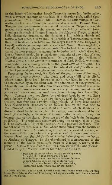
TONGUE—LOCH ERIBOLL CAVE OF SMOO. 443
in the desert) till it reaches Strath Tongue, a narrow but fertile valley,
with a rivulet running at the base of a singular rock, called Cnoc-
freiceadcrin, or " the Watch Hill.'' Here is the little village of Coul-
backie, with a Free Church, a manse, and a school. Passing Strath
Tongue, the road descends to the old mansion of Tongue Mouse, its
garden walls washed by the waves, and shaded by noble old trees.
About a mile south of Tongue 1 louse is the village of 'Tongue or Kirlci-
boll, pleasantly situated on the slope of a hill, with a church andmanse, a post-office, and an inn. The parish of Tongue contains morethan 100 fresh water lochlets, and the larger lakes of Loch Laoghal (or
Loyal), with its picturesque islets, and Loch Slam. Ben Laoghal (or
Loyal), 2505 feet high, on the west side of the loch of the same name, is
one of the most picturesque mountains in Sutherland. Cleft at top into
four splintered peaks, its pinnacle and summits at one point of viewshow the outline of a lion couchant. On the coast is the headland of
Whiten Head, a little east of the entrance of Loch Eriboll, with someremarkable eaves, among which is the great cave of FraisgilL OffWhiten Head is E'dean-na-roan, "the island of seals," with a bold
girdle of perpendicular conglomerated rock, deeply fissured.
Proceeding farther west, the Kyle of Tongue, an arm of the sea, is
crossed at Tongue Ferry. The bleak and boggy hill of the Moin,•where horses have been known to sink over head in the morass,
is now crossed by an excellent road, the admiration of every traveller.
About the middle of the hill is the Moin House, or house on the moss.The tourist now reaches some fine scenery, among mountains of
gneiss and mica-slate, the most conspicuous being Ben Hope (3061feet). Crossing the river Hope, by a chained boat, he arrives, three
miles farther, at Heilim inn, on the shore of Loch Eriboll* an arm of
the sea, reaching about twelve miles inland. A ferry boat crosses
Ljoch Eriboll from Ardneachdie or Heilim Lnn, on the east side, to
Port Chamuil, on the west side, about two miles, which shortens thedistance about twelve miles ; but the carriage road leads round by the
head of the loch, a distance of twenty miles, winding along the
indentations of the shore. Near the top of the loch is the farmhouseof Eriboll. The road runs northward along the western shore of the
loch to Rispond, a fish-curing station, with a pier and harbour. Thetourist next reaches D urine Lnn, about three miles from the mouth of
the Dionard river. At Balnaheel, a little to the west of the inn, onthe shore of the bay, where the peninsula of Durness terminates in
Farout Head, was the old Castle of Durine, belonging to the family
of Mackay of Tongue. In the churchyard, is a monument to thememory of the Gaelic poet, Rob Donn or Mackay, a native of theparish. A mile to the east of the inn is the wonderful Cave of Smoo,alluded to by Sir Walter Scott in the " Lord of the Isles :
"
—
" Su;h are the scenes where savage grandeur wakesAn awful thrill that softens into sighs
;
Such feelings rouse them by dim Rannoch's lakes,
In dark Glencoe such gloomy raptures rise :
Or farther, where, beneath the northern skies,
Chides wild Loch Eriboll his caverns hoar."
* From the east side of Loch Eriboll, a road runs to the south-east, throughStrath More, joining the road from Lairg to Tongue (p. 450), near the south-westend of Loch Navar.

1 1 1 NORTH HIGHLANDS AND LAKES—SUTHERLAND.
Into this cavern in the rocky shore of the Pentium! Frith, we enter
at one side, and, provided with torchlight, drag the boat over a rock,
and launch it again into the waters of an inner cavern. The interior
is incrusted with dazzling white stalactites. In the centre, nearthe entrance of the cave, a massive pillar sustains the superincumbentmass. Of two openings in the roof one affords a sort of twilight to
the inner lake; the other feeds it with fresh supplies of water in
a cataract, which foams sullenly down a height of 80 feet. The heightof the; outer entrance is b.\ feet, with a precipice '11 feet above; the
length of the outer cavern is 200 feet, its width 110, with an opening14 feet in height, and S feet in breadth, towards the interior cavern,
which again is in length 70 feet, and in breadth 30 where narrowest.
Its depth is evidently very great. A third cave, entered, not bydragging the boat over, but by passing under, through an aperture
in the rock only 2£ feet high, has dry shelves of rock within, andthroughout an extent of nearly 100 feet is beautifully covered withstalactites : near the farther extremity, a frightful gulf yawns into anunfathomable abyss.
Cape Wrath is thirteen miles from Durness. To reach it, the tourist
must cross the Kyle of Durness, a third arm of the sea by which the
coast is indented ; and after travelling ten miles by a good road througha flat moor, he will arrive at the Cape, which is a tine promontory of
granitic gneiss, towering up to the height of 300 feet. From the light-
house, on a clear day, the island of Lewis is visible in the far west.
GOLSPIE TO LAIRG AND LOCH INVER.
Miles.The Mound, 995 yards long.
Road proceeds up Strath Fleet.Morvich farmhouse, on right.Meikle Torboll, on left
Pittentrail village.
19 Lairg.
Cross Shin Bridge.Rosehall House (Matheson, Bart.).
Junction of the Oykel and theCassley.
Castle-na-Coir, ruins.
Tuiteam-tarbhach.34£ Bridge of Oykel.
Oykel cascade, in neighbourhood
Miles.Ben-More of Assynt, 3281 feet high,
on right.
View, to westward, ofCoulmore 1
:
shire); ofSuil-lilieinn.orthe Sugar -
Loaf, in centre ; and of Canisp, onright.
Lochs Craggy and Ealag.
44| Loch Borolan." Aultnacealgeach Burn.Ledmore farmhouse.Branch road S.W. to CnockanLedbeg house.
Cliff of Stronchrubie.
52£ Inch-na-damff Inn.
Collection of lints. Road proceeds along northern side
View of Canisp mountain, in dis-|
of Loch Assynt.tance. Eddrachalda House, ruins.
Lubcroy shooting-lodge. Ardvraick Castle, ruins.
Confluence of the Conchar and the Road along northern bank of InverOykel. River.
Road ascends. ' 65 Loch Inver.
The road, passing the Mound—an emhankment, 995 yards long,
across Loch Fleet, an arm of the sea (see p. 432)—proceeds westward,through Strath Fleet. Beyond the Mound, on the right, is Morvich,
a large and handsome farmhouse, and, on the opposite bank of the
Fleet river, Meikle Torboll, another farmhouse. Farther up, Pittentrail
village, with its woollen factory, is reached. The road leads throughthe parish of liogart, a hilly pastoral country, with some good scenery.
The farms are principally sheep-walks, with here and there some cul-

SUTHERLAND LAIRG BRIDGE OF OYKEL. 445
tivated patches. At the top of Strath Fleet, on a slope on the east
bank of the picturesque river Shin, and at the south-eastern extremity
of Loch Shin, is the village of Lairg, with its neat cottages, elegant
new Pariah Church and Manse, and a hotel, where boats can behired. On the opposite side of the river are the Free Church andManse. Loch Shin is eighteen miles long, with a mean breadth of
one mile. It is comparatively uninteresting. The salmo ferox is
common, and trout plentiful. The north side of the loch is traversed
by the great road across Sutherland. Beyond its western extremityare seen the huge mountain-masses which are grouped with Ben-More ol' Assynt:.
Turning south-westward to Strath Oykel, the road crosses the Shinat Inveran, passing, on the left, a beautiful strath forming part of the
ancient district of Ferrinbusklyne or Sleischillis, which the bishops of
Caithness, in the thirteenth century, obtained as a gift from the Earls
of Sutherland. Crossing the river Shin by a new bridge at Lairg, the
tourist, after traversing a moorland road, reaches Eosehall House (Sir
.lames Matheson, Bart, of Lewis), in the midst of luxuriant woods.A short distance to the south-west of the house, the Oykel and the
Cassley, a good trouting stream, join, and a good view is obtained of
the old walls of Castle-na-Coir, situated on a fine meadow, on the left
bank of the Oykel.
A mile above the Bridge of Cassley there is a fine salmon leap ; andthree miles from the bridge, opposite the township of Brae, a part
of the vale, through which an impetuous burn runs, is called Tuiteam-tarbhach—" the abundant slaughter." Near it there is a lonely andforsaken burying -ground, the resting-place of those who fell in a
fierce onslaught, made early in the fifteenth century, by the men of
Sutherland, upon the Macleods of Lewis. A mile and a half to the
west of Tuiteam-tarbharh, on the south side of the river, is the shoot-
ing-lodge of Langwell (Sir Charles Eoss of Balnagown, Bart.). Fourmiles farther on, the Bridge of Oykel is reached. Above the inn,
which is on the Eoss-shire side of the stream, the Oykel, running in
a rugged channel, makes a series of cataracts which terminate in onebold fall, where salmon, grilse, and sea-trout are caught in great
numbers, by the bag-net, and even by the hand. Tourists in this partof the country should use a veil as a precaution against the bites of
the midges or gnats with which the central and western coasts of
Sutherland are, in hot weather, infested.
Shortly after leaving Oykel Bridge, a small collection of huts is
reached, where, on a clear day, a distant glimpse is obtained of thelofty conical mountain of Caineasb, or Canisp, in Assynt. Two milesfarther is the shooting-lodge of Lubcroy (Sir Charles Eoss of Balna-gown, Bart.), on a green holm at the confluence of the Conchar withthe Oykel. The road now gradually ascends, for three miles ; thevalley on the right, being backed by the rugged and quartz-coveredtops of Ben-More of Assynt, and in the distance by the summit of
Ben Liod, in Duchally. At the highest point of the road, several
detached mountains of singular form burst upon the view to the west.
On the south is Coulmore in Coigeach, in Cromai'tyshire ; in thecentre, Suil-Bheinn, or the Sugar-Loaf; and in the north, Canisp; all
whitened with stones and portions of protruding rock, as if sprinkled

•1 16 NORTH HIGHLANDS AND LAKBB—SUTHERLAND.
w\t]\ snow or hoar-frost, and thus creating a chill feeling in the hottestday of summer.The road, running for several miles through an elevated moorland,
crosses a bridge, where there are two small lakes. Loch Craggy, on the,
left, once noted for its Leeches, dow famous as the best (routing lochin Sutherland; and Loch Ealag, a resort of the -wild swan. Tenmiles from the Bridge of Oykel, the tourist reaches AvUnaeealgeachHunt, at the upper end of Loch Boarlan or Borrolan. A little beyondthis, at Ledmore farmhouse, a road branches off to the south-westby Cnockan, to Ullapool, on Loch Broom, 1G miles distant.
Keeping the main road, the tourist arrives at the house of Ledbeg,which he passes on the left, and enters the narrow Glen of Assynt.Loch . Isaynt is for some time concealed from view ; and before arrivingat it, a singular cliff of blue limestone rock, rising to a perpendicularheight of 3U0 feet, bounds the glen and the road on the right. Inmany places, (he surface of the rock has been worn away so as to
present the appearance of the wundows, tracery, and fretwork of a1 Nanted cathedral, covered over with alpine plants and creeping shrubs.
On turning the end of the rock the tourist finds himself at the village
of I iii'lt-iKi-.hinijj'. at the head of Loch Assynt. Here there is an inn,
and from this point the ascent of Ben More (3281 feet) can be mosteasily made. It occupies about six hours. The mountain, the highestin Sutherland, is composed of white quartz, and its summit gives anextensive and interesting view. Loch Assynt is about eight milesin length, and one mile in breadth. It receives the waters of manymountain-streams, and flows into Loeh Inver, a small arm of the seaon the west coast of Sutherland, near the promontory of Ku Stoer.
Except at its head, and beyond the inn of Inch-na-damff, it has notmuch of picturesque or romantic scenery. On its north side is Cuinneagor Quinag mountain, so called from a cup-shaped hollow on its top
;
the glen to the east is terminated by Ben-More, Bennarran, and otherlofty masses, showing scenes of much grandeur and magnificence.
Near the inn is the Parish Church of Assynt. In the burying-ground are the remains of a church said to have been built by AngusMacleod of Assynt about 1440, in fulfilment of a vow made by him at
Rome. The ruins have been turned into a burial-vault.
The road runs along the northern margin of the loch, and abouta mile and a half onwards, passes the shell of an old house, called
Eddrachalda, once the property of the Mackenzies. A short waybeyond, on a rocky peninsula projecting into the lake, are the ruins of
Ardvraick Castle, built in the end of the sixteenth century, and longthe residence of the Macleods. Here the great Marquess of Mon-trose was confined for a few days, after his capture by Neil Macleodof Assynt, in 1650.
A short distance beyond Ardvraich Castle, a road runs north bythe east shoulder of Cuinneag or Quinag, to Unapool on the KyleSlcou (" the narrow strait") of Assynt, beyond which there is a ferry
to Kyle Strome in Eddrachillis (" the place between the two kyles"),
whence the road proceeds along the coast to Scourie.
The road to Loch Inver continues westward along the north side
of Loch Assynt and the northern bank of the river Inver. Thevillage of Loch Inver, pleasantly situated at the head of the

SUTHERLAND LOCH INVER UNArOOL. 447
loch of that name, has an inn. The Duke of Sutherland has alodge here. At the inn a boat may he hired for fishing or sailing
on the loch, from which the best view of the surrounding moun-tains is obtained, particularly of Suil-Bkeinn, which retains its sugar-
loaf form, both when near and when far off. " The narrow front,"
says l)r Macculloch, " that which possesses the conical outline,
has the appearance of a precipice, although not rigidly so, since it
consists of a series of rocky cliffs piled in terraced succession aboveeach other; the grassy surfaces of which being invisible from be-
neath, the whole seems one rude and broken cliff, rising suddenly andabruptly from the irregular table-land below to the height of 1000feet. Combining, in some positions, with the distant and elegant
forms of Canisp, Conl-Beg, and Ben-More, it also offers more variety
than could be expected ; while even the general landscape is varied
by the multiplicity of rocks and small lakes with which the wholecountry is interspersed." Suil-Bheinn has been ascended by several
ladies/although the late Dr Macculloch says that to almost all hutshepherds the hill is inaccessible. The view from the top is singu-
larly fine ; as many as 215 lakes have been counted in a clear day.
When at Loch Inver, the tourist should visit the fine Fall of Kirkaig,
five miles off, and about a mile and a half above the mouth of the
small river Kirkaig, which forms the boundary on the west coast
between Sutherland and Cromarty.
LOCH INVER TO SCOURIE AND DURNESS.
Miles.12 Cross road to Unapool.19A Unapool.
Road runs through rugged country.Bay of Badcaul.EddrachillisChurchandManse,onleft.
31£ Scourie Inn and village.
Handa Island, off Scourie.
37£ Laxford Bridge.Arkle & Foinne-Bhein Mountains, E.
42i Rhiconich Inn.Road branches off to Kinloch-Bervie,
three miles W.
Miles.Achrisgill river.
Gualin Hill.
House of Gualin.Strath Dionard.Ben Spenne, 2566 feet high, E.River Dionard crossed.
Kyle of Durness.River Grudie ci-ossed.
Brty of Durness.Mealraeanach, 1368 feet, on right.
Keoldale Farmhouse.54 Durness Inn.
The road runs along the north bank of the Inver and the northshore of Loch Assynt (page 446), as far nearly as the ruins of Ard-vraick Castle, when it strikes off to the north, by the east shoulder ofCuinneag or Quinag. Descending upon the head of Kyle Skou, it
reaches Unapool, within about a mile of which there is a small inn,
with a ferry across to Kyle Strome. The inlet of the sea called KyleSkou is about four and a half miles in length, and at its eastern orinner end branches into two lakes, each about two miles long. Theone is called Loch Glencoul and the other Loch Glendhu, and theyoccupy two of the wildest and most romantic glens in this part ofSutherland. The tourist desirous of exploring them should hire aboat at the ferry, and take a guide with him.The road, after leaving the ferry, runs through a broken and rugged
country, occasionally ascending and then descending, anon traversing

448 NORTH HIGHLANDS AM) LAKES—SUTHERLAND.
narrow defiles, running near tarns and lochs, and crossing quiet val-leys and glens. The trout fisher cannot conu: to a better countrytlian this. •• Lakes lie on every hand," says one of the most accom-plished of Scottish anglers, writing in Blackwood's Magazine for
January L859, " up on the hill and down in tin; glen, in bewilderingnumber and endless variety. Hen; yon have, within a few yards l'roin
one another, Lakes differing each from each in size, shape, and features,
with differences as great as between the different streams and turningsof a river, and also with a variety, and, we may say, mystery of pro-duce, which no river can equal."
Proceeding onwards, the tourist reaches the sheltered Bay of Bad-raid, passing the curing-houses built by the Duke of Sutherland, andthe Parish Church and Manse of Eddrachillis. This parish is part of
what is called Lord Reaifs Country, although the present lord hasnot a rood of ground in it, the whole having been, in 1829, purchasedby the Duke of Sutherland, then Marquess of Stafford. The High-landers call it Duthaich Mine Aoi, "the land of the Mackays." It
has an area of about 800 square miles, and extends from the sea onthe west to Torrisdale or Borgie river on the cast, comprehendingthe parishes of Durness, Tongue, and Eddrachillis. Opposite theP>ay of Badcaul there is an archipelago of small islands. Travel-ling other three miles the tourist reaches the little seaport of Scourie,*on a small bay of its own name, about half a mile in length. l\<ve
are a parish school and an inn. Except in front, the village is sur-
rounded by an amphitheatre of rugged ledges of rock, having on the
land side the singularly-shaped conical summit of Stack, 2364 feet abovesea-level. On a knoll overhanging the sea, without mark or memorial,is the burialplace of the ancestors of General Hugh Mackay of
* " Let it be known," says Mr Alexander Russel, " that within easy reach ofScourie Inn lies perhaps the finest sea-trout fishing to be had in any British loch.
After a tantalizing journey up two or three miles of a river, with the ancient andmost fish-like Norse name of Laxford, which is tabooed for a resident sportsman,the angler has I.och Stack, full of fish, and encircled by a magnificent amphi-theatre of hills. For some thirty miles farther, inward and upward, there is analmost unbroken chain of lochs free to all comers, renewed again when thewatershed tends southwards, and ending with Loch Shin. In Sutherland theangler can hardly go wrong. All along the northern seacoast, eastward as wellas westward from Scourie, you have more loch than land, and some knowledge,as well as plenty of fish, is to be got in some of these waters. Within a stone's-
throw from the door of the inn, and lying literally on the seabeach, there is
a loch which, under moderately favourable circumstances, is to be seen ' hotter-ing' with well-sized trout. 15ut here, too, is to be witnessed a fact which muchvexes and perplexes anglers in Sutherland more than in any other knowncountry—that the nearer the sea-level, the more wary, or fastidious or capri-
cious, do freshwater fish become. In this loch, whose Gaelic name, we dare-say, signifies Disappointment, you shall see hundreds of trouts dashing at everything on the face of the waters, with apparently ravenous appetites and recklessdemeanour; but the most tempting lure, plied with the lightest hand, seldom ob-
tains any other notice than a contemptuous and unseemly toss of the tail. Half amile up a gentle ascent, there is a larger loch, where things are comparativelybetter, though not positively good; up again, and behind some gentle heights,
there are at least half a dozen lochs where things arc excellent—that is, where thefish, though not superb either in size or quality, are open to reason and apprehen-sion. But it would be endless to mention the lochs even in clusters; betweenScourie and the next inn, Rhiconich, there is a week's fishing without leaving theroadside. There, too, is a loch called Garbet-beg, crowded with salmon and sea-
trout, for the catching of which nothing is required but the factor's permission and astrong wind."—An Angling Saunter in Sutherland, in Blackwood's Magazine, Jan. 1859.

SUTHERLAND SCOURIE DURNESS BONARBRIDGE. 449
Scourie, who was beaten by the Viscount of Dundee, at Killiccrankie,
in 1689. It has been supposed that Mackay himself lies buried here.
But this is a mistake. The Sherdar Mor, " the great general," as heis still called by the Sutherland Highlanders, fell at Steinkirk in
1692, and as he was laid in his grave upon the field of battle, KingWilliam III. spoke his epitaph: "There he lies, and an honesterman the world cannot produce."Lying oft' Scourie, and separated from the mainland by a narrow
sound, is the island of Honda, about a mile in length and breadth,
with a wall of rock rising 700 feet sheer above the Atlantic, andshowing some grand cliff-scenery.
Leaving Scoui'ie, the road traverses several rocky passes, and, six
miles on. reaches Laxford Bridge, across the river Laxford, which,rising in Loch /Stack, falls into the arm of the sea called Loch Lax-ford. A road proceeding south-eastward, before crossing the bridge,
leads to Lairg. Among the detached mountains to the east are ArJde,
and Foinne-Jbhein (Foinaven), 3015 feet high. Five miles from Lax-ford Bridge, the tourist arrives at Bhiconich inn, at the head of LochLnshard, from which place a road branches off north-westward, aboutthree miles, to Kinloch-Bervie, where there is an inn.
Proceeding north-eastward, the road follows the course of the
Achrisgill river, ascending the dreary hill of the Gualin. Here is ahouse of refreshment and shelter, near which there is a well, kept in
repair by the Duke of Sutherland, for the public benefit. Descend-ing on the west side of Strath Dionard, beyond which Ben Spionnadh(Ben Spenue) rears its huge bulk, 2566 feet above the sea, a farther
journey of about five miles brings the tourist to the head of the narrowKyle of Durness. Crossing the "boggy and midge-infested" river
Lionard, the road proceeds along the shores of the shallow Kyleof Durness. The low ground east of the Kyle is limestone, whichstops at Balnakiel, and Far-out Head is mica-slate. In the limestone,
fossils, considered Silurian, have been found. On the right is themountain Mealmeanach, 1368 feet above sea-level. Advancing througha fertile and cultivated district, resting on limestone, in which fossils,
considered as of Silurian age, have been found, and passing the farm-house of Keoldale, beautifully situated near the head of the Kyle ofLurness, the traveller arrives at the comfortable inn of Durine.
BONARBRIDGE TO LAIRG AND TONGUE.
From Bonarbridge to Lairg is 11 miles ; to Aultnaharra, 32; to Tongue, 49.
Passing along the north side of the Dornoch Frith, to the river
Shin, the road ascends to Shin Bridge, at the west end of whichis Inveran Inn. It then runs up Shin Glen. About five miles anda half from Bonarbridge, the tourist passes Achany (Sir JamesMatheson, Bart.). Beyond the Gruideag or Grudoch, a tributary of
the Shin, a dreary tract called The Gruids, is reached. After pass-
ing a neat Free Church and Manse a bridge is crossed, and thetourist reaches Lairg, at the south-eastern extremity of Loch Shin(p. 445). Thence the road, through an undulating, moorland dis-
trict, where there is not a tree or a human habitation to be seen,
proceeds up Strath Tirrie, passing Lord Beay^s Green Table, till it

450 NORTH HIGHLANDS AND LAKES—SUTHERLAND.
reaches its highest level :it The Orotic, where then; is an inn. In its
descent to the northward, it has on the east the vast mass of Ben Clib-
brich (3157 feet high), a ^ the foot of which is the solitary Loch Naver,1 1 miles long and nrom one to two broad. At the west end of the loch
U Avltnaharra Inn. On a little island, near the shore under BenClibbrich, is a circular tower, built of large stones without cement.The road then passes along the west hank of Loch Looghal or Loyal(see p. 4-43), and reaches the North Sea at Tongue.
HELMSDALE TO MELVICIJ.
From Helmsdale to Achantoul is 18 miles; to Mclvich, 38.
The road from Helmsdale runs along the north bank of the Helms-dale or Donan (an excellent fishing Stream), flowing through Strath
Ullie, until it reaches Kinbrace. Here it passes np Strath Beg, and,
18 miles from Helmsdale, reaches the inn of Achantoul. From Ach-antoul the road descends the fine valley of Strut// HaUadale, runningalong the banks of the Halladale for about 20 miles from its source to
its mouth at Melvich in Bighonse Bay (page 442).

NOBTH-EASTEBN COUNTIES.
EDINBURGH, BY LADYBANK, TO CUPAR-IN-FIFE,
AND DUNDEE,BY THE EDINBURGH, PERTH, AND DUNDEE RAILWAY.
Miles.Tunnel.Scotland Street Station.
Warriston Crescent and Cemetery.WanistOD House, on left.
2 Trinity. ChainTier, on right.3 Granton Pfer and Station.
Cross ferry.
8 Burntisland.Sea-view on right. Mid-Lothian S.
in the distance.
9$ King's Wood End rock, on left.
Pettycur, on right.
10$ Kinghorn.Abden House, on left.
Seafield Tower, ruins, E.Grange, 1 mile N.YV.Vows Rocks.Raith House (Colonel Fergusson).Church of Abbotshall.
14 Kirkcaldy.Comrie Hill, with Raith Tower, on
left.
Ravenscraig Castle, ruins, E.Balwearie, ruins, on left.
15 Sinclairtown.16 Dysart.
Dysart House (Earl of Rosslyn).18$ Thornton Junction.
Passengers for Dunfermline, Alloa,and Stirling, change carriages.
—
East of Fife line branches off hereto Leven, Largo, etc.
Balfour House, on right.
Balgonie Castle, on right.
Leven crossed.Markinch. Romanesque church
tower, on left.
Balbirnie House (Balfour, Esq.), halfa mile W. Barnsley, E.
Branch line (nearly finished) to Les-lie, 3 miles "W. from Markinch.
Kirkforthar, on right.
Falkland Road Station.
Falkland Palace, 3 miles, on left.
Kingskettle.Nuthill, on left.
Monument to O. Tyndal Bruce, Esq.,on Lomond Hill, on left.
Forthar Limeworks, on right.
Lathrisk (Johnston, Esq.), on left.
Manse of Kettle, and Orkie House(Mrs Thomson), on left.
Balmacolm village, on right.Line passes through centre of Ra-mornie wood (Heriot, Esq.).
21
24
Miles.27 LADYBANK JUNCTION.
Fife& Kinross line branches off here.
Line to Perth, to left.
Line to Cupar-Fife, St Andrews, andDundee, to right,
l'itlessie village, on right.
Crawford Priory (Earl of Glasgow),on right.
Melville House (Earl of Leven andMelville), on left.
Rankeillour, Rankeillour Hope,Ramornie House, CunnoquhieHouse, and Fernie Castle, passedsuccessively.
30 Springfield station.
Springfield village, on left.
Hospital Saw-mill and Russell Flax-mill, on right.
Edenwood. Scotstarvit.
Tarvit Hill, on right.The Mount, on left, in distance
;
Hopetoun Monument, on summit.Fcrrybank (Anderson, Esq.), on left.
Knox's Cottages, on right.
Tarvit House (Rigg, Esq.).
32 Cupak-in-Fife.County Jail, on rising ground to left.
Mansionhouses, etc.. on same side.
Ballass, Cairngreen Mill, New Mill,and Rumgally, on right.
Dairsie Church.Dairsie Manse and Village, on left.
Kemback (Makgill, Esq.), on right.Dura Den and Dura House (Dal-
gleish, Esq.), on right.
Blebo House (Bethuue, Esq.), S. ofKemback Hill.
35$ Dairsie station.
Dairsie Castle, on right.North Dron cutting.South Dron, Clayton (Pagan, Esq.),Seggie Distillery, on right.
Magus Muir, in the distance.39 Leuchars station (for St Andrews).
Romanesque Church. Old Castle ofEarl's Hall (Long, Esq.).
Pitlethie (Lawson, Esq.)Forgan Church, ruins, en left.
Line skirts Tents Moor.44 Tayport station (Ferry- Port -on
-
Craig).Cross ferry to Broughty.
45 Broughty Castle, on right.Fort Hill, on right.
49$ Dundee.

452 NORTH-EASTERN COUNTIES—PIPE.
Passengers desirous of avoiding the ferry can reach Perth hy the Scottish
Central Railway, via Stirling. The distance this way Is <3'J miles. From Glasgowto Perth, by Stirling, the distance is 82 miles.
The E linhurgh station of the " Edinburgh, Perth, and Dundee Railway" is in
Princes Street, opposite the foot of South St Andrew Street, near the Scott Monu-ment.
On leaving the station, the train enters a tunnel, three quarters
of a mile in length, under the ridge on which the new town of
Edinburgh is built. At the north end of the tunnel is the Scot-
land Street station, where the train halts to take in passengers.
Passing under a bridge at Canonmills, the train emerges on the
bank of the Water of Leith, at the back of Warriston Crescent,
and close by the mansion, parks, and cemetery of Warriston.
Warriston House, on the left, surrounded by trees, was the pro-
perty of Sir Archibald Johnston of Warriston, a lawyer and
statesman, who took a conspicuous part on the popular side in
the troubles of Scotland in the reign of Charles I., and died on
the scaffold after the Restoration. Warriston Cemetery is inter-
sected by the Leith branch of the railway. Its little Pointed
chapel is conspicuous from the line.
The railway, after running through deep cuttings, reaches the
high bank overhanging Trinity, where the Frith of Forth comes
in view. The Trinity Chain-Pier projects from the nearest point
of the shore. Eastwards are the stone pier of Newhaven, and the
far-projecting wooden piers of Leith, with a Martello Tower at
their seaward extremity. Inchkeith (described page 76) is in the
centre of the Frith, while far to the eastward North Berwick
Law appears, and the Bass Rock. On the opposite or north
bank of the estuary are the shores and hills of Fife. Westward
is Granton, with its busy harbour and huge piers and break-
waters. Still farther to the west, Cramond Island, Inchmickery,
and Inchcolm (page To) stretch across the Forth, and with the
woods of Aherdour and Donibristle, and the headland of North
Queensferry on the one hand, and the wooded height and point of
Barnbougle on the other, terminate the view in that direction.
At Granton (described page 59) passengers leave the train,
- and walk along the pier to the railway steamer. The Forth is
here five miles wide, and the passage in fine weather occupies
about twenty-five minutes. There is a noble view of Edinburgh,
with the Pentlands in the background, from the middle of the
ferry.
At Burntisland (see p. 74) the passenger leaves the steamer,
and walks along the pier to the railway station. Leaving this,
he has, on the right, a bay of bright yellow sand stretching east-
ward to the rocky headland of Pettycur. The Mid -Lothian


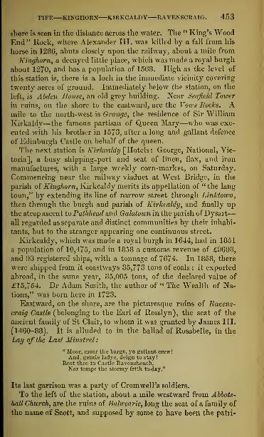
FIFE KINGHORN KIRKCALDY RAVENSCRAIG. 453
shore is seen in the distance across the water. The " King's WoodEnd" Rock, where Alexander III. was killed hy a fall from his
horse in 1286, abuts closely upon the railway, about a mile from
Kinghorn, a decayed little place, which was made a royal burgh
about 1270, and has a population of 15G8. High as the level of
this station is, there is a loch in the immediate vicinity covering
twenty acres of ground. Immediately below the station, on the
left, is Abden House, an old grey building. Near Seafield Tower
in ruins, on the shore to the eastward, are the Vows Rocks. Amile to the north-west is Grange, the residence of Sir William
Kirkaldy—the famous partisan of Queen Mary—who was exe-
cuted with his brother in 1573, after a long and gallant defence
of Edinburgh Castle on behalf of the queen.
The next station is Kirkcaldy [Hotels: George, National, Vic-
toria], a busy shipping-port and seat of linen, flax, and iron
manufactures, with a large weekly corn-market, on Saturday.
Commencing near the railway viaduct at West Bridge, in the
parish of Kinghorn, Kirkcaldy merits its appellation of " the lang
toun,'' by extending its line of narrow street through Linktown,
then through the burgh and parish of Kirkcaldy, and finally upthe steep ascent to Pathhead and Galatown in the parish of Dysart
—
all regarded as separate and distinct communities by their inhabi-
tants, but to the stranger appearing one continuous street.
Kirkcaldy, which was made a royal burgh in 1644, had in 1851
a population of 10,475, and in 1858 a customs revenue of £9693,
and 93 registered ships, with a tonnage of 7674. In 1858, there
were shipped from it coastways 35,773 tons of coals : it exported
abroad, in the same year, 35,005 tons, of the declared value of
£15,754. Dr Adam'Smith, the author of " The Wealth of Na-tions," was born here in 1723.
Eastward, on the shore, are the picturesque ruins of Ravens-
craig Castle (belonging to the Earl of Rosslyn), the seat of the
ancient family of St Clair, to whom it was granted by James III.
(1460-88). It is alluded to in the ballad of Rosabelle, in the
Lay of the Last Minstrel
:
" Moor, moor the barge, ye gallant crew !
And, gentle ladye, deign to stay!Rest thee in Castle Ravensheuch,Nor tempt the stormy frith to-day."
Its last garrison was a party of Cromwell's soldiers.
To the left of the station, about a mile westward from Abbots-
hall Church, are the ruins of Balwearie, long the seat of a family of
the name of Scott, and supposed by some to have been the patri-

j.-,! NORTH-EASTER^ COUNTIES—FIFE.
mony of Michael Scott, the Great Wizard of the Middle Ages,
mentioned by Dante :
—
" That other, round the loins
Bo Blender In hie shape, was Michael Scott,
Practised in every Blight of magic wile."
In the Lay of the Last Minstrel he is described as—"A wizard of such dreaded fame,
That when in Salamanca'- cave
llini listed his magic wand to wave.
The bells would ring in Notre Dame."
The tower, which is square, with walls seven feet in thickness
seems to he of the fifteenth century.
The heights above Kirkcaldy are covered with the fine woods of Raith
(Col. Ferlusson, M.P.) and Dunnikier (Oswald, Esq.), so that, when
viewed from the water, the "long town" seems embosomed in trees'Comrie
Hill, the most conspicuous elevation, a little to the west of Abb°tshall
Church, is crowned by Raith Tower, the top of which, 400 feet above the
level of the sea, commands a view ranging over fourteen counties, lunth
House, on a lower elevation of the same .hill, overlooks.a \xrg* range of
pleasure-grounds, and one of the finest views of the noble frith and ts
shores, the little stream of the Camilla, flowing through the grounds,
spreads out into a sheet of water covering twenty-one acres, down to he
margin of which the shrubberies slope from the house. Throughout the
summer months, visiters, by the liberality of the proprietor, have free
access to the grounds and lake.
The next station is Sinclairtown—a village mostly inhabited by
weavers, which mav he regarded as a continuation of Pathhead or
Dunnikier village,* united on the north to Easter and Wester
Galatown. .
A mile onward the train arrives at Dysart, a good specimen ot
the quaint old towns of the Forth, whose trade decayed at the
Union, and has never revived. It was made a royal burgh in
the reign of King James V. (1513-42), and has a population
of 8041. The tower and part of the nave of the Parish Church are
Second-Pointed. Beside it is Dysart House, the seat of the Earl
of Rosslyn. The red rocks of Dysart, where witches were burned
in the seventeenth century, are on the picturesque shore, a mile
to the eastward. Here the railway turns inland towards the north,
and the distant summits of the Lomonds come into view on the left.
The country is comparatively tame until the train arrives at
THORNTON JUNCTION.
The Dunfermline, Alloa, and Stirling line diverges here to the westward, and
passengers by that branch here change carriages.Pamoron Bridce
The East of Fife line also branches off here on the right, to Cameron linage,
Leven, Lundin Links, Largo, and Kilconquhar.
The line now passes, on the right, Balfour House, surrounded
with fine old trees, long the seat of the family of Bethune, with

FIFE MARKINCH LESLIE FALKLAND. 455
some interesting pictures. On the same side, about half a mile
west, is Balgonie Castle, a large old pile, on a height almost en-
circled by the Leven, the approach in front being studded with
stately walnut trees. The castle, which is in ruins, occupies an
area of 135 by 105 feet ; the court-yard measuring 108 by 65 feet
;
and the tower on the north side being 80 feet high. Since 1641,
Balgonie has given the title of Baron in the peerage of Scotland
to the Leslies, Earls of Leven. The train, crossing the river Leven
by a bridge 70 feet high, now halis near the neat village of
Markinch [Inns : Galloway's, and Bethune Arms], with a
modern Parish Church, surmounted by a tall square tower, the
first four storeys of which are Romanesque work of the middle
of the twelfth century. The uppermost storey has a dome-
vaulted roof, over which there was a low pyramidal stone cap-
ping, surmounted by a rod and weather-cock. This was removed
in 1807, " to make way," says Mr Muir, in his Ecclesioiogical
Notes, " for a lump of deformed masonry, which could have been
much better employed in feeding the starved affair now occupying
the site of the ancient church." Half a mile to the westward,
but so secluded as not to be seen from the railway, is Balbirnie
House (Balfour, Esq.), a handsome modern mansion, with a large
park and fine garden.
From Markinch Station, a branch line of about four miles is nearlycompleted to the thriving manufacturing village of Leslie [Inns: TheGreen ; Piercy's], a burgh of barony, holding of the Earl of Rothes,irregularly built, with a profusion of gables towards the street. Hereare a paper mill, two flax mills, a woollen mill, three bleachfields, a flax-
spinning mill, a linen weaving factory, a corn mill, a saw mill, awoollen cloth factory, a gas work, a water work, and a branch bank. The" Green," a fine triangular common at the east end, where of old variousgrotesque pastimes were played, has been supposed to be the scene of thepoem of "Christ's Kirk on the Green" ascribed to King James I. (1406-1437). Leslie House, the seat of the Countess of Rothes, stands at the eastend of the village, in a park containing some of the oldest trees in Fife.
The mansion, built about 1670 by the first and only Duke of Rothes,was burnt in 1763, and repaired in 1767. Near it are the ruins of the oldcastle of Strathendry, and the modern mansion of the same name (Hon.Mrs Douglas). The mother of Adam Smith was a sister of Mr Douglasof Strathendry ; and the author of the " Wealth of Nations," while aninfant, was stolen by gipsies from the door of his uncle's house, and car-ried by them into Leslie woods.
. The line, passing Kirhforthar on the right, reaches the station
of Falkland Road, which leads westward to Freuchie, a manufac-turing village west of Kettle, and to Falkland, a decayed royal
burgh (so created in 1458), with a population of about 2000, at the
northern base of the easter Lomond Hill. An omnibus runs betweenthe station and Falkland [Inns : Bruce Arms ; Commercial].

456 NORTH-EASTERN COUNTIES—FIFE.
Falkland Palace, which stands close to the little town of Falkland,was ot'old a manor-place of the Kails of Fife. From them it passed to theCrown in 14:2.5. Here David, Duke of Rothesay, the eldest son of KingRobert III., was imprisoned and died in 1402. The place was a favourite
abode of King James IV., and after his death in 1513, his impetuouswidow, Margaret Tudor, was here for a short while kept in restraint.
King James V. died here in 1542. and it was the frequent residence ofhis widow, Mary of Guise, of his daughter Queen Mary, and of his
grandson King James VI. Its last royal occupant was Charles II., whoresided here for ten days in 1650. In his time the edifice was injured by anaccidental fire ; and the Park was ruined by Cromwell, who levelled tho
oaks to erect a citadel at Perth. In 1715, after the battle of Sheriffmuir,
the Palace was garrisoned by Rob Roy and a party of tho Macgregors,who laid the surrounding district under contribution, and departed withtheir plunder.What now remains of the Palace is a large tower (under which is a
vaulted doorway leading into the court-yard), built about 1500, with twosides of a quadrangle, built between 1.530 and 1550. These are fine andinteresting examples of Scotch renaissance. The tower is in the samestyle as the north-western tower of Holyrood. To the east of it is a verypleasing fa ade, half-secular, half-ecclesiastical, with square-headed win-dows, arched and crocketted buttresses, and a rich cornice, recalling
some features of the palace at Stirling. Sir David Lindsay of the Mount,Lord Lyon King at Arms in the reign of James V., who passed much ofhis time at the Palace, thus bids it farewell :
—
" Farewell, Falkland, tlie fortress of Fife,
Thy polite park, under the Lowmond Law;Some time in thee 1 led a lusty life,
The fallow deer, to see theme raik on raw.Court men to come to thee, they stand great awe,
Saying, thy burgh bein of all burghs baleBecause, in thee, they never gat good ale."
The next station is Kingskettle, close to the village of the same
name, the population of which is chiefly employed in the linen
manufacture. On the left of the line, as the train proceeds, is the
handsome modern mansion of Nuthill (Mrs Tyndal Bruce), built
at a cost of more than £30,000. A monument to Mr O. Tyndal
Bruce, erected by his tenants and friends, is conspicuous on
Lomond Hill above the house. On the right are the Forthar
limeworks, and the hamlet of Balmacolm ; and on the left Lath-
risk (W. Johnston, Esq.), Kettle Manse, and Orkie House (Mrs
Thomson). The railway here passes through the centre of Ra-
mornie Wood (F. L. M. Heriot, Esq.).
LADYBANK JUNCTION.
The Fife and Kinross line branches off here, by Auchtermuehty (32 miles fromEdinburgh), Strathmiglo (34), Gateside, Mawcarse, and Milnathort.
The line for Perth branches off to the left ; the line for Cupar-Fife, St An-drews, and Dundee, to the right.
This place, formerly called Ladybog, is a weaving village, with a
meal-mill and a freestone quarry. On the right of the line,

FIFE—PITLESSIE CULTS CUPAR. 457
proceeding northwards, is the straggling village of Pitlessie [Inn
:
Gold's], in the neighbourhood of which is the manse of Cults,
where the celebrated painter, Sir David Wilkie, was born in 1785.
In Cults church are Chantrcy's medallion of Wilkie's father and
mother, and Joseph's medallion of Wilkie himself. " Pitlessie
Fair," one of his finest paintings, is in the possession of C. Kinnear,
Esq. of Kinloch. Farther, on the right, is the modern Pointed
pile of Crairfurd Priori/, built by Lady Mary Lindsay Crawfurd,
now belonging to the Earl of Glasgow. On the left, near Lady-
bank station, in the distance, is Melville House, built in the end of
the seventeenth century, the chief seat of the Earl of Leven and
Melville. Bankeillour, Rankeillour Hope, Ramornie House, Cun-noquhie House, and Fernie Castle, are then passed successively.
Springfield Station has the flourishing dowlas-weaving village
of Springfield on the left, and Hospital saw-mill and Russell flax-
mill on the right, with Edenwood, the seat of the late Sir George
Campbell, brother of Lord Chancellor Campbell. Beyond Eden-
wood is the square tower of Scotstarvit, anciently the seat of the
Inglis family, and afterwards of the learned and accomplished
Sir John Scott of Scotstarvit [d. 1652), the editor of the Delitiat
Poetarum Scotorum, and author of " The Staggering State of
Scots Statesmen." Next on the right comes Tarvit Hill, beyondwhich, unseen to the south, lies Wemysshall (Wemyss, Esq.). In
the distance, on the left, the remarkable height of " The Mount,"the patrimony of one of the greatest of the older poets of Scotland
—
" Sir David Lindsay of the Mount,Lord Lyon King-at-Arms"
—
shows its summit crowned with a monument to John fourth Earl
of Hopetoun (6. 1765, d. 1823)—the gallant Sir John Hope of
the Peninsular war—erected by his Fifeshire tenantry. On the
left of the line are Ferrybank (Anderson, Esq.), Blalowan (Govan,
Esq.), Bellfield (Lyon, Esq.), the Manse of Cupar, and some corn
and flax mills. On the right are Tarvit House (Rigg, Esq.),
land, nearer the line, Knox's Cottages, erected for the benefit of
decayed gentlewomen.
CUPAR.
[Hotels : Royal ; Tontine.]
Standing on the north bank of the Eden, at its junction withthe little water of Mary, the neat county-town of Cupar-in-Fife
las a pleasing aspect from almost every quarter. It is a seat of
the linen trade, and a place of some antiquity, dating as a royal
u
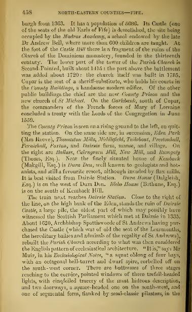
458 NOUTII-EASTERN COUNTIES El IT..
burgh from 13G3. It lias a population of 508G. Its Castle (one
of the seats of the old Earls of Fife) is demolished, the site being
occupied by the Madras Academy, a school endowed by the late
Dr Andrew Bell, where more than GOO children are taught. Atthe foot of the Castle Hill there is a fragment of the ruins of the
Church of the Dominican monastery, founded in the thirteenth
century. The lower part of the tower of the Parish Church is
Second-Pointed, built about 1415 : the part above the battlement
was added ahout 1720 : the church itself was built in 1785.
Cupar is the seat of a sheriff-substitute, who holds his courts in
the County Buildings, a handsome modern edifice. Of the other
public buildings the chief are the new County Prison and the
new church of St Michael. On the Garlebank, south of Cupar,
the commanders of the French forces of Mary of Lorraine
concluded a treaty with the Lords of the Congregation in June1559.
The County Prison is seen on a rising ground to the left, on quit-
ting the station. On the same side are, in succession, Eden Park(Mrs Reeve), Thomaston Mills, Middlefidd, Tai/about, l'rcstoiiha/1,
Ferniehall, Foxton, and Dairsie farm, manse, and Tillage. Onthe right are Ikillass; Cairnyreen Mill, New Mill, and Rumgaly(Thorns, Esq.). Near the finely situated house of Kemback(Makgill, Esq.) is Dura Den, well known to geologists and bot-
anists, and still a favourite resort, although invaded by flax mills.
It is best visited from Dairsie Station. Dura House (Dalgleish,
Esq.) is on the west of Dura Den. Blebo House (Bethune, Esq.)
is on the south of Kemback Hill.
The train next reaches Dairsie Station. Close to the right of
the line, on the high bank of the Eden, stands the ruin of Dairsie
Castle, a large pile, the oldest part of which may possibly have
witnessed the Scottish Parliament which met at Dairsie in 1335.
About 1G20, Archbishop Spottiswoode of St Andrews having pur-
chased the Castle (which was of old the scat of the Learmonths,
the hereditary bailies and admirals of the regality of St Andrews),
rebuilt the Parish Church according to what was then considered
the English pattern of ecclesiastical architecture. "It is," says MrMuir, in his Ecclesiological Notes, " a squat oblong of four bays,
with an octagonal bell-turret and dwarf spire, corbelled off on
the south-west corner. There are buttresses of three stages
reaching to the cornice, pointed windows of three trefoil-headed
lights, with cinqfoiled tracery of the most hideous description,
and two doorways, a square-headed one on the south-west, and
one of segmental form, flanked by semi-classic pilasters, in the
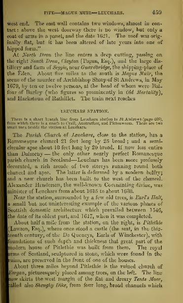
FIFE MAGUS MUIR—LEUCIIARS. 459
west end. The east wall contains two windows, almost in con-
tact : above the west doorway there is no window, but only a
coat of arms in a panel, and the date 1621. The roof was orig-
inally flat, but it has been altered of late years into one of
hipped form."
At North Dron the line enters a deep cutting, passing on
the right South Dron, Clayton (Pagan, Esq.), and the large dis-
tillery and farm of Seggie, near Guardbridge, the shipping-place of
the Eden. About five miles to the south is Magus Muir, the
scene of the murder of Archbishop Sharp of St Andrews, in May1679, by ten or twelve persons, at the head of whom were Bal-
four of Burley (who figures so prominently in Old Mortality),
and Hackstoun of Rathillet. The train next reaches
LEUCHARS STATION.
There is a short branch line from Lenchars station to St Andrews (page 468),from which there is a coach to Crail, Anstruther, and Pittenweem. There are twosmall inns beside the station at Leuchars.
The Parish Church of Leuchars, close to the station, has a
Romanesque chancel 21 feet long by 25 broad ; and a semi-
circular apse about 18 feet long by 20 broad. If now less entire
than Dalmeny— the only other nearly perfect Romanesqueparish church in Scotland—Leuchars has been more profusely
decorated, a rich arcade of two storeys running round both
chancel and apse. The latter is deformed by a modern belfry;
and a new church has been built to the west of the chancel.
Alexander Henderson, the well-known Covenanting divine, was
minister of Leuchars from about 1615 to about 1638.
Near the station, surrounded by a few old trees, is EarTs Hall,
a small but not uninteresting example of the various phases of
Scottish domestic architecture which prevailed between 1546,
the date of its oldest part, and 1617, when it was completed.
About half a mile from the station, on the right, is Pitlethie
(Lawson, Esq.), where once stood a castle (the seat, in the thir-
eenth century, of the De Quencys, Earls of Winchester), writh
oundations of such depth and thickness that great part of the
odern house of Pitlethie was built from them. The royal
rms of Scotland, sculptured in stone, which were found in the
uins, are preserved in the front of one of the houses.
About three miles beyond Pitlethie is the ruined church of
Morgan, picturesquely placed among trees, on the left. The line
iow skirts the west margin of the flat and dreary Tents Moor,
ailed also Sheughy Dike, from four long, broad channels which

460 NORTH-EASTERN COUNTIES RROUGIITY FERRY.
intersect the moor, almost in parallel directions from the Eden
towards the Tay.
At Tayport Station (Inn : Pryde's) passengers leave the tram
and walk along the pier to the steamer which is in waiting to
convey them across the ferry, a mile long, to Brouyhty.
The Frith of Tay, which is here narrowed to a mile's breadth expands above this
gorge into a broad expanse, having nearly all the characteristic an inland lake
Scept that the tide runs high in its bosom. Immediately within the point ot
Bronghty there is a secure roadstead in almost all weathers.
The coast of Forfarshire, seen from Fevrn-Tovt-on-Craig or as "is now called,
TayporTLVl fine appearance, houses thickly studding the banks till *?*""»concentrated in the dusky masses, steeples masts, and chimnej -st; Iks tajDundee," behind which rise the conical peaks of Dundee Law aadBalgay hill. On
the Fif -shire Bide, beyond Scotscraig House Dougal, Esq.), and the I ppe Lights
of Tay are a ridge of heights running up beyond Newport, between which and
DAftS c^^nrthKaTpon ferry, a few minutes suffice to land the passengers at
the jetty and restore them to seats in the railway carriages waiting for them,
when they are slowly wheeled round a sharp curve to
BROUGHTY FERRY STATION.
Passengers going north may here take the train to Arbroath without entering
Dundee, which is four miles west from Broughty.
Brouyhty Ferry has, during the last fifty years, risen from a
small, rude hamlet to a handsome and populous watering-place.
Many of the villas, ranged along the fine beach, disposed in wide
streets, or crowning the Fort Hilt that rises immediately behind,
are large and elegant.
On a rock jutting into the Frith, and evidently at one time
surrounded by water, on the right of the railway harbour, is
Brouyhty Castle, a tall quadrangular tower of the early part
of the sixteenth century, commanding the entrance of the
Tay. It was taken by the English under Somerset, in 1547,
but recaptured by the French auxiliaries of Scotland in 1550.
It appears to have been afterwards dismantled, but was so far
repaired within thirty or forty years as to be inhabited by the
Master of Gray. It fell into ruin in the next century. It is
now being restored and re-fortified, so as to protect the mouth
of the Tay ; new batteries being built, and the tower fitted up
as a barrack.
In advancing up the northern margin of the Frith, the line passes
the Hare Craiys, Stanneryate, and numerous suburban villas, and
sweeps along the harbour of Dundee to the east railway station in
Dock Street, close by the large pile of the Custom House and
Excise Office, built in 1843 from a design in the Italian style by
Messrs Leslie and Taylor.

DUNDEE THE LAW. 461
DUNDEE.
[Hotels: Royal; British; Albion; Dundee Arms; Lamb's Temperance."]
Dundee is 49J miles from Edinburgh, by the Edinburgh, Perth, and DundeeRailway; 22 from Perth by railway, and 26 by the river Tay.
In summer, steamers ply daily between Dundee and Perth. The passage is made in
about two hours and a half. The river scenery is very beautiful. Ten miles aboveDundee the steamer calls at Newburgh, on the. south or Fife side of the estuary, em-bosomed among orchards. The steamertben passes the confluence of the Earn withthe Tay, the ruins of Elcho Castle, Mugdrum Island, the mansion of Seggieden, Kin-fauns Castle, and the Friartoun or Moncrieff Island ; and, sailing between the hills
of Monerieffaad Kinnoull, arrives at the shore or harbour of Perth at the South Inch.At the terry across the Tay from Dundee to Newport a steamer sails every hour,
making the passage in about 20 minutes.
The busy manufacturing town of Dundee stands on the north
bank of the Frith of Tay, about ten miles above its mouth.Behind it rises Dundee Law, 525 feet above the level of the
Tay. Its round green summit, on which are the remains of a
primitive fort witli earthen ramparts, commands a varied andinteresting view, which towards sunset is especially fine.
Southward are the town of Dundee, the Frith of Tay, the green
hills of Fife, and the distant bay and towers of St Andrews.Eastward is the sea, with Broughty Castle and the Lights of
Tay in the foreground, and in the extreme distance the Bell
Rock lighthouse, only visible in a clear day, on the verge of the
horizon. Westward, are the manufacturing village of Lochee,
Logic, Balgay, the upper part of the estuary of the Tay, and the
rich and beautifully wooded tract on its north bank called the
Carse of Gourie. Northward, the scene is varied, the prospect
being bounded by the Sidlaw Hills, and the distant summits of
the Grampians.
Dundee appears as a place of importance in the twelfth cen-
tury, when it was part of the vast possessions of David, Earl of
Huntingdon (in England), and of the Garioch (in Scotland),
brother of King William the Lion. But it does not appear to
have been made a royal burgh until the reign of King Robert
Bruce (1306-29). In 1851 it had a population of 78,931
;
and in 1858 a customs revenue of £53,158, with 275 registered
vessels having a tonnage of 51,200. As regards population it thus
takes place next to Glasgow and Edinburgh ; while as a custom-
house port it ranks after Glasgow, Greenock, Leith, Aberdeen,
and Port-Glasgow.
The town is built parallel with the river ; most of the old
streets and lanes being narrow and irregular. Four principal
streets, the Nethergate, the Seagate, the Overgate, and the Mur-

4G2 NORTH-EABTERN COUNTIES—DUNDEE.
raygate, meet in the High Street or the Cross, a large oblong
area, 360 feet long and nearly loo broad. On its south side, pro-
jecting from the line of the other buildings, stands the TownHouse, erected in 1734, from a design in the Italian style by the
elder Adam, with open piazzas, and a spire 140 feet in height.
At the east end of the High Street is the Trades Hall, a cupola-
crowned building, with Ionic pillars in front : it contains the
office of the Eastern Bank of Scotland, and has the Murraygateon its northern side, and the Seagate on its southern. In the for-
mer are the hranch-ofhecs of the Roi/al Bank and the British Linen
Company. The building at the west end of the High Street, front-
ing the Trades Hall at the east end, was built for an Episcopal
Church, hut is now used chiefly as a lecture-hall : it has the
Nethergute on its south, and Church Lane on its north side.
At the head of the Seagate, a long, narrow, winding street, onthe site of the old Castle of Dundee, on the Castlehill, is St Paul'sEpiscopal Church, built in 1855, at a cost of £13,000, from a
design in the Second-Pointed style by Mr G. G. Scott of Lon-don. It is a cross church, with nave (84 feet long, by 24 feet
broad) and aisles, south and north transepts, chancel and apse,
and tower and spire (217 feet high). There is some good stained
glass in the windows.
In the Blue Bell Lnn, at the head of the Seagate, the Old Pre-
tender passed a night in 1716, and Admiral Duncan, the victor
of Camperdown, was born in 1731.
At the eastern termination of the Murraygate is the Cowgate,
running eastward, a great business mart. On the left, at the junc-
tion of King Street, stanch St Andrew's Church, built in the Italian
style in 1772, with a spire. 130 feet high. The original Glassite
Meetinghouse is close beside. Along the street is the old Cow-
gate Port, one of the town's gates, where the martyr, George
Wishart, is said to have preached during the prevalence of the
plague in 1544 : the archway or gate separating the infected
on the outside from the uninfected within.
Ascending by King Street to Princes Street will be seen the
front of the large Linen Factories of Messrs Baxter Brothers and
Co., covering nine acres, employing about 3000 persons and ten
steam-engines, and producing weekly (besides yarn) about 250,000
yards (weighing from sixty to seventy tons) of linen cloth, of
almost every sort from cambric to canvass. Advancing north-
eastwards, the Royal Lunatic Asylum is seen on the right, and
the Poorhouse on the left : the former, built in 1820, at a cost of
£33,757, has accommodation for 208 patients ; the latter, opened

DUNDEE THE OLD STEEPLE. 463
in 13.57, has room for 234 paupers. The neighbouring height
B a good view of Dundee and the river.*
On the north side of the Nethergate, a well built street,
running for nearly half a mile westward from the High Street,
stood the Old Church of St Mary's, a large cross church, built
at various periods. The nave was taken down in 1789, to makeway for what is called The Steeple Church; and the choir andtransepts were destroyed by fire in 1841. Their site is occupiedby two churches, built in the Second-Pointed style, from designs
by Mr Burn—the East Church (which has stained glass), openedin 1844, and the South Church, in 1847. The fine Steeple ortower, 15G feet high, and 40 feet square, is now all that remains ofthe old fabric. It is in the Second-Pointed style of the fifteenth
century, and has two parapeted stages, each of two storeys, ter-
minating in a low cap-house with a gabled roof and a fireplace.
There is a good view from the top. In the lower apartment ofthe Steeple are some stone coffins and old tombstones (dug fromthe neighbouring burying-ground), and the pillar of the TownCross, bearing the date of 1586.
In the Nethergate is Free St Paul's Church, with a spire
167 feet high, built in 1852, from a design in the First-Pointedstyle by Mr Charles Wilson of Glasgow.On the north side of the Perth road, about a mile and a half
from the High Street, is the Western Cemetery, with a handsomegateway. It was opened in 1845, is six acres in extent, and con-tains the grave of William Thorn, the weaver-poet of Inverury,author of "The Mitherless Bairn," who died in Dundee in 1848.
Stretching northward from the Town House is Reform Street,
the finest thoroughfare in the town. It is terminated, on thenorth, by the High School, built in 1833 at a cost of £10,000,from a design in the Grecian style by Mr Angus of Edinburgh.
In Bank Street is the New Corn Exchange or Public Hall,built in 1857, from a design by Mr Charles Edward of Dundee,in the Italian style. The hall is 130 feet long, 60 feet wide,40 feet high, and has seats for about 3000 persons.
In West Panmure Street is the New Royal Exchange (con-taining a handsome reading-room), built in 1853-56 at a cost ofmore than £12,000, from designs by Mr Bryce of Edinburgh, in
* From this part of the town the tourist may extend his walk to the old church-yard and Castle of Mains on the Dighty water. The Tower of the Mains, as it iscalled, a square, tower of the fifteenth or sixteenth century, is situated on the southside of the old churchyard of Strathdighty, but separated from it by a narrowdell. Close beside it is the picturesque Den of the Mains, containing several rareplants; and a little to the west, on the Dighty, is Claverhouse Bleachfield, thelargest in the neighbourhood of Dundee.

464 NORTH-EASTERN COUNTIES—DUNDEE.
the Pointed style of the fifteenth century, as it was developed
in Flanders. The failure of the foundations has prevented the
completion of the tower, which was to have been crowned by a
richly decorated spire.
The old building at the north-west corner of the High Street is
the Luckenhooths. Here, it is said, General Monk resided in 1651,
after storming the town ; and Anne Scott, Duchess of Buccleuch
and Monmouth, was born in 1650. On the north side of the
Luckenbooths, the Overgate stretches away to the westward, and,
from about its centre, Lindsay Street leads northwards to the NewJail and Bridewell,t\\e Police-office, and the Newtyle Railway Station.
Barrack Street, opening to the north, is sometimes called
Burial Wynd, from its proximity to the IIowff, the ancient bury-
ing-ground, which contains some curious old gravestones and
epitaphs. It was the garden and cemetery of the monastery of
the Greyfi iars.
At the head of the Methodist Close, in the Overgate, are the
interesting remains of a Nunnery, founded in the fifteenth cen-
tury for nuns of the order of St Clare. The building has been
turned into dwelling-houses, but is still so entire that the chapel,
cloisters, and kitchen can be identified. A view of its tall gables
may be had from the IIowff or Old Burying-ground.
The New Burial-ground, opened in 1836, stands beside the
Bleaching Grounds on Constitution Road, a steep street ascending
towards the Law, where also is the Sheriff Court House, formerly
the Watt Institution.
The Barracks occupy a commanding situation on the rising
ground to the north of the town, and have accommodation for
300 men. They include the remains of Dudhope Castle, formerly
the residence of the Scrymgeours, Constables of Dundee. Tothe east is the Royal Infirmary, built in 1852-55, at a cost of
£14,348, from a design in the Tudor style by Messrs Coe and
Goodwin of London. The pile is 350 feet long, with two wings
to the back, each 160 feet long, and can accommodate 300 patients.
In Ward Street, close by St David's Free Church, are the NewIndustrial Schools, built in 1856, from a design in the First-
Pointed style by Mr Charles Edward of Dundee.
Castle Street, which runs down to the Harbour from the south-
east angle of the High Street, contains the Theatre and an Inde-
pendent Chapel, the lower part of the latter edifice containing the
office of the Dundee Bank. The Exchange Coffee-Room, at the
foot of Castle Street, was built from a design in the Grecian
style by Mr George Smith of Edinburgh, at a cost of £9000.

DUNDEE—THE DOCKS AND HxVRBOUR. 465
In the reading-room, 73 feet by 38, is a marble bust of the first
Lord Panmure, by Mr John Steell of Edinburgh.
The Docks of Dundee have been constructed during the last
forty years at a cost of more than £250,000. The principal
are Earl Greifs, with an area of five and a quarter acres,
King William's, with an area of six and a quarter, and the
Victoria, with an area of fourteen and a half acres. There are,
besides, a large graving dock, and a patent slip. The quays
extend for about a mile and a half.
Near the Custom House (p. 460), looking up Dock Street, is
the Passenger Station of the Dundee and Arbroath Railway;
and not far from it, in Trades Lane, is the Baltic Warehouse of
Messrs Paton and Fleming, built at a cost of about £10,000,
from designs by Mr Charles Ower of Dundee : it covers morethan half an acre, and can hold more than 3000 tons of flax.
The Royal Arch, at the head of the Victoria Quay, waserected in 1850, in commemoration of the Queen's visit to Dun-dee in 1844 : it is in the Romanesque style ; is 82 feet wide, and
84 feet high ; was designed by Mr J. T. Rocheid of Glasgow;
and cost more than £3000.
The Old Custom House, which stands at the Green Market,
between Fish Street and Butcher Row, is a building of the seven-
teenth century, with circular turrets at the angles. The roomsretain their old panelling.
Dundee has long been a place of great trade. Its principal manufac-tures now are, linen of various kinds, yarns, osnaburgs, sheetings, canvass,sail-cloth, sacking, jute carpeting, etc. '1 he yearly exports are calculatedat upwards of a million pieces, each piece containing on an average about120 yards ; their annual value being estimated at about four millions ster-
ling. In the town and its neighbourhood there are about sixty spinning-mills, driven by steam, and the number of persons employed in manufac-tures is reckoned at more than 25,000. Dundee, beside its commerce withthe Baltic, has a number of vessels in the coasting and colonial trade,the whale-fishery, etc. Steamers ply between Dundee and London, andLeith, and Newburgh and Perth.The town, it is said, was anciently called A ledum oxAil-lec. Dundee was
twice taken by Edward I. It was burned by Richard II., and again, inthe reign of Edward VI., when the English held Broughty Castle. In1645, it was taken by the Marquess of Montrose ; but its last and greatestdisaster was in 1651, when General Monk took it by storm, and gave it upto pillage. So great was its wealth that every soldier had nearly sixtypounds sterling as his share of the plunder. No vestige of the ancientcastle remains, except in the names of the Castlehill and Castle Street.
Three miles north-west from Dundee is Camperdown House(the Earl of Camperdown), a fine modern building in the Grecian
tyle. About a mile and a half to the south-west of CamperdownHouse is Gray House (Lord Gray of Kinfauns), finely situated
n a gentle ascent, amid large old trees.
U2

4GG NORTH-EASTERN COUNTIES BRTDGE OF EARN.
PERTH, Bt LADTBANK, TO EDINBURGH,BY EDINBURGH, PERTH, AND DUNDEE RAILWAY.
Miles.Tunnel through MoncriefTIIill.
4 Bridge of Barn.Pitkalthly Wells 1J mile S.W.
7^ A UK UN Kill Y.
Round Tower, 71 feet high.102 Newburgh station
( Iross of tfugdrum, west of town.Macduffs Cross, l mile to the south.Line rounds Clatchard Craig.Denmiln (astir, ruins.
Abbey ofLindores, ruins, 2 m. on left.1")} ColleSSie station.
[nchrye Abbey, on left.
Village of Collessie.Melville House
| Karl of Leven andMelvilli ;, on left.
Kiiiloch| Kinnear, Esq.) and Rossie,
on right.Nether Rankeillour, on left.
Den of Collessie, in neighbourhood.18 Ladybank Junction
Nuthill House, on right, at foot ofLomond Hill.
Monument in memory of 0. T. Bruce,Esq.
Miles.
L9 Kin-skettle.21 1 alkland Boad, on right.
Falkland Palace, a miles W.24 Markinch.•-'<;; Thornton Junction.
Ore Mills, on left.
Dysart House (Earl of Rosslyn).291 Dysart.
29J Sinclairtown.
Frith of Forth, on left.
Ravenscraig Castle, on left.
31} KlBXCALDY.Raith House (Col. Ferguson), on
right.
83| Kin-horn.Kingscraig.Burntisland.Cross Ferry, six miles.Granton.Trinity.
Warriston.Scotland Street.
Tunnel.Princes Street terminus, Epik-
BtJBOH.
87
12
13
The routes from Edinburgh and Glasgow to Perth by railway, via Stirling,already been described (pp. 233, and 246).
Leaving Perth from the terminus at the South Inch, the train
passes through the tunnel under Moncrieff Hill, and at the dis-
tance of four miles from Perth reaches the Bridge of Earn, a
pleasant summer retreat. The village has a public park, a bowl-
ing-green, and a cricket-ground. The neighbouring grounds of
Moncreiffe House (Sir Thomas Moncreiffe, Bart.) are open to the
public once a-weck. The Earn, here crossed by a handsome
modern bridge, is navigable thus far for small craft. The view
of the vale of Strathearn, with the hill of Moncrieff on the one
side, the Ochils on the other, and the Highland mountains in the
background, is very fine.
About a mile and a quarter to the south-west of the Bridge of
Earn are Pitkalthly Mineral Wells. The water is saline, having
the same qualities as that at the Bridge of Allan, but it is con-
siderably weaker. In the vicinity is Kilgraston House (Grant,
Esq.), and westward, beyond Pitkaithly Wells, Freeland House
(Baroness Ruthven).
The next station from Bridge of Earn is Abernethy, nowan inconsiderable village, but once, it is said, the capital of the
Pictish kings. Its situation, near the junction of the Earn with
the Tay, is remarkably fine. A church dedicated to St Bridget

ADF.RNETIIY NEWBUEGT1 MACDUFF^ CROSS. 467
was founded here by Ncchtan, King of the Picts, probably about
the year 700. A Culdee monastery of unknown antiquity was
in 1273 changed into a Priory of Canons Regular of the order of
St Augustin. There are no remains of the ancient church, or
the more recent conventual buildings. But in the churchyard
there is a Round Tower, of the same type with the structures so
common in Ireland. It is about 74 feet high, and 46 in circum-
ference, built both within and without of wide-jointed ashlar
blocks, varying in form and size from squares of 11 inches to
oblongs of 3 feet 10 inches by 1 foot 3 inches. The doorway,
which is round-headed, faces the north, and, as in the RoundTower at Brechin—the only other building of the kind in
Scotland—is at some height from the ground. Within, the
tower is divided into six storeys, the uppermost being lighted
by four long, narrow Romanesque windows. The building, as a
whole, wants the gracefully tapering shape of the Brechin tower,
and a narrower inspection shows that the upper portion has been
rebuilt, probably in the twelfth century. The tower now serves
the purpose of a steeple for a clock and bell to the adjoining
parish church, a plain modern building. On the tower has been
hung an iron collar with a padlock— the jougs or ancient
pillory.
Neucburgh, which is next reached, is a thriving little burgh, with
a good harbour, on the Frith of Tay. It dates from the thirteenth
century, and had a population, in 1851, of 2638, principally
employed in the weaving of linens.
There are remains of two ancient stone crosses in the neighbourhood.The Cross of Muqdrum stands on a rising ground, a little westward ofthe town, within a few yards of the Tay. It is eleven feet six inches inheight, and one foot two inches thick in the middle, and is covered withfigures of men on horseback. In the lowest division is what is supposedto be a representation of a boar-hunt. The purpose of its erection and its
history are unknown.Macduff's Cross stood about a mile to the south, on high ground in an
opening of the Ochils, commanding a noble view. It is said to havebeen defaced by the Reformers in 1559, and nothing now remains but thelarge square block of freestone which formed the pedestal. It bore aninscription which has not yet been satisfactorily deciphered. It was agirth or sanctuary for any of the clan Macduff, within the ninth degree,who had been guilty of unpremeditated slaughter, and is the subject of adramatic sketch by Sir Walter Scott, entitled " Macduff's Cross."
The railway is carried round the precipitous front of the
Clatchard Craig, or High Stone, passing the ruins of DenmilnCastle, the patrimonial inheritance of Sir James Balfour, LordLion King at arms in the reign of Charles I.

408 NORTH-EASTERN COUNTIES LINDORES.
On the bank of the Tay are the scanty ruins of the Abbey of Lindores,founded about 1 1 7H by David, Earl of Huntingdon, brother of Williamthe Lion, for Tyronensian monks. The few fragments which remainshow traces of First-Pointed. In the ruins are three stone coffins, one offull size, and two so small that they must have been made for mere infants.
Lindores House, on the bank of the lake of Lindores, was the seat ofAdmiral Sir Frederick Maitland, to whom Napoleon I. surrendered, onboard the Bellerophon, after his defeat at Waterloo.
Near the next station, Collessie, are the remains of two old castles,
and InchryeAbbey, a fine modern mansion in the Elizabethan style.
The village of Collessie, inhabited chiefly by weavers, lies on the
face of the height or brae descending to " the Howe" or vale of
Fife traversed by the river Eden. Melville House (Earl of Levenand Melville), Kinloch (Kinnear, Esq.), and Rossie, are passed onthe right, with Nether Rankeillour, on the left, and the romantic
Den of Collessie.
The next station is Ladybank Junction, the route to whichfrom Edinburgh has already been described (see pages 451-56).
EDINBURGH TO ST ANDREWS,
BY THE EDINBURGH, PERTH, AND DUNDEE RAILWAY.
St Andrews is 44| miles from Edinburgh. The route from Edinburgh to Leochanhas already been described (pages 451-59). At Leuchars Btation, pas& Qgers forSt Andrews change carriages. Crossing the river Eden, the branch Line proceeds,byChtardbridge station, along Edenside, and,passing through Pilmour Links, reachesthe old ecclesiastical metropolis of Scotland. Omnibuses are in waiting.
ST ANDREWS.
[Hotels: Crown, South Street; Star, and Cross Keys, Market Street; Darling's
Temperance, College Street; Crown Inn, Abbey Street.]
Situated upon a rocky ridge projecting into the sea, at the
bottom of a capacious bay to which it gives name, the city of
St Andrews has, at a distance, an imposing appearance, about
a mile in circuit, and has three principal streets, South Street
or Shoegate; Market Street, in the centre of which is the TownHouse or Tolbooth ; and North Street. All three run west-
ward from the Cathedral, and are intersected at right angles
by lanes or wynds. Another street, called Swallow Street,
which lay farther to the north, has been converted into a public
walk, called The Scores. On the north of The Scores is the Castle,
about 300 yards to the north-west of the Cathedral.
To the north-west of the town are The Links, stretching along
the seashore for nearly two miles to the mouth of the river Eden ;
they are admirably suited for the game of golf. At the west end
of The Scores, at the top of the declivity towards the Links, on


ST ANDREWS ST RULE'S CHURCH. 469
the way from the Railway Station, is the Martyrs' Monument, an
obelisk, 45 feet high, erected in 1842, to the memory of those
who suffered for the Reformation at St Andrews—John Resby,
an Englishman, Paul Craw, a Bohemian, Patrick Hamilton,
George Wishart, Henry Forrest, and others. Among the modernstreets are Play/air and Gillespie Terraces, Gladstone Crescent, Hope
Street, and Queen Street.
St Andrews was long the metropolitan see of Scotland, and as such aplace of great resort, being visited by pilgrims from almost all the coun-tries of Europe. In point of architectural grandeur it surpassed any-
city in Scotland ; but as it owed its greatness to the religious system ofthe Middle Ages, so, after the Reformation in the sixteenth century, it
suddenly decayed.Its original name was Muicross, "the promontory of boars ;" but, ac-
cording to ancient legend, St Regulus or Rule, a monk of Achaia, hav-ing landed here with certain relics of St Andrew the Apostle, the Kingof the Picts bestowed upon him the site now occupied by the city, anda large tract of adjacent territory, on which he reared seven churches,and so laid the foundation of the future ecclesiastical capital of the north.
Its original name of Muicross was supplanted by that of Kilrimont, whichin turn gave way to the name of St Andrews, the saint, whose relics werethe chief treasure of the place, and who in a later age became the patronor tutelar saint of Scotland.
It was erected into a royal burgh in the reign of David I. (1124-53),
and the silver keys of the city are still to be seen in the town-clerk'soffice. The axe with which the heads of Sir Robert Spottiswoode andthree other royalists are said to have been struck off, in 1645, is also shown.
The buildings of most interest stand together, at the east end
of the town, near the harbour. What remains of the Roman-esque Church of St Reyulus, or St Rule's Church, is the square
central tower and roofless chancel. The nave and semi-circular
apse have disappeared. The tower, which is square, is 108 feet
high ; the chancel is 31 feet long, and 25 feet broad. " The com-mon herd of Scottish antiquaries," says Mr Joseph Robertson,
writing in 1849, "assign the ruins to the seventh or eighth century;
but no one acquainted with the progress of architecture, who dili-
gently peruses the ' Historia B. Reguli et Fundationis ecclesiae S.
Andrese,' will have much difficulty in identifying the building with
the small ' basilica' reared by Bishop Robert, an English canon
regular of the order of St Augustin [from the monastery of St Os-
wald near Pontefract], between the years 1127 and 1144. Itssin-
gular tower more than 100 feet in height, may perhaps have been
suggested by the Round Tower of the neighbouring Culdee monas-
tery; and what else is peculiar in the edifice may be explained bythe slender means at the disposal of the bishop, who had not yet
rescued the possessions of the see from the fangs of the laymen,
and laywomen too, who had sacrilegiously usurped even the

|70 N >BTH-EASTE*H COUNTIES ST ANDREWS.
Offering of the faithful upon the altar. Such was the condition
of the metropolitan sec of the Scots at the date of this prelate s
accession [a. d. 1127], that, although the relics of St Andrew
gathered pilgrims from far and near, yet, we are told, the shrine
of the blessed apostle was without a minister, nor was the euchanst
celebrated except on the rare occasions of the presence ot the
Kin- alld the Bishop—the Culdees mumbling their mass after
their own fashion in a nook of the paltry church.' It was the
bishop who reformed these things, that sowed the seeds also of
mundane civilisation around his humble cathedral, by persuading
Mainar'd, the Fleming, to leave the safe walls of Berwick, and
undertake the establishment of <a burgh' in St Andrews; an
enterprise, doubtless, quite as perilous in the circumstances as
the foundation of a city in the wilds of Connemara would appear
at this day to an alderman of Bristol."* A winding stair of lo2
steps leads to the top of St Rule's Tower, which commands a very
interesting view. .
Of the Semi-Romanesque and First-Pointed Cathedral, little
more remains than the eastern gable, part of the western front, the
south wall of the nave, and the west wall of the south transept.
The history of the building may be given in the words ot the
Quarterly Reviewer just quoted: -"The metropolitan cathe-
dral of St Andrews was founded in the year 1162-the King
of Scots [Malcolm the Maiden] being present-by Bishop Ernold
who had been abbot of Kelso, and must have been taught by that
princely pile to look with disdain on the little chapel of St Rule,
built by his predecessor Bishop Robert. The new work seems
to have advanced apace during the time of Bishop Richard (1103-
1 1 78) We see him issuing letters to the aldermen and burgesses
of the lately erected burgh, forbidding them to seduce or with.
draw any of the builders, hewers, quarriers or other labourers,
without license from the canon having charge of the fabric.
These workmen were to have the same privileges of market tor
food and raiment as were enjoyed by the burgesses. A fiercely
disputed election followed the death of Bishop Richard, and the
church probably made no great progress until the year 1202,
when William Malvoisin was translated from the see ot St Ken-
tigern to be < Bishop of the Scots.' The pontificate ot this ener-
getic Norman extended to nearly forty years, and his charters,
vet extant, attest how earnestly he laboured to carry on the
Work of the new church of St Andrews to its consummation. He
was the first prelate buried within its walls. We continue to
* The Quarterly Review, vol. tax*., pp. 120, 121.
ST ANDREWS—THE CATHEDRAL. 471
hear of the building under Bishop David in 1249, and under
Bishop Gameline in 12GG and 12G9. Two years after the last of
these dates we discover that the choir, the transepts, and two or
three bays of the nave were built. The episcopate of William
Wislmrt (1271-79) saw the completion of the nave—whichseems to have been of twelve bays—and the building of the west
front. But times of trouble were now at hand. Some accident,
we know not what, ruined part of the building, and, before it
could be repaired, the canons were in the toils of the usurers.
The desolating Wars of the Succession followed ; and it was not
until the year 1318 that the Cathedral was consecrated by Bishop
William Lamberton, in presence of the King, seven bishops,
fifteen abbots, and almost all the earls and lords whom the wreck
of war and revolution had spared to Scotland. The gift of a
hundred marks yearly attested the gratitude and devotion of
Bruce, 'for the mighty victory vouchsafed to the Scots at Ban-
nockburn by St Andrew, the guardian of their realm.'"
John Knox preached to a large number of the Reformers as-
sembled in the Cathedral on the 11th of June 1560. He tells us
in his own words that "he did entreat of the ejection of the
buyers and the sellers forth of the Temple of Jerusalem, as it is
written in the evangelists Matthew and John ; and so applied the
corruption that was there to the corruption that is in the
Papistry, and Christ's fact to the duty of those to whom Godgiveth power and zeal thereto, that as well the magistrates, the
provost, and bailies, as the commonalty for the most part within
the town, did agree to remove all monuments of idolatry, which
also they did with expedition." That the " monuments of idola-
try" included much of the interior decoration of the Cathedral may-
be safely assumed ; but there seems no reason to suppose that
it extended to the walls of the building, and it has not been satis-
factorily ascertained when or how these were made the wreckwhich they now are.
The Cathedral seems to have consisted of a nave of twelve bays, 200feet long, and 62 wide, including the aisles ; of north and south transepts,
with eastern aisle, ICO feet long ; of a central tower at the intersection
of the nave and transepts ; of a choir of five bays, with aisles, 98 feet long
;
and of a retro-choir, or lady chapel, 33 feet long. In all, the buildingwas 358 feet long within Avails, being 75 feet longer than the cathedralsof Glasgow and Elgin, but 187 feet shorter than the cathedral of Win-chester, 166 feet shorter than the cathedral of York, 152 feet shorter thanthe cathedral of bt Paul's at London, 124 feet shorter than the cathedralof Lincoln, and 103 feet shorter than the cathedral of Durham." The east end of the Cathedral of St Andrews," says Mr Muir in his
Ecclesiastical Architecture of the South of Scotland, " comprehending thepresbytery, west wall of the south transept, and four bays of the south

472 NORTH-EASTERN COUNTIES ST ANDREWS.
aisle wall westward of the intersection, is transitional Norman ;the other
eight bays extending to the west end, the western doorway, and the re-
sidue of a fine rectangular building south of the south transept, which
was probably the Chapter-house, are pure First- Pointed."
The conventual buildings of the Priory, founded in 1144, were
on the south side of the Cathedral. There are now no remains of
them, except some fragments of what is supposed to have been
the dormitory, in a line with the south transept.
The large precinct of St Rule's Church, the Cathedral, and the
Priory, was enclosed by a stone wall about 20 feet high, and nearly
a mile long, built about 1520 by Prior John Hepburn. Great
part of it has been demolished, but a long stretch still exists on
the east, extending from the east gable of the Cathedral, round by
the harbour to the foot of the Eastburn Wynd, and thence behind
the houses on the west side of the wynd as far as St Leonard's
Hall. The wall is strengthened by round and square turrets
(on one of which a small lighthouse has been planted), and
has canopied niches for statues. Three of its gateways re-
main, one at the harbour, another on the south side, and a third
near the west gable of the Cathedral. This last, now called The
Fends, seems to have been the chief entrance to the precinct:it is
in the Second-Pointed style, 77 feet long and 16 broad, and ap-
pears to have had four groined arches, of which two still remain.
The area enclosed by the wall was about twenty acres.
Outside the Priory wall, to the east of the Cathedral, on the
Kirkheugh, overhanging the harbour, are the vestiges of the Col-
legiate Church of St Mary. It was founded for a provost, preben-
daries, and choristers, and was the King's Chapel Royal until the
erection of the Chapel Royal at Stirling in 1501.
On the south side of South Street are the Second-Pointed ruins
of the Chapel of the Blackfriars or Dominican monastery, founded
by Bishop Brown of Dunkeld about the year 1500.
North from the Cathedral, on a promontory washed on two sides
by the sea, are the ruins of the Bishop's Castle. It was founded
about the year 1200, but no part of the work of that age seems
to remain. What is now to be seen appears to have been
built chiefly about the year 1540. Here Cardinal Beaton was
murdered in 1546. The place was kept by his assassins till 1547,
when it surrendered, and the greater part of the garrison, includ-
ing John Knox, were transported to France to the galleys on the
Loire. At one corner of the castle is a deep dungeon, hewn out
of the solid rock, in which human bones have been found : it is
shaped like a bottle, being seven feet in widtli at the neck, and


ST ANDREWS THE CASTLE—THE UNIVERSITY. 473
gradually expanding to a breadth of seventeen feet at the bottom;
its depth is eighteen feet, and prisoners seem to have been lowered
into it by a rope. The Duke of Rothesay, Bishop Gavin Douglas,
George Buchanan, and Cardinal Beaton, were at various times
prisoners within the castle. James III. was born in it. Thewindow is still shown where Cardinal Beaton sat and beheld the
martyrdom of George Wishart in 1545. Beaton himself being
soon after put to death by Norman Leslie, son of the Earl of
Rothes, his body was exposed to public view from the same
window. In the courtyard is a draw-well cut through the rock
to a depth of about fifty feet.
The University of St Andrews, the oldest in Scotland, wasfounded by Bishop Wardlaw in May 1411. It consists of the
College of St Salvator, founded in 1450 by Bishop Kennedy,nephew of James I. ; of the College of St Leonard, founded in 1512
by Archbishop Alexander Stuart and Prior John Hepburn ; andof the New College or St Mary's, founded by Archbishop Beatonin 1537, and remodelled in 1579, under the directions of the
celebrated George Buchanan. The colleges of St Salvator andSt Leonard were incorporated into one in 1747. The United
College, as it has since been called, has a principal and nine pro-
fessors, namely—of Humanity, Greek, Mathematics, Logic, Rhe-toric, and Metaphysics, Moral Philosophy and Political Economy,Natural Philosophy, Civil History, Anatomy and Medicine, andChemistry with its application to the Arts. St Mary's College has
a principal and three professors, namely—of Divinity, Ecclesias-
tical History, and Oriental Languages. The session in the United
College extends from the beginning of November to the end of
April ; in St Mary's College, from the end of November to the
beginning of April. The students in the United College weargowns of scarlet frieze.
The United College of St Salvator and St Leonard is onthe north side ofNorth Street. Admission, during vacation, is given
by the janitor who lives next door. The buildings form a quad-
rangle 230 feet long by 180 feet broad. The entrance is from the
south by a gateway under a Second-Pointed square tower, with
a short polygonal stone spire, 156 feet high. This tower is part of
St Salvator's Church, or the College Chapel, as it is called, a Second-
Pointed oblong edifice, 107 feet long and 29 broad, having seven
bays, with a three-sided apsidal termination on the east, a south-
west porch, and the high western tower already spoken of. Thestone roofby which the church was covered was pulled down about
1790. In the interior, on the north wall, is a large and richly

.\~\ NOBTH-EASTEKN COUNTIES—ST ANDREWS.
sculptured recess containing the tomb of Bishop Kennedy, the
founder of the church and college, who died in 14GG. It is parti-
ally defaced, and its Latin inscription is no longer legible. The
College Chapel extends along the south side of the quadrangle, the
other three sides being occupied by the Common Hall, the Cloister,
the Museum, the Class Rooms, and Professors' Houses, built at
different times between 1830 and 1849, at a cost of about £10,000,
from designs in the Elizabethan style by the late Mr Reid, and
the late Mr AVilliam Nixon, of Edinburgh. Here is shown the
beautiful mace of the college, of silver, parcel-gilt, four feet long,
and weighing nearly twenty pounds. Three inscriptions upon it
show that it was made in Paris, in 1461, by John Maiel, gold-
smith, at the charge of Bishop Kennedy, and that it was repaired
at the expense of the college in 1685. Here also are shown two
silver arrows, shot for annually at St Andrews, together with G9
silver medals showing the names of the winners from 1618 till
1751. In the Hall is a pulpit from which John Knox is said to
have preached. There is a Museum of objects of natural history and
antiquities. Here are some ancient sculptured stones, supposed
to be fragments of a tomb of the tenth or eleventh century, dug
up beside St Rule's Church ; the "branks," or scold's bridle, etc.
Of St Leonard's College, founded in 1512, the most remarkable
remains are the ruins of the Second-Pointed Chapel, 78 feet long
and 18 wide. They are on the south side of South Street, near
its east end, and contain one or two interesting monuments.
About forty feet to the south of the chapel is a house (lately
occupied by Sir David Brewster) in which George Buchanan is
said to have lived, from 1566 to 1570, when he was principal of
the college. Two buildings, belonging to Sir Hugh Lyon Play-
fair, provost of St Andrews since 1842, are shown as the Library
and the Hall of the college.
St Mary's College, founded in 1537, is on the south side of
South Street. The buildings, partly old, partly modern, form two
sides of a quadrangle, the Prayer Hall, Lecture Room, and Dining
Hall (containing some old oak furniture) being on the west side;
the University Library and the Principal's House being on the
north. The Library has about 55,000 printed volumes, and
about 70 manuscripts. Among the latter are an Illuminated
Missal, Tippoo Saib's Koran, a Persian MS., a copy of some of
the works of St Augustin, etc. Here are portraits of Robert
second Viscount Melville, chancellor of the University from 1826
till 1851, by the late Sir David Wilkie ; of Dr John Hunter
[d. 1837), professor of humanity, by Sir John Watson Gordon ;

ST ANDREWS ST MARY'S COLLEGE MADRAS COLLEGE. 475
of Dr Robert Haldanc, principal of St Mary's College from 1820
till 1854, by Sir John Watson Gordon ; of John Knox (d.
1572) ; of Dr Adam Ferguson (d. 1816) ; of Robert ninth Earfof
Kinnoull (rf. 1804), chancellor of the University, by Martin, etc.
The Madras College, on the south side of South Street, west
from St Mary's College, was built in 1833 at a cost of £18,000,
from a design in the Elizabethan style by Mr Burn of Edin-
burgh. It has a bust, by Joseph, of the founder, Dr AndrewBell (fr. 1753, d. 1832), one of the prebendaries of Westminster,
a native of St Andrews, and founder of the Madras system of
education. The buildings stand on the site of the Blackfriars'
Monastery, having in front the Second-Pointed ruin of the Con-
ventual Church. The College has eleven masters who teach Eng-lish, Greek, Latin, arithmetic, book-keeping, mathematics,
geography, natural philosophy, modern languages, writing, draw-
ing, music, and singing. The number ofpupils averages about 900.
The Town or Trinity Church, on the north side of South Street,
restored in 1707, is 162 feet long and 63 feet broad. It has a
spire. On the east wall, near the entrance, is a lofty monument,of black and white marble, erected over the grave of Archbishop
Sharp, by his son : it was the work of a Dutch artist, and has a
bas-relief representing the Primate's assassination on MagusMoor, about three miles south-west of St Andrews, in May 1679.
Opposite to the Town Church, at the corner of Queen Street,
is a new Town Hall, built in 1859-60, from a design by Mr J. A.Hamilton of Edinburgh.
The garden of Lieut.-Col. Sir Hugh Lyon Playfair, the provost ofthe city, is at all times open to the public. Here is a table of chronology,from Adam to the present day. In the middle of the garden there arejets of water, dancing figures, etc.
St Andrews has no manufactures. The Harbour is capable of receivingvessels of 200 tons at spring tides, but it is narrow at the entrance. Therocks to the eastward will repay a visit ; there is a good walk along thetop of the cliff, and at low water there is an excellent view of the stratawhich have been much bent and twisted at several points. In the cliff
between the Harbour and the Castle are the remains of the " OceanCave," commemorated by Sir Walter Scott
—
" Where good St Rule his holy lay,
From midnight to the dawn of day,Sang to the billows' sound."
St Rule's Cave, as it is called, was dug in the face of the rock. It wasdivided into two chambers ; the outer, which was nearly circular in
shape, measured ten feet across, and had an altar hewn on the east side;
the inner, where the saint is supposed to have slept, was of a square form,measuring about eight feet on each side.
The population ^of St Andrews is 5107. It has two EstablishedChurches, a Free Church, an Episcopal Church, a United PresbyterianChurch, a Congregationalist Church, and a Baptist Church.

47G NORTH-EASTERN COUNTIES CARSE OF COWRIE.
DUNDEE TO PERTH, BY RAILWAY.
The stations from Dundee to Perth are : Invergowrie (4 miles), Longforgan (6),
Inchture (9), Errol (11), Glencarse (15), Kinfauns (18), Perth (22).
Leaving the west station at Dundee, the train, speeding past a longarray of villas, crosses the beach of Invergowrie Bag, where the Inver-gowrie Burn * flows into the Frith of Tay, near the old churchyard ofInvergowrie, on a mound washed on one side by the Tay. The line
is next carried, by costly works, over the freestone quarries of Kingoodie,near the village of Kingoodie. On the right, as the train proceeds, arethe village of Longforgan, and the fine old mansion of Castle Huntly onthe summit of a towering rock.
Farther on, about two miles inland from Inchture Station, is RossiePriorg, a modern Pointed structure, the residence of Lord Kinnaird,commanding a charming view of the Frith of Tay and the Fife hills.
Among the interesting works of art at Rossie Priorg (many of thembought from the Orleans Gallery by Charles eighth Lord Kinnaird)may be mentioned :
—
In the Dining-room: Portrait of a man in a black dress, by one of the Italianmasters; Portrait of a gentleman, by Gainsborough; Portrait of a lady with achild on her lap, by Vandyck ; Portrait of a boy, in a white dress, probably byVandyck.
In the Ante-room: Marble statue of a shepherd boy seated, by Thomas Campbell(sculptured at Rome in 1821); A Discobolus, by Rudolph Schadow (sculptured atRome in 1821); Antique torso of a youth in Parian marble.
In the Drawing-room: The Penitent Magdalene, by Guido Reni; La Columbine, byone of the school of Leonardo da Vinci; Virgin and sleeping Child, by FrancescoFrancia; Woman with a book, and other figures, by Bernardino Regillo; Virginand Child on her lap, by one of the school of Fra Bartolomeo; Virgin and sleep-ing Child, by Sassoferrato ; St Francis in ecstasy, and the penitent Magdalene,by Lodovico Carracci; Figures at an altar, by Paul Veronese; Portrait of awoman with a book in her hand, by one of the school of Leonardo da Vinci ; TheHoly Family with Joseph, by Schidone ; Portrait of a man, in green coat, greymantle, and black cap, by Andrea del Sarto; The Crucifixion, by Michael An-gelo, or Marcello Venusti ; Portrait of a woman with bare chest and arms, byTitian ; Portrait of a man in a black dress, by Rubens ; Portrait of a man, witha book in both hands, by Rembrandt (painted in 1661).
In the Library : An Altar-piece with eight figures of the size of life, probably byAndrea Solario ; Conversion of St Paul, by Tintoretto ; The Banished Lord, bySir Joshua Reynolds.
In the Gallery : Torso of a Venus, in marble; A series of large pieces of a mosaicfrom Pompeii.
Near Inchture Station are Fingask Castle (Sir P. M. Threipland, Bart.),
where there is a very interesting collection of Jacobite relics ; KinnairdCastle (Sir P. M. Threipland) ; the village of Inchture, with a modernPointed church, and the small harbour of Powgavie, the port of the
Carse of Gowrie.+Two miles farther on, upon the right, nearly opposite Errol Station, i3
Megginch Castle (Drummond, Esq.), built in 1575. Here a view is ob-
* In the months of March and April, Invergowrie Burn contains excellent sea
trout.
t The Carse of Gowrie is about fifteen miles in length and from two to four in
breadth. It lies between the north bank of the Tay and the foot of the Sidlawhills, along the base of which, it is supposed, the river swept in ancient times, en-
tering the present channel at Invergowrie, four miles from Dundee. The heightscalled Inches, such as Inchture, Megginch, Inchyra, Inchmichael, Inchmartin, andmany others, were originally islands. The Carse is a low river-side plain, little
more than twenty feet above tide-mark, composed of rich alluvial clay.

CARSE OF GOWRIE—DUNDEE TO ARBROATH. 477
tained of the hill ofDunsinane/commemorated by Shakspeare in his Mac-beth. At some distance from the station is Errol Park, a large modernmansion. The parish church of Errol, built in 1832 from a design in theRomanesque style by the late Mr Gillespie Graham, towers conspicuously
in the landscape. The line, passing Glendoick House (Craigie, Esq.), nextreaches Glencarse station, to the right of which is Glencarse House (Greig,
Esq.). Beyond is the beautifully wooded Toicer Hill of Binn, on the
summit of which an observatory tower, 80 feet high, has been erected byLord Gray.Grandly placed upon the wooded bank of the Tay, about three miles
from Perth, is Kinfauns Castle, the fine seat of Lord Gray, built in 1822,
from a design by Smirke. It contains a good library and a valuable col-
lection of paintings, among which is Guercino's " Denial of Christ byPeter." The suite of apartments on the principal floor comprehends adining-room, two drawing-rooms, vestibule, gallery, library, and billiard-
room. Here is a large two-handed sword, said to be that of Sir ThomasLongueville, called the Red Reaver, one of the mythical companions ofWallace (see page 314).
Passing under the Hill of Kinnoull, and crossing the Tay by a woodenbridge, the train reaches the Princes Street Station in Perth.
DUNDEE TO ARBROATH BY RAILWAY.
The stations from Dundee to Arbroath are Broughty Ferry (3£ miles), Monifieth
(6), Barry (9), Carnoustie (10£), East Haven (12), Arbroath (16£).
Leaving Dundee by the east station, beside the Custom-house buildingsin Dock Street, the line runs eastwards along the margin of the north shoreof the Tay, three miles and a half, to the pleasant watering-place ofBroughty Ferry (see page 360).
Passing Jleras Hill, and crossing the Dighty Water at Milltown of Moni-fieth, the train proceeds through the Links of Monifieth, a thriving little
village, with an iron foundry. Intersecting the promontory of drifted sandcalled the Buddon-Ness, on which stand two lighthouses at the mouth ofthe Tay, it passes on the left the prettily placed church and village ofBarry, and arrives at Carnoustie Station (Railway Inn).
Close upon the line, midway between Barry and Carnoustie, are a largechemical work belonging to Messrs Tennant of St Rollox, Glasgow ; anda large power-loom factory, lately erected by Mr Smieton, of Dundee. Thevillage of Carnoustie has four churches, three inns, and two banks.
Leaving Carnoustie, the train passes the fishing villages of Westhavenand Easthaven.* Near the village of Arbirlot, to the left of the line, theruins of Kelly Castle stand upon a rock, on the side of the water of Elliot.
The next station is Arbroath.
* Towards the north-west side of the parish of Panbride, about seven miles westof Arbroath, in a large park, stands Panmure House, a seat of Lord Panmure,recently remodelled and enlarged, from a design in the Scotch castellated style ofthe seventeenth century, by Mr Bryce of Edinburgh.The entrance front is to the west, and commands a view of what is called the
" Live-and-Let-Live Testimonial," two miles distant, a pillar, 105 feet high, erectedin 1839, from a design by Mr John Henderson of Edinburgh, by the tenantry of thefirst Lord Panmure (d. 1852), "to perpetuate the memory of a nobleman who,through a long life, made the interests and comforts of his tenantry his sole andunwearied object." In a niche in the visiter's room is a marble bust of his lord-ship, by Mr John Steell of Edinburgh. From the south angle of the base are seenthe towers of St Andrews in front, the Old Steeple of Dundee on the west, and theAbbey of Arbroath on the east.

•ITS. NOBTH-EASTEBH COUNTIES ARBROATH.
AliUHOATII.[Inns: White Hurt; Royal.]
rbroihoch, or, as it is commonly called, Arbroath, has its name from its
.situation at '; the mouth of the Brothofek, a s 1 1 1 ; 1 1
1 , sluggish stream tlow-
Eng through the town into the (ierman Ocean. The place, which, beforethe Reformation, was a dependency o£ the great Abbey around which it
Sprang up, was made a royal burgh ill I.V.i'.i. Iii Is.'.l, it had a popula-tion of 16,986, and in 1N.">S. a customs revenue of l'12.17ii, and 108 ntered vesi els, having a tonnage of 13,919.
The ohief public buildings are the Trick HoMsb, erected in 1809; the Market
Buildings, erected in L866'; the Prison'; the Trades^HaU; the Public Schools,
erected in 1821 ; the Parish Church with a tower and spire 160 feet high; the
Episcopal Chwrck'Yrith. "si tower and spire, from a design in the Pointedstyle by .Mr Henderson of Edinburgh ; the United Presbyterian Church, in
Homer's Wynd ;the BQman-catholio Chlirch ; and one or two Free Churches.
The harbohr, which is defended by a battery erected in 1783, can admitvesa Is of 400 tons at Bpring tides. Osnabargs, brown linens, and can-
Mi—, are the principal manufactures, employing above 2000 looms, andthere are numerous spinning-mills in the town and neighbourhood. Flag-stones, known as '• Arbroath pavement," are exported in Large quantities,
chiefly from the quarries of Leysmill and Carmylie (in the lower part of
the old red sandstone), from five to seven miles distant.
The great object of interest is the ruined ABBEY OF St TlIOMAS, foundedabout 1178 by King William the Lion, in honour of St Thomas a Becket(martyred in 1170, and canonized in 11,73). for monks of the Tyronemianorder, brought from Kelso. The church was cruciform, with two western
towers, nave, and aisles. Tart of the nave, a small portion of the choir, andmost of the south transept, are all that now remain. The style is First-
Pointed, with one or two traces of Romanesque, The presbytery was 35 feet
long; the choir was of three arches; and tbe nave of nine arches, includ-
ing the arch of the western towers. The length of the church in all was284 feet, and the breadth 71 feet: the transept was 140 feet long, and54 feet wide. A few ancient tombstones which have been dug out from
the ruins are shown. Here King William the Lion, the founder, wasburied in 1214. Here in 1320, a parliament was held, in which the barons
of Scotland addressed a manifesto to the Pope, declaring that so long as a
hundred of them were alive, they would never submit to the dominion of
the English. On the south are the ruins of the First-Pointed Chapter-
House; and on the west the Abbey Gate, a fine Second- Pointed building.
Immediately beyond Arbroath is the fishing village of Auchtnithie, OP a
small shelf of land, about 100 feet above the sea. In the rocks betweenArbroath and Auchmithie are several remarkable caves. One can beentered only at low water by letting the visiter down a depth of 40 feet
by means of ropes. Of another, the Mnson's ('arc, the entrance is 10 feet
above high water mark: it is about 200 feet long and from 12 to 24 feet
broad, with a fine Spring of water at the farther end. Here the freemasons
of Arbroath used to hold their meetings, making a yearly procession to the
cave on St John's day. Above the cave, vestiges of a fort, called LudCastle, are traceable, 100 feet above the level of the sea. A third cave in
the Auchmithie rocks has a difficult and dangerous access, 40 feet abovethe sea-level. It is 12 feet long, 10 broad, and eight feet high, and has
evidently been a hiding-place cut out of the solid rock. A fourth cavewithin a few hundred yards of the Maiden Cave, is known as The Lady's.
Cave, from the vision of a female figure clad in white, which rises on the
eye of the spectator as he glides before it. The effect is produced by the
light falling into an opening behind the crag, into which the cave opensfrom the sea. The most romantic "of all these caverns is the Gcylct 1'ut,
situated near the mansion-house of Auchmithie.


PERTH TO ABERDEEN. 479
PERTH TO FORFAR, BRECIIIX, MONTROSE, ANDABERDEEN,
BY THE SCOTTIS1I NOBTH-EASTERN RAILWAY.
Miles.Poo House on left.
Tolloofa 1'rinttield.
2* Soone Palace, 00 opposite side of Tay.Line crosses Almond water.
Boadonleft to Redgorton, Moneydie,and Pitcaimgreen.
4 Luncarty station.
Bleachfield. Supposed bottle-plain of
Luncarty,between station and river.
Line crosses the Ordie and Sbocbiestreams.
7 Stanley ,) unction.
Brand) to Biroam and Punkeld, 15miles from Berth, on left.
Linn of Campsie.Taymount House (Hon. D. Murray).StobhaUfLordWilloughbyd'Eresby).
11 J Cargill station.
Confluence of the Tay and the Isla.
Kinclaven Castle, ruins, on left.
Meikleour House (Baroness Keith)and Meikleour village.
13J Woodside station.
Line enters Strathmore.
15| Coupar-Angus junction.
Branch, on left,to Blairgowrie, 5 miles.
IS} Ardler station.
2(H Meigle station.
Branch, on right, to Ncwtyle andDundee.
Omnibus to Alyth, 5 miles N., soont<> have a branch line.
Ruthven House (Sir W. Ogilvy),
Drumkilbo (Lord Wharncliffe), 1
mile E.Kinloch (Kinloch, Esq.), 1} mile W.Belmont Castle (Lord Wharncliffe).Dunkenny (L'Amy, Esq.).
-ie station.
Line crosses Dean water.
!63 Glammis.Glammis Castle (Earl of Strathmore),
1 mile N. of station.
29i Branch, on left, to Kirriemuir, 3 milesN. W.
!2£ Forfar.Hills of Carse, and Carse-Gray (Gray,
Esq.), in the distance, on left.
Bestennet Priory, ruins, on right.
Line on embankments through lochs.
Pitscandly House and hill, on left.
ksbriggs station.
Clocksbriggs (Dickson, Esq.).
Reswallie (Towrie, Esq.).
Burnside (Hunter, Esq.), on right.
Line passes loch of Rescobie.
Rescobie Church and manse.Line skirts Balgavies loch, on right,
Turin hill behind.37| Auldbar road station.
Balgavies House, on left.
Balgavies Castle, ruins.
Miles.
Chapel kirkyard and Letham.Millden meal and flour mills,on right.Line crosses l.unan water, and passesthrough a deep cutting.
Oehterlony House, on right.
Dunbarrow 11 ill to the S.
39} Guthrie Junction.Guthrie Castle (Guthrie, Esq.)onleft.
Branch, on right, southward to Ar-broath by Friockheim.
Line traverses Montreathmont muir.44^ Farnell Road station.
Church and manse of Farnell, on left.
Kinnaird Castle (Earl of Southesk).Hills of Carcary and Bonnyton, on
right.
Line crosses Southesk by woodenviaduct, and skirts left bank ofriver.
View of Bridge of Dun, MontroseBasin, and Suspension Bridge.
48 Bridge of Dun Junction.Branch, on left, to Brechin, 4 milesW.Town of Montrose, on right.Dun House (Kennedy Erskine, Esq.),
on left.
Langley Park (Cruickshank, Esq.),on left.
Broomley (Misses Mackay), on left.
50 Dubton station—branch line,on right,to Montrose, 3 miles.
Hedderwick, on left.
Dubton House (Misses Carnegy).Hillside village, on left.
Charlton House (Gordon, Esq.), onright.
Rosemount (Inverarity, Esq.), onleft.
Montrose New Lunatic Asylum, onleft.
Line passes through deep cutting.River Northesk, on right.
Logie and Craigo manufactories, onright.
Logie-Pert Church, on left.
54 Craigo station.
Kirktonhill House (Taylor, Esq.), onright.
Craigo House (Macpherson Grant,Esq.), on left.
Gallery (Lyall, Esq.), on left.
Balmakewan (Fraser, Esq.), on left.
Inglismaldie (Earl of Kintore).
Line crosses Northesk by viaduct,and enters Kincardineshire.
."(J Marykirk station.
Village of Marykirk, on right.Distant view of Grampians.Hill and Tower of Garvock, on right.
Johnston (Gibbon, Esq.).
59J Laurencekirk." Howe o' the Mearns."

480 N< -in II- EASTERN COUNTIES MEIGLE.
Miles.
Spire of Church of Fordoun, on left.
U'.M Fordotm station (for Inverbervie andAurhinlil.tr |.
Monboddo Boose (dipt. Burnett), onleft
Kair House ('('apt. P.iichanan), onright
Pittarrow Castle, ruins, west ofline.
Line crosses Bervie Water.66* Drumlithie station.
Glenberrie House (Mrs Nicholson).Long viaduct.Old Castle of Fiddes, at a distance,on right.
Cutting through rock.Line outers valley of CarroD Water.Woods of Donnottar, and Carmoont
Hill, on light.
Line crosses C'arron.
Fetteresso Castle (Duff, Esq.), onleft.
Fetteresso churchyard, and ruins of
old church, on left.
Line again crosses Carron by viaduct.
Miles.Dunnottar House (Forbes, Esq.),Dunnottar Church, on light
73J Stonehaveu station. Omnibus totown.
Dunnottar Castle, ruins, on a roek onthe seashore in neighbourhood.
dry House (Baird, EsqA on leftFetteresso Church and manse, on
right.
Viaduct across Cowie water & valley,Deep cutting.
Cowie House (Innes, Esq.).
Viaduct across turnpike.
78} Muchalls station.
Old House of Muchalls, on left.'. tonhill station.
8li Portlethen station.
Church of Portlethen, on right.
Findon fishing village in neighbour-hood.
85 Cove Station.
Ruins of old Church of Nigg,on right.
Church of Nigg, on left.
Viaduct across river Dee.90 Aberdeen.
Leaving the central station at Perth, the train proceeds to Stanley JunctionStation (page 303), where passengers for Birnam and Dunkeld changecarriages (page 289-94).
The line passes Taymount (Hon. David Murray) and Stobhall (LordWilloughby d'Eresby), and at Cargill Station reaches the confluence of the
Tayandthe Isla. about half a mile above the church of Cargill. Opposite,on the right bank of the Tay, are the ruins of the castle of Kroyal residence in the reign of King Alexander III. (1249-86)—ami above,on the left bank, the village of Meikleour, and MeikUour Hotut [BaronessKeith).
Passing Woodside Station, in the neighbourhood of Keithoch House (Wood,Esq.), on the left, the railway enters Strathmore at Coupar-Angus [Inns
:
Strathmore Arms. Old Strathmore Arms, Railway Hotel]. The corner of
one of the walls of a Cistercian abbey founded here by Malcolm IV. in 1 1G4,
on the site of a Roman camp, still exists covered with ivy. The town,
which has a population of about 4000, is partly in the county of Perth andpartly in the county of Forfar or Angus. A branch line of five miles runs
north-westward to "the thriving and finely placed little town of Blairg
(see p. 294). South of Coupar-Angus, at the base of the well-wooded SidlawHills is HaUyburton House (Lord F. G. Hallyburton).
At Meigle Station there is a branch line to Newtyle and Dundee, andanother branch line is nearly completed to the village of Alyth, five miles
north, on the slope of the Grampians. In Meigle churchyard are several
interesting sculptured stones of great antiquity, said by tradition to markthe grave of Queen Guinevar or Vanora, the faithless wife of King Arthurof the Round Table. Among the mansions in the neighbourhood id' .Meigle
are Ruthven House (Sir W. Ogilvy) ; Drumkilbo (Lord Wharncliffe), a mile
east of the village; Kinloch, a mile and a quarter west of it; ami Airlie
Castle (Earl of Airlie), five miles to the north. Cardean (Admiral Popham),surrounded by trees, occupies a beautiful site on the rocky south hank of the
Dean. In the neighbourhood is Belmont fustic, a seat of Lord Wharncliffe.
Near Eassie Station is Dunkenny (L'Amy, Esq.). On the left, three miles
off. is Lindertis (Sir T. Monro, Bart.), in a finely wooded park.
The line next crosses the Dean and arrives at the Olammts Station. Close

CLAM MIS—FORFAR—KIRRIEMUIR—RESTENNET. 481
by, in a park of 160 acres, amid old majestic woods, stands GlammtbC lstle,
the seat o( tho Marl of Srratlnnoiv, 0H6 of the finest examples of Scotch
castellated architecture. The central tower is more than LOO feet high.
The castle was modelled into its present shape about the year ir>7.r
> bj
Patrick third Karl of Kinghorn and first Karl of Strathmore, hut portions
of older work are preserved in the structure. The wings are chiefly mod-era: in the western is the meat dining-room; the eastern is occupied bybedrooms. In the Great Hall, bearing date 1620, are portraits or Queenliary ofModena, the Duke of Lauderdale. Viscount Dundee, Charles II.
,
James VII.. and James Thomson, the author of "The Seasons." Hereare some interesting pieces of ancient tapestry and armour. In the Chapel,
which communicates with the Great Ball, arc paintings by De Witt, a
Dutchman, who painted the Scottish Kings in the Picture Gallery at
Holyrood. In the grounds is an elaborate sun-dial, with so many faces
to the sun, that BOme y*( them have not more than two or three hour-line^ drawn upon them. The Chevalier de St George, the" old Pretender,
visited Glammis in i7i»'>.
The train, passing the Kirriemuir Junction Station, near which, on the
left, is Logic Houst [Colonel BJnloch), next reaches
FORFAR.[Hotels: County and Commercial Morrison's); Union; Royal; Crown.]
The county town of Angus has a population of 9311 (chiefly occupiedin the weaving of osnaburgs and coarse linens), and is a place of antiquity,
dating as a royal burgh from the reign of David I. (112-4-53). On a rising
ground to the north of the town, King Malcolm Canmore (1057-93) is
said to have had a castle : and on a peninsula which was once an island) in
the neighbouring Loch of Forfar, still called St Margaret's Inch, his Queenis said ro have had a residence.
The principal street, called East and West High Street, extends fromBOUth-west to north-east. Castle Street, in which are the County Build-
. ms northward. -ending eastward an alley called Back Wynd. Theprincipal public buildings are the Parish Church, which has a spire; St
I Church, in East High Street; the Free Church in theNew Road; the Fret Church in Green Street, and the United PresbyterianChurch in West Sigh Street; the County Prison, close by the railwaystation ;
and the County Buildings, containing the County Hall, where thereare portraits of Viscount Duncan, the hero of Camperdown, by Opie, andof Henry Dundas, first Viscount Melville, by Kaeburn. Here also areshown two instruments of judicial torture, a barbarous iron gag called theWitches' Bridle (dated 1661), and the thumbikins, or thumbscrew.The thriving town of Kikkikmui:. five miles north-west of Forfar by
railway, is the seat of an extensive manufacture of brown linen. It has a
population of 3518, and is sito if' d along the northern ridge of the glen ofthe Qairie, a small rivulet flowing from the Brw s of Angus. Thesemountain-, now much visited for their botanical riches and wild scenery, are
-y access from Kirriemuir. Before entering the hills, the tourist shouldprovide himself with a small pocket compass for his guidance in case ofemergency. Two miles west from Kirriemuir is Kmnordy (Sir CharlesLyell . Five miles north from Kirriemuir is Cortachy Castle, the scat of
of Airlie, picturesquely situated among Btately old tn es.
On leaving Forfar, the train passes on the left the ruins of Bestennetis foundation of unknown antiquity, on what, before the
draining of the Loch of Rest* nm t, had been a peninsula of that name. Hencethe railway is continued on embankments through the sinuosities of theForfarshire lochs, which, with the exception of the little Loch Fithie, fringe dwith pine, are bare and uninteresting.
X

482 NORTH-EASTERN COUNTIES BRECHIN.
The first station beyond Forfar is Cfocksbriggs, two miles to the south-
west ot;.!"( r, Dwmfcte. House (Hawkins EsqO, tfW., and man*.
7n the i hbourluMMl are the mansions of Clocksbnggs (Dickson, Esq.),
/Lw/SfPowrie, Esq.), Zferaaufe (Hunter, Esq.), Carse-Gray (Gray
SSErfTlSfS the J of i. is the village of LeihaM, w.th about
1200 inhabitants, chiefly employed in hand-loom »»™e- , , . r ,
JwChjCSiO-I.(E»l of Sonthesk), a modern mans.on m the
Seotch castellated style, built from the designs of JI, I yce^
The train crossing the stream of the South Esh—hai mg on me i!
Dun, Gatcsidc, and Crossbill to
BRECHIN.
.Hotels: Commercial; Swan; Crown; Cross Guns; Star.]
Finely situated on the left bank of the Esk the ancient city-of Brechm
stands In an abrupt declivity It has a populate o 6^7 ,and vasmade
tare of ^naburgs sailcloth, and brown linen, wlm IS earned on to a
considerable extfnt principally for the French market
Po^^^sbral[gSg^ttfe^otte^hmh^corner of the nave is a Bound Tow*, otto*
if^^^d fronting the nit,In the second storey, about seven feet fro* **^u™' **
bnfckct aboveis around-headed doorway, with jambs sloping^inwarda on a
the arch is sculptured^™^^X&lb a nondescriptor abbot with pastoral staff
;and atJf^£™
e
a
r °been divided into eight
animal. In the interior the tower seems to ha e been on ^unequal storeys; the uppermost being lighted
jjJo« ^ gtone roof
apertures facing the cardinal pomte. The "fM™^ tower f the
r^SttCK^^ abbey was founded
the Elizabethan style, of two storeys, »* cent ^ £j
"'ffieto™, on .steepJ-^^fi^^tt^SSfAw^dT'iflS, le
Lntir
PThor'Man,e baffled all the efforts
(p. 502).

II IN FIMIAVr.N CATEBTHUN8 MONTROSE. 483of that prince for twenty days ; nor did the place surrender till after hewas slain.
The chief seats in the vicinity of the town are Aldbar Castle (Chalmers,Esq.), Careston (Earl of Fife), Maulcsdcn, Stracathro (Sir James Campbell),and jEakmount. enA few miles up the South Esk from Brechin stands Finhcmen Castle in
ruins lo this castle, Lindsay, the "Tiger" Karl of Crawford, retiredafter his defeat at the battle of Brechin in 1452. About a mile to the east,on the wooded lldl of Fhdiavcn, are the remains of a lar^e and well-pre-served vitrified fort.
v
About five miles to the north of Brechin are the White Caterthun andthe Lnnm Caterthun, two of the most remarkable of the hill-forts of theearly inhabitants of Scotland (pp. 502, 503).Leaving Bridge of Dun Junction the line passes, on the left, Bun House
(Kennedy Lrskine, Esq.), Langley Parle (Cruickshank, Esq.), Hedderunch(Lord Benholme), and the villas of Hillside, and arrives at Bubton Junction,whence a branch line runs along the north bank of the basin of Montrosea distance of three miles—passing Newmanswalls (Major Kenny Tailyour)and Borwards Bouse of Refuge for the Bestitute—to the thriving town of
MONTROSE.[Hotels: The Star ; The Crown.]
Montrose dates as a royal burgh from the reign of David I. (1124-53). In18ol it had a population of 15,238, and in 1858 a customs revenue of£22,718and 101 registered vessels, with a tonnage of 16,495. The Hkih Street isbroad and well paved Several of the older houses have^thl fgabTes to-" ards the street, after the French and Flemish fashion.
StrPPf w!"fPUbhC b
}
lil
?iiP are
>the Town, Hall, at the head of the High
AcZdemu t tl^TCai6 blow r
and rooms above for public business; theAcademy m the Links; the Lunatic Asylum founded in 1782 and after-
nadent; fhfp' wT'? ™f £U^ and contahling accommodation for 241
SSSSS ' v -ini1 C
\U™h
> fmodern Gilding, with a spire 200 feet high
;Melville Parish Church, to the north-west of the railway station; the Free
itsltnZftt3
f'frian J'tT'^^° ^^al Churches; andlaMuseum, of Natural History and Antiquities. In the High Street are a
TrM^l^M^t Ri^ie),°f thlHe Sir Eobert Peel, and a sta u?
hnri, a n i i fShall) °f the.
late Mr JosePh Hume'a native of theburgh, and long its representative in parliament. A Public SubscriptionLibrary founded in 1785, contains more than 12,000 volume,
*UbSCnph<m
n-nprfEl »6 **"!
,Vhe S°Uth
E
,sk expands int0 a beautifu] sheet of water,called the Basin of Montrose, at full tide three miles in diameter. A suspen-sion bridge across the river to the island of Inch Brayoch, designed by theate Captain Sir Samuel Brown, K.N., and executed in 1827'is 432 feet
71' .°» the *™thern bank of the Basin * the fine modem buildhS
tl e Sk?own 2*C
t
d°nald,'^ J
3rdrar h ***** thetrthptce o
gf
a kw
.
eJJ-known schoIar and divine, Andrew Melville (b. 1545 / 1622)
llte^'Ginespie GratnT * *"*" m *" ^'^ bar0nial^W the
he Lunatic Asylum of Montrose. Entering the valleyTf theS FslI ooJp" Wp
UnS|?l0ng tbe
asouthern bank of the river, passing o the righi tt
n£L Kf* ^* aD? S
ax"sPinning ™rks, and, nearly a mile farther theCraxgo bleaching and flax-spinning works.3 "riner, tne

484 NOBTH-EASTEEN COUNTIES—STONEHAVEN.
Esq.; LS seen on the height amidst tin w>>ds tothe ng.
Balmakemm
« Fre; '
\ ;'
:U
^n,nl
'r U- s, en from the line, is celebrated for its
Qaxdenstone Arms , Almaj, scj u > _.
t about a miU , in
manufacture ot snuff-boxes. .« chiefly son is
,
'
judge f the
Leaving LaurenceJarh Station.the tourist w111 * j^ston0/" GanA with its tower, and o the hdUuj the
/ Inverbervie aIld
(Gibbon, Esq.). At FordormSaUon P^ngejs leave ^ q£ ^knflMiNM- The rums of ^Jtomw ^<^"^ the left is 2/<rooo<fcfo
factoring village ot^gj*£fu« the line is carried along an extensive
After leaving Drumlithie Statum the nmdistanc| on the right,
viaduct. The ancient castle of Jft'«« w scen^at » ™"from which tlie
An immense cutting through roci•^f^ffi rivulet which,
line winds through the /alley of^he C™ ^ '
Qn the right are
rising in Glenbervie, tails into the sea at Stone
^
^^.^the woods of^^^^^^tresiimce of the Earls
near Betteresso Castle (Duff, Esq) m3
aextensive park.
Marischal, now modernized, stand ingjin the mm ^ t<> ^
The line again crosses the Carron ^y a viadua neany pp -
picturesque churchyard and ™™*«J™^Sch ofILwttr; and
?he right,rT^Jta^&» «**» is H
county town oi jvmw'«»'»'*"-^ .' " -f. h natural harbour, witri a
the Camm into an old and new town, it nas a
^
lace> closepehblyheach,.andisrUlKon the north side ot the town tnemei^
statelv modern building, on
crossing it below Ury Home (Bwrd, .Esq.), a eta eiy ^^ ^the site of the old house where Robert Barclay [0
.
of his d ,.
Apology for the People called^^«B^i!S£ in
6
41 fo thePnorth of Ury is the large
and[well-preserved Roman camp of f^ctk bout 160 fect above the
Upon the summit of a perpe"^ular cl^^ are the ruins of
level of the sea, a mile and a half south of "j^™ '
Almost separated
Dunnottar Castle, covering an «ea of fthout three acres ^jjjfrom the land by a deep chasm, the fort ess has bee
sible, except by a narrow, steep, ^"JSSrtrathS The place1
,which

DUNNOTTAR COWIE FINDON ABERDEEN. 485
army. The garrison, under the command of George Ogilvy of Barras,
long held out against Cromwell's troops, commanded by General Lambert,but was ultimately reduced by famine. Before the surrender, however,Mrs Grainger, wife of the minister of Kinneff, having obtained permissionto visit Mrs Ogilvy, the governor's wife, packed up the crown amongsome clothes, and carried it out of the castle in her lap, while her maidcarried the sword and sceptre in a bag of flax upon her back. They werethen hid under the pulpit of Kinneff Church. At the Restoration, Ogilvywas created a baronet; Sir John Keith, the brother of the Earl Marischal,was created Earl of Kintore; and Mr Grainger and his wife received 200Umerks Scots. In the year 1685, Dunnottar Castle was used as a state-
prison for confining the Covenanters, of whom 167, male and female, werebarbarously thrust into a dungeon, still called "The Whigs' Vault," wheremany of them died : a gravestone in Dunnottar churchyard records their
place of burial. The castle was dismantled, after the rebellion of 1715,on the attainder of Ceorge tenth and last Earl Marischal. "The battle-
ments, with their narrow embrasures," says the late Captain Sutherland,in his ' Summer Ramble in the North Highlands,' " the strong towersand airy turrets full of loopholes for the archer and the musketeer,
—
the hall for the banquet, and the cell for the captive,—are all alike entire
and distinct. Even the iron rings and bolts that held the culprits, for
security or torture, still remain to attest the different order of things whichonce prevailed in this country. Many a sigh has been sent from the pro-found bosom of this vast rock,—many a despairing glance has wanderedhence over the boundless wave,—and many a weary heart has here sunkrejoicing into eternal sleep." Southward from Dunnottar is the remark-able range of cliffs called Fowlsheugh.Erom the Stonehaven Station, the railway passes northwards, by the
ruinous First- Pointed chapel of Cvwie, built in 1270, along a bold androcky coast, to Mucballs Station, near the fishing village of Muchalls, onthe shore beyond Carron Point. Thence the line follows the margin of thecoast, passing the fishing villages of Skateraw, Portlethen, and Findon orFinnan, celebrated for its smoked fish, called Finnan haddocks.The next station is The Cove, from which, making a double curve, like
the letter S, the train crosses the river Dee, and arrives at the terminusat the foot of Market Street, Aberdeen. On his approach the tourist has agood view of the harbour, the shipping, and the city itself.
ABERDEEN.Hotels: Douglas's ; Royal ; Lemon Tree ; Adelphi; Queen's; St Nicholas.Railway north to Kintore, Alford, Inverury, Old Meldrum, Turriff, Banff, Huntly,
Keith, Elgin, Forres, Nairn, and Inverness.Railway west to Banchory Ternan and Charlestown of Aboyne ; thence, by coach
to Ballater, Braemar, Glenshee. Bridge of Cally, Blairgowrie, and Dunkeld.Railway south to Montrose, Brechin, Arbroath, Dundee, Perth, Edinburgh, Glas-
gow, and London.Coaches north to Ellon. Fraserburgh, Methlic, New Deer, New Pitsligo, Peter-
head, Old Deer, Strichen, and Tarves,Steamers north to Banff. Burghead, Inverness, Invergordon, Wick, Thurso, Kirk-
wall, and Lerwick : south, to Edinburgh, and to London.Aberdeen is 108 miles N.N.E. of Edinburgh, 115 S.E. of Inverness, and 425 N. by
\V. of London.
The county town of Aberdeenshire is situated on a rising groundon the northern bank of the river Dee, near its mouth, andabout a mile and a half to the south of the river Don. Thegrey granite of which the houses are built gives the town a

486 NORTH-BASTBHW COUNTIES—ABERDEEN.
peculiar appearance. Hence it is sometimes called " The Granite
City :" from the motto of its armorial bearings it is often
called the city of " Bon Accord," and of old it had the proud
Btyle of "The Brave Town." It is a place of great antiquity.
"Long," says Mr Cosmo Inncs, " before Edinburgh had acquired
the precedency of a capital, or even the first place among the
Four Burghs of southern Scotland—while Glasgow was yet an
insignificant dependent on its Bishop—Aberdeen had taken its
place as a great and independent royal burgh, and a port of ex-
tensive foreign trade." In 1851, it had a population of 71,973 ;
and in 1858, a customs revenue of £93,947, and 275 registered
vessels, having a tonnage of 73,214. It thus ranks among the
Scottish towns as the fourth in point of population (taking place
after Glasgow, Edinburgh, and Dundee), and the fourth in point
of customs duty (taking place after Glasgow, Greenock, and
Leith).
The chief street, called Union Street, more than a mile mlength, is one of the finest in Scotland. It crosses a ravine,
through which the Den Burn flows, by a fine bridge, of a single
arch, 130 feet in span, erected at a cost of £13,000.
At the eastern extremity of Union Street is the Castle Street,
or Castlegate, a large oblong market-place, taking name from
the royal fortress which formerly stood on the Castle Hill, a rising
ground on the east side, now occupied by the Barracks.
At the upper end of the Castlegate is The Cross, a six-sided
building in the Scotch renaissance style, erected in 1686, at a cost
of £100 sterling, by John Montgomery of Old Rayne. It is the
finest structure of the kind in Scotland. It has sculptured
medallion heads of the sovereigns of Scotland from James I. to
James VII., with a Corinthian column in the centre, on the top
of which is a unicorn bearing on its breast a scutcheon charged
with the Scottish lion. Near the middle of the street is a colossal
granite statue of the last Duke of Gordon, who died in 1830,
by Campbell of London.
Westward from the Cross, on the north side of the street, is
the Tolbooth, a square tower of the end of the fourteenth century,
cased with a modern front, in the English baronial style, and
surmounted by a spire 120 feet high. Adjoining it on the west
is the Town House, a plain building of about the year 1750,
with a Town Hall, containing portraits of the Queen and the
Prince Consort, by Mr John Philip, a native of the town;of
Queen Anne by Kneller ; of James fifth Earl of Finlater, and
his Countess Sophia, by John Alexander (the grandson of Jame-

ABERDEEN THE TOWN HOUSE KING STREET. 487
sone) ; of George fourth Earl of Aberdeen ; of the late Provost
James Hadden, by Pickersgill ; and of the late Provost James
Blaikie. On a panel over the fireplace is a view of the town and
harbour, painted by William Mossman about 1756. In the
Town's Armoury—as a garret in the Town House is called—are
some pieces of old armour, and the axe of a Maiden or Scotch
guillotine.
Behind the Town House are the Court House, built in 1818-20,
and the Jail, built in 1828-31, both from designs by the late
Mr John Smith of Aberdeen. Adjoining the Tolbooth on the
east is the North of Scotland Bank, built in 1840, from a design
in the Italian style by the late Mr Archibald Simpson of Aber-
deen. On the opposite side of the street is the branch office of
the Union Bank, built about 1801, from a design in the Italian
style by Mr James Burn. At the south-west corner of the
street is the Athenaeum or Public News-room, erected in 1822.
From about the centre of Castle Street, a steep street, called
Marischal Street, at the bottom of which is the Theatre, runs south-
wards to the quay and docks.
Opposite to Marischal Street, on the north, is King Street,
on the east side of which is St Andrew's Church (Episcopal),
built in 1817, at a cost of about £6000, from a design in the
Third-Pointed style by the late Mr Archibald Simpson ; and on
the west side the branch office of the Commercial Bank, built
in 1836-37 ; the County Record Office, built in 1833 ; the Medico-
Chirurgical Society's Hall, built in 1818, at a cost of about £2000,
from a design in the Italian style by the late Mr Archibald
Simpson, with a hall containing a few portraits of the founders and
benefactors of the society ; and the North Church, with a tower
150 feet high, built in 1829-31, at a cost of £10,500, from a de-
sign in the Italian style by the late Mr John Smith.
A narrow lane leads from the south-east corner of Castle
Street to the Barracks, containing accommodation for 552 men,
occupying the site of the ancient castle on the Castle Hill, from
which a good view is obtained of the lower part of the town,
called Footdee, and of the harbour and bay.
Running westward from Castle Street is Union Street. Onits north side, in the middle of a large burying-ground, stands
the parish church of St Nicholas, containing the East and WestChurches. The eastern portion—the choir of the old collegiate
church—was taken down and replaced by the present structure,
built from a design by the late Mr Archibald Simpson, in 1837.
The West Church, built in 1755, from a design by James Gibbs

188 NOETH-EASTEEN COUNTIES—ABEEDEEN.
(the architect of St Martin's-in-the-Fields in London, and of the
Radcliffe Library at Oxford), a native of the town, is in the Italian
Btyle. The interior, which is not without merit, contains a monu-
ment to the memory of Mrs Allardyce of Dunnottar, hy Bacon;
a fine brass executed abroad in the year 1G13, in commemora-
tion of Dr Duncan Liddell, who founded the chair of mathema-
tics in Marischal College; one or two stone effigies of ancient i
date ; and two pieces of tapestry (one representing Ahasuerus and
Esther, the other Jephtha and his daughter) by Mary Jamesone,j
daughter of George Jamesone, the painter, a native of the burgh
.
In Drum's Aisle (so named from its being the burialplace of the
old knightly family of Irvine of Drum), which separates the two
churches, there are traces of Norman work, and several old
sepulchral monuments, among which is a brass of Sir Alexander
Irvine of Drum, who died about 1420. Over Drum's Aisle rises
a square tower, surmounted by a spire 140 feet high, containing
a set of finely-toned bells. This is the only part remaining of
the old structure. Surrounding the churches is the principal
burialground of the city, separated from Union Street by a
Facade and Gateway in the Ionic style. Here are buried Dr James
Beattie {d. 1803), the poet ; Principal George Campbell (d. 1796),
the theologian; Dr Robert Hamilton (d. 1829), the political
economist, who exposed the fallacy of Pitt's Sinking Fund;
and other eminent men.
Nearly opposite to the churchyard is the Aberdeen Town and
Comity Bank. To the westward, on the same side of the street,
is the Trades' Ball, a modern building, from a design by the late
Mr John Smith ; and on the opposite or north side is the Advo-
cates' Hall, with a good library. Behind the latter, in Belmont
Street, is the South Church, a modern building in the Pointed
style. In the same street is a large pile, with a spire, containing
the East, South, and West Free Churches, built in 1843-44, from a
design, in the Pointed style, by the late Mr Archibald Simpson.
On the east side of Market Street, which opens from the south
side of Union Street, nearly opposite to St Nicholas Street, are
the Post-office, and the Mechanics' Institution, a handsome build-
ing, having a large hall for concerts and lectures. On the west side
ofthe street are the Public Markets, built in 1840-42, from a de-
sign, in the Italian style, by the late Mr Archibald Simpson.
The great hall is 315 feet in length, 106 feet in breadth, and 45
feet high. At the bottom of Market Street, in Guild Street, is
the terminus of the Scottish North-Eastern Railway. In Had-
den Street, round the corner of the New Market, is the Corn

ABERDEEN—UNION STREET—MARISCHAL COLLEGE. 489
Exchange, used also as a news-room, with a hall, 70 feet long by40 broad.
To the westward of Union Bridge, on the north side of the
street, are the County Rooms, erected in 1820 at an expense of
£11,500, from a design in the Italian style by the late Mr Archi-
bald Simpson. They contain a dining-room, a ball-room, a
supper-room, and card-rooms. Behind is a large Music Hall,
erected in 1859.
Near the west end of Union Street stands the Bridewell, a
castellated edifice, with a high enclosing wall, erected at an ex-
pense of £10,000. Near it is the Free Church College, in the
Elizabethan style, built in 1850, at a cost of £2000. A little be-
yond it, on the same line of road, is the New Orphan Asylum.
On the Schoolhill, which lies to the north of Union Street, are
the Grammar School (where the poet Lord Byron was a pupil),
and Robert Gordon's Hospital, a large building with a spire. In
this institution, which is similar in plan to Heriot's Hospital in
Edinburgh, 160 boys, sons and grandsons of burgesses, are
maintained and educated. Not far from it, to the north, is the
Infirmary, a large and commodious building, designed by the
late Mr Archibald Simpson, in the Italian style, capable of con-
taining 200 patients. About half a mile to the north-west of the
town is the Lunatic Asylum, founded in 1800, and subsequently
enlarged : the building, which cost £45,588, can accommodate294 patients.
On the west side of the Broadgate, or Broad Street, which runs
northward from the east end of Union Street, is the MarischalCollege, a Pointed building, making three sides of a quadrangle,
erected in 1835 from the design of the late Mr Archibald Simp-son, at an expense of £30,000. • It contains a public hall (with
several interesting portraits by Jamesone and others), a library,
a museum, and sixteen class-rooms. In the quadrangle stands anobelisk of red or Peterhead granite, erected at a cost of about
£2000, to the memory of the late Sir James M'Grigor, Bart., whowas long at the head of the Army Medical Staff. The college
was founded and endowed by George Keith fifth Earl Marischal
of Scotland, in the year 1593, and had professors of Greek, Mathe-matics, Chemistry, Natural History, Natural and Moral Philo-
sophy, Medicine, Divinity, Church History, and Oriental Lan-
guages, besides classes for Law, Humanity, Botany, and the
different branches of medical study. In 1860, on the incorpora-
tion of Marischal College with King's College in Old Aberdeen,
the classes of arts were transferred to the latter, the buildings
x2

490 NORTH-EASTERN COUNTIES ABERDEEN.
of Marischal College being set apart for the classes of Law andMedicine.
Among the more eminent men who have studied at Marischal Collegemay be mentioned Gilbert Burnett, Bishop of Salisbury, who took his
degree of M.A. here in L657 ; James Gregory, the inventor of the reflect-
ing telescope ; George Jamesone, the father oipairiting in Scotland, calledtin- Scottish vandyck; Dr Arbuthnot, the friend of Pope; Colin Maclaarin,the mathematician; Dr Reid, the metaphysician.
In a large house, a little to the south of the College, and onthe same side of The Broadgate, the late Lord Byron spent someyears of his childhood.
Aberdeen has several cotton, linen, and woollen manufactories
in the city or in its neighbourhood. There are one or twobreweries, a large comb work, and some rope and sail works.
Shipbuilding is carried on to a considerable extent and with
great success ; and there are large iron works, at which steam
engines, anchors, chains, cables, and spinning machinery are man-ufactured. Salmon from the Dee and Don ; cattle from the great
grazing district of which Aberdeen is the capital ; and granite
from the quarries at Rubislaw, the Dancing Cairn, and else-
where, are among the chief exports. There are large works for
polishing granite, which will repay the trouble of a visit.
The Harbour has been greatly improved. The New Pier is
2000 feet long, 30 feet broad, and about 15 feet above the level
of high water. It was begun in 1775, under the direction of the
celebrated Smeaton, and had the effect of greatly diminishing a
dangerous bar at the mouth of the harbour, and preventing
the accumulation of sand and gravel. There are 5000 feet of
wharves. The docks cover 36 acres, and rails laid along the
quays connect the north and south railways.
OLD ABERDEEN.
About a mile and a half northward from Aberdeen, is Old
Aberdeen, or, as it is commonly called, The Aultown, or Old Town.
It may be reached either by Broad Street and the Gallowgate,
passing the Spittal Burying-ground on the right, and the SnowChurchyard on the left ; or by King Street, passing the St Nicholas
Poorhouse (built at a cost of £10,000, and having accommodation
for 379 paupers) on the left, and the Powder Magazine on the
right. The city—for such it is—is a place of great antiquity.
Here a church was founded about the year 600 by an Irish mis-
sionary, St Machar, a disciple of St Columba ; and hither about
the year 1139 King David I. removed the see of a bishopric
which had been founded about 1010 by Malcolm II. at Mortlach.

ABERDEEN—THE AULTOWN—THE UNIVERSITY. 491
The University, the chief ornament of the place, was foundedby William Elphinstone, Bishop of Aberdeen, in 1494. TheChapel is the only portion of the original building which nowremains. It was begun in the year 1500, as is shown by a Latin
inscription beside the west door, and is a good example of the
latest and worst age of the Scotch Second-Pointed style. It is
an oblong, with a three-sided apsidal termination at the east
end, and a square tower, surmounted by an imperial crown, at
the north-west corner. What was the nave is now used as theLibrary. The choir serves for the chapel ; the stalls, thirty in
number, with canopies and folding misereres, and the siibsellia,
twenty-two in number, all of oak exquisitely carved, still remainin admirable preservation. In the centre of the Chapel, a blackmarble slab, about two feet high, marks the tomb of the founder :
it was once covered with brass work. The more modern build-
ings contain the Hall, where there are a few interesting pictures,
including one of the founder; the Museum, which is chiefly ofNatural History; class-rooms; and professors' houses.
It was long the peculiar distinction of Aberdeen that it had notonly two Colleges, but two Universities—Marischal College andthe University in Aberdeen, and King's College and University in
Aultown. In 1860 both Universities and Colleges were incor-
porated, and there is now but one University, having its seat in
the Aultown; with one College, having its classes of Arts and
Divinity in the Aultown, and its classes of Law and Medicine in
Aberdeen. The College has a principal and twenty-one professors,
namely, of Greek, Humanity, Logic and English Literature,
Mathematics, Moral Philosophy, Natural Philosophy, NaturalHistory, Systematic Theology, Divinity and Church History,Divinity and Biblical Criticism, Oriental Languages, Scotch Lawand Conveyancing, Institutes of Medicine, Practice of Medicine,Chemistry, Anatomy, Surgery, Materia Medica, Midwifery,Medical Jurisprudence, and Botany.
Among the eminent men who have taught or studied in Kings Collegemay be named Hector Boece (d. 1536), the first principal, author of a fabu-lous history of Scotland; Dr John Leslie [d. 1596), Bishop of Ross, de-fender of Queen Mary; Alexander Arbuthnot [d. 1583), the first principalafter the Reformation; Patrick Forbes of Corse {d. 1635), Bishop of Aber-deen
;Dr Robert Baron (d. 1639), a learned scholastic divine ; Dr John
Forbes of Corse (d. 1648), first professor of divinity after the Reformation;Dr Arthur Johnstone {d. 1641), the author of a metrical Latin translation
of the Psalms; Sir Thomas Urquhart of Cromarty (d. 1660), the translator of
Rabelais; Henry Scougal [d. 1678), author of the " Life of God in the Soul
of Man;" Sir George Mackenzie of Rosehaugh (d. 1690), Lord Advocateof Scotland, founder of the Advocates' Library at Edinburgh ; Sir GeorgeGordon of Haddo [d. 1720), Lord Chancellor of Scotland, first Earl of Aber-

192 NORTH-EASTERN COUNTIES—ABERDEEN.
deen; Thomas Ruddiman [d. 1757), the grammarian; Dr John Gregory[d. 177;;
, professor of medicine at Edinburgh ; Dr Thomas Reid [d. it
the metaphysician; Sir Janus .Mackintosh (d. 1832), the historian.
Proceeding along the High Street, the tourist passes the
Free Church on the left, and reaches the Town House, erected
towards the close of the last century. It has a small spire,
and above the entrance are the town's arms—a pot with lilies,
with three salmon crossing fretwise below. Going along the
Chanonry, from the Town House, is Mitchell's Hospital, a little
building, forming three sides of a square, founded by DavidMitchell of Hollowaydown, in Essex, a native of Old Aberdeen,
for the maintenance of five widows and five unmarried ladies.
The Trades'1
Hospital was founded in 1533 by Bishop Dunbar.
Towards the north end of the Chanonry are the remains of the
Second-Pointed Cathedral Church, consisting of a nave (used as
the parish church), 135 feet long and 64 broad, with two western
towers surmounted by eight-sided stone spires, 112 feet high,
and some fragments of the transepts, containing one or twocanopied tombs. " The cathedral of St Machar at Aberdeen,"
says Mr Joseph Robertson, " was begun in 1366. The dean
and chapter—Barbour, the venerable poet of the Bruce, being
one of the dignitaries—taxed themselves for the fabric in sixty
pounds annually for ten years ; the bishop surrendered cer-
tain revenues, which were worth probably about twice that
sum ; and the Pope, in 1380, made a liberal grant of indul-
gences to all the faithful who should stretch forth a helping
arm to the work. But all these appliances availed only to raise
the foundations of the nave a few feet above ground. Forty
years passed before Bishop Henry Leighton (1422-40) reared
the two western towers, completed the walls of the nave, and
founded the northern transept. His successor (Bishop Lindsay)
(1441-59) paved and roofed the edifice. It was glazed by
Bishop Spens (1459-80). The pious Elphinstone (1487-1514)
—one of those prelates who, in their munificent acts and their
laborious and saintly lives, showed to the Scottish church, in her
corruption and decay, the glorious image of her youth—built the
great central tower and wooden spire, provided the great bells,
and covered the roofs of nave, aisles, and transept with lead.
Bishop Gawin Dunbar (1519-31)—a meet successor to Elphin-
stone—built the southern transept, and gave to the nave the flat
ceiling of panelled oak which still remains, with its eight-and-
forty shields, glittering with the heraldries of the Pope, the
Emperor, St Margaret, the Kings and Princes of Cluistendom,


« (S3 \\a C*

ABERDEEN—THE CATHEDRAL OLD BRIDtJE OF DON. 493
the Bishops and the Earls of Scotland. The choir seems never
to have been finished ; and of the transepts only the foundations
now remain. The nave is nearly perfect ; and its western front,
built of the obdurate granite of the country, is stately in the
severe symmetry of its simple design."*
Westward from the Cathedral, on a height commanding a fine
view of the Don, is a conical mound, apparently artificial, called
Jkm idon or Tillydron, on which the bishop used of old to hold
his courts.
About a mile from Old Aberdeen, is the Old Bridge op Don, or
Brig ofBalgownie, supposed to have been built by Bishop Cheyneabout 1320. It is a First-Pointed arch 62 feet in span and 34|high. " The Brig of Don, near the ' auld toun ' of Aberdeen,"
says the bite Lord Byron, " with its one arch, and its deep black
salmon stream below, is in my memory as yesterday. I still
remember, though perhaps I may misquote, the awful proverb
which made me pause to cross it, and yet lean over it with a
childish delight, being an only son, at least by the mother's side.
The saying, as recollected by me, was this,
—
" Brig o' Balgownie, black's your wa'f
Wi' a wife's ae son and a niear's ae foal
Doun ye shall fa.'"
A little below the old bridge a new one of five arches was erected
in 1829.
The Old Bridge of Dee, a fine structure of seven ribbed arches,
is two miles to the south-west of Aberdeen. It was erected
in the beginning of the sixteenth century, at the charge of Bishop
William Elphinstone and Bishop Gawin Dunbar.
ABERDEEN TO ABOYNE (BY THE DEESIDE RAILWAY), ANDTO BALLATER, LOCH XAGAR, BALMORAL AND CASTLE-TOWN OF BRAEMAR (BY COACH).
Trains start from the new terminus of the Aberdeen line, Guild Street Station,foot of Market Street.
Miles.Di-vanha, on right.
Suspension Bridge, on left.
Ferryhill junction.Old Bridge of Dee.
2 Kuthrieston station.
Twa Mile Cross, on left.
Banchory House (Thomson, Esq.),
on left, on S. hank of Dee.Church and Manse of Banchory
I )evenick on left, on S hank of Dee.4 Cults station.
Free Church, on right.
Miles.1 1 ouse of Cults (Gihb, Esq.), on right.
House of West Cults, on right.
Bieldside (Rev. Adam Corbet), onright.
Ardo (Ogston, Esq.), on left, on S.
bank of Dee.Heathcot (Fraser, Esq.), on left, on
S. bank of Dee.5 Blairs Koman-catholic College, on
left, on S. bank of Dee.Deebank (Anderson, Esq.), on left,
on N. bank of Dee.
* The Quarterly Review, vol. Ixxxv. p. 141.

A (M S0ETH-EA8TERN COUNTIES—DEESIDE.
Miles5A Murtlc station.
Murtle Bouse (Thm-burn, Ksq.), onleft, on N. bank of Dee.
Bingbill House (Colonel Kvlc), onright.
8j Milltimber station.
Culter House (Duff, Esq.), on right.
Kingoansie (Boswell, Esq. i, on left,
(Hi s. bank of I ><•<.
Church iinil Manse of Maryculter, onleft, on B. bank of Dee.
Church and Manse of I'eterculter,
close on left, on N. bank of 1 »<•,.
7, Culter station.
Line crosses Culter Burn.Mansion-house of Maryculter (Gor-
don, Esq.), on left, on S. bank of DeeCulter Paper Mill, on right.
9 Roman Camp, Norman Dikes, onleft, on N. bank of Dee.
Hill of Anguston, on right, in thedistance.
10 Drum station.
Drum Castle (Irvine, Esq.\on right.
Manse of Drumoak, on left, on Vbank of Dee.
Church of Drumoak, on right.
Tower of Durris, on left, on S. bankof Dee.
Durris House (Mactier, Esq.), on left,
on S. bank of Dee.11 Park station.
Park (Kinloch, Esq.), on left, on N.bank of Dee.
Church and Manse of Durris, on left,
on S. bank of Dee.Free Church of Durris, on left, on S.
bank of Dee.l.'Vj- Mills of Drum Station.
15 Crathes Castle (Burnett of Leys,Dart.), on right.
Tilwhilly Castle, ruin, on left, on S.
bank of Dee.Cloch-na-bcn, 2300 feet high, on left,
in the distance.
Church of Banchory Ternan, onright.
17 Banchory station.
Free Church, on right.
Arbeadie Cottage, on right.
Blackball (Major Campbell), on S.
bank of Dee, in the distance.
Woods of Banchory Lodge (Col.
Ramsay), on left.
Banchory village.
Cross turnpike road.
Ascent of line, 1 in 70.
Train traverses a hilly and bleakdistrict.
11:11 of Fare, on right, in the distance.Glassel House (Mitchell, Esq.).
•Jll Glassel station.
Free Manse and Church of Kincar-dine O'Neil, on right.
Woods of Craigmyle.Cralgmyle House "(Gordon, Esq.).
24 Torphins (for Kincardine O'Neil I.
Miles.
Pitmurchy House (Mrs Lamond), onleft.
Deep cutting through grey granite.
Free Church and Manse of Lum-phanan, on right.
Glenmillan House (Smith, Esq.), onright
Lumphanan Manse & Church, on left.
27 Lumphanan station.
Loch of Auchlussan (to be drained i.
SOj DeBB station.
DesBWOOd House (Davidson, Esq.).
Old Churchyard of Aboyne, on right.
Line skirts Loch of Aboyne.Aboyne Castlei Marquessoflluntly i,
on right.
32J Charlestown ofAboyne—Terminusofthe Deeside railway.
The rest of the route l»j c xteh.
Koad on north side 01 river.
Moor of Dinnat.35 Burn of Dinnat, regarded by some
as here separating Highlands fromLowlands.
Dee Castle, ruins, on S. bank of Dee.Hill of Morven, 2880 feet, on right,
in the distance.
HillofCulbleen.Ballatrich farmhouse, on left, a resi-
dence of Lord Byron's boyhood.Cambus of May ban.
Tullich Church, in ruins.
Pannanicb Weils Lodge, on S. bankof river.
Loehnagar seen to S.W.Oakwood Cottage.MonaltrieHouse(,Farquharson,Esq.).
42 Ballater.
Koad to Braemar winds roundCraigendarroch.
Free Church. Craigendarroch Cot-tage (Humphrey, Esq.).
Cross water of Gairn.Craig Youize, on south side.
45 The Micras elachan.Abergeldie Castle (II. II. H.Dnchess
of Kent).49 Crathie Church.
Suspension bridge to Crathie.New malleable iron bridge to Bal-moral Casti.k.
51 Street of Monaltrie hamlet.Carn-na-Cuimhne(Cairn-na-Qneenj.View of Loehnagar, 6 miles distant.on the south.
Inver Inn.
55 New bridge of Invercauld across theDee. Old bridge, on the left.
View of pine forest of Ballochbuie.Fall of Garrawalt, 2 miles distant.
ltoad winds round Craig Clunie.Lion's Face.
68 Invercauld House (Farquharson.Esq.).
Craig-Koynach.Castle of Braemar, on right.
60 Castletown of Braemar.

BANCHORY DEVENICK CULTER NORMAN DIKES. 495
About a quarter of a mile from the Guild Street Station the Village
of Devanha is passed on the right; here axe a large iron-foundry, a
brewery, and probably the most extrusive comb-manufactory in thenorth oi' Scotland. On the left is a Suspension Bridge across the Dee.The train then passes the Ferryhill Junction, and, after turning a sharpCurve, has a good view of the tine old bridge of seven arches over theDee, built by Bishops Elphinstone and Dunbar, about the year 1527.
Soon after Leaving L'ttt/trieston Station the tourist passes, on theleft, a rising ground called the Twa Mile Cross, where the Marquessof Montrose encamped his army in 1644, and sent a flag of truce to
Aberdeen with a summons to surrender. The summons having beenrefused, and its bearer slain, Montrose took and pillaged the city.
A little farther on, about three miles from Aberdeen, is seen, on theleft, on the south bank of the Dee, Banchory House (A. Thomson,Esq.), a handsome modern mansion.In the immediate vicinity of Cults Station are several villas re-
cently erected by inhabitants of Aberdeen. The Dee is here spannedby a suspension bridge. On the left, opposite to the station, on thesouth bank of the Dee, are the Church and Manse of BanchoryDevenick—generally called " Nether Banchory," to distinguish it fromthe parish of Upper Banchory or Banchory Ternan, fourteen or fifteen
miles farther up the river.
Leaving Cults Station the train passes, on the right, Cults FreeChurch, the House of Cults (Gibb, Esq.), the house of West Cults, and,
close to the line, Bieldside (Rev. A. Corbet). Directly opposite, onthe left, on the south bank of the river, are Ardo (Ogston, Esq.) andHeathcot (Eraser, Esq.). About a mile beyond the latter is the Roman-Catholic College of Blairs, established in 1829, about five miles fromAberdeen. It has a president, three professors, and a procurator.
It contains some interesting pictures, among which may be men-tioned a contemporary portrait of Cardinal Beaton, and an early
portrait of Mary Queen of Scots.
The train, passing Deebanh (Anderson, Esq.) on the left, arrives
at Murtle Station. Close beside it, on the left, on the edge of a steep
bank commanding a fine view of the Dee and the distant hills to the
west, is Murtle (Thurburn, Esq.), a modem building in the Grecianstyle ; a little beyond, on the right, is Binghill (Colonel Kyle) ; andabout a mile farther on, upon the same side, Culter (Duff, Esq.), sur-
rounded by old oaks, beeches, and chestnuts. Close on the left, in aclump of trees, on a rising ground, is Camphill (Littlejohn, Esq.), onthe site of a primitive earthen fort. Immediately opposite, on the
south bank of the river, is Kingcausie (Boswell, Esq.), finely placed,
and a little beyond are the Church and Manse of Maryculter.The train, passing on the left, close by the Church and Manse oiPeter-
culter, reaches Culter Station, nearly opposite to which, on the marginof the south bank of the Dee, almost concealed by the trees that sur-
round it, is Maryculter (Gordon, Esq.). The line, crossing the Culter or
Leuchar Burn, passes, on the right, the Culter Paper Mill, situated in
a romantic hollow shut in on all sides by finely-wooded rising grounds.
On the rising ground on the left, about half a mile from the station,
is the site of a large Boman Camp, known by the name of the NormanDikes. After reaching the top of the somewhat steep incline up which

1% NORTH-EABTEEH COUNTIES—DEE8IDE.
the train has had to labour from the Culter Station, the tourist sees on
the right, in the distance, the hill of Anguston, the site of a town or
village of the early inhabitants..
Looking up the Dee at Drum Station a view is obtained of the
Bridge of Drumoak, lately built by the railway company across the
river! About a mile from the Btation, on the right, situated on the
face of a finely wooded Blope, Is Drum Castle (Forbes Irvine, Esq.),
the seat of one of the oldest untitled families in Bcotland.* It has
been seated here since the year L323, when King Robert Bruce
made a grant to it of his forest of Drum. The oldest portion of the
castle is the square tower, one of the most remarkable in Scotland:
it appears to have been built in the beginning of the fifteenth
century, is sixty feet long, forty feet wide, and sixty-three feet
high, is vaulted' throughout, and has passages and chambers within
thS walls, which are ahout fifteen feet thick at the level of the ground.
The door, in the second storey, was accessible only by a .ladder or
by a Stone stair, built at a little distance from the lower with which
it* communicated by a moveable gangway. There is a well in the
dungeon, to which "the only entrance was by a trap-door in the roc.d
The more modern portion of the castle was built chiefly in 1619.
It contains some interesting pictures, among winch may be mentioned
a portrait of King Charles L, by Mytens. The place after a short
siege, was taken and plundered by the Parliamentary forces, during
the civil war in the reign of Charles I.
The line passing, on the left, the Manse of Drumoak, in a clump
of wood close to the river, and, on the right, the Church of Drumoak,
next arrives at Park Station. Opposite to it is a tower, on a rising
ground on the south bank of the Dee, erected by the last Duke of
Gordon about 1826. Here there is a good view of Durris.(Mactier,
Esq.), a large modern mansion, about a mile south of the tower.
After leaving Park Station, the train passes, on the left, Park (Km-
loch Esq.), on the north bank of the Dee, concealed from the traveller
by the wood with which it is surrounded. Within the grounds is an
ancient sculptured stone. A little farther on, upon the left, are the
Church and Manse of Durris, on the south bank of the Dee;and about
half a mile to the west is the Free Church.t .
Soon after passing Mills of Drum Station, the tourist obtains, on
the right, a good view of Crathes Castle (Sir James 1 1.Burnett of Leys
Bart.), surrounded by fine old trees. It is an interesting specimen of
the Scotch castellated style of the end of the sixteenth and beginning
* Sir Alexander Irvine of Drum was on the eve of being created Earl of Aber-
deen by Kh-'harles I., in 1644, when the civil war reached a crisis winch de-
privedItKS of the power of rewarding his $«ftPX «J5ri£
•imilv of Drum of great part of its large estates in the shires ol Foi Gu.
Mi» ardine,
AterWand Banl At the battle of Harlaw, in 1411, Sir Alexander Irvineo*
Drtunwa^n 'upon the field, on a spot which was long-martsd by^ heapoi
stones, called Drum's Cain,. He is commemorated in the old ballad of the battle .
" And gude Sir Alexander Irvine,
The: much renounit laird of Drum
:
Kane in his dais wis better sene,
Quhen thai wer semblit all and sum :
To praise him we Bud noi be dumm,For valour, wit, and worthiness :
To end his dais he ther did cum,
Qubois ransum is remedyles."

DEESIDE BANCHORY TERNAN CORRICHIE. 497
of the seventeenth centuries. It contains a few family portraits byJamesone and others, among which is one of Bishop Burnett, the
historian, a descendant of the family. Almost opposite, upon the
high ground on the south side of the Dee, arc the ruins of Tilwhilly
Castle : and in the distance, in front of the train, maybe observed the
remarkable lull of Cloch-na-ben, li'OG feet in height, with its singular
hump of rock, which has indeed been visible almost the whole Avay
from Aberdeen.The train then passes, on the right, the modern Pointed church of
Banchory T< nam, and reaches the Banchory Station, about 17 milesfrom Aberdeen.
UPPEB P.ANCHORY.
[Inns: Burnett Arms; Douglas Arms ; Banchory Hotel.]
Omnibuses are in waiting at the station, which is nearly a mile from the village.
The pleasantly situated village of Banchory Ternan, or Upper Ban-chory, is well sheltered on all sides. Besides the Parish Church, it
contains an Episcopal Church, and a Free Church. The seats andvillas in the neighbourhood are numerous. On the south bank of
the Dee are Dee Bank (Mrs Col. Gordon), Inverey House (Douglas,Esq.), and Birhwood Cottage (Leslie, Esq.). Besides an iron bridgeover the Dee, there is a stone bridge over the Feugh, a small butimpetuous river which runs into the Dee at Banchory Lodge. On thenorth side of the village is the hill of Scholtie, with a tower to thememory of the late General Burnett of Banchory Lodge.
Six miles above Banchory, at the Bridge of Potarch, which crosses the Dee,a road strikes off to the south, over the Cairn-o'-Mount, to Fettercairn and theHowe o' the Mearns. Beside the bridge, on the south bank of the river, is
Potarch Inn ; and immediately above it, the Dee is contracted to the breadthof twenty feet, being the narrowest portion of the river from the Linn of Dee to
its mouth. Kincardine O'Neil (see below) is distant about two miles from theBridge of Potarch.
Leaving Banchory Station, New Banchory, the picturesquely situ-
ated residence of Mr K. Brown and Arbeadie Cottage are seen. Theline skirts the woods of Banchory Lodge (Colonel Ramsay) for a short
distance, and the village of Banchory appears on the right. Theturnpike road is crossed by a bridge at the west end of the village.
As the train passes on, glimpses may be got, on the left, of Blackhall
(Major Campbell), a modern castellated building, beautifully situated
among woods, with a fine background of hills. Lnchmarlo (Davidson,
Esq.) is passed on the right.
Losing sight of Banchory the line now runs north-west, through a
hilly and bleak district. Within a mile and a half of Glassel Station
the Hill of Fare is seen to the north, with the mansion-house of Camp-field (Miss Scott), prettily situated on the slope. In a hollow of the
Hill of Fare, called the Vale of Corrichie, a battle was fought in
1562, in presence of Mary Queen of Scots, between the Earls of Morayand Huntly, when the latter was slain. Queen Mary's Chair andWell are still pointed out: the chair is a hollow in a rock, whereshe is said to have sat and watched the fight. On the north side of
the hill is Midmar Castle, a pleasing example of the Scottish castel-
lated style of the early part of the seventeenth century.

•19S NORTH-EASTERN COUNTIES—DEE8IDE.
Approaching Glassel Station the house of Glassel (Mitchell, Esq.) is
seen, embosomed in wood, in the middle of the valley between the
1 toeside hills and the Hill of Fare. The woods round Craigmyle H(Gordon, Esq.) appear on the north of the railway, the house itself
coming into view from Torphins Station. The Free Church andManse of Kincardine O'Neil are seen, on the right. At some distancenorthward, in a bend of the hill, amid masses of wood, is the houseof Lairney (Capt. Innes). Two miles and a half from Glassel is Tor-phins, about three miles and a half from the village of KincardineO'Neil, where there is a comfortable inn [the Gordon ArmsJ. Nearit is Kincardine Lodge (Mrs Gordon).
After leaving Torphins, Pitmurchy (Mrs Lamond) is seen on the
left. A little farther on the train crosses the Burn of Belty, by a via-
duct of five arches, each of 40 feet span, the extreme height from the
bottom being 50 feet. Almost right up the valley is Findruck (Fraser,
Esq.). The line ascends on a gradient of 1 in 70, for a mile, till the
summit of Tillyching is reached. At this point the rails are 600 feet
above sea-level.
Lumphanan Station is 10 miles from Banchory. Soon after leaving
the station the Free Church and Manse of Lumphanan appear on
the right, with Glenmillan House (Robert Smith, Esq.). On the left
are the Parish Church and Manse of Lumphanan. Close beside themis the Peel Bog, a remarkable circular mound, surrounded by a ditch.
On the brow of a hill, a mile northward, is Macbeth?B Cairn, markingthe spot where Macbeth was slain in 1056.
The train, passing the Loch of Auchlossan (now about to be drained),
on the west side of the line, reaches Dess Station, near the Aberdeenand Braemar turnpike road, which the line had left at Banchory. NearDess Station, which is 12§ miles from Banchory, is Dessivood House(Davidson, Esq.). About 300 yards below the station, the burn,
which runs by the edge of the wood, tumbles over a ledge 30 feet in
height, forming a waterfall called the Slog of Dess.
The line, passing the old churchyard of Aboyne, on the right, skirts
the Loch of Aboyne, a small sheet of water wooded to the edge, and a
glimpse is obtained of Aboyne Castle, the seat of the Marquess of
Huntly, a large building, partly old, partly modern, about a mile to
the right. The train now arrives at the pleasant village of
CHARLESTOWN OF ABOYNE.
[Hotel : Huntly Arms.]
Here is the Parish Church, and on the south side of the river,
about a mile from the village, is a Free Church. A suspension bridge
over the Dee leads to the forest of Glentanner; the church of Birse
;
Balfour (Cochran, Esq.) ; Ballogie (Dyce Nicol, Esq.) ; and Finzean(Farquharson, Esq.).
The tourist for Braemar must now proceed by coach along the
north side of the river, through the bleak Moor of Dinnat. TheBurn of Dinnat, near the thirty-fifth milestone from Aberdeen,

DEESIDE LOCTI CANNOR CULBLEEN BALLATER. 499
has been said to separate the Highlands from the Lowlands of Dee-side. The moor itself, from the numerous cairns on its surface, is
supposed to have been the frequent scene of strife; and here a deci-
sive battle was fought between 8ir Andrew Moray and David of Strath-
bogie, Karl of Athole, in 1335, in which the latter was slain.
The road, leaving the moor, skirts the south bank of two fine sheets
of water, called the Loch of Kinnord, or Loch Cannor, and LochDaicain. The former, about three miles in circumference, and fringed
with self-sown birches and alders, has two islands, on one of whichKing Malcolm Canmore is said to have had a castle and on the other
a prison. A canoe, 22 feet long, hollowed out of an oak, was foundin Loch Cannor in 1860, and is now at Aboyne Castle. On the oppo-site bank of the Dec are the ruins ofJJee Castle, a hunting-scat of the
Marquess of Huntly in the seventeenth century.
As the tourist proceeds, he perceives on the right the hill of Morven,raising its round summit, 2880 feet above the level of the sea, and the
bare scalp of the Hill of Culbleen, commemorated by Byron :
—
" When I see some dark hill point its crest to the sky,
I think of the rocks that o'ershadow Culhleen."
On the left is the farmhouse of Ballatrich, in which the poet resided in
his boyhood.The coach passing Cambus of May, a small roadside inn, reaches the
ruined church of Tullich. Here the lodge of Pannanich Wells may beobserved oh the south bank of the river, and away to the south-westLochnagar may be seen raising its precipitous summit over the inter-
mediate mountains.
Passing Oahvood Cottage and Monaltrie House (Farquharson, Esq.),
the coach enters the village of Ballater. On a hill near the river is
a monument to the late Mr Farquharson of Monaltrie, who died in
Switzerland.
BALLATER.
[Hotel : Monaltrie Arms.]
Ballater is 42 miles from Aberdeen, 24 from Banchory, 18 from Braemar,53 fromBlairgowrie, 68 from Perth, 112 from Inverness (by Huntly), 9 from BalmoralCastle, 7 from Abergeldie Castle, 2 from Birkhall, and 9 from the Prince Con-sort's shooting-lodge, on Loch Muick.
From Ballater excursions may be made to Lochnagar, about 13 miles; InvercauldHouse, 16 ; Mar Lodge, 23 ; Linn of Dee, 25 ; Ballatrich, 5 ; Burn of the Vat, 5Loch Kinnord, 5; and across Mount Keen to Lochlee, 15 miles.
Coaches run daily between Ballater and the Railway Station at Aboyne (11
miles) ; and twice a-week during summer between Ballater and Castletown of Brae-mar (18 miles).
Carriages and horses may be hired both at Ballater and at Braemar.
The modern village of Ballater is beautifully situated on a
plain, surrounded by mountains, and half-hidden among trees.
In the summer and autumn months it is a great resort of
strangers, attracted both by its own beauties and by the mineral

500 NORTH-EASTERN COUNTIES—DEESIDE.
wells in the neighbourhood.* It has an Established Church anda Free Church ; there is Episcopal Church service during summer ;
and there are two Boman-catholic Churchesm. the neighbourhood.
There is an excellent inn, and lodgings are plentiful. There is
good trout fishing in Loch Muick (9 miles from Ballater);perch
are found in Loch Dawain (5 miles);pike in Loch Kinnord
(5 miles) ; char in Loch Bulg (14 miles).
To the north-west of the village is the hill of Craigendarroch,
the " ruck of oaks," 1340 feet high, from which, at sunset espe-
cially, the view is very grand. On its north side is the deep
ravine called the Pass of Ballater. On the south side of the Dee,
on a wooded eminence, stands the tall old Tower of Knock.
in the hill of Culblren, about six miles from Ballater, there is
a remarkable cave, called, from its shape, the Vat, through whicha rivulet runs, called the Burn of the Vat. The tourist will be
struck with the narrowness of its entrance, and the large area
within, enclosed by rocks fifty to sixty feet high, from the
fissures of which tall and healthy birch trees are growing.
LOCIINACAII.
Loclmagar may be ascended from Ballater, or from Castletown of Braemar, thedistance to the top, from either place, being about thirteen miles. Bight to ten
hours should be allowed for the journey, ami ponies should he taken by those
who are not accustomed to rough walking; A guide and provisions should be taken.
There was a path from Crathie shorter than the others, hy which a good walkermight make the ascent in two or three hours. But this path is now shut up.
From Castletown the tourist proceeds up Glen Callater, and at the house, on the
hanks of Loch Callater, turnsoff to theleft. Glen Callateris interesting to geologists
from its numerous displays of the association of granite with slaty primitive rocks.
This route to Loclmagar is shut from the 1st of September till the 10th of October.
The road from Ballater, crossing the Dee by the wooden bridge,
runs up Glenmuick, passing, two miles from Ballater, Birkhall
House (the Prince of Wales). About seven miles above is the
Fall of Muick, about 40 feet in height. The Muick rises in a
gloomy loch of the same name, three miles long, and a mile and
a half broad, about nine miles from Ballater. The Prince Consort
has built a cottage, at the Falls of Glassel, on the north side of
Loch Muick. Dim Loch, three miles above it, is much smaller,
but lies amidst scenes of greater grandeur. It derives its namefrom the black precipitous rocks which hem in its waters.
• I'umanich is a mile and a half east of Ballater, on the right bank of the Dee(which is crossed hy a wooden bridge at Ballater). The wells issue from thenorth side of the hill. The water is of the chalybeate kind, and is impregnatedwith Carbonic acid gas. Its healing virtues were discovered about 1770, and it
has been found useful in scrofulous disorders, dyspepsia, uterine diseases and de-bility, and gravel.


DEESTDE—LOCH MUICK—LOCHNAGAR. .501
Crossing the Muick by a ford, the tourist reaches Inch Bobbart,
a sheep-farm, on the west side of the stream. From this place
it is still about six miles to the summit of the mountain, and
although the pathway is direct, the ascent is slow and tedious. Theheight of the mountain is 3800 feet above the level of the sea ; the
height of the perpendicular cliffs above the loch being about
1300 feet. The small black loch itself, from which the mountain
takes its name, is scarcely seen till the ascent is accomplished.
The best view of the precipitous rocky cliffs is got from a conical
hill on the north-east side. The highest point of Lochnagar is
covered with large stones or rocks, at a short distance from which
is a pyramid erected by visiters. The view from the summitis grand and extensive. The naked eye, in a clear day, can
distinguish, to the south, the opening of the Frith of Forth, the
Lomonds in Fife, and the Pentlands in Lothian ; to the north
and the east, the blue belt of water all round the coast to the
mouth of the Moray Frith, the Ord of Caithness, the rich low-
lands of Angus and Mearns, the valley of the Dee to the river's
mouth, and the broad fertile lands of Buchan ; and to the west
the whole wilderness of mountains of Athole, Badenoch, and
Lochaber.* The prevailing geological formation is granite.
The tourist may return to Ballater by Glenmuick, or proceed westwardto Castletown of Braemar, the Whitemount, and Cairntaggart, over to LochCallater, and thence to Castletown.
BALLATER TO LOCIILEE, EDZELL CASTLE, AND BRECHIN.
In proceeding from Ballater to Lochlee (15 miles), where Alexander Ross,the poet schoolmaster, lived and wrote his Scottish pastoral of " The For-tunate Shepherdess," the tuurist quits the Glenmuick road at Auchquolzie,four miles from Ballater; and keeping up the stream, which there falls
* In the " Edinburgh New Philosophical Journal " for 1830, the view from thesummit of Lochnagar is thus described :
" In one direction our view extended to
the sea at Aberdeen ; in another the vast granite group of Cairngorm, with its well-known summits, viz. Bin-na-muick-dui, Cairngorm, Bin-na-buird, Bin Aven, rosebefore us in massive magnificence; to the south, in the distance, rose the trap hill
named Dundee Law, the trap cones of the Lomonds in Fifeshire, and the beautifulporphyry range of the Pentlands near Edinburgh ; and, towards the west, the wildand rugged alpine country of Athole and Badenoch added to the interest of thevaried scene. Around the mountain we observed several frightful corries, boundedby dreadfully rugged precipices. We descended into one of them, in order to ex-amine the snow which it contained,—snow which remains all the year round. Wemet with parties of topaz diggers in search of the topaz, beryl, and rock crystal,which occur in this and other granite mountains of the district, in the granite,either in dusty cavities, or as disseminated crystals. The topaz diggers find thegems only in the alluvium or broken granite, and generally in that covering thebottoms of corries, or spread round the foot of the higher granite summits." Asmall rent is paid by the diggers for the liberty of searching. The field, however, is
said to be now nearly exhausted.

502 NOBTH-EASTERN COUNTIES—GLENESK,
into tin! Muiok, oomea to ;i mountain (9 miles from Ballater) with a sharppeak, like a sugar-loaf on a large scale, :iiso feet above the sea. This is
Mount Keen; and the path which Is only a bridle-road—lies across its
western shoulder. In the south and south-east, the vast ranges of moun-tains that separate Aberdeenshire from Kincardineshire and Forfarshire are
gradually Spread out, and the eye looks down into their dark, ragged, andprecipitous valleys. By the steep route called The Ladder, the tourist de-
scends from Mount Keen into <ll,-iiinark, the scenery in which is wry tine.
The loch, from which Lochlee takes its name, is a pretty sheet of water,about a mile in length, and abounding in trout. At the eastern (Mid, oppo-site the manse, are the ruined walls of the Castle of Invermarh, a squaretower, built in the early part of the sixteenth century hy the Lindsays ofEdzell, the. ancient lords of (ilenesk. Lord Panmure, to whom the valleynow belongs, has a deer-forest and shooting-lodge here. Close by theeastern margin of the loch are the ruins of the little church and school-
house of Lochlee, the latter interesting as having been the residence ofthe poet Ross, who was buried in the neighbouring churchyard, where thereis a monument to his memory.By descending the North Esk, which takes its rise in Lochlee, the
tourist may reach Brechin. The road passes the ruins of Invermark Castle,
the hamlet of Tur/side, and, about four miles onward, on the right, Milldenshooting-lodge. Four miles farther, on the left, stood the small castle ofAuchmull, built in the beginning of the sixteenth century, by one of theLindsays of Glenesk. The North Esk is crossed at Gannochy Bridge, asingle arch of 52 feet, standing on two rocks. In the neighbourhood is the
romantic residence of The Burn Major MTnroy). From the bridge a roadgoes north eastward to Fettercairn.
About a mile south from Gannochy Bridge, and six miles from Brechin,is the village of Edzell, containing two inns [Panmure Arms, and Star].
in the neighbourhood, on the road to Lethnot, are the fine ruins ofEdzell Castle. They consist of two stately towers in different styles ofarchitecture, evidently built at different periods, connected by a gallery or
curtain. The older portion, called the Stirling Toivev, about 60 feet in
height, seems to have been built about 1535. The garden, laid out about1590, is exceedingly interesting, the walls being ornamented by figures,
cut in stone in bold relief, representing Truth, Justice, Charity, Geometry,Astronomy, etc. The castle and estate of Edzell, long the property of the
Lindsays of Glenesk, became in 1714 part of the extensive domains of the
noble family of PanmureOn the left, as the tourist proceeds, is the church of Stracathro, with its
churchyard, in which, in July 1296, King John Baliol surrendered thecrown of Scotland into the hands of King Edward I. of England. In theneighbourhood, in 1130, David I. defeated Angus, Earl of Moray. Theelegant modern mansion of Stracathro House (Sir James Campbell) is to
the east of the church. On the north-east, among woods, on the opposite
side of the Esk, is Inglismaldie (Earl of Kintore). About four miles to the
right are the Caterthuns, perhaps the most remarkable, if not the largest of
the hill-forts of the early inhabitants of Scotland. They are distinguished
by the names of the Black Caterthun and the White Caterthun, the formerbeing of earth, the latter of stone. They are about three quarters of a mileapart. The road from Brechin by Lethnot, up the Glen of the West Water,passes between them. The bridge of Cruik h next crossed, and the mansion-houses of Newtonmill and Keithock passed. Some distance farther, on the
left, is Cairnbank House, and, after proceeding another mile and a half, the
tourist enters Brechin.

DEESIDE BIRKIIALL ABE1UJELDIE CRATHIE. 503
BALLATER TO BALMORAL.
In proceeding from Ballatcr to Braemar there is a choice of
two roads—both about equally good in eveyy respect—as far as
Balmoral. One runs along the south side of the Dee, passing the
ruined castle of Knock on the right, and Birhhall (the property of
the Prince of Wales) on the left, and crossing the Dee by a newmalleable iron bridge near the Crathie post-office, where it joins
the other road. This runs along the north bank of the Dee.
Rounding Craigcndarroeh, it passes the Free Church in a bend of
the road, Craigendarroch Cottage (Humphrey, Esq.), the Free
Church Manse, Bridge of Gairn, and the opening of Glengairn.
About a mile beyond Craig Youize, " the rock of firs," is passed
on the south. Farther on is a small roadside inn called Coila
criech, " the wood end," from which a fine view of the valley of
the Dee is obtained. In the centre of the strath stands Abergeldie
Castle, a picturesque old edifice, the residence of the Duchess of
Kent. Here a cage or cradle, slung upon a rope, stretched across
the river, supplies the place of a bridge. " The Birks of Aber-
geldy," were celebrated in an old song from which Burns took
the measure and chorus of his " Birks of Aberfeldy."
The estate of Abergeldy, about three miles from Balmoral, was leased in
1849 to the Prince Consort for forty years. Here the Queen has built amale and female school and schoolhouse. The estate of Birkhall, adjoin-ing that of Abergeldy, was purchased for the Prince of Wales, so that theroyal family have a wide range of excellent shooting-ground.
On the north side of the road is The Micros, a specimen of the
old Highland clachan. Near the forty-ninth milestone fromAberdeen stands the parish church of Crathie, a large and unpre-
tending building, sheltered by trees. Here the Queen andcourt attend divine service. Beside it are the manse, school, and
post-office. Here are two bridges across the Dee—a Suspension
Bridge leading to Crathie, and a new malleable Iron Bridge, con-
necting the road on the south bank of the river with the road on
the north bank, and leading also to Balmoral Castle.
BALMORAL CASTLE.
The public are not admitted to the grounds or Castle, except by a written order.Both the Castle and the grounds are well seen from the north road.Balmoral Castle may be reached from Blairathole by Glen Tilt, and from Dun-
keld, by Spittal of Glenshee, as elsewhere described (pages 401 and 511),
Balmoral Castle, the residence of the British court for a fewweeks in autumn, is beautifully situated on a lawn environed by

.004 NORTH-EA8TERN COUNTIES—BALMOBAL.
the Dee, having in the background a range of high mountains.
Thirteen hill-tops may be counted from the grounds. To the
eastward is Craig-an-Gowan, round the base of which sweeps the
Dee in a rapid current ; and to the westward, the gorge of Cani-
na-Cuimhne, "the cairn of remembrance," and the dark pine
woods of Invercauld.
In 1848, the Prince Consort acquired from the Karl of Fife's
trustees the reversion of the late Sir Robert Gordon's lease of
Balmoral ; and in 1852 purchased the house and lands, at the
price of £32,000. The domain now extends to about 40,000
acres, three-fourths of which are deer-forest. The Castle, built
by Sir Robert Gordon as a shooting-lodge, having been found
too small, a new one has been erected, at the Prince Consort's
expense, nearer the Dee.
The new Castle of Balmoral is in what is called the Scottish baronial
Style. The west and north sides have more of its characteristic features
than the other two, and present carved ribbon, rope, and other mould-
ings. The structure consists of two separate blocks of buildings, joined
together by a wing and a massive tower. 35 feet square, with a circular stair-
case turret about 100 feet high. The block forming the principal house is 120
feet one way, 118 feet 4 inches the other, with a central court 35 feet by 51
feet. At the west angle of the south front are the carriage-porch and the
entrance-hall, 29 feet 6 inches by 18 feet, leading to the corridor, running
behind the principal rooms, which are on the west and north Bides ; the
drawing-room being 37 feet by 21 feet; and the library, 26 feet by 20
feet. The dining-room, 37 feet by 20 feet, is to the north. These rooms
are 15 feet high. Above them, on the west side, are the private apart-
ments of the Queen and the Prince Consort, the former fronting the west.
and the latter looking to the south. The Prince of Wales's rooms are on
the north side. The principal staircase is in the centre of the corridor;
and there are two side stairs, one at each corner of the east side of tin-
court, all of stone. On the south and east sides of the building there are
three floors, rising about the same height as the other two, and containing
rooms for some of the royal retinue, for visiters, for the royal children,
bedrooms, and servants' rooms. In the square tower is accommodation for
the suite on the first and second floors ; and for servants on the lower and
upper floors. The principal house, connecting wing, and square tower, are
fire-proof. The kitchen-offices, forming three sides of a square, are on a
lower level ; and so is the ball-room, 68 feet by 25. The castle is entirely
of granite, the principal house being of ashlar work, finely dressed.
The architect was Mr William Smith of Aberdeen.
The furniture of the castle is of African ash ; the prevailing patt< rn of
the carpets and hangings is tartan.
There are good views from the windows up the valley of the
Dee; the lawn, which stretches out to the foot of Craig-an-
Gowan, commands a long stretch of the deer-forest of Ballochhuie.
The garden, which is quite close to the Castle, occupies nearly an
acre. A little to the east there is a large square building con-
taining a bakery, workshops, stables, and harness rooms.


INVERCAULD CASTLETOWN OF BRAEMAR. 505
The Lochnagar Royal Distillery (Mr John Begg) is about a mile from the
Castle, on the Balmoral estate.
A mile beyond Crathie, the old military road from Perth by Braemarto Fort-George strikes into OUngcdm on the right. About two miles farther
on, is the small hamlet called the Street o/Morudtrie, near which stood the
house of Monaltrie, binned down in 1745. Here is the mound called Cam-na-Cuiinhne (pronounced Cuim-im- Qiikeerij, "the cairn of remembrance,"the old war-cry and muster-place of the men of Strathdee. From this point
there is a good view of Lochnagar, lying directly south, at a distance of six
miles. On the carriage-road from Balmoral towards Lochnagar, a cottage
has been erected as a resting-place for the royal family. Her Majesty andthe Prince Consort ascended the mountain in September 1848.
Fifty-rive miles from Aberdeen the tourist, after passing Inver, wherethere is a small inn, crosses to the south side of the Dee by the new Bridge
of Invercauld, whence there is a good view of the great pine forest of
HaUochbuie. stretching away to the south and east. Here is the fine fall of
the QarrayxtU, two miles distant, accessible by the low road through the
forest, entering and returning by the lodge at the old Bridge of Invercauld.
From Invercauld Bridge to Castletoion, a distance of 3£ miles, the drive
is one of great beauty. The tourist passes under the brow of the huge over-
hanging cliffs of Craigclunie, and the Lion's Face, covered with pine andbirch trees. High above the road is the foundation of an old tower, called
the " Laird of Clunie's Charter-chest." The strath now opens, and on the
north, upon a broad meadow or haugh, round which the Dee makes a noble
sweep, stands the House of InvercavM (Farquharson, Esq.). Turning roundCraig Koynoch, upon a knoll on the right, is the Castle of Braemar, enclosed
by a wall. It was built after the rebellion in 1715, to overawe this part of
the country ; it is now untenanted, and belongs to the Invercauld family.
The view from the roof is very fine. Near the castle is the burial-vault
of the Invercauld family, in the old churchyard.Half-a-mile farther, nine miles from Crathie, and bl\ from Aberdeen,
the tourist reaches the
CASTLETOWN OF BRAEMAR.
pnns : Invercauld Arms ; Fife Arms.]
A coach runs in summer between the Castletown of Braemar and Blairgowrieby the Spittal of Glenshee, a distance of about 35 miles. The tourist can also reachBraemar from Blairathole, a distance of about 30 miles, by " the bridle-path/'
through Glentilt (see pp. 401).
Tourists will find the Castletown of Braemar a convenient point for visiting theLinn of Ccrrymulzie, the Linn of Quoich, the Linn of Dee, Benmacdhui, Cairn-gorm, Loch Aven, the Fall of the Garrawalt, and Balmoral Castle (described above).
Lochnagar may also be asceiuled from this point, except from the 1st of Septembertill the 10th of October, when the deer-forest through which the path runs is closed
(see p. 500).
The village stands on both banks of the Water of Clunie, and
has a Parish Church, a Free Church, and a Roman-catholic
Church. At the north end of the Invercauld Arms Inn is a
small knoll, on which the Earl of Mar erected the standard of
the Pretender in September 1715. Here the Scotch Kings had
a hunting-seat, the ruins of which—a square tower of the end of
the fourteenth century—may be seen on a rock on the east bank
Y

506 NORTH-EASTERN COUNTIES—BRAEMAR.
of the Clunie, immediately above the bridge. Between 1373 and
1380, King Robert II. granted many charters at Kindrochit, or
" the bridge end," as that part of the village which lies to the
east of the Church was long called. The hamlet on the west
bank is still known by the name of A udmndryne.
BRAEMAR TO THE LINN OF CORRYMULZIE, THE LINN OF QUOICH,
THE LINN OF DEE, BENMACDHUI, LOCH AVKN, ETC.
From the Castletown of Braemar, by the Linn of Doc and denial, to Ben-niacdhui and Loch Avon, is about '20 miles, and from Locli Aven, by the Anlt-dhulochan and Glenderry to Castletown of Braemar, is about l(» miles. As noprovisions can be obtained <m the way, the tourist should take a sufficient stockwith him. He should also hire a guide at Castletown (charge 7s. 6d.), and a pony(7s. 6d.).
Proceeding westward, a pleasant carriage-road overlooking the
Dee leads to the Linn of Corrymulzie (3£ miles). The Fall is moreremarkable for the quiet loveliness of its sequestered ravine, luxuri-
ously wooded with birch trees and firs, and covered with wild flowers,
than for the height of its banks or the size of its cascade. " Wan-dering some time," says a writer in the Old Statistical Accountof Scotland, "between lofty over-arching rocks, which enclose the
course of a brook, you at length reach its fall. The hanging wood,the shrubs and weeds, the natural, or apparently natural steps in the
rock, the rude seat from which you view it, and the arch which sup-
ports the road above, all together render this a most picturesque
retreat." A rustic bridge crosses the stream, and conducts the tourist
up the river till he reaches a stone bridge, of one arch, on the mainroad.
On the north side of the Dee—which is here crossed by a ferry-
boat—is the Linn of Quoich or Coig, an impetuous stream, whichdescends from the southern slopes of jBen-na-bourd, and in its course
through the Forest of Mar precipitates itself over wild broken schist
rocks, as it hastens to join the Dee (see p. 509).
Continuing along the main road, on the south side of the Dee, the
tourist passes under the pine-covered cliffs of Craig-Neagh, or " the
rock of ravens," where the Earl of Fife has built a rude prospect-
house, from which there is a good view of Ma/t Lodge (the Earl of
Fife), a modern house, on an extensive haugh, ou the north side of
the river, at the bottom of a finely wooded hill.
A mile beyond, the tourist passes through the clachan of Inv raj,
where are the ruins of Lnverey Castle, the seat of a family of the
name of Farquharson, forfeited in 1715. A path to the left leads to a
cavern amid perpendicular rocks, called The Colonel's Bed, in whichthe forfeited laird of lnverey is said to have hid himself for weeksfrom the pursuit of the soldiers quartered all through the neighbour-
hood. The tourist now crosses the Burn of Eij, and, advancing
other two miles, reaches the

THE LINN OF DEE MAR FOREST BENMACDHUI. 507
LINN OF DEE.
The Linu of Dee is 61 miles from Braeinar, and 31 from Corrymulzie.
The Dee, rising in Braeriach, receives the Geaiihj or Giouhj, its
southern head branch at Jhtbraeh, where it becomes a considerable
stream, and bends its course, through a rocky channel, east-north-
east It shortly afterwards makes a series of four small falls,
known as the Liitn of Dee, flowing through a deep chasm in mica-
slate rocks. The best point of view is from the new stone bridge
immediately above the Linn. The whole body of the river forces
itself through a long narrow passage,' at one place only four feet in
breadth, ami falls into a large cauldron, constantly covered with foam." In no waterfall, " it has been said, " not even in the princely Foyers,
do Ave behold such a terrible specimen of the imprisoned power of the
watery element. 1 1 ere it has got itself entangled in a complete nest of
impenetrable granite rocks, which alternately confine and enlarge the
noble stream, sometimes allowing its waters to sweep indignantly
round and round some large dark basin, then again compelling themto exhaust their rage in cleaving their way betwixt two ledges, so
near each other, that it is very easy, and a very common practice
with those who have sound clear heads, to step across. Here the
dead white of the foam contrasts strongly with the blackness of the
turbulent cauldrons, and the still blacker recesses of the cavern,
under the rocks, which an occasional commotion of the surface moreviolent than usual sometimes exhibits."
Standing on the bridge, the eye ranges over a scene striking in
its solitude, and the tourist feels that, in pursuing his wTay among the
mountains, he is entering a desert. The Forest of Mar (belonging
to the Earl of Fife) stretches away to the north and east. Southwardand westward, nothing is visible but the bare mountain-sides. Follow-ing a footpath through the wood to the north the tourist soon finds
himself in Glenlui, and so completely shut out from the world that
he may readily fancy himself the first visiter to this remote and savagesolitude. Gradually the footpath becomes less and less distinguishable,
and the traveller has to pick his way among the stones, and throughthe long heather, occasionally meeting with one of the small tracks
worn by the deer.
Four miles up, the glen is divided into two by the mountain called
Cairngorm of Derry or the Lesser Cairngorm, 3792 feet high. Tothe right is Glenderry, and to the left Glenluibeg, or Little Glenlui.
Benmaedhui may be ascended either from Glenderry, or from Glen-luibeg. The more frequented route by Glenluibeg, passing a shooting-
lodge at its entrance, runs first in a westerly direction for two miles,
and then in a northerly for three miles more. The hills are at first
distant and the glen wide and hollow, but a dead stillness reigns
around, broken only by the rushing noise of the river. Wanderingonward, the glen gradually narrows, and grows wilder and moresavage in its aspect. Three miles from the lodge, the tourist standsat the foot of Benmaedhui (4305 feet high), next to Ben Nevis theloftiest summit in Great Britain. It is of this mountain that Hogg in
his "Queen's Wake" says:

.
r>08 NORTH-EASTERN COUNTIES LOCH AVEN.
• Beyond the grizzly eliflh which guard
The infant hills of Highland Dee,
Where hunter'a horn was never heard,
Norhugle of the fores! bee;
'Mid wastes that dern and dreary lie,
One mountain rears its mighty form,
Disturbs the moon in passing by,
And smiles above the thunderstorm."
Directly in front is Strone Riach, a spur of the mountain, up which
the tourist ascends, in a direction north-north-west, tor upwards of
two miles. Sometimes he walks over a deep-cushioned carpel ol
alpine mosses, short and stunted, hut rich in variety of colouring,
and fresh and moist from the recently melted snow; then he comes
to a broad field of snow, hard as ice. under which trickles some
small stream which, with other similar rills, feeds the river below.
The ascent on this side is not so steep, hut near the summit the
footing is difficult among the huge masses of granite which com-
pose the upper portion of the mountain. In the hottest summer-day
the air at the summit is chill. The snow appears m large patches,
and the soil is entirely hare of vegetation. ( >n a (dear day the tourist
may perceive, on three sides of him, the Atlantic Ocean, the Moray
Frith, and the German Ocean; the valleys of the Dee, the Don, and
the Spey ; with a vast range of the counties of Perth, Inverness, Moray,
Banff, Aberdeen, Kincardine, and Forfar. But the chief objects oi in-
terest are the precipitous fronts of Braeriach k265 feet high) and
Cairntoul (4245 feet high) on the west, and the almost boundless view
of lofty summits in every direction, conspicuous among winch are
Ben Nevis (S.W. by S.), Ben-na-main (E.N.E.), Ben-na-bourd (E.b.b.),
and Lochnagar (S.E.).
LOCH AVEN.
To reach this lonely mountain-lake, about 2000 feet above the level
of the sea, the tourist should descend the south-east side of Benmac-
dhui to the tableland between that mountain and Bew-no-flwwn, and
thence find his way down one of the gullies or water-courses, to the
Shelter Stone, at the head or west-end of t he loch . 1 ins is a huge block
which, separated by some convulsion of nature from the cliff above, has
fallen upon three other blocks, so as to form an apartment twelve feet
square and six feet high, with a passage leading to it. The remaining
side is built up artificially. Tourists may pass the night here msummer safely enough. .
Loch Avert lies deeply embosomed amid huge mountains, in a pie-
cipitous ravine not a quarter of a mile in breadth, and surpasses in
stem and solemn grandeur perhaps every loch m the Highlands. On
its western and northern edges, Cairngorm (4095 feet high) and Ben-
Buinac shoot up nearly perpendicularly; while Benmacdhm and lien-
na-main overhang its southern shore in beetling masses. *rom the
clearness of its water, the fishes may be seen hanging in every pool
;
and, says Professor Wilson, " it is not possible to imagine how beauti-
ful in such transparencies are the reflections of its green ferny banks.
The objects which the tourist here gazes upon, whether mountains,
rocks, waterfalls, or even the very debris lying around him seem to
be all upon a gigantic scale. His eye wanders round the dlffiB winch

I AVEN—CAIRNGORM—GLENQUOICH—GLENDEE. 509
rise out of the lake to the height of 1500 feet of sheer precipice, till it
rests upon the streams which descend from Benmacdhui, precipitating
themselves, in all the variety of falling waters, down two huge clefts
in the mountain's side, and appearing at a little distance like twocongealed waterfalls, reaching to the very clouds, until near the
bottom, when, uniting their froth, they rush into the lake.
At the point where the counties of Inverness, Banff, and Aberdeenmeet. Cairngorm or the Bine mountain, Jim Buinac, Benmacdhui, andB -na-main, form a huge mountain-knot. The summits of Benmac-dhui and Cairngorm proper are only four miles apart, and the tourist
will have little difficulty in ascending the latter from Loch Aven. Theform of the mountain is conical. Its sides and base are covered withfir-woods, while, even during the heat of summer, its summit is
often seen to glisten with snow. The prevailing rock, as in all therange, is granite. Formerly topazes, or beautiful rock crystals ofvarious tints, called, from the mountain, Cairngorm stones, were foundthere in great quantities, but they are now very scarce.
Keeping down the south bank, first of the loch, and afterwards of
the Aven river, for three miles from the Shelter Stone, the tourist
turns westward into the Glen of the Alt-dhu-lochan, so named fromtwo inky lochs which lie in its bosom. This glen presents little to
interest the person who has left the more sublime scenery of the Aven.It is two miles long, and a rough footpath leads from it over a lowridge, and down Glenderry, for three miles and a half, to the lodge in
Glenlui before mentioned. The Burn of Derry issues out of a smallloch called Loch Etichan, and descends a wild ravine between Ben-na-main and Cairngorm of Derry, until it reaches Glen Derry.The tourist may return to Castletown of Braemar by Glenlui and
Mar Lodge ; or, in place of descending Glenderry, he may hold east-
ward between two hills into Glenquoich, down which there is a foot-
path to the road on the north bank of the Dee. where he can cross
the river by the ferry-boat to Castletown of Braemar. Glenquoichvery much resembles Glenderry. It is partly covered with wood,has Ben-na-bourd rising to the height of 4039 feet on its east side,
and a pleasant cascade near its base, which is said to have givento the glen its name of Quoich, a cup, borrowed from the bowl-shaped rock into which the water falls.
From the Castletown ofBraemar to the Wells of Dee—as the source ofthat stream is called—is about twenty-one miles. There is a carriageroad to the Linn of Dee (6| miles) ; beyond which there is only arough footpath. Eight miles above the Linn, where the stream ceasesto bear the name of the Dee, the Garchory from the north is joinedby the Guisachan from the west, flowing from a tarn called Loch-na-Sirtag, down a small glen lying between the mountains of Ben-a-Vrotan (3825 feet high) on the south, and Cairntoul (4245 feet high)on the north. Pottandemn, the southernmost peak of the latter
mountain, now boldly fronts the tourist, and its precipitous cliffs over-hang him as he penetrates the wild glen which lies between these andthe tempest-beaten side of Benmacdhui. Nearly opposite to theconfluence of the Guisachan and Garchory, a small stripe of water

510 NORTH-EASTERN COUNTIES—BRAEMAR.
descends a golly on the Bide of the mountain, through which GlenDee may be reached from (Jlenlui.
Three miles above the junction of the Guisachan, or eighteenmiles from the Castletown of Braemar, the Garchory is Been t<> issue
from a dismal ravine, on the west, between Cairntonl and l!raeriaeli
(4265 feet high] ; and here snow is perceived Lying in Large masses
in the higher clefts of the mountains. The Garchory is by some
regarded as the source of the Dee: but the stream called the Larig,
Sowing from the north, may properly be considered the principal
source, from its greater Length and size, and from its Lying in the lino
of the glen. The Larig, one continued series of cascades, foils up-
wards Of 1000 feet in little more than two miles. Nearly all trace of
a footpath is now lost, and the tourist must make his way over the
chaos of stones which the storms of centuries have brought down from
the heights on each side. Looking down the glen from this point, a
truly savage scene is spread out before the eye, and a feeling of awetakes possession of the nunc! of the spectator who reflects that he is
at least ten miles from any human habitation.
Mounting the last of many rocky barriers thrown across his way,
the tourist comes to a small sheet of water, divided by the debris into
two or three pools, called the Wells of Dee,21 miles abovethe Castletown
of Braemar, and about 80 miles from the mouth of the river at Aber-
deen.
CASTLETOWN OF BRAEMAR TO ROTHIEMURCHUS,ON THE GREAT HIGHLAND ROAD.
Passing the Wells of Dee, the route to which is described aboTei
the tourist reaches a stream running in precisely the opposite direc-
tion to the Larig, yet seeming almost to issue from the same pool*
He now enters the Altdrni Glen,—ox, as it is sometimes called, the
Larigdrui-~extending in a north-westerly direction for six or seven
miles. From the open character of the glen, and the high ground
on which he stands, the tourist may see the dark woods of ttoiMe-
onurchus at its bottom, and beyond these Aviemore House (Phillips,
Esq.).
After a few miles, the footpath leaves for a while the burn,
which makes a sweep to the east, and some straggling pines are
observed, whose numbers increase gradually, until the traveller is
in the wide forest of Rothiemurchus. Five miles from its source
the Altdrui is joined from the west by the Benny Burn, which
issues from Loch Ennich, some miles distant. At their confluence
stand the ruins of a cottage inhabited for some generations by a
family of Macgregors, whose greatest pride was to trace their descent
from some of the companions of Rob Roy. Keeping the footpath
through the forest, sometimes near the burn, and sometimes at a
distance from it, but in a north-westerly direction for about three
miles, the small inn, called Boat of Rothiemurchus, is reached, on the
south bank of the Spey, about thirty miles from the Castletown of
Braemar. Here tolerable accommodation is to be had.
Kinrara and Loch Alvle in this neighbourhood are well deserving
of attention, and there are romantic walks in the forest of Rothie

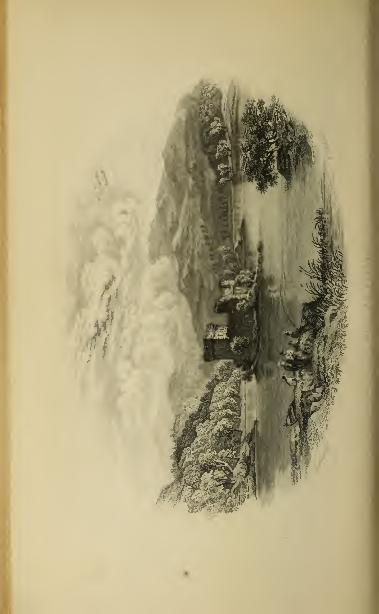
Jh

ROTIIIEMURCIIUS LOCII-AN-EILAN GLEN TILT. 511
murchus, especially about the Jhune (Grant of Rothieumrchus), onthe right bank of the Spey, and about the beautiful Loch-an-Eilan,a mile south of the Doune. This loch is shaded by tall pines, tothe water's edjp, all round. On a small island arc the ruins of acastle which is said to have belonged to the Wolf of Badenoch.SUnding near a cottage, at the foot of a tall weeping birch, andspeaking towards the castle, a remarkable echo is heard. Some milesto the east is a larger but much less interesting sheet of water, calledLock Morlich,on which a shooting-lodge was built in 1859, by theEarl of Stamford and Warrington, the lessee of the Doune.
Travellers on horseback from the Castletown of Braemar to Bade-noch, in place of the route above described, which is impassable for aImrse. take the more circuitous and infinitely less romantic one ofGlenfeshie.
THE CASTLETOWN OF BRAEMAR TO BLAIRATHOLE,BY GLEN TILT.
Tourists are recommended to proceed from the Castletown of Braemar to Blair-athole, rather than by the reverse route. For distances, roads, etc., see p. 401.
The route to the Linn of Dee has already been described (page 506).Crossing the bridge, a road leads up the north bank of the Dee for threemiles, to the confluence of that river with the Geauley. Above theLinn are two dwelling-houses, one on each side of the river. Thaton the south side is called Delavorar, or the " lord's haugh ;" andhere, it is said, Viscount Dundee encamped before the battle of Killie-crankie. The Dee is now seen coming down its wild glen from thenorth
; but the tourist, after crossing it, continues on the north sideof the Geauley for nearly two miles, till he reaches a forester's hut.Then crossing the Geauley, and turning southwards, he keeps on thewest bank of the Bijnack for two miles, when it too is crossed, andthe road, now diminished to a footpath, is continued by the west bank,to the source of the Ault-Shilochoran, two miles.The country from the Linn of Dee to this point (about sixteen miles
from the Castletown of Braemar) has been almost devoid of interest;but the watershed is now crossed, and the tourist sees before him anarrow opening, running in a southward direction, into which twopuny rivulets, the one coming from the east and the other from thewest, send their united waters. This is Glen Tilt; and the streamfrom the west issues from Loch Tilt, a small mountain-tarn, half amile distant. The footpath follows the river in all its windings, at agreater or less elevation, on the westernmost of its steep banks. Theroute from Blairathole is described page 401.
THE CASTLETOWN OF BRAEMAR TO PERTH, BY THESPITTAL OF GLENSHEE.
A coach runs in summer from the Castletown of Braemar to Blairgowrie (35miles), and thence there is a railway to Perth (20| miles).
A drive of fifteen miles due south, first up the Clunie Burn to oneof its sources, then through the mountains which divide the counties of

512 NORTH-EASTERN COUNTIES—GLENSHEE.
Aberdeen and Perth, and down the Bwrn of Glenbeg, through a wildand frequently romantic country, brings the tourist to the excellentinn at the Sptttal of Qleruhee. The inn is near the bead of the glen,
which is about seven miles Long and less than a mile broad. Here are
an old bridge and a church.From the Spitted the road runs through the glen, i or fourteen mile-.
to the Bridge <>/ Catty [Inn: Invercauld Arms], finely placed, at the
confluence of tlie Airdle and the Slice. The tourist has now a plea-
sant drive of six miles to Blairgowrie (page 294), in the course of
which he passes Glenericht Cottage (Chalmers, Esq.) on the left, andsoon afterwards the house of Craighull (Kattray, Esq.).
ABERDEEN TO ELGIN AND INVERNESS,
BY THE GREAT NORTH OF SCOTLAND AND THE ABERDEEN AND INVERNESS
JUNCTION RAILWAYS.
Miles.
1| Kittybrewster.Powis House (Leslie, Esq.), on right.View of Old Aberdeen, on right.
2 Woodside village, on left.
Grandholm Mills, on right.
Persley Granite quarries, on right.Newhills Church, on left.
Stonywood paper mills, on right.
Dancing Cairn, on left.
5 Buxburn station.
Grandhome House (Paton, Esq.), onright.
Parkhill (Gordon Skene, Esq.), onright.
S Dyce station. Branch line in pro-gress to Buchan and Formartino.
Dyce Church and Manse, on right.Monument to Dr Liddell, on right.
Pitmedden House (Thompson, Esq.),
on left.
Fin tray House (Forbes of Craigie-var, Bart.), on right.
Kinaldie station and Kinaldie House.Kinellar Parish Church.Hallforest Castle, ruins, on left.
Kintore.Branch to A 1 ford, 16 miles.Thainston House (Forbes Mitchell
Esq.), on left.
Kinkell Church, ruins, on right.Paper Mills, on right.
Port-Elphinstone, on left.
Line crosses Don by wooden viaduct,at the confluence of the Don andUrie.
Bass of Inverury and churchyard, onright.
Bridge across Don, on left.
Keithhall (Earl of Kintore), on left.
Moat of Caskieben Castle, E. of it.
Inverury.
11
1!
Mil'-.
Branch to Old Mcldrum, 51 miles.
Line crosses Urie.
Castle of Balquhain, ruined squaiv
tower in valley on left.
Harlaw farmstead, on right.
Battlefield of Efarlaw, s. E. of it.
21 Inveramsay.Branch to Turriff and Banff.
Pitoaple Castle, on right.
Deep cuttings through rock.
22 Pitcaple station.
Free Church and Manse, on left.
Parish Church of Chapel of Garioch,on left.
Logie-Elphinstone (Dalrymple HornElphinstone. Bart.), on right.
Confluence of Gadie and Urie.
Highest peak of Bennochie, 1440 feet
(with ancient stone fort), on left.
Pittodrie House, not seen, on left.
Torries, or Harthill,in ruins, on left.
25 Oyne station.
"Westhall House (Smith, Esq.), onright.
Line crosses Gadie.26 Buchanstone station.
Premnay Church and Manse, on left.
Hills of Tillymorgan and Foudland,on right.
Dunnideer hill, tower, and vitrified
fort, in front.
Woods of Rothney, on right.
28 Insch station.
Christ's-Kirkhill, on left.
31 Wardhonse station.
Wardhouse (Gordon, Esq.), on right.
33 Kinnethmont station.
Leith Hall (Sir A. L. nay), on right.
Line enters Strathbogie.
Knockespock House (Gordon, Bart.),
in neighbourhood.

OLD ABERDEEN WOODSIDE. 513
Miles.
Drominnor House (Grant, Esq.).
Craighall (Minty, Esq.).
Mnir of Rhyme village.
Hill of Noth, with Vitrified Fort.
Line enters narrow defile.
Bridge of two arches, through one of
Which runs the line, and throughthe other Mows the Bogie.
37 Gartly station. Kuins of GartlyCastle, beyond ridge, to right.
Culdrain farm, on left.
Glen of Kirkney, on left.
Free Church and Manse of Gartly.Line crosses Bogie.Deep cuttings.
Line again crosses Bogielluntly.
Confluence of Bogie and Deveron.lluntly Castle, ruins.
Line crosses Deveron.Bothiemay station.
Rothiemay House (Earl of Fife).
Grange station.
Branch line for Portsoy and Banff.54 Keith station.
59 Mulhen station.
Gorge of Mulben.Line crosses Spey by iron via-
duct.
Inverorkil.Iron suspension bridge over Spey.
62\ Orton Junction.Morayshire Railway from Lossie-mouth to Rothes and Craigel-lachie Bridge, 22 miles, joinshere.
G6J Fochabers station, 2£ miles fromFochabers.
Mountains of Strathconan andStrathglass, in remote distance.
69j Lhanbryde station.
Coxton Tower, on left.
Line passes under archway.
72J Elgin. First-Pointed Cathedral.Branch line to Lossiemouth, 4£miles.
11
46
4;)
Miles.
Line crosses Lossie, at Palmer'sCross Bridge.
Valley of Mosstowie.78 Alves station.
Omnibus to Hurghead, 4i miles.Knock of Alves, on right, with highround tower.
Crook and Kirk of Alves.Covesea Skerries Lighthouse seen
to N.E.Hill of Roseisle. Burghead, to
the north.Findhorn, and Sutors of Cromarty,
to the west, in the distance.
82 Kinloss stution. Branch to Find-horn.
Abbey of Kinloss, ruins.
si; Forbes.Line crosses the Findhorn.Deep cuttings.
88J Brodie station.
Blasted Heath of Shakspeare,where Macbeth met witches.
Inshoch ruined tower and peatmoss,on left.
Line crosses river of Nairn, by via-duct of three arches.
94J Nairn.94§ Balblair farm-bouse, on a height to
the left, where Duke of Cumber-land's army encamped previousto Battle of Culloden.
Blairnafeigh, or Deer's Moss.100i Fort-George station.
Omnibus to Fort-George (2| miles),and the ferry-house to ChanonryPoint.
Moss of Petty.
102J Dalcross station.
Parish schoolhouse, on site of Hal-Castle, on right.
Castle-Stuart (Earl of Moray).Circles of upright stones.
106| Culloden station.
Raigmore House(Mackintosh,Esq.).109 Inverness.
The train starts from the Great North of Scotland Railway station
at Waterloo Quay.
Beyond Kittybrewster there is a view, on the right, of Old
Aberdeen, the crowned tower of King's College, and the twoconical spires of the Second-Pointed cathedral of St Machar.
The wooded banks of the Don are next seen on the right. Onthe left is the village of Woodside. Farther on, on the left, are
the granite quarries of the Dancing Cairn. The parish church
of Newhills, built in 1830, is conspicuous on the brow of anacclivity to the left. Close to the line, on the right, is a modernturreted building, the residence of Mr Alexander Pirie, jun., of
the firm of A. Pirie & Son, paper manufacturers ; and at Stony-
Y 2

514 NORTH-EASTERN COUNTIES—DON8IDE.
wood, a short distance below, are the extensive paper-mills of his
firm. On the right arc the Perstey quarries of granite.
After passing Buacburn Station, and Grandhome House (Paton,
Esq.), on the right, beyond the Don, Parkhill (Gordon Skene,
Esq.) hecomes visible, on the right, also beyond the Don.Next is Dyce Station, about two miles south-west of which,
on the hill of Tyrebaggart
is a large and well preserved circle of
unhewn pillars, called The Standing Stones of Dyce. On the right
is the Parish < 'hurch and Mtni.se of Dyce : in the churchyard there
are two ancient sculptured stones. A little farther on, on the
same side, is a monument to the memory of Dr Duncan Liddell
(6. 1561, d. ]613), professor of medicine in the university of
Helmstadt. On the left is Pitmedden House (Thompson, Esq.).
Beyond, on the right, is Fintray House (Sir William Forbes of
Craigievar, Bart.), a modern mansion in the Tudor style. A little
farther on are Kinaldie Station, and Kinaldie House (Milne, Esq.).
The Parish ( 'hurch of Kinellar is seen on a rising ground. In
the churchyard are some ancient sculptured stones. On the
farm of Upper Auquhorsh, in this parish, within sight of DrumCastle, there is a large stone called " Drum's Stone," on which,
according to tradition, the gallant Sir Alexander Irvine of Drumsat and made his will while marching to the battle of Harlaw,
in which he fell, in 1 411. The ruins of the Castle of Hallforest,
a square tower of the fifteenth century, long one of the seats of
the Earls Marischal, are now seen, in front to the left, and con-
tinue in view till about a mile from the station at Kintore.
Kin tore is a small town of three streets, with a Town-house,
a Parish Church, a Free Church, and a branch bank-office. It is
a place of great antiquity, appearing as a royal burgh as early as
the reign of King William the Lion (1165-1214). It can showa charter from James IV. in 1506. It has a population of 476.
At Kintore the Alford Valley line branches off westward to Alford, adistance of sixteen miles. The first station is Kemnmj (4.J miles), and close
to it, on the left, is Kemnay House (Burnett, Esq.), surround) d by wood.
A little farther on, a road leads down to the Don (across which a bridge has
lately been built), towards Ftttemear House (Leslie, Esq.), embosomed in
wood on the farther bank of the river. There is now a good view of the
finely wooded valley on the right, watered by the Don, and bounded byBennocliie, the Millstone Hill, and Cairn William.
The next station is Monyrnusk (7$ miles). On the right is MonymushHouse (Grant, Bart.), beside the pretty little hamlet of Monymush, on the
banks of the Don, with its Parish Church (containing a chancel arch andother traces of Romanesque work), and its little modern Episcopal Church.
Here was a Culdee Priory, of unknown antiquity, which, about the year
1250, was changed into a Priory of Canons Regular. Here is an ancient
sculptured stone. In the neighbourhood are the ruins of Pitfichie Castle,

D0XS1DE—ALFORD MONYMUSK—INVERURY. 515
which lonjx belonged to the Urrie family, one of whom, Sir John Urrieor Hurrie (beheaded in L650), was a soldier of note during the great civil
war.
As the train swoops along, on the left, there is a fine view of Cluny Castle
(Gordon, Esq.), a mile south of the station, a large modern mansion. Onthe same side, a little farther on, are the ruins of the Castle of Tillycairn,
a square tower of the sixteenth century, long the inheritance of a familynamed Lumsden. The train now runs through the hleak gorge of the ClunyHills, by the TiUyfourU cutting. On the left, as the train proceeds downthe hill," may he scon the CJiurch of Tough, and Tonlcy (Byres, Esq.). Onthe right is Whitehouse (Farquharson, Esq.).
Whitehouse Station (13 miles) is next reached. Two miles beyond, on theright, are the woods and grounds of Edughton (Farquharson, Esq.), andat some distance to the northward, beyond the Don, may be seen Castle
Forbes (Lord Forbes), a modern mansion, in the baronial style, designed bythe late Mr Archibald Simpson of Aberdeen. The tourist is now in the" Vale of Alford," and two miles and a half from Whitehouse Station thetrain arrives at Alford Village, where there is an excellent inn, called theStation Hotel (Stewart's). The Parish Church and Manse are a mile and ahalf farther up the river. Alford was the scene of one of the Marquess ofMontrose's victories in 1645.
Leaving Kintore, the main line passes, on the left, Thainston
(Forbes Mitchell, Esq.), a modern mansion, so called from having
been of old the residenee of the thane of the royal manor of
Kintore. Opposite to it, on the east side of the river, are the ruins
of the Second-Pointed church of Kinkell, containing two ancient
tombstones, one of which is supposed to mark the grave of Sir
Robert Scrimgeour, killed at the battle of Harlaw in 1411.
The line next passes, on the right, the newly erected Paper
Works of Mr Tait, and on the left, Port-Elphinstone, a village
which sprang up, in the beginning of the present century, at the
western end of a canal, now dried up, between Aberdeen andInverury. The line crosses the Don by a wooden viaduct, 2C0feet long. Close on the right the river is joined by its chief tri-
butary, the Urie.
The Bass of Inverury, a conical mount, fifty or sixty feet high,
overhangs the isolated churchyard, close to the line on the right.
The Bass appears to have been the site of the chief castle of the
Earls of the Garioch, as early as about the year 1200 ; the field
in which it stands is still called The Castle Yards of Inverury.
It was long believed that the plague was buried in it, and mightbreak out to desolate the country. A prophecy, attributed to
Thomas the Rymer, runs in these words :
" When Doe and Don run both in one,And Tweed shall run in Tay,The little river of UrieShall bear the Bass away."
Close to Port-Elphinstone, on the left, is a stone bridge of three
arches over the Don, erected in 1791, at a cost of £2000. On a

.
r>H> NORTH-EASTERN COUNTIES—THE GARIOCH.
commanding situation, near Inverury, which the train now ap-
proaches, on the east side of the line and the Urie, is Keithhall
(Earl of Kintorc), a modern mansion, in the Italian style. Alittle to the east of it is the moat of the Castle of Caskieben,
the ancient name of Keithhall, of old the scat of the family of( iaiioch, and afterwards of the family of Johnstone, whichgave birth to the Latin poet, Dr Arthur Johnstone (b. 1587, d.
1041).
Inverury* [Hotel : Kintore Arms], which is next reached, is
a busy, thriving place, nearly a mile in length, with a population
of 22G4. It was made a royal burgh by Queen Mary in 1558.
Opposite the station is the Parish Church, a modern granite build-
ing in the Pointed style. A little farther down is the Episcopal
Church, also in the Pointed style. Near the west end of the
town are the Free Church and the Roman-catholic Church, both
modern buildings.
Inverury was the chief seat of the royal earldom of the Garioch.
About the year 1240, it passed to the Bruces by marriage withthe heiress of David, Earl of Huntingdon, brother of King Williamthe Lion, and in 1307-8 afforded a refuge to King Robert L, whendriven by the English from the southern provinces of Scotland.
A few miles to the north, at Barra, near Old Meldrum, he de-
feated Comyn, Earl of Buchan in 1308, at the head of an armyin the English interest.
The line, running along the east side of Inverury, crosses the
Urie near the farm of Conglass. On a rising ground, on the
right, is the farm-steading of Harlaw. To the east of it, a field
is pointed out as the spot where the great battle of Harlaw wasfought in July 1411, between the Lowlanders under Alexander
Stewart, Earl of Mar, and the Highlanders under Donald, Lord of
the Isles. The Lord of the Isles was compelled to retire from
the field, and the victory, dearly bought, remained with the Earl
of Mar.
On the left are the ruins of the Castle of Balquhain, a square
tower of the end of the fifteenth or beginning of the sixteenth
century, long the seat of the old family of Leslie of Balquhain.
It was visited by Queen Mary in 1562. To the east of the castle
there is a circle of standing stones. The train now reaches the
Inveramsay Junction.
* From Inverury a branch line of 5J miles strikes off, by Lethenty (3 miles), to
O'd Meldrum [Inn : Meldrum Arms], a burgh of barony and market-town, 18miles from Aberdeen. In the vicinity is Meldrum House (Urquhart, Esq.), a largemodernized pile. On the top of the neighbouring hill of Barra, are the remains ofa primitive earthen fort.

FYVIE TURK IFF BANFF. 517
From the Imrramsay Junction, a branch line runs northward to Turriffand IIamt. After passing Wartie station (3J miles),the train arrives atBoikie
Station (74 miles), near Rothie House (Leslie, Esq.), a modern mansion. Thenext station is Fijric, 10.} miles from Inveramsay, and 26 from Aberdeen.
On the right, near the line, is the noble pile of Fyvie Castle (Gordon, Esq.),
one of the best examples of Scottish castellated architecture, finely situ-
ated in the "Howe of Fyvie," on the north-eastern bank of the Ithan.The castle, built at different times, assumed its present shape under the eyeof Alexander Seton (</. 1622), first Earl of Dunfermline, and Chancellor of
Scotland. Six miles eastward, on the right bank of the Ythan, is HaddoHoust, the seat of the Earl of Aberdeen (built towards the end of the last
century, from a design in the Italian style by Mr John Baxter of Edin-
burgh), surrounded by a fine park, and containing some interesting worksof art.
The next station is Auchtcrless (14 miles). Close beside it are the remainsof the castle of Toutie Barclay, dating from about the year 1270, long the
residence of the family of Barclay, ancestors of the famous Russian general,
Prince Barclay de Tolly {b. 1755, d. 1818).
After passing on the right Hatton Castle (Duff, Esq.), a large modernpile, the train arrives at Turriff [Inns : Fife Arms, and Commercial], 34Jmiles north-west of Aberdeen. This ancient little town has a ruined ParishChurch, with traces of Romanesque work, a modern Parish Church, anEpiscopal Church, a Free Church, and a Market Cross. Here was an alms-
house or hospital founded by Alexander Comyn Earl of Buchan in 1272.
Leaving Turriff, and passing Plaidy Station, the train reaches King-Ed-ward Station, near the dilapidated ruins of a castle which in the thirteenth
century was one of the chief seats of the Comyns, Earls of Buchan.The next station is at the county town of Banff, finely placed at the mouth
of the Deveron. It is a place of great antiquity, dating as a royal burgh fromthe reign of King William the Lion (1165-1214). In 1851 it had a popula-
tion of 6000, and in 1 858 a customs revenue of £5362, and 146 registered
ships having a tonnage of 15,500. Close beside it, surrounded by a beau-tiful park, is Duff House (Earl of Fife), a large pile in the Italian style,
designed by Adam, and containing many interesting pictures.
Leaving Inveramsay Junction, the main line passing the mod-ernized mansion of Pitcaple Castle (Lumsden, Esq.), on the right,
runs through a deep cutting of gneiss rock to the Pitcaple Station,
where there is an inn. On an eminence, to the left, are the Free
Church and Manse, and the Parish Church of Chapel of Garioch.
About half a mile west of the latter is an ancient sculptured
stone, ten feet high, four broad, and one foot thick, called " the
Maiden Stone."
On the right, on the north bank of the Urie, is Logie-Elphin-
stone (Sir James Dalrymple Horn Elphinstone of Horn and
Logie-Elphinstone, Bart.), a modern mansion fronting the south.
On the left the beautiful peak of Bennochie comes into view, 1440
feet above the level of the sea. There is an ancient stone fort
on its summit. On its eastern shoulder are seen the woods of
Pittodrie, and on the slope, about 500 feet above sea-level, stands
the House of Pittodrie (Knight Erskine, Esq.). As the train
runs westward, the ruins of Torries, or Harthill Castle, built by

.
r>18 NORTH-EASTERN COUNTIES—THE GARIOCH.
the Loiths about the beginning of the seventeenth century, arc
conspicuous on the left.
After passing Oync Station, the modernized house of Westhall
(Smith, Esq.) is seen on the right, embosomed in woods. On the
left, and now near at hand, is the hill of Bennochie, remarkablefor its great length and graceful outline. The mass of the moun-tain is granite, often (says Professor Nicol) "a reddish brownbinary compound of quartz and felspar, both, especially the latter,
in regular crystals, well seen in drusy cavities, whilst on the
northern face it approaches to greenstone or diorite"
Crossing the Gadie,—a pleasant pastoral stream, which sweeps
round the base of Bennochie, and has been commemorated in
popular song and in the Latin verse of Dr Arthur Johnstone
—
the line reaches Ardoyne Station. As the train proceeds, to the
left are the Church and Manse of Premnay ; on the right are the
hills of Tillymorgan and Fondland, both, especially the latter,
noted for their slate-quarries ; and in front is the green, steep,
conical hill of Dunnideer or Dun-o-deer. It is about 3000 yards in
circumference and 300 feet in height, and is surmounted by the
ruins of an old tower, partly built from the stones of a vitrified
fort, by which the top of the hill has been surrounded. Here, it
is supposed, Gryg MacDungal, King of the Scots, died in 893.
On the right appear the woods of Drumrossie (Leslie, Esq. of
Warthill).
The next station is Insch, half a mile from the thriving village
of Insch, on the right. The train now passes Dunnideer, immedi-ately opposite to which, on the left, is the hill of Christ's Kirk, a
suppressed parish, where a fair called " The Sleepy Market"was at one time held during the night. It has been supposed
that this is the scene of the old poem of " Christ's Kirk on the
Green," ascribed to King James I. of Scotland. On a slope on
the right is Wardhouse (Gordon, Esq.).
The line passing through the woods of Leithhall (Sir AndrewLeith Hay), a turreted mansion of the seventeenth century, on
the right, enters the valley of the Bogie, or Strathbogie, as it is
called. Not far from the line is the house of Knockespock (Sir
Henry Percy Gordon, Bart.). Next appear the woods around the
houses of Druminnor (Grant, Esq.) and Craighall (Minty, Esq.),
and the village of Muir of Rhynie, where there is an inn. It
lies at the foot of the Hill of Noth, the conical peak of which,
called the Top of Noth, rising 1830 feet above sea-level, com-mands an extensive view, and is encircled by the remains of a
vitrified fort. There are some ancient sculptured stones in the

STRATHBOGIE TOP OF NOTII IIUNTLY. 519
village. At Essie, in its neighbourhood, Lulach, MacGilcomgain,
King of the Scots, the stepson of Macbeth, was defeated and slain
in 1057. Near the hill of Noth are the ruins of the Castle ofLesmore, built by the Gordons in 1508.
The line—threading a narrow defile, spanned by a bridge of
two arches, through one of which runs the railway, and through
the other flows the Bogie—passes Gartly Station, and running
down Strathbogie, arrives at the Huntly Station, on the east side
of the Bogie, close by the town.
Huntly [Inns: Gordon Arms; Strathbogie Arms; Royal Oak]stands embosomed among hills, on a tongue of land at the con-
fluence of the Bogie and the Deveron. It has a population of
about 3000. The two principal streets cross each other at
right angles, and form a spacious marketplace or square, in
the centre of which are the remains of a group of unhewn pillars
(one of them shewing traces of sculpture) called The Standing
Stones of Strathbogie. Here are a Parish Church, a Free Church,
an Episcopal Church, a Roman-catholic Church, with a tower, a
United Presbyterian Church, and a Congregationalist Church. Near
the east end of the town is Scott's Institution, for the maintenance
of old men and women, natives of Huntly.
There are bridges across the Bogie and the Deveron. Near the
bridge of Deveron stand the stately ruins of Strathbogie or Huntly
Castle, built in 1602 by George, first Marquess of Huntly, to re-
place an older mansion which was dismantled after the battle of
Glenlivet in 1594. The pile is an interesting example of Scottish
architecture. On the opposite side of the Deveron is the modernmansion of Huntly Lodge (the Duchess of Gordon). The gardens
are open to the public on Wednesdays.
A little to the south of the old castle are the Gordon Schools, a
handsome building with tower, on which is the inscription : "Gor-don Schools, erected in memory of George, fifth Duke of Gordon,
by his widow ; founded 1839, opened 1841." In the archway are
marble busts of the duke and duchess by Campbell, with the
inscription :" These memorials of George, fifth Duke of Gordon,
and of his widow, Elizabeth, Duchess of Gordon, are placed here
in testimony of the respect and affection of an attached tenantry
and a grateful people." The Duke died in 1836.
From Huntly, the line runs through a richly - woodedcountry, along the banks of the Deveron, which it crosses by a
bridge of five arches, near the Rothiemay Station. About a mile
and a half below, on the banks of the Deveron, now joined bythe Isla, stands the village of Rothiemay, a little to the east of
520 NORTH-EASTERN COUNTIES
—
STKATIIISI.A.
Rothiemay House, a scat of the Earl of Fife, which was visited byQueen Mary in 15G2.
The next station, Grange, took its name from a farm or grangeof the Cistercian Abbey of Kinloss, placed where the parish churchnow stands, on the top of a small mount, partly natural andpartly artificial, surrounded by a ditch.
Passing through an uninteresting country, for four miles and a
half, the line arrives at the Keith Station, about half a mile fromthe town of Keith [Hotel: Gordon Arms], on the banks of the
Isla, environed by a semicircle of hills. This thriving place,
which is divided by the Isla into Keith and Fife-Keith, has a
population of about 3000. It has an Established Church (a
modern Pointed building, with a square tower), a Free Church,an Episcopal Church, a Congregationalist Church, and a Roman-catholic Church.
Prom Grange, the /<'"/',//". Portsoy, <h<<1 Strathisla Railway, branches off to
Banff. The first station is Knock (3A miles), in the neighbourhood ofKnock Hill. Next is CornMU station (8 miles), near which is Pari House,(Major Gordon Duff, M.P.). From the next station, TiUynaught Junction(10£ miles), a line strikes off north-westward to the thriving town of Portsoy(13 miles), while the main railway continues eastward, by Lady's Bridge
(13|), to Banff, 16 miles.
The first station beyond Keith is Mulben, after passing which
the line traverses a defile between high banks of rock and gravel
beautifully wooded, emerging at InverorMl, upon the broad rapid
Spey, crossed by an iron viaduct supported on stone pillars.*
Here, beside a wooden bridge over the river, Muriel of Pollock,
Lady of Rothes, built an hospital for the reception of poor pas-
sengers, in the beginning of the thirteenth century. There are
no traces either of the hospital, or of the bridge ; the place having
been supplied by a ferry-boat, the spot took the odd name of
the " Boat of Bridge." The boat was in its turn supplanted
in 1830 by a suspension bridge, 235 feet in span.
At the Orton Junction the Morayshire Railway, from Craigel-
lachie and Rothes, joins the main line,T for 2^ miles after crossing
* From the gorge of Mulben, along the banks of the .Spey down to Fochabers, thegeologist will observe an extensive deposit of hard boulder-clay, surmounted bycliffs and a table-land of drift gravel. The deposit is so very hard that a port ;onof it through the Mulben was contracted for as solid rock, to be cut away for therailway. Mr Robert Chambers, in his work on "Sea-Margins," considers this
deposit of the ancient estuary of the Spey as one of the largest and most curious
to be seen out of Iceland.
t The Morayshire Railway runs from the seaport of Lossiemouth to Elgin (A\
miles) ; and from the Orton Junction to the village of Rothes, and Craigellachie Bridgeon the Spey, a distance of five miles.The village of Rothes [Hotel: Grant Arms] stands in a beautiful valley, sur-
rounded by hills. On the summit of a round and precipitously faced hill, near the

ORTOX FOCHABERS GORDON CASTLE. 521
the Spey, passes through the beautiful property of Orton (Whar-
ton Duff, Esq.), and then for 3 miles runs through the estate of
the Duke of Richmond, reaching, near Orbliston, the Fochabers
Station.
The pretty little town of Fochabers [Hotel: Gordon Arms]—about 2£miles from the station— stands on a rising ground on the eastern bank of
the Spey, which is here crossed by a bridge. It is of modern origin, andis built on a regular plan, with a central square from which streets radiate
at right angles. In L851, it had a population of 1097. It contains a hand-
SOme Parish Church, with a portico and spire, a Free Church, an Episcopal
Church, and a Roman-catholic Church. East of the town is a large andwell-endowed Free School, founded by Mr Alexander Mylne of New Or-leans, a native of the parish.
The town stands at the gates of Gordon Castle (Duke of Richmond),within a walled and finely wooded park of 1300 acres. One huge limebehind the castle measures 18 feet in girth, and overshadows 200 feet of
area. The fruit and flower gardens occupy about twelve acres. TheCastle, which is 568 feet in length, was chiefly built in the end of the last
century from designs in the baronial style by Mr Baxter of Edinburgh.The only part of the old pile of the Boy of Gight, as it was called, is the
central tower about 90 feet high. In the hall are copies of the ApolloBelvidere and Venus de Medici, in statuary marble, by Harwood ; withbusts of Homer, Caracalla, Marcus Aurelius, Faustina, and a Vestal. Atthe bottom of the great staircase are other busts in Sienna marble. Inthe dining-room, the sideboard of which occupies a recess, with lofty Corin-thian columns of scagliola, in imitation of verd-antique, are copies of Titian's" Venus and Adonis " and " Danae ;" Guercino's "Abraham and Hagar,"and ''Joseph and Potiphar's Wife;" Domenichino's "Dido" and "StCecilia;" and Guido's "St Peter and St Paul." In some of the otherrooms are fine hunting and pastoral pieces, by Rosa de Tivoli, and a few in-
teresting Scotch portraits.
The next station after Fochabers is Lhanbryde, near the village
of the same name. In approaching it there is a line view of the
distant mountains of Strathconan, Strathglass, and Ben Wyvis in
Ross-shire, with the venerable towers of the Cathedral of Elgin
and the domes and spires of that little city in the foreground,
relieved against the dark pine-covered sandstone ridges of Quarry-
wood, Spynie, and Covesea, the geological structure and fossils of
which are at present so much in controversy. Gliding past
Coxton Tower on the left, an interesting example of the old Scottish
manor-house of the end of the sixteenth century, the line runs
through farms and woods until it reaches the Elgin Station, about
a quarter of a mile from the city of
west end of the village, stands a fragment of the Castle of Rothes, the ancient seatof the Leslies, Earls of Rothes.Three miles to the south is Craigellachie Bridge, an iron structure over the Spey,
erected in 1814, with an arch of 150 feet span. Hence a coach runs to Grantown,from which the tourist will easily find his way, by mail coach, to Inverness byCarr Bridge, Freeburn, and Moy—in all, 32 miles; or to Dunkeld by Kingussie,Dalwhinnie, Dalnacardoch, Blairathole. Killiecrankie, and Pitlochrie—in all, 70miles (see Advertisements in Time Tables).

.022 noi:vii-i;arti:rn counties—Elgin.
ELGIN.
[Hotels: Gordon Arms; Railway.]
Elgin, with its southern suburb of New Elgin, stands in a
basin, the sides of which rise high all round except towards the
east. It is skirted on the north by the winding Lossic, the farther
bank of which, rising abrupt and high, is covered with houses andvillas. Another suburb, called Bishop Mill, stretches westwardto the oak woods and hill of Quarrywood. In the centre of thebasin two ridges spring up,—the steeper, called the Lady Hill,
being crowned with the ruins of an old royal castle, and with acolumn surmounted by a statue of George fifth and last Dukeof Gordon (d. 1836). At the foot of the Lady Hill 13 the HighStreet, stretching eastward to the precincts of the Cathedral andthe College, where stood the bishop's palace and the manses of
the canons. South of the High Street is another ridge, on whichseveral streets and churches have been erected of late.
Elgin, which was made a royal burgh by King William the Lion
(1165-1214), has a population of G337. It is a county town, andas such is the seat of a sheriff-substitute. It has an Established
Church, two Free Churches, two United Presbyterian Churches,
an Episcopal Church, a Roman-catholic Church, a Congregation-
alist Church, and a Baptist Church." Elgin, the seat of the bishopric of Moray," says Mr Cosmo
Innes, writing in 1837, " long retained a strong impress of its eccle-
siastical origin. Within the memory of some yet alive, it pre-
sented the appearance of a little cathedral city very unusual
among the burghs of Presbyterian Scotland. There was anantique fashion of building, and, withal, a certain solemn drowsyair about the town and its inhabitants, that almost prepared a
stranger to meet some church procession or some imposing cere- 4
monial of the picturesque old religion. The town is much changedof late. The [First-Pointed] parish church of St Giles, of
venerable antiquity, has given way to a gay new edifice. Thedwellings of the citizens have put on a modern trim look whichdoes not satisfy the eye so well as the sober grey walls of their
fathers. Numerous hospitals, the fruits of mixed charity and
vanity, surround the town, and with their gaudywhite domes and
porticos, contrast offensively with the mellow colouring and chaste
proportions of the ancient structures. If the present taste con-
tinues, there will soon be nothing remaining of the reverend
antique town but the remains of its magnificent Cathedral."*
' Kegistrum Episcopates Moraviensis, preface, p. xxv.


ELGIN—THE CATHEDRAL. 523
The great object of interest in Elgin is the mined Cathedralof the Holy Trinity. It was a cross church, with two western
towers, a nave with aisles, transepts, a central tower, a choir, some
chantry chapels, and an eight-sided chapter-house on the south
side of the choir. Part of the western towers and front, part of
the south transept, most of the choir, the chapels, and the
chapter-house, are all that now remain. The building is chiefly
First-Pointed, approaching in some parts to Second-Pointed.
The beautiful chapter-house is Second-Pointed. " The grand-
est of all the northern minsters," says Mr Joseph Robertson,•' was unquestionably Elgin. It alone, among the Scottish cathe-
drals of the thirteenth century, had two western towers. Theyare now shorn of their just height, but still they may be seen
from far, lifting their bulk above the pleasant plain of Moray,
and suggesting what the pile must have been when the amiable
and learned Florence Wilson loved to look upon its magnifi-
cence as he meditated his ' De Animi Tranquillitate ' on the
banks of the Lossie, and when the great central spire soared
to twice the altitude of the loftiest pinnacle of ruin that nowgrieves the eye. The foundations of this noble church were laid
about the year 1224 by Bishop Andrew de Moravia, the near
kinsman, probably the nephew, of that St Gilbert, who, on the
opposite shore of the frith, was, at that very time, raising the
humbler walls of Dornoch. We know little of the building of
Elgin. The records of the see show us * Master Gregory the
mason and Richard the glazier' at work in the autumn of 1237.
Some chance reduced part of the fabric to ruin in 1244. Wehave it described in the end of the next century as ' the pride of
the land, the glory of the realm, the delight of wayfarers andstrangers, a praise and boast among foreign nations, lofty in its
towers without, splendid in its appointments within, its countless
jewels and rich vestments, and the multitude of its priests' [it
had seven dignitaries, fifteen canons, two-and-twenty vicars-
choral, and about as many chaplains] ' serving God in righteous-
ness.' These sentences are taken from a letter in which the
Bishop of Moray makes his lamentation to King Robert III.,
complaining that on the feast of St Botolph 1390, the king's ownbrother, the Earl of Buchan, had descended from the hills with a
band of wild Scots, and given the sumptuous cathedral to the
flames, together with the parish church, the Maison Dieu, eigh-
teen manses of the canons, and the whole city of Elgin. Theprince of the blood who was the author of this savage exploit
was popularly known as ' The Wolf of Badenoch ;' and it would

V_> 1 NORTH-EASTERN COUNTIES—ELGIN.
be no very unfair measure of the difference between the social
conditions of Scotland and of England in that age, to take the
ferocities of the hoary incendiary of Elgin for a type of the one,
and the Gadshill robberies or Eastcheap gambols of young HarryMonmouth for a symbol of the other. The Stuart prince madehis peace with the church before he died, and he sleeps in the
cathedral of Dunkeld beneath a tomb which describes him as ' ancarl and lord of happy memory.' Much of what now remains of
Elgin shows itself to have been rebuilt or altered after the dire
calamity of St Botolph's day. The beautiful eight-sided chapter
house seems about a century later. The work of restoration
doubtless occupied many years, though it was promoted by royal
grants, though a third part of the whole revenues of the see were
devoted to it for a time, and though yearly subsidies were levied
on every benefice in a diocese which stretched from the Ness to
the Deveron, from the sea to the passes of Lochaber, and the cen-
tral mountains that divide Badenoch and Athole."
The roof of the Cathedral was stripped of its lead, by order of the PrivyCouncil in 1568. Spalding, a contemporary annalist, thus describes thedestruction of its rood-screen in 1640: "Mr Gilbert Ross, minister at
Elgin, the young Laird Inncs, the Laird Brodie, and some others, brokedown the timber partition-wall dividing the kirk of Elgin from the choir,
which had stood since the Reformation. On the west side was painted in
excellent colours, illuminated with stars of bright gold, the Crucifixion ofour blessed Saviour. This piece was so excellently done, that the colours
and stars never faded or vanished, but kept fresh and sound as they wereat the beginning, notwithstanding the kirk wanted the roof since the lie-
formation, and no whole window thereintill, to save the same from storm,
snow, sleet, or wet, which myself saw. And, marvellous to consider, onthe other side, towards the east, was drawn the Day of Judgment. All is
thrown to the ground. A great boldness, without warrant of the King, to
destroy churches at that rate ! Yet it is done at command of the [General]
Assembly." The great tower, says The Quarter!ij 1! viewer quoted above," outlived the Union ; it fell on an Easter morning [in 1711], and so com-pleted the ruin of that magnificent church, within the choir and towers of
which, still brilliant with ancient fresco or distemper, disciples of the old
worship were wont to assemble in the middle of the previous century."
The dimensions of the Cathedral are thus given by Mr Muir in his Noteson Scottish Ecclesiastical Architecture: " The presbytery, elevated two steps,
has two bays without aisles, 23 feet 7 inches in length. The choir has four
bays, 86 feet 4 inches, flanked on the south by the lady chapel, and bythe retro-choir on the north, arranged as aisles, with a passage across the
latter to the chapter-house. The nave has a double arcade on each side,
each of six arches, the space between the western towers forming one baymore to the length of the central division." The building altogether is 264
feet long, and 35 feet broad ; the transept being 114 feet in length ; the
western towers 84 feet in height ; the eastern turrets 60 feet in height ; the.
chapter-house 37 feet in diameter, and 34 feet in height. The height of the
central tower and spire was 198 feet.
Within the ruins is a fragment of a sculptured granite slab, six feet high,
two and a half feet broad, and a foot thick. It was dug up in the streets of

ELGIN rRIORY OF PLUSCARDINE. 525
the town in 1823. On one side are a cross and figures, apparently of eccle-
siastics ; on the other, is a hunting-scene, along with certain symbols of un-
known moaning-.
In the College, near the Cathedral, are the remains of the
Bit-hop's Palace, the Dean's House, and of some of the Canons'
Maiises. The ruin of the Greyfriars' Church, and of two or three
old houses in the town, will requite inspection. Of the other public
buildings, the chief are St Giles's Church, in the High Street, a
modern building in the Italian style, with a portico, and a dome112 feet high ; Gray's Hospital, at the west end of the town,
founded in 1819, for the sick poor, also in the Italian style, with
a portico and dome ; General Andersons Institution, for the
education of the young and the support of the old, a quadrangular
building with a circular tower and dome, erected at a cost of
£12,000. The town has a small Museum of Natural History
and Antiquities.
About five miles to the south-west of Elgin, in a secluded valley, is the
ruined Prioky of Pluscardine, founded by King Alexander II. about1230, for monks of the order of Vallis Caidium. It is probably the mostperfect monastic ruin in Scotland. The precinct wall, about fifteen feet
high, enclosed an area of about ten acres. The church was cruciform, witha central square tower, covered with a saddle-backed roof. Of the nave all
that remains is a fragment of the south wall ; the choir, of three bays with-out aisles, is 56 feet long ; the transept, which has aisles on the east side,
is 91 feet long and 47 feet wide. The chapter-house is about 30 feet square." There are some Decorated and some modern insertions," says Mr Kick-man, "but most of the work is very good Early English, and in someparts much resembles in character some works in Kent. There are traces
of the cloisters, and some round-headed doors with Decorated, and somewith Early English mouldings. One room seems to have been the chapter-house, and its mouldings are remarkably delicate and well executed. Thenorth transept is a fine composition, and has had a very large circular win-dow in the gable." Traces of fresco may still be discerned on the walls.
The neighbourhood of Elgin has several points of great interest to thegeologist. The high grounds in the interior consist of gneiss, granite, andother primary rocks, covered towards the coast by old red sandstone. Inthis, fossil fishes are found at Tynet Burn, near the Spey, Scat Craig, southof Elgin, near Altyre, Dipple, and elsewhere. In the upper bed, or a newerformation (trias?), remains of remarkable reptiles have been found atSpynie Hill, Lossiemouth, and Cummingston. Still higher are fragmentsof lias, with many fossils (at Linsksfield, Lhanbryde, and elsewhere) ; andabove all, the boulder clay and great terraces of sand and gravel.
Quitting Elgin, the railway crosses the Lossie at Palmer's Cross
Bridge, and, gliding along the valley of Mosstowie, reaches the
summit-level between the rivers Spey and Ness (not 180 feet
above the sea) at Alves Station* from which an omnibus runs
* In ascending from Mosstowie towards the Alves Station, the geologist will observethe decided inferiority of the boulder clay beneath the drift gravel. At one spot,near an interesting quarry of very hard yellow sandstone, the spires of Elgin, Forres,and Nairn, may be seen at once in a continuous straight line.

526 NORTH-EASTERN COUNTIES—MORAY.
(daily in summer, and thrice a-week in winter) to Burghead.
On the Knock of Alves, to the right, there is a tower. Theline now descends to the wide cultivated plain or " iaigh of
Moray," and a wide view opens up of the distant mountains of
Caithness, Sutherland, Ross, Cromarty, and Inverness shires,
with the Covesea Skerries Lighthouse, the Hill of ltoseislefthe pro-
montory of Burghead, and the Bap, Fort, and village of Findhorn
in the foreground.
In a field to the west of the Kinloss Statioji (10 miles from
Elgin) are the ruins of the once beautiful Abbey of Kinloss,
dilapidated by Cromwell's soldiers, who carried away many of
the stones to build their garrison at Inverness. Two fine round-
headed archways and a few vaults and windows, are all that nowremain. They show some interesting First-Pointed, and some
Second -Pointed features. The Abbey was founded by KingDavid I., about 1150, for Cistercian monks. Here King EdwardI. of England resided from the 20th September till the 10th of
October 1303 ; and here his grandson, King Edward III., spent a
night in July 133G. From the Kinloss Station there is a branch
to Findhorn.
Three miles from Kinloss is the Forres Station.
A remarkable sculptured pillar, to which the fanciful name of SwencfsStone has latterly been given, stands on the outskirts of Forres, near the
junction of the Fiudhorn and Elgin turnpike roads. It is of grey sand-
stone, 22 feet in height, and four in breadth, slightly tapering upwards.On the west side is a cross of what is called the wheel pattern, springing
from a squared plinth ; below this are two men bending towards eachother, with traces of other figures behind, and of one between. "Thedelineations on the east face," says Mr Muir, in his Notes on Scottish Ec-clesiastical Architecture, " are purely of historical character, and seem to
present a pageant, or dramatic romant ; but they are generally so muchworn that it is impossible to trace them distinctly. The figures are
arranged closely in five divisions, forming, as it were, so many passages
or fits of the story. So far as can be discovered by ordinary examina-tion, these, in their order from the top, are : 1st and 2d panels, Men andanimals in two rows ; 3rd panel, Two rows of warlike figures, withinstruments of music, entering a gateway as in triumph ; 4th panel,
Four warriors, with spears, driving before them animals with humanheads ; 5th panel, Men as in consultation. The cross and its field are
adorned with the usual interwoven work, which appears also on the
edges, along with one or two figures at the bottom of the north edge."
The pillar was probably set up between the tenth and twelfth centuries ;
but nothing is known of its history or purpose. A little westward, near
the entrance to the town of Forres, a large broken boulder of granite,
on the south side of the pathway, marks the spot where women wereburned for witchcraft towards the end of the seventeenth century.
Built on a dry gravel terrace, Forres [Hotel : Frazer's] is
a clean, healthy town. It dates as a royal burgh from the reign

FORRES NAIRN. 527
of King William the Lion (1165-1214), and has a population of
3468. On the highest point of the Clunie Hills is a tower, built
in commemoration of the victory of Trafalgar and the death of
Nelson. At the west end of the town is the Castlthill, on which
there was a royal castle, its site being now occupied by a granite
obelisk to the memory of Dr Thomson, a native of Cromarty,
who, after the battle of the Alma, devoted himself to the wounded
both of the Russian and of the British army, and died on the field
from cholera brought on by exposure and fatigue.*
Crossing the rapid and dangerous Findhom by an iron bridge,
the train, after passing Brodie Station, runs through a bleak
country, part of the " blasted heath" of Shakspeare, on which
Macbeth met the witches, and Banquo asked " How far is't
call'd to Forres ?" Leaving the ruined tower and peat moss of
Inshoch, on the left, the line crosses the river Nairn, by a viaduct
of four arches, and reaches the Nairn Station.
Nair7if [Hotels : Marine ; Commercial] is a royal burgh, dating fromthe reign of King William the Lion (1165-1214) with a population of 3401.
Of old it had a royal castle, of which the neighbouring barons, the Rosesof Kilravock, were constables. The town, standing on a bank of the river
Nairn, near its confluence with the sea, has a Town and Cotirdy Hall sur-
mounted by a spire. A cluster of fishermen's houses at the east end is
called the Fishertown or Seatown. It was of Nairn that King JamesVI. was wont to boast to his English courtiers, that he had a town in
Scotland so long that the people at the one end could not understand thelanguage spoken at the other—alluding to its being inhabited by High-landers at the west end, and by Lowland fishermen at the opposite ex-tremity.Haifa mile beyond the Nairn Station is the farm-house of Balblair, on
a height to the left, where the Duke of Cumberland's army encamped onits way to Culloden.
At the Fort-George Station (ten miles from Inverness and five fromNairn) the line crosses the old military road which passes from thatgarrison by Grantown, Tomintoul, Strathdon, Braemar, and Gknshee, toPerth*
* The principal seats in the neighbourhood of Forres, are Seaparh (Capt. Dunbar)and Grangehall, near Kinloss (Colonel Grant Peterkin); Sanquhar House, formerlyBurdsyards (Fraser Tytler, Esq.), in the bosom of the Clunie Hills ; Forres House(Grant, Esq.) ; Drumduan (Smyth, Esq.) ; AUyre (Sir A. P. Gordon-Cumming, Bart.)
;
Belugas (George R. Smith, Esq.); Dunphail (C. L. Gumming Bruce, Esq., M.P.);Moy (J. M. Grant, Esq.); and Darnaway or Tarnaway Castle, the modernizedBeat of the Earls of Moray, surrounded by a noble oak forest.
The tourist may make a pleasant drive along the course of the Findhom fromForres to the New or Farness Inn (12 miles), returning by Dulsie Bridge, two milesfarther up the river, or by Ardclach, a mile below, to Nairn, distant about ten miles.From Dulsie, if he can walk well, he may ascend the granite gorge, of the Streens toFreeburn Inn (16 miles), on the Highland Road from Inverness to Dunkeld.
t Cawdor Castle, elsewhere described (page 413), may be conveniently visitedfrom Nairn, from which it is distant about five milse.
X An omnibus in connexion with the trains runs from the Fort-George Stationto the garrison of Fort-George (2| miles) and the Ferry to the Chanonry in Ross-Bhire. In the neighbourhood are Rosemarkie in Ross—Fortrose and the fine Second-

528 NOBTH-EASTERN COUNTIES—MORAY FRITH.
Near the we9t end of the Moss of Petty, opposite Dalcross Station*
may bo seen, to the right, the parish schoolhouse,on a rising ground, said
one.' to have been an island in a lake. Here stood the castle of Halhill,
built about the year 1500.
A little way further on, between five and six miles from Inverness, is
Castle-Stuart, a fine example of the Scotch castellated mansion of the
year 10*24. Several circles of unhewn pillars, or Standing Stones, mayhere be seen from the railway. In front, beyond the waters of the MorayFrith, prolonged in the distance by the inner basin of Loch Beauly,
chains of peaked mountains, those of Strathglass and Strathconan,
stretch across the western sky ; the amphitheatre being closed on the
north, or right hand, by the huge mass of Ben Wyvis, in Ross-shire.
To the left the view opens up a long stretch of the Great Glen of Scotland,
in the bosom of which the long chain of inland lakes—Lochs Ness, Oich,
and Lochy—are connected together by the works of the Caledonian
Canal. The beautiful dome-shaped mountain in the extreme distance of
this valley is Mealfourvonie, opposite the Fall of Foyers, nearly 3000Jeet
high ; the peak next it to the west or left being Benvrachie, near Fort-
Augustus, at the farther end of Loch Ness.
Descending from the Culloden Station, the railway gains the level of
the sea and the plain on which stands Inverness, the low-lying Highland
capital, surrounded by corn fields, woods, and hedgerows. In approaching
it the line passes Raigmore (Mackintosh, Esq.), on the top of a bank, a,
mile from the terminus. The height rising next on the west is called
" the Crown," part of the ancient barony of Castlehill, once the property
of a family of Cuthbert, from which Colbert, the great finance minister
of King Louis XIV. of France, claimed his descent. On the brow of the
Crown stood a royal castle, which was dismantled on the erection of the
Castle of Inverness (p. 410).
At the Inverness Station there are refreshment rooms and a good hotel.
Pointed ruins of the Cathedral Church of Ross—Cromarty and Invergordou on the
north,—all of which may be visited in a day,-^Cawdor Castle (5 miles), Kilravock.
Castle (3 miles), Dalcross Castle (5 miles), and Culloden Moor, where Prince Charles
Stewart fought his last battle (2J miles).* From Dalcross Station, a road runs south, by Dalcross Castle, to Croy, Contra;/,
Kilravock, Cawdor, and the Moor of Culloden, by which the post-road from Inver-
ness to Perth may be reached on either side of the river Nairn.

GEOLOGY AND NATURAL HISTORY OF SCOTLAND.
Scotland, for the purpose of geological arrangement, may be
divided into the great Primary or northern district, including the
alpine range of the Grampians, and the central parts of Inverness
and Perth, and the more northern counties ; the Greywache district,
including the south and south-western districts; the Old Red sand-
stone, forming the valleys and coast lines on each side of the
primary mountains ; the great Coal formation, extending from the
Frith of Forth on the east, to Lanarkshire and the Ayrshire
coasts on the west.
The Northern or Primary region is the most elevated portion
of Scotland ; and, generally speaking, the greatest elevation ex-
ists towards the western and northern coasts, including the
whole range of the Grampian mountains, while the country slopes
gradually toward the east. The stratified rocks of this district
are gneiss, mica schist, quartz rock, chlorite schist, and clay
slate. These are found lying on granite, generally at an inclina-
tion approaching to the vertical, often curved and contorted, andnot always following the exact order of position as above, butfrequently alternating with each other. These rocks occupy thegreater proportion of the middle and north-western part of themainland of Scotland, commencing on the south-east at Stone-haven, and terminating at Cape Wrath on the north-west, whilethey extend over an almost continuous surface, to the Mull ofKintyre on the south, and to the western shores of Argyll andInverness shires. Intermingled with these strata, but in compara-tively small proportion, are bands of primary limestone, some-times assuming a stratified structure, and a dark variegated hue,at other times forming masses of compact crystalline white marble,
as in the valley of Glen Tilt. Granite and syenite often form thecentral axis of the mountains, and various kinds of porphyry, andoccasionally trap rocks, intrude into the strata. Metallic veinsare not uncommon, consisting of silver, lead, and antimony.
Transition or Greywache districts.—To these strata succeed thegreywacke slates and conglomerates, but sparingly developed in
the central ranges just alluded to, though they form an extensivetract of country in the southern portion of the island, from StAbb's Head on the eastern coast, to the Mull of Galloway onthe west. This formation corresponds to the middle and lower
z

530 GEOLOGY AND NATURAL HISTORY OF SCOTLAND.
beds of the great Silurian system of England. Organic remain?
have been discovered in several parts of this formation, in the
shires of Peebles, Dumfries, Wigton, and Ayr, especially near
(Jinan in the last.
The red sandstones, quartzites, and limestones, forming a great
part of the north-west, and extending into some of the islands,
which were formerly included in the old red, are now, from
some fossils found in the limestone at Durness, regarded as
an older formation, equivalent rather to the Cambrian and
Silurian of England. The true relation of these beds to the
crystalline strata in the centre of the country is still involved in
some doubt.
The Old Red Sandstone is the next great formation. Tracts of
this rock are diffused over the whole island. It is seen over-
lying the greywacke in Berwickshire, it skirts the Lammermoormountains, and extends into Dumfries and Ayr shires. It forms
an extensive district in Forfarshire, part of Perth and Stirling
shires, and onwards to the western coast. It borders almost un-
interruptedly the whole north-eastern coast from the Moray Frith,
and occupies many valleys and indentations in the interior, and
forms almost the whole surface of the Orkney Islands. Though it
varies in extent and thickness in different localities, it preserves
a similar mineral and fossil character throughout ; and, viewing
its general position and wide diffusion, the idea will be naturally
suggested, that at one period it must have covered a far wider
extent of Scotland, and that denudation on an extensive scale
has been the cause of its abstraction from the higher ridges, and
perhaps, too, of its greater accumulation in the declivities, valleys,
and coast lines.
The three groups into which the strata have been divided, but
especially the middle and lower, contain numerous remains of
fossil fishes of the genera holoptychius, osteolepis, dipteras, glypto-
lepis, diplopterus, cheirolepis, cheiracanthus, pterichthys, coccosteus.
The upper beds, which have less of the shaly and stratified struc-
ture, contain few organic remains. The dip of the strata is at a
much less angle with the horizon than that of the subjacent beds
on which they lie unconformably.
Carboniferous or Coal districts.—The mountain limestone, so
largely developed in some parts of England, and forming the
basis on which the coal measures rest, is only partially present
in Scotland. It exists in beds, not exceeding twenty to forty
feet in thickness, in Berwickshire, Mid-Lothian, Fife, Lanarkshire,
Ayrshire, and part of Dumfriesshire. North of the great coal
district, the true mountain limestone, with its characteristic
fossils, is not found. A limestone, analogous to the English corn-
stone, is found in bands, alternating with the upper beds of the
old red formation. A fresh-water limestone deposit is also found

GEOLOGY AND NATURAL HISTORY OF SCOTLAND. 531
in some situations accompanying the mountain limestone, and is
characterized by fossil plants and fishes.
The Carboniferous Sandstone, including the coal seams, occupies
a well-defined tract of country, extending from the Frith of
Forth in the east, to the estuary of the Clyde and the Ayrshire
shore on the west. On the south, a line drawn from near the
town of Haddington in East Lothian, extending along the base of
the Lammermoors, passing through the upper part of Lanarkshire,
and terminating at Turnberry Castle, in Ayrshire, will bound this
formation ; while, on the north, a line from St Andrews on the
east coast, extending along the southern edge of the Ochil hills,
and passing through Stirlingshire to Dumbarton, will limit its
northern extent. With the exception of the southern parts of
Berwickshire and Dumfriesshire, the formation is nowhere else
found in Scotland. Numerous fossil vegetable remains and trunks
of large trees are found in all the strata of the coal districts.
New Bed Sandstone.—This formation, occurring above the car-
boniferous sandstone in England, is found covering a portion of
the county of Dumfries, and is partially seen in some of the
Western Islands. No organic remains have been found, butthe footmarks of reptiles have been discovered in quarries in
Dumfriesshire. Some sandstones in Elgin, containing remains
of reptiles, are now thought probably to belong to the trias.
Lias, Oolite, Greensand, Chalk.—Beds of lias limestone are
found of considerable thickness at Cromarty, and in Mull, StafTa,
and other islands. Traces of oolite are also visible in these islands,
at Brora in Sutherlandshire, and near Elgin in Morayshire. Afresh-water formation, with organic remains analogous to thoseof the Wealden in England, exists at Linksfield, near Elgin.
Chalk, flints, and fragments of greensand, apparently in situ, or
drifted from some neighbouring locality, have also been found in
the north-east of Aberdeenshire.
A remarkable feature of the geology of Scotland, as comparedwith England, is the great prevalence of the older strata, and the
partial occurrence of the lias, oolite, and chalk, so largely de-
veloped in the south of England.
Tlie Igneous Bocks.—Granite and syenite, as already mentioned,prevail chiefly in the middle range of the Grampians, not unfre-
quently in Sutherland and Ross shires, and partially in the shires
of Argyle, Dumfries, and Galloway.Porpyhry.—This rock, in its various forms and different ages,
is seen penetrating the primary schistose, and the secondaryarenaceous formations, in many districts. In the primary rangeit is everywhere present. It pervades the greywacke strata in
Galloway, Dumfries, and Peebles shires, and is also present in
some of the old red sandstone districts, as well as in the car-
boniferous strata.

532 GEOLOGY and NATURAL HI8TORY OF SCOTLAND.
Trap or Greenstone Bods.—These are abundant, chiefly where
the secondary strata prevail, which strata they both penetrate
and overlay. " They are seen in a particular class of the Western
Islands, and are largely extended through the coal districts.
They are more sparingly developed in the middle and northern
primary ranges, although their elevating agency is there also
frequently indicated, and trap dykes and veins are in several
situations visible..
The Western Islands may be classed, geologically, into four
groups.. .
The Gneiss Islands, consisting of this material chiefly, are mnumber about twenty-eight, of which the chief are Lewis and
Harris, North and South Uist, Tiree, Coll, Iona, etc.
The Trap Islands are Skye, Mull, Eig, Rum, Staffa, etc.
The Schistose Islands are Isla, Jura, Colonsay, etc.
The Clyde Islands, whose composition is of a more general
and varied character, are Bute, Arran, the Cumbraes, Holy Isle,
etc. Arran is no less celebrated for its beauty than for the varied
and distinct sections which it affords of the greater number of
the Scottish geological rocks.
The Orkney Islands are composed almost entirely ot old red
sandstone, with similar fossil remains to those found in the same
strata on the mainland.
The Shetland Islands contain granite, gneiss, limestone, red
sandstone, trap, and porphvry. They are interesting to the
mineralogist, as furnishing numerous fine minerals, and ores of
copper, haematite, chromate of iron, etc.
The climate of Scotland, like that of other countries, is not
determined by its latitude alone, but is influenced by its position
with regard to the ocean, by its elevation, and by its mountain
ranges Being comparatively a narrow tract of land, surrounded
on all sides by the ocean, and thus influenced throughout its
whole extent by that equalizing agent, its medium temperature
indicates a degree of elevation not assignable to its actual latitude.
This is shown in the mean annual temperature of the mainland,
which has been estimated at forty-seven degrees; but it is even
more conspicuous in that of the islands which he considerably
more to the north, the mean temperature of Orkney being about
forty-six degrees, and that of the Shetland Islands forty-four. The
annual temperature, too, is higher along the line of coast and in
the level and extended valleys, than in the alpine districts;the
winter cold especially being less severe and of shorter duration
in the former than in the latter. There is also a considerable
difference in the winter temperature on the western and south-
western coasts, as compared to the eastern side of Scotland;that
of the western coast being modified and elevated by the genial

GEOLOGY AND NATURAL HISTORY OF SCOTLAND. 533
influence of the Atlantic breezes, while the east, especially in
spring, is depressed by the chill and dry winds coming from the
north-western continent of Europe. To compensate for this,
however, the summer and the autumn of the western coast, as
well as the islands, are kept at a lower temperature, from the
excess of moisture, and the interruptions of the sun's rays fromthe frequently clouded sky. From the same causes, a greater
quantity of moisture falls on the western than on the eastern
coasts of the island ; the prevailing winds, for nearly three-fourths
of the year being from the west and south-west. For the re-
mainder of the year—that is, during spring—on the east coast, a
colder and drier current of air coming from the north-western
parts of Europe, by absorbing both the moisture and warmth,renders the climate chill and dry.
Other causes also tend to influence the temperature in certain
tocalities, such as the elevation of the district, and the nature of
lhe soil and sub-strata. In general, the primary districts, by pre-
senting sub-strata dense, compact, and impervious to moisture,
influence the coldness and humidity of the atmosphere, while thelight porous nature of the sandstone formation, with its numerousfissures, aids the transmission of rain water through its sub-strata,
and is favourable to a quick evaporation from the surface. Theprimary districts, too, are generally the most elevated, and thusthe temperature is diminished.
The vegetation of the country, both natural and artificial, is of
course influenced by the local causes of climate just enumerated.The western and south-western portions of Scotland are cele-
brated for the profusion of herbage which is produced at almostall seasons of the year, thus affording ample means of pastur-age. The valleys of the sandstone and other secondary for-
mations skirting the coasts, and the rich alluvial banks of therivers and estuaries, constitute the great agricultural districts,
where wheat and other grains are raised in abundance, andwhere the oak, beech, elm, and fruit trees flourish in greatestluxuriance. This agricultural district is strictly limited to from500 to 800 feet above the sea-level ; wheat rarely or never com-ing to perfection in Scotland at a height beyond these limits.
Above the agricultural district, in elevation, extends that wherethe hardier grasses, heath, hazel, birch, and alder flourish,
extending to about 1500 feet above the sea-level. Above this,
only alpine plants show themselves, to the height of about 2800feet. Still higher, even these give place to mosses and lichens
;
and, at last, a height is reached, where vegetation almost be-comes extinct, as on the top of Ben Nevis, which nearly reachesthe line of perpetual congelation. To indicate the influence ofsoil and climate on vegetation, it may be remarked, that wheat

534 GEOLOGY AND NATURAL HISTORY OF SCOTLAND.
is very sparingly cultivated throughout Aberdeen and Banff
shires, though oats are largely raised; neither is this grain
raised in the valleys of the Grampian range, as at Clova, Spittal
of Glenshee, Loch Tay, Loch Earnhead ; nor along the coast
from the north of Sutherland to the north-west of Argyll.
Trees of any magnitude are rarely found on the Western Islands,
or in Orkney or Shetland;yet they must have grown to a great
size and in great numbers on many of the more exposed loca-
lities on the mainland of Scotland in former periods, as the
remains of large trunks' strew the morasses and peat mosses of
these districts.
Several wild animals, as the wolf, the boar, the elk, and the
beaver, must at more or less remote periods have been denizens
of Scotland, and their remains are not unfrequently dug up from
alluvial soil. The beaver would seem to have survived the thir-
teenth or fourteenth century ; and the wolf was not extinct until
the end of the seventeenth or beginning of the eighteenth cen-
tury. The whole face of the country has undergone great im-
provement within the last and present century. The lands have
been drained and cultivated, and many of the bare moors clothed
with thriving plantations.

INDEX.
Abbey Craig, pages 84, 241
/ Abbotsford, 156.
Aberbrothock Abbey, 478Aberdeen, 485.Aberdeen, Old, 490.Abercorn, 7!).
Aberdour, 75.
Aberfeldy, 287.Aberfoyle, 257.Abergeldy Castle, 503.Abernethy, 466,Aberuchill Castle, 305.Abington Station, 196.Aboyne Castle, 498.Acharn, Fall of, 283.Achlyne Mansion, 281.Ackergill Castle, 437.Ailsa Craig, 127.Airdrie, 194.Aird's Moss, 217.Airthrey Mineral Wells,
247.
Aldie Castle, 245.Ale Water, 170.
Alexandria, Village of 276.Alford, 515.Allan Water, 248.
/Alloa, 84.,- Alloway Kirk, 209.Almond, Valley of tbe, 187Alness, 427.
Alt-dhu-lochan Glen, 509.Altrive, 184.Alva House & Village, 243Amisfield House. 143.Ample, Waterfall of, 280.Amulree, 307.Ancrum Moor, 170.Annan, 224.
Annandale, 202.Antonine, Wall of, 191.Anwoth Church, 229.Appin, 378.Applecross, 371, 423.Arbroath, 478.Ardchattan Priory, 327.Ardcheanochrochdan, 264.
Ardchullarie House, 279.Ardencaple, 118.
Ardentinny, 119.
Ardgour, 379.Ardgour's Towel, Fall of,
379.
Ardincaple, 336.Ardkinglass Lodge, 321.Ardlamont, 332.Ardiuaddy Castle, 335.Ardnamurchan, 341.Ardoch and Roman Camp,
251.
Ardrishaig, 333.Ardross, 428.Ardrossan, 206.Ardshiel, 379.Ardtornish Castle, 339.Ardvasar, 358.Ardvoirlich House, 280.Ardvraick Castle, 446.Argyll's Bowling-Green
119.
Arisaig, 357.Armadale, 357.Arniston House, 149.Aros Castle and Bay, 340.Arran, Island of, 124.Arrochar, 119.
^Arthur's Seat, 35.Ashiestiel, House of, 182.Assynt, 446.Athelstaneford, 133.Athole Forest, 402.Auchan's House, 206.Auchencairn, 225.Auchincass Castle, 198.Auchindown Castle, 337.Auchindrane, 213.Auchinleck, 217, 218.Auchinskeith, Cave at 216.Auchmithie, Caves at, 478.Auchnanault, 422.Auchterarder, 251.Auldhame, 148.Aultgrande, 427.Aviemore, 406.fAyr, 207, 208.Ay ton, 139.
B
Baberton House, 193.
Badenoch, 403.
Balblair, 527.
Baldoon, Castle of, 230,Balfour House, 454.Balgonie Castle, 455.Balgownie, Brig of, 493.Balhaldie House. 250.Ballachulish, 390.Ballater, 499.
Ballengeich, 238.Balloch, 275.
Ballochbuie Forest, 405.B illochmyle, 217.
Balmacara, 359, 423.Balmoral, 504.Balnagowan Castle, 428.Balnaguard, 288.Balquhain Castle, 516.Balquhidder, 279.Balwearie, 453.Banchory Devenick, 495.Banchory, Upper, 497.Banff, 517.Bankton House, 131.Bannachra Castle, 275.Bannavie, 382.Bannockburn, 234.
Barcaldine Castle, 329.Barlocco, Caves of, 225.^Barnbougle Castle, 77.r Barra, Island of, 376.Bass of Inverury, 515-Bass Rock, 145.
Bathgate, 186.
Bealach-nam-bo, or Pas«of Cattle, 268.
Beal-an-Duine Defile, 260.Beattock Station, 196.Beaufort Castle, 417.Beauly, 417.^Beith, 216.rBeld Craig, 198.
Bemersyde, 159.Ben A'an, 265.Ben Alder, 403.
Ben Arthur, 119, 320.

536 INDEX.
Benbecula, 375.
Ben Brackie, 432.
Bencleuch, 242.
Ben (ruachan, 326.
Ben Laoghal, 443.
Ben Lawers, 283.
Ben Ledi, 262.
Ben Lomond, 272.
Benmacdhui, 507.
Bennocnie Hill, 518.
Ben More, 281.
Ben More (Sutherland),
446.
Ben Nevis, 380.
Ben Venue, 265.
Ben Voirlich, 280.
Ben-y-Gloe, 299.
Ben-y-Vracky, 296.
Ben Wyvis, 422.
Berigonium, 328.
Berriedale, Valley of, 435.
Berwick-upon-Tweed, 140,
Biggar, 195.
Binns House, 187.
Birkhall House, 500.
Birkhill, 200.
Biruam Hill, 293.
Birrenswark, 202.
Blackburn River, 174.
Black Isle, 425.
Blackness Castle, 82.
Bladenoch Water, 230.
Blairathole, 298.
Blair Castle, 298.
Blair Urummond, 252.
Blairgowrie, 294.
Blairs College, 495.
Blantyre Priory, 108.
Blaven, 363.
Bloody Bay, 341.
Bodsbeck, 199.
Bonarbridge, 430, 449.
Bonhill, 276.
Bonnington Linn, 111.
Borrodale, 357.
Borrowstounness, 82.
Borthwick Castle, 64.
Bothwell, 107.
Bourgo, The, 151.
Bowhill House, 184.
Bowland Bridge. Station,
150.
Bowling, 115, 277.
Bowmore, 397.
Braal Castle, 439.
Braan, Falls of, 292.
Bracklin Bridge, 255.
Braemar, Castletown of,
505.
Braemore, 435.
Braid and BlackfordHills, 44.
Branxholm House, 172.
Bread albane, District of,
281.
Brechin, 482.
Bridge of Allan, 247.
Bridge of Drip, 252.
Bridge of Dun Junction,483.
Bridge of Earn, 314, 466.
Bridge ofTeith, 268.
Bridge of Turk, 263.
Broadford, 359.
1 5 rod ic k, 184.
Broom House, 139.
Broughty Castle, 480.
Broughty-Ferry Station,
460.
Brow, 224.
Broxmonth Mansion, 136.
Bruar, Falls of, 300.
Buccleuch, 183.
Bunawe, 327.
Boxdiehouse, 63.
Burn of the Vat, 500.
Burmnouth, 140.
Bums's Birthplace, 208.
/Burns' Monument, Ayr,209.
Burns's Mausoleum, 221.
Burntisland, 74.
Burnt Islands, 332.
Bute, Island of, 122.
Cadyow Castle and Forest106.
Caerlaverock Castle, 222.
Cailleach, Point of, 341.
Cairnban, 334.
Cairndow Inn, 320.
Cairngorm, 509.
Cairntoul, 509.
Caithness, 435.
Calder House, 193.
Caldron Linn, 245.
Caledonian Canal, 377.
Callendar, 254, 278.
Callendar House, 233.
Cally House, 228.
Camasunary, 362.
Cambuskenneth Abbey,241.
Campbelton, 394.
Campbeltown, 414.
Camperdown House, 465.
/Campsie, 192.
Campsie Linn, 303.
Canonmills, 59.
Cape Wrath, 444.
Carberry Hill, 74, 131.
Cardross, 115, 277.
Carbarn, 167.
Carlenrig Chapel, 173.
Carnoustie, 477.
Camwath, 193.
Can" Bridge Inn, 406.
Carrick Castle, 120.
Carronbridge, 218.
Carron Ironworks, 82, 191
Carstairs, 194.
(ait River, 204.
Carterhaugh, 183.
Cartland ('rags, ill.
Cassillis Downans, 213.
' lastle Campbell, 244.
/Castlecary, 191.
Castle Douglas, 225.
Castleb.il] (Caithness), 438.
Castle Kennedy, 232.
Castle Leod, 421.
Castle Menzies, 287.
Castle Semple, 216.
Castle Stalker, 378.
Castle Tirim, 357.
Castli'towiiiifBraemar,505.
Caterthun Hill Forts, 483,
502.
Cat-Kail, The, 151.
Cauldshiels Loch, 155.
Cauvin's Hospital, 36.
Cawdor Castle, 413.
Chapelhope, 201.
Chanonry Point, 415.
Charleston of Aboyne, 498-
Chatelherault, 106.
Chiefswood, 155.
Chirnside, 138.
Christ's Kirk, 518.
Cladich, 324.
Clava, 413.
Clet Rock, 440.
Cloch-na-ben Hill, 497.
Closeburn, 219.
Clyde, Falls of, 111.
Cockburnspath, 136.
Coilantogle Ford, 255, 261.
Coilsticld Mansion, 212.
Coir-nan-Uriskin, 263.
Coldingham Priory, 138.
Coldstream, 167.
Colinton, 70.
Coll, Island of, 342.
Collessie, 468.
Colonsav, Island of 399,
400.
Comrie, 305.
Conan, 420.
Connal Feny, 327.
Contin, 422.
Corehouse, 111.
Corpach, 382.
Corra Linn, 111.
Corran Ferry, 379.
Corrichie, Vale of, 497.
Corrie, 124.
Corrymulzie, Linn of, 506.
Corryvreckan Whirlpool,
335.
Corstoi-phine, 185.
Coupar-Angus, 480.
Cove, Village of, 118.
Cowdenknowes, 160.
/Craigcrook Castle, 55, 77.
Craigellachie, 405, 521.
Carsebreck Curling Pond, Craigendarroch, 500.
251. yCraighall, '2i»4.
Carse of Cowrie, 476.|
Craigieharns, 291.

Craigieburn Wood, 199.Craigmillar Castle, 62.Craigmore,Craig Neagh, CiOti.
Craignetban, Castle of, 110Cralgnish Point, 334.Craig Phadrick, 411.Craigrad, 258.Craig Viiean, 293.
/ Cramond Island, 82./•Cramond Village, 77.Crarae Inn, 333.Crathes Castle, 496.Crathie, 603.Crawford Castle, 136.Crawford Priory, 457.Creetown, 889.Creggan's Ferry, 333.Creich, 430.Crianlaricl) Inn, 281, 393.Crichton Castle, 63.Cricbton Lunatic Asylum,
221.
Crichup or Creehope Linn,219
Crieff, 306.Cliffell, 222.Crinan Canal, 333.Crofts Mound, The, 225.Cromarty, 425.Cromarty Frith, 427.Cromlix, 250.Cromwell's Fort, 139.Cromwell's Mount, 414.Crook of Devon, 245.Crookston Castle, 204.Crossraguel Abbey. 214Cruachan, Pass of, 326.Cruggleton Castle, 230.Cruicks, The, 79.Cuchullin Hills, 368.Culbleen, 499.Culloden. 412, 528.Culross, 83.
Culzean Castle, 214.CuLzean, Caves of, 214.Cumbrae Islands, 123.Cummertrees, 224.Cumnock, 218.
Cumstone Castle, 226.Cupar, 457.
Currie, 193.
INDEX.
Dalnaspidal, 403.Dalquhorn House, 276.Dalrigh. 393.Dairy, 193.
Dalswinton, 219.Dahvhinnie, 403.Darnawav Castle, 527.
/Darniek. Village of, 151.Daviot, 407.Dealginross, Roman Camp
of, 305.
Deanston Cotton Works,252.
Dee, Linn of, 506.Dee, Wells of, 510.Delavorar, 511.Deloraine, 183.
Demyat, 248.
Devanha, 495.Devon, Falls of, 245.Devil's Beef Tub, 198.Devil's Caldron (Perth),
Dairsie, 458.Dalbeattie, 225.Dalgety Church, 75.Dalguise, 289.
Dalhousie Castle, 65.Dalkeith, 65.
Dalkeith Palace, 66.Dalmahoy Crags, 193.Dalmahoy House, 186.Dalmally, 326.
/ Dalmeny, 77.
^ Dalnacardoch Inn, 403.
Devils Mill, 245.Devil's Staircase, 391.Devon, Vale of, 246.Dingwall. 420.Dinnat, Moor of, 498.Dirleton, 144.Dobb's Linn, 200.Dochart Rapids, 282.
.Dollar, 244.
,'Donibristle House, 75.Doon Hill, 135.Doon River, 210.Doras-mor, or Great Gate
334.
Dornoch, 431.Dornocb Frith, 430.Douglas Castle, 109.Douglas Water, 184.Doune, 253.Doune of Rothiemurchus,
511.
Dowally, 295.Draffen Castle, or Craig-
nethan, 110Dream, The, 418.Drimnin House, 340.Drimsynie House, 120.Drum Castle, 496.Drumfin, 340.Drumidoon Point, 125.Drumlanrig Castle, 218.Drumnadrochit, 388.Drummond Castle, 306.Drummossie, 407.Drum's Stone, 514.Dryburgh Abbev, 159.Dryburgh House, 160.Duart Castle, 337.Dubton, 483.Duchray River, 257.'Duddingston, 35.Duff House, 517.Duinhill, 257.
/Dumbarton, 115, 276.Dumcrieff, 198.
537
Dumfries, 220.Dunagoil, 122.
Dunaverty Castle, 395.Dunbar, 135.
Dunbeath, 435.Dunblane, 249.
Duncansbay Head, 438.Duncraggan, 263.Dundaff Linn, 111.Dundas Castle, 78.Dundee, 461.
Dunderaw Castle, 321.Dundonald Castle, 206.Dundonnell, 424.Dundrennan, Abbey of, 227Dunfermline, 80.Dunfillan, 281.Dunglass Castle, 115.
Dunglass House and Via-duct, 136.
Dunian or Beacon Hill, 176.Dunipace, Hills of, 233.Dunira House, 305.Dunkeld, 289.Dunmore Park, 83.Dunnet, 440.Dunnideer Hill, 518.Dunnikier, 454.Dunning, 251.Dunolly Castle, 329.Dunoon, 121.
Dunottar, 484.Dunrobin Castle, 433.Dunse, 138.
Dunsinane Hill, 477.Dunstaffnage Castle, 328.Duntroon Castle, 334.Duntulm Castle, 367.Dunure Castle, 213.
Dunvegan Castle, 368.Dupplin Castle, 251, 316.Durness, 449.Dura Den, 458.Dyce, 514.
Dysart, 454.
Eachaig River, 120.Earl Cairnie, 77.Earl's Hall, 459.Earlston, 160.
Easdale, Island, 335.Ecclefechan Village, 203.Eden River, 457.Eden's Hall, 139.
Edinample Castle, 280.
/Edinburgh, 1-59.
Academy, 59.
/ Advocates' Library, 18.
Assembly Hall, 12.
Assembly Rooms andMusic Hall, 55.
/ Bank of Scotland, 14.
Botanical Garden, Royal,59.
Bore Stone, 43.
z2

538 INDEX.
Edinburgh-*British Linen Company,
56.
Bruntsfield Links, 43.
Calton Hill, 44.
Cinongate, 24.
Castle, 5.
Castle Hill, 12.
Chapel Royal, 83.
Clydesdale Bank, 66,Commercial Rank, 56.
Corn Exchange, 13.
County Hall, 14.
Courts, Supreme, 18.
Cross, The, 21.
Deaf and Dumb Institu-tion, 58.
r Dean Bridge, 54.
/ Dean Cemetery, 54.
Exchange, Royal, 20.
/Free Church AssemblyHall, 12.
Free Church College, 52.
/ Grassmarket, 13.f Greyfriars Churches, 39.
High School, 45.
/ Holyrood, 28.
Hospitals — Donaldson's,53.
... Gillespie's, 43.
... Heriot's, 40.
... Merchant Maiden,42.
... Orphan, 54.
... Stewart's, 54.
... Trades Maiden, 43.
... Watson's, George,41.
. . . Watson's, John, 54.
Infirmary, Royal, 38.
Inland Revenue Office, 47.,' Knox's House, Nether-
bow, 24.
Lawnmarket, 13.
Lunatic Asylum, Royal,Edinburgh, 44.
Meadows, 42.
Melville Drive, 42.
/ Mons Meg, 7.
Monuments—Burns', 46.
... Hume's, 46.
... Melville's, 56.
... National, 45.
... Nelson's 45.
... Playfair's, 46.
Scott's, Sir Walter,48.
Stewart,Dugald,46.
...
, / Antiquaries of Scot-
land, 49.
. College, 38.
. Highland andAgri-cultural Society,14.
. Industrial, 38.
. Surgical, 38.
. Phrenological, 38.
Edinburgh—National Bank, 56.
National Gallery of Scot-
land, 49.
I Observatory, Royal, i:>.
/ Parliament House, 17.
Philosophical Institution,
66.
Physicians, Royal Col-lege of, 58.
Police Office, 20.
/ Post Office, General, 47.
Prison, 46.
Queen Street, Hall, 58.
Queen's Drive, 35.
... Park, 34.
/Regalia of Scotland, 5, 9.
Register House, General,47.
Royal Bank of Scotland,56.
Royal Institution, 48.
f* Salisbury Crags, 34.
} Samson's Ribs, 36.
/Signet Library, 19.' Statues—Charles II., 17.
/ ... George IV., 56.
. ... Hopetoun, Earl of.
57.
... Melville, secondViscount, 53.
... Pitt, William, 55.
... Wellington, Dukeof, 47.
... York, Duke of, 11.
'St Anthony's Chapel andWell 35.
St Bernard's Well, 54.
/ St Giles' Cathedral, 15.
St Margaret's Well, 34.
Surgeon's Hall, 38.
Theatre (Queen's) andOpera House, 57.
Union Bank of Scotland,20.
University, 36.
West Bow, 12.
/fZoological Gardens, 58.
Edington Castle, 139.
Ednam House, 164.Ednam, 166.
Edzell Castle, 502.
Eglinton Castle, 205.Eigg, Island of, 342.
Eilangreig, 332.
fEildon Hills, 151.
Eilean Aigas, 418.
Elderslie, 216.
Elgin, 522.
Ellandonan Castle, 359,
Ellen's Isle, 266.
Elliock Mansion, 218.
Ellisland, 219.
Elvan Water, 196.
Erchless Castle, 419.
Errol Station, 476.
Essachosan Glen, 323.
Essie, 519.
Ettleton Churchyard, 171.
Ettrtok. 182.
Rvan Water, 196.
Evanton, 427.
Eyemouth, 139.
Fairlie, 123.
Fairney Hill, 167.
(/Falkirk, 191.
Falkland, 455.
Falkland Palace, 456.
Fascally House, 297.
Past Castle, 136.
Fearn Abbey, 429.Fender, Fall of the, 300.Fenton Tower, 133.Fern tower House, 306.Ferry Hills, 79.
Fetteresso, 484.Fife, 452.Findon, or Finnan, 485.Fingal's Cave, 344.
Fingask Castle, 476.Finhaven Castle, 483.Finlarig Castle, 283.
Fisherrow, 73.
Flodden, Battlefield of, 1»>8.
Floors Castle, 166.Flower of Yarrow, The,
172, 202.
Fochabers, 521.Fordoun, 484.Forfar, 481.
Forres, 527.
Fort-Augustus, 384.Forteviot, 251.
Fort-George, 414.Fortingall, 302.
Fortrose, 415, 426.
Fortrose Cathedral, 415.
Fort-William, 379.Fowlshiels, 184.Foyers, Falls of, 386, 415.
Frecburn, 406.
Frenchland Tower, 199.
Freswick, 437.
Fyrish Mountain, 427.
Fyvie Castle, 517.
Gadie Stream, 518.
Gairloch(Invernes8-shiiv >
371, 424.
^Galashiels, 150.
jGalatown, 453.
/Gala Water, 150.
Galloway House, 230.
Galloway, New, 227.
Galston, 217.
Gamescleuch Tower, 188.
Gannochy Bridge, 502.
Garchory, Burn of, 509.
Gareloch, 118.

Garlieston, 230.
Gariston SuspensionBridge, 203.
Garple Spa, 198.
Garrawalt, Fall of, 505.
Garth CastU-. 886.
Gartmore House, 257.
Gart, The, 264.Carve, 423.
Gatahouse-of-Fleet, 228.
Gattonside, 152.
Geanies, 42J.
Gegau, The. 1 18.
General's Hut, The, 387.
General's Stone, TbGeology of Scotland, 629.
Geylet Pot Cave, 4.18.
Gilford, 143.
Gigha Island, 396.
Gilchrist Church, 420.
Gilmerton, 63.
Gilnockie Tower, 173.
Girnag, Falls of. 296.
Girnigoe Castle, 437.
Girvan, 215.
Gladsmuir Kirk, 132.
Glammis, 480.
/ Glasgow, 85.
Andersonian Institution,
102.
Assembly and ConcertRoom, 98.
Athenaeum, 98.
Hanks, 97.
/ Barony Church, 93.
Blind Asylum, 102.. Botanic Gardens, 100.
Bridges, 100.
/ Broomielaw, The, 101.
Cathedral, 89Charitable Institutions,
102.
Churches, 101.
City and County Build-ings, 98.
City Hall, 98.
Educational Institutions.
102.
. Green, The, 96.
Govan Ironworks, 102.
Hunterian Museum, 94.
Hutcheson's Hospital, 98.Infirmary, Royal, 93.
/ M'Lellan Gallery, 99.
} Necropolis, 93.
/ Post Office, 98.
Rollox, St, ChemicalWorks, 102.
Royal Exchange, 97.South Prison, 96.
Statues
—
Moore, 99.
Scott, 99.
Queen, The, 98.
Watt, 99.
Wellington, 97.
William the Third, 96.
Theatres, 102.
INDEX*
Glasgow-Town Hall, 95.
Trades' House, 9S.
University, 94.
Vulcan Foundry, 102.
Western Club, 98.
Gleghornie, 148.
Glen Aray, 324.
Glen Arklet, 270.
Glenbeith, Falls of, 280.Glen Callater, 500.
Glencannich, 419.
Glencoe, 390.Gleucorse, 70.
Glencroe, 320.
Glenderry, 509.
Glen Doehart, 2S1, 393.
Glenelg, 358.1 1 len Kssachosan, 323.Glenfalloch, 271, 277, 393.
Glennnlas, 263.
Glenfinnan, 382.Glenfinnart, 119.
Glenfruin, 275.
Glengarry House, 384.Glenkens, 228.Glenkinglass, 321.Glenluce, 232.Glenlui, 507.
Glenluibeg, 507.Glenlyon, 286.Glenmoriston, 385.Glenmuick, 500.Glenogle, 281.
Glenormiston, 181.Glenquoich, 509.Glen Rosa, 126.
Glenroy, Parallel Roads of,
382.Glen Sannox, 125.Hlenshee, Spittal of, 512.Glen Sligachan, 362.Glenstrae, 326.Glen Tilt, 301, 401, 511.
Gientruim, 404.Glen Turret, 305.Glenurchy, 393.Glen Urquhart, 387.Glomach Cascade, 383.Gloom, Castle of, 244.Goatfell, 126.
Golspie, 432.' Gometra Island, 340, 343.
j
Gordon Castle, 521.Gorebridge, 149.
Gosford House, 132.
PGonrock, 122.
Cowling Hills, 238.
IGrandtully Castle, 288.
Grange, 453.
Grange (Banffshire), 52CGrangemouth, 82.
Granton, 59.
Grantown, 521.
Grant's House Station,137.
Gray House, 465.
Greenan Castle, 213.
539
tGreenhill Junction, 191,
233.
Greenlaw Barracks, 73.
J Greenock, 116.
Gretna Green, 203.
Grey Mare's Tail, 199.
Gullane, 145.
Guthrie Junction, 482.
Gylen Castle, 336.
H
Habbie's How, 71.
Haddington, 141.
Haddo House, 517.Hailes Castle, 134.
Halidon Hill, 140.
Halkirk, 436.
Hallforest, Castle of, 514.Haly Hill, 316.
!
/Hamilton, 103.
'Hamilton Palace, 104.Handa Island, 449.Hangingshaw, The, 184.Harden Castle, 172.Harlaw, 516.Harold's Tower, 439.Harris, 374.Hartfell Spa, 197.Hartrigge, 178.Harvieston, 243.Hassendean, 170.Hawick, 171.
/Hawthornden, 67.
Helensburgh, 118.Hell's Glen, 320.Helmsdale, 435.Henderland Castle, 202.Hendersyde Park, 166.Heriot, 150.
Hermitage Castle, 175.Hill of Tulloch, 299.Hirsel, The, 167.Hob Goblin's Hall, 143.Hoddam Castle, 224.,Holmehill, 250.Holy Isle, Lamlash Bay.
126.
Holy Loch, 120.
I
flHolyrood Palace, 28.n Holywell-haugh, 169.Holywood, 220.Hopetoun House, 78.Humble Bumble, 316.Hume Castle, 164.Huna, 437.
Hundalee Caves, 179.Huntingtower, 316.Huntly, 519.Huntly Castle, 519.
Icolmkill, Sound of, 354.
Ilachaneuve Island, 335.
Inchaffray, Abbey of, 307Inchbrakie, 307.

540 INDEX.
Inch Buie, 282.
[nchcolm, Island of, 75.
[nchgarvie, 76.
Iuchkeith, 76.
Inch Kenneth, 343.
1 mil mahome,Priory of,256
[nchmarnoch, 122, 332.
liuhiiiickery, 76.
[uch-na-damn, 446.
Inchrye Abbey, 468.
[nchture, 76.
Inuellan, 121.
Iunerki]), L23.
Innerwick Castle, 136.
Inveramsay Junction, 517.
Inveraray, 321.
Inveraray Castle, 322.
Inverarnan, 271.
Invercannich, 419.
Invercauld House, 505.
Inveresk Church, 131.
Inverey, 506.
Inverfarikaig, 416.
Invergarry Castle, 384.
Iuvergordon, 428.
Invergowrie, 476.
Inverkeithing, 79.
Inverleithen, 181.
Inverlochy Castle, 380.
Inverraark, Castle of, 502.
Invermay, 316.
Invermoriston Inn, 385.
Inverness, 407.
Inverouran, 392.
Inversnaid, 270.
Inverury, 516.
Inver Village, 289.
Iona, 323.
Irvine, 206.
Islay, Island of, 397.
Jeantown, 423.
Jedburgh, 176.
Jerviswoode, 112.
Jock's Lodge, 62.
John o' Groat's House, 437.
Johnstone, 216.
Jura, Island of, 398.
Kames Castle, 122, 331.
Keir, Mansion of, 247.
Keils Ferry, 334.
Keith-hall, 516.
Kelburn Castle, 123.
Kelly House, 123.
Kelso, 164.
Keltie, 254.
Kemp or Camp Castle, 251
Kemp's Score or Cut, 244.
Kenmore, 284.
Keumure Castle, 227.
Kerrera, Island of, 336.
Kiess, 437.
Kilbarchan, 216.
Kilbirnie, 216.Kilbraniiaii Bound, 125.
Kilbryde Castle, 260.Kilchattan, 122.
Kilchurn Castle, 325.
BLilcreggan, 118.
Kilkerran, 395.
Killiecrankie, Pass ot, 297
Killin, 282.
Killochy, 406.
Kilmahog, 278.
Kilinalie, 382.
Kilmarnock, 217.
Kilmorack, Falls of, 417.
Kilmun, 120.
Kilpatrick, 114.
Kilravock Castle, 413.
Kilwinning, 205.
^Kincardine, 83.^ Kincardine O'Neil, 498.
Kinclaven Castle, 480,
Kinfauns Castle, 314, 477.
Kingairloch, 379.
Kinghorn, 453.
King Robert Bruce' s Tomb,81.
Kingsburgh, 367.
Kingshouse Inn, 392.
Kingskettle, 456.
King's Pass, 288.
King's Seat, 293.
Kingussie, 404.
Kinloch-Moidart, 357.
Kinloch-Rannoch, 302.
Kin -Loch Aline Castle
Kinloss Abbey, 526.
Kinmount House, 224.
Kinnaird Castle, 482.
Kinnaird House (Perth-
shire), 289, 295.
Kinnaird House (Stirling-
shire), 233.
Kinellar, 514.
Kinneff, 485.
Kinniel House, 82.
Kinnoull Hill, 314.
Kinrara, 405.
Kintail, 423.
Kintore, 514.
Kintyre, 395.
Kippenross House, 250.
Kirkbean, 224.
Kirkcaldy, 453.
Kirkcubright, 226.
Kirkinner, 230.
Kirkintilloch, 192.
Kirkliston, 187.
Kirknewton, 193.
Kirkpatrick-Fleming, 203.
Kirn, 121.
Kirriemuir, 481.
Kirtlebridge, 203.
Knockfarrel, 421.
Kyle Akin Ferry, 359, 369
Kyle Rhea Ferry, 358.
Kyles of Bute, 331.
Ladybank Junction, 456..
Ladykirk, 169.
Lady Rock, The, 338.
Lag, Tower of, 219.
Laggan, 888.
Lairg, 445.
Lamberton, 140.
Lamlash, 125.
Lanark, 110.
Langholm, 174.
Langwell, 435.
Lanrick Castle, 254.
Lanrick Mead, 262.
Largs, 123.
Larig, Cascades of, 510.
J^Lasswade, 64.
Latheron, 436.
Lauder, 160.
Laurencekirk, 484.
Lauriston Castle, 82.
Ledard Waterfall, 259.
Leadhills, 190.
Lee House and Penny, 112.
Leeks, 281.
/Leith, 60.
Lenncl House, 168.
,/Lennox Castle, 192.
Lcnnoxlove, or LethingtonPark, 143.
^Lennoxtown, 192.
Leny, Pass of, 255, 279.
Leslie, 455.
Lesmahagow, 109.
Leuchare, 459.
Leven, Vale of, 275.
Lewis, Island of, 372.
Lhanbryde, 521.
Liberton Tower, 44.
Liddesdale, 174.
Lilliard's Edge, 170.
Lilliesleaf, 170.
Lincluden Abbey, 220.
Lindores Abbey, 468.
Linhouse Viaduct, 193.
Links of Forth, 84.
Linlithgow, 187.
Lintalee Burn, 178.
Linton, East, 134.
Lismore, Island of, 337.
Little France, 63.
Livingstone Peel, 186.
Loch Achilty, 422.
Loch Achray, 263.
Loch Aline, 339.
Loch Alire, 405.
Loch Alsh, 385, 423.
Loch-an-Eilan, 405, 511.
Loch Ard, 258.
Loch Arkaig, 383.
Loch Arklet, 270.
Lochar Moss, 223.
Loch Aven, 508.Loch Awe, 324.
Loch Aylort, 357.
Loch Broom, 424.
Loch Bulg, 500.

INDEX, 541
Lochbuy, 355.
Loch Carron, 423.
Lodh Chon, 869.
Loch Coruiak, 361.
Looh Craignish, 334.
Loch Dim, 501.
Loch Duich, 359.
Loch Earn, 280.
Lochearuhead, 280.
Loch l'.ok, 119.
Loch Eil, 381.
Loch Eriboll, 443.
Loch Ericht, 403.
Loch Etive, 327.
Loch Pad, 122.
Loch Fleet, 432.
Loch Fvne. 820, 333.
Loch Garry, 3S4, 403.
Loch (iilp, 320.
Lochgilphead, 333.
Loch (Soil, 120.
Lochgoilhead, 120, 319.
Loch Gruinart, 397.
Loch Hourn, 358.
Loch-house Tower, 196.
Loch 1 aver, 446.
Loch Katrine, 267.
Loch Ken, 227.
Loch of Kilbirnie, 216.
Loch of Kinnord, 499.
Loch Laoghal, 443.
Lochlea, 211.
Lochlee, 502.
Loch Leven, 390.
Loch Ling, 358.
Loch Linnhe, 378.
Loch Lochy, 383.
Loch Lomond, 270.
Loch Long, 119, 320.
Loch of the Lowes, 201.
Loch of Lows, 294.
Loch Lubnaig, 279.
Loch Luichart, 422.
Loch Luydan, 302.
Lochmaben, 223.
Loch Maree, 372, 424.
Loch of Menteith, 256.
Loch Morlich, 511.
Loch Moy, 406.
Loch Muick, 500.
Lochnagar, 500.
Loch-nan-Keal, 340, 343.
Loch-nau-Uagh, 357.
Lochnaver, 450.
Loch Ness, 385.
Loch Oich, 383.
Loch Kannoch, 302.
Loch Ranza, 125.
Loch Restal, 321.
Loch Ridden, 332.
Loch Scavaig, 360.Loch Shin, 448.Loch Skene, 200.
Loch Sligachan, 362, 363.
Lochslin Castle, 429.Loch Stack, 448.Loch Staffin, 366.Loch Striven, 331.
Loch Sunart, 341.
Loch Tarbert, East andWest. 332. 396.
Loch Thy, 282.
Loch Tilt, 511.
Loch Torridon, 371.
Loch Tummel, 301.
Loch Turret, 305.
Loch Vennachar, 261.
Loch Voil, 280.
Lochwinnoch, 216.
Lochwood Castle, 199.
Lochy, Falls of, 282.
Lockerbie, 202.
Loganhoose ami "Water, 71.
Logie and Craigo Bleach-ing Works, 483.
Logierait Village, 288.
Lomond Hill, 466.
Long Island, 372.
Long Niddry, 132.
Loretto, 74.
Loudoun Hill and Castle,
217.
Lude, Mansion of, 300.
Lugar Water, 218.
Luiug, Island of, 335.
Luncarty, 304.
Luss, 275.
Lybster, 436.
Lynedoch Cottage, 317.
M
Macbeth's Cairn, 498.
Macduff s Cross, 467.
Magus Muir, 459.
Maiden's Leap, 316.
Mains Castle, 463.
Maisondieu, 164.
Makerstoun House, 163.
Mangerton Tower, 174.
Maoldhu, 333.
March Burn, boundary of
Scotland and England,167.
Mar Forest, 507.
Markinch, 455.
Maryburgh, 380.
Marykirk, 484.
Mauchline, 217.
Mauldslie Castle, 110.
Maxton, 162.
Maxwellheugh, 164.
Maybole, 213.
Mealfourvonie, 385.
Meggetdale, 201.
Megginch Castle, 476.
Meigle, 480.
Meikle ferry, 430.
^Melrose, 151.
Melville Castle, 65.
Menteith, 257.
Merchiston Castle, 43.
Methven Castle and Vil-lage, 307, 317.
Mid-Calder, 193.
Millport, 123.
Minnigaff, 229.
Minch, The, 371.
Mingary Castle, 341.
Minto House and Crags,170.
Moat of Urr, 225.Moffat, 196.
Moffatdale, 201.Moidart, 357.
Monaltrie Street of, 505.Moncreiffe House, 314, 466.Moncrieff Hill, 314.
Moness, Falls of, 287.Monifieth, 477.
Monkton, 207.
Montrose, 483.
Monymusk, 514.Monzie Castle, 307.Moriston, Falls of, 385.Morningside Village, 43.Morton Castle, 218.Mossgiel, 217.
Mosspaul Inn, 174.Mote or Moot Hill, 171.
Mougstot, 367.Moulin, 296.Mount Alexander, 302.Mount Benger, 184.Mount Keen, 502.Mount Oliphant Farm, 210.Mount Stuart House, 121.
Mount, The, 457.Moy Hall, 406.Muck Island, 342.Muckersy, Linn of, 316.Mugdrum, Cross of, 467.Mugdrum Island, 461.Muick, Fall of, 500.Muir of Ord, 419.Mulben, 520.Mull, Island of, 338.
Mui-thly Castle, 294.Musselburgh, 73.
Muthill, 307.
Myreton Farmhouse, 243.
N
Nairn, 527.
Natural History of Scot-land, 529.
Neidpath Castle, 180.
Netherbyres House, 139.
New or Sweetheart Abbey,222.
Newark Castle, Ayr, 210.
Newark Castle, Renfrew,116.
Newark Castle, Selkirk,184.
Newbattle Abbey, 67.
Newburgh, 467.New Castleton, 174.
New Galloway, 227,New Hailes, 74, 131.
Newhaven, 62.

542 INDKX.
New Lanark, 111.
Ni'wlistoii House, 187.
Ncwmilns, 217.
Newtitead, 158.
Newtowniuore, 404.
Newton-Stewart, 229.
Newtown (St Boswell':
169, 161.
Niddry Castle, 187.
Ninewells, 138.
Nisbet House, 139.
Nithsdale, 218.
Norhara Castle, 169.
Norman Dikes, 495.
North-Berwick, 145.
Noth, Hill of, 518.Novar, 427.
Nuthill, 456.
Oakwood Tower, 183.
Oban, 329.
Ochill Hills, 243.
Old Meldrum, 516.
Old Melrose, 158.
Oransay, Island of, 399.
Ord of Caithness, 435.
Ornsay Isle, 358.
Ossian's Cave, 293.
Ossian's Hall, 292.
Otter Ferry and House,333.
Otterstown, 75.
Oykel, Bridge of, 445.
Paisley, 204.
Panmure House, 477.
Pannanich Wells, 500.
Pass of Aberfoyle, 258.
Port-Askaig, 396.
Port-Biinii.ttviicor Kam.is-
burgh, 122,831.Port-Criiian, 884Port-Flpliinstmie, 515.
Port-Glasgow, 115.
PortnacroiBh, 379.
Portnellan, 255.
/Portobello, 73, 130.
Portpatrick, 232.
Portree, 364.
Port-Sonachan, 325.
Portsoy, 520.
Port St Konain, 346.
Port-William, 232.
Prestonpans, 131.
Preston, 131.
/Prestwick, 207.
Prince Charles Edward'sCave (Skye), 365.
Prince's Cave on BenAlder, 403.
Pass of Drumouchter, 403. Regalia of Scotland, 9
Pass of Leny, 255, 279.
Pavilion, The, 151.
Pease Bridge, 137.
Peebles, 180.
Penicuik, 72.
Penielheugh Hill, 175.
Pentland Hills, 70.
Perth, 308.
Phantassie, 134.
Philiphaugh, 182, 184.
Piershill Barracks, 62.
Pinkie House, 74, 131.
Pinnacle Hill, 165.
Pitfichie Castle, 515.
Pitkaithley Wells, 31
466.
Pitlessie, 457.
Pitlethie, 459.
Pitlochrie Village, 296Pluscardine Priory, 525.
Polwarth Church, 139.
Poolewe, 425.
Port-Apjun Village, 378.
Rothes, 521.
Rothesav, 121.
Rothiemay, 520.
Kotliit'inurchiis, 4 r C>, 510.
Routing Well, 130.
Row. IIS.
Rowardennan, 272.
Roxburgh Castle, 163.
Bullion Green, 70.
[turn. Island of, 312.
Rumbling Bridge (over theBraan), 298.
Rumbling Bridge (over theDevon), 245.
Runa Gall, 341./Rutherglen, 103.
Ruthven Barracks, 404.
Ruthven Castle, 316.
Ruthven (Badenoch), 404.
Ruthwell, 223.
^Queensferry, South, 78.
Queensferry, North, 79.
C^uiraing (Skye), 366.
Quoich, Linn of, 506.
CJuothquan Law, 195.
Raasav, 370.
Raeliills, 199.
Raith, 454.
Rankle Burn, 183.
Rannoch, District of, 302Rannoch Lodge, 303.
Ravenscraig Castle, 453.
Ravenswood House, 158.
Rednock House, 256
Renfrew, 113,
Renton, 276.
Renton House, 137.
Reraig, 369, 423.
Restalrig, 62.
Rest-and-be-Thankful, 321.
Restennet, 481.
Rhymer's Glen, 155.
Rhymer's Tower, 160.
Rob Roy's Cave, 271.
Rob Roy's Grave, 279.
Rob Roy's Rock or Prison,
272.
Rodel Priory, 375.
Rogie, Falls of, 422.
Roman Camp, Villa of, 254,
261.
Rosehall House, 445.
Rosemarkie, 426.
Roseneath, 118.
/Hoslin, 68.
Rossie Priory, 476.
Rosyth Castle, 79, 82.
Saddel, 394.
Saddleback, 198.
Salin Inn, 310.
Saltcoats, 206.
Sanda Island, 396.
Sandyknowe, 162.
Sanquhar, 218.
Sark River, 203.
Sauchieburn, 235.
Sauchie Tower, 243.
Scarabhein Hills, 435.
Schaw's Hospital, 131.
Schiehallion, 302.
Scone Palace and Abbey,315.
Scouser Lodge, 369.
Scotstarvit, 457.
Scourie, 448.
Scrabster Castle, 440.
Scuir-Vullin, 422.
Selkirk, 182.
Seton House, 132.
Shelter Stone, The, 508.
Sheriffmuir, 250.
Shieldag, 371.
Shirmers House, 227.
Shisken, 125.
Shuna, 335.
Sidlaw Hills, 461.
Sinclair Castle, 437.
Sinclairtown, 454.
Skateraw Village, 136.
Skelbo Castle, 432.
Skelraorlie Castle, 123.
Skirmish Hill, 151.
Skipness Castle, 332.
Skye, Island of, 359.
Slain Man's Lee, 184.
Slateford, 193.
Sleat, Sound of, 357.
Sleugach Hill, 424.
Sligachan Inn, 359, 363.
Sma' Glen, 307.
Smailholm Tower, 162.

INDEX. 543
Smoo, Cave of, 443.Sorby, 880.
Boolueat, 888.Bpar Cave In Bkye, 860.Spean Bridge and River
Spinningdale, 430.Bpittal of (.; lenshee, 512.Bpittal of Gosford, 183.Spott House and Village,
136.
Spout Rolla Fall, 305Springbuck, 124.
Bpringfield (Fife), 457.Sprouston. 167.St Abb's Head, 137.St Andrews, 468.St Boswells, 161.St Bride, Chapel of, 279.St Catherine's Perry, 819.St Catherine's Well, 63.St Dnthac's Girth, 429.St Fillans, 281, 304.St Germain's House, 132.St Gilbert's Cathedral, atDornoch, 431.
St Kilda, 376.St .Margaret's Cave, 81.tit .Margaret's Hope, 70.St Margaret's Shrine, 81.St Mary's Isle, 226.St Mary's Loch 201.St Moluac's Cathedral,
337.
St Mungo's Chapel, Cul-ross, 83.
St Ninian's, 234.St Rule's Cave, 475.8t Rule's Chapel, 469.Staffa, Island of, 343.Standing Stones of Cal
lanish, 373.Stanley Junction, 303.Steinscholl Inn, 368.Stevenstou, 206.Stewarton, 216.Stiell's Hospital, 132.Stirling, 235.-Stirling Castle, 236.Stitchel, 166.
Stonebyres, Fall of, 110.Stonehaven, 484.
Stormontfield Ponds, 304.Stornoway, 372.Storr Mountains, The,
365.
Stow, 150.
Stracathro, 502.Strachur, 119.
Stranraer, 232.
Strathaird, Spar Cave of,
360.
Strathbogie, 518.
Strathbran, 422.
Strath brora, 434.
Strathdearn, 406.
Strath Dionard, 449.
Strath of Dundonnell, 424.
Strathearn, 281, 304.
Strathendry Castle, 455.
Strathfillan, 393.Strathglass, 419.Strathire, 279.Strathnairn, 406.Stratlmaver, 442.
Strathpeffer Spa, 422.Straths of Sutherland, 441Strathspey, 405.Strathtay, 287.
Strathtirrie, 449.Strathy, 442.Strome Ferry, 423.
Stronachlachar Hotel, 269St rone, 120.
Strone Point, 321.Stronvai Mansion, 280.Strowan, 403.Strude Glen, 243.Struybridge, 419.Stuck-a-chroan, 281.Suil-Bheinn, 447.Sunlaws, 163.
Sutherland, 440.Sutor s Seat, The 219.Sweetheart Abbey, 222.Sweno's Stone, 526.Swiney Inn, 436.
Tain, 429.
Tantallon Castle, 146, 148Tarbatness, 429.Tarbert, 332, 396.Tarbet (Lochlomond), 272,Tarbolton, 211.Tarff, Fall of the, 401.Tarskveg, 358.
Taymonth Castle, 284, 286.Taynuilt, 327.
Tayport Station, 460.Temple Parish Church,
149.
Tents Moor, 459.Tcrregles House, 222.Thirlestaine Castle, 160.Thirlestane Castle andTower, 183.
Thornhill, 218.Thornton Junction, 454.Thornton Tower, 136.Threave Castle, 225.Throsk, 84.
Thurot's Bay, 398.Thurso, 439.
Thurso Castle, 439.Thurston House, 136.Tighnaline, or Tynalin,
303.
Tibby Shiels' Inn, 201.Tillichewan Castle, 275.Tillicoultry, 243.
Tillmouth House, 168.
Tilt, Bridge of, 298.
Tilwhilly Castle, 497.
Tinto Hill, 195.
Tippermuir, 317.Tiree, Island of, 342.Tobermory, 340.Tomachastle, 306.
Tomnahurich, Hill of,
388.
Tongland, 226.Tongue, 443.Torlundie House, 381. ,
Tormore, 125.
Torrisdale Castle, 304.Torthorwald Castle, 223«Torwood, 234.Toward Point and Castle,
121.
Tower Hill of Binn, 477.Towie Barclay, 517.Tranent, 132.
Traprain Law, 134.Traquair House, 181.Treshinish Isles, 342.Trinity, 60.
Trinity College (Glen-almond), 317.
Troon, 206.
Trooper's Fall, 280.Trosachs, 265.Truim, Falls of, 404.Trusty's Hill, 228.
,
rTulliallan Castle, 83.Tullibardine Castle, 251.Tulliebelton, 303.Tullimet, 296.Tulloch Castle, 421.Tullybody House, 84.Tummel and Rannoch,
301.
Tummell, Fall of the,301.
Turnberry Castle, 214.Turriff, 517.Tushielaw, 183.Twa Mile Cross, 495.Twizel Castle, 168.Twynholm, 227.Tyndrum Inn, 393.Tyninghame House, 134.
U
Uig, 367.Uist (North and South),
375.
Ullapool, 424.Ulva House, 343.Ulva, Island of, 343.Union Suspension Bridgeover the Tweed, 169.
Urquhart Castle, 388.Urrard House, 297.Ury, 484.
Valleyfield, 83.

II INDEX.
WWallace's Cave, 111.
Wallace's Oak, 284.
Wallace's stone, 191.
Wamphray, 202.
Wanlockhead, 218.
Wars: Castle, 1(17.
Watch Hill, 200.
Water of Leith, 54.
Watteji, 438.
Wemyss Bay, 123.
Wemyss Hall, 457.
Westerton Pail;, 248.
West Learmouth, L67.
West raw House, 195.
West Bhandon, 118.
White Mouse, or Candida(asa, 231.
Whithorn, 230.
Whithorn, Isle of, 231.
Whiting Hay, 126.
Whittintfhame House, 134.
Wick, 436.
Wicks of Raiglie, 314.
Wigtown, 220.
Winchbnrgh, 187.
Woodhouselee, 70.
Yair, 182.
Yarrow, 183, 201.
Yarrowtord, 184.
Yester, 143.
THE END.
EDINlHT.iHl:
PRINTED BY OLIVER AND BOYD,
TWKF.DDALE COURT.

OLIVER & BOYD'S
Stottislj Sowrist %Mttthtx
For 1860.
TO STRANGERS VISITING EDINBURGH.
M'LAREN'S TEMPERANCE HOTEL,14 SOUTH ST ANDREW STREET,
(fu-inburgjr,
(Within One Minutes Walk of the Railway Termini.)
A First -class Hotel for Families, Tourists, and Commercial
Gentlemen, which for Elegance, Situation, Comfort, and strictly
moderate Charges, is unequalled in the City.
Conducted upon Genuine Temperance Principles.
The Commercial Room, Coffee Room, Parlours, and Bed Rooms
are commodious and cheerful, and fitted up in a style to ensure every
comfort.
The House is situated in the finest part of the City, is central and con-
venient for the man of business or pleasure, being quite adjacent to the
Railway Termini, and in the very centre of the various Banks, Places of
Amusement, and objects of interest generally (a List of which may be had
gratis at the Hotel). Every information afforded to Strangers regarding
the City and Environs. The Coffee Room is liberally supplied with the
leading Newspapers and Periodicals of the day, and every attention given
to Visiters with the view of rendering M'Laren's Temperance Hotel a
comfortable home in every sense of the word.
Breakfasts, Luncheons, Fish, Soups, Joints, CJiops, Steaks, Tea, Coffee, and
every description of Temperance Refreshments, served until despatch.
Breakfast or Tea, from Is. Dinner, from Is. 3d. Bed, Is. 6d. Servants, 9d.
V KEPT OPEN FOR THE LATE TRAINS.
Please note the Address-14 South St Andrew Street, Edinburgh.
Duncan M'Laren, Proprietor.

OLIVER AN!) BOYD B
(!r binburg^
PHILP'S TEMPEBANCE HOTEL,27 and 28 ST JAMES' SQUARE,
{Immediately behind the Register House— Quiet and Airy.)
This large and elegantly furnished Hotel is conducted in a style superior to
anything of the kind in Edinburgh.
*** A moderate Scale of Charges, Servants included.
ANDREW PHILP, Pbopbiktob.
JOHNSTON'SFAMILY AND COMMERCIAL
HOTEL,20, WATERLOO PLACE,
(Opposite General Post Office, and Three Minutes' Walk from the Railway Termini.)
Tourists will find this splendid Hotel—one of the largest in Edinburgh
—
most delightfully situated and elegantly furnished.
PUBLIC SALOON AND PRIVATE PARLOURS.
A Moderate fixed Charge for Attendance.—No Gratuities.
JOHN PATEKSON,No. 21 FLESHMARKET CLOSE,
(£&ittlrurg{]( t
Bros to return his sincere thanks to the Nobility, Gentry, and the General Public,
for the Patronage they have bestowed on him during the last thirty-eight years
;
and begs to state that he still carries on the business of Vintner at the above place,
and feels certain that for comfort, attention, moderate charges, and superior articles,
his Establishment cannot be surpassed by any in the City.
N.B.—Beef Steaks ready at three minutes1
notice. Good Scotch Dinners
at various Prices.
SLIGHT'S
^tmpxntt oft ekmnurral JMid,12, 14, and 16, HEAD OF WOOD MARKET,
KELSO.

SCOTTISH TOURIST ADVERTISER.
CENTRALLY SITUATED BETWEEN THE RAILWAY STATION AND THE BEACH.
PORTOBELLO
3 BATH STREET.
Families, Tourists, and Commercial Gentlemen will find this Hotel repletewith every comfort and accommodation.
Breakfasts, Dinners, and Luncheons served in the test style, on the shortest notice.
WINES OF THE FINEST QUALITIES.
%ihahiaxh
MAXWELL'S HOTEL,l GALASHIELS,
Is a mile and a half distant from the romantic and far-famed seat of the
late Sir Walter Scott.
N. B.—Omnibus from Railway Station to Hotel.
%* The Posting Department is replete.
CABBICK'S EOYAL HOTEL,GEORGE SQUARE,
dlasgjito,
DIRECTLY OPPOSITE THE GENERAL POST-OFFICE.
A First-Class Hotel for GENTLEMEN and FAMILIES.
James Carrick, Proprietor.

OLIVER AND IiuVD s
I'issriitj, rs by Train learning London at &-9Qp.m. may arrive the following morning at
Oreenock, m time to join the 9w\fl steamer Jo/ta, at 8-50 a.m., arriving at (jhau about5 j'. nt., and Fort- William about 8 p.m.
ROYAL KOUTE (via Crinan and Caledonian Canals) between
GLASGOW AM THE HIGHLANDS.No heavy luggage can be taken by the Swift Steamers.
rpHE Royal Mail Steamers IONA, MOUNTAINEER, PIONEER,-* EDINBURGH, STORK, CLANSMAN, PLOVER, CYGNET, MARY -JANE,DOLPHIN, and INVERARAY, Bail as undernoted, unless prevented by any unfore-
seen occurrence, and till farther notice.
The swift Steamer Iona leaves Glasgow Bridge Wharf every morning (Sundays
excepted), at 7 o'clock, direct for GREENOCK, and from thence about 8-50, onarrival of 7-35 a.m. Train from Glasgow; conveying Passengers for DUNOON,INELLAN, ROTHESAY, KYLES OF BUTE, and ARDRISHAIG, (calling off)
TARBERT.Passengers for Oban, Fort-William, and Inverness, will be conveyed as undernoted.
Glasgow to Inverness—By Crinan, Luing, Easdale, Oban, Appin, Corran, Fort-
William, Corpach, Banavie, and Caledonian Canal, calling at the Falls of Foyers,
every Monday, Tuesday,* Wednesday, Friday, and Saturday,* at 7 a.m.; Train to
Greenock at 7-35 a.m. Arriving at Oban in the afternoon, Fort-William, Corpach,
and Banavie, same evening, and Inverness on afternoon of following day. Cabin
passengers only are conveyed by Omnibus from Corpach to Banavie. Cabin fare,
to Inverness, 30s.; Steerage, 12s 6d.
Glasgow to Fort-William, Corpach, and Banavie— By the IONA every
Monday, Tuesday, Wednesday, Friday, and Saturday, at 7 a.m.; Train to Greenock
at 7-35 a.m. Arriving at Oban, Fort-William, Corpach, and Banavie the sameevening. Cabin fai-e to Fort-William, 17s. 6d. ; Steerage, 8s. 6d.
Glasgow to Tobermory and Sound of Mull—By the IONA every Thursday,
at 7 a.m. ; Train to Greenock at 7-35 a.m. Arriving at Oban about 5 p.m., and
Tobermory about 8 p.m. same evening. Cabin fare, 17s. 6d.; Steerage, 8s. 6d.
Glasgow to Oban—By the IONA daily (except Sundays), at 7 a.m. ; and from
Greenock about 8-50 a.m., on arrival of 7-35 a.m. Train from Glasgow, arriving
same afternoon. Cabin fare, 12s. 6d. ; Steerage, 6s.
Inverness to Glasgow—By Caledonian Canal, Banavie, Corpach, Fort-William,
Corran, Appin, Oban, Easdale, Luing, Craignish, Crinan, Ardrishaig, Tarbert, Kyles
of Bute, Rothesay, Inellan, Dunoon, and Greenock. The EDINBURGH, every
Monday, Wednesday, and Friday, at 7 a.m., arriving at Oban same afternoon, and
Glasgow the following day. Cabin passengers only are conveyed by Omnibusfrom Banavie to Coi'pach. Cabin fare from Inverness to Glasgow, 30s. ; Steerage,
12s. 6d.
Corpach and Fort-William to Glasgow, every Monday, Tuesday, Wednes-day, Thursday, and Saturday, about 5 a.m., arriving at Glasgow same afternoon.
Tobermory and Sound of Mull to Glasgow, calling at Salen, Lochalen,
CRAIGNURE, OBAN, &c—By the MOUNTAINEER, every Friday morningabout 5, via Crinan, arriving at Glasgow same afternoon. Cabin fare, 17s. 61.
Steerage, 8s. 6d.
* Passengers on Tuesdays and Saturdays to Banavie are conveyed to Invernesson Wednesdays and Mondays by Steamers CYGNET or PLOVER, carrying goodsand passengers.

SCOTTISH TOURIST ADVERTISER.
Royal Route between GLASGOW and the HIGHLANDS, continued.
Oban to Glasgow—By Easdalo. Luing, Craignish, Crinan, Ardrisliaig, Tarbert,
KyUs of Bute, Rothesay, Indian, Dunoon, and Greenock, daily (except Sundays),
about 8 a. in., arriving In Glasgow same afternoon.
Glasgow to Oban, Tobermory, Portree, and Stornoway—With Goods
and Passengers, the CLANSMAN, every Thursday, from Glasgow, at 12 noon;
railway to Greenock at 3 p.m. Calling at Craignure, Lochalen, Salen, Armadale*
Glenelg, Balmacarra. Kyleakin, Broadford, and any other place that may be agreed
upon. Passengers by the IONA on Thursday, at 7 a.m., via Crinan, may join the
CLANSMAN at Oban on Friday morning. The STORK, with Goods and Pas-
sengers, every Monday at 12 noon; train, 3 p.m. Calling at Craignure, Lochalen,
Salen, Arisaig, Armadale. Isle Ornsay, Glenelg, Balmacarra, Kyleakin, Broadford,
and any other place that may be agreed upon. Passengers by the IONA on
Mondays, via Crinan, may join the STORK at Oban on Tuesday morning. Cabin
fare to Tobermory, 13s.; to Portree. 23s. ; to Stornoway, 28s.
Stornoway, Portree, Tobermory, and Oban to Glasgow—With Goods
and Passengers, the CLANSMAN, every Monday from Stornoway, and every
Tuesday, at 4 a.m., from Portree. Calling at Broadford, Kyleakin, Balmacarra,
Glenelg, Armadale, Salon. Lochalen, and Craignure, arriving in Oban same after-
noon, and Glasgow on Wednesday afternoon. The STORK, with Goods and Pas-
sengers, every Wednesday afternoon from Stornoway, and every Thursday morning
from Portree. Calling at Broadford, Kyleakin, Balmacarra, Glenelg, Isle Ornsay,
Armadale, Arisaig, Salen, Lochalen, and Craignure, arriving at Oban same after-
noon, and Glasgow on Friday. Cabin fare from Stornoway, 28s. ; from Portree, 23s.
;
from Tobermory, 13s.
Glasgow to Oban, Fort-William, Inverness, and intermediate Places—The CYGNET or PLOVER, with Goods and Passengers, via Crinan Canal, every
Monday at 12 noon, and Friday at 6 a.m., leaving Inverness for Glasgow, &c, every
Tuesday and Thursday at 7 a.m.
Glasgow to Gairloch—The STORK, on Thursday the 5th; Mondays, the
23d July, 6th and 20th August, at 12 noon; train, 3 p.m., calling on the voyage to
Stornoway. Fare, Cabin, 28s.
Glasgow to Lochmaddy—The STORK, on Mondays, 2d and 30th July; 13th and
27th August, calling on the voyage from Glasgow to Stornoway; the CLANSMANon the 12th Jul}", calling on Monday, the 16th, in returning. Fare, Cabin, 30s.
Glasgow to Ullapool fand Lochinver—The CLANSMAN, on Thursdays the
5th and 26th July, 9th and 23d August, at 12 noon; train to Greenock, at 3 p.m.,
calling on the voyage to Stornoway. Fare, Cabin, 30s.
Glasgow to Scrabsterl Roads, Thurso—The STORK and CLANSMAN, on
the 16th and 19th July.
From Oban for Staffa and Iona—By First Class Steamer every Tuesday,
Thursday, and Saturday.
From Oban to (Ballachulish) Glencoe—By First Class Steamer every Mon-day, Wednesday, and Friday.
Passengers are requested to ohserve that no Heavy Lugyage can he taken except
by the Luggage Boats.
Time Bills, with Maps, sent post free on application to the proprietors.
DAVID HUTCHESON & CO.,Glasgow, 2d July 1860. 119 Hope Street, corner of Bothwell Street.
&3" Tourists' Tickets granted on board the Swift Steamer in connexionwith the Railway.

OLIVER AND BOYD 9
THE MOST CENTRAL, ELEGANT, AND CONVENIENT
DINING AND REFRESHMENT ROOMS
In GLASGOW are
THE PRINCE OF WALES RESTAURANT,No. 36 BUCHANAN STREET.
FERGUSON & FORRESTER,COOKS AND CONFECTIONERS.
N.B.—A Private Boom with every convenience for Ladies.
' c
ALEXANDER GRAHAM'S
LONDON TEMPERANCE HOTEL,29 MAXWELL STREET,
For Cleanliness and Despatch not to be surpassed First House opened
in the Kingdom worthy of the name of a Temperance Hotel.
CHARGES MODERATE.
BRISBANE ARMS HOTEL,MAIN STREET,
IL A IB © ^o
TTIOMAS AITKEN (late John Comittie) begs to return his sincere
thanks for the liberal support he has received since entering the above Premises,
and hopes, by strict attention, to merit a continuation of the same, assuring all whomay favour him that they may rely on the strictest punctuality and attention being
paid to their comfort in every way, and be supplied with articles of the very best kind
at moderate charges. A fixed moderate charge made for servants in lieu of fees.
COMFORTABLE AND WELL-AIRED BEDROOMS ALL VIANDS OF THE FINEST QUALITY.
Post and Job Horses, Open and Covered Carriages, &c. Livery Stables and Lock-up
Coach Houses.

SCOTTISH TOUKIST ADVERTISER.
QUEEN'S VB&BR? HOTEL,
ROTHESAY,(Lately the residence of Thomas D. Douglas, Esq.), is now opened by
ME JAMES ATTWOOD,Late of Glasgow.
Thk beauty and magnificent situation of this Residence, now the "Queen's," with
the Pleasure Ground and Gardens attached, are well known; and the Premiseshaving boon lately altered and put into complete repair, and Furnished as a First-
Class HOTEL, Tourists and Family Parties may depend on receiving superior
accommodation.
^ THE " QUEEN'S," WEST BAY, ROTHESAY.
BOWABDENNAN HOTEL,FOOT OF BEN LOMOND.
ANDREW BLAIK,In returning thanks to Tourists and others for their kind support for the last
thirty years, begs leave to intimate that he has built a large addition to the above
Hotel, which will afford greater comfort to his numerous Customers. Rowardennanib the best and shortest road to Ben Lomond, and the only place where Ponies can
be had, by which parties can ride with the greatest ease and safety to the top : the
distance is only four miles to the very summit.
The Loch Lomond Steamers call at the Rowardennan Wharf four times a-day
on their route up and down the Loch.
INVEBSNAID HOTEL.LOCH LOMOND,
Is situated in the most central and picturesque part of the Banks of LochLomond, and is the Landing-place for Tourists and others visiting the delightful
Scenery of Loch Katrine, the Trosachs, Clachan of Aberfoyle, &c. Carriages
and other Conveyances are always in readiness for parties crossing to the
Stronaclachar Hotel, for the Steamer plying on Loch Katrine from Coalbarns
Pier to the Trosachs.

OLIVER AND B01 D 9
Jircatoilhnc ^rms aril) Calcbonhm Jjdcls,
ABERFELDY,BEAUTIFULLY SITUATED IN THE COUNTY OF PERTH, CLOSE TO THE SPLENDID
FALLS AND CELEBRATED si'A OF MONBBS—SURROUNDING COUNTRYTEEMING WITH OBJECTS OP ATTRACTION,
W. P. M'KENZIB,Formerly of the " Aviemore Hotel" Lessee.
These Hotels having now been connected by a range of building, em-bracing large and airy Bedrooms, which are handsomely decorated andfurnished, will be found to contain first-class accommodation for theNobility, Gentry, and Tourists generally.
From its centrical position, Aberfeldy will be found a desirable pointat which to remain and make excursions to the adjoining districts, whichfor beauty, grandeur, and sublimity of scenery, are unsurpassed in theHighlands.
To Invalids and parties requiring change of air, Aberfeldy will be foundpeculiarly inviting, as, from the mildness and dryness of the climate, it hasbeen styled the " Devonshire" of Scotland.
The drives from Aberfeldy to Taymouth Castle, Loch Tay, Loch Ran-noch, Glenquoich (celebrated by Sir Walter Scott as the residence of " VichIan Vohr"), Pitlochry, the Pass of Killiecrankie, Blairathole, Dunkeld,Birnam, the Sma' Glen, Crieff, the Falls of Acharn, Killin, Loch Tummel,Miggerney Castle, and Glenlyon, are remarkably fine. The scenery ofGlenlyon is admitted to be the most magnificent in Scotland, and onlyrequires to be known to become a great attraction to all Tourists.
Amongst the objects of interest in the more immediate vicinity are theFalls of Moness, the Birks, Grandtully Castle (the original of the Waverley" Tullyveolan"), the picturesque ruins of Garth Castle, one of the huntingresorts of the ancient Scottish kings, and Castle Menzies. The view fromthe Hill of Farrachil is unequalled in Scotland.
Tourists will please note that the road by Aberfeldy is the best andmost direct from Birnam and Dunkeld to Rannoch and Tummel Bridge.
Excellent salmon and trout fishing on the river Tay. The privilege of
fishing on several Hill Lochs, which have hitherto been strictly' preservedand are consequently well stocked with the finest trout, has recently beengranted by the noble Marquess of Breadalbane for the amusement of
Gentlemen remaining in the Hotel.
Coaches to and from Birnam, Dunkeld, Callendar, and Loch Lomonddaily, during the season.
The Posting Department will be found complete, and orders for Horsesand Conveyances punctually attended to.
There is a Bowling Green for the use of visiters.
BOATS AND FISHERMEN IN ATTENDANCE.

BCOTTISH TOURIST ADVERTISER.
ATHOLE ARMS HOTEL,BLAIRATHOLE.
MALCOLM MACFARLANETakes this opportunity of acquainting his Patrons and the Public, that his Hotelwas recently much Enlarged and Improved. Altogether these Improvements have
been executed in Style and Elegance highly creditable to the known taste and
munificence of His Grace the Duke of Athole.
Tourists and others visiting Blair will please to observe that the ATHOLEARMS is the only Hotel on the Athole Estate adjacent to the Grounds, Falls of
Bruar, Fills of Fender, Pass of Killiecrankie, Glen Tilt, Tulloch Hill, &c., and
other objects of interest too numerous to mention.
Attendance charged in the bill.
%* Coaches run to and from Dunkeld Railway several times a-day.
Also to Inverness daily.
Established, Episcopal, Free, and Baptist Churches within a few minutes' walk.
N.B.—Tourists will find it to their convenience to observe that they are taken
to the ATHOLE ARMS.
Blaibathole Hotel, July 1860.
INVEEUEY, via ABEEDEEN.
KINTORE ARMS HOTEL,INVERURY, KEITHHALL
JOHN ANNANDRespectfully thanks the Nobility, Gentry, and Commercial Gentlemen, Tourists,
and the Public generally, for the very liberal patronage bestowed on him since he
opened the above Hotel. He feels confident, from the general arrangements and
comfort of the Hotel, combined with moderate charges, and its convenient situa-
tion, being within a minute's walk of the Railway Station, of commanding a con-
tinuance of that large and distinguished patronage which he has hitherto been
favoured with. London Daily Times and Local Papers. A library of choice books
for the use of visiters. II A, cold, and shower baths. The Posting Department is
efficient in all its branches.
P.S.—Parties on their way north, or returning south, will find the above Hotel
a very convenient resting-place, especially those who wish to avoid stopping in a
large town.
Parties desirous of fishing on the Don and Ury may have permission through
Mr Annand.§g° 16 miles north of Abebdeex.
2 A

I<> OLIVER and BOYD'S
INVERARAY.-ARGYLL ARMS HOTEL,
THIS well-known and extensive Hotel combines every advantageand accommodation to bo met with in first-class Establishments. Visiters
have tin 1 privilege of walking and driving through the beautiful Policies of BisGrace the Duke of Argyll.
N.B.—The Cn.ixAuv Dkiwrtment receives every attention; while the Winesand Spirits, &c, which will be found to be; of first-class quality, will contrastfavourably in charge with similar Establishments.
The Posting DEPARTMENT is in a most efficient state,and conducted in a superim-manner, with good Horses, and careful, steady Drivers.
The Loch Lomond and Oban Coaches arrive at and depart from the Hotel daily.
Orders for Post Horses and Coach Seats, &c, punctually attended to. SaddlePonies kept for ascending the Hill of Dunquaich.
A Moderate fixed charge for Servants put in the Bill.
D. MACPHERSON.Argyle Arms Hotel, Inveraray.
THE INVERARAY AND OBAN COACHESHave commenced running for the Season, leaving the Argyll ArmsHotel, Inveraray, every lawful morning at 9 a.m., arriving at Oban about 4 p.m.,in connexion with the Fort-William, Mannavie, and Inverness Steamers; leavingthe King's Arms Hotel, Oban, every lawful morning at 9 a.m., arriving at theArgyll Arms Hotel, Inveraray, about 4 p.m.
Parties travelling by this Coach have an opportunity of spending the evening in
Inveraray, and securing their seats for the following morning by the GlasgowSteamers, and by the Loch Lomond 8 a.m. Coach, which runs in connexion withthe Loch Long, Loch Lomond, and Loch Katrine Steamers.
By the above arrangements parties leaving Inveraray by the 8 a.m. Coach for
Tarbet, on Loch Lomond, can get to Stirling, Perth, Glasgow, Edinburgh, and theSouth, same evening, if so inclined.
All information given and seats secured at the Argyll Arms Hotel, Inveraray;
Mr Jarratt, Dalmally, Lochawe ; King's Arms Hotel, Oban ; or at Messrs Buchananand Dicks, merchants there.
THE INVERARAY AND LOCH LOMOND COACH
lias commenced running for the Season, leaving the Argyll ArmsHotel, Inveraray, every lawful morningat8 a.m., arriving at Tarbet, Loch Lomond,about half-past 11 a.m., in connexion with Loch Katrine, Loch Lomond, and LochLong Steamers ; leaving Tarbet and Loch Lomond for Inveraray the same after-
noon, about 4 p.m., on arrival of the Loch Katrine passengers at Tarbet, and arrivingat Inveraray about 7 p.m.
Parties travelling by this Coach will have an opportunity of spending the even-ing at Inveraray, and securing their seats on the following morning by the 9 o'clock
Oban Coach, through Glenaray, by Cladich, Dalmally, and Kilchuni Castle, LochAwe, Pass of Brander, Taynuilt, Loch Etive, Connell, Dunstaffnage and DunollyCastles and Oban. This is the only Coach running in connexion with the Fort-William, Bannavie, and Inverness Steamers.
Coach seats secured and all information given at Arrochar House Hotel, LochLong; at Tarbet, Loch Lomond, by the Coachman and Guard ; and at the ArgyllAnns Hotel, Inveraray.

SCOTTISH TOURIST ADVERTISER.
punkclh.
11
PATRONISED BY HER MAJESTY THE QUEEN, PRINCE ALBERT,
AND H. R. H. THE DUCHESS OF KENT.
THE DUKE OF ATHOLE'S ARMS HOTELIs situated on the Banks of the Tay, commanding views, not only of that
first of Scottish Rivers, the Mouth of the wild roaring Bran, and the ruins
of the ancient Cathedral, hut also of the unequalled picturesque Scenery of
the neighbourhood, the classic Hill of Birnam, Newtyle, and Craigvinian.
The situation of the Hotel has been pronounced by many to be one of the
most beautiful in the Highlands. It is also most conveniently situated
for seeing the Duke of Athole's Pleasure Grounds, the Hermitage, and the
Rumbling Bridge ; and parties wishing to make Excursions to the Pass of
Killiecrankie, the Falls and Loch of Tummel, the Falls of the Bruar, and
the Lakes, will find the " Athole Arms" an excellent starting point.
Mr Grant has this season, for the convenience of Tourists, fitted up a
splendid Ladies' Coffee Room.—He has also secured a lease of
MOULINARN HOTEL,(first stage north of Dunkeld), which will enable parties to proceed Northwithout change of carriages. Those requiring change of air will find this
retreat amidst the Hills of Athole particularly beneficial and agreeable.
Tourists, whether in families or single, will find every comfort andattention in these establishments. The strictest attention to cleanliness.
Posting in all its Branches.
^g° N.B.—A note the day previous will ensure Apartments being kept
for the parties' arrival, and have private conveyances waiting at the Rail-
way Station, or secure Seats in the various Coaches which depart daily
from the Athole Arms Royal Mail and General Coach Office.
An Omnibus waits the arrival of every Train.

12 OLIVER AND HOVI) S
ROYAL HOTEL,ABEKDEEN,
Patronised by Her Majesty. (Close to the Railway Station.)
ESTABLISHED UPWARDS OF SIXTY TEARS.
D. ROBERTSON,
Posting Master to Her Majesty, H. R. H. Prince Albert,
and H. R. H. the Duchess of Kent.
The only Hotel in Aberdeen patronised by the Royal Family.
The Proprietor rents extensive Shootings and Fishings for the use
of his Customers. A Lady's Coffee Room. A first-rate Man Cook.
Moderate Charges.
fcmmt, Jfrtutb, aito €n$hh Uaiters.
July 1860.

SCOTTISH TOURIST ADVERTISER. 13
TO THE NOBILITY AND GENTRY
VISITING THE HIGHLANDS.
ME COCKBTJRN,OF THE UNION HOTEL, INVERNESS,
Begs leave most respectfully to thank the Nobility and Gentry for their
support of this Establishment since he became Proprietor, and, from recent
improvements, hopes it will be found worthy of their future patronage.
THE UNION HOTEL, INVERNESS.
^ilflSc
'yOURISTS, EXCURSION PARTIES, and Others, who mayhappen to visit the fair City this Summer, would do well to pay a Visit to
M'LAREN'S EXCHANGE HOTEL,
30 GEORGE STREET,
as its accommodation, comfort, and cheapness, defy competition. The Saloon of
this Hotel alone, which is capable of holding about two hundred persons, is itself
worthy of a visit, and can be had gratis by any respectable Party, by giving due
notice.
Perth, July 1860.
FIFE ARMS HOTEL, BRAEMAR.
TOHN HUNTER respectfully thanks the Nobility, Gentry,*-* Tourists, and the Public in general, for the very liberal Patronage bestowed
on him since he opened the above Hotel. Having this Season again added a con-
siderable number of Bedrooms and Parlours, Families and others visiting Braemarwill tind every comfort and accommodation at his Establishment. The Posting
Department will be found one of the best in the north of Scotland, and, from the
large number of Horses and Carriages kept, no delay will be experienced on the
road. Parties will have the privilege of being posted through to Blairgowrie, Dun-keld, or Blairathole, without the annoyance of having to change carriages, at rates
considerably under the old monopoly charges on this road. Coaches daily to AboyneRailway Station, and in the season to Blairgowrie. Guides and Ponies furnished
on the shortest notice, for Glen Tilt, Aviemore, Benmacdhui, or Lochnagar.
2 a2

14 OUYEB AND liiiYD's
Jfort-Hilliam.
QUEEN'S HOTEL.
"DARTIES visiting Fort-William and the Neighbourhood, so well-*- known for its beautiful and picturesque Scenery, will find every
attention paid to their comfort at the above Hotel, pleasantly and con-
veniently situated to the Steamers and Coaches.
The Landlord, Mr Macdonald, has had twenty years' experience in
the trade, and, with strict attention to Business and moderate Charges,
hopes to merit a continuance of that liberal Patronage he has so long
enjoyed.
^° An Omnibus runs daily in connexion with the Steamers on the
Caledonian Canal.
SPINK*'
GHIEB0I1AI HOTEL,CHURCH STREET,
I N T E E N E S S.
{Established 90 Years.)
/CHARLES SPINKS respectfully intimates that the Caledonian^-^ is the only Hotel where Passengers can be booked for the Mail
Coaches running North and South of Inverness.
£gT An Omnibus belonging to this Hotel waits the arrival of Trains and
Steamers, with Servants to attend to Luggage.
POSTING IN ALL ITS BRANCHES.
SUITES op apartments for families.

SCOTTISH TOURIST ADVERTISER.
%a Sportsmen, tourists, aui ©tljcts.
15
STRUY INN, STRATHGLASS.
RODEKICK UEQUHAET,In returning bis best tbauks for the patronage bestowed upon Mm since he became
Tenant of this Inn, begs to inform SPORTSMEN, TOURISTS, and others, that
the House has lately been enlarged and improved, and affords ample accommodation
in Bedrooms and all the requisites of a Country Inn.
The Inn is twenty miles from Inverness, and ten from Beauly—is in the close
vicinity of Erchless Castle—and beautifully situated on the margin of the river
Farrar, in the opening to Glenstrathfarrar and Monar. It commands a fine view
of Strathglass, and is within an hour's drive of Glencannich and Glenaffric, the
Scenery of which is so much admired; and the romantic Falls of Kilmoback, the
Dbeim, and Island Aigas, are in the Drive from Beauly.
Families visiting Strathglass will find in this Inn every attention paid to their
comfort, at moderate charges.
tS* Stables are attached to the Inn, and Horses and Conveyances can always
be hadfor Eire.
SUPERIOR ACCOMMODATION.
BTBAS T© iOIlOij)From GRANTON PIER, Edinburgh,
Every WEDNESDAY and SATURDAY, at 3 p.m.,
By the General Steam Navigation Co.'s First-class Paddle-wheel Steam-ships
TRIDENT, CLARENCE, PRINCESS-ROYAL, and CALEDONIA;
Leaving ST KATHERINE'S WHARF, London, for GRANTON PIER, everyWEDNESDAY and SATURDAY, at 10 a.m.
FARES, including Pier Dues at Granton and London,—State Cabins in the Poop, fitted up in a superior style for Families, 35s. per Berth.
Chief C.ibin, . . 25s.; Stewards' Fee, 2s. I Deck (Soldiers andSecond Cabin, . . 15s.
;
// Is.|
Sailors only), . 10s.
Return Tickets, to be procured at the Offices, available for One Month,
Chief Cabin, 37s. 6d. ; Second Cabin, 22s. 6d.
Provisions supplied by the Stewards on board at a Moderate Rate.
Apply at the Offices, No. 29 Shore, Leith, and 21 Waterloo Place, Edinburgh(where Berths may be secured), to Robert Sinclair, or
R. W. HAMILTON.

16 OLIVEB and BOYD'S
T U E
SCOTTISH PROVINCIAL ASSURANCE COMPANY,Established in 1825.
INCORPORATED BY ACT OF PARLIAMENT.
HEAD OFFICE, ABERDEEN.Office in Edinburgh, 65 PRINCES STREET.
Glasgow, Ill ST VINCENT STREET.Perth, 79 HIGH STREET.London, 20 CANNON STREET, CITY.Dublin,... 34 COLLEGE GREEN.Montreal, 9 GREAT ST JAMES STREET.
EDINBURGH BOARD OF DIRECTORS.
Professor James Y. Siursox, of Edinburgh University, F.R.C.P., Chairman.
J. S. Johnston, Esq., S.S.C. David Rhind, Esq., Architect.William Leckie, Esq., Banker. John Richardson, F.sq., W.S.
Consulting Physician—James Dunsmure, Esq., M.D., 53 Queen Street.Resident Secretary—Andrew Robertson.Bankers — The Royal Bank of Scotland.
LIFE DEPARTMENT.The Policies, now in course of being issued by this Company, are free fromall unnecessary restrictions, and secure every advantage derivable fromthe system of Life Assurance.The Premiums are strictly moderate.The Participation Scheme was begun in 1840, and the oldest Policies for
£1000 in connexion with it becoming Claims afterpayment of the Premiumsfalling due in the current financial year, are increased to £1284, 6s. Id.
;
those for larger or smaller sums being proportionally augmented. BonusAdditions may be surrendered for their value in cash, or an equivalent reduc-
tion of future Premiums, the Assured having their choice in all cases.
It is provided by the Company's Act of Incorporation, that Investigations
shall take place at intervals not exceeding Five Years, and intermediate
Bonuses are allowed when Participating Policies in force at one Division
of Profits become Claims before another—an arrangement which secures
for such cases advantages similar to those claimed for Annual Investigations.
The business in this department has been greatly extended within the
last few years.
Prospectuses, with every information, may be had on application.
FIRE DEPARTMENT.All losses, so soon as satisfactorily ascertained, are liberally and promptly
settled.
Losses arising from explosion of gas are paid by this Company.Common, Hazardous, and Doubly Hazardous Bisks, are undertaken at
the usual rates of Is. 6d., 2s. 6d., and 4s. 6d. per cent, respectively. Special
Insurances at increased rates.CHARLES F. GRIFFITH, Manager.JOHN WATSON, Secretary.
ANDREW ROBERTSON, Resident Secretary, 65 Princes Street.

SCOTTISH TOURIST ADVERTISER. 17
|lopl Insurant* CompanyCAPITAL, TWO MILLIONS STERLING.
TRUSTEES,
Johk Shaw Leigh, Esq. John Naylor, Esq.
EDINBURGH-13, GEORGE STREET.
Medical Officer, H. D. Littlejohn, Esq., M.D., F.R.CS.
Bankers, The National Bank of Scotland.
Surveyor, Archibald Scott, Esq., Architect.
JAMES MILLIGAN, Esq., S.S.C., Local Manager.
GLASGOW-COMMERCIAL BANK BUILDINGS, GORDON STREET.
Medical Officer, R. Dunlop Tannahill, Esq., M.D.
Bankers, Commercial Bank of Scotland.
Surveyor, William Ramsay, Esq.
THOMAS FRAME, Esq., Local Manager.
FIRE.Fire Premiums, 1856 £151,733
// 1858, 196,148// 1859, 230,000
Total Annual Revenue, over 300,000
F unds in hand, to meet any Claim, considerably exceed £700,000.
Fire Premiums, 1848, £31,346// 1850 44,027
1852, 76,925
1854, 128,459
LIFE.Large Bonus declared £2 per cent, per Annum on the Sum Assured.
Division of Profits every Five Years, to Policies then in existence Two entire
years.
RIFLE CORPS.
No Extra Premium to Volunteers within the United Kingdom.
Extracts respecting the Progress of the Company :
—
The Times—The City Article of the 2Uh July, 1856,
States that " the transactions of the Royal Insurance Company appear to have beenof a perfectly satisfactory character."
Article in the Times of the 6th August, 1859.
" At the Annual Meeting of the Royal Insurance Company yesterday, theReport for the year 1858 stated that the premiums received in the Fire Departmentamounted to £196,148, showing an increase of £66,088, or more than 50 per cent, inthree years. A dividend of 3s. and a bonus of 4s. per share were declared, free ofincome-tax, and £30,000, being the amount of undivided profits, were carried to theReserved Fund, now raised to £140,850. In the Life Department 832 new Policieswere issued in the year, assuring £387,752, upon which £12,354 were received in newpremiums.
PERCY M. DOVE, Manager

18 OLIVEB \Nl» BOYD'S Scottish TOURIST ADVERTISER.
THE
COLONIALLIFE ASSURANCE COMPANY.
HEAD OFFICE-5 GEORGE STREET, EDINBURGH.
London : 81 Lombard Street. Dublin : 65 Uppee Sackville Steeet.
Governor,
THE RIGHT HON. THE EARL OF ELGIN AND KINCARDINE.
COLONIAL AND FOREIGN ASSURANCE.Persons proceeding to India, or any of the British Colonies, can effect
Assurances on favourable terms with the Colonial Life AssuranceCompany.Loans given to Civil and Military Officers proceeding to India on Her
Majesty's Service.
Agents at Calcutta, Madras, and Bombay, and in all the British Colonies,where Premiums can be paid and Claims settled.
HOME ASSURANCE.Home Policies are generally loaded with conditions, quite inapplicable tothe case of Professional Men and others, who effect Assurances in goodfaith for the benefit of their Families or the protection of their Creditors.
Such persons are not likely to go beyond the limits of Europe, commitSuicide, enter into Military or Naval Service of a professional character,
fall by Duelling, or die by the hands of Justice.
The Colonial Life Assurance Company issue Policies without suchconditions or restrictions, satisfied that they are unnecessary in the cases
alluded to.
The Colonial Life Assurance Company was founded in 1846, and its
operations have been most successful at home and abroad.
Profits have been divided among the Policy-holders on two occasions,
in 1854 and 1859, when very large Additions were made to Assurances.
The Home Rates of Premium are moderate. For example :
Age 25. Age 35. Age 45.
With Profits £2*1 £2 13 10 £3 14 2 per cent.
Without Profits £117 7 £2 9 4 £3 7 11 * •
The PRESENT INCOME of the Company is One Hundred and Ten Thousand
Pounds sterling per arnum, and the ACCUMULATED FUND upwards of £380,000.
By Order of the Directors,
WILL. THO. THOMSON, Actuary.
D. CLUNIE GREG OR, Secretary.


I


'


/