Role of fundamental geologic principles in the ... - CORE
22
M\ r m Isffi 11 KHHUfl tfttHKitt milwlll *'>•' ttntFifififlfiflriF -'"* R» 1 I 111 IlKttHtiU litlti * i ••.;» ; i ; t ; ' ( i$ t . .t ill 1 IP '* fllttti \u\ '' JtMW tRtfHfl ^SiiSliil ;: 1 1 ;, :! :|HH 8l$llliiD 1111 |j|j{|fff| it 1 ixtif i inlIn i fillJi ilHIl ml Si lllfilli Dliiiii 'iili! IIJPI ( (lil brought to you by CORE View metadata, citation and similar papers at core.ac.uk provided by Illinois Digital Environment for Access to Learning and Scholarship...
-
Upload
khangminh22 -
Category
Documents
-
view
4 -
download
0
Transcript of Role of fundamental geologic principles in the ... - CORE

M\r m
Isffi11KHHUfltfttHKitt
milwlll*'>•'
ttntFifififlfiflriF
-'"*
R»
1
I111
IlKttHtiU
litlti
* i
••.;»;
.
•. i ;
•
i
t ; ',;
' (
i$t
.; .t
ill 1
IP'*fllttti \u\ ''
JtMW tRtfHfl
^SiiSliil;: 1
1
;,
:!
::|HH8l$llliiD 1111
|j|j{|fff|it 1
i ixtif iinlIn i
fillJi ilHIl ! ml
Si lllfilliDliiiii'iili! IIJPI ( (lil
brought to you by COREView metadata, citation and similar papers at core.ac.uk
provided by Illinois Digital Environment for Access to Learning and Scholarship...

URBANA

A

Digitized by the Internet Archive
in 2012 with funding from
University of Illinois Urbana-Champaign
http://archive.org/details/roleoffundamenta75bell
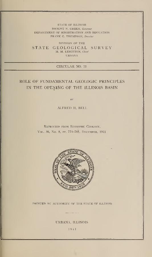
STATE OF ILLINOIS
DWIGHT H. GREEN, Governor
DEPARTMENT OF REGISTRATION AND EDUCATIONFRANK G. THOMPSON, Director
DIVISION OF THE
STATE GEOLOGICAL SURVEYM. M. LEIGHTON, Chief
URBANA
CIRCULAR NO. 75
ROLE OF FUNDAMENTAL GEOLOGIC PRINCIPLES
IN THE OPENING OF THE ILLINOIS BASIN
ALFRED H. BELL
Reprinted from Economic Geology,
Vol. 36, No. 8, pp. 774-785, December, 1941
PRINTED BY AUTHORITY OF THE STATE OF ILLINOIS
URBANA, ILLINOIS
1941


Reprinted from Economic Geology, Vol. XXXVI, No. 8, December, 1941
Printed in U. S. A.
ROLE OF FUNDAMENTAL GEOLOGIC PRINCIPLESIN THE OPENING OF THE ILLINOIS BASIN. 1
ALFRED H. BELL.
ABSTRACT.
The opening of the Illinois basin to oil production in 1937 wasthe beginning of a large-scale development that restored Illinois
to the position of a major oil producing state after the lapse of aquarter-century. The delay in the opening of the Illinois basin
was the result of several factors, the most important of whichwas perhaps the theory that oil had migrated outward from the
central parts of large structural basins and that consequently the
central parts were barren of oil and not worthy of prospecting.
This paper discusses first the sequence of events leading up to
the discovery of oil in the Illinois basin, with special emphasis onthe influence of geologic theory, second the application in the area
of the new techniques of exploration and development including
geophysical methods, rotary drilling, and electric logging. Theuse of the reflection seismograph method proved highly successful.
INTRODUCTION.
The discovery of oil in the Illinois basin in 1937 was the begin-
ning of a rapidly expanding new development of oil production
which now, nearly five years later, is still in progress. It restored
Illinois to the position of a major oil-producing state after a lapse
of a quarter-century. The purpose of this paper is to discuss the
circumstances which led to the development of the Illinois basin
oil fields with special regard to the influence of geological theory.
In view of the magnitude of these oil deposits, their proximity to
old producing fields, and their relatively shallow depth as com-
pared with many of the new fields in other states, it is natural to
inquire why they remained so long undeveloped.
1 Read at the Fiftieth Anniversary Celebration of the University of Chicago, Sep-
tember, 1 94 1.
Published with the permission of the Chief, Illinois State Geol. Survey, Urbana
774

OPENING OF ILLINOIS BASIN.
ILLINOIS BASIN.
775
The term, Illinois basin,2
is applied in this paper to the central
deepest portion of the Eastern Interior basin (Fig. i). It in-
cludes approximately 8000 square miles between the Centralia-
Chicago
LEGEND
OIL AND GAS FIELOSDISCOVERED BEFORE 1937
OIL AND GAS FIELDSDISCOVERED AFTER JAN 1, 1937
"-*"* BOUNDARY OF PENNSVLVANIANOUTLINING EASTERNINTERIOR BASIN
.--— BOUNDARY OF ILLINOIS BASIN
STATE GEOLOGICAL SURVET SEPTEMBER
Fig. i. Map of Eastern Interior basin ?nd Illinois basin showing oil and
gas fields.
2 The term " Illinois basin " has sometimes been used as an alternative for Eastern
Interior basin. However, several earlier writers, including R. S. Blatchley (I. G. S.
Bull. 1 6, 1909, pp. 63, 97, no, 129) and L. A. Mylius (I. G. S. Bull. 54, p. 28, PI.
I) confined the term " Illinois basin " to an area west of the LaSalle anticline and
therefore did not use it as a synonym for " Eastern Interior basin."

776 ALFRED H. BELL.
DuQuoin monocline on the west and the LaSalle anticline on the
east (70 miles) and approximately from the latitude of Mattoon
on the north to that of Shawneetown on the south (125 miles).
HISTORICAL BACKGROUND.
Oil production of minor importance was obtained in western
Illinois near Litchfield about 1886, and production in this field
continued until 1903. In 1904 a gas well was drilled in what is
now the Westfield pool in Clark County. This was followed by
an oil well nearby in 1905 opening the Southeastern Illinois oil
field, one of the nation's major fields. In 36 years this field has
produced 430 million barrels of oil or 61 per cent of the State's
total production to date. Prior to the opening of the Illinois
basin in 1937, however, the Southeastern Illinois field had yielded
98 per cent of the State's total. Therefore, up to 1937, the oil
history of Illinois is largely the history of one major field. The
peak of production for that period came in 1908 when Illinois pro-
duced 33.7 million barrels and ranked third in the nation. From
19 10 to 1936 the State's production declined rather steadily to a
level of less than 4^2 million barrels annually.
Beginning about 19 10 some important oil discoveries were made
in Oklahoma, and these proved to be sufficiently attractive to draw
away from Illinois in the next few years many of the oil men most
active in " wildcatting." Some good but small oil fields had been
discovered in western Illinois—for example, Sandoval in 1908
and Carlyle in 191 1—but nothing to compare with the South-
eastern Illinois field. One thing that encouraged prospecting in
this marginal area to the west of the Illinois basin was the large
amount of information on subsurface structure provided by coal
data in mines and test borings. However, in the Illinois basin
itself, few data on bedrock structure were available because there
was very little coal mining or prospecting, and because the bed-
rock is hidden by glacial drift or alluvium throughout large areas.
Because structural data on the Illinois basin were meager, there
was a tendency for geologists to assume that it was a simple flat-
bottomed geosyncline, uninterrupted by folds or other structures

OPENING OF ILLINOIS BASIN. 777
that might serve as oil traps. Furthermore, test wells drilled
west of the west edge of the Southeastern Illinois oil field found
the oil sands structurally lower and saturated by salt water.
Hence, by extrapolation, the conclusion was reached that the sands
contained nothing but salt water across the basin.
Another consideration that pointed to the same conclusion was
the theory of hydraulic accumulation and long-distance migration
of oil. According to this theory, water and oil migrate outward
from the central parts of large basins, and the oil accumulates in
underground traps in the marginal areas, leaving the central parts
barren of oil.
Strangely enough there was already a perfectly good demon-
stration of the occurrence of commercial deposits of oil and gas in
the central parts of geosynclines in the fields of western Pennsyl-
vania, West Virginia, eastern Ohio and Kentucky, all within the
Appalachian geosyncline. The failure to apply this lesson earlier
in the Michigan and Illinois basins may have been due to the idea
that the Appalachian geosyncline is a different type of structure,
being long and narrow and situated adjacent to the belt of intense
folding of the Appalachian Mountains. Another difference ap-
peared in the fact that some of the Appalachian basin fields, for
example the Copley and Cabin Creek fields in West Virginia, have
no water in the oil sands. The Pure Oil Company, however, en-
tered upon a program of extensive pioneer exploration work in
the Michigan basin, and it took the jolt of that company's dis-
covery of oil at Mt. Pleasant in the center of the Michigan basin
in 1928 to cause geologists elsewhere to consider seriously the oil
possibilities of the Illinois basin.
Recognition by geologists of favorable prospects for oil pro-
duction in the Illinois basin was only the first step toward actual
development. It was then necessary to formulate plans for ex-
ploring this extensive territory. Recommendations for such
planning are contained in a paper presented by the writer 3 before'
the Illinois Academy of Science in May 1930.
3 Bell, A. H. : The relation of geology to the development of the petroleum industry
of Illinois. Illinois Acad. Sci. Trans. 23, No. 3: 367-370, 1931.

778 ALFRED H. BELL.
ILLINOIS
Quincy
•* W EFFINGHAM I '-JplIlP (
iDibOl
X"t
K,o Louis I
ST CLAIRI y
1 "v&lflM*4 •*§-*»£ gikttr.
KEY4| j
LITIES U.«"!%.!
BEST POSSIBI
MODERATELY FAVORABLE
SLIGHT POSSIBILITIES
NEGLIGIBLE POSSIBILITIES
OIL AND GAS FIELDS DISCOVEREDSINCE 1936; /^ABANDONED
OLD OIL AND GAS FIELDS;^ABANDONED 1
DEEP PART OF BASIN
SCALE10 20 30 40 SO MILES
,^/N 58 1*V ' «l<X» "
Q/^ FR/flKLINI
"^**|.. .56
1 _j %na
:
!—'^1^=221 ^TT#I2I .122^
Fig. 2. Map classifying oil and gas possibilities in Illinois prepared in
1930, showing location of oil and gas fields as of September 1941.

OPENING OF ILLINOIS BASIN. 779
Index to Pool Numbers.
Name of Pool—County
1 Colmar-Plymouth—McDonough, Hancock2 Pittsfield (gas, abd. 1930)—Pike3 Jacksonville (gas, abd. 1937)—Morgan4 Carlinville (abd. 1925)—Macoupin5 Spanish Needle Creek (gas, abd. 1931)—Macoupin6 Gillespie-Wyen—Macoupin7 Gillespie-Benld (gas, abd. 1935)—Macoupin8 Staunton (gas, abd. 1919)—Macoupin9 Collinsville (abd. 1921)—Madison
10 Dupo—St. Clair11 Waterloo—Monroe12 Waggoner—Montgomery13 Raymond—Montgomery14 Litchfield (abd. 1904)—Montgomery15 Sorento—Bond16 Ayers (gas)—Bond17 Woburn—Bond18 Greenville (gas, abd. 1923)—Bond19 Frogtown (abd. 1933)—Clinton20 Carlyle—Clinton21 Bartelso—Clinton22 Posey—Clinton23 Hoffman—Clinton24 Centralia—Clinton, Marion25 West Centralia—Clinton26 Irvington—Washington27 McKinley—Washington28 Cordes—Washington29 Dubois—Washington30 Sparta (gas, abd. 1900)—Randolph31 Ava-Campbell Hill (gas, abd. 1934)—Jackson32 Elkville—Jackson33 Lakewood—Shelby34 Stewardson—Shelby35 Louden—Fayette, Effingham36 St. James—Fayette, Effingham37 Patoka—Marion38 Patoka (East)—Marion39 Fairman—Marion, Clinton40 Sandoval—Marion41 Tonti—Marion42 Junction City—Marion43 Salem—Marion44 Langewisch-Kuester—Marion45 Brown—Marion46 Wamac—Marion, Clinton, Washington47 Cravat—Jefferson48 Dix—Jefferson49 Roaches—Jefferson50 Woodlawn—Jefferson51 Marcoe—Jefferson
52 Elk Prairie (abd. 1940)—Jefferson53 Ina—Jefferson54 Whittington—Franklin55 Benton—Franklin56 West Frankfort—Franklin57 Thompsonville—Franklin58 Mattoon—Coles59 Siggins—Cumberland, Clark60 York—Cumberland61 Hidalgo—Jasper62 North Boos—Jasper63 Dundas Consolidated—Jasper, Richland64 Mason—Effingham65 Iola—Clay66 Sailor Springs—Clay67 Flora—Clay68 Clay City Consolidated—Clay, Wayne69 Noble—Richland70 Olney—Richland71 South Olney (abd. 1941)—Richland72 Schnell—Richland73 Bonpas—Richland74 Bonpas (West)—Richland75 Parkersburg—Richland76 Rinard (abd. 1939)—Wayne
Name of Pool—County
77 Johnsonville—Wayne78 Roundprairie—Wayne79 Cisne—Wayne80 Jeff—Wayne81 Mt. Erie—Wayne82 S. Mt. Erie—Wayne83 Boyleston—Wayne84 Goldengate—Wayne85 Mayberry—Wayne86 North Aden—Wayne87 Aden—Wayne, Hamilton88 Barnhill—Wayne89 Leech Twp —Wayne90 Bone Gap—Edwards91 Ellery—Edwards, Wayne92 Albion—Edwards93 Cowling—Edwards94 Grayville—Edwards, White95 Dahlgren—Hamilton96 Belle Prairie—Hamilton97 Bungay—Hamilton98 Hoodville—Hamilton99 Rural Hill—Hamilton100 Dale—Hamilton101 Walpole—Hamilton102 Eldorado—Saline103 Mill Shoals—White, Hamilton104 Burnt Prairie—White105 Grayville West—White106 Centerville—White107 New Harmony Consolidated—White108 Calvin—White109 Phillipstown—White110 New Harmony South—White111 Maunie North—White112 Maunie—White113 Maunie South—White114 Stokes—White115 Carmi—White116 Storms—White117 Iron—White118 Roland—White119 Herald—White120 New Haven—White121 Omaha—Gallatin122 Inman North—Gallatin123 Inman East—Gallatin124 Inman—Gallatin
125 Junction—Gallatin
126 Warrenton-Borton—Edgar127 Westfield—Clark, Coles128 Casey—Clark129 Martinsville—Clark130 North Johnson—Clark131 South Johnson—Clark132 Bellair—Crawford, Jasper133 Main—Crawford134 New Hebron—Crawford135 Flat Rock—Crawford136 Chapman—Crawford137 Allison-Weger—Crawford138 Parker—Crawford139 Birds—Crawford, Lawrence140 Russellville—Lawrence141 Lawrence—Lawrence, Crawford142 South Lawrence—Lawrence143 St. Francisville—Lawrence144 Lancaster—Wabash, Lawrence145 Allendale—Wabash146 West Mt. Carmel—Wabash147 Mt. Carmel—Wabash148 Maud—Wabash149 East Keensburg—Wabash150 Keensburg—Wabash151 Griffin—Wabash

780 ALFRED H. BELL.
CLASSIFICATION MAP.
In September 1930, at the invitation of the Western Society of
Engineers, Chicago, the Illinois State Geological Survey prepared
an exhibit of the scientific data which it had accumulated during
its previous 25 years of activity, on the mineral wealth of Illinois,
and the geological-engineering conditions within the State. As a
part of this exhibit a map was prepared classifying the State into
areas according to the relative probability of finding new oil fields.
In this map the Illinois basin and part of the marginal area to the
west were given the highest rating. The classification was based
mainly on two factors : ( 1 ) the presence or absence of strata
known to be oil producing, and (2) the varying character of the
structural deformations in various regions. Fig. 2 shows the
original classification and the location of oil pools as of Septem-
ber 1941.
Among those who attended the conferences and exhibit of the
Western Society of Engineers and State Geological Survey in
Chicago in September 1930 were representatives of the Pure Oil
Company. Having for some time considered the possibilities of
the Illinois basin as a productive province, and encouraged by de-
velopment in Michigan resulting from their early work there, the
Pure Oil Company, shortly following this meeting, undertook ad-
ditional subsurface geological studies of the Illinois basin and
then a torsion balance survey across the basin. According to
Wasson, " This work, which started at the Indiana line and
crossed a portion of the old fields, indicated a gravitational dis-
turbance similar to that found on the south end of the old fields."
Economic conditions necessitated the abandonment of further
geophysical investigations for the next few years.
REFLECTION SEISMOGRAPH.
The key that unlocked the door to hidden oil structures in the
Illinois basin proved to be the reflection seismograph method.
Encouraged by the success of this method in Oklahoma and
Texas, the Pure Oil Company introduced it into Illinois in the

OPENING OF ILLINOIS BASIN. 78
1
fall of 1935. Following a reconnaissance seismograph survey of
a large area in the fall and winter of 1935-1936, the Pure Oil
Company acquired a block of leases in April 1936, covering about
250,000 acres in Wayne, Richland, and Jasper counties, and ex-
tending approximately from Fairfield on the south to Hunt City
on the north. Up to date some 25,000 acres are producing oil in
the area of this block. These new fields extend with minor breaks
for nearly 35 miles in a northeast-southwest direction.
STUDIES OF PENNSYLVANIAN STRATIGRAPHY.
The seismograph method, however, was not the only guide to
exploration in the Illinois basin. Beginning in 1926, the Illinois
Geological Survey began a far-reaching investigation of Pennsyl-
vanian stratigraphy under the direction of J. M. Weller.
Reconnaissance Studies by Weller resulted in the formulation of
a theory of Pennsylvanian cyclical sedimentation that was tested
by H. R. Wanless in the detailed mapping of two western Illinois
quadrangles. Later reconnaissance studies by Wanless demon-
strated that Pennsylvanian cyclothems, about 50 of which are now
recognized in Illinois, can be traced and correlated for long dis-
tances. This new approach to the complex problems of Pennsyl-
vanian stratigraphly has made possible the correlation of Pennsyl-
vanian beds and the mapping of small subdivisions of the Penn-
sylvanian system in great detail. These studies were continued as
rapidly as possible by Weller, Wanless, and assistants until all of
the Pennsylvanian area in Illinois (about ^4 of the State) had
been covered in reconnaissance. Evidence of structures favorable
to the occurrence of oil in the basin was uncovered and the re-
sults for one of the most promising areas were published by the
Survey early in 1936.4 The report contains a structure contour
map on the Omega limestone, which crops out in the area de-
scribed.
4 Weller, J. M., and Bell, A. H. : Geology and oil and gas possibilities of parts of
Marion and Clay Counties, with discussion of the central portion of the Illinois
Basin. Illinois Geol. Surv. Rept. Inv. No. 40, 1936.

782 ALFRED H. BELL.
Mr. M. W. Fuller, at that time a graduate student in the Uni-
versity of Illinois assisted in field studies of the Pennsylvanian in
western and extreme southern Illinois as an employee of the Sur-
vey. Following his resignation from the Survey staff in the
spring of 1934, Mr. Fuller was employed by the Carter Oil Com-pany and later that year was assigned to studies of the stratig-
raphy and structure of outcropping beds in the Illinois basin and
surrounding areas under the direction of Mr. E. V. Whitwell.
Messrs. Fuller and Whitwell independently discovered and mapped
the structures described in the Survey report mentioned above.
Beginning in the fall of 1935 leases were taken in these and other
areas on the basis of geologic studies of outcropping beds.
The pioneering efforts of the Pure Oil Company and the
Carter Oil Company in exploring the Illinois basin and in leasing
large blocks of acreage were followed by investigations and leas-
ing by numerous other oil companies, both major and independent.
Among the companies that undertook geological studies in the
area in the fall of 1935 were the Shell Oil Company and the Texas
Company. The publication of Report of Investigations 40, by
the Illinois Geological Survey March 1, 1936, greatly stimulated
interest in the territory. The first deep test wells in the Illinois
basin were begun by the Pure Oil Company in the late fall of 1936
and were drilled with cable tools. In the meantime the first well
drilled with rotary tools in Illinois was begun by the Adams
Louisiana Oil Company, now Adams Oil and Gas Company, near
Patoka in late December 1936. This well was located on a coal
structure,5 which was also mapped by seismograph. It came in
for a 52 barrel producer from the Benoist sand, depth 1391-1418
feet, January 27, 1937, and was the discovery well of the Patoka
pool. The Patoka pool is located on the west margin of the basin
about 10 miles north of the old Sandoval pool, and accordingly was
not as noteworthy a discovery as the first two wells in the central
part of the basin. These were the Pure Oil Company's Weiler
No. 1, completed February 26, 1937, as a 40-barrel producer in the
sBlatchley, R. S. : Illinois oil resources. 111. Geol. Surv. Bull. 16, iqio, PI. 14,
opposite p. 142.

OPENING OF ILLINOIS BASIN. 7^3
Cypress sandstone from 2608 to 2613 feet, the discovery well of
the Clay City pool, Clay County, and the same company's Bradley
No. 1, completed March 4, 1937, estimated initial production 100
barrels in the Aux Vases (basal Chester) sandstone, discovery
well of the Cisne pool, Wayne County.
The first big producer in the Illinois basin was the Pure Oil
Company-B. Travis No. 1, the discovery well of McClosky pro-
duction in the Clay City pool, completed May 15, 1937, for an
initial production of 2642 barrels.
Once large scale competitive leasing got under way in the Illi-
nois basin there was little opportunity to use detailed surface
geology as a guide to leasing because by the time detailed work
could be completed in one area, the land would be leased by com-
petitors. Some companies leased large areas, in some cases al-
most entire counties, and then began their detailed structural or
seismograph investigations, or both. Numerous fields were dis-
covered by a combination of geological and geophysical methods
in which the seismograph work was located in an area where sur-
face or coal data suggested the presence of favorable structure.
The Louden and Patoka fields are examples of this.
NEW TECHNIQUES.
New techniques introduced into Illinois in connection with the
development in the Illinois basin include rotary drilling, electric
logging, and drilling-time logging. Coring and the testing of
cores for porosity, permeability and saturation, acidizing lime-
stone pays, cementing casing in wells, the shooting with nitro-
glycerin of sandstone pays, are among those techniques previously
in use in the state but which were greatly expanded during the
development of the new fields. Electric logs have proved a great
boon both to production men and geologists. Where many wells
are being completed in a short time the electric logs provide a
ready means of obtaining stratigraphic and structural data im-
portant in planning further development. If it were necessary
to depend for this upon sample study logs the time necessary to

7§4 ALFRED H. BELL.
obtain these data that are needed immediately would be greatly
increased.
As has been pointed out by Levorsen in a recent paper,6the use
of rotary drilling " gave a final and lasting boost to geology."
In the old days of cable-tool drilling, logs were made by the
driller, but owing to the nature of rotary drilling it is difficult
or impossible for the driller to make a good log. Because the
services of a geologist are needed to make an adequate log of a
rotary well, in the words of Levorsen, " a much closer relation-
ship developed between the geologist and the oil industry with the
change of drilling."
In 1926 when the writer joined the staff of the Illinois Geologi-
cal Survey he knew of only one oil company geologist resident in
the State who was actively concerned with Illinois oil geology.
Beginning about 1937 there was a rapid increase in the number of
oil geologists employed in the State and at present the number
is something like 200.
FUTURE TRENDS IN GEOLOGIC STUDIES.
Having considered the part played by geological theory in
beginning the new development in the Illinois basin, let us con-
sider briefly how the new data resulting from this development
may influence geological theory and geological studies in the
future.
The drilling of more than 13,000 wells for oil and gas in south-
ern Illinois in the past 5 years has provided a wealth of new in-
formation on the subsurface geology of the State. The inter-
pretation of these data in terms of geologic history is a formid-
able task. It is going forward in the offices of many oil com-
panies and in the State Geological Survey. A forum for the
discussion of common problems is provided in the monthly meet-
ings of the Illinois Geological Society which is affiliated with
the American Association of Petroleum Geologists.
6 Levorsen, A. I. : Geology -and oil discovery. Presented before the Illinois-
Indiana Pet. Assoc, at Robinson, Illinois, June 7, 1941.

OPENING OF ILLINOIS BASIN. 785
The fundamental problems of petroleum geology—the origin
of oils, their mode of occurrence, migration, and accumulation, the
nature and origin of the reservoirs and the reservoir rocks and
their contained fluids, etc., will continue to engage the attention
and thought of geologists in Illinois as elsewhere. Because a
great majority of the oil pools of Illinois are found to be on or
near anticlinal structures, efforts have been devoted largely, per-
haps too much so, to the search for anticlinal structures. The
importance of lenticular sands has been recognized in some areas,
for example the old fields of Crawford County, and similar con-
ditions are being revealed in some of the new fields in the WabashRiver area. With increased knowledge of subsurface stratig-
raphy it is to be expected that more effort will be devoted to the
search for stratigraphic traps. Although we may not have an
East Texas it is quite possible that important oil occurrences
under similar geological conditions may yet be revealed.
In conclusion, I should like to quote from a recent paper r by
Levorsen.
Thus we see how, as our theories and ideas change, our concept of the
undiscovered reserve changes and that it has increased exactly in propor-
tion as our limiting view points were destroyed. And so it goes, with the
result that today our mental limitations on what constitutes favorable oil
territory are at the lowest in our history and the favorable areas for fu-
ture possible discoveries the highest.
The Illinois basin is an example of a prolific oil-bearing area
where mental limitations in the past prevented exploration.
Once these mental limitations were removed its opening could
not long be delayed.
Illinois Geological Survey,
Urbana, III.,
Nov. 4, 1941.
7 Op. cit.


"WASeHER'S"LIBIvAEl BINDERS
507 S. Goodwin
Urbana, I1L

MHlmMfuinwifj «'
. \\l\l\
ffl3B&
IffiffiL]"i ufftlfl -i!
iiliiiiihliliffl
lltti§fl3slffl21 IiU 3Jiiffltlfflisfllllliill
litw
llHlEP
lliimii
IP
III!
8 <
HfiW
nffllff]
;*::•naiiii
*•
ii