Rajapur Iron Ore Mine - Karnataka State Pollution Control Board
165
0 Rajapur Iron Ore Mine Of Smt. K.M. Parvathamma, Bellary at ML.No. 2514, Rajapur Village, Sandur Taluk, Bellary District, Karnataka, India (43000 TPA-24.82 Ha. Iron Ore Production Capacity) ENVIRONMENTAL IMPACT ASSESSMENT AND ENVIRONMENT MANAGEMENT PLAN Prepared by: Ecomen Laboratories Pvt. Ltd., MoEF & CC Approved, NABET & NABL Accredited Consultancy First Floor, Sy. No. 91/A, Ward No. 7, MCHS Jakkur Layout, Jakkur, Banglore-560064, Karnataka. Ph. No. +91-080 2953368
-
Upload
khangminh22 -
Category
Documents
-
view
4 -
download
0
Transcript of Rajapur Iron Ore Mine - Karnataka State Pollution Control Board

0
Rajapur Iron Ore Mine Of Smt. K.M. Parvathamma, Bellary at ML.No. 2514, Rajapur Village,
Sandur Taluk, Bellary District, Karnataka, India
(43000 TPA-24.82 Ha. Iron Ore Production Capacity)
ENVIRONMENTAL IMPACT ASSESSMENT
AND
ENVIRONMENT MANAGEMENT PLAN
Prepared by:
Ecomen Laboratories Pvt. Ltd.,
MoEF & CC Approved, NABET & NABL Accredited Consultancy
First Floor, Sy. No. 91/A, Ward No. 7, MCHS Jakkur Layout,
Jakkur, Banglore-560064, Karnataka.
Ph. No. +91-080 2953368

1
LIST OF CONTENTS
CONTENTS
1 INTRODUCTION ........................................................................................ 1
1.1 Purpose of the Report ...................................................................... 1
1.2 Identification of Project .................................................................... 2
1.2.1 Project Proponent ...................................................................... 2
1.3 Brief Description of Nature, Size, and Location of the Project ........... 2
1.4 Importance to the Country & Region ................................................ 2
1.5 Brief History of Project ..................................................................... 3
1.5.1 Details of Mining Lease .............................................................. 4
1.5.2 Mining Plan ............................................................................... 4
1.5.3 Forest Clearance ........................................................................ 4
1.6 Scope of the study - details of regulatory scoping carried out (as per terms of
reference): ............................................................................................. 4
2 PROJECT DESCRIPTION .......................................................................... 5
2.1 Type of the Project ........................................................................... 5
2.2 Need of the Project ........................................................................... 6
2.3 Location .......................................................................................... 7
2.4 Size or Magnitude of Operation ........................................................ 8
2.4.1 Mining Operations ..................................................................... 9
2.4.2 Exploration .............................................................................. 10
2.4.3 Production Details ................................................................... 11
2.5 Proposed schedule for approval and implementation ...................... 11
2.6 Technology and Process Description .............................................. 12
2.6.1 Method of Mining ..................................................................... 12
2.6.2 Drilling .................................................................................... 15
2.6.3 Blasting ................................................................................... 15
2.6.4 Haulage & Transportation for Ore & Waste .............................. 16
2.6.5 Crushing and Screening ........................................................... 17
2.6.6 Stacking, Wagon Loading & Transportation .............................. 17
2.6.7 Recovery and Grade ................................................................. 17
2.6.8 Energy ..................................................................................... 17
2.7 Project Description ........................................................................ 18
2.7.1 Topography .............................................................................. 18
2.7.2 Drainage Pattern ...................................................................... 18
2.7.3 Geology .................................................................................... 18

2
2.7.4 Waste Generation .................................................................... 21
2.7.5 Utilities .................................................................................... 22
2.8 Description of Mitigation Measures Incorporated to meet the Environmental
Standards ........................................................................................... 23
2.8.1 Air Pollution Mitigate Measures ................................................ 23
2.8.2 Water Pollution Mitigative Measures ........................................ 24
2.8.3 Noise pollution mitigative measures ......................................... 24
2.8.4 Solid Waste Management ......................................................... 24
2.8.5 Energy Efficiency measures ..................................................... 24
2.9 Assessment of New & Untested Technology for the risk of Technological Failure
24
3 DESCRIPTION OF THE ENVIRONMENT.......................................... 25
3.1 Study Description .......................................................................... 25
3.1.1 Study Period ............................................................................ 25
3.1.2 Study Components .................................................................. 25
3.2 General Climatic Condition (Secondary data) ................................. 26
3.2.1 Climate .................................................................................... 26
3.2.2 Temperature, Relative Humidity and Rainfall ........................... 26
3.2.3 Wind ........................................................................................ 26
3.2.4 Baseline Data .......................................................................... 27
3.3 Selection of Sampling Stations ....................................................... 27
3.3.1 Micro-Meteorological Station .................................................... 27
3.3.2 Ambient Air Quality Locations .................................................. 28
3.3.3 Water Quality Locations ........................................................... 30
3.3.4 Noise Monitoring Locations: ..................................................... 33
3.3.5 Soil Quality Locations: ............................................................. 35
3.4 Sampling Procedure ....................................................................... 37
3.4.1 Micro Meteorological Monitoring ............................................... 37
3.4.2 Ambient Air Monitoring ............................................................ 37
3.4.3 Water Quality Monitoring ......................................................... 38
3.4.4 Ambient Noise Level ................................................................. 38
3.4.5 Soil Quality .............................................................................. 39
3.5 Data Analysis ................................................................................ 40
3.5.1 Meteorological Study ................................................................ 40
3.5.2 Ambient Air Quality ................................................................. 42
3.5.3 Water Quality .......................................................................... 45
3.5.4 Noise ....................................................................................... 48
3.5.5 Ambient Noise Level ................................................................. 48

3
3.5.6 Soil Quality .............................................................................. 49
3.6 Socio-Economic Scenario ............................................................... 50
3.6.1 Demographic Features of Study Area-Rural .............................. 50
3.7 Flora and Fauna ............................................................................ 55
3.7.1 Scope ....................................................................................... 55
3.7.2 Activities Undertaken During the Study ................................... 55
3.7.3 Survey Limitation .................................................................... 56
3.7.4 Approach of the Study ............................................................. 56
3.7.5 Methodology ............................................................................ 56
3.7.6 Sampling Stations .................................................................... 58
3.7.7 Habitat and Forest Type Diversity ............................................ 60
3.7.8 Flora of project site .................................................................. 61
3.7.9 Flora of Study area .................................................................. 65
3.7.10 Faunal Diversity in Core and Buffer Zone ................................. 72
3.8 Land use ....................................................................................... 76
3.8.1 Introduction ............................................................................. 76
3.8.2 Data Input ............................................................................... 77
3.8.3 Land use planning of the project site ........................................ 81
4 ANTICIPATED ENVIRONMENTAL IMPACTS & MITIGATION MEASURES 85
4.1 Introduction .................................................................................. 85
4.2 Anticipated Environmental Impacts ............................................... 85
4.2.1 Topography .............................................................................. 85
4.2.2 Land use .................................................................................. 86
4.2.3 Top Soil ................................................................................... 87
4.2.4 Drainage .................................................................................. 87
4.2.5 Air Environment ...................................................................... 88
4.2.6 Meteorological Conditions Used in Predictions .......................... 90
4.2.7 Atmospheric Stability ............................................................... 91
4.2.8 Extrapolation of Wind Speed .................................................... 91
4.2.9 Ambient air quality and background concentrations ................ 92
4.3 Plan and frame work of computations: ........................................... 92
4.3.1 Selection of locations: .............................................................. 92
4.3.2 Plan of computation ................................................................. 92
4.4 Results and Discussions ................................................................ 93
4.4.1 Noise & Vibration ..................................................................... 93
4.4.2 Water Environment .................................................................. 94
4.4.3 Ground water .......................................................................... 95

4
4.4.4 Soil Quality .............................................................................. 95
4.4.5 Waste generation ..................................................................... 95
4.4.6 Flora and fauna ....................................................................... 96
4.4.7 Socio-economic conditions ....................................................... 97
4.4.8 Impact due to the possible Accident ......................................... 97
4.4.9 Impact due to the Construction activities ................................. 97
4.4.10 Impact due to the final decommissioning or rehabilitation ........ 98
4.5 Mitigation Measures ...................................................................... 98
4.5.1 General Views .......................................................................... 98
4.5.2 Topography .............................................................................. 98
4.5.3 Land Use ................................................................................. 98
4.5.4 Top Soil ................................................................................... 99
4.5.5 Drainage .................................................................................. 99
4.5.6 Air Environment ...................................................................... 99
4.5.7 Noise and Vibration ............................................................... 101
4.5.8 Water Environment ................................................................ 102
4.5.9 Details of engineering measures are being undertaken as per R & R plan
103
4.5.10 Soil Quality ............................................................................ 104
4.5.11 Waste Management ................................................................ 105
4.5.12 Reclamation & Rehabilitation of mined out areas ................... 107
4.5.13 Green-belt Development Programme ...................................... 109
4.5.14 Proposed Green-belt development Programme ........................ 110
4.5.15 Socio-economic conditions ..................................................... 113
4.5.16 Management plan for the possible Accident ............................ 114
4.5.17 Management plan for impact due to the construction activities114
4.5.18 Management Plan for the Impact due to the final decommissioning or
rehabilitation..................................................................................... 114
4.5.19 Power (energy) conservation ................................................... 114
5 ANALYSIS OF ALTERNATIVES (TECHNOLOGY & SITE) ......... 115
5.1 Analysis of Alternative Technology ............................................... 115
5.2 Analysis of Alternative Site .......................................................... 115
6 ENVIRONMENTAL MONITORING PROGRAM........................... 116
6.1 Environmental Monitoring ........................................................... 116
6.1.1 Meteorological Monitoring ...................................................... 117
6.1.2 Ambient Air Quality Monitoring .............................................. 117
6.1.3 Fugitive Dust ......................................................................... 117
6.1.4 Water Quality Monitoring ....................................................... 117

5
6.1.5 Ambient Noise Levels ............................................................. 118
6.1.6 Work Zone Noise Level ........................................................... 118
6.1.7 Ground Vibrations Monitoring ............................................... 118
6.1.8 Soil Sampling ......................................................................... 118
6.2 Monitoring Methods and Data Analysis ........................................ 120
6.2.1 Air Quality Monitoring ........................................................... 120
6.2.2 Water Quality Monitoring ....................................................... 121
6.2.3 Noise Levels ........................................................................... 121
6.2.4 Cost towards environment management ................................. 121
7 ADDITIONAL STUDIES ....................................................................... 123
7.1 Public Hearing ............................................................................. 123
7.2 Risk Assessment.......................................................................... 123
7.3 Scope of Study ............................................................................. 124
7.3.1 Risk Assessment .................................................................... 124
7.3.2 Disaster due to surface fire .................................................... 124
7.3.3 Disaster due to failure of waste dump .................................... 125
7.3.4 Disaster due to failure of PIT slope ......................................... 125
7.3.5 Damage due to lubricant and HSD storage chambers/tankers125
7.3.6 Emergency Control Centres .................................................... 126
7.3.7 Action on site ......................................................................... 126
7.3.8 Post disaster analysis and evaluation ..................................... 127
7.3.9 Emergency services ................................................................ 127
7.3.10 Off-site emergency plan ......................................................... 128
8 PROJECT BENEFITS ............................................................................... 130
8.1 Improvement in the Physical & Social Infrastructure.................... 130
8.2 Corporate Social Responsibility .................................................... 130
8.2.1 Corporate Social Policy .......................................................... 130
8.3 Employment Generation .............................................................. 130
8.4 Services to be Rendered to Surrounding Villages / Towns ............ 131
8.4.1 Infrastructure ........................................................................ 131
8.4.2 Health / Disease Control Measures ........................................ 131
8.4.3 Public Health Amenities ......................................................... 131
8.5 CSR Expenditure ......................................................................... 131
9 ENVIRONMENTAL COST BENEFIT ANALYSIS ........................... 133
10 ENVIRONMENTAL MANAGEMENT PLAN ................................... 134
10.1 Environmental Policy ............................................................. 134
10.2 Environment Management System ......................................... 134

6
10.3 Administrative Aspects and Environmental Monitoring Program135
10.4 Institutional Arrangements for Environment Protection and Conservation
135
10.5 Implementation of the Environmental Measures ..................... 138
10.6 Budget for Implementation of Environmental Management Plan138
11 SUMMARY & CONCLUSION .............................................................. 139
11.1 Introduction ........................................................................... 139
11.2 Project Description ................................................................. 139
11.3 Resource Requirement: .......................................................... 141
11.4 Baseline Environmental Status: ............................................. 142
11.4.1 Meteorology ........................................................................... 142
11.5 Ambient Air Quality ............................................................... 143
11.5.1 Water Quality ........................................................................ 143
11.5.2 Noise Levels ........................................................................... 144
11.5.3 Soil Quality ............................................................................ 144
11.5.4 Land Use ............................................................................... 144
11.5.5 Ecological Environment ......................................................... 144
11.5.6 Social Environment ................................................................ 145
11.6 Summary of Anticipated Environmental Impacts and Mitigation145
11.7 Disaster Management Plan .................................................... 151
11.8 Project Benefits ...................................................................... 151
11.9 Environmental Management Plan ........................................... 152
11.10 Reclamation and Rehabilitation of mined out areas ............. 152
11.11 Conclusion .......................................................................... 152
12 DISCLOSURE OF CONSULTANTS ENGAGED ............................. 153

0
LIST OF TABLES
1. Table 2-1 Salient Features of RAJAPUR IRON ORE MINE ......................................................... 5
2. Table 2-2 Details of coordinates .............................................................................................. 7
3. Table 2-3 List of equipment deployed for mining ...................................................................... 9
4. Table 2-4 Balance reserves as on 1.4.2021 ............................................................................ 10
5. Table 2-5 Proposed production .............................................................................................. 11
6. Table 2-6 Fleet of Equipment & Machineries loading equipment ............................................. 16
7. Table 2-7 Expected grade ...................................................................................................... 17
8. Table 2-8 The land use pattern of the mine area at present and Conceptual period ................. 20
9. Table 2-9 proposed waste generation (Tonnes) ....................................................................... 21
10. Table 3-1 Showing Attributes and study parameters .............................................................. 25
11. Table 3-2 showing the Monthly averages micro-meteorological data ........................................ 28
12. Table 3-3 Details of the Ambient Air Quality monitoring locations .......................................... 28
13. Table 3-4 Details of the water sample monitoring locations .................................................... 30
14. Table 3-5 Details of the Noise monitoring locations ................................................................ 33
15. Table 3-6 Details of the Soil monitoring locations ................................................................... 35
16. Table 3-7 Ambient noise level monitoring ............................................................................... 38
17. Table 3-8 Maximum &Minimum Temperature, Relative Humidity (%) & Rainfall (mm) ............. 41
18. Table 3-9 Ambient Air Quality Results Maximum & Minimum Values ..................................... 42
19. Table 3-10 Ground water Quality Results .............................................................................. 46
20. Table 3-11 Surface water Quality Results .............................................................................. 47
21. Table 3-12 Noise levels results of the study area .................................................................... 48
22. Table 3-13 Soil quality monitoring Result .............................................................................. 49
23. Table 3-14 Showing the List of villages with the population .................................................... 50
24. Table 3-15 demographic features as per the census 2011 ....................................................... 54
25. Table 3-16 Sampling Locations of the Study area ................................................................... 58
26. Table 3-17 Checklist of trees recorded at the project site ........................................................ 62
27. Table 3-18 girth distribution of trees at project site ................................................................ 63
28. Table 3-19 basal area and carbon sequestration of tree species at project site ....................... 63
29. Table 3-20 Checklists of herbs, shrubs and climbers at project site ....................................... 64
30. Table 3-21 checklist of trees recorded at study area ............................................................... 67
31. Table 3-22 girth distribution of trees at study area ................................................................. 68
32. Table 3-23 basal area and carbon sequestration of tree species at study area ......................... 68
33. Table 3-24 phyto sociological parameters of trees at study area .............................................. 69
34. Table 3-25 checklist of herbs, shrubs and climbers ................................................................ 70
35. Table 3-26 Fauna Diversity in Core Zone (Primary Source) ..................................................... 72
36. Table 3-27 Fauna Diversity in Buffer Zone (Based on Primary Source) .................................... 74
37. Table 3-28 Major land use/land cover categories of study area ............................................... 79
38. Table 3-29 Land use planning of the proposed site ................................................................. 81

1
39. Table 3-30 Proposed Land use pattern-Plan period & Conceptual stage .................................. 81
40. Table 4-1 Land use planning of the proposed site ................................................................... 86
41. Table 4-2 Proposed Land use pattern-Plan period & Conceptual stage .................................... 86
42. Table 4-3 Emission Sources .................................................................................................. 89
43. Table 4-4 Emission rates from DG sets and dust extraction system ........................................ 90
44. Table 4-5 Pasquill – Gifford Stability Classification ................................................................. 91
45. Table 4-6 Ambient air quality standards by CPCB .................................................................. 92
46. Table 4-7 The air quality parameters of the study area ........................................................... 92
47. Table 4-8 Waste generation ................................................................................................... 96
48. Table 4-9 Surrounding Mines of Rajapura iron ore mine ...................................................... 100
49. Table 4-10 Measures carried out as R&R plan ..................................................................... 103
50. Table 4-11 Details of Dumps in Block - I .............................................................................. 105
51. Table 4-12 Details of year wise dumping proposals .............................................................. 106
52. Table 4-13 Area for afforestation proposed for the 5-year plan period ................................... 110
53. Table 4-14 Grasses and Bamboo species ............................................................................. 111
54. Table 4-15 Species Recommended for broadcasting.............................................................. 112
55. Table 4-16 Initiatives by K.M.Parvatamma towards public health ......................................... 113
56. Table 6-1 Monitoring Schedule for Environmental Parameters .............................................. 118
57. Table 6-2 Duration of noise level measurement .................................................................... 121
58. Table 6-3 Capital cost towards Environment management ................................................... 122
59. Table 8-1 Details of Proposed Manpower (permanent / contractual / indirect) ...................... 131
60. Table 8-2 Proposed CSR Budget .......................................................................................... 131
61. Table 11-1 Salient Features of Rajapura Iron Ore Mine ........................................................ 140
62. Table 11-2 Land use pattern-existing & proposed (Conceptual stage) .................................... 141
63. Table 11-3 Ambient air quality levels ................................................................................... 143
64. Table 11-4 Major land use/ Land cover categories ............................................................... 144
65. Table 11-5 Environmental impacts and mitigation ............................................................... 146
LIST OF FIGURES
66. Figure 2-1 Location map of the project site .............................................................................. 8
67. Figure 3-1 Wind rose diagram of the study period .................................................................. 27
68. Figure 3-2 Google map showing the air quality monitoring locations...................................... 29
69. Figure 3-3 Google map showing the ground and surface water monitoring locations ............. 32
70. Figure 3-4 Google map showing the noise monitoring locations .............................................. 34
71. Figure 3-5 Google map showing the soil monitoring locations ................................................. 36
72. Figure 3-6 Wind rose Diagram of October – December 2021 ................................................... 40
73. Figure 3-7 Maximum & Minimum Values Variation PM10 ....................................................... 43
74. Figure 3-8 Maximum & Minimum values variation PM2.5 ...................................................... 43
75. Figure 3-9 Maximum & Minimum values variation SO2 ......................................................... 44
76. Figure 3-10 Maximum & Minimum values various No2 .......................................................... 44
77. Figure 3-11 Maximum & Minimum values various CO ........................................................... 45
78. Figure 3-12 % of Population in study area ............................................................................. 51

2
79. Figure 3-13 Chart showing the male to female population ...................................................... 52
80. Figure 3-14 Percentage literacy rate of the study area ............................................................ 53
81. Figure 3-15 Percentage employment scenario in study area .................................................... 54
82. Figure 3-16 ecological studies sampling location .................................................................... 59
83. Figure 3-17 Flow chart illustrating the methodology of Digital image processing ..................... 78
84. Figure 3-18 False colour composite Imagery of Study Area ..................................................... 82
85. Figure 3-19 land use and land cover classified imagery of study area ..................................... 83
86. Figure 3-20 Land use planning of the proposed site ............................................................... 84
87. Figure 10-1 Organizational structure of environment department ......................................... 137
Chapter-1 EIA-EMP of Rajapur Iron Ore Mine of Smt. K.M. Parvathamma, Bellary
1
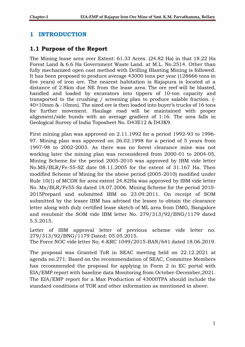
1 INTRODUCTION
1.1 Purpose of the Report
The Mining lease area over Extent: 61.33 Acres. (24.82 Ha) in that 18.22 Ha Forest Land & 6.6 Ha Government Waste Land. at M.L. No.2514. Other than
fully mechanized open cast method with Drilling Blasting Mining is followed. It has been proposed to produce average 43000 tons per year (128666 tons in
five years) of iron ore. The nearest habitation is Rajapura is located at a distance of 2.8km due NE from the lease area. The ore reef will be blasted, handled and loaded by excavators into tippers of 10-ton capacity and
transported to the crushing / screening plan to produce salable fraction. (-40+10mm & -10mm). The sized ore is then loaded into buyer’s trucks of 16 tons
for further movement. Haulage road will be maintained with proper alignment/side bunds with an average gradient of 1:16. The area falls in Geological Survey of India Toposheet No. D43E12 & D43K9.
First mining plan was approved on 2.11.1992 for a period 1992-93 to 1996-
97. Mining plan was approved on 26.02.1998 for a period of 5 years from
1997-98 to 2002-2003. As there was no forest clearance mine was not
working later the mining plan was reconsidered from 2000-01 to 2004-05.
Mining Scheme for the period 2005-2010 was approved by IBM vide letter
No.MS/BLR/Fe-55-SZ date 08.11.2005 for the extent of 31.167 Ha. Then
modified Scheme of Mining for the above period (2005-2010) modified under
Rule 10(1) of MCDR for area extent 24.82Ha was approved by IBM vide letter
No. Ms/BLR/Fe55-Sz dated 18.07.2006. Mining Scheme for the period 2010-
2015Prepard and submitted IBM on 23.09.2011. On receipt of SOM
submitted by the lessee IBM has advised the lessee to obtain the clearance
letter along with duly certified lease sketch of ML area from DMG, Bangalore
and resubmit the SOM vide IBM letter No. 279/313/92/BNG/1179 dated
5.5.2015.
Letter of IBM approval letter of previous scheme vide letter no. 279/313/92/BNG/1179 Dated: 05.05.2015.
The Force NOC vide letter No; 4-KRC 1049/2015-BAN/641 dated 18.06.2019.
The proposal was Granted ToR in SEAC meeting held on 22.12.2021 at
agenda no.271. Based on the recommendation of SEAC, Committee Members
has recommended the proposal for applying in Form 2 in EC portal with
EIA/EMP report with baseline data Monitoring from October-December,2021.
The EIA/EMP report for a Max Production of 43000TPA should include the
standard conditions of TOR and other information as mentioned in above.

Chapter-1 EIA-EMP Rajapura Iron Ore Mine of Smt. K.M. Parvatamma, Bellary
2
1.2 Identification of Project
The Mining lease area over Extent: 61.33 Acres. (24.82 Ha) in that 18.22 Ha
Forest Land & 6.6 Ha Government Waste Land. at M.L. No.2514. Other than fully mechanized open cast method with Drilling Blasting Mining is followed. It has been proposed to produce average 43000 tons per year (128666 tons in
five years) of iron ore. The nearest habitation is Rajapura is located at a distance of 2.8km due NE from the lease area. The ore reef will be blasted,
handled and loaded by excavators into tippers of 10-ton capacity and transported to the crushing / screening plan to produce salable fraction. (-40+10mm & -10mm). The sized ore is then loaded into buyer’s trucks of 16
tons for further movement. Haulage road will be maintained with proper alignment/side bunds with an average gradient of 1:16. The Proposed area is bounded by the Latitude N-15°00'58.3" to N- 15°01'32.9" and longitude E-
76°39'31.7” to E-76°39'57.3” in Topo Sheet No. D43E12 & D43K9.
1.2.1 Project Proponent
Rajapura Iron Ore Mines (ML. No 2514) is held by Smt. K.M. Parvatamma, Ballari over an Extent of 61.33 Acres. (24.82 Ha) as per CEC and 24.82Ha as
per Lease Deed near Rajapura Village, Sandur Taluk, Bellary District of Karnataka.
1.3 Brief Description of Nature, Size, and Location of the
Project
The proposed project involves the mining of iron ore over an extent of 24.82
ha. and forms part of Schedule 1(a) (i) Mining of Minerals (Non-Coal Mining),
Category B1 of EIA Notification, 2006. The objective of the project is to cater
the iron ore demand to the nearby Industries.
Rajapura Mine proposes to produce 43,000 TPA Iron ore (ROM) Extent: 61.33
Acres. (24.82 Ha) in that 18.22 Ha Forest Land & 6.6 Ha Government Waste
Land. at M.L. No.2514., located in Rajapur Village, Sandur Taluk, Bellary
District, Karnataka
1.4 Importance to the Country & Region
Mining plays an important role in the development of the region and Country.
Iron & Steel is the crux for industrial development in a country. The vitality
of the iron & steel industry largely influences the economic status of a
country. This project will cater a part of the iron ore requirement of the Steel
Plant. In addition, this will generate employment opportunities in the region.
The steel industry contributes 2% in India’s GDP. Steel per capita
consumption in India is expected to increase to 160 kgs by 2030-31 whereas
the present consumption is 74.6 kgs only. Easy availability of manpower and
presence of abundant iron ore reserves make India competitive in the global

Chapter-1 EIA-EMP Rajapura Iron Ore Mine of Smt. K.M. Parvatamma, Bellary
3
set up. Therefore, to meet the growing demand of steel and to support in
country’s GDP extraction of raw materials becomes inevitable.
Also, the project leads to development of nearby villages by providing
employment to the local people. It improves the living conditions of the people
living in the vicinity of the project. Rajapura Iron Ore Mines has robust CSR
policy which will help in growth of the people in the Directly Impacted Zone
(DIZ) of mine.
The National Steel Policy 2017, released by the government, aims to increase
steel production. Thus, both production and consumption of steel is expected
to remain buoyant in future. India became the 2nd largest producer of crude
steel in 2018 and 2019. Integration of iron ore mines will be helpful for the
company in ultimately increasing the steel production.
1.5 Brief History of Project
The Mining lease was first granted in the year 1953 and subsequently renewed
under the Mining Lease No. 2514. The lease had been transferred to Smt. K. M. Parvathamma. from K.M. Rudraiah over an Extent of 121.41 Ha (105.483
Ha in forest land and 15.927 Ha in Revenue/ Private Land) and transferred to Smt. K.M. Parvathamma legal heir and wife of Sri. K.M. Rudraiah in the year 23.2.1979 as per G.O. Notification CI/29MMM79 dated 17.12.1979. for
the period of 20 Years w.e.f. 21.09.1973 was granted to Smt. K. M. Parvathamma over an Extent of 121.41 Ha (105.483 Ha in forest land and
15.927 Ha in Revenue/ Private Land) on 5.9.1979 and valid upto 20.09.1993 was Granted to Smt.K.M. Parvathamma over an extent of 15.24 Ha of forest land (after surrendering an area of 90.243 Ha out of 105.483 Ha forest land)
Vide Govt. Notification No. CI.76.MMM.2002 date 13.01.2005. further in continuation of above notification No. CI. 76MMM.2002 second renewal for 20 years was modified as ML.No.2514 and granted to Smt. K.M. Parvathamma
Over an Extent of 24.82 Ha (after surrendering an area of 6.257 Ha out of 15.927 Ha revenue land) w.e.f 21.09.2003 to 23.2.2023 Vide G.O. notification
CI.10.MMM.2006 dated 19.01.2006 and executed on 23.02.2006.
First mining plan was approved on 2.11.1992 for a period 1992-93 to 1996-97. Mining plan was approved on 26.02.1998 for a period of 5 years from
1997-98 to 2002-2003. As there was no forest clearance mine was not working later the mining plan was reconsidered from 2000-01 to 2004-05.
Mining Scheme for the period 2005-2010 was approved by IBM vide letter No.MS/BLR/Fe-55-SZ date 08.11.2005 for the extent of 31.167 Ha. Then modified Scheme of Mining for the above period (2005-2010) modified under
Rule 10(1) of MCDR for area extent 24.82 Ha was approved by IBM vide letter No. Ms/BLR/Fe55-Sz dated 18.07.2006. Mining Scheme for the period 2010-2015 Prepared and submitted IBM on 23.09.2011. On receipt of SOM
submitted by the lessee IBM has advised the lessee to obtain the clearance letter along with duly certified lease sketch of ML area from DMG, Bangalore
and resubmit the SOM vide IBM letter No. 279/313/92/BNG/1179 dated 5.5.2015.

Chapter-1 EIA-EMP Rajapura Iron Ore Mine of Smt. K.M. Parvatamma, Bellary
4
1.5.1 Details of Mining Lease
Mine lease was executed on 23.02.2006
1.5.2 Mining Plan
Approved Review & Updating of mining plan in the name of Rajapura Iron Ore
Mines of Smt. K.M. Parvathamma (letter no. 279/313/92/BNG/1251 Dated:
26.11.2021)
1.5.3 Forest Clearance
Stage 1 Forest Clearance (FC) has been accorded by K.M. Parvathamma vide
Proposal No. 4-KRC 1049/2015-BAN/641 Dated. 18.06.2019.
1.6 Scope of the study - details of regulatory scoping carried
out (as per terms of reference):
The scope of the study is to carry out the Environment Impact Assessment of
allocated mining lease area and 10 km radius around it to identify, predict
and evaluate potential environmental and socio-economic impacts which may
result from the proposed project and to develop suitable Environment
Management Plan (EMP) to mitigate the undesirable effects.
The study is aimed at:
Establishing a baseline data of the existing environmental conditions,
identifying potential environmental impacts and areas of significant
environmental concern due to the proposed project;
Prediction of impacts on environment and socio-economic conditions of
the people.
Preparation of EIA/EMP
Development of post project Environmental Monitoring Program.
The EIA study has been carried out as per the TOR issued by 271th Meeting
of SEAC, Karnataka held dated:21/12/2021, including general/sectoral
provisions.
Chapter-2 EIA-EMP Rajapura Iron Ore Mine of Smt. K.M. Parvatamma, Bellary
5
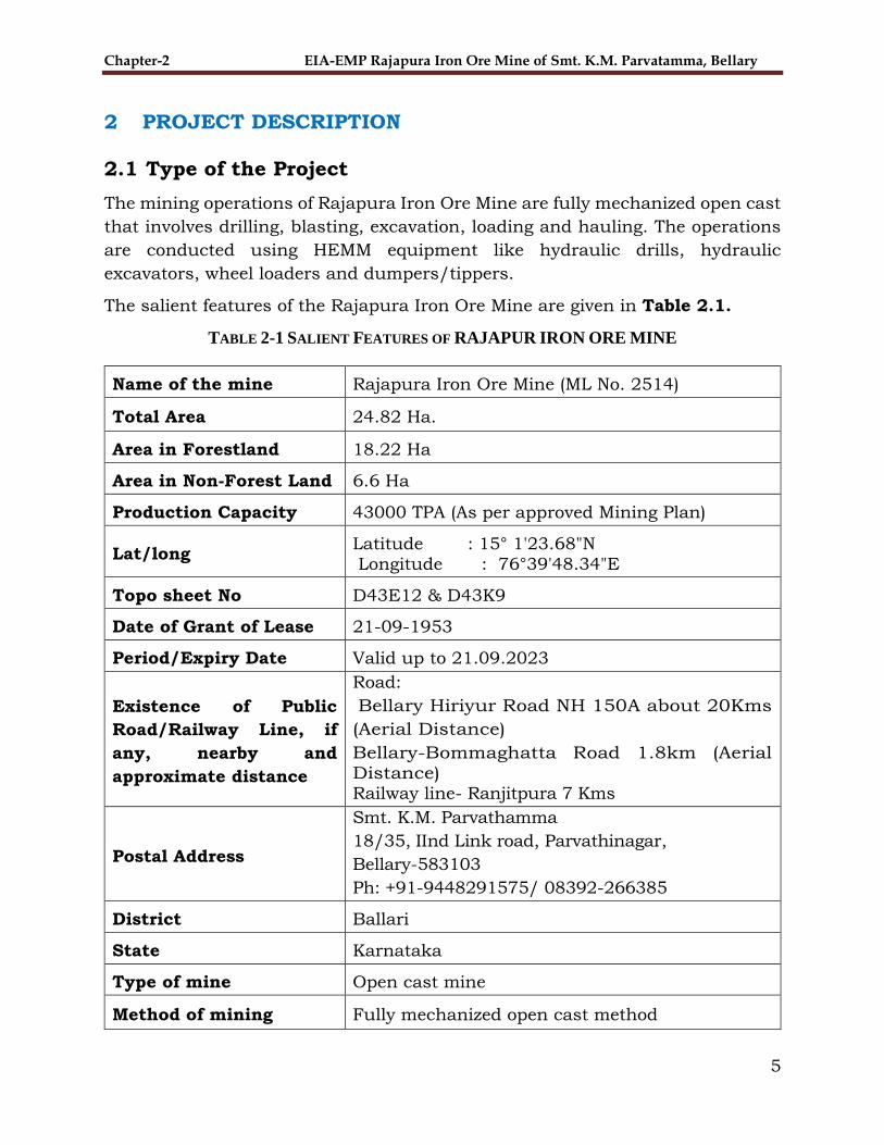
2 PROJECT DESCRIPTION
2.1 Type of the Project
The mining operations of Rajapura Iron Ore Mine are fully mechanized open cast
that involves drilling, blasting, excavation, loading and hauling. The operations
are conducted using HEMM equipment like hydraulic drills, hydraulic
excavators, wheel loaders and dumpers/tippers.
The salient features of the Rajapura Iron Ore Mine are given in Table 2.1.
TABLE 2-1 SALIENT FEATURES OF RAJAPUR IRON ORE MINE
Name of the mine Rajapura Iron Ore Mine (ML No. 2514)
Total Area 24.82 Ha.
Area in Forestland 18.22 Ha
Area in Non-Forest Land 6.6 Ha
Production Capacity 43000 TPA (As per approved Mining Plan)
Lat/long Latitude : 15° 1'23.68"N Longitude : 76°39'48.34"E
Topo sheet No D43E12 & D43K9
Date of Grant of Lease 21-09-1953
Period/Expiry Date Valid up to 21.09.2023
Existence of Public
Road/Railway Line, if
any, nearby and
approximate distance
Road:
Bellary Hiriyur Road NH 150A about 20Kms
(Aerial Distance)
Bellary-Bommaghatta Road 1.8km (Aerial Distance) Railway line- Ranjitpura 7 Kms
Postal Address
Smt. K.M. Parvathamma
18/35, IInd Link road, Parvathinagar,
Bellary-583103
Ph: +91-9448291575/ 08392-266385
District Ballari
State Karnataka
Type of mine Open cast mine
Method of mining Fully mechanized open cast method

Chapter-2 EIA-EMP Rajapura Iron Ore Mine of Smt. K.M. Parvatamma, Bellary
6
Mineable reserves 35,72,010 Tonnes of Iron ore as per approved
mining plan
Expected life of mine 2nd renewal valid up to 20 September 2023 (as
per lease deed)
Ore to Waste ratio 1: 0.98(Plan Period)
Average no. of working
days 36
Number of shifts One
Bench height & width 8 m
Top and Bottom Bench 880 mRL and 675 mRL
Present working benches 735 mRL to 687mRL (Third Year)
Waste (Plan Period) 1,26,190 TPA
Ultimate pit slope Not more than 45 degrees
Estimated Power
requirement & source 500 units/day , Source - DG sets
Estimated Water
requirement & source 24 KLD, Source – Open Wells & Tube Wells
Project Cost (Gross Block
cost)
Rs. 258 Lakhs
2.2 Need of the Project
Government of India has an ambitious plan for increasing the domestic steel
production capacity from around 115 MTPA to 300 MTPA in next 10 to 15 years.
This will necessitate production of 400-450 million tonnes of iron ore annually.
Low per capita steel consumption in the country at 74.6 kg vis-a-vis the world
average of 208 kg also indicates the huge growth potential of the Indian steel
industry. Further, the Government's plan of developing 100 smart cities and
housing for all by 2022 will result in a huge demand of steel. To cater the growing
demand of steel.
Mining plays an important role in the development of the Region and Country.
The iron ore produced from this mine will be used in JSW Steel Plant for making
steel. The steel industry contributes 2 % in India’s GDP. Steel per capita
consumption in India is expected to increase to 160 kgs by 2030-31 whereas the

Chapter-2 EIA-EMP Rajapura Iron Ore Mine of Smt. K.M. Parvatamma, Bellary
7
present consumption is 74.6 kgs only. Easy availability of work force and
presence of abundant iron ore reserves make India competitive in the global set
up. Therefore, to meet the growing demand of steel and to support in country’s
GDP extraction of raw materials becomes inevitable. In addition, the project leads
to development of nearby villages by providing employment and better
infrastructure to the local people. It improves the living standard of the people
residing near the project. Rajapura Iron Ore Mine has robust CSR policy, which
will help in growth of the people in the Directly Impacted Zone (DIZ) of mine.
2.3 Location
The lease area is located in Rajapura Village, Sandur Taluk, Bellary District of
Karnataka. over an Extent of 61.33 Acres. (24.82 Ha) as per CEC and 24.82Ha
as per Lease Deed.
The coordinates are given in Table 2.2. Location of mining lease is shown in
Figure - 2.1.
Topo sheet no.: D43E12 & D43K9.
TABLE 2-2 DETAILS OF COORDINATES
Pillar No.
Pillar Latitude (dd:mm:ss.ss)
Pillar Longitude (dd:mm:ss.ss)
1 15°01'32.9" 76°39'47.0"
2 15°01'26.3" 76°39'49.2”
3 15°01'27.1" 76°39'52.3”
4 15°01'20.9" 76°39'54.8”
5 15°01'14.1" 76°39'53.7”
6 15°01'13.9" 76°39'58.2”
7 15°01'13.9" 76°39'01.6”
8 15°01'10.8" 76°39'57.3”
9 15°01'10.7" 76°39'54.1”
10 15°01'09.3" 76°39'54.1”
11 15°01'09.2" 76°39'54.5”
12 15°01'03.4" 76°39'56.1”
13 15°01'02.7" 76°39'52.5”
14 15°01'09.5" 76°39'50.6”
15 15°01'09.7" 76°39'49.1”
16 15°01'09.6" 76°39'47.4”
17 15°01'09.4" 76°39'44.9”
17A 15°01'09.5" 76°39'43.4”
18 15°01'09.3" 76°39'39.7”
19 15°01'08.8" 76°39'38.7”
20 15°01'04.9" 76°39'35.9”

Chapter-2 EIA-EMP Rajapura Iron Ore Mine of Smt. K.M. Parvatamma, Bellary
8
21 15°00'58.3" 76°39'34.1”
22 15°01'04.9" 76°39'31.7”
23 15°01'06.7" 76°39'33.8”
24 15°01'08.6" 76°39'34.7”
24A 15°01'11.3" 76°39'38.9”
24B 15°01'10.1" 76°39'39.6”
25 15°01'13.5" 76°39'41.5”
26 15°01'12.3" 76°39'42.1”
27 15°01'11.6" 76°39'42.8”
28 15°01'10.9" 76°39'44.7”
29 15°01'11.1" 76°39'47.0”
30 15°01'12.3" 76°39'47.8”
31 15°01'14.5" 76°39'48.2”
32 15°01'14.5" 76°39'47.3”
33 15°01'23.1" 76°39'45.0
34 15°01'30.1" 76°39'40.5”
35 15°01'32.2" 76°39'42.4”
FIGURE 2-1 LOCATION MAP OF THE PROJECT SITE
2.4 Size or Magnitude of Operation
Rajapura Iron Ore Mine ML No.2514 spread over an area of over an Extent of
61.33 Acres.(24.82 Ha) as per CEC and 24.82Ha as per Lease Deed. The mine
has about 35,72,010 Tonnes of minable reserves which are with proposed
production of 43,000TPA.

Chapter-2 EIA-EMP Rajapura Iron Ore Mine of Smt. K.M. Parvatamma, Bellary
9
2.4.1 Mining Operations
As the mine was in operation for nearly seven decades, it is already developed in
respect of open pit, access roads, network of internal roads, site facilities, waste
dump, C&S plant, etc. The existing method of mining, namely “opencast mining”
method is proposed to be continued. Entire operations are fully mechanized
through use of Heavy Earth Moving Machinery. Broadly, the mining operations
include excavation, loading, C&S and haulage of overburden to waste dumps.
The ROM will be excavated, loaded, processed in C&S plant and hauled to steel
plants. The waste is stored to the designated place as per the approved mine
plan.
TABLE 2-3 List OF equipment deployed for mining
MACHINERY
Excavation, loading and haulage is through deployment of HEMM (Heavy Earth
Moving Machines). Mobile crushing & screening plant of 250 TPH and static
screening plant of 400 TPH are established in the mine, to process the ROM. The
crusher processes the mineral to different sizes of 0-10 (Fines) and 10-40 mm
(Lumps) which is stacked separately at the designated stock yard. Deployment
of tertiary crusher will be taken up as and when required.
Sl. No
Type Nos Size/Capacity Make Motive Power
1 Wagon Drill 1 115mm,116HP Atlas Capco Diesel
2 Compressor 1 7.5Kg/2000rpm Atlas
Capco/ARD
Compressed
Air
3 Wheel Loader 1 2.5 & 2.0 cum (2 each)
TATA, HM Diesel
4 Excavator 1 0.9cum (2), 1.75
cu0
LT 200, EX-
350
Diesel
5 Tipper 5 10 tonnes Tata Diesel
6 Jeep 1 -- Mahindra Diesel
7 Water Tanker 1 4000 ltrs 1 Tata Diesel
8 Crushing/Screen Plant (mobile)
1 100 tph DG

Chapter-2 EIA-EMP Rajapura Iron Ore Mine of Smt. K.M. Parvatamma, Bellary
10
2.4.2 Exploration
Details of Prospecting/Exploration Already Carried out:
No exploration carried out during last plan period.
Proposed Exploration: Not Applicable
Ore Reserves
Balance Mineable Reserves as on 1.04.2021 is given in Table 2.4.
Hematitic Ore:
TABLE 2-4 Balance reserves as on 1.4.2021
Classification Code Quantity Grade
Forest Non-
Forest Total Fores
t
Non-Fores
t
A. Mineral Reserve
1. Proved Mineral Reserve (A) 111
2761277 0 2761277
59.79%Fe 0
2. Probable Mineral Reserve (A) 121 0 0 0 0 0
3. Probable Mineral Reserve (A) 122 0 0 0 0 0
B. Remaining Resources
1. Feasibility Mineral Resource (B) 211 792195 0 792195 0 0
2. Prefeasibility Mineral Resource (B) 221 0 0 0 0 0
3. Prefeasibility Mineral Resource (B) 222 0 0 0 0 0
4. Measured Mineral Resource (B) 331 0 0 0 0 0
5. Indicated Mineral Resource (B) 332 0 0 0 0 0
6. Inferred Mineral Resource (B) 333 153000
0 153000
59.79%Fe
0
7. Reconnaissance Mineral Resource (B) 334 0
0 0
0 0
Total Mineral Resources (A+B)
3706472
3706472
Silicious Iron Ore:
Classification Code Quantity Grade
Forest Non-
Forest Total Forest Non-
Forest
A. Mineral Reserve
1. Proved Mineral Reserve (A) 111 123530 0 123530 40.57 0
2. Probable Mineral Reserve (A) 121 0 0 0 0 0
3. Probable Mineral Reserve (A) 122 0 0 0 0 0
B. Remaining Resources

Chapter-2 EIA-EMP Rajapura Iron Ore Mine of Smt. K.M. Parvatamma, Bellary
11
1. Feasibility Mineral Resource (B) 211 0 0 0 0 0
2. Prefeasibility Mineral Resource (B) 221 0 0 0 0 0
3. Prefeasibility Mineral Resource (B) 222 0 0 0 0 0
4. Measured Mineral Resource(B) 331 2772 0 2772 40.57 0
5. Indicated Mineral Resource(B) 332 0 0 0 0 0
6. Inferred Mineral Resource (B) 333 0 0 0 0 0
7. Reconnaissance Mineral Resource (B) 334 0 0 0 0 0
Total Mineral Resources (A+B) 126302 126302
Exploration work has been carried out by Rajapura Iron Ore Mines up to G1, G2
stage. As such the reserves under different remaining categories are nil. (Source:
Approved Mine Plan).
2.4.3 Production Details
Production during plan period
The detail of the production proposed during plan period is given in Table 2.8.
TABLE 2-5 Proposed production
Plan Period Iron Ore (ROM)
production(TPA)
2021-22 42768
2022-23 42887
2023-24 42946
2.5 Proposed schedule for approval and implementation
First mining plan was approved on 2.11.1992 for a period 1992-93 to 1996-97.
Mining plan was approved on 26.02.1998 for a period of 5 years from 1997-98
to 2002-2003. As there was no forest clearance mine was not working later the
mining plan was reconsidered from 2000-01 to 2004-05. Mining Scheme for the
period 2005-2010 was approved by IBM vide letter No.MS/BLR/Fe-55-SZ date
08.11.2005 for the extent of 31.167 Ha. Then modified Scheme of Mining for the
above period (2005-2010) modified under Rule 10(1) of MCDR for area extent
24.91Ha was approved by IBM vide letter No. Ms/BLR/Fe55-Sz dated
18.07.2006. Mining Scheme for the period 2010-2015Prepard and submitted
IBM on 23.09.2011. On receipt of SOM submitted by the lessee IBM has advised
the lessee to obtain the clearance letter along with duly certified lease sketch of
ML area from DMG, Bangalore and resubmit the SOM vide IBM letter No.
279/313/92/BNG/1179 dated 5.5.2015.
Letter of IBM approval letter of previous scheme vide letter no.
279/313/92/BNG/1179 Dated: 05.05.2015.

Chapter-2 EIA-EMP Rajapura Iron Ore Mine of Smt. K.M. Parvatamma, Bellary
12
The Force NOC vide letter No; 4-KRC 1049/2015-BAN/641 dated 18.06.2019.
The proposal was Granted ToR in SEAC meeting held on 22.12.2021 at agenda
no.271, amendment to TOR proposal. Based on the recommendation of SEAC,
Committee Members has recommended the proposal for applying in Form 2 in
EC portal with EIA/EMP report with fresh baseline data. The EIA/EMP report
for a Max Production of 43000TPA should include the standard conditions of
TOR and other information as mentioned in above.
2.6 Technology and Process Description
2.6.1 Method of Mining
As the mine is in operation for nearly seven decades, it is already developed in
respect of open pit, access roads, network of internal roads, site facilities, waste
dump, C&S plant, etc. The existing method of mining, namely “opencast mining”
method is proposed to be continued. Entire operations are fully mechanized
through use of Heavy Earth Moving Machinery. Broadly, the mining operations
include excavation, loading, C&S and haulage of overburden to waste dumps.
The ROM will be excavated, loaded, processed in C&S plant and hauled to steel
plants. The waste is dumped to the designated place as per the approved mine
plan.
Mining is carried out by making benches of 8m height and 8m width. Excavators
will be used for progressing the benches. Systematic bench formation will be
made to rectify old benches. Bench slope will be around 80o. Overall pit slope
will be maintained at 45o with horizontal. Approach roads for each bench will be
made with sufficient width. Top most existing bench will be pushed back to
facilitate the formation of proper benches.
Excavation, loading and haulage is through deployment of HEMM (Heavy Earth
Moving Machines). Mobile crushing & screening plant of 250 TPH and static
screening plant of 400 TPH are established in the mine, to process the ROM. The
crusher processes the mineral to different sizes of 0-10 (Fines) and 10-40 mm
(Lumps) which is stacked separately at the designated stock yard. No wet mineral
processing is done, only dry crushing and screening process is done for
production of Fines (0 to 10 mm) and Lumps (10 mm to 40 mm). Deployment of
tertiary crusher will be taken up as and when required.

Chapter-2 EIA-EMP Rajapura Iron Ore Mine of Smt. K.M. Parvatamma, Bellary
13
FIGURE 2-2 MINE PIT OF RAJAPURA IRON ORE MINE
As per the requirement of the steel plant, it also proposed to transport the ROM
directly to the steel plant as Ore Crushing & Screening with Beneficiation Unit
is already established in the Steel Plant. The material flow chart is provided
below:

Chapter-2 EIA-EMP Rajapura Iron Ore Mine of Smt. K.M. Parvatamma, Bellary
14
FIGURE 2-3 MATERIAL FLOW CHART STEEL PLANT

Chapter-2 EIA-EMP Rajapura Iron Ore Mine of Smt. K.M. Parvatamma, Bellary
15
2.6.2 Drilling
Drilling will be done by using 4” to 6” dia drill machines. The depth of hole shall
be up to 7 meters including the allowance for sub-grade drilling. The depth of
the holes will be about 7.00 m to take care of bench height of 6.0 mts and sub-
grade at a later stage. Dust control measures like wet drilling will be practiced
for dust control. Secondary drilling will also be done for toes and ledges, whereas
boulders will be broken with rock breaker to avoid secondary blasting, air blast
and excessive ground vibrations.
2.6.3 Blasting
Burden and Spacing
3 to 4 row blasting patterns will be adopted to minimize ground vibration, noise
and fly rock. The diameter of holes will be 110 mm and the depth of holes on an
average 7 m (including that of sub grade drilling of 1meter for bench height
variations etc.). The average burden will be 3 to 3.5 meters and the average
spacing 3.5 to 4m. Stemming 3 to 3.2m/hole.
Charge/hole and no. of holes
Charge per hole is around 35 to 40 kg for ore and around 30 to 35 kg for waste.
Blasting will be conducted as and when required.
Method of Initiation
Non-electric Bottom initiation will be adopted for reduced noise and ground
vibration by using suitable initiation methods. With modern bottom initiation
techniques, in-hole delay sequencing will be adopted. It further controls the
ground vibrations and the possibility of air blast becomes negligible.
Sequence of blasting
The first row will be blasted in the beginning and subsequent rows after giving
proper delay. The rows will be blasted in multi row blasting method.
Type of Explosives
Explosive for column charge will be conventional slurry explosives in the
cartridge form and Site Mixed Emulsion (SME) explosives. Conventional D-cord
and shock tubes will be used for trunk line.
Powder Factor
A powder factor of 5.8-6.5 ton/kg for ore and 7 to 8 ton/kg will be maintained
for waste evacuation.

Chapter-2 EIA-EMP Rajapura Iron Ore Mine of Smt. K.M. Parvatamma, Bellary
16
Secondary Blasting
The secondary blasting will be done only for blasting of toes, and ledges.
Secondary drilling will be done by 100 mm dia. crawler drills and subsequently
blasting by controlled charging. However, blasting of boulders will be minimized
keeping in view the vibration and noise hazards
Excavation & Loading
The blasted material will be excavated by the hydraulic excavators and front-end
loaders having various bucket capacities for achieving the planned production.
The waste excavation will also be met with the machinery deployed as per the
excavation plan.
2.6.4 Haulage & Transportation for Ore & Waste
The excavated material including ROM & waste are loaded into dumpers and
tippers of 10 Tonnes capacity for transporting to the designated stockyard and
dump site. For achieving the desired production and waste quantity as per the
excavation plan approximately 5 trips of dumpers & tippers are required for
internal transportation.
The total fleet of Machineries to be deployed at Rajapura Iron Ore Mine are given in the
Table 2-6:
TABLE 2-6 Fleet of Equipment & Machineries loading equipment
Sl. No
Type Nos Size/Capacity Make Motive Power
1 Wagon Drill 1 115mm,116HP Atlas Capco Diesel
2 Compressor 1 7.5Kg/2000rpm Atlas
Capco/ARD
Compressed
Air
3 Wheel Loader 1 2.5 & 2.0 cum
(2 each)
TATA, HM Diesel
4 Excavator 1 0.9cum (2), 1.75
cu0
LT 200,
EX-350
Diesel
5 Tipper 5 10 tonnes Tata Diesel
6 Jeep 1 -- Mahindra Diesel
7 Water Tanker 1 4000 ltrs 1 Tata Diesel
8 Crushing/Screen
Plant (mobile)
1 100 tph DG

Chapter-2 EIA-EMP Rajapura Iron Ore Mine of Smt. K.M. Parvatamma, Bellary
17
2.6.5 Crushing and Screening
No wet mineral processing is done, only dry crushing and screening process is
done for production of Fines (0 to 10 mm) and Lumps (10mm to 40 mm). The
ROM (Runoff Mine) is extracted from the mine pit and is fed to screening &
crushing plant. Deployment of tertiary crusher will be taken up as and when
required.
2.6.6 Stacking, Wagon Loading & Transportation
As this mine was already an operational mine, the transportation facilities
already exist. Presently the transportation of ore from the Rajapura Iron Ore
Mines to Steel Plants is done by Tipper-Rake combination. Dispatch of iron ore
from mine head to Railway Yard is carried out by Trucks/Tippers. Transportation
from Railway Yard to Steel Plants is done by rakes. A major portion of the
transportation is planned through rakes, however, road transportation is
planned for short distances.
2.6.7 Recovery and Grade
Ore Processing will be operated on dry mode owing to which no slime generation
is expected. The expected recovery of Lumps and Fines is 24% & 76 %
respectively. The expected grade of the products is given in Table 2-7.
TABLE 2-7 Expected grade
Category Fe%
Calibrated Iron ore (+10to- 40mm) +45
Fines Iron ore (-10mm) +45
2.6.8 Energy
Power & Fuel Requirement:
Power is required for Office, Weighbridge operation and workshops that will be
provided by DG sets.
Estimated Power requirement - 500 units/day
Estimated Fuel requirement – 3000 L/day
The DG sets have acoustic enclosure to ensure the safe working condition for
the employees and control noise pollution.
Renewable Energy
Solar based Wi-Fi tower is established in the lease area.

Chapter-2 EIA-EMP Rajapura Iron Ore Mine of Smt. K.M. Parvatamma, Bellary
18
2.7 Project Description
2.7.1 Topography
Rajapura Iron Ore Mine is located in the Sandur Forest Rage, Bellary Division of Karnataka. The area of the lease holds forms apart of rugged hilly terrain. The
area is a hilly region with NW/SE trends with a minimum elevation of 675mRL at the southern part near road a maximum of 880mRL towards northern most
part of the lease area. Since the slope is towards eastern side, the drainage patter is dendritic flowing towards east through valleys.
As the area is part of forest, moderate vegetation with small trees and
shrubs/bushes are observed.
The area enjoys tropical climate with an annual average rainfall of about 750mm.
Maximum temperature in summer days is around 400C, and minimum temperature during winter nights’ records between 12-18 0C. Humidity varies between 25 to 85%.
Haulage road will be maintained with proper alignment/side bunds with an average gradient of 1:16. The Proposed area is bounded by the Latitude N-15°00'58.3" to N- 15°01'32.9" and longitude E-76°39'31.7” to E-76°39'57.3” in
Topo Sheet No. D43E12 & D43K9.
2.7.2 Drainage Pattern
The Monsoon Water get drained off through the natural Valley. There is no seepage water and there is no water table in the vicinity as the lowest level in
mining will be above the ground level.
2.7.3 Geology
Regional Geology
The Mining Lease area is located at the East portion of Kumaraswamibetta Reserve Forest range The Project site is surrounded by east and west Forest area,
North forest area and Sy. No:8 and South Forest area. The project area is a part of the Bellary-Sandur-Hospet group of iron ore deposits hosted by Sandur Schist
Belt. The Sandur Schist belt is one of the Dharwar type precambrian supracrustal belt in the Karnataka craton of South India. Many geologists like Radhakrishnan, RN Mishra, Ray & Biswas, Swaminathan, Mukhopadhyay &
Martin, Vasudev and pravakar have worked extensively on the structure, geology and genesis of this schist belt. This is the smallest of the three basins and covers
an area of just 960 sq.km. It is structurally highly disturbed and squeezed out of shape by the intrusion of younger granites. Shelf facies as in the other basin is confined to the western margin. Well-developed mafic magmatism and strong
development of manganiferous grey wacke, phyllite and numerous bands of banded hematite quartzite (BHQ) charracterise the basin. The basin is known for

Chapter-2 EIA-EMP Rajapura Iron Ore Mine of Smt. K.M. Parvatamma, Bellary
19
its rich accumulation of both Iron and Manganese Ore. Basement cover relations are obscure because of intense deformation and intrusions by younger granite.
The schist belt has a lens- shaped geometry of about 60 km long, with a width of 28km in the central part. Four formations have been distinguished in this basin: Yeshwantnagar Formation is largely composed of volcanic flows; the
Deogiri formations by manganiferous greywackey argillite and the Dhonimalai Formation by extensive development of banded haematite, chert and jasper. The topmost Nandihalli Formation is made up of metabasalts with intercalation of
greywacke and argillites. Lateritization has played an important role in the concentration of Manganese and Iron in the profile, giving rise to rich
accumulation of Manganese and Iron Ore for which the schist belt is well known. (Source: Geology of Karnataka- BP Radhakrishnan & R Vaidhyanathan).
Regional Stratigraphy
Basic dykes of gabbro and dolerite closepet granite (Pink and Grey
porphyritic granite) ----------------------------------------------------------------------------------------- Nadihalli formation Metabasalt, metagabbro, acid
volcanics and interrelated bands of graywacke-argillite
-----------------------------------------------------------------------------------------
Donimalai Banded ferruginous or pyritiferrous chert,
formation Metabasalt/ amphibolite, meta gabbro, Andesitic tuff, acid volcanics,
conglomerate, Metagreywacke and metapelites.
Deogiri Manganiferous greywacke-argillite, with bands of
formation banded ferruginous chert and
dolomitic limestone. Metabasalt and rare acid tuff Arenites, dolomitic limestone and
phyllite. -------------------------------------------------------------------------------------------
Yeshwanthnagar Metabasalt/ amphibolite with metapyroxenite,
formation metagabbro and thin inetercalated
bands of quartzite and quartz-mica schist.
------------------------------------------------------------------------------------------
Peninsular gneiss (banded granodirite/ tonalitic gneiss).

Chapter-2 EIA-EMP Rajapura Iron Ore Mine of Smt. K.M. Parvatamma, Bellary
20
Local Geology
Rajapura Iron Ore mine is having good exposure of iron ore bands. Mineralization
occurring in the lease area is of Hematitic variety. The iron ore deposit occurring
in the lease area is of stratiform, strata bound and tabular deposit of regular
habit as per UNFC. Strike of the ore body is NW-SE with steep easterly dip of 75
to 80 degree. Iron ore in the lease area occurring as two distinct bands, northern
band extends over the strike length of 630 m and southern band extends over
the length of 270m. Northern ore band characterized with soft ore and red oxide
mixed. Southern part of the ore band is hard and compact with footwall of
Banded Hematite Quartzite (BHQ) which acts as barrier for ore. Branching of the
band is also observed. The contacts of ore with waste are clearly seen in the
mine. Apart from reef ore, Iron ore float also present in the western part of lease
area (Pl. refer Geological Plan). Thickness of the float ore is around 2 m. Local
geological setup / sequence is as follows Ferruginous Shale - Iron Ore- Banded
Hematite Quartzite. Shale/ phyllite occurs in the hanging wall which is soft, fine
grain and yellow in colour and footwall side occupied by massive Banded
Hematite Quartzite (BHQ). Iron ore occurring in the northern part of the lease
area is soft and with red oxide mixed whereas southern band characterized with
hard lumpy type. Lumps and fines percentage is approximately 40% and 60%.
Float ore bed of around 2 m thickness spread in western part of the lease area.
Float ore zone of the lease area comprised of pebbles of iron ore mixed with soil
and BHQ fragments. BHQ occurring in the lease area is of brownish to greyish
in colour which is hard and compact in nature. Shale/Phyllite occurring in the
lease area are soft in nature with yellowish to brownish in colour
Land Use-Pattern
The Land use pattern of Rajapur Iron ore mine for Existing/ Plan period and Conceptual Period is as follows
TABLE 2-8 THE LAND USE PATTERN OF THE MINE AREA AT PRESENT AND CONCEPTUAL PERIOD
Sl.
No
Particulars Existing/Plan Period In
Ha
Conceptual Period In
Ha
Forest Revenue Total Forest Reven
ue
Total
1. Mining 9.15 0.60 9.75 12.46 0.60 13.06
2 Dumping 4.10 0.27 4.37 2.70 0.27 2.97
3 Mineral Storage -- 1.30 1.30 -- 1.30 1.30
4. Topsoil Yard -- -- -- -- -- --
5. Infrastructure/Statu
tory Building
-- 0.02 0.02 -- 0.02 0.02
6. Screening Plan -- 0.12 0.12 -- 0.12 0.12

Chapter-2 EIA-EMP Rajapura Iron Ore Mine of Smt. K.M. Parvatamma, Bellary
21
7. Road -- 1.00 1.00 -- 1.00 1.00
8. Green Belt (Safety Zone)
2.06 1.04 3.10 2.06 1.04 3.10
9. Area for Eng.
Measures
-- -- -- -- -- --
10 Others
Biodiversity Area / Area Unused
1.00
1.91
--
2.25
1.00
4.16
1.00
--
--
2.25
1.00
2.25
Total 18.22 6.60 24.82 18.22 6.60 24.82
Life of the Mine
2nd renewal valid up to 20 September 2023 (as per lease deed)
2.7.4 Waste Generation
Existing Waste
The waste generated by the earlier lessee are dumped in 4.37 Ha.
Proposed waste generation during plan period
The proposed waste generation during plan period is given in Table 2-9.
TABLE 2-9 PROPOSED WASTE GENERATION (TONNES)
Period Waste in Tonnes.
2021-22 34968
2022-23 67032
2023-24 24190
Total 126190 (Reference: RUMP)
Proposed waste generation till life of mine
The total waste may generate till life of mine shall be 4301171 MT.
Waste Management
There is no top soil in the area and if encountered it will be used for regular
afforestation work. The waste generated is Shale/Phyllite, BHQ, Manganiferrous
clays, intercalated clays, poor grade from contact zones etc.
The waste with Fe content below 35 % (Siliceous Ore) is stored in the earmarked
waste dump. The estimated quantity of waste generated in the mining plan
period is 126190 MT and is dumped in extension of existing active dump in the
area of 4.37 ha. The dumping is done terrace wise from the bottom level to top
level.

Chapter-2 EIA-EMP Rajapura Iron Ore Mine of Smt. K.M. Parvatamma, Bellary
22
The BHQ/Shale waste material is disposed in the area earmarked in existing
active dump and proposed to extend towards south eastern side.
Existing waste dump (Block –I)
Location Top RL Bottom RL Height (m) Area (ha)
Maximum
elevation
740 680 40 4.37
There is only one active dump where the total waste is dumped as an extension
of the existing dump. The dumping is done terrace wise from the bottom level to
top level.
Each stage of waste dump is maintained at equal height of 10 m and 3 stages
are proposed as per the existing dump and the topography of the area. The
dumping is carried out at an angle not exceeding the angle of repose of the
material varies from 31 to 40 degrees. Engineering measures will be carried out
as per the approved mining plan. No sub-grade generation is proposed in this
plan period.
2.7.5 Utilities
Power Supply
The requirement of the electric power is fulfilled by DG set. Heavy Earth Moving
Machineries are fueled by High Speed Diesel.
Offices
The building is utilized by the various department heads like Mechanical
Services, Electrical Services, Geology, Survey and Mining in-charge/Excavation
in-charge. All the modern modalities like Furniture, File Cup-boards, Internet
and communication facilities are provided for smooth functioning.
Canteen
In order to meet the drinking water needs of the employees RO plant is
established. The Canteen has facility of dining hall, store room & restroom. The
waste generated is collected in a soak pit followed by a septic tank.
First-Aid Room
A first-aid room is established to provide an instant care to the people working
in mine. A competent person has been posted to render the first aid as and when
required. One dedicated ambulance is stationed in the designated place to meet
the exigency situation in the mines.

Chapter-2 EIA-EMP Rajapura Iron Ore Mine of Smt. K.M. Parvatamma, Bellary
23
Rest shelter and Toilets
Restroom and Toilets have been provided for the people working in mine. The
same is cleaned regularly to maintain the hygiene of the area.
Manpower
Total direct employment potential in the mine is 36 covering the statutory work
force and skilled, semiskilled &unskilled workforce. Indirect employment is
approximately 40.
Water Requirement
Total water requirement is 24KLD for dust suppression, plantation and domestic
use. The detail bifurcation is provided below:
FIGURE 2-4 Total water requirement
2.8 Description of Mitigation Measures Incorporated to meet the
Environmental Standards
2.8.1 Air Pollution Mitigate Measures
Dust is the main pollutant from mining operations. Water tankers with
sprinkling system to suppress dust are deployed on the haulage roads and
approach roads. A fogger type dust suppressor is used near the Crushing &
Screening Plant. The existing greenbelt will be maintained and additional gap
plantation will be carried out which will act as windbreaks.
Total Water Requirement
24
12 KLD
Dust Suppression
8KLD
Plantation & Greenbelt
development
4 KLD
Domestic Requirement

Chapter-2 EIA-EMP Rajapura Iron Ore Mine of Smt. K.M. Parvatamma, Bellary
24
2.8.2 Water Pollution Mitigative Measures
For protection of the mining area and for arresting wash-off sediments, the
surface water management measures have been implemented as recommended
by ICFRE in the R&R report. Details are elaborated in Chapter- 4.
2.8.3 Noise pollution mitigative measures
Proper and periodical maintenance of HEM machinery.
Noise levels will be controlled by using optimum explosive charge, proper
delay detonators, use of shock tubes and proper stemming to prevent “blow
out” of holes.
Speed of trucks entering or leaving the mine will be limited to a moderate
speed of 25 Kmph thereby preventing noise and dust.
Noise insulation/padding in Crushing & Screening plant and machinery,
wherever practicable.
Provision of ear muffs/ear plugs to workers in noise prone areas and in
Plant area.
2.8.4 Solid Waste Management
Waste will be dumped as per the approved mine plan.
2.8.5 Energy Efficiency measures
In order to reduce power consumption Solar Internet tower is used for
Internet.
Used oils, batteries and cotton waste will be collected and sold to the
authorized agencies.
Energy efficient motors will be installed for Crushing/Screening.
2.9 Assessment of New & Untested Technology for the risk of
Technological Failure
Not Applicable

Chapter-3 EIA/EMP of RAJAPURA IRON ORE BY Smt. K M Parvatamma, Bellary
25
3 DESCRIPTION OF THE ENVIRONMENT
3.1 Study Description
The study area covers 10 km radius of Rajapura Iron Ore Mine of Rajapura Iron
ore Mines. located in Rajapura Village, Sandur Taluk, Bellary District of
Karnataka. Various features like roads, water bodies, flora, fauna, residential
habitats, transportation networks etc. were identified and other relevant data
like population, literacy rate etc. were collected.
The total mine lease area falls under The Sandur Range Forest.
3.1.1 Study Period
The present study was carried out from October 2021 to December 2021 for
three months. During the course of study primary data pertaining to the
environmental components like air quality, water quality, noise levels, soil
quality, flora and fauna and socio-economic parameters were generated.
Secondary data was also collected from various government & other sources in
the district for socio-economic studies.
3.1.2 Study Components
The attributes such as meteorology, ambient air quality, water quality, noise level
etc. were studied and the details of monitoring such as location, frequency etc.
are given below in Table 3.1.
TABLE 3-1 Showing Attributes and study parameters
S. No. Attribute Parameters Remark
1 Meteorology
Wind Speed and
Direction,
Temperature,
Relative Humidity &
Rainfall
Hourly recording at project
site
2 Ambient air
quality
RSPM(PM10),PM2.5,
SO2, NO2 and CO,
Eight locations 24 hourly
sampling twice a Month for
PM10, PM2.5, SO2 and NO2
and other parameters.
3 Surface Water
quality
Physical, Chemical
and Bacteriological
Parameters as per
Four locations once in a
Study Period.

Chapter-3 EIA/EMP of RAJAPURA IRON ORE BY Smt. K M Parvatamma, Bellary
26
APHA and IS
standards
4 Ground water
quality
Physical, Chemical
and Bacteriological
Parameters as per
APHA and IS
standards
Eight locations once in a
Study Period.
4 Noise levels Noise levels in dB(A) Once during study period at
Eight locations.
5 Soil
characteristics
Soil profile,
characteristics, soil
type and texture,
NKP value etc.
Once during study period at
Eight locations.
6 Socio-economic
aspects
Socio-economic
characteristics
Secondary data from
Census-2011
7 Ecology Existing terrestrial
flora and fauna
Through field visit and
secondary data
8 Land use
Land use for different
categories
(Satellite Imagery)
Based on secondary data for
core and buffer zone.
Note: C- Core Zone, B-Buffer Zone, S-Surface Water, G-Ground Water
3.2 General Climatic Condition (Secondary data)
3.2.1 Climate
The area is characterized by very hot summer and mild winters. It experiences
tropical and humid climate which shows three distinct seasons viz summer,
rainy and winter.
3.2.2 Temperature, Relative Humidity and Rainfall
The area enjoys tropical climate with an annual average rainfall of about 750mm. Maximum temperature in summer days is around 400C, and minimum temperature during winter nights’ records between 12-18 0C. Humidity varies
between 25 to 85%.
3.2.3 Wind
Winds are generally moderate during summer and strengthen during rainy
season. In the south-west monsoon period they blow mainly from a south-

Chapter-3 EIA/EMP of RAJAPURA IRON ORE BY Smt. K M Parvatamma, Bellary
27
westerly or westerly direction. In the rest of the year they are predominantly from
directions between northeast and southeast. Thunderstorms are more frequent
during September and October. Some of the cyclonic storms which originate in
the Bay of Bengal during the post monsoon months across the eastern coast,
weaken into depressions and move across the district towards the east causing
widespread rains.
FIGURE 3-1 WIND ROSE DIAGRAM OF THE STUDY PERIOD
3.2.4 Baseline Data
Environmental monitoring was carried out for base line data generation during
October 2021 to December 2021 for 3 Months. Micrometeorology, Ambient air
quality, Water quality, Noise level, Soil quality, Socio-economic & Biodiversity
study was carried out within 10 km radius of the lease area.
3.3 Selection of Sampling Stations
3.3.1 Micro-Meteorological Station
The meteorological data like temperature, humidity, wind speed, wind direction,
cloud cover and rainfall were recorded at site. The Meteorological data is
collected from IMD.
The Monthly averages of the Micro-meteorological data is given below:

Chapter-3 EIA/EMP of RAJAPURA IRON ORE BY Smt. K M Parvatamma, Bellary
28
TABLE 3-2 SHOWING THE MONTHLY AVERAGES MICRO-METEOROLOGICAL DATA
Sl No Month
Temp
in oC
Humidity
in %
Wind speed
in KMPH
Wind Direction
in Degree Rainfall in mm
1 Oct-21 28 67 10 159.34 37.4
2 Nov-21 25 81 10.6 106.86 76.5
3 Dec-21 25 63 10.8 109.91 1.9
3.3.2 Ambient Air Quality Locations
The ambient air quality was monitored at 8 locations. The monitoring locations
are detailed in Table 3.3.
TABLE 3-3 Details of the Ambient Air Quality monitoring locations
Location
Code Location Direction
Distance
from Mine
site
Latitude & Longitude
Remarks
AAQ1 Drilling Area - - 15° 1'23.96"N
76°39'47.63"E
Location is selected
to study the impact
of mine activities.
AAQ2 Loading Area - - 15° 1'19.65"N
76°39'48.57"E
Location is selected
to study the impact
of mining Activities.
AAQ3 Dumping Area - - 15° 1'23.93"N
76°39'50.10"E
Location is selected
to study the impact
of mining
Activities.
AAQ4 Ubbalagundi N 3 Km 15° 3'2.52"N
76°39'13.92"E Residential Area
AAQ5 Rajapura NE 2.7 Km 15° 1'49.35"N
76°41'12.91"E Residential Area
AAQ6 Appavvanahall
i S 3.1Km
14°59'38.69"N
76°39'42.25"E
Crosswind
Direction
AAQ7 Navalatti W 3.7Km 15° 1'30.94"N
76°37'49.56"E
Residential Area
near mining
activities
AAQ8 Tonasigeri SW 5.54 Km 14°58'40.80"N
76°38'15.80"E
Crosswind
Direction

Chapter-3 EIA/EMP of RAJAPURA IRON ORE BY Smt. K M Parvatamma, Bellary
29
FIGURE 3-2 GOOGLE MAP SHOWING THE AIR QUALITY MONITORING LOCATIONS

Chapter-3 EIA/EMP of RAJAPURA IRON ORE BY Smt. K M Parvatamma, Bellary
30
3.3.3 Water Quality Locations
The water samples were collected from6 locations. The details of the sampling
locations are given in Table 3.4 below and shown in Figure 3-2.
TABLE 3-4 Details of the water sample monitoring locations
Ground Water Locations
Sl.
No.
Locatio
n Code Name of Location
Distance(km.)
Boundary of Mine
Lease
Directio
n
GPS
Coordinate
1 GW1 Ubbalagundi 3 Km N 15° 3'0.47"N
76°39'15.41"E
2 GW2 Mallapura 5.8 Km NE 15° 4'10.02"N
76°41'14.37"E
3 GW3 Rajapura 2.7Km NE
15°
1'50.00"N
76°41'16.43"
E
3 GW4 Appavvanahalli 3.1Km S
14°59'39.47"
N76°39'42.0
9"E
4 GW5 Navalatti 3.7Km W
15°
1'30.95"N
76°37'49.57"
E
5 GW6 Nandihalli 9.6Km NW
15°
1'44.79"N
76°34'27.41"
E
6 GW7 Tonasigeri 5.54 Km SW
14°58'41.39"
N76°38'14.8
3"E
7 GW8 Motalakunta 7.39 Km SE
14°58'10.92"
N
76°42'18.70"
E
Surface Water Locations:
1. SW1 Rajapura Kere 2.37 Km NE 15°

Chapter-3 EIA/EMP of RAJAPURA IRON ORE BY Smt. K M Parvatamma, Bellary
31
1'40.75"N
76°41'4.85"E
2. SW2 Marutka Kere 9.6 Km NE
15°
6'14.43"N
76°41'30.96"
E
3. SW3 Ubbalagundi Kere 3.90 Km N
15°
3'24.94"N
76°39'49.07"
E
4. SW4 Avinamodagu Kere 9.5 Km NE
15°
4'50.10"N
76°43'45.60"
E

Chapter-3 EIA/EMP of RAJAPURA IRON ORE BY Smt. K M Parvatamma, Bellary
32
FIGURE 3-3 GOOGLE MAP SHOWING THE GROUND AND SURFACE WATER MONITORING LOCATIONS

Chapter-3 EIA/EMP of RAJAPURA IRON ORE BY Smt. K M Parvatamma, Bellary
33
3.3.4 Noise Monitoring Locations:
The Noise Monitoring Locations were collected from 8 locations. The details of
the sampling locations are given in Table 3.5 below and shown in Figure 3.3.
TABLE 3-5 Details of the Noise monitoring locations
Noise Monitoring Locations:
Sl.
No.
Location
Code Name of Location
Distance(km.)
Boundary of
Mine Lease
Direction GPS Coordinate
1. N1 Drilling Area - - 15° 1'23.96"N
76°39'47.63"E
2. N2 Loading Area - - 15° 1'19.65"N
76°39'48.57"E
3. N3 Dumping Area - - 15° 1'23.93"N
76°39'50.10"E
4. N4 Ubbalagundi 3 Km N 15° 3'2.52"N
76°39'13.92"E
5. N5 Rajapura 2.7 Km NE 15° 1'49.35"N
76°41'12.91"E
6. N6 Appavvanahalli 3.1Km S 14°59'38.69"N
76°39'42.25"E
7. N7 Navalatti 3.7Km W 15° 1'30.94"N
76°37'49.56"E
8. N8 Tonasigeri 5.54 Km SW 14°58'40.80"N
76°38'15.80"E

Chapter-3 EIA/EMP of RAJAPURA IRON ORE BY Smt. K M Parvatamma, Bellary
34
FIGURE 3-4 GOOGLE MAP SHOWING THE NOISE MONITORING LOCATIONS

Chapter-3 EIA/EMP of RAJAPURA IRON ORE BY Smt. K M Parvatamma, Bellary
35
3.3.5 Soil Quality Locations:
The Soil Quality Locations were collected from 8 locations. The details of the
sampling locations are given in Table 3.6 below and shown in Figure 3.4.
TABLE 3-6 Details of the Soil monitoring locations
Soil Sampling Locations:
Sl.
No.
Locatio
n Code Name of Location
Distance(km.)
Boundary of Mine
Lease
Directio
n
GPS
Coordinate
1 S1 Project Site - - 15° 1'23.95"N
76°39'47.63"E
2 S2 Ubbalagundi 3.2 Km N 15° 3'2.52"N
76°39'13.92"E
3 S3 Rajapura 2.7 Km S 15° 1'49.35"N
76°41'12.91"E
4 S4 Appavvanahalli 3.1Km S 14°59'38.69"N
76°39'42.25"E
5 S5 Navalatti 3.7Km W 15° 1'30.94"N
76°37'49.56"E
6 S6 Tonasigeri 5.54 Km SW
14°58'40.80"
N
76°38'15.80"E
7 S7 Nandihalli 9.6Km NW 15° 1'44.79"N
76°34'27.41"E
8 S8 Thimlapura 6.38 Km NE 15° 2'28.46"N
76°43'10.65"E

Chapter-3 EIA/EMP of RAJAPURA IRON ORE BY Smt. K M Parvatamma, Bellary
36
FIGURE 3-5 GOOGLE MAP SHOWING THE SOIL MONITORING LOCATIONS

Chapter-3 EIA/EMP of RAJAPURA IRON ORE BY Smt. K M Parvatamma, Bellary
37
3.4 Sampling Procedure
3.4.1 Micro Meteorological Monitoring
Micro meteorological Data of the study period is procured from Indian
Metrological Data from October, 2021 to December, 2021.
3.4.2 Ambient Air Monitoring
Time averaged in-situ sampling was adopted by passing a known volume of air
through a trap, and a collecting medium (filter paper and bubbler). Fine Dust
Sampler and Respirable Dust Sampler were used for the purpose.
Analytical methods followed for ambient air quality monitoring
Particulate Matter less than 2.5 micron (PM2.5)
The samples for PM2.5 were collected on filter paper by Fine dust sampler
operated at maximum rate of 16.67 lpm and concentrations were determined
gravimetrically on 24 hours’ basis.
Particulate Matter less than 10 micron (PM10)
The samples for PM10 were collected on filter paper by RDS/Fine dust sampler
operated at maximum rate of 1.2 cu.m./min./16.67 lpm and concentrations
were determined gravimetrically on 24 hours’ basis.
Sulphur-dioxide (Improved West & Gaeke Method)
Sulphur-dioxide measurement was done by aspirating a measured volume of air
through sodium tetrachloromercurate solution. It forms a stable dichloro-
sulphitomercurate. The amount of SO2 is estimated by the reading from
spectrophotometer at 560 nm.
Nitrogen Oxides (Modified Jacob & Hochheiser Method)
Nitrogen oxides were estimated by bubbling air through 0.1 N sodium hydroxide
(with sodium arsenate) solution to form a stable solution of sodium nitrite. The
nitrite ion produced during a sampling is determined using spectrophotometer
at 540 nm by reacting the exposed absorbing reagent with phosphoric acid,
sulphanilamide and NEDA.
Carbon Monoxide [IS: 5182 (Part-X) 1976]
Grab sample of ambient air is taken in the sampling tube. The sample is injected
into gas chromatograph (with methaniser) where it is carried from one end of the

Chapter-3 EIA/EMP of RAJAPURA IRON ORE BY Smt. K M Parvatamma, Bellary
38
column to other. During the movement, the carbon monoxide is converted into
methane and sample undergoes distribution at different rates, ultimately
separating from one another. The separated constituents are detected in form of
distinct peaks in the plotter.
Other parameters like Ozone and Ammonia were monitored and analyzed by
Chemical method and Indophenol Blue Method respectively. Benzene, BaP, trace
metals etc. were monitored and analysed as per CPCB guidelines.
3.4.3 Water Quality Monitoring
As per the standard practice, one sample from each station was collected once,
during the season. Grab water samples were collected in plastic container by
standard sampling technique. Necessary precautions were taken for sample
preservation.
The physical parameters viz. pH, temperature & conductivity were measured at
site by using portable water analysis kit. DO was fixed on spot as per Winkler’s
method. Parameters like hardness, colour, taste and odour, residual chlorine
and free ammonia were analysed at the site, immediately after collection of water
samples. The parameters as defined “General Standards for Discharge of
Environmental Pollutions [GSR 422(E) and GSR 801 (E)] were analyzed as per
the procedures defined in IS: 3025 and “standard methods for water and waste
water analysis” (AWWA, APHA).
3.4.4 Ambient Noise Level
Ambient noise level monitoring was done by an integrating sound level meter in
dB (A). Outdoor noise measurements were made at a height of 1.5m, above the
ground and away from sound reflecting sources like walls, buildings etc.
The Ambient noise level monitoring was carried out day and night as given below:
TABLE 3-7 Ambient noise level monitoring
Sl. No. Time (hrs.) Duration (minutes)
1 08:00-11:00 30
2 14:00-17:00 30
3 18:00-21:00 30
4 24:00-03:00 30

Chapter-3 EIA/EMP of RAJAPURA IRON ORE BY Smt. K M Parvatamma, Bellary
39
3.4.5 Soil Quality
Soil samples were collected and analysed by following standard procedures
diagnosis and improvement of Saline and Alkali Soils, Agriculture hand book
no.60 of US Department of Agriculture.
Objective of the study was to determine quality of different soil profiles, their
fertility potential and biological status (from 0 to 30 cm) in the area.
Sampling procedure and analysis
Samples were collected up to the depth of 0-30 cm from the surface at 4 sampling
spots. At each spot, surface litter was scrapped and samples were taken using
depth sampler. These samples were kept for some time for air-drying at room
temperature. Samples were stored in polythene bags with label at the top.
Soil samples were collected with the help of core sampling tube and rammer. The
debris up to the surface was removed with the help of spade, then core of
measured size was kept on the cleaned soil surface which was hit vertically with
the help of rammer. Once the core gets in the soil the soil gets fitted, it was taken
out by digging the surrounding earth with the help of shovel, (A manual
agricultural implement with a curved blade fixed into a wooden handle).
Samples were analysed for the following parameters:
pH
Electrical Conductivity
Nitrogen
Phosphorous
Potassium
Calcium
Magnesium
Organic Carbon
Iron
Boron
Natural Moisture content
Bulk density
Grain size distribution
Cation exchange capacity

Chapter-3 EIA/EMP of RAJAPURA IRON ORE BY Smt. K M Parvatamma, Bellary
40
3.5 Data Analysis
3.5.1 Meteorological Study
Meteorological data for three months has been procured from the Indian
Metrological Department. Calm condition prevailed over 3% of the time of the
study period. The predominant wind directions were ESE over 16.7% of the time
in which speed of 2 to 4 m/s, 6% of the time in speed of 4-6 m/s was recorded.
The next predominant direction was East over 9.6% of the time in which speed
of 2 to 4 m/s was recorded. The seasonal wind rose diagrams for 24 hours period
is given in figure 3-6. Installation of Weather monitoring stations are in process
and the weather station will be installed in a suitable location without much
disturbances near the mine office for regular observation.
FIGURE 3-6 WIND ROSE DIAGRAM OF OCTOBER – DECEMBER 2021
The maximum & minimum temperature, relative humidity (%) & Rainfall (mm)
recorded during the season are given below:

Chapter-3 EIA/EMP of RAJAPURA IRON ORE BY Smt. K M Parvatamma, Bellary
41
TABLE 3-8 Maximum &Minimum Temperature, Relative Humidity (%) &
Rainfall (mm)
SL.
No. Month
Parameter
Temperature (0C) Humidity (%) Rainfall
Max. Min. mm
1 October, 2021 31 23 67 37.4
2 November, 2021 33.0 21.4 81 76.5
3 December, 2021 29.1 18.8 63 1.9

Chapter-3 EIA/EMP of RAJAPURA IRON ORE BY Smt. K M Parvatamma, Bellary
42
3.5.2 Ambient Air Quality
Ambient air quality was monitored at 8 locations within 10 km. radius of the
project site. The overall Maximum and Minimum values are discussed below in
Table 3.9
TABLE 3-9 Ambient Air Quality Results Maximum & Minimum Values
S.No.
Parameter PM10(µg/m3) PM2.5(µg/m3) SO2(µg/m3) NO2(µg/m3) CO
(mg/ m3 )
Locations Max. Min. Max. Min. Max. Min. Max. Min. Max
.
Min.
1. Drilling Area 74 64 40 36 17.9 15.3 28.30 12.33 0.75 0.63
2. Loading Area 80 63 47 35 17.9 13 19.6 15.2 0.57 0.82
3. Dumping Area 73 65 45 37 17.1 13.2 20.2 15.3 0.83 0.59
4. Ubbalagundi 70 65 40 36 17 15.2 19.1 18.1 0.79 0.63
5. Rajapura 74 66 43 37 17.4 16.5 19.8 18.7 0.89 0.69
6. Appavvanahalli 74 65 40 36 17.9 15.6 20.1 18.1 0.82 0.63
7. Navalatti 74 65 43 37 17.2 15.6 19.8 18.1 0.82 0.63
8. Tonasigeri 70 65 41 36 16.8 15.2 19.1 18.1 0.68 0.63
Standard 100 60 80 80 2.0
Out of 8 locations the maximum Respirable Particulate Matter (PM10) was found
to be 80 µg/m3 at loading area & minimum value (63 µg/m3) was found in loading
area.

Chapter-3 EIA/EMP of RAJAPURA IRON ORE BY Smt. K M Parvatamma, Bellary
43
FIGURE 3-7 Maximum & Minimum Values Variation PM10
Out of 8 locations the maximum Fine Particulate Matter (PM2.5) was found to be
47 µg/m3 at Loading Area & minimum value (35 µg/m3) was found in Loading
Area.
FIGURE 3-8 Maximum & Minimum values variation PM2.5
Highest SO2 (17.90 µg/m3) value was recorded at Drilling area, Loading Arae and
Appavanahalli and lowest SO2 value (13 µg/m3) at Loading Area.
0102030405060708090
PM10 (µg/m3)
PM10(µg/m3) Max PM10(µg/m3) Min
05
101520253035404550
PM2.5 (µg/m3)
PM2.5(µg/m3) Max. PM2.5(µg/m3) Min.

Chapter-3 EIA/EMP of RAJAPURA IRON ORE BY Smt. K M Parvatamma, Bellary
44
FIGURE 3-9 Maximum & Minimum values variation SO2
Similarly, highest NO2 (28.3 µg/cu.m.) value was found at Drilling area and
lowest NO2 value (12.33 µg/cu.m.) was recorded at Drilling Area.
FIGURE 3-10 Maximum & Minimum values various No2
02468
101214161820
SO2(µg/m3)
SO2(µg/m3) Max. SO2(µg/m3) Min.
0
5
10
15
20
25
30
NO2(µg/m3)
NO2(µg/m3) Max. NO2(µg/m3) Min.

Chapter-3 EIA/EMP of RAJAPURA IRON ORE BY Smt. K M Parvatamma, Bellary
45
FIGURE 3-11 Maximum & Minimum values various CO
Similarly, highest CO (0.89 mg/ m3) value was found at Rajapura Village and
lowest CO value (0.63 µg/cu.m.) was recorded at many areas.
3.5.3 Water Quality
Surface water and Ground Water Quality
The Surface water quality monitoring was done at 4 locations within 10 km.
radius area of lease and 8 Ground water samples collected from different
locations the monitoring results are as follows:
00.10.20.30.40.50.60.70.80.9
1
CO (mg/ m3 )
CO (mg/ m3 ) Max. CO (mg/ m3 ) Min.

Chapter-3 EIA/EMP of RAJAPURA IRON ORE BY Smt. K M Parvatamma, Bellary
46
TABLE 3-10 Ground water Quality Results
Sl N
o
Co
de
No
Lo
catio
ns
Co
lou
r (Ha
zen
un
it)
Od
ou
r
Tu
rbid
ity a
s (NT
U)
pH
To
tal
Disso
lve
d
So
lids a
s TD
S (m
g/
l)
Alk
alin
ity a
s Ca
CO
3
(mg
/l)
To
tal
Ha
rdn
ess
as
Ca
CO
3 (m
g/
l)
Ca
lcium
a
s C
a
(mg
/l)
Ma
gn
esiu
m
as
Mg
(m
g/
l)
So
diu
m a
s Na
(mg
/l)
Po
tassiu
m
as
K
(mg
/l)
Ch
lorid
e
as
Cl
(mg
/l)
Su
lph
ate
a
s S
O4
(m
g/
l)
Nitra
te
Nitro
ge
n
as
NO
3 (m
g/
l)
Flu
orid
es
as
F
(mg
/l)
Iron
as F
e (m
g/
l)
Co
pp
er a
s Cu
(mg
/l)
Ma
ng
an
ese
a
s M
n
(mg
/l)
Me
rcury
as
Hg
(m
g/
l)
Alu
min
ium
a
s A
l (m
g/
l)
Ca
dm
ium
a
s C
d
(mg
/l)
Arse
nic a
s As (m
g/
l)
Le
ad
as P
b (m
g/
l)
Zin
c as Z
n (m
g/
l)
To
tal
Ch
rom
ium
a
s C
r (mg
/l)
1 GW1 Ubbalagundi BDL Agreeable 1.3 7.04 356.7 150 278.4 56.1 22.2 38.7 1.5 53.8
68.4 13.2
0.51 0.12 BDL
BDL BDL
BDL BDL
BDL
BDL
0.13 BDL
2 GW2 Mallapura BDL Agreeable 1 8.8 386.7
3 176 265.5 65.42 26 42.9 2.1
90.4
44.8 12 0.47 0.25 BDL
BDL BDL
BDL BDL
BDL
BDL
0.14 BDL
3 GW3 Rajapura BDL Agreeable BDL
7.4 288 168.2
1 200.0
5 54.6 17.2 29 2.5
57.4
38.6 12.4
0.52 0.22 BDL
BDL BDL
BDL BDL
BDL
BDL
0.15 BDL
3 GW4 Appavvanahalli
BDL Agreeable BDL
7.2 326 184 212.5 50.6 21.7 36.7 1.41 24.6
67.8 12.3
0.56 0.27 BDL
BDL BDL
BDL BDL
BDL
BDL
0.08 BDL
4 GW5 Navalatti BDL Agreeable BDL
7.3 303.4 167.7 200.1
2 54.3 15.4 32.3 1.7
36.3
48.2 9.2 0.61 0.32 BDL
BDL BDL
BDL BDL
BDL
BDL
0.17 BDL
5 GW6 Nandihalli BDL Agreeable BDL
7.2 252.6 181.3 212.1 43.1 9.2 27.9 2.8 31.2
32.3 6.6 1.26 0.23 BDL
BDL BDL
BDL BDL
BDL
BDL
0.14 BDL
6 GW7 Tonasigeri BDL Agreeable BDL
7.2 350.2 193.1 227.3 57.6 17.8 33.6 1.24 23.2
65.7 10.3
0.58 0.23 BDL
BDL BDL
BDL BDL
BDL
BDL
0.13 BDL
7 GW8 Motalakunta BDL Agreeable BDL
7.37 347 159 256.1
1 62.5 15.9 38.3 2.1
87.5
40.3 13.16
0.67 0.19 BDL
BDL BDL
BDL BDL
BDL
BDL
0.08 BDL
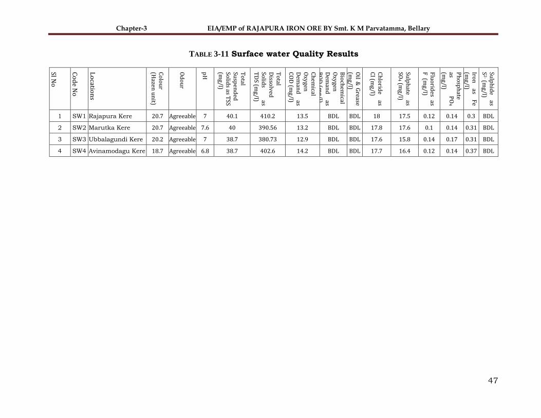
Chapter-3 EIA/EMP of RAJAPURA IRON ORE BY Smt. K M Parvatamma, Bellary
47
TABLE 3-11 Surface water Quality Results
Sl No
Co
de N
o
Lo
cation
s
Co
lou
r (H
azen u
nit)
Od
ou
r
pH
To
tal Su
spen
ded
So
lids as T
SS (m
g/l)
To
tal D
issolv
ed
Solid
s as
TD
S (mg/l)
Ch
emical
Oxy
gen
Dem
and
as
CO
D (m
g/l)
Bio
chem
ical O
xygen
D
eman
d
as B
OD
(mg/l)
Oil &
Grease
(mg/l)
Ch
lorid
e as
Cl (m
g/l)
Sulp
hate
as SO
4 (mg/l)
Flu
orid
es as
F (m
g/l)
Ph
osp
hate
as P
O4
(mg/l)
Iron
as
Fe
(mg/l)
Sulp
hid
e as
S2
- (mg/l)
1 SW1 Rajapura Kere 20.7 Agreeable 7 40.1 410.2 13.5 BDL BDL 18 17.5 0.12 0.14 0.3 BDL
2 SW2 Marutka Kere 20.7 Agreeable 7.6 40 390.56 13.2 BDL BDL 17.8 17.6 0.1 0.14 0.31 BDL
3 SW3 Ubbalagundi Kere 20.2 Agreeable 7 38.7 380.73 12.9 BDL BDL 17.6 15.8 0.14 0.17 0.31 BDL
4 SW4 Avinamodagu Kere 18.7 Agreeable 6.8 38.7 402.6 14.2 BDL BDL 17.7 16.4 0.12 0.14 0.37 BDL

Chapter-3 EIA/EMP of RAJAPURA IRON ORE BY Smt. K M Parvatamma, Bellary
48
The ground water and the surface water quality from all the locations as
mentioned above is used for drinking purpose. The result shows that all the
parameters are well within the acceptable limit of IS: 10500.
3.5.4 Noise
The noise level survey was carried out at 8 locations and the details of the survey are given hereunder:
TABLE 3-12 NOISE LEVELS RESULTS OF THE STUDY AREA
Station Code
Noise level in dB(A)
Max. Min. Day
(leq)
Night
(leq)
Ambient Noise Level (dBA)
N-1 Drilling Area 53.67 42.78 49.68 41.77
N-2 Loading Area 54.92 41.79 50.11 41.60
N-3 Dumping Area 53.66 42.11 49.43 41.35
N-4 Ubbalagundi 41.29 37.26 39.81 33.74
N-5 Rajapura 45.76 33.84 41.39 33.21
N-6 Appavvanahalli 43.21 32.55 39.30 31.46
N-7 Navalatti 41.74 39.64 40.97 35.41
N-8 Tonasigeri 40.45 32.63 37.58 30.50
3.5.5 Ambient Noise Level
Ambient noise level at Drilling area, Loading Area and Dumping Area were found
to be 49.68, 50.11 & 49.43 dB (A) in day time and 41.77, 41.60 & 41.35 dB (A)
in night time respectively. All the values are well within the prescribed limit of
75 and 70 dB (A), for industrial and residential areas in day and night time
respectively. Ambient Noise level at Ubbalagundi (N-4), Rajapura (N-5),
Appavvanahalli (N-6), Navalatti (N-7) and Tonasigeri (N-8) were 41.29 and 37.26,
45.76 and 33.84, 43.21 and 32.55, 41.74 and 39.64 & 40.45 and 32.63 in day
and night time respectively. The noise levels were found to be within the
prescribed limit of 55 dB (A) &45dB (A) for residential area in day and night time
respectivel

Chapter-3 EIA/EMP of RAJAPURA IRON ORE BY Smt. K M Parvatamma, Bellary
49
3.5.6 Soil Quality
The data analysis of the soil monitoring results collected nearby lease area is given below
From the results it can be concluded that the pH of soil is normal ranging 7.2-7.5, average nitrogen values were
in low to medium range (176-205 kg/ha), average potassium value is also in the range of low to high (153-162
kg/ha). The average phosphorus values were found to be medium (96-117 kg/ha).
TABLE 3-13 Soil quality monitoring Result
Sl No
Locations
Pro
ject S
ite
Ubbala
gun
di
Raja
pura
Appavvan
ah
al
li
Navala
tti
To
na
sige
ri
Nan
dih
alli
Th
imla
pura
Parameters S1 S2 S3 S4 S5 S6 S7 S8
1 pH (Ratio 1:2) 7.4 7.4 7.24 7.3 7.2 7.4 7.5 7.25
2 Elec. Conductivity (µ mhos/cm) (Ratio 1:2) 368.2 368.2 402.07 412.46 406 415.24 415 406
3 Available Nitrogen as N(kg/ha) 176.4 176.4 199.75 187.72 202 204.5 204 205.2
4 Available Phosphorous as P2O5(kg/ha) 96.01 96.01 104.76 117 113 105 106 101.5
5 Available Sodium as Na2O (kg/ha) 84.52 84.52 98.94 103.2 110.5 106.5 106.5 105.15
6 Available Potassium as K2O(kg/ha) 161.78 161.78 156.78 158.4 153.82 163.5 165.5 158.95
7 Available Calcium as Ca (kg/ha) 354.72 354.72 310.44 300.4 314.6 316.2 317.7 312.7
8 Available Magnesium as Mg (kg/ha) 143.27 143.27 210.84 212.7 212.31 213.5 215.5 212.65
9 Available Chloride as Cl (kg/ha) 35.31 35.31 64.75 65.43 67.46 64.95 68.4 65.24
10 Organic Carbon (%) 1.14 1.14 1.07 1.12 1.13 1.1 1.15 1.12

Chapter-3 EIA/EMP of RAJAPURA IRON ORE BY Smt. K M Parvatamma, Bellary
50
3.6 Socio-Economic Scenario
The socio-economic scenario in the 10 km radius of the project is based on
secondary data collected from statistical records. 2011 census data has been
used for demographic features. The study area comprises of 26 census villages
with a total population of 47783.
3.6.1 Demographic Features of Study Area-Rural
The villages falling within the study area are listed in the below table 3.14 along
with the demographic features as per the census 2011.
TABLE 3-14 SHOWING THE LIST OF VILLAGES WITH THE POPULATION
Sl No Village Name
No of
House holds Population male Female
Sex Ratio
1 Marutla 43 205 108 97 1.11
2 Ubbalgundi 348 1,713 876 837 1.05
3 Malapur 197 1,155 563 592 0.95
4 Thimlapura 95 519 269 250 1.08
5 Rajapura 529 2,696 1,402 1,294 1.08
6 Mallapur 88 473 241 232 1.04
7 Mothulakunta 227 1,190 587 603 0.97
8 Appavanahalli 622 3,015 1,496 1,519 0.98
9 Gollaligammanahalli 376 1,969 1,003 966 1.04
10 Tonasigeri 254 1,286 639 647 0.99
11 Swamy halli 314 1,486 731 755 0.97
12 Viitalanagar 206 1,109 568 541 1.05
13 Nandihalli 421 2,259 1,193 1,066 1.12
14 Ranjithpur 267 1,375 724 651 1.11
15 Narasingpur 461 2,291 1,169 1,122 1.04
16 Hanumanagudda 0 0 0 0 0.00
17 Avinamadugu 86 447 222 225 0.99
18 Ayyanahalli 0 0 0 0 0.00
19 Bommanagutta 706 3,946 2,043 1,903 1.07
20 Donimalai Township 1,660 6,672 3,447 3,225 1.07
21 Nagenahalli 177 843 455 388 1.17
22 Rampur 87 506 264 242 1.09
23 Eredammanahalli 298 1,466 750 716 1.05
24 Navalatti 150 450 250 150 1.67
25 Devagiri 701 3,606 1,860 1,746 1.07

Chapter-3 EIA/EMP of RAJAPURA IRON ORE BY Smt. K M Parvatamma, Bellary
51
26 Bandravi 1,313 7,106 3,506 3,600 0.97
The summary of the demographic features is given in Table. 3.15 and discussed
in the following paragraphs:
Population
The total population of 26 villages is 47783. The % of Schedule Caste (SC) and
Schedule Tribe (ST) to the total population is 21 & 34 respectively.
FIGURE 3-12 % OF POPULATION IN STUDY AREA
Village size
The total households in the 26 villages are 9626. The average household per
village is 370.
House hold size
The average household size is 4.9 in rural area.
Sex Ratio
The sex ratio of the study area is 990 females per thousand male populations in
rural area. The percentage of male and female population to the total population
is 51% and 49% respectively.
SC21%
ST34%
OTHERS45%
Population Percentage (%)
SC ST OTHERS

Chapter-3 EIA/EMP of RAJAPURA IRON ORE BY Smt. K M Parvatamma, Bellary
52
FIGURE 3-13 CHART SHOWING THE MALE TO FEMALE POPULATION
Literacy
The percentage of literacy in the area is 56%.
The % male and female literacy to the total population is 59% & 41% respectively.
Male51%
Female49%
MALE TO FEMALE POPULATION
Male Female
Literates56%
Illiterates44%
Total Literacy to Illiteracy Percentage
Literates Illiterates

Chapter-3 EIA/EMP of RAJAPURA IRON ORE BY Smt. K M Parvatamma, Bellary
53
FIGURE 3-14 PERCENTAGE LITERACY RATE OF THE STUDY AREA
Occupational structure of the study area
The percentage of total workers to the total population of the rural area is 44%
in which male constitutes 63% and female constitutes 37% and remaining 56%
constitute non-workers.
Male59%
Female41%
Percentage Literacy
Male Female
Total Workers44%Total Non-
workers56%
Employment vs Unemployment Chart
Total Workers Total Non-workers

Chapter-3 EIA/EMP of RAJAPURA IRON ORE BY Smt. K M Parvatamma, Bellary
54
FIGURE 3-15 PERCENTAGE EMPLOYMENT SCENARIO IN STUDY AREA
TABLE 3-15 DEMOGRAPHIC FEATURES AS PER THE CENSUS 2011
Sl. Details No./%
1 Total population 47783
2 No. of House hold 9626
3 Average family size 4.9
4 Average no. of house hold per village 370
5 Average population per village 1838
6 Sex ratio–females per thousand males 990
7 Percent of male population to total population 51
8 Percent of female population to total population 49
9 Percent of SC population to the total population 21
10 Percent of ST population to the total population 34
11 Percent of literate population to the total population 56
12 Percent of Male literate population to the total
population
59
13 Percent of Female literate population to the total
population
41
14 Percent of total worker to the total population 44
16 Percent of non-worker to the total population 56
Basic issues which needs to be addressed are related to the following:
Education & communication
Advanced Health care &drinking water sources to be enhanced
Alternative Livelihood & environmental protection
Sports & culture
Infrastructure development including road, transportation etc.
63%
37%
Total Employement Male vs Female
Male Female
41%59%
Total Unemployment male vs female
Male Female

Chapter-3 EIA/EMP of RAJAPURA IRON ORE BY Smt. K M Parvatamma, Bellary
55
Financial inclusion through enhanced banking facilities
Entertainment
3.7 Flora and Fauna
Study of the biological environment is one of the most important aspects of EIA.
Mining leases area is mainly located in the forest area. The biological
communities are the good indicators of climatic and edaphic factors. It is
important to conserve natural flora and fauna based on EIA of an area. EIA helps
to identify the impact of mining on the ecosystem and to check the damage. It is
also suggested remedial measures to be taken so that a particular ecosystem can
improve instead of further damage. In the present study mainly, terrestrial
ecosystem has been considered.
The study was under taken during generation of baseline study period from
October to December, 2021.
The list of flora and fauna in the core and buffer zone is based on the site visit
and secondary data. The list of flora and fauna in the core and buffer zone is
presented in the report. Impact of the mine on flora and fauna is discussed in
Chapter-4. The mitigation measures and funds have been discussed in Chapter-
5 in brief.
3.7.1 Scope
To assess the flora and fauna present in the core zone (lease area) and in
Buffer zone (10 Km radius range) of Rajapur Iron Ore Mine of Smt K. M.
Parvathamma project.
To document cultivated and naturally occurring species in the core zone
Assessment of species protected by specific legislation (Rare, endangered,
critically endangered, endemic and vulnerable)
To identify designated location and features of ecological significance
3.7.2 Activities Undertaken During the Study
1. Flora survey
Tree, shrub, herb, climber, grass species etc. identification and
enumeration
Diversity of species
Analysis of Rare-Endangered-Threatened flora
2. Fauna survey
Documentation of Avian, Reptilian, Mammal and other faunal diversity

Chapter-3 EIA/EMP of RAJAPURA IRON ORE BY Smt. K M Parvatamma, Bellary
56
Observations by direct and indirect evidences (Direct evidence- Sighting
and hearing, Indirect evidence- Pug marks, nests and other signs
Analysis of Scheduled species
3. Habitat/microhabitat diversity in the project zone and surrounding areas.
4. Photo documentation
3.7.3 Survey Limitation
This survey records the evidence of flora and fauna existence during the site
visit and field survey. It does not record any flora or fauna that may appear
during other times of the year, and as such, were not evident at the time of
visit. The report represents ecological status of the area during the particular
period of the study.
This is an ecological report and as such no reliance should be given to
comments relating to buildings, engineering, soils or other unrelated matters.
3.7.4 Approach of the Study
To assess the ecological issues and document flora and fauna associated with
the project following tasks were undertaken:
1. Preliminary site visit
2. Desk Study
3. Core zone and Buffer Zone Survey
3.7.5 Methodology
Desk Study
In order to understand the ecological status of the project site and study area,
random plots will be laid at the project site and the entire study area of 10 Km
radius. sampling location will be selected depending upon prevailing land use
and topography. list of existing flora and fauna with IUCN and RET status will
be recorded. Complete tree enumeration will be carried in the project site,
whereas in study area 3 sampling location is selected.
The purpose of desk study is to identify habitats and species of local conservation
value which may not have been present or apparent during the survey visit e.g.
spring/monsoon plants. Desk study is also helpful in understanding the
historical biodiversity and ecological status of the site.

Chapter-3 EIA/EMP of RAJAPURA IRON ORE BY Smt. K M Parvatamma, Bellary
57
The desk study is carried out by literature survey and study of relevant
webpage’s in respect of ecology and biodiversity of the region. The information
has been collected specific to the region and quoted in the report accordingly.
Forest working plan of Bellary (2022-2023), IUCN Red Data Book, Wildlife
Schedules from Wildlife (Protection) Act, 1972, FRLHT, Handbook on Weed
identification (Dr. Naidu, 2012) and Common Dry Land Trees of Karnataka
(Kavitha, 2012) will be used for the identification. Consultation with local people
and respective Forest Divisions will also be carried out during the site visit to
understand the distribution of fauna in the region. The unidentified species shall
be photographed and the specimens shall be collected and verified by using BSI,
FRLHT data base and will be cross checked with experts.
Habitat Survey
This survey involves in collecting flora and fauna at various strategies. These
strategies differed as per habit and habitat of concerned group of species.
Flora
The structure and composition of vegetation / forest cover was studied by using
Phytosociological methods. Field surveys were undertaken to analyze and
estimate diversity, density, dominance and frequency of different members of
plant population.
Observations were made in the forest area as well as in non-forest areas by laying
plots and adopting quadrate method. The quadrate method includes preparation
of square sample plots or units for quantitative analysis of vegetation. The
sample plot method given by Clements (1898); Philips (1959); Muller and
Ellenberg (1974) and Rau and Wooten (1988) EIA Hand Book (ch.7, pp.44) was
followed.
Co-existence and competition both are affected directly by number of individuals
in the community. Therefore, it is essential to know the quantitative structure of
the community. To characterise the community as a whole, certain derived
parameters are used i.e. Density, Frequency, Abundance.
The Simpson Diversity Index gives a clear picture of community structure in
quantitative terms. To summarize the above, following parameters were used
during Floristic diversity and Phytosociological assessment:
1. Density, Frequency, Abundance
2. Simpsons Index
a) Simpsons Index (D)
b) Simpson's Index of Diversity (1 – D)

Chapter-3 EIA/EMP of RAJAPURA IRON ORE BY Smt. K M Parvatamma, Bellary
58
c) Simpson's Reciprocal Index (1/D)
Fauna and Avifauna
The assessment of wild fauna was made based on random sightings. The
secondary evidences were also recorded through calls, dung boles, scats, and
spoors, rub signs, signs of debarking, drag mark etc. for identification of fauna.
For birds, actual counts at each sampling site were made, by walk through in a
chosen one kilometer stretch of the site and the number of birds were directly
counted and listed. Species list was prepared along with taxonomic position of
each species.
3.7.6 Sampling Stations
Majority of the region and the study area falling in 10 km radius, consists of
mining projects, allied and other commercial activities. Therefore, sampling
locations were strategically selected to collect the maximum data on vegetation
pattern, faunal diversity and habitat diversity. The details of sampling locations
are given in the Table3.16.
TABLE 3-16 SAMPLING LOCATIONS OF THE STUDY AREA
Observations
Observations are made for all possible habitats and flora-fauna species in and
around the Rajapura Iron Ore Mine (except micro-organisms). All possible
landscape features within core zone have been collected. The observations
recorded are site, time and season specific observations. However, the actual
observation data was supported by data obtained from secondary sources i.e.
reports, research papers, literature survey etc.
Since it is a mining project, the impact of the project can be multifold and
therefore the ecological richness and sensitivity of the locations were examined
critically.
Sl no Location GPS Location Criteria
1 Donimalai Reserve Forest 15° 4'33.04"N, 76°36'37.48"E
Reserve Forests 2 Tonasigeri Reserve Forest 14°57'56.32"N, 76°40'38.85"E
3 Metriki Reserve Forest 15° 2'19.04"N, 76°43'56.98"E

Chapter-3 EIA/EMP of RAJAPURA IRON ORE BY Smt. K M Parvatamma, Bellary
59
FIGURE 3-16 ECOLOGICAL STUDIES SAMPLING LOCATION

Chapter-3 EIA/EMP of RAJAPURA IRON ORE BY Smt. K M Parvatamma, Bellary
60
3.7.7 Habitat and Forest Type Diversity
The location of Rajapura Iron Ore Mine falls in Ballari district of Karnataka State.
The study area falling in 10 km radius is diverse in habitat and therefore study
of Habitat and Forest type diversity was undertaken to known different types of
habitats and forests that are prevalent in the region.
Habitats are decisive factors and determine the diversity and distribution of flora
and fauna in any given ecosystem. Therefore, it is vital to understand dynamics
and diversity of habitats and ecosystems in and around the Rajapura Iron Ore
Mine of Smt K.M. Parvathamma project. The overall examination was carried out
by site visits at various pre-marked locations in the core zone and the region
falling within the 10 km radius of the project i.e. Buffer zone.
The biotic environment can be described under following heads.
• Core Zone
• Buffer Zone
• Bandri RF and Bandri Extension RF: Hardwickia-Dindiga-Dhoopa- Sundra
Forest: Contains good growth of Tectona grandis, Hardwickia binata, Albizia
amara and some Acacia species. Other important species include Anogeissus
latifolia, Boswellia serrata, Stereospermum chelonoides etc.,
• Metriki RF: This forest contains a fair growth of Hardwickia binata along
with other species such as Albizzia amara, Stereosperumum and Acacia
sundra, Anogeissus, latifolia, Grewia tiliaefolia, Wrightia tinctoria and
Soymida febrifuga. Cassia fistula and Pongamia pinnata are also found amid
Eucalyptus plantations here and there.
• Marutla RF & NE Extension: The forest is covered with fairly good growth
of Albizia amara, Acacia sundra, Grewia tiliaefolia and Hardwickia binata.
Other species include Cassia fistula, Azadirachta indica, etc.
• Tonasigere RF: Grassy hill with western aspect containing more or less
sparse deciduous growth of various species. The lower portions are
practically bare but along the streams and in the water-sheds the forest is
half to fully stocked. In some of the valleys Teak occurs, which is
considerably hacked about. Under proper treatment, this species could be
considerably developed
• Ubbalagandi RF, Extension RF & North Extension RF: Three fourths of
the Ubbalagandi RF areas are clothed with Hardwickia binata, Soymida
febrifuga, Albizzia lebbek, Albizzia amara, Acacia leucophloea and other
Acacias. The remaining one-fourth is covered with grass. The Extension

Chapter-3 EIA/EMP of RAJAPURA IRON ORE BY Smt. K M Parvatamma, Bellary
61
forest contains fairly good growth of Hardwickia binata and Acacia sundra.
The North Extension forest contains scattered hillocks with a fair growth of
Dolichandrone crispa, Albizzia amara and Acacia sundra etc.,
3.7.8 Flora of project site
A total Number of 16 trees species (n=40) belonging to 8 families were found in
Project site, the predominant tree species recorded were Acacia
auriculiformis Benth. (n=6), Tectona grandis L.f. (n=5) and Mangifera indica L.
(n=4). All the recorded species are common to region and no RET species were
recorded. All tree species are used for medicinal, edible and some are used for
timber and wood purpose. As per the IUCN conservation status 2022,
Pterocarpus marsupium Roxb.is Near threatened and Dalbergia latifolia Roxb. Is
Vulnerable species recorded in the project site rest of the species is Least
concerned and not assessed.
The girth class distribution shows that maximum number of stems falls under
30-60 cm girth class (29 trees) which contributes 72.5 % of the total individuals
followed by 60-90 cm girth class (11 tress) which contributes 27.5 % of the total
individuals. Maximum Basal area of tree species at project site was found in
Tectona grandis L.f (0.2098 m2/ha), minimum Basal area was found in Dalbergia
latifolia Roxb. (0.010 m2/ha). The carbon sequestration capacity of existing trees
in the project site was estimated to be 2.098 t/yr of which Tectona grandis L.f
(0.510 t/yr), Acacia auriculiformis Benth. (0.307 t/yr), Butea
monosperma var. lutea (0.280 t/yr) are major carbon sequesters in the area.
9 species of Herbs, 7 species of shrubs and 2 climbers were recorded at project
site. As per the IUCN conservation status 2022, most of the species is not
assessed and rest is least concerned.
The checklist of recorded Trees given in Table 3.17.

Chapter-3 EIA/EMP of RAJAPURA IRON ORE BY Smt. K M Parvatamma, Bellary
62
TABLE 3-17 CHECKLIST OF TREES RECORDED AT THE PROJECT SITE
Sl
no Scientific name Local name Family
No.
observed
IUCN
Conservation
status 2022
RET
status Uses
1 Tectona grandis L.f. Tega Verbenaceae 5 Not assessed Common Timber
2 Pterocarpus marsupium Roxb. Honne mara Fabaceae 2 Near threatened Common Medicinal and
Timber
3 Lagerstroemia speciosa Deepu
& Pandur. Nandi mara Lytharaceae 3 Not assessed Common Medicinal, folk
4 Dalbergia latifolia Roxb. Beete mara Fabaceae 1 Vulnerable Common Medicinal
5 Wrightia laevis Hook.f. Halle Apocynaceae 2 Least concern Common Medicinal
6 Butea monosperma var. lutea Muthugada
mara Fabaceae 3 Least concern Common Ornamental
7 Acacia auriculiformis Benth. Kadu seege Fabaceae 6 Least concern Common Pulp wood
8 Mangifera indica L. Mavina mara Anacardiaceae 4 Data deficient Common Edible and Fuel
wood
9 Pongamia pinnata (L.)Pierre Honge Fabaceae 3 Least concern Common Medicinal
10 Annona squamosa L. Sithapala Annonaceae 2 Least concern Common Medicinal and edible
11 Magnolia champaca (L.) Baill.
ex Pierre Sampige mara Magnoliaceae 1 Least concern Common Ornamental
12 Vachellia nilotica (L.)
P.J.H.Hurter & Mabb Kari jali Fabaceae 3 Least concern Common Timber
13 Tamarindus indica L. Hunase mara Fabaceae 1 Least concern Common Edible and medicinal
14 Hardwickia binata Roxb. Kamara Fabaceae 1 Least concern Common Medicinal and
dyeing
15 Azadirachta indica A.Juss. Bevu Meliaceae 2 Least concern Common Medicinal, edible
and traditional
16 Leucaena leucocephala C.E.
Hughes Chigurakku Fabaceae 1 Not assessed Common
Fodder, fuel wood
and medicinal
Total 40

Chapter-3 EIA/EMP of RAJAPURA IRON ORE BY Smt. K M Parvatamma, Bellary
63
TABLE 3-18 GIRTH DISTRIBUTION OF TREES AT PROJECT SITE
Sl no Girth class No. observed Percentage
1 30-60 29 72.5
2 60-90 11 27.5
Total 40 100
TABLE 3-19 BASAL AREA AND CARBON SEQUESTRATION OF TREE SPECIES AT PROJECT SITE
Sl no Scientific name Basal area
(m2/ha)
Total CO2 in
tonnes
1 Acacia auriculiformis Benth. 0.130 0.307
2 Annona squamosa L. 0.019 0.031
3 Azadirachta indica A.Juss. 0.025 0.044
4 Butea monosperma var. lutea 0.153 0.280
5 Dalbergia latifolia Roxb. 0.010 0.033
6 Hardwickia binata Roxb. 0.015 0.034
7 Lagerstroemia speciosa Deepu & Pandur. 0.083 0.184
8 Leucaena leucocephala C.E. Hughes 0.039 0.105
9 Magnolia champaca (L.) Baill. ex Pierre 0.035 0.045
10 Mangifera indica L. 0.043 0.070
11 Pongamia pinnata (L.)Pierre 0.042 0.085
12 Pterocarpus marsupium Roxb. 0.033 0.073
13 Tamarindus indica L. 0.039 0.089
14 Tectona grandis L.f. 0.208 0.510
15 Vachellia nilotica (L.) P.J.H.Hurter &
Mabb 0.042 0.089
16 Wrightia laevis Hook.f. 0.041 0.118
Total 0.957 2.098

Chapter-3 EIA/EMP of RAJAPURA IRON ORE BY Smt. K M Parvatamma, Bellary
64
TABLE 3-20 CHECKLISTS OF HERBS, SHRUBS AND CLIMBERS AT PROJECT SITE
Sl.
No Scientific Name Local name Family
IUCN Conservation
Status-2022
RET
Status Uses
Shrubs
1 Calotropis procera R.BR. Bili aekka Asclepiadaceae Not Assessed Common Medicinal
2 Canthium parviflorum L. Achchumullu Rubiaceae Not Assessed Common Medicinal
3 Abutilon hirtum (Lam.) Sweet Tutti Malvaceae Not Assessed Common Edible, medicinal
4 Dodonaea viscosa (L. fil.) J.G.West Bandarike Sapindaceae Least Concern Common Medicinal
5 Chromolaena odorata (L.) R. King & H. Rob. Kamyunist kale Asteraceae Not Assessed Common Medicinal
6 Lantana camara L. Beli gida Verbenaceae Not Assessed Common Medicinal &
ornamental
7 Solanum torvum Swartz Kaada kallatti Solanaceae Not Assessed Common Medicinal
Herbs
1 Agave americana L. Kantala Asparagaceae Least Concern Common Edible, medicinal
2 Aloe vera (L.) Burm.f. Aloe vera Liliaceae Not Assessed Common Medicinal
3 Anisomeles indica (L.) Kuntze hennu karee thumbe Lamiaceae Not Assessed Common Medicinal
4 Achyranthes aspera L. Uttaranee Amaranthacea Not Assessed Common Medicinal
5 Boerhavia diffusa L. nom. cons. Adakaputtana gida Nyctaginaceae Not Assessed Common Medicinal
6 Cassia tora Sensu Auct. Tagache Caesalpiniaceae Not Assessed Common Medicinal
7 Chloris barbata SW Sevaragu Poaceae Not Assessed Common Medicinal
8 Asparagus racemosus WILLD. Aashaadi balli Liliaceae Not Assessed Common Edible and medicinal
9 Catharanthus roseus (L.) G. Don Ganeshanahoo Apocynaceae Not Assessed Common Medicinal and
Ornamental
Climbers
1 Cardiospermum halicacabum L. Agnibali Sapindaceae Least Concern Common Medicinal
2 Ipomoea carnea Jace. Bush morning glory Convolvulaceae Not Assessed Common Ornamental

Chapter-3 EIA/EMP of RAJAPURA IRON ORE BY Smt. K M Parvatamma, Bellary
65
3.7.9 Flora of Study area
The buffer zone area has considered 10 km from mine boundary.
A total Number of 20 trees species (n=48) belonging to 11 families were found in
study area, the predominant tree species recorded were Pongamia pinnata
(L.)Pierre. (n=6), Cocos nucifera L.. (n=5), Eucalyptus globulus Labill and
Azadirachta indica A.Juss. (n=4). All the recorded species are common to region
and no RET species were recorded. All tree species are used for medicinal, edible
and some are used for timber and wood purpose. As per the IUCN conservation
status 2022, most of the species is Least concerned and rest of the species is Not
assessed.
The girth class distribution shows that maximum number of stems falls under
30-60 cm girth class (33 trees) which contributes 68.75 % of the total individuals
followed by 60-90 cm girth class (14 tress) which contributes 29.17 % of the total
individuals. Maximum Basal area of tree species at project site was found in
Cocos nucifera L. (0.088 m2/ha), minimum Basal area was found in Albizia
lebbeck (L.) Benth and Pithecellobium dulce (Roxb.)Benth. (0.007 m2/ha). The
carbon sequestration capacity of existing trees in the study area was estimated
to be 3.249 t/yr of which Cocos nucifera L. (0.878 t/yr), Eucalyptus globulus
Labill (0.513 t/yr), Delonix regia (Hook.) Raf. (0.228 t/yr) are major carbon
sequesters in the area.
10 species of Herbs, 5 species of shrubs and 3 climbers were recorded at Study
area. As per the IUCN conservation status 2022, most of the species is not
assessed and rest is least concerned.
The Importance Value Index (IVI) shows the complete or overall picture of
ecological importance of the species in a community. Community structure study
is made by studying frequency, density, abundance and basal cover of species.
A tree with greater IVI values includes Cocos nucifera L. (IVI-40.8) and Pongamia
pinnata (L.)Pierre. (IVI-28.8) with least one being Albizia lebbeck (L.)Benth and
Samanea saman (Jacq.) Merr. (IVI-6.7). In addition to these, diversity indices
such as Shannon-Weiner diversity index were calculated, which is used to

Chapter-3 EIA/EMP of RAJAPURA IRON ORE BY Smt. K M Parvatamma, Bellary
66
characterize the species diversity in a community taking into account both
evenness and abundance of the species present. Shannon-Weiner diversity in
study area is estimated to be 2.8. Simpson’s Index in study area was estimated
to be 0.95, which shows the diversity in the study area is 1 indicating high
density.

Chapter-3 EIA/EMP of RAJAPURA IRON ORE BY Smt. K M Parvatamma, Bellary
67
TABLE 3-21 CHECKLIST OF TREES RECORDED AT STUDY AREA
Sl
no Scientific name Local name Family
No.
observed
IUCN
Conservation
status 2022
RET
status Uses
1 Azadirachta indica A.Juss. Bevu Meliaceae 4 Least Concern Common Medicinal, edible and
traditional
2 Acacia auriculiformis Benth. Kadu seege Fabaceae 2 Least Concern Common Pulp wood
3 Albizia lebbeck (L.)Benth. Baage Fabaceae 1 Least Concern Common Timber
4 Leucaena leucocephala C.E.
Hughes Chigurakku Fabaceae 1 Not assessed Common Timber
5 Peltophorum pterocarpum (DC.)
K.Heyne
Bettada
hunise Caesalpiniaceae 1 Not assessed Common Edible and timber
6 Terminalia arjuna (Roxb.)
Wight & Arn. Arjuna mara Combretaceae 2 Not assessed Common Edible and medicinal
7 Cocos nucifera L. Tengu Arecaceae 5 Not assessed Common Edible and Medicinal
8 Delonix regia (Hook.) Raf. May tree Fabaceae 3 Least Concern Common Ornamental
9 Pongamia pinnata (L.)Pierre Honge Fabaceae 6 Least Concern Common Medicinal
10 Eucalyptus globulus Labill Nilagiri Myrtaceae 4 Least Concern Common Medicinal
11 Prosopis cineraria (L.) DRUCE Banni mara Mimosaceae 2 Not assessed Common Timber and
Traditional
12 Vachellia nilotica (L.)
P.J.H.Hurter & Mabb Kari jali Fabaceae 3 Least Concern Common Timber
13 Phoenix sylvestris (L.) Roxb. Echallu mara Arecaceae 2 Not assessed Common Medicinal, Edible,
ornamental
14 Pithecellobium
dulce (Roxb.)Benth. Seeme hunase Fabaceae 2 Least Concern Common
Edible, medicinal and
agroforestry
15 Ziziphus jujuba Lam Bore Hannu Rhamnaceae 1 Least Concern Common Edible and medicinal
16 Alstonia scholaris (L.) R.Br. aelele haale Apocynaceae 2 Least Concern Common
Ornamental
Homeopathy and
Medicinal
17 Samanea saman (Jacq.) Merr. Male mara Fabaceae 1 Least Concern Common Edible and medicinal

Chapter-3 EIA/EMP of RAJAPURA IRON ORE BY Smt. K M Parvatamma, Bellary
68
Sl
no Scientific name Local name Family
No.
observed
IUCN
Conservation
status 2022
RET
status Uses
18 Polyalthia longifolia (Sonn.)
Thwaites Ashoka mara Annonaceae 4 Not assessed Common
Ornamental and
windbreak
19 Simarouba glauca DC. Simaruba Simaroubaceae 1 Least Concern Common Medicinal
20 Terminalia catappa L. Badami Combertaceae 1 Least Concern Common Edible, medicinal and
Agroforestry
Total 48
TABLE 3-22 GIRTH DISTRIBUTION OF TREES AT STUDY AREA
Sl no Girth class No. observed Percentage
1 30-60 33 68.75
2 60-90 14 29.17
3 90-120 1 2.08
Total 48 100.00
TABLE 3-23 BASAL AREA AND CARBON SEQUESTRATION OF TREE SPECIES AT STUDY AREA
Sl no. Scientific name Basal area
(m2/ha) Total CO2 in tonnes
1 Acacia auriculiformis Benth. 0.010 0.098
2 Albizia lebbeck (L.)Benth. 0.007 0.047
3 Alstonia scholaris (L.) R.Br. 0.010 0.046
4 Azadirachta indica A.Juss. 0.015 0.102
5 Cocos nucifera L. 0.088 0.878
6 Delonix regia (Hook.) Raf. 0.034 0.228
7 Eucalyptus globulus Labill 0.056 0.513
8 Leucaena leucocephala C.E. Hughes 0.008 0.059
9 Peltophorum pterocarpum (DC.) K.Heyne 0.017 0.101

Chapter-3 EIA/EMP of RAJAPURA IRON ORE BY Smt. K M Parvatamma, Bellary
69
Sl no. Scientific name Basal area
(m2/ha) Total CO2 in tonnes
10 Phoenix sylvestris (L.) Roxb. 0.012 0.046
11 Pithecellobium dulce (Roxb.)Benth. 0.007 0.036
12 Polyalthia longifolia (Sonn.) Thwaites 0.036 0.348
13 Pongamia pinnata (L.)Pierre 0.030 0.210
14 Prosopis cineraria (L.) Druce 0.007 0.045
15 Samanea saman (Jacq.) Merr. 0.007 0.047
16 Simarouba glauca DC. 0.010 0.091
17 Terminalia arjuna (Roxb.) Wight & Arn. 0.010 0.060
18 Terminalia catappa L. 0.013 0.096
19 Vachellia nilotica (L.) P.J.H.Hurter &
Mabb 0.029 0.147
20 Ziziphus jujuba Lam 0.009 0.051
Total 0.413 3.249
TABLE 3-24 PHYTO SOCIOLOGICAL PARAMETERS OF TREES AT STUDY AREA
Sl.
No Scientific Name
Phyto-sociological parameters
No. O Density Frequency BA Do RD Rdo RF IVI
1 Acacia auriculiformis Benth. 2 3 0.67 100.00 0.010 0.023 4.167 2.328 9.091 15.6
2 Albizia lebbeck (L.)Benth. 1 1 0.33 33.33 0.007 0.016 2.083 1.606 3.030 6.7
3 Alstonia scholaris (L.) R.Br. 2 2 0.67 66.67 0.010 0.023 4.167 2.328 6.061 12.6
4 Azadirachta indica A.Juss. 4 3 1.33 100.00 0.015 0.036 8.333 3.621 9.091 21.0
5 Cocos nucifera L. 5 3 1.67 100.00 0.088 0.213 10.417 21.306 9.091 40.8
6 Delonix regia (Hook.) Raf. 3 2 1.00 66.67 0.034 0.082 6.250 8.172 6.061 20.5
7 Eucalyptus globulus Labill 4 2 1.33 66.67 0.056 0.135 8.333 13.537 6.061 27.9
8 Leucaena leucocephala C.E.
Hughes 1 1 0.33 33.33 0.008 0.019 2.083 1.943 3.030 7.1

Chapter-3 EIA/EMP of RAJAPURA IRON ORE BY Smt. K M Parvatamma, Bellary
70
Sl.
No Scientific Name
Phyto-sociological parameters
No. O Density Frequency BA Do RD Rdo RF IVI
9 Peltophorum pterocarpum (DC.)
K.Heyne 1 1 0.33 33.33 0.017 0.041 2.083 4.110 3.030 9.2
10 Phoenix sylvestris (L.) Roxb. 2 1 0.67 33.33 0.012 0.029 4.167 2.906 3.030 10.1
11 Pithecellobium dulce (Roxb.)Benth. 2 1 0.67 33.33 0.007 0.018 4.167 1.814 3.030 9.0
12 Polyalthia longifolia (Sonn.)
Thwaites 4 2 1.33 66.67 0.036 0.087 8.333 8.705 6.061 23.1
13 Pongamia pinnata (L.)Pierre 6 3 2.00 100.00 0.030 0.072 12.500 7.167 9.091 28.8
14 Prosopis cineraria (L.) Druce 2 2 0.67 66.67 0.007 0.018 4.167 1.814 6.061 12.0
15 Samanea saman (JACQ.) Merr. 1 1 0.33 33.33 0.007 0.016 2.083 1.606 3.030 6.7
16 Simarouba glauca DC. 1 1 0.33 33.33 0.010 0.023 2.083 2.312 3.030 7.4
17 Terminalia arjuna (Roxb.) Wight &
Arn. 2 1 0.67 33.33 0.010 0.023 4.167 2.328 3.030 9.5
18 Terminalia catappa L. 1 1 0.33 33.33 0.013 0.031 2.083 3.147 3.030 8.3
19 Vachellia nilotica (L.) P.J.H.Hurter
& Mabb 3 1 1.00 33.33 0.029 0.071 6.250 7.138 3.030 16.4
20 Ziziphus jujuba Lam 1 1 0.33 33.33 0.009 0.021 2.083 2.087 3.030 7.2
Total 100 100 100 300.0
TABLE 3-25 CHECKLIST OF HERBS, SHRUBS AND CLIMBERS
Sl.
No Scientific Name Local name Family
IUCN Conservation
Status-2022
RET
Status Uses
Shrubs
1 Lantana camara L. Beli gida Verbenaceae
Not Assessed Common Medicinal &
ornamental
2 Ocimum sanctum L. Tulasi Lamiaceae
Not Assessed Common Edible and
medicinal
3 Sida acuta Burm. fil. Bheemanaka
ddi Malvaceae
Not Assessed Common Medicinal

Chapter-3 EIA/EMP of RAJAPURA IRON ORE BY Smt. K M Parvatamma, Bellary
71
Sl.
No Scientific Name Local name Family
IUCN Conservation
Status-2022
RET
Status Uses
4 Tecoma stans (L.) Juss. ex
Kunth Gante hoo Bignoniaceae
Least Concern Common Ornamental
5 Arundo donax L. Kaage kabbu Poaceae Least Concern Common Medicinal
Herbs
1 Phyllanthus niruri L. Nela nelli Euphorbiacea
e
Not Assessed Common Medicinal
2 Solanum viarum Dun. Cikkasonde Solanaceae Least Concern Common Medicinal
3 Tridax procumbens L. Jayanthi Asteraceae Not Assessed Common Medicinal
4 Vigna trilobata (L.)
Verdcourt Pisaru kaayi Fabaceae
Not Assessed Common Medicinal
5 Synedrella
nodiflora Gaertn
Tota halu
gida Asteraceae
Not Assessed Common Medicinal
6 Boerhavia erecta L. Punarnava Nyctaginacea
e
Not Assessed Common Medicinal
7 Euphorbia hirta L Acchacche
gida
Euphorbiacea
e
Not Assessed Common Medicinal
8 Leucas aspera (Willd.)
Link
Bilee
thumbe Lamiaceae
Not Assessed Common Medicinal
9 Sonchus asper (L.) Kalijibi Asteraceae
Not Assessed Common Edible and
medicinal
10 Typha angustata BORY Aane jondu Typhaceae
Not Assessed Common Edible and
medicinal
Climbers
1 Ipomoea coccinea L Halluballi, Convolvulac
eae
Not Assessed Common Ornamental
2 Ricinus communis L. Aralu Euphorbiacea
e
Not Assessed Common Medicinal
3 Cocculus hirsutus (L.) Aadama
balli
Menispermac
eae
Not Assessed Common Medicinal

Chapter-3 EIA/EMP of RAJAPURA IRON ORE BY Smt. K M Parvatamma, Bellary
72
Conclusion
The proposed project is projected to mining, during construction phase there will
be removal of trees. No endangered species is recorded in the project site. The proposed project will not attract any wildlife clearance and Eco-sensitive zone.
No Schedule-I species is recorded.
3.7.10 Faunal Diversity in Core and Buffer Zone
The Core Zone is a mining dominated landscape, therefore not much sightings
of Fauna were found. The Faunal diversity is limited to Butterflies, Insects, Rats
and Common lizards. This area has a very poor Avifaunal diversity. Possibility of
bigger mammals are very low due to the cumulative disturbance caused by the
mining and associated activities. Based on primary source, the details of Fauna
diversity observed in core zone is given in Table 3.26.
TABLE 3-26 FAUNA DIVERSITY IN CORE ZONE (PRIMARY SOURCE)
Sl.
No.
Common Name /
Local Name Scientific Name
Schedule of
Wild Life
Protection Act
in Which
Listed
Mammals
1. Squirrel Funambulus pennant IV
2. Rat Ratus ratus -
3. Mice Mus musculus -
4. Fruit Bat Cynoptereus sphinx -
5. Common Langur Presbytis entellus II
6. Bonnet monkey Macaca radiate II
7. Jungle Cat / Baul Felis chaus II
Reptiles
1. Blind snake Typhlops spp. IV
2. Saw Scaled Viper Echis carinatus IV
3. Yellow Rat Snake Ptyas mucosus II
4. Tree snake Dryphis spp. IV
5. Chameleon Chameleon zeylanicus II
6. Krait Bangarus ceruleus -
7. Common Skink Mabuya carinata -
8. Garden Lizard Calotes versicolor -

Chapter-3 EIA/EMP of RAJAPURA IRON ORE BY Smt. K M Parvatamma, Bellary
73
Birds
1 Tailor bird Orthotomus sutorius IV
2 Common Crow Corvus splendens V
3 Jungle Crow Corvus marorhynchos IV
4 Common Mynah Acridotheres tristis IV
5 Jungle Mynah Acridotheres fuscus IV
6 Spotted Dove Streptopelia chinensis IV
7 Shikra Accipiter badius IV
8 Small green bee-eater Merops orientalis IV
9 Grey Partridge Perdix IV
10 Crow Pheasant Centropus sinensis IV
11 Magpie Robin Copsychus saularis IV
12 Weaver bird Ploceus philippinus IV
13 Spotted Owlet Athene brama IV
14 Pariah Kite Milvus migrans -
15 Partridge / Teetar Francolinus spp. IV
16 Serpent Eagle Spilornis cheela
17 Pied Mynah Sturnus contra IV
18 Small Minivet Pericrocotus cinnamomeus IV
19 Rose Ringed Parakeet Psitta culakrameri IV
20 Yellow Wagtail Motacilla flava IV
21 Koel Eudynamis scolopacea IV
22 Golden oriole Oriolus kundoo IV
Source: Primary source (Based on Survey and Interaction with Local Villagers)
Faunal species were found in buffer zone are Langur and Bonnet. The species
found in buffer zone adjacent to rocky hills are Jackal, Mongoose, Black Wild
Boar. Based on primary source, the details of Fauna diversity observed in buffer
zone given in Table 3.27.

Chapter-3 EIA/EMP of RAJAPURA IRON ORE BY Smt. K M Parvatamma, Bellary
74
TABLE 3-27 FAUNA DIVERSITY IN BUFFER ZONE (BASED ON PRIMARY SOURCE)
Sl. No. Common Name /
Local Name Scientific Name
Schedule of
Wild Life
Protection
Act in
Which
Listed
Mammals
1. Common Mongoose Herpestres edwardsii II
2. Indian Fox Vulpes bengalensis II
3. Jackal Canis aureus II
4. Squirrel Funambulus pennanti IV
5. Barking Deer Muntiacus muntjak III
6 Common house Rat Rattus rattus V
7 Jungle Cat / Baul Felis chaus II
8 Wild Pig Sus scrofa III
9 Indian hare Lepus nigricollis IV
10 Common Langur Presbytis entellus II
11 Bonnet monkey Macaca radiata II
12 Hyaena Hyaena hyaena III
Reptiles
1 Common Krait Bungarus caeruleus -
2 Russel’s Viper Vipera russelii II
3 Saw Scaled Viper Echis carinatus IV
4 Yellow Rat Snake Ptyas mucosus II
5 Indian Sand Boa Eryx johnii IV
6 Chameleon Chameleon zeylanicus II
7 Common Skink Mabuya carinata -
8 Garden Lizard Calotes versicolor -
9 Giant leaf-toed Gecko Hemidactylus giganteus
10 South Indian Rock
Agama Psammophilus dorsalis
11 Tree snake Dryphis spp. IV
12 Blind snake Typhlops spp. IV
Avifauna
1. Purple Sunbird Nectarinia asiatica IV
2. Blue Rock Pigeon Columba livia IV
3. Tailor bird Orthotomus sutorius IV

Chapter-3 EIA/EMP of RAJAPURA IRON ORE BY Smt. K M Parvatamma, Bellary
75
4. Common Crow Corvus splendens V
5. Jungle Crow Corvus marorhynchos IV
6. Common Mynah Acridotheres tristis IV
7. Jungle Mynah Acridotheres fuscus IV
8. Spotted Dove Streptopelia chinensis IV
9. Indian Ring Dove Streptopelia decaocto IV
10. Shikra Accipiter badius IV
11. Grey Jungle Fowl Gallus sonnerattii II
12. Grey Partridge Perdix sp. IV
13. House Sparrow Passer domesticus -
14. Crow Pheasant Centropus sinensis IV
15. Little Cormorant Phalacrocorax niger IV
16. Great Cormorant Phalacrocorax carbo IV
17. Weaver bird Ploceus philippinus IV
18. Spotted Owlet Athene brama IV
19. Pariah Kite Milvus migrans -
20. Partridge / Teetar Francolinus spp. IV
21. Pied Mynah Sturnus contra IV
22. Small Minivet Pericrocotus cinnamomeus IV
23. Rose Ringed Parakeet Psittacula krameri IV
24. Blossom Headed
Parakeet Psittacula cyanocephala IV
25. Large Pied Wagtail Motacilla maderaspatensis IV
26. Yellow Wagtail Motacilla flava IV
27. Koel Eudynamis scolopacea IV
28. Golden oriole Oriolus oriolus IV
29. Pheasant Tailed Jacana Hydrophasia nuschirurgus IV
30. Asian Palm Swift Cypsiurus parvus IV
31. Wire-tailed Swallow Hirundo smithii IV
32. Lesser Pied Kingfisher Ceryle rudis IV
33. Common kingfisher Alcedo atthis IV
34. White breasted
kingfisher Halcyon smyrnensis IV
35. Indian Roller Coracias bengalensis IV
36. Painted Spurfowl Galloperdix lunulata IV
37. Black Drongo Dicrurus adsimilis IV
38. River Tern Sterna aurantia IV
39. Red Wattled Lapwing Vannelus indicus IV
40. Brown-headed Barbet Megalaima zeylanica IV

Chapter-3 EIA/EMP of RAJAPURA IRON ORE BY Smt. K M Parvatamma, Bellary
76
41. Copper-smith Barbet Megalaima viridis IV
42. Common Tree-pie Dendrocitta vagabunda IV
43. Pond Heron Ardeola grayii IV
44. Indian Robin Saxicoloides fulicata IV
45. Magpie Robin Copsychus saularis IV
46. Little egret Egretta garzetta IV
47. Cattle Egret Bubulcus ibis IV
48. Blue-headed Rock
Thrush Monticola conclorhynchus IV
49. Small green bee-eater Merops orientalis IV
50. Large grey babbler Turdoides malcolmi IV
51. Jungle babbler Turdoides striatus IV
52. Red vent bulbul Pycnonotus cafer IV
53. White browed bulbul Pycnonotus luteolus IV
Source: Primary source (Based on Primary Survey and Interaction with Local
Villagers)
The study was undertaken for 10 km radius area and no Schedule-I species
reported during the study. However as per the list prepared by forest department
(Working Plan) “Ballari Forest Division” a few Schedule-I species (Sloth Bear,
Black Buck, Panther, Common Peafowl, Monitor Lizard, Python) were earlier
reported from the Reserve Forest.
3.8 Land use
Land Use/ Land Cover mapping (using Remote Sensing & GIS):
3.8.1 Introduction
The land use/land cover information relates to the status, spatial distribution &
area extent of different land cover/land use categories. Land cover and land use
are terms that are often used interchangeably; however, they have different
meanings. Land cover results from a complex mixture of natural and
anthropogenic influences and is the composition and characteristics of land
surface elements (Cihlar, 2000). In contrast, land use is characterized by
economic uses of land and people’s relationships with the environment (Avery
and Berlin, 1992). For example, a land cover of forest, when considered as a land
use, could be a park. To classify land use with satellite imagery often requires
the use of supplementary information such as fieldwork. The land cover/ land
use classification system is based on the methodology given in 'Manual of
Nationwide land use/land cover mapping using Digital Techniques’.

Chapter-3 EIA/EMP of RAJAPURA IRON ORE BY Smt. K M Parvatamma, Bellary
77
Remote sensing is the science and art of obtaining information about an object,
area or phenomena through the analysis of data acquired by a device that is not
in contact with the object, area, or phenomena under investigation. The data
analysis process involves examining the data using various image processing
techniques by a digital computer. Its application in the field of environmental
management is of great prominence. The inherently digital nature of remotely
sensed data, supporting quantitative & statistical analysis of spectral
measurement, led to rapid advancement in the field of digital techniques. With a
view to facilitate utilization of this modern technology in the management of the
resources, a chain of digital image processing steps has been carried for the land
use/land cover mapping. The entire investigations have been carried out using
ERDAS digital image processing software and Geographic Information System
(ARC GIS).
3.8.2 Data Input
Satellite Data
LISS-IV composite band of visible and near infrared B2, B3 and B4 with spatial
resolution of 5.8m of 24/04/2021 is used for the land use land cover study.
Collateral Data used
Survey of India Topographical Map
Ground Truth Information
Other Collateral Information
Methodology
The research on remote sensing has been directed for several decades towards
image processing & development of methods for digital map generation especially
on land use/land cover. The primary aims were to produce thematic maps that
could be quickly updated. However, maps obtained from digital automatic
classification fails to fully satisfy the purpose for which it is generated. Therefore,
digital classification procedure has been used for generation of maps on land
use/land cover from satellite data. The technique is based on stratified approach.
The overall methodology for land use/land cover map generation is explained in
the flowchart in Figure 3-17
Erdas Image Processing Software was used for digital processing of the spatial
data. Digital image processing techniques were applied for the mapping of the
land use/land cover classes of the provided area from the satellite data The
methodology applied comes under following steps:

Chapter-3 EIA/EMP of RAJAPURA IRON ORE BY Smt. K M Parvatamma, Bellary
78
Image Enhancement
Image enhancement is one of the important image processing functions primarily
done to improve the appearance of the imagery to assist in visual interpretation
and analysis. Various options of image enhancement techniques were tried out
to get the best image for visual interpretation. Histogram equalized stretch
enhancement techniques were applied to the imagery of the study area for better
interpretation of different features in the satellite imagery.
The LISS-IV of 5.8m has been used for digital classification of land use
categories. The subset area of 10 km radius area has been stratified by
generating forest mask from topographical map. In non-forest area, the un-
supervised classification has been applied. In this particular type of classification
spectral classes are grouped first, based solely on the numerical information in
FIGURE 3-17 FLOW CHART ILLUSTRATING THE METHODOLOGY OF
DIGITAL IMAGE PROCESSING

Chapter-3 EIA/EMP of RAJAPURA IRON ORE BY Smt. K M Parvatamma, Bellary
79
the data, and are then matched by the analyst to information classes.
Unsupervised classifiers do not utilize training sets as the basis for classification.
Rather it involves algorithms called clustering algorithms, that examine the
unknown pixels in an image and aggregate them into a number of classes based
on the natural groupings or clusters present in the image values. The analyst
specifies the desired number of classes. Thus unlike supervised classification, it
does not start with a pre-determined set of classes, however it is neither done
completely without human intervention. The cultural features like roads, villages
and forest boundaries have been drawn from the existing maps.
The land use classified through supervised classification of the area and the
cultural features of roads, rail and village locations have been overlaid. The land
use/ land cover map of the area has been extracted using 10 km radius mask
and area statistics have been generated.
Results and Discussions
General Land use/ Land cover
The land use/ land cover map has been generated on 1:50,000 scale using digital
classification of LISS-IV. Based on the methodology developed for the present
land use/ land cover, categories have been grouped under the following major
land use/land cover categories.
TABLE 3-28 Major land use/land cover categories of study area
Sl.
No. Category Area in Ha % of the Study Area
1 Agricultural Land 411.175 1.26
2 Fallow Land 4416.28 13.59
3 Dense Forest 10015.42 30.84
4 Land with Scrub 5989.675 18.44
5 Degraded Forest 6266.475 19.29
6 Settlements 1780.463 5.48
7 Mining Area 3583.83 11.03
8 Water bodies 11.18 0.034
Total 32474.5 100
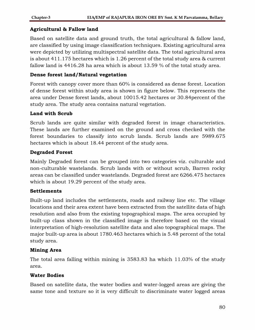
Chapter-3 EIA/EMP of RAJAPURA IRON ORE BY Smt. K M Parvatamma, Bellary
80
Agricultural & Fallow land
Based on satellite data and ground truth, the total agricultural & fallow land,
are classified by using image classification techniques. Existing agricultural area
were depicted by utilizing multispectral satellite data. The total agricultural area
is about 411.175 hectares which is 1.26 percent of the total study area & current
fallow land is 4416.28 ha area which is about 13.59 % of the total study area.
Dense forest land/Natural vegetation
Forest with canopy cover more than 60% is considered as dense forest. Location
of dense forest within study area is shown in figure below. This represents the
area under Dense forest lands, about 10015.42 hectares or 30.84percent of the
study area. The study area contains natural vegetation.
Land with Scrub
Scrub lands are quite similar with degraded forest in image characteristics.
These lands are further examined on the ground and cross checked with the
forest boundaries to classify into scrub lands. Scrub lands are 5989.675
hectares which is about 18.44 percent of the study area.
Degraded Forest
Mainly Degraded forest can be grouped into two categories viz. culturable and
non-culturable wastelands. Scrub lands with or without scrub, Barren rocky
areas can be classified under wastelands. Degraded forest are 6266.475 hectares
which is about 19.29 percent of the study area.
Settlements
Built-up land includes the settlements, roads and railway line etc. The village
locations and their area extent have been extracted from the satellite data of high
resolution and also from the existing topographical maps. The area occupied by
built-up class shown in the classified image is therefore based on the visual
interpretation of high-resolution satellite data and also topographical maps. The
major built-up area is about 1780.463 hectares which is 5.48 percent of the total
study area.
Mining Area
The total area falling within mining is 3583.83 ha which 11.03% of the study
area.
Water Bodies
Based on satellite data, the water bodies and water-logged areas are giving the
same tone and texture so it is very difficult to discriminate water logged areas

Chapter-3 EIA/EMP of RAJAPURA IRON ORE BY Smt. K M Parvatamma, Bellary
81
with the water bodies. Presently old water logged is also being considered as
water body in the study area. The total area falling within the water bodies are
11.18 ha which is about 0.034% of the total study area.
3.8.3 Land use planning of the project site
The Land use planning of proposed Mining site and its details are tabulated below in the table 3-29 and refer the figure 3-20 for the cartographical
representation of the proposed site.
TABLE 3-29 LAND USE PLANNING OF THE PROPOSED SITE
Sl. No
Particulars Existing Period Percentage (%) of Land
Used Forest Revenue Total
1. Mining 9.15 0.60 9.75 39.283
2 Dumping 4.10 0.27 4.37 17.607
3 Mineral Storage -- 1.30 1.30 5.237
4. Topsoil Yard -- -- --
5. Infrastructure/Statutory
Building
-- 0.02 0.02 0.082
6. Screening Plan -- 0.12 0.12 0.483
7. Road -- 1.00 1.00 4.029
8. Green Belt (Safety Zone) 2.06 1.04 3.10 12.489
9. Area for Eng. Measures -- -- --
10 Others
Biodiversity Area / Area
Unused
1.00
1.91
--
2.25
1.00
4.16
4.029
16.761
Total 18.22 6.60 24.82 100
TABLE 3-30 Proposed Land use pattern-Plan period & Conceptual stage
Sl.
No
Particulars Existing
Period
Percentage
(%) of Land
Used
Existing
Period
Percentage
(%) of Land
Used
1. Mining 9.75 39.283 9.75 39.283
2 Dumping 4.37 17.607 4.37 17.607
3 Mineral Storage 1.30 5.237 1.30 5.237
4. Topsoil Yard -- --
5. Infrastructure/Statutory
Building
0.02 0.082 0.02 0.082
6. Screening Plan 0.12 0.483 0.12 0.483
7. Road 1.00 4.029 1.00 4.029
8. Green Belt (Safety Zone) 3.10 12.489 3.10 12.489
9. Area for Eng. Measures -- --
10 Others
Biodiversity Area / Area
Unused
1.00
4.16
4.029
16.761
1.00
4.16
4.029
16.761
Total 24.82 100 24.82

Chapter-3 EIA/EMP of RAJAPURA IRON ORE BY Smt. K M Parvatamma, Bellary
82
FIGURE 3-18 FALSE COLOUR IMAGERY OF STUDY AREA

Chapter-3 EIA/EMP of RAJAPURA IRON ORE BY Smt. K M Parvatamma, Bellary
83
FIGURE 3-19 LAND USE AND LAND COVER CLASSIFIED IMAGERY OF STUDY AREA

Chapter-3 EIA/EMP of RAJAPURA IRON ORE BY Smt. K M Parvatamma, Bellary
84
FIGURE 3-20 LAND USE PLANNING OF THE PROPOSED SITE

Chapter -4 EIA-EMP of Rajapura Iron Ore Mine of Smt.K.M. Parvathamma, Bellary
85
4 ANTICIPATED ENVIRONMENTAL IMPACTS
& MITIGATION MEASURES
4.1 Introduction
Mining being site specific activity, excavation is bound to be done at a place
where mineral actually exist. Open cast iron ore mines can cause disturbance in
ecology, resulting in various pollution problems.
The Rajapura Iron Ore Mine of Smt.K.M Paravathamma is an existing mine and
will continue with operations till the life of the mine. Present status of the
environmental parameters has been dealt in the Chapter-3. The result of
monitoring studies will serve as basis for assessing the impact of mining on
various environmental components. Environmental impacts of mining will arise
because of various operations carried out during the process of mining such as
drilling, blasting, excavation, transportation etc.
The main objectives of this EIA study are:
To identify the environmental impacts due to mining operations.
To delineate the level of degradation in various environment aspects, in terms
of physical, chemical, biological and sociological aspects due to mining.
To establish the methodology of monitoring the environmental parameters
by identifying the locations etc.
To recommend and implement mitigation measures of the identified impacts.
Anticipated environmental impacts are discussed in section 4.2 and mitigation
measures are discussed in section 4.3.
4.2 Anticipated Environmental Impacts
4.2.1 Topography
The topography of the area is discussed in Chapter-2.
Rajapura Iron Ore Mine is located in the Sandur Forest Rage, Bellary Division of
Karnataka. The area of the lease hold forms apart of rugged hilly terrain . The area is a hilly region with NW/SE trends with a minimum elevation of 675mRL
at the southern part near road a maximum of 880mRL towards northern most part of the lease area. Since the slope is towards eastern side, the drainage patter is dendritic flowing towards east through valleys.
As the area is part of forest, moderate vegetation with small trees and shrubs/bushes are observed.

Chapter -4 EIA-EMP of Rajapura Iron Ore Mine of Smt.K.M. Parvathamma, Bellary
86
The area enjoys tropical climate with an annual average rainfall of about
750mm. Maximum temperature in summer days is around 400C , and minimum temperature during winter nights records between 12-18 0C . Humidity varies between 25 to 85%.
Haulage road will be maintained with proper alignment/side bunds with an average gradient of 1:16. The Proposed area is bounded by the Latitude N-15°00'58.3" to N- 15°01'32.9" and longitude E-76°39'31.7” to E-76°39'57.3” in
Topo Sheet No. D43E12 & D43K9.
4.2.2 Land use
TABLE 4-1 LAND USE PLANNING OF THE PROPOSED SITE
Sl.
No
Particulars Existing Period Percentage
(%) of Land Used Forest Revenue Total
1. Mining 9.15 0.60 9.75 39.283
2 Dumping 4.10 0.27 4.37 17.607
3 Mineral Storage -- 1.30 1.30 5.237
4. Topsoil Yard -- -- --
5. Infrastructure/Statutory
Building
-- 0.02 0.02 0.082
6. Screening Plan -- 0.12 0.12 0.483
7. Road -- 1.00 1.00 4.029
8. Green Belt (Safety Zone) 2.06 1.04 3.10 12.489
9. Area for Eng. Measures -- -- --
10 Others
Biodiversity Area / Area
Unused
1.00
1.91
--
2.25
1.00
4.16
4.029
16.761
Total 18.22 6.60 24.82 100
SOURCE: APPROVED MINING PLAN
TABLE 4-2 Proposed Land use pattern-Plan period & Conceptual stage
Sl.
No
Particulars Existing
Period
Percentage
(%) of Land
Used
Existing
Period
Percentage
(%) of Land
Used
1. Mining 9.75 39.283 9.75 39.283
2 Dumping 4.37 17.607 4.37 17.607
3 Mineral Storage 1.30 5.237 1.30 5.237
4. Topsoil Yard -- --
5. Infrastructure/Statutory Building
0.02 0.082 0.02 0.082
6. Screening Plan 0.12 0.483 0.12 0.483
7. Road 1.00 4.029 1.00 4.029
8. Green Belt (Safety Zone) 3.10 12.489 3.10 12.489
9. Area for Eng. Measures -- --
10 Others
Biodiversity Area / Area
Unused
1.00
4.16
4.029
16.761
1.00
4.16
4.029
16.761
Total 24.82 100 24.82

Chapter -4 EIA-EMP of Rajapura Iron Ore Mine of Smt.K.M. Parvathamma, Bellary
87
Source: Mining Plan
Due to above activities the landscape of the terrain has been modified to some
extent. The major impacts observed include soil erosion, loss of top soil, creation
of pits and deforestation and possibility of adding silt load in the natural nallah
nearby the lease area. Refer. Figure no 3-20 for Present land use &proposed
land use.
4.2.3 Top Soil
Since the mine has been operational for several years before coming into auction,
maximum area is already broken up. As per proposed mining plan for next five
years, there is no likelihood of generation of topsoil. However, any small quantity
if encountered during the course of operation, the same shall be stacked
separately and used for afforestation purpose.
4.2.4 Drainage
The drainage pattern of the area is sub dendritic in nature. Half of the run-off
within the buffer zone drains towards east and the other half flows towards
South. Mining activity will be carried out on a hilly terrain, wherein there is no
possibility of encountering ground water as the mining operations will be carried
out on plateau and sloping hill with highest and lowest elevation of 962 m and
813 m above MSL, respectively.
The ground water table is about 50m to 60m below the general ground level and
the mining operations are conducted along the hill.
Mining may reach up to 700m above MSL. Therefore, no groundwater shall be
encountered in the mine workings and accordingly the quality of underground
water will not be deteriorated.
There are two nallahs originating from the lease area, out of which, one is from
western side and another is from the eastern side. Both the nallahs are emptying
into the tank Bhema sumudra.
As all operations are dry, there will be no discharge of any water from mine
process. It is required to ensure quality of runoff water during rainy season,
before it leaves the lease area. Precautionary measures by constructing Garland
drain, run off channels, check dams & settling sumps will help in making the
runoff water free from any silt during the rains. This will ensure that no polluted
water goes out from the mine area.

Chapter -4 EIA-EMP of Rajapura Iron Ore Mine of Smt.K.M. Parvathamma, Bellary
88
4.2.5 Air Environment
The mine is fully mechanized to produce 1.0 million tonnes ROM and 0.213
million tonnes of waste every year. The semi- arid climatic condition of the area
coupled with mining activities on the top of the hills through open-cast,
contributes to air pollution. Drilling, Blasting, extraction of ores and waste
loading and transportation of ore and waste materials, dumping and storage of
minerals and waste disposal are factors contributing for the air borne dust and
emissions.
Apart from the fine particulate matter from mining operations, gaseous
pollutants will also emit from the HEMM and ancillary equipment deployed for
the purpose. The level of the pollutants has not exceeded the permissible limit
at present, as indicated in the Chapter 3.
Atmospheric pollutants are hazardous to all living organism in biosphere. The
dust produced during mechanized opencast mining and allied activities not only
impacts human beings, but also the plant and animals around the ML area.
Therefore, strict mitigation measures are essential to ensure clean environment
and maintain sustainability of ecosystem. Rajpura Iron Ore is an existing mine
which is not in working condition and has already implemented control
measures.
The major gaseous pollutants of concern in iron ore mines are Sulphur dioxide
and oxides of nitrogen. Sulphur dioxide can cause respiratory problems. Oxides
of nitrogen can react in the atmosphere with hydrocarbons to produce
photochemical smog. In addition to this, the Sulphur dioxide and oxides of
nitrogen can generate an acid rain harmful to vegetation and materials.
It was found that the gaseous pollutants in core and buffer zone of Rajapura Iron
Ore Mine are well within the standard limits.
Air Quality Dispersion Modelling
Preamble
Impact assessment is an important part of Environmental Impact Assessment
Study. There are various techniques available to predict the impacts.
Mathematical modelling is an established and accepted technique to predict the
impacts.
The pollution load will not increase, as the production capacity of the mine is
same as earlier. However, modelling is done to assess the contribution
exclusively from the Rajapura Iron Ore Mine due to mining and allied activities.

Chapter -4 EIA-EMP of Rajapura Iron Ore Mine of Smt.K.M. Parvathamma, Bellary
89
Sources of Dust Emission
Major emission sources from production of iron ore are:
a. Drilling
b. Blasting
c. Development of benches
d. Loading of material by excavators to tippers for transport.
e. Crushing & Screening
f. Loading of waste for transport to waste dump area
g. Movement of machinery
Based on the various operations involved in the production of iron ore, the
various emission sources at each stage has been identified as given below:
TABLE 4-3 Emission Sources
Activity Source
Drilling Point Source
Crushing and Screening Area Source
Excavation & Loading of Iron Ore Area Source
Excavation & Loading of Waste Area Source
Transportation of waste from working pit to waste
dump
Line Source
Transportation of iron ore from working pit to mine
lease boundary
Line Source
Emission Rates
A. Dust
Dust emission rate due to material handling in mining area is based on the
following empirical formula (source: IMEJ-April 1982).
Dust emission due to excavation:
Pa x 23.6
Dust emission (DE) = ---------------------
Wd x Wh x 1000
DE = Dust emission in kg/hr

Chapter -4 EIA-EMP of Rajapura Iron Ore Mine of Smt.K.M. Parvathamma, Bellary
90
Pa = Annual Excavation in tonnes
Wd = No. of days of operation in a year
Wh = Effective working hrs in a day
Quantity of dust emitted in kg for 1000 tonnes of excavation.
Total Quantity to be handled
Maximum annual excavation is taken as 1.213 MMTPA (source: Mining Plan)
Emission Rates from Dust Extraction System and DG Sets
The emission rates from DG sets and dust extraction system are summarized
below in Table 4.4.
TABLE 4-4 Emission rates from DG sets and dust extraction system
Details Description DG Set Stack
1 2 3 4 5
Existing 15 KVA 10 KVA 62.5 KVA 62.5
KVA
500
KVA
Material construction Mild steel
Stack Top Circular
Release height above
Ground 3.408 2.97 2.97 2.97 2.97
Inside Diameter (m) 0.1016 0.1016 0.1016 0.1016 0.1016
Emission Rate
(gm/Kw-Hr) for PM 0.042 0.040 0.055 0.057 0.087
Emission Rate for
NO2 (gm/Kw-Hr) 0.90 0.85 1.12 1.14 1.40
Stack gas exit
Temperature in 0C 116 117 125 126 145
Stack gas exit
Velocity (m/s) 7.62 7.35 7.36 7.36 8.12
Emission Source Coordinates
The Centre of mine was assumed (0, 0) in the mathematical modelling.
4.2.6 Meteorological Conditions Used in Predictions
The hourly meteorological data has been generated at the site and the same has
been used in the predictions. The hourly wind speed, temperature, direction and

Chapter -4 EIA-EMP of Rajapura Iron Ore Mine of Smt.K.M. Parvathamma, Bellary
91
stabilities have been used. The hourly data was available for the months of
October-December, 2021.
4.2.7 Atmospheric Stability
Many alternative models are developed by different authors to relate y and z
with downwind distance x under different atmospheric stability conditions.
Unfortunately, none of these have been found to be comprehensive enough to be
applicable under all types of topographic and meteorological conditions. On the
basis of available information, “Pasquill Gifford” stability classification system
for study area has been followed. This classification is built in the model.
The Pasquill Gifford stability classification divides atmospheric stability into six
classes based on solar insolation/cloud cover conditions. Details of this
classification are given Table 4.5.
TABLE 4-5 PASQUILL – GIFFORD STABILITY CLASSIFICATION
Surface wind
speed (m/s)
Day time insolation Night time
conditions
Strong Moderate Slight Thin low
clouds
<4/8
Overcast
clouds
>3/8
0 – 2 A A – B B E F
2 – 3 A – B B C E F
3 – 5 B B – C D D E
5 – 6 C C – D D D D
>6 C D D D D
A – Extremely unstable
B – Moderately unstable
C – Slightly unstable
D – Neutral
E – Slightly stable
F – Moderately stable
4.2.8 Extrapolation of Wind Speed
Wind speed at stack level is calculated by power law as given below.
Ustack = U10 (Stack height/10) p

Chapter -4 EIA-EMP of Rajapura Iron Ore Mine of Smt.K.M. Parvathamma, Bellary
92
Where U10 is the wind speed at 10-meter level and p is the power law coefficient
(0.07, 0.07, 0.10, 0.15, 0.35 and 0.55 for stability classes A, B, C, D, E and F
respectively) as per Irwin for rural areas (USEPA, 1987).
4.2.9 Ambient air quality and background concentrations
Ambient air quality standards promulgated by Central Pollution Control Board
(CPCB) for industrial, residential and rural areas are as follows:
TABLE 4-6 Ambient air quality standards by CPCB
Concentration ( g/m3) (24 hours average)
PM10 PM2.5 SO2 NO2
100 60 80 80
The above standards are for a sampling period of 24 hours. The maximum
concentration of pollutants (PM10, PM2.5, NO2 and SO2) recorded at habitat in the
study area during summer months are given below:
4.3 Plan and frame work of computations:
4.3.1 Selection of locations:
The locations have been selected around the mining area covering an area of 10
km radius from mining center. The entire area has been put on grid network and
grid spacing is taken as 500 m.
4.3.2 Plan of computation
TABLE 4-7 THE AIR QUALITY PARAMETERS OF THE STUDY AREA
S.No.
Parameter PM10(µg/m3) PM2.5(µg/m3) SO2(µg/m3) NO2(µg/m3) CO
(mg/ m3 )
Locations Max. Min. Max. Min. Max. Min. Max. Min. Max
.
Min.
1. Drilling Area 74 64 40 36 17.9 15.3 28.30 12.33 0.75 0.63
2. Loading Area 80 63 47 35 17.9 13 19.6 15.2 0.57 0.82
3. Dumping Area 73 65 45 37 17.1 13.2 20.2 15.3 0.83 0.59
4. Ubbalagundi 70 65 40 36 17 15.2 19.1 18.1 0.79 0.63

Chapter -4 EIA-EMP of Rajapura Iron Ore Mine of Smt.K.M. Parvathamma, Bellary
93
5. Rajapura 74 66 43 37 17.4 16.5 19.8 18.7 0.89 0.69
6. Appavvanahalli 74 65 40 36 17.9 15.6 20.1 18.1 0.82 0.63
7. Navalatti 74 65 43 37 17.2 15.6 19.8 18.1 0.82 0.63
8. Tonasigeri 70 65 41 36 16.8 15.2 19.1 18.1 0.68 0.63
Standard 100 60 80 80 2.0
The emission rate, dispersion coefficients and other input data being now
available to compute the following:
The 24-hourly averaged concentration with hourly data for the post
monsoon season;
The identification of grid point having peak concentration for the values;
and preparation of isopleths.
4.4 Results and Discussions
As per the monitoring results the parameters monitored are within the standards the there is no significant impact on the nearby area within the study area.
As the mining activity involves exploration of ore activities the mitigation
measures like, Dust suppression using water sprinklers in and out the project site, Proper maintenance of the project site roads, Approach roads, the face masks to be provided to the workers and the air pollution controlling measures
to be taken as per the pollution control board Norms.
4.4.1 Noise & Vibration
The mine operation will be fully mechanized open cast method of mining which
will involve drilling and deploying HEMM equipment’s like hydraulic drills and
excavators, sizing, wheel loaders and dumpers. Noise will also be generated due
to operations like crushing, screening, storage and dispatch of ores. Blasting will
cause ground vibrations, noise and fly rocks. When an explosive charge is fired
in a hole, stress waves propagate radically in all directions and cause the rock
particles to oscillate. This oscillation is felt as ground vibration. The details are
discussed in Chapter-2.
As the strata is medium hard, it can be extracted by the excavators. Any hard
strata exist, can be loosened by developing the Ripper and Dozer and Rock
breakers. If required, blasting will be undertaken.
The operation of machinery in the open cast mine results in considerable noise
which will not only affects the people working in the mine, but also in the

Chapter -4 EIA-EMP of Rajapura Iron Ore Mine of Smt.K.M. Parvathamma, Bellary
94
surrounding areas. Generally, Noise is transmitted over more distances when
mine workings are on the hill tops. Vibrations through ground also affect the
fauna as they are more sensitive to these unusual ground and air vibrations.
4.4.2 Water Environment
The existing seasonal nallahs in the buffer zone remain dry and become active
during rainy season. Since the water course are shallow and the workings are
situated at higher elevations, water will not pose any problem. Since rainfall is
comparatively low, there will not be much siltation or run-off problem. The
mining operations are conducted at the hill top which is at much higher level
than ground water level. Mining activities will not intersect the ground water as
the ground water table is 226 m below the pit bottom.
The major impact on water pollution is due to erosion of waste dump and sub-
grade dump, oil and grease, contamination of water bodies due to discharge of
mine water/effluent and sedimentation of the seasonal nallahs flowing nearby.
Surface water
The open cast mining operation will pollute the surface water sources as well as
water flowing out of the area due to increased erosion of the excavated areas and
the dumps. The single most important environmental aspect of mines is the
surface runoff from various areas during monsoon season.
There are no rivers or perennial water coursed in the Mining Lease area.
However, the area is traversed by few seasonal water courses which are usually
active during monsoon season and drain into the nearby water bodies. Naturally,
no rain water accumulates in the lease area. The rain water flows from hill slopes
and does not accumulate till it reaches the lower valleys.
Hence, the drainage pattern is sub-dendritic in nature and is typical of the hilly
area.
Control of erosion is important for both during mining and non-mining. As the
waste material from the fragmented areas like mine pits, dumps can cause severe
damage to the local environment including Soil, Water, Land, Air and
Agriculture. The main objective for the surface water management is to suggest
suitable Bio-engineering measures for the protection of Nallahs, Mine pits and
Waste dumps etc. from erosion/run-off due to rain. Erosion/Run-off of the waste
material during monsoon can be controlled/arrested by constructing the silt
retaining structures like toe wall, garland drain, check dams, Silt Settling tanks
etc.

Chapter -4 EIA-EMP of Rajapura Iron Ore Mine of Smt.K.M. Parvathamma, Bellary
95
4.4.3 Ground water
In Rajapura Iron Ore Mine, the mining operations are carried out on plateau and
sloping hill with highest and lowest elevation of 962 m and 813 m above MSL,
respectively. The ground water table is about 50 m to 60 m below the general
ground level and the mining operations are conducted along the hill. Therefore,
no groundwater table / aquifers shall be encountered in the mine workings up
to the exploratory drilling level 700 m RL and accordingly the quality of
underground water will not be deteriorated.
Impact of mining on water availability
Mining and associated activities have quantitative and qualitative impacts on the
water regime in and around the mines.
Open cast mining operations many times puncture the ground water table which
affects the ground water table in the surrounding area. Pumping operations
results in reduction of groundwater table. As discussed above the mine working
will not intersect the ground water table.
The water requirement shall be only for domestic purpose, dust suppression and
afforestation. Total water requirement is 24 KLD. This includes domestic
requirement of 4 KLD, 12 KLD towards dust suppression and 8 KLD towards
plantations and green belt development.
4.4.4 Soil Quality
In the process of opencast mining, several changes will occur in physical,
chemical and microbiological properties of soil because of mining and storage.
The open cast mining operation will directly result in removal of the soil, which
affects the soil fertility of the ML area. The soil samples are analysed and quality
discussed in Chapter-3.
Since, the mine was in operation by the erstwhile lessee, it is already broken
land. There is no likelihood of generation of topsoil. However, if, some quantity
is generated during the mining operations from lease area, it will be used for
afforestation purpose.
4.4.5 Waste generation
The details of waste generation are discussed in Chapter 2. The waste generated
from the mining operations will be stacked at the designated area and handled
as per the progressive mine closure plan. The waste mainly consists of
Shale/Phyllite, BHQ, Manganiferrous clays intercalated clays, poor grade from
contact zones, etc. The estimated quantity of Waste generation in the mining

Chapter -4 EIA-EMP of Rajapura Iron Ore Mine of Smt.K.M. Parvathamma, Bellary
96
plan period is 126190 Tonnes. This quantity will be dumped in extension of
existing dump in the area of 4.37 Ha. In this plan period the workings will be
carried out between 740 m RL to 680 m RL. Waste generation during life of mine
will be 43,01,171Tonnes. Retaining wall will be constructed to prevent the waste
from erosion.
At the conceptual stage the waste dump shall be reclaimed and rehabilitated by
geo-coir matting, planting soil binding species on slopes, plantation of trees on
terraces of waste dump. Proper engineering structures such as retention wall,
garland drain, check dam, earthen check dams, silt settling tanks etc. are
constructed to control the surface runoff.
Other waste e.g. E-waste and Hazardous waste will also be generated as
discussed in Chapter -2.
TABLE 4-8 WASTE GENERATION
Period Waste in Tonnes.
2021-22 34968
2022-23 67032
2023-24 24190
Total 126190
4.4.6 Flora and fauna
The survey has not indicated the presence of any rare, endangered or endemic
species within the lease area. The fauna reported in this area does not fall under
category of rare species and are all common migratory type. Specific corridors
for movements & breeding grounds are also not reported. No wild life Sanctuary
or any other wild life area exists within vicinity of Core zone & Buffer zone of
Mining Lease area.
Since the major portion of the lease area is located in the forest area and on hill
top the impacts on nearby areas are as under:
Removal of vegetation (flora) from the area required for mining and other
purposes, and thereby displacement of fauna.
Dust due to mining and associated activities, which deposits on the leaves
of the plant in the surrounding and hampers the process of photosynthesis
and stunted growth.
Noise and vibrations due to blasting, movement of HEMM/vehicles and
operation of fixed plants are not conducive for the development of wild
animals and birds.

Chapter -4 EIA-EMP of Rajapura Iron Ore Mine of Smt.K.M. Parvathamma, Bellary
97
The forest in the study area is mixed deciduous sub classification. The project
authority has taken initiatives for raising vegetation in the lease area as well as
in the forest area in the vicinity.
4.4.7 Socio-economic conditions
The impacts of the human activities, specially mining and associated activities,
on the society assume a great importance. As soon as a mineral is discovered
and proved, and its mining potential is established, impacts on the society takes
shape in the increase in the value of the land, people from outside start buying
land for establishing business etc. Mining and associated activities can cause
the following impacts on the society.
Displacement of the people
Loss of livelihood
Changes in population dynamics
Cost of living
Water scarcity
Health impacts
Infrastructure facilities
Employment opportunities
Increase in aspiration
Since Rajapura Iron Ore Mine is an existing operating mine the above impacts
have already been considered and the project proponent will be undertaking
various measures for upliftment of the socioeconomic conditions of the area.
The development works will be undertaken by the management are discussed in
Chapter-8.
4.4.8 Impact due to the possible Accident
The following accidents may occur.
Forest fire
Failure of waste dump
Failure of pit slope
Lubricant & HSD storage chambers/ tankers
In case of mishappening, local population and wildlife may get affected.
4.4.9 Impact due to the Construction activities
There are no construction activities envisaged in existing project premises.

Chapter -4 EIA-EMP of Rajapura Iron Ore Mine of Smt.K.M. Parvathamma, Bellary
98
4.4.10 Impact due to the final decommissioning or
rehabilitation
Possibility of falling down of the human being, animals etc. in mine pits that may
cause death or major injury. The present workings are not matured for
decommissioning/closure of mines.
4.5 Mitigation Measures
4.5.1 General Views
Careful planning & implementation of proper environment management
practices are essential for sustainable development. The impact assessment
discussed in above sections has highlighted certain areas which need special
attention. The project is already carrying out control measures for all anticipated
environmental impacts.
Since, there is no expansion/change in methodology increase in pollution load
in future will be negligible. However, Project Proponent is taking due precautions
as discussed in the following paragraphs:
4.5.2 Topography
Rajapura Iron Ore Mine is located in the Sandur Forest Rage, Bellary Division of
Karnataka. The area of the lease hold forms apart of rugged hilly terrain . The area is a hilly region with NW/SE trends with a minimum elevation of 675mRL
at the southern part near road a maximum of 740 mRL towards northern most part of the lease area. Since the slope is towards eastern side, the drainage patter is dendritic flowing towards east through valleys.
As the area is part of forest, moderate vegetation with small trees and shrubs/bushes are observed.
The area enjoys tropical climate with an annual average rainfall of about 750mm. Maximum temperature in summer days is around 400C, and minimum temperature during winter nights’ records between 12-18 0C. Humidity varies
between 25 to 85%.
Haulage road will be maintained with proper alignment/side bunds with an average gradient of 1:16. The Proposed area is Located by the Latitude N- 15°
1'20.98"N and longitude 76°39'49.14"E in Topo Sheet No. D43E12 & D43K9.
4.5.3 Land Use
The entire lease area (24.82 ha.) is in forest land falling in Kumarswamy betta
Reserve Forest, Sandur Range of Sandur Taluk, Bellary District, Karnataka
State. At the conceptual stage, the land use pattern of the lease area is given in

Chapter -4 EIA-EMP of Rajapura Iron Ore Mine of Smt.K.M. Parvathamma, Bellary
99
Table 4.2. The reclamation & rehabilitation to be undertaken as per the R&R
Plan. The measures include technical and biological reclamation of mined out
areas, plantation with native species on dumps and mined out benches. The
mine pit shall be restored as a water reservoir.
4.5.4 Top Soil
The mine was in operation by the erstwhile lessee and most of the area already
broken. There is no likelihood of generation of topsoil. However, if, some quantity
is generated during the mining operations from lease area, it will be used for
afforestation purpose.
4.5.5 Drainage
The drainage pattern of the lease area is sub dendritic in nature. 70% of the
runoff within the buffer zone drains towards north & south directions. The study
area experiences an average annual rainfall of about 580 mm and considering
the hilly terrain with fragmented vegetation due to mining operations the runoff
water is stored in the settling ponds.
Besides the following drainage management measures will be undertaken at the
mine site:
i. Proper gradient and drainage arrangement at the overburden dumping
area.
ii. After trapping the suspended solids in garland drains just below the
overburden dumps, the water allowed to flow down the dump slopes
through settling tank so that all the suspended solids and sediments are
arrested.
iii. Plantation of indigenous and other economically important trees, shrubs,
herbs and grasses at the point of discharge and on OB dumps will be taken
up, so that the sediment/silt flow is arrested from the site and soil
moisture is maintained.
4.5.6 Air Environment
Concentration of Respirable Particulate Matter PM10 & PM2.5 and the Gaseous
Emission levels are within the limits prescribed by the CPCB. The following
control measures will be adopted to keep the dust under control:
i. Workers will be provided with Personal Protective Equipment’s to minimize
dust exposure.
ii. Wet drilling machine will be utilized
iii. Optimal use of explosives

Chapter -4 EIA-EMP of Rajapura Iron Ore Mine of Smt.K.M. Parvathamma, Bellary
100
iv. Blasting will be avoided during high wind speed.
v. Haul roads and service roads will be graded to remove the accumulated
loose material.
vi. Regular maintenance of HEMM
vii. Regular water sprinkling on the mine haul roads & other service roads.
viii. Green belt development along the lease boundary.
ix. Dry fogger dust suppression for Crushing & Screening Area
Impact of transportation on the environment
Rajapura Iron Ore Mine is surrounded by many other mines. The list of mines
within 10 Km radius is shown in Plate 4.4 and tabulated below in Table 4.9.
TABLE 4-9 Surrounding Mines of RAJAPURA iron ore mine
Sl.
No
Name of the Mining
Lease Category
ML.
No
Remarks
(Ha – Area)
1 Mineral Enterprises
Ltd. B 2596 6.07
2 Mineral Enterprises
Ltd. A 2388 57.00
3 SESA GOA limited A 2236 163.50
4 R. Praveen Chandra B 2294 42.60
5 Anjana Minerals B 2519 4.55
6 G.J Kumar B 2499 1.34
7 Janthakal Enterprises
Ltd. A 593 80.94
Transportation route
This Mining Lease Area is located at 2.1 km from Rajapur and 40Kms from
Ballari which can be reached via NH 150A Ballari- Hiriyur Road. From Ballari
after 10.3km take right and continue on Halakudi-Vittalapuram Road. Travel
about 10.6 Kms and take a left on Halakudi-Vittalapuram Road Travel about
19.1 Kms to reach the Mining Lease area
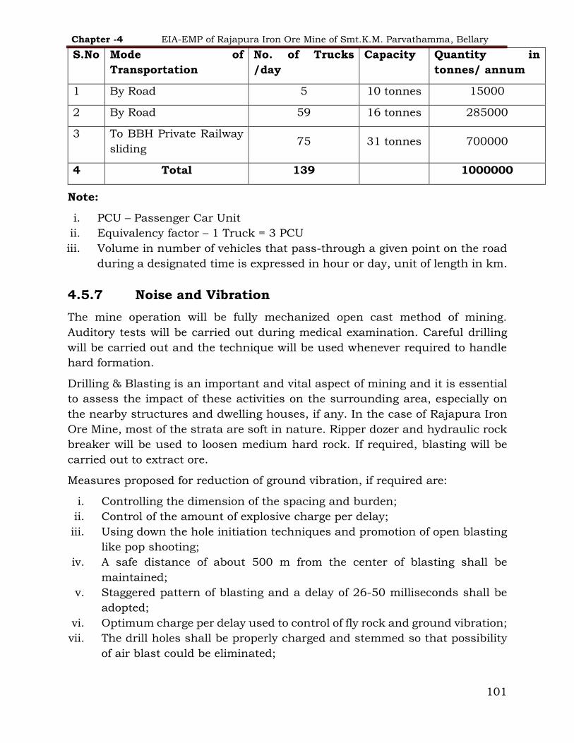
Chapter -4 EIA-EMP of Rajapura Iron Ore Mine of Smt.K.M. Parvathamma, Bellary
101
Note:
i. PCU – Passenger Car Unit
ii. Equivalency factor – 1 Truck = 3 PCU
iii. Volume in number of vehicles that pass-through a given point on the road
during a designated time is expressed in hour or day, unit of length in km.
4.5.7 Noise and Vibration
The mine operation will be fully mechanized open cast method of mining.
Auditory tests will be carried out during medical examination. Careful drilling
will be carried out and the technique will be used whenever required to handle
hard formation.
Drilling & Blasting is an important and vital aspect of mining and it is essential
to assess the impact of these activities on the surrounding area, especially on
the nearby structures and dwelling houses, if any. In the case of Rajapura Iron
Ore Mine, most of the strata are soft in nature. Ripper dozer and hydraulic rock
breaker will be used to loosen medium hard rock. If required, blasting will be
carried out to extract ore.
Measures proposed for reduction of ground vibration, if required are:
i. Controlling the dimension of the spacing and burden;
ii. Control of the amount of explosive charge per delay;
iii. Using down the hole initiation techniques and promotion of open blasting
like pop shooting;
iv. A safe distance of about 500 m from the center of blasting shall be
maintained;
v. Staggered pattern of blasting and a delay of 26-50 milliseconds shall be
adopted;
vi. Optimum charge per delay used to control of fly rock and ground vibration;
vii. The drill holes shall be properly charged and stemmed so that possibility
of air blast could be eliminated;
S.No Mode of
Transportation
No. of Trucks
/day
Capacity Quantity in
tonnes/ annum
1 By Road 5 10 tonnes 15000
2 By Road 59 16 tonnes 285000
3 To BBH Private Railway
sliding 75 31 tonnes 700000
4 Total 139 1000000

Chapter -4 EIA-EMP of Rajapura Iron Ore Mine of Smt.K.M. Parvathamma, Bellary
102
The workers working in high noise prone area will be provided with ear muffs as
safety precaution and workers will not be allowed to enter into noise prone area
without use of ear muffs.
Noise pollution mitigate measures include -
In addition to above mentioned measures following will also be done to control
noise pollution:
i. Proper and regular maintenance of vehicles, machinery and other
equipment.
ii. Limiting time exposure of workers to excessive noise.
iii. The noise generated by the machinery will be reduced by proper
lubrication of the machinery and equipment.
iv. The workers employed will be provided with protection equipment,
earmuffs and ear-plugs, as a protection from the high noise level generated
at the mine site, wherever required.
v. Noise levels will be controlled by using optimum explosive charge, proper
delay detonators and proper stemming to prevent blow out of holes.
vi. Speed of tippers in the mines area will be limited to moderate speed of 25
kmph to prevent undue noise from empty tippers.
4.5.8 Water Environment
The water quality analysis results of all locations show that all the parameters
are within the prescribed limits as per the standards of IS: 10500 and IS: 2296
(Class C). Rain water runoff only is likely to cause turbidity for which adequate
control measures will be undertaken.
Suitable trenches will be prepared along mine haul roads and benches, so that,
water flows out and ultimately held by check dams.
Following control measures will be taken for prevention of runoff from ROM and
waste dump:
As per the Reclamation & Rehabilitation Plan prepared by ICFRE Dehradun,
retaining walls and garland drains have been constructed at the toe of the active
waste dump to arrest the silt material flowing with water during rainy season. In
addition, following measures are undertaken and proposed for surface water
management:
Check dams have been constructed and shall be de-silted regularly.
Regular terracing & contouring shall be done to maintain the stable profile
of the dump. Organic manure and fertilizers shall be applied for healthy
growth of plants on dump.

Chapter -4 EIA-EMP of Rajapura Iron Ore Mine of Smt.K.M. Parvathamma, Bellary
103
Coir matting and afforestation shall be undertaken on the dump slope,
when declared inactive.
4.5.9 Details of engineering measures are being undertaken
as per R & R plan
To stabilize gullies/ rain cuts for waste dump management and to protect soil
erosion, water pollution along with recharge of ground water the following
measures are carried out and will maintain the same:
TABLE 4-10 Measures carried out as R&R plan
S.No. Particulars Length /No.
/Area
1 Retaining Wall 1210 m
2 Drains below Dump 1381 m
3 Settling Tank 6 Nos.
4 Garland Drain 3575 m
5 Check Dams 4 Nos.
6 Gully Plugs 6 Nos.
7 Hume Pipe Culvert 4 Nos.
Note: The R & R work proposed by ICFRE as per revised R & R plan will be
carried out as per time schedule.
De-silting of Check Dams
The check dams have proved very effective in arresting the silt material. The
settled material will be removed as and when required before monsoon season.
Measures for Water Conservation
The mining operations are conducted at hill top which is at a higher-level than
the ground water level. The mining operations are carried out on plateau and
sloping hill with highest and lowest elevation of 962 m and 813 m above MSL,
respectively. The ground water table is about 50 m to 60 m below the general
ground level and the mining operations are conducted along the hill. Therefore,
ground water level will not be intersected during mining operation. Since major
requirement of the water is fulfilled locally there is negligible impact on ground
water. In addition, ample engineering measures have been undertaken as per
R&R Plan for water conservation.

Chapter -4 EIA-EMP of Rajapura Iron Ore Mine of Smt.K.M. Parvathamma, Bellary
104
Rain Water Harvesting
The study area receives an average annual rainfall of 560 mm in the district with
an average of 40 rainy days. The monsoon season extends over a period of 6
months from June to November.
Whole lease area of 24.82 ha is catchment area for rainfall, hence the likely
quantity of rainwater that will be flowing through the lease area will be 5,61,680
cum (0.6 m x 93.6 x 10,000).
4.5.10 Soil Quality
The mine was in operation by the erstwhile lessee and most of the area is already
broken. There is no likelihood of generation of topsoil. However, if some quantity
is generated during the mining operations from lease area, it will be used for
afforestation purpose. In addition, 18.22 ha. area in Kumarswamy betta Reserve
Forest has been afforestation with the support of Forest Department. Rajapura
Iron Ore will take other control measures as discussed in water quality and
drainage section to avoid damage to soil in surrounding area.
Soil Management Plan
The microbes play an important role in maintaining the biological equilibrium of
the ecosystem. Among different microbes, there is a symbiotic group of fungi
called ‘mycorrhizae’. They are extremely important as they help in transport of
phosphorous and other essential elements to the plant system from the soil.
These mycorrhizal fungi also protect the plants against soil borne and root borne
diseases. Other than mycorrhizal fungi, the beneficial microbes such as Plant
Growth Promoting Rhizobacteria (PGPR) viz., Azotobacter, Azospirillum,
Rhizobium and Phosphobactreria (species of Bacillus and Preudomonas) involved
in breakdown of organic matter, N2 fixation, and production of plant growth
hormones and increase of available mineral nutrients in soil. They are also
helpful to build up other beneficial micro-flora and in turn improve soil health
(Mohan and Karthkeyan, 2011). These beneficial microbes are considered as bio-
inoculants or bio-fertilizers and they improve the growth and quality of the
seedlings in nursery and also help the plants for better survival and
establishment in problematic areas like mined out areas and maintain soil
structure.
The following measures in respect of soil management shall be adopted in
reclamation and rehabilitation of mined out areas:
The beneficial microorganisms shall be introduced as bio-fertilizers during
afforestation in the overburden dumps and other mined out areas through

Chapter -4 EIA-EMP of Rajapura Iron Ore Mine of Smt.K.M. Parvathamma, Bellary
105
planting of suitable fast-growing native plant species (inoculated with bio-
fertilizers and organic fertilizers) like grasses, herbs, shrubs and trees.
The seedlings shall be inoculated with beneficial microorganisms along
with the bio-manures/organic manures like fully composted farmyard
manure, vermi-compost, and leaf compost in the nursery.
The pits dug out for planting of saplings for afforestation shall be filled
with the mixture of bio-fertilizers and organic manures.
4.5.11 Waste Management
The details of waste generated are discussed in Chapter 2. The waste generated
from the mining operations will be stacked at the designated area and handled
as per the progressive mine closure plan. The waste mainly consists of
Shale/Phyllite, BHQ, Manganiferrous clays intercalated clays, poor grade from
contact zones, etc. The estimated quantity of Waste generation in the mining
plan period is 126190 T. This quantity will be dumped in extension of existing
dump in the area of 4.37 Ha. In this plan period the workings will be carried out
between 740 mRL to 680 m RL. The estimated waste generation during till the
life of mine will be 4301171 Metric Tonnes.
Dumping Area:
The waste generated will be dumped in Active dump and proposed dump in
North-Eastern side of the Lease and progressing towards South Eastern side as
per the Dump Management approved in R & R Plan & Mining Plan. The area
demarcated for the dumping in this plan period is 4.37 Ha. There is no mineral
rejects generation during plan period as all the +45% Fe material produced will
be sent to nearby Steel plant.
Existing waste Dumps
TABLE 4-11 DETAILS OF DUMPS IN BLOCK - I
Name of
the dump
Name of
the dump
Locations Top RL Bottom RL Height (m) Area (ha)
Active
Dump
Dump Maximum
elevation
740 680 40 4.37
There is only one active dump where the total waste will be dumped as an
extension of the existing dump. The dumping will be done terrace wise from the
bottom level to top level.
Each stage of the dump will be maintained at equal height of 10 m and 3 stages
are proposed as per existing dump and the topography of the area.

Chapter -4 EIA-EMP of Rajapura Iron Ore Mine of Smt.K.M. Parvathamma, Bellary
106
The dumping will be carried out at an angle not exceeding the angle of repose of
the material, varies from 31 to 40 degrees. R & R engineering measures will be
undertaken as per the approved Revised R & R plan with the time schedule.
Details of year wise dumping proposals are given in Table 4.12
TABLE 4-12 Details of year wise dumping proposals
Period Waste in Tonnes.
2021-22 34968
2022-23 67032
2023-24 24190
Total 126190
Source: Approved Mining plan
The e-waste will be disposed by buy back system/e-waste auction to authorized
vendors and & hazardous waste generated will be sold to authorized recycler.
Overburden Dump Management
The combinations of grasses, herbs, shrubs, creepers and tree species shall be
used in restoration process. Depending upon stability and age, the plantation
can be done either by seed broadcasting, hydro-seeding or planting of seedlings.
Hydro-seeding is being successfully practiced to stabilize barren steep slopes
and fragile unstable surface. The species recommended for hydro seeding on
mine OB dumps and fragile unstable surfaces are given in Table 4.2 in addition
to hydro seeding, planting of suitable herbs and shrubs shall be done on the
slopes by making holes in geo-textile coir mat.
Benches and trenches have been made to make the slopes of OB dumps gentle,
followed by seed broadcasting and planting of seedlings of shrubs, namely
Calotrpis gigantean, C. procera, Cassia auriculata, Dendrocalamusstrictus,
Dodonaeaviscosa, Vitexnegundo, trees species like Acacia catechu, A. nilotica,
albiziaamara, A .lebbeck, A procera, Annona squamosal, Azadirachtaindica,
bauhinia racemose, Cassia fistula, Phyllanthusemblica, Pithecelobiusdulce,
Pongamiapinnata, Wrightiatinctoria, Ziziphusmauritiana, etc. Root stock/slips
of grasses, namely, bothriochloapertusa, Cymbopogonflexuosus, C. martini, C.
nardus, Cynodondactylon, Dactylocteniumaegyptum, Dichanthiumannulatum,
Eleusineindica, Heteropogoncontortus, etc.
The species suggested for seed broadcasting shall be used in a combination of
grasses, legumes and other species for stabilizing. The suggested plants include
grasses like Bothriochloapertusa, Cymbopogonflexuosus, Cymbopogon martini,

Chapter -4 EIA-EMP of Rajapura Iron Ore Mine of Smt.K.M. Parvathamma, Bellary
107
Cymbopogonnardus, Dactylocteniumaegyptium, Dichanthiumannulatum,
Heteropogoncontortus and legumes like Cassia auriculata, Cassia accidentalis,
Crotalaria juncea, Crotalaria pallida, Stylosanthesfruticose and
Tephrosiapurpurea and other shrubs like Calotropis gigantean and
Calotropisprocera etc. These species will get established themselves in due
course of time in disturbed areas.
Further, coir matting shall be used for plant establishment on the waste dump
terraces, when declared inactive.
4.5.12 Reclamation & Rehabilitation of mined out areas
Land Reclamation
Land degradation is one of the major adverse impacts of open cast mining
activities and effort to control adverse impacts would be incomplete without
appropriate land reclamation strategy. Since the excavation has to be started
from the hilltop in the shape of benches, the reclamation shall essentially include
the reclamation of theses benches in the form of steps. Land degradation will
also take place by dumping of waste, and the reclamation of the dumping area
shall be included in the programme. This can be ensured by phase wise
reclamation of the waste dumps as and when quantities of waste dumping are
completed up to the accommodated capacities of dumps.
The detailed post mining land use is given in Table 4.2. The mining area will be
systematically reclaimed and rehabilitated at the end of life of mine.
Mining in the plan period is proposed in the existing benches of earlier mined
out area. Hence reclamation by afforestation on the old dump slopes, active
dumps and green belt development along the lease boundary will be carried out.
The environmental protective works such as afforestation, avenue plantation,
settling tanks, geo-textile matting, green belt development, dump management,
check dam, retaining wall be taken up in the mine effectively as per ICFRE
approved R & R plan.
Flora & Fauna
Compensatory afforestation as per the requirement of Forest Conservation Act,
1980 will be undertaken. The afforestation programme also adequately
compensates the vegetation loss due to the diversion of forestland for mining and
allied purposes. The plantation will be done to cover biodiversity and multi-
species, as an attempt to develop vegetation that matches within natural
vegetation around the area. This is likely to keep intact the fauna of the region
as well. There are no endangered species of flora found in the leasehold area.

Chapter -4 EIA-EMP of Rajapura Iron Ore Mine of Smt.K.M. Parvathamma, Bellary
108
Conservation of Flora and fauna
Conservation and sustainable use of biodiversity is fundamental to sustainable
development. Mining is an extractive industry which has significant direct and
secondary environmental impacts. Mining activities interfere with various
biological processes of life which result in destruction of biodiversity. The project
will adopt ‘biodiversity friendly’ practices. The practices will include.
Improving the coherence of and access to information on biodiversity;
Engaging in joint conservation and sustainable development projects;
Working towards more effective land use planning systems;
Creation of awareness on biodiversity
A small booklet containing details on the biodiversity components (Plants, few
birds and butterflies etc.) of the area along with color photographs shall be
published for distribution to school and college students to create awareness in
them on biodiversity and its importance.
Flora
Shrubs and trees inside the mining lease other than mineralized area shall be
shall be protected and maintained properly.
Management Plan for Fauna
The habitat management in and around the mine lease with site specific species
will enable colonization of floral and faunal communities. Following shall be
made to encourage the native fauna conservation in the mine rehabilitation
program:
A dense greenbelt consisting of different species around the mine lease area
and also the haul roads will not only act as a dust and noise barrier, but also
improve the habitat conditions.
Suitable landscape based ecological restoration by planting shrubs, grasses
and herbs to attract Herpeto fauna assemblage and improve long term habitat
connectivity.
Planting of fruit yielding and shelter providing species will attract birds and
insects.
Awareness programmers amongst the local people as well as mining staff
regarding the importance of wildlife, their habits and habitats will be
organized.
The water stored in the engineering structures in the mine lease area will act
as a water hole for the wildlife present in the region.

Chapter -4 EIA-EMP of Rajapura Iron Ore Mine of Smt.K.M. Parvathamma, Bellary
109
Adequate cares will be taken during rainy season to reduce the sediment load
and water quality to protect the aquatic faunal diversity in the water bodies
around the ML.
‘Fauna Return Strategy’ shall be made by creating food, shelter & breeding
sites within mine lease.
The return of the species shall be expedited by creating fauna habitats and
corridors during rehabilitation using logs, stumps and other natural
materials.
Faunal corridors running from the surrounding areas to the center of the
rehabilitated areas encourage smaller species of mammals and reptiles, which
are reluctant to traverse long distances of open ground, to colonize.
The rock fill dams and check dams in the mine lease areas will prevent the
soil erosion, store sufficient quantity of filtered water in the area and act as
water holes for the faunal as well as other wild lives present in the region.
Fire plays hazardous role in the destruction of habitat. Fire preventing squad
shall be formed to fight the fire.
4.5.13 Green-belt Development Programme
As part of green belt development programme, reducing pollution, improving the local biodiversity and aesthetic values at the Project premises, the plantation of
several native trees with broad leaves will be carried out. The planting techniques and monitoring plan is given below;
1. The pit size for planting trees will be maintained at 45 cm x 45 cm x 45 cm.
2. Top soil removed from the project area shall be used for filling the pit will
be mixed with well decomposed farm yard manure in the range of 2.0– 3.0 kg.
3. The filling of soil will be completed at least 7 days prior to the plantation. 4. Seedlings with good condition shall be identified and opted for plantation. 5. The distance between the trees shall be maintained at 2 m and underneath
shrubs and herbs can be grown. 6. The plantation needs to be monitored regularly by watering, weeding,
application of manure and impart proper protection.
7. Dead species will be replaced immediately.
Green belt development should be carried around mining lease backfield and
reclaimed area, around water body, along the roads etc.,

Chapter -4 EIA-EMP of Rajapura Iron Ore Mine of Smt.K.M. Parvathamma, Bellary
110
TABLE 4-13 Area for afforestation proposed for the 5-year plan period
Year
Area for
afforestation
(Ha)
Location
No. of
saplings to
be planted
Proposed Cost
(including watch and
care)
1 1.0
Green
belt/gap
plantation
1000
Rs 1.50 lacs /annum
2 1.0 Green
belt/gap
plantation
1000
3 1.0 Dump slopes 1000
4 1.0 Dump slopes 1000
5 1.0 Dump slopes 1000
Total 5.0 5000
Source: Approved Mining plan
4.5.14 Proposed Green-belt development Programme
As per the revised R&R Report by ICFRE, the erstwhile lessee has already developed greenbelt along the safety zone as suggested in the earlier approved R&R Plan. However, gap plantation has to be taken up wherever find short of
appropriate greenbelt thickness. Importance of grasses:
Grasses are drought tolerant and can colonize fast in low nutrient soil. Due to
the presence of fibrous root system, grasses help in checking soil erosion. For
stabilization of sloppy areas rows of grasses are to be planted. Slips are to be
planted in the contours at a distance of one foot.
Grasses and bamboo species are recommended for Soil Moisture Conservation
(SMC) and stabilization of loose material and steep slopes.

Chapter -4 EIA-EMP of Rajapura Iron Ore Mine of Smt.K.M. Parvathamma, Bellary
111
TABLE 4-14 Grasses and Bamboo species
Sl. No. Species Propagation method Local/Kannada
name
1. Bambusaarundinacea Rhizome/Seeds Bidiru
2. Bothriochloapertusa Seeds Aanekattuhullu
3. Chrysopogonfulvus Slips Ganjigarike
4. Cymbopogonfulvus Slips Anthibalehullu
5. Cymbopogon martini Slips Kaashihullu
6. Cymbopogonnardus Slips Gandahanchihullu
7. Cynodondactylon Rhizome/Seeds Garikehullu
8. Dendrocalamusstrictus Rhizome Gandubidiru
9. Dichanthiumannulatum Seeds Ganjalagarikehullu
10. Heteropogoncontortus Slips/Seeds Ooobinahullu
Importance of Leguminous plant species
The legumes play an important role in increasing the soil nitrogen through
symbiotic association of nitrogen fixing bacteria called as Rhizobia within the
nodules on their roots which help to produce nitrogen compounds that help the
plant to grow. When these plant dies, fixed nitrogen is released which will then
be available to other plants and helps in fertilizing the soil.
The engineering structures (gully plugs/check dams) shall be supported by
biological measures to prevent adverse impact. Cost effective hydro-seeding is
suggested with bio-engineering measures especially in afforestation activities.
The species suggested are given in Table No. 4.16.

Chapter -4 EIA-EMP of Rajapura Iron Ore Mine of Smt.K.M. Parvathamma, Bellary
112
TABLE 4-15 Species Recommended for broadcasting
S.No
.
Species Family Habit Local/Kannada
name
1. Bothriochloapertusa Poaceae Herb Aanekattuhullu
2. Calotropis gigantean Asclepiadacea
e
Herb Ekka
3. Calotropisprocera Asclepiadacea
e
Shrub Kempuekka
4. Cassia auriculata Caesalpiniace
ae
Shrub Aavarike
5. Cassia occidentalis Caesalpiniace
ae
Shrub Doddathagase
6. Crotalaria juncea Fabaceae Herb Sannasenabu
7. Cymbopogonflexuosus Poaceae Herb Anthibalehullu
8. Cymbopogon martini Poaceae Herb Kaashihullu
9. Cymbopogonnardus Poaceae Herb Gandahanchihull
u
10. Cynodondactylon Poaceae Herb Garikehullu
11. Dactylocteniumaegytium Poaceae Herb -
12. Dichanthiumannulatum Poaceae Herb Ganjalagarikehull
u
13. Eleusineindica Poaceae Herb Hechhullihullu
14. Heteropogoncontortus Poaceae Herb Ooobinahullu
15. Stylosanthesfruticose Fabaceae Herb Saalikampa/ham
ata grass
16. Tephrosiapurpurea Fabaceae Herb Koggi

Chapter -4 EIA-EMP of Rajapura Iron Ore Mine of Smt.K.M. Parvathamma, Bellary
113
4.5.15 Socio-economic conditions
Since the inception of mining in Ballari district area by Rajapura Iron Ore Mine
of Smt. K.M.Parvathamma, a lot of developmental work has been taken up by
Rajapura Iron Ore Mine. Further, following activities will be undertaken in the
nearby villages:
1. Mobile health camps
2. Facilitating Govt. for immunization programme conducted time to time.
3. Annual donation for festival and other voluntary activities.
4. Sprinkling of water on the village roads.
5. Organizing sports activities.
6. Annual donation for sports.
7. Plantation Activities
8. Contribution for forest protection.
9. Maintenance of road
10. Desiltation Activities as per requirement
The details of the developmental works under Corporate Social Responsibility
(CSR) has been discussed in Chapter – 8 – Project Benefits.
Public health implications of the project
The company takes preventive measures for the villagers in the local area for
better health. Company provides the following facilities for the betterment of
health.
TABLE 4-16 INITIATIVES BY K.M.PARVATAMMA TOWARDS PUBLIC HEALTH
S.No
.
Activities
1 Providing Ambulance for patients for nearest hospital as and when
required.
2 Health awareness programme in villages.
3 COVID Care Facilities
4 Infrastructural Facilities
5 Drinking Water Facilities
6 Awareness programmes among school children for use of RO water for
drinking purpose instead of taking pond or nallah/river water.

Chapter -4 EIA-EMP of Rajapura Iron Ore Mine of Smt.K.M. Parvathamma, Bellary
114
Specific programme for upliftment of SC/ST population of the
study area
As per Census 2011, SC & ST population is almost 55 % of the total population
in the study area. The percentage of SC & ST population to total population is
21% & 34% respectively. Hence the peripheral/ CSR activities done/proposed to
be done are focused on upliftment of SC/ST population also.
The company focuses on the following activities for upliftment of SC/ST
population:
1) Education & communication
2) Health care
3) Livelihood
4) Sports & culture
5) Infrastructure & development
4.5.16 Management plan for the possible Accident
The mine is operational. The project proponent shall prepare action plan for the
following to prevent accident and disaster management:
Surface/Forest fire
Failure of waste dump
Failure of pit slope
Lubricant & HSD storage chambers/ tankers failure
4.5.17 Management plan for impact due to the construction
activities
No major construction activities are envisaged.
4.5.18 Management Plan for the Impact due to the final
decommissioning or rehabilitation
All necessary precautions will be taken as per DGMS norms.
4.5.19 Power (energy) conservation
In order to reduce power consumption solar based Wi-Fi tower shall be
provided.
Due care shall be taken to avoid leakages of oil, fuel or lubricants. Used
oils, batteries and cotton waste will be collected and sold to authorized
agencies.
Energy efficient motors shall be encouraged.

Chapter-5 EIA-EMP of Rajapura Iron Ore Mine of Smt.K.M. Parvathamma, Bellary
115
5 ANALYSIS OF ALTERNATIVES (TECHNOLOGY & SITE)
5.1 Analysis of Alternative Technology
Rajapura Iron Ore Mine is a fully mechanized mine being worked by open cast
mining method through drilling, blasting and deploying HEMM equipment like
hydraulic drills, hydraulic excavators, wheel loaders and dumpers. The mine
parameters viz. benches, slopes, extent of mechanization and processing units
have been designed in such a way that the mine will be able to achieve the
proposed level of excavation i.e., 1,29,000 TPA in the plan period.
The method of mining for excavation of ore and handling of waste by utilizing the
HEM machinery as mentioned in Chapter-2 will be done till life of the mine.
No other alternative technologies other than conventional method are considered
due to the nature of the deposit.
5.2 Analysis of Alternative Site
Rajapura Iron Ore Mines of Smt. K.M. Parvathamma through the e-auction
process, in which the coordinates and area were already predefined by the
competent government authorities. The occurrence of mineral is site specific,
thus, no alternative site was considered.

Chapter-6 EIA-EMP of Rajapura Iron Ore Mine of Smt.K.M. Parvathamma, Bellary
116
6 ENVIRONMENTAL MONITORING PROGRAM
6.1 Environmental Monitoring
Rajapura Iron Ore Mines of Smt. K.M. Parvathamma is committed for
sustainable development and eco-friendly mining operations. The environment
management plan is detailed on the basis of impact assessment. Control and
mitigation measures forth adverse impacts have been proposed. Most of the
impacts are confined to the mine lease area alone. However, implementations of
the proposed control measures and monitoring thereof are undertaken within
and outside the mining lease area up to an extent of 10 km radius. The
environmental monitoring for the mining operations are conducted as per the
requirement of different statutory agencies like MoEF&CC, CPCB, DGMS and
IBM. The detail is provided below:
1. Micro-Meteorology;
2. Ambient Air Quality Monitoring;
3. Fugitive Dust Monitoring
4. Surface Water and Ground Water quality;
5. Ambient and work zone Noise levels;
6. Ground Vibration Study
7. Soil Quality;
Monitoring of crucial environmental parameters is of immense importance to
assess the status of environment. With the knowledge of baseline conditions and
continuous post project monitoring, the change in levels of various
environmental attributes shall serve as an indicator regarding deterioration in
environmental conditions due to mining operations. Accordingly, suitable
mitigation measures are carried out to safeguard the environment. The entire
monitoring work is carried out by laboratories recognized by MoEF&CC/CPCB.
The seasons covered are Pre-monsoon, Monsoon, Post-monsoon and Winters.
Second Class Mines Manager looks after environment as well as Safety
Management & Occupational Health aspects. The guidance towards the same is
provided by the Environment Team of the mining department. Support for
landscaping and green belt development will also be obtained from in-house
Horticulture Department. Community welfare & peripheral development aspects
are dealt by Personnel Department. The officers of Environment Department will
frequently analyse the data and periodically assess the progress of the
Environment Management Plan (EMP).

Chapter-6 EIA-EMP of Rajapura Iron Ore Mine of Smt.K.M. Parvathamma, Bellary
117
6.1.1 Meteorological Monitoring
Meteorological parameters like wind speed, wind direction, temperature, relative
humidity and rainfall are collected from the nearest IMD station.
6.1.2 Ambient Air Quality Monitoring
The seasonal ambient air quality is conducted as per the guidelines of MoEF&CC
circular no. J-20012/1/2006-IA.II (M) dated 27/5/2009 & EC conditions. The
locations identified for monitoring of ambient air quality in core and buffer zone
of Rajapura Iron ore mine are as follows:
Based on the mining and its allied activities the following parameters are
chosen for the study:
1. Particulate Matter (PM10 and PM2.5)
2. Sulphur dioxide (SO2)
3. Nitrogen dioxide (NO2)
4. Carbon Monoxide (CO)
However, any additional parameters shall also be monitored as per the
requirement of statutory agencies. The above parameters shall be monitored by
using calibrated Fine Dust Sampler & Respirable Dust Sampler.
6.1.3 Fugitive Dust
The locations for fugitive dust monitoring for particulate matter are given below:
1. Mine pit
2. Crushing & Screening Area
3. Loading & Unloading
4. Haul road
5. Waste Dump/mineral stack
Apart from the above, Personal Respirable Dust, Source Respirable Dust & Free
Silica are monitored through recognized laboratories as per DGMS guidelines.
6.1.4 Water Quality Monitoring
Water samples are collected from 9 locations as per IS: 3025 (Part-1)
methodology. Necessary precautions are taken while collecting, preserving and
transporting the water samples. The locations identified for monitoring of surface
and ground water quality are as follows:
Ground water levels and quality are monitored four times in a year i.e. Pre-
monsoon (April - May), Monsoon (August), Post Monsoon (November) and Winter
(January).

Chapter-6 EIA-EMP of Rajapura Iron Ore Mine of Smt.K.M. Parvathamma, Bellary
118
6.1.5 Ambient Noise Levels
Ambient Noise levels and Work Zone Noise levels are monitored regularly. The
frequency of noise monitoring is once in a month. Noise levels are recorded by
integrated Sound Level Meter in dB (A). Noise levels are recorded as per the
methodology given in IS: 9989 entitled as “Assessment of noise with respect to
community response” and at the selected locations in & around the vicinity of
the mine area.
6.1.6 Work Zone Noise Level
Work Zone Noise Level recording is conducted at following locations to assess
the impact due to the various mining operations. The locations are given below.
1. Mines Office
2. Crushing & Screening Plant
6.1.7 Ground Vibrations Monitoring
Ground vibrations will be monitored following the DGMS (Tech) (S&T) Circular
No.7 of 1997, if required.
6.1.8 Soil Sampling
Soil sampling is done at the monitored locations to assess the effect of mining
operation
The environmental monitoring cell will coordinate all monitoring programs at
Rajapura Iron Ore Mine and data generated will be regularly furnished in half-
yearly compliance report of Environment Clearance.
The monitoring schedule is given in Table 6.1.
TABLE 6-1 Monitoring Schedule for Environmental Parameters
Sr.
No. Particulars
Monitorin
g
Frequency
Duration of
Sampling
Important
Monitoring
Parameters
Air Quality Monitoring and Meteorology
A Air Quality Monitoring
AAQM at 6 (1 core
and 5 buffer zone)
locations in and
around ML area.
Once in 15
days
during
each
season.
24 hr
continuousl
y
PM2.5, PM10,
SO2,NOxand CO
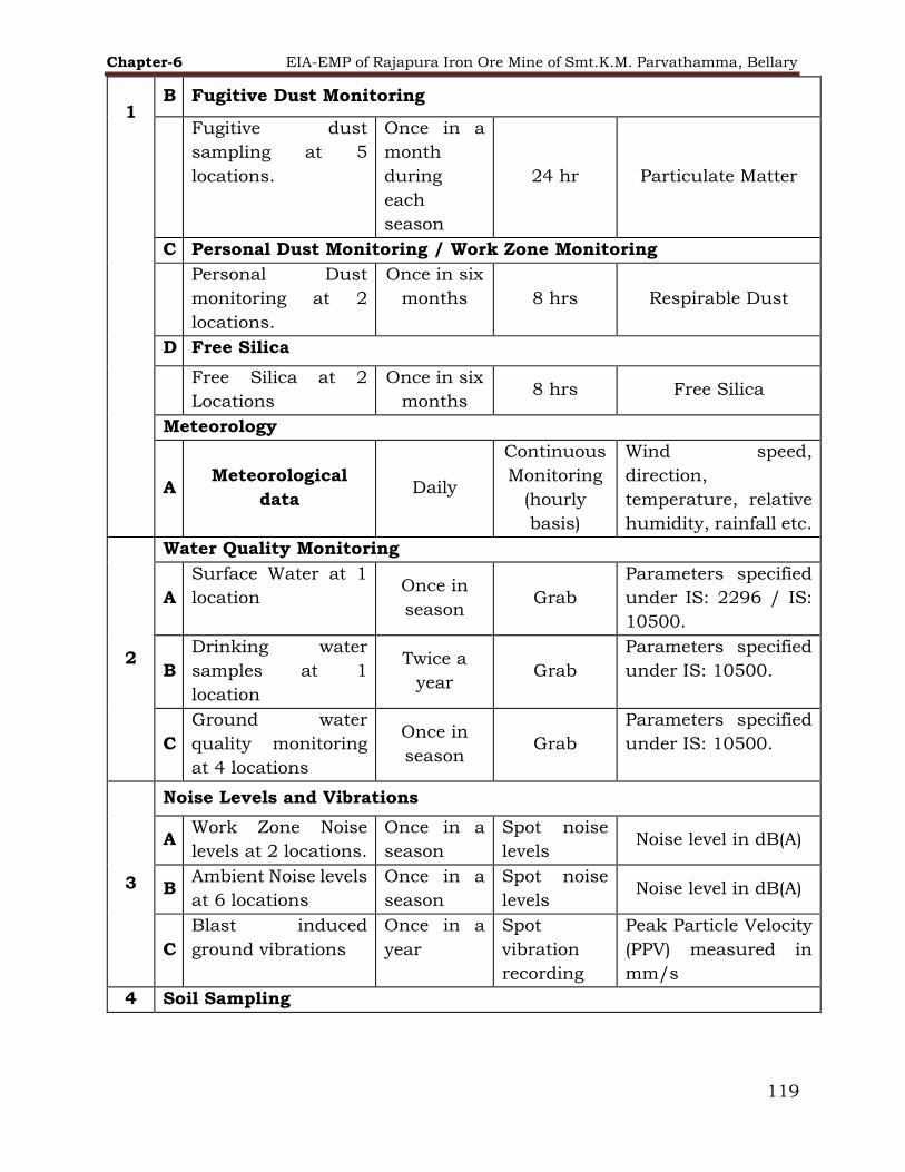
Chapter-6 EIA-EMP of Rajapura Iron Ore Mine of Smt.K.M. Parvathamma, Bellary
119
1 B Fugitive Dust Monitoring
Fugitive dust
sampling at 5
locations.
Once in a
month
during
each
season
24 hr Particulate Matter
C Personal Dust Monitoring / Work Zone Monitoring
Personal Dust
monitoring at 2
locations.
Once in six
months 8 hrs Respirable Dust
D Free Silica
Free Silica at 2
Locations
Once in six
months 8 hrs Free Silica
Meteorology
A Meteorological
data Daily
Continuous
Monitoring
(hourly
basis)
Wind speed,
direction,
temperature, relative
humidity, rainfall etc.
2
Water Quality Monitoring
A
Surface Water at 1
location Once in
season Grab
Parameters specified
under IS: 2296 / IS:
10500.
B
Drinking water
samples at 1
location
Twice a
year Grab
Parameters specified
under IS: 10500.
C
Ground water
quality monitoring
at 4 locations
Once in
season Grab
Parameters specified
under IS: 10500.
3
Noise Levels and Vibrations
A Work Zone Noise
levels at 2 locations.
Once in a
season
Spot noise
levels Noise level in dB(A)
B Ambient Noise levels
at 6 locations
Once in a
season
Spot noise
levels Noise level in dB(A)
C
Blast induced
ground vibrations
Once in a
year
Spot
vibration
recording
Peak Particle Velocity
(PPV) measured in
mm/s
4 Soil Sampling

Chapter-6 EIA-EMP of Rajapura Iron Ore Mine of Smt.K.M. Parvathamma, Bellary
120
A
Soil sampling at 5
locations.
Seasonal Grab
sample up
to 90-cm
Colour, textural
class, grain size,
distribution, pH,
Electrical
Conductivity, Bulk
Density, Porosity,
Infiltration rate,
Moisture retention
capacity, Wilting Co-
efficient, Organic
matter Na, N, K, PO4,
SO4, SAR, Base
Exchange Capacity,
Pb, Cu, Zn, Cd, Fe.
6.2 Monitoring Methods and Data Analysis
Standard methods for sampling and analysis are followed during collection &
analysis of samples. All environmental monitoring and relevant operational data
are stored in the database. Monitoring is conducted by a MoEF&CC/CPCB
recognized laboratory/NABL accredited laboratory.
6.2.1 Air Quality Monitoring
The ground level concentrations of PM2.5, PM10, SO2, NO2 and CO in the
ambient air is monitored at regular intervals. Any abnormal rise will be
investigated to identify the causes, and appropriate action will be initiated.
Ambient air quality monitoring is carried out as per Bureau of Indian Standards
(IS: 5182 and its relevant parts) and National Ambient Air Quality standards
prescribed by CPCB. Monitoring is done by recognised laboratories with following
equipment and consumable items to meet the monitoring frequency and to
implement the monitoring program:
1. Fine Dust Samplers
2. Respirable Dust Samplers
3. Personal Dust Sampler
4. CO Monitor
5. Weather Station (automatic recording)
6. Spectrophotometer (visible range)
7. Single Pan Balance
8. Relevant chemicals as per IS:5182
9. Glassware etc.

Chapter-6 EIA-EMP of Rajapura Iron Ore Mine of Smt.K.M. Parvathamma, Bellary
121
Apart from the above, Fugitive Dust Emission, Personal Respirable Dust, Source
Respirable Dust & Free Silica is also monitored through recognized laboratories
as per DGMS/MoEF&CC guidelines.
6.2.2 Water Quality Monitoring
Representative samples for surface and ground water monitoring are collected
from the nearby water bodies such as nallas, open wells, bore wells, etc.
Parameters such as pH, taste & odour, conductivity, temperature, dissolved
oxygen, free ammonia, residual chlorine, Hardness as CaCO3 (Calcium,
Magnesium & total) etc. are analysed immediately after their collection at camp
laboratory established by firm. For all other parameters, the water samples
collected are preserved as given in IS 2488 and analysed at main laboratory
within 48 hrs of sample collection.
6.2.3 Noise Levels
Precession integrated noise level meter of reputed make is used for measuring
noise levels for both ambient and work zone. The noise level measurements are
taken during the following period given below in Table 6.2 throughout the day
at least for half-an-hour duration for each period at noise level measurement
location.
TABLE 6-2 Duration of noise level measurement
Period Time Minimum Duration
Morning 08.00 – 11.00 Hrs. 30 minutes
Afternoon 14.00 – 17.00 Hrs. 30 minutes
Evening 18.00 – 21.00 Hrs. 30 minutes
Night 24.00 – 03.00 Hrs 30 minutes
All work zone noise level measurements are regularly done at mine area, near
shovel operating point, drill spot, crushing plants, screening plants, loading
yards and other HEM machinery etc. Environmental monitoring is carried out
by MoEF&CC recognized laboratories having NABL accreditation.
6.2.4 Cost towards environment management
Total Capital Investment proposed for Rajapura Iron Ore Mine of Smt. K.M.
Parvathamma Project is about Rs. 25.8 Crores. The cost towards environment
management is mentioned in the Table 6.3 shows the capital and recurring
expenditure towards the environment management:
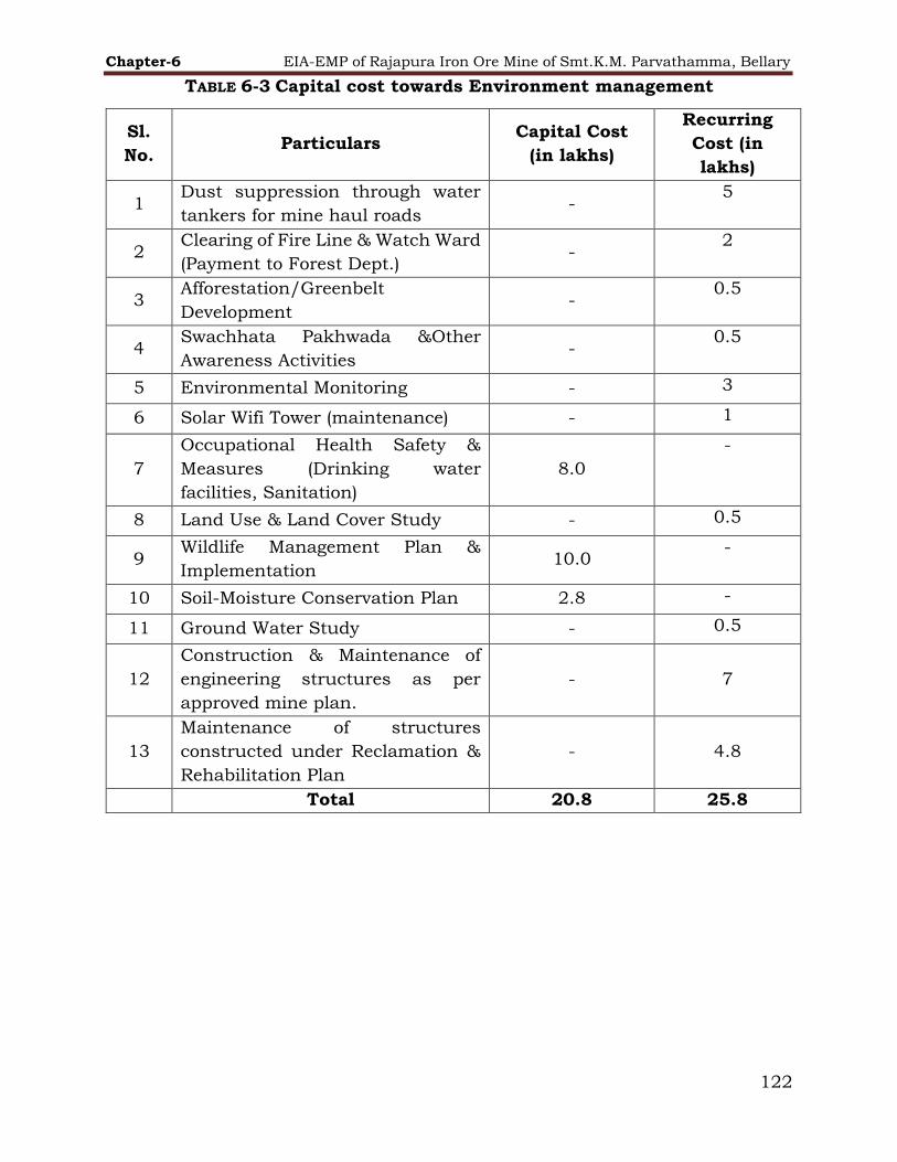
Chapter-6 EIA-EMP of Rajapura Iron Ore Mine of Smt.K.M. Parvathamma, Bellary
122
TABLE 6-3 Capital cost towards Environment management
Sl.
No. Particulars
Capital Cost
(in lakhs)
Recurring
Cost (in
lakhs)
1 Dust suppression through water
tankers for mine haul roads -
5
2 Clearing of Fire Line & Watch Ward
(Payment to Forest Dept.) -
2
3 Afforestation/Greenbelt
Development -
0.5
4 Swachhata Pakhwada &Other
Awareness Activities -
0.5
5 Environmental Monitoring - 3
6 Solar Wifi Tower (maintenance) - 1
7
Occupational Health Safety &
Measures (Drinking water
facilities, Sanitation)
8.0
-
8 Land Use & Land Cover Study - 0.5
9 Wildlife Management Plan &
Implementation 10.0
-
10 Soil-Moisture Conservation Plan 2.8 -
11 Ground Water Study - 0.5
12
Construction & Maintenance of
engineering structures as per
approved mine plan.
- 7
13
Maintenance of structures
constructed under Reclamation &
Rehabilitation Plan
- 4.8
Total 20.8 25.8

Chapter-7 EIA/EMP of Rajapura Iron Ore Mines of Smt. K. M. Parvatamma, Bellary
123
7 ADDITIONAL STUDIES
7.1 Public Hearing
This will be considered after PH.
7.2 Risk Assessment
Hazard analysis involves identification and quantification of the various hazards
(unsafe conditions) that exist in the mine and plant. On the other hand, risk
analysis deals with the identification and quantification of risks; the equipment
and personnel are exposed to, due to accidents expected to arise from the
hazards present in the mine and plant.
Risk analysis follows an extensive hazard analysis. It involves the identification
and assessment of risks the working group & neighboring population are
exposed to as a result of hazards present. This requires a thorough knowledge
of failure probability, credible accident scenario, vulnerability of populations, etc.
Much of this information is difficult to get or generate. Consequently, the risk
analysis is often confined to maximum credible accident studies.
“Risk” is defined as a likelihood of Occurrence of an undesired event (accident,
injury or death) within a specified period or under specified circumstances. This
may be either a frequency or a probability depending on the circumstances.
The term “Hazard” is defined as a physical source or situation, which may cause
human injury, damage to property or the environment or some combination of
these criteria.
“Disaster” is defined as a catastrophic situation that causes damage, economic
disruptions, loss of human life and deterioration of health and health services
on a scale sufficient to warrant an extraordinary response from outside the
affected area or community. Disasters occasioned by man are factory fire
explosions and release of toxic gases or chemical substances, etc.
“Accident” is an unplanned event, which has a probability of causing personal
injury or property damage or both.
“Emergency” is defined as a situation where the resources out pass the demand.
This highlights the typical nature of emergency, “it will be after experience that
enough is not enough”, in emergency situations. Situations of this kind are
avoidable but it is not possible to always avoid them.
“Emergency preparedness” is one of the key activities in the overall management.
Preparedness, though largely dependent upon the response capability of the
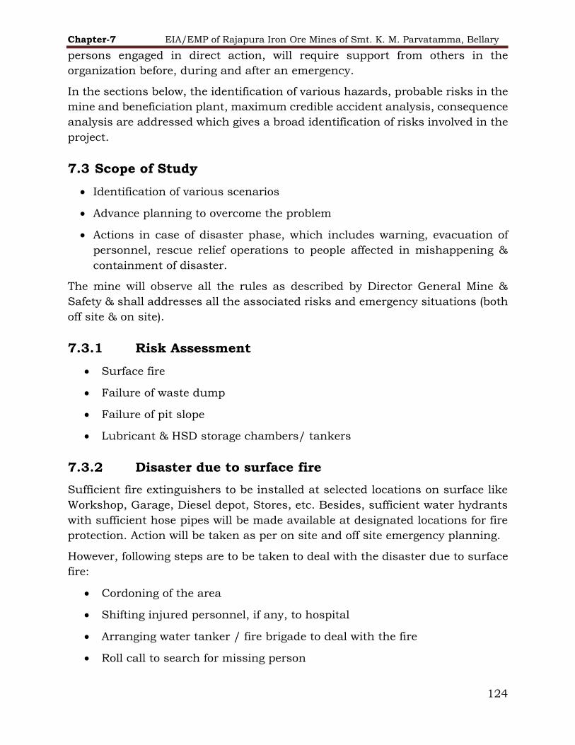
Chapter-7 EIA/EMP of Rajapura Iron Ore Mines of Smt. K. M. Parvatamma, Bellary
124
persons engaged in direct action, will require support from others in the
organization before, during and after an emergency.
In the sections below, the identification of various hazards, probable risks in the
mine and beneficiation plant, maximum credible accident analysis, consequence
analysis are addressed which gives a broad identification of risks involved in the
project.
7.3 Scope of Study
Identification of various scenarios
Advance planning to overcome the problem
Actions in case of disaster phase, which includes warning, evacuation of
personnel, rescue relief operations to people affected in mishappening &
containment of disaster.
The mine will observe all the rules as described by Director General Mine &
Safety & shall addresses all the associated risks and emergency situations (both
off site & on site).
7.3.1 Risk Assessment
Surface fire
Failure of waste dump
Failure of pit slope
Lubricant & HSD storage chambers/ tankers
7.3.2 Disaster due to surface fire
Sufficient fire extinguishers to be installed at selected locations on surface like
Workshop, Garage, Diesel depot, Stores, etc. Besides, sufficient water hydrants
with sufficient hose pipes will be made available at designated locations for fire
protection. Action will be taken as per on site and off site emergency planning.
However, following steps are to be taken to deal with the disaster due to surface
fire:
Cordoning of the area
Shifting injured personnel, if any, to hospital
Arranging water tanker / fire brigade to deal with the fire
Roll call to search for missing person

Chapter-7 EIA/EMP of Rajapura Iron Ore Mines of Smt. K. M. Parvatamma, Bellary
125
Assessing the impact and restore the normal situation
Investigating reasons for failure and taking necessary corrective action to
prevent reoccurrence.
7.3.3 Disaster due to failure of waste dump
Sliding of waste dump causes more hazards as compared with quarry slope
failure. Hence, it is imperative that the degree of hazard against potential failure
of waste dump slope should be identified and precautionary measures adopted.
All measures for scientific mining will be taken for stabilization of dumps. Use of
geo-textiles, tree plantations and grass patching on the dump will be
implemented to stabilize the waste dump. Additional details are given below:
1. Gullies will be cut for flow of water from the waste dump to prevent
erosion of waste dump here and there due to erratic flow of rainwater.
2. On the slope of the terrace, seedlings have been planted so that the
bench slope and consequently the waste dump slope gets stabilized.
3. A stone barrier/toe wall is constructed all around the waste dumps
on down side to prevent waste dump wash-off material being carried
out of the dump area and mixing with the general drainage system.
The toe acts as wedge and prevent its slipping/failure.
4. A garland drain along with settling tank are constructed all around
the waste dump area for smooth flow and settling of suspended solids,
water and safety of the dump.
7.3.4 Disaster due to failure of PIT slope
As the depth planned is shallow and the iron ore, in which benches are to be
made, is very strong in nature, no failure of pit slope is anticipated. More so, as
there are no weak strata at top or in subsequent layers. The ultimate quarry
slope is designed at 450 angles. Hence, no pit slope failure is envisaged.
7.3.5 Damage due to lubricant and HSD storage
chambers/tankers
The following is required to deal with the emergency:
Shifting of injured personnel, if any, to the hospital.
Cordoning of the area.
Plugging the leakages, as far as possible

Chapter-7 EIA/EMP of Rajapura Iron Ore Mines of Smt. K. M. Parvatamma, Bellary
126
Preventing spillages to spread to larger areas
To collect the spilled material, as far as possible
Scrapping the contaminated ground, if possible and dispose of the same as
oily waste
Assessing the impact and cause of the incident.
Taking necessary corrective action to prevent such type of incidents in
future.
7.3.6 Emergency Control Centres
The emergency control center is in place from where the operations to handle the
emergency to be directed and coordinated. It is attended by the site main
controller, key personnel and the senior officers of the fire and police services.
The center is equipped to receive and transmit information and directions from
and to the incident controller and other areas of the works.
Emergency control centers contains the following:
a) An adequate number of external telephones
b) An adequate number of internal telephones
c) A work plan to show
i) Areas where there are inventories of LPG, HSD, etc.
ii) Sources of safety equipment
iii) The fire-fighting system and additional sources of water
iv) Site entrances and roadways, including up-to-date information on
roadwork’s
v) Assembly points
vi) The work location in relation to the surrounding community
vii) Lorry parks
d) A nominal roll of an employee
e) A list of key personnel, with addresses, telephone number, etc. (as given in
7.3.8).
7.3.7 Action on site
The primary purpose of the on-site emergency plan is to control and contain the
incident and so as to prevent it from spreading to nearby areas. It is not possible

Chapter-7 EIA/EMP of Rajapura Iron Ore Mines of Smt. K. M. Parvatamma, Bellary
127
to cover every eventuality in the plan and the successful handling of the
emergency will depend on an appropriate action and decisions being taken on
the spot. Other important aspects to be considered includes the following:
Evacuation of non-essential personnel
Accounting for personnel affected
Access to record and communicate the information to the friends and
relatives of the affected personnel.
Public relations
Rehabilitation of the affected persons
7.3.8 Post disaster analysis and evaluation
When the emergency is over, the team will carry out a detailed analysis of the
causes of the accident, evaluate the influence of various factors and take
necessary measures for future. At the same time, the adequacy of the Disaster
Preparedness Plan will be evaluated and shortcoming if any will be rectified for
subsequent improvement of the plan.
TYPE POLICE STATION HOSPITAL FIRE STATION
ADDRESS
Sandur Police Station
Bommaghatta Road, Sandur,
Karnataka
583119
Sandur Government Hospital No.1/3,
Bellary Road, Sandur Bellary, Bellary -
583119, Near
Syndicate Bank (Map)
Fire Station, Kurmanre Swamy Road , Kudligi
Road , Sandur - 583119
CONTACT.NO +91 83952 60249 +91 8392 260360 (08395) 260211
7.3.9 Emergency services
The provision of following emergency services to be made available in the plant.
Fire protection system
Medical facilities
Rescue facilities
Plant safety arrangements
Emergency action within 15 minutes of occurrence

Chapter-7 EIA/EMP of Rajapura Iron Ore Mines of Smt. K. M. Parvatamma, Bellary
128
7.3.10 Off-site emergency plan
Introduction
The off-site emergency plan is an integral part of any major hazard control
system. They are the accidents identified by the management, which could affect
people and the environment outside the works. Thus, the off-site plan forms the
basis for the on-site plan and the two plans should therefore complement each
other. The key feature of a good off-site emergency plan is its flexibility in its
application to emergencies other than those specifically included in the
formation of the plan. The roles of the various parties that may be involved in
the implementation of an off-site plan are described below. The responsibility for
the off-site plan is likely to rest on either with the works management or with
the local authority.
Aspects to be included in an off-site emergency plan
Some of the aspects to be included in off-site emergency plan are as follows: -
Organization
Details of command structure, warning systems, implementation procedures,
emergency control centers Names and appointments of incident controller, site
main controller, their deputies and other key personnel.
Communications
Identification of personnel involved, communication center, call signs, network,
list of telephone numbers.
Special emergency equipment
Details of availability and location of heavy lifting gear, bulldozers, specified fire-
fighting equipment, fireboats.
Voluntary Organizations
Details of organizers, telephone numbers, resources, etc.
Meteorological information
Arrangements for obtaining details of weather conditions prevailing at the time
and weather forecasts.
Humanitarian arrangements
Transport, evacuation centers, emergency feeding, treatment of injured, first aid,
ambulances, temporary mortuaries.

Chapter-7 EIA/EMP of Rajapura Iron Ore Mines of Smt. K. M. Parvatamma, Bellary
129
Public information
Arrangements for dealing with the media-press office & informing relatives etc.
Assessment
Arrangements for (a) collecting information on the causes of the emergency (b)
reviewing the efficiency and effectiveness of all aspects of the emergency plan.
Role of the emergency co-coordinating officer
The various emergency services will be coordinated by an emergency
coordinating officer (ECO) who is likely to be a senior police officer but, depending
on the circumstances, could be a senior fire officer. The ECO will liaise closely
with the site main controller. Again depending on local arrangements, for very
severe incidents with major or prolonged off-site consequences, the external
control may pass on to a senior authority/ administrator.
Role of major hazard works management
The role of works management in off-site emergency planning will be to establish
liaison with those preparing the plans and to provide information appropriate to
such plans.
Advice shall be provided by works management to all the outside organizations,
which may involve in handling the emergency off-site and which may need to
familiarize themselves with some of the technical aspects of the works activities
e.g. emergency services, medical departments etc.
Role of the Fire authorities
The control of a fire normally is the responsibility of the senior fire brigade officer
on arrival at the site. The senior fire brigade officer may also have a similar
responsibility for other events, such as explosions and toxic releases. Fire
authorities having major works in their area will have familiarized themselves
with the location on site of all stores of flammable materials, water and foam
supply point and fire-fighting equipment.
Role of the health authorities
Health authorities, including doctors, surgeons, hospitals, ambulances and so
on, have a vital part to play following a major accident and they will form an
integral part of any emergency plan.
For major fires, injuries will be the result of the effects of thermal radiation to a
varying degree and the knowledge and experience to handle this in all, but
extreme, cases may be generally available in most hospitals.

Chapter -8 EIA/EMP of Rajapura Iron Ore Mines of Smt. K. M. Parvatamma, Bellary
130
8 PROJECT BENEFITS
8.1 Improvement in the Physical & Social Infrastructure
Before coming into e-auction, Rajapura Iron Ore Mine which has strengthened
and developed basic infrastructure facilities for the communities in and around
the mines. Facilities like health care, educational facilities, providing potable
water (RO) to the surrounding villages, construction & modification of existing
roads, sanitation etc. have been developed under CSR by the erstwhile lessee.
Rajapura Iron Ore Mine. will further take up the development work and the
process of improvement in the physical & social Infrastructure will continue.
8.2 Corporate Social Responsibility
8.2.1 Corporate Social Policy
The existing mining projects of Rajapura Iron Ore Mines are delivering social
benefits to surrounding population in the form of educational facilities, roads,
communication facilities, transportation, marketing and health facilities directly
or indirectly. The Rajapura Iron Ore Mine has helped to improve the financial
earnings of the surrounding population by way of direct and indirect employment
opportunities. The project had encouraged the setting up of various utility
services and trade benefiting large number of people around the mining areas.
Rajapura Iron Ore Mines is striving to provide necessary facilities to the local
villagers since its advent. The activities which will be undertaken by Rajapura
Iron Ore Mines towards Corporate Social Responsibility can be broadly classified
as:
▪ Infrastructure Development;
▪ Health & Sanitation;
▪ Drinking Water;
▪ Miscellaneous
8.3 Employment Generation
The project generates direct and indirect employment during operation. The
employment is either permanent or contractual in nature. Most of the semi-
skilled and un-skilled labors will be employed on contractual works such as
plantation, civil constructions, plant maintenance, nursery maintenance,
canteen etc. The details of the employment generation by Rajapura Iron Ore Mine
of St. K.M. Parvathamma are given below in following Table 8.1:
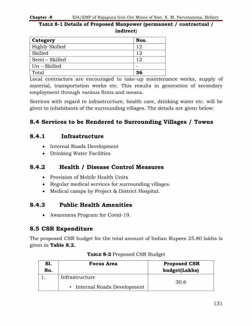
Chapter -8 EIA/EMP of Rajapura Iron Ore Mines of Smt. K. M. Parvatamma, Bellary
131
TABLE 8-1 Details of Proposed Manpower (permanent / contractual /
indirect)
Category Nos.
Highly Skilled 12
Skilled 12
Semi – Skilled 12
Un – Skilled -
Total 36
Local contractors are encouraged to take-up maintenance works, supply of
material, transportation works etc. This results in generation of secondary
employment through various firms and means.
Services with regard to infrastructure, health care, drinking water etc. will be
given to inhabitants of the surrounding villages. The details are given below:
8.4 Services to be Rendered to Surrounding Villages / Towns
8.4.1 Infrastructure
Internal Roads Development
Drinking Water Facilities
8.4.2 Health / Disease Control Measures
Provision of Mobile Health Units
Regular medical services for surrounding villages.
Medical camps by Project & District Hospital.
8.4.3 Public Health Amenities
Awareness Program for Covid-19.
8.5 CSR Expenditure
The proposed CSR budget for the total amount of Indian Rupees 25.80 lakhs is
given in Table 8.2.
TABLE 8-2 Proposed CSR Budget
Sl.
No.
Focus Area Proposed CSR
budget(Lakhs)
1. Infrastructure
▪ Internal Roads Development 30.6

Chapter -8 EIA/EMP of Rajapura Iron Ore Mines of Smt. K. M. Parvatamma, Bellary
132
▪ Drinking Water Facilities
2. Health / Disease Control Measures 10
3. COVID Care Facilities / PPE
Distribution
11.0
Total 51.6

Chapter-9 EIA/EMP of Rajapura Iron Ore Mines of Smt. K. M. Parvatamma, Bellary
133
9 ENVIRONMENTAL COST BENEFIT ANALYSIS
Not applicable as it is not recommended at the scoping stage.

Chapter-10 EIA-EMP of Rajapura Iron Ore Mine of Smt.K.M.Parvatamma., Bellary
134
10 ENVIRONMENTAL MANAGEMENT PLAN
10.1 Environmental Policy
Managing the environment plays a vital role in the assessment and mitigation of
strategic risks associated with the environment, ensuring regulatory compliance as
well as identification of business opportunities. Reduction in the generation of
various wastes, and their reuse and recycle comprise the key working philosophy
of the Company.
10.2 Environment Management System
KMP will adopt Integrated Management System Policy covering Environment Policy
to conserve and protect Environment. As per the IMS policy, the procedures to
bring into focus any infringement / deviation / violation of the environmental or
forest norms / conditions are through Internal Audit.
Procedure for Handling Non-Conformities is Detailed Below
If a non- conformance is identified, it is reviewed and investigated to decide
about the action to be initiated to mitigate immediate impact.
Non-compliance, with respect to the legal & other requirements - investigation,
disposition, corrective actions, are as per the procedure, monitoring compliance
to environmental legal requirements.
After emergency corrective actions Response Plan. situations investigation,
disposition, are as per Emergency Preparedness and Response Plan.
Employees report on field non-conformances for incident, accident, near miss
reviewed and respective control measures are taken after investigating. The
same control measures are communicated to all and will be updated in work
instructions to create
The non-conformance can be identified in different situation as mentioned below
• Deviations from Process / product requirements
• Incidents, accidents noted during operation.
• Non-compliance with respect to the Legal & other requirements
• Post emergency situations
• Management System Audit
• Deviation from OCP /SOPs / Work Instructions, procedures, non-
implementation of the management programme, after their approval. safe working
environment.

Chapter-10 EIA-EMP of Rajapura Iron Ore Mine of Smt.K.M.Parvatamma., Bellary
135
Reporting of Non-Conformance:
All non-conformances are reported in the specified format. Analysis of the cause of
the non-conformance will be done to decide corrective action required to eliminate
the causes and potential nonconformities. All proposed corrective actions are
reviewed prior to implementation.
In case the results of corrective actions need amendment in the documented
procedures, it is carried out as per procedure for Control of documented
information.
All the non - conformances and corrective actions status will be recorded and
consolidated. The copy of the same will be sent for management review.
The confirmation on effectiveness of corrective action on resolution of non-
conformance is presented to the management in the management review
meetings.
The following records pertaining to non-conformities will be maintained:
Non Conformance Report
Corrective Action Form
List of Accidents, Incidents
Accident Investigation Report
10.3 Administrative Aspects and Environmental Monitoring
Program
Regular monitoring of environmental parameters is of immense importance to
assess the status of environment during project operation. With the knowledge of
baseline conditions, the monitoring programme serves as an indicator for any
deterioration in environmental due to operation of the project. Accordingly, suitable
mitigative measures will be taken in time to safeguard the environment. Monitoring
is also essential to determine the efficiency of control measures implemented.
10.4 Institutional Arrangements for Environment Protection and
Conservation
The Office of K.M.Parvatamma is located at Bellary. The Chairman cum Managing
Director is supported by Directors for Production, Finance, Commercial, Personnel
and Technical Departments. It also houses overall Planning and Engineering
Department, Resource Planning, Personnel Management and Industrial Relations
Department, Industrial Engineering and Management Services, Human Resource
Department, Exploration and Environment Department.
Mining Department Vice President (VP) heads the division and well supported by
Human Resource Department, Public Relation Department, Corporate Social

Chapter-10 EIA-EMP of Rajapura Iron Ore Mine of Smt.K.M.Parvatamma., Bellary
136
Responsibility Department, Accounts Department, Finance Department,
Commercial Department, Geology Department, Planning Department, Survey
Department and Environment Department. Head Environment co-ordinates the
activities required for new projects and production projects for all Environmental
matters. He is assisted by senior officials of various projects. The functions of
Environment department are given below:
Peruse environmental policy of the company and to implement various
measures for its achievements;
Planning and organizing environmental studies for preparation of EIA/EMP
reports as required for new/expansion projects;
Ensuring implementation of EC conditions;
Interaction with Govt. Departments for obtaining approvals/clearance;
Setting of environmental performance parameters in line with policy and
statutory requirement and monitoring of achievements;
To guide the project environmental section in the implementation of pollution
control processes and to report to respective Pollution Control Board and
other agencies;
Prepare the annual environmental audit report for overall operations;
Prepare environmental statements for any activity or decision to be taken for
environmental implications;
Review the applications for consent orders made by projects and monitoring
the implementation of the conditions;
To keep up-to-date information on the overall environmental and associated
legislation; and prepare for dissemination within JSW;
Development of Greenbelt and Afforestation Activities;
Arranging in-house training for environmental core group as well as
executives in charge of operations involving pollution abatement processes
and improvement scheme;
To set environmental quality standards for the materials and equipment
ordered from suppliers for mining activity; and
To include necessary conditions in the work orders for safe guarding
environmental conditions and the interest of local community;
The functions and the responsibilities of the Environment Management Cell at the
project are as follows:
Provide overall co-ordination of environmental activities at project sites;
Undertake medium term environmental planning in accordance with long
term programme made at corporate level;
Develop good liaison with State Government agencies such as Pollution
Control Board, Forest and Revenue Departments, and Regional office of

Chapter-10 EIA-EMP of Rajapura Iron Ore Mine of Smt.K.M.Parvatamma., Bellary
137
MoEF&CC and submit periodical reports as may be prescribed in compliance
with conditions stipulated by them;
Supervise the environmental monitoring studies viz. work zone air emissions,
ambient air quality, water quality, noise level, vibration studies etc.
conducted by various contract agencies;
Undertake environmental awareness and other training programmes for the
workforce.
Monitoring of impacts on environment due to the activities undertaken by
contractors and impact on local population by their work force; and
Planning, managing and introducing community participation process and
developing and maintaining credibility of the organization and reducing the
level of misconception and misinformation about the project on
environmental issues.
Environmental Management aspects of the projects are being looked after by the
Environment Management Cell, created at Rajapura Iron Ore Mines of Smt K.M.
Parvathamma and also at project site. This cell comprises of professionals deployed
from different disciplines, which includes mining and environmental science and
engineering.
The organization structure for environmental management is shown in Figure10.1.
FIGURE 10-1 ORGANIZATIONAL STRUCTURE OF ENVIRONMENT DEPARTMENT
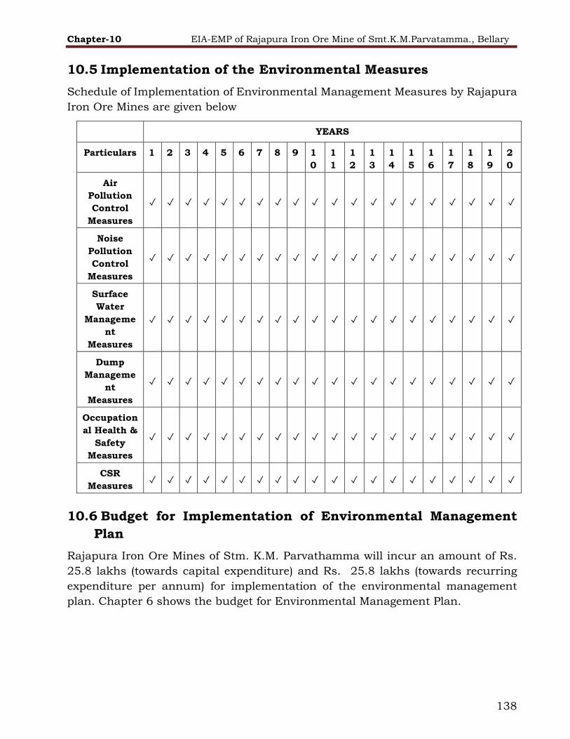
Chapter-10 EIA-EMP of Rajapura Iron Ore Mine of Smt.K.M.Parvatamma., Bellary
138
10.5 Implementation of the Environmental Measures
Schedule of Implementation of Environmental Management Measures by Rajapura
Iron Ore Mines are given below
YEARS
Particulars 1 2 3 4 5 6 7 8 9 1
0
1
1
1
2
1
3
1
4
1
5
1
6
1
7
1
8
1
9
2
0
Air
Pollution
Control
Measures
✓ ✓ ✓ ✓ ✓ ✓ ✓ ✓ ✓ ✓ ✓ ✓ ✓ ✓ ✓ ✓ ✓ ✓ ✓ ✓
Noise
Pollution
Control
Measures
✓ ✓ ✓ ✓ ✓ ✓ ✓ ✓ ✓ ✓ ✓ ✓ ✓ ✓ ✓ ✓ ✓ ✓ ✓ ✓
Surface
Water
Manageme
nt
Measures
✓ ✓ ✓ ✓ ✓ ✓ ✓ ✓ ✓ ✓ ✓ ✓ ✓ ✓ ✓ ✓ ✓ ✓ ✓ ✓
Dump
Manageme
nt
Measures
✓ ✓ ✓ ✓ ✓ ✓ ✓ ✓ ✓ ✓ ✓ ✓ ✓ ✓ ✓ ✓ ✓ ✓ ✓ ✓
Occupation
al Health &
Safety
Measures
✓ ✓ ✓ ✓ ✓ ✓ ✓ ✓ ✓ ✓ ✓ ✓ ✓ ✓ ✓ ✓ ✓ ✓ ✓ ✓
CSR
Measures ✓ ✓ ✓ ✓ ✓ ✓ ✓ ✓ ✓ ✓ ✓ ✓ ✓ ✓ ✓ ✓ ✓ ✓ ✓ ✓
10.6 Budget for Implementation of Environmental Management
Plan
Rajapura Iron Ore Mines of Stm. K.M. Parvathamma will incur an amount of Rs.
25.8 lakhs (towards capital expenditure) and Rs. 25.8 lakhs (towards recurring
expenditure per annum) for implementation of the environmental management
plan. Chapter 6 shows the budget for Environmental Management Plan.

Chapter-11 EIA-EMP of Rajapura Iron Ore Mine of Smt.K.M.Parvatamma., Bellary
139
11 SUMMARY & CONCLUSION
11.1 Introduction
The Mining lease was first granted in the year 1953 and subsequently renewed
under the Mining Lease No. 2514. The lease had been transferred to Smt. K. M.
Parvathamma. from K.M. Rudraiah over an Extent of 121.41 Ha (105.483 Ha in
forest land and 15.927 Ha in Revenue/ Private Land) and transferred to SMt. K.M.
Parvathamma legal heir and wife of Sri. K.M. Rudraiah in the year 23.2.1979 as
per G.O. Notification CI/29MMM79 dated 17.12.1979. for the period f 20Years
w.e.f. 21.09.1973 was granted to Smt. K. M. Parvathamma over an Extent of 121.41
Ha (105.483 Ha in forest land and 15.927 Ha in Revenue/ Private Land) on
5.9.1979 and valid upto 20.09.1993 was Granted to Smt.K.M. Parvathamma over
an extent of 15.24 Ha of forest land (after surrendering an area of 90.243 Ha out
of 105.483 Ha forest land) Vide Govt. Notification No. CI.76.MMM.2002 date
13.01.2005. further in continuation of above notification No. CI. 76MMM.2002
second renewal for 20 years was modified as ML.No.2514and granted to Smt. K.M.
Parvathamma Over an Extent of 24.82 Ha (after surrendering an area of 6.257 Ha
out of 15.927 Ha revenue land) w.e.f 21.09.2003 to 23.2.2023 Vide G.O. notification
CI.10.MMM.2006 dated 19.01.2006 and executed on 23.02.2006.
First mining plan was approved on 2.11.1992 for a period 1992-93 to 1996-97.
Mining plan was approved on 26.02.1998 for a period of 5 years from 1997-98 to
2002-2003. As there was no forest clearance mine was not working later the mining
plan was reconsidered from 2000-01 to 2004-05. Mining Scheme for the period
2005-2010 was approved by IBM vide letter No.MS/BLR/Fe-55-SZ date
08.11.2005 for the extent of 31.167 Ha. Then modified Scheme of Mining for the
above period (2005-2010) modified under Rule 10(1) of MCDR for area extent
24.82Ha was approved by IBM vide letter No. Ms/BLR/Fe55-Sz dated 18.07.2006.
Mining Scheme for the period 2010-2015Prepard and submitted IBM on
23.09.2011. On receipt of SOM submitted by the lessee IBM has advised the lessee
to obtain the clearance letter along with duly certified lease sketch of ML area from
DMG, Banglore and resubmit the SOM vide IBM letter No. 279/313/92/BNG/1179
dated 5.5.2015.
11.2 Project Description
Dendritic drainage pattern is observed in the area. The highest elevation is 880m
RL and the lowest elevation is about 675mRL. As the area is part of forest, moderate
vegetation with small trees and shrubs/bushes are observed.
The salient features of the Rajapura Iron Ore Mine are given in Table 11.1

Chapter-11 EIA-EMP of Rajapura Iron Ore Mine of Smt.K.M.Parvatamma., Bellary
140
TABLE 11-1 Salient Features of RAJAPURA Iron Ore Mine
Name of the mine Rajapura Iron Ore Mine (ML No. 2514)
Total Area 24.82 Ha.
Area in Forestland 18.22 Ha
Area in Non-Forest
Land
6.6 Ha
Production Capacity 43000 TPA (As per approved Mining Plan)
Lat/long Latitude : N-15°00'58.3" to N- 15°01'32.9“
Longitude : E-76°39'31.7” to E-76°39'57.3”
Topo sheet No D43E12 & D43K9
Date of Grant of Lease 09-09-1958
Period/Expiry Date Valid up to 20.09.2023
Existence of Public
Road/Railway Line, if
any, nearby and
approximate distance
Road :
Bellary Hiriyur Road NH 150A about 20Kms
(Aerial Distance)
Bellary-Bommaghatta Road 1.8km (Aerial
Distance) Railway line- Ranjitpura 7 Kms
Postal Address
Smt. K.M. Parvathamma
18/35, IInd Link road, Parvathinagar, Bellary-583103
Ph: +91-9448291575/ 08392-266385
District Ballari
State Karnataka
Type of mine Open cast mine
Method of mining Fully mechanized open cast method
Mineable reserves 43,04,358 Tonnes of Iron ore as per approved
mining plan
Expected life of mine 2nd renewal valid up to 20 September 2023 (as per
lease deed)
Ore to Waste ratio 1: 0.98(Plan Period)
Average no. of working
days 36
Number of shifts One
Bench height & width 8 m
Top and Bottom Bench 880 mRL and 675mRL
Present working
benches 735 mRL to 687mRL (Third Year)
Waste (Plan Period) 1,26,190 TPA

Chapter-11 EIA-EMP of Rajapura Iron Ore Mine of Smt.K.M.Parvatamma., Bellary
141
Ultimate pit slope Not more than 45 degrees
Estimated Power
requirement & source 500 units/day , Source - DG sets
Estimated Water
requirement & source 24 KLD, Source – Open Wells & Tube Wells
Project Cost (Gross
Block cost)
Rs. 258 Lakhs
During the life of mine, the respective dumps shall be stabilized by forming terraces,
planting native tree species and geo-coir matting.
Mining is carried out by fully mechanized open cast mining method. Drilling and
blasting technique is used whenever required to handle hard formation. The
blasted material is excavated by the hydraulic excavators and front-end loaders
having various bucket capacities for achieving the planned production. The waste
excavation is also met with the machinery deployed as per the excavation plan.
No wet mineral processing will be done, only dry crushing and screening process done
for production of fines (0 to less than 10 mm) and Lumps (10 mm to less than 40 mm).
The ROM (Runoff Mine) is extracted from the mine pit and as per the size, ROM is fed
to screening & crushing plant.
The finished products are loaded on tippers by front end loader of suitable capacity
and stacked in designated stockpiles. The final product is being dispatched to
customers by tippers and allied weigh bridge operations. The low-grade ore is suitably
mixed with high grade ore to achieve desired Fe percentage and supplied to the
customers. The excavated material including ROM & waste is loaded into dumpers and
tippers for transportation of the material.
11.3 Resource Requirement:
The present land use, as shown in Table 11.2, indicates that the landscape over
an area of 24.82 Ha has already changed its topography. The anticipated land use
is shown in indicates that the land area of 24.82 Ha shall change its topography
by the conceptual plan period.
TABLE 11-2 Land use pattern-existing & proposed (Conceptual stage)
Sl
. No
Particulars Existing/Plan Period Conceptual Period
Forest
Revenue
Total Forest
Revenue
Total
1. Mining 9.15 0.60 9.75 12.46 0.60 13.06
2 Dumping 4.10 0.27 4.37 2.70 0.27 2.97

Chapter-11 EIA-EMP of Rajapura Iron Ore Mine of Smt.K.M.Parvatamma., Bellary
142
3 Mineral Storage -- 1.30 1.30 -- 1.30 1.30
4. Topsoil Yard -- -- -- -- -- --
5. Infrastructure/Statutory Building
-- 0.02 0.02 -- 0.02 0.02
6. Screening Plan -- 0.12 0.12 -- 0.12 0.12
7. Road -- 1.00 1.00 -- 1.00 1.00
8. Green Belt (Safety Zone)
2.06 1.04 3.10 2.06 1.04 3.10
9. Area for Eng. Measures -- -- -- -- -- --
10 Others
Biodiversity Area / Area Unused
1.00
1.91
--
2.25
1.00
4.16
1.00
--
--
2.25
1.00
2.25
Total 18.22 6.60 24.82
18.22 6.60 24.82
DUE TO ABOVE ACTIVITIES THE LANDSCAPE OF THE TERRAIN WILL BE MODIFIED TO SOME
EXTENT. FURTHER IMPACTS DUE TO CHANGE IN LAND SCENARIO AND LAND USE CAN
AFFECT THE TOP SOIL AND DRAINAGE PATTERN OF THE SURROUNDING AREA OF MINE
LEASE FOR WHICH MITIGATION MEASURES ARE BEING TAKEN.
Water Requirement:
Total water requirement is 24 KLD for dust suppression (12 KLD), plantation (8
KLD) and domestic use (4 KLD).
Manpower:
Total direct employment potential in the mine is 36 covering the statutory work
force and skilled, semiskilled &unskilled workforce. Indirect employment is
approximately 36.
11.4 Baseline Environmental Status:
Environmental monitoring was carried out for base line data generation during
October 2021 to December 2021 for 3 Months. Micrometeorology, Ambient air
quality, Water quality, Noise level, Soil quality, Socio-economic & Biodiversity study
was carried out within 10 km radius of the lease area.
11.4.1 Meteorology
Meteorological data for three months has been procured from the Indian
Metrological Department. Calm condition prevailed over 3% of the time of the study
period. The predominant wind directions were ESE over 16.7% of the time in which
speed of 2 to 4 m/s, 6% of the time in speed of 4-6 m/s was recorded. The next
predominant direction was East over 9.6% of the time in which speed of 2 to 4 m/s
was recorded. The seasonal wind rose diagrams for 24 hours period is given in
figure 3-6. Installation of Weather monitoring stations are in process and the

Chapter-11 EIA-EMP of Rajapura Iron Ore Mine of Smt.K.M.Parvatamma., Bellary
143
weather station will be installed in a suitable location without much disturbances
near the mine office for regular observation.
11.5 Ambient Air Quality
Ambient Air Quality Monitoring (AAQM) has been carried out at eight locations with
a frequency of two days per month for three months during Oct- Dec 2021. The
results thus obtained indicate that the concentrations of PM10, PM2.5, SO2, and NO2
in the ambient air are within the National Ambient Air Quality (NAAQ) standards
for Residential and Rural areas (Table-11.3).
TABLE 11-3 Ambient air quality levels
Sr. No. Parameters Values (Range)
(µg/m3)
Limits (µg/m3)
1 PM2. 5 35-47 60
2 PM10 63-80 100
3 SO2 13-17.9 80
4 NO2 12.33-28.3 80
5 CO 0.59-0.89 2
11.5.1 Water Quality
To assess the physical and chemical properties of water in the region, water
samples from four surface and eight ground water locations were collected around
the project site. In ground water, the Iron concentrations are found to be in the
range of 0.12 to 0.32 mg/l and were observed to be within the desirable limit of
0.30mg/l. The Fluoride is in the range of 0.47 to 1.26 mg/l which is below 1 mg/l
limit. Similarly, Nitrate is in the range of 6.6 to 13.2 mg/l which is below 45 mg/l
limit. The result shows that all the parameters are well within the acceptable limit
of IS: 10500 except the Hardness which is higher than prescribed limit at one
location but below the permissible limit.
In surface waters, the Iron concentrations are found to be BDL (Below detection
limit) and were observed to be within the desirable limit of 50.0mg/l. The TDS are
in the range of 380.73 mg/l, and is observed to be within the desirable limit of 1500
mg/l. Total Coliform organisms (MPN/100ml) is well below desirable limit of 5000.
The results show that all the parameters are well within the prescribed limit of IS:
2296 (Class C).

Chapter-11 EIA-EMP of Rajapura Iron Ore Mine of Smt.K.M.Parvatamma., Bellary
144
11.5.2 Noise Levels
Ambient noise levels were measured at eight locations around the existing mine
site. The daytime and night time noise levels in all the residential locations were
observed to be within the permissible limits. The Leq values are in the range of
36.54 to 48.36 dB (A).
11.5.3 Soil Quality
Eight representative soil samples were collected from core and buffer zone of mine
lease area and analyzed to assess the present soil quality of the region. In the core
zone, the soil cover is very less to support the vegetation and plant growth. The pH
of the soil is neutral to slightly alkaline in nature. The nitrogen, phosphorus and
potassium (NPK) values are less, which indicates that the soil is not supportive to
plants growth. Based on the results, it is evident that the soils are not contaminated
by any pollution sources.
11.5.4 Land Use
The land use pattern of the buffer zone i.e. 10 km radius area has been studied
based on satellite data. Further, land cover map has been generated on 1:50,000
scale using digital classification. Based on the said study major land use/land
cover categories are detailed in the Table No.11.4.
TABLE 11-4 Major land use/ Land cover categories
Sl. No. Category
Area in
Ha
% of the Study
Area
1 Agricultural Land 411.175 1.26
2 Fallow Land 4416.28 13.59
3 Dense Forest 10015.42 30.84
4 Land with Scrub 5989.675 18.44
5 Degraded Forest 6266.475 19.29
6 Settlements 1780.463 5.48
7 Mining Area 3583.83 11.03
8 Water bodies 11.18 0.034
Total 32474.5 100
11.5.5 Ecological Environment
The presence of Schedule-I species in the core and buffer zone are not reported.
Apparently, there is no presence of rare and endangered plants in the study area.
There are also no endangered and threatened fish found in the study area.

Chapter-11 EIA-EMP of Rajapura Iron Ore Mine of Smt.K.M.Parvatamma., Bellary
145
11.5.6 Social Environment
The study area (10 km radius) area has a total rural population of 47783 according
to 2011 census. The Sex ratio of the study area is 990 females per thousand male
populations. The percentage of male and female population to the total population
is 51% and 49% respectively.
People are positive about the project, provided environment is well taken care of.
The project brings in more employment opportunities including supporting jobs
resulting in economic & social development of the people & area.
11.6 Summary of Anticipated Environmental Impacts and
Mitigation
Rajapura Iron Ore Project is an existing operating mine. The environmental
management measures are being implemented. The summary of adverse
environmental impacts and mitigation measures are given in Table No.11.5.

Chapter-11 EIA-EMP of Rajapura Iron Ore Mine of Smt.K.M.Parvatamma., Bellary
146
TABLE 11-5 Environmental impacts and mitigation
Environmental
Component
Project Activities
Impacts Adverse / Beneficia
l
Mitigation Measures adopted
Air Quality Drilling and
Blasting
Dust (PM) and gases
(NOx) are produced during drilling and blasting operations
Adverse Avoid blasting during adverse weather
conditions.
Development of greenbelt.
Overburden removal,
extraction of iron ore, loading / unloading of
overburden and iron ore, stock
piling of iron ore, disposal of overburden at
dump site within mine lease area
Increase in PM levels in ambient air due to dust
generation and NO2 concentration levels in ambient air due to
vehicular emissions.
Adverse Exposed area is limited to the minimum required for mining operations.
Water sprinkling on mine hauls roads.
Overburden dumps are re-vegetated as soon as possible.
Use of canon mist / water sprinkler at
Dumping yards and stockpile.
Transportation of overburden and iron ore within
mine lease area
Increase in PM level due to dust generation and NO2 concentration
levels in ambient air due to vehicular emissions.
Adverse Regular watering on haul and access roads using water sprinkling trucks.
Plantation to act as a barrier for minimizing propagation of dust.
Iron ore crushing and handling at iron ore storage
area
Increase in PM concentration in ambient air.
Adverse Water sprinkling systems / dry fog dust suppression systems are installed for
control of dust emissions from dumper platform at crushing plant.

Chapter-11 EIA-EMP of Rajapura Iron Ore Mine of Smt.K.M.Parvatamma., Bellary
147
General equipment’s
operations
Elevate PM and NOx concentrations in
ambient air.
Adverse Regular maintenance of all equipment to minimize particulate matter emissions
from diesel engines.
All activities Excessive occupational
exposures to airborne particulate matter.
Adverse Occupational exposures to air pollutants
are periodically being assessed at regular intervals.
Engineering control measures are in place to handle the issue.
Provision & ensuring use of personal protective equipment
Additionally, management control measures are also resorted to as a last
control measure.
Noise Levels
and Ground Vibrations
Blasting Community annoyance
due to high impulsive noise levels, air
overpressure and ground vibrations.
Adverse Controlled blasting techniques are being
practiced.
Use of NONEL and optimizing maximum
charge per delay. Not conducting blasting in high wind conditions.
General activities
including machine &
transportation of overburden and iron ore within
the ML area.
Increase in noise levels
Occupational hazard due to noise exposures
and increase in ambient noise levels.
Adverse A detailed review of noise emissions and
impacts from project activities is being carried out at regular intervals during
the project life.
Occupational noise exposures will be
assessed. Where Leq (8 hour) noise exposures have the potential to exceed
85 dB (A), mitigation through engineered noise controls, management measures or, as a last resort, through the provision

Chapter-11 EIA-EMP of Rajapura Iron Ore Mine of Smt.K.M.Parvatamma., Bellary
148
of personal protective equipment will be implemented.
Regular noise monitoring will be carried-out.
Regular maintenance of equipments and providing silencers, rubberants to
reduce sound where ever applicable.
Water
Resources and Quality
Deepening of
ground water Reduction in
groundwater availability for domestic or local
business purposes
Reduction in
groundwater availability for irrigation purposes.
Deterioration in
surface/ground water quality of receiving
body.
Adverse Groundwater abstraction is not being
done for project activities.
Rainwater collection and harvesting is
being practiced.
Ground water quality monitoring is
being carried out once in season for 4 seasons in year.
Environment Management measures are being carried out
Water required for
mine (dust suppression systems,
workshop, domestic facilities
and greenbelt development)
Depletion of natural
resource.
Changes to hydraulic
regime.
Adverse The maximum requirement of water is
130 kld. Water conservation methods are being practiced.
Rainwater collection, Ground water recharge and reuse system has been
implemented.
Waste water generated from domestic usage at
Deterioration in ground water and soil quality when discharged
Adverse o The waste water from the toilets in mine office is discharged in to soak pit.

Chapter-11 EIA-EMP of Rajapura Iron Ore Mine of Smt.K.M.Parvatamma., Bellary
149
mine. untreated.
Hydrogeology
and Drainage pattern
Mining and waste
dumping
May change regional
hydrology and drainage pattern of the area.
Adverse Proper Drainage system is in place.
Land use and Soil Characteristi
cs
Mining and waste dumping
Existing land use of the core zone will alter.
Adverse Land reclamation shall be carried out
Flora and
Fauna
Mine
development and operations
Displacement of
existing flora and fauna. Habitat loss, with
consequent potential for adverse changes to species diversity and
abundance. Deterioration of habitat values caused by
fugitive dust and noise emissions.
Adverse Native species & fruit bearing species
have been planted. Regular plantation is being done.
Environmental Pollution,
Health, Safety
Overall Mining operation
Annoyance, sleep disturbance and health
impacts from noise emissions that exceed the safe limits.
Adverse Afforestation on periphery of the mine to act as barriers.
Water sprinklers on transport road, mine haul road, Dry Fog Dust
Suppression system for Crushing & Screening Plant.
Creating awareness among employees and villagers regarding the health &
healthy life style.
Conducting medical camps.

Chapter-11 EIA-EMP of Rajapura Iron Ore Mine of Smt.K.M.Parvatamma., Bellary
150
Socio-economic
Aspects
Diversion of Forest Land for
mining operations
Loss of land and vegetation
Adverse Regular plantation in the lease area.
Mining operations Increase in employment
opportunities both direct and indirect thereby increasing
economic status of people of the region.
Beneficial

Chapter-11 EIA-EMP of Rajapura Iron Ore Mine of Smt.K.M. Parvatamma, Bellary
151
11.7 Disaster Management Plan
An effective disaster management plan is already prepared and is given in the
EIA Report. The objective of the emergency preparedness and Disaster
Management Plan is to offset the chance of casualty / minimize damage(s) to
man, material and living beings in case there is any emergency. The benefits
anticipated on implementation of emergency preparedness and DMP are as
follows:
⮚ Effect the rescue and medical treatment of casualties;
⮚ Safeguard other people;
⮚ Minimize damage to property and the environment;
⮚ Initially contain and ultimately bring the incident under control;
⮚ Provide help and assistance to the affected persons;
⮚ Provide authoritative information to the news media;
⮚ Secure the safe rehabilitation of affected area; and
⮚ Preserve relevant records and equipment for the subsequent inquiry into
the cause and circumstances of the emergency.
In effect, it is to optimize operational efficiency to rescue rehabilitation and
render medical help and to restore normalcy.
11.8 Project Benefits
Social, Economic development
The existing Rajapura Iron Ore Mine of Smt.K.M. Parvathamma. Has imparted
social benefits to surrounding population in the form of employment
opportunities, educational facilities, roads, communication facilities,
transportation, marketing, banking, postal services and health facilities directly
or indirectly. The civic amenities have already been developed due to existing
mine. The location of the mine has helped to improve the financial resources of
the surrounding population by way of petty trade and employment opportunities.
The project had encouraged for setting up of various utility services and petty
trade for local people i.e. in and around the mining lease area, and adjacent
villages.
Chapter-11 EIA-EMP of Rajapura Iron Ore Mine of Smt.K.M. Parvatamma, Bellary
152
11.9 Environmental Management Plan
The Environmental impacts and their Management Plan have been discussed in
the above table. Total Capital Investment proposed for Rajapura Project is about
Rs. 258Lakhs . Capital cost for environment management is Rs 25.8 lakhs and
the recurring cost per annum is Rs 25.8 Cr.
11.10 Reclamation and Rehabilitation of mined out areas
After complete extraction of iron ore in conceptual stage, the mined-out land within
the lease area will be fully reclaimed before abandoning the mine as per the
measures and guidelines in the approved Progressive and Final Mine Closure Plan.
The measures include technical and biological reclamation of mined out areas,
plantation with native species on dumps and mined out benches. The mine pit shall
be restored as a water reservoir.
11.11 Conclusion
The mine has established environment cell with qualified and experienced staffs
from the environmental field and the entire environmental management system
is guided by the documented Environmental Policy of the Company. The
Company implements best environmental practices and compliances to
applicable statutory requirements. The Environmental Clearance (under EIA
notification 2006) proposed for the project will encourage the Company towards
excellence of environmental practices and development of people around the
mine.

Chapter- 12 EIA-EMP of Rajapura Iron Ore Mine of Smt.K.M. Parvatamma, Bellary
153
12 DISCLOSURE OF CONSULTANTS ENGAGED
Ecomen Laboratories Pvt. Ltd, a multi-disciplinary professionally managed,
environmental consultancy services organization with an environmental
laboratory Accredited by NABL and with over 30 years standing, operates in 18
States of India.
It has following accreditations to its credit:
1. National Accreditation Board for Education and Training, Quality Council of
India (NABET- QCI).
2. National Accreditation Board for Testing and Calibration Laboratories (NABL)
International Accreditation ISO17025
3. Gazette Notified Laboratory by Ministry of Environment & Forest and Climate
Change (MoEF&CC).
4. Occupational Health and Safety Management System (OHSAS 18001:2007)
5. Uttar Pradesh Pollution Control Board (UPPCB) for Ambient Air Quality
Monitoring
and Testing
6. Empanelled Consultant with State Pollution Control Board (SPCB) -Odisha
7. Participates in Proficiency test conducted by CPCB& scored 100% many times.
8.CPCB had selected Ecomen’s laboratory to analyze the samples of identified
industries jointly along with them pursuant to Hon’ble NGT order.
Our Range of Services Include
1. Preparation of Environmental Impact Assessment (EIA) & Environmental
Management Plan (EMP) and subsequent Environment Clearance from
MoEF&CC, SEIAA, NOC /Consent from Pollution Control Board.
2. Generation of Baseline data as per Environment (Protection) Act, 1986 i.e.
Environmental Monitoring [Air, Water (Ground Water & Surface water), Noise,
Soil], Testing and Studies like Flora, Fauna, Socio Economic, Land Use, Ground
Water.
3. Minerals testing [in line with IBM directives that only NABL accredited lab can
do Mineral’s Testing]
4. Coal testing / analysis
5. Forest proposal for dereservation & clearance; Wild Life Management Plan
6. Groundwater survey, Water balance assessment & Geo hydrological study
7. Water management, recovery, recycling and reuse of waste water, Rain Water
Harvesting; commissioning of Piezometers
8. Thematic mapping using Remote Sensing, GIS & GPS. Preparing Land
use/Land cover maps. Digital Image processing

Chapter- 12 EIA-EMP of Rajapura Iron Ore Mine of Smt.K.M. Parvatamma, Bellary
154
9. Environmental Audit, Risk Assessment, Disaster Management plan &
Compliance monitoring & report.
10. Training programme : Environment and Forest Clearance Process : To create
awareness leading to skill development in the 12 Functional Areas of
Environment Clearance as prescribed by NABET –QCI
11. ETP/STP operation & Maintenance
Achievements
100 EIA/EMPs approval of major client, all over India
50 Major Monitoring assessments, all over India
50 specialized studies
10 World Bank funded projects
Case studies awarded by MOEFCC
Setting site Labs
Awards:
Mr R N Bhargava /Ecomen is recipient of many prestigious awards as given
below:
i) ‘Silver Medal’ from Mining, Geological and Metallurgical Institute of India
[MGMI] for the paper ‘Noamundi – Long Range, Programme and Mine Planning’
[1969].
ii) ‘National Consultant’ of MOEF in ‘Industrial Pollution Prevention Project’; Gap
Analysis of some State Pollution Control Board’s Laboratories; conducted a
National Workshop [2001].
iii) ‘Certificate of Excellence’ for Implementation of World Bank funded Rural
Drinking Water & Environment & Sanitation project (2002).
iv) ‘LMA Creativity & Innovation Award 2014’ for very significant contribution
in any walks of life in India or abroad by way of his / her innovation or creativity.
v) ‘Udyog Ratan Award’ for the outstanding performance in the field of economic
& industrial development of the industry in the country and ‘Excellence Award’
for Ecomen for its class and quality services, from Institute of Economic Studies,
New Delhi (2015).
vi) ‘Life Time Achievement Award 2015’ to a Mining Engineer by Mining
Engineers Association of India.
vii) ‘Eminent Engineer Award (2017)’ by Institute of Engineer’s India on
consideration of eminence and contribution in the discipline of Environmental
Engineering.
viii) Many more
Our Clients/ Projects experience
Our clients include major Corporates, [ apart from World Bank aided projects &
MOEFCC assigned case studies] Tata Steel Mines, Rungtas, NMDC, CMPDI,
Chapter- 12 EIA-EMP of Rajapura Iron Ore Mine of Smt.K.M. Parvatamma, Bellary
155
Heidelberg, Reliance, Ambuja Cements, J P Group, Everest Industries, L&T,
NTPC, KIOCL, Reliance Power, Lanco Power, Lafarge etc.
Our Resources
Ecomen distinguishes itself by outstanding experience, vision and exposure of
its key functionaries, experts, &specialists, in Industrial, Mining and
Environmental disciplines as also, Socio - Economic, Public Health & Sanitation,
Forestry and Management areas.
Ecomen has inherent expertise in the Chairman, Mr R N Bhargava (Ex Executive
Officer TATA Steel) with 57years of experience in three disciplines, Environment,
Mining and Management, supplemented by expertise of Dr K L Satapathy, M D
of the Company and professional Board of Directors.