PARLIAMENT OF UGANDA
100
PARLIAMENT OF UGANDA PARLIAMENT OF UGANDA REPORT OF THE SELECT COMMITTEE ON THE EVICTIONS AND DISPLACEMENT OF THE PEOPLE OF APAA COMMUNITY OFFICE OF THE CLERK TO PARLIAMENT FEBRUARY, 2O2O
-
Upload
khangminh22 -
Category
Documents
-
view
1 -
download
0
Transcript of PARLIAMENT OF UGANDA

PARLIAMENT OF UGANDA
PARLIAMENT OF UGANDA
REPORT OF THE SELECT COMMITTEE ON THE EVICTIONS
AND DISPLACEMENT OF THE PEOPLE OF APAA COMMUNITY
OFFICE OF THE CLERK TO PARLIAMENT
FEBRUARY, 2O2O

TABLE OF CONTENTS
ABBREVIATIONS lv
1.1 INTRODUCTION
I.2 TERMS OF REFERENCE
1.3 METHODOLOGY
L.4 BACKGROUND
1.4.2 Start of the conflict
1.4.3 Attempts by Parliament to solve the impasse...
1.4.4 The Presidential Team on Apaa
2.O COMMITTEE FINDINGS AND OBSERVATIONS.....
2.L TOR NO. 1: CURRENT STATE OF AF'FAIRS RELATING TO THE LANDCONFLICT IN APAA
2.1.1 The people, settlements and tribes in Apaa
2.1.2 The Perception of the Community on ownership of land
2.1.3 Nature of the conflict
2.1.4 Security situation ...17
2.1.5 IDP Camps.... ......... 18
2.I.6 Blocking of leaders from accessing Apaa ......... 18
2.1.7 Closure of Apaa Health Centre IL.... ....... 18
2.I.8 Court cases on Apaa land matters . ....19
2.2 TOR 2: ROOT CAUSE OF THE CONFLICT........... .....2O
2.2.1 Attempts by the Uganda Wildlife Authority to evict the people from theReserve ......2O
2.2.2 Boundary re-opening 20
2l
I
2
2
4
5
5
7
8
8
8
9
11
2.2.3 Boundary between Adjumani and Amuru Districts
I xxxiii
2.2.4 Economic interests
2.2.5 Political interests
2L
2t
2.2.6 Ownership of land. ..........22
2.2.7 The controversy following the consultative process for the gazettmentof East Madi Wildlife Reserve by the Ministry of Tourism, Wildlife andAntiquities... ......23
3.O EFF'ORTS TO RESOLVE THE CONFLICT 25
3.1 Emerging positions to resolve the Apaa conflict ..........25
3.2 Perspectives from the field study and benchmarking .....26
3.3 General Observations ........ 28
4.O TOR 3: IIIAY FORWARD 29
5.O RECOMMENDATIONS ......31
6.0 CONCLUSION .....32
w /l
Page I xxxiv

ABBREVIATIONS
AIGP
CHA
IDP
GPS
LCV
LRA
MLHUD
OPM
ToR
UPDF
UPF
UWA
Assistant Inspector General of Police
Controlled Hunting Area
Internally Displaced Persons
Global Positioning System
Local Council V
Lord Resistance Army
Ministry of Lands Housing and Urban Development
Office of the Prime Minister
Office of the President
Uganda Peoples Defense Force
Uganda Police Force
Uganda Wildlife Authority
Page I xxxv

1.1 INTRODUCTION
Rt. Hon. Speaker, and Hon. Members, I beg to present to you the Report of the
Select Committee set up to inquire into the evictions and displacement of the
people of Apaa Community.
You will recall that on the 23.d January 2019, Hon. Akello Lucy, MP Amuru
District raised a matter of urgent national importance, regarding the inhuman
rampant evictions and torture that was occasioned on to the people of Apaa.
The Hon. Member made reference to a group of men dressed in uniform that
resembled the Uganda Peoples Defence Forces (UPDF) uniform and others in
civilian clothes who had crossed the Nile with boats; caused havoc, tortured
people, looted property, and captured people as welI. She further stated that
the only health facility namely; Apaa Health Centre II had been closed.
You will further recall that the Speaker accordingly directed Government to
make a statement on the matter, and on 06th February 2OL9, the Hon.
Minister of State for Internal Affairs, Hon. Kania Obiga made a statement in
response to the matter of urgent national importance so raised.
The House was not satisfied with the Minister's narrative on the state of Affairs
in Apaa, and accordingly resolved to constitute a select committee to inquire
into the matters at hand.
Subsequently on Wednesday 6th March 2019, this House appointed a six
Member Select Committee to inquire into the evictions and displacement of the
people of Apaa Community in Amuru District. The Committee comprised the
following Members;
1. Hon. Ameede Agnes
2. Hon. Muyanja Johnson Ssenyonga
3. Hon. Sizomu Gershom
4. Hon. Ssempala Kigozi Emmanuel
5. Hon. Rwabushaija Margaret
-Chairperson
-Member
-Member
-Member
-Member
M Page | 1

6. Hon. Jackson Kafuuzi Karugaba -Member
I.2 TERMS OF REFERENCE
The Committee was assigned the following Terms of Reference: -
i)
ii)
iii)
To investigate the current state of affairs relating to the land
conflicts in the Apaa Community.
To determine the root causes of the current conflicts and internal
displacements of persons.
To propose the way forward in finding a lasting solution to the said
conflict for purposes of promoting harmonious co-existence of
different ethnic groups.
To report back to Parliament with recommendations within 45
days.
iv)
Rt. Hon. Speaker, and Hon. Members, the Committee undertook the
assignment, and now wishes to report.
1.3 METHODOLOGY
In undertaking the assignment, the Committee;
1. Held meetings with the following;
The Rt. Hon. Prime Minister
The Rt. Hon. 1st Deputy Prime Minister
Hon. Aol Betty Acan, Leader of the Opposition
The Hon. Minister of Defence,
The Hon. Minister of State for Internal Affairs,
The Hon. Minister of Local Government
The Hon. Minister of Lands, Housing and Urban Development
The Hon. Minister of Tourism and Wildlife
I
iiiiiiv
v
vi
vii
viii
ix. The Acholi Parliamentary Group
x. The West Nile Parliamentary Groupl
wl2

x1
xii
xiiixiv
xv
xvi
Hon. Cecelia Ogwal Babra, MP Dokolo District
The Executive Director and staff of the Uganda Wildlife Authority
The Executive Director and staff of the National Forestry Authority
The Acholi Committee on Apaa
Cultural and religious leaders from both West Nile and Acholi
Local Political leaders and technical staff in Adjumani and Amuru
districts.
Adjumani District Security Team
AIGP Grace Turyagumanawe
Former DPC Adjumani, Syamtsangira Simon
Record of the Hansard with regard to the debates on Apaa,
xvii
xv111
xix
2. Undertook field visits to Apaa and interacted with the community at the late
Odong Valerino's home, Apaa Market and Zoka C; and to Lake Mburo
National Park.
3. The Committee visited the British Library and also undertook a
benchmarking visit to Kenya Wildlife Service and Kenya Forest Service.
4. Reviewed a number of documents including;
1.
111
ii. Statements by the ministers on the subject matter,
T}:,e 2OO2 report of the Sessional Committee on Tourism, Trade and
Industry on the proposals to change the status and boundaries of
Wildlife Reserves, Wildlife Sanctuaries, Controlled Hunting Areas and
Community Wildlife Areas,
lV. The 2Ol3 report on Apaa Conflict by the Sectoral Committee on
Physical Infrastructure,
Statutory instruments degazeting East Madi Controlled Hunting Area
(CHA), Kilka CHA, and that gazeting East Madi Wildlife Reserve,
v
Page | 3

v1 Relevant legal documents including the Constitution of Uganda, the
Local Government Act Chapter 243, and the Wildlife Act Chapter 200.
1.4 BACKGROUND
L.4.1Change in status of the land comprising Apaa and the neighboring
areas over the years
Between 1911 and 1913 the British Colonial Government evicted residents
around the former East Madi Controlled Hunting Area and Kilak Controlled
Hunting area on grounds that the area had been infested with tsetse flies. This
was correlated by the colonial maps viewed by the Committee while in London.
The Game Preservation and Control Ordinance No. 14 of 1959 established a
nature reserve in Kilak. In 1963, the Uganda Game Department amended the
1959 statutory instrument No. 17 under Legal Notice No. 364 of 1963 (Game
(Preservation and Control) Act, Kilak Control Hunting area) and gazetted Kilak
as hunting area for licensed gun holders.
In 1964, the East Madi Controlled Hunting Area was established by Statutory
Instruments No. 125 and 226-14 of 1964 (Annex.fl. The Kilak CHA and East
Madi CHA shared a boundary, and human settlement was not prohibited.
On March 30, 1972, Government issued a decree (the Game Kilak (Hunting
area) Revocation Order, 1972) through Statutory Instrument No.55 of 1972
revoking the hunting ground status of Kilak CHA (Annex II),
In 2OO2, Parliament passed a Resolution to gazette part of the East Madi CHA
measuringS2Tsq kms out of 1,702 sq kms as a wildlife reserve and degazeted
the remaining portion that had been degraded and of no conservation value
passed at the time when the community that(Annex III). The resolution
l4

lays claim to Apaa had been displaced into the Internally Displaced People's
Camp (IDPs) in Pabbo due to the Lord's Resistance Army (LRA) insurgency.
In 2O11, the southern part of the East Madi CHA measuring 827sq kms was
d:uly gazzeted as East Madi Wildlife Reserve.
1.4.2 Start of the conflict
After the gazetting of East Madi Wildlife Reserve in 2012, Uganda Wildlife
Authority (UWA) assisted by the Uganda Police Force moved in to take charge
of the Reserve. The attempt by UWA to take charge of the Reserve especially in
Apaa met resistance from a number of residents, and the exercise turned
violent, characterized by deaths, bodily injuries, burning of huts and
destruction of household property.
1.4.3 Attempts by Parliament to solve the impasse
In March 2OI2, the undesirable state of Affairs in Apaa was brought to the
attention of the House by the Acholi Parliamentary Group. The House
Committee on Physical Infrastructure was accordingly directed to inquire into
the matter and among others;
1. Establish the status of the land under dispute,
2. Establish the borders between Adjumani and Amuru,
3. Verify human rights abuses by Government Agencies,
4. Recommend to Parliament the way forward in resolving the matter.
The Committee reported back to the House and recommended among others;
that Government without any further delay demarcates and marks the
boundary between Adjumani and Amuru as described in the Constitution of
MPage | 5

Uganda 1962, Vol.IX Chapter 32, wherein the boundaries of Acholi and Madi
districts are described (Annex IV).
On 16th August 2Ol2 the Ministry of Lands, Housing and Urban Development
dispatched a team of technical officers to open up the boundaries but the
exercise was violently disrupted by the residents that accused the Ministry
Officials of putting mark stones without bringing on board the locals.
In March 2015 a team comprising of the Minister of Internal Affairs, the
Minister of Lands, Housing and Urban Development and the technical staff
were again dispatched to open up the administrative boundary between
Adjumani and Amuru. The exercise did not take place due to protests and
stripping by the residents of Apaa.
The border opening and demarcation exercise was eventually carried out
between 13ft and 18ft September 2Ol5 by the Department of Surveys and
Mapping of the Ministry of Lands, Housing and Urban Development. The
demarcation placed Apaa in Adjumani District, Apaa was declared to be part
of the East Madi Wildlife Reserve.
On October 23,d 2017, the Hon. Minister of Local Government declared Apaa to
be in Mungula Parish, Itirikwa Sub County, Adjumani District, and not under
Labala Parish, Pabbo sub county, Amuru District.
The declaration led to heightened tensions with a section of the population of
Amuru especially the residents of Apaa rejecting the boundary. This escaiated
the conflict between UWA and Apaa residents, and the different ethnic groups
around Zoka outside the Reserve.
On the l7a of January, 2018, it was reported that two huts of the Madi
community were burnt, and in retaliation 48 huts of the Acholi Community
were burnt ( Annex V|, forcing them to abandon their homes to settle in
W Page | 6

make-shift huts at Zoka C under the protection of the UPDF that had set up adetach.
1.4.4 The Presidential Team on Apaa
In an effort to diffuse the tension and resolve the conflict, H.E the President of
the Republic of Uganda in consultation with the Acholi and Madi communities
set up an 18 member Team on Apaa (nine members from each side) to come up
with a solution to the problem. The committee was chaired by the Rt. Hon.
Prime Minister, Hon. Ruhakana Rugunda. The Team was given three options
for consideration to agree on one that would offer a lasting solution to the Apaa
conflict. The options were (Annex VI);
1) Relocation of the people of Apaa elsewhere in Acholi and fully
compensate them;
2) Allow the people to stay on the land by degazetting 25 square Kilometres
of land in the Game Reserve for their settlement; and
3) Get another portion of land in Adjumani to resettle them
The team carried out consultations but failed to come up with an agreeable
option. The Acholi group favoured the option of allowing people of Apaa to stay
on the land by degazetting the whole of Apaa for human settlement and not
just the 25 square kilometers of land as proposed.
The Madi Team on the other hand favored the option of getting another portion
of land in Adjumani, to resettle the Apaa community. This proposal however
had the challenge of there being no available land identified for resettlement,
and the people were as well not willing to be relocated. The Madi team further
argued that there was a lot of land with sparse population in the Acholi sub-
region where the people in Apaa could be resettled.
When the team failed to agree on a common option, Cabinet on 25ft February
2019 took the following decisions (Annex VI);
WPage | 7

11.
111
l. Approved a resettlement package of 10 million shillings, 20 bags of
cement and 20 iron sheets to each household with a valid national
identity card registered in Apaa between 2Ol3 and 2Ol4;
Directed that the rest of the households in the reserve be identified and
given shs.2 million and vacate the land,
Directed the Minister of Tourism, Wildlife and Antiquities to instruct
Uganda Wildlife Authority to close the Apaa market by the end of March
2Ol9 and the Minister of Local Government to ensure that an alternative
market is established in the area outside the reserve, and;
1V Authorised the Committee chaired by the Rt. Hon. Prime Minister to
move to the next phase of implementing the Cabinet decision.
However in an attempt to implement the Cabinet decision there were
challenges, and the Presidential committee on Apaa was tasked to reconsider
the matter, under the new leadership of the Rt.Hon. Deputy Speaker, Hon.
Jacob Oulanya.
2.O COMMITTEE FINDINGS AND OBSERVATIONS
2.1 TOR NO. 1: CURRENT STATE OF AFFAIRS RELATING TO
THE LAND CONFLICT IN APAA
2.t.L The settlements and tribes in Apaa
Apaa is predominately occupied by the Acholi ethnic group, followed by the
Madi. Whereas Government places the number of households in the Reserve at
374 (OPM report)r, the community in Apaa put the total population at 26,000
persons. The 2OO2 and 2Ol4 population census indicated the number of
' OeU.1ZOt9), Extract of the Report on East Madi Wildlife Reserve Conflict (Apaa Land Conflict)
Page | 8
persons at 1,929 and 11,392 respectivelyz. (Annex VII) This was equivalent to
2,278 households based on the average household size of 5 persons in 2014.
Both the Madi and Acholi communities in Apaa allege that the Political
leadership notably the area Members of Parliament, LC V Chairpersons and
Councilors from both Adjnumani and Amuru districts have encouraged people
to come and settle in Apaa, which allegations were denied by the respective
Political leaders during interaction with the Committee.
The Committee noted that there was evidence of communities having settled in
Apaa, with a community school (Apaa Primary School) that has existed since
the 1970s. There is a claim provided by witnesses that elections were held in
the area in 1980 but this could not be verified by the electoral commission for
lack of past records. There is evidence provided by the Electoral Commission of
the existence of polling stations during the 2006, 2OlI and 2016 general
elections. There is also evidence of graduated tax tickets paid under Gulu
District Administration and a health facility (Apaa Health Centre II) built in2006 by the Amuru District Local Government and commissioned by the then
Minister of Health.
2.L.2 The Perception of the Community on ownership of land
As mentioned earlier, Apaa is predominantly occupied by the Acholi and some
Madi. The Committee interacted with both the Acholi and Madi communities at
different intervals. The two communities had different versions on how the
ownership of land in Apaa has evolved.
Acholi Community Version
The Acholi claim that before 1911, Amuru including the Apaa area was
occupied by the Parabongo, Toro, Boro, Pagak, Pabbo and Lamogi clans. They
were forcefully evicted on ground that the area was infested with tsetse flies.
' UBOS submission on July g, 2olg. Population Census Statistics for Apaa Village, LabalaParish in Amuru District
iw) Page | 9

They further allege that in the 193Os people returned to the same land
although the colonial administration had converted the land in question into a
controlled hunting area and that people continued to co-exist with the wildlife.
The committee was also informed that in 1996 the residents of Apaa were again
displaced to the Internally Displaced Peoples Camps (IDPs) due to the LRA
insurgency. In 2006 when the war subsided, Government disbanded the IDPs
and instructed people to return and resettle on their land. The Apaa residents
as well returned to settle on their land.
Madi Community version
The Madi Community informed the Committee that the land comprising the
former East Madi CHA was initially occupied by Madi clans namely; Pajau,
Eranga, Anjevu, Kiraba, Ozupt, Oyupi, Payaru, Ayerepi, Padibe and the Ali.
The people were evicted by the Colonial Government, and relocated to the sub
counties of Pakele and Ciforo, due to the tsetse fly infestation.
From then on, the land was devoid of human settlement and consequently
gazetted as a Controlled Hunting Area and Forest Reserve. The only
settlements in the area were isolated make-shift dwellings by hunters.
They disputed the claim that the land was customarily owned by the Acholi
clans, arguing that the pattern of settlement in Apaa is characterized by mixed
clans living together as opposed to a singular clan which is the norm for
customary ownership. The pattern of settlement is consistent with hunting
communities.
The Madi further claim that during and after tL,e 1979 Liberation war, the Apaa
area was used as a hide out by fugitives, and people who felt insecure to mix in
the communities. During the LRA war, the LRA established its bases in the
ement of the illegal settlers/hunters who then
I
area which led to the
WPage | 10

camped in the Internally Displaced Peoples Camps outside the reserve, near
Ome River and other places in Amuru
In fighting the LRA, Government constructed security roads, including one
going through the East Madi Wildlife Reserve. The current settlement in the
area was a result of the large number of people from Acholi sub-region that
moved in, taking advantage of the road and the relative peace, and established
Apaa IDP camp inside East Madi Wildlife Reserve, along the security road.
They further informed the Committee that in 2006, people moved from Pabo
IDP camp and settled in Apaa and adjacent areas such as Zoka C.
They alleged that the political leaders of Acholi sub-region were ferrying people
into Apaa, claiming customary ownership of the land.
Obsenration
The Committee observed that the Acholi and the Madi communities have
divergent narratives on the history and ownership of land in Apaa. The Acholi
version connotes to the fact that the land has always been occupied by the
Acholi clans exclusively. On the other hand the Madi Community claim the
land was owned and occupied by mixed communities and many of the Acholi
had only been encouraged by politicians from Acholi to come and settle on the
land.
2.L.3 Nature of the conflict
The Committee identified three dimensions to the conflict in Apaa. There was a
conflict between Uganda Wildlife Authority and the residents of Apaa; the
border dispute between Amuru and Adjumani districts, and the Tribal Conflict
rn Zoka between the Acholi and the Madi over land.
Page | 11

7. The conflict betuteen |IWA and residents of Apaa
The conflict in Apaa within the Reserve is between the residents who claim
customary ownership of the land and UWA that has the mandate to manage all
the wildlife reserves. It was on this basis that UWA moved in to evict the people
who had settled in the Wildlife Reserve. The eviction was resisted leading to
confrontation.
2. Border dispute between Amunt and Adjumani
The border dispute between Adjumani and Amuru and encroachment of the
East Madi Wild Reserve started in 2OO7. This culminated into a meeting of
Amuru and Adjumani district leaders, UWA, and other stakeholders (Annex
vru.
Arising out of the meeting, a joint request to the Rt. Hon. Prime Minister by
the Chairperson Local Government V of Amuru and Adjumani was written on
20ft of November 2OO7 for an urgent intervention to have a border re-opening
exercise carried out and the encroachment on the Reserve stopped (Annex
IXl. This request however was not acted on immediately, and the rise in
tensions due to the unresolved border issue ensued.
The District leaders from the two districts conducted joint consultative
meetings in Gulu on the 22"d of January 2015, where a joint team was set up
to sensitize the community on the planned boundary re-opening. The
sensitization was carried out between 4th - 6th March,2015 in the areas of
Zoka and Apaa trading center, with the objective of informing them about the
planned border re-opening and demarcation. (Annex X).
In 2017, a border re-opening exercise was undertaken by the Ministry of
Lands, Housing, and Urban Development, and a declaration was made by the
Minister of Local Government on 13ft October 20 17. The boundaries that were
reopened are described as follows;
W Page | ).2

1. District Boundary
iCommencing at the point uthere the Riuer Choro enters the Albert Nile;
thence in a straight line in a north-easterlg direction to the source of the
Riuer Ceri"
2. East Madi CHA
lCommencing at the confluence of the Riue Asiga uith the Albert Nile,
thence following in turn to northern banks of the riuers Asiya and Ofoa
to the source of the latter; thence easterly in a straight line to the top of
the Arawa Hill; thence in a straigltt line to the junction of tLrc Okwa and
Eradzi riuers; thence along the east bank of the Eradzi Riuer to itssource; thence easterlg direction in a straight line to the source of the
Umuu Riuer; thence following the north bank of the Umuu Riuer to itsconfluence with Cei Riuer whiclt is at this point the Madi-Acholi District
boundary; thence following the Madi-Acholi District boundary in asoutherlg then westerlg direction to the Albert Nile Riuer; thence
following the Albert Nile to the point of the commencement."l4aaen__Xll
It is worth noting that the representatives of the Acholi community did not
participate in the exercise, and rejected its outcome alleging that it was in
contravention of the High Court order in Miscellaneous application No.004
of 2Ol2 that issued an injunction against the Uganda Wildlife Authority and
Attorney General and their agents or servants from any eviction,
destruction, confiscation or conversion and or interfering with the land
rights, occupation and the uses of the land belonging to the applicants in
the areas of Lakang, Pabbo and Apaa in Amuru District.
Besides they were skeptical about the series of the maps used suspecting
them of having been altered.
'--rrt24W- Page | 13

Obsenrations
The Committee observed that there is a long stretch of land of 27kms
connecting the said sources of River Choro and River Ceri, which
Government had declared as the border but this was disputed by the people
of Amuru District who argued that the boundary was at River ZokalJuka.
The Committee noted lack of satisfactory technical and scientific
explanation about the sources of the rivers that were used to plot the
coordinates by the officials of the Ministry of Lands, Housing and Urban
Development, as described in the 1962 Constitution. Upon being probed
about the sources of the river, they informed the committee that they were
unable to arrive at the source of the river due to inaccessible terrain
characterized by the thick forest and swamp. Asked to determine the
distance of the source of the said river and as to whether it would affect the
placing of the coordinates and affect the boundary the officer said this
distance was marginal and could not have any significance on the alteration
of the border.
Due to the same reason the Committee was unable to go to the source of the
rlvers.
3. The confTict in Zoka
The Committee notes that the conflict that has dominated the media is in the
area called Zoka,located outside the Reserve. It is a tribal conflict between the
Madi and the Acholi over land ownership. Zoka lies between River Gorobi and
River Zoka and is the epicenter of that conflict. The Committee established that
the area is predominantly occupied by the Acholi community.
The Government declaration of the boundary between Amuru and Adjumani
Districts in 2O17 awakened the Madi feeling of ancestral land ownership. The
Madi people felt a sense of unfairness for people of Acholi ethnicity owning big
Madi opinion waschunks of land in their district, land which in the
Page | 14

obtained for free, as opposed to the narrative that it was customarily owned by
the Acholi.
The conflict is a spillover of the problems in Apaa which is in the Reserve and
the degazetting of part of the East Madi in Zoka which was sparsely populated
by the Acholi. When Government degazetted the land in 2OO2 there was no
clear ownership.
During the Committee interaction with the people in Zoka and the former DPC
Adjumani it was revealed that the Madi were mobilized by interested parties to
take possession of the land. This involved burning of houses, destruction of
property, looting, and construction of new houses by the new occupants in the
latter's compounds. The attacks and counter attacks between the two
communities resulted into deaths and body injuries.
The Committee visited five homes where evidence of burnt houses and
destruction was visible. These lay alongside newly constructed iron-roofed
structures. The committee was told by the affected community that the
orgamzed militias were backed by men in army uniform and that the attacks,
destruction and takeover of the homes was concurrent with the supply of iron
sheets and food rations allegedly supplied by politicians from Adjumani
District.
The Acholi fled their homes as they had become unsafe and they were
consequently forced into camps at Zoka C under the protection of the UPDF
and the Uganda Police Force (UPF). At the height of the attacks security
restricted people's movement including going to their gardens. As a result
people needed aid in form of shelter, food rations and healthcare services which
was not forthcoming and this aggravated their plight. They also reported that
the Office of the Prime Minister only intervened marginally.
Page | 15

The Committee noted that most of the victims of the violence were Acholi, and a
few isolated cases of the Madi peopie. The Committee witnessed a number of
houses that had been torched, houses with new iron sheets constructed and
new occupants settled in.
The Committee during its field visit on 10e April 2Ol9 had a big number of
both the Madi and Acholi turn up for a meeting at Zoka C. A number of both
the Acholi and Madi claimed that they had fled their respective homes for fear
of their lives and were living in IDP camps atZoka C.
On probing the two communities on their coexistence, majority denied
knowledge of the other though some acknowledged the presence of their
neighbors. This proved to the Committee that indeed the allegation that some
people who were not residents of the area were using the opportunity of the
unrest to violently grab land. The new comers were also responsible for causing
tension and unease based on tribalism.
The Committee visited both the Madi and Acholi IDP Camps located on either
side of the road in Zoka Centre the following day. Despite the big number that
had turned up for the meeting the previous day, the Committee observed that
there were no people in the alleged Madi IDP Camp. The temporary structures
in which they had claimed to take refugee had no sign of human occupation,
evidenced by the over grown grass and the absence of household items, giving
the impression that the camp had been abandoned.
Obsenration
The Committee observed that there was a systematic form of organized militia
to cause insecurity or sow mayhem, with the sole purpose of displacing people
and to grab land.
1,
Page | 16

2.L.4 Security situation
At the time of the field visit, the Committee found out that the police and other
security organs had established peace and stability in the community and
contained the inter-tribal attacks and clashes, although tensions were still
evident.
The Committee was informed that inter-tribal clashes arose out of incitement
by the political leaders from both Amuru and Adjumani districts who urged the
people to protect their customary land.
The Committee was further told that the last clashes registered had been
experienced on January 77th,26th and February 6h 2019 in Zoka C, which lies
outside the protected area. Arising from the clashes in January and February
2019, security was further beefed up to ensure that the conflict between the
two communities is diffused.
Additional deployment of more Field Force Unit (FFU) of the UPDF and Police
had been undertaken. The UPDF had deployed the 41st Infantry Battalion with
about 70O soldiers. They were facilitated with motor cycles and patrol vehicles
to respond to any emergencies.
Obsenration
The Committee observed that the establishment of a police post at Zoka C had
contributed to the enhancement of security in the area; addressed the
discomfort and mistrust by the Acholi community which had been
apprehensive to report cases at Adjumani District Police Headquarters. The
police post at Zoka C provided neutral ground in comparison to the Adjumani
District Police Headquarters; it saved the residents the cost of moving long
distances, restored trust, and reduced on the incidence of clashes.
W Page | 17

2.1.5IDP Camps
The Committee noted that there were two IDP camps in Zoka C, one for the
Acholi and the other for the Madi community. As mentioned earlier, the
conflict between the two communities made the people to flee their homes and
seek refuge in temporary camps under the protection of the UPDF and UPF.
The committee was informed that the attacks involved burning and destruction
of houses, resulting in body injuries and loss of property.
2.1.6 Blocking of leaders from accessing Apaa
The Committee noted that political leaders especially those representing the
people of Apaa were being blocked by security from accessing the area. The
District Security Committee informed the Committee that the leaders were
denied access to Apaa for among others; the fear that they would incite the
people, their security was not guaranteed given the high tensions and that the
area in question was no longer under their jurisdiction.
Obsenzation
The Committee observed that denying the elected leader's access to their
constituents violated the rights of the people they represent.
2.L.7 Closure of Apaa Health Centre II
The Committee visited the Health Centre and found out that it had been closed
way back in 20 17 when Apaa was declared to be in Adjumani District. Amuru
District Local Government was stopped from operating the Health Center and
Adjumani District Local Government closed the facility on grounds that it was
in a protected area. Despite this the Ministry of Health continued sending the
supplies for the facility to Amuru District.
The Committee established that despite a court injunction issued by the High
Court in Miscellaneous application No.004 of 2012, against the Uganda Wild
life Authority and the Attorney General and their agents or servants from any
eviction, destruction, confiscation or conversion and or with the
Page | 18
Wrlng

I
land rights, occupation and the uses of the land belonging to the applicants in
the areas of Lakang, Pabbo and Apaa in Amuru District, Adjumani DLG, defied
the Court order by closing down the health facility.
Obsenrations
The Committee observed that since the evictions had been halted, the health
center should have remained operational to enable the people access health
services which are a basic right.
2.1.8 Court cases on Apaa land matters
At the height of the evictions, representatives of the community in Apaa sued
the Attorney General together with UWA in the case of Dr. Abongomera Michael
& Others V Uganda wildlife Authority and Attorney General Civil Suit No.0062
of 2011- High Court - 2011. The issues of contention were that the right toproperty was being violated and that the procedure for gazzetting the Wildlife
Reserve was irregular and flawed. In 2017, anotl:rer case was instituted on the
same grounds vide Hon Akol Anthony & 8 ORS V Attorney General, UWA &
Adjumani District Local Government Miscellaneous cause no 15 of 2017. The
suits were later consolidated into one case which is before the Gulu High Court
and the case is active.
The applicants filed an application for a temporary injunction to restrain the
Respondents, and / or their servants, agents and those acting on their behalf
from engaging in Acts of alienating and or interfering with the Land Rights,
occupation and usage of the land in the areas of Apaa, Lakang and Pabbo in
Amuru and Pabbo Sub Counties, Amuru District. The temporary injunction
order prayed for was also to prevent any evictions of the Applicants from the
aforementioned areas and further to prevent any destruction, confiscation and
conversion of the Applicants' properties till the determination of the main suit
or further orders from the Court.
w,, Page | 19

The court issued the temporary injunction against the 1"t and 2nd
Respondent and their agents or servants from any further eviction, destruction,
confiscation or conversion and or interfering with their land rights, occupation
and uses of land belonging to the Applicants in the areas of Lakang, Pabbo and
Apaa in Amuru District, pending the determination of the main suit.
The Committee was informed by UWA that there was a hearing on the 24n of
October, 2019, and court adjourned the case to March, 2O2O.
Observation
The Committee observed that court the cases had taken long without being
disposed off. Thus, Justice delayed is Justice denied. The delay by Court to
adjudicate the matter in a timely manner has contributed to the escalation of
the conflict. A timely a judgment would have probably provided a solution to
the conflict.
2.2 TOR 2: ROOT CAUSE OF THE CONFLICT
During the Inquiry, the Committee established that there were a number of
issues that contributed to the outbreak or escalated the conflict namely;
2.2.L Attempts by the Uganda Wildlife Authority to evict the people from
the Resenre
In 2OO2 Parliament approved the proposal to gazette East Madi Wildlife Reserve
at a time when the people who claim ownership of part of Apaa land were in the
IDP camps and was later gazetted in 20 1 1. Subsequently, UWA attempted to
evict the people from the Reserve and the exercise turned violent.
2.2.2 Boundary re-opening
Following the gazzeting of part of Apaa as a Reserve, the inhabitants of part the
land that had been gazzeted put up claims that the land they occupied was not
nt took a decision to re-open the boundaries toI
part of the Reserve.
Page | 20
I

determine whether Apaa was part of the East Madi Wildlife Reserve. The re-
opening of the boundaries indicated as follows;
1) Apaa is part of the East Madi Wildlife Reserve.
2) The boundary between Amuru and Adjumani Districts is not at River
Zoka as previously believed but rather about 10km from River Zoka
towards Amuru District.
The reopening of the boundary placed Apaa and Zoka in Adjumani District.
These areas had previously been administered under Amuru District. This
resulted into the assumption by the Madi community of outright ownership of
the said land, which was occupied by the Acholi. The Madi forcefully moved to
evict the Acholi leading to the ongoing conflict.
2.2.3 Boundary between Adjumani and Amuru Districts
During the Committee's interaction with stakeholders, there were perceptions
among the Acholi that the process of determining the boundary could have
been manipulated, and that the wrong maps were used.
2.2.4 Economic interests
The Committee was informed that there is timber lumbering and charcoal
burning in the Reserve and in Zoka Forest. The activities have made a number
of people from different parts of the country to move to Apaa. This caused
scramble for the land further fueling the conflict.
2.2.5 Political interests
The Committee was informed that divergent political interests of political
leaders from both Amuru and Adjumani Districts have significantly contributed
to the escalation of the conflict. The political leaders from Amuru District do
not want Apaa to be part of Adjumani for fear of losing the votes from the Apaa
people who are Acholi. On the other hand the political leaders from Adjumani
ilw Page | 27

want the Acholi community relocated for fear that they will not favour them
politically.
The Committee was further informed by the Religious and Cultural leaders of
Adjumani that they were not allowed by their political leaders to meet their
counterparts of Amuru thus, impeding their efforts to mediate in the conflict.
Obsenrations
The committee observed that;
i) Failure by political and civic leaders to sensitize the people about
harmonious coexistence has led to intolerance causing fear and
uneasiness amongst the people. For example, the Madi minority tn Zoka
C feared to give more information or to identify themselves with former
neighbours whose homes had been burnt.
ii) The Government did not fully engage the political, religious and cultural
leaders in purposeful conflict resolution.
2.2.6 Ownership of land
The Madi community informed the committee during the field visit that the
land was owned by the Madi clans, who were removed in 1911 by the colonial
administration due to tsetse fly outbreak. They further claimed that the Madi
clans did not return to the said land because it had been turned into a
protected area. They were of the view that a portion of the East Madi CHA that
was degazetted should revert back to them as original owners.
It was difficult for the Committee to confirm the claim of land ownership by the
Madi since the land was vacated over 100 years ago and there were no
individuals to attest or provide documentary evidence.
W1
1
Page | 22

2,2.7 Tb.e controversy following the consultative process for the
gazettment of East Madi lllildlife Resenre by the Ministry ofTourism, Wildlife and Antiquities
The Committee was informed that Gulu District Local Government the then
parent district of Amuru rejected the request from the Ministry to gazette the
land for wildlife conservation. They allege that upon their refusal the Ministry
sought the same from Adjumani District, which accepted.
However, the committee established that the consultations both in Gulu and
Adjumani by the Ministry were on totally different proposals. Whereas the
consultations in Adjumani were about gazetting part of East Madi Controlled
Hunting Area, the ones in Gulu were about the request to gazette a 10 -kilometer width corridor on the western part of Albert Nile. The corridor was to
allow movement of animals between Murchison Falls and the proposed East
Madi Wild1ife Reserve.
The consultations were first held in Adjumani on 26ft June 1998 where upon
Adjumani District authority recommended that an area measuring
approximately 8OO sq kms lying south of River Zoka, through Baratuku to
River Omee, be gaz,etted as a wildlife reserve.(Annex XII|
Consultation meetings in Gulu were held between UWA, Ministry of Tourism,
Trade & Industry, Gulu District Local Government and other Stakeholders on
9tr,July 1998,4tr, August 1998, l2lr:-13th November 1998 and Str March 1999.
The consultations were in regard to the creation of Kilak (10km stretch) and
Aswa Lolim wildlife reserves.(Annex XIII)
It is worth noting that the representatives from Amuru, Anaka and Purongo
divisions rejected the creation of a wildlife reserve corridor within their
localities for the following reasons;
i) Gulu District was already hosting Murchison Falls National Park;
W Page | 23

ii) The land that seemed vacant had bona-fide occupants who were in
the IDP camps;
iii) Both Kilak and Aswa Lolim Controlled hunting areas had already
been degazetted to pave way for private ranches and there was no
justifiable reason to change the status quo.
UWA accordingly dropped the request for gazeeting the 10km stretch in Kilak
and Aswa Lolim.
Obsenrations
The Committee observed that;
1. Whereas the Ministry had good intentions for conservation, it was not
accepted by Gulu District Local Government. On the other hand
Adjumani District embraced the proposal prior to verification of the
boundary of the reserve. As a result this led to a conclusion that the
Ministry together with Adjumani District Local Government had connived
to grab Acholi land.
2. The Committee established that the creation of East Madi Wildlife
Reserve was done in accordance with Section 17 (1) of the Uganda
Wildlife Act, Cap 200, which states thus: "Procedure for the declaration ofuildlife conseru ation are as.
i. "(l)The Minister ndU, afier consultation with the local
gouernment council in whose area a proposed uildlife
consen)ation area falls and with the approual of Parliament
signified by its resolution, by statutory instntmen| declare an
area of land or utater to be a wildlife conseruation area."
3. The Committee was informed that the Adjumani Local Government
Council was consulted and passed a resolution3 to have part of East
Madi become a wildlife Reserve.
'The Committee failed to access the resolution from Adjumani District Local Government sinceit was reluctant to give one
age | 24

4. In 2OO2 Parliament passed a resolution to gazette among others, East
Madi Wildlife Reserve. In 2011 the Minister of Tourism, Wildlife and
Antiquities published the declaration of East Madi Wildlife Reserve in the
Uganda Gazette in accordance with Section 17 of the Uganda Wildlife
Act.(Annex XrVf The Minister was bound to immediately implement the
gazzetement after the resolution had been passed but did not do so. The
land in question was thus available for settlement. The Ministry should
take full responsibility of this gross omission.
5. Due to lack of clarity of the boundary at the time, Apaa was believed to
fall in the former Kilak CHA, in Amuru District. The re-opening of the
boundary showed otherwise, locating Apaa within the East Madi Wildlife
Reserve, in Adjumani District.
6. The conflict in Apaa within the reserve is between the people who claim
ancestry to the land, and UWA, which through legislation is mandated to
manage all the wildlife Reserves. UWA attempted to evict the people
settled in Apaa, but there was resistance and confrontation between
UWA and the population.
3.O EFFORTS TO RESOLVE THE CONFLICT
3.1 Emerging positions to resolve the Apaa conflict
During the Committees'interaction with stakeholders, the following alternative
positions on resolving the Apaa conflict were presented.
1. Dega"z,etting 25 square Kilometres o/ land in the game resente forsettlement
There was a proposal by H.E the President to the Presidential Committee on
Apaa to degazete 25 square kilometers of land in the reserve for settlement.
Whereas the proposal had the advantage of keeping the community within their
habitat and was cost effecti it was rejected by community and Adjumani
W Page | 25
District Local Government. The Acholi group preferred having the whole
Reserve degazzeted, while the West Nile group opposed the proposal of
degazzetting any part of the Reserve.
2. Earrnarking a portion of land in Adjumani to resettle the Apaa
residents
This proposal was initially supported by the leadership in Adjumani but faced
the constraint of unavailable land within Adjumani District or any'urzhere else
for resettlement, but also the Apaa community were against resettlement in
any other part or in Adjumani.
3. Paging a resettlement package to the residents
This is a proposal from the Presidential Committee on Apaa, where 374 families
were earmarked for compensation with shillings 10 million, 10 bags of cement,
and 20 iron sheets. This proposal was also resisted by the community.
4. Compensqtion
The Committee observed there were settlements in Apaa prior to gazetting the
area as evidenced by payment of graduated tax. Considering that there were
settlements before 2OlI, the people ought to be protected in accordance with
the law since, the occupancy over a certain period of time entitles them
proprietary rights over the land as Bonafide occupants. These ought to be
protected under the law and if they have to be evicted, adequate compensation
must be given in accordance with Article 26(2) (a) and (b) of the Constitution of
Uganda.
3.2 Perspectives from the field study and benchmarking
The Committee visited Lake Mburo National Park, travelled to London and also
went on a benchmarking study Kenya.
W Page | 26

At Lake Mburo National Park, the committee sought to establish a possibility of
co-existence of the people and the wildlife since it had had been highlighted by
the residents of Apaa during the Committee field visit (see details of the report)
The Committee travelled to the British Library to retrieve the district boundary
maps as at Independence. The maps were reviewed with the assistance of
technical officers of MLHUD to establish the boundary between Acholi and
Madi district then, with particular interest in the following points, whose
coordinates were captured during the committee field visit to Apaa (Annex XVf
River Zoka that was believed to be the boundary point, the current border point
as declared by the Minister of Local Government, Apaa Market and River
Golobi. The coordinates of these respective points were plotted on the maps
and show the following;
1. Apaa Trading center is 8 kms inside Adjumani along the Amuru-
Adjumani road, and
2. T}.:'e disputed signpost indicating the border between Amuru and
Adjumani is within the correct Map reading.
The Committee also interacted with Kenya Wildlife Services and Kenya Forest
Services as well as private conservationists. The aim was to learn more on the
best practices of sustainable conservation.
Through these interactions, the Committee learnt that sustainable
conservation in this era is people centered where people live in a symbiotic
relationship with the environment. The communities are educated and
empowered to be part of the conservation.
The Committee was informed by the Kenya Forest Services Officials that they
had been engaging the surrounding communities of a forest reserve for the last
30 years with a purpose of making them partners to conservation besides
creating a win win situation. In the case of the Mau escapement, communities
WPage | 27

settled on the forest reserve and ownership of the reserve was claimed by two
county administrations. Each County jostled to benefit from the proceeds of
the forest reserve. They also stated that the importance of conservation was
undermined by the politicians of the respective counties. When Government
and the community failed to reach co-census, it stepped back and brought in a
third party that is Food and Agricultural Organisation (FAO). FAO was given
the full mandate to sensitize, compensate and offer alternative livelihoods to
the people.
In the case of the Apaa conflict, UWA's relations with the community fell short
of best practices of sustainable conservation. UWA through its interaction with
the committee did not provide sufficient evidence of consultations with the
community and scientific studies to render the area as of ecological
importance.
3.3 General Observations
The Committee observes as follows;
1) There was a resounding position amongst the Apaa community that the
land in question belongs to the Acholi. This was based on historical
factors including the fact that Apaa was prior administered under Gulu
and later Amuru Districts till2017. Any attempt to alter this was viewed
as a violation of their constitutional rights.
2) The Acholi and Madi previously living in harmony had turned into
enemies. Trust and tolerance that is key in co-existence was destroyed.
The reopening of Adjumani district boundary which extends to the land
inhabited by the Acholi, places them as a minority who are not sure of
fair treatment thus; their right to personal safety, ownership of land or
access to Government services is not guaranteed and hence preferred
being administered under Amuru District.
Page | 28

3) There was a strong agitation by the Apaa Community to degazette the
Reserve for human settlement.
4) Whereas Parliament passed the resolution to gazette East Madi Wildlife
Reserve in 2OO2, the statutory instrument by the Minister to gazette was
published tn 20 1 1. The delay by the Minister to publish the statutory
instrument gazetting the Reserve made the people returning from the IDP
camps to settle on the said land without knowing that there was a
Government proposal to gazette it as a wildlife reserve. Therefore, the
people who settled on this land before 2OlI cannot be treated as
encroachers on the Reserve. The delay by Government to take full charge
of the East Madi Wildlife Reserve encouraged settlements on the land.
5) The political leaders from both the Districts of Adjumani and Amuru
seem to have taken extreme positions perhaps to appease their
constituents. Such positions have not facilitated constructive dialogue.
6) There has not been a thorough approach by Government to resolve the
conflict in Apaa. Despite Government setting up numerous committees to
address the conflict, it has not been resolved.
7l There is a grievance by the Madi that the Acholi own large chunks of
land and that they should relinquish part of it to them. This has
escalated the tribal tensions, further fueling the conflict.
4.O TOR 3: WAY FORIIIARD
In light of the committee interaction with stakeholders, field visits,
benchmarking and review of literature, the Committee has evaluated and
considered the following options;
4.L To de-gazzete the area where people are settled. This is cheaper as itoffsets probable costs of compensation or relocation. In addition it is
least likely to cause resistance since there would be no disruption of the
community economic and social setting.
W Page | 29

4.2
4.3
4.4
To compensate the people of Apaa that settled before 2O11. This
would be in line with the law on compulsory acquisition. The law
recognizes Bonafide occupants of land. This entitles them to
compensation however the mode of compensation should be varied
according to foliowing categories unique to the conflict;
a) People who have proof that they have lived and customarily owned
land in Apaa long before the LRA insurgency,
b) Those who settled as returnees from the IDP camps on the advice of
Government
c) The recent occupants who came as ambitious individuals to partake of
free land in the wake of the conflict.
Relocation to an alternative land. This would be feasible if land was
readily available. However during interaction with Government, the Office
of the Prime Minister informed the Committee that they were providing a
resettlement package of 10 million shillings, 20 bags of cement and 20
iron sheets to each household to purchase land and resettle. The
package was contested by the affected persons. The Committee is of the
view that a proper needs assessment guides the mode of resettlement.
The best mode of resettlement would be for Government to acquire
adequate land, put in place amenities such as houses, schools, health
Centre, electricity, water and roads to enable a conducive environment to
people who for more than a decade were afflicted by the LRA insurgency.
Co-existence of the people and the wildlife. This would involve
organizing the community to become partners in conservation. This
approach would entail short term and long term interventions notably
empowering and educating the community on the importance and
advantages of conservation. The road map to such conservation would
involve finding alternative sources of livelihood or regulated community
access to the natural resources in the reserve area. A strategic
Page | 30

conservation assessment plan could be thus in place to cater for the
environmental, social and economic impacts thereof. For instance the
people of Apaa would have been drawn into tree cultivation for
commercial purposes, bee-keeping, eco-tourism or provide onsite
cultural display and entertainment and employed as tour guides.
This kind of intervention cannot be rushed and can only be viable if UWA
puts in commiserate resources to the would be economic benefits
accrued from tourism. Accordingly UWA should change the mode of
sharing royalties with communities of the conservation area. Benefits
from conservation/tourism should go direct to the immediate
communities other than the Local Governments. If in a form of projects
to improve household incomes, the individuals would have a feel of direct
benefits of conservation. With such direct benefit, the community would
become ardent supporters of conservation.
5.O RECOMMENDATIONS
After evaluation of the various options, the committee recommends that;
(1) Government should stay the plans to relocate or evict people from
Apaa. The proposal of Government to the earlier Committees to
degazzete 25sq kms should be reviewed to ensure adequate land toaccommodate the community needs.
(2) The area politicians should step back and avoid sensationalizing the
matter and encourage peace full co-existence of the communities.
(3) Due to the animosity that charactertzed the conflict, a Peace and
Reconciliation Committee be formed to foster community relations and
facilitate the Acholi community to accept the new administration of
Adjumani District Local Government.
WPage | 31

(4) In respect to Zoka, Government should ensure that the people in the
IDPs are resettled and; further provide a framework for legal ownership
of land in the area.
(5) Government should at all times reopen boundaries before pronouncing
administrative units to avoid future conflict. This is typical with Apaa
which had been administered under Gulu and later Amuru district till2OL7, when the boundary between Adjumani and Amuru districts was
reopened.
(6) The Committee recommends that investigations be carried out toidentify individuals that participated in the crimes and lawlessness
during the inter-tribal clashes.
(7) Government investigates and apprehends individuals in security
agencies who were alleged to be conniving and abetting illegal
lumbering and charcoal burning which is fueling the social economic
facets of the conflict in Apaa.
6.0 CONCLUSIONRt. Hon. Speaker, and Hon. Members, I beg to report, and move that the
report be adopted.
I beg to Move.
1,I
:
Page | 32

REPORT OF THE SELECT COMMITTEE SET UP TO INQUIRE INTO THE
EVICTIONS AND DISPLACEMENT OF THE PEOPLE OF APAA COMMUNITY.
No. Name Designation Signature
1 Hon. Ameede Agnes Chairperson
M2 Hon. Muyanja
Ssenyonga
Johnson Member
3 Hon. Sizomu Gershom Member
4 Hon. Ssempala Kigozi Emmanuel
/.\
Member
5 Hon. Rwabushaij a Margaret" Member
6 Hon. Jackson Kafuuzi Karugaba Member

WITNESSES THE APPEARED BEFORE THE SELECT COMMITTEE ON APAA
No Name Position /Institution1 Rt. Hon. Ruhakana Rugunda Prime Minister2 Rt. Hon. Moses Ali lst Deputy Prime Minister3 Rt. Hon. Dan Kidega Vice Chair Acholi Team4 Prof. Ephraim Kamuntu Minister of Tourism and Wildlife5 Hon. Obiga Kania Min. of State Internal Affairs6 Col. Okello Engola Minister of State for Defence7 Hon. Amongi Betty Minister of Lands, Housing and Urban
Development8 Hon. Kacha Jenipher
NamuyanguMinister of State for Local Government
9 Hon. Aol Acan Betty MP Gulu District10 Hon. Cecilia Atim Ogwal MP Dokolo Districtll Hon. Akol Anthony MP Kilak Northt2 Hon. Odonsa Otto MP Aruu Countyl3 Hon. Olanya Gilbert MP Kilak Southt4 Hon. Okot Peter MP Tochil5 Hon. Akello Lucy MP Amuru Districtt6 Hon. Ababiku Jesca MP Adiumani District17 Hon. Baba James MP Koboko County18 Hon. Dulu Angel Mark Adiumani Eastt9 Hon. Angunduru Moses Terego West20 Hon. Alero Tom Aza MP West Moyo21 Hon. Olega Ashraf Noah MP Aringa22 Hon. Fungaroo Kaps MP Obongi County23 Hon. Baba Diri MP Koboko District24 Hon. Atiku Bemard MP Ayivu25 Mr. MutabaziK. James Under Secretary MoD26 Brig. Henry Isoke DCMI27 Mr. Sam Mwandha E.D UWA28 SCP John Nuwagira D/D/ops UPF29 AIGP Grace Turyagumanawe Director Peace Support UPF30 SP Syantsaangira Simon Former DPC Adiumani31 Mr. Kakooza Jasper Senior Staff Surveyor MLHUD)Z Mr. Swizen Mugyema Commissioner LCD33 Mr. Jimmy Mugisa Ae. ED UWA34 Mr. Charles Tumwesigye D/Director Field Operations UWA35 Mr. John Makombo Director Conservation UWA36 Mr. Chemonges Sabilla Deputy Director Legal Affairs UWA37 Mr. Rukondo Tom Director Natural Forests NFA38 Mr. Jimmy Ouno Law Enforcement Officer NFA39 Mr. Owiny Robert Range Manager NFA40 Ms. Gladys Oyat Member Acholi Team
41 Ms. Achaloi Jennipher ActionAid Uganda42 Mr. Kanakulya Lawrence PELUM-Usanda43 Mr. Onen Moses PELUM-Uganda44 Mr. Oiera Christopher Apaa Resident45 Mr Collin Vatico Omuttu Rwot Patiko for Chief of Patiko Chiefdom46 Rev. Willy Olao minister in the Ke-Kwar Acholi47 Mr Olaa Ambrose Prime Minister of Acholi48 Mr Charles Odoo Oryem Gulu District NRM Chairman49 Ms Rizan Atoo retired teacher
50 Mr Johnson Okello PA to the Paramount Chief of Acholi5l Mr Christopher Oumo Ponya representative for Gwango52 Mr Phillip Odong Regional land officer, Gulu Region53 Sheik Musa Halim Leader Acholi Religious Leaders Peace
Initiative
54 Bishop James Ochan Member of the Governing Council of theAcholi Religious Leaders Peace Initiative
55 Bishop Johnson Gakumba Bishop of the Diocese of Northern Uganda56 Fr Julius Orach Orthodox Diocese for Gulu and Eastem
Uganda57 Pr Joseph Obong Seventh Day Adventist Church, Gulu District58 Rev. Patrick Lumumba Chairperson, Programme Committee, Acholi
Religious Leaders' Peace Initiative
59 Mr Francis Lukuya Secretary General, Acholi Religious Leaders'Peace Initiative
60 HRH Drani Stephen Paramount Chief61 HRH Aiiga Peter Cultural Chief Lowi Clan62 Rev. mau Kodili C/P IRC Adiumani63 Baiga Ramadhan District Khadi Adiumani64 Opi Chadiea Cultural Leader Ali65 Op Aiiu Ben Cultural Leader66 Drandua M Oiiwi cultural Leader67 Lebu Patrick Cultural Leader Paiao68 Chudi David Clan Chief Pakene69 Akuti Moses Adrop clan Chief70 Pr. Cosmas Madile Church Leader Adiumanr71 Dulu Eriminio Clan chief Odrunipi72 Abuni Johnson Oyuwi clan chief73 Akuti Lawrence Chairperson select committee negotiation with
Acholi74 Leku John Paiau Clan Leader75 Oneka Chope Clan Chief Paloro76 Eruaga Chelistino Clan Chief Armyapi77 Muwla Max Martin D/CAO Adiumani

78 Mugweri moses D/RDC Adiumani79 Don Ayebare DISO Adiumani80 SP Hasunira Ahamed DPC Adiumani8l Leku James LCV Chaimerson Adiumani82 Taban Dtat Peter RDC Adiumani83 Rev Sam Oiandis Parish Priest

Annexes
ANNEX NO DOCUMENTAnnex I Statutory Instruments No. 125 and226-14 of 1964Annex II Statutory Instrument No.55 of 1972Annex III Resolution of Parliament authorizing the Minister of
Tourism, Trade and Industry to Degazette West MadiControlled Hunting Area found in Moyo District.
Annex IV Extract of the Constitution of Uganda 1964, Vol. IXChapter 32, page 36 &41
Annex V Statement to Parliament on the situation in Apaa parish,Adjumani District by the Hon. Minister of InternalAffairs to the House, item 2 para 4
Annex VI Report on East Madi Wildlife Reserve Conflict(Apaaland Conflict)
Annex VII Population census statistics for Apaa village, LabalaParish in Amuru District
Annex VIII Minutes of the Meeting of Amuru and Adjumani DistrictLeaders, Elders, UWA and other Stakeholders in regardto encroachment within the East Madi Wildlife Reserve.
Annex IX request to the Rt. Hon. Prime Minister by theChairperson Local Government V of Amuru andAdjumani in regard to the border dispute between thetwo districts
Annex X Report ofjoint consultative meetings for the re-openingof the border between Adiumani and Amuru
Annex XI Location and boundaries the East Madi CHAAnnex XII Extract of the wildlife protected area system plan for
Uganda report (April 1999) Volume 5 in regard toconsultations, meetings and workshops held inAdiumani District
Annex XIII Extract of the wildlife protected area system plan forUganda Report (April 1999) Volume 5 in regard toconsultations, meetings and workshops held in GuluDistrict
Annex XIV Statutory Instruments 2011 No.49

Ann, r r-
Ganrc (l?resert;r)liott attd Cotn'ol) lCap.?26. 3I0l
THE GAME (PRESERVAT]ON ANI)coN'rRoL) ACT.
Stattrtory Instrunrcr)t 226-.-14,
The Game (East Madi Hunting Arca) Ordcr.
(Sections 71 ottd 72 af tlte Act).
1. (1) Tnrs ORlrln rnay bc cited as the Game (East MariiIlunting Area) Ordet'.
(2) This Order sirall apply to dtc area spcciliccl in theFirsc Schedule to this Orcler,
2,'The hrrnting of any species cf scbcduled nninrnlsspecified in the Scconcl Schctlirle to rl'ris Ordcr is hcrel:yprohibitcd.
3- In respecr of any species of schedulccl animals specilicdin the first coiumn of the Third Schedule to this Order t)renumbcr of cach of sr.rch specics s'hich may bt hunterl in anyone calencia:r year shai[ bc r:J're nurnhcr respeclivclr'.set out inthe second column of snch Schcdrrle,
4. It is irereby prescribe<l tlrat t>rt tlie issue of a pelrnit tohunt any species of the scheclulc<l :rninral.s specified in thcThirct Schebule to this Ordcr there shall bc paicl to the l/ladiI)istrict Administration the brrsic fee as specifiecl in tbatSchedrrle and, in addition, the fce rtspectiveiy specified inrespect of each of such specie.s in the thirrj, iounii and fifthcolumns of that Scheciulc.
5, It js hereby declarcrl thal a requcsr itas bceo rcc.eivedin writing from lbc Madi District ACrnirristration to prcscribcthe fees lpecifieci in the 6fth column of thc Thlrct Scheduleto this Order in respcct of pernrits issried to bana /idc lcsiclentsof thc Madi District.
S1k1\r I ofi1 \t)(1["'i\\],fi\)f N0 Lee * '\
\q(4
1,.N. 3i2of 1961.,t.I. t25df I 96+.
psra. l --Srrlrrituteds.r. i25of I 961.
PIRS,| SC}IEDUI-E.The arca conrptised wlthin the [ollo1vi,,* boundarics -'
Commeacing at the conlirrencc ol tlrc I{iver Asiyl witlr drc AlircrtNilc; thence fo[lowing' in trrrn to rrordreln banks of tirc rivcrs -{siya rndOior. to the soiucc of tlre latrer; lhcucc casLer'Iy in rr straight linc to thrtop of ;{rarr'r }Iill: therrr'c uzst*rii'iil n straight lirrc ro the juilc'it1tl df

---
-hnnrY ll:::5;.;N - t-1;-.5,:i-,;lljj:li:;:"r}_:;:1.:;-1-$!:l:i1-l --1.T:,=:..:-111i;,1:1.:*i::i-.:::]-:l-:ii.:l-:i:=i: :- '
STkldT{&1 \N if f.-u\I*r!1 N O fq,
1,972.:,Nb.' '54. '
y: tlqs.',, .:,.
'1. The l(ikagrti Game li-es crve and .the,G^gr" Reser.rc specificcl in the Sixt tr Schedule to thehereby abolished
t..'-=2. This fnstrurrreni rna| be cited as'
serr)htion a,ed Control) (Abelition <rf Gameme*r., L912.
".i' W..B:..BAIYA
b rit' prblicotion: 7ilt A,;ril, l97Z'i
. !'STA 1' U? O F: Y ii'iS TITU}{ tr }'ITS
ai.
'I
llhd Game [Kiiak Hunticg Area) (REvocetion).Orrle
i1i IN r;xuncrsr of t]rc yers cor'iforred uby.ir:ctions 71 ancl72 of Ganre (freserva tronAct, this Orclcr is hcreby ri-Lade this 30th da;, of March
.*i,.,. .-ifilr..,,i-...i:," . .1..'fhe Gart:i (I(ilal: iluntingJ'Area) Order is:t i.". .' ,.ip.,:1 ..,;1i.:j.1
rcvoked .
!
I
I:lil':
I
II
i
IIIII
1
i
I
I
;l(11re-
ruster
II
,r
-[!
;:,i.'
.:.'li
'i
1 A1a
!lo1t-ire irl CrLl'..?26.
u s.1.226-l-r,', \'ol. XIII.
,. :tf?
. ',: ?.,'L'lris Crc!cr- rriay 11. citccl as tlre Ganre (Ki)ak I{u:rtir':;iArfj. ) (ILcvoca tion )' O rder, ic)7 2.
.;i\;\I. B. BAi\lr\C,.Il, : '
ill irisier o f Aiitrrut Rc: () !: !.cir.
f)iitc of t,u,blicaLi-cnt.. 7th r\orll , i97Z:.i '
5,:
:t:
iirlr.'\:..
!
I
I
J
. -.{ ., ;
9i

nrY lll
TEIE REPUBI-IC OF- UGAI{CI.d
RESOLUTIOI.J OF PARL.IAMENT
AUTTJORISING THE MINISTER OF TOIJRISM, TP.ADE AND
Ir,inuSrRY ro DgcAzETTE WEST MADI cONTRoIICO i-I{.JNTIidG AR.EA'i :.i ,ll : , :.: ''
FOUND rN rJrOYO DlSTRlcT.
iadE and lndirs desii'cLis of d0gazetting
i;.'-,.:r: IHUntrng Area;
-t!-)I cerlify rhat this re:solution was passed by Parliament on the ?.i.. Oay of tlY]ffi:$.2002
-,=c+1^"-
A. M. l-andel<wire
GLER.K iO PNRiIAMENT'

I
I
frnar-:( t/
36 Constitutional
Uganda/Congo boundary; thence follorving the Ugandaf-Congo boundary generally northwards to thg .point ofcommencement.
TERRITORY OF BUSOGA.
Commencing at the trijunctional point of Uganda, Kenyaand Tanganyika in Lake Victoria; thence eastwards.follou,ingthe UgandafTanganyika boundary to its junction with theboundary of the Kingdom of Buganda; thence northwardsfollowing the boundary of the Kingdom of Buganda to itsjunction with the boundary of Lango District; thence east-wards following the Lango District boundary to its junctionwith the boundary of Teso District; thence eastrvards follow-ing the boundary of Teso District to its junction with theboundar;' of the District of Bukedi; thence south-eastwardsfollowing the boundary of Bukedi District to its junction withthe Uganda/Kenya boundary; thence southwards followingthe UgandafKenya boundary to the point of commencement.
+CHOLI DISTRICT.Commencing at the point opposite to Mahagi Port where
the boundary of the Kingdom of Bunyoro meets the Uganda/Congo boundary; thenci following the West Nile Districtboundary northwards along the River Nile to the mouth ofthe Riter Choro; thence following the Madi District boundaryeastwards and northwards to the Uganda/Sudan boundary;thence following the Uganda/Sudan boundary eastwards tothe summit of Mount Lonyili; thence in a straight line south-eastwards to the summit of Mount Kaleri; thence in a straightline south-eastwards to the source of the River Logelat (theapproximate position of which is latitude 30 33' north andlongitude 33o 39' easth thence following the thalweg of theRivers Logelat, Chapeth and Chapedi downstream to a pointdue north of the summit of the hill Obworo; thence in a straightline to the summit of the hill Obr,voro; thence in a straight linesouthwards to the most northerly point of the Napono ryngqof hills (the approximate position of which is latitude 30 00'north and longitude 33o 34' east); thence following the crestof the said range to its most southerly point (the approximateposition of which is latitude 20 51' north and longitude33o 36' east); thence due south to the River Awach; thencefollor,ving the thalweg of the River Awach downstream to itsjunction with the River Agago; thence following the thalwegof that river downstream to its junction with the Orama River;
t
I5
o

t
Constitutional
the said road to the River Owicha; thenceof the River Owicha to its source; thence
line to the source of the River Paipai; thencethalweg of the River Paipai to its mouth in
-east
Buganda to tts Junction rvith the boundary of the KingdomBunyoro ; thence northwards following the boundary of the
f Bunyoro to the point of commencement.
MADI DISTRICT
to a point one mile to the west of the Atiak-Nimule; thence in a northerly direction following a line parallel
and one mile west of the Atiak-Nimuleintersection with the
the Uganda/SUganda/Sudan
udan boundary
Road to the pointboundary; thencewestwards to the
4ere it crosses the Moyo-Kajo-Kaji Road; thencethe West Nile District boundary southwards to the
commencement.
SEBEI DISTRICT.

Anne-\ vSTATEMENT TO PARLIAMENT ON THE SITUATION IN APAA PARISH,
ADJUMAN DISTRICT BY THE MINISTER OF INTERNAL AFFAIRS
1. Background
Rt. Hon. Speaker, the contested border between Amuru and Adjumandistricts concerning the area generally referred to as Apaa wasdemarcated between 7th and L1th September,2076.
On October 15th 2Ot7, the dernarcated area of 40 square kilometerswas handed over to Adjuman district.
However, sorne political leaders have rejected this handover and thisrejection is the root cause of this conflict manifesting itself intoincitement by sorne leaders, encroachment on the forest andpoaching in the game reserves neighboring this area and illegal loggingetc. Moreover people are ferried from elsewhere to accomplish theseactivities.
2. Recent Acts of Lawlessness and Actions bv Government.
Rt. Hon. Speaker, the recent acts of lawlessness were in Zoka 'C'
Itirikwa Sub-county, in Adjuman district, between the Acholiand Madicommunities in the area. ln July 2018, His Excellency the President ofthe Republic of Uganda directed that Zoka Forest reserve should notbe encroached upon and all illegal activities be stopped.
On the L6th Janu ary, 20L9. the RDC of Adjuman district, with thesecurity team went to investigate reports of illegal logging, charcoa!burning and construction of makeshift grass thatched huts in Zoka
Forest Reserve.
-1-

i
On the way out the suspects of the illegal activities in the forestplanted nails on the road which nails deflated the tires of some ofthe RDC's convoy vehicles.
On the 17th January,2Ot8 two huts belonging to Madi families wereburnt. ln return the Madi community burned 48 huts belonging toAcholi comrnunity. !n the burnt huts no properties and food itemshave been found burnt.
Eighteen (18) suspects of these arson activities were arrested and
detained at Adjuman Police Station for investigations and furthermanaSement.
There are no unknown militias operating in the area whose presence
has been brought to the attention of the security forces.
Uganda Wildtife Authority (UWA) also carried out operations to evictencroachers in the forest reserve.
These acts of evictions and fights between the cornmunities forcedsome of the Acholi community to relocate to makeshift huts withinthe Zoka 'C' area where the security forces have provided themsecurity and the area is now calm and secure. All efforts are made tocontinue to secure the people and the area.
ln July, 20L8 H.E The President appointed an inter-ministerialcommittee led by the Rt. Hon. Prime Minister to make comprehensiveefforts to resolve settlement and other related issues in relation toApaa. The committee has rnade its recommendations to the Presidentand H.E. the President will make a decision.
-2

3. Conclusion
We advise that in the meantirne the politicians and other leaders fromthe area should provide responsible leadership, promote harmonyand restrain themselves from inflammatory activities. lssues ofsettlement, tribes and boundaries should be clearly separated.
Thank you for listening to me.
/q'Obiga Kania (MP)
MINISTER OF STATE FOR INTERNAL AFFAIRS.
?
-3

ftpnr* u I
REPORT ON EAST MAD! WILDLIFE RESERVE CONFLICT
(APAA LAND CONFLTCT)
1. BACKGROUND
1. 1. The expanse of grassland and woodland north ofMurchison Falls National Park along the East bank ofthe River Nile, and further East in then Acholi Districtwas once an important wet season dispersal area forelephants and other animals. In the 1950s, this EastMadi area was declared as Acholi and East MadiElephant Sanctuary, to give protection to elephantsand other wildlife species moving northwards fromMurchison Falls National Park to Zoka Forest.Buffalos, kobs, hartebeest, black rhinos and giraffeswere inhabiting the area in big numbers.
I.2. Due to enormous species richness in the area, in1959 and followed by 1963 164, Aswa-Lolim and EastMadi Protected area, were gazetted Game Reserve andControlled Hunting Areas, under Legal Notice 2t7 of1959 and 352 of L963; and Statuary Instrument of1964 respectively.
1.3. In 1963, under the Legal Notice No. 352, the size ofEast Madi Controlled Hunting Area measured I ,7 64sq km. This status was amended by StatutoryInstrument No. L25 of 1964 and StatutoryInstrument No . 226-14 of 1964.

1.4. However, in 1972, the Aswa-Lolim and KilakControlled Hunting Area in Acholi District were laterde-gazetted to make way for private ranches.
1.5. On 2nd M"y, 2OO2, government through an Act ofParliament, de-gazetted 937 sq km from the EastMadi Controlled Hunting Area which had beendegraded and allowed people to continue to occupy it.The remainrng 827 sq Km which was still viable forconservation was gazetted as East Madi WildlifeReserve.
1.6. However, the insecurity that characterized NorthernUganda as a result of the presence of the Lord'sResistance Army (LRA) from 1986 to 2006, meant thatfew land surveys were conducted in the East MadiWildlife Reserve during reassessments. Only ZokaForest Reserve was surveyed by the Uganda ForestDepartment.
7.7 . After the end of the LRA insurgency tn 2006, UgandaWildlife Authority (UWA), embarked on the process oflisting biodiversity in the East Madi Wildlife Reserve toenable them identify the tourism potential in thereserve, for proper marketing and conservation.
1.8. To open the boundary, UWA hired the services ofGeomaps Uganda Limited who conducted a boundarysurvey in this area, which was to be followed byphysical placement of concrete boundary pillars in theareas that did not have natural features. This was,however, not done because the southern bound.ry that

happens to be also the boundary between Amuru andAdjumani had been disputed by Amuru District.
1.9. By 20O9, the encroachment on the East Madi WildlifeReserve had escalated and all efforts by UWA to stopand reverse the encroachment met resistance fromsome local leaders. A11 previous attempts byGovernment to resolve the misunderstandings andhave population living inside the reserve removed toprotect the integrity of the reserve did not yield positiveresults.
2.TH.D STATEMENT OF THE PROBLEM
2.L. Conflict in the East Madi Wildlife Resenre: Despiteboarder clarification between the two districts and thewildlife reserve, fresh occupation still continues in theareas of Apaa, Punudyang and Lakang. This hasrenewed tensions amongst UWA, National ForestryAuthority (NFA), Amuru and Adjumani districts. Thishas also led to massive destruction of vegetation in theEast Madi Wildlife Reserve and also Zoka ForestReserve where several illegal activities includingpoaching, pit sawing, charcoal burning, and cropcultivation have continued. Efforts to stop these byauthorities have always resulted into clashes andsometimes, loss of lives. There is agitation by someelements that the whole Wild Life Reserve be de-gazetted or compensation be given to the people whoare illegally occupying the reserve.
2.2. The natural resources in wildlife reserve are being fastdepleted by the human activities. People from differentparts of the country are in the wildlife reserve and

involved in all sorts of illegal activities, includingrenting out portions of the reserve for charcoal burningfor a price of up to Ush 3O0,O0O per acre. In addition,for every truck leaving the reserve and loaded withcharcoal a fee of Ush 5O,O0O is levied on them andmoney collected is used among other things, to hire themedia to promote propaganda against the Government.There are also large commercial farming activitiestaking place in the reserve by some individuals.
2.3. The current conflict over the communal land in andaround Zoka C: The conflict between these twocommunities has not been presented accurately to thepublic. This is what has actually been portrayed asApaa land conflict. What is true is that, there is noland conflict between government and the twocommunities or between Madi and Acholi over EastMadi Wildlife Reserve, specifically in Apaa. But, rather,there is conflict going on over a-Gmmunal landbelieved to be very fertile in Zoka C. This particularpiece of land was previously mistaken by bothcommunities to be in the reserve yet it is not. ln 2OO2,when Government gazetted 827 sq km from the formerEast Madi controlled hunting area) that area became a"no man's land." tlnfortunately, this is what is beingportrayed to mean conflict in Apaa
2.4. That land which is located between Chore (officialboundary of the reserve) and Zoka River is occupied bypeople who are ominantly Acholi although It 1S
inside Adjumani District. It is important to note that,both communities have previously mistaken Zoka riveras the official boundary and iet, the real boundary isRiver Chore from the Adjumani side. On realrztr:.g thatthere was vast empty land, some elements from Acholi

mobilised people to occupy it. This is something thatdid not go down well with sections of the people andleadership in Adjumani.
S.GOVERNMENT EFFORTSCONFLICT
TO RESOLVE THIS
3. 1. H.E. the President, in August, 2OlB, directed the Rt.Hon. Prime Minister to chair an Inter-MinisterialCommittee, to among other things: gather facts on thisconflict; meet the delegations of the two communitiesfor talks aimed at finding an amicable solution; andreport back to the President on the proposed wayforward. The Rt. Hon. Prime Minister in the process,held a meeting on Thursday, 23,d August 2OlBattended by the Hon. Ministers of Local Government;Lands, Housing and Urban Development; Tourism,Wildlife and Antiquities; the Bxecutive Directors ofUganda Wildlife Authority and National ForestryAuthority; and other Government Technical Officers.
3.2. In the above meeting, the Minister of Local Governmentpresented the three options H.E. the President hadprovided for consideration. The meeting discussed indetail the pros and cons of these options assummarised in the table below:
PROS coNsOption 1: To resettle the people in East Madi WildlifeResenre in any other part of Acholi or elsewhere inUganda.It would have settled thismatter once and for good sincesome people, after getting a
It would have createdresistance from those whowere riehtfully settled in

relocation pack&B€, may tail tobuy land and instead comeback to the reserve.
Apaa before the reserve wasgazetted.
Option 2z To leave the people in East Madi WildlifeResenre to stay where they are; and have up to 25sq kmof the National Game Resenre de-gazetted for thepurpose so that all the encroachers are relocated fromthe reserare and Zoka forest to the de-gazetted area, and,thus, stop all the illegal activities.It would have been cheaperfor government
It would set a bad precedentto other parts of the countrydemanding for land in theprotected areas.
Option 3: To shift the people currently in in East MadiWildlife Resenre to an area in Adjumani District which isnear the District headquarters so that they may accessthe senrices better. For this purpose, 25 sq km would beavailed from the piece of land which was formerly ahunting areaIt would have been a cheaperoption if that land was readilyavailable
The 25 Sq Km beingproposed is not there. Itwould mean governmentbuying land from privateindividuals to settle peoplecurrently in the reserve
3.3. After a detailed analysis of the pros and cons of each ofthe options as highlighted above, the Government teamheaded by Rt.Hon. Prime Minister then travelled toGulu to start off the talks. The first meeting took placeon Thursday 6th September 2OlB. There were othermeetings on 2oth September and the last one on Friday7th December, 2018.

a
3.4. The Acholi team objected to having the l"t DeputyPrime Minister and Deputy Leader of GovernmentBusiness in Parliament, Gen. (Rtd) Moses Ali as part ofthe Government team. They cited conflict of interestsince Gen. Ali was a key member advancing theAdjumani (Madi) case. This matter was, however,amicably resolved when Gen. Ali offered to withdrawfrom the Government team and was instead appointeda member to the Adjumani team.
The Acholi team preferred Option (2) which was for de-gazetting 25sq km from the Game Reserve for thepeople of Apaa to be settled there. They, however,proposed a variation on this option, with the demandthat the entire Game Reserve be de-gazatted. TheAdjumani team on the other hand, preferred option (iii)which is to shift the people currently in Apaa to an areain Adjumani District which is near the Districtheadquarters so that they may access services better.For this purpose, 25 sq km would be availed from thepiece of land which was formerly a hunting area. Butas has been noted earlier, this said land is not availablein Adjumani.
On October 13th 2OL7, Hon. Col. (Rtd) Tom Butime,Minister of Local Government announced to bothcommLrnities the outcome of the boundary openingwhich put the reserve including the area of Apaa, inAdjumani district.
3.5.
3.6.
3.7 . This sparked protests from the Acholi community whomaintain that the boundary of the reserve with Amurudistrict rs Zoka River.

a
11.
3.8. In 2012, UWA almost succeeded in peacefullyrelocating people from the reserve, with some acceptingto leave voluntarily. It was not until wrong informationalleging military lgarne ranger brutality was fabricatedby some politicians from Acholi that the exercise wasstopped. This gave the opportunity for people who hadvoluntarily left to come back and occupy the land. It isactually believed, the numbers tripled. The move wasin anticipation that Government could after all, de-gazette the reserve or at the very minimum, offercompensation to the illegal occupants before they couldbe made to leave.
4. FINAL GOVERNMENT DECISION ON THE CONFLICTIN EAST MADI WILDLIFE RESERVE (APAA)
4.1. Cabinet on 25th February, 2019, discussed CabinetMemorandum No. CT (2019) 22 and took thefollowing decision in regards to the Apaa land conflict:
Approved the resettlement package of Shslo milhort,20iron sheets and 20 bags of cement for each householdwith a valid national identity card registered in Apaabetween 2013 and 2OL4:
Directed that the rest of the households in the reserve,who had been misled by some local leaders to occupyGovernment land be identified and given shs 2 millionand direct them to vacate the land;
Directed Hon. Minister of Tourism, Wildlife andAntiquities to direct Uganda Wildlife Authority to close
111

a
the illegal Apaa Market by the end of March, 20 19 andthe Minister of Local Government to ensure that analternative market is established in the area but outsidethe reserve; and
iv. Authorrzed the Committee on Apaa under theChairmanship of Rt. Hon. Prime Minister to move to thenext phase of implementing the Cabinet decision on thismatter.
Note: all the above decisions were to be implemented before evictinganyone from the reserve.
5. PROGRESS MADE TO DATE5. 1. From the time Cabinet agreed on the above decisions,
the following milestones have been achieved:i. On 9th M"y, 2079, the two negotiating teams from
Amuru and Adjumani that were constituted by H.E thePresident were officially informed about the decisionGovernment has taken to resolve the Apaa landconflict. They rrrere also informed that thosedecisions were not in favour of any side in theconflict but, rather, to protect and balance theintegrity of our environment, wildlife, tourism andthe right of people to land in a peaceful and secureenvironment. In the same meeting, they wererequested to support government during theimplementation of the Cabinet decision. They wereinformed that in the implementation of the abovedecision, internationally accepted standard on humanrights, conservation and protection of internallydisplaced persons will be adhered to;

a
t
11
111
TWo alternative markets have been established. Theseare Zoka Central Market and Omee Market inAdjumani and Amuru respectively; and
The road map of the implementation of thisprograrnme has been developed. This include arnongothers: Aerial mapping; beneficLary /stakeholders'sensitization; beneficiary verification and registration;and actual payment which will be made throughindividual bank account. Iron sheets has already beenprocured and delivered to the Office of the PrimeMinister, Regional Office in GuIu, while cement will beconverted into and paid in cash. This is because of itstransportation and storage challenges.
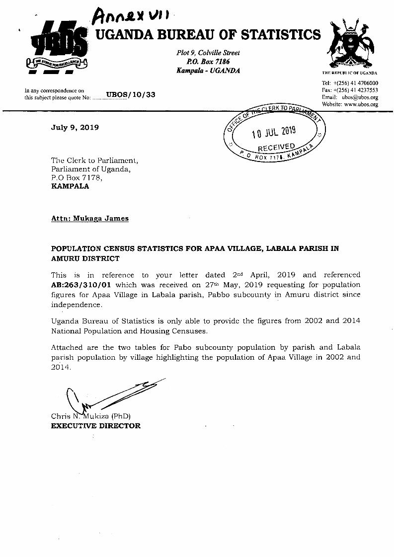
hnotr u,,
---In any correspondence onthis subject please quote No:
UGANDA BUREAU OF STAIISTICSPlot 9, Colville Street
P,O. Box 7186Kampala - UGANDA
uBos/ 10/33Tel: +(256) 41 4706000Fax: +(256) 41 4237553Email: [email protected]: www.ubos.org
July 9, 2AL9
The Clerk to Parliament,Parliament of Uganda,P.O Box 7178,I{AMPALA
Attn: Mukaga James
popuLATIoN CENSUS STATISTICS FOR APAA VILLAGE, LABALA PARTSH INAMIIRU DISTRICT
This is in reference to your letter dated 2"d April, 2Ol9 and referencedA8z2631310/01 which was received on 27th May, 2019 requesting for populationfigures for Apaa Village in Labala parish, Pabbo subcounty in Amuru district sinceindependence.
Uganda Bureau of Statistics is only able to provide the figures from 2OO2 and 2Ol4National Population and Housing Censuses.
Attached are the two tables for Pabo subcounty population by parish and Labalaparish population by village highlighting the population of Apaa Village in 2002 and2Ol,l.
Chris :ukiza (PhD)EXECUTTVE DIRECTOR
10 JUL ?01s
EC EIVErtlox 7171
po
II\(

{}
I
Tablel: Pabo Subcounty Population by Parish and Sex (2002 and 20141
2002 2014
District Sub County Parish Male Female Total Male Female Total
Amuru
Amuru
AmuruAmuru
Amuru
Amuru
Total
Pabo
Pabo
Pabo
Pabo
Pabo
Pabo
Gaya
Kal
Labala
Palwong
Parubang
Pogo
3,163
4,169
4,679
3,527
3,001
1,988
20,527
3,399
4,1 83
5,005
3,748
3,1 89
2,065
21,589
6,562
8,352
9,684
7,275
6,1 90
4,053
42,116
3,083
4,365
9,032
3,613
3,212
2,944
26,249
3,412
4,809
9,673
3,764
3,484
3,024
28,166
6,495
9,174
18,705
7,377
6,696
5,968
54,415Source: UBOS, Nationol Populotion & Housing Census reports, 2002 and 2014
Table 2: Labala Parish Population by Village and Sex (2002 and 201a)
2002 20L4
District Subcou Parish Vil Male Female Total Male Female Total
Amuru
Amuru
Amuru
Amuru
Total
Pabo
Pa bo
Pabo
Pa bo
Labala
La ba la
Labala
La ba la
4,365
L,520
5,553
1,959
13,397
1,674
9,174
3,!94
LL,392
4,119
27,879
Kal
Andara
Apaa 953
Olinga 1,776
274 292 566
4,679
976
1,990
5,005
L929
3,766
9,684
5,839
2,160
14,482
Source: UBOS, Notionol Populotion & Housing Census reports, 2002 and 2014
q'o'\q

fton(Y. Vttt
ALd r L €- ff) Ld-(
T AND ADJUMANI DISTRICTLEADERS. ELDERS. UWA AND OTHER STAKEHOLDERS IN REGARD TO
FNCROACHIVIFNT \/1/ITHIN trA I WILDLIFE RESE FIV tr.qT f\rAn
l"leld on Aprii 28. 2C07 at Amuru District Heqdquarters
Aqenda
1. Adoption of the Agenda and Prayers2. Communication from the Chair3. Presentation of a field report of the Consultative Committee and reactions4. Resolutions and Way fonvard
(List of people who attended is attached) ,In
(- Min. 1: Adoption of the Agenda and Prayers
The Chairman (who is also the Chairman LC V Amuru District) called the meeting to orderat 1.45pm and read the outline of the proposed agenda to the house. N/embers agreed onthe agenda items and it was adopted. Thereafter, the Chairman requested any member ofthe house to volunteer to lead thethe main discussions of the meetOperations (DDFO) - UWA who
of prayer before the commencement ofwas taken by the De irector Field
blessing of the partic so that thediscussions may result into resolutions benefit both the people and wildlife
Min. 2: Communication from the Chair
After the prayers, the Chairman rnade a highlight of incidences that happened before thismeeting with emphasis on the alleged encroachment of the reserye by communitymembers. He then informed members that a committee had been formed at the previousmeeting on the 14h of April 2007 to verify the legal existence of East Madi wildlife Reserve(EMWR) and the ownership of land by communities that were reported to have settledinside the reserve area. He also informed members that the committee had compiled thereport which would be discussed at the meeting after its presentation.
The Chairman advised members not to allow their own emotions to impact negatively theireontributions to the discussions. He reminded everyone to focus on the welfare of thepeople and wildlife in order to enhance community development and wildlife conservationin the two districts. The Chairman then gave the committee the floor to present their fieldreport to the meeting.
Min. 3: Presentation of the Consultative committee's field report
The report was presented by the DDFO on behalf of the committee (see attachment) andthe same was interpreted into the local language (Acholi) by the LC lll Pabbo Sub-county.After the presentation, the Chairman called on members to focus their discussions to thecommittee findings and save time as the meeting had started later than scheduled.
puty Dipants
1

One member raised concerns over the lack of consultation of the local people at the timethe reserve was gazetted and said that this is the reason the communities would notrecognize the reserve as having been legally established. He also pointed out thatcommunities of Amuru consider River Zoka as the boundary between Amuru andAdjumani, and not what the committee report referred to as the common border betweenthe two districts and the reserye. ln his conclusion, he also poinled out that the boundarywas not marked on the ground and that there was a need to make it clearto all the peopleto enhance its enforcement.
Another member of the house pointed out that he felt that the committee had notexhausted all issues and that the consultations in Amuru were not as exhaustive as in
Adjumani. He also pointed out that the critical areas of the boundary were not visited andfelt that it would not be appropriate to make final decisions about the boundary before theexact location on the ground is established.
. '"i+
ln another contribution, one other member advised on the need for sensitization of thecommunities about the boundary locations. He also advised members at the meeting toadopt the report as an interim report and proposed that more work should be done byUWA and the districts concerned in establishing the boundary locations. He furtherinformed the meeting that he had information that the gazettement of EMWR had beenrefused by Gulu District before Amuru District was created.
After all the conoer.BS'w€r€ ralsed;.the.eonsultative committee made olarification on theissues raised above as below:
a lnformed the meeting that in determining the location of the common boundarybetween Amuru and Adjumani districts, the committee used the maps for the twodistricts, topographic maps and those at the UWA offices. All the maps indicated thecommon border that is in line with the findings of the repod-.and with what UWA takesas the southern boundary of the reserve. This position was further strengthened by adisplay of the topographic maps at the meeting that showed the bdundary betweenKilak (Amuru) and East Moyo (Adjurnani) counties which everyone consented to be inagreement with. ln regard to the people that claimed to be having land leases within thereserve area, clarification about the locations of their plots were also made after areview of their map extracts in comparison to the full topographic map. Their plots werefound to be located outside the area UWA was claiming as being the reserve.On the issue of lack of consultation with communities, the committee explained that thereserve is located in Adjumani and all the consultations were made in Adjumani subjectto section 17 (i) of the UgandaWildlife Act (2000) that requires the respective Ministerto consult with the Local Governments within which the proposed area for gazettementis located. This was supported by the District Officials of Adjumani who confirmedhaving been consulted by UWA before the reserve was gazetted. ln addition, theDDFO made it clear that what one member referred to as a rejection of the reserve inGulu was a proposal for the creation of a Community Wildlife Area along the River Nileto act as a corridor for wildlife between Murchison Falls National Park (MFNP) andEMWR, and that after the proposal was rejected by Gulu, UWA gave up on thegazettement of the corridor which has never been established.On boundary marking, DDFO revealed that a consultant had been hired to mark thesection of the reserve boundary (Amuru-Adjumani boundary) that is not marked by any
2
a
l}-
a

physical feature and that the team would soon be on the ground to commence itsworks. Because of the stake the districts have in the same boundary, a proposal tocoordinate the marking with the involvement of all stakeholders (in consultation with thePrime Ministers Office)was suggested at the meeting.On the rssue of limited consultation with the committee, the committee'members alsoexplained that the time was not adequate for all areas to be'visited but re-assured themeeting that most of the tasks that were assigned to the committee had beenaddressed in the report.
Min. 4: Resolutions and Way forward
As a way foruvard, the meeting agreed on the following:
a
a
a
a
a
a
a
The meeting agreed by consensus that EMWR legally exists and thatjt is located withinAdjumani. The meeting also agreed that the gazettement of the reserve was inaccordance with the law.The meeting adopted the report of the consultative committee as an interim report thatwould guide the two districts and UWA to make more consultations on issuesconcerning the reserve boundaries, and the common boundary between the twodistrictsThe meeting resolved that UWA the southern boundary of EMWR (which
. also,is a"common boundary.{or ) .in. consultation .with the",two.districts.That no marking should happen if are not consultedThe meeting also resolved that the of the two districts should write tothe Prime Minister to request for on the marking of the boundary. Theletter would specifically askboundary marking and that
ive of the prime Minister to witness thee Prime Minister
for a
a
should be requested to allow the two Districts to coordinate with UWA in marking theportion that the former share with EMWR. Members recommended that the letter to thePrime Minister should be sent within one month from the date of the meeting.The meeting recommended strongly the need for sensitization of the comrnunities onthe existence of the reserve and the reserve boundaries before any form of eviction ismade. The meeting further resolved that such sensitization should be conducted jointlybetween UWA and the officials from the Local Governments of the two Districts.The meeting further called on everyone with specific reference to the communities ofboth districts not to be divided by the discussions about the boundaries of the districtsand those of the reserve. All were encouraged to work together to ensure thatharmonious relations continue to prevail amongst the communities who have since timeimmemorial been living as uncles and nephews, aunts and nieces.The meeting also resolved that since UWA has initiated the discussions/ dialogue, itshould go ahead to spearhead boundary marking, and community sensitization.
With no more business to discuss, the meeting was closed at
hairman
Date ...
Sec '$-
3

zj 6,o- !o<,rs., to-9(,rScoN)I\)I\)JJJJJO(O@--lO,
ro luCD I\)(n5
ooll -tBT-ah=o>Q,m9b
0xCNoz
.lii
i
I
i
i
l
/
ii
i
l
I
t
i;
li
il
fl
,li
rll
ril
'I
itl
il
ilt
il
til
1il
iil
ill
,ll
lil
iil
iil,,1
I
I
I,l
ltrll
i,l
I
I
o OxI ?--.o I:1 > I7 *Ei D=ooF Egfi E
E frfiE iE*IE iI Z
A ?=fi a=y#,fr RB =,
e FH HudS!i 3ry. € 2 -> ri^ nc o gF =X {o n= >, jrom
z=om. {,+ 9 E6
E 6SfiSEEEIEH6g= 3e *2\2 SSo=HaEI =s "EffE B9=Zit=H e= 9 =>2 2To9, o
89= EEx di"3 35\'!/ =c@ -ld+= ; EqJ=)r- O 3 rt? E grtoorriiO oc2E
#
P =PP Er==P Ee.-q oq ;cc cFiis ;<rl z
z zz z z g:i f,,r:0 r6N-.i ":
sQ - - - .,iQ(n-tooo o ooo oogr-NN){{! ! -.1 '{\,1 -{\z'(n(l)@!-.1 --l !r! (.Jrl'-l{oro)luluN) N) luN)l\) Iurus{ro)(oco (,1 0)o(o oro)=NiNCDO){ 5 00! 5(,t\,1(o(,o)(oo co (,trco @(,l-lt$OJrO)O N CD'-l@ (O!\-(ro, @ -o)cD rb'.1tr|o(Ir 5 o)rucD N)o
E O n m fl rn a m r o a<a!=-FE=8858=tsEE
;Ei*IUI*AFHIIgE- e e Ei"2 \, O >jF E9'n aYo Fifrg
mr<mllE=E E=sgH s:iTT
=XSrrCYSalEx>;o
nc)
=-lmm
<->->otro1z>zI. r .
;>LO<.I'IT1(f;PE9GXis'rioz
3mmi4,or€
o>o on>onozaaooOz!-5xmco @za *Aox ox : > n J = <> -> > r m P -'>9=bE-:;E8nE , Ar"-=; Q6P ts E; PI
H HE ?Zg != F*6i
>>?><<fi<CCOCf, fl D:oCCsC
=
oooo{!!\t{'-lJ{N)lo N) I\) co5o)(,rso)(n-(no40(rlo)@so5(n@(no)(J)@co
ooo'-l{!J{!NSI\)o, N) (.'tlu (,r ([email protected](nJ5@1\)(oo(r@
OO{'-l-.1 @5N)Q@(o --lr (Jno) -{J@os
oo'-I -{!rsN){o)55Cr)(nlo o)(o lo(,l@
OQ! --l!!lu (,tO[JJ(O(o(n(noo@.\I o)
pp<<<=LL-
-1VLLLbElfrrlfl;;CCCCZZ
==CCfl :DCC
r
oa
CCrrl=C

a
(,rAG)t\)ro-d\tso_l>oooooo>
E;iE:6:3i=EEFHgEEfrH:8i:?Hd;:EEE 9i== Ors -mzCmr
. ..:;
(r)o)
:Eo7rz
artDma{
;"";;8=#666i;ffzY-CI<*;rlo8#3-ilO(r)! r'r(-riomaFap{@
o
55o) l\)
oox!mmZZ<m.Ua<.>S?Pm -lJoox+mT
E&tt&t-->(/)>o29P E I Iox8=!;:iffiilisFS gE6<@ o'zzm;o382^
m
(,l(,ul(n(n(ncn(n{o)(nscoluro
oz>ot--lr6=Es=9Ee3c;riaEqi=;eYi=9"8HpdUE3
==? :u fi dzi,if a ooP*23a
EHEI55HI-EEIfiIo ll -Z aiao{ o C @-{63 F p
'-{z6Jz
rr>o3.^m88<o=4J-l
-.1 >m?mEf,C
'Tl
Il=
To?ooCzorrf]
HH*qCCilqHHEPi=rjifrEIdIi"sffE=ooonI-nfi-tn
92=7=== 6-000- 6d FF-FI flfl flr,_|-nOO m< =n, 8Po{>:rIoz
ra
= = = = a E
====aanaPPnnnnG)c)cf,)UUCCCCCI]C
<<=<=CCCCCfrnfllrnCCCCCCllC
1l -{>mflou) cJ)JC
(D
<=<<CCCCl, fl f, :0CCCC
CCCCC:E f, f, fr rlCCCCC
xoom-E5Fs
fl
@o
O\|\lloo)@(oO-..t
o--lN)o-{C/)Oos
O!\ls5!OJ(oc)
o!\lN)o)
5!
oo\l{(,l \tN I\)5Ulo(or1b.@J(o@(o!
oo-{ \l(,|@Iu r\)t\)@soJo(o@(o(oJ(oJ
oo'.l -.1@!TO N)o) (nq)!o5Jrtr.Q(X(^) r
OO:J'.Jqt -{N)A(o --tO) C,)@oo(o@o(oo
oooo'{ -\l { !J-{(,rcoI\)SI\)N)o(oorG)(,t (o l\) N)5@oJo) o) tu cD(nJoo)(nr!(J)
I
(,l

a
o) o) o, o, o) o) o) o) (, (,!o)(,S(r)f\)ro(o@
E;gfrE!E3E;
=g*;raEuP;aiEpEB=3H=
G, bx Il mto;fl
.rli
m@oo1-l
O5o;ag
mz2oIllom
crn
==fl
OO{!-.1 '.1
^) N)o) (,o) t\)(,ls
luJmlu(Jl (o
t
I
\

tSTATUTORY INSTRUMENTS
2007 No.
The Uganda Wildlife (Declaration of Wildlife Reserve) (East Madi Wildlife Reserve)lnstrument,2A0T
(Under sections 17 and 18 of the Uganda Wildtife Act, Cap 200 of 2000)
Wildlife ActCap2002000
Citation
Declaration 2.
Area to be a 3.wildlife reserveand a wildlifeprotected area
oflN EXERCISE of powers confered upon the Minister responsiblefor wildlife by subsection (1) of section 17 o'f the Uganda WildlifeStatute, 1996; and after consultations withJhe local governmentcouncil of Adjumani District; and with approval of Parliamentsignified by its resolution, this lnstrument is made this .....day ofMarch 2007This lnstrument may be cited as the Uganda Wldlife (Declarationof Wildlife Reserve) (East MadiWildlife Reserve) lnstrument 2007The area specified in the schedule to this lnstrument is declaredto be a Wildlife Reserve to be known as East Madi WildlifeReserve. . .,.+The area declared under paragraph 2 shall be a wildtife reserveand a wildlife protected area for the purposes of section 1B of theUgandaWildlifeAct, Cap 200 of 2000
1
((
SCHEDUTE
,- ' -The,area-is com'prised with bed:
"Commencing at the confluence of the Zoka River with the Albert Nile; thencefollowing the northern bank of the Zoka River to its confluence with the OmuuRiver, thence following the thalweg of Omuu river to its source, thence duesouth to the Adjumani-Gulu border; thence following the Adjumani-Guludistrict boundary in westerly direction to the Albert Nile; thence following theAdjumani-Arua District boundary and the Adjumani-Moyo District boundarynorthwards along the main channel of the Albert Nile to the point ofcommencement"
"This boundary is more particularly shown on Boundary Plan UWfuEt\A/VR/1deposited atthe U Authority Office, Kampala".
SERAPIO B. RUKUNDOMINISTER OF STATE FOR TOURISM, WILDLIFE ANDANTIQUITIES HOLDING THE PORTIFOLIO OF MINISTER OFTOURISM, TRADE AND INDUSTRY
(
f et 346287 346288, 355000, Fax 346291 E-Mail: [email protected] Website: \^rvvw.uwa.or.uq

Annrx l\A
re SPUBLIC OF UCANDA
20-tt-2007
The Rt. Hon. Prime Minister,Of the Republic Of Uganda
RE: BORDER DISPUTE BETWEEN ADJUMANI AND AMURUDISTRICT LOCAL GOVERN MENTS
The Right Honorable Prime Minister, the purpose of this letter is tourgently request you to intervene on the above issue in order to creategood neighborliness between the two said Districts.
The Districts of Adjumani, Amuru and Uganda Wildlife Authority in a
meeting held on April 28, 2007 at Amuru District Headquarters (Minute4, bullet 4) resolved that the two District Chairpersons write a jointrequest to your office for technical advice on marking the commonboundary of the two Districts. A representative of the Prime Minister'sOffice is also expected to witness the marking of the boundary. Findattached the copy of the minutes of the meeting for your perusal.
We appeal to your office to urgently intervene so that the two Districtsare aware of their boundaries and stop further illegal encroachmentsthat may lead to escalated conflicts.
our offices are ready to work with you to see that this problem issolved for the good of the two Districts. Your office can coordinate withUganda wildlife Authority as the latter has already contracted acompany to do the boundary marking.
Thank you the Rt. Hon. Prime Minister.
Ti{E Ch{AIRM AN L.Ch.l.-llItrt/ d L
Dulu Mark AngelCHAIRPERSON ADJUMANIDISTRICT LOCAL GOVERNMENT
e Omach AnthonyCHAIRPERSON AMURU
DISTRICT LOCAL GOVERNMENT
'i , cHArBMAst
^DJUMANI DISl3Iq[
LOCAI. COI'NCIT)d'

I
) CC: Minister of Lands, Housing and Urban Development;
CC: Minister of Local Government'
CC: Executive Director UWA;
CC: CAO Amuru;
CC: CAO Adjumani
CC: Chairperson DLB, Amuru and Adjumani

(.''tl,
TtG Rcpubllc of Otuda
6ft March, 2015
Hon lr{inister for Justice and Constitutional Afiairs
Hon Minister for Internal Affairs ,
Hon Minister for Lands, Housing and Urban Development
RE: REPORT Olt THE SENSTTIZATION MEETINGS TOR THE RF-OPENNINGoF THE COMMON BOUNDARY BETWEEN AIIIURU/ ADWMAIYT AND EASTMADI UILDLIFE RTSERVE
Please lind attached a copy of the above report for your information andnecessary action.
ATUBE ANTHOI{Y LOUI o H NIXON
DISTRICT CHAIRPERSON
kr.al,x Xew^,.,-n=
DISTRICT CHAIRPERSON
ADJUMANI
frfF;sl 22 '-le
\
AIVIURU q*L( ({-lC)
Copy to:
Hon Minister for l,ocal Government
Hon Minister for Disaster Preparedness and Refugees
Hon Members of Parliament Amuru and Adjumani
Resident District Commissioners Amuru and Adjumani
File

i .rr(e.-rqtfl
tI
TLc BopuDUo of Umdr
REPORT OT THE SENSITIZATION MEETINGS FOR THE RE.OPENNING OFTHE COMMON BOUNDARY BETtr'IEN AIVIURU/ ADJUMANI AND EAST
MADI U/ILDLIFE RESERVE DATED TRIDAY 6TH MARCH, 2015
Introduction:
The border dispute between Amuru and Adjumani districts especially in theareas of Zoka and Apaa started way back in 2OO7. To date a series ofinterventions towards resolving this dispute have been undertaken by the localgovernments and other stakeholders. Attempts to demarcate the border in 2012was unsuccessful.
The leadership of Adjumani and Amuru were engaged in dialogues for peacefulresolution of this dispute. In a meeting between the central government and thedistrict leadership held in Gulu on 22od Januar5r, 2015, it was agreed that thejoint district security committees form a team to sensitize t}:e community aboutthe boundary re-opening. It was also agreed that this team would comprise thetwo local governments, Uganda Wildlife Authority and Saferworld a developmentpartner.
Therefore, the two districts constituted a joint sensitization team which carriedout the sensitization between 4e -6tr March, 2015 in the areas of T,okaand Apaarespectively.
Objectives of the meetings.
1. The main objective of the sensitization held in the two locations were todeliver government message on the upcoming border re-opening anddemarcation between Amuru, Adjumani districts and East Madi WildlifeReserve.
2. To listen and respond to issues/concerns raised by the community inregard to the exercise.
3. To build confidence of the community on their safety and security.
Achievements
1. The team held a meeting in Adjumani district and developed key messagesto be delivered to the community during the sensitization. (See Appendix).
Page 1 of 3

t
2. The team held two meetings with the cornmunity; one at Zoka PrimarySchool and another at Apaa Centre. In these meetings key informationregarding the border re-opening was passed to the community by the twoDistrict Chairpersons, Members of Parliament, Resident DistrictCommissioners and the two LCIII Chairpersons of Pabbo and Itirikwa sub-counties respectively. The information also highlighted issues ofadministration, securit5r, service delivery {Governance) and peaceful co-existence.
3. One Radio talk show on Amani FM in Adjumani was held by the twoDistrict Chairpersons and the Woman Mernber of Parliament for Adjumanito inform the community on the on the exercise as well as mobilize themto attend the sensitization meetings.
Ftnding/Issues/concerns raised by the comaunity
During the two community meetings at Zoka Primary School and Apaa Centre,several issues of concern were raised. by the communitSr members;
At Zoka meeting the issues were as follows;
1". Community raised the issue of safety and security of their lives andproperty citing a number of arrests by security agencies, NFA and UWA.They also raised the s€une concern relating to security during and after theborder re-opening.
2. The community asked for what guarantee could be made to ensure thatthe border re-opening would not be intermpted as in the first attempt.They also enquired on what action would be taken on those who woulddisrupt the exercise.
3. They also expressed fear that they may be chased away from their landafter boundary is re-opened.
4. They agreed that the boundary should be re"opened but that it should bedone peacefully.
5. The community raised an issue of compensation for their property lostduring the conflict.
Duriag the meeting at Apaa Centrel
/ The LCI in his remarks stated that the community were called to attendthe meeting but he expressed fear that tJ:ey would be chased away fromtheir land after the boundary opening, citing tJlat they had lived, marriedfrom and are still living there to date.
Note:
/ The atmosphere in Apaa was so tense.
Page 2 of 3
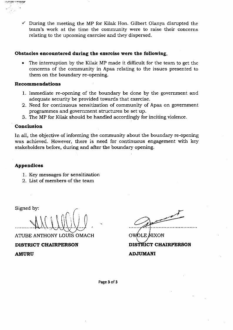
.y!,/,4|I.q#I!uryry?f
{ During the meeting the MP for Kilak Hon. Gilbert Olanya disrupted theteam's work at the time the community were to raise their concernsrelating to the upcoming exercise and they dispersed.
Obstacles eucourltered during the exerclse were the following,
o The interruption by the Kilak MP made it difficult for the team to get theconcerns of the community in Apaa relating to the issues presented tothem on the boundary re-opening.
Recommendatious
1. Immediate re-opening of the boundary be done by the government andadequate security be provided towards that exercise.
2. Need for continuous sensitization of community of Apaa on governmentprogrammes and government structures be set up.
3. The MP for Kilak should be handled accordingly for inciting violence.
Conclusion
In all, the objective of informing tle community about tJ:e boundary re-openingwas achieved. However, there is need for continuous engagement with keystakeholders before, during and after the boundary opening.
Appendices
1. Key messages for sensitization2. List of members of the team
Signed by:
$ItATUBE ANTHOI\TY LOUIS OMACH
DISTRICT CHAIRPERSON
AMURU
N
CHAIRPERSON
ADWMANI
Page 3 of 3
&ry:Wry{-{lilrtHEtry
II
AMUR.U-ADJUMANI JOINT LEADERS SENSITISATTOI{ TEAM
Mandate of the team
The mandate of this team is to create awareness to the community on the upcomingexercise of boundary re-opening between Amuru and Adjumani. The mandate ofthis team is not the boundary re-opening. Boundary re-opening is the responsibilityof Ministry of Lands, Housing and Urban Development.
Purpose of the committee
1. To deliver govemment message on the boundary re-opening between Amuruand Adjumani over the 23km stretch.
2. To build confidence of the community on the exercise.
3. To listen to the issues affecting the people and respond where appropriate.
Justification for the boundary opening
r To implement the court order that directed the boundary between the twodistricts should be opened.
o To improve service delivery of all social amenities of health, water, Roads
and education.o To enable compensation to be paid by government.o For good govemance and proper planning by the community.
Outcomes of the boundary re-opening
r There will be Acholi who might be in Adjumani and Madi who will be inAmuru. It will therefore be the responsibility of the two local govemments toprovide services to the people wherever they will be.
The people have a duty to demand for services from the respective localgovernments as their right as well as pay allegiance to them.
The Laws of Uganda provide that every Ugandan has a right to own land and
settle in any part of the country.o
Page 1 of 2

-Yry*yT?TI
a
However, there are places which are gazetted by government for specificpurposes such as forests, wildlife reserves and others which serve forecological purposes. These places are held by govemment in trust for the goodof the people.
Part of this area may possibly fall within a protected, area. Where it does,whoever finds himself or herself within the protected area, they will beconsulted in the process of finding a lasting solution through consultation
Since there are no natural physical features on the 23km stretch, the boundarywill be re-opened and marked.
The map which will be used is the map Ieft by the British and conforms to theUganda Gazette Supplement of 1962.
Security Team
o Government has a mandate to protect people and their property irrespectiveof where they are as a constitutional mandate.
Note: The two District Chairpersons to sign a joint communique showing theircommitment towards the welfare of the people in Apaa.
a
a
Page 2 of 2

tt:
-\
oo
F.
!'i(!(!00Fpo
oeoxtrl.
oaEl
o
h7t-!eEt
caoFrr
&L
D9
I
:tIvapl!:ta.tEEoL
Drl
,/U
Fdo-0FlFFll-(ozatoFztst
$r
o
Itr.b!tio:(F:1:PJp!n1
(Dc!?
:>:si-\:C:t:s:t:-:
Fbi sl.
.,
c l-,.-5$F.;,
t' LF-qPIL:,\LhRsJ !it
Fi
(t-getf. ^s,.nt+'d+b.,
_tsa
oJ--fp
D-$,,-uI\,cOc.s-t-,t.'l
r
JJ
__1\
o6lf)/$frd-,
To
t\) c)\o oo { Oi(..)
lJr 5 t, tJ
3I7F
rs
,6l"c
s*u\
;7A
'lln7n,0so$:
5).oaFi,5\
F
C})
Ili{i'iori
'aJb10
€"7wof,r/Or
7_l:?V\-+'t2
7f\3fr+
I
?-,
7
:.
-l+J1t
:T'-{.
f,E:e
dst;-YqTv
:+trY\rrr;rnef,-.N
r,r+
N
FSpNAc
$F{
e
\J.toq
Z-Az.
tq*$t
stb(1h.
5r
sbs+
I
RCA){F
N
(,/-,
2,o
/1i
0,
P.7p'
+
J(t)d
,C-
;
c[]r;
,1
Ctr7hcF.L.V,3+A
lq:
c'r-I
:
,ft,
.l
_tTd
b=\o
+r[-It')59fiN
E
*Ps-,Fr.
\\1.
!
b]F'
sL\bso
-b,
6i
:\-FDE
LL)I
\
E.-'ls-IC)&$F3
>\-I
=
F)^
iq.tJ-t,tr{dt*l
F
CJJPurrJ+-tr
(
g).,b\
s
a+T.\]4o(^Aa
a-uJ,t/^
v{:f(,.'
o.J6e.J
NoNho
oJJp-l.,
EOJ
P-a
bp?qDn
--ilE,v-l.Jvcr\
)
)
(
E
r
fr+l1.,3S!n\l,,.1
!-t{-,i:)pSs'€
s\)HDOM6r)rP
* /.e?L1 t. 9r+r.:
Z$,F
I(
{,N F
[\la\=r
'E
!aI,q
j

u) UJo t\)\o N)oo
l.J{ N)o\ N)(.,l tJs t\)l+)
N)tJ
hJ t\)o \o oo { o\ (,t s
,
;f-l,{
p'1
?cC]
L
J
L],ltrgsgo,(l
h=C)
F.Bd
N
f.9
&F,a
-\!-
u
mrrrr^)7
>F)v
\-lffrt,' ,
rtf
n2
I*D{/\(F
L{
:C'I{fi,$
\x\Y'\\\e
\\jN.
f-.'
$\*J
7!apnsilnh
rrsP,a)
FJD{tr\b.1 ,
I
N\)S(lNd,
5t\\+t'
N
ot>L,v
5
trO
N.)
$\t\
$l.\\i
&t\'/z
S.\(
f"
a
.^.rD
D
"}=(a@\po
$->ArC;t--lJA
str0
S)
tan
rBI
C
N,<r9.2o
qFF.1
ctEt
\\Jd:-(->Sa.-<L
-bL=6\tif,f
3\
i
3q70C
?v
t
aci
7v;c)
gr)-J>r,J
fi&n\b
r9\\il;o
,f
t>.:'tlt
x\
\x$
2dl-tFa^t/nb
ial*
l!:!(,
P*g:-S*Ir'
(,
lnr3d (
\
vb\
I
a,
aar
*)\
\
3fzT_A{prl()
il{
a2Y
Fn
i-r\:zD1
$,I
IpFR
gJIJ
3C,,!)
CI
5tsi/If\sDN
$P,U.,
aot
otY.2
'0sLA-oa+
o-lJ-\Jp+s\+st\
(}\
s-.i(\)hG\SrS,s0\
JJ
l-,
{fln/rti
1
C1-JsA
TJ
-J-J{sOq
d
e\
{xi).r
N\.CN.qc-.
oo+,J,efrG6a (F:
o-uo\ vlo.4
trt+J{J
tC0
+lGsr
D
G-!+i\,\Sl
e\q
v_)
I.C
ECr..
-o
U
$3,)\o"\
Ef(o{rC
)@
FsP2\
5C4s(il-,-d.-G\iI,l{\
s*JvN
&{)N'
AJ
{aIq+tx-A
0\c^)
T_;l
( N
t ($ nP
, r " ;.. r
B
0JJz
{$.
'}=.
\ePEr
CC\
*{
I
ESes4JBP-1.} l'J 0^
Fr$3rIBs?tr\o

,I
b
s<-D
C,f'G.wr*C\
saEAD\o('\>--c:J
r--Q
JrV\<J5
e'u'/\^J
, \z-
BX
O\\ r-f\\
N
(_)
V\gI^l$s-+FJ-
\0\
N
\sNs\3\={<
\
N\)\\
0\y
\s
aw*
t
q\<u)-\Lst
BA
D
c.)
V
-oN\)\\-\
\)t53g
/")o^(xct-/)-xI'o2,.'l
-.><-C
a*t
9a-
n_rfr
\
(
$v>=C\
M.O<(
=JA
$\$
\ I
J.S,=t.-4 d1(q
N'&
N
/;$
.li
$o
soctc
$t^il-o
vlVlCr--,,pi4Fo
\o
I&jMr-l+e
PO
5--
'.I-
fl6*--
r\.*r
tr-.8--
J.*{
L.
lc/-
.-,o
Ftv
ryFFo
$s+fi()-{Ji"
rtrD
r-{.r l..-f-'-.- fnll'. i*.''-lvt{
c.J '\at- l-/.i)\
Jffscf(Cls,b
I
^J,^JL-1
\0.-9
^)Flf\)
d-r(
EJ(-E
D,IgE6
\0A:tc(tJ^ir!"fG
DT
ss
6u
st*2;)a2II.?ci,u+
-.r.)d7?\J
J.luI
+-\r
crt)sqt
E
-\/.*
(g
o
-:
s
.l
i1(
t
q-'Ir.l
\\
-'t
:j
.3{J
.<<'
I
i,i
-'::J; i,1.,]
,J
d+5J
,.;l>,1)-
sl..f
\is
\\
':3+))
.{)t.-
+
o1<)"J
s
<-,.\:{1:
=Iqs
'j\r
JiI
\
{3)
jtJ
Di'grt
v]1
L)
1E&
e:&*r*cld-dJI
)Ns
$
'lNla
JI)t{
(t
t. 3
a).iJ
Kt)
0
'tJ2rfI
I
lr
t;
-jost+
:
tN_f(r:v
*
\'"-J-,!)
cl.I
f].4*()
)
l--,
r{
'+^f;
t-r.j
ri:;
-F
r
i'
)
q
-4
^t.
.j
/)-)-z-
.-J
${s.f
Pnfd
)"!_t-{-
.c5+=+t-a(
S(5U
a<*"x
t-I
\(
0_9
IgIJ
Zt
o)'o
-]
,.
=_3t4
C
tor
tJd3IdJ5
t
A''
I\\
\
cls.\
de.icn
cocfl
.+cn
(rn
\oca
r\c?t
ooci oi
crl t :f, c.i$
car+ +$
,ri\f,
\drf, +

hootr. Kt
E,AST MADI CONTROLLtrD HUI\TING AREA:
LO CATION A.b{D B OUI.,.IDAB]IES.
District: Acljumani'Area: 1,702 sq.kmLegal Establishment: Established by LN No. 352 of 1963, amended by SI No. 125 of 1964 and SI No.
2?,6-14 of 1964.Boundary D escription/B oundary Plan
"Commencing at the confluence of the River Asiya with the Albert Nile; thence following in turn- ' the northern bairks of the rivers Asiya and Ofoa to the source of the .latter; thence easteriy in a --
straight line to the top of Arawa HiIl; thence easterly ia a stra:ght line to the junction of the Okwaand Eradzi rivers; thence along the east bank of the Eradzi River to its source; thence in aneasteriy direclion in a straight line to tle source of the Umuu River; thence following the northbank of the Umuu River to its confluence with the Ceri River; which is at this point the Madi-Acholi district boundary; thence follolvirg the Madi-Acholi district boundary in a southerly thenwesterly direction to the A-lbert Nile river; thence following the Alberl Nile to the point ofcommencement."

T
l' hnnex. Xtt
83: Controlled Hunting Areas (North-Western)
83.1: Adjumani Meeting/Workshop Report and List of Participants on
East Madi Controlled Hunting Area t
Main undertaken. venues and da tes
Main activities undertaken anddates
. 199711998: numerous aerial surveys;
. 25-261611998 Aerial survey of CHA rvith local leaders
. 25-261611998 workshop with Adjumani District
Consultative meeting with Adjumani District Authorityto confirm workshop recommendations.
a
Venues a Adjumani Town
Kev issues raised and resolutions made duri the meetinqs/workshonn g
Key issues raised by the district officialsileadership
. The population of Adjumani District as per the l99l national population census was
166.000 persons (96,000 nationals and 70,000 refugees) and this figure is projected
to reach 120,000 nationais by the year 2001.
. About 95% of the population in the district is invoived in agricuiture and the other
major economic activities are;
* animal husbandry,
* f-rshing,
* business, and
* pitsawing.
. The total land area is only 3, 156 sq. km and since the district revenue is mostly got
from agriculture (about 80%) coupled with a large refugee and dispiaced persons
--lopulation, more agricuitural land is needed.
. Farmers are encroaching on Zoka Forest Reserve for more agricultural land.
. Illegal pit sawing in Zoka Forest Reserve needs to be checked.
. Insecurity in some parts of the district has both development and conservation
negative imp lications.
IIl
49
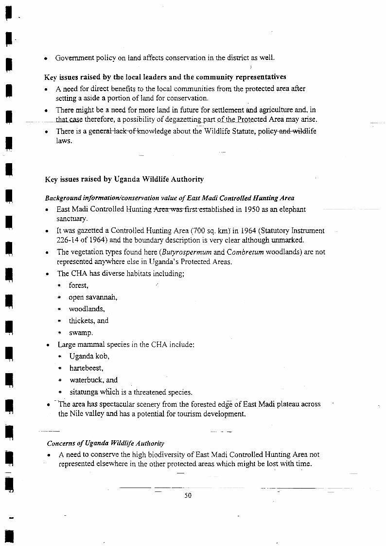
tT
tt;
;
I;
tt;
tIII;
II
. Goverrunent policy on iand affects conservation in the district,as weii.!
Key issues raised by the local leaders and the community representatives
o A need for direct benefits to the local communities from the protected area after
setting a aside a portion of iand for conservation.
o Theie might be a need for more land in future for settlement and agriculnre and, inthatcase therefore, a possibiliry of degazettingpart oithe Jrot_ected Area may arise.
. There is a generaHaekof knowledge about tni witatife Statute, policyan4wildlifelaws.
Key issues raised by Uganda Wildlife Authority
Background informatiordconservation value of East Madi Contolled Hunting Area
East Madi Controlled Hunting Area-wasfirsffiablished in 1950 as an elephantsanctuary.
. it was gazetted a Controlled Hunting Area (700 sq. km) in i964 (Statutory Instmment226-14 of 1964) and the boundary description is very clear although unmarked.
. The vegetation types found here (Butyrospermum and Combretum woodlands) are not
represented anylvhere else in Uganda's Protected Areas.
. The CHA has diverse habitats including;
+ forest, /
* open savannah,
* woodlands,
* thickets, and
* Swaflp.
. Large mammai species in the CHA include;
* Uganda kob,
r hartebeest,
* waterbuck, and
* sitanrnga which is a threatened species.
. - The area has spectacular scenery from the forested edgt of East Madi plateau across
the Nile valley and has a potential for tourism development.
Concerns of Uganda lYildlife Authority
r A need to conserve the high biodiversity of East Madi Controlled Hunting Area notrepresented elsewhere in the other protected areas-which might be lost with time.
-l-50

a A need for a corridor for animai e.g. elephant migrations from MFNP to Zoka ForestReserve.
Uganda Yildlife Authority's proposal to the meetings/workshop Ie A link bet'ween Murchison Falls National Park and Zoka Forest Reserve be
esublished by upgrading 800 km2 of East Medi CHA to a Wildlife Reserve status toenable animal movement between the two protected areas and also in order toconserve the biodiversity therein.
MeetingAilorkshop recommendations and resolutions
1. Provisionally, an area of approximately 800 km2 lying south of River Zoka throughBaratuku to River Omuu of Adjumani District be reservedfor wildlifeconsertation.
2. The area set aside for coflserl,ation purposes above be given the status of a lYildlifeReseme.
3. In cose of change of managementfrom Uganda ll/ildlife Authority to a privateinvestor, Adjumani District authorities should be consulted
4. The detailed agreement be formally spelt out between the district and Uganda WildlifeAuthority later.
List of meeting/worksho p participants
District Adjumani
Protected Area concerned East MadiControlled Hunting Area
List o f m eeti n g/wo rksho p/aerial su rvey participants
No Name Tittle/Occupation Address
A. District officials
l. Akuti Lawrence Ag. District Vet. Officer Adjumani
2. Alia Seraphine Chief Admin. Officer Box 2 Adjumani
3 Andama John DISO Adjumani
Bugale Muhammad Korea4 Forest Guard, Forest Dept Adjumani
5 Komakech Julius Mass Mobiliser,*DC's Box I Adjumani
Marijan Nasur6 Intel*igence Officer UPDF/ Adjumani
5l

Ogunu Solomatata Stephen Ag Community Otficer Box 2 Adjumani7
Bbx 2 AdjumaniUnzia Martina Assistant CAO8
B. Local community members and representatives
Sec. For Security Pakele sub-countyAnyima Daniel
Anyolu Clement Elderi Farmer Paridi Parish1
Anzo AntonY Elder CiforoJ
t+ JustineArap Moi LC III Chairman Ofua
C/man Movement Comm.5 Baru Simon Suru Ofua sub-county
Elder Ofua sub-counw6 Binica Atanazio
Guma Mary Sec. Education Ciforo Sub counry1
Ijiayia D. Simako Elder Okusijoni Parish, Adropi8
9 lzama Robert LC III Chairman Ciforo Sub-county
10 Kode Flaminio LC I Chairman Ofua sub-counry
1l Madrara Secondo LC I Chairman Zoka village, Ofua
Adropi sub-countyt2 Maeko Damiano Elder
Monia Owens Philips LCV Ciforot3 LC V Vice Chairman
Mundara Job Eukerio LC III Chairman Adropisub-counryl4
Obuni Richard Sec. Finance & Admin Adropisub-counryl5
I6 Ojara Atfred Elder Adropisub-counry
t7 Tiondi Henry Secretary-Environment Pakele
18 Vule Zacchaeus t/ Sec Health, Water DLC Ofua sub-county
C. ilIinistry of Tourism, Trade and Industry Officials
Buhanga Edgar Uganda Wildlife Authority1 Monitoring Officer,) Egunyu Felicitas Monitoring Officer Uganda Wildlife AuthorityaJ Lamprey Richard (Dr.) T/Advisor Monitoring Uganda Wildlife Authority
4 Oketcha Jonathan Monitoring Officer Uganda Wildlife Authority
IIIIIII
IttI:
tttttf-I
52

83.2: Moyo MeetingAilorkshop Report and List of Participants on WestMadi Controlled Hunting Area
Main activities undertakenand dates
Venues
o l9l2ll998: Consultative Deeting with Moyo DistrictAuthon!;
. 1415/1998: Aerial survey;
o 261611998: Aeriai survey with Moyo DistrictAuthoritv;
. l3l7ll998: Consultative meeting with Moyo DistrictAuthoilty;
. February,1999 Consultative meeting with MPs ofMoyo
a Moyo Town
Kev issues raised and resolutions made durinp the meetinss/workshoo
Key issues raised by the district officialsfleadership
o The district is aware of the West Madi CFIA but unaware that Lomunga WildlifeReserve, which was surrounded by the CHA, was degazetted.
. The zlrea occupied by the CHA is very good for agriculnue and refugees were settled
in some parts of it.
. The people of Lomunga would like the government to either retum the white rhinosthat were translocated_ from there oi to give them some financial assistance.
o The district is willing to set aside part of the Controlled Hunting Area as a ProtectedArea provided the district leaders and the local people are adequately consulted.
. Part of the Connolled Hunting Area is settled and other parts are prone to insecurity.
. The_people senled in former Lomunga Wildlife Reserve wglcome the idea of the area
being gazetted a reserve but not a National Park-
+-
I
53

tIII
I
II
+
Key issues raised by Uganda Wildlife Authority ,l
o West Madi Controlled Hunting Area hardly has any animals in it.
o The CFLA is not high on the list of priorities for protection.
Meeting/worlcshop recommendations and resolutions
. If Wsst MadtControlled Area is to be gazetted as aprole-c.lqd qIJg.the district leaders
and the local councillors .[rpm thq affected areas should be consulted.
List of meeting/workshop participants
I
District Moyo District
Protected Area concerned West Madi Controlled Hunting Area
Meeting/workshop participants
NameNo. Tittle/Occupation From/Institution
A. District officials
Abwola S. L. District Forest Officer Moyo District
) Aroba James District Entomologist Moyo District
Lomungu G Moyo DistrictJ Assistant CAO
Mundrugo-Ogo L. (Dr.) Moyo District4 D is,trict V eterinary Officer
5 Odongkara J. P. Chief Adm. Officer (CAO) Moyo District
C. Ministry of Tourism, Trade and Industry officials
I Aciga Ceasar Warden Otze-Dufile CHA Uganda Wildlife Authority
Egunyu Felicitas Monitoring Officer Uganda Wildlife Authority
3 Lamprey Richard (Dr.) Technical Advisor Monitoring Uganda Wildlife Authority
4 Okecha Jonathan Monitoring Officer Uganda Wildlife Authority
54
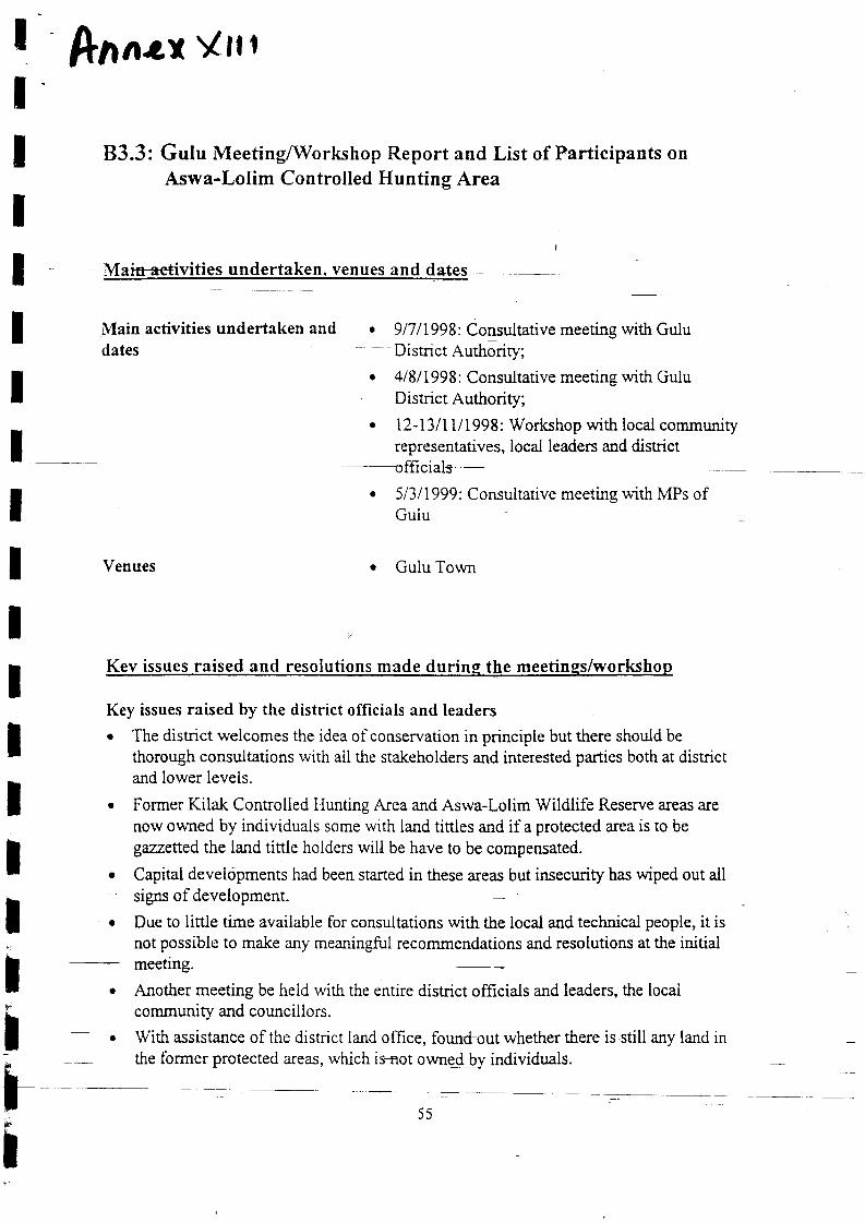
Anar,r Ytr
B3.3: Gulu Meeting/Workshop Report and List of Participants on
Aswa-Lolim Controlled Hunting Area
Main activities undertaken anddates
Venues
. 917/1998: Consultative meeting with GuluDistrict Authoriry;
. 41811998: Consultative meeting with GuiuDistrict Authority;
. l2-l3ll1/1998: Workshop with local communityrepresentatives, locai leaders and district
51311999: Consultative meeting with MPs ofGulu
a
a Gulu Town
a
Kev issues raised and resolutions made durins the meetings/workshop
Key issues raised by the district officials and leaders
. The disrict welcomes the idea of conservation in principle but there should be
thorough consultations with ail the stakeholders and interested parties both at districtand lower levels.
Former Kilak Controlled Hunting Area and Aswa-Lolim Wildlife Reserve areas are
now owned by individuals some with land tinles and if a protected area is to be
gezzsllsd the land tinle holders will be have to be compensated.
Capital developments had been started in these areas but insecurity has wiped out allsigns of development
Due to little time available for consultations with the local and technical people, it isnot possible to make any meaningful recommendations and resolutions at the initialmeeting.
Another meeting be heid with the entire district officials and leaders, the locaicommunity and councillors.
With assistance of the district land office, founfout whether there is still any land inthe former protected areas, which is-not owned [r individuals.
a
a
a
a
55

I
II
II
I
I
. UWA indicates the exact area of interest and extent.
. The 1995/96 World Bank mission to the area consulted the lochl community in the
areas in question and the local community wrote a memorandtrm expressing interestin having some sort of protected area.
Key issuesraised b5r U ga n d a Wild life Autho rify. The area may hardly have any animals but has a potential to recover since it borders
Mnrchison Falls National Park.
In the past, animals (especially eiephants) used to cross to Zoka Forest Reserve inAdjumani District from Murchison Fails National Park.
It would be meaningless to have a rvildlife reserve in Adjumani District if it is cut offfrom the other protected areas, notably Murchison Falls National Park, therefore, a
need to include parts of the former Kilak and Aswa-Lolim in the regional protected
a
a
I-area syste m as pro poseeffurtdl wn"miniskict.
Meeting/workshop recommendations and resolutions
l, tfWA prepares a report and sends it to the RDC who will then brief the dbtrictcouncil on W/A's proposals.
2. U\YAJinds out whiclt areos are owned by individuals before making proposals forconservation.
3. UIYA organbes another meeting with the dbtrict officials and representatives fromtheformer Controlled Hunting Area and Game Reserye and indicate whichparticular areas are of conservatiotr interest.
List of meeting/workshop participants
tl-II
District Gulu District
Protected Area concerned Aswa-Lolim-Controlled Hunting Area
Meeting/rvo rkshop participants
No Name Tittle/Occupation From/Place
A. District oflicials
I Lakor Jackson District Agricultural Officer 323 Gulu
2 Lekko Oling J District Forest Officer l3 Culu
3 Major Francis Achoka Army Public Relations Officer Gulu
).-.,
j -; at.ia .,t,.,
)!) ,
fi
56

I
I
I
I
II
I
II
I
I
I
I
I
I
I
I
I
l-II
4 Ogogo M. District Lands Officer Gulu
5 Onek District Medical Officer Gulu
Oringa R. Anthony6 RDC Rep Gulu
7 Ouma Charles Asst CAO Gulu
B. Ministr-v of Tourism, Trade and Industry officials
I Acen JoyCe EC Wildlife Support Project 3530 Kampala) Egunyu-Felicitas PAAP Offrcer 3530 Kampala
J Lamprey Richard TA PAAP 3530 Kampala
4 Omoding James PAAP Officer 3530 Kampala
57

I
:
;
II
83.4: Gulu Meeting/Workshop Report and List of Participants onFormer Kilak Controlled [Iunting Area and Aswa-Lolim GameReserve t
Main activities undertaken, venues and dates
Main activities undertakenand dates
Venues
. 91711998: Consultative meeting with Gulu District Authority;
o 418/1998: Consultative meeting with Gulu District Authority;. l2-l3lll/1998: Workshop with local community
-{epresentatives, Iocal leaders and rlistriet officials
51311999: Consultative meeting with MPs of Gulu
Gulu District Headquarters
a
a
Key issues raised and resolutions made during the meetines/workshop
trt
Key issues raised by the district officials/ leadership
. The proposed corridor as far as the Department of Lands and Surveys Gulu District isconcerned was actually surveyed half way back in 1974.
. The corridor is generally 1Okm in width though less in some areas.
. No leases have ever been oi'fered to any individuals in the proposed corridor.
. Revenue sharing proceeds iiom Murchison Falls National Park (MFNP) needs to be
released to the Gulu District Administration (GDA) sooner than later.
. There is a need to establish fishing sites along the Albert Nile.
. UWA needs to clearly det-rne how GDA will beneht from the proposed WildlifeCorridor.
. Is UWA going to exploit the Acholi for the benefit of the Madi by creating a WildlifeCorridor that links up to Madi?
. Aswa-Lolim is currently used for cultivation and UWA ought to justify that wildlifeconservation is more protitable than agricultural production.
. There are no clear roles and responsibilities between UWA and the district as regardsto the control of vermin and other problem animals (these roles are however clearlyspelt out in the Local Govemm-nt Act).
There is a need to maintain the ranches established in the former Aswa-Lolim CHA.t-t
a
58

a
a
:
tI;
t - Key issues raisd by ttrelocafleaders and community representativ6
There is a need to influence peoples' attitudes towards cons,ervation through
sensitisation especially of the local community at the grassrbots and the landowners.
The GDA and Local Govemment Council in principal supports conservation and wise
environmental management tbr the present and future generations.
o The people of Amuru, Anaka and Purongo divisions through their representatives do
not support the creation of a wiidlife corridor within their localities.
. Thefe is already IVIFNP in Acholi-land, hence. no need for a second protected area inGulu District.
o There is no free land in Anaka, Purongo and Amuru divisions. The seemingly free
land is due to the prevailing insecurity in the area as most of the bona-hde occupants
have temporarily shifted elsewhere.
. -Theextinution-oFthe rhinos and reduction of elephant+opulations in MtrNP is a clearindication that UWA has tailed to manage wildlife, therefore, there is no justificationfor the creation of additional protected areas.
. Anaka is now expanding into a tully-fledged Town Board and UWA has no moralauthority to take more land since it will be needed for the expanding urban areas.
. The MFNP boundary is not fenced and animals always stray into people's gardens
destroying crops and properry.
. Whenever the local communities sneak into the park for bush meat, they are harassed
by the Park Rangers and in some instances actually get killed in the process.
o The MFNP authorities do not co-operate with the local communities surrounding the
park on issues of wild animals' damage to their crops, property and sometimes life.
. The existence of MFNP near and between us has denied the people of Gulu the
resoruces in the Albert Nile and River Nile.
. The people of Amuru Division look at the land and River Nile as the only source ofwealth left for them for income generation and view it as being of more economicvalue than the creation of a wildlife corridor.
. The people of Amuru want to tish in the Nile waters as fishing is considered to be
more of a permanent activity than wildlife conservation.
. The area was formerly occupied by many clans that are regarding this area as theircustomary land that is pending improvement in security to be adequately utilisedagain.
. The Govemment degazetted the area in 1972 for private ranches and agriculturaldevelopment. ----
. There are promises from tire Central Government to construct a road from Amuru toRhino Carnp and this development is targeting settlements in the proposed wildlifecorridor.
T
59
. There appears to be sodium mineral deposits in the proposed area and the currentproposals may not be in harmony with the exploitation of the mineral deposits whenthe oppornrnity arises.
. The Acholi people are hosting the park and yet they are denied employmentoppornrnities to the managerial positions of the park despitp their high and relevant
. There have been orherdevelopmental proposals for the said area in terms oiEishingVillages at Aswa-Lolim, big rnarket east of the Nile and roads from Purongo toAdjumani and the other from Agung to Tee-Okot.
Key issues raised by Uganda \Yildlife Authority
Introduction
In the 1960s the Uganda Game-Departmsnfestablished the Kilak Controlled HuntingArea (CHA) and Aswa-Lolim Game Reserve (GR) to give protection to wildlifepopulations in the area north of Murchison Falls National Park.
This area occupied 1, 800 sq. km oi forest. grassland and wetlands in the western partof Gulu District.
Kilak CHA and Aswa-Lolim GR were degazetted in 1.972 to make way for privateranches and agricultural developments but were never developed due to a protractedperiod of insecurity
The former CHA and GR still have some large wildlife species in significant numbersand have scenic qualities that give them high tourism potential.
BackgroundKilak Controlled Hunting Areu
. Kilak CHA was initially set aside as a protected area under Legal Notice 364 of 1963,
later amended by Statutory lnstrument [7 of 1964 and occupied an area ofapproximately l, 800 sq. km.
. In the 1960s, it had a high conservation value as it contained many thousands ofelephants and buffaloes (6, 900 and 8, 300 respectivqly).
o Animals used to migrate from Murchison Falls National Park through Aswa-LolimGR, Kilak CHA to Zoka Forest and East Madi CHA.
-:r The vegetation consists primarily of dry Hypanheniagrass savannah, and moistCombretum savannahs, with Borassus palms along watercourses and extensive areas
of Acacia and Combretum along the Albert Nile.. The area still has some Uganda kob, hartebeest and oribi and is also very scenic with
a good potential for tor-rrism if the insccurity issues are resolved.
tatutory instrument 55 of 1972
a
a
a
a
I
e Kilek CHA was revoked under S
60

Aswa-Lolim Game Reserve
a
a
Aswa-Lolim GR was gazetted in 1961 to protect wildlife along Aswa fuver and was
extended in 1968 occupying an area of 70.4sq. Km.
It was an important wet season area for elephants and other trnimals such as buffalo,Uganda kob, hartebeest, black rhino, reed buck and water birck that dispersed out ofMurchison Falls Nationai ParA-@fFNP)
o The area has diverse habitats ranging from grasslands, woodlands to forests butcurrently has few large mammals such as; Uganda kob, hartebeest; reedbuck andwarthog, which are present in smail numbers.
. The relative absence of large mammals suggests that the area has been heavily hunted
. Aswa-Lolim GR was revoked by Statutory Instrument 54 of 1972.
C o n s e rv a t i o nissaes in IM*an4-A s w a- L o I i m
. Uganda Wildlife Authority (UWA) was established in 1996 with a mission toconserve the resources within nationaiParks and other wildlife areas to enable people
derive benefits from wildlife and UWA is now in the process of assessing it'sprotected area network.
. Particular value is attached to wildlife areas that protect natural vegetation rypes orspecies not found in other protected areas, or that serve as corridors linking protectedareas.
. A detailed aerial survey conducted in 1995 revealed that although wildlife populationshave been drasticaily reduced by hunting, the former Kilak CHA and Aswa-Lolim GRstili retain a significant populations of Uganda kob, waterbuck, hartebeest, reedbuckand rvarthog.
. If given adequate protection, wildlit-e populations in Kilak and Aswa-Lolim have thepotential to recover since these areas border MFNP.
. [t is envisaged that Kilak, which once served as an important wildlife corridor(especially for elephants) linking MFNP to Zoka Forest, can once again serve thisimportant function.
. [t is already agreed by the Adjumani District Council that a Wildlife Reserve of 800sq. km should be established in Adjumani District between Zoka forest and the borderwith Gulu District, in the southern half of the East Madi CHA therefore, it isimportant that part of the tbrmer Kilak CHA be regazetted as a protected area toestablish the former wildlife migratory route from MFNP to Zoka.
. UWA realises that partsoflhrformer Kilak CHA and Aswa-Lolim GR have nowbeen allocated to individuals for farming and ranching and the PAA Programme has]-with the assistance of the Gulu District Administration, studied the distribution ofland holdings in the area.
6t

a
a
it is understood that the tbrmer Game Department agreed that a wildlife corridor, oflOkm width, should be maintained along the western side of the Albert Nile as no
land holdings have been allocated in this corridor area.
Elsewhere in the former Kilak CHA and Aswa-Lolim GR., all land holdings have
been abandoned as a result of insecuriry and the entire area is now uninhabited, exceptfor a small area on the western side of the Albert Nile oppo'site Pakwach, where a
number of famrlieTliom Nebbi have established homes and cuitivation. --o Ia August 1998, members of the Gulu District Council were flown by the Uganda
Wildlife Authority,in its aircraft around the Kilak and Aswa-Lolim areas and
Councillors ahd Departmental heads were shown the large tracts of unoccupied landin the area.
The District administration has requested that UWA draw up proposals for the
establishment of a wildlife-protected area in the former Kilak CHA and Aswa-LolimGR.
Proposak to the meeting/workshop
. It is proposed that a i 0-km wide wildlife corridor be legally established in the ibrmerAswa-Lolim GR. and Kilak CHA. tbllowing the eastern side of the Albert Nile.
. The corridor will have the River Nile, as it's western boundary and extend l0 km tothe east of the Nile. It rvill start at the northem boundary of MFNP and reach the
southern boundary of Madi CHA. covering a total area of 615 sq. km.
. The corridor would serve as a lvildiit'e dispersal areq and in addition it would linkMFNP to the Zoka Forest ReServe. and the newly proposed east Madi WildlifeReserve.
. The proposed corridor be given the status of a Wildlife Reserve.
Workshop/meeting recommendation and resolutions
l. Both UTYA and the district shoultl have transparency in their operations throughc o nstant co mmun icatio tt.
2. UIYA should support the district'to facilitate eloborate sensitisation of thepopulation about the needfor proper wildlde management.
3. The MFNP mandgement shottld come out with a workableformulafor sharingrevenue dmong the surrounding dtstricts.
4. The workshop resolved to odopt community based wildlife management system"
The district autltorities should co-ordinate the community, UIYA and the minktryconcernpd and take direct implementotion of wildlife programmes and they shall do
-this infull collaboration with UWA.
IttIIIIIItIIIt-I
a
62
I
I
I
I
I
I
I
I
5. The boundary of the park in Gulu District be reopened.
6. A delegationfrom Gulu District slrould meet the Buffer Zone Management.
List of meetin g/wo r ksh op-parlicipants
District Gulu District
Protected Area Concerned Former Kilak CFL,\ &Former Aswa-Lolim Game Reserve
List of meeting/workshop participants
Name Tittle/Occupation , Address
t-It
NO
A. District officials
1 Lekko Oling j Ag. Distric{orestOffieer P.O. Box 13, Gulu
2. Ochen D. Wiily District Fisheries Officer P.O. Box,464, Gulu
Ocheng Martin Senior Game Assistant P. O. Box 235. Gulu
4 Odwong Wod Ayo Assistant information Offi cer P.O. Box 370, Gulu
Okello Olanva5 Assistant RDC P.O. Box 2, Gulu
6 Okumu J. B. Mava District Entomologist P.O. Box 972. Gulu
7 Olango Faustine District Surveyor P.O. Box 457, Gulu
8 Oyat Leud Cadre RDCs Office P.O. Box 2, Gulu
B: Local communify representatives and leaders
I Lt Col. Ochora W LC V Chairman Gulu District
2. Achan-Tino Beffy Vice Chairperson LC V P.O. Box 31. Gulu
3 Olum Zachary lvlP lvlwoya Mwoya County
4 Uma Charles For CAO Guiu P.O. Box 2, Gulu
) Akena Ben Walter LC III representative Anaka Sub-County
Amob P'Lakid P.O. Box 69, Gulu6 Farmer
7 Lengo Dan Representative Purongo Sub-Counfy
8 .Nyeko Lukwayi Farmer/Alero P.O. Box 342, Gulu
9 Nyeko M. Ocula Speaker GDCL/LC V P.O. Box 31, Gulu
10. Obitta L. L. LCV P.O. Box 31, Gulu
lt -Ocan Aol Betty LC V Generai Purpose P. O. Box 377, Gulu
12 Ocitti Amnani Farmer Purongo
r3 Ocitti T. Oryema C hairman G/Purpose Committee P.O. Box 360, Gulu
l4 Odong J. B Opinion Leader Anaka, Mwoya
r5 Odongo Ascohen Cor-urcillor LC V Anaka- C/O P. O. Box 31, Gulu
63

a
t
t6. Odora-Oryem C Vlovement ChairmarvGulu '! P.O. Box 2. Gulu
Farmer Alerol7 Okello J. Samuel
Okello lvlark Elder- Amuru Amuru Parish18
P.O. Box i i, Gulu19 Okeng A. Florence Councillor Purongo/Anaka/Alero
Counciilor- Amuru C/O Box 31, Gulu24. OE-yaSanto
2t Okory Senior Ciairman LC II1 ?urongo
22 Okot Mariano llember Coo-Rom Parish/Mwoya
23 Okotto N. .A.nanv Farmer Purongo
24. Okwera Gilbert Observer P.O. Box 47, Gulu
25 Olobo Sebb Observer Purongo
LC III Chairman26. Olyel Mark Amuru Sub-County
27 Omd Tadeo Iand owner/Pabbo, Kilak County P.O. Box 352, Gulu
28 Opio John lPressffim P.O. Box 332, Gulu
29 Oryem Jackson Councillor LC V P.O. Box 31, Gulu
i0 Orvera Richard K. Secretarv tbr LC V P.O. Box 31, Gulu
C: IVlinistry Of Tourism, Tradc and lndustry and Uganda Wildlife Authority officials
I Egunyu Felicitas Monitoring OfficerfuWA P.O. Box 3035, Kampala
2 Lamprey R. Dr Technical AdvisorfuWA P.O. Box 3035, Kampala
J Namukw'aya A. Monitoring Offi ceriUWA P.O. Box i035, Kampala
4 Omoding James Monitoring OfficerfuWA P.O. Box 3035, Kampala
5 Twinomugisha B Senior Warden YC MFNPruWA P.O. Box 3035, Kampala
I
I
I
I
I
I
I
t_
I
I
I
I
ItIIII
rI
64
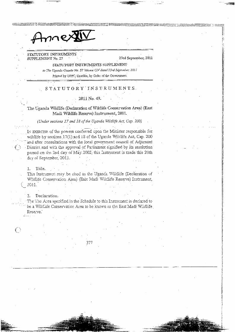
:
^STATUTORY INSTRT.II\4ENTS'SUPPLEI4ENT No- 27 . 23rd September,Z}Ll
STATUTORY INSTRTIMENTS SUPPLEIVIENT
to 71ra Uganda Gazette'No. 57 Volume CN dated 23rd Siptember 201t
' hitrted by UPPC,-Entebbe, by Ordcr of rhe Govem-EenL
S TAT U T O RY I.N S T] RU ME, NT S
. . 2011No.49. '
r.._ i
The Uganda Wildlife @eclaration of Wildlife Conservation Area) (East. Madi'fy'ildlife R.eserre) Instrumentr 2011.
' (U"d"r sections 17 aruI 18 af the UgandaWilCltfe Act, Cap.200)
IN ExERCISE of the powets confered upon the'Minjster responsible forwildlife by sections 17(1).ara 18 of the Uganda Wtldlife Act, Cap. 200
' - and after consultations with the local government counciL of Adjumalit:. ,: Dis[-ict.and with the approval of Pariianent signified by its resolution
passed on the 2nrl day of May.2002, this Instruine.nt is made this 20thday of Septeraber, 201I.
1. Title,. This Instrument may be cited as the Ugancla WilClife @eclatarion of
Wiidlife ConsErvation Area) (East Macii Wildlife R.eserve) Iastrument,
i_ 20r1.
2. DeclaralionThe Tne Area specified in the Schedule to this Instnrment is declared to
be a Wildlife Conservation Area to be known as the East Madi WildiifeReserve.'
(:
71t

I
ftn*r x/
REPORT ON APAA BY THE TECHNICAL OITFICER FROMTHE MINISTRY OT LANDS, HOUSING AND URBAN
DtrVELOPMENT
1" BACKGROUND
The boundary between Amuru and Adjumani has been a problem to both
communities of Amuru and Adjumani and to the Government in particular for
some-time now. Government Technical Teams have been sent to the area a number
of times and many lives have been lost over this boundary disagreements.
A Select Team of members of Parliament was set up to go to the ground and
interact with members of both communities and their leadership in order to find out
the root cause of this boundary disagreement.
A Technical officer from the Ministry of Lands, Housing and Urban Development
Mr. Kitaka John the Principal Staff Cartographer joined the Select Committee of
Members of Parliament on Apaa that went to The British Library and The National
Archives in London.
2. PURPOSE
The purpose of the Technical Officer from the Ministry of Lands, Housing and
Urban Development was to:
a. Interpret the maps from London regarding the Adjumani I Amuru district
boundary
b. Super-impose the hand-held GPS coordinates obtained from the field over
the London maps
c. Provide the location of the Sign-Post along Adjuman - Amuru road in
relation to Adjurnan - Arnuru district boundary.
lll)age

I
L
3. METTIODOLOGY
Hand-Held GPS (Gamin-GPSmap 60Cx) receivers were used to capture the
positional coordinates of some points along Adiumani - Amuru road and these
coordinates were later super-imposed over the maps obtained from London.
4. RESULTS
The captured coordinates of the five points are listed in the table below and
were also plotted on the maps obtained from London as shown in the map
extract below.
Point Eastings Northings
R.Zhoka 364,602.00 341,804.00
Zhoka-C mkt 364,206.00 339,725.00
R.Golobi 364,006.00 337,777.OA
Apaa-mkt 353,804.00 332,130.00
Sign-Post 370,797.O4 329,921.00
London Map extract super-imposed with Hand-held field coordinates
.:,
I
j
II
{
"1
I*
A,1,
,&
)vl*;
,bi
,,%
,1:
t't,
l
2lPage

I
The first GPS point was captured R. Zhoka as shown above" The second point was
Zhoka-C which is a small trading center composed of a few buildings and the
barracks. The third GPS point was captured on R.Golobi while the fourth was on
Apaa trading center.
l,astly the hand-held GPS coordinates of the location of a sign post along Amuru
and Adjumani road had been taken earlier. The coordinates were retrieved and
plotted on the London maps and this revealed that the Sign Post was positioned at
the Border line between Amuru and Adjumani as shown in the above map caption.
5. CONCLUSION
1. Apaa Trading center is about 8km inside Adjumani district as measured
along Amuru - Adjumani road as shown on the London map caption.
2. The Sign Post placed along the road from Adjumani to Amuru is located
along Amuru - Adjumani Border line.
Signed,
John Kitaka
PRINCIPAL STAFF CARTOGRAPHER
27rII JANUARY 2o2o
I
I
Ii
3[!ra6c