KENTSEL MEKANI DÜZENLEME ÖNERİLERİ:MODERN KENT PLANLAMA ANLAYIŞI VE POSTMODERN KENT
Upload
khangminh22Category
view
0download
0
Inquiry opened on 13 October 2009 Land to the north and south of the Ashford to Maidstone East railway line, lying to the south of the M20, to the west of M20 Junction 8 and to the east of Thurnham Lane, Maidstone File Refs: APP/U2235/A/09/2096565 and NATTRAN/SE/S247/80
Report to the Secretaries of State for Communities and Local Government and for the Environment, Food and Rural Affairs
The Planning Inspectorate Temple Quay House 2 The Square Temple Quay Bristol BS1 6PN
GTN 1371 8000
by Andrew M Phillipson BSc CEng FICE MCIHT
an Inspector appointed by the Secretaries of State for Communities and Local Government and Environment, Food and Rural Affairs
Date: 31 March 2010
Town and Country Planning Act 1990
Maidstone Borough Council
Appeal by
Kent International Gateway Ltd
concerning an application for
Kent International Gateway Rail Freight Interchange
and the related proposal to make an
Order for the stopping-up of bridleways KM81, KM82, and KH123A and the diversion of footpath KH131

Report APP/U2235/A/09/2096565 Kent International Gateway Rail Freight Interchange
Page 1
File Ref: APP/U2235/A/09/2096565 Land to the north and south of the Ashford to Maidstone East railway line, lying to the south of the M20, to the west of M20 Junction 8 and to the east of Thurnham Lane, Maidstone • The appeal is made under Section 78 of the Town and Country Planning Act 1990 against
a failure to give notice within the prescribed period of a decision on an application for outline planning permission.
• The appeal is made by Kent International Gateway Ltd against Maidstone Borough Council.
• The application Ref 07/2092 is dated 5 October 2007. • The development proposed is the construction of hardstanding areas to form a rail/road
interchange with freight handling equipment, new railway sidings in part with acoustic enclosure, earthworks and retaining walls, buildings for Class B8 warehousing and Class B1 uses, access works, internal roads and bridges, loading and manoeuvring areas, car and lorry parking, ancillary truck stop and gatehouse security facilities, electricity sub-station, realignment of public rights of way and watercourses, drainage works and landscaping.
Summary of Recommendation: That the appeal be dismissed and planning permission refused
File Ref: NATTRAN/SE/S247/80 Bridleways KM81, KM82, and KH123A and footpath KH131 in the Borough of Maidstone • The Order would be made under Section 247 of the Town and Country Planning Act 1990. • The notice of intention to make the Order was published on 17 July 2009. • The Order would authorise the stopping-up of the whole of bridleway KM81 and lengths of
bridleway KM82 and KH123A and the diversion of a length of footpath KH131 on land to the west of Junction 8 of the M20 motorway, at Bearsted in the Borough of Maidstone.
• The reason for making the Order (which the notice made clear would only occur should planning permission be granted for the above development) is to enable the development to be carried out.
Summary of Recommendation: That the Order should not be made

Report APP/U2235/A/09/2096565 Kent International Gateway Rail Freight Interchange
Page 2
Contents
1 Introduction and Procedural Matters ....................................................... 3
2 The Site and Surroundings .................................................................... 7
3 The Proposal ....................................................................................... 9
4 Common Ground................................................................................ 11
5 Planning Policy .................................................................................. 17
6 The case for Kent International Gateway Ltd.......................................... 21
7 The case for Maidstone Borough Council................................................ 66
8 The case for Kent County Council ........................................................110
9 The case for the Highways Agency.......................................................136
10 The case for the Environment Agency ..................................................137
11 The case for Natural England ..............................................................139
12 The case for the Kent Downs AONB Executive .......................................143
13 The case for the Joint Parishes Group ..................................................147
14 The case for StopKIG.........................................................................151
15 The case for CPRE Protect Kent ...........................................................167
16 The case for Other Objectors to the Proposal ........................................172
17 Written Representations.....................................................................177
18 Conclusions......................................................................................181
19 Recommendations.............................................................................235
Appendix A – Appearances............................................................................236
Appendix B – Documents ..............................................................................241
Appendix C – Plans ......................................................................................257
Appendix D – Abbreviations ..........................................................................258
Appendix E – Conditions ...............................................................................261
Appendix F – S247 Order..............................................................................286
Appendix G - Inspector’s Issues.....................................................................287
Report APP/U2235/A/09/2096565 Kent International Gateway Rail Freight Interchange
Page 3
1 INTRODUCTION AND PROCEDURAL MATTERS
1.1 The inquiry (or, more strictly, the concurrent inquiries) opened on 13 October 2009 and sat for 36 days before closing on 23 December 2009.
1.2 Malcolm Rivett BA (Hons) MSc MRTPI was appointed as Deputy Inspector. He was present throughout the inquiry and has assisted me in the preparation of this report. Brenda Taplin was appointed as programme officer. Each made a significant contribution to the inquiry which should not pass without acknowledgement.
1.3 Shortly before the start of the inquiry Mr Rivett and I separately made unaccompanied visits to parts of the site and the surrounding area. During the course of the inquiry we together made further unaccompanied visits to see features referred to in the evidence. These visits took in the section of the Maidstone East - Ashford railway line passing through the site as well as the M20 motorway running past the site, the A20 and various other roads and features referred to in the evidence.
1.4 On Tuesday 15 and Wednesday 16 December, we made accompanied visits to the site and the surrounding area, taking in the site of Thurnham Castle, the White Horse Country Park, sections of the North Downs Way and other footpaths and bridleways both on the site and in the area surrounding it. On these days we also visited the grounds of Leeds Castle and went to several publicly accessible vantage points in Bearsted and the surrounding area as well as dwellings on Thurnham Lane, Fremlins Road, Manor Drive, Crismill Road and in Bearsted Views. On Thursday 17 December, we made a further unaccompanied visit to the White Horse Country Park and nearby land, and to publicly accessible vantage points near the Sevington and Beechbrook Farm sites at Ashford referred to in the evidence called by StopKIG. On Friday 18 December, we made an accompanied visit to the Daventry International Rail Freight Terminal (DIRFT). On Thursday 14 January 2010, I made a final accompanied visit to the Ripple Lane Rail Freight Terminal, Barking.
1.5 The application was submitted in outline, with layout, scale, appearance and landscaping reserved for future consideration. It was accompanied by an Illustrative Masterplan, a Design and Access Statement, Environmental Statement, a Transport Assessment and reports on rail matters and planning issues. Further environmental information was subsequently supplied in response to a Regulation 19 request from Maidstone Borough Council (the Council) (CD/3.6 to 3.26).
1.6 The appeal was deemed valid on 23 February 2009. By letters dated 2 March 2009 the parties ware advised that the Secretary of State had directed that he would determine the appeal. Further letters dated 5 March 2009 set out the matters on which the Secretary of State particularly wishes to be informed. These were as follows: a) the extent to which the proposed development would be in accordance
with the development plan for the area; b) the extent to which the proposed development accords with Government
planning policy advice in Planning Policy Guidance Note 4: Industrial and Commercial Development and Small Firms;
c) the extent to which the proposed development is consistent with the advice in Planning Policy Guidance Note 13: Transport, in particular on

Report APP/U2235/A/09/2096565 Kent International Gateway Rail Freight Interchange
Page 4
the need to locate development in a way which helps to promote more sustainable transport choices; promote accessibility to jobs, shopping, leisure facilities and services by public transport, walking and cycling; reduce the need to travel, especially by car and whether the proposal complies with local car parking standards and the advice in paragraphs 52 to 56 of PPG13;
d) the impact of traffic on Junction 8 of the M20 Motorway; e) whether any permission granted for the proposed development should
be subject to any conditions and, if so, the form these should take; f) whether any permission granted should be accompanied by any planning
obligations under section 106 of the 1990 Act and, if so, whether the proposed terms of such obligations are acceptable; and
g) any other matters that the Inspector considers relevant.
1.7 In May 2009 the Council resolved that, had they been in a position to do so, they would have refused the application (CD/4.3). Eighteen putative reasons for refusal were citied (CD/4.1 and 4.2).
1.8 Shortly before I held the pre-inquiry inquiry meeting in June 2009, Kent International Gateway Ltd (KIG) wrote to the Council advising that they wished to amend the Illustrative Masterplan. They proposed to reduce the size of the two largest warehouses (Units Ind-01 and Ind-02) and to replace Units Ind-E and Ind-F with a single unit. A revised Illustrative Masterplan was provided (Plan B1). This was followed in early July by a Supplemental Environmental Statement (CD/3.27 and 3.28). The Supplemental Environmental Statement was advertised and, following representations from the Council and others, the Planning Inspectorate advised the Council and the Rule 6 parties on August 10 that it was my view that the inquiry should consider the amended scheme, as opposed to that originally submitted to the Council. No-one challenged this.
1.9 Subsequently, shortly before the inquiry opened, KIG proposed that the Illustrative Masterplan should be further amended, in order to overcome concerns expressed by the Environment Agency. In summary, the amendment proposed reducing the width of Unit Ind-E by some 40m in order to increase the width of the landscaped area between it and Barty Farm so as to allow an existing watercourse to be retained on its present alignment. I announced this proposal on opening the inquiry, stating that, in my opinion no-one would be prejudiced if the inquiry were to consider the scheme shown on the (further) revision to the Illustrative Masterplan (Plan C1). No one objected. The inquiry proceeded accordingly.
1.10 It was common ground at the inquiry that, if the proposal were to proceed as shown on the Illustrative Masterplan, then three bridleways (KM81, KM82, and KH123A) and one footpath (KH131) crossing the site would necessarily have to be realigned. A draft Order for the necessary stopping-up and alterations was advertised on 17 July. At the same time it was announced that an inquiry into the draft Order would be held jointly with that into KIG’s appeal against the Council’s failure to determine the application for the rail freight terminal.
1.11 Shortly before the close of the inquiry, a S106 Unilateral Undertaking was submitted (KIG/0.22). In summary, it provides (KIG/0.7) for the appointment of a travel/freight management plan co-ordinator to promote rail

Report APP/U2235/A/09/2096565 Kent International Gateway Rail Freight Interchange
Page 5
freight at the development and for the costs of maintaining the intermodal area and the fixed rail infrastructure on the site to be levied on each of the warehouse users, irrespective of the amount of use each occupier makes of the facilities.1 It further requires a Travel Plan, local bus services, and a cycle route to be put in place prior to the occupation of any of the units with the objective of securing the use of sustainable travel modes to and from the site, so far as practicable.
1.12 As to traffic movements, the Undertaking restricts the number of Heavy Goods Vehicles (HGVs) that may enter or leave the site in the morning and evening peak hours to numbers agreed with the Highways Agency. Caps are also imposed on the number of non-HGVs that may enter and leave the site in the peak hours and on the total daily flow of HGVs to and from the site. Should the caps be exceeded, or should HGVs travel to and from the site other than via M20 Junction 8,2 the Undertaking provides for substantial financial payments to be made into a fund to be used to promote sustainable transport or weight restrictions on any unsuitable routes used by HGVs.
1.13 On biodiversity, the Undertaking requires the developer to obtain approval of a biodiversity mitigation and enhancement strategy (which shall accord with the framework strategy set out in the Undertaking) to be put in place so as to secure the ongoing mitigation, enhancement and maintenance of habitat both on the site and within the defined parcels of mitigation land.
1.14 Other obligations include requirements to (i) promote the engagement of employees, contractors and subcontractors from the Maidstone area, and (ii) to put in place a noise insulation scheme for any noise sensitive properties affected by specified levels of construction noise. The Undertaking further requires a liaison group to be set up to facilitate discussion on the progress of the development and specifies the parties to be invited to join both that group and the Travel Plan monitoring group.
1.15 As noted above, an Environmental Statement (ES) was submitted with the application. A Supplemental Environmental Statement (SES) was provided in July 2009. Further environmental information was supplied with the proofs of evidence and during the course of the inquiry. In reaching my conclusions and recommendations, I have taken this environmental information into account.
1.16 The inquiry closed on 23 December 2009. Planning Policy Statement 4: Planning for Sustainable Economic Growth (PPS4) was published shortly afterwards, on 29 December 2009. This cancels Planning Policy Guidance Note 4: Industrial, Commercial Development and Small Firms, Planning Policy Statement 6: Planning for Town Centres, substantial sections of Planning Policy Statement 7: Sustainable Development in Rural Areas and the sections of Planning Policy Guidance 13: Transport concerning maximum parking standards. Planning Policy Statement 5: Planning for the Historic Environment (PPS5) was published on 23 March 2009. This cancels Planning
1 It should be noted that an obligation to provide the intermodal terminal and other fixed rail infrastructure on the site, prior to first occupation of any of the buildings would be secured by condition (see Appendix E). 2 Except in specified circumstances, such as for vehicles making local deliveries.

Report APP/U2235/A/09/2096565 Kent International Gateway Rail Freight Interchange
Page 6
Policy Guidance 15: Planning and the Historic Environment and Planning Policy Guidance 16: Archaeology and Planning.
1.17 Chapter 2 of this report contains a description of the site and the surrounding area. This is followed by chapters briefly describing the proposal; setting out those matters which are common ground between the parties; and summarising the relevant planning policies. The following chapters set out the gist of the cases made by each of the inquiry participants, case by case. The main points made by those who submitted written representations are also recorded. The final chapters contain my conclusions and recommendations.
1.18 A list of those appearing at the inquiry is contained in Appendix A. Documents and plans submitted to the inquiry are listed in Appendices B and C. Appendix D contains a list of abbreviations used in this report.

Report APP/U2235/A/09/2096565 Kent International Gateway Rail Freight Interchange
Page 7
2 THE SITE AND SURROUNDINGS
2.1 The appeal site is located to the north-east of the settlement of Bearsted on the eastern outskirts of Maidstone and is within the administrative area of Maidstone Borough Council. The site, which is 112.30ha in area (CD/8.3), is located immediately to the south of the M20 motorway, to the west of Junction 8. The Channel Tunnel Rail Link, now known as High Speed 1 (HS1), lies immediately to the north of, and runs parallel with, this section of the M20. The land to the north of the M20/HS1 is within the Kent Downs Area of Outstanding Natural Beauty.
2.2 The A20 Ashford Road lies to the south of the appeal site. It runs broadly parallel with the M20 and the two roads are linked, just to the east of the site, by the A20-M20 Link Road. The main road through the historic heart of Bearsted is known variously along its length as Roundwell, The Street and Ware Street. This road provides a link between the A20 (to the west of the A20-M20 Link Road) and Junction 7 of the M20. To the west of the appeal site Thurnham Lane leads from Ware Street, under the M20/HS1, to Pilgrim’s Way linking Bearsted with the small settlements of Thurnham and Detling.
2.3 The site’s northern boundary is with the M20 from a point around 300m east of where Thurnham Lane passes beneath the motorway, eastwards a distance of about 2.5km, to Junction 8. The eastern boundary is with the A20-M20 Link Road and the southern boundary is with the A20, between the A20-M20 Link Road and a point a short distance to the east of Woodcut Cottage (excluding Chestnuts, a residential property fronting the A20, which is not within the appeal site). This boundary then passes to the north of Woodcut Farm and to the rear of scattered frontage properties on the A20 to a point on Roundwell a short distance to the east of Barty House. The boundary skirts (and includes within the site) Glenrowan House and Barty Farm and then follows the Maidstone East – Ashford railway line to a point about 400m east of Bearsted Station. From this point the western boundary of the site skirts the rear of property fronting Thurnham Lane joining the northern boundary at the motorway.
2.4 The rear gardens of houses in Mallings Drive and Fremlins Road in Bearsted back on to the railway line which separates them from the site’s southern boundary in the north-western part of the site. A number of residential properties on Thurnham Lane and the A20 back onto the appeal site.
2.5 As well as forming part of its southern boundary the Maidstone East – Ashford railway line crosses the site dividing it into its north-western and south-eastern parts. Two public roads, Water Lane and Crismill Road, cross the site in a broadly north - south direction, the former passing under and the latter passing over the Maidstone East – Ashford railway line. Both roads pass under the M20/HS1. On the south-eastern corner of the site there is a short stretch of Musket Lane, which originally ran towards nearby Hollingbourne, prior to being severed by the construction of the M20 Junction 8 approach roads.
2.6 On the north-western part of the site, bridleways KM81, KM82 and KH123A link Thurnham Lane and Mallings Lane with Water Lane and, to the north of the M20/HS1, connect with bridleway KH123 providing routes from Bearsted to the North Downs. In the central part of the site public footpath KH131

Report APP/U2235/A/09/2096565 Kent International Gateway Rail Freight Interchange
Page 8
crosses the site in a north-easterly direction from Roundwell, under the Maidstone East – Ashford railway line and the M20/HS1, linking with other footpaths which also provide routes to the Downs. Crismill Road is also designated bridleway KH134 which is linked to Roundwell, near Barty House, by footpath KH135 which runs along part of the southern boundary of the site.
2.7 The site has varied topography, its levels ranging from 45m AOD to over 70m AOD and the land undulates both north - south and east - west. It is traversed by three watercourses which broadly flow north – south and join the River Len to the south of the A20. 81% of the site is agricultural land (CD/8.3) in arable and pastoral use (CD/8.8). The site contains a number of woodland blocks, scattered trees and hedgerows, the most notable woodlands being The Belt, Common Wood and Chrismill Shaw in the central part of the site. Eight groups of trees are the subject of Tree Preservation Orders.

Report APP/U2235/A/09/2096565 Kent International Gateway Rail Freight Interchange
Page 9
3 THE PROPOSAL
3.1 The appeal proposal seeks outline planning permission for a strategic rail freight interchange (SRFI) incorporating an intermodal road/rail facility with associated supporting B1 and B8 uses. The description of development on the planning application form is set out on page 1 of this report.
3.2 The plans which set the parameters for which outline planning permission is sought are listed in Appendix C.1 All other plans submitted with the application and during the course of the inquiry, including the Illustrative Masterplan (October 2009) and the Landscape Framework Plan (October 2009) are illustrative.
Physical Proposals
3.3 The proposal would involve the creation of a new rail access to/from the existing Maidstone East – Ashford railway line, taking the form of a crossover arrangement enabling access and egress to rail sidings on the north side of the line for trains travelling in both the Maidstone-bound and Ashford-bound directions. The new sidings would provide access to a 6.54ha intermodal area, in the central part of the site, allowing for freight transfer and the storage of containers, with the use of lattice structure gantry cranes up to 25m in height.
3.4 The sidings would also provide access to two rail-connected warehouses (Units Ind-01 and Ind-02) on the north-western part of the site. These would provide around 100,000m2 and 40,000m2 (GEA)2 of distribution (Class B8) floorspace, respectively. The south-eastern part of the site would accommodate five rail-served (although not directly rail-connected) warehouses, Units Ind-A, Ind-B, Ind-C, Ind-D and Ind-E, providing a total of around 150,000m2 GEA of Class B8 floorspace. Other small business and industrial units (Classes B1, B2 and B8), arranged in a campus style at the south-eastern corner of the site, would provide up to approximately 11,000m2 GEA floorspace. Units Ind-01 and Ind-02 and Ind-A – Ind-E would be 14m high, the other units would be between 10m and 12m high.
3.5 The intermodal facility and warehouse units would be located on a series of level development platforms and extensive cut and fill would be necessary to achieve these. It is anticipated that most of the excavated material would be used elsewhere on the site although some 12,000m3 of unusable material may need to be removed from the site, this quantity being subject to detailed soil investigation.
3.6 Two traffic signal controlled vehicular access points from the A20 would be created in the south-eastern part of the site, one for Heavy Goods Vehicles (HGVs) and the other for general traffic. A new internal road network would be created which would include bridges over the Maidstone East – Ashford Railway line and Water Lane and under Crismill Road. An emergency vehicle access would link Water Lane with the internal road but, otherwise, Water
1 The parameter plans were revised shortly before and during the inquiry. Those listed in Appendix C (Plans D1 to D10) are as finalised at the close of the inquiry. 2 GEA = gross external area.

Report APP/U2235/A/09/2096565 Kent International Gateway Rail Freight Interchange
Page 10
Lane and Crismill Road would not connect with the internal road network. Existing bridleways and footpaths would be diverted to follow new alignments within the site.
3.7 Extensive mounding, landscaping and planting are proposed as are green roofs for the largest warehouse (Unit Ind-01) and the rail siding adjacent to it, which would be within an acoustic enclosure. The existing watercourses on the site would be diverted to follow new alignments and would be, in part, culverted. Five drainage/balancing ponds would be created. The development would also incorporate a gatehouse, security buildings, fencing, lorry driver facilities, electricity substation and up to 2,357 car parking spaces and 964 HGV parking spaces.

Report APP/U2235/A/09/2096565 Kent International Gateway Rail Freight Interchange
Page 11
4 COMMON GROUND
Inspector’s Note. A statement of common ground covering planning matters (CD/8.3) was agreed between Kent International Gateway Ltd (KIG) and Maidstone Borough Council (the Council). Further statements of common ground between KIG and the Council cover lighting (CD/8.1), noise and vibration (CD/8.2), built heritage (CD/8.4), rail infrastructure and rail freight operations (CD/8.5), logistics (CD/8.6a), landscape and visual effects (CD/8.8), employment issues (CD/8.10), and ecology and nature conservation (CD/8.11). On highways, a statement of common ground was entered into by KIG and the Highways Agency (CD/8.7). On drainage, flood risk and watercourses, a statement of common ground was provided, signed by representatives of KIG, the Environment Agency, Southern Water and South East Water (CD/8.9). A further statement of common ground on ecology and nature conservation, concluded between the Appellants and Natural England, can be found at CD/8.12. CD/8.13 records the common ground on security matters reached between KIG and Kent Police. CD/8.14 records the common ground on air quality matters reached between KIG and Tonbridge and Malling Borough Council.
Planning Matters (CD/8.3)
4.1 Section 2 of the statement contains a description of the appeal site and its surroundings noting, amongst other matters, that the population of Maidstone is expected to increase from 142,000 in 2006 to 153,500 in 2016 and 176,600 in 2026. It records that some 81% of the land within the appeal site is agricultural land, of which 11% is classified as Grade 2 and 24% as Grade 3a. The remaining land is classified as Grade 3b. A total of eight Tree Preservation Orders apply to trees on the site (para 2.17).
4.2 Section 3 of the statement summaries the development proposals (as revised in July 2009) and notes that the parameter plans included in the Supplementary Environmental Statement should be used for the purposes of framing planning conditions regulating the scale of development, mix of uses, siting and design of the appeal proposal.
4.3 Section 4 sets out in detail the chronology of the application, recording the dates on which the various application documents and supporting information were first submitted to the Council. Section 5 summarises the components of the development plan and summarises the policies in the South East Plan most relevant to the application. So far as the Maidstone Borough Wide Local Plan is concerned, it is agreed that the appeal site is located in countryside beyond the defined boundary of the urban area and within a Special Landscape Area to which Policy ENV34 applies. It is further agreed that the part of the site to the west of Water Lane is covered by a Strategic Gap allocation to which policy ENV31 applies.
4.4 National planning guidance material to the consideration of the appeal, listed below in para 5.16 and para 5.17, records that the (former) Strategic Rail Authority’s (SRA) document Strategic Rail Freight Interchange Policy (CD/5.15) is capable of being a material consideration in the decision. Other regional and local policy documents including the Maidstone Sustainable Community Strategy (CD/4.29) and the emerging Maidstone Local Development Framework Core Strategy and supporting evidence are also agreed as being material (but not the weight that should be attached to them). Para 5.19 records that the Preferred Options document for the Maidstone Core Strategy includes much of the appeal site as an area of search for major growth, with some as parts of a network of green space to be protected.
Report APP/U2235/A/09/2096565 Kent International Gateway Rail Freight Interchange
Page 12
4.5 Areas of agreement on planning matters record (i) that the objectives of sustainable development and the tackling of climate change are key Government priorities; (ii) that there is strong Government support for the creation of an improved nationwide rail freight network; and (iii) that the need for a network of rail freight interchanges nationally, including to serve the London and the South East Region, is a matter of established policy (paras 6.1 and 6.2).
4.6 It is further agreed that HGVs make a significant contribution to carbon emissions and that creation of a network of appropriately located rail freight interchanges will be important in increasing rail freight’s modal share and reducing carbon emissions from the distribution of goods (para 6.3).
4.7 It is agreed (i) that as a regional ‘hub’ and the county town of Kent, Maidstone is a focus for growth, and (ii) that the South East Plan identifies Maidstone as being capable of accommodating significantly higher levels of development during the plan period than other urban settlements outside the sub-regional strategy areas. Notwithstanding this, it is agreed that Maidstone is not one of the Growth Areas identified by Government or the South East Plan. Its status as a Growth Point will require delivery of additional jobs and businesses in the period to 2026. The South East Plan designation of Maidstone as a ‘hub’ reflects its good relationship to strategic road and rail networks and its status as the county town and focus for administrative, commercial and retail activities. 90% of new housing in the Borough should be within or adjacent to the town and be supported by the construction of the South East Maidstone Relief Route and the Maidstone hub package.
Lighting (CD/8.1)
4.8 On lighting, it is agreed (i) that the methodology adopted by KIG’s consultant to assess the (outline) lighting proposals provides a reasonable and considered approach; and (ii) that the criteria for assessing obtrusive light should be those of the 2005 Institute of Lighting Engineers (ILE) Guidance Notes (Zone E2: low district brightness) and the requirements of policy ENV49 of the Maidstone Borough Wide Local Plan.
4.9 It is further agreed that the (outline) lighting design is appropriate to the task and not excessive and that there should be no significant increase in light trespass above or out of the site, or problems with glare within it. It is noted that the installation has been correctly designed with all significant luminaires emitting zero direct upward light in recognition of the adjacent AONB, and that the landscape design has been formulated to screen lighting where possible.
Noise and Vibration (CD/8.2)
4.10 Baseline noise levels surveyed by KIG’s and the Council’s consultants are agreed as representative of the background noise levels in the area.
4.11 Whilst it is agreed that there would inevitably be an impact from noise during the construction phase, it is common ground that (with the agreed mitigation) the impact of noise in the operational phase would be controlled to levels below the “marginal significance” threshold contained within BS4142 when averaged over a typical daytime or night-time period.

Report APP/U2235/A/09/2096565 Kent International Gateway Rail Freight Interchange
Page 13
4.12 As to vibration, it is agreed (i) that there would be no material impacts from vibration due to the operation of the site (including vibration from rail traffic); and (ii) that the risk of problematic vibrations occurring during construction could be removed by adopting appropriate working practices.
Built Heritage (CD/8.4)
4.13 It is agreed that the built heritage assets that could potentially be adversely affected by the proposal comprise settings of the Barn at Barty Farm (listed: Grade II); Woodcut Farmhouse (listed: Grade II) and the Bearsted and Bearsted Holy Cross Conservation Areas.
Rail Infrastructure and Freight Operations (CD/8.5)
4.14 The appeal site lies on the Maidstone East – Ashford railway line which connects with routes that provide access to the Channel Tunnel and the UK’s main trunk rail routes. The route network would allow direct trains to operate from within mainland Europe to the site, via the Channel Tunnel, without a change of locomotive. Whilst only some 5 freight trains per day in each direction currently operate through the Tunnel, the Treaty of Canterbury guarantees paths for a minimum of 35 trains per day, each way. The line is cleared to W9 gauge between the Channel Tunnel and Wembley which allows 40’ (12.19m) or 45’ (13.72m) long by 9’ 6” (2.90m) high containers to be carried on Megafret wagons. There are no public sector funds available to upgrade the gauge which would be necessary to allow Pan-European 4m high piggyback trailers to pass along the line from the Channel Tunnel to the site.
4.15 It is agreed that the proposed internal layout for the site would allow 775m long trains to be received and despatched in either direction. Network Rail has confirmed that up to 13 trains each way per day could almost certainly be accommodated on the Kent network today. The route to the site would be open 24/7 except for times when maintenance is required.
4.16 It is agreed that Freight Facilities Grant would not be available for any facilities in the development required as a condition of planning permission. Operating grant availability for the period 2010 to 2015 would be subject to the rules and conditions set out in the Modal Shift Revenue Support Programme, and at the rates set out in the relevant DfT documentation. The availability or otherwise of this grant beyond 2015 is unknown.
Logistics (CD/8.6a)
4.17 Whilst the arithmetic underlying the forecast traffic movements for the site operating as KIG predict (67% as a National Distribution Centre (NDC) and 33% as a Regional Distribution Centre (RDC)) or according to the Council’s view (10% as an NDC: 90% as an RDC) is agreed, there is no common ground as to how the site would operate in practice.
Landscape and Visual Effects (CD/8.8)
4.18 It is common ground that the site and its surroundings are dominated by the prominent North Downs escarpment, the ridge of which lies approximately 1.5 to 2.5km north of the site. It is further agreed that the undulating nature of the lower scarp slopes within the site and Bearsted are significant in landscape terms.

Report APP/U2235/A/09/2096565 Kent International Gateway Rail Freight Interchange
Page 14
4.19 Published landscape character assessments for the area comprise the Countryside Agency’s The Character of England (CD/6.3.4) and the County Council’s The Landscape Assessment of Kent (CD/5.13). In the latter, the site falls within two landscape character areas “Hollingbourne Vale West” and “Leeds - Lenham Farmland”.
4.20 It is agreed that Guidelines for Landscape and Visual Impact Assessment published by the Landscape Institute and the Institute of Environmental Management (CD/6.3.1) is broadly appropriate guidance to be followed for the assessment of the landscape and visual effects of the proposal.
Employment Issues (CD/8.10)
4.21 It is agreed that the likely labour catchment of the development would be the three districts of Maidstone, Medway and Tonbridge and Malling. In 2007 the area had 215,000 jobs, an increase of just under 10% since 1998. Between 1998 and 2007 claimant count unemployment fell and remained low, but it has since risen significantly as a result of the recession.
4.22 Employment in the labour catchment is concentrated in the service sector, with public administration, education and health accounting for about 30% of all jobs. This sector is particularly over-represented in Maidstone where it accounts for 35% of all employment. Manufacturing has declined significantly since 1998, and in Maidstone the sector now accounts for just 5.9% of employment. Whilst transport and communications represent only a small proportion of employment (6.3% in the catchment area) growth in Maidstone since 1998 has been significantly stronger than average.
4.23 The catchment area’s labour force has a similar profile by occupational group to the South East regional and national profiles, but with relatively fewer residents in management and professional occupations (CD/8.10, Table 1). Skill levels across the catchment are generally higher than the national average (Table 2). Earnings for residents of the catchment are above the GB average, but not workplace earnings (except in Tonbridge and Malling – Table 3).
4.24 As to the jobs that the development would generate, it is agreed that construction employment would be between 160 and 185 full-time equivalent jobs. Employment for the completed development is dependent on a number of (unknown) factors, including particularly the assumed split between NDC and RDC floorspace, with estimates varying between about 2,600 jobs and 3,900 jobs. It is agreed that approximately 20% of the employment in the development would be in managerial, professional or associate professional levels, with 12% in administrative functions and 68% in elementary occupations or process, plant and machinery operatives. Indirect employment multipliers are estimated to be around 1.25 for the catchment area, rising to 1.4 for the South East Region (Table 6). Job displacement factors are not agreed.
4.25 As to labour supply, it is agreed (i) that the current unemployment level in the catchment area is higher than it has been in the last 10 years; and (ii) that the current level of unemployed residents in the area exceeds the maximum employment likely to be generated by the development. Notwithstanding this, it is agreed that there may be demand for such unemployed labour from other developments in the catchment and that the

Report APP/U2235/A/09/2096565 Kent International Gateway Rail Freight Interchange
Page 15
ability of the labour market to fill the jobs generated by the development would depend on the balance of labour demand and supply in the area at such time as the scheme becomes operational.
Ecology and Nature Conservation (CD/8.11 and 8.12)
4.26 Two separate statements of common ground on ecology and nature conservation were agreed between KIG and the Council (CD/8.11) and between KIG and Natural England (CD/8.12).
4.27 All parties agree that the site does not contain any statutory or non-statutory sites of nature conservation interest and that the Supplemental Environmental Statement identifies all possible impacts in relation to statutory sites. Three Local Wildlife Sites are agreed to be within the site’s zone of ecological influence. It is further agreed that survey work for badgers, bats, birds, and terrestrial invertebrates is appropriate in terms of methodology and survey effort and that, whilst brown hare has been recorded on the site, further specific survey work is not required. On dormice, it is agreed that the survey work undertaken was appropriate in terms of the guidance in place when the survey was undertaken.
4.28 Notwithstanding the surveys carried out, it is agreed that further surveys for badgers, dormice and great crested newts should be undertaken before development commences.
Highways (CD/8.7)
4.29 The statement of common ground on highways, concluded between consultants acting for KIG and the Highways Agency, was drafted whilst negotiations between the parties were ongoing, particularly with regard to the contents of the Travel Plan and the protocol to be put in place to manage site operations when Operation Stack1 is implemented.
4.30 The Highways Agency’s final position on these and other matters is recorded in Chapter 9 of this report.
Foul and Surface Water Drainage and Flood Risk Accommodation (CD/8.9)
4.31 It is proposed to discharge foul drainage from the development to Southern Water’s existing wastewater treatment works at Aylesford. This would require approximately 11km of off-site rising main. This main would be requisitioned as soon as outline planning approval is granted and the required work off-site would take up to three and half years to complete. On-site, a network of gravity sewers would lead to three pumping stations which would be offered to Southern Water for adoption.
4.32 For surface water, the strategy is to restrict discharge to the three watercourses crossing the site to agreed equivalent greenfield discharge rates. Detention ponds would be used to achieve this where the layout permits, supplemented by underground cellular storage structures.
1 Operation Stack is the term used to manage traffic by using sections of the M20 to park lorries when the Channel Tunnel or ferry routes across the Channel are disrupted. For details see CD/8.7, Section 10.

Report APP/U2235/A/09/2096565 Kent International Gateway Rail Freight Interchange
Page 16
4.33 As to sustainable urban drainage scheme (SUDS) techniques, it is agreed that the desirability of maintaining aquifer recharge rates should take precedence over alternative SUDS techniques such as rainwater harvesting. However, the site is located within a groundwater protection zone and in order to protect groundwater quality, only uncontaminated roof water run-off should be permitted to discharge directly to the ground. Whilst it is agreed that groundwater quality can be protected during the construction and operational phases of the development by adherence to best practice, a comprehensive groundwater monitoring regime would need to be agreed and implemented.
4.34 On flooding, it is agreed that (i) the proposed structures would be sufficiently distant from the areas of Flood Zone 3 associated with watercourses crossing the site so as not to pose a flood risk; (ii) that there is sufficient flexibility in the earthworks so as not to increase flood risk due to displacement of floodwater; and (iii) that the proposed detention ponds can be located in areas not at risk of fluvial flooding.
4.35 It is further agreed that ecological mitigation for the proposed culvert under the intermodal area could be provided by the creation of additional lengths of open watercourse elsewhere on the site, and wet detention ponds.
Security (CD/8.13)
4.36 This statement of common ground, concluded between consultants acting for KIG and Kent Police, records that there is a clear threat to the transport sector from international terrorism and that the parties would work together to agree a full security assessment if planning permission is granted.
4.37 It is accepted that the security measures proposed for the kiosks at the vehicle access points are fit for purpose but acknowledged that (i) the route to the HGV control barrier should be modified from that shown on the (illustrative) application plans and (ii) the Security Control Centre should be blast resistant and located 400m or more from the HGV access control point. The protocol to be followed in the event of an incident would be set down in a Site Operation and Incident Plan. Paladin fencing should be provided to high risk areas and along the perimeter near the A20/M20 junction. Suitable barriers should be provided to prevent any unlawful vehicular access to bridleway KM81. These and other matters of concern to the Police could be secured by suitable conditions.
Air Quality (CD/8.14)
4.38 It is agreed that, based on the methodologies and data used, including background pollutant and traffic data, the development is predicted to have an overall minor adverse effect on local air quality within Tonbridge and Malling’s air quality management area.

Report APP/U2235/A/09/2096565 Kent International Gateway Rail Freight Interchange
Page 17
5 PLANNING POLICY
5.1 The statement of common ground on planning matters (CD/8.3) lists those policies in the development plan and other planning guidance which Kent International Gateway Ltd (KIG) and the Council agree are relevant to the appeal. In this Chapter I set out the policies in the development plan and related documents which I consider to be most relevant to the proposal. Relevant passages of Government policy statements and guidance can be found in the cases put by the parties, although the relevant parts of Planning Policy Statement 4: Planning for Sustainable Economic Growth, published since the inquiry closed, are set out in paragraph 5.16 et seq below.
5.2 The development plan for the area comprises the South East Plan (Regional Spatial Strategy for the South East of England (May 2009)) (CD/2.1) and the “saved” policies of the Maidstone Borough Wide Local Plan (December 2000) (CD/2.5). At the time that the Council resolved its putative reasons for refusal for the appeal proposal the South East Plan was in draft form 1 although subsequently it has been formally published with no material changes to the policies cited by the Council, other than the renumbering of policy BE7 as policy BE6. The putative reasons for refusal also referred to policies of the Kent and Medway Structure Plan (2003) (CD/2.6) which ceased to have development plan status on 6 July 2009. No-one at the inquiry suggested that its policies should carry any significant weight in the determination of the appeal.
The South East Plan (SEP)
5.3 Policy CC1 sets out that it is the principle objective of the plan to achieve and maintain sustainable development and policy CC2 identifies that measures to mitigate and adapt to the effects of climate change will be implemented through the application of local planning policy. Policy T1 seeks to achieve a re-balancing of the transport system in favour of sustainable modes as a means of access to services and facilities and to locate/design development to reduce average journey lengths.
5.4 Policy T13 indicates that the regional planning body should work jointly with DfT Rail, Network Rail, the Highways Agency, The Freight Transport Association and local authorities to identify broad locations within the Region for up to three intermodal freight interchange facilities. It states that the facilities should have the potential to deliver modal shift and be well related to rail and road corridors capable of accommodating the anticipated level of freight movements, the proposed markets and London. The supporting text of the policy states that potential sites must:
• be of sufficient size and configuration to accommodate an appropriate rail layout, transfer operation and value added activities;
• be already rail-connected or capable of rail connection at reasonable cost;
1 The Government’s Proposed Changes (July 2008) to the Deposit Draft of the Plan following the Examination in Public in November 2006 to March 2007.

Report APP/U2235/A/09/2096565 Kent International Gateway Rail Freight Interchange
Page 18
• have adequate road access or the potential for improved road access; and
• be situated away from incompatible land uses.
The supporting text also states that suitable sites are likely to be located where the key rail and road radials intersect with the M25.
5.5 Policy T11 states that the railway system should be developed to carry an increasing share of freight movements and that priority should be given to enhanced capacity for such movements in four named corridors, including Dover/Channel Tunnel to and through/around London. Policy T12 identifies that sites adjacent to railways should be safeguarded/promoted for new intermodal facilities and rail-related industry/warehousing that are likely to maximise freight movement by rail. It also indicates that development with a high generation of freight should be encouraged to locate close to intermodal/rail freight facilities.
5.6 Policy SP1 identifies nine Sub-Regions in the South East (which do not include Maidstone) and indicates that these will be the focus for growth and regeneration. Policy SP2 defines the concept of regional ‘hubs’ and indicates that economic activity should be in locations close to, or accessible by, public transport. Policy AOSR7 relates specifically to the Maidstone hub: it indicates that the Local Development Framework at Maidstone will (amongst other things):
• make new provision for housing consistent with its growth role, including associated transport infrastructure;
• make new provision for employment of sub-regional significance with an emphasis on higher quality jobs to enhance its role as the county town and a centre for business;
• ensure that development at Maidstone complements rather than competes with the Kent Thames Gateway towns and does not add to travel pressures between them; and
• avoid coalescence between Maidstone and the Medway towns conurbation.
Notwithstanding that Maidstone is not within one of the nine sub-regional areas identified in the plan, paragraph 4.9 indicates that it is an accessible settlement of regional significance with the potential to accommodate significantly higher levels of development than other urban settlements located outside the Sub-Regions.
5.7 Policy RE3 seeks to ensure that employment land is in locations which are, or will be, accessible to the existing and proposed labour supply and which promote the use of public transport.
5.8 Policy C3 states that high priority will be given to conservation and enhancement of natural beauty in the Region’s Areas of Outstanding Natural Beauty (AONBs), that planning decisions should have regard to their setting and that proposals for development should be considered in that context. Policy C4 indicates that, outside nationally designated landscapes, the aim is to protect and enhance the diversity and local distinctiveness of the Region’s

Report APP/U2235/A/09/2096565 Kent International Gateway Rail Freight Interchange
Page 19
landscape, informed by landscape character assessment. It advises that local authorities should develop criteria-based policies to ensure that all development respects and enhances local landscape character, securing appropriate mitigation where damage to local landscape character cannot be avoided. Policy C6 states that local authorities should encourage access to the countryside by (amongst other things) maintaining and enhancing the public rights of way system.
5.9 Policy BE6 aims to protect, conserve and, where appropriate, enhance the historic environment and the contribution it makes to local distinctiveness and sense of place. It advises that the Region’s nationally designated historic assets should receive the highest level of protection.
“Saved” Policies of the Maidstone Borough Wide Local Plan
5.10 Policy ENV28 defines the countryside as all those parts of the plan area not within the development boundaries shown on the proposals map. The policy indicates that in the countryside development will be confined to a limited number of uses, which does not include the appeal proposal. It also states that permission will not be given for development which harms the character and appearance of the area or the amenities of surrounding occupiers. Policy ENV31 states that within the Strategic Gap (defined on the proposals map and including the part of the appeal site west of Water Lane) development will not be permitted which significantly extends the defined urban areas or the extent of any settlement or development.
5.11 Policy ENV34 states that in the North Downs Special Landscape Area (as defined on the proposals map and including the appeal site in its entirety) particular attention will be given to the protection and conservation of the scenic quality and distinctive character of the area and priority will be given to the landscape over other planning considerations. Policy ENV21 advises that development will not be permitted which would harm the character, appearance and functioning of strategic routes in the Borough.
5.12 Policy ENV26 states that planning permission will not be granted for development affecting any public right of way unless proposals include either the maintenance or the diversion of it as a route no less attractive, safe and convenient for public use.
5.13 Policy ENV49 advises that, in determining proposals for external lighting, the Council will seek to ensure that it is the minimum required to satisfactorily undertake the task, that light spillage is minimised and that the lighting does not adversely impact on the amenities of nearby occupiers or its immediate or wider landscape setting.
5.14 Policies ED1 and ED2 list existing, permitted and proposed sites for employment development/economic activity. The list does not include the appeal site.
Emerging Local Policy
5.15 A Preferred Options document for the Maidstone Core Strategy was published in January 2007 (CD/2.4). Public Consultation on the draft Core Strategy is anticipated during 2010.

Report APP/U2235/A/09/2096565 Kent International Gateway Rail Freight Interchange
Page 20
Planning Policy Statement 4: Planning for Sustainable Economic Growth (PPS4)
5.16 PPS4 was published, after the inquiry closed, on 29 December 2009, and it cancels substantial parts of Planning Policy Statement 7: Sustainable Development in Rural Areas which are referred to in the parties’ cases. Specific sections of PPS7 which have been cancelled include:
• Paragraph (ii) of the Government’s Objectives section which indicated the intention to promote more sustainable patterns of development by (amongst other things) preventing urban sprawl and discouraging the development of greenfield land.
• Paragraph 1(iv) which stated that “new building development in the open countryside away from existing settlements, or outside areas allocated for development in development plans, should be strictly controlled; the Government’s overall aim is to protect the countryside for the sake of its intrinsic character and beauty, the diversity of its landscapes, heritage and wildlife, the wealth of its natural resources and so it may be enjoyed by all”.
• Paragraph 1(vi) which advised that “all development in rural area should be well designed and inclusive, in keeping and scale with its location, and sensitive to the character of the countryside and local distinctiveness”.
5.17 However, paragraphs 21-26 of PPS7, which are raised by some of the parties in their cases, remain extant. These paragraphs concern nationally designated areas, local landscape designations and the countryside around urban areas.
5.18 Policy EC6 of PPS4 concerns Planning for Economic Development in Rural Areas. It states:
“EC6.1 Local Planning authorities should ensure that the countryside is protected for the sake of its intrinsic character and beauty, the diversity of its landscapes, heritage and wildlife, the wealth of its natural resources and to ensure it may be enjoyed by all.
EC6.2 In rural areas, local planning authorities should:
(a) strictly control economic development in open countryside away from existing settlements, or outside areas allocated for development in development plans”
5.19 Paragraph 10 of PPS4 indicates that it is the Government’s objective to deliver more sustainable patterns of development, reduce the need to travel, especially by car and respond to climate change.
Planning Policy Statement 5: Planning for the Historic Environment (PPS5)
5.20 PPS5 was published after the inquiry closed, on 23 March 2010. It cancels the whole of Planning Policy Guidance 15: Planning and the Historic Environment and Planning Policy Guidance 16: Archaeology and Planning, both of which are referred to in the parties’ cases.

Report APP/U2235/A/09/2096565 Kent International Gateway Rail Freight Interchange
Page 21
6 THE CASE FOR KENT INTERNATIONAL GATEWAY LTD
Introduction
6.1 Kent International Gateway Ltd (KIG) commend the speaking notes prepared by each of their witnesses as succinct summaries of the position reached in relation to the topics on which each gave evidence.
Prematurity
6.2 In their putative reasons for refusal the Council raise prematurity as an issue in relation to the forthcoming National Policy Statement (NPS) on National Networks; the work identified in policy T13 of the South East Plan (SEP) and the Council’s emerging Core Strategy (MBC/01.09).
6.3 Planning Policy Statement 1: Delivering Sustainable Development (PPS1) deals with situations in which prematurity to an emerging DPD might be a tenable ground of objection to a proposal. The ground rules relevant in this case are (i) that the issues which it is said would be prejudiced by the grant of permission in advance of the development plan are issues “which are being addressed in the Policy in the DPD” (para 17); and (ii) that prematurity would seldom be justified as an objection: “where a DPD is at the consultation stage, with no early prospect of submission for examination...” (para 18).
6.4 The position in relation to Maidstone’s Core Strategy is that the Council has decided that the document will not address the potential for a strategic rail freight interchange (SRFI) in the Borough (MBC/01.02, Appendix H). Therefore, it cannot be said that proceeding to a decision on the appeal would prejudice the discussion and resolution of the issues concerning the potential for and location of an SRFI in the Borough, as there is no intention on the Council’s part to address these in the Core Strategy. This is perhaps unsurprising, given the Council’s position on the need to consider alternatives outside the Borough (KIG/0.19, para 3).
6.5 As to timing, the Core Strategy is not yet at consultation stage. Currently it is anticipated that it will be published for formal consultation in December 2010 and submitted for examination in March 2011 (KIG/1.6). Accordingly, prematurity cannot be said to be a legitimate ground of objection in relation to the emerging DPD.
6.6 Turning to the study referred to in policy T13 of the SEP, a similar point was considered at the Radlett SRFI inquiry. There the Inspector concluded that such an argument could only hold good “if there is a reasonable prospect that such a study is both likely to be undertaken and its findings accepted as binding on the various authorities affected within a reasonable timeframe” (CD/7.2, IR, para 16.112). It was further concluded that there was no timetable for the study referred to in the SEP and that the Panel’s recommendation of a criteria-based policy (now policy T13) “was a clear indication on the Panel’s part that they did not expect proposals for SRFIs to effectively be put on hold pending the outcome of an inter-regional study” (ibid). He further noted that the substantial delay that would be involved in waiting for such an outcome “would be contrary to the Government’s declared aim of increasing the proportion of freight moved by rail” (CD/7.2, IR para 16.114). The Secretary of State agreed (CD/7.2, DL, para 40).
Report APP/U2235/A/09/2096565 Kent International Gateway Rail Freight Interchange
Page 22
6.7 More than a year has now passed since the Radlett decision. However, there is still no known timetable for the study to get underway, let alone to be completed. Exactly the same conclusions should therefore be reached here as in the Radlett decision.
6.8 As to the National Networks NPS, this is now scheduled for publication in draft in 2010. By the time the Secretary of State comes to determine this case he will know the up-to-date situation regarding its progress. The important point, however, is not the exact timetable for the NPS, but rather the Government’s underlying intention in introducing the Infrastructure Planning Commission (IPC). In essence the Government’s Implementation Road Map makes it clear that major projects which are being progressed through the current planning system should not be put back so as to start all over again under the new regime, as this would “delay the overall approval process – quite the reverse of what is intended.” (Road Map, July 2009, para 8).
6.9 The effect of agreeing to the Council’s suggestion that the appeal be dismissed on the grounds of prematurity to the NPS would be to leave the Appellants in the position of having to await the NPS and then starting all over again, but this time under the new consent regime. Accordingly, the consequence would be exactly what Government has said is “the reverse of what is intended”.
6.10 In conclusion, the Inspector and the Secretary of State have all that they need to decide whether the proposal should be approved or not. The Council’s submission that it would be premature to consider the merits of the proposal should be seen as reluctance to grapple with difficult and seemingly unpalatable (and certainly unpopular) decisions. Dismissing the appeal on the grounds of prematurity would run contrary to the Government’s declared aim of tackling climate change issues as a matter of urgent priority (Supplement to PPS1, para 6).
Highways
6.11 Both as originally suggested by the Inspector (INQ/7) and with the revision suggested by the Council (MBC/01.09) the highways issue is related to the argument that it would be premature to grant permission for the appeal proposal. The formulations begin with what might be described as a conventional highways issue – “whether or not the proposal would have an adverse effect on the highway network serving the area” which presumably aims to assess whether there would be a significant and unacceptable impact – but then the issue continues and refers to whether the development’s traffic “would threaten other proposals” in Maidstone.
6.12 There are no current ‘other proposals’ which might be ‘threatened’ by the proposed development’s traffic utilising e.g. spare capacity at M20 Junction 8. The latter point can therefore only be directed at the impact that the development might have on Maidstone’s ability to deliver through its Core Strategy the housing and business development ascribed to it by policy AOSR7 of the SEP (the Maidstone hub policy).
6.13 With regard to the conventional issue, namely whether the proposal would have a (significant and unacceptable) adverse effect on the highways network, the Highways Agency (HA) agrees that, in accordance with DfT

Report APP/U2235/A/09/2096565 Kent International Gateway Rail Freight Interchange
Page 23
Circular 02/2007, the appropriate year of assessment is 2017. Following constructive engagement between consultants acting for KIG and the HA, the HA further signalled that, subject to (i) agreed conditions being imposed on any permission granted and (ii) the various safeguards that would be secured by the S106 Obligation, it had no outstanding objections to the proposal (HA1/6, first para).
6.14 The HA’s position is particularly significant given that HGVs would access and egress the site via J8 of the M20 (as secured by the S106 Undertaking).
6.15 In putting their cases, several objectors made great play of Operation Stack. The factual position regarding this is set out in the statement of common ground (SOCG) agreed with the HA (CD/8.7, Section 8) and it is important to remember that Phase 1 of Operation Stack (M20: J11 – J12 coast-bound) has no real bearing on the appeal scheme. Phase 2 (J8 – J9 coast-bound) has some bearing. Phase 3 (J8 – J9 both directions) has not been implemented to date.
6.16 As to the effect, it seems odd to imply that it is inappropriate to locate a rail-enabled logistics facility beside a junction on the M20 because sometimes special measures are put in place to manage the use of the motorway (e.g. because of weather conditions having a disruptive effect on Channel Straits ferries). Indeed, given the location of the appeal site close to J8, together with its ample lorry parking provision, it should help to facilitate rather than exacerbate the undoubted traffic management issues that arise when Operation Stack is in place.
6.17 For their part, the HA agreed that there should be a Protocol which would govern the operation of the site when Operation Stack is in place. One was jointly drafted and embodied in the Travel Plan annexed to the S106 Undertaking. In a letter submitted shortly before the inquiry closed the HA confirmed that the final Protocol “satisfactorily addresses this issue” (HA/1.6, Item 19).
6.18 CPRE’s assertion in closing that “AXA deliberately attempted to mislead the inquiry by providing 26 occurrences of the phase 2 closures” (CPRE/29, para 3.4) is both unfounded and misleading. The factual position regarding the historical implementation of Operation Stack was agreed with the HA in the SOCG (see para 6.15 above). Far from misleading the inquiry, KIG’s witnesses presented it with the correct information.
6.19 Turning to consider the local road network: Kent County Council’s highways witness, Mr Rosevear, confirmed in evidence that the County Council do not object to the proposal on the basis of traffic impacts as at the 2017 year of assessment that the Highways Agency has agreed is appropriate. Rather, the Council’s case is based on seeking to analyse the impact of the proposed development as at 2026 together with some 4,000 houses in a South East Maidstone Urban Extension, and just under 60,000m2 of retail development. These, it is anticipated, will be put in place by then in pursuit of the role envisaged for Maidstone by the SEP.
6.20 It is at this point in the analysis that the case being made against the proposal shifts into the argument that it would “threaten” the delivery of future housing and other development in Maidstone.
Report APP/U2235/A/09/2096565 Kent International Gateway Rail Freight Interchange
Page 24
6.21 In this connection, the County Council’s consultants (Jacobs) have been working for a long time to build a suitable transportation model for future conditions. Notwithstanding this, those responsible for the (VISUM) model acknowledged that the modelling presented to the inquiry is still work in progress. Given this, and the model’s strategic nature, it is wrong to expect it to form a sound basis for assessing the traffic implications of an individual development such as the appeal proposal.
6.22 As to the model, it seeks to assess traffic as at 2026 with the South East Maidstone Strategic Link (SEMSL) in place on the basis that this new road, in effect a bypass, would be required in order to facilitate the urban extension.
6.23 The degree to which the modelling is inchoate was explored in the cross-examination of Mr Rosevear. In summary, the amount of housing and retail development input into the model was reduced significantly between the latest and the last previous versions of the work, which were only some four months apart. Accordingly, it would be very unwise to regard the latest version of the model as if it is the finished product. Further, it was acknowledged that the modelling does not yet incorporate comprehensive demand management measures (the flows in the model are demand, not predicted, flows) notwithstanding that such measures are expected to eventually form part of the Maidstone Hub Transport Strategy.
6.24 Furthermore, the model was found on closer scrutiny to be currently throwing up some very odd, and indeed implausible, results. This was shown graphically by comparing the HGV flows to Tower Lane, with those for the M20 shown on the select link analysis plots (KIG/2.8). Mr Rosevear’s description of these results, and other similar phenomena, as a “modelling curiosity” was an elegant understatement.
6.25 The only sensible conclusion that can be drawn is that the model is not, in its current state, a suitable tool for assessing the traffic impacts of the development – it is asking too much of it, too soon, to expect it to be of any real assistance.
6.26 If, despite these submissions, the model as it currently stands is considered to be a reliable basis for assessing conditions as at 2026, it then becomes necessary to consider what the model shows the impact of the development would be. This too was examined, firstly, with Mr Rosevear in cross-examination and, secondly with Mr Rosevear and the modellers by the Inspector during a ‘round table’ session. In summary, it was shown (i) that the model consistently shows that by 2026 the amount of traffic that would be attributable to the appeal proposal would be a small part of the predicted overall traffic flows; and (ii) that the assumptions the model made about highway infrastructure in 2026 were not always realistic.1
1 As an example it was agreed that the model assumed that the westbound slip road at M20 Junction 8 would only be upgraded to a type C merge. As a consequence the junction acted as a major constraint on the network, causing other problems, including counter-intuitive routing (both with and without the appeal development). Given that the SEMSL effectively joins the Motorway at this junction, it seems extremely unlikely that the HA would allow such a situation to develop in practice.

Report APP/U2235/A/09/2096565 Kent International Gateway Rail Freight Interchange
Page 25
6.27 This is not surprising in view of the fact that the peak hour flows the development would generate would be broadly equivalent to those one would expect for a medium size superstore. The traffic problems that Maidstone will face in future years will, almost entirely, be nothing to do with KIG.
6.28 During the ‘round table’ session, it was also stated by one of the modellers that “the purpose of this model is to identify the problems, not to solve them”. This revealed the nub of the matter - the model is in essence a strategic planning model. It might well be useful in due course for progressing the LDF, but it has little utility at the fine grain of assessing an individual development proposal such as the appeal scheme.
6.29 Accordingly, KIG submit that the only sensible conclusion that can be reached on the evidence before the inquiry is that it has not been demonstrated that the proposal would threaten the delivery of future housing and other development in Maidstone.
6.30 At the inquiry several local residents (and StopKIG) expressed concern about the use of unsuitable minor roads by traffic going to and from the development. Many were worried that HGVs would cause mayhem. However, the StopKIG highways witness, Mr Heard, explained that, due to the routing agreement secured by the S106 Obligation, he did not consider that HGVs would be the issue – his concern related to cars.
6.31 Notwithstanding these concerns, the modelling produced on behalf of KCC does not provide a sound basis for concluding that car traffic to and from the site would use unsuitable minor roads.
6.32 At the inquiry, Mr Heard sought to make good his case by presenting his own traffic estimates. However, these were shown in cross-examination to be based on an unreasonable use of TRICS data, producing flows far higher than the VISUM modelling. As Mr Heard put it in answer to a question, his predicted flows were “possibly not likely”.
6.33 As to the minor roads in question, KIG submit that, having regard to their character, the only sensible conclusion is that it is unlikely that they would be used on anything other than an insignificant basis. No driver in his/her right mind would make a habit of doing so.
6.34 In addition, there are a number of covenants in the S106 Obligation that bear upon (i) moderating and mitigating the traffic impacts of the proposal (e.g. peak hour and daily HGV caps, and peak hour non-HGV caps) and (ii) encouraging the use of more sustainable modes of transport (KIG/0.7). The contents of the Travel Plan annexed to the S106 Undertaking have been agreed with the Highways Agency (HA/1/6, p4).
6.35 With regard to the concerns raised regarding the sustainability of travel to work journeys, it is unrealistic to expect an SRFI to be located in the heart of a major residential area with a large sustainable transport catchment. At both the Howbury Park and Radlett inquiries the Inspector had to grapple with the issue of how best to deal with such issues. In both he concluded that a good Travel Plan was sufficient to deal with the matter (CD/7.3, IR, para 15.147 (6); CD/7.2, IR, para 16.108).

Report APP/U2235/A/09/2096565 Kent International Gateway Rail Freight Interchange
Page 26
6.36 Finally, the issue of the capacity of the HGV access to the site arose following evidence given concerning the time that might be needed to carry out security checks for incoming lorries. The Inspector asked for some reassurance that an adequate access arrangement could be provided on-site so as to avoid the risk of HGVs queuing off-site. In response, KIG provided what they regard as a robust assessment, designed to show that the detail is capable of being dealt with satisfactorily at the stage of discharge of conditions (KIG/2.18). In response, the County Council put it that this analysis does not “guarantee that this layout would prevent queuing back onto the A20” (KCC/4.13). StopKIG argued that the arrangement would compromise security at the site and/or would result in queuing back onto the A20 (STO/5.13). However, the Highways Agency objectively and sensibly suggested that a suitably worded condition would suffice (albeit that they would have preferred an amendment to the S106 Obligation to address the matter (HA/1.6, p5)).
6.37 In overall conclusion there is no sound and clear cut basis for refusing permission for the proposal on the grounds of highways, traffic or transportation issues.
Employment Issues
6.38 The Borough Council’s concern is that there would be “an insufficient supply of labour locally” to serve the appeal scheme, such that there would be a serious impact on local businesses and “considerable inward commuting” (CD/4.1, putative reason for refusal 5). The Appellants disagree.
6.39 Notwithstanding this, a statement of common ground on employment matters was concluded (CD/8.10). At the inquiry neither party called expert evidence on labour supply issues, relying instead on written reports on the subject.
6.40 The reports produced by Hunt Dobson Stringer for the Appellants (KIG/1.3, Appendix 12; KIG/1.5, Exhibit HB20) analyse the supply of labour in Maidstone’s normal labour market area - i.e. the districts of Maidstone, Medway and Tonbridge & Malling. Residents of these areas fill some 80% of Maidstone’s jobs (CD/8.10, para 5.1). The reports conclude that, on any approach and whenever the scheme begins to employ people, there would be ample labour available to serve the development without causing any impact (serious or otherwise) on local businesses; nor need there be any abnormal patterns of in-commuting.
6.41 Indeed, on proper analysis, the development would result in a more balanced local economy which would be beneficial in sustainability terms (KIG/1.4, para 17.14). Concerns about ‘threats’ to other areas of regeneration such as the Kent Thames Gateway are misplaced. Indeed, KIG’s planning witness, Mr Bullock, concludes that the proposal would not undermine the economic and spatial strategy of the Region in this regard (KIG/1.12, para 27) – the jobs proposed at the development could easily be filled from the existing Maidstone labour market with some 56% being from Maidstone itself.
6.42 Far from employment being an issue which weighs against KIG, it is, if anything, a positive. At worst it is a neutral point neither telling against nor in favour of the appeal proposal.

Report APP/U2235/A/09/2096565 Kent International Gateway Rail Freight Interchange
Page 27
Effect on the Countryside, Special Landscape Area and AONB
6.43 The policy framework for the assessment of the landscape impacts is provided by the SEP, policies C3 (AONBs) and C4 (landscape and countryside management). Policy C3 requires regard to be had to the setting of AONBs when taking planning decisions, but it does not prohibit development within their settings. This was accepted in cross-examination by the Council’s planning witness, Mr Lovell. He further accepted that it is implicit in policy C4 that there may be circumstances where damage to the local landscape character in areas outside nationally designated landscapes is unavoidable.
6.44 The appeal site is within an area designated as a Special Landscape Area (SLA) under policy ENV34 of the Local Plan. However, Mr Lovell agreed that this designation was derived from Policy EN5 of the former Structure Plan which has been superseded by the SEP without replicating that or any similar policy. This was foreshadowed by the Structure Plan EIP Panel who, in their February 2005 Report, recommended the retention of SLA policies but that “… their inclusion in future RSS or SRS, or associated SPG, should be fully reviewed” (MBC/03.02A, Appendix D). The review has now taken place and the SEP has been published without an SLA policy. Therefore, the Structure Plan foundation for the designation of the SLA has gone. Moreover, as a local landscape designation, Policy ENV34 conflicts with the advice in PPS7, paragraph 24 (KIG/1.1, paras 8.34-8.38). Indeed, Mr Lovell noted in cross-examination the “… SLA is potentially on its last legs”. The Appellants submit that no weight should be given to Policy ENV34 or the inclusion of the appeal site within the SLA designation.
6.45 Against this policy framework, the baseline position for the assessment of the landscape impacts of the proposed development should be those adopted by KIG’s landscape witness, Mr Rech. He said (KIG/6.12):
“1. All published Landscape Character Assessments, including the latest one prepared for Kent County Council (Landscape Assessment of Kent, 2004) and incorporated in the 2009 Kent Downs AONB Management Plan (2009 – 2014), conclude that the Kent Downs AONB and adjacent landscape in this locality is somewhat degraded and in poor condition/of lower sensitivity. My assessment supports this consistent judgement. The oblique aerial photo helps in understanding this overall assessment (Appendix 2) and clearly illustrates the weaker landscape structure and relative absence of landscape features and planting within the site.
2. The M20/CTRL corridor clearly defines the edge of the AONB, and has done so for many years. The original Countryside Agency Character Map of England, first produced in 1996, followed this line. The corridor is a barrier which delineates a distinctive change in character. The CTRL has substantially reinforced the original road line of the M20.
3. The M20/CTRL and Ashford - Maidstone rail corridors detract from the landscape due to intrusive movement and noise. But this is a localised effect, particularly in relation to the scale of the AONB. Within the AONB, the impact of the corridor on both visual resources and tranquillity dissipates rapidly with distance.”

Report APP/U2235/A/09/2096565 Kent International Gateway Rail Freight Interchange
Page 28
6.46 The landscape and visual effects have been thoroughly assessed through the Environmental Statement (ES), the Supplemental ES (SES) and Mr Rech’s evidence. Plainly, the development would have some adverse effects on the setting of the AONB and views from the AONB. But these should not be overstated as the Council and many of the other objectors have sought to do. There would be some damage to some views but the great majority would be unaffected or only slightly affected (KIG/6.14). The effect of the development would rapidly diminish as one moves further into the AONB - in the same way that the impact of the M20/CTRL diminishes with distance.
6.47 Moreover, the retained and proposed landscaping and natural topography of the appeal site and surrounding area would help to break up the development into compartments so that it would almost never be seen as a whole. In many instances it may only be a small element of the overall project that would be evident in a single view. Very rarely would the full extent of the development be visible; and, where it would be, it would be subdivided by existing landscape features (KIG/6.12, para 5).
6.48 The distances involved would also reduce the scale of the potential effects. The addition of the ‘green’ roof to Unit Ind-01 and the railway sidings near to that unit, the sensitive treatment of materials, and the use of non-reflective glass in roof lights would all minimise the landscape and visual impacts of the development.
6.49 Overall, the proposal would not be “highly visible from many views” within the AONB, and views from locations such as Leeds Castle or Forge Lane would be isolated and of fleeting, minor significance. In contrast to this, the extensive polytunnels beyond the appeal site are often highly visible from within the AONB, due to their reflective covering (ibid).
6.50 As to the effect of the proposed development, it would be a mistake to equate it to the effect of the Aylesford Print Works to the west of Maidstone. That has light coloured roof materials, tall chimneys, large moving plumes of water vapour and unrelieved mass. Neither would the development comprise ‘urban sprawl’, a pejorative term and usually associated with unplanned growth. As Mr Bullock noted, it would no more be sprawl than the Council’s planned extension of Maidstone.
6.51 The photomontages provide a reasonable basis for assessing the impact of the proposal. The Council took no point as to the accuracy of their production. In the Appellants’ submission, the Hayes Davidson montage (KIG/6.5) - which has been produced to exacting specifications - gives a very realistic impression of what would be seen from Thurnham Castle (the most sensitive public view point). What is most noticeable in that montage is not the proposed development but the existing, highly reflective polytunnels in the distance.
6.52 So far as the impact from lighting at night on the countryside and the AONB is concerned, a number of relevant matters are agreed between the Appellants and the Council’s lighting consultant (CD/8.1). In this statement of common ground it is recorded that the lighting proposals have been properly assessed using the “appropriate” criteria set down in the 2005 ILE Guidance Notes. It is further agreed that the lighting zone of the appeal site

Report APP/U2235/A/09/2096565 Kent International Gateway Rail Freight Interchange
Page 29
is E2 (low district brightness). It is noted that the lighting has been designed so that all significant luminaires would emit zero direct upward light.
6.53 Matters in dispute are recorded as being (i) the overall significance of the night-time visual impact; and (ii) the relative importance of reflected light in the production of sky glow.
6.54 As to the proposal’s impact, lighting on the appeal site would be visible from the AONB, albeit substantially screened by buildings and landscaping. Moreover, the appeal site does not sit in a dark landscape and the lights of Maidstone are readily apparent in views from the AONB, as are the moving lights of vehicles and trains on the M20/CTRL. The Council’s suggestion that the lights from the development would be visible or create a perceptible glow in views from Leeds Castle is fanciful, not least because of the intervening effect of Junction 8 which itself is lit.
6.55 There is no proposal to illuminate the buildings and the lighting scheme has been designed to an E1 standard which, with the use of full cut-off luminaires, would ensure that there would be no direct upward light. Moreover, although MBC is concerned about reflected light, the only evidence from a qualified lighting expert is that of KIG’s lighting witness, Mr Pollard, who addresses the issue in his written evidence and concludes that reflected light is not a large component of sky glow (KIG/13.1, paras 10.7 & 10.8 and KIG/13.4, para 2.11). As the SES notes, reflected light can be minimised by the use of low-reflectance black top on the hard standing areas (CD/3.27, Section 7, para 7.6.8).
6.56 Mr Pollard’s conclusion is that the development would not greatly extend the lit infrastructure of Maidstone and Bearsted or have a significant urbanising effect on the countryside or the AONB (KIG/13.4, para 2.16).
Effect on the Strategic Gap between Maidstone and the Medway Towns
6.57 Part of the appeal site is shown as being within the Strategic Gap to which Policy ENV31 of the Local Plan applies. The purpose of the policy is to prevent the coalescence of settlements between Maidstone and the Medway towns. However, that policy is derived from policy SS3 of the former Structure Plan which has not been carried forward into the South East Plan (SEP). Consequently, the designation is without any parent policy support, is obsolete and should not be given any weight.
6.58 The fact that policy ENV31 (and also the SLA policy – ENV34) has been saved by the Secretary of State does not assist the Council because the saving of those policies pre-dates the publication of the SEP in May 2009 and, to the extent a policy in the development plan for an area (e.g. the RSS) conflicts with another policy in the development plan (e.g. the saved policies of a local plan), the conflict must be resolved in favour of the policy which is contained in the last document to be adopted, approved or published.1 Nor should any weight be placed on the recent appeal decision relied on by the JPG and CPRE as it is far from clear that the Inspector in that case was presented with the arguments summarised above.
1 See section 38(5) Planning and Compulsory Purchase Act 2004.

Report APP/U2235/A/09/2096565 Kent International Gateway Rail Freight Interchange
Page 30
6.59 Even if the policy applies, contrary to the Appellants’ submission that the Strategic Gap designation is obsolete, the proposed development would not, as a matter of fact, result in coalescence for the reasons given by Mr Bullock (KIG/1.1, paras 8.30–8.32). As he says, there are substantial barriers separating the appeal site from the area to the north, including the M20/CTRL and the steeply rising scarp of the North Downs.
Effect on Public Rights of Way near to and crossing the Appeal Site
6.60 KIG’s submissions in relation to whether an Order under S247 of the 1990 Act should be made diverting, stopping-up and re-providing public rights of way across the appeal site are set out in paragraphs 6.65 to 6.68 below.
6.61 The visual impact on users of the public rights of way near to the appeal site (in particular the North Downs Way and Pilgrims Way) are considered above. So far as the impact on the public rights of way across the appeal site is concerned, the Appellants accept that there would be a significant change and that there would initially be adverse visual impacts, varying between slight and substantial (KIG/6.1, p26). However, the re-provided bridleways (KM81 & 82) would be set within broad landscape corridors and physically enhanced. Whilst the County Council initially raised concerns regarding a perceived lack of detail on the width, construction and management of the proposed bridleways, these matters could be addressed through the suggested conditions and changes to the Order (including, if thought appropriate, the suggested need for a change to authorise the installation of bollards at the junction of KM81 and Thurnham Lane). When realigned, the bridleways would be surfaced to the County’s specification, which it was agreed would benefit cyclists. At 5m they would be significantly wider than most such rights of way. Buffer strips alongside the rights of way would also be provided which would be managed and maintained as part of the landscaping. This would go some way to mitigating the visual impact on the paths.
6.62 Suggestions by third parties that people would stop using the public rights of way are significantly overstated. They are currently used even though the noise from the M20 is almost always present and very noticeable.
6.63 With regard to the concerns expressed as to the safety of the paths (and, in particular, as to the acuteness of the bend of the replacement for KM82 where it emerges from the tunnel underneath the railway lines north of Mallings Lane) these are overstated. If necessary, low level bollard lights could be provided to address personal safety issues without interfering with the retention of a dark corridor between Unit Ind-01 and Unit Ind-02. Details provided to the inquiry also show that the proposed width of KM82 and the treatment to the embankments to the north of the railway underpass would render it useable by equestrians and others without the sort of conflict suggested by the County Council (KIG/6.20).
6.64 The formal and permissive rights of way would continue to provide good access across the site and under the M20/CTRL to the network of public rights of way in the AONB to the north (which would remain a powerful draw to walkers, equestrians and cyclists). Mr Rech’s evidence regarding the development at Blythe Valley demonstrates that a network of public rights of
Report APP/U2235/A/09/2096565 Kent International Gateway Rail Freight Interchange
Page 31
way could be successfully integrated into the site and would not be inconsistent with the proposed development.
Section 247 Order
6.65 Section 247 of the Town and Country Planning Act 1990 (the 1990 Act) permits public rights of way to be stopped-up and/or diverted where it is necessary to do so in order for development to be carried out in accordance with planning permission granted under Part III of the 1990 Act. Thus, the correct approach is to assume that planning permission has been granted and to ask (i) whether the development applied for could be constructed without stopping-up the public rights of way across the appeal site; and (ii) whether what is proposed by way of diversion and/or re-provision is the most suitable that can be achieved. The determination of these questions does not involve a re-consideration of the planning merits of the proposed development (KCC/3.3, paras 37-41).
6.66 Two bridleways (KM81 & 82) and a footpath (KH131) crossing the appeal site would be affected by the development. In relation to all these rights of way it is self evident that they would not be able to remain on their present alignments because they pass over the footprint of the proposed warehouse units and/or the intermodal area, the locations of which are fixed by the Parameters Plans (KIG/0.23). Therefore, stopping-up and/or diversion plainly would be necessary and the question is whether what the Appellants propose is the most suitable given the constraints imposed by the development.
6.67 Although the debate during the inquiry led many people to say how damaging the development would be on the use and enjoyment of the existing rights of way across the appeal site, very few people (with the notable exception of the Ramblers) suggested how what is proposed might be improved upon.
6.68 The Appellants propose to improve the network of footpaths across the site by the creation of a number of permissive paths in response to suggestions made by the Ramblers and a question asked by Mr Rivett relating to KH131. Most of these are short stretches of path to better connect the existing and proposed public rights of way whilst the permissive path to the south of Unit Ind-E would provide an alternative way of getting across the appeal site to KH131 without walking around the perimeter fence of the intermodal area. The creation of these permissive paths and their use by the public are all controllable by condition.
Effect on the Amenity of Nearby Residents from Noise and Lighting
6.69 Neither the impact of noise nor lighting from the proposed development is a reason for refusal of planning permission relied on by the Borough Council.
Noise
6.70 The noise impacts of the development during construction and operation have been agreed with the Council (CD/8.2). Further, having regard to the questions put by StopKIG to KIG’s noise witness, Mr Sharps, it was evident that they agreed with his noise assessment.
6.71 It has always been acknowledged that during construction significant noise impacts on certain properties would be likely (CD/3.1, Section 11). In recognition of this, the Appellants volunteered to put in place a noise

Report APP/U2235/A/09/2096565 Kent International Gateway Rail Freight Interchange
Page 32
mitigation scheme with a 65dB threshold above which a construction noise insulation grant, secured by the S106 Obligation, would be available to affected residents. The 65dB threshold is more onerous than the limit proposed by the Council. Moreover, the S106 Obligation places the onus for monitoring the noise levels at the site on the developer, thereby addressing StopKIG’s concern that the Borough Council may not have adequate resources to enforce the controls. This approach offers considerably more protection from noise impacts during construction than is often the case.
6.72 At to operational noise, baseline noise readings were agreed with the Council, who further agreed that an assessment undertaken in accordance with BS4142 shows that, with the mitigation proposed, the operational noise from the development would result in an increase below the marginal level of significance (CD/8.2, para 5.15). Mr Sharps, who undertook the assessments, has vast experience of similar work and confirmed that, when he has compared noise predictions against measurements at completed developments, he has generally found that the noise assessments had over-estimated the impact (KIG/0.19, para 79).
6.73 Notwithstanding the concerns expressed by StopKIG and local residents, he further confirmed that his calculations had taken account of noise from reversing bleepers (KIG/11.6, paras 14 to 16) and gantry cranes. He also confirmed that the design of the intermodal terminal would preclude the general use of reach stackers which would be limited to one only to lift containers off the stack onto lorries (KIG/11.6, para 23).
6.74 Given that the noise impacts of the development have been thoroughly assessed by three different consultants independently of each other, significant confidence can be placed on the predicted noise levels. These show that during operation there would be little noise impact. Accordingly, planning permission could not reasonably be refused on noise grounds.
Lighting
6.75 The night-time impact of lighting on the AONB and the wider landscape is addressed in paragraphs 6.52 to 6.56 above. Its impact on the character and appearance of the Conservation Areas is addressed in paragraphs 6.96 to 6.102 below. Apart from these impacts, there is no direct impact on the amenity of nearby residents, for example from light trespass (CD/8.1, para 3.1(f)).
6.76 In reply to StopKIG’s questions, Mr Pollard accepted that lighting would be visible to some residents. But it is clear that none would be intrusive. For example, the effect of lights from Unit Ind-01 on properties on Thurnham Lane, bearing in mind the distance between the unit and the properties (350m) and the proposed bunding, was confirmed by Mr Pollard to be only “minor”.
Ecology
6.77 Following discussions and negotiations, Natural England (NE) ultimately confirmed that, with the mitigation land being proposed and the Biodiversity Mitigation and Enhancement Strategy that would be secured through the S106 Obligation, they did not object to the proposed development on ecological grounds (NE/10, para 2).

Report APP/U2235/A/09/2096565 Kent International Gateway Rail Freight Interchange
Page 33
6.78 Moreover, although ecology remains one of the Borough Council’s reasons for refusal, the only point now taken by them is that the Appellants are not offering additional mitigation land specifically for two Biodiversity Action Plan (BAP) species - brown hare and skylark.1 However, the Council’s approach is based on a simplistic requirement to provide an equivalent amount of land to that which would be lost to development. As such, it ignores the fact that the appeal site is currently being intensively farmed with arable crops, lacks a mosaic of different habitats, and offers sub-optimal quality habitat for both species. This is reflected in the single sighting of a brown hare and the relatively low density of skylarks recorded (6 pairs). The suggestion that the appeal site holds a significant population of brown hare was firmly rejected by KIG’s ecological witness, Mr Goodwin, and is wholly unsupported by the evidence (KIG/10.6, paras 2.2 and 2.3). Further, the Council has never suggested that a brown hare survey should be undertaken (ibid, para 2.1) as the probability is that none would be found - let alone a significant population.
6.79 In contrast to the land’s current intensively managed agricultural use, the development would offer a greater amount of better quality and better connected habitat for all species including brown hare and skylark (S106 Obligation, Plan ECO3). There would be adequate mitigation land during construction (as has been accepted by NE and the Council in relation to all other species – including protected species). Areas A, B and C in addition to other areas on the appeal site would themselves offer significantly improved habitat for brown hare and skylark. The size of these areas should not be underestimated (e.g. Area C is around 2.3ha). When constructed, the ‘green’ roof on Unit Ind-01 would be the largest in Europe and would offer a further 7.4ha of ideal habitat for skylark. Given the number of pairs recorded on the appeal site, it would more than compensate for the land lost (KIG/10.6, para 3.4)
6.80 In addition, the proposed ecological management of the mitigation areas, and the appeal site as a whole, would be a significant benefit. Overall there would be a net gain to ecology with the development. The Council’s demand for further mitigation land is wholly unjustified.
6.81 In their evidence the JPG also raised concerns as regards ecology, in particular regarding the impact of the development on desmoulin whorl snails and white clawed crayfish (JPG/5.2, Section 5.2). However, neither of these is found on the appeal site and they neither questioned Mr Goodwin nor made any submissions on those species or on ecology more generally. The proper inference of this should be that (i) the JPG has rightly conceded that the ecological impacts have thoroughly been assessed; and (ii) that the assessment has rightly concluded that there are no significant impacts on ecology on or off-site.
1 The significance of brown hare and skylark as BAP species should not be over-stated. It does not mean that either species is rare but that there has been a significant decline in their populations. However, both are common species and as regards brown hare, there has been an increase in their population albeit that the BAP target has not been met (KIG/10.6).

Report APP/U2235/A/09/2096565 Kent International Gateway Rail Freight Interchange
Page 34
Listed Buildings, Ancient Monuments and Conservation Areas
Listed Buildings
6.82 Only two listed buildings are potentially affected - Barty Barn and Woodcut Farm. Neither would be physically impacted and the effect, if any, would be limited to their settings only.
6.83 Given the above, it is necessary to define in each case what the setting of those buildings is. The Appellants accept that this involves an element of judgement. However, that judgement is not entirely subjective. Rather, it is informed by an assessment and understanding of the special interest of the buildings. In this regard the contrast between the Council’s witness, Mr Parkinson and KIG’s, Mr Froneman, could not have been greater.
6.84 Mr Parkinson in cross-examination accepted (i) that English Heritage’s (EH’s) Conservation Principles (CD/6.7.1), as guidance from the Government’s statutory advisors which drew on PPG151, should be given “substantial weight”; and (ii) that transparency, in addition to consistency, is an important part of the evaluation process. That process begins with understanding the heritage values of the asset and their significance before assessing the contribution made by the asset’s context and its setting. However, it was clear from his cross-examination that Mr Parkinson had not attempted any analysis of the heritage values of either Barty Barn or Woodcut Farm. Rather, he had simply assumed the buildings had value because they were listed without ever assessing what those values were or their significance. It was also apparent that in defining the setting of the listed buildings he had simply applied his ‘judgement’ based largely on what could be seen from Barty Barn and Woodcut Farm.
6.85 In contrast, Mr Froneman clearly set out in his written evidence, using the guidance in Conservation Principles, what he considered makes Barty Barn and Woodcut Farm of special interest (KIG/8.1 and 8.5). In both cases, he concluded that the special interest which justifies the listing of those buildings is their evidential and illustrative historical value. In Barty Barn’s case, its importance derives from its early date; the early and relatively rare use of brick in a Kent barn; and its traditional vernacular form, construction and materials. In Woodcut Farm’s case, its special interest derives from its early origins; relative rarity; construction; and recognisable form and adaptation. In neither case did Mr Froneman consider that they had aesthetic heritage value and Mr Parkinson only sought to suggest that they had such value in his oral evidence, without any attempt to explain why.
6.86 Having identified the heritage values of those buildings Mr Froneman then went on to consider what the setting of those buildings is, based on those values. Accepting that there is an element of subjectivity in where exactly the setting of these listed buildings starts and finishes, and that it fades away as one gets further away from the buildings, he defined their settings graphically (KIG/8.3, Appendix 6 and 7). In both cases, his evidence was that the setting is limited to the immediate surroundings of the listed buildings and includes a small area of the surrounding fields. In neither case
1 Inspector’s Note. See paragraph 5.20.
Report APP/U2235/A/09/2096565 Kent International Gateway Rail Freight Interchange
Page 35
is there any relationship between the buildings and the wider farmland that can be seen from them,1 nor does any proposed development fall within the setting of Barty Barn or Woodcut Farm as defined by his assessment.
6.87 In the case of Barty Barn, the amendment to Unit Ind-E, would increase the separation distance between the Barn and the development by a further 40m and well beyond the extent of the setting (KIG/8.5, para 9).
6.88 Even allowing for differences in subjective judgement, Mr Froneman’s informed and analytical approach, which follows EH’s guidance, should plainly be preferred to Mr Parkinson’s ‘professional judgement’ approach. In the absence of any impact on their settings there would be no adverse effect on the special interest of either Barty Barn or Woodcut Farm.
Hollingbourne Workhouse Mortuary
6.89 Although not a listed building, it was suggested by the County Council that the mortuary building associated with the former Hollingbourne Work House (now demolished) was of great heritage significance and should be protected. However, English Heritage made it clear that the mortuary building has lost its context and is likely to be of no more than local interest (KCC/2.10).
Ancient Monuments
6.90 The Borough Council’s case is that the setting of Thurnham Castle (some 2.0km away from the site) would be adversely affected by the proposed development.
6.91 The issue begs the question: what is the Castle’s setting? In answer, only KIG’s archaeological witness, Mr Chadwick, applied the EH guidance. In doing this he set out - in a transparent and analytical way - an assessment of the heritage values (evidential, historic, aesthetic and communal) of the asset itself (CD/3.30, Appendix 2) before then using that assessment to determine the archaeological (as opposed to the visual) setting of the Castle. Following that he concludes that the setting is limited to the area shown on the plan in the Archaeological Assessment, (ibid, Figure 4).
6.92 In contrast, Mr Parkinson (on whose evidence Mr Mason for the County Council was entirely dependent) neither applied the EH guidance nor engaged in any analysis of the Castle’s historical significance in his written evidence or any other document. There is no evidence of what historical information he took into account in preparing his evidence and forming his judgement and it appeared that he simply took the fact that the appeal site is visible from the Castle to arrive at a conclusion that it is within the setting of the Castle. For example, he said in cross-examination that because, in his opinion, the development had an impact it “must be within its [the Castle’s] setting”. The arbitrariness of this approach was apparent in his answers when he said – on being asked to define the spatial extent of the setting - that the horizon was too far but that the polytunnels some way to the south of the appeal site
1 In this connection it should be noted that the windows inserted in the Barn allowing views out across the farmland are modern (1990s) and that in its original form there would have only been narrow slits for ventilation during threshing (KIG/8.5, para 11).

Report APP/U2235/A/09/2096565 Kent International Gateway Rail Freight Interchange
Page 36
marked the setting of the Castle, but failed to give any reason for that conclusion.
6.93 In cross-examining Mr Chadwick, the Borough Council suggested that the EH definition of setting had been superseded by the definition in the November 2009 DCMS guidance (MBC/06.06). They subsequently submitted a note in which Mr Parkinson states that “the EH definition has been superseded by the DCMS definition of setting so far as [scheduled ancient monuments] are concerned” (MBC/06.07, para 7).
6.94 Mr Chadwick made it clear in his answers to this cross-examination that the EH and DCMS definitions of setting were compatible and that the DCMS definition was linked to the ‘significance’ of the asset which in turn was defined in the DCMS guidance by reference to the EH Guidance. Moreover, there is nothing in the DCMS guidance which expressly or implicitly supersedes EH’s definition of setting. Indeed, the DCMS guidance makes direct reference to EH’s guidance (KIG/7.6, para 4). Further, as Mr Chadwick identifies in his note, the Secretary of State has taken two decisions since the DCMS guidance was published in November 2009, where the impact on the setting of a scheduled monument was relevant, without suggesting that the DCMS definition has superseded the EH definition of the setting for ancient monuments (ibid, para 10).
6.95 Even if the application of the DCMS definition results in a different setting being defined for Thurnham Castle than if the EH definition is applied, the only evidence given by the Council that the appeal site would be included in the setting of Thurnham Castle is in Mr Parkinson’s note where he states that “…my conclusion in terms of the effect of [the proposed development] on that setting is unchanged” (MBC/06.07, para 9). As with his previous evidence, there is no analysis and Mr Parkinson has simplistically equated what can be seen from the Castle with its archaeological setting.
Conservation Areas
6.96 The development is not within a Conservation Area and in the worst case assessment would have an impact only on the setting of the Bearsted Green and Holy Cross Conservation Areas. However, as with the listed buildings, this begs the following questions (i) what is the character and appearance of these Conservation Areas? (ii) what are their settings? and (iii) would the development have an adverse impact on their character or appearance? Until the Council approved the drafts for consultation on 18 December 2009 (MBC/06.08) there was no Conservation Area Appraisal for either Conservation Area. The Appellants do not accept the references made to the appeal site and/or the North Downs as forming any part of the setting to those Conservation Areas or otherwise contributing to the character or appearance of them and the intention behind the inclusion of those references is not transparent.
Bearsted Green Conservation Area
6.97 The heart of the village is the Green and its enclosing buildings - many of which are recognised as of importance. Mr Froneman refers to the sense of arrival at the heart of the village of Bearsted that someone emerging from Yeoman Lane experiences (KIG/8.5, para 31). One feels that one is at the centre of a village with its Green and surrounding townscape and buildings

Report APP/U2235/A/09/2096565 Kent International Gateway Rail Freight Interchange
Page 37
and it is this that defines the character and appearance of the Conservation Area.
6.98 The appeal site is physically separated from the Conservation Area and made invisible by the railway embankment. It makes no contribution to its character or appearance and forms no part of its setting. The North Downs, visible in the distance in views out of the Conservation Area to the north, provide context but do not form any part of the setting to the Conservation Area.
6.99 Even if the North Downs did form part of the setting to the Conservation Area, the proposed development would not materially affect that setting. There would be glimpsed views from a limited number of places of small areas of the uppermost parts of the roof line of some of the buildings and the tops of the gantry cranes, beyond the varied roof lines of existing buildings. However, it would not be possible to appreciate the size of any one of the buildings or the scale of the development as a whole from anywhere within the Conservation Area. The North Downs in the distance would remain in those views providing a context for the Conservation Area as they do now.
Holy Cross Conservation Area
6.100 The character and appearance of the Holy Cross Conservation Area is dominated by the Church. As with the Bearsted Green Conservation Area, the appeal site is separated from the Holy Cross Conservation Area by the railway embankment. It is further away. There are limited views of the North Downs in the distance from the Holy Cross Conservation Area but they no more form part of the setting of this area than they do in the case of the Bearsted Green Conservation Area.
6.101 Views of the development from the Conservation Area would be extremely limited and it would not be possible to appreciate the size of any building or the overall scale of the development from it. This was accepted by Mr Parkinson. Overall, it is submitted there would be no adverse impact on the character or appearance of the Conservation Area.
6.102 In neither case would the proposed lighting have any effect on the Conservation Areas at night which already have significant sources of lighting within them (for example, the lights of the White Horse pub on Bearsted Green and street lights). Mr Pollard’s evidence is that these would attract the eye at night rather than any visible lighting on the appeal site.
Archaeological Remains
6.103 The County Council’s position on archaeology is not that there are remains of national importance on the appeal site, only that there is a possibility of such remains being found based upon archaeological finds elsewhere. However, that position is untenable given the level of archaeological investigation that has taken place on the appeal site by a number of archaeologists.1
1 Archaeological assessments of the appeal site (or parts thereof) have been made by Mr Chadwick (in 2004 and 2009), WSP, Archaeological Services Durham University and Wessex Archaeology.
Report APP/U2235/A/09/2096565 Kent International Gateway Rail Freight Interchange
Page 38
6.104 PPG161 requires a staged approach to archaeological investigation which starts with a desk-based assessment and may end up with field evaluation where the desk-based assessment indicates that important archaeological remains may exist (PPG16, paras 20 & 21). Where field evaluation is required, it is normally “a rapid and inexpensive operation”, which is quite distinct from full archaeological excavation, and which:
“…helps to define the character and extent of the archaeological remains that exist in the area of a proposed development, and thus indicate the weight which ought to be attached to their preservation. They also provide information useful for identifying potential options for minimising or avoiding damage. On this basis, an informed and reasonable planning decision can be taken.” (PPG16, para.21)
6.105 The County Council’s specification of archaeological works (KCC/2.3, Appendix 3) followed the advice in PPG16 and led to (i) WSP carrying out a thorough desk-based assessment (CD/3.1, Chapter 13) and (ii) CgMS commissioning a subsequent geophysical survey and targeted trial trenching (CD/3.30). The combination of that work demonstrates that there are no remains of national importance on the appeal site which would trigger the presumption of in-situ preservation.
Desk-Based Assessment
6.106 There can be no legitimate criticism of the desk-based assessment which took full account of the entries in the Kent Sites and Monuments Record for the site and its surroundings in addition to a number of other historical documents and records (CD/3.1, Section 13 and Appendix 13.3).
Field Evaluation
6.107 Notwithstanding that the County Council (KCC) only required 25% of the appeal site to be surveyed using magnetometry, the Appellants commissioned a survey over 93ha of the appeal site (i.e. 83% of the site area). It was carried out over four weeks between 5 May and 2 June 2009 by an acknowledged leader in geophysical surveying, Archaeological Services Durham University (DU). It was done without any criticism by the Council’s archaeological witness, Mr Mason, who attended and observed the survey work on 13 May, having previously (i) provided Mr Chadwick with the Council’s specification (KCC/2.3, Appendix 3); and (ii) taken the opportunity to consult with EH over the Working Statement sent to the Council on 1 May 2009.
6.108 Further, the magnetometry survey was validated by EH who, in their e-mails dated 1 and 3 September 2009 said (KCC/2.3, Appendix 19):
“In general, the Durham Report has been produced to an acceptable standard with no major issues regarding the data, processing or interpretation”; and
1 Inspector’s Note. See paragraph 5.20.

Report APP/U2235/A/09/2096565 Kent International Gateway Rail Freight Interchange
Page 39
“I would reiterate that the Durham magnetic survey has been conducted to an acceptable standard, given the field conditions at the time of the field work.”
6.109 The reliance placed by KCC and the JPG on these e-mails from Dr Linford as regards the adequacy of the magnetometry survey is plainly over-stated and the inferences they draw are wrong. In the e-mails, Dr Linford has made it clear that he is satisfied that the survey and analysis of the results of the survey have been properly carried out. It is accepted that he expressed a wish for a further resistivity survey over part of the site but it is not correct, as KCC submitted, that “it is absolutely clear that he [Dr Linford] does not consider that the magnetometry survey results alone should be relied upon and that there should be additional field evaluation” (KCC/0.2, para 248). More information is almost always desirable, but it cannot be inferred from these e-mails that he regarded such a survey as being necessary. As Mr Chadwick said, EH is not shy in coming forward where it has a concern related to archaeology. Despite several attempts by KCC and the JPG to get Dr Linford to say that the magnetometry survey was inadequate and/or that a further resistivity survey should be carried out, he notably did not do so.
6.110 As to the reservations originally expressed by Mr Mason regarding the effect that crop height may have had on the efficacy of the survey, he subsequently accepted that these were not well founded. His concerns over the presence of head deposits on the appeal site, and that these may have masked the existence of archaeological remains, are also unfounded. DU had available to it the BGS data for the site at the time they did their survey. Duncan Hale, the leader of the DU team who undertook the investigation, is a highly qualified and experienced geophysical surveyor. Had the DU team had any reservations about the appropriateness of the survey technique or results at the time, they would have notified Mr Chadwick. However, they did not do so.
6.111 In the light of Mr Mason’s concerns, DU was subsequently provided with the borehole logs which showed the presence of head deposits, but Mr Hale firmly concluded that the presence of such deposits did not in any way invalidate the results of the survey (KIG/7.5, e-mail of 11 November 2009).
6.112 The subsequent trial trenching and analysis of the results was undertaken by Wessex Archaeology who, like DU, are leaders in their field. It was properly targeted at the anomalies identified by the magnetometry. It revealed that archaeological remains do exist on the site but that none of these remains are of national importance (CD/3.30, Appendix 5). Here also, the County were given the opportunity to comment on the working statement and monitor the fieldwork. They were provided with the magnetometry results before the trial trenching commenced and had the opportunity to comment on what was proposed, but did not do so.
6.113 Although the trial trenching was limited there has been no criticism by EH of the extent of the exercise, albeit that they noted that the survey had concentrated on areas where the geophysical survey had identified anomalies, as opposed to areas where no anomalies had been found (KCC/2.3, Appendix 20, letter of 26 August 2009). Moreover, KCC accepted that trial trenching of 5% of the appeal site would not be appropriate without ever making it clear how many trenches they considered should be dug. In

Report APP/U2235/A/09/2096565 Kent International Gateway Rail Freight Interchange
Page 40
essence, they argued that the Appellants should dig an unknown number of trenches in those areas shown by the geophysical survey to be ‘blank’ in order to demonstrate that they are, in fact, blank. Such an approach might be understandable if there was some reasonable question mark over the validity of the survey. But there is not, and the requirement to trench the blank areas is unjustified.
6.114 Despite extensive investigation, no remains of national importance have been found on the appeal site. However, the Council continued to assert that there are likely to be remains of national importance from the following periods:
Mesolithic
6.115 KCC’s case for asserting that Mesolithic remains of national importance ‘could’ be present on the appeal site appears to be based on the existence of finds outside of the appeal site and in particular at Sandway Road (KCC/2.1, para 4.37), although reliance was also placed on an earlier desk-top assessment done by Mr Chadwick in 2004 in respect of the eastern end of the appeal site (KCC/2.5).
6.116 As to the 2004 Assessment, Section 4.4 should be read in its entirety. When read in full, it is plain that Mr Chadwick concluded that (i) the existence of a large Mesolithic settlement was not suspected on the appeal site, notwithstanding the existence of such activity south of the Ashford Road; and (ii) that the only likelihood of finding remains was “individualized artefacts or a localized scatter of lithics” (KCC/2.5, para 4.4.4.). Further, such remains, if they exist at all, are likely to comprise minute flint artefacts in the plough soil which, given the intensive arable regime undertaken across the appeal site, will have been moved from their original place of deposition making in-situ preservation meaningless (KIG/7.5, para 18).
6.117 It is further submitted that KCC’s reliance on the existence of a camp at Sandway Road as evidence of the possibility of nationally important remains on the appeal site is misplaced. That site comprised pasture on a river terrace and was found during a strip, map and sample excavation commissioned as a result of finding Neolithic and Bronze Age remains detected in trial trenches (KIG/7.8, paras 1.3 & 1.4). No such excavation has ever been suggested on the appeal site and there is nothing to suggest that such remains exist on it.
Anglo Saxon
6.118 The possibility of there being undiscovered Anglo Saxon remains on the appeal site of national importance is even less probable than the existence of Mesolithic remains. There are two known barrows outside of the appeal site discovered in 1842. One extended into the appeal site, but it was extensively damaged or destroyed by the construction of the A20 and Mr Mason accepts it is not of national importance because of its damaged condition. The geophysical survey did not indicate any anomaly which might reasonably lead to the conclusion that there are further undiscovered barrows even though they are the kind of sub-surface features which would be picked up by such survey (KIG/7.4, paras 2.8–2.10; KIG/7.5, para 17).
6.119 Features identified by Mr Mason as a possible barrow from aerial photographs he now accepts are not. Suggestions by the JPG that Mr Mason did not rely

Report APP/U2235/A/09/2096565 Kent International Gateway Rail Freight Interchange
Page 41
on further photographs and information provided to him by the JPG before he gave his evidence and suggesting the existence of barrows elsewhere on the site because “he was a gentleman” are simply fanciful. If Mr Mason had thought that there was anything in that information then as the County Archaeologist he would have brought it to the inquiry’s attention.
6.120 Springhead and New Haine Road were identified by Mr Chadwick as examples of where remains bordering on national importance have been found but excavation (rather than in-situ preservation) was considered to be acceptable mitigation by KCC (KIG/7.5, paras 20/21 and KIG/7.7).
Roman
6.121 Roman remains were expected to be found at the eastern end of the appeal site as a consequence of the desk-top assessment and the known settlement under Junction 8. However, the anomalies identified by the magnetometry survey and trial trenching have demonstrated that they do not in fact exist. Neither is that any reason to conclude that other Roman remains exist elsewhere on the appeal site.
Terrorism and Crime
Terrorism
6.122 Whilst there has been a great deal of scaremongering in relation to the possibility that the proposed development would become a terrorist target, there is no reason to think that it would be at any greater risk of terrorist action than any other freight terminal or infrastructure elsewhere in the country. On the contrary, it would have sophisticated security arrangements, which would reduce the risk of terrorist attack to an acceptable level.
6.123 The Council’s concern is that the proposal would provide the opportunity for a terrorist to detonate a vehicle-borne improvised explosive device (VBIED) which would temporarily shut the M20, the Maidstone East - Ashford railway and HS1 and cause mass casualties. However, that opportunity already exists. As Mr Hughes accepted, a VBIED detonated in the J8 Motorway Service Area would achieve the same effect now. Compared to the appeal site, it would have the advantage to potential terrorists of having significantly less security. A similar effect could also be achieved by a HGV detonating itself on the hard shoulder of the M20. Moreover, a condition is proposed (and agreed) which would require the details of the HGV access to be submitted to and approved by the Council (KIG/0.21, Condition 17).
6.124 As to the Council’s case, two residual security concerns remain (MBC/08.03). These relate to (i) the adequacy of on-site parking for HGVs and (ii) to the opportunity given by the network of proposed public rights of way and permissive paths.
6.125 As to the first matter, concerns would only arise if, as a consequence of insufficient parking on-site, HGVs were forced to park alongside local roads where they would run the risk of being targeted by criminals. Hence the underlying question is whether there would be adequate HGV parking on-site such that there would be no reason for HGVs to park off-site. In this regard, it is proposed to provide 907 HGV parking spaces within the secure area of the units. A truck drivers’ facility with further HGV parking spaces would also

Report APP/U2235/A/09/2096565 Kent International Gateway Rail Freight Interchange
Page 42
be provided. When Operation Stack is in place it would be possible to park further HGVs on the site’s internal roads. Thus, there is no reason for HGVs to have to park off-site.
6.126 As to the second matter, it is unclear whether the Council’s concern with the access that the public rights of way and permissive paths would provide across the appeal site is related to a possible terrorist attack, or to crime more generally. If the former, then the concern that a terrorist would be able to get useful intelligence by using the paths is mitigated by the requirement to submit and have approved the details of the revised HGV access which was identified by the Police as being the area of greatest vulnerability. Moreover, the utility of being able to observe elements of the development from the proposed footpaths has to be put in the context of the public availability of all the approved plans for the development and the ability to get information through, for example, Google Earth.
6.127 If, on the other hand, the concern is about crime generally then there is no evidence that the footpaths would become crime hotspots if the development were built, and no reason to think that the personal safety of footpath users would be threatened to any greater extent than they are now. Notwithstanding this, if it were thought desirable to improve the security of those public rights of way, then low level bollard lighting could be installed along with other measures to address or ‘close down’ those vulnerabilities.
6.128 In addition to the points relied on by the Council, StopKIG also raised a host of security related concerns and fears. KIG’s response to these matters is as follows:
Storage of Hazardous Material
6.129 Potentially dangerous quantities of hazardous materials cannot be stored without approval under separate non-planning legislation (KIG/0.11). Whilst StopKIG’s security witness, Mr Saunders, gave a graphic account of what can happen when an accident occurs involving hazardous materials, he made no attempt to assess what the risk might be of such an accident occurring in the first place. Much of his evidence was irresponsibly alarmist.
Emergency Access
6.130 The adequacy of Water Lane was a concern of Kent Police but was withdrawn in the light of the evidence given in Mr Rivers’ Rebuttal Proof (KIG/2.4, paras 1.1.4 & 1.1.5). The letter from Kent Fire Service (INQ/10) does not identify any fundamental concerns relating to the adequacy of what is proposed, and makes clear that the precise details are capable of being addressed at the detailed design stage. Nonetheless consideration has been given to the Fire Service’s likely requirements at the present outline stage. For example, the Illustrative Masterplan shows hardened areas around Units Ind-01 and Ind-02 for fire purposes.
Illegal Immigrants
6.131 Why illegal immigrants should choose to attempt to come to the site, or why it would facilitate illegal immigration is hard to understand. Trains coming through the Channel Tunnel would be checked in Frethun as they are now. If an illegal immigrant managed to stow away on a train (or an HGV for that

Report APP/U2235/A/09/2096565 Kent International Gateway Rail Freight Interchange
Page 43
matter) they would in all probability be detected by the security measures proposed at the site.
Third Party Issues
6.132 The following section addresses those issues raised by third parties in objection to the proposed development, but which form no part of the Council’s reasons for refusal or the main issues identified by the Inspector (INQ/7).
Water & Drainage
6.133 The alleged inadequacy of the information on water and drainage and the concerns expressed by the Environment Agency (EA) relating to the diversion and culverting of Watercourse 2 (W2), were addressed to the satisfaction of the EA through (i) the further information provided in the SES and Flood Risk Assessment; and (ii) the reduction of Unit Ind-E at its western end thereby avoiding the need to culvert W2.
6.134 Notwithstanding this, the CPRE and JPG maintained that the Appellants had not adequately investigated the geology of the appeal site and/or had presented insufficient detail on drainage matters. There plainly is nothing in these points and the EA, as the statutory guardian, is satisfied with the level of investigation and the details provided on the strategy to protect the water environment and to prevent any increase in flooding. Indeed, both points appear to expect a level of detail that is not appropriate at outline planning stage (KIG/0.19, paras 139 and 140).
6.135 Many local residents drew attention to the fact that flooding associated with the River Len currently occurs in the Downswood area, and expressed fears that the proposal would exacerbate those problems. However, that would not be the case. The EA is satisfied on the evidence supplied by the Appellants that the proposed attenuation ponds and storage facilities on the appeal site would adequately control the volume and rate of surface water run-off from the site, including that which enters the River Len (KIG/9.5).
6.136 In light of the agreement reached between the Appellants and the EA (CD/8.9), the Borough Council withdrew its reason for refusal relating to water and drainage matters.
Geology
6.137 As with water and drainage issues, the concerns expressed about the presence of Gault Clay on the site and its implications for the structural stability of existing infrastructure (e.g. the M20 and HS1) are not matters referred to in the Council’s putative reasons for refusal.
6.138 The CPRE’s and JPG’s concern, in essence, is that the presence of Gault Clay underlying a significant area of the site could lead to the development undermining the stability of the M20 and/or the railway lines.
6.139 This concern is premised on a misunderstanding of the outline consent procedure which does not require the kind of detailed geological survey which would be necessary at the detailed design stage if planning permission is granted. What is required is that the geology of the site is sufficiently known to be sure that there are no insurmountable difficulties or ‘show-stoppers’ to

Report APP/U2235/A/09/2096565 Kent International Gateway Rail Freight Interchange
Page 44
the proposed development. This has been established, and the evidence given by KIG’s witness on engineering matters, Mr Bracegirdle, was largely unchallenged. Developing on Gault Clay is not unusual and does not pose insurmountable engineering challenges, as construction of both the M20 and HS1 has shown.
6.140 If planning permission is granted then, before development can commence, it would be necessary to carry out a full ground conditions survey in accordance with a scheme to be submitted to and approved by the local planning authority. As part of that process, the Council would no doubt consult with the Highways Agency and Network Rail, who both have their own rigorous procedures for checking the details of structures submitted for approval.
6.141 During construction, Mr Bracegirdle accepted that problems could arise if there was heavy rain, but confirmed that it would be usual for the contractor to plan for such events and have a back up plan to prevent, for example, water running off into downstream watercourses. The submission of a scheme before any development commences to prevent watercourses on and off-site being adversely affected is required by an EA condition (INQ/4.4B, Annex 1, Condition 10).
Air Quality
6.142 Whilst impact on air quality was covered by one of the Council’s original reasons for refusal, the Council resolved in September 2009 not to pursue the matter (CD/4.22, p57).
6.143 So far as Tonbridge and Malling Borough Council (TMBC) are concerned, it is agreed that the development would have a minor adverse effect on air quality within the Council’s M20 air quality management area (CD/8.14, para 4.1). They chose not to appear and give evidence at the inquiry.
6.144 Notwithstanding the agreement reached between KIG’s consultant, Mr Richer, and the Councils’ consultants, the JPG maintained an objection. In doing so, they did not challenge Mr Richer’s assessment or conclusions, but suggested through cross-examination of him that there may be an unknown adverse effect for some pollutants (particularly PM2.5). However, the Health Impact Assessment carried out following the submission of the application, concluded that, in an unrealistic worst case scenario,1 the development would shorten life expectancy by between 6 and 20 seconds (PM10) and 1 and 3 minutes (PM2.5) (CD/3.15, paras 5.34 and 5.41).
6.145 As to the questions put by StopKIG, it is agreed that there is potential for dust nuisance during construction. However, it would not be a problem if mitigation measures are put in place (principally the use of water bowsers to keep the earth damp).
Tourism
6.146 CPRE Protect Kent’s evidence was limited in scope and centred primarily on the alleged impact of the development on Leeds Castle. However, their
1 i.e. assuming the entire population of Bearsted reside at the largest affected receptor and are already experiencing poor health (CD/3.15, para 5.35).
Report APP/U2235/A/09/2096565 Kent International Gateway Rail Freight Interchange
Page 45
witness on the matter, Mrs Wallace, accepted in cross-examination that the proposed development would not prevent those wanting to visit Leeds Castle from doing so and that it would have no impact on the enjoyment of visitors once there. Her concern was primarily focused on the alleged congestion that the development would cause at J8, which would have a knock on effect to visitor numbers at Leeds Castle.
6.147 In addition to similar concerns about congestion, the JPG’s witness, Mr Bradshaw, alleged that the appearance of the development from the M20 would deter visitors from the area. This was at odds with the evidence given by Mr Rech for KIG, who noted that the views of the development from the motorway were fleeting and did not detract from the dominant views of the North Downs to the northern side of the motorway. To suggest that tourists would refuse to visit the area because of the development is an unsupportable assertion. It is also inconsistent with the absence of any evidence to suggest that the existence of the Aylesford Print Works between the M20 and the AONB, and which is visible from the M20, is a deterrent to visitors.
Environmental Assessment
6.148 The Borough Council does not contend that the ES does not comply with the Environmental Impact Assessment (EIA) Regulations, rightly recognising that the EIA Regs are not intended to be an obstacle course for developers. Indeed, notwithstanding that the Council served a Regulation 19 request requiring the Appellants to provide further information on a number of different matters, they did not ask them to provide further information as to the cumulative effect of the scheme either in combination with other proposed developments, or with respect to the cumulative effect of the various impacts assessed.
6.149 Further, the absence of any adverse effects on, for example, air quality and noise does not suggest that there is some adverse cumulative effect on the environment. The Council did not suggest so; neither did they pursue the points made by the JPG on the adequacy of the ES or the environmental impact of the scheme. Moreover, Sullivan J said in Davies, the environmental information which the Secretary of State is required to take into account before granting planning permission includes the information that may be produced as part of the inquiry process in, for example, the proofs of evidence (KIG/0.3, para 16).
6.150 In presenting their case it is notable that the JPG did not attempt to say whether the lack of an analysis of cumulative effect that they complained about related to (i) the proposal together with other development(s) and, if so, what other development(s) or (ii) to the cumulative effect of the impacts from the development itself. In any event, cumulative effects on health were considered in the Health Impact Assessment (CD/3.15); and there is ample information before the inquiry on the environmental effects on, for example, air quality, noise, water etc from which an assessment of the cumulative effects can properly be made.
Section 106 and Conditions
6.151 A summary of the substantive obligations that would be secured by the S106 Undertaking are contained in KIG/0.7, albeit that there remains some

Report APP/U2235/A/09/2096565 Kent International Gateway Rail Freight Interchange
Page 46
disagreement on (i) drafting issues and (ii) as to some of the Council’s requests for financial contributions. The Appellants’ position on the matters raised by the Council is set out in KIG/0.18.
Section 47 Southern Water Act
6.152 The Environment Agency (EA) maintains that the Appellants should enter into a S47 Agreement with them in order to give the Agency enforcement powers in relation to the long-term maintenance of the surface watercourses crossing the appeal site. In all other respects the EA is content that conditions are appropriate.
6.153 The EA first formally put the arguments in a letter of 18 November 2009 (EA/3, Attachment). The Appellants responded (KIG/0.8, paras 3.36 -3.39). The EA then advanced three further arguments in written submissions (EA/3).
6.154 First, the Agency argues that the principle for the provision and long-term maintenance of new physical features on land is conceded by the inclusion in the proposed S106 Obligation of provisions relating to nature conservation and biodiversity. However, these provisions are included because they relate in part to the mitigation provided in Areas A, B and C which are within the Appellants’ control but outside the appeal site (red-line) boundary.
6.155 Second, it is argued that the proposed condition is defective. However, the EA does not suggest that the alleged defects could not be remedied. Indeed, a draft of the condition is provided without prejudice to the EA’s primary contention that an obligation was required (EA/5).
6.156 Third, the EA argues that the prevention of flood risk is a matter of great importance and it would be unwise to take the risk of a condition proving ineffective in the future. The argument assumes that a condition may be ineffective but gives no reason why a properly drafted condition would be ineffective. The long-term maintenance of physical features is commonly dealt with by enforceable conditions (e.g. landscaping) which are necessary to ensure that development is acceptable. Indeed, there is no reason why the obligation proposed by the EA in the draft S47 Agreement, which requires the submission and approval of a Site Management Plan, could not be incorporated into a condition.
Need, Policy Support and Alternatives
6.157 The Inspector’s formulation of the ‘need’ issue (INQ/7) breaks it into three, namely: (i) whether or not there is a need for an SRFI at the location proposed; (ii) whether there is policy support for SRFIs in general; and (iii) whether the need could better be met in an alternative way to that proposed (emphasis added.)
6.158 The Appellants do not accept that it falls to them to demonstrate (i) a need for their proposal, nor (ii) that there is not a better alternative site to meet (or means of meeting) any such need. Neither (iii) do they base their case solely on the policy support for SRFIs (KIG/0.10).
The Legal Position on Need
6.159 The Appellants’ legal submissions concerning whether it falls to them to demonstrate a need for their proposal are provided as KIG/0.20.

Report APP/U2235/A/09/2096565 Kent International Gateway Rail Freight Interchange
Page 47
6.160 It is clear that there is a policy need - i.e. a need driven by policy - to facilitate the transfer of freight from road to rail. This was accepted by the Inspector in his Howbury Park and Radlett inquiry reports and subsequently by the Secretary of State in the ensuing decision letters (CD/7.3, IR paras 15.78, 15.93, & 15.173; DL paras 20 & 28; CD/7.2, IR paras 16.115 & 16.202; DL paras 41 & 58). It was readily accepted by the Council’s rail and logistics witness, Mr Bates, in cross-examination.
6.161 Policies such as T11, T12 and T13 of the South East Plan (SEP), which encourage facilitating the transfer of freight from road to rail, are based on a conviction on the policy-makers’ part that this is inherently sustainable in carbon footprint (and relief of congestion) terms. This is, in turn, part of a bigger picture, the context being that the Government has made tackling climate change “the principal concern for sustainable development” with there being “an urgent need for action on climate change” (PPS1, Supplement, paras 3 and 6).
6.162 If the Inspector’s formulation of the ‘need’ issue means to convey no more than need in the sense explained above, then whether or not it falls to the Appellants to demonstrate need in order to make good a case that planning permission should be granted matters little, if at all, given that the policy need to facilitate the transfer of freight from road to rail cannot be gainsaid.
6.163 On the other hand, if the Inspector’s formulation means to convey need in the sense of something much more fine-grained about the specific location, then this might matter a great deal. By way of example, if it is intended to suggest that it falls to the Appellants to quantify the volume of goods imported across the Channel Straits which are currently hauled by road to national distribution centres outside the South East Region (e.g. to the ‘Golden Triangle’ in the Midlands)1 and subsequently (having been consolidated outside the Region) hauled back by road to the Region, then whether or not it falls to the Appellants to demonstrate need in any such sense matters a great deal because the statistical data set to enable this to be proven with any degree of precision simply does not exist.
6.164 With this in mind, the Appellants’ legal submissions concerning need can be summarised as follows: absent a specific provision in relevant legislation, case law or policy, there is no requirement placed upon an applicant for planning permission to demonstrate that there is a need for the development that he proposes; there is no such requirement set out in any legislation, case law or policy which is relevant to the type of development which the Appellants propose, nor is the site subject to any designation which sets out any such requirement; in these circumstances there is no requirement placed upon the Appellants to demonstrate need in order to make good their case that planning permission should be granted.
6.165 This does not mean that need is irrelevant in the case in hand. For example, given that the proposed development does not accord with policy ENV28 of the Local Plan, it falls to the Appellants to rely on material considerations to
1 Inspector’s Note. The ‘Golden Triangle’ is not precisely defined, but is accepted to be the area of the Midlands centred on the M1 and M6 where there are a large number of national distribution centres.

Report APP/U2235/A/09/2096565 Kent International Gateway Rail Freight Interchange
Page 48
indicate that the decision should be made otherwise than in accordance with the development plan. Need can, as a matter of law (and common sense), constitute such a material consideration, but there is no legislative provision, case law or policy that dictates that in the circumstances of the appeal proposal the Appellants have to demonstrate need in order to make good a case that permission should be granted in breach of the development plan. In other words, although it falls to the Appellants to rely on material considerations that indicate otherwise, it is nowhere laid down that in order to make good such a case, the Appellants have to demonstrate need.
6.166 Nor is there any legislation, case law or policy which applies to the circumstances of the appeal proposal which dictate that if an applicant relies on need as a material consideration, he has to make his need case in a particular manner (e.g. if – as here – reliance is placed on there being a policy need to facilitate the transfer of freight from road to rail, nowhere does one find a requirement that this must be supported by empirical evidence that quantifies the target market or that demonstrates that some specific share of the target market would be captured by the development in question. Also e.g. if - as here - reliance is placed on carbon footprint benefits, nowhere does one find a requirement that any such benefits must either be quantified or that some specific quantity of carbon must be saved in order for the point to qualify).
6.167 None of this means to deny opponents of the proposed development the opportunity of relying on what they would regard as an absence of proven need as a material consideration which (as they would put it) adds weight to their case that permission should be refused. In other words, just as the presence of need is potentially a material consideration that adds weight to the case in favour of granting permission, so too would an absence of need potentially add weight to the case that permission should be refused. At this stage of the analysis – where, as here, the Appellants rely on e.g. a policy need, and the Council and other objectors rely e.g. on the absence of an empirically based quantification of the volume of goods that are hauled to the Midlands only to be hauled back to the South East – it all comes down to how much weight (as in, significance) should be attached to the point. Thus, and to jump ahead, the Appellants submit that very significant weight should be attached to the policy need, and little if any weight should be attached to the Appellants’ inability to empirically prove the volume of goods that are hauled to the Midlands only to be hauled back to the South East.
Policy Need
6.168 That there is a need driven by policy to facilitate the transfer of freight from road to rail cannot be gainsaid and is relied upon by the Appellants as a material consideration which should be given very significant weight in the overall assessment of the competing considerations which are in play in the case. The force of this policy need was recognised by the Inspector and the Secretary of State in considering proposals for SRFIs at Howbury Park and Radlett (see para 6.160 above).
6.169 This policy imperative is based upon a conviction on the Government’s part that facilitating the transfer of freight from road to rail is beneficial in carbon footprint (and road congestion) terms. This, in turn, forms part of the wider context that Government has set in the priority given to tackling climate

Report APP/U2235/A/09/2096565 Kent International Gateway Rail Freight Interchange
Page 49
change (see para 6.161 above). The responsibility that society has to address this challenge requires difficult decisions to be made that are, to some, unpalatable.
6.170 Neither the Government’s overarching policy imperative as set out in the supplement to PPS1, nor the Government’s backing for the creation of a national network of SRFIs, is based upon any requirement that a proponent of any such facility must either establish (i) that the scheme in question would be beneficial in carbon footprint terms, or (ii) that it would achieve some particular level of carbon benefits. Rather, the Government’s policies in this field are based upon a conviction that transferring freight from road to rail is beneficial in carbon footprint terms – it does not fall to each applicant in turn to prove that the Government is right in this regard, it is a matter of policy which it falls to the planning system to apply rather than to question. Equally, the SRA’s SRFI Policy, which is the root of policy T13 in the South East Plan, explains the carbon and environmental benefits of SRFIs (KIG/1.12, paras 2-8). It is not appropriate as part of making a decision on an individual application to seek to unpick any of this.
6.171 The Appellants have nonetheless sought to calculate the carbon footprint benefits of the proposal. Their witness, Mr Garratt, used the industry ‘rule of thumb’. Another of their witnesses, Professor Braithwaite, approached matters more cautiously and put forward an overall calculation, which also attempted to bring embedded carbon into account. His overall conclusion came to a net saving of CO2 of some 13,000 tonnes per annum (KIG/5.11, paras 38-47). Of course, if the development were to utilise rail to a lesser extent than the Appellants anticipate, the net saving would be smaller.
6.172 The problem with calculations such as this, however, is that there is little by way of underlying empirical data to enable the task to be carried out satisfactorily. That is doubtless why the Government does not expect individual applicants to try to do so and why the Government has concluded that, as a matter of policy, modal shift is to be promoted on the basis that there are net environmental benefits (KIG/1.12, paras 9, 10 & 16).
6.173 Thus when it comes to weighing the benefits of the appeal proposal the pertinent issue is not “what does 13,000 tonnes of CO2 per annum mean?” or any such similarly expressed thought. Rather, the benefits of the appeal proposal are its compliance with the Government’s overarching climate change policies as set out in the supplement to PPS1 and the delivery of an SRFI in accordance with policy T13 of the SEP as well as policies T11 and T12, and the SRA’s underlying SRFI Policy.
6.174 It is noteworthy that there was similar scepticism about the degree of CO2 savings at both the Howbury Park and Radlett inquiries. At Howbury Park the competing calculations (which did not take into account embedded carbon) ranged from some 2,582 to some 33,581 tonnes of CO2 per annum; the Inspector settled upon some 6,000 to 20,000 tonnes per annum and reached the overall conclusion that the proposal would be beneficial to the environment nonetheless (CD/7.3, IR paras 15.137-139). The Secretary of State agreed (ibid, DL para 24). Subsequently, at the Radlett inquiry, the Inspector took a more policy based approach (as we urge should be taken in the case of the appeal proposal) and concluded: “The weight that should be afforded to CO2 savings generally is, as I see it, a matter for the decision

Report APP/U2235/A/09/2096565 Kent International Gateway Rail Freight Interchange
Page 50
maker. Government’s commitment to reducing CO2 emissions is, however, clear, and the recent Supplement to PPS1: Planning and Climate Change equally makes it clear that the planning system is expected to play a full role in reducing CO2 emissions” (CD/7.2, IR para 16.159). The Secretary of State attached “some weight” to the claims made for CO2 savings (ibid, DL para 49).
6.175 In both cases it was the Government’s overall conviction that it is desirable as a matter of policy to facilitate the transfer of freight from road to rail that proved to be of decisive importance, not any particular level or claimed level of carbon benefits. The same approach should be adopted with regard to the appeal proposals.
Policy Need for SRFIs in the South East Region
6.176 That there is a policy need for a number of SRFIs in the South East Region was established in the SRA’s SRFI Policy (CD/6.5.15, paras 6.9 & 6.10). It is now enshrined in policy T13 of the South East Plan.
6.177 The proposed development would function as an SRFI and the Appellants rely upon this policy need as a powerful and weighty material consideration in favour of their proposals. However, the proposal has more to offer – it would function as an ‘SRFI-plus’ in that it aims to tap into the main haulage artery for cross-Channel Straits trade. It would lie on the busiest international freight corridor in the UK (KIG/3.7, para 2), close to M20, J8. It is agreed that the M20 carries some 1.5 million HGVs a year travelling westbound - i.e. inbound to the UK from Dover and the Channel Tunnel.
6.178 No other proposed SRFI has to date identified such a ‘bespoke’ position in the market, relying instead on more generic and generalised claims.
6.179 That is why the Appellants have latterly, but perhaps rather inelegantly, sought to describe the scheme as ‘port-centric’. Plainly, the scheme would not constitute a port in its own right, nor would it lie adjacent to or close-by a port, but there must be some turn of phrase that adequately captures the underlying strategic purpose of the proposal and its close functional relationship with cross-Channel Straits trade – ‘port-centric’ was the Appellants’ best shot. Whilst the phrase has been criticised by some as being an inappropriate description it is the Appellants’ concept/business model that it represents that needs to be understood.
6.180 Given that the proposal would function as an SRFI, the policy need for a number of SRFIs in the South East Region tells in favour of it and should be given very significant weight. At both Howbury Park and Radlett similar arguments were judged to be capable of justifying inappropriate development in the Green Belt (CD/7.3, IR para 15.185; CD/7.2, IR para 16.202). The appeal site is not within the Green Belt, nor is it subject to any other designation which carries a similar degree of protection and so the obvious point falls to be made that as the policy need for SRFIs can outweigh the protection of the Green Belt from inappropriate development, it most certainly can outweigh the lesser degree of protection that the appeal site is subject to.
6.181 This submission should not be misunderstood – the Appellants do not deny that the site is subject to policies such ENV28 in the Local Plan (which seeks

Report APP/U2235/A/09/2096565 Kent International Gateway Rail Freight Interchange
Page 51
to protect the countryside from development). Rather, the point is that land which falls within the Green Belt (or land that lies within a National Park or an AONB) is subject to an especially high degree of protection. However, the protection that Green Belt status brings was judged to be capable of being outweighed by the policy need for SRFIs. This demonstrates just how potent the policy need for SRFIs is.
6.182 If it is accepted that the appeal proposal would be not just an SRFI but would have an additional dimension when it comes to encouraging and facilitating the transfer of freight from road to rail (because of its ability to feed off the main artery for cross-Channel Straits trade) then it follows that an already powerful material consideration would become even more significant.
6.183 Returning to the policy support for SRFIs: the development plan has a suite of three policies which address rail freight, namely policies T11, T12 & T13 of the South East Plan (CD/2.1). The supporting text relates to all three policies.
6.184 Policy T13 in conjunction with paragraph 8.37 of the text records the identified need for “up to three” SRFIs “within the region” i.e. within the South East Region as covered by the South East Plan. The South East’s ‘up to three’ such interchanges constitutes the Region’s share of the need for “three to four” SRFIs which SRA’s SRFI Policy originally identified as needed “to serve London and the South East”. The London Plan refers to this and explains that “only one” of these is “capable of being located in London” (CD/1.2, policy 3C.25 and para 3.218). Howbury Park is in London. Further, the East of England Plan stakes a claim to “at least one” SRFI (CD/2.10, policy T10 and para 7.25). Radlett is in the East of England and, if permitted would, along with Howbury Park, mean that the South East is lagging behind its neighbouring regions in providing for SRFIs, given that there are no permitted or proposed SRFIs in the Region other than at the appeal site.1
6.185 Not that the references to “up to” a certain number of SRFIs in London and the South East, or the South East, should be read as a maximum number that must not be exceeded. It was accepted that the underlying goal of the policy is to facilitate freight modal shift – thus, even if there were three approved SRFIs in the Region, if another would facilitate the transfer of freight from road to rail it would be wrong to refuse it on the basis of there being three already.
6.186 Having identified the need for up to three SRFIs in the Region, policy T13 of the SEP continues with guidance concerning functional and locational aspects. It advises that proposed SRFIs “should have the potential to deliver modal shift”. The appeal proposal most certainly has “the potential to deliver modal shift” (emphasis added) on account of: • its intermodal interchange and seven warehouses (of which two
would be rail-linked, including the largest with nearly 100,000m2 of floor space);
1 The Isle of Grain site is in the South East Region. However, the scheme is not being promoted as an SRFI (MBC/01/08). The Borough Green site is not the subject of an application (KIG/1.11).

Report APP/U2235/A/09/2096565 Kent International Gateway Rail Freight Interchange
Page 52
• its location on a rail corridor which policy T11 of the SEP prioritises for an increasing share of freight movements and which Network Rail has identified as part of its Strategic Freight Network (KIG/3.4, Appendix 5, Map 1), which is defined in the 2007 Rail White Paper as “a core network of trunk freight routes” (MBC/02.02, Appendix C, para 4);
• the ample available rail paths (CD/8.5, para 2); • the keen interest shown by Mr Russell with all his experience and
success in rail freight logistics (described by StopKIG’s rail expert, Mr Blissett, as “the crème de la crème” and subsequently as having “a very good track record”);
• the interest shown by several traction companies in serving the site (KIG/3.4, Appendix 2); and
• its location adjacent to M20 J8 (see para 6.177 above).
6.187 Mr Bates acknowledged in cross-examination that the dispute between him and the Appellants’ rail experts did not concern whether the proposal would facilitate the transfer of freight from road to rail, but rather the extent or degree of such modal shift.
6.188 The proposed conditions and the S106 Obligation would secure the provision of the proposed rail infrastructure and intermodal terminal and encourage and facilitate their take-up and use, thus adding substance to the development’s potential to deliver modal shift. Contrary to the case made by StopKIG, that there should be some form of guarantee of rail use, the correct position is that adopted by the Inspector in the Howbury Park report, namely to examine whether there is a “reasonable assurance” that the site would operate as an SRFI (CD/7.3, IR 15.178-15.182). The proposed conditions and the S106 Undertaking would provide this.
6.189 The SRA’s SRFI Policy which underpins the policies in the South East Plan sheds further light on what considerations bear upon the potential of a site/scheme to deliver modal shift. It is stated that: “The best use of rail is in the long-haul element or the primary trunk journey...” (CD/6.5.15, para 4.1). Similar sentiments are repeated in paragraphs 4.21 and 4.25. One of the advantages of the appeal site’s location, some 49 km inland from Dover, is that this provides a nigh-on optimal location to encourage the use of rail in this way because of the distances from the site to other rail facilities elsewhere in the country (KIG/3.1, Fig 6). In short, the greater the distance, the more economic rail becomes as against road haulage and the more locations and regions fall beyond the break even distance for rail as against road haulage.
6.190 Thus, even on Mr Bates’ modelling (which Mr Garratt disputes as being overly pessimistic in terms of the economics of rail) because of the distances involved some one third of Great Britain’s (GB) population would be beyond the 400km that he contends would be the break even distance for rail haulage from the site.1 Whilst Mr Bates stated that his modelling is based on straight-line, as opposed to actual distances (MBC/02.06, para 16), he did
1 i.e. Scotland, the North East, the North West, Yorkshire & Humberside

Report APP/U2235/A/09/2096565 Kent International Gateway Rail Freight Interchange
Page 53
not demur from the suggestion that this would not make much difference to the outcome.
6.191 Backhauls/backloading are relevant to rail (and road) haulage economics and existing rail-linked distribution parks perform well in securing backloads (KIG/3.7, para 15). Mr Garratt put it as follows (ibid, paras 18-20):
“18. The most straightforward means of arguing the case for KIG is that goods will arrive by road or rail from the Continent into an NDC located at KIG. Those goods will then be warehoused, sorted and reconsolidated for despatch by road or rail to RDCs. In the reverse direction, rail will carry backloads from producers in the north of Britain to RDCs located at KIG for the Kent, Sussex and South London market.
19. It is certainly the case that some cargo from the Continent will not pass through an NDC but move directly to an RDC. This will definitely apply to (for example) truckloads of fresh poultry from Brittany to UK supermarkets. This is cargo that could be attracted to KIG acting as an RDC but not as an NDC.
20. However, by the same token, UK sourced goods such as food products from the North West (canned goods or breakfast cereals) or alcohol or bottled water from Scotland do move in quantities that can justify daily truck or container loads to a South East RDC. Such cargoes will form ideal backloads for rail services back to KIG, ‘by passing’ NDCs in the Midlands because of the quantities involved.”
6.192 In the light of this evidence, Mr Bates’ assumption of 20% backloads – which is the input used by Jacobs to derive their 400km break even distance (CD/4.7, Table 17) seems unduly pessimistic. When cross-examined on the point he agreed that, if a greater part of GB’s population were within an economic distance by rail from the site (as the Appellants contend), then the percentage of backloads would increase - a ‘virtuous circle’ would be established.
6.193 In their evidence and cross-examination, the Council placed a great deal of reliance upon the DfT’s ‘REPS’ rail grant scheme (MBC/02.02, Appendix R). For intermodal services, the scheme would not provide a grant for hauling by rail from Kent to Scotland, the North East and part of the North West but does show the potential to obtain grant from Kent to Yorkshire. Thus, the Council argued, if grant aid is potentially available that demonstrates that it is not economic to haul by rail to e.g. Yorkshire (or to wherever else that grant is potentially available). However, there is no requirement placed upon an applicant when applying for intermodal grant assistance to demonstrate that the service cannot be commercially justified without the grant being applied for1 and Mr Russell, who has first-hand experience of the grant system in operation, confirmed that, as a matter of fact, grant is available and is paid for intermodal services that would be economic without grant. Accordingly, the generic REPS scheme doesn’t materially assist the Council’s case.
1 In this respect the intermodal REPS (Rail Environmental Benefit Procurement Scheme) contrasts with that for bulk traffic (MBC/0202, paras 3.3 and 4.3)

Report APP/U2235/A/09/2096565 Kent International Gateway Rail Freight Interchange
Page 54
6.194 The development of rail-linked sites represents easily the most effective means of cutting the cost of modal shift to rail. This is stressed in the SRA’s SRFI Policy (CD/6.5.15, para 4.15). The absence of such facilities along the busiest international cargo corridor in GB which accommodates the longest lengths of haul is a serious omission in terms of planning for sustainable distribution (KIG/3.7, para 10). The need to provide a network of SRFIs in order to foster the movement of freight by rail is illustrated by the ‘chicken and egg’ analogy referred to by the Inspector at Howbury Park (CD/7.3,IR, para 15.102).
6.195 The SRA’s SRFI Policy emphasises the importance of providing facilities of the very nature proposed as a means of encouraging the gradual shift over time of freight from road to rail (CD/6.5.15, paras 4.5, 4.8, 4.16 and 4.17). Even then, the Policy recognises that road haulage will continue to be the dominant mode (ibid, para 4.20) – as does the South East Plan (CD/2.1, para 8.35). This comes back to what the SRA describe as an ‘essential’ point namely that “the role of rail is to provide an alternative to road for the primary trunk leg of the supply chain” (CD/6.5.15, para 4.21).
6.196 The SRA’s SRFI Policy also emphasises that such sites are to form a national network – “without which longer term growth and development of an efficient rail freight distribution network will not be achieved” (ibid, paras 4.2-4.5). Without a network, the goal cannot be achieved.
6.197 Importantly when it comes to the need for SRFIs in London and the South East the SRA’s SRFI Policy cross-refers to its Appendix E as demonstration of the “under provision” (ibid, para 6.10). The Appendix referred to states “It should be noted that while London and the South East is the largest area in terms of consumption and population density, both significant factors in the generation of freight demand, it is also the most poorly served by facilities to enable modal shift from road to rail.” (ibid, Appendix E, p59). More than five years later, precious little has changed with only one SRFI having been permitted at Howbury Park.
6.198 Of huge significance to KIG’s business model and the Appellants’ case concerning how well placed the site is to serve the main artery for cross-Channel Straits freight, is what the SRA’s SRFI Policy has to say about international freight traffic. It emphasises that SRFIs are “key components in a national and international network ... of strategic importance in facilitating links between UK regions and within a growing EU” (ibid, para 4.4). “Key supply chain routes” are drawn attention to as “material to the potential of SRFI to successfully convert current road-freight journeys to rail” (ibid, para 4.25). The map at Appendix F shows the M20 as being one of busiest of the “key corridors used by international freight flows” and states in terms that: “These are the flows which are the most likely to be attracted to trains serving rail linked distribution parks, thereby relieving heavily congested lengths of the national trunk road network” (emphasis added). The potential attractiveness of such SRFIs for national distribution facilities (i.e. not just regional warehouses) is specifically referred to (ibid, para 4.12).
6.199 When one combines this with the fact that the rail corridor which runs through the appeal site is a priority route to carry an increasing share of rail freight (see para 6.186 above) it becomes obvious that the site is extremely well located as an SRFI and that the locational attributes that the Appellants

Report APP/U2235/A/09/2096565 Kent International Gateway Rail Freight Interchange
Page 55
rely upon are the very attributes which the SRA’s SRFI Policy, which underpins the South East Plan, itself identified as the “most likely” to facilitate the transfer of freight from road to rail.1
6.200 With this in mind, the answer to the question posed by policy T13 of the SEP (i.e. whether the site is “well related to the proposed markets” and “London”) is undoubtedly a positive one. The text following policies T11, T12 and T13 (CD/2.1, para 8.36) links rail markets with the rail corridors protected by policy T11 - one of which runs through the appeal site. This is unsurprising as these are the rail corridors which are singled out as strategically important to carry an increasing share of freight.
6.201 The Appellants envisage that national (in addition to more regional) facilities would find the appeal proposal an attractive location and that it would be occupied so as to provide a mix of national and regional functions. The idea that SRFIs should be a base for both national and regional distribution centres is specifically recognised in the SRA’s SRFI Policy (CD/6.5.15, para 4.12).
6.202 Notwithstanding this, the matter proved particularly controversial. Given that goods imported across the Channel Straits are destined in large part for consumption in regions other than London and the South East, it would make obvious good sense for their consolidation and organisation to take place some 49 km from Dover rather than (i.e. not in addition to) at a site in the Midlands, which is some 163 km further away and involves negotiating the notoriously congested M25. As Mr Bates agreed, if one takes into account the distance from Dover to the appeal site as compared to that from Dover to the Midlands, the overall distance from Dover to the weighted average distribution destination that his work seeks to analyse favours consolidation at the appeal site rather than in the Midlands – i.e. for goods coming in via Dover, the appeal site makes more sense as a distribution centre than one in the Midlands.
6.203 There is no complete data set that would enable this aspect of the case to be analysed empirically – the closest that we have is the Continuing Survey of Road Goods Transport (CSRGT) data supplied by the Department for Transport (DfT) (KIG/0.12, Attachment). Nor is it practical to expect that
1 At the inquiry the Council and other objectors referred to MDST’s Channel State of Freight Report (MBC/02/02, Appendix N) and in particular the observation therein (and others to similar effect) “there that is a lack of understanding [of] the potential of rail freight to remove any more than a very small proportion of the RoRo freight from Kent’s road network” (Report, p6). However, Mr Garratt explained that this and other similar passages in the Report concerned specific proposals to introduce rail sidings at Dover and Calais, which his firm’s Report considered would be ineffective (KIG/3.4, paras 2.25 – 2.29). He further explained that it had been intended to refer in the Report to the need for rail connected distribution parks (KIG/3.7, para 23) but the client body (which included the Council) directed that such references should be removed as not having been widely debated (KIG/3.8, Appendix 2. At no time was it put to Mr Garratt that his evidence to the inquiry was anything other than his expert professional opinion honestly and truthfully expressed and given. It is accepted that (with the benefit of hindsight) it would have been far better had the Report explained with greater clarity the context of the observations that have been drawn attention to. However, when reports like these are written their authors rarely foresee the way in which they might be dissected at an unrelated public inquiry in the future.

Report APP/U2235/A/09/2096565 Kent International Gateway Rail Freight Interchange
Page 56
occupiers of the facility would have been lined up at what to them would appear an early stage of the process. Various ways of analysing the limited data which is available indicate that in order to fill the amount of warehousing space that the Appellants envisage would be occupied by national facilities, the development would need to capture from as little as 11% to as much as 25% of that part of the flows on the M20 from the Channel Straits that can be assumed to be destined for a national distribution centre (INQ/9, KIG/0.12 & KIG/0.13). The assumptions which underlie these various exercises are in turn not based upon robust empirical data, and so can at best give one a feel for the situation. In similar vein, given the long build period for the scheme (the Appellants have estimated some seven years), and the time necessary for detailed design before work could start in earnest, it would only be right to have an eye on the predicted growth in cross-Channel Straits trade. Despite the current recessionary effects, this is predicted to return (KIG/3.7, paras 11 & 12); it would have the effect of reducing the percentage of NDC-bound flows from the Channel Straits that an NDC at the site would need to capture to anything from 6% to 13% (ibid).
6.204 The percentages that fall out of these exercises must not be confused with the proportion of total inbound Channel Straits HGV traffic that the proposal would need to capture in order to fill its proposed warehouses – this is (on today’s flows) only some 7 to 9%. Once growth returns, it would be less than 5% (KIG/5.1, paras 7.25-7.30). The percentage of total M20 HGV flows would be lower still.
6.205 But none of this can be proven – or disproven – on a robust empirical basis. Equally, there is no data set that allows one to isolate the volume of cross-Channel Straits imports which are hauled up to the Midlands only to return in due course (having been consolidated and organised) to the South East. It is undeniable that this pattern does exist, as Mr Bates agreed in cross-examination, despite having suggested in his evidence in chief that this was not the case (MBC/02.05, para 29). The correspondence from Nike (KIG/5.9) and Tesco (KIG/0.14) also confirms the existence of this phenomenon, albeit that data doesn’t exist that would allow it to be quantified.
6.206 In these circumstances, the evidence which is before the inquiry is the opinions of the professional and expert witnesses. For the Appellants’ part these comprise Mr Garratt, whose firm’s modelling work is relied upon by Government to underpin all their forecasts in this field; Professor Braithwaite who advises retailers, manufacturers and service providers on improving their logistics chains; and Mr Russell who is the only witness called by any party with current, real-life, hands-on experience of rail freight. Their evidence and opinions are summarised in their speaking notes and proofs of evidence, particularly KIG/3.7, KIG/5.11 and KIG/4.1.
6.207 In his note, Mr Garratt explained that the “essence” of the case for the proposal is that it would allow cargo arriving by road or rail across the Channel “to be consolidated in an NDC and then redistributed inland to the regions over lengths of haul well suited to rail, without any extra handling” (KIG/3.7, para 21). He continued to note that “all the traffic arriving at [the proposed site] by road or rail [would be] available for domestic rail services from KIG to northern Britain”, commenting that this would contrast with “the approach set up by the railways in 1995…. of reassembling [trains from the

Report APP/U2235/A/09/2096565 Kent International Gateway Rail Freight Interchange
Page 57
Continent] at Wembley… which effectively limited tonnages carried north of London by rail to that Continental traffic which had also arrived by rail.”
6.208 He summarised how he envisaged the proposed scheme operating as follows (ibid, para 24):
“it would primarily act as a National Distribution Centre for goods from the Continent. It would attract occupiers who would be either the owners of goods for national distribution in Britain that are produced on the Continent (wine, beer, canned and other packaged food, white goods, tyres and tiles etc.) or retailers who already control goods from the factory or farm gate. Retailers would use [the facilities] for regional distribution, both importing goods themselves (e.g. chilled goods) and receiving goods from within the UK (e.g. foodstuffs, beverages, tissue paper, cereals etc.) or they would use the site for the national distribution of those goods that they receive from the Continent on a large scale (e.g. wine).”
6.209 He continued to note that “goods for despatch to the regions may move by road or rail” and that those moved by rail would operate to intermodal terminals, mainly on the M62 corridor and in central Scotland… noting that costs would be minimised if trains were to operate along a spine route (e.g. Milan, Paris, the appeal site, Widnes) and carry containers handling different goods between the destinations served (ibid, paras 25 & 26).
6.210 In summary he stated he would expect the warehouse to be occupied by a mix of (i) retailers handling ambient and chilled goods for both national and regional distribution; (ii) some Pan-European producers concentrating their goods for the UK at the site, for onward distribution to retailers and (iii) third party distributors who would use a single warehouse for a range of different retailers and producers who could not fill whole warehouses or trains themselves (ibid, para 27).
6.211 In contrast to Mr Garrett, Mr Bates struggled in cross-examination to explain how his firm’s modelling of the take up of rail at the site was derived. The weight that should be attributed to such work must be assigned accordingly.
6.212 Professor Braithwaite’s advice was that the site would, (i) “provide the capability to receive freight by both road and rail from the continental mainland, across the Dover Straits” thereby enabling “its occupiers to consolidate those goods from their different sources and distribute mixed loads onward to customers across the UK by either road or rail”; and (ii) to “provide the capability to receive goods from around the UK by either road or rail and consolidate and organise those goods for distribution within the region” (KIG/5.11, paras 4 and 5).
6.213 This in turn would “bring a number of significant logistics and business advantages to users of such flows of goods because of its location on the main artery for goods arriving in the UK from Europe” (ibid, para 6). The benefits he suggested, included providing occupants with potential cost savings on their road freight operations by (i) enabling them to use taller (double deck) trucks in the UK than could travel across the Channel Straits (ii) providing an alternative location for national distribution and consolidation facilities to those which at present are predominantly in the Midlands; (iii) enable trucks that would return empty to the continental mainland to do so

Report APP/U2235/A/09/2096565 Kent International Gateway Rail Freight Interchange
Page 58
sooner, with fewer wasted miles and (iv) enable valuable backloading opportunities within the UK as trucks inbound to the RDCs on the site would be able to connect with outbound loads to the rest of the UK (ibid, para 9).
6.214 Further major benefits of the proposal he noted as being the support it would give to (i) modal switching on European inbound flows from road to rail; and (ii) to modal shift within the UK (ibid, paras 10 and 11). The improved freight economics that the site would bring about would in turn support carbon and congestion reduction (ibid, para 12). The business model would drive modal switching to rail to serve the North, Yorkshire and Scotland (ibid, para 53).
6.215 Mr Russell, for his part, brought a unique perspective to bear upon the subject. His experience as a logistics operator engaged in the relevant markets on a day-to-day basis is such that his evidence should be accorded very significant weight indeed. This current experience contrasted with that of StopKIG’s rail witness, Mr Blissett, whose practical experience of attempting to facilitate rail freight was shown to date in the main from the era prior to the SRFI initiative.
6.216 In his evidence, Mr Russell concluded that “there will be no problem securing [an intermodal] terminal operator”. As chairman of the Freight Transport Association’s (FTA’s) National Freight Council he explained the process adopted by the FTA in preparing the report that led SEEDA to withdraw the support it had previously expressed for the appeal proposal (KIG/4.3). No weight should be attached to the report: there was no opportunity to cross-examine its authors and, significantly, the FTA distanced itself from the use SEEDA made of it and made it clear that it does not represent policy. They further explain in relation to rail freight terminals that: “the Kent area is one we have identified through consultation with members as an area of need for such increased terminal capacity” (KIG/4.3, Attachment).
6.217 For their part, Network Rail expressed unequivocal support for the scheme (KIG/3.3, Appendix 2 and KIG/3.4, Appendix 2), as did Europorte2 and DRS (KIG/3.4, Appendix 2). Previous correspondence from Freightliner and DB Schenker reproduced by Jacobs has been placed in context by more recent letters from them (ibid). There is also Parliamentary support for the proposed development (KIG/5.10).
6.218 The Council’s rail and logistics witness, Mr Bates, did not dispute the volume of cross-Channel Straits imports, nor that some part of these are destined for national distribution facilities elsewhere, nor that some part of these eventually end up returning to London and the South East. Rather, his stance was that the Appellants had not proven their case statistically. However, given the lack of any reliable data set to enable this to be done (see paragraph 6.203 et seq above) it was an easy point to make. Neither is there any requirement on the Appellants to have to prove their case in any particular manner (see paragraph 6.159 et seq above).
6.219 As to the position taken by others, both Mr Bates and StopKIG’s witnesses see the Midlands as the established heart of national distribution facilities and (along with many other local residents who spoke and wrote in opposition) see no reason why this should change. Much of their evidence was based on issues related to costs and was based on a fundamental misunderstanding on

Report APP/U2235/A/09/2096565 Kent International Gateway Rail Freight Interchange
Page 59
their part of KIG’s business model (i.e. the misconception that the development would interrupt the journey of Midlands-bound imported goods to warehouses then only for them subsequently to be hauled from the site to the Midlands where they would be warehoused again). It is not at all surprising that objectors found it easy to demonstrate that such double handling would not make economic sense. Plainly it would not, which is why the Appellants do not propose it. Rather, they envisage the development operating as a distribution centre for its occupiers instead of – and not in addition to – those self-same goods being warehoused in the Midlands.
6.220 If the proposal functions as the Appellants envisage, this would still leave the Midlands with the lion’s share of major distribution facilities – the proposal is not based upon having to establish an overall across the board shift in the centre of gravity (so to speak) of national logistics chains; instead it is based upon it making sound business and logistics sense for part (some 2/3rds) but by no means all of its warehouse floorspace to provide a national service in the particular circumstances of the appeal site’s location beside the main inbound artery for cross-Channel Straits trade.
6.221 Even were it to be the case that (as Mr Bates contends) KIG’s national distribution role would be significantly less than the Appellants envisage, this does not mean that the site would be a ‘white elephant’; Mr Bates does not seek to contend that the warehouses would fail to find occupiers. Indeed, he said in his evidence in chief that: “I don’t doubt that the KIG warehouses would be built and used”. His point concerns the extent to which rail would be used, which brings the argument back to the debate about rail over road break even distances (see above). Neither did StopKIG doubt that the warehouses would find occupiers. Mr Ashness said in chief “The large units at KIG will be extremely attractive to large retailers”. Again, their concern relates to the plausibility of the Appellants’ rail case.
6.222 Even if the Council and other objectors are right to be sceptical about the extent to which the proposal would attract national facilities this would not change the development’s status as an SRFI. It would be a different sub-set of the SRFI model, but an SRFI all the same with (i) a range of sizes of warehouses (including two rail-linked warehouses that together would account for nearly half of the total warehouse floorspace on the site), and (ii) an intermodal facility which would serve the entire development (and the surrounding region). It would be well located in terms of rail and road corridors. Conditions and the S106 Obligation would secure the provision of rail, and encourage its use. The consequence of the Council’s (and others’) argument that the development would largely function as a regional (rather than mixed national/regional) facility related to the level of HGV flows. However, this consequence has been nullified by the HGV peak hour and daily caps that would be secured through the S106 Undertaking.
6.223 If it really is the case that the Midlands has such a grip on the national distribution market that even a location such as the appeal site (which is well placed to tap into the main artery for cross-Channel Straits trade) cannot loosen it, then presumably each and all of the South East’s “up to three” SRFIs would similarly function as largely regional facilities. In other words, arguments about the Midlands stranglehold – if correct – would apply across the board to the South East Region. But there would still be an established policy need for up to three SRFIs to be provided in the Region all the same.

Report APP/U2235/A/09/2096565 Kent International Gateway Rail Freight Interchange
Page 60
6.224 Returning to the criteria in the South East Plan: the site readily satisfies the criterion in policy T13 of being “well related to rail and road corridors capable of accommodating the anticipated level of freight movements”. Similar points are found as the second and third criteria listed in paragraph 8.37 of the accompanying text. There is no dispute that, from a railway perspective, the site is well located (CD/4.7, para 3.7) and the W9 loading gauge of the route enables it to carry 45’ long, 9’6” high pallet wide containers which have become the standard intra Europe intermodal unit (KIG/3.7, para 6). The site is also adjacent to M20 J8 and all HGV traffic would enter and leave it via the motorway junction. The Highways Agency has no remaining ground of objection to the proposal.
6.225 The remaining two criteria in paragraph 8.37 of the SEP are, first, that the site should be of sufficient size to accommodate the facilities required in an SRFI. This is readily met, as acknowledged by the Council’s witness in cross-examination. The final criterion advises that SRFIs “must … be situated away from incompatible land uses”.
6.226 Many opponents have seized upon this as a fundamental ground of objection to the proposal, given that the site lies between the M20 and Bearsted with the largest of the proposed units (Unit Ind-01) on the other side of the railway line from the village. It is, of course, necessary to understand the underlying purpose of this criterion – it cannot be an absolute ban, it must be there for some reason. The criterion derives from the SRA’s SRFI Policy which advises that: “Locationally ... [SRFI] may not be considered suitable adjacent to uses such as residential, which may be sensitive to the impact of noise and movements.” (CD/6.5.15, para 4.24). As the Council’s planning witness, Mr Morgan, explained in cross-examination, what needs to be analysed in any given case is whether the potential impact has been satisfactorily mitigated. In the case of the appeal site there is no sustainable objection in relation to any of the sorts of impacts that this criterion aims to avoid (see above).
6.227 The final locational guidance in the supporting text is found in paragraph 8.38 of the SEP. This states: “Suitable sites are likely to be located where the key rail and road radials intersect with the M25 motorway” (emphasis added). This too derives from the SRA’s SRFI Policy which advises in the passage dealing with the need for SRFIs in London and the South East that: “The qualitative criteria to deliver the capacity mean that suitable sites are likely to be located where the key rail and road radials intersect with the M25” (ibid, para 6.9). The “qualitative criteria” are not themselves defined, although later on in the document the reader is advised that an SRFI “requires high quality links to motorway and trunk road network. Rail links need high capacity and good loading gauge” (ibid, p31).
6.228 This guidance is expressed in different terms to the language used elsewhere in this part of the SEP - contrast “should” in T13 itself and “must” in paragraph 8.37, with “likely” in paragraph 8.38. The underlying purpose of the guidance appears to be directed at ensuring good quality rail and road links. If the conclusion is reached that the proposal would benefit from just such links and that it would be well placed to tap into the main artery for inbound cross-Channel Straits trade then it would be wrong and pointless to refuse permission on the basis that nonetheless the site is not located where the key road and rail radials intersect with the M25. If it would function as an

Report APP/U2235/A/09/2096565 Kent International Gateway Rail Freight Interchange
Page 61
SRFI (with a particular cross-Channel Straits trade role to play) then what purpose would be served by so doing? Indeed Mr Bates agreed in cross-examination that, if it is concluded that the site is sensibly located to serve its target market, it would not matter that it is not located on the M25 ring. Further, in relation to the market that the proposal aims to serve it must also be borne in mind that the intersections of the M20 and M26 with the M25 (and a very considerable area around about as well) are within the Green Belt and the AONB (or adjacent to it – KIG/1.12, Plan). Thus by locating an SRFI at the appeal site even more serious policy conflicts and tensions would be avoided.
6.229 With all this in mind the other SEP policy which deals with freight is T12. The 2nd indent stresses the importance of sites “that are likely to maximise freight movement by rail”. This is not to be read as setting some form of absolute requirement that an SRFI site must make maximum use of rail; once again, the policy needs to be read in the light of the SRA’s SRFI Policy which advises that: “The best use of rail is in the long-haul element or primary trunk journey” (see para 6.189 above). If this is properly understood, then it becomes obvious that sites which are likely to maximise rail freight movements are those which are well-placed to cater for the long-haul leg. The appeal site is just such a location.
6.230 Policy T12(iii) of the SEP seeks to “encourage development with a high generation of freight and/or commercial movements to be located close to intermodal facilities, [or] rail freight facilities ...” Warehouses such as those proposed are high generators of freight movements in the sense meant by this policy, as Mr Bates accepted in cross-examination. Were it otherwise the policy would be the victim of the law of unintended consequences such that warehouses with large numbers of HGV movements would not be encouraged to locate close to rail facilities – which would be silly. Accordingly, the appeal proposal fits well with the encouragement given in policy T12(iii).
Alternatives
6.231 KIG/0.20 sets out the Appellants’ legal submissions concerning whether it falls to them to demonstrate an absence of better alternatives to the appeal proposal.
6.232 This part of the Appellants’ submissions will focus upon the question of alternative sites as opposed to alternative means of reducing the carbon footprint of road hauled freight. This is because, however much it might or might not be realistic to imagine that road haulage will become ‘greener’ over time (e.g. as StopKIG’s witness, Mr Pagett, suggested would arise from the introduction of ‘mega’ trucks) there is nonetheless an identified policy need for up to three SRFIs in the South East Region. The Government’s priority for the planning system is to tackle climate change issues across the board (see para 6.161 above). Thus, if road freight does become more environmentally friendly over time that would be a good thing. But it would not cancel out the policy need for SRFIs, as the more that can be done to reduce the carbon footprint of logistics, by as many different initiatives as can be devised, the better. This is not a field in which any one means of doing so is to the exclusion of any other, especially given that the carbon footprint of freight is a worsening problem (KIG/1.12, para 12).

Report APP/U2235/A/09/2096565 Kent International Gateway Rail Freight Interchange
Page 62
6.233 Neither should we fall into the trap of concluding that it is not worth making individual decisions which might in themselves bring only modest carbon footprint benefits, believing that it is only worth making large inroads into the problem with spectacular changes in behaviour - such as growing our own food rather than importing so much of it. The obvious problem with this sort of mind-set is that it is better to take a series of smaller but realistic steps than to forego doing so while we wait for some much bigger, but unrealistic, step to be taken.
6.234 Government policy is nonetheless clear: if a development would “contribute to” the delivery of the Key Planning Objectives set out in the Supplement to PPS1 then it should be looked upon sympathetically (para 40). One of the Key Planning Objectives is to “help secure the fullest possible use of sustainable transport for moving freight” (ibid, para 9). It is self-evident that meeting the identified policy need for up to three SRFIs in the South East Region would contribute to the delivery of this – the development would be the first of the Region’s SRFIs.
6.235 Accordingly, even if there are realistic and worthwhile other ways and means by which the carbon footprint of freight could be reduced, this has no bearing upon the SRFI initiative which must be delivered regardless, whether alongside other measures or not.
6.236 As to the matter of alternative sites: the Appellants’ legal submissions in summary are very similar to those made earlier concerning the subject of need.1 Namely, in the absence of any legislative provision or case law or policy that requires an applicant to demonstrate that his is the best (or least worst) site for a scheme of the nature proposed, it does not fall to an applicant to have to make good any such case in order to obtain planning permission. There is no such legislation, case law or policy requirement which applies to the case in hand and so the Appellants are not obliged to prove that the appeal site is the best alternative.
6.237 This does not mean that the claimed absence, or presence, of better alternative sites is necessarily irrelevant – it is open to the Appellants, if they so chose, to argue as a material consideration under section 38(6) of the Planning and Compulsory Purchase Act 2004 e.g. that alternative sites put forward by other parties are not better than the appeal site. Were this submission to be made and accepted then it would add weight to the case in favour of allowing the appeal. In a similar vein, it is open to objectors to argue as a material consideration that weighs against the appeal, that there is a better alternative site(s). The key point is that it is not a legitimate criticism that can be made of their case that they have not discharged the burden of proving the absence of a better alternative site – because no such burden exists in the first place in the circumstances of this case.
Alternative Sites
6.238 The Appellants have assessed other sites (CD/3.16 and KIG/3.1, Section 10) but, as explained above, do not see this as a necessary requirement in order to make good a case that permission should be granted.
1 See para 6.159 et seq above.

Report APP/U2235/A/09/2096565 Kent International Gateway Rail Freight Interchange
Page 63
6.239 The Council and other objectors have referred to a number of other sites as potential alternatives; the Appellants submit that the proponents of these so-called alternatives have not demonstrated that any of them are better than the appeal site or - except in the case of the Sevington sites referred to by Mr Ashness, and Borough Green – that they are even relevant to the proposed market that the proposal seeks to serve. In any event, even if there is some other site that could usefully function as an SRFI it must not be forgotten that there is a policy need for up to three such sites in the South East Region and to date there are none. There is nothing in the South East Plan (or in logic) to suggest that the first such site to come forward for determination (which the appeal site is) should be refused permission on the basis that there might be a good site somewhere else in the Region for what would be the second, and then a good site somewhere else again for the third of the three SRFIs in the South East. This is yet another reason why the task in hand is not to search for the (mythical) single best site.
6.240 All of the ‘alternatives’ referred to by opponents – apart from the Sevington sites - can be put to one side without a great deal of analysis because either:
(i) they are not true SRFI sites (even if they would handle rail freight – there are many different types of rail facility): this accounts for Barking, Shellhaven1 and the Isle of Grain; and/or
(ii) they are not in the South East Region: this accounts for Howbury Park, Barking, Shellhaven and Radlett; and/or
(iii) although capable of addressing the proposed market that the proposed development seeks to serve, they are not yet the subject of a serious proposal and in any event would have even higher policy hurdles to surmount than the appeal site: this accounts for Borough Green (which is entirely within the Green Belt and directly adjacent to the AONB (indeed a part of the site is within it)); and/or
(iv) they are unrelated to the market that the proposal seeks to serve: this accounts for all of the sites referred to by the Council and objectors apart from the Sevington sites.
6.241 This last point (the development’s proposed market) is of fundamental importance. It was suggested in cross-examination of Mr Bullock that the proposed market was beside the point as the search was for sites for an SRFI, not an SRFI that would serve the cross-Channel Straits trade. But this suggestion is wrong. As already noted, policy T13 ii in the SEP, together with its supporting text at paragraph 8.36, makes the proposed market of direct relevance and importance. It requires an SRFI site to “be well related to the proposed markets”. This can only mean the market that the particular site under examination would serve. But even in the absence of these words in the development plan policy it would self-evidently be relevant when it comes to considering whether another site (Site ‘B’) was indeed as good as or better than a site which is being considered (Site ‘A’) to assess whether Site B would serve the same or a similar market to Site A. Thus in the instant case, KIG’s proposed market is the cross-Channel Straits trade on the M20 and it is of
1 Inspector’s Note. Shellhaven is the site for the London Gateway development.
Report APP/U2235/A/09/2096565 Kent International Gateway Rail Freight Interchange
Page 64
precious little assistance to suggest that, rather than tapping into this at M20 J8, the HGVs should be left to negotiate the M25 (which is where the greatest delays occur – CD/6.5.21, p41) to get to Howbury Park, Barking, London Gateway, Colnbrook or Radlett, or go out on a limb to the Isle of Grain. None of these sites could conceivably be described as “well related” to (or even aiming to) serve the market in question. They might very well be well related to some other market but therein lies the point.1
6.242 That leaves the Sevington sites, which are closer to Dover than the appeal site and would be able to utilise the proposed M20 J10A. Arguably, neither would involve the degree of landscape and visual and other impacts that the appeal proposal would. But neither of the Sevington sites is being promoted as a potential SRFI. And, fundamentally, neither would be able to accommodate the necessary rail connection and rail layout to function as an SRFI, as Mr Garratt explained in his oral evidence in chief and confirmed in cross-examination. Thus both sites would stumble at the hurdle of having to demonstrate “sufficient size and configuration to accommodate an appropriate rail layout, transfer operation and value added activities” and a capability “of rail connection at a reasonable cost” as required by paragraph 8.37 of the SEP. There is no evidence to any other effect before the inquiry.
6.243 In these circumstances, neither the Council nor other objectors have made good a case that there is a better alternative location than the appeal site, let alone that there are sufficient alternative better locations to meet the full extent of the policy need identified in policy T13 of the SEP. Indeed, Mr Bates confirmed in cross–examination that it was no part of his firm’s brief from the Council to assess whether there is a better alternative site to serve the proposed market that the appeal proposal aims to serve.
6.244 Accordingly, rather than the presence of a potentially suitable and preferable alternative site counting as a material consideration which lends weight to the case against permitting the appeal proposal, the Appellants submit that the failure by the Council and other objectors to demonstrate that there is a potentially suitable and preferable alternative site lends weight to the case in favour of allowing the appeal.
The Balance of Competing Considerations
6.245 A wide range of points has been raised as grounds of objection to the appeal proposal.
6.246 The local community has mounted an extremely impressive and well-organised campaign against the development.
6.247 Several of the points taken by the authorities and other objectors are based on exaggerated or misplaced concerns. These should not count as points of weight against the scheme. They include prematurity, employment, ecology, archaeology, highways, noise and security.
1 The Appellants explained in written submissions to the Howbury Park inquiry that “... the KIG and Howbury Park proposals would not be in competition. Rather, they would complement each other as part of a network of SRFIs which needs to be developed in the South East and across the country.” (CD/7.3, IR para 14.16).

Report APP/U2235/A/09/2096565 Kent International Gateway Rail Freight Interchange
Page 65
6.248 Other grounds of opposition raise perfectly valid issues which warrant detailed consideration where the difference between the Appellants and objectors is a matter of judgement as to how significant in reality the impacts of the scheme would be. These include the points made about visual, landscape and similar impacts.
6.249 The Appellants contend that the degree of impact that their proposal would cause has been overstated, for example in relation to the effect of the development on the setting of heritage assets.
6.250 However, there is no denying that the proposal would cause visual, landscape and similar impacts. It is the degree of those impacts that is at issue.
6.251 Whilst the site is neither in the Green Belt nor the AONB, the planning system would not sanction these impacts in the absence of some worthwhile planning objective to justify them.
6.252 The decision will not be easy. However, we, as a society, have a responsibility to make difficult, and to some unpalatable, decisions that do address the enormous challenges that we face.
6.253 If the Appellants’ case is accepted - that the scheme would facilitate the transfer of freight from road to rail and thereby respond to the Government’s declared priority for the planning system that climate change must be tackled and that the need to do so is urgent - then indeed there would be a worthwhile planning objective that would justify the largely localised impacts.
6.254 The stakes are high for those who object so determinedly to the proposal. But so too are the stakes high for the delivery of the priority given to tackling climate change and the clearly identified policy need to facilitate the transfer of freight from road to rail.
6.255 Those charged with their delivery must ensure that the hurdles which are put in the Appellants’ way are not set so high that these policy imperatives become pointless words.
6.256 Accordingly, the Appellants ask the Inspector to recommend and the Secretary of State to allow the appeal in the wider public interest.

Report APP/U2235/A/09/2096565 Kent International Gateway Rail Freight Interchange
Page 66
7 THE CASE FOR MAIDSTONE BOROUGH COUNCIL
Introduction
7.1 The appeal scheme proposes development of the most major scale: it would involve development of approximately 300,000m2 of warehousing/industrial floorspace, together with associated land uses, on 112ha of countryside within the Strategic Gap, a Special Landscape Area (SLA) and at the foot of, and visible from, an Area of Outstanding Natural Beauty (AONB). The scheme would have highly detrimental effects in various ways. In such circumstances the development should be allowed to proceed only if a strong justification is made out which outweighs the detriment it would cause. The Appellants claim that the development is justified because an intermodal interchange would have important sustainability benefits. Maidstone Borough Council (MBC) suggests that this case has not been made.
Overall Approach: Legal Submissions
7.2 It is appropriate to consider what is the right overall approach to the appeal, this matter being raised at the inquiry in the discussion of the Inspector’s list of main issues (INQ/7) and the Appellants’ response to it (KIG/0.10).
7.3 INQ/7 sets out as the first issue:
“Whether or not there is a need for a SRFI at the location proposed and whether the policy support for SRFIs in general could better be met in an alternative way to that proposed.”
Having then set out further issues concerning the adverse effects which the Council and others allege the proposal would have, INQ/7 concludes:
“The issue, in short, is whether the policy support for and benefits of the proposed SRFI amount to material considerations of sufficient weight to overcome the conflicts with the development plan and any other harm to matters of acknowledged importance that would result.”
7.4 Subject to amendment of the list of issues (a) to add in a reference to prematurity and (b) to refer to the potential for the proposal jeopardising other types of development as well as housing, the Council is content with the list of issues as set out in INQ/7.
7.5 However, as set out in KIG/0.10, the Appellants do not agree with the first issue in INQ/7 and submit that they have no obligation to demonstrate a need for the development, relying on R v Hambleton ex p Somerfield Stores Limited (1999) 1 PLR 666 and R v Secretary of State ex p Tesco Stores Limited (2001) JPL 686 (as quoted in KIG/0.20).
7.6 It is correct that, as Dyson J said in R v Hambleton DC at page 78, an applicant does not have to justify an unobjectionable proposal. If a planning proposal causes no harm, there is no reason for the applicant to have to prove a need for the proposal. The same applies to the consideration of alternative sites. If no harm is caused by a development, there may be no requirement to examine alternative sites.
7.7 However, the reality is that this development would cause grave harm to interests of acknowledged importance, including the development plan. The

Report APP/U2235/A/09/2096565 Kent International Gateway Rail Freight Interchange
Page 67
Appellants do not dispute that the development would have adverse effects. In these circumstances the issue is whether or not the Appellants are able to justify permission being granted for the development by establishing that there would be such benefits, in terms of policy support or other considerations, as to outweigh the harm caused by the development. Such justification, if it exists, is for the Appellants to demonstrate. It is not for the Council to disprove. The application is contrary to the development plan and, in accordance with S38(6) of the 2004 Act, it is to be refused unless material considerations indicate otherwise. It is for the Appellants to demonstrate the existence of those material considerations.
7.8 Therefore, contrary to the suggestion in KIG/0.10, and in a case such as this, where the development would have clear adverse effects, it is for the Appellants to show a need for the development and a lack of better alternatives. Unless they can do so they have failed to justify the granting of permission for the scheme taking account of the harm it would cause.
7.9 The relevance of alternative sites is further shown by a consideration of the recent Court of Appeal case of the Governing Body of Langley Park School for Girls v London Borough of Bromley (MBC/01.07). At paragraphs 44-46 Lord Justice Sullivan states:
“All other things being equal, the less the injury that would be caused by the application proposal, the less would be the need in terms of Policy G2 to consider whether that injury might be reduced by a revised siting of the proposed new buildings within the MOL site. Where there are no clear planning objections to a proposed development, alternative proposals (whether for an alternative site or a different siting within the same site) will normally be irrelevant….
Where there are clear planning objections to a proposed development, eg. because it would injure the openness and visual amenity of MOL…. the more likely it is that it will be relevant, and may in some cases be necessary, to consider whether that objection could be overcome by an alternative proposal. See Trusthouse Forte Hotels Ltd v Secretary of State for the Environment (1986) 53 P&CR 239, per Simon Brown J (as he then was) at p.299:
“where, however, there are clear planning objections to development upon a particular site then it may well be relevant and indeed necessary to consider whether there is a more appropriate site elsewhere.”
The Trusthouse Forte case was an “alternative sites” case, but the principle must apply with equal, if not greater, force if the suggested means of overcoming the clear planning objection is not that the development should take place on a different site altogether, but that it should be sited differently within the application site itself.”
7.10 The same message is set out in paragraphs 52 to 55 of the Langley Park case. Furthermore, the proposal before this inquiry falls squarely within the guidance given by Oliver LJ in Greater London Council v Secretary of State for the Environment (1986) 52 P&CR 158. That guidance was referred to by Simon Brown J in the Trusthouse Forte case as suggesting a “helpful though expressly not exhaustive approach to the problem of determining whether

Report APP/U2235/A/09/2096565 Kent International Gateway Rail Freight Interchange
Page 68
consideration of the alternative sites is material.” Oliver LJ’s guidance is as follows:
“Comparability is appropriate generally to cases having the following characteristics: first of all the presence of a clear public convenience or advantage, in the proposal under consideration; secondly, the existence of inevitable adverse effects or disadvantages to the public or to some section of the public in the proposal; thirdly, the existence of an alternative site for the same project which would not have those effects, or would not have them to the same extent; and fourthly, a situation in which there can only be one permission granted for such development or at least only a very limited number of permissions.”
7.11 The present case is one to which the guidance given by Oliver LJ is directly relevant. It is plain that the proposal would have substantial adverse effects and the Council contend that this is a case where the policies of the (former) Strategic Rail Authority and of the South East Plan contemplate only a limited number of permissions for SRFIs. This is a classic case where alternatives should be considered.
7.12 The Appellants rely on the judgement of Carnwath LJ in Derbyshire Dales DC v Secretary of State (2009) EWHC 1729. The actual result in this case is, perhaps, not surprising because, although opponents of the development had said alternative sites should be considered, no such sites had been suggested for consideration (unlike in the present case). However, there is nothing in Carnwath LJ’s judgement which should be taken as expressing any disagreement with the principles set out in the cases referred to in the preceding paragraphs of these submissions. Indeed, the Trusthouse Forte and Greater London Council cases were themselves cited with approval by Carnwath LJ. In any event Langley Park would take precedence over Derbyshire Dales if there were any inconsistency between them, because Langley Park was decided by the Court of Appeal.
7.13 Overall in the present case the Appellants have failed to justify the grant of planning permission by demonstrating that the scheme would have important benefits in terms of sustainability. Thus, they have failed to prove a need for the proposal on the appeal site. Further, they have failed to show that any sustainability benefits could not be delivered by an alternative proposal elsewhere which would cause less harm.
Overall Policy Context
7.14 Kent International Gateway Ltd (KIG) place their case squarely in the context of the Government’s planning and climate change agenda. At paragraph 4.5 of his proof (KIG/1.1), KIG’s planning witness, Mr Bullock, says that Planning Policy Statement: Planning and Climate Change (Supplement to Planning Policy Statement 1) is of “very significant weight in the determination of this application”. Throughout its case on the logistics aspects of the proposal KIG have made clear the central importance of responding to climate change and of reducing CO2 emissions. The Appellants accept that there would be adverse effects from the proposal but say that these would be outweighed by its advantages, in terms of the Government’s aims to reduce vehicle miles and, thus, CO2 emissions.

Report APP/U2235/A/09/2096565 Kent International Gateway Rail Freight Interchange
Page 69
7.15 The (former) Strategic Rail Authority’s (SRA) policy for strategic rail freight interchanges (SRFIs) is plainly applicable to the appeal proposal. The Strategic Rail Freight Interchange Policy (2004) (CD/6.5.15) drew on work from the SRA’s Freight Strategy (2001) (CD/6.5.14). The Government has made clear (through policy T13 of the South East Plan (SEP)) that, despite the SRA having been abolished, it endorses the approach of its SRFI Policy. KIG have not disputed that the proposal is for an SRFI as defined by the SRA (CD/6.5.15, p29). The SRA policy is that there should be three or four SRFIs to serve London and the South East. However, those SRFIs will not necessarily all be in the South East; indeed the East of England Plan, at policy T10, recognises that provision for at least one should be made in that Region.
7.16 The Appellants’ case that the SRA’s policy deals with Regional Distribution Centres (RDC) as opposed to National Distribution Centres (NDC) is unfounded. Indeed that the SRA was well aware of the national dimension was put by KIG themselves to StopKIG’s logistics witness, Mr Ashness, in cross-examination. Paragraphs 4.1, 4.3, 4.4 and 4.12 of the SRA’s SRFI document all refer to the national role of SRFIs. Mr Garratt (one of KIG’s logistics witnesses) argues that the CAST model, the basis of work by Radical Ltd, (which influenced the SRA 2001 and 2004 documents (CD/6.5.14, Appendix C)) did not deal with the primary distribution leg – i.e. getting the goods to NDCs in the first place. However, as demonstrated in Appendix C of the 2001 strategy (first column, last paragraph and second column, first paragraph) the model clearly considers the supply chain throughout the UK and in terms of imports and exports, deals specifically with the Channel Tunnel. Appendix B of the same strategy (p42, second column, first full para) refers to the GB Freight Model, compiled by Mr Garratt’s firm, MDS, making it clear that two of the versions of the model dealt with maritime containers and cross-Channel intermodal services. Furthermore, contrary to the suggestion of another of KIG’s logistics witnesses, Prof Braithwaite (KIG/5.1, para 5.32), that the CAST work does not distinguish between commodity type, it actually models eight commodity types separately (CD/6.5.14, Appendix C, left hand column, foot of the page).
7.17 The SRA’s SRFI Policy, published in 2004 (CD/6.5.15) is also based on work by Mr Garratt’s and Prof Braithwaite’s companies; the former, reported at Appendix H, included work on forecasting maritime containers by rail; the latter looking at ‘rail relevant’ flows including flows from plants to NDCs. Mr Garratt refers to the fact that the SRA policy states that there is no immediate perceived need for additional SRFIs in the East Midlands or East of England. He asserts that given that proposals for additional rail-linked NDC capacity in these areas (e.g. Daventry) are “coming forward” the SRA strategy is “incomplete in that it does not fully address the need for national and internal distribution” (KIG/3.1, paras 6.35-6.37). However, the SRA does refer to the need for more provision for the East Midlands and East of England “during the term of the 10 year plan” (CD/6.5.15, para 6.16). Therefore, the need for NDC warehousing in this area is not ignored by the SRA. Contrary to Prof Braithwaite’s assertion that the SRA policy does not cover ‘inland ports’ (KIG/5.1, para 5.42) it is clear from paragraphs 4.6 and 29 of the 2004 policy that the SRA were well aware of the concept of inland ports and the role that SRFIs can play in consolidating freight to and from multiple consignors and consignees.

Report APP/U2235/A/09/2096565 Kent International Gateway Rail Freight Interchange
Page 70
7.18 It is thus plain that the SRA had in mind NDCs as well as RDCs and that the work which informed the SRA’s policy was itself concerned with international, national and regional distribution. Whilst it is true that there is no specific proposal made for NDC development in the SRA’s policy, the document does not talk in such terms and refers to SRFI demand generally rather than distinguishing between NDCs and RDCs. This is hardly surprising given that the planning system does not, and cannot, differentiate between RDCs and NDCs, and if the appeal proposal were approved there would be no control over whether warehouse occupiers were NDCs or RDCs.
7.19 The SRA’s policy for the provision of three or four SRFIs to serve London and the South East, likely to be located where the key rail and road radials intersect with the M25 (CD/6.5.15, paras 6.9-6.10), is plain, and it applies to the appeal proposal. The ministerial statement in Parliament in July 2007 indicates that the Government considered such provision to be appropriate (quoted at MBC/02.01, para 44) and policy T13 of the SEP is based on this policy. In the time leading up to the approval of the SEP (in May 2009) no-one appears to have persuaded Government to countermand the SRA advice and to say that the need for SRFIs was different from or greater than that which the SRA had decided on. This is despite the fact that KIG, with Mr Garratt, made submissions to the SEP Panel (KCC/1.1, para 3.50).
7.20 It may be suggested by KIG that, in proposing three or four SRFIs to “serve” London and the South East, the SRA had in mind only RDCs and not NDCs. However, such a submission would be erroneous. Whilst plainly aware of the difference between the two, the SRA chose not to differentiate between NDCs and RDCs in its policy. Moreover, in discussing SRFI provision for London and the South East, paragraph 6.10 of the 2004 policy document refers to the “vital importance of London and the South East in the overall UK rail freight market”. This demonstrates that the SRA were fully conscious of the national dimension when assessing the need for SRFIs for London and the South East.
7.21 KIG place much reliance on policy T11 of the SEP in order to justify the location of the appeal proposal. However, this policy is about the railway system and developing it to carry an increasing share of freight movements, with priority given to enhancing capacity in four corridors, including that between Dover and London. Mr Bullock argues that it is entirely appropriate for rail freight facilities to be located on one of these corridors (KIG/1.4, para 17.27). That may be so, but policy T11 does not say that they should be located on one of these corridors. Indeed, it does not purport to indicate where intermodal interchanges should be located at all. The priority is saving vehicle miles and CO2 and the policy imperative is to identify locations for intermodal interchanges which can best deliver such savings.
7.22 Further reliance is placed by the Appellants on SEP policy T12 (KIG/1.1, para 6.8). T12(ii) emphasises the safeguarding and promoting of sites for development (particularly new intermodal facilities and rail-related warehousing) that are “likely to maximise freight movement by rail or water”. To seek to maximise movement of freight by rail means securing as much movement of freight by rail as possible and that, in turn, suggests a comparison between possible locations and proposals. It is impossible to know if a proposal does maximise the movement of freight by rail until an examination has been made of the potential of other proposals. This is what the Council have done and the Appellants have failed to do. Policy T12(iii)

Report APP/U2235/A/09/2096565 Kent International Gateway Rail Freight Interchange
Page 71
encourages development with a high generation of freight and/or commercial movements to be located close to intermodal facilities etc. As Mr Bullock accepted in cross-examination, this indicates where developments with a high generation of freight should go, but does not identify where the intermodal facilities themselves should go.
7.23 SEP policy T13 is the relevant policy for the location of intermodal facilities and, with reference to the SRA 2004 Policy, refers to the identification of broad locations within the Region for up to three intermodal interchange facilities. There is nothing in this policy which distinguishes between national and regional facilities nor between NDCs and RDCs. Accordingly, Mr Bullock’s argument that this policy addresses regional, as opposed to national, intermodal facilities (KIG/1.1, para 6.42) is not correct. It follows that policy T13 applies to both the NDC and RDC elements of the appeal proposal.
7.24 The policy (and the SRA policy on which it is based) refers to the need for a limited number of SRFI developments. Thus, having regard to the case law, (see para 7.2 et seq above), this is a classic case where alternative sites should be taken into account. Oliver LJ, in the Greater London Council case cited, said that comparability was appropriate where a proposal would have adverse effects and where there could only be one or a very limited number of permissions. That is the situation here.
7.25 In reality KIG recognise that alternatives are highly relevant in this case: in KIG/0.10 they accept that it is “open to objectors to argue that there is not a need and that there are better alternative ways to meet such a need”. In their Statement of Case (INQ/4.1) the Appellants argue that the appeal site compares favourably with other sites which might be considered for such a purpose. Moreover, KIG’s recognition of the relevance of alternatives is plain from the fact their CO2 assessments compared the appeal proposal with similar facilities elsewhere. Thus, the possible existence of alternative sites is a highly relevant consideration for the Secretary of State. Given the damaging nature of the appeal proposal it is for the Appellants to demonstrate that any benefits which might be arise from the scheme could not be secured from a less environmentally damaging proposal. Further, development of poorly located SRFIs would be likely to prejudice investors’ confidence, thus making it less likely that well-located facilities, which can maximise the movement of freight by rail, would be provided (MBC/02.04, paras 77-79).
7.26 The Council have given evidence in relation to alternatives whereas the Appellants have entirely failed to do so. The importance of examining alternatives is all the greater given that policy T12(ii) refers to intermodal facilities which are likely to “maximise freight movements by rail”. Moreover, given that the appeal proposal would not be close to the M25 and policy T13’s statement that such a location is “likely”, there is a burden on the Appellants to show why one of the limited number of SRFIs should be located on their chosen site.
7.27 KIG may argue that their case ‘transcends’ the limited need for SRFIs identified by the SRA and SEP policy T13 and that the proposal should be permitted even if there were sufficient alternative schemes to fulfil the need identified by policy. At times during the inquiry the Appellants appeared to suggest that the general policy support for development that reduced CO2

Report APP/U2235/A/09/2096565 Kent International Gateway Rail Freight Interchange
Page 72
emissions is such that there is scope for permitting SRFIs without limit. Such a case would be in conflict with SRA policy and policy T13 and would require exceptionally strong justification to be made good. This has not been forthcoming from the Appellants at the inquiry.
The Basis of the Appellants’ Logistics Case
7.28 The advantage claimed for the appeal proposal is the saving of vehicle mileage, by transferring trips from road to rail and by making road journeys shorter and more efficient. Vehicle mileage savings can be translated into CO2 savings. KIG claim that inbound trains from Europe via the Channel Tunnel would be attracted to the proposal that would otherwise not flow to Great Britain. Secondly they say that, as the prime part of their case, the scheme would ‘convert’ what would otherwise be road journeys into rail journeys, primarily by intercepting lorries passing along the M20. In terms of making road journeys shorter the Appellants argue that the scheme would reduce ‘backtracking’ (continental goods bound for London and the South East travelling via NDCs in the Midlands). It is contended that the appeal proposal would also create more opportunity for ‘backloads’, resulting in less empty running, and would enable the use of bigger (‘super cube’) road vehicles (KIG/5.1, para 6.13(7) ), thereby making road journeys more efficient.
7.29 KIG’s forecast CO2 savings arising from the scheme is, in essence, a comparison of the performance of the proposal with possible competitors. ‘Scenario 1’ (KIG/5.1, para 10.22) compares the appeal proposal acting as an RDC with a, non rail-enabled, site at Sittingbourne. ‘Scenarios 2, 3 and 4’ compare the scheme, acting as an NDC, with an NDC in Northampton, only ‘Scenario 4’ assuming that the Northampton site is rail-enabled. The identified CO2 savings of the appeal proposal are between 3,800 tonnes per annum under ‘Scenario 1’ to around 24,000 tonnes per annum under ‘Scenario 2’.
7.30 Under ‘Scenario 1’ some of the appeal scheme’s claimed CO2 savings arise from the fact that the Sittingbourne site would not be rail-enabled, whereas the appeal proposal would be. Prof Braithwaite accepted in cross-examination that it is unrealistic and inappropriate to compare the proposal with a non rail-enabled alternative RDC location, there being no evidence at all to justify the proposition that an alternative rail-enabled RDC location in London/the South East could not be found; indeed, all the alternative sites suggested by the Council are rail-enabled. Thus, claimed savings arising from the assumption that an alternative RDC site would not be rail-enabled should be discounted. The appeal scheme’s other advantage over the Sittingbourne site is its shorter ‘outbound’ journeys, because it would be closer to the centre of gravity for the area – in essence London (KIG/5.1, para 10.25(2)). However, Sittingbourne (72km from London, in comparison with 63km for the appeal site) is clearly a poor location for an RDC and it is hardly surprising, therefore, that the appeal proposal out-performs the Sittingbourne alternative (MBC/02.01, para 277).
7.31 The Council do not suggest Sittingbourne as an alternative location for the appeal proposal and KIG have failed to perform any comparative exercise on CO2 savings against the alternative locations the Council have suggested.

Report APP/U2235/A/09/2096565 Kent International Gateway Rail Freight Interchange
Page 73
Thus, the Appellants have failed in presenting a case for the appeal scheme as a saver of vehicle miles and CO2 emissions in its RDC role.
7.32 In cross-examination Prof Braithwaite agreed that ‘Scenarios 2 and 3’ are also inappropriate because they unrealistically assume the alternative site in the midlands, ‘Golden Triangle’, area would not be rail-enabled. Thus, KIG’s case at its very highest can only be reliant on ‘Scenario 4’ which gives the appeal scheme an NDC-related CO2 saving of about 14,000 tonnes per annum. If, despite the invalidity of the ‘Scenario 1’ RDC element comparison, its savings were to be added to those of ‘Scenario 4’, the appeal proposal’s overall saving against the tested alternatives would be approximately 18,000 tonnes of CO2 per annum. However, Prof Braithwaite also accepted (KIG/5.11, para 43) that the claimed savings need to be offset for an allowance of about 6,000 tonnes per annum for the proposal’s ‘embedded’ carbon, reducing the maximum CO2 forecast to be saved to around 12,000 tonnes per annum. Moreover, this ignores other CO2 implications of the proposal such as its likely high propensity to attract workers commuting by car. It should be noted that that the target proportion of single occupancy vehicle trips to the appeal scheme is higher than that for the SRFI proposal at Radlett (CD/7.2, para 16.192).
7.33 It is also worth putting the appeal proposal’s claimed CO2 saving into perspective. The Appellants submitted to the inquiry information about the Stobart ‘fruit train’ service from Valencia to Barking (KIG/5.8). Whilst the submitted information is not explicit as to whether this train’s claimed 8,625 tonnes per annum CO2 saving is based on the existing weekly, or proposed daily, service, an arithmetical exercise indicates that it is unlikely to relate to the latter. In any event it can be seen that the CO2 saving of this one service is two thirds of that which is claimed for the appeal proposal, without the harm caused by the permanent development of 112ha of countryside adjacent to an AONB. This demonstrates how small the benefit arising from the appeal proposal would be, even taking the Appellants’ case at its very highest. Surely it cannot be right to permit this gross intrusion into the countryside for such a level of CO2 benefit? In any event, the Council do not accept that the proposal would have the benefit claimed.
The Claimed Propensity for the Appeal Proposal to Attract More Trains from Europe
7.34 It is claimed that the appeal proposal would attract more freight trains to Great Britain (GB) than now because it would offer the opportunity for consolidation of goods from European regions that do not individually generate enough goods to fill a train to a particular GB region, but do produce enough to fill a train for Great Britain as a whole. KIG predict six trains a day from Europe to the proposal (CD/8.6a, first spreadsheet) based on a forecast of 6-7m tonnes per annum of rail freight through the Channel Tunnel (KIG/3.4, paras 2.29-2.20). This forecast is completely unrealistic and bears no relation to the flows which have actually happened in recent years, ranging from 1.6 million tonnes in 2005 to 1.2 million tonnes in 2008. Mr Garratt says at paragraph 2.19 of his rebuttal proof (KIG/3.4) that the ‘industry’ is forecasting 6-7 million tonnes per annum, but gives no source for the forecast. In cross-examination he acknowledged that by the ‘industry’ he meant himself and provided no evidence at all to justify such a massive increase in flows. Moreover, many of the trains which currently use the

Report APP/U2235/A/09/2096565 Kent International Gateway Rail Freight Interchange
Page 74
Tunnel carry goods which would not use the appeal scheme. In cross-examination Mr Garratt did not dispute that 46% of the trains carry steel, china clay and Ford car components and that a further 40% are composed of conventional wagons, whereas KIG forecast that most of the train traffic through the appeal scheme would be containers.
7.35 Mr Garratt’s essential point (KIG/3.4, para 2.42) is that consolidation of flows at the appeal proposal would enable daily flows by train from European regions to Great Britain as a whole, and onwards from there to the GB regions. However, he accepted in cross-examination that if the European regions do not require a daily train and are content to send goods weekly then the likelihood of an individual European region having sufficient goods to send a viable train load to a particular GB region, without the need for consolidation at the appeal proposal, increases greatly. Moreover, Mr Garratt provides no evidence of European regions seeking the daily trains on which his predictions are based, or of any market interest in rail freight from Europe that is not capable of being satisfied now by existing facilities. There are already train services from European regions which are run without the appeal proposal as evidenced by the Stobart train. Further, through trains from European to GB regions are a more sustainable option, as many region-region flows within the UK (including from the appeal site) are too short for rail to be cost competitive without subsidy.
7.36 Finally, there is no evidence to suggest that, even if the appeal proposal were to attract more trains through the Channel Tunnel, CO2 savings would result. In cross-examination Mr Garratt said that most of the increase in the number of trains through the Tunnel would be cargo that currently comes to Great Britain via the East Coast ports. He, and Prof Braithwaite, confirmed that they had not carried out an assessment to demonstrate that there would be a CO2 benefit in diverting that cargo through the Tunnel. Given that shipping has a very low CO2 output per tonne moved such a switch might actually increase CO2 emissions. Thus, even if, contrary to the Council’s case, the appeal scheme resulted in an increase in rail freight through the Tunnel, there is no evidence that this would result in CO2 savings.
The Claimed Propensity for the Appeal Proposal to Intercept Lorries on the M20
7.37 The Appellants have frequently stated that the crux of their case is the potential for the proposed scheme to intercept Heavy Goods Vehicles (HGVs) travelling north along the M20 from the Channel Straits and to convert their loads into rail traffic. For this to happen there would have to be an advantage for lorry operators to break their journey at the appeal proposal. KIG anticipate that accompanied Ro-Ro vehicles (which comprise the bulk of cross-Channel traffic), currently bound for Midlands NDCs would instead stop at the NDCs at the appeal site. Plainly, the Appellants are not suggesting that HGV traffic which is not NDC-bound would be attracted by the appeal proposal because there would be cost penalties of doing so.
7.38 The Appellants’ case on this crucial aspect fails utterly because they are unable to demonstrate that anything like the proportion of the M20 traffic they have forecast to divert to the proposal would actually do so. Their prediction is that, of the 1.9 million units per annum passing along the M20, the scheme would intercept 63,300 HGVs per annum. However, as KIG have

Report APP/U2235/A/09/2096565 Kent International Gateway Rail Freight Interchange
Page 75
no idea of the proportion of M20 HGV traffic that is NDC-bound, how can they have any idea of the proportion of total traffic using the route which would divert to the appeal scheme? During the inquiry it was suggested that Dover Harbour Board statistics (in CD/4.7, page 47), rebased to exclude Ireland, might give some indication of the proportion of M20 HGVs which are NDC-bound. However, as INQ/9 recognises, there could be all manner of reasons for the differences between the various GB regions’ share of population and their share of the traffic going forward from Dover. As KIG/0.12 and KIG/0.13 show the limited statistics from Dover Harbour Board differ wildly between 2006 and 2008 and with the Department for Transport figures (relating to GB registered vehicles only) obtained by the Appellants.
7.39 The lack of realism of the Appellants’ case is further shown by Mr Garratt’s own Channel State of Freight Report (MBC/02.01, Appendix N). At page 6 of the report it is stated that “accompanied Ro-Ro traffic is using the short crossings of the English Channel to secure the fastest door to door transit times; it is therefore very unlikely to switch to rail, which will involve additional time and cost….due to the additional handling of the freight that would be required”. Perusal of the document reveals as incorrect Mr Garratt’s claim (KIG/3.4, para 2.25) that this advice has to be placed in the context of the report’s focus on specific proposals to introduce rail sidings at Calais and Dover to intercept accompanied traffic. The aim of the study was to achieve a comprehensive picture of the transport of freight through Nord Pas de Calais and Kent, via Calais, Dover, Dunkirk, Ostend, Ramsgate and the Channel Tunnel, and to examine how its positive impacts could be maximised and its negative impacts minimised. There is nothing in the report to warrant the conclusion that Mr Garratt’s comments about the likely behaviour of accompanied Ro-Ro traffic were restricted in their application to sidings at Calais or Dover.
7.40 It is also notable that the report contains no suggestion that an intermodal interchange, along the lines of the appeal proposal, would assist in removing HGVs from the road network. Mr Garratt claims (KIG/3.7, para 23) that he was asked to remove a reference to interchange facilities in the draft report because of a lack of research on the matter. However, plainly he was content to do so and to issue a report which does not refer to the role of such a facility in reducing accompanied Ro-Ro traffic. The reality is that Mr Garratt’s report clearly concluded that there is little potential for road to rail shift in the Channel Straits corridor. KIG refers to Appendix F of the SRA’s 2004 SRFI Policy which identifies flows on the M20 as amongst those “most likely to be attracted to the trains serving rail linked distribution parks”. However, there is no analysis to support this Appendix and Mr Garratt’s detailed and more recent Channel State of Freight Report squarely contradicts it.
7.41 Assuming NDCs were to locate at the appeal proposal and they were to intercept M20 HGV traffic, to what extent would this give rise to CO2 benefit because of the conversion of road journeys to rail? Prof Braithwaite’s CO2
assessments assume a cost break even distance for rail over road of about 300km (KIG/5.1, p45). In cross-examination he indicated that the northern conurbations of Liverpool, Manchester and Leeds would be within the scope of financially-viable rail journeys from the appeal site, whereas the Midlands regions would not be. It is clear from Prof Braithwaite’s evidence (KIG/5.1, para 8.12) that break even distances vary according to a number of factors

Report APP/U2235/A/09/2096565 Kent International Gateway Rail Freight Interchange
Page 76
including the length of road connection at either end, train utilisation, the return load factors, tariffs for the various operators and any rail grants which may be available. However, it is KIG’s case that the proposed scheme is not reliant on any subsidy being available (KIG/5.4, para 3.15). Freight Facilities Grant would not be available because planning permission for the proposal would itself require installation of the rail facilities and, as Prof Braithwaite made clear, it is not known whether Rail Environmental Benefits Procurement Scheme (REPS) grant would still be available when the proposal were to become operational.
7.42 The Council consider that the Government’s guidance on the REPS scheme (MBC/02.02, Appendix R) is the best available evidence about rail/road break even cost distance. This indicates that it is the Government’s view that the likely break even distance for rail is around 400km. Annex 2 of the guidance demonstrates that REPS grant cannot be applied for in connection with journeys from Region 18 (which includes the appeal site) to Regions 6,7,8,9, and 10 which are all more than 400km from Region 18. Mr Garratt’s suggestion that this 400km ‘cut off’ applies only where there is a road leg at both ends of the journey is plainly not correct because the 400km distance applies to ‘domestic’ journeys (see Table A2.2) as well as to journeys from ports (Table A2.1), which would not have a road leg at the port end. The third of KIG’s logistics witnesses, Mr Russell, indicated that, in reality, there are cases where grant is secured for journeys which the REPS guidance suggests would be commercially viable without the grant. However, this does not detract from the proposition that the Government’s general expectation is that rail is not viable, without subsidy, for journeys of less than 400km.
7.43 The evidence supporting KIG’s 300km break even distance for rail is thin. Prof Braithwaite refers to work he carried out in 2004 to examine break even distances (KIG/5.1, para 8.5 onwards). His data was taken from rail journey costs collected by a logistics researcher, ‘data set 3’ being “the most comparable set to general freight” and showing a break even distance for rail of 250km. However, the data set contains only 11 observations and there is very little correlation between the variations in cost and distance. Moreover, nothing is known of the characteristics of the journeys including, crucially, whether or not a subsidy was paid. The Appellants have wholly failed to make the case for a 300km rail break even distance and, as Prof Braithwaite accepted in cross-examination, if the break even distance is greater than that assumed then any CO2 savings from the interception of HGVs would be less than forecast.
7.44 The Appellants fail to make good the assertion, at the heart of their case, that the scheme would save vehicle miles by intercepting NDC-bound HGV traffic and converting their journeys to rail.
Backtracking
7.45 KIG contend that some (continental origin) goods are taken to NDCs in the Midlands before ‘backtracking’ to destinations in London and the South East. They argue that the appeal scheme would eliminate this unnecessary extra mileage. No examples of backtracking were given in the main evidence of Mr Garratt or Prof Braithwaite although, during the inquiry, various examples were mentioned by the Appellants and KIG/5.9 was submitted, a document from Nike suggesting that they backtrack goods. However, no statistics were
Report APP/U2235/A/09/2096565 Kent International Gateway Rail Freight Interchange
Page 77
introduced to demonstrate the extent to which backtracking from the Midlands to London and the South East actually occurs. It is in the interests of businesses not to backtrack goods and, whilst there are clearly examples of it happening in reality, Prof Braithwaite acknowledged in cross-examination that, all other things being equal, businesses would avoid doing it if they could. Moreover a rail freight interchange is not needed to eliminate backtracking even if it is occurring to any significant degree; the businesses could use existing warehousing in the South East.
7.46 Prof Braithwaite’s CO2 calculations (comparing the appeal scheme as an NDC with an NDC in Northampton) assume that goods are distributed from both sites to the GB regions in proportion to the population of those regions: thus 36% of goods are assumed to be destined for Central London, the South East, North of London, South of England and the South West and would therefore backtrack from Northampton. This results in a massive advantage for the appeal scheme in the CO2 calculations. However, in reality the proportion of goods that an NDC distributes to each region is likely to vary according to the NDC’s location and, in essence, Prof Braithwaite’s calculation assumes that all the businesses forecast to locate at the appeal proposal are currently failing to avoid backtracking. There is no evidence to support such an assumption and this is thus another false premise on which the Appellants’ CO2 assessment is built.
Efficiency Savings
‘Super Cube’ Lorries
7.47 Prof Braithwaite argues (KIG/5.1, para 6.13(7)) that the appeal scheme would provide an opportunity for goods arriving in HGVs from the continent to be transferred to large (potentially more CO2 efficient) ‘super cube’ lorries which are not permitted on continental roads. However, there is no evidence of support from HGV operators for this, nor is there any reference to it in Mr Garratt’s evidence. In any case, if companies were to wish to transfer goods to larger lorries for onward transport within Great Britain, that does not require the appeal proposal. It could happen at a site anywhere in the South East and would not even require a rail-linked facility. On this basis Prof Braithwaite was right not to assume any CO2 savings for the appeal proposal arising from ‘Super Cube’ lorries.
Backloads
7.48 KIG suggest that the co-location of NDC and RDC functions on the appeal site would lead to advantages in terms of balanced loads (i.e. a greater proportion of HGVs would secure a ‘backload’, thus reducing empty running). Firstly, this depends on NDCs in fact locating at the appeal proposal, which the Council dispute. Secondly, even if the co-location of NDCs and RDCs were to provide some advantages in terms of the likelihood of finding backloads, the reality is that the ‘Golden Triangle’ area of the Midlands, where there is significantly more industry and warehousing than in Kent, would provide far greater opportunities to secure backloads. Whilst some examples of industries in Kent have been cited by the Appellants, Prof Braithwaite freely accepted in cross-examination that the ‘Golden Triangle’ area offers greater opportunities for backloads.

Report APP/U2235/A/09/2096565 Kent International Gateway Rail Freight Interchange
Page 78
7.49 The attractiveness of the ‘Golden Triangle’ in this respect is highlighted by the quotations submitted by StopKIG’s logistics witness, Mr Pagett, for the haulage of goods from continental origins to the Maidstone area and the Midlands (STO/3.1, p6). These show relatively little extra costs for the haulage of goods to the Midlands as opposed to Maidstone. Mr Pagett agreed in cross-examination by KIG that the explanation for the small cost differential is the haulier’s higher expectation of a backload in the Midlands and that lorries delivering goods to Maidstone would be likely to travel further north in search of a backload in any case. KIG suggested that HGVs delivering to Maidstone could simply ‘hop’ back over the Channel and pick up another load in the Benelux countries. However, if this were really an attractive proposition for hauliers one would expect it to be reflected in a higher cost differential between delivery to Maidstone and the Midlands.
7.50 Mr Garratt and Prof Braithwaite found Mr Pagett’s quotations difficult to deal with, the latter suggesting (KIG/5.11, para 9(5)) that there is concern in the industry about ‘suicidal’ pricing by hauliers. However, this ignores the logic of the minimal cost differential between delivery to Maidstone and the Midlands based on the higher expectation of backloads in the Midlands.
7.51 In his CO2 calculations Prof Braithwaite assumes that the likelihood of securing a backload for an NDC at the appeal site is the same as for one at Northampton. This is completely inconsistent with his acceptance in cross-examination that there is a greater likelihood of securing a backload in the Midlands and is thus another respect in which KIG’s CO2 assessment is flawed.
The Route by which Continental Goods Reach the NDC
7.52 A further failing of the Appellants’ CO2 analysis is that it assumes that the route by which goods reach an NDC at the appeal site and at Northampton would be the same (80% across the Channel, 10% via East Coast ports and 10% from the UK). However, as Prof Braithwaite accepted in cross-examination, an NDC in the Midlands would be likely to receive many of its goods via East Coast ports.
7.53 It is not suggested by the Appellants that the flow of goods across the Channel Straits is necessarily immutable. In other words it is perfectly possible that if an NDC locates in the Midlands rather than Kent what would otherwise be a flow of goods across the Channel Straits is diverted to the East Coast ports. Nothing in Prof Braithwaite’s calculations deals with the relative sustainability of goods reaching a Midlands NDC via the East Coast ports and the appeal site via the Channel Straits. Thus, aside from all other criticisms made of the CO2 analysis, how can KIG argue that an NDC at the appeal site would result in CO2 savings compared with an NDC at Northampton?
Would the Appeal Proposal be occupied as a National Distribution Centre?
7.54 The Appellants’ whole case is founded on an assumption that the proposal would be two thirds occupied by NDCs and a third by RDCs. If that assumption is unfounded then the basis on which it is claimed there would be CO2 savings largely disappears. As Mr Garratt confirmed in cross-examination the two thirds/one third split is an assumption and is not an analysis derived from a model or from any evidence of demand. The Council

Report APP/U2235/A/09/2096565 Kent International Gateway Rail Freight Interchange
Page 79
consider that this assumption is unwarranted and that the Secretary of State cannot proceed on the basis that any NDCs would locate at the proposal. KIG’s reliance on the proposal being occupied by NDCs differentiates this case from the Howbury Park and Radlett proposals previously considered at inquiry, neither of which relied on them being occupied by NDCs in any particular proportion or at all.
7.55 It is clear from Prof Braithwaite’s evidence that for the scheme to operate as suggested by the Appellants it would need to attract rail industry businesses, with a lead operator, to run the terminal and manage the warehouse capacity, and warehouse operators to occupy the NDCs and RDCs (KIG/5.1, Section 9).
Railway Business Interest
7.56 The lack of interest in the appeal proposal from railway businesses is marked. Prof Braithwaite says “John G Russell Ltd is interested in the potential” (KIG/5.1, para 9.13), but although Mr Russell, himself, states in his proof of evidence that there would be no problem in securing a terminal operator (KIG/4.1, para 34) he does not there suggest the slightest interest by his own company. It is true that, in re-examination, Mr Russell said that he was interested, but it is extraordinary that in a case as substantial as this, where the Appellants’ evidence is that a terminal operator would be required, the only representative of a rail business to give evidence fails to suggest in his written material that he has any interest in acting as the operator. This suggests that any interest by Mr Russell and his company is either shallow or recent or both.
7.57 The letters from Freightliner provide little encouragement for the Appellants (CD/4.7, Appendix B and KIG/3.4, Appendix 2). Freightliner itself is not interested although it says that the expansion of rail freight in the UK will depend heavily on projects such as the appeal proposal “as long as they meet the demands of the market and create the critical mass”. However, there is no suggestion by Freightliner that the scheme would in fact meet the demands of the market. Europorte 2 (KIG/3.4, Appendix 2) says in its letter that it is willing in principle to operate freight services to and from the appeal proposal “subject to market demand and commercial viability” although it makes no suggestion that either of those conditions is met. Neither DRS (KIG/3.4, Appendix 2) nor DB Schenker (formerly EWS) (MBC/02.02, Appendix M and KIG/3.4, Appendix 2) give any indication that they would be prepared to operate the terminal. Whilst DB Schenker indicates “we would be pleased to service that market if it proves to be commercially viable” there is no suggestion that it would be viable. Overall there is no evidence that any rail terminal operator would be interested in locating at the appeal proposal.
Would NDC Operators Locate at the Appeal Proposal?
7.58 Mr Garratt produced cost evidence to show that locating at the appeal proposal would be financially attractive to NDC operators specialising in goods sourced from the continent (KIG/3.4, para 2.2). He compares the cost of shipping goods to an NDC at the appeal site as opposed to one in the Midlands at Northampton; firstly in relation to transport costs from the NDC to various RDCs (KIG/3.1, paras 9.20-9.24); and secondly in relation to the cost of transporting goods to the NDC in the first place (KIG/3.1, paras 9.25-

Report APP/U2235/A/09/2096565 Kent International Gateway Rail Freight Interchange
Page 80
9.26). In summary Mr Garratt finds that the appeal proposal would be £51 per container more expensive than Northampton for the journey from the NDC to the RDC but that Northampton would be between £91 and £296 per container more expensive than the appeal proposal for the journey to the NDC (depending on whether or not rail were to be used).
Costings for Journeys from the NDC
7.59 Whether or not the £51 advantage for Northampton is correct depends on whether or not the 200km break even distance for rail over road is the correct distance to use. The higher the break even distance for rail, the greater the advantage of Northampton as an NDC location. If, for example, a break even distance of 330km is used the advantage of Northampton over the appeal site is £107 per container (MBC/02.04, para 193).
7.60 Mr Garratt’s assumed break even distance of 200km (KIG/3.1, p53) is flawed. He assumes fixed costs for road journeys of £100 whilst making an inadequate allowance for the fixed costs of rail journeys. Mr Bates (for MBC) considers that fixed costs for road and rail would cancel each other out. Furthermore, Mr Garratt makes no allowance for empty containers: initially getting the empty container from its place of storage would add £15 to his costs whilst getting it back from the final destination to the intermodal terminal would add £125. There was much debate at the inquiry about these costs although what happens in reality and the views expressed by others (and indeed Mr Garratt himself on other occasions) do not support a rail break even distance of 200km.
7.61 Firstly, 200km is inconsistent with Prof Braithwaite’s assumed rail break even distance of about 300km and the Government’s guidance for the REPS scheme which assumes a break even distance of around 400km (see para 7.41 et seq above). Secondly, as Mr Garratt accepted in cross-examination, he himself advised in a 2006 report for the East of England Development Agency that 200km was an appropriate break even distance where there is a subsidy, but the lack of a subsidy would add another 100km. Thirdly, he states in his speaking note (KIG/3.7, para 4) that “by locating a distribution centre at the edge of Great Britain, the hauls available over 300km are maximised thus increasing the proportions of goods that travel by rail”. Similarly, the statement at paragraph 25 of the speaking note, that goods moving by rail would operate to intermodal terminals mainly on the M62 corridor and in Central Scotland is inconsistent with an assertion that it is reasonable to assume a break even distance of 200km. Furthermore, a 200km break even distance would result in 64% of goods leaving an NDC at the appeal site travelling to an RDC by rail (MBC/02.04, para 183) which is inconsistent with Mr Garratt’s forecast elsewhere that only 23% of the goods leaving the appeal proposal NDC for an RDC would be carried by rail (KIG/3.1, p21, Fig 3).
7.62 Mr Garratt puts forward Figure 11 of his evidence (KIG/3.1, p56), showing intermodal rail tonnes by distance carried, in support of his analysis. However, many of the services which are accounted for in this Figure are from ports and many are likely to receive subsidy (MBC/02.04, p29-30). Prof Braithwaite agreed in cross-examination that there is a major difference between ports and a freight terminal such as the appeal proposal when it comes to the likelihood of rail being used. At a port goods arrive in

Report APP/U2235/A/09/2096565 Kent International Gateway Rail Freight Interchange
Page 81
containers, which have to be lifted, whether on to an HGV or a train. This would not be the case at the appeal proposal: goods travelling by HGV would generally not travel by container and would be loaded directly into the HGV at the warehouse. If rail were to be used instead there would not only be the costs of filling the container at the warehouse but also the extra costs of delivering the container to the intermodal area and lifting it on to the train. Thus, Figure 11 fails to corroborate Mr Garratt’s break even figure, which is entirely unrealistic and should be rejected.
7.63 The Appellants suggested that corporate responsibility would drive companies to use rail although Mr Russell made clear (KIG/4.1, para 19) that companies would only choose rail if it is “cost neutral with road”.
7.64 If, as is submitted, Mr Garratt’s break even distance of 200km is completely unrealistic then his £51 cost advantage for Northampton over the appeal site for the journey from the NDC to RDCs is a serious underestimate.
Costings for Journeys to the NDC
7.65 In considering costings for journeys to the NDC (comparing the appeal proposal with Northampton) Mr Garratt makes the same assumptions about backtracking and backloading as Prof Braithwaite as detailed in paragraphs 7.35-7.40 above. In his rebuttal Mr Bates (for the Council) explains at length why Mr Garratt’s assumptions are wrong. However, there is also the evidence of a real set of quotations (obtained by Mr Pagett for StopKIG) for journeys to the NDC. These indicate that for journeys to the NDC the appeal proposal would be cheaper than Northampton by an average of only £55.
7.66 Therefore, if one were to accept that the journey from the NDC to the RDCs is £51 cheaper at Northampton (based on Mr Garratt’s unrealistic assumption of a 200km rail break even distance) the appeal proposal’s advantage over Northampton for the journey to the NDC is, in effect, cancelled out. Of course, if a more realistic break even distance for rail is assumed, Northampton would have an overall advantage compared with the appeal site in costs terms as a location for an NDC.
7.67 In summary, the Appellants’ evidence fails to demonstrate that the appeal site would be more attractive to NDC occupiers than a location in the ‘Golden Triangle’.
Limitations of Mr Garratt’s Cost Analysis
7.68 In any event, even if all Mr Garratt’s arguments were right, the costs analysis only applies to a very restricted situation; it only compares the costs for an NDC operator of using the appeal site compared with Northampton in relation to goods which arrive from Europe across the Channel Straits. There is no analysis of the relative costs of using the appeal site and Northampton for continental goods arriving via the East Coast Ports. Mr Garratt accepted in cross-examination that this is the case for about half the goods imported into Britain from Europe. As with Prof Braithwaite’s CO2 analysis the Council asks what is to prevent NDC operators choosing a location in the Midlands and using the East Coast Ports as their route for goods from Europe? The Appellants provide no evidence to demonstrate that there would be any cost advantage for the appeal proposal over Northampton under this scenario.

Report APP/U2235/A/09/2096565 Kent International Gateway Rail Freight Interchange
Page 82
7.69 Furthermore, an NDC operator may wish to locate in the Midlands rather than in the South East for reasons other than the cost of transporting goods. Prof Braithwaite acknowledges that land and salary costs may be relevant in the choice of location (KIG/5.1, para 3.32).1 Data (MBC/02.04, para 49) suggests that salaries are lower in the Midlands than in the South East.
Lack of Interest from Occupiers
7.70 It may be unrealistic to expect potential occupiers of the proposal to sign a contract before planning permission has been granted. However, if there is any real possibility of demand for the appeal proposal, it is truly extraordinary that none of the Appellants’ witnesses has been able to produce evidence of even the slightest interest on behalf of an NDC business in locating at the appeal site. Were there to be any such interest surely KIG would have been able to have obtained letters of support or even lukewarm support. A general letter from Tesco (KIG/0.14) was submitted at a very late stage, well after the logistics witnesses had given their evidence. That this was the best the Appellants could achieve over two years after the planning application was submitted, and at a late stage of the appeal inquiry, shows the poverty of the evidence that NDCs would locate at the appeal proposal.
7.71 Prof Braithwaite indicates (KIG/5.1, para 9.14) that it is expected that the NDC part of the site would be operated as part of a “shared service structure”, common in Europe but not in the UK. He did not name a single UK example of this. That suggests all the more that the site would be occupied solely by RDC operators and not NDCs. Moreover, as the survey by the Freight Transport Association (FTA) on behalf of the South East Economic Development Agency (SEEDA) shows, there is no interest on behalf of freight operators in operating an NDC at the appeal site. Initially SEEDA was, in principle, supportive of the appeal proposal. Having received the FTA report, it had commissioned, SEEDA has since withdrawn its support for the proposal (INQ/6.17). This is highly significant.
7.72 The Prime Logistics reports compiled by Mr Bullock’s firm, Gerald Eve (KIG/1.3, Appendices 16 and 17) support the same conclusion. Of all the 24 areas considered in the survey (and in cross-examination Mr Bullock accepted that no other areas in Great Britain were considered to be more attractive for distribution) Kent is second to last in terms of attractiveness for distribution centres in both 2006 and 2008. There is no evidence in the reports that anyone suggested to the researchers that Kent has any particular attractiveness for rail freight nor that it is of any interest to NDC occupiers. Mr Bullock refers to the fact that Aldi and Morrisons have established distribution centres in Kent (KIG/1.5, p45) but conceded in cross-examination that they are RDCs and not NDCs.
7.73 All the indications are that no NDC operator would locate at the appeal proposal. Even if any NDC operators considered it financially worthwhile to locate there, so might RDC operators and the latter might ‘get in’ first. They might even offer more rent than NDC operators. In such circumstances there
1 It should be noted that Prof Braithwaite’s acknowledgement is in the context of locations in the North of England being cheaper than in the Midlands ‘Golden Triangle’ area and does not consider the Midlands against the South East.

Report APP/U2235/A/09/2096565 Kent International Gateway Rail Freight Interchange
Page 83
would be nothing at all to prevent KIG operating the development entirely as an RDC site. The Appellants have accepted that there is no planning control which would require the development to have any particular proportion of NDCs within the occupation mix.
The Importance of the Lack of Evidence that NDCs would locate at the Appeal Proposal
7.74 The foundation of KIG’s case is that two thirds of the site would be occupied by NDCs. However, there is no evidence that any NDC business is, or might be, interested in occupying the site and there is nothing to force the Appellants to accept any NDC businesses even if one were to show interest. KIG’s CO2 case has been shown to be fundamentally flawed, although, even if it were not, it is based on the assumption that two thirds of the site would be occupied by NDCs, an assumption which is, itself, unfounded. In those circumstances the Appellants’ case fails entirely.
Alternative Sites
7.75 Paragraphs 7.9 to 7.13 above explain that alternative sites are clearly relevant in this case and it is significant that the Appellants have failed to examine the issue properly. At Section 10 of his proof of evidence Mr Garratt compares the appeal site with certain other sites and his conclusion is that “there are no other sites available that can offer a superior level service than can KIG [i.e. the appeal site] for the markets targeted” (KIG/3.1 para 10.24). A similar conclusion is drawn by Prof Braithwaite (KIG/5.1, para 11.15).
7.76 However, none of the Appellants’ witnesses have presented an assessment of alternative sites in the context of SRA and SEP policy relating to intermodal interchange facilities. There is nothing in either SRA or SEP policy to suggest that the search for alternative sites should be restricted to the particular market that the Appellants propose to meet or the particular segment of the South East Region which it is proposed that the RDC element of the appeal proposal would serve. The aim of the SRA and SEP policies is to reduce CO2 emissions. What the Appellants should have done, and what the Council have done, is to examine possible alternative sites to serve London and the South East which would achieve that goal and which would have a lesser environmental impact than the appeal proposal.
7.77 In its report (KCC/1.2, Appendix 2) the Panel for the SEP recommended that a broad location for an intermodal interchange be identified “towards the North Western end of the Channel Tunnel – London corridor since the CTRL [now known as High Speed 1] can take W9 standard containers and it intersects the M25” - a location within the Thames Gateway area. However, the Secretary of State did not accept the Panel’s view or the submission of KIG that a location centred on their own site should be identified. He limited himself to setting out criteria in policy T13 of the plan and suggesting that suitable locations are likely to be where key road and rail radials intersect with the M25. In these circumstances there is no justification for KIG to limit their site search to any particular part of the London and South East area or to a specific market. Prof Braithwaite treats (KIG/5.4, para 5.8) with scorn the Council’s reference to sites at Colnbrook, Radlett etc “in the context of the proposed RDC model of KIG serving Kent, Sussex and the South East quadrant of London”. But the objective of the policies is to reduce vehicle

Report APP/U2235/A/09/2096565 Kent International Gateway Rail Freight Interchange
Page 84
miles and they do not seek any particular location for the achievement of such savings or a particular target market.
7.78 It is significant that the MDS1 report submitted in support of the planning application does consider alternative sites throughout London and the South East (CD/3.5(b)). It considers alternative sites in the context of a list of criteria at page 22 of the report. It states, at page 43, that the purpose of the alternative site assessment is “to ascertain whether there are other sites in the Greater South East with locational qualities of a comparable or superior level to those of KIG – i.e. sites of a similar or higher standard which could potentially meet the need for rail linked logistic parks in the South East”. This is exactly the assessment that should have been performed by the Appellants at the inquiry. The report states that the area considered is the South East Region plus London, Hertfordshire, Bedfordshire and Essex – “this is effectively the area considered by the logistics market to be the South East Region”. Therefore MDS saw that an SRFI in that area would be capable of meeting the need identified by the SRA and SEP policies. A short list of 33 sites, which meet the minimum criteria, is identified at page 46, including Colnbrook (page xv), Radlett (page xvi), Howbury Park (page xvii) Shellhaven (page xviii) and Barking/Dagenham (page xxviii). The Council consider that these are all sites which are capable of meeting the requirements of policy and suggest these should be considered as alternatives to the appeal proposal.
Current Situation in Relation to the Listed Alternative Sites
7.79 Planning permission has been granted for Howbury Park and in his report on the scheme to the Secretary of State the Inspector made clear that it would be able to serve freight from the Channel Tunnel (CD/7.3, paras 15.121 and 15.130(6)).
7.80 An appeal in relation to the site at Radlett was dismissed by the Secretary of State. A further planning application was subsequently made, itself appealed, and the inquiry is currently taking place.2 It is notable that in his report on the first Radlett appeal inquiry the Inspector said that the sectoral approach to the identification of SRFIs has considerable merit (CD/7.2 para 6.125).
7.81 Although an appeal into the Colnbrook site was dismissed, a further planning application is expected early in 2010 (MBC/02.01, para 337). The rejection of the appeal occurred before the publication of the SRA’s SRFI Policy (CD/6.5.15) when the policy context was less favourable towards SRFIs than now.
7.82 A substantial amount of evidence has been submitted in relation to the Barking site. There is the existing Ripple Lane freight terminal and the draft London Borough of Barking and Dagenham Site Allocation Development Plan Document (DPD) proposes a 32.7ha allocation of land immediately north of the current terminal (STO/4.8). The Ripple Lane freight terminal is itself part of a much larger strategic industrial location which includes the EWS rail-connected warehousing of 14,000m2 and the Kuehne and Nagel site (also rail-connected) which is specifically identified in the DPD as being
1 Inspector’s Note. MDS is Mr Garratt’s firm. 2 Inspector’s Note. The (second) Radlett inquiry closed on 18 December 2009.

Report APP/U2235/A/09/2096565 Kent International Gateway Rail Freight Interchange
Page 85
“particularly suited to logistics uses”. The Kuehne and Nagel site includes 13,000m2 of unoccupied warehousing and Fig 2 of STO/4.8 shows that there is a further 55,000m2 of unoccupied warehousing immediately south of that site, linked to it (and the intermodal facilities) by a relatively new bridge. To the west of the Rippleside strategic industrial location is the River Road strategic industrial location. This contains TNT, UPS and DHL depots, linked to the rail facilities by a highway bridge over the railway line.
7.83 Policy CE4 of the DPD makes clear that B8 development is acceptable in these strategic industrial locations. Furthermore, there is the Dagenham Docks strategic industrial location which gives access to seaborne freight and contains the Hanson Rail Depot and Ford Rail Depots, the latter already used by the Stobart ‘fruit train’. Whilst policy CE4 opposes further B8 development at the Dagenham Docks location, para 7.4.2 of the draft DPD recognises that there is a great deal of B8 development in that location already.
7.84 Barking plainly has the potential to act as one of the SRFIs serving London and the South East and could be said even now to be already acting as such, given that it is providing rail facilities used by companies such as Stobart and Russell. Not only is Stobart operating international trains through Barking but Mr Russell’s company is intending to operate intermodal rail services, principally for the fast moving consumer goods market between Europe and the UK in the near future, encompassing Belgium, France, Spain and Italy (KIG/4.1, para 25). This is on the basis of existing rail freight facilities and is not dependent on the introduction of a freight service on HS1. HS1 freight services would bring great potential for the Barking site as an SRFI but, even without them, the site is one, with W9 rail gauge, capable of meeting the SRFI requirements of the SRA and SEP policy.
7.85 It is true that the Inspector in the Howbury Park and Radlett appeals cast doubt on the extent to which Barking would fulfil the role of an SRFI (CD/7.2, para 16.142 and CD/7.3, para 15.105). However, since these reports were written the draft Site Allocations DPD (paragraphs 7.71-7.72 above) has been published and the Barking rail terminal (unused at the time of the Howbury Park inquiry) has been brought into use.
7.86 The Appellants point out that some of the alternative sites put forward by the Council do not, unlike the appeal proposal, have access to tracks of W9 gauge. However, (it is anticipated that) Radlett would be required by condition to provide W10 gauge if permission were to be granted. Furthermore, even in relation to SRFI sites with only W8 gauge or less (e.g. Howbury Park), it should be noted that W8 can accommodate high cube (9’6”) containers on ‘well wagons’ that already operate in Great Britain. This would accommodate the conversion of HGV traffic to rail, which is the main basis of the Appellants’ case.
7.87 In addition to Howbury Park, Radlett, Colnbrook and Barking there is the Shellhaven site which has permission for a major deep sea container port1, extensive warehousing, rail connection and intermodal terminal (STO/4.9). Like with Howbury Park, this permission has not been built-out although nothing short of market conditions prevent it from being so. The Council
1 Inspector’s Note. The proposed port development is London Gateway.

Report APP/U2235/A/09/2096565 Kent International Gateway Rail Freight Interchange
Page 86
suggest that, when constructed, the site will operate as an SRFI and make a major contribution to rail freight transport within the South East. Finally, a planning application was submitted in September 2009 for 164ha of B8, B2 and B1 development, including a new intermodal interchange facility capable of accommodating the larger size containers on ‘Megafret’ wagons, at the Isle of Grain. This site has W8 gauge rail access and so would be a location from where rail would be able to move ‘high cube’ (9’6”) containers.
7.88 The Appellants have made no attempts to assess the ability of these sites to deliver vehicle miles/CO2 savings, or any assessment of the environmental costs of developing them, in comparison with the appeal proposal. The Council have examined these matters, Mr Bates having appraised the sites mentioned above (together with Elstow and Borough Green and Bourne Wood) against the criteria of:
• the costs of national and regional distribution of Channel Tunnel traffic/goods;
• the costs of national and regional distribution of goods received at London Gateway (i.e. an East Coast port); and
• Department for Transport defined ‘sensitive lorry miles’ as a national and regional distribution centre.
7.89 The conclusions of this work (MBC/02.01, para 343 onwards) are based on analysis contained in the Jacob’s SRFI Sites Study report (CD/4.8, p32 onwards), which Prof Braithwaite said, in cross-examination, he had not read. Prof Braithwaite’s rebuttal (KIG/5.4, para 5.6) states that Mr Bates provides “no insights at all” into his modelling methods (as set out in MBC/02.01), despite the Jacob’s SRFI Sites Study report having been in the public domain since April 2009. In essence Mr Bates’ work concludes that other sites perform better than the appeal proposal. Radlett, Barking and Colnbrook perform better than the appeal scheme in relation to all the criteria set out above and London Gateway is equivalent to the appeal proposal in its performance. Thus, it cannot possibly be said that the appeal proposal has to be permitted for the SRA and SEP SRFI policy requirements to be met. Moreover, the case that there are better alternatives to the appeal scheme is all the more compelling if it is accepted that it would be used for RDCs rather than NDCs, as it is patently badly located to serve London and the South East Region.
7.90 The Council commissioned the Nathaniel Lichfield report (CD/4.9 and CD/4.15) which examines in detail the environmental and planning characteristics of alternative sites. None of the alternative sites identified by the Council is adjacent to an AONB and Mr Lovell (the Council’s landscape witness) compares the Radlett site with the appeal proposal and concludes that the former would have less adverse effects on the landscape.
7.91 Overall, in terms of meeting the requirements of the SRA and SEP SRFI policies, it is clear that there is no need for the appeal proposal. There is plainly potential for the policy requirements to be more than met in an appropriate way by sites which are already permitted or are being actively promoted. Howbury Park is permitted, Barking is extant (and the subject of a favourable draft Site Allocations DPD) and London Gateway is permitted. All are to the east or south-east of London. To have a fourth SRFI in the
Report APP/U2235/A/09/2096565 Kent International Gateway Rail Freight Interchange
Page 87
same sector of the Region would be inappropriate. However, for a fifth SRFI to be located north-west of London would accord with the sectoral approach mentioned by the Inspector in the Radlett appeal (CD/7.2, para 16.125).
7.92 It can be seen that there are alternatives, and preferable alternatives, to the appeal proposal. In any event, the Appellants have failed to demonstrate that the appeal scheme would bring either the claimed CO2 benefits or, indeed, any CO2 benefits at all.
Impact on the Landscape
Countryside Policy
7.93 Planning Policy Statement 7: Sustainable Development in Rural Areas (PPS7)1 sets out the Government’s policy that new building in the open countryside away from existing settlements should be strictly controlled. The Government’s overall aim is to protect the countryside for the sake of its intrinsic character and beauty, the diversity of its landscape, heritage and wildlife, the wealth of its natural resources and so that it may be enjoyed by all. Whilst this does not mean that development in the countryside can never be permitted it is clear that the Government’s aim is a protective one, and strict control must mean, as Mr Bullock accepted in cross-examination, that development should not normally be allowed.
7.94 The general approach of policy ENV28 of the Maidstone Borough Wide Local Plan is derived from a policy approach of protection of the countryside for its own sake (CD/2.5 para 3.89) and Mr Bullock agreed in cross-examination that it is in accord with national policy. The Appellants refer to policy C4 of the SEP as not imposing blanket protection on the countryside. However, Mr Bullock accepted that the policy has to be read in the light of, and as assumed to be consistent with, the strict control of development within the countryside imposed by PPS7. He also accepted that there was no question of policy C4 allowing all development in the countryside subject only to the proviso that where damage to local character cannot be avoided the best mitigation should be secured.
7.95 The extent to which KIG’s witnesses took account of the need for strict control of development in the countryside in the preparation of their evidence is open to question. Neither their Landscape witness (Mr Rech) nor their Planning witness (Mr Bullock) make any reference to this principle in their proofs of evidence. Furthermore, it is significant that although he refers in his proof of evidence to Planning Policy Statement 1: Delivering Sustainable Development (PPS1), Mr Rech refers only to paragraph 33, suggesting the need for a rigorous approach to the design of proposals (KIG/6.1, para 7.4). PPS1 (para 5) contains important provisions about the countryside, referring to the importance of protecting and enhancing the natural and historic environment and the quality and character of the countryside, to which Mr Rech’s proof, surprisingly, makes no reference.
7.96 All parties acknowledge the great importance of the AONB and the strictness of control over development in AONBs as contained in Government policy (PPS7, paras 21 and 22). Policy C3 of the SEP mirrors the protection given
1 Inspector’s Note. See paragraphs 5.16 – 5.19.

Report APP/U2235/A/09/2096565 Kent International Gateway Rail Freight Interchange
Page 88
by Government to AONBs and also refers to their settings, stating that “planning decisions should have regard to their setting”. Whilst KIG pointed out that the policy contains no specific presumption against development in the setting of an AONB, Mr Rech acknowledged, in cross-examination, that the approach to development within the setting of an AONB must be influenced by the importance accorded by policy to AONBs themselves. Plainly, development which would have an adverse impact on the setting of an AONB is contrary to the objectives of the relevant policy guidance.
7.97 KIG suggest that little weight should be given to the appeal site’s Special Landscape Area (SLA) designation, given paragraphs 24 and 25 of PPS7 and the lack of reference to SLAs in the SEP. Whilst these paragraphs state that criteria-based policies should provide sufficient protection for areas which are highly valued locally, the guidance goes on to state (para 25) that local landscape designations may be maintained if it is clearly shown that criteria-based planning policies cannot provide the necessary protection and that when reviewing their local area-wide development plans and LDDs, planning authorities should “rigorously consider the justification for retaining existing local landscape designations”. It is plain from this that the continuation of such designations is a matter for LDDs, rather than for regional policy.
7.98 This is a case where the SLA is designated in a local plan and the inquiry is taking place, against the wishes of the Council, before the process of production of the relevant LDDs has been completed. Mr Bullock agreed that the rigour with which the SLA designation was originally considered is relevant to the weight which should now be ascribed to it. It is clear from the Panel report on the Kent and Medway Structure Plan that the SLAs in Kent were considered to have been based on rigorous assessment (MBC/03.02A, Appendix D, para 7.52) and no-one has suggested that anything has since taken place in relation to the part of the SLA occupied by the appeal site which would make it any less worthy of inclusion in a SLA. In these circumstances it is right to give substantial weight to the SLA designation.
7.99 It is true that a later passage in the Panel’s report suggests that the SLAs should be reviewed as part of the production of the SEP and that that makes no reference to SLAs. However, that is entirely in accord with guidance in paragraphs 24 and 25 of PPS7 that if local landscape designations are to be retained in new development plans they should be contained in LDDs. It is also the case that policy ENV34 of the Local Plan, which deals with SLAs, was ‘saved’ by Government. Although the letter from Government Office for the South East (MBC/01.02, Appendix D) ‘saving’ this, and other, policies states that “the extension of saved policies…. does not indicate that the Secretary of State would endorse these policies if presented to her as a new policy”, the Secretary of State did refuse to save other Local Plan policies (e.g. that concerning gypsy sites) which were considered to be clearly contrary to national guidance.
7.100 Local Plan policy ENV21 indicates that development will not be permitted which would harm the character, appearance and functioning of strategic routes in the Borough. As can be seen from paragraphs 3.65 and 3.66 of the Local Plan the point of the policy is to ensure that perceptions of visitors and potential investors are not adversely affected by development of the existing attractive countryside that can be seen from strategic routes. Whilst Mr Bullock suggests that the ‘genesis’ of the policy is unclear (KIG/1/1 para

Report APP/U2235/A/09/2096565 Kent International Gateway Rail Freight Interchange
Page 89
8.39) the objective of the policy is entirely clear and justified. The impact of the proposal on views from the M20 and the railway line would be very substantial and adverse.
7.101 It is true, as Mr Bullock states (KIG/1.1, para 8.12), that paragraph 26 of PPS7 indicates that LDDs should address the land use issues and opportunities to be found in the countryside around urban areas. However, as he acknowledged in cross-examination, this does not suggest that such land should be put in the ‘front line’ for development. Rather the paragraph is emphasising the need for protection of countryside around urban areas given that it is the nearest and most accessible countryside to where most people live. The Council considers that the proximity of the appeal site to Maidstone and Bearsted means that it is all the more important to protect the site from development, rather than to envisage it as unallocated land awaiting development.
Landscape Effects
7.102 Landscape effects are a product of landscape sensitivity and the magnitude of change, and are commonly shown by a matrix of the type produced by Mr Lovell (MBC/03.02A, Appendix A, Table 5). The Council suggest that the sensitivity of the landscape of the appeal site is high as set out in Mr Lovell’s evidence (MBC/03.01, p35 onwards).
7.103 KIG have identified three local landscape character units (LLCU) and Mr Lovell deals with the Appellants’ local landscape assessment in his evidence (MBC/03.01, para 4.56 onwards). He considers that the sheer scale of the open farmland gives the northern part of the appeal site (LLCU-A) an expansive feel and an overriding sense of openness, particularly apparent in views to the north where the M20 and HS1 do not sever the perceived connection of the site with the elevated scarp landscape beyond. The topographical connectivity remains (despite the M20/HS1) and the Appellants are wrong to say that there is strong enclosure within the site. The pattern of topography, the drainage and the views to, and relationship with, the scarp landscape to the north, are important features of value in this landscape and make it intolerant to significant levelling and other change.
7.104 The land on the southern part of the appeal site (KIG’s LLCU-B & -C) is also not, as the Appellants suggest, an enclosed landscape, it having clear views to, and a visible connection with, both the scarp landscape to the north and the rising ground to the south. As with LLCU-A, the pattern of topography, drainage and the views to/relationship with the elevated scarp landscape are important features of value. There are also important trees and hedgerows and the small mortuary building on this part of the site, which, contrary to Mr Rech’s view, is not a featureless landscape. Rather it is intolerant to significant change.
7.105 KIG’s own assessment (CD/3.1, Section 6.1) indicates how the topography of the site relates to that of the scarp and is an extension of its patterns of undulations. This relationship, also expressed in the pattern of drainage and historic lanes, is why the appeal site is such an important component of the broader landscape character of the area. The Appellants have not given this aspect sufficient weight in their landscape assessment.

Report APP/U2235/A/09/2096565 Kent International Gateway Rail Freight Interchange
Page 90
7.106 The Council suggest that the site as a whole is of high sensitivity to development. Whilst it is acknowledged that there are detractors within the appeal site and its immediate surroundings (MBC/03.01, para 4.65), the site has key positive attributes (including its pattern of topography, drainage, open fields and vegetation) which make a very important contribution to the broader landscape character of the area. These attributes have very limited potential for substitution. The site’s SLA designation reflects its scenic significance and it is immediately adjacent to, and highly visible from parts of, the nationally important Kent Downs AONB landscape, including from a number of public rights of way and the North Downs Way (NDW) National Trail. The site also retains a strongly rural undeveloped character remote from the nearby urban areas of Maidstone. This is therefore a highly valued, largely open, greenfield site which is an important part of the setting of the AONB, the village of Bearsted and Maidstone. The site is also an important landscape resource, providing a significant landscape amenity to local residents and users of public rights of way and rural lanes in the area, and the M20 and railway lines.
7.107 The Appellants’ assessment of the sensitivity of the landscape as partly low and partly medium is defective. The site falls within the Hollingbourne Vale West and Leeds-Lenham Farmland areas of the Landscape Assessment of Kent (2004) (CD/5.11). The former area is described as being of poor condition and moderate sensitivity; the latter area of very poor condition and low sensitivity. However, in relation to Hollingbourne Vale West the key words of the recommended landscape actions are “restore and create” and the summary of actions refers to the restoration of woodland edges, controlling the impact of visual detractors, creating new rural highway features and the restoration of enclosure to highways, as well as the creation of a woodland framework to the transport corridors. There is nothing to suggest that development is seen as appropriate. In relation to the Leeds-Lenham Farmland area the recommended landscape action is to “create” and, again, there is nothing to indicate that development is either intended or recommended. As Mr Rech accepted in cross-examination the poor condition of a landscape does not necessarily make it capable of accommodating significant development.
7.108 Plainly, the Landscape Assessment of Kent is dealing with sensitivity in the sense of the innate sensitivity of the landscape, not the sensitivity of the landscape to, or its capacity for, development. This is clearly shown by the fact that the Leeds-Lenham Farmland area covers the grounds of Leeds Castle (KIG/6.3, Appendix 3, Fig 6.2). It would be astounding if the document were suggesting that there should be development in the Leeds Castle area. Clearly, it is not.
7.109 The same is true of the AONB, the landscape character of which is considered in the AONB Management Plan (CD/6.3.3). This describes the Hollingbourne Vale area as having moderate sensitivity and as being in poor condition and a “restorative and creative” landscape design approach is recommended at page 52. However, there is no suggestion that such an area is regarded as appropriate for development or, indeed, that views from it are any less important than from other points in the AONB.
7.110 The Maidstone Borough Council Landscape Character Assessment and Landscape Guidelines (CD/4.6) describes the area including the appeal site as

Report APP/U2235/A/09/2096565 Kent International Gateway Rail Freight Interchange
Page 91
being in “poor condition”. However, it goes on to say that the robustness of the area is “weak”. Section 7.2.4 of the document states that a landscape which is not robust will be very sensitive and “may have little capacity to accept change”. The document makes clear its opposition to development in the area which includes the appeal site at page A6/6 where it says “Any development here would be highly visible from the North Downs AONB and large-scale development would be resisted”. Mr Rech appears to have misunderstood this document, considering that because the appeal site area is characterised as not being robust, it is of low/medium sensitivity and therefore can accommodate development (KIG/3.1, matrix at foot of p25). In fact the reverse is the case.
7.111 The Council consider that the appeal site is highly sensitive to development and the impact of the appeal proposal on the landscape character of the site should be considered in that light.
7.112 The proposed development would have major adverse effects on the site during its construction period (MBC/03.01, p47 et seq) and, once completed during its operation (MBC/03.01, p50 et seq). It is anticipated that construction would last seven years although there would be nothing to prevent it lasting even longer, depending on market conditions and demand. Major construction activity would be likely to take place throughout the construction period. In its scale and overall duration the construction process can be compared with a large-scale industrial activity, as Mr Rech agreed in cross-examination. The Construction Method Statement (CD/3.1, rear of Chapter 2) describes the soil stabilisation process alone as an “in-situ ‘industrial’ site process”. The cut and fill earthwork operations required to create the construction platforms can fairly be described as being of a similar scale to a commercial open cast quarrying operation. The quantity of earthworks to be removed (excluding the top soil strip) would be 1.83 million m3 (MBC/03.01, para 6.21).
7.113 This activity would be completely at odds with the character of a rural landscape and the combination of perimeter fencing/hoardings, earthworks and other construction processes, including movement of plant and machinery, associated lighting, dust and noise, would result in a major adverse impact on the landscape of the site itself and the local area. There would also be a major adverse landscape impact on the AONB with the exposed sub-soils, changing landform and spoil heaps being a visible scar in the landscape from a distance. The movement, noise, lighting and general level of construction activity would have an impact on the tranquillity of the area well in excess of that already arising from the existing transport infrastructure in the area.
7.114 In terms of the operational impacts of the scheme, the Council suggest that it is difficult to imagine a more severe impact on the landscape character of the site and the setting of the surrounding area. The 25m high gantry cranes in the intermodal area would have a top level of 81m AOD, nearly 4m above the top of the tower of Holy Cross Church in Bearsted (MBC/03.01, para 6.15). The footprint of the site, at 112ha, approximates to nearly the entire area of Bearsted Village (MBC/03.02B, Fig 1).
7.115 There would be major change to the landscape of the appeal site; much of it being levelled, re-modelled or mounded. The proposed warehouses and

Report APP/U2235/A/09/2096565 Kent International Gateway Rail Freight Interchange
Page 92
infrastructure would be vastly greater in size than, and quite unlike, anything associated with agriculture or the urban fringe uses beyond the outskirts of this part of Maidstone and Bearsted. The development would result in the direct and permanent loss of 112ha of a predominantly open, greenfield, rural landscape resource. It would extend the developed area of Maidstone and Bearsted north to the M20 and as far east as M20 Junction 8, resulting in ‘urban sprawl’ (as agreed by Mr Rech), contrary to the objectives of PPS7,1 and irrevocably harming the setting of the Kent Downs AONB, Bearsted and Maidstone. This impact would be exacerbated by the movement of lorry and car traffic, both within the site and on surrounding roads, the rail activity and operational noise.
7.116 Overall the magnitude of the impact on the landscape resulting from the proposal would be ‘major adverse’ which, combined with the high sensitivity to development of the landscape, would give an overall significance of landscape effects of ‘large adverse’. In reality the existing topography and landscape would be destroyed.
Visual Effects
7.117 Overall, the visual impact of the proposal would be ‘highly adverse’ and, generally, the Appellants have grossly understated this aspect of the development.
7.118 Mr Rech agreed in cross-examination that it is crucial that a comprehensive visual appraisal is carried out in relation to a development of the size proposed and it is notable that the Environmental Statement (ES) claims that a comprehensive visual assessment has been carried out (CD/3.1, para 6.8.18). The ES uses the Zone of Visual Influence (ZVI) prepared by Mr Rech’s firm, to demonstrate the “limited area” from where the proposals would be seen (CD/3.1, para 6.9.9). The fact is, however, that the Appellants’ ZVI (KIG/6.3, Fig 6.5 Rev A) does not give the full picture of the viewpoints of the site. Furthermore, generally the ES and Supplemental ES (CD/3.27) do not give a comprehensive assessment of the locations from which the development would be seen.
7.119 A substantial number of places from where the development would be seen are not included in the ZVI as is illustrated by Mr Lovell’s Fig 8 (MBC/03.02B, Fig 8):
Locations within the AONB
• White Horse Wood Country Park approaching Thurnham Castle (Mr Lovell’s viewpoint 2.1);
• Thurnham Castle itself (Mr Lovell’s viewpoint 3.1);
• footpath K111, near the top of the scarp (Mr Lovell’s viewpoint 2.2);
• to the east of the site (Mr Lovell’s viewpoints 5.1 and 5.2); and
• immediately to the north of the site (Mr Lovell’s viewpoints 12.1, 12.2 and 13.1).
1 Inspector’s Note. See Paragraphs 5.16 – 5.19.

Report APP/U2235/A/09/2096565 Kent International Gateway Rail Freight Interchange
Page 93
Locations outside the AONB
• Forge Lane and Caring Lane (Mr Lovell’s viewpoints 7.1, 7.2 and 7.3);
• intersection of footpaths KH140 and KH253 (Mr Lovell’s viewpoint 8.3);
• footpath KH241, near to Ashbank (Mr Lovell’s viewpoint 6.2);
• Holy Cross Church (Mr Lovell’s viewpoint 9.2); and
• the public green adjacent to the church (Lovell’s viewpoint 9.1).
7.120 Given this it is impossible to describe the ZVI produced by the Appellants as accurate or their visual assessment as comprehensive. During the course of the inquiry Mr Rech and Mr Lovell agreed a document (KIG/6.14) showing the viewpoints from which the appeal proposal would be seen. But, it is highly significant and regrettable that there is no evidence that Mr Rech has revisited his overall visual assessment in the light of all the viewpoints he had missed. It is impossible to make a useful and reliable visual assessment unless one has taken into account the full extent of visibility of a site and the development proposed for it.
7.121 The visibility of development is also relevant to an assessment of the sensitivity of the landscape. Paragraph 7.16 of the Guidelines on Landscape Assessment (CD/6.31) states that the degree to which a landscape can accommodate change arising from a particular development will vary with, amongst other things, the “visual enclosure/openness of views and distribution of visual receptors”. In these circumstances it is very hard to see how Mr Rech can claim to provide authoritative guidance about either the visual impact of the proposals or the sensitivity of the appeal site to the proposed development. Another consequence of KIG’s failure to carry out a comprehensive visual assessment is that we must conclude that the decision to submit the planning application was made without taking full account of the extent of visibility of the site.
Views from the AONB
7.122 Mr Rech suggests that the scheme would “not, however, result in a significant impact” on the AONB (KIG/6.1, para 8.5). In fact it would be highly detrimental to views from many viewpoints within the AONB. The AONB is a much-valued resource and the degree of adverse impact of the appeal proposal is a massive disbenefit of the scheme.
7.123 KIG’s Viewpoint 5, from the North Downs Way (KIG/6.3, Appendix 8), is about 2.5km from the appeal site although much of the site would be visible from this vantage point (MBC/03.01, para 7.25). There is currently nothing like the proposed development in the view. Mr Rech refers to the visible polytunnels in the distance, although these are further away than the appeal proposal would be and, being within the Greensand Fruit Belt, are part of the recognised agricultural character of the area. Furthermore, they are easily removed and it would appear from the evidence of the Joint Parishes Group that they are seasonally removed.
7.124 Whilst covered in Mr Rech’s proof of evidence (Viewpoint 9, KIG/6.3, Appendix 8), it is truly extraordinary that the Appellants missed the view from Thurnham Castle when compiling the Environmental Statement. This is

Report APP/U2235/A/09/2096565 Kent International Gateway Rail Freight Interchange
Page 94
a highly significant historic monument, with commanding views over the area, easily accessible to members of the public enjoying the AONB. The view from here would be very adversely affected by the proposed development yet Mr Rech persists in suggesting that the impact would be insignificant.
7.125 The Appellants claim that the Hayes Davidson photomontage (KIG/6.5) is more accurate than those in Mr Rech’s Proof of Evidence. However, Hayes Davidson themselves accept that there is an element of subjectivity in the production of photomontages (KIG/6.5, para 4.3). In any event, neither KIG/6.5 nor KIG/6.3 Viewpoint 9 take full account of the bright colours of containers which would be stacked in the intermodal area, or of the fact that moving trains and vehicles would be seen on the site. The movement on-site was aptly described by Dr Newport (CPRE’s landscape witness) as “magnetic”. Both of these features would attract the eye in a way not conveyed by the photomontages.
7.126 Mr Rech suggests (KIG/6.4, para 2.7) that the impact of the appeal proposal would be reduced because it is possible to see existing urban development from the AONB, substantial areas of which existed before designation of the AONB. However, it is wholly wrong to seek to justify a development which would have an adverse impact on views from an AONB on the ground that there is already development which itself has an adverse impact. To the extent that urban development is visible from the AONB that is all the more reason to protect the rural views that still exist. In any event, as Mr Rech himself states (KIG/6.4, para 2.8), the urban area does not intrude significantly into the character of the AONB landscape. In these circumstances how can it be right to allow a development which would undoubtedly have a substantial adverse impact?
7.127 Mr Rech also comments that some people find sites such as freight interchanges appealing (KIG/6.1, para 8.24) and refers to the viewing platform adjacent to the Honda factory near Swindon. However, a freight interchange or car factory is something one expects to find in an urban, not rural, location. The joy of the view presently to be obtained from the AONB is the wide sweep of rural landscape. The Honda factory at Swindon is not in, or in the setting of, an AONB.
Views from on-site Bridleways/Footpaths
7.128 In contrast to his opinion on the view from nearly every other viewpoint, Mr Rech acknowledges that the views from the bridleways/footpaths crossing the appeal site would be significantly adversely affected by the proposal (KIG/6.1, para 8.24). The proposal’s impact on views from these bridleways/footpaths is important because they are the routes that local people take to access the AONB from Bearsted. Paragraph 26 of PPS7 emphasises the importance of the countryside closest to the urban area and this is an instance of that importance.
Views from Bearsted
7.129 Mr Rech’s case is that the proposal would not be visible from most parts of Bearsted Green and that from its, more elevated, south-western corner the only visible parts would be the very highest sections of Unit Ind-01 and the intermodal cranes (KIG/6.1, para 8.31). In fact there would be a highly

Report APP/U2235/A/09/2096565 Kent International Gateway Rail Freight Interchange
Page 95
adverse impact on views from the Green. Its south-western corner is an important part of the Green’s character, comprising the entrance from Yeoman Lane, one of Bearsted’s most historic streets. The Appellants’ photomontage (KIG/6.3, Appendix 8 (1A)) shows how alien in character the proposal would be: the straight horizontal roofline of Unit Ind-01 would conflict with the varied, sloping roof profiles which can be seen at present. The view would be all the more adverse in the winter months. STO/2.8 (Photograph 7) shows the Green from a different position, again demonstrating the highly adverse effect the appeal proposal would have. Whilst it is true, as Mr Rech pointed out, that the roofline of Unit Ind-01 would not be painted red, as delineated on the photograph, Mr Rech did not disagree with the extent of visibility of Unit Ind-01 as shown in the photograph. Indeed, Mr Rech’s response to questions revealed that a substantial part of this unit would be seen from the Green.
7.130 In addition to the Green there would be views of the proposal from the Holy Cross Conservation Area as shown by Photographs 9.1 and 9.2 of MBC/03.02B. There would also be highly adverse views from private properties (MBC/03.01, p101 onwards). Although it is often said there is no right to a view from private land the impact of a proposal on private land is, nevertheless, relevant to the planning assessment. A good general idea of the extent of visibility of the appeal proposal from properties within Bearsted is given by the ‘cherry picker 1B’ photograph in Mr Rech’s evidence (KIG/6.3, Appendix 15), which shows a substantial number of properties within Bearsted facing the appeal site. Photograph 6 of STO/2.8 gives an idea of the extent of impact on views from private properties although the photograph itself was taken from a public viewpoint.
7.131 Overall the impact of the proposal on views from Bearsted, which contains two Conservation Areas and a large number of residents, cannot be described as anything other than severe.
Views from the M20 and Maidstone East – Ashford Railway Line
7.132 The sensitivity of ‘receptors’ travelling along the motorway or railway line is classed as ‘medium’, although the large number of such receptors should be borne in mind. The impact on views from these routes, which is currently of pleasant, rolling countryside on the appeal site, would be substantially adverse as can be seen from KIG/6.3, Appendix 8, Photomontages 3 and 4. The intermodal area, running for around 700m along the M20, and the container stacks within it would be clearly seen. Furthermore the warehouses would be evident in all their substantial scale. Many tourists travelling along the M20 would see the site from the elevated position of a coach seat. The Maidstone East – Ashford railway line would be elevated above the level of the intermodal area towards the south-western end of the site (KIG/6.23), providing clear views of this part of the proposal.
Night-time Impact
7.133 As set out in the lighting statement of common ground (CD/8.1) the Council agree with KIG that standards for light trespass and glare are met. What is at issue is the overall significance of the night-time visual impact and, in particular, sky glow from reflected upward light. In paragraph 3.1 (i (4)) of the statement of common ground the Council agrees that the external
Report APP/U2235/A/09/2096565 Kent International Gateway Rail Freight Interchange
Page 96
lighting scheme “should ensure that the lighting is not visually detrimental to its immediate or wider landscape setting”. It is plain that, in so agreeing, the Council is not accepting that the proposal’s lighting would not be visually detrimental, but was merely agreeing that, to comply with Local Plan policy ENV49, it should not be visually detrimental.
7.134 KIG’s lighting witness, Mr Pollard, states that the overall significance of the lighting installation would be minimal (KIG/13.1, para 10.5). However, he accepted that the appeal site falls within Zone E1 (described as an intrinsically dark landscape) of the Institute of Lighting Engineers guidance on the reduction of obtrusive light. He also accepted that the significance of the night-time impact of the proposal is a subjective one. The Council contend that the night-time impact of the proposal would be highly adverse.
7.135 Mr Pollard states (KIG/13.1, paragraph 9.3) that only about 30% of the site would be lit. However, this means that 33ha would be lit, including the roads and car parks on which vehicles would be moving around, and this would be the part of the site closest to the AONB. In cross-examination it emerged that Mr Pollard has failed to consider the effect of lighting within the buildings; there would be well over 10,000m2 of offices proposed in total and substantial amounts within each of the warehouse buildings. There would be nothing to prevent these offices being used at night and, if they were, their windows would be lit. Account also needs to be taken of the presence of vehicles on-site with parking proposed for 2,357 cars and 964 HGVs and the beams from their headlights being all the more obtrusive when the vehicles are moving.
7.136 Whilst Mr Pollard has used his skill to minimise the impact of the proposed lighting, the Council contend that, overall, its impact would nonetheless be substantial and adverse. He conceded in cross-examination that there would be significant visual impacts on the night-time scene and this is confirmed by the Environmental Statement (ES) (CD/3.1, para 6.8.61). Moreover the Supplemental ES indicates that, although the lighting scheme has been amended as a result of Mr Pollard’s involvement, there would be no change to the impact on the night-time scene as described in the original ES (CD/3.27, para 6.49).
7.137 Mr Pollard contends (KIG/13.4, para 2.4.1) that viewpoints NV6 and NV7 clearly show that the general view from the AONB towards the site is not currently of a “dark landscape”. However, he had to agree in cross-examination that, whilst lighting can be seen if one looks from these viewpoints towards and over Maidstone and Bearsted, the view over the appeal site to the south-east is currently essentially dark. This would fundamentally change if the appeal proposal were to go ahead and a substantial segment of the view from Thurnham Castle, for example, would cease to be dark. From the AONB the whole width of the site would be lit, lighting within the buildings would be seen and the eye would be drawn to vehicles moving along the roads. This would be a highly adverse impact on the view and one would expect people to be at viewpoints within the AONB when the site was lit: e.g. in the early morning or evening during autumn, winter and spring months.
7.138 From Bearsted Green the, lit, gantry cranes would be visible as demonstrated by Photograph 10.2 of MBC/03.02B. Sky glow from lighting on the site would

Report APP/U2235/A/09/2096565 Kent International Gateway Rail Freight Interchange
Page 97
also be visible in views such as STO/2.8 (Photograph 7). Mr Pollard contends that around the Green street lighting, domestic security lights and the well-lit pub dominate at present and would continue to do so (KIG/13.3, para 2.13). However, this misses the point that the sky behind Bearsted, in views of the Green, is currently dark but would cease to be so. There would also be adverse impact at Leeds Castle, which hosts evening events such as firework displays and concerts. KIG/6.13 demonstrates that there are views to the appeal site from the elevated ground behind the Castle, such as the ground rising towards the fifth tee of the Golf course, which people use whilst watching evening events. Currently the sky to the rear of the Castle from these points is dark, but would cease to be so.
7.139 The night-time view over the appeal site from the M20 and Maidstone East – Ashford railway line is currently dark, although that would cease to be the case. Users of the railway line and the M20 would see a well-lit site, including the intermodal area and its gantry cranes. Moreover, it appears from cross-examination of Mr Rech, that the new bridge over the railway line would be higher than the Council had assumed; the lighting of it, and the headlights of vehicles on it, adding to the overall impact of the development at night.
7.140 In summary, the effect of lighting on the site at night would be highly adverse.
Labour Supply and the Sustainability of the Proposal’s Location
7.141 The Council consider that the appeal site is not a sustainable location for employment-generating development of the scale proposed. The clear policy imperative is to place large employment generators in sustainable locations so that the need for car travel can be minimised (Planning Policy Guidance 13: Transport, para 3). The Appellants accept that the current accessibility of the site by non-car modes is poor and that the location of the site does not lend itself to a large number of trips being made on foot (CD/3.1, paras 12.1.5 – 12.1.6). The Council’s planning witness (Mr Morgan) pointed out that there are only 197 unemployed persons living within a 30 minute walk of the appeal site. Furthermore, even with improvements to cycle routes, the pool of people who might be expected to cycle to work at the site is small (MBC/01.02, Appendix I, paras 5.5 and 5.8).
7.142 KIG propose shuttle buses to connect the site with Maidstone Town Centre,1 although they recognise that, in reality, the proportion of employees likely to travel by bus is small. No proposals are made to improve bus accessibility from the Medway towns; instead the Appellants would rely on car sharing (KIG/2.6, para 3.1.7) to reduce the number of workers from these areas travelling alone by car. This is a serious issue for accessibility of the appeal site given that, on KIG’s prediction, only a limited number of employees (56%) would come from within Maidstone Borough (MBC/01.01, para 12.11.11). The reality is that the Appellants have proposed such measures as they can to improve the sustainability credentials of the site, but accessibility by non-car modes would always be poor. During the course of
1 Inspector’s Note. These would also serve a number of residential areas of Maidstone and Bearsted en-route.

Report APP/U2235/A/09/2096565 Kent International Gateway Rail Freight Interchange
Page 98
the inquiry the targets for single occupancy vehicle (SOV) use contained in the Travel Plan were modified from 79% in Year 1 and 70% in Year 5 to 70% in Year 1 and 65% in Year 5 (KIG/2.17). However, there is no guarantee that they would be met.
7.143 It is instructive to compare these targets with those proposed for the, dismissed at appeal, Radlett scheme. The Inspector said “there is no doubt that the site is not well placed to encourage workers to travel to it by means other than the private car” and that the site’s “sustainability credentials are poor” (CD/7.2, para 16.191 and 16.194), but he went on to say that it was not reasonable to refuse permission on this sustainability ground. However, in the Radlett case, the SOV targets were 65% in Year 1 and 50% in Year 10 – substantially tighter than those proposed for this proposal. This shows that the sustainability of the appeal site is even worse than that of Radlett. There must come a point when a site’s lack of sustainability counts against the grant of planning permission and the Council suggest that that is the case here.
Maidstone’s Employment Role
7.144 The Appellants estimate that the proposal would provide approximately 2,900 jobs of which around 1,000 would be higher-skilled jobs (CD/3.27, para 14.5.9). The Council contends that this level and type of employment provision would not accord with Maidstone’s role as set out in the South East Plan.
7.145 Policy SP1 of the SEP states that the focus for growth in the Region will be identified ‘sub-regions’, of which Maidstone is not one. Kent Thames Gateway and Ashford are identified as ‘sub-regions’; they are prioritised for economic development and para 18.33 of the plan makes clear that employment land allocations for both should be generous. Policies KTG1(ix) and KTG2(ii) provide for development connected with the transfer of freight from road to rail in the Thames Gateway ‘sub-region’.
7.146 Maidstone is a ‘hub’, referred to in policy SP2, in which development is to be “according to their role and function”, as set out in policy AOSR7 in the case of Maidstone. Maidstone is not one of the 11 ‘hubs’ which has “diamond for investment and growth” status from the South East England Regional Development Agency and whilst KIG point out that it is a ‘growth point’, Mr Bullock agreed in cross-examination that this relates to housing, and not employment, provision (SEP, para 4.10).
7.147 Policy AOSR7 (ii) emphasises new employment provision of sub-regional significance, not employment of regional or national significance as is claimed for the appeal proposal. Further, the policy encourages “higher quality” jobs to enhance the town’s role as county town and a centre for business and a concentration of retail, leisure and services uses at the centre. A distribution centre in the countryside, with most of the jobs being for the lower-skilled, is plainly not what is contemplated by the policy. AOSR7(iii) refers to confirmation by the Local Development Framework of the “broad scale of new business and related development already identified” and to “priority to be given to completion of major employment sites in the town”. AOSR7(iv) emphasises the importance of not adding to travel pressures between Maidstone and the Medway towns conurbation. A 112ha distribution centre
Report APP/U2235/A/09/2096565 Kent International Gateway Rail Freight Interchange
Page 99
on countryside outside Maidstone, which would cause in-commuting by private car from the Medway towns, would plainly not accord with policy AOSR7.
7.148 Mr Bullock accepted in cross-examination that the appeal proposal would not accord with policy AOSR7 and the Council submit that is a further reason why the scheme should be refused permission. It also makes it all the more important why such a development is fully considered in the regional study anticipated by SEP policy T13 and, at local level, in the Core Strategy
Prematurity
7.149 Mr Bullock accepted that the proposal is a major development; there is no doubt it is of regional importance and the Appellants suggest it is of national importance. It is clear that policy T13 of the SEP intends that the provision of intermodal interchanges should be determined by the regional body, in collaboration with other stakeholders, in a joint study. It is the Council’s submission that this was recognised by the Inspector in the Radlett inquiry (CD/7.2, para 16.111). The appeal proposal would reduce the number of further intermodal facilities required by the policy and would thus prejudice the outcome of the study. Mr Bullock’s argument is not that allowing this proposal would not prejudice the outcome of the study but that there is not sufficient prospect of a timely completion of such a study to justify dismissal of the appeal (KIG/1.1, para 9.24 and KIG/1.4, para 18.4).
7.150 It must follow, therefore, that whether or not permission should be refused for the scheme on the grounds of prematurity must depend on the view the Secretary of State takes about the extent to which the scheme would bring benefits which are urgently needed. When the Inspector was considering the Radlett case there was (and still is) no other permitted SRFI to the north-west of London. However, that is not the case to the east and south-east of London; Howbury Park and London Gateway are permitted and Barking is functioning as a centre for intermodal transport. Even if the view were to be taken that there is scope for further such facilities in the east/south-east of London, any such need must be less than that to the north-west of London. Consequently, despite the Radlett decision, SEP policy T13 is good reason to refuse permission on prematurity grounds. Even if the Secretary of State takes the view that benefits may arise from the appeal scheme, the outcome of the regional study would be prejudiced if permission were to be granted. Permission should therefore not be granted until after the completion of the regional study and the question of whether there are more appropriate locations, in terms of saved lorry miles and environmental impact, have been considered.
7.151 Moreover, the National Policy Statement (NPS) on national networks is awaited, which is expected to include SRFIs (KIG/1.3, Appendix 13, para 46) and the relevant White Paper indicated that the statement may be site-specific. There would therefore need to be particularly compelling reasons to grant permission for the appeal scheme in advance of the relevant NPS. Mr Bullock refers to paragraph 52 of the DCLG document Infrastructure Planning Commission – Implementation Route Map (KIG/1.3, Appendix 13) which states that the Government recognises that the lead time for development of major projects is very long and that, unless handled correctly, switching off the existing consent regimes and applying the new one could result in a delay

Report APP/U2235/A/09/2096565 Kent International Gateway Rail Freight Interchange
Page 100
to the overall approval process – “quite the reverse of what is intended”. Plainly the Government wishes to avoid unnecessary delay, but Mr Bullock had to agree in cross-examination, that paragraph 52 does not suggest that all applications, however prejudicial to the outcome of the NPS process, will be determined in advance of the production of the relevant NPS. If the national significance of the appeal proposal is as great as KIG suggest then it should await the production of the relevant NPS.
7.152 The appeal proposal is a scheme which is so substantial as to prejudice the local development plan document process (by predetermining decisions about the location and phasing of new development) that it is of the magnitude referred to in the Government’s guidance on prematurity. It is, in principle, highly undesirable for the scheme to be dealt with in isolation of the other issues which are to be considered in the Council’s Core Strategy. KIG argue that, given the anticipated timescale for its production, a decision on the appeal scheme will be known in plenty of time for inclusion within the Core Strategy. However, that misses the point that a decision on whether to permit the proposal should be taken in the context of the other issues to be addressed by the Core Strategy. Mr Bullock agreed that permitting the appeal proposal now would make it a ‘fait accompli’ in the context of the Core Strategy, depriving the process of developing that document of much of its significance.
7.153 KIG argue that, because of the likely timescale of the production of the Core Strategy, it would be wrong to refuse the appeal proposal on prematurity grounds. However, they cannot have it every way; they are the first to trumpet the supposed substance and importance of the proposal; a scheme of the claimed scale and importance should await determination in the context of the Core Strategy, the regional study and the relevant NPS.
Transport
7.154 Kent County Council gave evidence about the traffic effects of the appeal proposals, their view being that the traffic impact would be of such a nature to threaten delivery of the targets for development (specifically over 11,000 new homes and employment development in Maidstone) in the SEP. The scheme would take capacity from the network at peak times, particularly for longer distance trips using the M20 in the vicinity of Junction 8. If the appeal scheme were to be granted permission the County Council, as highway authority, would be likely to object to applications for the development the Council is required to provide for, pursuant to the SEP, on the basis that the highway network could not be made to function. Therefore, a very serious consequence of the appeal proposal would be that it would take away Maidstone’s ability to decide the location of new development and its ability to satisfy the aspirations of the SEP.
The Historic Environment
The Setting of the Two Conservation Areas
7.155 Bearsted Green Conservation Area (CA) was designated in 1970, with a small extension in 1999.1 Bearsted Holy Cross Conservation Area was designated
1 Inspector’s Note. The CA includes the Green and the properties immediately surrounding it.

Report APP/U2235/A/09/2096565 Kent International Gateway Rail Freight Interchange
Page 101
in 1992 (MBC/06.01, para 4.12).1 The appeal site lies outside the two CAs, however paragraph 4.14 of Planning Policy Guidance 15: Planning and the Historic Environment (PPG15) explains the desirability of preserving or enhancing a conservation area should also be a material consideration in the handling of development proposals which are outside the CA but which would affect its setting, or views into or out of the area. It is common ground that this guidance should be applied to the proposal (KIG/8.1, para 5.20).
7.156 The Council’s historic heritage witness, Mr Parkinson, considers that the views towards the North Downs from the Bearsted CA are “extremely important features” and are an “essential” part of its character. Similarly, he considers that the views towards the North Downs from the Bearsted (Holy Cross) CA are readily apparent and “important” to its setting (MBC/06.01, paras 4.17, 4.18 and 4.21). These conclusions are informed by his description and assessment of the history of Bearsted, its context and characteristics. Mr Froneman’s (KIG’s historic heritage witness) horizons are lower than those of Mr Parkinson and his focus is on the internal townscape and street views, although he accepts that the settings of the CAs do include land beyond their boundaries (KIG/8.5, para 28). MBC/06.01, paragraph 4.15 and KIG/8.5, paragraph 31 contrast the two opinions on the setting of the CA as perceived from the Green. The Council suggest that Mr Parkinson’s experience and conclusions are to be preferred, whilst recognising (as Mr Froneman did in cross-examination) that this is ultimately a matter for the Inspector to judge for himself.
7.157 On 18 December 2009 the Council approved, for public consultation, the text of the Draft Appraisal and Management Plan for the two CAs (MBC/06.08). Page 20 of the document refers to the view from Yeoman Lane to the Green “with the attractive run of historic buildings along its north side visible beyond it, and behind them the long and beautiful line of the North Downs escarpment tying the historic village into its surrounding landscape….a real feeling of arrival at a special place”. Pages 21 and 46 make further references to the importance of views of the North Downs from the CAs. It is recognised that the document is yet to be the subject of consultation and that no-one was questioned about it at the inquiry and that thus it can only be of limited weight. Nonetheless, its conclusions and the decision to approve it for public consultation underline the fact that Mr Parkinson is correct in his approach to the setting of the CAs and that Mr Froneman adopts too narrow a field of vision.
7.158 It is common ground that there would be views of the proposal from the CAs and Mr Froneman rightly accepted in cross-examination that the scheme would not be an enhancement. Paragraph 4.14 of PPG15 is explicitly concerned with effects on views out of a conservation area as well as effects on its setting. Mr Froneman wrongly downplays or overlooks that element of the guidance. He also accepted that the scheme would conflict with policy BE6 of the SEP if it does not both protect and conserve the historic environment. The appeal proposal cannot be said to preserve or enhance the settings of the CAs and this is a material consideration pointing against the grant of planning permission.
1 Inspector’s Note. This CA is centred on the church.

Report APP/U2235/A/09/2096565 Kent International Gateway Rail Freight Interchange
Page 102
Setting of Barty Barn and Woodcut Farmhouse
7.159 Barty Barn and Woodcut Farmhouse are Grade II listed buildings, listed in 1984 and 1986 respectively. Paragraph 2.16 of PPG15 draws attention to the statutory requirement to have special regard to the setting of listed buildings when considering an application for planning permission.
7.160 The ES (CD/3.1) concludes at paragraph 13.6.9 that the residual impact of the proposal on the setting of Barty Barn would be ‘minor adverse’. Mr Froneman indicates that he generally agrees with the conclusions of the ES (KIG/8.1, para 2.15). The Supplemental ES (CD/3.27) likewise concludes that the proposal would, at most, have a ‘minor adverse’ impact on the setting of Barty Barn (Para 13.4.13) and that the “worst case” scenario impact on Woodcut Farmhouse would also be ‘minor adverse’. Mr Froneman emphasised in his written and oral evidence that these ‘minor adverse’ impacts were worst case scenarios although he rightly conceded in cross-examination that, given the nature of the proposal, it is reasonable for the Inspector and Secretary of State to base their conclusions on the worst case.
7.161 Mr Froneman went on to concede in cross-examination that ‘minor adverse’ means limited harm, such that, on the worst case basis, the scheme would not protect, conserve, preserve or enhance the settings of the listed buildings. On this basis, as Mr Froneman conceded, the appeal scheme is in conflict with PPG15 and policy BE6 and the listed buildings issue thus falls to be determined in the Council’s favour.
Setting of Thurnham Castle Scheduled Ancient Monument
7.162 Thurnham Castle is a medieval motte and bailey castle included in the Schedule of Monuments in 1981, with its scheduling revised in 1991. It is common ground, as reflected by its inclusion in the Schedule, that the Castle is of national importance. The issue is whether or not the appeal site falls within the setting of the Castle and, if so, the impact of the proposal on it.
7.163 WSP, who previously worked for the Appellants, were in no doubt that the appeal site is within the Castle’s setting (CD/3.1, paras 13.5.18 and 13.6.25) and this was KIG’s publicly stated position for almost two years until the submission of its Supplemental ES: Archaeology (CD/3.30) in August 2009. During the course of the inquiry the Department of Culture, Media and Sport (DCMS) published a policy statement Scheduled Monuments (MBC/06.06) and the Council and KIG agree that this statement applies to Thurnham Castle. During the inquiry reference has also been made to the English Heritage document Conservation Principles, Policies and Guidance (CD/6.7.1).
7.164 The definitions of ‘setting’ in the two documents are different 1 and there is nothing in Scheduled Monuments to suggest, as KIG’s archaeology witness, Mr Chadwick, does, that terms used in this document’s glossary are some
1 Inspector’s Note. The definition of ‘Setting’ in the Glossary of the DCMS Scheduled Monuments document is “the area surrounding a heritage asset which affects its significance, or appreciation of that significance”. The definition of ‘Setting’ in the Definitions section of the English Heritage document Conservation Principles, Policies and Guidance is “The surroundings in which a place is experienced, its local context, embracing present and past relationships to the adjacent landscape”.

Report APP/U2235/A/09/2096565 Kent International Gateway Rail Freight Interchange
Page 103
kind of shorthand explanation for something else. The Appellants refer (KIG/7.6) to two appeal decisions issued since the publication of the DCMS document which they state do not suggest that policy on the setting of scheduled ancient monuments has changed. However, no details of these appeals are given. It is the Council’s position that Scheduled Monuments is a policy statement issued by a Government department, whereas the English Heritage document is not. Thus it is right to consider this appeal on the basis of the definition of ‘setting’ in the DCMS document. This does not include the phrase “adjacent landscape”, on which KIG place much weight, but which in any case is nowhere defined.
7.165 The appeal site is clearly visible from the Castle; it affords views to the south which have been described as “spectacular”, “superb” and “magnificent” (KCC/2.7, Appendix 1, para 4.1; Appendix 2, paras 2 and 3). It commands such views because of its position on a spur of the North Downs at around the 180m contour. The proposition that castles were often built on high ground so as to afford commanding views is hardly controversial, as Mr Chadwick acknowledged in cross-examination. Various sources explain the reason for the Castle’s siting:
• “The castle was originally located to make use of the views of this position and is considered to be an integral part of the setting of the monument” (CD/3.1, para 13.5.18)
• “…above all in a very visible location, both for observing activity in the vale below and for being seen” – Oxford Archaeology (2003) Archaeological Recording & Earthwork Survey, Thurnham Castle, Kent – Historic Building Survey (KCC/2.7, Appendix 1, para 4.13)
• “the castle was sited because of the magnificent views, not primarily for defence” – Alan Ward (1999) Thurnham Castle Fact and Fiction (KCC/2.7, Appendix 2, Section 3)
• “The castle is sited to provide extensive views…” (KCC/2.7, para 2.5)
• “…the location of the castle on the edge of the North Downs scarp dominating the surrounding landscape is illustrative of its original military function.” – third page of letter from English Heritage dated 26 August 2009 (KCC/2.3, Appendix 20)
Mr Chadwick accepted in cross-examination that the view afforded by the location of the Castle is probably a reason for its siting and he further accepted that views out from a scheduled monument are capable of forming parts of its setting or helping to determine its setting. It almost goes without saying that the “vale below” (as referred to above) includes the appeal site.
7.166 Figure 4 of Tab 2 of the Supplemental ES: Archaeology (CD/3.30) graphically illustrates Mr Froneman’s opinion on the extent of the Castle’s setting. The boundary of the setting is arbitrary, in that it follows no discernable feature or characteristic on the ground and is ‘drawn in’ over a km compared with the setting previously arrived at by WSP on behalf of KIG. Logically, as Mr Chadwick accepted in cross-examination, it is the Appellants’ case that any development just outside the blue area shown in Fig 4 would have no impact on the Castle’s setting. However, it simply cannot be the case that the appeal proposal could be built in the fields to the south of, and at the foot of,
Report APP/U2235/A/09/2096565 Kent International Gateway Rail Freight Interchange
Page 104
the North Downs spur, in full view of anyone standing on the Castle but with no effect on the setting of the Castle. Mr Chadwick may have applied the English Heritage guidance in arriving at his conclusion on the extent of the Castle’s setting but, ultimately, his judgement is flawed. It is small wonder that English Heritage themselves, the Council, the County Council and WSP adopted different approaches and conclusions from Mr Chadwick.
7.167 Applying the DCMS definition of ‘setting’, the area surrounding the Castle which affects the appreciation of its significance includes the appeal site. Moreover, even if the definition of ‘setting’ in the English Heritage document is applied the appeal site falls within the Castle’s setting. Once it has been determined that the appeal site is within the Castle’s setting, the impact of the proposal depends on the Secretary of State’s assessment of the landscape and visual impact evidence already addressed. However, in cross-examination, Mr Rech said that the Castle is very popular, that visitors to it are of high sensitivity and that the viewpoint from it is an extremely important viewpoint of the highest sensitivity. Assuming the Castle’s setting does include the appeal site Mr Chadwick makes absolutely no assessment of the impact of the proposal on that setting.
7.168 Having regard to the landscape and visual impact evidence the only reasonable conclusion is that, having regard to its scale, the appeal proposal would have a significant harmful effect on the setting of the Castle which overlooks it. Thus the proposal is, again, in conflict with SEP policy BE6 and the desirability of preserving the setting of Scheduled Monuments indicated in PPG16.1
Ecology
7.169 As a result of additional survey work and the submission of further information by KIG, reason for refusal 14 (concerning the absence of such work/information) has been overcome. However, despite the S106 Obligation, reason for refusal 13 remains because the Appellants have not demonstrated adequate mitigation in respect of brown hare and farmland birds (particularly skylarks). These are UK Biodiversity Action Plan priority species and s40-41 of the Natural Environment and Rural Communities Act 2006 place a duty on public bodies to pay due regard to the conservation of habitats and species of principal importance for biodiversity; namely those habitats and species identified as priorities under the Action Plan.
7.170 KIG’s ecology witness (Mr Goodwin) seeks to paint an over-simplified picture of the appeal site as one of prairie-like domination by winter wheat (KIG/10.6). The situation is more complex today (the site contains elements of hedges, scrub and woodland) as it also was in the recent past (wheat, barley, ploughed fields, sown grass, marginal areas and set-aside land) (CD/3.1, Appendix to Chapter 8, para 3.2.66). The Supplemental ES finds that the vast majority of the appeal site could potentially be used by brown hare and that the arable fields provide suitable habitat of value to skylark (CD/3.27A, paras 8.6.3.65 and 8.6.3.90).
1 Inspector’s Note. See paragraph 5.20.

Report APP/U2235/A/09/2096565 Kent International Gateway Rail Freight Interchange
Page 105
7.171 Brown hare is a ‘prey’ or ‘quarry’ species, meaning that it tries to keep hidden. Whilst there has never been a dedicated survey of the appeal site for the species there has been an incidental siting of a hare. The Council submit that the combination of the nature of the appeal site, the nature of the species, the lack of a dedicated survey and the incidental sighting, suggest that brown hare is likely to have a significant presence on the site. The Appellants’ proposals for mitigation and compensation land are based on the opposite assumption. If, as the Council suggest, this assumption is misplaced so are KIG’s mitigation and compensation proposals.
7.172 There is no mention of skylarks on Plan ECO3 (Rev I) appended to the S106 Undertaking (KIG/0.22) and the annotations indicate that mitigation Areas A, B and C have been designed primarily for great crested newts and reptiles. The plan indicates rough grassland and the planting of species-rich hedgerows, not just around the edges of the mitigation areas but encroaching across them. The close proximity of hedges and scrub, which afford cover for predators, to potential open-field breeding sites is detrimental to skylarks’ breeding success.
7.173 Whilst the ecological mitigation and compensation proposals are welcomed by the Council they do not go far enough: a further parcel of compensation land, equivalent in size to the field to the south of Area B was sought but KIG are not prepared to offer it. Moreover, the much-touted ‘green’ roofs (Unit Ind-01 and the railway siding) would do nothing for brown hare. In any case, it would take years before any ‘green’ roof were to be in place and the Appellants have sought to resist a condition requiring that Unit Ind-01 (with its ‘green’ roof) be built in the first phase of development.
7.174 Planning Policy Statement 9: Biodiversity and Geological Conservation is clear that if a planning decision would result in significant harm to biodiversity interests that cannot be prevented, adequately mitigated against or compensated for, then planning permission should be refused (para 1(vi)). The Council suggest that this guidance precisely applies in this case by reason of the compensation land shortfall identified.
Security
7.175 It is very often the case that objections to planning applications from police forces never go beyond written representations or are overcome by conditions or S106 Obligations. But it is telling that in this case Kent Police maintains fundamental objections to the proposal and has been prepared to field witnesses to testify to that effect. That should carry significant weight with the Secretary of State, particularly as one of the witnesses, Mr Hughes, has almost 40 years of police service, is security vetted to a high level, has continuing access to high-level briefings and is directed by a police unit within MI5.
7.176 The Government’s position is that the threat of terrorism will be with us for a generation. The threat level for terrorism currently stands at ‘Substantial’ which means “an attack is a strong possibility”.1 Kent Police and the Appellants agree that there is a clear threat to the transport sector from
1 Inspector’s Note. On 22 January 2009 the threat level was raised to ‘Severe’ which means that “an attack is considered highly likely”.

Report APP/U2235/A/09/2096565 Kent International Gateway Rail Freight Interchange
Page 106
international terrorism and that this threat also applies to other major infrastructure developments (CD/8.13, para 5.1). Leaving aside the impact of any mitigation measures the police and KIG assess the terrorist risk to the appeal proposal as ‘High’ (MBC/07.01, para 4.3 and KIG’s security witness, Mr Keeling, in cross-examination).
7.177 The Council suggests that, given the appeal site’s unique and very close proximity to a large residential area, the M20, the Maidstone East – Ashford railway line and HS1, there would be a greater risk of a terrorist attack at the proposed development than at any other SRFI. Mr Keeling was not an impressive witness; his comparisons with sites at Coventry, Stratford and DIRFT were false ones – none having the unique combination of characteristics surrounding the appeal site. Likewise, his suggestion that there would be a far greater likelihood of a terrorist attack elsewhere on the M20/rail network or at the Junction 8 motorway service area should be rejected. As Mr Hughes explained, terrorists like targets with constant characteristics; his clear implication being that the appeal proposal would have these characteristics whereas the service area (with its fluctuating population of visitors) does not.
7.178 Moreover, Mr Keeling’s assessment of the terrorist risk of the service area, and the impact of an explosion there, must be seen in the context of his admission in cross-examination that he is not an explosives expert. In contrast, Mr Hughes has received comprehensive specialist training in areas such as explosives (MBC/07.01, para 1.3). What is more, weaknesses at existing targets do not excuse weaknesses in new development proposals.
7.179 The proposed development would be criss-crossed by a network of public rights of way and permissive paths. Hostile pedestrian reconnaissance is invariably an important aspect of terrorist planning. The proposed paths would afford easy internal access to people intent on criminal activity, permitting surveillance of all aspects of the site operation and ready chances for opportunistic crime. As Mr Rech accepted in his oral evidence, the public footpaths would afford users clear views into the intermodal area. It is the unfortunate combination of the terrorism threat level at ‘Substantial’,1 a clear threat from international terrorism to the transport sector, a ‘high’ terrorist risk to the appeal proposal with its unique combination of characteristics and very easy internal access enabling hostile pedestrian reconnaissance that renders the scheme unacceptable from a terrorism and crime perspective in terms of public rights of way routeing.
7.180 The Appellants contend that their mitigation strategy would render the risk acceptable. However, the risk assessment methodology is based on BS ISO 28001:2007 which is a generic model not designed specifically for SRFIs, as accepted by Mr Keeling in cross-examination. In relation to crimes such as people smuggling it has been adopted by Her Majesty’s Revenue Control (HMRC) but that organisation has no particular remit for terrorism and it is a self-declared baseline that does not supersede Government documents. The model is a starting point that needs information and intelligence coming from people like Mr Hughes. Mr Keeling accepted in cross-examination that Mr Hughes is vetted to a higher level than he and Mr Hughes is privy to classified
1 Inspector’s Note. Now ‘Severe’
Report APP/U2235/A/09/2096565 Kent International Gateway Rail Freight Interchange
Page 107
briefings which are not available to Mr Keeling. KIG’s outline security strategy is not commensurate with the threat.
7.181 In any case, Mr Keeling’s assessment and strategy takes no account of the extensive network of permissive paths proposed to criss-cross the site, and he conceded in cross-examination that he was not aware of them. The Appellants’ security assessment and strategy can hardly be commensurate with the threat when it has been drawn up with no regard to routes across the site, an important element of the proposal. The Secretary of State cannot therefore be satisfied that the terrorism and crime risk of the proposal has been reduced to an acceptable level.
7.182 The Council’s second security witness, Mr Duncan, indicated that the dog-leg design of the footpath as it emerges from the Malling’s Lane railway tunnel is unacceptable; pedestrians would be in fear of crime if they cannot see the entire length of the footpath. Mr Keeling readily conceded that the design was unacceptable and not in accordance with ‘designing out crime’ principles. His view that the problem could be resolved by means such as CCTV was evidence presented without any assessment to inform it.
7.183 In summary, the appeal proposal is unacceptable on security grounds.
Conditions and S106 Undertaking
7.184 There are disagreements between the Appellants, the Council and the County Council concerning both planning conditions and the S106 Undertaking. The Council’s position is set out in MBC/05 and MBC/06. Suffice to say, the Appellants’ offer under S106 is unacceptable because it cannot render the scheme acceptable. Further, in the event that planning permission is granted, it should be made subject to the conditions proposed by the Council.
The Overall Balance
7.185 In summary this is a proposal which would cause massive detriment. By introducing development of a major scale on the 112ha appeal site it would conflict with national and local policy to protect the countryside and the setting of AONBs and local policy relating to the Special Landscape Area and Strategic Gap. It would adversely affect people’s enjoyment of the area for recreational purposes and would have a highly adverse impact on the setting of the Scheduled Monument of Thurnham Castle, listed buildings and nearby conservation areas. The County Council has shown that the scheme is unacceptable on archaeological grounds and there are also ecological objections to the development.
7.186 Further, the appeal site is not a sustainable location for employment development of the scale proposed and the level and type of employment would not accord with Maidstone’s role set out in the South East Plan. A proposal of this scale and claimed importance should await determination in the context of the Core Strategy, the regional SRFI study referred to in policy T13 of the SEP and the relevant National Policy Statement. Thus, the proposal should be refused on prematurity grounds. Moreover, the traffic impacts of the scheme would put in jeopardy the Council’s ability to deliver the housing targets set for it in the SEP and to provide other types of development during the plan period. Finally, the scheme is also unacceptable on security grounds.

Report APP/U2235/A/09/2096565 Kent International Gateway Rail Freight Interchange
Page 108
7.187 The Council suggest that the Appellants have not justified the grant of planning permission by showing that any policy support for, and benefits which would arise from, the proposal are considerations of sufficient weight to overcome the harm that has been identified.
7.188 The Appellants have wholly failed to make good their case on the CO2 benefits of the scheme. Firstly they have failed to demonstrate the scheme would attract additional trains through the Channel Tunnel, or that if it did there would be a CO2 gain. Secondly, whilst the crux of their case is that the scheme would intercept NDC-bound HGV traffic on the M20 and convert it to rail, KIG have no idea how much such traffic there is. Moreover, their own witness, Mr Garratt, recently produced a report stating that such traffic would, in any case, be very unlikely to convert to rail. Even if the proposal were to intercept some NDC-bound HGV traffic, the Appellants’ calculation of the likely CO2 saving assumes a rail break even distance of 300km. That assumption is not soundly based.
7.189 Further, KIG suggest that the presence of the appeal proposal would make journeys shorter because it would reduce ‘backtracking’. However, little evidence of backtracking occurring has been produced and the assumptions about it in Prof Braithwaite’s CO2 model are wrong. The suggestion has been made that the development would lead to advantages in terms of balanced loads by the co-location of NDC and RDC functions. For the CO2 modelling Prof Braithwaite assumed that the hauliers at the appeal proposal would have the same ability to secure a backload as at an NDC in Northampton. However, in cross-examination he agreed that the ‘Golden Triangle’ area of the Midlands offers greater opportunities for backloads. Thus, in this respect also the Appellants’ CO2 modelling is fatally flawed. KIG also claim that the proposal would lead to efficiency savings by allowing loads arriving in HGVs from Europe to be transferred into ‘super cube’ lorries which can only run in Britain. However, no evidence has been produced that any operator would have any interest in using the appeal proposal for this purpose.
7.190 A further flaw in the Appellants’ case is that, in comparing the appeal scheme as an NDC with Northampton, they assume, entirely without justification, that the routes taken by goods to both locations would be the same. This is clearly wrong because Prof Braithwaite agreed an NDC in the Midlands would be likely to receive many of its goods via East Coast Ports. He fails to take this into account in his CO2 work. Thus, KIG’s attempts to demonstrate a CO2
benefit from their proposal fails utterly.
7.191 Furthermore, and in any event, the Appellants have failed to properly examine the possibility of alternative sites. They have not examined whether proposals on other sites would cause less harm whilst bringing equivalent or better CO2 gains. By contrast, the Council have shown that there are preferable alternatives to the appeal proposal, and that the requirements of SRA and SEP policy can be met without the scheme.
7.192 In these circumstances the Appellants have not begun to demonstrate a case that there are benefits from the proposal which outweigh the harm it would cause.
7.193 Finally it is appropriate to make two points about Mr Bullock’s evidence. Firstly, he places much reliance on the overall policy emphasis on combating

Report APP/U2235/A/09/2096565 Kent International Gateway Rail Freight Interchange
Page 109
climate change. The theme of his Speaking Note (KIG/1.12, para 10) is that the issue of reduction of greenhouse gases is necessarily dealt with as a matter of policy because it is too difficult to calculate the CO2 saving in a particular case. Such reasoning may appear seductive, but it is false. The Council’s criticisms of KIG’s case on CO2 savings are not restricted to arguments about precise figures; it is the very basis of the Appellants’ contentions on this issue that are comprehensively and fundamentally wrong. It cannot be right in such a case to permit a proposal just because policy generally seeks to reduce CO2 emissions.
7.194 Secondly Mr Bullock was asked how he considers that the benefits of the proposal outweigh the harm. He relied on Mr Rech’s evidence about the impact of the proposals on the landscape and that, in essence, the proposal would have only minor adverse effects on the landscape. This answer reveals another basic error in the Appellants’ approach: they gravely underestimate the damage that the proposal would bring and thus cannot possibly draw a proper planning balance on which the Secretary of State can rely in making his decision.
7.195 This is a highly damaging proposal for which no justification has been established. The appeal should be dismissed.

Report APP/U2235/A/09/2096565 Kent International Gateway Rail Freight Interchange
Page 110
8 THE CASE FOR KENT COUNTY COUNCIL
8.1 Kent County Council (KCC) strongly supports Maidstone Borough Council’s (MBC’s) refusal of permission for the appeal scheme, but has sought not to duplicate evidence and thus concentrates on strategic planning policy, highways, archaeology and public rights of way issues.
Strategic Planning Policy
The Interpretation and Application of Strategic Rail Freight Interchange Policy
8.2 Strategic development plan policy is set out in the adopted South East Plan (SEP) approved by the Secretary of State in May 2009. Accordingly it is up-to-date and should carry full weight. Whilst the interpretation and application of SEP policies T11, T12 and T13 was the subject of prolonged debate at the inquiry, the words in the policies are clear and easily understood. The Appellants have attempted to focus on policies T11 and T12, rather than T13, (KIG/1.1, Section 6) but this approach is patently wrong.
8.3 Policy T11 proposes that priority be given to providing enhanced capacity for the movement of freight by rail on four corridors. It is not addressed to the provision or location of strategic rail freight interchanges (SRFIs). Policy T11 does not preclude the location of SRFIs on other suitable freight routes. Nor, as accepted by KIG’s planning witness, Mr Bullock, under cross-examination, does it indicate where in the four identified corridors SRFIs might be located. The reference to the “Dover/Channel Tunnel to and through/around London” corridor provides considerable latitude within and beyond the South East Region.
8.4 Policy T12 requires sites “critical to” developing the capability of the transport system to move freight by rail to be safeguarded. It also indicates that sites adjacent to railways should be safeguarded for new intermodal facilities and rail-related industry/warehousing that are “likely to maximise” freight movement by rail. The policy is therefore selective towards the sites to be safeguarded and Mr Bullock accepted in cross-examination that the word ‘maximise’ suggests a comparison is to be made with other sites to identify the most suitable. The policy is not an automatic endorsement of all such locations.
8.5 Policy T13 is the only SEP policy providing specific criteria against which intermodal interchanges can and should be assessed. The policy was retained in the plan and amended by the Secretary of State precisely because of the need for more specific guidance on SRFIs than provided by policies T11 and T12 (KIG/1.5, Appendix 18, paras 9.16-9.19). Policy T13 requires a process at regional level to identify broad locations within the Region for up to three SRFIs. It also requires that the interchanges “should have the potential to deliver modal shift” as well as being “well related” to “rail and road corridors capable of accommodating the anticipated level of freight movements”, “the proposed markets” and “London”.
8.6 Para 8.37 of the SEP refers to the need for between three and four intermodal terminals to serve London and the wider South East, including Bedfordshire, Hertfordshire and Essex identified in the (former) Strategic Rail

Report APP/U2235/A/09/2096565 Kent International Gateway Rail Freight Interchange
Page 111
Authority’s (SRA) 2004 document Strategic Rail Freight Interchange Policy. Policy T13 also draws on criteria for SRFIs set out in the SRA document stating that, amongst other things, sites for SRFIs “must… be situated away from incompatible land uses” and “are likely to be located where the key rail and road radials intersect with the M25”. The Government’s express endorsement of the SRA policy for SRFIs is significant, indicating that SRFIs in the South East should be provided consistent with the identified requirement for such facilities in the wider South East. The Regional Spatial Strategies for London, the South East and the East of England have all recently been approved by the Secretary of State each with policy support for the provision of SRFIs in its area.
8.7 The Appellants make a number of arguments which appear as attempts to disassociate the appeal proposal from the application of policy T13. KIG argue that this policy addresses regional, as opposed to national, SRFIs (KIG/1.1, para 6.42) and thus is only relevant to the, secondary, regional function of the proposal, not its primary role as a national distribution facility. This approach is based on a fundamental misreading of the SEP. As Mr Bullock accepted in cross-examination, Policy T13 does not distinguish national and regional distribution and is of general application to intermodal interchanges. Mr Garratt (one of KIG’s logistics witnesses) also accepted in cross-examination that the SRA were well aware of the national context in its SRFI Policy and that it includes no proposals for the development of SRFIs which distinguish national distribution centres (NDCs) and regional distribution centres (RDCs).
8.8 Referring to the evidence of Prof Braithwaite (another of KIG’s logistics witnesses) Mr Bullock also asserts that the SRA strategy did not address inbound international freight (KIG/1.1, para 5.19). However, as Mr Martin (the County Council’s planning witness) pointed out in his evidence, paras 4.4 and 4.9 of the SRA’s SRFI Policy (and paras 36-37 of their 2001 Freight Strategy (CD/6.5.14)) indicate that account was taken of the relationship of SRFIs to ports and the Channel Tunnel and there is no indication that the scope of the documents omits consideration of continental inbound freight. Indeed, in cross-examination, Mr Garratt also accepted that the modelling for SRFI Policy included both UK and international dimensions and components for maritime and cross-Channel freight.
8.9 Prof Braithwaite suggests that in modelling the optimum location for freight distribution for the SRA’s Freight Strategy (2001) there were omissions in the cost of transport into potential SRFI sites and that the work did not recognise the ‘port-centric’ or ‘inland port’ concept (KIG/5.1, para 5.52). Mr Garratt suggests that the technical work by Radical Ltd for the 2001 Strategy “was bound to lead to the identification of locations suitable for regional distribution centres based on the destination of goods (ie RDCs) and not for either national, European or port-centric distribution centres that stand between producers and RDCs” (KIG/3.1, para 6.33). There is in fact no such deficiency in the SRA policy which Prof Braithwaite, himself, acknowledges elsewhere in his evidence when he says “The concept of inland ports and terminals is embodied in the 2004 SRA’s SRFI Strategy” and “the SRA actively recognised the importance of port-centric logistics to the adoption of rail and use of the Channel Tunnel” (KIG/5.1, paras 5.41 and 11.3).
Report APP/U2235/A/09/2096565 Kent International Gateway Rail Freight Interchange
Page 112
8.10 Mr Garratt argues that the use of the term ‘Rail Freight Interchange’ in the SRA 2004 policy document does not fully reflect the role of warehousing in rail-linked distribution parks (KIG/3.1, para 6.28). However, paragraph 4.5 of the document considers it to be a key characteristic of SRFIs that warehousing and intermodal facilities are provided at the same site. Mr Garratt also asserts that policy T13’s indication that SRFIs are likely to be located close to the M25 does not represent Government policy (KIG/3.1, para 12.5) and that the SRA 2004 policy can be dismissed as having a limited 10 year timescale. However, he has overlooked the fact that in recently adopting the SEP, policy T13 of which is derived from the 2004 policy document, the Secretary of State has expressly endorsed this guidance as policy, with a life until 2026 (the end-date of the SEP).
8.11 In short, therefore, there is no basis for arguing that the policy framework is in any way deficient in terms of determining the appeal proposal.
The Appeal Proposal and Compliance with SRFI Policy
8.12 The appeal proposal can and should be assessed against the criteria of policy T13 of the SEP together with the additional criteria taken from the SRA 2004 SRFI document which are referred to in the supporting text of the policy. (KCC/1.1, p29-30).
Broad Locations for up to Three Facilities
8.13 The appeal proposal does not arise from the process the Secretary of State envisages for the identification of broad locations for SRFIs. It thus falls to be considered as a candidate outside that process. Although the proposal would not conflict, in numerical terms alone, with Policy T13’s reference to “up to three” intermodal interchange facilities in the South East Region, consideration must be given to the progress that has been made towards meeting the identified needs for three – four interchanges in the wider region. Whilst there are currently no SRFIs with planning permission in the South East Region, planning consent exists for an SRFI at Howbury Park in London; there are active proposals at Radlett in the East of England and Colnbrook in the South East Region; and there is strong policy support for the provision of an SRFI at Barking (within London), which has the advantages of access to High Speed 1 and large brownfield sites nearby. These four locations would together meet the SEP policy for “up to three” locations and meet the SRA policy for three or four in the wider region (KCC/1.1, p 31-32).
The Potential to Deliver Modal Shift from Road to Rail
8.14 The appeal site is located at an intermediate point on international freight journeys and is neither an origin nor destination. Mr Martin (for the County Council) observes that “Changing mode from road to rail at the appeal site, or breaking the rail journey, would add to overall journey costs and duration, while removing the flexibility to serve multiple destinations by road.” (KCC/1.1, para 4.8). He considers that the conclusions of Jacobs Consultancy’s work for MBC demonstrate that the proposal would not be successful in transferring freight from road to rail.
8.15 KIG’s claims for modal shift rely on the majority of the proposed warehousing being used as NDCs. However, the evidence of MBC’s logistics witness (Mr Bates) shows that the appeal site would be much more likely to attract

Report APP/U2235/A/09/2096565 Kent International Gateway Rail Freight Interchange
Page 113
regional distribution with onward movement by road. Moreover, Mr Garratt and Prof Braithwaite agreed in cross-examination that there is no available data to demonstrate the origin/destination of cross-Channel freight and the proportion of goods sent to NDCs, RDCs, factories or other destinations. They also admitted that the Appellants have undertaken no market research to establish interest in the market place for the appeal proposal concept. The letters expressing support for the concept, submitted by KIG, amount to no more than qualified interest in the proposal, subject to commercial considerations, and do not provide clear support for modal shift from road to rail.
8.16 KIG have put forward no evidence of ‘port-centric’ distribution by rail that provides a precedent for the proposal. Whilst frequent references are made to Tesco’s warehouse complex at Teesport as an example of ‘port-centric’ distribution, these facilities handle deep sea, non food commodities. They are not fast-moving consumer goods, nor are they perishable or chilled, like much of the cross-Channel freight. The Appellants’ witnesses also offered a number of examples of domestic and international rail transport, although few of these involve cross-Channel freight and none involves the use of an NDC in the South East. On the other hand, the new cross-Channel rail freight service from Valencia (the ‘fruit train’), referred to by the Appellants, is not daily, does not rely on a greenfield NDC in the South East and is anticipated to continue to a northern region, in contradiction of Mr Garratt’s contention that consolidation of freight at the appeal proposal is needed to support inland UK rail services for cross-Channel freight (KIG/3.4, para 2.42).
8.17 The case for modal shift is therefore unconvincing. Furthermore as there could be no planning control over the type of distribution which would take place at the appeal proposal, it would be likely to operate as an RDC, rather than an NDC, and there would be a risk of increased road traffic from trains terminating at the appeal site.
The Relationship to Rail and Road Corridors Capable of Accommodating Anticipated Freight
8.18 The appeal proposal complies with policy T13 in that it would be located in a corridor capable of accommodating the forecast number of trains. However, a small number of SRFIs are envisaged for the Region and sites well located for more than one transport corridor, as suggested by policy T131, would be preferred as part of this network. The appeal proposal would not be well related to the major container ports (notably Felixstowe and Southampton), nor to the main rail and road routes serving London and the South East and links to other regions.
The Relationship to the Proposed Market
8.19 The appeal site is an intermediate point for the main trade that it seeks to serve, which is the transport of goods from the continent to markets (notably
1 Inspector’s Note. Policy T13 refers to up to three intermodal interchange facilities and states that these should be well related to rail and road corridors capable of accommodating the anticipated level of freight. However the policy is ambiguous as to whether it is considered necessary, or even desirable, for an individual facility to be well related to more than one such corridor.

Report APP/U2235/A/09/2096565 Kent International Gateway Rail Freight Interchange
Page 114
the main urban areas) in the UK. Geographically the proposal is not “well related” to its ultimate markets. Mr Garratt accepted in cross-examination that the appeal site would not be attractive to operators handling other than cross-Channel goods and the Appellants present no evidence comparing the cost of routes via the appeal proposal with those via East Coast ports which handle approximately half the traffic from the continent.
The Relationship to London
8.20 The Secretary of State has endorsed the conclusion of the SRA Policy that “suitable sites [for SRFI] are likely to be located where the key rail and road radials intersect with the M25 motorway”. The appeal site is 35km from the M25 and thus does not meet the Secretary of State’s expectation and does not meet the requirement of criterion iii of SEP policy T13 that intermodal interchanges should be “well related to….. London”. Furthermore, it is to the south-east of London where the only major freight route is the cross-Channel route. It is remote from other major routes and its location in relation to London would impose additional transport costs on freight bound for the metropolis.
Size, Configuration, Layout and Operation
8.21 Whilst in some respects the appeal proposal complies with the size, configuration, layout and operation requirements of the SRA and SEP, the site is elongated, bisected by the rail line, has varied topography, public rights of way, watercourses and adjoining residential uses. These are clear constraints on design and limit the number of units which can be rail-connected and contribute to the harm that the proposal would cause to amenity and the countryside and landscape.
Rail Connection and Road Access
8.22 Whilst there is the physical ability to access the road network from the appeal site, the proposal would exacerbate future congestion in Maidstone, as detailed below, and thus there is not the “adequate road access” referred to in paragraph 8.37 of the SEP.
Incompatible Land Uses
8.23 The County Council is concerned about the cumulative impact of the proposal on Bearsted (KCC/1.1, p38-39). The nature of an SRFI is such as to require clear separation from those land uses which would inevitably be harmed and thus paragraph 8.37 of the SEP states that new intermodal interchanges “must…. be situated away from incompatible land uses”. The appeal proposal adjoins residential uses and thus does not meet this SEP criterion. Furthermore, as a result of this juxtaposition there would be a cumulative and unavoidable impact on the Bearsted community.
Compliance with other Strategic Policy
8.24 Mr Bullock concludes that, as a matter of principle, the development of the appeal site would not be inconsistent with the SEP (KIG/1.1, para 17). However, Maidstone’s designation as a regional transport hub, and the emphasis in SEP policy AOSR7 on development of the Maidstone economy, do not support this. This policy gives clear guidance that Maidstone should provide for employment of sub-regional significance but “with an emphasis on

Report APP/U2235/A/09/2096565 Kent International Gateway Rail Freight Interchange
Page 115
higher quality jobs to enhance its role as the county town and a centre for business”. The scale of the proposal in terms of employment should not be underestimated: it is estimated that in its development stage it would absorb more than the annual increase in the Borough’s workforce arising from the SEP new dwelling provision (KCC/1.1, para 4.39). Moreover, whilst some higher-skilled jobs may be available the majority would be unskilled, contrary to policy AOSR7.
8.25 In accordance with the SEP’s requirement for new homes in Maidstone, MBC is seeking through its (emerging) Local Development Framework (LDF) to create a new mixed-use community to the south-east/east of the town. To ensure the transport network can accommodate this growth the housing is to be supported (as specified in SEP policy AOSR7) by the South East Maidstone Strategic Link road (SEMSL) and a hub package of other transport measures. The effect of the appeal proposal on the ability to deliver the growth required by the SEP is entirely negative. In particular, the necessary road capacity to be created by the SEMSL would be pre-empted by the appeal scheme, thereby threatening the planned dwelling and commercial provision to meet SEP policy targets.
8.26 The protection and support of the countryside is a fundamental objective of the SEP. Its policies C3 and C4 are consistent with the Government’s overall aim in Planning Policy Statement 7 – Sustainable Development in Rural Areas (PPS7)1 to “protect the countryside for the sake of its intrinsic character and beauty, the diversity of its landscapes, heritage and wildlife”. These policies should therefore carry significant weight in determining the appeal. The proposal, despite mitigation measures, would have a major adverse impact on the countryside and the setting of the Kent Downs AONB, the existing rural landscape being replaced by massive warehouses standing in their extensive parking and loading areas. The loss of countryside and effects on the landscape would be serious and permanent and are not justified by the Appellants’ claims about modal shift of freight to rail.
The Alleged Need for and Benefit of an SRFI near Maidstone
8.27 Mr Bullock claims that “given the established, adopted policy framework, it is not necessary to demonstrate general need” for the proposal (KIG/1.1, paras 12.3 and 6.5). However, in view of the harm the proposal would cause and SEP policy T13’s requirement that SRFIs be selected on the basis of their ability to deliver modal shift, it is necessary for the Appellants to demonstrate need and to consider whether or not policy support for SRFIs in general could better be met in an alternative way to that proposed (INQ/7). The SRA’s SRFI Policy also defines SRFIs in terms of “optimising” rail transport and “minimising” onward transport by road (CD/6.5.15, para 4.1). There is no detailed evidence to justify the CO2 savings that KIG have forecast the scheme would bring about. Indeed, there is concern that it would have the opposite effect as a result of the diversion of regional distribution to an off-centre location within the South East and the transfer of cross-Channel rail freight at the site onto road.
1 Inspector’s Note. See Paragraphs 5.16 - 5.19

Report APP/U2235/A/09/2096565 Kent International Gateway Rail Freight Interchange
Page 116
8.28 It is incumbent on the Appellants to demonstrate that the purported benefits of the proposal could not be achieved in a different, less harmful, way and, thus, this necessitates an examination of alternative sites. The Appellants argue that there is no obligation on them to prove that there are no alternative sites (KIG/0.10). However, in their Statement of Case (INQ/4.1) they assert that “The site compares favourably with other sites which might be considered for such a purpose”. Thus, even on the Appellants’ own case, the issue of alternative sites is squarely before the inquiry.
8.29 Mr Bullock argues that the ‘port-centric’ nature of the appeal proposal is complementary to the SRFI facilities anticipated by the SRA (KIG/1.1, para 6.36). However, the case that the proposal would operate primarily as an NDC is not accepted (nor could it be controlled in planning terms). The proposal should therefore be considered on the basis of other plausible outcomes were it to be permitted. Mr Martin’s oral evidence was that, in his view based on experience of the ports industry and the Channel Tunnel in Kent, these would include a concentration of regional distribution with little rail use. In any event, even if the proposal were to operate as KIG intend, it is inevitable that it would compete with other SRFIs. Given the small number of such facilities endorsed by the Regional Spatial Strategies covering the wider South East area, consideration should be given to the identification of the best sites, both in operational transport terms and in minimising the harm caused by such developments.
8.30 The Appellants have singularly failed to carry out a proper evaluation of alternative sites: their site search study does not include planning policy criteria from the outset; nor does it apply its own criteria consistently (KCC/1.1, paras 5.20–5.45). Mr Garratt agreed in cross-examination that the planning system should deliver sites with the maximum benefit at least environmental cost. He agreed that he had not undertaken an exercise to identify locations that would maximise savings in road mileage and minimise environmental damage. It is the County Council’s case that there are sufficient environmental and other policy grounds to dismiss this appeal without evidence that other sites could meet the identified need for SRFIs. However, notwithstanding this, it is clear that there are other sites coming forward which would meet the identified need and thus the Secretary of State need not be concerned that sites can be found to meet the policy commitment to provide SRFIs in the wider South East.
Highways and Access
Introduction
8.31 Maidstone is in parts an historic urban environment. Many parts of its highway network are congested, especially at peak times. The appeal proposal would be very large. It has the potential to have a significant effect on the network. This concerns the County Council. Accordingly, the County Council supports the Borough Council’s reasons for refusal on highways and transportation matters.
8.32 The County Council’s highways and transportation witness is appropriately qualified and has unrivalled knowledge of the highways and transportation system in Maidstone, with over 30 years experience in the area.

Report APP/U2235/A/09/2096565 Kent International Gateway Rail Freight Interchange
Page 117
Accessibility and in-Commuting
8.33 The Appellants do not seek to dispute that the appeal site is poorly located in terms of sustainable modes of travel (KIG/2.1, para 6.5.1). Their case is that there is potential to enhance non-car modes of travel to the appeal site. However, this potential is limited by its location in relation to its likely employee base.
8.34 The prospect of a significant number of employees coming to the site on foot is limited because if its location relative to the main urban area (KIG/2.3, Drg 5). Only a small area of population is within the 2 kilometres walking distance referred to in PPG13, paragraph 75. Equally, the prospect of a significant number of employees cycling to work is limited (ibid, Drg 6).
8.35 It is plain too that KIG do not expect significant employee travel to the site by public transport. There is very little reference in their evidence to train travel, and the Travel Plan acknowledges the inadequacy of the existing bus services by proposing ‘bespoke’ shuttle bus services. These would operate between the site and the town centre. They would not serve other areas further afield such as Medway or Swale, nor would they serve residential areas beyond the Borough boundary. There would be effectively no opportunity for employees in these areas to travel to the site by any other means than the car, notwithstanding that the Appellants estimate that over 40% of the workforce at the site would live outside the Borough.
8.36 Overall, it is clear that the majority of the employees would travel to work by car. KIG have proposed targets for car use in the Travel Plan but these are only targets and their highways and transportation witness, Mr Rivers, accepted in cross-examination there is no certainty that they would be met. If they were not, no penalty would follow.
8.37 The conclusion is that the site is poorly located for such a large generator of employee trips. Whilst the Appellants have proposed measures to improve mode choice, their ability to do so is limited and the likelihood is that the large majority of employees would arrive at work by car. There would be significant levels of in-commuting by non-sustainable modes of travel. This is directly contrary to Government policy as set down in PPG13, particularly the aim to reduce the need to travel, especially by car (PPG13, para 4).
Site Access and Operational Concerns
8.38 The County Council’s concerns about the site access relate to (i) the capacity of the site accesses to manage the arrival of vehicles at the security barriers; and (ii) the ability of the site operator to deal with emergencies and exceptional events.
Site Access:
8.39 It is common ground that the need for a ‘sterile area’ to hold any suspect HGVs entering the site could be addressed by condition (CD/8.13). Notwithstanding this, it is necessary to ensure that the HGV access is designed and managed in such a way as to avoid vehicles queuing back from the security barriers and blocking the A20. This should have been addressed in a note put in by the Appellants shortly before the inquiry closed (KIG/2.18). However, that note was founded on an assumption that only

Report APP/U2235/A/09/2096565 Kent International Gateway Rail Freight Interchange
Page 118
20% of the HGVs would need three minutes to be processed - an assumption that is not supported by any evidence. The possibility that vehicles waiting to enter the site could queue back onto and block the A20, must be avoided. Accordingly, the Council’s objection on this count remains.
Emergencies and Exceptional Events:
8.40 The Council’s concerns in this area relate to (i) Operation Stack and (ii) the ability of the emergency services to access the site in case of accidents or other incidents.
8.41 In relation to Operation Stack, whilst it appears that the Highways Agency is now satisfied on the matter, the County Council remains of the view there needs to be an agreed and properly funded management protocol between the site operator and the Police, to ensure that the disruption to traffic on the road network during Operation Stack is kept to a minimum (KCC/4.9, paras 8.9 to 8.12). In the Council’s view the proposal would add to the difficulties experienced whenever Stage 2 of Operation Stack is implemented.
8.42 As to the emergency access arrangements, the Council agrees that their concerns would be addressed by the condition KIG now propose (KIG/0.21, Condition 45).
Traffic Impact, the LDF and Delivery of the Development Targets set out in the South East Plan
Introduction:
8.43 As noted above, the highways network in and near Maidstone is complex. It is common ground that it already suffers congestion at peak times. Residents are all too familiar with the problems they encounter on a daily basis. The appal proposal is an exceptionally large traffic-generating development on one of the main radial routes into the town centre. As such, it is of huge concern to both the County Council and the public.
8.44 The County Council is responsible for the management and maintenance of the local highway network. In doing so they seek to protect it from the adverse effects of inappropriate development, and to ensure that necessary and planned future developments can be accommodated in a satisfactory way. A particular concern, in this regard is the obligation to assist the Borough Council in its delivery of the development targets set out in the SEP.
8.45 The SEP is part of the statutory development plan. It is agreed to be up-to-date and relevant in terms of its transport policies and its strategy for Maidstone. Indeed, the Secretary of State has only recently approved it. In the Plan, Maidstone has been identified as a Growth Point to assist in the Government’s initiative to support high rates of housing delivery in the South East (CD/1.2, para 4.10). Policy H1 responds to the broad strategy set out in the SEP. It provides that local authorities will allocate sufficient land and facilitate the delivery of 11,080 houses in Maidstone by 2026, being the amount of housing that the Secretary of State has concluded is necessary to meet future needs. This is no aspirational figure. The plan states that local authorities “will allocate sufficient land” for housing and “will prepare plans, strategies and programmes to ensure the delivery…” (emphasis added) of the required housing.

Report APP/U2235/A/09/2096565 Kent International Gateway Rail Freight Interchange
Page 119
8.46 Whilst there is no specific figure for the provision of employment in Maidstone, the SEP (CD/2.1) states that local authorities must plan for employment and business needs as well (ibid, policy RE3).
8.47 Policy AOSR7 of the Plan states that the LDF “will: i. make new provision for housing consistent with its growth role, including associated transport infrastructure” as well as making provision for employment. The supporting text gives clear guidance as to the provision of housing and infrastructure: “An indicative 90% of new housing at Maidstone should be in or adjacent to the town. Associated infrastructure to support growth should include the South East Maidstone Relief Route and Maidstone hub package.”
8.48 The policy obligations that the Secretary of State has set for Maidstone are therefore clear and MBC is now planning to fulfil those obligations. The LDF process began some time ago and a great deal of work has been done to advance the programme. The appeal proposal is precisely the type of substantial development, which, if granted planning permission, would predetermine decisions about the scale, location and phasing of new development which are being addressed in the LDF process. It is the County Council’s case that a planning permission for the proposed scheme would jeopardise the ability to deliver the development that the Secretary of State has said is required to be provided to meet future needs. This is a very important issue.
8.49 In principle, the future transport strategy for Maidstone must support the delivery of the LDF targets set out in the SEP. An SRFI on the appeal site is not an SEP target. Rather, it is a proposal that is to be considered as being outside of the statutory development process, and one that is in conflict with the spatial strategy of the SEP. The task that faces the local authorities in meeting the SEP obligations is difficult enough. The appeal proposal would impose an additional burden.
Approach
8.50 KCC consider that the assessment of the effects of the proposed development on the highway network should not be limited to 2017. Rather, it should be for a longer period to 2026. There are four reasons for this.
8.51 First, DfT Circular 02/2007 (CD/6.5.10) and the DfT Guidance on Transport Assessment (CD/6.5.11) do not constrain assessments to any particular period. Far from it, the guidance expressly invites consideration of longer assessment periods, the primary advice being that assessment years should be consistent with the size, scale and completion schedule of the proposed development (Circular 02/07, para 35 and Guidance paras 4.45 to 4.49). The appeal development is a prime example of a scheme that warrants assessment dates over a longer period.
8.52 Second, the effects of the proposed development would be felt most particularly after 2020. Even if planning permission is granted in 2010 and assuming that there is no delay in obtaining reserved matters approvals or in the seven years construction period, full operation could not be expected before, say, 2019. However, there is every prospect that the scheme would not be complete until long after that. The Appellants have requested an extension to the normal condition relating to the length of the planning permission for a number of reasons (KIG/0.16, para 9). It follows that they

Report APP/U2235/A/09/2096565 Kent International Gateway Rail Freight Interchange
Page 120
have no confidence that the development would be complete even in 10 years. The assessment of its effects must therefore look well beyond 2020.
8.53 Third, it would be wrong to restrict the time horizon to any lesser period than 2026. Such an approach would be perverse in the light of the fact that the scheme’s full effects on the highway network might not be felt until then.
8.54 Fourth, especially having regard to the uncertain timescale for the development, it is essential that the Secretary of State be informed as to whether or not the traffic to be generated by the proposal could be accommodated in addition to that development which is required to fulfil the SEP obligations.
8.55 The approach adopted by KIG (and by Mr Rivers on their behalf) is different. They argue for a 10 year horizon for assessment; that is 10 years from the date of the original planning application. Indeed, Mr Rivers stated in cross-examination that it is “not relevant” to look beyond 2017. This approach is fundamentally wrong. It is based upon a misreading of the guidance and ignores reality. There is no dispute that the construction programme is uncertain and the development might not be complete until well after 2017.
8.56 Mr Rivers also stated in cross-examination that the potential impact of the proposal on the delivery of the SEP targets for housing and employment development was “not relevant”. The KIG approach effectively ignores the SEP and the requirements of policy AOSR7 and its supporting text. Given the requirements of S38(6) of the 2004 Act, and the guidance in PPS1 relating to the primacy of the statutory development plan, this is wrong. The SEP and its policy obligations are a very important material issue.
8.57 The KIG position is all the more curious in the light of the positions they adopted earlier. The assessment year of 2026 was accepted as relevant in the Environmental Statement (June 2007) (CD/3.1, Chapter 5, Section 5.8). The draft SEP and the draft core strategy were also regarded as relevant, and 2026 was expressly chosen as a design year, in the Traffic Assessment Report (TAR) issued in September 2007 (CD/3.3, paras 4.3.5, 4.3.6, 4.4.11 and 10.3.1). In the Transport Supplementary Information (September 2008) the delay to the LDF was given as a reason for not acknowledging the LDF’s Core Strategy Preferred Option (CD/3.24, para 3.2.1) and basing the analysis for 2026 on general growth assumptions only (CD/3.24, Sections 6 and 7).
8.58 By July 2009 the decision had been taken to exclude 2026 as an assessment year. But the DfT Guidance was published in March 2007, well before the original TAR in September. This could not have been a reason for rejecting 2026 as a design year. Mr Rivers’ statement in cross-examination that there was no reason to change the approach except for the fact that an appeal had been lodged, was surprising. The fact of an appeal should not determine the question of assessment years.
8.59 The best that can be said of this background is that the Appellants’ approach to the issue of design years and the impact on the LDF process has been inconsistent and confused. Certainly, there was no policy or highways related reason, nor any other good reason, to change the approach that had apparently been adopted at the start of the application process. The Inspector should have little confidence that the Appellants have properly addressed the impact of the appeal proposal in relation to the challenge that

Report APP/U2235/A/09/2096565 Kent International Gateway Rail Freight Interchange
Page 121
lies ahead for the Borough and County Councils in formulating a transport strategy that supports the delivery of the SEP targets.
The VISUM Model, its Purpose and Function:
8.60 In order to provide a sound evidence base for the LDF process, KCC has developed a multi-modal (VISUM) traffic model. This work has been funded partly by KCC and partly by the Department of Communities and Local Government Growth Point grant to MBC (which emphasises the importance of joint working to ensure the SEP targets are achieved).
8.61 The VISUM model is an established and respected model. It is one of the most sophisticated and robust traffic models in use today. Its great strength is its ability to replicate the real world transportation system and simulate actual travel patterns and demand conditions. This it can do over a wide area taking into account relevant land use data, socio-economic influences, and changes to the road network and to public transport. Nor is its use limited to assessment of transport strategies such as those put forward in LDF processes. It has in fact been used widely in the planning field in the UK and is the most suitable model for assessing large scale development proposals in a complex urban network such as Maidstone (KCC/4.12, Sections 1 & 2).
8.62 There is no good reason to question the use of VISUM for assessing the appeal proposal. In this respect:
8.63 First, the Council’s evidence is that the VISUM model is entirely appropriate to measure the likely wide scale impacts of the proposed development on the urban area of Maidstone, and in the context of the LDF. It is much to be preferred to any isolated junction capacity assessments which are based on fixed assumptions (KCC/4.2, particularly Section 4).
8.64 Second, Mr Rivers acknowledged during cross-examination that he had agreed that VISUM would be an appropriate model to use. Its suitability for the purpose of assessing “the implications of KIG for wider development in the area” was acknowledged in September 2008 (CD/3.24, para 3.2.4).
8.65 Third, he does not in his proof develop any argument to contend that VISUM should not be used. The “reservations” that he refers to there and later relate not to the principle of the use of VISUM, but to specific concerns about the detailed modelling work, particularly the inputs into the model (KIG/2.1, para 13.3.3 and KIG/2.5, Sections 2 & 3).
The Maidstone VISUM model, its Calibration, Validation and Working Components:
8.66 The Maidstone VISUM model “is robustly calibrated and validated for the multi-modal traffic and variable demand, and is not only fit for purpose but is the best available tool to test any forecasting scenario in Maidstone including [the appeal proposal] and the LDF” (KCC/4.12, para 2.8). The Highways Agency has accepted that the model is adequately calibrated for the assessment of strategic transport issues across the network (HA/1.1, para 1.2.4). It has been stabilised at 2026. Mr Rivers did not dispute these matters. The material contained in the latest VISUM documents is therefore correct and complete. It includes an assessment assuming that the HGV routing restrictions offered by the Appellants are in place, and are effectively enforced. The detailed workings of the model were explained during the

Report APP/U2235/A/09/2096565 Kent International Gateway Rail Freight Interchange
Page 122
‘round table’ session to address the Inspector’s queries about the model, and in writing (KCC/4.12). The following should be emphasised:
8.67 First, the model is a ‘demand’ model. It assigns traffic to the network on the basis of the shortest, quickest and cheapest route options taking on board the level of delay at junctions and links. In this way the model reflects travel behaviour.
8.68 Second, it does not work on generalised assumptions. It is sophisticated, so that for example it takes into account specific junction capacities and optimises improvements on the network as well as allowing for increased public transport availability.
8.69 Third, it may be that the resulting demand flow shown exceeds actual capacity at a particular point on the network. That is a reflection of reality in that the model indicates that, notwithstanding the constraints, that route is still the most attractive route for many and that therefore people will choose to use it. The ‘unexpected’ flows shown in the model that were put to the Council’s consultants were all explicable as the result of the model correctly re-assigning demand on the basis of changes in optimum route choices.
8.70 The model will show likely travel behaviour. It will also show the network problems that will arise all across the town from likely travel patterns. This enables the assessment of the impact of new development and its traffic distribution. In relation to the appeal proposal, the model is invaluable in that it can indicate the likely impacts that the development would have on travel patterns and on the network. As with all models, there is the need to apply professional judgement in order to draw conclusions from the results.
The Model Results:
8.71 The Appellants’ approach to the model results is to take figures from the screen lines and assert that the net impact of the development would be “small”. This approach appears to derive from both a misunderstanding of the basis of the model, and from a failure to apply sound professional judgement to its results. The assertion is wrong.
8.72 First, the approach relies on selected figures which are not representative of the proposal’s effects. A full and fair analysis of Tables 4-C and 4-D in the forecast model summary (KCC/4.4) shows that it would have net impacts that are large (KCC/4.7, Sections 5 to 8). For example, across the A20/Bearsted Road screen lines, it would add 66 and 286 vehicles in the am/pm peaks respectively (in 2026). Having regard to the location of the site on the congested A20 radial into the town centre, these increases cannot reasonably be regarded as small.
8.73 Second, the approach ignores the fact that the implications of the additional traffic from the development would not be localised but would be felt across the network. In particular, the approach ignores the effect that the proposal would have in terms of forcing traffic (both associated with the development and otherwise) onto numerous unsuitable roads (Table 4-C). Travel times on key routes through the town would also be increased significantly (Table 4-B).

Report APP/U2235/A/09/2096565 Kent International Gateway Rail Freight Interchange
Page 123
8.74 Third, the approach ignores the effect of the development in reducing the benefits of the SEMSL in terms of providing capacity for new development and in limiting the traffic on unsuitable roads (Tables 4-C and 4-D).
8.75 As the Council’s witnesses emphasised, the adverse effects of the development would be beyond mathematics. Even small increases in traffic in a busy network would have widespread and exponential effects. Close and fair analysis of the model results does not lead to the conclusion that the adverse effects of the proposal would be small. On the contrary, the adverse effects would be varied, wide and very significant.
The Model Results, Further Comments:
8.76 As noted above, Mr Rivers’ criticism is not of the model itself, nor of its calibration or validation. Rather, his concern relates to the fact that “matters are changing and not allowing KCC to run the model with a confirmed set of circumstances for inclusion in the 2026…it provides a snap shot of the modelling work done at this point in time.” (KIG/2.8, Section 7). In particular, he is concerned that the model made insufficient allowance for the beneficial effect of future demand management measures. He confirmed in cross-examination, “it all comes down to demand management”.
8.77 However, the model input does include an allowance for future demand management measures. It includes the A274 Sutton Road bus lane, a new park and ride site in the vicinity of the proposed south-east urban extension and a general increase in bus frequency on all the main radial routes into town (KCC/4.7, para 2.5). Of course, it does not include an allowance for further ‘negative’ demand management measures that might be introduced in the future, since these are unknowns at this time.
8.78 Turning to the Inspector’s questions about the possibility of future increases in network capacity to alleviate the problems that the model is showing, Mr Rosevear explained the difficulties about seeking to increase the capacity of the Willington Street junction. He explained that the KCC Highways view is that the growth in Maidstone required by the SEP would be best accommodated (as identified in the SEP) by the SEMSL linking the proposed urban extension with J8 of the M20. The desired role of the SEMSL is to serve the urban extension, relieve town centre congestion, relieve Willington Street, relieve the B2163 through Leeds and Langley, and relieve the rural lanes and minor residential roads from the impact of future traffic growth. It would not be appropriate to adopt an alternative strategy of improvements to the route to J7 via Willington Street, Ashford Road, New Cut Road, and Bearsted Road. The northern end of this route is already heavily congested in the vicinity of J7, and Willington Street is a residential road with high density housing and local shops at the southern end.
8.79 So far as the A20-M20 Link Road junction with the SEMSL is concerned, the model assumes a full traffic signalled gyratory which would be necessary to accommodate the higher future flows and allow coordination with future signal control at M20 J8 in order to prevent queuing back onto the main carriageway of the M20. The final layout has, understandably, not been designed as yet. It may be that in engineering terms the final design would increase capacity, but what will be feasible will depend on factors that are not known at this stage.

Report APP/U2235/A/09/2096565 Kent International Gateway Rail Freight Interchange
Page 124
8.80 It is true that the model is limited to the information that is available. But that is true of any forecasting work. It is not the fault of the model, but an inherent limitation in the task of forecasting. It is not a reason to dismiss the model results and their conclusions. The relevant question that must be asked, using professional judgement, is whether or not the points raised alter the conclusions about the effects of the proposal that can be drawn from the model results. KCC’s witnesses made their view clear that the conclusions drawn from the model results would not change. The Secretary of State is invited to reach the same view in relation to the conclusions that have been drawn from the model results.
8.81 As to (i) further or ‘negative’ demand measures and (ii) the question of highways capacity to accommodate the south-east urban extension, these are not the sole province of the engineer. Such questions involve a variety of considerations for planners as well as engineers. However, in this context they raise the very issues that are for debate in the wider LDF process – about the scale, nature and distribution of development and the infrastructure to support it. It is obvious that the existence of the appeal development would affect those questions. The points raised only serve to prove that the proposal is premature – it would pre-empt questions that are being considered in the LDF process.
Further Conclusions:
8.82 The model results indicate clearly the negative effects that the proposal would have on the highway network. But there are further conclusions that must be made in relation to the LDF process and the Borough Council’s ability to fulfil its obligations in the SEP.
8.83 As set out in the SEP, there is a need to provide for 11,080 new homes in the period 2006 to 2026. Of these some 2,000 have already been completed. Hence a further 9,000 new homes and new employment development is required between 2006 and 2026. There are many constraints on Maidstone’s prospects for growth and considerable work has been carried out to date in order to accommodate this new development. From this work it is evident that, consistent with paragraph 25.31 of the SEP, the vast majority of the proposed new housing will be located to the south-east of the town, where it will be served by the SEMSL.
8.84 The Core Strategy preferred option (CD/2.4) sets this out and sets out to ensure that the new development, and the infrastructure that will have to support it, is properly planned – not only in a sustainable way and to provide safety on the road network but also to ensure that Maidstone remains an attractive place to live in, work and visit, in accordance with its status as the county town of Kent and its identified role in the SEP.
8.85 That task is a challenging one. The hub package will contain a range of possible measures to assist, such as road building and public transport improvements and demand management measures. However, there are limits as to what can be achieved in these respects. The urban area of Maidstone imposes very great constraints and a balance has to be struck between the creation of additional capacity and careful use of demand management measures.

Report APP/U2235/A/09/2096565 Kent International Gateway Rail Freight Interchange
Page 125
8.86 The presence of the appeal proposal, generating a minimum of 400 vehicles in the am peak and 440 in the pm peak on the main radial route in the south-east of the town where the south-east urban extension and the SEMSL are proposed, would inevitably make the task harder. As the model shows, it would take away capacity on the road network in peak times, particularly for longer distance trips using the motorway and in the vicinity of J8. That capacity is needed to accommodate the development required by the SEP. The range of benefits that the SEMSL would bring would be rapidly eroded, undermining its value and its ability to attract funding. The network would be unlikely to operate satisfactorily and the prospects of achieving a successful transport strategy would be significantly reduced. The prospect of accommodating the required level of housing and commercial development as proposed in the SEP would undoubtedly be jeopardised. In practical terms the potential outcomes would be that:
• The capacity constraints would deter house builders and other private sector investment. Severe demand management measures would add to the deterrent.
• The capacity constraints would to lead the refusal of planning applications that would provide housing or commercial development that would otherwise contribute towards the SEP targets.
• Some of the urban extension would be built, but in insufficient numbers to meet the SEP targets, or even to fund the SEMSL.
• The urban extension is built out and served by the SEMSL, but the network would become increasingly congested with widespread use of rural lanes and residential roads.
8.87 In conclusion, a planning permission for the appeal proposal would certainly undermine the LDF process. The ultimate conclusion that the Secretary of State is asked to reach is that it would prevent the achievement of the development targets as set out in the South East Plan.
Archaeology
Policy and Approach
8.88 Policy BE6 of the SEP indicates that local authorities should adopt policies and support proposals which “protect, conserve and, where appropriate, enhance the historic environment…”. The policy’s supporting text recognises that the Region includes an “outstanding archaeological heritage”. Planning Policy Guidance 16: Archaeology and Planning (PPG16)1 indicates that:
• archaeological remains are a finite resource; they should not be needlessly destroyed (paras 3 and 6);
• there is a presumption in favour of preserving in-situ nationally important archaeological remains (paras 8 and 27);
• other important archaeological remains may warrant preservation in-situ, depending on the circumstances (paras 8 and 27);
1 Inspector’s Note. See paragraph 5.20.
Report APP/U2235/A/09/2096565 Kent International Gateway Rail Freight Interchange
Page 126
• there is a clear emphasis on preservation in-situ which is “nearly always to be preferred” in the case of important remains (paras 8 and 13);
• in all cases a balance has to be struck between the value of the remains and other material considerations (for and against the proposal) (paras 8 and 27); and
• the “key” is to have an “informed” decision – i.e. sufficient information in order properly to evaluate remains, their presence, extent, condition and significance so as to enable the balance to be struck (paras, 12 and 19-22).
8.89 KIG’s archaeology witness, Mr Chadwick, agreed each of these propositions in cross-examination although this does not sit well with his rebuttal proof (KIG/7.4, para 2.4) and speaking note (KIG/7.5, paras 4 and 5). In these he states that because there is no presumption in favour of preservation in-situ of all archaeological sites “the test is one of national importance” (KIG/7.5, para 4). He also states that for remains of less than national importance the presumption in favour of in-situ preservation does not apply and “other mitigation measures can be considered”. This is a misleading interpretation of PPG16 and, to be clear, the question of preservation in-situ versus other mitigation should not be determined by whether or not the remains are of national importance, but by the circumstances of the individual case. Remains of less than national importance may warrant in-situ preservation. Mr Chadwick appeared confused on this matter in cross-examination but it was clear that his interpretation of PPG16 had influenced his approach. His evidence appears to assume that only if nationally important remains are found could the balance be struck in favour of preservation in-situ. The correct approach is to be fully informed about all important archaeological remains so that the balance can be properly struck.
8.90 Mr Chadwick also states that mitigation by the recording of remains is acceptable for non-nationally important remains because there is no development plan policy requiring their in-situ preservation. This is plainly wrong: PPG16 states that “preservation in-situ is nearly always to be preferred” in the case of important remains and does not indicate that preservation in-situ is dependent on there being local plan policy to that effect.
8.91 Contrary to KIG’s suggestion, no principle or precedent has been established by the Springhead or New Haine Road cases. In both cases provision had been made in planning conditions for preservation of archaeology in-situ and, unlike with the appeal proposal, there was realistic scope to accomplish this through redesign of the development. At New Haine Road the main focus of archaeology, which was of local importance, was preserved beneath a new road. In the case of Springhead, the initial intention had been to preserve a Saxon cemetery. However, following evaluation (including magnetometry) which shed no light on the true potential of the site, excavation of the cemetery was permitted, which eventually turned out to be far greater than had been anticipated.
Archaeological Potential of the Appeal Site
8.92 There is clearly a very high potential for important archaeological remains on the appeal site (KCC/2.1, Section 4). The Vale of Holmesdale (in which the

Report APP/U2235/A/09/2096565 Kent International Gateway Rail Freight Interchange
Page 127
appeal site lies) has seen considerable historic activity as an important communication route and area for settlements due to its fertile land with water sources, sheltered by the North Downs. Nationally and regionally important archaeological sites have been found in the area around the site.
8.93 The County Council’s archaeology witness (Mr Mason) has considered a wide range of published record sources in determining the potential for remains on the appeal site, including the Kent Historic Environment Record, the database of the Portable Antiquities Scheme and event specific records such as the excavations carried out for the construction of High Speed 1. In the past the Appellants have also acknowledged the high potential for important archaeology on the appeal site: WSP, who advised KIG in 2005 and 2007, said, by e-mail of April 2007, “The site obviously has considerable archaeological potential (which may be an underestimate!)” (KCC/2.3, Appendix 1).
8.94 There is high potential for the camp sites of Mesolithic hunter-gatherers to occur on the site, as its valleys and water resources would have been attractive hunting/camping grounds for such peoples. KIG does not agree that such sites can be anything more than disturbed artefact scatters in the plough soils, although Mr Mason submitted evidence to demonstrate that the camp site at Sandway Road (at nearby Harrietsham) had survived ploughing with the remains contained in hollows sealed beneath subsoil (KIG/2.12). Mesolithic sites such as Sandway Road could be of national importance. KIG argues that the presence of a Mesolithic site just to the south of the appeal site indicates there is likely to be low potential for further such remains on the appeal site itself. However, this ignores that Mesolithic peoples were transient over thousands of years; it is wrong to assume that they would have returned only to the same precise spot over such a timescale.
8.95 There is also high potential for early Bronze Age barrows on the appeal site, as recognised by Mr Chadwick (for KIG) in his 2004 desk-based assessment, based on the proximity of such a feature excavated in the 19th Century at (nearby) White Heath. At least one of the known barrows at White Heath straddled the A20 and would partially lie in the appeal site. Whilst these particular remains are unlikely to be sufficient to warrant in-situ preservation, Mr Mason is of the view that other barrows that contain assemblages comparable with those recovered at White Heath may exist on the appeal site and be of national importance.
8.96 Nationally, regionally and locally important remains of Bronze Age and Iron Age settlements and farming could be widespread across the three valleys on the appeal site. The valley of the Lilk has particularly high potential for nationally important remains given the rich Iron Age coinage found by metal detectors immediately north of the site and M20.
8.97 There is potential for Roman rural settlements, farms and communication routes on the site. Whilst such remains are likely to be of local or regional importance, there is some potential for nationally important remains, particularly in the valley of the Lilk where, as recorded in Thurnham, evidence of the transformation between Iron Age and Roman Kent may be present.
8.98 Correspondence from Dr Andrew Richardson, a leader in the field of early medieval Kent, (KCC/2.3, Appendix 16) explains the importance of the area

Report APP/U2235/A/09/2096565 Kent International Gateway Rail Freight Interchange
Page 128
in the 6th to 8th Centuries. The Saxon cemetery found at White Heath in the 19th Century could very well extend into the appeal site, as such cemeteries could be extensive. The potential for Saxon burial ground remains of national and regional importance on the site is thus clear.
8.99 There is also very high potential for the remains of medieval farmsteads, field systems and trackways to lie within the appeal site. The hollow way identified in the tree belt to the east of Crismill Road is likely to be a remnant of a track dating back to at least medieval times and potentially earlier. Individual remains of this period are likely to be of mainly local importance but cumulatively, taken over a landscape as substantial as the appeal site, could be of more value. The last remnant of the Hollingbourne Union Workhouse, a small mortuary building on the site, has been clarified with English Heritage as likely to be of strong local importance.
8.100 Mr Mason believes that a number of features can be seen on aerial photographs of the site which cannot be simply dismissed, (as Mr Chadwick for KIG does) as field drainage or boundaries that occur on historic maps. A number of crop mark features occur at the west end of the site in Field 15 which neither occur on historic maps, nor were identified by the geophysical survey of the area.
The County Council’s Specification for Archaeological Investigation of the Appeal Site
8.101 In 2007, KIG’s archaeological consultants, WSP, asked the County Council for advice as to the archaeological investigations that should be carried out in respect of the appeal site. A Specification was produced (KCC/2.3, Appendix 3) which sets out what KCC considered would be required in order to evaluate the archaeology on-site and properly inform the planning decision to be made. The request by WSP, the Specification and WSP’s apparent preparedness to follow it, is precisely what is contemplated by PPG16 (paras 19-21).1
8.102 The Specification provides for a staged and iterative approach to investigation employing a range of techniques. A desk-based assessment was required, including notes of archaeological records, geotechnical reports and an historic-map regression exercise, whilst a walkover survey was required to identify any upstanding historic features and landscape elements to inform later reporting. A topographical model of the site was also required which would “attempt to mark out the known and likely extents of buried deposits and features as well as likely areas of colluvial and alluvial masking as affected by the site’s topography” (para 4.2.4 of the Specification). A magnetometer survey of 25% of the site, spread across different geologies and topographies, was also required. The results of the geophysics work were to inform “further geophysics, the locations of the evaluation trial trenches in the next phase of work as well as the overall interpretation of the site” (para 4.2 of the Specification). A fieldwalking survey was also required as well as scanning by metal detector and other detailed requirements.
1 Inspector’s Note. See paragraph 5.20.

Report APP/U2235/A/09/2096565 Kent International Gateway Rail Freight Interchange
Page 129
8.103 The Appellants’ claim (KIG/7.4, Appendix 3) that its investigation was broadly in line with the staged and iterative approach required by KCC is rejected (KCC/2.9). The Appellants’ work has not taken account of the site conditions, a topographical model or adequate desk-based study (KCC/2.4, para 3.8). KIG claim that they have exceeded the specification by carrying out a magnetometer survey over 90% of the site. However, this does not justify failure to carry out other elements of the Specification, necessary to avoid an over-reliance on one evaluation technique. The need to carry out other elements of the Specification is critical not only to assist judgement on the interpretation of the magnetometer survey results (e.g. in terms of the extent of masking soils) but also to inform the overall judgement of archaeological potential of the site.
8.104 The Specification was prepared in the light of advice from English Heritage whose Dr Linford advised a “staged approach” (KCC/2.3, Appendix 19). He referred to a magnetometer survey as a “first technique to trial…” and to other techniques such as earth resistance survey work. This is why the Specification refers to the possibility of “further geophysics” (Specification, para 4.3). The Specification was also informed by the Planarch report 1 (CD/6.7.2) and the English Heritage document Geophysical Survey in Archaeological Field Evaluation, 2008 (CD/6.7.3).
8.105 The Planarch report is a well-established and well-regarded work recording the findings of various studies into field evaluation techniques. It recognises that each technique provides slightly different kinds of information and that each may have weakness: “A suite of methods will probably be appropriate for larger projects with more diverse physical conditions…” (CD/6.7.2, para 3.37). The document reports that desk-based assessment was proven to be much better at indicating the presence of sites than their precise location, intensity or character. Fieldwalking is stated to be good at indicating the presence of archaeological sites and suggesting their date (para 3.3.2). Metal detecting was proven to be useful over Roman sites (para 3.3.1- 3.3.3) whilst geophysical survey is noted to be useful in some cases but has a poor record for evaluating Neolithic and Bronze Age remains.
8.106 Mr Chadwick (for KIG) does not dispute any of the findings in the Planarch report. However, he suggests that the report is not relevant to the appeal proposal because it concerns techniques that would find “the full range of archaeological material present” which is not consistent with PPG16’s requirement of “arriving at a position, prior to a decision on the acceptability of the planning application, where sufficient work has been undertaken to conclude with a reasonable degree of confidence, that sites of sufficient (national) importance to require a presumption in favour of in-situ preservation do not exist on the site” (KIG/7.4, para 3.3).2 Mr Chadwick’s focus on nationally important remains is addressed in para 8.89 above. He also refers to the Mereham appeal decision (KIG/7.4, Appendix 1), in which he contends that the Planarch report was considered to carry no weight and that desk study, geophysical survey and small-scale trenching are identified to be normally sufficient to enable informed decisions. In fact this decision
1 Evaluation of Archaeological Decision-Making Processes and Sampling Strategies, 2001 by Hey and Lacey. 2 Inspector’s Note. See paragraph 5.20.

Report APP/U2235/A/09/2096565 Kent International Gateway Rail Freight Interchange
Page 130
has nothing to do with the weight attached to the Planarch report (of which neither the Inspector nor Secretary of State make any criticism). In short, the Inspector and Secretary of State decided on the facts of the case that sufficient archaeological investigation had been carried out and that failure to carry out trial trenching on more than 5% of the site was not sufficient reason to reject the scheme.
8.107 The English Heritage document similarly confirms that combinations of geophysics and other field evaluation methods can optimise results.
The Appellants’ Investigation
8.108 The Appellants’ archaeological investigation on the site was late and inadequate. After sending KIG’s consultants the Specification in May 2007 nothing was heard from the Appellants until the production of the Environmental Statement (CD/3.1) in October 2007. This refers to consultation with KCC but fails to even mention the Specification. The majority of what was specified has not been carried out.
8.109 The desk-based assessment falls short of what was required; there was no comprehensive walkover of the site and no topographic or deposit modelling. Paragraph 13.9.1 (CD/3.1) acknowledges the lack of on-site investigation and states that “The presence or absence of buried archaeological remains at the site, their date, character, extent, depth and significance is unknown”. It concludes that further evaluation is therefore required, including geophysics, fieldwalking, a deposit model and trial trenching. But, instead of recommending that this work be carried out to inform the planning decision it suggests that mitigation, including redesign of the proposals, would ensure that important remains, including any nationally important remains, are protected. This puts the cart before the horse and wrongly assumes that the proposal can be redesigned to avoid any important remains. There is no basis for this where the presence or absence of remains is “unknown” and where, having regard to the very substantial cut and fill operations involved, there is no realistic scope for redesign of the scheme to avoid remains that might be found.
8.110 Instead of following the general guidance, and advice given by KCC, that combinations of methods are more useful, especially for large sites, the Appellants decided to rely on a desk-based assessment, a magnetometry survey and a very small number of trial trenches. This is a singularly inadequate response to the identified potential for important remains on the appeal site. The iterative approach, set out in KCC’s Specification, requires that the effectiveness of a particular technique is critically reviewed and tested, rather than accepted at face value as reliable. There is no evidence of such an approach by the Appellants.
Field Work
8.111 There was no fieldwalking survey, metal detecting work or topsoil testing. The value of these methods is described in the Planarch and English Heritage guidance documents and in Mr Mason’s evidence (KCC/2.1, paras 5.43-5.44). They were a necessary, and relatively inexpensive, element in the specified combination of work.

Report APP/U2235/A/09/2096565 Kent International Gateway Rail Freight Interchange
Page 131
Desk-Based Assessment and Site Walkover
8.112 There was no thorough desk-based assessment, incorporating a site walkover and topographical model (including geotechnical information). The importance of these is clearly set out in the Specification and in Mr Mason’s evidence (KCC/2.1, Section 5, in particular para 5.42). CgMS’ Archaeological Deposit Model (for KIG), produced in August 2009, is not a proper response to the requirement of the Specification that the topographical model should inform the later stages of the survey work. CgMS’ work appears to have been written on completion of the survey works and has not helped in the strategy. Moreover, its geotechnical information is too limited to be of any genuine use and does not support the claim that ‘hillwash’ is unlikely to be a reason for the absence of anomalies on the geophysical survey (KCC/2.1, paras 6.44-6.46). Nor has the testing of the site been detailed enough to determine the extent of plough damage. In addition there is no evidence that a sufficiently comprehensive walkover has been undertaken by either WSP or CgMS: features of potential interest, such as the hollow way east of Crismill Road, would have been identified through a robust inspection.
The Magnetometer Survey
8.113 Apart from the limited trial trenching, the magnetometer survey is the main element of field evaluation upon which the Appellants rely to conclude that there are no archaeological remains which justify in-situ preservation and, indeed, that there is very little archaeology present on the site at all.
8.114 The Specification required that the magnetometer work be informed by geotechnical and topographical material gathered at earlier stages in the process (KCC/2.3, Appendix 3, paras 4.2.2–4.2.4). However, the Appellants had insufficient material for that purpose. Moreover the Specification did not require magnetometer work as the sole field survey methodology and it was made clear that, in line with Dr Linford’s advice on a staged approach, the results of this work would “inform the applicability of further geophysics, the locations of the evaluation trial trenches in the next phase of work as well as the overall interpretation of the site” (KCC/2.3, Appendix 3, para 4.3).
8.115 It is clear from the Planarch and English Heritage documents that the success of magnetometer surveys, which relies on picking up the magnetic signals from buried archaeological remains, depends very much on the features being targeted and the geology of the land (paras 8.105 to 8.107above). The value of the results is therefore governed by a good appreciation of the site’s archaeological potential and its geotechnical and topographical conditions. In this instance the inadequate desk-based assessment and the lack of sufficient information about the site conditions significantly reduces the usefulness of the magnetometer work carried out. Both documents also suggest that earth resistance technology is a useful partner to magnetometry and, based on the findings at the nearby Thurnham Villa site, can, in certain circumstances, be more successful (CD/6.7.2, Appendix A and CD/6.7.3, p 14-25).
8.116 The Durham University team who undertook the magnetometer work were provided with minimal geological information about the site and no topographical plan (CD/3.30, Appendix 3, para 3.1) and this falls well short of the requirements of the Specification and the English Heritage guidance. There is no criticism of the team in so far as they carried out the work to an

Report APP/U2235/A/09/2096565 Kent International Gateway Rail Freight Interchange
Page 132
acceptable standard given the field conditions at the time. However, site conditions may have affected the results of the survey and, in any case, sole reliance on magnetometry is not justified.
8.117 The lack of any proper consideration of ground conditions and the way in which these may have affected the reliability of the survey results is a significant failing in the Durham University report (KCC/2.1, paras 6.15-6.33). It is well known that site conditions can have an unwanted effect on results. The report itself refers to this possibility in its ‘Technique Selection’ section but pays little heed to subsurface site conditions in its ‘Interpretation’ section. There is no discussion about the potential for geology to ‘mask’ results, as referred to in the English Heritage guidance (CD/6.72, pp 15-16), which is particularly relevant given that the site contains sandstones (Folkestone), mudstones (Gault), drift (Head) as well as alluvium and colluviums. The report identifies ditches in Fields 8 and 9 but there is no recognition that the ditches are situated on higher ground and that subsoil down-slope from them may be masking their continuation. This is an example of a key area warranting further investigation. Moreover information from the borehole logs and test pit data, which show ‘Head’ in a number of locations and additional subsoil deposits, was not given to the Durham University team.
8.118 Mr Chadwick (for KIG) is wrong to assert (as he did in cross-examination) that archaeological remains would not be situated within or below the subsoil, as demonstrated by the findings of a Saxon Cemetery in Springhead in the Ebsfleet Valley (KCC/2.11, paras 2.9-2.10), which had not been detected by magnetometry. The magnetometer failed to pick up many features that are visible as crop marks on aerial photographs of the appeal site and this is another key area where further investigation is needed. In his evidence (KCC/2.8, para 2.26) Mr Mason (for KCC) uses the phrase “absence of evidence is not evidence of absence” and there is a parallel with words used in the Durham University report “Excavation may or may not identify further archaeological features”. KCC’s concerns are supported by Dr Linford of English Heritage (EH). EH’s original representation was that there was insufficient information to assess the impacts of the proposal on buried remains and this position does not appear to have changed (KCC/2.3, Appendix 20)
Trial Trenching
8.119 KIG’s claim that KCC approved the written scheme of investigation for trial trenching is incorrect. KCC’s e-mail to Mr Chadwick of 17 July 2009 (KCC/2.3, Appendix 4) made it very clear that it was not possible to comment on the scope of the trial trenching works without the benefit of the geophysics report that it was targeting. The exercise was extremely limited and sheds little light on the archaeological potential of the site. It does nothing to demonstrate the reliability of the magnetometer survey as only five trenches were dug and these were not on the lower ground where subsoil may have built-up and masked features in the magnetometer survey. It only tested a small number of anomalies and did not test any area where there were no anomalies. Dr Linford (KCC/2.8, para 2.25) advises that there has been too little testing by trial trenching of the geophysics to draw any meaningful conclusions about its reliability.
Report APP/U2235/A/09/2096565 Kent International Gateway Rail Freight Interchange
Page 133
8.120 The trial trenching report states that the evidence could be indicative of a nearby later-prehistoric occupation site in Field 9 and of the potential proximity of a Neolithic or Bronze Age site in Field 1. Again this points to the need for further assessment.
Conclusion on Archaeology
8.121 KIG argue that their investigation accords with PPG16.1 However, this does not purport to give detailed guidance and leaves that for consideration on a site by site basis. KCC set out a Specification for a detailed programme of archaeological investigation of the site, based on advice from English Heritage and reflecting the rich archaeological resource in the locality. The Appellants have paid little regard to the Specification and its assessment has not been sufficient to properly inform the Secretary of State about the presence and significance of important on-site archaeology so that a balance can be struck in determining the appeal. A planning condition (KIG/0.21, Condition 42) as suggested by the Appellants would not accord with the main principles of PPG16 and would present a serious risk to important archaeology. Planning permission should therefore be refused.
Public Rights of Way
8.122 The draft Order underwent significant change during the course of the inquiry. In this context it should be noted that paragraph 10.11 of Defra’s Circular 1/09 states that if the Secretary of State proposes to modify the Order (from that advertised) he “would be bound by the requirements of S252 (of the Town and Country Planning Act 1990) to treat the order as a new order and so would ensure that the owner of the land and anyone who made representations or objections to the original draft order was given opportunity to make further representations or objections”. It is KCC’s view that an opportunity should indeed be given for any representations or objections to the Order as proposed to be modified. The fact that agreement has been reached on the technical details of the draft Order does not mean that KCC’s objection to the Order has been overcome. The County Council is root and branch opposed to the planning application and to the Order that is dependent upon it.
8.123 The objective of Policy C6 of the SEP is to “encourage access to the countryside” to be achieved by (amongst other things) “maintaining, enhancing and promoting the Public Rights of Way system… and to facilitate access within, to and from the countryside for visitors and all members of the local community”. Although in cross-examination KIG’s public rights of way (PROW) witness, Mr Rech, asserted that he had addressed this matter, it is difficult to find where he has done so in the precise terms of the policy. Local Plan policy ENV26 states that planning permission “will not be granted for development affecting any public right of way unless the proposals include either the maintenance or the diversion of the public right of way as a route no less attractive, safe and convenient for the public use”. In cross-examination Mr Rech said that he had not specifically addressed this policy in his evidence because he was informed it carried significantly little weight compared to the SEP. This is wrong: the policy has been “saved”, is up-to-
1 Inspector’s Note. See paragraph 5.20.

Report APP/U2235/A/09/2096565 Kent International Gateway Rail Freight Interchange
Page 134
date and is relevant. Mr Rech’s evidence is therefore deficient in that it does not squarely address the criteria of policy ENV26; in particular, does the proposal maintain or divert rights of way as routes that are “no less attractive, safe and convenient” ?
8.124 Mr Rech’s evidence is also deficient because it gives no consideration to paragraph 32 of Planning Policy Guidance 17: Sport and Recreation (PPG17) which states that it is important, where possible, to protect the rights of way network in the urban fringe. His evidence also ignores the Countryside Access Improvement Plan (2007), a statutory document the vision of which is “to increase the usage and enjoyment of public rights of way and open green space in Kent.”
8.125 It appears that KIG have taken a rather cavalier approach to the issue of footpaths and bridleways: the Order was deficient in various respects and, like the physical aspects of the PROW proposals, has undergone several changes; there was no separate consideration of the impacts on PROW in the Environmental Statement; and the Illustrative Masterplan showed very little detail, particularly in relation to bridges and rail crossings.
The Value of the Existing PROWs
8.126 The on-site PROWs are likely to be of historic origin (KCC/3.1, para 3.1) and they are well used. This is clear through the evidence of local residents and Mr Rech acknowledged in cross-examination that the routes are “evidently well used”. They are primarily recreational routes and are particularly valuable in providing links to the AONB. They include bridleways which are of special value to equestrians in providing circular off-road riding routes and only 15% of the Kent PROW network is available to horse riders (KCC/3.1, para 2.7). They have a rural atmosphere, a feeling of space and are enjoyable to use. Mr Rech agreed in cross-examination that the views over the countryside and towards the AONB are of particular value.
The Impacts of the Proposal on the PROWs
8.127 Whatever the phasing and however good the management, the impact of construction of the proposal on the on-site PROWs would be most severe: huge disruption and loss of enjoyment would be caused to the local community over a very long period.
8.128 Bridleways KM81 and KH123A currently provide clear views across open fields to the North Downs, there being a rural atmosphere and sense of space despite the presence of the M20. In diverting the route around Unit Ind-01 the views across fields towards the Downs would be largely removed and replaced by a large embankment. The rural atmosphere would be lost and the sense of space would be replaced by one of being hemmed in (particularly near the motorway). Mr Rech admitted in cross-examination that around Unit Ind-01 where there would be no mounding there would be no rural atmosphere. In short, the existing amenity would be lost and there would be a complete and very negative change to the user experience.
8.129 Bridleway KM82 is currently enjoyable for the same reasons as KM81 and similarly the existing amenity would be lost and there would be a very negative change to the user experience. The replacement environment would be nothing like that which exists. Of particular concern is the underpass

Report APP/U2235/A/09/2096565 Kent International Gateway Rail Freight Interchange
Page 135
arrangements under the Maidstone East – Ashford Railway line and the siding leading to Unit Ind-01. There can be no reasonable doubt that for all types of user (including horse riders and cyclists) the tunnels and ramp, with its high embankments, would be most unattractive. The latest design ‘softens’ the right hand bend at the exit from the local railway line tunnel but there would still be a risk of accidents. KIG’s security witness, Mr Keeling, was clearly not happy with the design from a security point of view. In all respects this is a most unfortunate design, but one that cannot be improved.
8.130 In relation to KH131 the position is similar: the current experience of rolling agriculture and woodland would be gone. Rural views would be replaced by views of industrial premises and the intermodal area with users in close proximity to noise, dust and fumes. There would be significant detriment here and the Environmental Statement (CD/3.1, Appendix 6D Rev A) assesses the impact on the route as “substantial adverse” at year 10. Nonetheless Mr Rech was reluctant to agree in cross-examination that the environment would not be pleasant. The impacts on KH134 Crismill Road and KH641 would also be negative and severe.
8.131 It cannot be reasonably contended that the integrity of the PROW system on the site would be maintained as Mr Rech sought to say in cross-examination. He clarified that this point was limited to the fact that people would still be able to use the network. However, this is a small claim and the reality is that as the routes would become far less attractive they would be used far less. KIG’s offer to provide stretches of “permissive routes” on the site do nothing to remove the objections to the proposal.
Conclusion on PROWs
8.132 The existence of PROWs on the site supports KCC’s general position that the appeal site is not suitable for an SRFI. The proposal would detract from the aim of SEP policy C6 to encourage access to the countryside (by maintaining, enhancing and promoting the PROW network) and in not maintaining or diverting rights of way as routes that are “no less attractive, safe and convenient” it would be contrary to Local Plan policy ENV26. The harm to the PROW network should weigh heavily in the determination of the appeal.
Overall Conclusion
8.133 The appeal proposal does not accord with the statutory development plan and would undermine the SEP. It would cause severe and lasting harm to interests of acknowledged importance. Planning permission ought to be refused for the proposal and there are no material considerations that would indicate otherwise.

Report APP/U2235/A/09/2096565 Kent International Gateway Rail Freight Interchange
Page 136
9 THE CASE FOR THE HIGHWAYS AGENCY
9.1 Whilst the Highways Agency (HA) had outstanding objections at the start of the inquiry, these were subsequently withdrawn on the basis that, if planning permission were to be granted, a combination of planning conditions and planning obligations could safeguard the interests of the Agency (HA/1/6, p1). In this respect the HA’s position is as follows:
9.2 The HA’s requirement for a Construction Management Plan would be satisfied by Kent International Gateway’s (KIG’s) suggested Condition 31 (KIG/0.21 and HA/1/6, pp3 and 4).
9.3 The HA’s requirement for a robust workplace Travel Plan, including targets, monitoring and enforcement measures would be satisfied by the parking restraints that would be imposed by KIG’s suggested Conditions 16 and 19 (KIG/0.21) and by the further obligations contained in the Unilateral Undertaking and its associated Travel Plan (KIG/0.22). Of particular importance in this respect are (i) the caps which would operate to limit the number of vehicle movements to and from the site in the morning and evening peak hours; (ii) the commitment not to occupy the development until a Travel Plan has been finalised and put in place; and (iii) the commitment to use best endeavours to encourage workers and others to use sustainable travel modes to access the site with a view to reducing single car occupancy rates for travel to the site from 70% initially to 65% at the end of year 5 (HA/1/6, pp3 -5).
9.4 The HA’s concerns regarding the potential for lighting on the site to affect drivers on the M20 would be addressed by KIG’s suggested Conditions 6 and 7 (KIG/0.21 and HA/1/6, p3). Similarly, the Agency’s concern to ensure that measures are put in place to prevent people and animals on the site straying onto the motorway would be satisfied by suggested Condition 23 (KIG/0.21 and HA/1/6, p4).
9.5 KIG’s suggested Condition 39 would satisfy the HA’s request that more detailed ground investigations and analysis should be carried out prior to construction in order to ensure that the stability of the M20 would not be compromised (KIG/0.21 and HA/1/6, p4).
9.6 The HA’s requirement for a protocol to control vehicle movements to and from the site at times when Operation Stack is in place would be satisfied by Appendix A to the Travel Plan embodied in the S106 Undertaking (KIG/0.22 and HA/1/6 p4).
9.7 As to the site access, the HA notes the concerns expressed by others. In the Agency’s view it is imperative that HGVs entering the site are managed in a manner that would prevent their queuing back from the site entrance onto the A20 (HA/1/6, p5 and HA/1/7).

Report APP/U2235/A/09/2096565 Kent International Gateway Rail Freight Interchange
Page 137
10 THE CASE FOR THE ENVIRONMENT AGENCY
10.1 Given the Inspector’s agreement to accept the amendment designed to overcome the Environment Agency’s (EA’s) concerns (see para 1.9 above), the EA withdrew its objections, subject only to satisfactory conditions and obligations being put in place to safeguard the Agency’s interests (EA/3, para 1).
10.2 As to this matter, the Agency’s concern is to ensure not only that appropriate steps are taken during the design and construction phases of the development to ensure that those matters for which the EA is responsible are appropriately protected, but to ensure that the watercourses and drainage structures on the site are appropriately managed and maintained such that they continue to fulfil their design function in perpetuity.
10.3 Whilst KIG argue that conditions would adequately secure this, the EA’s view is that such conditions are ill-suited to imposing long-term positive (rather than negative) requirements (EA/3, paras 6-9). Whilst such an approach might be acceptable for less important requirements, such as the maintenance of landscaping and planting, the prevention of flood risk is a matter of great importance. A future maintenance failure could result, for example, in storage ponds silting up. This would result in an increased risk of flooding to property downstream of the site. Given the importance of such matters it would be unwise to take the risk of a condition proving ineffective in the future (ibid, para 10).
10.4 Whilst a condition could be devised to cover such matters. There are many concerns. These include:
• Once the project has been built there would no longer be any ‘development’ taking place within the terms of S55 of the Town and County Planning Act. Accordingly, it is difficult to devise a condition that satisfactorily captures on-going positive obligations once the development is complete.
• Also it is an important consideration that investigation and enforcement of any apparent or alleged breaches of a condition dealing with what are highly technical matters would be left to the local planning authority. Their resources are thinly stretched and enforcement of such conditions would be unlikely to be a high priority. With an agreement along the lines proposed by the EA, the EA would be directly involved in the process, including subsequent monitoring and enforcement if required. In this connection, the advice in Circular 05/05 (para B18) clearly signals that provision for the long-term, post-development upkeep of site features is, by its nature, the proper subject for an agreement.
10.5 Furthermore, the default powers available to the EA under other legislation would not adequately address the situation (EA/6, paras 7-13). Accordingly, the EA invites the Inspector to recommend that planning permission be refused on the ground that the necessary arrangements for the long-term maintenance and management of watercourses and drainage structures have not been satisfactorily secured (EA/3, attachment, p 3).

Report APP/U2235/A/09/2096565 Kent International Gateway Rail Freight Interchange
Page 138
10.6 Should the Secretary of State decide that planning permission for the development should be granted, but not concur with the EA’s primary submissions regarding the need for a legal agreement to cover the matters set out above, then the EA asks that a condition in the form set out in EA/5 be attached to the permission given.

Report APP/U2235/A/09/2096565 Kent International Gateway Rail Freight Interchange
Page 139
11 THE CASE FOR NATURAL ENGLAND
Ecology Issues
11.1 Whilst it took much effort and persuasion on the part of Natural England (NE) and Maidstone Borough Council, the provisions of KIG’s suggested conditions (notably Conditions 6(b), 23(e), 25, 40 and 41) (KIG/0.21) and the S106 Obligation (Schedule 6 and plan ECO3 Rev I) satisfy NE as to the acceptable mitigation of the significant impacts of the proposal on protected species. However, it is recognised that the Council have further views in respect of wider biodiversity issues.
The AONB and National Trail Issues
11.2 NE designates Areas of Outstanding Natural Beauty (AONBs) and is the Government’s adviser on proposals which may affect them. Nothing NE has read or heard during the inquiry has abated its objection to the potential impact of the proposal on the enjoyment of the Kent Downs AONB, its setting and the North Downs Way (NDW) National Trail. NE is consulted on many proposed developments but does not object lightly to development proposals and only does so when there are substantial concerns in respect of important designations and assets which cannot be mitigated. This is the case with the appeal proposal. NE’s evidence on the importance of AONB landscapes, countryside access/recreation and national trails has not been challenged by KIG.
11.3 There is a sharp contrast between the evidence of the Council’s and KIG’s landscape witnesses. Mr Rech (for KIG) is alone in considering the proposal’s effects on the landscape to be slight, or at worst, modest. This undervalues the landscape resource of the area and understates the impact of the development. The evidence of NE, the Council and the Kent Downs AONB Executive portrays a very different picture and one which is consistent with the views of the community whose landscape would be affected. Mr Lovell’s assessment (for the Council) is a much more considered, comprehensive and accurate analysis of the landscape character of the areas affected and the potential effects of the proposal.
11.4 Mr Rech’s evidence is based on flawed information about the extent of visibility of the scheme from the AONB. KIG’s landscape and visual impact assessment has not been resubmitted in the light of the plan (KIG/6.14), prepared in conjunction with the Council during the course of the inquiry, which shows that there would be a greater level of visibility of the development than the Appellants originally indicated. During cross-examination by the Council Mr Rech conceded that the appeal proposal is out of scale with the rural countryside, that it would represent major change to the site and that various landscape components of the site would be completely changed. These are not conclusions that could easily be drawn from KIG’s Environmental or Supplementary Environmental Statements. Moreover, cross-examination by NE revealed that Mr Rech’s assessment is based on an out-of-date proposal, ignoring KIG/6.18 (the proposals for permissive paths across the site) and plan ECO3 of the S106 Obligation (showing the on-site and off-site ecological mitigation proposals).
Report APP/U2235/A/09/2096565 Kent International Gateway Rail Freight Interchange
Page 140
11.5 An important part of the landscape planning process is site selection and good siting. It is clear from Mr Rech’s proof (KIG/2.1) that the location and siting of the development was already determined before he and his team were commissioned. The site was selected without any professional landscape advice.
11.6 Assessing the significance of impacts is an integral part of landscape and visual impact analysis (CD/6.3.1, para 7.16). Different landscapes and viewpoints will have different sensitivity to different changes. It is necessary to consider the sensitivity of the landscape resource and viewpoints, not to some change in agricultural management, but to a large-scale rail freight interchange (NE/1, para 5.4). The total floorspace of the industrial/ warehouse buildings on the site would be larger than the area of the White Horse Country Park (NE/1, para 5.4).
11.7 It is common ground that the proposal is within the setting of the AONB. It is characteristic of its landscape type, has a strong sense of place and many distinctive features. It is open countryside and attractive (NE/1, para 5.5). It also forms the foreground setting of the dramatic and continuous chalk scarp, one of the most important topographical features in South East England. Mr Rech agreed in cross-examination that views from the White Horse Country Park, Thurnham Castle and sections of the NDW are “extremely important viewpoints of the highest sensitivity”.
11.8 The built-up area of Maidstone is not intrusive in views from the scarp (NE/1 para 5.8), nor are the M20, High Speed 1 (HS1) or the Maidstone East – Ashford railway line. The only intrusive feature in these views is the polytunnels in the middle distance, but these do not appear in the immediate setting of the AONB, their extent varies over time and they are easily removed. In cross-examination by the Council Mr Rech agreed that they are not reason to add further unattractive development to the landscape. The site is wholly rural in character and forms part of the open countryside east of Maidstone and what can be seen of Bearsted (from the scarp) gives the impression of a village in the countryside. When asked, Mr Rech stated that the development would represent urban sprawl. The engineering/levelling of the site would destroy its characteristic natural, gently undulating, shallow rolling landscape. The flatness, horizontal mass, line and scale of the proposed buildings would be incongruous and out of proportion with the undulating, complex and mature landscape on the edge of the AONB which currently provides a contrast with the dramatic sweep of the scarp slope. The development would be imposed on the landscape and would not be part of it (NE/1, para 5.22).
11.9 The scarp includes many rights of way, a country park, open access land and permissive paths. People frequently visit it specifically to enjoy the views from and of the downland and its scarp. The viewpoints along the scarp are the epitome of what protected landscapes and countryside access provision should be about (NE/1, para 5.13). Views are important to people, providing pleasure, inspiration, exhilaration, spiritual enrichment and fascination. They are evocative, uplifting and add to our quality of life and sense of well-being. The views to and from the AONB are fundamental to the enjoyment of this part of the AONB, should be regarded as a matter of national importance and given great weight in a planning decision.

Report APP/U2235/A/09/2096565 Kent International Gateway Rail Freight Interchange
Page 141
11.10 Parts of the appeal site ground and vegetation are clearly visible in the foreground of the setting of the AONB in views from the scarp. Given the necessary engineering work and the scale of the buildings and infrastructure works, they would be bound to be highly conspicuous from the AONB. The photomontages show that substantial parts of the very large buildings would be visible (KIG/6.16 and NE/1, para 5.15). Mr Rech argued that it would be the bulk and mass of the development, not its detail, which would be seen from the AONB. It is, of course, the bulk and mass of the development that is objectionable in landscape and visual impact terms. Contrary to Mr Rech’s opinion, NE concurs with Mr Lovell (for the Council) that the cherry picker photographs (MBC/03.2B) demonstrate how unconstrained the site is when the surrounding landscape is viewed from the proposed roof-top level.
11.11 Whilst the proposal includes landscape mitigation measures intended to reduce its landscape and visual amenity impacts, nothing can mitigate the scale of the engineering works, even in the long-term. Because it would be overlooked from higher land in the AONB, screening of the development is not feasible (NE/1, para 5.17). Mr Rech accepted that the character of the appeal site and this part of the setting of the AONB would be permanently altered beyond recognition. Some local and lower level views of the development could, in the medium/long-term, be filtered by new planting, bunds and fences. But these measures are alien to the landscape and would obstruct views which are currently valued. Movement on the appeal site would draw the eye to the development. Colouring of the cladding of the buildings could make them more, rather than less, noticeable, especially at certain times of the year. Olive green may make the buildings recede in the summer-time photomontage (KIG/6.5) but would not achieve the same effect in reality. The development cannot have chameleon-like buildings that change their colour and reflective characteristics depending on the light conditions.
11.12 Mr Rech’s claims for the extent and value of ‘green infrastructure’ are unconvincing and it includes all landscaped areas on the site regardless of location or function. The level of public access across the site he envisages is inconsistent with that relied upon by KIG’s ecology witness (Mr Goodwin) to achieve adequate ecological mitigation (KIG/10.3). It is Mr Goodwin’s restriction of public access that is embedded in the S106 Obligation.
11.13 The Earthworks Construction Method Statement indicates that some 1.83 million m3 of earth would need to be moved on the site, over the seven years or longer construction period, and the impact of this would be exacerbated by the need to engineer the clay. Contrary to Mr Rech’s view, NE submits that the impact would be similar to a phased quarrying operation. The comparison made by Mr Rech (KIG/6.12) with the construction impact of the A46 dualling scheme in Nottinghamshire is misguided given the contrast between that scheme and the appeal proposal.
11.14 Whilst there are some similarities between the Aylesford Print Works and the appeal proposal, there is no comparison between the urban context of the print works and the attractive rural countryside of the appeal site. In any event, Mr Rech agreed in cross-examination by the Council that the presence of one area of industrial development, which may be regarded as having a negative impact on the AONB, is no justification for adding another.

Report APP/U2235/A/09/2096565 Kent International Gateway Rail Freight Interchange
Page 142
11.15 The appeal proposal would have a significant adverse impact on views from the North Downs Way, which is a highly sensitive receptor. It would represent a serious, inescapable intrusion at almost every point on the trail from where panoramic views, and often glimpsed views of the landscape below the scarp, can be obtained. Overall, a length of the NDW of about 6km would be potentially affected, continuously or intermittently from above Detling to above Hollingbourne. Where the development would be particularly prominent it would represent a serious, negative impact on the amenity value of the National Trail (NE/1 para 7.2).
11.16 Government policy affords the highest level of protection for nationally important landscapes which include AONBs. NE considers (NE/1 para 4.28) that the appeal proposal would:
• not be consistent with principles (iv) and (vi) of Planning Policy Statement 7 – Sustainable Development in Rural Areas (PPS7)1;
• detract from the scenic beauty of the AONB , in conflict with para 21 of PPS7; and
• not be in accordance with policies C3 and C4 of the SEP and ENV34 of the Maidstone Borough Wide Local Plan.
11.17 Natural England’s advice to the Secretary of State is, thus, that the appeal should be dismissed.
1 Inspector’s Note. See paragraphs 5.16–5.19.

Report APP/U2235/A/09/2096565 Kent International Gateway Rail Freight Interchange
Page 143
12 THE CASE FOR THE KENT DOWNS AONB EXECUTIVE
Policy to be applied in the setting of an AONB
12.1 It is a matter of common agreement that the proposal would be within the setting of the Kent Downs Area of Outstanding Natural Beauty (AONB). South East Plan (SEP) policy C3 therefore applies to the proposal which indicates that high priority will be given to the conservation and enhancement of natural beauty in AONBs, that planning decisions should have regard to their setting and that proposals for development should be considered in that context. The policy also requires that local authorities have regard to statutory AONB Management Plans. In determining the appeal, significant weight should be afforded to the protection of the setting of the Kent Downs AONB. The outstanding beauty of the chalk scarp of the Downs, together with the views from it over its setting, was the central reason why the AONB was designated in the first place and it has remained critical to its value and public enjoyment ever since. Previous appeal decisions in strikingly similar policy circumstances (KD/2, Appendix 2 and KD/4, para 6) have upheld the importance of protecting the setting of an AONB.
The importance of the AONB setting in planning policy
12.2 The AONB boundary was drawn tightly around the ‘outstanding’ landscape and the setting was excluded from the designation (KD/2, Appendix 5). The setting of the AONB has been protected through its Special Landscape Area status, designated as such because the Kent Structure Plan (1980) recognised the importance of preserving the foreground to important scenic features (KD/2, Appendix 6). Kent County Council also considered the appeal site worthy of inclusion in the AONB itself and in particular wished the A20(M) (now the M20) to benefit from AONB designation on either side “to preserve the views therefrom” (letter of March 1966, KD/2, Appendix 5).
12.3 KIG’s Landscape witness (Mr Rech) was unaware of this aspect of the history of the AONB’s designation and he included proposals for close-boarded fencing up to 2.5m high to screen, from the M20, views of containers within the intermodal area. Nonetheless, Mr Rech agreed that the fencing would not be effective for vehicles approaching for half a mile from the west and would not prevent views into the intermodal area for vehicles approaching from the east. Moreover it was demonstrated during cross-examination of Mr Rech that the screening would not even be particularly effective for M20 users when immediately adjacent to the intermodal area. The County Council’s longstanding fears about the loss of views from the M20 of the setting of the AONB would thus be realised by the appeal scheme. Furthermore, the fencing itself would be an additional visual intrusion in views from the scarp slope without it performing any significant screening function.
12.4 KIG have not challenged the assertion that the Kent Downs AONB relies for a significant part of its merit on the grandeur of the chalk scarp and the views from it beyond the designated area. The appeal proposal is inherently a major challenge to this purpose for which the AONB was designated and should be assessed in that light.

Report APP/U2235/A/09/2096565 Kent International Gateway Rail Freight Interchange
Page 144
Visual Harm Caused by the Proposal
12.5 The reasons for which the AONB was designated are immediately apparent from the scarp above the appeal site. The current view is largely of unspoilt rural farming countryside. Whilst the M20 and High Speed 1 (HS1) have great visual impact from close by, it is a common judgement that their impact quickly declines with distance: they are visible but are, for the most part, not prominent from the scarp. Similarly, the built-up area of north Maidstone, whilst visible from the scarp, is generally not intrusive due to its distance, the angle of view and vegetation. Mr Rech accepted that “the urban area does not intrude significantly into the character of the AONB landscape” (KIG/6.4, para 2.8).
12.6 The harm inflicted by the proposal on this quintessential English rural scene would be significant. The revised plan (KIG/6.14) prepared by Mr Rech and Mr Lovell (the Council’s landscape witness) show a substantially greater extent of visibility of the proposal from the surrounding area than had previously been acknowledged by the Appellants (CD/3.1 paras 6.8.38 and 6.8.47). Parts of the proposal would be clearly seen from the Pilgrim’s Way and its visual impact would be even greater from higher elevations, notably from many sections of the North Downs Way (NDW) National Trail, the White Horse Wood Country Park and Thurnham Castle (KD/1, paras 3.42-3.50). The nature of these vantage points, including many places which encourage visitors to stop and look at the view, such as marker boards at White Horse Wood and Thurnham Castle, and viewpoints which suddenly appear on the NDW (which Mr Rech agreed were important) would highlight this visual impact. The NDW is heavily used and the Thurnham section particularly so (KD/2, Appendix 8) and is recognised in the Environmental Statement as a “key and sensitive location” (CD/3.1, para 6.9.10). White Horse Wood Country Park was created on land acquired by Kent County Council as part of a Millennium initiative, including specifically for its “extensive panoramic view from the scarp” (KD/1, para 3.50 and KD/2, Appendix 9).
12.7 Whilst Mr Rech played down the quality of the AONB, insisting that much of it near the appeal site is, overall, in “poor” condition, he could identify no significant detracting features and agreed that other parts of the scarp in the same character area are in a worse condition. He had also argued that the proposal’s climate change benefits would be “in-tune” with broader AONB policies (KIG/6.1, para 7.21) although he accepted in cross-examination that the AONB Management Plan identifies major transport infrastructure as a major threat to the AONB and that the appeal scheme would add to this (CD/6.3.3 Section 4.9).
12.8 The sheer scale of the proposed development, and the breadth of the AONB from which it would be clearly visible, would create a remarkably massive intrusion, in effect causing Maidstone to sprawl out alongside the AONB boundary. Countryside would largely be replaced with metal, vehicles, industrial activity and dominant straight lines through otherwise undulating countryside. The clearly visible industrial units, gantry cranes, containers and movements on the appeal site would significantly harm people’s enjoyment of the AONB for recreational purposes. The importance of the AONB’s setting and views is emphasised in terms of public enjoyment from a survey by local newspapers, reported in the AONB Management Plan (CD/6.3.3), which found that ‘scenery and views’ are by far the most highly valued quality of the

Report APP/U2235/A/09/2096565 Kent International Gateway Rail Freight Interchange
Page 145
AONB, by 83% of respondents (KD/1, para 3.32). Mr Rech’s view that major developments in the setting of the AONB need not be read as “intrinsically bad especially if they are sensitively designed to respond to their setting” is strongly disputed. Indeed he was prepared to contemplate the whole of the AONB being ringed by immediately adjacent development in this way, as if the quality of the AONB’s setting and its enjoyment by the public would be barely affected by such vast development.
Light Pollution Impacts
12.9 The AONB would also be significantly affected by night-time light pollution from the proposed development from both the Pilgrim’s Way and higher elevations, in some places it being more intrusive than views during daylight. In designing the scheme to have its most intensively-lit parts away from residential properties, these have been located closest to the AONB. This would affect not only night-time recreation but the significant numbers of people enjoying the AONB towards sunset and at dusk. Cross-examination of KIG’s Lighting witness (Mr Pollard) identified that light pollution within the AONB had not been properly appreciated by the Appellants. He accepted that:
• there would be views, against a dark backdrop, to the illuminated intermodal area from the Pilgrim’s Way near “Whitehall”, east of Cobham Manor;
• views to the illuminated site from higher elevations such as White Horse Wood Country Park would be against a dark backdrop; and
• there is no roadside lighting on the M20, and the M20 Junction 8 and the service area (which are lit) cannot be seen from the AONB. Mr Pollard was unable to sustain his view (KIG/13.1, para 7.3 and KIG/13.4, para 2.3.2) that vehicle headlamps on the M20 currently contribute a degree of intrusive lighting through the hours of darkness. Indeed so unobtrusive are headlights on the M20 from Viewpoint NV7 (Pilgrim’s Way at its junction with Water Lane) that he was unaware that the motorway was visible from this point, having not visited the area during the day.
12.10 These findings seriously challenge the assertion in the Supplementary Environmental Statement (CD/3.27(a), para 7.7.25) that “public views from the AONB are very limited…”. The remainder of that sentence “and where they are, the view is not of a totally ‘dark landscape’” is a significant overstatement in that some key views from the AONB were accepted by Mr Pollard to be against a dark backdrop. Moreover, Mr Pollard’s suggestion that people who want to enjoy dark skies could visit other areas of the AONB away from the appeal development demonstrates the Appellants’ limited practical appreciation of the AONB.
Noise and Traffic Impacts
12.11 The proposal would also cause additional noise pollution adversely affecting the tranquillity of the AONB (KD/1, para 5.4) and the potential for rat-running by cars, foreseeably through Hollingbourne and along the Pilgrim’s Way (KD/1 paras 6.1-6.4).

Report APP/U2235/A/09/2096565 Kent International Gateway Rail Freight Interchange
Page 146
Conclusion
12.12 The proposal would cause significant harm to the landscape setting of the AONB (including by virtue of light pollution), the enjoyment of the AONB by the public and the recreational experience of the NDW. It is therefore requested that the appeal be dismissed.

Report APP/U2235/A/09/2096565 Kent International Gateway Rail Freight Interchange
Page 147
13 THE CASE FOR THE JOINT PARISHES GROUP
13.1 The Joint Parishes Group (JPG) represents 14 parish councils with some 12,000 households and 23,500 electors. It is supported by a further 58 parish councils and two town councils, representing over 216,000 electors.
13.2 JPG’s theme throughout the inquiry has been that the development is in the wrong place. It would be far too close to residents and, equally importantly in planning terms, adjacent to an Area of Outstanding Natural Beauty (AONB). The site is in a Special Landscape Area. It contradicts Government policy on freight interchanges by being so far from the M25. Both the South East England Development Agency (SEEDA) and the Freight Transport Association have concluded there is no demand for it.
13.3 No level of Government supports the proposal. The Borough and County Councils both oppose it, as does the local MP. The Appellants’ response to this has been to produce an early day motion. But this is almost two years old. It is signed by only one Kent MP. The JPG wonders if the other MPs who signed it realise how far down the M20 the site is, given their mistaken claim that the development would reduce traffic on the road.
13.4 At the inquiry the Appellants’ evidence has been marked by a lack of factual information and almost nothing that seeks to understand the impact of the proposal on people. Planning law and guidance has been misquoted, misapplied or ignored.
Lighting
13.5 In their evidence, the JPG draw the distinction between what the Institute of Lighting Engineers Guidance Notes for the Reduction of Obtrusive Light, actually says and how it has been represented in Mr Pollard’s (KIG’s lighting witness) proof. The effect of Mr Pollard’s error is to reduce the rigour to be applied in assessing the night-time illumination of a site adjacent to an AONB. In this respect the guidance quotes National Parks and AONBs as examples of (Category E1) intrinsically dark landscapes. Further, the guidance states “where an area to be lit lies on the boundary of two zones the obtrusive light limitation values used should be those applicable to the most rigorous zone” (CD/7.1).
13.6 It is common ground that the site lies adjacent to an AONB. Accordingly, the more stringent requirements for Category E1 should be applied. The maximum sky glow upward light ratio should be 0%. Also, after the curfew (the Guidance recommends 23.00), source intensity should be 0kcd. This means the development would have to close at 23.00 each day.
13.7 This was not challenged. However, KIG’s business case rests on 24-hour operation and closure at 23.00 each night would render the proposal unviable. Since the planning objection on lighting cannot be overcome by condition, planning permission should be refused.
The Special Landscape Area
13.8 It is common ground that the site is within a Special Landscape Area. The importance of this designation was recognised by the Inspector in a recent appeal decision, dated September 2009 (JPG/6/3). In that decision, the

Report APP/U2235/A/09/2096565 Kent International Gateway Rail Freight Interchange
Page 148
Inspector notes that “the site1 lies in an Area of Special Landscape Value” (para 4). He further notes that “the [SLA] was designated as a buffer between the AONB and the rest of the countryside” (para 11) before going on to record that policies in the Kent and Medway Structure Plan and the Maidstone Borough Wide Local Plan reflect the national aim of protecting the countryside for its own sake (para 13). Whilst the Structure Plan has now been overtaken by the South East Plan, the Inspector in that case recognises that there are no material differences between the plans concerning the policy for new development in rural areas.
13.9 Given the Inspector’s acceptance in September 2009 that the SLA designation was applicable and material to that decision, there can be no justification for KIG to now question the validity or weight to be attached to the designation.
Landscape
13.10 Whilst KIG’s witness on landscape and visual matters, Mr Rech, suggests in his evidence (KIG/6.1, para 8.24) that “some people find sites such as freight interchanges appealing” he accepted subsequently that no-one appearing at the inquiry opposing the application had suggested that this would be so.
13.11 He further argues that the proposed development would recede in the views from the AONB and that the distant polytunnels would be more obtrusive (KIG/6.12, para 5). However, the comparison is spurious given that the rail interchange would be permanent, and his acceptance in cross-examination that the polytunnels are seasonal and for much of the year only the frames remain in place.
13.12 As to his broader position, he accepted in cross-examination that the general thrust of the European Landscape Convention is to manage the landscape for the enjoyment of the public. He stated that he was aware of the Convention, but had not considered referring to it in his evidence. The proposal would be contrary to the Convention.
13.13 As to the impact of the proposals, it would have been clear to the Inspectors when they made their visits that the proposals would seriously affect the setting of the AONB. Important views of the site are possible from much of the North Downs Way between Detling, through Thurnham to Hollingbourne. From the south, panoramic views of the development would be possible from high land in Leeds Parish.
Air Quality
13.14 In cross-examination, KIG’s witness on air quality, Mr Richer accepted that for many pollutants there is no absolutely safe level (CD/6.12, pp 16-19). He further agreed that there is clear and unequivocal health advice that there is no accepted threshold effect - i.e. no recognised safe level - for exposure to fine particles (PM2.5). He agreed that the Ministerial Foreword to the Air Quality Strategy for England, Scotland, Wales and Northern Ireland (ibid and JPG/12.4) highlights both that “recent research has shown that some pollutants are more dangerous than first thought” and that “for some pollutants there is no absolute safe threshold”.
1 Inspector’s Note. The site is in Bearsted, on Caring Lane, to the south of the A20.

Report APP/U2235/A/09/2096565 Kent International Gateway Rail Freight Interchange
Page 149
13.15 As to the advice in Development Control: Planning for Air Quality 2006 (JPG/12.5), Mr Richer accepted that it records (para 2.2) “… emerging health evidence suggests that adverse health effects occur at levels below the standards, particularly for the carcinogenic pollutants (such as benzene and 1,3 butadiene) and for fine particles (i.e. PM10)” He further agreed that the proposed development would be a source of pollution and that the advice in paragraph 3.26 applies to it. He accepted that paragraph 6.14 advises that "For increases in PM10 concentrations, a pollutant for which no health based threshold is apparent, a local authority may wish to encourage the implementation of mitigation measures even where increases are below air quality objectives or Limit Values, as any increases are likely to result in health disbenefits". He agreed that this advice could be applicable in the case of the proposed development.
13.16 It is common ground that a distance of 500m between a development such as that proposed and residents would be safe. However, sources of pollution on the appeal site would be some 50m to 100m from many local residences and Mr Richer agreed that, whilst the pollutant levels experienced by the nearest residents to the site would probably meet the air quality objectives, they would nevertheless be at some level of risk. Given that the risks cannot be satisfactorily mitigated, planning permission should be refused.
Archaeology
13.17 A key consideration in the evidence on archaeology, given by Mr Chadwick for KIG, was the adequacy of the magnetometer survey undertaken by Durham University. In response Mr Chadwick sought ‘confirmation’ from the University. This seems extraordinary, particularly as elsewhere in the County their work had proved ‘unreliable’ (JPG/1.3 paras 6.3 to 6.5).
13.18 In their cross-examination, the JPG put to Mr Chadwick an aerial photograph of part of Area 6, an historic plan of the area and two photographs (JPG/13.9 to 13.11). His response showed that he had not previously considered the material and had not appreciated the topography and underlying characteristics of the area.
13.19 Overall the JPG’s and KCC’s evidence raises serious concerns as to the adequacy of the archaeological assessment provided by KIG. Their Supplementary Environmental Statement (SES) is incomplete and flawed and its conclusions should be considered unsatisfactory and unsafe.
Procedural Concerns relating to the Supplemental Environmental Statement
13.20 The JPG’s concerns on the SES relate to the Appellants’ failure to provide sufficient environmental information and their failure to provide a proper opportunity for involvement in the decision making process.
13.21 The fact that no cumulative impact assessment has been conducted is material to the decision. The Appellants’ are obliged to conduct such an assessment at the very start of the planning process. This was not questioned. The guidance produced by the JPG (JPG/2.4 and 2.5) has been in existence since May 1999. It could not be clearer. It is unreasonable to expect the decision maker to make a judgement about the impact and viability of a scheme without a cumulative impact assessment that complies with guidance. The need for a such an assessment to be undertaken is

Report APP/U2235/A/09/2096565 Kent International Gateway Rail Freight Interchange
Page 150
confirmed by the Department of Communities and Local Government’s guide to Environmental Impact Assessment (EIA) procedures (JPG/2.4, para 121). This states (emphasis added) “the EIA Regulations …. require that cumulative effects of development be considered within an ES”.
13.22 The absence of a cumulative impact assessment is just one of the deficiencies in the SES highlighted by the JPG in its evidence. However, it represents a clear case of failure to comply with the EU Directive (85/337/EEC) and the EIA Regulations. The absence of a proper cumulative impact assessment leaves the Secretary of State with no room to accept the appeal. Where a statement has been submitted which does not contain all the required information his hands are tied by the Directive and Schedule 3 of the 1999 Regulations. If a developer fails to provide enough information to complete the EIA, the application can be determined only by refusal.

Report APP/U2235/A/09/2096565 Kent International Gateway Rail Freight Interchange
Page 151
14 THE CASE FOR STOPKIG
Introduction
14.1 Section 38(6) of the Planning and Compulsory Purchase Act 2004 requires that planning applications should be determined in accordance with the development plan unless material considerations indicate otherwise.
14.2 Objectors have clearly demonstrated that the proposal would seriously conflict with both the South East Plan (SEP) and with the saved policies of the Maidstone Borough Wide Local Plan. It would also seriously conflict with the emerging Core Strategy.
14.3 The evidence has moreover clearly shown that there are no material planning considerations that would enable the proposal to override the development plan. These policies are well founded, derived from a sound evidence base, and have been carefully formulated over a number of years with full public consultation. StopKIG believe that, if permitted, the proposal would do serious and irreparable harm to the implementation of national, regional and local planning policy and would have a devastating impact on the local environment and on local communities.
Conflict with Local, Regional and National Planning Policy
14.4 The conflicts with local planning policy have been comprehensively dealt with by other objectors. StopKIG supports their submissions.
Regional Policy – the South East Plan
14.5 Policy T11 in the SEP (CD/2.1, p 73) supports the provision of “enhanced capacity for the movement of freight by rail” in four freight corridors, including “Dover/Channel Tunnel to and through/around London”. At the inquiry it was put (and not disputed) that this enhanced capacity could include a variety of solutions (e.g. a terminal for the Channel Tunnel Rail Link (now HS1); a rail connection at the port of Dover; an upgrade to the Redhill-Tonbridge line or a Folkestone container terminal). However, there is nothing in the policy that refers to a need for a strategic rail freight interchange (SRFI) in this or the other corridors.
14.6 Policy T12 encourages “development with a high generation of freight to be located close to intermodal facilities”. In this connection, the proposed development would not generate freight in the South East; rather it is intended to capture freight which is generated by the UK’s high propensity to import. This policy says that if a new freight generator is to be built, it should be near intermodal facilities. But it says nothing about where intermodal facilities should themselves be located. This was agreed by the Appellants’ rail witness, Mr Garratt.
14.7 Policy T13 is the policy for up to three intermodal interchange facilities in the South East. Mr Garratt agreed that this policy applies to the appeal scheme, that recently approved policy is for a limited number of intermodal interchanges, and that, given the limited number, we should look for sites with the least environmental cost and greatest vehicle miles benefits. This is inconsistent with KIG’s claim that there is no requirement to prove need or to consider alternatives.

Report APP/U2235/A/09/2096565 Kent International Gateway Rail Freight Interchange
Page 152
14.8 The text accompanying policy T13 states (para 8.37): “Potential sites for new intermodal interchange terminals … must [meet four criteria]” (emphasis added). One of these is that they must be situated “away from incompatible land uses”. There is no argument that a thriving and historic village with 4,000 homes and a nationally protected AONB are incompatible land uses. It is interesting to note that the Strategic Rail Authority’s (SRA’s) list of criteria (CD/6.5.15, para 7.8) is rather longer than the four obligatory criteria in the SEP. It also includes...adequate level site area and potential for expansion, proximity to workforce, proximity to commercial customers. In previous inquiry reports it has been concluded that all factors should not have equal weight e.g. proximity to workforce may be desirable but not essential. However, the SEP appears to have chosen the factors from the SRA’s list that it regards as essential. It is clear that paragraph 8.37 of the SEP provides no policy support for the proposal. Indeed, it provides policy opposition to the development in the location proposed.
14.9 At any stage of the five year process of formulating the SEP, it could have been concluded that more than three SRFIs were needed, but it was not. There is clearly no policy support for an additional “hybrid which transcends the SRFI debate” in addition to the sites envisaged by the SEP. This is despite the fact that KIG made representations to the panel considering the plan, as acknowledged by Mr Garratt.
14.10 KIG’s Planning Issues Report, Transport Assessment and the evidence given for them by Mr Garratt and Prof Braithwaite all point to support for rail freight in general terms. But this support gives no locational guidance for rail-linked logistics parks and is therefore not an overriding consideration vis-à-vis the development plan.
National Policy
14.11 As to Government policy, a potential source of support is the need, established by the SRA, for three to four SRFIs in the greater South East. The Appellants are not clear as to whether they see the proposal as one of these. Rather they talk about a “hybrid model” and “transcending the SRFI debate”. However, the SRA made it clear that priority should be given to projects directly satisfying its policies (CD/6.5.15, para 7.11).
14.12 Part of the ‘hybrid’ role envisaged for the appeal proposal is as a rail-linked regional distribution centre (RDC). The policy requirement for this part of it is met by the approved SRFI at Howbury Park. At the Howbury Park inquiry, KIG’s proposal was considered and rejected as a suitable alternative with the conclusion that there were “no viable alternatives in the arc around south and east London” (CD/7.3, para 15.177). The Howbury Park SRFI would be targeted on a larger area of London and the South East, would be closer to the largest market (London) and would be better located to minimise the secondary road leg. KIG’s proposal would be poorly located to serve London and the wider South East compared with sites closer to the M25 and is only claiming to serve the 5.5% of the UK population living in Kent, East Sussex and SE London. There are also many other potential sites for rail-linked RDCs in the greater South East.
14.13 The other half of the appeal proposal’s throughput is postulated to come from a new role as an import and national distribution centre (NDC). This is a

Report APP/U2235/A/09/2096565 Kent International Gateway Rail Freight Interchange
Page 153
completely new, unproven, model for UK logistics for which there is no policy support, other than the general support for “road-to-rail”. There are already a number of rail-linked logistics parks in the Midlands and North which were designed as, and can meet the need for, import centres. In addition, the import centre element was partially covered by the Howbury Park approval, in which it was stated that Howbury Park was well placed to accept freight traffic coming through the Channel Tunnel (CD/7.3, paras 15.121 and 15.130). Howbury Park was expected to receive three trains per day via the Channel Tunnel compared with six postulated for the appeal proposal. The appeal proposal would thus compete with Howbury Park, possibly reducing its viability.
14.14 Whilst KIG seem to prefer to maintain ambiguity about the status of the proposal as one of the three to four to serve the market in London and the South East, it is clear that it would not be well suited to such a role because its location prejudices the primary role of reducing the secondary road leg. This appears to be a case of a developer proposing a new concept and expecting a plan-led system to approve it. StopKIG maintain that an individual planning appeal should be guided by national policy, not speculative theories which have no national policy support or evidence-based justification. Loose statements of general policy do not justify the development.
14.15 It is therefore clear that neither regional policy, nor national policy, support the case for the appeal proposal.
The Appellants’ Need Case
Introduction
14.16 In putting their need case, KIG in effect argue that Government policy regarding the increased use of rail freight and attendant reductions in carbon emissions creates an established adopted policy framework of sufficient importance to create an overriding case of need.
14.17 In this regard, the Inspectors’ note of the Pre-inquiry Meeting stated that a key topic would be the “need for a road/rail freight interchange near Maidstone” (INQ/1, Section 2). This was confirmed in the Inspectors’ Issues set out on opening the inquiry - “whether or not there is a need for a SRFI at the location proposed and whether the policy support for SRFIs in general could better be met in an alternative way to that proposed” (INQ/7).
14.18 However, KIG’s planning witness, Mr Bullock, argues “that there is no requirement to demonstrate need” (KIG/1.2, para 8.2). His evidence is clearly that general policy support for road to rail as a mechanism of reducing carbon emissions is sufficient to justify granting permission for the proposed development, and that there is no requirement to assess the likelihood of achieving the objective or its “best fit in respect of vehicle mileage and/or CO2 benefits at least environmental cost” (KIG/1.12, para 24).
14.19 Accordingly, KIG do not attempt to prove specific need at this location or, indeed, for a rail-linked logistics park anywhere in Kent. Rather, they choose to rely on the general need to reduce carbon emissions by moving freight from road to rail; the assertion that “without more terminals, rail freight

Report APP/U2235/A/09/2096565 Kent International Gateway Rail Freight Interchange
Page 154
growth will stall”; and the claim that, if a new rail-linked logistics park is built, rail will be used.
14.20 The fact that KIG are unwilling to justify the Bearsted site despite powerful development plan objections seriously undermines their case.
14.21 KIG furthermore maintain that there is no requirement to prove (i) that any particular scale of gain to the national interest would be achieved by the appeal proposal, or indeed that it would result in any gain at all; and (ii) that there is no need to assess whether less damaging ways of achieving the same objective are available. The suggestion is that the development should be approved simply because its declared aim is to reduce carbon emissions by transferring freight from road to rail, regardless of whether it can be demonstrated that those aims would be achieved.
The Scale of Benefits Claimed
14.22 Prior to examining the logic of the argument that the appeal proposal would meet an overriding general need, it is worth noting that the benefits of the proposal identified at the inquiry, in the unlikely event that it were to achieve its own claimed objectives, are rather small.
14.23 Carbon saving - Despite assertions made by KIG’s representative at the MBC planning committee meeting in May 2009 that the scheme would save tens of thousands of tonnes of carbon per year (CPRE/24 p2), it was agreed during Prof Braithwaite’s evidence that the CO2 savings would be only around 12,000 tonnes annually. This is only 50% more than that achieved by one daily train from Spain.
14.24 Reduced congestion - In terms of reduced congestion, if the proposal achieved its own targets, it would remove less than 2% of HGVs from the M20. These modest benefits were justified by Prof Braithwaite on the basis that “every little helps”. Clearly this (uncertain) “little help” must be seen against the (certain) scale of the damage that would be caused by the development.
14.25 Modal shift - In addition, KIG’s own numbers show that the site would not achieve modal shift for imports from the continent. The daily number of units arriving from Europe by train is forecast to be the same as that leaving for the UK regions by train (KIG/3.1, para 5.19). KIG repeatedly stated at the inquiry that the critical function of the proposal would be to intercept lorries carrying imports along the M20 and switch their cargoes to rail. But, given the rail in – rail out match described above, this must mean that reverse modal shift is expected for some of the goods arriving by rail. It is therefore clear that, even if the predicted traffic forecast were achieved, it would be mode shift neutral overall.
14.26 Any claim that the proposal would contribute to modal shift must therefore rely on the assertion that its very existence would be responsible for a switch of imports, which would otherwise arrive by road, to rail. However, such a claim is not supported by the evidence provided by StopKIG’s rail witness, Mr Blissett. This showed that there are many reasons for historically low levels of rail freight through the Channel Tunnel, but there is no evidence to suggest that the absence of a terminal in Kent is one of these.

Report APP/U2235/A/09/2096565 Kent International Gateway Rail Freight Interchange
Page 155
14.27 It is axiomatic that if the appeal proposal does not achieve modal shift, there is no basis for even the very modest claims regarding emissions and congestion reduction.
Failure to Counter Evidence that Modal Shift would be Unlikely
14.28 StopKIG’s evidence on logistics matters, summarised below, shows that it is highly improbable that the proposed development would actually achieve even the modest benefits claimed. It would therefore not contribute to meeting the general ‘need’ to move freight from road to rail.
14.29 Intercepting HGVs – Although KIG repeatedly stressed the importance of intercepting trucks, it did not counter the evidence of StopKIG’s logistics witness, Mr Pagett, that this would be unlikely to happen because the cost of continuing to destination warehouses further into the UK by road is very small – an average of £55 per unit to Rugby (STO/3.1, para 3.3). Although Prof Braithwaite argued that these prices were below cost, the KIG logistics witnesses did not dispute the explanations StopKIG offered for them. Having invested in the time and cost of crossing the Channel, trucks from the continent often spend several days in the UK taking advantage of a 2,500km range using cheaper fuel to secure a variety of loads before returning. Mr Pagett explained that continental hauliers have secured cabotage licences to enable them to make UK/UK movements, so even if they delivered to the appeal site, they would continue further into the UK to ‘work’ for several days before returning to the continent. Thus, again, KIG would not take HGVs off the roads.
14.30 The Channel State of Freight Report makes it clear that it is highly unlikely that HGVs would be intercepted (CD/6.5.23, p46), and Mr Garratt’s explanation that this relates only to rail provision at Dover was not convincing. Under cross-examination Mr Garratt accepted that the report could have referred to the scope for the appeal proposal to help reduce the impact of freight in Kent, but it did not do so.
14.31 No evidence that rail would be used in this location - There is no dispute that there is a general need to reduce carbon emissions by moving freight from road to rail. However, no evidence was offered to support the assertion that more terminals are needed to fulfil the particular function (import centre & sub regional RDC) envisaged for the appeal proposal. Mr Garratt suggests that the fact that existing logistics parks with intermodal areas are used is evidence that rail would be used at the appeal site. However, Mr Blissett argued that this would not occur in Kent and described previous misplaced optimism about new types of rail freight flows. Furthermore, there are considerable differences between rail freight at existing terminals and KIG’s model for the appeal site - existing sites are dominated by containers from deep sea ports; subsidy plays a part; all had a slow rail take up and now have a different trade to that forecast; rail freight to Scotland, which began in 1998, is an important part of existing flows; and existing sites are well located in the Midlands, the North and Scotland. By contrast, KIG’s case is predicated on interrupting existing flows and sending un-subsidised multi-user trains to the regions.
14.32 Gradual shift to rail - In evidence Mr Garratt stressed the importance of the SRA policy of facilitating a gradual build-up of the use of rail by first

Report APP/U2235/A/09/2096565 Kent International Gateway Rail Freight Interchange
Page 156
attracting operators to the site and then allowing them to realise the scope for rail. However, the logic of this model is based on trains running regularly to each UK region from the facility. The model cannot work until trains are running, but prior to critical mass being achieved the trains cannot run. As Mr Pagett identified, it is so much more likely that this critical mass could be achieved in the Midlands where there is a much greater concentration of logistics activity.
14.33 Onward travel by rail – KIG’s case assumes that a very high proportion (64%) of goods despatched from the site’s NDCs would travel by rail. This is based on an assumption that rail is the cheaper option for destinations more than 200km away. However, quotations provided by StopKIG (STO/4.5, para 6.9) show that onward journeys from the appeal site would be cheaper by road than rail to all UK regions except the far north. KIG suggests that these quotations are not comparable with their rail costs because the road quotations assume a backload. However, StopKIG’s road prices are open market quotations which do not assume a backload. Indeed, prices would be much lower if a backload were to be offered and much lower still if large numbers of daily return loads were offered (the true comparison with rail). Since both Mr Garratt and Prof Braithwaite agree that lowest cost will usually drive logistics decisions, and real world quotations show that road is usually the lowest cost, it follows that a major part of KIG’s case is flawed. Rail would not be used for most onward journeys to other parts of the UK from the site. KIG’s logistics witnesses did not rebut these calculations, but continued to insist, in spite of them, that rail would be used for middle-distance journeys.
14.34 Market share objective – KIG’s witnesses made it clear at the inquiry that they would not expect imports destined to travel directly to the final warehouse in the supply chain to stop at the site because this would introduce an extra set of costs. The import centre aspect of the proposal is thus targeted solely on freight which now passes via an NDC north of London. Prof Braithwaite admitted that he had no evidence of the proportion of goods which have to be bought back south from the Midlands. StopKIG highlighted statistics from three separate sources which all indicate that Channel Straits imports in the main travel direct to UK regions, and that only a small proportion travel via the Midlands (CD/4.7, Table 13; CD/6.5.21, Fig 37; KIG/3.1, Fig 1). The Appellants’ own responses to INQ/9 shows an ‘excess’ over population to the Midlands of only 7.5% to 11.5% (KIG/0.12 & 0.13). In order to achieve its targets, the proposal would thus need to intercept an extremely high proportion of imports which currently travel via Midlands NDCs.
14.35 NDC location – Mr Pagett’s evidence confirms that the most favoured location for national distribution centres in the UK remains the Midlands. There is no evidence that companies importing from Europe would want to move their NDCs from the centre of the country to the far South East. Companies have been free to base European import centres or NDCs in Kent for many years, but have chosen not to do so. The argument can only be that they would do so in future because the proposal would enable them to distribute onwards into the UK by rail at a lower cost than with a Midlands based NDC structure. Apart from the fact that this model would only suit a company importing exclusively from Europe, StopKIG’s quotations compared

Report APP/U2235/A/09/2096565 Kent International Gateway Rail Freight Interchange
Page 157
with KIG’s rail costs show that only Scotland and the North East are cheaper by rail from both Kent and the Midlands (STO/4.5, Appendix 1). There would therefore be no economic incentive to locate NDCs at KIG, because onward journeys would cost less from the Midlands.
14.36 It is common ground that the NDC/RDC split anticipated by the Appellants cannot be controlled by planning conditions, but the concept depends upon it. If the development were to be approved, there would be no restriction on all tenants being RDC operators, which would have major implications for mode use, employment and traffic levels. Existing warehousing patterns in Kent suggest that the most likely use of warehouses at the site would be as RDCs for food retailers, rather than NDCs.
14.37 Reverse modal shift – There is also the danger that the proposal would create ‘reverse modal shift’ by diverting freight from environmentally efficient east coast ports, and a risk that imports to the UK by train would stop at the site and transfer freight to road which might otherwise continue to the Midlands by rail.
14.38 Appellants’ response – Rather than countering the arguments above, the Appellants have chosen to rely on various statements of ‘support’. For example: Mr Russell said that he would be prepared to operate rail services from the development if there were a demand; a Tesco project manager wrote to say that his company “would welcome the opportunity to explore the site and its rail connectivity in more detail” (KIG/0.14); DB Schenker would be “pleased to service the market if it proves to be commercially viable” (KIG/3.4, Appendix 2). These and similar statements offer no certainty that the development would be used as proposed. They are simply indications that companies would be willing to consider future commercial opportunities which might arise...as would any profit-seeking business.
14.39 Conclusion - The evidence presented by StopKIG logistics witnesses shows that it is extremely doubtful that the proposal would actually meet all or any of the ‘need’ claimed by the Appellants. The mid-Kent import centre model would not be effective in moving freight from road to rail. Transport economics dictate that the appeal scheme would not save lorry km travelled and thus not reduce CO2 emissions.
14.40 Of course one cannot be certain that the development would not result in some use of rail, but it should not be approved on the basis that it just might achieve some modal shift at some stage - any site with road and possible rail links could make such a claim. Such an approach could result in a series of ill-considered competing sites, none fully viable, which would not achieve the aim of maximising freight movement by rail because it would dilute the necessary flows which require critical mass. In this respect the “every little helps” approach referred to by Prof Braithwaite is actually incorrect - policy is for a limited number of interchanges.
Alternative Means of Meeting the ‘Need’
14.41 It is StopKIG’s case that the ‘need’ for the appeal proposal can be better met elsewhere and in other ways. The Appellants maintain the position that it is not necessary to consider alternatives, but do not dispute their existence.

Report APP/U2235/A/09/2096565 Kent International Gateway Rail Freight Interchange
Page 158
14.42 Channel Tunnel rail freight to existing SRFIs – The big opportunity for carbon saving on goods imported to the UK is to put freight on rail in Europe. Although this could have happened since the Tunnel was built, the changes listed in the evidence given by Mr Blissett, especially European rail freight liberalisation, suggest that this will now begin to happen. The Norfolk Line train from Italy to Daventry and the Stobart ‘fruit train’ from Spain could well be followed by many others. There is a much greater opportunity to save significant amounts of carbon emissions on the longer rail journeys which are possible across continental Europe than on the shorter distances available in the UK. There is no shortage of rail-linked logistics parks in the UK to fulfil this import centre function.
14.43 Rail access at Dover - There are no plans for a rail-linked logistics park at Dover, but the Dover Harbour Board intends to create a rail head at the port. This would have the potential to contribute to modal shift in the freight corridor and would be consistent with policy EKA5i of the SEP which envisages running freight trains to and from Dover.
14.44 More use of East Coast Ports - European policy favours increased use of the ‘motorways of the sea’ and the use of coastal feeder vessels to deliver goods to rail-linked east coast ports. There is scope for this traffic to increase especially via the Thames ports. The appeal proposal would actually compete with this traffic and, in so doing, create reverse modal shift.
14.45 Consolidation centres in Northern France (e.g. the land bridge proposal from Dunkerque, and the Calais 2015 plan). The arguments against this (specifically Dunkerque) in the Appellants’ Rail Report (CD/3.6 p26) are easily rebutted. These warehouses would not be RDCs for the South East of England – they would be NDCs/PCCs (primary consolidation centres) for the UK market. The ‘weak link’ of the Channel crossing (i) exists anyway for imports and (ii) would be overcome by using rail. The flexible labour market argument is offset by property costs in northern France. In order for rail to be economic for onward travel from these hubs, trains would have to travel to the centre or north of the UK (it would not be cost effective to run trains for the short distance from the northern continent to Kent).
14.46 Howbury Park – This site was approved as an SRFI to serve a regional market including the area to be served by the appeal proposal and was expected to receive three daily trains via the Tunnel (See paras 14.12 and 14.13 above). Once it comes forward it will contribute towards meeting the ‘need’ for modal shift. Prologis is committed to developing a national network of rail-linked warehousing sites, but in the current financial climate is awaiting a pre-let before proceeding.
14.47 London Gateway Rail-linked Logistics Park – Whilst the London Gateway port will be primarily targeted at deep sea imports, it will also be able to receive goods from Europe via short sea crossings, and on rail via Barking or by road. Operators of warehouses at London Gateway will have a strong incentive to route European imports to the site where they can be combined with deep sea imports and UK produced goods.
14.48 Unlike other port-centric logistics locations in the UK, London Gateway will also be close to a major market. It is therefore highly likely that businesses will co-locate port-centric PCCs (primary consolidation centres) with RDCs to

Report APP/U2235/A/09/2096565 Kent International Gateway Rail Freight Interchange
Page 159
serve the London and South East market. Since trains will anyway take freight north from the site (as in the case of Southampton and Felixstowe and as clearly anticipated by Network Rail), there will be scope for returning trains to feed the RDCs.
14.49 Ironically, the model proposed for the appeal site actually works at London Gateway since the port-centric aspect and/or the proximity to London are good reasons to locate there in the first place...and the other benefits spin off. London Gateway is a unique opportunity to combine deep sea, European and UK sourced products at large, rail-linked warehouses close to the UK’s main market. Once it proceeds, it will become the location of choice for logistics operations in the South East. It will contribute to modal shift for European imports, both inbound via short sea and possibly rail, and outbound to the north, on an already approved brownfield site.
14.50 A key point emphasised by the proponents of rail freight is that policy does not demand immediate use of rail, but the creation of conditions which will allow it to blossom in time. However, it is instructive to compare the opportunities for rail freight to grow over time at the appeal site with that at London Gateway. The latter will have almost three times the warehousing and six times the rail capacity. It will have more sources of product and is close to a much larger market.
14.51 Use of HS1 for freight – This has strong policy support from European and UK Governments, the London Borough of Barking and Dagenham and Transport for London. Freight traffic on the line is expected to commence in 2010 as a result of realistic access agreements. Mr Russell confirmed that his company expects to receive freight at Barking via HS1 from 2010.
14.52 Barking – The potential for the Ripple Lane site and other nearby sites in Barking and Dagenham to play a role in modal shift from road to rail is significant, and has become much more so recently. The area is already naturally developing as an SRFI, with multi-modal interchange facilities and extensive distribution warehousing, some of which is directly rail-linked (STO/4.8). The logistics case for this location is clear, shown by both the current investment in warehousing and the operation of intermodal trains (such as the Valencia fruit train). The local planning framework explicitly supports the development of SRFI facilities at this location and there is further support from the London Plan and the strategic transport authority (Transport for London). The location further benefits from its unique access to freight services using HS1.
14.53 Use of larger road vehicles – Not always popular, but longer trailers, double deckers and draw-bars can each contribute to reducing congestion and carbon emissions.
14.54 All the initiatives listed above are either already happening or are likely to do so long before an SRFI on the appeal site could be built. They are all more likely to be effective than the appeal proposal. They all do less damage to the environment – none involves using green fields. Cumulatively they will add up to a very substantial contribution to reducing lorry miles and saving carbon emissions. This list demonstrates clearly that the ‘need’ for KIG put forward by the Appellants can and will be met elsewhere.

Report APP/U2235/A/09/2096565 Kent International Gateway Rail Freight Interchange
Page 160
Alternative Sites in Kent
14.55 StopKIG believe that the evidence clearly demonstrates that there is no need for a rail-linked logistics park anywhere in the M20 corridor between Dover and London. However, if the Inspector and/or the Secretary of State accept KIG’s case that such a location is not only desirable, but sufficiently necessary to contemplate causing the harms identified, it is then necessary to consider the evidence that KIG have produced to show that no other location in that corridor could meet the need (or a substantial part of it) while causing less harm to interests of acknowledged planning importance.
14.56 It is for KIG to prove the absence of alternative sites, rather than for their opponents to disprove it. In order to do this a robust analysis of alternative sites is required. The Appellants must prove that there are no suitable and available other sites capable of meeting the need, which would be less damaging in environmental and policy terms.
14.57 The Appellants undertook this task in conjunction with the planning application in their Rail Report (CD/3.5(b)) and the Supplementary Information on Other Sites Assessment (CD/3.16). These analyses are flawed in several ways, including the exclusion of all sites not in the M20 corridor. However, the position taken by KIG at the inquiry was that there is no need to consider alternatives at all.
14.58 In any event, there are sites in the corridor which have been discounted by the Appellants without serious consideration. At least two of these could fulfil the functions of a rail-linked logistics park with much less environmental and policy damage than the appal site (STO/4.10). At Sevington, a 90ha site is allocated for industrial/warehouse development, on which AXA1 wishes to build 400,000m2 of industrial units. It has excellent road access, is located in a growth area with good access to labour, and is not adjacent to incompatible land uses. Mr Garratt discounts this site in his proof because Waterbrook is designated for mixed use (KIG/3.1, para 10.20) and in evidence he argued that a rail connection would be difficult. However, StopKIG sees no practical difficulties with a rail connection to the south in the Waterbrook area. This could be connected to the warehousing site by a bridge over the railway. Given the emphasis placed on the climate change agenda by the Appellants, StopKIG finds it inexplicable that they did not undertake a serious evaluation of the potential of this site as an SRFI.
14.59 StopKIG further considers that the former CTRL construction site at Beechbrook Farm is equally practicable (ibid).
Local Impact and Safety
14.60 The evidence of KIG’s witnesses, Mr Clifford, Mr Heard and Mr Saunders, demonstrates that the appeal site is totally unsuitable because of its horrendous physical impact in a serene rural area and on an archetypal Kentish village; the massive increase in lorry and other traffic movements; and safety and security considerations. Each of these aspects of ‘harm’ is described below individually.
1 Inspector’s Note. Kent International Gateway Ltd, the Appellant Company, is understood to be a subsidiary of AXA.

Report APP/U2235/A/09/2096565 Kent International Gateway Rail Freight Interchange
Page 161
14.61 Construction - Noise, dust, and vibration associated with the seven year construction programme would be detrimental to residential amenity and could not be eliminated by mitigation measures. Parts of the site are on Gault Clay which would increase the harm to local people beyond that on other construction sites. Mr Bracegirdle acknowledged in cross-examination that vibration caused during the construction process would be “uncomfortable” for local people. He also acknowledged that lime spreading was an unpleasant process and that prolonged exposure to lime dust would be dangerous.
14.62 KIG’s noise witness, Mr Sharps, conceded that construction noise would be likely to exceed the 65db trigger level, but was unable to say whether or not the trigger periods would be exceeded (KIG/11.1, paras 5.40 & 5.41). He acknowledges that noise from construction activity “is a most serious concern” (KIG/11.4, paras 2.1 and 2.2) but identifies that he believes that with the control measures in place “the impact of construction noise would be constrained to acceptable levels” (ibid, para 2.3). StopKIG identifies residents’ lack of confidence in mitigating measures and enforcement procedures preventing a most serious impact being experienced by residents adjoining the site, particularly those living on or near Thurnham Lane, Bearsted Green, The Street, Roundwell, Mallings Drive and Fremlins Road. Mr Sharps in cross-examination agreed the proposed mitigation measures would not reduce the impact of construction noise on residents when in their gardens, or the effect of noise in bedrooms being used by shift workers or the infirm in daytime with windows open.
14.63 Night-time visual impact – StopKIG has shown that the lights from the site would be detrimental to many homes and many points of public access in the villages of Bearsted and Thurnham. Mr Pollard accepted during cross-examination that well-designed lighting can reduce, but not eliminate, night-time visual impact and that lights on the site would be visible from many points in Bearsted and Thurnham in addition to from the AONB and the North Downs Way. Whilst only one third of the site would be lit, this represents about 35ha. In his evidence, Mr Pollard draws a comparison with a hockey pitch, but agreed that sports clubs are obliged to turn off floodlights at night to give relief to local residents. He also agreed that light would be reflected upwards from lorries, cars and containers. A further source of new light intrusion would be at the various worker access points which would need to be brightly lit. The suggestion by Mr Pollard that these could be turned off outside shift changeover times indicates his acknowledgement of the intrusion, but is hardly realistic, and was not confirmed by subsequent KIG evidence.
14.64 HGV parking - In StopKIG’s view, it is inevitable that some HGVs would park overnight near the site, while they wait to book in or await their next load. The evidence showed that overnight HGV parking outside Crick village occurs in connection with Daventry International Rail Freight Terminal (DIRFT). There, there are spaces to park. But that is not the case near the appeal site. Accordingly, serious nuisance would inevitably be caused by HGVs parking in inappropriate locations.
14.65 Traffic - Mr Heard’s evidence shows that, whilst it may be possible to engineer solutions for trunk roads, the local village streets and country lanes are fundamentally unsuited to the traffic associated with a major industrial

Report APP/U2235/A/09/2096565 Kent International Gateway Rail Freight Interchange
Page 162
site. It is unrealistic to suggest that all of the proposal’s traffic would always use M20, Junction 8 (J8), which would be near capacity before the proposed development is completed. Employees, tradesmen and some HGVs would inevitably use local roads regularly. Vehicles using the A20 would exacerbate the capacity problems already experienced at the Willington Street junction. There would be very serious congestion whenever there is an incident on or near the M20. This site is especially difficult because of the lack of diversionary routes other than via village streets and country lanes. KIG’s road transport witness, Mr Rivers, accepted that these would inevitably be used in the event of a blockage at J8 or disruption on the M20 as a result of Operation Stack or other incidents.
14.66 Road safety – The increased traffic on narrow village lanes would increase risks for all road users especially children, pedestrians and cyclists using roads where there are no footpaths or space to install them.
14.67 Noise - As a result of the background noise caused by the M20 ‘line source’, generally accepted principles of noise measurement do not result in high predicted changes to noise levels, and it is therefore difficult to make a ‘formal’ case on noise grounds. However, a common sense approach suggests that intermittent noises from site operations including noise from shunting trains, reversing vehicles, and container stacking would cause significant disturbance. This would be especially true for homes near the shunting line or open to view from the intermodal area. But because of the topography of the area to the south-west of the site, it is likely that a large number of homes would be affected. Sleep disturbance would be a real possibility. While it is suggested that broadband reversing beepers could reduce noise nuisance, Mr Sharps conceded during cross-examination that these would probably not be fitted to HGVs visiting the site. He also confirmed that the motors on the gantry cranes would be well above the 4m acoustic fence proposed between Units Ind-02 and Ind-E.
14.68 Proximity to residential areas – both the SRA and South East Plan state that it is inappropriate to locate SRFIs close to incompatible areas. Mr Clifford drew attention to his experience of DIRFT, which is not close to homes, and the conflict with residential amenity that a similar site would cause. Whilst the Appellants sought to identify examples of housing close to logistics parks, when cross-examining him, none were comparable to the situation that would pertain at Bearsted.
14.69 Vibration – Several residents speaking at the inquiry recorded feeling vibrations, both during the construction of HS1 and from freight trains using the local railway line.
14.70 Staff Travel - The site would not create new jobs but would move employment from other warehouse locations. Some of these jobs would be imported from the Medway towns and London Gateway, creating travel pressures and environmentally harmful commuting. Such travel patterns would in turn increase traffic on country lanes and village streets. Parking would occur in Bearsted, near pedestrian entrances to the site, and ‘kiss and

Report APP/U2235/A/09/2096565 Kent International Gateway Rail Freight Interchange
Page 163
ride’ movements could disturb residents.1 The site is poorly located in relation to public transport.
14.71 Security – A number of issues are identified under the security heading (STO/5.7). Some of these, such as the increased scope for crime and vandalism in a currently tranquil village, add to the weight of the list of ‘harms’ caused by the development. Several witnesses explain that crime is “endemic” around SRFIs wherever loaded HGVs park. Other issues, especially the risk of a major fire, terrorism, or accidental explosion, lead to the conclusion that it would be very unwise to build an SRFI close to so many homes.
14.72 Allied to this, the enclosed nature of the western part of the site, located between the village and the motorway/HS1 corridor with vehicle access only from the east via country lanes, means that access for emergency vehicles would be difficult if there were an incident. This is not something that can be overcome by condition. It is a fundamental weakness of the constrained site proposed. None of KIG’s witnesses fully deals with this issue.
14.73 StopKIG evidence also highlights the increased potential for terrorism at the site because of the presence of multiple targets (the M20, HS1, the local rail line, the SRFI site and homes in Bearsted). KIG’s security witness, Mr Keeling, accepted that the site could be a high risk target, but argued that first class security measures would reduce the risk to an acceptable level. However, he agreed that no security system could eliminate all risk. The presence of public paths across the site would increase its vulnerability
14.74 During Mr Keeling’s evidence it was found that the reception area for HGVs entering the site had been designed without giving adequate consideration to the likely arrival frequency. Mr Keeling confirmed when giving his evidence that checks would take three minutes per vehicle, but subsequently modified this to three minutes for suspect vehicles only. In order to cope with surges in HGV flows (e.g. those caused by ferry or shuttle arrivals) there would have to be a large number of reception lanes and zones for suspect vehicles, requiring much more space than allowed on the illustrative plans that accompany the application. In the absence of this, HGVs could not be thoroughly checked and the security measures would be undermined. The further plans submitted towards the end of the inquiry (KIG/2.18) do not resolve the issue. KIG’s suggestion that quickly processing vehicles would be assisted by automatic number plate recognition techniques seriously undermines their argument that excellent security procedures would mitigate the high security risk.
14.75 The possibility of improvised explosive devices arriving in containers carried by rail was also identified as a fundamental weakness of the security regime. The thoroughness of checks in France on trains arriving from the continent was brought into question, and Mr Keeling confirmed that there would be no checks at all on trains arriving from the UK. The possibility of multiple container explosions in the intermodal area could not be denied.
1 ‘Kiss and ride’ movements are where a driver drops off a passenger near to a destination and then immediately drives away without parking (classically as occurs at a railway station, but in this case at a footpath leading into the proposed development).

Report APP/U2235/A/09/2096565 Kent International Gateway Rail Freight Interchange
Page 164
14.76 Mr Saunders gave evidence on behalf of StopKIG which showed that the consequences of either an accidental or deliberate explosion or fire on-site could be very serious, given its proximity to Bearsted. The exclusion and evacuation zones for a hoax or real incident would cover a very large number of homes (STO/5.7, Section 4, plate 24).
14.77 Visual impact - Mr Clifford’s evidence made it clear that there are a large number of public viewpoints around Bearsted and Thurnham from where parts of the proposal site would be clearly visible (STO/2.8). KIG’s suggestion that it could be visually cocooned is erroneous and their landscape witness, Mr Rech, did not contest the Inspector’s suggestion that a substantial part of the side of Unit Ind-01 would be visible from Bearsted Green. An enormous industrial shed would form a new backdrop to the Green, the heart of the village, leaving residents and visitors alike in no doubt that the village was dominated by the development. There would also be many private properties affected. In addition, there would be adverse visual impacts for the large numbers of people passing the site on the M20, HS1 and the local rail line, including visitors to Leeds Castle.
14.78 Public rights of way - The loss of, and damage to, public rights of way, would be a major contributor to harm. The routes to the North Downs AONB would be along canyons between large industrial buildings, rather than through the countryside. Many organisations and individuals use the footpaths and bridleways leading to the AONB through the Special Landscape Area (SLA) on a regular basis. The proximity of sections of the re-routed footpaths and bridleways to lorry and car parks, the internal roads, M20 and intermodal area would make them places that walkers and riders would seek to avoid. Security and safety on the relocated footpaths might also be compromised.
14.79 Landscape - PPS7 1 sets out Government policy on protection of the countryside. Ordinary open countryside is protected. Local Plan policy ENV28 applies to the entire site. The proposal would greatly harm the character and appearance of the area. None of the exceptions to this policy apply and it would thus be breached. Policy ENV34 also applies to the whole site. It requires priority to be given to the landscape of the area ahead of other planning considerations. Whilst this source of policy was the Kent and Medway Structure Plan, policy C4 of the South East Plan requires a fresh character assessment of the area. Pending this, the SLA status of the land should be given some weight.
14.80 North Downs Way – It is common ground that the site would be visible from very many vantage points on this National Trail. People’s enjoyment of it would be damaged.
14.81 AONB – PPS7, paras 21 and 22 sets out Government policy regarding the protection of AONBs. Whilst the proposed development would not be in the AONB, it would constitute a ‘major development’ on its boundary and would have a ‘serious impact’ upon it. It would impact on views from the AONB, impact on views to the AONB from Bearsted and on ‘recreational opportunities’ by disrupting footpath access to it from the south. Policy C3 of
1 Inspector’s Note. See paragraphs 5.16 – 5.19

Report APP/U2235/A/09/2096565 Kent International Gateway Rail Freight Interchange
Page 165
the SEP requires planning decisions to have regard to the setting of AONBs and paragraph 11.9 of the Plan makes it clear that areas adjoining AONBs would form part of their ‘setting’. There can be no dispute that the AONB’s natural beauty would be harmed by the proposed development with very large warehouses, cranes and lighting on the AONB boundary and clearly visible from within it.
Scale of opposition
14.82 The scale of local opposition to the proposal is truly awesome. StopKIG has over 9,000 registered supporters. Around 70% of these are from the immediate locality, 25% from the wider mid-Kent area and 5% from outside Kent (CT/1). Maidstone Borough Council received over 6,000 letters of objection. All relevant public bodies are opposed to the proposal, even including SEEDA which withdrew its ‘support’ on advice from the Freight Transport Association. Hugh Robertson MP addressed the inquiry, noting that he had never received such a large postbag on any subject. Some 850 people attended the first day of the inquiry and an unusually large number of members of the public have been in attendance on subsequent days. Around 100 members of the public gave evidence to the inquiry, describing the harm the proposal would cause from their individual perspectives. The very large number of people who have registered their opposition is testament to the scale of harm that would be caused – a great many lives would be adversely affected by the proposed development.
Conclusion
14.83 PPS1 sets out the overarching objectives of national planning policies for the delivery of sustainable development through the planning system. Paragraph 1 states “Good planning ensures that we get the right development, in the right place and at the right time. It makes a positive difference to people's lives and helps to deliver homes, jobs, and better opportunities for all, whilst protecting and enhancing the natural and historic environment, and conserving the countryside and open spaces that are vital resources for everyone.”
14.84 The appeal proposal would achieve none of these objectives. Having heard all of the evidence given at the inquiry, StopKIG remains convinced that:
14.85 The proposal is the wrong development. It would not be an SRFI as envisaged in the SRA’s policy or the South East Plan. Rather, it is something unknown and speculative. It is vaguely trying to ‘piggyback’ on Government policy to reduce carbon emissions and shift freight from road to rail. At the inquiry KIG were unable to produce any evidence to indicate that the proposal would bring about anything other than a possible minor reduction in carbon emissions. A decision to allow the appeal must not be based on such vague and unjustifiable aspirations, given that it would affect the lives of millions of people for years to come. This is especially so as there are much better ways of reducing the carbon emissions from freight movements.
14.86 The proposal is in the wrong place. It would cause a multitude of harms; it is opposed by SEEDA; it would be contrary to the development plan; it would severely undermine Government policy to encourage housing and employment growth in other parts of both Kent and the wider South East Region; it would prejudice Maidstone’s housing growth point status; it would

Report APP/U2235/A/09/2096565 Kent International Gateway Rail Freight Interchange
Page 166
ruin a vast expanse of attractive and unspoilt countryside adjoining the Kent Downs AONB; it would devastate the local communities around it; and there are alternative sites available for developments that could be genuine SRFIs.
14.87 The proposal is at the wrong time. An SRFI has been approved at Howbury Park, but construction has been delayed by the recession. There must be a strong possibility that the proposed SRFI at Radlett (also subject to an appeal inquiry) might also be approved within the next few months. Both these sites have almost immediate access to the M25 to serve the South East Region. It can also be argued that the proposal is premature in advance of the anticipated publication of a draft National Policy Statement on road and rail networks – including SRFIs; current reviews of the SEP; and the ongoing preparation of the Maidstone Borough Local Development Framework.
14.88 Overall, the proposal would fly in the face of national, regional and local planning policy. It would ruin and devastate the lives of local people; it would not deliver any homes – for which there is pressing need in the local area; it would deliver jobs that are not needed locally but which are urgently needed in other parts of Kent and the South East; it would destroy the natural and historic local environment; and concrete over for all time 250 acres of attractive countryside and open spaces that are adjacent to the Kent Downs AONB.
14.89 PPS1, paragraph 14, states that a key principle of national planning policy is to create strong, vibrant and sustainable communities and to promote community cohesion in both urban and rural areas. The proposal would run counter to this principle - the existing local communities around the site are already strong, vibrant and cohesive; but permitting the appeal proposal would devastate, destroy and disintegrate them.
14.90 The case against the KIG appeal is overwhelming. StopKIG therefore urges the Secretary of State to dismiss the appeal.
Report APP/U2235/A/09/2096565 Kent International Gateway Rail Freight Interchange
Page 167
15 THE CASE FOR CPRE PROTECT KENT
Introduction
15.1 The inquiry caused considerable interest and deep concern as witnessed by the continuous attendance of residents and interested parties during the ten weeks over which it was held. Kent International Gateway Ltd (KIG) produced a large amount of last minute information, much of which was not as detailed as it should have been, and there are particular concerns about the proposal in relation to:
• the local economy, particularly the effect on the tourist trade;
• the landscape, particularly as appreciated by horse riders;
• planning matters and the Special Landscape Area;
• geotechnical matters, in particular short and long-term risks to the M20 and High Speed 1 (HS1) owing to the engineering complexity of the development on foundations consisting mainly of Gault Clay;
• the extent to which the development would tackle climate change; and
• the fact that the Appellants are offering more money to the landowners of the site if an intermodal terminal is not a requirement of planning permission.
The Local Economy
15.2 Mrs Wallace (Chief Executive of Leeds Castle, the largest tourist attraction in Kent after Canterbury Cathedral) stated that, in her opinion, the appeal scheme would cause considerable damage to local business. Many tourist businesses rely on the Castle for their income and the presence of the proposal, a vast industrial development, close to its entrance and the Weald of Kent, would blight the locality and be a major disadvantage to the tourist industry in the County which is worth £2.5b and supports 50,000 jobs (CPRE/2).
15.3 When Operation Stack (OS) is in progress Leeds Castle might as well close due to the difficulty of accessing it and even Phase 1 of OS adversely affects traffic at Junction 8 of the M20 and causes problems in the surrounding area. Evidence (CPRE/16) shows that between 1996 and 2008 OS Phases 1 and 2 were in place for an average of 14 days per year and between 2005 and 2008 for an average of 21 days per year. Phase 2 alone was in operation for an average of 5 days and 14.5 days per year for each period respectively. This shows that not only is the implementation of OS increasing but that Phase 2 is coming into operation far more frequently. Conditions of a planning permission, however stringent, would not stop Heavy Goods Vehicles from attempting to go to the site during OS. Moreover Junction 8, through which well over 80% of castle visitors pass, already fails to cope with volumes of traffic at busy times and KIG’s own figures indicate that the development would increase traffic at the junction by over 235% (CPRE/2).
15.4 Mr Bullock, KIG’s Planning witness, stated that no evidence had been given on the effect of the proposed development on tourism and the local economy. One can only assume that he had not read the statement from Mrs Wallace

Report APP/U2235/A/09/2096565 Kent International Gateway Rail Freight Interchange
Page 168
which was not only credible but comes from someone who knows a great deal about tourism in Kent.
Landscape
15.5 Evidence has been produced of the considerable use of the footpaths and bridleways which would be affected by the proposal. Mr Rech, KIG’s Landscape witness, admitted that there had been little or no research on what a rider on horseback would be able to see of the development from the Pilgrim’s Way or the many bridleways which approach the site. He accepted that there are several livery stables in the area and that approximately 500 horses use the affected bridleways. He also accepted that there are many local footpath groups (who use footpaths in the Area of Outstanding Natural Beauty, including the North Downs Way (NDW)) and that there is above average use of the footpaths crossing the appeal site.
15.6 Mr Rech referred to the current visibility of the Aylesford Print Works from the NDW. However, this is a much smaller site and the impact of it is less than would be likely to be the case with KIG. It is the movement of smoke from the print works which attracts the eye and this is not so noticeable in summer when the NDW is most frequently used. The movement of lorries, cranes, trains and containers on the appeal site would be constantly noticeable from the NDW and the roofs of the warehouses would be very obvious with their multiple roof lights, which Mr Rech agreed would sometimes reflect the sun.
15.7 There is no doubt that the scheme would be a massive intrusion into an otherwise unspoilt landscape. Movement and noise would always be noticeable. Mr Rech’s assertion that you could put any development into the countryside, provided it is properly landscaped, stretches credibility and undermines the seriousness of his evidence.
Planning Matters and the Special Landscape Area
15.8 The proposal would result in the loss of an extensive area of countryside and would have a significant impact on the landscape, including that of the AONB. Thus it does not represent the necessary integration of environmental, economic and social objectives, nor would it be sustainable development as required by Planning Policy Statement 1 – Delivering Sustainable Development.
15.9 The appeal site is not allocated for development in the Local Plan, nor is it a general location for major urban expansion in the South East Plan. It is therefore for KIG to demonstrate that other material considerations override this general presumption against the development and that the scheme represents sustainable development in environmental, economic and social terms. CPRE consider that the case for a road/rail interchange in this location has not been made and consequently national and local policies that seek to protect the countryside and landscape should prevail.
15.10 KIG claim that the site’s Special Landscape Area (SLA) status (designated in the Local Plan) should be ignored because it is not mentioned in the, more up-to-date, South East Plan (SEP). CPRE believe that SLAs are still relevant and enforceable. In determining a recent appeal at nearby Caring Lane (ES/1) an Inspector has commented that the SLA was designated as a buffer between the AONB and the rest of the countryside. The decision (7

Report APP/U2235/A/09/2096565 Kent International Gateway Rail Freight Interchange
Page 169
September 2009) clearly supports the continued relevance of the SLA designation.
Geotechnical Matters
15.11 The geotechnical and construction challenges of the proposal have been acknowledged by KIG’s witnesses in proofs of evidence and in cross-examination. KIG’s Geotechnical Issues witness (Mr Bracegirdle) agreed that the proposed works are very large in relation to the community of Bearsted and that successful construction of the development platforms is crucial for the operation of the rail infrastructure. He also accepted that there would be a need to avoid failure, or compromising the operation, of the site’s infrastructure, the M20, High Speed 1 (HS1) and the Maidstone East – Ashford railway line.
15.12 It is not suggested that this cannot be done, but there are concerns at the impact this would have on hundreds of nearby residents. Mr Bracegirdle said that the “structures are not abnormal and there is no great cause for concern or alarm. There is no “show-stopper” on the site.” However, he also stated that the impact of development “would be uncomfortable for local residents”. There is a leap from outline design concepts and assumption from desk-top assessment to assertions on detailed design and construction outcomes. Given the size and complexity of the appeal proposal, the ground investigation data, based on three boreholes and nine test pits, is insufficient even at outline application stage. There has been no assessment of possible needs in relation to the major excavations next to the M20, and no evidence of discussions with Network Rail about the stability of the Maidstone East – Ashford railway line embankment or the operation of the railway.
15.13 In Mr Bracegirdle’s opinion the stated figure of 0.7% of material required to be removed from the site as unsuitable for use has been arrived at as a balancing item, not through any systematic analysis or assumption based on best/worst case scenarios. He had “no idea” how reliable this figure is and agreed that it is “very low”. He also agreed that a higher percentage of unsuitable material would have a traffic impact with more HGVs required to export the material from the site. Mr Bracegirdle accepted that the stability of embankments relies on the strength and suitability of the Gault Clay material excavated. However, no suitability assessments or stability calculations for the material, in relation to the likely geometry, have been carried out.
15.14 Lime stabilisation has been suggested as a method of controlling wet clay earthworks to improve its suitability for use. However, evidence has been heard about the health and safety risks in the use of lime. Whilst the Council would have powers to close down the site if conditions were to become unacceptable, this would be after the event when the damage or injury had already been caused. Mr Bracegirdle also indicated that KIG’s contractors would most probably use flight augured bored piles which, given the proximity of Bearsted, would be “very noisy”.
15.15 Mr Bracegirdle argued that the long, seven year, build period would reduce the overall risk to earthworks and foundations as there would be more flexibility in such a time frame. However, he agreed that adverse weather over several years could affect the cut/fill balances requiring stockpiling and

Report APP/U2235/A/09/2096565 Kent International Gateway Rail Freight Interchange
Page 170
double-handling of material. This would create the risk of higher proportions of unsuitable material resulting in the need for increased lime stabilisation and/or greater export/import of material and even more disturbance to nearby residents.
15.16 Mr Whale (CPRE’s geotechnical issues witness) has considerable experience in working with Gault Clay and considers slopes steeper than 1:3 to be inappropriate. There are thus considerable concerns about the buildability of the scheme based on slopes of 1:2 and steeper. This, together with inaccuracies in the position of the drainage ponds (accepted by KIG’s drainage witness, Mr Whiting), makes the viability of the project questionable.
15.17 It is astonishing that KIG have not gone further to reassure the inquiry and the public that the scheme would be rational, buildable, stable and safe. CPRE do not agree with Mr Bracegirdle’s view that there is a not a need for more ground investigations. Construction of the project would bring noise, dust and disruption by day; disturbance by night; uncertainties over health risks to local residents and disruption of road and rail travel.
Climate Change and Carbon Footprint
15.18 At a meeting of the Council’s Planning Committee on 7 May 2009 Mr Henderson, on behalf of KIG, said “In total, we estimate that the provision of a rail freight interchange will result in a substantial reduction of road-borne traffic on the Region’s roads and fundamentally this will equate to a substantial saving of tens of thousands of tonnes of carbon per year.” This is an unsubstantiated statement and KIG have not produced a thorough carbon budget or lifecycle assessment of the scheme. Little or no evidence on this matter was submitted at the outset of the inquiry and subsequently only partial and ambiguous evidence has been provided. There has been a general lack of understanding of carbon and climate change issues by KIG, illustrated by the conflicting carbon figures in their evidence and it is not clear if the figures used are pure carbon dioxide or carbon dioxide equivalents, including other greenhouse gases such as methane and nitrous oxide.
15.19 KIG argue that SEP policies T11 and T12 (concerning the promotion of rail freight) do not require the production of carbon budgets. However, the Appellants have not produced much in the way of evidence to demonstrate how the proposal complies with SEP policies CC1 and CC2 (which promote sustainable development and the mitigation of climate change). Nor have KIG demonstrated how the proposal would assist in achieving the cuts in carbon emissions which are sought by the Climate Change Act 2008.
Higher Payments to Landowners if an Intermodal Terminal were not to be a Requirement of Planning Permission
15.20 KIG have not satisfactorily explained why higher sums of money would be paid to landowners if an intermodal terminal were not to be a requirement of planning permission. They say that because the cost of building the development would be less there would be more money to share with the owners of the land. On that logic if one of the warehouses were not to be built then the landowners would get even more. One could be forgiven for taking this a step further and assuming that if nothing were to be built at all the owners would be paid twice as much.

Report APP/U2235/A/09/2096565 Kent International Gateway Rail Freight Interchange
Page 171
15.21 It is utterly astonishing that, when the intermodal terminal to achieve modal shift is supposed to be the very justification of the scheme, KIG could even contemplate a more generous settlement with landowners in the event that this element of the scheme were not to be built. It is obvious from this, and their lack of proper consideration of carbon reduction, that KIG decided at the last moment to jump on the carbon reduction “bandwagon”.
Other Concerns
15.22 Climate change will result in the need to grow more food in this country. The appeal scheme would take us in precisely the wrong direction, paving over productive farmland when it should be protected.
15.23 Should the proposal be approved in outline then there would be nothing to stop an application for housing on the site. The site would be “blighted” and this would give the opportunity for Government, at all levels, to approve the application. The proposal is too close to an existing residential community. Whilst there may be examples of new mixed-use developments comprising logistics operations close to homes, this cannot be compared with imposing the appeal scheme so close to an existing community whose residents did not choose to live near it.
15.24 Should the appeal proposal be found to be acceptable, subject to conditions, there is concern that some of the conditions could be found to be unenforceable and/or that the local authority could find themselves, on cost grounds, unable to enforce them. Moreover, once breaches of conditions have occurred, harm is already done.
Conclusion
15.25 Bearsted is a beautiful village with a strong heritage surrounded by some of the most beautiful countryside in Southern England. To destroy this unique area for an ill-thought through, speculative development, the case for which is so weak, would be a disaster which all those who live in, and visit, the area would regret forever.

Report APP/U2235/A/09/2096565 Kent International Gateway Rail Freight Interchange
Page 172
16 THE CASE FOR OTHER OBJECTORS TO THE PROPOSAL
16.1 Hugh Robertson MP (HR/1) is the Member of Parliament for Faversham and Mid-Kent, within which the appeal site lies. It thought it unusual for an MP to speak at a planning inquiry but he did so for two reasons; firstly because he believes that the proposal would have a widespread and devastating effect on his constituency and secondly because of the sheer volume of representations about the scheme received from his constituents. In nearly a decade as the area’s MP he has never experienced anything similar and even the Channel Tunnel Rail Link did not generate the same amount of hostile constituency correspondence.
16.2 It is an extraordinary feature of the proposal that not a single elected representative, at any level or of any political party, supports it. In addition to the local MPs, the County Council, Borough Council and an alliance of 14 Parish Council are resolutely opposed to the scheme. And, most importantly, nearly 9,000 local people have joined StopKIG and nearly 6,000 letters of objection have been sent to the Borough Council. With the exception of a publican who thought he might get more overnight lodgers during the construction of the scheme, Mr Robertson has not had a single letter, e-mail or communication from any constituent in support of the proposal. Set against this the Appellants have devoted very little time or effort to persuading local people or their elected representatives of the merits of their case.
16.3 Three main concerns of local people predominate. Firstly, the site is a Special Landscape Area and adjacent to the North Downs AONB. It makes no sense to recognise the unique nature of the North Downs and then permit a massive development on its doorstep. Secondly, four villages adjoin the proposed scheme – Detling, Thurnham, Bearsted and Hollingbourne – these ancient and beautiful settlements are inappropriate neighbours for a large scale industrial-type development. Thirdly, it is illogical to locate a rail freight interchange half-way along the M20 rather than at either end.
16.4 Please uphold the Council’s resolve to refuse permission for the scheme.
16.5 Chris Garland (MBC/1) is Leader of Maidstone Borough Council and spoke to express the very deep concerns about the proposal of the community he represents. Specifically it would cause harm to the landscape, adjacent roads, the environment, features of historic interest and, most importantly, the lives of the people in the community on which it would be imposed. The harm caused by the scheme would not be outweighed.
16.6 He supports the community in the objections put before the inquiry and asks that the Secretary of State carefully weighs these valid objections in reaching a decision on the proposal.
16.7 Paul Carter (PC/1) is Leader of Kent County Council and spoke as Councillor for Maidstone Rural North Ward and as a resident of Langley. He has known the area for 40 years which has seen massive changes, including the Channel Tunnel Rail link and the M20. However, despite this, the villages of the area have retained their unique tranquillity and beauty. The appeal proposal would destroy these special qualities.

Report APP/U2235/A/09/2096565 Kent International Gateway Rail Freight Interchange
Page 173
16.8 He is not opposed, in principle, to rail freight interchanges but the proposal’s impact on the road network cannot be overstated. Moreover, a Special Landscape Area adjacent to an AONB is a totally inappropriate location for such a development. There is no logic to the case for the proposal and the demand for ‘just-in-time’ delivery cannot be met by rail freight. The proposal would cause massive damage and should be refused permission.
16.9 Michael Perring and Norman King (BTW/1 and BTW/2) spoke on behalf of the Bearsted and Thurnham Walkers, set up as a branch of the Bearsted and Thurnham Residents’ Association. In the year to May 2009, 19 guided walks were held, a total of 99 miles was walked with 366 persons attending. The bridleways/footpaths on the appeal site were used for six of these walks. The rights of way under threat from the proposal have existed since time immemorial and there is evidence of Stone Age man’s activity in the area. Past experience with the M20 and the Channel Tunnel Rail Link is that construction areas become impossible to walk, disrupting the activities of the walking group.
16.10 Once completed the proposal would have an enormous impact on the residents of the area, denying them the pleasure of accessing the open countryside and escaping the burdens of everyday life. Any benefits derived from walking in the open countryside of the Downs would soon be dispelled by returning through, or near, the mentally-depressing appeal development. The diverted/alternative routes would be longer, have fewer views of the countryside, would be close to industrial buildings and would be subject to noise, dust and air pollution. The enjoyment of walks in the surrounding area would also be spoiled by the sight of the proposal below the Downs escarpment.
16.11 The footpath Order was advertised as a stopping-up Order in Bearsted whereas it should have been a diversion Order in the parish of Thurnham. Perhaps, therefore, it should be re-advertised to ensure its legality.
16.12 David Ward (DW/1) spoke on behalf of the Bearsted Woodland Trust, which protects and maintains a large area of public open space within sight of the appeal site. The once derelict site has been transformed by volunteers to provide an attractive area for walking and recreation. There is a wonderful view from the trust land, across the Elizabeth Harvie Field, to the North Downs which would be totally ruined by the presence of the appeal proposal. Fantastic views of the North Downs would be replaced by the roofline of the proposal. Many people use the Trust land and their enjoyment of it would be severely marred if the scheme were to be built.
16.13 Neville Machin (RA4/1 and RA4/2) spoke on behalf of the Ramblers Association. The association objects to the disastrous impact the proposal would have on the rural area and on public rights of way. However, without prejudice to this objection, the Association proposes an alternative set of rights of way extinguishments/diversions in the event that planning permission were to be granted. Following questions, during cross-examination, about the feasibility of the alternatives Mr Machin submitted further alternative proposals for the public rights of way (RA4/2). This essentially involves the diversion of KH131 north-westwards to Water Lane, (along the south side of the railway line) and south-eastwards to connect with

Report APP/U2235/A/09/2096565 Kent International Gateway Rail Freight Interchange
Page 174
KH135 and the creation of a branch of diverted KM82, eastwards to Water Lane.
Inspector’s Note. 92 other people gave oral evidence to the inquiry, representing eight Parish Councils (Thurnham, Lenham, Leeds, Hollingbourne, Downswood, Detling, Coxheath and Broomfield and Kingswood) and various other organisations including Maidstone Green Party, the Bearsted and Thurnham Bowling Club, Railfuture and the Maidstone Camera Club. However, the majority were local residents giving their own views, and those of their families, on the appeal proposal and/or the draft bridleway/footpath Order. Appendix B includes a list of all those who spoke. All are opposed to the appeal scheme. The main issues raised were as follows.
Effect on Local Residents
16.14 The appeal proposal would cause noise to nearby residents (both during its construction and operation) and from the increased traffic and movement of freight trains. The noise currently experienced from M20 traffic eases at night whereas the scheme would operate 24 hours a day. Double glazing would be ineffective when windows need to be open in summer and would not protect residents from noise in their gardens. The topography of the area funnels noise from the motorway and the appeal site towards the village. Some residents are unconvinced by the technical evidence indicating that noise would not be a significant problem.
16.15 Light pollution and sky glow from the development would harm the dark night-time character of the area and could disrupt residents’ sleep. The scheme would also result in the loss of attractive countryside views from many houses in Bearsted, their gardens and some residential roads. It would also harm Bearsted’s village atmosphere and its sense of community. There would be a risk of explosions, fire and terrorism and an increase in crime would be likely, including burglary and prostitution.
16.16 Local residents have already suffered in the national interest through the construction of the M20 and High Speed 1. The anticipated seven year construction period of the proposal would be a very long time to endure and this, and the operation of the scheme, would be likely to have a detrimental effect on residents’ health and wellbeing. Note should be taken of paragraph 16 of Planning Policy Statement 1: Delivering Sustainable Development which states that the impact of development on the social fabric of communities should be considered and taken into account. The development would be within a few metres of some houses and would abut their gardens. In essence the scheme would be too close to residential properties.
Effect on the Landscape and Townscape
16.17 The proposal would lead to desecration of the countryside with loss of natural beauty, undulating countryside and tranquillity. Such a development should be on ‘brownfield’ not ‘greenfield’ land. Views from the AONB would be severely harmed by the presence of the proposal, which would represent ‘urban sprawl’ and it is argued that the Appellants’ photomontages are selective and do not reflect the reality of its visual impact. The warehouses and gantry cranes would be out of keeping with both the countryside and existing built-form in the area. Local residents also ask what is the point of designating areas for their landscape value if proposals such as this are approved in/adjacent to them. There is a responsibility to protect the countryside so that it can be enjoyed by future generations.

Report APP/U2235/A/09/2096565 Kent International Gateway Rail Freight Interchange
Page 175
16.18 There would be significant harm to Bearsted’s two conservation areas and also to the setting of listed buildings. The Green, which is at the heart of the community (and the venue for many events which are so important to the village’s community cohesion), would be little more than 100m from a massive industrial warehouse. Views of the proposal would harm the eastern approach to Maidstone, which is the only remaining attractive ‘entrance’ to the town.
Traffic Impacts
16.19 The proposal would result in ‘rat-running’ on unsuitable roads, including Ware Street/The Street/New Cut, the Pilgrim’s Way, the B2613 and the minor rural roads to the south of the A20. There would be more danger to vulnerable road users including children and cyclists. Many roads in Bearsted (including Ware Street, Yeoman Lane and Roseacre Lane) have limited footway provision, which would put pedestrians at even greater risk from increased traffic flows. There would also be increased traffic on the A20, Ashford Road which already divides the community and on roads through Downswood (Deringwood Drive and Mallard Way).
16.20 Congestion is already a problem at peak times at Junction 8 of the M20 and this would worsen, particularly during Operation Stack. The scheme has insufficient on-site HGV parking and these vehicles would, thus, park on-street in the area, causing congestion and nuisance. Employees would also be likely to park outside residential properties in Bearsted near to the pedestrian entrances to the development. Contrary to national and local policy, car-commuting from the Medway towns would be increased by the development.
Effect on Footpaths/Bridleways
16.21 The scheme would result in the loss of well-used and attractive routes between Bearsted and the Downs and would, effectively, restrict access to the countryside, contrary to local and national policy. The heritage of the historic footpaths and bridleways across the site would also be lost. There would be danger to walkers and equestrians during construction and the new routes would be significantly less convenient and attractive. The new/diverted routes would be much less used than the existing ones resulting in a loss of physical fitness and wellbeing benefits for local residents. The footpaths are used by the Scouts/Cubs to introduce children to the countryside and nature.
16.22 There would be the effective loss of off-road routes for horse riding, of which there are relatively few in Kent. Horses would be frightened by the loud noises emanating from the development and, thus, the bridleways across the site would not be suitable for use by horse-riders.
The Case for the Proposal
16.23 There is no evidence that the scheme would have national benefits and the Appellants’ logistics case for the scheme is unproven. Mid-Kent is an illogical location for such a development and the Midlands, the M25 area or Dover/Folkestone would be a much more sensible location. Few containers are hauled by lorries along the M20 and Maidstone is not a good location to find a ‘backload’. Moreover, it would be uneconomical for lorry drivers to

Report APP/U2235/A/09/2096565 Kent International Gateway Rail Freight Interchange
Page 176
drive only as far as Maidstone having had their rest period on the ferry. The site is not big enough to cater for the Appellants’ own forecasts, yet there is no evidence of support for the proposal from the freight industry.
16.24 The Appellants have failed to properly consider alternatives, including the Sevington site at Ashford and, in any case, the appeal proposal was, in effect, ruled out by the decision to approve the Howbury Park SRFI. There is no national, regional or local policy support for the proposal in this location. Goods should be sourced closer to home and there is a need to ‘localise’ the economy rather than encourage international trade. That would make a much more significant impact on CO2 emissions than the appeal scheme. The scheme’s employment benefits would be limited as the jobs would mostly not be high quality ones.
Other Concerns
16.25 There would be potential for flooding – higher ‘run-off’ from the site could cause flooding of The Lilk and The Len. At the same time the scheme would put pressure on limited water resources in the area. There are also concerns about the stability of the ground and there would be damage to archaeological remains. The scheme would result in the loss of much-needed farming land and there would be harm to wildlife and biodiversity (including buzzards, ospreys and rare moths).
16.26 There has been a lack of formal consultation about the scheme with the police and fire service and Water Lane would be unsatisfactory as an emergency access. Illegal immigration would be likely to be a problem.
16.27 The presence, and views, of the proposal from the M20 would spoil the ‘Garden of England’ and dissuade tourists from visiting the area. This would result in harm to the important local tourism industry.
16.28 There are doubts that the Appellants are genuinely interested in promoting rail freight, evidenced by their offer of more money to landowners if the intermodal terminal is not a requirement of planning permission. In any case, if planning permission for the proposal is granted the site would be ‘blighted’ for development and the permission could be subsequently varied or altered to a proposal for housing. KIG’s appeal against non-determination is an affront to the democratic process.
16.29 There is a massive level of registered opposition to the scheme (9,000 local residents, 1,200 from the rest of Kent and 450 from beyond Kent). Public opinion should not be ignored.

Report APP/U2235/A/09/2096565 Kent International Gateway Rail Freight Interchange
Page 177
17 WRITTEN REPRESENTATIONS
Tonbridge and Malling Borough Council
Inspector’s Note. Tonbridge and Malling Borough Council’s (TMBC’s) written evidence to the inquiry concerned two matters – air quality (TMBC/1 and TMBC/2) and the proposal for an SRFI at a site at Platt and Borough Green (TMBC/3). Subsequent to their submitting written evidence on air quality, they concluded a statement of common ground on air quality with the Appellants (CD/8.14). The conclusions in this are reported in paragraph 4.38 above.
17.1 In relation to the Platt and Borough Green site TMBC concludes that the statement submitted by Cemex Properties UK Ltd is very limited in detail and lacks evidence and analysis. The scheme would be inappropriate development in the Green Belt and no information has been submitted to support the contention that the site is a suitable location for an SRFI. The Cemex proposal should not be a material consideration in the determination of KIG’s appeal.
Cemex Properties UK Ltd
17.2 Cemex proposes an alternative SRFI proposal at a site at Borough Green (CX/2, para 1.1) which would provide rail-served warehousing, an intermodal area and an aggregate/mineral transfer area. The site, part of which is already in commercial/industrial use, is well-located with regard to the strategic road network and has good access to the M26, M25 and M20. It is within the Green Belt but is locationally in accordance with the South East Plan which indicates that SRFIs are likely to be close to the M25.
17.3 Contrary to the view of the Appellants, it is contended that an alternative site assessment is a relevant factor in the determination of the appeal and that KIG need to justify an SRFI at their chosen location (CX/2, p1 and 3). It is considered that the Borough Green site has a number of inherent advantages over the appeal proposal site (CX/1, para 4.2), including its shape and topography, the ability to deliver direct rail-served warehousing, access to the Maidstone East –Ashford railway line, the location of the site in relation to the strategic road network and the ability to deliver planning gain on the site. The appeal proposal is 35km from the M25 and its site is constrained by topography, the adjacent motorway and the railway/roads which go through the site. It would also have significant adverse impacts on the landscape including that of a Special Landscape Area and the Kent Downs AONB.
17.4 It is considered that in a number of ways the Borough Green proposal is a better option than the appeal scheme and thus the appeal should be dismissed.
South East England Development Agency
17.5 In its letter of 13 February 2009 to MBC the South East England Development Agency (SEEDA) expressed support for the appeal scheme, then a planning application, on the basis of the suitability of the location and its potential to deliver freight modal shift in support of Target 8 of the Regional Economic Strategy (INQ/6.17). Following the receipt of work it had commissioned from Jacobs, MBC asked SEEDA to look again at the evidence and reconsider its position. Thus SEEDA commissioned the Freight Transport Association (FTA) to provide expert advice, comparing the evidence submitted in support of the

Report APP/U2235/A/09/2096565 Kent International Gateway Rail Freight Interchange
Page 178
proposal with that produced by Jacobs and seeking the views of a small number of companies which are major users of logistics.
17.6 The FTA report (INQ/6.17A) concludes that the current freight and logistics market would be unlikely to make use of the appeal proposal as a National Distribution Centre (NDC), its conclusions being similar to those of Jacobs. The companies interviewed by the FTA consider that the scheme would be in the wrong part of the country for an NDC and that the additional costs it would impose would make it very unlikely that they would use if for this purpose. However, it could be a suitable site for a Regional Distribution Centre.
17.7 Clearly innovation will be essential in order to secure modal shift from road to rail and it is not uncommon for innovative ideas to be unattractive to existing operators in a given market. However, KIG’s justification for the proposed location is that the particular scale and method of operation cannot easily be located elsewhere. The likely viability of the proposed method of operation therefore appears to be material to the planning decision. As a result SEEDA has concluded that the uncertainties raised by the FTA mean that SEEDA must withdraw its support for the proposal.
Kent Fire and Rescue Service
17.8 Kent Fire and Rescue Service (KFRS) states (INQ/10) that it would not normally be formally consulted at the outline planning stage. But, in response to the County Council’s request, is happy to submit its preliminary observations about the scheme without prejudice to any subsequent assessment of more detailed plans. The County of Kent Act 1981 provides guidance on dimensions for emergency access routes. Whilst the precise design of the proposed Water Lane emergency access to the proposal is not yet known, there is concern that a narrow country lane, such as Water Lane, would be “far from ideal” in the event of a major incident requiring the attendance of multiple emergency vehicles. Consideration should be given to off-site access, marshalling and logistics arrangements for attendance at the site by a large number of emergency vehicles.
17.9 The County Council raises concern about the proximity of large-scale storage facilities, possibly including those for hazardous materials, to residential areas. Whilst this is, of itself, not unknown the scale of the proposal must be considered. Adequate access to all sides of the buildings would be critical and KFRS is a strong advocate of automatic fire suppression systems which could significantly reduce the probability of a large fire developing. The County Council also raises concern about the risk of the appeal proposal being a target of terrorism, in relation to which KFRS defers to the judgement of Kent Police.
Other Written Representations
17.10 In addition to the representations reported above, approximately 480 letters/e-mails were submitted in response to the appeal and 380 in response to the draft bridleway/footpath Order. A number of individuals/organisations wrote in response to both the appeal and the draft Order and these representations include letters from many of the people who also spoke at the inquiry, as reported in Chapter 16. The majority of the written representations are from local residents although they include responses from

Report APP/U2235/A/09/2096565 Kent International Gateway Rail Freight Interchange
Page 179
Jonathan Shaw MP (Chatham and Aylesford) and a number of organisations not previously mentioned including Kent Invicta Chamber of Commerce, Leeds Castle, Kent County Playing Fields Association, Soroptomists International, The Bearsted and Thurnham Society, Kent Federation of Amenity Societies, Birling Social Group and the British Horse Society. Letters were also received from a number of pupils of Madginford Primary School in Bearsted.
17.11 Apart from an initial letter of support from SEEDA (see paragraphs 17.5 to 17.7 above) and the response from South East Water to the draft Order, all the letters express opposition to the proposal and/or the draft Order. These representations raise the majority of concerns also expressed by those who spoke at the inquiry. Additionally a number of other points are raised:
• loss of areas for children to play;
• any benefits of the proposal would not outweigh the harm it would cause;
• reduction in property values;
• the scale of the development would dominate and dwarf the local communities;
• jobs would be likely to be taken by foreign workers and there is not sufficient housing or public services to cater for them;
• overshadowing of/loss of light to houses closest to the development;
• public transport in the area is not good enough to get workers to the site;
• congestion on the M20 would be likely, harming the regional and national economy;
• adverse noise and air quality effects in the Aylesford, Larkfields and Ditton areas;
• people would use Thurnham Lane/Water Lane instead of the diverted footpaths with risk of accident. These roads should be upgraded with pedestrian footways if the draft Order is made; and
• the draft Order incorrectly refers to Thurnham Road instead of Thurnham Lane.
Representations Made in Response to the Planning Application
17.12 The Agenda for the 7 May 2009 MBC Planning Committee Meeting sets out (CD/4.1, p30 -141) a summary of the representations received in response to the planning application for the appeal proposal. In addition to organisations whose cases have already been reported above this details the views of a number of other organisations, including:
• Medway Council – concerns about commuting to the proposal from Medway;
• Swale Borough Council – concerns about the impact on the AONB and the deflection of employment away from areas in greater need of it;

Report APP/U2235/A/09/2096565 Kent International Gateway Rail Freight Interchange
Page 180
• Barming, Boxley, Chart Sutton, Ditton, East Malling and Larkfield, Hunton, Langley, Linton, Otham, Sutton Valence and Ulcombe Parish Councils;
• English Heritage – concerns about the lack of information to assess the impact of the proposal on historic heritage;
• Kent Wildlife Trust - concerns about disturbance of important species and the loss of valuable breeding and foraging habitats;
• Bearsted Golf Club – concerns about noise and light pollution and the visual impact of the proposal; and
• Rail Freight Group and Freight on Rail – support for the proposal on the basis of its potential to transfer freight from road to rail.
17.13 The Council additionally received 2,442 letters of representation in response to the planning application, a number of which are from people who have subsequently made representations in response to the appeal. All but two of these raise objections to the scheme. Paragraphs 7.36.3 – 7.36.8 of the Planning Committee Meeting Agenda (CD/4.2) set out the concerns raised which appear to me to be an accurate summary of the comments made and which raise no significant points of objection which have not already been detailed above. As a result of publicity on additional environmental information submitted by the Appellants, the Council received approximately 3,500 further representations in the form of letters, pro-forma replies and e-mails. The majority of these representations indicate that, having reviewed the additional information, the objectors remained opposed to the scheme.
17.14 In support of the application the need to get freight from road to rail is cited and it was also argued that if MBC were to grant permission for the scheme they would be in a better position to negotiate the provision of infrastructure necessary to mitigate the impact of the development, than if the development were to be refused and then allowed at appeal.

Report APP/U2235/A/09/2096565 Kent International Gateway Rail Freight Interchange
Page 181
18 CONCLUSIONS
Inspector’s Notes.
In this section references in square brackets [ ] indicate the paragraph in which the relevant source material can be found. Where I wish to draw attention to a particular word or passage, I have done this by underlining.
Since the inquiry closed both PPS4 and PPS5 have been issued (see para 1.16 above). PPG4, PPS6, PPG15 and PPG16 have been cancelled, along with parts of PPS7 and PPG13 (albeit that several of the relevant policy statements formerly in PPS7 are now included in PPS4 – see paras 5.16 to 5.20 above). Whilst consultation drafts of both PPSs had been published prior to the start of the inquiry, neither figured in the evidence given or the submissions made by the main parties. Accordingly, neither the policies in the draft nor final PPSs are taken into account in my conclusions below.
Notwithstanding this, having now studied the two PPSs, my view is that the policy changes introduced in them, insofar as they are relevant to this application, do not fundamentally alter the aim of the previous policies so as to warrant amending any of my conclusions on the affected issues. However, the parties have not had the opportunity to comment on the relevance of the amended policies and the Secretary of State may wish to seek their views before reaching a decision in this case.
Introduction and Main Issues
18.1 By letter dated 5 March 2009, the parties were notified of those matters about which the Secretary of State particularly wished to be informed for the purposes of considering the appeal. However, this letter was issued before (i) the Council resolved to refuse the application, and (ii) before the Council issued the putative reasons for refusal. In drawing up my statement of issues which the inquiry would need to consider (see Appendix G), I had regard not only to the Secretary of State’s statement of matters but also to the Council’s putative reasons for refusal and the various matters raised in the statements submitted by the Rule 6 parties in advance of the inquiry. These were broadly accepted as the matters on which the inquiry needed to concentrate, and are reflected in these conclusions.
18.2 The appeal site is located in the countryside as defined by policy ENV28 of the Maidstone Borough Wide Local Plan [6.165 and 14.79]. The need to protect the character of the countryside and to strictly control new building in it, outside areas allocated in development plans, is a longstanding principle of Government policy. At the same time, there is no doubt that Government policies (and indeed policies in the development plan) favour proposals which would facilitate the movement of freight by rail [6.168]. As I see it, this is the principal function of strategic rail freight interchanges (SRFIs).
18.3 As I announced on opening the inquiry, the issue that I see as central to the Secretary of State’s determination of the appeal is “whether the policy support for and benefits of the proposed SRFI amount to material considerations of sufficient weight to overcome the conflicts with the development plan and any other harm to matters of acknowledged importance that would result [from the development proposed]” (INQ/7, reproduced in Appendix G )
18.4 This formulation of the issue was accepted by the Council [7.4]. It was also accepted by the Appellants, subject only to minor changes to the wording to read “whether any policy support for and benefits from the proposed development amount to material considerations of sufficient weight to overcome the conflicts with the development plan and any other harm to

Report APP/U2235/A/09/2096565 Kent International Gateway Rail Freight Interchange
Page 182
matters of acknowledged importance that would result” (KIG/0.10). Given that there is no dispute that the proposed development would constitute an SRFI (albeit not described as such on the application form) it seems to me that the difference in the wording is only minor.
18.5 Notwithstanding this, there were differences between the parties regarding the main matters that I set out in opening as those which the inquiry would need to consider (INQ/7, bullet points). The Council noted that ‘prematurity’ was omitted from the list [7.4]. This I accept was an oversight on my part - prematurity was indeed a matter included within the Council’s (putative) reasons for refusal (CD/4.22, p55). My conclusions on the matter are included below.
18.6 The Appellants, on the other hand, objected to my formulation of the first matter – “whether or not there is a need for the SRFI at the location proposed and whether the policy support for SRFIs in general could be better met in an alternative way to that proposed”. In putting their case they argued, firstly, that they did not base their case solely on the policy support for SRFIs. This I accept. Secondly, they argued that it was not for them to demonstrate need for the proposed development and/or a lack of better alternatives. The Council contested this, and both parties made legal submissions on the matter. These submissions are matters that I consider at some length below (see para 18.190 et seq). I am not a lawyer, however, and the point is one on which the Secretary of State may wish to take further advice in due course.
18.7 As to the other matters which I suggested in opening the inquiry would need to be considered, I deal with each in turn below (and various further matters raised by others at the inquiry). In doing so, I have had regard to the information supplied with the application, including that contained within the Environmental Statement (ES) (CD/3.1) submitted with the application and the Supplemental Environmental Statement (SES) submitted in July 2009 (CD/3.27 and 3.28). I have also taken into account the further environmental information supplied in the proofs of evidence and elsewhere during the course of the inquiry.
18.8 My conclusions on the matters identified as being of particular interest to the Secretary of State can be found at paragraph 18.241 et seq below.
Prematurity
18.9 The Council’s putative reason for refusal on prematurity reads “A decision to locate an SRFI on this site is premature in advance of National and Regional Guidance identifying the broad location of sites for SRFI. Additionally the proposal …. would be so substantial and its cumulative effects so significant that granting permission would prejudice the Core Strategy process, by predetermining decisions about the scale, location and phasing of new development which should be taken in the context of the Core Strategy” (CD/4.22, p55).
18.10 There can be no dispute that development on the scale proposed would be significant in the context of the Borough of Maidstone, and indeed the wider area [7.149]. It is equally clear that policy T13 of the South East Plan (SEP) contemplates the regional planning body working jointly with the local authorities and other interested bodies to “identify broad locations within the

Report APP/U2235/A/09/2096565 Kent International Gateway Rail Freight Interchange
Page 183
region for up to three inter-modal interchanges”. But does this justify dismissing the appeal on the ground of prematurity?
18.11 As I see it, the answer to this question depends, in part, on the view the Secretary of State takes as to the urgency of providing additional SRFIs to meet the needs of London and the South East [7.150]. The answer also depends, following the same logic, on when the conclusions of the work contemplated by policy T13 can be expected to be available.
18.12 Considering the first of these matters, the requirement for three or four SRFIs to serve London and the South East was first identified in the (former) Strategic Rail Authority’s (SRA’s) SRFI Policy, published in 2004 [7.15]. That policy has since been endorsed by Government [ibid and 7.19]. At the time of writing, only one SRFI has been permitted (at Howbury Park, Bexley) and, so far, construction of that facility has not started. Another, at Radlett (near St Albans) has recently been the subject of a (second) appeal, the outcome of which is likely to be known by the time this appeal is determined by the Secretary of State. Progress towards meeting the need for SRFIs identified by the SRA’s SRFI Policy, has thus been slow. In these circumstances it seems to me that to refuse planning permission for the appeal scheme on the grounds of prematurity, pending the outcome of the study contemplated by policy T13 of the SEP, would only serve to further delay the provision of SRFIs in the Region. This would particularly be the case if, as would logically follow, any other proposal for an SRFI that comes forward in the Region in the meantime were to be similarly dismissed on the grounds of prematurity in relation to the outcome of the work contemplated by policy T13. Such a delay would, to my mind, be contrary to the intent of the SRA’s policy , namely to provide a network of SRFIs in order to encourage the transport of containerised goods by rail, as opposed to road.
18.13 My conclusions in this regard are reinforced by the absence of any evidence to suggest that the work required by policy T13 has commenced, or indeed will soon do so.
18.14 As to prematurity with regard to the National Policy Statement (NPS) on National Networks, at the time of writing, the draft has not yet been published. Accordingly, its contents are unknown and whether it will be site specific, as the Council postulate it “may” be, is uncertain [7.151]. It seems to me unlikely that it will be, however, given the number of well-connected logistics experts at the inquiry and the complete lack of evidence from anyone present that studies are in hand to provide the data necessary to enable the policymakers, who are drawing up the NPS, to select sites. Be that as it may, it seems to me that the Appellants’ submissions (that to delay projects pending the publication of NPSs would produce an outcome opposite to that intended by Government when it introduced the new regime for deciding applications for major infrastructure) have considerable force [6.9]. In any event, by the time the Secretary of State comes to determine this appeal, he should know the contents of the NPS [ibid].
18.15 Turning finally to the matter of prematurity relative to the Borough’s Core Strategy, there is no doubt in my mind that the development would be of such a scale that it could, in theory, prejudice the outcome of the local development plan document (DPD) process [7.152]. The Core Strategy, however, is only at a very early stage, and it is not expected that the

Report APP/U2235/A/09/2096565 Kent International Gateway Rail Freight Interchange
Page 184
consultation draft will be formally published until December 2010, by which time the decision on the appeal should have been made [6.5]. The Council has resolved, moreover, that the Core Strategy will not address the potential for an SRFI in the Borough. Delaying a decision on the appeal proposal pending the outcome of the DPD process, would therefore (i) involve significant delay, and (ii) not be beneficial, given that the Core Strategy will not in any event address the issue.
18.16 I accordingly conclude that there is no reason to refuse planning permission for the appeal proposal on prematurity grounds.
Employment Issues
18.17 The Council’s case on employment centres on the level and type of employment that the proposal would generate. Hence it is argued that the proposal would conflict with the role of Maidstone envisaged in the SEP [7.144].
18.18 As to this role, Maidstone is not within one of the ‘sub-regions’ prioritised for economic development by SEP policy SP1 [7.145]. It is referred to as a ‘regional hub’ (policy SP2) [7.146] but it is agreed that this designation reflects its status as the county town for Kent and its position on the strategic road and rail networks [4.7]. The SEP’s ‘‘Maidstone hub’’ policy (AOSR7) requires Maidstone to make provision for new housing and for “employment of sub-regional significance, with an emphasis on higher quality jobs to enhance its role as the county town and a centre for business”.
18.19 Plainly, a distribution centre, where the majority of jobs available would be lower-skilled [7.144], is not what is contemplated by this policy [7.147 and 7.148]. However, there is no dispute that sufficient labour would be available in the Maidstone travel to work area to staff the proposal [6.40] and, given that the current level of unemployment in the area is higher than the maximum employment likely to be generated by the development [4.25], it seems to me that the mismatch between the type of jobs that it would generate and the type of jobs the SEP favours for Maidstone should not tell against the proposal.
18.20 In reaching this conclusion, I have not taken into account the questions raised regarding the sustainability of the workforce commuting patterns. This I address below.
Travel to Work
18.21 There is no dispute that the site is not in a sustainable location for employment-generating development [6.35, 7.141]. It is on the edge of the urban area of Maidstone, and very few of the potential workers at the site are likely to live within comfortable walking or cycling distance of it [7.141]. Public transport serving the site is poor and, whilst shuttle buses are proposed to connect the site to Maidstone town centre (travelling via some of the town’s residential areas), no public transport is proposed to connect the site to the Medway towns, where it is expected a significant proportion of the workforce would live [ibid]. Car sharing is the principal means relied on to reduce the number of workers travelling to work alone by car (i.e. in single occupancy vehicles (SOVs)) [ibid].

Report APP/U2235/A/09/2096565 Kent International Gateway Rail Freight Interchange
Page 185
18.22 As to the significance of this, there is no doubt that Government policy aims to place large employment generators in sustainable locations so that the need for car travel can be minimised [7.141]. Policies T1 and SP2 in the SEP seek, amongst other matters, to foster public transport, to rebalance the transport system in favour of sustainable modes, and to focus economic activity in locations close to or accessible by public transport. Policy RE3 of the SEP seeks to locate employment land in areas that are, or will be, accessible to the proposed labour supply and which promote the use of public transport. Policy AOSR7 requires the Maidstone Local Development Framework (LDF) to ensure that development in Maidstone does not add to travel pressures between Maidstone and the Kent Thames Gateway [5.6]. In a similar vein, the former SRA’s SRFI Policy lists “proximity to workforce” as one of the “key factors” to be taken into account in considering site allocations for SRFIs (CD/6.5.15, para 7.8).
18.23 There is no doubt in my mind that the appeal proposal would, by virtue of its location and the anticipated travel to work patterns, run counter to the principles these policies enshrine. But what weight should this failure attract?
18.24 In this regard I am conscious, firstly, that SRFIs require large sites. Their positions are constrained by the need for good links to both the railway network and major roads. They operate 24 hours per day. Accordingly, it seems to me that, in practice, the likelihood of any viable site for an SRFI being found in an urban area is remote. To my mind, the best that is likely to be achieved is an ‘edge of urban area’ location. Such a site may be less accessible by public transport that one in the core of an urban area.
18.25 Further difficulties with the use of public transport for journeys to work arise from the daily working patterns. In essence, only a small proportion of employees at SRFIs (mainly those with office-based jobs) travel both to and from work during the normal working day. The majority work shifts and, because of this, their opportunity to use public transport for their journeys to and from work is likely to be limited at best (and non-existent at worst).1 Accordingly, it seems to me that opportunities for most SRFI workers to use non-car modes to travel to and from work are likely to be limited to their using the shuttle buses proposed, or similar vehicles arranged by warehouse operators on the site.
18.26 In the case of the appeal proposal, a Travel Plan would be secured by the S106 Undertaking. It includes measures designed to encourage the proposed development’s employees to use public transport, where possible, and to car share. Targets are included for the maximum proportion of journeys to work made in SOVs. Separately, the Undertaking would impose caps on the number of journeys to and from the site in the peak hours [1.12].
18.27 As to the SOV targets set by the Undertaking, the Council point out (i) that there is no guarantee that they would be met [7.142], and (ii) that, in any event, they are nowhere near as tight as those set by the Travel Plan
1 The shift patterns proposed at the SRFI are 06:00 to 14:00 (day), 14:00 to 22:00 (evening) and 22:00 to 06:00 (night) (KIG/2.1, para 9.1.3). This does not match well with the ‘core’ operating hours for public transport (typically from around 07:00 until early evening in my experience) as all shift workers either arrive or depart outside these times.

Report APP/U2235/A/09/2096565 Kent International Gateway Rail Freight Interchange
Page 186
proposed in 2007 for the Radlett SRFI [7.143]. I acknowledge their concerns and accept that there can be no guarantee that targets would be met. However, the targets referred to are “interim”, and the plan provides for them to be monitored and adjusted if necessary (S106, Schedule 2, paras 7.2.4 to 7.2.8). It further provides for a range of remedial measures to be implemented should the targets not be reached (ibid, para 12.4.6).
18.28 To my mind the approach is realistic, as indeed are the interim targets proposed. I therefore conclude that, taking all the above matters into consideration, only limited weight should be given to the policy conflicts that I have identified in paragraph 18.23 above.
The Countryside, the Special Landscape Area and the AONB
The Countryside and Landscape Character
18.29 The appeal site is predominantly open countryside in agricultural use. The Landscape Assessment of Kent (CD/5.11) shows the site lying partly in its ‘Hollingbourne Vale West’ landscape character area and partly in the ‘Leeds – Lenham Farmland’ area [7.107]. Hollingbourne Vale West is described as the Gault Clay vale running beneath the Downs with an undulating landscape, small broad leaf woodlands and irregular pastures. The Leeds – Lenham Farmland area is described as a generally undulating rural landscape of medium sized arable fields, pastures and small copses on the Folkestone Beds. The document describes these landscape character areas as varying between poor and very poor condition and between moderate and low sensitivity [7.107].
18.30 The Maidstone Borough Council Landscape Character Assessment and Landscape Guidelines shows the site as falling within the ‘Leeds Transport Corridor’ (CD/4.6). This area is described as being in poor condition with weak robustness [7.110]. There was much debate at the inquiry about the precise meanings of these terms. However, whilst both documents recommend ways in which the condition of the landscape could be improved, there is nothing in either document to suggest that built development is desirable or appropriate or would, in any way, improve the condition of the landscape [7.108 and 7.109].
18.31 Notwithstanding the above, the majority of the appeal site is, to my mind, attractive open countryside. Despite the presence of the M20 motorway/High Speed Railway Line (HS1) there are expansive views across most parts of the site into the Area of Outstanding Natural Beauty (AONB), to the north, and to the North Downs scarp. The site’s undulating landform and watercourses are a visible continuation of the topography of the AONB [7.103]. The woodlands and smaller groups of trees on the site can been seen from some distance and are attractive in their own right. The site is a ‘buffer’ between the built-up area of Bearsted and the M20/HS1 and also gives a strong sense of passing through open countryside for users of the motorway. Whilst the noise of the M20/HS1 is a negative feature of the area [6.45] the appeal site nonetheless has a strongly rural character and atmosphere.
18.32 The loss of the open countryside character of the site resulting from its development as an SRFI would cause significant harm. This would be exacerbated by the scale and straight lines of the very large warehouses, the associated heavy goods vehicle (HGV) and car parking areas and the gantry

Report APP/U2235/A/09/2096565 Kent International Gateway Rail Freight Interchange
Page 187
cranes in the intermodal area, all of which would be alien to both the countryside and the existing built form of nearby Bearsted. The undulating topography of the site would be largely destroyed by the creation of level development ‘platforms’ for the warehouses and the site’s relationship with the landform of the AONB would thus be substantially lost. Whilst many of the existing trees on the site would be retained [6.47], they would, to my mind, mostly appear to be part of the ‘landscape framework’ of built development, rather than attractive features within the landscape of the open countryside. This would also be likely to be the case with the, albeit extensive, tracts of proposed landscaping on the site.
18.33 The development would extend the built-up area of Maidstone northwards from Bearsted to the M20 and eastwards as far as Junction 8 [7.115]. The extent of the development (a width of some 2.5km) would be clearly appreciated by users of the M20 and the Maidstone East - Ashford railway line, from where there would be views into large parts of the site [7.132]. The sense of travelling through the countryside for users of this section of the M20 would be lost. To my mind, the proposal would be a major encroachment beyond the existing built-up area into the open countryside.
18.34 Overall the proposal would cause substantial harm to the open countryside character and appearance of the site. It would thus conflict with Local Plan policy ENV28 which indicates that, in the countryside, planning permission will not be given for development which harms the character and appearance of the area [5.10]. It would also conflict with the aim of SEP policy C4 and the national planning policies which indicate that the countryside should be protected for the sake of its intrinsic beauty and the diversity of its landscapes [5.8, 7.93, 8.26, 11.16 and 5.18]. That it is implicit in policy C4 that there may be circumstances in which damage to local landscape character is unavoidable [6.43], does not, in my view, mean that the proposal accords with the policy’s aim of protecting the countryside landscape.
The Special Landscape Area
18.35 The appeal site also lies within a Special Landscape Area (SLA) as defined by the Local Plan and policy ENV34 indicates that, in such areas, particular attention will be given to the protection and conservation of the scenic quality and distinctive character of the area, and priority will be given to the landscape over other planning considerations [5.11]. The proposal thus also conflicts with the aims of this policy
18.36 Whilst this policy has been formally ‘saved’ by the Secretary of State, the Appellants argue [6.44] that the derivation of SLAs was the, no longer extant, Kent and Medway Structure Plan; and that, because this designation does not appear in the SEP, little or no weight should be attached to the policy. However, despite the Council’s landscape witness, Mr Lovell, describing the SLA as “potentially on its last legs” [ibid], paragraphs 24 and 25 of Planning Policy Statement 7: Sustainable Development in Rural Areas (PPS7) indicate that, whilst there is a general presumption against the need for local landscape designations, it is for local development documents (as opposed to regional spatial strategies) to determine the case for them [7.99]. Consequently, I consider that, despite the SLA’s absence from the SEP, the designation should carry full weight as a Local Plan policy in the

Report APP/U2235/A/09/2096565 Kent International Gateway Rail Freight Interchange
Page 188
determination of the appeal, until such time as the continued need for it has been considered as part of the formulation of the emerging Maidstone Local Development Framework.
18.37 However, even if little or no weight were to be given to policy ENV34, the substantial harm that the proposal would cause to the character and appearance of the countryside, and the conflicts with Local Plan policy ENV28, SEP policy C4 and national planning policies would remain.
Kent Downs Area of Outstanding Natural Beauty
18.38 It is common ground that the appeal site lies within the setting of the Kent Downs AONB, the boundary of which is the M20/HS1 just to its north [12.1]. The Council, Natural England and The Kent Downs AONB Executive refer to the importance of views from the elevated position of the Downs scarp over the rolling countryside to the south (including the appeal site) [7.122, 11.7, and 12.1]. I find these views, beyond the AONB itself, are an integral part of its character and attractiveness. They are, without doubt, extremely important to many visitors’ enjoyment of this nationally designated landscape. Whilst the M20 and HS1 are visible from many locations along the scarp, they appear to run through otherwise seamless countryside. Thus, I do not agree with the Appellants’ assertion that the motorway/railway line forms a boundary of distinct change in character between the AONB and the appeal site [6.45].
18.39 It was agreed between the Appellants and the Council during the course of the inquiry, that there would be views of the proposed development from many points within the AONB (KIG/6.14). Points from which the development would be visible include significant lengths of the North Downs Way National Trail, parts of the White Horse Wood Country Park and the viewpoint, with an interpretation board, at Thurnham Castle. The Appellants’ landscape witness, Mr Rech, agreed that these points are “extremely important viewpoints of the highest sensitivity” [11.7]. My site visits indicate that there would be clear views of the proposed development, and particularly Units Ind-01 and Ind-02, from these elevated positions. Whilst distance would limit the extent to which the detail of the development would be seen, the overall scale and straight lines of the warehouses on their level development platforms would be very apparent and would appear alien to the countryside and the surrounding built development. Notwithstanding that the degree of impact would vary from viewpoint to viewpoint, I do not agree with the Appellants’ assessment [6.46] that the “great majority” of views of the appeal site from the AONB would be unaffected or only slightly affected.
18.40 It is right, as the Appellants assert, that, because of the landform, on-site landscaping and off-site woodlands, the full extent of the appeal proposal would be seen from few, if any, locations [6.47]. However, the sections of it which would be seen from individual viewpoints (e.g. Units Ind-01 and Ind-02) would, alone, be substantial intrusions into the countryside. Moreover, anyone walking the North Downs Way from the White Horse Country Park to Hollingbourne (a walk of around an hour or more) would frequently have clear views of sections of the proposed development.
18.41 I accept that the proposed ‘green’ roof on Unit Ind-01, and careful choice of materials, would significantly reduce the intrusion of the buildings into the

Report APP/U2235/A/09/2096565 Kent International Gateway Rail Freight Interchange
Page 189
landscape in comparison with what might otherwise be the case [6.48]. In the Hayes Davidson photomontage (KIG/6.5) the buildings blend very effectively with the surrounding vegetation/landscape. However, I agree with objectors that this would be unlikely to be the case under different light conditions or at other times of year when the surrounding vegetation would be, or would appear to be, very different in colour. Hayes Davidson themselves accept that there is an element of subjectivity in the production of photomontages [7.125] and, as Natural England point out [11.11], the development could not have chameleon-like buildings which change colour with the surrounding landscape.
18.42 Reference is made to Aylesford Print Works [6.50] and polytunnels [6.49] as visual detractors, visible from this part of the Downs scarp. However, the Print Works is not visible in views from the AONB towards the appeal site. Whilst the polytunnels are visible in such views, they are much further away than the appeal site and, whether or not a visual detractor, they are an agricultural feature characteristic of the countryside in a way that an SRFI is not. I also understand that, their frames aside, they are removed for part of the year [13.11]. Moreover, the presence of existing features which detract from the landscape does not justify a proposal which itself causes such harm [7.126].
18.43 It is agreed that there would also be views of parts of the proposed development from highways and public rights of way below the ridge of the scarp, including from sections of Pilgrim’s Way [12.6]. This road is popular with horse riders who, as a result of their elevated position, would have more frequent and clearer views of the development than pedestrians or car drivers. Whilst from these vantage points only relatively small parts of the overall development would be seen, they would be closer and would thus afford more detailed views than from the ridge of the scarp.
18.44 Whilst large parts of the Kent Downs AONB would be unaffected by the development, the section of it nearest the appeal site is clearly very popular with visitors [11.9]. It is the most easily accessible part of it to the urban area of Maidstone and it includes a stretch of the North Downs Way National Trail several kilometres long, likely to be used by long distance walkers. Given the importance of open countryside views from the paths that run along the scarp of the North Downs Way, I consider that views of the proposal would significantly harm visitors’ enjoyment of this part of the AONB.
18.45 Overall, I conclude that the appearance and scale of the development would be alien and out of character with the countryside and the existing built-form of neighbouring settlements. It would cause substantial harm to the setting of the AONB.
18.46 As to noise from the development, noise from the motorway and high speed trains is already a detractor from the sense of tranquillity in the parts of the AONB near the appeal site. To my mind, it is unlikely that the general ‘hubbub’ of the proposed development’s operation would be heard, within the AONB, above the noise of HS1 and the motorway traffic. However, occasional acute and percussive sounds, such as some movements of containers, may be heard, causing some limited further harm to the tranquillity of the AONB.

Report APP/U2235/A/09/2096565 Kent International Gateway Rail Freight Interchange
Page 190
18.47 Based on my night-time visits to the ridge of the scarp, I am not persuaded that the existing views from the AONB towards, over and beyond the appeal site are as dark as the Council, the AONB Executive and others contend [7.137 and 12.9]. Headlights of vehicles on the M20, street lights, the lights of dwellings in Bearsted and those of individual properties elsewhere (including in the AONB itself) can be clearly seen. I also consider that relatively few people are likely to be in the AONB to admire the views at dusk and/or after dark.
18.48 The statement of common ground on lighting (CD/8.1) indicates that the Institute of Lighting Engineers Guidance Environmental Zone E2 (“low district brightness”) is the appropriate lighting standard for the site [4.8]. However, the Joint Parishes Group (JPG) note [13.5] that the guidance indicates that National Parks and AONBs are examples of Zone E1, “intrinsically dark” landscapes and that “where an area to be lit lies on the boundary of two zones the obtrusive light limitation values used should be those applicable to the most rigorous zone”. The JPG thus contend [13.6 and 13.7] that the lighting standards applicable to Zone E1 should be applied to the appeal development, the practical effect of which would be to require the closure of the scheme after a night-time curfew (e.g. 23:00) each day. However, given the current level of night-time light within and adjoining this part of the AONB, I am not persuaded that it can be described as “intrinsically dark”. I accordingly conclude that there is not a case to require the proposed scheme to be developed at the Zone E1 standard.
18.49 Notwithstanding this and the proposals to control lighting within the development and light trespass out of it, there is no doubt that, despite some screening by landscaping and buildings, light across the extent of the appeal site would be seen from the AONB. This area is currently almost entirely dark. Accordingly, there would be loss of rural character within the setting of the AONB during the hours of darkness in additional to that during the daytime.
18.50 Policy C3 of the SEP states that high priority will be given to conservation and enhancement of natural beauty in the Region’s AONBs and that planning decisions should have regard to their setting. This policy does not prohibit development within the setting of AONBs [6.43]. Nonetheless, given the importance of the views of its setting to the character and value of this part of the Kent Down’s AONB and the harm which the scheme would cause to that setting, I conclude that the appeal proposal conflicts with this policy’s aim.
18.51 As well as the site being visible from the AONB and from within Bearsted (see paragraph 18.72 et seq below), it is common ground that it would also be seen from a number of highways and public rights of way in the area to the south-east of the site and from parts of the grounds of Leeds Castle (KIG/6.14). Whilst many of the views would be distant, and only small sections of the development would generally be visible, I nonetheless consider that these glimpses of the proposal would contribute towards the sense of it ‘pervading’ the area, particularly in the minds of local residents.
18.52 Given the importance and value of the open countryside which currently forms the appeal site and of the AONB which adjoins it and the harm the

Report APP/U2235/A/09/2096565 Kent International Gateway Rail Freight Interchange
Page 191
proposal would cause to them, I conclude that substantial weight should be given to these matters in the determination of the appeal.
The Strategic Gap
18.53 The Local Plan defines the section of the appeal site to the west of Water Lane as part of the Strategic Gap, designated to maintain the separation of Maidstone and the Medway towns. Local Plan policy ENV31 states that development which significantly extends the defined urban areas or the built-up extent of any settlement or development, within the Strategic Gap will not be permitted. Given that that the proposal would be a major encroachment of the built-up area into the open countryside it conflicts with this policy.
18.54 The Appellants argue [6.57 and 6.58] that because the Strategic Gap is derived from the, no longer extant, Structure Plan and is not referred to in the SEP no weight should be given to policy ENV31. However, policy AOSR7 of the SEP states that the Local Development Framework at Maidstone will avoid coalescence between Maidstone and the Medway towns conurbation. Whilst this does not refer to the Strategic Gap designation per se, it is unequivocal support for the fundamental objective of the designation. Consequently, I consider that full local plan policy weight should be accorded to ‘saved’ policy ENV31 in the determination of the appeal.
18.55 Notwithstanding this point however, I am not persuaded that the appeal proposal would have any significant effect on the continued separation of Maidstone and the Medway towns. Five or six kilometres of open countryside within the AONB (including the scarp slope) would separate the appeal site and the built-up areas of Medway and the two would not be inter-visible. The objective behind policy ENV31 would thus be unharmed. Accordingly, I take the view that only limited weight should be afforded in the overall planning balance to the conflict with this policy.
On-site Footpaths and Bridleways
Inspector’s Note. This section considers the planning impacts of the proposal on the footpaths and bridleways on the appeal site. Its effects on off-site public rights of way are considered in paragraphs 18.29 to 18.52. My consideration of the draft S247 Order is set out in paragraph 18.278 et seq below.
18.56 The network of footpaths and bridleways on the site [2.6] link various parts of Bearsted (Thurnham Lane, Mallings Lane, Barty Lane and Crismill Road (a bridleway itself)) with public rights of way in the AONB and provide off-road routes between Bearsted and the Downs. The County Council’s and local residents’ evidence [8.126 and 16.21] is that the routes are likely to be of historic origin, that they are well used, including by equestrians, and that they are valued by many local people. There are a number of stables in the surrounding area [15.5] and the bridleways provide opportunities for off-road, circular horse riding routes. These are particularly valuable because of the general paucity of bridleways in Kent [8.126].
18.57 The routes from Thurnham Lane (KM81), Mallings Lane (KM82) and Barty Lane (KH131) are across open fields and provide clear, expansive and attractive, views towards the AONB and the Downs scarp. The Appellants’ landscape witness, Mr Rech, agreed that the views from the public rights of way towards the AONB are of particular value [8.126]. In my opinion, once on the on-site bridleways/footpath there is currently a strong sense of having

Report APP/U2235/A/09/2096565 Kent International Gateway Rail Freight Interchange
Page 192
left the built-up area behind and having entered the countryside. The sight and sound of the M20/HS1 are detracting features [6.62]; but, to my mind, they do not significantly undermine the rural atmosphere of the public rights of way.
18.58 It is common ground that the appeal proposal would result in a significant change in the views from the routes across the site [8.128 et seq] and the Appellants accept that, initially at least, there would be adverse visual impacts varying between slight and substantial [6.61]. Instead of crossing open fields, the routes, which would necessarily be diverted around the warehouses and intermodal area, would mostly pass through landscaped corridors within the development. KH131 would skirt the intermodal area and would utilise for a distance of a kilometre or so the footways of the development’s internal road network. There would be clear views from it into the intermodal terminal. Many of the views of the AONB and the Downs scarp would be lost [8.128]. The evidence of the Blythe Valley development is that public rights of way can be successfully integrated into a large commercial development [6.64] and, certainly in the longer term, the proposed landscaping would partly obscure the warehouses. Nonetheless, I consider that the rural atmosphere of the routes would be permanently lost [8.128 to 8.130]. The new/diverted routes would also be significantly longer than at present, particularly in the case of KH131 with its diversion around the intermodal area.
18.59 The layout of the development would necessitate a somewhat awkward design for the replacement bridleway leading from Mallings Lane. The existing tunnel under the Maidstone East - Ashford railway line would be more than doubled in length, to pass under the freight sidings, and on emerging from this there would be a sharp, right hand bend. The route would then continue for a distance of around 100m between high embankments before passing through another tunnel under the railway siding leading to Unit Ind-01 [8.129]. I envisage that this section of bridleway would be particularly unattractive to use and that some people would be likely to have personal security concerns in using it, notwithstanding that the route could be lit [6.63] or could be covered by CCTV.
18.60 I recognise that there would be benefits, particularly for cyclists and less-mobile pedestrians, arising from the proposed width (including ‘buffer strips’) and construction of the new routes which could be secured by Condition [6.61]. However, this would be little compensation for the longer routes and the loss of rural atmosphere.
18.61 During the course of the inquiry the Appellants brought forward proposals for some additional ‘permissive paths’, the provision and ongoing management of which would be secured by Condition [6.64]. The first of these would link Barty Lane (and KH135 to the south of the site) with Crismill Road, passing to the south of Unit Ind-E and providing an alternative to the use of the diverted KH131 past the intermodal terminal. The second would directly link diverted KH131 to Crismill Road, enabling the north side of the intermodal area to be avoided. The third permissive path would provide a new link between KH131 in the vicinity of Barty Farm and Water Lane. Whilst these paths would provide shorter and more attractive routes for pedestrians across the site than the proposed public rights of way alone, they would still be longer and

Report APP/U2235/A/09/2096565 Kent International Gateway Rail Freight Interchange
Page 193
therefore less convenient to use than, and be without the rural atmosphere of, the existing footpaths and bridleways.
18.62 Given the above, I consider that the attractiveness and amenity value of the on-site footpaths/bridleways would be permanently and substantially harmed. As such, recreational use of the routes would be likely to be significantly less than now, although it is probable that some sections would be used by employees of the development on their way to/from work. Policy ENV26 of the Local Plan states that planning permission will not be granted for development affecting any public rights of way unless the proposals include either its maintenance or diversion as a route no less attractive, safe and convenient for the public to use. Given the loss of the attractive rural atmosphere and the longer routes which would result from the new/diverted public rights of way, the proposal conflicts with this policy. It would also conflict with SEP policy C6, the objective of which is to encourage access to the countryside by maintaining and enhancing the public rights of way system.
18.63 To my mind the harm that the proposal would cause to the character, attractiveness and convenience of the on-site footpaths/bridleways is a matter that should also carry weight in the overall decision on the appeal.
Noise, Lighting and Other Effects on Local Residents
Noise and Vibration
18.64 The statement of common ground on noise and vibration, concluded between the Appellants and the Council, agrees that, during the operational phase, noise would be controlled to levels below BS4142’s “marginal significance” threshold for typical daytime and night-time periods [4.11]. It is similarly agreed that there would be no material impacts from vibration due to the operation of the site, including vibration from train traffic [4.12].
18.65 Notwithstanding this, StopKIG and several individuals at the inquiry questioned whether this would indeed be the case, postulating that intermittent noise from shunting trains, reversing vehicles and container stacking would cause significant disturbance for residents of Bearsted living near the site and, because of the local topography, those living to the south-west of it. Residents sleeping or with windows open would be particularly affected, as would those in their gardens [14.67 and 16.14]. Some who wrote suggest noise impacts would occur over a much wider area [17.11].
18.66 Whilst I can understand these concerns, no expert noise witnesses were called to present a case in substantiation of the claims made, neither was any supporting analysis submitted. Also, given the layout proposed for the site (which would be secured by an agreed condition), the distances involved, and the screening that the buildings and landscape mounding would provide to Bearsted residents, it seems to me very unlikely that significant disturbance would result from container handling operations. Trains moving within the site would, of course, be closer to some residents, particularly those living in Fremlins Road and Mallings Drive. However, an acoustic cover to the rail sidings opposite these houses would be provided. This could be secured by condition and, with it in place, I see no reason why nearby residents would be significantly disturbed.

Report APP/U2235/A/09/2096565 Kent International Gateway Rail Freight Interchange
Page 194
18.67 In their representations, several of those who appeared at the inquiry spoke about the disturbance they already endure, from trains (particularly freight trains) on the Maidstone East - Ashford Line [16.14]. They argued that, if the development were to go ahead, disturbance would increase. As I see it, this may well be the case. However, the line is the main goods line to the Channel Tunnel and it has significant capacity to accommodate additional trains at night [4.15]. Given that these could, so far as I am aware, run on the line without restriction, it seems to me that any increase in disturbance on this account should not weigh against the proposal.
18.68 I therefore conclude that the potential for noise and vibration from the operational development to disturb nearby residents is not a matter that should attract any significant weight in the appeal decision.
Lighting
18.69 It was generally accepted at the inquiry that lights on the development would not impact directly on local residents, by way of light trespass or glare, provided that the scheme installed were to be similar to the illustrative scheme before the inquiry [4.9]. This, it was agreed, could be secured by condition.
18.70 Notwithstanding this, it is acknowledged that some lights on the site would be visible to some residents [6.76 and 14.63] and several people raised concerns regarding the increase in sky glow that would occur with the development [16.15]. However, there is no evidence to suggest that the lights that would be visible would be intrusive [6.76]. Also, it seems to me that, given the precautions that would be taken to limit sky glow, the likelihood of residents being disturbed on that account would be minimal.
18.71 I therefore conclude that the potential for lighting from the operational development to adversely affect the living conditions of nearby residents is not a matter that should attract any significant weight in the appeal decision.
Visual Impact
18.72 As to visual impact, there is no dispute that parts of the development would be visible from the dwellings closest to the site and from others scattered throughout the area on higher ground. For many of these, the tops of the warehouse buildings would be visible in views towards the scarp of the North Downs.
18.73 Individually, however, impacts would, for the most part, be modest. The whole development would not be visible from any point and, for most, the views of the warehouses would be distant ones only seen in part of a much wider panorama. Generally also only the tops of the buildings would be visible and these would not break the skyline in views towards the Downs – the scarp would still be clearly seen above. For those residents living nearest to the site, particularly for those living in houses backing onto the railway at the western end of Fremlins Road, Unit Ind-01 and the railway enclosure would be clearly seen from upstairs windows at relatively close quarters. Whilst, in time, the ‘green wall’ proposed for the railway enclosure and the landscaping between that enclosure and Unit Ind-01 would help to soften the impact, for many residents the impact would nonetheless remain substantial adverse, in my judgement.

Report APP/U2235/A/09/2096565 Kent International Gateway Rail Freight Interchange
Page 195
18.74 For those living on high ground further from the site (e.g. from Windmill Heights and some houses on and near Yeoman Lane), the impact would be reduced both by distance and by intervening screening, particularly in the summer months when leaves are on the trees. Many residents would nonetheless experience moderate or slight adverse visual intrusion, in my opinion.
18.75 From all these viewpoints the degree of visual intrusion would, to my mind, be increased both by the scale of the proposed buildings in relation to those now in Bearsted and by the long horizontal rooflines.
18.76 As to those living on the eastern side of Thurnham Lane, between the Maidstone East – Ashford railway line and the motorway, many of these residents currently enjoy expansive views over the fields of the application site and beyond. These would be curtailed and the nature of their views fundamentally changed, albeit that mounding between Unit Ind-01 and the site boundary would screen most, if not all, of the views of the warehouses themselves. This I regard as a moderate adverse impact.
18.77 Elsewhere, several scattered houses fronting lanes and tracks near to the site boundary would be subject to varying degrees of visual impact, albeit that for most the effects would be moderated by the distance between the dwellings and the warehouses and the proposed screening and mounding. The visual impact for some would nonetheless be moderate or significant in my opinion. To the north of the site, residents of several properties on or near Pilgrims Way and Aldington Lane with views to the south would be clearly able to see the proposed development beyond HS1 and the motorway. Generally though, screening between the viewpoints and the site would serve to break up and reduce the apparent scale of the development as seen from any one location and, given also the significant distance between these dwellings and the site, the degree of visual intrusion would, in my judgement, be only slight.
Air Quality
18.78 Notwithstanding that the Council raised no concerns regarding the impact of the operational development on air quality in and about Bearsted, the JPG pursued the matter, arguing that, for some pollutants, there is no absolute safe exposure level [13.14]. They further argued that sources of pollution would be present on-site [13.15]. Both points I accept.
18.79 Notwithstanding this, I am conscious that the Council ultimately resolved not to pursue an objection on air quality grounds [6.144]. Moreover, the Health Impact Assessment considered the impact of predicted changes in air quality on the health of neighbouring residents. It concluded that the effect would be insignificant [ibid]. I see no reason to disagree. Accordingly, I take the view that there is no case to refuse planning permission for the proposed development on air quality grounds.
Security, Terrorism and Crime
18.80 This is a matter which I consider in more detail in paragraphs 18.150 to 18.153 below. There I conclude, in effect, that with appropriate security measures in place (which could be secured by condition) the risk of a terrorist attack should carry only limited weight in the determination of the appeal.
Report APP/U2235/A/09/2096565 Kent International Gateway Rail Freight Interchange
Page 196
18.81 Notwithstanding this, the impact that an explosion on the site, or indeed a major fire, could have on the lives of those Bearsted residents with dwellings closest to the warehouses was plainly a matter of considerable concern locally [14.71, 14.73 and 16.15]. In this regard it is pertinent to note that the warehouses and railway sidings at the western end of the site would be close to a large number of homes and, if a major incident were to occur, a significant number of residents could be affected.
18.82 Whether they would be an incident is, of course, not known and any statistical or other analysis of the risk of an incident actually occurring was lacking [6.129]. The fear of a terrorist bomb, fire or other explosion affecting local residents was, however, clear to see and there was no doubt in my mind that the concerns several local residents expressed when they spoke at the inquiry were genuinely felt. However, given the security measures and other safeguards that would be put in place on the site (which could be secured by condition), my view is that an incident would be unlikely to materialise. I therefore conclude that local residents’ fear of having their lives disturbed by a terrorist incident or fire on-site is a matter that should attract only a little weight in the overall planning balance.
18.83 As to the concerns raised by StopKIG and others regarding the potential for the proposal to lead to an increase in crime in the area [14.71 and 16.15], I acknowledge that any development such as that proposed would be likely to result in more criminal activity than the open countryside it would replace. Notwithstanding this, I have seen no evidence to convince me that crime would be a significant problem at or around the proposed scheme. Also, given the measures that would be put in place to prevent HGVs using local roads (see para 18.146 below), I see no reason why the proposal should lead to crime associated with HGVs parking on highways in the area.
Construction
18.84 The construction phase for the development is expected to last for some seven years [6.203, 7.112 and 11.13]. Extensive earthworks would be required to level the platforms for the buildings [ibid] and several structures would need to be provided to ensure stability between the building platforms and the adjoining features. Works would be complicated by the presence of Gault Clay on a significant proportion of the site [14.61 and 15.16]. Whilst I would not have described the earthworks as “similar in scale to an open cast quarry operation” [7.112], there is no doubt in my mind that they would be on a scale that would seriously disturb the landscape whilst they are in progress [7.113].
18.85 There is equally no doubt in my mind that there would be considerable potential for local residents to be materially disturbed by the noise of construction activities, particularly by the earthmoving plant and by any piling required for the foundations to the warehouses and other structures [14.61 and 14.62]. Lime stabilisation, if required to treat the Gault Clay, could also adversely impact on nearby residents’ living conditions [15.14].
18.86 Notwithstanding this I take the view that the construction impacts are, at least in part, likely to be less significant than objectors allege. Before work could commence an agreed condition would require the developer to submit a comprehensive Construction and Environmental Management Plan to the

Report APP/U2235/A/09/2096565 Kent International Gateway Rail Freight Interchange
Page 197
Council (KIG/0.21, Condition 31). This would limit the working hours when noisy operations could take place and would control matters such as the sequence of earthworks, so screening bunds could be provided at an early stage and landscape areas completed. Construction traffic would be confined to agreed routes and precautions could be agreed to control dust and other emissions from the site and to control vibration. A monitoring scheme for noise would also be included.
18.87 With such measures in place, and the further safeguard that would be provided by the S106 Obligation to provide noise insulation to sensitive properties affected by construction noise above the specified level [1.14 and 6.71], I am satisfied that the impact of construction on the living conditions of local residents is not a matter that should carry any significant weight in favour of dismissing the appeal.
Cumulative Impact
18.88 The cumulative impact of the proposal on Bearsted is considered in paragraphs 18.183 to 18.187 below.
Ecology and Biodiversity
18.89 Natural England has confirmed that, having regard to the proposed ecological mitigation land and the implementation of the Biodiversity Mitigation and Enhancement Strategy, which would be secured though the S106 Obligation, it no longer objects to the scheme on ecology grounds [6.77 and 11.1]. The basis of the Council’s continued objection in relation to this matter is a lack of mitigation land for brown hares and skylarks [7.169], both of which are Biodiversity Action Plan species.
18.90 There has been only one incidental siting of a brown hare on the appeal site, and, although brown hares are a ‘quarry’ species and thus try to keep hidden, there is little evidence to support the Council’s contention that the species is likely to have a significant presence on the site [7.171]. The mitigation land is significantly smaller in area than the land which would be lost to built-development. However, its management as an area specifically for promoting biodiversity, including brown hare, would, to my mind, offset the land lost, which despite some hedges, scrub and woodland is currently managed primarily for agriculture [6.79].
18.91 In relation to skylarks, of which six pairs have been recorded on the site [6.78], it is agreed that the arable fields currently provide suitable habitat of value to the species [7.170]. The Council note in their submissions that the planting of species-rich hedgerows within proposed mitigation Areas A, B and C, would afford cover for predators and would thus be detrimental to skylarks’ breeding success [7.172]. This is not contested by the Appellants.
18.92 The ‘green’ roof of Unit Ind-01 would provide 7.4ha of good habitat for skylarks [6.79] and, to my mind, would adequately compensate for the loss of the existing arable fields in the longer term. However, this roof may not be built until several years after the start of works, and the Appellants are resisting the Council’s suggested condition which would require Unit Ind-01 to be built in the first phase of the scheme [7.173]. As set out in Appendix E, I consider the Council’s suggested condition to be unreasonable, for reasons unconnected with ecology. Accordingly, and despite other ecological benefits

Report APP/U2235/A/09/2096565 Kent International Gateway Rail Freight Interchange
Page 198
accruing from the Biodiversity Mitigation and Enhancement Strategy, I conclude that the scheme would be likely to cause some short-medium term harm to skylarks. However, this harm would be limited by the relatively low density of the species recorded on the site and I am not persuaded that it would equate to the “significant harm” referred to in paragraph 1(vi) Planning Policy Statement 9: Biodiversity and Geological Conservation which would, alone, justify the refusal of planning permission.
18.93 At the inquiry (although not in their closing submissions) the JPG raised concerns about the proposal’s effect on desmoulin whorl snails and white clawed crayfish [6.81]. However, they did not seek to question the Appellants’ ecology witness about these species and my judgement is that there is no convincing evidence to suggest that they would be adversely affected.
18.94 In conclusion, I find (i) that the scheme would not cause harm to most biodiversity and ecological interests and (ii) that the short-medium term harm likely to be caused to skylarks should carry only a little weight in the overall planning balance.
Heritage Features
Listed Buildings
18.95 It is common ground that that two listed buildings – Barty Barn and Woodcut Farmhouse – would be potentially affected by the scheme and that the effects, if any, would be limited to harm to their settings [6.82 and 7.159].
18.96 The Appellants argue that, contrary to the approach they say was taken by the Council, the assessment of the extent of the settings of listed buildings should be informed by an understanding of the special interest of the buildings [6.85]. Adopting this approach, their historic heritage witness, Mr Froneman, put it that the setting of both buildings is limited to their immediate surroundings and that there is no relationship between the buildings and the wider farmland that can be seen from them [6.86]. Accordingly, he concluded that the proposed development would not fall within the setting of either building [ibid].
18.97 Seemingly contrary to the view of Mr Froneman, the Supplemental Environmental Statement (SES) (CD/3.27, para 13.4.2 et seq) indicates that the “fading” setting of Barty Barn could be considered to include the closest building of the proposed development (Unit Ind-E). Overall, it concludes that “at most” the scheme would have a “minor adverse” impact on the setting of Barty Barn.
18.98 In relation to Woodcut Farmhouse the SES states that “there are no indications that its setting should be taken as extending as far as the nearest proposed building” (Unit Ind-C) but then concludes that the “worst case” scenario would be a “minor adverse” effect on the farmhouse “because of the change to its setting as a result of the proximity and nature of the proposed development” (CD/3.27, para 13.4.14 et seq).
18.99 For my part, I accept that the heritage value of the listed buildings relates largely to their early date and construction [6.85]. However, I take the view that their settings also inherently reflect their original functions as,
Report APP/U2235/A/09/2096565 Kent International Gateway Rail Freight Interchange
Page 199
respectively, a barn and a farmhouse. Such buildings, as is the case with these examples, would normally be expected to be set in, or on the edge of, extensive farmland. Thus, I consider that their settings are significantly wider than the very limited areas defined by Mr Froneman. Indeed, paragraph 2.17 of Planning Policy Guidance 15: Planning and the Historic Environment (PPG15) notes that the setting of a listed building may often include land some distance from it.1
18.100 To my mind, the, (albeit somewhat hesitant) conclusion of the SES that the outer edges of the settings of Barty Barn and Woodcut Farmhouse include warehouse Units Ind-E and Ind-C respectively, is fair. In reaching this view I have taken account of the amendment of the scheme agreed since the production of the SES [1.9] which would increase the separation of Barty Barn and Unit Ind-E by 40m or so. Notwithstanding the distance between the proposed warehouses and the barn/farmhouse, however, there is no doubt in my mind that the incongruous nature and scale of the warehouse buildings, both in comparison with the barn and the farmhouse themselves and with their countryside setting, would result in some harm to the settings of the listed buildings.
18.101 Given that the scheme would not preserve the settings of Barty Barn and Woodcut Farmhouse, it would run contrary to the guidance on preserving the setting of a listed building set out in PPG151 and would conflict with the aim of SEP policy BE6 to protect and conserve the historic environment. However, the scheme’s effect on the setting of these listed buildings would, to my mind, be only modest. Accordingly, I take the view that the weight it should attract in the overall planning balance should be limited.
Thurnham Castle
18.102 The remains of Thurnham Castle, set on a spur of the North Downs at around the 180m contour, are a Scheduled Ancient Monument, and it is common ground that they are of national importance [7.162].
18.103 In their evidence, the Council drew attention to various sources which explain the reasons for the Castle’s siting [7.165]. Extensive and commanding views from the Castle over the valley below (which includes the appeal site) are a common theme of these sources and the Appellants’ archaeology witness, Mr Chadwick, accepted in cross-examination that the view afforded by the location of the Castle is probably the reason for its siting [ibid].
18.104 In the light of this, and notwithstanding his assessment of the Castle’s evidential, historic, aesthetic and communal heritage values, I do not accept his conclusion that the Castle’s setting extends only a short distance into the valley below [6.91, 7.166]. It is also wholly at odds with the views of WSP who drew up the Environmental Statement (ES) that accompanied the application [7.166].
18.105 The judgement that the extensive views over the valley (including the appeal site) explain the Castle’s existence in this location is, to my mind, a sensible and realistic one, and I consider that these views are thus an important part
1 Inspector’s Note. PPG15 has recently been cancelled – see paragraph 5.20.

Report APP/U2235/A/09/2096565 Kent International Gateway Rail Freight Interchange
Page 200
of the Castle’s evidential, historic and communal heritage value. On this basis the appeal site is, in my opinion, within the Castle’s setting.
18.106 However, the site being within the Castle’s setting does not automatically equate to the appeal proposal causing harm to that setting. Whilst I agree with the Council that the presence of the proposal as seen from the AONB, including from Thurnham Castle, would be harmful to the extensive views of open countryside which are so important to the AONB’s character and attractiveness (see para 18.38 et seq above), I do not agree that it necessarily follows that the proposal would have a significantly harmful effect on the setting of the Castle. It is the existence of commanding views per se, rather the composition of those views, which I regard as important to the setting of the Castle. The appeal scheme would not block or restrict the extent of these views and, by virtue of its elevation at around 180m, the Castle would still ‘command’ the valley below, including the appeal site.
18.107 In my opinion, the proposal would not result in harm to the setting of Thurnham Castle. I therefore conclude that it, in this respect, it would not conflict with the aims of PPG151 and SEP policy BE6.
Conservation Areas
18.108 The Bearsted Green Conservation Area (CA) includes the large Green itself and the various properties which surround it.
18.109 The appeal site, and indeed the Downs, cannot be seen from most parts of the Green, being obscured by the surrounding buildings and townscape. However, the Downs are clearly visible, and indeed prominent, from the Green’s, more elevated, south-western corner and from Yeoman Lane near its junction with the Green. This corner of the Green is, to my mind, an important part of the CA particularly because the approach into the Green from Yeoman Lane gives one the sense of arrival at the heart of Bearsted [6.97 and 7.129]. The children’s play area and seat in this location mean, moreover, that it is an area in which local residents are likely to linger. Whilst I recognise that there is not an adopted Conservation Area Appraisal for the area, in my opinion the views of the Downs from this location are an important aspect of the Conservation Area’s character.
18.110 It is agreed that sections of the upper elevation and roofline of Unit Ind-01 would be seen, between the buildings and trees, from this part of the Green, as would the tops of the gantry cranes in the intermodal area [6.99 and 7.158]. Given the amount of tree screening, the degree to which this warehouse would be seen would vary according to the seasons. However, it seems to me that enough of the unit would always be visible for someone looking from this location across the Green towards it to be able to readily appreciate its overall size. Its size and the length of its horizontal roofline would be alien to all other buildings in the view, as would be the industrial appearance of the tops of the gantry cranes. Moreover, whilst Unit Ind-01 would only be seen below the ridge of the Downs, in my opinion it would nonetheless compete with, and undermine the prominence of, the Downs ridge as seen from this part of the Green.
1 Inspector’s Note. PPG15 has recently been cancelled – see paragraph 5.20.

Report APP/U2235/A/09/2096565 Kent International Gateway Rail Freight Interchange
Page 201
18.111 Paragraph 4.14 of PPG151 identifies that the desirability of preserving or enhancing the character or appearance of CAs should extend to consideration of the effect of development proposals on views out of the area. The presence of the proposal would be harmful to views from parts of the Green and I consider that, overall, this would cause moderate harm to the character of the Bearsted Green Conservation Area.
18.112 As to the Holy Cross CA, this is dominated by the church and is considerably further away from the appeal site than Bearsted Green [6.100]. Whilst there are also views of the Downs from certain points within the area (including the entrance to the church and from the playing field to its south-east), they are more interrupted by trees and buildings than the views from the south-western corner of the Green. However, this area does have glimpsed views of open countryside on the appeal site, which are, to my mind, important in defining Bearsted’s countryside setting. I consider that the, albeit restricted, views of the proposal from this area would cause some limited harm to the views out of, and thus the character of, the Bearsted Holy Cross CA.
18.113 The proposal therefore runs counter to the desirability of preserving or enhancing the character of conservation areas, and, in this way, conflicts with the guidance in PPG151 and SEP policy BE6’s aim of preserving the historic environment. Overall this is a matter that I consider should carry some weight in the determination of the appeal.
Archaeological Remains
18.114 Planning Policy Guidance 16: Archaeology and Planning (PPG16)2 advises that archaeological remains should be seen as a finite resource (para 6) and, where nationally important remains would be affected by proposed development, there should be a presumption in favour of their physical preservation in-situ (para 8). In cases of remains of lesser importance, planning authorities are advised to weigh the intrinsic importance of the archaeology against other factors, including the need for the proposed development, in determining whether or not preservation in-situ is appropriate (paras 8 and 27). The key to informed and reasonable planning decisions is for early consideration to be given, before a formal planning application is made, to the question of whether archaeological remains exist on the site and the implications for the development proposal (para 12).
18.115 In 2007, in response to a request for advice from the Appellants’ consultants at the time, WSP, Kent County Council (KCC) produced a specification for archaeological investigation of the appeal site [8.101], which they contend the Appellants did not subsequently follow [8.121]. KCC’s case, in essence, is not that there are definitely remains worthy of preservation in-situ on the site, but that insufficient archaeological assessment has been done to enable the Secretary of State to be properly informed on the matter such that a balance can be struck in determining the appeal [6.103 and 8.121].
18.116 In their evidence KCC detail the Mesolithic, Bronze Age, Iron Age, Roman, Saxon and Medieval remains which have been found in the areas surrounding the appeal site and it is on this basis that they contend that there is clearly a
1 Inspector’s Note. PPG15 has recently been cancelled – see paragraph 5.20. 2 Inspector’s Note. PPG16 has recently been cancelled – see paragraph 5.20.

Report APP/U2235/A/09/2096565 Kent International Gateway Rail Freight Interchange
Page 202
very high potential for important archaeological remains on the site itself [8.92]. They note that the last remnant of the Hollingbourne Union Workhouse, a small mortuary building on the site, is of strong local importance1 [8.99] and point out that WSP advised in 2007 that “The site obviously has considerable archaeological potential (which may be an underestimate!)” [8.93].
18.117 KCC’s specification was prepared having regard to advice from English Heritage and provided for a staged, iterative, investigation, employing a range of techniques [8.102 and 8.104]. To my mind, such an approach is eminently sensible having regard to the variable site conditions and the weaknesses of each field evaluation technique [8.105 and 8.107]. The Appellants did not dispute this general advice.
18.118 As to the Appellants’ actual investigations, 83% of the site was surveyed by magnetometer, followed by trial trenching. The coverage of the magnetometer survey greatly exceeded that called for by the KCC specification (25%). Notwithstanding this, the investigation falls short of what was required by the specification in several areas: a comprehensive site walkover was not carried out, and the site was not subjected to metal detecting or topsoil testing [8.111]; neither were topographic or deposit models prepared [8.109]. This was so, notwithstanding that the Environmental Assessment recommended fieldwalking and a deposit model in addition to geophysics and trial trenches [ibid].
18.119 KCC are particularly concerned that the Durham University report on the magnetometry work does not adequately address the potential for geology to ‘mask’ results [8.116 to 8.118]. In making this case, they argue, that because the trial trenches did not test any areas where anomalies had not been identified by the magnetometer survey, they did nothing to demonstrate the reliability of the magnetometry [8.119]. The JPG point out that Durham University’s work elsewhere in the county had proved to be unreliable [13.17].
18.120 As to the magnetometer survey, I have no doubt that Durham University, who carried out the work, is an acknowledged leader in the field and it seems strange to me that, given the strength of the reservations KCC expressed at the inquiry about this work, they appear not to have voiced any criticism of it when it was in progress [6.107]. This, to my mind, significantly dilutes the force of their objections. Moreover, Dr Linford of English Heritage (EH), advised that the survey was undertaken to an acceptable standard, notwithstanding attempts by KCC and the JPG to persuade him to say otherwise [6.109]. Equally EH did not criticise the trial trenching exercise [6.113] which was targeted at anomalies identified by the magnetometry [6.112]. Whilst the Appellants accept that there are archaeological remains on the site, they argue that none are of national importance [ibid].
18.121 With regard to the Appellants’ focus on remains of national importance on the site, I agree with the County Council that such an approach would normally be misplaced, given the advice in PPG16.2 I further agree that, in this case,
1 But not of national importance [6.89]. 2 Inspector’s Note. PPG16 has recently been cancelled – see paragraph 5.20.

Report APP/U2235/A/09/2096565 Kent International Gateway Rail Freight Interchange
Page 203
the extent of earthworks proposed would be likely to render it impractical to preserve in-situ any important remains found [8.109]. However, I am conscious that the Appellants’ justification for the proposed development relies on the regional significance of the SRFI and its operation as part of a national network of SRFIs. Accordingly, it seems to me that focusing the archaeological investigation on whether or not there is a reasonable possibility of the site containing remains of national importance is a pragmatic approach to have taken.
18.122 As to the adequacy of the archaeological investigation carried out, there is no doubt that more geophysical surveys or trial trenching could have been done. However, the work undertaken was not insubstantial and both field surveys were undertaken by acknowledged experts in their field. That work did not find any nationally important remains, nor were other remains found of sufficient importance to warrant in-situ preservation. Accordingly, whilst it will always remain the case that the absence of evidence of important remains, resulting from such investigations, can never be a guarantee that such remains are not in fact present, it seems to me that the potential for the site to contain archaeological remains that would justify their in-situ preservation is no more than modest.1
18.123 Given the case made by the Appellants for the appeal proposal (see para 18.121 above), I further conclude that the potential for the site to contain undiscovered archaeological remains of sufficient importance as to justify preservation in-situ is not a matter that should attract significant weight in arriving at the overall planning balance.
Highways
Introduction
18.124 At the inquiry there was widespread concern on the part of many local residents that HGVs and other traffic attracted to the proposed development would result in serious congestion on the main roads serving the site [14.65 and 16.20]. This they argued would lead to ‘rat-running’ on unsuitable local roads which would result in congestion and danger to others, including pedestrians [12.11, 14.65, 14.66 and 16.19]. The potential for HGVs to park in unsuitable areas on local roads was a further source of significant concern [14.64 and 16.20]. Whenever Operation Stack is in place, they argued chaos would result [14.65 and 16.20].
18.125 For the Borough and County Councils’ part the concerns centred in the main on the capacity of the local road network to serve the site, without frustrating the potential for Maidstone to accommodate the housing and other development in the area required by the SEP [6.19, 7.154, 8.82 et seq].
18.126 Formal responsibility for the roads serving the site is divided between the Highways Agency (HA), with responsibility for the M20, the M20 Junction 8 (J8) slip roads and roundabout and the link road between the J8 roundabout and the A20 roundabout. Kent County Council (KCC) is the highway authority
1 In this connection it should be noted that an agreed condition could ensure that any archaeological remains on the site discovered following further investigations could, if appropriate, be preserved by record.

Report APP/U2235/A/09/2096565 Kent International Gateway Rail Freight Interchange
Page 204
for all other roads, including the A20 roundabout and the section of the A20 where the main site entrances are proposed. In considering the matters at issue it is convenient to split the conclusions along these lines.
Effect on the M20 and Junction 8
18.127 Following analysis by consultants engaged by the HA, the Agency indicated that it did not wish to object to the proposal, subject to its interests being safeguarded by a combination of (agreed) conditions and obligations in the S106 Undertaking and the Travel Plan [6.13 and 9.1]. These would secure [9.2 to 9.7]:
• improvements to the westbound on-slip to the M20, in accordance with an agreed plan (to be completed before the development is first occupied);
• limits on the number of parking spaces on the site;
• limits on traffic flows to and from the site in the morning and evening peak hours to no more than those assumed in the junction capacity analyses;
• a commitment (through the Travel Plan) to encourage workers and others to use sustainable transport modes to access the site;
• safeguards to ensure that the site is adequately fenced in order to prevent people and wildlife straying onto the M20;
• safeguards to ensure any lighting on the site would not interfere with drivers using the M20;
• safeguards to ensure that earthworks on the site would not compromise the stability of the M20;
• a protocol (secured through the Travel Plan) to govern the operation of the site whenever Operation Stack is in force; and
• that the HGV entrance to the site would be laid out so as to avoid any queuing affecting the A20 (and hence the M20).
18.128 In my opinion these measures and safeguards would be necessary to ensure the development (i) would not adversely affect safety on the M20, (ii) would accord with the requirements of Department for Transport (DfT) Circular 02/2007 for development affecting trunk roads, and (iii) that workers and others would be encouraged to travel to and from the site in as sustainable a manner as practical.
Effect on other Roads
18.129 As to the effect on other roads in the area, it is common ground that the highway network near Maidstone is complex and that it already suffers congestion at peak times [8.43]. The development would be a significant traffic generator, located on one of the main radial routes leading to the town centre [ibid]. Notwithstanding this, it is common ground that the completed development would not cause unacceptable traffic impacts on the local road network when assessed at 2017 [6.19].

Report APP/U2235/A/09/2096565 Kent International Gateway Rail Freight Interchange
Page 205
18.130 The application was made in 2007. As such, 2017 is the assessment year adopted by the Highways Agency (ten years after the date of registration of the planning application - DfT Circular 02/2007, paragraph 35) [6.19]. But is this year appropriate for the assessment of the impact on non-trunk roads given the circumstances of the appeal proposal and Maidstone?
18.131 The position of the parties on this matter is fundamentally at odds. The Appellants argue that there is no reason to adopt any year other than 2017. On the other hand, the Councils argue for 2026 [8.50]. In presenting their case for this they contend, firstly, that the DfT Circular and Guidance on Transport Assessments does not constrain assessments to a ten year period. Rather, the advice is that assessment years should be consistent with the size, scale and completion schedule of the proposed development [8.51]. Secondly, they argue that the full effects of the development would not be felt until at least 2020 and possibly until 2026, given the earliest date at which planning permission could be granted, the subsequent need to obtain approvals for reserved matters, and the seven year construction period estimated by the Appellants [8.52 and 8.53].
18.132 Finally, they argue that it is ‘essential’ that the Secretary of State should be properly informed as to whether the traffic generated by the proposal could be accommodated in addition to the development which is required to fulfil the SEP obligations [8.54].
18.133 On these matters, I favour the Councils’ approach. The proposed development would be very large and the Appellants confirmed at the inquiry that they do not envisage developing it on a speculative basis (KIG/0.16, para 13). Given the current economic climate, they argue that the standard three year duration for the planning permission should be increased to seven years (ibid, para 9). Having regard to this matter, the size of the development proposed, and the number of details that would need to be prepared, submitted and approved before development could commence, I regard this as reasonable.
18.134 It follows from this that the proposed development may not commence until 2017 or thereabouts (although there would be nothing to prevent it commencing several years earlier). It would almost certainly not be completed until several years after commencement. In these circumstances, it seems to me that ‘testing’ the capacity of the highway network solely against a design year of 2017 is less than sensible and that it would be prudent also to test it against a later year, as the DfT’s Guidance on Transport Assessments recognises [8.51].
18.135 My conclusions on this matter are reinforced by the Appellants’ acceptance of the relevance of 2026 as a design year to be considered when the Traffic Assessment that accompanied the applications was drawn up [8.57]. Whilst they argued at the inquiry that it is “not relevant” to look beyond 2017 [8.55], or to take into account the new development required in Maidstone by the SEP [8.56], no convincing explanation was offered as to why they took this position, or indeed why their position on this matter had changed.
18.136 To my mind it would be sensible, having regard to the particular circumstances of this case, to consider highway capacity issues as they affect the local road network with reference to design years of 2017 and 2026.

Report APP/U2235/A/09/2096565 Kent International Gateway Rail Freight Interchange
Page 206
Given the highway authority’s agreement that the network at 2017 could accommodate the development (see para 18.129 above), I turn therefore to consider the evidence relating to 2026.
18.137 As to 2026, the SEP requires the Borough Council to plan for 11,080 additional houses in the Borough, of which 90% are expected to be in or adjacent to the town [8.45 and 8.47]. It further indicates that the infrastructure to support the growth should include the “South East Maidstone Strategic Route1 and the Maidstone hub package” [ibid].
18.138 In preparing their evidence base to support the Maidstone Core Strategy, KCC commissioned consultants to develop a multi-modal transportation model for the town (the ’VISUM’ model). It is a complex model that is being used to model the effects of travel which would be generated by the housing and other development required by the SEP together with the SEMSL and some demand management measures [8.61 et seq and 8.77]. By the time the evidence was heard at the inquiry, model runs for the peak hours with and without the appeal proposal had been completed. These, KCC argue, show that the effects of the proposal on the highway network would be significant and adverse [8.75]. Traffic on the A20 and other routes into the town would be increased [8.72] and traffic would be forced onto numerous unsuitable roads [8.73]. The Appellants dispute these conclusions.
18.139 As to who is correct in this matter, it is clear to me from the answers the modellers gave to my questions at the ‘round table’ session, that considerable work has still to be done on the VISUM model [6.21]. Whilst I do not doubt that the model logically assigns traffic flows to the links based on the predicted demand [8.67], it currently includes very few highway, or indeed junction, improvements (apart from the SEMSL). It also includes only a limited number of demand management measures and not all those that KCC anticipate would need to be introduced as part of the ‘Maidstone hub’ package [6.23 and 8.77].
18.140 The result is that, at peak hours in 2026, the model predicts that several key junctions on the network would be overloaded, including M20 J8 and the A20/Willington Street junction. This in turn has led to the model reassigning traffic onto unsuitable local roads. Critically, the model predicts that these junctions would be overloaded and rat-running would occur both with and without the traffic from the appeal proposal.
18.141 To my mind, this outcome illustrates that the modelling work, and indeed the development of the demand management measures proposed as part of the Maidstone ‘hub package’, is still very much a ‘work in progress’. I have no doubt that the delays predicted by the model runs presented at the inquiry would be unacceptable, with or without the additional traffic that the proposal would generate. If demand management measures proposed in the Maidstone hub package cannot significantly reduce critical traffic flows and delays, then it seems to me that additional highway improvements, over and above the SEMSL, may be required [6.26, footnote].
1 Referred to elsewhere as the South East Maidstone Strategic Link (SEMSL)

Report APP/U2235/A/09/2096565 Kent International Gateway Rail Freight Interchange
Page 207
18.142 As to the impact of the appeal proposal at 2026, there is no doubt that traffic arriving at and leaving the site in the peak hours would increase demand on the nearby road network [8.86]. The extent to which this would be the case would nonetheless be modest, in my opinion. I take this view having regard to:
• the undertaking that HGVs travelling to and from the site would do so only via M20 J8 [1.12, 6.14 and 6.34];
• the imposition of peak hours caps on HGVs travelling to and from the site [ibid]; and
• the imposition of peak hours caps on other (non-HGV) traffic to and from the site [ibid].
18.143 These measures are designed to mitigate the potential impact of traffic generated by the proposal on the nearby road network. They accord with the thrust of Government advice which seeks to encourage developers to put in place demand management measures, where practical, rather than improving the road network to accommodate (unconstrained) traffic from their proposals. In the case of the appeal proposal, the caps and HGV routing restrictions would be secured through the S106 Undertaking and the Travel Plan. The provision for significant financial ‘penalties’ to be paid should the caps be exceeded or should the agreed HGV route not be followed, would, in my opinion, ensure compliance.
18.144 The combined effect of the measures proposed would be to limit the impact of the appeal development by (i) effectively preventing HGVs using the local road network, except for the A20 between the site entrance and the A20-M20 Link Road, and (ii) ensuring that shift change times would not coincide with traffic peaks.
18.145 Of course, the proposal would, nonetheless, have an impact. To my mind, however, the safeguards outlined above would ensure that this impact would be modest and I see no reason why, as the Council contend, the development would prejudice delivery of the housing required by the SEP [6.29 and 8.86].1 In my opinion, there is also no sound justification to support the Council’s suggestion that the appeal scheme should make a financial contribution of £15 million towards the Maidstone hub package (MBC/0.5, para BB).
18.146 As to the fears expressed by local residents regarding the impact on local roads, I conclude that their fears are largely unfounded. No HGV going to or from the site would be able to use the local road network unless making a local delivery [6.30].2 This would also prevent them parking in unsuitable places locally. Whilst the routes taken by employee traffic to and from the
1 In reaching this conclusion, I do not seek to suggest that the measures required to accommodate the SEP requirements in Maidstone (the Maidstone ‘hub package’) would not change if the appeal were allowed. Indeed, the design capacity of the proposed junction between the A20, the SEMSL and the A20-M20 Link Road would need to increase, which could well result in a different junction configuration. It seems to me, however, that there is no fundamental reason why delivery of the housing and other development required by the SEP should be frustrated. 2 Or unless directed to so do by a police officer or other authorised person.

Report APP/U2235/A/09/2096565 Kent International Gateway Rail Freight Interchange
Page 208
site could not be similarly constrained, I see no reason to suppose that, outside the peak hours, any but a few employees would wish to travel to or from work except via the main road network where traffic should be flowing freely. In the peak hours, I accept that this may not be the case. The numbers of employees travelling at those times would be modest, however, and their routes to and from work would be likely to vary. Accordingly, whilst some may choose to travel via secondary roads in the area, I would not expect them to do so in any significant numbers. Indeed, where roads are narrow and visibility poor (e.g. on Pilgrim’s Way) I would not expect use to be more than minimal [6.33].
18.147 With regard to Operation Stack, I was left in no doubt that, whenever Stage 2 is implemented, traffic congestion occurs on the local roads [6.15 and 16.20]. But would the appeal proposal exacerbate this? To my mind, there is no evidence that this would be the case, given the HGV routing agreement referred to above, and the protocol for operation of the site agreed with the Highways Agency [9.6].
18.148 Concerns expressed regarding the adequacy of the HGV access to the site to accommodate the predicted traffic, without risking queuing back onto the A20, is a matter which, in my opinion, could be addressed by a suitably worded condition [6.36].
18.149 I accordingly conclude that, having regard to the various safeguards that would be secured through the S106 Undertaking and the Travel Plan, there is no reason to refuse planning permission for the proposal on account of its impact on the highway network, or the threat it would pose to delivery of the housing and other development required by the South East Plan.
Terrorism
18.150 At the time of the inquiry the national terrorism threat level stood at ‘substantial’ and it has since been increased to ‘severe’ [7.176]. Leaving aside the effect of any security mitigation measures, the Council and Kent Police assess the terrorist risk to the appeal proposal as ‘high’ and this was not challenged by the Appellants [ibid]. To my mind, the site’s proximity to the M20, HS1, a local railway line and a large residential area would, in principle, make it an attractive target for terrorists [7.177].
18.151 As to the Council’s criticisms of the Appellants’ security mitigation strategy, it is true that their advisor may not be privy to all the information available to the Council’s witness [7.180]. However, it appears to me that the proposed security measures, when fully developed (as could be required by condition), would do much to reduce the risk of attack on the site and/or the probability of such an attack being successful. Furthermore, whilst the proposed development may be inherently attractive to terrorists, it would not be the only such site and it seems to me that there are other, ‘softer’, targets (including some nearby) with less sophisticated security measures in place [6.123]. To my mind, these would be equally, if not more, vulnerable to attack, albeit that their characteristics may not be as constant as those afforded by the appeal proposal [7.177].
18.152 Turning to the concerns raised about the adequacy of the site’s entrance area to security ‘process’ the anticipated volume of HGVs [14.74], it is clear that this is an area where the illustrative designs shown at the inquiry would need

Report APP/U2235/A/09/2096565 Kent International Gateway Rail Freight Interchange
Page 209
to be developed further, should the development be permitted and proceed. However, nothing that I have heard or read has convinced me that the matter could not properly be resolved in due course through the mechanism of conditions similar to those suggested by the Appellants (KIG/0.21, Conditions 17 and 45). Neither am I persuaded that the continued existence of public rights of way and other (permissive) paths across the site would significantly increase the development’s vulnerability, given that what could be seen from these routes has to be considered in the context of the information about the development that would be readily available from other sources [6.126].
18.153 In conclusion, I accept that the risk of a successful terrorist attack at the site could not be entirely eliminated. This would be the case with any similar development, however, and neither the Council nor StopKIG provided any evidence to convince me that, with an appropriate security strategy in place (which could be secured by condition), the risk of a successful attack would be anything other than minimal. I conclude therefore that the risk of a terrorist attack should carry only limited weight in the determination of the appeal.
Other Matters
Flooding and Drainage Issues
18.154 Following correspondence with the Appellants and their consultants, and my agreement to accept an amendment to the proposals before the inquiry [1.9], the Environment Agency (EA) has withdrawn its objections to the proposed development, subject only to satisfactory conditions and obligations being put in place to safeguard the Agency’s interests [10.1].
18.155 Conditions were subsequently put forward and, in large measure, agreed. However, the Appellants have declined to enter into a legal obligation with the Agency, arguing that it is unnecessary having regard to the safeguards that could be secured by condition. Both parties made submissions on the matter.
18.156 As to whether conditions would indeed suffice, I have sympathy with the EA’s position insofar as the matter which the Agency wishes to secure by obligation – the effective maintenance of drainage works on the site – is something that needs to endure in the long-term. A failure to do so could potentially have significant consequences for downstream river flows and flooding [10.3]. Such matters are, I accept, often better controlled by way of a specific legal undertaking, particularly where, as here, the matter of concern is of only indirect interest to the local planning authority who would need to enforce against any breach of condition on the EA’s behalf [10.4].
18.157 As to the Appellants’ counter argument that a properly worded condition would suffice, and that long-term maintenance of physical features on a site is a matter that is commonly dealt with by conditions [6.156], I acknowledge the force of the position put. I accept that it should be possible to draft an enforceable condition, but in doing so I acknowledge that, where conditions are used to secure long–term maintenance, the matters covered are normally less critical than measures designed to prevent flooding [10.3]. I further acknowledge that, with a condition, the EA would only be able to take

Report APP/U2235/A/09/2096565 Kent International Gateway Rail Freight Interchange
Page 210
enforcement action through the local planning authority whose resources may be limited [10.4].
18.158 Notwithstanding this, I see no reason why, if faced with a situation requiring enforcement action, the planning authority should be reluctant to act.1 Accordingly, whilst my preference would be to see the matter covered by an obligation, I accept that a carefully worded condition(s) would suffice. I therefore see no reason for the Secretary of State to refuse planning permission on the grounds that proper provision for the long-term maintenance and management of watercourses and drainage structures on the site would not be satisfactorily secured. My conclusions in this matter are reinforced by the fact that powers equivalent to those under which the Agency seeks an Obligation in this case (S47 of the Southern Water Authority Act 1982) are not available in several of the Agency’s other regions (EA/6, paras 5 and 6).
18.159 Notwithstanding the EA’s satisfaction that detention ponds and other drainage structures on the site could be designed so as to avoid any increase in flood risk downstream [4.32], several local residents suggested that flooding would be increased at Downswood and elsewhere [16.25]. I appreciate that some areas downstream of the site do have a history of flooding. However, no evidence was presented to substantiate that this would be increased by the development proposed. Indeed, to conclude that the development would increase flooding downstream would fly in the face of the conclusions reached by the EA as the regulator responsible for such matters. I accordingly take the view that these concerns should be afforded no more than minimal weight.
Gault Clay
18.160 The presence of Gault Clay underlying the site is a significant concern of CPRE Protect Kent. The case put, in short, is that the Appellants should have done much more work by way of investigation and analysis of the geotechnical constraints that this would impose before submitting a planning application [15.11 et seq].
18.161 As to the force of the point, there is no dispute that Gault Clay is present on the site and it is common ground that, unless it is properly understood and handled, problems can arise both during construction and subsequently. Plainly, further site testing and analysis would be required before construction could commence [6.140] and care would need to be taken to ensure not only that the earthworks and structures on the site would remain stable, but also that the works would not reduce the stability of the adjacent M20 or the Maidstone East - Ashford railway line [ibid].
1 I am conscious that much of the debate centres on enforcement. As such, it effectively assumes that the normal processes for putting right any failures to properly maintain the drainage works are not successful (e.g. by the EA reminding the landowners of their obligations under the Condition). Enforcement is designed to be a measure of last resort. Should reminding a landowner of his obligations under a condition not produce appropriate action, it seems to me equally probable that a similar reminder of his obligations under a legal agreement would also be likely to fail. The Agency would then be faced with a need to turn to the courts to enforce the obligation.

Report APP/U2235/A/09/2096565 Kent International Gateway Rail Freight Interchange
Page 211
18.162 However, such procedures are, in my experience, routine. Whilst Gault Clay is undoubtedly a more challenging geotechnical strata than most to work with, I have no reason to believe that safe engineering solutions could not be devised that would enable the development to be built in substantial accordance with the parameter plans [6.139]. The costs of the development might be higher than ‘normal’, but nothing that I heard at the inquiry convinced me that any significant weight should be attached to the presence of Gault Clay on the site in coming to a decision as to whether or not to grant planning permission for the appeal proposal. Any construction impacts arising specifically from the need to handle the Gault Clay on the site, including any lime stabilisation required, could, in my view, be adequately controlled by condition and the safeguards available to the Council under other legislation [6.141 and 15.14].
Air Quality
Inspector’s Note. In this section I consider the proposal’s impact on air quality in the wider area, particularly including that due to traffic travelling to and from the site. The local impact of the proposal on air quality near the site, and particularly in Bearsted, is considered separately in paras 18.78 and 18.79 above.
18.163 Whilst Maidstone Borough Council determined before the inquiry opened not to pursue an objection on air quality grounds [6.142], Tonbridge and Malling Borough Council (TMBC) maintained their objection on this count. Notwithstanding this, they elected not to appear at the inquiry, or indeed to ask any questions of the Appellants’ witness. Rather, they chose to rely solely on written representations [6.143].
18.164 As to the merits of TMBC’s case, it hinges on the asserted adverse effect that traffic travelling to and from the proposed development would have on their Borough’s M20 Air Quality Management Area (AQMA). In support of their case, TMBC produced two proofs of evidence (TMBC/1 and TMBC/2), but both were received before the statement of common ground on air quality (CD/8.14). I have therefore taken it that the latter should prevail.
18.165 Insofar as there are differences between the conclusions reached by the consultants separately engaged by TMBC and the Appellants, the statement of common ground records the differences between them. To my mind, they seem to arise from differences between the dispersion models used and the terminology applied to describe the predicted effects (CD/8.1, Section 5). Notwithstanding this, the agreed “Overall Conclusion” is (CD/8.1, para 4,1):
“Based on the methodologies and data used, including background pollutant and traffic data, the development is predicted to have a minor adverse effect on local air quality within Tonbridge and Malling’s M20 AQMA”
18.166 Given this, I conclude that the proposal’s impact on air quality in TMBC’s M20 AQMA should attract no more than minimal weight in the overall planning balance.1
1 My conclusions in this regard are reinforced by, firstly the distance between the site and the AQMA of interest; and secondly, by the fact that SRFIs are by their very nature intended to transfer freight from road to rail. Given this, to argue that planning permission for an SRFI

Report APP/U2235/A/09/2096565 Kent International Gateway Rail Freight Interchange
Page 212
Tourism
18.167 Concerns on tourism expressed by CPRE Protect Kent and others at the inquiry centre on two matters - the impact on tourists visiting Leeds Castle [15.2 et seq] and the impact on visitors to Kent and the UK using the M20 and HS1 passing the site [6.147, 14.77 and 16.27].
18.168 On the first of these matters, Leeds Castle is without doubt one of the major tourist attractions in Kent. Its draw is such that I do not doubt the advice of their economic impact witness, Mrs Wallace, that other tourist attractions in the area and nearby visitor accommodation rely on its presence for a significant part of their income [15.2]. Clearly, if the proposal were to reduce its attraction, this would be a material consideration weighing against it.
18.169 But would this be the case? There is no dispute that, from the Castle itself, the proposed development would not be seen [6.49]. Whilst it would be possible to see part of it from the elevated ground on the golf course, within the Castle grounds [7.138], having visited the site and studied the plans there is no doubt in my mind that the impact of any such view would be negligible, even when functions are held at the Castle or in the grounds after dark.
18.170 The impact on the Castle as a tourist attraction thus comes down to (i) whether traffic congestion at Junction 8 would be such as to materially delay visitors arriving at or leaving the Castle and (ii) whether the impact of the proposed development as seen from the nearby transportation routes would deter visitors to the area more generally.
18.171 My conclusions on the first of these matters is that the delays to traffic using the motorway junction caused by the appeal proposal would not be significant (see paras 18.124 et seq above).
18.172 On the second matter, there is no doubt that the view of the site from the M20, and indeed from HS1, would be much less attractive than at present. Whilst views of the scarp of the Downs would not be affected [6.147], warehouse buildings, car and lorry parking areas and a freight terminal would replace open fields on the south side of the motorway [7.132]. Notwithstanding this I am conscious that the length of the site is comparatively short in relation to the length of the M20 which most visitors would be likely to use when travelling to, or passing through, Kent. Given the speed with which most would pass the site, the character of the overall journey would not in my opinion be materially changed. I therefore conclude that the attractiveness of Kent, or indeed Leeds Castle, as a visitor attraction would not be materially reduced by the appeal proposal. A similar conclusion applies to visitors using HS1, where passing speeds are generally even higher and where any views of the site would, in any event, be across the motorway.
should be refused on account of its impact on air quality near a motorway that is part of the national trunk road network seems perverse.

Report APP/U2235/A/09/2096565 Kent International Gateway Rail Freight Interchange
Page 213
Environmental Assessment
18.173 At the inquiry the Joint Parishes Group (JPG) asserted that the Supplemental Environmental Statement (SES) was materially deficient in several respects and thereby in breach of European Union (EU) and national law. They argue in particular that the SES is deficient insofar as it does not include a cumulative environmental impact assessment as required by EU law and the UK’s Environmental Impact Assessment (EIA) Regulations [13.20 et seq].
18.174 As to the force of the JPG’s points on the adequacy of the SES, similar concerns were raised by them in a letter to me dated 15 July 2009 when they requested that the start date of the inquiry should be put back. A team manager at the Planning Inspectorate responded on my behalf on 7 August 2009, advising the JPG that (i) I disagreed with their contention that the various documents comprising the SES failed to fulfil the purpose expected of them by the EIA Regulations and Directive and (ii) that I did not consider them so extensive or complex as to put the JPG at a material disadvantage if the inquiry were to open as planned on 13 October. The JPG did not respond.
18.175 Subsequently, on the day before the inquiry opened, the JPG wrote in similar terms to the Secretary of State. The letter was passed to me and I dealt with it when I opened the inquiry. In doing so, I advised the JPG that my views on the matters they raised had not changed since August and that I still saw no reason not to continue with the inquiry. They did not demur. Subsequently, this was confirmed in writing to the JPG by letter dated 30 October 2009.
18.176 Considering the points now argued, it is significant that when the original ES was before them, the Council issued formal requests under Regulation 19 of the EIA Regulations asking the Appellants to supply further environmental information on several matters [6.148]. So far as I am aware, the material supplied in response satisfied the Council; there was no call for a similar (or repeat) request to be issued following the submission of the SES in July 2009.
18.177 As to the JPG’s submissions, they are correct in saying that no formal cumulative impact assessment is included in the ES/SES. They do not suggest, however, that other developments are proposed nearby which cumulatively might result in an unacceptable impact – e.g. due to increases of noise from two new facilities.1 As I see it, the JPG’s complaint can thus only refer to the cumulative impacts of development on a particular receptor (e.g. the impacts of noise, air quality, and changes in traffic patterns on residents living near the site). However, all relevant effects are addressed both in the ES and the SES and in the evidence at the inquiry [6.150]. A Health Impact Report (CD/3.15) is also provided that addresses specifically the cumulative (health) impact on nearby residents [ibid].
18.178 With regard to the need for a cumulative impact assessment, the Department of Communities and Local Government’s (DCLG) Guide to Good Practice and Procedures for EIA (JPG/2.4) states (para 123) “….the key is to focus on the
1 In this connection it should be noted that a case is made that the traffic impacts of the development would be unacceptable in combination with housing development proposed in the SEP. The matter is considered at some length in the evidence of the highways witnesses and my conclusions on it are set out in paragraphs 18.124 to 18.149 above.

Report APP/U2235/A/09/2096565 Kent International Gateway Rail Freight Interchange
Page 214
receptor and to consider capacity cumulatively to accommodate the changes that are occurring and proposed” and (para 124) “The effects to be considered cumulatively in an ES will be project specific and agreed with the LPA during the scoping stage”. The latter paragraph continues to advise that the development considered should be limited to “those that are already begun or constructed or those that have not been commenced but have valid planning permission”.
18.179 Applying this advice, the Council did not, so far as I am aware, request a cumulative impact assessment when the proposal was before them [6.148]. Neither do they raise similar objections to those put by the JPG at the inquiry. Having regard to the DCLG’s Guide, I regard this as critical. Furthermore, having considered the ES, the SES, and all the evidence at the inquiry I fail to see how any cumulative impact assessment would have materially assisted the decision making process. I am therefore satisfied that the information that has been supplied is sufficient for the Secretary of State to properly assess the environmental impact of the proposed development.
18.180 As to the JPG’s other complaints that (i) the time between the publication of the SES and the start of the inquiry was insufficient to allow them to properly assimilate and assess the contents of the SES; and (ii) that the various documents comprising the ES/SES do not comply with the intent behind the Regulations - namely to provide a single and accessible compilation of environmental information to allow the public to be properly informed and involved in the decision making process - I see no reason to change the position I reached before the inquiry opened.
18.181 On the first matter, I agree that the SES updates and overtakes much of the information contained in the ES submitted with the application. However, it was published, advertised and made available to the JPG in early July – i.e. some 14 weeks before the inquiry opened. Nothing I subsequently heard at the inquiry convinced me that the JPG (or, indeed, others) had been materially disadvantaged as a result of the programme adopted for the inquiry relative to the date of publication of this material.
18.182 On the second matter, I accept that the courts have determined that the ES should not be a “paper chase”. I do not see the documents provided as such, however, albeit that they are (necessarily) voluminous. To my mind, they comply with the intent of both the EIA Regulations and the Directive.
Cumulative Impact on Bearsted
18.183 Notwithstanding my conclusions on the above, several of those present at the inquiry argued that there would be a cumulative impact on nearby residents living in Bearsted. My conclusions on how the proposal would impact on their living conditions are set out in paragraphs 18.64 to 18.87 above. With a few exceptions, I generally take the view that, with the mitigation proposed, the impacts, individually, would not be such as to attract significant weight in the decision as to whether planning permission should be granted.
18.184 In essence, Bearsted is now contiguous with Maidstone. It is a relatively large community in its own right, with, I was informed, some 10,000 residents. It does, however, still have the ‘feel’ of a village, particularly around the Green which was described by several who spoke at the inquiry as being the ‘heart of the village’ [14.77 and 16.18]. From most of the Green,

Report APP/U2235/A/09/2096565 Kent International Gateway Rail Freight Interchange
Page 215
the development would not be seen or heard. The higher parts of the buildings would, however, be seen from the south-west corner of the Green and from other vantage points on higher ground elsewhere in the settlement, including from near the Holy Cross Church and the recreational area managed by the Bearsted Woodland Trust. The proposed warehouse buildings would be on a scale much larger than anything currently found locally, and, whilst only part of the development would be seen from any one location, its overall size would, in my opinion, nonetheless be clear to residents.
18.185 Some of those who spoke at the inquiry suggested it would ‘dominate’ Bearsted. Such matters are subjective and, for my part, I would not have described the impact in these terms. However, I have no doubt that, if the development were to go ahead, the residents of Bearsted would be very aware of their new neighbour. It might only be possible to see the warehouses from certain vantage points in the settlement, but they would be in full view of anyone walking or riding from Bearsted towards the Downs on one of the footpaths or bridleways that currently go through the countryside. They would also be readily seen from Water Lane. For those using the footpaths and bridleways, their experience of the sections to the south of the motorway would be transformed (see para 18.58 et seq above). The development would also be readily apparent to anyone leaving Bearsted and travelling along the A20 to Junction 8, or between Junctions 7 and 8 on the motorway. For those travelling on the train east of Bearsted, it would transform the nature of the journey out of the settlement.1
18.186 Overall the impact would, in my opinion, be such as to materially degrade the present (very agreeable) ambience of Bearsted, both during the construction phase and subsequently. The mitigation proposed would help to reduce the impacts, particularly as the planting matures, but the sheer size of the development could not be disguised, neither could its scale relative to that of the adjoining community.
18.187 To my mind, this is a case where the cumulative impact is greater than the ‘sum of its parts’. It is a factor that, in my view, should attract corresponding weight in the decision as to whether planning permission should be granted.
Payments to Landowners
18.188 At the inquiry, CPRE Protect Kent and several local residents questioned the Appellants’ explanation for the provision made in option agreements entered into by them, the effect of which would be to require additional payments to be made to landowners in the event that an intermodal terminal were not to be a requirement of the planning permission [15.20 et seq].
18.189 As to the point, it was common ground that any planning permission granted for an SRFI site should contain a condition requiring the early provision of an intermodal terminal. Accordingly, it seems to me that the point has little practical force. In any event the terms of option agreements entered into by the Appellants are, as I see them, essentially private matters, and not a
1 The proposal thus conflicts with Local Plan policy ENV21 which indicates that permission will not be granted for development which would harm the character or appearance of strategic routes within the Borough.

Report APP/U2235/A/09/2096565 Kent International Gateway Rail Freight Interchange
Page 216
factor to be properly taken into account in deciding whether or not planning permission should be granted.
Policy Support, Need and Alternatives
18.190 At the inquiry there was a contrast in the positions taken by the Appellants and the Council on need and alternatives. Both parties made legal submissions on the matter [6.159 et seq, 7.2 et seq]. In essence, the Appellants submitted that it is not necessary for them to demonstrate a need for the development, given the policy support for additional SRFIs in the South East [ibid and 14.18]. The Council, on the other hand, submitted that, given the harm to interests of acknowledged importance that would result from the development, then, if the appeal were to succeed, it is necessary for the Appellants to demonstrate that the benefits in terms of policy support and other considerations in favour of granting planning permission are such as to outweigh the harm that would result from the development (including harm by virtue of conflict with the development plan) [7.7].
18.191 As to these submissions, it seems to me that the Appellants are correct in arguing that there is no specific provision in legislation, case law or policy that requires an applicant for planning permission to demonstrate that there is a need for the development proposed [6.164]. But this only takes the matter so far, since it is common ground that the proposal does not accord with the development plan. Accordingly, the Appellants accept that it falls to them to rely on material considerations to indicate that the decision should be otherwise than in accordance with development plan [6.165].
18.192 Plainly, need can, as matter of law and common sense, constitute such a material consideration [6.165]. Indeed, it seems to me that, given the loss of countryside involved and the consequent conflict with policy ENV28 of the Local Plan, then, in the absence of a strong ‘need case’ for the development proposed, the overall planning balance would be very unlikely to favour a grant of planning permission. To my mind, notwithstanding the legal submissions on the matter, the practical difference between the parties’ positions on the point is only small.
Policy Need
18.193 Turning first to consider policy need, there is no doubt that longstanding Government policies have sought to encourage the inland transport of freight by rail, as opposed to road [6.168]. If this is to occur, it is accepted that a network of SRFIs must be provided throughout the country to handle containers. In this connection, the (former) SRA’s SRFI Policy, published in 2004, suggests three or four SRFIs in London and the South East would provide the required capacity (CD/6.5.15, para 6.9). Whilst the SRA has since been disbanded, there is no dispute that the policy both persists and reflects current Government thinking [7.15 and 7.19]. Indeed, it is common ground that it is the SRA’s policy that underpins policy T13 of the SEP and its explanatory text [6.170 and 7.19]. This policy requires “up to three” SRFIs in the South East Region [5.4, 6.184 and 7.23].
18.194 A similar policy in the East of England Plan requires “at least one” SRFI in that Region [6.184 and 7.15] “unless more suitable sites are found elsewhere for all three or four interchanges required to serve London and the South

Report APP/U2235/A/09/2096565 Kent International Gateway Rail Freight Interchange
Page 217
East”. The London Plan, for its part, recognises that “only one [SRFI] is capable of being located in London” [ibid].
18.195 As to progress with the provision of SRFIs, it can only be regarded as poor. An SRFI has been approved at Howbury Park (Bexley, London), but construction has yet to commence [6.184 and 7.87]. Another is proposed at Radlett (East of England) and the outcome of the recent inquiry into that scheme is likely to be known by the time a decision is made on this appeal [7.80]. In the South East Region no applications for SRFIs had been made at the time of the inquiry, apart from the appeal proposal [6.184].1 Accordingly, it is argued there is strong policy support for the appeal proposal [6.176 et seq].
18.196 I agree that this appears so. That notwithstanding, it leaves open the question as to whether the appeal proposal could reasonably be expected to fulfil the role for SRFIs anticipated by the SRA and policy T13 of the SEP. In this connection it seems to me critical that the role envisaged for SRFIs by the SRA is to provide capacity to meet the market opportunity presented by “London and the South East”. The text is not more specific and it is clear from reading the whole report that, in arriving at their recommendation, the SRA were alive to the differing functions served by ‘national’ and ‘regional’ distribution centres (NDCs and RDCs). Their recommendation for three or four SRFIs was plainly intended to take account of both functions [7.16, 7.18 and 7.23].
18.197 That said, the text of the SRA’s SRFI Policy indicates that “suitable sites are likely to be where key rail and road radials intersect with the M25” [6.227]. The same statement is found in paragraph 8.38 of the SEP [ibid]. Plainly, the statement does not amount to a requirement. It does, as the Appellants suggest, reflect the requirement for SRFIs to be well connected to the road and rail networks [6.227]. However, this requirement on its own could be met by numerous sites near to the main rail lines and motorways further from London,2 and it seems to me that the words are intended to impart a strong indication on the part of the policy makers that the sites should be well located to serve both the London and the South East markets. The appeal site is some 35 km from the M25 [8.20 and 17.3]. As such, its location is plainly well below optimum with respect to the London market. This, to my mind, reduces significantly the policy support that it should otherwise be afforded by the SRA’s SRFI Policy.
18.198 In reaching this conclusion I do not intend to imply that the site should not benefit from other, more general, policy support for facilities that promote the transfer of freight from road to rail. Longstanding Government policies have encouraged this [6.168 et seq and 7.193] and it is generally accepted that moving goods by rail as opposed to road reduces carbon emissions
1 In this connection the Council suggest that a recent application for warehousing and an intermodal interchange on the Isle of Grain should be considered as an SRFI [7.87]. However, having viewed the plans, I do not see it as such. Neither is it so described in the application. 2 E.g. sites near the West Coast Main Line and the M1, near the Great Western Main Line and the M4 (or indeed near to the main goods line between London and the Channel Tunnel and the M20).

Report APP/U2235/A/09/2096565 Kent International Gateway Rail Freight Interchange
Page 218
(albeit that the extent to which this is the case is open to debate) [6.174 and 7.29 et seq]. The need to reduce carbon emissions is a fundamental plank of Government planning policy [ibid and 14.31] and I have no reason to doubt that this is one of the factors underpinning those policies that support schemes designed to transfer freight from road to rail.1 This is reflected in polices CC1 and CC2 of the SEP [5.3].
18.199 Insofar as the appeal proposal constitutes an SRFI, with an intermodal transfer area, rail-linked warehouses and rail-served warehouses on a single site, it can be fairly concluded that it is designed to facilitate the transfer of freight from road to rail [6.187]. It could also, to my mind, be reasonably determined that the facilities “have the potential to deliver modal shift” and there is no dispute that the site is “well related to rail and road corridors capable of accommodating the anticipated level of freight movements” [6.224]. To this extent it accords with the requirements placed on proposals for intermodal interchanges by policy T13 of the SEP.
18.200 However, it seems to me that this is not the end of the matter. Policy T13 also requires that the site should be “well related to …. (ii) the proposed markets and (iii) London.” These requirements, taken together with the need for appropriate access to the road and rail corridors, indicate to me that, for an SRFI to enjoy the support provided by the policy, it is necessary that it should be located in such a position as to meet a need.
18.201 Taking this forward, I have already noted that the site would not be well related to London (see para 18.197 above). However, the appeal proposal is not primarily intended to serve that market. This was made clear in a letter sent on behalf of the Appellants in 2008 to the Howbury Park inquiry. I was the Inspector at that inquiry and in my report, I summarised their submissions as follows (CD/7.3, para 14.16):
“[The KIG proposal] would operate principally as a national distribution centre for rail, receiving traffic from Europe and consolidating it onto trains serving the UK. It would also act as a regional distribution centre for the South East, consolidating goods hauled by returning trains from the Midlands and the North. Importantly, London would not be its principal market. Accordingly, the KIG and Howbury Park proposals would not be in competition… ”
18.202 The correctness of this summary was not disputed at the inquiry; neither did the Appellants seek to make a case that their expectations for the site had changed. Whilst some at the inquiry appeared confused as to precisely what ‘market’ the appeal proposal is intended to address [14.11 and 14.14], the Appellants were, to my mind, clear on the matter (and indeed largely consistent) – the principal aim of the proposal is to intercept goods entering the UK by road and rail via the Channel Straits, to consolidate those goods in warehouses on the site,2 and to load them onto trains for their onward
1 Other factors will include the desire to reduce congestion on the road network [6.169] and the more general benefits achieved by reducing lorry traffic. 2 Whilst it is expected that most goods would be consolidated through the warehouses, it is also anticipated that some containers arriving from Europe would be simply offloaded at the intermodal terminal and reloaded onto trains bound for destinations in the UK.

Report APP/U2235/A/09/2096565 Kent International Gateway Rail Freight Interchange
Page 219
journey into the UK. This they see as the primary NDC function of the site.1 The secondary function expected is essentially that of an RDC, where warehouses on the site would receive goods by road and rail for local distribution by road. These RDCs would take advantage of the opportunity that trains returning from elsewhere in the UK would provide for the economic haulage of goods by rail as ‘backloads’.
18.203 It is common ground that the split between the proposed development’s NDC and RDC functions could not be controlled by condition or otherwise [7.18 and 7.73]. That notwithstanding, the Appellants’ intent was, to my mind, clear. It is spelt out in their opening statement which says (KIG/0.2, para 4):
“It is important – indeed fundamental – to grasp that the scheme is aimed in the main at these cross Dover Straits and Channel Tunnel flows. Put simply, there is good sense and logic in bringing these goods into warehouses so close to the point of entry rather than, for example, hauling them on HGVs some 200km to Daventry only for many of them to have to come back down on HGVs to the South East and London”.
18.204 The Appellants expectations as to how the site would operate were similarly expressed thought the inquiry and indeed in the closing submissions.
18.205 Given this, and the site’s location adjacent to the M20 and on the main freight railway route to the Channel Tunnel, there is, to my mind, no doubt that the proposal would concur with the second criterion of SEP policy T13 insofar as it would be “well related to the proposed markets”. However, it remains a fact that the site is comparatively poorly located relative to the London market. Accordingly, there can be no doubt that the proposal would not accord with the third criterion of the SEP policy T13 which requires that the facilities should be “well related…. to London” [8.20]. I take this view notwithstanding the Appellants’ expectation as to how the site would operate – i.e. as an SRFI addressing a market other than London.
18.206 But is the proposal’s failure to fully accord with policy T13 the end of the matter? As I have noted above, there is longstanding Government support for proposals that promote the transfer of freight from road to rail. This is reflected in policy T11 of the SEP and policy T12(iii) which supports the provision of warehouses next to intermodal terminals [6.230].2 The Appellants’ intention is to provide an SRFI which would do that. And, in a situation where the proposal would not cause harm to other matters of acknowledged importance, I take the view that this policy support alone may well be sufficient to indicate that the appeal should be allowed. However, that is not the situation with the appeal proposal where, as I have concluded in other sections above, significant harm would result. In these circumstances it seems to me that, if the planning balance is to come down in favour of allowing the appeal, there would need to be more than general policy support for a proposal that would facilitate the transfer of freight from road to rail. Put simply, there needs, in my opinion, to be some reasonable assurance, that the development would indeed function as the Appellants
1 This function has been subsequently referred to as a ‘port-centric’ operation. 2 It should, however, be noted that policy T12 of the SEP does not indicate where intermodal terminals should be located [7.22].

Report APP/U2235/A/09/2096565 Kent International Gateway Rail Freight Interchange
Page 220
suggest – i.e. that it would operate as an SRFI intercepting goods from Europe, consolidating them in warehouses and moving them onward into the UK, at least in part, on trains.
18.207 In formulating the question in this way, I acknowledge that it is not realistic to expect that all the goods that pass through the warehouses should be moved onwards by rail. Some (indeed the majority) would inevitably go by road – as the SRA recognise would be the case with all SRFIs. However, it is plain to me that, in the absence of any train traffic (or indeed very little train traffic), then the planning balance would fall squarely against granting planning permission for what would in effect be a very large collection of (primarily) road-based warehouses in open countryside adjoining an AONB. Accordingly, the extent to which the proposal can be reasonably expected to generate train traffic (as opposed to simply acting as a collection of road-based warehouses) is, to my mind, a critical consideration to be taken into account in the overall planning balance.
18.208 In putting the ‘reasonable assurance’ question, I have also had regard to the Appellants’ submissions regarding the weight the Secretary of State appeared to give to “policy need” in the Howbury Park and Radlett SRFI decisions [6.180]. However, I see a clear distinction between the circumstances pertaining in those appeals and those in the appeal now under consideration. Both Howbury Park and Radlett are in the Green Belt [ibid]. But they are much closer to the M25 and the London market than the appeal site. As such (and in contrast to the appeal proposal), they benefited from the SRA’s (specific) policy support for SRFIs to serve the London and South East markets (see para 18.197 above), and not just the (more general) policy support for proposals that would encourage freight to transfer from road to rail.
18.209 Taking this theme forward, there is no dispute that, if permitted and built, it is likely that the warehouses would be used [6.221]. The question that I now turn to consider is whether or not the Secretary of State can be reasonably assured that the scheme would be attractive as a rail-borne facility (and hence likely to function as an SRFI).
Would the Proposal Function as an SRFI?
18.210 Whilst the Appellants argue that the S106 Obligation and conditions would provide ‘reasonable assurance’ that rail would be used [6.188], I do not agree. As I see it, they would ensure that the intermodal terminal and other rail facilities would be provided and maintained. They would also ensure that the opportunity to use the rail freight facilities would be promoted. Plainly, such measures would encourage rail use. However, these measures alone would not, to my mind, provide a reasonable assurance that rail would in fact be used at the site.
18.211 As to the matter at issue, the first question to consider is whether it would prove economic for owners or distributors of goods to move them onwards from the warehouses on the appeal site into the UK by rail. This is a difficult question to answer with authority as it is generally accepted that the economics of rail haulage and road haulage are complex. The main variables that need to be taken into account include the distance travelled, whether or not the ultimate destination is rail-served, whether the flows to any one

Report APP/U2235/A/09/2096565 Kent International Gateway Rail Freight Interchange
Page 221
destination are sufficient to regularly fill a train, the quality of the road and rail connections between the origin and the intended destination, and the potential for attracting ‘backloads’. These are essentially all economic factors and it is common ground that, if rail haulage is not cost competitive vis-à-vis road haulage, then it is unlikely that it would be used [7.63 and 14.33]. Other factors which need to be taken into account (but which are more difficult to quantify) include speed and reliability of delivery (particularly important for perishable goods), security (important for high value goods) and future changes in fiscal policies (unknown).
18.212 As to the economics, it is common ground that rail haulage of containers is best suited to longer distance journeys and that HGVs would be more economic for short journeys. But what is the break even distance above which rail becomes economic without subsidy?1, 2 On this matter, opinions are divided. The Council’s witness suggests a break even distance of around 400km [6.190, 7.42]. Prof Braithwaite, for the Appellants, suggests 300km [7.41 and 7.43]. Mr Garratt, who also gave evidence for the Appellants, initially suggested 200km, but conceded in cross-examination that this distance assumes a subsidy for rail movements and accepted that, without a subsidy, the break even distance would be higher at around 300km [7.61].
18.213 StopKIG has approached the matter from a different angle, obtaining quotes from road hauliers for transporting loads from various European origins to (i) Maidstone and (ii) Rugby. The average cost difference is £55 and, as such, well below the equivalent rail cost [14.29]. Other quotations similarly show that, for onward journeys from the appeal site, road would be cheaper than rail to all UK regions except the far north [14.33].
18.214 Considering this evidence in the round, there is no doubt in my mind that break even distances are significantly affected by backload availability and the other factors noted above. These will change depending on the particular circumstances of the situation being considered and, in my opinion, it is not realistic to settle on a single break even figure. That said, bringing the evidence together there is general agreement that moving goods from the site to the far north of England and Scotland would be cost effective by rail. Whilst the Appellants do not concede the point in terms it also seems to me reasonable to conclude on the evidence presented that for destinations in the Midlands, road is likely to be the more cost effective option.3 For destinations in Yorkshire, or elsewhere at a similar distance from the appeal site, the choice would be marginal.
18.215 Given this conclusion, it is important, in my view, to establish whether there is a reasonable assurance that sufficient traffic from Europe would be
1 It is common ground that the rail facilities on the site would not benefit from any subsidy directed at their construction [7.41]. Also, it is accepted that the future availability of REPS grant (effectively an operational subsidy) could not be guaranteed [ibid]. 2 The break even distance is the distance at which road and rail transport would be equally economic. Below the break even distance, road transport would be more economic than rail; above it rail would more economic than road. 3 The distance from Maidstone to the Midlands is generally below the break even figure of 300km suggested by Prof Braithwaite.

Report APP/U2235/A/09/2096565 Kent International Gateway Rail Freight Interchange
Page 222
attracted to the site to make onward journeys by rail to other regions of the UK viable.1
18.216 Considering, firstly, the cross-Channel road traffic, there is no doubt that the number of HGVs crossing the Channel Straits and passing the site each year (1.9 million) is very high in comparison with the number that the Appellants’ case assumes would be attracted to the site (63,300) [7.38]. However, it is common ground that the appeal proposal would only attract traffic that would otherwise travel to an NDC elsewhere in the country as it would introduce an additional stop (and handling cost penalty) for HGVs going direct to RDCs, industrial premises and similar destinations [6.219 and 7.37]. Moreover, for the reasons given above, there is no doubt that, of the goods carried, those ultimately destined for London and the South East, whilst perhaps attracted to a ‘port-centric’ warehouse on the site, would be very unlikely to make the onward journey from the site by rail. Similarly, I conclude that goods ultimately destined for the Midlands would not be likely, for economic reasons, to continue their journey by rail from the appeal site [7.41]. Those goods with ultimate destinations in the north of England or Scotland may find the site and onward rail transport attractive, but crucially only if they currently travel via an NDC as opposed to travelling direct to an RDC, factory, or similar.
18.217 So how many lorries are there currently passing the site carrying goods to NDCs and, of these, what proportion of the goods carried is ultimately destined for the north of England or Scotland, and thus would be likely to be taken forward from the appeal proposal by rail? Here good quality evidence was lacking. The Appellants had not carried out any surveys and, whilst three independent surveys of HGVs entering the UK at Dover were obtained, the results differed widely [7.38].2 No satisfactory explanation was offered as to why this was the case.
18.218 Given the absence of comprehensive survey data on the distribution/nature of the HGV traffic crossing the Channel Straits (and the level of inconsistency between those surveys that are available), I tend to the view that it would be unwise to reach a firm conclusion on the question posed at the beginning of the previous paragraph. I accept that policy T11 of the SEP and Appendix F of the SRA’s SRFI Policy identify the M20 as a key corridor for rail freight [6.186 and 6.198]. Nonetheless, it seems to me that, having regard to the various opinions and evidence presented at the inquiry, there is a poor likelihood of warehouses on the site acting as an NDC or ‘port-centric’ facility that would be sufficiently economically attractive to owners of goods or logistics
1 I put this question in this way deliberately as rail inherently depends on volume for viability. As StopKIG point out [14.32], the logic of the Appellants’ case depends on there being sufficient traffic to justify regular trains from the site to elsewhere in the UK. If there is not the ‘critical mass’ required to make a train cost effective vis-à-vis road transport, then it is unlikely to run (or unlikely to continue to run without a subsidy). 2 As an example, the proportion of goods shown as destined for Greater London in the DfT survey is 6.2% (KIG/0.12, Attachment). In the 2006 Dover Harbour Board Survey, the equivalent ‘London’ figure is just under 13% (KIG/0.13, first graph attached). In the 2008 Dover Harbour Board survey the percentage for ‘London’ is recorded as 34% (KIG/0.13, Attachment p5). Figures for other regions are also variable, albeit that the variations are generally less extreme and some regional boundaries do not match between surveys.

Report APP/U2235/A/09/2096565 Kent International Gateway Rail Freight Interchange
Page 223
operators to persuade them to use the site to consolidate goods arriving from Europe in HGVs and to then transfer those goods into trains destined for the UK (see also paragraph 18.230 et seq below). At best, I regard the case as unproven. Given that intercepting such traffic is a fundamental part of the Appellants’ case (see paras 18.202 and 18.203 above) I regard this as an important conclusion.
18.219 I reach the above conclusion notwithstanding the Appellants’ submissions that “the development would need to capture from as little as 11% to as much as 25% of that part of the flows on the M20 … that can be assumed to be destined for an [NDC] [reducing to 6% to 13% with growth]” [6.203] (or indeed their further submission that the proportion of total inbound Channel Straits traffic that the site “would need to capture in order to fill its proposed warehouses” would be some 7 to 9% now, reducing to less than 5% “once growth returns” [6.204]). This is in essence because the calculation underpinning these percentages relies on comparing the percentage of goods surveyed as destined for a region with the equivalent region’s percentage of the UK population in order to derive the percentage of traffic likely to be NDC-bound. The concept was first put forward by Mr Ashness for StopKIG. INQ/9, drawn up by myself and Mr Rivett, developed the concept, drawing on work done by Professor Braithwaite (KIG/5.11). However, in doing so we (i) emphasised the critical importance of the assumption underpinning the calculation and (ii) noted that the calculated differences could in fact be “for many reasons” (e.g. a bias towards Dover for European traffic to destinations in the South East and the Midlands, reflecting the pattern of ferry routes available). KIG/0.12 and KIG/0.13, simply applied the INQ/9 methodology to the DfT and 2008 Dover Harbour Board survey results. Given the lack of certainty regarding the fundamental assumption underpinning the INQ/9 calculation I take the view that neither it, nor KIG/0.12 and KIG/0.13, should attract significant weight.
18.220 For the avoidance of doubt, I further reach the above conclusion notwithstanding the Appellants’ submissions (which I accept) relating to the absence of a reliable statistical data set that could “prove” the point [6.163 and 6.203].
18.221 My conclusion on this matter is reinforced by the comments in the Channel State of Freight Report that “accompanied Ro-Ro traffic is using the short crossings of the English Channel to secure the fastest door to door transit times; it is therefore very unlikely to switch to rail, which will involve additional time and cost….due to the additional handling of the freight that would be required” [7.39]. Whilst, as I see it, a truly port-centric warehouse operation would not involve “additional handling”, I nonetheless found Mr Garratt’s explanation as to why his firm chose not to include any reference in the report to the possibility of providing facilities such as those proposed at the appeal site, less than convincing [7.40 and 14.30].
18.222 Of course, goods may arrive at the site from Europe by train via the Channel Tunnel and there is some appeal in the argument that the site might prove attractive as a location at which to consolidate flows from those parts of Europe that do not generate enough traffic to fill a train for a particular GB region [7.34]. I do not find the proposition convincing, however, for several reasons.

Report APP/U2235/A/09/2096565 Kent International Gateway Rail Freight Interchange
Page 224
18.223 Firstly, the number of trains forecast by the Appellants to come to the site from Europe (six per day) bears no relation to the very limited number of intermodal trains that currently use the Channel Tunnel. Whilst various explanations have been put forward for the continuing low level of freight traffic using the Tunnel [14.26], it would require a step change in this traffic to achieve six trains per day to the appeal site [7.34].
18.224 Secondly, past proposals to establish intermodal terminals in the UK where trains from the continent could be received, re-configured and moved onwards to UK regions have conspicuously failed.1 Whilst the appeal proposal would also offer the potential to consolidate goods arriving by road from Europe as well as by rail, I conclude above that the evidence that, in practice, goods would arrive at the site by road from Europe for onward transit to the UK regions by rail is, at best, unproven (see para 18.218 above).
18.225 Thirdly, the argument put by the Appellants for such a facility seems to depend on there being sufficient goods for the UK from an individual continental region to justify a regular daily service. However, a less frequent service travelling direct to a UK region may well be viable (e.g. the Stobart ‘fruit train’ from Spain to Dagenham, which currently runs weekly) [7.35].
18.226 Finally, should such a facility indeed be commercially attractive, there would appear to be no reason why it should not already have been developed on the French side of the Channel Tunnel [14.45]. Indeed, such a proposition would offer an advantage insofar as the greater distance from such a site to the final UK destinations would bring more of these destinations inside the distance where onward distribution by rail, as opposed to by road, would be the more cost effective option. Notwithstanding this, so far as I am aware, no-one has built, or is planning, such a facility.
18.227 In any event, goods arriving at the site by rail and being consolidated through the warehouses on the site would have no more incentive to continue their journey into the UK by rail than goods arriving by road.
18.228 Given this, I conclude that, on the evidence available, the Secretary of State cannot be reasonably assured that sufficient traffic from Europe would be attracted to the site to make onward journeys by rail to other regions of the UK viable. Thus the Secretary of State cannot be reasonably assured that the proposed development would function as an SRFI.
18.229 My conclusions in this regard are reinforced by the absence of anything other than ‘lukewarm’ support for the proposal from rail haulage companies and the lack of any indication, save for that provided by Mr Russell, of an interest in running the intermodal terminal. Equally, of the potential warehouse operators, only Tesco has written expressing interest in the site.2 Overall,
1 The prime example is the intermodal terminal at Willesden (which, so far as I am aware, is now disused). 2 Whilst several rail haulage companies wrote expressing a willingness to run trains to the site, all offers were qualified as being ‘subject to the market being viable’ (or similar phrases) [7.57]. At the inquiry Mr Russell did state that his company would be interested in running the intermodal terminal. However this interest on his part was not mentioned in his proof of evidence or in his oral evidence in chief – it only emerged during re-examination [7.56]. The

Report APP/U2235/A/09/2096565 Kent International Gateway Rail Freight Interchange
Page 225
the statements do little more than express a willingness on the part of the writers to respond to any commercial opportunities that might arise [14.38].
The ‘Port-Centric’ Case
18.230 In making their case for the proposal, the Appellants argue that the proposed development would operate not as a simple NDC, but rather as a ‘port-centric’ warehouse site that would be attractive to those importing goods from Europe across the Channel Straits for distribution in the UK [6.179].
18.231 But would it do so? To my mind, the concept is fundamentally sound insofar as carrying goods from the Channel Tunnel deep into the UK (e.g. to an NDC in the ‘Golden Triangle’) cannot be an efficient use of resources if a significant proportion of those goods subsequently return to London and the South East. Examples of importers who currently operate in this fashion were cited in evidence at the inquiry [6.205]. As to the practicalities of establishing a port-centric operation in the Kent Channel corridor, however, there are several factors that tell against the proposal.
18.232 Firstly, such a proposal would only be likely to be attractive to those importing goods from Europe via the Channel Straits to a single NDC warehouse beyond London (e.g. as Nike [6.205]). Nothing would be gained if the goods were imported in quantities that would allow them to go direct to regional warehouses (i.e. to RDCs) as stopping at the appeal site (or, indeed at any other port-centric facility or NDC) would simply incur a time and cost penalty that would otherwise be avoided [14.34].
18.233 Secondly, the proposal would only be likely to be attractive if all, or at least a good majority, of the goods imported and consolidated in the warehouse enter the UK via the Channel Straits [14.35]. If this is not the case, then any benefit of locating a warehouse in Kent for goods arriving via the Channel Straits would be offset by the additional costs of bringing other goods to that site from elsewhere [7.68].1
18.234 Thirdly, the Channel Straits is not the only link between Europe and the UK. Whilst it is no doubt cost effective for Nike to move their goods from Belgium in HGVs via the Channel Straits to the Midlands, this may or may not be the case for other flows of goods. Alternative Ro-Ro routes from Europe are available to destinations such as Portsmouth, Harwich, Hull and (even) Newcastle. Containers could travel via Lo-Lo ships docking at Southampton or Felixstowe [7.53 and 7.68]. Logistics operators can be expected to select the most appropriate route and mode of transport depending on the nature and volume of goods involved, the European origin of those goods, and their UK destination.
18.235 In this connection, the Nike e-mail does suggest that an opportunity comes from “extending the tunnel rail dimension to the door of the Kent Facility”
letter from Tesco is more positive, in my view. However, it was not submitted until a very late stage in the inquiry [7.70]. 1 As an example, if goods are imported from Europe via the Channel Straits and from the Far East via Felixstowe, for consolidation at a single warehouse in the UK, then locating that warehouse in Kent would involve the goods from Felixstowe passing around London to reach the warehouse, only to return later if destined for London (or anywhere further north).

Report APP/U2235/A/09/2096565 Kent International Gateway Rail Freight Interchange
Page 226
(KIG/5.9, 5th para). As such, it proposes rail for the Europe to UK movement (notwithstanding that Nike currently move their goods in HGVs). It seems to me, however, that the benefits of a rail-served ‘port-centric’ operation on the appeal site would be limited, unless a large proportion of the goods received were destined for London and the South East. If this were not the case, a warehouse in or near the ‘Golden Triangle’ would be better located overall to minimise the onward distribution cost and extending the trunk rail haul form Europe to such a warehouse would be comparatively cheap (as all the fixed rail costs would be incurred anyway for the rail journey to the appeal site).
18.236 In conclusion, whilst I find the concept of a ‘port-centric’ operation attractive, there is minimal evidence to show that establishing such an operation on the appeal site would, in practice, prove attractive to the owners of goods or logistics operators. Indeed, given that the majority of goods that would be handled by a port-centric operation on the appeal site would arrive from Europe by road and would almost certainly also depart for elsewhere in the UK by road, then the appeal site would offer little more than a road-linked warehouse in, say, Ashford or Sittingbourne. Such opportunities already exist, but, so far as I am aware, have not been taken up. Given the competitive nature of the logistics market, to my mind this can only be because the proposition is not cost effective [7.45].
18.237 I therefore conclude that the opportunity the site would offer for establishing port-centric warehousing should not attract any material weight in the overall planning balance.
Alternatives
18.238 Given my above conclusions on the question of need, the matter of alternatives is not critical to my recommendation as to whether the appeal should succeed. Should the Secretary of State disagree with my conclusions on need, however, then it seems to me that alternatives are a matter that has to be considered – the appeal proposal would result in harm to matters of acknowledged importance and the number of sites needed in the corridor would be (at most) limited. I therefore take the view that it is relevant to consider alternatives, for the reasons set out in the Council’s submissions [7.10, 7.11, and 7.24 to 7.27].
18.239 Notwithstanding this I concur with the Appellants that many of the ‘alternatives’ cited by those opposing the scheme are not relevant. The proposal is, as I have noted above, squarely intended to address the Appellants’ perceived need for a facility in the M20 corridor, as opposed to the wider policy need for three or four SRFIs in London and the South East (or indeed for up to three SRFIs in the South East Region). As such, I take the view that ‘alternatives’ outside that corridor, or indeed outside the Region, are irrelevant. Howbury Park can thus be discounted, as indeed can any SRFI that may be permitted at Radlett. London Gateway and Barking can similarly be discounted, as being both outside the corridor and the South East Region [6.240].1
1 This conclusion should not be taken as an acceptance on my part that these sites are, or will become, SRFIs.

Report APP/U2235/A/09/2096565 Kent International Gateway Rail Freight Interchange
Page 227
18.240 As to the sites within the corridor, no planning application has been made for the Borough Green site. Whilst it appears to be a serious proposal [17.2 et seq] it is entirely within the Green Belt and, in part, within an AONB [ibid and 6.240]. Details of the land at Sevington are limited and there are currently no proposals for an SRFI at this location [6.242]. However, having visited the area and studied StopKIG’s submissions on it [14.58], it seems to me that the area may well have potential. Whilst Mr Garratt’s’ evidence was that a suitable rail connection and rail layout could not be provided [6.242], no plans were provided to support this opinion and I did not find his evidence on this matter convincing. His views were also challenged by StopKIG [ibid]. To my mind, the question as to whether a site at Sevington has potential as an alternative to the appeal proposal has not been conclusively answered.
Matters on which the Secretary of State Particularly Wishes to be Informed
18.241 As to the matters of particular interest to the Secretary of State, my conclusions are as follows.
Matter a) - The Development Plan
18.242 The site is in the countryside and a Special Landscape Area as defined in the saved policies of the Maidstone Borough Wide Local Plan. Its development as an SRFI would thus be fundamentally at odds with policies ENV28 and ENV34 of the Local Plan [18.34 and 18.35]. Part of the site would also fall within an area defined as a Strategic Gap under policy ENV31 and development would conflict with this policy, albeit that I conclude that it would not materially harm the policy objective of ensuring the continued separation of Maidstone and the Medway towns [18.55]. In the South East Plan (SEP), the proposal would conflict with policy C4 which indicates that the countryside should be protected for the sake of its intrinsic beauty and the diversity of its landscapes [18.34].
18.243 The area adjacent to the site is within the Kent Downs AONB. Whilst the AONB would not be directly affected by the proposals, I conclude that the proposal would cause significant harm to its setting, contrary to the aim of policy C3 of the SEP [18.50].
18.244 On footpaths and bridleways, I conclude that the proposal would be contrary to Local Plan policy ENV26 and SEP policy C6, the thrust of which is to maintain the attractiveness and convenience of public rights of way [18.62].
18.245 The harm that the proposal would cause to the settings of Woodcut Farmhouse and Barty Barn and the character of the Bearsted Green and Bearsted Holy Cross Conservation Areas would bring it into conflict with policy BE6 of the SEP [18.107 and 18.113].
18.246 There are no polices in the Local Plan that specifically address sites for SRFIs, or the need for similar facilities in Maidstone. Policy T13 in the SEP is, however, key in this regard, and I conclude that, given the distance between the site and the M25, the proposal would not accord with third criterion of this policy [18.205].
Matter b) – PPG4
18.247 Whilst Planning Policy Guidance: Industrial and Commercial Development and Small Firms (PPG4) was extant at the time the inquiry was sitting, it was

Report APP/U2235/A/09/2096565 Kent International Gateway Rail Freight Interchange
Page 228
cancelled shortly after it closed [1.16]. As I recall, PPG4 was not referred to except in passing by any of the main parties at the inquiry.1
Matter c) – PPG13
18.248 It is common ground that the site is not in a sustainable location for employment generating development and that few workers at the site would be likely to arrive on foot or by cycle or indeed by public transport [18.21]. Accordingly, it would conflict with those policies in Planning Policy Guidance Note 13: Transport (PPG13) that encourage development to be sustainably located [18.23]. Notwithstanding this, I conclude that only limited weight should be given to these policy conflicts in the overall planning balance, having regard to (i) the nature of the proposed development, (ii) the likely shift patterns that would be worked, and (iii) the provisions of the Travel Plan that would be secured by the S106 Undertaking [18.28].
18.249 With regard to parking there is no dispute that the proposal would comply with local car parking standards and the advice in PPG13, paragraphs 52 to 56.2
18.250 On PPG13 more generally, the declared intent of the proposal is to facilitate the transport of goods by rail, as opposed to by road. Whilst I question the extent to which this would be achieved in practice [18.210 to 18.237], there is no doubt that the principle accords with overall thrust of policy as expressed by Government in PPG13.
Matter d) – M20 Junction 8
18.251 The Highways Agency advice is that the proposal’s impact on J8 (in 2017 – the relevant year in accord with DfT Circular 02/2007) could be satisfactorily mitigated by improvements to the westbound on-slip road (secured by condition), and the provisions in the S106 Undertaking and Travel Plan that would limit the volume of traffic generated by the development in the peak hours [18.127].
18.252 Whilst others at the inquiry, including Kent County Council, argued that in the longer term (to 2026) the junction would become overloaded (and thus preclude the implementation of housing and other development for Maidstone required by SEP policy AOSR7) I conclude that there is no reason to refuse planning permission for the proposal on this account [18.149].
Matters e) and f) Conditions and S106
18.253 A S106 Unilateral Undertaking was provided by the Appellants [1.11 et seq] together with a draft of suggested conditions. In reaching my recommendation on where the planning balance should fall (see below) both have been taken into consideration. My detailed comments on the conditions proposed can be found in Appendix E.
1 Notwithstanding the Secretary of State’s express interest in PPG4, this should not be interpreted as critical on my part. Rather, bearing in mind the focus of the (now cancelled) PPG, I take the view that this approach was not unreasonable having regard to the nature of the development proposed (i.e. an SRFI) and the key areas of dispute between the parties in relation to the need for, and the likelihood of, the proposal operating as, such a facility. 2 Insofar as not cancelled by PPS4.

Report APP/U2235/A/09/2096565 Kent International Gateway Rail Freight Interchange
Page 229
Planning Balance
18.254 I turn now to the planning balance and specifically to consider whether the policy support for the development and the benefits that it would confer amount to material considerations of sufficient weight to overcome the harm that it would cause (see para 18.4 above).
18.255 Considering, firstly, harm, I conclude that the proposal would constitute a major encroachment into the open countryside and would harm its intrinsic beauty, contrary to policy ENV28 of the Maidstone Borough Wide Local Plan, policy C4 of the South East Plan (SEP), and national planning policies [18.33 and 18.34]. It would be out of character with the countryside and its appearance would be alien to that of the neighbouring settlements. As such, I conclude that it would cause substantial harm to the setting of the Kent Downs AONB, contrary to the aim of policy C3 of the SEP [18.45 and 18.50]. It would also conflict with policy ENV34 of the Local Plan which indicates that priority will be given to the landscape over other planning considerations in Special Landscape Areas [18.35]. These are matters that I consider should carry significant weight in the overall planning balance.
18.256 As to other harm, I conclude that the proposal would seriously damage the attractiveness and amenity value of the on-site footpath and bridleways, contrary to policy ENV26 of the Local Plan and policy C6 of the SEP [18.62]. This is a matter that I consider should carry weight in the overall planning balance [18.63]. Whilst I conclude that the living conditions of local residents would not be materially harmed by noise and vibration from the development [18.68], or by the impacts of lighting [18.71] or potential sources of air pollution within the development [18.78], I find that the degree of visual impact would be substantial and adverse for residents living in houses backing onto the railway in Fremlins Road [18.73]. Elsewhere, however, I find that the degree of visual impact experienced by residents of Bearsted and others with views of the site would be moderate or slight adverse [18.74 et seq]. Given the provisions included in the S106 Undertaking, and the further safeguards that could be secured by condition, I conclude that the impact of construction on the living conditions of local residents is not a matter that should carry significant weight in the determination of the appeal [18.87].
18.257 Notwithstanding my above conclusions on visual impact, the evidence is that the upper parts of Unit Ind-01 would be visible from the highest corner of Bearsted Green and from vantage points on higher ground elsewhere around the settlement [18.184]. They would be of a scale much larger than anything found locally and, whilst it would only be possible to see part of the development from each vantage point, I conclude that the development’s overall size would nonetheless be clear to residents and that the impact would be such as to materially degrade the present ambience of Bearsted [18.185 and 18.186]. To my mind, this is a case where the cumulative impact would be greater than the ‘sum of its parts’. I accordingly take the view that this is a matter that should attract weight in the overall planning balance [18.187].
18.258 On Heritage features, I conclude that the proposal would not result in harm to the setting of Thurnham Castle [18.107], but that there would be modest harm to the settings of two listed buildings – Barty Barn and Woodcut
Report APP/U2235/A/09/2096565 Kent International Gateway Rail Freight Interchange
Page 230
Farmhouse [18.101]. The proposal would also fail to preserve or enhance the character of the Bearsted Green and Bearsted Holy Cross Conservation Areas [18.113]. On archaeological remains, I conclude that the potential for the site to contain undiscovered remains of sufficient importance to justify preservation is-situ is not a matter that should attract significant weight in arriving at the overall planning balance [18.123].
18.259 On terrorism, I conclude that this is a matter that should carry only limited weight in the determination of the appeal [18.153]. Also, whilst I recognise the genuinely felt concerns of local residents regarding the potential for a terrorist bomb, fire or other explosion at the development to disrupt their lives, I take the view that these fears are largely unfounded given the safeguards that could be secured by condition. I therefore recommend that this is a matter which should attract only limited weight in the overall planning balance [18.82]. I further see no reason why the proposal should lead to a material increase in crime in the surrounding area [18.83].
18.260 With regard to the other objections to the proposal, I see no reason to refuse planning permission on account of its impacts on employment in the locality [18.19] and conclude that only limited weight should be given to the site’s lack of accessibility by means other than the private car [18.28]. I also conclude that, having regard to the safeguards that would be secured through the S106 Undertaking and the Travel Plan, there is no reason to refuse planning permission for the development on account of the impact it would have on the highway network or the effect it would have on the delivery of housing and other development required by the SEP [18.149].
18.261 Whilst the scheme would not cause harm to most biodiversity and ecological interests, I conclude that short-medium term harm would be caused to skylarks, albeit that I take the view that this should carry only limited weight in the overall planning balance [18.94].
18.262 On the various other concerns raised, I see no reason to refuse planning permission on flooding or drainage grounds [18.159], or on account of its impact on air quality [18.166] or tourism [18.167 et seq]. Further, my view is that the presence of Gault Clay on the site and the representations made regarding payments to landowners are not matters that should influence the grant or otherwise of planning permission [18.162 and 18.189]. Whilst the JPG raised procedural and other concerns regarding the adequacy of the Environmental Statements, I reject their submissions that the documents provided are defective because they fail to provide a separate cumulative impact assessment, or because they otherwise fail to comply with the requirements of the EIA Regulations and Directive [18.179 and 18.182]. I also take the view that the timing of the SES vis-à-vis the start date of the inquiry was not such as to materially disadvantage the JPG or others [18.181].
18.263 Moving to the policy support for the proposal, longstanding Government policies have sought to encourage the inland transport of freight by rail, as opposed to road. This policy aim is reflected in the (former) SRA’s SRFI Policy and policy T13 of the SEP. This policy requires “up to three” SRFIs in the South East Region [18.193]. Progress with the provision of SRFIs in the wider South East can only be regarded as poor. Planning permission has been granted for an SRFI at Howbury Park (London), but construction has yet

Report APP/U2235/A/09/2096565 Kent International Gateway Rail Freight Interchange
Page 231
to commence. The outcome of an inquiry into another proposed SRFI at Radlett (East of England) is awaited. To date there are no other proposals for SRFIs in the South East Region [18.195].
18.264 At first glance, this suggests strong policy support for the proposal. However, the SRA’s SRFI Policy is clearly directed at the market opportunity presented by “London and the South East” and the policy document indicates “suitable sites [for SRFIs] are likely to be where key road and rail radials intersect the M25” [18.197]. Policy T13 of the SEP requires specifically that sites for SRFIs should be “well related to ….(ii) the proposed markets and (iii) London” [18.201]. The appeal site is some 35 km from the M25 [18.197] and the proposal is stated by the Appellants to be aimed at the cross-Channel Straits and Channel Tunnel flows (i.e. flows in the M20 corridor) and not the London market [18.203 and 18.201]. Accordingly, whilst the proposal would concur with the second criterion of policy T13, it would conflict with the third criterion insofar as it would not be well related to London [18.205]. For similar reasons I conclude that the policy support that it might otherwise gain from the SRA’s SRFI Policy should be significantly reduced [18.197].
18.265 As to the more general policy support for proposals that facilitate the transfer of freight from road to rail, I take the view that this might well be sufficient to indicate that the appeal should be allowed in a situation where the proposal would not cause harm to matters of acknowledged importance. However, that is not the case here and, in my opinion, if the planning balance is to come down in favour of allowing the appeal there needs to be some reasonable assurance that the development would indeed act as an SRFI as the Appellants suggest [18.206].
18.266 In this connection, there is no dispute that, if built, the warehouses would be used, but the question remains as to whether the development would be attractive to rail-users and hence likely to function as an SRFI [18.207].
18.267 In considering this matter, it is common ground that rail haulage of containers is best suited to longer distance journeys and I conclude that for trips to London and the Midlands, rail is unlikely to be cost competitive with road transport and therefore unlikely to be used [18.216]. As to traffic with an ultimate destination further from the site than the Midlands, I note that, whilst three surveys of HGV traffic from Dover were produced, the results differed widely for reasons that were not explained [18.217]. Given this, I take the view that it would be unwise to reach any firm conclusion on the number of lorries that might divert into the site from the M20 and then transfer their goods into trains [18.218].
18.268 Notwithstanding my reservations regarding this, I nonetheless consider that, having regard to all the evidence and opinions expressed at the inquiry, the likelihood of the development being sufficiently attractive to owners of goods to persuade them to use warehouses on the site to consolidate goods arriving from Europe in HGVs and to then transfer them to trains destined for the UK is poor [18.218]. At best, I regard the case as unproven [ibid]. Given that such traffic is fundamental to the Appellants’ case, I consider this to be an important conclusion [ibid].
18.269 I further conclude, (i) that there is no convincing reason why the site should prove attractive as a location at which to consolidate flows arriving from
Report APP/U2235/A/09/2096565 Kent International Gateway Rail Freight Interchange
Page 232
Europe by train for onward movement into the UK by train [18.215 to 18.222]; and (ii) that overall the Secretary of State cannot be reasonably assured that sufficient traffic from Europe would be attracted to the site to make onward journeys by rail to other regions of the UK viable [18.228].
18.270 As to the ‘port-centric’ case, I agree that the concept appears fundamentally sound [18.231]. However, I conclude that there are several practical factors that tell against such a proposal [18.231 to 18.236] and that the opportunity that the site would offer for establishing port-centric warehousing should not attract any material weight in the overall planning balance [18.237].
18.271 Turning to the overall planning balance, I find the proposal contrary to the development plan in several respects. A large area of countryside would be lost to the development, the form and appearance of which would be alien to that of the nearby countryside and neighbouring settlements. It would cause substantial harm to the setting of the Kent Downs AONB and would seriously damage the attractiveness and amenity value of the bridleways and footpath that cross the site.
18.272 Whilst I conclude that several other matters raised by the Council and other objectors to the proposal should not tell against the proposal, or should carry only limited weight, I nonetheless find the proposal harmful insofar as its scale would be fundamentally at odds with that of Bearsted.
18.273 With regard to policy support for the proposal, I conclude that the policy support that it might otherwise enjoy from the SRA’s SRFI Policy and policy T13 of the SEP should be significantly reduced on account of the site’s distance from London and the M25.
18.274 Notwithstanding this I recognise that longstanding Government policies have supported proposals that promote the transfer of freight from road to rail. However, as noted above, I do not see the proposal as one where the Secretary of State can be reasonably assured that, if permitted, it would in fact function as the Appellants’ argue – i.e. as an SRFI attracting traffic from Europe and transferring it to trains bound for the northern parts of the UK.
18.275 As to the planning balance, there is no doubt in my mind that the proposal would be contrary to the development plan and would cause harm to other matters of acknowledged importance. Given, further, my conclusion as to whether the Secretary of State can be reasonably assured that the site would prove attractive to rail-borne traffic, I take the view that there is no reason to reach a decision otherwise than in accordance with the development plan. Put another way, I conclude that the proposal would fly in the face of those policies in the development plan that seek to protect the countryside from encroachment. It would furthermore cause significant harm to several other matters of acknowledged importance. Should the development go ahead, this harm would be certain. It would not be overcome by the obligations offered in the S106 Undertaking and could not be overcome by conditions. On the other hand, I conclude that the benefits that the development would offer in terms of facilitating the transfer of freight from road to rail, are unproven and, in my view, unlikely to be realised in practice. I accordingly take the view that the planning balance firmly indicates that the appeal should be dismissed.

Report APP/U2235/A/09/2096565 Kent International Gateway Rail Freight Interchange
Page 233
18.276 Given my above conclusion on where the planning balance should lie, I do not see the matter of alternatives as critical to the decision. However, in the event that the Secretary of State disagrees with my conclusion on the planning balance then I would invite him to have regard to my conclusions on the matter of alternatives set out in paragraphs 18.238 to 18.240 above.
S106 Obligation and Conditions
18.277 In reaching my above conclusions I have had regard to the terms of the S106 Unilateral Undertaking provided by the Appellants [1.11 to 1.14] and the proposed conditions (see Appendix E). To my mind, the various obligations contained in the S106 Undertaking each meet the tests set out in paragraph B5 of Circular 05/2005. Whilst, plainly, both would assist in overcoming some of the harm that might otherwise result from the proposal, they would not, in my opinion, serve to overcome the fundamental harm that I have identified above.
The Footpath and Bridleway Order
18.278 S247 of the Town and Country Planning Act 1990 empowers the Secretary of State for the Environment, Food and Rural Affairs to stop-up/divert public rights of way (PROWs) if it is necessary to enable a planning permission to be implemented. A draft Order for the stopping-up/diversion of the bridleways and footpath on the appeal site was advertised on 17 July 2009 and a modified draft Order (KIG/6.8) was subsequently put before the inquiry by Kent International Gateway Ltd (KIG).
18.279 Should the Secretary of State for Communities and Local Government decide to refuse planning permission for the appeal scheme it is common ground that there would be no basis on which to make the Order. This is reflected in my recommendation below.
18.280 However, should the Secretary of State for Communities and Local Government decide to grant planning permission for the appeal scheme it would be necessary for the Secretary of State for the Environment, Food and Rural Affairs to separately consider whether or not it is necessary to stop-up/divert the PROWs to enable this planning permission to be implemented and whether, in the light of all other relevant matters, it is appropriate to do so.
18.281 Approximately 380 objections were made in response to the draft Order, the majority of which repeated concerns raised in connection with the planning appeal. My conclusions on the effect the proposals would have on the PROWs in planning terms are set out in paragraphs 18.56 to 18.63 above. There I conclude, in short, that the harm the proposal would cause to the character, attractiveness and convenience of the PROWs that cross the site would be substantial and in conflict with the development plan.
18.282 As to whether the stopping-up/diversion of the PROWs is necessary, (agreed) Condition 8 would require the layout of the development to substantially accord with the Parameter Plans, including Plan 10E which shows the positions of the warehouses, their parking/loading areas and the intermodal

Report APP/U2235/A/09/2096565 Kent International Gateway Rail Freight Interchange
Page 234
terminal.1 These would be constructed across significant lengths of bridleways KM81, KM82 and KH123A and footpath KH131. No-one at the inquiry suggested that the layout of the proposed development could sensibly be modified to eliminate the need to divert the PROWs. Thus, I consider that the Secretary of State can be satisfied that the stopping-up/diversion of these routes would be necessary to enable the planning permission to be implemented.
18.283 In reaching a decision on the S247 Order, it is also appropriate for the Secretary of State to consider whether what is proposed by way of diverted/replacement PROWs is the most suitable that can be achieved [6.65].
18.284 During the course of the inquiry KIG put forward proposals for a number of permissive paths (KIG/6.18) “to improve the network of footpaths across the site”. One of these would ‘cut-off’ part of the ‘dog leg’ section of diverted footpath KH131 near the south-east corner of the intermodal terminal. This permissive path would provide a shorter (by around 25m), more direct and, in my opinion, more attractive, landscaped, route than the diversion of KH131 proposed in the draft Order (which would simply follow the footway of the development’s internal road network).
18.285 Another of the proposed permissive paths would run from footpath KH131 at the north of Barty House, passing to the south of Unit Ind-E to join Crismill Road. However, it appears to me that this could just as easily turn to the north and pass between Unit Ind-E and the internal road to join the northern section of the diversion shown in the draft Order, in the vicinity of the ‘dog-leg’ near the intermodal terminal. In my view such a route, passing between trees and one of the ponds, would be considerably more attractive to use than the proposed diversion of KH131 which would run on a footway adjacent to the internal road between Unit Ind-E and the railway line. It would be about the same length, or slightly shorter.
18.286 The proposals for the permissive paths therefore demonstrate that there are shorter and potentially more pleasant-to-use routes by which footpath KH131 could be diverted across the site. To my mind, diverting KH131 along either of these alternative routes would materially reduce the overall harm caused by the development to the PROWs on the site and their users. It is true that the provision of the permissive paths and their ongoing management could be secured by condition and that, in practice they might be indistinguishable on the ground from the formal PROWs. However, by definition, permissive paths are not public rights of way and their users would not enjoy the same legal rights. I conclude therefore that, even if planning permission for the appeal scheme is granted, it would be inappropriate to make the S247 Order.
18.287 Should planning permission for the scheme be granted and the Secretary of State for the Environment, Food and Rural Affairs not agree with my above conclusion, then he will need to consider the modification to the draft Order (KIG/6.8) submitted by KIG during the course of the inquiry. My conclusions on this are set out in Appendix F.
1 See Appendix E.

Report APP/U2235/A/09/2096565 Kent International Gateway Rail Freight Interchange
Page 235
19 RECOMMENDATIONS
Planning Appeal
19.1 For the reasons given above, I recommend that the planning appeal be dismissed and planning permission for the proposed development be refused.
19.2 In the event that the Secretary of State for Communities and Local Government should disagree with this recommendation, then I further recommend that any planning permission granted should be subject to the conditions set out in Appendix E of this report.
S247 Order
19.3 For the reasons given above, I recommend that the Order should not be made.
19.4 In the event that the Secretary of State for the Environment, Food and Rural Affairs should disagree with this recommendation and determine that the Order should be made, then I recommend that it be modified as set out in Appendix F of this report.
Andrew M Phillipson
Inspector

Report APP/U2235/A/09/2096565 Kent International Gateway Rail Freight Interchange
Page 236
APPENDIX A – APPEARANCES FOR THE APPELLANT Mr Christopher Katkowski QC and Mr John Litton of Counsel
Instructed by Marrons, 1 Meridian South, Meridian Business Park, Leicester LE19 1WY
who called Mr Phil Rech BA BPhil CMLI
Senior Partner, FPCR LLP
Mr Les Rivers IEng MIHT CMILT FRSA
Advisory Group Director, Royal Haskoning
Mr Michael Garratt BA MTD
Managing Director, MDS Transmodal Limited
Professor Alan Braithwaite BSc MSc FCILT FIBC CMC
Chairman, LCP Consulting Limited
Mr Kenneth Russell Director, John G Russell (Transport) Limited Mr Nigel Pollard IENG FILE MSLL
Independent Consultant - NEP Lighting Consultancy
Mr Ignatius Froneman BA AIFA
Associate Director, CgMs Consulting
Mr Martin Whiting BSc (Hons) CEng MICE CIWEM
Director, Royal Haskoning
Mr Anthony Bracegirdle MSc DIC FICE
Director, Geotechnical Consulting Group
Mr Paul Chadwick BA FSA MIFA
Board Director, CgMs Consulting
Mr Paul Keeling Chief Executive Officer & Principal Consultant, Senate Training Limited
Mr Timothy Goodwin BSc(Hons) MSc MIEnvSc MIEEM MIALE
Director, Ecology Solutions Limited
Mr James Richer BSc MSc(Eng) MIAQ FRMetS CEnv
Technical Director, Aecom Limited
Mr Hugh Bullock BSc FRICS FRTPI FRSA
Senior Partner, Gerald Eve LLP
Mr Douglas Sharps CEng FIMechE FIOA
Independent Consultant - Sharps Acoustics LLP
FOR THE PLANNING AUTHORITY, MAIDSTONE BOROUGH COUNCIL Mr Timothy Corner QC and Mr Stephen Whale of Counsel
instructed by Maidstone Borough Council Legal Services, King Street, Maidstone ME15 6JQ
who called Mr Rupert Lovell BSc(Hons) MA CMLI
Technical Director, Jacobs Engineering UK Limited
Mr Michael Parkinson BA(Hons) MRTPI IHBC
Conservation Officer, Maidstone Borough Council
Mr Richard Andrews BSc(Hons) CEnv MIEEM
Technical Director, Jacobs Engineering UK Limited
Mr Edward Hughes Counter Terrorism Security Adviser, Special Operations Directorate of Kent Police

Report APP/U2235/A/09/2096565 Kent International Gateway Rail Freight Interchange
Page 237
Mr Jeremy Duncan AdCertED&CP
Force Architectural Liaison Officer, Kent Police
Mr Philip Bates BSc MSc MCILT
Director, Jacobs Engineering UK Limited
Mr Brian Morgan BA(Hons) PG Dip TP MSc
Assistant Director of Development & Community Strategy, Maidstone Borough Council
RULE 6 PARTIES
FOR KENT COUNTY COUNCIL Mr Craig Howell Williams QC instructed by Kent County Council Legal &
Democratic Services, County Hall, Maidstone ME14 1XQ
who called Mr Tim Martin BA(Hons) MA MRTPI
Strategy Manager, Kent County Council
Mr Simon Mason BSc(Arch)
Principal Archaeological Officer, Kent County Council
Mr Graham Rusling Public Rights of Way Service Delivery Manager, Kent County Council
Mr Peter Rosevear BSc CEng MICE MIHT
Senior Engineer, Kent County Council
FOR NATURAL ENGLAND Mr David Tyldesley DipTP (Dist) DipLD MIEEM FRTPI FRSA
Principal, David Tyldesley and Associates
FOR CPRE PROTECT KENT Mr Richard Knox-Johnson Chairman, CPRE - Protect Kent Mr Harry Rayner Trustee, CPRE – Protect Kent Mr Brian Lloyd BSc(Hons) MRTPI
Senior Planner, CPRE - Protect Kent
Dr Hilary Newport BSc(Hons) PhD
Director, CPRE - Protect Kent
Mr Graham Warren Vice-Chairman, CPRE - Protect Kent Dr Sean Furey MSc CWEM
Deputy Director, CPRE - Protect Kent
Mr John Wale CPRE – Protect Kent member Dr Felicity Simpson BA(Hons) PhD
CPRE – Protect Kent member (Chairman of Maidstone sub-committee)
Ms Victoria Wallace Chief Executive, Leeds Castle Foundation Mr Gareth Thomas Vice President, CPRE – Protect Kent Ms Anne Rillie Access & Bridleways Officer, British Horse
Society (North & West Kent) Mr Neville Machin Public Rights of Way Manager, Ramblers'
Association - Kent
Report APP/U2235/A/09/2096565 Kent International Gateway Rail Freight Interchange
Page 238
FOR THE HIGHWAYS AGENCY Mr Mark Beard of Counsel instructed by the Treasury Solicitor, One
Kemble Street, London WC2B 4TS who called Mr Paul Harwood BSc CEng MICE MIHT
Regional Manager, Highways Agency
FOR THE JOINT PARISHES GROUP Mr Richard Jacques JPG member Mr Allan Bradshaw JPG member Ms Sarah Goodwin Project Co-ordinator, Natural Resources
International Ms Lesley Feakes Chair of Lenham Archaeology Society Mr Peter Waite JPG member Mr David Burton JPG member Mr Gavin McLaggan GP JPG member Mr John Horne JPG member Mr Martin Pepper JPG member Mr Peter Titchener JPG member Ms June Harrison JPG member
FOR KENT DOWNS (AONB) Mr Richard Bate MA MPhil MRTPI
Senior Partner, Green Balance
FOR STOPKIG Mr Ray Saunders StopKIG member Mr Tony Pagett MILT StopKIG member Mr Bert Blissett StopKIG member Mr Brian Clifford StopKIG member Mr Richard Ashness MBA
StopKIG member
Mr Geoffrey Heard BEng CEng MICE
StopKIG member
INTERESTED PARTIES/LOCAL RESIDENTS Mr Hugh Robertson MP for Faversham & Mid Kent Ms Dena Ashness Mr Dennis Newson Mr Paul Young Mr James Gavin McLaggan on behalf of Detling Parish Council Ms Jennifer Collier Mr Michael Hattley Mr Robert Mills Ms Jean Beaton Mr Andrew Snowdon

Report APP/U2235/A/09/2096565 Kent International Gateway Rail Freight Interchange
Page 239
Ms Rebecca Amos Ms Molly Shuter Mr James Goodbody Mr Christopher Sims Mr Edward Sandford Ms Mary Richards Mr Rob Sisley Ms Deborah Evans Mr Adrian Webster Ms Laura Buttle Mr Daniel Chambers Ms Sharon Rowe on behalf of Ms Anne Underdown Ms Jenny Whittle Mr Tom Soloman Mr David Cockerham Mr Paul Squibb Mr Tom Hoy Mr Derren Knight Mr Alastair Mitchell Ms Julie Ives Mr Daniel Skinner Ms Elizabeth Rackham Mr Simon Leonard Mr Paul Carter Mr Peter Wallis Ms Gill Fort on behalf of Leeds Parish Council Mr David Ward Ms Kate Kersey Mr Bob Piggott Mr Richard Smith Mr Steve Smith Mr Christopher Lisle Mr Andrew Hall Ms Marion Robson Mr Richard Ash Ms Eleonore Tomlinson Mr Roger Vidler Mr Norman King Mr David Hatcher Ms Margaret Cooke Dr Brian White Ms Pat Marshall Ms Sheila Rowe Mr Louis Clarke Ms Angela Legood on behalf of Ms Jenny Agutter Mr Michael Perring Mr John Hughes on behalf of Coxheath Parish Council Mr Alan Thomas Ms Anne-Marie Butler

Report APP/U2235/A/09/2096565 Kent International Gateway Rail Freight Interchange
Page 240
Ms Deborah Jacques Ms Valerie Springett Mr Kevin Street Mr Kevin Street on behalf of Mr Peter Willson of the Bearsted
Woodland Trust Mr David Richards Ms Lynn Bryan Mr Glenn Bryan on behalf of the Hollingbourne Parish Council Ms Diana Sandford Ms Caroline Naylor Mr Christopher Garland on behalf of Maidstone Borough Council Ms Carol Rennison Ms Pam O'Brien Ms Beth Hendy on behalf of the Broomfield & Kingswood Parish
Council Ms Rosemary Harlow Mr John Evans Mr John Stroud Mr Frank Jagger Mr Stuart Jeffrey on behalf of the Green Party and Ms Caroline
Lucas MEP Mr David King Mr Ian McDonald on behalf of Railfuture Mr Roy Carey Ms Joan Wise Mr Roger Barton Ms Margaret Morris Mr Colin White Mr Nick Osbourne on behalf of Lenham Parish Council Mr Richard Morley on behalf of Thurnham Parish Council Mr Gareth Phillips Mr Neville Machin on behalf of the Ramblers' Association Mr Michael Perring on behalf of the Bearsted & Thurnham Walkers Mr Norman King on behalf of the Bearsted & Thurnham Walkers Mr Richard Adam Ms Pauline Moore Mr Anthony Extance Ms Carolyn Simms Mr Keith Rylatt Ms Roz Cheesman on behalf of Downswood Parish Council Ms Christine Thomas Mr Dan Daley

Report APP/U2235/A/09/2096565 Kent International Gateway Rail Freight Interchange
Page 241
APPENDIX B – DOCUMENTS A: GENERAL INQUIRY DOCUMENTS INQ/1 Notes of Pre-inquiry Meeting INQ/2 Letters of objection, support and representation to planning application INQ/3 Letters of objection, support and representation to Section 247 Order for stopping-up of highways INQ/4 Statements of Case in respect of planning application INQ/4.1 Kent International Gateway Limited (Appellant) INQ/4.2 Maidstone Borough Council (Planning Authority) INQ/4.3 CPRE Protect Kent INQ/4.4(a) Environment Agency - 26 May 2009 INQ/4.4(b) Environment Agency - 16 September 2009 (Supplementary) INQ/4.5 Kent County Council INQ/4.6 Kent Downs Area of Outstanding Natural Beauty Executive and Natural England INQ/4.7 StopKIG INQ/4.8 Tonbridge & Malling Borough Council INQ/4.9 Highways Agency INQ/4.10 Joint Parishes Group INQ/4.11 Cemex Properties UK Limited INQ/4.12 Kent Police INQ/5 Statements of Case in respect of Section 247 Order for stopping-up of highways INQ/5.1 Kent International Gateway Limited INQ/5.2 Maidstone Borough Council INQ/5.3 CPRE Protect Kent INQ/5.4 Joint Parishes Group INQ/5.5 StopKIG INQ/5.6 Kent County Council INQ/6 Written Presentations to inquiry - 6.1 Mr Kevin Street: letter dated 3 September 2009 to Mr Hilary Benn, Secretary of State for the
Environment in relation to Section 247 Order 6.2 Stewart family: e-mail of 5 October in relation to the planning appeal 6.3 Mr J D I Baker: letter dated 3 October 2009 in relation to the planning appeal 6.4 Mr J D I Baker: letter dated 29 September 2009 in relation to the Section 247 Order 6.5 Mr A H Extance: letter dated 14 October 2009 in relation to the history of the development site 6.6 Not Used 6.7 Mr Tim Garbutt: e-mail of 15 October 2009 in relation to the planning appeal 6.8 Vernon family: e-mail of 9 October 2009 in relation to the planning appeal 6.9 Not Used 6.10 Kent Federation of Amenity Societies: letter dated 17 October 2009 in relation to planning appeal 6.11 Mr Jonathan Shaw MP: letter dated 8 October 2009 6.12 Mr John Taylor: e-mail and statement of 4 November 2009 in relation to the planning appeal 6.13 Mr Simon Leonard: e-mail of 31 October 2009 relating to Operation Stack 6.14 Mr/Ms P C G Larking: letter dated 27 October 2009 in relation to the planning appeal 6.15 Ms Eileen Luff: e-mail of 3 November 2009 in relation to planning appeal 6.16 Ms Marion Watkinson: letter and statement dated 6 November 2009 6.17 SEEDA: letter dated 19 November 2009 and Appendix 6.17A Freight Transport Report on Kent International Gateway, 9 November 2009 6.18 Mr Martin Sharp: electronic letter of 23 November 2009 6.19 Birling Social Capital Group (Mr Michael Shee): letter received 20 November 2009, with the M20
Report of August 2009 6.20 Mr Stephen Oxenham: written statement received 2 December 2009 6.21 Mrs Rosemary Harlow: letter to Prime Minister dated 15 November 2009 & Planning Inspectorate
reply of 10 December 2009 6.22 Mr J D I Baker: further letter dated 11 December 2009 in relation to the planning appeal INQ/7 Inspector's Issues as set out in Opening - 13 October 2009 INQ/8 E-mail from GONE 13 October to PINS re Muskett Lane INQ/9 Inspector's Note on proportion of likely NDC-bound traffic passing KIG required to meet forecasts INQ/10 Kent Fire & Rescue Service: letter dated 19 November 2009 INQ/11 Itinerary for unaccompanied site inspection of 1 December 2009 INQ/12 Guidance Note for Closing Submissions

Report APP/U2235/A/09/2096565 Kent International Gateway Rail Freight Interchange
Page 242
B: CORE DOCUMENTS and STATEMENTS OF COMMON GROUND CD/1 Regional Planning Documents CD/1.1 SEEDA Regional Economic Strategy 2006-2016 CD/1.2 London Plan CD/2 Development Plan and Related Documents CD/2.1 The South East Plan (2009) CD/2.2 Maidstone Borough Wide Local Plan - Secretary of State's direction on saved policies dated 24
September 2007 CD/2.3 Local Development Scheme, Maidstone Borough Council (March 2007) CD/2.4 MBC Local Development Framework Draft Core Strategy/Preferred Options Jan 2007 CD/2.5 Maidstone Borough Wide Local Plan, 2000 CD/2.6 Kent and Medway Structure Plan, July 2006 CD/2.7 Deposit Kent and Medway Structure Plan, September 2003 CD/2.8 The Kent Minerals Local Plan: Construction Aggregates, pages 52, 53, 79, 84 and Inset Map H 1993 CD/2.9 Maidstone LDF – Core Strategy: Preferred Location for Future Development, Background Document:
BD2, January 2007 CD/2.10 East of England Plan May 2009, page 45 CD/3 Application Documents Original Application – MA/07/2092 (23 October 2007) CD/3.1 Environmental Statement (parts 1 to 15 inc), plus Non-technical Summary, comprising 3 volumes -
September 2007 CD/3.2 Planning Issues Report (prepared by RPS) CD/3.3 Transport Assessment Report (prepared by The Denis Wilson Partnership) CD/3.4 Revised Design & Access Statement (June 2009) CD/3.5(a) Kent International Gateway – Assessment of Rail Connectivity and Site Layout (September 2007) CD/3.5(b) Kent International Gateway - Rail Report (September 2007) 3 October 2008 – Regulation 19 Response CD/3.6 Additional Information Requested by Maidstone Borough Council -Supplementary freight, rail and
demand report (MDS Transmodal) (Sept 2008) CD/3.7 Tree Survey (CBA Trees) (March 2008) CD/3.8 Agricultural Land Classification Report (RPS) (June 2008) CD/3.9 Supporting Landscape and Visual Information (FPCR) (Sept 2008) CD/3.10 Theoretical Zone of Visual Influence drawing 3073/A/05 dated May 2007 CD/3.11 Supplementary Notes on Ecological Issues (WSP) (Oct 2008) CD/3.12 Breeding Bird Survey (WSP) (2007) CD/3.13 Great Crested Newt Supplementary Survey Report (WSP) (2007) CD/3.14 Supplementary Information on KIG Socio-Economic Impacts (HDS) (June 2008) CD/3.15 Health Impact Assessment (RPS) (July 2008) CD/3.16 Supplementary Information on Other Sites Assessment (RPS) (June 2008) CD/3.17 Transport Supplementary Information (DWP) (Sept 2008) report CD/3.18 Transport Supplementary Information Appendices (DWP) comprising two volumes (Sept 2008) 21 November 2008 CD/3.19 Outline Security Strategy (RPS) (Nov 2008) CD/3.20 KIG Socio-Economic Assessment Clarifications (HDS) (Nov 2008) CD/3.21 KIG Additional Bat Surveys (WSP) (Oct 2008) CD/3.22 KIG Habitat Balance Sheet (WSP) Oct 2008) CD/3.23 KIG Water Vole Survey (WSP) (Oct 2008) 5 January 2009 CD/3.24 Final Transport Supplementary Information (DWP) (Sept 2008) 8 January 2009 CD/3.25 Photomontages Viewpoints 1-8 (incl.) (FPCR) (Dec 2008) CD/3.26 Invertebrate Report (WSP) (Dec 2008) 3 July 2009 CD/3.27 Supplemental Environmental Statement - July 2009 CD/3.28 Supplemental Non-Technical Summary - July 2009 CD/3.29 Kent International Gateway Hydraulics Report 22 July 2009 19 August 2009 CD/3.30 Archaeology Supplemental Environmental Statement, with Non-Technical Summary Stopping-up of Bridleways and Diversion of Footpath CD/3.31 Stopping-up of Bridleway KM81, KM82 and KH123A and Diversion of Footpath KH131. Draft Order
and Draft Plan (NATTRAN/SE/S247/80) CD/4 Maidstone Borough Council Documents CD/4.1 Committee Report on the Planning Application to MBC Planning Committee, 7 May 2009

Report APP/U2235/A/09/2096565 Kent International Gateway Rail Freight Interchange
Page 243
CD/4.2 Maidstone Borough Council Planning Committee Urgent Update – 7 May 2009 CD/4.3 Maidstone Borough Council Planning Committee Minutes of Meeting held on 7 May 2009 CD/4.4 Strategic Flood Risk Assessment Final Report, Maidstone Borough Council, May 2008 CD/4.5 Employment Land Study Final Report, Maidstone Borough Council, July 2008 CD/4.6 MBC Landscape Character Assessment and Landscape Guidelines 2000 CD/4.7 Strategic Rail Freight Interchange in Kent: Logistics Rationale – Jacobs Consulting, April 2009 CD/4.8 Kent International Gateway: Rail Freight Interchange Sites Study, Main Report and Appendices –
Jacobs Consulting (April 2009) CD/4.9 KIG International Gateway, Planning Assessment of Selected Alternative Sites – Nathaniel Lichfield
and Partners (April 2009) CD/4.10 Economic Assessment of Proposed Strategic Rail Freight Interchange, Nathaniel Lichfield and
Partners (April 2009) CD/4.11 Assessment of Ecological Effects in Relation to Kent International Gateway (KIG) – Jacobs (April
2009) CD/4.12 Assessment of Landscape and Visual Effects in Relation to Kent International Gateway (KIG), Main
Report, Jacobs (April 2009) CD/4.12(a) Assessment of Landscape and Visual Effects in Relation to Kent International Gateway (KIG), figures
and photographs, Jacobs (April 2009) CD/4.13 KIG – Impact of lighting on surrounding countryside and nearby residential properties – Jon West
Consultants (April 2009) CD/4.14 Kent International Gateway, Noise Impact Assessment Report 2863/NIA and Appendix – RBA
Acoustics (March 2009) CD/4.15 Kent International Gateway, Planning Assessment of Additional Alternative Site at Nepicar, Borough
Green, Nathaniel Lichfield and Partners (April 2009) CD/4.16 [Number not in Use] CD/4.17 Character assessments for Bearsted Green and Bearsted Holy Cross Conservation Areas CD/4.18 SPG4: Kent and Medway Vehicle Parking Standards (June 2006) CD/4.19 Committee Report to Maidstone Borough Council Planning Committee 10 September 2009 CD/4.20 Sustainable Community Strategy for Maidstone Borough Council 2009-2020 (MBC) CD/4.21 Maidstone Economic Development and Tourism Plan 2004-05 (MBC 2004) CD/4.22 Maidstone Borough Council Urgent Update Report to Planning Committee Thursday 10 September
2009 and Reasons for Refusal Comparison Table contained in Urgent Update Report CD/5 Kent County Council Documents CD/5.1 Kent County Council Local Transport Plan 2006 – 2011, Paras 8.36 - 8.42 CD/5.2(a) Definitive Map and Statement for Public Rights of Way in Kent, Annexed Statement for Map Sheet
TQ 85 NW - 1 April 1987 CD/5.2(b) Definitive Map extract and Modification Orders CD/5.3 Kent International Gateway, Freight Technical Note V3, Faber Maunsell/AECOM – report to
Highways Agency (October 2008) CD/5.4 Kent International Gateway, File Note v3 Addendum V3, Faber Maunsell/AECOM – report to
Highways Agency (December 2008) CD/5.5 Maidstone Multi Modal Transport Model, Local Model Validation Report, May 2009 CD/5.6 Maidstone VISUM Model, Interim Forecasting Report for 2017 and 2026, May 2009 CD/5.7 M20 Junction 8 Maidstone, 2017 Modelled Traffic Flows, March 2009 CD/5.8 M20 Junction 8, Maidstone, 2026 Modelled Traffic Flows, April 2009 CD/5.9 VISSIM analysis of the operation of a modified A20 junction (2017 flows) CD/5.10 Notes to accompany VISSIM analysis CD/5.11 County Landscape Character Assessment: Hollingbourne Vale West and Leeds and Lenham –
Lenham Farmland Character Areas CD/5.12 Maidstone Borough Council Strategic Housing Land Availability Assessment (SHLAA) Final Report CD/5.13 The Landscape Assessment of Kent, October 2004, Jacobs Babtie CD/5.14 Maidstone Borough Council 2008 - Programme of Development (1 October 2008) CD/5.15 Maidstone Borough Council - Agenda of 29 June 2009 with Agenda papers for items 7, 8, 9 and 10 CD/6 Topics CD/6.1 Air Quality & Climate Change CD/6.1.1 Data Sheets - Local and Regional CO2 Emissions Estimates for 2005-2006 CD/6.1.2 Defra; The Air Quality Strategy for England, Scotland, Wales and Northern Ireland (2007), pages 13-
22 CD/6.1.3 Defra; The Air Quality Standards Regulations (2007) CD/6.1.4 Defra; Local Air Quality Management, Policy Guidance LAQM.PG(09), (2009), pages 6-14 CD/6.1.5 Defra; Local Air Quality Management, Technical Guidance LAQM.TG(09), (2009), pages 5-22, Table
B2 Railways (Diesel and Steam Trains), 2-1 to 2-3 Para 2.02 to Para 2.14, A3-32 Para A3.178, A3-14 Para A3.77, A2-4, A2-5 Para A2-13, A2-14, 6-9 and 6-10, 2-7 Para 2.26 and 2.27, 2-9 Para 2.36, A3-42, Para A3.238, A3-44, Para A3.244, A3-45 Box A3.6
CD/6.1.6 KIG ES Review - AQ, 21/05/2009 CD/6.1.7 BV AQ 2770662 KIG Revised ES Review 10.07.09

Report APP/U2235/A/09/2096565 Kent International Gateway Rail Freight Interchange
Page 244
CD/6.1.8 BV AQ 2770662 KIG Revised ES Review 10.07.09 AECOM Response CD/6.1.9 Air Quality Regulations 2000 CD/6.1.10 Air Quality (Amendment) Regulations 2002 CD/6.1.11 Supplement to Planning Policy Statement 1: Planning and Climate Change (2007) CD/6.1.12 Highways Agency Interim Advice Note 61/05 CD/6.1.13 Directive 2008/50/EC of the European Parliament and of the Council of 21st May 2008 on ambient air
quality and cleaner air for Europe CD/6.1.14 Design Manual for Roads Volume 11 Section 3 Part 1 HA 207/07 Air Quality, May 2007 CD/6.1.15 Mineral Policy Statement 2: Controlling and mitigation the environmental effects of minerals
extraction in England Annex 1 Dust , ODPM 2005 CD/6.1.16 Maidstone Borough Council (2008), Report to Outline the Options regarding the declaration of New or
Amended Air Quality Management Area(s), February 2008 CD/6.1.17 Maidstone Borough Council (2003), Air Quality Action Plan for the M20 CD/6.1.18 Maidstone Borough Council (2009), Draft Air Quality Action Plan for Maidstone CD/6.1.19 Transport-related health effects – with a particular focus on children (WHO 2004) CD/6.1.20 Transport, Health and Environment: Trends and Developments in the UNECE-WHO European
Region (1997-2007) (WHO 2008) CD/6.1.21 Pollution and Life Expectancy Pope CA, Ezzati and Dockery DW. NEJM 2009; 360: 376-38 (NEJM
2009) CD/6.2 Ecology CD/6.2.1 UK Biodiversity Action Plan (UK Biodiversity Partnership) CD/6.2.2 ODPM Circular 06/2005: Biodiversity and Geological Conservation – Statutory Obligations and their
Impact within the Planning System, page 33. CD/6.2.3 Guidelines for Ecological Impact Assessment in the United Kingdom. IEEM 2006 CD/6.2.4 Wildlife & Countryside Act 1981 Section 1 Schedule 1 and Section 9 Schedule 5 CD/6.2.5 Conservation (Natural Habitats etc) Regulations 1994 Regulation 3, 38 (schedule 2), 39 and 44 CD/6.2.6 Natural Environment and Rural Communities Act 2006 Sections 40 and 41 CD/6.2.7 Directive 85/337/EEC 9 (European Commission) on the assessment of the effects of certain public
and private projects on the environment CD/6.2.8 Directive 97/11/EC (European Commission) amending Directive 85/337/EEC on the assessment of
the effects of certain public and private projects on the environment CD/6.2.9 Consolidated Text of Directive 2003/35/EC CD/6.2.10 [Number not in use] CD/6.2.11 Directive 92/43/EEC (as amended) on the conservation of natural habitats and of wild fauna and flora CD/6.2.12 Directive 79/409/EEC of 2 April 1979 on the conservation of wild birds (European Commission) CD/6.3 Landscape CD/6.3.1 Landscape Institute/Institute of Environmental Management - Guidelines for Landscape and Visual
Impact Assessment, Second Edition (Spon Press, 2002) CD/6.3.2 The Countryside Agency/Scottish Natural Heritage - Landscape Character Assessment: Guidance for
England and Scotland (2002) CD/6.3.3 Kent Downs Area of Outstanding Natural Beauty Management Plan for 2009-2014 (First Revision
April 2009) CD/6.3.4 Landscape Character Areas Volume 7: South East published by the Countryside Agency (now
Natural England) 1999 CD/6.3.5 National Parks and Access to the Countryside Act 1949 (as amended) CD/6.3.6 Countryside and Rights of Way Act 2000 Part IV Schedule 15, Part I, Part II and Part V CD/6.4 Noise & Vibration CD/6.4.1 World Health Organisation. “Guidelines for Community Noise”, 2000 CD/6.4.2 British Standard 4142:1997. “Rating Industrial Noise Affecting Mixed Residential and Industrial
Areas”, 1997 CD/6.4.3 British Standard 8233:1999. “Sound Insulation and Noise Reduction in Buildings”, 1999 CD/6.4.4 British Standard 5228:2008. “Code of Practice for Noise and Vibration Control on Construction and
Open Sites CD/6.4.5 British Standard 7445:1992/2003. “Description and measurement of Environmental Noise”, 1992 and
2003 CD/6.4.6 British Standard 6472:2008. “Guide to Evaluation of Human Exposure to Vibration in Buildings”, 2008 CD/6.4.7 British Standard 7385:1990/1993. “Evaluation and Measurement for Vibration in Buildings”, 1990 and
1993 CD/6.4.8 International Standard Organisation 9613. “Acoustics – Attenuation of Sound Outdoors”, 1992 CD/6.4.9 National Physical Laboratory. Report CMAM 16 “Health Effect Based Noise Assessment Methods – A
review and Feasibility Study, 1998 CD/6.4.10 Department of Transport. “Calculation of Road Traffic Noise”, 1998 CD/6.4.11 Department of Transport. “Calculation of Railway Noise”, 1995 CD/6.4.12 “Control of Pollution Act”, 1974 Sections 60 and 61 CD/6.4.13 Institute of Environmental Management and Assessment and Institute of Acoustics Guidelines on
Noise Impact Assessment Draft Version 2002 CD/6.5 Transport CD/6.5.1 Transport 2010: Meeting the Local Transport Challenge (Department for Transport).

Report APP/U2235/A/09/2096565 Kent International Gateway Rail Freight Interchange
Page 245
CD/6.5.2 Delivering a Sustainable Railway, White Paper Cm 7176 (Department for Transport, London, July 2007), Chapter 9
CD/6.5.3 Towards a Sustainable Transport System – Supporting Economic Growth in a Low Carbon World, Department for Transport (October 2007)
CD/6.5.4 Rail Freight Strategy – Transport for London (2007) CD/6.5.5 Consultation Document Delivering a Sustainable Transport System, DfT (Nov 2008) CD/6.5.6 Statements to Parliament on the Government’s objectives for rail freight of July 2005 and 2007 CD/6.5.7 Network Rail Freight Utilisation Strategy 2007 CD/6.5.8 Network Rail Kent Draft Rail Utilisation Strategy 2009 CD/6.5.9 DfT Strategic Freight Network: The Longer Term Vision, Summary and Publication: September 2009 CD/6.5.10 DfT Circular 02/2007 “Planning and the Strategic Road Network” CD/6.5.11 DfT Guidance on Transport Assessments (March 2007) CD/6.5.12 DfT Good Practice Guidance – Delivering Travel Plans Through the Planning Process (April 2009) CD/6.5.13 DMRB 6.2.1 TD22/06 – Layout of Grade Separated Junctions CD/6.5.14 Strategic Rail Authority – Freight Strategy (May 2001) CD/6.5.15 Strategic Rail Authority - Strategic Rail Freight Interchange Policy (March 2004) CD/6.5.16 DfT Transport Trends (2008 Edition) CD/6.5.17 National Rail Strategic Freight Network April 2008 CD/6.5.18 DfT Idling Engines 2009 CD/6.5.19 Carbon Pathways Analysis – Informing Development of a Carbon Reduction Strategy for the
Transport Sector (DfT July 2009) Pages 1-36, 82-88 and 107-111 CD/6.5.20 DfT Container Freight End to End Journey 2008 CD/6.5.21 6.5.21 - DfT Roll on Roll Off Freight End to End Journey 2008 CD/6.5.22 DfT Full Guidance on Local Transport Plans 2006, paragraph 2 and paragraphs 22 - 44 inclusive CD/6.5.23 Channel State of Freight Report: Final Report by MDS Transmodal CD/6.6 Security CD/6.6.1 The Crime & Disorder Act 1998, Section 17 CD/6.6.2 [Number not in use] CD/6.6.3 Safer Places - The Planning System and Crime Prevention. CD/6.6.4 DCLG 01/2006 Design Access Statements CD/6.6.5 Secured By Design Principles 2004 and Your Business Keep Crime Out Of It CD/6.7 Heritage CD/6.7.1 English Heritage Conservation Principles Policies and Guidance 2008 pages 10, 22, 23, 25-40, 43 CD/6.7.2 Evaluation of Archaeological Decision-making Processes and Sampling Strategies PLANARCH, Hey
G and Lacey, M 2001 CD/6.7.3 English Heritage 2008 Geophysical Survey in Archaeological Field Evaluation CD/6.8 Sustainable Communities CD/6.8.1 Sustainable Communities; building for the future (ODPM 2003) CD/6.8.2 Transforming places; changing lives: taking forward the regeneration framework (DCLG 2009) CD/6.8.3 Transforming Places: changing lives: a framework for regeneration (DCLG 2008) pages 1-76 CD/6.8.4 Building Britain’s Future New Industry New Jobs (BERR 2009) CD/6.8.5 Thames Gateway Delivery Plan (DCLG 2007) CD/6.8.6 Thames Gateway: Laying the Foundations (NAO 2007) CD/6.8.7 Securing the Future – UK Government Sustainable Development Strategy (DEFRA 2005) CD/6.8.8 Creating Strong, Safe and Prosperous Communities: Statutory Guidance (DCLG 2008) CD/6.8.9 Communities in control: real people, real power (DCLG 2008) Pages 1-32, 63-89 and 127 -145 CD/6.8.10 Building Britain’s Future, Budget Report (HM Treasury 2009) Pages 1 - 85 and 144 - 150 CD/7 Miscellaneous CD/7.1 Institute of Lighting Engineers Guidance Notes for the Reduction of Obtrusive Light (GN01) (ILE2005) CD/7.2 Appeal by Helioslough Ltd., Radlett, PINS reference APP/B1930/A/07/2045747 Inspector’s Report
and Decision Letter CD/7.3 Appeal by ProLogis Developments Ltd., Howbury Park, PINS references APP/T2215/A/05/1185897 &
APP/D5120/A/05/1198457 Inspector’s Report and Decision Letter CD/7.4 Environment Agency Policy Regarding Culverts March 1999 CD/7.5 The Human Rights Act 1998 CD/7.6 Directive 2003/35/EC (European Commission) providing for public participation of the drawing up of
certain plans and programmes relating to the environment and amending with regard to public participation and access to justice Council Directives 85/337/EEC and 96/61/EEC
CD/7.7 Aarhus Convention, UN 1998 (United Nations) CD/7.8 Vision for Kent 2006 - 2026 CD/7.9 Update Report: Retail Need Assessment Study for Maidstone Borough, August 2009 CD/8 Statements of Common Ground CD/8.1 Lighting Statement of Common Ground agreed between Mr Nigel Pollard on behalf of KIG and Mr
Jon West on behalf of Maidstone Borough Council CD/8.2 Noise and Vibration Statement of Common Ground agreed between Mr Doug Sharps on behalf of
KIG and Mr Torben Andersen on behalf of Maidstone Borough Council

Report APP/U2235/A/09/2096565 Kent International Gateway Rail Freight Interchange
Page 246
CD/8.3 Planning Statement of Common Ground agreed between Mr Hugh Bullock on behalf of KIG and Mr Brian Morgan on behalf of Maidstone Borough Council
CD/8.4 Built Heritage Statement of Common Ground agreed between Mr Ignatius Froneman and Mr Brian Morgan on behalf of Maidstone Borough Council
CD/8.5 Rail Infrastructure and Rail Freight Statement of Common Ground agreed between Mr Mike Garratt on behalf of KIG and Mr Brian Morgan on behalf of Maidstone Borough Council
CD/8.6 Logistics Statement of Common Ground agreed between Mr Mike Garratt on behalf of KIG and Mr Brian Morgan on behalf of Maidstone Borough Council (SUPERSEDED BY CD 8.6a)
CD/8.6a Logistics Statement of Common Ground agreed between Mr Mike Garratt on behalf of KIG and Mr Brian Morgan on behalf of Maidstone Borough Council (CORRECTED VERSION OF CD 8.6)
CD/8.7 Strategic Highways Bilateral Statement of Common Ground agreed between Mr Les Rivers on behalf of KIG and Mr Paul Harwood on behalf of the Highways Agency
CD/8.8 Landscape Statement of Common Ground agreed between the Appellants and Maidstone Borough Council.
CD/8.9 Drainage Statement of Common Ground agreed between Mr Martin Whiting on behalf of KIG and the Environment Agency, South East Water and Southern Water
CD/8.10 Employment Issues Statement of Common Ground agreed between A Hunt on behalf of KIG and Mr Brian Morgan on behalf of Maidstone Borough Council
CD/8.11 Ecology and Nature Conservation Statement of Common Ground agreed between the Appellants and Maidstone Borough Council
CD/8.12 Ecology and Nature Conservation Statement of Common Ground agreed between the Appellants and Natural England
CD/8.13 Security Statement of Common Ground agreed between the Appellants and Kent Police CD/8.14 Air Quality Statement of Common Ground agreed between the Appellants and Tonbridge & Malling
Borough Council C: APPELLANT: KENT INTERNATIONAL GATEWAY LIMITED KIG/0.1 [Number not in Use] KIG/0.2 Plans bundle KIG/0.3 Opening Statement KIG/0.4 Letter of 8 October 2009 from DHA Planning KIG/0.5 See KIG/0.2 KIG/0.6 Note on fencing KIG/0.7 Summary of Substantive Section 106 Obligations, Updated 17 December 2009 KIG/0.8 Position Statement - Section 106 Obligations KIG/0.9 Additional note on Section 106 Undertaking KIG/0.10 Response to INQ/7 KIG/0.11 Note agreed between MBC and KIG on the controls of storage of dangerous substances KIG/0.12 Appellants' Response to INQ/9 KIG/0.13 Appellants' Further Response to INQ/9 KIG/0.14 Letter from Tesco dated 07.12.09 KIG/0.15 Note on Emergency Access KIG/0.16 Note from Mr Bullock - length of planning permission KIG/0.17 Not used KIG/0.18 Response to MBC/0/5 relating to Section 106 Unilateral Undertaking KIG/0.19 Closing Submissions KIG/0.20 Annex to Closing Submissions KIG/0.21 Final Conditions - 17 December 2009 KIG/0.22 Completed Section 106 Unilateral Undertaking KIG/0.23 Revised Parameters Plans - 16 December 2009 Witness 1: Mr Hugh Bullock (Planning) KIG/1.1 Proof of Evidence KIG/1.2 Summary Proof of Evidence KIG/1.3 Appendices to Proof of Evidence KIG/1.4 Rebuttal to planning evidence KIG/1.5 Appendices to Rebuttal to planning evidence (2 volumes) KIG/1.6 Extract from Maidstone Borough Council Local Development Scheme 2009, page 16 KIG/1.7 Rugby LDF CS Plan KIG/1.8 Google Earth Grange Park photograph KIG/1.9 Rugby Radio Station KIG/1.10 Letter & Plans notifying parties of SES KIG/1.11 Response to submission of CEMEX KIG/1.12 Speaking Note and plan Witness 2: Mr Les Rivers (Road Based Transport) KIG/2.1 Proof of Evidence KIG/2.2 Summary Proof of Evidence

Report APP/U2235/A/09/2096565 Kent International Gateway Rail Freight Interchange
Page 247
KIG/2.3 Appendices to Proof of Evidence KIG/2.4 Rebuttal to Maidstone Borough Council evidence on Road Based Transport within Security Proof of
Evidence KIG/2.5 Rebuttal to Kent County Council evidence on Road Based Transport KIG/2.6 Rebuttal to StopKIG evidence on Road Based Transport KIG/2.7 Composite Appendices to Rebuttals KIG/2.8 Supplementary Rebuttal to Kent County Council evidence on Road Based Transport KIG/2.9 Hartland Park Decision Letter & Extract from Inspector's Report KIG/2.10 Note regarding Control of HGV Routing KIG/2.11 Extract from Maidstone Borough Council Planning Committee of 15 October 2009 - Appendix 2:
Heads of terms for proposed content of Section 106 Planning Obligations KIG/2.12 Highways Agency letter to Maidstone Borough Council dated 20 October 2009 relating to content of
Section 106 Agreement KIG/2.13 Agreement proposed between the Appellants and the Highways Agency in relation to Operation
Stack KIG/2.14 Departures from Standards Submissions, Highways Agency e-mail of 13 November 2009 with plan KIG/2.15 Car Parking Accumulation KIG/2.16 Minutes of Meeting, 18 June 2009 KIG/2.17 Note on Forecast 79% figure KIG/2.18 Note on HGV Access to KIG with plan Witness 3: Mr Michael Garratt (Rail Issues) KIG/3.1 Proof of Evidence KIG/3.2 Summary Proof of Evidence KIG/3.3 Appendices to Proof of Evidence KIG/3.4 Rebuttal to Rail evidence KIG/3.5 Extract from Rail Atlas KIG/3.6 Ashford Borough Council Urban Sites & Infrastructure DPD - Issues & Options Report, February 2009 KIG/3.7 Speaking Note KIG/3.8 Speaking Note Appendices Witness 4: Mr Kenneth Russell (Logistics Operations) KIG/4.1 Proof of Evidence KIG/4.2 Summary Proof of Evidence KIG/4.3 Note in relation to Freight Transport Association Report (INQ/6.17 and INQ/6/17A), together with
letter dated 20 November 2009 KIG/4.4 Map - KIG economy KIG/4.5 Photograph - hanging garments container Witness 5: Professor Alan Braithwaite (Logistics) KIG/5.1 Proof of Evidence KIG/5.2 Summary Proof of Evidence KIG/5.3 Appendices to Proof of Evidence KIG/5.4 Rebuttal to Logistics evidence KIG/5.5 Clarification data supplied in response to Maidstone Borough Council request KIG/5.6 Table relating to Effect of Rail: Table of distances for key locations KIG/5.7 Table relating to Bates Road/Rail costs KIG/5.8 Stobart Rail leaflet - Espana-UK Multimodal Chilled Distribution KIG/5.9 Nike Logistics e-mail of KIG/5.10 Letter from Mr Gwyn Prosser MP and Early Day Motion KIG/5.11 Speaking Note Witness 6: Mr Phil Rech (Landscape & Visual Matters) KIG/6.1 Proof of Evidence KIG/6.2 Summary Proof of Evidence KIG/6.3 Appendices to Proof of Evidence KIG/6.4 Rebuttal to Landscape and Visual evidence KIG/6.5 Appendices to Rebuttal to Landscape and Visual evidence (Hayes Davidson Montage and
Methodology) KIG/6.6 Map of Kent Downs Area of Outstanding Natural Beauty (AONB) - Western Extents KIG/6.7 Campaign to Protect Rural England - Tranquillity Map KIG/6.8 Revised Draft Order and Plans KIG/6.9 Cross-section of Diverted PROM KM82 - Option 1, Section A KIG/6.10 Note on clarification request on behalf of Kent Downs AONB KIG/6.11 Note and plan on Green Roofs, Rooflights and associated matters KIG/6.12 Speaking Note KIG/6.13 Extended Long Sections - two drawings (3073/P/10 rev D) November 2009 KIG/6.13A Replacement sheets (3) 8 December 2009 KIG/6.14 Publicly Accessible Visual Locations - drawing (3073/SK/10) November 2009 KIG/6.15 Proposed bridleway bridge crossing The Lilk KIG/6.16 Winter view photographs

Report APP/U2235/A/09/2096565 Kent International Gateway Rail Freight Interchange
Page 248
KIG/6.17 Revised Landscape Framework showing revised Bridleway KM82 alignment - drawing (3073-P-01 rev H) October 2009
KIG/6.18 Landscape Framework showing potential permissive routes - drawing 3073-P-25 rev B, November 2009
KIG/6.19 Revised draft PROW Order Plan - drawing 3073-SK-04 rev A, November 2009 KIG/6.20 KM82 with cross sections - drawing 3073-SK-02 rev C, November 2009 KIG/6.20 Replacement plan 08 December 2009 KIG/6.21 Levels information KIG/6.22 Response to document STO/2.13 Photomontage Discrepancies KIG/6.23 Rail Levels Plan KIG/6.24 Note from Mr Rech on Rail Bridge & Access Road Levels KIG/6.25 KIG response to KCC note KCC/3.8 relating to bridge specifications and plans KIG/6.26 List of Footpath & Bridleway Order Plans KIG/6.27 Additional cross section from The Green- Section X-X Witness 7: Mr Paul Chadwick (Archaeological Issues) KIG/7.1 Proof of Evidence KIG/7.2 Summary Proof of Evidence KIG/7.3 Appendices to Proof of Evidence KIG/7.4 Rebuttal to Archaeology evidence KIG/7.5 Speaking Note KIG/7.6 Note in response to MBC Note on the setting of SAM (MBC/06.07) KIG/7.7 Note in response to KCC/2.11 - Springhead & New Haine Road Investigations KIG/7.8 Note in response to KCC/2.12 - CTRL Sandway Road Investigation Witness 8: Mr Ignatius Froneman (Historic Built Environment) KIG/8.1 Proof of Evidence KIG/8.2 Summary Proof of Evidence KIG/8.3 Appendices to Proof of Evidence KIG/8.4 Rebuttal to Cultural Heritage evidence KIG/8.5 Speaking Note Witness 9: Mr Martin Whiting (Drainage Issues) KIG/9.1 Proof of Evidence KIG/9.2 Summary Proof of Evidence KIG/9.3 Appendices to Proof of Evidence KIG/9.4 Rebuttal to Drainage evidence KIG/9.5 Speaking Note KIG/9.6 Attenuation Ponds - In response to CPRE/26 Witness 10: Mr Timothy Goodwin (Ecology & Nature Conservation Issues) KIG/10.1 Proof of Evidence KIG/10.2 Summary Proof of Evidence KIG/10.3 Appendices to Proof of Evidence KIG/10.4 Rebuttal to Ecology evidence KIG/10.5 Appendices to Rebuttal to Ecology evidence KIG/10.6 Speaking Note Witness 11: Mr Douglas Sharps (Noise & Vibration) KIG/11.1 Proof of Evidence KIG/11.2 Summary Proof of Evidence KIG/11.3 Appendices to Proof of Evidence KIG/11.4 Rebuttal to Noise evidence KIG/11.5 Note on WHO Night Noise Guidelines KIG/11.6 Speaking Note Witness 12: Mr James Richer (Air Quality) KIG/12.1 Proof of Evidence KIG/12.2 Summary Proof of Evidence KIG/12.3 Appendices to Proof of Evidence KIG/12.4 Rebuttal to Air Quality evidence KIG/12.5 Speaking Note Witness 13: Mr Nigel Pollard (Night-time visual impact (Lighting) KIG/13.1 Proof of Evidence KIG/13.2 Summary Proof of Evidence KIG/13.3 [Number not in Use] KIG/13.4 Rebuttal to Lighting evidence KIG/13.5 Response to Kent Downs AONB (KD/4) KIG/13.6 Speaking Note Witness 14: Mr Paul Keeling (Security) KIG/14.1 Proof of Evidence KIG/14.2 Appendices to Proof of Evidence KIG/14.3 Rebuttal to Security evidence

Report APP/U2235/A/09/2096565 Kent International Gateway Rail Freight Interchange
Page 249
KIG/14.4 Exchange of correspondence between UK Border Agency (15 September 2009) and Marrons (22 September 2009)
KIG/14.5 [Number not in use] KIG/14.6 Google Earth Ebsfleet photograph KIG/14.7 Speaking Note Witness 15: Mr Anthony Bracegirdle (Geotechnical Issues) KIG/15.1 Proof of Evidence KIG/15.2 Appendices to Proof of Evidence KIG/15.3 Rebuttal to Geotechnical Issues KIG/15.4 E-mail to CPRE and Proposed Site Sections KIG/15.5 Letter from Treasury Solicitor dated 13 October 2009 KIG/15.6 Performance of Embankments and Cuttings in Gault Clay in Kent KIG/15.7 Speaking Note
D: PLANNING AUTHORITY: MAIDSTONE BOROUGH COUNCIL MBC/0.1 Opening Statement MBC/0.2 Letter of Notification - 25 September 2009 MBC/0.3 Extract of Scottish Freight Strategy Scoping Study Final Report, 9 June 2006 MBC/0.4 Freight Facilities Grants awarded to projects in Scotland since August 1997 MBC/0.5 Comments on Section 106 Unilateral Undertaking - 17 December 2009 MBC/0.6 Comments on KIG final draft Conditions, with tracked changes version - 22 December 2009 MBC/0.7 Closing Submissions Witness 1: Mr Brian Morgan (Planning) MBC/01.01 Proof of Evidence MBC/01.02 Appendices to Proof of Evidence MBC/01.03 Summary Proof of Evidence MBC/01.04 Rebuttal to KIG Planning evidence MBC/01.05 Appendices to Rebuttal to KIG Planning evidence (South East Plan Supplementary Guidance:
Employment Land Reviews) MBC/01.06 Note on Kent Fire and Rescue Service, 12 November 2009 MBC/01.07 Judgement - Gov Body of Langley Park School for Girls et al 31.07.09 MBC/01.08 Planning Application - National Grid Property Holdings - Isle of Grain MBC/01.09 Response to document INQ/7 MBC/01.10 Letter to Appellants’ solicitors (Marrons) dated 18 November 2009 relating to Section 106 Obligations MBC/01.11 Letter to Appellants’ solicitors (Marrons) dated 9 December 2009 relating to Section 106 Obligations Witness 2: Mr Philip Bates (Rail & Logistics) MBC/02.01 Proof of Evidence MBC/02.02 Appendices to Proof of Evidence MBC/02.03 Summary Proof of Evidence - Withdrawn MBC/02.04 Rebuttal Proof to Rail & Logistics evidence MBC/02.05 Revised Summary Proof of Evidence - 19 October 2009 MBC/02.06 Response to issues raised during cross-examination MBC/02.07 Routings for Rail & Road from Thamesport (Isle of Grain) to KIG MBC/02.08 Map of Population Density Persons per Hectare MBC/02.09 Stobart Group Pioneers Lower Carbon Train Service press notice of 30 October 2009 Witness 3: Mr Rupert Lovell (Landscape) MBC/03.01 Proof of Evidence MBC/03.02/A Appendices (two parts) to Proof of Evidence MBC/03.02/B Figures & Photographs MBC/03.03 Summary Proof of Evidence MBC/03.04 Supplementary Proof of Evidence MBC/03.05 Supplementary Statement Witness 4: Mr Richard Andrews (Ecology) MBC/04.01 Proof of Evidence MBC/04.02 Appendices to Proof of Evidence MBC/04.03 Summary Proof of Evidence MBC/04.04 Rebuttal Proof to Ecology evidence MBC/04.05 Newt Habitat Table MBC/04.06 Ecology Solutions letter to Richard Andrews - 15 October 2009 Witness 5: Mr Torben Andersen (Noise) (Written Presentation) MBC/05.01 Proof of Evidence MBC/05.02 Appendices to Proof of Evidence MBC/05.03 Summary Proof of Evidence MBC/05.04 Erratum to Proof of Evidence Witness 6: Mr Michael Parkinson (Historic Buildings) MBC/06.01 Proof of Evidence

Report APP/U2235/A/09/2096565 Kent International Gateway Rail Freight Interchange
Page 250
MBC/06.02 Appendices to Proof of Evidence MBC/06.03 Summary Proof of Evidence MBC/06.04 Panorama from Woodcut Farm MBC/06.05 Extract from Guidance on conservation area appraisals English Heritage PAS Feb 2006 MBC/06.06 DCMS Policy Statement on Schedule Monuments MBC/06.07 Note on the Setting of SAMs MBC/06.08 Note on Conservation Areas, with Maidstone Borough Council Report of 10 December 2009 and
Decision of 18 December 2009 relating to Bearsted Conservation Areas Witness 7: Mr Edward Hughes (Security) MBC/07.01 Proof of Evidence MBC/07.02 Appendices to Proof of Evidence MBC/07.03 Map of HGV access and hostile vehicle holding area proposed by Kent Police, 6 August 2009 Witness 8: Mr Jeremy Duncan (Security) MBC/08.01 Proof of Evidence MBC/08.02 Appendices to Proof of Evidence MBC/08.03 Note on Security
E: OTHER RULE 6 PARTIES' DOCUMENTS Cemex Properties UK Limited CX/1 Written Submission with 7 Appendices CX/2 Synergy rebuttal letter of 6 October 2009 CPRE Protect Kent CPRE/1 Mr Brian Lloyd’s Proof of Evidence and Summary (Planning) CPRE/2 Ms Victoria Wallace’s Proof of Evidence (Economic Impact) CPRE/3 Dr Hilary Newport’s Proof of Evidence (Landscape & Visual Impact) CPRE/4 Written representation (Transportation) CPRE/5 Written representation (Noise & Lighting) CPRE/6 Mr Graham Warren’s Proof of Evidence (Culverting, Surface Water Drainage & Water Resources) CPRE/7 Ms Anne Rillie’s Proof of Evidence (Footpaths/Bridleways) CPRE/8 Dr Sean Furey’s Proof of Evidence (Climate Change) CPRE/9 Mr John Wale’s Proof of Evidence (Engineering Feasibility/Geology) CPRE/9A Rebuttal to KIG/15.1 and KIG/15.2 put in by Mr John Wale CPRE/10 Opening Statement CPRE/11 Note on KIG and Climate Change CPRE/12 Extracts from Call Option Agreements, 17 March 2006 & 17 May 2007 CPRE/13 Dr Felicity Simpson’s Proof of Evidence (Local Issues) CPRE/14 Dr Felicity Simpson’s Summary CPRE/15 Annex: Statistics on Operation Stack (presented by Ms Victoria Wallace) CPRE/16 Summary of Statement of Case/Proof of Evidence submitted by CPRE to DEFRA & GONE on 17
September 2009 (presented by Dr Felicity Simpson) CPRE/17 Web page - GE SeaCo, Off-hire Procedure CPRE/18 Web page – S Jones container services CPRE/19 Dartford BC Action Plan progress Report 2007 CPRE/20 Photograph of containers CPRE/21 Ditto CPRE/22 Ditto CPRE/23 Environmental Proposals for Fen Farm Developments Ltd - Magna Park, Milton Keynes CPRE/24 Transcript extract Maidstone Planning Committee, 7 May 2009 CPRE/25 Design Manual for Roads & Bridges, Volume 4 Geotechnics and Drainage, Section 1 Earthworks -
May 2007 CPRE/26 Note on Attenuation lagoons CPRE/27 Historical Maps of Bearsted/Thurnham/Leeds area CPRE/28 Internet extract - Kent Downs AONB is Highly Commended, 13 November 2009 CPRE/29 Closing Submissions Environment Agency
EA/1 Mr Peter Waring’s Proof of Evidence (withdrawn on Day 1) EA/2 Mrs Claerwyn Hughes’ Proof of Evidence (withdrawn on Day 1) EA/3 Submission on conditions and agreements EA/4 Note on enactments relating to the enforcement of covenants

Report APP/U2235/A/09/2096565 Kent International Gateway Rail Freight Interchange
Page 251
EA/5 Draft condition in relation to watercourse and surface drainage infrastructure management EA/6 Closing Submissions Highways Agency
HA/1/1 Mr Paul Harwood’s Proof of Evidence HA/1/2 Mr Paul Harwood’s Appendices HA/1/3 Mr Paul Harwood’s Summary HA/1/4 Letter of 5 November 2009 on current position on outstanding issues HA/1/5 Response to questions raised by StopKIG, e-mail of 11 November 2009 HA/1/6 Letter of 21 December updating the Agency’s position HA/1/7 Letter of 23 December 2009 concerning the site entrance Joint Parishes Group JPG/0.1 Letter to John Denham MP 12 October 2009 JPG/0.2 Parish Council boundary map JPG/0.3 Note on Bridleways and Footpaths Witness 1: Mr Richard Jacques (Strategic Case) JPG/1.1 Opening Statement - Withdrawn JPG/1.2 Revised Opening Statement JPG/1.3 Closing Submissions Witness 2: Mr Martin Pepper (Supplemental Environmental) JPG/2.1 Proof of Evidence - Withdrawn JPG/2.2 Revised Proof of Evidence, 5 October 2009 JPG/2.3 Summary Proof JPG/2.4 Environmental Impact Assessment: A guide to good practice and procedures, DCLG June 2006 JPG/2.5 Guidelines for the Assessment of Indirect and Cumulative Impacts as well as Impact Interactions, EU
May 1999 Witness 3: Mr David Burton (Employment) JPG/3.1 Proof of Evidence and Appendix - Withdrawn JPG/3.2 Revised Proof of Evidence and Appendix, 5 October 2009 JPG/3.3 Revision to Section 1 of Proof of Evidence Witness 4: Mr Alan Bradshaw (Tourism) JPG/4.1 Proof of Evidence and Appendix - Withdrawn JPG/4.2 Revised Proof of Evidence and Appendix, 5 October 2009 JPG/4.3 Summary Proof Witness 5: Ms Sarah Goodwin (Environment & Ecology) JPG/5.1 Proof of Evidence - Withdrawn JPG/5.2 Revised Proof of Evidence, 5 October 2009 JPG/5.3 Summary Proof Witness 6: Ms Sarah Goodwin (Landscape) JPG/6.1 Proof of Evidence and Appendices - Withdrawn JPG/6.2 Revised Proof of Evidence and Appendices, 5 October 2009 JPG/6.3 Appeal Decisions JPG/6.4 Summary Proof Witness 7: Mr Peter Titchener (Business Case/Failure to Demonstrate Need) JPG/7.1 Proof of Evidence and Appendix - Withdrawn JPG/7.2 Revised Proof of Evidence and Appendix, 5 October 2009 JPG/7.3 Summary Proof JPG/7.4 Clarification of Summary Statement, e-mail of 17 November 2009 Witness 8: Mr Peter Waite (Hydrology) JPG/8.1 Proof of Evidence - Withdrawn JPG/8.2 Revised Proof of Evidence, 5 October 2009 JPG/8.3 Summary Proof JPG/8.4 Photograph - Water Lane, 22 November 2009 Witness 9: Mr Peter Waite (Geology) JPG/9.1 Proof of Evidence - Withdrawn JPG/9.2 Revised Proof of Evidence, 5 October 2009 JPG/9.3 Summary Proof Witness 10: Ms June Harrison (Road Traffic) JPG/10.1 Proof of Evidence and Appendices - Withdrawn JPG/10.2 Revised Proof of Evidence and Appendices, 5 October 2009, including Port of Dover Annual Report
and Accounts 2008 JPG/10.3 Summary Proof JPG/10.4 Note on comparison of scale

Report APP/U2235/A/09/2096565 Kent International Gateway Rail Freight Interchange
Page 252
Witness 11: Mr John Horne (Quality of Life) JPG/11.1 Proof of Evidence - Withdrawn JPG/11.2 Revised Proof of Evidence, 5 October 2009 - Withdrawn JPG/11.3 Revised Proof of Evidence, 11 November 2009 Witness 12: Mr Gavin McLaggan (Public Health) JPG/12.1 Proof of Evidence - Withdrawn JPG/12.2 Revised Proof of Evidence, 5 October 2009 - Withdrawn JPG/12.3 Revised Proof of Evidence, 11 November 2009 JPG/12.4 Extract: Air Quality Strategy for England, Scotland, Wales and Northern Ireland (Volume 1) - pages 3,
7, 23, 24 and 31 JPG/12.5 Extract: Development Control: Planning for Air Quality, NSCA 2006 Update - pages 3, 6, 7, 10, 11,
12, 14, 22 & 23 JPG/12.6 Extract: Local Air Quality Management, Technical Guidance LAQM.TG(09), February 2009 - pages 2-
6, 2-8, 2-9 & 3-8 to 3-12 Witness 13: Ms Lesley Feakes (Archaeology) JPG/13.1 Proof of Evidence and Appendix - Withdrawn JPG/13.2 Revised Proof of Evidence and Appendix JPG/13.3 Letter from Mr Paul Linford of English Heritage JPG/13.4 Summary Proof JPG/13.5 E-mail to English Heritage of 30 October 2009 JPG/13.6 Display panel - Old Mill Lane, White Heath JPG/13.7 Display panel -CTRL Excavations JPG/13.8 Display panel - Archaeological Evidence JPG/13.9 Lidar topographical print - Crismill Lane JPG/13.10 Crismill 1925 Map JPG/13.11 Crismill Lane viewpoints Kent County Council KCC/0.1 Note on obligations within S106 Unilateral Undertaking KCC/0.2 Closing Submissions Witness 1: Mr Tim Martin (Planning) KCC/1.1 Proof of Evidence KCC/1.2 Summary Proof of Evidence KCC/1.3 Appendices to Proof of Evidence Witness 2: Mr Simon Mason (Archaeology) KCC/2.1 Proof and Summary Proof of Evidence KCC/2.2 Figures to Proof of Evidence KCC/2.3 Appendices to Proof of Evidence KCC/2.4 Rebuttal to Archaeology evidence KCC/2.5 Appendices to Rebuttal to Archaeology evidence (Proposed Hollingbourne Business Park near
Maidstone Kent) KCC/2.6 Summary Proof of Evidence KCC/2.7 Briefing Note on Thurnham Castle KCC/2.8 Note relating to KIG/7.4 Appendix 2 KCC/2.9 Note relating to KIG/7.4 Appendix 3 KCC/2.10 E-mail of 21 October 2009 relating to Mortuary associated with the former Hollingbourne Work House,
Kent KCC/2.11 Note on Springhead and New Haine Road investigations KCC/2.12 Note on CTRL Sandway Road investigations Witness 3: Mr Graham Rusling (Public Rights of Way) KCC/3.1 Proof of Evidence KCC/3.2 Plans, Photographs & Table KCC/3.3 Appendices to Proof of Evidence KCC/3.4 Rebuttal Proof to Rights of Way evidence KCC/3.5 Summary Proof of Evidence KCC/3.6 Errata KCC/3.7 Letter of 30 September 2009 re Muskett Lane KCC/3.8 Note on proposed bridge specification and plans KCC/3.9 Response to KIG/6.25 relating to bridge specifications and plans Witness 4: Mr Peter Rosevear (Highways) KCC/4.1 Proof of Evidence KCC/4.2 Appendices to Proof of Evidence KCC/4.3 Guidance on Local Transport Plans KCC/4.4 Maidstone VISUM Model Forecast Model Summary - Jacobs October 2009 KCC/4.4A Jacobs Clarification Note dated 29 October 2009 (inside KCC/4.4) KCC/4.5 Summary Proof of Evidence

Report APP/U2235/A/09/2096565 Kent International Gateway Rail Freight Interchange
Page 253
KCC/4.6 Corrected Appendix D - Calibration & Validation KCC/4.7 Supplementary Proof of Evidence KCC/4.8 Supplementary Appendices to Supplementary Proof of Evidence KCC/4.9 Maidstone VISUM Model - Collation of Data Provided - November 2009 KCC/4.10 Response to questions raised by StopKIG, 17 November 2009 KCC/4.11 Note on VISUM modelling KCC/4.12 Maidstone VISUM Model - Modelling Background Note KCC/4.13 Amended HGV Access Kent Downs AONB Executive Witness: Mr Richard Bate KD/1 Proof of Evidence KD/2 Appendix to Proof of Evidence KD/3 Summary Proof of Evidence KD/4 Notes used in evidence in chief presentation KD/5 Closing Submissions Natural England Witness: Mr David Tyldesley NE/1 Proof of Evidence NE/2 Appendices to Proof of Evidence NE/3 Summary Proof of Evidence NE/4 Ecology Proof of Evidence (written presentation) NE/5 Opening Statement NE/6 Notes used in evidence in chief presentation NE/7 Preliminary comments on obligations within draft Section 106 Unilateral Undertaking NE/8 Supplementary Note Relating to Access NE/9 Inquiry Note Relating to Conditions & S.106 Obligation NE/10 Closing Submissions StopKIG STO/0.1 Opening Statement STO/0.2 Extract from MDS Transmodal - Project Experience STO/0.3 Levels Information plus diagram STO/0.4 Closing Submissions Witness 1: Mr Geoffrey Heard (Highways, Traffic & Public Transport) STO/1.1 Proof of Evidence STO/1.2 Appendices to Proof of Evidence STO/1.3 Rebuttal Proof on Highways, Traffic & Public Transport STO/1.4 Questions posed to the Highways Agency, e-mail of 10 November 2009 STO/1.5 Questions posed to Kent County Council, 14 November 2009 STO/1.6 Traffic figures STO/1.7 Additional information relating to Operation Stack Witness 2: Mr Brian Clifford (Harm caused by the Development) STO/2.1 Proof of Evidence STO/2.2 Summary Proof of Evidence STO/2.3 Appendices to Proof of Evidence STO/2.4 DVD entitled Bearsted & Thurnham STO/2.5 Rebuttal Proof on Air Quality evidence STO/2.6 Rebuttal Proof on Landscape & Visual evidence STO/2.7 Rebuttal Proof on Noise & Vibration evidence STO/2.8 Photograph Appendices STO/2.8A Further Photograph Appendices STO/2.9 Notes on DIRFT STO/2.10 Supplementary Proof of Evidence STO/2.11 Bearsted & Thurnham Report, May 2008 STO/2.12 Rebuttal to KIG/0.5 Fencing Note STO/2.13 Photomontage discrepancies Witness 3: Mr Tony Pagett (Logistics) STO/3.1 Proof of Evidence STO/3.2 Summary Proof of Evidence STO/3.3 Appendices to Proof of Evidence STO/3.4 Rebuttal Proof on Logistics Operations evidence STO/3.5 Supplementary Appendices

Report APP/U2235/A/09/2096565 Kent International Gateway Rail Freight Interchange
Page 254
STO/3.6 Request to KIG Ltd for information concerning hanging garment containers, 4 November 2009 STO/3.7 Note following Professor Braithwaite's evidence - 27 November 2009 Witness 4: Mr Richard Ashness (Need for an SRFI at this Location) STO/4.1 Proof of Evidence STO/4.2 Summary Proof of Evidence STO/4.3 Appendices to Proof of Evidence STO/4.4 Rebuttal Proof on Logistics evidence STO/4.5 Rebuttal Proof on Rail evidence STO/4.6 Rebuttal Proof on Planning evidence STO/4.7 Summary of Alternatives to KIG STO/4.8 Potential role for Barking Rail/Freight Interchange STO/4.9 Note on London Gateway (formerly known as Shellhaven) STO/4.10 Alternative Sites in Kent STO/4.11 Rail Freight Interchange Network (Ports & RFIs) STO/4.12 Extracts from MDS Transmodal STO/4.13 Response to INQ/9 Witness 5: Mr Ray Saunders (Safety, Security & Related Crime) STO/5.1 Proof of Evidence - Withdrawn STO/5.2 Summary Proof of Evidence - Withdrawn STO/5.3 Appendices to Proof of Evidence - Withdrawn STO/5.4 E-mail and photographs of motorway during Operation Stack on 16 October 2009 STO/5.5 Supplementary Submissions to Summary Proof of Evidence - Withdrawn STO/5.6 Supplementary Submissions: Container Explosions - Withdrawn STO/5.7 Evidence in Chief as presented, superseding documents STO/5.1, STO/5.2, STO/5.3, STO/5.5 and
STO/5.6 STO/5.8 Documents requested during presentation of Evidence in Chief STO/5.9 Hand out No.1: Sprinkler Tanks STO/5.10 Hand out No. 2: "Blast Zone" at Junction 8: M20 STO/5.11 Hand out No. 3: Internet Extracts- International Rail Freight STO/5.12 Hand out No.4: Internet Extracts - Carriage of dangerous goods STO/5.13 Response to KIG/2.18 relating to HGV Access Witness 6: Mr Bert Blissett (Rail) STO/6.1 Proof of Evidence Tonbridge & Malling Borough Council Witness: Dr Lakhu Luhana (Air Quality) (Written Presentation) TMBC/1 Summary and Appendices TMBC/2 Tonbridge & Malling Borough Council - Air Quality Supplementary Submission TMBC/3 Tonbridge & Malling Borough Council - Rebuttal Statement to Cemex Properties UK Limited
F: DOCUMENTS OF OTHER INTERESTED PARTIES APPEARING AT INQUIRY AB/1 Ms Anne-Marie Butler: Statement presented 10 November 2009 AE/1 Mr Anthony Extance: Statement presented 13 November 2009 AH/1 Mr Andrew Hall: Statement presented 6 November 2009 AM/1 Mr Alastair Mitchell: Statement presented 3 November 2009 AS/1 Mr Andrew Snowdon: Statement presented 3 November 2009 AT/1 Mr Alan Thomas: Statement presented 10 November 2009 AU/1 Ms Ann Underdown (presented by Ms Sharon Rowe): Statement presented 3 November 2009 AW/1 Mr Adrian Webster: Statement presented 3 November 2009 BKPC/1 Broomfield & Kingswood Parish Council (presented by Ms Beth Hendy): Statement presented 10
November 2009 BP/1 Mr Bob Piggott: Statement presented 4 November 2009 BTW/1 Bearsted and Thurnham Walkers (presented by Mr Michael Perring: Statement presented 13
November 2009 BTW/2 Bearsted and Thurnham Walkers (presented by Mr Norman King: Statement presented 13
November 2009 BW/1 Dr Brian White: Statement presented 6 November 2009 BW/2 Appendices: E-mail of 8 November 2009, Maidstone Borough Council Appeal dated 19 September
1991 & explanatory document about Refraction and Defraction of Sound BWT/1 Bearsted Woodland Trust (prepared by Mr Peter Willson & presented by Mr Kevin Street):
Statement presented 10 November 2009 BWT/2 Bearsted Woodland Trust: Suggested viewpoints for Site Inspection CL/1 Mr Christopher Lisle: Statement presented 6 November 2009 CN/1 Ms Caroline Naylor: Statement presented 10 November 2009 CPC/1 Coxheath Parish Council (presented by Cllr John Hughes): Statement presented 6 November 2009

Report APP/U2235/A/09/2096565 Kent International Gateway Rail Freight Interchange
Page 255
CR/1 Ms Carol Rennison: Statement presented 10 November 2009 CS/1 Mr Chris Sims: Statement presented 3 November 2009 CS2/1 Mr Carolyn Sims: Statement presented 13 November 2009 CT/1 Ms Christine Thomas: Statement presented 13 November 2009 CW/1 Mr Colin White: Statement presented 10 November 2009 DA/1 Mrs Dena Ashness: Statement presented 29 October 2009 DC/1 Mr Daniel Chambers: Statement presented 3 November 2009 DC2/1 Mr David Cockerham: Statement presented 3 November 2009 DC2/2 Additional written Statement on landscape and rights of way DC2/3 Additional written Statement on climate change DC2/4 Visual Impact of KIG on the Memorial Hall Area DD/1 Mr Dan Daley: Statement presented 19 November 2009 DE/1 Ms Deborah Evans: Statement presented 3 November 2009 DE/2 Heart of Kent booklet 2009 DE/3 Captivating Kent poster DH/1 Mr David Hatcher: Statement presented 6 November 2009 DJ/1 Ms Deborah Jacques: Statement presented 10 November 2009 DK/1 Mr Derren Knight: Statement presented 3 November 2009 DK2/1 Mr David King: Statement presented 10 November 2009 DK2/2 E-mail of 11 November 2009 and plan DN/1 Mr Dennis Newson: Statement presented 29 October 2009 DN/2 Appendices: Extract from VOSA (Vehicle & Operator Service Agency) leaflet on Drivers Records,
Extract from Trucking International of December 2008, Extract from Commercial Motor of 5 November 2009, Extract from Daily Telegraph of 7 November 2009 and Letter dated 5 November 2009 concerning Alconbury Airfield
DN/3 Further Appendices: Extract from Commercial Motor of 12 November 2009 and letter from DP World dated 13 November 2009
DN/4 Further Appendices: Extract from Commercial Motor of 17 September 2009 DN/5 Extract from the Times dated 2 December 2009 relating to Eurotunnel DN/6 Security DN/7 Breaking News DPC/1 Detling Parish Council (prepared by Mr Geoffrey Cosgrove & presented by Mr James Gavin
McLaggan): Statement presented 30 October 2009 DPC/2 Map showing Detling Parish boundary in vicinity presented KIG proposed development DPC2/1 Downswood Parish Council (presented by Ms Roz Cheesman)13/11/2009 Statement presented 13
November 2009 DR/1 Dr David Richards: Statement presented 10 November 2009 DS/1 Mr Daniel Skinner: Statement presented 3 November 2009 DS2/1 Ms Diana Sandford: Statement presented 10 November 2009 DW/1 Mr David Ward: Statement presented 4 November 2009 ER/1 Ms Elizabeth Rackham: Statement presented 3 November 2009 ES/1 Mr Edward Sandford: Statement presented 3 November 2009 ET/1 Ms Eleonore Tomlinson: Statement presented 6 November 2009 FJ/1 Mr Frank Jagger: Statement presented 10 November 2009 GP/1 The Green Party & Dr Caroline Lucas MEP (presented by Mr Stuart Jeffery): Statement presented
10 November 2009 GP2/1 Mr Gareth Phillips: Statement presented 10 November 2009 HPC/1 Hollingbourne Parish Council (presented by Mr Glenn Bryan): presented 10 November 2009 HR/1 Mr Hugh Robertson MP: Statement presented 13 October 2009 JA/1 Ms Jenny Agutter (presented by Ms Angela Legood): presented 6 November 2009 JB/1 Ms Jean Beaton: Statement presented 3 November 2009 JC/1 Ms Jennifer Collier: Statement presented 3 November 2009 JE/1 Mr John Evans: Statement presented 10 November 2009 JG/1 Mr James Goodbody: Statement presented 3 November 2009 JI/1 Ms Julie Ives: Statement presented 3 November 2009 JS/1 Mr John Stroud: Statement presented 10 November 2009 JW/1 Ms Jenny Whittle: Statement presented 3 November 2009 JW2/1 Ms Joan Wise: Statement presented 10 November 2009 KK/1 Mrs Kathryn Kersey: Statement presented 4 November 2009 KR/1 Mr Keith Rylatt: Statement presented 13 November 2009 KS/1 Mr Kevin Street: Statement presented 10 November 2009 KS/2 Appendices: SEEDA letter and attachment of 6 December 2007, E-mail of 14 January 2009, Area Map,
Bearsted Parish Plan 2009 Statistical Report LB/1 Ms Laura Buttle: Statement presented 3 November 2009 LB2/1 Ms Lynn Bryan: Statement presented 10 November 2009 LC/1 Mr Louis Clark: Statement presented 6 November 2009 LPC/1 Leeds Parish Council (presented by Ms Gill Fort): Statement presented 4 November 2009 LPC/2 Leeds Parish Plan
Report APP/U2235/A/09/2096565 Kent International Gateway Rail Freight Interchange
Page 256
LPC2/1 Lenham Parish Council (presented by Mr Nick Osbourne: Statement presented 10 November 2009 MBC/1 Maidstone Borough Council (presented by Mr Chris Garland): Statement presented 10 November
2009 MC/1 Ms Margaret Cooke: Statement presented 6 November 2009 MH/1 Mr Michael Hattley: Statement presented 3 November 2009 MM/1 Ms Margaret Morris: Statement presented 10 November 2009 MP/1 Mr Michael Perring: Statement presented 6 November 2009 MR/1 Ms Mary Richards: Statement presented 3 November 2009 MR2/1 Ms Marion Robson: Statement presented 6 November 2009 MS/1 Ms Molly Shuter: Statement presented 3 November 2009 NK/1 Mr Norman King: Statement presented 6 November 2009 PC/1 Mr Paul Carter: Statement presented 3 November 2009 PM/1 Ms Pat Marshall: Statement presented 6 November 2009 PM2/1 Ms Pauline Moore: Statement presented 13 November 2009 PM2/2 Additional reference PO/1 Mrs Pam O'Brien: Statement presented 10 November 2009 PS/1 Mr Paul Squibb: Statement presented 3 November 2009 PW/1 Mr Peter Wallis: Statement presented 4 November 2009 PY/1 Mr Paul Young: Statement presented 30 October 2009 RA/1 Ms Rebecca Amos: Statement presented 3 November 2009 RA2/1 Mr Richard Adam: Statement presented 13 November 2009 RA2/2 Supplementary photographs RA3/1 Mr Richard Ash: Statement presented 6 November 2009 RA4/1 Ramblers' Association (presented by Mr Neville Machin): Statement presented 13 November 2009 RA4/2 Alternative footpath proposal RB/1 Mr Roger Barton: Statement presented 10 November 2009 RC/1 Mr Roy Carey: Statement presented 10 November 2009 RF/1 Railfuture (presented by Mr Ian McDonald: Statement presented 10 November 2009 RH/1 Ms Rosemary Harlow: Statement presented 10 November 2009 RM/1 Mr Robert Mills: Statement presented 3 November 2009 RS/1 Mr Rob Sisley: Statement presented 3 November 2009 RS2/1 Mr Richard Smith: Statement presented 6 November 2009 RV/1 Mr Roger Vidler: Statement presented 6 November 2009 SL/1 Mr Simon Leonard: Statement presented 3 November 2009 SR/1 Ms Sheila Rowe: Statement presented 6 November 2009 SS/1 Mr Steve Smith: Statement presented 6 November 2009 SS/2 Correction of terminology referred to in evidence (e-mail of 7 November 2009) TH/1 Mr Tom Hoy: Statement presented 3 November 2009 TPC/1 Thurnham Parish Council (presented by Mr Richard Morley): Statement presented 10 November
2009 TS/1 Mr Tom Soloman: Statement presented 3 November 2009 VS/1 Ms Valerie Springett: Statement presented 10 November 2009

Report APP/U2235/A/09/2096565 Kent International Gateway Rail Freight Interchange
Page 257
APPENDIX C – PLANS Application Plans (found in the ES, CD/3.1, Chapter 2) A1 [Illustrative] Masterplan (Drg 107 Rev M – September ‘07) A2 Location Plan A3 to A22 Parameter Plans 1 to 20 Revised Plans submitted July 2009 (found in the SES, CD/3.27, Chapter 2) B1 Illustrative Masterplan (Drg 107 Rev N – June ‘09) B2 Comparison Plan 1 B3 to B11 Parameter Plans 2B, 3B, 4B, 5A, 6B, 7A, 8A, 9A, and 10B Revised Plans submitted October 2009 (see KIG/0.2) C1 Illustrative Masterplan (Drg 107 Rev O – October ’09) C2 Landscape Framework – Drg 3073-P-01 Rev G C3 Parameter Plan 10C (Building Platforms, Building Positions and Heights) Plans to Accompany the Appellants’ Suggested Conditions (see KIG/0.23) D1 Parameter Plan 1A – Application Site D2 Parameter Plan 2C – Woodland and Trees D3 Parameter Plan 3D – Highways, Rights of Way and Diversions D4 Parameter Plan 4C – Watercourses, Diversions, Culverting and Drainage D5 Parameter Plan 5B – Services and Service Buildings D6 Parameter Plan 6D – Landscaping Armature D7 Parameter Plan 7B – Rail and Intermodal Area D8 Parameter Plan 8D – Accesses, Internal Roads and Bridges D9 Parameter Plan 9C – Development Zones and Floor Space by Use Type D10 Parameter Plan 10E – Building Platforms, Building Positions and Heights
1 This plan shows the changes made to the Illustrative Masterplan between the September 2007 and June 2009 proposals

Report APP/U2235/A/09/2096565 Kent International Gateway Rail Freight Interchange
Page 258
APPENDIX D – ABBREVIATIONS
AONB Area of Outstanding Natural Beauty
App Appendix
AQMA Air Quality Management Area
BAP Biodiversity Action Plan
CA Conservation Area
Cllr Councillor
CPRE Campaign to Protect Rural England
CTRL Channel Tunnel Rail Link
CSRGT Continuing Survey of Road Goods Transport
DCLG (Department for) Communities and Local Government
DCMS Department for Culture, Media and Sport
DfT Department for Transport
Drg Drawing
DIRFT Daventry International Rail Freight Terminal
DPD development plan document
DU Archaeological Services Durham University
EA Environment Agency
EH English Heritage
EIA Environmental Impact Assessment
EiP Examination in Public
ES Environmental Statement
et seq and the following (pages etc)
Fig Figure
FTA Freight Transport Association
GEA gross external area
ha hectares
HA Highways Agency
HGV heavy goods vehicle
HS1 High Speed One (formerly known as the Channel Tunnel Rail Link)
ibid in the same document or passage
ILE Institute of Lighting Engineers

Report APP/U2235/A/09/2096565 Kent International Gateway Rail Freight Interchange
Page 259
IPC Infrastructure Planning Commission
J(number) Junction (number) - as in ‘J8 of the M20’
JPG Joint Parishes Group
KCC Kent County Council
kcd kilo candela
KFRS Kent Fire and Rescue Service
KIG Kent International Gateway Ltd
km kilometres
LDF Local Development Framework
LJ Lord Justice
Lo-Lo Load on load off (containers and the like ‘lifted’ onto ships)
LLCU local landscape character unit
m metres
m2 square metres
m3 cubic metres
MBC Maidstone Borough Council
MP Member of Parliament
NDC national distribution centre
NDW North Downs Way (National Trail)
NE Natural England
NPS National Policy Statement
OS Operation Stack
p page
para paragraph
PCC primary consolidation centre
pp pages
PPG Planning Policy Guidance (Note)
PPS Planning Policy Statement
Prof Professor
PROW public right of way
REPS Rail Environmental Benefits Procurement Scheme
RDC regional distribution centre
Ro-Ro Roll on roll off (lorries, semi-trailers and the like ‘rolled’ onto ships)

Report APP/U2235/A/09/2096565 Kent International Gateway Rail Freight Interchange
Page 260
S106 Section 106
SEEDA South East England Development Agency
SEMSL South East Maidstone Strategic Link [Road]
SEP South East Plan
SES Supplemental Environmental Statement
SLA Special Landscape Area
SOCG statement of common ground
SOV single occupancy vehicle (i.e. one with only a driver and no passengers)
SRA the (former) Strategic Rail Authority
SRFI strategic rail freight interchange
SUDS sustainable urban drainage system
TAR Traffic Assessment Report
TMBC Tonbridge and Malling Borough Council
VBIED Vehicle-borne improvised explosive device
W(number) Watercourse (number)
ZVI zone of visual influence

Report APP/U2235/A/09/2096565 Kent International Gateway Rail Freight Interchange
Page 261
APPENDIX E – CONDITIONS Inspector’s Note. In the Table below I set out the conditions that I recommend should be attached to any planning permission that the Secretary of State might grant. They are based on the schedule of conditions proposed by the Appellants (KIG/0.21). In drawing up the table I have incorporated minor changes to the wording where I thought it necessary in the interests of clarity or consistency. More significant additions have been highlighted by underlining. The more significant deletions I have shown as ‘strikethrough’. Reasons generally follow those agreed by the Appellants and the Council (where included in KIG/0.21), but where these were not provided I have added them. My comments on the Council’s suggested alterations to conditions proposed by the Appellants (MBC/0.6) are included in the table. Those relating to additional conditions proposed by the Council and the EA follow the table.
No Condition Reasons and Inspector’s Comments
1 Reserved Matters
No development shall take place until approval for the following reserved matters has been obtained in writing from the local planning authority for that phase of the development:
a) Layout b) Scale c) Appearance d) Landscaping
The development shall thereafter be undertaken in accordance with the approved details.
Reason
No such details have been submitted and in accordance with the provisions of Section 92 of the Town and Country Planning Act 1990.
Inspector’s Comment
The Council argue that the words “for that phase” should be deleted (MBC/0.6). I take the view, however, that given the size of the development, phasing is appropriate not only in terms of construction, but also in terms of design and submission of reserved matters. I therefore recommend that the suggested change should be resisted. My conclusions on this are reinforced by the requirement for a Masterplan to be submitted and approved (Condition 5) which would ensure that the development, whilst phased, would nonetheless be designed as a coherent whole.
2 Commencement of Development
An application for the approval of the reserved matters pursuant to Condition 1 shall be made to the local planning authority before the expiration of seven years from the date of this permission.
Reason
In accordance with the provisions of Section 92 of the Town and Country Planning Act 1990.
Inspector’s Comment
The Council argue (MBC/0.6) for the application time limit to be five years, not seven as KIG

Report APP/U2235/A/09/2096565 Kent International Gateway Rail Freight Interchange
Page 262
suggest. I do not support this, given the size of the development, the intention to phase its construction, and the current economic uncertainty.
3 The development hereby permitted shall be commenced not later than whichever is the later of the following dates:
a) the expiration of seven years from the date of this outline planning permission; or
b) the expiration of two years from the final approval of reserved matters.
Reason
In accordance with the provisions of Section 92 of the Town and Country Planning Act 1990.
Inspector’s Comment
See above for comment on 5 v 7 years in a).
4 Phasing
No development shall take place until details of the phasing of the development, indicating the timing and sequence of each phase, have been submitted to and approved in writing by the local planning authority. The details submitted pursuant to this condition shall require that:
a) Phase 1 of the development shall include at least: • The provision of the railway
connections to the intermodal terminal.
• The provision of the intermodal terminal and the associated rail sidings so that they can be made operational.
• Permanent road access to the intermodal terminal from the site entrance.
• The road bridges across Crismill Lane Road and the existing railway line and the proposed sidings.
• The provision of the acoustic tunnel prior to the commencement of use of the sidings and the intermodal terminal.
• The acoustic barriers and gate along the southern side of the IMT intermodal terminal and the south side of the domestic service railway line.
b) Permanent bunding and the associated structural landscaping shall be provided in the first phase of the development. Planting of the permanent bunding and associated structural landscaping shall be undertaken in the first planting season following completion of those elements.
c) The landscaping associated with new permanent public rights of way shall be provided by the time those new public
Reason
To ensure that the development does not materially depart from that applied for and considered in the ES & SES and policy T13 of the SEP.
Inspector’s Comment
The Council argue that all the land to the north of the railway should be levelled in Phase 1 (MBC/0.6). I disagree. There is a requirement to provide the intermodal terminal in Phase 1, but this could sensibly be done in connection with building some or all of Units Ind-A to Ind-E and I see no benefit in requiring earthworks for Units Ind-01 an Ind-02 to be completed in Phase 1.
Given the importance of some matters covered by this condition, I have removed the Council’s discretion to agree amendments to approvals under this Condition without requiring a formal application.

Report APP/U2235/A/09/2096565 Kent International Gateway Rail Freight Interchange
Page 263
rights of way come into use. d) No building on the site shall be occupied
until the intermodal terminal has been made operational and the associated railway sidings and all necessary connections with the existing Maidstone East - Ashford railway line have been completed and such connections are available for use by the prospective occupier.
e) Units Ind-01 and Ind-02 shall not be occupied until the railway sidings serving the rail-connected warehousing units Ind 01 and Ind 02 them have been constructed and completed and an operational rail link to those units has been provided.
f) No completed development plot shall be occupied until the landscaping associated with that plot has been provided.
g) No building shall be occupied on any completed development plot in any phase until any public right of way within that phase or adjacent to that building has been brought into use.
h) The proposed acoustic barrier alongside the western sidings and acoustic fencing on the southern side of the existing railway line between Barty Farm and the west side of the Water Lane railway bridge shall be installed prior to the first use of the intermodal terminal and sidings.
The details submitted shall include details of the phasing of the closure and replacement of public rights of way crossing the site and any temporary replacement rights of way.
The details submitted shall include details of the phasing of the provision of car, HGV, motorcycle and cycle parking.
The details submitted shall include a detailed scheme setting out the timetable for the creation of habitat and the translocation of protected species.
Any material changes to the details of the phasing of the development, including material changes to the details as originally agreed pursuant to this condition, shall be made unless first agreed in writing with the local planning authority.
The development shall be carried out in accordance with the phasing approved pursuant to this condition unless otherwise agreed in writing with the local planning authority.
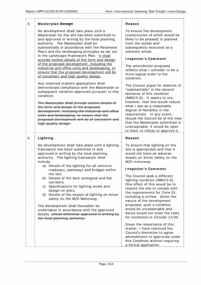
Report APP/U2235/A/09/2096565 Kent International Gateway Rail Freight Interchange
Page 264
5 Masterplan Design
No development shall take place until a Masterplan for the site has been submitted to and approved in writing by the local planning authority. The Masterplan shall be substantially in accordance with the Parameter Plans and the landscaping principles as set out in the Landscape Framework Plan. It shall provide outline details of the form and design of the proposed development, including the industrial and office units and landscaping, to ensure that the proposed development will be of consistent and high quality design.
Any reserved matters applications shall demonstrate compliance with the Masterplan or subsequent variation approved pursuant to this condition.
The Masterplan shall provide outline details of the form and design of the proposed development, including the industrial and office units and landscaping, to ensure that the proposed development will be of consistent and high quality design.
Reason
To ensure the development (construction of which would be likely to be phased) is planned from the outset and subsequently executed as a coherent whole.
Inspector’s Comment
The amendment proposed reflects what I consider to be a more logical order to the condition.
The Council argue for deletion of “substantially” in the second sentence of this condition (MBC/0.6). It seems to me, however, that this would reduce what I see as a reasonable degree of flexibility in the requirement. In any event, should the Council be of the view that the Masterplan submitted is unacceptable, it would be open to them to refuse to approve it.
6 Lighting
No development shall take place until a lighting framework has been submitted to and approved in writing by the local planning authority. The lighting framework shall include:
a) Details of the lighting for all common roadways, pathways and bridges within the site.
b) Details of the dark ecological and bat corridors.
c) Specifications for lighting levels and design on plots.
d) Details of the impact of lighting on driver safety on the M20 Motorway.
The development shall thereafter be undertaken in accordance with the approved details. unless otherwise approved in writing by the local planning authority.
Reason
To ensure that lighting on the site is appropriate and that it would not have an adverse impact on driver safety on the M20 motorway.
Inspector’s Comment
The Council seek a different lighting condition (MBC/0.6). One effect of this would be to require the site to comply with the requirements for Zone E1, including a curfew. Given the nature of the development proposed, such a condition would be unreasonable and hence would not meet the tests for conditions in Circular 11/95.
Given the importance of this matter, I have removed the Council’s discretion to agree amendments to approvals under this Condition without requiring a formal application.

Report APP/U2235/A/09/2096565 Kent International Gateway Rail Freight Interchange
Page 265
7 No phase shall be occupied until a detailed external lighting scheme for that phase has been submitted to and approved in writing by the local planning authority, the details of which shall be consistent with the lighting framework approved pursuant to Condition 6.
The details submitted pursuant to this condition in respect of the phasing including the intermodal terminal shall include details of any lighting on any gantry cranes and shall show that it will not have an adverse impact on driver safety on the M20 motorway.
No external lighting other than that approved pursuant to this condition shall be provided in that phase except with the prior written agreement of the local planning authority.
Reason
To ensure that any proposed lighting would not have an adverse impact on driver safety on the M20 motorway, or adversely affect the living conditions of nearby occupiers or unreasonably harm the wider environment.
8 Development in Accordance with Parameter Plans
The height, width and length of Units Ind A-E, Ind-01 and Ind-02 shown on the details submitted pursuant to Condition 1 shall be in accordance with Parameter Plan 10C 10E.
Other details submitted pursuant to Condition 1 shall substantially accord with the Parameter Plans.
The development shall thereafter be undertaken in accordance with the approved details.
Reason
To ensure that the development does not materially depart from that applied for and considered in the ES & SES.
Inspector’s Comment
Parameter Plan 10 subsequently revised.
9 Units Ind-A to Ind-E, Ind-01 and Ind-02 shall be no higher than 14m above the agreed slab levels.
Reason
To ensure that the development does not materially depart from that applied for and considered in the ES & SES.
10 The details to be submitted pursuant to Condition 1 shall show no more than 298,690m2 of gross external floorspace within the site, to be constructed as defined by the relevant Parameter Plan.
The development shall thereafter be undertaken in accordance with the approved details.
Reason
To ensure that the development does not materially depart from that applied for and considered in the ES & SES.

Report APP/U2235/A/09/2096565 Kent International Gateway Rail Freight Interchange
Page 266
11 Bridge Design
The details to be submitted pursuant to Condition 1 for the relevant phase of the site shall include the detailed design of all bridges in that phase. The submitted detailed designs shall show that the bridges will span the extent of Flood Zone 3 as shown on the Environment Agency’s Flood Map.
Reason
To prevent an increased risk of flooding on-site and elsewhere in accordance with policies NRM2 and NRM4 of the SEP.
12 Materials, Colours and Finishing
The details to be submitted pursuant to Condition 1 shall include a schedule of materials, colours and finishes to be used for the external walls and roofs of the proposed buildings of the development and a schedule of materials and finishes for the proposed bridges.
Reason
In the interests of visual amenity.
13 Intermodal Terminal
Details of any gantry cranes to be used on the site, of which there shall be no more than five, to be used on the site, and which shall be no higher than 25m, shall be submitted to and approved in writing by the local planning authority prior to their installation.
No gantry cranes shall be used on the site other than as those previously agreed approved in writing by the local planning authority.
No more than one reach stacker shall operate on the terminal at any one time
Reason
To ensure a satisfactory visual appearance of the cranes pursuant to policies C4, BE1 and BE6 of the SEP.
Inspector’s Comment
The Council seek to amend the condition to effectively require that (i) the site is operated using a maximum of one reach stacker and (ii) the gantry cranes are installed prior to the terminal commencing operations (MBC/0.6).
The first amendment I support, given that this was the assumption made when the noise calculations were prepared [6.73]. However, the second, I regard as unnecessary as the site could possibly be initially operated using only one or two of the gantry cranes that would finally be provided (or, indeed, possibly operated initially with only a single reach stacker).

Report APP/U2235/A/09/2096565 Kent International Gateway Rail Freight Interchange
Page 267
14 Sustainability
No development of the warehouse (Class B8) or office (Class B1) units shall take place until a report has been submitted to and approved in writing by the local planning authority setting out the measures to be taken such that the predicted CO2 emissions of the development in that phase will be reduced by at least 10% beyond the requirements of Part L 2008 of the Building Regulations through the use of on-site renewable energy equipment.
The development shall be carried out incorporating such approved measures unless otherwise approved in writing by the local planning authority.
Reason
To ensure an energy-efficient form of development pursuant to policy NRM11 of the SEP and the advice in PPS22.
Inspector’s Comment
Given the importance of this matter, I have removed the Council’s discretion to agree amendments to approvals under this Condition without requiring a formal application.
15 No development of the warehouse (Class B8) or office (Class B1) units shall take place until a BREEAM Pre-Assessment Report (or equivalent) has been submitted to and approved in writing by the local planning authority demonstrating that that unit is expected to achieve at least a “Very Good” rating unless otherwise agreed in writing with the local planning authority.
The development shall be carried out in accordance with the details in the BREEAM Pre-Assessment Report (or equivalent) and a certificate shall be provided within three months of completion or occupation (whichever is the sooner) confirming that at least a “Very Good” rating has been achieved.
Reason
To ensure a sustainable and energy-efficient form of construction pursuant to policy CC4 of the SEP.
16 Parking
The details submitted pursuant to Condition 1 shall show the following vehicle parking arrangements:
a) Cars: No more than 2,357 car parking spaces to be provided across the completed development.
b) Secure motorcycle parking: One space per unit or area, plus one space per 20 car parking spaces associated with that unit or area.
c) Cycle parking: One space per each 200m2 of gross floor area in the relevant unit.
d) Goods vehicle parking: No more than one space per 300 m2 of gross B8 floor area, no more than one space per 200 m2 of gross B2 floor area, and no more than six spaces per B1 unit.
The development shall thereafter be undertaken in accordance with the approved details and no additional vehicle parking spaces
Reason
In the interests of sustainability and to reduce reliance on the use of the private car as a means of transport pursuant to policy T4 of the SEP and PPG13.
Inspector’s Comments
Cycle parking/storage is covered by Condition 19.
Given the importance of this matter, I have removed the Council’s discretion to agree amendments to approvals under this Condition without requiring a formal application.

Report APP/U2235/A/09/2096565 Kent International Gateway Rail Freight Interchange
Page 268
shall be created without the prior written agreement of the local planning authority.
17 No building shall be occupied or the intermodal terminal used until the associated car parking, HGV parking, servicing and manoeuvring spaces and the roads and footpaths providing access to that building or the intermodal terminal have been constructed and laid out in accordance with the details submitted to and approved in writing by the local planning authority.
The car parking proposed for each building or the intermodal terminal shall not be used prior to the occupation of that building or area unless otherwise approved in writing by the local planning authority.
Reason
To prevent the development being occupied without adequate parking/turning provision which could to lead to parking inconvenient to other road users and prejudice road safety pursuant to policy T13 of the Local Plan and PPG13.
Also, to prevent parking for an unoccupied building being used by others, thereby undermining the intent of Condition 16.
Inspector’s Comment
Condition re-numbered to associate it with other parking conditions.
18 Except during periods when Operation Stack, or any successor or replacement scheme, is in force cars and HGVs shall not be parked on the site other than in the approved car and HGV parking spaces.
Reason
To prevent overspill parking outside the approved parking areas (e.g. on the site access roads) undermining the intent of Condition 16
Inspector’s Comment
Condition re-numbered to associate it with the other parking conditions.
19 Cycle Storage
None of the Units shall be occupied until details of the cycle storage for employees of the Unit has been submitted to and approved in writing by the local planning authority.
The approved cycle storage shall be provided and thereafter maintained retained unless otherwise approved in writing by the local planning authority.
Reason
In the interest of encouraging workers to travel to the development by means other than by private car.
Inspector’s Comments
Condition re-numbered to associate it better with other similar conditions.

Report APP/U2235/A/09/2096565 Kent International Gateway Rail Freight Interchange
Page 269
20 Site Entrance
The details submitted pursuant to Condition 1 shall include the precise alignment of the HGV access road, as noted on Parameter Plan 8C, which shall protect the function of the M20 A20 from the effects of any vehicles queuing to enter the site, and the location and design of the buildings and truck stop area within the area contained in the red box shown on Parameter Plan 8 C 8D.
The development shall thereafter be undertaken in accordance with the approved details.
Reason
In the interests of ensuring that the layout of the entrance does not prejudice the free flow of traffic on nearby roads and meets security concerns raised at the inquiry.
Inspector’s Comments
Changes made (i) reflect the subsequent revision of Parameter Plan 8 and (ii) make it clear that the proposal should protect the A20 from vehicles queuing to enter the site (which would in turn protect the M20).
21 M20, J8 Improvement
No part of the development hereby permitted shall be occupied until the completion of the improvements to M20 Junction 8 westbound merge shown on drawing number 9T5041/P/12 Rev A dated 20 October 2009 (or such other scheme of works substantially to the same effect, as may be approved in writing by the local planning authority).
Reason
To ensure that the M20 motorway continues to be an effective part of the national system of routes for through traffic in accordance with section 10 of the Highways Act 1980 and to satisfy the reasonable requirements of road safety.
22 Landscaping
No development shall take place until a survey of trees on the edge of the retained areas of woodland has been completed in accordance with the relevant British Standard and submitted to and approved in writing by the local planning authority.
Reason
In the interests of ensuring an agreed tree survey is available to inform the landscaping design.
23 The details to be submitted for approval under Condition 1 in relation to landscaping in respect of that phase shall substantially accord with the relevant Parameters Plan and shall include:
a) Details of all ground modelling, re-profiling, bunding and mounding, including a comprehensive ground level survey with information relating to the existing and proposed ground levels above Ordnance Datum and cross-sections at a scale of not less 1:500 elsewhere, including the finished level of each development platform and the proposed slab levels of any buildings and bridges within that phase.
b) Details of hard landscaping areas showing the proposed colour and surface treatment (using low reflective material) of all roadways, car parking, loading areas, pathways and public rights of way
Reasons
To ensure the satisfactory appearance of the site pursuant to policy ENV6 of the Local Plan.
To ensure biodiversity gain in the value of aquatic habitats in accordance with policy NRM5 of the SEP and the Kent Biodiversity Action Plan.
To ensure that the site is properly fenced and persons and animals are prevented from straying onto the M20 motorway.
Inspector’s Comment
I have adopted some of the

Report APP/U2235/A/09/2096565 Kent International Gateway Rail Freight Interchange
Page 270
within the site. c) Details of trees and hedges to be
retained and a scheme for their protection during the construction of the development.
d) Details of the comprehensive treatment of planting and seeding areas (including green roofs where applicable) including plans and sections at a scale of not less than 1:1250, planting densities, seed mixes/turf composition, and details of species type and size at the time of planting.
e) These Details shall show that of all planting within the corridor of the watercourses and around the new ponds (which shall be carried out using native species of local provenance).
f) Details of the permissive paths to be provided (which shall be substantially as shown on Plan KIG/6.18) including details of their construction standard, width and proposed surface treatment.
g) Details of all boundary treatment, retaining walls and security and other fencing including a programme for its provision.
h) Details of the extent of dark corridors. i) A programme of implementation. j) A programme for management of the
retained planting and new planting areas covering a period of 15 years from completion of the development.
k) Details of arrangements to be made to prevent obstructions to vehicular and pedestrian sight lines and visibility splays within the site.
Council’s suggested changes to this condition (MBC/0.6) and made other variations to the wording to reflect what I understand to be the intent of their suggestions. I have also added to the condition to cover matters included within the Council’s suggested additional conditions 53 and 55 (see below).
24 Foul Drainage
No development shall take place until a strategy to secure the provision of adequate foul drainage arrangements has been submitted to and approved in writing by the local planning authority.
Reason
To protect the groundwater and surface waters from the risk of pollution pursuant to policy NRM1 and NRM2 of the SEP.
Inspector’s Comment
This condition is necessary to address the need for early agreement on a foul water drainage strategy to serve the site [4.31].
25 Foul and Surface Water Drainage
No development of the relevant phase shall take place until detailed schemes for the provision of foul and surface water drainage works for that phase has been submitted to
Reason
The site is partly underlain by the Folkestone Beds, classified as a principal aquifer within the Environment Agency’s

Report APP/U2235/A/09/2096565 Kent International Gateway Rail Freight Interchange
Page 271
and approved in writing by the local planning authority.
The details of surface water drainage scheme shall include:
a) A range of wetland habitats including wet grassland, reedbed and open water to create good quality aquatic habitats.
b) Multiple outflow controls on the proposed detention ponds and other attenuation structures where necessary.
c) Silt traps in all surface water drainage lines to the proposed detention ponds and other attenuation structures.
d) Surface water drainage systems designed to accommodate the 1 in 100 year plus 20% climate change event without surface flooding. Should this not be possible for any reason then appropriate overland flood flow paths taking floodwater away from buildings should be demonstrated.
e) The use of Sustainable Urban Drainage System (SUDS) techniques as appropriate, including in particular infiltration soakaways to assist groundwater recharge and quality.
f) Confirming Calculations demonstrating that the overall average (QBAR) greenfield run-off rate of will not be greater than 3.64l/s/ha.
g) The use of oil and petrol interceptors and other appropriate methods to ensure that potentially polluted run-off is not discharged to ground or surface waters.
No infiltration of surface water drainage into the ground shall take place other than with the express written consent of the local planning authority, which may be given for those parts of the site where it has been demonstrated that there is no resultant unacceptable risk to controlled waters, having regard to both the desirability of recharging the aquifer and the need to ensure this is done only by uncontaminated water. to protect the underlying groundwater from the risk of pollution.
The development shall be carried out in accordance with the approved scheme and no part of it shall be occupied until the foul and surface water drainage system serving it has been completed.
Groundwater Protection: Policy and Practice and within Source Protection Zone III for potable water supply abstraction. The condition is thus necessary to protect the underlying groundwater from the risk of pollution.
More generally it is required to ensure a satisfactory means of drainage for the site and in the interests of pollution prevention and prevention of flooding and the risk of flooding elsewhere pursuant to policies NRM1 NRM2 & NRM4 of the SEP.
Report APP/U2235/A/09/2096565 Kent International Gateway Rail Freight Interchange
Page 272
26 Public Rights of Way
The details to be submitted for approval under Condition 1 shall include full details of the replacement public rights of way, footpaths and bridleways within that phase of the development. These details shall include:
a) Details of the proposed construction of the replacement footpaths and bridleways. Such public rights of way as replace bridleways KM81, KM82 and KH123A shall be designed and constructed to meet the specification A3 in Appendix A of the Countryside Agency publication: On The Right Track Surface Requirements For Shared Use Routes (ca213 2005).
b) Such public rights of way as replace bridleways KM81, KM82 and KH123A shall be designed and constructed so as to provide a cross-fall or camber of 1 in 20 or 5%.
c) A two metre buffer zone between landscaping planting and the edge of the public right of way in which no trees or shrubs shall be planted.
d) The design and technical specifications of the watercourse crossing on such public right of way that replaces KM82, being a minimum width of 5m.
e) The tunnel extension on such public right of way that replaces over KM82 being a minimum width of 4m with a floor to ceiling clearance of 3.7m, a fully bound surface and positive drainage for the bridleway surface.
f) The tunnel by which such public right of way that replaces bridleway KM82 passes beneath the rail spur to Unit Ind-01 being constructed to the following dimensions: 5m width, minimum ceiling height 3.7m, with a fully bound surface and positive drainage.
g) Such public rights of way as replace KM81, KM82 and KH123A being a minimum width of 5m. except when in tunnels or on bridges.
h) The details of safety fencing within the landscaped area between the diverted route of KM81 and Unit Ind-01.
The development shall thereafter be undertaken in accordance with the approved details.
Reason
To ensure that the replacement public rights of way on the site are provided to the standards proposed and considered at the inquiry.
Inspector’s Note
The amendments to e) and g) reflect the scope of the Order (which does not include the length of KM81 through the tunnel extension north of Mallings Lane).

Report APP/U2235/A/09/2096565 Kent International Gateway Rail Freight Interchange
Page 273
27 Access Road Crossing of Crismill Road
No development of the relevant phase shall take place until a detailed construction design and method statement for the tunnel/bridge beneath Crismill Lane Road (KH134) on such right of way as replaces KM134 has been submitted to and approved in writing by the local planning authority.
The development shall thereafter be undertaken in accordance with the approved details unless otherwise approved in writing by the local planning authority.
Reason
To ensure that the public right of way along Crismill Road (KH134) is maintained throughout the works.
Inspector’s Comment
The changes reflect (i) the requirements of Condition 4 a) above (the effect of which is to require this tunnel/bridge to be constructed in the first phase of the development); and (ii) the absence of any proposal to modify KH134.
Inspector’s Comment
Given the importance of this matter I have removed the Council’s discretion to agree amendments to approvals under this Condition without requiring a formal application.
28 Temporary Replacement of Public Rights of Way Affected by the Works
No part of the development that affects public rights of way shall take place until traffic free alternative routes have been provided for public use. as required pursuant to Condition 2 above.
Details of the routing and standards for all the condition of temporary public rights of way, including any haul road crossing points, shall be submitted to and approved in writing by the local planning authority.
Haul roads should be set out to avoid crossing public rights of way wherever practical. Where such crossings are necessary (i) they such crossings should be constructed from Type 1 material to the depth necessary to support the vehicles using them, and (ii) vehicles should be under traffic light control with priority for users of the public right of way.
The approved details shall be implemented and thereafter maintained until such time as the new replacement public rights of way routes and/or haul routes have been provided.
Reason
To ensure the ongoing safety and convenience of users of public rights of way whilst construction is in progress pursuant to policy C6 of the SEP.

Report APP/U2235/A/09/2096565 Kent International Gateway Rail Freight Interchange
Page 274
29 Stockpiles
Stockpiles of topsoil or any other material should be sited a minimum of 30m from existing, replacement or temporary public rights or way.
Reason
To ensure the safety and convenience of the users of affected public rights of way within the site pursuant to policy C6 of the SEP.
30 Management of Rights of Way and Permissive Paths
No development shall take place until details of a management regime for the public rights of way and permissive paths has been submitted to and approved in writing by the local planning authority. The details shall include:
a) Measures to maintain and keep open to the public the public rights of way within the site and any structures associated therewith.
b) An inspection regime for any bridge carrying a public right of way.
c) A management regime for the maintenance of the permissive paths shown on Plan KIG/6.18.
d) Arrangements for permitting public access to the permissive paths consistent with their status as permissive paths.
Reason
To ensure the safety and convenience of the users of affected public rights of way within the site pursuant to policy C6 of the SEP.
31 Construction Environment Management Plan
No development, including for the avoidance of doubt any preparatory earthworks or site levelling, shall take place until a Construction Environment Management Plan (CEMP) has been submitted to and approved in writing by the local planning authority. The plan shall include:
a) Details of the hours of construction work. b) Details of the methods to control noise
and vibration arising from construction activities. These measures shall include: • Daily noise limits which must not be
exceeded without the prior written agreement of the local planning authority. and which shall be approved as part of a Control of Pollution Act 1974 Section 61 Agreement.
• Proposals for monitoring of construction noise.
• Proposals for monitoring vibration measurements. where indicated by the LPA;
• Proposals for the use of mitigation measures or alternative working practices where the measurements exceed acceptable limits.
Reason
In the interest of controlling the construction works to limit the impact of construction on surrounding residents and to prevent pollution of ground and surface waters pursuant to policies NRM1, NRM2, NRM10 & BE1 of the SEP; and to ensure that persons and animals are prevented from straying onto the M20 motorway.
Inspector’s Comments
The Council have suggested (MBC/0.6) that the condition should require details of predicted noise levels to be submitted. I think this unnecessary given that noise limits and monitoring proposals are to be agreed.
They have further suggested an amendment to p) relating to trees, which I have in large part adopted.

Report APP/U2235/A/09/2096565 Kent International Gateway Rail Freight Interchange
Page 275
For the avoidance of doubt in the event of any inconsistency between the requirements of the CEMP approved pursuant to this condition and any agreement entered into pursuant to Section 61 of the Control of Pollution Act 1974 the measures in the latter shall prevail.
c) Details of the methods to be used to control dust and other emissions from the site.
d) Details of all temporary fencing, temporary buildings, compound areas and parking areas including arrangements for their removal following completion of construction and fencing arrangements to prevent public access to otherwise unguarded excavations.
e) Details of areas to be used for the storage of plant and construction materials and waste.
f) Details of the facilities to be provided for the storage of fuel, oil and other chemicals, that may be needed to including measures to prevent pollution.
g) Details of temporary lighting arrangements.
h) Measures to ensure that construction vehicles do not deposit mud on the public highway including public rights of way.
i) A scheme for the routing of construction vehicles accessing the site.
j) A commitment not to burn materials or waste on-site.
k) Details of the construction earthworks methodology including the extent of any material to be temporarily stored within the site and details of any surplus material to be removed from the site for disposal.
l) A soil resource management plan. m) A scheme to treat and remove
suspended solids from surface water run off during construction works.
n) A scheme to ensure that no degradation of surface and ground water quality occurs on or off-site as a result of the construction phase of the development including but not limited to the use of piling or any other foundation designs using penetrative methods.
o) Advisory signage at public access points advising of possible hazards including the potential for sudden noise.
p) Tree protection measures. An arboricultural method statement detailing any works required to trees to be retained within the site and details of tree protection measures.
Given the importance of some matters covered by this condition, I have removed the Council’s discretion to agree amendments to approvals under this Condition without requiring a formal application.

Report APP/U2235/A/09/2096565 Kent International Gateway Rail Freight Interchange
Page 276
For the avoidance of doubt in the event of any inconsistency between the requirements of the CEMP approved pursuant to this condition and any agreement entered into pursuant to Section 61 of the Control of Pollution Act 1974 the measures in the latter shall prevail.
The construction of the development shall be carried out in accordance with the approved construction management plan unless otherwise agreed in writing with by the local planning authority.
32 Noise
The details to be submitted for approval under Condition 1 shall include all details of all acoustic barriers and bunds. within that phase of the development.
The development shall thereafter be undertaken in accordance with the approved details.
Reason
To ensure that the development does not materially depart from that applied for and considered in the ES & SES.
33 All warehouse loading bays, lorry parking areas and the truck stop must be fitted with static power devices to enable refrigerated vehicles to be switched off during loading and unloading activities and during periods when Operation Stack is in operation or when vehicles are parked overnight.
No part of the development shall be occupied until details have been submitted to and approved in writing by the local planning authority of areas of the development where HGV engines and refrigeration systems shall not be left running overnight, during loading or unloading and during periods when Operation Stack is in force. HGV engines and HGV refrigeration systems shall be turned off accordingly in these approved areas.
Reason
In the interests of sustainability and the amenities of the occupiers of nearby residential properties and the character of the area in general pursuant to policy NRM10 of the SEP.
34 Reversing alarms for all plant and vehicles normally based at the site shall be of the broadband type. Furthermore, these should and shall be located a maximum of 2.5m above the ground level.
Reason
In the interests of the amenities of the occupiers of nearby residential properties and the character of the area in general pursuant to policy NRM10 of the SEP.
35 The rating level of noise emitted from all fixed plant and equipment on the site shall not exceed a level of 5dBA below the existing background noise level during the day or night. The noise levels shall be determined at any noise sensitive premises. The measurements and assessment shall be made according to BS
Reason
In the interests of the amenities of the occupiers of nearby residential properties and the character of the area in general pursuant to policy NRM10 of the
Report APP/U2235/A/09/2096565 Kent International Gateway Rail Freight Interchange
Page 277
4142: 1997.
SEP.
Inspector’s Comment
Whilst the Council argue for a limit 10dB below the background noise level (MBC/0.6), I see no reason to adopt this having regard to the nature of the ambient noise climate in the area and the advice in BS4142:1997.
36 No works or ancillary operations associated with the construction of the development which are audible at any noise sensitive premises shall take place on-site on any Sunday or Bank Holiday, nor on any day except within the following times: Monday to Friday 08:00-18:00 hours, Saturday 08:00-13:00 unless in association with an emergency or with the prior written approval of the local planning authority.
Reason
In the interests of the amenities of the occupiers of nearby residential properties and the character of the area in general pursuant to policy NRM10 of the SEP.
37 Contaminated Land
No development shall take place until the following components of a scheme to deal with the risks associated with contamination of the site have been submitted to and approved in writing by the local planning authority.
a) A site investigation scheme to provide information for a detailed assessment of the risk to all receptors that may be affected, including those off-site.
b) Based on the site investigation results, an options appraisal and remediation strategy giving full details of the remediation measures required and how they are to be undertaken.
c) A verification plan providing details of the data that will be collected in order to demonstrate that the remedial works are complete and identifying any requirements for longer-term monitoring of pollutant leakages, maintenance and arrangements for contingency action.
The remedial works required by the approved strategy (referenced in (b) above) shall be completed to the reasonable satisfaction of the local planning authority before construction commences in the relevant phase of the works and the development shall be undertaken in accordance with the details approved pursuant to this condition.
Reason
To protect potential receptors (including underlying groundwater) from any harmful contamination that may be present on the site.

Report APP/U2235/A/09/2096565 Kent International Gateway Rail Freight Interchange
Page 278
38 Groundwater Monitoring
No development shall take place until details of a comprehensive groundwater monitoring regime have been submitted to and approved in writing by the local planning authority and shall be implemented not later than the expiry of two months of the date of its approval and maintained thereafter.
The details submitted pursuant to this condition shall make provision for the adequate monitoring of groundwater quality and quantity prior to the start of construction. to the satisfaction of the local planning authority.
Ground water monitoring shall be undertaken in accordance with the details approved pursuant to this condition.
Reason
To ensure that the groundwater quality and quantity is effectively monitored before and during construction pursuant to policy NRM1 of the SEP.
39 Ground Conditions
No development shall take place until a Geotechnical Design Report and Geotechnical Investigation Report have been submitted to and approved in writing by the local planning authority. produced The reports shall be in accordance with Highways Agency Standard HD22/08 and shall demonstrate demonstrating that there will be no detriment to the supporting geological structure of the M20. and submitted to and approved in writing by the local planning authority.
Unless otherwise approved in writing by the local planning authority, the The actions or recommendations arising from the Report shall be undertaken in accordance with the programmes recommended. in them.
Reason
To ensure that that the M20 motorway continues to be an effective part of the national system of routes for through traffic in accordance with section 10 of the Highways Act 1980, satisfying the reasonable requirements of road safety.
Inspector’s Comment
Given the importance of this matter, I have removed the Council’s discretion to agree amendments to approvals under this Condition without requiring a formal application.
40 Biodiversity & Watercourses
No development shall take place until ecological surveys of the watercourses on-site have been carried out and the results submitted to and approved in writing by the local planning authority. The results of the surveys shall be used to inform the design and enhancement of the watercourses on the site.
Reason
To ensure adequate mitigation and compensation measures for the loss of existing wildlife habitat value of the watercourses on the site in accordance with policy NRM5 of the SEP and the Kent Biodiversity Action Plan.
41 No development shall take place until a detailed design of the new watercourses proposed as mitigation or compensation for the existing stretches of watercourse to be culverted or lost is submitted to and approved in writing by the local planning authority. The specification shall include a sinuous channel with natural banks and substrate.
Reasons
To protect the long-term wildlife value of the watercourses in accordance with policy NRM5 of the SEP and the Kent Biodiversity Action Plan.
To prevent flooding and pollution

Report APP/U2235/A/09/2096565 Kent International Gateway Rail Freight Interchange
Page 279
The detailed design shall demonstrate that the proposed ground stabilization works associated with the watercourse diversions will have an adequate factor of safety.
The new watercourses shall be created in accordance with the approved design and the routing and the length of watercourses shall be as shown on the relevant Parameter Plan. unless otherwise agreed in writing by the local planning authority.
of watercourses in accordance with policies NRM2 and NRM4 of the SEP.
42 Archaeology
No development shall take place until the applicant, their agent or successors in title, has secured the implementation of a programme of archaeological work in accordance with a Written Scheme of Investigation which has been previously submitted to and approved in writing by the local planning authority.
Reason
To enable the recording of any items of historical or archaeological interest pursuant to policy BE6 of the SEP.
Inspector’s Comment
Whilst the Council argue for a much fuller condition (MBC/0.6), this is at odds with the position taken at the inquiry by the (KCC) archaeological witness who advised me (without prejudice) that, in the event of the SoS deciding to grant planning permission for the development, the ‘standard’ condition should be applied.
43 Air Quality
No development shall take place until details of an air quality monitoring scheme have has been submitted to and approved in writing by the local planning authority. The scheme as submitted shall provide for inter-alia:
a) Continuous monitoring, at a location to be agreed with the local planning authority in writing, to include NOX, NO2, and PM10 along with appropriate housing of the equipment. Monitoring methods to be agreed, shall be equivalent to DEFRA AURN operating standards (including audits and servicing).
b) A timescale for Monitoring of the operational impacts of development for a to be minimum of 3 months prior to opening of the development for the proposed use as a freight interchange and for the monitoring to be continued for a period of 5 years after the site is fully open.
c) The monitoring site to include full calibration and 6-monthly audits to ensure monitoring quality is maintained
Reason
To enable the local planning authority to monitor the operational traffic impacts of the development on pollutant levels within the Maidstone AQMA pursuant to policy NRM9 of the SEP.
Inspector’s Comment
Suggested amendments to improve clarity.

Report APP/U2235/A/09/2096565 Kent International Gateway Rail Freight Interchange
Page 280
throughout the agreed monitoring term. d) Interim data to be provided on a real-
time basis through a suitable website, or through monthly reports (in excel or another format agreed with the local planning authority), or upon the reasonable request of the local planning authority.
e) 6-monthly reports including audit reports and data validation, to be provided to the local planning authority within 5 weeks of the expiry of each 6-month monitoring period.
Monitoring shall thereafter be carried out in accordance with the approved scheme.
In the event that the monitoring shows that the development is causing a substantial adverse impact on air quality (as defined in Development Control Planning for Air Quality:NCSA:2006) a detailed scheme of mitigation shall be submitted to and agreed in writing by the local planning authority and thereafter implemented.
Monitoring, and any scheme of mitigation required under (f) above, shall thereafter be carried out in accordance with the approved scheme.
44 Site Operational Management
No development shall take place until details of the management arrangements for the operational of the site have been submitted to and approved in writing by the local planning authority. The details shall include:
a) Waste management arrangements, including arrangements for the collection of litter and the storage and collection of refuse and materials for recycling.
b) A management plan for the common areas of the site. to include the long-term management of the structural landscaping, newly planted woodlands and retained woodlands. This management plan shall require that the landscaping, newly planted and retained woodlands provided in accordance with the approved details shall be maintained thereafter.
c) Arrangements for the long-term maintenance and management of all watercourses, ponds, culverts and other water drainage infrastructure (both existing and to be created) within the site which covers their annual care from the point at which the facility becomes
Reason
To ensure a satisfactory appearance to the site pursuant to policy ENV6 of the Local Plan and in the interests of the amenities and character of the area pursuant to policies BE1 BE6 and C4 of the SEP.
Inspector’s Comments
Sub clause b) has been modified to remove the overlap with Condition 23 j).
Sub clause c) has been deleted to avoid overlap with the EA’s Condition (No 53).

Report APP/U2235/A/09/2096565 Kent International Gateway Rail Freight Interchange
Page 281
operational over its lifetime. KIG Wording A management scheme to ensure that no degradation of surface and ground water quality on or off-site occurs as a result of the operational phase of the development.
d) A commitment that there shall be no burning of waste or materials on the site.
The development shall thereafter be managed and maintained in accordance with the approved details unless otherwise agreed in writing by the local planning authority.
45 Safety and Security
No development shall take place until a security and site incident management plan has been submitted to and approved in writing by the local planning authority. The plan shall include:
a) A security strategy for the site. b) A Fire and Rescue Emergency Plan
including emergency access arrangements for emergency vehicles to access the site and for the evacuation of the site.
The development shall thereafter be undertaken and subsequently operated in accordance with the approved details unless otherwise approved in writing by the local planning authority.
Reasons
The condition is necessary to ensure that measures are put in place to ensure an appropriate level of security on the site and to deal with any incidents or emergencies.
Inspector’s Comment
Whilst the Council argue for additional wording (MBC/0.6), I take the view that it is unnecessary given the likely content of the required security strategy.
46 Emergency Access
Any emergency access routes to the site as shown on the relevant Parameter Plan shall not be used except in the event of emergencies.
Reason and Inspector’s Comment
The reason for the condition is to prevent operational traffic using the proposed emergency access other than in an emergency as this would not be acceptable in highway or amenity terms. I have amended the condition to allow for changes to be made to the emergency access arrangements shown on the parameters plan if considered appropriate.
47 Fire Sprinkler Systems
No warehouse (Class B8) units with a gross external floorspace in excess of 20,000m2 shall be occupied until they have been equipped with a high level sprinkler system, which shall be thereafter maintained in an operational state.
Reason
In the interests of fire safety (see INQ/10).
48 Containers & Storage Reason

Report APP/U2235/A/09/2096565 Kent International Gateway Rail Freight Interchange
Page 282
No open storage of containers, plant, materials, products, goods for sale or hire, or waste shall take place within the site except for plant and containers associated with the operation of the intermodal terminal within the terminal area and refuse storage as approved pursuant to condition 33 44. Within the intermodal terminal, the maximum height of stacked containers and any plant shall be no higher than 12m above the ground level.
To safeguard the character and appearance of the surrounding area pursuant to policy C4 of the SEP.
49 Rail Works
The Maidstone East - Ashford Rail Line connection works and the rail links to the intermodal terminal and the individual units once provided shall thereafter be managed, retained and maintained and managed such that they remain available and capable of being used.
Reason
To ensure that the site can continue to function as an SRFI and as considered in the ES and SES.
50 Pollution Control
No chemicals, oils or fuel shall be stored within the site or within any of the buildings unless details of the bunding and pollution prevention measures for any oil or fuel storage tanks to be erected or placed within the site proposed in connection with their storage have been submitted to and approved in writing by the local planning authority.
The development shall thereafter be undertaken in accordance with the subsequently approved details and maintained thereafter
Chemicals, oils or fuel shall thereafter only be stored in accordance with approved details.
Reason
To prevent pollution and to protect the underlying aquifer pursuant to policies NRM1 and NRM2 of the SEP and PPS23.
51 Permitted Development
Notwithstanding the provisions of the Town and Country Planning (General Permitted Development) Order 1995 (or any Order revoking or replacing the same) no extension of the approved buildings, including the provision of mezzanine floors, shall be carried out and no development undertaken falling within Part 8 Classes A, B and C.
Reason
To ensure that the development does not materially depart from that applied for in relation to traffic generation and provision of parking and considered in the ES & SES and to protect the amenities of the locality pursuant to policies BE1 and C4 of the SEP.
Inspector’s Comment
Additional condition suggested by the Council (MBC/0.6) – see below.

Report APP/U2235/A/09/2096565 Kent International Gateway Rail Freight Interchange
Page 283
52 Site Accesses to A20
The two site access junctions onto the A20, in the general form of the traffic signal junctions shown on DWP Drawing No. 2005-180/D/06 Rev A (submitted as part of the Transport Supplementary Information in September 2008), shall be constructed and made operational prior to the first occupation of any unit.
Reason
To ensure that the development has an acceptable access to the highway and is properly served pursuant to policy ENV22 of the Local Plan.
Inspector’s Comment
Additional condition suggested by the Council (MBC/0.6) – see below.
53 Watercourse and Surface Water Drainage Management
Prior to the earlier of: a) commencement of any development
hereby permitted by this planning permission, or
b) commencement of any work affecting any watercourse or to provide any pond or other surface drainage infrastructure on the application land,
a site management plan (“the Management Plan”) for the long-term management of watercourses, ponds and culverts (existing and to be created) and other surface water drainage infrastructure on the site shall be submitted to and approved in writing by the local planning authority.
The Management Plan shall cover their care over the expected built life of the development from the point at which it becomes operational and shall include:
a) An inspection, maintenance and reporting programme at agreed (and at least annual) intervals of all surface drainage infrastructure including in particular all watercourses, culverts, ponds, attenuation structures and their associated banks.
b) An appraisal programme of cutting the bank side vegetation.
c) A schedule of periodic silt removal from all surface drainage infrastructure.
d) A scheme for the restoration of the watercourses, ponds or culverts on the de-commissioning of the development.
The Management Plan shall also: a) Provide for the phasing of the processes
over the construction and operational life of the development.
b) Indicate the contractual or other arrangements that are proposed in order
Reason
To ensure the surface water drainage infrastructure is maintained for the purposes of preventing flooding on-site, the risk of flooding elsewhere and pollution prevention and preservation of groundwater and surface water quality pursuant to policies NRM1, NRM2 & NRM4 of the SEP.
Inspector’s Comment
Additional condition suggested by the EA (EA/5) – see below.

Report APP/U2235/A/09/2096565 Kent International Gateway Rail Freight Interchange
Page 284
to ensure continuity of implementation over that period.
c) Make provision for requiring the owner or operator of the site for the time being to take specified steps in the event that any provision of the approved Management Plan is not being complied with or any surface drainage infrastructure has become defective.
With effect from first commencement of any development permitted by this planning permission, the phased implementation of the approved Management Plan shall commence, and implementation shall subsequently continue throughout the built life of, and on decommissioning of, the development.
The construction, operation and decommissioning of the development shall be undertaken strictly in accordance with the approved Management Plan.
Definition
Parameter Plans (see KIG/0.23)
Parameter Plan 1A – Application Site
Parameter Plan 2C – Woodland and Trees
Parameter Plan 3D – Highways, Rights of Way and Diversions
Parameter Plan 4C – Watercourses, Diversions, Culverting and Drainage
Parameter Plan 5B – Services and Service Buildings
Parameter Plan 6D – Landscaping Armature
Parameter Plan 7B – Rail and Intermodal Area
Parameter Plan 8D – Accesses, Internal Roads and Bridges
Parameter Plan 9C – Development Zones and Floor Space by Use Type
Parameter Plan 10E – Building Platforms, Building Positions and Heights
Inspector’s Comments on Additional Conditions Requested by the Council (MBC/0.6) I have incorporated the conditions suggested by the Council where I am satisfied that they meet the tests in Circular 11/95 as set out above. However, I do not consider that the other requested conditions should be attached for the following reasons: Additional Condition 52

Report APP/U2235/A/09/2096565 Kent International Gateway Rail Freight Interchange
Page 285
Whilst I acknowledge that foundation design is a concern, particularly where buildings will be in whole or in part founded on Gault Clay, I see no reason for the condition suggested, having regard to the safeguards provided by the Building Regulations. Additional Condition 53 I agree that parts of this condition are necessary for the reasons stated and have included them in Condition 23 above. Additional Condition 54 Given the nature of the development proposed and the requirements of Conditions 23 and 31 above I see no reason to add this condition. Additional Condition 55 Given the nature of the development proposed and the requirements of Condition 23 (as amended), I see no reason to add this condition. Additional Condition 57 Having regard to Network Rail’s position in relation to the development and, more importantly, the requirements of Condition 4 a) and d) above, I see no reason for this condition. Additional Condition 58 There was no evidence at the inquiry to suggest that economically recoverable mineral reserves are present on the site and no suggestion that any of the materials arising during construction would be used other than in the earthworks (save for a modest amount of unsuitable material that might need to be removed from the site). Having regard to the requirements of Condition 31 k) and l) above, I see no reason for this condition. Inspector’s Comments on Additional Condition Requested by the Environment Agency (EA/5) Whilst I do not support the EA’s submissions that the Appellants should enter into an agreement covering the maintenance of the watercourses that cross the site and other drainage structures (see Report para 18.156 et seq). I agree that a condition is required along the lines that they suggest. This is included as Condition 53 above.

Report APP/U2235/A/09/2096565 Kent International Gateway Rail Freight Interchange
Page 286
APPENDIX F – S247 ORDER Should planning permission for the appeal scheme be granted and the Secretary of State for the Environment, Food and Rural Affairs not agree with my conclusions in respect of the S247 Order set out in paragraphs 18.280 to 18.286, then he will need to consider the modification to the draft Order (KIG/6.8) submitted by Kent International Gateway Ltd (KIG) during the course of the inquiry. The modified draft Order takes account of detailed concerns of Kent County Council (KCC/3.1, Section 5) and (i) amends, to more accurately define, some of the distances of the routes to be stopped-up, diverted and created; (ii) defines a 5m width throughout for the new bridleways (as proposed by KIG); and (iii) defines ‘the Council’ as Kent County Council and Maidstone Borough Council together. A revised plan (KIG/6.19) (replacing that accompanying the original draft Order and those attached to the modified draft Order (KIG/6.8)) has also been submitted showing a slightly altered alignment of the replacement bridleway for KM82, although this alteration does not require any change to the description of the bridleway as set out in the original or modified draft Order. If the Order is to be made I therefore conclude that it should be made on the basis of the more accurate, modified draft Order, subject to further minor correction, to refer to Thurnham Lane rather than Thurnham Road in Part B of the Schedule and in Section 5 to the revised plan (KIG/6.19) drawing 3073-SK-04 rev A (November 2009). At the inquiry there was discussion about the installation of bollards on the replacement bridleway for KM81 [6.61], which would need to be specifically mentioned in the Order. However, such a provision is not included in the modified Order submitted by KIG and the matter was not subsequently pursued by the County Council. I am not persuaded that such bollards would be necessary. It is the County Council’s case [8.122] that these, necessary, modifications to the draft Order would require it to be re-advertised to give the opportunity for further representations. It is also suggested [16.11] that the draft Order was incorrectly advertised as being a stopping-up Order in Bearsted, rather than a diversion Order in the Parish of Thurnham. On these matters, it seems to me that, other than the increase in width of the proposed, alternative, bridleways (which to my mind would be an enhancement), the modifications to the draft Order are very minor and I am not persuaded that anyone would be prejudiced by them. The advertisement of the draft Order referred to the PROWs as being located “at land to the west of Junction 8 of the M20 motorway, at Bearsted in the Borough of Maidstone” (INQ/3, Section B3). Although within the parish of Thurnham, the appeal site was commonly referred to throughout the inquiry (including by local residents) as being at Bearsted. Given this, and the extent of local publicity about the appeal proposal (which is specifically referred to in the advertisement of the draft Order) I consider it highly unlikely that anyone who read the advertisement was unclear about which PROWs it concerned. In response to a query about the Order being a stopping-up, rather than a diversion, one the National Transport Casework Team indicated (INQ/3, C2) that the approach adopted is the appropriate one as the replacement routes terminate in different locations from the routes to be stopped-up. I see no reason to disagree with this approach.
Report APP/U2235/A/09/2096565 Kent International Gateway Rail Freight Interchange
Page 287
APPENDIX G - INSPECTOR’S ISSUES
Inspector’s Issue as Set Out in Opening (INQ/7) The site is outside the development boundary for Maidstone as defined in the local plan. It is proposed to be developed as a railfreight interchange with extensive warehousing and other buildings. It is common ground that that this is not something contemplated by the Borough Local Plan. In policy terms the site is within the countryside and within a special landscape area. It is close to an AONB. Whilst the appeal was made against the Council’s failure to determine the application, the Council indicated at a meeting earlier this year, that, had the application still been for them to determine, then they would have refused it for some 18 reasons. Subsequently, a few of these have been overcome, following the receipt of further information from the applicants. However, some 14 putative reasons for refusal remain. The main matters that the inquiry will need to consider, as I currently see them, concern:
• whether or not there is a need for a SRFI at the location proposed and whether the policy support for SRFIs in general could better be met in an alternative way to that proposed;
• the effect the proposal would have on the employment strategy and policies set out in the South East Plan;
• the effect the proposal would have on the countryside, the special landscape area and the nearby Kent Downs Area of Outstanding Natural Beauty;
• the extent to which the proposal would cause harm by reason of eroding the strategic gap between Maidstone and the Medway towns;
• the extent to which the development would impact on footpaths and bridleways near to and crossing the site and people’s enjoyment of the area for recreational purposes;
• whether or not noise from the development and lighting associated with it would harm the living conditions of nearby residents;
• the extent to which the proposal would result in harm to trees, hedgerows and other areas of habitat and species of importance for biodiversity;
• the effect the proposal would have on the setting of listed buildings on or near the site, the Scheduled Ancient Monument at Thurnham Castle and nearby conservation areas, including particularly those at Bearsted;
• whether or not the proposal should be refused planning permission on account of the site’s potential to contain important archaeological remains;
• whether or not the proposal would have an adverse effect on the highway network serving the area and whether the traffic generated by it would threaten other proposals for new housing development in Maidstone; and
• whether or not the proposal could be designed in a way that would adequately deal with terrorist or similar threats.
The issue, in short, is whether the policy support for and benefits of the proposed SRFI amount to material considerations of sufficient weight to overcome the conflicts with the development plan and any other harm to matters of acknowledged importance that would result. Andrew M Phillipson Inspector 13 October 2009

Department for Communities and Local Government Julian Pitt, Decision Officer Planning Central Casework Division, 1/H1, Eland House Bressenden Place London SW1E 5DU
Tel: 0303 44 41630 Email: [email protected]
5 August 2010 Ms M Thomson Marrons 1 Meridian South Meridian Business Park Leicester LE19 1WJ
Our Ref: APP/U2235/A/09/2096565
Your Ref: 07/2092
Dear Ms Thomson, TOWN AND COUNTRY PLANNING ACT 1990 – SECTION 78 APPEAL BY KENT INTERNATIONAL GATEWAY LTD: LAND TO THE NORTH AND SOUTH OF THE ASHFORD TO MAIDSTONE EAST RAILWAY LINE, LYING TO THE SOUTH OF THE M20, TO THE WEST OF M20 JUNCTION 8 AND TO THE EAST OF THURNHAM LANE, MAIDSTONE APPLICATION: REF 07/2092 1. I am directed by the Secretary of State to say that consideration has been given
to the report of the Inspector, Andrew M Phillipson BSc CEng FICE MCIHT, who held a public local inquiry on dates between 13 October and 23 December 2009 into your client's appeal against a decision of Maidstone Borough Council to refuse planning permission for the construction of hardstanding areas to form a rail/road interchange with freight handling equipment, new railway sidings in part with acoustic enclosure, earthworks and retaining walls, buildings for Class B8 warehousing and Class B1 uses, access works, internal roads and bridges, loading and manoeuvring areas, car and lorry parking, ancillary truck stop and gatehouse security facilities, electricity sub-station, realignment of public rights of way and watercourses, drainage works and landscaping at land to the north and south of the Ashford to Maidstone east railway line, lying to the south of the M20, to the west of M20 junction 8 and to the east of Thurnham Lane, Maidstone, in accordance with application Ref 07/2092, dated 5 October 2007.
2. On 2 March 2009, the appeal was recovered for the Secretary of State's determination, in pursuance of section 79 of, and paragraph 3 to Schedule 6 to, the Town and Country Planning Act 1990.

Inspector’s recommendation and summary of the decision 3. The Inspector recommended that the appeal be dismissed and planning
permission refused. For the reasons given below, the Secretary of State agrees with the Inspector’s conclusions and with his recommendation. A copy of the Inspector’s report (IR) is enclosed for the man parties. For all other parties, a copy of his conclusions only is enclosed but the full 287 page report can be obtained upon request to the address at the foot of the first page of this letter. All references to paragraph numbers, unless otherwise stated, are to that report.
Bridleway and footpath Stopping Up Order 4. The Inspector also considered whether or not a related draft Order should be
confirmed, under Section 247 of the Town and Country Planning Act 1990, authorising the stopping-up of the whole of bridleway KM81 and lengths of bridleway KM82 and KH123A, and the diversion of a length of footpath KH131 on land to the west of Junction 8 of the M20 motorway, at Bearsted in the Borough of Maidstone (IR1.10). A separate decision letter (enclosed) on whether the order should be made has been issued by the Secretary of State for the Environment, Food and Rural Affairs, as this matter lies within her jurisdiction.
Procedural Matters 5. Since the original application for planning permission was submitted, the proposal
was amended as set out in IR1.8 – 1.9. The Secretary of State considers that no prejudice has been caused to any party by this course of action and has determined the appeal on the basis of the amended proposal.
6. In reaching his decision, the Secretary of State has taken into account the
Environmental Statement (ES) and Supplementary Environmental Statement (SES) which were submitted under the Town and Country Planning (Environmental Impact Assessment) (England and Wales) Regulations 1999. The Secretary of State agrees with the Inspector’s reasoning and conclusions with respect to the adequacy of these documents (IR18.173 – 18.182) and he is satisfied that the ES and SES comply with the above regulations and that sufficient information has been provided for him to assess the environmental impact of the application.
Matters arising after the close of the Inquiry 7. Following the close of the Inquiry, the Secretary of State received the written
representations listed at Annex A of this letter. He has taken account of these representations in his determination of this appeal but, as they did not raise any new matters not considered at the Inquiry, he has not considered it necessary to circulate them to all parties. Copies of representations can be made available upon written request.
8. On 6 July 2010 the Secretary of State revoked all Regional Strategies including
the South East Plan (SEP) referred to at IR5.3 – 5.9. The SEP therefore no longer forms part of the development plan and the Secretary of State has taken
2

this into account in determining the appeal. In view of the general policy support for the provision of SRFIs in other policy documents, he does not consider that revocation raises any matters that would affect his decision or require him to refer back to parties for further representations prior to reaching his decision.
Policy Considerations 9. In deciding the application, the Secretary of State has had regard to section 38(6)
of the Planning and Compulsory Purchase Act 2004, which requires that proposals be determined in accordance with the development plan unless material considerations indicate otherwise.
10. In this case, the development plan now comprises saved policies of the
Maidstone Borough Wide Local Plan (LP), adopted December 2000. The Secretary of State considers that the development plan policies most relevant to the appeal are those set out by the Inspector at IR5.10 – 5.14.
11. The Secretary of State has had regard to the Preferred Options document for the
Maidstone Core Strategy, published in January 2007 (IR5.15). However, given its status as a draft document he has afforded its policies little weight.
12. Other material considerations which the Secretary of State has taken into
account include Planning Policy Statement (PPS) 1: Delivering Sustainable Development; PPS: Planning and Climate Change (supplement to PPS1); PPS7: Sustainable Development in Rural Areas; PPS9: Biodiversity & Geological Conservation; Planning Policy Guidance (PPG) note 13: Transport; PPG17: Planning for Open Space, Sport and Recreation; PPG24: Planning & Noise; PPS25: Development & Flood Risk; Circular 11/95: The Use of Conditions in Planning Permission; Circular 05/05: Planning Obligations; and the Community Infrastructure Levy (CIL) Regulations, which came into force on 6 April 2010. Relevant policies in the 2008 London Plan and in the former Strategic Rail Authority’s 2004 document Strategic Rail Freight Interchange Policy are also material.
13. Since the inquiry closed, the Government has published two other relevant policy
statements, PPS4: Planning for Sustainable Economic Growth and PPS5: Planning for the Historic Environment, which replaced PPG15. The Secretary of State agrees with the Inspector’s assessment of the implications of these statements for this appeal, as set out in IR5.16 – 5.20. He does not consider that there has been any material change in national policies on these matters to the extent that it would affect his decision or require him to refer back to parties for further representations prior to reaching his decision.
14. The Secretary of State has had special regard to the desirability of preserving the
nearby listed buildings and their settings, or any features of special architectural or historic interest which they possesses, as required by sections 16 and 66 of the Planning (Listed Buildings and Conservation Areas) Act 1990. In view of the possible impact of the proposal on the Bearsted Green and Holy Cross Conservation Areas, he has also paid special attention to the desirability of preserving or enhancing the character or appearance of these areas, as required by section 72 of the same Act.
3

15. The Secretary of State has also taken account of the Bearsted Conservation
Areas Appraisal and Management Plan. This document was adopted after the close of the Inquiry, on 22 March 2010, but the Secretary of State does not consider that it has introduced material changes to the extent that it would affect his decision or require him to refer back to parties for further representations prior to reaching his decision.
Main Issues 16. The Secretary of State considers that the main issues in this case are those set
out by the Inspector in document INQ7 and at IR18.1 – 18.7. Prematurity 17. For the reasons given at IR18.9 – 18.15, the Secretary of State agrees with the
Inspector that there is no reason to refuse planning permission on prematurity grounds (IR18.16).
Employment & Travel to Work Issues 18. Having taken account of the Inspector’s reasoning and conclusions at IR18.17 –
18.19, the Secretary of State considers that the fact that the majority of jobs generated by the scheme would be lower-skilled should not tell against the proposal.
19. The Secretary of State has had regard to the Inspector’s assessment regarding
travel to work matters, as set out at IR18.21 – 18.27. For the reasons given he agrees that only limited weight should be given to the policy conflicts identified (IR18.28).
The Countryside, the Special Landscape Area and the AONB 20. The Secretary of State agrees with the Inspector’s reasoning and conclusions, as
set out at IR18.29 – 18.52, regarding the impact of the proposed development on the countryside, Special Landscape Area and the AONB. He agrees that the majority of the appeal site is attractive open countryside and that, whilst the noise of the M20 / HS1 is a negative feature of the area, the site nonetheless has a strongly rural character and atmosphere (IR18.31). He further agrees that, overall, the proposal would cause substantial harm to the open countryside character and appearance of the site and would be in conflict with relevant development plan policies (IR18.34). The Secretary of State agrees with the Inspector’s conclusion that the appearance and scale of the development would be alien and out of character with the countryside and the existing built-form of neighbouring settlements, and that it would cause substantial harm to the setting of the AONB (IR18.45). Given the importance and value of the open countryside which currently forms the appeal site and of the AONB which adjoins it, and given the harm the proposal would cause to them, the Secretary of State agrees that substantial weight should be given to these matters in the determination of the appeal (IR18.52).
4

The Strategic Gap 21. For the reasons given by the Inspector at IR18.53 – 18.55, the Secretary of State
agrees that only limited weight should be afforded in the overall planning balance to the conflict with LP policy on the Strategic Gap (IR18.55).
On-site Footpaths and Bridleways 22. The Secretary of State agrees with the Inspector’s reasoning and conclusions
regarding the impact of the proposal on footpaths and bridleways (IR18.56 – 18.63). He agrees that the harm that the proposal would cause to the character and convenience of the on-site footpaths and bridleways is a matter that should also carry weight in the overall decision on the appeal (IR18.63).
Ecology and Biodiversity 23. The Secretary of State agrees with the Inspector's reasoning and conclusions
regarding ecology and biodiversity matters, as set out at IR18.89 – 18.93. He agrees that the scheme would not cause harm to most biodiversity and ecological interests and that the short-medium term harm likely to be caused to skylarks should carry only a little weight in the overall planning balance (IR18.94).
Heritage Features & Archaeological Remains 24. The Secretary of State agrees with the Inspector's reasoning and conclusions
with regard to the impact of the proposal on heritage features and archaeological remains, as set out at IR18.95 – 18.123. He agrees that the scheme would not preserve the settings of Barty Barn and Woodcut, but that the scheme’s effect on the setting of these listed buildings would be only modest and accordingly should attract only limited weight (IR18.101). He agrees that the proposal would not harm the setting of Thurnham Castle (18.107).
25. For the reasons given at IR18.109 – 18.112, the Secretary of State agrees with
the Inspector that the proposal would cause moderate harm to the character of the Bearsted Green Conservation Area (IR18.111) and some limited harm to the Bearsted Holy Cross Conservation Area (IR18.112). Consequently he agrees that the proposal runs counter to the desirability of preserving or enhancing the character of conservation areas, and, having regard to PPS5, he agrees that the harm should carry some weight (IR18.113).
26. The Secretary of State agrees with the Inspector that the potential for the site to
contain undiscovered archaeological remains of sufficient importance as to justify preservation in-situ is not a matter that should attract significant weight (IR18.123).
5

Highways 27. The Secretary of State agrees with the Inspector's reasoning and conclusions
regarding the impact of the proposed development on highways (IR18.124 – 18.149). Overall, the Secretary of State concludes that there is no reason to refuse planning permission for the proposal on account of its impact on the highway network (IR18.149).
Cumulative Impact on Bearsted 28. For the reasons given by the Inspector at IR18.183 – 18.185, the Secretary of
State agrees that despite the mitigation proposed the overall impact would materially degrade the present ambience of Bearsted (IR18.186). He agrees that this is a case where the cumulative impact is greater that the ‘sum of its parts’ and that this is a factor that should attract corresponding weight in the decision (IR18.187).
Policy Support, Need and Alternatives 29. Given the conflict between the proposal and the development plan, the Secretary
of State agrees with the Inspector that in the absence of a strong ‘need case’ the overall planning balance would be very unlikely to favour a grant of planning permission (IR18.192). Like the Inspector, the Secretary of State has had regard to the former Strategic Rail Authority’s (SRA) SRFI Policy. This suggests that three or four SRFIs in London and the South East would provide the required capacity (IR18.193) and indicates that suitable sites are likely to be where key rail and road radials intersect with the M25 (IR18.197). The Secretary of State agrees with the Inspector that the policy intends that sites should be well located to serve both the London and the South East markets, but that the location of the appeal site is plainly well below optimum with respect to the London market. He agrees that this reduces significantly the policy support that the proposal should otherwise be afforded by the SRA’s SRFI Policy (IR18.197).
30. Notwithstanding the revocation of the SEP, the Secretary of State has had regard
to the fact that the proposal is not primarily intended to serve the London market (IR18.201) but the wider UK role identified at IR18.202 – 18.203. The Secretary of State agrees with the Inspector’s reasoning and conclusion at IR18.206 that there needs to be some reasonable assurance that the development would indeed function as the Appellant suggest, i.e. that it would operate as an SRFI intercepting goods from Europe, consolidating them in warehouses and moving them onward into the UK, at least in part, on trains. The Secretary of State agrees with the points that the Inspector makes at IR18.207 – 18.209 and with the Inspector’s reasoning at IR18.210 - 18.227 and 18.229 regarding whether the proposal would function as an SRFI. He therefore agrees that he cannot be reasonably assured that sufficient traffic from Europe would be attracted to the site to make onward journeys by rail to other regions of the UK viable, and thus nor can he be reasonably assured that the proposed development would function as an SRFI (IR18.228).
31. The Secretary of State agrees with the Inspector’s reasoning and conclusions on
the ‘port-centric’ case at IR18.230 – 18.236 and with his conclusion that the
6
opportunity the site would offer for establishing port-centric warehousing should not attract any material weight in the overall planning balance (IR18.237).
32. Given the Secretary of State’s agreement with the Inspector about the question of
need, he also agrees that the matter of alternatives is not critical to whether the appeal should succeed (IR18.238). Nevertheless the Secretary of State agrees with the Inspector’s assessment of alternatives at IR18.239 – 18.240.
Accordance with the Development Plan 33. The Secretary of State agrees with the Inspector’s reasoning and conclusions at
IR18.242 – 18.246, in so far as they refer to remaining policies of the development plan after revocation of the SEP. He agrees that the proposal would be fundamentally at odds with policies ENV28 and ENV34 of the local plan (IR18.242) and also conflict with policy ENV26 (18.244).
Other Issues 34. The Secretary of State agrees with the Inspector’s reasoning and conclusions
with respect to a number of other matters: noise and vibration (IR18.64 – 18.68), lighting (IR18.69 – 18.71), visual impact (IR18.72 – 18.77), local and wider air quality (IR18.78 – 79 and IR18.163 – IR18.166), security, terrorism and crime (IR18.80 – 18.83 and IR18.150 – 153) construction matters (IR18.84 – 18.87), flooding and drainage (IR18.154 – 18.159), Gault clay and ground stability (IR18.160 – 18.162), tourism (IR18.167 – 18.172) and payments to landowners (IR18.188 – 18.189).
Conditions and S106 Obligation 35. The Secretary of State has had regard to the Inspector’s assessment of the
proposed conditions at IR Annex E and the policy tests in Circular 11/95. The Secretary of State is satisfied that the conditions proposed by the Inspector are reasonable and necessary, and meet the tests of Circular 11/95. He has also considered the planning obligation as executed by the appellant and made by Unilateral Undertaking under s.106 of the Town and Country Planning Act 1990. He considers that the provisions in the undertaking are relevant and necessary to the proposed development and comply with the policy tests in Circular 05/2005 and with the CIL Regulations. However, whilst both the conditions and the undertaking would assist in overcoming some of the harm that might otherwise result from the proposal, he considers that they would not overcome the reasons for dismissing the appeal (IR18.277).
Overall Conclusions 36. The Secretary of State agrees with the Inspector’s summary at IR18.254 –
18.270 and with his conclusions on the overall planning balance at IR18.271 - 275). A number of factors weigh against the proposal, including the loss of a large area of open countryside, substantial harm to the setting of the Kent Downs AONB, serious damage to the attractiveness and amenity value of the bridleways and footpath that cross the site, failure to preserve or enhance the character of the Holy Cross and Bearsted Green Conservation Areas and the cumulative
7

adverse impact on Bearsted. The proposal conflicts with the development plan, being only the Maidstone Local Plan following revocation of the SEP.
37. The policy support that the proposal might otherwise enjoy from the SRA’s SRFI Policy is significantly reduced on account of the site’s distance from London and the M25. Whilst longstanding national policies to promote the transfer of freight from road to rail lend general support, the Secretary of State considers that he cannot be reasonably assured that, if permitted, the proposal would in fact function as an SRFI. Overall, in view of the certain harms that the proposal would cause, the Secretary of State concludes that there are no material considerations of sufficient weight to determine the appeal other than in accordance with the development plan.
Formal Decision 38. Accordingly, for the reasons given above, the Secretary of State agrees with the
Inspector’s recommendation. He hereby dismisses your client's appeal and refuses planning permission for the construction of hardstanding areas to form a rail/road interchange with freight handling equipment, new railway sidings in part with acoustic enclosure, earthworks and retaining walls, buildings for Class B8 warehousing and Class B1 uses, access works, internal roads and bridges, loading and manoeuvring areas, car and lorry parking, ancillary truck stop and gatehouse security facilities, electricity sub-station, realignment of public rights of way and watercourses, drainage works and landscaping. at land to the north and south of the Ashford to Maidstone east railway line, lying to the south of the M20, to the west of M20 junction 8 and to the east of Thurnham Lane, Maidstone, in accordance with application number 07/2092 dated 5 October 2007
Right to Challenge the Decision 39. A separate note is attached setting out the circumstances in which the validity of
the Secretary of State’s decision may be challenged by making an application to the High Court within six weeks from the date of this letter.
40. A copy of this letter has been sent to Maidstone Borough Council and all parties who requested a copy.
Yours sincerely Julian Pitt Authorised by Secretary of State to sign in that behalf
8

ANNEX A – LIST OF POST-INQUIRY REPRESENTATIONS Name Date of representation Stephen Hammond MP 11 December 2009 J Cleaver 22 February 2010 Year 4 Students, Madingford Junior School 15 February A Rehal 23 February L Freakes 19 March Maidstone BC 1 April J Turner 8 May Cllr Garland 25 May Hugh Roberston MP 28 May A Thom0as 3 June A May 28 June Bearsted PC 1 July
9
Copyright © 2022 FDOKUMEN