Swimming kinematics and hydrodynamic imaging in the blind Mexican cave fish (Astyanax fasciatus)
Upload
khangminh22Category
view
0download
0
ASSOCIATION FOR
MEXICAN CAVE STUDIES
NEWSLETTER
NEWS NOTES
TRIP REPORTS
, , 0Sotano de San AgustlD, axaca
ARTICLES
Maps of Mexico
BIOLOGY SECTION
Mexican Cave Biology: Annotated Bibliography
Volume III Number I January-February 1967


ASSOCIATION FOR MEXICAN CAVE STUDIES
NEWSLETTER
Volume III Number 1 January-February 1967
Publication Date: September 1968
The AMCS NEWSLETTER is published six times a year by the Association for Mexican Cave Studies, P. O. Box 7672 University Station,Austin, Texas 78712, USA. The Association for Mexican Cave Studies isa nonprofit organization whose goals are the collection and disseminationof information concerning Mexican caves. Membership is open to all interested persons at a rate of $ 5. 00 US currency for the calendar year,with memberships starting at the first of each year. Persons joiningafter the first of the year will receive all publications for that year. Publications of previous years are still available by writing to the AMCS.
Members are urged to submit articles for publication. The articlemay cover any phase of Mexican spe1eo10gy. Trip reports are requestedfrom all trips.
Editor . . . . . . . . . . . .Assistant Editor.Treasurer •••Cave Files ••••Cartogr apherPhotographic Processor
NEWS NOTES
• . Terry W. Raines• • John Fish• • Philip Wins borough
• T. R. Evans· Don Erickson· Carl Kunath
• Due to the limited number remalmng, Bulletin 1 is no longer availableseparately. It may be purchased only in conjunction with the 1966 Newsletters at a cost of $6. 00 US (heavy paper bound Bulletin) or $9.00(buckram bound Bulletin) •
• Bulletin 2 has just been published and is entitled "Sotano de las Go10ndrinas".This pictorial folio illustrates and describes the world's deepest free-fallpit. Featured in the Bulletin are a set of eight, 8 by 10 inch full-colorphotographs, along with a 31 by 33 inch two-color map and a 20 page booklet that describes in detail this tremendous sotano and the surroundingregion. Bulletin 2 will be sent free of charge to all 1966 AMCS membersand may be purchased separately for $3. 00 US •
• 1968 memberships are not being accepted at this time. Do not send duesfor this year until further notice.
(continued on next page)

2TABLE OF CONTENTS
NEWS NOTES .
TRIP REPORTS
1
Sotano de San Agustfn, Oaxaca. . . . . . . . • . • . • . .• 3
ARTICLES
Maps of Mexico by William H. Russell . . . . . . • • •. 7
BIOLOGY SECTION
Mexican Cave Biology: Annotated Bibliographyby James Reddell
NEWS NOTES (continued)
9
"With respect to caverns in this country, I do not expect to see many,if even any; I have yet met with very little limestone. "
Anonymous (1829) 'Extract of a letter to theeditor, from a North American resident inMexico, dated Ha1cota1, near Temascaltepec,July 13, 1828.' American Journal of Science,Vol. 16, p. 159.
TRIP REPORTS
• Persons: John Fish, Terry Plemons, Ron RalphDate: 28 January - 5 February 1967Destination: Sotano de San Agustfn, Huautla de Jimenez,Reported by: John Fish Austin, Texas
Oaxaca
3
During the semester break, Ron Ralph, Terry Plemons, and I exploredand mapped more of Sotano de San Agustfn. The sotano was first located in June1966 (see AMCS Newsletter, v. II, n. 3), and was surveyed down to -920 feet inDecember 1966 (see AMCS Newsletter, v. II, n. 6). The trip down took placewithout incident. From Teotitlan del Camino we began the tortuous 50 miledrive to Huautla. The chuckholes in the road had been recently filled with freshlyfractured limestone cobbles which had razor sharp edges. Three flat tires and aday later we arrived at our destination, the small village of San Agustfn locatednear Huautla. After acquaintances were renewed and camping arrangementscompleted, we prepared our gear prior to entering the sOtano.
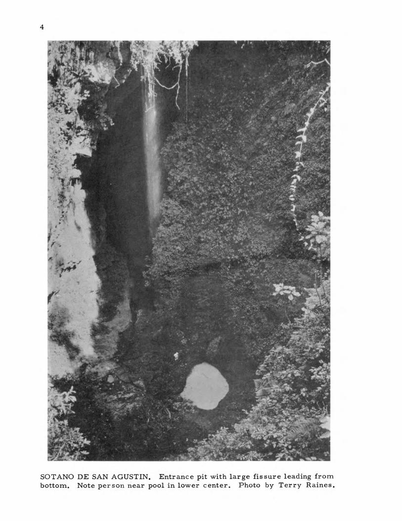
We entered Sotano de San Agustfn Tuesday evening, 31 January. Since wewere a little short of manpower we decided just to rig ropes past the previouspoint of furthest exploration, and to check the water conditions of the cave. Theusual entrance rigging point is opposite a waterfall which is fed by the stream inthe San Agustfn dolina. We encountered no problem with the entrance pitch,since the path cut on the jungle-covered slope was still clear. At the bottom ofthe entrance drop a large fissure slopes down (handline necessary) about 150vertical feet to a big room. (See photograph on page 4.) The room, whichtrends in the opposite direction of the fissure, is about 400 feet long, 100 feetwide, and 75 feet high, and has two small streams which join at the lower end.The room abruptly ends and a short small passage intersects a fissure. Thefissure may be entered in several places and is a series of short drops totaling142 feet. Despite the large size of the fissure it is very difficult to keep a carbide lamp lit because of the wind and spray. Near the bottom, it is necessaryto get off the rope, traverse around a 10 foot in diameter pool, and then rappelthe last 15 feet. Here the cave goes two ways; the water goes to the right downanother drop (100 feet plus), while the passage we took continues to the left.The left passage leads immediately to a 52 foot sloping drop, broken by severalledges. A small stream enters the dome above the pit from some other passage,and throughout the rest of the cave we were always following a stream. Thecave continues several hundred feet as a stream passage, averaging 5 feet wideand 10 feet high, to a short drop of about 30 feet. The waterfall is unavoidable,but our plastic windbreakers kept Our torsos dry. A short distance beyond thedrop the ceiling becomes very low and it is necessary to crawl through a fewpools of water. The crawlway appears to be a bad sign for the cave,' but itquickly opens up into a large fissure passage with numerous domes. As wewalked and climbed down the passage we could hear the roar of a waterfallahead. We climbed up onto a ledge (-849 foot level) and peered into the blackcanyon below. We could not see the end of the canyon at our level, or the ceiling. After we were properly impressed, I rappelled down the initial 71 footdrop and was followed by Terry and Ron. We found ourselves in a high, narrowcanyon that was several hundred feet long, with the floor continuing down aseries of drops. We were now at the end of previous exploration (see AMCSNewsletter, v. II, n. 6, p. 163.) Besides the main stream, a small stream
4
SOTANO DE SAN AGUSTIN. Entrance pit with large fissure leading frombottom. Note person near pool in lower cente,r. Photo by Terry Raines.
5
issues from a tiny hole in the wall. We continued down the next drop of 27feet (the surveying was done on our second trip into the cave), and wereconfronted with a seemingly "bottomless" canyon beyond. A hundred feetabove us, a waterfall poured in from some unknown passage. To avoid thewaterfalls we climbed along a convenient slot in the wall. The 244 footrope was tied to a natural. bridge in a pothole and Ron rappelled 46 feetbetween two waterfalls, then swung through one waterfall to a ledge wherehe retied the rope. Since we had no more rope other than the remainderof the 244, we headed out of the cave. After about 14 hours of caving wesaw daylight. again.
Much food and sleep later, we reentered the cave at noon on 2 February, each person carrying 200 feet of rope, mapping equipment, and anextra sweatshirt. We reached the top of the fissure with no problems,divided mapping duties between the three of us, and continued downward.Ron was tape man, Terry sketched, and I ran the Brunton. As we explored and mapped down the fissure, I noted that the cave was developedalong a fault dipping about 80 degrees. The fault plane, with about 5inches of drag folding, was exposed in a couple of places where the fissure ran slightly oblique to the fault for a few feet. This was a good signbecause the fault provides a weak zone and the fissure might be very deep.Fr om the bottom of the 71 foot dr op, we mapped on down the 27 foot and46 foot drops until we all three were on the tiny ledge where Ron hadstopped on the previous entry into the cave. The fissure widens to about15 feet at this point. From the ledge we could stay away from the waterfalls as we went down. Ron rappelled and the tape showed the drop to be76 feet.
At this point the fissure reverses directions and goes back underneath the passage above. By climbing up 15 feet and running along a ledge(while attached to the rope) through the waterfall again, I found a smalldry ledge where we could continue down out of the water. Terry and Ronfollowed right behind. About 50 feet below we could see a large ledge, soRon started down again with the end of the tape. Only about 15 feet of the244 foot rope remained. Terry and I quickly joined Ron, and we lookedwith awe into the blackness below. It was apparent that we were hoppingfrom ledge to ledge down the side of a huge canyon. Here the canyon wasabout 15 feet wide, and it appeared to widen even more down below. Further ahead rocks bounced until they were inaudible above the sound of thestream. Fortunately we were exploring the cave during a very dry season.During the rainy season it would be unthinkable to explore.
We spied another ledge below, tied off a rope, and Ron went downthe 80 foot drop. This ledge was very large and had been left when thestream cut a narrow gorge to a lower level along one wall. Two shortdrops of 15 feet and 10 feet on the ledge led us to an elliptically-shapeddeep pit in the fissure, about 25 feet by 40 feet in cross section. A fewfeet below a little str earn pour ed out of a tiny hole in the wall and joinedthe main stream. We tied off a 190 foot rope around a large rock and Ronstarted down. It was obvious that this big pit was going to present surveying problems. At the end of the 190 foot rope Ron could not see bottom,so Terry went down next with another rope. I found them wedged in acrack in the wall a few minutes later. We tied, on a 140 foot rope to the
6
190 and I continued down, hoping the rope was long enough. We were ableto stay out of most of the water by keeping to one side of the pit. Below Icould see a plunge pool on the far side of the pit, and also a continuation ofthe fissure to what looked like an adjacent domepit. I reached bottom withjust enough spare rope to tie it off (so it wouldn It hang over the pool), andcalled for the others to follow. Water from the pool goes underneath a largenatural bridge to the next pit about 50 feet away. We gathered around theedge of the pit and again peered into the inky depths. Since we only had a75 foot piece of rope, all we could do was throw rocks, and throw we did.Some of them fell free for 4 seconds before striking a wall and rattling fora couple of seconds more before hitting a plunge pool. We surveyed over tothe pit, then began the long haul out of the cave. I prusiked up the pitchfirst and was able to shoot a sight all the way from top to bottom. The ropemeasurement yielded 286 vertical feet. SOtano de San Agustfn has now beensurveyed about one-half mile horizontally and to a depth of 1473 feet.
We took a rest break at the top of the fissure (849 foot level), thencontinued out. About 24 hours after entering the cave we finally emerged.The trip out carrying the heavy wet ropes had been a slow process. Againwe consumed large quantities of food and took a long rest to revive ourselves. Saturday morning we started back for Austin and arrived Sundaynight.
7
MAPS OF MEXICO
by William H. RussellAustin, Texas
Accurate and up-to-date maps preform many valuable services otherthan enabling cavers to find the cave. They serve as a base for resourceplanning and area development as well as a means to determine the bestlocations for dams, roads, pipelines and anything else that involves largeareas of land. Unfortunately, in a country such as Mexico there are manyimmediate essentials such as schools and highways that have to comefirst, so that most of the large scale topographic mapping and aerialphotographic surveys are undertaken for a specific project and are limitedin coverage. Thus, coverage tends to be scattered and available frommany sources. This makes it difficult for the caver to determine even ifan area has been mapped, much less to obtain copies, especially whenmaps were prepared for a specific project and not intended for generalcirculation. Anyone planning an extensive stay in Mexico is ur ged toconsult the Annotated Index of Aerial Photographic Coverage and Mappingof Topography and Natural Resources - Mexico, prepared by the Organization of American States. This lists all maps and air photo coverageas of 1965.
The most important series of topographic maps is the 1:100, 000series prepared by the Departamento Cartografico Militar of Mexico.This series covers roughly the area south of a line extending from theGulf Coast north of Soto 1a Marina to just northwest of Cd. Victoria;Tamps., from there south to just west of Cd. Valles, S. L. p.; west fromthis point to the Pacific Coast north of San BIas, Nay. The southernboundary of this coverage is an east-west line through extreme southernPuebla, except for a strip of coverage extending south to Acapulco, Gro.These maps cover, with a contour interval of 50 meters, many of themajor Mexican karst areas from the Sierra de Guatemala, Tamps. andSierra de El Abra, S. L. P. in the north to Huautla, Oax. in the south.While the accuracy of the contouring is good, the portrayal of the localcultural details, such as trails and the names of rivers, mountains, andtowns is frequently misleading. Apparently little money was availablefor editing the cultural data and only a few places could actually be visitedin each quadrangle. Thus, much of the information about the more isolated areas is verbal information that the cartographer applied as besthe could. This was sometimes more confusing than if the cultural information had simply been omitted. Many towns and other geographic locations have their names interchanged, Or moved a few kilometers fromtheir actual location. These maps, with a scale of about 2 miles to theinch and a contour interval of about 150 feet, are the best available formost of Mexico. It is extremely difficult to obtain copies of these mapsfrom the Departamento Cartografico Militar; the AMCS soon hopes tohave Xerox copies of the cave areas available.
Other topographic coverage is available for limited areas. TheComision del Papaloapan has 1:100, 000 coverage of the Papaloapan Basin,an area bounded on the west by Orizaba, Ver., Tehuacan, Pue., and
8
Oaxaca, Oax. The Secretada de Recursos Hidraulicos (SRH) is indicatedto have detailed coverage of alar ge area extending from between Cd. Victoria, Tamps. and Cd. Mante, Tamps. south into northern Hidalgo. Thiscoverage is at a scale of 1: 50, 000 with a contour interval of 5 meters, and1:25, 000 with a contour interval of 10 meters. It is not known how accuratethese maps are. There are other local areas of large scale mapping butthese are the only series covering large areas of interest to cavers. Airphoto coverage is available for many scattered areas through CompanfaMexicana Aerofoto.
Road maps of Mexico are not in general reliable except for the mainhighways. There is no local data-gathering agency to report road conditions, so except for the main state and federal highways there is no accurate data reaching Mexico City where the maps are produced. Also, asMexico is rapidly building new highways and improving old roads, mapstend to be behind and omit some highways. To compensate for this somemaps have shown as complete, highways that were only in the planningstage. And as plans can change, some roads that do not exist may appearon the map. Apparently when one map has a road, the others, not wantingto appear less accurate, include it also. Two of the most important ofthese imaginary roads are the nonexistent road west across the SierraMadre from Santiago just south of Monterrey, N. L. and the nonroad between Jalapa de nfaz and Huautla in northern Oaxaca. When leaving themain highway it is always advisable to inquire locally.
Two of the best single-sheet road maps of Mexico are the AmericanAutomobile Association Map of Mexico (issued annually in the fall) and theMapa Turfstico de Carreteras (1966) compiled by the Secretarfa de ObrasPublicas (SOP) and also available through the AAA. (The latter map isincluded with this Newsletter.) The best road map atlas of Mexico isCaminos de Mexico, third edition, 1967, published by the Goodrich EuzkadiCompany and available at most news stands and large hotels in Mexico.This atlas contains 32 road maps of individual sections of Mexico and givesthe most complete and accurate coverage of roads, as well as indicatingrelief by shading. All of the last three maps are relatively accurate,although even the Mapa Turfstico indicates a dirt road along the west sideof the Presa Miguel Aleman south of Veracruz, Vel'. where the country isnot even passable on foot. Because many local roads are not shown on anyof these maps the best source of information is local inquiry and contactwith the AMCS.
BIOLOGY SECTION
MEXICAN CAVE BIOLOGY: ANNOTATED BIBLIOGRAPHY
by JAMES REDDELLAustin, Texas
1. Allen, Glover Morrill. 1939. Bats. Dover Pub1. Co., New York.x • 368pp.
This classic work on bats, first published in 1939, should beon every caver IS book shelf. It contains fascinating readableaccounts of the mythology, habits, and classification of bats.Reference is made to several species of bat living in Mexicancaves and the account of Ward's 1891 exploration of a cave inVeracruz is reprinted.
2. Baker, Robert J., and Lee Christianson. 1966. Notes on bats fromSonora, Mexico. Southwestern Nat., 11(2):310-311.
This short paper includes a record of the bat, Pteronotuspsilotis, in Cueva la Chinacatera, near Pocitos, west ofPericos, Sinaloa.
3. Barrera, A. 1951. "Notas sobre sifonapteros. II. Descripcion deAnomiopsyllus traubi nov. sp. (Siph., Hystrichops.). Ciencia,11(7-9):197-200.
A new species of flea, Anomiopsyllus traubi, is describedfrom Cueva de Belen, Zimapan, Hidalgo. The eighth speciesof the genus was taken from a rodent nest.
4. Chamberlin, Joseph C. 1946. The genera and species of the Hyidae,a family of the arachnid order Chelonethida. Bull. Univ. Utah, BioI.Ser., 9(6):1-16.
Leucohya heteropoda n. gen. and n. sp. is described from Grutadel Palmito, Nuevo Leon. A new subfamily, Leucohyinae, iserected to include this unique pseudoscorpion. This distinctivetroglobite is known only by one tritonymph. The species resembles European species in the great degree of its adaptation tothe cave habitat.
5. Chamberlin, Joseph C. 1947. The Vachoniidae -- a new family offalse scorpions. Two new species from caves in Yucatcfn. Bull. Univ.Utah, BioI. Ser., 10(4):1-15.
A new family, Vachoniidae, is described to include a new genusand two new species of troglobitic pseudoscorpions. The twospecies, Vachonium boneti and V. maya, are from Cueva de- ,Sabaca and Cueva de Balaam Canche, Yucatan, respectively.
9

10
6. Chamberlin, Joseph C., and David R. Malcolm. 1960. The occurrence of false scorpions in caves with special reference to cavernicolous adaptation and to cave species in the North American fauna(Arachnida--Chelonethida). Amer. MidI. Nat., 64(1):105-115.
This general review of North American cave psuedoscorpionsincludes reference to the eight species known at that time fromMexican caves.
7. Davis, William B., and Dilford C. Carter. 1962. Notes on CentralAmerican bats with description of a new subspecies of Mormoops.Southwestern Nat., 7(1): 64-74.
This report on significant new records of bats from CentralAmerica includes a record of Nata1us mexicanus saturatus inCueva de La Boca, Nuevo Le6n; of Myotis thysanodes aztecusin a lava cave near Las Vigas, Veracruz; of Plecotus townsendiiaustralis in a small cave 1 mile SSE Almolonga, Guerrero; andof Mormoops megalophylla megalophylla from Cueva del BuenAbrigo, Coahuila, and Cueva de Espana, Durango.
8. Gates, G. E. 1959. Earthworms of North American caves. Bull.Natl. Speleol. Soc., 21(2):77-84.
This paper reviews all that is known of the earthworms ofNorth American caves. Included are records of four speciesknown from caves in Yucatan.
9. Loomis, H. F. 1962. Two unusual Central American spirostreptidmilliped species. Proc. BioI. Soc. Washington, 75: 47 -52.
This includes the description of a new species of milliped,Orthoporus kiemi, from a cave on Hacienda San Bernardo,between M~rida and Maxcanu, Yucatan. The species iseyed and probably a trogloxene.
10. Martin, Marian, and Paul S. Martin. 1954. Notes on the capture oftropical bats at Cueva El Pachon, Tamaulipas, Mexico. J. Mammal.,35(4);584-585.
This is an account of capturing several species of bat in CuevaEl Pachon, Tamaulipas. Several notes on the fauna of this andother nearby caves are also included.
11. Petrunkevitch, Alexander. 1911. A synonymic index-catalogue ofspiders of North, Central and South America with all adjacent islands,Greenland, Bermuda, West Indies, Tierra del Fuego, Galapagos, etc.Bull. Amer. Mus. Nat. Hist., 29. 809 pp.
This general catalogue of spiders includes a list and notes on thethree species of spiders described from caves in Mexico prior to1911.
12. Ross, Anthony. 1960. Distribution records for Trichobius sphaeronotusJobling, with first report for Arizona (Diptera: Streblidae). PanPacific Entomo1., 36(2): 81-82.
In addition to several United States collections the parasitic batfly, Trichobius sphaeronotus Jobling, is reported from CarboCave, Sonora, Mexico. More than 700 specimens were taken inthis cave on August 7, 1959.
13. Ryckman, Raymond E. 1956. Parasitic and some nonparasiticarthropods from bat caves in Texas and Mexico. Amer. MidI.Nat., 56(1):186-l90.
In addition to specimens reported from two Texas caves,an unused silo at Mazatlan, Sinaloa, and sugar mill at Bocadel Rfo, Veracruz, a collection is described from a batcave near Teapa, Tabasco. Two species of bat, a streblidfly, a psychodid fly, a mite, and a whip-scorpion weretaken in the cave.
14. Silvestri, F. 1948. Specie di Japygidae (Insecta Diplura) finoraraccolti nel Messico. Naples. Universita. Laboratorio di Entomol.Agr. Boll., 8;297-320.
This paper includes the description of Parajapyx mexicanusn. sp., known from surface localities in Quintana Roo andGuerrero and from Cueva de Carroza, Hoctun, Yucatan.
11

ASSOCIATION FOR
MEXICAN CAVE STUDIES
NEWSLETTER
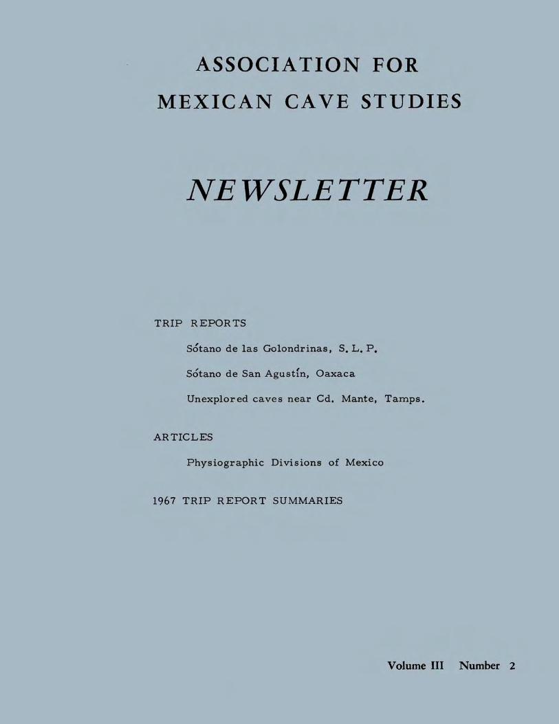
TRIP REPORTS
SOtano de las Golondrinae, S. L. p.
, .Sotano de San Agustin. Oaxaca
Unexplored caves near Cd. Mante. Tamps.
ARTICLES
Physiographic Divisions of Mexico
1967 TRIP REPORT SUMMARIES
Volume III Number 2

ASSOCIA TION FOR MEXICAN CAVE STUDIES
NEWSLETTER
Volume III Number 2 Publication Date: December 1969
The AMCS NEWSLETTER is published six issues per volume asfrequently as possible by the Association for Mexican Cave Studies, p. O.Box 7672 University Station, Austin, Texas 78712, USA. The AMCS isa nonprofit organization whose goals are the collection and disseminationof information concerning Mexican caves. Member ship is open to allinterested, conservation-minded persons at a rate of $5. 00 US per volume.
Potential contributors are urged to submit articles for publication.The article may cover any phase of Mexican speleology. Trip reports arerequested from all trips.
Editor ..•...•••••..••...••. Terry W. RainesCave Files and Corresponding Secretary •. T. R. EvansPhotographic Proces sor . Carl E. KunathStaff. . . . . . . . . . • . . . . . . . . . . • Don Brous sard
Robert E. BurnettSherry GreerCarol Russell
NEWS NOTES William H. Russell
• At the time of this publication, all AMCS Newsletters (both Vol. I and Vol. II)have been reprinted to a total of 400 copies per issue. Of these, approxi ..mately 300 have been distributed. After considering the time spent on reprinting these issues to meet their demand (time which could have beenspent on a new issue), it has been decided never to reprint and to offer theremaining Newsletters on a first-come first-serve basis. It also shouldbe noted that only 10 copies of Bulletin 1, "Caves of the Inter-AmericanHighway" remain. If you desire any of these early AMCS publications,write immediately.
Vol. I (1965) Publications - 12 Newsletters & Bulletin 1 - $6.00Vol. I without Bulletin 2 - $3. 00
Vol. II (1966) Publications - 6 Newsletters & Bulletin 2 - $5. 00
• Three well-known Italian biospeleologists, Dr. Valerio Sbordoni andDr. Roberto Argano of the Instituto di Zoologia in Rome, and Prof. Dott.Vittorio Parisi of the Instituto di Zoologia in Milan, are in Mexico on atwo month trip to study different aspects of the biology of Mexican caves.They briefly visited Austin in October en route to Mexico City.
• In June 1966 an AMCS reconnaissance trip to Huautla de Jimenez, Oaxaca,located Sotano de San Agustfn. During the following two years severalexploration and surveying trips penetrated to a depth of 1473 feet. Then,in December 1968, cavers from Texas, Tennessee, West Virginia, andOntario combined to reach the bottom of the cave.
(continued on next page)
14 TABLE OF CONTENTSTRIP REPORTS
Sotano de las Golondrinas, S. L. p .Sotano de San Agustfn, Oaxaca. . . . . . . .Unexplored caves near Cd. Mante, Tamps.
ARTICLESPhysiographic Divisions of Mexico .
1967 TRIP REPORT SUMMARIES ..
NEW PUBLICATION POLICY
· 1523
. . 24
· 27· 32
Due to the increasing time lag between the date of a trip and the publication of a report in the Newsletter, the AMCS has completely changed itspublication policy. In the future all trip reports will be published in the nextNewsletter following their receipt. Volume III will cover no specific timeperiod but will still contain six issues. As a result the Newsletter can present the latest explorations by those persons who promptly send in theirreports, while at the same time record the reports that have been delayedfor one reason or another. In order that the chronological organization ofprevious issues may be maintained, and thus minimize confusion, we willannually publish a summary of trips during the previous year. Each entrywill have the date of trip, places visited, members of the group, summaryof work accomplished, and location of the published trip report. If thereport has not been published a blank will be left for later entry by members.
This issue contains the 1967 trip report summaries. The followingNewsletter will cover 1968 trips and any 1967 additions promptly sent in bymembers. If you have made any caving trips into Mexico which have notbeen reported, please send them in and bring the AMCS up to date. We needyour material for the next Newsletter.
NEWS NOTES (continued)
The entrance to Sotano de San Agustfn is in the bottom of a large dolina, over1 mile long and 1/3 mile wide. A stream runs into the entrance and severalother streams are encountered below. A complicated system of steep dropsand small horizontal passages lead to the top of a large fissure at -849 feet.The fissure descends via a series of waterfall drops to -1736 feet and levelsoff for 350 feet. A large horizontal passage is encountered at -1786 feet whichappears to be blocked by breakdown after about 1500 feet. Where the largepassage is first met, the water enters a passage averaging 4 feet wide and 15feet high, which leads about 950 feet to the lowest point in the cave, 2006 feetbelow the entrance. Thus, Sotano de San Agustfn has become the first cavein North America to be explored and surveyed beyond 2000 feet. Completedetails of the exploration will appear in the next AMCS Newsletter.
TRIP REPORTS 15
• Date: 29 March - 8 April 1967Destination: Satano de las Golondrinas, Cueva de Ochtalja, Hoya de las
GuaguasLocation: Sierra Madre Oriental; Aquisman; Golondrinas, Agua Amarga,
Tampaxal. Aquisman, San Luis PotosIPersons: John and Sandy Cole, Bill Cuddington, Bill Deane, T. R. Evans,
Dan Hale, Bob Hugill, Squire Lewis, Jon Morse, SandinoTecho, Nancy Walters, Sid West
Reported by: T. R. Evans
Immediately after returning to Ft. Detrick, Md. after the December1966 trip to the Aquisman region (AMCS Newsletter, v. 2, n. 6, p. 163),we began making plans to return in order to investigate the Satano de lasGolondrinas that we had been shown. Chuck Borland and Ronald Stearnswho were along on the first trip to the area decided that they would beunable to return in April (coincident with the University of Texas I springvacation); however, there were several other members of the FTA Grottowho could go at that time. We wished to return as early as possible toavoid the rainy season. Thus, four of us planned to go: Bob Hugill, JonMorse, Sid West and 1. We were to be joined by John and Sandy Cole,Bill Cuddington, and Dan Hale from Huntsville, Ala. Bill Deane plannedto go from Austin. Cuddington had heard about the pit and offered the useof his rope. The trip would have hardly been pos sible without it as all ofthe Austin cavers were planning a big push in the Satano de San Agustfn atHuautla, Oaxaca which would require every foot of rope they could laytheir hands on.
Having timed rocks falling down the pit, I was interested in predicting a depth for the pit. Solving a differential equation and running thesolution on a computer I found that the pit could not be les s that 800 feetdeep. We had timed rocks at 10 1/2 to 11 seconds (free fall to bottom...no bouncing) and allowed 9 1/2 seconds for the fall and allowing one secondfor the sound to reach the top. All concerned waited for the trip withgreat anticipation.
Bob and Jon had begun caving since arriving at Ft. Detrick, whileSid had been in several caves in California. Sid had done some verticalwork but the others from the FTA had not, and I hadn't done much recently.Upon receiving our order from Recreational Equipment we began practicing. Weekends found us at Hell Hole in West Virginia or at Harper'sFerry going off the cliff. During the week we practiced on a 300 foot roperun over a tree limb and were able to Jumar 300 feet at a time in thatmanner. I saw to it that Bob, Jon, and Sid became proficient at prusikknots as well. I figured if they could make it to the top, they could haulme up. The Huntsville group and Bill Deane were all well-versed invertical work.
Prepared and ready, we of the FTA got a military hop from Washington, D. C. to San Antonio, Texas courtesy of the Air Force. Myfather met us there and drove us on to Austin for supper and a repackingsession. Later that same night, March 29, I borrowed one of the family
16
cars and we set out for Laredo. Arriving in the wee hours of the 30th weparked the car and hiked across the bridge to the Mexican customs houseand got our tourist cards then went dir ectly to a bus station and got a busto Monterrey. In Monterrey we made immediate connections for Valles.Around 2 pm while the bus was stopped in Cd. Victoria for a break, wenoticed the group from Huntsville driving by and hailed them down. Weagreed to meet for supper in Valles and also found out that Squire andNancy were coming down from the east and picking up Bill Deane in Austinon the way. Later that evening we all rendezvoused at one of the hotels inValles and planned to meet the next .morning to go on to Aquismon.
The Huntsville group went down to Xilitla in order to get a friend ofJohn Cole's, Sandino Techo, who came along and helped us translate.Squire took the rest of us directly to Aquismon where we talked with thePresidente and inquired about getting some mules to haul some of thepacks and rope up to the pit. We found that no mules would be availableuntil the following morning. Squire, Nancy, and those of us from Ft.Detrick had planned to hike up with our packs, so gave 500 feet of ourrope to the other s who wer e hiking up the next morning with the mules.Squire and Nancy carried the remaining 300 feet of our rope. Bill's"python" and another 1000 feet of rope went on the mules.
Having hiked in the area before and realizing how hot daytime hikinggets, I suggested that we start up that evening around 6 pm or so. Afterpurchasing several liters of cana, an alcoholic liquid distilled from sugarcane that serves as a beverage-maker or fire-starter (it burns with asmokeless blue flame), we started up the traiL By the time we reachedLa Laj a, roughly halfway to the pit, we had been joined by a couple oflocals and stopped to have a few relaxing drinks of a cana-refresco varietybefore retiring for the night in a small hut there which serves as a refreshment stand. In fact, the few drinks developed into quite a party. The following morning we completed the hike to the pit after collecting millepedesnear La Laja and having breakfast there.
We arrived in the vicinity of the pit in the early afternoon and arrangedto stay at a house about a mile below the pit. We had the woman of the housecook our food for us and prepare the odd pot of coffee. Several chickens, adog or two, and the odd pig shared the hut with us. There is a small hut atthe pit but it was not large enough to accommodate our entire group.
The remainder of the party arrived with the mules and the rest of thegear a few hour slater. All had a look at the pit and no one was disappointed.Squire produced his timepiece and we timed several rocks. He got consistent times of 11 to 111/2 seconds. Since we were all tired from the hike, wesacked out rather early that evening in preparation for the rigging and descending of the pit the next day.
The following morning, April 2, we rigged the pit with Bill's 2-in-lSamson, and I being the only one along on this trip who was a member ofthe discovery group, went down first. Assisted over the edge by severalpeople, I began the descent on a single breakbar rappel. After five feet ofvirtual free-fall I let my prusik safety catch and again with assistanceadded another carabiner and breakbar and continued on down. With adouble breakbar rig I had no trouble at all; however, as Bob Hugill foundout, two breakbars for a light-weight person can cause feeding problems.
17
Bob had to feed the rope for several hundred feet. The best answer is therappel rack disigned by John Cole (see NSS News, v. 24, n. 6, June 1964).These racks worked very well.
Reaching the bottom after 1/2 hour I talked with the group on top viawalkie-talkie (excellent items to have along) and headed out across thefloor of the pit which is all well-lighted by daylight from the top of theshaft. After ten minutes or so, the top called and asked me to return tothe foot of the rope to safety Bill Cuddington down. I turned around andcouldn't see the rope and after a couple of minutes of looking, stillcouldn't see it and told the people topside the trouble I was having. FinallyI got the wise idea of retracing my footprints back across the dry birdguano and did just that. The immensity of the pit finally dawned upon me.Bob Hugill and Dan Hale followed Bill Cuddington in. With some difficultya second rope was rigged giving us one for rappelling and one for prusikingor Jumaring. The second rope consisted of three tied together. Bob andI went out the same day while Bill Deane rappelled in to spend the nightwith Bill Cuddington and Dan Hale. We threw in their down sleeping bagsafter untying them and they were quite a sight as they drifted down theshaft. It took more than a minute for them to reach the bottom. Thefollowing morning John Cole, Sid West, and Jon Morse made the descent.Sandy Cole was busy along with Sandino keeping watch over things topside.Sandy also occupied a lot of her time trying to undo two 500 foot ravels ofparachute cord which were to be used in measuring the pit. Squire andNancy, having helped carry gear up and having assisted during the firstday, returned to Aquismon.
By the evening of the third day at the pit (3 April) we were all safelyback on top and out of what is certainly quite an awesome pit. The depthof the pit from our rigging point turned out to be 1094 feet. The pit isroughly 200 feet in diameter at the top, belling out on all sides until atthe bottom the pit is 1000 feet long and 440 feet wide, containing 10 acres.There is 246 feet of relief on the floor of the pit alone. Virtually theentire floor of the pit is lighted by daylight and a per son on the bottomcan be seen from the top••. as a speck. The tremendous size and depth,the hundreds of green parrots, and the thousands of swallows all contribute in making a trip to the pit worthwhile. One's clearest impressionof the size is gained on the way out. No cave passages were found at thebottom. See AMCS Bulletin 2 for a complete description of Satano de lasGolondrinas.
The morning of 4 April found us packing and getting ready to hit thetrail. The pit was derigged the previous evening and the ropes fed directlyinto duffle bags as they were pulled up. The mule driver and mulesarrived at 8 am and were loaded up. We from the FTA gathered our gearand headed on to Tamapatz for some more caving. We hired a local Huastecan to carry our 500 feet of rope and draped the 300 foot chain acrossour shoulders. The others headed back towards Aquisman and thence toAustin and Huntsville.
Bob, Jon, Sid, and I arrived in Tamapatz in the early afternoon andwaited for the J efe to arrive to get permis sion to explore several caves inthe immediate vicinity of Tamapatz. We also arranged to stay at the sameshop we stayed at during the December 1966 trip. After talking to the Jefe
18
we had supper, then that evening went down to have a look at the cave nearTamapatz we found in December with the small arroyo entering it, namedCueva de Ochtalja (See AMCS Newsletter, v. 2, n. 6, p. 166 and photos onpage 20 of this issue). Bob, Jon, and Sid rigged a rope at the entrance whichis a passage about 30 feet wide and 20 feet high which descends about 75 feetvery steeply over polished boulders and flowstone. They followed the passage from the bottom of the entrance several hundred feet to a 15 foot undercut drop which required equipment. They found the cave to be extremelypromising and plans for exploring the 6-second pit found in December werecancelled. The following day we returned to the cave for more seriousexploration and took some short lengths of rope for small drops. The passage is a stream passage that follows the contact of the El Doctor andAgua Nueva Limestones. The passage averages 20 feet wide and 10 feethigh but enlarges in places to 75 feet wide and as high. One large room isdeveloped to the left of the main passage going in, about 300 feet from theentrance. The room is roughly 100 feet long and as wide and 40 feet highwith a breakdown slope angling down from the ceiling of one side to the floorof the other. The room contains some formations. Between the main passage and this room is an area of beautiful rimstone pools.
Continuing on to the 15 foot drop, we rigged it and went down. Thecave passage enlarges considerably here (from 15 feet wide and as high to40 feet wide and as high) and continues to enlarge gradually for several
ohundred feet where the passage abruptly descends at -45 for about 200 feetover cemented boulders and flowstone to one of the smallest parts of themain passage explored -- a tube affair about 10 feet in diameter which continues on down several climbable drops to a lake room 20 feet in diameterand as high. From this room a passage continues about 30 feet to a dropestimated to be 50 to 75 feet which drops into a pool of water. We werenot able to descend this drop and dragging 300 feet of rope back to this pointto rig a 50 foot drop was not considered worthwhile. This drop is about1000 to 1500 feet from the entrance.
The next day, 6 April, we got the same bearer that carried our ropefrom the pit to Tamapatz and headed toward the Inter-American Highway,planning to stop off and have a look at another pit we heard about, the Hoyade las Guaguas. After several hours of hiking we reached the pit. TheGuaguas pit is much the same as Golondrinas, large enough to be deceptive. It is 150 to 200 feet in diameter and appears to be 250 to 300 feetdeep, but in fact it is nearly 500 feet deep. The bottom of the pit is clearlyvisible during daylight and vegetation covers much of the floor. Having botha 300 foot and 500 foot length of rope, we played it safe and rigged the 500foot length and were pretty sure it was on bottom. Sid was given the honor(actually the rest of us were too tired) of going down to investigate. Whenhe was about 1/2 way down, we noticed that there was a four-foot long, blackand white animal of some sort wandering around on the bottom. We yelleddown to Sid who finally saw the animal and continued on down. Sid neversaw the thing after he reached the bottom but saw numerous trails crossingthe pit floor. From its markings it is thought that the animal is a tayra, aweasel-type animal that inhabits southern Mexico. The animal's presencein the pit is most striking since the Hoya de las Guaguas is bell-shaped justlike Golondrinas. Reaching the bottom after 15 minutes or so, Sid de-rigged

View south from Tamapatz. Limestone mountains in background ris e toover 9000 feet. The peak, La Silleta, at left edge of photo.
Haystack hills in karst southwest of Tamapatz.

Hoya (dolina) Ochtalja.mountains in center.
Cueva de Ochtalja is developed at the base of theOverthrust sheet of E1 Doctor Limestone forms
right wall of the hoya.
Cueva de Ochtalja. Streams drain the relatively impervious Agua NuevaFormation and flow into cave entrance.
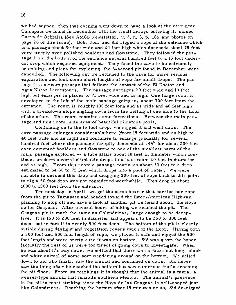
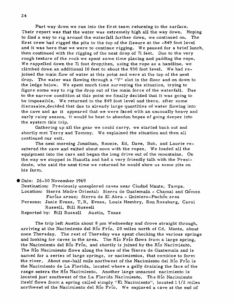
One of the many refreshment stands on the Aquismon-Tamapatz trail.
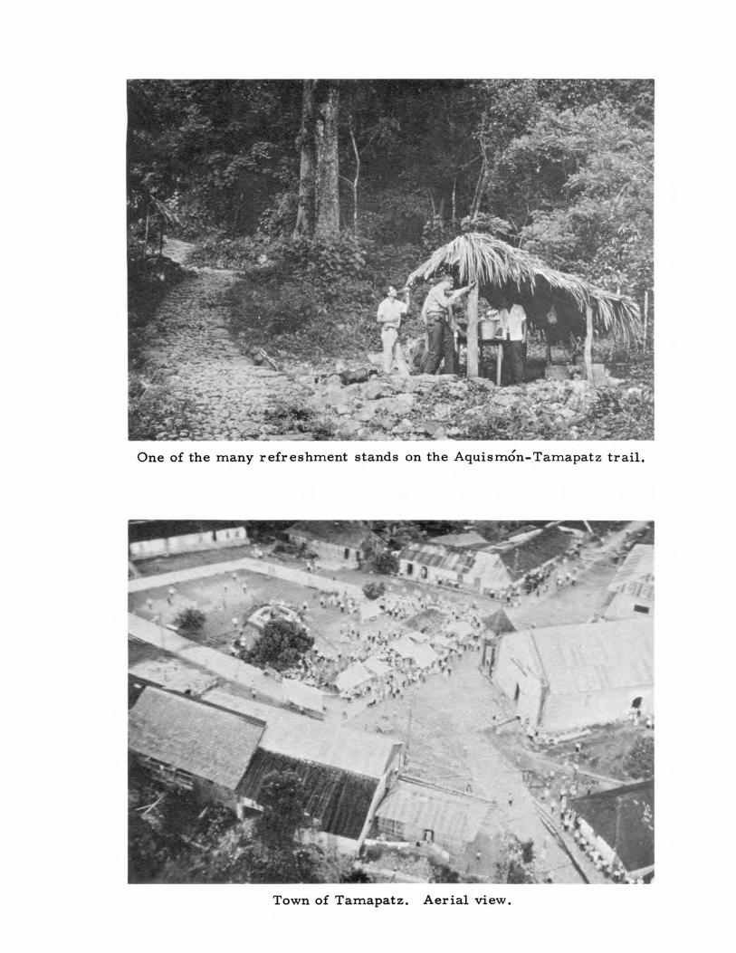
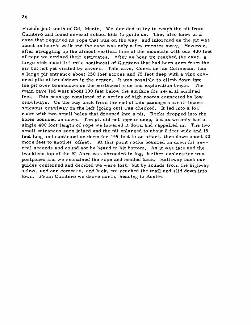
Town of Tamapatz. Aerial view.

EXPEDITION OF '67
Front row: Tommy McGarrigle (r), Jonathan Davis, Bill Bell, Tom Tracy,Laurie Cameron, Terry Raines
Back row: Orion Knox (r), Ed Alexander, Bob "Rooney'l Burnett, Bob Thren,John Fish, Dave Brison

23
to find himself at the top of a long slope. He wandered down the vegetation-covered slope several hundred feet and disappeared into a largeopening visible from the top. The floor of the pit sloped into this areaand Sid found himself in a room of "Carlsbadian" dimensions ... butwithout a floor. He tried to throw rocks acros s to the far wall but wasunable to do so. The rocks fell to the bottom first, requiring between6 and 7 seconds. Sid Jumared out and we rechained the rope and continued on down to the Highway, arriving after 3 more hours. We caughta bus to Tamazunchale and spent the night there after taking in a fiestaof some kind that was taking place at the plaza. The next morning wecaught a bus to Mexico City for a couple of days of sightseeing, rest andr ecuper ation.
Accomplished on this trip wer e the exploration of Satano de lasGolondrinas and the investigations of Cueva de Ochtalja and Hoya de lasGuaguas. Needless to say, much work still needs to be done in thispromising area.
• Date: 1-8 April 1967Destination: Satano de San AgustfnLocation: Oaxacan Mountain System; Huautla; San Agustfn. Huautla, Oax.Persons: Ed Alexander, Bill Bell, Dave Brison, Bob Burnett, Laurie
Cameron, Jonathan Davis, John Fish, Tommy McGarrigle,Orion Knox, Jr., Terry Raines, Bob Thren, Tom Tracy(see photo on opposite page)
Reported by: Orion Knox, Jr. Austin, Texas
On 31 March, Terry Raines, Tommy McGarrigle, and I left Austinin Terry's truck. We proceeded on past Mexico City with few stops. Itwas on the road south of Tehuacan that we caught up with Dave, Bob, andLaurie. The weather was fine until we started up into the mountains. Bythe time we reached Plan de Guadalupe, it was almost impossible to seethe road for the fog and rain. We camped beside the road and woke up torain early the next morning.
Driving on, we arrived at Huautla about noon, drove through town,and finally reached San Agustfn after lunch. By now the weather hadcleared somewhat which provided a chance to hike in the immediate areabefore the remainder of the crew arrived. We hiked across to San Miguelthen by a round-abou t way back to camp at San Agustfn. Numerous sinkswere located.
By the time we returned, John Fish and Ed Alexander had arrivedwith their vehicles filled with people and equipment. It was too late tostart into the cave. Also, we wanted to let the amount of water enteringthe cave decreas e.
Our plans were to assault the cave in teams, with each team carrying equipment in and pushing to the next deeper point. Early in the morning of 3 April Bill, Jonathan, and Tom took the first load of equipment andstarted rigging the first drops. A few hours later, Roonie, Ed, John, andI started into the cave, while Terry and Tommy followed making photos ofthe as sault on the cave.
24
Part way down we ran into the first team returning to the surface.Their report was that the water was extremely high all the way down. Hopingto find a way to rig around the waterfall further down, we continued on. Thefirst crew had rigged the pits to the top of the fissure at the -849 foot leveland it was here that we were to continue rigging. We paused for a brief lunch,then continued with the rigging of the next drop of 71 feet. Due to the veryrough texture of the rock we spent some time placing and padding the rope.We rappelled down the 71 foot drop;then, using the rope as a handline, weclimbed down an additional 10 feet to about the 930 foot level. We had rejoined the main flow of water at this point and were at the top of the nextdrop. The water was flowing through a "V" slot in the floor and on down tothe ledge below. We spent much time surveying the situation, trying tofigure some way to rig the drop out of the main force of the waterfall. Dueto the narrow condition at this point we finally decided that it was going tobe impossible. We returned to the 849 foot level and there, after somediscussion,decided that due to already large quantities of water flowing intothe cave and as it appeared that we were faced with an unusually heavy andearly rainy season, it would be best to abandon hopes of going deeper intothe system this trip.
Gathering up all the gear we could carry, we started back out andshortly met Terry and Tommy. We explained the situation and then allcontinued our exit.
The next morning Jonathan, Roonie, Ed, Dave, Bob, and Laurie reentered the cave and exited about noon with the ropes. We loaded all theequipment into the cars and began the long drive out of the mountains. Onthe way we stopped in Huautla and had a very friendly talk with the Presidente, who said the next time we returned he would show us some pits onhis farm •
• Date: 26-30 November 1969Destination: Previously unexplored caves near Ciudad Mante, Tamps.Location: Sierra Madre Oriental: Sierra de Guatemala - Chamal and Gomez
Farias areas; Sierra de EI Abra - Quintero-Pachon areaPersons: Janie Evans, T. R. Evans, Louis Hembry, Ron Rossburg, Carol
Russell, Bill RussellReported by: Bill Russell Austin, Texas
The trip left Austin about 8 pm Wednesday and drove straight through,arriving at the Nacimiento del Rio Fdo, 20 miles north of Cd. Mante, aboutnoon Thursday. The rest of Thursday was spent checking the various springsand looking for caves in the area. The Rio Fdo flows from a large spring,the Nacimiento del Rio Fdo, and shortly is joined by the Rio Nacimiento.The Rio Nacimiento flows along the base of the Sierra de Guatemala and isnamed for a series of large springs, or nacimientos, that combine to formthe river. About one-half mile northwest of the Nacimiento del Rio Fdo isthe Nacimiento de La Florida, located where a gully draining the face of therange enters the Rio Nacimiento. Another large unnamed nacimiento islocated just southwest of the La Florida Nacimiento. The Rfo Nacimientoitself flows from a spring called simply "EI Nacimiento", located 11/2 milesnorthwest of the Nacimiento del Rio Frio. We explored a cave at the end of

25
a gully that leads into the R{o Nacimiento for a few feet to where it narrowed to a series of impassably small fissures. This cave appears todischarge large amounts of water during floods. Above the cave anotherentrance was discovered that a few feet to a fissure dropping about40 feet to water. This drop was not descended due to lack of equipment.
The weather was unusually cold and the clouds hung low on themountains, but as it had not rained all afternoon we decided to camp atthe nacimiento. We made it through the night with only a few sleepdisturbing drizzles, and left next morning just as a light rain began. Theclouds continued but the rain did not last, so we drove west to Chamal{northwest of Mante on the Ocampo highway} and then north and west ondirt roads to Rancho de la Barranca at the southern end of the Sierra deGuatemala, near where it joins the Sierra de Nicolas Perez. Just northof this ranch a large pit had been spotted from the air in the midst of athick jungle. After asking directions at the ranch we set out into thejungle. An old, now somewhat washed out, road leads into the canyonnorth of the ranch and we followed this road up into the Sierra de Guatemala through dense jungle overgrown with bamboo. A short distance intothe mountains T. R. noticed a cave entrance in a low cliff above the roadand clambered up to investigate. The entrance led to a short climb up intoa passage that opened back on the cliff face and continued on into the mountain, averaging 10 feet wide and 15 feet high. A short distance inside a shallow pit temporarily blocked progress, but a way was found to pass the pitand T. R. explored the cave for several hundred feet with a flashlight. Heconcluded that the cave was promising and returned to the entrance. Following the map drawn from the air and the local instructions, we walked tothe lip of the pit. From the air it had resembled a large green funnel, andfrom the ground it could be seen that the pit was actually larger, as treesand undergrowth grew thickly on the sides and overhung the pit. The top ofthe funnel is about 500 feet acros s, and slopes steeply downward. The pitis overhung on the north and east, but by carefully working our way aroundthe side to the south edge of the pit, we found a steep, dry stream channelthat could be climbed down 200 feet to underneath the north overhang. Herethere is a sort of pocket formed on the top of a massive white limestone andthe stream channel drops into a fissure about 10 feet wide, heading northunder the overhang. Unfortunately the base of the fissure was over 100 feetbelow and we had left our rope at the car. It was already late, so exploration had to be postponed. We then returned to the car, ate, and lit ourcarbide lights to walk back through the night to the cave beside the road thatT. R. had located earlier. This cave led through passages from 10 to 15 feethigh, except for several domes that extended up out of sight, to an unclimbable 30 foot pit. Returning to the entrance we discovered it was raining,and this caused considerable worry as we had crossed several miles of dirtroads to reach the ranch. Abandoning all ideas of exploring the pit, wedrove to Mante and spent a luxurious night in a hotel. The local name ofthe pit is Satano de Caballo Moro and the cave, reportedly used by missionaries, is called Cueva de los Misioneros.
The next morning we again braved the weather and this time we hopedto locate a deep pit reported to lead to an under ground river. This pit is onthe top of the Sierra de El Abra between the small towns of Quintero and
26
Pachon just south of Cd. Mante. We decided to try to reach the pit fromQuintero and found several school kids to guide us. They also knew of acave that required no rope that was on the way, and informed us the pit wasabout an hour's walk and the cave was only a few minutes away. However,after struggling up the almost vertical face of the mountain with our 400 feetof rope we revised their estimates. After an hour we reached the cave, alarge sink about 1/4 mile southwest of Quintero that had been seen from theair but not yet visited by cavers. This cave, Cueva de las Colmenas, hasa large pit entrance about 250 feet across and 75 feet deep with a vine covered pile of breakdown in the center. It was possible to climb down intothe pit over breakdown on the northwest side and exploration began. Themain cave led west about 100 feet below the surface for several hundredfeet. This passage consisted of a series of high rooms connected by lowcrawlways. On the way back from the end of this passage a small inconspicuous crawlway on the left (going out) was checked. It led into a lowroom with two small holes that dropped into a pit. Rocks dropped into theholes bounced on down. The pit did not appear deep, but as we only had asingle 400 foot length of rope we lowered it down and rappelled in. The twosmall entrances soon joined and the pit enlarged to about 8 feet wide and 15feet long and continued on down for 155 feet to an offset, then down about 20more feet to another offset. At this point rocks bounced on down for several seconds and cound not be heard to hit bottom. As it was late and thetrackless top of the El Abra was shrouded in fog, further exploration waspostponed and we rechained the rope and headed back. Half-way back ourguides conferred and decided we were lost, but by sounds from the highwaybelow, and our compass, and luck, we reached the trail and slid down intotown. From Quintero we drove north, heading to Austin.
27
PHYSIOGRAPHIC DIVISIONS OF MEXICO
by William H. Russell
Many times the usual practice of locating Mexican caves by state andmunicipio (equivalent to a U. S. county) does not give the required locationprecision. It frequently groups together caves in strikingly different areas,with different geological and geomorphic histories, or it divides into severalgroups caves in a single homogeneous region. To supplement the state andmunicipio locational system, a system based on physiographic regions isoutlined in this article. Thus, caves that could be expected to have a similar history are grouped together, and the influence of rainfall, elevation,and other factors can be more easily examined. This system is not intended to replace locations by state and municipio, but only to group togethercaves in a locally similar area. Both the physiographic and political divisions will be listed in trip reports and in the cave files.
The largest division is the province, a large area of generally similar topography, such as the mountainous Sierra Madre Oriental. The nextlargest division is the region, usually a large area of continuous outcropof caverniferous rock, or several closely related outcrops. Regionalboundaries enclose areas throughout which there is no sharp physiographicbreak. When regional boundaries cross caverniferous areas they follownarrow zones of relatively rapid local change, such as a change in elevation, structure, or rainfall. The smallest division is the area, a smallregion of relatively uniform conditions only a few miles in extent.
PHYSIOGRAPHIC PROVINCES
These provinces are modified from the system proposed by RamonAlcorta Guerrero in his Esquema Geografico de Mexico, in Caminos deMexico. These provinces have been divided into local divisions areaswhere the AMCS had sufficient field data. (See map on page 29).
1. Northern Basin and Range (Planicie Septentrional) - An area of foldedand faulted ranges separated by wide intermountain valleys and basins.Located in north-central Mexico and bounded roughly by Cd. Acuna,Monterrey, Torreon, Parral, Chihuahua, and Cd. Juarez.
2. Central Plateau (Altiplanicie Central) - A high mountainous plateau ofcentral Mexico bordered roughly by Saltillo, Pachuca, Guadalajara,and Dur ango.
3. Sierra Madre Oriental - A mountainous zone extending along the GulfCoastal Plain from the Saltillo-Monterrey area south to Pachuca.
4. Gulf Coastal Plain (Llanura Costera del Golfo de Mexico) - A generally. level plain with a few relatively isolated mountain ranges. This areaextends from Nuevo Laredo and Matamoros south along the Gulf ofMexico, and from the Gulf west to Cd. Victoria and south to near Jalapa.

28
5. Sierra Madre Occidental - A zone of principally volcanic mountains innorthwestern Mexico extending north from east of Tepic to near Cd.Juarez and Nogales. It lies to the east of Culiacan and Hermosillo, andwest of Durango and Chihuahua.
6. Baja California - The peninsula of Baja California.
7. Northwestern Coastal Plain (Llanura Costera del Noroeste) - The coastalplain along the eastern edge of the Gulf of California from Tepic to Nogalesand Mexicali.
8. Transverse Volcanic Belt (Sierra Volcanica Transversal) - A band ofvolcanic mountains that extend from south of Tepic on the Pacific Coastthrough Mexico City to Veracruz and Jalapa on the Gulf of Mexico.
9. Papaloapan-Grijalva Plain (Llanura del Papaloapan-Grijalva) - A generally flat plain along the Gulf of Mexico from Veracruz to the Yucatanpeninsula.
10. Oaxacan Mountain System (Sistema Montanoso Oaxaqueno-Poblano) A mountainous area extending south from Orizaba, east of Tehuacan,and south to beyond the city of Oaxaca.
11. Balsas Depression (Depresion del Balsas) - A relatively low area extending along the Rfo Balsas from near Tehuacan on the east into thestate of Jalisco on the west. Bounded approximately by Iguala on thenorth and Chilpancingo to the south.
12. Sierra Madre del Sur - Rugged mountains in southwestern Mexico,extending from near Colima along the Pacific Coast south to Tehuantepec.
13. Tehuantepec Plain ( Planicie de Tehuantepec or Planicie Costera deChiapas) - A narrow coastal plain along the Pacific Coast from Tehuantepec southwest through the state of Chiapas and into Guatemala.
14. Yucatan Peninsula ( Penfnsula de Yucatan) - The relatively flat limestone plain in Campeche, Yucatan, and Quintana Roo.
15. Sierra Madre de Chiapas - Volcanic mountains extending from southeastern Oaxaca state along the coastal plain southeast into Guatemala.
16. Chiapa Depression (Depresion del Chiapa) - A relatively low area alongthe Rfo Chiapa (Grijalva) from northwest of Tuxtla Gutie rrez southeastto Cd. Cuautemoc on the Guatemala border.
17. Chiapas Plateau (Altiplanicie de Chiapas) - A high limestone region extending southeast from San Cristobal through Comitan into Guatemala.
18. Sierra de los Lacandones.- An area of folded mountains extending fromsouth of Villahermosa southeast into Guatemala.

PHYSIOGRAPHIC DIVISIONS
,.
.,
,.
t ••
".u·.,.
...'
.-", ....
.;
o F
of
...
MEXICO
".
,,-
0'
/
..,.
/
....
..~.
,~.
s
o N }\
...
.,'
.,

31
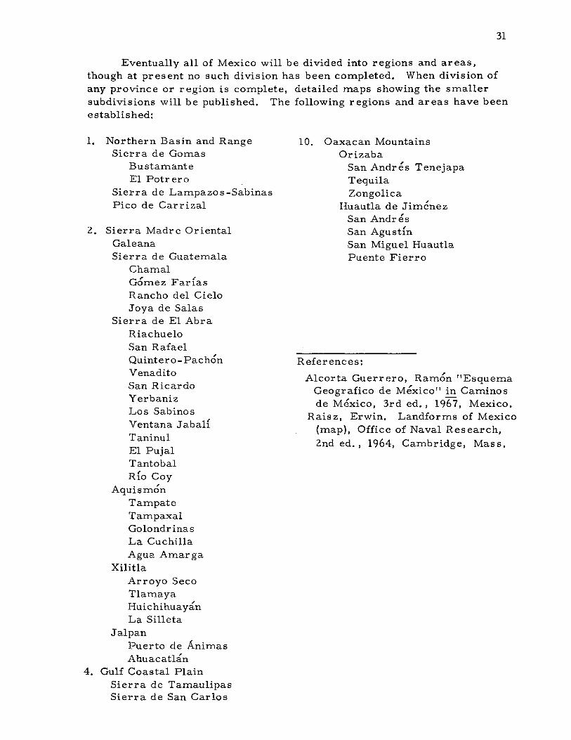
Eventually all of Mexico will be divided into regions and areas,though at present no such division has been completed. When division ofany province or region is complete, detailed maps showing the smallersubdivisions will be published. The following regions and areas have beenestablished:
1. Northern Basin and RangeSierra de Gomas
BustamanteEl Potrero
Sierra de Lampazos -SabinasPico de Carrizal
2. Sierra Madre OrientalGa1eanaSierra de Guatemala
Chama1Gomez FarfasRancho del CieloJoya de Salas
Sierra de E1 AbraRiachue10San RafaelQuintero-PachonVenaditoSan RicardoYerbanizLos SabinosVentana Jaba1fTaninu1E1 Puja1TantobalRfo Coy
AquismonTampateTampaxa1Go1ondrinasLa CuchillaAgua Amarga
Xilit1aArroyo SecoT1amayaHuichihuayanLa Silleta
Ja1panPuerto de AnimasAhuacatlan
4. Gulf Coastal PlainSierra de TamaulipasSierra de San Carlos
10. Oaxacan MountainsOrizaba
San Andres TenejapaTequilaZongolica
Huautla de JimenezSan AndresSan AgustfnSan Miguel Huaut1aPuente Fierro
References:
Alcorta Guerrero, Ramon "EsquemaGeografico de Mexico" in Caminosde Mexico, 3rd ed., 1967, Mexico.
Raisz, Erwin. Landforms of Mexico(map), Office of Naval Research,2nd ed., 1964, Cambridge, Mass.

1967 TRIP REPORT SUMMARIES
DATE
28 Jan - 5 Feb
29 March - 8 April
1 - 8 April
NORTHERN MEXICO
Sierra Madre Oriental; Aquismon; Golondrinas, Agua Amarga, Tampaxal.Municipio de Aquismon, S. L. p.
John & Sandy Cole, Bill Cuddington, BillDeane, T. R. Evans, Dan Hale, Bob Hugil,Squire Lewis, Jon Morse, Sandino Techo,Nancy Walters, Sid West
Fir st descent of Sotano de las Golondrinas.Cueva de Ochtalja explored for 1000-1500feet. First drop in Hoya de las Guaguasexplored.
AMCS Newsletter v. III, n. 2, p. 15.
VJN
SOUTHERN MEXICO
Oaxacan Mountain System province; Huautlaregion; San Agustfn area. Municipio deHuautla de Jimenez, Oaxaca.
John Fish, Terry Plemons, Ron RalphExploration and surveying continued in Sotano
de San Agustfn from -920 to -1473 feet. SanAgustfn now second deepest cave in NorthAmerica.
AMCS Newsletter v. III, n. 1, p. 3.
Oaxacan Mountain System; Huautla; San Agustfn.Huautla de Jimenez, Oaxaca
Ed Alexander, Bill Bell, Dave Brison, BobBurnett, Laurie Cameron, Jonathan Davis,John Fish, Tommy McGarrigle, Orion Knox,Terry Raines, Bob Thren, Tom Tracy
Fir st organized as sult by alarge group on Sotanode San Agustfn. A drop at the previously-surveyed -930 foot level was reached before highwater, due to an early rainy season, haultedprogress.
AMCS Newsletter v. III, N. 2, p. 23.

June
1 - 6 June
1 - 7 June
6 - 13 June
Sierra Madre Oriental; Aquismon, Golondrinas.Aquismon, S. L. P.
Ed Alexander, Jonathan Davis, John Fish,Dick Mitchell, Ted Peter s
Surveyed Sotano de las Golondrinas.AMCS Newsletter
Sierra Madre Oriental; Monterrey region.Central Plateau; Matehuala region.
Miles Abernathy, Duane Faith, Bill Miller,Joe Sumbera.
Explor ed Cueva de Casa Blanca and Cuevade Aguila del Oro near Monterrey, explored1000 feet in Cueva de Matehuala, and visitedseveral gypsum caves. Talked with Mexicancaving group in Matehuala.
AMCS Newsletter
Sierra Madre Oriental; Sierra de Guatemalaregion; Rancho del Cielo, San Jose. Sierrade El Abra region; Taninul, El Pujal, PachonQuintero.
Dr. Francis Abernathy, Dr. Robert Mitchell,James Reddell, Dr. Pierre Strinati.
Biological collections in Mine Cave, Cueva deTaninul n.l, Cueva del Pachon, and Grutasde Quintero.
AMCS Newsletter
Sierra Madre Oriental; Aquismon; Golondrinas.Aquismon, S. L. p.
Ronnie Aycock, Dan Chase, Kirk Holland, JonResager, Richard Schreiber, Marion Smith
Visited Sotano de las GolondrinasAMCS Newsletter
v.>v.>
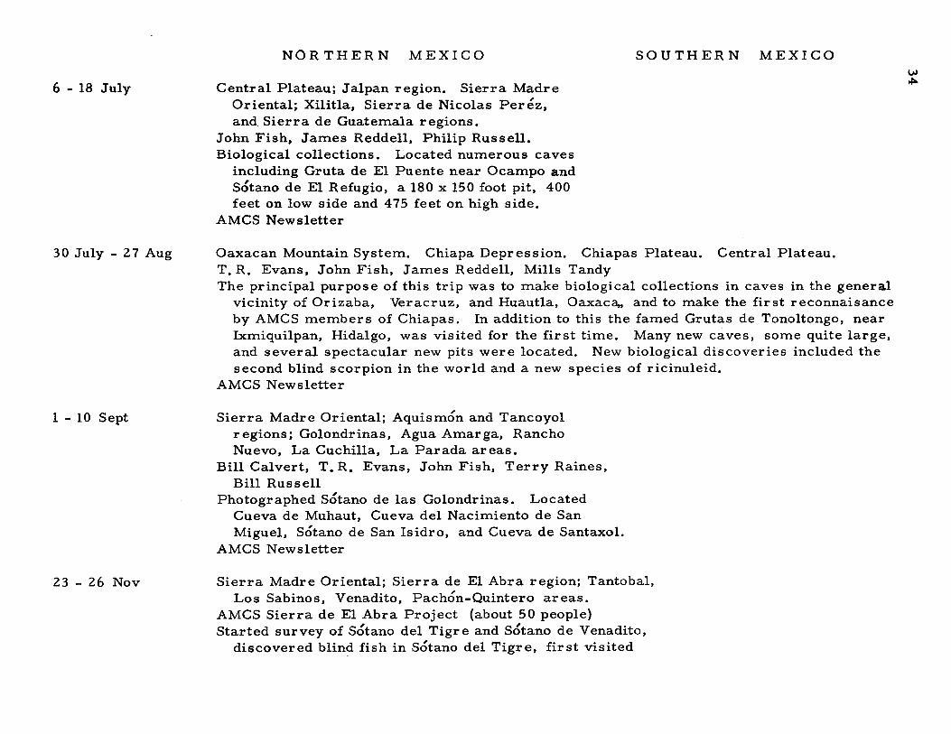
6 - 18 July
NOR THER N MEXICO
Central Plateau; Jalpan region. Sierra MadreOriental; Xilitla, Sierra de Nicolas Perez,and Sierra de Guatemala regions.
John Fish, James Reddell, Philip Russell.Biological collections. Located numerous caves
including Gruta de El Puente near Ocampo andSotano de El Refugio, a 180 x 150 foot pit, 400feet on low side and 475 feet on high side.
AMCS Newsletter
SOUTHERN MEXICOU>~
30 July - 27 Aug
1 - 10 Sept
23 - 26 Nov
Oaxacan Mountain System. Chiapa Depression. Chiapas Plateau. Central Plateau.T. R. Evans, John Fish, James Reddell, Mills TandyThe principal purpose of this trip was to make biological collections in caves in the genera.l
vicinity of Orizaba, Veracruz, and Huautla, Oaxaca" and to make the first reconnaisanceby AMCS members of Chiapas. In addition to this the famed Grutas de Tonoltongo, nearIxmiquilpan, Hidalgo, was visited for the first time. Many new caves, some quite large,and several spectacular new pits were located. New biological discoveries included thesecond blind scorpion in the world and a new species of ricinuleid.
AMCS Newsletter
Sierra Madre Oriental; Aquismon and Tancoyolregions; Golondrinas, Agua Amarga, RanchoNuevo, La Cuchilla, La Parada areas.
Bill Calvert, T. R. Evans, John Fish, Terry Raines,Bill Russell
Photographed Sotano de las Golondrinas. LocatedCueva de Muhaut, Cueva del Nacimiento de SanMiguel, Sotano de San Isidro, and Cueva de Santaxol.
AMCS Newsletter
Sierra Madre Oriental; Sierra de El Abra region; Tantobal,Los Sabinos, Venadito, Pachon-Quintero areas.
AMCS Sierra de El Abra Project (about 50 people)Started survey of Sotano del Tigre and Sotano de Venadito,
discovered blin~fish in Sotano del Tigre, first visited
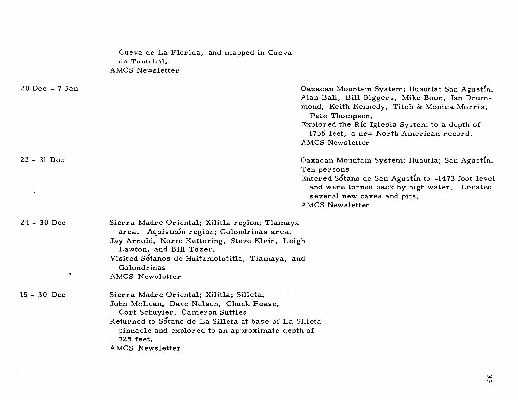
Cueva de La Florida, and mapped in Cuevade Tantobal.
AMCS Newsletter
20 Dec - 7 Jan Oaxacan Mountain System; Huautla; San Agustfn.Alan Ball, Bill Biggers, Mike Boon, Ian Drummond, Keith Kennedy, Titch & Monica Morris,
Pete Thompson.Explored the RIo Iglesia System to a depth of
1755 feet, a new North American record.AMCS Newsletter
22 - 31 Dec Oaxacan Mountain System; Huaut1a; San Agusdn.Ten personsEntered Sotano de San Agustfn to -1473 foot level
and were turned back by high water. Locatedseveral new caves and pits.
AMCS Newsletter
24 - 30 Dec
15 - 30 Dec
Sierra Madre Oriental; Xilitla region; T1amayaarea. Aquismon region; Golondrinas area.
Jay Arnold, Norm Kettering, Steve Klein, LeighLawton, and Bill Tozer.
Visited Sotanos de Huitzmo1otitla, Tlamaya, andGolondrinas
AMCS Newsletter
Sierra Madre Oriental; Xilitla; Silleta.John McLean, Dave Nelson, Chuck Pease,
Cort Schuyler, Cameron SuttlesReturned to Sotano de La Silleta at base of La Silleta
pinnacle and exp10r ed to an approximate depth of725 feet.
AMCS Newsletter
UJ01

ASSOCIATION FOR
MEXICAN CAVE STUDIES
NEWSLETTER
NEWS AND NOTES
SHORT STORIES
CONSERVATION
TRIP REPORTS
Various caves in the Sierra de El Abra, S. L. p.
Caves along the Inter-American Highway
Ahuacatlan, Queretaro
Sotano de La Joya de Salas, Rancho La Joya, Tamps.
Pozo de Gavilan. N. L.
Cueva de Constantin. Espinazo. N. L.
Hoya de Zimapan. Tamufn. S. L. p.
Ahuacatlan. Queretaro
Cd. Valles, S. L. P.
Hoya de Zimapan, Sotano de Los Loros, SOtano del Arroyo,Nacimiento del R{o Choy. s. L. p.
Volume III Number 3

,I,

ASSOCIATION FOR MEXICAN CAVE STUDIES
NEWSLETTER
Volume III Number 3 Publication Date: May 1971
The AMCS NEWSLETTER is published six issues per volume asfrequently as possible by the Association for Mexican Cave Studies, p. O.Box 7672 University Station, Austin, Texas 78712, USA. The AMCS isa nonprofit organization whose goals are the collection and disseminationof information concerning Mexican caves. Membership is open to allinterested, conservation-minded persons at a rate of $5. 00 US per volume.
Potential contributors are urged to submit articles for publication.The article may cover any phase of Mexican speleology. Trip reportsare requested from all trips.
Editor .Corresponding Secretary.Photographic Editor ..Staff. . . . . . . . . . .
Terry W. Raines. T. R. Evans
Carl E. KunathKeith HeussDale PateCraig SainsottMike Walsh
Published by THE SPELEO PRESS
NEW SAND NOT E S
Every Monday night is AMCS Night at 703 Carolyn, Austin, Texas.The idea is to establish a regular meeting time when interested persons cangather for the benefit of the AMCS, i. e. work, with no financial reembursemente It has proven successful since our first gathering last August.Frequently volunteers are rewarded with a slide show and all are welcometo attend. But please note: 1£ no one's at home, we've gone caving!
AMCS Bulletin 1, "Caves of the Inter-American Highway" is completelyand totally out-of-print. You'll have to Xerox a friend's copy until we gettime to print a second edition. The original is so out of date that it willnot be reprinted.
38
SHORT STORIES
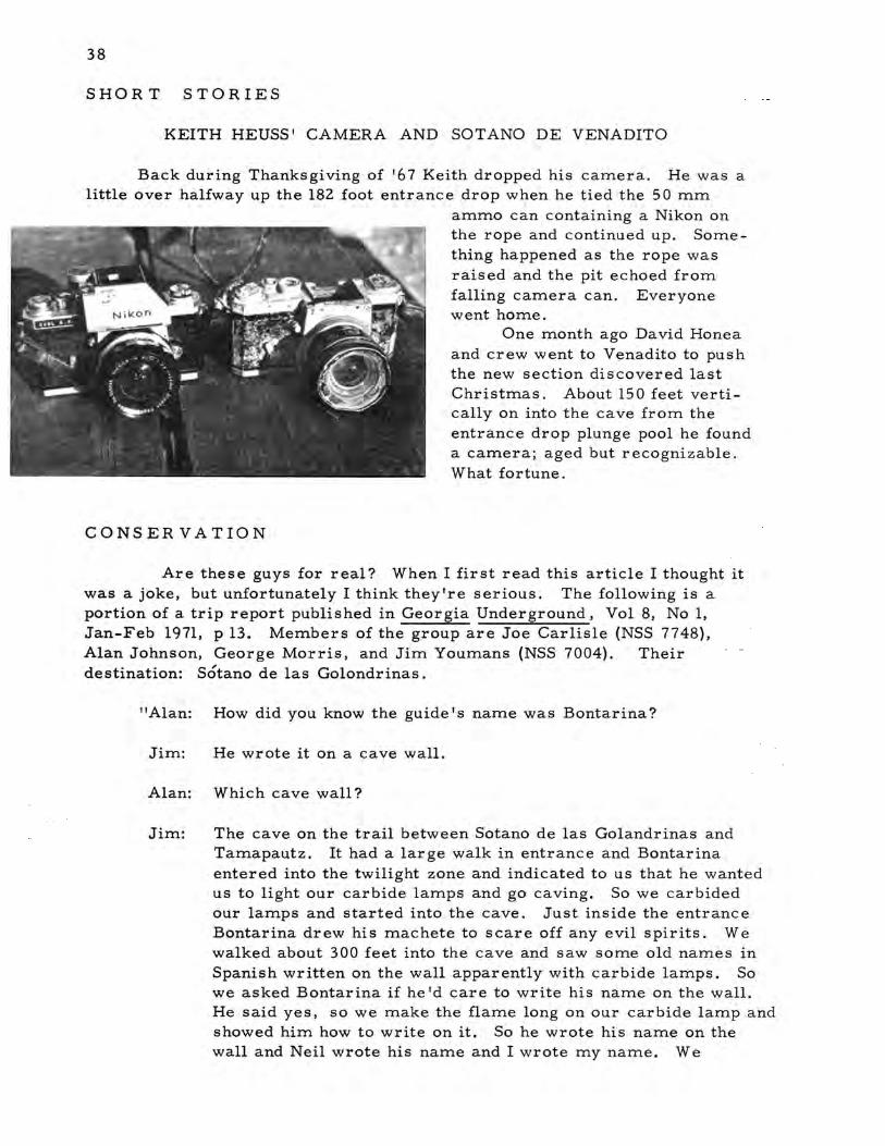
KEITH HEUSS' CAMERA AND SOTANO DE VENADITO
Back during Thanksgiving of '67 Keith dropped his camera. He was alittle over halfway up the 182 foot entrance drop when he tied the 50 mm
ammo can containing a Nikon onthe rope and continued up. Something happened as the rope wasraised and the pit echoed fromfalling camera can. Everyonewent home.
One month ago David Honeaand crew went to Venadito to pushthe new section discovered lastChristmas. About 150 feet vertically on into the cave from theentrance drop plunge pool he founda camera; aged but recognizable.What fortune.
CONSER VATION
Are these guys for real? When I first read this article I thought itwas a joke, but unfortunately I think they're serious. The following is aportion of a trip report published in Georgia Underground, Vol 8, No 1,Jan-Feb 1971, p 13. Members of the group are Joe Carlisle (NSS 7748),Alan Johnson, George Morris, and Jim Youmans (NSS 7004). Theirdestination: Sotano de las Golondrinas.
"Alan: How did you know the guide's name was Bontarina?
Jim: He wrote it on a cave wall.
Alan: Which cave wall?
Jim: The cave on the trail between Sotano de las Golandrinas andTamapautz. It had a large walk in entrance and Bontarinaentered into the twilight zone and indicated to us that he wantedus to light our carbide lamps and go caving. So we carbidedour lamps and started into the cave. Just inside the entranceBontariria drew his machete to scare off any evil spirits. Wewalked about 300 feet into the cave and saw some old names inSpanish written on the wall apparently with carbide lamps. Sowe asked Bontarina if he 'd care to write his name on the wall.He said yes, so we make the flame long on our carbide lamp andshowed him how to write on it. So he wrote his name on thewall and Neil wrote his name and I wrote my name. We
39
pronounced our names for him and he pronounced his name forus and he was much pleased that he could communicate withus in such a manner. "
And this isn It all. The rest of the article is quite revealing. Definitelyworth reading if you can obtain a copy. The next AMCS trip into this areawill clean the walls of this cave. In the meantime, Jim and his friends woulddo better watching TV football on weekends rather than destroying the caveswe explore. Although they claim to be in the NSS, do they know what it's allabout? Somebody, please let them know!
TRIP REPORTS
~Date: 19 December - 5 January 1971Destination: Various caves in the Sierra de El Abra, S. L. P.Location: SMa; Sierra de El Abra; Los Sabinos & La Cieba areas.Persons: Miles Abernathy, John Basset, Craig Bittinger, Steve Bittinger,
Don Broussard, Paul Duncan, Mark Minton, Mike Moore, NealMorris, Buddy Rogers, Tom Wright
Reported by: N. Morris
The first five days were spent surveying the Montecillos System.The survey included Sotanito de Montecillos, Sotano de Pichijumo. thearroyo connecting the tow entrances, and two small caves located in_ thearroyo, Cueva de las Ratas and Cueva del Leon.
In Sotanito, we surveyed 5000 feet of passage and rigged four drops.The 110 foot entrance drop and drops in the main passage of 30 feet, 100 :feet,and 80 feet put the total depth of the cave at -288 feet. At the lowest levela running stream was discovered flowing through passage 50 feet wide and80 feet high. On an upper level there was 2400 feet of lake passage whichconnected to Pichijumo through a siphon. There are still many unexploredside leads in Sotanito that need to be surveyed.
In Pichijumo we again surveyed 5000 feet of passage and riggedthree drops. At the bottom of the 45 foot entrance drop three upper levelsiphons were reached and two of them connected with the Sotanito siphon.The secohd drop which carries the flood waters of the arroyo was 140 feetto 1500 feet of lake pas sage and then a 65 foot drop. At the bottom of thisdrop we rappelled into inner tubes and paddled the last few hundred feetthrough a large meandering lake to a siphon. The total depth was 328 feet.
In the right side of the arroyo near Sotanito is Cueva de las Ratas.A short entrance passage leads to a 30 foot drop and an 80 foot drop to amud plug that connects to Sotanito. Cueva del Leon in the left side of thearroyo is only 100 feet long.
After our five day assault we spread two truck loads of mud andgear acros s the Los Sabinos campground to dry. The smell attracted atleast fifty vultures that circled over our heads for hours.
For a day of rest we drove through Cd. Valles and Tamuln aroundto the east face of the El Abra and checked the water levels at the nacimientos of Arroyo Seco and RIo Tantoan. A small 40 foot sink led to water atTantoan.
That night attended large festival
We spent 3 hoursLogan entered;
40
The next day found us in Sotano del Tigre prusiking through a plungepool. At Los Sabinos that evening there were six truck loads of cavers. Inthe morning we were once again around to the east face of the El Abra onthe Zimapan ranch. Here we were joined by Mike Moore and Mark Mintonfrom Indiana. The first thing we did was to map Cueva de Cieba since theentrance was only a two hour climb from the base of the range. Cieba isonly 700 feet long but it has dimensions of 100 feet by 100 feet and three skylights, one of which gives a 175 foot drop. In the middle of the cave is a300 foot pit which leads to fossil bone deposits and gives the cave a totaldepth of 647 feet.
Tom, Buddy, and I camped halfway up the east face after rigging theskylight. The next morning we hiked across the range and finally emergedfrom the jungle 30 hours later to crawl across the Inter-American Highwayand hitch-hike into Valles.
While we were crossing the jungle, the rest of the group was choppinga trail across the crest of the range in search of two pits that had been ob_served from the air. The first pit was reached after two days of choppingand named Sotano de los Loros. The second was actually a large cave entrance which led to a 10 second pit (Hoya de Zimapan). Neither cave wasentered due to lack of time.
Eventually we were all united at the AMCS Campground at Los Sabinoswhere we swapped fantastic tales of the jungle. The Indiana cavers headedfor the U. S., but we picked up Paul Duncan, Don Broussard, and MilesAbernathy and spent a couple of days mapping in Pichijumo before we wereforced to cut our trip short. Craig caught mono and the Mexican doctorswere unable to help him. Rather than let him die in Mexico, we rushed himback to Kingsville and medical aid and started plotting survey notes.
- Date: 31 December - 7 January 1971Destination: Caves along the Inter-American HighwayPersons: Roy Brown, Logan McNatt, Charlie YatesReported by: Logan McNatt
31 Dec. Visited Cueva de La Boca and Cola de Caballo. Camped New Year'sEve near Pozo de Gavilan; cold.1 Jan. Our guide didn't show up due to overcelebration.looking for Pozo de Gavilan and finally found it. Roy andwater almost completely covered bottom.2 Jan. Drove to Gomez Farlas and entered Sotano de El Molino; blind fish(maybe) in pools in passage at bottom. Drove to Grutas de Quintero andcamped.3 Jan. Entered Quintero and Cueva de El Abra. Drove to Cd. Valles andmet Terry Raines and Donna Vaught hitch-hiking west. Next met MilesAbernathy, then group of Californians including Bill Deane, also met KeithWilson from Perin. Camped at AMCS campground near Los Sabinos.4 Jan. Drove to Xilitla and then to Jalpan. Hiked to lower entrance of Cuevadel Rlo Jalpan.5 Jan. Explored lower cave completely.in Jalpan which was the day of their saint.

41
- Date: 1 - 10 January 1971Destination: Ahuacatlan, QeretaroLocation: SMa; Jalpan; Puerta de las Animas & Ahuacatlan areasPersons: Calvin Walker, Mike WalshReported by: Mike Walsh
Finding ourselves without transportation, we took a bus to Mexico Cityand then on to Grutas de Cacahuamilpa. On 6 Jan we pulled into Ahuacatlan.Several years earlier we had heard rumors of large pits near this town andwe decided to check them out. The following day we hired a guide to take usto some of the caves in the area. The first day we were taken to Cueva delos Riscos. The next day, 8 Jan, we went up the mountain behind the townto a small cave. After he informed us that there were no more caves nearby,we paid him. Calvin and I continued up the mountain in disgust. After awhile Calvin returned to Ahuacatlan while I kept hiking. As I was about togive up, I encountered a Mexican who said he could take me to several pits.The first appeared fairly insignificant. The 3. 5 foot entrance was about80 feet deep. This was the cave which later proved to be over 1000 feet indepth. After another small pit we went to another which was about 125 feetdeep. The next pit had a free drop of over 400 feet. Two more pits andone small cave were visited on the way back to his house. Our bus trip tothe U. S. was filled of thoughts of a return during the upcoming spring break.
- Date: 16 - 21 February 1971Destination: Sotano de La Joya de Salas, Rancho La Joya, Tamaulipas.Location: SMa; Sierra de Guatemala; La Joya area.Persons: 18 (see below)Reported by: David Honea
Although Sotano de la Joya de Salas has been known since 1965, it andthe Sierra de Guatemala in which it is located have seen little activity in thelast few years save for trips to a specialized area, Rancho del Cielo. Thisobscurity is in part a result of the relative inaccessibility of the area due tobad roads or in fact to a general lack of roads. Recent times, however,have witnessed a renewed interest in working in La Joya and in wideningactivities in the very promising surrounding limestone areas.
Until December, 1970 the cave was thought to end in a siphon at -892feet. Up to the siphon, the general character of the cave is entirely vertical,with successive drops of 246, 177, 64, 40, 79, and 230 feet. There is littlehorizontal passage between the drops and the whole cave corkscrews in onitself so that there is almost no net horizontal displacement from the entranceto the siphon. The first map of the cave was made on the earlier 1965 trips.The trip reports, map, and description may be found in more detail in theAMCS Newsletter vol. I no. 5, p. 54-58; Vol. II no. 6, p. 132-137; andBulletin I, p. 48-50.
Continued interest and hopes of deepening the cave have been promptedby the excellent potential of the surrounding limestone range, the Sierra deGuatemala. With the cave located at an elevation of about 5500 feet, thelimestone depth and thus the potential of the cave is over 1000 meters.
42
Since the siphon is at -272 meter s, it was hoped that it might be only aperched pool and that the cave would continue beyond it. This had generatedseveral ideas by AMCS members for draining the siphon using hoses ordynamite.
With this in mind, Terry Raines, Don Broussard, Blake Harrison,Ron Rossburg, and Mike Walsh visited the pit in September, 1970. Itwas their purpose to re-examine the siphon in an attempt to ascertainits real nature. They also remapped the cave and explored and mapped asecond entrance which intersects the main cave in the second, 177 footdrop. They found relatively wet conditions and it was felt that pushing thesiphon would be hazardous at best, as they had no diving equipment.
Having still no reason to believe that the pit should end at this point,a group of Canadian and Eastern cavers assaulted the cave with divingequipment and wet suits during Dec. 1970. After carrying the tanks etc.to the siphon they were surprised to find that the water level was low enoughto make it no longer a true siphon. Pushing it, they found only about 6-10feet of submerged passage, and that the cave continued past the siphon.They explored to the extent of available rope, some 200 feet, found thecave to be still continuing, but were stopped by another drop.
This then was the chain of events leading to the most recent trip,made in February 1971. The continuation of the cave generated muchenthusiasm among cavers interested in La Joya and a trip was organizedwith the threefold purpose of 1) first and foremost, mapping beyond thesiphon and pushing the cave, 2) dynamiting the lower wall of the siphon toprevent it from ever totally refilling and 3) filming the whole trip in thecave with a movie camera. As the departure date drew closer, the numberof people going on the trip and the estimates of the possible cave depthgrew larger. Two vehicles left Feb. 16 and a third Feb. 17, carrying 17people, all the UTG club rope plus 1800 feet of SWTCC rope, a total ofgreater than 3000 feet of rope. The vehicles and crews were: Terry Rainesin a Dodge Power Wagon with Sherry Greer, Blake Harrison, Hugo Victoria,Keith Wilson, Neil Morris, John Muth and Nicki; Bill Bell in a GMC withRooney Burnett, Richard Booth, Logan McNatt and Kiki Nicholas; DavidHonea in a Toyota Land Cruiser with Don Broussard, Roy Jameson, PauletteJust, and Jerry Broadus.
Omitting most of the unp1easantries of border cros sing, and vehicleproblems on the road, all vehicles arrived some 15-24 hours after theirAustin departure time. The last 20 miles requires several hours, due tothe poor road and steep climb. Since one truck left a day later, for the firstday the full crew was not present. However, the cave was rigged to thesiphon and some 250 feet beyond. While several people entered the cavepart way, Blake, Don, David, Hugo, Keith, Neil, Roy, and Terry wentthrough the siphon. While the others explored past the siphon, Terry andDavid star-drilled for about 2 hours in the very hard dolomite which formsthe lower wall of the siphon. After everyone had cleared the siphon, Terryset the dynamite charge and retired for the evening.
The next morning found most of the cavers anxious to enter the caveto map and push further beyond the siphon. Prepared for an extended stayand with more rope and mapping gear, the group re-entered the cave about8:30 a. m. on Thursday, Feb. 18. Much to our displeasure, the dynamite haddone virtually nothing. After everyone had packed their clothes in plastic

43
bags and swum the chilly 65 degree water of the siphon, we examined theblast site, reassembled our gear in preparation for mapping, and sent outan advance crew of Keith and Rooney with rope to explore beyond the'laststopping point.
A mapping team of Blake, David and Terry, with the help of Jerry,began mapping at the siphon. Just past the water is a tubelike passageabout 3 feet in diameter in the very hard dolomite which forms the constriction creating the siphon. The cave continues horizontally in this bed as avertical fissure crawl for about 40 feet. The pas sage then breaks throughthe dolomite and begins to open up. Here it is some 5 feet wide by 8-10feet tall and continues as a pool-hopping horizontal passage to the top ofthe next drop about 100 feet away. Along the way a high dome is encountered which has no obvious leads. The drop is about 60 feet, with passageleading to a 40-foot long chimney over a fis sure about 20 feet deep. Thechimney ends at the top of the second drop, which falls 110 feet into a largeplunge pool which may be avoided by traversing along the left wall. Immediately past the drop, the pas sage takes off in two directions. The upstream branch leads to an unchecked 80 ft. drop. Mapping continued downthe downstream passage. This passage leads to a drop of about 40 feet.From the bottom of the drop two routes are possible: either wading througha low-water passage or crawling through a large formation. These lead tothe top of a 15 foot drop into a small room. The passage continues as aclimbable scramble-down for 20 more feet to water passage. Mappingstopped at the beginning of this water, due to a lost survey tape. Keith,however, swam down it for about 30-45 minutes until he came to a pointwhere low ceiling and flowstone sufficiently blocked the passage to makea duck-under necessary.
The character of the pit seems to change markedly on the bottomside of the siphon. Up to the siphon it is essentially vertical, dry andscoured, and with only minimal amounts of active deposition. Below thesiphon the cave takes off more horizontally with active formations, somemoving water, and calcite-cemented fill deposits of water-rounded limestonepebbles.
Above the siphon the pit is warm; below the siphon it is wet and forextended stays, cold without wet suits. Air temperature is in the 60's buta combination of this plus 60-degree water and wet rock will probablyneces sitate some additional warm clothing such as a wet suit. At the veryleast, dry clothes on the other side of the siphon are necessary for extended stays.
After de-rigging the pit to Sima Terrible and setting a second chargeof dynamite, everyone left for the day. People exited the cave from about12: 00 p. m. to as late as 4 a. m. The next day was spent de-rigging theremainder of the pit and packing up to depart. Descending the mountainthat evening, everyone stopped to camp at the river near Encino. The mainmishap of the trip occurred on the trip down, when Bill Bell's GMC caughton fire high up on the mountain and ha.d to be towed down. Sunday morningfound everyone leaving for Austin with Bill's truck in two. An overlythorough customs search of two of the trucks formed the only excitementof an uneventful return to Austin late Sunday night.

44
- Date: March 1971Destination: Pozo de Gavilan, N. L.Location: SMO; GaleanaPersons: Craig Bittinger, Paul Duncan, Tom Wright, Fred StoviakReported by: Craig Bittinger
We left Kingsville Friday night and camped at Bustamante Canyon. Inthe morning we drove on through the canyon and south down the western sideof the range. After 40 miles of dust we reached El Cuarto, where a friendlyMexican told us of a huge cave at the town of Espinazo, N. L. Our partythen returned to Bustamante and proceeded to Galeana. Sunday morning werappelled into Pozo de Gavilan. The bottom was a huge lake with a 10 footwide, 50 foot long beach. Our party then drove back to Kingsville withoutdelay, basically because of no brakes.
- Date: March 1971Destination: Cueva de Constantin. Espinazo, N. L.Location: NBR;' Sierra de GcmasPersons: Craig Bittinger, Paul Duncan, Don McCarty, Ruth McCreary,
Roger Macmillan, Curtis RobertsReported by: Craig Bittinger
We left Kingsville Friday night headed for Austin but then decided togo to Mexico. Our party spent the night on the road between Monterrey andMonclova. In the morning we proceeded to Espinazo where a local guideshowed us to Cueva de Constantin. The cave is approximately 2500 feetlong with 150 feet of vertical relief and large walking passage throughout.We then returned to Kingsville after spending the night at Bustamante Canyon.
- Date: 13-19 March, 1971Destination: Hoya de Zimapan. Tamuln, S. L. P.Location: SMO; Sierra de El Abra; TanchipaPersons: Pam Alton, Craig Bittinger, Jim Clements, Donna Dierick,
Paul Duncan, Brad Hubbard, Neal MorrisReported by: Neal Morris
Friday after A&I let out for Spring Break, our group headed forMexico and the two pits on top of the El Abra that trails had been choppedto during Christmas. Except for minor border hassels, we drove straightthrough to Valles and spent Saturday night camped at the base of the range.While the women spent the next two days and one night alone at the truck,the rest of us climbed the mountain to explore and map the two caves. Itwas a 6 hour climb to the fir st pit, Sctano de los Loros. The 100 by 40 footentrance provides a 200 foot free rappel. At the bottom is 700 feet of welldecorated walking passage. The large parrots inhabiting the entranceinspir ed the name.

45
After hiking all day and mapping Loros, we camped for the nightinside the tremendous entrance room of Hoya de Zimapan. This roomwas 500 feet long, 100 feet wide, 100 feet high and divided into two sectionsby a massive flowstone column. The next morning we began surveying thecave. The big room ended with another massive flowstone formation, buta short crawlway leads through the column to the edge of a 150 foot drop.At the bottom of this drop a flowstone cascade led to another 300 foot drop.Beyond this drop we encountered a room of unbelievable size. We surveyed an 1800 foot loop around its edge mainly because venturing away fromthe wall meant getting lost, a. rapture of the deep type thing. It measured700 feet long and 300 feet wide with an average ceiling height of over 100feet. In the center of the ceiling a hole extended hundreds of feet upwardsout of the light of flares, apparently another part of the system rather thana dome. The floor of the room was virtually a desert of dry rimstone poolsextending out of view in all directions with a small waterhole in the centerof everything. The total depth of the cave reached -1050 feet.
The women were pissed when we returned from the mountain and weheard many tales of woe, but all wounds healed quickly. For the rest ofthe trip we went sight-seeing. One day was spent swimming, hiking, andcaving at the Nacimiento del RIO Huichihuayan. Also visited was CuevaPinta at the end of the Montecillos road.
One of the most exciting parts of the trip was our 4-wheeling adventure through Canon de la Huasteca where our group got to go rock climbingtogether. Brad's Power Wagon was much appreciated and everyone hadfun riding on top of the camper. Pamie said it was just like riding therodeo. On the way home we stopped at Bustamante. They informed usthat there were lights in the entrance room and anyone entering the cavemust have a guide. After exploring Canon de Bustamante we returnedto Kingsville.
Although the truck was a little crowded with seven bodies and gear,everyone got along fine. Our only problem was conflicting interests asto things to do, but everyone admitted that it was a great trip.
- Date: 13 - 21 March 1971Destination: Ahuacatlan, QueretaroLocation: SMO; Jalpan; Ahuacatlan.Persons: (see below)Reported by: Mike Walsh
On 14 March, two days into our spring break trip, our two busespulled into Ahuacatlan. The members of the first bus were Scott Campbell,Grayson Knapp, Keith Heuss, Dale Pate, Calvin Walker, and Mike Walsh.In the other VW were Blake Harrison, Kiki Nicholas, Logan McNatt, DianaPorter, Ralph Mayner, and Jim and Julie Rodemaker. With the exceptionof the latter two, all were members of the Southwest Texas Grotto.
Our group left Ahuacatlan hiking about three in the afternoon. Inaddition to our personal gear we were carrying about 750 feet of rope.The hike along the arroyo takes about an hour. At the store on the trail westarted the long climb up the mountain. About halfway up we were greetedby Ramirez's sons who provided us with burros to carry our equipment.
46
We had treated Sr. Ramirez with respect when we had first met him and wenow had friends for the rest of our stay.
Even though our group was tired when we reached the pit we engagedI
in a favorite cavers I pastime, that of rock-dropping. The following morningMike Walsh and Blake Harrison entered. The pit, Sotano del Aguila, hada free drop of 420 feet and a total depth of 435 feet. The same morningLogan McNatt, Jim and Julie, and Blake checked two other pits, one with a125 foot drop and the other a 100 foot drop. While this was going on, theother group checked out a fairly large sotano with a 30 foot drop. Afterreaching the end, they started hiking back to our camp near Sotano del Aguila.To the right of the trail they saw a large dolina. Sotano del Macho Rey wasat the bottom of this dolina.
That evening we decided to move camp to a location closer to the largedolinas. The move was immediate and on the way I reached a key trail tothe right where I waited for the others to catch up. I make one last attemptto relocate that small entrance which Ramirez had taken me to on the firsttrip. To my surprise it was only 30 yards down the main trail. Thatevening we rested contently with the knowledge that we now had two majorsotanos located, Sotano del Aguila and Sotano del Macho Rey.
Early Tuesday morning a group entered Sotano del Macho Rey. The300 foot entrance drop was followed by another 300 foot drop. Due to lackof rope they had to return. The cave was entered a second time that day byBlake, Jim, and Julie. It was found to be over 1000 feet deep. The peoplein the area were unbelievely friendly. They brought us food, sugar cane,and water. With the new pits that they showed us and the others that we hadnot yet visited we felt overwhelmed by the work ahead of us. It was onTuesday also that Greyson expressed the desire to explore a new sotano.So, along with Keith and Scott, he went down the hill to explore what turnedout to be the major sotano of the trip, Sotanito de Ahuacatlan. Greysonrigged the 71 foot drop and descended through the 3.5 foot entrance. Hereported a room about 50 feet in diameter with a hole at the bottom of aslope. The others came down and the rock-dropping began. They knew itwas deep but could not comprehend how deep. The group returned to camptalking about a free drop of 200 feet or more. Blake returned to the cavewith a 365 foot rope. The drop was rigged and down he went. The knot atthe bottom of the rope was reached and several rocks were dropped. Fourmore seconds free. The news was greeted back at camp with the realization that it was neces sary to hike down to Ahuacatlan for the 700 foot rope.
Wednesday, while one group returned for the rope, two other groupshiked across the valley to check a pit which was reported to be over 300meters deep. After 3 hours of hiking our two groups found that the pit wasstill several hours away. We left that one for another trip.
On Thursday one group went to map Sotano del Macho Rey. The othergroup, consisting of Keith, Logan, Jim, Julie, and myself returned to theSotanito with the 700 foot rope. Logan, Jim and I descended the 71 footdrop, went to the back of the room, and rigged the drop. Logan entered thepit. After a short period we were unable to hear him due to the nature ofthe pit. Time passed slowly until, about 45 minutes after entry, we heardhim again... 700 feet frre'e and still going. After Logan and the rope wereout a 50 pound rock was dropped into the pit. It bounced for 2.5 seconds
47
then we heard noise for 15 seconds more. Perhaps it was deep. With thisobvious understatement we knew we had to return as sOOn as possible. Thatnight we went down the mountain to Ahuacatlan. The next morning the twogroups split up. Blake's bus got as far as Cd. Mante where a pistonacquired a hole. Those in his bus had to take a Mexican bus to the borderthen hitch-hike home. Blake stayed with his bus while it was being repaired.
- Date: 25 - 27 March 1971Destination: Ahuacatlan, QueretaroLocation: SMO; Jalpan; AhuacatlanPersons: Blake Harrison, Roy Jameson, Terry Raines, Tommy Rimkus,
Jim and Julie Rodemaker, Craig Sainsott, Hugo VictoriaReported by: Terry Raines
25 March - Four of us drove down from Austin and joined Blake, Hugo, Jimand Julie. They had just returned from Ahuacatlan. Now, with a new 1200foot coil of Goldline, all eight returned to the mountains.
26 March - Our destination was the Sotanito de Ahuacatlan previously enteredthe week before containing the 700 foot plus drop. The 1200 foot rope wasdistributed into 5 more-easily carried connected coils. Three hours wererequired to reach the entrance via a st eep mountain trail. Four descendedthe first 71 foot drop into the entrance room while four uncoiled and fed inthe rope from the surface. We lowered it into the pit and tied it off. Blake,who had previoulsy been to the -350 foot level, rappelled first. There isabsolutely no communication within the pit, so when tension slacked on therope I descended. The drop was 15 feet in diameter and completely sheerand free for 946 feet. The bottom wa s 14 feet in diameter with a small holeto one side dropping another 15 feet to a siphon at -1051 feet (total depth).We came directly out after surveying and photographing. Derigging theentire cave took 2 hours after which we trecked back to Ahuacatlan ratherlate. A complete detailed report will soon appear on this cave.
27 March - The remaining days of our trip were all down-hill. The daywas piddled away on flats, repairs, and driving. When we arrived atSotano de Venadito's road's end the ticks greeted us. The 45 minute hiketook 3 hours. Exhausted at the entrance, the decision was a quick trip toAustin.
- Date: 2 - 10 April 1971Destination: Cd. Valles, S. L. P.Location: SMO; Sierra de El Abra; Los Sabinos, Taninul, Los Monos,
and La Noria areas.Persons: Don Broussard, Robert Hanford, David and Ann Honea,
Sandy Robinson
Leslie Clapp, Rich Cooper, Blake Harrison, Dave Jackson,Roy Jameson, Craig Sainsott
Reported by: Roy Jameson
48
On Friday afternoon, 2 April, two groups of UTSS cavers left for Valles.One group, led by Leslie Clapp, was to pick up Blake Harrison in San Marcos,before continuing on to Cd. Mante to meet the others Saturday morning.Blake had been down several weeks earlier during the SWT spring breakbefore his VW bus engine had blown up. After spending an extra unscheduledweek riding Mexican busses between Valles and Mante attempting to locateparts, Blake was rescued by Terry Raines, myself, and several other newcavers who went down to find Blake and check a deep pit which the SWT cavershad located several weeks previously. Unfortunately, his bus was still inMante, sitting in the same "garage" it had sat in for several weeks, withengine parts scattered everywhere. Blake had obtained several parts, butstill lacked an exhaust valve, so we stopped in San Antonio briefly to pickone up before continuing. The next morning, after having only 2 and a halfhours sleep, we met David and his group in the main square in Mante. Afterbreakfast, we joined Blake at the garage where he was already attempting toget the Mexicans to reconstruct his engine in record time.
Since this was the first Mexican caving trip for several individuals, wehad elected to begin with horizontal and short vertical work, so, after arranging to check back with Blake that evening, we continued on to Grutas de Quintero,where David and Leslie collected rodent bones for Dr. Lundelius (UT), whilethe rest of us began surveying a previously unchecked passage. After surveying about 300 feet we came to a practically unclimbable wall, beyond whichthe passage seemed to continue. By the time this was scaled and we hadmapped several hundred more feet it was getting late; so when a short unclimb;.,able drop was reached, we all returned to the vehicles, and drove to the Nacimientodel R(o Mante where we cleaned up. After supper in Mante, we noted that Blakewas already gone, so we continued on towards Valles and camped at the AMCSCampground at Los Sabinos.
Sunday morning found us at Cueva de Taninul n. 4 collecting more rodentbones. That afternoon we entered Sotano de Pichijumo with the purpose offinding Don Broussard.'s Kamet "suicide biner" which he had lost attempt-ing to determine the depth of a pool of water, and Miles Abernathy's FootJumar, both having been lost the previous Christmas. The supposed 18 meterdeep water into which the equipment had fallen proved to be only 8 feet deep, soDon managed to retrieve both items with little difficulty. Unfortunately, considerable more difficulties were encountered in getting everyone out of the sotano,because of a lack of vertical gear, and some improperly constructed equipment.Robert Hanford also graphically demonstrated the need for a safety on Foot Jumars,when his seat sling Jumar came off the rope and he fell 25 feet into a pool of water.Fortunately he was uninjured.
On Monday our two groups split up. Leslie and his group returned to thePichiju:rn.oarroyo and entered Sotanito de Montecillos, while I joined David Honea'sgroup for some lead hunting near Micos. We had all planned to stay together, butit had been raining since the previous night, and Leslie's car could not negotiatethe wet roads in the Micos area. So we spent most of the day driving in a lightmist, which became rain just long enough to thoroughly soak Don and myself,since we were riding the Toyota running boards. After several hours of drivingand asking Mexicans where the sotano we were hunting for was, we were finallyled to a 75' climbable pit with no leads in the bottom. So we continued back towardthe main highway, stopping long enough to hack our way up to the top of a short hill,hoping to see another sotano which had been spotted from the air. Of course, the

49
jungle was much too thick to see anything. That night we camped in the rainat Los Sabinos.
Tuesday we left Ann and Sandy, who had been sick since Sunday, inValles and drove north to El Salvador to survey in Sotano de Venadito.David, Don, Robert, Leslie, and I entered while the others remained aboveto look for other caves in the area. Our objective was to explore and surveybeyond a new pit that Terry Raines had located at Christmas. We spent theday surveying approximately 1350 feet of new passage, much of it in kneedeep water. There were numerous places in which it was necessary toswim, and after several hours of being wet we were all ready to leave.
While looking around in one large room, David Honea found a Nikonwhich had been dropped into the cave three years previously (See ShortStories). The owner had apparently been leaving the entrance drop ofISO', had tired of carrying the camera and so tied it (in an army ammunition box) to the rope and then continued up. The ammunition box then felloff the rope, opening and spilling the camera into a plunge pool over a hundred feet below. The Nikon had then been washed over another plunge poolabout 100' down a passage to a 100' drop, down it into a room at the bottomabout 20 by 20. About 6 feet above the floor of the room in one corner thereis a 40' long 3' in diameter tube leading to a 25 foot drop. From here apassage leads several hundred feet to a large room. The camera was foundin one corner of the room, at the bottom of about 50' of climb down, complete except for the viewfinder and the lens cap. There was a large amountof sand and mud inside, the hinges were rusted, the body and lens attachmentwere somewhat battered, but the lens, amazingly enough, was intact--onlya few scratches marred its surface.
We also found several one foot long live fer-de-lance in a blind sidepassage about 450' down. Considering that Venadito takes large amountsof water during heavy rains in the summer, one begins to wonder just whatgoes on in that cave1
On Wednesday Sandy and I traded cars so that she could return, sinceLeslie had to be back in Austin by Thursday. Earlier we had arranged withtwo California cavers, Ernest Garza and Frank Guinney, to meet on the roadto Cueva de los Monos area that day, so we started out. Since it had beenraining, or threatening to rain for several days, we borrowed some extraponchos from Leslie. Also. we hoped to be able to sleep in a hut which hadpreviously been occupied by a Mexican and his son. When we reached thearea, we found the road continued on past it up a hill towards Cueva Pinta.Don and I had been riding on the outside of David's Landcruiser so we hoppedoff to check the hut for signs of occupancy. As Don and I entered, everyoneelse decided to come look too. After several seconds most of us were insideand had decided the hut would offer excellent rain protection--besides, theMexican was no longer there. Unfortunately for us though the hut was stilloccupied----by about a billion fleas. Within seconds we were all scratching,running away from the hut madly tearing our clothes off and yelling, "Goddammit, where I s the sulphur? ". David and Ann quickly grabbed the sulphurand jumped in the Landcruiser, then drove it 200 yds. ju st out of sight ofthe hut, with the rest of us in quick pursuit. Thirty minutes later we werestill picking fleas off each other. Eventually Ann, the only one who didn'tenter the hut, claimed to be rid of her fleas. For the rest of the trip shekept her eyes constantly peeled on us, claiming that our fleas were jumping

50
on her--unfortunately, she was probably correct, since I still had two fleas whenI got back to Austin and bathed 3 days later.
After we were all liberally dosed with sulphur (not that it does any good)and looking like walking yellow m.asses, David, Don, Robert, and I walked onup to find Cueva Pinta. We very quickly decided that it was a m.uch better placeto sleep, especially considering that it was dry and had a large flat sm.ooth dirtfloor. We returned to the Landcruiser and began lunch, just as Ernie and Frankdrove up. No... they didn It stop at the hut.
After inform.ing them. about the hut, we decided to return to Pinta and surveyit. Later, Frank, Ernie, and I spent about an hour attem.pting to locate a largeclum.p of trees which we thought m.ight contain a satano, but we ended up on thewrong ridge and couldn It find it.
On Thursday we hiked up the range to Monos with 800 feet of rope in thehope of checking a lead which William. Russell had located at Christm.as, butunfortunately it turned out to be only 156 feet deep. When we returned to thevehicles, Ernie and Frank decided to leave since they had a long drive toCalifornia ahead of them..
Friday we hiked back up to Monos to m.ap the cueva at the top of the pitwhile Ann copied the petroglyphs that were present in the cueva for futurereference. Later Robert and I entered the pit (464' entrance) to check forpossible leads at the bottom. but decided that we needed to return with picksand shovels if we were going to go any deeper. That afternoon we left forAustin.
- Date: 3-10- April 1971Destination: Hoya de Zim.apan, Satano de Los Loros, Satano del Arroyo,
Nacim.iento del Rlo ChoyLocation: SMa; Sierra de El Abra; Tanchipa, Los Sabinos, Tam.uln areas.Persons: John Bassett, Craig Bittinger, Steven Bittinger, Terry Cox, Peggy Cox,
Mark MintonReported by: Craig Bittinger
Craig Bittinger and various m.em.bers of the BIG grotto spent the first nightat Nacim.iento del Rio Mante. Our group then proceeded to Nacim.iento del RloChoy where we m.apped the upper skylight. The skylight is a 350 foot dropwhich we entered through a sm.all cave at the 200 foot level. At the bottom. ofthe drop a deep lake was encountered where the water boils from. beneath theEl Abra range and flows from. the cave form.ing the Rlo Choy.
We then proceeded to Rancho del Zim.apan. In the m.orning our partyclim.bed the El Abra and descended into Hoya de Zim.apan. The large room.at the -1050 foot level was photographed and we finally returned to the truckat 4 AM. The next day was spent in rest and the following m.orning we onceagain clim.bed the El Abra. All descended Satano de Los Loros, -195 feet,Craig and Steven did a 170 foot free clim.b to check a lead which turned outto be a 40 foot long dead end. We then descended a dead end, 40 foot pitdiscovered inside the m.ain wall of the Satano. Upon returning to the top, ashout was heard and a lost hunter appeared out of the jungle. After drinkingtwo canteens of water, he proceeded to explain that he had been 48 hour swithout food and water and had wandered off from. Los Sabinos. Steve, Mike,and Mark hacked through the jungle until dark looking for an elusive depression.

The rest of the group and the lost Mexican returned to the truck. We thendrove into Cd. Valles where the lost Mexican was reunited with his wife,who had thought he was dead.
After a bano, we camped at Los Sabinos. The following day wasspent looking at Cueva Pinta and searching for Woyate. That night ourgroup attended the fiesta thrown in our honor by the town of Los Sabinos.Free roast lamb, barbequed chicken, and all the cerveza we could drinksoon put everyone in good spirits. The following day we did Sotano delArroyo. Steve, Craig, Mark and Mike swam the lake at the back of thecave and located the 30 foot drop. It led to a large, deep lake whichneeded an inner tube for further exploration. A crawlway led to a 40 footdrop which had crawlways leading back to the large lake. Our gr oup thenreturned to Indiana by way of Kingsville.
51


•
ASSOCIATION FOR
MEXICAN CAVE STUDIES
NEWSLETTER
NEWS AND NOTES
TRIP REPORTS
Cueva de Constantin
Pichijumo-Montecillo8 Cave System
Ahuacatlan area, Oro.
Sierra de El Abra, S. L. P.
Mexico
Sotano de los Monos
Grutae de San Sebastian, Oaxaca
Ahuacatlan. Oro.
ARTICLES
Vertical Techniques; Hair Removal
La Grata de Carrizal Accident Report
Volume 1lI Number 4


ASSOCIA TION FOR MEXICAN CAVE STUDIES
NEWSLETTER
VoluITle III NUITlber 4 Publication Date: February 1972
The Association for Mexican Cave Studies is a non-profit organization whose goals are the collection and disseITlination of inforITlationconcerning Mexican caves. The AMCS publishes a Newsletter, Bulletin,and Cave Report Series which are available to any sincerely interested,conservation-ITlinded person. The AMCS Newsletter is published sixissues per voluITle as frequently as neces sary at a cost of $3.00 US pervoluITle, which includes both the publication and ITleITlbership. Pricesof other publications are available by writing to the Association forMexican Cave Studies, P. O. Box 7672, Austin, Texas 78712, USA.
Potential contributors are urged to subITlit articles for publication. The article ITlay cover any phase of Mexican speleology. Tripreports are requested froITl all trips.
Publications Editor . . .Corresponding SecretaryCave Files .Coordination BiologistPhoto Editor. . .Publication Staff
Published by
NEWS AND NOTES
Terry W. RainesLogan McNattWilliaITl H. RussellJaITles R. Reddell
Carl E. KunathDavid HoneaJan LewisCarol Rus sellPeter Strickland
THE SPELEO PRESS
AM C S Bulletin 4 is now available. Entitled "Studies on theCavernicole Fauna of Mexico," it is edited by JaITles R. Reddell andRobert W. Mitchell. Price is $8.00.
Latest on La Gruta del PalITlito: The cave has been cOITlITlercialized.Lights have been strung to the Cathedral ROOITl. One still has to hikeup to the cave after buying tickets at Palacio Municipal, which are5 pesos each for groups under 10 and 3 pesos each for larger groups.Also, 10 peso s for lights.
AMCS ITleITlber s have just located, explored, and surveyed a new cavenaITled, "El Satano". Located in Queretaro, the entrance to the pitITleasures 700 ft by 1400 ft and tapers toward the bottoITl, which ITleasures 350 ft by 700 ft. The drop froITl the north edge, the only suitable
54 AMCS News
area for rigging, was accurately measured to be 1345 ft (410 m). Noother cave drop in the world is presently known to be greater. Complete details will be forthcoming in an AMCS Cave Report Series.
The first issue of the Cave Report Series, Sotanito de Ahuacatlan, wasdelayed in order that Bulletin 4 could be rushed through. Now that thishas been accomplished, we can concentrate on the Sotanito report whichwill be out this spring.
Sotano del Arroyo has temporarily reached the position of longest surveyed cave in Mexico. Of its more than 20, 000 ft of passageways (thesurvey notes are not calculated), 95% is walking. The big push wasmade this past Christmas by 25-30 cavers.
With the connection of Sotano de Pichijumo with Sotanito de Montecillos,This system now exceeds la, 000 ft and is the third longest surveyedcave in the Sierra de El Abra.
During the year of 1971 the AMCS published 429 pages of speleologicalinformation. Compare this with the record of any other publishingorganization for the year.
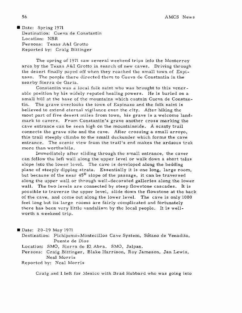
56
• Date: Spring 1971Destination: Cueva de ConstantinLocation: NBRPersons: Texas A&I GrottoReported by: Craig Bittinger
AMCS News
The spring of 1971 saw several weekend trips into the Monterreyarea by the Texas A&I Grotto in search of new caves. Driving throughthe desert finally payed off when they reached the small town of Espinazo. The people there directed them to Cueva de Constantin in thenearby Sierra de Garia.
Constantin was a local folk saint who was brought to this venerable position by his widely reputed healing powers. He is buried on asmall hill at the base of the mountains which contain Cueva de Constantin. The grave overlooks the town of Espinazo and the folk saint isbelieved to extend eternal vigilance over the city. After hiking themost part of five desert miles from town, his grave is a welcome landmark to cavers. From Constantin's grave another cross marking thecave entrance can be seen high on the mountainside. A scanty trailconnects the grave site and the cave. After crossing a small arroyo,this trail steeply climbs to the small duckunder which forms the caveentrance. The scenic view from the trail's end makes the arduous trekmore than worthwhile.
Immediately after sliding through the small entrance, the cavercan follow thE: left wall along the upper level or walk down a short talusslope into the lower level. The cave is developed along the beddingplane of steeply dipping strata. Es sentially it is one long, large room,but because of the near 45 0 slope of the passage, it can be traversedalong the upper wall or through well-decorated galleries along the lowerwall. The two levels are connected by steep flowstone cascades. It ispossible to traverse the upper level, slide down the flowstone at the backof the cave, and come out along the lower level. The cave is only 1000feet long but its lar ge rooms are fairly complicated and fortunatelythere has been very little vandalism by the local people. It is wellworth a weekend trip .
• Date: 20-29 May 1971Destination: Pichijumo-Montecillos Cave System, Sotano de Venadito,
Puente de DiosLocation: SMO, Sierra de El Abra. SMO, Jalpan.Persons: Craig Bittinger, Blake Harrison, Roy Jameson, Jan Lewis,
Neal MorrisReported by: Neal Morris
Craig and I left for Mexico with Brad Hubbard who was going into
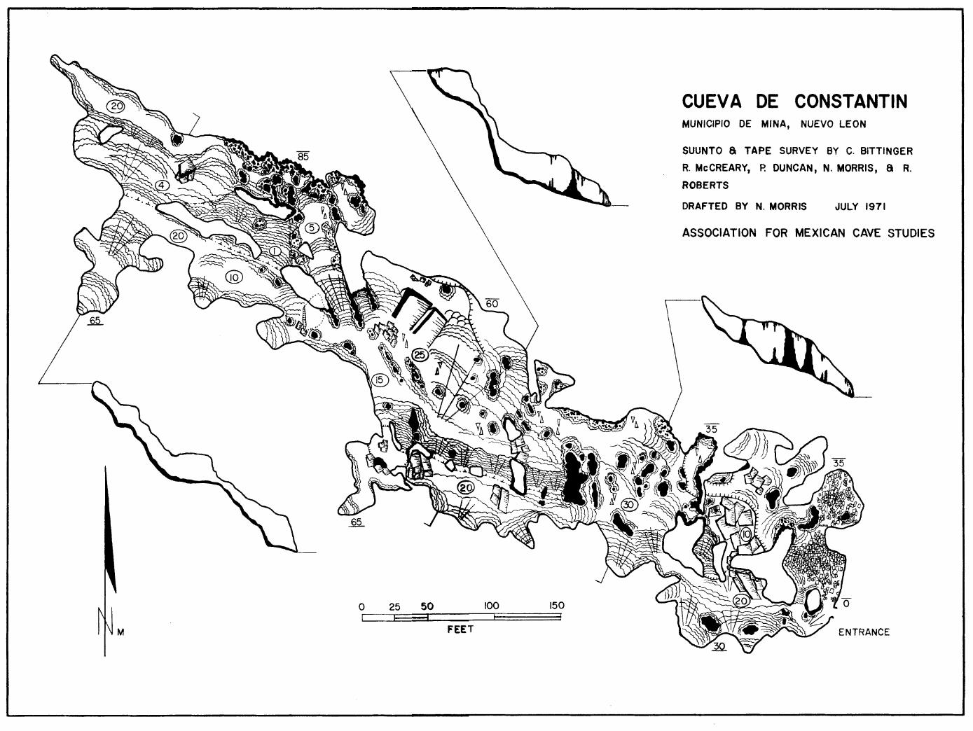
JULY 1971
ASSOCIATION FOR MEXICAN CAVE STUDIES
DRAFTED BY N. MORR~
CUEVA DE CONSTANTINMUNICIPIO DE MINA, NUEVO LEON
SUUNTO a TAPE SURVEY BY C. BITTINGER
R. McCREARY, P. DUNCAN, N. MORRIS, a R.
ROBERTS
150I
100I
FEET
o 25 50I I I
M

v. III no. 4 59
the interior in search of adventure after he dropped us at Los Sabinos.Blake Harrison and hi s VW Bus were only an hour ahead of us althoughthey had left Kingsville 3 days earlier. He lost a couple of days whenhe had to repair a blown piston--coITlfortably at his girlfriend's housein the Valley. At Los Sabinos there were a groady lot of cavers: ourtruck, Blake's VW, several cars froITl PASS, and Dr. Mitchell, Elliott,Rus sell, Wiley, and other s.
The first day of caving, Craig and I joined Blake, Roy, and Janin checking leads in Sotanito de Montecillos, First we connected twocrawlways in the entrance passage. Then Craig and Roy tried to godown a vaITlpire bat crawlway. They didn't get very far. The nextcOITledy act was Blake as he tried to las so a forITlation and check ahigh lead that didn't go. At this point we left Jan sitting alone for fourhours while we surveyed a new route to the lower level and checkedSOITle ITlore leads. She was glad to see us when we returned and surprised us with a ITlud sculpture. Back at caITlp, we found Elliott andRussell drinking beer and waiting for news of our discoveries.
The next ITlorning we went down a thousand roads trying to find aneasy way to Sotano de Venadito. Blake lost his ITluffler. It's a longhike to that cave but it's a fantastic systeITl. Roy guided us with theintention of ITlapping SOITle virgin lake pas sage in the lower level of thecave. We first decided to see what we were up against and explore,"We'll survey out", that's what we said. Many hours, ITluch swiITlITling,and about a ITlile of virgin passage later, we deterITlined it would takeanother trip to finish the cave. I think we left two good leads unchecked(good lead, ie the kind you run down for 500 feet and then reITleITlberthat everyone else is 1000 feet away with no idea where you went. ).COITling out was a pain, but it was nothing cOITlpared to the hike back tothe VW in the early ITlorning hours. Three tiITles we collapsed on thetrail and nearly went to sleep. Again Jan was very glad to see us, butwe showed her the snake we caught in the cave and she cooled off. Tocelebrate we went to the Condesa and ate a late dinner.
To rest our bodies the next ITlorning, we went to TaITluln, rodethe ferry and looked at the ruins. Then, since it was Sunday, we wentto Ventana Jaball and gave the San Marcos people a lightless tour. Onthe way back to Valles, we were unable to resist stopping at Cueva deTaninul n. 4. Eventually we ended up back at the Montecillos -PichijuITloSysteITl. Craig and Roy dropped into Sotanito de Montecillos while Blake,Jan, and I went to the end of the Arroyo and rappelled into Sotano dePichijuITlo. Our aiITl was to connect three siphons. Blake and I left Jansitting at one siphon and we went several hundred feet and looped aroundto the other siphon which we thought connected to her siphon and also asiphon in the other cave. Meanwhile, Roy, Craig, and two inner tubeshad gone down 2400 feet of lake pas sage to their siphon in the other caveand started pounding on the wall. When we got to our side we found thatwe could talk to Jan and see lights through what was previously a siphon.

60 AMCS News
A long, dry period had lowered the water level so that there was almostan inch of air space. Jan said that she could hear Roy and Craig fiveminutes before we got there. So we pounded on the wall with a whaletail. A few seconds later we were elated to hear sharp pounding fromCraig and Roy's rock hammer. We hammered and yelled back andforth for about 30 minutes as we determined exactly where the siphonwas. Voices were too garbled and distant for communication. Blakedove under the wall once, but it went down steeply and we decided itwas too hazardous to swim with no gear. The siphon probably isn'tlonger than 30 feet and is awaiting the first team to make an entranceto-entrance traverse. Then Blake and I swam through the near siphonto Jan and checked a lead in the 140 foot pit before leaving the cave.When we got to the other entrance Craig and Roy were just getting offrope and derigging. They had pushed the Vampire bat crawl for nearly100 feet as the bats were out feeding. They said that crawling throughpools of liquid Vampire bat shit is extremely gross. They were forcedback by bad air, but said it goes and takes water. Someone needs topush it. Back in Valles we went to Mitchell's rented house and bathed.
The next day we moved camp. First we bounced over to Nacimiento del RIO Huichihuayan and went swimming. Then on to Xilitlawhere we inspected a wierd house under construction. We finallyarrived at Ahuacatlan and debated whether or not to go on to Merida.It rained on us so we all crowded inside the VW and ate bread together.It was delicious.
The sun rose and we bloomed down the trail for Puente de Dios,a fantastic void where the RIO Jalpan goes underground. We mapped (ha)it. There is no better place I can think of to go bouldering, tremendousbouldering, boulders 38 feet high that we surveyed Over. Blake wentinsane trying to sketch. Jan spent a hot day in the car and was happy tosee us return.
The next day our whole group started off on a two day backpackingtrip. We had the foolish idea of an overland survey from the upperentrance to the lower entrance where the river emerges, mapping thelower cave and thus determining the distance between the upper andlower siphons. Too ambitious, but we did survey the lower cave. Thefirst day we went to the upper cave siphon in Puente de Dios where webolted 40 feet to a lead that didn It go. Coming down from the lead, abolt pulled out and I fell 20 feet before the belay caught me severalinches off the ground. There is now a carabiner hanging 24 feet up onthe back wall of Puente de Dios. Because it was close to dark when weemerged, we surveyed up to the main trail from the entrance andstarted hiking for the lower entrance in the rain. It was a beautifulhike through a dreamlike valley, but Blake had not told us the entrancewas so distant and we soon decided that an overland survey was out forthis trip. We got to the lower entrance after dark and camped in thecave. The lower cave is railroad tunnel size and sand floored. We got
v. III no. 4
up the next morning and surveyed 8200 feet in 10 hours.hiked back through the valley and up the mountain to thedark. So ended our cave explorations for this trip .
61
Exhausted, wecar as it got
• Date: May 1971Destination: SMO; Jalpan; Ahuacatlan areaPersons: Keith Heuss, Stanley Moerbe, Dale Pate, Mike Walsh,
Charlie YatesReported by: Mike Walsh
Once again we crossed the border with little difficulty. This timethe crossing was made at Matamoros. The trip to the cave was ratheruneventful. Our target area was the pass across from Sotanito de Ahuacatlan. While waiting for Terry Raines and his group to arrive we wentto visit and photograph Cueva de los Riscos and Cueva del Puente deDios. The entire group except Charlie went on this excursion. Stanleychecked the small crawlway in Riscos. Needless to say, it went nowhere. Keith took a series of photographs in Puente de Dios. Whilethere, Dale and Keith checked the large flowstone wall on the left sideof the big room. Passages led in several directions but none went veryfar. We stopped at the pool just above the first large drop. Upon returning to Ahuacatlan we found that Terry and his group had still notarrived. Dale, Stanley, and I started up the river bed toward the storethat night. We camped in the ruins nearby. The next morning we hikedup to Ramirez's house to try to get a guide to the deep satano that wehad heard about. We tried several houses but were unable to find aguide. We then returned to the store. About 1/2 hour later Charlie andKeith arrived. We all took the trail that goes up just behind the store.It was our intention to follow the ridge up the hill and through the pas s.Charlie and I took a left turn. The other s did not see us and wentstraight up the hill. Once Charlie and I reached the crest we waitedfor the other s. As it later turned out, they went down the hill to theriver and then back up the hill toward the green trees. From therethey went over the hill and then through the village that Charlie and Ispent the night in. Feeling that they were gone forever, we wentthrough the pass. That night we were taken to two small pit entrances.Early the next morning a local took us to what he called Satano delCoyote. After that we visited another small pit and then we went to alarger one. Our guide then took us to Cueva de la Mesa. He saidthat Cueva de Agua was only about 30 minutes away but we elected toreturn to the village. Since Stanley had all of the rope we were notable to enter any of the pits here.
While we were in the hills looking for the pits, the other grouppas sed through town. They took the valley that went to the left from

62 AMCS News
the village. Charlie and I decided to take the same trail. We musthave just missed them by about an hour Or so. We were taken to twosmall pits on the right hand side of the hill. We then followed the valleyto where it dropped downward toward the river. At the small villagethere we decided to take the trail to the left and not to go to the rivera thousand feet below. Dale, Stanley and Keith had taken the trail tothe river. Charlie and I were first taken to Satano de Canoas. I wentinto the cave and was followed by a local. It was basically one largeroom but had a pas sage leading downward. I followed it till it closedoff. The Mexican carne into the room and I circled around behind him.When I yelled, he jumped.
We were then taken to another pit nearby. It sounded fairly deepwhen we dropped rocks into it. On our way back to the village we weretaken to Satano de Rincon. This was the best one that we had visited.Its 10 foot by 8 foot entrance dropped free for an estimated 130 feet.You could see a large room about 150 feet long and 50 feet wide at thebottom. After we returned to the village we decided to go back to Ahuacatlan. Once we reached the river the hiking was easy. We ran intothe other group about halfway to the highway. Our entire group carneout at a small town about 3 miles up the highway from Ahuacatlan. Thegroup retreated to Tampico to recover from our mis -adventure. Wehad not found the new 300 meter pit that was said to be near the village,but we did find enough pits to check into on the next trip .
• Date: 15-20 May 1971Destination: Ahuacatlan, Qto.Location: SMa, Jalpan, Ahuacatlan.Persons: Arthur Cleaves, Terry Raines, Craig Sainsott, Joe Simo,
Richard M. SmithReported by: Terry Raines
15-16 May If you desire the details of our drive from Austin to Cd.Valles, read the last 50 trip reports ... it's all there. On the 16th wedrove from Cd. Valles to Ahuacatlan. With an altimeter we had borrowed, readings were taken at several prominent points between theHuichihuayan bridge and the Ahuacatlan bridge. Beginning at 363.160 m(marked bridge abutment) we drove to over 1900 m, then descended to1323 m (Ahuacatlan). We camped in the dry bed of the R(o Jalpan neartown.
17 May The objectives of our trip were to make a field reconnais-sance in preparation for a preliminary geologic report on the area andto photograph the entrance room of Sotanito de Ahuacatlan. On this daywe began our investigations by driving west of Ahuacatlan approximate-
v. III no. 4 63
ly 12 km to Agua del Cuervo. At this point we began working slowlyback towards town, attaining a basic understanding of the area geologyfrom our own personal observations and those of Kenneth Segerstrom,which are published in USGS Bulletin 1104.
18 May We completed the hike to the Sotanito entrance. The entranceroom photographing required the first half of the afternoon. The restof the day we hiked trails in the area. An area map was begun byclimbing through dense undergrowth to a nearby hilltop and taking azimuth sightings on surrounding landmarks.
19 May There are many caves and karst features in the area, and wewished to record these on our map. Therefore, we devoted the 19th toenlarg ing our area survey to include Satano del Macho Rey, and several hills on to the northwest. The local relief in places is up to 250300 meters, making traversing from hill to hill time-consuming. During the day we familiarized ourselves with perhaps one square kilometer. That afternoon we hiked back down to the highway and camped.
20 May Some of the best exposures near Ahuacatlan are along thehighway. We had previously walked the cuts to the west, so this daywe concentrated our efforts to the east. Beginning at Puerto de lasAnimas, we walked the 5 km back to Ahuacatlan, completing the section before dark. After a swim (bath) in the R(o Jalpan we drove backto Austin .
• Date: June-August 1971Location: SMa, Sierra de El AbraPersons: see belowReported by: Don Broussard
These are some of the pertinent things which were done whilehelping John Fish in the Sierra de El Abra range near Cd. Valles,June through August, 1971.
A stage recorder to measure lake level changes in Satano de Soyate was installed 30ft above the water level in the 300 ft long, 60 ftwide lake, in an 80 ft high room which is normally 781 ft below the entrance. (The first drop is 646 ft, second drop about 60 ft, and thethird is usually 30 ft to the water). The end of the lake below the recorder is 135 ft deep. The center of the lake is 175 ft deep. On a tripin September to rewind the recorder and replace the graph paper,Steve Bittinger found the recorder full of water. The water levelseems to rise quite a bit during times of heavy rain.
Three green snakes (4 ft each) and a fer-de-lance (3 ft) werefound swimming in the lake in Satano de Jos where a second water level

64 AMCS News
recorder had been installed. This lake is 200 vertical ft and 1300 horizontal ft from the entrance, which is in the bottom of an arroyo. Thesnakes must have been washed in when the arroyo ran, but were aliveand quite healthy when found.
After mapping about 1500 more ft in Satano de Tinaja (to the right,past the cable ladder drop) we found only one small lead remaining tobe checked and mapped. A clay crawlway was followed for about 200 ftto a small room, 10 x 20 x 8 ft high, with the crawlway continuing out
the other side.Near the small village of Alcomunga, way up in the mountains to
the east of the road between Tehuacan and Teotitlan, in the state of Oaxaca, John had heard of a cave which had a river flowing into it. Fromaerial photos he estimated 25 sq miles of drainage feeding the river,which sinks at a contact between two limestone formations. We drovefour hours toward the first town, rode a Carta Blanca truck the remaining 6 hours, thenthe next day walked 6 hours to the second smallvillage of Alcomunga. About 300 ft along the horizontal entrance passage, a mud and tree-filled sump was encountered. The streamflowed beneath the mud. The sump completely blocked further progress on our part.
There are many sinks in the immediate area, and aerial photosindicate other leads in the general area. But good caver-locals relations need to be maintained. The people of the first town told us thatthose of the second were bad people. ("Son mala gente. No hablan espanol. Mataron! II) and we almost could not get guides to show us to Alcomunga. But once there we found the people curious rather than hostile, and had no problems obtaining permission from the presidente .
• Date: 6-20 August 1971Destination: MexicoPersons: Pam Alton, Sandra Bills, Craig and Steven Bittinger, Don
Broussard, Jim Clements, Paul Duncan, T. C. Ferret, JohnFish, Blake Harrison, David Honea, David and Dan Johnson,Clark Lillie, John Mikels, Dottie Morris, Neal Morris,Craig Sainsott, and Mike Walsh
Reported by: T. C. Ferret
Two vehicles left Kingsville the Friday of the 6th. Clark Lillie,Sandra Bills, Craig Bittinger, Pam Alton, and Neal Morris in the Batmobile and Blake Harrison, Dottie Morris, Craig Sainsott, and PaulDuncan in the Harrison bus. Somewhere near the border, we lost eachother.
The Harrison bus dropped Dottie at her house in the Valley andafter waiting for the Batmobile to show up at John Mikels I house inMission, they drove to Laredo and crossed into Mexico, where they

v. III no. 4 65
camped at Ojo de Agua.Meanwhile the Batmobile had meandered to Reynosa looking for
the Harrison bus. Leaving Reynosa, we took the wrong road and endedup in Monterrey. Leaving Monterrey, we took the wrong road and wentthrough Cerralvo, headed for Mier on the border. On the map we noticed a shortcut from General Trevino to Sabinas Hidalgo (Map legendcalled it "other roads "). For getting that it had been raining for twoweeks, we took it. It was a good paved road until we carne to a bridgewith a flooding river washing over it. After determining that only 3ft of water wouldn't wash us away, we slowly made our way across,with water rushing under the doors, and while Mexicans on both sidesof the river cheered and placed bets on our survival. Once across intothe town of Paras, we woke up the girls and told them they could stopworrying. They were unimpressed. At Paras the pavement ended. Itwas dawn and we had been driving for 12 hours. After going down every gully in town, an old lady directed us to the other road which headed into the desert. It was half water holes and mud and half washedaway. It wasn't long before we found ourselves sliding sideways intotrees and getting stuck in long lakes which covered the road, but nothing could stop us.
Meanwhile, the Harrison bus had given up hope of our arrival inSabinas, so they drove to Bustamante Canyon and investigated severalsprings in the canyon wall and went swimming in the river.
Back on the other road, the Batmobile was struggling for traction. Soon we met a pickup truck. We asked the Mexican driver if wewere on the right road to Sabinas Hidalgo. He never would answer us.He just kept laughing, pointing at our tires, and repeating the crypticwords, "un pocito, un pocito". Then he drove away and we saw thechains on his tires. Soon we carne to a small village; upon asking ifthis was the right road to Sabinas everyone ran away laughing and hid.Still we drove on, pushing the truck through numerous mudholes. Thenwe carne to an intersection and asked a little old man directions to Sabinas. All he could do was point and mumble !IBad road, bad road".All we could see ahead was a mile of rutted three-foot deep mud with10 ft banks on either side ready to plunge an unfortunate truck into several feet of water. Clark raced the engine, spun the tires, and weplunged into an ocean of mud from a sea of mud. 50 feet later we werestuck. The old man was still standing in the same place staring in disbelief. With everyone pushing, an hour later we had gone almost amile when we sank into an incredible mire. We sat down in the muckexhausted, when we saw two oxen corning down the road. Since a localMexican had told us it was only two miles to pavement, it wasn't longbefore we had two oxen and an ox cart chained to the front bumper.Two straightened carabiners and two strained oxen later, we reachedthe pavement. Soon we were to Ojo de Agua, had a flat tire, cleaned
66 AMCS News
the mud off everything, put on clean clothes, and started off in searchof the Harrison bus again. At Villaldama the bridge was out. Wesoon were stuck on a detour. It took 24 Mexicans (two families) and atruck to pull us out of a ditch. Finally in Bustamante we caught up withthe other group. They didn't believe a word of our story. Togetheronce again, our two vehicles went into Bustamante canyon, looked atsome springs, and camped for the night. Unfortunately we had to cancel plans to climb La Candela.
Early Sunday morning Blake and Craig Sainsott started up thecanyon wall in an attempt to traverse the canyon rim. We had to return home, but first we drove out the other end of the canyon sightseeing, where we noticed a tire going flat. Without a spare, we turnedaround and started racing back through the canyon for town, but webottomed out in a dip and ripped the gas tank of£. We jumped off thetruck, and ran back to the gas tank in time to save several gallons ofgas. The rest had leaked out numerous holes and filled the dip withseveral inches of gasoline. After tossing a match and watching 30 ftflames, we rigged a siphon from the gas pump to a gallon jug and droveback to Villaldama and fixed our two flats, then to Sabinas Hidalgo,where we got a 5 gallon can for our siphon hookup. Then we put Craigand Paul on the bus for Valles. Before going home, we went to thepark, went swimming, rode horses, and Pam sprained her ankle whenshe fell out of a tree.
Meanwhile, Craig Sainsott and Blake had discovered that the canyon rim was a knife edge with a 200 ft drop on one side and a 60
0slope
on the other and a home for rattlesnakes. After straddling the rim forawhile they turned back. Then they started for home. About 30 milesout of Sabinas, Blake's bus started making funny noises and the greenoil light came on. Immediately Blake stopped (finally). Since it wasafter dark, they lined oil cans along the highway and decided they wouldhave to hitchhike home.
Meanwhile the Batmobile left the park and headed for Laredo. Atevery gas station we would stop and fill up our five-gallon gas tank.We couldn't believe it when we passed Blake's bus broken down by theroad. Blake and Craig couldn't believe it either. To get both vehiclesback to Laredo, we siphoned Blake's gas into 5 gallon cans and towedthe bus behind the Batmobile. At customs, we carried Pamie and sether on the table with a sprained ankle, and then we carried our gastank and set it on the table. They told us to go on through. At Hebronville we hassled some border cops for directions and gasoline. Finallyat 5 a. m. Monday morning we arrived in Kingsville and Craig andBlake hitched on to San Marcos.
Meanwhile, Craig and Paul arrived in Valles at 6 a. m. and foundnine cavers sprawled over the floor of John Fish's hotel room. It wasa day of rest in Valles and the Fish expedition, which had been studying

v. III no. 4 67
the geology of the El Abra all SUITlITler, went to the ITlovies.Tuesday they pushed Sotano de los Monos with drops of 464, 180,
15, 15, 15, 15, and 77 ft. Total vertical extent of the cave is approxiITlately 950 ft, but it is still going. John Fish, Don Broussard, andDave Honea ITlade up one ITlapping teaITl, while Craig and Steven Bittinger and Paul Duncan ITlade up another teaITl.
Wednesday was a day of rest and Thursday they rewound thestage recorder in Sotano de Jos. Friday Craig, Steven, Paul, Don andJohn did Soyate and wound its stage recorder. Then they went to the waterfalls at Micos to wash rope. Saturday was another day of rest, withthe group going swimming at NaciITliento del Rlo Choy, where they tookwater saITlples.
Meanwhile Blake Harrison was towing his bus back to San Marcos.Meanwhile JiITl CleITlents, Neal Morris, and PaITl Alton left KingsvilleSaturday evening and caITlped at Ojo de Agua on their way to check alead in BustaITlante canyon. That saITle evening a treITlendous storITlhit BustaITlante canyon, and Sunday ITlorning the CleITlents van camealong to find the road destroyed by nUITlerous landslides and great washouts. The parts of the road left now had streams flowing down theITl.We were the first people into the area as we hiked through the destruction and ITlarveled at the thousands of waterfalls which now tUITlbleddown the canyon walls; the river was flooding above its banks. We alITlost backpacked into the area to check our lead, but decided we hadbest be getting down to Valles. After SOITle ITlinor car trouble and atow into VillaldaITla, we drove all day.
Meanwhile the group in Valles went up to the Xilitla area and didSotano de la Joya. John Fish and Paul Duncan went to Mexico City toreturn a van loaned to the expedition by Mexico. Late Sunday night ourgroup arrived in Valles and crashed in the overcrowded hotel roomwith people froITl PASS and UT.
Monday ITlorning John Mikels, David and Dan Johnson, Craig Bittinger, PaITl Alton, Jim Clements, and Neal Morris went to the Montecillos systeITl. An overland survey failed to produce any evidence ofanother entrance. Davi d and Dan, JiITl and Neal did PichijuITlo on ahand line, took photographs of the cave, and checked the siphon. Theevening was spent studying aerial photographs.
Tuesday ITlorning John Fish and Steven Bittinger left for the U. S .and the rest of our group went on a long hike into the chapel area of theEl Abra with a Mexican guide. In the 50's there was an air crashwhich killed several people and injured fifty in the El Abra. To evacuate the inju red, the Mexicans built a road to the crash. Later a chapel was built to lTIark the site of the crash. In this saITle area thereare numerous large depres sions that John Fish plans to explore thisChristITlas. The trail hasn't been used in over ten year s and our guidebecaITle lost after many hours of chopping, and we turned back.
68 AMCS News
Meanwhile that same day, Mike Walsh and Blake Harrison camethrough Valles headed for the Jalpan area to check their roadlogs forthe upcoming SWTG Mexican caving publication.
Wednesday we drove to Mante and went swimming at the nacimiento. Then we went over to the East face of the El Abra over somevery bad roads to the Nacimiento de Santa Clara and went swimmingagain. An incredibly bad night was spen t camped at the base of therange.
Thur sday we spent 12 hours chopping a trail up the mountain inpreparation for an assault on the Caldera this Thanksgiving. Wechopped all day, came down at night, and tried to drive out the badroads in the dark, whereupon we hit a 500 lb rock and broke the righttie rod. We were so exhausted that we spent the night sleeping in theruts of the muddy road.
Friday morning Craig, Paul, and Jim started walking to Mante.They were fortunate enough to hitch a ride with a wealthy local Mexican who took them to Mance, helped them buy the parts we needed,picked up a mechanic and drove them all out to our immobile van. Themechanic replaced the tie rod and then the Mexican escorted us back toMant e and got us a discount on the car parts. Then he refused to accept payment for his services and drove away. From there we headedhome, arriving in Kingsville early Saturday morning .
• Date: 7-10 August 1971Destination: Sotano de los MonosLocation; Sierra de El Abra, S. L. P.Persons: Don Broussard, Steven Bittinger, Craig Bittinger, Paul Dun
can, John Fish, David Honea, Ann Honea, Bill Russell,Carol Russell
Reported by: Dave Honea
Sotano de los Monos is a large pit located about 5 miles east ofHighway 85 on the crest of the Sierra de El Abra Range. A one-hourhike up the western face on a large woodcutters' trail brings one to thepit. Immediately adjoining the pit and with a window into the mainshaft is a small cave containing various petroglyphs of probable Huastecan Indian origin. The main pit is a large shaft about 75 ft in diameter with an entrance drop of 464 ft at the rigging point. On the fir sttrip to the pit in the sum mer of 1970, Don Broussard went to the bottom. of the entrance drop, made a sketch map and noted a pos sible leadin a room to the side of the shaft.
In April, 1971, Don Broussard, Robert Handford, Dave Honea,Roy Jameson, Frank Binney and Ernie Garza visited the pit to map thecave and to determine if the lead was passable. Only Robert and Roy

v. III no. 4 69
were able to enter, due to excessive fraying of the Samson rope used.With the aid of the entrance rope they were able to climb up 15 ft On awall in the adjoining room, then descend a 15 ft drop to a small passage.After about 25 ft, it was found that the narrow passage was effectivelyblocked by a formation. Just past the column was a pit, in which rocksbounced for about 5 seconds.
Carrying a rock hammer and extra rope, Don Broussard, StevenBittinger, John Fish and Dave Honea returned August 8, 1971 to followthe lead. While work was in progress in the pit, Ann Honea and CarolRus sell were taking notes and sketches of the petroglyphs (Ed. note:Very good sketches of the petroglyphs, and photographs, were made byDavid McKenzie on the summer 1970 trip. ) and William Russell wassearching for more leads in the area. After about 1 1/2 hours of chipping, the column was removed sufficiently to allow passage and a boltwas set at the top of the fir st 15 ft drop for rigging. The pit immediately past the formation proved to be 180 ft with a ledge 48 ft off thefloor.
A window in the 15 ft diameter room at the bottom leads directlyto a 30 ft drop, followed immediately by several small climbs and finally to two 12 ft pitches requiring handlines. This brings one to approximately -700 ft.
One finds oneself in a narrow, dirt-floored room with two passages taking off. One soon ends and the other continues as a dirtfloored crawl which opens up to approximately 500-1000 ft of chimney,climbing, and passage which drops about 100 to 125 ft. This passageleads to a wetter section of the cave where a downstream passagebranches off and the upstream pas sage ends after a couple of hundredft. The downstream passage goes directly to an unclimbable 15 ftdrop into another passage. Having no more rope, exploration washalted, and the pit left rigged for our return.
That night we were joined in Valles by Craig Bittinger and PaulDuncan and plans were laid for pushing the pit. After a day's restand leaving the girls in Valles, we returned August 10 to push the pitand map as much as pos sible, while Bill Rus sell took the train to Micos to check fish cave leads.
As it requires about 2 hours to reach the pit from Valles, wegot up about 5 a. m. Aug 10, much to the displeasure of some. Aftera hearty breakfast and a fast trip, we reached the cave about 9 a. m.The road was quite slippery due to the summer rains. Descending asrapidly as possible, the group split up to cover both passages. Steven,Craig and Paul took the upstream passage and began mapping out. Don,David and John rigged the downstream pit. An upstream passage soonpinches down to an unexplored crawl and the downstream passage continues as a scoured floor to a sump pool. However, a lead above thepool continues as a narrow fis sure into a small room. From this room

70 AMCS News
a very narrow fis sure leads to a 77 ft drop. Don descended the dropwith the one set of vertical gear present at this point.
Another passage leads away at the bottom to a point some 200 ftfrom the drop where it pinches down to a window about 10 inches x 16inches, half covered by water but continuing beyond. Having no extracarbide and a sputtering lamp, Don halted at this point and we startedmapping out. This level is at about -900 ft.
After mapping to the intersection of the first 15 ft drop and the800 it level, we then passed the other mapping crew working in thatpas sage and went to the -700 foot level to begin mapping the drops tothe entrance, and carry out extra rope. Work progressed smoothlyand the second team reached the entrance drop level as Don and Davidwere just out of the entrance to the surface. While John came out, are-survey of the bottom of the entrance was made and all the rope tiedto the entrance rope. After Craig, Paul, and Steve prusiked out, therope was hauled up and coiled with great rapidity inspired by largerain clouds and lightning. A hurried hike down the mountain and aquick packing of the car ensued as the first drops fell. About halfwayout the rain became very heavy, making the road quite slippery. Wefinally reached Valles about 1: 30 a. m. and sacked out .
• Date: 15 August 1971Destination: Grutas de San Sebastian (de los Fustes), Municipio de
Sola de Vega, OaxacaLocation: Sierra Madre del SurPersons: Ann and David Honea, Bill and Carol RussellReported by: Bill Rus sell
Grutas de San Sebastian (de los Fustes) is located south of thecity of Oaxaca to the west of the Puerto Escondido highway, at the edgeof an apparently large limestone outcrop. To reach the cave, drivesouth from Oaxaca for 83 km to the small village of El Vado, where theroad crosses the RIO San Sebastian. Here turn right on the gravel roadthat follows the river upstream. At Km 10 from the highway there is aforestry department checkpoint, and at Km 11 a turnoff leads a shortdistance to the village of San Sebastian (de los Fustes). Just beforeKm 12 the road crosses the river on a small bridge and just past thebridge a road through the fields leads right to the source of the river,a large spring surrounded by cypress trees. From the spring (Nacimiento) the lower entrance to the cave can be reached by a short trailleading west and up the mountain for about 300 m. The upper entranceto the cave is a large sinkhole easily visible about 300 m to the right ofthe road past Km 13, as the road climbs into the pine covered limestoneuplands.
v. III no. 4 71
The lower entrance to the cave was originally a small dome thatintersected the surface at the apparent end of a large passage, but ashort tunnel has been dug to provide access to the cave. From thetunnel the passage slopes gently downward for a horizontal distance ofabout 200 m to a "pit iT leading down to the river level. The section ofcave before the ITpit TT is a well decorated passage from 25 to 40 ft highand 15 to 30 ft wide. There appears to be a passage at the level of thestream about 30 feet below the main pas sage, but the pas sage was notentered due to lack of equipment. Beyond the 'Tpit 'T is a large, dry roomabout 200 ft long and 150 ft wide and 50 ft high. A 25-30 ft high passagecontinues from this room over large piles of breakdown for about 200 mto where it is necessary to climb up to a slightly higher level, where thepassage appeared to continue. Time forced exploration to end here.The upper entrance of the cave is reached from the large, dry room viaa passage along the left side (after passing the T'pit") of this room andthen to a low pas sage with a trench dug in the floor to provide clearance. This low passage opens into the side of the large room at thebase of the upper entrance sink. This room is about 200 ft across and300 £t long, and 100 ft high, and slopes steeply upward to the left overbreakdown to the base of the surface sink. Near the bottom of the roomis a large formation topped with a precariously placed cross.
This would be a good area for research, as the road to the caveis easily pas sable by pickup and could probably be negotiated with careby an older car. The apparent horizontal control of cave developmentwould seem to indicate extensive shallow phreatic development at twodifferent, well-defined base levels. This condition could result in alarge horizontal system.
• Date: 16-21 August 1971Destination: Ahuacatlan, Qto.Location: SMO, Jalpan, AhuacatlanPersons: Blake Harrison, Keith Heuss, Dale Pate, Mike Walsh,
Charles YeatesReported by: Dale Pate
With a few hassles at the border we arrived at Cd. Valles aboutnoon and ate lunch. From there we headed to Ahuacatlan, our destination, and by the next morning we were backpacking into the mountains.Blake, Keith, and Mike headed up the mountain to check out a small cavelocated in the Macho Rey dolina. Charlie and I headed west over thetwo main passes to Rancho de Derramadero. The next morning we allmet at the Rancho. Blake I s group had found two sotanos that lookedpromising, while Charlie and I hiked all day.
After meeting we split up and Mike and I checked three pits (thedeepest being about 120 ft), while Blake, Keith, and Charlie checked

72 AMCS News
several small sotanos also. We compared notes and none of the caveswere very good, so we decided to head back to the highway. The nextday found us in Ahuacatlan and headed back to the states via Valle delos Fantasmos, S. L. P., and the mining district of Real de Catorce.


74
VERTICAL TECHNIQUES:Ha i r
AMCS News
Removal
Craig Bittinger
In the course of vertical caving one will eventually encounter asituation where someone gets their hair caught in a rack or break bars.The simplest solution to this problem is to eliminate it before it occur sby advising everyone to tuck their hair under their hardhat. However,when someone's hair does get caught in their rack a problem immediately arises: How is the hair to be removed? A bottom belay shouldbe applied to prevent the rack from getting any closer to the person'shead. At this point a decision should be made as to the importance ofthe involved hair. If it is of minimal importance then the person shouldpull out a pocket knife and cut his hair free from the rack then rappelon down. However, if the hair is of major importance and worth a lotof trouble, then the rappeller can save his hair.
If the person is strong enough he can do a one-handed pullup, thusgetting the tension off the rack and allowing an opprotunity to extricatethe hair with the other hand. Unfortunately, this solution is impracticalfor most cavers and therefore a more involved technique must be used.An experienced caver could follow the steps listed below.
1. Bottom belay2. Attach foot Jumar to rope below rack3. Attach another Jumar to seat sling with strap allowing it to be
attached over the rack4. Stand in foot Jumar and slide up top Jumar thus transfering the
person's weight from the rack to the Jumar5. Free entangled hair6. Stand up, unclip top Jumar, put weight back on rack, unclip
bottom Jumar7. Rappel On down
This method has been used previously and works because the play in therack's carabiner from vertical to horizontal allows the tension to betransfered from the rack to the top JUITlar. Any siITlilar systeITl whichallows the reITloval of the person's weight froITl the rack would probablywork equally well.
Unfortunately, this ITlethod is generally not applicable to beginner swho ITlight panic or otherwise need assistance. In a case such as thisanother rope should be rigged adjacent and an experienced caver shoulddescend and help the person to free his hair. If another rope is not available a caver on the bottoITl could cliITlb up below the person whose hair iscaught and rig them up to extricate theITlselves. This solution, however,involves another problem because there shouldn't be any tension below therack once the person's weight is on the top JUITlar. This means that thesecond caver should climb around the first and have his weight above thestranded person during this phase.
ReITloving hair from a rack is difficult but can be done if a persontruly values his hair. To reinterate, the whole problem can be avoidedif a caver r S hair is out of the way during the entire rappel. Don It getcaught.
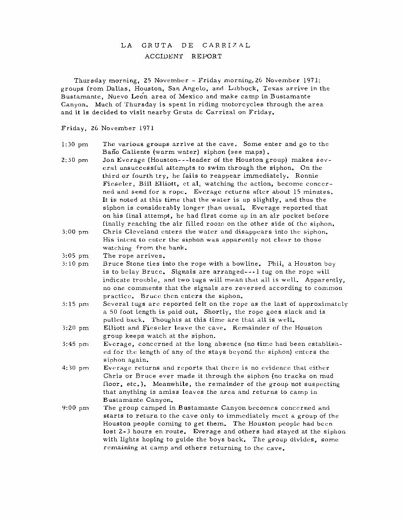
LA GR UTA DE CARRIZAL
ACCIDENT REPORT
Thursday morning, 25 November - Friday morning, 26 November 1971:groups from Dallas, Houston, San Angelo, and Lubbock, Texas arrive in theBustamante, Nuevo Leon area of Mexico and make camp in BustamanteCanyon. Much of Thursday is spent in riding motorcycles through the areaand it is decided to visit nearby Gr uta de Carrizal on Friday.
Friday, 26 November 1971
1:30 pm
2:30 pm
3:00 pm
3:05 pm3: 10 pm
3: 15 pm
3:20 pm
3:45 pm
4:30 pm
9:00 pm
The various groups arrive at the cave. Some enter and go to theBano Caliente (warm water) siphon (see maps) •Jon Everage (Houston---leader of the Houston group) makes several unsuccessful attempts to swim through the siphon. On thethird or fourth try, he fails to reappear immediately. RonnieFieseler, Bill Elliott, et aI, watching the action, become concerned and send for a rope. Everage returns after about 15 minutes.It is noted at this time that the water is up slightly, and thus thesiphon is considerably longer than usual. Everage reported thaton his final attempt, he had first come up in an air pocket beforefinall y reaching the air filled room on the other side of the si phon.Chris Cleveland enterR the water and disappears into the siphon.His intent to enter the siphon was apparently not clear to thosewatching from the bank.The rope arrives.Bruce Stone ties into the rope with a bowline. Phil, a Houston boyis to belay Bruce. Signals are arranged---l tug on the rope willindicate trouble, and two tugs will mean that all is well. Apparently,no one comments that the signals are reversed according to commonpractice. Bruce then enters the siphon.Several tugs are reported felt on the rope as the last of approximatelya 50 foot length is paid out, Shortly, the rope goes slack and ispulled back. Thoughts at this time are that all is well.Elliott and Fieseler leave the cave, Remainder of the Houstongroup keeps watch at the siphon.Everage, concerned at the long absence (no time had been established for the length of any of the stays beyond the siphon) enters thesiphon again.Everage returns and reports that there is no evidence that eitherChris or Bruce ever made it through the siphon (no tracks on mudfloor, etc.), Meanwhile, the remainder of the group not suspectingthat anything is amiss leaves the area and returns to camp inBustamante Canyon.The group camped in Bustamante Canyon becomes concerned andstarts to return to the cave only to immediately meet a group of theHouston people coming to get them. The Houston people had beenlost 2-3 hours en route. Everage and others had stayed at the siphonwith lights hoping to guide the boys back, The group divides, someremaining at camp and others returning to the cave,
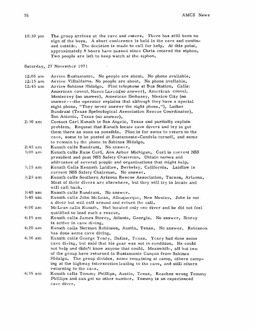
76
10:30 pm
AMCS News
The group arrives at the cave and enters. There has still been nosign of the boys. A short conference is held in the cave and continued outside. The decision is made to call for help. At this point,approximately 8 hours have passed since Chris entered the siphon.Two people are left to keep watch at the siphon.
Saturday, 27 November 1971
12:05 am12:15 am12:45 am
2:30 am
2:45 am3:00 am
3: 15 am
3:25 am
3:40 am3:45 am
4:00 am
4: 15 am
4:20 am
4:30 am
4:35 am
Arrive Bustamante. No people are about. No phone avaliable.Arrive Villaldama. No people are about. No phone avaliable.Arrive Sabinas Hidalgo. Find telephone at Bus Station. Calls:American consul, Nuevo Laredc{no answer), American consul,Monterrey (no answer), American Embassy, Mexico City (noanswer---the operator explains that although they have a specialnight phone, "They never answer the night phone. "), LutherBundrant (Texas Speleological Association Rescue Coordinator),San Antonio, Texas (no answer).Contact Carl Kunath in San Angelo, Texas and partially explainproblem. Request that Kunath locate cave divers and try to getthem there as soon as possible. Plan is for some to return to thecave, some to be posted at Bustamante-Candela turnoff, and someto remain by the phone in Sabinas Hidalgo.Kunath calls Bundrant. No answer.Kunath calls Rane Curl, Ann Arbor Michigan. Curl is current NSSpresident and past NSS Safety Chairman. Obtain names andaddresses of several people and organizations that might help.Kunath Calls Kenneth Laidlaw, Berkeley, California. Laidlaw iscurrent NSS Safety Chairman. No answer.Kunath calls Southern Arizona Rescue Association, Tucson, Arizona.Most of their divers are elsewhere, but they will try to locate andwill call back.Kunath calls Bundrant. No answer.Kunath calls John McLean, Albuquerque, New Mexico. John is nota diver but will call around and return the call.McLean calls Kunath. Had located only one diver and he did not feelqualified to lead such a rescue.Kunath calls James Storey, Atlanta, Georgia. No answer. Storeyis active in cave diving.Kunath calls Norman Robinson, Austin, Texas. No answer. Robinsonhas done some cave diving.Kunath calls George Yeary, Dallas, Texas. Yeary had done somecave diving, but said that his gear was not in condition. He couldnot help and didn't know anyone that could. Meanwhile, all but twoof the group have returned to Bustamante Canyon from SabinasHidalgo. The group divides, some remaining at camp, others camping at the highway intersection leading to the cave, and still othersreturning to the cave.Kunath calls Tommy Phillips, Austin, Texas. Reaches wrong TommyPhillips and can get no other number. Tommy is an experiencedcave diver.
v. III no. 4
4:40 alTI
4:45 alTI
5:00 alTI
5: 10 alTI
5: 15 alTI
5: 18 alTI
5:35 alTI
6: 00 alTI
6: 10 alTI6:20 alTI
6: 30 alTI8: 00 alTI
8:05 alTI
8:10 alTI
77
Kunath calls National Cave Diving Association, Miami, Florida.No answer.Kunath calls Donna Mroczkowski, St. Louis, Missouri. Reacheswrong party, gets correct number and talks to Mroczkowski whosays she knows several cave divers. She will check around andreturn call.Arizona Rescue Association calls Kunath. Says one diver hasgone caving in Grand Canyon, another diver is diving near Guaymas,Mexico. They will keep trying and will return call.Conway Christensen, Kirkwood, Missouri calls Kunath after havingbeen contacted by Mroczkowski. Christensen says he can get agroup of divers together quickly. Kunath tells him he will try toarrange transport for him and will call back.Kunath calls Goodfellow Air Force Base, San Angelo, Texas. Talksto duty officer.Kunath is switched to Randolph Air Force Base, San Antonio, Texas.Explains situation again.Kunath is patched through to Scott Air Force Base, St. Louis. Explains situation again, elTIphasises need for quick action, and listensas the buck is passed all the way to Washington, D. C. Many peoplecome on the line to ask questions. Most want to know if help isneeded for military personnel. Only the party at Randolph expressesany concern over the situation.Kunath is told by official in Washington that Air Force will not providetransport so long as there are commercial flights available.Kunath obtains phone numbers of U. S. Senators from Texas.Conway Christensen calls Kunath. Says he thinks he can get aNational Guard plane to fly them as the National Guard had previouslyassured hilTI that they would provide this service in case of emergency.Christensen says that they will need official confirmation of theeITlergency and is given Bill Elliott's naITle and his location andphone number in Sabinas Hidalgo.Mroczkowski calls Kunath wanting to know situation. Is told.Christensen calls Kunath. Says National Guard will not provide aflight, but that Eastern Airlines will. Says that the Sheriff of WebbCounty, Texas will send someone to talk to Elloitt in order to confirm the emergency and that they will be in the air soon after theconfirlTIation is received by Eastern Airlines.Kunath calls Elliott. Tells him that the Christensen group will beon the way soon and that Elliott should stand by in order to provideinforITlation to the local Jefe, At this time Kunath learns that Everagehad been through the siphon the second time and had seen no tracesof the boys. Elliott and Kunath agree that there is little chance forthe boys to be found alive. At this time, over 16 hours have passedsince the first boy entered the siphon.Chief of Rural Police in Sabinas Hidalgo talks to Elliott who explainsand asks for assistance with U. S. Customs for the St. Louis group.

78
8:25 am
9:00 am9:30 am
9:45 am
9:50 am
10: 30 am
10:55 am
11:00 am
1l:25 am1l:30 am
12:05 pm
1:00 pm
1: 10 pm
1:30 pm
2:00 pm
AMCS News
Bill Elliott and Ronnie Fieseler go to the Sabinas Hidalgo Policestation and call the American consul who tells them to call theAmerican consel in Nuevo Laredo. The American consul in NuevoLaredo, Lee Cotterman, says he will try to assist at the border.Elliott and Fieseler return to the Bus Station.Chief Deputy Sheriff of Webb County, Texas(Laredo, Texas) callsElliott and says that he has a local rescue team lined up. He says"They been in all them caves." Elliott questions the prudence ofthis since he has never heard of the group, but can do nothing tostop their corning.Elliott calls Kunath and passes on the news of the Laredo group.Kunath has no knowledge of the group and shares Elliott's feelingsabout them. Both agree that the St. Louis group is still needed.Kunath calls Christensen and tells him of the Laredo group. Kunathsays that the St. Louis group is still needed and says that no onehas yet been by to get confirmation from Elliott. (It is uncertainif either the Web~ County Deputy Sheriff or the Sabinas HidalgoPoliceman was doing this.)Jerry Lindsey, leader of the Laredo group calls Elliott. Elliottis somewhat reassured after this conversation. Lindsey says thatthey will be on the way in 20 minutes. ( The Laredo group had sometrouble obtaining air, eventually putting out a call on the localradio station and leaving with only three bottles.)Elliott returns to the Police Station to arrange for transport of thebodies in the event this is necessary.Fieseler takes the bus to Laredo, hoping to meet the St. Louisgroup at the border and guide them to the cave.Elliott returns to the Bus Station.Arizona Rescue calls Kunath. They have located one man and arecontinuing the search for others. Will continue checking in.Fieseler's bus breaks down near the 20 K checkpoint (Aduana).Fieseler walks to checkpoint. His papers show that he has taken avehicle into Mexico and the Officials will not let him through thecheckpoint without it. Fieseler finally talks them into callingCotterman. No answer. Next, they call the assistant consul inNuevo Laredo, a Mr. Gardner. Gardner had not even heard ofthe accident and said he would call back.David Keeper, father of one of the Houston boys, calls Elliott requesting details of the situation. Elliott tells him most of thestory. (It is not known at this time how Mr. Keeper was able toobtain Elliott's location, or even how he heard of the accident.)Elliott leaves for the cave. Stops in Bustamante and sends othersto stand by the phone in Sabinas Hidalgo.Fieseler is permitted to pass through the checkpoint after Gardnercalls and talks to the officials. Fieseler hitches ride to Laredo.Christensen calls Kunath. Says that Eastern Airlines flight hasbeen confirmed. St. Louis group will leave at 4: 30 pm and fly toCorpus Christi, Texas. A helicopter will take them directly tothe cave the following morning.
v. III no. 4
2: 10 pm
3:00 pm
3: 10 pm
3: 15 pm
4:10 pm5:00 pm5: 15 pm
5:50 pm
6:25 pm
6:45 pm7:00 pm
8:40 pm8:45 pm
9:00 pm
10: 15 pm
79
Kunath calls Bus Station in Sabinas Hidalgo, but Elliott has left.Meanwhile, Fieseler has reached the Laredo/Nuevo Laredoborder and met the Laredo group. Fieseler gives them the complete story and they leave. Fieseler calls Cotterman and tells himthe latest. Cotterman says we may not need the St. Louis groupnow and requests that Fieseler call them and discuss the situation.Fieseler calls Christensen but the line is busy. Fieseler callsKunath and explains the situation. Both Fieseler and Kunath agreethat the St. Louis group should still come as the Laredo group isnot known to be competent and even so, they may need assistance.Fieseler calls Cotterman again and learns that Cotterman has justbeen talking to St. Louis group ( thus the busy phone when Fieselercalled), and has cancelled them (cancelled their flight throughEastern Airlines). Cotterman maintains that the Laredo peoplecan handle it and still doesn't seem to understand exactly what isinvolved in a situation such as this. Meanwhile Louise Power(Houston) has just heard a small news spot about a caving accidentin Mexico involving Houston boys and calls Kunath to see what heknows. She is told the full story.Elliott arrives at the cave with the news that two rescue teams areon the way.Christensen calls Kunath with the news that Cotterman has justcancelled their flight. Both are thoroughly disgusted with Cotterman'sactions, and fear that a worse emergency may be in the making.Power calls Kunath requesting news. Nothing new.Laredo team arrives at the cave.Laredo team enters the cave and establishes a line through thesiphon. No sign of the missing boys. At this time, 26 hours havepassed since the first boy entered the siphon.Blair Pittman (Houston Chronicle photographer and caver) callsrequesting news. Is told bare facts. Names of missing boys arewithheld.Fieseler leaves on train for Candela, Coahuila ( a few miles fromthe cave).Power calls Kunath requesting news. Nothing new.Laredo team ends diving for the day, having made a second divesearching deep and to the left. One of the boys' flashlights wasfound but the water became too murky (visi bility less than 1 foot)to continue diving. At this point, the divers were short of air andexpressed doubts as to their ability to carryon with the rescue.Houston Chronicle calls Kunath for news. Is given nothing.Laredo divers go to Bustamante to eat. They are looking forwardto the arrival of a second team.Fieseler arrives Candela with the news that the St. Louis group isnot coming. Morale reaches all time low at this point.Houston Post calls Kunath (It is not known how they obtained hisnumber and the caller refused to give any information as to hissources). Post had correct names of the boys and wanted confirmation which was not given.

80
11:15 pm1l:20 pm11:30 pm
AMCS News
Houston Chronicle calls Kunath for news. Is given nothing new.Power Calls Kunath requesting news. Nothing is new.Divers return to camp at the cave and all retire for the night.
Sunday, 28 November 1971
2: 30 am7:30 am8:30 am
9:00 am
10:00 am11:00 am
12:30 pm
12:40 pm
12:55 pm
1:00 pm
2:00 pm2:10 pm2:15 pm
2:25 pm2:30 pm
4:30 pm
5:00 pm5:30 pm7:10 pm
Members of group stationed in Sabinas Hidalgo return to the cave.Laredo divers re-enter the cave and enter the siphon again.Bodies of the two boys are located near the ceiling about 40-50 feetfrom the entrance to the siphon. (41 hours have passed.)Word is passed to those waiting outside the cave and they enter toassist in removing the bodies.All bodies and equipment out of the cave.Some take bodies to Candela to complete necessary paper workwhile others return to Bustamante Canyon to organize remainderof Houston group and prepare to leave.Group arriving in Bustamante Canyon finds group there in massconfusion and seemingly unconcerned about recent events. Theirvehicle has a broken axle and must be abandoned.Power calls Kunath with the news that both Houston papers haveprinted the names of the boys in some rather inaccurate stories.She has been in contact with the parents of both boys.Power calls Kunath with the news that both boys are dead. Shewas informed by the parents of one of the boys who had just beennotified.Entire group leaves Bustamante area. Kunath calls Christensenand cancels with thanks. Kunath calls Arizona Rescue. No Answer.Group stops in Sabinas Hidalgo to pack the bodies in ice.Kunath calls Arizona Rescue. No answer.Elliott calls Cotterman. No answer. Calls Gardner (Assistantconsul, Nuevo Laredo) and requests police escort to border andassistance in clearing US Customs. Gardner is still uninformedand is noncommital and unconcerned about the whole affair. Afterseveral lengthy pauses on Gardner's part, Elliott hangs up in disgust.Group leaves for Laredo.Houston Post calls Kunath for details. Are told they can have thecomplete and accurate story as soon as he knows it.Group reaches the border. No escort has been provided andGardner has not so much as called to tell U. S. Customs the groupwas on the way.Group clears Customs.Ambulance arrives to take bodies to local funeral home.Kunath calls Arizona Rescue and cancels with thanks. Totalelapsed time between group entering the cave and clearing U. S.Customs: 52 hours.
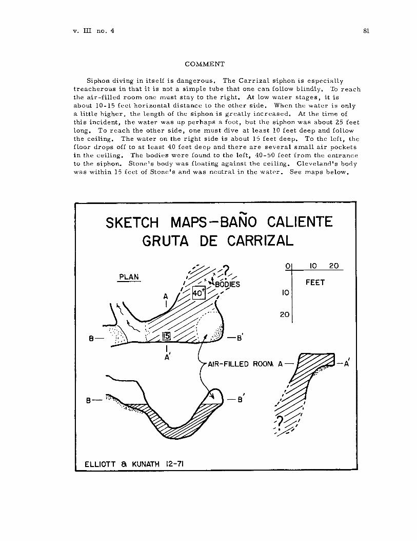
v. III no. 4
COMMENT
Siphon diving in itself is dangerous. The Carrizal siphon is especiallytreacherous in that it is not a simple tube that one can follow blindly. To reachthe air-filled room one must stay to the right. At low water stages, it isabout 10-15 feet horizontal distance to the other side. When the water is onlya little higher, the length of the siphon is greatly increased. At the time ofthis incident, the water was up perhaps a foot, but the siphon was about 25 feetlong. To reach the other side, one must dive at least 10 feet deep and followthe ceiling. The water on the right side is about 15 feet deep. To the left, thefloor drops off to at least 40 feet deep and there are several small air pocketsin the ceiling. The bodies were found to the left, 40-50 feet from the entranceto the siphon. Stone's body was floating against the ceiling. Cleveland's bodywas within 15 feet of Stone's and was neutral in the water. See maps below •
......SKETCH MAPS-BANO CALIENTE
GRUTA DE CARRIZAL
81
PLAN
B-
B-
ELLIOTT a KUNATH 12-71
o
10
20
AIR-FILLED ROO"'" A-
10
FEET
20

82
ERRORS DIRECTLY CONTRffiUTING TO THE ACCIDENT
AMCS News
1) The group from Houston we-.s large and inadequately supervised. Everagewas responsible for 14 people. They were also ill-equipped and inexperiencedand were entirely too casual about going to Mexico, more so about caving inMexico.
2) Everage, group leader of the Houston group, set a poor example in divingthe siphon without taking the slightest safety precautions.
3) Cleveland, a near novice caver, attempted the same feat as Everage.Everage said that he did not know Cleveland was in the water or of hisintentions and that at the time he was dressing on the bank with his backturned.
4) Stone, a complete novice on his first caving trip, was allowed to enter thesiphon, his intentions perfectly clear. A rope was used, but was entrusted toa completely inexperienced belayman, and the signals which were arranged werebackward. Again, no time limit was discussed for their proposed venture.
5) So far as can be determined, at no time was either of the boys instructed asthe the physical nature of the siphon, nor did they inquire.
PROBLEMS COMPLICATING THE RESCUE EFFORT
1) Few cavers go to Mexico with adequate contingency plans in case of anemergency. After the incident, the Houston group was helpless and could havedone little to organize a rescue. Luckily, some of the non-Houston group spokeSpanish and knew what to do.
2) Communication problems.a) The accident was in Mexico, but Americans were needed to help.b) This was a major holiday weekend for Americans. Many of the people
who might have been able to help were unavaliable, being involved invarious holiday trips themselves(this was only the second time in 8years that Kunath had been horne during Thanksgiving).
c) A lack of information about who might be qualified to help, and theabsence of any back-up numbers for some key people (Laidlaw, FloridaRescue, Bundrant, etc) who might have been able to help.
3) The help received from the American Government was worse than useless.The American Embassy in Mexico City has an emergency phone, but no one wouldanswer it. After wasting an hour of Kunath's time, the Air Force refused to flythe St. Louis divers, even to Laredo, so long as any commercial transport wasavaliable. The American consul in Nuevo Laredo (Lee Cotterman) cancelled theSt. Louis diver's flight when the Laredo divers were contacted-- -this could havebeen a serious mistake should help have been needed. Once the bodies were recovered, the assistant consul in Nuevo Laredo (Gardner) was contacted and askedto provide a police escort to Nuevo Laredo and through the heavy holiday traffic.He was also requested to assist the group in clearing U. S. Customs. He did
v. III no. 4
nothing. The man appears to have been either stupid or drunk---he asked rediculous questions, repeated himself many times, and lapsed into lengthysilences. In short, the Air Force is unsympathetic and the American officialsin Mexico are inept political fixtures. It is obvious that we need to find someone in the government with responsibility and the initiative to help in situationslike this one.
83
4) The simple fact that cave divers were needed. It is hard enough to findpeople who are qualified to make the "standard" cave rescue (ie. search ahorizontal cave for a lost or injured person and evacuate if necessary), letalone try to find people qualified to perform a "pit" rescue, but when you needcave qualified divers, you narrow the list to a precious few. Local Sheriffs,Jefes, etc. are apt to think that anyone with an aqualung can do the job, whilethis is very seldom true. It was extremely fortunate that the Laredo group wasavaliable and able to help---no one knew they existed. When we were told that'I They been in all them caves", we cringed. What if they had been incompetent?The tragedy could easily have grown larger. As it was the situation was nonetoo secure. However, the Laredo divers were very competent, cautious, andthey did a good job. They were: Jerry Lindsey, Dennis DeKneff, Manuel de laFuente, Dario Gutierrez, Bill Ashe, and Dave Worthington (the last two did theactual diving).
Some may ask why Fieseler and Elliott, supposedly competent cavers, saton the bank of the siphon and watched the whole thing without stopping them.Elliott says:
I have only a weak excuse to make. From almost the very momentwe arrived in Bustamante Canyon on Thursday, we noticed how irresponsible many of the Houston group were. Some of them took a shovelfrom Vinson's truck and after using it, left it lying some distance away.I gave the ones who did this a verbal lashing, but it seemed to justbounce off. On the way to Carrizal the following day, most of us rodeour motorcycles and put our ice chests in Fieseler 's truck, which heallowed the Houston kids to drive to the cave. They passed us on theroad at high speed, tossing out empty beer cans, some of them hangingon top or out the back. When we arrived at the cave, we discoveredthat nearly all of two six-packs had been consumed by members of the group.Again, I gave them a tongue lashing, with the result that a few of themshrugged their shoulders and one of them returned two beers. I wasalready convinced that any warning to most of this group was futile.When I got to the siphon, Everage was already trying to dive the siphon.What could be said to him the supposed leader of the group?
I have learned my lesson. Speaking for myself, if I ever becomeentangled with a group like this again, I will try to leave before something happens. From now on, when someone I am with does somethingstupid in a cave, I will physically restrain them if necessary, no matterwho they are or what I think about them. I went through hell for twodays because of someone else's stupidity, and I got what I deserved forremaining silent.
84
RECOMMENDATIONS
AMCS News
1) Cavers should stay out of the Busta:mante-Carrizal area for so:me ti:me toco:me. So:me will disagree, but we feel it is best to avoid any possible frictionwith the local people in the i:m:mediate future.
2) Any group that goes caving in Mexico should have so:me :me:mbers who arefluent in Spanish and who have so:me idea of Mexican politics and custo:ms.
3) If you are ever in a situation such as this, try to handle things as :muchthrough private channels as possible. You will of course have to notify localMexican officials. You will risk being thrown in jail if you do or if you don't.Don't expect the Mexicans to be too :much help, but they can help by cutting"red tape." We were lucky that this happened in Coahuila and Nuevo Leon.The Police Chief in Sabinas Hidalgo and the Presidente in Candela were verycooperative---it would probably have been a different story in a state suchas Oaxaca where there has been considerable friction with the local people.
4) The AMCS should now begin collecting telephone nu:mbers of all it's :me:mbersand of all the co:mpetent cave divers and rescue tea:ms who could help with futureaccidents. We had best assu:me that there will be future accidents. For :manyyears, AMCS cavers have been saying that a serious caving accident in Mexicowas inevitable, but :most thought it would be a pit accident. A pit accident wouldhave probably been an easier situation than this one. Everyone is urged tosend the na:mes and phone nu:mbers of co:mpetent rescuers so that a list :may beco:mpiled and distributed to all concerned persons. This list should be up-datedas often as possible and should be carried on all caving trips, whether toMexico or not.
CONCLUSION
Both boys were probably dead within :minutes of entering the siphon thoughother unlikely possibilities exist. Having no knowledge of the physical characteristics of the siphon, they continued straight or to the left rather than keeping tothe right along the ceiling. Thus, they found no air -filled roo:m-- -only water.Pro:mpt action, even to the extent of having diving equip:ment i:m:mediately athand, would have been to no avail. Nevertheless, it is chilling to realize thatin a situation where pro:mpt action :might save a life, that life would be jeopardized by apathy, ineptness, and bureaucratic "red tape"on the part of the A:merican Govern:ment and certain of it's representatives in Mexico.
7 Dece:mber 1971ck: Carl Kunath, Bill Elliott, Ronnie Fieseler, Jon Vinson

v. III no. 4
The following stories appeared on the UPI teletype Saturday:
SABINAS HIDALGO, MEXICO-- A SEARCH IS UNDERWAY IN MEXICOABOUT 70 MILES SOUTH OF THE TEXAS BORDER FOR TWO HOUSTONYOUTHS WHO ENTERED A CAVE YESTERDAY AND FAILED TO REAPPEAR.THE UNIDENTIFIED YOUTHS DISAPPEARED IN A CAVE NEAR SABINASHIDALGO, MEXICO- - WHICH IS 70 MILES SOUTH OF LAREDO, TEXAS.THE YOUTHS ARE BELIEVED TO BE AN 18 YEAR OLD HIGH SCHOOLBOY AND A 20 YEAR OLD RICE UNIVERSITY STUDENT.
TWO HOUSTON AREA YOUTHS•• MISSING (FEARED DEAD) IN SABINASHIDALGO MEXICO•••AUTHORITIES NEAR THE BORDER REPORT THE PAIR ENTERED ACAVE AND FAILED TO REAPPEAR•• THE CAVE ABOUT 70 MILESSOUTH OF LAREDO, TEXAS.THE UNIDENTIFIED YOUTHS DESCRIBED BY AUTHORITIES ONLYAS AN 18 YEAR OLD HIGH SCHOOL YOUTH AND A 20 YEAR OLDRICE UNIVERSITY STUDENT.
The source for both of these stories appears to have been the Americanconsul in Nuevo Laredo and/or the Sheriff's office of Webb County, Texas.
85
2Houston YouthsDisappear IntoCave in Mexico
B lair Pittman editedthe article at the right.This is the best of anythat either of theHouston papers printed.
**.*HOUSTON CHRONICLE 1cmdIIJ. N<mInber 28, len
Two Houston youths dIsappeared Into a eave In northernMexico Saturday, and asearch party was attemptingto rescue tnem.
The youths 'Were identifiedas Chris Cleveland, 18, afresbman at Rice Uhiversityand the 90D of Mr. and Mrs.Robert M. Cleveland of 58S9Ettrick, and Bruce Slone, 1',whose loc:al addresS was lIotdetermined.
'lbe eId«' Qeveland lI8ld biIson went to J4alco Wednesday on a ea~orinl expedition.
On Saturday, the lberifrsoffice in Laredo was tlOtifiedthat two ... had mtered acave about • mDes south ofLaredo near the vIDIp ofBustamante In Nuevo Lem1
state about &0 mileI west ofthe city of SabJDas H1daJ1o.
'lbe eave, In the base (If amountain, has been exploredand mapped by Texas eavebuHs. It has two sipllalw. orareas where the eeUID, of..cave lowers below water.
A man identified as WJDIaJDBI1JDtt telepllmed the...offIee in Laredo from SlIbiDuHidalgo to 1Mltify theIII of tiledilappearanee of the yOlItIIL
The sheriff's off1ae..patclJed a team of rescutl'8from Laredo. 'lbey 1n!re Gpeeted to arrive at the eaveSaturday Dight, but 0 womhad bela.. reeelvecl of theirJlI'OIl'III earIr today.
C1eftland Is a graduate'..Westbury HIgh SChooL
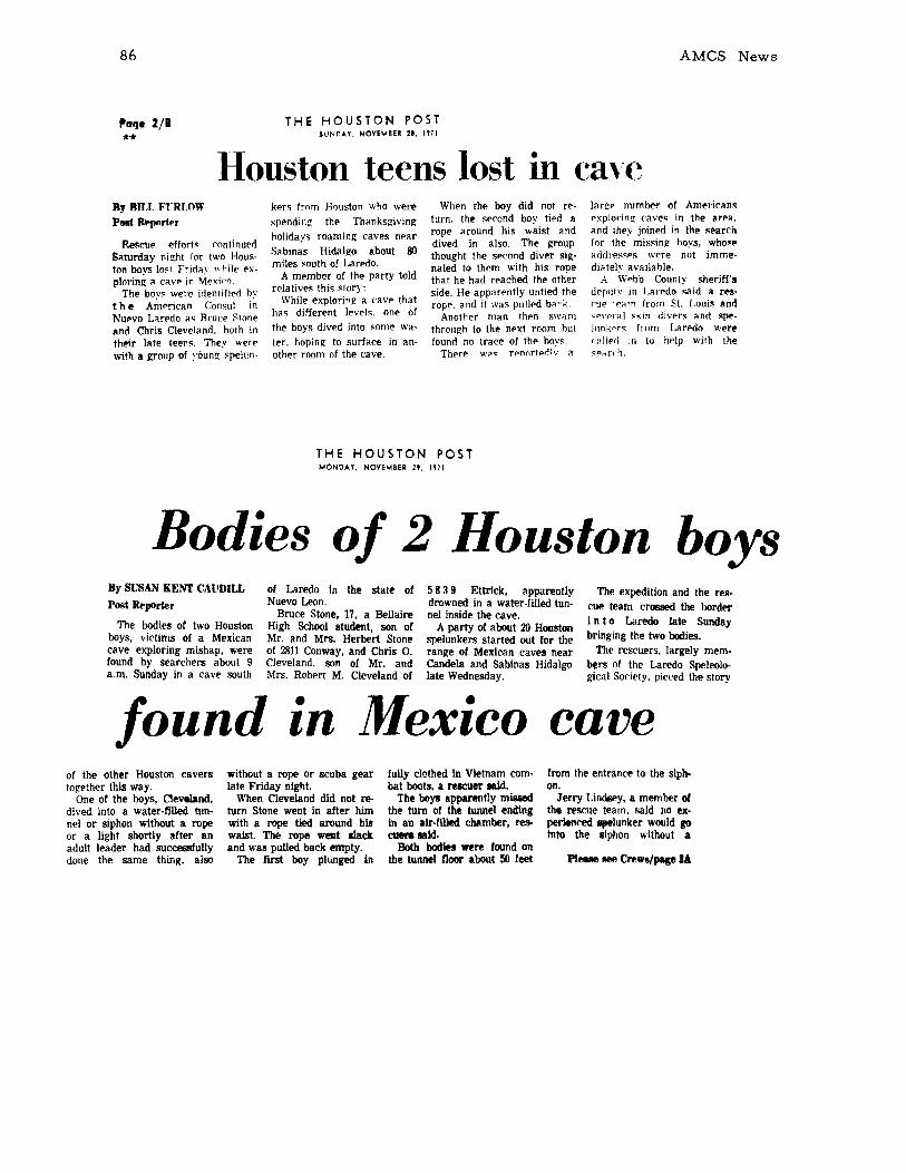
86
I'aqe 2/1**
THE HOUSTON POSTSUNOAY. NOVEMBER 21. 1171
Houston teens lost in cave
AMes News
By Bn.r. FTRWWPIIlIt Jbopnrt~r
Re.-~cup pffort~ continuer!Silturday night for two Houston boys IO~f Frid~y "hill' exploring il cilve in Mexiro.
The bov~ were identified hvthe A~prican Consul i~Nupvo L"rpdo i1S Bruce Slone,.nd Chris Cleveland. both intheir lilte teens. They werewith a group of young- ~peilln-
kf>r~ from Houston who werespending- the Thanksgivingholidays roaming caves ne~r
Sabinas Hidalgo about 80miles south of LarPdo.
A member of the party toldr~latives this story:
While exploring- a ('ave thathas different level~. one ofthe boys dived into ~ome water. hoping to surface in another room of the cave.
When the boy did not return. the second boy tied arope around his waist anddived In also. The groupthought the second diver signalPd to thpm with his ropethat he had rpached the otherside. He app~rpntly untiPd therope. and it was pulled baf'k.
Another man then swamthrough to the npxt room hutfound no trace of thp hoy~.
There wa. rpnortprllv a
largp numhf'r of Americanspxplol'ing cave~ in thl' area.and they joinpd in thp ~I'arch
for the missing hoys, who.eitddrpssps wpre not immediittely availahle.
A Wphb County shl'riff'sdeplltv in [,an'do ~aid a resCllf' 1""m from St. Louis anr!'1'1'('1',,1 skin diver~ "nd sppIllnKor, from Larpdo wereeldled in to hplp with the~P{1ITh.
THE HOUSTON POSTMONOAY. NOVEMBER 2'. 1971
Bodies of 2 Houston boysof Laredo in the state ofNuevo Leon.
Bruce Stone, 17, a BellaireHigh School student, son ofMr. and Mrs. Herbert Stoneof 2811 Conway, and Chris O.Cleveland, son of Mr. andMrs. Robert M. Cleveland of
Mexico cave
By SUSAN KENT CAUDILL
Post Rfoporler
The bodies of two Houstonboys, victims of a Mexicancave exploring mishap, werefound by searchers about 9a.m. Sunday in a cave south
found •In
5 8 3 9 Ettrick, apparentlydrowned in a water-filled tunnel inside the cave.
A party of about 20 Houstonspelunkers started out for therange of Mexican caves nearCandela and Sabinas Hidalgolate Wednesday.
The expedition and the rescue team crossed the bordl!!"I n to Laredo Iste Sundaybringing the two bodies.
The rescuers, largely members of the Laredo Speleol()gical Society, pieced the story
of the other Houston caverstog-ether this way.
One of the boys, Cleveland,dived into a water-filled tunnel or siphon without a ropeor a light shortly after anadult leader had sucCE68fullydone the same thing, also
without a rope 01' scuba gearlate Friday nIght.
When Cleveland did not return Stone went in after himwith a rope tied around hiswaist. The rope weat .lackand was pullPd back empty.
The first boy plunged in
fully clothed in Vietnam combat boots, a relCller IBid.
The boys apparently mi8lledthe turn of the tunnel endingIn an alr-fUled chamber, re&cuen 1IIl1d.
Both bodies were found onthe tunnel floor about 50 feet
from the entrance to the sip)).on.
Jerry Lindtiey, a member ofth. rescue team, said no experienced IIptlunker would 1'0Into the siphon without a
PI_ !lee Crews/page IA

Bodies of Two CaveVictims Are Returned
v. III nO. 4
Crews find bodiesof 2 drowned hoysin Mexican cave
Monday, November 2~, 19i1
87
Hous'm:-,; CHRONICLESectien 4, Page !l
Continued from page 1
rope, light and preferablyscuba gear.
Cleveland. a member 01 theRice University SpeleologicalSociety. had several monthsc a v i n g experience, MissLouise Power. a society officer. said. "He had a coolhead and wa.~ learning veryrapidly." she said.
Stone, an Ex p lor I' r BoyScout. had no caving experience. his father said inHouston Sunday.
The expedition apparentlyhad no sponsor although several members of the Riceclub went on the trip.
Stone said his son went onthe expedition as part of aspelunking program associated with Explorer Post 43and the Central PresbyterianChurch.
"This was Bruce's firsttrip. He's always been interested in things like this. Wedidn't realize it was quitesuch an expedition, .. Stonesaid.
Stone said his son was anEagle Scout and in excellentphysical condition.
About 9 members of theExplorer Troop and its leaderwent on the Mexico expedition, Stone said.
Dennis De Kneel, a member of the Laredo Speleological Society who helped coordi-
nate the rescue attempt. saidthe bodies were found in acaVI' called ..El CarrizR I. ..
Lindsey, who was with therescue team at the cave. saidA i I' man 1st Class DaveWorthington and Sl(t. BillAshe. both from the LaredoAir Force Base, recoveredthe bodies with scuba gear.The men were also membersof the Laredo caving society.
Lindsey said the siphon canbe treacherous if the c.av"rdoes not keep to the right following the wall into the opencavity.
A wronl( turn m!'ans an almost endless water-filled tunnel. he s!lid. which has neverbf'{'n charted.
"If you are l(oing to go in,ytJu should ha VI' somebody ona lifeline outside the water,"Lindsey said.
Veteran spelunker De Kneefsaid the cave where the boysdrowned "is a fairly easycave to go in.
"But there are water traps!Ill over the place. Still. it'snot especially dangerous. Noone has ever been killed inthat cave that I know of.
"If you don't know wherethe siphon goes. you wanderaround under water until youcan't breathe anymore... DeKneef explained.
The bodies wer!' tak!'n tothe Jackson Funeral Home inLaredo.
A plane today returned fromLaredo the bodies of speleologists Chris Cleveland, 18, andBruce Stone. 17, who drownedin a northern Mexico cavewhile exploring.
Cleveland, son of Mr. andMrs. Robert M. Cleveland,5839 Ettrick, disappeared Friday when he dived into waterencountered in El Carrizal
cave near Sabinas Hidalgo inNuevo Laredo state.
Young Stone plunged in totry to find Cleveland and failedto come up.
Eight cave explorers recovered the bodies Sunday.
Cleveland was a freshman atBellaire High School and anExplorer Scout.
They were with a party of15 cave explorers who leftHouston last Wednesday to explore the cave, located between Laredo and l\1onterrey,Mexico.
The cave. at the base of amountain, had been exploredbefore.
The explorers found a newspring in the cave where theceiling dips below the water.It was to investigate this findthat Cleveland plunged intothe water, friends said.
88 AMCS News
The following story was realeased to the San Angelo Standard TimesMonday afternoon 29 November 1971 by Kunath, Elliott, and Vinson, butwas never printed.
Friday 26 November 1971, about 4:00 pm, Chris Cleveland 18, andBruce Stone 17, both of Houston, Texas and both inexperienced caversdrowned while attempting to swim through an underwater passage about25 feet long in order to reach another room in a cave about 80 miles Southof Laredo, Texas.
A rescue attempt was begun within an hour when both boys failed toreturn and it was decided that experienced cave divers would be requiredto reach them. The party reached a phone about midnight Friday, andafter several attempts to reach the American consels in Nuevo Laredo,Monterrey and Mexico City met with no success, they (Elliott, et alltelephoned a caver in Texas (Kunath) and asked him to contact some cavedivers. Finally, a team of divers from Laredo, Texas, led by JerryLindsey, was located and arrived at the scene by car about 5:00 pmSaturday. Two initial dives were unsuccessful due to murky water. Therescue attempts resumed Sunday morning and the bodies were recoveredabout 9:00 am Sunday.
Both boys were members of a larger group of cavers from Houston,Dallas, San Angelo, and Lubbock who were in the area for the Thanksgivingholidays.
ASSOCIATION FOR
MEXICAN CAVE STUDIES
NEWSLETTER
NEWS AND NOTES
CONSERVATION
TRIP REPORTS
Ahuacatl4n, Qro.
Ocampo, Tamps.
S6tano del Anticlino, N.L.
Siem de Guatemala, Tamps.EI Banetal, Tamps.
Lote La Gruta, N.L
Ayutla. Qro.
ARTICLES
Explontion of EI S6tano
Letter From Rick Rig
Cave Rescue Procedure
Volume III Number 5


ASSOCIATION FOR MEXICAN CAVE STUDIES
NEWSLETTER
Volume III Number 5 Publication Date: July 1972
The Association for Mexican Cave Studies is a non-profit organization whose goals arethe collection and dissemination of information concerning Mexican caves. The AMCS publishes a Newsletter, Bulletin, and Cave Report Series which are available to any sincerely interested, conservation-minded person. The AMCS Newsletter is published six issues per volume as frequently as necessary at a cost of $3.00 US per volume, which includes both thepublication and membership. Prices of other publications are available by writing to theAssociation for Mexican Cave Studies, P.O. Box 7672, Austin, Texas 78712, USA.
Potential contributors are urged to submit articles for publication. The article maycover any phase of Mexican speleology. Trip reports are requested from all trips.
Publications Editor .Cave Files . . . .Secretary-Treasurer .Coordinating Biologist.Photo Editor . . .Production Manager. .
Terry W. RainesWilliam H. RussellJan LewisJames R. ReddellCarl E. KunathRonnie Fieseler
Published by THE SPELEO PRESS
NEWS AND NOTES
In addition to the persons listed above, several others very actively support theAMCS. Helping with this issue were Roy Jameson, James Jasek, Ann Lucas, andCarol Russell.
Speleological activity so far this summer has been moderate. During June a groupreached the terminal siphon at a depth of 1500-1600 ft. in S6tano de El Buque.This system is located in the La Cienega Area near Jalpan, Qro. In July approximately10,000 ft. in S6tano de Japones was surveyed. Anticipated in August is a Frenchexpedition led by Claude Chabert of the Speleo Club de Paris.

90
CONSERVATION
AMCS News
The AMCS has been proud of the low levelof vandalism which has been maintained by itsmembers. But as the popularity of Mexican cavesincreases and the influx of extraneous caversgrows, incidents occur. It is difficult to tell who'swho. People hear about our group, send in theirmoney for publications, and become supportingmembers. We trust them. Some are independents,but most are affiliated with organized caving.And of all the groups known to you, which doyou expect could be trusted most? We thoughtthe NSS, with its "Take nothing but pictures,... ," but we were wrong.
During Christmas of 1970 Gary Schaecher(NSS 10116) led a group of three on a briefreconnaissance of a pit just to the west of GomezFar(as, Tamps., and of an area to the northwest.On 6 May 1971 he contacted the AMCS by letter, describing the Christmas trip, informing usof a "large caving trip" they were organizing,and requesting information on the area. TheAMCS responded with a letter detailing most
of the available material concerning the Sierra de Guatemala. As time passed, Gary's groupwas granted the status of "NSS Expedition, Tamaulipas, Mexico" by the Board of Governors on 19 June 1971. Planned was a four month stay from December 1971 to March 1972.Then, during the fall, AMCS cavers surveying in the G6mez FarIas area entered the cave previously visited by Gary's group. Here was discovered the vandalism illustrated in the photograph. Upon returning to Austin, a certified letter was sent to Gary requesting an explanation of their actions. This was on 3 November, six months ago. To date no correspondencehas been received. For some reason the "expedition" never materialized, which is probablyjust as well considering the above information. It is only hoped that the other caves visitedduring the Christmas trip did not similarly suffer.
What can be done? In this case a wire brush will take care of the cave and perhaps pressure from this article and friends will correct Gary's behavior. But most important is to keepup a protective awareness and strong conservation attitudes toward all caves. Vandalism inMexico is nil except for a few classical examples such as the engraving feats performed by theMexican outing clubs in Gruta del Palmito. Let's keep it that way.

~/'4
·S~_~_
)
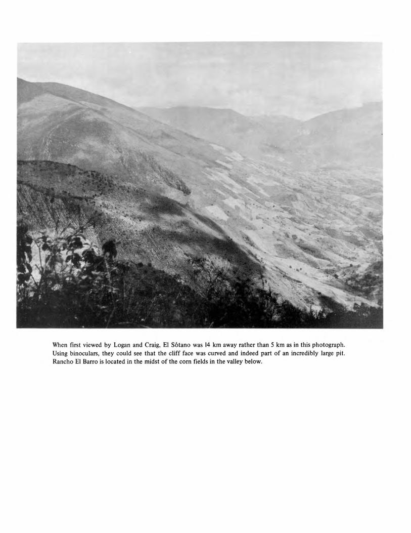
When first viewed by Logan and Craig, EI S6tano was 14 km away rather than 5 km as in this photograph.Using binoculars, they could see that the cliff face was curved and indeed part of an incredibly large pit.Rancho EI Barro is located in the midst of the corn fields in the valley below.

93
Date: 17-21 January 1972Destination: Cave hunting near AhuacatlanLocation: SMO; JalpanPersons: Craig Bittinger and Logan McNattReported by: Craig Bittinger
On January 17, 1972, Logan McNatt and Craig Bittinger caught a second class busout of Ciudad Valles headed toward Ahuacathin. We had just finished twenty days of Mexican caving in the Ciudad Valles area and we were looking forward to several more weeks ofadventure. John Fish and the rest of our caving companions had just left for the U.S., sowe felt that we were on our own. Logan had been in on the exploration of Sotanito deAhuacatlan and knew of several unchecked pits in the Ahuacathin area, along with rumorsof a huge pit twelve hours away over the mountains, so we had decided to return to thearea.
The bus slowly worked its way south, stopping innumerable times to pick up everyMexican along the road. Finally, around 3 :00 p.m., after 5 hours of twisting mountainousroads, we arrived at Jalpan where we were informed we had a 3 hour layover. We boughta meal at a local restaurant and then sat around the town square waiting for the next busto arrive. We heard the bus coming two minutes before it burst into view and soon we wereunder way again. Twenty-five minutes later we arrived in Ahuacathin and proceeded tohike up the arroyo toward the Sotanito de Ahuacatlan. Our entire day of bus riding hadcost us 2 dollars each, and nearly exhausted our energy. We set up camp on a flat spot abovethe arroyo and were lulled to sleep by the barking of the local dogs.
We woke up around six in the next morning, and after a quick breakfast, hit thetrail. After about an hour of hiking, we arrived at a local store and the end of the fairlylevel part of the trail. Logan bought a can of Mexican sardines which we proceeded to eatin order to stave off our hunger. After two sardines Logan noted something strange in thebottom of the can and proceeded to pull out a large chunk of fish net from in between theremaining sardines. After mumbling a few words about Mexican canning factories we proceded on up the trail.
Two hours of steep climbing brought us to the vicinity of the Sotanito where wehired 2 Mexican kids to watch our packs in return for a few hand fulls of animal crackers.We hiked over to the Sotanito where we did the 70 ft entrance drop, threw rocks down the946-foot drop, and then returned to our packs. Thirty minutes later we arrived at theMontoya's house where we were welcomed with open arms and a hearty "Mi casa es sucasa." The Montoya family gave us a place to stay, food, and a guide to more virgin pitsthan we could possibly explore. The Southwest Texas Grotto had done such a good jobof public relations on previous trips that their house was like a second home where we wereto be honored guests. That afternoon we went to what we thought was a l20-foot pit. Unfortunately after Logan descended to the end of our ISO-foot rope he realized that the pitwas closer to 300 ft deep, so we decided to wait until the next day to bottom it. While wewere coiling the rope, Craig asked our guide if he knew of any deep pits in the area. Heproceeded to point at a white spot visible on the side of a mountain in the far distance.
94 AMes News
That night the Montoyas gave us more beans and tortillas than we could possibly eat; in return we gave them one of our dehydrated dinners, so it turned out to be an unusual meal forall.
In the morning we were awakened by the sounds of dogs, chickens, burros, pits, androosters all trying to drown out each other. The Montoyas pointed out the white spot on theside of the mountain again and through our binoculars we could see the curve of the entranceof what we knew must be a huge pit. The entrance intrigued us, so we decided to hike overand have a look at the pit. The Montoyas had never been to the pit but they assured us thatno one could possibly throw a rock across the entrance of the pit, and that it was fairly deep.About 10:00 a.m. we left their house carrying only our day packs and about 25 pesos betweenus. We assured them that we would be back late that night and asked them to watch ourequipment. At six o'clock that evening we arrived at the base of the mountain containingthe pit. We had been hiking at a steady 21/2 to 3 miles an hour pace all day long and wewere totally exhausted. The local people told us that we should go to Rancho EI Barro totalk to the local judge, who could give us permission to go into the pit. Eventually we arrived at the judge's house, and after explaining who we were and that we would like to seethe pit, we were once again welcomed with open arms. The judge, Gregorio Rodriquez, gaveus a bed to sleep on, 2 serapes, and a meal of beans and tortillas. We went to bed almostimmediately but couldn't fall asleep due to the judge playing his radio over the local loudspeaker system.
We woke up about 6 :00 a.m., shivering with cold and eager to get to the pit. Aftergiving the judge one of our canteens to express our gratitude for everything he had done forus, we headed up toward the pit. Unfortunately, there was a dense forest in between us andthe pit, and there were no obvious trails. Soon we heard shouts from below telling us thatwe were lost. Before long the judge's son, Ram6n, appeared to guide us to the pit. After2 1/2 hours of hiking, we arrived at a grassy meadow and five minutes later we burst throughthe jungle and there in front of us was the largest pit either one of us had ever seen. Wequickly picked up a rock and threw it into the pit. After what seemed like an interminablewait, we heard a tremendous noise from below. Neither of us had a watch, so we had to resort to timing the rocks by slowly counting, thousand-one, etc., until we reached thousandeleven. Ram6n was totally mystified as to why these two crazy gringos were jumping upand down, screaming and excitedly shaking hands. We proceeded to jungle crash approximately half of the way around the pit to a cave located on one wall of the pit. The cavewas apparently inhabited by javelinas as their tracks and dung almost completely coveredthe floor of the entrance. Unfortunately, the cave was only a rock-shelter, so we decidedto leave the pit and return with rope and a well-equipped caving group. As we hiked backdown the mountain we started to consider our situation. The Montoyas were expecting usback any minute, we were virtually out of food and money, and we were totally exhausted.
Luckily, Ram6n knew of a closer way to get back to the highway where we couldcatch a bus back to Ahuacatlan and our equipment. We gave Ram6n a pocket knife in payment for his services as a guide, said goodbye, and then set out toward the canyon which heassured us would take us directly to the paved highway. After an hour and a half of junglecrashing, we reached the canyon only to find Ram6n sitting patiently at the edge of thestream waiting to guide us out through the canyon.
v. III no. 5 95
We followed the small stream for 4 1/2 hours as it wound its way between 1,000foot tall cliffs. We finally emerged upon an ancient aqueduct which led us directly to thetown of Ayutla. The local people informed us that the last bus of the day would be by in ahalf-hour, so we sat down to enjoy a refresco and rest our weary bodies. Suddenly someoneyelled, "Here comes the bus," so we started moving straight uphill toward the road only tosee the headlights flash by and vanish in the distance. Fortunately, it was only a car, butthe bus appeared 2 minutes later and took us back to Jalpan. We were then informed thatno more buses went to Ahuacathln that night so we would have to spend the night in town.A hotel room would definitely cost more than the 5 pesos we had left; it appeared that wewould have to sit in the town square if we could have a ride to Ahuacatlan. He said if wecould wait for half an hour he would take us up there. Three hours later we climbed in theback of his truck and watched him accelerate up the mountainous road. The truck continued accelerating as we started down the far side. We both hung on for our lives andwatched the truck stay on the wrong side of the road for nearly half the trip. Fifteen minutes later we were in Ahuacatlan marveling that we were still alive.
We lit up our carbide lights and started the 3-hour hike to the Montoyas' house.Two and 1/2 hours later we were totally lost in the pitch black night, virtually on top of amountain and shivering with cold. We decided to build a fire and wait for morning insteadof wandering aimlessly through the night. Five hours, and a lot of wood-gathering later,the sun came up and we discovered the main trail 20 yards away.
The Montoyas were surprised to see us and when we left two hours later there weretwenty people waving goodbye and telling us to come back soon. From Ahuacatl{m wecaught a bus to Valles, and then straight on through to the V.S. Our conversations keptcentering on the pit, and how we were going to break the news to the people back in Austin.
Date: 17-22 May 1971Destination: Ocampo, Tamps.Location: SMa; Sierra de Guatemala and Sierra de EI AbraPersons: Ken Gordon, David Johnson, Kenny Johnson, Mary Ann Kelly, John Mikels, Nick
Morales, Mike Padgett, B.B. Russell, J. Carr Strutz, David WaddellReported by: John Mikels
A man at Ocampo, Tamps., agreed to guide us to a cave. AS mi hike got us to theentrance. It is located in a very steep and deep canyon approximately 10 mi SE of Ocampo.The entrance is near the floor of the canyon which apprently conducts great volumes ofwater at times. We located several large deep lakes in the canyon floor. Our guide said thecave was named La Gruta de la Sierra Tamalabe (this cave is more commonly known asCueva del Puente). The cave is approximately 1000 ft long and V-shaped. The main entrance is 50 ft by 100 ft and mostly breakdown. The cave enters the canyon wall and curvesback to another smaller entrance 200 yards down the canyon. The cave is essentially onebig room divided up by flowstone and breakdown. It was quite dry and dusty. The entirecave can be negotiated without ropes, although some difficult free climbing is available.The entrance is or was mined, apparently for phosphates. The only noted life was bats,including vampires.
96 AMCS News
Next day we hit the Monos road just north of Cd. Valles in search of Montecillos. Toofar down the road, we stopped at the trail to Soyate and started down it, but at the time wedidn't known Soyate was there and passed it by. On down the trail we stumbled onto an inconspicuous pit with a 3 ft by 5 ft entrance. It proved to be a 180 ft single drop with a ledgehalfway down. At the bottom was a live, decorated room 6 ft by 30 ft. Another small roomwas off to one side about halfway down. We named it S6tano del Lagarto for the lizard wefound in the bottom. David Johnson's camera fell 90 ft to its death; luckily it was an Instamatico Then we came out and some of us took off in search of other caves. About 7 p.m.everyone went to Valles and the Condesa. There, a headcount showed one was missing.Seems that I (John) had been left in the jungle, so after a hot liesurely meal they set off insearch of me. Meanwhile, I wandered down the Soyate trail after dark, with no light, for3 hours until meeting the rescuers. Camped at Los Sabinos.
Next day we successfully found Sotanito de Montecillos and spent about 6 hr within.Later we viewed the entrance of S6tano de Pichijumo. The following day we left for home,making a brief visit to Cueva de El Abra.
Date: 1-3 October 1971Destination: S6tano del Anticlino and Cafi.6n de la HuastecaLocation: SMO; Cola del Caballo and Cafi.6n de la HuastecaPersons: Craig Bittinger, Steven Bittinger, Donna Atkins, Jan Lewis, Terry Raines, Hugo
VictoriaReported by: Terry Raines
Following directions given us by James McLane of Houston, we drove to Cascada Coladel Caballo, arriving late in the night. Continuing on the next morning, we arrived at apoint 10.6 miles from Highway 85 and just to the west of the high point reached by theroad. Immediately above the road and a culvert, to the north, is the entrance to S6tano delAntic1ino. Although it is not visible from the road it is easily located once you start hikingaround. The entrance is a climb-down sink about 8 m in diameter which leads into a room25 m by 8 m with a ceiling height about 5 m. The floor is old guano-covered breakdown.At the far end of the room is a pit 60 m deep. At the top it is 3 m wide but it rapidly opensto about 10 m in diameter. The pit floor is a 460 slope which leads directly to another pitof 28 m. At the bottom is the terminal room, a silt-floored chamber 10 m by 15 m. Totaldepth is 132 m and length is 37.8 m. After the survey and biological collections were madewe continued on to the town of La Cienega. At this point a rough, gravel road descendsinto Cafi.6n de La Huasteca. We hesitated because of high water but forged ahead, withwater entering the truck cab at times. The night was spent deep within the heart of thecanyon.
As we drove down the river canyon the following day, a lookout was kept for personsin the area and consequential cave leads. Just before Grutas de San Bartolo (see map,p. 141, AMCS News, v.II) one gentleman informed us of a cave one hour's hike away andsaid he could take us there the following day. Time did not permit, so we continued onto Bartolo where we made biological collections before returning home.

v. III no. 5
Date: Thanksgiving, 1971Destination: Southern Sierra de Guatemala, Tres Manantiales, MicosLocation: SMa; Sierra de Guatemala; BarrancasPersons: Frank Binney, Steven Bittinger, Bill Deane, Bill Russell, Carol RussellReported by: Steven Bittinger
97
Our main objective was to check out the cave at Tres Manantiales which had been previously entered twice by AMCS cavers. James Reddell and Robert Mitchell first entered in1966 for biological collecting and were stopped by the cold water in the first lake. LaterBill Russell and Bill Elliott visited the cave, crossed the lake, and reported a large passageup to a handline drop. After an uneventful drive from Austin, we found that our first bigproblem was merely getting to the cave. A recent forest fire had downed many large treesacross the crude road, so we spent the first day chain-sawing trees and generally rebuildingthe road. Finally we had to admit defeat and decided to pack our gear the remaining twomiles to the cave.
The cave is situated at one end of a large valley and serves as the only source of waterfor several nearby houses. It appears that during flood times the cave takes some surfacedrainage and a considerable number of vadose features were noted throughout the cave.Of the approximate mile of passage found in the cave, the large majority seems to followa prominent series of joints.
Just inside the entrance of the cave is a 20-foot handline drop to the edge of a waistdeep lake. Walking size passage continues past this for nearly 1000 ft to a second lake whereit is necessary to swim for about 20 ft. Shortly thereafter the passage splits, a large canyoncontinuing to the left down a ISO-foot handline drop soon followed by a IS-foot rappel.The other branch is somewhat inconspicuous, being straight ahead and high up, and after200 ft it connects with the main passage below the IS-foot rappel. This main passage thencontinues for several hundred feet to another fork. To the left is over 1000 ft of downstream walking and crawling passage where exploration was finally halted at a siphon in asmall crawlway. The right branch continues several hundred feet past a neck-deep lake toan 85-foot drop where a bolt was set. At the bottom of the pit is several hundred feet ofwalking passage with a few shallow lakes which finally ends in a dome with possible highleads. Directly opposite the top of the 85-foot pit are two small crawlways which were notfound to extend for any signficant distance. Total depth of the cave is approximately 200feet.
We re-entered the cave the next day to de-rig our ropes. A small crawlway was enteredon the right side of the passage 500 ft after the first lake. In this short crawl and in the mainpassage nearby we began to notice large numbers of pottery fragments. Frank was fortunateenough to locate a piece with a very distinctive face etched into it. We believe that thiswould indicate that the cave was also known and used by the preconquest Indians as asource of water. Any future visitors to the cave should be cautioned not to remove or todisturb any such artifacts which may be of archeological importance.
The following day we made an unsuccessful search for some rumored blind fish caveswest of Micos but did eventually locate a small cave containing some rare asellid isopods.That evening we met David McKenzie in Cd. Mante. Bill Russell joined him for an additionalweek of reconnaissance while the rest of us returned to Austin.
98
Date: 18-21 November 1971Destination: Cave hunting west of El Barretal, Tamps.Location: SMOPersons: John Mikels, Nick Morales, David Johnson, Mike PadgettReported by: John Mikels
AMCS News
18 November. Drove to a small village to the west of El Barretal, Tamps., and near the baseof the SMO. Crashed.
19 November. Take 7 hours to drive 26 miles up into the SMO on a narrow, rutted lumberroad. We are trying to get to the town of Las Minas and a huge sink nearby (over 800 ft diameter and very black) that was spotted from the air. After these 26 miles we find ourselvesin a small lumber mill village. We inquire and find we can't reach Las Minas easily or in thetime we have. So we get a local to show us some caves in the area. He guides us to a coupleof s6tanos within a few hundred yards of a "side side-road." The two pits are about 100 ydsapart and both are dead-end 11 a-foot drops, locally known as S6tanos de Contabanda. Withthe arrival of dusk the day's explorations were terminated.
20 November. At the lumber village we located a Seftor Gremaldo, an elderly man, whoagreed to show us some more caves. First, a rather short hike, but with fantastic scenery(elevation was 6000 ft or more), brought us to another pit just like those of the day before.They were about 100 ft and dead-end. Next he took us to a horizontal cave about 100 ft offa small side road. It was approximately 500 ft long and well decorated and active. Abouthalf of the floor was white flowstone with numerous rimstone pools. We took some picturesand mapped it. Locals call it Cueva de la Cojada. We left and talked more with Sr. Gremaldo.He told us of numerous caves and pits, "muy grandes y bonitos," further up in the mountains, but they would involve long hikes and backpacking. He was most hospitable and gaveus some fruit as we talked about the area. We promised to return in the near future. Ourfriendly attitudes did payoff on a future trip to the same area when he helped some sickcavers get over Moctezuma's revenge. After bidding goodbye on the afternoon of the 20thwe began the long drive back to the highway. There we went to Cd. Victoria and PeregrinaCanyon to join the PAD Geology Club field trip.
Date: 25 November 1971Destination: Lead west of Bustamante now known as "Lote la Gruta"Location: NBRPersons: Ronnie Fieseler, Jon Everage, David Temple, Billie FieselerReported by: Ronnie Fieseler
We left Cafton de Bustamante to check a cave lead of Charles Fromen, et al. In theSierra de Enmedio 12-15 miles west of the Cafton and about in the middle of the range, is aprominent series of switchbacks which reportedly leads to a cave or a mine. They are easilyvisible from a long distance.
Leaving the Cafton we passaged through 2-3 gates, riding on our motorcycles. We hadnot gone far before encountering a huge swamp. We were barely able to get ourselves andour bikes out of the bog, which was a couple of miles across. We asked directions at a Tequila factory and rode closer to the range. Soon we could see the switchbacks despite the

v. III no. 5 99
haze. At a small village a man told us that they led to a big cave and the only way there wasby road from the big ranch. Fromen and crew had been refused access to this road on another trip so we asked the Mexican if it might be possible to ride bikes across country to thecave. He thought we could.
Soon we were crashing through a piece of desert covered with almost solid growths ofagave, lechiguilla, etc. It was so bad we almost gave up. One bike had a flat when we finallyreached what passes for the road. It took about 3 hours to cover the 3-4 miles of desert.Misery.
All but Billie started up the switchbacks. They lead into a high canyon and stop. Afoot trail leads further up into the canyon. After about a half mile hike the cave was foundby Ronnie almost at the end of the canyon. He took some pictures and entered the cave.Exploration did not take long as it consists of a single tube-like passage with no obviousside passages. Measured by paces, it was found to be about 900-1000 ft long. The first2/3 of the cave averages 20-40 ft wide and 20-30 ft high. The last part contains some stoopways and more walking passage. The cave ends in a face where an ore deposit is being mined.The cave contains some medium-sized formations which, though not spectacular, are pretty.
The entrance is an inverted V arch with a large rock in the middle of it. A passage justto the left inside the entrance is seemingly man-made and leads to a vertical shaft, also manmade. It was not explored. A marking stone stands just outside the entrance and reads:
MLLOTE LA GRUTA
SUP. 4 H'sEXP. 1844
AG.MONTERRYEN.L.
There is also what looks like a surveyor datum point in concrete at the entrance with theinitials "P.P." in the concrete.
David joined Ronnie for another quick look inside before leaving the cave and rejoiningJon back at the bikes. They were sad that it was late in the day and they had no time tocheck out two very promising leads across the canyon. One is a giant arch-shaped depressionwith trees and brush growing in it and a big dark hole in the back. The other is a very nicelooking hole on a cliff face-very promising but very hard to get to except for the chancethat another smaller hole in the same bedding plane and accessible might connect.
We made our way slowly back to the Cafton due to the bike with the flat and arrived alittle after dark. This is a very rough trip across the desert by bike but it is the only way unless the rancher will allow use of his road. He might even own the cave and the canyon. Butthe Mexican we talked to seemed to think it would be alright for us to go there, and heworked at the ranch. But it would still be best and safest to try to get permission at theranch, which is on the north-east side of the mountains.
The cave has been mined for something-probably phosphates. Yet the amount ofwork seen does not rate the road of switchbacks (which could easily accomodate trucks).The shaft may lead to more extensive workings or there may be another mine in the canyonthat we missed. The road certainly indicates a larger operation and was doubtless built for

100 AMCS News
vehicular use. It has not been used recently though and was in a moderately bad state of repair. It would be very interesting to find out more information on this canyon and it's associated activities, maybe from the rancher, if he would talk. There's bound to be a good storyabout it if it could just be found.
Date: 17-26 April 1972Destination: Ayutla, Qto.Location: SMO; JalpanPersons: Craig Bittinger, John Greer, Clark LillieReported by: John Greer Austin, Texas
Craig Bittinger Kingsville and Austin
17-19 April. Left Kingsville Monday night, crossed at Reynosa, rode buses to Ayutla.Walked part way up canyon south toward Rancho El Barro from Ayutla and spent Tuesdaynight in a haunted rockshelter next to river (nacimiento). Wednesday we continued on upto El Barro and found Ram6n -- Craig's previous guide and good friend (Ram6n Gonzales,Santa Maria de los Cocos, Ayutla, Queretaro, Mexico). That afternoon we hiked on up toEl S6tano (entrance drop 1345 ft)just to look at the huge pit. Leaves covered the trail andwe ended up jungle crashing through thorns about half the way. Spent the night in El Barro.
20 April. Thursday morning we left at 8:00 for La Florida, "3 hours walk" west of ElBarro (faster to come straight in off the highway from west of Ayutla). Checked several25-35 foot pits in a large sink area on the way (between La Huasteca west of El Barro andthe Puerto Cudisia east of La Florida). In the pass before dropping down to La Florida wechecked the S6tano del Puerto Cudisia - 4.9 sec. initial freefall, bounces to II sec., then wejust couldn't hear the rocks anymore (estimated over 600 ft deep). We got into La Floridaat 3 :00 p.m. exhausted. Heard of many more pits. Checked one pit (ca. 120 ft) about halfway up the hill south of town (15 minute run from the church). About 70 yards NE of thechurch are two pits: ca. ISO ft, ca. 120 ft, both apparently drop to a dirt floor. Reportedis a huge cavern north down the valley toward the highway, contains a stream or lake; shouldbe checked for sure. Also reported was a deep pit north of Lagunillas toward Rancho Carrizal, possibly at Rancho Carrizal (our informant had seen the pit -- said it was huge, over500 m deep, and well known). Another very deep pit reported on Cerro del Pajaro south oftown. We were the first norteamericanos in La Florida and were well accepted. We fixed theelectrical generator for the church (except for the tornillos to connect the motor with thegenerator in place of a clutch). Spent the night at the church after an exceptionally finemeal with the padre (Javier Ferros Moya, La Florida, Municipio de Arroyo, Seco, Queretaro,Mexico).
21 April. We left Friday morning with two guides and checked out two pits on top ofthe hill NE of La Florida. S6tano de la Mora, 3.6 sec. entrance drop to dirt floor. S6tanoConrado, 6.5 sec. drop to dirt floor. Area is apparently all internal drainage with somereally large sink areas. Headed back toward EI Barro again, stopping by S6tano del PuertoCudisia. Clark fixed another radio. Stopped by another pit (ca. 110 ft) in the sink area onthe way back down the hill between Puerto Cudisia and La Huasteca. Back at El Barro wewere temporarily harassed by drunks, who then began fighting among themselves with
v. III no. 5 101
knives. Ram6n went over and broke it up. Then the army happened by and hassled, interrogated, and arrested us and put us under strict armed guard with machine guns for the night.Trying to urinate with armed escorts turned out to be quite a new experience.
22 April. Saturday morning, following orders from Queretaro headquarters, the commander released us (after 18 exciting hours); we took pictures of everyone, had a few laughs,etc., before leaving. Since the day was shot, we just lay around, except for a short walk tothe river (3 miles) to take a bath.
23 April. We left at 5 :30 a.m. with Ram6n for La Cienega, across the river up pastNaranjo SE from El Barro. We were also the first norteamericanos in Naranjo and La Cienega.While we were waiting for some beans and tortillas to be heated for us, we visited two pits:ca. 90 ft and ca. 250 ft. Informants said the whole hill is covered with pits. We ate and leftwith our guide Luis Arriega of La Cienega. Later Elias Sanchez (who lives up on the hill westof La Cienega) joined us. We climbed the hill west of La Cienega and checked several excellent pits in the upper regions of the hill. Of particular interest was a drainage terminal whichwe called Cueva del Perro Muerto for obvious reasons - probably an extensive system be-gins here; there is a large drainage pattern and no resurgence activity on the hill at all. Thisis not far above the store and below the house of Elias Sanchez. Hoya de Callej6n is quitea way above Sanchez's house and at the edge of an upper field. Entrance drop probablywell in excess of 600 ft. Huge rocks drop for 14 seconds before they just go out of hearingrange. This and most other pit entrances on the hill around generally about 3 x 4 m, mas 0
menos. Near the top of the hill is S6tano del Bernal (at this point we were above and justwest or WNW of the rock finger which is easily visible, but small, from La Cienega), whichis said to be the deepest in the area, apparently because a man went down 60 m withoutreaching the bottom. The pit opened up 30 years ago when a man was walking home fromhis corn field -- the ground opened and swallowed him up. The whole hill is hollow andwalking across some fields, one can actually hear echoes down probably 200 ft. Apparentlythe hill has a hollow mantle and may contain an extensive system. These pit entrances areprobably easily 3000 ft above the entrance to S6tano de la Paila (to be mentioned later),which leads to some interesting possibilities. Our guide also mentioned that other pits werepresent on the hill higher than Bernal; certainly the karst continues higher (there is also ahouse about 300 yards or so up to the NNE where presumably one could acquire anotherguide). The possibilities here are staggering. From S6tano de Bernal we continued on around the hill and started down, always checking insignificant pits of about 25 to ISO ftdeep. We stopped by a cavern entrance where people today get water. Old flowstonecovered footholds indicate that the cave has been used for a considerable period. Thebottom of a 100-foot pit in the entrance room should be checked for artifacts which mightindicate how long the cave has been used. We continued down to the bottom of the hilland visited Las Tranto, a cave into which a whole valley runs. It should be checked forsure, and might easily be found to connect with the huge S6tano de la Paila which lies aboutone-half mile to the northeast. S6tano de la Paila is an extremely large pit with a mouthabout 300 x 200 ft; the shaft narrows about 200-250 ft deep to about 65 x 20 ft. Wedropped rocks from about 100-150 ft below the rim (one can climb down somewhat onthe north side). The following times were recorded (running times are for individualbounces with elapsed times in freefall): (a) 3.4 sec. initial, bounce to 5.0, 5.0-9.0 freefall,
102 AMCS News
11.0 total; (b) 3.4, 6.8,9.0, 11.5,20.0; (c) 3.6, 5.5, 7.0, 8.5, 12.0 (thought we heard a laterone but not certain); (d) untimed rock with a distinct, very faint bounce very deep afterabout 10 sec. freefall following the usual several seconds of entrance bounces; (e) 3.4 initial,bounce to 12.0, 12.0-16.0 sec. freefall, no more sound. We hopefully estimate the pit ataround 1500 ft. After this excitement, we returned to La Cienega and back to E1 Barro(arrived 9:30 p.m.) -- a 16 hour trip.
24 April. Left E1 Barro and went back to Ayut1a, then to Valles, and out to Los Sabinos for the night. A welcome sight.
25-26 April. Came back into Valles. Messed around, rented a house for summer headquarters, and headed back for Kingsville.
TRIP SUMMARY
Craig Bittinger, John Greer, Clark Lillie17-26 April 1972
Notes: No pits were entered. Times are from stop watch for falling fist-size limestone rocks.Depths are estimated. Most entrances are in general about 3 x 4 m.
EL BARROVisited - E1 S6tano (previously explored and mapped by AMCS, January 1972)
Trail, LA HUASTECA to LA FLORIDAVisited --
1. Pit, 25 ft (est.)2. Pit, 30 ft (est.)3. Pit, 35 ft (est.)4. Pit, 110 ft (est.)
LA FLORIDAVisited -
1. S6tano del Puerto Cudisia, over 600 ft (est.) -- 4.9 sec. to first bounce, 11 sec.total drop before going out of hearing range. In main saddle east of town.
2. Pit, 120 ft (est.) to dirt floor. Hill SE of town.3. Pit, 120 ft (est.) to dirt floor. NW of church.4. Pit, 150 ft (est.) to dirt floor. NW of church.5. S6tano de la Mora, 3.6 sec. to dirt floor. Top of hill NE of town.6. S6tano Conrado, 6.5 sec. to dirt floor. Top of hill NE of town.
Reported -- Many pits (some deep) all around La Florida and in the surrounding hills; good
leads for the area around Cerro del Pajaro SE of town.-- Very deep pit reported on top of Cerro del Pajaro.-- Cave with good yellow calcite crystals just WNW of town; also nearby elephant
bones (portion of exceptionally well preserved mastodon molar was examined).- Very large, long cavern containing a river or lake, north up the canyon toward
the highway from town.- Deep pit (over 500 m) between Lagunilla (on the highway NW of Ayutla) and
Rancho Carrizal. Very large and well known.
v. III no. 5 103
LACIENEGAVisited --
I. Pit, 90 ft (est.). South side of town.2. Pit, 200-250 ft (est.). South side of town.3. Cueva del Perro Muerto (our name). Cavern on opposite hillside just west of
town. 20 ft climbable drop to horizontal passage. Drains a very large area.Should be a very deep system.
4. Pit, 100 ft (est.) to breakdown slope. Just above house of Elias Sanchez onopposite hill west of town.
5. Hoya de Callej6n, over 600 ft (est) - 3 sec. freefall, 2 sec. bounce, 2 sec. free-fall, fast bounces at least 6 more seconds (out of hearing range).
6. Pit, 40 ft (est.)7. Pit, 120 ft (est.) - 3.0 sec.8. Pit, 30 ft (est.) to breakdown room.9. Pit, over 200 ft (est.) - (a) 2.8 sec. freefall , fast double bounce, 5.0 sec. total;
(b) 2.8 sec. freefall , several bounces, 7.5 sec. total.10. Pit, 50 ft (est.)11. S6tano del Bernal, over 500 ft (est.) probably into an extensive system in the
hollow mountain - II sec. bouncing before rock goes out of hearing range.Near top of the hill.
12. Pit, 80 ft (est.) -- 2 sec. to dirt floor.13. Pit, 30-35 ft (est.).14. Pit, 30 ft (est.).IS. Cavern entrance with some formations into a small room; on right side of room
a pit drops about 100 ft (est.). Ancient footholds to allow water collection arepartially covered with flowstone.
16. Las Tranto. Long horizontal passage draining an extensive area. In bottom ofvalley about 2 miles south of town. Very likely connects with S6tano de Pailain an extensive system.
17. S6tano de la Paila, probably over 1500 ft (est.), bounce times up to 20 sec.before rock goes out of hearing range. Example of running times for bounceswith intervening freefalls: 3.4,6.8,9.0, 11.5,20.0 sec. (rocks dropped from100-150 ft below the entrance lip). Very large entrance; drains an extensivearea.
Reported -- Numerous pits all around and practically in La Cienega. Apparently hill is
covered with pits.- Upper portions of hill opposite La Cienega to west, where we checked our pits,
is covered with sinks and pits. Only a few were checked.- Large pit less than an hour walk up the valley (south) from the cave Las Tranto.

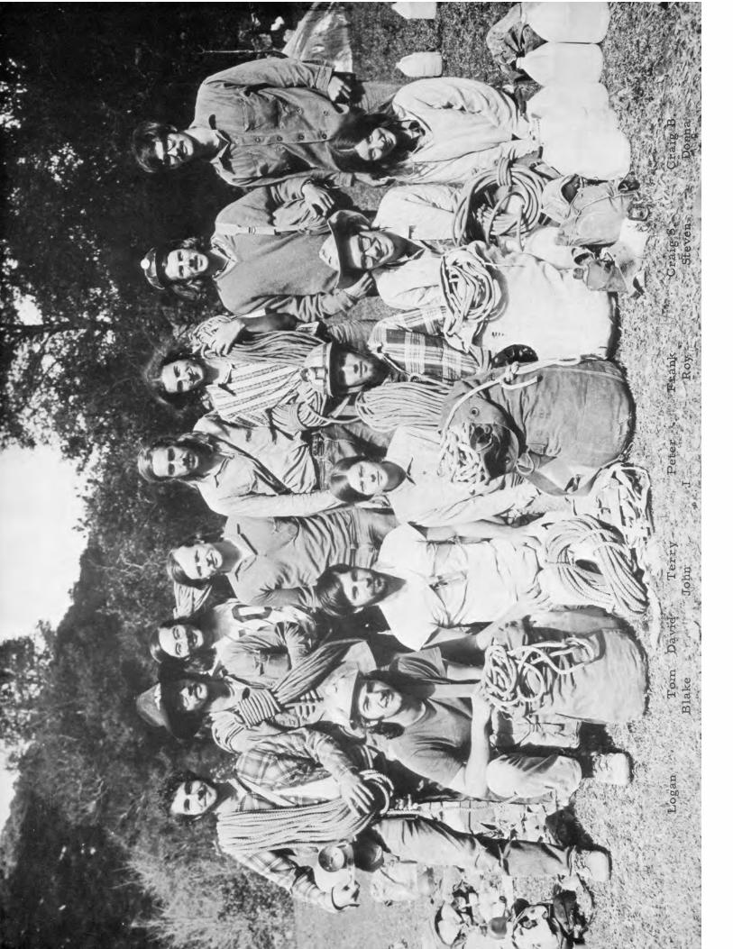
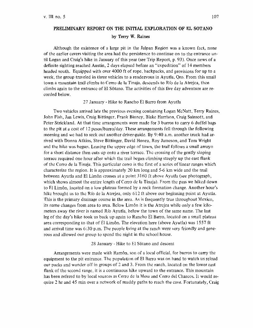
v. III no. 5 107
PRELIMINARY REPORT ON THE INITIAL EXPLORATION OF EL SOTANO
by Terry W. Raines
Although the existence of a large pit in the Jalpan Region was a known fact, noneof the earlier cavers visiting the area had the persistence to continue on to the entrance until Logan and Craig's hike in January of this year (see Trip Report, p. 93). Once news of adefinite sighting reached Austin, 2 days elapsed before an "expedition" of 14 membersheaded south. Equipped with over 4000 ft of rope, backpacks, and provisions for up to aweek, the group traveled in three vehicles to a rendezvous in Ayutla, Qro. From this smalltown a mountain trail climbs to Cerro de la Tinaja, descends to R{o de la Atrejea, thenclimbs again to the entrance of El Sotano. The activities of this five day adventure are recorded below.
27 January - Hike to Rancho El Barro from Ayutla
Two vehicles arrived late the previous evening containing Logan McNatt, Terry Raines,John Fish, Jan Lewis, Craig Bittinger, Frank Binney, Blake Harrison, Craig Sainsott, andPeter Strickland. At that time arrangements were made for 3 burros to carry 6 duffel bagsto the pit at a cost of 12 pesos/burro/day. These arrangements fell through the followingmorning and we had to seek out another driver-guide. By 9:40 a.m. another truck had arrived with Donna Atkins, Steve Bittinger, David Honea, Roy Jameson, and Tom Wrightand the hike was begun. Leaving the upper edge of town, the trail follows a small arroyofor a short distance then cuts up onto a river terrace. The crossing of the gently slopingterrace required one hour after which the trail began climbing steeply up the east flankof the Cerro de la Tinaja. This particular cerro is the first of a series of linear ranges whichcharacterize the region. It is approximately 20 km long and 5-6 km wide and the trailbetween Ayutla and El Limon crosses at a point 3160 ft above Ayutla (see photograph,which shows almost the entire length of Cerro de la Tinaja). From the pass we hiked downto El Limon, located on a low plateau formed by a rock formation change. Another hour'shike brought us to the R{o de la Atrejea, only 612 ft above our beginning point at Ayutla.This is the primary drainage course in the area. As is frequently true throughout Mexico,its name changes from area to area. Below Limon it is the Atrejea while only a few kilometers away the river is named R{o Ayutla, below the town of the same name. The lastleg of the day's hike took us back up again to Rancho El Barro, located on a small plateauarea corresponding to that of El Limon. The elevation here (above Ayutla) was 1557 ftand arrival time was 6:30 p.m. The people living at the ranch were very friendly and generous and allowed our group to spend the night in the school house.
28 January - Hike to El Sotano and descent
Arrangements were made with Ramon, son of a local official, for burros to carry theequipment to the pit entrance. The population of El Barro was on hand to watch us reloadour packs and wander off in groups of 2 and 3. From the ranch, located on the lower eastflank of the second range, it is a continuous hike upward to the entrance. This mountainhas been refered to by local sources as Cerro de la Mesa and Cerro del Charcos. It would require 2 hr and 45 min over a network of muddy paths to reach the cave. Fortunately, Craig

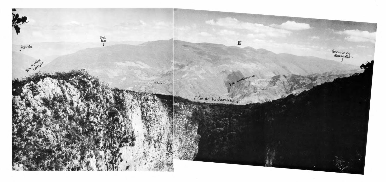
~AyuUQ
Tr<AilPoss
~
S6tahito deAhUQCQtlcitl
J

v. III no. 5 111
and Logan had been guided to the pit earlier and were now able to mark the way accuratelyfor the stragglers. About 1000 ft above the ranch the trail angles toward the south but westill could not see the entrance or had any idea where it was located. In fact, it would be hidden until the last moment. The Mexicans continually advised us as to the pit's proximity.The last stretch led up a linear valley carved by Arroyo del Ojo de Agua. At a nondescriptpoint the stream bed was crossed and a short hike led us to La Joya de Los Nogales. Here adepression has been filled to form a level, grassy surface, perfect for camping. And from here,only 7 minutes away, is EI Sotano. Hastily abandoning our packs, we climbed the low ridgeabove the joya and suddenly found ourselves on the edge of a true precipice. We could notcontain our excitement. People were carefully running from one vantage point to another,exclaiming at the voluminous, wonderful pit but not really comprehending the immensity...not at first anyway. Organize and drop rocks was foremost. The watch was ready, the rockwas ready, and when the first 13 sec free-fall resounded previous excitement seemed minor.
One hour later it was noon, a bright, sunny day, temperature 570 F, and the burros stillhadn't arrived. We were anxious to get on with the rigging but also grateful for the rest.Shortly, Ramon did appear with burros and equipment and activity resumed. Each personorganized personal gear and made general preparations. Then the main lines, still in the duffel bags, were carried to the pit edge. Two points would be rigged, which would allow Loganand Craig Bittinger to make an initial, simultaneous rappel. On the north wall an area protrudes inward providing the only practical rigging points around the whole perimeter. Herework was begun clearing vegetation and dislodging loose rocks. Handlines were rigged forsafety. When all was ready, rope pads in place, the lowering process was begun. To the westdescended a continuous length of I I mm braided nylon, while to the east three lengths ofBluewater, 600 ft, 600 ft, and 300 ft were rigged. By this time it was 3 :00 p.m. and Loganand Craig were eager to descend.
As they dropped over the edge, everyone waited with anticipation. For the first 60 ftthe ropes hung against the wall and were on either side of a buldge. Then, the drop becamecompletely free with the ropes mutually visible and 65 ft apart. Logan rappelled I 181 ft andCraig 1239 ft. The difference was due to their landing points on the bottom. Logan arrivedat the very top, western-most end of a talus slope while Craig landed in a tree downslope. Wewere in contact via walkie-talkie throughout most of the rappel.
What had appeared to be a smooth, even covering of vegetation from above turned outto be a rugged topography of rocks, ferns, and trees. From the landing point at the far western end of the pit, the explorers saw a steeply dipping floor descending to a linear trench andthen climbing up again to approximately the same level, 700 ft away. The width was 350 ft.Further exploration produced a cave on the south wall that was 150 ft long. There were noother leads showing any promise.
The radio gave us the details and go ahead for more of the group to enter. Frank, Roy,Stephen, Tom, and Donna descended and further checked the bottom but found no continuations. As most of the bottom group carried sleeping bags, they spent the night on theflat floor of the 150 ft cave. Meanwhile, back on top, John, David, Terry, Jan, Blake, andCraig Sainsott surveyed about 2/3 of the north half of the entrance before dark.
112
29 January - Survey of pit floor completed
AMCS News
Very early in the morning all prusiked out except Logan and Craig B., who remained tosurvey the north edge of the bottom. This survey was completed as Blake reached bottom.He was the first to rappel in on the second day of exploration and was followed by Peter,Terry, David, Craig S., and John. Terry and David photographed the pit as the others enteredand upon John's arrival surveying began. Proceeding east along the south wall, only a fewhours elapsed before closure was made to Logan's and Craig's earlier survey. With information gathering activities completed, the cavers, who had not already exited, did so in turn.
While this was going on, other members topside were lowering a calibrated wire to record the pit's depth. Readings were taken at two points, one at the eastern rigging and thesecond on farther to the east. Results were 1239 ft and 1345 ft respectively. This latterpoint is located where the lip is still at the top of a sheer drop and immediately before itrecedes from the pit. It is here that a plumb line intersects the talus floor furthest downslope. All other approaches to the pit, except the rigging area, are characterized by denselyovergrown slopes of increasing magnitude. For this reason, it is only practical to rig the pitin that one area.
30 January - Survey of entrance completed and hike to EI Barro
On the morning of the 30th the only task remaining was the completion of the entrance survey. Frank, Steve, Roy, Donna, and Tom had left the previous day for Austinwhich left 9 cavers at EI S6tano to finish this last part of the survey. Beginning at the laststation, the remaining 1/3 of the north half was completed and triangulation stations established. It was then possible to survey the heavily overgrown south half of the entrance perimeter by sighting on persons perched above the pit at closely spaced intervals. All was completed by noon, camp broken, and that afternoon everyone arrived in Rancho El Barrowhere the night was spent again in the school house.
31 January - Hike to Ayutla
At 9:00 a.m. hiking began; down to Rio de la Atrejea, up to Cerro de la Tinaja, and downto Ayutla, with arrival at 4:40 p.m. A quick return to Austin was made.
Pit Statistics
To reach the entrance from Ayutla would require a nearly continuous hike of 9 hours,assuming a pack of 20-30 pounds was carried. This hike would involve changes in elevationtotaling 9021 ft. Elevations measured by altimeter:
Ayutla 2699 ftTrail pass 5859 ftRio de la Atrejea 3311 ftUpper edge of EI S6tano 6624 ft
The entrance perimeter measures 700 ft by 1400 ft, while the pit floor measures 300 ftby 700 ft. The longest drop is 1345 ft. No other pit in the world is presently known to bedeeper.
v. III no. 5
A LETTER FROM RICK RIGG
113
Just finished reading the excellent Carrizal accident report in the last AMCS newsletter,and the suggestions and discussion at the end got me thinking about cave rescue for the firsttime in a while. That accident had almost all the elements one could imagine for a statesiderescue, plus the additional complications of an international border. I was particularly impressed by the relatively small portion of the total hassle that was caused by the border problem. I'd like to debate some of the conclusions that were drawn from the incident, however.
I'm willing to concede that accidents are probably inevitable, especially in Mexico, andthat the number will increase as more and more cavers of less and less competence go there.The situation probably is the same here in the U.S. But I'm still not convinced about thepracticality of outside rescue. Consider:
I. There aren't going to be enough rescue situations to keep a "special Mexican caverescue team" together and operating, unless they go into the practice rescue business full time like typical other U.S. rescue organizations. Even the mountain rescue people, who get a lot more business, spend most of their time practicing andhaving meetings just to maintain the "critical mass" of population and interest.
2. There is almost never enough time to bring in outside help for saving a life if aninjury is involved. Certainly not enough time in a diving situation. Even the aboveaccident took more than 24 hours to get outside help, and it was only about 120miles from the rescue group. Injured people don't survive in a cave environmentthat long except under very special circumstances. Rescuers have more time ifthey're just looking for lost people, but maybe we don't need to worry about that.
3. The only people who are willing to take the time to set up and organize, or evenfind out about a rescue organization are those who are least likely to need outsidehelp in the event of an emergency. The Carrizal incident with competent caversaround when an incompetent group got into trouble, was the exception ratherthan the rule.
4. Setting up and maintaining a rescue group is a lot of hassle and bother, and requiresthe full-time efforts of a lot of people. Who's going to do it?
5. Is it worth it?The above is all negative, and may appear to lead to the conclusion in the accident report;i.e., make up a list of people who might be able to help and carry it with you. That approachhas a lot going for it, but I don't think it's the answer.
positivel. It's simple. Everybody fills in a questionaire and somebody compiles the results and
publishes it in the Newsletter. A more complex system takes more time to set upand operate, and may have lower reliability.
2. It puts the people at the site in direct contact with cavers who can help out (if itworks).
negativeI. How do you decide who's qualified to be on the list? The number of people who
could ad-lib a rescue organization as well as Kunath did is probably pretty small.You're looking for an awful lot of attributes (vertical caver, diver, rescuer, organizer) in one person.
114 AMCS News
2. This accident shows that you can't get in touch with most individual cavers on a bigweekend, when the accident probability is highest.
3. It requires a lot of calls to be made out of Mexico. I've never tried, so I don't knowhow hard it is.
4. Somebody has to keep the list updated and republished, and the people on the listhave to be responsible enough to keep sending in changes of address and phonenumbers. Good luck!
5. Without being "official," you'll never get government cooperation (Mexico or U.S.).6. Most people aren't ready to leave on a rescue even if they are home.
Conclusion: Maybe it's the thing to do for the time being, but I don't think it's a good longterm solution.
What is a good long-term solution? It's awful difficult to move people and equipmentaround in a hurry (especially across borders) unless there is some sort of "official" sanction.This can only dependably be secured for an "official" group with all the hassle and effortand time that that implies. I don't see any way around having such a group in a reasonablelong-term solution.
advantages1. "Officialness"
2. Twenty-four hour phone, especially if it is associated with a sheriff's office somewhere, as most western rescue groups are.
3. Personnel experienced at working together.disadvantages
1. May not have any caving competence, unless it's a bunch of cavers to start with.Most rescue groups have some vertical competence.
2. May not be reliable.3. May not have any real interest in cave work.
Where is such a group going to come from? Maybe an existing group, like the Laredo rescuegroup if they have any interest. Maybe it's time to get the NSS rescue operations more organized, and then use that. Maybe Christensen in Missouri or Jim Storey in Atlanta. I don'tthink the AMCS or any small caving area could keep a reasonable group going; historicallylots have started but few survived. The important thing isn't so much which group as agroup that has become committed to the idea of rescuing people in Mexican caves. Theremay be even some Mexican rescue group that could be used, though I find it difficult tobelieve that one could operate interstate down there. Ken Laidlaw has been in the "official"rescue scene for quite a while and may have some ideas.
SuggestionsIf you go with the "list" approach, you might separate the "organizer" and "rescuer"
function. Print a list of nice, competent, stable, stay-at-home cavers who know Mexico andcould organize a rescue if they had to (or a long list of such cavers who normally don't stayhome), and then give them the necessary information to get the particular technical expertise required. There's probably enough vertical competence in Texas to keep the call list"local," but you might have to go further for divers. I recently put out a 'Caver Information Series' blurb on cave diving, and Dave Jagnow suggested in reviewing it that we put
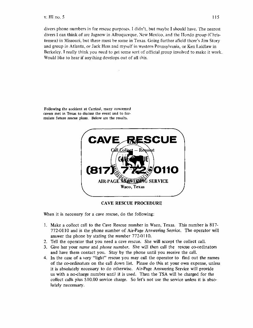
v. III no. 5 115
divers phone numbers in for rescue purposes. I didn't, but maybe I should have. The nearestdivers I can think of are Jagnow in Albuquerque, New Mexico, and the Hondo group (Christensen) in Missouri, but there must be some in Texas. Going further afield there's Jim Storyand group in Atlanta, or Jack Hess and myself in western Pennsylvania, or Ken Laidlaw inBerkeley. I really think you need to get some sort of official group involved to make it work.Would like to hear if anything develops out of all this.
Following the accident at Carrizal, many concernedcavers met in Texas to discuss the event and to formulate future rescue plans. Below are the results.
CAVE RESCUE PROCEDURE
When it is necessary for a cave rescue, do the following:
1. Make a collect call to the Cave Rescue number in Waco, Texas. This number is 817772-0110 and is the phone number of Air-Page Answering Service. The operator willanswer the phone by stating the number 772-0110.
2. Tell the operator that you need a cave rescue. She will accept the collect call.3. Give her your name and phone number. She will then call the rescue co-ordinators
and have them contact you. Stay by the phone until you receive the call.4. In the case of a very "light" rescue you may call the operator to find out the names
of the co-ordinators on the call down list. Please do this at your own expense, unlessit is absolutely necessary to do otherwise. Air-Page Answering Service will provideus with a no-charge number until it is used. Then the TSA will be charged for thecollect calls plus $10.00 service charge. So let's not use the service unless it is absolutely neccessary.

WARNING TO NAME DROPPERS
Once I was talking with a Mexican anthropologist friend of mine who told me aboutthis experience in the highlands of Chiapas:
"One time when I was walking along a trail with an Indian we passed a large cave onthe side of the trail. I stopped and looked into the mouth and then asked the Indianwhat the name of the cave was.
"The Indian just shrugged and looked impatient, so I forgot about the whole thingand continued down the trail.
"About a kilometer down the trail the Indian asked me if I still wanted to know thename of the cave. I said I did and the Indian gave me the name which was in the localMayan language. Then I asked him why he hadn't told me the name when we were atthe entrance. Then he replied that the cave was named for the spirit which lived in itand that the spirit would get mad if you spoke its name within hearing range of thecave. So he waited until he was well out of the spirit's hearing range to avoid the consequences of getting the spirit mad."
Felipe
ASSOCIATION FOR
MEXICAN CAVE STUDIES
NEWSLETTER
NEWS AND NOTES
ACCIDENT REPORT
TRIP REPORTS
Cueva de Constantm and Gruta de Garc18, N.L.
Micas. S.L.P., and Cartabranchal. Tamps.
Valles. S.L.P.
Puerto de Ia Zom, Hgo., and Cueva de Rancho Nuevo, Chiapas
Sierra de EI Abra. S.L.P.• and 'alpan. Oro.
ARTICLES
Corrections and Additions to the Map of uLa Regi6n de Is Sierra de El Abra"
Alphabetical Listing of Caves of the Sierra de EI Abra
Geotlraphical Checklist of the Caves of the Sierra de EI Abra
Project at La Cienega. Municipio de Pinal de Amoles, Qro.
"Leave Only Footprints"
Volume III Number 6


ASSOCIATION FOR MEXICAN CAVE STUDIES
NEWSLETTER
Volume III Number 6 Publication Date: August 1972
The Association for Mexican Cave Studies is a non-profit organization whose goals arethe collection and dissemination of information concerning Mexican caves. The AMCS publishes a Newsletter, Bulletin, and Cave Report Series which are available to any sincerely interested, conservation-minded person. The AMCS Newsletter is published six issues per volume as frequently as necessary at a cost of $4.00 US per volume, which includes both thepublication and membership. Potential contributors are urged to submit articles for publication. The article may cover any phase of Mexican speleology. Trip reports are requestedfrom all trips. Send all material to: Association for Mexican Cave Studies, P. O. Box 7672,Austin, Texas 78712, USA.
Publications EditorCave FilesSecretary-Treasurer.Coordinating Biologist.Photo Editor . . .Production Manager.
Terry W. RainesWilliam H. RussellJan E. LewisJames R. ReddellCarl E. KunathRonald G. Fieseler
Published by THE SPELEO PRESS
NEWS AND NOTES
In addition to the persons listed above, several others very actively support theAMCS. Helping with this issue were Chuck Bryan, de de Esparza, Roy Jameson,Pam Lynn, John Mikels, Nick Morales, Olga Reyes, Carol Russell, and Jack White.
118 AMCS News
Two lifeless bodies drifting in the opaque waters of the Carrizal siphon should havebeen enough to convince people that ill-equipped siphon diving just isn't profitable. Butnot Don Broussard and John Fish. Both were supposedly sane cavers, but after the recentincident in Tinaja one begins to wonder. As evidenced by the report below, one neverknows what to expect. For this reason, cavers should refrain from plunging into any waterfilled passage unless the most sophisticated diving equipment is in use and, most important,the persons involved are experienced.
ACCIDENT REPORT
NEAR DROWNING IN SOTANO DE LA TINAJA
as told to Ronnie Fieseler by Don Broussard and John Fish
About 1 July 1972 a group of cavers entered S6tano de la Tinaja for the purpose ofpushing a siphon in an attempt to connect the cave with S6tano del Arroyo. At the siphon,Don Broussard prepared to enter the water. He was wearing a diving mask and had a flashlight tied to his waist. A safety line was also tied to his waist and he was to be belayed byJohn Fish.
Don entered the siphon and after swimming a short distance came to an air pocketwhere he took 3 to 4 deep breaths. Evidently, the pocket contained very little oxygen anda high concentration of carbon dioxide and Don passed out. John Fish and others saw thelight from the flashlight sinking to the bottom and rapidly pulled Don out of the water.At the edge of the siphon Don showed no signs of breathing. Acting rapidly, the caverspresent lifted Don upside down and poured water out of him. Pounding produced a largeamount. He was then given artificial respiration until he began to cough. After coughingup more water Don slowly began to regain normal breathing and the group exited the caveafter Don had recovered sufficiently.
After a day's rest Don was his normal self except for very bloodshot eyes, which havesince then improved. This is essentially the story told to me while I was in Cd. Valles,shortly after the accident.
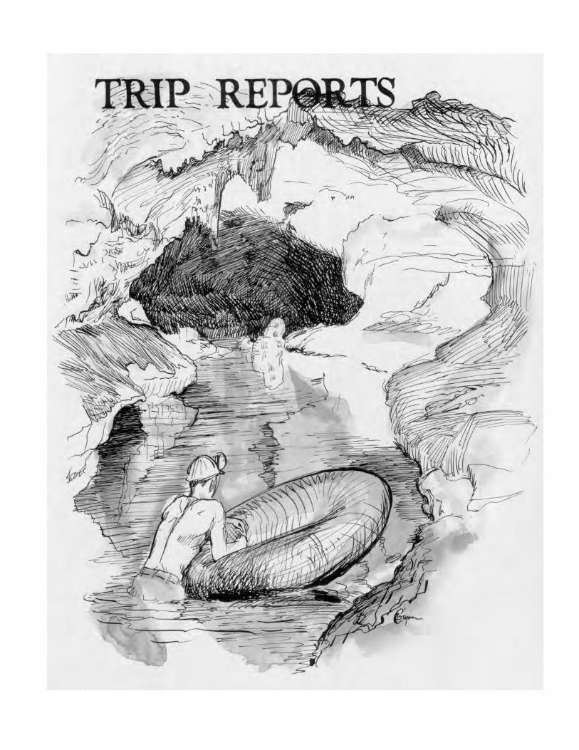

120 AMCS News
Date: 22-24 October 1971Destination: Cueva de Constantln and Gruta de GardaLocation: NBRPersons: R R Russell, John Mikels, Nick Morales, Aubrey Washington, Tom Solis, Carlos
Barrera, Jodine Galion, Joe Kostyo, and Carolyn SmithReported by: John Mikels
R R, Nick, Aubrey, and I split for Monterrey in RR's Scout to drive through toEspinazo and redo the road-log. Since I was only one who had been there before the tripwas also a tour and photoing excursion. The other group went to Monterrey to catch atrain for Espinazo to see if such a way was worthwhile. Meanwhile we drove through toEspinazo and carefully logged the road all the way from Monterrey by Saturday morning.We waited around town awhile for the train group, but they didn't show up, so the fourof us went to the cave to take pictures and check a lead. Not many pictures because ofcamera problems. We managed to drive approximately 3/4 of the way from town to themountain. We spent about 4 hours in the cave. When we got out we found the othergroup waiting for us at the base of the mountain. They had been unable to catch a trainuntil Saturday morning. They reached Espinazo a little before noon. So taking the trainthere is risky because of uncertain schedules. Well they didn't really want to do the cave, sowe all piled in the Scout and returned to town. Messed around awhile and split for Monterrey.A local told us of another cave on the opposite side of the mountain from Constantln. Got tocheck that one of these days. We got to Monterrey Saturday night and crashed in some littlepark outside town. Next day we arose and went to Gruta de Garda. Paid our way in, but splitfrom the commercial tour quickly and spent about 2 hours prowling in the cave. Really nice.Then out and to a Colonel Sanders Kentucky Fried Chicken in Monterrey. After eating weheaded home and got in late Sunday night.
Date: November 1971Destination: Caves south of Micos (Municipio de Valles) and caves in the vicinity of Carta
brancha1 (Municipio de Jaumave)Location: SMa, Tamasopo Region-Micos, Morita, Otates and Minas Viejas areas, Sierra de
Guatemala Region, Cartabrancha1 Area.Persons: David McKenzie and Bill RussellReported by: Bill Russell
The group returning from Tres Manantia1es met David McKenzie at the Hotel Mante.That night David and Bill Russell drove south toward the village of Micos, about 20 k NW ofCd. Valles, to visit a blind fish cave previously investigated by the German biologist HorstWilkins. This cave had originally been located by biologists from the joint Mexican-AmericanVampire Control program. The owner of the Don Tomas ranch at Micos had told us on anearlier visit that the fish cave was located at the end of a mountain ten miles southwest ofMicos, so we drove to a small ranch near the end of the mountain and asked about the cave.The cave proved to be well-known and a guide was soon obtained who led us to the HorstWilkins fish cave, as well as two other smaller caves nearby. The next two days were spentmapping the cave (named by the Germans Cueva del Rio Subterraneo) and investigating theother nearby caves. Cueva del Rio Subtemineo proved to be 1230 feet long and divided intotwo sections, one of which may continue. The cave is located at the end of a long arroyo thatdrains about ten km2 of the swampy valley to the east of the cave. The main section of thecave is entered by climbing down over breakdown at the end of the arroyo. The upper section

v. III no. 6 121
of the cave is reached through a tunnel that opens at the base of a cliff above the arroyo entrance. This tunnel is 20 ft high and 15 ft wide and ends in a 30-foot pit. We crossed the pit bylassoing a formation on the far side of the pit, but 50 ft further on was another 30-foot pitthat we could not cross. We could see a passage continuing on the other side. The passage leading to the main cave goes steeply down over large breakdown to a depth of 70 ft, where thereis a temporary siphon that blocks access to the cave during wet weather. Beyond this small section of cave, a steep slope of washed and rounded cobbles leads up to a larger horizontal passage. This passage ends in a 10 foot climbable drop into the river passage. Here a stream flowingabout 20 gpm was encountered, probably derived mostly from the surface arroyo that sinks before the cave entrance. The stream passage can be followed through waist-deep pools to a largeroom 100 ft long, 40 ft wide and 30 ft high. The stream crosses this room and siphons just beyond, 95 ft below the entrance. From this room, 30 ft above the siphon level, a passage scouredby flood waters leads to a second room 240 ft long, 40 ft wide, and 30 ft high. A short passageleads from this room and ends in a second siphon. Both siphon pools contain numerous blindfish, and some blind fish as well as eyed fish are present in the stream. After returning to Austinit was discovered that the cave had been visited three days before by another Austin caving group.(See trip report by GB Enquist, Gregg Thompson, etc.)
Another cave about one km to the west of Cueva del Rio Subtemineo proved to be a smallshelter with a passage at the back leading steeply down to water. This cave, named by us, Cuevadel Lienzo, also contained both eyed and eyeless fish. We were also shown a cave one mile to theeast of Cueva del Rio Subterraneo at the end of a small arroyo. By climbing over breakdown andthen descending a IS-foot vertical drop, we reached one end of a long stream passage from 4 to10ft high, with several rooms. This passage was followed for about 1000 ft to where the air became so poor (probably CO2 ), that exploration was abandoned. The cave, named by us Cueva deOtates, contained not only blind and eyed fish, but numerous crossbreeds with partially developedeyes.
From the Micos area we drove north on the dry-weather-only road leading west and thennorth from Micos along the Rio Naranjo, toward the town of EI Naranjo on highway 80 west ofAntiguo Morelos. Just south of EI Estribo Arch, a road leads across the Rio Naranjo and southto Quinientos and from there back to Micos. Six and a half miles from the arch a side road leadswest into the foothills to the village of Minas Viejas. Here we asked about caves and were led toseveral caves near town and were told, as usual, of large caves high in the mountains. One pit wedid visit was near a beautiful 100 ft waterfall, about ten minutes walk from the road. The MinasViejas area is promising, but apparently it would take several days on foot to reach large cavesand return to Minas Viejas.
From Minas Viejas Dave and I drove north through Mante and then to Encino, the Gatewayto the Sierra de Guatemala. We had heard of a large deep pit in the northern Sierra de Guatemala,and planned to walk to Cartabranchal, the only inhabited place in the northern half of the range.On a previous trip I had walked north along the road that followed the Rio Sabinas valley. Thisroad leads north from the west end of the low water bridge west of Encino, goes by the Nacimiento del Rio Frio, 300 m northeast of the village of La Puerta, through Ejido El Encinito (calledLa Flor), and ends at San Pedro La Colina. From here a trail leads up to the Village of MonteCristo, and from Monte Cristo an abandoned trail zig-zags up the face of the range for about2000 ft vertically to the abandoned lumber camp of Monte Carlo, now only an overgrown clearing. Monte Carlo was the furthest point north cavers had previously reached in the Sierra deGuatemala and with David's Blazer we planned to drive as far as possible along the old road thatleads to Monte Carlo. This road leads north from Julillo, so we drove west from Encino acrossthe Rio Sabinas and up the steep east slope of the Sierra to Julillo. Here we turned north and

122 AMCS News
kept right at the fork to Las Canoas and Joya de Salas, and finally reached the clearingwith the cement water tank which is all that remains of the large lumber camp, La Cueva,6.3 mi north of the Joya de Salas Road. Beyond La Cueva we had to clear the road as wewent by tying a cable from the Blazer to the logs and dragging them back along the roaduntil they were parallel with the road and we could drive past. Finally we came to a largetree that couldn't be moved, and since it was an otherwise pleasant spot, we camped forthe night. At eight the next morning we left on foot for Cartabranchal, traveling fast andlight. We walked through Monte Carlo (10:00) and following the long-abandoned road, wemade good time, as much of the time we were walking relatively horizontally along the topof the range. The old road finally ended (11 :50), and a trail continued. At I :00 we cameto a junction, where the trail to Cartabranchal turned left, and to the right was the trailto Canon Diablo, the narrow gorge cut by the headwaters of the R(o Sabinas. We arrivedat Cartabranchal about 2:00, and found that the ranch consisted of one extended family,with several generations occupying two houses. We passed time waiting for the man of thehouse to arrive by asking about pits in the area, then one of the women would point andwe would walk in that direction until we found a pit. We found four pits in the vicinity ofthe ranch house: two close together to the west of the house, one 150 ft deep (S6tanoRojo after the red soi}), and the other (S6tano Contigo) dropping about 30 ft to a slope.The most promising was S6tano del Tanque across the stock pond from the ranch house,which is a pit dropping 80 ft to a sloping floor. West of this pit is a small pit, S6tano delCaracol, in the bed of a small draw. There is also a 30-foot deep mud-choked sink intowhich most of the water in the main arroyo sinks after rains. When Sr. Alvino R{os returned we asked him about the big pit. His answer was that it was a disappointing 20 ftdeep and he could see no leads, though there might be some in the breakdown on thebottom. Hurriedly returning to our car, we camped and then returned to Austin the nextday.
Date: Thanksgiving holidays, 1971Destination: Cd. Valles, San Luis Potos(Location: SMOPersons: Blake Harrison, Mike Walsh, Keith Heuss, Robert Hemperley, Sandi Luker, Stanly
Moerbe, Dale Pate, Jeri JonesReported by: Blake Harrison
We left San Marcos in two VW busses, and arrived in Ciudad Valles in record time for aVW. It took us about 7 hrs from the border. We met at the Hotel Covadonga, south of thecity. We were hoping to acquire the use of a private plane there, but were out of luck atthat time. There were several in the group that had not seen Cueva de Taninul n. 4, so wespent the afternoon visiting it and taking pictures. We then drove to Xilitla after regroupingat Valles. We visited Cueva del Salitre, the large-mouthed cave seen just below town. It isquite an impressive, easily accessible Mexican cave. After this we drove to the Englishman'shouse west of the town and spent the night there. The next morning we were fortunateenough to meet and talk to the owner of the house, a very fine person. That day was spentwith one group attempting to get another airplane to fly over the Ayutla, Queretaro area,and another group visiting Huitzmolotitla and entering S6tano de San Antonio, a 386-footdrop near Xilitla. A third group looked for Cueva de Christian, located in Arroyo Seco.The next day after failing to get an airplane at the hotel again, our groups headed to S6tanode Venadito, north of Valles. We wanted to get in some vertical work and attempt to

v. III n. 6 123
locate and possibly map a new section located earlier by Terry Raines. After a 45 minutehike we were at the cave and soon had every one in the cave. Robert and Blake startedlooking for the room in the given area. After some climbing and checking, Robert soonfound exactly what we were looking for. It was quite an impressive room and had severalleads in it. After checking the leads, we found that the room looped back over the mainpassage. We took some pictures and began the climb out. Our tired group headed back tothe Los Sabinos campgrounds. We were so tired that both of us missed the turnoff thefirst time. We crashed about 3 o'clock that morning. The next day we drove up the Micosroad following Bill Russell and David McKenzie. We stopped and had a nice swim in theEl Salto river. After this our groups split up. One went back via Valles, etc., and theother went back via San Luis Potosi and Laredo.
Date: July and December 1971Location: SMa and Chiapas PlateauReported by: Skip and Kathy Roy
Here are some trip reports culled from our Mexico trip. I've left out things likeTaninul n. 4, Bustamante, and the summer caving with Fish in Valles. Also the ChristmasArroyo stuff - figure that Broussard's journal has all that nitty-gritty.
July 1971: Steven Bittinger, Kathy Roy, Skip RoyPuerto de la Zorra, Interamerican Highway about 10 mi north of Jacala.
Two short sessions of walking produced about a dozen small diameter pits, nonevery fantastic. Maximum depth of 140 ft. This area is part of a group of large dolinas,and has a fair amount of promise for deep stuff. The area checked is to the right ofthe road heading south and is about 350 m by 800 m. Area outside of rectangle isunchecked.
Puerto de la Zorra sign
@I'k"1"~ Ime InPIts
odolina
~ center-plugged
Jacala~

124 AMCS News
December 1971: Bill Steele, Skip RoyCueva de Rancho Nuevo, San Cristobal de las Casas, Chiapas
This cave is 300 m south of the dump 3 mi south of San Cristobal, about 200 mwest of the main highway. Unfortunately, we couldn't figure out which hole thewater sinks in near the entrance; it's a fair piece to base level - at least 2000 ft. Wedid walk through about 3000 ft of big (20 ft x 50 ft) canyons with gloomy blackwalls. Two reliable Americans say they found another passage with an additional1500 ft. Near the end of the part we saw the passage changes to 45 0 bedding planepassages. This cave is well worth both a survey and a good hard check-out - we justsort of wandered around.
Date: 30 March - 3 April 1972Destination: Various caves in the Sierra de El AbraLocation: SMa; El Abra, Xilitla, and JalpanPersons: Randy Fugate, Bob Henry, Stewart Martin, John Graves, Scott HardenReported by: Scott Harden
The first night we camped in the AMCS campground at Los Sabinos. The next morning we drove to Xilitla and looked around. John and I did the first drop in S6tano deHuitzmolotitla (350 ft) near Tlamaya. The group got little sleep that night as Bob's tarpis not waterproof. On the morning of the 1st we drove toward Jalpan. It was a great re-lief to get out of the wet, chilly mountains. We did Cueva de Puente de Dios and weregreatly impressed. It was dark when we exited and walked back to the truck. A nice fiestawas going on in Jalpan. Our tired group collapsed at a good campsite near Ayutla. OnEaster day we had our first drink of pulque, drove to RIO Verde and then back to Valleswhere we participated in another great fiesta. Once again we camped in the AMCS campground. On the last day of the trip, I went in Cueva de El Abra while the others waitedat the truck. We encountered Roger McMillan and crew in Cd. Victoria. He had been nearOcampo and found a 400 ft pit. We picked up some hitchhikers who had been from Alaskato Yucatan and took them all the way to San Antonio, arriving about midnight.
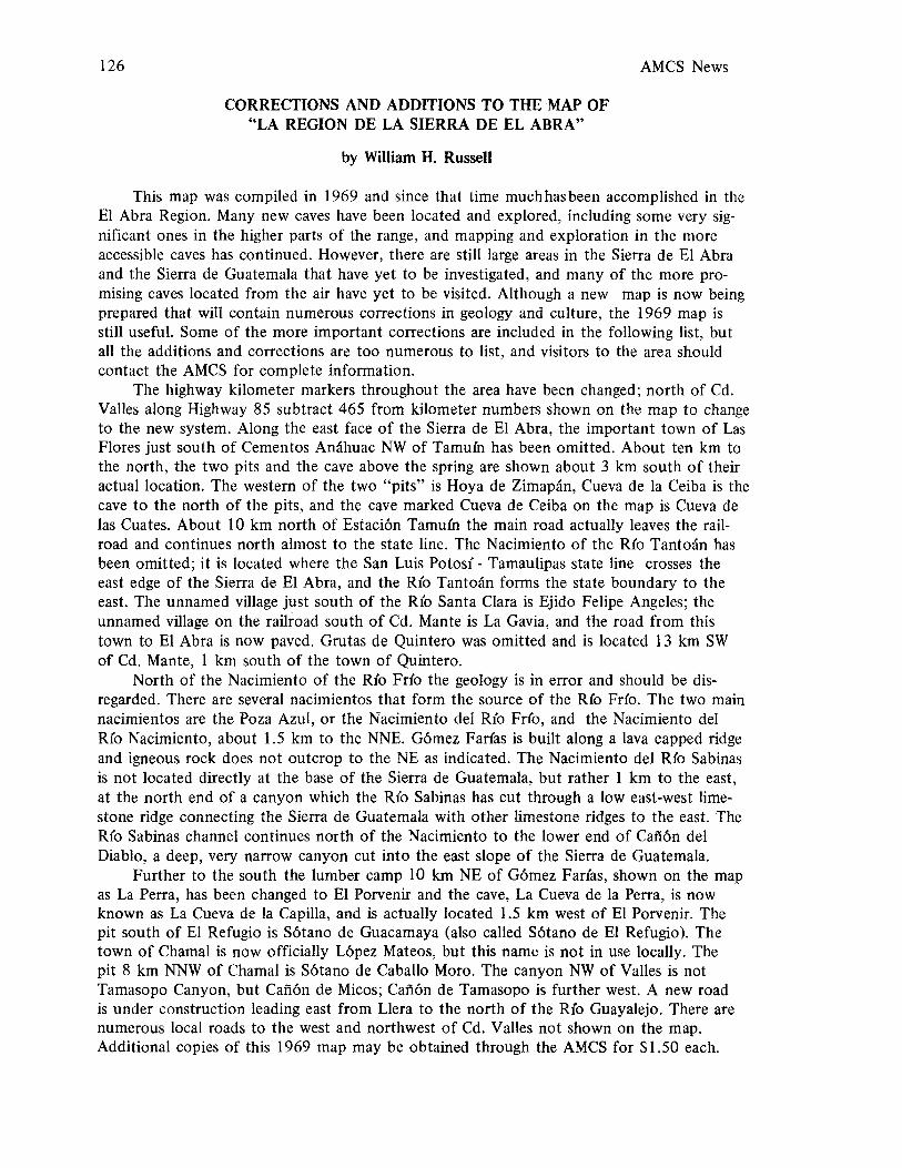
126
CORRECTIONS AND ADDITIONS TO THE MAP OF"LA REGION DE LA SIERRA DE EL ABRA"
by William H. Russell
AMCS News
This map was compiled in 1969 and since that time muchhasbeen accomplished in theEl Abra Region. Many new caves have been located and explored, including some very significant ones in the higher parts of the range, and mapping and exploration in the moreaccessible caves has continued. However, there are still large areas in the Sierra de El Abraand the Sierra de Guatemala that have yet to be investigated, and many of the more promising caves located from the air have yet to be visited. Although a new map is now beingprepared that will contain numerous corrections in geology and culture, the 1969 map isstill useful. Some of the more important corrections are included in the following list, butall the additions and corrections are too numerous to list, and visitors to the area shouldcontact the AMCS for complete information.
The highway kilometer markers throughout the area have been changed; north of Cd.Valles along Highway 85 subtract 465 from kilometer numbers shown on the map to changeto the new system. Along the east face of the Sierra de El Abra, the important town of LasFlores just south of Cementos Anahuac NW of Tamuin has been omitted. About ten km tothe north, the two pits and the cave above the spring are shown about 3 km south of theiractual location. The western of the two "pits" is Hoya de Zimapan, Cueva de la Ceiba is thecave to the north of the pits, and the cave marked Cueva de Ceiba on the map is Cueva delas Cuates. About 10 km north of Estaci6n Tamu{n the main road actually leaves the railroad and continues north almost to the state line. The Nacimiento of the R{o TantO<ln hasbeen omitted; it is located where the San Luis Potosi - Tamaulipas state line crosses theeast edge of the Sierra de El Abra, and the Rio TantO<ln forms the state boundary to theeast. The unnamed village just south of the Rio Santa Clara is Ejido Felipe Angeles; theunnamed village on the railroad south of Cd. Mante is La Gavia, and the road from thistown to El Abra is now paved. Grutas de Quintero was omitted and is located 13 km SWof Cd. Mante, 1 km south of the town of Quintero.
North of the Nacimiento of the R{o Frio the geology is in error and should be disregarded. There are several nacimientos that form the source of the R{o Fdo. The two mainnacimientos are the Poza Azul, or the Nacimiento del Rio Fr{o, and the Nacimiento delR{o Nacimiento, about 1.5 km to the NNE. G6mez Fadas is built along a lava capped ridgeand igneous rock does not outcrop to the NE as indicated. The Nacimiento del Rio Sabinasis not located directly at the base of the Sierra de Guatemala, but rather 1 km to the east,at the north end of a canyon which the Rio Sabinas has cut through a low east-west limestone ridge connecting the Sierra de Guatemala with other limestone ridges to the east. TheR{o Sabinas channel continues north of the Nacimiento to the lower end of Caf'i6n delDiablo, a deep, very narrow canyon cut into the east slope of the Sierra de Guatemala.
Further to the south the lumber camp 10 km NE of G6mez Farias, shown on the mapas La Perra, has been changed to El Porvenir and the cave, La Cueva de la Perra, is nowknown as La Cueva de la Capilla, and is actually located 1.5 km west of El Porvenir. Thepit south of El Refugio is S6tano de Guacamaya (also called S6tano de El Refugio). Thetown of Chamal is now officially L6pez Mateos, but this name is not in use locally. Thepit 8 km NNW of Chama1 is S6tano de Caballo Moro. The canyon NW of Valles is notTamasopo Canyon, but Caf'i6n de Micos; Caf'i6n de Tamasopo is further west. A new roadis under construction leading east from Llera to the north of the Rio Guayalejo. There arenumerous local roads to the west and northwest of Cd. Valles not shown on the map.Additional copies of this 1969 map may be obtained through the AMCS for $1.50 each.
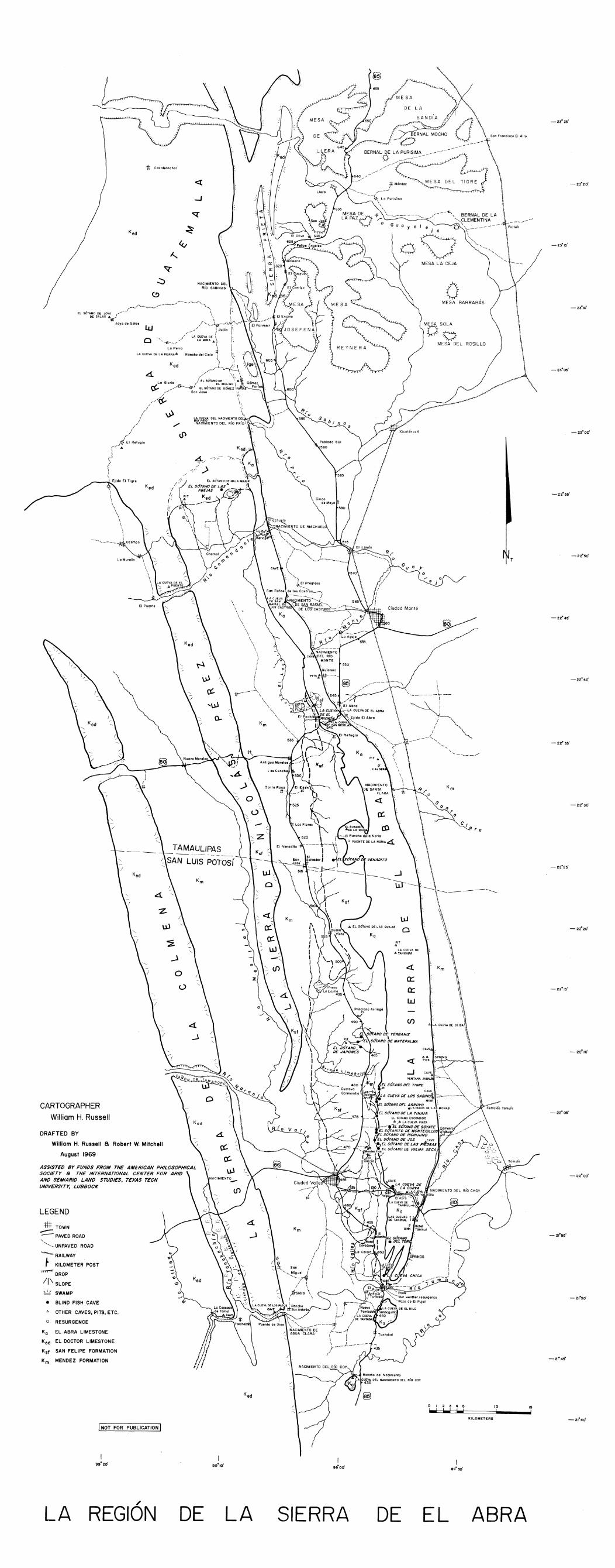
- 22000
1
15!
10!
KILOMETERS
ROSILLO
CIar a
a ...
oMESA BARRABAS
oV
o 1 2 3 4 5---
.Yo
\\
\.. \-------\---
IIII
I/
/I
I---------'," ,
",,---_/
oj
BERNAL DE LA'"CLEMENTINA
Guo y a I a . tj \\' ---
C~ \~~~"""MESA LA CEJA
Ciudad Monte
o_...~
TAMAULIPAS-- .- .._.-._-- - _._._.- ---~ SAN lUIS POTOS('- - 22°25'
Km
&.
Z\JJ
W 0 -22°20'
~
Jc:::( Km
00::
(.) 0:: -22°15'
W
~en
J
-22°,0'
tt Corobonchol
• BLIND FISH CAVE
A OTHER CAVES, PITS, ETC,
0 RESURGENCE
Ko EL ABRA LIMESTONE
Ked EL DOCTOR LIMESTONE
Ksf SAN FELIPE FORMATION
K m MENDEZ FORMATION
....J
INOT FOR PUBLICATION I
/__./.......-'"'--_./-----/-----J----,.....\......,EL SOTADNEO S~iA~O~ J~/-.J \
~ IJoyo de Solos I. I /r'\..,-_~__
loLl _// )JUhIO (
//-- LA CUEVA DE \ \~,o '"~__ ",,,/ LA MINA .6. )
La Perra \ 1LA CUEVA DE LA PERRAA Rancho del Cielo 1 \:-_ _~\1,-
K \ J _ I I
ad /_/_L-v-~~~ -, ge
&. (// \1,_ \ -'\ \J EL SOTANO DE \ .6.
La Gloria / EL MOLINO \
r::f" ".-".-/tj.---I:f JEL SOTANO DE GOMEZ FAtt'A
/- San Jose/
/~/~/
//
//
/./
/I
/r
J><J. EI Refugio
rf.6.
lr S)
(
\I\.
m TOWN".---- PAVED ROAD"-""..... UNPAVED ROAD
~RAILWAY
~ KILOMETER POST
TTT't'TT" DROP
//\ SLOPE
~ SWAMP
DRAFTED BY
William H. Russell a Robert W. Mitchell
AUgust 1969
CARTOGRAPHERWilliam H. Russell
LEGEND
ASSISTED BY FlJNDS FROM THE AMERICAN PHILOSOPHICALSOCIETr a THE INTERNATIONAL CENTER FOR ARIDAND SEMIARID LAND STlJDIES, TEXAS TECHlJNIVERSITr, LlJSBOCK
9 9020•
LA/
REGION DE LA SIERRA DE EL ABRA


v. III no. 6 129
ALPHABETICAL LISTING OF CAVES OF THE SIERRA DE EL ABRAEL ABRA LIST NUMBER ONE, JULY 1, 1972
by William H. Russell
Alphabetized according to shortened form of name with articles and adjectives omitted.S6tano, sotanito, cueva, cuevita, gruta, rfo, arroyo, mina, nacimiento, grande, chica, joya (hoya),puente, puerto, boca, and rancho are omitted when there are following words. San, Santa, Don,and Dona are considered part of the shortened name. A plus before the depth indicates eleva-tion above the lowermost entrance, a plus after the length or depth indicates the cave is onlypartly explored. An E means the depth is estimated from the air. Parentheses indicate an un-named cave listed below a geographically adjacent cave. Unnumbered names are alternate names.
Name Area Length Depth Preftxes
1. Abra Quintero 1460 389 Cueva de El2. (pit above) Quintero 10 91
Agua Taninul See Curva CUeva del3. Aguacate n. 1 La Noria 100 12 Cueva de Joya de4. Aguacate n. 2 La Noria 30 6 Cueva de Joya de5. Arroyo1 Los Sabinos 21000+ 400 S6tano del6. Caldera La Gavia 400 240 La7. (pit on trail) La Gavia 8 258. (pit to north) La Gavia 80 200E
Campana Quintero See Pach6n Cueva de laCap illa Tanchipa See Tanchipa Cueva de la
9. Ceiba La Ceiba 737 647 Cueva de 1a10. Chica E1 Pujal 1000+ 35 Cueva11. (cave SE) E1 Pujal 300+ 2012. Choy Taninu1 400 +200 Cueva del Nacimiento del R(o13. (fissure cave) Taninul 150 100
Cieba La Ceiba See Ceiba Cueva de 1a14. Cincuenta y Seis Taninul 40 511 S6tano15. Collins Los Sabinos 10 130 S6tano de16. Colmena Taninul 300 150 Cueva de 1a17. (pit by Soyate) Taninul 50 10018. (pit near road) Taninul 10 4019. (pit with vine) Taninu1 40 5020. (walk-in cave) Taninu1 150 2021. (short cave) Taninul 20 1022. Colmenas Quintero 800 250+ Cueva de las23. (pit NE) Quintero 12 2524. (pit SW) Quintero 50+ 50E25. Coy Salsipuedes 270 100 Cueva del Nacimiento del Rio26. Cuatas (Este) El PujaJ 15 90 Las27. Cuatas (Oeste) El Pujal 300 90 Las28. Cuates La Ceiba 300 +200 Cueva de las29. Culebra Los Monos 20 420 S6tano de la30. Curva Taninul 700 124 Cueva de la31. Doble Norte Los Monos 40 74 S6tano32. Doble Sur Los Monos 25 30 S6tano33. Don Pedro La Noria 10 120 S6tano de

130 AMCS News
Name Area Length Depth PrefIXes
34. Escalera Taninul 200 96 S6tano de la35. (horizontal cave) Taninul 400 4036. (pit near hut) Taninul 10 4037. (pit by trail) Taninul 10 7038. Escondido Los Sabinos 400 50 S6tano39. (north of road) Los Sabinos 30 2540. (south of road) Los Sabinos 40 5041. Este Los Monos· 40 156 S6tano del42. Fer-de-Lance El Pujal ? ? S6tano del
Ferrocarril Taninul See Curva S6tano del43. Florida Quintero 5300 90 Cueva de la44. F6siles Quintero 150 250 Cueva de los45. Gadsden Taninul 15 443 S6tano de46. (power line pit) Taninul 10 10047. (field pit n. 54) Taninul 15 2048. (field pit n. 55) Taninul 8 4049. (pit to S n. 58) Taninul 25 30+50. Grande El Pujal 1520 90 Cueva
Guano La Ceiba See Ventana Jabal( Cueva del51. Higuer6n Los Monos 550 208 Hoya de
Jabal{ La Ceiba See Ventana Jabal{ Cueva del52. Japones Yerbaniz 10200+ 300 S6tano del53. Jos Los Sabinos 1108 277 S6tano de54. Lagarto Los Sabinos 40 180 S6tano del55. Lajita Los Sabinos 35 20 S6tano del56. Le6n Los Sabinos 110 30 Cueva de57. Loro Los Monos 700 195 S6tano de58. Mante El Pujal 150 50 Cueva/S6tano de59. Mante Quintero 110 +60 Cueva del Nacimiento del RIo60. (small room cave) Quintero 20 1061. (siphon cave SW) Quintero 100 6062. Manuel El Pujal 1000 35 S6tano de63. Mariposa Taninul 75 10 Cueva de64. Matapalma Yerbaniz 5649+ 283 S6tano de
Matepalma Yerbaniz See Matapalma S6tano de65. Monos Los Monos 2771 951 S6tano & Cueva de los66. (pit by trail) Los Monos 15 2567. (pit by trail) Los Monos 10 3068. Montecillos2 Los Sabinos 10073 374 Sistema de
Montecillos2 Los Sabinos See Montecillos Sotanito69. Nilo Tantobal 50? 3 Cueva del70. Nopal Grande Los Monos 45 289 S6tano del71. Noria La Noria 120 100 S6tano de la72. Noria La Noria 50 30 Puente Natural de la73. (pit by road) La Noria 10 2074. Ojites Los Monos 350 200 Cueva de los75. Orquidea Los Monos 225 135 S6tano de76. Pach6n Quintero 893 12 Cueva de EI
Pach6n Quintero See San Lazaro Cuevacita de El77. Pajaros Quintero 330 53 Cueva/Tunel de los
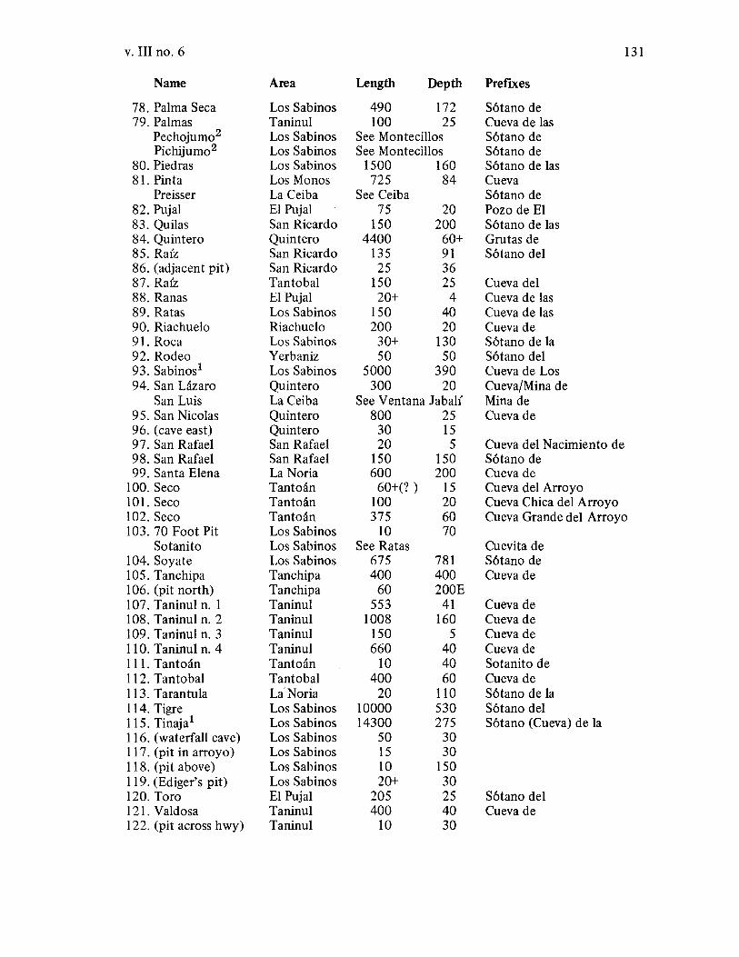
v. III no. 6 131
Name Area Length Depth PrefIxes
78. Palma Seca Los Sabinos 490 172 S6tano de79. Palmas Taninul 100 25 Cueva de las
Pechojumo2 Los Sabinos See Montecillos S6tano dePichijumo2 Los Sabinos See Montecillos S6tano de
80. Piedras Los Sabinos 1500 160 S6tano de las81. Pinta Los Monos 725 84 Cueva
Preisser La Ceiba See Ceiba S6tano de82. Pujal EI Pujal 75 20 Pozo de EI83. Quilas San Ricardo ISO 200 S6tano de las84. Quintero Quintero 4400 60+ Grutas de85. Raiz San Ricardo 135 91 S6tano del86. (adjacent pit) San Ricardo 25 3687.Raiz Tantobal ISO 25 Cueva del88. Ranas EI Pujal 20+ 4 Cueva de las89. Ratas Los Sabinos ISO 40 Cueva de las90. Riachuelo Riachuelo 200 20 Cueva de91. Roca Los Sabinos 30+ 130 S6tano de la92. Rodeo Yerbaniz 50 50 S6tano del93. Sabinos1 Los Sabinos 5000 390 Cueva de Los94. San Lazaro Quintero 300 20 Cueva/Mina de
San Luis La Ceiba See Ventana Jabal( Mina de95. San Nicolas Quintero 800 25 Cueva de96. (cave east) Quintero 30 1597. San Rafael San Rafael 20 5 Cueva del Nacimiento de98. San Rafael San Rafael 150 150 S6tano de99. Santa Elena La Noria 600 200 Cueva de
100. Seco Tantoan 60+(? ) 15 Cueva del Arroyo101. Seco Tantoan 100 20 Cueva Chica del Arroyo102. Seco Tantoan 375 60 Cueva Grande del Arroyo103. 70 Foot Pit Los Sabinos 10 70
Sotanito Los Sabinos See Ratas Cuevita de104. Soyate Los Sabinos 675 781 S6tano de105. Tanchipa Tanchipa 400 400 Cueva de106. (pit north) Tanchipa 60 200E107. Taninu1 n. 1 Taninul 553 41 Cueva de108. Taninul n. 2 Taninul 1008 160 Cueva de109. Taninul n. 3 Taninul ISO 5 Cueva de110. Taninul n. 4 Taninul 660 40 Cueva deIII. Tantoan Tantoan 10 40 Sotanito de112. Tantobal Tantobal 400 60 Cueva delB. Tarantula La-Noria 20 110 S6tano de la114. Tigre Los Sabinos 10000 530 S6tano delliS. Tinaja1 Los Sabinos 14300 275 S6tano (Cueva) de la116. (waterfall cave) Los Sabinos 50 30117. (pit in arroyo) Los Sabinos IS 30118. (pit above) Los Sabinos 10 ISO119. (Ediger's pit) Los Sabinos 20+ 30120. Toro EI Pujal 205 25 S6tano del121. Valdosa Taninul 400 40 Cueva de122. (pit across hwy) Taninul 10 30
132 AMCS News
Name Area Length Depth PrefIxes
123. Venadito La Noria 5000+ 500 S6tano de El124. Ventana Jabal{ La Ceiba 1275 550125. Verde San Ricardo 30 10 Cueva
Virgen Taninul part ofChoy Cueva de La126. Verba Taninul 150 40 Cueva de la127. Yerbaniz Yerbaniz 5300 312 S6tano de128. Zimapan Los Monos 1690 1050 Hoya de
lCueva de Los Sabinos, S6tano del Arroyo, and S6tano de la Tinaja can be considered as onesystem of over 40,000 ft, since Arroyo and Los Sabinos are separated by a short section ofwater-filled passage, and Arroyo and Tinaja are separated by an even shorter siphon. Strongairflow near the Arroyo - Los Sabinos connection indicates the possibility of a traversableconnection.
2S6tano de Pechojumo (Pichijumo) and the Sotanito de Montecillos form the Sistema deMontecillos. Voice and light communication were made across a small siphon. Sotanito deMontecillos has 5708 ft of passage and Pechojumo has 4365.
COMMENTS
The number of caves is somewhat arbitrary, as to be included on the list a cave had tomeet one of the following requirements: (1) have a name, 2) have actually been entered, or3) have been seen from the air to be a major cave. Only one cave, S6tano de Fer-de-Lance(for obvious reasons) has been named and not entered. Three major pits located from the airbut not yet visited are included. Not included are 4 pits (3 just east of Cueva Chica) accuratelylocated but not entered plus four definate cave entrances located from the air but not entered,as well as about 15 probable cave entrances, some of which will be only overhanging cliffs.These leads are rapidly being checked and most of these uncertainties will soon be eliminated.
Uncertainties as to the number of caves also arise due to questionable connections suchas siphons, small holes, and breakdown or flowstone blocks that mayor may not be consideredto divide a cave into two or more caves. S6tano de Pechojumo (Pichijumo) and Sotanito deMontecillos have been connected by voice communication above a short siphon. S6tano delArroyo and Cueva de Los Sabinos are probably connected by about 200 ft of water-filledpassage, and Arroyo also approaches S6tano de la Tinaja closely, and air flow indicates aconnection. Most caves in the region are so widely scattered that there is little likelihood thatmany on the present list will be found to connect. There are at least 20 major karst features(sinks, fissures, dolinas, solution troughs) seen from the air and as yet unvisited. Most of thesefeatures appear to be part of locally intense areas of solution promising many new caves. Thenext list of E1 Abra caves will certainly be considerably longer.
v. III no. 6
GEOGRAPHICAL CHECKLIST OF THE CAYES OF THE SIERRA DE EL ABRA
by William H. Russell
133
In order to facilitate the study of the caves of the Sierra de El Abra the range has beendivided into sixteen local areas of similar geology, topography, climate, and geomorphic history. Thus the caves of one area can be compared with those of another, and the factors thatinfluence cavern development conveniently examined. A list of caves arranged by these smallgeographic regions makes finding information on a cave when only its location is known muchless difficult, as only a short list need be searched. As is obvious from a brief review of thefollowing list, many areas of the Sierra de El Abra have yet to be thoroughly investigated.The greatest lack of knowledge is in one of the most promising areas of the entire range, thehigh central part of the range in the Tanchipa and La Gavia areas.
This list tends to emphasize the smaller caves, as a detailed description of the largercaves would require several pages each. Individual large caves and areas will be described infuture articles. So little is yet known about the El Abra that it is likely that the second hundred caves to be discovered will be as large at the first hundred. The names of the local areasfrom north to south in the order listed, together with the number of caves known from eacharea as of July 1, 1972 are: Riachuelo 1, San Rafael 2, Quintero 16, Tantoan 4, La Gavia 3,La Noria 9, La Ceiba 3, Tanchipa 2, San Ricardo 4, Los Monos 14, Yerbaniz 4, Los Sabinos23, Taninul 28. El Pujalll, Tantobal 3, Salsipuedes 1. Numbers following the name of acave refer to the alphabetical listing preceding this list.
Riachuelo Area: From the northernmost part of the Sierra, where it joins the Sierra deGuatemala, to two kilometers south of the Servilleta Canyon.
Cueva de Riachuelo (90) is located on the north side of the Servilleta canyon about 200yds from the east end of the canyon. The main passage is about 150 ft long, 15 ft wide, and10 to 20 ft high. Near the entrance a side passage leads sharply upward to another entrance,and near the back of the cave a side passage leads to the right for 75 ft. The cave is dry andhas been mined for phosphates. The Nacimiento de Riachuelo flows from a pool (no cave)about 0.5 km to the north of the cave.
San Rafael Area: The segment of the range near the village of San Rafael de los Castros,from the Riachuelo area to 5 km south of San Rafael.
Cueva del Nacimiento de San Rafael de los Castros (97) is a small cave at the nacimientoon the south edge of the village of San Rafael. The cave consists of a downward-sloping tubeabout 4 ft in diameter that siphons after 10ft. An underwater passage can be seen to continue. S6tano de San Rafael (98) is located a few hundred feet above the nacimiento. Theentrance is a fissure 60 ft long and 20 ft wide that drops 60 ft to breakdown. Crawlways leadto lower level rooms.
Quintero Area: The area from about 3 km north of the Nacimiento del R(o Mante southpast the towns of Quintero and Pach6n, to about 4 km south of the El Abra pass where highway 85 crosses the range southwest of Ciudad Mante.
Cueva del Nacimiento del Rio Mante (59). At present the level of water has been slightlyraised by a diversion dam downstream from the nacimiento and only two small caves are accessible. The largest is a fissure trending south from the cliff at the west end of the nacimiento.This fissure is about 150 ft long and there are two skylight entrances. The floor of the caveis covered with breakdown blocks and deep pools of water. A cave (60) consisting of one smallroom is located at the north edge of the nacimiento. It is possible that before the diversion dam

134 AMCS News
was built a larger cave was accessible. Alejandro Prieto in his book, Historia y Estadz'stica delEstado del Tamaulipas, describes his exploration of a cave at the nacimiento in 1860 as "goingthrough two or three feet of water for 20 meters to where it was too dark to proceed farther."This was apparently upstream in the main nacimiento.
Cueva de los F6siles (44) is primarily a large room from which much fill has been removedfor its mineral content. From this entrance room a side passage leads to a skylight. This cave isreported to be about 1mi SW of the nacimiento. At the same approximate location a cave opening was seen from the air at the base of a cliff on the east face of the range. Also a small cave(61) about one-half mile SW of the nacimiento was reported to lead downward to a siphonafter about 100 ft.
Cueva de las Colmenas (22) extends west from an impressive sink about 400 yds SW ofQuintero on the flat top of the range. The entrance sink is about 200 ft long, 100 ft wide, and60 ft deep, but can be entered down a breakdown slope. From the sink a steep slope leadsdownward to a horizontal passage extending for about 300 ft through several crawlways. Nearthe end of this passage a small squeeze to the right leads to a pit over 200 ft deep, as yet undescended. Another sink (24), somewhat smaller than the Colmenas sink was seen from theair about 200 m to the SW. A small climbable sink (23) 100 m NE of the Colmenas sink wasexplored downward for about 25 ft to where a rock blocked the top of a 25-foot pit. Therange above Quintero is spotted with sinks and pits. Alejandro Prieto, who laid out the villageof Quintero in 1860, reported finding a pit above the village of Quintero in which rocks fellfor 12 sec (probably not free) until they produced a sharp crack "like a body opening a wayinto the water."
Grutas de Quintero (84) is located about 2 km by road south of the town of Quintero,where a stone stairway leads to the entrance. The frequently visited main part of the caveconsists of a spacious passage 30 ft wide and 20 to 40 ft high. Immediately inside the entrance the passage divides and rejoins after 300 ft just before a skylight. Beyond the skylightthe passage continues for 1450 ft to a 30-foot pit. This section of the cave contains numeroustravertine dams and several short side passages leading to pools. Throughout this area phosphate miners have dug pits and built trails, and the operations have damaged many of thetravertine dams. Beyond the pit is a short wet passage, which enlarges to 10ft wide and 8 fthigh and continues past a right fork for 2000 ft to a flowstone mass that almost blocks thepassage. A hole too small to traverse continues. The right fork leads to an almost unclimbable8-foot wall and extends for 650 ft to a small pit as yet unexplored.
Cueva de San Lazaro (94) is a walking size tunnel in the north side of an arroyo about1 km N of Cueva de la Florida. The tunnel jogs right after about 200 ft and ends in a flowstone block. The entrance of the cave is about 20 ft above an arroyo and the cave followsthe strike of the steeply dipping beds along the west flank of the El Abra anticline. Cuevade la Florida (43) is located 1 mi N of the village of El Pach6n, on the west slope of the ElAbra Range. Just inside the entrance the cave divides into almost separate systems. Theright-hand tunnel is a sinuous passage averaging 10ft wide and 15 ft high. There is onemajor side passage and several interconnections, and a crawlway that leads to a blind 60foot pit. The main right-hand passage ends in a steep upward slope of flowstone, and abovethis a small water-crawl extends for several hundred feet. The larger left-hand tunnel leadsthrough several rooms, the innermost containing numerous bats, and finally comes to a slopeleading down to a pool of liquid guano. Beyond the pool is a steep climb over flowstone andthe passage ends in an unclimbed dome. A few hundred feet down the left-hand tunnel fromthe entrance a tortuous passage, mostly of crawlway size, leads to a small entrance on theside of an arroyo. The main entrance to the Cueva de la Florida is in the north end of a
v. III no. 6 135
shallow sink. From the south end of this sink a small entrance leads to the "Parrot Tunnel" orCueva de los Pajaros (77) that opens on a cliff overlooking an arroyo 200 ft to the south.
Cueva de EI Pach6n (76) is an 800-foot long cave above the village well at the south edgeof the village of E1 Pach6n. The cave has also been called Cueva de la Campana after a formation at the end of the cave that rings like a bell. From just inside the entrance a mud-flooredpassage 20 ft wide and from 8 to 16 ft high extends for 600 ft to a lake 100 ft long. The caveends beyond the lake in a mud slope. Water apparently flows from the cave after heavy rains.Cueva de El Abra (l) is a large frequently-visited cave and is visible from Highway 85 in the ElAbra pass SW of Cd. Mante. The 70-foot wide, 60-foot high entrance opens into a large passageleading 600 ft to an 89-foot drop to the lower level with a skylight high above. This pit dropsinto the center of the 650-foot long lower level which slopes steeply upward to the north anddownward to the south. Above the cave near the power line is a 9 I-foot pit (2). Cueva de SanNicolas (95) is located just above the north rim of the El Abra pass about halfway through thepass. The cave is about 800 ft long and consists mostly of wide dirt-floored passage from 6 to10ft high. A test pit dug in the floor passed through an estimated 40 ft of fill. Just to theeast of Cueva de San Nicolas on the north side of a small sink is a short cave (96), really moreof a shelter.
Tantoan Area: The steep east slope of the Sierra de El Abra from west of La Gavia to5 km south of the San Luis Potosi - Tamaulipas state line.
Cueva Chica de Arroyo Seco (l 01) is located west of the Ejido Felipe Angeles at the baseof the range just above a permanent pool at the head of the normally dry Arroyo Seco. Thecave entrance is about 20 ft above normal pool level and floodwater at times apparently flowsfrom both the pool and the cave. The cave is 15 ft high, 20 ft wide, and about 200 ft long.Toward the back the cave narrows and two fissures lead down to water at about pool level.Cueva Grande de Arroyo Seco (l02) is located about 100 ft above and slightly north of CuevaChica de Arroyo Seco. Its inconspicuous entrance leads to a room 20 ft high and 40 ft indiameter. Two fissures lead from this room: one goes over a handline drop to a deep pool, andthe other extends 250 ft to a pool formed along a series of parallel fissures, some partiallydissolved partitions rising like knife edged icebergs from the lake. A small 40-foot pit (111 )to water exists near the Nacimiento of the Rio Tantoan, and about 3 km south of the RioTantoan, Cueva del Arroyo Seco is located at the head of another normally dry arroyo.This cave is locally reported to be long but, it has been visited only when the arroyo wasflowing and any possible passages were blocked by high water.
La Gavia Area: The high, relatively flat crest of the range from 5 km south of the EIAbra pass to near the San Luis Potosi - Tamaulipas state line.
This large area is poorly known, with only the large sink, La Caldera (6) having beenvisited. La Caldera is 1200 ft long, 300 ft wide, and 200 ft deep with nearly vertical wallsexcept toward the south where it is deeply undercut. Crawlways lead to about 300 ft ofsmall cave. About 2 km north of the Caldera is a pit seen only from the air. This pit (80)appears to drop about 200 ft to a vine-covered floor.
La Noria Area: The western slope of the range from east of Antigua Morelos to theSan Luis Potosi - Tamaulipas state line.
Cueva de Santa Elena (99) is located at the west edge of the El Abra Limestone outcrop and has a large, shelter-like entrance, one end of a once larger room. A crawlwayspirals downward from this room to a 20-foot drop into a dome room. Beyond the domeroom are two 30-foot drops, the last dropping into a large room over 200 ft long and perhaps 100 ft high. Mudbanks indicate this room floods, but it is possible to squeeze down
136 AMCS News
through breakdown for at least 50 ft. S6tano de la Noria (72) receives drainage from severallarge fields. The inconspicuous entrance (located at the edge of a field 1 km north of the LaNoria ranch 'house') drops 20 ft to an offset, where another drop leads down past a naturalbridge into a prominent fissure. Another pit drops 30 ft, but beyond this drop the main fissure was blocked with debris. It would be worthwhile to clear this fissure as it should lead tomuch more cave. S6tano de Tarantula (113) is across a field and just into the woods SE ofthe La Noria ranch 'house'. This pit drops 60 ft to a breakdown plug, then offsets into a parallel pit and goes down 50 ft to a dead-end. Puente de la Noria (72) is a natural bridge 30 ftlong spanning a small sink. There is also a small 20-foot pit (73) north of the road just beforethe ranch. One km south of the ranch 'house' and just SE of the bend in the road is a NEtrending line of sinks as yet unvisited.
San Ricardo Area: The western slope of the range from the state line south to near K 19north of Valles, essentially the Ponciano Arriaga Ranch.
S6tano de las Quilas (83), located east of Buena Vista, is a pit dropping 180 ft into anirregular room about 100 ft long. S6tano de la Ra{z (87), located NE of the Ponciano Arriagaranch headquarters, has developed where a small gully drops 86 ft into a narrow fissure, thenflows about 100 ft under two skylights and sinks into mud. Another pit (86), 20 ft away and36 ft deep, is possibly connected through small cracks. Cueva Verde (125) is a lO-foot highhorizontal passage about 50 ft long.
Tanchipa Area: The high, relatively flat crest of the range from near the state line southto directly east of K 25 on the highway north of Valles.
Cueva de Tanchipa (105) is located 300 m south of the chapel built at the site of an airplane crash. A breakdown slope extends from the entrance down to the cave's upper level, aroom 30 to 75 ft high and about 300 ft long. From this room a fissure can be followed downa series of pits to a depth of about 400 ft where a narrow constriction has blocked exploration. Below this constriction is a drop of over 50 ft. Airflow and geology indicate the cavewill continue. About 1 mi north of the chapel is a deep pit seen from the air (106); near thispit are several promising sinks and large dolinas.
La Ceiba Area: The steep east slope of the range from 5 km south of the state line tonear the Cementos Anahuac Plant.
Cueva de las Cuatas (28) opens on the east face near the north boundary of RanchoZimapan and is a fissure about 300 ft long and 30 ft wide with a high skylight and a relativelyflat floor. The main passage of Cueva de la Ceiba (9) is a nearly horizontal passage 50 ft wideand 730 ft long ending in a high dome and a skylight. Two hundred feet from the end a pitin the center of the passage goes down 300 feet over a series of drops to a terminal room 370ft below the entrance. This room contains bones in a clay fill. Ventana JabaH(124) offersone of the most satisfying sights in Mexico when, during the summer months, beams of sunlight from the 503-foot skylight shine past a high natural bridge onto the floor of the cave.The cave is essentially a l200-foot long solution tunnel 40 to 90 ft wide and very high. Thefloor of the cave rises toward the back and at the end a small hole connects with a high domeroom. The 60-foot high entrance to Ventana JabaH is visible from the road north of Estaci6nTamuin.
Yerbaniz Area: The area west of Highway 85 drained by arroyos Yerbaniz and Japones.S6tano de Yerbaniz (127) is located about 1 km west of highway 85 at K 22.8 north of
Cd. Valles at the end of the Arroyo Yerbaniz. All the water flowing down the arroyo entersthe pit except during the largest floods, when it is possible that some water is able to bypass
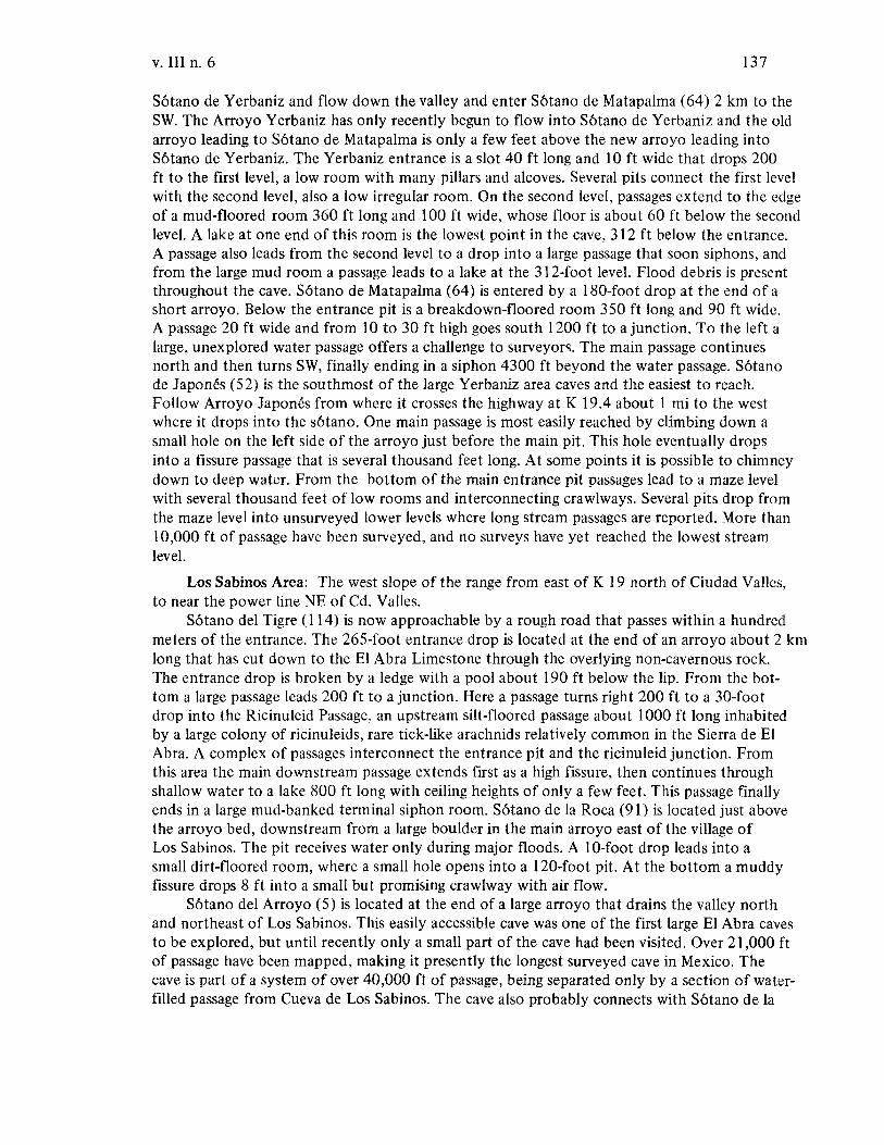
v. III n. 6 137
S6tano de Yerbaniz and flow down the valley and enter S6tano de Matapalma (64) 2 km to theSW. The Arroyo Yerbaniz has only recently begun to flow into S6tano de Yerbaniz and the oldarroyo leading to S6tano de Matapalma is only a few feet above the new arroyo leading intoS6tano de Yerbaniz. The Yerbaniz entrance is a slot 40 ft long and 10ft wide that drops 200ft to the first level, a low room with many pillars and alcoves. Several pits connect the first levelwith the second level, also a low irregular room. On the second level, passages extend to the edgeof a mud-floored room 360 ft long and 100 ft wide, whose floor is about 60 ft below the secondlevel. A lake at one end of this room is the lowest point in the cave, 312 ft below the entrance.A passage also leads from the second level to a drop into a large passage that soon siphons, andfrom the large mud room a passage leads to a lake at the 3l2-foot level. Flood debris is presentthroughout the cave. S6tano de Matapalma (64) is entered by a l80-foot drop at the end of ashort arroyo. Below the entrance pit is a breakdown-floored room 350 ft long and 90 ft wide.A passage 20 ft wide and from 10 to 30 ft high goes south 1200 ft to a junction. To the left alarge, unexplored water passage offers a challenge to surveyors. The main passage continuesnorth and then turns SW, finally ending in a siphon 4300 ft beyond the water passage. S6tanode Japones (52) is the southmost of the large Yerbaniz area caves and the easiest to reach.Follow Arroyo Japones from where it crosses the highway at K 19.4 about 1 mi to the westwhere it drops into the s6tano. One main passage is most easily reached by climbing down asmall hole on the left side of the arroyo just before the main pit. This hole eventually dropsinto a fissure passage that is several thousand feet long. At some points it is possible to chimneydown to deep water. From the bottom of the main entrance pit passages lead to a maze levelwith several thousand feet of low rooms and interconnecting crawlways. Several pits drop fromthe maze level into unsurveyed lower levels where long stream passages are reported. More than10,000 ft of passage have been surveyed, and no surveys have yet reached the lowest streamlevel.
Los Sabinos Area: The west slope of the range from east of K 19 north of Ciudad Valles,to near the power line NE of Cd. Valles.
S6tano del Tigre (114) is now approachable by a rough road that passes within a hundredmeters of the entrance. The 265-foot entrance drop is located at the end of an arroyo about 2 kmlong that has cut down to the El Abra Limestone through the overlying non-cavernous rock.The entrance drop is broken by a ledge with a pool about 190 ft below the lip. From the bottom a large passage leads 200 ft to a junction. Here a passage turns right 200 ft to a 30-footdrop into the Ricinuleid Passage, an upstream silt-floored passage about 1000 ft long inhabitedby a large colony of ricinuleids, rare tick-like arachnids relatively common in the Sierra de E1Abra. A complex of passages interconnect the entrance pit and the ricinuleid junction. Fromthis area the main downstream passage extends first as a high fissure, then continues throughshallow water to a lake 800 ft long with ceiling heights of only a few feet. This passage finallyends in a large mud-banked terminal siphon room. S6tano de la Roca (91) is located just abovethe arroyo bed, downstream from a large boulder in the main arroyo east of the village ofLos Sabinos. The pit receives water only during major floods. A 10-foot drop leads into asmall dirt-floored room, where a small hole opens into a 120-foot pit. At the bottom a muddyfissure drops 8 ft into a small but promising crawlway with air flow.
S6tano del Arroyo (5) is located at the end of a large arroyo that drains the valley northand northeast of Los Sabinos. This easily accessible cave was one of the first large El Abra cavesto be explored, but until recently only a small part of the cave had been visited. Over 21,000 ftof passage have been mapped, making it presently the longest surveyed cave in Mexico. Thecave is part of a system of over 40,000 ft of passage, being separated only by a section of waterfilled passage from Cueva de Los Sabinos. The cave also probably connects with S6tano de la
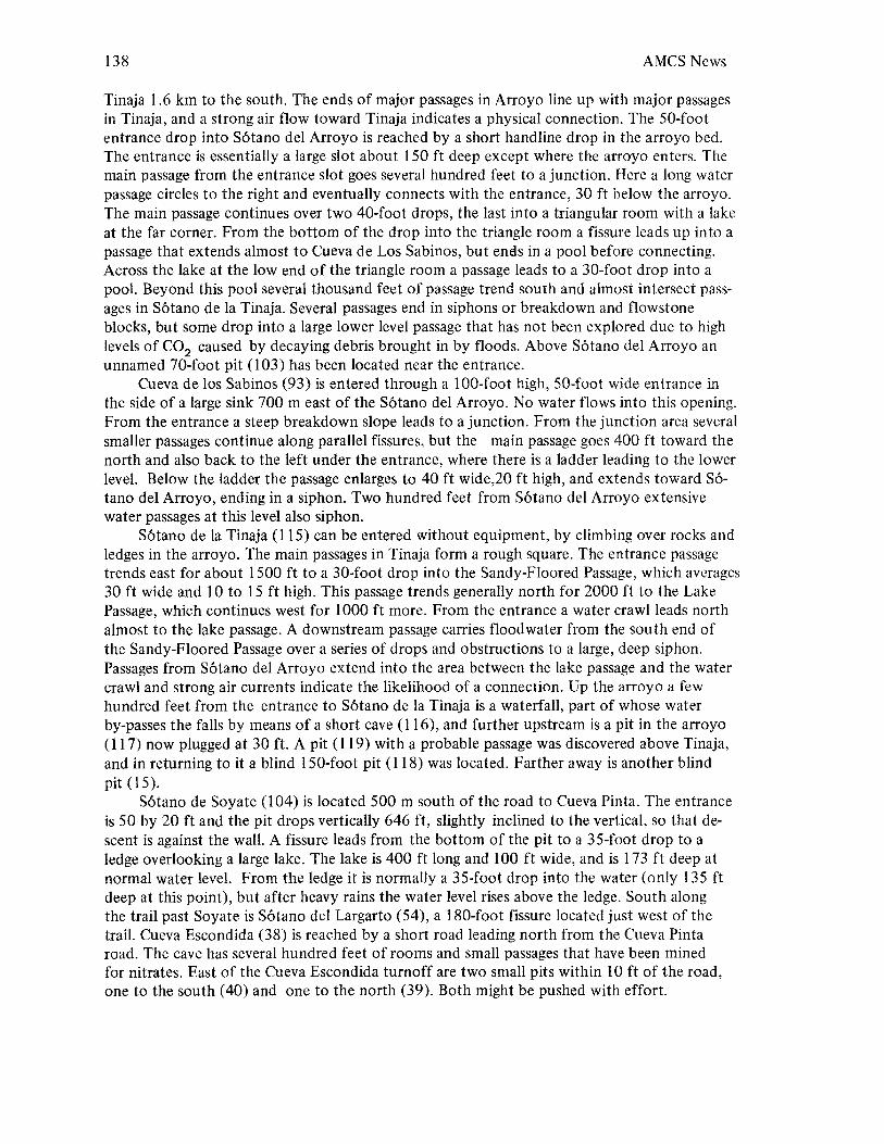
138 AMCS News
Tinaja 1.6 km to the south. The ends of major passages in Arroyo line up with major passagesin Tinaja, and a strong air flow toward Tinaja indicates a physical connection. The 50-footentrance drop into S6tano del Arroyo is reached by a short handline drop in the arroyo bed.The entrance is essentially a large slot about 150 ft deep except where the arroyo enters. Themain passage from the entrance slot goes several hundred feet to a junction. Here a long waterpassage circles to the right and eventually connects with the entrance, 30 ft below the arroyo.The main passage continues over two 40-foot drops, the last into a triangular room with a lakeat the far corner. From the bottom of the drop into the triangle room a fissure leads up into apassage that extends almost to Cueva de Los Sabinos, but ends in a pool before connecting.Across the lake at the low end of the triangle room a passage leads to a 30-foot drop into apool. Beyond this pool several thousand feet of passage trend south and almost intersect passages in S6tano de la Tinaja. Several passages end in siphons or breakdown and flowstoneblocks, but some drop into a large lower level passage that has not been explored due to highlevels of CO2 caused by decaying debris brought in by floods. Above S6tano del Arroyo anunnamed 70-foot pit (103) has been located near the entrance.
Cueva de los Sabinos (93) is entered through a 100-foot high, 50-foot wide entrance inthe side of a large sink 700 m east of the S6tano del Arroyo. No water flows into this opening.From the entrance a steep breakdown slope leads to a junction. From the junction area severalsmaller passages continue along parallel fissures, but the main passage goes 400 ft toward thenorth and also back to the left under the entrance, where there is a ladder leading to the lowerlevel. Below the ladder the passage enlarges to 40 ft wide,20 ft high, and extends toward S6tana del Arroyo, ending in a siphon. Two hundred feet from S6tano del Arroyo extensivewater passages at this level also siphon.
S6tano de la Tinaja (115) can be entered without equipment, by climbing over rocks andledges in the arroyo. The main passages in Tinaja form a rough square. The entrance passagetrends east for about 1500 ft to a 30-foot drop into the Sandy-Floored Passage, which averages30 ft wide and IOta 15 ft high. This passage trends generally north for 2000 ft to the LakePassage, which continues west for 1000 ft more. From the entrance a water crawl leads northalmost to the lake passage. A downstream passage carries floodwater from the south end ofthe Sandy-Floored Passage over a series of drops and obstructions to a large, deep siphon.Passages from S6tano del Arroyo extend into the area between the lake passage and the watercrawl and strong air currents indicate the likelihood of a connection. Up the arroyo a fewhundred feet from the entrance to S6tano de la Tinaja is a waterfall, part of whose waterby-passes the falls by means of a short cave (116), and further upstream is a pit in the arroyo(117) now plugged at 30 ft. A pit (119) with a probable passage was discovered above Tinaja,and in returning to it a blind 150-foot pit (118) was located. Farther away is another blindpit (15).
S6tano de Soyate (104) is located 500 m south of the road to Cueva Pinta. The entranceis 50 by 20 ft and the pit drops vertically 646 ft, slightly inclined to the vertical, so that descent is against the wall. A fissure leads from the bottom of the pit to a 35-foot drop to aledge overlooking a large lake. The lake is 400 ft long and 100 ft wide, and is 173 ft deep atnormal water level. From the ledge it is normally a 35-foot drop into the water (only 135 ftdeep at this point), but after heavy rains the water level rises above the ledge. South alongthe trail past Soyate is S6tano del Largarto (54), a 180-foot fissure located just west of thetrail. Cueva Escondida (38) is reached by a short road leading north from the Cueva Pintaroad. The cave has several hundred feet of rooms and small passages that have been minedfor nitrates. East of the Cueva Escondida turnoff are two small pits within 10ft of the road,one to the south (40) and one to the north (39). Both might be pushed with effort.
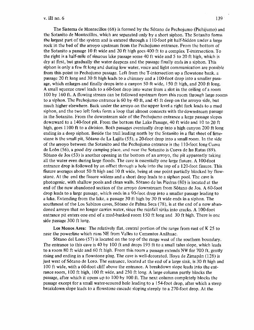
v. III no. 6 139
The Sistema de Montecillos (68) is formed by the S6tano de Pechojumo (Pichijumo) andthe Sotanito de Montecillos, which are separated only by a short siphon. The Sotanito formsthe largest part of the system and is entered through a 11 O-foot pit half-hidden under a largerock in the bed of the arroyo upstream from the Pechojumo entrance. From the bottom ofthe Sotanito a passage 10 ft wide and 20 ft high goes 400 ft to a complex T-intersection. Tothe right is a half-mile of sinuous lake passage some 40 ft wide and 5 to 20 ft high, which isdry at first, but gradually the water deepens and the passage finally ends in a siphon. Thissiphon is only a few ft long and during low water, voice and light communication are possiblefrom this point to Pechojumo passage. Left from the T-intersection up a flowstone bank, apassage 20 ft long and 30 ft high leads to a chimney and a 100-foot drop into a smaller passage, which enlarges and finally drops into a canyon 50 ft wide, 150 ft high, and 200 ft long.A small squeeze crawl leads to a 60-foot drop into water from a slot in the ceiling of a room100 by 160 ft. A flowing stream can be followed upstream from this room through large roomsto a siphon. The Pechojumo entrance is 60 by 40 ft, and 45 ft deep on the arroyo side, butmuch higher elsewhere. Back under the arroyo on the upper level a right fork leads to a mudsiphon, and the two left forks form a loop that almost connects with the downstream passagein the Sotanito. From the downstream side of the Pechojumo entrance a large passage slopesdownward to a 140-foot pit. From the bottom the Lake Passage, 40 ft wide and 10 to 20 fthigh, goes 1100 ft to a division. Both passages eventually drop into a high canyon 200 ft longending in a deep siphon. Beside the trail leading north by the Sotanito in a flat sheet of limestone is the small pit, S6tano de La Lajita (55), a 20-foot drop into a small room. In the sideof the arroyo between the Sotanito and the Pechojumo entrance is the 11 O-foot long Cuevade Le6n (56), a good dry camping place, and near the Sotanito is Cueva de las Ratas (89).S6tano de Jos (53) is another opening in the bottom of an arroyo, the pit apparently takingall the water even during large floods. The cave is essentially one large fissure. A 100-footentrance drop is followed by an offset through a hole into the top of a 120-foot fissure. Thisfissure averages about 50 ft high and 10ft wide, being at one point partially blocked by flowstone. At the end the fissure widens and a short drop leads to a siphon pool. The cave isphotogenic, with shallow pools and clean walls. S6tano de las Piedras (80) is located at theend of the now abandoned section of the arroyo downstream from S6tano de Jos. A 60-footdrop leads to a large passage, which ends in a 90-foot drop into a smaller passage leading toa lake. Extending from the lake, a passage 30 ft high by 30 ft wide ends in a siphon. Thesouthmost of the Los Sabinos caves, S6tano de Palma Seca (78), is at the end of a now abandoned arroyo that no longer carries water, since the rainfall sinks into cracks. A 100-footentrance pit enters one end of a mud-banked room 150 ft long and 30 ft high. There is oneside passage 300 ft long.
Los Monos Area: The relatively flat, central portion of the range from east of K 25 tonear the powerline which runs NE from Valles to Cementos Anahuac.
S6tano del Loro (57) is located on the top of the range west of the southern boundary.The entrance to this cave is 40 by 100 ft and drops 195 ft to a small talus slope, which leadsto a room 80 ft wide and 60 ft high. From this room a passage extends NW for 700 ft, gentlyrising and ending in a flowstone plug. The cave is well-decorated. Hoya de Zimap{m (128) isjust west of S6tano de Loro. The entrance, located at the end of a large sink, is 30 ft high and100 ft wide, with a 60-foot cliff above the entrance. A breakdown slope leads into the entrance room, 100 ft high, 100 ft wide, and 250 ft long. A large column partly blocks thepassage, after which it opens up to 100 by 100 ft. The next column completely blocks thepassage except for a small water-scoured hole leading to a 154-foot drop, after which a steepbreakdown slope leads to a flowstone cascade sloping steeply to a 270-foot drop. At the
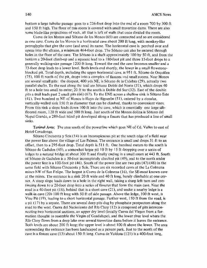
140 AMCS News
bottom a large tubular passage goes to a 226-foot drop into the end of a room 700 by 300 ftand 150 ft high. The floor of this room is covered with small travertine dams. There are alsosome blade-like projections of rock, all that is left of walls that once divided the room.
Cueva de los Monos and S6tano de los Monos (65) are connected and so are consideredas one cave. Cueva de los Monos is a horizontal cave about 200 ft long, with monkey-likepetroglyphs that give the cave (and area) its name. The horizontal cave is perched over andopens into the s6tano, a minimum 464-foot drop. The S6tano can also be entered throughholes in the floor of the cave. The S6tano is a shaft approximately 100 by 50 ft, and from thebottom a 20-foot climb-up and a squeeze lead to a 180-foot pit and three IS-foot drops to agenerally walking-size passage 1200 ft long. Toward the end the cave becomes smaller and a73-foot drop leads to a lower level. Both levels end shortly, the lower in a small flowstoneblocked pit. Total depth, including the upper horizontal cave, is 951 ft. S6tano de Orqu{dea(75), 100 ft north of the pit, drops into a complex of fissures ~nd small rooms. Near Monosare several small pits: the deepest, 400 yds NE, is S6tano de la Culebra (29), actually twoparallel shafts. To the east along the trail are S6tano Doble del Norte (31), which drops 40ft to a hole too small to enter; 20 ft to the south is Doble del Sur (32). East of the doublepits a trail leads past 2 small pits (66) (67). To the ENE across a shallow sink is S6tano Este(41). Two hundred m NE of Monos is Hoya de Higuer6n (51), entered by a circular,vertically-walled sink 150 ft in diameter that can be climbed, thanks to convenient vines.From this sink a slope leads down 100 ft into the cave, which is essentially one large siltfloored room, 120 ft wide and 500 ft long. Just south of the Monos dolina is S6tano delNopal Grande, a 289-foot blind pit developed along a fissure that has produced a line of smallsinks.
Taninul Area: The area south of the powerline which goes NE of Cd. Valles to east ofHotel Covadonga.
S6tano Cincuenta y Seis (14) is an inconspicuous pit at the south edge of a field nearthe power line above the village of Las Palmas. The entrance is small and drops 31 ft to anoffset, then to a 295-foot drop. Total depth is 511 ft. One hundred meters to the south isS6tano de Gadsden (45), a somewhat larger pit 10ft by 15 ft dropping over a series ofledges to a natural bridge at about 300 ft and finally ending in a small room at 443 ft. Southof S6tano de Gadsden is a 30-foot incompletely checked pit (49), and to the north underthe power line is a 100-foot pit (46). South of the power line are two pits (47) (48) in thesame field with S6tano Cincuenta y Seis. There are six recorded caves at the La Colmenamines NW of San Felipe. The largest is Cueva de la Colmena (16), the SE-most known caveat the mines. The entrance is a sink 20 ft wide and 40 ft long, barely climbable at one corner. A steep slope leads down to a hole in the right wall, taking a sharp left tum and continuing down to a 20-foot drop into a series of fissures that form the main cave. Near theroad is a 40-foot pit (18), behind that is a short cave (21), and under a nearby ledge is awalk-in cave (20) 100 ft long with 50 ft of side passage. Above the ledge, 100 ft west, isVine Pit (19), leading to a short horizontal passage. Farther west, 150 ft from the road, isa pit (17) by a soyate. There are several deep pits dug by phosphate prospectors along theroad to the west. Cueva del Nacimiento del Rio Choy (12) is composed of pits interconnecting two horizontal sections, an upper dry level (locally Cueva del Virgen from a formation thought to resemble the Virgin of Guadalupe), and the lower river level where theRio Choy flows from a deep lake over several travertine dams before it leaves the entrance.Both levels are about 200 ft long; the upper level is about 100 ft above the lower. The areasurrounding the entrance has been landscaped as a private park. Just to the north of thecave is a fissure cave (13) about 150 ft long. Cueva de Valdosa (121) is a 400-foot long,

v. III no. 6 141
generally walking-size tunnel with some small side domes. The cave is located in the center of theEl Abra Pass and the entrance is visible north of the highway. Across the highway from Valdosais a small 30-foot pit (122). Cueva de Taninul n. 4 (110) is one of the speleologic sights of theEl Abra, as it is easily accessible by a path from the highway just west of the railroad tunnel. Nolights are needed to traverse the cave's 600 ft of passage, since numerous skylights light the way.Cueva de Mariposa (63) is a small cave across the highway. Cueva de Taninul n. 3 (109) has notbeen visited by AMCS members, but Bonet's map shows it to be composed of two passages: one30 m long with a skylight and the other 15 m long with a smaller skylight. This cave is about 1 kmsouth of Taninul n. 4. Taninul n. 2 (108) is about 300 ft north of Taninul n. 1 and 250 ft abovethe foot of the hill behind Hotel Taninul. Near the entrance a side passage trends north, but themain cave goes west and crosses a fissure 200 ft inside the cave. Taninul n. 1 (107) is directly behind the Hotel Taninul, only a few feet from the swimming pool and fed by a nearby sulphurspring. The entrance has been converted to a dance pavilion with tables and a bar. The unalteredportion is about 300 ft of small passage eventually becoming too small to traverse.
EI Pujal Area: The extreme southern portion of the range south of Hotel Covadonga to theend of the range at EI Pujal.
S6tano del Toro (120) is a small cave located east of La Caldera, consisting of a fissure atthe bottom of a shallow sink that drops 10ft to where water fills the fissure. Blind fish can beseen swimming by daylight. Two low crawlways extend south from the sink. Cueva Grande (50)is located 5 km north of EI Pujal on a brush-covered slope. The cave is divided into two parts:a crawlway about 500 ft long, and a larger 400-foot passage with two skylights. S6tano deManuel (62) is about 2 km north from Cueva Chica in a shallow arroyo: two passages lead fromthe base of a climbable IS-foot sink and total about 1000 ft. S6tano de Fer-de-Lance (42) islocated in brush about I km north of Cueva Chica and has not been entered due to the snakewhich gives it its name. Cueva Chica (10) is located at the end of a shallow arroyo 2 km N ofEI Pujal. In this cave the blind cave fish of the EI Abra were first discovered. From the entrancean almost horizontal passage 20 ft wide and 10 ft high leads south for 350 ft to a series of roomswith deep pools which extend 400 ft to a terminal siphon, lying at about the level of the riverat EI Pujal. There are also several incompletely explored crawlways along the west side of themain passage. A small sink about 300 m SE of Cueva Chica provides the entrance to a tortuouscrawlway (11) at least 300 ft long. The crawlway is difficult to traverse, but getting through thebreakdown at the entrance is even more difficult. A few hundred meters farther south are LasCuatas, the twin pits that both drop 90 ft to water. The entrances are about 20 ft apart in thebottom of a sink, but the northeasternmost (27) drops into one end of a breakdown-flooredpassage, while the other (26) is a blind pit. Two meters south of Las Cuatas is Cueva or S6tano(it is locally called both) del Mante (58), about 100 m N of where the range disappears underthe alluvium of the Rio Tampa6n. Cueva del Mante consists of a short passage sloping steeplydownward to a room 30 ft wide, 40 ft long, and 20 ft high, bordered with mud banks. A smallcrawlway, probably normally flooded, leads to another room of about the same size. A smallwater-filled passage continues. Pozo de EI Pujal (82) is a cave at the bottom of a shallow well(really an artificially covered sink) in an isolated hill of limestone on the east edge of El Pujal.The cave is essentially a low room; the well water is not recommended for drinking.
Tantobal Area: The isolated outcrop of limestone along highway 85 south of the R(oTampa6n between Santiaguillo and Tantobal.
Cueva del Nilo (69) is east of the highway just north of Santiaguillo; and water from thisshort stream passage is used for washing. On the hill just south of Santiaguillo is Cueva deTantobal (112). Here two sink entrances connect with a fissure. A 20-foot vampire bat guanocovered drop leads into the fissure, and smaller upper level passages also connect with the topof the fissure; other passages across the fissure are unreachable without climbing equipment.
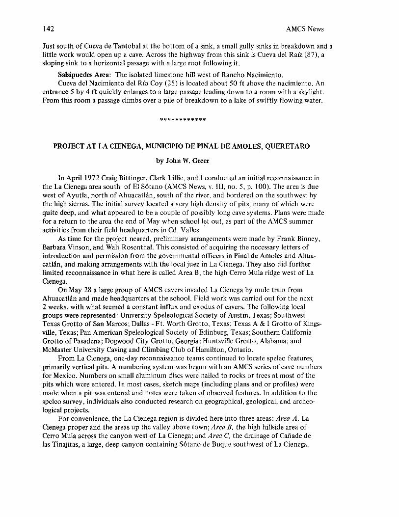
142 AMCS News
Just south of Cueva de Tantobal at the bottom of a sink, a small gully sinks in breakdown and alittle work would open up a cave. Across the highway from this sink is Cueva del RaIz (87), asloping sink to a horizontal passage with a large root following it.
Salsipuedes Area: The isolated limestone hill west of Rancho Nacimiento.Cueva del Nacimiento del RIo Coy (25) is located about 50 ft above the nacimiento. An
entrance 5 by 4 ft quickly enlarges to a large passage leading down to a room with a skylight.From this room a passage climbs over a pile of breakdown to a lake of swiftly flowing water.
************
PROJECT AT LA CIENEGA, MUNICIPIO DE PINAL DE AMOLES, QUERETARO
by John W. Greer
In April 1972 Craig Bittinger, Clark Lillie, and I conducted an initial reconnaissance inthe La Cienega area south of El S6tano (AMCS News, v. III, no. 5, p. 100). The area is duewest of Ayutla, north of Ahuacatllin, south of the river, and bordered on the southwest bythe high sierras. The initial survey located a very high density of pits, many of which werequite deep, and what appeared to be a couple of possibly long cave systems. Plans were madefor a return to the area the end of May when school let out, as part of the AMCS summeractivities from their field headquarters in Cd. Valles.
As time for the project neared, preliminary arrangements were made by Frank Binney,Barbara Vinson, and Walt Rosenthal. This consisted of acquiring the necessary letters ofintroduction and permission from the governmental officers in Pinal de Amoles and Ahuacatllin, and making arrangements with the local juez in La Cienega. They also did furtherlimited reconnaissance in what here is called Area B, the high Cerro Mula ridge west of LaCienega.
On May 28 a large group of AMCS cavers invaded La Cienega by mule train fromAhuacatllin and made headquarters at the school. Field work was carried out for the next2 weeks, with what seemed a constant influx and exodus of cavers. The following localgroups were represented: University Speleological Society of Austin, Texas; SouthwestTexas Grotto of San Marcos; Dallas - Ft. Worth Grotto, Texas; Texas A & I Grotto of Kingsville, Texas; Pan American Speleological Society of Edinburg, Texas; Southern CaliforniaGrotto of Pasadena; Dogwood City Grotto, Georgia; Huntsville Grotto, Alabama; andMcMaster University Caving and Climbing Club of Hamilton, Ontario.
From La Cienega, one-day reconnaissance teams continued to locate speleo features,primarily vertical pits. A numbering system was begun with an AMCS series of cave numbersfor Mexico. Numbers on small aluminum discs were nailed to rocks or trees at most of thepits which were entered. In most cases, sketch maps (including plans and or profiles) weremade when a pit was entered and notes were taken of observed features. In addition to thespeleo survey, individuals also conducted research on geographical, geological, and archeological projects.
For convenience, the La Cienega region is divided here into three areas: Area A. LaCienega proper and the areas up the valley above town; Area B, the high hillside area ofCerro Mula across the canyon west of La Cienega; and Area C. the drainage of Cafiade delas Tinajitas, a large, deep canyon containing S6tano de Buque southwest of La Cienega.

v. III no. 6 143
Following is a general summary of the findings in each area. Future reports will detailsuch subjects as pit exploration by the project, S6tano de Buque, geological notes, and archeological reconnaissance.
Area A (*entered)
AMCS No. Length Depth Description and Remarks
*1 ? 155 Pit (S6tano Tapado)*2 15 98 Pit*3 120 485 Pit (S6tano de Paila); entrance drop
470 ft.*19 ? 60 Pit*20 ? 50 Pit*21 ? 223 Pit*22 ? 90 Pit*23 225 0 Horizontal cave (Las Tranto)
50 ? 50 Pit? 100 Pit? 70+ Pit (S6tano de Lagunita)? 200+ Pit (S6tano del Raiza}), tapado? 125 Pit (S6tano de Ladera de Jose Espinosa)
Area B (*entered)
AMCSNo. Length Depth Description and Remarks*4 12 200 Pit (S6tano de Puerto Coyote)*5 20 120 Pit (S6tano de Pino)*6 ? 339 Pit (S6tano de El Pino)*7 50 35 Pit*8 20 120 Pit*9 175 116+ Cave with vertical drops (Joya del
Ranchito de la Mesa)*10 ? 80 Pit*11 15 120 Pit*12 40 50 Pit*13 10 132 Pit*14 50 55 Pit*15 55 490 Pit (S6tano de Callejon), entrance
drop 435 ft)*16 ? 240 Pit (S6tano de Bernal)
?? 175+ Pit
Note: Many other pits are located all over this hill. Many were visited on the initialand second reconnaissance trips, but they were not adequately recorded to beincluded here.

144
Area C. Speleo Summary (*entered)
AMCS No. Length Depth
*17 115 123*18 1549
*29 312+ 20*30 32 34
31 20+ 20+32 ? 30
*33 250 17734 ? 175+
*35 18 12*36 150 74*37 40 131*38 160 336
*51 54 4252 ? 2PO+53 ? 15+
? 30+? 60
*-- 40 ?? 80+? 150+? 175+? 100? 60
AMCS News
Description and Remarks
Cave with pit (Cueva Encantada)Long vertically oriented floodwater cave
(S6tano de Buque). Believed to bethe fourth deepest cave in Mexico.
CavePitPitPitHorizontal cave, dipping.PitPitPit with some passagePit (S6tano de Tinaja Verde)Large pit (S6tano de Mexo), entrance drop
275 ft.PitPitPitPitPitHorizontal cave, dippingPit (S6tano de Roble)Pit (S6tano Carbonera)Pit (Chiniyal n. 1)Pit (Chiniyal n. 2)Pit
Area C. Archeological Summary
1. Seven stone ruins, either individual houses or more complex groups.2. One probable stone tomb or walled entrance to a small horizontal cave.3. Several portions of old stone walls.4. Four nonvertical caves with pottery (two others were reported, one also with
human skeletons). Most apparently were used as water sources.5. Several rockshelters with pottery.6. One cave with a deep internal pit with pottery in the pit.7. A pit with lower passage containing several whole ceramic vessels - six jars and
one bowl.8. Deep freefall pit with charcoal and possible old torches in the bottom. An old stone
house is adjacent to this pit.9. Bedrock tinajas and old fields with surrounding pottery shards and obsidian flakes.
10. Mercury mine with ore suitable for red paint.

v. III no. 6
"LEAVE ONLY FOOTPRINTS"
by Ulises E. Victoria
145
"Take only pictures," this is one of two sentences that form a commandment recited bycertain young people on leaving a place they have just visited. In truth it is a "commandment"as we know it in the religious sense of the word, and it is above all an idea full of a philosophywhich we do teach, but which we have forgotten or perhaps never practiced.
The authors of this saying are a group of young people, students of the University ofTexas, with whom I was in contact on one of my last trips to the capital of Texas, the cityof Austin. They are dedicated to the exploration of caves, grottos, caverns, fissures, and cracksin the earth's surface. This enthusiasm is derived from two sources: interest in adventure andinterest in geology. They enjoy studying how the earth was formed and at the same time, livingin contact with nature in its impressive works of architecture, artwork, decoration and construction over millions of years, left there in a cave so that one day humans would come to rejoicetheir sight and spirit with the contemplation of such marvels. These young men are true naturalists. They are also hippies.
When they finish the exploration of a grotto or cave, on reaching the exit, ready to climbonce more into their vehicle and enter into ordinary daily life, they pause. As if they were takinginventory. They all check among themselves for the following: If they left any forgotten object,IF THEY LEFT GARBAGE OR RUBBISH, or cans, or anything else not part of the naturalsetting of the place. On ascertaining that all is in order, then they say, "We leave only footprints."
Then comes the other part of the saying, likewise of great importance. We all are given totaking with us some memento of whatever place we visit and if we enter a cave, well then, wesee an opportunity of taking with us a stalactite (those which grow from the roof downward)or stalagmite (those which grow from the floor up). The fact is that these young people seein a cave a species of temple full of natural relics which deserve all our respect. We may touchthem, caress them, look at them, photograph them, BUT NOT DESTROY THEM. There theywere placed by Nature, and there they should stay. This is the other thought they have at theexit, and it is then they say, "WE TAKE ONLY PHOTOGRAPHS."
How much learning in these two phrases! All of us, the clean ones, we who bathe daily,we go to a forest and we leave it inundated with paper, trash, etc. The same thing happens atthe beach, in the country, at the riverside, and in whatever place we visit on excursions. Ah,I forgot: we go to the cinema and fill the floor with bits of paper, boxes, package wrappings,cigarettes, etc. When we go to a cave, we leave all the junk we have extra or that gets in ourway, while THE HIPPIES LEAVE ONLY FOOTPRINTS. And there is more against us: thisstupid custom of putting our names on the walls of such places, leaving proof that we werethere. In our majestic Sierra de Chipinque, there are many true natural monuments or worksof art. But on them are the names and dates of Miss and Mr. So-and-so that happened to bethere one day. These people bathe daily, but leave their names there, while the hippies haveleft only their footprints. Frequently I cross Loma Larga by the highway that goes to Chipinque. There one finds an excellent natural book about how the hills and mountains wereformed. It is an excellent view for the geologist and the tourist. But the fact is that politicalparties always have painted all over it with their useless propaganda. This lesson of the hippiesgoes for them, too.
In the "residential" section of Colinia del Valle, one always finds broken glass thrownin the streets. One night, I was walking in one of these streets BECAUSE THERE AREPRACTICALLY NO SIDEWALKS (nor lighting). (For this reason the quotation marks andthe interrogative sense to the word "residential.") I was walking, I repeat, and there passed

146 AMes News
close to me a truck full of young men and women (presumably of those which we call GOOD)and their amusement was to go along throwing out empty soft drink bottles to watch themexplode. Here is the explanation of that ever-present glass. I stood watching these "good"kids who had bathed this morning and would do so the next morning and mentally I alsosaw a truck full of hippie kids who passed through the same street and THEY LEFT ONLYFOOTPRINTS.
Personally I don't agree with hippies. But we ought to remember that it was they wholit the fuse on the question of atmospheric pollution and awoke the world to the dangerousproblem of environmental pollution in general. Or it may be that these citizens, in their roleof true naturalists, wish to defend all nature. But the fact is that now they have given usanother lesson and a very good one: we should avoid littering and conserve the beauties ofnature.
I believe that some newspaper, some institution or the government itself should initiate a campaign which would be of greatest benefit for all of us based on these two phrases:"WE LEAVE ONLY FOOTPRINTS; WE TAKE ONLY PHOTOGRAPHS."
v. III no. 6
~Por~tnir Viernes 18 de Junio de 1971.-2-B
Deiamos 5610las Huellas
Ulises E. Victoria"Sacamos s610 fotografias". Estas dos frases forman
una oracion que dicen unos muchachos al abandonar unIugar que acaban de visitar.- Realmente es una "oracion"como 10 conocemos desde e1 punta de vista religioso yes,sobre todo, un pensamiento lleno de filosofia que nosenseiia a1go que tenemos olvidado 0 que quizas nuncahemos practicado.
Los autores de esa oracion, son un grupo de muchachosestudiantes de la Universidad de Texas, con quienesestuve en contacto en alguno de mis liltimos viajes a laCapital de Texas, la Ciudad de Austin.- Ellos son unosentusiastas de la exp10racion de grutas, cuevas, cabernas, grietas y fallas de la corteza terrestre. Estaafici6n les viene por dos lados: por la ventura y por elinteres en cuestiones geoI6gicas.- Les gusta estudiarcomo fue que se formo nuestra Tierra y a la vez vivir encontacto con 1a naturaleza en sus formidables trabajos dearquitectura, orfebreria, decoracion y construccion a 10largo de millones de anos, dejados am en alguna cuevapara que un dia vinieramos los humanos a regocijarnuestra vista y nuestro espiritu con la contemplaci6n deesas maravillas.- Esos muchachos son unos naturalistasconsumados.- Ademas, son hippies.
Cuando terminaron 1a exploracion de una cueva, 0gruta, al llegar a la salida para tomar de nuevo su vehiculo e incorporarse a la vida diaria, hacen una pausa.Como si hicieran un balance. Checan todos entre si losaspectos siguientes: Si dejaron 0 no algful objeto 01vidado. SI DEJARON BASURA 0 DESPERDICIOS, 0envases 0 cualquiera otra cosa que no estaba en formanatural en aquellugar.- AI comprobar que todo esta enorden, es cuando dicen: "Dejemos solo las huellas".
Viene despues 1a segunda parte y de suma importanciatambien. Todos somos muy dados a llevarnos algo derecuerdo de cua1quier lugar que visitemos y si entramos auna gruta, pues veremos la manera de sacar con nosotrosalguna estalactita (las que crecen del techo hacia abajo)o una estalagmita, (las que crecen del suelo hacia arriba).- Es e1 caso que estos muchachos yen en una grutauna especie de temp10 lleno de reliquias naturales quemerecen todo nuestro respeto. Podemos tocarlas,acariciarlas, verlas, fotografiarlas, PERO NO DESTRUIRLAS.- Ahi fueron hechas por la naturaleza yahideben quedarse.- Esta es la otra reflexion que hacen a lasalida y es cuando dicen:
147
"SACAMOS SOLO FOTOGRAFIAS".iCuanta enseftanza en esas dos frases! Todos nosotros,
los limpios, los que nos banamos a diario, vamos a unbosque y 10 dejamos inundado de papeles, desperdicios,etc.- Igual sucede en la playa, en e1 campo, en e1 rio y encuanto 1ugar a que vayamos de excursion.- jAh!. Se meolvidaba: vamos a1 cine y llenamos e1 piso de pape1es,cajas, envolturas, ~igarrillos etc. Cuando Vllmos a unacueva, dejamos tooo 10 que nos sobre 0 nos estorbe,MIENTRAS LOS HIPPIES DEJARON SOLO LASHUELLAS.- Y hay mas en contra nuestra: esa estupidacostumbre de poner nuestros nombres en las paredes deesos 1ugares. EL DEJAR ahi constancia de que estuvimos.- En nuestra majestuosa Sierra de Chipinque,hay mas de un verdadero monumento u obra de artenatural. Pues am estan los nombres fie.fieAaB del fulanitoy 1a fulanita que tal dia estuvieron am. Estos "fulanitos"se bafian a diario, pero dejaron ahi sus nombres, mientraslos hippies hubieran dejado solo sus huellas. Confrecuencia cruzo la Lorna Larga por la carretera hadaChipinque. Am se encuentra un excelente libro natural decomo fue que se formaron las lomas y los cerros. Es unaexcelente vista para el geologo y para el turista. Pero esel caso que los partidos politicos siempre 10 han pintarrajeado con su INUTIL propaganda.- Para ellos vatambien esa enseftanza de los Hippies.En la "Residencial" Colonia del Valle, stempre en
cuentra uno vidrios tirados en las calles. Una noche,caminaba yo por una de las calles PORQUE CASI NOHAY BANQUETAS (Tampoco hay alumbrado. Por esolas camillas y la interrogaci6n a 10 "residencial"). Caminaba, repito, y pas6 junto ami una camioneta llena deuchachos y muchachas (supuestamente de los que llamamos BIEN) y su diversi6n era ir tirando botellas de refrescos vacios para que explotaran. Ahi esta la explkaci6n de los siempre presentes vidrios. Me quedeviendo a esos "muchachos bien" que se habian baftadoesa manana y 10 harian a la maftana siguiente y mentalmente vi tambien a una camioneta llena de muchachosy muchachas hippies que pasaban por la misma calle yDEJABAN SOLO SUS HUELLAS.
Personalmente yo no estoy de acuerdo con los hippies.Pero debemos recordar que fueron e110s quienes prendieron la mecha en la cuestion de la contaminationatmosterica e hicieron despertar a todo mundo sobre elpeligroso problema de la contaminacion ambiental engeneral. 0 sea que estos ciudadanos, en su caracter denaturalistas consumados, quieren defender todo 10 natural.- Pues es el caso que ahora nos han dado otra leccionymuy buena: Debemos evitar el problema de la basura ydebemos conservar las bellezas naturales.
Creo que algful periodico, alguna Institucion 0 el propioGobierno deberia iniciar una campana que seria de sumobeneficio para la colectividad, basada en esas dos selltencias: "DEJAMOS SOLO LAS HUELLAS. SACAMOSSOLO FOTOGRAFIAS.


Index for the Association for Mexican Cave Studies Newsletter, Vol. ill
Abernathy, Miles 39,40,48Abra, C. de E1 (Tamps.) 40, 96,124, 129, 135aerial photography 7Agua,"C. del (Qro.) 61,129Aguacate n. 1, C. de Joya de (Tamps.) 129Aguacat~ n. 2, C. de Joya de (Tamps.) 129Aguila delOro, C. de (N.L.) 2,33Aguila, S.de (Qro.) 46Ahuacatlan. Qro. 41,45,47,62,71,93Ahuacatlan, Sotanito de (Qro.) 46,47,61-63,93Alcomunga, Oax. 64Alexander, Ed 23,32Alton, Pam 44, 64Anomiopsyllus traubi 9Anticlino, S. del (N.L.) 96Aquism6n, S.L.P. 15, 16arachnids 9Arriega, Luis 101Arroyo Seco, C. del (S.L.P.) 135Arroyo, S. del (S.L.P.) 54, 129, 132, 137arthropods 11Ashe, Bill 83Atkins, Donna 96, 106, 107Ayutla, Qro. 100, 107
Balaam Canche, C. de (Yuc.) 9Barrera, Carlos 120Barretal, El, Tamps.. 98Barro, Rancho El, Qro. 92, 100, 107Bassett, John 39,50bats 9, 10Belen, C. de (Hgo.) 9Bell, Bill 23, 32,42,43Bernal, S. del (Qro.) 101,103,143Bills, Sandra 64Binney~ Frank 49,50,97,106,107,142biology, bibliography -9Bittinger, Craig 39,44,50,51,56,64,68, 74, 93,
96,100,106, 107,142Bittinger, Steve 39,50,51,64,68,96,97,106,
107, 123Boca, C. de La (N.L.) 10,40Booth, Richard 42Brison, Dave 23,32Broadus, Jerry 42, 43Broussard, Don 39,42,47-50,63,64,68,118,123Brown, Roy 40Buen Abrigo, C. del (Coah.) 10Bulletin I 1, 13Bulletin II 17Bundrant, Luther 76
Buque, S. de El (Qro.) 89,142-144Burnett, Bob 23, 32, 42, 43Caballo Moro, S. de (Tamps.) 25Cacahuamilpa, Grutas de (Gro.) 41Caldera, The (Tamps.) 68,129,135,141Callej6n, Hoya (S.) de (Qro.) 101, 103, 143Cameron, Laurie 23,32Cominos de Mexico 8, 27Campana, C. de la (Tamps.) 129, 135
see also Pach6n, C. de ElCampbell, Scott 45Canoas, S. de (Qro.) 62Canon de Bustamante, N.L. 65,67,98Capilla, C. de la (Tamps.) 126, 129
f/Caracol, S. del (Tamps.) 122: Carbo Cave (Son.) 11I Carbonera, S. (Qro.) 144i Carlisle, Joe 38i Carrizal, Gruta de (N.L.) 75·88, map 81, 118, Carroza, C. de (Yuc.) 11 811 rJ -'\-{;aEtab[aooftttl,'Tamps.~121~ c Ak Ii CHt:L
Cartognlficb Militar de Mexico, Dept. 7Casa Blanca, C. de (N.L.) 33cave rescue 115Ceiba, C. de la (S.L.P.) 40, 126, 129, 136Ceiba, La, area, S.L.P. 136Chabert, Claude 89Chamal, Tamps. 25Chapel, The, S.L.P. 67Chica, C. (S.L.P.) 129,141Chica de Arroyo Seco, C. (Tamps.) 135Chinacatera, C. la (Sin.) 9Chiniyal n. 1, S. (Qro.) 144Chiniyal n. 2, S. (Qro.) 144Choy, C. del Nac. del RIo (S.L.P.) 50, 140Christensen, Conway 77Christian, C. de (S.L.P.) 122Cienega, La, Qro. 101,142Cincuenta y Seis, S. (S.L.P.) 129,140Clapp, Leslie 47, 48, 49Cleaves, Arthur 62Clements, Jim 44, 64Cleveland, Chris 75-88Cojada, C. de la (Tamps.) 98Cole, John 15,32Cole, Sandy 15,32Collins, S. de (S.L.P.) 129Colmena, C. de la (S.L.P.) 129, 140Colmenas, C. de las (Tamps.) 26,129,134Comrnisi6n del Papaloapan 7Compania Mexicana Aerofoto 8

2
Comado, S. (Qro.) 100,102Constantin, C. de (N.L.) 44,56, map 57,120Contabanda, S6tanos de (Tamps.) 98Contigo, S. (Tamps.) 122Cooper, Rich 47Cotterman, Lee 78,82Cox, Peggy 50Cox, Terry 50Coy, C. del Nac. del Rio (S.L.P.) 129Coyote, S. del (Qro.) 61Cuatas, Las (S.) (S.L.P.) 129,141Cuates, C. de las (S.L.P.) 126,129,136Cuddington, Bill 15,32Culebra, S. de la (S.L.P.) 129, 140Curl, Rane 76Curva, C. de la (S.L.P.) 129Davis, Jonathan 23,32Deane, Bill 15,32,40,97Dekneff, Dennis 83Dierick, Donna 44Doble del Norte, S. (S.L.P.) 129,140Doble del Sur, S. (S.L.P.) 129, 140Don Pedro, S. de (Tamps.) 129drowning 76-88, 118Duncan, Paul 39,44,64,68dynamiting 42earthworms 10Elliott, Bill 59, 75, 84,97El Vado, Oax. 70Encantada, C. (Qro.) 144Escalera, S' de la (S.L.P.) 130Escondida, C. (S.L.P.) 138Escondido, S. (Tamps.) 129Espana, C. de (Dgo.) 10Espinazo, N.L. 44,56,120Este, S. del (S.L.P.) 130, 140Evans, Janie 24Evans, T.R. 15, 24, 32Everage, Jon 75,98Fer-de-Lance, S. del (S.L.P.) 130, 132, 141Ferret, T.C. 64Ferrocarril, S. del (S.L.P.) 130Fieseler, Billie 98Fieseler, Ronnie 75,84,98, 118fish, blind, cave 40, 120, 121, 141Fish, John 3,23,32,63,64,68,106,107, 118fleas 9,49Florida, C. de La (Tamps.) 35, 130, 134Florida, La, Qro. 100F6siles, C. de los (Tamps.) 130, 134Fromen, Charles 98Fuente, Manuel 83Fugate, Randy 124
Gadsden, S. de (S.L.P.) 130, 140Galion, Jodine 120Garda, Gruta de (N.L.) 120Gardner, Mr. 78,80,82Garza, Ernie 49,50,68Gavia, La, Area, Tamps.-S.L.P. 135Gavilctn, Pozo de (N.L.) 40,44Georgia Underground 38Ginney, Frank
see Binney, FrankGolondrinas, S. de las (S.L.P.) 1,15-18,32-35,38Gonzales, Ram6n 94,100,107Gordon, Ken 95Grande, C. (S.L.P.) 130,141Grande de Arroyo Seco, C. (Tamps.) 135Graves, John 124Greer, John 100, 142Greer, Sherry 42Guaguas, Hoya de las (S.L.P.) 18,32Guano, C. del (S.L.P.) 130Gutierrez, Dario 83hair, removal 74Hale, Dan 15,32Handford, Robert 47,48,50,68Harden, Scott 124Harrison, Blake 42,43,45,47,48,56,64, 71,
106, 107, 122Hembry, Louis 24Hemperley, Robert 122Henry, Bob 124Hess, Jack 115Heuss, Keith 38,45,61,62,71,122Higuer6n, Hoya de (S.L.P.) 130, 140Hondo Rescue 115Honea, Ann 47,49Honea, David 38,41-43,64,68,70,106,107Huautla,Oax. 3,8, 13,23Hubbard, Brad 44, 56Hugill, Bob 15,32-Huitzmolotitla, S. de (S.L.P.) 35,122,124Jabali, C. del (S.L.P.) 130Jackson, Dave 47Jagnow, Dave 114,115Jalapa de D(az, Oax. 8Jalpan, C. del Rib (Qro.) 40Jalponts, S. de (S.L.P.) 89,130,136Jameson, Roy 42,47-50.56. 106, 107Johnson. Alan 38Johnson, Dan 64Johnson, David 64,95,98Johnson, Kenny 95Jones, Jeri 122Jos, S. de (S.L.P.) 63.67,130. 139

Joya, S. de la (S.L.P.) 67Joya de Salas, S. de la (Tamps.) 4143jungle: being lost 50jungle: chopping 40, 67Just, Paulette 42Kelly, Mary Ann 95Kostyo, Joe 120Knapp, Grayson 45Knox, Orion, Jr. 23,32Kunath, Carl 76, 84Ladera de Jose Espinosa, S. de (Qro.) 143Lagarto, S. del (S.L.P.) 96, 130, 138Lagunita, S. de (Qro.) 143Laidlaw, Kenneth 76Lajita, S. de la (S. L.P.) 139La Laja, S.L.P. 16Le6n,C.del(S.L.P.) 39,139Leucohya heteropoda 9Leucohyinae 9Lewis, Jan 56, 96, 106, 107Lewis, Squire 15,32Lienzo, C. del (S.L.P.) 121Lillie, Clark 64, 100, 142Lindsey, Jerry 78,83Loros (or Loro), S. de los (S.L.P.) 40,44,50, 139Lucas, Ann 68, 70Luker, Sandi 122Lundelius, Dr. E. 48Macho Rey, S. de (Qro.) 46,63,71Macmillan, Roger 44Mante, S. del (S.L.P.) 141Manuel, S. de (S.L.P.) 141maps: Abra, La Region de fa Sierra de El 127
Carrizal, La Gruta de, Bano Caliente 81Constantine, C. de 57Mexico, physiographic divisions 29
Mariposa, C. de (S.L.P.) 141Martin, Stewart 124Matapalma, S. de (S.L.P.) 137Matehuala, C. de (S.L.P.) 33Mayner, Ralph 45McCarty, Don 44McCreary, Ruth 44McGarrigle, Tommy 23, 32McKenzie, David 69,97,120Mclean, John 76McMillan, Roger 124McNatt, Logan 40,42,45,93, 106, 107Mesa, C. de la (Qro.) 61Mexico, maps 7, 8, 29Mexico, Physiographic Divisions of 27Mexo, S. del (Qro.) 144Micos, S.L.P. 48, 67, 120
3
Mikels, John 64,95,98,120millipedes 10Minas Viejas, S.L.P. 121Mine Cave (Tamps.) 33Minton, Mark 39, 50, 51Misioneros, C. de los (Tamps.) 25Mitchell, Dr. Robert 59,97Moerbe, Stanley 61,62, 122Molino, S. de EI (Tamps.) 40Monos, C. de los (S.L.P.) 49,50,69, 140
see also Monos, S. de losMonos, S. de los (S.L.P.) 50,67,68, 140
see also Monos, C. de losMonos, Los, Area, S.L.P. 139-140Monte Cristo, Tamps. 121Montecillos, S. de (S.L.P.) 39,48,54,59, 132, 139Montecillos, Sistema de (S.L.P.) 39,54,67,96, 132,
139Montecillos, Sotanito de (S.L.P.) 139Montoya, Sr. and Sra. 93Moore, Mike 39Mora, S. de la (Qro.) 100,102Morales, Nick 95,98, 120lvtormoops megalophylla megalophylla 10Morris, Dottie 64Morris, George 38Morris, Neal 39,42,44,56,64Morse, Jon 15,32Moya, Javier Ferros 100
Mroczkowski, Donna 77Muhaut, C. de (S.L.P.) 34Muth, John 42M,votis thysanodes aztecus 10Nacimiento:
de Arroyo Seco 39del Rio Choy 50,67de La Florida 24del Rio Frio 24del Rio Huichihuayan 45, 60del Rio Mante 133EI Nacimiento 24de San Rafael de los Castros 133de Santa Clara 68del RiO Tantoan 39
names, cave 116,129,142Naranjo, Qro. 101Natalus mexicanus saturatus 10National Cave Diving Assoc. 77Nicholas, Kiki 42,45Nicki 42Nicolas, C. de San (Tamps.) 135Nilo, C. del (S.L.P.) 141Nogales, La Joya de Los (camping area at EI Satano),

4
Qro. 111Nopal Grande, S. del (S.L.P.) 140Noria, La, Area, Tamps. 135-136Noria, S. de la (Tamps.) 136Oaxaca, Oax. 70Ochtalja, C. de (S.L.P.) 18, photo 20, 32Orthoporus Idemi 10Otates, C. de (S.L.P.) 121Pach6n, C. del (Tamps.) 10,33,135Padgett, Mike 95,98Paila, S. de la (Qro.) 101,103,143Pa:jaros, C. de los (Tamps.) 135Palma Seca, S. de (S.L.P.) 139Pahnito, Gruta del (N.L.) 9, 53,80Parajapyx mexicanus IIPate, Dale 45,61,62,71,122Perro Muerto, C. del (Qro.) 101, 103petroglyphs 50Phillips, Tommy 76phosphates 99photographs: Aquism6n-Tamapatz trail 21 (upper)
conservation 90Ochtalja, C. de 20 (lower)Ochtalja, Hoya 20 (upper)rain no. 5 (inside cover)San Agustm, S. de, expedition to 22San Agustin, S. de, entrance to 4S6tano, El, entrance to 108-109S6tano, El, expedition to 106S6tano, El 92Tamapatz 21 (lower)Tamapatz, haystick hills near 19 (lower)Tamapatz, south from 19 (upper)
physiographic divisions of Mexico 27-31Piehijumo, S. de (S.L.P.) 39,48,54,59,67,96,
132, 139Piedras, S. de las (S.L.P.) 139Pino, S. de (Qro.) 143Pino, S.de El (Qro;) 143Pinta, C. (S.L.P.) 45,49-51,138Pittman, Blair 79Plecotus townsendii australis 10Plemons, Terry 3,32Porter, Diana 45Power, Louise 79Presa Miguel Aleman, Oax. (lake) 8Prieto, Alejandro 133pseudoseorpions 9, 10Pteronotus psi/otis 9publication policy 14Puente, Gruta de El (Tamps.) 34Puente, S. de EI (Tamps.) 34
Puente de Dios, C. del (Qro.)Puerto Coyote, S. de (Qro.) 143Puerto Cudisia, S. del (Qro.) 100, 102Puerto de las Animas, Qro. 63Pujal, El, Area, S.L.P. 141Pujal, Pozo de El (S.L.P.) 141Quilas, S. de las (S.L.P.) 136Quintero, Area, Tamps. 133-135Quintero, Grutas de (Tamps.) 33,48, 134rack, rappel 17Raines, Terry 23,32,40,42,43,47,62,96, 106,
107Rak, C. del (S.L.P.) 142Rak, S. de la (S.L.P.) 136Raizal, S. del (Qro.) 143Ralph, Ron 3, 32Ram6n
see Gonzales, Ram6nRanchito de la Mesa, Joya del (Qro.) 143Rancho Nuevo, C. de (Chis.) 124Ratas, C. de las (S.L.P.) 39, 139Reddell, James 9,97rescue, cave 75, 113, 115Riachuelo Area, Tamps. 133Riachuel0, C. de (Tamps.) 133ricinuleids 34Rigg, Rick 113Rimkus, Tommy 47Rincon, S. de (Qro.) 62Rio Iglesia, S. de (Oax.) 35Rio Mante, C. del Nac. del (Tamps.) 133Rio Subtemineo, C. del (S.L.P.) 120Riscos, C. de los (pue.) 41,61Roberts, Curtis 44Robinson, Norman 76Robinson, Sandy 47, 49Roble, S. de (Qro.) 144Rodemaker, Jim 45,47Rodemaker, Julie 45, 47Rogers, Buddy 39Rojo, S. (Tamps.) 122Rosenthal, Walt 142Rossburg, Ron 24, 42Roy, Kathy 123Roy, Skip 123Russell, B.B. 95,120Russell, Carol 24,69, 70, 97Russell, William 7,24,27, SO, 59, 69, 70, 97,120,
126Sabaca, C. de (Vue.) 9Sabinos, C. de Los (S.L.P.) 132, 137, 138Sabinos, Los, Area, S.L.P. 137-138

Sainsott, Craig 47,62,64,106,107Salitre, C. del (S.L.P.) 122Salsipuedes Area, S.L.P. 142San Agustm, Ou. 3San Agustm, S. de (Oax.) 3,4,13-14,23-24,32,35San Antonio, S. de (S.L.P.) 122San Bartolo, Grutas de (N.L.) 96San Isidro, S. de (S.L.P.) 34San Lazaro, C. de (Tamps.) 134San Miguel, C. de Nac. de (S.L.P.) 34San Rafael Area, Tamps. 133San Rafael, S. de (Tamps.) 133San Rafael de los Castros, C. del Nac. de (Tamps.)
133San Ricardo Area, S.L.P. 136San Sebastian (de los Fustes), Oax. 70San Sebastian (de los Fustes), Grutas de (Oax.) 70Sanchez, Elias 101Santa Elena, C. de (Tamps.) 135Santaxol, C. de (S.L.P.) 34Santiago, N.L. 8Schaecher, Gary 90scorpions 34Secretar{a de Recursos Hidratilicos (SRH) 8Segerstrom, Kenneth 63Sierra Tamalabe, La Gruta de la (C. del Puente)
(Tamps.) 95Silleta, S. de La (S.L.P.) 35Simo, Joe 62siphons 39-43,59,64,75,118,132Smith, Carolyn 120Smith, Richard M. 62snakes 49,63Solis, Tom 120Sotanito
see Ahuacatlan, Sotanito deS6tano, El (del Rancho Barro) (Qro.) 53,92,93,
100,107-109Southern Arizona Rescue Assoc. 76Soyate, S. de (S.L.P.) 63,67,96, 138spiders 10Steele, Bill 124Stone, Bruce 75-88Storey, James 76, 115Stoviak, Fred 44Strickland, Peter 106, 107Strutz, J. Carr 95Tamapatz, S.L.P. 17-19,21Tanchipa Area, S.L.P. 136Tanchipa, C. de (S.L.P.) 136Taninul Area (S.L.P.) 140-141Taninu1 n. 1, C. de (S.L.P.) 33,141Taninul n. 2, C. de (S.L.P.) 141
Taninul n. 3, C. de (S.L.P.) 141Taninul n. 4, C. de (S.L.P.) 48,122,141Tanque, S. del (Tamps.) 122Tantoan Area, Tamps-S.L.P. 135Tantobal Area, S.L.P. 141-142Tantobal, C. de (S.L.P.) 35, 141Tapado, S. (Qro.) 143Tarantula, S. de (Tamps.) 136Techo, Sandino 15,32Temple, David 98Teotitlan del Camino, Oax. 3Thren, Bob 23,32Tigre, S. del (S.L.P.) 34,40, 137Tinaja, S. de (S.L.P.) 64,118, 132,138Tinaja Verde, S. de (Qro.) 144Tlamaya, S. de (S.L.P.) 35Tonoltongo, Grutas de (Hgo.) 34topographic maps 7Toro, S. del (S.L.P.) 141Tracy, Tom 23,32Tranto, Las, Cave (Qro.) 103,143Tres Manantiales, C. de (Tamps.) 97Trichobius sphaeronotus 10, IIVachoniidae 9Vachonium boneti 9Vachonium maya 9Valdosa, C. de (S.L.P.) 140Vaught, Donna 40Venadito, S. de (Tamps.) 34,38,47,49,59,122
. Ventana Jabali, (S.L.P.) 59, 136Verde, C. (S.L.P.) 136Victoria, Hugo 42,47,96Victoria, Ulises E. 145, 147Vinson, Barbara 142Vinson, Jon 84Virgen, C. del (S.L.P.) 140Waddell, David 95Walker, Calvin 41,45Walsh, Mike 41,42,45,61,64,71,122Walters, Nancy 15,32Washington, Aubrey 120West, Sid 15:32Wiley, Suzanne 59Wilkens, Horst 120Wilson, Keith 40, 42, 43Worthington, Dave 83Woyate,
see Soyate, S. deWright, Tom 39,44,106, 107Xilitla, S.L.P. 16,60,67Yates, Charlie 40,61,62, 71Yeary, George 76Yerbaniz, Area, S.L.P. 136-137
5

6
Yerbaniz, S. de (S.L.P.) 136Youmans, Jim ·38Zimapan, Hoya de (S.L.P.) 40,44, 50, 126, 139Zorra, Puerto de la, Hgo. 123
Abbreviations Used:C.-CuevaNac. - NacimientoS. -S6tano
Copyright © 2022 FDOKUMEN