
monroe county drainage board
40
+ Attachment Included * Action Required to Approve/Deny Anyone who requires an auxiliary aid or service for effective communication, or a modification of policies or procedures to participate in a program, service, or activity of Monroe County, should contact Monroe County Title VI Coordinator Angie Purdie, (812)349-2550, [email protected], as soon as possible but no later than forty- eight (48) hours before the scheduled event. Individuals requiring special language services should, if possible, contact the Monroe County Government Title VI Coordinator at least seventy-two (72) hours prior to the date on which the services will be needed. The meeting is open to the public. MONROE COUNTY DRAINAGE BOARD Wednesday May 5, 2021 at 9:00 AM This meeting will be held via zoom. AGENDA I. Call to Order II. Approval of Minutes for: March 3 rd and 17 th , 2021 +* III. Old Business a. Monroe County Public Library SW Branch – Request for waiver of critical area release rates +* IV. New Business a. Dogwood Estates: Ornamental Dr. Private Property Berm + V. Staff Report VI. Public Input for Items not on the Agenda VII. Adjournment a. Date of Next Meeting: Wednesday June 2 nd , 2021 at 9:00 AM Zoom Meeting Information: https://monroecounty-in.zoom.us/j/82753473529?pwd=STdjUEg5V1BHcW1VRVpaS1dTYXhyQT09 Meeting ID: 827 5347 3529 Password: 152943 Dial by your location +1 312 626 6799 US (Chicago) 1
-
Upload
khangminh22 -
Category
Documents
-
view
1 -
download
0
Transcript of monroe county drainage board

+ Attachment Included * Action Required to Approve/Deny
Anyone who requires an auxiliary aid or service for effective communication, or a modification of policies or procedures to participate in a program, service, or activity of Monroe County, should contact Monroe County Title VI Coordinator Angie Purdie, (812)349-2550, [email protected], as soon as possible but no later than forty-eight (48) hours before the scheduled event. Individuals requiring special language services should, if possible, contact the Monroe County Government Title VI Coordinator at least seventy-two (72) hours prior to the date on which the services will be needed. The meeting is open to the public.
MONROE COUNTY DRAINAGE BOARD Wednesday May 5, 2021 at 9:00 AM This meeting will be held via zoom.
AGENDA
I. Call to Order II. Approval of Minutes for: March 3rd and 17th, 2021 +* III. Old Business
a. Monroe County Public Library SW Branch – Request for waiver of critical area release rates +*
IV. New Business a. Dogwood Estates: Ornamental Dr. Private Property Berm +
V. Staff Report VI. Public Input for Items not on the Agenda VII. Adjournment
a. Date of Next Meeting: Wednesday June 2nd, 2021 at 9:00 AM Zoom Meeting Information: https://monroecounty-in.zoom.us/j/82753473529?pwd=STdjUEg5V1BHcW1VRVpaS1dTYXhyQT09 Meeting ID: 827 5347 3529 Password: 152943 Dial by your location +1 312 626 6799 US (Chicago)
1

MEETING MINUTES MONROE COUNTY DRAINAGE BOARD
9:00 A.M., MARCH 3, 2021 Via Zoom App
MEMBERS PRESENT: Robert Autio (President), James Faber, Dee Owens, William Riggert, Trohn Enright-Randolph (ex officio) STAFF: Donna Barbrick (Secretary), Kelsey Thetonia (MS4 Coordinator), Technical Services OTHERS: Andy Knust, Christine Mathew, Marilyn Wood
I. CALL TO ORDER Robert Autio called the meeting to order at 9:00 a.m.
II. APPROVAL OF MINUTES FOR: February 3, 2021 +*
Autio stated he had a correction on page 1 of the draft minutes to change Clark Creek to Clear Creek and had a question about a zoning acronym on page 4. Dee Owens said it is a designation for residential zoning. James Faber motioned to approve and Owens seconded the motion. Autio took the vote by roll call: Autio AYE, Owens AYE, Riggert AYE, and Faber AYE. Motion carried unanimously and minutes approved with corrections.
III. OLD BUSINESS a. The Trails at Robertson Farm Subdivision (formerly White Oaks)
Kelsey Thetonia said we are expecting a vote today for the Planning department. She said we do have more information since our last meeting. She said Daniel Butler was here to represent the petitioner. She said I sent you all a copy of the wetlands delineation map. She said all of those wetlands are going to be avoided with this project and last night at the Plan Commission meeting there was a discussion of using that as an educational area, which I think is a wonderful idea. She said I’m willing to help with that, as well, if they want any ideas for content on any educational signage, if that helps. She said protecting all of that is a positive on my end. She said as far as stormwater management on site, they have two major drainage areas. She said stormwater on the northeast corner flows northeast that will be captured in one pond. She said the rest of the site flows south/southwest. She said there will be no new crossings under the trails and they are going to use existing culverts under the trails. She said I asked Daniel Butler to give us more information on the culverts and he was able to confirm that there are two existing pipes under the Clear Creek trail and they are able to show that those pipes can handle the runoff from the site. She said she received calculations from Daniel that showed there is adequate space for the ponds to hold the runoff in our more stringent release rates. She said she had not been able to look at those calculations yet but they have worked to show that it is a feasible plan. Owens said it may be feasible, but is it required. She said I’m concerned about the impervious area that is going to be created by 145 lots and the neighbors have remonstrated loudly about extra water coming towards them. She said I’d like to make sure that there are some conditions on this so those ponds are put in. Thetonia said the ponds are required under our local ordinance under state regulations. She said they are meeting stringent criteria that the DB put in place last year. She said they are capturing the water in these ponds and then releasing at a much, much slower rate.
2

Owens said I am not comfortable with passing this if the calculations are not to your liking. Thetonia displayed a set of calculations concerning pond size and cubic feet of storage that Butler had sent. She said I got these yesterday afternoon and I have not been able to go through them in detail but looking at the cubic feet of storage, it looks reasonable to me. Autio said we would like to give you the opportunity to verify the calculations and confirm that it is, in fact, reasonable. Autio asked a question about the Plan Commission meeting. Trohn Enright-Randolph said we have a meeting in March to discuss this. He said Dee Owens is the newest member of the Plan Commission. He said I think it may be helpful to have a concise overview of this project from Planning. Autio said I was thinking something similar, Trohn. Thetonia said I was hoping for a vote today on the preliminary drainage plan. Faber said I am concerned about the extreme density and the possibility of global warming contributing to increased rainfall coming down on this area. Thetonia said I would like to clarify that the DB is going to be looking at how they are managing the runoff from the site and managing stormwater on the site and whether it meets the requirements of the drainage ordinance. She said they are meeting the requirements and they are going above and beyond. Trohn said I do think that we should try to keep this in a timely matter with Plan Commission. Owens said I still have the same concerns. She said I do not think we have all the information. She said we have not heard from remonstrators yet. Riggert said Kelsey has what she needs for review and for projects like this we typically delegate that to the drainage engineer. He said if we are looking at the drainage aspects, there is nothing else that we can really do. He said I don’t know what other measures we can do from a drainage aspect. Owens said we can consider what is going on in the neighborhood. Thetonia said I do not think it is a reasonable expectation to have a full drainage plan approved before the plan is approved. She said Terry reviewed this and I have reviewed this. She said I would like for us to not stray too far from what DB needs to do. Autio asked if the other DB members were able to meet in two weeks to give her an opportunity to look over the calculations. William Riggert suggested a motion to continue this case until March 17, 2021 at 9:00 a.m. Faber seconded the motion. Vote by roll call: AUTIO AYE, FABER AYE, OWENS AYE, RIGGERT AYE. Motion carried unanimously. There was a discussion of having a presentation from the Planning side of things. Thetonia said usually if a project is presented to the Plan Commission prior to the DB you can also go to those meetings since they are open to the public.
IV. NEW BUSINESS a. Monroe County Public Library Southwest Branch
Thetonia said this is the first time that DB is seeing this project. She said this is for the new library by Bachelor Middle School, on West Gordon Pike at the point of Rogers Street. She said they have already gone through the process to get a new parcel of land just south of the middle school. She said we received our first preliminary drainage report and we’ve had discussions already. She said Terry and I met with Bill and Andy from Bledsoe Riggert Cooper James (BRCJ) to discuss the preliminary design and the requirements for this project, since it is located in one of the critical drainage areas. She said the engineers have expressed some concerns about the release rate requirements for the critical drainage area and whether they are going to be able to meet it with the constraints on the site. She said they are concerned with the amount of space they have and they say that they are constrained because they are trying to minimize their impact on the existing wooded area, the vegetated area on the north and east sides of the site. She said there were some intentional plantings in that area and there are those who are very concerned to preserve as much as possible so that decreases the footprint of the project. She said because of that decrease in the footprint the engineers are requesting that they not be held to that critical drainage area release rate. She said I know that this is coming in on that transition period when we approved
3
these release rates last October and now these projects already starting their development are caught in the middle concerning when did we actually draw the line on requiring these release rates to be met. She said so that is the conversation I would like you all to have. She said from my point of view, I would like every project to be held to these standards because that is what we had to do to protect the Clear Creek watershed. She said we have provisions in our ordinance that state that government projects are not exempt from these requirements but I also want to be sensitive to the fact that this project already has a fixed budget because of grant funding. She said they can probably explain that better than I can but that is the preliminary information that I have. Riggert commented that he would excuse himself for this portion of the meeting. Andy Knust spoke about the project on behalf of BRCJ as a drainage engineer. He talked about the new drainage ordinance being relatively new guidance. He said we began the planning process nearly two years ago, before the critical watershed flow rates were adopted. He said had we known that we were supposed to be aiming for those criteria, the whole planning process might have gone differently and it feels like it is late in the game to be shifting the requirements. He said Christine Matthew is the project architect and is on the call as well. Christine Matthew spoke. She said with regard to preservation of site, we are putting in a full garage underneath the building in order to preserve the site and also taking advantage of a sloped site condition. She said we are trying to be as responsive as possible to the existing site conditions and using them to the benefit of preservation of the site. Knust said we have a five-acre site and the project impacts 2.7 acres of it and the remaining 2.3 acres (roughly) would remain as a wooded site. He talked about the new stormwater technical standards and there being multiple criteria in play in the new ordinance. He said in a certain way they work against each other. He said one of the goals is to preserve existing wooded area but then if we add three times more detention volume than I have already designed into the stormwater system, then I think we would be forced to put in a surface detention pond, which would take up a significant footprint. He said we would need to triple the amount of detention storage on the site to hit that and that would force us into the wooded area. He said I think we could potentially increase the underground storage but it would be challenging to meet the .4 or .5 cfs per acre. He said from reading through the new stormwater technical standards for the general county in areas that are not critical watersheds, the target flow rate is 0.9 cfs per acre for a 100-year flood event and in that scenario, we would have to substantially increase but it would be a more reasonable target. He said considering the project was started long before the critical flow rates were adopted or the new ordinance, the request is for us to meet the former guidelines from when the project was first discussed with Planning more than one year ago. Autio said those rectangular shapes are the underground vaults. Knust said yes, that is a preliminary layout of underground detention storage units. He said those are prefabricated plastic units that are buried and surrounded by drain rock so there is quite a bit of subsurface storage in those areas. He said all of the runoff from the rooftop and the parking lot would go into that area. He said I know that Kelsey is interested in pursuing low impact development on this site and I think it is an admirable goal and there may be opportunities to replace some of the underground storage with green infrastructure without affecting the project’s budget. He said the challenge is the total volume of storage that would be needed to meet cfs requirements for a critical drainage area. Autio asked about storage under the parking garage. Knust said it is a subsurface parking garage and in that part we already have to excavate some bedrock. He said in the corner, we could do some surface detention there perhaps. He said it does not all have to be underground detention but there is not a lot to do to increase the volume of storage without cutting into the wooded area. Trohn said this sounds like two different conversations and I am trying to separate the two. He asked is it a volume issue or a budget issue or are the standards just too high. He asked is it really a feasibility discussion. He asked are we looking at the budgetary effect of putting in more underground detention. He said is it going to change the building itself. He said there are a number of different things. He talked about bioretention. He said the DB actually implemented these standards during a project. He talked about minimal control measures and the
4

county leading by example. He said as we build this site it should not have any negative impacts on the surrounding area. He asked what is a good middle ground. He said I think we need to be a little more blunt of what we can and can’t do and then how the DB can then take that into consideration. Knust said you mentioned concern about the budget or about the feasibility; I think you know there are concerns about both. He said I do not have all the information about the project budget. He said I was brought in recently to tackle the drainage design. He said I know that the project has a fixed budget and if the project needs to drastically change to meet requirements that we weren’t aware of while we were in the preliminary design stages, it could sink the project. He said that is my understanding. Trohn said I think that is the heart of our discussion here and the fact that that kicked in after that fact, after things were planned, should be considered, in my opinion. Marilyn Wood spoke. She said a couple of years ago, when we began the discussions with county planning and with highway department and others, we were under the impression we were working with a particular set of rules and guidelines and we have already started the process of getting a bond. She said this would upset the apple cart completely. Knust said I think it would be reasonable to meet the water quality goals and the channel protection volume goals, as stated in the stormwater technical standards. He said I think we can pretty reasonably do that and incorporate some green infrastructure and low impact development because I agree the county should be setting an example on county projects. He said however, adding the critical watershed flow rates on top of that for this particular site would be a challenge and that is where we need some relief. He said if we could design the storm detention system to either match existing site flow rate, which is the typical standard or perhaps even go a little beyond that if that is the desire of the drainage board but I think really the main issue is the flow rates. He said I think we can incorporate some elements without blowing up the project. Autio asked about calculations. Knust said under existing conditions, in a ten year event we have got about 8 cfs coming off the site and that out to 1.6 cubic feet per acre. He said for 100 year event we’ve got about 15 cfs coming off the site so that’s about three cubic feet per second per acre. He said so that’s under existing conditions. He said with proposed underground detention in preliminary design, all the underground storage detention would reduce those peak flows to about 90 percent of what is there today coming off the site. He said this project with preliminary underground detention storage would reduce the peak flows that are coming off the presently undeveloped site. He said if you look at it on a per acre basis, that is about 1.5 cfs per acre in a 10-year event and 3 cfs per acre in a 100-year event. He said the critical watershed flow rates that I was referring to would be 0.25 cfs per acre whereas today on the existing site we have 1.5 cfs per acre. He said it is like cutting the existing flow off the undeveloped site by six times and it’s about the same for 100-year event. He said at the very least we can reduce the peak flow from the project so that it is less than existing peak flows. Thetonia said she would like to speak to the calculated release rates and those more stringent standards. She said Christopher Burke engineering, when they were helping us with our new ordinance and technical standards manual, did a countywide study using stream stats on release rates that would be appropriate for the conditions in our county and that is how they came up with 0.9 and 0.5 cubic feet per second per acre release rates. She said when the new ordinance passes that will be the standard to be held to because we have had significant issues in critical watersheds. She said we reduce those by half and Terry did his own calculations to make sure that it would be feasible for a standard project in this area. She said obviously not taking into account other factors unique to each project but those rates are similar to other release rates that other counties hold new development to. She said so that is how we came up with them. She said there is also going to be some language in the new technical standards stating that if developers want to contract out a study to see what that specific watershed can handle they are more than welcome to do that and we will incorporate that into our local standards but if they don’t, then they are going to be held to the more restrictive measures. She said that is to remediate issues from past development where we have had significant issues with erosion and flooding.
5

Autio said I’m throwing out ideas. He said it looks like drainage on that site goes to the east. He asked about a surface water detention pond in that area. Knust said it could be possible to put something there. He said I cannot speak to the value of the trees that are to be preserved. He said I think that an arborist may have looked at the site and did an evaluation and I do not know the details of that. Autio said as you heard earlier today, DB is trying to hold another new development to the new standards and I am hesitant to provide an exception because we are trying to implement these new standards. He said I hope that maybe there is a design alternative. Owens said as I look at the color picture that was in the packet, you can see all the housing surrounding this area and that last thing we want to do is have a problem with water in this area. She said I think the idea of having some detention area outside there might be worth the trade-off and I’d like to see also if the arborist had anything to say about that. Faber said I think people were concerned about retaining the trees, especially the students at the school; they wanted to retain as many of those trees as possible. There was a discussion of preserving trees and where a pond might be put in. Knust talked about a wetland area that is on the property of the school district and then the flow goes into a culvert pipe near the roundabout and from there goes into the creek so any peak flows coming off this site would not impact on the adjacent housing in the immediate neighborhood. He said I can’t speak to what else happens downstream with Clear Creek. Autio mentioned a drainage easement. Thetonia said that was discussed previously and I think it is still on the table, not just capturing runoff from this project but also from the middle school. She said there is a private sanitary sewer main that goes from the roundabout directly up to the school. She said that would be very restrictive. Autio said obviously we hope you exceed the standards but given the constraints of the project if you can make it better then I think I would be more comfortable. He said he would be willing to talk to the library board about Drainage Board’s concerns. Knust said the point I’d like to make again is that we started planning for the project before any of the current standards were in effect so I feel like that should at least buy us some grace if not, you know, a complete waiver from the new standards. Trohn said I just wanted to add that I do believe that we should give that consideration but we should strive to achieve the best that we can. Trohn said it is a tricky spot to be in and it’s one of the times I’m actually happy that I am a non-voting DB member. He said I would like to move it forward to our next meeting so that maybe they could adjust something and present it back to us as far as some of the solutions you were alluding to. He said I am curious how Andy or Marilyn would respond to that. Marilyn Wood said we are moving forward with our bond request that is based on our current funding model and we have been carefully choreographing the design and the bond to hit at a point in time when it doesn’t affect the tax rate. She said if we do not stay on track then we cannot do that and so the tax rate and all of our funding will be seriously impacted. She said this is actually a huge deal for us. Thetonia said I want to reiterate that we are not required to vote on this today; this is the preliminary presentation of the project and we haven’t received a preliminary drainage report yet, just the conceptual design. She said we still have time to see this develop before the DB needs to make a decision. Owens said I appreciate Bob’s suggestions to find alternatives. She said I understand it feels like the rules have changed and the rug is yanked a little bit. She said you have to draw a line somewhere, though, for the entire area and so it needs to be balanced and since there are other potential options, then I think we should examine all of those. Christine Mathew talked about the site being chosen because it is next to Batchelor Middle School and can serve not only the entire southwest county population but in particular the middle school children for after school programs. She said the site seemed to work very well from the standpoint of those needs. She said it was not until into the initial phases of this project that we discovered that there as going to be a roundabout put in. She said we responded by changing the design and relocating the building further east and then many of you may have seen letters to the editor in the paper on the issue of the trees and we again redid the entire design to
6

accommodate those conditions. She said this community project is so important for the Monroe County community that has been underserved for a long time. Autio said thank you, Christine. He said I think we all understand the important of this project and its critical nature. He said the importance of this community asset could be one of the reasons why we may choose a variance of these new standards. He said Andy, if you and Bill could come back with the preliminary design so that we could have something to vote on in the next meeting I think that would be a good way to move forward. There was a discussion of continuing the discussion on March 17th.
b. John and Amy Pullman Project Thetonia said I wanted to quickly present this so that DB is aware of it. She talked about Carmola Drive lacking adequate stormwater infrastructure. She showed the existing site and talked about its detention pond. She said this detention pond was designed to existing drainage ordinance standards which allow the water to leave the pond very quickly. She said the pond has a 24-inch outlet pipe. She said the pond is sending a lot of stormwater out. She said we cannot require the developer to go back and change the existing pond without assuming some kind of liability for it. She said that is why Terry decided not to do anything with it. She said the most we can do is require them to make sure it is functioning as designed. She said the water leaves the outfall structure here, flows across the southern portion of this parcel and then sheet flows into this pasture. She said the second part of this discussion is Carmola Drive itself and how to handle the storm sewer so it will play nicely with the discharge leaving this pond so that we are not causing any inappropriate burden to this property owner and that we are handling this in a non-erosive and non-intrusive way. She said there is also a lot of water coming from the north and into the back of the one parcel. She said the homeowners have been communicating with Terry and he said he would make sure that this is all considered with the design of the new road. She said we have been communicating with the homeowners so I wanted to make sure that this is on the record and that you are all aware of the existing issues. Owens said this sounds good, Kelsey, and is a good example of what we have been talking about and why we have to be really careful about what we approve because how it plays out in the future when it becomes the county’s responsibility is a really big issue. Autio asked if the stormwater pipe would go north and south. Thetonia said it is not fully designed yet. She said anything on private property would require a drainage easement, obviously. Riggert asked when we do our new road projects in the county is the county going to observe the new stormwater management requirements that we have agreed upon and everyone else is living up to. Thetonia said that is the goal. She said I have that on my mind and I am ready to implement that as best as I can. Riggert asked about whether a pond was built according to the design. Thetonia said I have not looked at the plans myself. She said I would contact the HOA to give them a notice about maintenance items. She said I could also go in the planning department to see what we have on the outlet structure design. There was a discussion about whether the outlet was fully constructed as designed. Trohn spoke about bringing in a stormwater inspector which could help with matters like this. Autio spoke about the possibility of the county having to purchase property to create a detention pond. Thetonia said I will work with the engineers on this. She said it is something I am definitely interested in, making sure that the county is compliant.
V. PUBLIC COMMENT James Faber talked about a drainage problem at Arlington Road and Maple Grove Road. He said property owners were trying to clear out a ditch recently. He also talked about having agenda and minutes sent out in a different manner. Thetonia talked about using DropBox as a method to share files.
VI. CONTINUING THE MEETING
7

At approximately 10:37 a.m., Autio continued the meeting to March 17 at 9 a.m. Minutes approved: _____________________ _________________________________ _________________________________________ President Secretary
8

MONROE COUNTY DRAINAGE BOARD
CONTINUATION OF MARCH 3, 2021, MEETING
MARCH 17, 2021 9:00 a.m.
Via Zoom
THE TRAILS AT ROBERTSON SUBDIVISION (continued)
Robert Autio said today we are having a special meeting to address business which we put off from our
March 3, 2021, meeting, so there is no public comment or approval of minutes or anything like that. He
said there is one procedural note. He said there are four voting members on the Drainage Board and I
think they are supposed to be five. He said I was asking Dave Schilling, Monroe County attorney, about
how to handle it if there is a tie and it turns out that, I think, the fifth member is actually supposed to be a
county commissioner and they can assign a person to be a fill-in and vote. He said Schilling said that Lisa
Ridge has been assigned to that role. William Riggert commented I know that Todd never voted and
Terry didn’t either. Autio said Drainage Board (DB) would proceed today with Lisa Ridge being the fifth
vote. Lisa Ridge said Dave Schilling did call me yesterday and explained the same thing to me.
Autio referred to a memorandum in the packet and asked if there were any comments. Dee Owens said I
think it’s fine; I still want to be sure that we pay strict attention to the remonstrances and that those
questions are answered. Faber asked about the number of sinkholes found. He talked about sinkholes
developing on a property. He said I am concerned that this is a possibility on this property as well; they
automatically appear at times depending on rainfall and drainage. Autio asked Kelsey if there is a plan to
address sinkholes that are found.
Kelsey Thetonia said we only have the preliminary plan so far but in the final development plan, we have
conditions where we’d like to have a plan in place for when sinkholes develop during construction. She
said we also have the current sinkholes in conservancy areas and that is the extent that we require under
our current ordinance.
Daniel Butler spoke. He said we have a full karst report now. He said in that report they do address the
possibility of sinkholes and recommendations in place. He said we have an expert who has been working
with those karst features and who does have recommendations and throughout the course of construction
we have him coming to the site, along with a geotechnical engineer, to make sure if something new is
found that we would be able to identify that. He said we do have an identification of all karst features on
the site as it sits right now. Thetonia said she had the report. Owens said she read the full report and it is
satisfactory as a preliminary plan. Autio said as you say, Dee, I think it is satisfactory. He said one
condition I might like to see is the identification of new sinkholes during construction and with the
possibility that a conservancy area around that may take up housing plots, making them no longer
available for construction. He said there could well be others that reveal themselves during construction.
Butler said we have no issue with that; that is why we got this report so early so we could identify those
and work around them as best as we could, have plenty of conversancy around those and add conservancy
if new ones come up.
Kevin Schmidt spoke. He said if I might add, if you look at Chapter 829 in the zoning ordinance it
already addresses finding of new sinkholes during construction and how they are supposed to be handled
so while we can put specific ordinances on it, I might suggest that it is covered in Monroe County
9

Chapter 829. He said to Thetonia, correct me if I am wrong. Thetonia said I have not spent a whole lot of
time on Chapter 829 except for a few specific areas. She said I am very confident that that language is
already in Chapter 829.
Autio asked DB members if there were any other concerns. Trohn Enright-Randolph said I have a
question. He said if new sinkholes develop on the property on separate lots and those lots were already
sold, that seems like something we need to navigate. He said it might be outside of this board but it does
present an interesting question: who needs to be held responsible financially if a sinkhole develops and
the lot has been sold. He asked does that become another onerous burden on the property owner. He said I
am going to bring that up with the Plan Commission and maybe we need more of an overall ordinance to
address this, instead of a particular petition. He said I just wanted to make those comments; thank you.
Faber said that is a good point to bring up. Autio said obviously, it would be a concern for the developer
and I think that is the nature of this property; we are all aware of the karst features so I would hope the
developer is, as well, as Daniel has stated.
Butler said I just want to reiterate that we had a number of environmental studies done on this property to
make sure that we are protecting all these natural features. He said we are aware that this is a sensitive
property and that is why we had those studies done early to find wetlands, stream areas, and karst
features. He said so there are multiple reports but I believe we did that due diligence.
Trohn said I want to clarify that my comment was not towards this particular petition but just overall. He
said we should maybe start a larger discussion and I am not sure where that should start, here or at the
Plan Commission.
Autio talked about there being five components to the motion as it was written. He was asked to read
them:
1. The preliminary plan shows compliance with the Board’s new critical drainage area release
rates of Q100 = 0.45 cfs/acre and Q10 = 0.25 cfs/acre.
2. The four (4) areas designated for detention will allow for adequate storage based on
these release rates.
3. The existing culverts under the Clear Creek Trail will have adequate capacity for the Q100 event.
4. The development will have no impacts to the floodplain, karst areas, or jurisdictional wetlands.
5. The Overall Site Plan shows that approximately 14 trees will be removed as a result of detention
pond construction. Per Chapter 761, this action requires Board approval. A condition is proposed
to replace these trees 1:1 in the common areas around the ponds.
Faber commented about the drainage pipes handling a 100-year event. He said I am familiar with
Northern Wisconsin where they had two 500-year events each year. He said they washed out all the
culverts that were in existence at the time and they had to shut down Highway 13 and put in huge culverts
because of the 500-year events that took place twice in two years. He said that could occur here, too, with
global warming taking place; there is a problem that we apparently are not envisioning. He said those are
my comments.
Thetonia said I really appreciate that comment and I think it is very relevant. She said I want to clarify
that we are going to be calculating the amount of water leaving the site through these pipes for the 100-
year flood, but that is basically the overtopping stage for the detention pond. She said we do not design
infrastructure for more than 100-year flood. She said these ponds will be holding the water back and
releasing it at a much slower rate than was previously allowed under county ordinance. She said typically,
we would be matching the pre-developed conditions to the post-developed and these discharge rates are
10

taking it down by almost a whole order of magnitude. She said it is a significant decrease in how fast the
water is going to be leaving these ponds so we need to make sure that the pipes can handle it. She said
they are 12-inch reinforced concrete pipes; one of them has a significant slope to it. She said the water
will be moving quickly and Daniel is suggesting velocity dissipation at the end of these pipes but it
wouldn’t be different from what the pipe can already handle. She said I think by implementing the more
restrictive release rates we are already getting ahead of these more intense rain events we are expecting
from climate change and their downstream impacts and that was the point of implementing these. She
said this is much more stringent than your typical detention pond design and I think that it is a great step
to start addressing these more intense rain events. She said we are not going to design to more than the
100-year, though, because it would take up so much space to be able to store that much water and there is
no infrastructure that is going to be able to hold a 500-year event. She said no storm infrastructure is
going to hold that water; it is not practical.
Dee Owens asked about the trees. Thetonia said she saw beeches, sycamores, soft wood trees and some
cherry trees. She said the only oak trees I found were on the west side of the site by the smaller detention
pond on the northwest corner. She said I can work with Daniel to pick out the species that would be more
beneficial to the wildlife in the area. She said I am happy to work with them on that.
Owens said I am also looking at the development of the final drainage plan, and I do agree with all six of
the recommendations. She said I think they are well thought out. Thetonia said most of them come from
our current ordinance requirements and it’s more of just a reminder that these things need to be
considered, so thank you.
Lisa Ridge commented that Dave Schilling was on the Zoom meeting now if any DB members had a
question before taking a vote. Autio said hello to David and that he could chime in on the alternate
member issue. Schilling said yes, the alternate member is appointed to make sure that you can have
sufficient votes. He said that is set forth in the DB ordinance. Trohn said to Lisa you were so close but
then we pulled you right back in. Lisa said thanks, Trohn.
Trohn said I have an additional question. He asked could the commissioners appoint anyone to fill in.
Schilling said they may appoint anyone.
Guy Loftman spoke. He said if this was going with our current zoning, I think it would be a much, much
simpler drainage plan. He said they are asking for a vast increase in impermeable surface and I don’t see
any reason for you to be moving beyond what would be a much simpler plan to enable a much more
complex one. He said I am very concerned about the life expectancy of these features ten or twenty years
out and I think you should consider that homeowner’s associations are notoriously weak entities to look
after these and we are creating a maximum load requirement on these people. He said I did ask some
questions that have not been answered. He asked a question about the drainage and how the calculations
were made. He said that the trees would be replaced with measly trees and that the board feet lost is a
real, serious problem. He said they have only identified 14 trees that need to be removed from the site but
my estimate is 50 to 100 mature trees, some of which are beautiful tall pine trees, will be removed and
that those board feet, all that carbon, is going to be released. He said we are facilitating making things
worse. He said I don’t think we should rush approval until the public has an opportunity to understand
what is going on and I don’t think we should rush approval until we have a complete inventory of the
trees because trees are a major source of drainage control. He said I have asked the developers for a tree
inventory and I was told there is a tree inventory and the one I got only counts about – I don’t know –
20% of the trees; they don’t count all the trees up near the farmhouse. He said I think we need a full tree
inventory, we need accessible information, and we do not need to decide this today. He said we can put
11

this on the table and wait for more information. He said thank you very much for the opportunity to
address the board.
Lisa Ridge had a question. She said since I haven’t been a part of this when it was on the March 3 agenda,
my question is, after listening to Mr. Loftman, is there a time constraint on this. Thetonia said there is a
Plan Commission meeting on March 23 and I was hoping to bring a DB recommendation to the
commission on the 23rd. Ridge said thank you. Autio said my understanding is that this is a preliminary
drainage plan and then, based on our approval if that is forthcoming, they would prepare a final drainage
plan which I would anticipate would include all the information or more of the information that we all
need and that Mr. Loftman has requested.
Butler spoke. He said we do have a full tree inventory; I believe it is the same one that I gave Mr.
Loftman and I can share my screen now if you are interested. Butler was able to share his screen. He said
this does give a tree count and the types and sizes of the trees throughout the site. He said I believe this
was given to Kelsey as well, so I think we have all the trees counted. He said I believe Kelsey was talking
about trees in the southern basin area but we can avoid those possibly and she was recommending 1:1
replacement in that area. He said I am recommending a one-to-one replacement in that area. Owens asked
about the trees around the farmhouse. Butler said we show those right here; everything around the farm
house is slated. He showed areas where tree conservancy is planned.
Kevin Schmidt spoke. He said I don’t believe any of those trees around the farmhouse will be removed
for drainage purposes. He said the plan is that we will try to maintain those trees as practical throughout
the development and we believe that, based on looking at our total tree count, that we will be increasing
the total number of trees on this 44 acres by 50% once we are complete.
Trohn said I just wanted to make one comment to Mr. Loftman. He said I just want to encourage him to
attend the Plan Commission meeting and express the same comments there, as well. Loftman asked
Butler for a copy of the tree inventory.
Autio asked Thetonia to pull up the document with the proposed language. He asked if there was a motion
to proceed with these five conditions as an approval of the preliminary drainage plan.
Dee Owens said yes, I would move that we approve the preliminary plan, knowing that the Plan
Commission will be reviewing this, knowing that Kelsey has ascertained that they are meeting the
rules of the ordinance and continuing to consider the remonstrances and answering those questions.
Riggert said I will second. Vote by roll call: AUTIO YEA; FABER NAY; OWENS YEA;
RIGGERT YEA, and RIDGE YEA. Autio said the motion passes (4 YEAs to 1 NAY) and the DB
approves this preliminary drainage plan with these conditions. He said thank you all; this is an
important and difficult subject and I appreciate all your input.
PUBLIC COMMENT
Faber said I have a problem that I brought up previously at a Drainage Board meeting and also the
Stormwater Management Board meeting. He said the ditch coming down from Arlington Road, from
Westbury Village and swinging around to North Maple Grove Road is a problem and I wish someone
would go out during a heavy rainfall and see what goes on there. He said the property owner there has
been taking the leaves out of that ditch. He said there is a drastic drainage problem coming down through
that ditch and something needs to be improved there. He said I hope somebody takes a look at that,
especially with the rain coming. Thetonia said I hear you and I know you have mentioned this several
times and our stormwater superintendent is aware of this and your requests. She said he’s been out there
12

but, like I said, maybe during the next rain event we can go out to see exactly what you are talking about.
She said it is on their work request list. Faber said good, thank you.
ADJOURNMENT
There being no further business Autio adjourned the meeting at approximately 9:55 a.m.
Minutes approved: _____________________
_________________________________ _________________________________________
President Secretary
13

Monroe County Public Library – SW Branch Library April 26, 2021 Peak Flow Drainage Calculations and Detention System Design Prepared By: A. Knust, P.E. Background & Purpose The Monroe County Public Library (MCPL) SW Branch Library Project site is located on the north side of Gordon Pike (GP), adjacent to Batchelor Middle School. MCPL has acquired 5 acres from the Monroe County Community School Corporation (MCCSC) for the project. The site is located within the Clear Creek Watershed, for which Monroe County is in the process of implementing new peak flow release rate criteria. The following report describes the drainage and detention design as it relates to the peak flow release rates for the 10- and 100-year recurrence interval events. This report will be amended to include calculations for water quality volume and channel protection volume as the design develops. Existing Drainage Conditions The existing site consists of grass and woodland with soils of Hydrologic Soil Groups B and C. A roadside swale conveys drainage from GP through the southeast portion of the site, and a natural flow path runs roughly along the interface between woodland and mowed grass on the north side of the site. The grade falls away to the east toward a wetland area near the intersection of Gordon Pike and Rogers Street. Post-Project Drainage Conditions The proposed project will construct a new 23,000 SF branch library building on the site with a surface parking lot, subsurface parking garage, and an outdoor amphitheater. Refer to attached plan sheets C601 and C602, depicting the proposed storm drainage system. Exhibit A illustrates the proposed project drainage areas. An underground detention system will be installed beneath the surface parking lot on the west side of the building to accept drainage from the parking lot and a large portion of the rooftop. Outflow from the underground detention is controlled by the 6" outlet manifold and overflow weir in manhole structure STR-201. Effluent is routed through pipes along the north side of the building where additional runoff is picked up from the subsurface parking access drive and the north part of the rooftop. This flow is directed to a surface detention dry pond located in the southeast part of the site. A pipe system on the south side of the building collects runoff from the south part of the site and the lower south rooftop. This flow is also directed into the surface detention dry pond. The primary outlet from the dry pond is via infiltration through the pond bottom into amended soils drained by a network of 4" perforated underdrain piping. When the depth of ponding reaches 5.25' above the pond bottom, water will drain through a grated dome inlet located in the earthen berm. A 12" diameter outlet pipe conveys the outflow to an existing flow path in the wooded area to the north of the detention pond. Due to the challenges of the site topography and the position of the detention pond, runoff from the proposed fill slopes on the north part of the project site cannot be collected and directed to the surface
14

MCPL Peak Flow Drainage Calculations April 26, 2021 Page 2
detention pond. The north-facing fill slope (Sub-04b), along with about 1 acre of existing woodland (Sub-04a) will drain to a constructed swale along the toe of the fill slope. Check dams will be included along this flow path to mitigate the 7.6% longitudinal slope, reducing erosion, increasing opportunities for infiltration, and extending the time of concentration. In order to preserve the existing woodland, however, no detention facility is proposed along this flow path. The east-facing fill slope (Sub-04c) will sheet flow into the existing woodland where surface flow will gradually make its way to the Chan-04 flow path. Gordon Pike Project - Offsite Drainage Several acres of offsite area on the south and west sides of the project contribute drainage to the MCPL site. Runoff from much of this area (Sub-901 and Sub-903) will be diverted around the MCPL detention facilities through temporary swales, berms, culverts and pipe systems, ultimately discharging to the existing flow path (Chan-209) at the outlet of the surface detention dry pond. Once construction begins on the GP improvement project, these temporary structures can be removed and/or abandoned as the drainage from the future GP right of way will be captured and drained away separately. Two small areas of offsite drainage, however, cannot easily be redirected away from the MCPL drainage system. These sub-basins (Sub-303_Offsite, and Sub-207_Offsite), totaling 0.368 acres will contribute runoff to the surface detention pond until the GP improvement project removes them from the drainage area. The contributing flow from these offsite areas is represented in the modeling to ensure that the MCPL conveyance and detention system is properly sized, and also to offset the developed portions of the site (Sub-04b and Sub-04c, totaling 0.32 acres) that are not routed to the detention facilities. Modeling Methodology A rainfall-runoff model was developed for this study to analyze the performance of the proposed drainage & detention facilities relative to Monroe County's allowable release rates. The model was developed based upon Monroe County's Draft Stormwater Technical Standards Manual, using SCS TR-55 methodology within Autodesk Storm and Sanitary (SSA) software. Time of concentration (TOC) was calculated for each sub-watershed following SCS TR-55 methods with a minimum TOC of 5 minutes assumed for the smaller catchment areas. A standard SCS Type II 24-hr storm distribution was used to simulate 10-, and 100-year recurrence interval design storm events. Curve numbers were assigned for each sub-watershed area based on soil type, land use and percentage of impervious surface area. Curve numbers corresponding to HSG C (or HSG D) soils were assigned to developed areas with HSG B (or HSG C) native soils, per Monroe County Guidance. In areas where substantially large revegetation will take place (e.g. Sub-103a), soils will be amended and remediated to HSG B conditions. Results & Discussion Model output for the 10- and 100-year recurrence interval events is included in Attachment A. Based on review of Monroe County's Draft Stormwater Technical Standards Manual and prior discussion with the Monroe County Drainage Board and MS4 Coordinator, it is understood that the MCPL project is subject to the following critical watershed peak flow release rates:
15

MCPL Peak Flow Drainage Calculations April 26, 2021 Page 3
• 0.25 cfs/acre for the 10-yr recurrence interval event • 0.45 cfs/acre for the 100-yr recurrence interval event
Using 3.052 acres as the total developed/disturbed project area (refer to Exhibit A for a tabulation of sub-basin areas), the allowable critical watershed release rates are calculated as follows:
• 0.76 cfs for the 10-yr recurrence interval event • 1.37 cfs for the 100-yr recurrence interval event
Using the outfall from the surface detention pond STR-209 as the evaluation point, the post-project peak flow rates are included in the following tables:
The maximum water level in the surface detention pond is 701.91', during a 100-year event, indicating that ponded water is discharging though the dome grate outlet structure, but has not reached the emergency spillway elevation of 702.00. Unfortunately, post-project peak flows exceed the allowable release rates for a critical watershed by roughly 20%. Due to site constraints and practical design limitations, it would be very challenging to meet the critical watershed release criteria of 0.25 cfs and 0.45 cfs/acre. The proposed design maximizes the potential for detention storage volume in both the underground parking lot detention system, and in the surface detention pond included in the southeast part of the site. In order to create additional storage volume, it would be necessary to clear more of the woodland area which the project team is committed to protecting. Even if additional storage volume were available, physical limitations at outlet controls for the surface detention pond would likely put lower release rates out of reach. The proposed detention pond has no direct outlet for the 10-year runoff volume, instead its release is controlled by the capacity of the 4" perforated underdrain pipe. To achieve a lower release rate, an orifice smaller than 4" diameter would be required. Such small openings are impractical as they are prone to clogging and are very difficult to clean and maintain. Given the constraints and limitations described above, we respectfully request that the Drainage Board consider some alternative criteria for evaluating the peak flow performance of the MCPL project. For context, the table below compares the post-project peak flows to the standard release rates included in the Monroe County's Draft Stormwater Technical Standards Manual:
Peak Flow Results - Critical WatershedUnit 10-yr 100-yr
Critical Watershed Peak Flow Release Rate CFS/AC 0.25 0.45Developed Acreage Acres 3.052 3.052Allowable Release Rate CFS 0.763 1.3734Post Project Peak Flow at STR-209 CFS 0.90 1.66Percent of Allowble % 118% 121%
Storm Event
16

MCPL Peak Flow Drainage Calculations April 26, 2021 Page 4
This analysis demonstrates that the project would do quite well with respect to the standard peak flow release rates. Furthermore, a preliminary hydrologic analysis of the existing undeveloped project site yields estimated discharge rates of 1.6 cfs/acre for the 10-yr recurrence interval event, and 3.0 cfs/acre during the 100-yr event. By these measures, the proposed project would achieve a significant reduction in peak flow as compared to the current undeveloped condition, even if the desired critical watershed peak flow rates are not practically attainable.
Peak Flow Results - Standard WatershedUnit 10-yr 100-yr
Standard Watershed Peak Flow Release Rate CFS/AC 0.5 0.9Developed Acreage Acres 3.052 3.052Allowable Release Rate CFS 1.526 2.7468Post Project Peak Flow at STR-209 CFS 0.90 1.66Percent of Allowble % 59% 60%
Storm Event
17
56 PARKING SPACES
DROP 0FF
720725730
718719
721
722
723
724
726
727
728
729
735 732
733734736
737
738
739
740
745
750
741
742
743
744
746
747
748
749
751752753
754
735
740
745 733
734
736737738739741742743
744
745750
741
742
743
744
746
747
748
749
745
741
742
743
744
746
747
732
732
733
733
710
715
706
707
708
709
711
712
713
714
716
717
710
715
711
712
713
714
710
709
710715
707708709711712713714716717718
710
715
709711712713
714716
717
715
720
714716717718719
721722723724
720
725
730
719721722723724
726727728729
731
730729731732733
718
718
732
717718
710
715
720
730
708709711712713
714
716
717
718719721
722
723
724726727728729731732733
733
733
735
740
733734736737738739
741
711
755
750 749
75175275375
4
700
700
700
698
699
699
699
701
701
701
702
702
702
703
703703
700
705
699
701
702
703
704
739
733
732
735
740
745
750
PHPHRsr.
Tel.OHW
OHW
OHWOHW
OHW
OHW
UTUT UT UT UT UT UT UT UT UT UT UT UT
UT
UT
UT
UT
UT
UT
UT
UT
UT
UT
UT
UT
W GORDON PIKE(PUBLIC - R/W VARIES)
UT UT UT UT UT UT UT UT UT UT UT UT UT UT UT UT UT UT UT UT UT UT UT UT UT UT UT UT UT UT UTUT
UT UT UT UT UT UT UT UT UT UT UT UT UT UT UT UT UT UT UT
#200
#202
Rsr.Tel.
PV
WM FH
PVSA
WM
SA
Elec.Box
PV
FH
Gas
UTUT
UTUT
UTUT
UTUT UT UT UT
OHW OHW OHW OHW OHW OHW OHW OHW OHW OHW OHW OHW OHW OHW OHW OHW OHW OHW OHW OHW OHW OHW OHW OHW OHW OHW OHW OHW OHW OHW OHW OHW OHW OHW OHW OHW OHW OHW OHW OHW OHW OHW OHW OHW OHW OHW OHW OHW OHW OHW OHW OHW OHW OHW OHW OHW OHW OHW OHW OHW OHW OHW OHW OHW
H2O
UT UTUT
UT
UT
UTH2O H2O H2O H2O H2O H2O H2O H2O H2O H2O H2O H2O H2O H2O H2O H2O H2O H2O H2O H2O H2O H2O H2O H2O H2O H2O H2O H2O H2O H2O H2O H2O H2O H2O H2O H2O H2O H2O H2O H2O H2O H2O H2O H2O H2O H2O H2O H2O H2O H2O H2O H2O H2O H2O H2O H2O H2O H2O H2O H2O
UT
UTUT
UT
GAS
UT UT UT UT UT UT UT UT UT UT UT UT UT UT UT UT UT UT UT UT UT UT UT UTUT
UT
UT
UT
UT
UT UT UT UT UT UT UT UT UT UT UT UT UT UT UT UT UT UT
UT UT UT UT UT UT UT UT UT UT UT UT UT UT UT UT UT
GAS GASGAS GAS
GASGAS GAS
GASGAS GAS GAS GAS GAS GAS GAS GAS GAS GAS GAS GAS GAS GAS GAS GAS GAS GAS GAS GAS GAS GAS GAS GAS GAS GAS GAS GAS GAS GAS GAS GAS GAS GAS GAS GAS GAS GAS GAS GAS GAS GAS GAS GAS GAS GAS GAS GAS GAS GAS GAS GAS GAS GAS GAS
UT UT UT UT
UT
UT
UT
UT
UTUT UT UT
UT UT UT UT UT UT UT UT UT UT UT UT UT UT UT UT UT UT UT UT UT UT UT UT UT UT UT UT UT UT UT UT UT UT UT UT UT UT UT UT UT UT UTUT
UT UT UT UT UT UT UT UT UT UT UT UT UT UT UT UT UT
SAN MANHOLE TC = 736.38'E 8" PLASTIC INV = 729.48' SAN MANHOLE TC = 715.93'
W 8" PLASTIC INV = 707.93'E 8" PLASTIC INV = 707.73'
STORM MANHOLE TC = 703.90'E 24" CPP INV = 698.80'
SAN SAN SAN SAN SAN SAN SAN SAN SAN SAN SAN SAN SAN SAN SAN SAN SAN SAN SAN SAN SAN SAN SAN SAN SAN SAN SAN SAN SAN SAN SAN SAN SAN SAN SAN SAN SAN SAN SAN SAN
10+0011+00
11+90
20+4
820
+00
35+7
8
30+00
31+0032+00
33+0034+00
35+0
0
42+93
40+00
41+00
42+00
STR-101 STR-102 STR-104
STR-103STR-105 STR-201
STR-203A
STR-204
STR-205
STR-206
STR-304STR-303
STR-301
AL-01A
AL-01B
AL-02A
AL-02AAL-03
AL-02A
FH
4+49
0+00
1+00
2+00
3+00
4+00
10+0
011
+00
12+0
013
+00
13+26
20+7220+00
COCOCO
CO
CO
6" 8"
8"
6"
6"
1
12
33
4
7
7
6
6
6
8
9
17
10
11
12
1314 15
16
1819
6"
SAN-01
5
CO
AL-01A
STR-305STR-306AL-03
STR-208
STR-209
STR-302
AL-0
2A
STR-202
STR-203
0+00
1+00
1+55
FH
FH
20
STR-901
STR-902
STR-903
STR-904
10
21
21
21
1351 West Tapp Road Bloomington, Indiana 47403Phone: 812-336-8277 www.brcjcivil.com
ARCHITECT'S PROJECT NO.:
SHEET NO.
DATE:
CERTIFIED
These drawings and specifications and all copiesthereof are and shall remain the property andcopyright of the Architect. They shall be usedonly with respect to this project and not be used
permission from the Architect.on any other project or work without prior written
Copyright 2020 by M A T H E U A R C H I T E C T S , P C
Tel:
812
.339
.123
5
205
N. C
olle
ge A
ve.
ww
w.c
mat
heua
rchi
tect
.com
IN 4
7404
Bloo
min
gton
Suite
010
M A
T H
E U
A R
C H
I T
E C
T S
, P
C
APRIL 26, 2021
1908
N
EW B
RAN
CH L
IBRA
RY
BLO
OM
INGT
ON
- IN
DIAN
A
MO
NRO
E CO
UN
TY P
UBL
IC L
IBRA
RY
BRCJ Project No: 10090
SITE UTILITIES PLAN
C601
PER INDIANA STATE LAW IC8-1-26.IT IS AGAINST THE LAW TO EXCAVATE
WITHOUT NOTIFYING THE UNDERGROUNDLOCATION SERVICE TWO (2) WORKING DAYS
BEFORE COMMENCING WORK.
CALL 2 WORKING DAYS BEFORE YOU DIG1-800-382-5544 CALL TOLL FREE
LEGENDFIRE HYDRANT - REFER TO DETAIL
CLEAN OUT - REFER TO DETAIL
GATE VALVE
STORM MANHOLE - REFER TO DETAIL
STORM INLET - REFER TO DETAIL
4" HDPE TYPE S PERFORATED UNDERDRAIN,WRAPPED IN FILTER SOCK. REFER TO DETAIL
GENERAL NOTES
PLAN NOTES 1
NORTH
SCALE: 1" = 30'
FH
STR-301
CO
18
AutoCAD SHX Text
0
AutoCAD SHX Text
30
AutoCAD SHX Text
30
AutoCAD SHX Text
D

AL-01A
720
725
730
735
740
745
750
720
725
730
735
740
745
750
STR-
101
STA:
10+0
5.00
RIM
:737
.97
INV
OU
T:73
5.00
STR-
102
STA:
10+9
1.36
RIM
:734
.57
INV
IN:7
31.5
5IN
V O
UT:
731.
45
STR-
103
STA:
11+4
7.91
RIM
:732
.38
INV
IN:7
28.5
0IN
V IN
:728
.50
INV
IN:7
28.5
0IN
V O
UT:
727.
61
FINISH GRADE
EXISTING GRADE
86' of 12" HDPE TYPE S@ 4.00%
57' of 15" HDPE TYPE S@ 5.22%
APPROX. ROCK DEPTH
STR-
105
STA:
11+8
2.54
RIM
:731
.07
INV
OU
T:72
8.70
35' of 12" HDPE TYPE S@ 0.58%
EXISTING GRADE
AL-01B
720
725
730
735
740
745
720
725
730
735
740
745
STR-
104
STA:
20+0
4.91
RIM
:732
.45
INV
OU
T:72
8.69
STR-
103
STA:
11+4
7.91
RIM
:732
.38
INV
IN:7
28.5
0IN
V IN
:728
.50
INV
IN:7
28.5
0IN
V O
UT:
727.
61
EXISTING GRADE
FINISH GRADE
19' of 12" HDPE TYPE S@ 1.00%
UNDERGROUNDDETENTION SYSTEMINV = 727.5
AL-02A
695
700
705
710
715
720
725
730
735
740
695
700
705
710
715
720
725
730
735
740
AL-03
STR-
201
STA:
30+0
0.25
RIM
:731
.16
INV
OU
T:72
3.42
STR-
204
STA:
32+2
6.48
RIM
:717
.77
INV
IN:7
11.5
8IN
V IN
:714
.18
INV
OU
T:71
1.13
STR-
206
STA:
34+0
6.88
FLAR
ED E
ND
SECT
ION
INV:
701.
07
FINISH GRADE
EXISTING GRADE
34' of 12" HDPE TYPE S@ 0.59%
105' of 12" HDPE TYPE S@ 4.69%
4" PERIMETER PERFORATED DRAININV = 725.50
UNDERGROUND DETENTION SYSTEMINV = 725.50
APPROX. ROCK DEPTH
STR-
209
STA:
35+4
2.55
FLAR
ED E
ND
SECT
ION
INV:
696.
26
STR-
208
STA:
35+1
5.54
RIM
:701
.50
INV
OU
T:69
6.40
STR-
205
STA:
33+0
1.63
RIM
:713
.29
INV
IN:7
09.0
6IN
V O
UT:
706.
00
PROPOSED 6" SEWERPROPOSED 6" SEWER
PROPOSED6" WATER
STR-
202
STA:
30+3
4.36
RIM
:730
.63
INV
IN:7
23.2
1IN
V O
UT:
723.
05
STR-
203
STA:
31+9
0.51
RIM
:717
.14
INV
IN:7
12.6
9IN
V IN
:712
.25
INV
OU
T:71
2.14
154' of 12" HDPE TYPE S@ 6.74%
34' of 12" HDPE TYPE S@ 1.67%
75' of 12" HDPE TYPE S@ 2.76%
FINISH GRADE
EXISTING GRADE
27' of 12" HDPE TYPE S@ 0.50%
4" PERFORATED HDPE TYPE S UNDERDRAIN
AL-03
695
700
705
710
715
720
725
730
735
740
695
700
705
710
715
720
725
730
735
740
STR-
301
STA:
40+0
8.88
RIM
:731
.90
INV
OU
T:72
9.00
STR-
303
STA:
40+9
8.28
RIM
:717
.32
INV
IN:7
14.2
8IN
V O
UT:
714.
28
FINISH GRADE
EXISTING GRADE
31' of 12" HDPE TYPE S@ 2.99%
65' of 12" HDPE TYPE S@ 0.85%
APPROX. ROCK DEPTHST
R-30
2ST
A:40
+39.
89RI
M:7
32.1
6IN
V IN
:728
.07
INV
OU
T:72
8.07
STR-
304
STA:
41+6
3.35
RIM
:716
.47
INV
IN:7
13.7
2IN
V O
UT:
713.
72
STR-
305
STA:
42+5
3.30
RIM
:705
.91
INV
IN:7
00.1
3IN
V O
UT:
700.
23
STR-
306
STA:
42+7
8.30
RIM
:701
.42
INV
IN:6
99.9
8
25' of 12" HDPE TYPE S@ 1.00%
90' of 12" HDPE TYPE S@ 15.11%
58' of 12" HDPE TYPE S@ 23.63%
PROPOSED6" SEWER
C602
1351 West Tapp Road Bloomington, Indiana 47403Phone: 812-336-8277 www.brcjcivil.com
ARCHITECT'S PROJECT NO.:
SHEET NO.
DATE:
CERTIFIED
These drawings and specifications and all copiesthereof are and shall remain the property andcopyright of the Architect. They shall be usedonly with respect to this project and not be used
permission from the Architect.on any other project or work without prior written
Copyright 2020 by M A T H E U A R C H I T E C T S , P C
Tel:
812
.339
.123
5
205
N. C
olle
ge A
ve.
ww
w.c
mat
heua
rchi
tect
.com
IN 4
7404
Bloo
min
gton
Suite
010
M A
T H
E U
A R
C H
I T
E C
T S
, P
C
APRIL 26, 2021
1908
N
EW B
RAN
CH L
IBRA
RY
BLO
OM
INGT
ON
- IN
DIAN
A
MO
NRO
E CO
UN
TY P
UBL
IC L
IBRA
RY
BRCJ Project No: 10090
STORM DRAINAGE PROFILE - AL-01AHORIZONTAL SCALE: 30' = 1"VERTICAL SCALE: 6' = 1"
STORM DRAINAGE PROFILE - AL-01BHORIZONTAL SCALE: 30' = 1"VERTICAL SCALE: 6' = 1"
HORIZONTAL SCALE: 30' = 1"VERTICAL SCALE: 6' = 1"
HORIZONTAL SCALE: 30' = 1"VERTICAL SCALE: 6' = 1"
STORM DRAINAGE PROFILE - AL-02A
STORM DRAINAGE PROFILE - AL-02B
STORM DRAINAGEPROFILES
19
720725730
718719
721
722
723
724
726
727
728
729
735 732
733734736
737
738
739
740
745
750
741
742
743
744
746
747
748
749
751752753
754
735
740
745 733
734
736737738739741742743
744
745750
741
742
743
744
746
747
748
749
745
741
742
743
744
746
747
732
732
733
733
710
715
706
707
708
709
711
712
713
714
716
717
710
715
711
712
713
714
710
709
710715
707708709711712713714716717718710
715
709711712713
714716
717
715
720
714716717718719
721722723724
720
725
730
719721722723724
726727728729
731
730729731732733
718
718
732
717718
710
715
720
730
708709711712713
714
716
717
718719721
722
723
724726727728729731732733
733
733
735
740
733734736737738739
741
711
755
755754 75
0 749
75175275375
4
700
700
700
698
699
699
699
701
701
701
702
702
702
703
703703
700
705
699
701
702
703
704
739
733
732
735
740
745
750
Elec.Box
OHW
OHW
OHW
OHW
OHW
OHW
OHW
OHW
OHW
OHW
OHW
OHW
OHW
OHW
OHW
OHW
OHW
OHW
OHW
OHW
OHW
OHW
OHW
OHW
OHW
OHW
OHW
OHW
OHW
OHW
OHW
OHW
OHW
OHW
OHW
OHW
OHW
OHW
PI Sta. 213+
60.00
W GORDON PIKE(PUBLIC - R/W VARIES)
#200
#202
#203
#204
WM FH
SA
WM
SA
Elec.Box
FH
Gas
OHW OHW OHW OHW OHW OHW OHW OHW OHW OHW OHW OHW OHW OHW OHW OHW OHW OHW OHW OHW OHW OHW OHW OHW OHW OHW OHW OHW OHW OHW OHW OHW OHW OHW OHW OHW OHW OHW OHW OHW OHW OHW OHW OHW OHW OHW OHW OHW OHW OHW OHW OHW OHW OHW OHW OHW OHW OHW OHW OHW OHW OHW OHW OHW OHW OHW OHW OHW OHW OHW
H2O
H2O H2O H2O H2O H2O H2O H2O H2O H2O H2O H2O H2O H2O H2O H2O H2O H2O H2O H2O H2O H2O H2O H2O H2O H2O H2O H2O H2O H2O H2O H2O H2O H2O H2O H2O H2O H2O H2O H2O H2O H2O H2O H2O H2O H2O H2O H2O H2O H2O H2O H2O H2O H2O H2O H2O H2O H2O H2O H2O H2O H2O H2O H2O H2O H2O
GAS
GAS GASGAS GAS GAS GAS
GAS GAS GAS GASGAS GAS GAS GAS GAS GAS GAS GAS GAS GAS GAS GAS GAS GAS GAS GAS GAS GAS GAS GAS GAS GAS GAS GAS GAS GAS GAS GAS GAS GAS GAS GAS GAS GAS GAS GAS GAS GAS GAS GAS GAS GAS GAS GAS GAS GAS GAS GAS GAS GAS GAS GAS GAS GAS GAS
SAN MANHOLE TC = 736.38'E 8" PLASTIC INV = 729.48' SAN MANHOLE TC = 715.93'
W 8" PLASTIC INV = 707.93'E 8" PLASTIC INV = 707.73'
BEEHIVE INLET TC = 705.58'E 18" CONC. INV = 702.33'
SAN SAN SAN SAN SAN SAN SAN SAN SAN SAN SAN SAN SAN SAN SAN SAN SAN SAN SAN SAN SAN SAN SAN SAN SAN SAN SAN SAN SAN SAN SAN SAN SAN SAN SAN SAN SAN SAN SAN SAN SAN SAN
ST
STR-101 STR-102 STR-104
STR-103STR-105 STR-201
STR-203A
STR-204
STR-205
STR-206
STR-304STR-303
STR-301
AL-01A
AL-01B
AL-02A
AL-02A
AL-03
AL-02A
AL-01A
STR-305STR-306AL-03
STR-208
STR-209
STR-302
AL-0
2A
STR-202
STR-203
STR-901
STR-902
STR-903
STR-904
SITE HYDROLOGYEXHIBIT
EXHIBIT A
1351 West Tapp Road Bloomington, Indiana 47403Phone: 812-336-8277 www.brcjcivil.com
ARCHITECT'S PROJECT NO.:
SHEET NO.
DATE:
CERTIFIED
These drawings and specifications and all copiesthereof are and shall remain the property andcopyright of the Architect. They shall be usedonly with respect to this project and not be used
permission from the Architect.on any other project or work without prior written
Copyright 2020 by M A T H E U A R C H I T E C T S , P C
Tel:
812
.339
.123
5
205
N. C
olle
ge A
ve.
ww
w.c
mat
heua
rchi
tect
.com
IN 4
7404
Bloo
min
gton
Suite
010
M A
T H
E U
A R
C H
I T
E C
T S
, P
C
APRIL 26, 2021
1908
N
EW B
RAN
CH L
IBRA
RY
BLO
OM
INGT
ON
- IN
DIAN
A
MO
NRO
E CO
UN
TY P
UBL
IC L
IBRA
RY
BRCJ Project No: 10090
LEGEND
NORTH
SCALE: 1" = 30'
Sub-103a
Sub-103a
Sub-103b
Sub-110
Sub-203
Sub-204
Sub-04a_Offsite
Sub-04b
Sub-04c
Sub-303_OffsiteSub-301
Sub-303a
Sub-901_OffsiteSub-207_Offsite
Sub-901_Offsite
Sub-903_Offsite
20
AutoCAD SHX Text
0
AutoCAD SHX Text
30
AutoCAD SHX Text
30

Attachment A
Post-Project Model Output A1: 10-year Recurrence Interval Event
A2: 100-year Recurrence Interval Event
21

Autodesk® Storm and Sanitary Analysis 2016 - Version 12.0.42 (Build 0) -----------------------------------------------------------------------------------------
******************* Project Description ******************* File Name ................. 10090 MCPL_SSA_Model_Proposed_V05.SPF Description ............... S:\jobs\10001-10100\10090 MCPL - SW LIBRARY BRANCH\Draw\10090 UTILITY base.dwg **************** Analysis Options **************** Flow Units ................ cfs Subbasin Hydrograph Method. SCS TR-55 Time of Concentration...... SCS TR-55 Link Routing Method ....... Hydrodynamic Storage Node Exfiltration.. Constant rate, wetted area Starting Date ............. APR-19-2021 00:00:00 Ending Date ............... APR-20-2021 00:00:00 Report Time Step .......... 00:05:00 ************* Element Count ************* Number of rain gages ...... 0 Number of subbasins ....... 11 Number of nodes ........... 25 Number of links ........... 26 **************** Subbasin Summary **************** Subbasin Total Area ID acres ------------------------------ Sub-04a+b 1.31 Sub-04c 0.09 Sub-103a+b 1.17 Sub-110 0.32 Sub-203 0.13 Sub-204 0.17 Sub-207_Offsite 0.18 Sub-207a 0.64 Sub-301 0.26 Sub-303_Offsite 0.19 Sub-303a 0.05 ************ Node Summary ************ Node Element Invert Maximum Ponded External ID Type Elevation Elev. Area Inflow ft ft ft² ------------------------------------------------------------------------------ Jun-04 JUNCTION 706.00 708.00 0.00 Jun-07 JUNCTION 694.30 700.30 0.00 STR-101 JUNCTION 735.00 737.97 0.00 STR-102 JUNCTION 731.45 734.57 0.00 STR-103 JUNCTION 722.29 732.14 0.00 STR-104 JUNCTION 727.84 732.45 0.00 STR-105 JUNCTION 728.70 731.07 0.00 STR-201 JUNCTION 723.42 731.29 0.00 STR-202 JUNCTION 723.05 730.63 0.00 STR-203 JUNCTION 712.14 717.14 0.00 STR-203A JUNCTION 713.00 716.70 0.00 STR-204 JUNCTION 710.14 717.77 0.00 STR-205 JUNCTION 705.50 713.66 0.00 STR-208 JUNCTION 696.40 701.26 0.00 STR-209 JUNCTION 696.26 700.00 0.00 STR-301 JUNCTION 729.00 731.90 0.00 STR-302 JUNCTION 728.07 732.16 0.00 STR-303 JUNCTION 714.27 717.32 0.00 STR-304 JUNCTION 711.72 716.47 0.00 STR-305 JUNCTION 700.13 705.91 0.00 Structure - (57) (SD-01)JUNCTION 715.51 718.07 0.00 Structure - (58) (SD-01)JUNCTION 715.48 717.99 0.00 Out-01 OUTFALL 690.00 691.00 0.00 Stor-Pond-207 STORAGE 696.50 703.00 24000.00 UG-Stor-110 STORAGE 725.50 730.00 0.00 ************ Link Summary ************ Link From Node To Node Element Length Slope Manning's ID Type ft % Roughness -------------------------------------------------------------------------------------------- {SD-01}.PerfDrain-207Stor-Pond-207 STR-208 CONDUIT 12.0 0.0083 0.0120 {SD-01}.Pipe - 57Structure - (57) (SD-01)Structure - (58) (SD-01)CONDUIT 4.0 0.6250 0.0120 {SD-01}.Pipe - 58Structure - (58) (SD-01)STR-204 CONDUIT 12.0 10.8378 0.0120 {SD-01}.Pipe-101STR-101 STR-102 CONDUIT 86.4 3.9968 0.0120 {SD-01}.Pipe-102STR-102 STR-103 CONDUIT 62.5 6.0837 0.0120 {SD-01}.Pipe-103STR-103 UG-Stor-110 CONDUIT 19.5 5.6409 0.0120 {SD-01}.Pipe-104STR-104 STR-103 CONDUIT 21.5 0.8245 0.0120 {SD-01}.Pipe-105STR-105 STR-103 CONDUIT 28.7 3.6559 0.0120 {SD-01}.Pipe-201STR-201 STR-202 CONDUIT 28.0 0.7225 0.0120 {SD-01}.Pipe-202STR-202 STR-203 CONDUIT 154.1 6.7209 0.0120 {SD-01}.Pipe-203STR-203 STR-204 CONDUIT 33.6 1.6662 0.0120 {SD-01}.Pipe-203ASTR-203A STR-203 CONDUIT 7.5 10.0671 0.0120 {SD-01}.Pipe-204STR-204 STR-205 CONDUIT 75.2 2.7627 0.0120 {SD-01}.Pipe-205STR-205 Stor-Pond-207 CONDUIT 105.5 6.0922 0.0130 {SD-01}.Pipe-208STR-208 STR-209 CONDUIT 27.0 0.5185 0.0120 {SD-01}.Pipe-301STR-301 STR-302 CONDUIT 31.0 2.9884 0.0120 {SD-01}.Pipe-302STR-302 STR-303 CONDUIT 60.0 22.9982 0.0120 {SD-01}.Pipe-303STR-303 STR-304 CONDUIT 65.1 0.8513 0.0120 {SD-01}.Pipe-304STR-304 STR-305 CONDUIT 91.0 14.9399 0.0120 {SD-01}.Pipe-305STR-305 Stor-Pond-207 CONDUIT 25.0 7.0048 0.0120 Chan-04 Jun-04 Jun-07 CHANNEL 208.2 5.6201 0.0320 Chan-07 Jun-07 Out-01 CHANNEL 76.8 5.5975 0.0320 Chan-209 STR-209 Jun-07 CHANNEL 120.0 1.6333 0.0320 Pipe-110 UG-Stor-110 STR-201 CONDUIT 13.9 0.0072 0.0120
S:\jobs\10001-10100\10090 MCPL - SW LIBRARY BRANCH\Draw\10090 UTILITY base.dwg
Autodesk Storm and Sanitary Analysis
S:\jobs\10001-10100\10090 MCPL - SW LIBRARY BRANCH\Draw\10090 UTILITY base.dwg
Autodesk Storm and Sanitary Analysis
22
greg
Text Box
10-year Post-Project Peak Flow Results

DomeGrate-207 Stor-Pond-207 STR-208 ORIFICE Weir-110 UG-Stor-110 STR-201 WEIR ********************* Cross Section Summary ********************* Link Shape Depth/ Width No. of Cross Full Flow Design ID Diameter Barrels Sectional Hydraulic Flow Area Radius Capacity ft ft ft² ft cfs ---------------------------------------------------------------------------------------------------------- {SD-01}.PerfDrain-207 CIRCULAR 0.33 0.33 1 0.09 0.08 0.02 {SD-01}.Pipe - 57 CIRCULAR 0.50 0.50 1 0.20 0.13 0.48 {SD-01}.Pipe - 58 CIRCULAR 0.50 0.50 1 0.20 0.13 2.00 {SD-01}.Pipe-101 CIRCULAR 1.00 1.00 1 0.79 0.25 7.72 {SD-01}.Pipe-102 CIRCULAR 1.25 1.25 1 1.23 0.31 17.26 {SD-01}.Pipe-103 CIRCULAR 1.25 1.25 1 1.23 0.31 16.62 {SD-01}.Pipe-104 CIRCULAR 1.00 1.00 1 0.79 0.25 3.50 {SD-01}.Pipe-105 CIRCULAR 1.00 1.00 1 0.79 0.25 7.38 {SD-01}.Pipe-201 CIRCULAR 1.00 1.00 1 0.79 0.25 3.28 {SD-01}.Pipe-202 CIRCULAR 1.00 1.00 1 0.79 0.25 10.01 {SD-01}.Pipe-203 CIRCULAR 1.00 1.00 1 0.79 0.25 4.98 {SD-01}.Pipe-203A CIRCULAR 1.00 1.00 1 0.79 0.25 12.25 {SD-01}.Pipe-204 CIRCULAR 1.00 1.00 1 0.79 0.25 6.42 {SD-01}.Pipe-205 CIRCULAR 1.00 1.00 1 0.79 0.25 8.79 {SD-01}.Pipe-208 CIRCULAR 1.00 1.00 1 0.79 0.25 2.78 {SD-01}.Pipe-301 CIRCULAR 1.00 1.00 1 0.79 0.25 6.67 {SD-01}.Pipe-302 CIRCULAR 1.00 1.00 1 0.79 0.25 18.51 {SD-01}.Pipe-303 CIRCULAR 1.00 1.00 1 0.79 0.25 3.56 {SD-01}.Pipe-304 CIRCULAR 1.00 1.00 1 0.79 0.25 14.92 {SD-01}.Pipe-305 CIRCULAR 1.00 1.00 1 0.79 0.25 10.22 Chan-04 TRAPEZOIDAL 1.00 8.00 1 5.00 0.60 39.18 Chan-07 TRAPEZOIDAL 1.00 8.00 1 5.00 0.60 39.11 Chan-209 TRAPEZOIDAL 3.00 20.00 1 33.00 1.57 264.94 Pipe-110 CIRCULAR 0.50 0.50 1 0.20 0.13 0.05 ************************** Volume Depth Runoff Quantity Continuity acre-ft inches ************************** --------- ------- Total Precipitation ...... 1.670 4.454 Surface Runoff ........... 0.104 0.277 Continuity Error (%) ..... -0.005 ************************** Volume Volume Flow Routing Continuity acre-ft Mgallons ************************** --------- --------- External Inflow .......... 0.000 0.000 External Outflow ......... 1.003 0.327 Initial Stored Volume .... 0.000 0.000 Final Stored Volume ...... 0.032 0.011 Continuity Error (%) ..... 0.002 ****************************************** Composite Curve Number Computations Report ****************************************** --------------------- Subbasin Sub-04a+b --------------------- Area Soil Soil/Surface Description (acres) Group CN ---------------------------------------------------------------------------------------- 50 - 75% grass cover, Fair 0.23 D 84.00 Woods, Fair 1.08 C 73.00 Composite Area & Weighted CN 1.31 74.97 ------------------- Subbasin Sub-04c ------------------- Area Soil Soil/Surface Description (acres) Group CN ---------------------------------------------------------------------------------------- Paved parking & roofs 0.03 D 98.00 50 - 75% grass cover, Fair 0.05 D 84.00 Composite Area & Weighted CN 0.08 89.60 ---------------------- Subbasin Sub-103a+b ---------------------- Area Soil Soil/Surface Description (acres) Group CN ---------------------------------------------------------------------------------------- 50 - 75% grass cover, Fair 0.40 B 69.00 Paved parking & roofs 0.77 D 98.00 Composite Area & Weighted CN 1.17 88.11 ------------------- Subbasin Sub-110 ------------------- Area Soil Soil/Surface Description (acres) Group CN ---------------------------------------------------------------------------------------- Paved parking & roofs 0.32 D 98.00 Composite Area & Weighted CN 0.32 98.00 ------------------- Subbasin Sub-203 ------------------- Area Soil Soil/Surface Description (acres) Group CN ---------------------------------------------------------------------------------------- Paved parking & roofs 0.13 D 98.00 Composite Area & Weighted CN 0.13 98.00 ------------------- Subbasin Sub-204 ------------------- Area Soil Soil/Surface Description (acres) Group CN ---------------------------------------------------------------------------------------- Paved parking & roofs 0.17 D 98.00 Composite Area & Weighted CN 0.17 98.00
S:\jobs\10001-10100\10090 MCPL - SW LIBRARY BRANCH\Draw\10090 UTILITY base.dwg
Autodesk Storm and Sanitary Analysis
S:\jobs\10001-10100\10090 MCPL - SW LIBRARY BRANCH\Draw\10090 UTILITY base.dwg
Autodesk Storm and Sanitary Analysis
23

--------------------------- Subbasin Sub-207_Offsite --------------------------- Area Soil Soil/Surface Description (acres) Group CN ---------------------------------------------------------------------------------------- 50 - 75% grass cover, Fair 0.06 C 79.00 Paved parking & roofs 0.11 C 98.00 Composite Area & Weighted CN 0.18 91.35 -------------------- Subbasin Sub-207a -------------------- Area Soil Soil/Surface Description (acres) Group CN ---------------------------------------------------------------------------------------- Paved parking & roofs 0.10 C 98.00 50 - 75% grass cover, Fair 0.54 C 79.00 Composite Area & Weighted CN 0.64 81.85 ------------------- Subbasin Sub-301 ------------------- Area Soil Soil/Surface Description (acres) Group CN ---------------------------------------------------------------------------------------- 50 - 75% grass cover, Fair 0.21 C 79.00 Paved parking & roofs 0.05 C 98.00 Composite Area & Weighted CN 0.26 82.80 --------------------------- Subbasin Sub-303_Offsite --------------------------- Area Soil Soil/Surface Description (acres) Group CN ---------------------------------------------------------------------------------------- 50 - 75% grass cover, Fair 0.11 B 69.00 Paved parking & roofs 0.02 C 98.00 Composite Area & Weighted CN 0.13 73.35 -------------------- Subbasin Sub-303a -------------------- Area Soil Soil/Surface Description (acres) Group CN ---------------------------------------------------------------------------------------- Paved parking & roofs 0.05 C 98.00 Composite Area & Weighted CN 0.05 98.00 *************************************************** SCS TR-55 Time of Concentration Computations Report *************************************************** Sheet Flow Equation ------------------- Tc = (0.007 * ((n * Lf)^0.8)) / ((P^0.5) * (Sf^0.4)) Where: Tc = Time of Concentration (hrs) n = Manning's Roughness Lf = Flow Length (ft) P = 2 yr, 24 hr Rainfall (inches) Sf = Slope (ft/ft) Shallow Concentrated Flow Equation ---------------------------------- V = 16.1345 * (Sf^0.5) (unpaved surface) V = 20.3282 * (Sf^0.5) (paved surface) V = 15.0 * (Sf^0.5) (grassed waterway surface) V = 10.0 * (Sf^0.5) (nearly bare & untilled surface) V = 9.0 * (Sf^0.5) (cultivated straight rows surface) V = 7.0 * (Sf^0.5) (short grass pasture surface) V = 5.0 * (Sf^0.5) (woodland surface) V = 2.5 * (Sf^0.5) (forest w/heavy litter surface) Tc = (Lf / V) / (3600 sec/hr) Where: Tc = Time of Concentration (hrs) Lf = Flow Length (ft) V = Velocity (ft/sec) Sf = Slope (ft/ft) Channel Flow Equation --------------------- V = (1.49 * (R^(2/3)) * (Sf^0.5)) / n R = Aq / Wp Tc = (Lf / V) / (3600 sec/hr) Where: Tc = Time of Concentration (hrs) Lf = Flow Length (ft) R = Hydraulic Radius (ft) Aq = Flow Area (ft²) Wp = Wetted Perimeter (ft) V = Velocity (ft/sec) Sf = Slope (ft/ft) n = Manning's Roughness --------------------- Subbasin Sub-04a+b --------------------- Sheet Flow Computations ----------------------- Subarea A Subarea B Subarea C Manning's Roughness: 0.40 0.00 0.00 Flow Length (ft): 100.00 0.00 0.00 Slope (%): 7.50 0.00 0.00 2 yr, 24 hr Rainfall (in): 3.10 3.10 3.10 Velocity (ft/sec): 0.13 0.00 0.00
S:\jobs\10001-10100\10090 MCPL - SW LIBRARY BRANCH\Draw\10090 UTILITY base.dwg
Autodesk Storm and Sanitary Analysis
S:\jobs\10001-10100\10090 MCPL - SW LIBRARY BRANCH\Draw\10090 UTILITY base.dwg
Autodesk Storm and Sanitary Analysis
24

Computed Flow Time (minutes): 12.86 0.00 0.00 Shallow Concentrated Flow Computations -------------------------------------- Subarea A Subarea B Subarea C Flow Length (ft): 114.00 0.00 0.00 Slope (%): 10.50 0.00 0.00 Surface Type: Woodland Unpaved Unpaved Velocity (ft/sec): 1.62 0.00 0.00 Computed Flow Time (minutes): 1.17 0.00 0.00 Channel Flow Computations ------------------------- Subarea A Subarea B Subarea C Manning's Roughness: 0.05 0.00 0.00 Flow Length (ft): 329.00 0.00 0.00 Channel Slope (%): 6.00 0.00 0.00 Cross Section Area (ft²): 3.50 0.00 0.00 Wetted Perimeter (ft): 8.00 0.00 0.00 Velocity (ft/sec): 4.21 0.00 0.00 Computed Flow Time (minutes): 1.30 0.00 0.00 ================================================================================================ Total TOC (minutes): 15.33 ================================================================================================ ------------------- Subbasin Sub-04c ------------------- User-Defined TOC override (minutes): 5.00 ---------------------- Subbasin Sub-103a+b ---------------------- Sheet Flow Computations ----------------------- Subarea A Subarea B Subarea C Manning's Roughness: 0.40 0.00 0.00 Flow Length (ft): 66.91 0.00 0.00 Slope (%): 7.10 0.00 0.00 2 yr, 24 hr Rainfall (in): 3.10 3.10 3.10 Velocity (ft/sec): 0.12 0.00 0.00 Computed Flow Time (minutes): 9.53 0.00 0.00 Shallow Concentrated Flow Computations -------------------------------------- Subarea A Subarea B Subarea C Flow Length (ft): 158.68 0.00 0.00 Slope (%): 7.50 0.00 0.00 Surface Type: Paved Unpaved Unpaved Velocity (ft/sec): 5.57 0.00 0.00 Computed Flow Time (minutes): 0.47 0.00 0.00 Channel Flow Computations ------------------------- Subarea A Subarea B Subarea C Manning's Roughness: 0.01 0.00 0.00 Flow Length (ft): 158.80 0.00 0.00 Channel Slope (%): 3.50 0.00 0.00 Cross Section Area (ft²): 1.00 0.00 0.00 Wetted Perimeter (ft): 3.50 0.00 0.00 Velocity (ft/sec): 10.08 0.00 0.00 Computed Flow Time (minutes): 0.26 0.00 0.00 ================================================================================================ Total TOC (minutes): 10.27 ================================================================================================ ------------------- Subbasin Sub-110 ------------------- User-Defined TOC override (minutes): 5.00 ------------------- Subbasin Sub-203 ------------------- User-Defined TOC override (minutes): 5.00 ------------------- Subbasin Sub-204 ------------------- User-Defined TOC override (minutes): 5.00 --------------------------- Subbasin Sub-207_Offsite --------------------------- User-Defined TOC override (minutes): 5.00 -------------------- Subbasin Sub-207a -------------------- User-Defined TOC override (minutes): 5.00 ------------------- Subbasin Sub-301 ------------------- User-Defined TOC override (minutes): 5.00 --------------------------- Subbasin Sub-303_Offsite --------------------------- User-Defined TOC override (minutes): 5.00 -------------------- Subbasin Sub-303a -------------------- User-Defined TOC override (minutes): 5.00
S:\jobs\10001-10100\10090 MCPL - SW LIBRARY BRANCH\Draw\10090 UTILITY base.dwg
Autodesk Storm and Sanitary Analysis
S:\jobs\10001-10100\10090 MCPL - SW LIBRARY BRANCH\Draw\10090 UTILITY base.dwg
Autodesk Storm and Sanitary Analysis
25

*********************** Subbasin Runoff Summary *********************** -------------------------------------------------------------------------- Subbasin Total Total Peak Weighted Time of ID Precip Runoff Runoff Curve Concentration in in cfs Number days hh:mm:ss -------------------------------------------------------------------------- Sub-04a+b 4.40 1.97 3.18 74.970 0 00:15:19 Sub-04c 4.40 3.25 0.42 89.600 0 00:05:00 Sub-103a+b 4.40 3.11 4.91 88.110 0 00:10:16 Sub-110 4.40 4.16 1.84 98.000 0 00:05:00 Sub-203 4.40 4.16 0.74 98.000 0 00:05:00 Sub-204 4.40 4.16 0.96 98.000 0 00:05:00 Sub-207_Offsite 4.40 3.44 0.93 91.350 0 00:05:00 Sub-207a 4.40 2.54 2.55 81.850 0 00:05:00 Sub-301 4.40 2.62 1.06 82.800 0 00:05:00 Sub-303_Offsite 4.40 1.85 0.56 73.350 0 00:05:00 Sub-303a 4.40 4.15 0.26 98.000 0 00:05:00 -------------------------------------------------------------------------- ****************** Node Depth Summary ****************** ----------------------------------------------------------------------------------------- Node Average Maximum Maximum Time of Max Total Total Retention ID Depth Depth HGL Occurrence Flooded Time Time Attained Attained Attained Volume Flooded ft ft ft days hh:mm acre-in minutes hh:mm:ss ----------------------------------------------------------------------------------------- Jun-04 0.04 0.29 706.29 0 12:05 0 0 0:00:00 Jun-07 0.11 0.33 694.63 0 12:07 0 0 0:00:00 STR-101 0.00 0.00 735.00 0 00:00 0 0 0:00:00 STR-102 0.00 0.00 731.45 0 00:00 0 0 0:00:00 STR-103 4.10 5.03 727.32 0 12:05 0 0 0:00:00 STR-104 0.00 0.00 727.84 0 00:00 0 0 0:00:00 STR-105 0.00 0.00 728.70 0 00:00 0 0 0:00:00 STR-201 0.20 0.52 723.94 0 12:20 0 0 0:00:00 STR-202 0.10 0.25 723.30 0 12:20 0 0 0:00:00 STR-203 0.17 0.48 712.62 0 12:05 0 0 0:00:00 STR-203A 0.03 0.21 713.21 0 12:00 0 0 0:00:00 STR-204 1.14 1.49 711.63 0 12:00 0 0 0:00:00 STR-205 0.12 0.39 705.89 0 12:00 0 0 0:00:00 STR-208 0.29 0.71 697.11 0 00:00 0 0 0:00:00 STR-209 0.14 0.22 696.48 0 14:36 0 0 0:00:00 STR-301 0.05 0.35 729.35 0 12:00 0 0 0:00:00 STR-302 0.03 0.16 728.24 0 12:00 0 0 0:00:00 STR-303 0.08 0.59 714.86 0 12:00 0 0 0:00:00 STR-304 1.98 2.24 713.96 0 12:00 0 0 0:00:00 STR-305 0.25 0.69 700.82 0 14:27 0 0 0:00:00 Structure - (57) (SD-01) 0.00 0.00 715.51 0 00:00 0 0 0:00:00 Structure - (58) (SD-01) 0.00 0.00 715.48 0 00:00 0 0 0:00:00 Out-01 0.11 0.32 690.32 0 12:07 0 0 0:00:00 Stor-Pond-207 2.04 4.32 700.82 0 14:28 0 0 0:00:00 UG-Stor-110 0.45 1.78 727.28 0 12:20 0 0 0:00:00 ***************** Node Flow Summary ***************** ------------------------------------------------------------------------------------ Node Element Maximum Peak Time of Maximum Time of Peak ID Type Lateral Inflow Peak Inflow Flooding Flooding Inflow Occurrence Overflow Occurrence cfs cfs days hh:mm cfs days hh:mm ------------------------------------------------------------------------------------ Jun-04 JUNCTION 3.27 3.27 0 12:05 0.00 Jun-07 JUNCTION 0.00 4.00 0 12:06 0.00 STR-101 JUNCTION 0.00 0.00 0 00:00 0.00 STR-102 JUNCTION 0.00 0.00 0 00:00 0.00 STR-103 JUNCTION 4.87 4.87 0 12:05 0.00 STR-104 JUNCTION 0.00 0.00 0 00:00 0.00 STR-105 JUNCTION 0.00 0.00 0 00:00 0.00 STR-201 JUNCTION 0.00 1.28 0 12:20 0.00 STR-202 JUNCTION 0.00 1.28 0 12:20 0.00 STR-203 JUNCTION 0.00 1.61 0 12:05 0.00 STR-203A JUNCTION 0.74 0.74 0 12:00 0.00 STR-204 JUNCTION 0.96 2.51 0 12:00 0.00 STR-205 JUNCTION 0.00 2.51 0 12:00 0.00 STR-208 JUNCTION 0.00 0.90 0 14:28 0.00 STR-209 JUNCTION 0.00 0.90 0 14:28 0.00 STR-301 JUNCTION 1.06 1.06 0 12:00 0.00 STR-302 JUNCTION 0.00 1.06 0 12:00 0.00 STR-303 JUNCTION 0.81 1.87 0 12:00 0.00 STR-304 JUNCTION 0.00 1.85 0 12:00 0.00 STR-305 JUNCTION 0.00 1.85 0 12:00 0.00 Structure - (57) (SD-01) JUNCTION 0.00 0.00 0 00:00 0.00 Structure - (58) (SD-01) JUNCTION 0.00 0.00 0 00:00 0.00 Out-01 OUTFALL 0.00 3.99 0 12:07 0.00 Stor-Pond-207 STORAGE 3.47 7.77 0 12:00 0.00 UG-Stor-110 STORAGE 1.84 6.28 0 12:05 0.00 ******************** Storage Node Summary ******************** ------------------------------------------------------------------------------------------------------------------------------------- Storage Node ID Maximum Maximum Time of Max Average Average Maximum Maximum Time of Max. Total Ponded Ponded Ponded Ponded Ponded Storage Node Exfiltration Exfiltration Exfiltrated Volume Volume Volume Volume Volume Outflow Rate Rate Volume 1000 ft³ (%) days hh:mm 1000 ft³ (%) cfs cfm hh:mm:ss 1000 ft³ ------------------------------------------------------------------------------------------------------------------------------------- Stor-Pond-207 13.551 47 0 14:28 5.441 19 0.90 0.00 0:00:00 0.000 UG-Stor-110 7.203 47 0 12:20 1.442 9 1.28 0.00 0:00:00 0.000 *********************** Outfall Loading Summary *********************** -----------------------------------------------
S:\jobs\10001-10100\10090 MCPL - SW LIBRARY BRANCH\Draw\10090 UTILITY base.dwg
Autodesk Storm and Sanitary Analysis
S:\jobs\10001-10100\10090 MCPL - SW LIBRARY BRANCH\Draw\10090 UTILITY base.dwg
Autodesk Storm and Sanitary Analysis
26
greg
Highlight

Outfall Node ID Flow Average Peak Frequency Flow Inflow (%) cfs cfs ----------------------------------------------- Out-01 98.62 0.69 3.99 ----------------------------------------------- System 98.62 0.69 3.99 ***************** Link Flow Summary ***************** -------------------------------------------------------------------------------------------------------------------------------- Link ID Element Time of Maximum Length Peak Flow Design Ratio of Ratio of Total Reported Type Peak Flow Velocity Factor during Flow Maximum Maximum Time Condition Occurrence Attained Analysis Capacity /Design Flow Surcharged days hh:mm ft/sec cfs cfs Flow Depth minutes -------------------------------------------------------------------------------------------------------------------------------- {SD-01}.PerfDrain-207 CONDUIT 0 14:28 10.37 1.00 0.90 0.02 48.08 1.00 653 SURCHARGED {SD-01}.Pipe - 57 CONDUIT 0 00:00 0.00 1.00 0.00 0.48 0.00 0.00 0 Calculated {SD-01}.Pipe - 58 CONDUIT 0 00:00 0.00 1.00 0.00 2.00 0.00 0.00 0 Calculated {SD-01}.Pipe-101 CONDUIT 0 00:00 0.00 1.00 0.00 7.72 0.00 0.00 0 Calculated {SD-01}.Pipe-102 CONDUIT 0 00:00 0.00 1.00 0.00 17.26 0.00 0.00 0 Calculated {SD-01}.Pipe-103 CONDUIT 0 12:05 4.83 1.00 4.86 16.62 0.29 0.79 0 Calculated {SD-01}.Pipe-104 CONDUIT 0 00:00 0.00 1.00 0.00 3.50 0.00 0.00 0 Calculated {SD-01}.Pipe-105 CONDUIT 0 00:00 0.00 1.00 0.00 7.38 0.00 0.00 0 Calculated {SD-01}.Pipe-201 CONDUIT 0 12:20 3.46 1.00 1.28 3.28 0.39 0.48 0 Calculated {SD-01}.Pipe-202 CONDUIT 0 12:20 8.54 1.00 1.28 10.01 0.13 0.25 0 Calculated {SD-01}.Pipe-203 CONDUIT 0 12:05 4.92 1.00 1.61 4.98 0.32 0.43 0 Calculated {SD-01}.Pipe-203A CONDUIT 0 12:00 4.02 1.00 0.74 12.25 0.06 0.28 0 Calculated {SD-01}.Pipe-204 CONDUIT 0 12:00 7.02 1.00 2.51 6.42 0.39 0.46 0 Calculated {SD-01}.Pipe-205 CONDUIT 0 12:00 9.20 1.00 2.51 8.79 0.29 0.64 0 Calculated {SD-01}.Pipe-208 CONDUIT 0 14:28 4.12 1.00 0.90 2.78 0.33 0.36 0 Calculated {SD-01}.Pipe-301 CONDUIT 0 12:00 6.71 1.00 1.06 6.67 0.16 0.25 0 Calculated {SD-01}.Pipe-302 CONDUIT 0 12:00 3.94 1.00 1.06 18.51 0.06 0.38 0 Calculated {SD-01}.Pipe-303 CONDUIT 0 12:00 4.18 1.00 1.85 3.56 0.52 0.55 0 Calculated {SD-01}.Pipe-304 CONDUIT 0 12:00 8.34 1.00 1.85 14.92 0.12 0.37 0 Calculated {SD-01}.Pipe-305 CONDUIT 0 12:00 8.09 1.00 1.86 10.22 0.18 0.79 0 Calculated Chan-04 CHANNEL 0 12:05 3.66 1.00 3.26 39.18 0.08 0.31 0 Calculated Chan-07 CHANNEL 0 12:07 4.14 1.00 3.99 39.11 0.10 0.32 0 Calculated Chan-209 CHANNEL 0 14:28 1.91 1.00 0.90 264.94 0.00 0.09 0 Calculated Pipe-110 CONDUIT 0 12:20 6.52 1.00 1.28 0.05 24.84 1.00 62 SURCHARGED DomeGrate-207 ORIFICE 0 00:00 0.00 Weir-110 WEIR 0 00:00 0.00 0.00 ******************************** Highest Flow Instability Indexes ******************************** All links are stable. WARNING 004 : Minimum elevation drop used for Conduit {SD-01}.PerfDrain-207. WARNING 004 : Minimum elevation drop used for Conduit Pipe-110.
Analysis began on: Sat Apr 24 15:59:38 2021 Analysis ended on: Sat Apr 24 15:59:41 2021 Total elapsed time: 00:00:03
S:\jobs\10001-10100\10090 MCPL - SW LIBRARY BRANCH\Draw\10090 UTILITY base.dwg
Autodesk Storm and Sanitary Analysis
S:\jobs\10001-10100\10090 MCPL - SW LIBRARY BRANCH\Draw\10090 UTILITY base.dwg
Autodesk Storm and Sanitary Analysis
27

Autodesk® Storm and Sanitary Analysis 2016 - Version 12.0.42 (Build 0) -----------------------------------------------------------------------------------------
******************* Project Description ******************* File Name ................. 10090 MCPL_SSA_Model_Proposed_V05.SPF Description ............... S:\jobs\10001-10100\10090 MCPL - SW LIBRARY BRANCH\Draw\10090 UTILITY base.dwg **************** Analysis Options **************** Flow Units ................ cfs Subbasin Hydrograph Method. SCS TR-55 Time of Concentration...... SCS TR-55 Link Routing Method ....... Hydrodynamic Storage Node Exfiltration.. Constant rate, wetted area Starting Date ............. APR-19-2021 00:00:00 Ending Date ............... APR-20-2021 00:00:00 Report Time Step .......... 00:05:00 ************* Element Count ************* Number of rain gages ...... 0 Number of subbasins ....... 11 Number of nodes ........... 25 Number of links ........... 26 **************** Subbasin Summary **************** Subbasin Total Area ID acres ------------------------------ Sub-04a+b 1.31 Sub-04c 0.09 Sub-103a+b 1.17 Sub-110 0.32 Sub-203 0.13 Sub-204 0.17 Sub-207_Offsite 0.18 Sub-207a 0.64 Sub-301 0.26 Sub-303_Offsite 0.19 Sub-303a 0.05 ************ Node Summary ************ Node Element Invert Maximum Ponded External ID Type Elevation Elev. Area Inflow ft ft ft² ------------------------------------------------------------------------------ Jun-04 JUNCTION 706.00 708.00 0.00 Jun-07 JUNCTION 694.30 700.30 0.00 STR-101 JUNCTION 735.00 737.97 0.00 STR-102 JUNCTION 731.45 734.57 0.00 STR-103 JUNCTION 722.29 732.14 0.00 STR-104 JUNCTION 727.84 732.45 0.00 STR-105 JUNCTION 728.70 731.07 0.00 STR-201 JUNCTION 723.42 731.29 0.00 STR-202 JUNCTION 723.05 730.63 0.00 STR-203 JUNCTION 712.14 717.14 0.00 STR-203A JUNCTION 713.00 716.70 0.00 STR-204 JUNCTION 710.14 717.77 0.00 STR-205 JUNCTION 705.50 713.66 0.00 STR-208 JUNCTION 696.40 701.26 0.00 STR-209 JUNCTION 696.26 700.00 0.00 STR-301 JUNCTION 729.00 731.90 0.00 STR-302 JUNCTION 728.07 732.16 0.00 STR-303 JUNCTION 714.27 717.32 0.00 STR-304 JUNCTION 711.72 716.47 0.00 STR-305 JUNCTION 700.13 705.91 0.00 Structure - (57) (SD-01)JUNCTION 715.51 718.07 0.00 Structure - (58) (SD-01)JUNCTION 715.48 717.99 0.00 Out-01 OUTFALL 690.00 691.00 0.00 Stor-Pond-207 STORAGE 696.50 703.00 24000.00 UG-Stor-110 STORAGE 725.50 730.00 0.00 ************ Link Summary ************ Link From Node To Node Element Length Slope Manning's ID Type ft % Roughness -------------------------------------------------------------------------------------------- {SD-01}.PerfDrain-207Stor-Pond-207 STR-208 CONDUIT 12.0 0.0083 0.0120 {SD-01}.Pipe - 57Structure - (57) (SD-01)Structure - (58) (SD-01)CONDUIT 4.0 0.6250 0.0120 {SD-01}.Pipe - 58Structure - (58) (SD-01)STR-204 CONDUIT 12.0 10.8378 0.0120 {SD-01}.Pipe-101STR-101 STR-102 CONDUIT 86.4 3.9968 0.0120 {SD-01}.Pipe-102STR-102 STR-103 CONDUIT 62.5 6.0837 0.0120 {SD-01}.Pipe-103STR-103 UG-Stor-110 CONDUIT 19.5 5.6409 0.0120 {SD-01}.Pipe-104STR-104 STR-103 CONDUIT 21.5 0.8245 0.0120 {SD-01}.Pipe-105STR-105 STR-103 CONDUIT 28.7 3.6559 0.0120 {SD-01}.Pipe-201STR-201 STR-202 CONDUIT 28.0 0.7225 0.0120 {SD-01}.Pipe-202STR-202 STR-203 CONDUIT 154.1 6.7209 0.0120 {SD-01}.Pipe-203STR-203 STR-204 CONDUIT 33.6 1.6662 0.0120 {SD-01}.Pipe-203ASTR-203A STR-203 CONDUIT 7.5 10.0671 0.0120 {SD-01}.Pipe-204STR-204 STR-205 CONDUIT 75.2 2.7627 0.0120 {SD-01}.Pipe-205STR-205 Stor-Pond-207 CONDUIT 105.5 6.0922 0.0130 {SD-01}.Pipe-208STR-208 STR-209 CONDUIT 27.0 0.5185 0.0120 {SD-01}.Pipe-301STR-301 STR-302 CONDUIT 31.0 2.9884 0.0120 {SD-01}.Pipe-302STR-302 STR-303 CONDUIT 60.0 22.9982 0.0120 {SD-01}.Pipe-303STR-303 STR-304 CONDUIT 65.1 0.8513 0.0120 {SD-01}.Pipe-304STR-304 STR-305 CONDUIT 91.0 14.9399 0.0120 {SD-01}.Pipe-305STR-305 Stor-Pond-207 CONDUIT 25.0 7.0048 0.0120 Chan-04 Jun-04 Jun-07 CHANNEL 208.2 5.6201 0.0320 Chan-07 Jun-07 Out-01 CHANNEL 76.8 5.5975 0.0320 Chan-209 STR-209 Jun-07 CHANNEL 120.0 1.6333 0.0320 Pipe-110 UG-Stor-110 STR-201 CONDUIT 13.9 0.0072 0.0120
S:\jobs\10001-10100\10090 MCPL - SW LIBRARY BRANCH\Draw\10090 UTILITY base.dwg
Autodesk Storm and Sanitary Analysis
S:\jobs\10001-10100\10090 MCPL - SW LIBRARY BRANCH\Draw\10090 UTILITY base.dwg
Autodesk Storm and Sanitary Analysis
28
greg
Text Box
100-year Post-Project Peak Flow Results

DomeGrate-207 Stor-Pond-207 STR-208 ORIFICE Weir-110 UG-Stor-110 STR-201 WEIR ********************* Cross Section Summary ********************* Link Shape Depth/ Width No. of Cross Full Flow Design ID Diameter Barrels Sectional Hydraulic Flow Area Radius Capacity ft ft ft² ft cfs ---------------------------------------------------------------------------------------------------------- {SD-01}.PerfDrain-207 CIRCULAR 0.33 0.33 1 0.09 0.08 0.02 {SD-01}.Pipe - 57 CIRCULAR 0.50 0.50 1 0.20 0.13 0.48 {SD-01}.Pipe - 58 CIRCULAR 0.50 0.50 1 0.20 0.13 2.00 {SD-01}.Pipe-101 CIRCULAR 1.00 1.00 1 0.79 0.25 7.72 {SD-01}.Pipe-102 CIRCULAR 1.25 1.25 1 1.23 0.31 17.26 {SD-01}.Pipe-103 CIRCULAR 1.25 1.25 1 1.23 0.31 16.62 {SD-01}.Pipe-104 CIRCULAR 1.00 1.00 1 0.79 0.25 3.50 {SD-01}.Pipe-105 CIRCULAR 1.00 1.00 1 0.79 0.25 7.38 {SD-01}.Pipe-201 CIRCULAR 1.00 1.00 1 0.79 0.25 3.28 {SD-01}.Pipe-202 CIRCULAR 1.00 1.00 1 0.79 0.25 10.01 {SD-01}.Pipe-203 CIRCULAR 1.00 1.00 1 0.79 0.25 4.98 {SD-01}.Pipe-203A CIRCULAR 1.00 1.00 1 0.79 0.25 12.25 {SD-01}.Pipe-204 CIRCULAR 1.00 1.00 1 0.79 0.25 6.42 {SD-01}.Pipe-205 CIRCULAR 1.00 1.00 1 0.79 0.25 8.79 {SD-01}.Pipe-208 CIRCULAR 1.00 1.00 1 0.79 0.25 2.78 {SD-01}.Pipe-301 CIRCULAR 1.00 1.00 1 0.79 0.25 6.67 {SD-01}.Pipe-302 CIRCULAR 1.00 1.00 1 0.79 0.25 18.51 {SD-01}.Pipe-303 CIRCULAR 1.00 1.00 1 0.79 0.25 3.56 {SD-01}.Pipe-304 CIRCULAR 1.00 1.00 1 0.79 0.25 14.92 {SD-01}.Pipe-305 CIRCULAR 1.00 1.00 1 0.79 0.25 10.22 Chan-04 TRAPEZOIDAL 1.00 8.00 1 5.00 0.60 39.18 Chan-07 TRAPEZOIDAL 1.00 8.00 1 5.00 0.60 39.11 Chan-209 TRAPEZOIDAL 3.00 20.00 1 33.00 1.57 264.94 Pipe-110 CIRCULAR 0.50 0.50 1 0.20 0.13 0.05 ************************** Volume Depth Runoff Quantity Continuity acre-ft inches ************************** --------- ------- Total Precipitation ...... 2.315 6.175 Surface Runoff ........... 0.161 0.430 Continuity Error (%) ..... -0.004 ************************** Volume Volume Flow Routing Continuity acre-ft Mgallons ************************** --------- --------- External Inflow .......... 0.000 0.000 External Outflow ......... 1.491 0.486 Initial Stored Volume .... 0.000 0.000 Final Stored Volume ...... 0.118 0.038 Continuity Error (%) ..... 0.001 ****************************************** Composite Curve Number Computations Report ****************************************** --------------------- Subbasin Sub-04a+b --------------------- Area Soil Soil/Surface Description (acres) Group CN ---------------------------------------------------------------------------------------- 50 - 75% grass cover, Fair 0.23 D 84.00 Woods, Fair 1.08 C 73.00 Composite Area & Weighted CN 1.31 74.97 ------------------- Subbasin Sub-04c ------------------- Area Soil Soil/Surface Description (acres) Group CN ---------------------------------------------------------------------------------------- Paved parking & roofs 0.03 D 98.00 50 - 75% grass cover, Fair 0.05 D 84.00 Composite Area & Weighted CN 0.08 89.60 ---------------------- Subbasin Sub-103a+b ---------------------- Area Soil Soil/Surface Description (acres) Group CN ---------------------------------------------------------------------------------------- 50 - 75% grass cover, Fair 0.40 B 69.00 Paved parking & roofs 0.77 D 98.00 Composite Area & Weighted CN 1.17 88.11 ------------------- Subbasin Sub-110 ------------------- Area Soil Soil/Surface Description (acres) Group CN ---------------------------------------------------------------------------------------- Paved parking & roofs 0.32 D 98.00 Composite Area & Weighted CN 0.32 98.00 ------------------- Subbasin Sub-203 ------------------- Area Soil Soil/Surface Description (acres) Group CN ---------------------------------------------------------------------------------------- Paved parking & roofs 0.13 D 98.00 Composite Area & Weighted CN 0.13 98.00 ------------------- Subbasin Sub-204 ------------------- Area Soil Soil/Surface Description (acres) Group CN ---------------------------------------------------------------------------------------- Paved parking & roofs 0.17 D 98.00 Composite Area & Weighted CN 0.17 98.00
S:\jobs\10001-10100\10090 MCPL - SW LIBRARY BRANCH\Draw\10090 UTILITY base.dwg
Autodesk Storm and Sanitary Analysis
S:\jobs\10001-10100\10090 MCPL - SW LIBRARY BRANCH\Draw\10090 UTILITY base.dwg
Autodesk Storm and Sanitary Analysis
29

--------------------------- Subbasin Sub-207_Offsite --------------------------- Area Soil Soil/Surface Description (acres) Group CN ---------------------------------------------------------------------------------------- 50 - 75% grass cover, Fair 0.06 C 79.00 Paved parking & roofs 0.11 C 98.00 Composite Area & Weighted CN 0.18 91.35 -------------------- Subbasin Sub-207a -------------------- Area Soil Soil/Surface Description (acres) Group CN ---------------------------------------------------------------------------------------- Paved parking & roofs 0.10 C 98.00 50 - 75% grass cover, Fair 0.54 C 79.00 Composite Area & Weighted CN 0.64 81.85 ------------------- Subbasin Sub-301 ------------------- Area Soil Soil/Surface Description (acres) Group CN ---------------------------------------------------------------------------------------- 50 - 75% grass cover, Fair 0.21 C 79.00 Paved parking & roofs 0.05 C 98.00 Composite Area & Weighted CN 0.26 82.80 --------------------------- Subbasin Sub-303_Offsite --------------------------- Area Soil Soil/Surface Description (acres) Group CN ---------------------------------------------------------------------------------------- 50 - 75% grass cover, Fair 0.11 B 69.00 Paved parking & roofs 0.02 C 98.00 Composite Area & Weighted CN 0.13 73.35 -------------------- Subbasin Sub-303a -------------------- Area Soil Soil/Surface Description (acres) Group CN ---------------------------------------------------------------------------------------- Paved parking & roofs 0.05 C 98.00 Composite Area & Weighted CN 0.05 98.00 *************************************************** SCS TR-55 Time of Concentration Computations Report *************************************************** Sheet Flow Equation ------------------- Tc = (0.007 * ((n * Lf)^0.8)) / ((P^0.5) * (Sf^0.4)) Where: Tc = Time of Concentration (hrs) n = Manning's Roughness Lf = Flow Length (ft) P = 2 yr, 24 hr Rainfall (inches) Sf = Slope (ft/ft) Shallow Concentrated Flow Equation ---------------------------------- V = 16.1345 * (Sf^0.5) (unpaved surface) V = 20.3282 * (Sf^0.5) (paved surface) V = 15.0 * (Sf^0.5) (grassed waterway surface) V = 10.0 * (Sf^0.5) (nearly bare & untilled surface) V = 9.0 * (Sf^0.5) (cultivated straight rows surface) V = 7.0 * (Sf^0.5) (short grass pasture surface) V = 5.0 * (Sf^0.5) (woodland surface) V = 2.5 * (Sf^0.5) (forest w/heavy litter surface) Tc = (Lf / V) / (3600 sec/hr) Where: Tc = Time of Concentration (hrs) Lf = Flow Length (ft) V = Velocity (ft/sec) Sf = Slope (ft/ft) Channel Flow Equation --------------------- V = (1.49 * (R^(2/3)) * (Sf^0.5)) / n R = Aq / Wp Tc = (Lf / V) / (3600 sec/hr) Where: Tc = Time of Concentration (hrs) Lf = Flow Length (ft) R = Hydraulic Radius (ft) Aq = Flow Area (ft²) Wp = Wetted Perimeter (ft) V = Velocity (ft/sec) Sf = Slope (ft/ft) n = Manning's Roughness --------------------- Subbasin Sub-04a+b --------------------- Sheet Flow Computations ----------------------- Subarea A Subarea B Subarea C Manning's Roughness: 0.40 0.00 0.00 Flow Length (ft): 100.00 0.00 0.00 Slope (%): 7.50 0.00 0.00 2 yr, 24 hr Rainfall (in): 3.10 3.10 3.10 Velocity (ft/sec): 0.13 0.00 0.00
S:\jobs\10001-10100\10090 MCPL - SW LIBRARY BRANCH\Draw\10090 UTILITY base.dwg
Autodesk Storm and Sanitary Analysis
S:\jobs\10001-10100\10090 MCPL - SW LIBRARY BRANCH\Draw\10090 UTILITY base.dwg
Autodesk Storm and Sanitary Analysis
30

Computed Flow Time (minutes): 12.86 0.00 0.00 Shallow Concentrated Flow Computations -------------------------------------- Subarea A Subarea B Subarea C Flow Length (ft): 114.00 0.00 0.00 Slope (%): 10.50 0.00 0.00 Surface Type: Woodland Unpaved Unpaved Velocity (ft/sec): 1.62 0.00 0.00 Computed Flow Time (minutes): 1.17 0.00 0.00 Channel Flow Computations ------------------------- Subarea A Subarea B Subarea C Manning's Roughness: 0.05 0.00 0.00 Flow Length (ft): 329.00 0.00 0.00 Channel Slope (%): 6.00 0.00 0.00 Cross Section Area (ft²): 3.50 0.00 0.00 Wetted Perimeter (ft): 8.00 0.00 0.00 Velocity (ft/sec): 4.21 0.00 0.00 Computed Flow Time (minutes): 1.30 0.00 0.00 ================================================================================================ Total TOC (minutes): 15.33 ================================================================================================ ------------------- Subbasin Sub-04c ------------------- User-Defined TOC override (minutes): 5.00 ---------------------- Subbasin Sub-103a+b ---------------------- Sheet Flow Computations ----------------------- Subarea A Subarea B Subarea C Manning's Roughness: 0.40 0.00 0.00 Flow Length (ft): 66.91 0.00 0.00 Slope (%): 7.10 0.00 0.00 2 yr, 24 hr Rainfall (in): 3.10 3.10 3.10 Velocity (ft/sec): 0.12 0.00 0.00 Computed Flow Time (minutes): 9.53 0.00 0.00 Shallow Concentrated Flow Computations -------------------------------------- Subarea A Subarea B Subarea C Flow Length (ft): 158.68 0.00 0.00 Slope (%): 7.50 0.00 0.00 Surface Type: Paved Unpaved Unpaved Velocity (ft/sec): 5.57 0.00 0.00 Computed Flow Time (minutes): 0.47 0.00 0.00 Channel Flow Computations ------------------------- Subarea A Subarea B Subarea C Manning's Roughness: 0.01 0.00 0.00 Flow Length (ft): 158.80 0.00 0.00 Channel Slope (%): 3.50 0.00 0.00 Cross Section Area (ft²): 1.00 0.00 0.00 Wetted Perimeter (ft): 3.50 0.00 0.00 Velocity (ft/sec): 10.08 0.00 0.00 Computed Flow Time (minutes): 0.26 0.00 0.00 ================================================================================================ Total TOC (minutes): 10.27 ================================================================================================ ------------------- Subbasin Sub-110 ------------------- User-Defined TOC override (minutes): 5.00 ------------------- Subbasin Sub-203 ------------------- User-Defined TOC override (minutes): 5.00 ------------------- Subbasin Sub-204 ------------------- User-Defined TOC override (minutes): 5.00 --------------------------- Subbasin Sub-207_Offsite --------------------------- User-Defined TOC override (minutes): 5.00 -------------------- Subbasin Sub-207a -------------------- User-Defined TOC override (minutes): 5.00 ------------------- Subbasin Sub-301 ------------------- User-Defined TOC override (minutes): 5.00 --------------------------- Subbasin Sub-303_Offsite --------------------------- User-Defined TOC override (minutes): 5.00 -------------------- Subbasin Sub-303a -------------------- User-Defined TOC override (minutes): 5.00
S:\jobs\10001-10100\10090 MCPL - SW LIBRARY BRANCH\Draw\10090 UTILITY base.dwg
Autodesk Storm and Sanitary Analysis
S:\jobs\10001-10100\10090 MCPL - SW LIBRARY BRANCH\Draw\10090 UTILITY base.dwg
Autodesk Storm and Sanitary Analysis
31

*********************** Subbasin Runoff Summary *********************** -------------------------------------------------------------------------- Subbasin Total Total Peak Weighted Time of ID Precip Runoff Runoff Curve Concentration in in cfs Number days hh:mm:ss -------------------------------------------------------------------------- Sub-04a+b 6.10 3.36 5.44 74.970 0 00:15:19 Sub-04c 6.10 4.89 0.61 89.600 0 00:05:00 Sub-103a+b 6.10 4.73 7.32 88.110 0 00:10:16 Sub-110 6.10 5.86 2.56 98.000 0 00:05:00 Sub-203 6.10 5.86 1.03 98.000 0 00:05:00 Sub-204 6.10 5.86 1.33 98.000 0 00:05:00 Sub-207_Offsite 6.10 5.09 1.35 91.350 0 00:05:00 Sub-207a 6.10 4.06 4.03 81.850 0 00:05:00 Sub-301 6.10 4.16 1.67 82.800 0 00:05:00 Sub-303_Offsite 6.10 3.21 0.98 73.350 0 00:05:00 Sub-303a 6.10 5.85 0.36 98.000 0 00:05:00 -------------------------------------------------------------------------- ****************** Node Depth Summary ****************** ----------------------------------------------------------------------------------------- Node Average Maximum Maximum Time of Max Total Total Retention ID Depth Depth HGL Occurrence Flooded Time Time Attained Attained Attained Volume Flooded ft ft ft days hh:mm acre-in minutes hh:mm:ss ----------------------------------------------------------------------------------------- Jun-04 0.05 0.38 706.38 0 12:05 0 0 0:00:00 Jun-07 0.13 0.42 694.72 0 12:06 0 0 0:00:00 STR-101 0.00 0.00 735.00 0 00:00 0 0 0:00:00 STR-102 0.00 0.00 731.45 0 00:00 0 0 0:00:00 STR-103 4.23 6.02 728.31 0 12:10 0 0 0:00:00 STR-104 0.01 0.48 728.32 0 12:10 0 0 0:00:00 STR-105 0.00 0.00 728.70 0 00:00 0 0 0:00:00 STR-201 0.23 0.75 724.17 0 12:18 0 0 0:00:00 STR-202 0.12 0.33 723.38 0 12:19 0 0 0:00:00 STR-203 0.20 0.60 712.74 0 12:19 0 0 0:00:00 STR-203A 0.04 0.27 713.27 0 12:00 0 0 0:00:00 STR-204 1.17 1.61 711.74 0 12:00 0 0 0:00:00 STR-205 0.14 0.43 705.93 0 12:00 0 0 0:00:00 STR-208 0.34 0.71 697.11 0 00:00 0 0 0:00:00 STR-209 0.17 0.30 696.56 0 13:43 0 0 0:00:00 STR-301 0.06 0.46 729.46 0 12:00 0 0 0:00:00 STR-302 0.03 0.20 728.28 0 12:00 0 0 0:00:00 STR-303 0.10 0.86 715.13 0 12:00 0 0 0:00:00 STR-304 2.00 2.30 714.02 0 12:00 0 0 0:00:00 STR-305 0.68 1.79 701.92 0 14:09 0 0 0:00:00 Structure - (57) (SD-01) 0.00 0.00 715.51 0 00:00 0 0 0:00:00 Structure - (58) (SD-01) 0.00 0.00 715.48 0 00:00 0 0 0:00:00 Out-01 0.13 0.41 690.41 0 12:06 0 0 0:00:00 Stor-Pond-207 2.79 5.41 701.91 0 13:42 0 0 0:00:00 UG-Stor-110 0.57 2.67 728.17 0 12:18 0 0 0:00:00 ***************** Node Flow Summary ***************** ------------------------------------------------------------------------------------ Node Element Maximum Peak Time of Maximum Time of Peak ID Type Lateral Inflow Peak Inflow Flooding Flooding Inflow Occurrence Overflow Occurrence cfs cfs days hh:mm cfs days hh:mm ------------------------------------------------------------------------------------ Jun-04 JUNCTION 5.62 5.62 0 12:05 0.00 Jun-07 JUNCTION 0.00 6.46 0 12:05 0.00 STR-101 JUNCTION 0.00 0.00 0 00:00 0.00 STR-102 JUNCTION 0.00 0.00 0 00:00 0.00 STR-103 JUNCTION 7.23 7.23 0 12:05 0.00 STR-104 JUNCTION 0.00 0.08 0 12:03 0.00 STR-105 JUNCTION 0.00 0.00 0 00:00 0.00 STR-201 JUNCTION 0.00 2.14 0 12:18 0.00 STR-202 JUNCTION 0.00 2.14 0 12:19 0.00 STR-203 JUNCTION 0.00 2.27 0 12:19 0.00 STR-203A JUNCTION 1.02 1.02 0 12:00 0.00 STR-204 JUNCTION 1.33 3.42 0 12:00 0.00 STR-205 JUNCTION 0.00 3.42 0 12:00 0.00 STR-208 JUNCTION 0.00 1.66 0 13:42 0.00 STR-209 JUNCTION 0.00 1.66 0 13:42 0.00 STR-301 JUNCTION 1.66 1.66 0 12:00 0.00 STR-302 JUNCTION 0.00 1.66 0 12:00 0.00 STR-303 JUNCTION 1.33 2.98 0 12:00 0.00 STR-304 JUNCTION 0.00 2.94 0 12:00 0.00 STR-305 JUNCTION 0.00 2.94 0 12:00 0.00 Structure - (57) (SD-01) JUNCTION 0.00 0.00 0 00:00 0.00 Structure - (58) (SD-01) JUNCTION 0.00 0.00 0 00:00 0.00 Out-01 OUTFALL 0.00 6.44 0 12:06 0.00 Stor-Pond-207 STORAGE 5.38 11.58 0 12:00 0.00 UG-Stor-110 STORAGE 2.56 8.97 0 12:05 0.00 ******************** Storage Node Summary ******************** ------------------------------------------------------------------------------------------------------------------------------------- Storage Node ID Maximum Maximum Time of Max Average Average Maximum Maximum Time of Max. Total Ponded Ponded Ponded Ponded Ponded Storage Node Exfiltration Exfiltration Exfiltrated Volume Volume Volume Volume Volume Outflow Rate Rate Volume 1000 ft³ (%) days hh:mm 1000 ft³ (%) cfs cfm hh:mm:ss 1000 ft³ ------------------------------------------------------------------------------------------------------------------------------------- Stor-Pond-207 20.377 71 0 13:42 9.013 31 1.66 0.00 0:00:00 0.000 UG-Stor-110 10.724 71 0 12:18 1.892 12 2.14 0.00 0:00:00 0.000 *********************** Outfall Loading Summary *********************** -----------------------------------------------
S:\jobs\10001-10100\10090 MCPL - SW LIBRARY BRANCH\Draw\10090 UTILITY base.dwg
Autodesk Storm and Sanitary Analysis
S:\jobs\10001-10100\10090 MCPL - SW LIBRARY BRANCH\Draw\10090 UTILITY base.dwg
Autodesk Storm and Sanitary Analysis
32
greg
Highlight
greg
Highlight
greg
Highlight

Outfall Node ID Flow Average Peak Frequency Flow Inflow (%) cfs cfs ----------------------------------------------- Out-01 98.90 0.95 6.44 ----------------------------------------------- System 98.90 0.95 6.44 ***************** Link Flow Summary ***************** -------------------------------------------------------------------------------------------------------------------------------- Link ID Element Time of Maximum Length Peak Flow Design Ratio of Ratio of Total Reported Type Peak Flow Velocity Factor during Flow Maximum Maximum Time Condition Occurrence Attained Analysis Capacity /Design Flow Surcharged days hh:mm ft/sec cfs cfs Flow Depth minutes -------------------------------------------------------------------------------------------------------------------------------- {SD-01}.PerfDrain-207 CONDUIT 0 15:05 11.52 1.00 1.01 0.02 53.42 1.00 774 SURCHARGED {SD-01}.Pipe - 57 CONDUIT 0 00:00 0.00 1.00 0.00 0.48 0.00 0.00 0 Calculated {SD-01}.Pipe - 58 CONDUIT 0 00:00 0.00 1.00 0.00 2.00 0.00 0.00 0 Calculated {SD-01}.Pipe-101 CONDUIT 0 00:00 0.00 1.00 0.00 7.72 0.00 0.00 0 Calculated {SD-01}.Pipe-102 CONDUIT 0 00:00 0.00 1.00 0.00 17.26 0.00 0.27 0 Calculated {SD-01}.Pipe-103 CONDUIT 0 12:05 5.72 1.00 7.01 16.62 0.42 1.00 47 SURCHARGED {SD-01}.Pipe-104 CONDUIT 0 12:03 0.67 1.00 0.08 3.50 0.02 0.57 0 Calculated {SD-01}.Pipe-105 CONDUIT 0 00:00 0.00 1.00 0.00 7.38 0.00 0.33 0 Calculated {SD-01}.Pipe-201 CONDUIT 0 12:19 3.83 1.00 2.14 3.28 0.65 0.67 0 Calculated {SD-01}.Pipe-202 CONDUIT 0 12:19 9.81 1.00 2.14 10.01 0.21 0.32 0 Calculated {SD-01}.Pipe-203 CONDUIT 0 12:19 5.29 1.00 2.27 4.98 0.46 0.54 0 Calculated {SD-01}.Pipe-203A CONDUIT 0 12:00 4.01 1.00 1.02 12.25 0.08 0.36 0 Calculated {SD-01}.Pipe-204 CONDUIT 0 12:00 7.48 1.00 3.42 6.42 0.53 0.56 0 Calculated {SD-01}.Pipe-205 CONDUIT 0 12:00 9.42 1.00 3.42 8.79 0.39 0.71 0 Calculated {SD-01}.Pipe-208 CONDUIT 0 13:42 4.78 1.00 1.66 2.78 0.60 0.45 0 Calculated {SD-01}.Pipe-301 CONDUIT 0 12:00 7.32 1.00 1.66 6.67 0.25 0.33 0 Calculated {SD-01}.Pipe-302 CONDUIT 0 12:00 4.05 1.00 1.66 18.51 0.09 0.53 0 Calculated {SD-01}.Pipe-303 CONDUIT 0 12:00 4.51 1.00 2.94 3.56 0.83 0.78 0 Calculated {SD-01}.Pipe-304 CONDUIT 0 12:00 9.24 1.00 2.94 14.92 0.20 0.56 0 Calculated {SD-01}.Pipe-305 CONDUIT 0 12:00 7.49 1.00 2.91 10.22 0.29 1.00 343 SURCHARGED Chan-04 CHANNEL 0 12:05 4.35 1.00 5.59 39.18 0.14 0.40 0 Calculated Chan-07 CHANNEL 0 12:06 4.73 1.00 6.44 39.11 0.16 0.42 0 Calculated Chan-209 CHANNEL 0 13:43 2.29 1.00 1.66 264.94 0.01 0.10 0 Calculated Pipe-110 CONDUIT 0 12:18 8.50 1.00 1.67 0.05 32.40 1.00 130 SURCHARGED DomeGrate-207 ORIFICE 0 13:42 0.66 Weir-110 WEIR 0 12:18 0.47 0.17 ******************************** Highest Flow Instability Indexes ******************************** All links are stable. WARNING 004 : Minimum elevation drop used for Conduit {SD-01}.PerfDrain-207. WARNING 004 : Minimum elevation drop used for Conduit Pipe-110.
Analysis began on: Sat Apr 24 16:05:28 2021 Analysis ended on: Sat Apr 24 16:05:32 2021 Total elapsed time: 00:00:04
S:\jobs\10001-10100\10090 MCPL - SW LIBRARY BRANCH\Draw\10090 UTILITY base.dwg
Autodesk Storm and Sanitary Analysis
S:\jobs\10001-10100\10090 MCPL - SW LIBRARY BRANCH\Draw\10090 UTILITY base.dwg
Autodesk Storm and Sanitary Analysis
33

Monroe County Highway Department 501 N Morton Street Suite 216, Bloomington, IN 47404
(812) 349-2555 | Fax (812) 349-2959 | www.co.monroe.in.us
To: Drainage Board Members From: Kelsey Thetonia, MS4 Coordinator Date: April 28, 2021 Re: Monroe County Public Library, SW Branch
Request for Waiver of Critical Area Release Rates Board Members, At the March 2021 Drainage Board meeting, we discussed the Monroe County Public Library project at the NW corner of S Rogers St. and W Gordon Pike. Due to site restrictions and funding, the project’s engineer, Andy Knust (BRCJ), was requesting a waiver of the Critical Area Release Rates that were approved by the Drainage Board in October 2020. On April 24, 2021, I received the drainage report from Mr. Knust showing their proposed release rates and supporting calculations. A plan set has not yet been submitted, but is anticipated to be ready by May 17, 2021. They are asking for a waiver of the Critical Area Release Rates, and approval of their proposed release rates. Their drainage report demonstrates that their proposed design offers discharges slightly higher than what is required with the critical area release rates: 10% EP (critical area): 0.25 cfs/acre * 3.052 acres = 0.76 cfs 10% EP (proposed): 0.90 cfs 1% EP (critical area): 0.45 cfs/acre * 3.052 acres = 1.37 cfs 1% EP (proposed): 1.66 cfs I recommend approval of their waiver request, and approval of their proposed release rates of 0.9 cfs and 1.66 cfs (for the 10% EP and 1% EP events, respectively) at Str 209, with the following conditions:
- Design of the detention pond must include 18” of cover above the underdrain. - Provide calculations for water quality and channel protection volume. - Provide 10% additional volume to the detention basin to allow for sedimentation. - The underground detention facility must include sufficient access ports for service. - Place all elements of the drainage system outside the public right-of-way in Drainage Easements.
To ensure adequate design of the stormwater drainage system and compliance with these release rates and conditions, I would like to bring this project back to the Board in June for final approval after I’ve received a full plan set and am able to perform a more detailed review. Kelsey Thetonia
34

Voicemail Received 3/3/2021 Hi my name is Kari Esarey and I am calling as a member of the Monroe County Public Library Board and I’m calling for the Drainage Board. And I heard from Marilyn Wood, the Public Library Director, that there has been a change in the law about the drainage system and requirements. I’m really really asking very kindly if that you would waive the requirements for us. Just because this project has been extremely long. It’s been pushed back and pushed back and we probably would’t have hadthis problem in the first place if the county had kept changing their construction dates for the roundabout there. And so we’ve had to reschedule and reschedule and rework the plans and rework the architucultual drawings and then we had to rework them several times again about the trees. I’m sure you’ve heard in the paper all about the trees. And I think some of the drainage requirements would affect more trees and then more people would get upset. And I guess long storng short if the county hadn’t made us wait so long to wait for them to get their things figured out, we would be done and we wouldn’t be having this issue. So I’m asking you to please waive the requirements or some middle ground that wouldn’t be so hard for this branch. This branch is really important for the people in the area, and will do so much good for so many people. And especially with the school nearby and helping with literacy. And I could go on and on but I won’t. I’m also a teacher at the school, and instructional coach. But anyway, please please consider those issues and if you want to call me back my home phone is 812 219 4177. And thank you for your service, too, on the board. I appreciate it.
35
Monroe County Highway Department 501 N Morton Street Suite 216, Bloomington, IN 47404
(812) 349-2555 | Fax (812) 349-2959 | www.co.monroe.in.us
To: Monroe County Drainage Board From: Kelsey Thetonia, MS4 Coordinator Date: April 15, 2021 Re: 5799 S Ornamental Drive
Modification or Removal of Berm on Private Property Board Members, I received a request from a homeowner to remove a berm from what looks like a sediment pond in the Dogwood Estates subdivision. It sounded like a request for modification to a Drainage Easement. Upon further investigation, I found that this berm is not covered by a Drainage Easement. It appears the berm was supposed to be temporary during subdivision construction. I’d like to present this situation to you for your awareness. No action is required from the Board. The Dogwood Estates Ph 3 subdivision was first approved back in the 90s, so I speculate this pond is over 20 years old. It has no surface outlet and holds water for longer than 48 hours, which is beyond any modern design standards. In 2013, Todd Stevenson proposed the county install an 8” pipe through the berm to help with drainage of the pond (nowadays it is better established that the County does not perform work on private property outside the County Right-of-way). As I understand it, they received push-back from the downstream property owners and decided to take no action. The property owners are once again considering modifying or removing the berm to reduce the presence of standing water on their property. I’ve provided their account of the situation below. Kelsey Thetonia
36

Below is a summary of the problem provided by the owner, Joyce Rusch, received on April 13, 2021: “A berm was installed during the development of Dogwood Estates to prevent excessive runoff and erosion. This berm straddles both our property and the property to the east of us. Following heavy rains or prolonged periods of rainfall water would accumulate at this berm and slowly drain over the next day or two. In recent years, we have noticed that the water is draining more slowly, sometimes taking a week or more to fully drain. Due to the slowing drainage and/or possibly increased rainfall, the water has begun to overtop the berm more frequently. This is causing both the berm and the soil around our fence to erode. The lowest point of the berm is on our property but the deepest part of the pool is on our neighbors' property. I've included 3 photos of water retention, the first was taken on March 28th, the day after an overnight rain in which the berm did not overflow nor reach full capacity. The second picture was taken April 2. The third picture was taken on April 4th, one week after the first picture, and the water had not yet fully resolved. During that time period we did receive 0.2 inches of rain but there was no noticeable change in the level of the water after that rain. The final picture is of part of the erosion we are experiencing. We are trying to determine whether or not the berm needs to be maintained or if it can be removed or modified; this will allow us to address our concerns about water retention and soil erosion.”
37

38
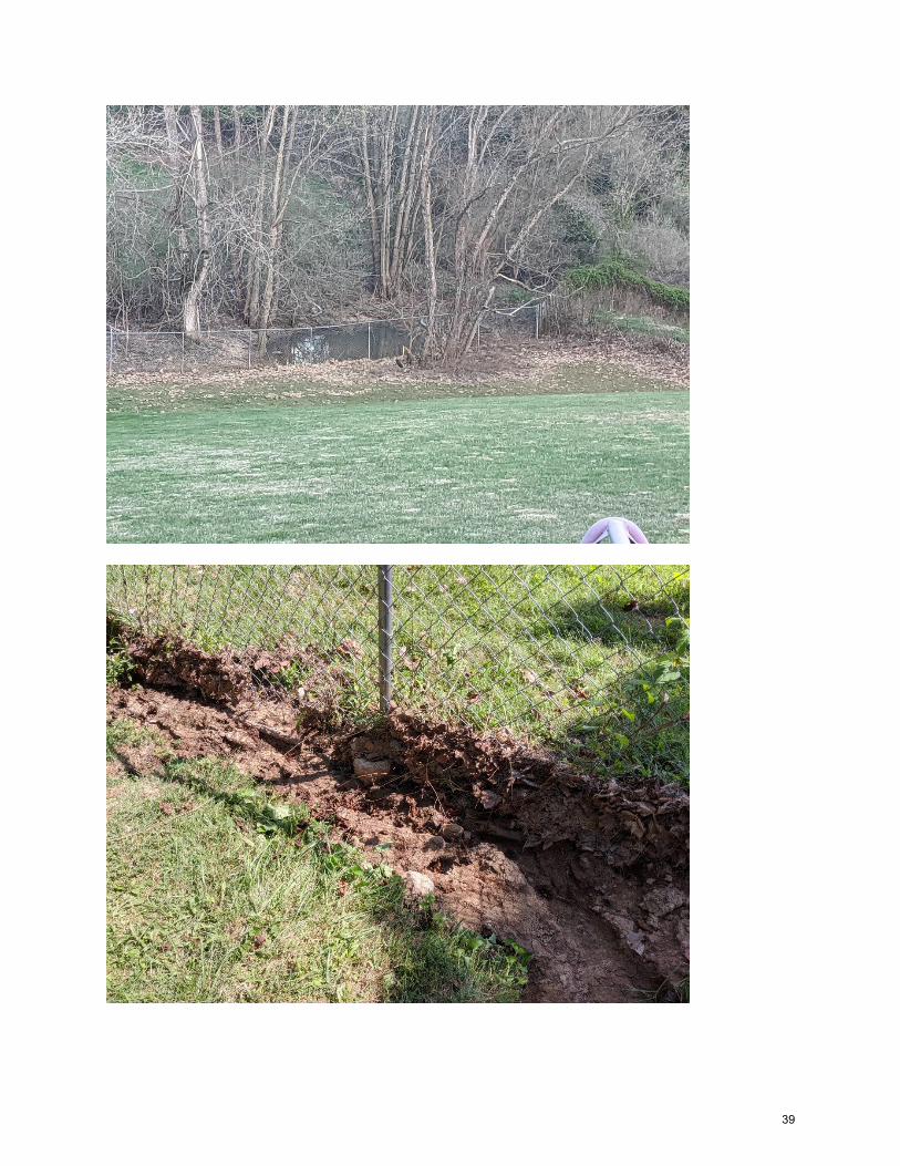
39

40