Key points - Queensland Parliament
164
WWF-Australia Level 13, 235 Jones St Ultimo NSW 2007 GPO Box 528 SYDNEY NSW 2001 Tel: +61 2 9281 5515 Fax: +61 2 9281 1060 [email protected] wwf.org.au ABN 57 001 594 074 3 August 2012 Dear Director, WWF submission to the state parliamentary inquiry into “the continued relevance of Government land tenure across Queensland.” Considering in particular the following issues: Ensuring our pastoral and tourism industries are viable into the future; The balanced protection of Queensland's ecological values; Ongoing and sustainable resource development; and The needs and aspirations of traditional owners. Key points Public land is critical to two of the government’s pillars of growth: tourism and agriculture. Expansion of the national parks system is vital to save wildlife from extinction and to expand a national parks-based tourism industry worth over $4 billion a year. The Delbessie Agreement is critical to the future survival and health of the pastoral industry. By restoring good land condition, wildlife and production will both benefit. Any move to offload state leasehold land would jeopardise pastoral industry growth and the native title interests of traditional owners. The state would be well advised to take advantage of the strong interest of native title holders in managing the country, and seek to encourage co-management of public lands with them. The State Forests Agreement likewise is vital to the future of the timber industry, which depends on moving to a more efficient, higher quality, lower cost plantation resource base. It is also vital to the expansion of national parks to save wildlife and expand tourism. The Research Director State Development, Infrastructure and Industry Committee Parliament House George Street BRISBANE QLD 4000 By email [email protected]
-
Upload
khangminh22 -
Category
Documents
-
view
0 -
download
0
Transcript of Key points - Queensland Parliament

WWF-AustraliaLevel 13, 235 Jones St
Ultimo NSW 2007GPO Box 528
SYDNEY NSW 2001Tel: +61 2 9281 5515Fax: +61 2 9281 [email protected]
wwf.org.au
ABN 57 001 594 074
3 August 2012 Dear Director,
WWF submission to the state parliamentary inquiry into
“the continued relevance of Government land tenure across Queensland.”Considering in particular the following issues:
Ensuring our pastoral and tourism industries are viable into the future; The balanced protection of Queensland's ecological values; Ongoing and sustainable resource development; and The needs and aspirations of traditional owners.
Key points Public land is critical to two of the government’s pillars of growth: tourism and
agriculture.
Expansion of the national parks system is vital to save wildlife from extinction and to expand a national parks-based tourism industry worth over $4 billion a year.
The Delbessie Agreement is critical to the future survival and health of the pastoral industry. By restoring good land condition, wildlife and production will both benefit. Any move to offload state leasehold land would jeopardise pastoral industry growth and the native title interests of traditional owners. The state would be well advised to take advantage of the strong interest of native title holders in managing the country, and seek to encourage co-management of public lands with them.
The State Forests Agreement likewise is vital to the future of the timber industry, which depends on moving to a more efficient, higher quality, lower cost plantation resource base. It is also vital to the expansion of national parks to save wildlife and expand tourism.
The Research Director State Development, Infrastructure and Industry Committee Parliament House George Street BRISBANE QLD 4000
By email [email protected]
rcampi
Typewritten Text
Submission No. 61

2
The balanced protection of Queensland's ecological values The protection of Queensland’s ecological values is severely unbalanced and well below
that required to prevent wildlife extinctions.
About 5% of Queensland is under highly protected areas, primarily national parks, the lowest of any state and territory. An additional approx. 1% is under other less secure protection such as nature refuges. By contrast, nature-based tourism icons like New Zealand has 26% and Tasmania 41% of land area in protected areas of all classes.
WWF’s Building Natures Safety Net 2011 report (ATTACHED) showed that only 20% of ecosystems and 28% of threatened wildlife in Queensland have reached a minimum standard of protection, the lowest of all states and territories.
The Commonwealth’s 2002 Terrestrial Biodiversity Assessment found that of all listed threatened species in Queensland with a known population trend, 82% of plant species and 97% of animal species were declining toward extinction.
The Commonwealth’s 2008 Terrestrial Biodiversity Assessment found that all listed threatened species in Queensland changing status for genuine reasons went from less to more endangered status.http://www.environment.gov.au/biodiversity/publications/terrestrial-assessment/index.html
Public lands are more relevant than ever, indeed critical, to prevent wildlife extinctions.
Establishment of national parks and other fully protected areas has been critical in the past to the prevention of wildlife extinctions. The Bjelke Petersen government was the first to declare national parks specifically to save endangered species of wildlife- Taunton for the last remaining populations of the flashjack wallaby and Epping Forest for the northern wombat. Later parks were also established to save native animals, like Astrebla Downs to save bilbies.
WWF analysis (ATTACHED) shows that of all conservation approaches, only declaring national parks and possibly land clearing laws, was associated with stabilisation of threatened species. The evidence is not yet available to show that other tenures have been quite so effective for saving wildlife.
Nature Refuges while they are valuable for protecting wildlife habitat are a weaker instrument for conservation, as they are not prohibitive to mining or livestock. This shortcoming could be fixed if a new class of Nature Refuges were created with the same strict legislative protections as national parks.
Strategic conversion of state forests to national parks is vital for saving both wildlife and the timber industry
It is vital that the Queensland Government honour the tripartite State Forests agreement between the conservation sector, government and the timber industry.
The agreement provides an orderly process of transition of timber harvest from state forests onto a more secure, reliable and cost-effective plantation resource base.

3
The agreement also provides that high conservation value state forests be identified and progressively transferred to national parks as timber concessions run their course.
As with Regional Forest Agreements in other states, not all state forests have been identified as future national parks, only those for which national park status is the highest and best use.
This orderly multi-decade process was agreed to by the timber industry precisely because of the improving business case for hardwood plantation production and the declining sawlog diameters in the state forests (see Venn 2005 http://www.cfc.umt.edu/personnel/venn/1_Hardwood%20Plantations_ForPol.pdf).
One good example is Barakula State Forest, a native bird and wildflower hotspot, and the largest single forest tract remaining so close to Brisbane. It will likely be far more valuable as a national park than as a comparatively low value and depleted timber resource.
The experience of Fraser Island is relevant here. Once Fraser Island too, was considered valuable only for logging and sand mining, whereas now the revenue from tourism to the Hervey Bay region far exceeds the returns from the consumptive uses that once prevailed.
Ensuring our pastoral and tourism industries are viable into the future
National Parks are also the fundamental asset of our tourism sector. Over $4 billion a year is spent in the Queensland economy by visitors to our national parks (SEE Ballantyne et al report ATTACHED),. This does not include but may substantially overlap the spending by visitors to our biggest protected area- the Great Barrier Reef- which is associated with approx. $5 billion a year in tourist spending.
Nature Refuges generally do not offer as much tourism value added, since they are on private land not generally open to the public.
The strategic growth of national parks to save Queensland’s wildlife should be the central plank of the state’s tourism strategy.
There is limited potential to capture additional revenue from parks through entrance and tourist business concession fees. The yield from these is small and nowhere near as powerful as the strong attraction by the parks and wildlife estate to tourists who spend money on their holidays in Queensland. The state captures revenue from tourism primarily through the GST.
Parks already deliver much more revenue from tourism to the state as GST on tourist spending of well over $100 million a year, than governments have been putting back into building and maintaining this valuable asset.
Pastoral leasehold land vital to viable pastoral industry There is already an agreement signed by government conservation and pastoral sectors
to ensure sustainability of pastoralism on public land- the Delbessie agreement.
The pastoral leasehold estate had become degraded through weak administration of pastoral leases, not as an inevitable result of its tenure.

4
Degraded pastoral land whether freehold or leasehold is the greatest single contributor of the sediment pollution that is killing off our biggest wildlife and tourism asset, the Great Barrier Reef.
According the 2009 Reef Outlook Report “The total annual average sediment load discharged into the Great Barrier Reef waters (Section 3.2.4) is estimated to have increased four to eight-fold since European settlement, the bulk coming from catchments that have large grazing areas (figure 5.24). This is due mainly to increased soil erosion in areas cleared to establish pasture, exacerbated by overgrazing” p 107 inhttp://www.gbrmpa.gov.au/data/assets/pdf_file/0018/3843/OutlookReport_Full.pdf
By requiring Delbessie pastoral lessees to reach and maintain good land condition as now the case, the productivity of pastoral lands will recover over time, while also recovering their value as wildlife habitats.
This has only been possible because the lands remain in public ownership, with a legislatively assured public interest in good management.
Private pastoral lands have no such requirements to maintain good land condition.
Recovering and maintaining good condition through better practices can greatly increase pastoral productivity, following the Delbessie model of measuring and improving land condition. It is puzzling therefore that landowners and lessees are not already doing it, but evidence shows that they are not.
Driving uptake of land and soil conserving farming practices should be the primary means by which the government seeks to meet its aspirations to increase farm production. The evidence suggests that significant production gains can be achieved through recovering good land condition.
Moreover it might be possible for land held in good condition under the Delbessie model to provide a firm basis for livestock producers to market their product as sustainable.
The pastoral leasehold estate managed under Delbessie arrangements, provides a very useful model for sustainable livestock production with wider application to the market.
On the view that leasehold land lacks “certainty”: Term pastoral leases in Queensland run for an entire generation - 30 years minimum -- without having to show good condition, at below-market rents, with lease extensions for good condition, Indigenous Use and Access and Nature refuge agreements. Leases have been renewed virtually automatically for many decades. By contrast state grazing leases in the USA have 10 year terms.
The gap between market rents and the below market rents charged by government has also been captured by lessees and capitalised into the market value of leases. Evidence of this is most clearly seen from the sub-leasing market. If the government wishes to resolve the debt crisis in the budget it should consider charging true market value for pastoral leases on public land.

5
Freeholding of leases should not be facilitated
There is a suggestion that leased land should be sold off http://www.ruralweekly.com.au/story/2012/06/29/agforce-fights-for-freeholding-of-land-leases/
Leasehold land can already be converted to perpetual and freehold tenures under the Land Act, but mostly has not been, even with the concessional terms in the Act for purchase by lessees. No new mechanisms are needed.
Lessees have not done so in general because it is not in their interest to own the land and pay land taxes and rates, when the land is suited only to open range grazing and they can lease it at below -market rental rates.
In regard to the state revenue yield from freeholding public land, it should understood that as the Land Act is presently written the state may not be getting true market value from freeholding of pastoral leases on public land. Proposals to make these terms even easier would further reduce the revenue the state could gain, and jeopardise all the public interest and productivity benefits outlined above.
Moreover, should lessees desire freehold or perpetual tenure, they would have to negotiate extinguishment of native title.
The needs and aspirations of traditional owners.
Pastoral leasehold and other leasehold land is also part-owned by Traditional Owners of Native Title as established in the Wik decision. Any alienation of public land requires the assent of Traditional Owners.
The Indigenous Use and Access Agreements of the Delbessie agreement provide a means for Traditional Owners long alienated from their country to regain connection with it.
On freehold properties those rights have been extinguished, and thus freeholding generally is expected to run counter to the needs and aspiration of Traditional Owners.
Indigenous access can also greatly benefit the state and the pastoral lessee by engaging the energy of a key stakeholder who cares deeply about the country and wants to see it conserved and well managed. It is disappointing that lessees have not in general taken advantage of this untapped resource and sought co-management arrangements with Traditional Owners.
The state should encourage co-management of public lands with Traditional Owners to the extent feasible. Commonwealth assistance is available to support such moves in the form of the Indigenous Protected Areas and Working on Country (Indigenous Ranger) programs.

6
Yours sincerely
Gilly Llewellyn Conservation Director

1 23
Biodiversity andConservation ISSN 0960-3115Volume 20Number 4 Biodivers Conserv (2011)20:767-777DOI 10.1007/s10531-010-9977-8
What works for threatened speciesrecovery? An empirical evaluation forAustralia

1 23
Your article is protected by copyright and
all rights are held exclusively by Springer
Science+Business Media B.V.. This e-offprint
is for personal use only and shall not be self-
archived in electronic repositories. If you
wish to self-archive your work, please use the
accepted author’s version for posting to your
own website or your institution’s repository.
You may further deposit the accepted author’s
version on a funder’s repository at a funder’s
request, provided it is not made publicly
available until 12 months after publication.

ORI GIN AL PA PER
What works for threatened species recovery?An empirical evaluation for Australia
Martin F. J. Taylor • Paul S. Sattler • Megan Evans • Richard A. Fuller •
James E. M. Watson • Hugh P. Possingham
Received: 17 August 2010 / Accepted: 21 December 2010 / Published online: 14 January 2011� Springer Science+Business Media B.V. 2011
Abstract Despite the growing numbers of threatened species and high levels of spending
on their recovery worldwide, there is surprisingly little evidence about which conservation
approaches are effective in arresting or reversing threatened species declines. Using two
government data sets, we examined associations between population trends for 841
nationally-threatened terrestrial species in Australia, and four measures of conservation
effort: (a) how much their distribution overlaps with strictly protected areas (IUCN I–IV),
(b) and other protected areas (IUCN V–VI), (c) the number of recovery activities directed
at the species, and (d) numbers of natural resource conservation activities applied in areas
where populations of the threatened species occur. We found that all populations of 606
(72%) species were in decline. Species with greater distributional overlap with strictly
protected areas had proportionately more populations that were increasing or stable. This
effect was robust to geographic range size, data quality differences and extent of protec-
tion. Measures other than strictly protected areas showed no positive associations with
stable or increasing trends. Indeed, species from regions with more natural resource
conservation activities were found to be more likely to be declining, consistent with
differential targeting of such generalised conservation activities to highly disturbed land-
scapes. Major differences in trends were also found among the different jurisdictions in
which species predominantly occurred, which may be related to different legislative pro-
tections against habitat destruction. Although we were not able to test causation, this
research corroborates other evidence that protected areas contribute to the stabilization or
M. F. J. Taylor (&)WWF-Australia, 129 Margaret St, Brisbane, QLD 4000, Australiae-mail: [email protected]
P. S. Sattler68 Sanctuary Drive, Mt Cotton, QLD 4165, Australia
M. Evans � R. A. Fuller � J. E. M. Watson � H. P. PossinghamThe Ecology Centre, University of Queensland, St Lucia, QLD 4072, Australia
R. A. FullerCSIRO Climate Adaptation Flagship and CSIRO Sustainable Ecosystems,St Lucia, QLD 4072, Australia
123
Biodivers Conserv (2011) 20:767–777DOI 10.1007/s10531-010-9977-8
Author's personal copy

recovery of threatened species, and provides little empirical support for other conservation
approaches.
Keywords Threatened species � Empirical evaluation � Protected areas � Population
trends � Natural resource management � Recovery actions
Introduction
Almost every country on Earth faces a growing list of species at risk of extinction,
declining habitat extent and condition, chronic under-funding of conservation and uncer-
tainty about the likelihood of success of conservation effort (Hails et al. 2009; IUCN
2010). Given the typically limited resources available and the short timeframes in which
action is needed, focusing on interventions that are proven to be effective is desirable
(Bottrill et al. 2008; 2009). Many authors have called for greater accountability of con-
servation efforts and empirical evaluation of effectiveness (Ferraro and Pattanayak 2006;
Segan et al. 2010). Unfortunately, there are still very few examples of empirical evalua-
tions of conservation interventions in terms of species recovery outcomes, and none at all
that compare the effectiveness of alternate approaches.
In this study, we evaluated how effective alternate conservation activities have been for
threatened species recovery in Australia at a continental scale. Australia is one of few
suitable case studies available to do this, because there is a national data set for both
species trends and conservation activities (Sattler and Creighton 2002). As for many
developed countries Australia has had widespread loss or degradation of natural habitats
and natural ecological processes (Woinarski et al. 2007; Lindenmayer et al. 2008). As a
result 13% of Australia’s known terrestrial vertebrate species are now formally listed as
threatened under Australia’s national species legislation (The ‘‘Environmental Protection
and Biodiversity Conservation Act’’ or EPBCA; Department of the Environment Water
Heritage and the Arts 2009a). Many other native species not yet considered threatened
have collapsing distributions and ongoing declines in abundance (Mackey et al. 2008;
Kingsford et al. 2009).
Government and non-government organizations have pursued diverse conservation
activities to promote threatened species recovery over the past several decades. These can
be divided into two major approaches: first, change in the primary land-use by establishing
protected areas (either strictly protected or less strictly protected); and second, short-term
changes in the way land is managed without necessarily changing land use through direct
interventions such as species-specific recovery actions, or ‘‘natural resource management’’
activities.
Australia spent over $2.5 billion financing such actions from 1992 to 2008 (Department
of the Environment Water Heritage and the Arts 2007) in the absence of guidance from
empirical evaluation of the effectiveness of the different conservation approaches. By
analyzing population trends for threatened species across Australia against the different
kinds of management interventions mentioned above, we provide the first evaluation of
what has been working and what has been not, for threatened species recovery. To our
knowledge, this represents the first attempt in the literature to evaluate alternative con-
servation actions based on population outcomes for threatened species at a continental
scale.
768 Biodivers Conserv (2011) 20:767–777
123
Author's personal copy

Methods
Threatened species population trends
In 2002, the Australian government produced the first national Terrestrial Biodiversity
Assessment (‘‘Assessment’’ hereafter; Sattler and Creighton 2002), containing 13,858
records of trends for populations of threatened species within 385 spatially defined sub-
bioregions of Australia (hereafter ‘‘subregion’’; Environment Australia 2000). Trend data
were based on quantitative evidence such as field measurement, or qualitative methods,
primarily the consensus opinion of panels of 40 experts from different areas of taxonomic
and geographic expertise (Sattler and Creighton 2002). We discarded globally extinct
species as well as populations lacking trend records, those whose distributions were poorly
mapped, those not listed as threatened under national legislation, marine species, and
subsurface cave-specialist fauna not expected a priori to show significant dependence on
protection of the land surface. This left a sample of 841 species with known trends in one
or more subregional populations (698 plants, 143 animals).
We simplified the existing multi-category variable describing population trends for each
species population within each subregion to a binary variable equal to one for increasing or
stable trends, and equal to zero for populations in decline, rapidly declining or extinct in
the subregion. For each species, we calculated the proportion of subregional populations
with a known trend for which trend was increasing or stable (IS).
Geographic distribution overlap with protected areas
We utilised the Species of National Environmental Significance (SNES) spatial database
(Department of the Environment Water Heritage and the Arts 2008c). This database
consists of mapped distribution polygons for each species officially recognised as critically
endangered, endangered or vulnerable to extinction under national legislation.
Distributional data are of highly variable quality and were derived using variety of
methods. Following Watson et al. (2010) we used only polygons where a species was
classed as ‘‘known’’ or ‘‘likely to occur’’. We intersected these presumed geographic
distributions for each species with the distributions of the protected area system in 2006
(Department of the Environment Water Heritage and the Arts 2008b), and calculated the
amount of overlap with strictly protected areas (SPA: IUCN management categories I–IV;
Dudley 2008) and other protected areas (OPA: IUCN management categories V and VI;
Dudley 2008).
Conservation effort other than protected areas
We calculated the mean number of recovery actions other than establishing protected areas
(RA) undertaken for each species in the subregions in which the species occurs, using data
provided in the Assessment. Recovery actions fell into 20 categories including such
activities as protected areas, education, fencing, fire, pest, weed, grazing and visitor
management activities (Sattler and Creighton 2002). The Assessment database also doc-
uments 7,632 ‘‘natural resource management’’ (NRM) actions that had been applied in
different subregions, sorted into ten categories including incentives, industry voluntary
practice codes, threat abatement, catchment and property planning. These activities are
similar to many of the recovery actions, but are not specifically directed toward any
Biodivers Conserv (2011) 20:767–777 769
123
Author's personal copy

particular species within a given subregion. Based on the text description of each NRM
activities in each subregion, those that were clearly conservation-oriented (such as threat
abatement), as opposed to planning, research or production-oriented, were summed to
produce a total for each subregion. We then calculated the mean number of such con-
servation-oriented NRM actions (CM) across all subregions in which each species had a
known population trend. There were missing values for 20 subregions, and for 39 species
with populations falling only in these subregions, all from Western Australia. The overall
mean of CM was used to impute the missing values in these cases. As this imputation
method can bias the relationship with population trends, we tested the robustness of our
results by performing analyses with and without using these imputed missing values (Little
and Rubin 1987).
Other covariates
To reduce the chance that key covariates were driving correlations we tested for interaction
of regressions with geographic range size, since for many narrowly-distributed species, the
present day known or likely to occur distribution may be the legacy of distribution con-
traction, the very reason the species is considered threatened. To determine whether large-
and small-distribution species showed different effects, we included a binary variable R50in the analysis, taking a value of 1 and 0 respectively for species with geographic distri-
bution sizes above and below the median distribution size of 22,179 ha.
As level of endangerment is expected to be a major determinant of species population
trends, we included a binary variable Status, equal to zero if the species is classified as
critically endangered or endangered under the EPBCA, or equal to one if vulnerable.
Taxonomic group was also included as a categorical variable (Taxon) with four groups:
plants, birds, mammals and other animals pooled due to small sample sizes (amphibians,
invertebrates, reptiles, fish). An interaction term of Taxon 9 SPA was tested in regression,
since we expected the regression of trend on strictly protected areas to be taxon-dependent
based on previous studies (Baillie et al. 2004). Finally, we included the categorical variable
Jurisdiction, classifying each species into the province in which its geographic distribution
predominantly falls: New South Wales (including the Australian Capital Territory),
Northern Territory, Queensland, South Australia, Tasmania, Victoria and Western Aus-
tralia. This was done because the states and territories are largely responsible for native
species conservation and protected area establishment and management in Australia, and
all have their particular legislative systems. The federal government plays a comparatively
minor role by providing funding incentives for addition of new protected areas, and helping
to develop national strategies (Department of the Environment Water Heritage and the Arts
2009b).
Spatial and statistical analysis
Using these data, we calculated the proportion of populations of threatened species that
were increasing or stable, and tested for correlations with (a) how much their distribution
overlaps with strictly protected areas (IUCN I–IV), (b) and other protected areas (IUCN V–
VI), (c) the number of recovery activities directed at the species, and (d) numbers of natural
resource conservation activities applied in areas where populations of the threatened
species occur.
Proportions of area protected (SPA, OPA) were arcsin-H transformed to normalise
distributions. Count data (RA, CM) were square root transformed to normalise distributions
770 Biodivers Conserv (2011) 20:767–777
123
Author's personal copy

(Sokal and Rohlf 1995). We fitted logistic regressions using the Stata version 8 (StataCorp
2003) General Linear Model subroutine, with a binomial logit error function for the binary
trend variable. Independent variables were tested stepwise by likelihood ratio tests against
models with those variables removed, and a final model was subsequently developed
including only significant variables.
Results
Declines overwhelmingly dominated species trends, with 606 (72%) of the 841 species
declining, or rapidly declining in all of their subregional populations, while 12% had some
but not all populations with increasing or stable trends, and finally, 16% had all populations
showing increasing or stable trends (IS). Endangered (including critically endangered)
species were significantly less likely to be stable or increasing than vulnerable species
(Tables 1, 2).
Species with greater spatial overlap with strictly protected areas (SPA) were more likely
to be stable or increasing (P \ 0.001). There was no significant regression of trends on
overlaps with other types of protected areas (OPA) (Table 1).
The final model predicted a 2.3-fold increase in the likelihood a species was stable or
increasing from 15 to 35%, for an increase from zero to 93% of the distribution
Table 1 Stepwise fitting of logistic regression models to proportions of subregional populations increasingor stable (IS) for 841 threatened species
Independent variable Sign Test versus null Test versus full Final model
Strict PA overlap SPA ? P \ 0.001 P = 0.002 P \ 0.001
Other PA overlap OPA – P \ 0.001 P = 0.298 removed
No. recovery actions RA n/a P = 0.200 removed
NRM actions CM – P \ 0.001a P \ 0.001 P \ 0.001
Distribution over/undermedian R50
n/a P = 0.188 removedb
Interaction n/a P = 0.507 removed
Taxon n/a P = 0.125 removed
Birds versus others n/a P = 0.379 removed
Interaction n/a P = 0.595 removedb
Mammals versus others ? P = 0.031 P = 0.323 removed
Status ? P = 0.014 P = 0.002 P = 0.004
Jurisdiction n/a P \ 0.001 NSW P \ 0.001NT P = 0.209 removedQld P = 0.044SA P = 0.666 removedTas P = 0.006Vic P = 0.036
NSW P \ 0.001Qld P = 0.066c
Tas P \ 0.001Vic P \ 0.001
All probabilities shown are for likelihood ratio tests of models with effect, against models with that effectremoveda P \ 0.001 both excluding missing values N = 802, and also including missing values imputed with thegrand mean for all speciesb All interactions tested against a non-null model including both main effectsc Retained despite marginal significance level
Biodivers Conserv (2011) 20:767–777 771
123
Author's personal copy

overlapping strictly protected areas (the mean SPA for the top decile of species; Fig. 1;
Table 1). Nevertheless, 65% of species were predicted to still be in decline under this
statistical model, even if they had, on average, 93% of their distribution protected (Fig. 1).
Species in areas subject to more natural resource conservation actions (CM) were
significantly less likely to be increasing/stable than otherwise (Table 1). There were also
major differences among jurisdictions in proportions of species declining. Species pre-
dominantly in NSW, Queensland and Tasmania were significantly less likely to be
increasing or stable than other species, while species in Victoria, one of the most agri-
culturally developed states, were significantly more likely to be increasing or stable
(Table 2).
No significant interaction between SPA and distribution extent was found in the
regression (R50, Table 1).
We tested for taxonomic interaction with SPA for a plant/animal contrast, and a contrast
of birds versus all other species. The latter was specifically tested to allow comparison with
Baillie et al. (2004), who reported a marked contrast between birds and amphibians in the
association between trends and overlap with protected areas. However, neither taxonomic
differences nor interactions with SPA were significant in regressions in this study. Mam-
mals appeared higher than other species in proportions increasing or stable (Table 2).
However, this difference was non-significant when other covariates were included in the
model, mostly likely due to the confounding of taxon with other covariates such as
jurisdiction (Table 1).
Fig. 1 Observed proportions of species stable or increasing for plants and animals, means with binomial95% confidence limits, for deciles of overlap of distributions with strictly protected areas. Also shown is thefitted logistic regression with upper and lower 95% confidence limits (UCI, LCI)
772 Biodivers Conserv (2011) 20:767–777
123
Author's personal copy

The regression of IS on SPA remained highly significant when using robust standard
errors and clustering on taxonomic family to account for possible phylogenetic autocor-
relation (P = 0.005) and also after discarding all species except the 437 for which trend
data were based at least in part on quantitative rather than solely qualitative or unknown
quality data (P = 0.028). The regression of IS on SPA also remained significant after
discarding the 85 species in the top decile of SPA (P = 0.027). An orthogonal quadratic
SPA term was not significant in regression, indicating that the relationship was simple
linear (in the logit: arcsinH- transformed scale), rather than a non-linear relationship with
stronger correlation at higher SPA levels than at lower levels.
Discussion
Over the past two decades there has been growing movement away from protected areas as
the primary approach to arresting biodiversity loss in some countries. Emphasis has shifted
to natural resource management (‘‘NRM’’) or ‘‘stewardship’’ activities that do not change
the primary land use, only the way the existing land-use is conducted (Kalamandeen and
Gillson 2007; Gaston et al. 2008). The Australian Government for example, currently
devotes only about 10% of its total conservation budget on expansion of protected areas
(Department of the Environment Water Heritage and the Arts 2008a) although this rep-
resents an increase above the level of 3% per annum over several preceding years. Critics
of protected areas cite the generation of conflicts with land and water users (Vanclay 2001;
Wilshusen et al. 2002; Agardy et al. 2005; Kaiser 2005; Pearce et al. 2005), that protected
areas are often placed in areas already at little genuine risk of loss (Ferraro and Pattanayak
2006; Joppa and Pfaff 2009) and that the expansion of protected areas has been too slow to
counter pervasive habitat destruction (McDonald-Madden et al. 2009).
Table 2 Proportions of populations increasing or stable for different taxonomic and status classes andjurisdictions, means and 95% confidence intervals
Variable Categories N Mean (%) LCI (%) UCI (%)
Taxon Plants 698 20.0a 17.2 23.1
Birds 43 26.5a 15.5 41.5
Mammals 43 34.8a 22.2 50.0
Other animals 57 18.6a 10.5 30.8
Status Endangered 399 17.4b 14.0 21.4
Vulnerable 442 24.2c 20.5 28.5
Jurisdiction NSW 242 3.4d 1.7 6.6
NT 16 22.5e 8.2 48.4
Qld 101 14.2f 8.7 22.5
SA 44 36.3e 23.6 51.3
Tas 80 11.2f 5.9 20.2
Vic 109 52.6g 43.2 61.7
WA 249 27.4e 22.2 33.2
Means of categories within variables followed by different letters were significantly different at P [ 0.05 inpost-regression pairwise tests with Bonferroni correction
Biodivers Conserv (2011) 20:767–777 773
123
Author's personal copy

There is some empirical evidence that protected areas work for threatened species.
Tropical protected areas have significantly reduced levels of threats from burning, hunting,
logging, and livestock in comparison with unprotected areas immediately adjacent (Bruner
et al. 2001). Marine protected areas show higher total marine species richness (Halpern and
Warner 2003; Stewart et al. 2009; Selig and Bruno 2010) compared with comparable
unprotected areas. Among amphibian species entirely outside protected areas, propor-
tionately more are declining than among those overlapping protected areas, although birds
show the opposite pattern, a result that remains unexplained (Baillie et al. 2004). However,
there are no other studies that compare different approaches with protected areas in terms
of population outcomes.
In this study, among the four candidate measures of conservation effort, spatial overlap
with strictly protected areas or other protected areas, number of recovery actions and
number of resource conservation actions, only overlap with strictly protected areas was
robustly associated with stable or increasing threatened species trends. Ferraro and
Pattanayak (2006) questioned whether protected areas are effective in protecting habitats
and species and called for empirical evaluation. Our results present the first empirical
support at a continental scale for strictly protected areas as a means to ameliorate population
declines of threatened species over other approaches such as less secure protected areas, and
non-protected area-related recovery actions or natural resource conservation activities.
This result is correlative. Clearly without genuine experimental design, we cannot
evaluate causation. Indeed causation could have been in either direction. It is possible that
trend scores assigned by experts could have been influenced by knowledge of protected
area overlaps of species’ distributions. However, there are two reasons why we consider
this explanation unlikely. First, the correlation remained highly significant after excluding
species with trend data derived solely from expert opinion, and second, more than 40
experts were used in panels developing qualitative trend scores, making concerted bias
unlikely (Sattler and Creighton 2002). Another possibility is that stabilizing species trends
are associated with protected areas because they are placed in areas of little genuine risk of
loss (Joppa and Pfaff 2009). Whether particular Australian protected areas have or have not
genuinely prevented losses that might otherwise have occurred is not a question that could
be addressed here with the data available. Threatened species are however over-repre-
sented in Australian protected areas compared with random protected areas of the same
size (Watson et al. 2010), and one of the reasons why this might be so, is that threatened
species have been lost elsewhere in the landscape, suggesting that protected areas have on
average been effective in preventing habitat loss that might otherwise have occurred.
The contribution of protected areas to species recovery might be expected to depend on
ecology and life history of species. For example, smaller, habitat specialist birds are more
likely to be at risk of extinction from habitat loss, while larger, slow reproducing species
are more at risk from direct persecution and exotic predators (Owens and Bennett 2000).
However, this study found no difference in the magnitude of the effect of protected areas
on population trends between narrowly- and widely-distributed species.
We only examined overlaps with existing distributions, and we made no attempt to
identify how much of the original or potential future distribution of threatened species must
be restored and/or protected to ensure recovery and long term persistence, particularly in
the context of global climate change and the shifts in distributions already observed
(Parmesan 2006). We also restricted analysis to gross percentage overlap, without regard to
spatial configuration of the protected area system. Not all fractions of a species distribution
are expected to have equivalent value for population viability. For example, 62% of 4,239
774 Biodivers Conserv (2011) 20:767–777
123
Author's personal copy

threatened species worldwide are believed to be dependent on conservation at multiple
sites (Boyd et al. 2008).
Any beneficial effect of protected areas on threatened species is likely to require
ongoing investments in abatement of pervasive threats which occur in protected areas,
despite the change in land-use represented by protected areas: particularly unnatural fire
patterns, exotic plants, animals and pathogens, and visitors. Even low levels of visitor
presence can have a significant impact on large carnivore behaviour (Reed and Meren-
lender 2008) and we know little about visitor impacts on other groups globally.
Amphibians are undergoing a global decline, even in pristine forests inside protected areas,
believed to be due to chytrid fungus attack and a warming climate (Whitfield et al. 2006).
Mammal populations are declining in national parks in northern Australia (Woinarski et al.
2001) and also in African national parks (Craigie et al. 2010) for reasons that remain
unclear. The effectiveness or otherwise of the management of Australian protected areas
could not be evaluated with the available data in this study, and represents a key issue for
further research.
Perhaps the single greatest benefit of protected areas is in preventing complete habitat
loss. However, rates of expansion of protected areas may be too slow to counter wide-
spread habitat destruction (McDonald-Madden et al. 2009). Habitat protection legislation is
potentially much more powerful in stopping or slowing habitat destruction because it can
be applied over all tenures and land-uses over an entire jurisdiction. Those states with the
lowest proportions of species increasing or stable were also those with the highest land
clearing rates at the time of the Assessment. Queensland (0.49% of the state’s area cleared
per annum), NSW (0.16%) and Tasmania (0.26%) all had rates of clearing an order of
magnitude higher than clearing rates in other jurisdictions in 2001 (Hamblin 2001).
Overlap with other protected areas in IUCN classes V and VI did not show any cor-
relation with increasing or stable trends, a result perhaps unsurprising due to the lesser
strength of protection in such protected areas. In Australia and in many other countries,
IUCN class V and VI protected areas may be logged, cleared, grazed by livestock and
mined, begging the question if these ‘‘protected areas’’ have genuinely changed land-use
(Taylor et al. 2009; Dudley 2008). Mammals are less diverse and abundant in forest
reserves open to hunting than on national parks closed to hunting in Costa Rica (Carrillo
et al. 2000). More systematic field measurement of threatened species population trends on
protected areas of different types is needed to assess the comparative effectiveness of
investments in these different types of protected areas, which are increasingly favored due
to their lower cost (Sattler and Taylor 2008).
The observed negative correlation of upward and stable species trends with numbers of
conservation-oriented natural resource management actions does not necessarily mean that
such activities have perverse, harmful effects on threatened species. Indeed, it is much
more likely the direction of causation is reversed, with natural resource management
activity being targeted to landscapes already highly modified by agriculture and as a
consequence, in places where threatened species are mostly in decline. Indeed we found
that numbers of such activities were negatively correlated with the proportion of natural
vegetation remaining in subregions, supporting just such a differential targeting explana-
tion (results not shown).
The absence of any significant relationship between numbers of recovery actions
applied to subregional populations of species and the associated trends that we document
here might be explained in a number of ways: recovery actions have not had time to
produce an outcome; actions have not actually been implemented; or actions have been
implemented but are ineffective. Either way, this result is surprising considering that
Biodivers Conserv (2011) 20:767–777 775
123
Author's personal copy

species with dedicated recovery plans (the basis for recovery actions) in the United States
are more likely to be increasing and less likely declining than species lacking plans (Taylor
et al. 2005). Too few species in Australia had formal recovery plans at the time of the
Assessment to permit a similar such analysis here. More importantly, we lack sufficient
data on timing and degree of implementation of recovery actions or natural resource
conservation actions to be able to distinguish among the foregoing hypotheses.
The scale of the benefit of protected areas suggested by these results was still limited
compared with the pervasive pattern of decline of threatened species. The proportion of
threatened species mostly or entirely in decline is alarmingly high, suggesting a need for
greatly increased investments in strict protection of habitats and abatement of pervasive
threats. Of all conservation activities, only expansion of strictly protected areas and pos-
sibly also legislation to control habitat loss, are associated with stabilization or recovery of
threatened species in Australia.
Acknowledgments Financial support for this work came from WWF-Australia, the Telstra corporation,the Australian Research Council and a Commonwealth Environmental Research Facility. The AustralianGovernment provided crucial data for the analysis.
References
Agardy T, Bridgewater P, Crosby MP et al (2005) Dangerous targets? Unresolved issues and ideologicalclashes around marine protected areas. Aquat conserv 13:4353–4367
Baillie JEM, Hilton-Taylor C, Stuart SN (eds) (2004) 2004 IUCN red list of endangered species: a globalspecies assessment. IUCN, Gland
Bottrill MC, Joseph LN, Carwardine J et al (2008) Is conservation triage just smart decision-making? TrendsEcol Evol 23:649–654
Bottrill MC, Joseph LN, Carwardine J et al (2009) Finite conservation funds mean triage is unavoidable.Trends Ecol Evol 24:183–184
Boyd C, Brooks TM, Butchart SHM et al (2008) Spatial scale and the conservation of endangered species.Conserv Lett 1:37–43
Bruner AG, Gullison RE, Rice RE, da Fonseca GAB (2001) Effectiveness of parks in protecting tropicalbiodiversity. Science 291:125–128
Carrillo E, Wong G, Cuaron AD (2000) Monitoring mammal populations in Costa Rican protected areasunder different hunting restrictions. Conserv Biol 14:1580–1591
Craigie ID, Baillie JEM, Balmford A, Carbone C, Collen B, Green RE, Hutton JM (2010) Large mammalpopulation declines in Africa’s protected areas. Biol Conserv. doi:10.1016/j.biocon.2010.06.007
Department of the Environment Water Heritage and the Arts (2007) 2006–7 Natural Heritage Trust annualreport. Australian Government, Canberra
Department of the Environment Water Heritage and the Arts (2008a) Caring for our country business plan2009–2010. Australian Government, Canberra
Department of the Environment Water Heritage and the Arts (2008b) Collaborative Australian protectedareas database, 2006 release. Australian Government, Canberra
Department of the Environment Water Heritage and the Arts (2008c) Species and Communities of NationalEnvironmental Significance. Unpublished database, 2008 release, Australian Government, Canberra
Department of the Environment Water Heritage and the Arts (2009a) Assessment of Australia’s terrestrialbiodiversity 2008. Australian Government, Canberra
Department of the Environment Water Heritage and the Arts (2009b) Australia’s strategy for the nationalreserve system 2009–2030. Australian Government, Canberra
Dudley N (ed) (2008) Guidelines for applying protected area management categories. IUCN, Gland,Switzerland
Environment Australia (2000) Revision of the interim biogeographic regionalisation for Australia (IBRA)and development of Version 5.1. Australian Government, Canberra
Ferraro PJ, Pattanayak SK (2006) Money for nothing? A call for empirical evaluation of biodiversityconservation investments. PLoS Biol 4:482–488
776 Biodivers Conserv (2011) 20:767–777
123
Author's personal copy

Gaston KJ, Jackson SF, Cantu-Salazar L, Cruz-Pinon G (2008) The ecological performance of protectedareas. Ann Rev Ecol Evol Sys 39:93–113
Hails C, Humphrey S, Loh J, Goldfinger S (eds) (2009) Living planet report 2008. WWF-International,Gland
Halpern BS, Warner RR (2003) Marine reserves have rapid and lasting effects. Ecol Lett 5:361–366Hamblin A (2001) Land theme: state of the environment 2001. Australian Government, CanberraIUCN (2010) IUCN Red list of threatened species. Version 2010.4. http://www.iucnredlist.org. Accessed 27
October 2010Joppa LN, Pfaff A (2009) High and far: biases in the location of protected areas. PLoS One 4:e8273Kaiser MJ (2005) Are marine protected areas a red herring or fisheries panacea? Can J Fish Aquat Sci
62:1194–1199Kalamandeen M, Gillson L (2007) Demything ‘‘wilderness’’: implications for protected area designation and
management. Biodiv Conserv 16:165–182Kingsford RT, Watson JE, Lundquist CJ et al (2009) Major conservation policy issues for biodiversity in
Oceania. Conserv Biol 23:834–840Lindenmayer DB, Dovers S, Olsen H, Morton S (2008) Ten commitments: reshaping the Lucky Country’s
environment. CSIRO Publishing, MelbourneLittle RJA, Rubin DB (1987) Statistical analysis with missing data. John Wiley and Sons, New YorkMackey GB, Watson JEM, Hope G (2008) Climate change, biodiversity conservation, and the role of
protected areas: an Australian perspective. Biodiversity 9:11–18McDonald-Madden E, Gordon A, Wintle BA et al (2009) ‘‘True’’ conservation progress. Science 323:43–44Owens IPF, Bennett PM (2000) Ecological basis of extinction risk in birds: habitat loss versus human
persecution and introduced predators. PNAS 97:12144–12148Parmesan C (2006) Ecological and evolutionary responses to recent climate change. Ann Rev Ecol Evol
Syst 37:637–669Pearce DW, Putz F, Vanclay JK (2005) Sustainable forestry in the tropics: panacea or folly? In: Sayer JA
(ed) The earthscan reader in forestry and development. Earthscan, LondonReed SE, Merenlender AM (2008) Quiet, nonconsumptive recreation reduces protected area effectiveness.
Conserv Lett 1:146–154Sattler PS, Creighton C (2002) Australian terrestrial biodiversity assessment, Australian Government
National Land and Water Resources Audit, Canberra. http://adl.brs.gov.au/anrdl/metadata_files/pa_badesr9nn__02211a01.xml. Accessed 22 Dec 2009
Sattler PS, Taylor MFJ (2008) Building nature’s safety net 2008: progress on directions for the nationalreserve system. WWF-Australia, Sydney
Segan DB, Carwardine J, Klein C et al (2010) Can we determine conservation priorities without clearobjectives? Biol Conserv 143:2–4. doi:10.1016/j.biocon.2009.09.014
Selig ER, Bruno JF (2010) A global analysis of the effectiveness of marine protected areas in preventingcoral loss. PLoS One 5:e9278. doi:10.1371/journal.pone.0009278
Sokal RR, Rohlf FJ (1995) Biometry: the principles and practice of statistics in biological research, 3rd edn.W. H. Freeman and Co, New York
StataCorp (2003) Stata statistical software: release 8. StataCorp, College StationStewart GB, Kaiser MJ, Cote IM et al (2009) Temperate marine reserves: global ecological effects and
guidelines for future networks. Conserv Lett 2:243–253Taylor MFJ, Suckling KS, Rachlinski JJ (2005) The effectiveness of the endangered species act: a quan-
titative analysis. BioScience 55:360–367Taylor MFJ, Adams VM, Segan DB, Pressey RL (2009) 20 million hectares by 2020: protected areas, green
infrastructure and green jobs for Queensland. WWF-Australia, SydneyVanclay JK (2001) The effectiveness of parks. Science 293:1007Watson JE, Evans MC, Carwardine J et al (2010) The capacity of Australia’s protected-area system to
represent threatened species. Conserv Biol. doi:10.1111/j.1523-1739.2010.01587.xWhitfield SM, Bell KE, Philippi T et al (2007) Amphibian and reptile declines over 35 years at La Selva,
Costa Rica. PNAS 104:8352–8356Wilshusen PR, Brechin SR, Fortwangler CL, West PC (2002) Reinventing a square wheel: critique of a
resurgent ‘‘protection paradigm’’ in international biodiversity conservation. Soc Nat Res 15:17–40Woinarski J, Mackey B, Nix H, Traill B (2007) The nature of northern Australia: natural values, ecological
processes and future prospects. Australian National University E-press, CanberraWoinarski JCZ, Milne DJ, Wanganeen G (2001) Changes in mammal populations in relatively intact
landscapes of Kakadu National Park, Northern Territory, Australia. Austral Ecol 26:360–370
Biodivers Conserv (2011) 20:767–777 777
123
Author's personal copy

VALUING TOURISM SPEND ARISING FROM VISITATION TO QUEENSLAND NATIONAL PARKS
Roy Ballantyne, Richard Brown, Shane Pegg and Noel Scott

VALUING TOURISM SPEND ARISING FROM VISITATION TO QUEENSLAND NATIONAL PARKS
ii
Technical Reports The technical reports present data and its analysis, meta-studies and conceptual studies, and are considered to be of value to industry, government or other researchers. Unlike the STCRC’s Monograph series, these reports have not been subjected to an external peer review process. As such, the scientific accuracy and merit of the research reported here is the responsibility of the authors, who should be contacted for clarification of any content. Author contact details are at the back of this report. We’d love to know what you think of our new research titles. If you have five minutes to spare, please click on the link below to complete our online survey. Sustainable Tourism CRC Tech Report Feedback
National Library of Australia Cataloguing-in-Publication Entry Valuing tourism spend arising from visitation to Queensland national parks / Roy Ballantyne ... [et al.]. ISBNs: 9781921521270 (pbk.) 9781921521287 (pdf.) Notes: Bibliography. Tourism—Economic aspects—Queensland. National parks and reserves—Economic aspects—Queensland. 338.479109943 Copyright © CRC for Sustainable Tourism Pty Ltd 2008 All rights reserved. Apart from fair dealing for the purposes of study, research, criticism or review as permitted under the Copyright Act, no part of this book may be reproduced by any process without written permission from the publisher. All rights reserved. Apart from fair dealing for the purposes of study, research, criticism or review as permitted under the Copyright Act, no part of this book may be reproduced by any process without written permission from the publisher. Any enquiries should be directed to: General Manager, Communications and Industry Extension or Publishing Manager, [email protected]

VALUING TOURISM SPEND ARISING FROM VISITATION TO QUEENSLAND NATIONAL PARKS
iii
CONTENTS
ABSTRACT___________________________________________________________________________ V Acknowledgements ____________________________________________________________________v
EXECUTIVE SUMMARY _______________________________________________________________ VI
CHAPTER 1 PROJECT BACKGROUND ___________________________________________________ 1
Objectives of Study ___________________________________________________________________ 1 Project Deliverables __________________________________________________________________ 1 The Research Team ___________________________________________________________________ 1 Project Governance___________________________________________________________________ 2
CHAPTER 2 STUDY METHODOLOGY ____________________________________________________ 3
Overview ___________________________________________________________________________ 3 National park-Associated and National park-Generated Tourist Spending ________________________ 3 A Strategic NP Sampling Logic__________________________________________________________ 5 Calculation of Annual Visitor Numbers for the Regions that Contain NPs_________________________ 5 Extrapolation of Survey Estimates to Whole of Queensland ____________________________________ 6 Survey Implementation ________________________________________________________________ 6 Distribution of Questionnaire ___________________________________________________________ 7 Questionnaire Design _________________________________________________________________ 8 Data Input and Analysis _______________________________________________________________ 9 National park-Generated Visitors by Queensland Region _____________________________________ 9
CHAPTER 3 RESULTS__________________________________________________________________ 11
Respondent Demographic Profile _______________________________________________________ 11 Proportion of respondents to each region by origin_______________________________________ 11 Proportion of males and females surveyed in each region __________________________________ 11 Proportion of respondents to each region by travel party type ______________________________ 11 Proportion of respondents in each region by age group ___________________________________ 12 Proportion of respondents in each region by household income _____________________________ 12 Proportion of respondents in each region on a package holiday _____________________________ 12 Proportion of respondents using various types of accommodation in each region _______________ 13 Proportion of respondents using various forms of transport to access each region_______________ 13
Direct Spending by National park Visitors ________________________________________________ 14 Contribution of national park-generated spending to the Queensland economy _________________ 15
Conclusion_________________________________________________________________________ 16 REFERENCES_________________________________________________________________________ 17 APPENDIX A: QUEENSLAND PARKS MAPS______________________________________________ 18 APPENDIX B: VALUING QUEENSLAND PARKS SURVEY __________________________________ 21
Part of the valuing Queensland parks research project ____________________________________ 21 APPENDIX C: PARKS AND INTERVIEW POINTS BY REGION________________________________ 29 APPENDIX D: ADDITIONAL TABLES ___________________________________________________ 30
Appendix Table D3 National park Spending by region: ______________________________________ 32 Summary Simulation Results ($) ________________________________________________________ 32
AUTHORS___________________________________________________________________________ 33

VALUING TOURISM SPEND ARISING FROM VISITATION TO QUEENSLAND NATIONAL PARKS
iv
List of Tables Table 1 Proportion of survey responses achieved by mail-back and face to face interview by region _________ 8 Table 2 NPGV factors for the four regions surveyed ______________________________________________ 9 Table 3 National park region and category _____________________________________________________ 10 Table 4 Proportion of respondents to each region by origin ________________________________________ 11 Table 5 Proportion of males and females surveyed in each region___________________________________ 11 Table 6 Proportion of respondents to each region by travel party type________________________________ 12 Table 7 Proportion of respondents in each region by age group_____________________________________ 12 Table 8 Proportion of respondents in each region by household income ______________________________ 12 Table 9 Proportion of respondents in each region on a package holiday ______________________________ 13 Table 10 Proportion of respondents using various types of accommodation in each region _______________ 13 Table 11 Proportion of respondents using various forms of transport to access each region _______________ 13 Table 12 Estimated direct spending by NP-associated visitors______________________________________ 14 Table 13: Direct Tourist Spending Related to Queensland National parks_____________________________ 15 Appendix Table D1 Estimates of International Visitor Nights (Thousands) ___________________________ 30 Appendix Table D2 National park Related Visitor Nights and Total Spending ________________________ 31

VALUING TOURISM SPEND ARISING FROM VISITATION TO QUEENSLAND NATIONAL PARKS
v
ABSTRACT
This report provides an estimate of direct tourist spending and the contribution of that spending to Queensland’s gross state product that can be attributed to tourists’ access to national parks (NPs). The first phase of The Valuing Tourism Spend in Queensland National Parks Study was designed to provide an assessment of tourist spending associated with national parks at the regional level. Following consultation with key stakeholders of the study, a research team from The University of Queensland collected primary visitor survey data in four regions of the State of Queensland with a view to determining an estimate of the visitor spend attributable to the NPs in these regions. These regions were selected as examples of the four different types of protected area region (urban, iconic, remote and outback) to be found in Queensland. The data collected in the survey were then used to infer a value for national park-generated visitor spending for all national park regions in Queensland. The results of this study indicate that a best estimate of visitor spending associated with national parks is approximately $4.43 billion per annum with $749 million per annum in national park-generated spending. As such, study results emphasise the key importance of NPs to the Queensland tourism sector, and the Queensland economy more generally, in that national park-associated spending represents approximately 28% of total annual tourism expenditure in the state with national park-generated spending representing approximately 4.7% of the total.
Acknowledgements The Sustainable Tourism Cooperative Research Centre (STCRC), established and supported under the Australian Government’s Cooperative Research Centres Program, jointly funded this project in collaboration with the Queensland Parks and Wildlife Service (QPWS) and Tourism Queensland (TQ). The University of Queensland project team would like to thank the members of the project working group and steering committee for their guidance and substantial assistance throughout the project. The authors would like to thank in particular:
• Birte Zurhold, Peter O’Reilly, Mark Kelso and staff of the Tourism Queensland Research Department • Stefanie Myers and Brett Waring, QPWS • the QPWS Ranger staff based at Carnarvon Gorge, particularly Brian Tighe and Lavinia Fiedler • staff at the Hall of Fame, Longreach • staff at the Injune Visitor Centre • staff at the Canungra Visitor Centre • staff at the Charters Towers Visitors Centre • staff at the Hughenden Visitor Centre • staff at the Waltzing Matilda Visitor Centre, Winton • management and staff of O’Reilly’s Guest House, Lamington National park • management and staff of Binna Burra Lodge, Lamington National park • management and staff of the Takarakka Bush Resort, Carnarvon Gorge • management and staff of the Wilderness Lodge, Carnarvon Gorge • Professor Jack Carlsen and staff of the Curtin Sustainable Tourism Centre (CSTC), Western Australia.
Finally, it would be remiss of the UQ research team to not acknowledge the considerable and valued input of
the research assistants involved in the collection of the data on location in various parts of Queensland. Such staff included Kellie Smith, Nick Marshall, Zoe Gillespie, Heidi Hood, Erin Lawson, Grant Ballantyne, Jessica Woodward and Liz Pommer. We would also like acknowledge the input of Taryn Swan with respect to her involvement in the statistical analysis in the second phase of the study.

VALUING TOURISM SPEND ARISING FROM VISITATION TO QUEENSLAND NATIONAL PARKS
vi
EXECUTIVE SUMMARY
The ‘Valuing Tourism Spend in Queensland National Parks’ project was initiated to obtain greater insights into regional and state level economic contributions made by visitors to Queensland national parks. Importantly, this project has also served as a pilot study for a national project to be conducted by the Sustainable Tourism Cooperative Research Centre (STCRC). Accordingly, the project reported here constitutes the first stage of a national assessment of the value of national park visitor expenditure to state and the Australian economies.
The project was undertaken on behalf of three joint stakeholders: Queensland Parks and Wildlife Service (QPWS), Tourism Queensland (TQ) and the Sustainable Tourism Cooperative Research Centre (STCRC). It is based on surveys undertaken in national parks (NPs) from four diverse regions—Carnarvon/Sandstone; Cairns; Gold Coast and Outback (see maps given in Appendix A).
The questionnaire designed to collect the data for this study was based upon a questionnaire developed by Curtin University and the STCRC (Carlsen, Jones & Wood 2006). The questionnaire was designed to provide an assessment of tourist spending associated with national parks at the regional level and was administered in the field by The University of Queensland research team. After the surveys had been completed and the data entered, statistics relating to visitor spending in each of the park regions selected were generated. Post this initial exercise, the design of the methodology used to estimate national park-associated and national park-generated tourist spending and contribution to gross state product, and the associated data analysis, was undertaken by Associate Professor Richard Brown, School of Economics, The University of Queensland.
In view of the variability of the spending estimates and given the absence of precise data on international visitors who visited national parks specifically in Queensland, a simulation and scenario analysis was undertaken to gauge the potential variability of these estimates. Further robustness checks were performed using the mean values for national park tourist expenditure estimated from the NVS (Tourism Research Australia, 2007b) and IVS (Tourism Research Australia, 2007a) survey data. The estimates of national park-associated and national park-generated spending, using the NVS and IVS survey expenditure data, were found to be very similar to the mean values obtained under the best estimate scenario in this study.
Direct visitor expenditure for each of the four regions surveyed as part of the study were calculated from the survey data and were then extrapolated to the rest of Queensland’s main tourist regions. The study provides a range of estimates of the amount of direct spending by tourists who included visits to national parks during their stay. This study uses two concepts of national park related spending; national park-associated spending and national park-generated spending. The former is a broader term which refers to all direct tourist spending by those who included a visit to a national park as part of their itinerary, while the latter refers to that part of total tourist spending that can be attributed to the existence of and accessibility to the national parks. While the national park-associated expenditure is informative in so far as it provides an indication of how much tourist spending is national park related, it cannot be concluded that all of this spending would not have occurred in the absence of the national parks. That is what the smaller national park-generated amount reflects. This estimate is considered to be the amount which would have either not been spent in Queensland by tourists or, alternatively, spent in another state or overseas had the current parks system not been accessible. This estimate is then used to assess the national parks’ contribution to the Queensland economy based on the amount of income (value added) that would be lost to Queensland if the national parks did not exist. Importantly, in calculating these amounts, it should be noted that no attempt was made by the research team to estimate the associated indirect or flow-on effects, generated by the direct spending. Additionally, the team did not seek to calculate the true economic value of national parks to these visitors in terms of how much more they would be willing to pay, as against the amount actually paid. Estimates of other non-use values that visitors and domestic residents gain from the existence of Queensland’s national parks were not included in the results.

VALUING TOURISM SPEND ARISING FROM VISITATION TO QUEENSLAND NATIONAL PARKS
vii
The study results reveal that direct expenditure generated by national parks is a significant contributor to the Queensland economy in that visitors were highly influenced by the availability of, and access to, parks and forests and the experiences available in them when making decisions about where to travel. The study did not include tourism related day-trips and as such the results are smaller than the maximum possible total. ‘Best estimate’ findings (Appendix Table D3) indicate that:
• Direct spending by tourists visiting Queensland’s national parks amounts to approximately $4.43 billion annually accounting for approximately 28% of total tourist spending in Queensland.
• Direct spending by tourists that may be attributed exclusively to the existence of the national parks amounts to over $749 million per annum, and contributes around $345 million to gross state product per annum. Thus, the economic contribution to Queensland’s gross state product by national park-generated spending is estimated to be approximately 4.9% of the total contribution of the tourism sector to GSP.
In terms of future research, and mindful that such activity was outside the project brief established for this
study, it is recommended that further attention be given specifically to the determination of the indirect effects of the direct spend of visitors to national parks.


VALUING TOURISM SPEND ARISING FROM VISITATION TO QUEENSLAND NATIONAL PARKS
1
Chapter 1
PROJECT BACKGROUND
Queensland is one of the world’s most naturally diverse tourism destinations. Its five World Heritage areas and multitude of national parks and forests are key to attracting visitors to this state. While visitation to Queensland protected areas is high, the state-wide economic contribution of related visitor spending was effectively unknown prior to this study being undertaken.
In recognising the need for robust estimates of the direct economic contribution value of tourist expenditure generated by Queensland’s national parks, the Queensland Parks and Wildlife Service (QPWS) and Tourism Queensland (TQ) undertook to conduct research in this regard in collaboration with the Sustainable Tourism Cooperative Research Centre (STCRC).
Objectives of Study The aim of this project was to assess the direct economic contribution to the Queensland economy of visitor spending to the Queensland Parks system. Achieving this overall aim will facilitate and inform decision making to provide:
• better coordination of services • enhancements to the planning, on both a state and regional level, of visitor infrastructure.
Project Deliverables This project delivered the following:
• an estimate of direct visitor expenditure associated with visits to selected national park (NP) regions in Queensland
• an estimate of direct visitor expenditure generated by selected NPs in Queensland regions • an estimate of the contribution of national park-generated direct expenditure to the Queensland economy
(i.e. to gross state product) • insight into visitor expenditure patterns based on different types/categories of NPs • profiles of different types of visitors to NPs (expenditure; accommodation types used; transport used;
activities undertaken during visit to park/forest; duration of stay) • an extrapolation of direct visitor expenditure attributable to categories of NPs in Queensland to provide an
estimate of total direct expenditure by visitors to Queensland NPs.
The Research Team The data collection research team for this study comprised staff from the School of Tourism at The University of Queensland (UQ). They were appointed to manage the overall project on behalf of the project stakeholders. The project was managed by Professor Roy Ballantyne and the data collection exercise coordinated by Dr Shane Pegg with input from Birte Zurhold, Mark Kelso, and Brett Waring. The final report writing was coordinated by Professor Ballantyne with input from Associate Professor Richard Brown, Dr Pegg, Mark Kelso and Dr Scott. Professor Carlsen and staff at the Curtin Sustainable Tourism Research Centre (CSTRC), Western Australia, supplied expertise with respect to the design of the questionnaire, data collection and data input. The second phase of the study, that being the design of the methodology to estimate national park-associated and national park-generated tourist spending and contribution to gross state product, and the associated data analysis that followed, were undertaken by Associate Professor Richard Brown, School of Economics, The University of Queensland. It should be noted that Associate Professor Brown had no involvement in the first phase of the study.

VALUING TOURISM SPEND ARISING FROM VISITATION TO QUEENSLAND NATIONAL PARKS
2
Project Governance The project design and delivery plan was overseen by a steering committee, comprising senior officers of the QPWS, TQ, STCRC and The University of Queensland. Project implementation, including adaptation of the ‘Valuing Places’ Toolkit, survey design, park region selection, sampling approach, and visitor numbers analysis was undertaken by a working group. Consultation with members of the Curtin University Sustainable Tourism Research Centre experienced in statistical and economic analysis was also undertaken at stages throughout the project implementation.

VALUING TOURISM SPEND ARISING FROM VISITATION TO QUEENSLAND NATIONAL PARKS
3
Chapter 2
STUDY METHODOLOGY
Overview The methodology for the design of the survey instrument used in this study is based on that detailed in the ‘Valuing Places’ Toolkit: A step by step guide to measuring the direct economic value of natural and cultural heritage tourism places (Carlsen, Jones & Wood 2006). This study used this established data collection methodology for each of the four park regions chosen. The methodology for estimating tourist expenditure associated with and generated by the national parks was designed by Associate Professor Richard Brown (School of Economics, The University of Queensland) in close consultation with other team members, including Professor Roy Ballantyne (UQ), Dr Shane Pegg (UQ), and Mr Mark Kelso (TQ), after initial input into this exercise by Brett Waring (QPWS).
In developing the study methodology to allow for estimation of NP-related visitor expenditure at the state level, the following factors were recognised as essential to ensure the generation of reliable estimates:
• a consistent methodology for obtaining, interpreting, and extrapolating data on visitor expenditure attributable to NPs
• a strategic NP sampling logic • reliable estimates of annual visitor numbers for the regions that contain NP (as per the International
Visitor Survey and the National Visitor Survey) • a method for calculating state-level expenditure and contribution to gross state product based on
individual expenditure estimates from sampled NPs.
National park-Associated and National park-Generated Tourist Spending In this study the terms ‘associated’ and ‘generated’ have specific meanings. NP-associated spending refers to the total amount spent by a tourist, who during his/her visit to the locality paid a visit to a national park for one or more activities. As the questionnaire did not ask the respondent to indicate how many nights of the total stay could be attributed specifically to a national park related activity, this measure provides the broadest possible estimate of NP-associated spending, and should not be interpreted as indicative of how much spending can be attributed to the national parks in a strict economics sense. For that purpose the concept NP-generated spending is more relevant. This, in effect, is an estimate of how much additional tourist spending can be attributed to the existence of the national parks. In other words, it is an estimate of how much less tourist spending would be in the hypothetical, counterfactual context of tourists not having access to any national park in Queensland. It is only the NP-generated spending that should be used in estimating the contribution of national parks to the Queensland economy.
To estimate NP-generated tourist spending the following procedures were followed: • Step 1: For each of the four study areas, identify those tourists who would not have made the visit to the
region at all had it not been for the accessibility of the national parks. We label these ‘national park-generated visitors’. To identify these, there was a question in the survey that asked that precise question:
9a) If the national parks of this region (please refer to map) did not exist, would you have chosen to
visit the region anyway: a) Yes Go to Q10 b) No Go to Q9b

VALUING TOURISM SPEND ARISING FROM VISITATION TO QUEENSLAND NATIONAL PARKS
4
This was then followed by the question:
9b) If you answered ‘no’ at question 9a, what would you have done instead of visiting the outback region? (please tick one box only) a) Stayed at home b) Travelled elsewhere in Queensland c) Travelled to another Australian state d) Travelled to another country
In this study a visitor’s expenditure is deemed to be NP-generated only if the response to 9a) was ‘no’ and to
9b) was (a) or (c) or (d). The assumption here is that if the response to 9b) was (b), then the same amount of expenditure would have been spent on tourism that was not national park related. This obviously places the estimate on the conservative side. On the other hand, it is assumed that if the response to 9b) was option (a) and the individual lives in Queensland, he/she would not have spent anything on any form of tourist-related activity. This could lead to a slight overestimation to the extent that those who would otherwise have stayed at home might have spent the same amount on day trips, entertainment, dining-out etcetera. This we consider most improbable.
• Step 2: From the survey data calculate, for each of the four survey localities (see below for details of
these) the percentage of visitors who indicated that they had undertaken an activity in a national park during their visit were also classified under Step 1 under the category ‘national park-generated visitors’. To ascertain whether the visitor had undertaken an activity in a national park, responses to Question 11b in the questionnaire were used (see Appendix B). If one or more of the in-national-park options listed under Question 11b was circled, the respondent was classified as a national park visitor.
• Step 3: Calculate mean total spending for those visitors who visited a national park on a per person per
night basis from the relevant sections of the questionnaire. The reason for using the spending of all national park visitors rather than that of the national park-generated visitors is that the former provides a much larger sample and is thus less likely to be biased, on the assumption that spending patterns of national park-generated visitors is not significantly different to that of all tourists who visited a national park. It might also be asked why this estimate is based on their total tourist spending, including that which might not be directly related to national park activities. The reasoning here is that if the person would not have undertaken the tourism trip to the respective locality in Queensland had the national park not been accessible, then every cent spent on that trip can be considered NP-generated.
• Step 4: From the NVS and IVS datasets (TRA, 2007a; 2007b), obtain the numbers of national and
international visitor nights for each region in Queensland (discussed below), for those visitors who indicated that during their visit they had undertaken one or more activities in a national park.
• Step 5: Using the respective values for the percentage national park-generated visitors derived in Step 2
and the numbers of visitor nights derived in Step 4, calculate for each region the number of visitor nights that were national park-generated.
• Step 6: Multiply the national park-generated visitor nights derived in Step 5 by the respective estimate of
mean tourist spending per night derived in Step 3 to obtain the estimates of mean national park-generated spending for each region.
• Step 7: Sum the regional amounts to obtain an estimate of mean national park-generated spending for
Queensland.
• Step 8: Undertake sensitivity analysis to obtain estimates of the possible variance around the mean spending values derived in Steps 6 and 7 using an appropriate Monte Carlo simulation model based on the characteristics of the probability distribution for the tourist expenditure data from the survey, and the range of possible values for estimated national park-related international tourist visitor nights in Queensland under alternative scenarios.

VALUING TOURISM SPEND ARISING FROM VISITATION TO QUEENSLAND NATIONAL PARKS
5
A Strategic NP Sampling Logic The project working group identified a representative sample of NPs which was later used as the platform for determining a reliable estimate of visitor numbers and expenditure data thus allowing periodic review of the value of parks to regional and state economies. It was determined that each park in the sample would come from a system containing parks with similar characteristics. The characteristics used for identification of different types of NP were their iconic nature, geographic location (urban, regional or remote) and amount of visitation (high or low). Based on these characteristics, four types of parks were identified; iconic, urban/peripheral, remote and outback. The resulting estimates of economic value for type of park could then be applied to other park systems—allowing extrapolation of economic value to regional and state levels. This park system grouping process was developed on the basis of similar geographical landscape, management and visitation characteristics and landscape characteristics while being mindful of their location with respect to tourism regions as well as representing the park types identified in the ‘Valuing Place Toolkit’ (Carlsen et al. 2006). It is a basic premise of the methodology which underpins this report that as a consequence of undertaking the appropriate park system grouping it is possible to estimate visitor expenditure thereby enabling the determination of NP economic contribution to the state economy.
In terms of the study undertaken, four representative NP regions were chosen by the project working group for surveying by the UQ research team in the latter half of 2006 and early 2007. Data was collected in each NP region using a variety of methods including face to face interviews, self-administered questionnaires and reply paid mail surveys depending upon the location and the best respondent intercept protocols for a given setting. Results do not show significant differences between the results derived from use of different survey tools. Those NP regions included in the study were chosen to provide a typical example of each of the four types of NP regions in Queensland. The NP regions chosen were:
• Gold Coast Hinterland region (representing urban/periphery park visitation) • Cairns region (representing iconic park visitation) • Carnarvon (Sandstone) region (representing remote park visitation) • Outback (Winton and Hughenden) region (representing outback park visitation).
Calculation of Annual Visitor Numbers for the Regions that Contain NPs The National Visitor Survey (NVS, TRA, 2007b) and the International Visitor Survey (IVS, TRA, 2007a) are viewed as the definitive surveys for total visitation within and to Australia. The NVS survey is a survey of 120 000 people a year. The survey is conducted everyday of the year and is randomly sampled to ensure that the survey results represent the Australian population aged 15 and above based on demographic factors.
The IVS is conducted in Australian international airports in four different languages continuously throughout the year. The IVS has a sample size of 40 000 surveys. The results of the 40 000 surveys are weighted to various demographic factors and immigration statistics.
It is widely acknowledged that the NVS and IVS produce reliable data at the regional level. However, the physical location of NPs does not align with the boundaries of tourism regions. In addition, NPs can be located in areas that received very low visitation by the Australian population or international visitors. Mindful of these concerns, particular effort was made by the project working group to determine an approach that was rigorous and systematic, and which would reflect the true extent of visitor activity in remote and/or geographically isolated park settings. To this end, a review and consolidation of existing visitor figures drawn from the NVS and IVS dataset was chosen to feed into the value estimation process with respect to the state of Queensland for calculations of visitation (see Appendix Table D2).
The regions within which the NPs were located as defined by the working group are shown in maps in Appendix A. While the names of the NPs are in some cases the same as the tourism regions, the geographic boundaries of the NPs in Appendix A are not necessarily the same as the geographic boundaries of the tourism region.
In terms of calculating annual visitor numbers, and to ensure a conservative figure was used for each region, it was decided to use an average of the 2002 to 2007 visitor night figures for the purposes of this study. Thus, for each of the regions identified in this study, NVS data related to visitor nights, and more specifically those who had reported that they had either visited a national or state park or undertook a bush or rainforest walk.

VALUING TOURISM SPEND ARISING FROM VISITATION TO QUEENSLAND NATIONAL PARKS
6
In terms of the IVS dataset, the process of determining total visitor nights to regions in Queensland based on
visitation to parks required a more complex review of the raw data. In essence, the IVS asks international visitors have they visited a park, bush-walked, etcetera whilst they were in Australia. There is no specific information recorded as to where in Australia the international visitor undertook the reported activity. As a result, when one reviews the data on international visitors, the activities that they report they engaged in could have been effectively undertaken anywhere in Australia. Consequently, for the IVS figures to be reasonably incorporated into the calculation of park related state expenditure, it was necessary to provide two sets of figures for the international visitor nights. One set of figures represent the maximum possible number of international visitor nights. This set of figures represents the number of international visitor nights to each region for visitors that visited a national park or state park or undertook a bush or rainforest walk during their trip somewhere in Australia averaged over the years 2002–2007.
The second set of figures have been adjusted to give a more conservative depiction of the number of international visitor nights to a region in Queensland that is associated with Queensland NPs. This was achieved by reviewing the data using a procedure related to the number of overnight stopovers, the number of outdoor activities1 and the states visited by international visitors on their travels whilst visiting the country, averaged over the years 2002–2007. The adjustment process looked at international visitor nights to each region for visitors that visited national parks or state parks or undertook a bushwalking or rainforest walk but adjusted this depending on the number of outdoor activities in relation to the number of stopovers. If the number of outdoor activities undertaken by the visitor in Australia was greater than the number of stopovers, then it was assumed that the entire amount of visitor nights could be allocated to that area. If the number of outdoor activities was less than the number of stopovers, then the number of visitor nights was divided by the number of stopovers. The two sets of figures are shown in Appendix Table D1.
Extrapolation of Survey Estimates to Whole of Queensland The estimated values for the percentage of national park-generated visitors and their expenditure derived for each of the four study localities were taken as representative of the average expenditure per night per visitor in each category of NP, as required by Steps 4 to 7 above. The project working group categorised all NP regions in Queensland using the same identifying characteristics. This was done in consultation with staff of the Queensland Parks and Wildlife Service, Tourism Queensland and the Curtin Sustainable Tourism Research Centre. The NVS/IVS visitor data for these predetermined NP regions were then extrapolated using the estimated expenditure for each of the four types of NP regions identified, to provide a state estimate of the total direct expenditure value of Queensland Parks for tourism as indicated in Step 7 above.
Survey Implementation The target population for this study was considered to be visitors to specific park regions determined by staff of the Queensland Parks and Wildlife Service. A suitable study respondent was defined as any individual aged 18 years or older being present in a specified geographical region at the time the research was being undertaken in that locale2.
The research team used a purposive sampling technique as the desired sampling method to achieve the objectives of this study in accordance with the Valuing Places Toolkit (Carlsen, Jones & Wood 2006). Purposive sampling involves the selection of respondents who, in the judgement of the researcher, will best supply the necessary information (Balvanes and Caputi 2001). Since this study involved investigating visitor expenditure by visitors to national parks, and determining the economic benefits derived from such visits, it is contended that using a purposive sampling technique enabled the research team to successfully choose a suitable sample of participants who were representative of the wider population (Henderson and Bialeschki 2002). Importantly, a purposive sampling technique is also less time-consuming and less costly compared to probability sampling and other non-probability sampling approaches—it also enables the researcher to approach the target population easily and efficiently (Jennings 2001). 1 The list of activities in outdoor activities include go to the beach (including swimming, surfing, diving), visit national parks / state parks, visit botanical or other public gardens, go whale or dolphin watching (in the ocean), visit the Outback, visit farms, and bushwalking / rainforest walks. 2 Footnote: While the NVS and IVS define a tourist as a person over 15 years of age, due to survey implementation and ethics requirements, only individuals aged over 18 years were approached for participation in the survey.

VALUING TOURISM SPEND ARISING FROM VISITATION TO QUEENSLAND NATIONAL PARKS
7
A target of a minimum 400 completed surveys was set for the Cairns, Gold Coast and Carnarvon park regions and 200 completed surveys for the outback parks region. Such survey numbers ensured statistical robustness for extrapolation of results across regions and the state.
Distribution of Questionnaire Permission to undertake this study was first obtained from the Ethical Review Panel at The University of Queensland. Separate approval of the research design was sought from the Project Steering Committee before commencement of the data collection exercise. The research team also contacted a range of regional stakeholders such as tourism accommodation, tourism operators and visitor information centres, in close proximity to, or located in, the park regions of Cairns, Gold Coast, Carnarvon and the Outback to seek assistance with the distribution of the pre-designed questionnaire (see Appendix B) to a wider sample than just those intercepted by members of the research team in the field.
For each of the four park regions, the primary data collection process took place over a five-day period by means of a face-to-face interview using a survey questionnaire. Study protocols for all four park regions prescribed that only one individual in any given travelling party was eligible to complete the questionnaire. Such efforts were intended to ensure that there was no replication of data which could have occurred when two or more individuals from the same group completed the sections of the survey related to travel arrangements, costs and expenditure. Importantly, such a consideration was incorporated into the research protocols to ensure as representative a sample of visitors to each of the regions as possible. In conjunction with such activity, and where a high level of pedestrian traffic made it possible, a proportion of respondents were also offered the opportunity to complete a self-administered questionnaire on location as an alternative. Where prospective respondents declined the request to be interviewed but were nevertheless willing to complete a self administered survey at a later point and return it by reply paid mail, then this was facilitated by a member of the research team by way of provision of the requisite document along with a reply paid envelope at the intercept point.
With input from regional staff of Tourism Queensland and the National Parks and Wildlife Service, specific geographic sites were determined by the research team for each park region to guide the selection of desirable interception points at which to approach prospective respondents. These sites, by and large, entailed visitor congregation points that made it possible to achieve the study deliverables with respect to the desired number and cross section of respondents in the given timeframe assigned for each region. Sites included state and national park entry points, regional accommodation precincts and related shopping and leisure precincts.
Different sites for interviewing were chosen in each region. For the Outback region, the focus of most sampling/interviewing revolved around those visitors stopping at one of the visitor centres in the region for information and/or assistance. Thus, research staff used the Hall of Fame in Longreach and the visitor centres in Winton and Hughenden as intercept points. Mindful of the need to obtain representative samples for each park region, effort was made by research team members to also access those visitors who had travelled direct to the more remote settings in the region. Thus visits to such locations as the dinosaur information centre at Lark Quarry were part of the research efforts for this particular region. For the Carnarvon region the research team focused its activities on three accommodation related sites within the region (Appendix C). Such effort on the ground by the research team was supplemented, after the field work, by the distribution of reply paid surveys via each of the visitor centres located in the selected parks region.
As visitors are most accessible during the morning (9am–12noon) and late afternoon/early evening (3–6pm) work scheduling was based on these periods. The research team achieved the predetermined goals of a minimum of 400 completed surveys for the Cairns, Gold Coast and Carnarvon regions with 200 completed surveys the target for the Outback region. Table 1 shows the proportion of survey responses achieved by mail-back and face to face interview by region.

VALUING TOURISM SPEND ARISING FROM VISITATION TO QUEENSLAND NATIONAL PARKS
8
Table 1 Proportion of survey responses achieved by mail-back and face to face interview by region Name of Region Mail-back
(% of total surveys collected)Face to Face
(% of total surveys collected)
Sandstone region (Carnarvon) 44 56 Cairns region 16 84 Gold Coast 31 69 Outback region 24 76
The initial data collection effort for the Outback region was constrained by seasonal visitation patterns, that
is, a very limited number of visitors to the area during the main stage of surveying. It was considered unlikely the target of 400 surveys from this region would be available before the end of June to meet project requirements and the target was revised to 200 (in consultation with the working group). Additional options considered by the working group included surveying in other remote regions (i.e. Mt Surprise in far north-west Queensland) as an alternative. Ultimately, it was decided that two teams of two staff would travel to various locations within the region to undertake an in-the-field data collection exercise during April 2007 to coincide with the Queensland school holidays. Such an approach proved successful with the combined effort of the two teams resulting in a final tally well in excess of the 200 surveys set as a target for this region.
Questionnaire Design The value of a survey questionnaire rests essentially with its design (Bennett 1996) as it plays an important role in determining the validity and reliability of the data that the researcher collects, and the response rate that the researcher aims to achieve (Saunders et al. 2000). When designing the questionnaire, the researcher can either adapt or adopt questions found in existing measurement instruments or alternatively develop new ones specifically for the study at hand (Saunders et al. 2000). The questions used in this questionnaire were based on the prior research of Carlsen and Wood (2004) which contained primarily a series of uniform close-ended responses which could be easily coded for data entry and computer analysis (Henderson and Bialeschki 2002). Importantly, such surveys are relatively easy to administer and analyse since the range of potential answers is limited. It is worth noting that the survey instrument used in this study also included a range of additional items relating to visitor satisfaction with respect to different elements of service provision. These questions were included in the questionnaire at the request of Queensland Parks and Wildlife Service and the results have been presented elsewhere (Ballantyne, Pegg & Scott 2008).
A five page, multi-item questionnaire based on that outlined in the Valuing Places Toolkit, was developed by the research team in consultation with the working group to collect data related to the study deliverables. Prospective respondents were approached to determine if they were visiting one of a series of preselected sites chosen for each park region and asked if they would be willing to participate in the study. If they declined the invitation, they were then asked if they would be willing to complete a self-administered survey at a later time and return it by way of reply-paid mail. Prior to the actual interview process commencing, the purpose of the research project was outlined verbally to the prospective respondents to ensure informed consent. All respondents who freely chose to participate in the study also had explained to them the precautions put in place to maintain individual anonymity and confidentiality. Consistent with the ethics approval given for this study, prospective respondents were also informed that they were able to withdraw from the study process at any time without penalty.
The questionnaire was divided into three discrete sections, each containing a series of either closed or limited response items. The first section of the survey collected a range of demographic details about the study respondents, and asked how they travelled to the region and where they stayed. The second section had a series of items designed to measure why respondents chose the region for a visit, how they gathered information about the region and what they were doing over the period of their stay. Questions related to their expenditure, number within their travelling party and average yearly income were also included in this section. The third section collected information regarding satisfaction with various aspects of the visit—this has been reported separately (Ballantyne, Pegg & Scott 2008).
For the expenditure questions, there was a filter question (6A) which asked respondents whether or not they were travelling as part of a package holiday. The primary question related to visitor expenditure in the survey (6B) where respondents were asked to detail their expenditure in Australian dollars across a range of expenditure items and indicate those costs incurred within the region and those incurred in travelling to the region from their

VALUING TOURISM SPEND ARISING FROM VISITATION TO QUEENSLAND NATIONAL PARKS
9
last point of departure. The items for which respondents were asked to indicate costing included travel, accommodation, food and drinks (in local hotel/restaurants and in local stores/supermarkets), activities and other costs.
Data Input and Analysis All activity with respect to the coding of data and the creation of data files for individual park regions was completed by staff of the Curtin Sustainable Tourism Research Centre. As part of this process a range of analyses including descriptive frequencies, cross-tabulations, and a test for scale reliability were completed using SPSS Version 13.0 (Statistical Package for the Social Sciences).
The estimates of national park-generated and national park-associated expenditure and the sensitivity analysis of these as outlined above were undertaken by Associate Professor Richard Brown, School of Economics, The University of Queensland, with assistance of Ms Taryn Swan. The analysis of the NVS and IVS data to obtain estimates of total national park-associated visitor nights was undertaken by Mr Mark Kelso, Tourism Queensland. The final calculations were performed on an Excel spreadsheet, with the @RISK add-on to undertake the Monte Carlo simulations and scenario analyses.
National park-Generated Visitors by Queensland Region The sample of national park-associated visitors consists of those tourists who spent at least one night in the survey locality and who during their stay undertook at least one national park-related activity. Steps 1 and 2 of the methodology identify the number of national park-associated visitors who would not have undertaken their visit to the locality in the absence of access to the national park. These are used to derive the national park-generated visitor factor (NPGV); that is, the proportion of national park-associated visitors who would have visited another state or territory or travelled overseas had the Queensland parks not been accessible. The NPGV factor can be expressed as:
NPGV Factor = number who would otherwise not have visited locality / number who conducted one or more activities in a national park
The NPGV Factor was calculated for each of the four primary research destinations selected for this study.
These results have then been extrapolated across the regions in Queensland based on similarities in park features and activities.
The data provided for calculation of the NPGV factors was determined by the design of the questionnaire. The results obtained from the surveys in each region may be influenced by the locations in which they were distributed. Visitor expenditure surveys are usually distributed in towns and places of accommodation, not parks. NPGF factors for the four regions surveyed are as indicated in Table 2 below.
Table 2 NPGV factors for the four regions surveyed Region (category) NPGV
Factor (%)
Cairns (iconic) 20.6 Carnarvon (remote) 18.5 Central Outback (outback) 19.1 Gold Coast (urban) 12.2
In order to extrapolate direct visitor spending values to the remaining regions in Queensland, parks regions
were allocated to one of four principal categories: iconic, urban, remote, and outback.
In discussion with TQ and QPWS, the regions in Queensland were categorised to enable extrapolation of visitor NPGV factors and spending estimates based on the results from surveyed NP regions (refer to maps in Appendix A). This categorisation and the assigned NPGV factors are shown in Table 3.

VALUING TOURISM SPEND ARISING FROM VISITATION TO QUEENSLAND NATIONAL PARKS
10
Table 3 National park region and category Region
Park Category
NPGV Factor (%)
Gold Coast Urban 12.2 Brisbane Urban 12.2 Sunshine Coast Urban 12.2 Mackay Iconic 20.6 Whitsundays Iconic 20.6 Capricorn Remote 18.5 Carnarvon Remote 18.5 TNQ (includes Cairns) Iconic 20.6 Outback Outback 19.1 Townsville Remote 18.5 Toowoomba Remote 18.5 Wide Bay Iconic 20.6 Great Sandy Iconic 20.6

VALUING TOURISM SPEND ARISING FROM VISITATION TO QUEENSLAND NATIONAL PARKS
11
Chapter 3
RESULTS
Respondent Demographic Profile The demographic profile of respondents in these samples is consistent with findings of previous profiles of parks visitors (Griffin and Vacaflores 2004). Whilst the limitations of sampling and surveying are well recognised for any research undertaken in a field setting, there is no indication that the samples used in this study to provide demographic data are not representative of the majority of tourists that visit Queensland parks. In fact, to the contrary, great effort has been made by the research team to secure representative samples in all four park regions surveyed. In all, 484 surveys were collected in the Cairns parks region, 403 in the Carnarvon (Sandstone) parks region, with a further 445 surveys collected in the Gold Coast region. A total of 247 surveys were collected in the Outback parks region during the data collection phase of the study. The sample population in the following tables refers to those survey respondents who reported that they visited a national park during their stay.
Proportion of respondents to each region by origin Study results support the notion that the Cairns parks region receives a considerably higher proportion of international visitors compared with other regions surveyed. The Carnarvon and Outback park regions are principal destination choices for Queensland residents.
Table 4 Proportion of respondents to each region by origin Place of Origin Park Region (%) Cairns Carnarvon Gold Coast Outback Qld 11.0 73.6 43.0 79.1 Interstate 22.0 23.2 28.5 14.2 International 66.3 3.3 28.5 6.7
Proportion of males and females surveyed in each region The survey results reveal that for all park regions, more responses were completed by females than males. While the research team approached individuals within groups without bias towards either gender, anecdotally it was recognised by those collecting data in the field that it was more often the female who completed the survey even if a male was present and assisted in its completion.
Table 5 Proportion of males and females surveyed in each region Gender Park Region (%) Cairns Carnarvon Gold Coast Outback Female 63.0 53.6 54.2 59.2 Male 37.0 46.4 45.8 40.8
Proportion of respondents to each region by travel party type Study results revealed that respondents in all park regions were primarily found to be travelling with friends, their partners and/or family.

VALUING TOURISM SPEND ARISING FROM VISITATION TO QUEENSLAND NATIONAL PARKS
12
Table 6 Proportion of respondents to each region by travel party type Travel Party Park Region (%) Cairns Carnarvon Gold Coast Outback Alone 9.9 3.8 7.90 9.0 With partner 36.5 44.4 38.20 42.5 With friends / family 50.0 46.3 51.30 46.3 Other 3.5 5.4 2.60 2.2
Proportion of respondents in each region by age group Cairns and the Gold Coast park regions were assessed as attracting a higher proportion of younger respondents in comparison with either the Carnarvon or Outback park groupings. The Outback parks region in particular recorded a considerably older profile of visitors than the remaining regions, possibly due to the local presence of the dinosaur trail and the Waltzing Matilda heritage attraction.
Table 7 Proportion of respondents in each region by age group Age Group Park Region (%) Cairns Carnarvon Gold Coast Outback 18-24 33.5 4.1 15.5 9.8 25-34 23.9 10.1 18.9 9.8 35-44 10.8 26.3 17.0 18.0 45-54 10.2 26.8 18.8 24.1 55-64 12.2 25.2 22.7 27.8 65+ 9.3 7.4 8.0 10.5
Proportion of respondents in each region by household income Study results supported the notion that the Carnarvon and Outback park regions attracted respondents with a higher household income relative to that of respondents visiting either the Gold Coast or Cairns regions. In part, this may be explained by the fact that a higher proportion of mature respondents were to be found visiting the Outback and Carnarvon regions.
Table 8 Proportion of respondents in each region by household income Park Region (%) Combined
Household Income Cairns Carnarvon Gold Coast Outback < $20 000 11.3 4.7 6.6 10.1 $20 000–$39 999 13.5 11.2 11.3 13.2 $40 000–$59 999 12.8 15.1 20.3 18.6 $60 000–$79 999 15.9 12.0 14.8 10.1 $80 000–$99 999 7.0 13.4 11.7 21.7 $100 000+ 18.0 39.1 27.7 24.0 Don't know 21.4 4.5 7.4 2.3
Proportion of respondents in each region on a package holiday Cairns and the Gold Coast park regions recorded a relatively higher proportion of respondents on package holidays relative to that of the Outback and Carnarvon park regions. This may be explained by the likelihood that more self-drive intrastate respondents visited the Outback and Carnarvon areas whereas visitors interviewed in the Gold Coast and Cairns regions were more likely to be categorised as being international or interstate respondents.

VALUING TOURISM SPEND ARISING FROM VISITATION TO QUEENSLAND NATIONAL PARKS
13
Table 9 Proportion of respondents in each region on a package holiday On Package Holiday Park Region (%) Cairns Carnarvon Gold Coast Outback Yes 15.3 4.9 14.4 3.4 No 84.7 95.1 85.6 96.6
Proportion of respondents using various types of accommodation in each region As may be expected, accommodation use in each of the park regions is related to accommodation availability. For example, visitors to the Outback and Carnarvon park groupings do not usually have access to a 4-5 star hotel as an accommodation choice. The Outback parks region result would indicate that a high proportion of respondents surveyed as they visited the region were more likely than not to be staying at a standard hotel/motel. This may be explained in part as being simply a desired travel choice for the larger proportion of visitors who tended to fall within the older age categories and who were looking for some form of heritage tourist experience in this park’s region. Conversely, the Carnarvon park region reported a higher proportion of campers as well as those who reported they stayed in a caravan. Study results reflect the fact that the region is perceived as being a destination at which one can immerse oneself in a more nature-based experience.
Table 10 Proportion of respondents using various types of accommodation in each region
Frequency of Accommodation use
Park Region (%)
Cairns Carnarvon Gold Coast Outback Hotel (4 or 5 star) 24.0 - 24.4 - Backpacker/hostel 39.4 1.3 4.8 1.5 Caravan park or grounds outside NP
22.0 51.4 9.2 47.1
Guesthouse/B&B 2.3 3.2 6.3 0.7 Friends or relatives 8.3 5.9 15.9 13.2 NP Campground 10.3 36.5 12.5 28.7 Own property 2.0 0.6 3.4 1.5 Standard hotel/motel 13.4 15.9 10.0 30.1 Other 6.9 5.4 3.0 5.1
Proportion of respondents using various forms of transport to access each region Those respondents surveyed in the Outback and Carnarvon park regions reported that they considered these areas as essentially self drive destinations where people were more likely to be using their own vehicles. On the other hand, survey results for the Cairns park region revealed that it is considered primarily as a fly-in destination thus having a higher proportion of interstate and international visitors than other park regions in the study (Table 11).
Table 11 Proportion of respondents using various forms of transport to access each region Mode of Travel to Region Park Region (%) Cairns Carnarvon Gold Coast Outback Own motor vehicle 24.6 88.6 58.6 89.0 Hired motor vehicle 9.6 4.3 10.9 3.7 Plane 51.9 0.8 22.9 1.5 Bus Package tour 7.2 4.1 3.4 2.2 Scheduled bus 5.2 0.3 1.9 2.9 Boat 0.3 - - - Train 0.3 - 1.5 - Other 0.9 1.9 0.8 0.7

VALUING TOURISM SPEND ARISING FROM VISITATION TO QUEENSLAND NATIONAL PARKS
14
Direct Spending by National park Visitors The survey results on direct spending per person per night for visitors who engaged in one or more national park activities are shown in Table 12.
Table 12 Estimated direct spending by NP-associated visitors Region
Total Spending Per Person Per Night ($)
N= Mean Median Mode Std Dev Cairns 216 65.34 40.43 50.00 90.01 Carnarvon 236 44.02 22.96 30.00 74.23 Gold Coast 114 80.97 56.17 175.00 78.42 Outback 90 58.67 34.85 35.00 73.35
These results are interesting in a number of respects. First, the mean values vary across the four localities
quite considerably, ranging from $44 per night in Carnarvon to $81 per night on the Gold Coast. Such variation is to be expected. Second, the variance around the mean is considerable and cannot be ignored in the analysis. In all instances the standard deviation is greater than the mean value. Third, in all cases except the Gold Coast, the mode is less than the mean, indicating that the distribution is positively skewed. In the case of the Gold Coast it is negatively skewed quite considerably. This makes appropriate simulation analysis necessary to take account of the non-normality of the distributions. It also raises the question as to whether the mean can be considered a meaningful indicator of spending, as opposed to, for example the median. It is for this reason that the analysis adopted in this study is based on a Monte Carlo-type simulation exercise in which the characteristics of the probability distribution for estimated expenditure are used. It is also worth noting that the mean values found from this survey are considerably lower than those from the IVS and NVS surveys.3
Table 13 presents the estimates of total national park-associated and national park-generated tourist spending, by region and for the whole of Queensland. As noted above, the survey data indicated substantial variability in the amount spent per person per night. In addition, there was a range of estimates for the number of international tourist national park-associated nights. For this reason it was necessary to undertake scenario analysis, using a Monte Carlo simulation method. For the estimation of each region’s expenditure value, 10 000 simulations were undertaken using a triangular probability distribution with the minimum, mode, and maximum values for total spending per person per night calculated from the survey. This simulation was repeated in a scenario analysis using two estimates for international visitor nights; a ‘best estimate’, and a ‘maximum estimate’, given the absence of precise numbers from the IVS data of international visitors who visited a Queensland national park. The summary results reported in Table 13 show, for both scenarios, the mean values of NP-associated and NP-generated spending for each region and the whole of Queensland (for details of the simulation results under each scenario see Appendix Table D3.)
From Table 13 it can be seen that the mean estimate for total tourist spending associated with national parks in Queensland is $4.43 billion. The mean estimated value of direct tourist spending generated by national parks is $749.36 million. The five percentile values (i.e. there is a 95% probability that the value will be at least this amount) are $982.35 million and $151.67 million for the two estimates respectively. Given that the NVS and IVS surveys estimate considerably higher mean values for expenditure by NP-related tourists, a further simulation of NP-associated and NP-generated expenditure using these values, under the ‘best estimate’ scenario, was performed (results not shown in tables). This indicated a mean total NP-associated spending of $2.82 billion and NP-generated spending of $454 million.
These estimates need to be compared with total expenditure for Queensland’s tourist sector. The most recent data is from the year 2007 as compiled by Tourism Research Australia (2007). Total tourist expenditure in that year was estimated at $19.1 billion, which includes day visits. For a consistent comparison with the estimates of this study it is necessary to subtract the spending of day trippers which leaves approximately $15.9 billion
3 The mean values on a per person per night basis from the NVS and IVS surveys for the period 2002 to 2007 are $177 and $92 respectively. For comparative purposes total national park related spending were estimated also using these values. It was found, as noted below, that despite these differences the ‘best estimates’ of NP-associated and NP-generated expenditure obtained from our simulations are very close to those using the NVS and IVS mean values.

VALUING TOURISM SPEND ARISING FROM VISITATION TO QUEENSLAND NATIONAL PARKS
15
attributable to overnight tourists. National park-associated spending is therefore approximately 28% of the total while national park-generated spending is approximately 4.7% of the total.
Table 13 Direct tourist spending related to Queensland national parks National Park Tourist Spending:
Simulation Mean Values by Region ($)
Best Estimate Scenario Maximum Estimate Scenario
Region NP-associated NP-generated NP-associated NP-generated Gold Coast 676 618 526 82 392 662 873 698 262 106 391 301 Brisbane 680 620 213 82 879 952 1 114 798 965 135 750 428 Sunshine Coast 464 362 394 56 545 974 563 068 517 68 565 539 Mackay 94 071 809 19 351 915 124 044 083 25 517 640 Whitsundays 219 896 562 45 235 864 455 817 492 93 768 170 Capricorn 94 849 122 17 592 962 137 809 425 25 561 428 Carnarvon 23 410 598 4 342 288 26 789 573 4 968 034 TNQ 1 330 952 874 273 796 020 2 090 053 773 429 953 919 Outback 59 810 172 11 434 298 75 600 998 14 453 132 Townsville 209 005 953 38 767 233 354 356 790 65 671 824 Toowoomba 108 571 250 20 323 700 140 946 943 26 143 385 Wide Bay 181 614 974 37 360 795 267 080 562 54 942 287 Great Sandy 288 447 312 59 337 733 467 094 227 96 087 955 Total Queensland 4 433 231 758 749 361 416 6 690 859 608 1 147 776 038
Contribution of national park-generated spending to the Queensland economy The preceding analysis relates to estimates of total tourist spending in Queensland generated by national parks. This in itself should not be interpreted as the economic ‘value’ of national parks for a number of reasons. First, from a consumer’s point of view, the amount spent does not indicate value to the user. In economics this is usually measured by the difference between the amount an individual is willing to pay and the amount actually spent, i.e. consumer surplus. This study does not attempt to estimate consumer surplus, which would require a much more complex form of non-market valuation such as the contingent valuation method. Second, from an economy-wide point of view, total expenditure does not represent the contribution of the sector to the economy. At the state level, the size of the economy is measured by gross state product (GSP), the equivalent of gross domestic product (GDP) at the national level. GDP and GSP are a measure of income based on value added. Total spending can be thought of as consisting partly of value added (income in the form of wages, profits, interest and rent) and partly of intermediate inputs. To estimate the contribution of national park-generated spending to GSP requires use of an appropriate conversion factor expressing value added as a percentage of total output in the tourism sector. This can be extracted from an input-output table for the economy in question. Such tables have been produced by the Queensland State Government’s Office of Economic and Statistical Research (OESR, 2002). These tables show that value added represents approximately 46% of output in this sector. The tourist sector contributed approximately 5.8% of gross state product (OESR, 2008). Applying this factor to the estimates in Table 13 indicates that the direct contribution of national park-generated tourist spending to the Queensland economy is approximately $345 million per annum or 4.9% of the sector’s contribution to GSP. The Monte Carlo simulation results (see Appendix Table D3) indicate that estimated national park-generated income could be considerably higher than the estimated mean value reported here.
All of the estimates reported above are based on a conservative assumption about the numbers of international visitors who visited national parks in Queensland. As discussed previously, the IVS data is not precise in regard to the Australian state in which international visitors engaged in national park related activities. A less conservative estimate of these numbers (see Appendix Table D1) would indicate substantially higher values for national park-associated spending and national park-generated spending. From Appendix Table D3 it can be seen from the simulation results that under the ‘maximum estimate’ scenario, mean national park-associated spending is $6.69 billion and mean national park-generated spending is $1.15 billion, implying a contribution of around $528 million to GSP per annum.

VALUING TOURISM SPEND ARISING FROM VISITATION TO QUEENSLAND NATIONAL PARKS
16
Conclusion While to date there has been discussion about the supposed value of national parks to the Queensland economy it is a simple truth that little evidence has existed to definitively substantiate or refute such claims. In this context, the pilot study, ‘Valuing Tourism Spend arising from visitation to Queensland National parks’, managed by staff at The University of Queensland, needs to be looked upon as effectively the first collaborative effort between three key stakeholders, the Sustainable Tourism Collaborative Research Centre (STCRC), Tourism Queensland (TQ) and Queensland Parks and Wildlife Service (QPWS) to seek to determine such a value.
The study has looked at placing park visitation and expenditure within the wider picture of state tourism. While the researchers can determine a ‘maximum estimate’ scenario for the numbers of national park-associated international visitors, this was rejected because of uncertainties surrounding the actual state where international visitors make their park visits. Such broader estimates indicate the difficulties in establishing the significance of park visitation within the broad range of visitor activities, and/or bundle of attributes that add to destination attractiveness.
A conservative estimate, based on actual park visitation within Queensland however, indicates that national parks are a significant contributor to the tourism economy of the state with results revealing that direct spending by tourists visiting Queensland’s national parks amounts to approximately $4.43 billion annually—accounting for approximately 28% of total tourist spending in Queensland. Importantly the study also identified that direct spending by tourists which can be attributed exclusively to the existence of the national parks amounts to over $749 million per annum, and contributes around $345 million to gross state product per annum. Given the exploratory nature of the study, and in view of the variability of the spending estimates and the absence of precise data on international visitors who visited national parks specifically in Queensland, a simulation and scenario analysis was undertaken as part of the overall exercise to gauge the potential variability of these estimates.
Further robustness checks were performed using the mean values for national park tourist expenditure estimated from the NVS and IVS survey data (2002 to 2007). Significantly, the estimates of national park-associated and national park-generated spending from these datasets were found to be similar to the mean values obtained under the best estimate scenario in this study. As such, study results detailed in this report can be considered accurate, but largely conservative in nature.
While the study itself has proven to be a most worthy ‘first step’ in determining the value of national parks to the tourism economy, it should be stated that activity related to the determination of several key economic factors were considered outside the scope of the brief for this study and were, therefore, not undertaken. As such, and in order to obtain a more comprehensive estimate of their economic value, it is recommended that future studies should be undertaken to estimate:
• the indirect impacts of national park-generated spending on other sectors of the Queensland economy • the true value to national park users from the consumer surplus that is gained from the extremely low (or
zero) entry fees charged, which are considerably less than users’ willingness to pay • the other, non-use values generated by the national parks such as the ecosystem services they provide,
their existence values, quasi-option values, etcetera. In so doing, a more comprehensive assessment of the overall value of national parks to the Queensland economy will have been completed.

VALUING TOURISM SPEND ARISING FROM VISITATION TO QUEENSLAND NATIONAL PARKS
17
REFERENCES
Ballantyne, R., Pegg, S., & Scott, N. (2008). Queensland National parks Visitor Satisfaction Report. Visitor Research Unit, School of Tourism, University of Queensland. Balvanes, M., & Caputi, P. (2001) Introduction to Quantitative Research Methods. London: Sage Publications. Bennett, M. M. (1996). Marketing research in tourism. In A. V. Seaton and M. M. Bennett (Eds.), Marketing Tourism Products: Concepts, Issues, Cases (pp. 88-111), London: International Thomas Business Press. Carlsen, J., Jones, T. & Wood, D. (2006). The valuing places toolkit. Unpublished workbook. Griffin, T., & Vacaflores, M. (2004). A Natural Partnership: Making National Parks a Tourism Priority. Project Paper 1: The Visitor Experience. Gold Coast: STCRC. Henderson, K. A. and Bialeschki, M. D. (2002). Evaluating Leisure Services: Making Enlightened Decisions, 2nd edition. State College, PA: Venture Publishing. Jennings, G. (2001) Tourism Research. Brisbane: John Wiley & Sons. OESR (2002) Queensland Input-Output Tables 1996–97: 107 Industries Office of Economic and Statistical Research, Queensland Treasury, Brisbane: State Government of Queensland. OESR (2008) Queensland State Accounts Office of Economic and Statistical Research, Queensland Treasury, Brisbane: State Government of Queensland. Saunders, M, Lewis, P., & Thornhill, A. (2000). Research Methods for Business Students, 2nd edition. London: Pearson Education Limited. Tourism Research Australia (2007a) International Visitors in Australia—December Quarterly Results of the International Visitor Survey, Tourism Research Australia, Canberra. Tourism Research Australia (2007b) Travel by Australians—December Quarterly Results of the National Visitor Survey, Tourism Research Australia, Canberra.

VALUING TOURISM SPEND ARISING FROM VISITATION TO QUEENSLAND NATIONAL PARKS
18
APPENDIX A: QUEENSLAND PARKS MAPS
ClLD Overview
r .r )
Agg_area.shp c::JBrisbane CJCapritom CJ Carnarvon Gorge Cl Gold Coast D Great Sandy CJ Matkay c::JOutbatk D Sunshine Coast Q TIIQ - Toowoomba CJTownsville - Whilsunday C) Wide Bay
• Major_towns.shp Major _roads.shp N Sealed /' / Unsealed C]Qid.shp
s

VALUING TOURISM SPEND ARISING FROM VISITATION TO QUEENSLAND NATIONAL PARKS
19
Agg_area.shp D Brisbane D Capricorn D Carnarv on Gorge O GoldCoast D Great Sandy Q Mackay CJOutback D Sunshine Coast CJ TNQ - Toowoomba O Townsville - Whitsunday CJ VVid e Bay Major_roads.shp N Sealed
Unsealed • Major_towns.shp
D Qldshp
Agg_area.shp c:=::J Brisbane CJCapricorn D Carnarvon G rge C GoldCoast c=J GreatSan c::::J Mackay CJ Outback C] Sunshin Coast E:::J TNQ - Toow omba c::J Tow sville - VVh sunday c:J Wi e Bay c::::JOd.shp
South East QLD
s
Northern QLD
s

VALUING TOURISM SPEND ARISING FROM VISITATION TO QUEENSLAND NATIONAL PARKS
20

VALUING TOURISM SPEND ARISING FROM VISITATION TO QUEENSLAND NATIONAL PARKS
21
APPENDIX B: VALUING QUEENSLAND PARKS SURVEY
Outback Parks Region (Hughenden Version)
Outback Parks Survey
Part of the valuing Queensland parks research project The Queensland Parks and Wildlife Service and Tourism Queensland are working in collaboration with the Sustainable Tourism Cooperative Research Centre to undertake research into the value of tourism to national parks and other protected areas of Queensland.
Your assistance, by way of completing the attached survey document and then returning it in the reply paid envelope would be greatly appreciated, as the results of this study will assist in planning, on both a state and regional level, for visitor infrastructure and information needs. Important things to note:
• It is expected that it will take approximately ten minutes to complete the questionnaire. You do not have to complete all items, but doing so would greatly help our evaluation of Queensland parks.
• Please do not put your name on the questionnaire; we do not require any information that will identify you, apart from things like your age. You will remain completely anonymous and all your answers will remain completely confidential. All responses will be kept in the strictest confidence; information will be reported only for groups, and individuals will not be identified. Please note that your participation is voluntary and you may withdraw at anytime without prejudice.
• We will be asking some questions about: your accommodation in the region; your reasons for choosing this region (a map of the region is on the back of this information sheet) for a holiday; your projected expenditure whilst in the region; and your level of satisfaction with your visit.
• When you have completed the survey please return it via reply paid mail using the envelope attached to this survey.
If you have any further questions concerning your participation in the project please contact Dr Shane Pegg
during business hours on (07) 33811025.
This study adheres to the guidelines of the ethical review process of The University of Queensland. If you would like to speak to an officer of the University not involved in the study, you may contact the Ethics Officer on (07) 3365 3924.

VALUING TOURISM SPEND ARISING FROM VISITATION TO QUEENSLAND NATIONAL PARKS
22
OUTBACK REGION VISITOR SURVEY
SECTION ONE: First, we would like to establish who visits this region, how you got here and details of your trip. To begin, please provide details of your age and gender; 1) Your gender F M
2) Your age 18-24 25-34 35-44
45-54 55-64 65+
3) Where is your normal place of residence? ………………………………………………………………………………………….………….……… Country (if other than Australia) Australian state town/suburb postcode 4a) What was the main form of transport that you used to travel to this region (please refer to map)?
Please read all answers below and then tick one box only Motor vehicle Own Go to Q5a Hire Go to Q5a Plane Go to Q4b Bus Package Tour Go to Q5a Scheduled bus Go to Q4b Other (specify) Go to Q4b
4b) What form of transport are you using to travel around this region (please refer to map)? Please tick one box only
Private / own vehicle / company car (includes car, truck, motorbike)……… Rented / hire vehicle.......................................................................................
5a) How would you describe your travel party, that is, all persons with whom you are directly
travelling and sharing most expenses? Please tick one box only
Travel alone....................................................................................................... Travel with partner............................................................................................ Travel with friends and/or family...................................................................... Other (Please specify) .......................................................................................
5b) How many people are in your travel party on this visit to this region (please refer to map)?
(including yourself)?
_______ persons
6a) Are you on a package holiday (i.e. plane, hotel and hire car costs all bundled together)? Yes * If yes, please provide an estimate of your total package plus other expenditure in Q6b below No # If no, please provide an estimate of your total expenditure in Q6b below 6b) Would you mind telling us how much you have spent or are intending to spend on your trip? (If
you have not yet completed your trip please provide estimates)

VALUING TOURISM SPEND ARISING FROM VISITATION TO QUEENSLAND NATIONAL PARKS
23
Please indicate if the figures are per night or for the total trip in the region Please indicate if the figures are for yourself or for the entire travel party
Expenditure Item ($AUS)
* Package holiday spend Total
Package holiday costs (prepaid amount that encompass multiple items e.g. flights and accommodation, or accommodation and food)
#Expenditure in addition to package holiday expenditure Within the region Getting to this region from your last point of departure
Travel (air fares, bus fares, car hire, fuel, etc.)
Accommodation
Food & drinks
In local hotels / restaurants
In local stores / supermarkets
Activities (e.g. national park entry fees, sightseeing trips)
Other (equipment, clothing, merchandise, souvenirs, etc.)
7) Which of these groups would contain the combined income of everyone in your household, before
tax or anything else is taken out? Please include pensions and allowances from all sources.
Per Annum Please tick one box only < $20 000 ........................................................................................................................ $20 000–$39 000............................................................................................................. $40 000–$59 000............................................................................................................. $60 000–$79 000............................................................................................................. $80 000–$99 000............................................................................................................. $100 000+ ....................................................................................................................... Don’t know .....................................................................................................................

VALUING TOURISM SPEND ARISING FROM VISITATION TO QUEENSLAND NATIONAL PARKS
24
SECTION TWO: Next we would like to know why you chose this region for a holiday, how you found out about it and what you did during your trip.
8) Thinking about why you chose the outback region, how important or unimportant was each of the following aspects?
Please circle one number on each line that corresponds with your answer
Aspects
Very
important Important Unsure Unimportant Very
unimportant a To experience the natural
environment of this region 1 2 3 4 5
b To visit the area’s national parks
1 2 3 4 5
c Specifically to visit Porcupine Gorge National
park
1 2 3 4 5
d Specifically to visit White Mountains National park
1 2 3 4 5
e Specifically, to visit the dinosaur/fossil digs in the
region
1 2 3 4 5
f To go 4WDing/ exploring 1 2 3 4 5
g To experience remoteness/ isolation
1 2 3 4 5
h To go bushwalking 1 2 3 4 5
i To go remote camping 1 2 3 4 5
j To go bird-watching 1 2 3 4 5
k As part of a touring holiday 1 2 3 4 5
Outback scenery/scenic drive
l Convenient stop over point 1 2 3 4 5
m Other (specify) 1 2 3 4 5
9a) If the national parks of this region (please refer to map) did not exist, would you have chosen to visit the
region anyway: c) Yes Go to Q10 d) No Go to Q9b
9b) If you answered ‘No’ at question 9a, what would you have done instead of visiting the Outback region?
(please tick one box only) e) Stayed at home f) Travelled elsewhere in Queensland g) Travelled to another Australian state h) Travelled to another country

VALUING TOURISM SPEND ARISING FROM VISITATION TO QUEENSLAND NATIONAL PARKS
25
IMPORTANT If you did not stay overnight in the Outback region, please go to Q11.
10) Please indicate in the table below how many nights for each type of accommodation you are
using/ will use staying in the Outback region?
Accommodation Type Number of nights spent
Standard hotel/ motel/ motor inn (below 4 star)
Backpacker/ visitor hostel
Caravan park or commercial camping ground outside national park
National park camp grounds
Friends or relatives property (no payment required)
Own property (e.g. holiday house)
Guest house/ Bed and Breakfast
Other (please specify)

VALUING TOURISM SPEND ARISING FROM VISITATION TO QUEENSLAND NATIONAL PARKS
26
11a) What activities have you done or do you plan to do on your trip to this region (please refer to map
for national parks in the region)? Please circle all that apply in the first column *of the following table
11b) For those choices you circle in the following table, please rank them in order of importance by
placing a number next to each i.e. 1 is the most important, 2 is 2nd most important, etc.
Type of activity Circle all that apply *
Rank in order of importance (only those that have been circled)
Go bushwalking in national parks 01
Go bushwalking outside of national parks 02
Go on a guided tour or the natural environment/national parks?
03
Go bird watching in national parks 04
Go bush camping in national parks 05
Go for a scenic drive in national parks 06
Go for a scenic drive around/outside national parks
07
Go 4WDing in national parks 08
Go 4WDing out of national parks 09
Visit museums/galleries 10
Go swimming in watercourses 11
Visit the dinosaur/fossil digs 12
Other (specify) 2) 97
Other (specify) 3) 98

VALUING TOURISM SPEND ARISING FROM VISITATION TO QUEENSLAND NATIONAL PARKS
27
SECTION THREE: The next series of questions relate to how satisfied or dissatisfied you are with your visit/s to the national and state parks in this region (please refer to map). 12) And how satisfied or dissatisfied are you with each of the following aspects? Please circle one number on each line that corresponds with your answer
Aspects
Very satisfied
Fairly satisfied
Unsure Fairly Dissatisfied
Very Dissatisfied
a Queensland Parks and Wildlife Service staff (e.g. availability,
attitude, presence)
1 2 3 4 5
b Maintenance of visitor areas within the parks (e.g. cleanliness,
presentation)
1 2 3 4 5
c Design of visitor areas within the park (e.g. location, safety, layout)
1 2 3 4 5
d Access to visitor areas within the park (e.g. provision, number of
sites)
1 2 3 4 5
e Maintenance and upkeep of park facilities such as toilets, BBQ’s
etc (e.g. cleanliness, presentation)
1 2 3 4 5
f Design of park facilities (e.g. location, safety, size, practicality,
appropriateness)
1 2 3 4 5
g Management of visitors in the park (e.g. noise, crowding,
behaviour of others)
1 2 3 4 5
13) Overall, how satisfied or dissatisfied are you with your trip to this region? Take all aspects of
your trip into account. Please tick one box only
Very satisfied ....................................................................................................................................... Fairly satisfied...................................................................................................................................... Neither dissatisfied nor satisfied .......................................................................................................... Fairly dissatisfied ................................................................................................................................. Very dissatisfied................................................................................................................................... 14) How likely are you to recommend this region to other people as a destination to visit? Please tick one box only Very likely ........................................................................................................................................... Likely ................................................................................................................................................... Neither likely nor unlikely ................................................................................................................... Unlikely ............................................................................................................................................... Very unlikely ....................................................................................................................................... Thank you for your assistance in completing this questionnaire. Please be assured that all information collected will only be used to calculate group averages and that no individual who completes a survey will be identified at any time during the study process. Please place the completed questionnaire in the reply paid envelope provided and mail it.

VALUING TOURISM SPEND ARISING FROM VISITATION TO QUEENSLAND NATIONAL PARKS
28
Office Use Only Record Number RA Initials Location Hughenden Date

VALUING TOURISM SPEND ARISING FROM VISITATION TO QUEENSLAND NATIONAL PARKS
APPENDIX C: PARKS AND INTERVIEW POINTS BY REGION
Name of Region Key Parks Peripheral Parks Sandstone Region (Carnarvon)
Carnarvon Gorge Salvator Rosa Mt Moffatt
Expedition Lake Nuga Nuga Lake Murphy Conservation Park
Cairns Region Cape Tribulation (Daintree) Mossman Gorge (Daintree) Barron Gorge (Kuranda)
Daintree (Remainder) Cedar Bay Mowbray Kuranda Mt Lewis Forest Reserve Mt Windsor
Gold Coast Lamington Springbrook Tamborine Mt Barney
Numinbah Forest Reserve Main Range
Outback Region Lark Quarry Bladensberg Diamantina Lochern Welford Idalia
Name of Region Face to Face Intercept Points Reply Paid Mail Back
Distribution Points Sandstone Region (Carnarvon)
Carnarvon Gorge Campground (Main), Carnarvon Gorge Wilderness Lodge and Takarakka Caravan Park (three sites provided 56% of total region surveys collected)
Injune Visitor Centre, Injune Motel, Takarakka Bush Resort
Cairns Region Cairns Esplanade (Main) (61% of total surveys region collected), Kuranda Village, Skyrail (coast entrance)
Cairns Villa and Leisure Park, Sunland Leisure Park, Cool Waters Caravan Park, Mareeba Riverside Caravan Park, Granite Gorge Caravan Park, Riverside Caravan Park, Tropical Hibiscus Caravan Park, Beachcomber Coconut Caravan Park
Gold Coast Surfers Paradise (Main) Cavill Mall (45% of total region surveys collected), Natural Arch National park car park, O’Reilly’s Guest House, Binna Burra Lodge
O’Reilly’s Guest House, Binna Burra Lodge, Canungra Visitor Centre
Outback Region Winton Visitor Centre (Main) (67% of total region surveys collected), Hughenden Visitor Centre, Stockman’s Hall of Fame
Hughenden Visitor Centre, Winton Visitor Centre, Charters Towers Visitor Centre

VALUING TOURISM SPEND ARISING FROM VISITATION TO QUEENSLAND NATIONAL PARKS
30
APPENDIX D: ADDITIONAL TABLES
Appendix Table D1 Estimates of international visitor nights (thousands)
Scenario Region Best Estimate Maximum Estimate
Gold Coast 2346 3528 Brisbane 2894 5498 Sunshine Coast 696 1288 Mackay 400 141 Whitsundays 201 996 Capricorn 68 246 Carnarvon 5 19 TNQ 2121 4679 Outback 38 151 Townsville 347 948 Toowoomba 114 244 Wide Bay 74 362 Great Sandy 124 726 Total Queensland 9068 18 826

VALUING TOURISM SPEND ARISING FROM VISITATION TO QUEENSLAND NATIONAL PARKS
31
Appendix Table D2 National park related visitor nights and total spending
* Based on ‘Best Estimate’ scenario. See Appendix Tables D1 for alternative scenario estimates.
Mean Visitor Nights, 2002–07 (Thousands)
National park-Associated Spending ($)
National park-Generated Spending ($)
Region Domestic International* Total Mean Mean Gold Coast 1712 2346 4058 676 618 526 82 392 662 Brisbane 1188 2894 4082 680 620 213 82 879 952 Sunshine Coast 2089 696 2785 464 362 394 56 545 974 Mackay 277 40 317 94 071 809 19 351 915 Whitsundays 540 201 741 219 896 562 45 235 864 Capricorn 325 68 393 94 849 122 17 592 982 Carnarvon 92 5 97 23 410 598 4 342 288 TNQ 2364 2121 4485 1 330 952 874 273 796 020 Outback 390 38 428 59 810 172 11 434 298 Townsville 519 347 866 209 005 953 38 767 233 Toowoomba 340 114 454 109 571 250 20 323 700 Wide Bay 538 74 612 181 614 974 37 360 795 Great Sandy 848 124 972 288 447 312 59 337 733 Total Queensland 6233 9068 9365 4 433 230 460 749 361 394

VALUING TOURISM SPEND ARISING FROM VISITATION TO QUEENSLAND NATIONAL PARKS
32
Appendix Table D3 National park Spending by region:
Summary Simulation Results ($)
Simulation Summary: Best Estimate Scenario Simulation Summary: Maximum Estimate Scenario
I Gold Coast Gold C)ast
Brisbane 10,569,070 680,620,213 1 ,319,444,608 218,293,648 Brisbane 10,915,308 1,114,798,965 2,160,391 ,424 357,410,240
Sunshine Coast 7,210,892 464,362,394 900,209,024 148,933,808 Sunshi'le Coast 5,513,161 563,068,517 1 ,091 ,181 ,824 180,522,640
Mackay 487,740 94,071 ,809 264,31 0,720 14,557,563 Macka·t 348,205 124,044,083 347,966,944 19,206,474
Whitsundays 1,140,113 219,896,562 617,836,736 34,028,880 V\lhitsmdays 1,279,528 455,817,492 1 ,278,653,696 70,576,904
Capricorn 766,519 94,849,122 270,658,144 12,921,716 Capricorn 1,304,999 137,809,425 394,669,728 18,766,374
Carnarvon 189,192 23,410,598 66,803,664 3,189,330 Carnarvon 253,686 26,789,573 76,722,136 3,648,104
TNQ 6,900,681 1 ,330,952,87 4 3,739,538,176 205,964.272 TNQ 5,867,002 2,090,053,773 5,862,993,408 323,615,328
Outback 849,369 59,810,172 163,022,192 11,311,633 Outback 843,068 75,600,998 205,491 ,600 14,300,780
Townsville 1,689,072 209,005,953 596,412,096 28,473,808 Townsville 3,352,774 354,056,790 1 ,013,976,384 48,214,132 Toowoomba 885,495 109,571 ,250 312,668,704 14,927,377 Toowcomba 1,334,710 140,946,943 403,655,200 19,193,628
\Aiide Bay 941,631 181,614,974 510,278,112 28,104,822 \!Vide Eay 749,723 267,080,562 749,211,136 41 ,353,652
Great Sandy 72,322,944
Total Gueensland 1,449,243,296
~Gold Coast Gold C)ast 1,041,707 34,109,592
Brisbane 82,879,952 160,670,368 26,581,884 Brisbane 1,329,170 135,750,428 263,073,488 43,522,280
Sunshine Coast 878,079 56,545,974 109,619,544 18,135,852 Sunshile Coast 671,344 68,565,539 132,874,544 21 ,982,460
Mackay 100,335 19,351,915 54,372,492 2,994,699 Macka·t 71,631 25,517,640 71,581,776 3,951 ,046
\1\ihitsundays 234,537 45,235,864 127,097,840 7,000,227 \1\ihitsmdays 263,217 93,768,170 263,037,328 14,518,677
Capricorn 142,177 17,592,982 50,202,720 2,396,770 Capricorn 242,056 25,561,426 73,204,872 3,480,860
Carnarvon 35,092 4,342,288 12,391 ,002 591,569 Carnarvon 47,055 4,969,034 14,230,719 676,664
TNQ 1,419,569 273,796,020 769,276,416 42,369,792 TNQ 1,206,926 429,953,919 1 ,206,1 01 ,504 66,572,292
Outback 162,379 11,434,298 31,166,006 2,162,518 Outback 161,175 14,453,132 39,285,160 2,733,973
Townsville 313,296 38,767,233 11 0,624,824 5,281,432 Townsville 621,885 65,671,824 188,076,256 8,942,944
Toowoomba 164,245 20,323,700 57,995,000 2,768,788 Toowcomba 247,567 26,143,385 74,871,528 3,560,109
VVide Eay 8,507,037
Great Sandy 14,877,863
227 435,796
NP-Generated Spending Total Old NP-Generated Spending:Total Old 1.000 '.000
0.800 0.800
0.600 0.600
0.400 0.400
0.200 0.200
n nnn n nnn 0 0
Values in Billions Values in Billions 5~ = :'"=""" 5~ 5~ ~:::(~~....::::1 5~
.3264 1.2967 .4823 2.027
L

VALUING TOURISM SPEND ARISING FROM VISITATION TO QUEENSLAND NATIONAL PARKS
AUTHORS
Professor Roy Ballantyne Professor Roy Ballantyne has 30 years experience in teaching and researching in tertiary institutions. He left the University of Cape Town to emigrate to Australia in 1990 and worked at QUT until the end of 2004. He joined UQ as Research Professor in the School of Tourism in 2005 and is currently Head of School. Roy has a well established international reputation for his work in environmental/heritage interpretation and visitor research. He has published widely (84 papers in refereed journals and 58 other publications) and been successful in attracting many competitive research, consultancy and teaching development grants (worth $3.5 million in the last ten years). He has developed a number of training packages for the professional development of eco-tourist guides and an interactive website to help improve ‘signage’ in free-choice learning environments (eco-tourist settings, museums etc.). Roy has won a number of national and international awards for teaching—he was the Australian Teaching Fellow in 1997/8. He has managed and led many national research projects. Email: [email protected]
Associate Professor Richard Brown Richard Brown is currently Associate Professor in the School of Economics, Faculty of Business, Economics and Law at the University of Queensland. He has held positions at the Institute of Social Studies, the Netherlands, University of Natal, South Africa, and visiting positions at the University of Khartoum, Sudan; the Hubert H. Humphrey Institute, University of Minnesota; and Cambridge University and Kings College, Cambridge. He has extensive advisory experience as an applied project and policy analyst for public and private sector organisations in Australia and internationally, including project appraisals of industrial and infrastructural projects for AusAID in China and Indonesia. He has served as an external advisor to a number of government departments in Queensland including: Treasury Department; Department of State Development; Department of Primary Industries; the Environmental Protection Agency; and Brisbane City Council, and has worked as a consultant for various public and private sector bodies, including KPMG. His published books include: Benefit-Cost Analysis: Financial and Economic Appraisal using Spreadsheets, Cambridge University Press, 2003 (with Harry Campbell). Email: [email protected]
Dr Shane Pegg Dr Shane Pegg is a Senior Lecturer in leisure, recreation and sports management. He is a past recipient of the Future Scholars Award from the Academy of Leisure Sciences and completed his doctoral studies through Central Queensland University. Dr Pegg has been involved in a wide array of research projects related to service evaluation, therapeutic recreation, volunteerism, and tourism access and inclusion issues. More recently, this has included research related to how tourism and hospitality operators engage in the service recovery process, volunteer engagement in community events, as well as an investigation of the key motivators for young adults to participate in sport tourism. Email: [email protected]
Dr Noel Scott Dr Noel Scott is a senior lecturer at The University of Queensland, School of Tourism. He has extensive experience as a senior manager and consultant in tourism, marketing and strategy development, having worked in a variety of marketing, research and policy positions within Tourism Queensland. Dr Scott lectures at undergraduate and postgraduate levels and has published extensively in areas as diverse as crises and disaster management in tourism, travel and tourism marketing, tourism research methods, destination image management and tourism from South East Asia. He has also managed or contributed to a number of the School's key industry consultations. Dr Scott is currently involved in research in strategic destination management and marketing. Email: [email protected]

VALUING TOURISM SPEND ARISING FROM VISITATION TO QUEENSLAND NATIONAL PARKS
34

Chairman: Stephen GreggChief Executive: Ian KeanDirector of Research: Prof. David Simmons
CRC For Sustainable Tourism Pty LtdGold Coast Campus Griffith University Queensland 4222 Australia ABN 53 077 407 286
Telephone: +61 7 5552 8172 Facsimile: +61 7 5552 8171Website: www.crctourism.com.auBookshop: www.crctourism.com.au/bookshopEmail: [email protected]
I N D U S T R Y P A R T N E R S U N I V E R S I T Y P A R T N E R S C O M M E R C I A L I S A T I O N
EC3, a wholly-owned commercialisation company, takes the outcomes from the relevant STCRC research; develops them for market; and delivers them to industry as products and services. EC3 delivers significant benefits to the STCRC through the provision of a wide range of business services both nationally and internationally.
K E Y E C 3 P R O D U C T S
COMMERCIALISE
RESEARCHAND
DEVELOPMENT
EDUCATIONAND
TRAINING
UTILISE
COLLABORATION
COM
MU
NI C A T I O N
I NN
OV
ATI
ON
• Travel and tourism industry• Academic researchers• Government policy makers
• New products, services and technologies• Uptake of research finding by business, government and academe• Improved business productivity• Industry-ready post-graduate students• Public good benefits for tourism destinations
TOURISM NT NORTHERN TERRITORYAUSTRALIA

The Sustainable Tourism Cooperative Research Centre
(STCRC) is established under the Australian Government’s
Cooperative Research Centres Program. STCRC is the
world’s leading scientific institution delivering research to
support the sustainability of travel and tourism – one of
the world’s largest and fastest growing industries.
Introduction
The STCRC has grown to be the largest, dedicated tourism
research organisation in the world, with $187 million
invested in tourism research programs, commercialisation
and education since 1997.
The STCRC was established in July 2003 under the
Commonwealth Government’s CRC program and is an
extension of the previous Tourism CRC, which operated
from 1997 to 2003.
Role and responsibilities
The Commonwealth CRC program aims to turn research
outcomes into successful new products, services and
technologies. This enables Australian industries to be more
efficient, productive and competitive.
The program emphasises collaboration between businesses
and researchers to maximise the benefits of research
through utilisation, commercialisation and technology
transfer.
An education component focuses on producing graduates
with skills relevant to industry needs.
STCRC’s objectives are to enhance:
• the contribution of long-term scientific
and technological research and innovation
to Australia’s sustainable economic and social
development;
• thetransferofresearchoutputsintooutcomesof
economic, environmental or social benefit to Australia;
• thevalueofgraduateresearcherstoAustralia;
• collaborationamongresearchers,betweenresearchers
and industry or other users; and efficiency in the use of
intellectual and other research outcomes.

Building Nature’s Safety Net 2011The state of protected areas for Australia’s ecosystems and wildlife

ISBN: 978-1-921031-43-4
Authors: Martin Taylor, Paul Sattler, Chris Curnow, James Fitzsimons, Daniel Beaver, Lydia Gibson, Gilly Llewellyn.
Publisher: WWF-Australia
wwf.org.au
GPO Box 528 Sydney NSW 2001 Tel: +61 (0)2 9281 5515
First published March 2011 by WWF-Australia. Any reproduction in full or part of this publication must mention the title and credit the above mentioned publisher as the copyright owner.
This report should be cited as: Taylor, M F J, Sattler, P S, Fitzsimons, J, Curnow, C, Beaver, D, Gibson, L and G Llewellyn. 2011. Building Nature’s Safety Net 2011. The state of protected areas for Australia’s ecosystems and wildlife. WWF-Australia, Sydney.
Cover image: The remote and biologically rich Buccaneer Archipelago on the Kimberley coast of northwest Australia, still lacking any significant land and sea protection. © WWF-Paul Gamblin.

Acknowledgements The authors gratefully acknowledge the cooperation of Parks Australia, as well as the generous cooperation of the state and territory conservation agencies. Dr Stuart Blanch provided valuable information and commentary.
Map sources and caveatsMaps are reproduced in accordance with the terms of non-commercial licenses for the use of underlying Australian government data. Any errors of interpretation or in map production are WWF’s alone.
About the authors
Martin Taylor is WWF-Australia’s Protected Areas Policy Manager and has published important analyses of the effectiveness of the Endangered Species Act in the United States, threats to international whale habitats, and the effectiveness of conservation actions in Australia including protected areas for threatened species. He has served on the Scientific Committee of the International Whaling Commission and as an NGO observer at CITES. He is a member of the IUCN World Commission on Protected Areas.
Paul Sattler OAM was the principal architect in doubling Queensland’s National Park estate in the early 1990s, and pioneered the development of a biologically representative park network across the State. Paul initiated and guided the comprehensive description of Queensland’s bioregional ecosystems and assessment of their status, providing an essential planning tool for conservation and natural resource management. He was principal author of the National Land and Water Resources Audit’s terrestrial biodiversity assessment of Australia, which was the first detailed national assessment of biodiversity at a range of scales. Paul has been awarded an OAM for his services to biodiversity conservation.
James Fitzsimons is an Honorary Research Fellow with the School of Life and Environmental Sciences, Deakin University, and is the Director of Conservation for The Nature Conservancy’s Australia Program. He was formerly a senior project officer with the Victorian Department of Sustainability and Environment and the Victorian Environmental Assessment Council, working in the fields of protected area establishment and policy. He has published over 30 publications on protected area policy in Australia.
Chris Curnow is WWF-Australia’s Program Manager, Southwest Australia. He has spent more than 20 years engaging private land managers in conservation and socio-economic outcomes. Since 2003, he has championed private land manager stewardship in southwest Australia — our only internationally recognised biodiversity hotspot — towards a network complementary to the National Reserve System. He has more than five years experience advising NGOs and governments on environmental and development projects in Latin America.
Daniel Beaver is a consultant conservation geographer with WWF-Australia. Daniel’s area of expertise is systematic conservation planning where, since 2007, he has been working towards the development of a world-class network of marine protected areas to safeguard the marine life of Australia and the Southern Ocean. Previously, as a conservation geographer for the North East Forest Alliance, Daniel played a key role in the development of the National Parks Estate for northeast New South Wales.
Lydia Gibson is WWF-Australia’s Marine Flagships Program Manager. Lydia has a Master of Marine Mammal Science, has worked on WWF’s campaign to protect the Coral Sea and create the world’s largest marine protected area, and is involved in research, policy, and advocacy regarding marine species such as marine turtles, inshore dolphins, and dugongs.
Ghislaine Llewellyn is WWF-Australia’s Conservation Programs Manager. She has an undergraduate degree in Natural Sciences from Cambridge University and a PhD in Earth Sciences from Harvard University. In the policy arena, she spent several years leading WWF’s international and Asia Pacific marine protected area work, and helped launch large-scale multi-country conservation efforts in East Africa, South East Asia, and Melanesia.

2WWF Building Nature’s Safety Net 2011 page
WWF Building Nature’s Safety Net 2011
FOREWORD FROM PENELOPE
FIGGIS AO
It is a critical time for conservation, and WWF’s detailed analysis of Australia’s key biodiversity tool —protected areas — has come at the right time.The overall picture for Australia’s wonderful, ancient, and unique plants and wildlife remains stark. They face a range of threats — especially land conversion and loss of habitat, too frequent and severe fires,
and weed and feral animal invasions. Almost all current threatening processes will be exacerbated by climate change, which, in turn, is predicted to bring additional pressures including coral bleaching, salt water intrusion into freshwater systems, severe droughts, floods, and storm events.
However, Australia has real strength to face these formidable challenges. The National Reserve System and Marine Planning System have a strong policy and science base for building Australia’s core systems of protected areas. Australia has a consensus strategy for the National Reserve System. Marine bioregional planning is moving ahead and is expected to deliver a new system of Commonwealth marine reserves by 2012. We also have park management agencies and other land and marine management agencies, which, while often under-resourced, are professional and committed to effective management. Australian governments have been innovative in supporting the crucial, voluntary Indigenous Protected Areas, and also in strongly supporting the emergence of a complementary private land conservation sector.
WWF’s key directions are being universally embraced. The Australian government has just committed to a new strategic plan under the Convention on Biological Diversity that aims, at both the global and national level, to achieve protected area status, by 2020, in
“at least 17 per cent of terrestrial and inland water[s], and 10 per cent of coastal and marine areas[. Areas] of particular importance for biodiversity and ecosystem services are conserved through effectively and equitably managed, ecologically representative and well connected systems of protected areas and other effective area-based conservation measures, [which can be] integrated into the wider landscape and seascapes.”
This goal embraces many of the key elements needed for future success. Firstly, we must continue to build our protected area systems on land and in the marine environment. Secondly, we must augment and support these systems with other forms of conservation and sustainable management to inspire greater land and seascape initiatives. These two priorities should be the guiding principles used when important decisions are being made about the future of the Caring for Our Country program, the premier Australian government investment in nature conservation.
WWF’s new Building Nature’s Safety Net report vehemently supports these goals. The report makes a strong case for much greater investment in expanding protected areas as a fundamental conservation necessity, guaranteeing the success of land- or seascape-scale conservation.
© D
elw
yn
DU
PU
IS.

3WWF Building Nature’s Safety Net 2011 page
WWF Building Nature’s Safety Net 2011
This report presents, for the first time, some of the success stories to come out of the historic 2008 commitment by the Australian government (i.e. increasing the National Reserve System budget from 2 per cent of the then Natural Heritage Trust budget to 10 per cent earmarked for the Caring for Our Country program). This report also illustrates how cost effective this program has been. On average, the cost to purchase a wildlife habitat and ensure its enduring protection is $47 per hectare.
The Indigenous Protected Areas program has, likewise, delivered impressive and cost-effective gains, with Traditional Owners voluntarily devoting an additional three million hectares of their lands to conservation since 2008.
In this report, we see the first comprehensive picture of the gaps that remain in conserving Australian ecosystems and threatened species. It is also the first time the ecosystem analysis extends to Australia’s marine environment.
The real issue is the scale of the investment compared with the scale of risk and potential loss. While, as a nation, we seldom question spending billions on national defence, we continue to begrudge comparatively small budgets for our ‘natural defence’, despite the immense potential losses of healthy ecosystems. WWF estimates that $240 million a year will be needed to acquire new protected areas to reach the 2020 international target. While several times larger than current investment levels, it still represents less than 0.1 per cent of the national budget.
The return on this investment would be enormous, but cannot easily be put into dollar amounts. Protected areas provide sanctuary for our wonderful animals and plants and protect our most beautiful and valued land and seascapes. These are surely their most important tasks. They also protect genetic resources for pharmaceuticals and agriculture; they ensure agriculture has beneficial species, such as pollinators; they soak up carbon and lock it away; they help control floods, protect coastlines and improve water quality; all while attracting over $20 billion a year in spending by overseas tourists.
Our National Reserve System is a great national achievement — a remarkable collaboration from all levels of government, from non-government organisations, Traditional Owners, and individual landholders committed to conservation. It deserves the highest priority attention to ensure Australia’s unique wildlife and wild places, and all their benefits, have a future.
Penelope Figgis AO Vice-Chair Oceania, IUCN World Commission on Protected Areas Director, Australian Committee of the IUCN.

CONTENTS ExECuTIvE SuMMARy 8
Terrestrial National Reserve System 8
National Representative System of Marine Protected Areas 11
RECOMMENDATIONS 12
ABOuT ThIS REPORT 15
TERRESTRIAL NATIONAL RESERvE SySTEM 16
Introduction 16
– A minimum standard for the national reserve system 18
– What are highly protected areas? 18
Changes in total area 20
– Growth in area 2000–2008 22
– Required growth for 2020 CBD target 22
– National Reserve System Program additions since 2008 23
Ecosystem gap analysis 23
– Results and discussion 24
– Comparisons with 2008 Terrestial Biodiversity Assessment 25
Threatened species gap analysis 27
National Reserve System bioregional priorities based on gaps 29
Financing streams 36
– National Reserve System Program 36
– Indigenous Protected Areas Program 38
– Private land protected areas 39
– Regional Natural Resource Management organisations 44
– Whole of landscape conservation 48
– National Wildlife Corridors Plan 48
– National standards for use of IUCN categories 50
Management effectiveness 51
– Do protected areas work? 51
– Investments in management 51
– Standard of management 53
Conclusion and recommendations 53

NATIONAL REPRESENTATIvE SySTEM OF MARINE PROTECTED AREAS 57
Introduction 57
– A minimum standard for the marine reserve system 58
Total areas protected 59
Benthic ecosystems gap analysis 60
Threatened species gaps 61
Policy changes needed 63
Financing needed 63
Standard of management 65
Importance of terrestrial protected areas for marine protected areas 65
Conclusion and recommendations 65
PRIORITy AREAS FOR PROTECTION 69
Southwest Australia biodiversity hotspot 69
Great Barrier Reef 70
The Rangelands 71
JuRISDICTIONAL PROFILES 73
Queensland: priority state for reserve system growth 73
Australian Capital Territory 76
New South Wales 76
Northern Territory 78
South Australia 80
Tasmania 81
Victoria 82
Western Australia 83
ENDNOTES 86
APPENDIx 100

FIGuRE 1 20All marine and terrestrial protected areas by IUCN protected area management category (as of 2008 for terrestrial, and as of 2009 for marine). External territories are omitted.
FIGuRE 2 26Percentages by area of attainment of the minimum standard of 15 per cent of original total area of proxy ecosystems in highly protected areas (IUCN Category I–II), other protected areas (IUCN Category III–VI), and completely unprotected (i.e. gap). These statistics are divided into jurisdictions, broad vegetation types, and WWF priority regions. Right hand graph shows total areas (ha) of gaps for highly protected areas. Note: Existing IUCN Category III–VI areas could be used to fill these gaps to the total area if they could be shown to be highly protected in practice.
FIGuRE 3 27 Breakdown of the 15 per cent minimum standard for terrestrial proxy ecosystems into area already protected, highly (IUCN Category I–II) or otherwise, and gap areas broken into those still with original vegetation, and those previously cleared but considered recoverable. See endnote 42.
FIGuRE 4 28 Proportions of 1449 nationally threatened species with 30 per cent or more of their distribution included in highly protected areas; less than 30 per cent in highly protected areas but with 30 per cent or more in all protected areas; less than 30 per cent protected in any protected area; and those with no representation in highly protected areas. Jurisdictions appear in descending order of proportions meeting the standard. Numbers of species appear in brackets. *ACT was included in NSW figures for this analysis.
FIGuRE 5 34 New priorities for bioregions based on indicative combined gap for ecosystems and EPBCA species. See Table 3.
FIGuRE 6 35 Bioregional rank priorities for expansion of the National Reserve System from the 2002 Terrestrial Biodiversity Assessment. See Table 3 for more detail.
FIGuRE 7 45Annual Australian government investments up to 2007/8 and subsequent commitments to three programs significant to the development of the National Reserve System.
FIGuRE 8 62 Map of major marine regions used in the analysis in Fig. 9. Note: These are not the same as the Australian government marine planning units. Heard and McDonald Islands not shown.
FIGuRE 9 62 Percentages by area of attainment of the minimum standard of 30 per cent of benthic ecosystems in marine sanctuaries (IUCN Category I–II), other zones of marine parks (nominally IUCN Category III–VI), and completely unprotected (i.e. gap) as of 2009. These statistics are divided into marine regions shown in Fig. 8. Right hand graph shows total areas (ha) of gaps for marine sanctuaries.
FIGuRES

TABLES AND BOxESTABLE 1 21Total areas of terrestrial protected areas as of 2008 by jurisdiction, percentage of jurisdiction area in IUCN management categories, and percentage of protected areas in three governance categories.
TABLE 2 23Areas of all terrestrial protected areas and highly protected areas in 2000, 2006, and 2008, and inferred growth rate per decade by jurisdiction.
TABLE 3 30 Priorities based on combined proxy ecosystem and EPBCA species gaps compared with the 2002 Assessment rank, for all IBRA 6.1 bioregions, as well as areas and proportions protected in 2004, 2006, and 2008, and areas of ecosystems and species meeting minimum standards.
TABLE 4 40 Major Australian government investment in terrestrial protected areas, and leveraged investments for the National Reserve System program purchase grants stream.
TABLE 5 41 Investments from the Australian government Caring for Our Country program toward private land covenanted protected areas, apart from the NRS program, by jurisdiction.
TABLE 6 46Jurisdictional investments in expansion of terrestrial protected areas 2007–2009.
TABLE 7 47 Jurisdictional investments in management of protected areas on land 2007–2009 compared with baseline 2004–2005.
TABLE 8 48Jurisdictional investments in management of private land protected areas in 2007–2009.
TABLE 9 59 Combined areas of marine parks and sanctuaries in 2009, by jurisdiction, ordered from lowest to highest.
TABLE 10 64 Jurisdictional investments in management or threat abatement on marine protected areas 2007–2009.
BOx 1 19 Mining in private protected areas.
BOx 2 38 Bowra Sanctuary, a significant recent National Reserve System Program purchase.
BOx 3 43 Bringing covenants in the Western Australian wheatbelt into the NRS.
BOx 4 49 Carbon Farming Initiative.

8WWF Building Nature’s Safety Net 2011 page
Executive Summary
ExECuTIvE SuMMARy
TERRESTRIAL NATIONAL RESERvE SySTEM
© Q
Ue
en
Sla
nD
go
ve
rn
me
nt D
ePa
rtm
en
t of th
e e
nv
Iro
nm
en
t an
D r
eS
oU
rc
e m
an
ag
em
en
t.
Protected areas are critical to conserving biodiversity. New evidence shows that, of alternate conservation measures, only strictly protected areas and land clearing laws correlate with stabilized threatened species trends in Australia.
The northern hairy-nosed wombat (Lasiorhinus krefftii), the world’s largest burrowing herbivore, is endangered due to habitat destruction and competition with livestock and rabbits. The last remaining (approximately 150) animals survive in Epping Forest National Park in the high priority Brigalow Belt North bioregion. A second, translocated colony was started in 2009 in the Richard Underwood Nature Refuge, Brigalow Belt South.
Protected areas are also critical to economic and social wellbeing, delivering ecosystem services that cannot be reliably valued in dollar terms. One benefit that is understood in dollar terms is nature-based tourism, which attracts approximately $20 billion annually in foreign exchange to Australia.
New National Reserve System (NRS) targets have been adopted by the Australian government to protect ecosystem and species diversity by 2030, and to expand the system, including Indigenous Protected Areas, from 13 to 16.25 per cent of Australia by 2013.
Australia has also adopted the Convention on Biological Diversity (CBD) Strategy 2011–2020, which has a target of bringing at least 17 per cent of terrestrial and inland waters into effectively and equitably managed, ecologically representative and well connected systems of protected areas by 2020.
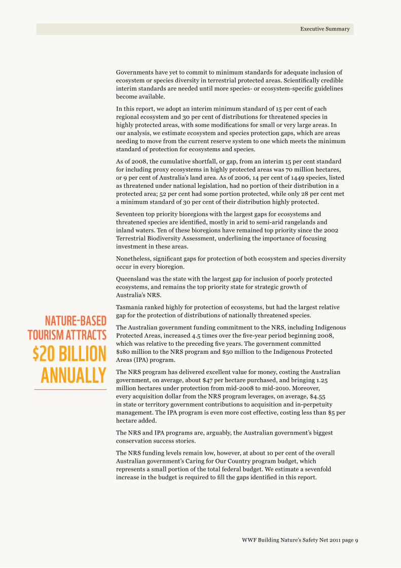
9WWF Building Nature’s Safety Net 2011 page
Executive Summary
Governments have yet to commit to minimum standards for adequate inclusion of ecosystem or species diversity in terrestrial protected areas. Scientifically credible interim standards are needed until more species- or ecosystem-specific guidelines become available.
In this report, we adopt an interim minimum standard of 15 per cent of each regional ecosystem and 30 per cent of distributions for threatened species in highly protected areas, with some modifications for small or very large areas. In our analysis, we estimate ecosystem and species protection gaps, which are areas needing to move from the current reserve system to one which meets the minimum standard of protection for ecosystems and species.
As of 2008, the cumulative shortfall, or gap, from an interim 15 per cent standard for including proxy ecosystems in highly protected areas was 70 million hectares, or 9 per cent of Australia’s land area. As of 2006, 14 per cent of 1449 species, listed as threatened under national legislation, had no portion of their distribution in a protected area; 52 per cent had some portion protected, while only 28 per cent met a minimum standard of 30 per cent of their distribution highly protected.
Seventeen top priority bioregions with the largest gaps for ecosystems and threatened species are identified, mostly in arid to semi-arid rangelands and inland waters. Ten of these bioregions have remained top priority since the 2002 Terrestrial Biodiversity Assessment, underlining the importance of focusing investment in these areas.
Nonetheless, significant gaps for protection of both ecosystem and species diversity occur in every bioregion.
Queensland was the state with the largest gap for inclusion of poorly protected ecosystems, and remains the top priority state for strategic growth of Australia’s NRS.
Tasmania ranked highly for protection of ecosystems, but had the largest relative gap for the protection of distributions of nationally threatened species.
The Australian government funding commitment to the NRS, including Indigenous Protected Areas, increased 4.5 times over the five-year period beginning 2008, which was relative to the preceding five years. The government committed $180 million to the NRS program and $50 million to the Indigenous Protected Areas (IPA) program.
The NRS program has delivered excellent value for money, costing the Australian government, on average, about $47 per hectare purchased, and bringing 1.25 million hectares under protection from mid-2008 to mid-2010. Moreover, every acquisition dollar from the NRS program leverages, on average, $4.55 in state or territory government contributions to acquisition and in-perpetuity management. The IPA program is even more cost effective, costing less than $5 per hectare added.
The NRS and IPA programs are, arguably, the Australian government’s biggest conservation success stories.
The NRS funding levels remain low, however, at about 10 per cent of the overall Australian government’s Caring for Our Country program budget, which represents a small portion of the total federal budget. We estimate a sevenfold increase in the budget is required to fill the gaps identified in this report.
NATuRE-BASED TOuRISM ATTRACTS $20 BILLION
ANNuALLy

10WWF Building Nature’s Safety Net 2011 page
Whole-of-landscape planning is essential for effective protection of biodiversity. This requires delineation of high conservation-value areas prioritized for inclusion in the NRS, as well as buffer and linkage areas surrounding the backbone of the present and future reserve system. They are the focal areas for complementary natural resource management (NRM) investments, farm management agreements, and land-use planning and regulations.
Private land protected areas, secured by covenants, continue to be promoted by many agencies, programs, and investment streams with very little coordination, transparency, or nationally consistent standards.
The rapid growth of nominally IUCN Category III–VI protected areas remains a concern in the absence of an objective, transparent national system for confirming the compatibility of extractive uses with the primary conservation purpose.
All protected areas on land and sea should be subject to a nationally consistent system for assigning IUCN management categories, for confirming the compatibility of uses with the primary conservation purpose, and for auditing management effectiveness.
Aerial photo of Epping Forest National Park, the last natural refuge of the northern hairy-nosed wombat, showing surrounding landscape cleared for livestock pasture right up to boundary.
© Q
Ue
en
Sla
nD
go
ve
rn
me
nt D
ePa
rtm
en
t of th
e e
nv
Iro
nm
en
t an
D r
eS
oU
rc
e m
an
ag
em
en
t.
Executive Summary

11WWF Building Nature’s Safety Net 2011 page
A flatback turtle hatchling: (Natator depressus)
the only marine turtle native to Australia’s
continental shelf, and highly threatened by
entanglement in fishing gear and plastic bags,
collision with boats, and coastal development.
© K
athe
rIn
e h
ow
ar
D/w
wf-a
US
tra
lIa.
1. 30 per cent, or at least 1000 hectares and 100 per cent of ecosystems smaller than 1000 hectares, of each benthic marine ecosystem is highly protected.
NATIONAL REPRESENTATIvE SySTEM OF MARINE
PROTECTED AREAS
OvER 26%OF AuSTRALIAN
WATERS NEED PROTECTION
Executive Summary
The Australian government adopted the Convention on Biological Diversity 2011–2020 Strategy with a target to list at least 10 per cent of coastal and marine areas under protected areas by 2020. Prevailing scientific opinion, however, supports a higher minimum level of protection.
In 2010, the Australian government committed to establish a representative network of marine parks by 2012 and to allocate appropriate funding for fisheries assistance, management, and enforcement. The government also re-confirmed their commitment to a national network of whale and dolphin sanctuaries.
The Australian government declared a conservation zone over the Coral Sea in 2008 and a proposed marine reserve network for the southwest marine planning region in 2011.
New state marine parks and marine national parks were announced in Queensland (Great Sandy with 6 per cent ‘no-fishing’ or ‘no-take’ zones, and Moreton Bay with 16 per cent ‘no-fishing’ or ‘no-take’ zones), South Australia, and Western Australia.
Governments have yet to adopt minimum standards and minimum percentage areas for inclusion of ecosystem- or species-diversity in ‘no-fishing’ or ‘no-take’ marine sanctuaries or reserves.
As of 2009, the cumulative shortfall, or gap, from an interim minimum standard of 30 per cent1 by area of each benthic marine ecosystem in marine sanctuaries was 253 million hectares, or 26 per cent of Australian waters.
Nominally, IUCN Category IV–VI zones dominate the marine parks that are considered to form the basis of the National Representative System of Marine Protected Areas (NRSMPA). But, generally, these zones are open to a range of uses, including commercial and recreational fishing. This is a significant concern for terrestrial protected areas and highlights the need for an objective, transparent national system for assigning IUCN management categories, for confirming the compatibility of extractive uses with the primary conservation purpose, and for auditing management effectiveness.

RECOMMENDATIONSRecommendation 1: The Australian government should increase the National Reserve System purchase grants program commitment to $240 million per annum for the decade 2011–2020, allowing grants for up to 75 per cent of total cost of acquisition of new highly protected areas.
54
Recommendation 2: The Australian government should further boost the level of funding for the Indigenous Protected Areas program and offer longer-term contracts for protected area management.
54
Recommendation 3: Australian governments should establish a nationally consistent and transparent process and set of standards for IUCN categorization, management effectiveness auditing, and compatibility of uses assessments for all protected areas.
54
Recommendation 4: In line with scientific guidance, all jurisdictions should commit to bringing at least 30 per cent of each marine ecosystem and threatened species distribution and 100 per cent of critical habitats for threatened species into marine sanctuaries by 2020. Jurisdictions should develop budgets appropriate to the need for ongoing management and implement a displaced activities policy.
66
Photo: whistling Kite, fogg Dam, northern territory.

© S
tUa
rt B
lan
ch
/ww
f-aU
Str
alIa
.
I

Woldendorp, Western Australia.
© r
Ich
ar
D m
cle
llan
/ww
f-aU
Str
alIa
.

ABOuT ThIS REPORT
Building Nature’s Safety Net is an independent audit of protected area establishment and funding. The reports are based on questionnaires and requests for data sent
to all jurisdictions as well as published data on protected areas — in particular the Australian government’s Collaborative Australian Protected Areas Database’s most recent release for 2008. This report is the third in a series with the two previous reports published in 2006 and 2008.1
This report details major conservation initiatives that have occurred since the last report, in which data was current to 2006, and highlights emerging issues.
A major enhancement on previous reports is the inclusion of ecosystem and threatened species gap analyses, and the reporting on Australia’s protected area systems on both land and sea.
We define a minimum standard for an adequate, representative, and comprehensive reserve system by sampling ecosystem and species level diversity.
Using the latest protected area and national species and ecosystem spatial data, we quantify the gaps: those areas needing to move from the current reserve system to one which meets the minimum standard.
We also use data provided by various parks agencies, from responses to a questionnaire (Appendix) or as published by the agencies, to detail financial investments in protected areas, and estimate the investment levels needed to fill the documented gaps.
We also identify critical policy changes needed to more effectively fill the identified gaps.

16WWF Building Nature’s Safety Net 2011 page
Terrestrial National Reserve System
There are a number of compelling reasons why protected areas are essential, not just for biodiversity, but, to our economy and way of life. People enjoy enormous economic and social benefits from protected areas, including:2
TERRESTRIAL NATIONAL RESERvE
SySTEMINTRODuCTION
— Climate control — Protected areas store 47 billion tonnes of carbon worldwide and are actively soaking up more from the air
— Disaster mitigation — Protected mangroves, reefs, forests, and floodplains buffer human communities against storms, flood, mudslides, and tsunamis
— Clean water — A third of the world’s largest cities obtain a significant portion of their clean drinking water from protected areas
— Food security — Protected areas harbour wild plant and animal genetic resources worth many billions of dollars every year to pharmaceutical and agricultural industries
— Poverty reduction — Protected areas prevent over-exploitation of wild-harvested plants and animals, especially fish stocks that poor communities depend on. They also provide cash revenue from tourism, valued at hundreds of billions of dollars worldwide. In Thailand and Costa Rica, researchers measured a net positive impact of protected areas on alleviation of poverty3
— Cultural heritage — Protected areas also protect many natural or semi-natural religious and cultural sites of great importance to human communities
— Tourism revenue — Nature-based tourism brings in $19.5 billion a year in foreign exchange, which is nearly 7 per cent of our total exports. Most of this comes from visits to national parks and other public-access protected areas.4 World Heritage listing is a premium attraction for tourists.5 The Great Barrier Reef alone attracts more than $6 billion a year in tourist-spending and supports 63,000 jobs.6 In Queensland, the priority state identified in this report, development of a comprehensive parks system could add another $400–$600 million a year in tourism revenue to the State economy.7
The principal role for protected areas is saving biodiversity from extinction. The first National Strategy for the Conservation of Australia’s Biodiversity, in 1996,8 recognised that the establishment of a comprehensive, adequate, and representative (CAR) system of protected areas was essential for effective conservation of Australia’s biodiversity, along with complementary reforms of land management, production, and development practices in the wider landscape.
The National Reserve System (NRS) was established in 1992, and was designed to bring together Australia’s state-, territory-, and Commonwealth-run national parks and reserves, private protected areas, and Indigenous protected areas into a dedicated, single system to conserve Australia’s unique biodiversity.9
Crucial to this pioneering system was the development of an agreement between the Australian, state, and territory governments to cooperate on strategic growth of the NRS. The Australian government established the National Reserve System Program to provide incentives including funds for land acquisition.

17WWF Building Nature’s Safety Net 2011 page
Terrestrial National Reserve System
WWF-Australia played an important role in the development of these commitments, launching a national protected areas campaign. WWF produced strategies for, and report cards on, the performance of governments’ development of the NRS.
In 2006 and 2008, WWF embarked on a renewed campaign to reinvigorate the commitment of governments to the NRS, through the Building Nature’s Safety Net reports.10
The commitment to a comprehensive, representative, and adequate NRS has continued. It was most recently reaffirmed in the release of Australia’s Strategy for the National Reserve System 2009–2030.11
Through adoption of the Strategy at the Natural Resource Management Ministerial Council meeting in May 2009, Australian, state, and territory governments committed to the following targets, to bring into protected areas:
— examples of at least 80 per cent of all regional ecosystems in each bioregion by 2015 (comprehensiveness)
— examples of at least 80 per cent of all regional ecosystems in each subregion by 2025 (representativeness)
— core areas for the long-term survival of threatened species by 2030
— critical areas for climate change resilience, such as refugia by 2030.
There are as yet no national minimum standards set for ‘adequacy’ in terms of the area, quality, or configuration of a sample or ‘example’ of an ecosystem or species habitat; standards that, if protected, would ensure long term persistence, low risk of extinction, and maintenance of normal ecological processes. Also, the scale and definition of a regional ecosystem varies between jurisdictions. Queensland follows a robust approach to delineating regional ecosystems as the intersection of bioregions, land zones, and vegetation types.12
To complicate matters, governments have also adopted various targets for total area protected.
In 2008, the Australian government adopted a Caring for Our Country program, with the aim of adding 25 million hectares. By 2013, the total area of the NRS, including Indigenous Protected Areas, would increase to 125 million hectares, from a baseline of 13 per cent growing to 16.25 per cent of Australia.
In 2010, The Australian government adopted the Convention on Biological Diversity (CBD) Strategy for 2011–2020, which included a new target to bring at least 17 per cent of terrestrial and inland waters under an ecologically representative system of protected areas by 2020.
If the Caring for Our Country target is achieved, and is strategically oriented to fill the gaps for priority ecosystems and species, it is likely Australia will also meet the 2020 CBD target.
In 2010, the Australian government released Australia’s Biodiversity Conservation Strategy, with ten interim targets — including that, by 2015, it would “achieve a national increase of 600,000 square kilometres of native habitat managed primarily for biodiversity conservation across terrestrial, aquatic, and marine environments.”13
This target needs to be more clearly separated into terrestrial and marine components. The terrestrial component should complement existing protected area targets under the NRS strategy, Caring for Our Country, and CBD targets discussed above. The marine component should apply to marine conservation areas outside of marine sanctuaries, which should have their own explicit target.
47 BILLION TONNES OF
CARBON STORED IN
PROTECTED AREAS

18WWF Building Nature’s Safety Net 2011 page
A MINIMuM STANDARD FOR ThE NATIONAL RESERvE SySTEM
Terrestrial National Reserve System
In the absence of nationally agreed criteria for ‘adequacy’ of the NRS, this report will use interim targets, based on the Nationally Agreed Criteria for the Establishment of a Comprehensive, Adequate and Representative Reserve System for Forests in Australia (the JANIS criteria),14 as follows.
– Terrestrial ecosystem diversity — On land, 15 per cent by area of the original total area of each regional ecosystem in highly protected areas. If 15 per cent of the original total area is less than 1000 hectares, a minimum of 1000 hectares should be highly protected. If the original total area is less than 1000 hectares, all of the original total area should be highly protected.
– Terrestrial species diversity — 30 per cent by area of threatened species current distributions and 100 per cent by area of their critical habitats in highly protected areas. If 30 per cent of the current distribution is less than 1000 hectares, a minimum of 1000 hectares should be highly protected. If the current distribution is less than 1000 hectares, all of the current distribution should be highly protected. Finally, if 30 per cent of the current distribution is larger than 10 million hectares, the highly protected area should be, at most, 10 million hectares.15
These standards are not permanent, but interim minimum standards, until actual ecological data is available to identify specific requirements for ensuring long-term preservation of particular ecosystems, communities, or species.
Importantly, the standards do not include other important aspects of ‘adequacy’, such as connectivity, configuration, habitat quality, or complementary management of surrounding land.
The threatened species’ 30 per cent standard proposed here is based on the current ‘known’ or ‘likely to occur’ distribution, not the original distribution. For some threatened species and ecosystems, such as those that have suffered a major contraction in distribution, 30 per cent of current distribution may not be an adequate level for long-term recovery. For this reason the standard also includes 100 per cent of critical habitats,16 where ‘critical habitats’ are defined as those critical to the recovery and long-term preservation of a species. The NRS strategy aims to include critical habitats in the NRS by 2030, although further clarification of the term ‘critical habitat’ is needed.17
What are highly protected areas?
To analyse gaps with regard to the proposed ‘adequacy’ standard above, we must distinguish ‘highly protected’ areas from those not highly protected.
In previous Building Nature’s Safety Net reports,18 we included IUCN Categories III and IV as highly protected areas; however, a review of the categories by the IUCN19 prompted us to re-examine their application in Australia. We found there are also nominally IUCN Category III or IV areas that, as applied in some parts of Australia, can allow grazing of livestock for commercial purposes in some instances. These include heritage agreements in South Australia (nominally IUCN Category III),20 conservation parks in Queensland (nominally IUCN Category III)21 and natural features reserves in Victoria (nominally IUCN Category IV).22

19WWF Building Nature’s Safety Net 2011 page
Apart from some (hopefully temporary) aberrations involving mining and livestock grazing,23 IUCN Categories I and II protected areas can be accurately referred to as highly protected because they are largely closed to all major extractive uses of natural resources in Australia.
Recognizing the ambiguity of the term, for the purposes of gap analysis that follows, we will define ‘highly protected’ as IUCN Categories I and II areas.
Box 1: Mining in private protected areas.
The Steve Irwin Wildlife Reserve is a pastoral lease purchased with assistance from the Australian government for addition to the National Reserve System as a private protected area in 2007, in tribute to the late wildlife champion, Steve Irwin. A bauxite exploration permit was issued by the Queensland Mines Department over a significant portion of the property. This was opposed in court and via a major international campaign by Australia Zoo.
The Bimblebox Nature Refuge in central Queensland was purchased with assistance from the Australian government in 2000 to become a private protected area (IUCN Category IV). It was subsequently gazetted by the Queensland government as a class VI Nature Refuge under state legislation. The Queensland government issued exploration permits for a coal mine.
Although these examples are based in Queensland, the issues can apply Australia-wide and extend beyond mining to other uses, in particularly farming livestock. These examples suggest the need for a type of protected area on private land with the same level of security as a National Park in addition to the existing types of private protected areas.
In 2000, the World Conservation Congress resolved that mining should not take place in IUCN Category I–IV protected areas. After initial opposition, the International Council of Mining and Metals, in 2003, adopted a new position to not mine World Heritage areas and is now exploring ‘no go’ criteria with IUCN.24
The Julia Creek Dunnart (Sminthopsis douglasi) is an endangered small marsupial carnivore, endemic to the high priority Mitchell Grass Downs bioregion. Habitat protection is low in reserves. The healthiest known population survives in Bladensberg National Park.
Terrestrial National Reserve System
© Patr
IcIa
wo
olle
y.

20WWF Building Nature’s Safety Net 2011 page
ChANGES IN TOTAL AREA
Protected Areas 2008-9IUCN management category
I-II
III-IV
V-VI
PROTECTED AREAS 2008–9: IuCN
MANAGEMENT CATEGORy
KEy I–II
III–IV
V–VI
Terrestrial National Reserve System
The Collaborative Australian Protected Areas Database latest release (2008) includes information on 100 million hectares of 9648 discrete terrestrial protected areas.25
This report uses these data, but excludes several categories from analysis. They are:
— external territories (10,906 hectares)
— areas not accepted in the NRS because they are for cultural, not biodiversity, protection (279,451 hectares)
— overlapping protected areas designations, which would be otherwise double counted (1,230,486 hectares).
This leaves 9314 discrete protected areas, covering 98.5 million hectares or 12.8 per cent of Australia (Fig. 1, Table 1).
Highly protected areas (IUCN Category I–II) cover 8.6 per cent of Australia’s land surface in 2008, while IUCN Category III–IV cover 0.7 per cent (Table 1).
Jurisdictions differed greatly in the relative proportions of highly and other protected areas (Table 1).
In 2008, as in 2006, Queensland remained the jurisdiction with the lowest relative total area of all protected areas, while the Northern Territory had the lowest relative total area for highly protected areas. New South Wales was also below the national average in total area (Table 1).
Indigenous or jointly managed protected areas were most common in the Northern Territory, Western Australia, and South Australia, yet negligible elsewhere, reflecting the distribution of Indigenous land ownership.26 Significant Indigenous ownership is growing in Queensland, on Cape York Peninsula, through the Queensland government’s Cape York Tenure Resolution process.
FIGuRE 1All marine and terrestrial
protected areas by IUCN protected area management
category (as of 2008 for terrestrial, and as of 2009
for marine). External territories are omitted.27

21WWF Building Nature’s Safety Net 2011 page
Table 1. Total areas of terrestrial protected areas as of 2008 by jurisdiction, percentage of jurisdiction area in IUCN management category, and percentage of protected areas in three governance categories.1
IUCN Management category
IUCN Governance category
Jurisdiction Area (ha) ALL I–II III–IV V–VI Government Indigenous/ Joint
Other non-government
ACT 238,813 54.2% 54.2% – – 54.2% 0.0% 0.0%
Tas 6,840,133 41.0% 24.1% 3.8% 13.1% 40.0% 0.3% 0.7%
SA 98,422,137 26.1% 16.7% 3.7% 5.7% 18.3% 6.4% 1.4%
Vic 22,754,364 17.1% 15.5% 0.7% 0.9% 17.0% 0.0% 0.1%
WA 252,700,808 14.5% 9.0% 0.3% 5.2% 9.4% 4.8% 0.3%
NT2 134,778,762 9.0% 4.7% 0.3% 4.0% 1.4% 7.1% 0.5%
NSW2 80,121,268 8.7% 8.2% 0.4% 0.1% 6.3% 2.3% 0.1%
Qld 172,973,671 6.0% 4.9% 0.1% 1.0% 5.0% 0.2% 0.8%
National average
768,826,956 12.8% 8.6% 0.7% 3.5% 8.3% 3.9% 0.5%
1 Australian government Department of Sustainability, Environment, Water, Population and Communities (2010) Collaborative Australian Protected Areas Database (CAPAD 2008–external), Commonwealth of Australia, Canberra, ACT.
Jurisdictions ordered from highest to lowest. Dark green cells are above, and light green below, the national average.
2 Protected areas under Commonwealth management: Kakadu and Uluru National Parks are included in the NT figures, while Booderee National Park is included in NSW figures. Protected areas in Australia’s external territories are not included. Jurisdictions are ordered from highest to lowest total area of protected areas.
© B
US
h h
er
Itag
e a
US
tra
lIa.
Red-finned blue-eye (Scaturiginichthys vermeilipinnis) is endemic to a handful of artesian springs on Edgbaston Reserve in central Queensland, threatened by invasive exotic fish (Gambusia holbrooki), diversion of spring water for agriculture and direct impacts by livestock and feral animals. The springs were acquired and fully protected by Bush Heritage Australia in September 2008 with funding from the Australian government’s NRS program. By protecting these springs, and managing threats like Gambusia and feral pigs, this Bush Heritage reserve is also conserving nationally threatened spring communities.
Terrestrial National Reserve System

22WWF Building Nature’s Safety Net 2011 page
The night parrot (Pezoporus occidentalis) is a ground-dwelling, seed-eating species endemic to the arid interior of Australia. It is endangered by livestock production, feral cats, and foxes. The night parrot is very rare and elusive. Less than four per cent of its distribution is protected according to the threatened species gap analysis in this report.29 © William Thomas Cooper watercolour.
Growth in area 2000–2008
Between 2000 and 2008, Australian protected areas grew by nearly 5 per cent of national land area; however, less than half of this growth was in highly protected areas (IUCN Category I–II) (Table 2).
Most jurisdictions, except the Northern Territory and Western Australia, grew at a rate below the national average. South Australian highly protected areas showed the most rapid increase over the decade.
Western Australia showed the greatest increase for all protected areas and second for highly protected areas.
All protected areas in the Northern Territory grew at above-average rates, but had the lowest rate of growth of highly protected areas.
Queensland’s highly protected areas grew at half the national rate in terms of percentage area increase per decade.
Over the last decade, New South Wales showed the lowest growth rate for all protected areas, but slightly exceeded Queensland and the Northern Territory for highly protected areas (Table 2). New South Wales has, however, made considerable investment in securing strategic acquisitions in high priority rangeland bioregions.
Required growth for 2020 CBD target
For Australia to reach the 17 per cent 2020 target under the Convention on Biological Diversity28 per decade growth rate of terrestrial protected areas must be maintained at 5 per cent, assuming that growth is achieved in an ecologically representative way. Growth rates must be considerably higher in those jurisdictions, Queensland in particular, where there is currently a relatively low total area and many unrepresented ecosystems. This means there must be even stronger biodiversity focus guiding the allocation of protected area funding.
The Booroolong frog (Litoria booroolongensis) is endemic to the open woodlands of inland NSW and Victoria. It is endangered by land clearing, direct damage of streams by livestock, and invasive weeds and fish. Only 17 per cent of its habitat was located in highly protected areas in 2006.30
© D
ave
hU
nte
r/n
Sw
De
Par
tme
nt o
f en
vIr
on
me
nt, c
lImate
ch
an
ge
an
D w
ater
.
Terrestrial National Reserve System

23WWF Building Nature’s Safety Net 2011 page
Table 2. Areas of all terrestrial protected areas and highly protected areas in 2000, 2006, and 2008, and inferred growth rate per decade by jurisdiction.1
Growth rate (% per decade)
2000 2006 2008
Jurisdiction All IUCN I–II All IUCN I–II All IUCN I–II All IUCN I–II
WA 9.7% 2.9% 6.7% 6.6% 13.3% 8.8% 14.5% 9.0%
NT 5.2% 0.1% 4.8% 4.6% 5.9% 4.8% 9.0% 4.7%
Tas 4.7% 2.3% 37.2% 22.3% 39.8% 23.1% 41.0% 24.1%
Vic 2.6% 1.8% 15.0% 14.1% 16.8% 15.0% 17.1% 15.5%
Qld 2.3% 1.3% 4.1% 3.9% 5.6% 4.7% 6.0% 4.9%
SA 2.1% 7.0% 24.4% 11.1% 25.5% 11.9% 26.1% 16.7%
ACT 1.8% 1.7% 52.8% 52.8% 54.0% 54.0% 54.2% 54.2%
NSW 1.8% 1.3% 7.3% 7.2% 8.4% 7.3% 8.7% 8.2%
National average
5.2% 2.4% 8.7% 6.7% 11.6% 7.7% 12.8% 8.6%
1 By jurisdiction ordered from highest to lowest relative to the national average for overall growth. Light green cells are below, and dark green cells above, the national average.
National Reserve System program additions since 2008
There has been a major increase in the total area of the NRS since 2008. A funding boost resulted in the addition of 4.2 million hectares under protection, an area equivalent to nearly 70 per cent of Tasmania. This area is dominated by new Indigenous Protected Areas. A more complete picture of this recent growth will not be available until the next Collaborative Australian Protected Area Database (CAPAD) is released.
ECOSySTEM GAP ANALySIS
Terrestrial National Reserve System
To independently assess the total area to which the NRS comprehensively, adequately, and representatively includes ecosystem diversity, we created a national scale proxy for regional ecosystems.
This was achieved through the intersection of Major Vegetation Subgroups (MVSG) of the National Vegetation Information System (NVIS v4) and subregions of the Interim Bioregionalisation of Australia (IBRA v6.1).31
In this report, we refer to these proxies for regional ecosystems as simply ‘proxy ecosystems’.
To quantify the gaps, where the NRS fell short of the 15 per cent interim adequacy standard defined above, we intersected the spatial data for proxy ecosystems with spatial data for the National Reserve System as of 2008.
For comparison with comprehensiveness and representativeness measures, reported in the 2008 Terrestrial Biodiversity Assessment, we used a less restrictive definition of ‘an example’32 as an area of at least 1000 hectares combined across all protected areas (or 100 per cent if the original total area was less than 1000 hectares).
Methods are detailed in endnote 33.

24WWF Building Nature’s Safety Net 2011 page
Results and discussion
A gap area of approximately 70 million hectares is considered to be in need of a high level protection on land to reach the minimum 15 per cent standard for each proxy ecosystem (Fig. 2).
Existing protected areas in IUCN Category III–VI protected areas could contribute to meeting the standard and thereby reduce this gap if there were a process to determine that they are conferring a high level of protection in practice.
Australia is nearly halfway toward representation of proxy ecosystem diversity to a 15 per cent target (Figures 2 and 3). Of the total area needed to meet the standard for each proxy ecosystem, 36 per cent is already in highly protected areas and a further 11 per cent in other protected areas, which, upon further analysis, could count towards the target. Some 51 per cent of the area required to meet the target is largely intact or remnant proxy ecosystems. To meet the minimum standard, an additional 2 per cent of previously cleared proxy ecosystems would also need to be protected and recovered to remnant status. This process could be financed by carbon offsets, if available, or from other restoration-oriented funding streams (Fig. 3).
Under-represented broad vegetation types on land are primarily rangelands, inland wetlands, and to a lesser extent, the forests (Fig. 2).
In the past, creation of new protected areas in pastoral regions has tended to arouse little interest from governments, compared with protecting icons or scenic attractions. Their creation has often been met with local opposition despite resulting growth in the local tourism industry. 34
The two global priority areas for WWF, South West Australia Ecoregion (SWAE) and the Great Barrier Reef catchments (GBR), showed large and significant gaps for protection of ecosystems (Fig. 2).
The Australian Capital Territory and Tasmania recorded the lowest gap areas of all the jurisdictions, relative to total state area. This result was to be expected as these two jurisdictions have the greatest percentage areas protected (Table 1).
Queensland recorded the lowest percentage area protected (Table 1) and the lowest attainment of the 15 per cent target among the states and territories (20 per cent highly protected, 23 per cent for all protected areas) (Fig. 2). The gap area of 20 million hectares required to meet the standard is, coincidentally, the same as the total area of all protected areas the Queensland government has committed to achieve by 2020. 35 Therefore, the Queensland government’s target is insufficient to fill the large gap. Nonetheless, the Queensland government’s 2008 commitment remains an important milestone toward a CAR reserve system. Queensland has mapped regional ecosystems for 79 per cent of the State’s area (current to 2005). 36 The proxy ecosystem maps developed for our report cover the entire state. This prompted a comparison between our gap analysis, based on proxy ecosystems, and a gap analysis based on the State’s own regional ecosystem mapping.
Using data tables provided by the Queensland government, 37 we separately estimated that the total attainment of the 15 per cent standard in 2005 was 19.3 per cent of the area of Queensland’s regional ecosystems. This was very close to the 23 per cent found in our proxy ecosystem gap analysis for 2008 (Fig. 2), including all categories of protected areas. This level of broad agreement between two estimates derived from different ecosystem data sets validates our proxy ecosystem analysis for Queensland.
quEENSLAND RECORDED ThE LOWEST PERCENTAGE
OF AREA PROTECTED
Terrestrial National Reserve System

25WWF Building Nature’s Safety Net 2011 page
New South Wales and the Northern Territory were also below the national average for attainment of the 15 per cent standard (Fig. 2, Table 1).
The Tasmanian government reported that, of 50 native forest communities, 35 (70 per cent) have at least 15 per cent of their estimated pre-European total area protected in government reserves. 38 This roughly matches the 65 per cent by area of proxy ecosystems protected to the 15 per cent target in this analysis, in highly protected areas (Fig. 2).
The Western Australian government published a detailed CAR analysis in 2009, which lists a total of 815 vegetation associations in the state reserve system. 39 This figure is comparable to the 680 delineated in our analysis for Western Australia. Using data tables provided by the WA government, we estimated the total attainment of the 15 per cent standard in 2009 was 46.6 per cent by area in nominally highly protected areas (in this case, IUCN Category I–IV). This is close to the estimate of 45 per cent attainment of the standard for proxy ecosystems in IUCN Category I–II reserves in 2008 (Fig. 2). This level of broad agreement between two estimates derived from different ecosystem data sets validates our proxy ecosystem analysis for Western Australia.
Comparisons with 2008 Terrestrial Biodiversity Assessment
The 2008 Biodiversity Assessment identified a gap area of 27 million hectares, whereas our analysis identified it as 70 million hectares. 40 We are unable to account for this large discrepancy because the methods used to estimate gap areas in the Biodiversity Assessment were not transparent.
The Biodiversity Assessment also concluded that the greatest gaps are located in the rangelands.
In Table 3, we provide estimates of the proportion of proxy ecosystems — with at least 1000 hectares in a protected area of some kind — for each Australian bioregion. Only five of the 85 bioregions attained a minimum standard, where there were ‘examples’ of least 1000 hectares for at least 80 per cent of proxy ecosystems in the National Reserve System. By comparison, 11 bioregions were reported to have met the target, with examples of at least 80 per cent of proxy ecosystems, in the Biodiversity Assessment.
The differences in results are likely due to methodological differences. The Biodiversity Assessment does not give a definition of an ‘example’, so it is likely that the examples were smaller in area than those in our analysis. Furthermore, state and territory ecosystem or vegetation mapping used in the Assessment was on a different scale from that used in our analysis.
Only 20 of the 403 subregions attained a minimum standard, where there were ‘examples’ of 1000 hectares for at least 80 per cent of proxy ecosystems. By comparison, 52 subregions were reported to have met the Biodiversity Assessment’s target in the 2008, which illustrates further the differences in methodology from our analysis.
Swamp stringybark (Eucalyptus conglomerata)
is an endangered tree endemic to coastal wetlands
of southeast Queensland. It is endangered by urban
development, and clearing for agriculture, drainage,
and road construction. Only 1100 individuals remain, and
less than 20 per cent of its distribution is protected.52
© Q
Ue
en
Sla
nD
mU
Se
Um
, Br
Uc
e c
ow
ell.
Terrestrial National Reserve System

26WWF Building Nature’s Safety Net 2011 page
ACT
Tas
Vic
WA
SA
NSW
NT
Qld
rainforest
forests
wetlands
woodlands
grass/shrublands
GBR catchments
SW Australia
Australia
Proportion of target area Gap (million ha)
0% 20% 40% 60% 80% 100% 0 10 20 30 40 50 60 70
99%
65%
58%
45%
42%
35%
34%
20%
75%
47%
43%
34%
33%
32%
71%
36%
0.001
0.33
1.42
18.06
9.62
4.45
16.03
20.12
0.19
8.32
1.44
33.08
27.00
4.33
1.61
Jurisdictions
70.03
Terrestrial National Reserve System
KEy
Attainment strict PAs
Attainment other PAs
Gap all PAs (%)
FIGuRE 2Percentages by area of attainment
of the minimum standard of 15 per cent of original total area
of proxy ecosystems in highly protected areas (Category IUCN
I–II), other protected areas (IUCN Category III–VI), and
completely unprotected (i.e. gap). These statistics are divided into
jurisdictions, broad vegetation types, and WWF priority regions.
Right hand graph shows total areas (ha) of gaps for highly
protected areas. Note: Existing IUCN Category III–VI areas could
be used to fill these gaps to the total area if they could be shown
to be highly protected in practice.

27WWF Building Nature’s Safety Net 2011 page
ThREATENED SPECIES GAP ANALySIS
Terrestrial National Reserve System
FIGuRE 3Breakdown of the 15 per
cent minimum standard for terrestrial proxy ecosystems into area already protected,
highly (IUCN Category I–II) or otherwise , and gap areas
broken into those still with original vegetation, and those previously cleared
but considered recoverable. See endnote 42.
GAP: ORIGINAL vEGETATION (51%)
GAP: CLEARED AND RECOvERABLE (2%)
ALREADy PROTECTED hIGhLy PAS (36%)
ALREADy PROTECTED OThER PAS (11%)
In this report, we identify species gaps using the Australian government’s compilation of distributional data for 1,447 species listed as threatened under the Environment Protection and Biodiversity Conservation Act 1999 (EPBCA species).43
We considered a species protected to a minimum standard if 30 per cent of its distribution is located within highly protected areas, with modifications for small and large areas detailed above.
Most EPBCA species were found to have some part of their distribution captured in the reserve system; however, only 28 per cent were found to be included in highly protected areas to the minimum standard of at least 30 per cent of their ‘known’ or ‘likely to occur’ distributions (Fig. 4). An analysis by Watson et al. (2011) found similar results from the same data.44
By comparison, a recent Australian government assessment found that 23 per cent of a total of 13,463 not exclusively threatened species were considered ‘well-represented’ in the NRS, meaning that more than 45 per cent of point location records fell inside the NRS; while 65 per cent were considered ‘adequately represented’, meaning that between 10 and 45 per cent of point location records fell in the NRS.45 Using such statistics as indicators of performance in species diversity protection is problematic: 10 to 45 per cent is a low proportion for adequate representation of threatened species; and, the assessment did not distinguish threatened species from non-threatened species.46
Queensland’s and New South Wales’ highly protected areas included a greater proportion of EPBCA species habitats than that of proxy ecosystems (Figures 2 and 4). In a separate report, the Queensland government states 25.3 per cent of non-EPBCA state-threatened species have below 10 per cent of their habitats protected compared with 42 per cent of EPBCA species found in our analysis. The Queensland government also reported that 19.7 per cent of state-threatened species have less than 5 per cent of distribution protected, compared with 32 per cent of EPBCA species in our analysis. The Queensland government’s report further states that 9 per cent of state threatened species have over 95 per cent of their critical habitats in the reserve system. These discrepancies are likely to stem from the use of point records, rather than the modelled distributions used here, and also because the states reported on their own threatened species, whereas we are reporting on EPBCA species.47

28WWF Building Nature’s Safety Net 2011 page
The Northern Territory reported that 30 per cent of their listed animal species, and 34.3 per cent of 35 of their listed plant species, have negligible populations inside protected areas. This result is consistent with the 33 per cent of EPBCA species with no habitat in highly protected areas found in our analysis.48
Tasmania showed high levels of ecosystem inclusion and the second most extensive reserve system of all jurisdictions (Fig. 2, Table 1), but displayed a low level of inclusion of EPBCA species (Fig. 4). Most EPBCA species are found in the poorly protected regions, such as Tasmanian midlands. The 2008 Biodiversity Assessment reports that from 2002 to 2007, nine state threatened species of plants, and nine threatened species of animals, moved to a more endangered status due to genuine population decline in Tasmania.49
Victoria reported that 93 per cent of native plant and 86 per cent of native animal species had been recorded in parks.50 Our analysis shows that only 30 per cent of EPBCA species in Victoria meet the standard for protection (Fig. 4).
NSW* (336)
WA(375)
VIC (134)
Australia (1449)
QLD(345)
NT (58)
SA (96)
TAS (105)
Proportion of nationally threatened species
0% 10% 20% 30% 40% 50% 60% 70% 80% 90% 100%
26%
22%
12%
30%
28%
28%
34%
30%
33%
10%
19%
5%
14%
18%
11%
14%
On or over target for highly protected areas Below for highly PAs, but on or over for all PAs Below target for highly PAs None in highly PAs
Terrestrial National Reserve System
FIGuRE 4 Proportions of 1449 nationally
threatened species with 30 per cent or more of their distribution included
in highly protected areas; less than 30 per cent in highly protected areas
but with 30 per cent or more in all protected areas; less than 30 per cent
protected in any protected area; and those with no representation in highly protected areas. Jurisdictions appear
in descending order of proportions meeting the standard. Numbers of
species appear in brackets. * ACT was included in NSW figures for
this analysis.
KEy
On or over target for highly PAs Below for highly PAs, but on or over for all PAs
Below target for highly PAs
None in highly PAs

29WWF Building Nature’s Safety Net 2011 page
© D
eP
t of e
nv
Iro
nm
en
t an
D c
on
Se
rvatIo
n.
© K
athe
rIn
e h
ow
ar
D/w
wf-a
US
tra
lIa.
Silky Eremophila (Eremophila nivea) is an endangered plant species
endemic to south-western Western Australia. There
are only six populations remaining in narrow road
reserves in a largely cleared landscape. Less than one per
cent of its known/predicted distribution is found in a
protected area. 51
Carnaby’s black-cockatoo chick (Calyptorhynchus
latirostris), pictured here with WWF-Australia
President Dr Denis Saunders, is endangered by clearance
of banksia heathlands for urban development and
agriculture in the Southwest Australia Global Biodiversity Hotspot. In 2006, only 11 per
cent of its distribution was highly protected.53
NATIONAL RESERvE SySTEM BIOREGIONAL PRIORITIES
BASED ON GAPS
Terrestrial National Reserve System
Over the past three decades, the ecosystem approach to NRS design has been a very successful strategy in building a CAR reserve system for Australia. However, NRS growth guided solely by the inclusion of ecosystems does not account for other biodiversity values, such as threatened species and habitats, which is required under the NRS strategy. Conversely, NRS prioritisation based solely on species, or criteria such as
connectivity, can lead to sub-optimal allocation of effort. Using only EPBCA species as a guide, Tasmania would be considered the top priority state requiring effort, despite it having the second most extensive reserve system of all jurisdictions.
We re-evaluated bioregional priorities using an index that combined ecosystem and EPBCA gaps, expressed as a percentage of the bioregion area. We stress that our findings are an indicator of priority only, not an accurate estimate of the total gap. This is because we were unable to completely remove double-counting of areas with overlapping gaps (Table 3, Fig. 5). There were some surprises, such as the Tiwi-Coburg bioregion being identified as a top priority. Nonetheless, this approach compares well with the earlier bioregional prioritisation in the 2002 Terrestrial Biodiversity Assessment, which was based on bioregional comprehensiveness, ecosystem representation, and threat (Fig. 6).
Many of the same bioregions remain top priorities, including Brigalow Belt North (BBN), Mitchell Grass Downs (MGD), and much of western New South Wales and the Northern Territory.
The arid and semi-arid rangelands and woodlands, and inland wetlands remain the top priority gap bioregions for both ecosystems and threatened species.
The reprioritization suggested here (Fig. 5) should be regarded as a coarse-scale guide only for comparison among bioregions. It should not be substituted for more comprehensive finer-scaled analysis using dynamic optimisation tools like Marxan, which can simultaneously accounts for ecosystem and species diversity, other targeted biodiversity, ecological ‘assets’, and cost of protection.54 The use of such tools, and their predecessors, has made Australia a leader in reserve design since the 1980s. 55 The re-zoning of the Great Barrier Reef marine park followed such a systematic approach. 56
The systematic conservation planning work currently being led by WWF-Australia in the southwest Australia biodiversity hotspot is the latest example of Australia’s leadership in this domain.57

30WWF Building Nature’s Safety Net 2011 page
Tab
le 3
. P
rior
itie
s ba
sed
on c
ombi
ned
prox
y ec
osys
tem
and
EPB
CA
spe
cies
gap
s co
mpa
red
wit
h th
e 20
02 A
sses
smen
t ran
k, fo
r al
l IB
RA
6.1
bio
regi
ons,
as
wel
l as
area
s an
d pr
opor
tion
s pr
otec
ted
in 2
00
4, 2
00
6, a
nd 2
00
8, a
nd a
reas
of e
cosy
stem
s an
d sp
ecie
s m
eeti
ng m
inim
um s
tand
ards
. For
bio
regi
on c
odes
see
http
://w
ww
.env
iron
men
t.go
v.au
/par
ks/n
rs/s
cien
ce/c
apad
/20
04/
ibra
code
.htm
l.
Bio
-re
gio
nJu
ris-
dic
tio
nP
rio
rity
ra
nk
200
81
Pri
ori
ty
ran
k 20
02
2
Are
a (m
illi
on
h
a)
All
PA
s 20
08
(m
illi
on
h
a)
All
PA
s 20
04
(%
)
All
PA
s 20
06
(%
)
All
PA
s 20
08
(%
)
% o
f al
l P
A i
n
IUC
N
I–II
No.
pro
xy
eco
syst
ems
Co
mp
re-
hen
sive
nes
s3G
ap
(m h
a)N
o.
EP
BC
sp
p.4
Mee
tin
g 30
% s
td
(%)
Avg
. gap
(h
a)4
TIW
NT
15
1.01
0.20
520
.3%
20.3
%20
.3%
100.
0%14
36%
0.11
80.
00%
34,8
04
CP
NSW
11
7.38
50.
178
2.4%
2.4%
2.0%
100.
0%72
19%
0.89
10.
00%
485,
102
PIL
WA
13
17.8
211.
512
8.5%
8.5%
6.3%
98.8
%65
29%
1.33
30.
00%
1,14
1,64
9
FIN
NT
11
7.38
0.0
030.
0%0.
0%0.
0%0.
0%48
2%1.
124
0.0
0%7,
353
CR
WA
11
10.1
184.
984
49.3
%49
.3%
49.3
%0.
0%30
50%
1.52
20.
00%
15,6
78
TAN
NT
11
25.9
974.
437
17.1
%1.
4%1.
6%0.
0%29
38%
3.90
10.
00%
25,8
73
CA
NT
11
3.46
20.
003
0.1%
0.1%
0.0%
0.0%
176%
0.52
0
AR
CN
T1
23.
332
0.84
125
.2%
25.7
%3.
3%0.
0%41
39%
0.50
110
0%
STU
NT
11
9.85
80.
069
0.7%
0.2%
0.2%
29.5
%26
27%
1.46
0
BR
TN
T1
17.
380.
019
0.3%
0.3%
0.3%
99.5
%31
6%1.
09
10.
00%
1,0
00
MG
DQ
ld1
133
.532
0.40
51.
2%1.
2%1.
2%91
.5%
151
17%
4.69
90.
00%
22,6
52
DL
WA
11
8.36
20.
086
1.0%
1.0%
1.0%
100.
0%40
13%
1.17
30.
00%
3,83
1
EIU
Qld
12
11.7
190.
491
4.2%
3.8%
3.0%
70.8
%77
30%
1.56
140.
00%
22,0
22
BB
NQ
ld1
113
.613
0.27
22.
0%2.
0%1.
6%68
.4%
212
22%
1.83
234.
30%
6,83
8
GU
PQ
ld1
222
.058
0.56
52.
6%2.
5%2.
5%96
.4%
111
18%
2.78
10.
00%
230,
497
DA
BN
T1
22.
092
0.05
22.
5%2.
5%2.
5%54
.3%
956
%0.
280
1 N
.B. T
he in
dica
tor
was
cal
cula
ted
as t
he to
tal e
cosy
stem
gap
sho
rt o
f the
15%
eco
syst
em s
tand
ard
for
all p
rote
cted
are
as, a
dded
to t
he a
vera
ge g
ap fo
r sp
ecie
s ti
mes
the
squ
are
root
of t
he
num
ber
of E
PBC
spe
cies
. Sim
ply
addi
ng u
p al
l the
spe
cies
gap
s do
es n
ot a
llow
for
the
fact
tha
t man
y sp
ecie
s di
stri
buti
ons
over
lap.
A s
quar
e ro
ot c
alcu
lati
on w
as fo
und
to la
rgel
y, b
ut n
ot
enti
rely
, acc
ount
for
such
dou
ble-
coun
ting
. Col
ours
indi
cate
ran
king
from
hig
hest
(1, p
urpl
e) to
low
est (
5, g
reen
) ra
nked
, ord
erin
g ba
sed
on t
he in
dex
and
divi
ding
into
fiv
e eq
ual g
roup
s of
17
bio
regi
ons.
See
Fig
ure
5.
2 C
urre
nt r
eser
ve p
rior
ity
in t
he tb
lIB
RA
tab
le o
f the
Aus
tral
ian
Gov
ernm
ent’s
20
02 T
erre
stri
al B
iodi
vers
ity
Ass
essm
ent d
atab
ase.
See
Fig
6.
3 N
.B. T
his
is n
ot t
he p
ropo
rtio
n of
pro
xy e
cosy
stem
s m
eeti
ng t
he 1
5% s
tand
ard,
but
the
pro
port
ions
mee
ting
a lo
wer
sta
ndar
d of
at l
east
10
00h
a in
clud
ed in
pro
tect
ed a
reas
of a
ny k
ind,
or
100%
if t
he to
tal e
cosy
stem
are
a w
as le
ss t
han
this
. Tho
se b
iore
gion
s m
eeti
ng t
he 8
0% c
ompr
ehen
sive
ness
tar
get a
re h
ighl
ight
ed in
gre
en.
4 O
nly
coun
ting
EPB
CA
-lis
ted
spec
ies
that
hav
e 50
% o
r m
ore
of t
heir
dis
trib
utio
n in
the
par
ticu
lar
bior
egio
n. A
vera
ge g
ap is
the
geo
met
ric
aver
age
of t
he a
reas
of t
he g
aps
fall
ing
shor
t of t
he
stan
dard
of 3
0% o
f the
dis
trib
utio
n in
a p
rote
cted
are
a of
any
kin
d.
Terrestrial National Reserve System

31WWF Building Nature’s Safety Net 2011 page
MII
Qld
12
6.66
40.
194
2.9%
2.8%
2.8%
89.8
%39
18%
0.89
0
GAW
SA2
412
.364
1.59
912
.9%
12.9
%12
.9%
75.6
%91
49%
1.57
90.
00%
25,8
38
DE
UQ
ld2
36.
885
0.21
23.
1%3.
0%2.
8%78
.8%
9622
%0.
914
0.0
0%64
1
CH
CSA
23
30.6
192.
198
7.2%
7.2%
6.9%
42.0
%18
941
%3.
838
12.5
0%73
,967
DM
RN
T2
25.
805
0.11
62.
0%2.
0%2.
0%98
.4%
254%
0.76
0
BH
CSA
21
5.68
20.
152
2.7%
2.7%
1.4%
95.5
%40
38%
0.74
0
ML
Qld
22
25.1
670.
773.
1%2.
8%2.
6%94
.8%
234
28%
3.20
40.
00%
24,0
65
GSD
WA
22
39.5
253.
296
8.3%
4.2%
4.3%
28.0
%58
40%
5.01
0
RIV
Vic
22
9.71
30.
328
3.4%
2.7%
2.2%
57.7
%12
237
%0.
9710
0.0
0%80
,077
LSD
WA
22
11.0
90.
514
4.6%
4.6%
4.6%
100.
0%20
25%
1.38
0
DR
PN
SW2
110
.699
0.18
91.
8%1.
8%1.
6%86
.0%
145
16%
1.31
0
BE
LTa
s2
40.
657
0.10
115
.4%
15.2
%14
.6%
20.0
%22
45%
0.0
86
16.7
0%40
9
NA
NN
SW2
12.
70.
078
2.9%
2.8%
1.9%
97.1
%33
30%
0.32
825
.00%
621
TN
MTa
s2
10.
415
0.02
25.
2%4.
2%3.
5%3.
7%20
15%
0.05
70.
00%
914
STP
SA2
313
.42
0.96
57.
2%7.
2%7.
3%74
.3%
6442
%1.
562
50.0
0%1,
188
BB
SQ
ld2
227
.225
1.24
44.
6%4.
5%3.
2%82
.7%
363
23%
2.88
5320
.80%
3,80
0
OV
PW
A2
312
.541
1.47
11.7
%7.
1%7.
1%60
.4%
5133
%1.
281
100%
FL
BSA
22
7.12
60.
399
5.6%
5.6%
4.6%
72.3
%10
228
%0.
7122
45.5
0%24
1
CM
CQ
ld3
31.
463
0.16
311
.1%
10.5
%9.
7%94
.8%
9135
%0.
1411
72.7
0%11
MU
RW
A3
228
.121
2.05
77.
3%6.
7%1.
1%85
.0%
3569
%2.
480
KIN
Tas
35
0.42
50.
075
17.7
%17
.6%
16.4
%26
.4%
2245
%0.
04
1127
.30%
171
MA
CN
T3
33.
929
0.55
914
.2%
14.0
%13
.7%
61.8
%23
57%
0.33
1241
.70%
273
HA
MW
A3
41.
088
0.15
914
.6%
14.6
%14
.6%
100.
0%7
86%
0.0
90
VV
PV
ic3
12.
440.
045
1.9%
1.4%
1.4%
75.3
%27
26%
0.14
140.
00%
11,7
09
Bio
-re
gio
nJu
ris-
dic
tio
nP
rio
rity
ra
nk
200
81
Pri
ori
ty
ran
k 20
02
2
Are
a (m
illi
on
h
a)
All
PA
s 20
08
(m
illi
on
h
a)
All
PA
s 20
04
(%
)
All
PA
s 20
06
(%
)
All
PA
s 20
08
(%
)
% o
f al
l P
A i
n
IUC
N
I–II
No.
pro
xy
eco
syst
ems
Co
mp
re-
hen
sive
nes
s3G
ap
(m h
a)N
o.
EP
BC
sp
p.4
Mee
tin
g 30
% s
td
(%)
Avg
. gap
(h
a)4
Terrestrial National Reserve System

32WWF Building Nature’s Safety Net 2011 page
NE
TN
SW3
33.
002
0.27
99.
3%9.
1%8.
6%98
.7%
139
29%
0.23
3441
.20%
217
VB
NT
34
7.30
11.
099
15.1
%15
.1%
15.1
%99
.9%
3735
%0.
541
100%
TSE
Tas
33
1.10
60.
158
14.3
%14
.0%
12.4
%46
.4%
2744
%0.
08
3129
.00%
42
CK
WA
31
7.67
60.
889
11.6
%8.
3%4.
4%71
.9%
3824
%0.
551
100%
TN
STa
s3
40.
623
0.0
8513
.7%
13.6
%12
.6%
31.2
%22
41%
0.0
46
16.7
0%43
6
NSS
NSW
31
8.77
50.
214
2.4%
2.3%
2.3%
97.8
%41
17%
0.60
812
.50%
2,85
5
SEQ
Qld
33
7.85
91.
073
13.7
%13
.3%
13.2
%81
.2%
197
38%
0.53
129
31.0
0%45
0
CA
RW
A3
48.
428
0.96
411
.4%
11.4
%3.
7%99
.1%
3256
%0.
559
88.9
0%2
CO
OW
A3
312
.912
1.78
913
.9%
13.9
%10
.3%
78.5
%46
50%
0.80
1520
.00%
1,05
9
KA
NSA
35
0.81
20.
163
20.0
%19
.9%
19.2
%73
.8%
3829
%0.
04
2114
.30%
730
GV
DSA
35
41.8
7510
.784
25.8
%25
.8%
25.8
%59
.1%
9058
%2.
364
50.0
0%14
9
GA
SW
A4
318
.075
1.86
210
.3%
10.3
%1.
9%99
.5%
4450
%0.
962
0.0
0%29
,201
MD
DV
ic4
419
.656
3.0
8115
.7%
15.6
%15
.4%
80.8
%14
138
%1.
08
2441
.70%
319
AR
PN
T4
52.
306
0.48
721
.1%
21.1
%21
.1%
100.
0%16
56%
0.13
540
.00%
159
SCP
Vic
43
1.74
90.
163
9.3%
9.3%
7.4%
61.2
%59
41%
0.0
913
23.1
0%34
5
CY
PQ
ld4
512
.116
2.43
220
.1%
16.0
%13
.8%
81.8
%14
645
%0.
6548
27.1
0%79
3
FL
ITa
s4
50.
534
0.16
330
.6%
30.1
%30
.4%
49.8
%48
58%
0.03
742
.90%
103
GD
WA
44
15.6
295.
5835
.7%
35.7
%34
.6%
33.1
%22
82%
0.79
0
EY
BSA
43
6.0
910.
8514
.0%
13.9
%13
.3%
46.5
%10
331
%0.
2815
6.70
%8,
028
GF
UN
T4
111
.848
1.33
911
.3%
11.3
%9.
7%93
.9%
2438
%0.
571
100%
SSD
SA4
527
.292
8.54
331
.3%
28.8
%28
.8%
76.2
%63
48%
1.31
0
VM
Vic
43
3.47
0.37
910
.9%
10.9
%10
.7%
94.7
%60
47%
0.16
1957
.90%
13
AWW
A4
19.
517
0.25
32.
7%2.
7%2.
4%98
.1%
4344
%0.
3975
1.30
%2,
176
GU
CN
T4
12.
711
0.49
18.1
%10
.9%
11.0
%60
.2%
1839
%0.
112
0.0
0%2,
041
Bio
-re
gio
nJu
ris-
dic
tio
nP
rio
rity
ra
nk
200
81
Pri
ori
ty
ran
k 20
02
2
Are
a (m
illi
on
h
a)
All
PA
s 20
08
(m
illi
on
h
a)
All
PA
s 20
04
(%
)
All
PA
s 20
06
(%
)
All
PA
s 20
08
(%
)
% o
f al
l P
A i
n
IUC
N
I–II
No.
pro
xy
eco
syst
ems
Co
mp
re-
hen
sive
nes
s3G
ap
(m h
a)N
o.
EP
BC
sp
p.4
Mee
tin
g 30
% s
td
(%)
Avg
. gap
(h
a)4
Terrestrial National Reserve System

33WWF Building Nature’s Safety Net 2011 page
NC
PSA
43
2.45
80.
231
9.4%
9.1%
9.0%
54.4
%71
41%
0.0
99
44.4
0%77
SWA
WA
44
1.52
60.
1610
.5%
10.4
%10
.2%
99.7
%31
42%
0.0
635
5.70
%52
4
NN
CN
SW4
53.
996
0.97
924
.5%
23.7
%22
.6%
99.5
%19
546
%0.
1434
61.8
0%26
SBN
SW4
53.
811.
458
38.3
%37
.2%
37.0
%99
.4%
206
38%
0.13
108
42.6
0%37
SEH
Vic
44
8.0
951.
485
18.3
%18
.1%
17.5
%96
.7%
207
41%
0.27
4932
.70%
160
NK
WA
54
8.40
71.
249
14.9
%14
.9%
14.5
%97
.2%
1753
%0.
234
25.0
0%3,
161
WT
Qld
55
1.99
90.
9949
.5%
48.7
%47
.2%
79.0
%12
040
%0.
0571
81.7
0%2
YAL
WA
54
5.0
871.
456
28.6
%23
.9%
9.8%
85.0
%36
58%
0.11
988
.90%
2
NU
LSA
55
19.7
236.
234
31.6
%31
.6%
31.6
%86
.8%
3956
%0.
421
100%
JFW
A5
24.
509
0.62
813
.9%
14.1
%5.
1%98
.1%
2962
%0.
08
4926
.50%
133
TC
HTa
s5
50.
768
0.43
256
.2%
56.1
%55
.8%
50.9
%24
67%
0.01
911
.10%
1,18
5
TSR
Tas
55
0.78
20.
324
41.4
%41
.4%
40.8
%91
.4%
2548
%0.
017
42.9
0%9
SEC
Vic
55
2.55
50.
881
34.5
%34
.2%
33.8
%98
.7%
8634
%0.
0229
44.8
0%19
GS
WA
54
3.14
0.56
618
.0%
17.5
%15
.2%
99.9
%33
58%
0.02
5742
.10%
80
MA
LW
A5
57.
398
1.33
218
.0%
18.0
%17
.9%
99.9
%33
55%
0.05
2334
.80%
293
DA
CN
T5
52.
842
0.82
929
.2%
29.2
%29
.2%
96.3
%12
83%
0.01
475
.00%
7
TW
ETa
s5
51.
564
1.32
484
.7%
84.7
%82
.1%
61.2
%22
59%
0.01
710
0%
ESP
WA
55
2.91
80.
837
28.7
%28
.7%
28.6
%99
.5%
2966
%0.
0158
62.1
0%20
WA
RW
A5
50.
844
0.39
546
.7%
46.5
%31
.3%
99.8
%14
79%
0.0
014
50.0
0%11
PC
KN
T5
52.
852
1.21
442
.6%
42.6
%42
.6%
99.0
%11
82%
0.0
04
25.0
0%56
2
AA
Vic
55
1.21
50.
774
63.7
%63
.6%
63.7
%98
.6%
2990
%0.
00
1687
.50%
Nat
iona
l76
8.73
497
.92
12.7
%11
.6%
10.5
%67
.0%
5655
36%
70.0
313
2034
.80%
Bio
-re
gio
nJu
ris-
dic
tio
nP
rio
rity
ra
nk
200
81
Pri
ori
ty
ran
k 20
02
2
Are
a (m
illi
on
h
a)
All
PA
s 20
08
(m
illi
on
h
a)
All
PA
s 20
04
(%
)
All
PA
s 20
06
(%
)
All
PA
s 20
08
(%
)
% o
f al
l P
A i
n
IUC
N
I–II
No.
pro
xy
eco
syst
ems
Co
mp
re-
hen
sive
nes
s3G
ap
(m h
a)N
o.
EP
BC
sp
p.4
Mee
tin
g 30
% s
td
(%)
Avg
. gap
(h
a)4
Terrestrial National Reserve System

34WWF Building Nature’s Safety Net 2011 page
GVD ML
GSD
CHC
MGD
BBSSSD
TAN
MUR
PIL
NUL
GD
GUP
GAS
STP
EIU
RIV
BBN
AW
CR
DL
MDD
COOCP
LSD
OVP
NK
GAW
CYP
DRP
GFU
CK
VBSTU
MII
NSS
FIN
SEH
JF
FLB
CAR
MAL
BRT
SEQ
DEU
SB
BHC
YAL
EYB
DMR
CA
GS
NNC
MAC
ESP
NET
SECVMNCP
VVP
NAN
PCK
ARCDAC
WT
GUC
ARP
DAB
TWE
SWA
TSE
AA
CMC
HAM
TSR
TCH
SCP
BEL
WAR
TNS
TIW
FLI
KAN
TNM
KIN
2008 bioregional priority ranksBased on combined ecosystem and species gaps
1 (High)
2
(L )
Terrestrial National Reserve System
FIGuRE 5New priorities for
bioregions based on indicative combined gap
for ecosystems and EPBCA species. See Table 3 for detailed index values.58
2008 BIOREGIONAL PRIORITy RANKS:
BASED ON ECOSySTEM
AND SPECIES GAPS
KEy 1 (high)
2
3
4
5 (low)

35WWF Building Nature’s Safety Net 2011 page
GVD ML
GSD
CHC
MGD
BBSSSD
TAN
MUR
PIL
NUL
GD
GUP
GAS
STP
EIU
RIV
BBN
AW
CR
DL
MDD
COOCP
LSD
OVP
NK
GAW
CYP
DRP
GFU
CK
VBSTU
MII
NSS
FIN
SEH
JF
FLB
CAR
MAL
BRT
SEQ
DEU
SB
BHC
YAL
EYB
DMR
CA
GS
NNC
MAC
ESP
NET
SECVMNCP
VVP
NAN
PCK
ARCDAC
WT
GUC
ARP
DAB
TWE
SWA
TSE
AA
CMC
HAM
TSR
TCH
SCP
BEL
WAR
TNS
TIW
FLI
KAN
TNM
KIN
2002 bioregional priority ranks1 (High)
2
(L )
Terrestrial National Reserve System
FIGuRE 6Bioregional rank priorities
for expansion of the National Reserve System
from the 2002 Terrestrial Biodiversity Assessment.
See Table 3 for more detail.
2002 BIOREGIONAL PRIORITy RANKS
KEy 1 (high)
2
3
4
5 (low)

36WWF Building Nature’s Safety Net 2011 page
FINANCING STREAMS
Terrestrial National Reserve System
To obtain a comprehensive picture of investments in protected areas, we sent questionnaires (Appendix) to state and
territory agencies, as well as to other non-government and local government partners who might also make investments.
Our sources included Annual Reports from government agencies, and information made available from Australian Senate Estimates hearings.
National Reserve System Program
In 2008, the Australian government committed $180 million to the NRS program budget for 2008–2013, which is a fivefold increase compared with the previous five-year period. In addition, $50 million was committed to Indigenous Protected Areas, and $90 million to employ Indigenous rangers under the Working on Country program, many of whom work on Indigenous Protected Areas (Fig. 7).59
This commitment was a welcome response to the recommendation of the 2008 Building Nature’s Safety Net report, which recommended an increase in funding to at least $250 million over five years, if Australia was to make sufficient progress toward its long-stated goal of long-term recovery and preservation of Australia’s biodiversity. However, as we will detail below, this level of funding is insufficient to fill the gaps found in this analysis.
The NRS program funds a number of streams, including the Protected Areas on Private Land conservation covenanting programs, which are now extended to every state, and fosters liaison with local government protected area programs and with agricultural and natural resource management bodies. The main investment stream, however, is in land purchase grants.
The delivery of this new funding started slowly in 2008, due to the administrative reorganisation attending the new Caring for Our Country program.60
By June 2010, 44 new properties had been purchased, covering nearly 1.3 million hectares — an area larger than metropolitan Sydney (Table 4).
NRS purchase grants have been very cost effective for the Australian government, averaging less than $47 per hectare added during the two years from July 2008 to June 2010 (Table 4).
This applies to only Australian government-funded additions and does not include additions made by states, territories, and private and Indigenous partners without Australian government assistance. The jurisdictions have their own investment streams in acquisition (Table 6) and in management (Table 7), as well as assistance to private land protected areas (Table 8).
Every NRS program dollar invested is estimated to leverage, on average, $4.55 in contributions by state and territory government partners as co-payments for acquisition and capitalised in-perpetuity management (Tables 4–7).

37WWF Building Nature’s Safety Net 2011 page
Based on the information available on ‘per hectare’ investment levels, we estimate the amount of federal NRS program funds needed to fill the 70 million hectare proxy ecosystem gap can be filled in a number of ways. We assume:
— 60 per cent of the gap (42 million hectares) would be filled by purchases with the NRS program paying up to 75 per cent of the purchase price. This would require approximately $2.4 billion over 10 years 61
— the remainder of the gap would be filled by re-assessing existing protected areas in IUCN Categories III–VI to confirm that they are highly protected, and by using private and Indigenous protected area approaches that do not require purchase
— the threatened species gaps would be filled simultaneously by selecting areas for inclusion in protected areas, where ecosystem and species gaps overlap.
A 75 per cent contribution to acquisitions, compared with the current 66 per cent by Australian government, is justified by the four-to-five times greater contribution by partners in terms of acquisition, establishment costs, and in-perpetuity management (Table 4). Grants of more than two-for-one are not unprecedented. The Steve Irwin Wildlife Reserve was purchased with a 100 per cent Australian government grant in 2007. 62
The total cost of the NRS purchase program, including purchase and in-perpetuity capitalized management by the NRS partners, was estimated to average $260 per hectare (adding lines 2–4 in Table 4) where, on average, $47 comes from the Australian government.
The Australian government has a strong interest in expanding the NRS as the most important and most enduring legacy in the landscape. The NRS program should be the principal biodiversity conservation stream in the environment budget.
© m
fIDle
r.
Gouldian Finches (Erythrura gouldiae).
Terrestrial National Reserve System

38WWF Building Nature’s Safety Net 2011 page
Box 2: Bowra Sanctuary, a significant recent National Reserve System program purchase.
In 2010, the Australian Wildlife Conservancy purchased Bowra Sanctuary near Cunnamulla, with $1.2 million assistance from the Australian government’s National Reserve System (NRS) program, and matching support from Birds Australia, Birds Queensland, Bird Observation and Conservation Australia (BOCA), and generous private donors. Bowra lies on the Warrego River plains in the Mulga Lands, one of the highest priority bioregions for the NRS (Table 3).
Bowra Sanctuary is internationally renowned as one of Australia’s most rewarding birdwatching destinations. The 14,000 hectare sanctuary is home to more than 200 bird species, including many threatened and declining species. The stunning pink Major Mitchell’s cockatoo, painted honeyeater, brown treecreeper, squatter pigeon, crested bellbird, and diamond firetail are all found here. Around 50 species of waterbirds, including the threatened Australian Painted Snipe, have been spotted in the numerous wetlands and waterholes now protected at Bowra.
Bowra also provides refuge for a large number of mammals. It is home to the threatened Kultarr, the narrow-nosed planigale, and more than 80 species of frogs and reptiles, including the vulnerable yakka skink.
© w
ayn
e la
wle
r.
Indigenous Protected Areas Program
Indigenous Protected Areas (IPAs) have cost the Australian government less than $5 per hectare (Fig. 7, Table 4). IPAs also require ongoing management support from the Australian government in the form of Indigenous Ranger employment and threat abatement programs.
The Indigenous ranger Working on Country program has received funding well above the original $90 million, for 300 ranger jobs, promised in the 2007 federal election, through additional ‘Closing the Gap’ funding. There are now 630 new ranger positions.63 However, it is unknown what proportion of these rangers are working in Indigenous Protected Areas.
OvER 50 SPECIES
WATERBIRDS ARE NOW
PROTECTED AT BOWRA
Terrestrial National Reserve System
Bowra Sanctuary woodlands.

39WWF Building Nature’s Safety Net 2011 page
© K
leIn
& h
UB
er
t.
Warru, or black-footed rock-wallaby (Petrogale lateralis),
recently received a major boost in habitat protection in the
Kalka-Pipalyatjara Indigenous Protected Area in the northwest
corner of South Australia (declared in April 2010).
630 NEW
INDIGENOuS RANGER
POSITIONS
At present, IPA and Working on Country project contracts are short-term, for less than five years. Longer-term IPA contracts would provide the enduring security needed to deliver the in-perpetuity conservation management commitment required of a protected area. This funding security would greatly assist in ‘Closing the Gap’ on Indigenous disadvantage, giving Traditional Owners, who wish to, the means to live and work in remote areas looking after their traditional country. 64
There are precedents for long-term protected area or conservation contracts. The Australian government already make lease payments on 99-year leases to the Indigenous owners and co-managers of Booderee, Kakadu, and Uluru-Kata Tjuta National Parks. The Australian government also engages landholders in 15-year Environmental Stewardship Program contracts.65
Private land protected areas
Investments in protected area covenants over private lands should, theoretically, be more cost effective than purchase. All that is needed is a program of incentives to encourage landholders to enter into covenant agreements and ongoing management to achieve the conservation purpose. The Australian government has published figures on investments in two major private land covenanting programs (Tables 4 and 5).
The long-standing NRS Protected Areas on Private Land project in Tasmania has averaged $421 per hectare investment from 1999 to 2010, or, on average, $39 per hectare per annum over this 11-year period (Table 4). However, we must calculate the average over the length of the program, since the area was smaller at the commencement of this period and the annual investment levels would have been higher. This average figure doesn’t account for changes in the value of the dollar. We can correct annual investments by jurisdictions in acquisition and management of public reserves to the same real dollar values (Table 4).
Outside of the NRS program, in the wider Caring for Our Country program, the Australian government reports that it has invested approximately $7.6 million on 8,247 hectares of private land covenants (Table 5). This produces an inordinate figure of $927 per hectare. The accuracy and reliability of this figure is highly questionable, based on the uncertainties raised in the footnotes to the table,66 and the lack of methodological details that underpin the data.
Terrestrial National Reserve System

40WWF Building Nature’s Safety Net 2011 page
Table 4. Major Australian government investment in terrestrial protected areas, and leveraged investments for the National Reserve System program purchase grants stream.
Program $ invested Area added (ha)
$/ha average
1. Combined NRS program acquisitions or IPA additions (CFOC July 2008–June 2010)
$74,069,025 4,250,025 $17.43
2. NRS program acquisition grants (CFOC July 2008–June 2010)
$60,185,008 1,285,960 $46.80
3. Leveraged contributions by partners: acquisitions (CFOC 2008–2010)
$35,250,500 As above $27.41
4. Leveraged contributions by partners: capitalised management in perpetuity
$238,479,215 As above $185.45
5. Indigenous Protected Area Program (CFOC 2008–2010) $13,884,017 2,964,065 $4.68
6. Covenants: NRS program, PAPL (Tasmania only 1999–2010)
$2,636,723 6,263 $421.00
7. Covenants: non-NRSP CFOC programs (see table 5, exclude NT, 2008–2010)
$7,645,826 8,247 $927.10
1 Data courtesy Parks Australia Annual Reports. Note: covenanting components for NRS protected areas on private land sub program not included since no reliable dollar and hectare figures are available nation-wide.
2 Not including $11.36m in water buyback contribution by the Australian government for the purchase of Toorale Station in 2008. Average spend per ha was $31.44 in 2009–10. Data courtesy Parks Australia Annual Reports and Senate Estimates Hansard 21/10/2008.
3 Only includes co-contributions for successful NRS program grant applications. Also not including additional investments by other partners that do not involve co-funding by Australia government. Partners are primarily state governments, receiving 67% of all CFOC grants issued, with minor contributions of local government (13%), Indigenous (15%) and NGO partners (5%). Data courtesy Parks Australia Annual Reports.
4 $10.96/ha is the total annual management funding of all parks agencies (excluding ACT) divided by the total area managed from July 2007–June 2009 according to annual reports and responses to surveys in Table 7. Quantum shown is the endowment needed to generate this annuity in perpetuity for a nominal interest rate of 5.91% the Reserve Bank average target where Endowment=Annuity/Interest rate. Analysis assumes management costs for other non-government partners are of the same order.
5 Of a total $50m commitment for period 2008–2013.
6 Protected Areas on Private Land in Tasmania. Breakdown into pre- and post-CFOC not provided. Data courtesy Parks Australia Annual Reports.
7 See Table 5. Excludes NT where figures were incomplete.
Terrestrial National Reserve System

41WWF Building Nature’s Safety Net 2011 page
Terrestrial National Reserve System
Table 5. Investments from the Australian government Caring for Our Country program toward private land covenanted protected areas, apart from the NRS program, by jurisdiction.1
State/Territory Amount of non-NRS, non-IPA Caring for our Country funding spent
on covenanting ($)2
Area under covenants using non-NRS, non-IPA
Caring for our Country funds (ha)
Proportion of this area considered part
of NRS (ha)
ACT 0 0 n/a
New South Wales $169,000 50 To be determined
Northern Territory3 $319,335 To be determined To be determined
Queensland 0 0 n/a
South Australia 0 0 n/a
Tasmania $117,000 347 300 (86%)
Victoria4 $5,840,326 6,440 3260 (61%)
Western Australia5 $649,500 750 To be determined
National project6 $870,000 660 To be determined
Total $7,965,161 8,247
1 Source: Answer to Question on Notice 9, Senate Standing Committee on Environment, Communications and the Arts; Legislation Committee, Environment, Water, Heritage and the Arts portfolio, Additional Estimates, February 2010: webpage http://www.aph.gov.au/Senate/committee/eca_ctte/estimates/add_0910/ewha/program_1-1.pdf accessed 7 April 2011.
2 “May compare funding across different years in different jurisdictions”. For source, see footnote 1.
3 “The Northern Territory project design did not establish a target area (ha) for anticipated covenants – sites needing protection will be identified, followed by the area of land to be covered by a covenant.” For source, see footnote 1.
4 “Victorian figures include Caring for our Country funding provided to regional NRM organisations for developing management plans for new acquisitions, and funding approved for regional NRM organisations to provide to the Trust for Nature to seek new covenants on behalf of regional NRM organisations in Victoria.” For source, see footnote 1.
5 “Western Australia figures are for a three year Caring for our Country project; the funding details provided above are only approximate and relate to establishing at least 250ha of new covenants, plus improving management of existing covenants on approximately 500ha of private land. The three year funding breakdown for this component is approximated as follows:
• Yr 1 2009–10: $129,900;
• Yr 2 2010–11: $324,750
• Yr 3 2011–12: $194,850”
For source, see footnote 1.
6 “National project figures are for a Caring for our Country project which operates in NSW, Victoria and Tasmania.” For source, see footnote 1.

42WWF Building Nature’s Safety Net 2011 page
Therefore, we caution against direct comparisons of these figures with other per-hectare figures presented in Table 4.
Based on the figures provided by the Australian government, it may seem that covenants are more expensive than simply buying land for a national park. This may be the case, on average; however, it does not seem so when comparing covenanting by the existing landholder with the option of purchase and in-perpetuity management by a state agency or conservancy of the exact same property.
Although we welcome this early attempt at introducing some financial accountability into the Caring for Our Country covenant programs, important details are lacking with which to better interpret the data. For example, it is not clear whether the figures provided by the Australian government include stewardship payments of up to 15 years. If they did, this could mean that investment in covenants was only $62 per hectare per annum if all of the funds were directed to 15-year stewardship contracts, and if the total figures were reliable and accurate.
Also, other items appear to be included in Table 5 that should not be there. The figure for Victoria includes Caring for our Country funding provided to regional NRM organisations for developing management plans for new acquisitions. Funding related to acquisitions should not be included in reports on covenant expenditure.
In addition to Australian government funding, state, territory, and local governments and non-government agencies, such as the Trust for Nature organisations and regional NRM and catchment management bodies, all have their own investments into private land protected areas under covenants. We attempted to obtain information via questionnaire from all of the bodies known to be involved in private land protected areas, but the response rate was too low to justify reporting the results here. At most, we are able to provide such information as was provided by state and territory agencies in Table 8.
New South Wales government investments in the management of private protected areas were quite high, indeed much higher on a per-hectare basis than the government’s investments in managing its own estate (Tables 7 and 8). Investments by the Queensland government were highly variable — likely resulting from different Nature Refuges being awarded the competitive NatureAssist grants in any given year. Investments by the South Australian government were the lowest of those that responded (Table 8).
There are other government contributions to private land protected areas that are largely hidden and unaccounted for. Some jurisdictions offer tax and land rates rebates for conservation covenants. Some landholders with covenants67 may also qualify for income tax and capital gains tax relief from the Australian government; however, this is not reliably beneficial and may, in some cases, produce a net loss after paying for the valuation.68
This discussion highlights a need for greater financial accountability and transparency around the respective levels of public and private investment into private protected areas, and the need for much closer administrative coordination of acquisition, covenanting, and other conservation programs through integrated bioregional planning. In most agencies, these programs are run independently of one another.
The fundamental principle that should apply in all cases, with all protected area decisions of any type, is whether or not the decision made offers the best biodiversity return on investment relative to other available options.
Terrestrial National Reserve System

43WWF Building Nature’s Safety Net 2011 page
Box 3: Bringing covenants in the Western Australian wheatbelt into the NRS.
The Southwest Australia biodiversity hotspot is a critical place for private protected area investment. The area is highly cleared and fragmented. Recent analysis shows high degrees of irreplaceable habitats in the intensive agricultural zone.69 Threatened remnant vegetation persists as tens of thousands of fragments on mostly cleared wheat-/sheep-producing properties. Wholesale purchase for creation of new reserves is expensive and impractical compared with the alternative of negotiating protected area covenants over high value areas.
A key opportunity is presented by the more than 2000 thirty-year Agreements to Reserve (ATR) created under the State government’s Remnant Vegetation Protection Scheme during the 1990s (see map, below).
Many of these agreements, which also involved provision of stock exclusion fencing, are due to expire within the next 10–12 years. Much of this remnant vegetation is high priority for protection in the National Reserve System (NRS)
Gimlet (Eucalyptus salubris).
© m
IcK
Dav
IS/w
wf-a
US
tra
lIa.
Terrestrial National Reserve System
and only requires a revision of the management plan and negotiation of a new perpetual conservation agreement meeting NRS standards in collaboration with conservation covenant service providers. This process has been tested and shown to be legally feasible.
Since 2000, WWF has been working with a mixture of federal environment funding toward greater inclusion of private land manager participation in the NRS. WWF and Wheatbelt NRM, with NRS program funding, is negotiating new covenants and upgrading ATRs over high priority ecosystems and habitats to bring them into the NRS.

44WWF Building Nature’s Safety Net 2011 page
WWF Building Nature’s Safety Net 2011
44WWF Building Nature’s Safety Net 2011 page
Regional Natural Resource Management organisations
Regional NRM and catchment management bodies are playing an greater role in delivering NRS outcomes under the Caring for Our Country program, investing $207,300 of base-level funding in 2008–9, and over $1 million in 2009–10. 70
We regard this as an extremely valuable and welcome initiative by the NRM organisations.
NRM organisations could greatly enhance the delivery of NRS and Caring for Our Country outcomes by closer coordination of NRS strategies, playing a greater role in promoting covenant investments, and ensuring the land uses in buffer and linkage areas complement the reserve system.
Terrestrial National Reserve System
Daly River, Northern Territory, Australia.
© S
tUa
rt B
lan
ch
/ww
f-aU
Str
alIa
.

45WWF Building Nature’s Safety Net 2011 page
$0
$10
$20
$30
$40
$50
$60
$70
$80
2003/4 2004/5 2005/6 2006/7 2007/8 2008/9 2009/10 2010/11 2011/12 2002/13
National Reserve System Program
Indigenous Protected Area Program
Working on Country(Indigenous Ranger funding)
Act
ua
l or
pro
mis
ed a
nn
ua
l in
vest
men
t ($
mil
lion
)
12 3
1
3
2
Senate Inquiry into National Parks recommends funding increase.
Australian government doubles spending on protected areas and IPAs and commits $47m to new Working on Country Program.
Australian government commits: $180m over five years for NRS program, $50m over five years for the IPA program and $90m over five years for Working on Country.
Terrestrial National Reserve System
FIGuRE 7Annual Australian
government investments up to 2007/8 and subsequent
commitments to three programs significant to the
development of the National Reserve System.

46WWF Building Nature’s Safety Net 2011 page
Terrestrial National Reserve System
Table 6. Jurisdictional investments in expansion of terrestrial protected areas 2007–2009.
2007/8 2008/9
$ Acquisition Area (ha) $/ha $ Acquisition Area (ha) $/ha
NSW1 $36,072,000 26,927 $1,339.62 $37,584,000 42,644 $881.34
NT none none none none
QLD $24,000,000 64,248 $373.55 $7,900,000 574,141 $13.76
SA $1,996,552 219,063 $9.11 $1,785,000 1,426 $1,251.75
Tas No data provided No data provided
Vic2 No data provided No data provided
WA3 $2,264,000 149,450 $15.15 $3,700,000 115,707 $31.98
1 Includes a significant component of establishment costs $21.6m in 2007–8 and $23.6m in 2008–9 compared with $14.472m and $13.984m for acquisition respectively.
2 Victoria did not provide any data. Victoria has had a consistent conservation land purchase budget of $1 million for a number of years and another $1 million for the purchase of the Summerlands estate (to add to Phillip Island Nature Park). This latter buyback is now finished.
3 WA did not provide data. These data are taken from Annual Reports of the Department of Environment and Conservation. Actual increase in the DEC managed estate in 2007–8 was 42,729ha. This is a smaller area than that acquired since areas acquired take time to be gazetted. In 2008–9 the actual increase in area was 63,430ha.
© m
IKe
gr
IffIthS
.
Salmon Gum (Eucalyptus salmonophloia), Yerecoin in Western Australia.

47WWF Building Nature’s Safety Net 2011 page
Terrestrial National Reserve System
Tab
le 7
. Ju
risd
icti
onal
inve
stm
ents
in m
anag
emen
t of p
rote
cted
are
as o
n la
nd 2
00
7–20
09
com
pare
d w
ith
base
line
20
04–
2005
.
200
4–51
200
7–8
200
8–
9
$(2
00
9)
Man
agem
ent2
Are
a (h
a)$/
ha
$(2
00
9)
Man
agem
ent3
Are
a (h
a)$/
ha
$ M
anag
emen
tA
rea
(ha)
$/h
a
Vic
4$1
56,6
06,
700
3,45
5,01
0$4
5.33
$173
,284
,740
3,95
1,0
00
$43.
86$1
86,0
67,0
00
3,96
9,0
00
$46.
88
NSW
$213
,570
,00
05,
900,
441
$36.
20$2
31,0
22,8
606,
722,
00
0$3
4.37
$239
,770
,00
06,
765,
00
0$3
5.44
C’w
lth 5
$66,
630,
450
2,13
1,30
0$3
1.26
$63,
291,
00
02,
130,
774
$29.
70$6
1,18
0,0
00
2,13
0,77
4$2
8.71
Tas 6
$34,
306,
800
1,72
4,35
9$1
9.90
$45,
274,
740
2,50
0,0
00
$18.
11$4
5,0
63,0
00
2,50
0,0
00
$18.
03
QL
D$8
1,36
0,0
00
7,13
3,27
1$1
1.41
$93,
840,
00
08,
580,
00
0$1
0.94
$95,
00
0,0
00
9,29
7,0
00
$10.
22
NT
$32,
781,
300
4,40
5,71
4$7
.44
$28,
038,
780
4,47
2,95
4$6
.27
$28,
282,
00
04,
472,
954
$6.3
2
WA
7$1
18,7
63,0
00
17,0
56,4
89$6
.96
$73,
297,
200
23,4
25,3
65$3
.13
$74,
089
,00
027
,371
,881
$2.7
1
SA 8
$79,
100,
00
013
,754
,159
$5.7
5$5
4,20
1,78
020
,932
,191
$2.5
9$5
1,34
5,0
00
20,9
33,0
88$2
.45
Nat
iona
l av
erag
e$7
16,4
87,8
00
53,4
29,4
42$1
3.41
$698
,960
,10
070
,583
,510
$9.9
0$7
19,6
16,0
00
75,3
08,
923
$9.5
6
1 Sa
ttle
r, P
S a
nd T
aylo
r, M
F J
. 20
08.
Bui
ldin
g N
atur
e’s
Safe
ty N
et 2
008
. Pro
gres
s on
the
Dir
ecti
ons
for
the
Nat
iona
l Res
erve
Sys
tem
. WW
F-A
ustr
alia
Rep
ort,
WW
F-A
ustr
alia
, Syd
ney.
2 U
sing
Res
erve
Ban
k of
fici
al in
flat
ion
rate
s, $
1 in
20
05
was
wor
th $
1.13
in 2
00
9.
3 U
sing
Res
erve
Ban
k of
fici
al in
flat
ion
rate
s, $
1 in
20
08
was
wor
th $
1.02
in 2
00
9.
4 Ju
risd
icti
ons
are
orde
red
from
hig
hest
to lo
wes
t inv
estm
ent l
evel
s pe
r he
ctar
e. T
hose
col
oure
d da
rk g
reen
are
abo
ve, a
nd t
hose
col
oure
d lig
ht g
reen
bel
ow t
he n
atio
nal a
vera
ge.
V
icto
ria
retu
rned
no
resp
onse
to o
ur s
urve
y. F
igur
es t
aken
from
Par
ks V
icto
ria
and
DSE
Ann
ual R
epor
ts in
clud
ing
200
4–5
figu
res
whi
ch d
iffe
r fr
om t
hose
in S
attl
er a
nd T
aylo
r (2
00
8).
Tota
l ope
rati
ons
budg
et s
how
n an
d fi
gure
s sh
own
incl
ude
man
agem
ent o
f pro
duct
ion
fore
sts
not j
ust p
rote
cted
are
as.
5 D
irec
tor
of N
atio
nal P
arks
Ann
ual R
epor
ts.
6 N
o re
spon
se to
sur
vey.
Fig
ures
tak
en fr
om O
utpu
t:2.
01 P
arks
and
Wild
life
Man
agem
ent i
nclu
ding
mar
ine
man
agem
ent f
rom
Dep
artm
ent o
f Env
iron
men
t, P
arks
, Her
itag
e an
d th
e A
rts
Ann
ual R
epor
ts.
7 N
o re
spon
se to
sur
vey.
Fig
ures
tak
en fr
om D
epar
tmen
t of E
nvir
onm
ent a
nd C
onse
rvat
ion
Ann
ual R
epor
ts.
8 SA
did
res
pond
to d
ata
requ
est b
ut f
igur
es p
rovi
ded
wer
e in
com
plet
e. A
ll th
ree
repo
rtin
g ca
tego
ries
of p
ublic
land
ste
war
dshi
p, f
ire
and
visi
tor
man
agem
ent f
rom
Ann
ual R
epor
ts o
f th
e D
epar
tmen
t of E
nvir
onm
ent a
nd H
erit
age
are
show
n co
mbi
ned
here
.

48WWF Building Nature’s Safety Net 2011 page
Table 8. Jurisdictional investments in management of private land protected areas in 2007–2009.
2007–8 2008–9
$ invested 1 Area (ha) 2 $/ha $ invested Area (ha) $/ha
NSW $121,920,000 534,626 $228.05 $102,362,000 541,104 $189.17
NT none none
Qld $234,000 2,480 $94.35 $1,873,000 114,404 $16.37
SA $734,000 102,887 $7.13 $571,340 100,728 $5.67
Tas No data provided No data provided
Vic No data provided No data provided
WA No data provided No data provided
1 “Questionnaire 1.1(C) Total assistance ($1000s) provided by the government for management of, or threat abatement on non-government protected areas including private land covenants” Uncorrected figures are shown, not corrected to 2009 dollars.For source, see Appendix.
2 “Questionnaire 1.1(D) Total area (ha) of non-government protected areas where these management investments were applied (NB. This is the total area of all non-government protected areas in which government incentives or grants were invested, not the combined footprint of the management projects themselves)” For source, see Appendix.
WhOLE OF LANDSCAPE CONSERvATION
$10 MILLION TOWARDS
ThE WILDLIFE CORRIDORS
PLAN
Terrestrial National Reserve System
At present, conservation investment allocations are made by many organisations, agencies, departments and sections. While these diverse groups are broadly working towards the principles of developing a comprehensive,
adequate and representative reserve system, within the context of a functioning landscape, differing sets of internal criteria influence the selection of new additions to the NRS. Increased coordination of all of these stakeholders is essential to optimise investments and lead to more efficient and coordinated conservation outcomes. Optimal allocation of alternative conservation options, based on biodiversity benefit for cost, for whole landscapes, is feasible provided data are adequate. 73
A major issue for future reserve design is climate change. Protected area designs that include likely future distributions of species under climate change have been performed elsewhere, but have yet to happen in Australia on a national scale.74 We see this as a high priority.
The current approach of defining national, state, or regional systems of wildlife corridors should be based on rigorous analysis of this kind.
National Wildlife Corridors Plan
The Australian government recently committed $10 million towards development of a national Wildlife Corridors plan.75 A national plan across all 56 natural resource management regions will be developed to identify corridors linking national parks and reserves. This would allow migration of native animal and plant species in response to climate change, while also retaining or enhancing natural carbon stores in native ecosystems.

49WWF Building Nature’s Safety Net 2011 page
Terrestrial National Reserve System
We welcome the Wildlife Corridors commitment although we caution against over-emphasis on connectivity as the most critical, adaptive response to climate change. In some cases, connectivity may not be achievable even by fully intact natural ecosystems. For example, mountaintop endemics may be little-served by linkages to other mountaintops if the linkages pass through inhospitable lowland areas. Measures such as identifying and protecting refugia may be more critical for building ecological resilience.76
The proposal has potential to define priority areas for delivering incentives — such as by regional Natural Resource Management project grants, stewardship payments, or incentives for retention/recovery of natural ecosystems via the Carbon Farming Initiative (Box 4) — to landholders who retain natural vegetation.
These initiatives complement, by buffering and linking, the NRS; however, they do not address the need for strategic growth of the NRS as the top national conservation priority.
Moreover, it is crucial for all the initiatives to be developed using sound information about actual species’ needs in a changing climate.
Box 4: Carbon Farming Initiative.
In 2010, the Australian government proposed a Carbon Farming Initiative, to develop a standard for voluntary biocarbon offsets in the rural landscape, covering a wide range of activities including reforestation and fire, soil, and livestock management.71
This new initiative should give prominence to retention and recovery of native vegetation to restore landscape connectivity, provided that it does not delay the much-needed transition to a renewable energy economy and does meet rigorous carbon accounting rules.
In some parts of Australia, particularly in Queensland, substantial natural regrowth potential exists for many vegetation types, offering a cost-effective alternative to plantings. The Queensland government’s Carbon Accumulation Through Ecosystem Recovery (CATER) project will inform landholders and offset purchasers of the stocks carbon present in native vegetation. Such a project has the advantage of greatly reducing verification costs of offsets and allowing biodiversity conservation co-benefits to be assessed. 72
We estimate that 2 per cent of the 70 million hectare gap for proxy ecosystem protection described below would require revegetation or recovery of previously cleared ecosystems (Fig. 3).
Protection of intact systems is the highest priority and likely to have the lowest cost. Carbon farming payments could provide a means to offset the higher cost of recovery of such ecosystems provided other key criteria can be satisfied.
More typically, however, carbon farming projects could complement core National Reserve System areas, by protecting valuable buffer and linkage habitats of lower value.
CARBON FARMING ShOuLD GIvE PROMINENCE
TO RECOvERy OF NATIvE
vEGETATION

50WWF Building Nature’s Safety Net 2011 page
NATIONAL STANDARDS FOR uSE OF IuCN CATEGORIES
hIGhLy PROTECTED
AREAS CONTRIBuTE
SIGNIFICANTLy TO ThE RECOvERy
OF ThREATENED SPECIES
Terrestrial National Reserve System
The critical importance of the NRS as the backbone of the national effort to recover threatened species and communities is demonstrated by recent analysis showing high correlation between overlap with highly
protected areas and stabilisation of trends of threatened species. 77
Three major policy gaps undermine confidence in the extent to which protected areas are genuinely protected. They are:
— lack of transparency and consistency in applying IUCN management categories
— lack of a process to confirm that protected areas open to extractive uses and nominated as protected areas meet IUCN protected area definitions and guidelines
— lack of adoption by governments of nationally consistent standards and processes for auditing management effectiveness.
Nominally protected areas on land and sea may, at present, be broadly open to extractive uses. Often on a commercial scale, these include mining, oil and gas developments, fishing, logging, and livestock production. Even private protected areas purchased with Australian government assistance are at risk of mining (Box 1).
A protected area, under the IUCN guidelines, must be dedicated specifically to conservation. This means conservation must be recognised as the primary land or sea use, as “many protected areas will have other values of equal importance, at least to some stakeholders (e.g. spiritual values), but that in the event of conflicting interpretations, nature conservation must take precedence.” 78
Under IUCN Category guidelines any extractive uses permitted in a category VI protected area must:
— actually further or advance the primary conservation purpose
— leave the area in a largely natural condition (with the exact proportion to be decided by national governments)
— be low-level and non-industrial. 79
In the absence of a resolution of these major policy gaps, we have taken a cautious approach and only refer to areas as highly protected as those that were likely to be entirely free of extractive natural resource uses.
We stress, however, that this does not mean we rule out other IUCN Categories as, by their nature, insufficiently protected to count toward minimum standards.
An objective, transparent process for assigning IUCN Categories is needed. This would confirm compatibility of extractive uses and enable auditing of management effectiveness.
Such a process should be developed and implemented as a high priority. If this process existed, many of the protected areas in IUCN Category III–VI might legitimately be regarded as highly protected, significantly reducing the gaps estimated in the foregoing analyses.

51WWF Building Nature’s Safety Net 2011 page
Terrestrial National Reserve System
MANAGEMENT EFFECTIvENESS
Do protected areas work?
Recently, there has been much criticism of protected areas as the chief tool for arresting biodiversity loss. Protected area gap analyses are often negatively presented as protected areas being “in the wrong places”. 80
Increasing investment emphasis has been placed on ‘tenure-blind’ conservation, natural resource management, or stewardship contracts that do not change the primary land use from extractive use to conservation (only the way existing extractive land-uses are conducted). Although there was a recent boost in funding, the Australian government currently devotes only approximately 10 per cent of its total conservation budget to expansion of protected areas.
These criticisms have been aired in a vacuum of empirical evidence about which conservation approaches are most effective in arresting biodiversity loss.
In a recent analysis for 841 nationally threatened terrestrial species in Australia, it was found that species with greater distributional overlap of highly protected areas had proportionately more populations that were increasing or stabilizing. This correlation was robust to geographic range size, data quality differences, and total area of protection. Measures other than highly protected areas, such as IUCN Categories V and VI protected areas and numbers of recovery actions and natural resource conservation actions, showed no significant positive associations with stabilizing or increasing trends in this study.81 A similar result was found for birds in South African protected areas. 82
Empirical evidence suggests that highly protected areas contribute significantly to the stabilization or recovery of threatened species, but it provides little support for other conservation approaches at a national scale. Other conservation approaches may, in time — or in local case studies — be shown to have significant benefits if data are collected appropriately.
Investments in management
Very significant differences exist among jurisdictions regarding the level of investment in management on a per-unit-area basis. Whether the differing levels of investment translate into differences in management effectiveness remains unclear (Table 7).

52WWF Building Nature’s Safety Net 2011 page
State and territory parks agencies, on average, spend 4.5 times more on acquisitions, management, and operations per hectare than the Commonwealth invests in expansion of the reserve system (see capitalized management budgets in Table 1). However, state and territory park management budgets have generally declined in real dollars spent per hectare (Table 7). In Western Australia and South Australia spending per hectare has declined sharply since 2004–5, with the total budgets significantly lowering in real terms and the area to be managed significantly increasing (Table 7).
In general, we expect such downturns in spending per hectare to have negative impacts on management effectiveness.
Nevertheless, dollars per hectare must be treated with caution as an indicator of effectiveness. Financial needs for management can be highly variable depending on the values, threats, size, and location of particular protected areas. In particular, visitor pressure is a major cost driver. Improved efficiency of operations from consolidating protected area boundaries and improving management of buffer and linkage areas should, in theory, reduce per hectare management costs. Subsequently, a decrease in dollars per hectare could indicate more effective management results depending on what underpins the decline.
© JU
lIan
mU
rP
hy/w
wf-a
US
tra
lIa
Fire – a natural part of the Australian landscape, but one that will need more intensive management under climate change.
Terrestrial National Reserve System

53WWF Building Nature’s Safety Net 2011 page
Standard of management
A recent global analysis of management effectiveness included results from State of the Parks reports from Victoria and New South Wales. The analysis found that better nature conservation outcomes were significantly associated with better law enforcement, better research and monitoring, political/civil society support, achievement of work plans, and higher manager skill levels. These are the elements to which greater attention is required to ensure protected areas achieve their conservation purpose. 83
In the questionnaire (Appendix), jurisdictions were asked to self-assess the standard of protected areas management in both marine and terrestrial bioregions. Only Queensland and New South Wales governments responded, and both suggested they had made a significant improvement in standard of management relative to the 2002 Biodiversity Assessment. The Queensland government’s reported improvement differs so dramatically from that reported earlier, that there is some doubt that the same assessment basis was used.
In summary, the data are unreliable, incomplete, and inconsistent. No clear picture of improvement in management standards could be formed. The responses to questionnaires were poor. There is an urgent need for a standardised management effectiveness reporting framework for all protected areas, with an emphasis on conservation outcomes measures.
ThE NRS PROGRAM
AuSTRALIAN GOvERNMENT’S CONSERvATION
SuCCESS STORy
Terrestrial National Reserve System
CONCLuSION AND RECOMMENDATIONS
Recent commitments of additional funding to the NRS and Indigenous Protected Area programs have been very welcome and extremely cost effective.
The decision to invest more in highly protected areas was validated by the joint WWF and University of
Queensland analysis showing that, of alternate conservation options, only highly protected areas have delivered on threatened species recovery.
The NRS is arguably the Australian government’s biggest conservation success story and the easiest for the public to understand and appreciate.
Nonetheless, the large scale of the identified gap (70 million hectares) clearly shows that the levels of investment are still much too low — by about seven times. At least $2.4 billion needs to be invested, by the Australian government, over this decade to arrive at minimum standards for ecosystem protection, and meet Australia’s obligations under the Convention on Biological Diversity.
The gap could be reduced considerably by adopting a more rigorous national process for assigning IUCN Categories, for confirming compatibility of uses and auditing management effectiveness. Many protected areas not yet regarded as highly protected on the basis of their IUCN management may be identified as such by following such a process.
Other key contributions could come through longer-term contracts for Indigenous Protected Areas and from a more rigorous and nationally coordinated approach to investments in protected areas on private land — with the potential for significantly enhanced delivery through regional natural resource management and catchment management bodies.

RECOMMENDATIONSRecommendation 1: The Australian government should increase the National Reserve System purchase grants program commitment to $240 million per annum for the decade 2011–2020, allowing grants for up to 75 per cent of total cost of acquisition of new highly protected areas.
Recommendation 2: The Australian government should further boost the level of funding for the Indigenous Protected Areas program and offer longer-term contracts for protected area management.
Recommendation 3: Australian governments should establish a nationally consistent and transparent process and set of standards for IUCN categorization, management effectiveness auditing, and compatibility of uses assessments for all protected areas.
Photo: Daly river wetlands, northern territory.

© JU
lIan
mU
rP
hy
/ww
f-aU
Str
alIa
.

Snubfin dolphins (Orcaella heinsohni).
© D
eB
thIe
le / w
wf-a
US
tra
lIa.

NATIONAL REPRESENTATIvE
SySTEM OF MARINE PROTECTED AREAS
INTRODuCTION
Australia has an enormous marine jurisdiction of 963 million hectares, larger than its land area. Australia’s marine environment is highly diverse and biologically rich, spanning from tropical to Antarctic waters, with globally recognised places of
high biodiversity value, such as Ningaloo Reef on the west coast and the Great Barrier Reef on the east coast.The UNEP Blue Carbon report revealed a massive and previously unexpected potential for salt marshes and coastal environments to become carbon sinks, which strengthens the argument for protecting coastlines for both biodiversity and ecological services. 84
There is evidence for multiple benefits of ‘no-fishing’ or ‘no-take’ marine reserves and sanctuaries for marine ecosystem resilience as well as the health of exploited stocks of fish. A recent review of literature for the Great Barrier Reef found “major, rapid benefits of ‘no-fishing’ or ‘no-take’ areas for targeted fish and sharks, in both reef and non-reef habitats, with potential benefits for fisheries as well as biodiversity conservation.” 85
The Australian government has agreed to the CBD Strategy 2011–2020, in which the target is to reserve at least 10 per cent of coastal and marine areas (96.3 million hectares) within ecologically representative protected areas by 2020. However, we find two major issues with this target.
Firstly, recent scientific consensus suggests that at least 30 per cent of each marine ecosystem should be highly protected in ‘no-fishing’ or ‘no-take’ sanctuaries. 86, 87, 89
Secondly, Australian governments interpret marine protected areas to include areas open to commercial or recreational fishing. In the absence of a clear and rigorous process for assignment of IUCN Categories, assessments of the compatibility of uses and management effectiveness, we regard only IUCN Categories I and II as highly protected (see Recommendation 3).

58WWF Building Nature’s Safety Net 2011 page
National Representative System of Marine Protected Areas
A MINIMuM STANDARD FOR ThE MARINE RESERvE SySTEM
3.8%TOTAL AREA
OF MARINE SANCTuARIES
IN 2009
Governments have yet to commit to CAR standards for marine protected area networks, such as minimum percentages or areas of ecosystem or species habitats to be included in ‘no-fishing’ or ‘no-take’ marine
sanctuaries or reserves. These principles, guiding development of the NRSMPA, remain vague and unquantified. 88
— Comprehensiveness: The NRSMPA will include the full range of ecosystems recognised at an appropriate scale within and across each bioregion.
— Adequacy: The NRSMPA will have the required level of reservation to ensure the ecological viability and integrity of populations, species and communities.
— Representativeness: Those marine areas that are selected for inclusion in MPAs should reasonably reflect the biotic diversity of the marine ecosystems from which they derive.
— Highly protected areas: The NRSMPA will aim to include some highly protected areas (IUCN Categories I and II) in each bioregion.
A recent scientific consensus statement concludes that: 89
while the NRSMPA is intended to be underpinned by the principles of Comprehensiveness, Adequacy and Representativeness (CAR: http://www.environment.gov.au/coasts/mpa/nrsmpa/index.html), the level of understanding and implementation of the CAR principles varies across the different Australian marine jurisdictions and there is considerable concern about a lack of attention to CAR principles in elements of the NRSMPA (Scientific Peer Review Panel for NRSMPA 2006). The development of clear guidelines for the application of the CAR principles within an operational framework is needed to inform the prioritisation and selection of areas and to implement an effective and efficient NRSMPA for the conservation of Australia’s marine biodiversity.
For the purposes of our gap analysis, we set a minimum standard for a CAR marine reserve system. Due to the nature of available data, we could assess only comprehensiveness and adequacy.
In the absence of nationally agreed quantitative criteria for a CAR marine reserve system, the following interim standard was used in our analysis:
Marine ecosystem diversity — 30 per cent by area of the original total area of each benthic ecosystem in highly protected areas. If 30 per cent of the original total area is less than 1000 hectares, a minimum of 1000 hectares should be highly protected. If the original total area is less than 1000 hectares, all of the original total area should be highly protected.
No species diversity standard was used, as the data available were insufficient to estimate gaps.
This standard is an interim minimum standard, until actual ecological data is available to identify specific requirements for ensuring long-term persistence of particular ecosystems, communities, or species. Importantly, the standards do not include other aspects such as representativeness, connectivity, configuration, habitat quality, and complementary management of the wider seascape and in catchments feeding into the marine ecosystems.

59WWF Building Nature’s Safety Net 2011 page
National Representative System of Marine Protected Areas
TOTAL AREAS PROTECTED
Table 9. Combined areas of marine parks and sanctuaries in 2009, by jurisdiction, ordered from lowest to highest.
Jurisdiction Area (million ha)
All marine parks
(million ha)
All marine parks (%) 1
Sanctuaries (IUCN I–II)
Other Marine Park zones
GBRMPA 2 34.7 34.7 100.0% 33.2% 66.8%
NSW 0.9 0.3 38.5% 7.3% 31.2%
TAS 2.2 0.1 5.9% 4.9% 1.1%
VIC 1.0 0.2 16.0% 4.3% 11.7%
Commonwealth 3 895.6 49.8 5.6% 2.7% 2.9%
QLD 4.2 0.9 22.6% 2.4% 20.2%
WA 11.6 1.5 13.3% 2.4% 10.9%
SA 6.0 2.7 45.2% 1.3% 43.9%
NT 7.2 0.3 3.7% 0.1% 3.5%
All jurisdictions 963.4 90.5 9.4% 3.8% 5.6%
1 For most jurisdictions ‘marine parks’ is taken to mean a large section of jurisdictional waters subject to a zoning process for regulation of uses. However, the use of the term is inconsistent. For example, in some jurisdictions, such as Victoria, marine parks are synonymous with marine national parks or sanctuaries. Dark blue cells depict jurisdictions above, and light blue cells those below, the national average of total area for sanctuaries.
2 Great Barrier Reef Marine Park Authority.
3 Calculation of these figures is the sum of all marine areas — including coastal waters, territorial sea, and EEZ — less the state and GBRMP waters. Geoscience Australia. 2006. Australian Marine Boundaries 6th Edition. Commonwealth of Australia.
WWF has compiled a spatial database for marine protected areas from 2009 onwards, using Australian government and jurisdictional spatial data. For some
marine parks, no spatial data was provided by jurisdictions and published maps were digitized. IUCN management categories were as assigned by the Australian government, state agencies, or the Great Barrier Reef Marine Park Authority. This map is shown together with the CAPAD 2008 data for terrestrial protected areas90 in Figure 1.
The overall total area of marine sanctuaries (IUCN Category I or II) was 3.8 per cent in 2009, less than half of that on land (8.5 per cent in 2008) (Table 9).
The Great Barrier Reef had the highest total area of marine sanctuaries (Table 9). Total areas for marine sanctuaries in New South Wales, Tasmania and Victoria were all above the national average.
Although Queensland, Western Australia, and South Australia ranked well above the national average for marine park areas in 2009, they ranked well below for highly protected marine sanctuaries (Table 9). Both Western Australia and South Australia are only part-way through a marine parks planning process, so these rankings can be expected to change.
The relatively extensive nature of marine parks, compared with sanctuaries, underlines our earlier point on the importance of validating the application of IUCN Categories and the quality of protection afforded by IUCN Category III–VI (Recommendation 3).

60WWF Building Nature’s Safety Net 2011 page
BENThIC ECOSySTEMS GAP ANALySIS
© m
ar
K S
Pe
nc
er
/ww
f-aU
Str
alIa
.
White patch nautilus (Nautilus stenomphalus).
National Representative System of Marine Protected Areas
In this report, we use a benthic ecosystems spatial data layer previously developed by WWF based on physical and oceanographic characteristics as a proxy ecosystems dataset for measurement of gaps in assessing
attainment of the 30 per cent standard. This layer maps 5268 benthic ecosystems covering the entire Australian Exclusive Economic Zone, with individual ecosystems ranging from 12 to 20 million hectares in size. 90
We quantified gaps as shortfalls from the 30 per cent standard outlined above, and did not consider other important features of adequacy, such as context and connectivity.
We estimate that a total gap area of 253 million hectares of ocean needs to be protected in marine sanctuaries to attain the 30 per cent minimum standard for each marine benthic ecosystem (Figures 8 and 9). To put it in context, this gap area is roughly equivalent to the land area of Western Australia.
Marine ecosystem gaps were highly and unevenly distributed, with four major regions having no ecosystems included at all in highly protected areas (Fig. 9).

61WWF Building Nature’s Safety Net 2011 page
ThREATENED SPECIES GAPS
Snubfin dolphin (Orcaella heinsohni).
© g
UID
o Pa
rr
a /w
wf-a
US
tra
lIa.
OvER 50% OF ThE WORLD’S
WhALES, DOLPhINS AND PORPOISES ARE
FOuND hERE
National Representative System of Marine Protected Areas
We were unable to acquire sufficient data on marine threatened species to effectively analyse the gaps. WWF has produced indicative maps of critical habitats
for 19 selected species of the largest marine mammals, turtles, and sharks,91 but these data only accounted for points of initial species location, and were too imprecise to enable a comprehensive gap analysis.
The Australian, state, and territory governments have, on several occasions, committed to creation of a national network of whale and dolphin sanctuaries. The present Australian government committed to finalising the network in this term of government. 92 More than half of the world’s 86 known species of whales, dolphins, and porpoises are found in Australian waters. Healthy whale and dolphin populations are vital for functioning of marine food chains and provide a significant tourism resource. Although whaling is no longer a threat to whales and dolphins in Australian waters, there are numerous ongoing threats. These include those from bycatch and entanglement in fishing gear, coastal development, offshore petroleum development and seismic exploration, shipping traffic, marine debris, and climate-change-induced shifts in abundances and distributions of prey.
Many of these threats could be significantly abated by declaration of marine sanctuaries over critical habitats for whales and dolphins under the proposed national network. This would also protect many other species and ecosystems with which whales and dolphins associate.

62WWF Building Nature’s Safety Net 2011 page
FIGuRE 9Percentages by area of attainment
of the minimum standard of 30 per cent of benthic ecosystems in
marine sanctuaries (IUCN Category I–II), other zones of marine parks
(nominally IUCN Category III–VI), and completely unprotected (i.e. gap) as of 2009. These statistics are divided into marine regions
shown in Fig. 8. Right hand graph shows total areas (ha) of gaps for
marine sanctuaries. 30%
0% 10% 20% 30% 40% 50% 60% 70% 80% 90% 100%
5.7
8.5
30.2
34.7
252.9
8.8
40.5
46.0
5.8
11.5
26.7
34.3
0 50 100 150 200 250 300
North-east inner
Heard & McDonald Islands
North-east outer
South-west outer
National total
North-west inner
East central
North-west outer
South-east inner
South-west inner
South-west outer
North
Proportion of target area Gap (million ha)
38% 30%
32%
18% 6%
19%
5%
12%
7%
2%
9%
3%
KEy
In sanctuaries (%)
In other zones of marine parks (%)
Outside marine parks (%)
National Representative System of Marine Protected Areas
FIGuRE 8 Map of major marine regions used in the analysis in Fig. 9. Note: These are not the same
as the Australian government marine planning units.
Heard and McDonald Islands not shown.94
NORTh-EAST OuTERNORThERNNORTh-WEST INNER
EAST CENTRAL
SOuTh-EAST OuTERSOuTh-EAST INNER
SOuTh-WEST INNER
SOuTh-WEST OuTER
NORTh-WEST OuTER
NORTh-EAST INNER

63WWF Building Nature’s Safety Net 2011 page
POLICy ChANGES NEEDED
National Representative System of Marine Protected Areas
The low levels of benthic ecosystem representation in marine sanctuaries results, in part, from the incomplete nature of marine bioregional planning processes to establish new marine parks and marine sanctuaries.
Clearly, this process needs to be advanced as a matter of urgency.
The south-west, north-west, north and east bioregional marine planning processes are currently underway and are expected to be completed in 2011–2012.
In 2009–2010, the Australian government announced a Coral Sea Conservation Zone as an extension of the marine bioregional planning process. The government also released a list of Areas for Further Assessment in the East Region and a draft marine reserve design for the South-west Marine Region. 94 In 2010, the Australian government also recommitted to developing a national network of whale and dolphin sanctuaries. 95
Although terrestrial reserve system planning has pursued comprehensiveness, adequacy and representativeness (CAR) criteria over a much longer period, the opportunity for major rapid increases in marine sanctuaries is greater. This is because the seas remain entirely under government ownership and management, with only overlapping Native Title interests and mining or petroleum exploration permits in some areas. Accordingly, it is feasible to significantly increase marine protection through rezoning as was achieved, in 2004, with the rezoning of the Great Barrier Reef Marine Park from 5 per cent to 33 per cent in marine sanctuaries.96
State governments also need to progress in their commitments to establish adequate and representative systems of marine sanctuaries.
We caution, however, that simply creating large multi-use marine parks without high protection zones will not fulfil the criteria of a CAR marine protected area network. As mentioned above many multi-use marine parks may be broadly open to extractive uses, principally recreational and commercial fishing, outside of sanctuary zones. For this reason, and unlike the terrestrial analysis, we only count IUCN Categories I and II sanctuaries toward the minimum standard for marine ecosystems. We also indicate the high potential for rezoning of marine parks to fill current gaps for ecosystem protection (moving from light green to dark green in Fig. 9).
FINANCING NEEDED At the 2010 election the Australian government also committed to:
“provide an appropriate program budget to support the marine bioregional planning program nationally, including:
— Assistance for displaced activities — a Federal policy to provide fair and reasonable assistance to those industries affected by greater marine protection will be released within the first three months of the next term of government.
— Funding for management, enforcement and education — the necessary resources for the effective management of marine protected areas and shore based community programs.” 97
There was no announcement, at the time of writing this report, as to what funding would be considered appropriate, or to what total area fishing operations affected by closures should be offered assistance to alleviate genuine hardship (or ‘displaced effort’).

64WWF Building Nature’s Safety Net 2011 page
Although there have been past rounds of fisheries adjustment packages such as Securing our Fishing Future, 98 fishing operations are excluded from the exit grants and exceptional circumstances funding available to primary producers on land. These programs should be opened to fishing operations.
Jurisdictional investments in expansion and management of marine protected areas have been at a generally lower, more uneven level than those on land (compare Tables 6, 7, and 10).
Table 10. Jurisdictional investments in management, or threat abatement, on marine protected areas 2007–2009.
2007–8 2008–9
Investment (2009$) 1
Area(ha) $/ha Investment (2009$)
Area(ha) $/ha
Commonwealth $4,600,200 49,844,075 $0.09 $4,550,000 49,844,075 $0.09
NSW $5,406,000 347,000 $15.27 $5,900,000 347,000 $17.00
NT $233,580 223,661 $1.02 $243,000 223,661 $1.09
Qld $25,500,000 7,206,486 $3.47 $27,000,000 7,206,486 $3.75
SA $84,660 168,319 $0.49 $83,000 168,319 $0.49
Tas No data provided No data provided
Vic No data provided No data provided
WA No data provided No data provided
1 Using Reserve Bank official inflation rates, $1 in 2008 was worth $1.02 in 2009.
Management spending is low for Commonwealth marine reserves at only $0.09 per hectare. It is greatest in New South Wales marine parks, where it is comparable to some terrestrial protected area management budgets (compare Tables 7 and 10). Management spending rose slightly in real terms in New South Wales, Queensland, and the Northern Territory from 2008 to 2009, in contrast to a pervasive pattern of decline in real dollar spending per hectare for terrestrial reserves (compare Tables 7 and 10).
In addition to ongoing management investments, the jurisdictions also have significant investment in planning processes and funding provisions for marine parks establishment.
Queensland spent $13 million in 2008–9 to expand, from 0.5 to 16 per cent, the highly protected zones of the Moreton Bay Marine Park by 52,000 hectares.
South Australia spent $6.95 million over the period 2007–2009 to develop a system of 2.6 million hectares of state marine parks. However, the proportion of sanctuary or highly protected areas has not yet been decided. 99
As part of the Kimberley Wilderness Parks initiative, the Western Australian government announced an initial investment of $12.7 million for terrestrial and marine initiatives. Four new marine parks were announced — Camden Sound, North Kimberley, Roebuck Bay, and Eighty Mile Beach — of which only draft zoning for Camden Sound had been released in early 2011.
National Representative System of Marine Protected Areas

65WWF Building Nature’s Safety Net 2011 page
Standard of management
Little information on marine protected area effectiveness or standard of management is available.
Apart from the Great Barrier Reef Marine Park, not all Commonwealth marine reserves have management plans. They do, however, have detailed, frequent assessment and reporting on management issues through the annual Director of National Parks reports.
A recent audit of the management of marine protected area estate in Victoria found a lack of accountability for management and effectiveness measures funding. 100
Importance of terrestrial protected areas for marine protected areas
A major difficulty for management of some marine reserves is the harm caused by pollutants from degradation and land uses in the catchments that flow into the marine reserves. This threat is made all the more difficult to manage because pollution regulation may fall outside the jurisdiction of the reserve management agency. Nowhere is this impact more dramatic than on the Great Barrier Reef, which has been severely impacted by water pollution from land-based agriculture (as explained in Priority areas for protection below).
Green Sea Turtle (Chelonia mydas).
© JU
rg
en
fre
Un
D/w
wf-a
US
tra
lIa.
National Representative System of Marine Protected Areas
CONCLuSION AND RECOMMENDATIONS
A large gap remains to be filled before the NRSMPA can be considered at minimum standard for protecting our vast and complex marine biodiversity, even at the ecosystem level. If we extend our analysis to consider species diversity in marine protected
areas, the gap may increase beyond that estimated in this report.
Compared with terrestrial reserves, however, the investment levels required to fill the gap are relatively small — and the potential for major and rapid increases in levels of protection very high — considering that the marine environment is entirely under government ownership and control.

RECOMMENDATIONSRecommendation 4: In line with scientific guidance, all jurisdictions should commit to bringing at least 30 per cent of each marine ecosystem and threatened species distribution and 100 per cent of critical habitats for threatened species into marine sanctuaries by 2020. Jurisdictions should develop budgets appropriate to the need for ongoing management and implement a displaced activities policy.
Photo: the great Barrier reef.

© v
Iew
fInD
er
/ww
f-aU
Str
alIa
.

© c
hr
IStIn
a m
yK
ytIU
K / w
wf-a
US
tra
lIa.
The critically endangered western swamp tortoise (Pseudemydura umbrina) is now present only in four small protected areas in the Swan Valley around Perth, WA, of which almost all have now been cleared and developed. 104 Although 100 per cent of its distribution is now protected it may still not be sufficient to allow the tortoise to recover to the point it is safe.

Southwest Australia is one of the oldest and most diverse landscapes on the planet. The soils are geologically ancient and nutrient-deficient, resulting in a flora adapted to these harsh conditions. There are an estimated 6,759 plant
PRIORITy AREAS FOR PROTECTION
SOuThWEST AuSTRALIA BIODIvERSITy hOTSPOT
species and more than a further 1000 more unnamed. Two-thirds of plant species are endemic. This treasure trove of unique species could suffer range contractions of as much as 89 per cent under climate change. Much of the natural environment in southwest Australia has been modified, primarily for agriculture and urban development. As a result, resilience to climate change is considered low.101
Throughout this ecoregion, large gaps remain just to reach the minimum standards proposed in this report. This is even before we consider other key components of adequacy, especially connectivity. In order to meet the standard of 15 per cent of each ecosystem protected, the sampling gap is 1.6 million hectares (Fig. 2).
In particular, the Avon Wheatbelt is identified as a high priority bioregion for further growth of protected areas with a large number of threatened species (75), particularly endemic plants, in need of protection and an average gap area of over 2000 hectares for each species (Table 3). We note that the bioregional prioritisation in Table 3 is a coarse-scaled guide only, to be followed in the absence of more detailed analysis.
A new systematic conservation planning process — led by WWF, funded by the Australian government, and in partnership with the Western Australian government and key stakeholders — is identifying large areas with high levels of endemism and rarity representing priorities for inclusion in the NRS. 102
WWF also has an on-ground NRS program-funded project to bring private lands with important biodiversity values in the Avon Wheatbelt into the NRS through the upgrading of existing covenants and the negotiating of new ones (Box 3). 103
The large area of landscape modification — through clearing, cropping, and salinization — poses particular challenges. The Carbon Farming Initiative presents a new opportunity to promote landscape restoration (Box 4).

70WWF Building Nature’s Safety Net 2011 page
Priority Areas for Protection
GREAT BARRIER REEF
Plume of sediment leaving the mouth of the Burdekin River, and flowing into the Great Barrier Reef lagoon, during the January 2011 floods.
© n
or
ma
n K
Ur
Ing
/ na
Sa
ea
rth
oB
Se
rvato
ry.
In 2004, the Great Barrier Reef Marine Park was rezoned from 5 to 33 per cent in marine sanctuaries or national parks (or green zones).
Despite this, two of the major challenges that remain for protection of the Great Barrier Reef are:105
1. Reducing the levels and impact of global warming and ocean acidification
2. Reducing sediment, pesticide, and nutrient pollution from the catchments.
Timely global action on climate change will be critical to the future of the Great Barrier Reef.106 The Australian government’s carbon pricing commitment should be seen as a decision about the future of the Reef.107 Protected areas play a critical role in capturing biological carbon in living and dead tissues. Therefore, protection of the Reef and marine and coastal environments helps slow global warming.

71WWF Building Nature’s Safety Net 2011 page
Priority Areas for Protection
The recent Great Barrier Reef Outlook Report shows that the most critical threat that undermines the resilience of the Reef to climate change is pollution, primarily from cane farming and beef production, in the catchments. This is currently being tackled by the Reef Rescue collaboration between the Australian and Queensland governments and non-government farming and conservation sectors. 108
The Great Barrier Reef catchments are a high priority for expansion of protected areas, with only 32 per cent by area of ecosystems protected to the 15 per cent target (Fig. 2). Compared with forests and national parks, areas under livestock production contribute three times more sediment pollution, and account for 95 per cent of all erosion and 85 per cent of sediment pollution in the Burdekin River —the largest catchment flowing into the Great Barrier Reef. 109
Meeting the 15 per cent target in the reef catchments for highly protected areas would have a significant side-benefit in reducing pollution harming the Great Barrier Reef.
Despite the extensive increase in marine sanctuaries over the Great Barrier Reef in 2004, there are still gaps in protection of benthic ecosystems, climate refugia, blue corridors, and other critical habitats for threatened marine species (Fig. 9). 110
ThE MOST CRITICAL ThREAT ThAT uNDERMINES
ThE RESILIENCE OF ThE REEF TO
CLIMATE ChANGE: POLLuTION
ThE RANGELANDS High priority, poorly reserved bioregions (Table 3, Fig. 2) tend to be those where the dominant land-use is range livestock production on native pasture. In the rangelands, some clearing may have taken place, but
there has not yet been large-scale conversion to exotic pastures or crops, industrial or urban development.
Livestock production on native pastures dominates 56 per cent of Australia’s landscapes. 111 Because of this pervasiveness, even small biodiversity impacts (per unit area) are compounded. Livestock production is the dominant driver of deforestation and soil erosion. 112 Suppression of top predators to protect stock is thought to have been a major driver of extinctions of “critical weight-range” mammals, primarily in the grazing lands of Australia.113
Many parts of the grazing lands are already economically marginal and now face increased aridity and climatic variability under climate change.114
Globally, and in Australia, WWF is spearheading a transformation in beef production practices to move what is traditionally a high environmental impact business onto a more sustainable trajectory. 115
However, movement to more sustainable practices may be constrained in many areas, and land prices are typically low, presenting an ideal case for conversion to a conservation and eco-tourism use.
Expansion of nature reserves in the rangelands would help to broaden the rural and Indigenous economic base beyond prevailing dependence on pastoralism or mining, with new opportunities in eco-tourism, conservation ranger jobs, and carbon pollution abatement. 116

Spotted Tail Quoll (Dasyurus maculatus).
© fe
Dy
me
rc
ay.

JuRISDICTIONAL PROFILES
quEENSLAND: PRIORITy STATE FOR RESERvE SySTEM GROWTh
Highlights
• In 2007, agreement was struck to systematically assess term pastoral leases on state land (covering more than half the State’s land area) for potential conversion to national parks where appropriate, and to award lease extensions to lessees who volunteer for a nature refuge over their leased land.
• For the 2008 Centennial of National Parks, the Queensland Premier Anna Bligh promised to expand National
Parks by 50 per cent to 12.9 million hectares, and other protected areas to 7.1 million hectares for a total target of 20 million hectares by 2020, which would cover 11.6 per cent of the State’s land area.117
• In 2009, Queensland also adopted the targets of the NRS 2009–2030 Strategy.
• In 2010, Queensland announced new funding for national park acquisitions of $56 million over four years, derived in part from a new levy on industrial land-fill waste. In addition, $28 million was announced for koala habitat protection and $8.4 million for NatureAssist, the nature refuges support program for protected areas on private land.
• In 2010, a new plan was announced to turn 80 per cent of North Stradbroke Island into national park by 2027. 118
• The transfer of state forests to national park estate has progressed with 82 per cent of the areas of Wet Tropics forest transfers now gazetted as protected areas, and 90 per cent of southeast Queensland forest reserves transferred to protected area status. 119
• In 2010, the Queensland government also released a new consultation draft of the state Biodiversity Strategy and the historic Protected Areas for the Future discussion paper, which treats systematic development of a CAR reserve system as the premier conservation action of the Strategy. 120
• In 2009–10, new regulations restricted the clearing of regrowing native vegetation along watercourses as well as the farming and pastoral practices in Great Barrier Reef catchments.

74WWF Building Nature’s Safety Net 2011 page
Jurisdictional Profiles
Binya National Park
In 2009, the 13,710-hectare Binya National Park was purchased with Australian government NRS Program grant support.
Binya National Park sits in the previously unreserved Warrego Plains subregion of the Mulga Lands bioregion. It protects eight regional ecosystems which had low representation in protected areas and one regional ecosystem which had no previous representation.
Binya contains extensive riparian habitats and plant biodiversity.
Moreton Bay Marine National Park expansion
In 2009, the 346,354-hectare Moreton Bay Marine Park zoning plan was amended to increase ‘no-fishing’ or ‘no-take’ green zones (Marine National Parks) from 0.5 to 16 per cent — a very significant increase in protection. It was underpinned by a commercial fishing licence surrender program which cost $15.1 million. Moreton Bay contains the most southerly population of dugongs on the east coast. 121
Emus on Binya National Park.
Dugong (Dugong dugon).
© Q
Ue
en
Sla
nD
go
ve
rn
me
nt D
ePa
rtm
en
t of
en
vIr
on
me
nt a
nD
re
So
Ur
ce
ma
na
ge
me
nt
© a
nD
re
y n
eK
ra
So
v/w
wf-c
an
on
.

75WWF Building Nature’s Safety Net 2011 page
Jurisdictional Profiles
Issues
Queensland remains the highest priority for expansion of the NRS throughout Australia, with a high number of high priority bioregions where the total area of reserves is poor (Table 3) and the largest proxy ecosystem gaps occur (Fig. 2).
Major areas for further attention include
— Alignment to NRS priorities — The Queensland government has, in the past, emphasised new national parks on Cape York Peninsula and in southeast Queensland bioregions, while growth in the national priority bioregions has been relatively slow. The Queensland Biodiversity Strategy and the associated Protected Areas for the Future plan present an historic opportunity to realign state government priorities to national priorities — primarily the inland and Gulf of Carpentaria grazing lands and savannas, reef catchments, and wetlands (Fig. 2). WWF’s earlier analyses Treasures for Humanity and 20 million hectares by 2020 remain largely applicable. 122 However, every bioregion has substantial gaps for protection of threatened ecosystems and species, and work is still required in every bioregion.
— Leasehold land — The reform of state leasehold land management through the Delbessie Agreement has enormous potential for low-cost expansion of protected areas in priority areas over the long-term. The systematic, scientific identification of leases to be prioritised for eventual conversion to national parks, or for negotiation of a nature refuge agreement in the generally poorly reserved rangeland bioregions, is a high priority.
— Reform nature refuge legislation — Nature refuges are not necessarily closed to broad scale extractive uses in Queensland (particularly mining, see Box 1) and livestock production. In cases where the biodiversity values are highly irreplaceable, properties should be prioritised for acquisition into the national parks system. Or a provision should be made in legislation for a new type of private protected area closed to extractive uses, in addition to the existing lower security type of nature refuges.
— Moreton Bay Rescue — Moreton Bay scored a B-minus in the 2009 Healthy Waterways Report Card with five of the southern catchments flowing into the Bay given a failing grade for water quality.123 As for the Great Barrier Reef, the effectiveness of the recent expansion of marine sanctuaries in Moreton Bay will be undercut unless controls are placed to reduce pollution flowing into the Bay. 124 ‘Go slow’ zones for dugongs and turtles in southern bay also need to be expanded.
— Gulf of Carpentaria marine parks — With the east coast now having an extensive marine parks network, Queensland must now consider appropriate protection mechanisms and management arrangements for the waters of the Gulf of Carpentaria. Border to border marine parks is a longstanding commitment of the Queensland government and a target in the draft Biodiversity Strategy. 125 The recent recognition of Native Title rights over Gulf waters highlights the need to be pro-active in engaging Traditional Owners in the marine protected area planning process, including the consideration of saltwater Indigenous Protected Areas (Northern region in Figures 8 and 9). 126
MORETON BAy CONTAINS ThE
MOST SOuThERLy POPuLATION OF DuGONGS ON AuSTRALIA’S
EAST COAST

76WWF Building Nature’s Safety Net 2011 page
AuSTRALIAN CAPITAL TERRITORy
NEW SOuTh WALES
Jurisdictional Profiles
The Australian Capital Territory has a reserve system which can be regarded as very close to adequate, with the chief remaining priority being the protection of Yellow Box-Red Gum grassy woodlands.
Highlights
New South Wales outranks all other jurisdictions with the highest attainment of the 30 per cent standard for EPBCA species (Fig. 3).
Over the past decade, the New South Wales government has consistently focussed on acquiring properties in the high priority western New South Wales bioregions and is the second biggest spender (of all the jurisdictions) on parks acquisition and management.
Darling Riverine Plains
New South Wales has secured major additions in the high priority bioregion, the Darling Riverine Plains (see Table 3). Five new reserves and significant additions to two existing parks have been acquired.
This included the 90,000-hectare Toorale Station, which included major contributions from the NRS program and the National Water Initiative for purchase of water rights (Table 4). Toorale now protects extensive floodplains along the Darling River and connects to Gundabooka National Park. This major acquisition overlaps three poorly protected bioregions: the Darling Riverine Plains, Cobar Peneplain and the Mulga Lands. These advances in the New South Wales section of the Darling Riverine Plain bioregion are also significant in light of lost opportunities due to agricultural development in the Queensland portion of the bioregion.
River Red Gum Forests
In March 2010, the New South Wales government announced that 107,210 hectares of River Red Gum forests would be protected in 69,413 hectares of new national parks, 16,308 hectares of regional parks, and 21,489 hectares of Indigenous Protected Areas. Up to $80 million was announced for spending on adjustment for rural communities potentially affected by the decision. 127 This followed the declaration of a reserve network in the Red Gum Forests of Victoria a year earlier (see below).
Yanga National Park
The acquisition of Yanga station, in 2007, nearly doubled the protected area of the poorly reserved Riverina Bioregion from 0.85 to 1.9 per cent and brought the associated protected area complex to 67,000 hectares of national park, state conservation area, and nature reserve. Yanga has 150 kilometres of Murrumbidgee River frontage and protects many threatened ecosystems including Red Gum forests and Black Box-Nitre Goosefoot swamps. Yanga protects critical habitats for the Australasian Bittern, the Fishing Bat, the Southern Bell Frog and many waterbirds. Yanga is an important roosting site for the Great Egret.

77WWF Building Nature’s Safety Net 2011 page
Batemans’ Bay and Port Stephens Marine Parks
These new marine parks were declared to conserve a large diversity of near shore habitats: coastal lakes and estuaries, mangroves, sandy and rocky intertidal habitats, kelp beds, coralline algae, and sponge gardens. These parks provide an important link in the developing national whale and dolphin sanctuary network. 128
Issues
New South Wales will need to continue the concerted and focussed effort of the past to fill significant remaining gaps. Attainment of the proxy ecosystem standard is third lowest after Queensland.
Flooded red gum forest, Yanga National Park.
Great egret (Ardea alba) in Yanga National Park.
© Pa
Ul c
hIlD
S/n
Sw
offIc
e o
f en
vIr
on
me
nt a
nD
he
rIta
ge
.©
Joh
n tU
rB
Ill/nS
w o
ffIce
of e
nv
Iro
nm
en
t an
D h
er
Itag
e.
Jurisdictional Profiles

78WWF Building Nature’s Safety Net 2011 page
Bateman’s Bay Marine Park.
© g
eo
ff Ke
lly / n
Sw
offIc
e o
f en
vIr
on
me
nt a
nD
he
rIta
ge
.
NORThERN TERRITORy
Jurisdictional Profiles
Highlights
There has been significant expansion of the Indigenous Protected Area (IPA) estate in
the Northern Territory including in 2009 the Wardekken (1,394,951 hectares) and adjoining Djelk (673,200 hectares) IPAs, which together protect a significant portion of the ecologically intact Arnhem Land.
In 2009, the Northern Territory government unveiled a proposal to focus effort into linking existing protected areas — stretching from Arnhem Land to Uluru-Kata Tjuta National Park running down the western side of the Territory — with the South Australian Nature Links program to form a Trans-Australia Ecolink. 129 The Territory Eco-link project does encompass some of the high priority bioregions (Central Arnhem, Daly Basin, Burt Plain, Finke) but misses others, such as Sturt Plateau and Davenport Murchison bioregions (Fig. 2, Table 3).
The current level of investment proposed for the project of $1.8 million is well below that needed for reserve expansion in the Northern Territory and instead relies on a mix of low cost conservation options, including conservation covenants, IPAs, and land purchase.
In 2007, one of the largest IPAs was declared in the northern Tanami, providing a major building block in the Northern Territory Eco-link project.

79WWF Building Nature’s Safety Net 2011 page
Issues
The Northern Territory had the second lowest proportion of land area under protected areas after Queensland, and had eight of the top 17 priority bioregions for the NRS in 2008 (Table 3).
Mammal population declines
Recent evidence of dramatic declines in the population of small- to medium-sized mammals in Northern Territory parks, including the Commonwealth-managed Kakadu National Park, is of concern and demonstrates the critical importance of this ongoing ground research.130 Inappropriate fire regimes, grazing by non-native herbivores and feral cats are considered to be the chief causes of this decline, revealing the need for management practices and strategies to be informed by local research on parks.
Parks tourism revenues exceed parks investment
In the latest survey commissioned by Northern Territory Tourism, 78 per cent of holiday visitors arriving in Darwin said that they “prefer to holiday where [they] can see nature or be in a natural setting”. 131 Tourists, whose primary reason for visiting the Northern Territory was to visit parks and nature reserves, spent approximately $866 million in 2009–10 — generating about $87 million of GST, which would eventually flow back to the Northern Territory government. 132
By comparison, the Territory has had no parks acquisition budget since at least 2003 and a modest management budget of $28.3 million in 2008–9. 133 The income the Territory government receives from GST on park tourists’ spending is well above what it spends on expanding and maintaining its chief tourism asset — the parks system.
This high priority jurisdiction urgently needs a capital budget to take advantage of the expanded NRS grants program.
Kimberley to Cape corridor
The Territory Eco-link concept is oriented north–south and traverses biomes with very different plant and animal communities. There may, however, be significant biodiversity benefits in connecting protected areas east to west across the entire savanna biome. A Kimberley to Cape corridor has been suggested as another cross-jurisdictional national-scale green corridor that should be developed for its benefits in buffering the impacts of climate change on the rich northern savanna biota. 134
Marine Parks Plans
The northern marine region has the largest gap of all the regions (Figures 8 and 9). Action on marine parks appears to be stalled, making it unlikely that longstanding commitments to a CAR network of marine reserves will be met by 2012. MPA guidelines have yet to be approved and only one small marine park proposal is progressing. 135 There are significant opportunities for working with Indigenous communities on potential ‘saltwater’ IPAs, particularly where they adjoin terrestrial IPAs.
ThE NORThERN MARINE
REGION hAS ThE LARGEST
GAP OF ALL ThE REGIONS
Jurisdictional Profiles

80WWF Building Nature’s Safety Net 2011 page
SOuTh AuSTRALIA
Jurisdictional Profiles
Southern Brown Bandicoot (Isoodon obesulus).
© n
atalIe
ho
llan
D.
Highlights
South Australia is one of the top-ranking states for growth of the NRS, showing the highest
growth rate among the jurisdictions of overall total area of highly protected areas over the past decade (Table 2).
The government is drafting a protected area strategy to guide the future growth of the reserve system.
The outstanding acquisition in South Australia (for the period 2006–2008) that best advanced NRS priorities was Burra Creek Conservation Park. This new park sampled a previously poorly reserved bioregion, the Flinders Lofty Block, and previously unreserved ecosystems and habitat for the nationally threatened pygmy blue-tongue lizard. The new protected area also secures valuable riparian corridor linkages to the wider landscape.
Issues
Despite strong recent growth, and an extensive protected area system, South Australia has surprisingly below-average attainment of ecosystem and threatened species targets for highly protected areas on land (Figures 2 and 4).
South Australia ranked above the national average for all marine protected area types, but ranked well below for highly marine protected areas (Table 9). Although a state system of marine parks has been planned, no commitment has been made to what proportion of state waters will be in ‘no-fishing’ or ‘no-take’ sanctuaries. A scientifically credible commitment to at least 30 per cent of state marine ecosystems in sanctuaries is needed.

81WWF Building Nature’s Safety Net 2011 page
TASMANIA
King Billy Pine subalpine scrub in Lake Johnston Nature Reserve, western Tasmania.
© n
IcK
fItzge
ra
lD
PRIvATE LAND CONSERvATION
DOMINATES GROWTh OF TASMANIA’S PROTECTED
AREAS
Jurisdictional Profiles
Highlights
Tasmania has maintained modest levels of growth both for highly and other protected areas. Based on
past performance, adding 320,000 hectares (4.7%) of new protected areas per decade should be able to fill the 330,000-hectare ecosystem gap identified in this report over the next decade (Table 2, Fig. 2).
Private land conservation now dominates growth in the area of Tasmania’s protected areas. The high priority bioregion, the Tasmanian Northern Midlands (Rank 2 in Table 3), has large gaps with only 5.2 per cent protected in 2008; however, this has since risen to 6.1 per cent in 2010.
The NRS program-funded Protected Areas on Private Land program (see Table 4) has developed a state-wide map identifying focal landscapes for targeted effort for future additions to the NRS.
A significant new initiative is the New Leaf project started by the Tasmanian Land Conservancy. The Conservancy purchased 27,390 hectares of land, previously owned by a timber and paper company, in 2010 representing 1 per cent of Tasmania’s private freehold land area. The purchase price was over $23 million — made possible by philanthropist Jan Cameron, who provided an initial gift of $4.7 million and a loan of $13 million toward this project. 136
Issues
Significant gaps remain, particularly for threatened species. Despite having the second most extensive reserve system (Table 3) and the second lowest ecosystem gaps of all the jurisdictions (Fig. 2), Tasmania had the lowest attainment of the 30 per cent standard for EPBC species habitats (Fig. 4) — with just 12 per cent meeting the standard.
The growth of protected areas on private lands indicates a need for national standards for monitoring and auditing to ensure all protected areas are effectively meeting their conservation objectives. The recent formation of an alliance of non-government covenanting agencies promises progress towards addressing this need.

82WWF Building Nature’s Safety Net 2011 page
vICTORIA
Jurisdictional Profiles
Highlights
Victoria is the highest spender per hectare on protected area management among the
jurisdictions (Tables 4 and 7). No data were provided on recent acquisition investments, though it is likely to remain significantly less than in some other states based on past information (Table 3). 137 Attainment of proxy ecosystem representation standard is modest (58 per cent in Fig. 2), while attainment of the species diversity standard is close to national average (30 per cent in Fig. 6).
The influential work of the long-running Victorian Environmental Assessment Council continued with the Victorian government accepting most of its 2008 recommendations to establish a comprehensive reserve network in the River Red Gum forests and woodlands along the Murray River and its tributaries. Four new national parks were established in 2009, and important additions were made to several others, placing approximately 160,000 hectares in conservation reserves along Victoria’s Murray River corridor 138 and Northern Plains. Four under-represented subregions benefited (Murray Fans, Victorian Riverina, Robinvale Plains, Murray Scroll Belt).
Also in 2009, the Victorian government added a further 45,000 hectares of old-growth forest in East Gippsland to the parks estate, including linking Snowy River National Park with Errinundra National Park and protecting the controversial Goolengook forest. 139
Another important recent addition was the gazettal of the 18,510 hectares Cobboboonee National Park in 2008. The new national park protects habitats for a range of threatened species and including the Powerful Owl, Spot-tailed Quoll, Long-nosed Potoroo, Common Bent-wing Bat (southern sub-species), Masked Owl, Swamp Antechinus, and Swamp Skink. 140 The new park also includes under-represented ecosystems in the high priority Victorian Volcanic Plain bioregion.
Issues
Significant gaps remain at sea and on land, and filling them will require a creative approach in light of the total area of freehold land, legacy of extensive land clearing, and the high cost of land (Figures 4 and 9).
Victoria has two moderate to high priority terrestrial bioregions: Victorian Volcanic Plains (VVP) and the Riverina (Table 3). The high level of modification of the VVP puts constraints on filling gaps with intact vegetation and restoration of lost ecosystems, yet should be encouraged. The recently completed Melbourne Strategic Assessment, completed under the EPBC Act, has proposed the reservation of some 15,000 hectares of grasslands and grassy woodlands in the VVP, as an offset for clearing grasslands as Melbourne’s growth area boundary expands.141
The Victorian government has dismayed scientists and conservationists by recently deciding to open Alpine National Park to “scientific grazing” by livestock, despite abundant evidence from earlier inquiries showing that livestock grazing is an inappropriate and damaging activity and provides no benefits in terms of bushfire mitigation. Livestock were recently ordered off the Park by federal Environment Minister Tony Burke — overruling the state by using his powers under the Commonwealth Environmental Protection and Biodiversity Conservation Act. 142

83WWF Building Nature’s Safety Net 2011 page
WESTERN AuSTRALIA
WESTERN AuSTRALIA
hAS ShOWN ThE MOST
IMPROvEMENT OF ALL ThE
JuRISDICTIONS
Jurisdictional Profiles
Highlights
Western Australia has shown the most improvement of all the jurisdictions. Protected areas are above national
average on land (Table 1), and the State shows the fastest growth in overall total area as a percentage of area for both highly protected areas and other protected areas on land (Table 2). Proxy ecosystem attainment is above national average (Fig. 2) and EPBCA species attainment second highest after New South Wales (Fig. 4). Western Australia now has only three bioregions in the top 17 priority terrestrial bioregions, down from four in 2002 (Table 3).
Although spending levels have been modest, the Western Australian government has been taking advantage of the Australian government’s funding program to grow its reserve system. In 2007 and 2008, the Western Australian government made major acquisitions with NRS program funding: Dalgaranga and Noongal, Kadathinni, Nerren Nerren, Point Melbourne, and Thundelarra Station all totalling 435,000 hectares. A number of new reserves have since been added with NRS program funding. 143
A new marine park is proposed in Camden Sound, as part of a major initiative for protection of sea and land in the remote and spectacular Kimberley region of Western Australia. 144
Issues
Significant gaps remain to be filled on land with at least 18 million hectares for proxy ecosystems alone (not including threatened species) (Fig. 2). This is the second largest absolute gap after Queensland and is to be expected, considering Western Australia is the largest jurisdiction.
The global biodiversity hotspot of South-west Australia continues to be the top priority for strategic growth of the protected area system within the State. There are large ecosystem protection gaps, a legacy of fragmentation and habitat loss due to development and ongoing serious threats of climate change, loss and degradation of native vegetation, altered fire regimes, invasive pests and weeds, and salinization.145
The overall total area of marine protection is low for sanctuaries (Table 9), with low attainment of the marine ecosystem target in the two bioregions mostly in state waters — Northwest Inner and Southwest Inner (Figures 8 and 9). The proposed Camden Sound Marine Park could be a major step forward if it is based on a wider science-driven analysis, focused on achieving a CAR marine reserve system and protection for critical dolphin and dugong habitat, and by reserving more than the 13 per cent currently proposed in ‘no-fishing’ or ‘no-take’ sanctuaries. Similar science-based zoning will be required for other proposed Kimberley marine protected areas.

WETLANDSThe least protected of the most biologically rich habitats of Australia. 33 million hectares of wetland ecosystems are lacking protection to the minimum 15% standard.
Photo: water lilies (nymphaea), Daly river, northern territory.

© S
tUa
rt B
lan
ch
.
. " . •

86WWF Building Nature’s Safety Net 2011 page
Endnotes
ENDNOTES1 Sattler, P S and Glanznig, A. 2006. Building Nature’s Safety Net: A review of
Australia’s terrestrial protected area system 1991–2004. WWF-Australia Report, WWF-Australia, Sydney.
Sattler, P S and Taylor, M F J. 2008. Building Nature’s Safety Net 2008. Progress on the directions for the National Reserve System. WWF-Australia Report, WWF-Australia, Sydney.
2 Stolton, S and Dudley, N. (eds). 2010. Arguments for protected areas: multiple benefits for conservation and use. Earthscan, London, UK.
3 Andam, K S, et al. 2010. Protected areas reduced poverty in Costa Rica and Thailand. PNAS. 6pp. doi:10.1073/pnas.0914177107
4 International visitor consumption of nature-based tourism was $19.5 billion in 2009 according to: Tourism Research Australia. 2010. Snapshots 2009: Nature tourism in Australia. Australian Government, Canberra. Webpage http://www.ret.gov.au/tourism/tra/snapshots/nature/Pages/default.aspx accessed 1 Mar 2011.
This represents approximately 6.9 per cent of total exports of goods and services, which was $283.8 billion in 2008–9 according to the Australian government official trade statistics in: Department of Foreign Affairs and Trade. 2010. Australia’s trade by state and territory 2008–09. Australian government, Canberra. Portable Document Format file http://www.dfat.gov.au/publications/stats-pubs/downloads/australia-trade-by-state-and-territory-2008-09.pdf accessed 1 Mar 2011.
5 Buckley, R. 2002. World heritage icon value: contribution of world heritage branding to nature tourism. Australian Heritage Commission, Canberra. Portable Document Format file http://www.environment.gov.au/heritage/ahc/publications/commission/books/pubs/iconvalue.pdf accessed March 2011.
6 Great Barrier Reef Marine Park Authority. 2008. Submission to the House Standing Committee on Climate Change, Water, Environment and the Arts: Inquiry into climate change and environmental impacts on coastal communities. Australian government, Canberra. Portable Document Format file http://www.aph.gov.au/house/committee/ccwea/coastalzone/subs/sub081.pdf accessed 15 April 2011.
7 Taylor, M F J, Adams, V M, Segan, D B, and R L Pressey. 2009. 20 million hectares by 2020: protected areas, green infrastructure and green jobs for Queensland. A WWF-Telstra Building Nature’s Safety Net Report, WWF-Australia, Sydney.
8 Department of the Environment, Sport and Territories. 1996. National strategy for the conservation of Australia’s biological diversity. Australian government, Canberra.
9 Sattler and Glanznig, 2006, cited above.
10 Habel, S G. 1992. A protected area strategy for the conservation of biological diversity. WWF-Australia, Sydney.
WWF-Australia. 1994. WWF annual protected areas report card for 1994. WWF-Australia, Sydney.
WWF-Australia. 1995a. A national protected areas strategy and action plan for the conservation of biological diversity. WWF-Australia, Sydney.
WWF-Australia. 1995b. WWF annual protected areas report card for 1995. WWF-Australia, Sydney.

87WWF Building Nature’s Safety Net 2011 page
WWF Building Nature’s Safety Net 2011
87WWF Building Nature’s Safety Net 2011 page
Endnotes
11 Natural Resource Management Ministerial Council. 2009. Australia’s strategy for the national reserve system 2009–2030. Australian government, Canberra.
12 Sattler, P and Williams, R. (eds). 1999. The conservation status of Queensland’s bioregional ecosystems. Queensland government Environmental Protection Agency, Brisbane.
13 Department of Sustainability, Environment, Water, Population and Communities. 2011. Australia’s biodiversity conservation strategy. Australian government, Canberra.
Species and area targets in this strategy are:
“4. By 2015, achieve a national increase of 600,000 square kilometres of native habitat managed primarily for biodiversity conservation across terrestrial, aquatic and marine environments.
5. By 2015, 1,000 square kilometres of fragmented landscapes and aquatic systems are being restored to improve ecological connectivity.
6. By 2015, four collaborative continental-scale linkages are established and managed to improve ecological connectivity.
7. By 2015, reduce by at least 10% the impacts of invasive species on threatened species and ecological communities in terrestrial, aquatic and marine environments.”
14 Joint ANZECC / MCFFA National Forest Policy Statement Implementation Sub-committee (JANIS). 1997. Nationally agreed criteria for the establishment of a comprehensive, adequate and representative reserve system for forests in Australia. Australian government, Canberra. Portable Document Format file http://www.daff.gov.au/__data/assets/pdf_file/0011/49493/nat_nac.pdf accessed 15 April 2011.
These are the so-called “JANIS” criteria.
Note that we used simplified criteria rather than all the JANIS criteria. 15 per cent of pre-1750 total area of each ecosystem in each bioregion is the baseline JANIS criterion. JANIS also requires reservation of 60 per cent of vulnerable forest ecosystems and 100 per cent of current distribution for rare or endangered ecosystems and old-growth forests. However, since the definition of a vulnerable forest is 30 per cent remaining, this equates to 18 per cent of pre-clearing total area, which is close to 15 per cent. Since the definition of a rare ecosystem is one with an area of 1000 hectares or less, we have captured that in our rule to protect 100 per cent of ecosystems less than 1000 hectares. Since an endangered forest is one reduced to 10 per cent of its former range, our rule of reserving 15 per cent of pre-clearing total area is actually more ambitious than JANIS because it implies that the ecosystem has to be actively restored or allowed to recover to at least 15 per cent of pre-clearing total area if it has been cleared.
15 The upper limit on sampling very wide-ranging threatened species is necessary since range maps are not the same as habitat maps. Gaps for very large species would dominate the gap analysis unless caps were put on large range species. Among the EPBCA species in the analysis, the Australian Painted Snipe had an enormous nominal range covering roughly half the area of Australia. Clearly, only the wetlands within that range are actual habitats for the snipe. In the absence of better mapping, the cap was the only method available to us to reduce biases in over-estimation of actual distributions and, therefore, over-estimation of gaps.

88WWF Building Nature’s Safety Net 2011 page
16 Watson, J E M, et al. 2011. The capacity of Australia’s protected area system to represent threatened species. Conservation Biology 25: 324–332.
17 Natural Resource Management Ministerial Council, 2009, cited above.
The Australian government Environment Protection and Biodiversity Conservation Act 1999 requires that habitats critical to the survival of the listed threatened species be identified in a recovery plan. In addition, the Australian government is not required to but may elect to identify and list habitat critical to the survival of a listed threatened species or ecological community, where survival means long term persistence. For a threatened species or community to “survive” implies that it has to recover to the point it is no longer threatened. This is the more precise definition used under the US Endangered Species Act, where critical habitat is defined as that needed by the species to recover to the point it can be delisted and explicitly includes both areas currently occupied and areas of suitable habitat it will need to re-occupy in the process of recovering viable range and population size. See: US Fish and Wildlife Service. 2011. Endangered species program: Listing and critical habitat, critical habitat, frequently asked questions. Department of the Interior, United States government, Washington DC, USA. Webpage http://www.fws.gov/endangered/what-we-do/critical-habitats-faq.html accessed 15 April 2011.
18 Sattler and Glanznig, 2006, cited above.
Sattler and Taylor, 2008, cited above.
19 Dudley, N. (ed). 2008. Guidelines for applying protected area management categories. IUCN, Gland, Switzerland, 86pp.
20 Australian government. 2010a. SA multiple ecological communities project — Heritage agreements. Australian government, Canberra. Webpage http://www.nrm.gov.au/publications/factsheets/mec-sa-heritage-agree-factsheet.html accessed 1 Mar 2011.
21 Department of Environment and Resource Management. 2003. Grazing on QPWS estate. Queensland government, Brisbane. Webpage http://derm.qld.gov.au/parks_and_forests/managing_parks_and_forests/commercial_activities/grazing_on_qpws_estate.html accessed 1 Mar 2011.
22 Parks Victoria. 2003. Conservation reserves management strategy. Victorian Government, Melbourne. Portable Document Format file http://www.parkweb.vic.gov.au/resources07/07_1015.pdf accessed 1 Mar 2011.
23 Ultimately, governments can and have passed special legislation to excise mining leases out of national park boundaries. Such de-gazettals have shown alarming recent growth countering the growth of the global protected area estate. See: Mascia, M B, and Pailler, S. 2010. Protected area downgrading, downsizing, and degazettement (PADDD) and its conservation implications. Conservation Letters 00: 1–12.
The Victorian Alpine National Park, closed to livestock in 2005, was re-opened for “scientific” livestock grazing, despite a vast body of scientific evidence showing it is not compatible with a national park designation. See:
Fyfe, M. 2011. Top scientists urge halt to alpine grazing trial. The Age, Fairfax Press, Melbourne, 30 Jan 2011.
24 International Council on Mining and Metals. 2003. Mining and protected areas. Position Statement Sept 2003. Portable Document Format file http://www.icmm.com/document/43 accessed 1 Mar 2011.
25 Department of Sustainability, Environment, Water, Population and Communities. 2010. Collaborative Australian Protected Areas Database — CAPAD 2008–external. Spatial database, 10 Aug 2010 release, Australian government, Canberra.
Endnotes

89WWF Building Nature’s Safety Net 2011 page
26 Altman, J C, Buchanan, G J and L Larsen. 2007. The environmental significance of the indigenous estate: natural resource management as economic development in remote Australia. CAEPR discussion paper No. 286/2007. Australian National University, Canberra.
27 Terrestrial source was Department of Sustainability, Environment, Water, Population and Communities (2010), cited above.
Sources for marine protected areas are found in: Beaver, D and Llewellyn, G. 2009. Designing a comprehensive, adequate and representative (car) network of marine protected areas for Australia’s Commonwealth waters: progress report — February 2009. WWF-Australia, Sydney.
28 Conference of the Parties to the Convention on Biological Diversity. 2010. Decision X/2 Strategic plan for biodiversity 2011–2020. Webpage http://www.cbd.int/decision/cop/?id=12268 accessed 1 Mar 2011.
“Target 11: By 2020, at least 17 per cent of terrestrial and inland water, and 10 per cent of coastal and marine areas, especially areas of particular importance for biodiversity and ecosystem services, are conserved through effectively and equitably managed, ecologically representative and well connected systems of protected areas and other effective area-based conservation measures, and integrated into the wider landscape and seascapes.”
29 Department of Environment and Resource Management. 2011. Night parrot. Queensland government, Brisbane. Webpage http://www.derm.qld.gov.au/wildlife-ecosystems/wildlife/az_of_animals/night_parrot.html accessed 1 Mar 2011.
McDougall, A, et al. 2009. Another piece in an Australian ornithological puzzle — a second night parrot is found dead in Queensland. The Emu 109, 198–203.
30 Department of Environment and Climate Change. 2005. Booroolong frog — Profile. Threatened species: Species, populations and ecological communities in NSW. NSW government, Sydney. Webpage http://threatenedspecies.environment.nsw.gov.au/tsprofile/profile.aspx?id=10484 accessed 1 Mar 2011.
31 We recognise that Vegetation Subgroups (MVSG) are a coarse classification of ecosystem diversity unsuitable for property level planning. However, MVSG are the only data available for national scale analysis.
32 Department of Sustainability, Environment, Water, Population and Communities (2011), cited above.
33 Creating a map of proxy ecosystems
To independently assess the total area to which the reserve system samples regional ecosystems, we created a national scale proxy for regional ecosystems.
The only nationally consistent data with which to do this are the spatial distributions of 64 Major Vegetation Subgroups (MVSGs) produced by: Department of the Environment, Heritage, Water and the Arts, 2010. National Vegetation Information System version 3.1. Australian government, Canberra. Spatial data http://www.environment.gov.au/erin/nvis/mvg/index.html#nvis31 accessed 1 May 2010.
Present day and inferred 1750 distributions of vegetation subgroups are provided in NVIS. The present-day vegetation layer contains many data gaps. The 1750 distribution was used to backfill these data gaps and to backfill vegetation flagged as regrowth or cleared areas in the present-day layer,
Endnotes

90WWF Building Nature’s Safety Net 2011 page
taking into account the current land use, as indicated by: Bureau of Rural Sciences, 2010. Australian Land Use 2001–2. Australian government, Canberra. Spatial data http://adl.brs.gov.au/mapserv/landuse/index.cfm?fa=app.loaddata&tab=loaddata accessed 1 May 2010.
If present day land use was conservation or minimal use, the data gap was filled with remnant vegetation of the 1750 inferred major vegetation subgroup. If current day land use was production from natural environments or regrowth in the present day layer, the data gap was filled with recoverable regrowth vegetation of the 1750 inferred major vegetation subgroup.
Finally, if current land use was agriculture of other more intensive uses, cleared or unknown type in the present day land use, the gap was filled as non-recoverable vegetation of the 1750 inferred major vegetation subgroup.
In this way the entire Australian land surface could be assigned to 64 discrete vegetation classes and flagged as either remnant, recoverable or non-recoverable. These vegetation data were then intersected with the 403 distinct sub-bioregions mapped under: Department of Sustainability, Environment, Water, Population and Communities. 2004. Interim biogeographic regionalisation for Australia (IBRA), version 6.1 (Sub-regions). Australian government, Canberra.
The result was a map covering Australia for 5,914 proxy ecosystems sorted into remnant, recoverable or non-recoverable.
Quantifying gaps
Ecosystems of less than 10 hectares were discarded as likely to comprise slivers or artefacts.
To assess gaps, the spatial data for these proxy ecosystems was intersected spatially with the National Reserve System spatial data from CAPAD 2008 in Department of Sustainability, Environment, Water, Population and Communities (2010), cited above.
The minimum standard was 15 per cent of the original total area within highly protected areas (IUCN I–II), with thresholds for small ecosystem areas as follows. If the original total area of the ecosystem was below 1000 hectares, the target was set to 100 per cent; and if 15 per cent of the ecosystem was below 1000 hectares, the target was set to a minimum 1000 hectares.
34 Anon. 2010. Bourke residents gutted by Toorale sale. Sydney Morning Herald, Fairfax Press, Sydney, 11 Sept 2010.
35 Bligh, A. 2008. Witches Falls’ 100th Birthday; National park area increase commitment. Transcript of speech 28 March 2008 by The Hon. Anna Bligh MP, Premier of Queensland, Queensland government, Brisbane.
36 Accad, A, et al. 2008. Remnant vegetation in Queensland. Analysis of remnant vegetation 1997-1999-2000-2001-2003-2005, including regional ecosystem information. Queensland government Environmental Protection Agency, Brisbane.
37 ibid.
38 Report Indicator 8 in: Planning Commission. 2009. State of the environment Tasmania 2009. Tasmanian government, Hobart. Webpage http://soer.justice.tas.gov.au/2009/nat/4/issue/46/index.php accessed 1 Mar 2011.
39 Department of Environment and Conservation. 2009. CAR reserve analysis. Government of Western Australia, Perth.
40 Department of Sustainability, Environment, Water, Population and Communities (2011), cited above, p223.
Endnotes

91WWF Building Nature’s Safety Net 2011 page
41 ibid. The 2008 Assessment reported low levels of attainment of the Comprehensiveness and Representativeness targets adopted in the NRS 2020 Strategy:
• Eleven (13 per cent) of the 85 bioregions reportedly had attained the Comprehensiveness target to “Include examples of at least 80 per cent of the number of regional ecosystems in each IBRA region” by 2015.
• 52 (also 15 per cent) of the 403 sub-bioregions reportedly had attained the Representativeness target to “Include examples of at least 80 per cent of the number of regional ecosystems in each IBRA subregion” by 2030.
The minimum size for an “example” of ecosystems, to count toward these targets, was not specified.
42 Only a small number of proxy ecosystems (27) were found to be lost and unrecoverable, falling within areas that have been cleared and are under highly modified land uses such as cropping, mining, and urban development. However, in total area they exceeded 42 million hectares, equivalent to over half the area of NSW.
43 As described in: Watson, J E M, et al. 2011. The capacity of Australia’s protected area system to represent threatened species. Conservation Biology 25: 324–332.
44 Watson, et al. (2011), cited above, used the same data as used here but with a higher minimum standard for protection of species distributions as follows: If the distribution was 100,000 hectares then 100 per cent should be protected. If 10 percent of the distribution was less than 100,000 hectares, then 100,000 hectares should be protected. If distribution was 1,000,000 hectares or greater, then 10 per cent should be protected.
They found that 12.6 per cent of EPBCA species had no protection at all, compared with 14 per cent lacking highly protected status in this analysis. Only 19.6 per cent met the higher standard in their study, compared with 28 per cent highly protected in this analysis. Their study also found that EPBCA species are significantly over-represented in the actual NRS compared with random reserve systems of the same total area, suggesting either that new reserves have been placed preferentially in threatened species habitats or that populations have been lost as habitat is lost or degraded outside of the reserve system.
45 Australian Biological Resources Study. 2010. Focusing on the landscape: Biodiversity in Australia’s national reserve system. Australian government, Canberra.
46 Other issues include:
• There was no comparison with random reserve systems of the same areal coverage
• Point survey data for many species are likely to be biased to the reserve system simply because it is more publicly accessible, but also because species populations are likely to have been reduced or lost outside of it
• There is likely to be a bias in the types of species or taxa groups surveyed (e.g. greater survey effort for birds)
• Point collection data are a weak indicator of actual or potential distributions of species, in the absence of habitat modelling, and this is known to strongly affect reliability of reserve selection methods
• Threatened species were not reported separately from more common, widespread species
• For effective enduring protection, the reserve system must take account for any shifts in habitats due to climate change.
Endnotes

92WWF Building Nature’s Safety Net 2011 page
47 Letter to WWF from the Queensland government Department of Environment and Resource Management, dated 3 September 2010.
48 Letter to WWF from The Northern Territory Parks Service, dated 3 June 2010.
49 Tables 4.8 and 4.9 in 2008 Terrestrial biodiversity assessment cited above. In contrast Tasmania reports that the numbers of state threatened species in decline went from 50 to zero in recent years in:- Department of Primary Industries, Parks, Water and Environment (DPIPWE). 2010. Annual report 2009-10. Tasmanian government, Hobart, p37.
50 Parks Victoria. 2008. State of parks 2007. Victorian Government, Melbourne, p52.
51 Department of Conservation and Land Management. 2011. Silky Eremophila. Western Australian Government, Perth. Portable Document Format file http://www.dec.wa.gov.au/pdf/plants_animals/threatened_species/tec/posters/9silkerm.pdf accessed 1 Mar 2011.
52 Australian government. 2008. Approved conservation advice for Eucalyptus conglomerata (Swamp Stringybark). Australian government, Canberra. Portable Document Format file http://www.environment.gov.au/biodiversity/threatened/species/pubs/3160-conservation-advice.pdf accessed 1 Mar 2011.
53 WWF-Australia. 2011. Carnaby’s Black Cockatoo fact sheet. WWF-Australia, Sydney. Webpage http://wwf.org.au/publications/carnabys-black-cockatoo-fact-sheet/ accessed 1 Mar 2011.
54 Ball, I R, Possingham, H P and M Watts. 2009. Marxan and relatives: software for spatial conservation prioritisation. In: Moilanen, A, Wilson, K A and H P Possingham. (eds), Spatial conservation prioritisation: quantitative methods and computational tools. Oxford University Press, Oxford, UK, pp185–195.
55 Margules, C R and Pressey, R L. 2000. Systematic conservation planning. Nature 405: 243–253.
Possingham, H P, Ball, I R and S Andelman. 2000. Mathematical methods for identifying representative reserve networks. In: Ferson, S and Burgman, M. (eds), Quantitative Methods for Conservation Biology, Springer, New York, pp 291–305.
56 Fernandes, L, et al. 2005. Establishing representative no-take areas in the Great Barrier Reef: large-scale implementation of theory on marine protected areas. Conservation Biology 19: 1733–1744.
57 WWF-Australia 2011. Southwest ecoregion initiative. WWF-Australia, Sydney. Website http://www.swaecoregion.org/ accessed 28 May 2011.
58 For bioregional spatial boundaries we used: Department of Sustainability, Environment, Water, Population and Communities (2004), cited above. Spatial database, last revised December 2004. Reproduced under non-commercial license to WWF-Australia.
59 Garrett, P. 2008. Australia’s national reserve system — conserving our country for future generations. Media Release 2 June 2008, Minister for the Environment, Heritage and the Arts, Australian government, Canberra.
Australian Labor Party, 2007. Federal Labor to create up to 300 rangers as part of indigenous economic development strategy. Media release 5 October 2007.
60 Australian government. 2010b. Caring for our country 2008–2009 report card: national reserve system. Australian government, Canberra. Webpage http://www.nrm.gov.au/me/report-cards/2008-09/npa/nrs.html accessed 1 Mar 2011.
61 We assumed government pays 75 per cent of an average purchase price of $75 per hectare (Lines 2 and 3 of Table 4). Over 42 million hectares, this averages approximately $2.4 billion in 2009 dollars or $240 million annually over a decade.
Endnotes

93WWF Building Nature’s Safety Net 2011 page
62 Turnbull, M, 2007. Wildlife sanctuary in honour of Steve Irwin. Media release 22 July 2007, Minister for the Environment and Water Resources, Australian government, Canberra.
63 Garrett, P. 2010. A healthy environment: election 2010. Australian Labor Party, Canberra.
64 Prof Jon Altmann (ANU) quoted in Anon. 2007. Government urged to create park ranger jobs for aborigines. ABC News, 14 Sept 2007.
65 Australian government. 2011. Caring for our country environmental stewardship program. Australian government, Canberra. Webpage, http://www.nrm.gov.au/business-plan/10-11/priorities/biodiversity/esp/index.html accessed 1 Mar 2011.
66 Such ambiguities include:
• The answer before the table is ambiguous (i.e. “spending and total covenant area in each state and territory....”)
• The Victorian expenditure, the major part of the total amount spent on covenants “includes CFOC funding provided to NRM organisations for developing management plans for new acquisitions” . It is not clear what this has to do with covenants
• The Victorian example also includes funding approved for NRM agencies etc, but does not indicate whether it had actually been spent on delivery, nor how much of this total figure it comprised
• Question 2 is ambiguous and the answers also ambiguous. For example, if a CFOC bid for regional fox control in a catchment included work on a number of pre-existing conservation covenants (as per definition in Question 1), this would presumable count towards the area and dollars
• There is no definition of the qualifying factors in assessing which covenants were and were not considered to be part of the NRS.
67 Queensland, for example, offers land tax rebates for freehold Nature Refuges for which land taxes are payable. Some local governments also have their own covenanting programs, which may involve rate rebates. See: Coggan, A and Whitten, S M. 2008. Best practice mechanism design: Concepts and case studies for biodiversity. Final Report for the Australian government Department of Environment, Water, Heritage and the Arts, CSIRO Sustainable Ecosystems, Canberra.
68 The Nature Conservancy. 2008. Submission by The Nature Conservancy, Australia, to the Review Process for “Australia’s Future Tax System”. Portable Document Format file http://taxreview.treasury.gov.au/content/submissions/pre_14_november_2008/the_nature_conservancy.pdf accessed 7 April 2011.
69 Watson, J E M, et al. 2011. The capacity of Australia’s protected area system to represent threatened species. Conservation Biology 25: 324–332.
70 Australian government. 2010c. Caring for our country business plan 2010–11. Australian government, Canberra.
71 Department of Climate Change and Energy Efficiency. 2010. Design of the carbon farming initiative: consultation paper. Australian government, Canberra.
72 Fensham, R J and Guymer, G P. 2008. Carbon accumulation through ecosystem recovery. Environmental Science & Policy 12: 367-372.
73 Watts, M E, et al. 2009. Marxan with zones: software for optimal conservation based land- and sea-use zoning. Environmental Modelling & Software. doi:10.1016/j.envsoft.2009.06.005
Endnotes

94WWF Building Nature’s Safety Net 2011 page
74 Araújo, M B, et al. 2004. Would climate change drive species out of reserves? An assessment of existing reserve-selection methods. Global Change Biology 10: 1618–1626.
Pyke, C R and Fischer, D T. 2005. Selection of bioclimatically representative biological reserve systems under climate change. Biological Conservation 121: 429–441.
Hannah, L, et al. 2007. Protected area needs in a changing climate. Frontiers in Ecology and the Environment 5: 131–138.
Pressey, R L, et al. 2007. Conservation planning in a changing world. Trends in Ecology & Evolution 22: 583–592.
75 Garrett (2010), cited above.
Burke, T. 2011. National wildlife corridors plan advisory group. Media release 12 April 2011, Minister for Sustainability, Environment, Water, Population and Communities, Australian government, Canberra.
76 Sattler, P. 2007. Directions for the NRS in the context of climate change. In: Taylor, M F J and Figgis, P. (eds), Protected areas: Buffering nature against climate change. Proceedings of a WWF and IUCN World Commission on protected areas symposium, 18–19 June 2007, Canberra. WWF-Australia, Sydney, pp117–127.
77 Taylor, M F J, et al. 2011. What works for threatened species recovery? An empirical evaluation for Australia. Biodiversity and Conservation 20: 767–777.
78 Stolton and Dudley (2010), cited above.
79 Dudley (2008), cited above.
80 Readfern, G. 2011. Are our national parks barking up the wrong tree? ABC Environment News, 28 Jan 2011. Webpage http://www.abc.net.au/environment/articles/2011/01/28//3124205.htm accessed 1 May 2011.
Connor, S. 2004. World’s wildlife parks are in the wrong places for 800 endangered animal species. The Independent, UK, 8 Apr 2004. Webpage http://www.independent.co.uk/environment/worlds-wildlife-parks-are-in-the-wrong-places-for-800-endangered-animal-species-559301.html accessed 1 May 2011.
See also overview and recommendations (pp 1–13) in: Taylor, M F J and Figgis, P. (eds). 2007. Protected areas: buffering nature against climate change. Proceedings of a WWF and IUCN World Commission on protected areas symposium, 18-19 June 2007, Canberra. WWF-Australia, Sydney.
81 Taylor, et al. (2011) cited above.
82 Greve, M, et al. 2011. The ecological effectiveness of protected areas: a case study for South African birds. Animal Conservation. doi: 10.1111/j.1469-1795.2010.00429.x
83 Leverington, F, et al. 2011. A global analysis of protected area management effectiveness. Environmental Management. doi: 10.1007/s00267-010-9564-5
84 Nellemann, C, et al. (eds). 2009. Blue carbon: the role of healthy oceans in binding carbon. GRID-Arendal/United Nations Environment Programme. Portable Format Document file http://www.grida.no/publications/rr/blue-carbon/ accessed 1 Mar 2011.
85 McCook, L J, et al. 2010. Adaptive management of the Great Barrier Reef: A globally significant demonstration of the benefits of networks of marine reserves. PNAS 107:18278-18285.
86 ibid.
87 The Ecology Centre. 2005. Scientific principles for design of marine protected areas in Australia: a guidance statement. The University of Queensland, Brisbane. Webpage http://www.uq.edu.au/ecology/index.html?page=102441&pid=108450 accessed 1 Mar 2011.
Endnotes

95WWF Building Nature’s Safety Net 2011 page
88 ANZECC Task Force on Marine Protected Areas. 1998. Guidelines for Establishing the National Representative System of Marine Protected Areas. Australian government, Canberra.
89 The Ecology Centre. 2009. Systematic conservation planning: A network of marine sanctuaries. The University of Queensland, Brisbane.
90 Beaver and Llewellyn (2009), cited above.
91 Gibson, L E and Wellbelove, A P. 2010. Protecting critical marine habitats: The key to conserving our threatened marine species. Humane Society International and WWF-Australia, Sydney.
92 Garrett (2010), cited above.
93 Based on provincial bioregions spatial data from: Department of Sustainability, Environment, Water, Population and Communities. 2006. A Guide to the integrated marine and coastal regionalisation of Australia (IMCRA) version 4.0. Australian government, Canberra. Webpage http://www.environment.gov.au/coasts/mbp/imcra/index.html accessed June 2010.
94 Department of Sustainability, Environment, Water, Population and Communities. 2006. East Marine Region. Australian government, Canberra. Webpage http://www.environment.gov.au/coasts/mbp/imcra/index.html accessed 1 March 2011.
95 Successive Australian governments committed to a national network of whale and dolphin sanctuaries in 2004, 2007, and 2010.
96 Great Barrier Reef Marine Park Authority. 2003. Representative areas program zoning plan 2003. Australian government, Canberra. Webpage, http://kurrawa.gbrmpa.gov.au/corp_site/management/zoning/rap/rap/index.html accessed 1 March 2011.
97 Garrett (2010), cited above.
98 Department of Agriculture, Fisheries and Forestry. 2010. Securing our fishing future. Australian government, Canberra. Webpage http://www.daff.gov.au/fisheries/domestic/fishingfuture accessed 1 Mar 2011.
99 Department of Environment and Natural Resources. 2010. Marine parks. South Australian government, Adelaide. Webpage http://www.environment.sa.gov.au/Conservation/Coastal_Marine/Marine_Parks accessed 1 Mar 2011.
100 Auditor-General. 2011. Environmental management of marine protected areas. Victorian government, Melbourne.
101 Mittermeier, R A, et al. 1998. Biodiversity hotspots and major tropical wilderness areas: approaches to setting conservation priorities. Conservation Biology 12: 516–520.
Olson, D M and Dinerstein, E. 1998. The Global 200: A representation approach to conserving the earth’s most biologically valuable ecoregions. Conservation Biology 12: 502–515.
Myers, N, et al. 2000. Biodiversity hotspots for conservation priorities. Nature 403: 853–858.
Malcolm, et al. 2006. Global warming and extinctions of endemic species from biodiversity hotspots. Conservation Biology 20: 538–548.
102 WWF-Australia. 2011. Southwest ecoregion initiative: conservation planning project. WWF-Australia, Sydney. Webpage http://www.swaecoregion.org/conservation-planning-project accessed 28 May 2011.
Endnotes

96WWF Building Nature’s Safety Net 2011 page
103 WWF-Australia. 2011. Woodland watch. WWF-Australia, Sydney. Webpage http://wwf.org.au/ourwork/land/woodlandwatch/ accessed 1 Mar 2010.
104 Environmental Protection Authority. 2010. Revised draft environmental protection (Western Swamp Tortoise habitat) policy 2010. Western Australia government, Perth. Webpage http://www.epa.wa.gov.au/announcements/Pages/wst-epp.aspx?pageID=7&url=announcements accessed 1 May 2011.
105 Great Barrier Reef Marine Park Authority. 2009. Great Barrier Reef outlook report 2009. Australian government, Canberra. Webpage http://www.gbrmpa.gov.au/corp_site/about_us/great_barrier_reef_outlook_report accessed 1 Mar 2010.
106 ibid.
107 Gillard, J. 2011. Climate change framework announced. Media release 24 Feb 2011, Prime Minister, Australian government, Canberra.
108 Great Barrier Reef Marine Park Authority (2009), cited above.
The Banksia Environmental Foundation. 2010. Project Catalyst. Webpage http://www.banksiafdn.com/index.php?option=com_content&view=article&id=178:project-catalyst&catid=53:ancillary&Itemid=79 accessed 1 Mar 2011.
Queensland government’s Great Barrier Reef Protection Amendment Act 2009.
Wooldridge, S A. 2009. Water quality and coral bleaching thresholds: Formalising the linkage for the inshore reefs of the Great Barrier Reef, Australia. Marine Pollution Bulletin 58: 745–751.
109 Prosser, I. P. et al. 2002. Regional patterns of erosion and sediment transport in the Burdekin River catchment. CSIRO Land and Water Technical Report 5/02, Feb 2002, CSIRO Land and Water, Canberra.
110 Gibson and Wellbelove (2010), cited above.
111 Spatial data from: Bureau of Agricultural and Resource Economics and Sciences. 2010. Land use of Australia, Version 3 — 2001/2002. Australian government, Canberra. Database http://adl.brs.gov.au/mapserv/landuse/index.cfm?fa=app.loaddata&tab=loaddata accessed 1 May 2010.
112 Williams, J E and Price, R J. 2010. Impacts of red meat production on biodiversity in Australia: a review and comparison with alternative protein production industries. Animal Production Science 50: 723–747.
113 Johnson, C N, Isaac, J L and D O Fisher. 2007. Rarity of a top predator triggers continent-wide collapse of mammal prey: Dingoes and marsupials in Australia. Proceedings of the Royal Society B 274: 341–346.
114 Australian Bureau of Statistics. 2010. Yearbook of Australia, 2009–10. Australian government, Canberra. Webpage http://www.abs.gov.au/ausstats/[email protected]/39433889d406eeb9ca2570610019e9a5/756B638E3405C430CA25773700169CB8 accessed 1 Mar 2010, shows broadacre farms ran at a loss since 2005, where capital appreciation as the only offset.
115 World Wildlife Fund. 2010. Global conference on sustainable beef. World Wildlife Fund, Washington DC, USA. Website http://www.sustainablelivestock.org/ accessed 1 May 2011.
116 Holmes, J. 2009. The multifunctional transition in Australia’s tropical savannas: the emergence of consumption, protection and indigenous values. Geographical Research 629: 265–280.
117 Bligh (2008), cited above.
Endnotes

97WWF Building Nature’s Safety Net 2011 page
118 Department of Environment and Resource Management. 2010a. North Stradbroke Island strategy. Queensland government, Brisbane. Webpage http://www.derm.qld.gov.au/stradbroke/ accessed 1 Mar 2011.
119 Department of Environment and Resource Management. 2010b. Protected area gazettals update. Queensland government, Brisbane. Webpage http://derm.qld.gov.au/parks_and_forests/managing_parks_and_forests/forest_transfer_processes_in_queensland/south_east_queensland_forests_agreement_seqfa/protected_area_gazettals_update.html accessed 1 Mar 2011.
120 Department of Environment and Resource Management. 2010. Building nature’s resilience: A draft biodiversity strategy for Queensland. Queensland government, Brisbane.
121 Bligh, A and McNamara, A. 2008. Moreton Bay protected for the future. Media Release 19 October 2008, Premier and Minister for Sustainability, Climate Change and Innovation, Queensland government, Brisbane.
122 Sattler, P. 2003. Treasures for humanity. A gift to the people of Queensland to celebrate its national park centenary 2008. WWF-Australia, Sydney.
Taylor, M F J, et al. 2009. 20 million hectares by 2020: protected areas, green infrastructure and green jobs for Queensland. A WWF-Telstra Building Nature’s Safety Net Report. WWF-Australia, Sydney.
123 Healthy Waterways partnership. 2010. Healthy waterways: Moreton Bay catchments report card. Healthy Waterways partnership, Brisbane. Webpage http://www.healthywaterways.org/EcosystemHealthMonitoringProgram/2010ReportCardResults/CatchmentResults/MoretonBayCatchments.aspx accessed 1 Mar 2011.
124 Queensland government. 2011. Reefwise farming. Queensland government, Brisbane. Website http://www.reefwisefarming.qld.gov.au/ accessed 1 Mar 2011.
125 Department of Environment and Resource Management (2010c), cited above.
126 Lardil claim over Wellesley Islands sea country and Blue Mud Bay Native title determinations. The Blue Mud Bay decision was challenged and upheld on appeal.
National Native Title Tribunal. 2005. Traditional rights recognised for the land and sea in Arnhem Land. Australian government, Canberra. Webpage http://www.nntt.gov.au/news-and-communications/media-releases/pages/traditional_rights_recognised_for_the_la.aspx accessed 1 March 2011.
National Native Title Tribunal. 2004. Native title found to exist over sea areas in Gulf of Carpentaria. Australian government, Canberra. Webpage http://www.nntt.gov.au/news-and-communications/media-releases/pages/native_title_found_to_exist_over_sea_are.aspx accessed 1 Mar 2011.
127 Sartor, F. 2010. NSW government approves key NRC recommendations. Media Release 2 Mar 2010, Minister for Climate Change and the Environment, NSW government, Sydney.
128 Garrett (2010), cited above.
129 Department of Natural Resources, Environment, The Arts and Sport. 2011. Territory Eco-link. Northern Territory government, Palmerston. Webpage http://www.nt.gov.au/nreta/parks/ecolink/ accessed 15 April 2011.
130 Fitzsimons, J, et al. 2010. Into oblivion? The Disappearing Native Mammals of Northern Australia. The Nature Conservancy, Melbourne.
Endnotes

98WWF Building Nature’s Safety Net 2011 page
Endnotes
131 Roy Morgan Research. 2010. Regional profile report — June 2010 — Darwin. Northern Territory government, Palmerston. PowerPoint presentation http://www.tourismnt.com.au/Portals/3/docs/research/Darwin%20Regional%20Report%20June%202010.ppt accessed 1 Mar 2011.
132 Tourism NT. 2010. Snapshots: Quicks stats. Report period: Year ending June 2010. Northern Territory government, Palmerston. Portable Document Format file http://www.tourismnt.com.au/Portals/3/docs/research/Quick_Stats_YE%20Jun%2010_v2.pdf accessed 1 Mar 2011.
Domestic tourists spent $1.25 billion in 2009–10, and international visitors spent $0.4 billion, representing a decline most likely due to the Global Financial Crisis.
According to NT Tourism statistics provided to WWF, 79 per cent of international visitors in 2008 put visiting parks as a primary reason for their visit and 44 per cent of interstate visits.
Therefore $866 million ($1.25 billion x 0.44 + $0.4 billion x 0.79) was spent by visitors whose primary purpose was visiting a nature reserve or park.
Parks tourists spending is $866 million, therefore, the 10 per cent GST would be $87 million.
133 Table 7 in Sattler and Taylor (2008), cited above.
134 Blanch, S. 2007. Northern Australia’s tropical savannas and rivers: Building climate resilience into globally significant assets. In: Taylor, M, and Figgis, P. (eds). 2007. Protected Areas: Buffering Nature Against Climate Change. Proceedings of a WWF and IUCN World Commission on Protected Areas Symposium, 18–19 June 2007, Canberra. WWF Australia, Sydney.
135 Department of Natural Resources, Environment, The Arts and Sport. 2010. Conservation planning: Developing a NT marine protected areas strategy. Northern Territory government, Palmerston. Webpage http://www.nt.gov.au/nreta/wildlife/marine/planning.html accessed 1 Mar 2011.
136 Goldrick, C. 2010. Tasmania’s veiled beauty. Australian Geographic, 29 June 2010.
137 Sattler and Taylor (2008), cited above. Table 7 shows an annual acquisitions budget of $2 million from 2003/4 to 2006/7.
138 Jennings, G. 2009. Certainty for Victoria’s River Red Gum forests. Media release 11 March 2009, Minister for Environment and Climate Change, Victorian government, Melbourne.
139 Department of Sustainability and Environment. 2010. Protecting East Gippsland old-growth and iconic forests. Victorian government, Melbourne. Portable Document Format file http://www.dse.vic.gov.au/CA256F310024B628/0/A41496EA92AE504ECA25767A0014A58E/$File/East+Gippsland+Photo+Gallery.pdf accessed 19 Apr 2011.
140 Gavin Jennings, G. 2008. Protection for Cobboboonee Forest enshrined in law. Media release 12 Sept 2008, Minister for the Environment, Climate Change and Innovation, Victorian Government, Melbourne.
141 Department of Sustainability and Environment. 2011. Delivering Melbourne’s newest sustainable communities — The Melbourne strategic assessment. Victorian government, Melbourne. Portable Document Format file http://www.dse.vic.gov.au/DSE/nrenlwm.nsf/fid/6F95F3AECAD2D4D7CA2577B500830DDC accessed 19 Apr 2011.

99WWF Building Nature’s Safety Net 2011 page
Endnotes
142 Burke, T. 2011. Statement from the Environment Minister regarding cattle grazing. Media release 12 April 2011, Minister for Sustainability, Environment, Water, Population and Communities, Australian government, Canberra.
143 Department of Environment and Conservation. 2008. Annual report 2007–8. Government of Western Australia, Perth.
Department of Environment and Conservation. 2009. Annual report 2008–9. Government of Western Australia, Perth.
Department of Environment and Conservation. 2010. Annual report 2009–10. Government of Western Australia, Perth.
144 Department of Environment and Conservation. 2010. Proposed Camden Sound marine park. Government of Western Australia, Perth. Webpage http://www.dec.wa.gov.au/content/view/5665/1623/ accessed 1 Mar 2011.
Department of Environment and Conservation (2008, 2009, and 2010), cited above.
145 WWF-Australia. 2011. Southwest Ecoregion Initiative: Conservation planning project. WWF-Australia, Sydney. Webpage http://www.swaecoregion.org/conservation-planning-project accessed 28 May 2011.