June 17, 2025 Allston I-90 interchange improvement project ...
50
MEMORANDUM 11 BEACON STREET, SUITE 1010 | BOSTON, MASSACHUSETTS 02108 | 617.482.7080 To: Michael O’Dowd DATE: July 17, 2015 FROM: Nick Gross Nathaniel Cabral-Curtis HSH PROJECT NO.: 2013061.14 SUBJECT: MassDOT Highway Division Allston I-90 Interchange Improvement Project Public Information Meeting Meeting Notes of June 17, 2015 Overview On June 17, 2015 members of the Allston I-90 Interchange Improvement Project team and MassDOT staff associated with the job held the first public information meeting kicking off the design phase for the project. The meeting was held at the Jackson Mann Commuter Center and attended by over130 community members as well as elected officials including Senator William Brownsberger, State Representative Michael Moran, City Councilor Michelle Wu, Jim Henry from Senator DiDomenico’s Office, Caroline Bowman from Representative Honan’s Office, and Mark Handley from Councilor Ciommo’s Office. The purpose of the meeting was to present to the community the progress achieved over the winter since the last public meeting held in November, 2014 as well as to solicit questions and comments regarding the ongoing process. The meeting was kicked off by a panel of MassDOT representatives including Project Manager Michael O’ Dowd, Highway Administrator Thomas Tinlin, Rail and Transit Administrator Astrid Glynn, and Executive Director of Transportation Planning David Mohler. The panel provided an overview of the projects 3 major components including transit, place making, and highway infrastructure. An overview of funding was provided by David Mohler who explained that the $160 million dollars that is currently funded must be used for highway purposes due to the state bond declaring the toll revenue may only be spent on highway infrastructure. The meeting also addressed the project team’s work over the winter of 2014 and spring of 2015 which primarily concentrated on advancing the design elements of West Station. At the meeting summarized herein, two conceptual designs were presented of West Station including a 2 level and a 3 level station. West Station sits within the Beacon Park Yards and it has been voiced by a number of agencies to keep all development within the Beacon Park Yards as low as possible. For this purpose the project team is evaluating both a 2 and 3 level station.
-
Upload
khangminh22 -
Category
Documents
-
view
3 -
download
0
Transcript of June 17, 2025 Allston I-90 interchange improvement project ...
MEMORANDUM
11 BEACON STREET, SUITE 1010 | BOSTON, MASSACHUSETTS 02108 | 617.482.7080
To: Michael O’Dowd DATE: July 17, 2015
FROM: Nick Gross
Nathaniel Cabral-Curtis
HSH PROJECT NO.: 2013061.14
SUBJECT: MassDOT Highway Division
Allston I-90 Interchange Improvement Project
Public Information Meeting
Meeting Notes of June 17, 2015
Overview
On June 17, 2015 members of the Allston I-90 Interchange Improvement Project team and MassDOT
staff associated with the job held the first public information meeting kicking off the design phase for
the project. The meeting was held at the Jackson Mann Commuter Center and attended by over130
community members as well as elected officials including Senator William Brownsberger, State
Representative Michael Moran, City Councilor Michelle Wu, Jim Henry from Senator DiDomenico’s
Office, Caroline Bowman from Representative Honan’s Office, and Mark Handley from Councilor
Ciommo’s Office. The purpose of the meeting was to present to the community the progress achieved
over the winter since the last public meeting held in November, 2014 as well as to solicit questions
and comments regarding the ongoing process.
The meeting was kicked off by a panel of MassDOT representatives including Project Manager
Michael O’ Dowd, Highway Administrator Thomas Tinlin, Rail and Transit Administrator Astrid
Glynn, and Executive Director of Transportation Planning David Mohler. The panel provided an
overview of the projects 3 major components including transit, place making, and highway
infrastructure. An overview of funding was provided by David Mohler who explained that the $160
million dollars that is currently funded must be used for highway purposes due to the state bond
declaring the toll revenue may only be spent on highway infrastructure. The meeting also addressed
the project team’s work over the winter of 2014 and spring of 2015 which primarily concentrated on
advancing the design elements of West Station. At the meeting summarized herein, two conceptual
designs were presented of West Station including a 2 level and a 3 level station. West Station sits
within the Beacon Park Yards and it has been voiced by a number of agencies to keep all
development within the Beacon Park Yards as low as possible. For this purpose the project team is
evaluating both a 2 and 3 level station.
MEMORANDUM
| 2 |
The tone of the meeting summarized herein was cautiously positive with a unanimous response in
support for the reconvening of the task force. While many members of the audience applauded the
work completed to date by the project team, concerns were voiced regarding the traffic projections
and Central Transportation Planning Staff traffic model with the subtext being that too great a focus
on vehicle movement will result in only minimal improvement for other modes of travel and
residents of the area. Other areas of continued concern included the feeling, voiced by many, that
the project still focuses too much on vehicles, that inadequate attention is being paid to elements
such as expanding green space, place-making, and amenities to protect the community from the
project’s transportation elements, particularly a deck over the Beacon Park Yards layover facility. A
handful of community members also voiced continued interest in a full vehicular, or at least transit
connection running north-to-south between Cambridge Street and Commonwealth Avenue. The
importance of a bicycle connection between those points which allows riders to pass through without
dismounting was also underscored. It is worth noting that the concept presented at this meeting
does include such a connection along with other connections which would require a dismount. A
request to hold a targeted briefing for the residents in the City of Cambridge was also alluded to and
encouraged by community members.
Detailed Meeting Minutes1
C: Michael O’Dowd (MOD): Good evening everyone. My name is Michael O’Dowd and I am a senior
project manager assigned to the Massachusetts Department of Transportation (DOT) Highway
Division. Thank you for joining us this evening; we appreciate you coming out. I was directed by
our chief engineer, Patricia Leavenworth to conduct tonight’s public information meeting for the
Allston I-90 Interchange Improvement Project. Tonight’s meeting notice was advertised in the
Boston Globe and Boston Herald on June 3 and June 10. It was also advertised in the Allston-
Brighton TAB on June 5 and June 12. We also advertised in Spanish in El Planeta on June 5.
The meeting notice was forwarded via social media to all of our previous task force memebers
and public information meeting attendees on June 8 and June 15. I would like to remind all of
you to sign-in and provide us with your contact information. This allows us to contact you
regarding future public meetings through email or postal mailings. Demonstrating the
importance of this project to MassDOT’s Secretary Stephanie Pollack, I have the key members of
1 Herein “C” stands for comment, “Q” for question and “A” for answer. For a list of attendees, please
see Appendix 1. For copies of meeting flipcharts, please see Appendix 2.
MEMORANDUM
| 3 |
her leadership team with me tonight. These include Astrid Glynn our administrator of the rail
and transit division, Tom Tinlin our acting highway division administrator, and David Mohler
our executive director for the MassDOT planning office. I am also joined by the design team
including Chris Calnan with TetraTech and Mark Shamon with VHB. I want to inform all of you
that Joe Sakelos from Arlington Transcriptions will be taking a verbatim transcript of tonight’s
meeting. Before we get started tonight Tom Tinlin is going to speak relative to the importance of
this project.
C: Thomas Tinlin (TT): Good evening everybody. My name is Tom Tinlin, I am the acting highway
administrator for MassDOT. Speaking for Secretary Pollack I wanted to kick things off by
saying thank you. In our projects we use words such as “iconic” or “transformative” a bit too
loosely I would argue. This project is really all of that. The reason this project will be iconic and
transformative is because of the participation that we receive from this community. This is not
just a highway project because if it was, we would be focusing solely on fixing the viaduct and
straightening the mainline. It’s not just a rail and transit project because if it was, we would
just build West Station. This is not just a place-making project because if it was, we would only
be working with our colleagues at the City of Boston to create a special place. This project is all
of that. It is not a standalone, piecemeal approach. Two years about when this became an idea
because of a crumbing roadway system folks at MassDOT and the Menino Administration knew
that something bold could happen. A task force was formed and people became energized. In
over two years with dialog through public meetings and task force meetings, people are paying
attention to the detail. What you are going to be presented tonight is much different than what
was presented two years ago. From a MassDOT highway perspective, we don’t build transit
stations. That’s why Astrid’s here. We also don’t create places and neighborhoods, that’s why
David is here. I will tell you that we have had several conversations with the Walsh
Administration about joining with the City of Boston to create something special on the street
because of the amount of opportunity here. The good news is that this is an exciting time. The
bad news is your work is not done. Your work is to continue to work with us and hold us
accountable. Your work is to continue to push us to have a vision. On behalf of the secretary
and my colleagues who are part of this presentation, I want to thank you. Please continue to
participate. This will be a special place for anyone who chooses to use it. Whether that is rail,
walking, cycling, or driving. However you choose to come through this area in the not so distant
future you’re going to have a much better experience than you have today. Thank you all for
being here. We are in for the long haul and we hope you are too.
Project Overview
MEMORANDUM
| 4 |
C: MOD: Thank you Tom. I’d like to introduce the team. Since last year we have received a lot of
input from the public and the task force that we needed to have more involvement on the team
side to look at some of the architectural visions for the pedestrian structures and the public space
planning that MassDOT has committed to. Since then we have added Urban Ideas Lab as well
as Crosby, Schlessinger, Smallridge (CSS) to our team. They will be working hand-in-hand with
us to make this a better place. Well over a year ago, MassDOT and specifically myself
emphasized the needs for this project. These included safety, the viaduct deficiencies, all
electronic tolling (AET), the realignment of I-90, a safer Cambridge Street, bicycle and
pedestrian connectivity, commuter rail service improvements, and an overall integration with
the neighborhood. In essence, what we committed to you back then was a context sensitive,
multimodal interchange. That has not changed; we are still advancing the project based on that.
We worked collectively to select a preferred concept in alignment with the public’s wishes: an
urban interchange. In November of 2014, the Environmental Notification Form (ENF) that we
filed represented the shared goals and priorities of the task force, the public, and MassDOT.
That included early and often interaction with the stakeholders and advocacy groups, respecting
the opinions of the stakeholders, coordination with the City including the Boston Redevelopment
Authority (BRA) and Boston Transportation Department (BTD), and no favoritism of the
highway mode over other travel methods. MassDOT highway division is often accused of
focusing their elements and concerns only on the highway and the pavement; that is not the
plan. Regional traffic movements, accommodating vehicular travel, and avoid neighborhood
congestion are all aspects we are including. We do not want to create more local congestion in
the neighborhoods as a result of any improvements we make for regional traffic movements. We
are also including bicycle and pedestrian movements to the Allston neighborhoods, parkland, the
MBTA services, reconstruction of the Franklin Street footbridge, and redeveloping the area in
the best interest of the community. The list goes on and on. My point is that we have been
working collaboratively and collectively with all of you and we want that to continue. We
received hundreds of comments and tonight you will see that we have taken those and helped
advance the design.
What we ultimately want to do is define what our preferred alternative is in the draft
environmental impact report (DEIR) and the environmental assessment (EA). Tonight we are
going to continue this process by reiterating the importance of engaging the public and allow you
to assist us in defining a preferred alternative. It will be consistent with the Massachusetts
Environmental Policy Act (MEPA) scope that we received in December. At this point I’ve
brought you up to speed on the project overview. I want to introduce Astrid Glynn and allow her
MEMORANDUM
| 5 |
to communicate to you the importance from the rail and transit division and how we are going to
integrate all of our forces.
Discussion of Rail Transit
C: Astrid Glynn (AG): Thank you Mike and thank you all for taking the time to be here with us
tonight. I would like to thank your elected representatives as well as representatives from the
City of Boston departments who have joined us tonight. The reason I am here tonight is to talk
to you a little bit about the rail and transit elements that will be included in this project. As you
heard, this is not simply a highway project. Secretary Pollack as you know has a long history as
an advocate for transit and community building. She is determined that this project will attest
to both of those goals. You will see a lot of detail on the advancement of West Station later in the
presentation. You all know that it has a lot of ambitions and you also know it has many
challenges. It is unique as a concept because not only are we trying to ensure that it is a place
where people come by commuter rail but also connect to MBTA bus service. What is very
unusual is that West Station will also serve as a focal point and throughway for pedestrian and
bicycles crossing over the Beacon Park Yard. That passage is one of the elements we are
working very hard on. The layover facilities are less glamourous but it is still as important. If
the MBTA commuter rail system doesn’t have enough layover facilities it doesn’t go many places.
We desperately need layover facilities and there may be a way to use some of the site for this
purpose. Operations are something that we are still on a to-be-determined basis. We are
working on translating our service policy into a service plan which would be more of a service
approach. This is an extremely important part of the project and something that we are looking
very forward to. With that I will turn it over to David Mohler who will speak to the place-
making goals.
Place-making and Financial Elements
C: David Mohler (DM): Hello everbody, my name is David Mohler. I am the director of planning at
MassDOT. I can be reached at [email protected] or you can call me at (857) 368-8865.
It’s no secret that this project will open up hundreds of acres of land that would be right for
development and right for place-making. It’s going to be possible to do some truly amazing
things but MassDOT cannot do those things alone. The City will take the lead with the place-
making elements associated with this project. We are committed to designing this project so that
there is a street grid that will result in something that is much more aesthetically pleasing than
MEMORANDUM
| 6 |
what exist today. MassDOT will not design this, MassDOT will not permit this, and MassDOT
will not construct it. We will enable it.
I’m also going to talk about money. This project has three elements. There is the highway
element related to I-90 which is a toll facility. There is a transit element which is West Station
and the layover area. There is also the rest of the project which is now appropriate to call the
place-making element. This includes the street grid, improvements to Cambridge Street, bicycle
and pedestrian accommodations, open space, and all the things that are probably most important
to you. Toll revenue by law can only be spent on toll facilities; that’s by law in Massachusetts.
The straightening of I-90 and the replacement of the viaduct can use toll revenue. We cannot
spend toll revenue on transit, bicycle, pedestrian, or open space elements. We have a pot of
money which is about $160 million set aside for the viaduct work. That is enough to replace the
viaduct. That is the extent of the money we have today committed to this project. That’s okay
because this project is not ready for construction yet. We will have to figure out as we move
forward where and how to fund the transit, bicycle, pedestrian, and open space elements. We are
committed to it as a single project with three elements. We are committed to funding the whole
thing. We have years to find the money that is needed. I wanted to say this tonight so that
people are not misled. Thanks everyone.
C: MOD: Thank you David and thank you Astrid. Before Chris Calnan gets started I would like to
say a couple things. Please hold questions until the presentation is completed. We will then
open it up to the floor for questions and answers. I would like to acknowledge that we have
Senator Brownsberger, Mark Handley from Councilor Ciommo’s Office, Jim Henry from Senator
DiDomenico’s Office, City Councilor Wu, Caroline Bowman from Representative Honan’s Office,
and Representative Moran. With that, I am going to turn it over to Chris Calnan.
Presentation of the Project
C: Chris Calnan (CC): Good evening everyone. Tonight I want to start off with a discussion of the
preferred concept. I’ll talk about what we’ve done since you last saw us and where we are
heading with details as we continue on through the process. The project area is bounded by
Cambridge Street, the Charles River, and the rail system. This area is approximately 150 acres
and we are looking to contain the project within this space. In terms of how we got to where we
are, we went through a lot of preliminary and interchange concepts last summer and into the
fall. We reached the concept of an urban interchange. We went through a screening process
with the task force and ultimately came up with what we are calling the 3J series of alternatives
MEMORANDUM
| 7 |
that we filed with the ENF. Since then we have been looking at the finer details of those
alternatives. Eventually we go back to MEPA and NEPA for a filing, move to a preliminary
design, and finish our work with construction procurement. While all this has been happening
we have been meeting with the public. We had ten task force meetings, a couple public
meetings, community briefings, neighborhood site visits, and even a neighborhood bicycle tour.
Another element that came out of the task force was the projects shared priorities. These
include improving safety for all modes of transportation, realigning I-90, context sensitive
design, projecting the neighborhood during construction, creating a more vibrant Cambridge
Street welcoming to all modes of travel, providing accessibility to West Station, and working
with the City of Boston to prepare the framework for a new neighborhood. These are the overall
shared priorities we had coming out of the task force that we had last fall. The urban
interchange we moved forward with for the ENF was 3J and there are three variants to this
alternative. All of the alternatives are subject to modifications and refinement. That’s where we
are talking about the public input. I want to touch on some of the features that are common in
all alternatives. The first is realigning the turnpike and replacing the viaduct. As we’re doing
that we’re looking to see how we can keep the viaduct as low as possible as has been requested
by the neighborhood. We’ll also be providing dedicated pedestrian and bicycle infrastructure.
We will be creating new separated bike lanes, replacing the Franklin Street footbridge, and
building an entirely new pedestrian bridge over Soldiers Field Road to the Paul Dudley White
Path. Another common feature for all alternatives is to incorporate West Station and the rail
yard improvements as well as providing the north-south bicycle and pedestrian connections over
the Beacon Park Yard. We are going to redesign Cambridge Street as a Complete Street making
it equal for all modes of transportation. The last major common feature is to realign Soldiers
Field Road to create new open space next to the Charles River. We think that is a real valuable
aspect of the project and we will be looking into that further. The new open space would add an
average width of 24 feet of parkland.
I want to now walk you through the three alternatives. 3J-1 realigns I-90 and has four main
connections to the street network. This interchange configuration is what we call a split
diamond configuration. The major difference with 3J-2 is the addition of the south parallel
roadway. In alternative 3J-2 we have a one-way Cambridge Street away from the river and a
one-way south parallel road toward the river. 3J-3 is schematically very similar. In alternative
3J-3 both Cambridge Street and the southern parallel roadway end up being a two-way
configuration. We did a few illustrations to give you a better feel for what the topography would
look like with alternative 3J-3. Since the filing of the ENF MassDOT was issued a scope from
MEMORANDUM
| 8 |
MEPA at the end of last year. As Mike alluded to we received hundreds of comments and emails.
We boiled those down into a number of major categories. These include alternatives analysis,
open space and future development, bicycle and pedestrian accommodations, traffic and transit,
air quality and greenhouse gases, storm water, and historic resources. This was forwarded to
the Secretary and from there the Secretary issued a scope of work to look at all of these things.
Place-making is becoming more and more important as we get into the discussion of future land
development. Those are the highlights of the MEPA scope and what MassDOT will be working
on in the near future.
C: Ed Ionata (EI): Good evening. My name is Ed Ionata. I have been the task force facilitator for
this project. I want to quickly review where we are and where we’re going with this presentation
tonight. Chris reviewed the preferred concept which brings us up to the filing of the ENF. We
receive lots of questions from task force members and other interested parties regarding what we
have been doing over the winter. The next section of our agenda will bring you up to date with
the progress that has been made on the preferred concept. We’re going to discuss site conditions
and constraints, traffic model volumes, and operation analysis which include the Central
Transportation Planning Staff (CTPS). We had done some preliminary traffic volume analysis
and now we have numbers from CTPS which Mike Hall will share with you shortly. We’ll then
have a detailed look at West Station from Mark Shamon who is with VHB. I’m going to bring
Chris back up for a second and then we will switch over to Mike Hall.
C: CC: Continuing on, we are looking at this next phase as doing our homework. We’re trying to
get a better appreciation for what the constraints are and what the site conditions we have to
deal with out there. We have been making progress with the geotechnical investigations. We’ll
be conducting borings and test pits to get a better idea of the soil conditions as well as capacity.
That leads into us looking at some of the record information from an environmental soil
condition analysis and seeing if there are areas that we need to focus on. Utility coordination
has started. MassDOT has initiated early coordination with those impacted stakeholders. There
are a lot of utilities out there and we are going to continue coordinating with them throughout
our analysis and development of the alternatives. We’ve been looking into how we are going to
handle storm water both in the construction and final conditions. We’ve also conducted a
topographic survey for areas where we didn’t have enough detail. The same goes for right-of-
way. Finally, MassDOT is going to be conducting what we are calling a pipe infrastructure
survey. All the major drainage lines and sewer lines will be televised so we can see the
condition, location, and sizes of those pipes. This will help us better guide the constraints as we
MEMORANDUM
| 9 |
continue to develop the alternatives moving forward. With that I am going to call Mike Hall up
to talk about traffic.
C: Mike Hall (MH): Thanks Chris. My name is Mike Hall. I’m going to talk to you about
everyone’s favorite subject except for the Red Sox and that is traffic. I have one word to describe
them both and I’ll let you think of that word. As a few people have alluded to we have done a fair
amount of analysis in 2014 through the task force process and in the ENF filing. For any large
MassDOT project the agency relies on CTPS to do the forecast for vehicular traffic and transit
ridership. In the interest of advancing this project along particularly through the task force
process and because the CTPS model can often take a while, the design team developed a set of
preliminary traffic numbers. These numbers were used in the task force screen process and
through the evaluation of the alternatives that were developed. When you look at the ENF there
were at least 16 alternatives we looked at. We used our preliminary numbers to screen out and
determine what was good and what was not. Since the filing of the ENF, we have been working
with CTPS to finalize their numbers. We received data from them this spring and we’ve been
working with it over the last two months. One of the first things we did after receiving their
data was to compare it to our preliminary data that the design team developed. When the design
team developed those numbers last year we felt that we were on the conservative side and the
CTPS numbers would be lower. I’m happy to report that the CTPS numbers are pretty close to
the numbers that we developed.
Overall for the AM peak hour the volume coming on and off the highway was one percent lower
for the CTPS number compared to ours. That means that we don’t see necessary major changes
for the concept 3J based on traffic volumes. In the PM peak hour we saw a 3.9 percent
difference. If the overall percentages had been twenty percent greater we would have been
concerned. Going forward we are going to use the CTPS numbers but the most important thing
for everyone to know is that the basic footprint of the concept that we came up with does not
have to change dramatically because the volumes are very similar. We have now translated
these numbers into doing some traffic analysis. The analysis results for option 3J-3 show all
traffic level of service (LOS) operations preforming at a level of D or above in the AM peak. LOS
is the measure of functionality of an intersection. A,B,C, and D are color coded as green. If an
intersection operates at LOS E which is approaching capacity it’s yellow. If the intersection is
over capacity with a LOS F we’ve color coded that at red. These are all 2035 numbers which
includes development within the Beacon Park Yard and north of Cambridge Street in the
Harvard University IMP area. With our preliminary traffic numbers everything is green. With
the CTPS numbers there are two yellows. We’ve always felt that E is the threshold we’re trying
MEMORANDUM
| 10 |
to get at. We’re still working on the numbers and we’re still going to look at the numbers but
this is the place we’re at now. With our preliminary numbers in the PM we had one LOS E. The
CTPS numbers in the PM had four LOS E intersections.
I also want to point out that since the time we started working with the task force we’ve added a
couple of intersections and we will be analyzing more in the EIR. We have added both the
Stadium Way and East Drive intersections at Western Avenue and the North Parallel road. I
also want to show you the ramp volumes today compared to the project ramp volume numbers in
2035. As you can see there is a reasonably healthy growth that ranges between 26 and 50
percent. Overall the interchange volumes are expected to go up 33 percent and in many ways
that it not a surprise. This is a key regional interchange. This interchange serves Brookline,
Brighton, Allston, Cambridge, the Longwood Medical Area, Somerville, and large areas of
Boston. There is certainly a local component but there is also a large regional component. There
are approximately 140,000 to 147,000 daily east and westbound on I-90. I think the more
important statistic is how many cars are getting on and off the highway. Today, 67,000 cars are
getting off the highway at the Allston interchange. Our largest challenge with this project and
traffic is to strike a balance of handling the regional moves while setting the table for place
making. Similar in the PM peak hour, every ramp goes up at least 5 percent with an overall 33
percent increase in volume.
I want to follow up on the MEPA scope. We are required to look at several alternatives to the
traffic beyond what we’re already looking at. One of the alternatives we are required to look at is
switching the connection points from East Drive to Stadium Way. In 3J, Stadium Way is low
and East Drive is high. We will look at the option of switching those. We have started to look at
that already and we’re working with CTPS to get that modeling wrapped up. The second thing
we are obligated to look at based on the MEPA scope is a vehicular connection from the
interchange to Commonwealth Avenue. That connection and what it looks like is still to be
determined. That modeling has not yet been complete. The final thing we are required to look at
is an opening year analysis based on the year 2020. The land development assumptions will be
different. The year 2035 assumes the full build out of the Beacon Park Yard for analytical
purposes and in 2020 we will not have that. With that I am going to turn it over to Mark
Shamon with VHB to talk about West Station.
Q: Pete Stidman (PS): What is the background growth you are assuming?
A: MOD: Could you hold your question until after the presentation.
MEMORANDUM
| 11 |
C: PS: I think it is important to answer.
A: MOD: It will be and we’ll bring it up. We’ll return to that slide to address the question at the
beginning of the Q&A session
C: Mark Shamon (MS): Thank you Mike. My name is Mark Shamon and I am with VHB. We are
assisting MassDOT and the project team in developing the rail and transit alternatives that are
being considered here. You’ve probably heard it referred to as West Station but it is actually
West Station and Beacon Park Yard. I’ll also touch on the noise analysis that is being done and
the pedestrian connections that we’re looking at across the Beacon Park Yard to the Allston
Esplanade. Beacon Park Yard and West Station includes the yard which I think of as the
layover facility and the elements that will be part of that facility. Beacon Park Yards itself was
derived out of the South Station Expansion Project. The State has an idea of expanding South
Station to add more trains and more service throughout the system. One of the issues they have
is where to maintain all of those additional trains and where to store them. One of the options
they came up with was to look at and place some layover facilities in Beacon Park Yards. There
has not been an expansion of maintenance facilities in over 30 years which lends itself to provide
new facilities and upgrade the existing facilities.
The idea of West Station did not come out of the South Station Expansion Project but rather the
public. MassDOT has decided to add West Station into the scope of the Allston I-90 Project.
When we’re talking about the Beacon Park Yards we are talking about layover tracks for 14 to
18, 9 car consists. Right now most of the service is based on a 6 car consist. It will also include a
sheltered pit track, wheel truing station, car wash, crew quarters, and a substation. The
substation will not only power the entire yard but it will also power the interchange. We are not
building the Grand Junction but we are also not precluding a future restoration of the Grand
Junction. We are also obligated to maintain the Houghton Chemical line as well as freight
activities. In talking about the rail and transit elements we’re looking at having 14 consist. The
pit track and car wash would be one facility in the middle. The crew quarters would be to the
north in the shadow of the highway as well as the substation. The wheel truing station will be
off to the west although we are still looking at how we can optimize the locations of all facilities
to the best extent. When we focus on the Beacon Park Yards we have all of the facilities I
mentioned and we are also looking at access points into the yard for emergency vehicles. We’re
also looking at general vehicular access from the east or the west. I also want to mention that
we are looking at the Beacon Park Yards from an environmental point of view. We heard a lot of
MEMORANDUM
| 12 |
comments and we have strict requirements to minimize the amount of phosphorus that it put out
into the environment. We are looking at storm water infiltration and porous pavement. We’re
looking at a lot of best management practices to mitigate environmental issues. Underneath the
viaduct we’ll have running service tracks on the south-side. There will be 3 to 4 revenue service
tracks carrying passengers. We also have to deal with the deadhead movements or empty trains
as well as maintain freight movements to Houghton Chemical. The plan right now is to build the
Grand Junction to the end of our project limit and install a switch so that the section we build is
a double track. On the south-side of the viaduct there isn’t any room to expand further because
of Buick Street and the dormitories at Boston University. There will be a single track that will
continue to serve the Grand Junction heading over the river as it does today.
Let’s get into West Station. We’re looking at a two platform station and as I mentioned there
will be 3 to 4 revenue tracks. The MBTA and VHB are taking a look at the service plan that will
need to be developed. We’re also considering future urban rail service as part of the service plan
that is being considered in order to determine how frequent service could be. We’re looking at
bicycle and pedestrian access from the Commonwealth Avenue side and north to the Paul Dudley
White Path. Our goal is to make sure that path is accessible at all times so that people can make
that connection at all times of the day without having to go through the station. Above the
station we are looking at a bus loop that would include the service of MBTA buses, intercity
buses, Logan express, taxi and shuttle, as well as a kiss and ride. We’re not building any
parking facilities. I want to talk a little bit about where West Station is with respect to the
transit environment. We have the Boston Landing Station which most of you are probably
familiar with. That is under construction now and expected to see service in October of 2016.
Yawkey Station is to the east. We’re pretty well positioned between the two. The other thing
we’re considering is the Green Line and the bus routes that current exist out there. The MBTA
is undergoing a consolidation of the Green Line stops on Commonwealth Avenue. We are
considering those changes when thinking about the access to West Station. We understand the
importance of having the bicycle and pedestrian access from Commonwealth Avenue across to
North Allston. We came up with a series of eight different options looking at different kinds of
pedestrian and bicycle ramps. There are some pretty significant grade differences we have to
deal with for pedestrians and bicyclist. The elevations from the top of Babcock Street to the
bottom are high. For this reason we are looking at structurally ramps into the station. After
looking at this from a larger perspective we started looking at it again on a smaller scale. These
are Malvern Street, Babcock Street, and Aganis Way. On Malvern Street we are looking at a
path starting from Ashford Street. There are some restrictions dealing with the business located
at 76 Ashford Street. Babcock Street in a little bit different of a situation. We had issues trying
MEMORANDUM
| 13 |
to design a long enough ramp because of all of the active uses. On Babcock Street we are looking
at a stair and elevator type system. We met with the MBTA system wide accessibility folks to
develop this. We are considering an emergency vehicle access point off of Babcock Street.
Moving east to Aganis Way we’ve developed the concept of having a bicycle path to Buick Street.
This is a gentle grade and gives us the opportunity to have something as wide as 16 feet.
I’m going to switch gears again. We are looking at a station that may consist of 2 or 3 levels.
This is really dependent on what happens with the highway. Chris mentioned earlier that we
are trying to keep everything as low as possible. The top level no matter what is going to include
the bus way. We also have an opportunity for a bus layover. This is all referring to a one-way, 3
level system. With a 3 level system we’ll have a mezzanine level below the bus loop so that all
the passengers use the mezzanine. In all cases we have two platforms and 3 access points for
each platform. This will be a much more accommodating station for folks compared to Yawkey
Station or Boston Landing. We are also looking at a one-way, two-level station. This creates
some potential conflicts of people coming off the ramp. For people going to the Paul Dudley
White Path that is fine. For people going through the station, everyone has to meet on the top
level which may cause some conflicts. We’re also looking at a two-way, two level station. It gets
a little tough with pedestrians crossing traffic compared to the one-way scenario where we do not
see that. These are all things we are considering in all variables. The MBTA bus operations has
requested that we put some kind of roof over the bus way. We are also looking to leave some
natural light so it isn’t a dark cavern. We are also looking into placing solar panels on the roof.
We came up with the three-level platform idea when we saw that the 3J concepts would put the
platform bus loop around 55 feet. Before I wrap things up I want to cover the noise study
outline. We are looking at 5 noise study areas. We are considering both the highway and the
Beacon Park Yards noise sources. We’re looking at noise sources within 500 feet of the noise
receptor. That is our criteria for the noise analysis. The study areas we’re looking at include
Lincoln Street at the Litchfield neighborhood and Lincoln Street at the Franklin Street
neighborhood. We’re also looking at the Cambridge Street neighborhood, the Pratt Street
neighborhood, and Cambridge at Magazine Beach.
C: EI: Thank you everyone for your patience. We wanted to get into the rail and transit details
because earlier on we were very conceptual with our work. As you can see there has been a lot
more information developed. I’m going to pass it off to Nate Cabral-Curtis for a brief update on
the public outreach and then we’ll get to your questions and comments. Thank you.
MEMORANDUM
| 14 |
C: Nathaniel Cabral-Curtis (NCC): Good evening everybody. I am Nate Curtis with Howard Stein
Hudson and the head of the public involvement effort for this project. There are two parts to the
public engagement process. The first is the task force. Those meetings are open to the general
public so if you are interested in joining us, please feel free. It hasn’t been finalized but we may
be breaking the task force into smaller groups to focus more closely on different components. We
also have general civic engagement for broad based outreach. This would include meetings like
tonight. If you have thoughts on how we can improve our outreach please send your comments
to us. We also have some other processes underway that are not involved in this particular
group but rather other groups within MassDOT and the MBTA where you may want to make
comments relative to this project. Those include the program for mass transportation, the 5 year
capital investment plan, and the MBTA service planning.
I have a couple more things. The project website is being updated right now and it will be
continually updated throughout the next phase. It is a long web address so I suggest that you
Google, “I-90 Allston Interchange.” Our site will be the first thing to come up. We are going to
have quarterly public information meetings ongoing through the next phase of the project. We
will be reviving the task force as requested. We want to ensure sufficient discussion on the
highway and interchange as well as the rail, transit, and community place-making aspects of the
project. I’d like to quickly go over some of the potential task force meeting topics and for those of
you who were with the task force you’ll notice that these are some elements that we said we
would advance. There are also some items that we talked about as things that would be
continually discussed from the previous phase. The task force topics include multi-modal traffic
operations, urban design analysis, street network configuration, West Station and rail
operations, pedestrian and bicycle network, the viaduct configuration, Soldiers Field Road
relocation, environmental analysis, and construction staging. In looking at the project schedule
we are now just heading into the preliminary design. Construction would be no earlier than the
beginning of 2018. Before we get started with the question and answer session are there any
elected officials who would like to speak?
Question & Answer
Q: PS: My name is Pete Stidman, I live in Roxbury. I want to start by saying I am very encouraged
by the progress you’ve made on the bike ways. One thing I would like to see move of is an east-
west connection through the neighborhood in addition to what you are creating on Cambridge
Street. As you know we are getting a new cycle track on Commonwealth Avenue which will end
on Babcock Street. My goal is to have a connection from Babcock Street west to the Arsenal
MEMORANDUM
| 15 |
Street intersection. My previous question was regarding traffic. The traffic predictions really
trouble me. When you build for something you are inviting them to come. It looks like you are
inviting 30 to 50 percent more traffic into this neighborhood. I want to dig into those numbers
and figure out how you got to some of those assumptions. I want to understand the overall
growth assumption.
A: MH: If I could have shouted out a number I would have. It’s a much more complicated answer
which is why I wanted to wait until now. In traditional traffic studies we would take the existing
volumes and grow it by a linear annual growth rate. When the design team developed the
preliminary numbers that’s how we did it. The CTPS process is a completely different
methodology. CTPS takes social economic inputs projected by Metropolitan Area Planning
Council (MAPC) and their model covers approximately 100 towns. They receive information
from the Boston Redevelopment Authority (BRA), Cambridge Redevelopment Authority (CRA),
and MAPC. I can’t tell you an exact growth rate because it isn’t a certain percent per year. The
model determines the growth rate based on the inputs it receives.
Q: PS: Doesn’t the model use the year 1990 to 2000 as a base for the growth predictions?
A: MOD: It’s 2012.
A: MH: CTPS has 2035 data from all of these cities and towns in terms of what future employment
and population of households would be. There isn’t an exact growth rate. It considers mode
choice, zone-to-zone, and how the trips get from point A to point B.
C: PS: It’s interesting because what we can see from the MassDOT counts is that traffic on
Cambridge Street has been shrinking since 2002. Overall in the State, traffic has flat lined since
2006. There is also a lot of data showing less people getting their driver’s license. The growth
you’re showing us is huge. You showed two different predictions, CTPS and your own. For your
own, are you doing the build out plus .5 percent per year?
A: MH: At the time we did not know what the build out would be. We assumed a flat growth rate
which was .75 percent growth rate per year and .25 percent on Cambridge Street local streets.
This adds up to 5 percent over 20 years. The highway adds up to about 16 percent over 20 years.
C: PS: I would say that we like your predictions a lot better. Those predictions seem more in line
with the nationwide trends.
MEMORANDUM
| 16 |
C: MH: The ramp volumes I showed tonight have two components. The first is the local growth
which includes 50 acres of Beacon Park Yards. Based on the Boston Society of Architects (BSA)
and the high density it translates to millions of square feet of development. There is also the
development north of Cambridge Street which is a blank slate. There should be millions of
square feet there as well.
C: PS: You guys are thinking big and we can hear it by the way you are talking. As MassDOT, we
don’t want you to let that growth be cars. You’re building a new station. Build the future that
the community wants.
A: MH: We’re trying to strike that balance.
C: Ari Ofsevit (AO): Hi my name is Ari Ofsevit, I live in Cambridgeport. I think there is a lot of
good here. I want to echo Pete’s statement about not adding more cars when planning for the
future. West Station needs connections to employment centers. West Station is a mile from
Harvard Square and Kendall Square, and even less to Boston University. Right now if you want
to get from Harvard Square or Kendall Square from the Mass Pike westbound it takes about 35
minutes. Building those connections is going to make for a much better transit trip for people
along the corridor and will contribute to bringing down the commuting times. I know that it’s
not in the scope of this project but you really need to consider the upstream and downstream
effects of the interchange. Right now the Allston interchange functions as a valve that keeps the
number of cars on Memorial Drive, Cambridge, Allston, Boston University, and Storrow Drive
somewhat down. The Mass Pike doesn’t have a lot of capacity either. We should not be adding
capacity. In terms of toll revenue, I don’t know if it is State or Federal but if there’s a way to
have toll revenue go towards parallel services that would be great.2 It looks like you’re adding an
average width of 24 feet to the parkland. The average is misleading because what we need to
look at is the width added at the pinch points. Right now it’s 4.5 feet wide at the narrowest
pinch point. That should be built to at least 12 feet.
A: MOD: Thank you.
2 As noted by David Mohler, toll revenues must support the facilities that generate them and cannot
be used to support other services.
MEMORANDUM
| 17 |
C: Rich Parr (RP): Hi I’m Rich Parr, I live on Bagnal Street in Lower Allston. Thank you very
much. I think there was a lot of good detail that hasn’t been seen thus far. It is very promising.
I am very excited to hear that the task force will continue. I want to talk about the larger point.
When Secretary Pollack talks about transportation she talks about it as serving the interest of
economic development. It’s about deciding how we want to grow and build the transportation to
get there. I think this project has the potential to be a great example of how MassDOT is doing
that. Going forward with the task force I hope there will be some inter cabinet collaboration
going on where DOT can talk to economic development to figure out the land uses that are
desired and how to get to those developments. If that can be woven into the task force process a
little bit more I think it would make for a much stronger result.
A: MOD: Thank you Rich.
C: Robert LaTremouille (RLT): Hi my name is Robert LaTremouille. I have a lot of experience with
Cambridge, the Charles River, and transportation. Since our last meeting we’ve had a major
change in the entities that may be involved with this. The Olympics are coming. The timing fits
the timing of this project. The Olympic people have entities from Boston University west, the
Beacon Park Yards, and Harvard stadium. There is the possibility of major Federal money. You
should be able to get real rapid transit out of this. I would suggest a green line spur off of
Commonwealth Avenue near the Boston University Bridge with two stops in the neighborhood
on North Harvard Street, and then into Harvard Stadium using a tunnel that still exist. We can
achieve something meaningful. I am happy to give you my detailed maps.
A: MOD: Thank you Bob.
C: Steve Miller (SM): My name is Steve Miller, I work with LivableStreets Alliance, I used to live
here, I used to work here, and now I live in Cambridgeport. The good news is that you’ve come
along way. We all appreciate that. The even better news is that you’re all saying the right
things. The next piece is how to come through on the vision you’ve discussed. You’ve made a lot
of good gestures. We now need you to go from gestures to reality. For example, you have the
urban interchange concept and a grid system; that’s great. However when we look at the roads
they’re all too wide. It’s a good beginning but it’s still a highway. We don’t want the Big Dig to
happen here. The second example is the idea of expanding the Allston Esplanade. All the plans
we’ve seen are very small compared to what is possible. You have the Peoples Pike, which is
good but it’s not as good as it could be. It’s great that you are thinking about a north-south
bicycle and pedestrian connection but we also need a transit connection. The CTPS traffic
MEMORANDUM
| 18 |
predictions are a lot better and based on a lot of sophisticated analysis than what we used to
have. Every year the official predictions go up and the reality of the outcomes goes down. The
trick now is to fix the black box of trip generation and mode choice. It’s still exaggerating the
amount of car traffic especially given the policy changes. This is the first time we’ve heard the
project broken down into 3 components: transit, place making, and traffic. This project has
always been presented as a unified goal. It’s very important for the credibility and success to not
let this go forward as a viaduct repair while leaving everything else with unsure funding. We
need to make sure the whole thing goes together. Thank you and keep going.
A: NCC: Thank you Steve.
C: Ann Lusk (AL): I’m Ann Lusk with the Harvard School of Public Health. I have four points.
The first is utilities. You’ve created a grid system, thank you. Will you bury the utilities? If you
do the trees can thrive. The second is that you have a train yard that is essentially a parking lot
for trains. Picture a Stop & Shop parking lot and now picture the parking lot at Post Office
Square. It would be expensive to create a massive park over the Beacon Park Yard but you know
from experience of building highways over trains how to build a slab system. It will be very
affordable put concrete slabs over the train yard because you already mentioned you’re going to
end up with an Environmental Protection Agency cleanup site. You can eliminate that by
covering the yard. My third point is regarding cycle tracks. I know you have the ramps but
they’re for shared use paths. Cyclist want to go fast and the pedestrians want to take up with
width of the path. Please continue to separate the bicyclists and pedestrians. On all of your grid
system build cycle tracks. I was always disappointed with Assembly Square because it didn’t
have cycle tracks on every street. The fourth point is the Olympics. This idea started in Roxbury
because resident have to park their bicycles inside because they get stolen. For the Olympic
housing units, I suggest building bicycle parking rooms inside the apartments. They could
eventually become affordable housing. The other thing I have proposed is something called a
bike bus. It is a bus rapid transit system (BRT) that is only for carrying cyclist and the bicycles.
To lower the number of cars, respond to the Olympics, and to be as green as possible, consider
having BRT with designated bike buses. Thank you.
C: Tom Derderian (TD): My name is Tom Derderian and I want to talk about the Franklin Street
Bridge. I started this idea a long time ago shortly after the Boston Marathon bombings to
advocate for a Boston Marathon memorial bridge replacing the existing pedestrian at Franklin
Street which is in need of replacing. Then this project happened. It would be a wonderful thing
for the City of Boston to have a gateway pedestrian bridge over the Mass Pike greeting people

MEMORANDUM
| 19 |
coming into Boston from the west. If we can build a pedestrian bridge that is broad and
accommodates cyclist separated from pedestrians it would be great. St Louis has an arch, New
York has a statue, we can have a gateway too.
A: MOD: Thank you.
C: Senator William Brownsberger (WB): I’m Will Brownsberger, State Senator. This is a really
helpful conversation where we can start to breakdown the funding sources. I have confidence in
this process, the work you are doing, and the participation of the advocates. The place where I
see the possibility of a breakdown is on the funding side. There is a very big number that comes
in a few different pieces. As you pointed out and as we focus on it here, different funding sources
can only pay for certain things. This is where we as the delegation are going to have to engage in
the process. All of us as advocates and who are concerned about this issue need to figure out how
to engage to put the funding in place to achieve this grand vision. Thank you for the leadership
of MassDOT for being here and dialing in the question of putting these pieces together. I look
forward to working with you along with my colleagues to answer the question of how we are
going to put the money together to do this. We’ll be talking with your shortly. Thank you.
A: MOD: Thank you Senator.
Q: Eva Webster (EW): I’m going to say something that may not be popular so I’ll try not to get
booed. Is there anyone on the task force that you are going to reconvene that is representing the
interest of motorist?
A: MOD: Yes we do3
C: EW: I’m not asking because I’m opposed to cyclist. I’m pleased to see cyclists because I know
there will be less congestion but there is also a reality. The reality is that you are never going to
get everyone to ride or bicycle everywhere. People get old and in 20 years I won’t be able to ride
a bicycle. I’m concerned that we are calling this project multi-modal. West Station is going to be
impossible to get to because you will have to walk a mile in order to reach it. I told my husband
that you are not planning on having parking at West Station and I know Boston Landing Station
is not planning for parking either. For this reason my husband and I will probably not use the
3 Since the time of this meeting, AAA of Southern New England has been invited to and joined the
second task force.
MEMORANDUM
| 20 |
station. Bicycling has become popular but not as much as some people may think. It’s only
inched up. I think it’s also important to keep in mind that car technology is advancing. Cars are
getting smaller and most cars shut off now instead of idling. Again, I’m not opposed to walking,
bicycling, or transit. I love public transit. This is about being realistic and that includes getting
people from their homes to work. My last comment is that I support people lobbying for a wider
Allston Esplanade. Thank you.
A: MOD: Thank you.
C: Marc Ebuna (ME): My name is Marc Ebuna. I am here as a citizen of transit advocacy and also
as a lead on TransitMatters. My major concern is regarding your car growth estimates. The
LOS grades drive the width of the streets. The GreenDOT goals should dictate a bigger shift for
pedestrian and bicycling accommodations. In terms of West Station I love it. We would love a 3
story station and would like to help in advancing the details and designs. No car parking is
great. I think the idea of bicycle parking with bicycle cages is good but there are much better
options than bicycle cages. I hope you can work with Boston University to gain a better
understanding of transit vehicles through their campus and to points north. My last point is in
relation to the idea of decking over the rail yard. I’m sure there are air rights planned and by
decking over the yard, it makes it much easier for someone to build. Thank you.
C: James Williamson (JW): My name is James Williamson. I’m late because I was at another
meeting in Harvard Square. I would like to suggest that you hold a similar meeting at the Morse
School in Cambridge for the people on the opposite side of the Charles River. I haven’t been
paying much attention to the development of the Olympics but they touted this area for its
walkability. Cambridge isn’t all that walkable because of the way people ride their bicycles.
There should be a strong relation between bicycles and pedestrians. Pedestrian safety should be
placed at the forefront. There needs to be separation between cyclist and pedestrians. I really
like the idea of the Allston Esplanade. Decking over the railroad tracks also sounds like a good
idea. To me, it seems most important to get it right early on rather than having to go back and
fix something. The last thing I wanted to mention is that I had a discussion with Fred Salvucci
regarding the name of the station. I think it should be called Station West rather than West
Station. Thank you.
C: Brent Whelan (BW): Hi my name is Brent Whelan and I live in North Allston. I’m hearing a lot
of exciting possibilities that this project will be opening up. I’m glad you’re still using the term
multi-modal but I feel like you are falling short of how transformative this project can be. I
MEMORANDUM
| 21 |
suppose the conversations of diesel multiple units (DMU) service is happening but we’re not
hearing it4. I want to advocate ensuring that West Station becomes a true transit hub and not
just an occasional commuter rail stop. You mentioned place making and the most important
place you can make is along the Charles River. It appears that your plan will make it slightly
wider but it is still going to be very narrow. I strongly support the expansion of the Allston
Esplanade. It would be useful to know more about the collaboration with Harvard and the
progress being made to expand the green space along the Charles River. There is an opportunity
to make a truly terrific waterfront park place. I have serious concerns about the North
Connector and East Drive. The width of these streets looks the same as a hiking path and not
designed to carry traffic. The same goes for Stadium Way. You’ve also created the Seattle Street
connector. Seattle Street is a very small residential street and it looks like a tempting cut
through from North Harvard to access the Seattle Street connector. If that happens you are
going to kill off the residential neighborhood. How are you going to discourage and prevent cut
through traffic? My last concern is regarding LOS. I see that there are a lot of E’s which you’re
calling acceptable. When I was in school an E was not acceptable. I’m concerned that you are
going to choke out our little neighborhood and that traffic will be routed onto residential streets.
A: NCC: Thank you Brent. We don’t have all the answers for you right now but I can say that a lot
of your concerns were brought up during on cycle tour around the neighborhood. We will
continue that discussion as we advance into the design of the project.
C: Mike Dargan (MD): My name is Mike Dargan and I’ve lived in Allston for 20 years. I’m
disappointed in the lack of discussion about the New Balance connection. The traffic issue at the
intersection of Harvard Street and Cambridge Streets needs to be addressed. I understand that
it is out of the scope but it is critical in terms of the neighborhood’s function. I agree that traffic
has increased and it is getting worse. I’m concerned that we may be underestimating vehicular
traffic projections. I also support bicycling, walking, and transit. I concur that there is a lack of
respect of the rules of the road by cyclist. Enforcement needs to be stepped up. The idea of
shared use paths does not work.
A: MOD: Thank you.
4 At the time of this writing, the Baker Administration has cancelled the further development of the
DMU project due to lack of funding.
MEMORANDUM
| 22 |
C: Renata Von Tscharner (RVT): My name is Renata Von Tscharner and I am representing the
Charles River Conservancy. This project has come a long way. I’m happy to hear that the idea
of place making is now being used. I wrote a book called, Placemakers. It’s not enough to say
that place making will happen and rely on someone else to do it. What is place making in a
transportation project? This is urban design. You are going to be creating a new city that will
sit in Boston. When you talk about the Allston Esplanade, 24 feet is not an esplanade. That is
too small. If you are serious about place making you need to create a performance space by
incorporating cultural planners in the design. This places needs to be large enough for real
urban place making events. I think you’re moving in the right direction but you need to take the
place making to the next level.
A: MOD: Thank you Renata.
C: Alana Olsen (AO): Good evening everyone. My name is Alana Olsen. I run Allston Village Main
Streets and I live on Franklin Street in Lower Allston. Allston Village Main Streets is a small
non-profit that supports small businesses in Allston Village. I’m happy to hear that the task
force process is going to restart. Your long presentation tonight underscores the importance of
having a robust community process. One thing I’m very disappointed in is that throughout the
task force process we’ve asked for traffic studies at the existing intersections of Harvard Street
and Cambridge Street, Harvard Street and Linden Street, and Linden Street at Cambridge
Street. If you study these intersections you will realize that they are failing. All of the traffic is
being funneled through one intersection. Linden Street was designed to be a residential street
and it is now a major core cut through. Walking across Linden Street is terrifying. I’m so
disappointed that this project hasn’t realized it’s potential to mitigate some of that. You talked
about preventing intrusion of the neighborhood but intrusion already exists. The other thing I
want to talk about is the location of West Station. The commercial core of Allston was developed
around the train station on Cambridge Street. I’m worried about the elevation issues tied to the
location of the proposed West Station. Commercial business owners always talk about parking.
In most of these places, all of the people who work, eat, and live want to park at the same time. I
am excited about West Station providing an alternative means for people to get to Allston Village
but it sounds like Boston University is getting a train station. West Station is going to
encourage walking through residential communities and by no means is that doing any favors.
Another key aspect which has been touched on is the Franklin Street pedestrian bridge. This
bridge is a key connector in order to get from North Allston to Allston Village. When we think
about redesigning it we need to think of it has vibrant and ADA accessible. If I broke my leg I
don’t think I would be able to get to work. We need to think creatively about the north side of
MEMORANDUM
| 23 |
the turnpike and how mitigation can be provided there with the addition of 80 acres of
developable land. Thank you.
A: MOD: Thank you.
Q: Greg Shea (GS)): This whole time I’ve been thinking about the Rose Kennedy Greenway
downtown and moving the highway underground. It was mentioned earlier. Why not put it
underground. I don’t understand this. You’ll have more land to work with, no light pollution,
and you won’t have to deal with elevations. I’m baffled; I haven’t heard anything about this.
Why not put it underground? Everything else will flow from that.
A: NCC: I’m not going to go into detail to address that but you can look on the project website and
there is a set of meeting minutes which discusses that in detail.
C: Matthew Danish (MD): Hi, I’m Matthew Danish and I live on Ashford Street. It’s good to see all
of you again. Thank you for those of you who have stayed here so late. I’m happy to hear that
the task force is starting up again; the last 6 months have been a bit of radio silence. I have
many things to talk about but I’m only going to touch on a couple. In terms of issues, the biggest
danger for pedestrians and bicycles are fast moving cars and trucks. Today, cars drive up to 60
mph on Cambridge Street. Based on your plans, it looks like your future design of Cambridge
Street will be similar to the Cambridge Street that exists today. In terms of your intersection
drawings the design for the crosswalks and projected bike lanes looks messy. Please speak to
Deputy Commissioner Gillooly who has done a great design for projected intersections on
Commonwealth Avenue. The City will help you resolve a lot of those issues.
The main meat of my comment is going to be focusing on something I have a little bit of
knowledge about. I am now officially a computer scientist and my field is basically verifying
computer models so you can see where I’m going to go with this. In your presentation you
showed a street grid was very fat and scary. I don’t think there is going to be any room left for
urban planning. Based on your plans, someone estimated that 50 percent of this area is going to
be paved for roadways. I also did an estimate today and it looks like the project scope is the size
of the North End. The idea is that this could be a real neighborhood and not a mess of highway
ramps. We’ve been asking about this through the task force sessions and each time you come
back to us you tell us that the model won’t allow it. Now you’re saying that we are going to see a
33 percent increase in traffic. What I would say to that is, what is a computer model? It’s a
video game that you programmed to say whatever you want to say. It doesn’t actually make
MEMORANDUM
| 24 |
sense. What are you going to do with 33 percent more cars? Where are they going to go? They
can’t go down Cambridge Street. They can’t use Western Avenue or the Anderson Bridge.
Soldiers Field Road isn’t going to change. How can you add 30,000 more cars into this area?
There are two things that can happen. One is that the cars become congested increase pollution.
The second, which I think is going to happen, is that the cars are not going to show up and you’re
going to end up with over designed roadways similar to Cambridge Street today. What I would
say is that the models aren’t serving the community, they aren’t real, and they aren’t the way
MassDOT has promised to do mode shift. It hasn’t been reflected in your plans. I think you
need to go to the City and work with them to determine what kind of neighborhood we want to
see. I want to make sure that you start with the neighborhood and then use your engineering
skills to determine what kind of traffic is still compatible with the neighborhood. It sounds like
the model puts the suburban commuters first and we have to pay for their convenience. Thank
you.
C: Frank Demasi (FD): Hi my name is Frank Dimasi. I appreciate the local outreach that has gone
into this project. I am the president of the Association for Public Transportation. We advocate
for projects like these and work to fund them. There is a lot of interest in getting from the west
to North Station. The Grand Junction would take a lot of the traffic off of the Mass Pike. I work
in Cambridge and go to South Station. South Station is going to be a disaster with the south
coast rail and I think that the Grand Junction would relief a lot of the pressure associated with
South Station. There are all kinds of possibilities with DMU service. I wish you well with this
project. Value captured is something my organization is advocating for. There is going to be a
lot of development and there will be a lot of opportunities for mitigation. Thank you very much.
A: MOD: Thank you.
Q: Harry Mattison (HM): Hi my name is Harry Mattison and I am an Allston resident. Thank you
Mike and David for agreeing to restart the task force. I’m curious to hear your thoughts on
MassDOT trying to become a more customer centric organization.
A: TT: We’re all in favor. If you can frame that as a question I will do my best to answer it.
C: HM: As we go into the next phase of the project can we think of a wider range of customers to
help influence this design. At a meeting last year we heard from a mother who has to wipe the
black soot off of her kids play set in the back yard because of the trains. We’ve heard from the
people who hear the trains and 18 wheelers down Cambridge Street that wake them up. We’ve
MEMORANDUM
| 25 |
heard from people who would like to enjoy a better park along the Charles River. You have
customers who have a wide range of situations in addition to the customers who want to drive 70
mph down the Mass Pike. In the next phase of planning I hope we can get together with the
BRA, BTD, Jay Ash’s department, and other folks at the BSA so we have a more rounded set of
customers. I think this would contribute to a much different result and would be much better
received. Your customer focus has been very narrow up until now.
A: TT: I think we agree. All of those people should be involved in this process and they have been
involved. We’re doing a planning study right now in Kendall Square where we are talking about
the use of the Grand Junction. I think it’s important for you to get involved in that conversation.
We’re also doing the Program for Mass Transportation which is a 25 year, financially
responsible, long term planning process for the MBTA. All of our customers should be involved
in all of that. If you or anyone else has specific recommendations about this process, the task
force, or the public meetings we want to hear from you.
C: HM: We’ve been giving those ideas for 2 years now. Many others talked about decking over the
highway. Putting up a 12 foot wall in the backyard of the mother’s house isn’t going to do
anything for noise or air pollution. As the task force restarts and you get more serious about
planning better neighborhoods I hope there will be a stronger considerations for treating those
customers with more respect.
C: Tom Nally (TN): Hi my name is Tom Nally and I am representing A Better City. I want to focus
on a few comments. I am concerned of the number and height of the connecting roadways. In all
likelihood this will add to the challenges associated with the development of the site. If the bus
loop is lower perhaps the connecting roads could be shifted west and contribute to lower grades.
With respect to the urban design scope I think you need to explore future development
opportunities can be integrated that into the proposed roadway system. The BSA charrette
should be reviewed in determine the appropriate guidelines which should be incorporated in this
development. We have suggested a number of staging alternatives. We recognize that any
staging sequence is based on timing and available resources. We expect the viaduct is a priority
because it is falling down. ABC has recommended previously some alternatives for speeding up
that process and reducing the cost. With respect to the task force, we welcome the opportunity to
serve again. We also think that it should stay as one group and not be broken up into pieces.
Thank you.
MEMORANDUM
| 26 |
C: Matt Hardy (MH): Hi my name is Matt Hardy. I want to endorse the things said by Matthew
Danish, Pete Stidman, and Steve Miller. This project should focus more on the people and less
on the car. This road at its worst is being built for peak capacity. I’m wondering if the tolls can
be raised during the peak hour. It’s the principle of induced demand. When you add more lanes
and wider lanes, more people drive. Perhaps if you were to narrow the lanes you may end up
with a place that the neighborhood wants. Vehicle miles traveled has peaked and leveled off.
Being stuck in traffic no longer increases pollution at the rate it once did. You don’t need to flush
traffic faster through the system with giant roads. Thanks.
A: MOD: Thank you Matt.
C: Fred Maloney (FM): Hi my name is Fred Maloney, I live in Oak Square, and I’m a transit
advocate. I want to talk about the buses in this area. Many of the buses go by at 40 mph and
don’t stop. Most of the buses don’t have the capacity loads expect maybe the 501 in the peak
hour. By having the buses stop at West Station should be a prerequisite. The buses collectively
could provide 5 minute service or less during rush hour. The buses already existing and they are
underutilized. It would cost millions of dollars to do anything. I hate seeing all of these buses
passing through Allston and not stopping to serve those people. Right now there is a situation
where the buses are delayed to go through the toll gates. That extra time could be mitigated by
transferring the time into the loop of the station. I think this should be a prerequisite. I think
the City and our elected leaders should get behind it. Right now the 66 and the 86 take an
eternity to get anywhere because the times are irregular and the lines are difficult to operate. I
went to a public information meeting in Allston once and I came in one of three 66 buses. They
were all 10 minutes apart. I went to the meeting and when I left 2 hours later the same 3 buses
were chasing each other. The express buses don’t have much of a problem except when the
Turnpike is clogged.
A: MOD: Thank you
C: John Harris (JH): My name is John Harris and I live very close to Commonwealth Avenue in
Allston. I travel between Commonwealth Avenue and Harvard Square. I want to briefly talk
about cycling as a mode of transportation. I’m speaking about utility cycling and cycling for
transportation. I want to remind people that cycling in contrast to automobiles has no negative
climate change implications. We have a system for cars and trucks, we have a system for
pedestrians, but we don’t have a great system for bicycles. What kills and injures cyclist is

MEMORANDUM
| 27 |
proximity to cars and trucks. Separated bike lanes are an absolute must and need to be
everywhere that is possible. Thank you.
C: Galen Mook (GM): Thank you for staying here so late. My name is Galen Mook. I want to make
a broader comment and thank you for your commitment in restarting the task force. You
received a lot of smart input in this room tonight and I think it’s very valuable. We’ve been
hearing a lot of, “We’re looking at that” from you guys. That doesn’t mean you’re committing to
anything and that doesn’t mean we are seeing the results of anything. I’m fairly disappointed
with some of this presentation. We’ve been fairly nice but there has been a lot of negativity.
There is general disappointment mainly the connections north and south as well as the heights
of the ramps to West Station.
We’re trying to get away from the highway model. On your project logo you have the train, the
bicycle, and the car but that’s not what this project is. This project is a highway project and
that’s the only thing being funded right now. The other links of this chain aren’t weak links but
rather missing links. The bicycle connections don’t exist. You are proposing to have us go into
an elevator in one of your plans. That is not a bicycle path. Pedestrian accommodations across 6
lanes on Cambridge Street is not a link. You aren’t connecting West Station to the Green Line.
We’ve seen the flaws at the Yawkey Way Station which is a block away from the Green Line but
doesn’t connect. Why would you want this to be a weak link or a no link? It doesn’t connect to
the neighborhood. If you look at the links to the entire neighborhood we are hemmed in by the
Turnpike and by the Charles River. You aren’t addressing those deficiencies. If you don’t look at
the River Street and Western Avenue Bridges as part of this project or the Grand Junction, or
the I-90 overpass on Cambridge Street then those links aren’t existing. If you don’t do that your
project is not going to go anywhere. All of the traffic you showed hitting LOS D, and E is going
to hit F once it goes outside of this project scope. You need to work with the City. You need a
presentation that has all of that put together and not focus on the highway. With all due respect
to Administrator Tinlin for still being here, we still view this as a highway project. We don’t
want this as a highway project. We want this as a new transit project, a knitting the
neighborhood project, and an economic development project. As this is funded we’re just going to
get another viaduct and potentially a new train station if we can find another $200 million.
Secretary Davey once said that we need more people in the Commonwealth and we aren’t going
to build new highways. You aren’t building a new highway; you’re rebuilding an old highway.
Until we can get creative with this I’m unsure of a solution. Why is it cheaper to drive than it is
to take the MBTA? Why are the Allston tolls $1.25 and its $2.00 to take the Green Line? Let’s
MEMORANDUM
| 28 |
think more about the broader thing here and expand the scope. Let’s bring in more people and
be serious. Those are my comment s thank you very much.
A: MOD: Thank you Galen.
C: Tad Read (TR): Thank you to MassDOT for the presentation this evening and thank you for
recognizing the importance of place making. I wanted to respond to the idea of the BRA playing
a role in engaging the community and stakeholders in a conversation of place making and
development. We are happy to do that. The question at this point is resources but we are happy
to do that. I want to touch on a couple of points that may echo some of the comments you’ve
already heard and some of our own concerns at the BRA. Is this the best roadway and station
design to promote transit orientated development including the possibility of BRT? If the goal is
to reduce cars in terms of walkability, bikability, and livability, is this the best street grid design
to do so? That’s something we want to study more closely. The BSA charrette pointed out the
idea of open space. The conclusion of the BSA study was that place making and the value of
creation on the edge of the Charles River to allow for development. That is a major value
captured. We look forward to working with MassDOT as this process continues.
C: MOD: Thanks Tad.
C: Fred Salvucci (FS): I said earlier I wasn’t going to make a comment because there have been
terrific comments already tonight. We can all see how much this community cares about this
project. I want to say that I am here representing the public sector side and speaking on myself,
not Harvard. I’ve lived in Brighton for 75 years. What prompted me to get up was my friend
James who is proposing to change the name of the station. As long as you guys build the station
with 4 tracks and 2 platforms you can call it whatever you want. An incredible blunder occurred
in this community 50 years ago when the Turnpike was built. We use to have a station at
Regina, we use to have a station at Market Street, we use to have a station at Brook Street, and
we have to have a station at Newton Corner. They all got eliminated when the Turnpike was
built. One of the reasons the commuter rail service is so lousy to the west is because there is a
single track constraint. There is an opportunity to get 2 tracks to South Station. If you have 2
tracks from the west to South Station instead of a half-baked quarter track; that is a lot more
through put that can provide relief to the Turnpike. I agree with a lot that was said but I also
disagree with some comments. VMT is peaking not because people don’t love their cars. VMT is
peaking because there is no room on the roads and that’s not going to change. The 30 percent
increase or the 1 percent increase forever cannot happen. The Turnpike is full. You can make

MEMORANDUM
| 29 |
the roads fat but people are not going to be able to get through. The economic growth is going to
be choked because the Turnpike is at its capacity. We have a totally underutilized rail
opportunity here.
I’m thrilled to hear your restarting the task force. It’s a great process and a lot of good ideas
have come out of it. I urge you to make it clear that the task force is going to stay together all
the way until the end of the project. I’m not saying the same people. We made a lot of
commitments as part of the Big Dig and a lot of them didn’t get kept afterwards. What made
some of the things happen was the oversight committee who tracks all of the mitigation
commitments and did their best to get them. Not only does the task force an assist in providing
insight but they make sure the details are going the right way. I can talk bad about civil
engineers because I am one. To the degree feasible, if the mitigation can happen before the
project that is the best guarantee that it is really going to happen. Things happen and you may
run out of money. Some of these things can be done first. You can do the Grand Junction or
bicycle and pedestrian crossing now. We need a process that is going to carry through into the
design and implementation process that will identify mitigation measure that can happen
earlier. Thanks a lot.
C: NCC: I am now going to wish you all a very good night.
Next Steps
The next task force session kicking off the second phase of the project will be held at 6PM on
Wednesday, July 15 at the Fiorentino Community Center. The Fiorentino Community Center is
located at 123 Antwerp Street in Allston and task force sessions are open to the public.
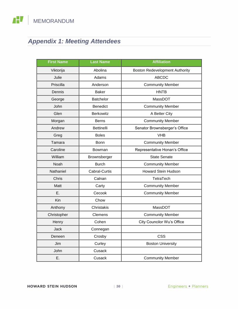
MEMORANDUM
| 30 |
Appendix 1: Meeting Attendees
First Name Last Name Affiliation
Viktorija Abolina Boston Redevelopment Authority
Julie Adams ABCDC
Priscilla Anderson Community Member
Dennis Baker HNTB
George Batchelor MassDOT
John Benedict Community Member
Glen Berkowitz A Better City
Morgan Berns Community Member
Andrew Bettinelli Senator Brownsberger’s Office
Greg Boles VHB
Tamara Bonn Community Member
Caroline Bowman Representative Honan’s Office
William Brownsberger State Senate
Noah Burch Community Member
Nathaniel Cabral-Curtis Howard Stein Hudson
Chris Calnan TetraTech
Matt Carty Community Member
E. Cecook Community Member
Kin Chow
Anthony Christakis MassDOT
Christopher Clemens Community Member
Henry Cohen City Councilor Wu’s Office
Jack Connegan
Deneen Crosby CSS
Jim Curley Boston University
John Cusack
E. Cusack Community Member
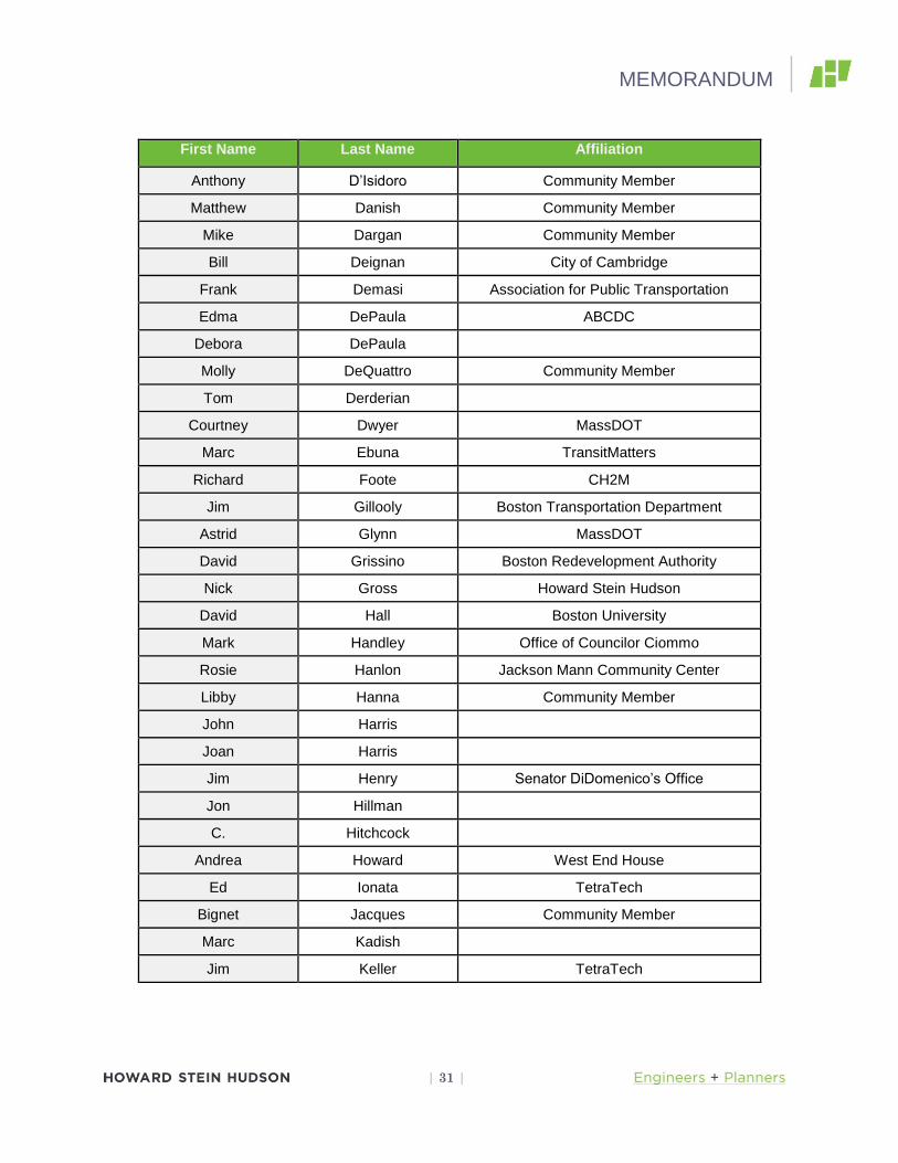
MEMORANDUM
| 31 |
First Name Last Name Affiliation
Anthony D’Isidoro Community Member
Matthew Danish Community Member
Mike Dargan Community Member
Bill Deignan City of Cambridge
Frank Demasi Association for Public Transportation
Edma DePaula ABCDC
Debora DePaula
Molly DeQuattro Community Member
Tom Derderian
Courtney Dwyer MassDOT
Marc Ebuna TransitMatters
Richard Foote CH2M
Jim Gillooly Boston Transportation Department
Astrid Glynn MassDOT
David Grissino Boston Redevelopment Authority
Nick Gross Howard Stein Hudson
David Hall Boston University
Mark Handley Office of Councilor Ciommo
Rosie Hanlon Jackson Mann Community Center
Libby Hanna Community Member
John Harris
Joan Harris
Jim Henry Senator DiDomenico’s Office
Jon Hillman
C. Hitchcock
Andrea Howard West End House
Ed Ionata TetraTech
Bignet Jacques Community Member
Marc Kadish
Jim Keller TetraTech
MEMORANDUM
| 32 |
First Name Last Name Affiliation
Peter Klinefelter
John Laadt Mayor’s Office of Neighborhood Services
Athena Laires
Joanne LaPlant BAIA
Robert LaTremouille
Peter Leis
Sharon Long Community Member
Jim Long
Anne Lusk Harvard School of Public Health
Thomas MacDonald City Councilor Wu’s Office
Fred Maldren Community Member
Christine Marini Boston Police Department
Carol Martinez
Harry Mattison Community Member
Katie McLaughlin
Dwen Messinger
Jennifer Mihok
Steve Miller LivableStreets Alliance
Pankil Modi Northeastern University
Dave Mohler MassDOT
David Mohler MassDOT
Andy Monat TransitMatters
Galen Mook Community Member
Acan Moundoy
Joe Mulligan
Thomas Nally A Better City
Kevin Nelson
Paul Nelson MASCO
Mike O’Dowd MassDOT
Jason Oesroscer ABCDC
MEMORANDUM
| 33 |
First Name Last Name Affiliation
Ari Ofsevit
Alana Olsen Allston Village Main Streets
Ethan Padmodipoetro UIL
Holly Palmgren MBTA
Peter Paraualos MBTA
Richard Parr Community Member
Joan Pasquale The Parents and Community Booth Group
Eleni Pesiridis Boston Liquors
John Pusateri
Jason Quimet VHB
Jim Quinn
Tad Read Boston Redevelopment Authority
Matt Robare
Jessica Robertson Community Member
Max Rome Community Member
Sandy Rusie
Hazel Ryerson Community Member
Fred Salvucci
Apratim Shay Charles River Watershed Association
Ceres Shea
Zachary Shedlock Mass College of Art
John Shields
David Sindel ROC
Bob Sloane WalkBoston
Martha Smith Community Member
D. Snyder
Barry Steinberg Association for Public Transportation
Peter Stidman Boston Cyclist Union
Bruce Tetton
Michael Thatcher TetraTech

MEMORANDUM
| 34 |
First Name Last Name Affiliation
Thomas Tinlin MassDOT
David Tudryn Baker
Margaret Van Deusen Charles River Watershed Assocation
Steven Van Dyke Community Member
Renata Von Tscharner Charles River Conservancy
Eva Webster
Brent Whelan Community Member
Brandon Wilcox Federal Highway Administration
James Williamson Community Member
Jack Wofford
Michelle Wu Boston City Council
Sheila Yancy MassDOT
Marianti Zappa MassDOT
MEMORANDUM
| 35 |
Appendix 2: Received Emails
Good Morning Maryfrances,
I hope this note finds you well and having a good day. It is still too early in the project to tell whether this job
might involve taking some portion of a property, a whole property, obtaining a permanent easement, or a
temporary construction easement. All of those things are possible, but we don’t know yet. If there were
eventually to be a taking of some sort, property owners would be contacted by MassDOT’s right-of-way
department which would explain the acquisition process to them and provide compensation. Is there a
particular property about which you are concerned?
Regards & Good Wishes,
-Nate
Thank you. I am wondering if the proposed project involves taking of any property by imminent domain?
Thank you,
Maryfrances
-------- Original message --------
From: Nathaniel Cabral-Curtis
Date:06/17/2015 4:15 PM (GMT-05:00)
To: mfgalligan
Subject: RE: Allston I-90 Project
Good Afternoon Maryfrances,
I hope this note finds you well and having a good day. We will convene tonight at the Jackson-Mann
Community Center at 500 Cambridge Street across from Twin Donut. Start time of the meeting is 6:30PM.
Regards & Good Wishes,

MEMORANDUM
| 36 |
-Nate
From: mfgalligan
Sent: Wednesday, June 17, 2015 3:28 PM
To: Nathaniel Cabral-Curtis
Subject: Allston I-90 Project
Tonight's meeting
Can you please tell me the details of tonight's meeting: time and place. Thank you.
MEMORANDUM
| 37 |
Hi Nate, Ed, and Mike,
Could you provide me with the PDF of your presentation from last night?
Thanks
Harry
Good Morning Harry,
I hope this note finds you well and having a good start to the day. Ed, would you please be so good as to either
send Harry a PDF of last night’s show or to send me the file and I’ll make sure he gets it?
Regards & Thanks,
-Nate

MEMORANDUM
| 38 |
Mike:
Attached is the text for the comments that I delivered orally in a shorter version at the public meeting last night.
Tom
Thomas J. Nally
Planning Director
A Better City
33 Broad Street, Suite 300
Boston, Massachusetts 02109
Phone: 617-502-6243
Fax: 617-502-6236
The comments as attached follow below:
A Better City
Comments on the Emerging I-90 Allston Interchange Design
6/17/15
This morning, A Better City submitted detailed written comments to MassDOT,
and we ask that you consider those as part of the public record for tonight’s
meeting. Those comments cover several topics. Highlights include:
Cambridge Street. The current design consisting of a two-way
Cambridge Street and two-way new Cambridge Street South may well
result in the best solution, but MassDOT should still provide a detailed
comparison of the pros and cons of all the design options.
Soldier’s Field Road. ABC is pleased to learn that the development of
the relocated Soldiers Field Road is advancing to create more useful
open apace along the Charles River. We encourage MassDOT to
MEMORANDUM
| 39 |
continue to explore ways to increase the amount and enhance the utility
of such new open spaces.
Elevated Roadways. ABC remains concerned about the number and
height of connecting roadways on fill or structure that run across the
site, and the likelihood that at least a portion of these elevated roadways
will add to the challenges of developing and traversing the site
efficiently.
West Station Bus Drop Off. We had always assumed the bus drop off
lanes to West Station would be at the same level as the station
mezzanine rather than at a third level as now shown. What is the reason
for this additional level above West Station, and what alternatives exist?
This additional height adds to the problem of raised roadways across
the site and adds more cost.
Access to the West Station site needs further study. If the drop off is
lower, perhaps connector roads to West Station could be shifted west
via Stadium Way Connector and West Connector rather than the East
Drive Connector and Seattle Street Connector to allow use of lower
bridges and shorter grades on connecting roads across the site.
Urban Design Scope: We want the urban design consultant to explore
and illustrate how future development opportunities can be integrated
into the proposed roadway system. The consultant should review and
address the points of the City of Boston comment letter, and review the
work of the Boston Society of Architects’ charrette and the work of the
Northeastern design studio in determining appropriate development
guidelines.
Urban Ring Bus Routing. The MEPA Certificate for the
Environmental Notification Form states that MassDOT is required
discuss the design and funding status of the Urban Ring and how the
MEMORANDUM
| 40 |
proposed I-90 project can accommodate or not preclude potential
implementation of the Urban Ring. This is a reminder that we would
like to see that analysis.
Alternative Construction Staging. Again, as part of the ENF process,
ABC suggested several alternative construction staging strategies, and
the MEPA Certificate requires that MassDOT evaluate the feasibility of
these recommendations. ABC encourages MassDOT to begin that
discussion now.
Construction Sequencing and Schedule: We recognize that any
sequence and scheduling strategy must consider the timing of available
resources to support each phase of construction. We expect that viaduct
reconstruction will be a priority, and as ABC has commented
previously, we requested further study of viaduct reconstruction
alternatives beyond what MassDOT presented in the Task Force
process last year. Studies should include possible use of a temporary
viaduct allowing reconstruction of the westbound and eastbound
Turnpike lanes in their current alignment as well as consideration of at-
grade staging alternatives that could allow reconstruction of the
Turnpike lanes without a temporary viaduct.
Revived Task Force. We are pleased to learn that MassDOT will revive
the Allston Interchange Task Force. We look forward to continuing as
a member of the Task Force to work with MassDOT and stakeholders
to help make continued progress on this important project.
Thank you for this opportunity to provide an overview of our written comments
submitted today. 6294/1 aittp5617
Thanks Nate.

MEMORANDUM
| 41 |
Tom
Thomas J. Nally
Planning Director
A Better City
33 Broad Street, Suite 300
Boston, Massachusetts 02109
Phone: 617-502-6243
Fax: 617-502-6236
Good Afternoon Tom,
I hope this note finds you well and having a good day. Thank you for coming last night and for
your comments. I’m in receipt. These will appear in the minutes as they typically have.
Regards & Good Wishes,
-Nate
MEMORANDUM
| 42 |
Nate
When will last night’s presentation be available?
Thanks
Joe
Good Morning Joe,
I hope this note finds you well and having a good day. It will likely take a few days to get it to
the website as we need to make it Title VI compliant. That said, you’re not the only one who
asked for a PDF. As soon as I receive it from TetraTech, I’ll make you a quick and dirty copy
without all the bells and whistles needed for assistive technology.
Regards & Good Wishes,
-Nate
Good Afternoon Joe,
I hope this note finds you well and having a good day. As you requested, here is a copy of last
night’s presentation.
Regards & Good Wishes,
-Nate

MEMORANDUM
| 43 |
Hi Harry – PDF of the 6/17 presentation is attached.
Ed
Edward Ionata | Senior Vice President
From: Harry Mattison
Sent: Thursday, June 18, 2015 8:24 AM
To: Nathaniel Cabral-Curtis; Ionata, Edward; Michael (MHD) O'Dowd
Subject: last night's presentation
Hi Nate, Ed, and Mike,
Could you provide me with the PDF of your presentation from last night?
Thanks
Harry

MEMORANDUM
| 44 |
Nathaniel I attended last night’s I90 Interchange public meeting. One of the DOT speakers mentioned that the public was welcome to attend future Task Force meetings. Will these meetings be announced through the email list for the project? Also, what qualifications are required to become an actual member of the Task Force? I’m a resident of Cambridgeport. Thanks, Peter Good Morning Peter, I hope this note finds you well and having a good day. Yes, taskforce sessions are posted to the website and you are welcome to attend although taskforce business takes precedence and the general public is there in a more observational role. This is in contrast to public meetings where the expectation is that public comment takes precedence and taskforce members are encouraged to listen. Our taskforce membership from the planning phase of the job had a range of qualifications: members of the local business community, Allston residents with homes adjacent to the job, representatives of local institutions, members of local government and cycling and pedestrian advocates. Cambridgeport, and indeed all of Cambridge was ably represented during our last go-round by Bill Deignan and Suzanne Rasmussen of your city's planning department. Regards & Good Wishes, -Nate
MEMORANDUM
| 45 |
Hi Nate,
Thank you so much for the reply with the presentation, as well as the rest of the information - it was all exactly
what I was looking for! Apologies for misidentifying the number of meetings.
Best of luck with the rest of the project,
Patrick
On Mon, Jun 22, 2015 at 11:56 AM, Nathaniel Cabral-Curtis <[email protected]> wrote:
Good Morning Patrick,
I hope this note finds you well and having a good day. Please note that we have only had one public information
meeting for Allston in 2015, not several. The only meeting you have missed is the one we held last week, June
17th. If you have not already done so, I strongly encourage you to sign up for the project’s stakeholder
database. Being in this database will make sure you get email alerts about upcoming meetings.
As to the project website, we have a draft update which just needs to be approved for publication on the
MassDOT website. I will be checking up on that initiative today or tomorrow. We have had our hands full as a
project team getting ready to go into our next phase of work.
MEMORANDUM
| 46 |
With regard to the presentation given on the 17th, I have attached a copy for your review. Please note that we
will be making this available over the project website once we set it up to be read by folks using assistive
technologies. This is unfortunately a bit of a time consuming job, but it’s a requirement.
Regards & Good Wishes,
-Nate
From: Patrick Braga
Sent: Monday, June 22, 2015 11:39 AM
To: Nathaniel Cabral-Curtis
Subject: Update Requested: Allston I-90 Interchange Project
Dear Nathaniel:
I am hoping to follow the Allston I-90 interchange project, and though I am aware that several public meetings
have been held in 2015, the last document displayed on the project's webpage dates back to December 2014. I
would especially like to see the PDF of the presentation given at last week's public meeting and prior meetings
this year. Please advise.
Thank you,
Patrick Braga
Good Afternoon Patrick,
I hope this note finds you well and having a good day. Not to worry, I only made mention of it because people in
public processes sometimes get worried that agencies are trying to hide things or blow sneaky efforts by
them. We’re not doing anything of the sort and I just wanted to ensure the record was correct. As to the
presentation, you are most welcome.
Regards & Good Wishes,
-Nate
MEMORANDUM
| 47 |
Good Afternoon Apratim,
I hope this note finds you well and having a good day. We’ll be happy to add you to the stakeholder
database. We would be looking to have our meeting minutes for the 17th posted during the week after July 4th.
Regards & Good Wishes,
-Nate
From: Apratim Sahay
Sent: Tuesday, June 30, 2015 12:32 PM
To: Nathaniel Cabral-Curtis
Subject: Please add to mailing list
Dear Mr. Curtis,
I am interning with the Charles River Watershed Association (CRWA) and am involved in assessing the impact
of the I-90 Allston Interchange on the Charles River. Please add me to the informational mailing list.
Another question: do you know when the minutes for the June 17th Public meeting will be put up on the I-90
Project website? We were hoping to quote Dave Mohler and Chris Canlan's presentations.
best,
apratim.

MEMORANDUM
| 48 |
Administrator Tinlin,
Thank you for extending an invitation to continue my service on the I-90 Allston Interchange Improvement
Project Task Force.
I look forward to working with everyone associated with the project.
One of the challenges we face in Allston-Brighton amid enormous change, is to remind those who wish to invest
in our community that Allston-Brighton is a neighborhood of Boston and not downtown. Quality of life issues
are important in building a stronger community and attracting and retaining long term residents.
I know there has been a great deal of debate as to how this project can advance those goals. At the same time I
realize that there is a limit to the resources that will be available to this project. I am a very pragmatic person
and have advocated It's time to revisit expectations, to prioritize and to be a positive agent for change.
Back in my corporate days as a Global IT Project Manager, managing expectations minimized frustration and
accelerated stakeholder acceptance.
I hope going forward we can refocus on what's important and that the ultimate design reflects a balanced
approach that we all can be proud of and that will serve as a model for future multimodal urban transportation
projects.
Tony D'Isidoro
Hi Nate,
A suggestion as we move forward with the next round of task force meetings.
Obviously there has been a great deal of discussion regarding transportation funding and what will ultimately
be possible for this project.
I think it's important to drill down another level when it comes to budget estimates and share that with the task

MEMORANDUM
| 49 |
force in addition to what funds are secured. It's an important perspective to have.
The budget items could be:
Viaduct Replacement
Interchange Replacement
All Electronic Tolling
Bicycle and Pedestrian Infrastructure
West Station (Including Multimodal Access)
Beacon Park Layover
Cambridge Street Reconstruction
Franklin Street Overpass
Allston Esplanade
Also, the Boston Region Metropolitan Planning Organization in its draft Long-Range Transportation Plan,
Charting Progress to 2040 has the project cost at $460 million. I always thought the number was $260
million. Could you explain the discrepancy.
Tony
Good Morning Tony,
I hope this note finds you well and having a good day. Thank you for agreeing to join the task
force a second time. You are always a constructive presence there and we certainly appreciate
your contributions. As I mentioned on the 15th
, I’ve had this reply on the stocks for you for a
while, but preparing for last night held me up a little bit so your patience is appreciated.
As you probably will recall from the June 17th
public information meeting, we see the project as
having three major components: pedestrian/bicycle, rail, and highway. Today, identified in the
CIP we have $160 million. That will help address the structurally deficient Allston viaduct, the
bridge which carries the Turnpike between roughly the Commonwealth Avenue Overpass and
MEMORANDUM
| 50 |
the Allston toll plaza. If schedule and/or funding necessitate that we slice that piece off as a
discrete project and do it right away, or as right away as such things happen, we would be able to
program the needed funds. That approach wouldn’t necessarily make the best sense given that it
doesn’t reflect the work that we have done as a team and with the community. What is not
funded are the other elements associated with the job and important to the Allston neighborhood
and a multi-modal MassDOT committed to serving all transportation users, the rail and cycling
elements. As MassDOT’s director of planning David Mohler said on June 17th
, the agency is
committed to figuring out the funding question so that all of this project can be built. As part of
our demonstration to that commitment, we are continuing the plan and design the job as a single
initiative.
This brings me to your next point. At our current stage of design, roughly 5%, it’s much easier
to provide a lump sum cost for a job rather than picking out the elements which make up that
figure, but what we do know is as follows. The viaduct and the streets connecting it to
Cambridge Street are estimated at around $260 million. Beacon Park Yard’s commuter rail
support facility is around $150. As Mike mentioned at our meeting on the 15th
, since being
added to the project, through the well-expressed wishes of the taskforce and community West
Station has gone from being a clone of Yawkey Station which would have cost around $25M,
more or less, to a much more substantial structure which is how the MPO, and we are getting to a
cost of a little north of $450M along with the MPO.
For the moment, if I can ask you to bear with us, I will leave you with two parting thoughts: at
the stage of the project where we are, cost estimates will go up and down for a while yet to come,
and MassDOT is committed to advancing this job as a single project. If we have to find ways to
stage it, we will, but we are developing the whole package and our goal is to build the whole
package. As we get further into our current process, we will be able to provide a more focused
financial picture. I hope this brings you some reassurance as we begin our next round of work
together. I look forward to working with you further as we get deeper into this effort.
Regards & Good Wishes,
-Nate