JMA's Next-Generation Geostationary Meteorological Satellite
10
Himawari-8: JMA ’ s Next-Generation Geostationary Meteorological Satellite ICAO MET/ATM Seminar 2015 Satellite Program Division Japan Meteorological Agency
-
Upload
khangminh22 -
Category
Documents
-
view
2 -
download
0
Transcript of JMA's Next-Generation Geostationary Meteorological Satellite
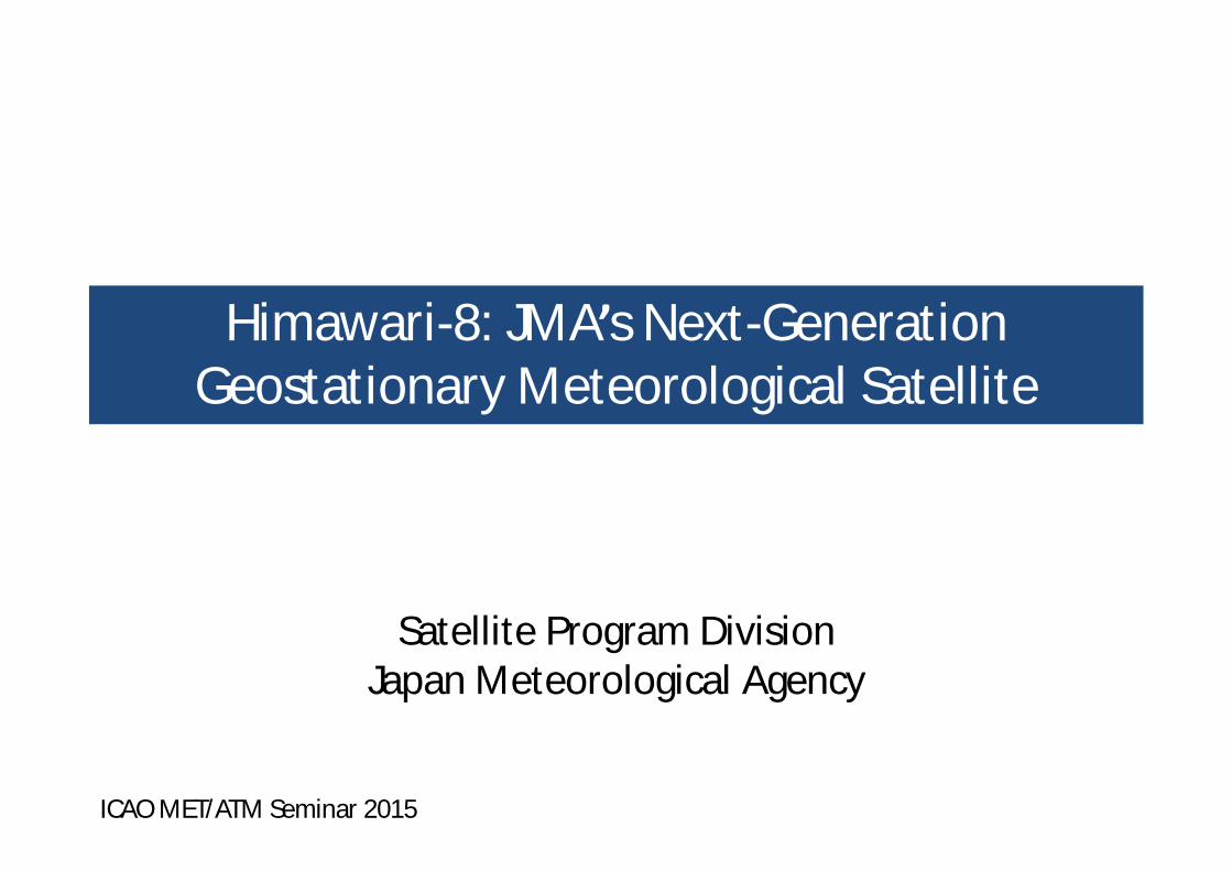
Himawari-8: JMA’s Next-Generation Geostationary Meteorological Satellite
ICAO MET/ATM Seminar 2015
Satellite Program DivisionJapan Meteorological Agency

Satellite Observation period
GMS 1978 – 1981
GMS-2 1981 – 1984
GMS-3 1984 – 1989
GMS-4 1989 – 1995
GMS-5 1995 – 2003
GOES-9 2003 – 2005
MTSAT-1R 2005 – 2010
MTSAT-2 2010 – 2015
Himawari-8 2015 – 2022
Himawari-9 2022 – 2029
GMS (Geostationary Meteorological Satellite)
MTSAT (Multi-functional Transport SATellite )
Back-up operation of GMS-5 with GOES-9 by NOAA/NESDIS from May 22, 2003 to June 28, 2005
(GOES-9)
Aug 1981
GMS-2(Himawari-2)
Aug 1984
GMS-3(Himawari-3)
Sep 1989
GMS-4(Himawari-4)
Mar 1995
GMS-5(Himawari-5)
Launched inFeb 2005
MTSAT-1R(Himawari-6)
Feb 2006
MTSAT-2(Himawari-7)
Launched inJul 1977
GMS(Himawari)
Himawari
ⒸNASDA ⒸNASDA ⒸNASDA ⒸNASDA ⒸNASDA
ⒸSS/L ⒸMELCO Oct 2014
Himawari-8
2016
Himawari-9
Overview of JMA’s Himawari-series satellites
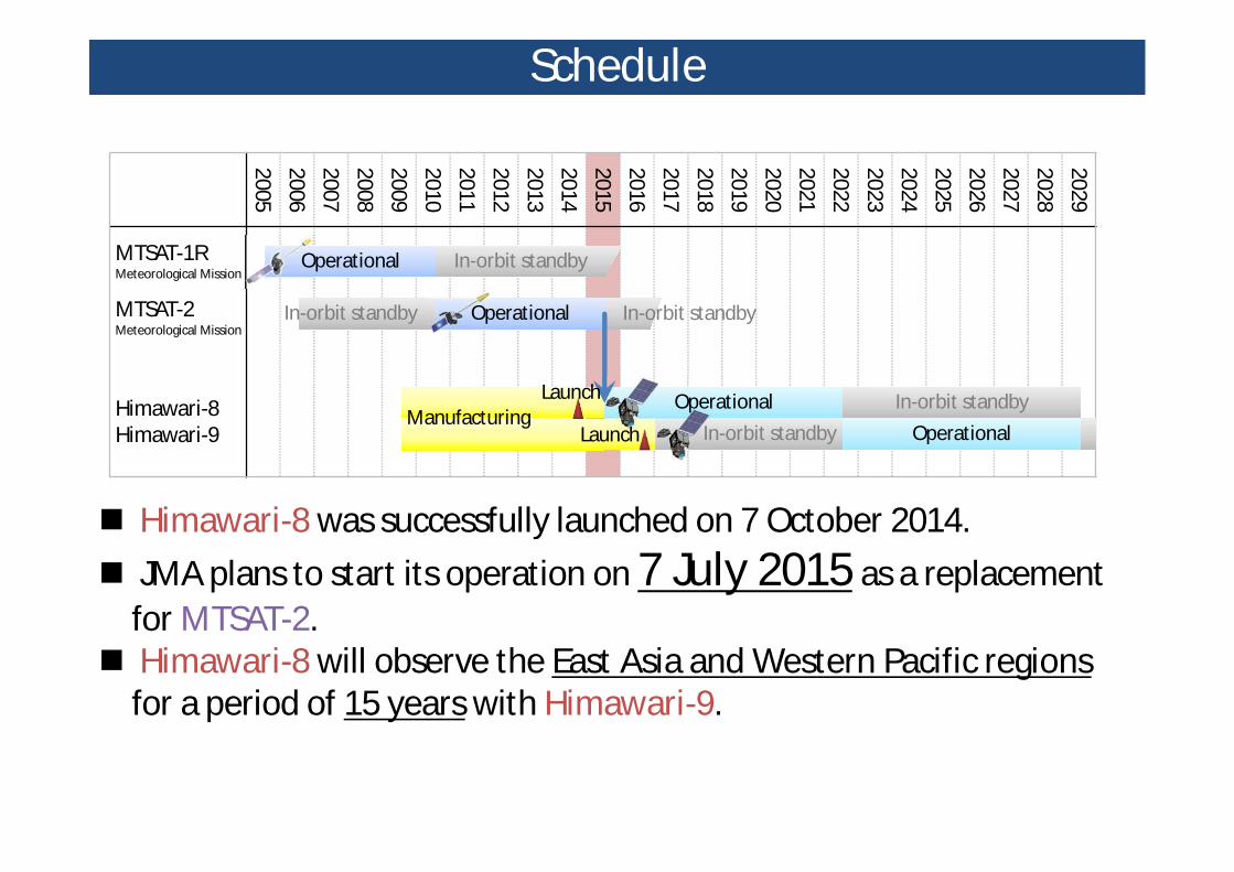
2005200620072008200920102011201220132014201520162017201820192020202120222023202420252026202720282029
MTSAT-1RMeteorological Mission
MTSAT-2Meteorological Mission
Himawari-8Himawari-9
In-orbit standbyOperational
In-orbit standby
ManufacturingLaunch In-orbit standby
In-orbit standbyLaunch
Operational
OperationalOperational
In-orbit standby
Himawari-8 was successfully launched on 7 October 2014. JMA plans to start its operation on 7 July 2015 as a replacement
for MTSAT-2. Himawari-8 will observe the East Asia and Western Pacific regions
for a period of 15 years with Himawari-9.
Schedule

Enhanced Performance
B/W TV HD TV
MTSAT-1R/2 Himawari-8Number of bands 5 16Interval 30/60 min. 10 min.Resolution VIS: 1 km
IR: 4 kmVIS: 0.5 km
IR: 2 kmData size 50 times!!

Multi-band Observation
Band Wavelength[μm]
SpatialResolution
1 0.47 1 km
2 0.51 1 km
3 0.64 0.5 km
4 0.86 1 km
5 1.6 2 km
6 2.3 2 km
7 3.9 2 km
8 6.2 2 km
9 6.9 2 km
10 7.3 2 km
11 8.6 2 km
12 9.6 2 km
13 10.4 2 km
14 11.2 2 km
15 12.4 2 km
16 13.3 2 km
RGBCompositedTrue Color Image
Bands of Himawari-8/9
Number of Bands: 5 16
VIS
IR1
IR2
IR3
IR4
Bands ofMTSAT
Improvement of Satellite Products
Volcanic Ash Sea Surface Temp.
Yellow SandSea Ice

Observation Area and Interval
Full diskInterval: 10 minutes
Target AreaInterval: 2.5 minutesDimension: 1000 x 1000 km
Interval: 60 min. 10 min.MTSAT Himawari-8
Example of targets:• Typhoon• Volcanic Eruption• Forest Fire• …

MTSAT-2 Himawari-8Every 60 minutes in Monochrome
Dawn of a “New Era”

Volcanic Ash in Clear Image
MTSAT-2 (IR) Himawari-8 (IR)Every 30 minutes, 4 km grid Every 2.5 minutes, 2 km grid
Eruption of Sakurajima

Volcanic Ash Highlighted in Bright PinkEruption of Sakurajima
Himawari-8 (RGB made with 3 IR bands)
Every 2.5 minutes

Get the detail information on Himawari-8
See http://www.data.jma.go.jp/mscweb/en/himawari89/
Contents: Overview of satellite observation Overview of data dissemination Imager (AHI) specifications Sample data Himawari Standard Data
(HSD) HRIT/LRIT files NetCDF PNG
Sample source code to read HSD and convert into other formats