"It is promised to them:" Loyalist Refugees' Adaptation in the Exuma Cays, Bahamas (1784–1810)
38
Annual Meeting of the Society for Historical Archaeology, January 2013 Leicester, England Good afternoon, I’m pleased to be here today to present some of the findings from the State University of New York, College at Oswego ‘s archaeological survey in the Exuma Cays Land and Sea Park in the Bahamas. My name is Doug Pippin and I am an assistant professor at the college and the project director. As you can see from the title, I am presenting on the study of displaced Loyalists in the Caribbean, but this project is part of a larger effort to investigate the experience of Loyalists during and in the years after the American Revolutionary War. 1
-
Upload
independent -
Category
Documents
-
view
1 -
download
0
Transcript of "It is promised to them:" Loyalist Refugees' Adaptation in the Exuma Cays, Bahamas (1784–1810)

Annual Meeting of the Society for Historical Archaeology, January 2013
Leicester, England
Good afternoon, I’m pleased to be here today to present some of the findings from the
State University of New York, College at Oswego ‘s archaeological survey in the
Exuma Cays Land and Sea Park in the Bahamas.
My name is Doug Pippin and I am an assistant professor at the college and the project
director. As you can see from the title, I am presenting on the study of displaced
Loyalists in the Caribbean, but this project is part of a larger effort to investigate the
experience of Loyalists during and in the years after the American Revolutionary War.
1

2
For more than a decade our research site was the British post on Carleton
Island, in the St. Lawrence River in northern New York State. Our project in
the Bahamas is still in its preliminary stages, and we are very excited for the
opportunity to expand our research in this region.
Estimates vary widely on the number of colonists who maintained loyalty to
Great Britain during the American Revolution. Many were forced to flee, but
the vast majority of Loyalists did not leave their homes in the colonies. Some
estimates indicate that as many as 10-15%–––or about 80,000 Loyalists–––
fled the colonies for other parts of the British Empire.

3
In all the territories to which they relocated Loyalists made a significant impact
on the population, economy and landscape. Among those who chose to leave,
approximately sixty percent went to Quebec, the Maritime provinces, and what
is now the Province of Ontario, Canada. Those from a higher socio-economic
status––about twenty percent of those who fled––could afford to return to
Great Britain. The remaining twenty percent, mostly from the southern
colonies, moved even farther to the south….

4
…..first to British East Florida at St. Augustine, and later to the British West
Indies after Florida was ceded to Spain in 1783. In the Bahamas–––where the
British awarded land grants in compensation for the Loyalists’ loss of
property–––the arrival of more than 7,000 white colonists, and free and
enslaved persons of African descent would signal a profound change.
Historians Michael Craton and Gail Saunders referred to this as one of the
most crucial phases of Bahamian social history.

5
Their arrival tripled the population, more than tripled the number of islands
with permanent settlements, and dramatically raised the proportion of
enslaved persons to a significant majority of the population. The overall surge
in numbers in such a short time, however, put a strain on the limited
infrastructure and resources of the islands.

6
The quote in the title of my paper, “It is promised to them” refers to a letter
from Governor General John Maxwell in 1784 looking for instructions
regarding the settlement of the Loyalists. He described the difficulties related
to their arrival, especially with respect to qualified surveyors to parcel the land
grants. Maxwell clearly has sympathy for the Loyalists, but his patience was
growing thin. In dealing with the demands from the new arrivals, he noted that:
…where they see a vacant pot, the Loyalists (with exceptions), say they must have it and will have it; it is “promised to them.”
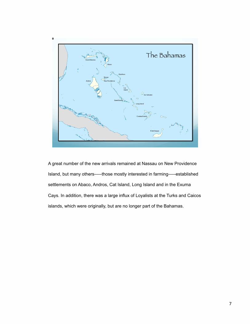
A great number of the new arrivals remained at Nassau on New Providence
Island, but many others–––those mostly interested in farming–––established
settlements on Abaco, Andros, Cat Island, Long Island and in the Exuma
Cays. In addition, there was a large influx of Loyalists at the Turks and Caicos
islands, which were originally, but are no longer part of the Bahamas.
7

But the focus of our research was in the Exuma Cays, the long string of barrier
islands more than one hundred miles from Great and Little Exuma in the
south, nearly all the way to Nassau in the north. Our research site was the
island of Warderwick Wells, in the center of the Exumas (note location on the
map), where a cluster of several ruins are located on the southern end of the
island. Oral tradition maintains that they were associated with the Davis family
and the Loyalist period in the Bahamas.
8

In 1958 the Bahamas National Trust established the Exuma Cays Land and
Sea Park, and it was the first marine fishery reserve in the Caribbean. It is a
176 square mile park, which encompasses numerous islands and important
marine resources, was designated as a no-take zone in order to protect the
natural wildlife.
Warderwick Wells, and the Exuma Cay Land and Sea Park in general, have
been the location for numerous botanical, marine and ornithological studies,
but little or no other archaeological work.
9

As Warderwick Wells is the at the center of the park, it is also the site of the
park headquarters. The only structures on the island however, are the Park
headquarters building, the warden’s and rangers’ residence, and a
maintenance building. But, despite the remote location and sparse population
of the Exumas today, Warderwick Wells is visited frequently by the sailboats
that cruise regularly through the Bahamas, using the mooring fields
maintained by the park staff.
10

This island is just under two miles long, and just one third of a mile wide – the
elevation is so slight that at high tide, the northernmost part of Warderwick
Wells becomes a separate island unto itself. Most of the terrain is covered
with dense thickets and palm trees.
We were able to stay at this location (note Beryl’s Cove) aboard a
houseboat–––The OWL–––anchored in this cove, as no camping is permitted
on the island. We could obtain fresh water at the ranger station; all other
supplies and provisions were brought in by the field crew.
11

As I mentioned, Warderwick Wells is home to several ruins that were the
primary focus of our archaeological survey. As I mentioned, local oral tradition
associates the ruins with a Loyalist family by the name of Davis. (Here you
can see some of the signage on the island trails that refer to the Davis ruins
and the Loyalist period).
Of course, the fundamental questions for us were straightforward–––was
there really a connection to the Davis family and the Loyalist period? No clear
historical evidence has been uncovered to verify the family connection. In fact,
were these settlements created by displaced loyalists at all?
12

We began archival research in detail to determine if there was a foundation for
a connection to the Davis family. We conducted extensive research at the
Bahamian National Archives in Nassau, the College of the Bahamas Library
and the National Archives in London.
Here one of our students, Stephanie Hallinan, is working at the National
Archives for information related to Loyalists’ Bahamian Land Grants.
13

Of those Loyalists who did choose to re-locate to the Bahamas, many had
land grants as compensation for the goods and property they lost as a result
of their loyalty to England. The amount of land initially granted depended on a
number of factors. A small parcel may be 20–40 acres (James 1988: 16), but
affluent individuals, of course, were able to secure much larger parcels of
land.
14

In the Colonial Office records, a list of grants to Loyalists revealed that George
Davis was, in fact given a grant of land…..but it was on Great Exuma.
15
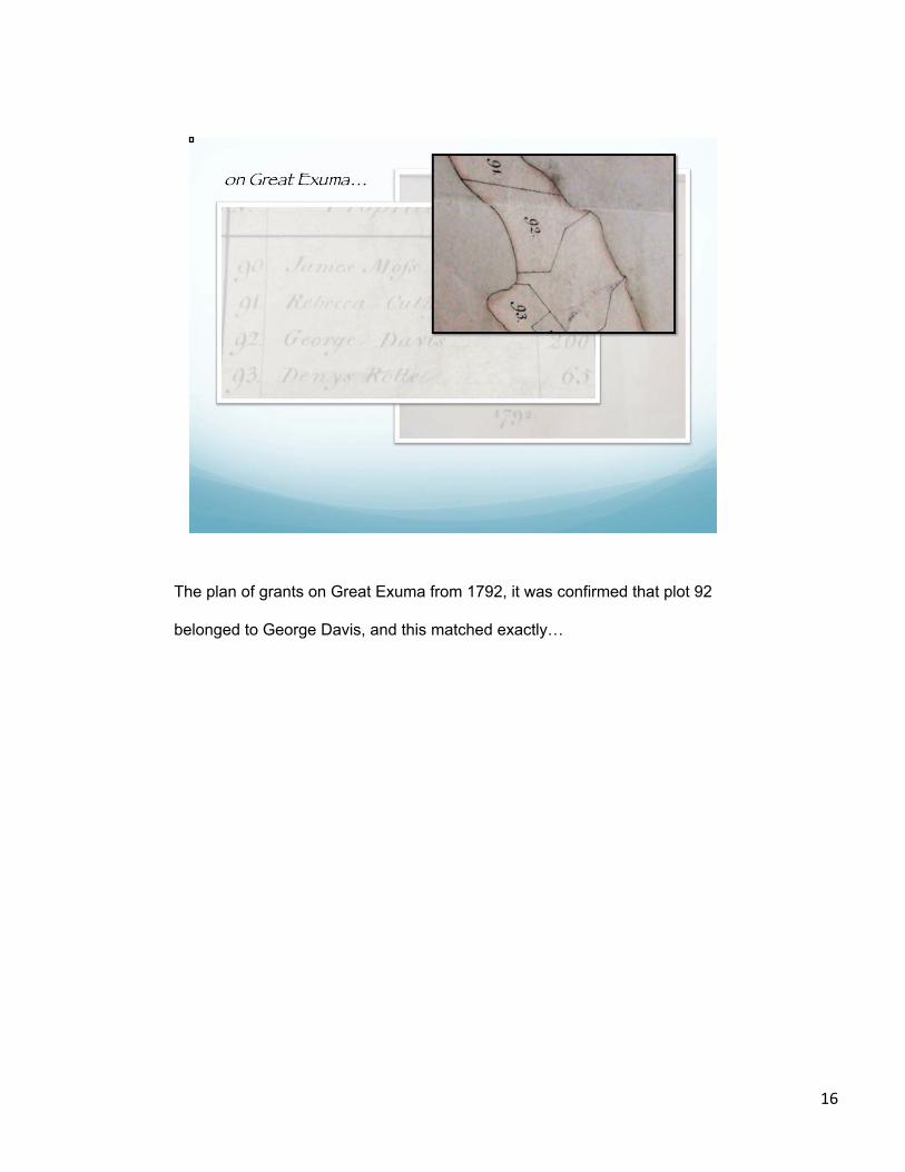
The plan of grants on Great Exuma from 1792, it was confirmed that plot 92
belonged to George Davis, and this matched exactly…
16

with the hand drawn illustration on the Davis’ land grant document that we retrieved in
the Bahamian Archives.
So, we were able to make a family connection to the Exumas, but no definite link to
Warderwick Wells. As it turned out, we did find a second land grant made to George
Davis, also in the Exumas, but otherwise for an indeterminate location. The location
details and size of the plot are indecipherable, and there is no drawing of the land as
with the first plot. Davis’ name does not show up twice on the Great Exuma map, so
this could be the grant for our site on Warderwick Wells, but the historical research is
not yet persuasive. Most of the grants are for sites in the vicinity of Great Exuma, not
the outer islands of the Exuma Cays, so it is also possible that no land document
exists, or ever existed.
17
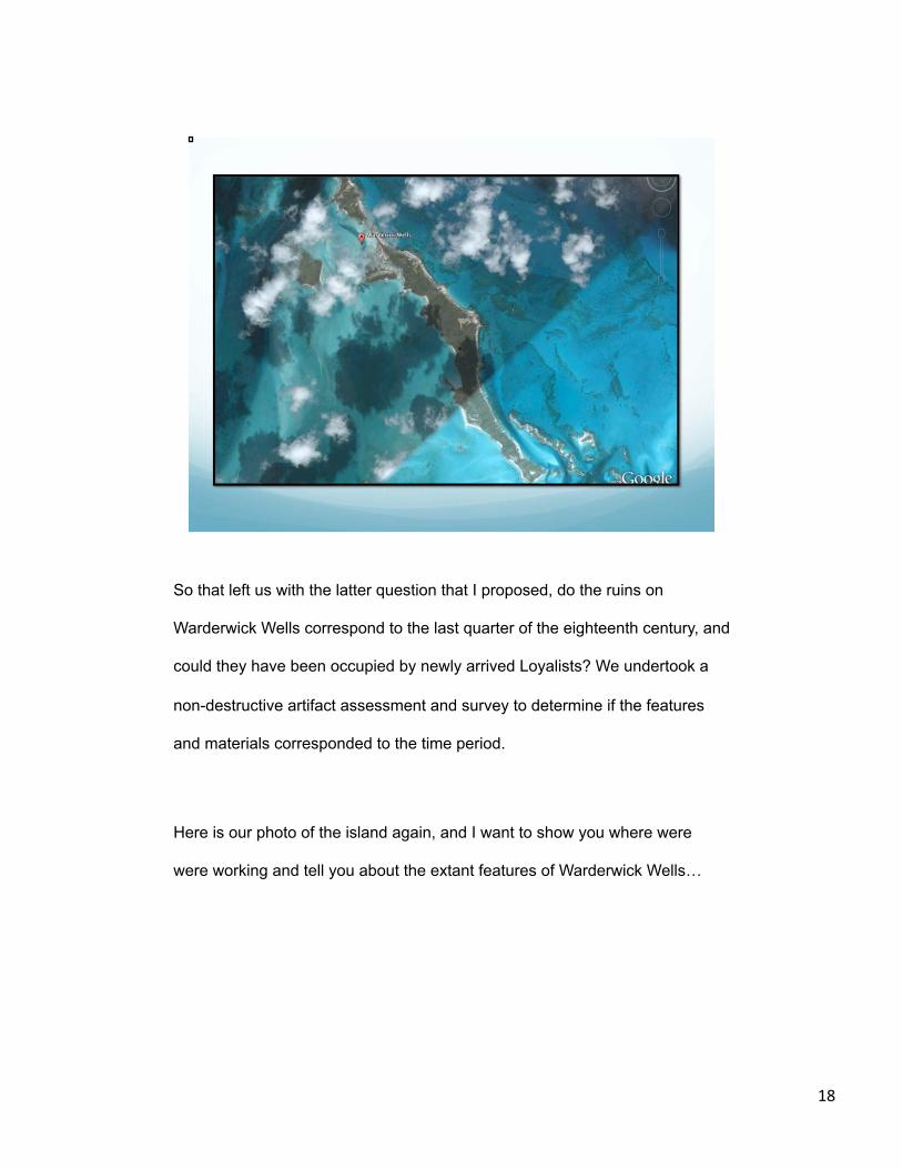
So that left us with the latter question that I proposed, do the ruins on
Warderwick Wells correspond to the last quarter of the eighteenth century, and
could they have been occupied by newly arrived Loyalists? We undertook a
non-destructive artifact assessment and survey to determine if the features
and materials corresponded to the time period.
Here is our photo of the island again, and I want to show you where were
were working and tell you about the extant features of Warderwick Wells…
18

The detail in this photograph illustrates where we were working on the island,
ironically near the landing spot known as Loyalist Beach.
19
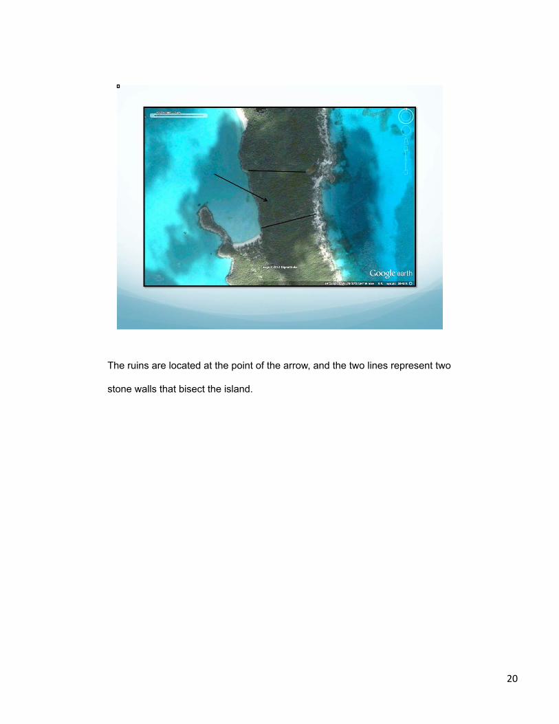
The ruins are located at the point of the arrow, and the two lines represent two
stone walls that bisect the island.
20
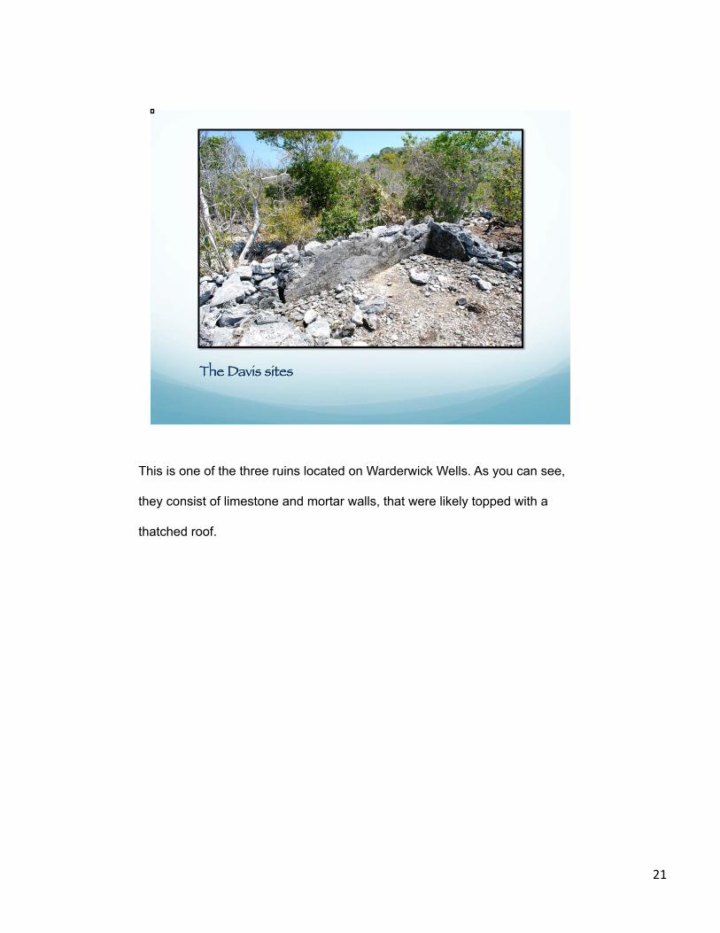
This is one of the three ruins located on Warderwick Wells. As you can see,
they consist of limestone and mortar walls, that were likely topped with a
thatched roof.
21

The three structures are occupy an area of approximately 50 meters in
diameter. All three have domestic materials adjacent on the surface. The small
amount of new soil deposition allows for productive surface inspection of the
artifacts.
22
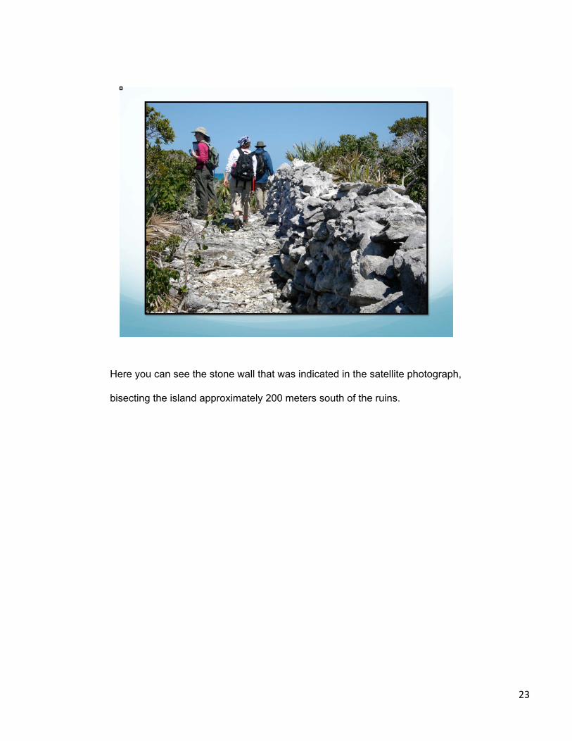
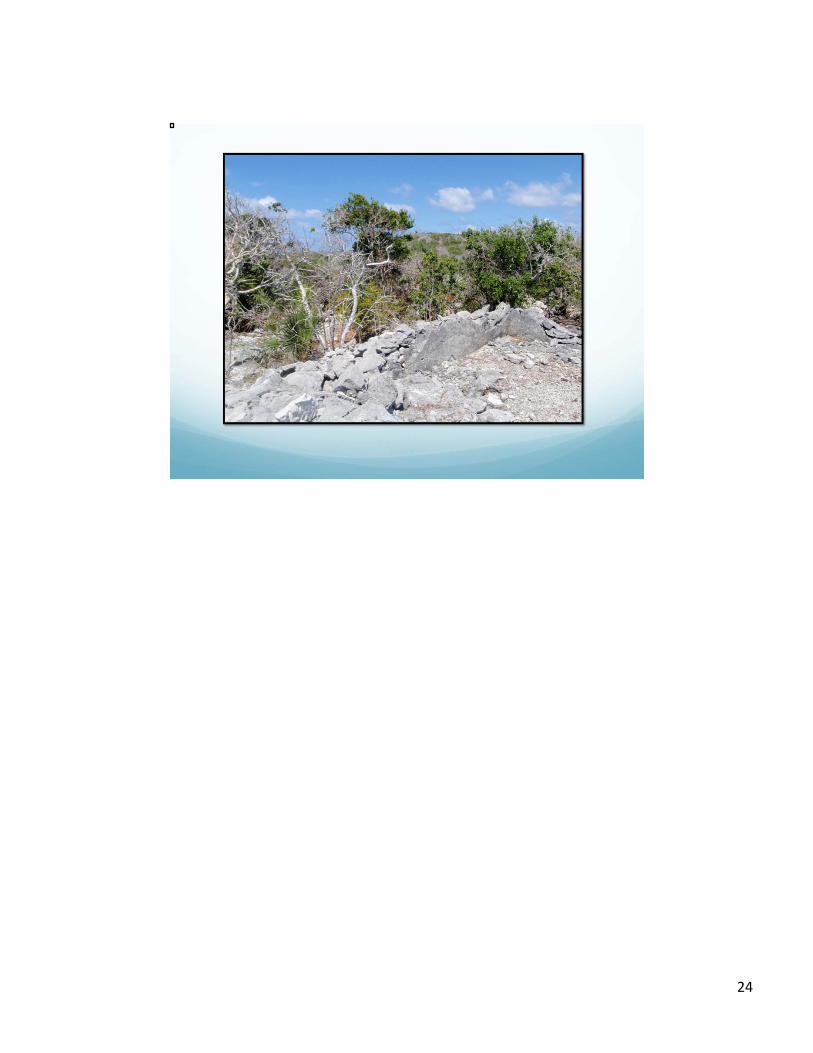
Here you can see the stone wall that was indicated in the satellite photograph,
bisecting the island approximately 200 meters south of the ruins.
23
24

In terms of their physical appearance, this may be a good comparison. This is
a the remains of a cabin from the Loyalist-era Clifton Plantation on the west
end of New Providence, now part of the Clifton Heritage Park.
25

The Clifton ruin and this full scale replica with a thatched roof may well
represent the type of structures found at Warderwick Wells.
The structures at Clifton seen here were occupied by slaves. That was also
possible for the structures on Warderwick Wells, but regardless of their
occupation, they do reflect a lower socio-economic status when compared
to…
26

…the plantation house ruins at Clifton, seen here.
This emphasizes one of our primary questions about who was actually living
on Warderwick Wells (regardless of whose name appeared on on the land
grant)?
Were the occupants free or enslaved? Did they represent multiple households,
or an extended family? And how were they able to provide for themselves in
an area that is still today so poorly suited to agriculture?
27

We were able to to address some of these questions in our preliminary survey,
but of course they will require ongoing research and investigation. Over the
course of our survey in March 2010, we discovered the remains of two
additional structures. Neither had surface remains of domestic artifacts and
may have been work areas or out-buildings associated with previously
described domestic foundations.
28

As I indicated, surface inspection can reveal a great deal of information about
the material culture. We were able to map and catalog hundreds of artifacts in
the vicinity of the three foundations. The accumulated data on the surface
materials leads us to believe that the ruins are associated with the Loyalist
period.
29

These next slides illustrate some of the surface materials that we recorded.
30

Most artifacts were photographed in situ….
31
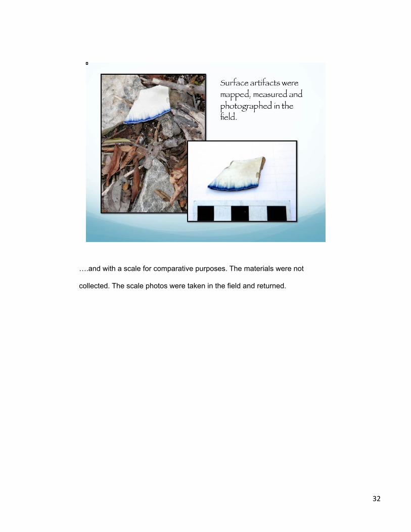
….and with a scale for comparative purposes. The materials were not
collected. The scale photos were taken in the field and returned.
32

Metal does not preserve well in this climate and is very poorly represented in
our catalog. When it was discovered, it was very fragmentary, as noted in this
slide.
33

The conch shell middens on Warderwick Wells provide some information on
the economy of subsistence and provisioning in the Exumas. This is a
resource that was used in great quantities and was noted in several middens
nearby the domestic areas.
34

So, in conclusion, our historical and archaeological investigations have
provided some solutions, but have prompted new areas of inquiry into the
subsistence strategy for the early occupation of Warderwick Wells.
I am showing you the picture of our houseboat as an epilogue to our survey
trip to Warderwick Wells…
35

36

Sadly, in August 2011, the Owl was destroyed by Hurricane Irene.
Unfortunately, this necessitated a pause in our research last year as we
looked into alternative ways to support a field crew at Warderwick Wells.
Regardless, we look forward to additional research in the Exuma Cays.
37