ISSN: 2320-5407 Int. J. Adv. Res. 7(3), 967-985 - International ...
18
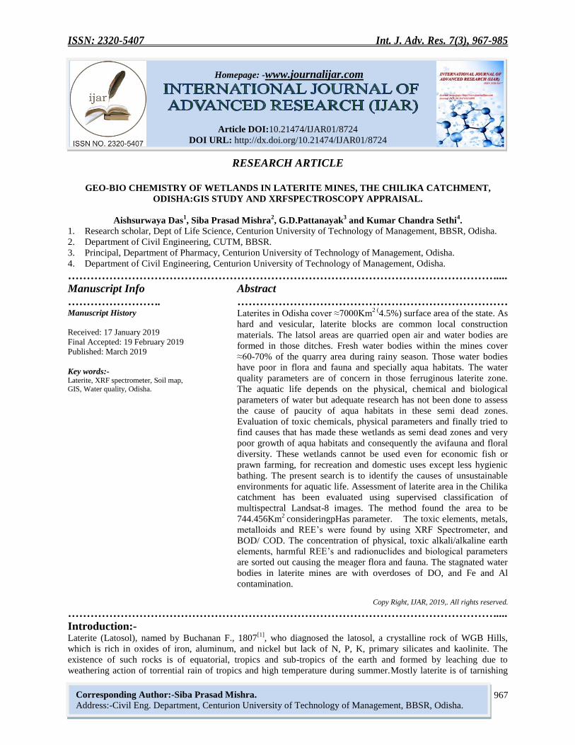
ISSN: 2320-5407 Int. J. Adv. Res. 7(3), 967-985 967 Homepage: -www.journalijar.com Article DOI:10.21474/IJAR01/8724 DOI URL: http://dx.doi.org/10.21474/IJAR01/8724 RESEARCH ARTICLE GEO-BIO CHEMISTRY OF WETLANDS IN LATERITE MINES, THE CHILIKA CATCHMENT, ODISHA:GIS STUDY AND XRFSPECTROSCOPY APPRAISAL. Aishsurwaya Das 1 , Siba Prasad Mishra 2 , G.D.Pattanayak 3 and Kumar Chandra Sethi 4 . 1. Research scholar, Dept of Life Science, Centurion University of Technology of Management, BBSR, Odisha. 2. Department of Civil Engineering, CUTM, BBSR. 3. Principal, Department of Pharmacy, Centurion University of Technology of Management, Odisha. 4. Department of Civil Engineering, Centurion University of Technology of Management, Odisha. …………………………………………………………………………………………………….... Manuscript Info Abstract ……………………. ……………………………………………………………… Manuscript History Received: 17 January 2019 Final Accepted: 19 February 2019 Published: March 2019 Key words:- Laterite, XRF spectrometer, Soil map, GIS, Water quality, Odisha. Laterites in Odisha cover ≈7000Km 2 ( 4.5%) surface area of the state. As hard and vesicular, laterite blocks are common local construction materials. The latsol areas are quarried open air and water bodies are formed in those ditches. Fresh water bodies within the mines cover ≈60-70% of the quarry area during rainy season. Those water bodies have poor in flora and fauna and specially aqua habitats. The water quality parameters are of concern in those ferruginous laterite zone. The aquatic life depends on the physical, chemical and biological parameters of water but adequate research has not been done to assess the cause of paucity of aqua habitats in these semi dead zones. Evaluation of toxic chemicals, physical parameters and finally tried to find causes that has made these wetlands as semi dead zones and very poor growth of aqua habitats and consequently the avifauna and floral diversity. These wetlands cannot be used even for economic fish or prawn farming, for recreation and domestic uses except less hygienic bathing. The present search is to identify the causes of unsustainable environments for aquatic life. Assessment of laterite area in the Chilika catchment has been evaluated using supervised classification of multispectral Landsat-8 images. The method found the area to be 744.456Km 2 consideringpHas parameter. The toxic elements, metals, metalloids and REE’s were found by using XRF Spectrometer, and BOD/ COD. The concentration of physical, toxic alkali/alkaline earth elements, harmful REE’s and radionuclides and biological parameters are sorted out causing the meager flora and fauna. The stagnated water bodies in laterite mines are with overdoses of DO, and Fe and Al contamination. Copy Right, IJAR, 2019,. All rights reserved. …………………………………………………………………………………………………….... Introduction:- Laterite (Latosol), named by Buchanan F., 1807 [1] , who diagnosed the latosol, a crystalline rock of WGB Hills, which is rich in oxides of iron, aluminum, and nickel but lack of N, P, K, primary silicates and kaolinite. The existence of such rocks is of equatorial, tropics and sub-tropics of the earth and formed by leaching due to weathering action of torrential rain of tropics and high temperature during summer.Mostly laterite is of tarnishing Corresponding Author:-Siba Prasad Mishra. Address:-Civil Eng. Department, Centurion University of Technology of Management, BBSR, Odisha.
-
Upload
khangminh22 -
Category
Documents
-
view
0 -
download
0
Transcript of ISSN: 2320-5407 Int. J. Adv. Res. 7(3), 967-985 - International ...
ISSN: 2320-5407 Int. J. Adv. Res. 7(3), 967-985
967
Homepage: -www.journalijar.com
Article DOI:10.21474/IJAR01/8724
DOI URL: http://dx.doi.org/10.21474/IJAR01/8724
RESEARCH ARTICLE
GEO-BIO CHEMISTRY OF WETLANDS IN LATERITE MINES, THE CHILIKA CATCHMENT,
ODISHA:GIS STUDY AND XRFSPECTROSCOPY APPRAISAL.
Aishsurwaya Das1, Siba Prasad Mishra
2, G.D.Pattanayak
3 and Kumar Chandra Sethi
4.
1. Research scholar, Dept of Life Science, Centurion University of Technology of Management, BBSR, Odisha.
2. Department of Civil Engineering, CUTM, BBSR.
3. Principal, Department of Pharmacy, Centurion University of Technology of Management, Odisha.
4. Department of Civil Engineering, Centurion University of Technology of Management, Odisha.
……………………………………………………………………………………………………....
Manuscript Info Abstract
……………………. ……………………………………………………………… Manuscript History
Received: 17 January 2019
Final Accepted: 19 February 2019
Published: March 2019
Key words:- Laterite, XRF spectrometer, Soil map,
GIS, Water quality, Odisha.
Laterites in Odisha cover ≈7000Km2 (
4.5%) surface area of the state. As
hard and vesicular, laterite blocks are common local construction
materials. The latsol areas are quarried open air and water bodies are
formed in those ditches. Fresh water bodies within the mines cover
≈60-70% of the quarry area during rainy season. Those water bodies
have poor in flora and fauna and specially aqua habitats. The water
quality parameters are of concern in those ferruginous laterite zone.
The aquatic life depends on the physical, chemical and biological
parameters of water but adequate research has not been done to assess
the cause of paucity of aqua habitats in these semi dead zones.
Evaluation of toxic chemicals, physical parameters and finally tried to
find causes that has made these wetlands as semi dead zones and very
poor growth of aqua habitats and consequently the avifauna and floral
diversity. These wetlands cannot be used even for economic fish or
prawn farming, for recreation and domestic uses except less hygienic
bathing. The present search is to identify the causes of unsustainable
environments for aquatic life. Assessment of laterite area in the Chilika
catchment has been evaluated using supervised classification of
multispectral Landsat-8 images. The method found the area to be
744.456Km2
consideringpHas parameter. The toxic elements, metals,
metalloids and REE’s were found by using XRF Spectrometer, and
BOD/ COD. The concentration of physical, toxic alkali/alkaline earth
elements, harmful REE’s and radionuclides and biological parameters
are sorted out causing the meager flora and fauna. The stagnated water
bodies in laterite mines are with overdoses of DO, and Fe and Al
contamination.
Copy Right, IJAR, 2019,. All rights reserved.
……………………………………………………………………………………………………....
Introduction:- Laterite (Latosol), named by Buchanan F., 1807
[1], who diagnosed the latosol, a crystalline rock of WGB Hills,
which is rich in oxides of iron, aluminum, and nickel but lack of N, P, K, primary silicates and kaolinite. The
existence of such rocks is of equatorial, tropics and sub-tropics of the earth and formed by leaching due to
weathering action of torrential rain of tropics and high temperature during summer.Mostly laterite is of tarnishing
Corresponding Author:-Siba Prasad Mishra.
Address:-Civil Eng. Department, Centurion University of Technology of Management, BBSR, Odisha.

ISSN: 2320-5407 Int. J. Adv. Res. 7(3), 967-985
968
iron colour, due to high Fe2O3 content and less clay.The laterite rocks is porous in mines are capping hill tops and
adjacent plateau. The ferruginous rock covered by morrum (Soil form) extends underneath up to 12 to 15m by
prolonged weathering covered by carboneous frustum and vegetation as overburden. The Laterites areas lies on the
exposed surface of land and undergoes continuous deformation due to environmental changes.
Laterites in Odisha cover 7000Km2
of surface area which constitutes 4.5% of the total area of the state. As laterite
rocks are good construction materials in those areas most of the areas are quarried and ditches are formed in quarry
areas. The Water bodies are formed within these mines covering 20-30% of the quarry area and it is observed that
the wet bodies are deprived of flora, fauna and especially aqua habitats. Economically the water bodies have least
uses for the human uses and ecosystem. The
water quality, physic chemical
parameters are of concern in the ferruginous laterite zone.
The natural building material are preferred in world as well graded admixture of both cohesive (clay and silt) and the
cohesion less (gravel, chips and sand) and strong due to iron richness. Crops like cotton, rice, wheat, pulses, tea,
coffee, rubber, coconut and cashews are cultivated in humus laterite soils though it is less yielding.Latosol stretches
are found in Guatemala, Central Europe, Colombia, India, Burma, Precambrian shields of Brazil and Australia. The
soil is acidic, low water retentivety and has less nitrogen and lime. They occur in parts of Tamil Nadu, Karnataka,
Andhra Pradesh, Orissa and Jharkhand.
Laterite soils in India:-
The Laterite alternately called ferric rete is a left over ferruginous rock seen in tropics and subtropics has the
mineralogical and chemical configuration of latosol/laterite governed by on their base rock manly bauxite. Laterite
soil and red soils are not identical. The barren lands with red soils are formed by leaching process in tropical heavy
rainfall areas. These soils are crystalline and red in colour due to little clay and more concentrations of iron,
aluminum, manganese and nickel which is found in the hills of Deccan plateau, Karnataka, Kerala, Odisha, Assam
and Meghalaya in India (Fig 1). But the less fertile, poorly crystalline laterite soils (morrum) are formed by
weathering action of igneous and metamorphic rocks but dipper the extent richer the soil and more the fertility. The
red colour of the soil is due to less clay content and higher gravel of red sand-stones https://brainly .in/ question /
1182741.
Review of Literature:-
Nomenclature, classification, morphological and analytical characteristics, global distribution, processes of horizon
development, environmental conditions of laterites are analyzed by Alexander et. al., (1962)[2]
, Maignien R., 1966
Fig 1: laterite locations map in India (Source: GSI map)

ISSN: 2320-5407 Int. J. Adv. Res. 7(3), 967-985
969
[3], Thomas M. F. (1974)
[4],.Niyogi D. et al., 1973
[5], Raychaudhuri S. P., (1980)
[6], Wadia (1999)
[7] and Ollier et., al.,
(2008)[8]
and Mishra S.P. et al (2018)[9]
have investigated various profiles of lateritic deposits in Peninsular India
and tried to solve the problems of origin of Indian laterites. The general belief is that the high-level or primary
laterites were formed due to in situ chemical weathering of basalt plateau in the monsoon wet – dry climate and low-
level or secondary laterites are formed by denudation and transport of primary laterites and cementation of
accumulated detritus Transactions. Ollier and Sheth (2008)[8]
have mentioned the inversion of relief hypothesis in
place of the ferric rete plain hypothesis to explain the origin of high Deccan duricrusts of India.
The laterites of West Bengal having similarity with laterites of Odisha are investigated by Hunday et al., 1967[10]
,
Mallick S., et al., 1972[11]
, Goswami A. B., 1981[12]
, Vaidyanadhan R. et. al., 1993[13]
, Chatterjee N., 2008[14]
, Ghosh
S. et. al., 2015[15]
. They have provided significant geological and geomorphological explanations of lateritic
landforms which carry distinct palaeogeographic individuality of this northwestern marginal part of the Bengal
Basin. The formation of stratum of primary laterites are genetically linked with the parent rock i.e. Rajmahal basalt
and Gondawana sand stones in W.B. and secondary ferruginous laterites are of Quaternary-Tectono-climatic
evolutions due to fluvial fan deltaic deposition Ghosh S. et. al.,2015[15]
.
.
Laterites are formed on weathering in tropically heavy rainfall areas. These weathering processes involve leaching
of silicon dioxides, formation of sesquioxides in colloidal form Bandyopadhyay S., 1988[16]
. Precipitation and runoff
of the sesquioxides from the soil is the primary cause of laterite formation and causing porosity. Subsequently there
is crystallization by evaporation of water. Dehydration transforms the rock to porous hard layers of laterite. The
feldspars, quartz, and ferromagnesian minerals are transformed to a porous clayey system containing kaolinite,
sesquioxides, and some residual quartz. The primary feldspars is converted to kaolinite and then to gibbsite. The
minerals of ferromagnesian, are converted to diffused goethite in crystalline form and finally to the iron ore,
hematite containing iron and/or aluminum oxide and available in the earth’s crust Tuncer E. R., 1976[17]
. Geospatial
climatic variability after tectonic stability or together with slow geomorphological evolution over periods of 10-
15years are significant to the development and destruction of laterite profiles Mike W., 2009[18]
.
The lime and silica present in soil are precipitated out with the runoff from latosol zones and wetted hard rocks
areas. Porous laterite stones are soft when in mines and become formed rich with iron and with patches of bauxites
Das K et al 1995[19]
. The humus content is removed by bacteria’s which can thrive in temperate zone. Consequently
the latosols are poor in nitrogen, phosphate, calcium and organic matter but rich with oxides of iron,Aluminum and
potash. Laterite when freshly quarried is soft and can be cut to bricks but become hard/ compact when exposed to
the air. In reverse loose fragmented morrum and laterite gravels recemented geospatially to form compact laterite
rocks Mishra S P., et al., 2017[20]
.
Ray Choudhury S P. 1980[6]
reported that laterite (latosol given by Kellog 1949) a type of soil rich in sesquioxides
clay that transforms to hard pans due to alternate wetting and drying due to heavy rain in tropics and subtropics and
finally to a porous medium hard rock which can be cut by pick axes and crowbars in laterite mines.
Laterite, the highly weathered solid contain2ndry oxides of Fe, Al or both but devoid of primary silicates and
kaolinite Tuncer E. R, 1976[17]
, Chattopadhyay et al, 2003[21]
, Banerjee et al 2009[22]
, reported that the aqua habitats
growth in stagnated water (ponds) in latosol areas have poor nutrients and particularly phosphorus (P) concentration
(conc.) and can be improvised by application of monthly with 20, 15, and 3kg/ha−1application−1 of N, P, and K,
fertilizer and lime to augment primary food production of aqua fauna. Kanwar et al, 1971[23]
had studied soils of
different states of India (except Odisha) and reported that iron and aluminum is at higher conc. in laterite soils of
Kerala and TN whereas, Ca-P was found in traces. The laterite extent is initiated over the unconsolidated secondary
deposits during Pleistocene epoch (1.8Myears BP) when herbs dominated over the frustum of earth and reworked
latter by sub aerial weathering Oldham R.D., 1939[24]
; Niyogi D., 1975[25]
, Bandyopadhyay S., 1987[26]
, Das et al.,
1995[27]
, 1996[28]
; Dey et al. 2009[29]
, Ghosh et al 2015[15]
Soluble Alkali, alkaline earth metals and Arsenic, in forms of oxide, chloride and fluoride form, heavy metals like
Fe2+, Cu2+, Zn2+, Mn2+, Ni2+, Pb2+ are toxic and some undesirable plants which accumulate heavy metals also
noxious to the users of the water and flora and faunal kingdom. Their presence may contaminate the food web of
the both primary and secondary, nutrients of both soil and water. Adnan Amin 2010[30]
., Mishra S. P. et al., 2017[31]
,
HodaAbd El-Azim, et. al., 2018[32]
has reported that the health risk direct to the fishes and then the humans are

ISSN: 2320-5407 Int. J. Adv. Res. 7(3), 967-985
970
affected by heavy metals(Methyl Mercury) which is accumulated in their internal organ. Vegetation is a major
another important cause of creation of laterites. Sherman et al. 1953[33]
reported that the colloidal hydrated oxides
which enter the runoff by dehydration from the frustum and the base stones become vesicular.
As vegetation regulates dehydration and erosion, is the prime factor for ferruginous laterite formation. Laterite
(alternatively named Ferrocrete) are the burnt clay brick coloured vesicular ferruginous stones cover the frustum of
hills found in tropic and subtropics comprising of oxides of Fe oral with oxides of Si and other hydroxides/
oxyhydroxides and kaolinite of general form, SiO2:R2O3, (where, R2O3 = Al2O3 + Fe2O3 + TiO2) in study area which
hardens when exposed to alternate drying and wetting Alexander and Cady 1962[2]
; Maignien R., 1966[3]
;
McFarlane et al., 1976[34]
; Tardy Y., 1992[35].
Slaninova A., et al., 2014[36]
has reported that fishes die due to Fe and
Al contamination in Ponds. The Laterite is compartmentalized basing upon its basement, nature, colour, conc of
iron/bauxite,abundance, the weathered profile, landscape and vegetation Kale H. S. 2016[37]
.
Fig 2:-Zoomed view to identify lateritearea at Jatni, Khordha
Research overview:-
Laterites of Odisha (covering ≈7000-8000 Km2) has its unique quality, long term glitches, and placed within the
arena of geo-biography, morphology, hydrology and limnology research gaps. Ministry of Mines, Indian Bureau of
Mines considered in its Minerals Yearbook 2016 about reserve of 1227,000 MT of laterite in Odisha.The laterite
extensions occur below soil/ lateritic soil, the depth ranges from 0.2m to 15m in old undivided Puri district. Due to
enrichment of iron, at places, this laterite is very hard at specific horizons, which enhances its cost as in Puri (Delang
block only), Khurdha and Nayagarh districts of Odisha.
The ubiquitous exposure of laterites in western catchment of Chilika Lagoon and south Mahanadi Delta along east
coast of Odisha is not favourable for growth of flora and fauna in ponds formed within laterite mines may be due to
lethal chemicals. The sustenance of aquatic life depends on specific the physical, chemical and biological
parameters of the water bodies and depends upon primary nutrients and the primary food chain. Evaluation of
physical, chemical, toxic metals and other parameters cause these wetlands as semi dead zones due to shortage of
adequate food web chain and finally the avifauna and floral diversity. The huge wet lands could not be used
economically as irrigation, recreation, domestic and aqua culture potential. The present investigation is in search of
that sustainable enviornments of aquatic life through finding out presence of the toxic alkali/alkaline earth elements,

ISSN: 2320-5407 Int. J. Adv. Res. 7(3), 967-985
971
harmful REE’s and Radionuclides. A detailed research has been done to assess the cause of failure of aqua farming
in these dead zones.
Aim of study:-
As observed that the laterite exposed mines areas are barren,less vegetation and less aqua habitats in water bodies
formed in the laterite mines of Odisha. It is proposed to probe the physical, chemical and bacteriological deficiencies
for poor/zero growth of fish and other habitats in these water bodies andevaluation of the chemicals that cause
toxicity to aquatic life. The aims of the studies are:
1. The zoomed view of land sat image- 2018 of the study area to identify the laterite areas Fig-2.
2. The lithological map of laterite areas is to be prepared from satellite imagery by the method of supervised
classification. The signatures of the pH values are prepared by taking the pH values of the water in laterite
mines.
3. To assess the area of exposure of laterites and the water spread area in the laterite mines by using GIS.
4. Definition, identification, mode of formation and classification lateritic extensions in Odisha.
5. Determination of the approximate age of formations of laterites, the paleo-climatic indicators,
6. Identification of the extensions of water bodies in the lateritic mines and seasonal water availability.
7. Evaluating the physico-chemical and biological limitations causing aquatic life toxic and short-lived.
8. Collection, Identification of sources and potential problems created due to these sources.
9. Identify appropriate methods collection, sampling and laboratory procedures.
10. Finding the physical, chemical and biological character of the natural ponds in laterite zone like pH, EC,
Turbidity, SPM, DO, BOD, COD, and coliforms present if any.
11. The Spectrophotometric and Flame-photometric studies to find the presence of alkali and alkaline earth metals
present in those liquids. Specially concentrations of nitrogen, phosphorous (P), potassium (K), calcium (Ca)
and the primary nutrients of the food chain.
12. XRF spectroscopic studies have been conducted to identify harmful heavy metals like Lead (Pub), Cobalt
(Co), Cadmium (Cd), Zinc (Zn), Copper (Cu), Manganese (Mn), Chromium (Cr), Arsenic (As), Nickel (Ni),
Iron (Fe), Fluoride (F), and Mercury (Hg) if any and their conc.
13. Investigation of the adequacy of the chemical ingredients for aqua habitats for their growth in ponds formed
due to laterite mining.
14. Study of growth of aqua-habitats in the ponds in laterite mines at the extreme season (Summer)
The study area:-
The resilience part of the duricrust with lateritic covering profiles has played a pivotal role in landscape formation
of the northerly fag end of EGB Hills range, the study area in Odisha. Laterite Sub-regions in the undivided Puri
district are blocks such as Delang, Pipili, Bhubaneswar, Ranapur, Nayagarh, Banapur, Bolagarh, Begunia, Khurda,
Jatni, and Tangi. Khurda district has 2813 km2 in area is bounded between (190 40’ N and 20
0 27’ N lat.and 84
0 56’
E and 860 05’ E long.) is having population 2251673 persons as per 2011 census. The mines are over exploited
from Jatni, Banapur, Begunia, Bolagarh, Khurda and Tangi to get laterite slabs for construction of buildings. The
laterite clusters over khondalites and charnockites were due to drifting of Indian Plate, neo-tectonic uplifts, re-
lateritisation of ferruginous shelf deposits and climate anomalies Roychoudhury et al, 1980[6]
. Laterite caps over
bedrocks arise as overburden due to alternation of the Gondwana sand stones and underlain by Khondalite and
Charnokites(Fig -2). The spread is deep up to 15m at the flat part of the copings of the hills and gradually reduces
in depth in slopes and gradients in the study area.
The USGS Landsat 0.5m resolution data was taken for analysis. The red colour laterite bedded area is directly
visible from high resolution image data (Fig 2). The red colour is considered as the laterite covers which are
unveiled by mining of laterite slabs. The depressed area within the mines receives the runoff from its catchment
area and ponds are formed within the ditches made by mining activities. The pools formed are up to brim during
rainy season but dries up in summer leaving behind stagnated water body for use of the nearby villages for cleaning
bovines and bathing purposes. Five of such ponds ad two more sampling stations has been identified to collect
pond/sea water one along the alluvial region and the other within the study area Fig 3.

ISSN: 2320-5407 Int. J. Adv. Res. 7(3), 967-985
972
The laterite mines are infertile lands with no or little vegetative growth, with less agricultural activities and
economically utilities. As the terrain is sloppy, and lies in the heavy rainfall areas of 1500mm/year, huge amount of
runoff occurs and decants through rill/gully/nallas to nearby historical river the Daya Mishra et al., 2017[31]
.
Fig3:-The sample collection sites within the study area
Lateritisation in India:-
Laterite, the weathered iron/aluminm stone product derived from various parent rocks through the process of
lateritisation i.e. the product of alternate weathering of exposed parent rock from tertiary period in tropical and
subtropical region due to heat in summer and leached due to heavy rain during monsoon period. The soluble
elements flow away as runoff leaving behind insoluble salts of iron, alluminium, Nickel etc. Gradually layers of
such soil piled up to form porous rocks with cleavage and the layers are separated by layers of other soils. The
formation occure as sheets (10to 15years deposit) as it is oriented by climate, Aeolian forces, vegetation and
topology of the area.
The inert Kaolinite, the major component of soil, undergoes weathering action and decreses in
volume.Thesesquioxides of iron/aluminum increase in amount. Kaolinite acts as a binding agent where
assesquioxides serve as a cementious agent. So long as, there is available of sesquioxides in the soil, aggregation
proceeds in the direction of forming larger and larger aggregates of latosol. As weathering proceeds further,
sesquioxide content keeps on increasing, leading to the formation of larger lateritic soil aggregates. Finally in due
course of weathering, lateritic soils possess a granular quality and formations of laterite beds occur.
The Soil map of the study area:-
The Land Sat imagery of 2018 of Khordha districts down loaded from USGS site. The water quality studies from
2009 to 2014 from different literature and sources are collected such as govt, semi government, and private and
literature sources. The physicochemical parameter such as pH is plotted on the imagery. Iso- pH lines are drawn
indicating pH-values from 4.0 to 6.82. Since laterite soils bear pH value ranging from 4.0 to 7.0 the areas with brick
orange colouration were considered as exposed laterite area. The ground trothing of the areas of exposed laterite
were verified and found to be true.
Laterite soils occupy 7000 Km2
of districts Puri, Khordha, Cuttack, nayagarh, keonjhar, Dhenkanal, Mayurbhang
and Sambalpur in Odisha (https://odisha.pscnotes.com/geography-orrisa/soils-of-odisha). The study areas

ISSN: 2320-5407 Int. J. Adv. Res. 7(3), 967-985
973
constituteundulating hilly terrain of Gondwana, Alluvium,Aanthroposites and Khondolites. They are primarily
overlain by laterite caping or latosol or alfisols in hilly terrain. The underlain rocks are primarily Gondwana or
precamberian hard rocks which are bases of EGB hills range. The geological sub-units of the terrain are pediments,
pediplains, intermontane valley, residual or structured hills and anthroposite deposits.
Fig 4(a):The Zoomed view of laterite mines at Jatni Fig 4(b): The dense laterite area at Golabai.
The USGS Landsat imagery of 2018 was taken for the study area. Pixels are chosen on the satellite imagery on
personal visit to the where laterite areas were found. Signature of file was created. Taking samples of water from the
laterites the pH values were collected/observed. The image was classified taking the sample of pH values lying
between4 to7. Then the area was marked by using supvising classification of image using ERDAS imagine software
for the dense laterite areas Jatni and Golabai in study area Fig 4 (a) and Fig 4 (b) . Laterites capping found in
protuberant manifestations are in Bolagarh, Jatni, Delang, Khurda, and Bhubaneswar and in Tangi areas. The
average vertical extension over consolidated and semi consolidated formation and is around 20m.Assessment of
laterite area in the Chilika catchment has been evaluated using Landsat-VIII image downloaded from USGS site by
supervised classification of multispectral Landsat images method and was found to be 744.456Km2 considering pH
as parameter.
Hydrology of the area:-
Hydrologic ally the study area lies in subtropics with unique hydrological features. These laterites in study areas are
lying between 05 to 50Km from coastal land forms having annual rainfall ≈1500 mm /year with 75-80% rainfall
during SW monsoon period (JJASO months). The average humidity is ≈79%. Since the laterite rocks are porous and
in hilly terrain, the runoff is seriously affected by infiltration and less vegetation resulting less evapotranspiration.
Some small to large drainage channels are flowing in the areas with av. velocity of flow 0.1-0.2m/sec in summer to
1.5 to 2.2m/sec in floods. The wet lands formed within the mines are filled up in rainy days and the depth of water
depletes up to 1.0m and some areas become dry even during summer. The ground water of the areasare largely
affected by the vesicular properties of the bed of laterites. The variations in GWT are depleting in a steady pattern
and the residence period is 2-6months. During summer days the ground water depletes faster and variation becomes
4-10m (GOO sources).
The water bodies within laterite zone:-
The water bodies in the study areas are visited and as per ground truth results by sampling method it was found the
areas identified are correct. The water bodies are abundant during rainy season and decrease to ≈20-30% in extreme
summer. The water bodies developed within the laterite zone of Jatni area during monsoon is in fig 5

ISSN: 2320-5407 Int. J. Adv. Res. 7(3), 967-985
974
Fig 5:-TheZoomed view of laterite mines at Khordha and Jatni area
Classification of laterites of Odisha:- Anthony Young, 1976[36], Raychaudhury S.P. 1980[5], Kale H.S. 2016[35] has classified the laterite distribution of
laterites of Odisha as Massive laterite (incessant hard fabric as cellular and vesicular of rounded cavities. Laterite,
Nodular laterite: rounded concretions, subdivided into cemented nodular laterite of iron concretions, Recemented
laterite: fragmented of massive ferruginous laterite, Ferruginized rock: visible rock structure with extensive
isomorph us auxiliary iron. Soft laterite: Mottled rich-clay hardened on exposure to air and recurrent wetting and
dehydrating. Laterites in Odisha can be divisible into two types: Low level laterite: (1to 12 mt) and then hematite.
Fig 6: Classification of laterites according to Young and Ray choudhury
These vesicular laterites are exposed in plains and EGB hills are partly lateralized filled up with hard silt matrix.
The study area in laterite zones of Old Puri districts has abundance in laterite cover except the coastal belt. The type
of laterites in the study areas are recemented secondary formation low level vesicular laterites with major constituent
as iron and silica. The classifications of various laterites are given in Fig 6.
Methodology:- Assessment of laterite area in the Chilika catchment has been evaluated using Landsat-VIII image downloaded from
USGS site by supervised classification of multispectral Landsat images method and was found to be 744.456Km2
except some patches of Delanga block in Puri district and some covering in Bolagarh block of adjacent Nayagarh
district, considering pH as parameter. Water, as a dynamic medium varies in its quality in short term/ long-term and
also geospatially with change in climate, sun earth geometry, geochemically, geomorphologically and also due to
anthropologic pollutions. To portray any water body, hydrologic, physico-chemical and biological studies needs to
Classification of laterites
Anthony Young,1976[36]
MASSIVE
i. cellular
ii. Vesicular NODULAR
i. Cemented
ii. Partly cemented
iii. Noncemented
iv. Iron concretions
RECEMENTEDFERRUGINIZED
SOFT
Mottled iron-rich clay

ISSN: 2320-5407 Int. J. Adv. Res. 7(3), 967-985
975
be conducted. The biota in the latosol water is ruled by several ecological settings that determine its biodiversity.
The primary production of organic matter, in the form of algae, phytoplankton and macrophytes are rare in ponds
formed in latosol mines http://wgbis. ces.iisc.ernet.in/energy/monograph1/Casepage1.html,
Water Standards for flora/fauna forinland water:-
According to UNECE-1994 norms, global sustainable surface water used for outdoor bathing, drinking after
treatment, propagation of fisheries and wildlife and for agriculture the values of different parameters taken by
different organizations in different countries are in Table 1:
Table 1: Bio-geo-chemical parameters permissible limits for drinking, bathing, and sustenance of flora and
fauna in fresh water ponds
Source Drinking without
treatment &
disinfection
Outdoor
bathing
(organized)
Drinking with
treatment &
disinfection
Wild life and
fisheries
growth
Irrigation,
Industry,
controlled
waste disposal
Source
Class A B C D E
CPCB-
2008,
India
Coliform MNP:
<50/100,Turbidity
: 10unit, Colour:
10units, TDS:500
mg/l, BOD:< 2
mg /l, DO:>6
mg/l, Toxic:Not
lethal ,Plate
count: <50/100ml,
Floating: Taste/
odor:agreeable
Coliform
MNP:<50/100,
Turbidity:<25u
nits
Colour<10unit
BOD: 3mg/l
DO>5mg/l,
Toxicity: not
lethal, Floating
:nil,Taste/Odor
:agreeable
Coliform
MNP:<5000/1
00 ml
Colour:<25uni
t, TDS<1500
mg/l,
BOD:<3mg/l,
DO: > 4 mg/l,
Tox
incants: No
acute toxicity
to be present
Coliform
MNP:
<5000/100 ml
BOD: <6mg/l
DO: >4 mg/l
Toxicants: No
acute toxicity
to be present
TDS<2100 mg/l
(Ca +
Mg):<100 mg/l
units, S.A.R: <
10 (millimole
/liter)0.5
,Chlorid
es:<250 mg/l
Boron: <2 mg/l
http://www.pu
nenvis.nic.in/w
ater/database_i
ndia8.htm
UNECE
1994,(ECE
std) Global
sustainable
surface
water
T C: <50
MPN/100ml
pH (6.5-9.0), DO
> 6mg/lit
BOD:5days 200
C,<2mg/l
TC<500MPN/
100ml,pH: (
6.5-8.5), DO:
>7mg/l, BOD:
5days 200 C,
<3mg/
TC<5000MPN
/100ml,pH: (
6.0-6.3), DO:
>4-6mg/l,
COD: 200 C,
<10-20mg/l
pH: ( 5.3-6.0),
DO: >3-4mg/l,
Free NH3
1500-2500,
COD: 200 C,
<20-30mg/l
pH< 5.3, DO <
3,3,Alka
linity<10. COD
>305. Free NH3
(as N):> 2500.
Boron <2mg/l
www.oecd.org
/env/eap
UNESCO
water
supply
class
pH: 6.5-8.5
BOD: 1mg/l
TSS:<25mg/l
DO: 7.5
pH: 6.5-8.5
BOD: 2mg/l
TSS:<25mg/l
DO: 7.5
pH: 6.5-8.5
BOD: 3mg/l
TSS:<25mg/l
DO: 5
pH: 6.5-8.5
BOD:5mg/l
TSS:<50mg/l
DO: 2
pH: 6.5-8.5,
BOD:8-10mg/l,
TSS:<100mg/l
DO: 2
https://www.e
olss .net./sam
ple -chapters
/C07 /E2-19-
01-02.pd
Moldovan
Standards
pH: 6.5-8.5
BOD:5day200
C,<3-5mg/l
COD:7mgO2/l
Fe: 1mg/l
pH: 6.5-8.5
BOD:5day200
C,<6 mgO2/l ,
Fe: 3 mg/l
pH: 6.5-8.5
BOD:5day 200
C,<3-7mg/l ,
COD:15-20mg
/l, Fe:5mg/l
pH:6.5-8.5DO
>6mg/l,BOD:5
days200C,<3m
g/l,Fe:1mg/l,T
SS:25-75mg/l
pH: 6.5-8.5
BOD:5days 200
C,<6mg/l
Fe: 1mg/l
http://www.oe
cd.org/envir
onment/
outreach/3812
0922.pdf
For finding the quality of water different test needed in general are (Temp, EC, pH, DO, and TDS), nutrients for
aqua habitats (NH3, oxides of N2 and total P), Biochemical matters (BOD, COD, Total coliforms), major ions such
as Ca++
, Mg++
, Na+, K
+,, CO2, Cl2, SO4
++, HCO3
-, and their trend during different seasons in an year. Similarly the
concentration of metals Chromium total (Cr 3+ +
Cr 6+
), and metaloids and REE’s should be evaluated to establish
the water to be fit for human use.
Location and Sampling:-
The disturbed soil samples were collected as a lump dug by a shovel clearing the area from any derbies. The depth
of soil from the surface was 15cm below ground level from 15 random locations within the sampling area. The
samples were mixed together in a clean container and about one kg of sample was collected in a polythene bag and
brought to laboratory for study Fig 7.

ISSN: 2320-5407 Int. J. Adv. Res. 7(3), 967-985
976
It is required that the samples to be collected is small in quantity but well representing the whole water body so that
it should retain its original characters with least significant changes, flawless water quality parametric valuation,
maintaining the status and the trends in water quality, well representative samples, prohibited zone for men and
animals like cattle bathing, mass bathing, Dhobi Ghats and cattle tress passing etc.
The sampling ponds are so chosen that the yield samples are well representative of the study area covering the inlet,
central and remote outlet (if any), integrated sampling out of grab, composite and integrated sampling methods, the
Dry season sampling as there is no runoff before conducting tests.
The nonreactive sampling glass nonreactive bottles are used to collect samples without bed materials and floating
materials and algae of adequate capacity and free of contamination. Preservation of the collected samples in the
laboratory was as per CPCB norms. Highly unsteady parameters such as temperature, pH, transparency, DO, etc. are
observed inset or immediately after reaching the laboratory.
Recommended standards and impact:-
EPA (WHO) has proposed drinking water standard (5 ppb) which is > the feasible level (3 ppb) which is the Safe
Drinking Water Act (SDWA) .The SWD of a pond or treated water from the effluents of hospital can be determined
by its physical, Chemical, presence of heavy metals and rare earth metals (REE) and biological parameters. The
different standards and their tolerable limits including their method of determination are fixed by World health
organization (WHO), United state environmental protection agency (USEPA), Indian standards by Central Pollution
Control Board (CPCB) Table 1.
Fig 7:-Collection of water, soilsamples and analysis by XRF photospectrometer in the laboratory
CPCB has reported that the data validation should be done as follows: i. Total solids ≥ TDS, COD > BOD, Total
Coli ≥ Faecal Coli, Total Iron ≥ Fe+2, Fe+3, EC (μS/cm) ≥ TDS (mg/l), Total P ≥ PO-3 and Total hardness = Ca
hardness + Mg hardness. Few customary links can be established are Some of the more well-known correlations
between parameters are: Total dissolved solids Vs. specific conductance, pH vs. carbonate species, pH vs. free
metal ionic conc., DO vs. nitrates. Some of the established conclusions are If (a) pH <8.3 then CO3-2 = 0, (b) DO
= 0, →NO3- ion = 0, (c) DO >0, then nitrate >0, If DO > 7m, then Fe-2 ions = 0, If nitrite >0, then ferrous ions =
0, If ferrous ions >0, then nitrite = 0. The table shows the standards of the water quality parameters determined by
different agencies and their impact on human, fauna (including aqua fauna and avi fauna) MINARS/27/2007-08.
Laterite soil analysis:-
The soil samples were tagged and coded as Delang(SS-1),Jatni(SS-2),Tangi (SS-3) and Khandagiri from a depth of
5.2m (SS-4).The nonmetals, metals, metalloids and rare earth metals were found from the laterite soil samples using
XRF spectrometer and the results are given in Table 2 (a), Table 2(b), Table 2(c), Table 2(d) and Table 2(e).
A-Alkali/Alkaline earth metals # Oxides of element formula Delang Soil
( SS-1)ppm
Jatni (SS-2)
ppm
Tangi(SS-
3)ppm
Khandagiri (5.20m
deep) SS-4

ISSN: 2320-5407 Int. J. Adv. Res. 7(3), 967-985
977
1 Aluminum Al2O3 24.143% 26.411% 22.569% 21.906%
2 Silicon SiO2 55.830% 50.551% 58.964% 49.245%
3 Ferric Fe2O3 14.202% 17.164% 12.026% 22.674%
4 Phosphorus P2O5 0.556% 0.573% 0.527% 0.964%
5 Sulphite SO3 0.0 692.2 649.3 0.0
6 Chlorine Cl 455.1 698.5 447.3 995.2
7 Potassium K2O 2.542% 2.474% 2.559% 2.399%
8 Calcium CaO 0.557% 0.873% 0.904% 0.451%
9 Rubidium Rb2O 223.5 211.5 189.3 287.0ppm
10 Strontium SrO 69.1 114.2 76.2 88.6ppm
11 Barium BaO 611.5 404.5 332.6 382.4ppm
The soil samples of the patch of laterite in Khordha patch is different than Koraput, Sundargarh and Jajpur areas.
Kale et al 2016, has reported that the serpentine convert to montmorillonite, aluminous goethite, and quartz but
bauxite group is absent and presence of Ni and Fe in Sukinda valleys of Singhbhum cartoon. Similarly the laterite
ranges of Koraput hills major constituent is bauxite and that of Gandhamardan hills is Fe dominated.
Table 2(b): the ratio in concentration for Al, Si and Fe in different samples collected
The elemet
oxide
Ratio in Delang
Soil (%)
Ratio in Jatni
Soil (%)
Ratio in Tangi
Soil (%)
Ratio in Khandagiri
5,2m deep soil (%)
Average
values
Al:Si 43.24% 52.25% 38.28% 44.48% 44.56%
Fe:Si 25.44% 33.95% 20.40% 46.04% 31.46%
Fe:Al 58.82% 64.99% 53.29% 103.51% 70.15% It is observed that the Si content reduces and Fe content increases as we go deeper. The average values in Al:Si,
Fe:Si and Fe:Al are 44.56%, 31.46% and 70.15% only as in Table 2(b)
B-Transition and other metal oxides
# Oxides of element formula Delang Soil
( SS-1)ppm
Jatni (SS-2)
ppm
Tangi (SS-3)
ppm
Khandagiri (5.20m
deep SS-4
1 Vanadium V2O5 489.8 545.7 493.2 707.5ppm
2 Titanium TiO2 1.401 1.257% 1.676 1.690%
3 Chromium Cr2O3 471.9 610.9 342.9 543.5ppm
4 Manganese MnO 0.194% 851.7 0.228% 216.5 ppm
5 Ferric Fe2O3 14.202% 17.164% 12.026% 22.674%
6 Nickel oxide NiO 179.0 185.5 153.9 334.9%
7 Gallium Ga2O3 50.8 68.6 50.1 103.7ppm
8 Arsenic As2O3 0.0 0.0 0.0 46.0ppm
9 Yttrium Y2O3 68.8 51.7 61.7 78.3ppm
10 Zirconium ZrO2 961.4 884.3 0.117 0.150%
11 Niobium Nb2O5 40.1 39.0 36.0 78.0ppm
12 Stannic SnO2 nil nil 97.0 238.3ppm
13 Iridium IrO2 0.0 0.0 7.1 8.0ppm
14 Lead PbO 98.8 167.8 81.2 142.6ppm
On analysis of the oxides of transition and other metal/metalloids the content of harmful and toxic ingradients like
Fe, Chrome and Nickel, Zirconium and lead are present in excess and above the permissible limits.
C – Rare earth metals
# Oxides of
element
formula Delang Soil
( SS-1)ppm
Jatni (SS-2)
ppm
Tangi(SS-
3)ppm
Khandagiri (5.2m)
deep SS-4
1 Europium Eu2O3 0.158% 991.4 843.4 814.6ppm
2 Yttrium Yb2O3 36.6 55.9 61.8 144.7ppm
3 Rhenium Re 0.0 0.0 0.9 6.4ppm
4 Thorium ThO2 nil nil 76.5 nil

ISSN: 2320-5407 Int. J. Adv. Res. 7(3), 967-985
978
5 Lutetium Lu2O3 183.2 170.3 nil nil
The lanthanides and actinides (REE’s) present in the soil are Eu, Yb and Lu which are less toxic.
The water analysis studies:-
Water samples are collected from sites are:WS-1: Water sample collected from laterite area of Jatni, WS2:
water sample collected from laterite area of Tangi, WS-3: CUTM pond water in laterites, Jatni, WS4: water sample
collected from Delang laterite area,WS5: water sample from Tangi laterite mines, and also compared with the sea
water WS-6and sweet water areas of Puri as WS-7. Sea water and fresh water of Puri is considered as a compare
standards fixed by WHO and ECE for waterquality standards for classification of freshwater for the sustenance of
aquatic life is given in Table 3.a
Table 3(a): ECE Water quality standards for classification of freshwater for the sustenance of aquatic life
Parameters Unit/Ponds Class I Class II Class III Class VI Class V
DO mg/l >7 7 to 6 6 to 4 4 to 3 < 3
COD-Mn mgO2/l <3 3 to 10 10 to 20 20 to 30 >30
Total P mg/ l 1-<10 10 to 25 25-50 50 to 125 >125
Total N μg/ l <300 300 to 750 750 to 1500 1500 to 2500 >2500
Alkalinity mg CaCO3/l >200 100 -200 100 - 20 20-10 <10
Metals/Metalloids
Aluminum(Al) μg/ l pH -6.5 <1.6 1.6 - 3.2 3.2-5.5 5.5-75 >75
Arsenic (As) μg/ l 3 to 10 10 to 100 100 to 190 190-360 >360
Cadmium (Cd) μg/ l 0.07 0.07 to 0.53 0.53-1.1 1.1 to 3.9 >3.9
Chromium (Cr) μg/ l <1 1 to 6 6 to 11 11 to 16 >16
Copper (Cu) μg/ l <2 2 to 7 7 to 12 12 to 18 >18
Lead (Pub) μg/ l <0.1 0.1 to 1.6 1.6 to 3.2 3.2-82 >82
Mercury (Hg) μg/ l <0.003 0.003-0.007 0.007 - 0.012 0.012- 2.4 >2.4
Nickel (Ni) μg/ l <15 15-87 87-160 160-1400 >1400
Zinc (Zn) μg/ l <45 45-77 77-110 110-120 >120
Source (UNECE, 1994) other parameters are there but not included
andWHO:https://www.who.int/water_sanitation_health/resourcesquality/wpcchap2.pdf
The aquatic ecosystems has multifaceted interface between their physical, chemical and biochemical cycles,
human interventions. The water chemistry favors or adversely upset species of aquatic flora, fauna and avifauna. So
water chemistry plays vital role to sustain these aquatic lives. The bio-chemical properties and mineralogical
properties are studied in the Laboratories of Centurion University of Technology and Management and the observed
results are given in Table 3.b, Table 3 .c, Table 3 .d, Table 3. e and Table 3 f. showing properties like Physico
chemical, Alkaline and alkali ions, Transison metals/metalloids, REE’s and Biochemical properties of water. The
physic chemical properties of sea water at nearest station Puri and the sweet water areas of Puri was chosen to have
a better comparison with the water within the laterite mines
Table 3.b:Physicochemical properties of Water sample collected (analyses of physical, chemical and biological
parameters, http://wgbis.ces.iisc.ernet.in/energy/monograph1/casepage1.html
Physical
prop.
unit Instrumen
ts used
IS:105
00/12
WS-1 WS-2 WS-3 WS-4 WS-5 WS-6 WS-7
Colour Hazen Visual 5 -15 faint
yellow
faint
yellow
colourl
ess
colourl
ess
colourl
ess
colourl
ess
colourl
ess
Odour no unit smell Agreea
ble
agreea
ble
agreea
ble
agreea
ble
agreea
ble
agreea
ble
agreea
ble
agreea
ble
Taste no unit Taste Normal Normal Normal Normal Normal Normal Normal Normal
pH no unit pH meter 6.5-8.5 6.65 6.55 6.75 6.63 6.67 7.78 6.60

ISSN: 2320-5407 Int. J. Adv. Res. 7(3), 967-985
979
Temp. 0celsius Hg thermo
meter
above
250 C
28.4 28.6 28 29 30 28.5 28.9
Turbidity NTU turbidity
meter
1-5 3.8 3.6 2.3 4.4 4.8 2.3 2.6
Hardness mg/l titration
method
200 -
600
1350 1270 1300 1255.6 1274.5 1100 1000
TSS mg/l Balance 100 2.5 2.1 0.89 2.3 1.99 0.05 0.04
Alkalinity mg/l titrimetric 30-90 49 48.8 33 36.6 34.3 29.8 27.9
TDS mg/l TDS
meter
164-
500
305 340 205 340 303 170 178
EC milimho
/cm
EC meter
digital
50 -
1500
784 788 531 750 660 505 510
The physical sample of water from the ponds of summer were analyzed during summer season it can be inferred
that the pH, Turbidity, Alkalinity and EC are within permissible limits whereas TDS, alkalinity is agreeable but hard
ness is higher than the permissible limit.
Table 3.c: Alkali/alkaline earth metals (from 5ml sample)
# Elements Symbol WS-1 WS-2 WS-3 WS-4 WS-5 WS-6 WS-7
Unit % or ppm % or
ppm
% or
ppm
% or ppm % or
ppm
% or ppm % or
ppm
1 Aluminium Al nil nil nil nil nil nil nil
2 Silicon Si 446.3 0.130 0.112 430.3 335.6 663.8 26.740
3 Phosphorus P 580.1 578.3 597.1 567.5 505.7 552.6 39.68%
4 Sulphur S nil 216.0 151.2 150.1 nil 717.0 nil
5 Chlorine Cl 306.9 249.6 201.6 189.3 167 1.975% 7.986%
6 Potassium K nil nil nil nil nil 416.0 nil
7 Calcium Ca 257.0 226.2 713.2 221.0 216.8 591.8 15.66%
8 Rubidium Rb nil nil nil nil nil nil nil
9 Strontium Sr nil nil nil nil nil 6.6 nil
Table 3 .d: Transition metals ( from 5ml sample)
# Elements WS-1 WS-2 WS-3 WS-4 WS-5 WS-6 WS-7
Unit Symbol % or ppm % or
ppm
% or
ppm
% or
ppm
% or
ppm
% or ppm % or ppm
1 Titanium Ti 0.00 nil nil nil nil 9.4 nil
2 Manganese Mn 0.0 0.0 11.3 nil nil 1.5 0.0
3 Iron Fe 46.3 33.8 42.0 33.6 38.0 31.9 3.748
4 Stannic Sn nil 38.2 54.0 110.4 150.5 31.5 2.025
Table 3.e: Rare earth metals (from 5ml sample)
# Elements Symbol
s
WS-1 WS-2 WS-3 WS-4 WS-5 WS-6 WS-7
Unit Symbol % or ppm % or
ppm
% or
ppm
% or
ppm
% or
ppm
% or ppm % or
ppm
1 Gadolinium Gd 23.6 nil nil 11.6 nil nil nil
2 Erbium Er nil 67.6 nil nil nil nil nil
3 Europium Eu nil nil nil nil nil 22.0 1.343
4 Samarium Sm nil nil nil nil nil nil 2.821

ISSN: 2320-5407 Int. J. Adv. Res. 7(3), 967-985
980
Table 3.f: -Biochemical parameters:
# parameter Permissibl
e limit
Khandag
iri (s1)
ppm
Golabai
(s2)ppm
Jatni
(s3) ppm
Delang
(s4)ppm
Tangi
(s5)ppm
seawater,
puri (s6)
ppm
Potable
Puri
(s7) ppm
1 DO 0-18 21 18.5 16.5 18 18.5 2.2 2.4
2 BOD 0-100 70 95 46 80 85 20 25
3 COD 250 289.6 288.5 236 267.8 244.5 376 166.9
4 Algae Undesired present Absent grown Absent present grown absent
5 Tadpole Desired present Present present present Absent Absent Absent
6 Fish Desired present absent absent present absent present present
7 Mollusca Desired present present present present present present Present
8 Hydrophyte
s
Desired Present Present Present Present present Absent present
The biochemical parameters such as DO, BOD and COD of water bodies in laterite mines observed to be on
higher side than that of sea water and fresh water in alluvial stretches of coastal districts. The maximum
tolerable DO permissible according to CPCB norms
Analysis and Discussion:- The geo-bio chemistry of the water bodies:-
The conditions of geology, ecosystem, and the water chemistry is organized either by natural processes
(soil, rock, hydrologic systems and topography) or anthropogenic activities by mining, land use, land cover,
industrialization, urbanization and finally the social and economic status around the area. The natural
geological processes may be difficult to control but human activities can be curtailed by dete ction and
proper administration of problems by knowing the changes in the environment.
The water quality parameters of the stagnated water bodies in laterite mines were studied and related flora
and fauna of the area were verified. Temperature fluctuations are abnormal in the area between Day and
night temperatures. It was found that the laterite area is barren, no grass, the water bodies have traces of
aqua habitats in the stagnated water and some IAS fauna’s are seen in the active mines area. The area is used
for open defecation by the local persons and used for bathing when there is water crisis in summer. The
bovines do not drink the water and the water bodies is poor in fish growth and even snails, larva of frogs are
not commonly seen.
pH:Peuranen S., et al 1994[38], Krishna P. V. et al., 2012
[39], Slaninova et al 2014[37]
had also observed that
presence of excess Al and Fe in water and soil causes damage to kidney, liver, spleen, the parenchymatous
tissues of the fish fauna in ponds in the laterite mines even at pH values between 6-7. Studies reveal that
very high (> 9.5) or very low (< 4.5) of pH values are in appropriate for servival for most aquatic organisms.
Young and early aquatic habitats including aquatic insects are extremely sensitive to pH ran ges <4.5.and
causes death at such low pH valueshttps://www.yokogawa.com/in/library/resources/application-notes/ph-in-
fish-farming.
DO: Fishes and other benthic and floating aquatic plants/animals respirate oxygen dissolved in water into
their bloodstream using gills, whereas inland animals do so with lungs from the atmosphere. The lower limit
of is 5ppm may put fishes under stress and even DO values at 1-2 ppm cause fishes to suffocate and die.
When DO values are high or at high saturation condition of DO in a pond during day is followed by low
oxygen concentration during night specially morning creating Hypoxic (i.e. low oxygen) settings. This may
cause water quality problems and the fishes and other aquatic fauna get suffocated and may not survive
reported by Barbara Robson, Research Scientist (Modeling Aquatic Ecosystems), 2017..Wiebe A. H,.1933
made a series of experiments on fishes at oxygen super-saturation of water and observed that over doses of
DO cause suffocation to fishes. The upper limit of DO is 14ppm or mg/l but when DO level exceeds 14mg/l
the fishes shall suffer from gas bubble disease, where the bubbles block the flow of b lood through blood
vessels causing death of fishes (to be verified).
The huge quantity of water in the ponds in laterite mines area are of minimal use from drinking, bathing,
aquaculture, irrigation and economic uses like recreational uses. The clear wat er goes wasted except

ISSN: 2320-5407 Int. J. Adv. Res. 7(3), 967-985
981
recharging the ground water. It is high time when minimum availability of water for human use, to treat the
water and reuse for human benefits knowing the demography and hydrology of the area, chemistry of the
rock, soil and water, availability of safe water in and around. Water quality of ponds are governed by
uncontrolled natural processes (soil, rock and climate) and anthropogenic influences which can be controlled
(Table 4).
Table 4: Fact sheet summarizing the important human and c limatic factors controlling WQ parameters
and pond uses
Parameters Recommended
limit/growth rate
Observed during study suitability Remarks
Population 667/Km2 (census
2001 Khurdha )
800 /Km2 (Census 2011
Khurdha)
Suitable climate ≈24.89 lakhs
Rainfall 1449.1mm 1685.2 Increasing trend More ponding zone in
laterite mines
Temperature 27.2 Av summer max 41.40 &
min 9.50C
Unsuitable in
summer
Rising trend in the state
Colour clear Muddy in rain and clear
in rest period
Little iron smell Colour changes with
waste filling
Ground water
variation
Max 7.27 m bgl (Av
GWT Tangi)
Max rise 0.18 m/yr&
Fall 0.006 m/yr
Rising trend
(2001-2011)
Consolidated/
unconsolidated
formations
The Ponds stores water within the ditches and even make large water bodies of 10 to 15Ha. It is observed in ponds
formed old mines have little aqua fauna and aquatic plants.
Chemical parameters:-
The ponds formed in mines within laterites rocks exhibits divergent chemical compositions and so also
contrasting physical, chemical and biological properties. The aluminum and Iron ratios are of high ratios
but mostly same of laterites on mafic and ultramafic rocks as the underlying parent rock depending upon
the underlying rock. The proportion of Fe increases as we go deep. The exposure, leaching and hardening
properties are the causes of poor agriculture and vegetationLukowicz M., 1976[41]
.
Alipore H et al, 2016[42]
have reported that Fe is essential for fish growth in fresh water and metal contain
in tissue and gills of various fishes are different. The trend of concentration of metals are Fe> Zn>Cu
>As. In the present study it is found that the order prevails and the concentration of various metals,
metalloids and REE’s present in laterite mines water. The water quality parameters that affect the human and
the aqua fauna is given in table 5 (A), 5 (B) and 5 (C).
5 (A) – Alkali and alkaline earth metals
Elements Average Effect on human Effect on fishes Remark(study
area)
Aluminum
(µgm/l)
0.0 Alzheimer's disease,
osteomalacia, normal renal
dysfunction
Gill tissue necrosis, parenchymatousdamage
to tissue ,increase activity of transaminase in
blood plasma.
absent in laterite
mines water but
in soils
Silicon
(µgm/l)
242.488 Bone tendons aorta, liver
and kidney deposits
Alzheimer’s chronic
bronchitis
Damage in gill ,liver, brain tissue,
upliftment of gill epithelium with
mucousdeposits., vacuolization in gill
arches,curling of 2ndry lamella ,
segmentation of Hepato-cytes, spindle
shaped nucleus and necrosis.
Present
Phosphorus
(µgm/l)
565.74 Respiratory tract infection
,coughing in humans severe
burns
Phosphate has the potential to cause
increased algal growth leading to
eutrophication in the aquatic environment
High conc. of
phosphorus
Sulphur 103.46 Neurological effects, blood Immune suppression, low metabolism, Present

ISSN: 2320-5407 Int. J. Adv. Res. 7(3), 967-985
982
(µgm/l) circulation problem, cardiac
disorder, generative disorder
, asphyxia ,dermatitis
damage to gills and epithelial
Chlorine
(µgm/l)
980.8 Airway irritation, wheezing,
sore throat, cough, eye
irritation, skin irritation
Necrosis in fish, damage sensitive gills and
the skin that covers entire body ,respiratory
problem ,red patches over body
High
concentration
Potassium
(µgm/l)
0.0 Hyperkalemia ,hormonal
disorders, lupus ,kidney
failure, uncontrolled
diabetes
Mild epithelial lifting, renal edema, altered
renal foci ,hepatocellular vacuolation, gill
epithelial hyperplasia ,protozoa parasite
growth on gills and skin
Absent
Calcium
(µgm/l)
326.84 Kidney stones, high blood
pressure, depression,
nausea, vomiting, diarrhea
Lack of calcium obstacles the growth of fish
,it also damage the structure of bone
High
concentration
5 (B)- transition metals
Manganese
(mg/l)
2.26
Ataxia, fatness, blood
clotting, skin disorders,
changes in hair colour, birth
defects
Dizziness and shortened breath are
the initial symptoms of sudden
metals stress ,while delayed effect
include change in skin coloration
and ultimately fish death
Trace amount of
manganese present
Iron
(µgm/l)
38.74 Joint pain , abdominal pain,
heart & liver failure, hemo
chromatists skin damage
Irritation of the gill tissue and gill
damage and secondary bacterial
and fungal infections
Present
Stannic
(µgm/l)
70.62 Irritation to eye skin and
respiratory system, chromo
somal aberrations,
neurological problems,
cancer
Penetrate fish blood through gills
and intestine finding way to
various organs
5 ( c) – Rare earth metals
Gadolinium 7.04 Nephrogenic systemic fibrosis,
light irritation to eye & skin.
Necrosis and affect gills Trace amount of
gadolinium
Europium 0.0 Regarded as toxic Toxic Absent
Erbium 13.52 No biological role erbium is
present in bones smaller
amount in liver & Kidney
Delay of hatching, decreased
standard length and heart rate as
well as in delayed heart formation
Trace amount of
erbium
Samarium 5.64 Less biological role and it is
not that toxic in SmCl2
Affect brachial arch , scales and
gills. No threat to plant and animals
https://byjus.com/
chemistry/
Conclusion:- Laterite in India special lacks geological mapping in the present Anthropocene epoch. The geo-bio- chemistry of the
ponds formed within the Laterite mines in the Khordha, Puri and Nayagarh areas are studied. The laterite coverage
was found by IS method to be 744.54. The pond utilization and the concerned water quality in the stagnated water
bodies found unsuitable for domestic use of the stake holders of the areas. The study by different laboratory
procedures and XRF spectroscopic studies it indicated abnormalities in DO level, iron and aluminium and Nickel
concentration. It is anticipated that the fish kill in the ponds of laterite mines are due to aluminium and iron
contamination and high DO values of the stagnated water. Search for Nitrogen toxicity, presence of prozoan
parasites, study of primary nutrients, microorganisms and further regular investigation is needed to ameliorate the
deficiencies of flora and fauna of the nature in the vast laterite mines area.
Acknowledgement:We are thankful to the Centurion University of technology and management who had
allowed the lab. facilities and Er. Sanjeeb Ku. Pattanayk cooperated during conducting experiments.
ISSN: 2320-5407 Int. J. Adv. Res. 7(3), 967-985
983
Reference:- 1. Buchanan (F.), 1807. - A journey from Madras through the countries of Mysore, Canara and Malabar, Vol. 2,
436-60, Rast-India Co. London.
2. Alexander L.T., Cady J.G., 1962, Genesis and hardening of laterite in soils. Tech. Bull. 1282, Soil Conservation
Service, U.S. Dept. Agric.
3. Maignien R., 1966, Review of research on laterites. UNESCO, Paris.https://unesdoc.unesco.org /ark:/48223
/pf0000071101
4. Thomas, M.F. (1974): Tropical Geomorphology – A Study of Weathering and Landform Development in Warm
Climate. London: MacMillan Press Ltd. PP- 49-82
5. Niyogi D., Mallick S., 1973, Quaternary laterite of West Bengal: it’s geomorphology, stratigraphy and genesis.
Quat J Geol Min Metal Soc India 45(4):155–174
6. Raychaudhuri, S.P. 1980: The occurrence, distribution, classification and management of laterite and lateritic
soils. Journee Georges Aubet pp-249 – 252.
7. Wadia, D.N., 1999,: Geology of India. New Delhi: Tata McGraw Hill Publishing Company.
8. Ollier, C.D., Sheth, H.C., 2008, The high Deccan duricrusts of India and their significance for the ‘laterite’
issue. Journal of Earth System Science Vol-117 (5): pp- 537 – 551
9. Mishra S. P., Pattanaik S. Ku., Mishra S., 2018, Geo-hydro-chemistry of latosol mineralogy: SMD and western
catchment of Chilika lagoon, India, Int. Jr. of Adv. Research, Vol- 6(4), pp-1133-1143, DOI: 10.21474/IJAR01/
6962
10. Hunday, A., Banerjee, S., 1967, Geology and mineral resources of West Bengal. Calcutta:
11. Geological Survey of India, Vol-97, https://archive.org/stream/in.ernet.dli.2015.124016/
12. Mallick S, Niyogi D (1972) Some physical aspects of development of nodular laterites of West
13. Bengal. Quat J GeolMetallSoc India 44(4):155–174
14. Goswami, A. B., 1981. Hydrogeology of the lateritic terrain of Bankura and Midnapore districts, West Bengal.
In: Proceedings of the Int. Seminar on Lateritisation Processes, Trivandum, India, 407-410.
15. Vaidyanadhan, R., Ghosh, R.N., 1993, Quaternary of the east coast of India, (ed) Indian Geomorphology 1.
Current Science, Vol-64: pp-804-815
16. Chatterjee, N., 2008. Laterite terrains of the Chotanagpur Plateau fringe region (case study of the Mayurakshi
Basin, eastern In‑dia). Indian Jr. of Landscape System and Ecological Studies, Vol-31(1): pp-115-130.
17. Ghosh S., Guchhait S. Ku., 2015, Characterization and Evolution of Laterites in West Bengal: Implication on
the Geology of Northwest Bengal Basin, Trans.Inst.Indian Geographers, Vol. 37 (1), pp- 1-27
18. Bandyopadhyay S (1988) Drainage Evolution in a Badland terrain at Gangani in Medinipur district, West
Bengal. Geogr Rev India 50(3):10–20
19. TuncerE.l R.,1976,Engineering behavior and classification of lateritic soils in relation to soil genesis ",
Retrospective Theses and Dissertations.pp- 1-140, https://lib.dr.iastate.edu/rtd/5712
20. Mike Widdowson, (2009). Evolution of Laterite in Goa. In: Mascarenhas, Antonio and Kalavampara, Glenn
eds. Natural Resources of Goa: A Geological Perspective. India: Geological Society of Goa, pp. 35–68.
21. Das K, Bandyopadhyay S., 1995, Badland development over laterite duricrust,.Int: Jog SR (ed) Indian
Geomorphology 1. RawatPuplication, New Delhi, pp 31–42
22. Mishra S. P., Pattanaik S. K., 2017, Attenuating Transition Metals/REE’s by X- ray fluorescent Spectroscopy of
Ground Water of the South Mahanadi Delta, India, Int.l Journal of ChemTech Research, CODEN (USA):
IJCRGG, Vol.10 No.15, pp 163-176, http://www.sphinxsai.com/2017 /ch_vol10_no15/2/(163-176)V10N15CT.
23. Chattopadhyay G.N., Mukherjee R., Banerjee A., 2003, Phosphorus Management for Fish Ponds Located in
Red and Lateritic Soil Zones, Better Crops International,Vol. 17( 2),
24. Banerjee A., Chattopadhyay G.N., Boyd Claude E., 2009, Determination of critical limits of soil nutrients for
use in optimizing fertilizer rates for fish ponds in red, lateritic soil zones, Aquacultural Engineering Vol-40(3),
pp-144-148, DOI: 10.1016/j.aquaeng.2009.02.003
25. Kanwar J.S., Grewal J.S., 1991, Phosphorus fixation in indian soils: A Review, Publications and Information
Division, Indian Council of Agricultural Research, KrishiAnusandhanBha van, pusa, new delid 110012
26. Oldham RD (1939) A manual of the geology of India and Burma (Revised and re-written by
27. Pascoe EH), 3rd ed. (1964 reprint). Geological Survey of India, Calcutta, pp 1344–2130
28. Niyogi, D., 1975: Quartemary Geology of the Coastal Plain in West Bengal and Orissa. Indian Journal of Earth
Science 2(1): pp.51-61.

ISSN: 2320-5407 Int. J. Adv. Res. 7(3), 967-985
984
29. Bandyopadhyay S (1987) Man-initiated gullying and slope formation in a Lateritic terrain at Santiniketan West
Bengal. Geographic Review, India, Vol- 49(4), pp-21–26
30. Das K, Bandyopadhyay S (1995) Badland development over laterite duricrust. In: Jog SR (ed) Indian
Geomorphology 1. RawatPuplication, New Delhi, pp 31–42
31. Das K, Bandyopadhyay S (1996) Badland development in a Lateritic Terrain: Santiniketan, West Bengal. In:
Jog SR (ed) Nat Geogr 31(1 and 2):87–103
32. Dey S., Ghosh S., Debbarma C., Sarkar P., (2009) Some regional indicators of the tertiary–quaternary
geodynamics in the paleocoastal part of Bengal Basin (India). RusGeolGeophys 50:884–894
33. Adnan, Amin, Taufeeq, Ahmad, Malik, Ehsanullah, Irfanullah, Muhammad, Masror, Khatak and Muhammad,
Ayaz, Khan, (2010), Evaluation of industrial and city effluent quality using physicochemical and biological
parameters, Electronic Journal of Environmental, Agricultural and Food Chemistry, Vol-9(5), pp 931-939.
34. Mishra S. P., Joshi A., 2017, Anthropocene Effects on the River Daya and the Lagoon Chilika by the Effluents
of Bhubaneswar city India: A physico-chemical study, International Journal of Advance. Research, Vol-.
5(10),pp- 1370-1384, : http://dx.doi. org /10.21474/IJAR01/5656
35. HodaAbd El-Azim, Heileen Hsu-Kim, Chris S. E., Dario Achá, 2018, Challenges and opportunities for
managing aquatic mercury pollution in altered landscapes, Ambio, 2018, Vol-47( 2);PP- 141
36. Sherman, G. D., Y. Kanehiro and Y. Matsusaka. 1953. The role of dehydration in the development of laterite.
Pacific Science 7(4), 438-446.
37. McFarlane, M. J. and Bowden, D. J. (1992): Mobilization of aluminium in the weathering profiles of the
African surface in Malawi. Earth Surface Processes and Landforms 17, 789-805
38. Tardy, Y., Kobilsek, B., Paquet, H., 1991. Mineralogical composition and geographical distribution of African
and Brazilian periatlantic laterites: The influence of continental drift and tropical pale‑
39. oclimates during the past 150 million years and implications for India and Australia. Journal of African Earth
Sciences (and the Middle East), 12(1-2): 283-295.
40. Slaninova A., Machova J., Svobodova Z., 2014, Fish kill caused by aluminium and iron contamination in a
natural pond used for fish rearing: a case report, VeterinarniMedicina, 59, 2014 , Vol-11: pp-573–581
41. Kale H. S., 2016, Textural and Ore Mineralogical Studies on Laterites of the Sukinda Valley of the
SinghbhumCraton, Odisha (India), Ultra Scientist Vol. 28(2)B, pp-55-62 www.ultrascientist.org
42. Peuranen S, Vuorinen PJ, Vuorinen M, Hollender A, 1994: The effects of iron, humic acids and low pH on the
gills and physiology of brown trout, Salmotrutta. AnnalesZoologicaFennici 31, 389–396.
43. Krishna P.V., Rao K. M., Swaruparani V., Rao D. S., 2012,Heavy metals concentration in fish Mugilcephalus
from Machilipatnam coast and possible health risks to fish consumers, SDI Paper Template Version 1.6 Date
11.10.2012, http://www.sdiarticle1.org/prh/BBJ_11/2013
44. Wiebe A. H., 1933,The effects of high concentrations of dissolved oxygen on several species of pond fishes, U.
S. Bureau of Fisheries Laboratory, Fairport, Iowa. Pp- 110-126, https://kb.osu. edu /bitstream/handle/1811
/2620/1 /V33N02_110.pdf
45. Lukowicz M (1976): The iron content in the water and its effect on fish (in German). Fisch und UmweltVol- 2:
PP-85–92.
46. Alipore H, Paurkhabbaj A., and Hashnapour M., 2016, Determination of metals (AS, Cu, Fe and Zn), in two
fish spices from the Miankaleh wet land, Arch. Pol.Fish. Vol-23: pp 99-105, DOI 10.1515/aopf- 2016, 0011,