Interview Schedule - Utah.gov
225
Interview Schedule Summit County Recreation Arts and Parks Advisory Committee (RAP Tax Recreation Committee) Wednesday, September 30, 2020 Via Zoom Meeting (1 vacancy; 3 applicants) 12:25 PM Clair Trapp 12:35 PM Dayna Stern 12:45 PM Karen Mazanec The vacancy is a result of Anna Frachou’s resignation, on 09/16/2020 Interview Instructions (Zoom) For your interview with Council, please use one of the two following options: 1. By phone only: Dial 1-301-715-8592, Meeting ID: 999 9801 8102 2. By video chat: Join Zoom meeting: https://summitcountyut.zoom.us/j/99998018102 When you join the meeting, set up your audio preferences. You will be muted upon entering the meeting. When Council finishes the interview prior to yours, the moderator will unmute your microphone so you can interview with Council. If you have any questions, please let me know. Thank you. Nancy Hooton 435-336-3042
-
Upload
khangminh22 -
Category
Documents
-
view
5 -
download
0
Transcript of Interview Schedule - Utah.gov

Interview Schedule
Summit County Recreation Arts and Parks Advisory Committee (RAP Tax Recreation Committee)
Wednesday, September 30, 2020
Via Zoom Meeting
(1 vacancy; 3 applicants)
12:25 PM Clair Trapp
12:35 PM Dayna Stern
12:45 PM Karen Mazanec
The vacancy is a result of Anna Frachou’s resignation, on 09/16/2020
Interview Instructions (Zoom) For your interview with Council, please use one of the two following options:
1. By phone only: Dial 1-301-715-8592, Meeting ID: 999 9801 8102
2. By video chat: Join Zoom meeting: https://summitcountyut.zoom.us/j/99998018102 When you join the meeting, set up your audio preferences. You will be muted upon entering the meeting.
When Council finishes the interview prior to yours, the moderator will unmute your microphone so you can interview with Council.
If you have any questions, please let me know. Thank you. Nancy Hooton 435-336-3042

1
BACKGROUND:
The following information is being provided to the County Council as a third quarter update on revenues
and expenditures.
COUNCIL REQUIRED ACTION:
No formal action is required.
SUMMARY INFORMATION:
Revenues: the monthly sales tax revenue report is attached on p. 4. The sales tax report has been
updated to include County revenues for September (estimated sales occurring in July). Interesting
information to note from the sales tax report is:
1) For the third straight month in a row the local sales and use tax was higher than the previous
year with September 2020 revenues 10.1% above September 2019.
2) Transient room tax revenues for the previous four months averaged 54.9% lower than the same
period for 2019. September revenues were 19.7% lower possibly signaling a change in the
economy.
3) 2020 restaurant tax revenues continue to trail 2019 revenues.
With regards to bullet points 2 and 3 it is important to note that Accommodation and Food Services
made up 14.9% of the County’s gross regional product in 2019 (source: EMSI economic modeling). While
being a significant industry in the local economy sales continue to lag.
The following table shows the local sales and use tax revenues for the incorporated and unincorporated
areas of the County. September 2020 local sales revenues for the County as a whole were 3.6% higher
than for the same period for 2019. This also potentially indicates a favorable change in the County’s
economy. The Summit County column represents the unincorporated areas of the County.
STAFF REPORT
TO: Summit County Council
FROM: Matt Leavitt – Summit County Financial Officer
DATE: September 23,
SUBJECT: Third Quarter budget and actuals discussion

2
PERCENT CHANGE FROM PRIOR YEAR:
Coalville Francis Henefer Kamas Oakley Park City Summit County County Totals
June 4.9% 31.1% 5.5% 18.7% 15.6% ‐20.2% ‐1.8% ‐5.7%
July 0.7% 34.7% 10.2% 26.7% ‐2.8% ‐26.7% 0.8% ‐6.3%
August 7.6% 8.8% 10.1% 13.7% 19.5% ‐12.4% 1.3% ‐1.9%
September 17.7% 49.6% 22.8% 22.4% 9.2% ‐10.5% 10.1% 3.6%
Year to date revenues for select revenue sources continue to show a decline in revenues compared to
prior years. The following table shows specific revenues for 2020 compared to a year to date average
from the prior three years. Only Recorder Fees show an increase compared to the three‐year average
and that is partially due to the change in rates for those fees. Building permit and subdivision fees
through August are about half compared to the 3‐year average.
August August 2020 as
2020 3‐Year Avg % of avg
Recorder Fees 653,395 358,091 182.5%
Subdivision Fees 102,849 200,336 51.3%
Development Code 3,406 16,568 20.6%
Plan Check Fees 404,310 863,219 46.8%
Building Permits 709,385 1,336,119 53.1%
Total of sample: 1,873,346 2,774,333 67.5%
There are encouraging signs about the local economy with anecdotal evidence of activity at retail outlets
and high‐volume traffic throughout the County during the summer months. However, it is prudent that
the County remain fiscally restrained.
Expenditures: The following table shows year‐to‐date actuals with comparisons to the amended budget
and the original budget. Departments and elected offices have been vigilant with regards to their
appropriated budgets and overall County operating budgets are 63.6% of the amended budget with
66.6% of the year elapsed. Continued budgetary vigilance is necessary in preparation for unknowns in
the current. Any unspent budgets in the current year may will roll into fund balances which may be
necessary for the 2021 budget year.

3
SUMMIT COUNTY BUDGET TO ACTUAL REPORT
By Government Function
Exported 08/31/2020 YTD ORIGINAL AMENDED % OF
ACTUAL BUDGET BUDGET BUGDET
General Government 8,118,160 11,860,852 11,305,332 71.8%
Public Safety 11,328,012 19,519,684 18,443,757 61.4%
Public Works 6,125,871 9,912,176 8,760,596 69.9%
Government Services 4,509,764 8,148,452 7,596,565 59.4%
Public Health 3,888,139 9,618,851 6,861,921 56.7%
Other Departments 675,489 2,577,966 1,478,600 45.7%
34,645,435 61,637,981 54,446,771 63.6%
QUESTIONS:
Questions regarding this report or the quarterly finance reports may be directed to me at by phone at
(435) 336‐3017 or by email to [email protected]. Due to our current frenetic schedules it is
recommended to send questions or comments to my email.
Thank you,
Matt Leavitt, Summit County Chief Financial Officer

TAX SUMMARY AND COMPARISON
2018 2019 % Chg 2020 % Chg 2018 2019 % Chg 2020 % Chg 2018 2019 % Chg 2020 % ChgJan 556,891 573,257 2.9% 600,595 4.8% 242,385 269,163 11.0% 284,158 5.6% 309,796 608,497 96.4% 579,676 -4.7%Feb 764,443 735,588 -3.8% 874,069 18.8% 411,551 410,408 -0.3% 478,406 16.6% 1,437,267 1,188,865 -17.3% 1,582,205 33.1%Mar 633,075 655,273 3.5% 790,742 20.7% 372,096 406,906 9.4% 476,459 17.1% 1,653,421 1,830,450 10.7% 2,105,214 15.0%Apr 617,101 666,123 7.9% 638,746 -4.1% 397,521 397,181 -0.1% 406,009 2.2% 1,951,760 1,777,833 -8.9% 2,096,588 17.9%May 665,110 721,401 8.5% 676,714 -6.2% 386,919 455,862 17.8% 360,012 -21.0% 1,464,090 2,028,116 38.5% 1,038,452 -48.8%Jun 460,607 479,877 4.2% 471,119 -1.8% 209,340 211,008 0.8% 199,758 -5.3% 347,499 251,034 -27.8% 135,970 -45.8%Jul 582,667 521,447 -10.5% 525,781 0.8% 251,551 238,081 -5.4% 224,584 -5.7% 283,959 290,998 2.5% 55,935 -80.8%Aug 617,102 672,346 9.0% 681,000 1.3% 270,188 302,250 11.9% 298,594 -1.2% 397,130 420,113 5.8% 234,678 -44.1%Sep 609,219 627,493 3.0% 690,645 10.1% 282,524 295,955 4.8% 307,506 3.9% 657,962 649,889 -1.2% 521,626 -19.7%Oct 602,958 614,165 1.9% 460,624 -25.0% 269,569 287,593 6.7% 215,695 -25.0% 459,204 563,767 22.8% #N/A #N/ANov 630,947 621,431 -1.5% 466,073 -25.0% 285,995 302,375 5.7% 229,805 -24.0% 586,935 870,752 48.4% #N/A #N/ADec 512,949 569,885 11.1% 444,510 -22.0% 223,248 261,819 17.3% 201,600 -23.0% 329,543 529,957 60.8% #N/A #N/ATotal 7,253,070 7,458,286 2.8% 7,320,617 -1.8% 3,602,886 3,838,602 6.5% 3,682,586 -4.1% 9,878,566 11,010,272 11.5% 7,828,718 -6.8%
2020 Budget 7,400,000 2020 Budget 3,800,000 2020 Budget 10,750,000 % of Budget Received ---> 98.9% % of Budget Received ---> 96.9% % of Budget Received ---> 72.8%% of Months Collected --->> 100.0% % of Months Collected --->> 100.0% % of Months Collected --->> 75.0%
2018 2019 % Chg 2020 % Chg 2018 2019 % Chg 2020 % Chg 2018 2019 % Chg 2020 % ChgJan 139,631 172,588 23.6% 168,164 -2.6% 119,170 137,335 15.2% 143,095 4.2% 163,903 169,712 3.5% 172,361 1.6%Feb 346,065 320,385 -7.4% 368,952 15.2% 230,179 226,806 -1.5% 272,459 20.1% 243,414 221,075 -9.2% 278,731 26.1%Mar 376,028 432,831 15.1% 464,206 7.2% 222,653 246,652 10.8% 284,558 15.4% 213,000 224,659 5.5% 264,831 17.9%Apr 453,315 453,523 0.0% 358,348 -21.0% 241,207 238,399 -1.2% 247,729 3.9% 201,920 232,705 15.2% 220,096 -5.4%May 354,731 432,944 22.0% 247,838 -42.8% 224,946 272,949 21.3% 186,317 -31.7% 214,503 240,647 12.2% 187,770 -22.0%Jun 144,437 141,586 -2.0% 81,964 -42.1% 96,964 95,171 -1.8% 79,427 -16.5% 121,691 129,681 6.6% 111,531 -14.0%Jul 152,908 147,667 -3.4% 64,236 -56.5% 117,552 105,935 -9.9% 91,290 -13.8% 165,710 128,288 -22.6% 126,823 -1.1%Aug 221,487 234,722 6.0% 161,475 -31.2% 128,249 147,541 15.0% 134,090 -9.1% 173,180 192,131 10.9% 175,009 -8.9%Sep 256,022 298,885 16.7% 195,850 -34.5% 143,608 147,984 3.0% 147,200 -0.5% 177,028 183,239 3.5% 193,565 5.6%Oct 226,485 248,514 9.7% #N/A #N/A 130,133 142,549 9.5% #N/A #N/A 165,731 169,761 2.4% 139,204 -18.0%Nov 234,832 260,683 11.0% #N/A #N/A 141,546 150,934 6.6% #N/A #N/A 178,922 165,893 -7.3% 136,032 -18.0%Dec 167,181 152,038 -9.1% #N/A #N/A 104,703 127,097 21.4% #N/A #N/A 139,693 160,748 15.1% 131,814 -18.0%Total 3,073,121 3,296,367 7.3% 1,915,183 -18.0% 1,900,910 2,039,352 7.3% 1,438,964 -2.2% 2,158,693 2,218,539 2.8% 1,537,153 -0.1%
2020 Budget 3,450,000 2020 Budget 2,100,000 2020 Budget 2,275,000 % of Budget Received ---> 55.5% % of Budget Received ---> 68.5% % of Budget Received ---> 67.6%% of Months Collected --->> 75.0% % of Months Collected --->> 75.0% % of Months Collected --->> 100.0%
2018 2019 % Chg 2020 % Chg 2018 2019 % Chg 2020 % Chg 2018 2019 % Chg 2020 % ChgJan 294,509 344,479 17.0% 357,328 3.7% 294,513 344,343 16.9% 357,300 3.8% - - #DIV/0! 284,195 #DIV/0!Feb 574,196 565,817 -1.5% 680,189 20.2% 574,203 566,061 -1.4% 680,204 20.2% - - #DIV/0! 541,075 #DIV/0!Mar 555,394 616,598 11.0% 710,303 15.2% 555,551 616,629 11.0% 710,329 15.2% - - #DIV/0! 564,696 #DIV/0!Apr 600,470 593,661 -1.1% 619,753 4.4% 600,415 593,540 -1.1% 620,132 4.5% - - #DIV/0! 496,337 #DIV/0!May 567,619 680,370 19.9% 465,735 -31.5% 567,604 680,340 19.9% 465,802 -31.5% - - #DIV/0! 372,056 #DIV/0!Jun 243,295 234,489 -3.6% 198,336 -15.4% 243,283 234,506 -3.6% 198,361 -15.4% - - #DIV/0! 158,654 #DIV/0!Jul 289,494 261,728 -9.6% 227,946 -12.9% 289,501 261,651 -9.6% 228,063 -12.8% - - #DIV/0! 181,393 #DIV/0!Aug 319,365 368,617 15.4% 335,816 -8.9% 319,344 368,747 15.5% 336,168 -8.8% - - #DIV/0! 181,393 #DIV/0!Sep 357,346 369,786 3.5% 367,509 -0.6% 357,361 369,766 3.5% 367,514 -0.6% - 279,793 #DIV/0! 292,781 4.6%Oct 323,336 349,496 8.1% 286,587 -18.0% 323,242 349,495 8.1% #N/A #N/A - 275,024 #DIV/0! #N/A #N/ANov 351,871 377,230 7.2% 309,329 -18.0% 351,860 377,227 7.2% #N/A #N/A - 279,874 #DIV/0! #N/A #N/ADec 258,650 319,126 23.4% 261,683 -18.0% 258,666 319,198 23.4% #N/A #N/A - 248,492 #DIV/0! #N/A #N/ATotal 4,735,546 5,081,396 7.3% 3,595,405 -1.9% 4,735,543 5,081,503 7.3% 3,596,358 -1.9% - 1,083,184 #DIV/0! 2,779,799 #DIV/0!
2020 Budget 4,850,000 2020 Budget 4,850,000 2020 Budget 3,250,000 % of Budget Received ---> 74.1% % of Budget Received ---> 74.2% % of Budget Received ---> 85.5%% of Months Collected --->> 100.0% % of Months Collected --->> 75.0% % of Months Collected --->> #DIV/0!
Additional Mass Transit (2nd Qtr) County Transportation
Local Sales Tax Option Sales Tax Transient Room Tax
Restaurant Tax Recreation, Arts & Parks Tax Mass Transit Sales Tax (1st Qtr)
County Public Transit (5th Qtr)

60 North Main P.O. Box 128 Coalville, UT 84017 Phone (435) 336-3254
To: Summit County Board of Equalization From: LoraLea McKnight, Clerk of the Board of Equalization Date: September 23, 2020 RE: Summit County Clubhouse ______________________________________________________________________________ County Council, Please reconvene as the Board of Equalization on September 30, 2020. Consider approving Summit County Clubhouse for exclusive use property tax exemptions as an 501(c)(3) organization. This organization filed their application with the county on July 21, 2020, while they were in the process of acquiring the property. This application (PT-020) is included in the packet. The Assessor’s office has reviewed this application and have found no problems with recommending that they receive this exemption at this time. After the decision of the Board is made, if the organization disagrees, they can appeal to the State Tax Commission. Thanks for your consideration. Sincerely,
LoraLea McKnight Clerk of the Board of Equalization


60 North Main P.O. Box 128 Coalville, UT 84017 Phone (435) 336-3254
To: Summit County Board of Equalization From: LoraLea McKnight, Clerk of the Board of Equalization Date: September 23, 2020 RE: Stipulations for 2020 property tax appeals ______________________________________________________________________________ County Council, Please reconvene as the Board of Equalization on September 30, 2020. Consider approving the Stipulations of Agreements for the 2020 property tax appeals. As you are aware, they need the approval of the council before they can be mailed out to the property owners for their agreement or disagreement. The property owner has thirty days to return the stipulation from the mailing date. If they disagree with the appraiser’s decision they can call to schedule an informal hearing. If the appellant does not return the stipulation to our office, it is presumed they agree with the decision. Also, if the appellant disagrees with the informal hearing decision, they can appeal to the State Tax Commission. Thanks for your consideration. Sincerely,
LoraLea McKnight Clerk of the Board of Equalization

2020 BOE AdjustmentsAccount # RDN Serial # New Market Value Old Market Value MV Difference New Taxable Value Old Taxable Value Taxable Difference
County Tax Dollar Difference Old Tax Estimate % Difference Explanation for adjustment
0000012 37-33-40 CT-1 24,000.00$ 93,750.00$ (69,750.00)$ 24,000.00$ 93,750.00$ (69,750.00)$ (88.58)$ 854.16$ -74.40% Change value to contract sales price0000537 02-04-01 TH-3 926,876.00$ 926,876.00$ -$ 926,876.00$ 509,782.00$ 417,094.00$ 529.71$ 4,123.63$ 81.82% Change to Non-Primary residence0016125 91-03-22 CR-12-A-2AM 870,000.00$ 1,125,000.00$ (255,000.00)$ 870,000.00$ 1,125,000.00$ (255,000.00)$ (323.85)$ 9,100.13$ -22.67% Change value to reflect comparable sales0018972 01-02-01 PC-24 1,050,690.00$ 1,050,690.00$ -$ 577,880.00$ 1,050,690.00$ (472,810.00)$ (600.47)$ 4,674.47$ -45.00% Change to Primary residence0023667 01-03-02 PC-619 1,058,079.00$ 1,058,079.00$ -$ 1,058,079.00$ 581,943.00$ 476,136.00$ 604.69$ 4,707.34$ 81.82% Change to Non-Primary residence0035109 01-03-01 SA-65 850,000.00$ 1,043,545.00$ (193,545.00)$ 850,000.00$ 1,043,545.00$ (193,545.00)$ (245.80)$ 8,441.24$ -18.55% Change value to reflect comparable sales0035992 91-02-17 SLT-I-1-A 460,000.00$ 460,000.00$ -$ 460,000.00$ 460,000.00$ -$ -$ 3,720.94$ 0.00% No Change made0038079 03-14-01 HR-84 2,354,019.00$ 2,354,019.00$ -$ 2,354,019.00$ 1,325,085.00$ 1,028,934.00$ 1,306.75$ 10,718.61$ 77.65% Change to Non-Primary residence0040703 03-20-01 PKM-5-32 975,200.00$ 975,200.00$ -$ 975,200.00$ 536,360.00$ 438,840.00$ 557.33$ 4,388.62$ 81.82% Change to Non-Primary residence0042733 06-01-01 POV-77 493,737.00$ 493,737.00$ -$ 271,555.00$ 493,737.00$ (222,182.00)$ (282.17)$ 2,196.61$ -45.00% Change to Primary residence0043392 06-02-01 PR-2-75 817,943.00$ 817,943.00$ -$ 449,869.00$ 817,943.00$ (368,074.00)$ (467.45)$ 3,638.99$ -45.00% Change to Primary residence0043780 06-02-01 PR-3-110 811,435.00$ 811,435.00$ -$ 446,289.00$ 811,435.00$ (365,146.00)$ (463.74)$ 6,563.70$ -45.00% Change to Primary residence0048433 91-05-11 PSC-836 380,000.00$ 380,000.00$ -$ 209,000.00$ 380,000.00$ (171,000.00)$ (217.17)$ 3,073.82$ -45.00% Change to Primary residence0050736 02-04-01 TH-1 1,200,960.00$ 1,200,960.00$ -$ 660,528.00$ 1,200,960.00$ (540,432.00)$ (686.35)$ 5,343.01$ -45.00% Change to Primary residence0051395 02-06-01 TH-3-10 2,207,244.00$ 2,207,244.00$ -$ 2,207,244.00$ 1,213,984.00$ 993,260.00$ 1,261.44$ 9,819.92$ 81.82% Change to Non-Primary residence0051478 02-06-01 TH-3-18 2,240,822.00$ 2,240,822.00$ -$ 2,240,822.00$ 1,232,452.00$ 1,008,370.00$ 1,280.63$ 9,969.30$ 81.82% Change to Non-Primary residence0053292 14-02-50 PP-33-A 953,375.00$ 953,375.00$ -$ 953,375.00$ 953,375.00$ -$ -$ 6,968.22$ 0.00% No Change made0055412 92-01-04 PT-14-C-1 250,000.00$ 250,000.00$ -$ 137,500.00$ 250,000.00$ (112,500.00)$ (142.88)$ 1,004.99$ -45.00% Change to Primary residence0057699 16-20-11 PWV-A-38 726,236.00$ 726,236.00$ -$ 726,236.00$ 399,430.00$ 326,806.00$ 415.04$ 3,062.83$ 81.82% Change to Non-Primary residence0058424 14-02-30 SR-1-47 768,540.00$ 768,540.00$ -$ 768,540.00$ 422,697.00$ 345,843.00$ 439.22$ 3,241.24$ 81.82% Change to Non-Primary residence0058570 21-10-01 FT-4 445,258.00$ 445,258.00$ -$ 244,892.00$ 445,258.00$ (200,366.00)$ (254.46)$ 2,241.50$ -45.00% Change to Primary residence0064471 13-04-05 SU-E-21 675,000.00$ 676,804.00$ (1,804.00)$ 371,250.00$ 372,242.00$ (992.00)$ (1.26)$ 2,854.35$ -0.27% Adjust value to fee appraisal value0067557 13-04-10 SU-J-73 425,449.00$ 484,579.00$ (59,130.00)$ 233,996.00$ 266,519.00$ (32,523.00)$ (41.30)$ 2,043.67$ -12.20% Change value to reflect comparable sales0068258 13-04-12 SU-L-25 970,700.00$ 970,700.00$ -$ 533,885.00$ 970,700.00$ (436,815.00)$ (554.76)$ 7,443.33$ -45.00% Change to Primary residence0071088 19-10-01 LR-1-78 11,590.00$ 33,600.00$ (22,010.00)$ 11,590.00$ 33,600.00$ (22,010.00)$ (27.95)$ 295.24$ -65.51% Change value to contract sales price0071641 19-10-01 LR-2-153 461,230.00$ 461,230.00$ -$ 253,686.00$ 461,230.00$ (207,544.00)$ (263.58)$ 4,052.83$ -45.00% Change to Primary residence0073803 19-10-02 RR-A-2 768,798.00$ 768,798.00$ -$ 439,939.00$ 768,798.00$ (328,859.00)$ (417.65)$ 6,755.43$ -42.78% Change to Primary residence0075790 37-34-63 ECR-28 162,955.00$ 198,909.00$ (35,954.00)$ 162,955.00$ 198,909.00$ (35,954.00)$ (45.66)$ 1,410.46$ -18.08% Change value to reflect comparable sales0087027 37-33-43 NS-692-3 106,475.00$ 106,475.00$ -$ 106,475.00$ 106,475.00$ -$ -$ 1,511.20$ 0.00% No Change made0091086 37-31-02 NS-182-A 165,545.00$ 165,545.00$ -$ 91,050.00$ 165,545.00$ (74,495.00)$ (94.61)$ 647.00$ -45.00% Change to Primary residence0096895 23-17-01 SHA-396 237,401.00$ 237,401.00$ -$ 130,571.00$ 237,401.00$ (106,830.00)$ (135.67)$ 1,031.38$ -45.00% Change to Primary residence0097679 23-17-01 SK-25 124,043.00$ 124,043.00$ -$ 68,224.00$ 124,043.00$ (55,819.00)$ (70.89)$ 979.82$ -45.00% Change to Primary residence0101166 26-31-01 BSR-1-6 227,585.00$ 227,585.00$ -$ 125,932.00$ 227,585.00$ (101,653.00)$ (129.10)$ 994.74$ -44.67% Change to Primary residence0114516 27-34-01 CD-94-A 220,085.00$ 220,085.00$ -$ 121,047.00$ 220,085.00$ (99,038.00)$ (125.78)$ 1,688.03$ -45.00% Change to Primary residence0128581 14-03-20 SL-D-202 325,852.00$ 325,852.00$ -$ 189,121.00$ 325,852.00$ (136,731.00)$ (173.65)$ 1,628.52$ -41.96% Change to Primary residence0132005 17-04-02 HE-A-314 724,932.00$ 724,932.00$ -$ 422,473.00$ 724,932.00$ (302,459.00)$ (384.12)$ 3,239.52$ -41.72% Change to Primary residence0132492 17-04-02 HE-A-345 820,000.00$ 1,026,512.00$ (206,512.00)$ 459,100.00$ 572,682.00$ (113,582.00)$ (144.25)$ 4,391.33$ -19.83% Change value to reflect comparable sales0133441 17-04-03 HE-B-232 -$ 647,296.00$ (647,296.00)$ -$ 647,296.00$ (647,296.00)$ (822.07)$ 2,808.71$ -100.00% Summit County Clubhouse Home LLC remove value now Exempt0134217 17-04-03 HE-B-294-A 711,525.00$ 711,525.00$ -$ 391,339.00$ 711,525.00$ (320,186.00)$ (406.64)$ 5,443.26$ -45.00% Change to Primary residence0136469 14-03-10 SL-A-1 921,418.00$ 921,418.00$ -$ 555,958.00$ 921,418.00$ (365,460.00)$ (464.13)$ 7,934.33$ -39.66% Change to Primary residence0138143 14-03-10 SL-C_126 2,367,941.00$ 2,367,941.00$ -$ 2,367,941.00$ 1,428,728.00$ 939,213.00$ 1,192.80$ 12,302.78$ 65.74% Change to Non-Primary residence0138424 14-03-10 SL-C-154 1,273,599.00$ 1,273,599.00$ -$ 772,553.00$ 1,273,599.00$ (501,046.00)$ (636.33)$ 10,966.96$ -39.34% Change to Primary residence0141576 37-35-81 FM-D-123 213,592.00$ 213,592.00$ -$ 124,226.00$ 213,592.00$ (89,366.00)$ (113.49)$ 1,514.58$ -41.84% Change to Primary residence0144562 37-35-80 PI-D-75 219,884.00$ 219,884.00$ -$ 121,341.00$ 219,884.00$ (98,543.00)$ (125.15)$ 860.43$ -44.82% Change to Primary residence0161614 13-05-04 ELK-2A-402 500,000.00$ 500,000.00$ -$ 275,000.00$ 500,000.00$ (225,000.00)$ (285.75)$ 2,108.70$ -45.00% Change to Primary residence0172696 17-04-02 HE-A-377-B 663,000.00$ 1,035,126.00$ (372,126.00)$ 364,650.00$ 569,319.00$ (204,669.00)$ (259.93)$ 4,365.54$ -35.95% Adjust value to fee appraisal value0175103 03-07-01 RV-19 2,002,760.00$ 2,002,760.00$ -$ 1,101,518.00$ 2,002,760.00$ (901,242.00)$ (1,144.58)$ 8,910.18$ -45.00% Change to Primary residence0183669 13-03-30 PB-4-157 170,000.00$ 170,000.00$ -$ 170,000.00$ 170,000.00$ -$ -$ 1,303.56$ 0.00% No Change made0183800 13-03-30 PB-4-171 838,048.00$ 838,048.00$ -$ 460,926.00$ 838,048.00$ (377,122.00)$ (478.94)$ 3,534.38$ -45.00% Change to Primary residence0183941 13-03-30 PB-4-185 863,836.00$ 863,836.00$ -$ 475,110.00$ 863,836.00$ (388,726.00)$ (493.68)$ 3,643.14$ -45.00% Change to Primary residence0186118 14-02-40 JR-99 1,308,000.00$ 1,569,696.00$ (261,696.00)$ 1,308,000.00$ 1,569,696.00$ (261,696.00)$ (332.35)$ 12,036.43$ -16.67% Change value to reflect comparable sales0186357 14-02-40 JR-2-203 963,027.00$ 963,027.00$ -$ 529,665.00$ 529,665.00$ -$ -$ 4,061.47$ 0.00% No Change made0186910 14-02-40 JR-2-259 1,046,799.00$ 1,180,132.00$ (133,333.00)$ 575,739.00$ 649,073.00$ (73,334.00)$ (93.13)$ 4,977.09$ -11.30% Change value to reflect comparable sales0187066 14-02-40 JR-2-274 1,113,573.00$ 1,113,573.00$ -$ 1,113,573.00$ 612,465.00$ 501,108.00$ 636.41$ 4,696.38$ 81.82% Change to Non-Primary residence0188544 92-01-02 RP-B-7 385,000.00$ 385,000.00$ -$ 385,000.00$ 385,000.00$ -$ -$ 2,952.18$ 0.00% No Change made0192249 91-04-08 WD-II-4-17 450,000.00$ 565,000.00$ (115,000.00)$ 450,000.00$ 565,000.00$ (115,000.00)$ (146.05)$ 4,570.29$ -20.35% Change value to reflect comparable sales0192330 91-04-08 WD-II-5-26 565,000.00$ 565,000.00$ -$ 310,750.00$ 565,000.00$ (254,250.00)$ (322.90)$ 2,513.66$ -45.00% Change to Primary residence0193387 16-10-03 PP-102-A-3 4,161,640.00$ 4,161,640.00$ -$ 4,161,640.00$ 4,161,640.00$ -$ -$ 30,417.43$ 0.00% No Change made0205652 16-20-11 PWV-D-57 760,000.00$ 760,000.00$ -$ 418,000.00$ 760,000.00$ (342,000.00)$ (434.34)$ 5,827.68$ -45.00% Change to Primary residence0208573 91-09-11 LBC-16-4AM 1,500,000.00$ 1,700,000.00$ (200,000.00)$ 1,500,000.00$ 1,700,000.00$ (200,000.00)$ (254.00)$ 13,751.30$ -11.76% Change value to reflect comparable sales0210439 25-28-01 RFS-3 253,560.00$ 253,560.00$ -$ 151,338.00$ 253,560.00$ (102,222.00)$ (129.82)$ 2,156.27$ -40.31% Change to Primary residence

Account # RDN Serial # New Market Value Old Market Value MV Difference New Taxable Value Old Taxable Value Taxable Difference County Tax Dollar
Difference Old Tax Estimate % Difference Explanation for adjustment0214191 16-20-04 SLS-1-E-195 1,427,470.00$ 1,427,470.00$ -$ 785,109.00$ 1,427,470.00$ (642,361.00)$ (815.80)$ 10,945.84$ -45.00% Change to Primary residence0214886 04-02-01 SOL-2-A-84 1,202,391.00$ 1,202,391.00$ -$ 1,202,391.00$ 661,315.00$ 541,076.00$ 687.17$ 5,349.38$ 81.82% Change to Non-Primary residence0215909 05-05-01 CSL-11 1,250,000.00$ 1,600,000.00$ (350,000.00)$ 1,250,000.00$ 1,600,000.00$ (350,000.00)$ (444.50)$ 12,949.40$ -21.88% Change value to reflect comparable sales0218440 21-10-01 FT-83-B-1 139,915.00$ 139,915.00$ -$ 76,953.00$ 139,915.00$ (62,962.00)$ (79.96)$ 1,280.64$ -45.00% Change to Primary residence0218473 21-10-01 FT-83-B-4 210,877.00$ 210,877.00$ -$ 115,982.00$ 210,877.00$ (94,895.00)$ (120.52)$ 1,930.16$ -45.00% Change to Primary residence0222939 92-03-01 PWL-2-V 230,000.00$ 230,000.00$ -$ 126,500.00$ 230,000.00$ (103,500.00)$ (131.45)$ 970.00$ -45.00% Change to Primary residence0223077 92-03-01 PWL-3-L 180,000.00$ 180,000.00$ -$ 99,000.00$ 180,000.00$ (81,000.00)$ (102.87)$ 759.13$ -45.00% Change to Primary residence0223135 92-03-01 PWL-3-R 230,000.00$ 230,000.00$ -$ 126,500.00$ 230,000.00$ (103,500.00)$ (131.45)$ 970.00$ -45.00% Change to Primary residence0223721 92-03-01 PWL-7-E 230,000.00$ 230,000.00$ -$ 126,500.00$ 230,000.00$ (103,500.00)$ (131.45)$ 1,763.64$ -45.00% Change to Primary residence0223861 92-03-01 PWL-1-S-8-G 230,000.00$ 230,000.00$ -$ 126,500.00$ 230,000.00$ (103,500.00)$ (131.45)$ 970.00$ -45.00% Change to Primary residence0224547 92-03-01 PWL-1-S-13-O 230,000.00$ 230,000.00$ -$ 126,500.00$ 230,000.00$ (103,500.00)$ (131.45)$ 970.00$ -45.00% Change to Primary residence0224620 92-03-01 PWL-1-S-13-W 265,000.00$ 265,000.00$ -$ 145,750.00$ 265,000.00$ (119,250.00)$ (151.45)$ 1,117.61$ -45.00% Change to Primary residence0227953 91-09-21 SEK-1-S-133 2,000,000.00$ 2,400,000.00$ (400,000.00)$ 2,000,000.00$ 2,400,000.00$ (400,000.00)$ (508.00)$ 19,413.60$ -16.67% Change value to reflect comparable sales0228258 91-05-07 NC-106 260,000.00$ 260,000.00$ -$ 143,000.00$ 260,000.00$ (117,000.00)$ (148.59)$ 1,156.73$ -45.00% Change to Primary residence0228738 91-05-07 NC-214 260,000.00$ 260,000.00$ -$ 260,000.00$ 260,000.00$ -$ -$ 2,103.14$ 0.00% No Change made0229389 02-03-01 IC-44 1,949,931.00$ 1,949,931.00$ -$ 1,190,074.00$ 1,949,931.00$ (759,857.00)$ (965.02)$ 9,626.51$ -38.97% Change to Primary residence0229884 17-03-02 SMT-A-58 640,000.00$ 750,027.00$ (110,027.00)$ 352,000.00$ 412,515.00$ (60,515.00)$ (76.85)$ 3,163.17$ -14.67% Change value to reflect comparable sales0230874 01-04-01 PC-583-B 654,878.00$ 841,484.00$ (186,606.00)$ 654,878.00$ 841,484.00$ (186,606.00)$ (236.99)$ 6,806.76$ -22.18% Change value to reflect comparable sales0231229 91-07-05 QEC-2-28 725,000.00$ 725,000.00$ -$ 398,750.00$ 725,000.00$ (326,250.00)$ (414.34)$ 5,864.53$ -45.00% Change to Primary residence0235519 91-07-11 CRC-C-104 400,000.00$ 400,000.00$ -$ 220,000.00$ 400,000.00$ (180,000.00)$ (228.60)$ 3,235.60$ -45.00% Change to Primary residence0236897 14-02-41 JR-4-4022 840,458.00$ 840,458.00$ -$ 462,252.00$ 840,458.00$ (378,206.00)$ (480.32)$ 3,544.55$ -45.00% Change to Primary residence0238182 14-02-41 JR-5-5008 1,093,084.00$ 1,273,892.00$ (180,808.00)$ 601,196.00$ 700,641.00$ (99,445.00)$ (126.30)$ 5,372.52$ -14.19% Change value to reflect comparable sales0238976 14-02-41 JR-5-5087 1,025,000.00$ 1,250,984.00$ (225,984.00)$ 563,750.00$ 688,041.00$ (124,291.00)$ (157.85)$ 5,275.90$ -18.06% Change value to contract sales price0239164 14-02-41 JR-5-5105 1,150,904.00$ 1,237,636.00$ (86,732.00)$ 632,997.00$ 680,700.00$ (47,703.00)$ (60.58)$ 5,219.61$ -7.01% Adjust value to fee appraisal value0250062 25-26-01 OT-44-D 363,322.00$ 363,322.00$ -$ 199,827.00$ 363,322.00$ (163,495.00)$ (207.64)$ 3,089.69$ -45.00% Change to Primary residence0261580 21-10-01 FT-108-B-2 662,468.00$ 662,468.00$ -$ 370,635.00$ 662,468.00$ (291,833.00)$ (370.63)$ 3,392.42$ -44.05% Change to Primary residence0271498 05-02-04 BEL-3 1,588,281.00$ 1,588,281.00$ -$ 1,588,281.00$ 1,588,281.00$ -$ -$ 12,847.61$ 0.00% No Change made0273197 01-03-01 PC-488-A 299,003.00$ 699,003.00$ (400,000.00)$ 299,003.00$ 699,003.00$ (400,000.00)$ (508.00)$ 5,654.25$ -57.22% Adjust value to reflect condition of 100 year old house0281711 24-22-01 CD-433-1 235,117.00$ 235,117.00$ -$ 129,314.00$ 235,117.00$ (105,803.00)$ (134.37)$ 1,857.19$ -45.00% Change to Primary residence0283352 16-20-01 SMIL-I-46 945,376.00$ 945,376.00$ -$ 945,376.00$ 519,957.00$ 425,419.00$ 540.28$ 3,987.03$ 81.82% Change to Non-Primary residence0283550 16-20-01 SMIL-I-71 1,039,914.00$ 1,039,914.00$ -$ 571,953.00$ 1,039,914.00$ (467,961.00)$ (594.31)$ 4,385.74$ -45.00% Change to Primary residence0285670 03-24-05 FLV-2-19-A 1,350,000.00$ 1,350,000.00$ -$ 1,350,000.00$ 742,500.00$ 607,500.00$ 771.53$ 6,006.08$ 81.82% Change to Non-Primary residence0286520 16-20-01 SMIL-IA-34 904,891.00$ 904,891.00$ -$ 497,690.00$ 904,891.00$ (407,201.00)$ (517.15)$ 6,938.70$ -45.00% Change to Primary residence0286967 91-09-20 STL-4-46 2,750,000.00$ 3,300,000.00$ (550,000.00)$ 2,750,000.00$ 3,300,000.00$ (550,000.00)$ (698.50)$ 26,693.70$ -16.67% Change value to reflect comparable sales0289441 03-23-01 WLR-2-AM 5,145,887.00$ 5,145,887.00$ -$ 3,001,238.00$ 5,145,887.00$ (2,144,649.00)$ (2,723.70)$ 24,277.01$ -41.68% Change to Primary residence0289540 21-10-01 FT-96-B-1 594,567.00$ 594,567.00$ -$ 328,581.00$ 594,567.00$ (265,986.00)$ (337.80)$ 5,061.08$ -44.74% Change to Primary residence0292924 03-03-01 FHE-II-49 1,834,481.00$ 1,834,481.00$ -$ 1,008,965.00$ 1,834,481.00$ (825,516.00)$ (1,048.41)$ 8,161.52$ -45.00% Change to Primary residence0293542 14-02-30 SRG-11 757,377.00$ 757,377.00$ -$ 416,557.00$ 757,377.00$ (340,820.00)$ (432.84)$ 5,807.57$ -45.00% Change to Primary residence0294730 16-20-01 SMIL-II-1 953,854.00$ 953,854.00$ -$ 524,620.00$ 953,854.00$ (429,234.00)$ (545.13)$ 4,022.79$ -45.00% Change to Primary residence0299226 14-02-44 MOOSE-23-AM 2,020,885.00$ 2,020,885.00$ -$ 2,020,885.00$ 1,159,783.00$ 861,102.00$ 1,093.60$ 8,476.85$ 74.25% Change to Non-Primary residence0299911 16-20-03 RPL-II-224 1,073,291.00$ 1,073,291.00$ -$ 590,310.00$ 1,073,291.00$ (482,981.00)$ (613.39)$ 8,230.00$ -45.00% Change to Primary residence0301691 01-02-01 SA-67-B 850,000.00$ 850,000.00$ -$ 820,000.00$ 850,000.00$ (30,000.00)$ (38.10)$ 6,875.65$ -3.53% No Change made0303077 27-34-01 CD-63-B-1 137,387.00$ 137,387.00$ -$ 137,387.00$ 76,493.00$ 60,894.00$ 77.34$ 604.22$ 79.61% Change to Non-Primary residence0307839 05-05-05 DESL-II-5 2,000,000.00$ 2,000,000.00$ -$ 2,000,000.00$ 2,000,000.00$ -$ -$ 16,178.00$ 0.00% No Change made0312888 05-03-01 HODV-1A-30 1,780,343.00$ 1,780,343.00$ -$ 979,188.00$ 1,780,343.00$ (801,155.00)$ (1,017.47)$ 14,401.31$ -45.00% Change to Primary residence0313084 92-03-05 PBC-3-82 570,000.00$ 570,000.00$ -$ 313,500.00$ 570,000.00$ (256,500.00)$ (325.76)$ 4,370.76$ -45.00% Change to Primary residence0315758 24-23-01 MVE-2 442,933.00$ 442,933.00$ -$ 266,023.00$ 442,933.00$ (176,910.00)$ (224.68)$ 2,101.32$ -39.94% Change to Primary residence0316483 13-03-20 ER-PB-15-887 634,946.00$ 634,946.00$ -$ 349,220.00$ 634,946.00$ (285,726.00)$ (362.87)$ 2,677.82$ -45.00% Change to Primary residence0319529 11-05-21 WDCS-E-5 950,309.00$ 950,309.00$ -$ 522,670.00$ 950,309.00$ (427,639.00)$ (543.10)$ 4,007.83$ -45.00% Change to Primary residence0332241 13-05-06 BHV-3-52A 625,000.00$ 625,000.00$ -$ 625,000.00$ 343,750.00$ 281,250.00$ 357.19$ 2,512.47$ 81.82% Change to Non-Primary residence0333074 11-05-21 WDCS-F-14 919,722.00$ 919,722.00$ -$ 505,847.00$ 919,722.00$ (413,875.00)$ (525.62)$ 7,052.43$ -45.00% Change to Primary residence0334916 91-06-19 GH-665B 650,000.00$ 675,000.00$ (25,000.00)$ 650,000.00$ 675,000.00$ (25,000.00)$ (31.75)$ 5,460.08$ -3.70% Change value to reflect comparable sales0335343 00-12-01 PP-62-1-A-3 1,940,000.00$ 2,217,000.00$ (277,000.00)$ 1,940,000.00$ 2,217,000.00$ (277,000.00)$ (351.79)$ 16,204.05$ -12.49% Adjust value to relflect actual income of the property0335523 03-24-02 CEM-1-1 1,500,000.00$ 1,500,000.00$ -$ 825,000.00$ 1,500,000.00$ (675,000.00)$ (857.25)$ 12,133.50$ -45.00% Change to Primary residence0336960 03-24-02 CEM-1-45-AM 1,100,000.00$ 1,290,000.00$ (190,000.00)$ 1,100,000.00$ 1,290,000.00$ (190,000.00)$ (241.30)$ 10,343.81$ -14.73% Change value to reflect comparable sales0341044 92-03-07 PBP-B-Q-21 350,000.00$ 350,000.00$ -$ 192,500.00$ 350,000.00$ (157,500.00)$ (200.03)$ 1,476.09$ -45.00% Change to Primary residence0342042 37-31-04 CCRCH-5 527,847.00$ 527,847.00$ -$ 672,986.00$ 516,597.00$ 156,389.00$ 198.61$ 3,670.94$ 30.27% Change to Non-Primary residence0346720 11-05-07 BHVS-47 763,312.00$ 763,312.00$ -$ 419,987.00$ 763,312.00$ (343,325.00)$ (436.02)$ 5,581.24$ -44.98% Change to Primary residence0347249 11-05-07 BHVS-T13 680,000.00$ 710,000.00$ (30,000.00)$ 374,000.00$ 390,500.00$ (16,500.00)$ (20.96)$ 2,854.16$ -4.23% Change value to reflect comparable sales0347348 11-05-07 BHVS-T23 740,000.00$ 740,000.00$ -$ 740,000.00$ 740,000.00$ -$ -$ 5,408.66$ 0.00% No Change made0347579 11-05-07 BHVS-T46 493,425.00$ 493,425.00$ -$ 493,425.00$ 493,425.00$ -$ -$ 1,983.55$ 0.00% No Change made0348254 11-05-07 BHVS-T113 680,000.00$ 710,000.00$ (30,000.00)$ 680,000.00$ 710,000.00$ (30,000.00)$ (38.10)$ 5,189.39$ -4.23% Change value to reflect comparable sales0348445 11-05-07 BHVS-T132 710,000.00$ 710,000.00$ -$ 390,500.00$ 710,000.00$ (319,500.00)$ (405.77)$ 2,854.16$ -45.00% Change to Primary residence0348841 11-05-07 BHVS-T172 740,000.00$ 740,000.00$ -$ 740,000.00$ 407,000.00$ 333,000.00$ 422.91$ 2,974.76$ 81.82% Change to Non-Primary residence0351696 22-15-01 EM-11-AM 731,339.00$ 731,339.00$ -$ 461,132.00$ 731,339.00$ (270,207.00)$ (343.16)$ 5,962.61$ -36.95% Change to Primary residence

Account # RDN Serial # New Market Value Old Market Value MV Difference New Taxable Value Old Taxable Value Taxable Difference County Tax Dollar
Difference Old Tax Estimate % Difference Explanation for adjustment0352983 17-01-01 TSP-25 1,148,000.00$ 1,317,375.00$ (169,375.00)$ 631,400.00$ 724,556.00$ (93,156.00)$ (118.31)$ 5,555.90$ -12.86% Adjust value to fee appraisal value0359871 14-05-20 BHWKS-2-143 552,360.00$ 552,360.00$ -$ 303,799.00$ 552,360.00$ (248,561.00)$ (315.67)$ 2,329.53$ -45.00% Change to Primary residence0359996 14-05-20 BHWKS-2-155 559,884.00$ 559,884.00$ -$ 559,884.00$ 307,937.00$ 251,947.00$ 319.97$ 2,316.26$ 81.82% Change to Non-Primary residence0361489 11-11-03 CWPC-II-63 5,497,031.00$ 5,497,031.00$ -$ 5,497,031.00$ 5,497,031.00$ -$ -$ 40,177.80$ 0.00% No Change made0361539 11-11-03 CWPC-II-68 6,405,414.00$ 6,405,414.00$ -$ 3,530,178.00$ 6,405,414.00$ (2,875,236.00)$ (3,651.55)$ 25,802.07$ -44.89% Change to Primary residence0370670 17-01-02 MRE-75 2,218,200.00$ 2,218,200.00$ -$ 1,220,010.00$ 1,220,010.00$ -$ -$ 9,355.04$ 0.00% No Change made0374482 14-04-10 GWLD-II-132-AM 2,700,000.00$ 3,302,611.00$ (602,611.00)$ 1,524,600.00$ 1,856,036.00$ (331,436.00)$ (420.92)$ 13,565.77$ -17.86% Change value to reflect comparable sales0374565 14-04-10 GWLD-II-140-AM 2,796,595.00$ 3,320,953.00$ (524,358.00)$ 1,538,802.00$ 1,827,199.00$ (288,397.00)$ (366.26)$ 13,355.00$ -15.78% Change value to reflect comparable sales0374979 14-04-10 GWLD-III-179 3,205,996.00$ 2,733,496.00$ 472,500.00$ 1,763,297.00$ 1,503,423.00$ 259,874.00$ 330.04$ 10,988.52$ 17.29% Corrected lot value from $45,000 to $ 500,000 for equity 0375406 91-07-20 BDL-232 2,200,000.00$ 2,200,000.00$ -$ 2,200,000.00$ 2,200,000.00$ -$ -$ 17,795.80$ 0.00% No Change made0377436 14-02-42 TJR-12 1,391,546.00$ 1,391,546.00$ -$ 1,391,546.00$ 799,775.00$ 591,771.00$ 751.55$ 5,845.56$ 73.99% Change to Non-Primary residence0379192 92-03-07 PBP-A-D-22 380,000.00$ 380,000.00$ -$ 209,000.00$ 380,000.00$ (171,000.00)$ (217.17)$ 2,913.84$ -45.00% Change to Primary residence0379291 92-03-07 PBP-A-E-24 380,000.00$ 380,000.00$ -$ 380,000.00$ 209,000.00$ 171,000.00$ 217.17$ 1,602.61$ 81.82% Change to Non-Primary residence0384788 04-02-04 HSTONE-2-2AM 732,377.00$ 732,377.00$ -$ 402,807.00$ 732,377.00$ (329,570.00)$ (418.55)$ 5,924.20$ -45.00% Change to Primary residence0385967 17-03-03 SSS-4-5329 850,000.00$ 903,229.00$ (53,229.00)$ 467,500.00$ 496,776.00$ (29,276.00)$ (37.18)$ 3,809.28$ -5.89% Change value to reflect comparable sales0392773 18-01-05 WV-17 1,704,360.00$ 1,704,360.00$ -$ 937,398.00$ 937,398.00$ -$ -$ 8,070.06$ 0.00% No Change made0392906 18-01-05 WV-30 1,866,100.00$ 1,866,100.00$ -$ 1,866,100.00$ 1,866,100.00$ -$ -$ 16,065.25$ 0.00% No Change made0392997 18-01-05 WV-39 300,000.00$ 300,000.00$ -$ 300,000.00$ 300,000.00$ -$ -$ 2,582.70$ 0.00% No Change made0393136 18-01-05 WV-53 2,083,027.00$ 2,083,027.00$ -$ 1,145,665.00$ 1,145,665.00$ -$ -$ 9,863.03$ 0.00% No Change made0394175 18-01-03 WCAN-I-1-AM 3,400,000.00$ 4,191,475.00$ (791,475.00)$ 3,400,000.00$ 4,191,475.00$ (791,475.00)$ (1,005.17)$ 33,619.82$ -18.88% Change value to reflect comparable sales0395008 18-01-04 WHLS-44 2,600,000.00$ 2,729,597.00$ (129,597.00)$ 2,600,000.00$ 2,729,597.00$ (129,597.00)$ (164.59)$ 23,499.10$ -4.75% Remove the Personal property that was part of the sale0395529 14-04-30 TCT-1 650,000.00$ 650,000.00$ -$ 357,500.00$ 650,000.00$ (292,500.00)$ (371.48)$ 2,612.97$ -45.00% Change to Primary residence0395693 14-04-30 TCT-18 630,000.00$ 630,000.00$ -$ 346,500.00$ 346,500.00$ -$ -$ 2,532.57$ 0.00% No Change made0396071 92-05-02 FPRV-2-B 480,000.00$ 480,000.00$ -$ 264,000.00$ 480,000.00$ (216,000.00)$ (274.32)$ 3,508.32$ -45.00% Change to Primary residence0396592 92-05-02 FPRV-9-H 261,625.00$ 261,625.00$ -$ 143,894.00$ 261,625.00$ (117,731.00)$ (149.52)$ 1,051.72$ -45.00% Change to Primary residence0399984 13-05-10 SPCS-1 712,736.00$ 712,736.00$ -$ 712,736.00$ 403,030.00$ 309,706.00$ 393.33$ 2,945.75$ 76.84% Change to Non-Primary residence0400659 24-23-01 AMS-2-AM 355,611.00$ 355,611.00$ -$ 195,586.00$ 355,611.00$ (160,025.00)$ (203.23)$ 2,808.97$ -45.00% Change to Primary residence0401079 37-31-05 MFR-3 825,000.00$ 825,000.00$ -$ 825,000.00$ 825,000.00$ -$ -$ 5,862.45$ 0.00% No Change made0401236 24-23-01 SV-2-6-AM 947,911.00$ 947,911.00$ -$ 620,576.00$ 947,911.00$ (327,335.00)$ (415.72)$ 7,487.55$ -34.53% Change to Primary residence0405120 41-01-01 SS-2196-B 66,576.00$ 66,576.00$ -$ 66,576.00$ 66,576.00$ -$ -$ 484.74$ 0.00% No Change made0407688 18-01-09 PSSR-10 2,008,000.00$ 2,008,000.00$ -$ 1,104,724.00$ 2,008,000.00$ (903,276.00)$ (1,147.16)$ 17,286.87$ -44.98% Change to Primary residence0408017 18-01-08 LOR-4 1,500,000.00$ 1,738,449.00$ (238,449.00)$ 1,500,000.00$ 1,738,449.00$ (238,449.00)$ (302.83)$ 14,966.31$ -13.72% Change value to contract sales price0409684 14-03-42 PRESRV-1-19 5,424,498.00$ 5,424,498.00$ -$ 5,424,498.00$ 5,424,498.00$ -$ -$ 39,647.66$ 0.00% No Change made0411235 18-01-11 SGNH-2 2,126,558.00$ 2,126,558.00$ -$ 2,126,558.00$ 2,126,558.00$ -$ -$ 18,307.54$ 0.00% No Change made0411250 18-01-11 SGNH-4 2,034,894.00$ 2,272,568.00$ (237,674.00)$ 2,034,894.00$ 2,273,568.00$ (238,674.00)$ (303.12)$ 19,564.54$ -10.50% Change value to reflect comparable sales0411268 18-01-11 SGNH-5 2,149,323.00$ 2,149,323.00$ -$ 1,182,128.00$ 1,182,128.00$ -$ -$ 10,176.94$ 0.00% No Change made0411342 18-01-11 SGNH-13 2,031,786.00$ 2,498,432.00$ (466,646.00)$ 2,031,786.00$ 2,498,432.00$ (466,646.00)$ (592.64)$ 21,509.00$ -18.68% Change value to reflect comparable sales0413884 92-05-04 NPKTH-3-70-AM 585,000.00$ 585,000.00$ -$ 321,750.00$ 585,000.00$ (263,250.00)$ (334.33)$ 4,275.77$ -45.00% Change to Primary residence0414262 14-03-42 PRESRV-2-23 3,435,771.00$ 3,435,771.00$ -$ 1,973,825.00$ 1,973,825.00$ -$ -$ 14,426.69$ 0.00% No Change made0414460 25-26-01 OT-62-C 502,891.00$ 502,891.00$ -$ 276,590.00$ 502,891.00$ (226,301.00)$ (287.40)$ 2,352.12$ -45.00% Change to Primary residence0417661 13-03-33 KRD-5 710,000.00$ 710,000.00$ -$ 390,500.00$ 710,000.00$ (319,500.00)$ (405.77)$ 5,444.28$ -45.00% Change to Primary residence0418511 91-07-25 SBLDV-6311 1,250,000.00$ 1,250,000.00$ -$ 687,500.00$ 1,250,000.00$ (562,500.00)$ (714.38)$ 10,111.25$ -45.00% Change to Primary residence0419162 92-01-14 ESCLAL-201-AM 1,200,000.00$ 1,310,000.00$ (110,000.00)$ 1,200,000.00$ 1,310,000.00$ (110,000.00)$ (139.70)$ 9,574.79$ -8.40% Change value to reflect comparable sales0421218 18-01-15 PALSDS-23 2,589,432.00$ 2,680,162.00$ (90,730.00)$ 2,589,432.00$ 2,680,162.00$ (90,730.00)$ (115.23)$ 23,073.51$ -3.39% Change value to reflect comparable sales0421283 18-01-15 PALSDS-30 3,605,311.00$ 3,605,311.00$ -$ 3,605,311.00$ 3,605,311.00$ -$ -$ 31,038.12$ 0.00% No Change made0421622 18-01-15 PALSDS-64 3,306,810.00$ 3,306,810.00$ -$ 3,306,810.00$ 3,306,918.00$ (108.00)$ (0.14)$ 28,468.33$ 0.00% No Change made0424428 18-01-17 TCS-54 955,000.00$ 955,000.00$ -$ 955,000.00$ 955,000.00$ -$ -$ 8,221.60$ 0.00% No Change made0426266 18-01-12 AC-10 412,500.00$ 476,500.00$ (64,000.00)$ 412,500.00$ 476,500.00$ (64,000.00)$ (81.28)$ 4,102.19$ -13.43% Change value to reflect comparable sales0426274 18-01-12 AC-11 411,740.00$ 475,740.00$ (64,000.00)$ 411,740.00$ 475,740.00$ (64,000.00)$ (81.28)$ 4,102.19$ -13.45% Change value to reflect comparable sales0426282 18-01-12 AC-12 411,740.00$ 475,740.00$ (64,000.00)$ 411,740.00$ 475,740.00$ (64,000.00)$ (81.28)$ 4,095.65$ -13.45% Change value to reflect comparable sales0426290 18-01-12 AC-13 411,380.00$ 475,380.00$ (64,000.00)$ 411,380.00$ 475,380.00$ (64,000.00)$ (81.28)$ 4,092.55$ -13.46% Change value to reflect comparable sales0426357 18-01-12 AC-19 1,003,300.00$ 1,003,300.00$ -$ 1,003,300.00$ 1,003,300.00$ -$ -$ 8,637.41$ 0.00% No Change made0426407 18-01-12 AC-24 411,300.00$ 475,300.00$ (64,000.00)$ 411,300.00$ 475,300.00$ (64,000.00)$ (81.28)$ 4,091.86$ -13.47% Change value to reflect comparable sales0426415 18-01-12 AC-25 411,080.00$ 475,080.00$ (64,000.00)$ 411,080.00$ 475,080.00$ (64,000.00)$ (81.28)$ 4,091.86$ -13.47% Change value to reflect comparable sales0426555 18-01-12 AC-39 411,000.00$ 475,000.00$ (64,000.00)$ 411,000.00$ 475,000.00$ (64,000.00)$ (81.28)$ 3,809.98$ -13.47% Change value to reflect comparable sales0426563 18-01-12 AC-40 411,000.00$ 475,000.00$ (64,000.00)$ 411,000.00$ 475,000.00$ (64,000.00)$ (81.28)$ 3,809.98$ -13.47% Change value to reflect comparable sales0426589 18-01-12 AC-42 411,900.00$ 457,900.00$ (46,000.00)$ 411,900.00$ 475,900.00$ (64,000.00)$ (81.28)$ 3,817.19$ -13.45% Change value to reflect comparable sales0426647 18-01-12 AC-48 411,000.00$ 475,000.00$ (64,000.00)$ 411,000.00$ 475,000.00$ (64,000.00)$ (81.28)$ 3,809.98$ -13.47% Change value to reflect comparable sales0426738 18-01-12 AC-57 400,000.00$ 400,000.00$ -$ 400,000.00$ 400,000.00$ -$ -$ 3,208.40$ 0.00% No Change made0426746 18-01-12 AC-58 400,280.00$ 400,280.00$ -$ 400,280.00$ 400,280.00$ -$ -$ 3,210.65$ 0.00% No Change made0426753 18-01-12 AC-59 400,280.00$ 400,280.00$ -$ 400,280.00$ 400,280.00$ -$ -$ 3,210.65$ 0.00% No Change made0426779 18-01-12 AC-61 400,080.00$ 400,080.00$ -$ 400,080.00$ 400,080.00$ -$ -$ 2,309.04$ 0.00% No Change made0426845 18-01-12 AC-68 400,460.00$ 400,460.00$ -$ 400,460.00$ 400,460.00$ -$ -$ 32,121.09$ 0.00% No Change made0426894 18-01-12 AC-73 400,180.00$ 400,180.00$ -$ 400,180.00$ 400,180.00$ -$ -$ 3,209.84$ 0.00% No Change made0426902 18-01-12 AC-74 400,640.00$ 400,640.00$ -$ 400,640.00$ 400,640.00$ -$ -$ 3,213.53$ 0.00% No Change made

Account # RDN Serial # New Market Value Old Market Value MV Difference New Taxable Value Old Taxable Value Taxable Difference County Tax Dollar
Difference Old Tax Estimate % Difference Explanation for adjustment0426928 18-01-12 AC-76 400,000.00$ 400,000.00$ -$ 400,000.00$ 400,000.00$ -$ -$ 3,208.40$ 0.00% No Change made0426936 18-01-12 AC-77 3,676,624.00$ 5,049,509.00$ (1,372,885.00)$ 3,676,624.00$ 5,049,509.00$ (1,372,885.00)$ (1,743.56)$ 40,502.11$ -27.19% Change value to reflect comparable sales0426940 18-01-12 AC-9 411,940.00$ 475,940.00$ (64,000.00)$ 457,940.00$ 475,940.00$ (18,000.00)$ (22.86)$ 4,097.37$ -3.78% Change value to reflect comparable sales0426993 18-01-12 AC-83 401,280.00$ 401,280.00$ -$ 401,280.00$ 401,280.00$ -$ -$ 3,218.67$ 0.00% No Change made0428106 92-01-12 SLC-406-AM 185,000.00$ 185,000.00$ -$ 185,000.00$ 101,750.00$ 83,250.00$ 105.73$ 743.69$ 81.82% Change to Non-Primary residence0428114 92-01-12 SLC-407-AM 633,000.00$ 633,000.00$ -$ 633,000.00$ 348,150.00$ 284,850.00$ 361.76$ 2,544.63$ 81.82% Change to Non-Primary residence0428338 92-01-12 SLC-124-AM 270,000.00$ 270,000.00$ -$ 270,000.00$ 148,500.00$ 121,500.00$ 154.31$ 1,085.39$ 81.82% Change to Non-Primary residence0428353 92-01-12 SLC-126-AM 290,000.00$ 290,000.00$ -$ 290,000.00$ 159,500.00$ 130,500.00$ 165.74$ 1,165.79$ 81.82% Change to Non-Primary residence0428668 92-01-12 SLC-325-AM 100,000.00$ 100,000.00$ -$ 100,000.00$ 55,000.00$ 45,000.00$ 57.15$ 402.00$ 81.82% Change to Non-Primary residence0428759 92-01-12 SLC-422-AM 185,000.00$ 185,000.00$ -$ 185,000.00$ 101,750.00$ 83,250.00$ 105.73$ 743.69$ 81.82% Change to Non-Primary residence0430037 18-01-20 PROMR-1-46 1,990,990.00$ 2,609,480.00$ (618,490.00)$ 1,095,044.00$ 1,435,214.00$ (340,170.00)$ (432.02)$ 11,511.85$ -23.70% Change value to reflect comparable sales0433791 92-01-16 CVOS-3-3 1,130,000.00$ 1,130,000.00$ -$ 1,130,000.00$ 621,500.00$ 508,500.00$ 645.80$ 4,542.54$ 81.82% Change to Non-Primary residence0434724 18-01-19 NGC-72 160,020.00$ 200,020.00$ (40,000.00)$ 160,020.00$ 200,020.00$ (40,000.00)$ (50.80)$ 1,604.36$ -20.00% Change value to contract sales price0434765 18-01-19 NGC-76 1,785,650.00$ 1,785,650.00$ -$ 1,785,650.00$ 983,332.00$ 802,318.00$ 1,018.94$ 7,887.31$ 81.59% Change to Non-Primary residence0435002 21-12-01 WEBE-B-7 544,237.00$ 544,237.00$ -$ 168,432.00$ 300,834.00$ (132,402.00)$ (168.15)$ 2,376.29$ -44.01% Change to Primary residence0437081 18-02-01 SGR-1-9 1,103,140.00$ 1,103,140.00$ -$ 606,727.00$ 606,727.00$ -$ -$ 5,223.31$ 0.00% No Change made0437099 18-02-01 SGR-1-10 1,538,565.00$ 1,538,565.00$ -$ 846,211.00$ 846,211.00$ -$ -$ 7,285.03$ 0.00% No Change made0437115 18-02-01 SGR-1-12 1,513,563.00$ 1,513,563.00$ -$ 832,460.00$ 832,460.00$ -$ -$ 7,166.65$ 0.00% No Change made0437206 18-02-01 SGR-1-21 1,542,591.00$ 1,542,591.00$ -$ 848,425.00$ 848,425.00$ -$ -$ 7,304.09$ 0.00% No Change made0437255 18-02-01 SGR-1-26 1,267,108.00$ 1,267,108.00$ -$ 696,909.00$ 696,909.00$ -$ -$ 5,999.69$ 0.00% No Change made0439178 18-01-21 BJUMP-28 2,508,656.00$ 2,508,656.00$ -$ 2,508,656.00$ 1,379,761.00$ 1,128,895.00$ 1,433.70$ 11,067.06$ 81.82% Change to Non-Primary residence0439624 92-02-12 LBHV-1-1307 425,000.00$ 425,000.00$ -$ 425,000.00$ 233,750.00$ 191,250.00$ 242.89$ 1,708.48$ 81.82% Change to Non-Primary residence0440216 23-21-01 CD-406-C-1 497,426.00$ 497,426.00$ -$ 207,774.00$ 336,711.00$ (128,937.00)$ (163.75)$ 2,659.68$ -38.29% Change to Primary residence0441428 91-10-09 SSLC-605 2,000,000.00$ 2,400,000.00$ (400,000.00)$ 2,000,000.00$ 2,400,000.00$ (400,000.00)$ (508.00)$ 19,936.80$ -16.67% Change value to reflect comparable sales0443330 92-01-18 JLC-903-AM 850,000.00$ 850,000.00$ -$ 850,000.00$ 467,500.00$ 382,500.00$ 485.78$ 850,000.00$ 81.82% Change to Non-Primary residence0443897 14-02-50 WPL-33-AM 2,150,000.00$ 2,482,419.00$ (332,419.00)$ 2,150,000.00$ 2,482,419.00$ (332,419.00)$ (422.17)$ 18,144.00$ -13.39% Change value to contract sales price0444674 18-02-24 SUM-30 2,946,953.00$ 2,946,953.00$ -$ 1,622,534.00$ 2,946,953.00$ (1,324,419.00)$ (1,682.01)$ 23,637.51$ -44.94% Change to Primary residence0448119 37-31-06 NS-133-I 414,938.00$ 414,938.00$ -$ 228,216.00$ 414,938.00$ (186,722.00)$ (237.14)$ 2,961.83$ -45.00% Change to Primary residence0453461 14-03-42 PRESRV-3-58 3,394,400.00$ 3,968,954.00$ (574,554.00)$ 1,949,720.00$ 2,265,725.00$ (316,005.00)$ (401.33)$ 16,560.18$ -13.95% Change value to reflect comparable sales0453524 14-03-42 PRESRV-3-64 2,223,983.00$ 2,223,983.00$ -$ 1,400,884.00$ 2,223,983.00$ (823,099.00)$ (1,045.34)$ 16,255.09$ -37.01% Change to Primary residence0454008 03-24-03 CEM-II-114-2AM 2,000,000.00$ 2,250,000.00$ (250,000.00)$ 2,000,000.00$ 2,250,000.00$ (250,000.00)$ (317.50)$ 18,690.75$ -11.11% Change value to reflect comparable sales0465257 92-01-19 FSSGV-A-3 1,100,000.00$ 1,100,000.00$ -$ 1,100,000.00$ 605,000.00$ 495,000.00$ 628.65$ 4,421.95$ 81.82% Change to Non-Primary residence0465567 92-01-19 FSSGV-H-1 1,200,000.00$ 1,200,000.00$ -$ 1,200,000.00$ 660,000.00$ 540,000.00$ 685.80$ 4,823.94$ 81.82% Change to Non-Primary residence0469189 14-04-20 GRSPA-6&13-13-AM 2,964,782.00$ 2,964,782.00$ -$ 1,713,298.00$ 1,713,298.00$ -$ -$ 12,522.50$ 0.00% No Change made0471696 00-23-10 KAMC-7 196,020.00$ 895,592.00$ (699,572.00)$ 196,020.00$ 895,592.00$ (699,572.00)$ (888.46)$ 7,836.43$ -78.11% Adjust value to reflect lot is mostly wetlands very small building pad0477137 37-34-60 WBCS-17 387,720.00$ 387,720.00$ -$ 213,246.00$ 387,720.00$ (174,474.00)$ (221.58)$ 1,549.23$ -45.00% Change to Primary residence0478611 21-12-01 VLL-1 496,843.00$ 496,843.00$ -$ 273,264.00$ 496,843.00$ (223,579.00)$ (283.95)$ 2,431.78$ -45.00% Change to Primary residence0480483 00-12-01 PCTCC-A-3 1,444,500.00$ 1,530,000.00$ (85,500.00)$ 1,444,500.00$ 1,530,000.00$ (85,500.00)$ (108.59)$ 11,182.77$ -5.59% Change value to reflect comparable sales0485147 16-30-10 NEVISNP-8 555,000.00$ 555,000.00$ -$ 305,250.00$ 555,000.00$ (249,750.00)$ (317.18)$ 2,231.07$ -45.00% Change to Primary residence0485899 18-01-25 PNW-1-12 1,450,000.00$ 1,502,957.00$ (52,957.00)$ 1,450,000.00$ 1,502,957.00$ (52,957.00)$ (67.26)$ 12,938.96$ -3.52% Change value to contract sales price0488812 91-07-01 FGR-I-42R-1AM 1,173,000.00$ 1,200,000.00$ (27,000.00)$ 1,173,000.00$ 1,200,000.00$ (27,000.00)$ (34.29)$ 9,706.80$ -2.25% Change value to reflect comparable sales0490196 11-05-19 FRSTW-F6-13-D-AM 1,307,182.00$ 1,307,182.00$ -$ 1,307,182.00$ 718,950.00$ 588,232.00$ 747.05$ 9,554.19$ 81.82% Change to Non-Primary residence0491454 14-05-15 FIDG-4 659,000.00$ 685,000.00$ (26,000.00)$ 362,452.00$ 376,750.00$ (14,298.00)$ (18.16)$ 2,888.92$ -3.80% Change value to contract sales price0495076 92-02-18 LFSBS-1-3E 775,000.00$ 775,000.00$ -$ 775,000.00$ 426,250.00$ 348,750.00$ 442.91$ 3,115.46$ 81.82% Change to Non-Primary residence0495595 92-02-19 CANRES-C 3,500,000.00$ 3,500,000.00$ -$ 3,500,000.00$ 1,925,000.00$ 1,575,000.00$ 2,000.25$ 14,069.83$ 81.82% Change to Non-Primary residence0496480 37-31-02 RRDGS-1 280,358.00$ 280,358.00$ -$ 165,017.00$ 280,358.00$ (115,341.00)$ (146.48)$ 1,272.12$ -41.14% Change to Primary residence0500084 23-20-01 RAOM-1-1 425,720.00$ 425,720.00$ -$ 234,146.00$ 425,720.00$ (191,574.00)$ (243.30)$ 3,725.05$ -45.00% Change to Primary residence0500147 23-20-01 ROAM-1-7 425,720.00$ 425,720.00$ -$ 234,146.00$ 425,720.00$ (191,574.00)$ (243.30)$ 3,725.05$ -45.00% Change to Primary residence0505368 23-18-02 KT-621-A 123,840.00$ 123,840.00$ -$ 185.00$ 123,840.00$ (123,655.00)$ (157.04)$ 1,083.60$ -99.85% Change to reflect FAA valuation (Green Belt)0506431 23-18-02 KT-621-B 90,000.00$ 90,000.00$ -$ 60.00$ 90,000.00$ (89,940.00)$ (114.22)$ 787.50$ -99.93% Change to reflect FAA valuation (Green Belt)0507799 23-20-01 PAGE-2 296,542.00$ 296,542.00$ -$ 163,098.00$ 296,542.00$ (133,444.00)$ (169.47)$ 2,594.74$ -45.00% Change to Primary residence0511271 18-01-28 PINNP-2-38 575,000.00$ 900,420.00$ (325,420.00)$ 575,000.00$ 900,420.00$ (325,420.00)$ (413.28)$ 7,222.27$ -36.14% Change value to reflect comparable sales0511288 18-01-28 PINNP-2-41 575,000.00$ 901,440.00$ (326,440.00)$ 575,000.00$ 901,440.00$ (326,440.00)$ (414.58)$ 7,230.45$ -36.21% Change value to reflect comparable sales0511365 18-01-28 PINNP-2-51 775,000.00$ 1,001,100.00$ (226,100.00)$ 775,000.00$ 1,001,100.00$ (226,100.00)$ (287.15)$ 8,029.82$ -22.59% Change value to reflect comparable sales0511372 18-01-28 PINNP-2-52 775,000.00$ 1,100,660.00$ (325,660.00)$ 775,000.00$ 1,100,660.00$ (325,660.00)$ (413.59)$ 8,828.39$ -29.59% Change value to reflect comparable sales0511567 91-03-34 KCRC-B101 304,000.00$ 511,787.00$ (207,787.00)$ 304,000.00$ 511,787.00$ (207,787.00)$ (263.89)$ 4,139.85$ -40.60% Deed Restricted Employeee housing adjust value to sale price0511714 91-03-34 KCRC-D101 200,000.00$ 386,787.00$ (186,787.00)$ 200,000.00$ 386,787.00$ (186,787.00)$ (237.22)$ 3,128.72$ -48.29% Deed Restricted Employeee housing adjust value to sale price0511721 91-03-34 KCRC-D102 200,000.00$ 386,787.00$ (186,787.00)$ 200,000.00$ 386,787.00$ (186,787.00)$ (237.22)$ 3,128.72$ -48.29% Deed Restricted Employeee housing adjust value to sale price0511738 91-03-34 KCRC-D103 200,000.00$ 386,787.00$ (186,787.00)$ 200,000.00$ 386,787.00$ (186,787.00)$ (237.22)$ 3,128.72$ -48.29% Deed Restricted Employeee housing adjust value to sale price0511745 91-03-34 KCRC-D104 200,000.00$ 386,787.00$ (186,787.00)$ 200,000.00$ 386,787.00$ (186,787.00)$ (237.22)$ 3,128.72$ -48.29% Deed Restricted Employeee housing adjust value to sale price0511752 91-03-34 KCRC-D201 200,000.00$ 386,787.00$ (186,787.00)$ 200,000.00$ 386,787.00$ (186,787.00)$ (237.22)$ 3,128.72$ -48.29% Deed Restricted Employeee housing adjust value to sale price0511769 91-03-34 KCRC-D202 200,000.00$ 386,787.00$ (186,787.00)$ 200,000.00$ 386,787.00$ (186,787.00)$ (237.22)$ 3,128.72$ -48.29% Deed Restricted Employeee housing adjust value to sale price0511776 91-03-34 KCRC-D203 200,000.00$ 386,787.00$ (186,787.00)$ 200,000.00$ 386,787.00$ (186,787.00)$ (237.22)$ 3,128.72$ -48.29% Deed Restricted Employeee housing adjust value to sale price0511783 91-03-34 KCRC-D301 200,000.00$ 386,787.00$ (186,787.00)$ 200,000.00$ 386,787.00$ (186,787.00)$ (237.22)$ 3,128.72$ -48.29% Deed Restricted Employeee housing adjust value to sale price0511790 91-03-34 KCRC-D302 200,000.00$ 386,787.00$ (186,787.00)$ 200,000.00$ 386,787.00$ (186,787.00)$ (237.22)$ 3,128.72$ -48.29% Deed Restricted Employeee housing adjust value to sale price

Account # RDN Serial # New Market Value Old Market Value MV Difference New Taxable Value Old Taxable Value Taxable Difference County Tax Dollar
Difference Old Tax Estimate % Difference Explanation for adjustment0511808 91-03-34 KCRC-D303 200,000.00$ 386,787.00$ (186,787.00)$ 200,000.00$ 386,787.00$ (186,787.00)$ (237.22)$ 3,128.72$ -48.29% Deed Restricted Employeee housing adjust value to sale price0511815 91-03-34 KCRC-D401 200,000.00$ 386,787.00$ (186,787.00)$ 200,000.00$ 386,787.00$ (186,787.00)$ (237.22)$ 3,128.72$ -48.29% Deed Restricted Employeee housing adjust value to sale price0511822 91-03-34 KCRC-D402 200,000.00$ 386,787.00$ (186,787.00)$ 200,000.00$ 386,787.00$ (186,787.00)$ (237.22)$ 3,128.72$ -48.29% Deed Restricted Employeee housing adjust value to sale price4216571 18-01-12 AC-41 411,020.00$ 475,020.00$ (64,000.00)$ 411,020.00$ 475,020.00$ (64,000.00)$ (81.28)$ 3,810.14$ -13.47% Change value to reflect comparable sales
Totals for 9/30/2020 263,846,235.00$ 281,285,420.00$ (17,439,185.00)$ 209,564,588.00$ 239,756,981.00$ (30,192,393.00)$ (38,344.34)$ Totals for 9/16/2020 125,729,990.00$ 116,011,309.00$ 9,718,681.00$ 99,848,536.00$ 97,305,158.00$ 2,543,378.00$ 3,230.09$ Totals for 9/9/2020 147,136,645.00$ 151,817,673.00$ (4,681,028.00)$ 116,600,434.00$ 116,319,140.00$ 341,294.00$ 433.44$ Totals for 9/2/2020 126,551,946.00$ 129,953,033.00$ (3,401,087.00)$ 100,316,318.00$ 106,070,998.00$ (5,754,680.00)$ (7,308.44)$ Totals for 8/26/2020 149,298,365.00$ 145,022,463.00$ 4,275,902.00$ 98,312,550.00$ 130,311,375.00$ (31,998,825.00)$ (40,638.51)$ Totals for 8/19/2020 191,574,973.00$ 195,871,773.00$ (4,296,800.00)$ 152,165,303.00$ 155,059,523.00$ (289,220.00)$ (3,675.66)$ Totals For 8/12/2020 302,850,681.00$ 307,511,809.00$ (4,661,128.00)$ 247,367,749.00$ 227,066,886.00$ 20,300,863.00$ 25,782.10$ Totals for 8/5/2020 114,891,752.00$ 116,771,782.00$ (1,880,030.00)$ 9,320,751.00$ 88,259,784.00$ 5,035,210.00$ 6,394.72$
Running Total 1,421,880,587.00$ 1,444,245,262.00$ (22,364,675.00)$ 1,033,496,229.00$ 1,160,149,845.00$ (40,014,373.00)$ (54,126.60)$
The total Market value for Summit County is $29,216,322,734 as of 5/22/2020
The Market value Decrease for 2020 is ( $ 22,364,675 ) as of 09/30/2020
The Total Taxable value for Summit County is $23,157,247,246 as of 5/22/2020
The Taxable Value Decrease for 2020 is ( $40,014,373) as of 09/30/2020
The County Tax dollar Decrease for 2020 is ( $ 54,126.60) as of 09/30/2020
The county Tax dollar differences are the County General and County Municipal line rates.

To: Summit County Council
From: Scott Morrison, General Manager
Date: September 30th, 2020
Subject: Petition for Annexation of Parcel PP-102-A-2
Summit County Council,
The owner of Parcel PP-102-A-2 located adjacent to the Park West Village Subdivision, across from the Canyons Resort, and as illustrated below, wishes to annex into the District. This parcel is zoned Rural Residential; it is expected that a single-family home will be constructed on the parcel.
The District recommends the Summit County Council approve annexation of Parcel PP-102-A-2 into the Mountain Regional Water Special Service District boundaries.


ANNEXATION TOMOUNTAIN REGIONAL WATERSPECIAL SERVICE DISTRICT
0 100 200 300 40050Feet
PARCEL PP-102-A-2
1 inch = 100 feetBy C. Bra un
N
Date: 9/3/2020
Mountain Regional WaterMountain Regional WaterSpecial Service DistrictSpecial Service District
TWO CREEKS CIR
EXISTING MRWSSD BOUNDARY
PP-102-A-2
BY RESOLUTION NO. 2020- MRW
APPROV ED AS T O FORM APPROV ED AS T O FORM COU N T Y SU RV EY OR FIL IN G SU MMIT COU N T Y RECORDERSU MMIT COU N T Y AT T ORN EY SU MMIT COU N T Y SU RV EY OR
BY DAT E
L ega l Desc rip tion from Rec orded Survey S-10227;COMMEN CIN G AT T HE SOU T HWEST CORN ER OF L OT 38, PL AT 'A' OF PARK WEST V IL L AGE SU BDIV ISION OF SECT ION31, T OWN SHIP 1 SOU T H, RAN GE 4 EAST , SAL T L AKE BASE AN D MERIDIAN , AS RECORDED IN T HE OFFICE OF T HE COU N T Y RECORDER, AN D RU N N IN G T HEN CE AL ON G T HE EAST RIGHT OF WAY OF V IL L AGE RIM DRIV E SOU T H 0°41'00" EAST127 FEET ; T HEN CE N ORT H 89°19'00" EAST 100 FEET T O T HE EAST BOU N DARY OF SAID PARK WEST V IL L AGE SU BDIV ISION PL AT 'A', T HEN CE N ORT H 0°41'00" WEST AL ON G SAID PROPERT Y L IN E 127 FEET ; T HEN CE SOU T H 89°19'00" WEST 100 FEET T O T HE POIN T OF BEGIN N IN G. T he a b ove desc rib ed p a rc el of la nd c onta ins .29 a c res, m ore or less.Pa rc el ID PP— 102— A-2
AN N EXAT IONL OCAT ION
SU RV EY ORS CERT IFICAT EI, Christop her Bra un, do hereb y c ertify that I a m a lic ensed la nd surveyor a nd Ihold lic ense num b er 5152604 as p resc irb ed under the laws of the State of U ta h.I further c ertify that this p la t ha s b een m a de under m y direc tion in c om p lia nc e withSection 17A-2-1326(4) a nd tha t the a nnexation to Mounta in Regiona l WaterSp ec ia l Servic e Distric t is c orrec tly shown hereon.N o field survey was p erform ed in the c rea tion of this p la t.
V ICIN IT Y MAP
SR-224
BROOKSIDE ESTATES
PARK WEST VILLAGE
COLBY SCHOOLPARCEL
TWO CREEKSRANCH SUB

RESOLUTION MRW NO. 2020-21
A RESOLUTION ANNEXING CERTAIN REAL PROPERTY TO THE MOUNTAIN REGIONAL WATER SPECIAL SERVICE DISTRICT
(Parcel PP-102-A-2)
WHEREAS, the Summit County Council of Summit County, Utah (the “Council”),
established a local district designated as the Mountain Regional Water Special Service
District (the “District”), to provide water services within its boundaries; and
WHEREAS, Utah Code Ann. §17D-1-401 provides that additional land from that
specified in the resolution establishing a local district may be annexed to the District in
conformance with the applicable procedures; and
WHEREAS, §17D-1-203 and §17D-1-401(2) provide that the Council may be
petitioned to annex an area into the District; and
WHEREAS, there have been numerous annexations into the District since its
establishment in 1987; and
WHEREAS, the owner of Parcel PP-102-A-2 has petitioned the Council to annex
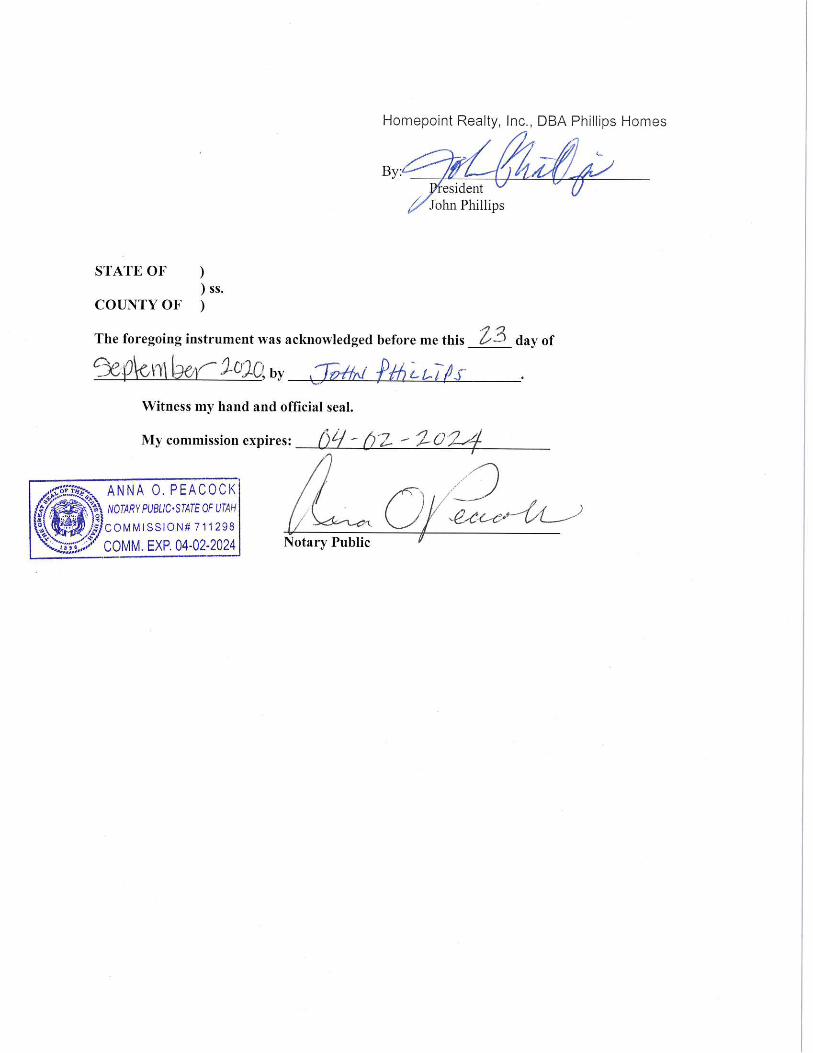
its land into the District (the “Petition”). In the Petition, John Phillips, as President of
Homepoint Realty, Inc., DBA Phillips Homes, represented that Homepoint Reality, Inc.,
DBA Phillips Homes is the sole owner of Parcel PP-102-A-2; and
WHEREAS, the Summit County Clerk has certified the Petition; and
WHEREAS, §17D-1-402 provides that the notice, hearing, and protest period do
not apply if a petition for annexation of additional area is filed with the signatures of all of
the owners of taxable real property;
WHEREAS, the sole owner of Parcel PP-102-A, Homepoint Realty, Inc., DBA
Phillips Homes has signed the Petition for annexation.
2
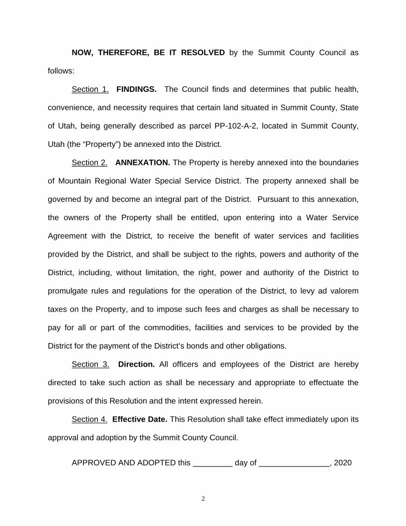
NOW, THEREFORE, BE IT RESOLVED by the Summit County Council as
follows:
Section 1. FINDINGS. The Council finds and determines that public health,
convenience, and necessity requires that certain land situated in Summit County, State
of Utah, being generally described as parcel PP-102-A-2, located in Summit County,
Utah (the “Property”) be annexed into the District.
Section 2. ANNEXATION. The Property is hereby annexed into the boundaries
of Mountain Regional Water Special Service District. The property annexed shall be
governed by and become an integral part of the District. Pursuant to this annexation,
the owners of the Property shall be entitled, upon entering into a Water Service
Agreement with the District, to receive the benefit of water services and facilities
provided by the District, and shall be subject to the rights, powers and authority of the
District, including, without limitation, the right, power and authority of the District to
promulgate rules and regulations for the operation of the District, to levy ad valorem
taxes on the Property, and to impose such fees and charges as shall be necessary to
pay for all or part of the commodities, facilities and services to be provided by the
District for the payment of the District’s bonds and other obligations.
Section 3. Direction. All officers and employees of the District are hereby
directed to take such action as shall be necessary and appropriate to effectuate the
provisions of this Resolution and the intent expressed herein.
Section 4. Effective Date. This Resolution shall take effect immediately upon its
approval and adoption by the Summit County Council.
APPROVED AND ADOPTED this day of , 2020

3
SUMMIT COUNTY COUNCIL SUMMIT COUNTY, UTAH
_________________________________________ Doug Clyde Chair
ATTEST:
______________________________ Kent Jones County Clerk
APPROVED AS TO FORM:
______________________________ Blaine S. Thomas Deputy County Attorney

Memorandum:
Date: September 30, 2020
To: Council Members
From: Nancy Hooton
Re: RAP Tax Recreation Committee
Appoint a member to serve on the Summit County Arts & Parks Advisory Committee-Recreation
(RAP Tax Recreation Committee). The member would serve the unexpired term of Anna
Frachou, which term expires May 31, 2021.
Council interviewed the following applicants on September 30, 2020:
Clair Trapp
Dayna Stern
Karen Mazanec

1
M I N U T E S
S U M M I T C O U N T Y BOARD OF COUNTY COUNCIL
WEDNESDAY, SEPTEMBER 9, 2020 SHELDON RICHINS BUILDING ANCHOR LOCATION
PARK CITY, UTAH
To view Council meeting, live, visit the “Summit County, Utah” Facebook page 4:05 p.m. OR
To participate in Council meeting: Join Zoom Meeting at https://zoom.us/j/772302472 OR
To listen by phone only: Dial 1-301-715-8592, Meeting ID: 279-421-350 We appreciate your patience and understanding, as we are all getting used to this electronic
meeting format PRESENT: Doug Clyde, Council Chair Tom Fisher, Manager Glenn Wright, Council Vice-Chair Janna Young, Deputy Manager Chris Robinson, Council Member Annette Singleton, Executive Assistant Kim Carson, Council Member Margaret Olson, Attorney Roger Armstrong, Council Member Kent Jones, Clerk Council Members log into separate electronic meeting for closed session The Council was called to order at 12:45 p.m. Closed Session – Security, Personnel, and Litigation Council Member Wright made a motion to convene in closed session to discuss security. Council Member Carson seconded and all voted in favor, 5-0. The Summit County Council met in closed session from 12:47 p.m. to 1:10 p.m. to discuss security. Those in attendance were: Doug Clyde, Council Chair Tom Fisher, Manager Glenn Wright, Council Vice-Chair Janna Young, Deputy Manager Chris Robinson, Council Member Margaret Olson, Attorney Kim Carson, Council Member Derek Siddoway, Communications Roger Armstrong, Council Member Jami Brackin, Deputy Attorney Annette Singleton, Executive Assistant Phil Bondurant, Health Department Rich Bullough, Health Director

2
Council Member Carson made a motion to leaved session to discuss security and convene in closed session to discuss personnel. Council Member Wright seconded and all voted in favor, 5-0. The Summit County Council met in closed session from 1:10 p.m. to 1:51 p.m. to discuss personnel. Those in attendance were: Doug Clyde, Council Chair Tom Fisher, Manager Glenn Wright, Council Vice-Chair Janna Young, Deputy Manager Chris Robinson, Council Member Margaret Olson, Attorney Kim Carson, Council Member Helen Strachan, Deputy Attorney Roger Armstrong, Council Member Jami Brackin, Deputy Attorney Brian Bellamy, Personnel Director Pat Putt, Community Development Director Annette Singleton, Executive Assistant Council Member Wright made a motion to leave session to discuss personnel and convene in closed session to discuss litigation. Council Member Robinson seconded and all voted in favor, 5-0. The Summit County Council met in closed session from 1:51 p.m. to 3:38 p.m. to discuss litigation. Those in attendance were: Doug Clyde, Council Chair Tom Fisher, Manager Glenn Wright, Council Vice-Chair Janna Young, Deputy Manager Chris Robinson, Council Member Margaret Olson, Attorney Kim Carson, Council Member Helen Strachan, Deputy Attorney Roger Armstrong, Council Member Jami Brackin, Deputy Attorney Pat Putt, Community Development Director Annette Singleton, Executive Assistant Council Member Wright made a motion to leave session to discuss litigation and convene in open session. Council Member Carson seconded and all voted in favor, 5-0. Work Session Pledge of Allegiance Continued discussion and possible action regarding appeal of Planning Commission denial of Conditional Use Permit for a Bed and Breakfast Inn at 3770 N HWY 224, Colby School; Hoffvest LLC, appellant; Ray Milliner The Council continued discussion from last week regarding an appeal of the Planning Commission denial of a Conditional Use Permit for a Bed and Breakfast at 3770 N HWY 224, the Colby School. Robert McConnell, representing the applicant, asked by what authority did they met in closed session for deliberation last week.

3
Margaret Olson, Attorney, gave reference of the case law used. Mr. McConnell said they have presented their argument. He suggested the legislative body could have more options to consider for approval in as much as the language was not clear regarding the owner/occupied definition. There should be a standard of review and he feels that in the past, the appellant complied with new conditions for approval and now the responsibility lies with the Council to make a determination. He explained that the Manager would have an undivided interest in the property as a co-tenant as pledged. He feels the Council can use the occupant definition, and operator, and primary resident, as terms to approve. Council Member Armstrong left the meeting to attend another commitment. He will return later. Jami Brackin, Deputy Attorney, clarified that the application to the Planning Commission was for owner members who would not occupy the property and that was the basis of the denial. Now, the applicant is trying to present other options but the decision by the Council is to determine if the Planning Commission erred in their findings and denial. The applicant proposal now was not applicable at the time of the denial. Council Member Robinson agreed the language was not clear, but there may be a way to consider by what is proposed to grant fee ownership as a condition of approval. Chair Clyde concurred that ownership was not clearly defined in the code, so the Council is left with plain meaning. He does not agree with granting the appeal. Council Member Carson agreed with Chair Clyde. Looking at what was presented to the Planning Commission, she agrees with the findings of denial. Owner occupied plain language would have an owner present with interest in the community, the neighborhood, and a stake in the value of the property. Council Member Wright agreed with what has been said. He is troubled by the history of this property and feels the intent is that the owner must occupy as a primary residence. Council Member Carson made a motion to uphold the Planning Commission denial of the Conditional Use Permit for a Bed and Breakfast Inn at 3770 N HWY 224, Colby School, Hoffvest LLC and deny the appeal subject to legal counsel drafting findings of fact and conclusions of law discussed for review and approval by the Chair. Council Member Wright seconded. The motion passed with Council Members Clyde, Carson, and Wright voting aye, and Council Member Robinson voting nay. Council Member Armstrong was not present for the vote. Work Session Discussion and results of the Regional Water Supply Rate Study; Scott Morrison, Steve Anderson, and Fred Philpot Scott Morrision, Manager of the Mountain Regional Water Special Service District, and Fred Philpot, reviewed the following information regarding a Regional Water Supply Study. The study was prepared by Lewis Young Robertson & Burningham Inc. Review and discussion of contract for regional transit planning services; Caroline Rodriguez Caroline Rodriguez, Director of Regional Transportation Planning, gave an update and reviewed the following staff report for transit planning services.

4
Convene as the Board of Equalization Council Member Robinson made a motion to convene as the Board of Equalization. Council Member Wright seconded with all voting in favor, 4-0. Discussion and possible approval of 2020 stipulations; Stephanie Larsen, Travis Lewis, and LoraLea McKnight The following stipulations were submitted by the County Assessor with a recommendation of approval. Council Member Carson made a motion to approve the stipulations as presented. Council Member Wright seconded and all voted in favor, 4-0. Dismiss as the Board of Equalization Council Member Wright made a motion to dismiss as the Board of Equalization with Council Member Carson seconding and all voting in favor, 4-0. Consideration of approval, continued Review and approval of County Manager’s execution of the Renewable Energy Appendix and related documents required to complete the Renewable Energy Service Contract with Rocky Mountain Power to procure net 100% renewable electrical energy for government operations; Lisa Yoder Lisa Yoder, Sustainability Program Manager, reviewed the following staff report regarding Renewable Energy with related documents and recommended approval to complete the Service Contract with Rocky Mountain Power to procure net 100% renewable electrical energy for government operations. Council Member Carson made a motion to approve the County Manager’s execution of the Renewable Energy Appendix and related documents required to complete the Renewable Energy Service Contract with Rocky Mountain Power to procure net 100% renewable electrical energy for government operations as recommended. Council Member Wright seconded and all voted in favor, 4-0. Council Minutes dated August 26, 2020, and August 28, 2020 Council Member Robinson made a motion to approve the minutes of August 26, and August 28, 2020 as written with Council Member Wright seconding and all voting in favor, 4-0. Council Comments
• Council Member Carson attended a Regional Transit meeting with Council Member Robinson
• She thanked staff for their tireless work regarding the Hideout lawsuit. She noted that the County is always ready to work on regional issues but was never asked by the Hideout Council to come to the table to talk about their intent and feels some disturbing comments have been made that are not accurate. She hopes there are future conversations including all parties to address services and challenges that need to be resolved
• Chair Clyde agreed with compliments to the staff

5
Council Member Armstrong re-joined the meeting. Manager Comments
• Deputy Manager Young reminded that the September 23 meeting is cancelled • A Central Wasatch Commission meeting is upcoming • A JTAB meeting is scheduled for September 15 along with the COG meeting • She gave a brief update regarding the CARES Act funding and an MOU with Park City
Community Foundation to provide services and assistance is in place If you would like to submit comments to Council, please email [email protected] by 12:00 p.m. on Wednesday, July 1st. If you wish to interact with Council at 6:00 p.m., for public input or the public hearing, please follow the “Public Comment and Public Hearing Instructions”. Public Input Heather Currie asked how many attendees are present throughout the session. Chair Clyde stated there are presently 9 panelists and 34 attendees. Public input was closed. Public hearing and possible action regarding a Rezone and 5-lot Master Planned Development (MPD) located at 660 E Chalk Creek Rd., parcels CCRKR-1 and CCRKR-2; Courtney Richins, Applicant; Amir Caus, AICP, County Planner Amir Caus, County Planner, reviewed the following staff report regarding a Rezone application for a 5-lot Master Planned Development located at 660 E. Chalk Creek Road, Courtney Richins, Applicant. He recommended that a public hearing be conducted and consideration of approval of the rezone pursuant to the Findings of Fact and Conclusions of Law outlined in the staff report. The public hearing was opened for comment. Pam Rapplean asked about access on Chalk Creek Road during construction. Will infrastructure to be built accommodate neighbor’s concerns about traffic, noise, and congestion in the area and along the road. She has seen officers recently on patrol and knows that cars travel at excess speed. Control needs to be addressed. Other concerns include more students in schools, more fire danger, more need for service providers. Elaine Tatton has concerns from those who have septic tanks and those who have wells and what this would do to water. What about irrigation water rights? Marilyn Cowley asked about damage to overhead power lines. If more construction she would like that addressed. She would like to see a masterplan for the entire area from agriculture to residential to make sure there is water and services available. Many questions about other lots to be added or what would be allowed after this may be approved and how are the number of lots to be determined. Most in the area have a concern about agriculture protection. Vaughn Staples is concerned about Chalk Creek Road. He has property in the area and is concerned about problems that spill out to other landowners. If the concerns can be managed, he is in support of approval. There were no other comments.

6
Council Member Carson asked about restrictions for septic tanks. Mr. Caus said the Health Department did not have a concern for 5 lots. She also asked about contact with the Coalville Mayor because this is in the annexation declaration area. Council Member Armstrong asked about compliance for wastewater and how many lots can be approved before a system is required. Small lot approvals may not create a problem but when do several approvals become an issue and there may be a need to merge lot requirements. He also asked that a document from the Fire District be included for their approval. Council Member Robinson noted this is the first rezone to 2.5 acre lots. It may be close enough to Coalville City limits to eventually have a sewer trunk line, but it would be expensive to require both septic and sewer infrastructure now. Council Member Wright asked if Public Works have plans for upgrading infrastructure on Chalk Creek Road. Mike Brown, representing the applicant, said the only rezone allowed to 2.5 was the 5-acre zone because services are nearby and access can be addressed. Water is available without drilling wells. Other requirements are met for open space and preservation of best use of the land. Council Member Carson made a motion to continue the public hearing on this matter to gather further information and to a date certain of October 7, 2020 at 5:00 p.m. Council Member Robinson seconded and all voted in favor, 5-0. Continued public hearing and possible approval of Ordinance 912, an Ordinance Creating Section 10-2-17 The Neighborhood Mixed Use Zone (NMU-1) in the Snyderville Basin Development Code; Pat Putt, Peter Barnes and Ray Milliner And Continued public hearing and possible approval of Ordinance 913, an Ordinance Amending the Snyderville Basin Development Code Section 10-2-7 Creating a Master Planned Development (MPD) Process; Pat Putt, Peter Barnes and Ray Milliner Ray Milliner, County Planner, and Pat Putt, Community Development Director, met again with the Council to continue a public hearing and consider approval of Ordinances to create a Neighborhood Mixed Use Zone in the Snyderville Basin Development Code and a Master Planned Development (MPD) Process. One change has been added since the last meeting to clarify language. The public hearing was continued for comment. Bradley Graveline thought it helpful for the added language by staff. He continues to believe this is unnecessary and it will create many problems and confusion for developers. Steve Joyce knows the letter from Park City has been included. One thing they continue to be concerned about is questions about land ownership and annexation process. He agrees it may be destructive to up-zone in the annexation area. Development Agreements may protect the County but not the City. Nothing continues normal because everything changes over time and whatever can be implemented to define plans long term is helpful protection. He asked that other development agreements be added to the requirement language. Chris Bullock is with Service Area 3. They sent a letter stating they supply water to Silver Creek Estates and asked that the County have a policy that developers meet with the Service Area 3 Board on all applications and note that water service is not guaranteed along with water infrastructure. They don’t supply water for commercial development.

7
Vernon Merritt said as a property owner he feels frustrated because of the number of areas to achieve a re-zone is overemphasized. The language prevents any area that has a development agreement or SPA, or settlement agreement, to apply because the process proposed has policies and objectives of the entire general plan. He understands the position of Park City and that agreements can be preserved, but he feels that a negotiation should be available to make changes in the future. He has a vacant piece of land and does not feel it makes good sense. Michael Bradley spoke at the earlier meeting and it is difficult to comprehend the potential for amendments, and for many homeowners to protect their land because they cannot understand the ways decisions can be made by Council over time. There are vacant areas and space that could apply for more development near already developed residential areas. How will this be administered by new Council Members in the future. Marian Crosby asked why the Council would include language that properties under development agreement would be precluded from being eligible for rezone. She said that this has been postponed for many years and never approved. She thinks this needs to be a tool for consideration and don’t understand the confusion. Bradley Graveline said again there is vague language and opens the door for abuse and confusion. Michael Bradley said that Pat Putt stated this was not intended for a resort community, but we are a resort community. Council Members Robinson and Armstrong commented that the additional language to preclude development agreements may create other issues. It may simply need to specify in annexation areas or vacant land. Council Member Wright said after hearing the public comment, the Council needs time to discuss the matter and suggested this matter continue to another date for consideration. Chair Clyde sees the NMU as a large scale masterplan that needs to be defined through both the NMU and MPD process. They cannot speculate on specific details until applications come in for review. Council Member Carson noted that clear understanding of the steps moving forward for both NMU and MPD are needed to create what the Council intended to accomplish. Pat Putt stated the reason for bringing this forward is to be able to have better planning and have better design than what is available today, and to provide services in neighborhood areas for connectivity, transportation, and public amenities. Council Member Carson made a motion to close the public hearing on the Neighborhood Mixed Use Zone (NMU) and to continue the public hearing and possible approval on the Masterplanned Development Process (MPD) to a date uncertain. Council Member Robinson seconded and all voted in favor, 5-0. The Council meeting adjourned at 9:55 p.m. ___________________________ ______________________________ Doug Clyde, Chair Kent Jones, Clerk

1
M I N U T E S
S U M M I T C O U N T Y BOARD OF COUNTY COUNCIL MONDAY, SEPTEMBER 14, 2020
SUMMIT COUNTY HEALTH DEPARTMENT ANCHOR LOCATION PARK CITY, UTAH
PRESENT: Doug Clyde, Council Chair Margaret Olson, Attorney Glenn Wright, Council Vice-Chair Jamil Brackin, Deputy Attorney Roger Armstrong, Council Member Tom Fisher, Manager Kim Carson, Council Member Janna Young, Deputy Manager Chris Robinson, Council Member Pat Putt, Community Development Director Annette Singleton, Executive Assistant The Council was called to order at 11:38 p.m. and all participating attended electronically. Council Members log into separate electronic meeting for closed session Closed Session – Litigation Council Member Wright made a motion to convene in closed session to discuss litigation. The motion was seconded by Council Member Carson and passed unanimously, 5 to 0. The Summit County Council met in closed session from 11:38 p.m. to 1:44 p.m. to discuss litigation. Those in attendance were: Doug Clyde, Council Chair Margaret Olson, Attorney Glenn Wright, Council Vice-Chair Jamil Brackin, Deputy Attorney Roger Armstrong, Council Member Tom Fisher, Manager Kim Carson, Council Member Janna Young, Deputy Manager Chris Robinson, Council Member Pat Putt, Community Development Director Annette Singleton, Executive Assistant Council Member Wright made a motion to leave closed session to discuss litigation and convene in open session and dismiss. Council Member Armstrong seconded the motion and all voted in favor, 5-0.

2
The Council meeting adjourned at 1:44 p.m. __________________________________ ________________________________ Doug Clyde, Chair Kent Jones, Clerk

1
M I N U T E S
S U M M I T C O U N T Y BOARD OF COUNTY COUNCIL
WEDNESDAY, SEPTEMBER 16, 2020 SHELDON RICHINS BUILDING ANCHOR LOCATION
PARK CITY, UTAH
To view Council meeting, live, visit the “Summit County, Utah” Facebook page 4:05 p.m. OR
To participate in Council meeting: Join Zoom Meeting at https://zoom.us/j/772302472 OR
To listen by phone only: Dial 1-301-715-8592, Meeting ID: 279-421-350 We appreciate your patience and understanding, as we are all getting used to this electronic
meeting format PRESENT: Doug Clyde, Council Chair Tom Fisher, Manager Glenn Wright, Council Vice-Chair Janna Young, Deputy Manager Chris Robinson, Council Member Annette Singleton, Executive Assistant Kim Carson, Council Member Margaret Olson, Attorney Roger Armstrong, Council Member Kent Jones, Clerk Council Members log into separate electronic meeting for closed session The Council was called to order at 2:02 p.m. Closed Session – Security, and Litigation Council Member Wright made a motion to convene in closed session to discuss security. Council Member Armstrong seconded and all voted in favor, 5-0. The Summit County Council met in closed session from 2:03 p.m. to 2:29 p.m. to discuss security. Those in attendance were: Doug Clyde, Council Chair Tom Fisher, Manager Glenn Wright, Council Vice-Chair Janna Young, Deputy Manager Chris Robinson, Council Member Margaret Olson, Attorney Kim Carson, Council Member Helen Strachan, Deputy Attorney Roger Armstrong, Council Member Jami Brackin, Deputy Attorney Annette Singleton, Executive Assistant Phil Bondurant, Health Department Derek Siddoway, Communications

2
Council Member Carson made a motion to leaved session to discuss security and convene in closed session to discuss litigation. Council Member Wright seconded and all voted in favor, 5-0. The Summit County Council met in closed session from 2:29 p.m. to 3:56 p.m. to discuss litigation. Those in attendance were: Doug Clyde, Council Chair Tom Fisher, Manager Glenn Wright, Council Vice-Chair Janna Young, Deputy Manager Chris Robinson, Council Member Margaret Olson, Attorney Kim Carson, Council Member Helen Strachan, Deputy Attorney Roger Armstrong, Council Member Jami Brackin, Deputy Attorney Pat Putt, Community Development Director Annette Singleton, Executive Assistant Council Member Robinson made a motion to leave session to discuss litigation and convene in open session. Council Member Carson seconded and all voted in favor, 5-0. Work Session Pledge of Allegiance Interview applicant for vacancy on the Summit County Arts & Parks Advisory Committee-Recreation (RAP Tax Recreation Committee) The Council interviewed Jessica Kirby to fill a vacancy on the Summit County Arts & Parks Advisory RAP Tax Committee. The vacancy is a result of Hutch Foster’s resignation. Convene as the Board of Equalization Council Member Wright made a motion to convene as the Board of Equalization. Council Member Carson seconded and all voted in favor, 5-0. Discussion and possible approval of refund in taxes for the 2019 tax year on Parcel PB‐PR‐119; Stephanie Larsen Travis Lewis, Chief Deputy Assessor, presented the following recommendation for a refund in taxes for the 2019 year on Parcel PB-PR-119. Council Member Carson made a motion to approve the refund of 2019 Taxes on Parcel PG-PR-119 as recommended. Council Member Wright seconded with all voting in favor, 5-0. Discussion and possible approval of 2020 stipulations; Stephanie Larsen, Travis Lewis, and LoraLea McKnight The following stipulations were submitted with a recommendation of approval by the County Assessor. Council Member Carson made a motion to approve the 2020 stipulations as presented. Council Member Wright seconded and all voted in favor, 5-0.

3
Dismiss as the Board of Equalization Council Member Wright made a motion to dismiss as the Board of Equalization with Council Member Robinson seconding and all voting in favor, 5-0. Consideration of Approval Discussion and possible approval of Resolution 2020-20, Eastern Summit County Constructive Notice for the Removal of an Agriculture Protection Area on Parcels NS-466 AND NS-494, as requested by property owners Sargent Leasing LLC and Chris Vernon; Kirsten Whetstone Kirsten Whetstone, Planner, reviewed the following staff report regarding a request to remove Parcels NS-466 and NS-494 from Agriculture Protection Area designation. She asked that the action be done by Resolution. Amber Sargent and Chris Vernon are the applicants. Council Member Robinson made a motion to approve Resolution 2020-20, Eastern Summit County Constructive Notice for the Removal of an Agriculture Protection Area on Parcels NS-466 AND NS-494, as requested by property owners Sargent Leasing LLC and Chris Vernon as recommended. Council Member Wright seconded the motion with all voting in favor, 5-0. Appoint member to serve on the Summit County Arts & Parks Advisory Committee-Recreation (RAP Tax Recreation Committee) Council Member Robinson made a motion to appoint Jessica Kirby to serve on the Summit County Arts & Parks Advisory Committee-Recreation (RAP Tax Recreation Committee) to complete the unexpired term of Hutch Foster ending May 31, 2022. Council Member Carson seconded and all voted in favor, 5-0. Discussion and possible action regarding appeal of Planning Commission approval of Conditional Use Permit for The Clubhouse; Kirsten Whetstone and Jami Brackin The Council heard an appeal from the Highland Estates Homeowners Association of the Snyderville Basin Planning Commission approval of a Conditional Use Permit for The Summit County Clubhouse, represented by John D. Richards of Richards Law. The following is a summary of the appeal submitted by Mr. Richards. Jami Brackin, Deputy Attorney, submitted and reviewed the response of the Planning Commission appeal of the Administrative decision. The Council can grant the appeal if they find that the Planning Commission erred in their decision. If not, the appeal should be denied and the decision of the Planning Commission be upheld. Polly McLean, of Peak Law, represents the applicant and stated the concerns raised regarding noise and traffic and other impacts have been addressed in the conditions. The conduct and plan of the applicant was specifically noted in the conditional use application. Amber Mackay, the owner, talked about the day to day operations anticipated and those who will be helped by The Clubhouse to make it possible to re-instate them into society with skills and abilities to be successful. She also addressed car-pooling, public transportation, and business plans as they look to the future and become more established.

4
Sally Jablon also noted that technology, such as zoom, will be utilized to work remotely in some cases. These type meetings have been extremely successful over the past few months. Jami again stated that the charge of the Council is to determine if the Planning Commission erred in their decision of approval with conditions that would mitigate any and all concerns brought to their attention. She recommended upholding the Planning Commission decision. Council Member Carson noted that public comment was allowed at the Planning Commission meetings and now the process is tightly bound by state law as far as what the Council is allowed to do. The Council has read the minutes and comments received both to the Planning Commission and what has been sent to the Council recently. Council Member Armstrong noted that the Council has a priority to help people that suffer from mental illness/wellness. This type of work has been very successful at other locations without being a burden to anyone. He is aware of the concerns expressed by the neighborhood residents and does not want to downplay those concerns, but every neighborhood has people that can benefit from this type of work. Chair Clyde and Council Member Carson agreed. Mr. Richards again stated his charge was to bring up concerns expressed and how mitigation would adequately be enforced addressing impacts. He felt that the conditions do not mitigate all concerns and the Council should consider if all fears brought to their attention have been part of the approval conditions. Council Member Wright felt the appellant has not met the burden to grant the appeal. Council Member Robinson agreed. Chair Clyde stated the applicant has outlined the business plan that the Council would not find it outside the reasonable described uses that cannot be mitigated by the findings and conditions of the Planning Commission. Council Member Carson made a motion to uphold the decision of the Snyderville Basin Planning Commission and deny the appeal of the Conditional Use Permit for the Clubhouse subject to the findings of fact and conclusions of law outlined in the staff report. Council Member Armstrong seconded and all voted in favor, 5-0. Council Minutes dated September 2, 2020, and September 4, 2020 Council Member Wright made a motion to approve the minutes of September 2 with one correction noted and September 4, 2020 as written with Council Member Carson seconding and all voting in favor, 5-0. Council Comments
• Council Member Carson attended a Board of Health meeting discussing leadership. Chris Cherniak is the new Chair. They also heard an update regarding COVID cases. No schools in the County have been impacted to date
• There will be an analysis of the transit system countywide and with UTA • She understands that some people are upset about the Conditional Use Permit action
taken today, but assured that all comment submitted and questions asked were heard. The Council must act on what was presented to the Planning Commission. Chair Clyde re-stated that the Council must apply the code when the application is made.

5
• Chair Clyde stated a meeting was held regarding the Marion Park and trails asking those in the area to organize and communicate with the Council what they would like done
• He also met with the new North Summit Fire Chief and they are reviewing the process for services provided
• Council Member Wright met with the MAOG Committee on Aging and heard an update
regarding assisted living facilities and how they are responding to COVID. He noted that no cases have been positive in County facilities
• They also discussed another MAOG program to provide help for heat in the winter months and a transportation voucher program for seniors to get to appointments through applying to MAOG
• He attended an Energy and Land Use debate at NACo discussing forest fires on the west coast
• Last, an Alzheimer’s Association meeting discussing services available for resources for caregivers will be held on zoom and facebook October 15
Manager Comments
• Manager Fisher noted the Board of Health will review services provided • He informed the Council that no tickets are being issued yet by the Snyderville Basin
Recreation staff for parking violations. They are still working on procedure If you would like to submit comments to Council, please email [email protected] by 12:00 p.m. on Wednesday, July 1st. If you wish to interact with Council at 6:00 p.m., for public input or the public hearing, please follow the “Public Comment and Public Hearing Instructions”. Public Input There was no public input. The Council meeting adjourned at 6:19 p.m. ___________________________ ______________________________ Doug Clyde, Chair Kent Jones, Clerk

1
M I N U T E S
S U M M I T C O U N T Y BOARD OF COUNTY COUNCIL MONDAY, SEPTEMBER 21, 2020
SUMMIT COUNTY HEALTH DEPARTMENT ANCHOR LOCATION PARK CITY, UTAH
PRESENT: Doug Clyde, Council Chair Margaret Olson, Attorney Glenn Wright, Council Vice-Chair Jamil Brackin, Deputy Attorney Roger Armstrong, Council Member Tom Fisher, Manager Kim Carson, Council Member Janna Young, Deputy Manager Chris Robinson, Council Member Pat Putt, Community Development Director Helen Strachan, Deputy Attorney Annette Singleton, Executive Assistant The Council was called to order at 8:03 a.m. and all participating attended electronically. Council Members log into separate electronic meeting for closed session Closed Session – Litigation Council Member Wright made a motion to convene in closed session to discuss litigation. The motion was seconded by Council Member Carson and passed unanimously, 5 to 0. The Summit County Council met in closed session from 8:03 a.m. to 10:00 a.m. to discuss litigation. Those in attendance were: Doug Clyde, Council Chair Margaret Olson, Attorney Glenn Wright, Council Vice-Chair Jamil Brackin, Deputy Attorney Roger Armstrong, Council Member Tom Fisher, Manager Kim Carson, Council Member Janna Young, Deputy Manager Chris Robinson, Council Member Pat Putt, Community Development Director Helen Strachan, Deputy Attorney Annette Singleton, Executive Assistant Council Member Robinson made a motion to leave closed session to discuss litigation and convene in open session and dismiss. Council Member Carson seconded the motion and all voted in favor, 5-0.

2
The Council meeting adjourned at 10:00 p.m. __________________________________ ________________________________ Doug Clyde, Chair Kent Jones, Clerk

Radford Appeal The documents related to the appeal of the Community Development Director’s denial of a building permit to extend the deck of Appellant’s twin home condominium unit in the development known as The Cove at Sun Peak at Parcel No. CSP-8B-A, are located on Summit County’s website here: https://www.summitcounty.org/973/Land-Use-Appeals
Or, the direct link is:
https://summitcounty.org/DocumentCenter/View/11462/Radford-Appeal-PDF

Patrick Putt, Director Community Development Department
P.O. Box 128 Coalville, UT 84017
(435) 336-3158 [email protected]
July 23, 2020 Mr. Michael Radford 5200 Bear Ridge Drive Apt A Park City, Utah 84098 RE: Radford Deck Extension; Building Permit No. 20313; #CPS-8B-A Dear Mr. Radford: Please accept this letter in response to your 8 June 2020 appeal regarding the proposed deck extension for your Cove at Sun Peak condominium. Your proposed building permit application indicates that portions of the deck will be constructed in Common Area, specifically Common Area 3 of the Cove at Sun Peak Subdivision Plat. It is my determination that constructing the deck in the proposed location will require changing said portion of Common Area to Private Area through a plat amendment process. A step precedent to filing the plat amendment application to covert the Common Area Private Area is a 2/3 majority vote action of all property owners through the Homeowner’s Association. I have confirmed the need for the plat amendment and the requirement for the 2/3 property owner consent with the County Attorney’s Office. Utah Code section 17-27a-606 Subsection 2 (2) A person may not separately own, convey, or modify a parcel designated as a common area or
common area and facility on a plat recorded in compliance with this part, independent of the other lots, units, or parcels created by the plat unless:
(a) an association holds in trust the parcel designated as a common area for the owners of the
other lots, units, or parcels created by the plat; or (b) the conveyance or modification is approved under Subsection (5). Subsection 5 (5) Notwithstanding Subsection (2), a person may modify the size or location of or separately
convey a common area or common area and facility if the following approve the conveyance or modification:

(a) the local government; (b) (i) for a common area that an association owns, 67% of the voting interests in the
association; or (ii) for a common area that an association does not own, or for a common area and
facility, 67% of the owners of lots, units, and parcels designated on a plat that is subject to a declaration and on which the common area or common area and facility is included; and
(c) during the period of administrative control, the declarant. I am aware there are CC&R provisions for the Cove at Sun Peak which address the use of the Common Area; however, Summit County is not a party to, or cannot administer, these private agreements. Please note that my determination may be appealed to the Summit County Council pursuant to the Snyderville Basin Development Code, Section 10-9-22: Appeal Procedures. I’ve taken the liberty to provide you with the link to this section of the Code: https://www.sterlingcodifiers.com/codebook/getBookData.php?chapter_id=30045#s929303. Sincerely, Patrick J. Putt Community Development Director

Community Development Department P.O. Box 128
60 North Main Street Coalville, Utah 84017 Phone: 435-615-3124
www.summitcounty.org
[Company Name]
4.5.18
APPEAL OF A LAND USE DETERMINATION □ Snyderville Basin □ Eastern Summit County
OFFICE USE ONLY Project #:_________________________________ Date Received:____________________________ Received By:______________________________
Zoning:___________________________________ Receipt #:_____________________________ Plan Check #:_____________________________
PROJECT BEING APPEALED Project Name:________________________________________________________________________ Address:_________________________________________________ Tax ID#:____________________ Date of Formal Action: _________________________________________________________________
APPELLANT INFORMATION Name:____________________________________________________ Phone:____________________ Address:_____________________________________________________________________________ E-mail:______________________________________________________________________________
SUBMITTAL REQUIREMENTS – Certain submittal requirements may be waived by Staff depending on the circumstance of each application and whether or not certain items are necessary to understand the nature of the project. □ Written description of the appeal that includes the facts that supported the decision and why those facts are irrelevant or not credible to the decision that was made. □ Any additional information that will assist in clearly understanding the nature of the appeal. □ 1 electronic copy of the required materials in PDF format. □ ADDITIONAL INFORMATION MAY BE REQUIRED by the project planner to ensure adequate information is provided for staff analysis. All information required for staff analysis will be available for public review. Applicant Initials ________
FEES Application Fee: $400 All application fees must be paid at time of application submittal. No application will be processed until all application fees are paid. Notification and publication fees for required public hearing notices (individual notices mailed to property owners - $2 per notice; 14 day publication of legal notice in local newspaper – cost of notice) will be billed to applicant. Notification fees must be paid within 15 days of billing. Please note regarding fees: The payment of fees and/or the acceptance of such fees by County Staff does not constitute any sort of approvals, vesting, or signify that the application is complete or appropriate in any manner. The collection of fees is simply a requirement to begin the review process that will ultimately make such determinations.
ADMINISTRATIVE APPEAL PROCEDURE 1. Commencement of Land Use Appeal. Summit County Code (the “Code”) §§ 10-9-22 and 11-7-16 require that a land use appeal (the “Land Use Appeal”) to a decision which has been documented in writing (the “Decision”) and made by the Planning Commission, County Manager, and Director of Community Development (the “Final Land Use Authority”) be filed within ten (10) calendar days of the date of such Decision (the “Land Use Appeal Deadline”). A Land Use Appeal must be in writing and must be signed by and include an email address of the Appellant (defined below). A Land Use Appeal must be filed with the Department of Community Development and must be accompanied by the payment of the appropriate fee. This Summit County Administrative Appeal Procedure will be provided to each Appellant at the time the Land Use Appeal is filed, the receipt of which will be acknowledged by signature of each Appellant. 2. Commencement of other Administrative Appeals. All other administrative appeals (the “Administrative Appeals”) to the County Council which are provided for in the Code must be filed with the appropriate County department or elected official (the “Appropriate County Entity”) from whose decision an Appellant is seeking an appeal within the time periods established therein (the “Administrative Appeals Deadline”) and be made in writing, signed by and include an email address of the Appellant(s). Administrative Appeals must be accompanied by the payment of the appropriate fee. This Summit County Administrative Appeal Procedure will be provided to the Appellant(s) at the time the Administrative Appeal is filed, the receipt of which will be acknowledged by signature of the Appellant(s). 3. Parties to the Land Use Appeal or Administrative Appeal. The parties (the “Parties”) to the Land Use Appeal or Administrative Appeal (together, the “Appeal”) are as follows: A. Land Use Appeal. The Parties are the Final Land Use Authority, any adversely affected person who is filing the Appeal (the “Appellant”), and the Party who filed the application seeking the County permit or decision, if different from the Appellant (“Applicant”). B. Administrative Appeal. The Parties are the County department or elected official from whom the Appeal is made in accordance with the Code, the Appellant, and the Applicant. 4. Service List. Within two (2) business days after the Land Use Appeal Deadline or Administrative Appeal Deadline (together, the “Appeal Deadline”), the Planning Department (in the case of a Land Use Appeal) and the Appropriate County Entity (in the case of an Administrative Appeal) shall email a list of email addresses of all Parties (the “Service List”). In addition to the Appellant(s) and Applicant, each Service List will include and be sent to the County Council, the Final Land Use Authority (in the case of a Land Use Appeal), the Appropriate County Entity (in the case of an Administrative Appeal), the Deputy County Attorney representing the Final Land Use Authority or the Appropriate County Entity, the County Attorney’s Office paralegal, and the County Attorney. All Parties will be required to use the Service List for all filings described below. The Service List is part of the official record of the proceedings (the “Record”).
ADMINISTRATIVE APPEAL PROCEDURE 5. Initial Submission. Within seven (7) calendar days after the filing of the Appeal, each Appellant must email to the Service List its written materials for the Appeal (“Initial Submission”). This should include each Appellant’s detailed designation of the Record, statement of issues, legal authority, arguments and all documentary evidence and exhibits for the Appeal. 6. Response. Within seven (7) calendar days after the service of the Initial Submission, the other Parties shall file responsive materials fairly meeting the issues raised in the Initial Submission. The Response should include each Party’s additional designations of the Record, if any, legal authority, argument and all documentary evidence and exhibits for the Appeal. 7. Reply. Five (5) calendar days after the service of the Response (“Reply Deadline”), each Appellant may email to the Service List rebuttal evidence and arguments, as well as any other digital or electronic information that such Party wishes to present at the Appeal hearing (the “Hearing”). 8. Page Limits. At the discretion of the Council Chair, page limits may be imposed upon the Response and Reply submissions. These will be discretionary and announced within 3 calendar days after the service of the Initial Submission. Page limits, if any, will be sent to the Service List. 9. No Late Submissions. No written or electronic materials will be accepted after the Reply Deadline. No exceptions. 10. Ex Parte Communications Prohibited. No Party shall have any direct or indirect ex-parte communications, including text and email, with any member of the County Council after the commencement of the Appeal. 11. Electronic Submissions Only. Summit County endeavors to be a paperless operation. No hard copies should be distributed. 12. Preparation and Publication of the Record. After the Reply deadline, the County Attorney’s Office paralegal will paginate and index all submissions by the Parties for inclusion within the Record. The Record will be posted online five (5) calendar days prior to the Hearing together with the Agenda so as to accomplish any required public notice. 13. Requests for Continuances. Any Party may file a request to postpone the Hearing for good cause shown. The Chair of the County Council shall grant or deny the request and provide notice to the Service List. The continuance of a Hearing does not change the Initial Submission, Response and Reply deadlines set forth herein. 14. Hearings and Oral Presentation. A. With respect to Land Use Appeals, per Code §§ 10-9-22 and 11-7-16, Hearings will be Scheduled before the County Council within thirty (30) days of the Appeal Deadline. B. With respect to Administrative Appeals, Hearings will be scheduled before the County Council within a reasonable time period after the Appeal Deadline. C. Based on a review of the Record, the Chair of the County Council will set and publish time limits on the Agenda for oral argument by each Party, or, in the case of multiple Appellants, the Chair may limit argument per side. The Appellant(s) may use the entire allotted time for a presentation, or may reserve part of its designated time for rebuttal. 15. Continued Hearing Sessions and Additional Information. The County Council may, in its discretion, hold multiple Hearings on an Appeal and may request additional and further briefing and identify issues for further evidence and discussion. Applicant Initials ________

APPELLANT’S ACKNOWLEDGEMENT I hereby declare under penalty of perjury that this application form and all information submitted as part of this application form is true, complete, and accurate to the best of my knowledge. Should any information or representation submitted in connection with this application form be incorrect or untrue, I understand that Summit County may rescind any approval or sufficiency determination, or take other appropriate action. Appellant’s Signature:__________________________________________________ Date:___________ Print Name:_________________________________________________________________________
STAFF COMMENTS: __________________________________________________________________ ____________________________________________________________________________________ ____________________________________________________________________________________

1
DESCRIPTION OF THE APPEAL
Date: June 8, 2020 Appellant: Michael J. Radford 5200 Bear Ridge Drive, Unit A Park City, UT 84098 Phone: 619-392-6870 [email protected] Land Use Authority: Summit County Planning Division Summit County Community Development Department P.O. Box 128 60 North Main Street Coalville, Utah 84017 Phone: 435-615-3124 www.summitcounty.org Property: Unit A, Bldg. 8B, The Cove at Sun Peak (Parcel No. CSP- 8B-A) Building Permit No.: 20313 Re: Appeal of Summit County Planning Division disapproval of
Building Permit Application No. 20313 on May 29, 2020
Introduction
This is an appeal from a Community Development Department, Planning Division
(“Department”) written submission on May 29, 2020 declining approval of a building
permit for a six (6) foot deck extension at the back of a twin home condominium unit
within the condominium plat of The Cove at Sun Peak. The submission requires
Appellant to record a plat amendment, supported by a 2/3 vote of all property owners in
the subdivision and processed through the HOA, before a permit will be issued for
extension of a back deck from 6’ to 12’ from the back wall of the unit.
Appellant contends that this requirement is contrary to state statute and the
Snyderville Basin Development Code and a violation of the Department’s duty to

2
interpret and enforce land use regulations in favor of a land use application absent a
statute or regulation plainly restricting the use requested.
The Planning Division, on the advice of the Summit County Attorney’s Office, has
interpreted diagrams of typical building type footprints and a schedule square footages
of units on condominium plat to prohibit the deck extension improvements outside of
those footprints or in excess of square footages listed. The Department also interprets
the improvements as being in the common area of the subdivision and therefore not
available for unit owner improvements without a plat amendment. Those interpretations
are not based on any state statute or county regulation plainly imposing such
restrictions on condominiums in the Snyderville Basin Development District.
Action(s) Appealed
Two negative submissions were filed by the Department in response to
Appellant’s building permit application. On May 1, 2020 the Department initially stated it
could not approve the permit because the improvements did not meet a 12’ setback
requirement (the “5/1 Setback Correction Request”). After Appellant questioned the
requirement1, the Department apparently abandoned the 12’ setback requirement and
found a different basis to deny the application. 2
On May 29, 2020 the Department filed submission 2 denying the application
unless Appellant, through the HOA, first records a plat amendment, supported by a 2/3
vote of all property owners in the subdivision, allowing common area to be converted to
1 There is a series of emails between Appellant and the Assistant Planner
explaining basically the same things presented in this appeal. 2 The Setback Correction Request is included in this appeal should the
Department withdraw its requirement of an amended plat but continue to rely upon perceived setback requirements to deny the permit application.

3
private space and improvements to be constructed outside the parameters of the typical
building footprints and in excess of square footages listed on a Units Schedule on the
condominium plat (the “5/29 Disapproval”). Appellant contends that both the setback
requirement and requirement of an amended plat are erroneous and not supported by
Utah statute, the Snyderville Basin Development Code or other regulation.
The 5/1 Setback Correction Request is attached as Exhibit A. The 5/29
Disapproval is attached as Exhibit B. The operative text of each is reprinted below:
5/1 Setback Correction Request The following information is required to be submitted and/or corrected on the site plan construction plan before the Summit County Planning Division can approve the applied for permit. …
1. The proposed deck does not to meet the 12’ setback requirement.
5/29 Disapproval
In speaking with the Summit County Attorney’s Office and Peter Barnes, Planning and Zoning Administrator, as page 3 of the Cove at Sunpeak recorded subdivision plat includes a diagram of the footprints for the condo units within the development as well as a chart of total allowed square footage for each unit, the proposed deck would be located outside of those parameters. As well as the area that is being proposed to place the deck extension is located within the common area. The common area cannot be converted to private space without a 2/3 majority vote action of all property owners though the HOA. And if the HOA does obtain a majority vote to convert the common area to private area, it must be noted on the plat. This would require a Plat Amendment. Therefore, the deck extension that you have applied for cannot be approved until a plat amendment has been approved and completed.

4
Description of the Property and Building Permit Application
The property which is the subject of this appeal is Unit A of Building 8B (Parcel
CSP-8B-A) (the “Property”) in the hybrid condominium and large lot single family
residence subdivision known as The Cove at Sun Peak. The subdivision is located on
the west side of Highway 224 just south of the Bear Hollow subdivision and consist of
eight (8) large single-family home lots (Lots 2 through 9) and a 5.129-acre condominium
lot (Lot 1). The Property is one of 61 twin home duplex units on Lot 1 (see Figure 1).
Figure 1 - Location of the Property
The Cove at Sun Peak was created by a hybrid subdivision and condominium
plat recorded on June 12, 1996 as Entry No. 00456153 (the “Plat”), and the Declaration
of Protective Covenants, Agreements, Conditions and Restrictions for The Cove at Sun
Peak recorded on June 12, 1996 as Entry No. 00456155 (the “Declaration”). The Plat
and Declaration are attached as Exhibits C and D, respectively.

5
On April 21, 2020 Appellant submitted an application for a building permit to
extend the existing six-foot-long deck at the back of the Property by another six feet
(Permit No. 20313). The existing deck is very small. (See Figure 2).
Figure 2 - Existing deck at back of main floor of the Property
Figure 3 is the side elevation showing the proposed deck extension.
Figure 3 - Side Elevation

6
The Property is one of 36 twin home units with back walls facing down slope,
with views of the Snyderville Basin. Of those 36 units, the majority have deck
extensions similar to what Appellant is seeking to construct. Attached as Exhibit E are
pictures of other units in the condominium complex with deck extensions.
The Property is a Building Type “B” described on sheet 3 of the Plat. There are
18 Building Type “B” units in the condominium complex. Of those 18 units, 15 have
deck extensions similar to or larger than Appellant’s proposed construction. Six of the
eight downslope units on Bear Ridge Road, where Appellant’s unit is located, have deck
extensions including those to the immediate left and right of the Property (see Figure 4).
Figure 4 - Neighboring units with deck extensions
The Homeowners Association for The Cove at Sun Peak has approved
Appellants request to extend the rear deck by six feet. As will be discussed below,
construction of deck extensions in the “limited common areas”, defined as the area 12’
from the rear wall of a twin home unit, is expressly authorized by the Declaration and
HOA Exterior Work Guidelines.
Should Department staff conduct a review of other improvements in the
subdivision it should be apparent that deck extensions have been approved and

7
permitted since recording of the Plat and Declaration. In fact, many were probably
permitted as part of the original construction of twin home units as builder options.
There is a good reason for this – the requirements now being imposed on Appellant are
not supported by statute, code or other regulation, and are not within the Department’s
discretion or authority to impose.
Grounds for Appeal
The Utah Condominium Ownership Act3 (the “Condominium Act”) is the
controlling state statute for condominium developments in Utah. The Property is
located in the Snyderville Basin Planning District and subject to the Snyderville Basin
Development Code (“SBDC”).4 Pursuant to the Condominium Act, the Summit County
Development Code requires a condominium plat and declaration for projects such as
The Cove at Sunpeak.5 SBDC § 10-3-8A states that the condominium plat “shall
contain the information required for a final site plan as identified in section 10-3-15 of
this chapter.” (Emphasis added.) SBDC § 10-3-8A also requires that CC&Rs (defined
as a declaration in the Condominium Act) be submitted for review by the Summit
County attorney’s office prior to recording of the condominium plat. Other than the
reference to final site plan and CC&R requirements, the SBDC has little in the way of
specific regulations for condominium projects.
Final site plan submission and content requirements are different from final
subdivision plat requirements and have the added feature of a declaration of conditions,
3 Utah Code Ann. § 57-8-1, et seq. 4 Snyderville Basin Development Code, Title 10, County Code of Summit County,
Utah. 5 SBDC §10-3-8.

8
covenants and restrictions to be approved by the County and recorded with the
condominium plat.
Immediately preceding the final site plan requirements are the County’s final
subdivision plat submission requirements.6 That section requires that a final subdivision
plat show “building setback lines.”7 Condominiums do not require a final subdivision
plat. Condominium plats must comply with final site plan requirements. Unlike a final
subdivision plat, a final site plan (condominium plat) does not require building setback
lines for approval.8 This is a logical difference given the definition of setbacks.
The SBDC defines setbacks as “[t]he distance between a lot line and the front,
side, or rear line of the foundation of a structure or finished exterior surface of a
structure, whichever is closer to the property line …” (emphasis added).9 A “lot line” is
defined as “[a]ny line defining the boundaries of a lot.”10 A condominium unit which is
one of many ownership entitlements on a single lot doesn’t, by itself, have lot lines or
boundaries of a lot. The Property which is the subject of this appeal is hundreds of feet
from the nearest lot line.
If there is no setback limitation shown on the condominium plat or required for
separate condominium units in the SBDC, what controls the location and boundaries of
condominium owner improvements and additions to a unit not otherwise encroaching on
a lot line setback? It is, by statue, the declaration of CC&Rs recorded concurrently with
6 SBDC § 10-3-14. 7 SBDC § 10-3-14A.2.d. 8 See SBDC § 10-3-15. There is no mention of setbacks. 9 SBDC § 10-11-1. 10 Id.
9
the condominium plat and approved by the county that provides those restrictions and
rights. It is not an interpretation by the Department that those restrictions are defined by
“a diagram of the footprints for the condo units within the development as well as a chart
of total allowed square footage for each unit” prohibits such improvements. Nothing in
the SBDC plainly restricts improvements by condominium unit owners outside of typical
footprints or in excess of scheduled unit square footages on a condominium plat.
Absent more specific regulation in the SBDC, the Department must look to the
Condominium Act for guidance.
The Condominium Act defines a special form of common area available for
exclusive use and improvement by condominium owners known as “limited common
areas and facilities” which is to be described in the declaration required to be recorded
along with the condominium plat:
§ 57-8-3. Definitions As used in this chapter: … (16) “Declaration” means the instrument by which the property is submitted to the provisions of this act,[footnote omitted] as it from time to time may be lawfully amended. … (23) “Limited common areas and facilities” means those common areas and facilities designated in the declaration as reserved for use of a certain unit or units to the exclusion of the other units. § 57-8-7.2. Scope--Designation of certain areas … (5) The following, if designated to serve a single unit but located outside the unit's boundaries, are limited common areas and facilities allocated exclusively to a unit: (e) a stoop; (f) a porch; (g) a balcony; (h) a patio;

10
… (k) any other fixture. § 57-8-10. Contents of declaration … (2) (a) For every condominium project, the declaration shall: … (v) describe any limited common areas and facilities and state to which units the use of the common areas and facilities is reserved. … [(2)] (b) Any shutters, awnings, window boxes, doorsteps, porches, balconies, patios, or other apparatus intended to serve a single unit, but located outside the boundaries of the unit, shall constitute a limited common area and facility appertaining to that unit exclusively, whether or not the declaration makes such a provision. [(2)](c) The condominium plat recorded with the declaration may provide or supplement the information required under Subsections (2)(a) and (b). (Emphasis added.) Appellant’s deck extension is a fixture or apparatus similar to a stoop, porch,
balcony or patio located outside the boundaries of the unit. By statute it should be
considered part of the limited common areas and facilities designated in the declaration.
The Declaration for The Cove at Sun Peak provides in section 3.4:
3.4 Limited Common Areas. Some Common Areas have been designated as for the exclusive use and possession of the Units to which they are appurtenant. … [T]he Owner of the Unit to which the Limited Common Area is appurtenant shall have the exclusive possession of that area. The Limited Common Areas are:
… (d) That portion of the Property of up to a maximum of 12
feet at the rear yard of the twin home units is deemed Limited Common Area. …
… (e) The Unit Owner may make improvements within the
Limited Common Area described in (d), as provided in this Declaration.

11
In addition to the recorded declaration, the HOA has more specific guidelines that
make the intent of the declaration and use of limited common areas clear with regard to
deck extensions. A copy of the current Cove @ Sun Peak Exterior Work Guidelines is
attached as Exhibit F and provides the following with regard to twin home decks:
Decks • Existing side or front entrance decking may NOT be altered
or expanded. …
• Deck expansion is allowed only within the 12-foot limited common area designation (12 feet from back wall) …
Although not shown on the Plat, limited common areas are mentioned in Note 11.
And the Declaration is incorporated by reference on the Plat. Limited common areas
are not required to be shown on the Plat, only described in the Declaration recorded
concurrently with the Plat.11 In the case of The Cove at Sun Peak, limited common
areas are, in fact, described in the Declaration and permit improvements by unit owners
in the area 12 feet behind the back wall of twin home units. Those permitted
improvements include deck extensions.
The “diagram of the footprints for the condo units within the development” cited
by the Department in its 5/29 Disapproval submission are simply typical footprints for
the three building types and show the roof outlines and not decks. Nowhere in the
SBDC is there a regulation restricting improvements in general, or limited common area
improvements by unit owners specifically, in an area outside of typical building type
footprints on a condominium plat. Because the Utah Condominium Act defines and
allows unit owner improvements within limited common areas if included in the
11 Utah Code Ann. § 57-8-1(2)(a)(v) and (2)(c).

12
condominium declaration, the Department’s interpretation of the typical building type
footprint on the Plat is in conflict with that statute and cannot be upheld.12
The “chart of total allowable square feet” referred to in the Department’s 5/29
Disapproval submission is actually a “Units Schedule” generally identifying building
types, unit footprint square feet and unit square feet. It is not a limitation on allowable
square feet and, as noted above, the unit footprints do not include decks. Building Type
“C”s have multiple decks well outside the diagram footprint. Building Type “B”s, such as
Appellant’s unit, have decks under the 6’ roof outline shown on the diagram. The decks
themselves are not depicted on the diagrams. Even if describing “allowable square
feet” for units, which it does not, the Units Schedule on the Plat actually excludes decks
in the calculations.13
Nowhere in the SBDC is there a regulation prohibiting limited common area
improvements to the exterior of a condominium unit that, when added to interior square
footage, exceed unit square footages listed on a Units Schedule on the condominium
plat. Nor does the SBDC require a table of “allowable square feet” for each
condominium unit.
Even if there were a SBDC section limiting unit owner improvements outside of a
diagram of typical unit footprints or in excess of a table of unit square footages on the
condominium plat, that regulation would be unenforceable. A county may adopt its own
land use standards but may not impose a requirement, regulation, condition, or
12 The provisions of this chapter shall be in addition and supplemental to all other provisions of law, statutory or judicially declared, provided that wherever the application of the provisions of this chapter conflict with the application of such other provisions, this chapter shall prevail … . Utah Code Ann. § 57-8-35(1).
13 See note on page 20 of the Declaration: “*square footages exclude garage, patios and deck spaces.”

13
standard that conflicts with a provision of the County Land Use, Development, and
Management Act14, other state law, or federal law.15 Those restrictions would be in
conflict with the Utah Condominium Act definition and purpose of limited common areas
and facilities allowing such improvements if described in the declaration.
Finally, the Departments requirement of an amended plat because the proposed
deck extension is in “common area” which is not available for private use is wrong.
Private use and improvements in “limited common areas” is specifically authorized by
the Utah Condominium Act and the Declaration governing the Property. Appellant is not
trying to convert a “common area” into a “private area”. Appellant already has recorded
rights and entitlements to the limited common area at the back of the Property and no
plat amendment is needed.
In any event, if a land use regulation does not plainly restrict a land use
application, the land use authority shall interpret and apply the land use regulation to
favor the land use application.16 Summit County does not have a land use regulation
that plainly restricts the improvements applied for, and the Department’s adverse
interpretation based on a footprint diagram and unit schedule violates its legal duty to
favor the land use application.
A county may not impose on an applicant who has submitted a complete
application a requirement that is not expressed in a statute or county ordinance.17
14 Utah Code Ann. § 17-27a-101, et seq. The County Land Use, Development,
and Management Act is hereinafter referred to as the “County Land Use Act”. 15 Utah Code Ann. § 17-27a-104(1) and (2). 16 Utah Code Ann. § 17-27a-308(2). 17 Utah Code Ann. § 17-27a-508(e).

14
An appeal authority must (a) determine the correctness of the land use
authority's interpretation and application of the plain meaning of the land use
regulations; and (b) interpret and apply a land use regulation to favor a land use
application unless the land use regulation plainly restricts the land use application.18
The Department should be directed to approve Appellant’s building permit
application.
Respectfully submitted,
________________________ Michael J. Radford, Appellant
18 Utah Code Ann. § 17-27a-707(4)


Exhibit A

Community Development Department
Planning Division Molly Orgill, Assistant Planner
Telephone 435-336-3153 [email protected]
Building Plan Check: 20313 Parcel: CSP-8B-A Zone: HS Required Setbacks: Front- 30’ Sides- 12’ Rear- 12’ Date: May 1, 2020
The following information is required to be submitted and/or corrected on the site plan construction plan before
the Summit County Planning Division can approve the applied for permit. It is recommended that you wait to
upload revised plans until you have received comments from all departments. (Building, Engineering, and
Planning)
1. The proposed deck does not to meet the 12’ setback requirement.
2. If the deck is modified to meet the 12’ property boundary setback requirement then please submit an
approval letter and have the plans stamped by the Homeowners Association.

Exhibit B

Community Development Department
Planning Division Molly Orgill, Assistant Planner
Telephone 435-336-3153 [email protected]
Building Plan Check: 20313 Parcel: CSP-8B-A Zone: HS Date: May 29, 2020 Submittal 2
The Summit County Planning Division cannot approve the applied for permit to extend a deck for the following
reasons:
1. In speaking with the Summit County Attorney’s Office and Peter Barnes, Planning and Zoning
Administrator, as page 3 of the Cove at Sunpeak recorded subdivision plat includes a diagram of the
footprints for the condo units within the development as well as a chart of total allowed square footage
for each unit, the proposed deck would be located outside of those parameters. As well as the area that is
being proposed to place the deck extension is located within the common area. The common area cannot
be converted to private space without a 2/3 majority vote action of all property owners though the HOA.
And if the HOA does obtain a majority vote to convert the common area to private area, it must be noted
on the plat. This would require a Plat Amendment.
Therefore, the deck extension that you have applied for cannot be approved until a plat amendment has
been approved and completed.

Exhibit C

60' ACCESS EASEMENT IN FAVOR OF THt UTAH SPORTS AUTHORITY EXECUTED BY SUMMIT RANCH JOINT VENTURE RECORDED SEPTEMBER 9. 1992 ENTRY NO. 365004, BOOK 681, PAGE 165
W1,4 COR SECTION 31 E 1,4 SEC 36
FOUND: CAP
NOO• 03' 43 "W 53,76' N,T.S.
NW CORNER SEC, 31 FOUND BRASS CAP
POINT OF COMMENCING
RANGE 3 EAST
RANGE 4 EAST
I I \
I I
\ \ \
I I
\ \
I I
I I
I
" '--.._- WE_§ .39'
Noo·_o3' 43 ''w- 206~. 68'
SE CORNER SEC. 25 NOT FOUND
LOT 8 15.446 ACRES
60' PRIVATE RIGHT-OF-WAY ANO PUBLIC UTILITY ESMT.
\ \
\ \
\ _,.,--.._---- \ /'--.___ I
---- --------- '- ---------- '--- 1-------- . I
...
LOT 2
30' WIDE · NON-EXCLUSIVE ~UILDABLE AREA UTILITY EASEMENT 15,187 SQ, FT.
J;__:· ·········------------ _.--·•,,, •, -~, ··--.. ____ --···-. '- .........__ 20' WIDE••-·· •• •••
' SAN IT ARY ·: SEWER ESMT. ______ ••• ---•
COMMON AREA 4 (CONDOMINIUMS!
0,581 ACRES
- )
SCALE: 1" = 100' ------0
PARTNERSHIP INVESTMENTS OF ENTRY NO. 117715 BOOK M42, PAGE 607-609
LOT 1 5.129 ACRES
50 100 200
COLORADO, INC.
SURVEYOR'S CERTIFICATE
LEGEND;
• 0
A
PRIVATE owNrRSH!P AREA
COMMON AREA,
PUBLIC DEDICATION
LIMITED COMMON AREA
EXISTING RIGHT-OF-WAY MARKER
EXISTING REBAR ANO CAP LSl73736
EXISTING SECTlON CORNER
MONUMENT TO BE SE!
REBAR ANO CAP TO BE SET AT LOT CORNERS
PROPOSED FIRE HYDRANT
CAP
\_ BASIS OF BEARING
N oo·oo'06" w 2641.45'
<BETWEEN W.1/4 S,31 & N.W. COR SEC. 31 l ,/ .. ~ ··., __ ,,, ........ .
............. so·oo•oo'E <::_ ...... 482.61' (···· ..
1 ~ JONATHAN D. BEHR. -00 HEREBY CERTIF'Y THAT I AM A RE(HSTEREO LAND SURVEYOR. ANO THAT I HOLU CERTIFICATE NO. 290669, AS PRESCRIBED UNDER TH( LAWS OF THE STATE OF UTAH. l FURTHER CERTffY THAT BY THE AUTHORHY QF THE OWNERS. I HAVE MADE A SURVEY OF THE TRACT Of LANO SHOWN ON THIS PLAT ANO DESCRIBED BELOW, ANO HAVE SUBDIVIDED SAID TRACT OF LANO INTO LOTS, ANO STREETS, HEREINAFTER TO BE KNOWN
C1 C2 C'.3 C4 C5 CG C7 CB C9 C10 c11 C12 en C14 C15 C16 C17 C18 C19 C20 C.21 C22 C23 C24 C25 C26 C27 C28 C29 C30 C31 C32 C33 C34 C35 C36 C37 C38 C39 C40 C41 C42 C43 C44
SILVER CREE
KIMBALL JCf
SEM HOU.OW
/ SN\'OE<MUS
(PROJECT SITE
DELTA 30"15'49"' 42..-48'49 42"48' 49N 128" 10 46' 12a·10'46' 20•04•33 20"04'38" 42"48" 49" 20°04'38" 41•47'06" 3"24'00' 3•24'00" 3"24'00 19"21 1 46,.. 19"21 46" 19"21 '46" 79"58'55" 81-54'16" 75"43' 18" 36'"34'58,,. 29"08'57,.. 34"32'12" 50"25'25" 63·31'14 14"14'04"' 57•21 '25" 48'29'35 57"27'25"' 113"32'32" 29*40'56"' 42"'30'12 4z•30' 12"' 42"30 1 12 21•15'06" 21•1s'06H 53•39'36" 53•39' 36"' 53•39' 36"' 18'"16'49" 18"16' 49" te· 1s' 49• 39'"01'23" 3'6"02~42" 34•04 40
VICINITY MAP
(NOT TO SCALE)
CURVE DATA RADIUS LENGTH 80.00 42.2t;' 230.00' 171.87 200.00' 149.45 1;w.oo' 2:GB. 46' 1_50.QO' 335.57' 1230, 00' 431.01' 1200.00· 420, 50' 170,00' 127-03' 1170,00' 40.9:-98' 110. 00' so.22' 800.00' 47.47 1
a3o. oo 4'9-25' 110.00' 45. 69' 800.00' 210,35' 830.00' 280.49 770.00' 2so. 22' eo.oo' 111.68' 110-00' 157.25' so~ oO' 66-08' 180.00' 114,93' 180.00' 91-57' 1$Q.OO' 1 OS.. 50' 150. 00 1 jz. 01 150.00' 166.30' 150.00' 37.27' 30.00' 30.03' 110.00 1 93-10' 80-00' 60.23' t0.00' 19.82' 50. 00' 25. 90 1
1_30.0Q' 96.44 1
100.00 74.18' 70. 00' 51.93' 130.00' 48-22' 130.·oo' 48.22' 70.00 1 65.56' 100.00' 93.65' 130.00' 121,75' 270.00' 86.14' 300. 00' 95.72' 3~0. OD' 105.29' 120. 00' 81.-73' 150.00' 94. 37' 180.00 107.06'
I/
TANGENT 21.·63' 90- 1 i' 7.8.41' 247,02' 306.77' 217.74' 212~43' 6b-6-5' 201. ,z 41.99 23-74' 24.63 2-2.85' 136.48' 141,60' 131.36 67-11' 95,46' 38.87' 59.50' 46,80' 55.95' 70.62 92.86' 18.73' 16,41' 49,.54' 43,85' 15.26' 13. 25' 50.56' 38,89' 21.22' 24.39' 24.39' 35.41' 50.58 1
65.15' 43.44 1
48.27' 53.09.' 42.52' 48.80' 55. 17'
SEWER DISTRICT APPROVAL
139' RIGHT-OF-WAY IN OF UTAH POWER
FAVOR
ENTRY NO. 40271, BOOK PAGE 535
LINE TABL!:, BEARING DISTANCE
Ll N:s◄•o1 ,.os"E 24.25 1
L2 N54°01 os··E 24.25· L3 N54° 01 · 08 ··E 19.70' L4 N:37•20'30NE 71.8'8 1
LS N17"58"44"E 3.56' LG N17• Sil' 44 "E 3.56' L7 Nn•sa'44"J;: 3.56' LB S1 ◄ "59'14"W 37.80' L9 ~14•59'14-W 30.16' L10 S14• 59' 14 "W 30.37' L11 s1 ◄•59'1 ◄ -w 5-8-50' L12 59•57'05"E 11.13' LB 5,9•57' 0$...-E 52.34' L14 S'9"57'05"E 35.42' L15 59•57· 05 E 48.81' L16 ·Ni'IO• 12' 49"'W ,22.78' Lt1 sgo•oo'oo"'E 30.80' L18 sgo•oo'o.o"'E 30.53 1
L19 t-l51°30'18"W 32.33'
BUILDING TIE TABLE BEARING DISTANCE
T1 N83• 29' 18 "E 157.0$' T2 293.68' T3 N84"13'25""E 215.04' T4 37,.98' T5 N85"32'57 E 3_96.12' T6 68.4.8' T7 N86" 00' 19 "E 469~ 62' TB 23,56' T9 N86"36 04 E 554,25 no 30.78' T11 N88'"53 1 39"E 521.08 T12 116.45' T13 N89'"38'22 E 459-25' T14 38.50' T\5 N85"15'28"E 405-58 1
T16 5-.35• TH N85'"15'28"E 351.89' 'r18 54. 6;3/ T19 N85" 15'28"E 595.26' T20 26-35 T21 N85•15'28"E 306.89' T22 31,2~ 1
T23 N85•15'28"E s:n.61' T24 43.83' Tis $85'" 55' 5·8 "E -479-01' T26 11.14 1
T27 S85"14'49"E 2.20. 76' T28 35."31' T2·9 sa4•07's3"E 18-1-47' T30 5?,4~' 0,1 -5:,&i• 41"' 55 "'E 149.04' T32 68.62' TU s82·ot'33"E 367, 60' T34 34 .. 61' T35 S8-1"31;i~32"E 133-39' T36 26,6-4'
~ ·--....... -----·"\ \
N S67° 30' 08 "W
COMMON AREA 1 f CONDOMINIUMS J
2.518 ACRES
..,- .. --- SO"' 00' OOHE ---------261 • 45' -----·;;;-'!1'!!1't\11l
"' ~ N48°17'51NE
~ NO• 00' OO"E ------- --- --- 1 ss. o5 ,--·----- ·----
12' WIDE PUBLIC TRAIL EASEMENT
..... _.,..- _.,..- 20' WIDE
SANITARY SEWER EASEt.E.NT
S 09•57'05" E 207,70'
20' WIDE DRAINAGE EASEMENT
DEL T A=12• 00' 55" R=2959. 79' L=620.68'
' i4 : T6
SEE BEAR LODGE CONDOMINIUM PLAT
25' WATER LINE EASEMENT & RIGHT-OF-WAY IN FAVOR OF CANYON RIM STAKE
.54•44'32" W 206.19'
STATE HIGHWAY U-224
10' WIDE DRAINAGE ESMT.
GENERAL NOTES:
RECORDED DECEMBER 10, 1986 ENTRY NO, 261968, BOOK 409 PAGE 373
ORAIN~GE FACILITY EASEMENT IN FAVOR OF u.o.o.T. ENiRY NO. 2&4724
DELTA=12•50' 32" -R=2949.79'
1 l THE COVE AT SUN PEAK HOMEOWNERS ASSOCIATION IS RESPONSIBLE FOR FUTURE SANITARY SEWER MANHOLE ADJUSTMENTS AND MANHOLE COLLAR REPAIRS FOR THE SEWER MANHOLES LOCATED OUTSIDE THE PUBLIC RIGHTOf'-WAY• ANO NOT COVERED BY A BACKLOT SEWER MAINTENANCE AGREEMENT.
21 A DECLARATION OF CONDJTIQNS. COVENANTS ANO RESTRICTIONS FOR THIS PROJECT HAS BEEN RECORDED HEREWITH,
3) BUILOlNGS ON ESTATE LOTS WILL HAVE A MAXIMUM HEIGHT RESTRICTION OF 30 FEEi ~ASURED FROM NATURAL GRADE.
4) ALL STRUCTURES ON ESTATE LOTS SHALL BE LOCATED WITHIN THE DESIGNATED BUILDABL£ AREA AS SHOWN ON EACH LOT. TH£ MINIMUM BUILDING SETBACKS INDICATED ARE: 25' FRONT YARD & 12' SIDE YARDS.
5) DRIVEWAYS TO BUILDINGS ON ESTATE LOTS SHALL NOT EXCEED 12% GRADE.
6) ROOF MATERIALS SHALL CONSIST OF NON-COMBUSTIBLE, NON-REFLECTIVE MATERIALS AS REOUlRED BY THE SUN PEAK DESIGN CONDITIONS.
7) ALL SINGLE FAMILY UNITS SHALL BE PROVIDED WITH A RESIDENTIAL FIRE SPRINKLER SYSTEM IN ACCORDANCE WITH NFPA STA_NDARD # 130 AND PARK CITY FJRE DISTRICT REQUIREMENTS. EXTERIOR FIRE SPRINKLER PROTECTION SHALL BE REQUIRED WHERE EAVES; SIDING AND PROJECTIONS ARE CONSTRUCTED OF COMBUSTIBLE MATERIALS.
11) THELIMITEDCOMMONAREASHALL NOT BE RERMITTEO FOR FENCING,
12.) -nlE COt'll'\()H AICE~ ffl/AtL Ho-( GE PEICl'lrTTl!'l> Fat( FENCIWt,.
BOOK 464, PAGE 774
19>) /JI bllildi~ ~ (I)~ ~ f,l'lal W- flali ,~"~-
OWNER'S DEDICATIDN AND CONSENT TO RECORD
L=661. 17'
KNOW A.LL t.EN BY THESE PRESENTS: THAT THE UNDERSIGNED IS TH.E OWNER OF THE HEREIN OES'CRlBED TRACT OF LAND. AND HEREBY CAUSES THE SAt.E TO BE [}IVIDED INTO LOTS, AND STREETS TOGETHER WITH EASEMENTS AS SET FORTH ON THE ATTACHEO PLAT, AN~ COVENANTS REFERENCED HERETO, HEREAFTER TO BE KNOWN AS *THE COVE AT SUN PEAK • Al.SO THE OWNER HEREBY DEDICATES TO SNYOERVILLE BASIN SEW£!1 lli!l'R'OVEMENT1l!STR1CT, PARK CITY F'IRE SERVICE DISTRICT. SILVER SPRINGS _WATER COMPANY. UTAH POWER & LIGHT, MOUNTA-lN FUEL SUPPLY ANO OTHER SUPPLIERS OF PUBLIC UTILITIES, A NON-EXCLUSIVE EASEMENT, OVER THE PRIVATE ROADWAYS AND UTI!.ITY EASEMENTS SHOWN ON THIS PLAT FOR TH£ PURPOSE OF PROV!OING ACCESS FOR UTILITY INSTALLATION, MAINTENANCE, USE ANO EVEliTUAL REPLACEMENT, THE OWNER DOES HEREBY DEDICATES FOR PERPETUAL USE OF THE PUBLIC AL~ PARCELS OF LAND SHOWN ON THIS PLAT AS INTENDED FOR PUBLIC USE. IN WITNESS THEREOF, WE HAVE HEREUNTO SET OUR HANDS
CONSENT TO RECORD
s14•59' 14"W 156. 83'
S28' 16' 1 2 "W 97.43'
~M~~lb/~btl..n} cc. THE uNornsIGNED LIEN HOLDER ln.JePAodeni L e"'ld,.,,o C...:pc,,r..rt,c:w, HEREBY CONSENTS TO THE RECORDATION ~:»:½4 t ,~
·~OFFICIAL
THIS _1,/r_ DAY OF _L}.L)L ____ , 1996 BY:..s;)A•.'.d:.A'!, __
13
~
N ~ ~
8) ALL DUPLEX BUILDINGS SH~LL BE PROTECTED W.JTH RESIDENTIAL FIRE SPRINKLERS IN ACCORDANCE WITH THE COUNTY SPRINKLER ORDlNANCE. TH:~-?'-t,:62'<71~~---
THE FOREGOING CONSEN.T TO RECORD WAS ACKNOWLEOqtQ BEFoaf;~~.
MY COMMISSION EXPIRES IJJ ,.,,t#,,,,b>O' NOTARY PUBLIC ~~~·=~~~~~-i) .~U~JECT TO RESERVATIONS OUTLINED IN 8EFERENCED TITLE REPORT.
. ~ THE:: OWi'll;!:FS OF.B/i;AHLODGE COND$\'IN11Jt,,,SSH4.RE IN OWNERSH.IPOF THE .. (Zi;)MtvlONAREASOFTHE COVE AT SUN PEAK SUBDIVl$0N. CON$TRUit710N.,
WthNr~~~j~\~g~~t/3~5~~i~t~s'f~~§S~1irE0[ot1¥"Xf s1.m}t~s. · COMMON .AREAS IS PERMITTED . . . . ..
GRANT OF EASEMENT: The Cove at Sun Peak. L.L.C .• grantor. o Utoh limited llobtlJty oorrpony. hereby convey and wo,:-ront to Snydervl I le Basin- Sewer Irrprovement District, grantee, Its suc.cessors, Clfld· assigns, of Surtmlt County. Utah. the rl(Jht. prlvlrege and authority to construct. operate. replace. repair and rrolntoln sewers and pipes including all necessary fl~tures under. across and upon the access and utt I tty easements and privote roodway.snndrigtiJofways as shown hereon thls plat.
DEDICATION OF COMMON AREAS THE COVE AT SUN PEAK, L,L,C,, IN RECORDING THIS PLAT OF THE COVE
AT SUN PEAK, HAS DESIGNATED CERTAIN AREAS OF LANO AS COMMON AREA INTENDED FOR USE BY THE OWNERS IN THE COVE AT SUN PEAK FOR RECREATION AND OTHER RELATED ACTIVITIES. THE COMMON AREAS ARE NOT DEDICATED FOR USE BY THE GENERAL PUBLIC, BUT ARE FOR fHE COMMON USE AND ENJOYMENT OF THE OWNERS IN THE COVE AT SUN PEAK AS SET FORiH IN THE DECLARATION OF PROTECTIVE COVENANTS. AGREEM=:NTS. CONDITIONS AND RESTRICTIONS OF THE COVE AT SUN PEAK, WHICH ARE HEREBY INCORPORATED BY REFERENCE.
GERALD H. RICE, MANAG~THEcovE AT SUN PEAK, L.L.c.
ACKNOWLEDGEMENT STATE OF UTAH } a COUNTY OF JtHIIMIT CC.~ -,.o.J::Jl. ON THE .I.?>_ DAY OF ::fn~ , 1996 BEFORE ME, THE UNDERSIGNED, A NOTAR'¥ PUBLIC-~OR SAID STATE, PERSONALLY APPEA~"' GERALD H, RICE. PERSONALLY KNOWN TO ME OR PROVED TO ME ON THE BASIS '/!:~"' SATISFACTORY EVIDENCE TO BE THE PERSON wao EXECUTED THE WITHIN OWNER s DEDICATION AND CONSENT TO RECORD AS THE MANAGER Of THE COVE AT SUN PEAK. LL.C .. A UTAH LIMITED LIA-BILITY COMPANY, ANO ACKNOWLEDGED TO ME THAT SA.I[ls; COMPANY EXECUTED THE SAME PURSUANT TO ITS BY-LAWS OR A RESOLUTION OF ITS ' BOARD OF DIRECTORS.
MY COMMISSION EXPIRES 1a•1-fqqq NOTARY PUBLIC CJtvubf>?[W~ RESIOING 1•5o,.l..t d,o.#CJ. COUNTY
NOTARY PU$UC CHRISTYWASHINGTON ,
COUNTY,
REFERENCES:
1) A MAP ENTITLED "ALTA/ACSM LAND TITLE SURVEY, THE COVE AT SUN PEAK" BY PARK CITY SURVEYING, DATED 1/24/96 AND HAVING JOB MO. 108-96.
2) AN ABSTRACT Of TITLE BY FIRST AMERICAN TITLE COMPANY OF UTAH, HAVING ORDER NO. t1119.
~~;;,AN!L R~ SANADE i l.' COMM. #1091135 n t) ,. ".ll.l'fAfn'PUSllC-CA~iFORN!A -I ID 0P,ANG£ COL'NTY u!
M.y Comm. Expires Mar. 112000
39111 Soutll 1900 West ll.203 West ValleY Cit>:,, lllal, 841,,..1~9 t-
COMMISSIOk EXPIR= HE DEC. 7, 1999 STATE OF UTAH COVE AT SUN PEAK
PARK CITY FIRE SERVICE DISTRICT APPROVAL UTAH POWER & UGHT COMPANY APPROVAL
. a, ID
"'
.... VJ <( w
z
~ "' ..,.
l'-W Oc.> It)<( .-.o.
0 •• xoin -z~ :,: ID .,.. zo::"' <Ct--0 .IJJZO ,Wal
AS 'THE COVE AT SUN l'EAK • AND THAT THE SAME HAS BEEN CORRECTLY SURVEYED ANO STAKED ON iHE GROUND AS SHOWN ON THIS PLAT
S-2.S - f-' d-,_, N~ 13.,,..L. DATE ~ . R,L.S, 290669
BOUNDARY DESCRIPTION A PARCEL OF LANO WJTHIN THE EAST HALF OF SECTION 25, TOWNSHIP 1 SOUTH. RANGE 3 EAST AND THE WEST HALF OF SECTION 30, TOWNSHIP 1 SOUTH, RANGE 4 EAST, SALT LAKE BASE AND MERIDIAN, COUNTY OF SUMMIT, STATE Of UTAH MOR£ PART1CULARLY DESCRIDED AS FOLLOWS:
COMMENCE AT THE NORTHWEST CORNER OF SECTION 319 TOWNS~IP 1 SOUTH, RANGE 4 EAST~ SALT LAKE BASE AND MERIDIAN; SAID CORNER BEING A BRASS CAP SET BY THE COUNTY SURVEYOR IN 1958; THENCE NORTH 00"03'43" WEST 53.76 FEET ALONG THE EAST LINE OF SECTION 36, TOWNSHIP 1 SOUTH, RANGE 3 EAST, SALT LAKE SASE ANO MERIDIAN, TO THE NORTHEAS1 CORNER OF SAlO SECTION 36. THENCE NORTN 00°03'43" WEST 2065.68 ~EET ALONG THE EAST LINE OF SECTION 25, TOWNSHIP 1 SOUTH. RANG£ 3 EAST SALT LAKE BASE AND t,ERIOIAN; TO THE NORTHERLY BOUNDARY OF THE MAHOGANY HILLS II SUBDIVISION; THENCE 'WEST o.39 FEET ALONG SAID aouNDARY TO THE POINT OF BEGINNING (BASIS OF 13EARING IS NORTH oo•oo-'06" WEST BETWEEN THE WEST QUARTER CORNER AND THE NORTHWEST CORt.lER OF SE:CTION 31, TOWNSHIP 1 SOUTH, RANGE 4 EASTl SALT LAKE BASE ANO JriiE'RIOJAN) ; THENCE At-ONG SAID BOUNDARY THE FOLLOWING TWO CALLS; 1) SOUTH 71°29£19" WEST 599.49 FEET; 2) SOUTH 31°11'25n WEST 1130,08 FEET TO THE NORTHERLY BOUNDARY OF THE CEDAR DRAW ESTATES SUBDIVISION; THENCE CONTINUING ALONG SAID NORTHERLY BOUNDARY NORTH 59•49'34" WEST J81,55 FEET TO THE EASTERLY BOUNDARY OF THE CEOAR DRAW ESTATES II SUBOIVISION AND FOLLOWING SAID EASTERLY LINE THE FOLLOWING TWO CALLS: 1) NORTH 02•58'33" WEST 1278.11 FEET; 2) NORTH 2o~oa·22" WEST 312.76 FEET; THENCE NORTH 700.00 FEET; THENCE EAST 1653.15 FEET TO THE EAST L1NE OF SAlD SECTION 25• TOWNSHJP 1 SOUTH, RAN.GE 3 EAST, SALT LAKE BASE AND MERIDIAN; THENC~ NORTH 00•03'43u WESi ALONG SAID SECTION LINE 601,36 PEET; THtNCE LEAVING SAID SECTION LIN( EAST 86-9.69 F£ET TO THE WESTERLY RIGHT-OF-WAY LINE OF STATe HIGHWAY u-22, ANO FOLLOWING SAID RIGHT--OF-WAY LINE THE FOLLOWING SIX CALLS: 1) SOUTH 2a•1-6'12" WEST ·97,43 FEEr TO A u.o.o.T BRASS MONUMENT; 2) SOUTH 14°59'14" WEST 156.63 FEET TO A u.o.o.T. BRASS MONUMENT AND THE BEGINNING Of A NON-lANGENT CURVE C.ONCAVE EASTERLY~ HAVING A RADIUS OF 2g49.79 FEET AND A CENTRAL ANGLE OF 12•50'32"; 3} TH(NCE CONTINUING ALONG SAID CURVE TO THE LEFT FROM WHICH THE RADIAL LINE BEARS SOUTH 73*18'25' EAST 2949,79 FEET. A DISTANCE OF 661,17 FEET TO A u.o.o.r~ BRASS MONUMENT; 4) T~ENCE SOUTH 04"-44'32"" WEST 206.19 FEET TO A u.o.Q.T. BRASS MONUMENT ANO THE BEGINNl·NG OF A NON-TANGENT CURVE CONCAVE EASTERLY, HAVING A RAOIUS OF 2959. 79 FEET ANO A CEN7RAL ANGLE OF 12•00'55• 5) THENCE CONTINUING ALONG SAID CURVE TO THE LEFT FROM WHICH THE RADIAL LINE BEARS NORTH 89'49'17" £AST 2959. 79 FEET, A DISTANCE OF 620.68 FEET TO A U,O.O.T, BRASS MONUMENT; 6) THENCE SOUTH 09•57'05u EAST 207.70 FEET TO A u.o.o.T BRASS -UMEHT ANO THE NORTHERLY BOUNDARY OF THE MAHOGANY HILLS II SUBDIVISION; THENCE ALONG SAID NORTHERLY BOUNDARY WEST 749.27 FEET TO THE POINT OF BEGINNING.
LESS ANO EXCEPTING THE FOLLOWING PARCEL: COMMENCING AT THE NORTHWEST CORNER OF SECTION 31, TOWNSHlP \ SOUTH, RANGE 4 EAST, SALT LAKE BASE ANO MERIDIAN, SAID COONER BEING A BRASS CAP SET BY THE COUNTY SURVEYOR IN 1958; THENCE NORTH Oo•o3L43A WEST 53,76 FEET ALONG THE EAST 1..lNE OF SECTION 36, TOWNSHIP 1 SOUTH. RANG£ 3 EAST-. SALT LAKE B.ASE ANO MEfHOIAN TO THE NORTHEAST CORNER OF SAID SECTION 361 THENCE NORTH oo•o3'43'" WEST A DISTANCE OF 2,065.£8 FEET ALOr-tG THE EAST LINE Of SECTION 25, TOWNSH·IP 1 SOUTH, RANGE 3 EAST. SALT LAKE BA-SE AND t,E'RIDlAN TO THE NORTHERLY BOUNDARY OF THE MAHOGANY HILLS 2 SUBDIVISION: THENCE EAST A.LONG SAID BOUNDARY A DISTANCE OF 748.88 FEET TO ITS INTERSECTION WITH THE WESTERLY RIGHT-OF-WAY LNE OF STATE HIGHWAY U-224 CUDOT BRASS MONUMENT); THENCE NORTH 09·•57'05" WEST ALONG SAID WESTERLY RIGHT-OF-WAY UNE A DIS1At.iCE OF 207. 70 FEET TO THE B(G[NN!HG OF A NON-TANGENT CURVE, CONCAVE EASTERLY, HAVING A RADIUS OF 2,959, 79 FEET FROM WHICH POIN1 A RADIAL BEARS NORTH 77"48'12" EAST; THENCE NORTHERLY ALOliG THE ARC OF SAID NON-TANGENT CURVE, THROUGH A CENTRAL ANGLE OF 07•47•04• A DISTANCE OF 402,13 FEET; THENCE SOUTH 85°35'16» WEST A DISTANCE OF 231.5-4 FEET TO THE POINT OF BEGINNING; THENCE SOUTH 59"16'11' WEST A OISTANCE OF 33,99 FEET TO THE BEGINNING OF A NON-TANGENT -CURVE, CONCAVE WESTtRLY, 1-iAVlNG A .RAO.Jl.1$ OF 50.00 FEET .FROM WHICH POIN'f A RADIAL BEARS SOUTH 59"16'10" WEST. THENCE SOUTHERLY ALONG THE ARC OF SAID NON-TANGENT CURVE, THROUGH A CENTRAL ANGi.E OF 42"01'26" A DISTANCE OF 36.67 FEET TD THE BEGINNING OF A REVERSE CURVE, CONCAVE EASTERLY. HAVING A RADIUS OF 24.50 FEET FROM WHICH POIN'f A RADIAL BEARS SOUTH 78"42'24# EAST; THENCE SOUTHERLY ALONG TH£ ARC OF SAIO REVERSE CURVE, THROUGH A CENTRAL ANGLE OF 17•04 1 44" A DISTANCE OF 7.30 FEET; THENCE NORTH 74•09'3$"' WEST A DISTANCE OF 36.49 FEET TO THE BEGINNING OF A NON-TANGENT CURVE, CONCAVE WESrERLY, HAVING A RADIUS OF 24,00 FEET FROM WHICH POINT A RADIAL BEARS NORTH 53"15'06" WEST:;. THENCE NORTHERLY ALONG THE ARC OF SAID NON-TANGENT CURVE. THROUGH A CENTRAL ANG-LE OF ao•53'33" A DISTANCE OF 33,88 Ft.ET! THENCE NORTH 44"08 1 39" WE.ST A DISTANCE OF 57,93 FEET TO THE BEGINNING" OF A TANGENT CURVE, CONCAVE NORTHEASTERLY, HAVING A RADIUS OF 55.50 FEET: THENCE NORTHWESTERLY ALONG THE ARC OF SAID TANGEN"r CURVE• THROUGH A CENTRAL ANGLE OF 57•51' 13" A DISTANCE OF 56.0-4 FEET TO THE BEGINNING OF A REVERSE CURVE, CONCAVE SOUTHWESTERLY, HAVING A RADIUS OF 3.00 FEET FROM WHICH POINT A RACIAL BEARS NORTH 76'17'\9' WEST; THENCE NORIHWESTERLY ALONG THE ARC OF SAI-0 REVERSE CURVE, THROUGH A CENTRAL ANGLE OF 69"33'53,, A DISTANCE Of 3.64 FEET! THENCE NORTH 55•51'12" WEST A DISTANCE OF 19.18 FEET: THENCE NORTH 34°08'48" EAST A DISTANCE OF 64,00 FEET; THENCE NORTH 33"59'29" EAST A DISTANCE OF 40,17 FEET; THENCE NORTH 37"29'26 6 EAST A DISTANCE OF 13.41 FEET; THENCE NORTH 40"43'17" EAST A DISTANCE OF 55,00 FEET; 7HENCE SOUTH 4.9•16'43N EAST A DISTANCE OF 13.35 FEET TO THE BEGINNING OF" A TANGENT CURVE CONCAVE NORTHWESTERLY. HAVING A RADIUS Of 3.50 FEET; THENCE NORTH~AS~Y ALONG THE ARC OF SAID TANGENT CURVE, THROUGH A CENTRAL ANGLE Of 115•54'26" A DISTANCE OF 7,08 FEET TO THE POINT OF CONTINUOUS CUf<VE, CONCAVE WESTERLY. HAVING A RADIUS OF 20.00 FEET, FROM WHICH POINT A RAD!Al. BEARS NORTH 1s•11·os• WEST; THENCE NORTHWESTERLY ALONG THE ARC OF SAlO CONTINUOUS CURVE, THROUGH A CENTRAL ANGLE OF 54°10L49" A DISTANCE OF 18.~1 FEET; THENCE NORTH 40•43'22# EAST A DISTANCE .OF 21.61 FEET TO THE BtGINNING OF A NON-TANGENT CURVE, CONCAVE NORTHWESTERLY, HAVING A RAOIUS Of 20,00 FEET FROM WHICH POINT A RADIAL SEARS NORTH 30"48'16" EAST; THENCE EASTERLY ALONG THE ARC OF SA.ID NON-TANGENT CURVE, THROUGH A CE:NTRAL ANGLE Of 81"13'43" A DISTANCE OF 28.35 FEET: THENCE NORTH 39•34•33a EAST A DISTANCE OF 13.38 FEETi THENCE SOUTH 55°49'09" EAST A DISTANCE OF 30.50 FEET; THENCE SOUTH 55•49'09u EAST A DISTANCE OF 40.0Q FEET; THENCE SOUTH 34•10'51n WEST A DISTANCE OF 6,00 FEET; THENCE SOUTH 55•49'09" EAST A DISTANCE OF 46.00 FEET; THENCE SOUTH 34"10'51~ WEST A D1STANC£ OF 121.54 FEET; THENCE SOUTH 55•49'09"' EAST A DISTANCE OF 15,30 FEET; THENCE SOU1li 34°10'51H WEST A DISTANCE OF 93.19 FEET: THENC( SOUTH 59•43'56 8 W£ST A DISTANCE OF 14.16 FEET TO THE POINT OF BEGINNING. TO BE KNOWN AS THE B£AR LODGE CONDOMINIUMS PROJECT.
CONTAINS 97.438 ACRES t.ORE OR LESS. REVll;WEDF'OR CONFORMANCE To SNYDERV ILLE BASIN SEWl"it•'~U;VE!.tENT D~TR I CT STANDARDS ON,,,;,/ THIS 2S;'rJl[}AY OF ~W A.D. 19~.
APPRQ0:lJ ~ND ACCEPTED TH I s·:Z,:3,ff DAY
OF ~r A.D. I~ •
vt APPRQYED AND ACCEPTED THIS Jt"r OF eYJ-.'t'. A.D. 19K.
DAY A UTAH SUBDIVISION LOCATED IN THE EAST HALF OF SEC11ON 25,
TOWNSHIP 1 SOUTH, RANGE 3 EAST AND THE WEST HALF OF SECTION 30, TOWNSHIP 1 SOUTH, RANGE 4 EAST, SALT LAKE BASE AND MERIDIAN, SUMMIT COUNIY, UTAH
~E~sw.s.1o~ ~ FIRE MARSHAL
PUBLIC WORKS APPROVAL COUNTY PLANNIN COMMISSION
APPROVED AND ACCEPTED BY THE SUMMIT COUNTY PLANNING COMMISION
THIS ~ DAY OF ..::r-vuc A.D •• 19 .,~
,As. ~.,I!. CO IU,fev-r AG'~Me,v-r lfi~
CHAIRMAN
COUNTY COMMISSION APPROVAL
COUNT
COUNTY ENGINEER
I, /Je,tA.,., fc.. /l,,(, l,,,r' , SUMI.I I T COUNTY ENG I NEER HEREBY CERTIFY THAT THIS PLAT HAS BEEN EXAMINED BY THIS OFFICE AND IT IS CORRECT IN ACCORDANCE WITH INFORMATION N Fl THIS OFFICE.
S/?..'t(f6 DATE
APPROVAL AS TO FORM
APPROVED AS TO FORM ON THIS ( \.J,A,,. DAY OF :.S:u Y\E A,D., 19 .9.Joo
RECORDED #
NO. 1/5/o I'[ 3 STATE OF UTAH. COUNTY OF SUMMIT, RECORDED AND FILED AT THE
REQUEST OF MER(<ILL JITJ E. <'oMP4NY'.
DATE 04 !,,l-'1'& TIME /,?;,:i7~ BO-OK __ ~.~~GE'"
-11t,1tt- ~- _ ~ FEE $ COUNTY RECORDER ~ 4 '
-:• ~AR-BROWN GROUP
FULL SERVICE DESIGN PROFESSIONALS
2749 E. PARLEY'S WAY, SUITE 300 Sal! Lake Ci!y. Utah 84109-1619 (801) 486-8787 FAX: (801) 486-6870
MAY 22, 1996
SHI£T 1 OF 3 FILENAME T2978'SITl;A'REUM1 .DGN
PROJECT NO: 12.978
j
mike
Highlight
mike
Highlight
mike
Highlight

CEDAR DRAW ESTATES II SUBDIVISION ENTRY NO, 419724 RECORD DATE: 11/22/94
N 02•58'33" W - -----2_1~27~8~-:.:1~1~'----495.36'----------~
495.36' -----546-.13'
'\ \
\ \
80'EASEMENT ANO RIGHT-OF-WAY IN FAVOR OF UTAH POWER RECORDED APRIL 19,1994 ENTRY NO. 402701, BOOK 800,PAGE 535--,
\ \
'
' '
' '
\
'
' '
THE COVE AT SUN PEAK A llTAH SUBDIVISION LOCATED IN THE EAST HALF OF SECTION 25,
TOWNSHIP 1 SOUTH, RANGE J EAST AND THE 'WEST HALF OF SECTION JO, TOWNSHIP 1 SOUTH,RANGE 4 EAST, SALT LAKE BASE AND Mh'RIDIAN, S[JMMIT COUNTY, UTAH
>
SCALE: 1" = 100' - - -- - -0 50 100 200
W1,• COR SECTION 31 E''• SEC 36 FOUND: CAP
N00° 03' 43 "W 53,76'
NW CORNER SEC, 31 FOUND BRASS CAP
RANGE 3 EAST
RANGE 4 EAST POINT OF BEGINNING
SE CORNER SEC. 25 NOT FOUND
( BETWEEN
BASIS OF BEARING N 00·00'06" w
2641-45' W,1/4 S-31 & N,W. COR SEC. 31 )
139' RIGHT-OF-WAY IN FAVOR OF UTAH POWER ENTRY NO. 40271, BOOK 800, PAGE 535
I I I I I I I I I f I I f
I I I I I I I
I I
I I
I
/ /
I I I I I I I I I I I I I I I I I I
I I
I
,.;
"' (/) .....
• "' -.J
I I
I I I I
' '
/
,.,,/
\
60' ACCESS EASEMENT IN FAVOR OF THE UTAH SPORTS AUTHORITY EXECUTED BY SUMMIT RANCH JOINT VENTURE RECORDED SEPTEMBER 9, 1992 ENTRY NO. 365004, BOOK 681, PAGE 165
LOT 7
NOTE: THIS ACCESS EASEMENT WILL FOLLOW PRIVATE ANO PUBLIC ROAD RIGHT-OF-WAYS TO STATE HIGHWAY 224-
LOT 6 9-,928 ACRES
BUILDABLE AREA 17,138 SQ FT
\ \ _,..1'
I
:l I
I I
1 O. 565 ACRES __ ·::-~.......__
. ---
LOT 9 4,576 ACRES
' '
iaS_s
/ --.~------/ .------r··· --.,
I/ / / / ,-,-, / ,,------T I / , :
/ BUILDl<ilLE AREA i \._ I' ~fa65 SQ FT / 7
25' BUILDING SETBACK L !NE
, , -,
I I
NORTH 700-00'
I I
--------
NOTE:ONLY ONE BUILDABLE AREA OF THE THREE SHOWN WILL BE ALLOWED TO BE BUil T ON LOT 5.
BUILDABLE AREA 5107 SO FT
LOT 5 10,920 ACRES
BU ILDABLE AREA 5295 SQ FT I
I
BUILDABLE AREA 5376 SQ FT
I r------------- ------i ' ' I ' ' ' . ' . ' . ' ' . ' ' ' ' '
N I !BUILDABLE AREA! ! 24,154 SQ Ff ! ' .
L. __ J l l__ _______________________________ _j
LOT 4 5.298 ACRES
N1 "_§_1.:.£15!..'J?.W __ ___o3,.2cc4,..c• 4.,9_' _ <)--;----~
LOT 3 3,210 ACRES
LOT 2 2,816 ACRES
/ /
I I
"' "' 0
0 '?.
~
g g
"' )> (/) -I
~
a, 01
"' ~
01
a, >- a, ,_ -- I a:: -D a, :I:11>,-a, ::>NW <(,,,,c,
I')<( (/)1')0.. ,_ a:: •• □Om O..Z<X> V, Ill
>:,:a:::.:: <Cf-0 f-ZO ::iwro
C45 C46 C47 C48 C49 C50 C51 C52 C53 C54 C55 C56 C57 C58 C59 C60 C61 C62 C63 C64 C65 C66 C67 C6B C69 C70 C71 C12 C73 C74 C75
DELTA 6011 58'20" 105'"00'17" 115 11 47'05" 129•30 4r 65"22' 16' 16,'.3· 23' 17" 16311 23' 17" 163.·23' 17" 72 11 44'55" 90"38'23" 1sr13'20" 1s1•q•20" 34"03'00" 99•05'19" 34"05'02" 66"40' 07" 66°40'07" 66·40'07" 1s·16'03" 1•53'55" 17"09'58" 15°35'58" 1"34'00" 19"02'55"' 19"02'55• 19"'02'55" 163'"41'43" 84"46"40" 57"'25'12" 10· s-s · so·· 2"41'39"
CURVE DATA RADIUS LENGTH 30.00' 31.9'3' 80.00' 146.61' 50.00 101.04 10.00· 22,60 20.00' 22-82' 20.00' 57.03' 50.bci' 142.58' 80.00' 228,13' 80.00' 101-58' ao .. oo' 126.56' 30.00' 82.32' 60."00 1 164-64' 90.00' 53.49' 90,00' 139-94' 90.00' 53.54' 170-00' 191 .·a1' 200.0()' 232.72' 230.00' 267-63' 110.00 1 205.18' 770.00' 25.52' 800--00' 239.68' 830.00' 225.$8' s30.oo' 22. 70' 110.bO' 255.99 1
aoo.-oo' 265. 97' ~30.00' 275.94' 10.00' 28-59' 60.00' 8·8.18 1
90.00' 90.20' 30.00' 37.14' 3Q.OO' 1. 41'
TANGENT 17.66' 104,27' 79.68' 21. 21 12.83' 137. 00' 342,49' 541, 98' 58.93' 80-90' 148.93' 297.87' 27 .56' 88-56 1
27,59' 111.82' 131.55' 151-28' 103, 20' 12.56' 120.75' 113.69' 11.35' 129. 19' 134.22' 139,26'
• (j z
. 0 0 <( t:r: 0 _J D (.)
J.L D
7-0-42' 54,77' ◄9.29' 21 ,37 0.11'
~ a, Z 0
':!i 'l' ,_ ,-.. "' 0 Wll><D >~ zr-w -r-<> ~« a..~a.. ~ :i: •• V>ON a::zv w :,;: Z>f-t:r::.:: O::f-0 <CZO O..Wttl
N.E. CORNER SECTION 25 FOUND,BRASS
25' WATER LINE EASEIENT & RIGHT--OF-WAY IN FAVOR OF COLORADO, INC.
Noa· 03' 43 "w 1344, 93
RECORDED DECEMBER 10, 1986 ENTRY NO. 2619667, BOOK 409 PAGE 373
CAP
N 00°03' 43H W 601.36' 3HO - OHE
RECORDED #
NO- !/ $Ip ( ,-3 STATE OF UTAH, COUNTY OF SUMMIT, RECORDED ANO FILED AT THE REQUEST OF /yJt.:RlULL TfT/.£ fOHP-4 VY DATE fir~ -9(,, . TIME /&(4 '/r:.Ol<, J P~GE -?iwv ~.A.i.a..... A,u_,,o
FEE $ COUNTY RECORDER~
OHE OHE --
•THE
-: SEAR-BROWN GROUP
, FULL SERVICE DESIGN PROFESSIONALS
2749 E. PARLEY'S WAY, SUITE 300 Sa11 Lake c;iy, Ulah 84109-1619 (801) 48!Hl787 FAX: (801) 48!Hl870
OHE I 1J I t' , I I "' «> I I I I I I I I
I " ,., I ~
"' I ,., I I I I I I
I I
. "' «> a,
,_ (/) <( w
SHEET 2 OF 3 FILENAME: 1297&SIT&f>RELIM2,DGN
PROJECT NO: 12978
mike
Highlight
mike
Highlight
mike
Highlight
mike
Highlight
mike
Highlight
mike
Highlight

' LO . 0 er,
' lO
' N LO
7.51 151 7.51 7.51 151 7.51
' w
' 'CC
GARAGE --------301 ----------------301-------~
TYPICAL FOOT PRINT FOR BUILDING TYPE 08"
BUILDING NUMBERS: lB THROUGH 9B SCALE: ¼ u = 1/-e· BUILDING NAME: BIG HORN
4' -----20' ----- 41 ------241 -----~ 4'
GARAGE
GARAGE ---------ZS'---------------zsr-------~
TYPICAL FOOT PRINT FOR BUILDING TYPE 0cu BUILDING NUMBERS: JC THROUGH 9C SCALE: ¼ 0 =
BUILDING NAME: ELK POINT
' LO . 0 er,
' LO
0> N
' w
' N LO
' 7
' LO
lO
4'
41 41 51 3.5' 15.5' 15.51 3.5' 51 31
' ' LO "
GARAGE LO
' LO . LO
71 -----,-e---------- 21' ------E-------21 1 ------- 7'
TYPICAL FOOT PRINT FOR BUILDING TYPE 'A•
BUILDING NUMBERS: lA THROUGH 13A SCALE: ¼0 = BUILDING NAME: WHITE WOLF
:t1r· 51;_1~ .. · · ;Oilvjii~:4 · ir,3A· .s;11q":~- io)f..,.·1,1;,11 ~- · M;1,qoY!~•Cl~--ril_t-;EJ-' ~- ~_110~- ··· .~!:>_'.· ·-;0~i8"-''
• • • ' - > '" • •-• "
tUt-· _.sffl,1-.~,-i:...,_~_'Qn_itiA' __ -,\:-~ ·-s:1><i~·~J;i~:lmw"'-_·s,31~-~;Qn:v,iru_njta-" ·-!", _ ,~1~~~'PJ#t:Wi•t:a··
:,;1f·;_s1•:r~~--- ·:~'Uaijt,~- '_'I ~;--·_,tJPfCa,,;.:~,-o,i(D,riWJJi'lJU' \5,Ht~. . - -~'.!Ji@·:S~. ·\ '~1.~!>:~~: itW·UMS: . ·- .. .• - s_
~--,s, f.COV•~~-pi;:v.-:u·-~~, '-'L&t ,s,_<40.~. ~: ,_-_J,_~Ywf::.i\' _ ..... Jf$f··,:.O~~otfQriY.,:t:fit~. '\: - ' - M-!!0-, • · ri, 0.1:Mi:\11:if(B;
· ·:Ai1t1·eoV1J·f!al(~.-. · ,~~ . . :\\1!,; ·:; :. :$i~ff · · · , __ ··o --- :·.u _A
'\ j
~:-_·'~t•'f-~~-~:u~-i'i-- _ fn ,_-_:1-:~Pt~.i.,Ji·· ·.!!--• :ttf~'.~'1)~.l,lijlt - !.··,J _:J~lU!iP:~JQriit.:~·,·
,. ,j, '
:4C'.f5~"1- ·11.;-iqi • ·.e~ ' A.>·.!$_ --~-:R_Qad,- WA: ; ;._5'Al,t:~\C . , ~-Uijit_ n-· .!a-f<J•.e...ir -~. ,iit:"Q_·
J! ~-, $2,'l,1,:C~: ' ·,~;\mil~ 'tl": ·•~- i.t:_k,
~fj•_ ·v.c~ii<tn-.. ~:p~9;·_ :rt .. ~--llri.~B· ,!\',':'_--,
~; .siz.r-~•:~; _--:0,\if !>~' •·a...,,-·R! .. -1:'-,,.t..;1,1;,1nv · Jl:Ov,it·~:~,-~\"ft, ,: . , $205.~- " 1:t~-U:~lt,8
,~-.·:·:· __ :· -~:t'.Cgte:~;_
, 1~ ' -- ,Pl'1'if_, if-A'. ~:~ lliJif'l;l-
't~;tG~ •··:g-~~A•' . . . ~'~ _ -·1r 't:hiNt· .
. ;[ ., .c' _., '-~
· fM',';U"fs-·~-~:R · nit)\': .... ' ' S :!lo!lid;Un_lf~~
UNITS SCHEDULE
BUILDING UNIT FOOT PRINT UNIT UNIT SQUARE FEET SQUARE FEET ADRORESS
IA A 1413 1535
IA B 1405 1535
2A A 1413 1535
2A B !405 1535
3A A 1413 1535
3A B I 4-05 1535
4A A 1413 1535
4A B 14-05 l535
5A A 1413 1535
5A B )405 1535
6A A 1413 1535
6A B !405 1535
7A A 1413 1535
7A B 1405 1535
8A A 14!3 1535
8A B 1405 1535
9A A 1413 1535
9A B 1405 1535
IOA A 14!3 1535
IOA B l405 !535
I IA A 1413 1535
I IA B 1405 1535
' LO 12A A 1413 1535 . lO 12A B !405 1535
13A A 1413 1535
13A B )405 1535
1B A 1650 2048
1B B 1650 2048 ~·
2B A 1650 2048
28 8 1650 2048
36 A 1650 2048
38 B 1650 2048
48 A 1650 2048
48 8 1650 2048
4' 5B A !65.0 2048
5B 8 !650 2048
68 A !650 2048
68 B !650 2048
78 A !650 2048
78 8 !650 2048
88 A !650 2048
88 8 !650 2048 ----·
98 A !650 2048
98 8 1650 204-8
IC A 1558 20)2
IC 8 1550 2012
2C A 1558 2012
2C B 1550 2012
3C A 1558 2012
3C 8 1550 2012
4C A !558 2012
4C 8 1550 2012 ---··
5C A 1558 2012
5C 8 1550 2012
6C A 1558 20l2
6C 8 1550 2012
7C A !558 2012
7C 8 1550 2012
BC A 1558 20!2
8C B !550 20!2 9C A 1558 2012
9C B !550 2012
THE COVE AT SUN PEAK A UTAH SUBDIVISION LOCATED IN THE EAST HALF OF SECTION 25,
TOWNSHIP /SOUTH, RANGE 3 EAST ANO THE WEST HALF OF SECTION 30, TOWNSHIP
I SOUTH, RANGE 4 EAST, SALT LAKE BASE ANO MERIDIAN, SUMMIT COUNTY, UTAH
RECORDED#
NO. "t'. 5?, I 'i ;'. STATE OF UTAH, COUNTY OF SUMMIT, RECORDED ANO FILED AT THE
REauEsr oF /21 s. RR II r -rat F. c a M .es ..,, y DATE Ok- l~-91, TIME /o:,;µ11-.,,~ooK :J PAGE
.?;1,, f '-5 c,J.L- - ~..,'. FEE $ COUNTY RECORDER '
•THE
•: SEAR-BROWN GROUP
FULL SERVICE DESIGN PROFESSIONALS
2749 E. PARLEY'S WAY, SUITE 300 Salt lake City, Utah 84109-1619 (801) 48&-1l787 FAX: (801) 48&-8870
SHEET 3 OF 3 FILENAME: BLDGPLAN.DGN
PROJECT NO: 1297·8

Exhibit D
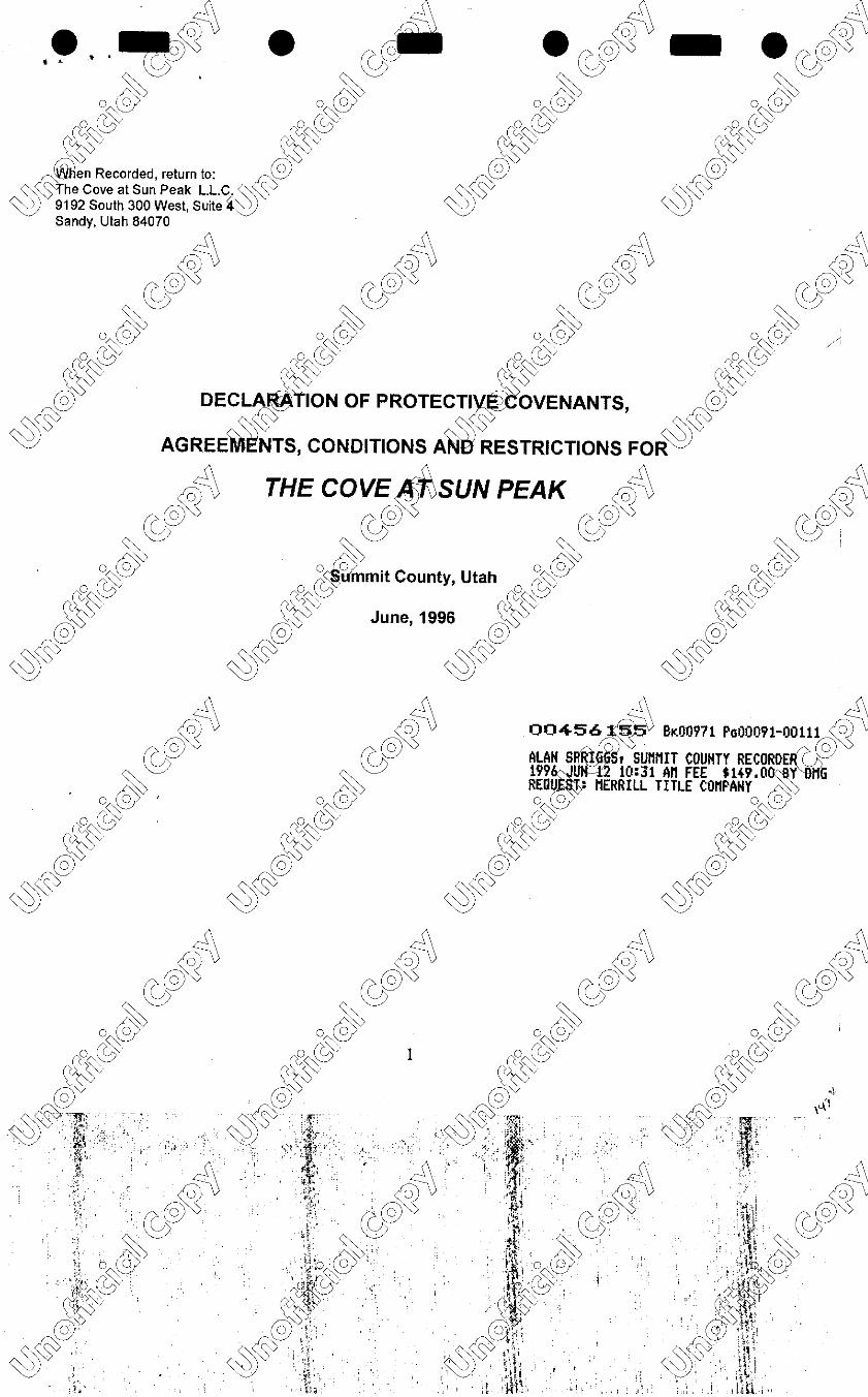
. , .. ~~; • ecf0'
~ . ~ o~@ o~@
~~@ ~~@ ~en Recorded, return to: ~@
~~~"'he Cove at Sun Peak L.L.C" ~ ~ v
~ 9192 South 300 West, Suite ~ Sandy, Utah 84070
/o)~
~@~ ~
o~@ ~~@
@
~~

~~ ~~ ~~ (s;@ ~e of Contents (s;@
DEftl~NS ................................... o··<lY····································· .. o .. @>····· 4
A~SS!ON TO THE ACT ..... nif:z~<fP. ................................... 0~~@............ 5
~
7
··· Term of Dec!aration ...... W···········································w·················· 5
@ Designation of Unit.. ... @·············································@······················ 5 ~ ~(§$ Nature of Own~r iP8> ..................................... ·_::~<§$············· ............. 6 ~ Consent to De Wn ....................................... ~······ ......................... 6
Easements for E oachment.. ................................................................. 6
. .
Easeme.nts ~ Repair ................................. ;:{\················· ........................ ~ Mechan~
0 ns ..................................... ~V ........................................ ~
ELEMEN~~········~·~·~~.J~.~~::::::::::::··:::(f;p.<f?::::::::::::::::::::::::::::::::::::::::rt>® 6 ~ement for Exterior Mainlena~ ........................................... ~ ...... 6
o ~mmon Areas .................... o (ci>':". ....................................... 0.:,.:..'1/ .. ··.... 7 o @umited Common Areas ... 0 .@-........................................ 0 .. @........... 7
0~<::'s Ownership ?f Common~'a$ ......................................... i'r~~······......... ~ ~ Water Service ............ rj;f?······· .. ································~··················
~(s> OWNE~~u:t:!~~.l~~I~~::::::::::::::::::::::::::::::::::::::~~:::::::::::::::::::::::::: ~ Powers.................................................................................................... 8
~~~~~····~·;.:~·~~~~;;;~·~·i~:·.·.:·.·.·.:·.:·.:·.·.·.·.:·.15')~·.·.:·.·.·.·.·.·.·.·.··.·.·.·.·.:·.·.·.::·.·.:·.·.:·.:·.::·.·.:·.·.· ~\ (o)4 CO!Jl! rvices and Expenses ... ,e:.m)~·· .. ·· .. ·· .......................... r>.(o)l V re \c'.@'0 Add]li al Condominium Owners R~v..,sibilities ............................. ~ ~ ~wl r Maintenance Obligation~·····• ...................................... ~.. .. 9 ~
1,1),,~ease of Association,bli at@)"····· .. ·· ................................ @...... 10 @> ~<::s':i:5wners' Obligation to Main! &;;········· ................................... i~o ......... 10 °~0
0~~v Approval of Assessment dget.. ........................... rc1A~l09······....... 10
0~~@
W Special Assessment.. ................................................ ~~.................. 10 W @ Unfinished un·~ts ........ 0 ............................................. @. ..................... 10 @ ~ Manner of Asses ............................................ M';.......................... 10 ~
~'yv ~~~~~S·~·~·nt~······ ... : ... '.e .. ~ .. ~i~.~:::::::::::::::::::::::::.~~:::::::::::::::::::::::::::: ~~ ~'yv
Easem~ents ................... •·· • •·· •······· ··· · ··· ···· ·~·· ....... ··· ······ .. ······· ···· ········ ..... 11 lnsuranc . . ............................................ ... ........................................ t2\> Additio 1ill ices ................................ ~ ........................................... ~
REST~~e~~1:i~~s~~~.~~.~.~I~~?.·.·.·.·.·.·.··.·.·.·.·.·.·.·.·.·.·.·.-.-.-.-.-.-.-.-.-.·.-.-.-.-.-.·.-~~~ ~~ o (CffeMining Uses ................... 0 .. (dy:········································0··(iv········ 12
0 @ No Business or Commer~a~s ..................................... 0.·@········•... 12
0 ~<::'::; Restrictions on Signs .. 0-~~ ........................................ (l~<:8·····............ 12 W Completion Required~ Occupancy ....................... ~.................. 12
@ Underground Utilitie~@ .............................................. @....................... 12
~ ~(§$ Service Yards.I. ·½Y. ...................................... ~·~<§:>··························· 12
~ Maintenance o p~rty .. ····:··:··· .. ·· .. ·········· .. ····~·.............................. 12 No Noxious or O ens1ve Act1v1ty...................... ................ ... ..................... 13
No Hazard s.Activity ............................... ;.J.\············· .. ·····...................... !!\ rfl No Ope mg ................................ ~ ... ·~ ......................................... (01)~ fol~ No UlnslJ.i~liness .................................. 0 .......................................... 0)~3 ;;::;.,'-% N1q:>(AOA<Jymg Sounds ..................... ©0 ......................................... ~® 3 (r;y&
~ ~ ~456155 Br.00971 PGoiJ.o?2 o"(S> o l':1/ 2 o (~ o (~v
o~ o(S> o(S> o(S>
j£><::':5 · . j£><::':5 · •.·.11'·' .. ' ·. • .. w·. ~<::'::;1••~.,-'".'.·• ·. · • Jffl.. ~. ' *.~,1-.'·.·. ·
12 · r,:,;· & ·:ll! · · · & I · · ·· & 1,,il' ~(§> . ~\. ~(§>. ;~i . ~~ ;Ir. . . ~(§> .. . ; ... ·.,. ·.,, .... •··· .. 1 ..... ·· •
§ I? Ci!,; I:' I? (O~; it r,(~'s It. r ro,~4
~· ~12 I ~12 'f ~12 ~~12
•r;~ •~ . .. [~j;~ rt o'~ of .J~ · ((~~@ ((~~@,) ((~~~ . ..
@>~ i'.. @>v · I . @>v Ji! ~(§> • ··,.· - ~(§> • ·t ~(§> ? ••

'.' '~~; • ~&°- • ~£~i -V · s Restricted to Roadways .. ~ ........................................... ~. 13
0 utomobile Repair ............... ~~\.3:. ........................................ .°~':1/.... 13 13 13
~@ No Firearms or Weapo~ .......................................... ~@.................. ~~ ~~v :i~~t~~~:~:.~h·i·~.~~~~·.·.·.·.·.·.·.·.·.·.·.·.·.·.·.·.··.·.·.·.·.·.·.·.·.·.·.·.·.·.·.·.·.·.·.·.·.·~~.~·.·.·.·.·.·.·.·.·.·.·.·.·.·.·.·.·.·.·.·.·. ~~
Solar Panels............................................................................................ 14 Fenci.ng ........ ri\ ............................................. r--S:\.................................... 14 rfl Repairs an~~cements .......................... ,ro)~.................................... 14:lo) V Addit~~@'\S····· ... · ............................ i?.@~·····································;> @)'0 lnten~,ations ............................... ~ ............................................ ~
DEVELO~T RIGHTS. RESERVED.0 .. @>-....................................... 0.~ 14
wact1on of Pro1ect.. ...... ~~·· .. ·· .. ·· .................................. @..... 14
~~r~s~~eett~.~~°.~ .. ~x·~·a·~·~i°.~: .... '.r.a~ti°.n ... ·.·.·.·.·.·.·.·.·.·.·.·.·.·.·.·.·,·.·.·.·.·.·.·.·~·.·.·.·.·.·.·.·.·.·. ~1
~~STRg:~~Jc~i:~•.·~~.~.;;~.~.·.~~.·~~.~·~·~·~·'.·~I·~·~·~~~.:.:.:.:.:.:.:.:.:.:.:.:.:.:.:.:.: ~; Partial Term~~n ........................................... ~.................................. 15 rfl EffectofTer~ion ....................................... ~ ................................. 15 ~ Condemna~ ............................................. ~········· ............................ 1~
AMENDMEN~~·········· .. ········· .. ······ ............ (g;~ ................................... ~.~~ De~n 's Rights .......................... ~ ............................................ ~ 16 Yf~gee Consent. ................... 8 .!:.._o/· .. ····· .. ··· ............................ o~o/,· 16
MJE PROTECTION .......... ncJ,.,~<ff. .................................... !1-~~@._...... 16 ~'~~bordination of Lein ......... ~ ........................................... w............ 16 @ Statement of Account.. .... @ ............................................. @............... 16
~~ No Release of Prio~ ....................................... ~<§>................... 16
ENFORCEMENT................................................................................................. 16 Notices ........... ;:A, ............................................. /4\·.... .. . . . . . . . . . . . . . . . . .. . . . ... . . . 16 rf1 Severa~bility .. ;'f\) ......................................... lol~................................. 16 lo)V ;11~rneys ~ ...................................... ;;:(o)~ ..................................... "lt)"%
rb1tra .i .. ......................................... CS> ......................................... ~ ~ ~ ~ o£0v ·' o£0v o£0v
~~@ ~~@ ~~@ @ @ @
~~ ~~ ~~ lo)~ lo)~ 004561 ~ 81100971 PG00093 (0)4
~@'0 ~@'0 ~@~v ~@'0 ~ ~ ~ ~ o~@ o~@ o~@ o~@
~~@ ~~@ 3 ~~@ ~~@
~';)~ot . ~,~o~,, ~';)'$'0~1'. \ .... ~~~:; I t ·. ~ ',l ~ . • ·. •· ~ . ?· '1~
1
• ~ •• • lo) . / 1
{:. lo) :i: · lo) i · ·· · ~r lo) ;'; .. • ~@'0. -I . ~@'0 :t ~@'0 . • · 'Ii ~@'0
1 ~ t .·.~ · ~ 0 ~ · · ·. ·.· ·.·.r1 .. ·.-.~.•.·.~.··.-.·• .. 5_ .. ·.· .. &.~ i. O~o/ . r ••t fC:~':1/ it ~':1/ . . ~~':1/ , (l(ff_.o~@ !c~@ Jt~@ .·. ·.·~·· ,•· w ~ w ~ .. @ @{;' @· @qi
~';)<§S. ~';)<§S · ~~<§Sl ~~<§S ti.

.. ' ~~ ~~ ~~ ~@ DECLARATI~ PROTECTIVE COVENANT~@
0 ~ AGREEMEN~ONDITIONS AND RESTRICTl~;OR ~':1/ a ,l':1/ o [a}"'
~~@ ,.0#E COVE AT SUN d
@ THIS DECLARATION OF fJ NANTS, CONDITIONS A~D ~~TIONS for The Cove at Su
~ ~ (§5 made by The Cove at Su~ _P~~- .C, a Utah limited liability co referred to below as the "Decla pursuant to
~ Title 57, Chapter 8 of the ~de to establish the condomi~ ject, and setforth the terms~ ditions of its
governance. "'-,::
A. The ~~rant is the owner of approximat~8.4 acres of land in Summit ColJ.llly, Utah, on which rf1 Declarant propos~nstruct a total of up to 80 col)<@)li!Jiums and 9 Estate homesites~~er with streets, ~~ undergroun~ti!ffi!J's;Sand other improvements ne_ize~'f>Sor the use and occupancy oft~ ellings. w O ·
('7 (( ~ (?~ &
~ he provisions of this Declara,~intended to be equitable sell(i\u~hich run with the land for th~ © mut4:11I 11 of the owners of each of the created within the project. ~ ~
;,v ::vo o lo/ o lo/
'"
ov~- The Cove at Sun Pe \ll!l9K'ision Plat and the Bear L~d e,~ominiums Record of Surve-Ma the
w'e' at Sun Peak has been recor e office of the Summit Coun rder on June .../.2__, 1996 a ·
mber f'S-6ts3 , and IS and are notaltere ended by this First Amended ration.
~-~(§5 D. The Cove at~eak Subdivision is a part of th~ Planned Community of Su~~~o that end,
~ The Cove at Sun Peak is ~ct to all of the terms and condi~__)i, that certain Master Declarati~c'onditions and
Restrictions for Sun Peak, Summit County, Utah.
Now, ther~\in furtherance of the overal~truction of the Project, the o....hl.rant adopts the ~ following dr?l~n of condominium: r?@~ 1 @~V @~~
~ ~ ~ ~ ARTICLE I © ©o ~~(S> ~~(S> DEFINITIONS o @ 0 @>
!,~~en used in this Declaration, ~fined terms shall have follow~ning, unless the context cl~~res ,
~erw1se: w-v-- ~ v ~v
~(§5° 1.1 "Act" shall me~~~h Condominium Ownership~~tion 57-8-1 et seq. of the Utah~
1.2 "Amendment"~ mean any subsequent amend~ to this Declaration. ~ 1.3 "Assoe·" shall mean The Cove at Sun p..J). Homeowners Association, whiclrWthe designated rfl
management en ty; o he management of the Projec\in~r the Act. The Association m~~corporated, or may lo)~
fun_ction as~(@Jii rporated association. C @'-0 C @'-0 @'-0
~By-Laws" shall mean the By-La~~ Association, as they may b~~ed from time to time, ~ © o (S'> . o O V ' (o'::,V (c-~ V
A~:5 "Common Area" shall mean elements of the Project that aR~ned as Common Area be. low, ~\._o/
~ v-- ated as Common Area on th Ard of Subdivision Plat. ~08:)(9 08:)@
@ 1.6 "Common Area Ass nts" or "Assessments" shall m e assessments levied by the • -~on for
~ ~~ the purpose of maintaini:g0 ng, and repairing Common Ar the Project, including routine 8c~:1 ~v V assessments. ~ ~ ~'0 v
1.7 "Declar~~~ shall mean The Cove at Sun Peak, L.L.C., a Utah limited liability company, or its
successor in intere~ ~ ~
~ ~&°~ ~ ~&°~ o\sr•ss o~(S> o~(S> 4 0 @
ii' ct~:r. ~<&: ,,0; ' v0;, ,, '.!:, ,,0;© ' 1, vv . /4_' ~";::~v . . :·:1; ~~~~ \ill;;
-~ . . . .-. "I(" -~., -,,~,,
</J,% . ' <!} . . ,. . <f>,%
©@ _··_ ©®' .. _::_--~.',,._ ©®· ,,,',,. -1#1 >~ --~ j,{
i:W_•. 0
. -~~-w_,9' · .. oorl, __ i~'_-~_'.) 08:)~' · 0 @ 'i, . O @if" ~ ·_• re(;\<:;; ;,,,- ,,(;\<::;; i-1.
,. -'¼V ·+1•- ~V -·)· ·t @ , •, @ i;/ · @ . ;,:r
~(§5. :·- ~(§5 • . · ~(§5 :; •
lo)~ - ~~ ~4 •. ·~~ • (c;y@ .(c;y@ - .(c;y@ ; .8~claration" shall mean this Decl~n of Condominium, and any~~~uent amendments adopted i;!Y, @ :;~F-i;_ther with any Suppleme~:~rations filed by the#Declar~~~ant to the Declarant's n,·ghts0~
W 1.9 "Fenced Limited Comma \~s" shall mean those areas a · to each Unit that are enclose ences, @rms, hedges, or other screenin~~~re set aside from the gene mmon Area for the exclusive ~ the Unit · ~ <§Sto which they are appurtena~~ ~ v ~ ~ ~ v
, 1.10 "Limited Comm~eas" will mean those areas of t~roject that are not part of a Unit, but which are reserved for the exc~.usiv use of a particular Unit. Limitetfd C mon Areas are shown on the su~vision plat and the rfl Record of Survey Ma O
are also described in the Deel O
~n. @V ~~ 1.11 "~ ' shall mean any purchase \TJP@1 ancing for the purchase of ~it, whether it takes the form rc:@ or a Trust De rtgage, or contract for dee~·~agee" shall mean the holde0?Nny purchase money security ~ ~
interest ifn ~ rnt. 0 ~
0 @> -~~@
Owner" shall mean the owner(l>~ny Unit, but shall exclude a~Yd"' gee who holds title only for ™!C~ p t is not in exclusive posse,~~~he Unit. Owner shall not in rsons renting or leasing a u,i~ I r. w· w & 1.13 "Project" shall m.ee~ann ~ o tire condominium area, inclu~ Units, Common Areas, an~~cw ~ ~ '\_;0mmon Areas to the exten~ave not been withdrawn fro~ject. ~
1.14 "Property" shall mean the land on which the Project is constructed. The boundarie~~~ the Project include ,fl the land described on ~it A. ~ 0
~
0~
1.15 "Reco if'. urvey Map" or "Map" shall me ~ official Record of Survey MarY!nrNhe Bear Lodge @~ condominiums/lAmR1'11e with the subdivision plat fo""'"~"'ove at Sun Peak Project, w re filed for record in the © office ofthe"S t County Recorder on June , 1996 as Entries Number_~~@.::.;!._,, and lz'.S-6/..rf( ~ and any su~uent amendments that may be under the terms of this Declar . ~ 0 (o/,' o ey ;;~o o~':1/
n~ 'Unit" shall mean the portiol}jlf~Project that has been des!~~ a Unit in the Record of Su~~ a~~:: Declaration. The Unit is pr~owned, subject to the terms ~~"Declaration. W v
~@ 1.17 "Unit Number" shall me€vie designated number as~igne @ach Unit on the Record of Surva(~P- The ~\:,mt Number shall be the leg~ ~~lion of the Unit by which it is ed and assessed. ~($0~ · ··
~ 1.18 "Vote" shall mea~ percentage of the total voting rigfi of the Project allocated to each Unit, as shown on Exhibit B. ,fl ~
1 ~ . ~
~V A~LE 11 0
~ @~ (r;y@ SUB~NTOTHEACT 004~ql55 81100971 Pa00095 © 2. · Dec ~ hereby submits the Project,dh ~perty, and all improvementsc!Q ~roperty to the provisions of~~ Act. All rtywithin the Project shall be ~ccupied, used, sold, mortg~~sessed, and otherwise poss131> as nium property subject in all rll! to the Act. All of the Proje, ..... ~,.....e eccl to the covenants, conditl ~ s contained in this Declaratio , of which is intended to be to utual burden and benefit ofth ject, each of the Owners within tht ct, for the purpose of creating V mon pattern of use and devel@ nt. venants, conditions, and re · ns are intended to be coven ning with the land, binding~~~ ~ ssors, assigns, lessees, rtgagees of each Owner for as the Property is subject to ~'or.'
2J. Term of Declaration. This declaration shall re0
~n in full force and effect until the ~ners elect to ,fl terminate the project, or Project is destroyed and liquidat~s provided below. ~ ~
2.2 Desi I n of Unit. The Record of Surv O
has designated a Unit nu~·,..@ach Unit. That Unit (?' @~ number shall b me=al description of the Unit, an (!! Unit shall constitute a separa (~~f real property which ~ can be conv~ ortgaged, taxed, and otherw~ ·ried by the description: "Unit~ r - of The Cove at Sun ~
o~(S> o @ o~(S> o~(S> ~~@ ~~@ 5 ~~@ ~~@ @ @ @ @ A~~ ·•.r_~.·.·.·•,··.. ·A~~ :r A~(cj$ • .• '.r.w.·· - A~~.·· •. · . :. ·.I.I.;.. ~ -- ~ f ~ ... ._ ~. . I
''l' I? @o i~'. :~~ @ ... ~J'y@ .. j;@: .. " ~to/ ··• i~
A~~~• ~@ '\' A ~(ciS•,7.~.i;,_·.:: ••.· A~~~\~ ~ ~ ~:. ~ I;~ ~ ' ,'J{,,. , -y._; _,_,.· ·. :· .~I;._, 1,- .i . ·'1 . -.. ~ dh~' ,d-t , ; . -",_ -.
. ' . ~~ ~~ . 010 0~ Peak Condo~, as it appears of record in th~ of the Summit County Recor~@~her with its appurtenant IC: @~ intere~t i~ common areas." ~ ~ ~ ~ ~
~ Nature of Ownership. EacR,i,Co/shall convey not only the Un~1t ~utan appurtenant undivided i
ommon Areas. The undivid8,~~ is based on the proportio~~ or area of the Unit relative toclh
0
ea of all Units in the Project.\~f'ercentage undivided interestW ommon Area is shown on ..
~@ 2.4 Consent to eel . Acceptance of a deed ~~~the Condominium is deemed to@onsent to
~~ V the terms and conditions o · claration, and the restriction~~ ments, and obligations it ere~~
2.5 Easements for Encroachment. To the extent that any building is constructed or due ~ttlement or
shifting later inadv~rt y encroaches on Common Are!s, r that Common Areas encroach u~n Units as a result of (\
construction or se t, the Owners and the Associa · ach grant to the other easement such encroachments. z:~ \
' "o (0) /o)~
2.6 (;> ements for Re airs. To thee~~ ssary to efficiently compleftr)''e/Jairs to Common Areas, @'0 the Own s ~t ch Unit are subject to an eaim@l)and right of entry through each · or the benefit of the © Associa · nd the adjoining Unit Owner, sp · cally including attics, crawl s~ac, a walls, and any common u~I~,
facili O though unlikely in this bui\din!lllx~' uration, each Owner also gr<19t Association the right to enter hi'.@)v
~ n cases of emergencies ti:S'i!f, il:tne Unit, or to disconnect utilities essary to prevent damage to tl5'.~ ·
~~mg Unit until repairs can be . ~~ ~oS::,(9
@ 2.7 Mechanics Liens. Unit is private property of t~e ~: Persons providing labor or s to the
A~<§>· Unit at the request of the. Own,P.',-.=all have the right to enforce a ics lien against only that Unit, t against
-~ ttie Common Areas ofthe:t,01JW1minium. ~ ~
.~ A~CLEIII
0{fdV ELEME~THEPROJECT ~~ ~~
3. Th_e Proi£t~ivided into Units, Common A@i,®nd Limited Common Areas. 77fie ~ure of each of these areas is IC: @
des:1b~~ ~ ~ ~ ~ ~ ~ Units. The Units within thQ;...(s/>ect shall consist of several diff~nit types. They will include the~
_(roAAe-A{Jnits, the two large condomi . mn~ units and the 9 estate h ~ _one half of the twin hom~!itr ~e's
\ tructed within the Project is c · ed one Unit. (i.) The Twin Hql;jl~ll:11t shall include the land under e
@ ructure, and the structure itself · ding structural elements and e wall surfaces, roofs, exterior do nd
~ windows, and the interior spac • losed by the structure. All uti\i mechanical systems within each~ ling are
w V part of the Unit, except to nt they service more than on g. Within each twin homeiit ~. the boundary
between the Units will be enter of the double-studded pa I. Each Unit will be part of a · ttrilTie structure with
a concrete foundat~ion wood frame construction, with wooden si mg, and a truss roof system with a alt shingles. The
buildings are two a ree stories, containing kitchen, ba ing and living areas, and from tw!four bedrooms, and a (\
two car garage. ·· e large condominium building ed to as the "Bear Lodge• Uifsi II not include the land c:-__ \
beneath the st e. They will have a separate c i 1um plat recorded within this 1 10n. The "Bear Lodge" (0) \
units shall a · t e ownership of the commw~t ut be subject to their own~ Supplemental Declaration Ir' @'0 , of P~ot iv venants and Restrictions. (~.. ~Estate Homesites referred to a~ Cove Estates" will consist of ~
nine (9 • on a private street and shall sh_J ·n the ownership of the common ~ce but be subject to their own ~
~ec@ upplemental Declaration if~ e Covenants and Rest~riction§i~v iia) S:3 U Easement for Exte · l!!lntenance. Notwithstanding t
O on of the exterior surfaces of 'tl!l!Ydings
part of the Unit, the Associatio I have a perpetual easement o e exterior wall surfaces, siding, g, and
~@ other exterior surfaces; and the@l,dations, load bearing walls, J~ois, sses, and other load bearing or tural
A~~ v elements of each Unit to~ ~~poses of maintenance. Th1~5~~ '-any maintenance or repairs carr' t under this
'--.'::!) easement shall be ass➔~ Common Area Expenses. ~ e terms of this easement, the}f.i.~s11ation shall:

lo)~ ~d;\ lo)~ {fg4 •. -~~ • ~@-- ·~@~ - ·~@. ~ (b) Repair and restore any st~u I damage to the foundations, cn~s. load bearing walls, joists, ~
Oal"o/.'' trusses or other structural ele ~ necessary for the support o~(it<~~tures following damage by 0~o/ 0
@storm, or other casualty or f'.ri~ of"::)@ of"::)@ .i;;,~<:;$t the prior written consent of tJ:~ociation, no Owner will make e~r modifications to siding, roofi \S;§erior ~~r windows. or to structural e~: of the Units within the Proje@ (§?,~
1
A~ (s> 3.3 Common Ar--~ess included in the Unit, the =~~er of the Project is Commo~. Common ~ Areas specifica~"' ~ (a) TheA£hd not included within the Units anrl\i\ot dedicated as public streets,~provements on ~~.: that land in_c!~~ndscaping and sprinklers, lig/ilfiig~nd other improvements that b made by the O Declarant ~ installed by the Associatiofr;,@~ (!;y@ ~@ ' ~tility lines which serve mor=~ne Unit, including water lines stream of the individual Units ~ wa ;c;, eter, sewer lines outside of the ation of the buildings, and s!?r in age pipes are all Comm or/:, @ ruv. To the extent not owned by t~~ company providing service nit, all wires, pipes, conduits (r~ o her utility service equipm:~~ Common Area up to the poi rch the utility line enters the (tS~,v cf§fl uilding, the Unit Owner's sid~Q meter, or the point at which t · splits to serve only one Unit. W
@ 3.4 Limited Common A Some Common Areas have ' esignated as for the exclusive O
nd A~ <§jiossession of the Units to w~i are appurtenant. The Associ · responsible for structural m nee of the ~ Limited Common Areas (ex r fixtures or equipment installe wner or assigned to Owner un is Declaration), but the Owner of e Unit to which the Limited Common Area is appurtenant shall have exclusive possession of that a~ea. nless the Association so elects, fr time to time, the routine mainten~e. landscaping, rfl sprinkling, and other nance of Limited Common Ar ·11 be the responsibility of the ~~f the Unit to which lo)~ the Limited Com~mo ~ a s appurtenant. The Limited
O v n Areas are: (?' @~ (?' @~
veways, walks, porches servi@ly one Unit. Notwithstandinii~us as Limited Common v ~ Owner is responsible for s" removal on his or her own drive approach walk, and porch ~ e Association agrees, from li!TI rme, to include that service ~!1...,l/1=l e Common Area o \.._o/ ~ments. Driveways and walkwmi;may not be shown on the MaB, ~ ether shown or not, they ar10 @ 0~~ sidered Limited Common Ar e Units they serve. ~<::$ ~<::$
@w (b) Open Space a~e_!@· nated as Limited Com.mon A~@~:the Record of Survey Map. ~area is (s> intended for use by the ow~~"' The Cove Estates only fo: ~~on, and other related activiti;:~ (§$ ~ (c) Limited Co~ Area designated as the Bear ~e Condominiums. This area is i~ded for the
use by the owners of the Bear Lodge units for access a~ parking. ~\ ~
(dETh ~n of the Property of up~o a ~Um of 12 feet at the rear yard QMti:e \win home units is lo) deemed as ·, · Common Area. The individu ers can partition this Limite9>q€i)hlbn Area into rear yards (?'@~ appurten ach Unit. The exact location e partitions will be determine~7 field based on the ~ Asse= f views, the utility of the yar~e nd the efficient layout of the 5R11.Ce and must be approved at the ~ • sole · tion of the Association. The :"'fo~tion, with approval of the affe wners, may approve O (o/ al!il;rents in the locations of these ~~ithout a formal amendment o ap or adjustment of the (r ~ ntage of Common Area Owflce . When so approved by the ~ · on or by the Declarant, this~\..'::) I be designated and functio private back yard of the Unit(~lithfh this Limited Common Area, · cipated that there will be so ements that are the maintenal)OO(<)oligation of the Association, an r @ elements or improvements th 'a the sole obligation of the Ow~0 o Fencing shall be permitted · the (s> limited common or com~ as. v~ ~ v ~ ~ (e) The Unit 0~ may make improvements withini)(e Limited Common Area described in (d), as provided in this~ec ration. The Unit Owner is solely r onsible for the initial constru~tion sts, maintenance, rfl insurance, and o ion of any improvements instal the Unit Owner (or by a prior ) including hot tubs, lo)~ spas, swing set , a ers, landscaping, or other i e ents permitted by this Deel . @~ ~@v ©o ©o v @ ~ ~ o-~6155 81100971 PGOO~~ 0 \.._':1/ o \.._o/ o~..J' ~':1/ ~~@ ~~@ 7 ~~@ ~~@
~~ ~® r ~··· ~~'I': <§). ~~ ·?,;> A~~- •• ,, A~~- . ,-,,.· w" .·.•.J .. w" • .. 'j. ··• .. :.,.·., ~ ::r ~ . ,ii:;. · : 1!~~:t ', _''!:_,:)<\[
:,, ·• 1 1~· 1 il . 1 :~r1 . ~4 It . (('@~ .. t•, (('. \: @~ · ij.t re .•. \:@~ .. ,,if· (('@ ·~~ 1 ~{v :~ ~w·. . J!f (ffj>~
•• 0 @ .. { 0 ~@ ~; 0 ~@ 0®<.:i:1.·.·.w,.o. <:::;s" 0 .
~<{JS> ~j icf,9 (~" ~,,stf> ~~#) '· ~~<sf"l ~~~ ''·
,.
. ~~ i1 ~ ~
.. ' ~0 ~ ~ ~ C~nership of Common Areas. T~ership of the Common Areas~@ing Limited Common Areas) ((~~
is an ap8,~ance to the ownership of lh~U and the Owner of each Unit s~a w~u~ndivided interest in the ~"' ~ Com~eas equal to the proportion ogh I interior floor area that Unit be the total interior floor area withJl0._v
th@ ~I as a whole. The percenta~ man Area Ownership for eac~ ts shown on Exhibit B. ~<::$-0/
ef!l~ 3.6 Water Service. Wat£~ce to the Project is provided 0
< r Springs Water Company. i£f? ~re
@sued in the Company, those ~h ~m'be held by the Association fo benefit of the Members. The W
« (§$ Company is responsible for 11z~· · mg water mains within the pub!' · t of way and the dedicate~utili ments.
~ \ Maintenance of water late~~ een the water mains and th~~ ' tion of each building will be I nsibility of
::'./ the Association as a comm~rea expense. From the individuats rvice meter serving each unit, point at which
the lines enter the ~~ation of each unit or building, the mai::~~nce responsibility is that o~ unit owner. ~
f~O) ~SOC~TlON ft~ @6~ 4. 11.;la~ent of the Project will be carrie~; by the Association, which shal~e those duties and powers se. tout:~
for ~agement of the condominiu~<tfi'ftct, and the additional enforQll~l!l)P powers created under this O (c> \~ ton. ,oS:>@ rcoS:>@ 0 @
w~, 1J. Trustees. The Assa · · will be governed by the Board ~stees. There will initially be fi ~ees,
~\::::'..1Jut when the Project is comple its proposed 80 Condominium ~'1,i~s 9 estate lots, the Board wil
"~ v v seven Trustees. The truste be elected by majority vole ~f ~ners as called for in the Declar nd By-
~ Laws. Each Trustee will a 2 year term, provided that Tr t will continue to serve until the' ssors have
been elected or replacemen appointed. Terms will be stagge ~ , and the initial board will divide I into terms of 1
and 2 years by drf,wi lots. During the development slaQ"I of the Project, the Trustees will b:~amed by the Declarant,
as provided below~ ction 6.3. 0~
0
~ 1 4.2 r::P~~- The trustees will have all~ d .. ers granted to them unde~th i In addition, they shall have In\~
the poir I~ this Declaration, and to ta~~ti~~s authorized by the Declarti . Unless specifically required(? \SJ
by the r by this Declaration, the Trustees ay manage the Project withoui!re authorization from the Otne. ~
us es shall have the power to bri9 , nd, or compromise litigation or claims on behalf of the Associ
le disputes arising under this D lion, to hire property manager ter into contracts with third pe
ces to the Project, to purchm~ii',rance and make and com pr · aims under the policies, to re e the
of the Association before,,~um1lv agencies and in The Cove eak Master Owners Associa · ,(av in all
@other respects act on behalf oft ~ sociation. Nothing in this provi · intended to preclude or limit th · · of
<:: (§$ individual Owners to appea~ County agencies or the Ma~er ciation and express personal~ ,
~ 4.3 Budget. At~ 30 days prior to the annual me~ of the Owners, the Trustees witln~are a proposed
operating budget fo~e ensuing year, and a statement showing actual expenditures for the curre~Re;r (with projections
for the final month e budget will detail the income ~ expenses of the Association showi expenses for building (\
maintenance, o~i s, reserves, repairs, insuranc Oup1i!ies, snow removal, landscapina,::i:rni111agement fees, s, \
profession~~~~d where applicable, capital i ments to the Project. The bud II !so show income derived <:o) \,
from all so:µtc , and the amounts of any recei ~ . he proposed budget will br}TI!! o each Owner at his or her if @v
last kn~ dress (as shown by the m~st c ounty property tax assessmit ~- if no other address is available~
at ~l\_!~ays prior to the annual Owne ting. The budget will also indicy he resulting Common Area «:: As~,ent to be levied on each Unit. dget will also include the nolID~ e annual meeting. 0 (a;?
"~~«:: 4.4 Common Area As O
~ts. The Trustees have the ~levy Common Area Assess~:e .
~~eralion of the Project. The a ents shall be for building main~f;, operations, reserves, repai , · ranee,
~\::'/ utilities, snow removal, m~int 'ilJe and repairs on walkways and @rivate roads shown on the M~p, caping,
A«~ management fees, profe · ees, and where applicable,~·· provements to the Projectia items which
~ may be authorized by th , this Declaration, or by the Ow r . he assessment will be levied nnual basis, in
advance. Unless the Trus ees vote to require monthly payme , assessments will be paid in equa arterly installments.
The initial bud~et h been prepared in an effort to k~ep he common area assessments ail was reasonably possible
and still provide · level of maintenance to the Pr · YI This results in the Owners bea · a greater individual d\ maintena@O stbility. The initial overall~@ cle obligation and cost all;:;~ ollows: r?@~ \
~ ~ ~'Q456155 BK00971 PGt~
~~@ ~~@> s o c§> ~~@
·,JI . . I· ' . . I ·1i1'. . ' .. · .. '''1'' ' ..
·, . ri\• . . ;1::. ,' · -~. ;i ·._ \, ~ .. f: i, .. ~\... . .';},.,.'~.i1.~ ' .... ~. (o)V ' ·."" ' ... ~ I' ltt: ... C . ?J
r? @'0 . . . ;hr?@~ . . If.:, . f~~.0; . . .:,' JtW, ~
, ~ ! .',~ tl\' ~\':Y . . ' ', ff~@ '
o~l}y ·, ~~~t.. . · ,. ,:',!:ljf(y,_ ·-,·: .,:1,\ :.\)y··~.A ·ii
\'~.S$ i,\' ".r,_ 1G~ .. @· 1 •.~ .. l.i , ' , 1:n~<;i;,~1\I
1
,i '.;,:\/ ·:· · '.\ ~~~~~, '1t\·:.;: .. • '·
~0~0~ • ~'>)~~·. If" .~®'0~\ :\••· ":~z•~.;

• -ei~i • ~l'- • ~lfli - • ~lfl~ mon Services and Ex enseJ,. ~following items of maintena~e~perating expense will be P!lid~ sociation as Common Area ~~es by all owners within the P~ @U/
Snow removal, maint~0
~nd repairs on the private r~0
~wn on the map the pathway,.
0
~ting Cove Canyon Drive a he front of the property, any o ssociation improvements insta or adjacent to the publi§llJ ts of way and the internal tr~ ing more than one unit; {§So Liability insur..,.,~ ~ Common Areas, Common ~~?6:nd equipment Of any), and~ insurance on ~ers and directors, insurance in ~on to construction of Common Area lmprov~nts or repairs; ~. . A ~ Mai~-;i,)e, repair, and re-construction<Orodliimon Area improvements, i~~mowing, rr:,q Afl~liqg, landscaping, playground~ @1£,area equipment, etc., incluP,iJ:i~)Mdic IC: 0 ~enance and re-staining of fen~nd other common area improv~ts; ~ ~
~Utility charges for lighting, irr~~or other utiOlies used in conjfl,n~ith Common Area O @ 0
@>U/ maintenance or use; 0
@irJ'Jf O
@ 0 @
(,(S.,<:;s Project administrative ~ncluding mailing, office exp~ookkeeping, accounting, lega~<:;s $ other professional se , required, bank charges, and administrative expenses for the~~nt {§>'.:::'/ management of th eel; {§5 {§5 ~ Other items o~mon area expense as require~w. ~
Th~Ass iation will be responsible for the tenance and repair of exterior bl/iltl\ng surfaces, fences, rfl berms s, decks, patios, and other im ents constructed by the Decl~~s part of the initial lo)~ con O
o of the Project, or later inst y the Association. (r (§)~ ~@~ (b) Ad · · I Condominium Owners Re o · lilies: The following items~a~nance and operating expens~ are applic~o the condominium units exclusi and are not an Expense of "Th e Estates· homeowners and a~ to be pl!id~ugh the Association as Com~ll.iJY a Expenses exclusively by the ominium owners; (See Exhibi~o/
Colum~ 0 @ 0 @ o @
~<:;s Cash reserves for perid0.<::;;placement or maintenance of~tems of expense, such as ~<:;s @ roof replacement, e~;inting, etc.; @ 0 ~ {§5 Structural ma~e of buildings; ~ {§5 ~ {§5
Re-stainin~ or painting of exterior surfaces iniing exterior doors, garage doors~cing and siding;
Re-roP®);J~d roof repair, including le~k ir))on all buildings; provided, ho~r Ilia! Owners are ~le for installation and mai~t n f roof heat tape in those ar~~)iy, that routinely p ice dams due to drift patte o n exposure, and are respons~r roof leak repairs if ~ ii to maintain heat tape in ~h eas; ~ ~
~'v .. ~"'v wo/ O (o/ Wner Maintenance Obli ations. 00
allowing items are the respon of the Owner for his or her @ , and will not be paid for as ~!!!9 Area Expenses: ref:$ r1~f:$ Snow removal on driv~ entry walks, and sidewalks s~he Unit; ~ Installation and ~nance of any gate added to tli<!~ed Limited Common Area f--~ Gates of the same m~I, finish, and height as the ab~;;~ing may be installed at any~the Owner without pnor approval. Gates of a different design or material require approval of the Asso~ciati~\ Any gates must be loca~ted in a ~ner that maintains access t~o uti~~eters; lo) 4 Main Md( and replacement of decks atios within the Fenced Limite on Area and IC: :,:@~ ~re e'flatwork driveways, and ent J> s; © ~
0 @> o @> 8~6155 BK00971 PG~
~~@ ~~@ 9 ~~@ ~~@ @. ®• ... ·· @ ~® ~ ~{§5 :~.· ~ ~{§5 :r:.· ·.~.~~.·. .:i.>.··. ~ ~~v ..• mi. ~ .'.l". ~ I'• ~.>')! ~···Iii I ,tii I . ·•. ,tii . l.1
·• • . ✓ti · ... ·• { ~ 161~ f ~@~ ,:( ~@~ . ti. .~@~ ·. ~-·• ~@~ -;' @~ ·r . . ·~ · ~ · ~ 1i! ~ ·.· o ·).,b"lo/ . •.,f ... ·o"lo/ Jf(f~lU/ 'iDS:>@ . ~~.:.:Ks> .. :.i.;;_:f:$.·@ 0~~ ~ ~ . ~ . ~-;./, w @·· {§5&·•·:t:. 0 ···• ~'.:::'/ ~ ., ~ ~~- . ·.·.~ .. r.·_J .. · ~~~v ·) ~ ~~v . ~ ~ •. :.~;: ~vv . ~ ' . ~ ~ .~,, . :~? :-~:l·,

. . . o~~ ~~ <a)~ o~~ r?@ualty insurance on Owner's c,,Q@within the Unit, and betterme~®?livements, or upgrades Ir' @~
~ ~i~terior finishes, cabinetry, .~~";;i'ures, and liability insuranc~li:tbe Owner's Unit and limited ~
0 @ common areas used in coijtc:3;""' with that Unit;
0 (cl}>
0
@> oG.@ Utility costs for the ui,;,{,;i~ing electrical, gas, telepho~e0c ~television, sewer seivice, g'r iw~
tv collection fees, and ~llilty seivices or similar charg d to the use and occupation ~
@ Unit; @ 0
~ ~~ Interior ma~in e and repairs, including paintimG2erings, fireplaces and flu~s f ~s, water
~ heaters an mechanical equipment and ~'atr'ces, non-load bearing walls, 11,
ceilings, inlen r doors, glass replacement on ext · r windows, garage floor flatwork, age door
oplrati s, automatic garage door openers(llnd damage to garage doors, and ~y other equipment,
dev· r appliances installed by Own~\ ~i ~
Ir'~ nance and repair of sewer (/it@~e~ seiving the Unit. Ir' @~ @~
1
~~ ~ ~ © o ~ncrease of Association Obli ~he Association may, by majgri•~ among the Owners, decide. to~
0 @ve some of the enumerated ob· · ns of the Owners, or other se~~en over as Common Area 0~o/
r<~~~ expenses from time to time i o achieve cost savings, con)(~nl;l;/ of the Owners, and mainla~'1t;~@
~~ consistent level of mainten ~, ~v
~@ 4.5 Owners' Obi' 0
o Maintain. Each Owner coven ° ith the Association and e~ch o @wner that
he or she will maintain hi$"-O·l\"!lf nil and the appurtenant Li ·1 mmon Areas for which the Un' r is
responsible. In the event ner fails to maintain these are nd as a result of the failure to · in, there are
conditions which ar~angerous, unsightly, unhealthy, unsanitary, or which constitute a nuisance, the Association shall ,
have the right, but e obligation, to make necessaryi:_~pairs or carry out necessary miinl ance, and file a lien r'0i against the Un~lt f easonable costs of such retiia· i':oi-i)laintenance. Prior to exercisi · right to maintain, the ~
Association Ji:il · he Owner written notice of the · needing maintenance or repaR I e owner will have 15 lo)
days from '!i:e e of notice to commence rep~-~ he Owner has not commenc~Wir or maintenance, or fails tor?@'-0
pursueiw:nrs-or maintenance with reasonfe'dlligence, the Association may e~e~el complete the repairs, perform~
the m · ance, or abate the nuisance at wner's expense. &> ~
~~ 0 0 O \.._o/ o@ o @~ A roval of Assess Bud et. At the annual Own!lJr ling, the Owners may approve
~et as proposed, or vote to in r decrease ii. If no action is 1<1~:eyi:'t,vthe Owners, or if the annual O fails
@ achieve a quorum, the budget· med approved in the form sub by the Trustees, and that Co
~ Assessments are levied in ace ce with the budget. @ @
~ 4.7 Special A~ment. The Trustees have the ""/h:q~to levy Special Assessmen•- ;;::,~essary to cover
shortfalls in the budget or unanticipated expenses. So long aitt<e Special Assessment (or the suW;i"~pecial
Assessments in the rrent operating year) is no greafer an 10% of the currently approved~get, the Trustees may ~
adopt a Special ment without a meeting of the rs. If the Special Assessmeni m of all prior Special
Assessments i current operating year) exceeds Qll the current budget, a specia e · g of the Owners will be lo)
called, an'/:11' r oses and amounts of the Sfrll@ essments submitted to th~@ for approval. @'-0
-~~- ~ C @ , Unfinished Units. The Reco~ Suivey Map will create a total ~ its. At the time the Record o~
Sunr~y__~ pis recorded, those Units wil!:,not-h)llle been physically construct'r,d. ithstanding the creation of~ho ::-)
s,;$y filing the Declaration and R0c "ilfSuivey Map, no Common Are ssments or Special Assessme ·
ied against Units under con r . Units will first be liable for Area Assessments upon~! · of
ruction. Declarant agrees I 1de scheduling information to lflB?,~sociation on construction start > @ construction progress, and the t ated completion dates so the A~ lion can reasonably forecast i et and the
~ ~ number of Units subject to ment each quarter. <:: ~\::'/ ~ 0
4.9 Manner o essment. Each Unit will pay th~on of the Common Area Asse~nt and any Special
Assessment equal t the appurtenant undivided interest in the Common Areas held by that Unit, as shown on Exhibit B.
4.10 s ents Constitute a Lien. A;~~d in the Act, the Common Ar~essments and Special ~ Assessme(9 Association shall constituti@~n on the Units until fully pat~en of the Association shall~@~
0G.~ ~ 10 ~456155 BK00971 Pa~OO
:$':1/ o~':1/ 0 \.._o/ 0 (o)v
~ ~- ~: . .... ~ ~@ •. . @ •.. ,i • . .@ !(f . . . . , "
~<::>v ~~• ·. •• :i: .~~ 1;1, ~~ .
:~ t .. j/
~~(3> o@. o•~ l((;-9@ o @l- . o-r?~.
~~ \ efi~ . j; . efi~~j ~)4,0). i - ~'»4,0). , ~O) ,:.

lo)~ • ~~\ - • lo)~ • ~4 •. J~•~v~ ~~ ~@~ - ~@
be prior~ther liens except for propeFnd other statutory priorities, Br~, however, that the Associa1f9n@ lien wiff<$ ubordinate to purchase money cing as provided below. (r~ (r~
o (9 o o v o v ~.11 Voting. Each Unit will ~e number of votes equal to~· rtenant percentage interest in S::; mon Area, as shown on Exhib. nly one person may vote fore nit regardless of multiple Owne appurtenant to each Unit e cast the same way. If th~O are not able to agree on how
~ ~ ~otes, no vote will be accepte,cNMth'that Unit (though the Owners · counted for purposes of est ~ quorum). When one of the e Owners is present at the me · , that person shall be deemed t acting with
authority of all of the Owners o that Unit unless written objection from the other Owners has been received. Unless otherwise provided in ~Declaration, the Association ma~~ by a simple majority of the eligib~otes. ~
4.12 ~ The Trustees shall have th~er lo grant easements for utililies~a!Ys, and similar public r;::;,q or quasi publi~~ver the Common Areas ~~Mject. ~@v ~&
4.1 ~ Insurance. The Association will~ntain such policy or policies of~tn nee as the Trustees deem ~ nece!~~he purposes and protection @f J_f@_J(ssociation and the Owners, ii')) amounts as are customary a~lo/ f~~~Tn~: reasonable for projects ofJS:>~e in this area. At the mini~~@ ssociation insurance will ~Z:,~h
5 (a) Hazard Insurance. The iation will maintain multi-per~rl ~--:urance covering the entire Co/ido~:ium, ~'mtluding Units, Common Areas rmited Common Areas. T~is hall be equal to the full re~I c~'i<t cost of
~ ~ ~ vthe Condominium, as deter · y the Trustees and insuranc s, with provisions for automa · 1 ~ases in ~ coverage to cover any increa n the costs of replacement. Su olicy will cover losses by fire and h other
hazards covered by the standard extended coverage endo~s ment, and debris removal, demol~itio, damage by ~ vandalism, malicious ~hief, windstorm, hail, water dam (excluding flood insurance), and h other risks as are customarily covere~~~ominium projects in this Joe~, this construction, and use.
0
~ 0
~
M)(§;\e named insured will be The 6/i,@1 Sun Peak Homeowners As4i:;@n, or its authorized ~@ rep~~e. for the use and benefit ~~iv~ual Owners as their inter~ 'lhi1'a't;t appear. ~ 0 @ (2) Each such policy will inclr~standard mortgagee clause~Wi contribution, which shall be ~~@
0 er endorsed to provide that @~ds are payable to the A,s · for the use and benefit of~h o v 0~<:: rtgagees, as their interest ml1V<lHliiear, or shall be otherwise en to fully protect the interests ~ W Mortgagees. Further, the pol' all require 30 days written noti ortgagees in the event of a w
@ cancellation, reduction, o~ enewal of coverage. {§:>_ O ~&
~ ~ (3) Each poli"" <;;:/;;if contain a provision that, non""'-~nding anything in the policy th~s the carrier the right to res~e Project rather than make ;•~ettlement, such right will not be exercised without the prio~tten approval of the Association.~ A ~
(b) Liability lnsata~e. The Association will main!~ l:\omprehensive public liability~ lovering all Common r;::;,q Areas and Fac~@Sitch insurance will maintain_~@blttty of Interest Endorsemeny;o@Ekluivalent which shall Ir' !,SJ preclude the i~r from denying a claim of one ~ because of the negligence~~ Owners, the Association, or ~ Trustees. ~ coverage will include coverage fi>N:Jon-owned automobiles, damag,l~ roperty of third parties, and su~~ other li~~~posures as are reasonable ~~c(~omary for projects of this ty~~ e, and use. The limits of liabil" o/ cov~a~ITT not be less than $1 million 6or~aims arising from a single Off3'.o/Ce.
0 @
1<~~-) The Association will maint"~rkers Compensation lnsuran~ny employees, and if availablJ&i~ ~~';;able cost, officers and direct~~rance, and may require or pu~~ fidelity bonds on persons ha~"'
~---Ociation funds or property. ~\::'/ ~ ~
~ (d) The Owners are s~responsible for property casual~d liability insurance on the cont~f their Units, and Limited Common Areas adjacent to their Units, and anii provements or betterments to th~eir Units. Each Owner is ~ also solely responsible JQl\liability insurance against claims ersonal injury or property dama ccurring within his or her Unit or the Limite ~mon Area adjacent to thFI U · cifically, the Owner is solely r ible for any liability lo) claims arising fro · stallation and use of play gro uipment, trampolines, hot tub , or similar items within r?@~ the Limited Co Areas, and covenants to hold 1/1 sociation and other Owners ht/i:ft~IBS from any such claims. ~
@ @ Jjj> 0~
~~ (9> l l w456 155 Br.00971 PJ~~
~~v ~~ ~~ ~~
~ ~~@ ····~ ~~@: ".~·. ~~®;: .· .~~ecp· .. · .. ; .... ·:,.:.'.;:·'·······::;!,, •. , ~ ~ ii .·,:~ "11
ll.\i ,. ~. l,•f.,.•· ~ · ',~;ii,:! ~ . :ff .· .. . , l~!i , .. ,~· :,,'i1';
r?@q . I r?·@q . . ,I; r?@q t t:: .. •.. re \c'.@q ~ . ri". ~ '·{ ~ . . . te, ~ ..... ~ i ~·. ·.· It ~ . Jlt~
f o (o/ ,100-.@ . ,it 00-.@ ·. 'i!;~@ , ·~ , . -@ @\· @'" .. . @{;;,.
~~~ ' ~~~. J. ~~~· :if ~~~ .. ·. :t ~ ~ ' ~ '~~,f '~ .{"/
.,:ti. '' . :-'>f :; . f,~~ .

o~~ 0~~ ~~ ~4 1J_ C clditional Services. With the a-o.o@ of a majority of the Owners, t"(' @ociation may undertake IC: @
addit~'o se ices not specifically mandate ~~eclaration or the Act for tm~f the Owners, including SW~ l
h' ow removal services on Limite mon Areas, landscaping in Li · Common Areas, bulk purchase vision or other utility type servi such other services that mig
0
t;1!'.~ vantageous to the Owners. Si:K:11 nal services may be added~~ inued from time to time as ;~~dation sees fit. r/.ftz~@
@ ~ ARTICLEV ~ ~ ~~ ~~ RESTRICTIONSON'!'.~OFUNITS A~~
5. The use and occupancy of the Units is expressly subject t~e covenants, conditions, and re~ions:
§j_ Zo e ulations. The lawfully en~c ning regulations of Summit Co , and duly adopted rfl building, fire, a al codes, and the master cov s f the Sun Peak Development e Consent Agreement /o~) between Sµpi~· nch Joint Venture and SuWi!.clC ty governing the developmt,1\of Property are in full force o@~ and efJct lnj!j.e Project, and no Unit may b~o~ed in a manner that is in violati~any such statute, law, ordinanc~ covena r conditional use permit. 0> ~ ~
oO oO 0 o o(S> A~.2 No Mining Uses. Thecft within the Project shall be 8s residential purposes only, and~ ~»--e occupation for mining, dri · uarrying activity will be per i nytime.
08:>l...'::'.>v
@ 5.3 No Business or ercial Uses. No portion of any may be used for any commerci iness use, ~ ~ ~ provided however that no~·· is provision is intended to pr v the Declarant from using one re Units for ~ purposes of a constructi e or sales office during the a riod of construction and sale roject, (b) the
use of Common Area for age of construction materials, eq en! or a plant nursery in conju with the construction of the~ject, or (c.) the use by any Owneio his Unit for a home occupation a~efined by applicable ordinance. No ho ccupation will be permitted, how r, which requires or encourages Owner's clients, rfl customers, pati~ !hers to come to the Unit to I business, or which requires e ployees outside of the lo)~ Owner's ~1m llj\le)family or household. No retail of any kind may be made int eel. No materials, c;,~ machine ~ · men!, or inventory associated~! ny home occupation may be e_ u side of any Unit or on any IC: 0 Comm~ or Limited Common Area, i~ui · the Fenced Limited Comm~A, . No signs associated with a~ ~ home pation are permitted. ~ ~ ~
o~ o lo/ o lo/ o lo/ o @ 5.4 Restrictions on Si n ·gns will be permitted on any i~ithin the Project, except for t(jl~ntrol
s, and temporary signs warni me immediate danger. Sign · · ting the Unit is for sale ma~d in c;, ordance with County sign re · ns, and no such sign may exc square feet. The Declarant m eel a sign
~& of not more than thirty-two sq eel at the entrance to the~roje@ a period of no more than onei nnouncing ~ ~ ~ V the availability of Units an sales information. The Own ' e and address may be pos~.~~ · cent to the ~ front door of a Unit on a r plaque not exceeding 2 squa in area. A project sign will b~ ed off of Highyay
224 as approved by Summit County and The Sun Peak Homeowners association.
5.5 C lion Re uired Before Occu a . o Unit may be occupied prior t~ompletion and the ~ issuance of a orary or Permanent Certificate c pancy by Summit County. ~ v ~
· ~ ©~nderqround Utilities. All gi~cal, telephone, television, aj~er utility lines in the Project a~@ to be ~ground, including lines with~in a need Limited Common Area . ..L ropane tanks or oil tanks may be~ i~~ithin the Project except fort i!lt heat during construction. ~~in s to be natural gas supplied ti,y ~ ~~>v, 0 @ 0 @ 0 @ ~ 5.7 Service Yards. Al~s lines, service yards, hot tub~, play ground equipment, and ~r
@ mechanical equipment must b@tiin the Fenced Limited Commo~ Earth tone painted wood pla ~ nd ~ ~ ~ equipment no greater ~~~tin height is permitted. An~,~~'lfr metal play ground equipmen be less than ~ 6 feet in height. Equipn~l«:eeding these heights is prohi~ ~
conditi~~8 at all ri~:i<~!!!in.!¥ei!.1'nya5!J;~hc<!eei..:;~~u~:J~"'~'I!. ~eNill.o -~~~t:~a~~;~ ~:~~ii~~: ;~ll~~~~~;r!;~~rary, ~ctive and marketable
rt ctfi r, ctfi ctfi (~~ ~ ~ ~ ~ t~56155 BK00971 PGt~
~ ~ 12 ~ ~
~.®,.rfoc&g ~~tJl9.r ·~· )Jt~1 ... :.:.· .. . cffe~' ir ,t. WV l,, ~~~ .~i\,
''1·' - ·- '1$,! ~ ~1WJ ,"il. i\,~1;\
I rfl , , ;i\' 'J)i rfl cpl,, ~ : lo)V ,·b, !o)V ,1tf: - ~ -\_Jr:- . '.;_,·•~@~; (~©~ • {t:.@)@~ ':1J·~@~ 1~ · · · (~.'.,.~.. · ,, ·;~.';, ·, · · ·• 1,ii'c
rc~~cf}.~o/ rc~~&,t . ·. . . , , , rc~~~.,~.1i/. . . ·.. rc··.CA ~f0(:icjf(.i\~\.;
"'~~~ _ "'~~~ . ~~0"~ r1:. "''\i' · . 1i

• · ~~i • ecia • eclfii - • ec&~~ ~ No Noxious or Offensive Activi ~o noxious or offensive activity shSo.e carried out in any Unit or on a~
portio~~IIJ,Ef Project, including the creationlp_r_: d or offensive noises or odors¾_@);tract from the reasonable 0~':1/ :~~ of nearby or adjoining Units. 08:>@ oS::,@ oS::,@
~ 5.10 No Hazardous Activi ~ activity may be conducted wit~~y Unit, or within the Project Iha'~ @uld be considered by a reasona le arson to be unreasonably da~~~r hazardous, or which wou!~;he
A~~ V flammable, explosive or ha materials in excess of those able and customary for hous ses, the ~cancellation of conventiona~p casualty insurance. This in~ "thou! limitation, the storag~ tic, toxic,
~ discharge of firearms or firew s, and setting open fires (other th properly supervised and containe arbecues). No Owner will occupy a U~~~ a manner that is in violation of aj\State or Federal environmental p~ection law or regulation concerning ~torage, disposal, or use of toxic~azardous materials. ~
5.11 ° Burnin . The open burni~@~trimmings, construction w~~~er materials on the Unit r?@ or within the rQj 1s prohibited. ~ ~ ~
~No Unsightliness. No unsightii ·s permitted on any Unit or itilf Common Areas. This shalb @ includz:,, ut limitation, the open storag~0 y building materials (except d · e construction or repair of ani~ ~ orage or parking of farm~ ruction equipment, inoperab r vehicles, boats, camper,, tr ·
rger than pick-up trucks (ex ·ng periods of actual loading Aocn.rnloading); accumulations of la ee s or trimmings; accumula~·o construction debris or waste; h old refuse or garbage except ed in
$'§> tainers in a garage; and I ft r garden furniture except duri~ season of use. ~
~ 5.13 No Annoying~ s. No speakers, or other nois~king devices may be used or m~ned on any Unit or Limited Common Area which create noise that might reasonably be expected to be annoyingly loud from adjoining Units, excep~properly operating and maintain~.ecurity or fire alarms. ~
5.14 Vehi ~~stricted to Roadwa s. N~U~icle will be operated on the [email protected] except on improved w roads and drivl?'~ cept during periods of con n . No snowmobiles or molofliY®~1 be operated on the (? 0 Property exceP!:!9l' ingress and egress by duly ~er , "street legal" vehicles or w~e ~ing the equipment for lawful~~ transport o~blic streets. @> @> @>
n, ~ No Automobile Repair. ~o O O
obile repairs or restoration :eo~y be made within the Prope(81. ~ 0
i~: automobiles may be store Property or within any Unit.~<::'::; ~<::'::;
5.16 Kennels. No kennel g run may be placed anywher ~';; Project or Property other Iha@~':; need Limited Common Are en ant to the Owner's Unit. T er will maintain any dog ru~J<i;linel in a
A~ ean and sanitary manner trnrr~rnere are no annoying odors a1~olh:1g other Units. The Associatio mquire an ~ Owner to remove nuisance p ue to noise, running at large, sa · violations, or other violations o plicable
ordinances.
5.17 No T lP~~"'~"b used for residential housing ~sonly, and shall not be rented in whi:I · art for transient lodging pur oarding house, "bed and br "or other uses for Ir' @ providing acco aliens to travelers. No lease (a nit or Dwelling shall be for a e of less than one month. ~ No Unit sh~ bjected to time interval own~tn . ~ ~
. ~~v . ~~'0:> ~~ (o~v !9. o/ No· Time Interval Ownership.0 t::t1nit may be owned, leased, or Wiise held in a manner that divi~:1/ gal title or the right of us,i o~@ I or informal time intervals · are ownership, or any olh~r ~tfutt.
rtnership, or other arrangem ~ permits, allows, or as a pracf lier, creates or establishes ti · al hip or rotating use of the Unit I indistinguishable from time in I ownership. w
0 0 0 A~~ 5.19 No Firearms or ns. No firearms orweapons~kind, including bb guns, pelle~ or similar ~ air-powered firearms may b · arged within the Project. No a~ ranges or other weapons tar~~~ or use is
permitted. .
5.20 Fire I himne s. Only one wood-bu~tove, fireplace, or other sucil~ce is permitted in I each Unit. The~ri at source must be natural g~ oar rather than wood. No co appliances may be w use, and no co burned in fireplaces. Chifl)TIW st be enclosed in an appr~tl', · i g material with a spark IC: 0 arrester. N~ d metal flues are permitted~ll@fjhan sections less than 2 feet~ tllidop of the chimney. ~ ~
(9>(§} 0 (9>(§} 13 0 ~56155 81100971 Pa#
~<::'::; ~<::'::; ~<::'::; ~<::'::; @ @ .. @ @
A·~~ :! A~~ A~~ }if}' ' •~ ~~ : ~; .
~ l: ~ · · . . .~ i11 • .~··•. ···•· t:t·
3: . ~~ . ~~ !: ·.. ·~~ ',~j' . ~4 ;; ~@ ~@ . r;t ~@ ' ,:, ~@ •. ~ .·~ ;A ~ •:f ~ /-. o @ o @ : .. 1 ° @ . ~@ 0."@ o@> A~@ . Q~ ..
rc~<::':5 ~1 ~v . ~,:
~v .w0 • ,,, 0-'-' · 0 ,J. A~(c§>~ ··.. A ~(cs>~ .} A ~~~lt: . A~(c§>~ ~l:-~ •·· ~ . ~ ·· :·f}, . ~ · It·i
5.2' (' o~: A" '""'""" m," b,,,(~~a;, , b,;;a;.,, ,o; ool _,@i..~ M'f ,._,, .. ""'"' ;,'( clfi~ excess~· ches in diameter must be loci~;creened in a manner appjeWadvance by the Architectura~ ~ Comm· o that they are not visible from · r adjoining Units, Lots or from o e the Subdivision. ~
ow o o o o O lo/ o"G?5.22 Solar Panels. So~ar a ~ill be permitted only with thF@R < of the Architectural Commit\fje(.ia~ if
~rmitted at a_ll, must lie flat ag~in ~f and may not differ in pitch e roof surface on which they~~nted.
@ free standing solar panels will rm,tted. · W
~ ~~o 5.23 Fencing. N~~g shall be permitted in the ~~~mmon Areas or the Comm~~ without
~ specific approvals from ~ir County ~ ~ v
5.24 Re air, and Re lacements. Repairs andilacements to any Unit or to the ~mon Areas constituting
the exterior of ther<.'"l'l'gs will be made in a manner th consistent in architectural desig aterials, colors, and of rfl equal or better@ an the remainder of the Pro~~ with the original constructio~
0
{fJ;, ~ 1·~. No u,, Owoo, may r> Cc:/. ,.,m,~" ,. u,, ... ,,,16·®, .. m ,, •• """'""'"· wh;tji( &0) may re a formal amendment of th~Ma ~~; the expansion of the Uni~~~ that was previously Comrt)Q,n
Are,i,, ppropriate consideration paie, t Association. All costs associ</t'.@yrrn the amendment of the MaR a~
ge@ n will be borne by the Unit f] equesting the amendment. 0
@ 0
@>':1/ ~~ 5.26 Interior Alterations. ~wners may make interior alt~~tswithin their Units as they se~ided
~";;t no structural or bearing wal be altered, moved, or penetrat h new openings without the ap of the
~@ Association. Any alteration n;ur.;;i-o,e carried out pursuant to a pro issued buoding permit, and~1n f pliance
w V with all applicable codes · erior alterations that involve tQ8'~,cation of any interior partition ade without
advance notice to the Ass tion, complete with copies of pla dicating the alterations to be m
~ ~CLEVI ~ ~ ( @~ DEVELO~T RIGHTS RESERVED @~ @~
6. T~e e~nt expressly reserves ce~ai ig~nd privileges as provided ini~orthe construction of the © Pro·ec ese rights will expire on the soo f (i) the completion of the Proje ") the withdrawal of the land prio~
the etion of Units; or (iii) the expir · seven years from the date oflJ:lli!' ording of the Record of Surv~~)v
0~~@ Summit County Recorder. pN>@ oN>@ oN>@
@W lLl. Contraction of Pr . Declarant also reserves the ri-~ontract the project, and to rem~nd from
~ the Project, including land tha been previously shown on the R~~f Survey Map and which inclu&s~~ts that
~ ~'-0 v are mapped bu! not physi nstructed, and which have n~sold by Declarantto any third v:',The Project
~ may be contracted, and ithdrawn by the Declarant filin plemental Declaration for re · !he Summit
County Recorder, which shall state (Q the metes and bounds d cription of the land to be withdraw ; 1Q the Unit
numbers of any unc structed Units Included within the I d to be withdrawn and a stateme~hat no third party has
acquired legal or · ble title to those Units; and (iii) ised schedule showing the perc ge of undivided Common ,e
Area interest a vi e appurtenant to the remainin ·ts within the Project. Declarant ~ ercise the right to lo)
contract th only once. IC: ~o ~@ r?@'0 ;:!).. ~ C ~
Easements u on Contractio ~n the event of contraction of the P{Qiec , Declarant and the Associati~
an ith each other to provide su<,11 iwi1nents as reasonably necess11,ry({g~ach other to provide for acc'cr ~ across the land owned or co tr r15y the other party, storm drain ifsements, connections to existi.,=,~--lic
s (without reservation of pro trips), and similar rights to er roperty of the other so th~t t ting
ependent parcels are fully fun I independently. Land that ha withdrawn from the Condomi all not
@ e encumbered by or subject to ,,,15·1u,eclaration, and the developm@ that land may be different in from that
~ ~~ described in this Declara~i~~ ~ ~
~ 6.3 Trustees~ a period of 3 years from the da~this Declaration, the Declarant ~have the right to
appoint all 5 of the~ustees. After 3 years, and continiin until the 5th anniversary of the fi~in of this Declaration, the
Association shall 2 of the 5 trustees, and the Dec nt shall have the right to appoint ustees. If all 89 Units are 1
constructed witf1:iitAl irst 5 years, the Declarant's [email protected] ppoint trustees will termina~ he completion of the last ;{j; Unit, and tt@~ation will elect all of the trut@~he Declarant withdraws latesr~•e Condominium, such tha~ ~~
~ ~ 14 M456155 81100971 PG9!Ro:r
O~U/ 0 lo/ 0 c~v O c~v ~~@ ~~@,,: . . t~@ .... , ~~c:~!t
@ . . @ . :ii @ •. . . .. @ ~ii' .. ~ ~~ ! . ~ ~~! . ·!·r,·· A~~ ~~~ •, ~,,;,_•.
~ I ~ • .:~:,~. ~vv ~vv *'~•• ·· . · · :r· .· •. . ·. ·. .1~1i
· . lo)~ ~, lo)~ · (0)1 !:i., . . ,ei
r?@~ { r?@~ •.:_:_;_:_· @_oN . w~;:: @~ '· ~ '·~ ',:, © ·. ;'{,/(~
. -~ -~ ,.~ ~·~ ~(& i~<s!/:. . •0~~ ·.· 0~
~~'l ~~vl> t~@f ~~@.~('
<:::,\j~O). - <:::,\j~O). t ~~O) . ~. <:::,\j- '

~~ ~~\ ~~ • ~4 •. -~ • ~@11111 ·~@ - ~@
no additio~;nits are to be. constructed by th~clarant, the right of the Declara~ppoint trustees will terminate ~ up~n ~~drawal of land, and the Asio~will name all trustees from ~hw'tliforward. ((~~cfi}U/ ~<::'::; ~<::'::; ARTICLE VII ~(:'::; WV
@ ~@RUCTION OR TERMINATION~NDOMINIUM {§>@ ~ ~ 7. In the event of damage ~'t?~ction of the Condominium, ~e Owners elect to terminate th~ominlum, the
following provisions shall ap~
L1 Dama n the event of damage to the C~on Areas of the Condominium,~sociation will make /o4) proof of loss with th in u nee carrier, and supervise !~plication of insurance proceeds~e'iepair of the damage. @'%
7 .2 ~uclion. If the damage to the ~s such that the costs of reii@d more than 75% of its ~ © 0
market va o he damage has caused mat I and substantial damage to more n 50% of the Units, the 0.v Associati II convene a special meeting Owners as soon as possiblEl:Jo purpose of determining the f!JI~ of the I. At the special meeting, the es will present the Owne~wit est estimates available of thl!~f of age, the cost of reconstruct' the market values. Such in n may be preliminary in na~0 r
alion with the Association, a v•bt,,J,vitt then be taken to determine the Trustees shall (i) procee · e ent of insurance claims and ·rand reconstruction of the Pro~' r (ii) to terminate the project. either
~ live is approved by a vote 1/, of the undivided Common A~\{)wnership (excluding any unc ed Units ~ ~ ~ vowned by the Declaranl), th~ti~~es will postpone the decision td~a"llme not to exceed 90 days to OOJiVlcl1e>additional ~ information on the relative c nd values. At that time an ad~I vote will be taken and unless ote is at least
75% in favor of termination, the Project will be repaired.
7.3 ination. If the destruction is s ~t It has been confined to spe?®i~as of the Property, lo)4 such that some U · d Common Areas are substa · unaffected, while other area~~stantially destroyed, the @~ Trustees may ~~lltn'i!nd that Owners vote on anr.l!in',.,i,1,ctment to the Declaration and d of Survey Map that calls IC: !; for termin~o e Condominium as to !hos~· nd Common Areas that wer~ ed, and leaves the portion ~ ~ the Condo ·um that was undamaged, or not tantially damaged, within the C minium. &)
o o o o o o o lo/ Effect of Termination.~ep ~te of the Owners to terminal@ I ondominium, or portions~f t @
um, the trustees will prep xecute such Amendments I eclaralion and Record of Su pas to carry out the will of the rs. The Owners of Units in the nated condominium or portion um that is terminated, wiiriiil,n be tenants in common in the ~rship of the land, each in propo · to his or
proportionate undivided i~r ~o Owner will be entitled toiisW:iution of land, but rather the~r ~will hold ~ ~ the land for the benefit of all wners until it is liquidated. I hlfce proceeds will be applied fi !'!;fearing the ~ site and removing hazardous dltions, then to paying the costs o quidation, and finally, distributed to e Owners in
proportion to their inter;;_~; If less than all of the Project is,~minated, Owners in the remaining~rtion of the Project will have no right to any of~nsurance proceeds or process~ the liquidation of the land. ~
7 .5 o O
alien. In the event of con~~ of Common Areas which ~~esult in the taking of any Unit, the I ~I shall have the power to repr se e Association in the action, a~Yitigate or compromise the action on ~ the Association. The proce~ o any condemnation award will i,Nhe property of the Association, ~ and usl!d d Common Area expenses,8r e judgment of the Trustees, iJi · ed to the Owners in proporliqJJ ~v their u
O · d ownership interest. In thee condemnation that involves a of both Common Area and~
pa Unit, the Owner of the affec may appear on his or hero If, and any award applica,le f the Unit is the sole property hUtw:N nit Owners. If such a taking (~~ in the reduction in size of any · r if e completely eliminated, the es will present the Owners wit mended declaration that revis
~ of Units and the undivide · est appurtenant to each. ~ ~
~ ~ ARTICLE~ ~

,~~ ~~ ~~ ~ lU C eclarant's Ri hts. Without the o.ris\onsent of Declarant, no am/4a(SVnt shall have the effect of r?: @
elimin~or changing the Declarant's righ~~~~ct the Project by filing a w~;ia1 Declaration and Recor~f~ '
Su[)l,e , without the consent of the Ow or the Declarant's rights to app ustees. &) ~ o~ o o o lo/
0 @~ Mortgagee Conse~t. ~endment which materiallyF~e nature of ownership of~n@
\ ges the nature of the use or ncy of the Project or Units, or · !es the provisions of the Mo
@ ection section of this Declar · ill be effective on any Mortgag ess the Mortgagee has consen the
~ amendment in writing. ~ ~ O ~ o
~ ~ ART!~ ~ ~ MORTGA~ PROTECTION A ~
9. To facilitate~cing for the Units in the Projec~~wing provisions for the pro~ ~Mortgagees shall apply: 0 ~
@ubordination of Lien. This~on hereby subordinates its Ii n ~mmon Area Assessments to ~@
the fir purchase money mortgage on Unit. In the event that a mortga take title to any Unit through ~
tru e, foreclosure or a deed in lie Cl1i reclosure or sale, the Associ1J,ti (!) I waive the right to a lien for li,C~JU'
ll,u aid Common Area Assess~! c e mortgagee will take title frbe lien for unpaid Common Ar~~
ssmenls accrued prior to the possession. The Mortgagee i ssion will, however, be sublc,~~
mmon Area Assessments ace r from the dale it lakes possessi W ~@ 9 2 St t t @t Th . t· ·11 . £ . h
~ <::.$ \;) v _._ a emen un . e assocra ron w1 g~ve ner, prospective pure aser, or
~ prospective Mortgagee statement of account for th · question, showing the balan · , if any, for
Common Area Assessme . The Association may charge a of $25 for each such statement ver its costs of
preparation. Pros~~ve purchasers and Mortgagees ~~~e entitled to rely on the accurac~ that statement of
account, and amo~not shown will be deemed waiv~ to the new Owner or Mortgage~ ~
9.3 ~lease of Prior Owner. ThFo O
n to pay Common Area AsFe O
ts is personal, and despite @~
subordina CIJ waiver for the benefit of a Mo !(a or new Owner, the Associatiefi( reserve its rights to proceed IC: ~o
again~ nor Owner to collect any amo~ e. ~ ~ ~
(9>@ o~@ ARTICLE X o~@ o~@
~<::_$ ~<::_$@ ENFORCEMENT~<::_$@ ~<::_$@
~@ 10. This Declaration is enfor by bringing an action in the Di · ourt for Summit County, Utah @ch other
~ <::.$\;) V court as may have jurisd· he provisions are enforceabl king money judgments, th~ ;~foreclose on
~ liens, or in the case of c nts concerning the use of the m:hrn,lrfv, by injunction. ~ v
10.1 ~- Notice of past due assessments ill be sent lo the Owner at the last own address, and ~
delivered in per~rajhe Unit. If payment has not bee'lttriade within 10 days of written n · he Association may
record a notic · n against the Unit, and proce~ ol ection or foreclosure. Notice o -monetary violations of lo)
the Decla · ii be given in the same manll\if,~ the violation is not cured, qi;!~ constituting the violation a~@~
repea~ 10 days, the Association m~ ~an injunction compelling pe~~- ~
5:£~~ Severability. If any prov~~his Declaration is adjudicated t(~vunenforceable, the remaind~ gr"~ ~~ation shall remain in full forc!bS::,@>'ilffect. 0 @ 0
@ ~ 10.3 Attorneys Fees. If~<::.$ ociation is required to consult .. c&i~ttorney for purposes of co lie~ past due
@ assessments, or enforcement~ covenants, conditions, or r~~ns in this Declaration, the O~~ default or
~ <::.$ ~ violation agrees to reimbur+"Association for its reasonab~~~Yys fees, whether suit is filed ~~'-4{ suit is filed, all
~ costs of enforcement ~ecovered in addition to whatev~'e'r relief a court may award. ~ '0 V

•• 'llll\c lo)~ ~~1. • ~~ • ~4 ~~0~ • ~@:11111 ~@ - ~@1
rbitration Association will beE divided and paid in advance b arties, or at such time as ~ requir·et1sllvthe Arbitration Rules, While it I ntent of the Declarant that dis O e resolved by arbitration wher,lj'.~o/
I ble, the Association shall no l:l med to have waived its right close liens for Common Are O v
es or other charges through jlldiclil¼Pforeclosure, nor to have waiv 'ght of the Association to see,k%>iliiltlive in those situations where arM · does not provide an adequate mplete remedy. The Associati
~ mpt to include arbitration cla~sl' contracts with third parties p~' goods or services to the Ass- -•· 0--'
~~v Effectivethis __ ~':f~ne, 1996. ~ ~
Cove at S personally
ers of The Co

7th Day of June, 199:i•~ regoing Declaration of ~ominium for The ~ Co~ Peak was acknowle~~ ·
0 fore me by Gerald H.[!i ~c~ael J. Kermizis, r;::;,q
Mi ~ ghl, and Daniel K. N~ ho personally appeare re me, and being by ~0 ~ uly swam declared that~ are the members and or~ rs of The Cove at Sun~
o (i:?_)ak, L.L.C., and that the}bJ:!~d the foregoing Declar!:!!i!Oi)v O (S> o(y o@ o~~ o@
~<::'::; In witness wh~ have set my hand and ~mis 7th Day of June, 19~<::'::; @ @ @ @
~ ~~ ...,..,..... v Pueuc ~ ~a i i-'O<& A-a ; ll~n '\::V " FAIRBOURN -~
0421 S. WEEPING WILLOW SANDY, UT 84070 ~
COMMISSION EXPIRES •.. DEC. 15• 1990 lo)
' sTA'I! Or llTAtl N

-
A PARCEL OF IN THE EAST HALF OF SECT! , TOWNSHIP 1 SOUTH, RANGE A EAST AND i;; ALF OF SECTION 30, TOWNSHI ()1 OUTH, RANGE 4 EAST, SALT l::1) LAKE BAS !DIAN, COUNTY OF SUMMIT, S OF UTAH MORE PARTICULARLY~ DESCRIDE LOWS• ~ ~ ~ ~~v
COr.t.ENCE E NORT~WEST CORNER OF SEC~31. TOWNSHIP 1 SOUTH, RANG~ EAST, SALT LAKE BASE AND MERIDIAN• SAID CORNER BEING A BRASS CAP SET BY THE COUNT SURVEYOR IN 19581 THENCE N~H 00'03' 43" WEST 53, 76 FEET ~LG THE ~ EAS NE OF SECTION 36, TOWNSHIP UTH, RANGE 3 EAST, SALT LAK SE AND M N, TO THE NORTHEAST CORNE AID SECTION 36, THENCE NO~ ~
'~3• WEST 2065,68 FEET AL•...:!"AE EAST LINE OF SECTION 25, NSHIP 1 O /~-'""''• RANGE 3 EAST SALT LA ~• NO MERIDIANI TO THE N- OUNDARY ©@
THE MAHOGANY HILLS II SU ~I ION: THENCE WEST 0,39 FEE A G SAID BOUNDARY TO ( ~ HE POINT OF BEGINNING 'i F BEARING IS NORTH oo·oo' 6 ST BETWEEN THE WEST ~ "'V QUARTER CORNER AND THEN WEST CORNER OF SECTION 31, SHIP 1 SOUTH, ~ ~ RANGE 4 EAST, SALT L:i AND MERIDIAN) ; THENCE ~ lfG AID BOUNDARY THE o lo/
~~lU/ FOLLOWING TWO CALLS! UTH 71'29'19" WEST 599,49 2) SOUTH 31'11'25' (r~ . 00-0v WEST 1130,08 FEET J:RIJ NORTHERLY BOUNDARY OF T DRAW ESTATES ~O0-V !!~~ SUBDIVISION1 TH~ NTINUING ALONG SAID NOR OUNDARY NORTH (v w 58'48'34" WEST 3 1 FEET TO THE EASTERLY BOUN OF THE CEDAR DRAW ESTATES
@ I I SUBDIVISION OLLOWING SAID EASTERLY LI FOLLOWING TWO CALLS: @ ~ 1) NORTH~2· ' WEST 1278. 71 FEET: 2 > NO •08'22• WEST 312. 76 FE~TI Vv THENCE NO ,00 FEET! THENCE EAST 1~ EET TO THE EAST LINE OF S . SECTION WNSHIP 1 SOUTH, RANGE 3 E , ALT LAKE BASE ANO MERIDIA ·
THENCE NO 00•03'43• WEST ALONG SAIDS ON LINE 601.36 FEET! THENCE LEAVING SAIO SECTION LINE EAST 869,69 FEET TO THE WESTERLY RIGHT-OF-WAY LINE OF S~E HIGHWAY U-224 AND FOLLOWIN~AIO RIGHT-QF-WAY LINE THE F WING ~ SIX LS: 1) SOUTH 28•16'12• WEST .43 FEET TO A u.o.o.T BRASS,Mi:!ti\ll.iENTI
U 14•59'H" WEST 156,83 F T A u.o.a.T. BRASS MONUMEN HE (0) NING OF A NON-TANGENT CUR CAVE EASTERLY, HAVING AR F ©@~
(?'\l 79 FEET ANO A CENTRAL F 12•50'32•: 3) THENCE C NG ALONG ~AID CURVE TO THE LEFT FR.QM H THE RADIAL LINE BEARS .:iOU 3•18'25" EAST
~ 2949.79 FEET, A OISTANCE~6 1.11 FEET TO A u.o.o.T. B~ MONUMENT: 4) THENCE ~ . (c~v SOUTH 04"44'32' WEST 206 ~EET TO A u.o.o.T. BRASS~T AND THE BEGINNING OF (o~v
00_,0/ 'A NON-TANGENT CURVE C ~ EASTERLY, HAVING A RADIU~ 959,79 FEET ANO 00_,'l (r':C) A CENTRAL ANGLE OF 2 55• 51 THENCE CONTINUING L SAID CURVE TO THE o @> 00-v LEFT FROM WHICH T AL LINE BEARS NORTH 59•4 AST 2959,79 FEET, A ~8:5
(v DISTANCE OF 620. TO A u.o.o.T. BRASS MON 6) THENCE SOUTH 09·57'05 EAST 201.10 FEET u.o.o.T BRASS MONUMENT A NORTHERLY BOUNDARY OF THLl
@ MAHOGANY HILLS cl) SUBOIVISION1 THENCE ALONG SA Ill ORTHERLY BOUNDARY WEST 749,~ . ~~ FEET TO T~ OF BEGINNING, ~~ ~~
lo)~ lo)~ lo)~ ~4 re \,'.@~ re\,'.@~ ~ Col~ Ir'\,'.@ ~ ~ 004~55 BK00971 PG00109 ~
~ ~ ~ ~ o @ o~(S> o~(S> o~(S>
~~@ ~~@ ~~@ ~~@ @ @ @ @
~~.· ii ~~ .· r ~~.· :rnr ~~•··•.'~ .. ,.t i•.·•. . ,,~ . ' . ·riJt 0,.1. ~· i,; ~ •:t . ~.. r .. ~:·•.: .. ·.. ~.
l.'.·., ·.©.@lol·o~ ,l·i·'..·.•··•·• ©·.'@'ola)V )Iii\ ~ ;:r ~ "' ~ ;\< ~ 1\1l; Ir' \,'.@··~ .. ;,l:.' Ir'.·\,'.@ . §, c .. ;l c ,r,;· ~ · ",. . ~ :t ·. ~ · . :.p ·~ · ·•.-:l:o ~ · .. :1tr~ '.:.::.·.•·· 00-(S> . · '~~(S> . , 0-l':1/ ,,~l':1/ , , , .. ~
· @r @ · @9 ·• · · ·@ · .:t ~~ ,.. ~~ ~~·} ~~ .·It
·~

({sl;,i ({b~:rr,-ho•'•" ({&#,~ 0~@ The Cov~~ Peak Condominiums • Ot~ip Interests
0~~ c;_ 0~@ E_ E o~@ !:!
@W @W. Unit ndomlnlum Sun Peak ~ O Bldg Unit ~~ Square -~'"'"" ,
0 ommon Area Homeowners omeowners
~ ~~v 1
N1
oA.· N~-~~'-llnlt Type Feet' . ..._ .• "'"' Ownership% Assn.;Vote!~ clatlonVotes ~ ~ WhiteWolf 1535 1.10 ~ 0.82
2 1A B White Wolf 1535 1.10 0.82 3 2A ~ A WhiteWolf 1535 ~092 1.10 ~1 0.82 4 2A B White Wolf 1535 0.92 1.10 0.82 rfl 5 3A /o) A WhiteWolf 1535 /o) 092 1.10 ~ 0.82 ~~ 6 3A @~ B WhiteWolf 153?::;,~ 092 1.10 0.82 o 7 4A re\c-O A WhlteWolf ~~ 092 1.10 re© 0.82 re© 8 4~ ~ B White Wolf~~ 092 1.10 ~ 1 0.82 ~ 9 ~~ A White Wolf& 1535 0.92 1.10~ 1 0.82 ~ 10 o /0 B White Vl/91\__o/ 535 0.92 ~ 1 0.82 ~ 11 (?'? A White 1535 0.92 1 0.82°~':1/
\::'.GA B W . 1535 0.92 ~00-.'-' 1 ~~ 7A A !~~~: 1535 0.92 ('1.10 1 .
@
7A B 1535 0.92 1.10 1 . ~o 15 1B A C!!r Horn 2048 1.23 @ 1.47 1 @ .10
~ ~~v 16 1B ~~Big Horn 2048 1~2 ~ 1.47 1 ~~ 1.10 ~ 17 2B Big Horn 2048 . 1.47 1 \'--Y 1.10
18 2B B Big Horn 2048 1. 1.47 1 1.10 19 3B A Big Horn 2048 1.23 1.47 1 1.10 20 3B rfl B Big Hom 2048 rfl 1.23 1.47 ~ 1 10 ~ 21 4B /o)V A Big Hom 2048 ~~ 1.23 1.47 ~ 1:10 22 4B ~ B BigHorn 2048 0 1.23 1.47 1.10 /a) 23 58 re\,'.@ A Big Horn ~ 1.23 1.47 r?@ 1.10 ©@~ 24 58 ~ B Big Horn 1.23 1.47 ~ 1 1.10 ( 25 6~ A Big Horn ~ 2 1.23 1.47~ 1 1.10 ~ 26
0~ B Big Horn &~048 1.23 1.4~V 1 1.10 ~
,
27 ~ : l::gH~o/~~:: ;~~ 0 %<!r./ ~1 ~1.,100~0/ 88 A . hlfi 2048 1.23 0 ~~7 88 B i m 2048 1.23 w 1.47 1
@ 98 A lr13i Hom 2048 1.23 @ 1.47 1 @ .10 ~ 32 98 B ~\..':g'ig Horn 2048 1.23 ~ 1.47 1 ~ 1.10 vv 33 BA ~~~VWhiteWolf 1535 ~vv 1.10 1 ~ ~~v 0.82
34 BA ~ White Wolf 1535 . 1.10 1 ~ 0.82 35 9A A White Wolf 1535 0.9 1.10 1 0.82 36 9A ~ B WhiteWolf 1535 ~0.92 1.10 ~ 0.82 ~ 37 10A A White Wolf 1535 0.92 1.10 0.82 38 10A /oJ B White Wolf 1535 /a) 0.92 1.10 lo)1 0.82 /a) 39 11A (?\,'.@~ A WhiteWoff ~~ 0.92 1.10 @~1 082 @~ 40 11A ~ B White Woff 0.92 1.10 Ir' \c'. 1 o:a2 re i,_O 41 . 1~ A WhiteWolf~ 0.92 1.1~ ~ 1 0.82 ~ ~ 42 1~-v B Whitewo1~~-v1535 o.92 i.1 ~v 1 o.a2 (c~v 43 ~<l._W A White l!.._o/ 1535 0.92 d OJ./ 1 0.8B o/ d4(_9;'.1CA B Wh'a: 1535 0.92 0 . 11 ~08f>~
A · 2012 1.21 ~~ 5 " a':) 1C B int 2012 1.21 1 45 1 .
@ 2C A Point 2012 1.21 @ 1 45 1 8
~ 48 2c B ~ lkPoint 2012 1.21 ~o 1.45 1 @1:08 ~ ~~v 49 3C f~~v Elk Point 2012 ~~< .... y 1.45 1 ~ ~~ 1.08 ~ 50 3C ~ Elk Point 2012 ~ 1.45 1 ~ 1.08
•

•. iill®c o~ • ,~1 • ~~ - •· ~4 ~v ~@<WI ~@ ~@·
o~@> Page 2 - Continued O @> 0 @> 0~@> tJ/$~ < Tho}r)~"" :~k <ood:m;o;=;~~h;p '"'°7" ,~3 ~ -~ ~ ~ Unit ProJ~t:::\~condomlnlum sun Peak ~ove at Sun
Bldg. Uni~ Square Com mo_~ Common Area Homeowners ~kHomeowners No. No. Unit Type Feet" Ownership Yo Ownership% Assn. Voles Association Votes
• .. . '
51 4C ~ Elk Point 2012 ~21 1.45 1 ~ 1.08 ~ 52 4C Elk Point 2012 1 1.45 1 108 53 SC ~ ElkPoint 2012 (o) 1 1.45 ~ 1:08 (o) 54
65cc ©Wo B Elk Point 2012 Q~ 1.21 1.45 © 1
1._008
8 ©fol~ 55 ~ A Elk Point 20)?' !,SJ 1.21 1.45 ~ 56 6C B Elk Point i~ 1.21 1.45 ~ 1 1.08 ~ 57 7C ~ A ElkPoint 2 1.21 1.45 ~ 1 1.08 ~ 559
8 ~@ B Elk Point O 2 1 21 1.4~ lo/ 1 1.08 o"lo/ A Elk Point r?<:::3 012 1 21 ,. 1 lo r?:v "= B Elk P . v 2012 1 21 1 1: ~v ,~ A El 2012 1 21 1 .
9C B El 2012 1 21 1 . !c63 ·100 Be dge 1419 0.85 ~@ 1.02 1 d- 6 ~~
645
200~Lodge 1268 07~ 0.91 1 0Jwv~.68 WV 300 ar Lodge 1501 0 9 1.08 1 0.80 66 101 ear Lodge 1604 097 1.15 1 0.86 67 201 Bear Lodge 1455 0.88 1.04 1 0.78 68 i BearLodge 1577 ~95 1.14 1 rfl 0.85 rfl 69 BearLodge 1501 ~ 0 1.08 ~~ 0.80 (o)~ 70 loJ Bear Lodge 1268 O 0. 6 0.91 O 0.68 c;,~ 71 Ir' @~102 Bear Lodge 14~@ 0.85 1.02 (? 'c-0 0.76 I(' !,SJ 72 ~ 103 Bear Lodge 14 (( 0.85 1.02 ~ 1 0.76 ~ 73 ~ 203 Bear Lodge cl 0.76 0.91 ~ 1 0.68 ~ 74 ~ 303 BearLodge 0.90 1.08 ~ 1 0.80 0 ~ 75 O"lo/ 104 Bear LodgeO~ 04 0.97 11@~':1/ 1 0.86 (?~':1/ 76 0 r?:v 204 Bear Lo~@ 1455 0.88
1J,.,P~ 1 (,,.7 "v
,~v 304 Bear 1577 0.95 ~ 1 . ,v
305 1501 0.90 . 8 0. 205 1268 0.76 @ .91 .
~ 105 edge 14.li 0.85 ~ 1.02 . 6 ~ ~~v TotalS~~v ageofC 139014 0J~v 100.00% 0Jv
~ Estate Hcih(esltes:
H 1:t !~~~ Ioli k ~ l:!l ~ 84 c;,~4 3000 ro,~1.81 ~~ 1.61 r?@~ 85 1!'0Lat5 3000('\;:::J 1.81 Ir'~ 1.61 ~ 86 ~ ~ Lol6 i~ 1 81 ~ ~ 2 1 61 ~ 87 A._V Loi? 181 ~ 2 161 ~ 88 0 @ Lot 8 o"" 1.81 O"lo/ 2 1.61 °~0/ 8~~0<:"(!<::$ Lot 9 r?:v QQ 1J!1 0 r?:v 2 1fte,(:-.@ w~ ~~V166014 100 00% ~~v 98 ~v
@ •square foot~@lude garage, patios and deck spac.@ ~@ ~ .. 3000 s~, tis pro-rata share of ownerhip in~~he Cove at Sun Peak Common 0 V Actual H I e will not affect this number . .. *Sun Pe otes refers to the number of votes in Sun Peak Homeowners

Exhibit E

Exhibit C (Pictures of decks on downslope unit at The Cove at Sun Peak)


Exhibit F


COVF @ SUN PEAK HOME()W!\I;R'S ASSOCIATIONP u Rm; 530875 Park City Umh R4068
35%4577888 43364 430mm)Ludgcand Tw m" rWurk Acmnuce Form
The Bum! of Truslcm m» mpmed me \\wk descnbtd m the Lodge T“ mmm”, WarkA‘ppimI/wn (mafrumomnér ,nmg ,, nndagvceuheunrkvas
cscnhed and Inesti (he shmdardsm m: 110AcommmThe Hum inspection u N no my [0 be wns‘mcd zwm "msnecuon ofms Wm; 0mm" and me HUA but» no
rcaponswbmr} mrthe quahn un. rum product or umrnnh an» such “mL
Com 1;. sun Peak kcpmenmfl BM:
19

Page 1 of 8
BEFORE THE SUMMIT COUNTY COUNCIL
In the matter of
The Building Permit Application for
Parcel No. CSP-8B-A
(“Michael J. Radford”)
RESPONSE of the
COMMUNITY DEVELOPMENT DIRECTOR to the APPEAL of an
ADMINISTRATIVE DECISION
INTRODUCTION
Michael J. Radford (“Appellant”) applied for a building permit to extend the deck of Appellant’s twin home condominium unit in the development known as The Cove at Sun Peak. Appellant’s extension would extend beyond the allowed square footage for each unit presented in the recorded subdivision plat. Appellant’s extension would also extend into the “common area” of the subdivision as defined in Utah Code Annotated § 17-27a-606(1)(b). With few exceptions, the “common area” of a subdivision may only be changed to “private area” through a plat amendment process. Appellant argues that the CDD’s Final Land Use Determination is in error because it is “based solely on review of the condominium plat[.]” He argues, the Utah Condominium Ownership Act (the “Condominium Act”) should apply instead because the developer filed a Declaration of Protective Covenants, Agreements, Conditions and Restrictions for the Cove at Sun Peak (“CC&Rs”) in conjunction with the recording of the condominium plat. The Applicant now appeals.
APPLICABLE LAW
Standard of Review
In this appeal, the Summit County Council is acting in a quasi-judicial manner1 with the guidance of the Summit County Administrative Appeals Procedure.2
It is the Appellant’s obligation to allege and prove that the land use authority (in this case the CDD) erred in his land use decision.3
The Council’s responsibility is to serve as the final decision maker regarding the interpretation and/or application of land use regulations.4 In making that determination, the scope of review for
1 Utah Code Ann. §17-27a-701 and §17-27a-707(5). 2 Adopted March 2018. 3 Utah Code Ann. §17-27a-703 and §17-27a-705. 4 Utah Code Ann §17-27a-701

Page 2 of 8
the Council is bi-furcated between factual matters (findings of fact) and the interpretation and application of the regulations (conclusions of law).5
For factual matters, the review is a de novo review without deference to the land use authority’s determination of the facts.
The scope of review for the legal conclusions of the decision itself, however, is one of correctness. To determine if the decision was correct, the Council must make a two-pronged determination. The first is whether the land use authority erred in interpreting the plain meaning of the regulatory language, and the second is whether the land use authority erred in applying the plain meaning of the regulatory language.6 The Utah Code mandates that the Council interpret and apply the regulatory language to favor the land use application unless the regulation plainly restricts the application.7
Thus, the Council is instructed by the Utah Code to answer two questions: (1) given the facts, was the regulation interpreted correctly, and if so (2) given the facts, was the regulation applied correctly.
Statutory Construction
Under Utah law, statutes (including local land use regulations) should be interpreted to give effect to the intent of the legislative body making the regulation. To do so, you look first to the plain language of the regulation(s) and only if there is ambiguity or conflict in the plain language should legislative histories and policy considerations be considered in order to give effect to the intent of the legislative body.
Under commonly accepted norms of statutory interpretation, courts attempt to give effect to the legislative intent of statutes as evidenced by the statute’s plain language.8 This is because courts have determined that “[t]he best evidence of the [legislative] intent is the statute’s plain language.”9 In doing so, courts “presume that the legislature used each word advisedly and give effect to each term according to its ordinary and accepted meaning.”10 Courts “presume that the expression of one [term] should be interpreted as the exclusion of another.”11 Further, courts “interpret statutes to give meaning to all parts, and avoid rendering portions of the statute superfluous.”12 “To do so, [courts] read the plain language of the statute as a whole, and interpret its provisions in harmony with other statutes in the same chapter and related chapters.”13
5 Utah Code Ann §17-27a-707. 6 Id. 7 Id. 8 Summit Water Distribution Company v. Summit County, 2005 UT 73, ¶ 17, 123 P.3d 437; Jensen v. Intermountain Health Care, Inc., 679 P.2d 903, 906 (Utah 1984). 9 Marion Energy, Inc. v. KFJ Ranch Partnership, 2011, UT 50, ¶ 14, 267 P.3d 863. 10 C.T. ex. Rel. Taylor v. Johnson, 977 P.2d 479, 481 (Utah 1999). 11 Marion Energy, Inc., 2011 UT 50, ¶ 14. 12 State v. Watkins, 2013 UT 28, ¶ 23, 309 P.3d 209. 13 State v. Barrett, 2005 UT 88, pp. 29, 127 P.3d 682 (Utah 2005).

Page 3 of 8
In Nelson v. Salt Lake City, 905 P.2d 872, 875 (Utah 1995) (also quoted in Olsen v. Eagle Mountain City 2011 UT 10, ¶22) the Utah Supreme Court stated: “Only when we find ambiguity in the statute's plain language need we seek guidance from the legislative history and relevant policy considerations.”14
ISSUES
1. Whether there was substantial evidence to show that the application met the provisions ofthe Snyderville Basin Development Code and Utah Code as required for approval.
2. Whether the CDD erred by denying the building permit based on his finding that approvalof the application requires Appellant to record a plat amendment, supported by a 2/3 vote of allproperty owners in the subdivision.
BACKGROUND AND PROCEDURAL HISTORY
On May 20, 2020, the Appellant, Mr. Radford, applied for a building permit to construct a deck onto his condominium in the Cove at Sun Peak subdivision. On May 1, 2020, Molly Orgill, Assistant Planner for Summit County, advised Appellant that the application could not be approved until the proposed deck met the 12’ setback requirement and until the application was stamped by the Homeowners’ Association. However, the letter from Ms. Orgill recommended that Appellant “wait to upload revised plans” until Appellant had “received comments from all departments. (Building, Engineering, and Planning)[.]”15
On May 29, 2020, Ms. Orgill again wrote Appellant, informing him the Summit County Planning Division could not approve the applied for permit because:
In speaking with the Summit County Attorney’s Office and Peter Barnes, Planning and Zoning Administrator, as page 3 of the Cove at Sun Peak recorded subdivision plat includes a diagram of the footprints for the condo units within the development as well as a chart of total allowed square footage for each unit, the proposed deck would be located outside of those parameters. As well as the area that is being proposed to place the deck extension is located within the common area. The common area cannot be converted to private space without a 2/3 majority vote action of all property owners though the HOA. And if the HOA does obtain a majority vote to convert the common area to private area, it must be noted on the plat. This would require a Plat Amendment.
Therefore, the deck extension that you have applied for cannot be approved until a plat amendment has been approved and completed.16
14 (Quoting World Peace, 879 P.2d at 259); see also Schurtz v. BMW of N. Am., Inc., 814 P.2d 1108, 1112 (Utah 1991), (“We first look to the statute's plain language. Only if we find some ambiguity need we look further.”). 15 R: 000071. 16 R: 000073.
Page 4 of 8
On July 23, 2020, the CDD, Mr. Putt, issued a response to Appellant’s inquiry regarding the proposed deck extension.17 The CDD indicated that Appellant’s proposed building permit application indicated that portions of the deck would be constructed in Common Area, and that it was his determination that “constructing the deck in the proposed location will require changing said portion of Common Area to Private Area through a plat amendment process.”18 The CDD, citing Utah Code § 17-27a-606, found:
[a] step precedent to filing the plat amendment application to convert the CommonArea [to] Private Area is a 2/3 majority vote action of all property owners throughthe Homeowner’s Association. I have confirmed the need for the plat amendmentand the requirement for the 2/3 property owner consent with the County Attorney’sOffice.
The CDD further stated that he was aware “there are CC&R provisions for the Cove at Sun Peak which address the use of the Common Area; however, Summit County is not a party to, or cannot administer, these private agreements.”19
Appellant appealed, arguing that the CDD’s Final Land Use Determination is in error because it is “based solely on review of the condominium plat” when it should recognize the CC&Rs definition of “limited common areas.”20
ARGUMENT
1. THE CDD CORRECTLY FOUND THAT APPELLANT’S PROPOSED CHANGES SEEK TO
CONSTRUCT IMPROVEMENTS FOR APPELLANT’S SOLE USE THAT ARE OF THE “COMMON
AREA.”
The CDD found that Appellant’s proposed changes “will be constructed in Common Area, specifically Common Area 3 of the Cove at Sun Peak Subdivision Plat.” The County Land Use, Development, and Management Act (“CLUDMA”) (Utah Code Title 17, Chapter 27a) defines “common area” as “property that the association: (a) owns; (b) maintains; (c) repairs; or (d) administers.”21
Appellant argues that “[i]f the area where Appellant’s proposed deck extension is to be located is, in fact, ‘common area’ as defined by section 57-8a-102, subdivision (5), then there would be no appeal.”22 However, Appellant argues that the Condominium Act definition of “limited common areas and facilities” should apply to the area of the proposed extension.23 Under that definition, “limited common areas and facilities are “those common areas and facilities designated in the
17 R: 000068–69. 18 Id. 19 Id. 20 R: 000053–54. 21 Utah Code Ann § 17-27a-606(1)(b); Utah Code Ann § 57-8a-102(5). 22 R: 000061. 23 See Utah Code Ann § 57-8-3(24).

Page 5 of 8
declaration as reserved for use of a certain unit or units to the exclusion of the other units.”24 Declaration is defined as “the instrument by which the property is submitted to the provisions of this act, as it from time to time may be lawfully amended.”25 When read apart from the rest of statute, this would seem to support Appellant’s proposition. However, like CLUDMA, the Condominium Act requires a condominium plat to be recorded.26 Further, it specifies that
[w]hen converting all or any portion of any convertible space into one or more unitsor limited common areas and facilities, the declarant shall record, with regard to thestructure or portion of it constituting that convertible space, a supplementalcondominium plat showing the location and dimensions of the vertical andhorizontal boundaries of each unit formed out of this space.27
Appellant has provided no evidence that the proposed area into which he proposes to extend his deck is defined as “limited common areas and facilities” in the recorded plat, as required under CLUDMA and the Condominium Act. To the contrary, the recorded plat indicates that the disputed area is “common area.” Thus, the CDD correctly found that Appellant proposes to make changes to the “common area.”28
2. THE CDD CORRECTLY FOUND THAT APPELLANT’S PROPOSED CHANGES TO “COMMON
AREA” REQUIRE A PLAT AMENDMENT.
CLUDMA provides, and Appellant has not disputed, that changes to “common area” require a plat amendment:
Utah Code § 17-27a-606(2) provides:
A person may not separately own, convey, or modify a parcel designated as a common area . . . on a plat recorded in compliance with this part, independent of other lots, units, or parcels created by the plat unless: (a) an association holds in trust the parcel designated as a common areafor the owners of the other lots, units, or parcels created by the plat; or(b) the conveyance or modification is approved under Subsection (5).
Subsection (5) of the same provides:
Notwithstanding Subsection (2), a person may modify the size or location of or separately convey a common area or common area and facility if the following approve the conveyance or modification: (a) the local government;
24 Id. 25 Utah Code Ann § 57-8-3(16). 26 Utah Code Ann § 57-8-13. 27 Utah Code Ann § 57-8-13. 28 Based upon this finding, Appellant has conceded the rest of the argument: “[i]f the area where Appellant’s proposed deck extension is to be located is, in fact, ‘common area’ as defined by section 57-8a-102, subdivision (5), then there would be no appeal.” See R: 000061.

Page 6 of 8
(b) (i) for a common area that an association owns, 67% of thevoting interests in the association; or(ii) for a common area that an association does not own, orfor a common area and facility, 67% of the owners of lots,units, and parcels designated on a plat that is subject to adeclaration and on which the common area or common areaand facility is included; and
(c) during the period of administrative control, the declarant.
Each owner in the subdivision shares an undivided interest in the common area.29 In this case, as a common area that an association does not own, the CDD correctly found that 67% of the owners of lots, units, and parcels designated on the plat must approve the conveyance or modification. Such approval must be manifest as signatures on a duly recorded plat amendment.
3. THE CDD CORRECTLY FOUND THAT SUMMIT COUNTY IS NOT A PARTY TO AND CANNOT
ADMINISTER PRIVATE CC&R AGREEMENTS.
The CDD correctly found that Summit County is not a party to the private CC&R agreement. This is not disputed by Appellant. The CDD correctly found that Summit County cannot administer private CC&R agreements. Appellant argues that the definition of “limited common areas and facilities” grants Summit County authority to enforce private CC&Rs if they are filed as “declarations.” Appellant’s argument is moot because, as shown above, Appellant does not propose to build in “limited common areas and facilities” under the Condominium Act. Even if Appellant’s argument was applicable, Summit County would not enforce a private CC&R agreement – especially where that agreement conflicts with state statute and duly recorded plat amendments.
CONCLUSION
The facts in this case are essentially undisputed. It is the CDD’s conclusions of law that Appellant disputes. The standard of review when reviewing those conclusions is one of correctness. In other words, this body must determine whether the CDD correctly applied the law (definition of “common area”) to the facts of this case, or whether his denial was arbitrary, capricious or illegal. The CDD applied the simplest and plainest interpretation of the plain language (i.e. that when “common area” is so designated on a duly recorded plat in conformance with CLUDMA and the Condominium Act, it is not “limited common area and facilities,” even where a private agreement says otherwise). The substantial evidence in the record supports the CDD’s decision in both interpreting and applying state statute and county code. Appellant failed to establish that the area designated on a duly recorded plat note as “common area” can be designated as “limited common area and facilities” where the only support for such proposition is in a private agreement, whether or not that agreement is recorded at the same time as the plat note.
29 R: 000084.

Page 7 of 8
Respectfully submitted this 17th day of August, 2020.
Summit County Attorney
/s/ Blaine S. Thomas _ Blaine S. Thomas, Deputy

Page 8 of 8
CERTIFICATE OF SERVICE
I hereby certify that on this 17th day of August, 2020, a true and correct copy of the foregoing was delivered via electronic mail (email) to the following.
1. Appellant and Applicant
a. Michael J. Radford: [email protected]
2. Planning Department
a. Patrick Putt: [email protected]. Peter Barnes: [email protected]
2. County Council
a. Kim Carson: [email protected]. Roger Armstrong: [email protected]. Chris Robinson: [email protected]. Doug Clyde: [email protected]. Glenn Wright: [email protected]
3. County Attorney’s Office
a. Margaret Olson: [email protected]. Blaine Thomas: [email protected]. Jami Brackin: [email protected]
4. Community Development Department
a. Pat Putt: [email protected]. Peter Barnes: [email protected]. Jennifer Strader: [email protected]
/s/ Blaine S. Thomas _ Blaine S. Thomas, Deputy

1
APPELLANT’S REPLY Date: August 22, 2020 (submitted electronically) Date of Appeal: August 2, 2020 Appellant: Michael J. Radford 5200 Bear Ridge Drive, Unit A Park City, UT 84098 Phone: 619-392-6870 [email protected] Land Use Authority: Summit County Planning Division Summit County Community Development Department P.O. Box 128 60 North Main Street Coalville, Utah 84017 Phone: 435-615-3124 www.summitcounty.org Property: Unit A, Bldg. 8B, The Cove at Sun Peak (Parcel No. CSP- 8B-A) Building Permit No.: 20313 Re: Appeal from July 23, 2020 final determination by the
Director, Community Development Department confirming need for a plat amendment and confirming Summit County Planning Division disapproval of Building Permit Application No. 20313
Appellant submits the following evidence and argument in reply to the
Department’s Response filed on August 17, 2020.
Introduction
In the introduction to its response the Department asserts that “Appellant’s
extension would extend beyond the allowed square footage for each unit presented in
the recorded subdivision plat.” That statement, and the reference on page 3 to the
Department’s earlier position that the deck extension somehow violated a 12’ setback

2
requirement, are not issues properly before the Council. Those claims are nonsense in
the context of a condominium and were the subject of Appellant’s first appeal filed on
June 8, 20201, a true and correct copy of which is included with this electronic
submission2.
After review of Appellant’s June 8, 2020 Initial Appeal and supporting documents,
the Department abandoned the “12’ setback” and “allowed square footage” arguments.
The June 8, 2020 Initial Appeal was deemed an application for internal review by the
Community Development Director. On July 23, 2020 the Director issued a response to
the June 8, 2020 Initial Appeal which set forth the Department’s current basis for
denying the building permit and invoking the SBDC Appeal Procedures.
The Director’s July 23, 2020 determination is the formal action which is the
subject of this appeal. That determination does not mention a 12’ setback or purported
“allowed square footage” on the subdivision plat. Those bases for denial of the permit
were abandoned in favor of the “Common Area to Private Area” position now before the
Council.3
The only issue before the Council in this matter is whether Appellant’s proposed
six foot deck extension constitutes an illegal attempt to convert “Common Area” into
1 Appeal of Land Use Determination filed June 8, 2020 in response to the Department’s May 1, 2020 and May 29, 2020 submittals denying Appellant’s building permit application (the “June 8, 2020 Initial Appeal”). 2 The Service List for this appeal was not prepared by the Department until August 17, 2020, a few hours before the Department filed its Response. Appellant is not sure if the Board has been given copies of materials cited in Appellant’s Initial Submission filed on August 7, 2020. For that reason, and for convenience, the initial June 8, 2020 appeal is included as an attachment to the email submitting Appellant’s Reply. Appellant will try to get a copy of the record on appeal before the hearing. It has apparently been prepared and was cited by the Department in its Response. 3 If the Council decides to entertain those arguments, Appellant’s explanation of why they are in error may be found in the June 8, 2020 Initial Appeal, Description of the Appeal, at pages 7-9 and 11-13.

3
“Private Area” without a plat amendment supported by a vote of 2/3 of the owners in
The Cove at Sun Peak. As a matter of simple statutory interpretation, it does not.
The Department’s narrow and selective interpretation of the basic statutes and
codes governing the subject is in error. The deck extension within the condominium’s
“limited common area” created by the declaration filed concurrently with the plat, is
specifically authorized by statute.
Applicable Law
The Department’s standard of review and rules of statutory construction are
correct and well stated. Appellant particularly agrees with and wishes to emphasize the
following statutory construction maxims cited by the Department:
• It is the plain language of a statute that controls absent an ambiguity;
• The Council should presume that the legislature used each word advisedly and give effect to each term according to its ordinary and accepted meaning;
• The Council should presume that the expression of one term should be interpreted as the exclusion of another;
• The Council should interpret statutes to give meaning to all parts, and avoid rendering portions of the statute superfluous; and, of most importance in this appeal
• The Council should read the plain language of the statute as a whole and interpret its provisions in harmony with other statutes in the same chapter and related chapters.
Having correctly described those rules, the Department then ignores them in its
Response -- narrowly focusing on a single definition in a single code section and
distorting the meaning of another without regard to the system of definitions and
statutes applicable to condominium developments in Utah and related land use
regulations.

4
Although not cited by the Department in it Response, it is the public policy of the
State of Utah that “[i]f a land use regulation does not plainly restrict a land use
application, the land use authority shall interpret and apply the land use regulation to
favor the land use application.”4 It will be argued that in addition to being in error, the
Department’s action is against the statutorily declared public policy of the State of Utah.
Issues
Appellant accepts the Department’s description of the issues.
As will be discussed below, there is substantial evidence supporting Appellant’s
building permit application as meeting the provisions of the Utah Code and Snyderville
Basin Development Code.
That evidence consists of the declaration of CC&Rs for The Cove at Sun Peak
and the plain wording of the relevant statutes and code sections, taken together and
read as a whole.
A third issue should be added to the list: Has the Department met its burden of
showing there is a land use regulation that plainly restricts Appellant’s application to
construct a deck extension in the “limited common area” granted by the condominium
declaration filed concurrently with the condominium plat? The Department has not
submitted any competent evidence showing a land use regulation plainly restricting
Appellant’s land use application.
The Council must decide whether the Department’s position is consistent with or
contrary to state law5; whether a land use regulation plainly restricts Appellant’s land
4 Utah Code Ann. § 17-27a-308(2) 5 Utah Code Ann. § 17-27a-104(1) and (2).

5
use application6; whether the Department is seeking to impose on Appellant a
requirement that is not expressed in a statute or county ordinance7; and whether the
applicable land use regulations, taken as a whole, can be interpreted to favor
Appellant’s building permit application8.
Background and Procedural History
As noted in the introduction, the Department’s initial bases for denial of the
building permit (12’ setback and allowable square feet on the plat) are nonsense, were
abandoned by the Department in favor of the “Common Area to Private Area” argument.
They are not the subject of this appeal and are restrictions found nowhere in statute,
code, the SBDC, on the plat or in the Declaration.
On the other hand, the Department’s reference to the Director’s statement that
“there are CC&R provisions for the Cove at Sun Peak which address the use of the
Common Area; however, Summit County is not a party to, or cannot administer, these
private agreements” 9 raises an additional issue of particular importance to this appeal.
It is an admission that the Declaration authorizes the work described in Appellant’s
application. And it is an incorrect statement of the law and the County’s relationship
and reliance on private property rights found in recorded documents.
Argument
The Department’s Response does little to contradict or even address the facts.
The argument section is limited to three points and misstates the law. Before
6 Utah Code Ann. § 17-27a-308(2). 7 Utah Code Ann. § 17-27a-508(e). 8 Utah Code Ann. § 17-27a-707(4). 9 Response, p. 6, ¶ 3.

6
considering those points, the Council should be mindful of the undisputed facts in this
appeal.
Undisputed Facts
Those undisputed facts are:
1. Appellant’s property is a condominium and part of a condominium plat. It is not a subdivision lot with lot lines, setbacks, or maximum square feet for structures.
2. Appellant’s condominium unit was created on June 12, 1996 by concurrent recording of a plat as Entry No. 00456153 (the “Plat”) and Declaration of Protective Covenants, Agreements, Conditions and Restrictions for The Cove at Sun Peak as Entry No. 00456155 (the “Declaration”).
3. Appellant’s unit is one of eighteen (18) building type “B” units in The Cove at Sun Peak.
4. Of those 18 units, only three (3) units have original six-foot decks. The other 15 units have extended decks similar to Appellant’s application, if not larger. Below is an aerial picture of six building type “B” units in The Cove at Sun Peak with extended decks.
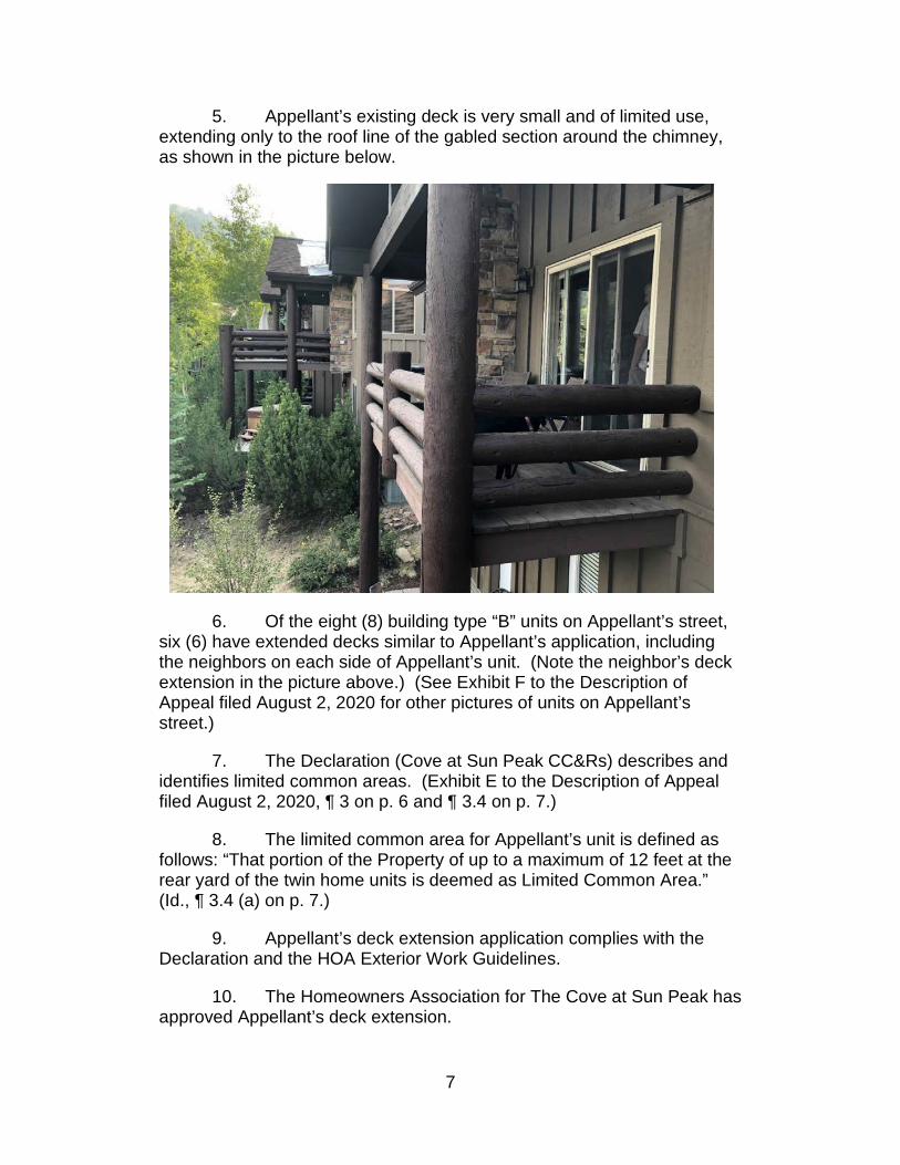
7
5. Appellant’s existing deck is very small and of limited use, extending only to the roof line of the gabled section around the chimney, as shown in the picture below.
6. Of the eight (8) building type “B” units on Appellant’s street, six (6) have extended decks similar to Appellant’s application, including the neighbors on each side of Appellant’s unit. (Note the neighbor’s deck extension in the picture above.) (See Exhibit F to the Description of Appeal filed August 2, 2020 for other pictures of units on Appellant’s street.)
7. The Declaration (Cove at Sun Peak CC&Rs) describes and identifies limited common areas. (Exhibit E to the Description of Appeal filed August 2, 2020, ¶ 3 on p. 6 and ¶ 3.4 on p. 7.)
8. The limited common area for Appellant’s unit is defined as follows: “That portion of the Property of up to a maximum of 12 feet at the rear yard of the twin home units is deemed as Limited Common Area.” (Id., ¶ 3.4 (a) on p. 7.)
9. Appellant’s deck extension application complies with the Declaration and the HOA Exterior Work Guidelines.
10. The Homeowners Association for The Cove at Sun Peak has approved Appellant’s deck extension.

8
11. The Department has raised and then abandoned two unmeritorious grounds for denying Appellant’s application before arriving at the current “Common Area to Private Area” argument.
So, given these undisputed facts, what is the land use regulation that plainly
restricts Appellant’s right to build a small deck extension in Appellant’s Limited Common
Area as permitted by the Declaration and authorized by the Condominium Ownership
Act? It does not exist.
Reply to Section 1 – “Common Area” Definition
The Department’s entire argument and position, that Appellant is trying to convert
Common Area to Private Area, depends on a single definition in Utah Code section 17-
27a-606(1)(b) referencing section 57-8a-102(5) of the Condominium Association Act.
The Department misrepresents the facts when it suggests the Plat shows the
disputed area as “common area” without regard to Appellant’s limited common area
rights granted by the Declaration. The Plat describes the area as “COMMON AREA 3
(CONDOMINIUMS) 4.313 ACRES”, refers to the Declaration in General Note No. 210
and recognizes the existence of limited common areas in General Note No. 1111.
Common Area 3 is part of a condominium plat and even the “Dedication of Common
Areas on the Plat” refers to and incorporates the Declaration regarding designation and
description of common area uses12.
10 “2) A DECLARATION OF CONDITIONS, COVENANTS AND RESTRICTIONS FOR THIS PROJECT HAS BEEN RECORDED HEREWITH.” 11 “11) THE LIMITED COMMON AREA SHALL NOT BE PERMITTED FOR FENCING.” 12 “THE COMMON AREAS ARE NOT DEDICATED FOR USE BY THE GENERAL PUBLIC, BUT ARE FOR THE COMMON USE AND ENJOYMENT OF THE OWNERS IN THE COVE AT SUN PEAK AS SET FORTH IN THE DECLARATION OF PROTECTIVE COVENANTS, AGREEMENTS, CONDITIONS AND RESTRICTIONS OF THE COVE AT SUN PEAK, WHICH ARE HEREBY INCORPORATED BY REFERENCE.” (Emphasis added.)

9
Common Area 3 is part of a condominium plat. Condominiums are governed by
the Condominium Ownership Act.13 The Department relies on some references and
definitions from the Community Association Act14 which was enacted in 2004, eight
years after The Cove at Sun Peak was created. Both Acts demonstrate the error in the
Departments analysis and reliance on an isolated definition.
Like the section cited by the Department in its Response, the Condominium
Ownership Act has a definition of “common area and facilities” in section 57-8-3,
subdivision (5).15 That same section, in subdivision (24) has another, more specific,
definition relevant to Appellant’s application: “(24) ‘Limited common areas and facilities’
means those common areas and facilities designated in the declaration as reserved
for use of a certain unit or units to the exclusion of the other units.”16 (Emphasis
added.)
The later enacted Condominium Association Act, upon which the Department
bases its argument, also has definitions of both “common areas”17 and “limited common
areas”18 in the same section. Subsection (14) provides: “‘Limited common areas’
means common areas described in the declaration and allocated for the exclusive
use of one or more lot owners.”19 (Emphasis added.) The Department has simply
13 Utah Code Ann. § 57-8-1, et seq. 14 Utah Code Ann. § 57-8a-101, et seq. 15 Utah Code Ann. § 57-8-3(5). 16 Utah Code Ann. § 57-8-3(5). 17 Utah Code Ann. § 57-8a-102(5). 18 Utah Code Ann. § 57-8a-102(24). 19 Id.

10
ignored the concept of limited common areas in its decision and Response, even
though the property which is the subject of the appeal is, in fact, limited common area.
The Declaration, which creates the limited common areas, defines “Limited
Common Areas” as part of “Common Areas”: “Some Common Areas [Limited Common
Areas] have been designated as for the exclusive use and possession of the Units to
which they are appurtenant.”20
Section 57-8-10, subsections 2(a) (iv) and (v), of the Condominium Ownership
Act states that for every condominium project the declaration shall describe both the
common areas and facilities of the project and any limited common areas and
facilities. (Emphasis added.) Section 57-8-10 makes it clear that the Act does not
require limited common areas to be shown on the condominium plat: “(c) The
condominium plat recorded with the declaration may provide or supplement the
information required under Subsections (2)(a) and (b).” (Emphasis added.) Even the
Snyderville Basin Development Code does not require condominium plats to show
limited common areas.21
The Department cannot read one definition, in isolation, without considering other
definitions and statutes that qualify that definition based on its context. The statutes
must be read as a whole and in harmony with related statutes and regulations. The
20 Declaration, p. 7, ¶ 3.4, Exhibit E to Appellant’s Description of the Appeal, under the section entitled “Limited Common Areas”. 21 SBDC § 10-11-1 defines a condominium as “[a]ny structure which has been submitted to condominium ownership under the provisions of the Utah condominium ownership act”. SBDC § 10-3-8A states that the condominium plat “shall contain the information required for a final site plan as identified in section 10-3-15 of this chapter.” (Emphasis added.) SBDC § 10-3-8A also requires that CC&Rs be submitted for review by the Summit County attorney’s office prior to recording of the condominium plat. The final site plan requirements, SBDC § 10-3-15, do not require either common areas or limited common areas to be shown on the plat.

11
Department’s interpretation renders “limited common areas” superfluous and is in direct
conflict, rather than harmony, with more specific statutes dealing with the property rights
involved in this appeal.
It is as if the Department is straining to find isolated wording in a statute to
support its position rather than perform its duty to favor an applicant if there is an
ambiguity. Building permit applicants are not adversaries, they are members of the
community trying to follow the rules with the expectation that the County will do the
same.
It is the Department’s, and the County’s, duty to properly read and interpret
statutes, ordinances and other regulations and grant a land use application if there is no
regulation clearly restricting what is sought. If there is an ambiguity, the Department
must favor the land use application in its interpretation. The opposite appears to be the
case here.
The Department cites an isolated phrase from section 57-8-13 to further support
its position.22 Again, the Department takes wording in a statute out of context and
strains to imply a meaning that does not exist.
Reading the section as a whole, it is plain that the quoted subsection (3) deals
with “convertible space”, a specific type of use similar to easements, convertible lands,
leased land, withdrawable lands and encroachments, which must be shown and labeled
on the condominium plat.23 Nothing in that section requires limited common areas to be
shown on the plat or require a plat amendment for their initial creation.
22 Department’s Response, p. 4, quoting Utah Code Ann § 57-8-13. 23 Utah Code Ann § 57-8-13, subsections (1)(a)(iv) thru (xi).

12
Reply to Section 2 – Necessity for a Plat Amendment
Utah Code § 17-27a-606 applies to subdivisions and subdivision plats under Part 6
of the CLUDMA. It does not apply to condominium plats or rights conferred by declaration
pursuant to the Condominium Ownership Act.
Note that Summit County has separate subdivision plat and condominium plat
approval provisions in the SBDC and defines condominiums as governed by the
Condominium Ownership Act.24 Although missing from the SBDC, the County’s Eastern
County Development Code even defines “condominium plat” as a plat governed by the
Condominium Ownership Act, not the general subdivision plat regulations: “A plat of
land and units prepared in accordance with Utah Code Annotated section 57-8-13 or
successor law.”
Appellant’s property is part of a condominium plat -- not a basic subdivision plat.
The Department may not simply disregard the Condominium Ownership Act in the exercise
of its power.
Reply to Section 3 -- Summit County is not a Party to and Cannot Administer Private CC&R Agreements
The County is not being asked to administer or enforce a private agreement.
The Declaration is a document required by statute for formation of a condominium
development. It is a recordable document which creates property rights.
It is not clear what the County’s role is in “administering” private property rights
created by recorded documents. The Department gives no authority for its position that
24 SBDC §§ 10-3-8, 10-3-15 and 10-11-1.

13
it must ignore the Declaration because the County does not administer or enforce
private agreements.
In fact, the County does recognize and enforce property rights created by private,
agreements all the time -- rights such as easements, licenses, encumbrances and even
CC&Rs and design guidelines if they restrict an act or improvement. The concept that
the County, and specifically the Department, cannot recognize or consider “limited
common areas” created by a duly recorded condominium declaration, as authorized by
statute, is absurd.
As discussed above, it is the Declaration and not the Plat that creates the
condominium and defines the limited common area property rights. For condominiums,
the condominium plat is a secondary document to be recorded with the declaration.25
Ignoring the “limited common area” rights created by the Declaration is an abuse of
power.
Conclusion
The Council should overturn the Director of Community Development’s July 23,
2020 determination and direct that Appellant’s application be approved. The
Department’s determination is erroneous, contrary to state law and constitutes a
violation of statutorily mandated public policy in the interpretation and enforcement of
land use regulations.
Appellant apologizes for the length of this Reply, even double-spaced. Although
a small project, the application concern’s the use, enjoyment, and value of Appellant’s
25 Utah Code Ann. §§ 57-8-10 and 57-8-13.

14
home, and Appellant knows the importance of a complete record if it is necessary to
seek review.
Appellant does not require time for a presentation to the Council and is willing to
submit on the papers and record on appeal. Appellant will be available to answer
questions by the Council and respond to points raised by the Department at the hearing.
Respectfully submitted this 22nd day of August 2020,
________________________
Michael J. Radford, Appellant

Public Comment and Public Hearing Instructions 9/30/2020
If you would like to make public comments on any public hearing item, or an item not on the agenda, please email [email protected] by 12:00 p.m. on Wednesday, September 30th. Your comments will be read to the Council and made part of the meeting record. If you are wishing to interact with Council during Public Input and/or the Public Hearing at 6:00 p.m., please:
1. Go to https://zoom.us/j/772302472 2. Enter meeting ID: 772-302-2472 3. Type in your full name, so you are identified correctly. 4. Set up your audio preferences. 5. You will be muted upon entering the meeting. 6. If you would like to comment, press the “Raise Hand” button at the bottom of the chat window. 7. When it is your turn to comment, the moderator will unmute your microphone. You will then
be muted again after you are done speaking.

60 North MainP.O. Box 128Coalville, UT 84017
Phone (435) 336-3123 www.summitcounty.org
STAFF REPORT To: Summit County Council From: Kirsten Whetstone, MS, AICP Date of Meeting: September 30, 2020 Type of Item: Vacation of right-of-way and utility easement Process: Administrative Recommendation Staff recommends the County Council hold a public hearing, review the petition to vacate a right-of-way easement within Lot 8 of the Mountain Top Subdivision, and consider adopting Ordinance # 914 approving the vacation of this easement (Entry no. 168498). Project Description
Applicant/ Owners: Erik and Linda Watts, owners Lot 8 Location: 168 Mountain Top Drive Zone District: Hillside Stewardship (HS) Parcel Number: MT-8 Type of Process: Vacation of right-of-way and utility easement Final Land Use Authority: Summit County Council
Proposal On July 15, 2020, Erik and Linda Watts, owners of Lot 8 Mountain Top Subdivision, petitioned Summit County to vacate a right-of-way easement located within Lot 8. The easement, recorded on July 14, 1980, as Entry No. 168498, was granted to Summit County by the then owner of Lot 8. This easement is not shown on the Mountain Top Subdivision plat. This action to vacate the easement is not a plat amendment, but rather a request to adopt an Ordinance (Exhibit A) approving the vacation of this easement. The petition indicates that the easement is no longer necessary as Mountain Top Drive is now located within the originally platted road right-of-way. Gas and sewer lines for Mountain Top Subdivision are located within the easement area, however separate easements have been granted to those utility providers and are of record in the Summit County Recorder’s Office and are also shown on the Amended and Restated Mountain Top Subdivision plat. The previous road within the area of the easement has been removed and will be landscaped.

2
Vicinity Map
Background The Summit County Board of Commissioners (BCC) approved the Mountain Top Subdivision on May 21, 1978, for 12 single-family lots on 20.62 acres. The original subdivision plat was recorded on September 28, 1979, as Entry No. 159772. The subdivision provided a platted right-of-way for Mountain Top Drive, a private road, serving the twelve lots. Ten months following recordation of the subdivision plat, on July 14, 1980, an easement was recorded on Lot 8 as Entry No. 168498, with the purpose stated to “preserve trees and beauty of the area, and provide access for roads and utilities.” The then owner of Lot 8 was the grantor and Summit County was the grantee of this easement. The easement is entirely within Lot 8 only and abuts platted Mountain Top Drive right-of-way. Summit County does not provide any utilities to the lots or any maintenance or servicing of Mountain Top Drive, which is a private road owned and maintained by the Mountain Top property owners. The plat was subsequently amended, as a First and then Second Amended Mountain Top Subdivision, adjusting lot lines, the private roadway easement, and various utility easements for Lots 10 and 11. The Second Amended plat, was approved on September 22, 2017 and recorded

3
on September 25, 2017 as Entry No. 1078183, superseding the First Amended plat. The subject easement was not shown on either the original plat or the amended plats. On May 15, 2020, the Mountain Top Owners Association, on behalf of all twelve lot owners, applied for an Amended and Restated Mountain Top Subdivision plat amendment to formally recognize recorded easements and to remove previously vacated easements. The right-of-way easement on Lot 8, granted to Summit County, was discovered at this time. On June 9, 2020, the Amended and Restated Mountain Top Subdivision plat was approved by the Planning Commission, with a condition of approval stating that “If the easement on Lot 8 (Entry No. 168498) is vacated by Summit County prior to final recordation of this Amended and Restated Mountain Top Subdivision plat, then this easement can be removed from the amended plat prior to final signatures and plat recordation. Information related to the vacation of the easement shall be included on the final amended plat.” On July 15, 2020 Erik and Linda Watts, owners of Lot 8, petitioned Summit County to vacate the easement on Lot 8 (see Exhibit B). The petition provides a history of this easement and states that the easement is no longer necessary as Mountain Top Drive is now located entirely within the originally platted road right-of-way. Gas and sewer lines for Mountain Top Subdivision are located within the easement area, however separate easements have been granted to those utility providers and are of record in the Summit County Recorder’s Office and on the Amended and Restated Mountain Top Subdivision plat. The previous road within the area of the easement has been removed and will be landscaped. Analysis and Findings Staff reviewed the petition for compliance with the Snyderville Basin Development Code regarding vacation of easements, as well as Utah Code Ann. § 72-3-108 regarding vacation of county roads. While the easement was described as a right-of-way for the purpose of providing access for roads and utilities, it was never actually dedicated as a County road. However, it was granted to Summit County, a public entity, for those purposes. Staff found that following the process and requirements for vacation of a county road and easements was most applicable. Additionally, because this easement is not shown on any of the recorded Mountain Top Subdivision plats, this action to vacate the easement is not a plat amendment, but rather a request to adopt an Ordinance (Exhibit A) approving the vacation of an easement. Notice of the easement vacation was sent to all service and utility providers in the vicinity of this property, as well as County Departments of Engineering, Public Works, Health, Community Development, and the County Attorney Office, Recorder’s Office, IT, Sheriff, and others. Staff received written responses back indicating that there were no concerns or objections to the vacation of this easement (Entry No. 168498). The petition to vacate the easement complies with Section 10-3-18 of the Snyderville Basin Development Code in that there is good cause to vacate this easement, and the public interest,

4
and any person, will not be materially injured by vacating this easement as the purpose for it no longer exists. Mountain Top Drive, a private road, is now located entirely within the existing platted road right-of-way. A public road right-of-way and easement, entirely within a private lot, is not needed. Utility easements for specific utilities are already provided on the recorded plat. Public Notice Notice of the public hearing, as outlined in Utah Code Ann. § 72-3-108, was provided. Notice of the public hearing was published in a newspaper of general circulation in the county and posted in three (3) public places at least once each week for four (4) consecutive weeks prior to the hearing, and mailed to all owners of property abutting the road. Notice of the hearing was also posted to the County website and the Utah Public Notice website. No public input was received at the time of this report. Recommendation Staff recommends the County Council hold a public hearing, review the petition to vacate a right-of-way and utility easement within Lot 8 of the Mountain Top Subdivision, and consider adopting Ordinance # 914 approving vacation of this easement. Findings of Fact
1. Mountain Top Subdivision, consisting of twelve single family lots on 20.62 acres, was approved by the Summit County Board of Commissioners (BCC) on May 21, 1978 and recorded on September 28, 1979 as Entry No. 159772.
2. Ten months following recordation of the subdivision plat, on July 14, 1980, an easement was recorded on Lot 8 as Entry No. 168498, with the purpose stated to “preserve trees and beauty of the area, and provide access for roads and utilities.” The then owner of Lot 8 was the grantor and Summit County was the grantee of this easement.
3. The easement (Entry No. 168498) is entirely within Lot 8 only and abuts platted Mountain Top Drive right-of-way.
4. Summit County does not provide any utilities to the lots or any maintenance or servicing of Mountain Top Drive, which is a private road owned and maintained by the Mountain Top property owners.
5. The subdivision plat was subsequently amended, as a First and then a Second Amended Mountain Top Subdivision, adjusting lot lines, private roadway and driveway easements, and utility easements for Lots 10 and 11. The Second Amended plat was approved on September 22, 2017, and recorded on September 25, 2017 as Entry No. 1078183.
6. The Second Amended plat superseded the First Amended plat for Lots 10 and 11. 7. The easement (Entry No. 168498) granted to Summit County located entirely within Lot
8 was not shown on the original recorded plat or either of the recorded plat amendments.
8. On May 15, 2020, the Mountain Top Owners Association, on behalf of all twelve lot owners, applied for an Amended and Restated Mountain Top Subdivision plat

5
amendment, inclusive of all twelve lots, to consolidate all previous amendments, show all recorded easements and remove already vacated easements.
9. On June 9, 2020, the Planning Commission conducted a public hearing and approved the Amended and Restated Mountain Top Subdivision with a condition of approval that states: “If the easement on Lot 8 (Entry No. 168498) is vacated by Summit County prior to final recordation of this Amended and Restated Mountain Top Subdivision plat, then this easement can be removed from the amended plat prior to final signatures and plat recordation. Information related to the vacation of the easement shall be included on the final amended plat.”
10. The Amended and Restated Mountain Top Subdivision plat has not yet been recorded. 11. A portion of the asphalt roadway of Mountain Top Drive, previously located on Lot 8
within the easement (Entry No. 168498), has been removed and the area will be landscaped.
12. Mountain Top Drive, a private road, is now located entirely within the 60’ wide platted private road and public utility easement. A public road right-of-way easement, entirely within a private lot, is not needed.
13. Gas and sewer lines for Mountain Top Subdivision are located within the easement area, however separate easements have been granted to those utility providers and are of record in the Summit County Recorder’s Office and are also shown on the Amended and Restated Mountain Top Subdivision plat.
14. Notice of the petition to vacate this easement was sent to all service and utility providers in the vicinity of the property, as well as to County Departments of Engineering, Public Works, Health, Community Development, and the County Attorney Office, Recorder’s Office, IT, Sheriff, and others. Staff received written responses back indicating that there were no concerns or objections to the vacation of this easement (Entry No. 168498).
15. Vacation of the easement does not change the location of or access to the existing private road, Mountain Top Drive and does not impact any surrounding public roads or existing utility easements.
16. Notice of a public hearing was published in a newspaper of general circulation in the county, posted in three (3) public places at least once each week for four (4) consecutive weeks prior to the hearing, and mailed to all owners of property abutting private Mountain Top Drive. Notice of the hearing was also posted to the County website and the Utah Public Notice website.
Conclusions of Law
1. The petition to vacate a right-of-way easement complies with Utah Code Ann. § 72-3-108 in that the required provisions and process by which public roads can be vacated are followed.
2. The petition to vacate an easement complies with Section 10-3-18 of the Snyderville Basin Development Code in that there is good cause to vacate this easement, and the public interest, and any person, will not be materially injured by vacating this easement.

6
Attachments: Exhibit A – Ordinance #914 Exhibit B – Petition to vacate easement with attachments

7
EXHIBIT A

1
SUMMIT COUNTY ORDINANCE NO. 914
AN ORDINANCE TO OFFICIALLY VACATE AN EASEMENT GRANTED TO SUMMIT COUNTY FOR A RIGHT-OF-WAY AND UTILITY EASEMENT LOCATED WITHIN LOT 8 OF THE MOUNTAIN TOP SUBDIVISION, LOCATED IN THE SOUTHEASTERN QUARTER OF SECTION 32, TOWNSHIP 1 SOUTH, RANGE 4 EAST, SALT LAKE BASE AND MERIDIAN, SUMMIT COUNTY, UTAH. WHEREAS, on July 15, 2020, a petition to vacate a right-of-way and utility easement recorded on July 14, 1980 as Entry No. 168498 (as further described in Exhibit A), entirely within Lot 8 Mountain Top Subdivision, was filed by Erik and Linda Watts, owners of Lot 8, Tax ID # MT-8; and WHEREAS, Utah Code Ann. § 72-3-108 provides the mechanism and process by which public roads can be vacated; and WHEREAS, Snyderville Basin Development Code, Section 10-3-18 provides process and criteria for vacation of easements and requires that there is good cause to vacate an easement, and requires that the public interest, and any person, will not be materially injured by vacation of an easement; and WHEREAS, notice of a public hearing was published in a newspaper of general circulation in the county, posted in three (3) public places at least once each week for four (4) consecutive weeks prior to the hearing, and mailed to all owners of property abutting the road; and WHEREAS, a public hearing was held on September 30, 2020, at which the Petitioners, and/or their representatives, and other members of the public were present to give comment; and WHEREAS, there appears from the record, to be good cause to vacate the easement since there is no public destination on the road, no need for public access, abutting properties are serviced by Mountain Top Drive, that is a private road located entirely within the platted roadway right-of-way, and there is no historical public use of the easement; and WHEREAS, vacation of this right-of-way and utility easement as set forth above will not be detrimental to the general interests of the community nor materially affect access enjoyed by the property owners or utility providers; and WHEREAS, existing Mountain Top Drive, a private road, is now entirely located within a platted right-of-way easement that provides access to all the lots within the Mountain Top Subdivision; and
WHEREAS, a variety of utility and access easements are identified on the Mountain Top Subdivision plat, providing utility and service providers, including County services, such as emergency services, sheriff, and others with access to lots within the Mountain Top Subdivision and the best interests of the community are provided for;

2
NOW THEREFORE be it ordained by the Summit County Council, acting as the County Legislative Body of the County of Summit, State of Utah, as follows: Section 1. The County Council hereby finds that neither the public nor any person will be materially injured by the vacation of this easement, recorded as Entry No. 168498, and that there is good cause shown on the record to vacate the easement because there is no public destination on the road, no need for public access and there is no record of historical public use of the road. Section 2. The County Council hereby finds that the easement vacation as described above will not be detrimental to the general interests of the community nor will access enjoyed by the property owners and the public be materially changed by the vacation. Section 3. The County Council hereby finds that there is no continued public use or need for the continuation of public use of this easement and that it is in the best interests of the community to vacate the easement. Section 4. The County Council hereby officially vacates the right-of-way and utility easement recorded as Entry No.168498, located entirely within Lot 8 of Mountain Top Subdivision, parcel ID # MT-8. Section 5. The petition does not request vacation of any other road or portion of roads. Section 6. This ordinance shall take effect fifteen (15) days after passage by Summit County Council and upon publication in a newspaper published and having general circulation within Summit County. PASSED AND ADOPTED, this 30th day of September 2020. ATTEST: SUMMIT COUNTY COUNCIL
SUMMIT COUNTY, UTAH
________________________ By: ____________________________ Kent Jones, County Clerk Chairperson Councilor Armstrong voted _______ Councilor Carson voted _______ Councilor Clyde voted _______ Councilor Robinson voted _______ Councilor Wright voted _______

3
Exhibit A- Legal Description of Easement Beginning at a point North 61.495 feet and West 318.26 feet from the Southeast corner of Mountain Top Subdivision, as recorded in Summit County, Utah, said point being on the westerly easement line whose centerline is the lot line between Lots 8 and 9; and running thence N 00 44’ W 99.43 feet along the westerly easement to a point on a 185 foot radius curve to the right, whose radius point bears N 890 16’ E; thence northeasterly along the arc of said curve and on the westerly easement line 88.22 feet; thence S 480 W 48.97 feet to a point a 70 foot radius curve to the left, whose radius point bears S 420 E; thence southwesterly along the arc of said curve 59.54 feet; thence S 00 44’ E 134.53 feet; thence N 480 E 53.22 feet along an easement line to the point of beginning. Contains 6898 square feet.

EXHIBIT B


Attachment A- Recorded Easement


Attachment B- Easement location


Attachment C- Gas easement

Attachment D- SewerEasements


Attachment E- Agreement with Summit County