Initial Environmental Examination Report - 47021-002 ...
185
Initial Environmental Examination Report ________________________________________ Project Number: 47021-002 Loan Number: 3239 PAK: Federally Administered Tribal Areas Water Resources Development Project Initial Environmental Examination Report for Shangade Weirs District Khyber Prepared by Project Management Unit, Government of Khyber Pakhtunkhwa, Pakistan For the Asian Development Bank Date received by ADB: April 2018
-
Upload
khangminh22 -
Category
Documents
-
view
0 -
download
0
Transcript of Initial Environmental Examination Report - 47021-002 ...
Initial Environmental Examination Report ________________________________________
Project Number: 47021-002
Loan Number: 3239
PAK: Federally Administered Tribal Areas Water Resources
Development Project
Initial Environmental Examination Report for Shangade Weirs District Khyber
Prepared by Project Management Unit, Government of Khyber Pakhtunkhwa, Pakistan
For the Asian Development Bank
Date received by ADB: April 2018

NOTES
(i) The fiscal year (FY) of the Government of the Islamic Republic of Pakistan and its
agencies ends on 30 June.
(ii) In this report “$” refer to US dollars.
This initial environmental examination report is a document of the borrower. The views expressed
herein do not necessarily represent those of ADB’s Board of Directors, Management, or staff, and may be preliminary in nature.
In preparing any country program or strategy, financing any project, or by making any designation
of or reference to a particular territory or geographic area in this document, the Asian
Development Bank does not intend to make any judgments as to the legal or other status of any
territory or area.

FEDERALLY ADMINISTERED TRIBAL AREAS
WATER RESOURCES DEVELOPMENT PROJECT
PMU FWRDP
Project Management Unit FATA Water Resources Development Project FATA Secretariat
INITIAL ENVIRONMENTAL EXAMINATION (IEE) SHANGADE WEIRS
(KHYBER AGENCY)
2017
House # 3, Street # 1, Near Board Bazar, Tajabad, Peshawar, Khyber Pakhtunkhwa, Pakistan. Tel: +92 91 5601635 - 6 Fax: +92 91 5840807 E-mail: [email protected]
FATA WATER RESOURCES DEVELOPMENT PROJECT CONSULTANTS

Initial Environmental Examination:
FATA Water Resources Development Project Shangade Weir Pilot Sub Project
i | T O C
TABLE OF CONTENTS
Sr. No. Description Page No.
_Toc1137621
INTRODUCTION.................................................................................................................... 1
General .................................................................................................................... 1
Project Background ................................................................................................. 1
Project Consultants .................................................................................................. 2
Purpose of This Initial Environmental Examination (IEE) ......................................... 2
IEE Methodology ..................................................................................................... 4
Study Area ............................................................................................................... 4
Baseline Survey Methodology ................................................................................. 6
Impact Assessment Methodology ............................................................................ 7
Report Format ......................................................................................................... 8
Project Categorization ............................................................................................. 9
IEE Team ................................................................................................................ 9
POLICY, LEGAL AND ADMINISTRATIVE FRAMEWORK ................................................... 10
General ...................................................................................................................10
National Policy and Legal Framework .....................................................................10
Regulations for Environmental Assessment, Pakistan EPA ....................................10
Regulatory Clearances, EPA ..................................................................................11
Guidelines for Environmental Assessment, Pakistan EPA ......................................11
Pakistan Environmental Protection Agency Review of IEE and EIA Regulations, (2000)…. ..............................................................................................................................11
National Environmental Quality Standards (NEQS) ................................................11
Comparative Analysis of the National and International Standards .........................12
ADB’s Safeguard Policy Statement (SPS), 2009 ....................................................15
Project Categorization ............................................................................................15
Other Environment Related Legislations .................................................................16
PROJECT DESCRIPTION ................................................................................................... 19
Project Features .....................................................................................................19
Project Location ......................................................................................................25
Project Objectives ...................................................................................................25
Construction Planning .............................................................................................25
Stage-I ....................................................................................................................26
Stage- II ..................................................................................................................27
Project Implementation ...........................................................................................28
Executing Agency ...................................................................................................28
Design Consultant ..................................................................................................28

Initial Environmental Examination:
FATA Water Resources Development Project Shangade Weir Pilot Sub Project
ii | T O C
FATA Development Working Party .........................................................................29
Terms of Partnership ..............................................................................................29
Operation and Maintenance ....................................................................................29
DESCRIPTION OF ENVIRONMENT .................................................................................... 30
General ...................................................................................................................30
Baseline Survey Methodology ................................................................................30
Study Area ..............................................................................................................32
Physical Environment .............................................................................................35
Topography ............................................................................................................35
Climate ...................................................................................................................35
Hydrology ...............................................................................................................36
Regional Geology ...................................................................................................37
Geology of the Project Area ....................................................................................37
Soil .........................................................................................................................37
Seismology .............................................................................................................38
Ambient Air Quality and Noise ................................................................................40
Water Resources ....................................................................................................43
Water Quality ..........................................................................................................44
Biological Environment ...........................................................................................46
Land use and Land Cover.......................................................................................47
Flora .......................................................................................................................49
Fauna .....................................................................................................................52
Avifauna .................................................................................................................53
Protected areas / National sanctuaries ...................................................................55
Socio-Economic Environment .................................................................................55
Administrative Set Up .............................................................................................58
Demographic Profile ...............................................................................................58
Population ..............................................................................................................59
Family Size .............................................................................................................60
Dwelling ..................................................................................................................60
Language ...............................................................................................................60
The Family System .................................................................................................60
Livestock ................................................................................................................61
Conflicts Resolution Mechanism .............................................................................61
Religious Beliefs .....................................................................................................62
Water Supply and Sanitation ..................................................................................62
Poverty ...................................................................................................................63
Health facilities .......................................................................................................64
Social Organization .................................................................................................65
Agriculture ..............................................................................................................65
Education ...............................................................................................................65

Initial Environmental Examination:
FATA Water Resources Development Project Shangade Weir Pilot Sub Project
iii | T O C
Food .......................................................................................................................66
Dress and Ornaments .............................................................................................66
Mining .....................................................................................................................66
Roads .....................................................................................................................66
Telephone Facilities ................................................................................................66
Sites of Historical Significance ................................................................................67
Gender Issues ........................................................................................................67
PROJECT ALTERNATIVES ................................................................................................. 68
No Project Option ...................................................................................................68
Project Siting Alternatives .......................................................................................69
Technological Alternatives ......................................................................................69
ENVIRONMENTAL IMPACT ASSESSMENT AND MITIGATION MEASURES .................... 70
Impact Assessment - Overview ...............................................................................70
Impact Area ............................................................................................................70
Impacts on Land Resources ...................................................................................73
Excavation and Blasting..........................................................................................73
Waste Generation and Disposal .............................................................................74
Labour camps, storage and approach roads ...........................................................74
Soil pollution due to fuel and oil spillage from construction machinery ....................75
Agriculture Land Damage .......................................................................................76
Impact of taking borrow material from earth borrow site ..........................................76
Changes in soil characteristics due to labour camps, and machinery yards ............77
Impacts on Hydrology and Water Resources ..........................................................77
Contamination of surface water due to washing ......................................................77
Drinking water supply .............................................................................................78
Municipal waste disposed into the stream ...............................................................78
Water quality and sedimentation load .....................................................................78
Impact on Air Quality and Noise Pollution ...............................................................79
Dust from construction and smoke from plants and equipment ...............................79
Smoke from burning of waste and firewood ............................................................79
Noise from use of old/and or out-dated machinery ..................................................79
Dust Emission from Stone quarrying and Transportation ........................................80
Impact on biological resources Flora, Fauna (Biota) ...............................................80
F.6.1 Impact on Aquatic Life ............................................................................................81
Impacts on Socioeconomic, Cultural and Archaeological Issues .............................82
Tribal Tension and Rivalries ...................................................................................82
Impact on Civic Infrastructure .................................................................................84
Community safety risks due to accidental or natural hazards ..................................84
Health and safety of labour at construction site .......................................................84
Construction material leftovers................................................................................85
Initial Environmental Examination:
FATA Water Resources Development Project Shangade Weir Pilot Sub Project
iv | T O C
Change in visual character and soil erosion ............................................................85
Soil pollution due to excessive application of pesticides and fertilizers....................86
.............................86
ENVIRONMENTAL MANAGEMENT PLAN (EMP) ............................................................... 88
General ...................................................................................................................88
Mitigation Measures ................................................................................................88
Residual Impact ......................................................................................................89
Institutional Arrangements ......................................................................................89
Management Responsibilities .................................................................................89
Monitoring Activities .............................................................................................. 119
......................................................................................... 119
Project Enhancement Plans .................................................................................. 120
Restoration Plan ................................................................................................... 120
Reports ................................................................................................................. 120
Training Schedule ................................................................................................. 121
Implementation Estimated Budget ........................................................................ 122
Third Party Monitoring ......................................................................................... 123
PUBLIC CONSULTATION ................................................................................................. 125
General ................................................................................................................. 125
Identification of Stakeholders ................................................................................ 126
Methodology ......................................................................................................... 128
Agenda of Consultative Session ........................................................................... 128
Local Farmer Views .............................................................................................. 129
Consultation with Other Stakeholders and Their Response .................................. 130
GRIEVANCE REDRESS MECHANISM ............................................................................. 133
General ................................................................................................................. 133
Objectives of Grievance Redress Mechanism ....................................................... 133
Awareness of GRM ............................................................................................... 134
Implementation of GRM ........................................................................................ 135
_Toc1137782CONCLUSION, FINDINGS AND RECOMMENDATIONS ............................. 138
Findings and Recommendations ........................................................................... 138
Conclusion ............................................................................................................ 138

Initial Environmental Examination:
FATA Water Resources Development Project Shangade Weir Pilot Sub Project
v | T O C
List of Annexures
ANNEX – I Photo log .......................................................................................................... 140
ANNEX – II Supporting Documents .................................................................................... 142
ANNEX III - National Environmental Quality Standards (NEQS) ......................................... 154
ANNEX-IV WHO Standards ............................................................................................... 160
ANNEX-V Table of Content Environmental Compliance Monitoring ................................... 162
ANNEX-VI Rapid Environmental Assessment Checklist ..................................................... 164

Initial Environmental Examination:
FATA Water Resources Development Project Shangade Weir Pilot Sub Project
vi | T O C
List of Tables & Figures
Figure 1.1: The Sub Project Location Map .............................................................................................. 5 Table 2.1 Comparison of International and local Air Quality Standards ............................................ 13 Table 2.2: Comparison of International and local for Noise-Limit in dB(A) Leq ................................ 14 Table 2.3. Environmental Guidelines and Legislations ........................................................................ 16 Figure 3.1: Walu Mela Weir Layout Plan ................................................................................................ 20 Figure 3.2: Gudar Weir Layout Plan ....................................................................................................... 20 Table 3.1: Salient Features of the Project .............................................................................................. 21 Figure 3.3: Project Location Map ........................................................................................................... 22 Figure 3.5: Schematic Map of Shangade Weirs .................................................................................... 24 Table 3.2: Diversion Weirs Works and Quantities ................................................................................ 26 Figure 4.1: Map of Khyber Agency ......................................................................................................... 34 Figure 4.3: Tectonic Map of Pakistan ..................................................................................................... 39 Table 4.1: Ambient Air Quality and Noise of Gudar Weir ..................................................................... 40 Table 4.2 Ambient Air Quality and Noise of Shangade Weir ............................................................. 41 Figure 4.4 Environmental Testing and Sampling Map ......................................................................... 42 Table 4.3: Water Quality analysis result for Irrigation water of Gudar Weir ...................................... 44 Table 4.4: Water Quality analysis result for Irrigation water of Shangade Weir ................................ 44 Table 4.5: Water Quality analysis result for Drinking water of Gudar ................................................ 45 Table 4.6: Water Quality analysis result for Drinking water of Shangade ......................................... 46 Figure 4.5: Land use Map of Shangade ................................................................................................. 48 Table 4.8: Common Trees Species in Project Area .............................................................................. 50 Table 4.9: Common Grasses Species in the Area ................................................................................. 51 Table 4.10: Common Shrub Species in the Project Area ...................................................................... 52 Table 4.11: Fauna of the Project Area .................................................................................................... 53 Table 4.12: Avifauna of the Project Area ................................................................................................ 53 Table 4.14: Population Details of Khyber Agency ................................................................................ 59 Figure 5.1 Impact Area ............................................................................................................................. 71 Table 5.1 Screening of Environmental Impacts; Construction and Operation Stages ..................... 72 Table 6.1: Environmental Management (Mitigation) Plan (Construction & Operation) .................... 93 Table 6.4: Implementation Estimated Budget ..................................................................................... 122 Figure 7.1: Identification of Stakeholders ........................................................................................... 127 Table 7.1: Farmer Reasons for Dissatisfaction with Canal Systems ................................................ 129 Table 7.3: List of Community Consultation Participants ................................................................... 131 Figure 7.2: Community Meetings at Shangade ................................................................................... 132 Figure 8.1: Proposed GRM .................................................................................................................... 137

Initial Environmental Examination:
FATA Water Resources Development Project Shangade Weir Pilot Sub Project
| T O C
Units Conversion Tables
Length Units
Millimeters Centimeters Meters Kilometers Inches Feet Yards Miles
Mm cm M km in ft yd Mi
1 0.1 0.001 0.000001 0.03937 0.003281 0.001094 6.21e-07
10 1 0.01 0.00001 0.393701 0.032808 0.010936 0.000006 1000 100 1 0.001 39.37008 3.28084 1.093613 0.000621
1000000 100000 1000 1 39370.08 3280.84 1093.613 0.621371 25.4 2.54 0.0254 0.000025 1 0.083333 0.027778 0.000016 304.8 30.48 0.3048 0.000305 12 1 0.333333 0.000189 914.4 91.44 0.9144 0.000914 36 3 1 0.000568
1609344 160934.4 1609.344 1.609344 63360 5280 1760 1
Area Units
Millimeter square
Centimeter Square
Meter square
Inch square
Foot square
Yard Square
mm2 cm
2 m2 in
2 ft
2 yd
2
1 0.01 0.000001 0.00155 0.000011 0.000001
100 1 0.0001 0.155 0.001076 0.00012
1000000 10000 1 1550.003 10.76391 1.19599
645.16 6.4516 0.000645 1 0.006944 0.000772
92903 929.0304 0.092903 144 1 0.111111
836127 8361.274 0.836127 1296 9 1
Volume Units
Centimeter cube
Meter cube
Liter Inch cub
Foot
US gallons
Imperial
US barrel (oil)
cm3
m3 ltr in3
ft3
US gal Imp. gal US brl
1 0.000001 0.001 0.061024 0.000035 0.000264 0.00022 0.000006
1000000 1 1000 61024 35 264 220 6.29 1000 0.001 1 61 0.035 0.264201 0.22 0.00629 16.4 0.000016 0.01638 1 0.000579 0.004329 0.003605 0.000103
28317 0.028317 28.3168 1728 1 7.481333 6.229712 0.178127 3785 0.003785 3.79 231 0.13 1 0.832701 0.02381 4545 0.004545 4.55 277 0.16 1.20 1 0.028593
158970 0.15897 159 9701 6 42 35 1
Mass Units
Grams Kilograms Metric tonnes Short ton Long ton Pounds Ounces
G kg Tonne shton Lton lb Oz
1 0.001 0.000001 0.000001 9.84e-07 0.002205 0.035273 1000 1 0.001 0.001102 0.000984 2.204586 35.27337
1000000 1000 1 1.102293 0.984252 2204.586 35273.37
907200 907.2 0.9072 1 0.892913 2000 32000
1016000 1016 1.016 1.119929 1 2239.859 35837.74 453.6 0.4536 0.000454 0.0005 0.000446 1 16
28 0.02835 0.000028 0.000031 0.000028 0.0625 1

Initial Environmental Examination:
FATA Water Resources Development Project Shangade Weir Pilot Sub Project
i | T O C
Volumetric Liquid Flow Units
Liter/second Liter/minute Meter
cube/hour Foot
cube/minute Foot
cube/hour US
gallons/minute US barrels
(oil)/day
L/sec L/min M3/hr ft
3/min ft
3/hr gal/min US brl/d
1 60 3.6 2.119093 127.1197 15.85037 543.4783 0.016666 1 0.06 0.035317 2.118577 0.264162 9.057609 0.277778 16.6667 1 0.588637 35.31102 4.40288 150.9661
0.4719 28.31513 1.69884 1 60 7.479791 256.4674 0.007867 0.472015 0.02832 0.01667 1 0.124689 4.275326 0.06309 3.785551 0.227124 0.133694 8.019983 1 34.28804 0.00184 0.110404 0.006624 0.003899 0.2339 0.029165 1
Temperature Conversion Formulas
Degree Celsius (°C) (°F - 32) x 5/9
(K - 273.15)
Degree Fahrenheit (°F) (°C x 9/5) + 32
(1.8 x K) - 459.67
Kelvin (K) (°C + 273.15)
(°F + 459.67) ÷ 1.8
Currency Exchange Table
US Dollar Pakistani Rupees
01 139.88
Exchange Rate as of January 24, 2019

Initial Environmental Examination:
FATA Water Resources Development Project Shangade Weir Pilot Sub Project
ii | T O C
List of Abbreviations
ADB Asian Development Bank
AMSL Above Mean Sea Level
APA Assistant Political Agent
CO Community Organization
CCA Culturable Command Area
CSC Construction Supervision Consultant
DG Director General
EIA Environmental Impact Assessment
ESMU Environmental and Social Management Unit
EMP Environment Management Plan
EPA Environment Protection Agency
EMMP Environment Management and Monitoring Plan
FRDP FATA Rural Development Project
FWRDP FATA Water Resources Development Project
FATA Federally Administered Tribal Areas
FGD Focus Group Discussions
GIS Geographic Information System
GoP Government of Pakistan
GRC Grievance Redress Committee
GRM Grievance Redress Mechanism
HSE Health, Safety and Environment
IA Implementing Agency
IEE Initial Environmental Examination
KP Khyber Pakhtunkhwa
MM Mitigation Measure
MMT Main Mantle Thrust
NGO Non-Governmental Organization
NOC No Objection Certificate
PA Political Agent
PD Project Director
PEPA Pakistan Environmental Protection Act
PIU Project Implementation Unit
PMU Project Management Unit
PPTA Project Preparatory Technical Assistance
RCC Reinforced Cement Concrete
RE Resident Engineer
SDS Safety Data Sheet
SPS Safeguard Policy Statement
SSEMP Site Specific Environmental Management Plan
SWPS Shangade Weir Pilot Sub Project
ToP Terms of Partnership
ToR Terms of Reference
WWF World Wide Fund for Nature

FATA Water Resources Development Project Shangade Weir Pilot Sub Project
i | Executive Summary
Executive Summary
1. Introduction
This environmental study was undertaken in accordance with Pakistan
Environmental Protection Act 1997 and ADB`s Safeguards Policy Statement
(SPS), 2009 requirement and recommendations.
The TOR requires that an assessment of the environmental impacts of the project
(i.e. IEE or EIA), preparation of the environmental management and monitoring
plans (EMMPs), inclusion of costs for implementing recommended mitigation
measures, and any capacity strengthening measures in the project development
costs.
Federally Administered Tribal Areas (FATA) Water Resources Development
Project (FWRDP) will be operational in the federal territories at the western
borders of Pakistan with Afghanistan. It focuses on increasing irrigation supplies
in three agencies, namely Mohmand, Khyber and Bajaur, to increase crop
production and harvest water sustainably. The project is being proposed as a
result of the Water Assessment Study executed under the completed ADB
supported FATA Rural Development Project of FATA Secretariat. The study
identified 40 watersheds where the groundwater aquifers are depleting at a high
rate, even under average weather conditions due to unplanned water extraction
for irrigation and other associated purposes. It recommends shifting from
groundwater to surface water, which remains totally unutilized, and identified
potential sites for small reservoirs and diversion weirs in the 40 watersheds of
Mohmand, Khyber and Bajaur Agencies of FATA.
With above background, ADB financed a Project Preparatory Technical
Assistance, TA 8409-PAK (PPTA) for FATA Water Resources Development
Project in preparing a project for financing consideration by ADB. ADB through
FATA support implemented the PPTA during 2013-2014, in which a team of
national consultants prepared a feasibility study for a water resources project for
FATA. Based on the findings of the PPTA and on the request of Government of
Pakistan, ADB approved, on 15th December 2014, the Federally Administered
Tribal Areas Water Resources Development Project (Project) contributing $42.97
million from ADB’s Special Funds. The Government will contribute $4.93 million
as counterpart fund. The ADB and Government of Pakistan signed the legal
agreement on 17th April 2015 and declared the loan effective on 7th August 2015.
The Project implementation period ends on 31th March 2020 and loan accounts
will close on 30th September 2020.

FATA Water Resources Development Project Shangade Weir Pilot Sub Project
ii | Executive Summary
Since the subproject is categorized as a category B project as per ADB’s
Safeguards Policy Statement 2009, an Initial Environmental Examination (IEE)
exercise is required for each sub-project.
2. Project Location
Lashora Khwar at which Walu Mela / Gudar weir sites exist, is on North east,
semi-arid part of Khyber Agency. The proposed weirs on Lashora stream / khwar
are located 12 km North West of Jamrud Town (agency head quarter of Khyber
Agency) near the village of Walu Mela.
The proposed Walu Mela and Gudar weirs are located at coordinates 71.3327
E & 34.0393 N and 71.3511 E & 34.0242 N.
3. Environmental Issues
The subproject activities include construction of a weir, irrigation channel about
5.70 km and development of culturable command area of 37 ha. This will cause
some disturbance due to construction activities on the RoW at site and the allied
sites involving borrow material, camp area, material and machinery yard, link
roads and necessary facilities for the staff and labor to be engaged for the
execution of the subproject.
4. Policy Legal and Administrative Framework
This report represents in accordance to Pakistan Environment Act, 1997 and the
Asian Development Bank’s Safeguard Policy Statement (SPS) 2009 requires
that environmental considerations be incorporated into ADB’s funded project to
ensure that the project will have minimal environmental impacts and be
environmentally sound. Occupational health & safety of the local population
should also be addressed as well as the project workers as stated in SPS 2009.
Because this project falls in the jurisdiction of Federal EPA, therefore approval
from the Federal EPA will be required.
5. Project Description
Lashora Khwar is a non-perennial stream, while few perennial flow springs are
present at different locations. The Lashora Khwar flows are planned to be used
for irrigation by constructing two weirs, located at upstream of Walu Mela village
and Gudar village in Khyber agency. The weirs will divert perennial flows of
springs to irrigate the command area at downstream.
6. Project Alternatives
Project alternatives have been considered with consideration of their ability to
match immediate demand and then keep pace with emerging demand while
ensuring capture of available yield in the stream. Technically there is no other
source of water or place diverting water for irrigation purposes.

FATA Water Resources Development Project Shangade Weir Pilot Sub Project
iii | Executive Summary
The Project Area is considered as poor from an economic perspective.
Subsistence farming is the economic mainstay. Water availability is scarce in
area hence the proposed project will contribute positively to the project area.
Therefore, no project option is not viable option.
However various technical alternatives were also considered and the most
viable option Tyrolean weir was adopted.
7. Environmental and Social Baseline
The purpose of this chapter is to establish the baseline conditions for the
physical, biological and the social aspects of the environment of project area.
The data were collected regarding the physical environment, biological
environment and social aspects of the study area from field surveys, desk
studies and visits to the Government departments, other relevant agencies, and
discussions with the main stakeholders of the area. The purpose of baseline
study is to fulfill the following objectives.
a. To get the data about the physical, biological and socio-economic
environment of the project area
b. To understand the current situation of the area comprehensively.
c. To rationalize the decisions according to the ground realities.
The main environmental conditions, likely to be affected due to project
execution are: -
a. Physical Environment
b. Biological Environment
c. Socio-economic Environment
8. Physical Environment
Khyber Agency is one of the eight tribal areas, better known as agencies in
Pakistan. It ranges from the Tirah valley down to Peshawar. It borders
Nangarhar Province to the west, Orakzai Agency to the south, Kurram Agency
to south west and Peshawar to the east.
The topography of this area is prevailingly hilly, with rugged barren
mountainous terrain, including narrow strips of bottom valleys and sub valleys.
An interesting feature in the topography is a mountain spur from the Kunar
range, which, curving eastwards culminates in the well-known peak of Koh-i-
Mor, which is visible from the Peshawar valley.
Shangade Khwar/stream, where SWPS will be constructed, falls within the Kuki
Khel watershed. The Area falls in the cool sub-humid climatic zone associated
with 500-1000 mm of annual precipitation. The average annual rainfall in the

FATA Water Resources Development Project Shangade Weir Pilot Sub Project
iv | Executive Summary
catchments area is about 388.1 mm. The soils command area is of piedmont
plain, coarse to medium in texture, and light brown in colour. The profile depth
is shallow and mostly immature soil development, gently to moderate sloping
and well drained.
The project area experiences two rain seasons: winter and summer. Water
supply is from rainfall, snow melt and groundwater during the dry periods. Area
is a rain fed (barani) area. Depth to water table generally varies from 13 to 50
meters below ground level in barani areas whereas it is within 10 m in irrigated
areas. The stream water testing result reveals that the water is fit for irrigation
while the drinking water quality is not fit for drinking purposes due to biological
contamination and it requires proper treatment.
The ambient air quality and noise testing results reveals that the air quality and
noise of the area is within the permissible limits of NEQS.
9. Biological Environment
Ecologically, this area falls within the main group of Dry Subtropical Broad-
leaved Forest. The sub–group is Monotheca Scrubs. Generally, the vegetation
is thorny evergreen shrubs, which are capable of developing into small trees,
even under harsh climatic conditions and social pressure (heavy grazing
/browsing).
The main tree species are, Monotheca buxifolia (Gurgura), Zizyphus
nummularia (Ber), Acacia modesta (Phulai), Olea cuspidate (wild olive),
prosopis spp (mesquite), tamarix spp (Farash) and Dodonaea viscose
(Sanatha).
Avifauna of the area is highly diversified and colorful, which is widely dispersed
in gardens, cultivated fields, streams and hill slopes. No threatened or
endangered species were observed in the subproject area, as per IUCN red list
classification of 2017.
There are no wildlife or forest laws enacted for FATA. However, more recently,
Governor KP has issued a notification, declaring all wetlands in FATA as
Community Game Reserves. However, the nearest wetland around the project
vicinity is at a distance of approx. 20 km from the Project Area. Hunting shall
only be allowed with joint agreement of local communities and political
authorities. Moreover, a separate notification has also been issued declaring
trade in body parts (pelt, skin, stuffed bodies, trophies, etc.) of all wild fauna
including migratory birds as illegal.
10. Socio-Economic and Cultural Aspects
Khyber Agency is bordered with Afghanistan, Peshawar city and the Kurram
and Orakzai agencies. The total area of the agency is 2,576 square kilometers,

FATA Water Resources Development Project Shangade Weir Pilot Sub Project
v | Executive Summary
with 8.22% of the total area of the agency being forest. The Khyber Agency
consists of three tehsils; Bara, Landi Kotal and Jamrud. Under the Constitution,
FATA is included among the territories of Pakistan (Article 1). It is administered
by Governor of the KPK in his capacity as an agent to the President of Pakistan,
under the overall supervision of the Ministry of States and Frontier Regions in
Islamabad.
Khyber Agency, like each tribal agency is administered by a political agent,
assisted by a number of assistant political agents, tehsildars (administrative
head of a tehsil) and naib tehsildars (deputy tehsildar), as well as members
from various local police (Khassadars) and security forces (levies, scouts). As
part of his administrative functions, the political agent oversees the working of
line departments and service providers.
The population of the agency, according to the 2017census is 986,973 with an
average annual growth rate 3.15. The subproject site is situated in northwest of
Jamrud tehsil having a population of approximately 3558 persons, and 391
households. Afridis are the main tribe of the project area and are further sub
divided into Koki Khel sub tribe.
The people in the agency are not widely educated. They migrate to down
districts in search of jobs or any other labour. The FATA region has historically
remained amongst the poorest parts of Pakistan. There are serious disparities
in service provision as compared to the rest of the country. The absence of
visible progress and the perceived lack of interest by both sub-national and
federal governments in redressing the disparities have consequently
deteriorated citizens’ trust in the ability of government institutions to meet the
basic needs of the population. The militancy crisis in KP and FATA is a key
contributor to stagnant growth and high unemployment.
11. Public Consultation
The public consultation process with various stakeholders has been carried out
so as to create awareness, information dissemination and to involve them in the
designing, planning and execution of subproject. The viewpoints of the
stakeholders have been taken into account and their concerns and suggestions
for possible improvements have been included where appropriate.
During the field survey, significant efforts were made to identify the possible
categories of stakeholders. Stakeholders at site were notified villagers, local
residents, government officials, shop owners, public representative, NGO’s and
general public. All those stake holders had different types of stakes according to
their professions.

FATA Water Resources Development Project Shangade Weir Pilot Sub Project
vi | Executive Summary
Tribal society is dominated by men with final say in the affairs of all members
of the family. Women, by comparison, play a subservient role and observe
strict purdah (veiling). They are for the most part restricted to performing
household work, and are excluded from decision-making both on the domestic
front and at the community level. Keeping in mind the above background,
women of the subproject area were not consulted.
The people of the area were informed about the both negative and positive
impacts of the subproject. They responded that the negative impacts like
noise and dust are very minor and temporary issues as compared to the
positive impacts which will help them to improve their socioeconomic
conditions.
12. Environmental Impact Assessment and Mitigation Measures
The Initial Environmental Examination (IEE) study has disclosed that the
subproject is not likely to have any severe negative impacts on the environment
and people of the area. All the potential impacts which have been identified
during the present assessment are associated with the construction stage of the
subproject, and minor to moderate in severity; and can easily be avoided
(through good design and construction planning) or mitigated (through proper
implementation of the EMP).
No acquisition of permanent land will be involved. There is no such adverse
environmental impact of the sub project but the construction-related impacts
such as air pollution, noise and use of community resources can be well
managed through proper implementation of the mitigation measures, which
have been identified in this report. Also, there is no environmentally sensitive
area in the vicinity of the project area.
Women headed households have not been identified in the Sub Project area
and no indigenous people impacts are involved in the proposed sub project. The
other social issues like safety of general public and workers, security problems,
risk of communicable diseases, vector borne diseases etc. are of temporary
nature.
On the other hand, the subproject will create job opportunities particularly for the
local population during construction stage and extremely beneficial for uplift of
socio-economic condition of the local population through irrigated agriculture i.e.
development of 37 ha culturable land.
13. Environmental Management Plan
Environmental Management Plan (EMP) is produced as a complementary part
of Detailed Design and as a free- standing document. It ensures incorporation

FATA Water Resources Development Project Shangade Weir Pilot Sub Project
vii | Executive Summary
of the relevant environmental factors into the overall subproject design and will
identify linkages to other safeguard policies relating to the project.
Based on the preliminary assessment, key mitigation measures recommended
under this Environmental Management Plan (EMP). Overall responsibility for
Environmental Management and Monitoring will rest with the Project
Management Unit (PMU) which is headed by a Project Director (PD).
14. Conclusion and Recommendations
The assessment of potential impacts of the proposed Shangade weir subproject
reveals that this project will generate only minor to moderate negative
environmental impacts. These adverse impacts will be mostly confined to the
construction works and will be temporary in nature. The predicted adverse
impacts will be minimized and reduced by implementing the prescribed
mitigation measures and will be continually monitored by implementing and
updating the EMP.
The overall finding is that the beneficial gains provided by Irrigation project will
by far exceed the negative impacts – most of them being short-termed and
without major interference to both the bio-physical and human environment. It is
emphasized that the success of the EMP depends on the respective line
agencies and institutions identified as key players in the implementation of the
EMP. The timely and complete inclusion of the EMP’s compliance clauses in the
Contractor documents is mandatory to ensure the success of all environmental
safeguard measures.
As the project is exclusively an irrigation system, all identified adverse
environmental impacts during the rehabilitation and improvement works of the
project will be of minor nature, easily to be mitigated by adequate
implementation of the Environmental Management and Monitoring Plans. Entire
command of the project components does not include any environmentally
sensitive areas. The final conclusion is that, the project is environmentally safe
and socially acceptable.

FATA Water Resources Development Project Shangade Weir Pilot Sub Project
1 | Initial Environmental Examination
INTRODUCTION
General
The environmental study is undertaken in accordance with Pakistan
Environmental Protection Act 1997 and Asian Development Bank`s (ADB)
Environment Safeguards Policy Statement (SPS), 2009 requirement and
recommendations.
The TOR requires that an assessment of the environmental impacts of the
project (i.e. IEE or EIA), preparation of the environmental management and
monitoring plans (EMMPs), inclusion of costs for implementing recommended
mitigation measures, and any capacity strengthening measures in the project
development costs.
Project Background
The Tribal areas have scarcity of land and water resources. In spite of the land
scarcity, the people are agriculturalist and livestock herders by occupation and
practice agriculture where possible. Encouraged by the salutary effects of
schemes in water sector, the Federally Administered Tribal Areas (FATA)
Secretariat has proposed to harvest the flood water in the streams by
constructing Small Dams to bring more areas under irrigation and to recharge
aquifer for supplementing groundwater reserve. Therefore, main focus in recent
years has been the construction of dams to conserve water in order to expand
and intensify irrigated agriculture. The irrigated agriculture has evolved over
many centuries and today, despite the decades of civil strife, there are still
thousands of hectares being irrigated by traditional systems, which are
managed, operated and maintained by communities with little or no involvement
of the government. However, there is considerable opportunity for increasing
agricultural production by construction of major infrastructure works, like
construction of small dams, diversion weirs, lining of water courses and
increasing awareness about latest farm practices and cropping patterns which
are beyond the technical and financial capacity of the farming communities.
FATA Water Resources Development Project (FWRDP) will be operational in
the federal territories at the western borders of Pakistan with Afghanistan. It
focuses on increasing irrigation supplies in three agencies, namely Mohmand,
Khyber and Bajaur, to increase crop production and harvest water sustainability.
The project is being proposed as a result of the Water Assessment Study
executed under the completed ADB supported FATA Rural Development
Project of FATA Secretariat. The study identified 40 watersheds where the
groundwater aquifers are depleting at a high rate, even under average weather
conditions due to unplanned water extraction for irrigation and other associated
purposes. It recommends shifting from groundwater to surface water, which
remains totally unutilized, and identified potential sites for small reservoirs and

FATA Water Resources Development Project Shangade Weir Pilot Sub Project
2 | Initial Environmental Examination
diversion weirs in the 40 watersheds of Mohmand, Khyber and Bajaur Agencies
of FATA.
The proposed Shangade weirs on Lashora stream/khwar is located 12 km North
West of Jamrud Town (agency head quarter of Khyber Agency) near the village
of Walu Mela. As per availability of perennial flow in Lashora Khwars two low
height weirs are proposed. First site (Shangade Weir) is lies between 34˚ 2' 20.11” latitude and 71˚ 19' 51.17” longitude. While second site (Gudar Weir site)
is lies between 34˚ 1' 22.49” latitude and 71˚ 20' 52.63” longitude respectively. The diversion weirs have been located at the minimum possible width of the
Lashora khwar. For the diversion of irrigation discharge Tyrolean type weirs are
adopted at both locations. The catchment area at Walu Mela is 29.30 sq kms
and at Gudar the catchment area is 40.90 sq kms. The length of main stream is
about 6.20 km with a bed slope of 109.18 m per km. Average perennial flow of
133 l/s has been observed in stream. The catchment area has moderate to
steep gradient with highest levels of 1354.53 m, extracted from digital elevation
model. The Net length of Walu Mela weir is 22 m which includes 3 m long
Tyrolean section. Concrete apron and riprap (combined length of 6 m) has been
proposed at downstream for energy dissipation.
At Gudar weir site the adopted length for the weir is 40 m including 3 m Tyrolean
section. Due to 1 m height weirs at both locations only concrete apron and riprap
has been proposed at downstream for energy dissipation.
From weirs, downstream command area is 37 ha upto tail of Lashora Khwar.
Length of main conduit/minors are 6 km starting from weir downstream to tail it
is 7.2 km. HDPE Pipes of 225 mm and 150 mm diameters are adopted for main
and minor irrigation network. On farm water management work, should be laid
and constructed by mutual consent of community organization.
Project Consultants
The Proponent / client, FATA Water Resources Development Project, FATA
Secretariat entered into a formal contract in Oct, 2016 with design and
supervision consultants for the project with joint venture, led by BAK Consulting
Engineers, AGES Consultants and Rehman Habib Consultants.
Purpose of This Initial Environmental Examination (IEE)
Environmental Assessment is a systematic process for evaluating the
environmental consequences of any proposed Policy, Plan or Program initiative
in order to ensure that the various concerns are fully included and appropriately
addressed at the earliest stage of decision making at par with the economic and
social considerations. The economic, social, and environmental change is
inherent to development. Whilst, development aims to bring about positive
change, it can lead to conflicts. In the past, the promotion of economic growth,
as the motor for increased well-being, was the main development thrust with

FATA Water Resources Development Project Shangade Weir Pilot Sub Project
3 | Initial Environmental Examination
little sensitivity towards adverse social or environmental impacts. The need to
avoid adverse impacts and to ensure long term benefits led to the concept of
sustainability. This has become accepted as an essential feature of the
development, if the aim of increased well-being and greater equity in fulfilling
basic needs is to be met for the present and future generations. Environment
Assessment thus, has three main functions:
• To predict positive and adverse impacts.
• To find ways to minimize/manage adverse impacts.
• To enhance positive effects.
Under PPTA feasibility assessments of 03 Pilot subprojects and subsequent
Initial Environment Examination (IEE) was completed in 2014. This present
study relates to updating of Initial Environment Examination (IEE), due to
revised scope of work for construction of Shangade weirs Khyber Agency.
Irrigated agriculture in FATA relies predominantly on groundwater abstracted by
tube wells, dug wells and open wells; surface water utilization is low. Poor water
resources management has become a major challenge to increasing agriculture
productivity, which undermines efforts to improve the socioeconomic condition
of FATA’s inhabitants. Various factors such as poor water resource
management, extensive deforestation and over grazing of rangelands have put
immense pressure and stresses on FATA’s watersheds. Their degraded
condition has increased runoff and resulted in high soil erosion. In the absence
of proper tree and vegetation cover, the run off leads to flash floods that often
destroy the productive agricultural land in the valley bottom. This steadily
worsening situation has severe repercussions for the overall sustainability and
viability of the resource base of the watersheds, and thereby on the region’s
population, the majority of which are dependent on this resource base for their
livelihoods. Increasing tree cover and the construction of check dams (where
appropriate), will strengthen the watersheds, reduce land erosion and the
frequency and impact of flash floods, and improve water availability through
replenishment of the aquifers.
Initial Environmental Examination (IEE) study takes into account the natural
environment (air, water, land, flora & fauna), human health and safety. This
study evaluates the Sub Project’s potential environmental risks and impacts in
its area of influence and outlines planning, designing and implementation by
preventing, minimizing or mitigating for adverse environmental impacts and
enhancing positive impacts throughout Sub Project implementation.
The civil work within the Sub Project area will cause some disturbances. The
activities during construction period involve; construction of weir and water
channels, development of command area, borrow material, stone pitching,
camping grounds, material dump, machinery yard and other necessary facilities

FATA Water Resources Development Project Shangade Weir Pilot Sub Project
4 | Initial Environmental Examination
for the staff/labor to be engaged for the construction of the Sub Project. There
is no such adverse environmental impact of the Sub Project but the
construction-related impacts such as air pollution, noise and use of community
resources can be well managed through the proper implementation of the
mitigation measures, which have been identified in this report. The Sub Project
has been classified as environmental category B according to ADB’s
Safeguards Policy Statement (SPS), 2009.
The Social Assessment (SA) has been conducted to evaluate the Sub Project’s
potential positive and adverse effects on the affected people and to examine
Sub Project alternatives where adverse effects may be significant. The width,
depth and type of analysis in the social assessment are proportional to the
nature of the Sub Project and scale of its potential effects, positive or adverse,
on the affected people.
The baseline data was developed and analyzed to identify potential
environmental impacts of the Sub Project. A Rapid Environmental Assessment
Checklist methodology was adopted to identify the high risk activities and
suggest their mitigation measures. Where possible, eliminating the risk by
altering the scope or method of execution of work was preferred rather than
minimizing the risk with control measures.
IEE Methodology
In the present study, standard methods were followed for Environmental and
Social Impact Assessment. All the methods were structured for collection and
organization of environmental baseline data and identification of environmental
impacts using different survey tools and discussions with different stakeholders.
The information, thus gathered, has been analyzed and presented in the form
of a number of visual formats for easy interpretation and decision making.
Study Area
The study area related to IEE of the project comprised the following areas and
features / aspects:
i. Directly affected area of the project
ii. Influence zone area that is the area in the region within 0.5 km
from the project corridor.

FATA Water Resources Development Project Shangade Weir Pilot Sub Project
5 | Initial Environmental Examination
Figure 1.1: The Sub Project Location Map

FATA Water Resources Development Project Shangade Weir Pilot Sub Project
6 | Initial Environmental Examination
Baseline Survey Methodology
A survey was carried out in the project area for field studies including physical,
biological and social impact assessment in March, 2017. A summary of the main
activities undertaken during the visit have been enlisted below:
i. Collected information and required data from the project area for
preparation of Initial Environmental Examination report.
ii. Identified site-specific issues of the proposed project.
iii. Information obtained regarding existing infrastructure in and
around the project area.
iv. Requirements of necessary mitigation measures to be integrated
into the overall plan were identified.
v. Consultations with the population settled in the vicinity of the
project.
vi. Survey of nearby Environmental Sensitive receptors.
vii. Vegetation Survey
viii. Different forest classes were identified and the degraded areas
and scrubs were delineated. The grasslands/ alpine pastures and
agricultural areas were also identified and delineated. The non-
forest land cover was also delineated.
ix. Interviews of the local for the presence and relative abundance of
various animal species within each locality were also taken to have
firsthand information.
x. Data collection was carried out on habitat condition, animal
presence by direct sighting and indirect evidences.
The section on climatology has been taken from the Project Hydrology Report
made by project Hydrologists.
The regional geology and seismo-tectonics of the region are discussed based on
the various available data sources and reports. Particularly, the discussion on
Project geology has been based on the data available in the Project Geology
Report and field observations made in selective pockets of different project
affected sites.
Land use and land cover mapping was carried out by standard methods of
analysis of remotely sensed data followed by ground truth.
Forest types and plant species were recorded during the field visits and the
floristic data for the catchment were sourced from the published literature. Based
on the field data and available literature, frequency, density and cover of each
species were calculated.
In order to collect the information on the fauna (mammals, avifauna,
herpetofauna) in the area, primary as well as secondary sources were utilized.

FATA Water Resources Development Project Shangade Weir Pilot Sub Project
7 | Initial Environmental Examination
The Forest Working Plans of the Forest Divisions falling in the project area were
referred to for secondary information on the wildlife of the area.
The environmental testing (Air, Noise and Water) at site has been carried out and
the results are attached as supporting documents in Annex-II.
Impact Assessment Methodology
Prediction of impacts has been based on a broad matrix group ‘ecosystem’
constituted by physical and biological components. The vulnerability of an
ecosystem to various impacts resulting from an activity or multiple activities was
identified and accordingly impacts predicted. The main theme of the ecosystem
approach in visualizing impacts on various sets of environmental data revolves
around the idea that natural processes and patterns are likely to be affected
under impacts of a developmental activity.
In natural ecosystems, the impacts would surely change the existing state of
equilibrium. In managed ecosystems and human societies, impacts could be of
positive as well as adverse consequence. Similarly, in case of natural
ecosystems, likelihood of adverse impacts could be seen in terms of direct and/or
indirect, temporary or permanent impacts.
In the absence of long-term data availability on various environmental variables
and also the paucity of studies on their likely responses to changes under
developmental activities, it is difficult to predict impacts with a high degree of
exactness and certainty. For example, it will not be possible to predict impacts of
such a developmental activity on the behavioral patterns of animal and bird
populations except for the fact that their habitats may come under stress. In that
sense these predictive impacts could be said to have a limitation.
The potential impacts at various stages of the project were predicted, identified
and assessed according to their category of impact. They were classified as
negligent, moderate or high. Each category is defined as under;
Negligible: No or minimum impact
Moderate: Potential impact but can be mitigated (Site Specific)
High: significant adverse environmental impacts that are irreversible, diverse, or
unprecedented
The moderate to high impacts were further described and mitigation measures
were suggested accordingly.
The impacts identified, in detail, were marked on the maps. Consultants utilized
their own resources to carry out topographic survey of the project site. The
Survey activities had been performed under the supervision and guidance of
expert survey engineers.

FATA Water Resources Development Project Shangade Weir Pilot Sub Project
8 | Initial Environmental Examination
The mitigation measures and environmental monitoring have been worked out in
the light of environmental impacts assessed. Interviews, field visits/surveys,
scoping sessions with officials/notables and concerned stakeholders were also
made for the accomplishment of the study.
Report Format
Chapter A: Introduction consists of the background, project needs and
objectives. It also explains the methodologies adopted for
carrying out different environmental and socio-economic
studies.
Chapter B: The legal and institutional framework section provides in
detail, an overview of the government laws and rules that
apply to regulate and control the environmental impacts due
to project implementation, operation and maintenance,
together with the relevant guidelines, legislation and policies
concerning the project.
Chapter C: It provides details of the project components and study of
different project alternatives. This chapter also includes, route
selection studies to select most viable route with maximum
socio-economic benefits with minimum environmental
adverse impacts.
Chapter D: It describes the baseline conditions like physical, biological
and socioeconomic, and surrounding area people. It also
provides information about the existing amenities like
education, health, infrastructure, cultural heritage, water
supply/availability, electricity, etc. in the area.
Chapter E: It describes the different alternative options studied for placing
the weir axis and type including No Project Option. Different
options were considered and evaluated on the basis of
technical, economic, social and environmental parameters. It
also provides the justification of current weir axis.
Chapter E: It provides the project impacts, both positive and
negative/adverse, on the land, land based assets,
infrastructure, crops, forest and fruit trees, existing amenities,
sewage, waste material generation etc. due to the
construction of the project. This section also deals with the
mitigation of the adverse impacts identified in the shape of the
compensation, rehabilitation, capacity building, provision of
livelihood resources and other needed amenities etc.
Chapter F: This chapter ensures that healthy and friendly environment is
created during the construction, operation and maintenance of
FATA Water Resources Development Project Shangade Weir Pilot Sub Project
9 | Initial Environmental Examination
the project by adopting effective Environmental Management
Plan (EMP).
Chapter G: This chapter deals with consultation with different
stakeholders of the project as well as the study area.
Chapter H: This chapter covers the Grievance Redress Mechanism from
stakeholders and general public, and also includes required
actions taken on any issue raised by them during construction
or operational phases of the project.
Chapter I: It summaries the positive and adverse impacts, mitigation
measures of the adverse impacts and main recommendations
based on the studies carried out and
discussions/consultations with the affected persons, other
stakeholders and notables of the project area.
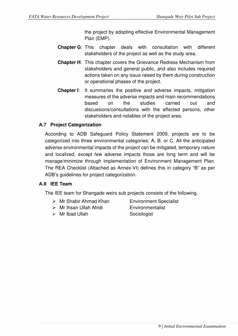
Project Categorization
According to ADB Safeguard Policy Statement 2009, projects are to be
categorized into three environmental categories; A, B, or C. All the anticipated
adverse environmental impacts of the project can be mitigated, temporary nature
and localized, except few adverse impacts those are long term and will be
manage/minimize through implementation of Environment Management Plan.
The REA Checklist (Attached as Annex-VI) defines this in category “B” as per
ADB’s guidelines for project categorization.
IEE Team
The IEE team for Shangade weirs sub projects consists of the following.
Mr Shabir Ahmad Khan Environment Specialist
Mr Ihsan Ullah Afridi Environmentalist
Mr Ibad Ullah Sociologist

FATA Water Resources Development Project Shangade Weir Pilot Sub Project
10 | Initial Environmental Examination
POLICY, LEGAL AND ADMINISTRATIVE FRAMEWORK
General
This section provides an overview of the policy framework and national
legislation that applies to the proposed sub-project. The project is expected to
comply with all national legislation relating to environment in Pakistan and
ADB`s Environment Safeguards Policy Statement (SPS) 2009.
National Policy and Legal Framework
NEP is the primary policy of Government of Pakistan addressing
environmental issues. The broad Goal of NEP is, “to protect, conserve and
restore Pakistan’s environment in order to improve the quality of life of the
citizens through sustainable development”. The NEP identifies a set of
sectorial and cross-sectorial guidelines to achieve its goal of sustainable
development. It also suggests various policy instruments to overcome the
environmental problems throughout the country.
Prior to the adoption of the 18th Constitutional Amendment, the Pakistan
Environmental Protection Act (PEPA) 1997 was the governing law for
environmental conservation in the country. Under PEPA 1997, the Pakistan
Environmental Protection Council (PEPC) and Pakistan Environmental
Protection Agency (EPA) were primarily responsible for administering PEPA
1997. After the adoption of the 18th Constitutional Amendment in 2011, the
subject of environment was devolved and the provinces have been
empowered for environmental protection and conservation.
Regulations for Environmental Assessment, Pakistan EPA
Under Section 12 of the Pakistan Environmental Protection Act 1997, a project
falling under any category specified in Schedule I (SRO 339, 10/2000) requires
the proponent to file an Initial Environment Examination (IEE) report with
concerned provincial or federal Environmental Protection Agency (EPA).
Projects falling under any category specified in schedule II, the proponent shall
submit an EIA with the Provincial or federal Agency, in this case Pakistan
Environmental Protection Agency (Pak-EPA) Islamabad, as the project is
located in FATA. Within 10 working days of IEE or EIA having been deposited,
the concerned agency will confirm that the document submitted is complete for
the purpose of review. During this time should the empowered agency require
the proponent for revision, clearly citing those aspects that need further
discussion the proponent will carry out necessary revision. Subsequently, the
concerned agency will make every effort to complete the process for an IEE
review within 45 days and an EIA within 90 days of filing and issue a “No-
Objection Certificate” to the project proponent.

FATA Water Resources Development Project Shangade Weir Pilot Sub Project
11 | Initial Environmental Examination
Regulatory Clearances, EPA
In accordance with regulatory requirements, an IEE/EIA satisfying the
requirements of the Pakistan Environmental Protection Act is to be submitted
to Federal Environment Protection Agency for review and approval, and
subsequent issuance of NOC before the commencement of construction.
Guidelines for Environmental Assessment, Pakistan EPA
The Pak-EPA has published a set of environmental guidelines for conducting
environmental assessments and the environmental management of different
types of development projects. The guidelines that are relevant to the
proposed sub-project are listed below:
• Guidelines for the Preparation and Review of Environmental Reports, Pakistan, EPA1997;
• Guidelines for Public Consultations; Pakistan EPA May 1997;
Pakistan Environmental Protection Agency Review of IEE and EIA
Regulations, (2000)
The Regulation classifies projects on the basis of expected degree of adverse
environmental impacts and lists them in two separate schedules. Schedule I
lists projects that may not have significant environmental impacts and
therefore require an IEE. Schedule II lists projects of potentially significant
environmental impacts requiring preparation of an EIA. The Regulations also
require that all projects located in environmentally sensitive areas require
preparation of an EIA. It also lists projects not requiring either an EIA or an
IEE.
National Environmental Quality Standards (NEQS)
The National Environmental Quality Standards (NEQS) were first promulgated
in 1993 and have been amended in 1995 and 2000. They have been revised
and the latest NEQS were issued in 2010.These standards are also stringent
with the International NEQs Regulation. The following standards that are
specified in the NEQS are relevant to the proposed Sub Project.
• NEQS for Ambient Air – November, 2010 state the Maximum allowable
concentration of pollutants (9 parameters) in gaseous emissions from
vehicle exhaust.
• NEQS for Drinking Water Quality – 2010 describe the drinking water
properties by outlining the defined physical and chemical parameters.

FATA Water Resources Development Project Shangade Weir Pilot Sub Project
12 | Initial Environmental Examination
• NEQS for Noise – November 2010 states the maximum allowable limit
of noise arising from vehicles in decibels (dB) separately for day and
night times.
• NEQS for Waste Effluents –2000 states the Maximum allowable
concentration of pollutants (32 parameters) in municipal and liquid
industrial effluents discharged to inland waters, sewage treatment
facilities and the sea.
• These standards apply to the gaseous emissions and liquid effluents
discharged by, campsites and construction machinery. The standards
for vehicles will apply only during the construction phase of the Sub
Project. Standards for ambient air quality have also been prescribed.
(Reference Annex III for NEQS).
Comparative Analysis of the National and International Standards
1. A comparison of applicable local and international guidelines for air quality has
been provided in Table 2.1 In general, the NEQS standards for air quality are most
stringent in comparison to USEPA, WHO and the World Bank standards. The only
exception is the TSP parameter for the annual mean where the World Bank
standard (100 ug/m3) is more stringent than the NEQS standard (360 ug/m3). Apart
from this one exception, the NEQS standards will also be used for the proposed
project.
2. Similar to the standards for air quality, the comparison of noise standards provided
in Table 2.2 clearly shows that NEQS standards for noise in case of commercial
areas are more stringent in comparison to the World Bank/IFC standards. In case
of night time standards for the residential areas, the IFC/WHO standards are more
stringent as compared to Pak NEQS. Apart from this one exception, the NEQS
standards will be used for the proposed project.

FATA Water Resources Development Project Shangade Weir Pilot Sub Project
13 | Initial Environmental Examination
Table 2.1 Comparison of International and local Air Quality Standards
Pollutants
USEPA1 WHO2 World Bank3 Pak. NEQS
Avg. Time
Standard Avg. Time
Standard Avg. Time
Standard Avg. Time
Standard
SO2 1 hr
3hrs
Primary- 75 ppb
Secondary- 0.5 ppm (1,300 μg/m³)
24-hour mean
20 μg/m3
Annual Mean
125 (Interim target-1)
50 (Interim target-2)
20 (guideline)
Annual Average
80 ug/m3
10-minute mean
500 μg/m3
24 hrs 120
ug/m3
10 minutes
500 ug/m3
CO
1 hr
8 hrs
Primary 35 ppm
(40 mg/m³)
Primary 9 ppm
(10 mg/m³)
8 hrs
10 mg/m3
(8.7 ppm)
- -
8 hrs 5 mg/m3
40 mg/m3 1 hr 10
mg/m3
1 hr
NO2 Annual Mean
Primary & Secondary- 0.053 ppm
(100 μg/m³)
annual mean
1-hour mean
40 μg/m3
200 μg/m3
Annual Mean
40 (guideline)
200 (guideline)
Annual Average
40 ug/m3
24 hrs 80 ug/m3
O3
1 hr
8 hrs
Primary & Secondary- 0.12 ppm
(235 μg/m³)
Primary &
Secondary- 0.070 ppm
(140 μg/m³)
- - 1 hr 130
ug/m3 8 hrs mean
100 μg/m3
TSP 24 hrs 260 ug/m3 24 hrs 150-230 ug/m3
Annual Mean
100 ug/m3 Annual Mean
360 ug/m3
24 hrs 500 ug/m3 24 hrs 500
ug/m3
1 Source- https://en.wikipedia.org/wiki/National_Ambient_Air_Quality_Standards retrieved on 15th January, 2018. 2 Source-http://www.who.int/mediacentre/factsheets/fs313/en/ retrieved on 15th January, 2018. 3 Source-IFC Environmental, Health, and Safety Guidelines-GENERAL EHS GUIDELINES: ENVIRONMENTAL AIR EMISSIONS AND AMBIENT AIR QUALITY, April 2007.

FATA Water Resources Development Project Shangade Weir Pilot Sub Project
14 | Initial Environmental Examination
Pollutants
USEPA1 WHO2 World Bank3 Pak. NEQS
Avg. Time
Standard Avg. Time
Standard Avg. Time
Standard Avg. Time
Standard
PM10 24 hrs 150 μg/m³
Primary and
Secondary
annual mean
24-hour mean
20 μg/m3
50
μg/m3
1 year
24 hours
70 (Interim target-1) 50 (Interim target-2) 30 (Interim target-3)
20 (guideline)
150 (Interim target-1) 100 (Interim target-2) 75 (Interim target-3)
50 (guideline)
Annual Mean
120 ug/m3
24 hrs 150
ug/m3
PM2.5
-Annual
Annual
24 hrs
-Primary 12 μg/m³
Secondary 15 μg/m³
Primary & Secondary 35 μg/m³
annual mean
24-hour mean
10 μg/m3
25 μg/m3
- -
Annual Average
15 ug/m3
24 hrs 35 ug/m3
1 hr 15 ug/m3
Note: I ug/m3 = 0.002ppm
Table 2.2: Comparison of International and local for Noise-Limit in dB(A) Leq
NEQS (Effective form July, 2012) IFC & WHO
S.No Category of
Area/Zone
Day time Night time Receptor Day time
(7-00:22-
00)
Night time
(22:00-7:00)
1 Residential Area (A) 55 55 Residential;
institutional;
educational4
55 45
2 Commercial Area (B) 65 45 Industrial;
commercial
70 70
3 Industrial Area (C) 75 65
4 For acceptable indoor noise levels for residential, institutional, and educational settings refer to WHO (1999).

FATA Water Resources Development Project Shangade Weir Pilot Sub Project
15 | Initial Environmental Examination
4 Silence Zone (D) 50 45
ADB’s Safeguard Policy Statement (SPS), 2009
The Asian Development Bank’s Safeguard Policy Statement (SPS) 2009 requires
that environmental considerations be incorporated into ADB’s funded project to
ensure that the project will have minimal environmental impacts and be
environmentally sound. Occupational health & safety of the local population
should also be addressed as well as the project workers as stated in SPS.
All loans and investments are subject to categorization to determine
environmental assessment requirements. Categorization is to be undertaken
using Rapid Environmental Assessment (REA) checklists, consisting of
questions relating to (i) the sensitivity and vulnerability of environmental
resources in Sub Project area, and (ii) the potential for the Sub Project to cause
significant adverse environmental impacts. Projects are classified into one of the
following environmental categories:
Category A: A project is classified as category A if it is likely to have significant
adverse environmental impacts that are irreversible, diverse or unprecedented.
These impacts may affect an area larger than the sites or facilities subject to
physical works. An Environmental Impact Assessment (EIA) is required.
Category B: A project is classified as category B if its potential adverse
environmental impacts are less adverse than those of category “A” projects.
These impacts are site-specific, few, if any of them are irreversible, and in most
cases mitigation measures can be designed more readily than for category “A”
projects. An Initial Environmental Examination (IEE) is required.
Category C: A project is classified as category C if it is likely to have minimal or
no adverse environmental impacts. No environmental assessment is required
although environmental implications need to be reviewed.
Category FI: A project is classified as category FI if it involves investment of ADB
funds to or through a financial intermediary (FI).
As a result of the completion of the Involuntary Resettlement (IR) and Indigenous
People (IP) Checklist the sub project has been placed in Category “C” while in
Rapid Environmental Assessment (REA) checklist (Attached as Annex-V), the
Sub Project has been placed in Category ‘‘B’’ thus a detailed and comprehensive
IEE study has been prepared including the EMP.
Project Categorization
Under Section 12 of the Pakistan Environmental Protection Act 1997, a project
falling under any category specified in Schedule I (SRO 339, 10/2000) requires

FATA Water Resources Development Project Shangade Weir Pilot Sub Project
16 | Initial Environmental Examination
the proponent to file an Initial Environment Examination (IEE) report with
concerned provincial or federal Environmental Protection Agency (EPA). Projects
falling under any category specified in schedule II, the proponent shall submit an
EIA with the Provincial or federal Agency, in this case Pakistan Environmental
Protection Agency (Pak-EPA) Islamabad, as the project is located in FATA.
Within 10 working days of IEE or EIA having been deposited, the concerned
agency will confirm that the document submitted is complete for the purpose of
review. During this time should the empowered agency require the proponent for
revision, clearly citing those aspects that need further discussion the proponent
will carry out necessary revision. Subsequently, the concerned agency will make
every effort to complete the process for an IEE review within 45 days and an EIA
within 90 days of filing and issue a “No-Objection Certificate” to the project
proponent.
This project falls under schedule-I of the Pakistan Environmental Protection
Agency (Review of IEE & EIA) Regulations, 2000 in water management, dams,
irrigation and flood protection heading which states that dams and reservoirs with
storage volume less than 50 million cubic meters of surface area less than 8
square kilometers require an IEE.
IEE/EIA Regulations 2000, Schedule I IEE Required
Dams and reservoirs with storage volume less than 50 million cubic meters or surface area less than 8 square kilometers
Yes
Irrigation and drainage projects serving less than 15,000 hectares
Yes
Other Environment Related Legislations
The Table 2.3 provides a summary of all legislations, guidelines, conventions and
corporate requirements.
Table 2.3. Environmental Guidelines and Legislations
Legislation/Guideline Description
The Forest Act (1927) The Act empowers the provincial forest departments to declare any
forest area as reserved or protected. It empowers the provincial
forest departments to prohibit the clearing of forest for cultivation,
grazing, hunting, removing forest produce, quarrying and felling,
lopping and topping of trees, branches in reserved and protected
forests
The Antiquities Act (1975) It ensures the protection of Pakistan’s cultural resources. The Act
defines “antiquities” as ancient products of human activity,
historical sites, or sites of anthropological or cultural interest,
national monuments, etc. The Act is designed to protect these

FATA Water Resources Development Project Shangade Weir Pilot Sub Project
17 | Initial Environmental Examination
Legislation/Guideline Description
antiquities from destruction, theft, negligence, unlawful excavation,
trade, and export. The law prohibits new construction in the
proximity of a protected antiquity and empowers the GOP to
prohibit excavation in any area that may contain articles of
archaeological significance. Under the Act, the project proponents
are obligated to ensure that no activity is undertaken in the
proximity of a protected antiquity, report to the Department of
Archaeology, GOP, any archaeological discovery made during the
course of the project.
Pakistan Penal Code (1860) It authorizes fines, imprisonment or both for voluntary corruption or
fouling of public springs or reservoirs so as to make them less fit
for ordinary use.
The West Pakistan Fisheries
Act 1961
The Fisheries Act requires protection of public waters as habitat of
fish and other aquatic life. This is helping the Fisheries Department
to provide effective protection to the fish and other aquatic life in
the game Sanctuary upstream the barrage and the public waters
downstream the barrage. Fish is a food to a good number of
migratory birds.
The Public Health (Emergency
Provision) Act 1954 read with
West Pakistan Epidemic
Control Act 1958
These two laws cover the presentation and spread of human
diseases, safeguarding the public health and providing and
maintaining adequate medical services and other services
essential to the health of the communities in the project area.
Explosives Act 1884
Under the Explosives Act 1884, the Project Contractors are bound
by regulation on properly and securely handling, transporting and
using explosive during quarrying, blasting and other purposes.
NATIONAL ENVIRONMENTAL AND CONSERVATION STRATEGIES
National Conservation Strategy Before the approval of NEP, the National Conservation Strategy
(NCS) was considered as the Government’s primary policy
document on national environmental issues. At the moment, this
strategy just exists as a national conservation program. The NCS
identifies 14 core areas including conservation of biodiversity,
pollution prevention and abatement, soil and water conservation
and preservation of cultural heritage and recommends immediate
attention to these core areas.
Biodiversity Action Plan The plan recognizes IEE/EIA as an effective tool for identifying and
assessing the effects of a proposed operation on biodiversity.
Environment and Conservation There is a well-established framework for environmental
management in Pakistan. The Ministry of Environment deals with
environment and biological resources. Within the ministry, the NCS
unit established in 1992 is responsible for overseeing the
implementation of the strategy. Two organizations, the Pakistan
Environmental Protection Council (PEPC) and the Pak EPA are
primarily responsible for administering the provisions of the PEPA,
1997. The PEPC oversees the functioning of the Pak EPA. Its
members include representatives of the government, industry, non-
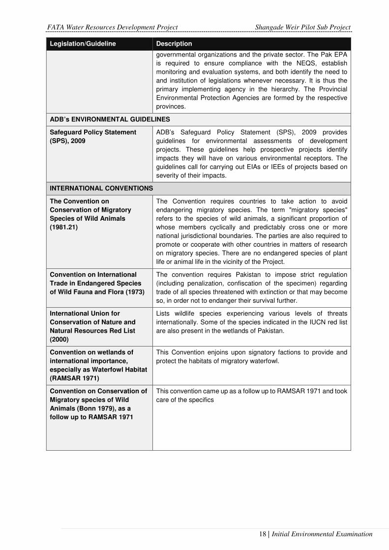
FATA Water Resources Development Project Shangade Weir Pilot Sub Project
18 | Initial Environmental Examination
Legislation/Guideline Description
governmental organizations and the private sector. The Pak EPA
is required to ensure compliance with the NEQS, establish
monitoring and evaluation systems, and both identify the need to
and institution of legislations whenever necessary. It is thus the
primary implementing agency in the hierarchy. The Provincial
Environmental Protection Agencies are formed by the respective
provinces.
ADB’s ENVIRONMENTAL GUIDELINES
Safeguard Policy Statement
(SPS), 2009
ADB’s Safeguard Policy Statement (SPS), 2009 provides
guidelines for environmental assessments of development
projects. These guidelines help prospective projects identify
impacts they will have on various environmental receptors. The
guidelines call for carrying out EIAs or IEEs of projects based on
severity of their impacts.
INTERNATIONAL CONVENTIONS
The Convention on
Conservation of Migratory
Species of Wild Animals
(1981.21)
The Convention requires countries to take action to avoid
endangering migratory species. The term "migratory species"
refers to the species of wild animals, a significant proportion of
whose members cyclically and predictably cross one or more
national jurisdictional boundaries. The parties are also required to
promote or cooperate with other countries in matters of research
on migratory species. There are no endangered species of plant
life or animal life in the vicinity of the Project.
Convention on International
Trade in Endangered Species
of Wild Fauna and Flora (1973)
The convention requires Pakistan to impose strict regulation
(including penalization, confiscation of the specimen) regarding
trade of all species threatened with extinction or that may become
so, in order not to endanger their survival further.
International Union for
Conservation of Nature and
Natural Resources Red List
(2000)
Lists wildlife species experiencing various levels of threats
internationally. Some of the species indicated in the IUCN red list
are also present in the wetlands of Pakistan.
Convention on wetlands of
international importance,
especially as Waterfowl Habitat
(RAMSAR 1971)
This Convention enjoins upon signatory factions to provide and
protect the habitats of migratory waterfowl.
Convention on Conservation of
Migratory species of Wild
Animals (Bonn 1979), as a
follow up to RAMSAR 1971
This convention came up as a follow up to RAMSAR 1971 and took
care of the specifics

FATA Water Resources Development Project Shangade Weir Pilot Sub Project
19 | Initial Environmental Examination
PROJECT DESCRIPTION
Project Features
The general layout of Shangade weir project includes the two weirs, irrigation
intake and outlet structures and irrigation network.
In locating the project features such as the topography, geology and geological
technical aspects play a major role, while the weir height, its sizing, design capacity
of the main canals and their alignment also have their own importance.
The Lashora Khwar flows are planned to be used for irrigation by constructing two
weirs, located at upstream of Walu Mela village and Gudar village in Khyber
agency. The weirs will divert perennial flows of springs to irrigate the command
area at downstream. For this purpose, Tyrolean type weirs are proposed in which
water is taken into a lateral channel connecting to Tyrolean part of the weir. It is
generally preferred in order to divert water in mountainous regions with steep
slopes where bed sediment concentration is rather high. To release the Lashora
khwar floods an overflow section is provided which will safely route such excess
flows downstream of the weir.
The catchment area of Lashora Khwar upto Walu Mela and Gudar weir sites are
29.30 and 40.90 square kilometers. The climate of the project area is semi-arid
and rainfall data of Peshawar for period of 1970-2015 is adopted for estimation of
hydrological parameters. Mean annual rainfall is 463 mm. Usual trend of rainfall
occurrence is during March-April and July-August. Perennial flow has been
observed from November, 2016 to April, 2017. About 14.5 litre per sec flow have
been measured during the period at each weir site which is utilized for diversion
for irrigation of 37 ha.
As per availability of perennial flow in Lashora Khwars two low height weirs are
proposed. The diversion weirs have been located at the minimum possible width
of the Lashora khwar. For the diversion of irrigation discharge Tyrolean type weirs
are adopted at both locations.
The Net length of Wale Mela weir is 22 m which includes 3 m long Tyrolean section.
Concrete apron and riprap (combined length of 6 m) has been proposed at
downstream for energy dissipation.
At Gudar weir site the adopted length for the weir is 40 m including 3 m Tyrolean
section. Due to 1 m height weirs at both locations only concrete apron and riprap
has been proposed at downstream for energy dissipation.
From weirs, downstream command area is 37 ha upto tail of Lashora Khwar.
Length of main conduit/minors are 6 km starting from weir downstream to tail it is
7.2 km. HDPE Pipes of 225 mm and 150 mm diameters are adopted for main and

FATA Water Resources Development Project Shangade Weir Pilot Sub Project
20 | Initial Environmental Examination
minor irrigation network. On farm water management work, should be laid and
constructed by mutual consent of community organization.
Figure 3.1: Walu Mela Weir Layout Plan
Figure 3.2: Gudar Weir Layout Plan
Shangade weirs project on account of its construction volume would not require
elaborate arrangements for construction of labour camps. Storage sheds for
TYROLEAN
STILLING BASIN
0.5
0
3.7
53.0
05.0
0
1.2122.00
3.00 3.00 16.00
0.5
0
SID
E W
AL
L
SID
E W
AL
L
CUTOFF WALL
P.C.C (1:3:6)1.3
10.3
0
SILT REMOVER
STOPLOG4.20
7.23
GUIDE WALL
WING WALL
1.21
STONE APRON G.I WIRE CRATE
0.5
0
GUIDE WALL
4.70
STILLING BASIN
TYROLEAN
4.50 3.00 34.00 1.50
0.5
0
3.7
54
.00
3.0
0
1.21
40.00
1.21
STOPLOG
SID
E W
AL
L
SID
E W
AL
L
SILT REMOVER
CUTOFF WALL
P.C.C (1:3:6)
1.3
1
3.00
STONE APRON G.I WIRE CRATE
5.75
2.0
0
0.3
0

FATA Water Resources Development Project Shangade Weir Pilot Sub Project
21 | Initial Environmental Examination
construction materials would be constructed in the vicinity of weir construction
sites. Non-technical labour to be engaged would be of local origin and as such
would not require housing. The contractor will make his own arrangements for the
technical staff and details will be provided in SSEMP.
All the land required for different project components is community owned barren
land which would be provided voluntarily; no land base infrastructure will be
affected during construction as well as operational phases of the project. The
permanent land for project components such as weir, water channels, offices, etc.
as well as temporary land will be taken on lease if required. The amount of lease
is part of project civil cost and is not added in Environmental Management Cost
(details in Chapter G) to avoid duplication of cost.
Table 3.1: Salient Features of the Project
Catchment Area at Wula Mela: 29.30 square kilometers
Catchment Area at Gudar: 40.90 square kilometers
Perennial flow at both weirs: 10-15 lit./sec each in low flow
Design Flood at Wula Mela: 233 cumec
Design Flood at Gudar : 267 cumec
Wula Mala Weir Length: 22 m
Guddar Weir Length: 40 m
Height of Weir: 1 m
Tyrolean Part at both weirs: 3 m
Pipe Type: HDPE
Command Area: 37 hectares (91 acres)
Irrigation Intensity: 127 %
Irrigation Channel Design discharge: 15.50 lit./sec
Dia of Main Pipe: 0.225 m
Length of Main Pipe: 5.70 km
Dia of Minor Pipes: 0.15 m
Length of Minor Pipe: 1600 m
Project Cost: Rs. 62.49 Million
Construction Period: 12 months
EIRR: 13.59 %
FIRR 12.19
The location of the project is shown in Figure 3.1 and Google Image in Figure 3.2:

FATA Water Resources Development Shangade Weir Pilot Sub Project
22 | Initial Environmental Examination
Figure 3.3: Project Location Map

FATA Water Resources Development Shangade Weir Pilot Sub Project
23 | Initial Environmental Examination
Figure 3.4: Satellite Image of the Project Area

FATA Water Resources Development Shangade Weir Pilot Sub Project
24 | Initial Environmental Examination
Figure 3.5: Schematic Map of Shangade Weirs

FATA Water Resources Development Shangade Weir Pilot Sub Project
25 | Initial Environmental Examination
Project Location
Khyber Agency is the tribal area in the Federally Administered Tribal Areas of
Pakistan created in 1873. It ranges from the Tirah valley down to Peshawar. It
borders Nangarhar Province in the west, Orakzai Agency in the south, Kurram
Agency in south west and Peshawar district in the east. Jamrud is headquarter of
the Khyber Agency. Khyber Agency lies between latitude 33˚ 43' to 34˚ 21' and longitude 71˚ 27' to 71˚ 32'. The Khyber Agency is drained by tributaries of the Kabul and Bara rivers. It covers an area of 2,576 km2.
Lashora Khwar on which two weir sites exist, is on North east, semi-arid part of
Khyber Agency. The proposed weirs on Lashora stream / khwar are located 12 km
North West of Jamrud Town (agency head quarter of Khyber Agency) near the
village of Walu Mela. First site (Shangade Weir) lies between 34˚ 2' 20.11” latitude and 71˚ 19' 51.17” longitude while second site (Gudar Weir site) is lies between
34˚ 1' 22.49” latitude and 71˚ 20' 52.63” longitude respectively.
Project Objectives
The main objective of the Shangade Weir Pilot Subproject (SWPS) is to divert
perennial runoff at two points for assured irrigation supplies to Culturable
Command Area (CCA) of approximately 37 ha downstream. Presently 4.16 ha of
the subproject area is developed/irrigated and the cropping intensity is very low,
that is 20.4 % annually. Regular and dependable irrigation water availability with
the construction of Shangade Weir will greatly increase cropping intensity to 120%
annually and production in the currently un-irrigated command area. Due to timely
and regulated water supplies there will be substantial improvement in agriculture
production. Provision of irrigation water with the construction of the weirs, will
transform the below subsistence level rain fed farming lands into productive
irrigated agriculture.
Construction Planning
The main components of Shangade weir irrigation project include the:
i. Geotechnical Investigation
ii. Foundation preparation
iii. Main Weir Embankment.
iv. Spillway with Stilling Basin at the downstream.
v. Intake and Outlet structure
vi. Irrigation system.
These components are proposed to be constructed in two stages. The
Geotechnical investigation will be carried out first, while construction of civil works

FATA Water Resources Development Shangade Weir Pilot Sub Project
26 | Initial Environmental Examination
will be carried out after design review. The stage wise break-up of components for
construction purposes is briefly described below:
Stage-I
Preparation of Foundation for Main Weir
The foundation preparation will involve excavation in stream/khwar bed and
abutments, which mostly constitute of shingle gravel and weathered rock
formation. Most of the excavation will be done without blasting, whereas in some
places-controlled blasting will be employed, avoiding shattering of rock formation.
The detail of excavation involved has been shown in the cross section provided in
Chapter 5 of Feasibility report.
Main weir (both) - Left Section
Construction of main weir embankments is proposed to commence from left and
right abutment towards the middle. The top of side wall from weir crest is 3.3 m
high at Walu Mela weir site, i.e fixed at elevation 513.3 m asl to prevent
overtopping in case of extreme flood conditions. Similarly, the side walls at
upstream and downstream of the weir have been extended into the rock on both
sides to minimize seepage around the weir ends.
The top of side wall from weir crest is 2.70 m high for Gudar weir, i.e. fixed at
elevation 460.5 m asl to prevent overtopping in case of extreme flood conditions.
Similarly, the side walls at upstream and downstream of the weir have been
extended into the rock on both sides to minimize seepage around the ends.
The HDPE Pipe Conduit will be laid through weir body and irrigation channel is to
be temporarily re-aligned to HDPE pipe conduit for maintaining irrigation flows.
Construction of intake and outlet structure will be taken up at later stage.
Table 3.2: Diversion Weirs Works and Quantities
Item # Description Unit Quantity
1
Excavation
cu.m 1860.98
2 Structural backfill using common Material available at site.
cu.m 329.31
3 Cement Concrete Work cu.m 865.2
8 Steel Work Tonne 52.16
9 Providing and Laying stone pithcing/filling, dry hand packed in pitching & aprons.
cu.m 196.06
10 Provide, install Lift gate assembly complete in all aspects as directed by the Engineer Incharge.
Kg 137.5
11 Providing, laying, jointing HDPE Pipe: dia 300 MM (Main Irrigation Pipe)
Rm 7.5

FATA Water Resources Development Shangade Weir Pilot Sub Project
27 | Initial Environmental Examination
Stage- II
Main Weir Body
Two low height weirs across Lashora khwar at suitable locations should be
constructed to utilize the perennial flow springs for irrigation. Considering the site
geology, topography and command area two weir site are selected. First site (Walu
Mela Weir site) is located near Walu Mela village, while second weir site i.e. (Gudar
Weir) is proposed at 1.8 km downstream near Gudar village.
The diversion weirs have been located at the minimum possible width of the
Lashora khwar. For the diversion of irrigation discharge Tyrolean type weirs are
adopted at both locations. The diversion weir comprises an overflow sections with
depressed Tyrolean section for flow diversion.
Construction of main weir body is proposed to commence from left and right
abutment in layers and intake pipe would be placed near right abutment in both
the weirs. Construction of Irrigation channel and outlet structure will be taken up
as parallel activities of this stage.
Stilling Basin
Terminal structures to weir are provided to safely deliver the excess discharge to
the downstream. The hydraulic jump stilling basin is one of the typical types of
energy dissipaters, which has been adopted for the project. At downstream of the
stilling basin, riprap has been proposed to protect the structure from scouring.
Construction of stilling basin will be started after construction of outlet structures.
Irrigation System
Commencement of activities for the construction of irrigation system will also take
place after construction of intake and gate valve structure. This activity will run
parallel to other activities onwards till final completion of weir body and other
appurtenant structures. Once the main Irrigation channel has been completed, the
beneficiaries will be provided with design and layout of field channels falling within
the proposed weir project. The activity would be mostly carried out by the
beneficiaries as part of their Labour and Land contribution.
Table 3.3: Personnel Requirement
Sr. No Position Nos
1 Project Manager / Project Engineer 01
2 Construction Supervisor 02
3 Site Engineer 01
4 Environmentalist 01

FATA Water Resources Development Shangade Weir Pilot Sub Project
28 | Initial Environmental Examination
5 Health and Safety Officer 01
6 Surveyor 02
7 Quantity Surveyor 01
8 Site Inspector (Environment) 01
9 Skilled Labor 05
Table 3.4: Equipment Requirements
Sr. No Equipment/Machinery Type Nos
1 Front End Loader 01
2 Excavator 01
3 Dumper 02
4 Water Tanker 02
5 Mixer 01
6 Generator 02
7 Tractor along with Trolley 01
Commissioning of Weirs
The weirs and its associated structures i.e. main irrigation channels and minor
distribution channels will be commissioned on completion of stage-II works and by
starting the perennial flow diversion.
Project Implementation
The Project implementation would be carried out in accordance with Project
Administration Manual (PAM) framed under FWRDP PPTA by Asian Development
Bank. The project construction would be completed in twelve (12) months.
Executing Agency
The FATA Secretariat will be the executing agency. A Project Management Unit
(PMU) will be established in the Planning and Development Department (P&D
Department) of the FATA Secretariat. Project implementing agencies include the
Directorate of Irrigation, which will be responsible for the improved irrigation
infrastructure and on-farm water management components with the latter effort
supported by the Department of Agriculture. The FATA Department of Forests will
be responsible for the watershed management component.
Design Consultant
The design and residency supervision of these subprojects would be carried out
by FWRDP design consultants. The consultants will carry out screening of the

FATA Water Resources Development Shangade Weir Pilot Sub Project
29 | Initial Environmental Examination
subprojects as per selection criteria. Accordingly, feasibility study of the
subprojects fulfilling the selection criteria would be framed.
FATA Development Working Party
The FATA Development Working Party (FDWP) would approve the feasible
subprojects of FWRDP. The FDWP would be delegated special powers to approve
FWRDP Subprojects costing more than the threshold approval limit of FDWP. The
project will also be implemented in cooperation with local community organizations
(COs) established under the FRDP and will be key partners in the new project.
The COs will enter into Terms of Partnership (TOPs) with the FATA Secretariat for
the preparation and implementation of all sub-projects to be financed under the
project. Such TOPs were already signed with COs for the 3 pilot subprojects, and
are the model to be followed for subsequent sub-projects. The COs also would be
responsible for maintenance of completed sub-projects under the main project.
Prior to the commencement of each proposed Subproject, the FATA Secretariat
and the relevant Community Organization will have entered into a Terms of
Partnership (“TOP”) setting forth, among other relevant terms, the details of the
preparation and implementation of such Subproject (including information on any
land to be voluntarily contributed by the community for such Subproject) and
subsequent operation and maintenance of the facilities financed under such
subproject, which such TOP will have been approved by the Political
Administration.
Terms of Partnership
TOP for a subproject involving the construction of a weir or irrigation channel will
stipulate that the relevant Community Organization will be responsible for
operation and maintenance of such weir or irrigation channel from such
Community Organization’s own funds, provided, that, any major repairs to such
facilities shall be carried out by, and at the expense of, the FATA Secretariat,
through its Irrigation Department.
Operation and Maintenance
The project has been designed to minimize manual operation to a minimum but
the main canal can be regulated for flows through vertical steel gate.
The beneficiaries have signed Terms of Partnership (TOP) with the Political
Administration of Khyber Agency and Irrigation Directorate, FATA. The TOP
clearly states the roles and responsibilities of each stake holder. Most of the O &
M activities at secondary and tertiary level would be carried out by the beneficiary
through Village Organization/CO.

FATA Water Resources Development Shangade Weir Pilot Sub Project
30 | Initial Environmental Examination
DESCRIPTION OF ENVIRONMENT
General
The purpose of this chapter is to establish baseline conditions for the
physical, biological and social aspects of the environment of project area.
The data were collected regarding the physical environment, biological
environment and social aspects of the study area from field surveys, desk
studies and visits to the Government departments, other relevant agencies,
and discussions with the main stakeholders of the area. The purpose of
baseline study is to fulfill the following objectives.
a. To get the data about the physical, biological and socio-
economic environment of the project area
b. To understand the current situation of the area
comprehensively.
c. To rationalize the decisions according to the ground realities.
Information sources for this IEE also include:
i. Water Assessment Study & Management Plan, Bajaur, Khyber and Mohmand, published by ADB and FATA Secretariat, produced under the ADB FATA Rural Development Project (FRDP)
ii. Forest Atlas of Pakistan
iii. GIS Database developed by the PPTA GIS Specialist
iv. Primary Surveys conducted under PPTA by Environment Specialist
v. Hydraulic Design Feasibilities conducted under PPTA by Hydraulic Design Specialist
vi. Agriculture and Geological Studies conducted under PPTA by Agricultural Specialist and Geologist
vii. IEE previously done by PPTA in 2014
The main environmental conditions, likely to be affected due to project
execution are:
a. Physical Environment
b. Biological Environment
c. Socio-economic Environment
Baseline Survey Methodology
A Survey was carried out in the project area for field studies including
physical, biological and social impact assessment on March, 2017. The visit
was made to the project area to understand the terrain, environment and

FATA Water Resources Development Shangade Weir Pilot Sub Project
31 | Initial Environmental Examination
social issues, and vegetation of the study area. During the visit, the
preliminary interpreted data were tested and necessary corrections made
after proper ground-truthing. The physiographic features on the satellite
imagery appearing in different tones and textures were used to correlate
image elements and ground features for accurate identification.
The purpose of the site visits was to familiarize with the physical, biological
and socioeconomic environment of the proposed project area and the areas
in the vicinity. Critical areas with respect to environmental and social
concerns were identified and assessment of positive as well as adverse
impacts of the project on the environment was done. A summary of the main
activities undertaken during the visit have been enlisted below:
i. Collected information and required data from the project area
for preparation of Initial Environmental Examination report.
ii. Identified site-specific issues of microenvironment of the
proposed project.
iii. Information obtained regarding existing infrastructure in and
around the project area.
iv. Requirements of necessary mitigation measures to be
integrated into the overall plan were identified.
v. Consultations with the population settled in the vicinity of the
project.
vi. Survey of nearby Environmental Sensitive receptors.
vii. Interviews of the local for the presence and relative abundance
of various animal species within each locality were also taken
to have firsthand information.
viii. Data collection was carried out on habitat condition, animal
presence by direct sighting and indirect evidences.
Spatial data base on the physiographic features was prepared based on the
various data sources including Survey map of the project and topographic
sheets. These data were extracted and presented in accordance with the
standard IEE methodology used for such studies.
The section on climatology has been taken from the Project Hydrology
Report made by project Hydrologists.
The regional geology and seismo-tectonics of the region are discussed
based on the various available data sources and reports. Particularly, the
discussion on Project geology has been based on the data available in the
Project Geology Report and field observations made in selective pockets of
different project affected sites.

FATA Water Resources Development Shangade Weir Pilot Sub Project
32 | Initial Environmental Examination
Land use and land cover mapping was carried out by standard methods of
analysis of remotely sensed data followed by ground truthing.
Forest types and plant species were recorded during the field visits and the
floristic data for the catchment were sourced from the published literature.
Based on the field data and available literature, frequency, density and cover
of each species were calculated.
Ecological status of species was identified as per IUCN Red list, 2017 and
other available literature.
In order to collect the information on the fauna (mammals, avifauna,
herpetofauna) in the area, primary as well as secondary sources were
utilized.
The environmental testing (Air, Noise and Water) at site has been carried
out to determine the baseline conditions of the area.
Study Area
The studied area for this IEE was broadly the Khyber Agency (Figure 4.1),
and more specifically sub-project location including Shangade settlement
and the catchment of the two streams on which SWPS is proposed to be
constructed. The Khyber Agency owes its name to the world’s famous
Khyber Pass which leads from Central Asia to Indo-Pak sub-continent. This
historic pass is situated at 1070 m above the mean sea level. It is integral
part of the ancient Silk route. Throughout the history, it has been an
important trade route between Central Asia and Indian Sub-continent.
The project study area primarily includes of the springs in the immediate
vicinity, which will be impacted directly or indirectly by the project. The
required information/ data of a baseline study were classified into two main
categories i.e. Primary data and Secondary data. The primary data was
collected directly from the concerned communities and direct observation,
secondary data was the information gathered through secondary sources
such as census report, research publications, topographic sheets, other
published data related to the project such as wildlife, livestock, fishery,
forestry, agriculture, horticulture, climate etc.
The project Area of influence (AoI) is referred to all those areas in the region
within 0.5 km from the project corridor and which may be affected directly or
indirectly by the project activities.
FATA has a unique governance status in Pakistan, with limited presence of
state functionaries at the local level, especially line departments for
environmental management. Apart from PEPA and Pakistan Trade Control
of Fauna and Flora Act, 2012, none of the other laws pertaining to

FATA Water Resources Development Shangade Weir Pilot Sub Project
33 | Initial Environmental Examination
environmental management govern these territories. Hence, there is
extremely limited information on species distribution and abundance in the
region. There are no baselines for wild flora and fauna species, and
secondary information is scanty and dispersed. FATA Secretariat has a
Forestry Unit, which is only involved in afforestation activities, and maintains
basic data of forest area in the region. However, management of the
available forests and rangelands is under tribal control, as there are no state
designated reserves or protected areas. The only data available on water,
soil, agriculture, climate and watersheds is from the Water Assessment
Study and Management Plan5.
For the purpose of this IEE, detailed deliberations were held with relevant
stakeholders from the state, civil society and academia. A focused primary
survey was also conducted to ascertain species distribution and abundance
along with a very basic social mapping exercise.
As a result, an effort was made to establish a baseline or state of
environment for the three selected agencies, with a focus on sub-project site
locations. Having stated the above, there are still limitations to the accuracy
and authenticity, since in numerous cases, sources for data are singular and
cannot be cross verified due to paucity of reliable sources.
5 Water Assessment Study & Management Plan, Bajaur, Khyber and Mohmand, published by ADB and
FATA Secretariat, produced under the ADB FATA Rural Development Project (FRDP)

FATA Water Resources Development Shangade Weir Pilot Sub Project
34 | Initial Environmental Examination
Figure 4.1: Map of Khyber Agency

FATA Water Resources Development Shangade Weir Pilot Sub Project
35 | Initial Environmental Examination
Physical Environment
Topography
Khyber Agency is a tribal area in the Federally Administered Tribal
Areas region of Pakistan. It is one of the eight tribal areas, better known as
agencies in Pakistan. It ranges from the Tirah valley down to Peshawar. It
borders Nangarhar Province to the west, Orakzai Agency to the
south, Kurram Agency to south west and Peshawar to the east. An
interesting feature in the topography is a mountain spur from the Kunar
range, which, curving eastwards culminates in the well-known peak of Koh-
i-Mor, which is visible from the Peshawar valley. The topography of this pass
is prevailingly hilly, with rugged barren mountainous terrain, including narrow
strips of bottom valleys and sub valleys. The primary ecological factors
which determine the plant communities/association in this eco –zone are,
rainfall & temperature, topography and soil and elevation.
Climate
The Area falls in the cool sub-humid climatic zone associated with 500-1000
mm of annual precipitation. There are two distinct rainy seasons in the Area:
winter (December through March) and summer (June- September). There is
commonly a weak monsoon in July. During April and May, October and
November the weather remains dry. Winds are generally from a northerly
direction in winter and from the Southwest in summer.
The Project Area has a variable climate with cold winters and hot summers.
During summer months there is great fluctuation in diurnal temperature in
the open and in the shade of hilly areas. During summer, temperatures can
reach 40oC but summer nights are relatively cool. In the winter at higher
elevations the COI may experience snow from late December to mid-
February.
The mean maximum temperature during the hottest months of June and July
are 38 °C and 28 °C respectively. December and January are the coldest
months with mean minimum temperature of about 12 °C and 9 °C6.
The nearest station to the project area is Peshawar. The graphical
presentation of mean monthly with minimum and maximum temperature for
Peshawar is provided in figure 4.2 below.
6 Hydrological studies Feasibility Report (Data Source: Met office Peshawar)

FATA Water Resources Development Shangade Weir Pilot Sub Project
36 | Initial Environmental Examination
Figure 4.2 Mean Monthly Temperature7
Hydrology
The estimation of water availability has also been carried out indirectly by
Soil Conservation Services Curve Number (SCS) method. Perennial flow in
low flow season September to February and high flow in March to August is
added in estimated flow. Curve number of 51, 70 and 85 for AMC-I, AMC-II
and AMC-III conditions are used. As Peshawar rainfall data is representing
the project area rainfall, water availability is estimated without any
adjustment / correction factor.
The catchment area of Lashora Khwar upto Walu Mela and Gudar weir sites
are 28 and 43 square kilometers. The climate of the project area is semi-arid
and rainfall data of Peshawar for period of 1970-2015 is adopted for
estimation of hydrological parameters. Mean annual rainfall is 463 mm.
Usual trend of rainfall occurrence is during March-April and July-August.
Perennial flow has been observed from November, 2016 to April, 2017.
About 14.5 litre per sec flow have been measured during the period at each
weir site which is utilized for diversion for irrigation of 37 ha. Due to no
storage and low hazard potential associated with weir structure 50 year
return period design flood of 233 and 267 cumec have been estimated by
SCS unit hydrograph method.
7 Data Source: Met office Peshawar

FATA Water Resources Development Shangade Weir Pilot Sub Project
37 | Initial Environmental Examination
The perennial flow will be partially diverted and after some short distance
from weir site the environmental flow will be available. Moreover, all these
schemes are community based construction, where the construction of
channels were made according to the local community demand, considering
their other water uses if any like water supply etc. The fish is not present,
while the use of water by other habitat will meet by irrigation water channel.
Regional Geology
The Khyber Agency in which Walu Mela & Gudar weirs has been proposed
lies in the region which is close to the collision zone of the Indian and
Eurasian Plates; the collision process started in the late Eocene to Early
Oligocene with the formation of Himalayan Ranges and this process is still
going on. Relative to Eurasia, the Indian Plate is still moving northward at a
rate of about 4 cm/yr. The subduction of the Indian Plate beneath the
Eurasian Plate has resulted in folding and thrusting of the upper crustal
layers near the collisional boundary. The thrusting has been depicted from
north to south in the shape of Main Karakoram Thrst (MKT), Main Mantle
Thrust (MMT) and Salt Range Thrust (SRT).
Geology of the Project Area
The topography of the project area is rugged having moderate to high relief.
At some places the topographic conditions are quite favorable for siting
concrete gravity dams or weirs in narrow valleys with ample place upstream
for water storage. Lashora Khwar exhibits a “V” shaped valley which
indicates a mature age. The Lashora Khwar has a bed slope of 2.83 %. The
highest point in the water shed is at 1354.53 masl, whereas at Walu Mela
weir the streambed is 508.54 masl and at Gudar Weir it is 456.19 masl. The
vegetation cover of the catchment is poor8.
Soil
The soils command area is of piedmont plain, coarse to medium in texture,
and light brown in colour. The profile depth is shallow and mostly immature
soil development, gently to moderate sloping and well drained. The pH and
electrical conductivity is 8.60 and 0.21 ds/m respectively. The soil is light
textured i.e. sandy loam, with low organic matter and NPK9. The project
surface soils are loam and sandy loam, while the sub surface soil is loamy
sand. The limitations in the area are irregular topography, gravels and rapid
permeability.
8 Geological Studies Section of Feasibility Report 9 The soil textural classes, chemical and physical properties tests were carried out at the soil labatory ARI, Tarnab
Government of KPK, January 2014.

FATA Water Resources Development Shangade Weir Pilot Sub Project
38 | Initial Environmental Examination
Seismology
Figure 4.3 shows the tectonic map of the area. The project area falls in minor
to moderate seismic zone. Formations in the study area are highly folded
and faulted due to tectonic movement. A large variety of rocks occur together
in a very disturbed manner. The country rocks are diorites, granite phyllites
and amphibolites with limestone, schist and phyllites.

FATA Water Resources Development Shangade Weir Pilot Sub Project
39 | Initial Environmental Examination
Figure 4.3: Tectonic Map of Pakistan10
10 Source: Pakistan Meteorological Department

FATA Water Resources Development Shangade Weir Pilot Sub Project
40 | Initial Environmental Examination
Ambient Air Quality and Noise
Sources of air and noise pollution around the sub-project area are minimal.
The area is predominantly rural, with no major industrial setups. The NEQS
for noise in residential areas is 55 dB (A) in the day time and 45 dB (A) at
night. Traffic is low, with heavy traffic being minimal. The ambient air quality
and noise at site was conducted at a 10 m distance from the main subproject
axis as most of the construction activities will be done here while the
residential area is at distance of more than 500 m where the impact of all
the construction activities will be minimum. The sampling location (Figure
4.4) were selected keeping in view;
(a) the Sensitive Receptors and
(b) magnitude of construction activities.
These locations will be helpful for construction phase impacts monitoring
and comparison of the results with the baseline situation. The result (Table
4.1 and 4.2) reveals that the air quality and noise of the area is within the
permissible limits of NEQS.
Table 4.1: Ambient Air Quality and Noise of Gudar Weir
Sr. No.
Parameter UoM Results NEQS IFC Method
1 Carbon Monoxide (CO)
µg/m3 0.0 10 - Electrochemical
2 Sulfur Dioxide (SO2)
µg/m3 1.2 120 125 Electrochemical
3 Nitrogen Oxide (NO)
µg/m3 2.2 40 - Electrochemical
4 Nitrogen Dioxide (NO2)
µg/m3 19 80 - Electrochemical
5 PM10 µg/m3 45 150 150 Light Scattering
6 Ozone (O3) µg/m3 3.8 130 160 Electrochemical
7 Noise dB(A) 38.5 55 55 Digital Sound Meter

FATA Water Resources Development Shangade Weir Pilot Sub Project
41 | Initial Environmental Examination
Table 4.2 Ambient Air Quality and Noise of Shangade Weir
Sr. No. Parameter UoM Results NEQS IFC Method
1 Carbon Monoxide (CO)
µg/m3 0.0 5 - Electrochemical
2 Sulfur Dioxide (SO2)
µg/m3 1.1 120 125 Electrochemical
3 Nitrogen Oxide (NO)
µg/m3 3.1 40 - Electrochemical
4 Nitrogen Dioxide (NO2)
µg/m3 18 80 - Electrochemical
5 PM10 µg/m3 50 150 150 Light Scattering
6 Ozone (O3) µg/m3 10.0 130 160 Electrochemical
7 Noise dB(A) 40.1 55 55 Digital Sound Meter

FATA Water Resources Development Shangade Weir Pilot Sub Project
42 | Initial Environmental Examination
Figure 4.4 Environmental Testing and Sampling Map

FATA Water Resources Development Shangade Weir Pilot Sub Project
43 | Initial Environmental Examination
Water Resources
Surface Water
Shangade Khwar/stream, where SWPS will be constructed, falls within the
Koki Khel watershed. The Water Assessment Study & Management Plan,
published by FATA Secretariat and ADB in 2010 is the most detailed and
reliable study conducted for water resources development and management
for the three agencies of FATA. There are a number of rivers and their
tributaries in the project area of Khyber Agency (as shown in figure) that
have perennial flow from snow melt.
The following major rivers flow through the project area of Khyber agency:
Kabul River originates from Chitral, and enters Afghanistan at Arandu,
making a semi-circle around Kabul City reaches in the vicinity of Jalalabad
where it is called Kunar River. Of late, Government of Afghanistan has
planned a multipurpose dam at Kama village near Jalalabad. The proposed
Kama dam is expected to irrigate about 40,486 ha in Kunar province. The
proposed Kama dam will reduce the flows in Kabul River by 15%. The
construction of proposed Munda dam on Swat River which is a tributary of
Kabul River will mitigate the effects of 15% reduction of flows in Kabul River
due to Kama dam in Afghanistan. Kabul River re-enters Pakistan in
Mohmand Agency and after traversing a few kilometers it turns into a
boundary river between Mohmand and Khyber agencies.
Bara River originates in the southeast of Khyber Agency from Rajgal and
Malik Din Khel watersheds. It drains into the Kabul River near Nissata, after
passing through the settled areas. There are three canals off-taking from the
river, within and outside Khyber Agency.
Ground Water
The project area experiences two rain seasons: winter and summer. Water
supply is from rainfall, snow melt, and groundwater during the dry periods.
Area is a rain fed (barani) area. Depth to water table generally varies from
13 to 50 meters below ground level in barani areas whereas it is within 10 m
in irrigated areas.
The occurrence of groundwater particularly in barani areas is controlled by
hydro-geologic and climatic conditions. Rainfall is the main source of
groundwater recharge. Deep percolation from fields and stream losses at
various stages of flow coupled with varying properties of the upper soil strata
and the underground aquifer are responsible for varied availability of
groundwater across the district.

FATA Water Resources Development Shangade Weir Pilot Sub Project
44 | Initial Environmental Examination
Groundwater is usually found at a depth of 55 - 70 meters, where annual
recharge is 85.41 MCM for an average year, 46.18 for a dry year and 146.06
MCM for a wet year.
Water Quality
The surface water samples 10 m upstream of weir axis and drinking water
samples from nearest settlements (Figure 4.4) of the subproject area were
collected and analyzed in the Laboratory. The result reveals that the water
is fit for irrigation (Table 4.3 and Table 4.4), while the drinking water quality
is not fit for drinking purposes with respect to biological analyses as the
water is biologically contaminated (Tables 4.5 & 4.6). This requires proper
treatment like chlorination or passing through ultra violet rays etc.
Table 4.3: Water Quality analysis result for Irrigation water of Gudar Weir
Sr. No Parameters UoM Methods NEQS Results
1 pH -- APHA 6.5-8.5 8.03
2 Total Dissolved
solids (TDS)
mg/L APHA <1000 290
3 Carbonate mg/L APHA -- 24
4 Sulphate mg/L AOAC <250 67.4
5 Nitrogen-Nitrates
mg/L APHA Max 50 2.8
6 Turbidity NTU HACH <5 0.138
Table 4.4: Water Quality analysis result for Irrigation water of Shangade
Weir
Sr. No Parameters UoM Methods NEQS Results
1 pH -- APHA 6.5-8.5 7.56
2 Total Dissolved
solids (TDS)
mg/L APHA <1000 307
3 Carbonate mg/L APHA -- 24
4 Sulphate mg/L AOAC 250 61.1
5 Nitrogen-Nitrates
mg/L APHA Max 50 2.3

FATA Water Resources Development Shangade Weir Pilot Sub Project
45 | Initial Environmental Examination
6 Turbidity NTU HACH <5 0.124
Table 4.5: Water Quality analysis result for Drinking water of Gudar
Sr. No
Parameters UoM Methods NEQS WHO Results
1 Total Coli form
Cfu/100mL EPA 0 0/100 ml 35
2 E.coli Cfu/100mL EPA 0 0/100 ml <1
3 pH -- APHA 6.5-8.5 6.5-8.5 8.29
4 Total Dissolved
solids (TDS)
mg/L APHA <1000 <1000 225
5 Total Hardness as
CaCO3
mg/L APHA <500 <500 238
6 Sodium mg/L FAAS 200 200 16.8
7 Potassium mg/L FAAS 12 -- 1.2
8 Sulphate mg/L AOAC 250 0.01 17.3
9 Chloride mg/L APHA 250 250 7.27
10 Alkalinity mg/L APHA <500 -- 226
11 Color -- APHA Non-objectionable
<15 Complies
12 Odor -- APHA Non-objectionable
Not Objectionable
Complies
13 Taste -- APHA Non-objectionable
-- Complies
14 Nitrogen-Nitrates
mg/L APHA <50 50 3.0
15 TSS mg/L APHA <5 5 ND

FATA Water Resources Development Shangade Weir Pilot Sub Project
46 | Initial Environmental Examination
Table 4.6: Water Quality analysis result for Drinking water of Shangade
Sr. No
Parameters UoM Methods NEQS WHO Results
1 Total Coli form
Cfu/100mL EPA 0 0/100 ml 2.2×10²
2 E.Coli Cfu/100mL EPA 0 0/100 ml <1
3 pH -- APHA 6.5-8.5 6.5-8.5 8.02
4 Total Dissolved
solids (TDS)
mg/L APHA <1000 <1000 283
5 Total Hardness as
CaCO3
mg/L APHA <500 <500 306
6 Sodium mg/L FAAS 200 200 17.5
7 Potassium mg/L FAAS 12 -- 2.5
8 Sulphate mg/L AOAC 250 0.01 47.1
9 Chloride mg/L APHA 250 250 12.6
10 Alkalinity mg/L APHA <500 -- 254
11 Color -- APHA Non-objectionable
<15 Complies
12 Odor -- APHA Non-objectionable
Not Objectionable
Complies
13 Taste -- APHA Non-objectionable
-- Complies
14 Nitrogen-Nitrates
mg/L APHA <50 50 1.9
15 TSS mg/L APHA <5 5 ND
Biological Environment
The natural environment of the Project area has undergone severe
degradation due to intensive use of ground water resources, miss
management of watershed resources, over grazing of range lands and
uncontrolled cutting of forest trees11. The agriculture, irrigation, forest range,
11 PC-I Proforma for Fata Water Resources Development Project (FWRDP)

FATA Water Resources Development Shangade Weir Pilot Sub Project
47 | Initial Environmental Examination
and forestry interventions in terms of tree plantation in the Project area will
restore the lost eco-systems.
Land use and Land Cover
The data pertaining to land use are required to understand that how much
area at present is put directly under different crops. Culturable area,
cultivated and unculturable areas are also known to see the extent of
increase in cropped area, which may be achieved with the provision of
project conditions. Similarly, culturable waste and forest, if any, are also
taken into considerations. The statistics regarding the present land use in
the study area are presented in Table 4.7.
Table 4.7: Land Use Statistics of Project Area12
Khyber Agency Area in Hectares
Total Reported Area 257676
Cultivated Area 21578
(i) Net Sown 15850
(ii) Current Fallow 5728
Cropped Area 21037
Un-Cultivated Area 236098
(i) Culturable Waste 51672
(ii) Forest 2077
(iii) Not Available for Cultivation 182349
Agriculture is limited in the region due to rocky soils, steep slopes, lack of
suitable land and limited water supply. Scanty shrub vegetation along
slopes and other areas are used as grazing and fuel wood gathering. Land
use and land cover of the sub project are depicted in figure below:
12 Source: Development Statistics of FATA (2012-13 to 2014-15)

FATA Water Resources Development Shangade Weir Pilot Sub Project
48 | Initial Environmental Examination
Figure 4.5: Land use Map of Shangade

FATA Water Resources Development Shangade Weir Pilot Sub Project
49 | Initial Environmental Examination
Flora
The forests being an integral part of
rural economy provide critical
ecological services. Healthy forest
cover helps water retention, control
flash floods and soil erosion,
provides a habitat for flora and
fauna and contributes to a clean
environment. Due to more
dependence of the rural population
on the available scanty forest
resource, the environmental
services provided by natural ecosystems have also diminished. The water
retention capacity of the soil has fallen; the area suffers both from flash
floods and long period of drought.
Ecologically, this area falls within the main group of Dry Subtropical Broad-
leaved Forest 13 . The sub –group is Monotheca Scrubs. Generally, the
vegetation is thorny evergreen shrubs, which are capable of developing into
small trees, even under harsh climatic conditions and social pressure (heavy
grazing /browsing).
The main tree species are, Monotheca buxifolia (Gurgura), Zizyphus
nummularia (Ber), Acacia modesta (Phulai), Olea cuspidate (wild olive),
prosopis spp (mesquite), tamarix spp (Farash) and Dodonaea viscose
(Sanatha). Some important shrubs are, Adhatoda vasica (Bahker),
Calotropis spp (ak), Rhazya spp (vena), Rumex hastatus (khatumaal),
Carrisa spp (granda) and Capparis spp (karir). The common grasses are
Heteropogon, Cymopogon, Saccharum clumps (munja). The ground
vegetation makes appearance after the spring rains in the month of January
and February. Some of the tree species, which have been planted by the
forest department and local community are, eucalyptus, bakian, mulberry,
shisham and poplar.
No endangered species have been reported in the project area by the locals.
Project area and the study area are free of forest cover. Overall natural
vegetation, including shrubs, bushes and grasses can be aptly termed as
potential rangelands which provide grazing habitat for livestock. Following
are some species of trees and shrubs found in the project area:
13 (Forest Types of Pakistan by Champion, Seth and Khattak, 1965)
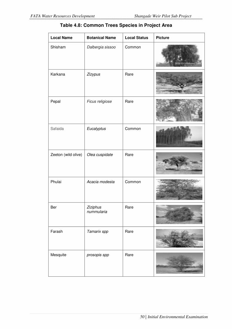
FATA Water Resources Development Shangade Weir Pilot Sub Project
50 | Initial Environmental Examination
Table 4.8: Common Trees Species in Project Area
Local Name Botanical Name Local Status Picture
Shisham Dalbergia sissoo Common
Karkana Zizypus Rare
Pepal Ficus religiose Rare
Safaida Eucalyptus Common
Zeeton (wild olive) Olea cuspidate Rare
Phulai Acacia modesta Common
Ber Ziziphus nummularia
Rare
Farash Tamarix spp Rare
Mesquite prosopis spp Rare

FATA Water Resources Development Shangade Weir Pilot Sub Project
51 | Initial Environmental Examination
Local Name Botanical Name Local Status Picture
Sufidar (hybrid poplar)
Populus Common
Kikar Acacia nilotica Common
Toot (Mulberry) Morus Common
Arjun Terminalia arjuna Rare
Bakain (dhraik) Melia azedarach Common
Palosa Acacia Modesta Rare
Table 4.9: Common Grasses Species in the Area
Common Name Botanical Name Picture
baruwa grass (munja)
Saccharum clumps
Suryalla ghass Heteropogon contortus
lemon grass Cymbopogon

FATA Water Resources Development Shangade Weir Pilot Sub Project
52 | Initial Environmental Examination
Table 4.10: Common Shrub Species in the Project Area
Local / Common Name
Botanical Name Picture
Bahker Adhatoda vasica
Ak Calotropis spp
Vena Rhazya spp
Khatumaal Rumex hastatus
Granda Carrisa spp
Karir Capparis spp
Karkanrha Zizyphus
Fauna
No baselines on wild mammals, birds and fish species are available for
FATA. No comprehensive survey has ever been conducted in the territories
by any line department or NGO. For the purpose of this IEE, a primary
survey was conducted by project environmentalist during March 2017 to
ascertain the distribution of species, and to collect evidence of any sightings
in consultation with local residents, the following animals have potential to
be in the area:

FATA Water Resources Development Shangade Weir Pilot Sub Project
53 | Initial Environmental Examination
Table 4.11: Fauna of the Project Area
S No. Common Name Scientific Name 1 Mammals Jackals Canisaureus
Foxes SSP. Vulpes
Field rats Rattusnorvegitu
Hare Lepusnigricollis
Porcupine Hystrixindica
Hedge Hog Erinaceinae
Wild cat Felis chaos
2 Reptiles Cobra snake Najanaja
Rat eating snake Colubrinae
House gecko Hemidactylus frenatus
3 Amphibians Common Toads Bufo bufo
4 Others Scorpions Scorpiones
Spiders Araneae
Avifauna
Avifauna of the area is highly diversified and colorful, which is widely
dispersed in gardens, cultivated fields, streams and hill slopes. Common
species are given in Table 4.12.
Table 4.12: Avifauna of the Project Area
Common Name Scientific Name
Tawny Eagle Aquila rapax
Long Legged Buzzard Buteo rufinus
Sparrow Hawk Accipiter nisus
Rose Finch Carpodacus
Indian Blue Robin Luscinia brunnea
Red Headed Bunting Emberiza bruniceps
Crested Bunting Melophus lathami
Grey Tit Melaniparus afer
Red Crowned Eurasian Grus japonensis
Blue Throated Fly Catcher Cyornis rubeculoides

FATA Water Resources Development Shangade Weir Pilot Sub Project
54 | Initial Environmental Examination
White Throated Dipper Cinclus cinclus
Green Warbler Phylloscopus nitidus
Himalayan Tree Creeper Certhia himalayana
Magpie Robin Copsychus saularis
Rosy Pastor Pastor roseus
Common Babbler Turdoides caudata
Rufous Backed Shrike Lanius schach
Hoopoe Upupa
Red Vented Bulbul Pycnonotus cafer
White Cheeked Bulbul Pycnonotus leucotis
Grey Partridge Perdix perdix
See See Partridge Ammoperdix griseogularis
Grey Lag Goose Anser anser
Wigeon Mareca
Pintail Anas acuta
Mallard Anas platyrhynchos
Grey Heron Ardea cinerea
Black Winged Stilt Himantopus himantopus
Great Egret Ardea alba
Flamingo Phoenicopterus
Sand Plover Charadrius mongolus
Curlew Numenius
Red-Wattled Lapwing Vanellus indicus

FATA Water Resources Development Shangade Weir Pilot Sub Project
55 | Initial Environmental Examination
Crested Lapwing Vanellus vanellus
Little Ringed Plover Charadrius dubius
Yellow Wagtail Motacilla flava
Night Heron Nycticorax nycticorax
Little Egret Egretta garzetta
White Breasted King Fisher Halcyon smyrnensis
The hotspots for these birds and waterfowls are irrigation dams, khwars and
river beds and banks.
No threatened or endangered species were observed in the subproject area,
as per IUCN red list classification of 2017.
Protected areas / National sanctuaries
As stated earlier, there are no wildlife or forest laws enacted for FATA.
However, more recently, Governor KP has issued a notification, declaring
all wetlands in FATA as Community Game Reserves. Hunting shall only be
allowed with joint agreement of local communities and political authorities.
But it is far away from the project site. Moreover, a separate notification has
also been issued declaring trade in body parts (pelt, skin, stuffed bodies,
trophies, etc.) of all wild fauna including migratory birds as illegal. Both of
these are attached as Annex II. There are 03 wetlands, as per Governor`s
notification, which are about far away from the site. The nearest wetland
Warsak Dam is at distance of approximately 20 Km.
Socio-Economic Environment
Khyber Agency is the most famous agency amongst seven others in the
Federally Administered Tribal Areas (FATA). Khyber Agency derives its
name from the famous Khyber Pass, which has served as a historical trade
route, connecting the Asian sub-continent with the rest of Central Asia, via
Afghanistan. Because of its geographical location, the agency has a history
dating back thousands of years. The Khyber Pass has been used by the
Aryans in 1600 B.C., the Persians in 600 B.C., Alexander in 326 B.C. and
subsequently, by Changez Khan, Taimurlang, the Mehmood of Ghazni and
the Mughals.
Khyber Agency is bordered with Afghanistan, Peshawar city and the Kurram
and Orakzai agencies. The total area of the agency is 2,576 square
kilometers, with 8.22% of the total area of the agency being forest. The

FATA Water Resources Development Shangade Weir Pilot Sub Project
56 | Initial Environmental Examination
Khyber Agency consists of three tehsils; Bara, Landi Kotel and Jamrud.
Khyber Agency has a barren and rugged mountainous terrain. It consists
mostly of hilly tracks and mountains, with narrow strips of valleys. It is the
meeting place of a series of ranges, such as the Koh-e-Safaid, an off-shoot
of the mighty Hindukush Mountains. Lacha Ghar, Karagah Ghar, Surghar,
Tor Ghar, Morgah and Kalauch; are some of the mountains located in the
agency.

FATA Water Resources Development Shangade Weir Pilot Sub Project
57 | Initial Environmental Examination
Figure 4.6: Map of Khyber Agency

FATA Water Resources Development Shangade Weir Pilot Sub Project
58 | Initial Environmental Examination
Administrative Set Up
Under the Constitution, FATA is included among the territories of Pakistan
(Article 1). It is administered by Governor of the KPK in his capacity as an
agent to the President of Pakistan, under the overall supervision of the
Ministry of States and Frontier Regions in Islamabad. The KPK Governor
Secretariat plays a coordinating role for interaction between the federal and
provincial governments and the Civil Secretariat FATA.
Khyber Agency, like each tribal agency is administered by a political agent,
assisted by a number of assistant political agents, tehsildars (administrative
head of a tehsil) and naib tehsildars (deputy tehsildar), as well as members
from various local police (Khassadars) and security forces (levies, scouts).
As part of his administrative functions, the political agent oversees the
working of line departments and service providers. He is responsible for
handling inter-tribal disputes over boundaries or the use of natural
resources, and for regulating the trade in natural resources with other
agencies or the settled areas.
The political agent plays a supervisory role for development projects and
chairs an agency development sub-committee, comprising various
government officials, to recommend proposals and approve development
projects. He also serves as project coordinator for rural development
schemes.
The Political Agent is the over all in charge for the agency administration,
assisted by Assistant Political Agents. Tehsils in the agency are under the
charge of three Political Tehsildars and Political Naib Tehsildars.
Demographic Profile
FATA has a unique governance status, whereby all land is owned by tribes
inhabiting the areas since generations. Any physical activity hence carried
out needs the agreement of the locals, as well as land donation by them.
Since it is an egalitarian society, chances of elite capture are minimum and
major decisions are taken by Jirga, the tribal administrative and
management body.
The Malik (chief/elder) serves as an intermediary between the tribe and the
political administration, in exchange for a regular allowance with which to
meet social and leadership obligations. The more weapons at a Malik’s
disposal and the more men he can command to bear arms when needed,
the greater is his stature within the tribe. The jirga plays an important part in
tribal society as a traditional mechanism for conflict resolution.
Tribal people are accustomed to managing their own resources and solving
disputes without outside intervention. They act collectively to assist others

FATA Water Resources Development Shangade Weir Pilot Sub Project
59 | Initial Environmental Examination
in the group and help fulfill social obligations. Marriages and deaths, for
example, draw support from all members of the tribe, as do everyday
activities such as harvesting and threshing, laying and clearing irrigation
channels, carrying out flood protection, maintaining paths, cutting grass, and
constructing hujras (meeting places), mosques or other buildings.
Due to absence of a strong government and security network in the area
and its rough, mountainous terrain, the area became a hotbed of the
insurgents and over 90 percent of the agency came under their control in
2007. After 2007, the militants began attacking government and military
establishments in KPK province killing many people and wounding many
more. The Pakistan Army began an operation in 2008 to clear the agency of
militants and restore normal life in the area. The Operation continued for
years and resulted in killing of hundreds of TTP militants and Pakistan Army
soldiers. The Local Aman Lashkars or Peace committees supported the
army by fighting the foreign terrorists. By July 2012, a major part of the
agency was cleared but military operation continued in Bara Tehsil of the
agency. The subproject site is situated in northwest of Jamrud tehsil having
a population of approximately 3558 persons, and 391 households. Afridis
are the main tribe of the project area and are further sub divided into Koki
Khel sub tribe.
Population
The population of the agency, according to the 2017 census is 986,973
persons, out of which 51% are males and 49% are female. Average
household size is around 8.84 persons per family with an average annual
growth rate of 3.15.
Table 4.14: Population Details of Khyber Agency14
Households Population 2017
Male Female Sex Ratio
Population 1998
1998-2017 Average Annual Growth Rate
111,558 986,973 505,475 481,487 104.98 546,730 3.15
14http://www.pbscensus.gov.pk/sites/default/files/DISTRICT_WISE_CENSUS_RESULTS_CEN
SUS_2017.pdf

FATA Water Resources Development Shangade Weir Pilot Sub Project
60 | Initial Environmental Examination
Family Size
The average household consists of 9 individuals. The male and female ratio
is 105 males to 100 females15.
Dwelling
Mostly the houses are made of mud throughout the agency. The houses are
called Qila that is fortresses, which encompasses a number of houses
inside. A house generally consists of two or three rooms with a verandah in
the rear and front. Joint family system is in vogue in the agency. Every
cluster of houses has a common sitting place called Hujra where the male
members daily meet, discuss and share views on variety of local, national
and inter-national issues with each other’s. It is a common place and is also
used as a guest room. The young spend winter nights in Hujra and arrange
for themselves music programs or food dishes as a pass time activity. It is
an important part of Pakhtoon culture, which is unfortunately changing with
the modern times as people have begun to prefer using personal guest-
room.
According to the population census report, majority of the houses (91%) of
the study area have ordinary construction (Katcha structure) with timber roof
and mud mortar, whereas moderate standard buildings with cement
masonry (pacca structure) and dry stone masonry (semi-pacca structure)
are 2% and 7% respectively.
Language
Pashto is the main language of the area, with a softer form spoken in the
north and a harder dialect in the south.
The Family System
Majority households are compound type where one or extended families16
are living. Both Joint and nuclear family systems17 exist in the compounds.
The area of the house and number of persons living in a house is irrelevant
in the context of tribal society. The household data shows that a middle-
sized compound is housed with 25 persons as one extended family. Another
same sized compound is housed with 3 small sized families. The
construction material used for the compound is an indicator of economic
status of the occupants.
Men are the dominant force in the household, with final say in the affairs of
all members of the family. Women, by comparison, play a subservient role
15 FRDP Inception Report, Important Agency/FR wise Socioeconomic Indicators of FATA 2012
16 a family which extends beyond the nuclear family to include grandparents and other relatives. 17 A nuclear family, elementary family or conjugal family is a family group consisting of two parents and their children (one or more).

FATA Water Resources Development Shangade Weir Pilot Sub Project
61 | Initial Environmental Examination
and observe strict purdah (veiling). Although divorces or separations are
extremely rare in tribal households, a husband is free to take on additional
wives.
Livestock
Livestock not only provides milk, meat, eggs for daily human consumption
but also provides hides/skins and wool/hair and bones/blood for industrial
products and manure /urine for soil fertilization. Livestock is also a source of
rural transport and draft power in Agricultural farming and provides an easy
source of income to majority of the rural population.
The FATA, being mostly dry hilly terrain, has little land for crops production
whereas sizeable land is available for grazing. The land-less and small
holders (more than 85% of farmers) are mostly dependent on Livestock
production. Livestock provides employment to 50% of the population either
directly or indirectly. About 80% of the income of trans-hum ant families
accrues from Livestock.
There is a good enough network of Veterinary Institutions in FATA
established since years, providing Veterinary services to the poor Livestock
Farmers; but due to meager amount of operational funds, lack of access to
appropriate know how the SDS is not up to the required level.
Conflicts Resolution Mechanism
FATA region is traditionally based on the principle of close association by
tribe or kinship. The people of FATA have long been accustomed to
witnessing violent conflict between the members of different tribes and
clans. Inter- or intra-tribe conflict may range from minor family disputes that
create tensions and uncertainty to full-blown armed clashes that result in
irreparable losses. While for many generations the people have managed to
build their lives in this climate of instability, today there is growing awareness
that internecine conflict of this sort is a waste of resources and a major
obstacle in the way of development.
The tribal elder (Malik) often serve as an intermediary between people and
the local administrative structures for identifying the priorities. The tribal
council of elders (Jirga) is the main mechanism for decision making on
behalf of the local population and is also considered the key entity for conflict
resolution and providing judgment for punitive actions. The Jirga is
essentially the only mechanism for out-of-court settlements over enmities
that span generations. The tribe’s identity in FATA is the key to how local
communities exercise their right to and ownership of natural resources and
other assets. The tribal identity as depicted through the Malik and Jirga is
therefore essential for access and use of resources and is often seen as the

FATA Water Resources Development Shangade Weir Pilot Sub Project
62 | Initial Environmental Examination
only safety net available to poorer segments of the population. This intricate
community system has survived for centuries with adequate legitimacy by
the political administration as well as acceptance by local communities as it
continues to exert its influence on communal life. In more recent times, some
development projects 18 working in the tribal agencies have invested in
forming local community based groups and indigenous organizations that
have cooperated with the local Jirga as well as the political administration
for implementing their programs.
Religious Beliefs
A primary survey was conducted as part of the Social Feasibility Study
carried out under the PPTA. All the respondents of the Social Assessment
Primary Survey, reported to be Muslim. People generally have conservative
outlook on life and are particular in observance of religious ceremonies.
Majority of the respondents normally offers prayers and keep fasts during
the month of Ramzan. Religious extremism was in full swing for last few
years, but the situation is relatively better now. Majority of the population
belong to Sunni sect of Islam. They believe in Hanafi interpretation of
Shariah. Majority has a religious disposition and practice Islam according to
its fundamental principles. Inheritance is divided according to the Islamic
principles and daughters are given their property right accordingly.
Water Supply and Sanitation
Springs, streams, rivers and perennial watercourses serve as the primary
source of water for drinking and domestic use. In mountainous areas, where
natural surface and ground sources are not available, people rely on rain-
water ponds. In the plains where surface water is scarce, shallow wells allow
the people to meet their basic requirements. A combination of factors,
including the large-scale movement of displaced persons from neighboring
Afghanistan, has adversely affected forest reserves which are critical for
watershed protection. The depletion of forest resources has reduced the
water retention capacity of the soil, while ecological and climatic conditions
have led to the low recharge of groundwater sources. As a result, many
springs, streams and perennial watercourses have dried up, forcing people
to turn to deep groundwater sources. Official records for 2014–15 show that
60.0419 per cent of the population is covered by water supply schemes,
mainly through community tanks and taps. Just 27 per cent of supply through
these schemes consists of individual residential connections. Some 85 per
18 For example the ADB supported the FATA Rural Development Project in Khyber, Bajaur and
Mohmand agencies that implemented the project interventions through Community Organizations for delivering services including drinking water supply schemes; irrigation and small dams; natural resource management e.g. raising forest nurseries; etc.
19 Source: Important Agency/FR wise Socio-Economic Indicators of FATA 2016 FATA Secretariat

FATA Water Resources Development Shangade Weir Pilot Sub Project
63 | Initial Environmental Examination
cent of public-sector schemes rely on groundwater, while the remaining use
surface sources20. The majority of groundwater schemes consist of tube
wells, while dug wells and infiltration galleries using electric or diesel pumps
are few in number. The normal water table in most parts of FATA is between
91.44 and 152.4 meters. Surface schemes are gravity-based, using slopes
and gradients to carry water to distribution points. Sources developed by the
works and services department are analyzed for physical and chemical
properties alone, and these results show that the water is fit for human
consumption.
Traditionally, settlements in the tribal areas have always been widely
dispersed. For reasons of security, meanwhile, communities have generally
preferred to build their houses on mounds and hill-tops. In such areas, the
drainage of rainwater and domestic wastewater was never a problem.
Perhaps as a result, most communities failed to pay much attention to
sanitation infrastructure. But as the population has grown and settlements
have expanded, this arrangement is no longer safe or practicable.
The physical growth of settlements without any provision for basic sanitation
is degrading the living environment and polluting water sources. Commerce,
trade and business activities, and related services, add to the congestion.
Today, the lack of adequate sanitation infrastructure poses a serious health
hazard. Children, women and the elderly are particularly vulnerable.
Recent figures on sanitation coverage in FATA are not available. Results
from the 1998 housing census show that 36.86 per cent of houses have
“separate” latrines, 6.99 per cent have access to shared latrines and 56.15
per cent have no latrines. No details about the type of latrine (flush or pit)
are given in the census report, making it difficult to assess what percentage
of the population has access to hygienic sanitation facilities. Overall, it
appears that just 10 per cent of the population has access to adequate
sanitation in the form of toilets, sewerage, drainage and solid waste
disposal.
Poverty
The FATA region has historically remained amongst the poorest parts of
Pakistan. There are serious disparities in service provision as compared to
the rest of the country. The absence of visible progress and the perceived
lack of interest by both sub-national and federal governments in redressing
the disparities have consequently deteriorated citizens’ trust in the ability of
government institutions to meet the basic needs of the population. The
general lack of basic services and weak institutional capacity to provide
20 Environmental and Social Assessment (ESA); Rural Livelihood and Community Infrastructure
Project, FATA Secretariat.

FATA Water Resources Development Shangade Weir Pilot Sub Project
64 | Initial Environmental Examination
these have been recognized as drivers of crisis creating conducive
environment for opportunistic militant groups whose economic incentives for
potential recruits greatly outweighed the alternatives available to the people
for their livelihoods.
The militancy crisis in KP and FATA is a key contributor to stagnant growth
and high unemployment. The ranks of the unemployed have risen with the
intensification of the crisis in 2009/10, and even are likely to continue rising.
These conditions have created a conducive environment for opportunistic
militant groups whose economic incentives for potential recruits greatly
outweigh alternative available options. Many are dependent on the black
economy, drug trafficking and criminal activity for survival.
Official statistics on rural income and poverty in the area are quite weak.
Factors underlying the region's poverty include (i) historical, political, and
social isolation; (ii) a legal system reliant on executive and judicial authority
administered through civil servants preferring to maintain the status quo; (iii)
poor quality and coverage of institutions responsible for the provision of
basic services; (iv) social practices that preclude women’s participation in
economic life; and (v) lack of effective institutions for skill training to enable
the labor force to shift from low to high-productivity sectors.
Poverty has to some extent made the population vulnerable to extremist
tendencies and criminality. In the absence of viable options to earn a living,
the lure of illicit activities such as smuggling (consumer goods, weapons)
and drug trafficking is as difficult to resist as the call of extremist elements.
Health facilities
Health indicators for Agency are
incomplete and, in many cases,
only estimates are available.
These highlight the poor state of
the health care system. Health
facilities in project area are
adequate. District Headquarter
Hospital (Landikotal) and Type-D
hospital (Jamrud) are main
hospitals. Other than that, there
are a number of private doctors
and Hakeems present in the area.
Access to health services is severely limited, with just one dispensary, Basic
Health Units (BHU) or Rural Health Centre (RHCs) reported in the year 2004
for every 50 square kilometers of area, and these facilities concentrated near
the settled areas.

FATA Water Resources Development Shangade Weir Pilot Sub Project
65 | Initial Environmental Examination
Social Organization
Society is structured on kinship basis in the Project area. Most of the
decisions are made at the household level. The rich and influential people
are accepted as community leaders, especially in collective welfare and
development of the area. Also, the traditional leader in the village is the
“Malik”, the elder who commands respect in the community.
Agriculture
The FATA region is a predominantly agrarian economy, with livelihoods
predicated on agriculture and livestock. While agriculture is a profitable
activity with good income potential, particularly from horticulture (fruit and
vegetables), given the limited water availability, agriculture is practiced in
just a few valleys. The rural economy remains mainly pastoral, with low
quality rangelands providing more than 70 percent of the total fodder and
forage requirement. Yields are substantially lower than national averages
and dependent on rainfall. The project area is dominated by small farmers
with less than 5 acres (approximately 2 ha) of land and a few livestock. Many
of these households experience food deficits and rely on remittances to
meet their needs.
Only 7 per cent of the total geographic area of FATA is cultivated, with
another one percent recorded as fallow, accounting for roughly half of all
potentially cultivable land. A little over 40 percent of the cultivated area in
FATA is irrigated, while the remaining farmland relies exclusively on rainfall.
In irrigated areas, water is provided through a combination of delivery
systems, including tube wells, dug wells, lift pumps and traditional communal
canals.
The total cultivated area of FATA is about 20,075 hectares, whilst
uncultivated land is 237,579 hectares, with 2070 hectares as forest area.
The total cropped area is 19,365 hectares21.
Education
The people in the agency are not widely educated. They migrate to down
districts in search of jobs or any other labour. Government services are a
cherished source of livelihood for many. Agricultural farming, small scale
business and working on daily wages basis are also major providers of job
and sources employment in the agency. About 24.4% of the employed
population which is predominantly male works as migrant workers in Gulf
countries while just less than 30% of the population is reported as employed
in other provinces of Pakistan.22
21 Source: FATA Development Statistics, 2012 22 MICS 2007, FATA Secretariat

FATA Water Resources Development Shangade Weir Pilot Sub Project
66 | Initial Environmental Examination
Food
Simplicity is the haul-mark of the food of the people of the Area. Rice is a
staple dish especially for dinners. Maize bread with local vegetable Saag
and Lassi is offered to guest as a seasonal specialty in summer.
Dress and Ornaments
People wear the traditional Pakhtoon dress of Shalwar Kameez and head-
wear. Generally, the people wear handmade Dir caps while notables wear
Pugri and Kula, but this tradition is gradually fading out. Women folk wear
Shalwar Kameez and Chadder/veil and for Purdah they use Burkas (veil).
Historically, and particularly during the Soviet invasion of Afghanistan
beginning in 1979, the region was a major center for opium production and
trafficking. Today, the transit trade with Afghanistan is a major source of
employment for the local population. The economy operates on an informal
basis and is undocumented, since few laws providing for the regulation of
economic activity have been extended to the tribal areas.
Mining
Extensive deposits of marble are found at several places in Khyber Agency.
The marble is associated with the calcareous rocks in the Mullagori area.
The marble is processed in different green and block colours. The marble is
processed in different marble factories in KP, and in other parts of the
country.
Roads
According ESA-FATA Secretariat, total coverage extends to 3,390
kilometers of blacktop and another 2,000 kilometers of shingle roads in the
year 2006. Land acquisition laws in force in the rest of the country do not
apply to FATA. If a proposed road or bridge is to pass through qaumi (tribal)
land, a ‘tribal commission’ amounting to 6.2523 per cent of the total project
cost is handed over to the political agent, to be distributed among local clans
and tribes according to ownership. Where roads or bridges are to pass
through private land, the political administration meets with the local malik
and a settlement is reached through jirga negotiations.
Telephone Facilities
Landline telephone facilities and Cellular networks are available in the area.
23 Environmental and Social Assessment (ESA); Rural Livelihood and Community Infrastructure
Project, FATA Secretariat

FATA Water Resources Development Shangade Weir Pilot Sub Project
67 | Initial Environmental Examination
Sites of Historical Significance
Bab-E-Khyber, Jamrud fort, Shagai Fort, Alimasjid Fort and shapola stupa
etc are few historical places.
No sites have been reported around the SWPS site of any cultural and
historical significance.
Gender Issues
Tribal society is dominated by men. Cultural tradition, social practices and
low female literacy have left women in a vulnerable position. They are for
the most part restricted to performing household work, and are excluded
from decision-making both on the domestic front and at the community level.
Women’s access to education and health care is limited because such
services are not available close to home.
The male domination in total population is consistent. Although the women
about ½ of the population but they are not visible in public life of the villages
due to strict purdah/veil system. The FGDs confirmed that women’s role in
the tribal system is limited to unpaid housekeeping and very small-scale
productive activities at household level and they are not involved in any
economic activity
Women in the area play a dominant role in running the household, rearing
and guiding children, managing household finances, and providing much of
the labor for agriculture and animal husbandry. They do not normally have
a public role, particularly in interactions with the broader society.

FATA Water Resources Development Shangade Weir Pilot Sub Project
68 | Initial Environmental Examination
PROJECT ALTERNATIVES
No Project Option
Project alternatives have been considered with consideration of their ability to
match immediate demand and then keep pace with emerging demand while
ensuring capture of available yield in the stream. With an increased
awareness of the scarcity of water as a resource, short-term supplies may be
achieved through demand management strategies water use efficiency,
combined with research and development programs that reduce
consumption.
Agricultural demand has the potential to be met through the take up of
currently unutilized, or under-utilized, water resources.
Groundwater supply within the area is limited to primarily stock and domestic
purposes and supplies to small towns and is not considered to be a feasible
alternative supply to the Project
Inability to support the Project increases inherent risk of supply from a single
source. The primary objective of the Project is to increase the agricultural
production. The ‘no project’ option has the potential to inhibit to increase the
crop production. Limiting agricultural production in particular has the potential
to adversely impact on the area economy with large scale agricultural
development potentially seeking alternative locations interstate due to this
water supply constraint. With the implementation of project with the Increase
in agricultural yields and production, the additional generating benefits are:
• Additional revenues directly from the project output.
• Crop diversification. The introduction of irrigation enables farmers to
diversify their crops based on local markets demand and export.
• Employment opportunities: during the construction phase there will be
improved employment opportunities for local people and new comers.
• The project will provide water for cultivation of crop, irrigated fodder
development, domestic purpose, livestock etc.
• Food security further improved. In this case, the proposed small scale
diversion weir irrigation will have a paramount importance in further
improving the overall living conditions of the people residing in and
around the project environment and will plays its own role in alleviating
food shortage.
• Improved forage varieties provided and increase
• Animal productivity and production.
• Increase the opportunities to nursery site

FATA Water Resources Development Shangade Weir Pilot Sub Project
69 | Initial Environmental Examination
• establishment, and forest seedling production and
• Forest tree plantation.
Water availability is scarce in area hence the proposed project will contribute
positively to the project area. The no project option is not viable option.
Project Siting Alternatives
Technically there is no other source of water or place diverting water for
irrigation purposes. Location of the weirs have been fixed, by considering the
natural conditions, the project purpose, command area and construction
difficulties including topography and geology. The detailed considerations for
the selection of weir site are as follows.
• Suitability of the Weir structure type
• Geological and Topographic conditions
• Technically most suitable sites to command the irrigable area
• Minimum Environmental Degradation
Technological Alternatives
A conventional weir at proposed locations may be adopted for diversion of
design discharge. However, it needs sediment removal arrangement
deposited at upstream, which necessitates the flushing arrangements by
means of providing Bottom outlets or undersluice section.
A Tyrolean is a low level portion of the main weir accommodating embedded
channel in its body with trash rack on it in the desired length as per required
discharge to be diverted. Bars of the rack are laid parallel and inclined in the
direction of flow. The water, which flows over the rack, is collected in the
embedded channel to the limit of its capacity. The embedded channel
provided in weir has sufficient slope which will convey the sediments laden
discharge to the end where a gravel flushing opening is provided facing
downstream, that laterally flushes into stilling basin. Coarse sand and pebbles
would settle at the end of embedded channel and comparatively clean water
would be delivered to irrigation conveyance system. A Tyrolean weir is the
most appropriate diversion arrangement on such streams.
The weirs will divert perennial flows of springs to irrigate the command area
at downstream. For this purpose, Tyrolean type weirs are proposed in which
water is taken into a lateral channel connecting to Tyrolean part of the weir. It
is generally preferred in order to divert water in mountainous regions with
steep slopes where bed sediment concentration is rather high. To release the
Lashora khwar floods an overflow section is provided which will safely route
such excess flows downstream of the weir.

FATA Water Resources Development Shangade Weir Pilot Sub Project
70 | Initial Environmental Examination
ENVIRONMENTAL IMPACT ASSESSMENT AND MITIGATION
MEASURES
Impact Assessment - Overview
The Environment Assessment study has disclosed that the project is not
likely to have any severe negative impacts on the environment and people
of the area. All the potential impacts which have been identified during the
present assessment are associated with the construction stage, and minor
to moderate in severity; and can easily be avoided (through good design and
construction planning) or mitigated (through proper implementation of the
EMP). On the other hand, the project will be beneficial particularly for the
local population on creation of job opportunities and extremely beneficial for
irrigation. Significant social indicators of the project benefits are mentioned
below:
Construction of irrigation system in virgin lands tends to change water and
land use patterns that might have potential of severe, long term permanent
impacts (positive) on the environmental settings of that area.
Construction activities in general could lead to interference with local
community life.
Most beneficial impacts associated with the improved canal condition,
management and efficient and equitable water distribution are of long-term
in nature.
After completion of the construction works, the improved canal water
supplies will contribute to increased cropping intensity resulting into
increased use of agricultural inputs like fertilizers and pesticides which may
cause limited adverse impacts and need to be addressed.
The improved water supplies will boost the agriculture and improve the living
standard of the community in the project area.
The project will also help to regulate the groundwater abstraction to
neutralize the lowering trend.
The project will also provide unskilled jobs during the construction phase
and a limited number of jobs in operations. This will be a bonus for the
people of the area, many of who are used to having to travel down country
for employment.
Impact Area
The project impact areas mainly involve weir and construction areas. The
vegetation cover of the catchment is poor. The weir sites are however
located in and around shrub lands, hence no felling of trees is involved.

FATA Water Resources Development Shangade Weir Pilot Sub Project
71 | Initial Environmental Examination
Figure 5.1 Impact Area

FATA Water Resources Development Shangade Weir Pilot Sub Project
72 | Initial Environmental Examination
Table 5.1 considers the potential impacts at various stages of the project,
and assesses the category of the impact, classifying them as negligent,
moderate or high. Each category is defined as under:
Negligible: No or minimum impact
Moderate: Potential impact but can be mitigated (Site Specific)
High: significant adverse environmental impacts those are irreversible,
diverse, or unprecedented
The section further goes on to explain the table, by describing those impacts
that have moderate to high impact, but can be mitigated.
Table 5.1 Screening of Environmental Impacts; Construction and Operation
Stages
Potential Environmental Impacts Project Stage Impact Categorization (N=Negligible, M=Moderate, H=High)
1. Land resources
1.1 Excavation Construction M
1.2 Blasting Construction M
1.3 Waste generation and disposal Construction N
1.4 Labor camps, storage, approach roads
Construction M
1.5 Soil pollution due to fuel and oil spillage (related to construction machinery)
Construction M
1.6 Agriculture land damage Construction N
1.7 Earth Borrow Site Construction M
1.8 Installation of cement mixing plants Construction N
1.9 changes in Soil Characteristics due to labour camps, and machinery yards
Construction N
1.10 Leaching of soil nutrients and changes in soil characteristics
Operation N
1.11 Soil pollution due to excessive application of fertilizers and pesticides
Operation M
1.12 Construction Material Leftover Construction & Operation
N
2. Hydrology and Water Resources
2.1 Contamination of surface water due to washing (machinery and other related materials)
Construction M
2.2 Drinking water supply Construction M
2.3 Municipal waste disposed into the stream
Construction M
2.4 Water quality & sedimentation load Operation M
2.7 Excessive use of irrigation water for cultivating high delta crops
Operation M
2.8 Contamination of water due to farm runoff
Operation N
3. Air Quality and Noise Pollution
3.1 Dust and smoke and other pollutants from plants and equipment
Construction M

FATA Water Resources Development Shangade Weir Pilot Sub Project
73 | Initial Environmental Examination
3.2 Smoke from burning of waste or firewood
Construction M
3.3 Noise control from use of old and/or outdated machinery
Construction M
3.4 Dust Emission from Stone quarrying and transportation
Construction M
4. Biological Resources
4.1 Damage to flora and fauna Construction N
4.2 Habitat fragmentation Operation N
4.3 Aquatic Life Construction and Operation
N
5. Socioeconomic and Cultural Issues
5.1 Tribal tensions and rivalries All stages M
5.2 Impact on civic infrastructure (education, health, roads, water supply, electricity)
Construction N
5.3 Community safety risks due to both accidental and natural hazards
Construction and Operation
M
5.4 Health and safety of labor and employees at construction site
Construction H
5.5 Aesthetic/scenic value Operation N 5.6 Employment of alien labor Construction N
Negligible: No or minimum impact, Moderate: Potential impact but can be
mitigated, (Site specific) High: significant adverse environmental impacts that
are irreversible, diverse, or unprecedented
Construction Stage Impacts
Impacts on Land Resources
Excavation and Blasting
Being located in a hilly terrain, the weirs will require excavation for alignment
of abutments and land leveling. The quantity of excavated material at
Shangade weirs is 1860.98 m3. Such physical work has the propensity to
alter the landscape, due to cutting of trees and/or leveling mounds and hills,
and also create dust pollution. In case of Shangade weirs, the sites do not
have extensive vegetation in terms of trees.
Any excavation work during the construction activities, whether permanent
or temporary, may lead to loss of soil. Erosion of soil can also occur from
removal of vegetation cover, runoff from unprotected excavated areas, etc.
Excavations on slopes would also decrease its stability. It is expected that
minor level of short term risk is associated with the type of construction
activities that are likely to take place. The current land formation is fairly
stable sandstone therefore no major impact is associated with regards to
slope stability. The duration of the risk is expected to be short and the spatial
scale of risk is small because the excavation effects are not likely to affect
areas further than 200 meters from the Project facilities.

FATA Water Resources Development Shangade Weir Pilot Sub Project
74 | Initial Environmental Examination
Mitigation
Vegetation loss will be avoided as much as possible and limited to
demarcated construction area. Slope stabilization measures will be adopted
such as adequate vertical and horizontal drains, cross drainage etc. Slope
movements will be monitored around excavation work areas. Top six inches
soil should be protected before excavation and should be placed back after
completion of construction work. Excavated material shall preferably reused.
Non reusable excavated material shall be safely dumped and leveled in
barren land.
Blasting may be done where it is absolutely necessary, use safety measures
in handling explosives, prepare blasting schedules along with warning
sirens, blasting mats and ensure minimum damage to the landscape, any
damage to settlements is not anticipated as nearest settlement is at the
distance of 500 m approx. at a higher elevation where no damage is
anticipated
Waste Generation and Disposal
During the construction phase, most of the waste generated will be related
to construction. Construction waste will involve debris due to cutting of
stones and blasting, residual RCC material and other associated waste.
Mitigation
To minimize environmental impacts and avoid any need for disposal of
earthwork materials or the importation and unnecessary storage of earth,
the project will maximize the reuse of excavated materials. All of the
construction activity will be contained inside construction area. Solid waste
generation should be reduced and should be reused and recycled. Any
residual spoil will have to be disposed in environment friendly manner,
where it will be leveled and landscaped.
To be made contractor’s obligation through contract document, as an
SSEMP will be prepared by the contractor and waste management plan will
be a part of it. This is a medium negative impact but can be mitigated.
Labour camps, storage and approach roads
Because of availability of ample community owned barren land, location,
material yards, equipment yards and approach roads will not cause any
serious problem. Therefore, this is a matter of moderate significance and
can be easily mitigated and managed through proper mitigation measure.
Mitigation
The contractor will, in consultation with RE, resolve the exact location of all
these facilities within the barren land owned by the local community that will

FATA Water Resources Development Shangade Weir Pilot Sub Project
75 | Initial Environmental Examination
be provided by the community temporarily and free of cost. The location of
these facilities will be at least 500 m away, from the community.
Soil pollution due to fuel and oil spillage from construction
machinery
At places, it may be inevitable. In case it is allowed to be as per rule rather
than an exception, the dumping of oil will permanently create contamination
along with allied physical, biological and social losses. This can be mitigated
through effective application of the maximum spill regulations.
“Guidelines for Oil Spill Waste Minimization and Management issued by
International Petroleum Industry Environmental Conservation Association24
are as follows: -
Soil contaminated by minor spills/ leakages (defined as leaks from
vehicles, machinery, equipment or storage containers such that the area and
depth of contaminated soil is less than 0.92903 sq. meter and 0.0762 meter
respectively) is to be scraped and disposed of accordingly in
environmentally friendly manner to ensure protection of water sources.
Moderate spills defined as spills of volume less than or equal to 200 liters
is to be contained and controlled using shovels, sands and native soil. These
equipment’s and materials are to be made available at camp sites during the
operation. The contaminated soil is to be excavated and stored in a burn
area lined with an impermeable base. Depending on the volume, the
contaminated soil is either disposed-off through by specialized treatment
such as bioremediation or through approved contractor.
Major spills (defined as spills of volume much greater than 200 liters)
require initiation of Emergency Response Procedures and Oil Spill
Contingency Plan. These spills are to be handled and controlled according
to the Plan and require special treatment such as bioremediation and
through approved contractors.
Mitigation
Strict rules will be imposed on workers and labors to ensure that no such
spills are caused. If the spills take place, it must be followed by treatment
prescribed above as per the degree of spill. Specific mitigation measures to
be part of Contractors site specific environmental management plan are:
• Spill prevention trays will be provided and used at refueling locations
• On-site maintenance of construction vehicles and equipment will be
avoided, as far as possible.
24 http://www.ipieca.org/resources/good-practice/oil-spill-waste-minimization-and-management/

FATA Water Resources Development Shangade Weir Pilot Sub Project
76 | Initial Environmental Examination
• Regular inspections will be carried out to detect leakages in
construction vehicles and equipment.
• Fuels and lubricants will be stored in covered and dyked areas,
underlain with impervious lining.
• Spill control kit (shovels, plastic bags and absorbent materials) will be
available near fuel and oil storage areas.
• Contaminated soil will be removed from the site and disposed in a
manner to ensure protection of water sources
• Emergency plan for spill management will be prepared and inducted to
the staff for any incident of spill.
• The bottom of any soak pit or septic tank will be constructed at least
100 meters away from springs and water bores
• Record of spills and Volume of removed contaminated soil will be
maintained.
• Record of remedial measures taken will be maintained.
• Use silt traps to prevent contamination of river and streams.
Agriculture Land Damage
Land leveling, construction of access road, excavation and construction of
channels may cause damage to agricultural land. In case of this sub project
there will be no agricultural land damage as cultivated area is away from the
project site.
Mitigation
Contractor’s obligation not to cause such damage. If such damage occurs
to crops and agricultural land compensation will be paid to the affected
person, top six inches soil will be protected and land will be restored to its
previous condition after completion of construction works.
Impact of taking borrow material from earth borrow site
There is likelihood for obtaining the earth fill material. Excavation and cutting
activities could cause adverse environmental impacts including sliding, soil
erosion and drainage on the surrounding areas.
Mitigation
No private land will be acquired for the borrow areas.
The Contractor will ensure that selected borrow areas on irrigation land are
clearly demarcated and approved by the engineer including the allowed depth
of the excavation before starting excavation.

FATA Water Resources Development Shangade Weir Pilot Sub Project
77 | Initial Environmental Examination
The borrow areas will be leveled. The Contractor will not leave the borrow pits
in such a condition that they are unsuitably filled with rain water and cause the
problem for the community.
If the borrow area is near to the settlements, then it should be fenced
completely.
If agriculture land needs to be used as borrowing area, then the Contractor
will adopt the following methods during the digging process.
o Fix the location of excavation.
o Remove thirty centimeters of the top soil and keep it on reserved site
for re-spreading in the field.
o Excavate up to one meter depth.
o Maintain the slope as far as possible.
o Place the top soil back during the restoration process.
o Pay compensation for any damages/ crop losses.
Changes in soil characteristics due to labour camps, and
machinery yards
The mechanical activity normally compacts the soil and turns it
nonproductive which leads to the social impact and is manageable.
Mitigation
Contractors before handing the site back will apply such measures as to
mitigate the impact of compaction and leave the site almost in the same
state in which it was occupied. Pictures of the area should be taken before
handing it over to contactor which will help the RE to ensure an acceptable
state of soil while getting the area back from the contractor.
Impacts on Hydrology and Water Resources
Contamination of surface water due to washing
There is a tendency to wash construction machinery and equipment using
the stream water, eventually draining the same into the stream.
Contaminants like motor oil, diesel and other such materials pollute the
water body in the short run, causing harm to aquatic life, and affecting the
overall water quality.
Mitigation
Contractor will demarcate a washing area for all sorts of washing activities,
with running water facility connected to a dedicated drain flowing into the
septic tanks. There would be restriction on servicing/ washing of vehicles
and equipment at site.

FATA Water Resources Development Shangade Weir Pilot Sub Project
78 | Initial Environmental Examination
Drinking water supply
Since the site and adjacent area is away from settlements, there is no
connection available to a water supply scheme. There are springs in the
catchment of the weir, but they can be far off. Stream water will need to be
tested and used for drinking purposes.
Mitigation
Contractor, under the guidance of Environment Specialist, will get stream
water tested for chemical and biological contaminants, and assist in
providing filtration to make water drinkable. There are numerous cost-
effective water treatment models available in order to mitigate chemical
and/or biological contamination. Sand filtration, UV treatment and oxidation
are a few such methods.
Municipal waste disposed into the stream
Municipal waste generated due to human activity is a concern if it is disposed
and drained into the stream.
Mitigation
Solid waste bins will be placed at labor eating and resting areas. Latrines
and washing areas with septic tanks will be erected by the contractor at the
construction site. Rubbishes from the project construction area and office
area shall be classified and collected and then treated by burial in a
centralized manner. The landfill site will be arranged by mainly considering
the natural gully and shall be closed after completing the construction. The
landfill site area shall be equipped with seepage control system, leachate
drainage system, gas conduction system, peripheral water drainage and
interception, flood drainage and leachate collection processing facilities, etc.
All these provisions will be incorporated in site specific EMP for construction.
Water quality and sedimentation load
The soil texture at the sub project area is of medium quality with medium
organic load. Due to the sand formation upstream, there is a likelihood of
sedimentation load filling up the weir.
Mitigation
Quarterly water sampling and testing will be conducted in order to ascertain
water quality during different seasons. A sample each at two locations, one
upstream and another downstream of the weir, will be drawn for testing.

FATA Water Resources Development Shangade Weir Pilot Sub Project
79 | Initial Environmental Examination
Impact on Air Quality and Noise Pollution
Dust from construction and smoke from plants and equipment
Due to nature of the construction, involving excavation, land leveling and
clearing, a lot of dust will be produced. Heavy machinery will be used to
carry out these activities which will result in vehicular emissions as well as
other exhaust fumes.
Dust or other pollution from stored material is also inevitable, moderately
significant and mitigative.
Mitigation
Contractor’s contractual obligation to keep the dust and smoke low by using
machinery which is well maintained and is almost noise less and all Katcha
roads and paths are sprinkled with water after regular intervals.
The contractor must avoid/ control the dust and smoke by carefully storing
and distributing the construction material so as to cause minimum dust
which again will be within the acceptable limits.
Smoke from burning of waste and firewood
Labor will burn waste material and wood for various purposes, including
cooking and heating, which will cause smoke, and in some weather
conditions smog in the area.
Mitigation
Contractor shall strictly ban burning of waste or of wood, especially extracted
from nearby shrubs and bushes. Contractor must provide clean fuel to the
labor to use for their daily purposes.
Noise from use of old/and or out-dated machinery
Old and poorly maintained machinery generates higher decibels of noise
and cause noise pollution for workers in the close vicinity of heavy
machinery.
Mitigation
Contractor’s contractual obligation to use new, well maintained and low
noise machinery preferably during day time. The drivers, operators and
workers working on or near the heavy machinery must be provided ear
plugs.
The contractor will ensure use of newer, well maintained machinery that
creates minimum noise and emissions, as per National Environmental
Quality Standards (NEQS 2000). Environment Specialist will ensure that this
clause is added into the bids and contracts. Night time construction activities

FATA Water Resources Development Shangade Weir Pilot Sub Project
80 | Initial Environmental Examination
will be strictly discouraged, and only be carried out in exceptional cases, with
prior permission of Resident Engineer. Noise monitoring will be carried out
near sensitive receptors on a monthly basis. The NEQS for noise residential
areas is 55 dB (A) in the day time and 45 dB (A) at night. It is recommended
that noise levels close to sensitive receptors do not exceed 55 dB (A) during
the day time as required by the NEQS.
Dust Emission from Stone quarrying and Transportation
This will not cause any impact on the immediate project area except that the
vehicles carrying the stone shall exert additional traffic load on the roads
leading to the project. Crushed stone will fall on roads.
Mitigation
Contractor shall use the road network carefully and repair any damages
immediately. During transportation, covering of vehicle with sheet will be
done. Unloading of vehicles will be done on designated sites.
Impact on biological resources Flora, Fauna (Biota)
No major change is expected in the habitat of the natural flora or fauna.
There will be no tree to cut for the project construction. Small readjustment
of place may be made by some birds and rodents. Similarly, negligible
impact on aquatic life is anticipated.
Mitigation
Environment Specialist together with FATA line departments will ascertain
the status of the site area in terms of occurrence of wildlife species, flora and
aquatic life. And in accordance, recommend a watch and ward system that
will be based on partnership between communities, wildlife, forest &
fisheries departments and political administration. Each partner’s roles will
be specified at the onset, and responsibilities assigned. Till the completion
of the survey, contractor will ensure no extraction takes place from the
surrounding vegetation for fuel wood or hunting of any birds by the labor
employed. If such a case is witnessed, it will be brought to the notice of the
project management as well as the concerned APA.
Contractor’s obligation to strictly respect the limits of construction site.
Cutting of trees will be strictly prohibited and if no alternate is available
plantation of trees will be done in case any tree is cut for project activities.
Tree cutting will be restored by planting four trees against each tree cut.
As per Environmental Safeguard policy of the, sufficient amount has been
allocated for tree plantation for better environment. For this purpose, a tree
plantation plan will be prepared by Watershed Management Specialist in
consultation with District Forest Officer including the type of species, location

FATA Water Resources Development Shangade Weir Pilot Sub Project
81 | Initial Environmental Examination
for plantation and other necessary information. This plan will also
compensate any unlikely tree cutting involved during project implementation.
Selection of borrow area with least vegetation cover. Soft start for allowing
time to reptiles to move away from the project site Restriction and prohibition
on hunting, shooting, trapping, and poaching of wild species. No night time
activity will be carried out. Photographs of the project area will be taken at
pre and post project stage.
Continuous inspection of the area jointly with other agencies involved in
maintenance of protected areas.
Impact on Aquatic Life
The construction of water retention structure can create serious
modifications to stream habitats that affect the aquatic life. The Stream
channelization and the destruction of riparian and submerged vegetation are
some of the main reasons.
Sedimentation of stream water
During constructions of intakes and weirs the removal of bank/ in stream soil
and vegetation clearing will cause sedimentation affecting aquatic
invertebrates sensitive to changes in the water quality parameters such as,
increased turbidity, changes in temperature etc.
Fresh water / aquatic organisms are unlikely to live and breed well in such
modified areas. In addition, sediment eroded from stream banks may be
carried further downstream where it is deposited, smothering eggs and
invertebrates. Moreover, extreme (too high) flow variations will increase
sediment load from the project site, which inhibits percolation and lowers
available oxygen. Sediment in the flow scours spawning beds for breeding
species.
Increased sediment load caused by eroded stockpiles may also occur during
tunnel construction.
Mitigation
• Monitor water flow during construction and maintain the minimum ecological
requirement for stream to ensure water is available downstream all the time.
• Maintain the desired hydrological connectivity in the system (upstream-
downstream and maintain low water temperature.
• Ensure stream protection through observing the human path is 5m away
from the stream banks and planting local trees species to reduce
sedimentation.

FATA Water Resources Development Shangade Weir Pilot Sub Project
82 | Initial Environmental Examination
• Provide compensation and sediment channels in the weir as well as
physical removal of sediment.
Reduced water flow
Instances of reduced stream are anticipated from diversions and retention
at points during construction. These may destroy delicate microhabitats
within the stream and may result in loss of aquatic fauna particularly during
the dry season. For example, when there is no water flowing, species
adapted to micro-habitats are lost or forced to the pool areas.
However, the impacts will be localized only and may affect minor stretches
of stream.
Mitigation
• Shorten the periods of temporary diversions as far as feasible.
Water contamination from Oil Spills and Leaks
To some extent discharge of toxic substances such as oil in the project
construction site and their condensation in food chain may affect sensitive
animals immediately; all living organisms may expire when the stream
becomes unable to recover itself.
Mitigation
• Ensure adequate waste management plan is in place and in use from the
onset of construction; and
• Oil spill containment and clean-up equipment should always be available at
the construction site with trained response team.
Modification of stream habitats
Some loss of breeding and nursery grounds for aquatic life and invertebrates
may occur. These prolonged disturbances may cause stress to the animals.
Mitigation
• Systematic search, capture and safe release of species inhabiting the right
of way (for the weir structures).
Impacts on Socioeconomic, Cultural and Archaeological Issues
Tribal Tension and Rivalries
Since the project will benefit a certain number of beneficiaries and their
agricultural land, a tendency of rivalry exists which can cause tensions
amongst neighboring tribal households. Although terms of partnership have
been signed with the intended beneficiaries, the risk will still remain.
FATA Water Resources Development Shangade Weir Pilot Sub Project
83 | Initial Environmental Examination
Other socio economic cultural and archaeological impacts can be:
• Disturbance to existing services: education, health, electricity,
water supply or signboards.
• Aggravation of any disputes on land ownership.
• Any need for land acquisition.
• Access to other construction materials.
• Adverse effects on known archaeological sites.
• Dealing with chance finds.
• Problems to Health and Safety of labour and employees on
construction work and provision of safety equipment to workers
on site.
• Employment of locals on the project.
• Possibility of spread of HIV/AIDS amongst the project labour
and adjoining population.
• Rise in prices of essential commodities.
• Gender Issues.
• Recreational facilities for public.
• Any spots of religious significance e.g. Mosques, Tombs and
Shrines etc.
• Discovery of Antiquities
Mitigation
For matters pertaining to social obligation and benefits of the communities,
if needed, a social Framework Agreement shall be signed by the RE with
communities to ensure their participation and full satisfaction in matters
pertaining to them. All matters where contractor is involved, these should
be made as his contractual obligations.
Project Team along with the Social Development Specialist will ensure
continuous liaison with the communities throughout the construction phase
of the project, so as to identify any such incident in time. Relevant political
authorities will be kept abreast of the progress, as well as any such issue if
in making.
If, during the execution of the activities or excavation, any material is
discovered onsite, which may be considered of historical or cultural interest,
such as evidence of prior settlements, native or historical activities, evidence
of any existence on a site, which may be of cultural significance, all work

FATA Water Resources Development Shangade Weir Pilot Sub Project
84 | Initial Environmental Examination
shall stop and the supervising contracting officer shall be notified
immediately. The area in which the material was discovered shall be marked
and the evidence preserved for examination.
Impact on Civic Infrastructure
This will cause additional wear and tear of roads and cross drainage. Such
situation can arise through carelessness of the heavy machinery drivers /
operators. A considerable damage to paths, roads and drainages may occur
if the drivers/operators are not made aware, trained and bound to be careful.
It is a concern of slight significance but can be mitigated through care and
regulation.
Mitigation
Contractor’s contractual obligations to impose strict control over operators
and drivers of all types of vehicles/machinery. Awareness may be given to
them. The position of infrastructure and underground installation should be
precisely located to avoid any damage. Should the damage take place, the
contractor must be bound to carry out repair immediately.
Community safety risks due to accidental or natural hazards
Although there are no settlements near the construction site, but there is
always some risk involved with construction activities. Also, since the area
is prone to natural hazards including floods, earthquakes and drought, the
construction team will pay heed to this risk as well.
Mitigation
The contractor will ensure proper signage and fencing in order to limit public
access to the construction site. Especially during activities such as blasting
and excavation, access will be strictly restricted. Construction site will have
a first aid facility with certain staff trained to handle emergencies. The design
of the weir has been tested for a 38 years flood return period, but at the
same time, an emergency response plan will be prepared by project in order
to respond to any hazard caused naturally or otherwise.
Health and safety of labour at construction site
Since the project is being constructed at a remote site in the tribal areas,
safety of labor will be of prime concern. In addition, adequate measures
related to Health, Safety and Environment (HSE) will have to be provided for
the labor employed.
Mitigation
The contractor will ensure that proper HSE protocols are in place, including
protective gear, drinking water, sanitation, energy supply and overall safety

FATA Water Resources Development Shangade Weir Pilot Sub Project
85 | Initial Environmental Examination
for the labor. Evacuation plans in case of fire or any other accidents will also
be prepared, and drills carried out to ensure the labor is aware of responding
to such a situation.
Operation Stage Impacts
Various operational activities will invariably create environmental
disturbances, which may have impacts on the people working in the area
nearby communities and flora and fauna. Such impacts include the
following:
Construction material leftovers
Construction material leftover may likely happen after the closure of
temporary construction sites. This might have short term and minimal
insignificant impact on the project area.
Mitigation
• All shivers and material that remain after the closure of temporary
construction sites are to be removed from the location and re-used/re-
cycled where possible.
• All remains are to be disposed of in a manner that will not be harmful to
environment.
Change in visual character and soil erosion
There will be a long term visual impact due to the construction of the weir
and the creation of the reservoir, so it is necessary to retain as much natural
vegetation as possible supplemented with deception of elements with
vegetation where possible.
The construction phase visual impact will be local and temporary. The
construction will take place at the weir site. The activities during
construction that will affect the aesthetics of the area include excavation,
stacking of material onto stockpiles and dumping at the waste disposal
areas. Borrow pits and quarry areas are to be excavated, useful material
will be stacked to stockpiles whereas waste and spoils will be dumped to
waste disposal areas. These activities will result in the creation of artificial
and unnatural features in the landscape.
Mitigation
• Restoration and Environmental enhancement plan to be prepared.
• Use of borrow areas with Engineer’s approval at specified depth.
• Limited movement of machinery.
• Documentation of area.

FATA Water Resources Development Shangade Weir Pilot Sub Project
86 | Initial Environmental Examination
• Ensuring areas under crops are not used as borrow areas.
• Leveling and dressing of borrow areas; Water sprinkling.
Soil pollution due to excessive application of pesticides and
fertilizers
Pesticides and herbicides are applied to agricultural land, during operational
phase, to control pests that disrupt crop production. Soil contamination can
occur when pesticides persist and accumulate in soils, which can alter
microbial processes, increase plant uptake of the chemical, and also cause
toxicity to soil organisms. Pesticide leaching occurs when pesticides mix
with water and move through the soil, ultimately contaminating
groundwater. The amount of leaching is correlated with particular soil type
and pesticide characteristics and the degree of rainfall and irrigation.
Only a fraction of the nitrogen-based fertilizers is converted to produce and
other plant matter. The remainder accumulates in the soil or lost as runoff.
High application rates of nitrogen-containing fertilizers combined with the
high water-solubility of nitrate leads to increased runoff into surface water
as well as leaching into groundwater, thereby causing groundwater
pollution. The excessive use of nitrogen-containing fertilizers (be they
synthetic or natural) is particularly damaging, as much of the nitrogen that
is not taken up by plants is transformed into nitrate which is easily leached.
Mitigation
FATA Agriculture Directorate shall introduce Agriculture extension
programs targeting use of Integrated Pest Management (IPM), green
manure, and limiting use of pesticides/ fertilizers to required levels only will
target farmer communities to inform and train them. In general, in FATA
area the farmer use mostly the Farm yard manure or green manure. The
pesticide use is also rare, because of less vegetables and fruit production.
Use of additional irrigation water for cultivating high delta crops
With additional guaranteed supply of irrigation water, there is strong
likelihood that the farmers will cultivate high delta crops. Such practices will
not be sustainable in longer term, since the water inflow into the reservoir
is dependent limit the irrigation capacity of the weir. In such a situation, high
water demand crops will consume maximum share of irrigation water
supply, and leave the farmers unattended for future cropping seasons.
Water balance models for the area will need to take heed of this factor, and
cropping pattern will have to be developed.

FATA Water Resources Development Shangade Weir Pilot Sub Project
87 | Initial Environmental Examination
Mitigation
Cultivation of high delta crops will be strictly discouraged keeping in mind
the appropriate use of the water for maximum are under cropping, and the
water balance model25. Cropping pattern in accordance with the water
balance model will be suggested and promoted with the help of the FATA
Agriculture Department.
25 Water balance models were prepared as part of the Water Assessment Study and Management
Plan, 2010

FATA Water Resources Development Shangade Weir Pilot Sub Project
88 | Initial Environmental Examination
ENVIRONMENTAL MANAGEMENT PLAN (EMP)
General
This EMP document is produced as a complementary part of Detailed
Design, as a free-standing document. It ensures incorporation of the
relevant environmental factors into the overall project design and will identify
linkages to other safeguard policies relating to the project.
Mitigation Measures
Based on the preliminary assessment, key mitigation measures
recommended under this Environmental Management Plan (EMP) are listed
as follows:
a. Identify and locate on project plans any sensitive natural resources
in the project area including but not limited to patches of natural
habitat, bird colonies, and wet lands, unique plant communities etc.
(consult with local nature protection authorities).
b. Identify local access routes through and around cultivated land and
pasture.
c. Minimize requirements for temporary or permanent alteration of
lands.
d. Provide zones for preliminary accumulation of wastes that will
cause no damage to the vegetation cover and other components
of the environment.
e. Transport and disposal of construction concrete rubble, debris and
spoils in approved paths and landfills/ dumpsites.
f. Delineate access roads/ work areas carefully and prevent their
expansion.
g. Rehabilitate access roads and work areas after work completion
(scratch soil with special engine, put fertile topsoil in place, etc.).
h. Use closed/covered trucks for transportation of construction
materials.
i. Clean the surrounding area from dust by water sprinkling, removal
of excess materials and cleaning of sites upon completion of
activities.
j. Restoration to original conditions of landscape after completion of
construction and rehabilitation works.
k. Arrange necessary preservation measures (establish protection
zones, by-pass these areas during transportation and other).
l. Cease the works at once, historical and cultural monuments are
encountered during earthworks and provide relevant information to

FATA Water Resources Development Shangade Weir Pilot Sub Project
89 | Initial Environmental Examination
the State Agency for Historical and Cultural Monuments
Protection.
m. Conduct mid-term and end-of-project inspections to the sites
during construction works.
The parameters, mitigation, monitoring and responsibility will be discussed
in detail in the EMP.
Residual Impact
Residual impacts are defined as those impacts that remain following the
implementation of the mitigation measures proposed. Residual impacts refer
to those environmental effects predicted to remain after the application of
mitigation outlined in this IEE. The predicted residual effects are considered
for each Project phase (Construction, Post Construction, Pre-Operations
and Operation, as per the Impact screening presented in Table 5.1, the
significance has been determined for each residual adverse effect.
Institutional Arrangements
Management Responsibilities
The FATA Secretariat is the project’s executing agency (EA). It established
a Project Management Unit (PMU) in the Planning and Development
Department of the FATA Secretariat. The PMU will;
(i) be responsible for sub-project preparation including feasibility
studies;
(ii) monitor implementation of all project activities;
(iii) undertake all procurement activities;
(iv) coordinate and monitor the required civil works and project
facilities;
(v) undertake financial accounting and reporting; and
(vi) ensure the project is implemented in compliance with ADB
Safeguard policies and procedures.
Project implementation units (PIU) is established in each of the three
Agencies for execution of the project at agency level. The three PIUs will
have core staff comprised of a project manager assisted by account and
administration officer, monitoring and evaluation coordinator, and social
organizers. Project implementing agencies include the Directorate of
Irrigation, which will be responsible for the improved irrigation infrastructure
and on-farm management components with the latter effort supported by the
Department of Agriculture, and the Department of Forests, which will be
responsible for the watershed management component. The IAs will
coordinate with the PMU and PIUs to ensure project activities are reflected
FATA Water Resources Development Shangade Weir Pilot Sub Project
90 | Initial Environmental Examination
in their annual work plans, along with requisite financial and human
resources.
Environment and Social Management Unit
For an effective compliance of an EMP, roles and responsibilities need to be
defined at the onset, with relevant professionals hired as project team
members at the executing or implementing agency (E/IA) levels. Moreover,
these professionals are to be placed in the project hierarchy in such a way
whereby they cannot be influenced by the operational teams (engineers,
procurement, contractors, etc.) in order to lessen their compliance
monitoring responsibilities.
For the Project, an Environmental and Social Management Unit (ESMU) is
proposed to be set up within the Project Director’s (PD) Office at the E/IA
level, with direct reporting line to the PD. An Environment Specialist and a
Social Development Specialist will need to be a part of the ESMU so as to
ensure compliance to both parts of the EMP.
The responsibilities of ESMU will be the following, but not limited to:
o Ensure effective compliance of EMP as per ADB Safeguards
Policy requirements
o Provide technical assistance to the Project Team, in matters
related to EMP in particular, and to environmental and social
safeguards as a whole
o Put in place reporting mechanism and monitoring regimes for
project staff as well as contractors
o Ensure that EMP related clauses specifically, and environment
related clauses in general, are part of all the tender/bid/RFP
documents.
o Ensure that EMP implementation costs are made part of BoQs
o Provide technical input to the various training programs
proposed as a part of the EMP.
o Ensure that all regulatory clearances (e.g. clearance from Pak
EPA) have been obtained before starting civil works for the
subproject.
o Conduct on site spot checks to monitor the compliance level,
as well as for any outstanding issue not being covered by the
EMP.

FATA Water Resources Development Shangade Weir Pilot Sub Project
91 | Initial Environmental Examination
o Regularly report to PD as well as ADB and EPA on progress
related to EMP Compliance.
o Immediately report any unanticipated environmental impact to
ADB.
The Consultant
The Construction Supervision Consultant (CSC) will ensure the
implementation and regular monitoring of the EMP in true letter and spirit
during execution of the civil works and shall submit periodic reports to ESMU
of IA regarding the EMP implementation status. The Consultant will engage
qualified Environmental Specialist and Social Specialist who will be
responsible for EMP implementation and reporting any non-compliance to
the Engineer of the Project and the ESMU.
a. The Contractor
The contractor will be responsible for on-site implementation of the EMP of
the sub-project environmental protection liabilities. They will be responsible
for compliance of EMP provisions under contractual obligations. The
contractor will train their crew/ staff in implementation of the EMP though
capacity building interventions.
The EMP will be an integral part of the contract document. The bid should
include a detailed environmental mitigation budget as part of the engineering
costs of the respective works. Contractor will engage social and
environmental managers to realize the above requirements.
A site-specific environmental management plan (SSEMP) will be prepared
and submitted/approved to CSC by the contractor at least 10 days before
the commencement of civil work.
b. Environmental Management Plan
The mitigation plan, being a key component of EMP includes measures to
mitigate potential negative impacts and enhance its positive impacts during
construction phase of the sub-project. The contractor is responsible for
implementation of EMP with the co-operation of executing and implementing
agencies, client staff, social and environmental consultants and local
community of the project.
The Environmental Management Plan, shown in Table 6.1, which also
covers monitoring, will therefore form the basis of the environmental and
social protection measures implemented by ESMU and Engineering,
Procurement and Construction (EPC) contractor that will be employed. The
implementation of the EMP ensures that environmental, health, safety (EHS)

FATA Water Resources Development Shangade Weir Pilot Sub Project
92 | Initial Environmental Examination
and social performance is in accordance with National (PAK-EPA) and
International (ADB Safeguard Policies) standards and best practice.
The Table 6.1 depicts the environmental management plan for the impacts
along with mitigation plan, as well as the institutional responsibility.

FATA Water Resources Development Shangade Weir Pilot Sub Project
93 | Initial Environmental Examination
Table 6.1: Environmental Management (Mitigation) Plan (Construction & Operation)
Problem / Activity Impact
Mitigation Measures Timing to Implement MM Performance Indicator Residual Impact
Negligible: No or minimum adverse impact
Moderate: Site specific Potential impact but can be mitigated
High: significant adverse environmental impacts that are irreversible, diverse, or unprecedented
Implementation Responsibility
Supervision Responsibility
Assure compliance with relevant construction field legislation.
• Acquire construction permit. • Provide Water management guidelines if projects
are executed near surface watercourse.
Before the construction of the project activities.
• Number of reported
non-compliances
Minimization and continued improvement in number of reported noncompliance’s
EPC Contractor ESMU/ CSC
Construction Stage Impacts
Impacts on Land Resources
Excavation and Blasting
• Blasting may be done where it is absolutely necessary
• Use safety measures in handling explosives • Prepare blasting schedules along with warning
sirens, and ensure minimum damage to the landscape.
• Protects Top six inch soil before excavation
During Construction • Implementation of SSEMP before start of works
• Annual reports and documentation of safety inspection
• Workforce /Community complaints
Not Significant (Minimal)
Target = zero Threshold 1, with agreed mitigation
Contractor ESMU/ CSC

FATA Water Resources Development Shangade Weir Pilot Sub Project
94 | Initial Environmental Examination
Problem / Activity Impact
Mitigation Measures Timing to Implement MM Performance Indicator Residual Impact
Negligible: No or minimum adverse impact
Moderate: Site specific Potential impact but can be mitigated
High: significant adverse environmental impacts that are irreversible, diverse, or unprecedented
Implementation Responsibility
Supervision Responsibility
Waste Management • Proper Waste Management at Construction sites and Labour Camps.
• Waste should be classified before disposal • Solid waste generated should be reduced, reused
and recycled. • Excavated Material should be reused • Rubbishes from the project construction area and
office area shall be classified and collected and then treated by burial in a centralized manner.
• The landfill site area shall be equipped with seepage control system, leachate drainage system, gas conduction system, peripheral water drainage and interception, flood drainage and leachate collection processing facilities, etc
During construction stage • EPC’s Site officer and EHS officer in place
• SSEMP including Waste Management Plan
• Zero Complaints from Community & Workers
• Internal auditing and reporting by EPC
Not Significant
(Minimal)
Contractor
ESMU/ CSC

FATA Water Resources Development Shangade Weir Pilot Sub Project
95 | Initial Environmental Examination
Problem / Activity Impact
Mitigation Measures Timing to Implement MM Performance Indicator Residual Impact
Negligible: No or minimum adverse impact
Moderate: Site specific Potential impact but can be mitigated
High: significant adverse environmental impacts that are irreversible, diverse, or unprecedented
Implementation Responsibility
Supervision Responsibility
Labor camps and material storage
Contractor will • Locate the labor camps and stores, at least
500 m away from the site and local population at a secure location.
• Sanitation system along with solid and liquid waste management system will be put in place Latrines with septic tanks and land fill site for solid waste will be identified and constructed.
During construction
• Monthly Reports (EPC)
• Supervision by Consultant
• EHS officer implementing SSEMP Information Events for work force
Not Significant
(Minimal)
Contractor
ESMU/ CSC

FATA Water Resources Development Shangade Weir Pilot Sub Project
96 | Initial Environmental Examination
Problem / Activity Impact
Mitigation Measures Timing to Implement MM Performance Indicator Residual Impact
Negligible: No or minimum adverse impact
Moderate: Site specific Potential impact but can be mitigated
High: significant adverse environmental impacts that are irreversible, diverse, or unprecedented
Implementation Responsibility
Supervision Responsibility
Soil pollution due to oils and lubricants / equipment poor maintenance and repairs / refueling at the construction site.
• Avoid servicing and re-fuelling at the site. • Use protective foils and spill prevention trays during
possible vehicle re-fuelling and maintenance at the construction site.
• Regular inspection will be carried out to detect leakages in construction vehicles and equipment.
• Fuels and lubricants will be stored in covered and dike areas, underlain with impervious lining.
• Spill control kit (shovels, plastic bags and absorbent materials) will be available near fuel and oil storage areas.
• Contaminated soil will be removed from the site and disposed in a manner to ensure protection of water resources.
• Use silt traps to prevent contamination of river and streams.
• Provide absorbing material in case of fuel spills. • Used oil/ oily materials and agents should be
managed in line with the Waste management plan. • Procedure in place for actions in case of incidental
oil and lubrication spills. • Prepare and implement the Construction Site
Organization Plan that incorporates good construction practice measures, measures from water management documents and measures from the Water management plan.
Because the area can be subject to un seasonal heavy rain plan before and during construction (cut and fill, land reclamation etc.) while considering the climatic conditions.
Spill contingency plan is available at site
Properly paved/cemented mechanical workshop
No water bodies near the working area
Staff Training over oil spillage
All the vehicles and machinery seals are intact
Containers are available for used oil
Not Significant
(Minimal)
Contractor
ESMU/ CSC

FATA Water Resources Development Shangade Weir Pilot Sub Project
97 | Initial Environmental Examination
Problem / Activity Impact
Mitigation Measures Timing to Implement MM Performance Indicator Residual Impact
Negligible: No or minimum adverse impact
Moderate: Site specific Potential impact but can be mitigated
High: significant adverse environmental impacts that are irreversible, diverse, or unprecedented
Implementation Responsibility
Supervision Responsibility
Agriculture Land Damage
• Crops and cultivated area is away from site so, the project will likely not to cause any damage to agriculture crops.
• Top six inches soil will be protected and will be spread back after completion of construction work
• Compensation will be paid to the affected person for agricultural land/crops damage
Construction and post construction
• Monthly Reports (EPC)
• Supervision by Consultant
• EHS officer implementing SSEMP
Information Events for work force
Not Significant
(Minimal)
Contractor ESMU/ CSC

FATA Water Resources Development Shangade Weir Pilot Sub Project
98 | Initial Environmental Examination
Earth borrow site • No private land will be acquired for the borrow areas.
• The Contractor will ensure that selected borrow areas on irrigation land are clearly demarcated and approved by the engineer including the allowed depth of the excavation before starting excavation.
• The borrow areas will be leveled. The Contractor will not leave the borrow pits in such a condition that they are unsuitably filled with rain water and cause the problem for the community.
• If the borrow area is near to the settlements, then it should be fenced completely.
• If agriculture land needs to be used as borrowing area, then the Contractor will adopt the following methods during the digging process.
• Fix the location of excavation. • Remove thirty centimeters of the top soil and keep
it on reserved site for re-spreading in the field. • Excavate up to one meter depth. • Maintain the slope as far as possible. • Place the top soil back during the restoration • Pay compensation for any damages/ crop losses.
Construction and post construction
Top soil management
Government approved site
Approval for any other site by RE and Government
Borrow area management generated and implemented
Agreement in case of private land owner
Grievance redress Mechanism
Leveling of Borrow Area
Minor
\Reduced
Contractor ESMU/ CSC

FATA Water Resources Development Shangade Weir Pilot Sub Project
99 | Initial Environmental Examination
Problem / Activity Impact
Mitigation Measures Timing to Implement MM Performance Indicator Residual Impact
Negligible: No or minimum adverse impact
Moderate: Site specific Potential impact but can be mitigated
High: significant adverse environmental impacts that are irreversible, diverse, or unprecedented
Implementation Responsibility
Supervision Responsibility
Change in Soil characteristics e.g. soil erosion, contamination and compaction
• Restrict vehicle speeds to 30km/h.; • Restriction on repair of vehicles and equipment in
the field. • The compacted soil will be reversed to its original
state in which it was occupied. • Pictures of the area should be taken prior to
handing it over to contractor
During construction • Monthly Reports (EPC)
• Supervision by Consultant
• EHS officer implementing SSEMP
• Information Events for work force
Not Significant
(Minimal)
Contractor
ESMU/ CSC
Impacts on Hydrology and Water Resources
Water quality and sedimentation load
• Quarterly water sampling and testing will be conducted to ascertain water quality during different seasons.
• Samples at locations upstream and downstream of the sub project will be collected for testing
During Construction and Post Construction
• Plan to be developed before completion of construction
• Monthly Water Monitoring Reports by EPA certified Laboratory
Not Significant
(Minimal)
Contractor
ESMU/ CSC
FATA Irrigation Department
FATA Secretariat

FATA Water Resources Development Shangade Weir Pilot Sub Project
100 | Initial Environmental Examination
Problem / Activity Impact
Mitigation Measures Timing to Implement MM Performance Indicator Residual Impact
Negligible: No or minimum adverse impact
Moderate: Site specific Potential impact but can be mitigated
High: significant adverse environmental impacts that are irreversible, diverse, or unprecedented
Implementation Responsibility
Supervision Responsibility
Surface water contamination due to washing etc.
• Contractor will demarcate a washing area for all sorts of washing activities, with running water facility connected to a dedicated drain flowing into the septic tanks
• Restriction on servicing of vehicles and equipment at site
• Construction works should be executed in a way that surface and natural contents outside the project are not damaged and that works are performed so that watercourses are not unnecessarily made turbid and watercourses discontinued.
• Works should be executed in dry weather. • Prepare and implement a construction site
organization
During construction • EPC’s Monthly Reports
• Record of Water consumption
• Monthly Water Monitoring Reports by EPA certified Laboratory
Not Significant
(Minimal)
Contractor ESMU/ CSC

FATA Water Resources Development Shangade Weir Pilot Sub Project
101 | Initial Environmental Examination
Problem / Activity Impact
Mitigation Measures Timing to Implement MM Performance Indicator Residual Impact
Negligible: No or minimum adverse impact
Moderate: Site specific Potential impact but can be mitigated
High: significant adverse environmental impacts that are irreversible, diverse, or unprecedented
Implementation Responsibility
Supervision Responsibility
Drinking Water supply
• Contractor will get stream water tested for chemical and biological contaminants, and assist in providing filtration to make water drinkable.
• The contractor to make his own arrangements for water required for construction ensuring that water availability and supply to nearby communities remain unaffected like new water well, sufficient yield available in existing water wells, etc.).
• Prior approval to be obtained from Project Engineer for water usage
• Maintain record of water consumption
Before construction and during the project activities.
• Documentation of audit and remedial actions where necessary
• Grievance’s record (Target=0, Threshold 1 with agreed mitigation)
Not Significant
(Minimal)
Contractor ESMU/ CSC

FATA Water Resources Development Shangade Weir Pilot Sub Project
102 | Initial Environmental Examination
Problem / Activity Impact
Mitigation Measures Timing to Implement MM Performance Indicator Residual Impact
Negligible: No or minimum adverse impact
Moderate: Site specific Potential impact but can be mitigated
High: significant adverse environmental impacts that are irreversible, diverse, or unprecedented
Implementation Responsibility
Supervision Responsibility
Municipal solid and liquid Waste
• Contractor will ensure solid waste bins are placed at labor eating and resting areas.
• Installation of field toilets for workers with septic tanks
During construction • Implementation of SSEMP
• Site auditing • Grievance’s record
(Target=0, Threshold 1 with agreed mitigation)
Not Significant
(Minimal)
Contractor
ESMU/ CSC
Impacts on Air Quality and Noise Pollution

FATA Water Resources Development Shangade Weir Pilot Sub Project
103 | Initial Environmental Examination
Dust/smoke Emission from plants and equipment
• Compact deposited earth material. • Sprinkle dust sources with water in order to reduce
impacts on the surrounding population and vegetation.
• Control the speed of vehicles in order to reduce dust rising.
• Prepare and implement a plan for the construction site organization that includes good construction management practices.
• The stock piles should be covered or kept moist in dry weather and to be located in such a distance, so that the communities are not affected by upwind of the stockpiles.
• Use earth material with the approval of the Engineer.
• Procure shingle/ stone from quarry site approved by the Engineer.
• Regular inspection, tuning, and maintenance of transport vehicles.
• Material transport in closed containers or covered with canvas (Tarpal) sheets.
• Regular equipment maintenance. • The contractor is obliged to submit evidence of
vehicle roadworthiness in line with the regulations on the hazardous gases emission.
• Prepare and implement the construction site organization plan that incorporates good construction practice measures.
During Construction. Water sprinkling to be done on regular/daily basis.
• Water sprinkling Records
• Monthly reports EPC • Site Inspection and
Audits • Monthly Monitoring
Reports by EPA certified Laboratory
Not Significant
(Minimal)
Contractor
ESMU/ CSC
Smoke from burning of waste or firewood
• Contractor shall strictly ban burning of waste or of wood, especially extracted from nearby shrubs and bushes.
• He must provide clean fuel to the labor to use for their daily purposes i.e LPG gas cylinders
During construction • EPC’s Site officer and EHS officer in place
• SSEMP Implementation
• Internal auditing and reporting by EPC
Not Significant
(Minimal)
Contractor ESMU/ CSC
Noise in the operation of heavy mechanization and generators.
• Observe law-defined working hours at the construction site.
• Make the generator casings sound proof if they are located near residential units.
• Ensure mufflers for heavy machinery.
During Construction stage
• EPC Site Manager and EHS Officer in Place
• Audit and Inspection record of heavy mechanization and generators.
Not Significant
(Minimal)
Contractor
ESMU/ CSC

FATA Water Resources Development Shangade Weir Pilot Sub Project
104 | Initial Environmental Examination
Problem / Activity Impact
Mitigation Measures Timing to Implement MM Performance Indicator Residual Impact
Negligible: No or minimum adverse impact
Moderate: Site specific Potential impact but can be mitigated
High: significant adverse environmental impacts that are irreversible, diverse, or unprecedented
Implementation Responsibility
Supervision Responsibility
• Prepare and implement the construction site organization plan that incorporates good construction practice measures. Regular inspection of equipment and machineries
• Monthly Noise level Monitoring Reports by EPA certified Laboratory
• No. of Grievance’s (Target=0)

FATA Water Resources Development Shangade Weir Pilot Sub Project
105 | Initial Environmental Examination
Dust Emission from Stone quarrying and Transportation of material
• Using trucks with awning and special vehicles depending on the type of materials.
• During the transportation of soil, the trucks must be covered with Tarpaulin.
• Use earth material with the approval of the Engineer
• Procure shingle/ stone from quarry site approved by the Engineer.
• Regular inspection, tuning, and maintenance of transport vehicles.
• Material transport in closed containers or covered with canvas (Tarpal) sheets.
• Avoid night time activity. • Maintain liaison with communities; Repair of
damaged roads/ other infrastructure. • Transportation of material during off peak hours.
During construction. • Recording of violations and corrective measures
• Performance of Regular Driver Training (target 100% participation of drivers)
• Instruction and Information Events for workforce
• No. of accidents (Target=0)
Not Significant
(Minimal)
Contractor
ESMU/ CSC
Impacts on Biological Resources

FATA Water Resources Development Shangade Weir Pilot Sub Project
106 | Initial Environmental Examination
Damage to Flora and Fauna
• No cutting or removal of trees. • As per Environmental Safeguard policy, sufficient
amount has been allocated for tree plantation for better environment. For this purpose a tree plantation plan will be prepared including the type of species, location for plantation and other necessary information. This plan will also compensate any unlikely tree cutting involved during project implementation. Selection of borrow area with least vegetation cover. Soft start for allowing time to reptiles to move away from the project site
• Restriction and prohibition on hunting, shooting, trapping, and poaching of wild species
• No night time activity • Photographs of pre and post project
Rerouting and site identification during design stage and other matters during construction of relevant activities
• EPC internal monitoring and monthly reports
• Site auditing • Photographic record
of pre and post project • Implementation of
Environmental Enhancement Program
Not Significant (Minimal)
during construction phase
Beneficial in long terms with the implementation of Environmental Enhancement Program
Contractor
ESMU/ CSC

FATA Water Resources Development Shangade Weir Pilot Sub Project
107 | Initial Environmental Examination
Impact on aquatic life
• Monitor water flow during construction and maintain the minimum ecological requirement for stream to ensure water is available downstream all the time.
• Maintain the desired hydrological connectivity in the system (upstream-downstream and maintain low water temperature necessary for survival of the moderately flow-sensitive species found at this site;
• Ensure riverine protection through observing the 5m away from the stream banks and planting of local tree species to reduce sedimentation.
• Provide compensation and sediment channels in the weir as well as physical removal of sediment.
• Minimize activities to areas of construction and initiate habitat restoration immediately after construction works are through; and
• Restore disturbed areas to near-to-nature to blend with the immediate environment.
• Shorten the periods of temporary diversions as far as feasible.
• Oil spill containment and clean-up equipment should always be available at the construction site with trained response team.
Construction and Post construction
• Artificially extreme low flows or extended low flows.
• Reduction in widths, depths, velocities.
• Increased likelihood of temperature & oxygen level extremes
Minimal
Contractor ESMU/ CSC
Impacts on Socioeconomic and Cultural Issues
Tribal tensions and rivalries
• Ensure continuous liaison with the communities throughout the construction of the project, so as to identify any such incident in time.
• Relevant political authorities will be kept abreast of the progress, as well as any such issue if in making.
Before and During construction
• Continued Community Consultation Records
• Implementation of Community Liaison Plan by EPC
• No. Of Grievance’s (Target=0)
Not Significant
(Minimal)
Contractor ESMU/ CSC
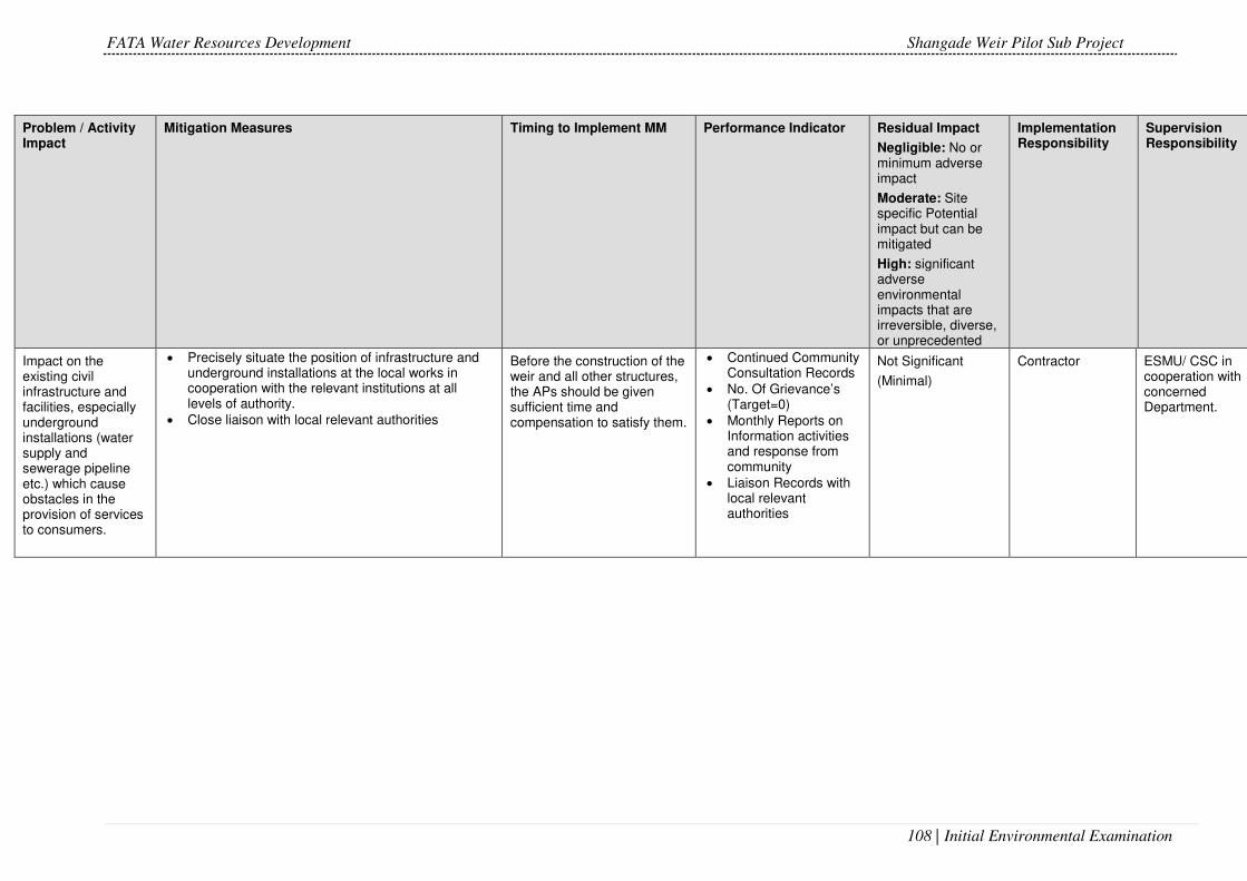
FATA Water Resources Development Shangade Weir Pilot Sub Project
108 | Initial Environmental Examination
Problem / Activity Impact
Mitigation Measures Timing to Implement MM Performance Indicator Residual Impact
Negligible: No or minimum adverse impact
Moderate: Site specific Potential impact but can be mitigated
High: significant adverse environmental impacts that are irreversible, diverse, or unprecedented
Implementation Responsibility
Supervision Responsibility
Impact on the existing civil infrastructure and facilities, especially underground installations (water supply and sewerage pipeline etc.) which cause obstacles in the provision of services to consumers.
• Precisely situate the position of infrastructure and underground installations at the local works in cooperation with the relevant institutions at all levels of authority.
• Close liaison with local relevant authorities
Before the construction of the weir and all other structures, the APs should be given sufficient time and compensation to satisfy them.
• Continued Community Consultation Records
• No. Of Grievance’s (Target=0)
• Monthly Reports on Information activities and response from community
• Liaison Records with local relevant authorities
Not Significant
(Minimal)
Contractor ESMU/ CSC in cooperation with concerned Department.

FATA Water Resources Development Shangade Weir Pilot Sub Project
109 | Initial Environmental Examination
Problem / Activity Impact
Mitigation Measures Timing to Implement MM Performance Indicator Residual Impact
Negligible: No or minimum adverse impact
Moderate: Site specific Potential impact but can be mitigated
High: significant adverse environmental impacts that are irreversible, diverse, or unprecedented
Implementation Responsibility
Supervision Responsibility
Increased possibility of employment and income in the local community.
• Prioritize qualified local population in employment. At the time of commencement of project. Complaints of APs to be solved as soon as possible.
• Job Posting and information in local communities
• Transparency of employment procedures and records
• Monthly Reports on Information activities and response from community
• Up to date information on employment opportunities
Highly Beneficial Contractor ESMU/ CSC.
Conflict due to use of privately owned agriculture land for camp construction
• Establishment of camp on community owned barren leveled land/RoW away from population at least 500m away.
• Approval of camp site from the Engineer will be obtained.
Before the construction of the project, the APs should be given sufficient time and compensation to satisfy them.
• Approval (NOC) of camp site before construction.
Not Significant
(Minimal)
Contractor
ESMU/ CSC

FATA Water Resources Development Shangade Weir Pilot Sub Project
110 | Initial Environmental Examination
Problem / Activity Impact
Mitigation Measures Timing to Implement MM Performance Indicator Residual Impact
Negligible: No or minimum adverse impact
Moderate: Site specific Potential impact but can be mitigated
High: significant adverse environmental impacts that are irreversible, diverse, or unprecedented
Implementation Responsibility
Supervision Responsibility
Social conflicts due to influx of external workforce
• Establishment of camp on community owned barren land away from population at least 500m away.
• . Contractor need to obtain approval from the Engineer.
• Hiring of work force from local communities; Awareness raising of residents for safety protection.
• Awareness raising of labor to ensure respect for local customs and norms.
• Child labor will be prohibited at sub-project sites. • Maintain record of all resources usage like water,
fuel, manpower, machinery, equipment, etc.
During the construction activities.
• Up to date information on employment opportunities
• Job Posting Records • Information Events
Record • EPC Monthly Reports • Site Audit Reports
Not Significant
(Minimal)
Contractor
ESMU/ CSC
Conflicts arising due to
Mixing of local and migratory job seekers.
• Preference to provide jobs to local job seekers. • Motivation/Trainings to the workers for a peaceful
work environment.
Before and during the construction of project.
• Up to date information on employment opportunities
• Job Posting Records • Information Events
Record • EPC Monthly Reports • Site Audit Reports
Not Significant
(Minimal)
Contractor
ESMU/ CSC

FATA Water Resources Development Shangade Weir Pilot Sub Project
111 | Initial Environmental Examination
Problem / Activity Impact
Mitigation Measures Timing to Implement MM Performance Indicator Residual Impact
Negligible: No or minimum adverse impact
Moderate: Site specific Potential impact but can be mitigated
High: significant adverse environmental impacts that are irreversible, diverse, or unprecedented
Implementation Responsibility
Supervision Responsibility
Reduced possibility through the area where the works are executed.
• Plan the relocation of equipment at time when daily traffic is not jammed; provide alternative passage for pedestrians and vehicles in cooperation with local authorities or provide a safe passage through the construction site.
• Avoid roads through inhabited areas especially near schools and hospitals.
• Prepare and implement the Construction Site Organization Plan that incorporates good construction practice measures.
Necessary evacuations to be done as when necessary if construction impacts are of significant duration and close to APs.
• Implementation of Construction Site Organization Plan
• Health and safety Plans in Place and Implemented
• Site Audit
Not Significant
(Minimal)
Contractor ESMU/ CSC
Population at increased risks of traffic accidents and construction works.
• Assure adequate warning signs, lighting, protective fencing etc.
• Observe traffic rules. • Clean construction waste form the construction site
both in the construction phase and after works completion, when closing the construction site.
• Assure medical supplies and aid through institutional and administrative arrangements with municipal hospitals at the construction site.
Prior to and throughout the construction.
• Implementation of SSEMP, Traffic Management Plant
• Accident/Incident Record
• Implementation of Construction Site Organization Plan
• Site Audits & Inspection
Not Significant
(Minimal)
Short term during construction stage
Contractor
ESMU/ CSC

FATA Water Resources Development Shangade Weir Pilot Sub Project
112 | Initial Environmental Examination
Problem / Activity Impact
Mitigation Measures Timing to Implement MM Performance Indicator Residual Impact
Negligible: No or minimum adverse impact
Moderate: Site specific Potential impact but can be mitigated
High: significant adverse environmental impacts that are irreversible, diverse, or unprecedented
Implementation Responsibility
Supervision Responsibility
Risk of injuries at work
• Demand from all workers to abide by the Protection at work measures.
• Provide protective equipment; install warning signs at the construction site.
• Prepare and implement the Construction site Organization Plan and Protection at work measures plan.
Prior to commencement and during construction
• Site Inspection • Monthly EPC Reports • PPEs issuance
records • Health and safety
Plans in Place and Implemented
• Implementation of Construction Site Organization Plan
Not Significant
(Minimal)
Contractor ESMU/ CSC
Accident risks • Preparation and implementation of HSE Plan. • Provision of PPEs. • Provision of first aid kits and emergency vehicle. • Emergency response teams. • Preparation of emergency response plans
Prior to commencement and during construction
• Monthly EPC Reports • PPEs issuance
records • Health and safety
Plans in Place and Implemented
• Implementation of Construction Site Organization Plan
• Accident/Incident Record
Not Significant
(Minimal)
Contractor ESMU/ CSC

FATA Water Resources Development Shangade Weir Pilot Sub Project
113 | Initial Environmental Examination
Problem / Activity Impact
Mitigation Measures Timing to Implement MM Performance Indicator Residual Impact
Negligible: No or minimum adverse impact
Moderate: Site specific Potential impact but can be mitigated
High: significant adverse environmental impacts that are irreversible, diverse, or unprecedented
Implementation Responsibility
Supervision Responsibility
Health risks due to unsafe and unhygienic living environment.
• Preparation and implementation of HSE Plan. Safety measures taken by the contractor such as installation of firefighting equipment, safe storage of hazardous material, fencing, provision of first aid facilities etc.; Contingency measures in case of accidents; Obligatory insurance of contractor’s staff and laborers against accidents; Provision of adequate sanitation, washing, lighting, cooking and dormitory facilities. HSE trainings to construction and camp staff.
During construction • Workplace Risk Assessment before start of works
• Health and safety Plans in Place and Implemented
Contractor
ESMU/ CSC
EHS Training • Arrange training, guidelines and brushers in Urdu to staff and laborers about the Environment, Health and Safety.
During construction • EHS Trainings and Events Record
Not Significant
(Minimal)
Contractor ESMU/ CSC
Operation Stage Impacts and Maintenance (O&M)

FATA Water Resources Development Shangade Weir Pilot Sub Project
114 | Initial Environmental Examination
Problem / Activity Impact
Mitigation Measures Timing to Implement MM Performance Indicator Residual Impact
Negligible: No or minimum adverse impact
Moderate: Site specific Potential impact but can be mitigated
High: significant adverse environmental impacts that are irreversible, diverse, or unprecedented
Implementation Responsibility
Supervision Responsibility
Construction material leftovers of after the closure of temporary construction sites
• All shivers and material that remain after the closure of temporary construction sites are to be removed from the location and re-used/re-cycled where possible.
• All remains are to be disposed of in a manner that will not be harmful to environment.
Completion of Construction • Site Inspection • Implementation of
Environmental Enhancement Program
Not Significant
(Minimal)
Short term during construction phase
Beneficial in long terms with the implementation of Environmental Enhancement Program
Contractor ESMU/ CSC

FATA Water Resources Development Shangade Weir Pilot Sub Project
115 | Initial Environmental Examination
Problem / Activity Impact
Mitigation Measures Timing to Implement MM Performance Indicator Residual Impact
Negligible: No or minimum adverse impact
Moderate: Site specific Potential impact but can be mitigated
High: significant adverse environmental impacts that are irreversible, diverse, or unprecedented
Implementation Responsibility
Supervision Responsibility
Change in visual character and soil erosion
• Restoration and Environmental enhancement plan to be prepared.
• Use of borrow areas with Engineer’s approval at specified depth.
• Limited movement of machinery. • Documentation of area. • Ensuring areas under crops are not used as borrow
areas. • Leveling and dressing of borrow areas; Water
sprinkling. • Rescue of any encountered species.
Pre Operations • Implementation of Environmental enhancement plan
• EPC Construction Completion Report
• Site Inspection
Not Significant
(Minimal)
Short term during construction phase
Beneficial in long terms with the implementation of Environmental Enhancement Program
Contractor ESMU/ CSC

FATA Water Resources Development Shangade Weir Pilot Sub Project
116 | Initial Environmental Examination
Problem / Activity Impact
Mitigation Measures Timing to Implement MM Performance Indicator Residual Impact
Negligible: No or minimum adverse impact
Moderate: Site specific Potential impact but can be mitigated
High: significant adverse environmental impacts that are irreversible, diverse, or unprecedented
Implementation Responsibility
Supervision Responsibility
Soil pollution due to excessive application of fertilizers and pesticides
• Agriculture extension programs targeting use of Integrated Pest Management (IPM), green manure, and limiting use of pesticides to required levels only will target farmer communities to inform and train them
Post Construction • Agriculture extension program developed before completion of construction
Minor FATA Agriculture Directorate
FATA Secretariat
FATA Water Resources Development Shangade Weir Pilot Sub Project
117 | Initial Environmental Examination
Problem / Activity Impact
Mitigation Measures Timing to Implement MM Performance Indicator Residual Impact
Negligible: No or minimum adverse impact
Moderate: Site specific Potential impact but can be mitigated
High: significant adverse environmental impacts that are irreversible, diverse, or unprecedented
Implementation Responsibility
Supervision Responsibility
Use of irrigation water for cultivating high delta crops
• Cultivation of high delta crops will be strictly discouraged.
Cropping pattern in accordance with the water balance model will be suggested and promoted.
Post construction Agriculture extension program developed before completion of construction
Not Significant
(Minimal)
FATA Agriculture Department
FATA Secretariat
Strategies that require development.
An ‘Operation Environmental Action Plan’ (OEAP) needs to be prepared demonstrating the manner in which the Contractor/Operator will comply with the requirements of management plans proposed in EMP.
The following strategies and procedures will be developed prior to the commencement of Project operations:
Project specific security and public access control strategy;
Project specific waste management strategy
Project specific air and noise control strategy;
Project specific traffic control strategy;
Pre Operations Implementation Operation Environmental Action Plan’ (OEAP)
Beneficial in long terms with the implementation of Operation Environmental Action Plan’ (OEAP)
ESMU /CSC PMU

FATA Water Resources Development Shangade Weir Pilot Sub Project
118 | Initial Environmental Examination
Problem / Activity Impact
Mitigation Measures Timing to Implement MM Performance Indicator Residual Impact
Negligible: No or minimum adverse impact
Moderate: Site specific Potential impact but can be mitigated
High: significant adverse environmental impacts that are irreversible, diverse, or unprecedented
Implementation Responsibility
Supervision Responsibility
Monitoring programmes
The following monitoring programmes will be developed prior to the commencement of Project operations:
Landslide monitoring;
Water quality monitoring
Watershed and flood telemetry monitoring
Operational stage
Site Inspection
Monitoring Reports
Beneficial in long terms with the implementation of Operation Environmental Action Plan’ (OEAP)
FATA Irrigation Department
FATA Secretariat
Training/ educational programmes.
The following educational programmes will be developed prior to the commencement of Project operations: • Employee induction programme on environmental
awareness; • Employee code of conduct; • Health and Safety training programme
Operational stage
Implementation of Training Events and Programs
Highly Beneficial FATA Irrigation Department
FATA Secretariat
MM: Mitigation Measures

FATA Water Resources Development Shangade Weir Pilot Sub Project
119 | Initial Environmental Examination
Monitoring Activities
For each of the environmental components, the monitoring plan specifies
the parameters to be monitored; location of the monitoring sites and duration
of monitoring. The monitoring plan also specifies the applicable standards,
implementation and supervising responsibilities.
In addition to the critical locations selected during design stage, the
environmental monitoring will also be done at the construction camp site and
any other plant site as determined relevant during rehabilitation works stage.
Performance Indicators
A key aspect of monitoring is defining relevant indicators. A Performance
Indicator is a measurable value that demonstrates how effectively the EMP
is achieving its key objectives, evaluated against the criteria defined in
environmental management Plan.
Table 6.2 Environmental Monitoring
Sr. No.
Test Frequency Parameters Location of Monitoring
Number of samples
1 Water Quality
Quarterly pH
Colour
Odour
Electrical Conductivity
Turbidity
Alkalinity
Bicarbonate
Carbonate
Calcium
Sodium
Pottasium
Hardness
Sulphate
Nitrates
TDS
Total Coliforms & E-Coli
Surface water sample to be collected 10 m downstream of the weir.
Drinking water sample from Labour camp
02 (surface and Ground water)
2 Air Quality
Quarterly Carbon Monoxide (CO)
Sulfur Dioxide (SO2)
Nitrogen Oxide (NO)
Oxides of Nitrogen (NOx)
PM10
10 m from the main construction site
01

FATA Water Resources Development Shangade Weir Pilot Sub Project
120 | Initial Environmental Examination
Suspended Particulate Matter (SPM)
3 Noise Quality
Quarterly Quarterly and whenever required in an emergency or exceeding the NEQS limits
10 m from construction site
02
Project Enhancement Plans
Restoration Plan
If during construction, further material is required or contractor needs to
borrow material from any other site, then the contractor can acquire private
land in accordance with the lease agreement with the land owner.
Photographic record will be kept before and after the land use as borrowing
area. The contractor will not leave borrowing pit in such a condition that they
are unusable and could be filled with rain water and provide breeding place
for mosquitoes or cause any health and safety issues. Agricultural land
should be restored such that it can be re-used for the agricultural purpose.
The topsoil of agricultural land, if used as borrow area, should be removed
up to 6 inches and kept separate on site for its re-spread back on the leveled
borrow area. Then the site area should be leveled for placing the topsoil
back.
Reports
The Environmental Specialist of the Construction Supervision Consultant
(CSC) shall produce periodical reports as well as inspection notes based
upon the visits to the subproject site. The contractor will submit weekly
checklist report to CSC on the basis of which CSC will prepare monthly report
and submit to PMU. Similarly, CSC will prepare Bi-annual report and submit
to PMU.
This information shall make a basis for Project Management Unit (PMU) for
their further reporting or visiting the site. All reports shall be location based
and activity specific. The reports shall especially identify areas of contractor’s
noncompliance with the EMP and provide guiding remarks on actions to be
taken. The significance of the non-compliance shall also be noted. Copies of
these reports shall be sent to the Resident Engineer (RE) who shall forward
them to the team leader, Head PMU and the contractor for their action(s). The
RE will include in routine reports a summary status of activities relating to the
EMP. Supplemental reports on issues should also be prepared when
required.

FATA Water Resources Development Shangade Weir Pilot Sub Project
121 | Initial Environmental Examination
The consultant’s environmental team will produce daily, monthly reports, as
well as a final report of the project based on the information collected. The
Table of Contents (TOC) is annexed. The list of distribution reports is given
in Table 6.3.
Table 6.3: Distribution of Reports
Training Schedule
Environmental training will form part of the Environment Management Plan.
The training will be conducted for all personnel involved in the project works.
The key objective of training program is to ensure that the requirements of
the EMP are clearly understood and followed throughout the Sub Project.
The trainings to the staff will help in communicating environmental related
restrictions specified in the EMP. The contractors will be primarily
responsible for providing environmental training to all project personnel on
potential environmental issues of the Sub Project. Responsibility of trainings
related to public safety lies with PIU. In addition to the training specified in
the training log, special/ additional trainings will be provided during the Sub
Project activity.
Report
Prepared by Reviewed by Distribution
Weekly
Checklist
Contractor’s
HSE/Environment officer
Contractor`s Environment
Officer and Consultant’s
Environment Specialist
Resident Engineer
Monthly Environment team of the
Design & Construction
Supervision Consultants
PMU`s Environment
Specialist
Project Director
Effects
Monitoring
Environment team of the
Design & Construction
Supervision Consultants
PMU`s Environment
Specialist
Project Director
Change
Management
Environment team of the
Design & Construction
Supervision Consultants
PMU`s Environment
Specialist
Project Director
Semi-annual Environment team of the
Design & Construction
Supervision Consultants
PMU`s Environment
Specialist
ADB through Project
Director
Final Environment team of the
Design & Construction
Supervision Consultants
Reviewed by ESMU of
ESMU
ADB through Project
Director

FATA Water Resources Development Shangade Weir Pilot Sub Project
122 | Initial Environmental Examination
Implementation Estimated Budget
Contractor will be responsible for the implementation for environmental
mitigation plan. Most of the mitigation measures are covered in the
engineering costs of the respective works. However, cost for some of the
mitigation and monitoring activities are estimated below in Table 6.426 while
the Environmental Manager cost is included as part of the Contractor key
personnel covered under the bid documents (Key Personnel Requirements).
Major civil works are main Weirs and irrigation channel and the subproject
entails no large labor force and the PPEs like safety shoes, helmets, gloves
and masks will be covered under the Contractors cost. The EHS training
component is given to Project Design and Supervision Consultants expert
who is responsible to conduct regular EMP envisaged trainings for the
contractor’s crews and staff.
Table 6.4: Implementation Estimated Budget
Item No Item Description
Parameters Frequency Rate (Rs)
As per Contract Amount
Quantity Amount
1 Air Testing at site
1. Carbon Monoxide (CO)
2. Sulfur Dioxide (SO2) 3. Nitric Oxide (NO) 4. Nitrogen Dioxide
(NO2) 5. PM10 6. PM2.5
Quarterly 8000 4/year 32000
2 Noise Testing at
site
1. Noise Quarterly 1000 4/year 4000
3 Water Testing in
Lab
1. Total Coli form 2. E. coli 3. pH 4. Total Dissolved solids
(TDS) 5. Total Hardness as
CaCO3 6. Sodium 7. Potassium 8. Sulphate 9. Chloride 10. Alkalinity 11. Color 12. Odor 13. Taste 14. Nitrogen-Nitrates 15. TSS
Quarterly 11000 8/year 88000
Total 1,24,000
Contingency Cost @5%
6200
Grand Total 1,30,200
26 Note: All the budgets are calculated in 2017 without any escalation rates and taxes. Actual budget will be provided by the Contractor at the time of implementation.

FATA Water Resources Development Shangade Weir Pilot Sub Project
123 | Initial Environmental Examination
Third Party Monitoring
The purpose of third party monitoring is to ensure that the project is
implemented with the due concern for Environment and Social Safeguards
according to ADB’s Safeguards Policy Statement (SPS) 2009, and
specifically to ensure that these issues are adequately addressed in
compliance with the approved EIA/IEE reports and Environment
Management plan (EMP). The third party monitoring consultant will check /
validate these reports during the construction phase of the project to ADB
and also the Project Completion Report.
As per TOR of the Contract the Third Party Consultant will perform the
following key tasks.
i. Review the sub-project's environmental performance to ensure that it
complies with the national environmental legislation, requirements
under Pakistan Environmental Protection Act, ADB's environmental
safeguards as stipulated in Safeguard Policy Statement (SPS) and
relevant environmental documents (IEE, EIA, Site specific EMP,
Environmental Assessment and Review Framework);
ii. Monitor and participate in selected sub-projects' design and
construction stage consultations;
iii. Monitor the performance of consultants in delivering the services and
the performance of EA/PMU/PIUs and IAs in delivering their roles and
responsibilities so that the project stay compliant with ADB
environmental safeguards;
iv. Monitor on sample basis EMP compliance at a construction site;
v. In the case of unpredicted environmental impacts occurring during
project implementation, provide guidance on the preparation of a
corrective action plan, and monitor its implementation;
vi. Support the PMU in information sharing and disclosure of
environmental safeguard documents, training on environmental
management, and health and safety aspects to project staff;
vii. If required, participate in the ADB project review missions to assist in
due diligence reviews and analyses;
viii. Identify implementation capacities gaps, recommend improvements
and troubleshooting to address bottlenecks and emerging issues that
affect project management;
The Consultant will deliver (a) third party monitoring detailed plan in
consultation with the EA, PMU, PIU and IAs; (b) biannual external

FATA Water Resources Development Shangade Weir Pilot Sub Project
124 | Initial Environmental Examination
environment safeguards monitoring report; and (c) collate and provide input
to the final TA report. The Consultant will report to ADB Project Team Lead
in PRM Islamabad.

FATA Water Resources Development Shangade Weir Pilot Sub Project
125 | Initial Environmental Examination
PUBLIC CONSULTATION
General
Public Consultation is a process to disclose project information to the local
communities and other concerned stakeholders and record feedback regarding
the proposed subproject and preference. It brings new ideas and information in
a dynamic and integrated way. It also educates the community towards type and
objectives of the subproject and persuades them to be rational to participate in
the subproject activities.
The public consultation process was commenced in the initial feasibility stages
(prior to construction) in order to disclose the project information to the
stakeholders. The stakeholders involved in the process, were the population
likely to be impacted, the village leaders and relevant departments.
Prior to the implementation of the subproject, the consultations have been carried
out to support this EMMP. The focus of attention has been the population near
the subproject area that may be affected by the subproject. The level of
engagement varied from the stakeholder to stakeholder with some registering no
major comment but it is noted that none registered any outright opposition to
subproject.
The disclosure of the subproject intervention and subsequent consultation with
stakeholders is imperative for the environmental assessment and mitigation of
impacts. Public consultation can also provide a conduit for the improvement of
the subproject implementation to better serve the stakeholders. In this EMMP,
the consultation process was performed to achieve the objective of ADB Safe
guard’s policy statement 2009.
The main objectives of public participation and consultation are to achieve the
following:
• Ensure public and community participation in the subproject environmental
policy objectives and decision making.
• Ensure public confidence in the administration of the environment by
demonstrating the role of government to enforce the environmental
stewardship of government agencies and organs, corporate citizens and
elite organizations;
• Grant the citizenry access to environmental information and data, thereby
promoting the quality of environmental management and compliance
monitoring.
• Provide key project information and create awareness among various
stakeholders about project intervention;

FATA Water Resources Development Shangade Weir Pilot Sub Project
126 | Initial Environmental Examination
• Have interaction for primary and secondary data collection with project
affectees and other stakeholders;
• Begin establishing communication and an evolving mechanism for the
resolution of social and environmental problems at local and project level;
• Involve project stakeholders in an inclusive manner; and
• Receive feedback from primary stakeholders on mitigation and
enhancement measures for environmental and social impacts.
Community engagement provides a valuable link between the stakeholders of
the subproject and serves by;
• Enabling the community to be better informed
• Reducing the level of misconception/ misinterpretation or deception
• Ensuring commitment and greater ownership of the final decision by the
community
• Strengthening relationships between project cycle and the community
• Encouraging the community to put forward ideas
• Assembling better understanding of local needs
• Helping to identify issues which may not otherwise have been considered
Identification of Stakeholders
Stakeholders are persons or groups who are directly or indirectly affected by a
project as well as those who may have interests in a project and/or the ability to
influence its outcome, either positively or negatively. Stakeholders of the
subproject include locally affected communities, local government authorities,
and civil society organizations, groups with special interests, the academic
community, or businesses. (Figure 7.1).
During the field survey, different stakeholders identified, were the villagers, local
residents, government officials, farmers, public representative, NGO’s and
general public. All those stakeholders had different types of stakes according to
their professions.
Two types of the stakeholders were identified: the primary stakeholders, who
would be directly affected by the subproject; and the secondary stakeholders,
who would be indirectly affected by the subproject.

FATA Water Resources Development Shangade Weir Pilot Sub Project
127 | Initial Environmental Examination
Figure 7.1: Identification of Stakeholders
These stakeholders were contacted by the Construction Supervision Consultants
(CSC) in March 2017. Their views and reservations/ concerns about the
subproject were taken into consideration. Construction Supervision Consultants
also interacted with the community based organizations that can support the
community during the execution of the subproject.
Tribal society is dominated by men with final say in the affairs of all members of
the family. Women, by comparison, play a subservient role and observe strict
purdah (veiling). They are for the most part restricted to performing household
work, and are excluded from decision-making both on the domestic front and at
the community level. Keeping in mind the above background, women of the
subproject area were not consulted.

FATA Water Resources Development Shangade Weir Pilot Sub Project
128 | Initial Environmental Examination
Methodology
To carry out stakeholder consultations, the survey team adopted a strategic and
flexible approach, where influential were earlier briefed and taken into confidence
for holding community level meetings and followed by candid meetings with
residents and small group meetings with locals.
A number of comprehensive consultations were carried out with the subproject
stakeholders at various locations during the preparation of environmental and
social impact assessment. The consultation and scoping sessions were designed
specifically to provide subproject information to the public. These sessions were
informal so as to encourage friendly social environment in which participants may
feel comfortable in raising questions, expressing their opinion and concerns
about the subproject besides seeking clarification regarding their concerns. The
focus group discussions were instrumental in the process, whereas one-to- one
meetings were also held with the institutions.
The subproject survey was carried out to cover socio-economic condition of the
area and to assess the farmer community’s demands and difficulties with the
consideration of the following protocols:
The meeting was freely formatted so as to avoid any uneasiness of local farmers
and to provide them maximum freedom of speech.
• Survey team has highlighted the potential benefits of project
implementation and noticing any aspects which would need to be covered
in greater detail during execution stage.
• Discussions were also made regarding the proposed rehabilitation of
irrigation system and feedback /suggestions based on historical knowledge
of area were recorded.
• Preliminary assessment of community’s willingness was assessed to
contribute to project implementation in the form of local labour with the Civil
Works Contractor.
Agenda of Consultative Session
The agenda for the consultative session with local farmers was prepared after
investigating all existing irrigation infrastructure in the area. Similarly, an informal
interview guide was used to obtain views of key informants on the issues of
irrigation in the project area. Data obtained helped the facilitator in drafting and
adopting the following agenda for the community meetings.
To assess the apprehensions and aspirations of the local farmers
regarding improvements to the existing irrigation infrastructure;

FATA Water Resources Development Shangade Weir Pilot Sub Project
129 | Initial Environmental Examination
To assess indigenous knowledge of potential improvements in
irrigation system
Knowledge and experience of any similar works undertaken by
government agencies, NGOs and other technical institutions.
Local Farmer Views
The local farmers openly expressed their views that farmers understood fully that
improved and ensured surface water supply is the only way to improve agriculture
and rural livelihood. The improved surface water supplies will contribute to
minimize reliance on ground water abstraction thus, resulting into improved
income and regulated ground water regime. The peoples told that the tail end
users will not receive water, as experience of surrounding irrigated area. Farmers
termed the uncertain and unreliable supply of the canal water. No one has directly
or indirectly indicated any negative feelings towards the proposed intervention.
Table 7.1 shows the farmers views for dissatisfaction with canal system.
Table 7.1: Farmer Reasons for Dissatisfaction with Canal Systems
Grievances % Farmer views
Katcha water-courses 25%
Poor timing management 7%
Water theft 25%
Inadequate supply 35%
Water wastage 2%
Mogha Problems 6%
Relations between farmers and Irrigation Department officers are generally poor.
Rural farmers have little trust in government generally and in the Irrigation
Department in particular. Therefore, the proposed weir will be supervised by the
farmer community. The irrigation Department will arrange only the major repair in
future.
When asked whether a Farmers’ Organization (FO) would be useful or not,
respondent answers were largely in favor (90%). Farmers want FOs to share the
resolution of issues like water theft, cementing of watercourse etc, agricultural
issues (e.g. marketing) and credit etc.
The participants were in complete agreement about the benefits of the project
and expressed full support to the project. Qualitative assessment during the field

FATA Water Resources Development Shangade Weir Pilot Sub Project
130 | Initial Environmental Examination
survey indicates that the community is willing to contribute to sub-project
implementation by working as unskilled labour. The preference is to work during
the agricultural off-season. Training in labour-based construction works will be
needed in order to implement the project efficiently. This will also result in
necessary basic skills transfer for future maintenance of the scheme.
Consultation with Other Stakeholders and Their Response
The potential stakeholders were inhabitants, field staff of FATA Irrigation
Department (FID) and other relevant departments working in the Sub Project
area. During the consultation, maximum information about the Sub Project was
shared. A list of Government official consulted is enlisted in Table 7.2 and local
Notables/beneficiaries farmers are in Table 7.3.
All the stakeholders including the local community were consulted about the
proposed subproject. Salient features of the subproject and requirement of ADB
SPS were discussed. Subproject does not require land acquisition and no
resettlement of the people is involved. There is no major issue related to the RoW
of the subproject, which was provided by Irrigation Department. Public
consultation was also made with the local people residing in the adjacent and
surveyed villages in the subproject area. The discussion was focused on the
impacts of the proposed subproject.
The people were pleased to know about the proposed subproject. They
appreciated the efforts of taking-up the subproject for providing benefits to the
public.
The stakeholders were asked about the likely impacts of the proposed subproject
during construction/ execution phases. Most of the people have knowledge about
the subproject. The people of the area were informed about the both negative
and positive impacts of the subproject. They responded that the negative impacts
like noise and dust are very minor and temporary issues as compared to the
positive impacts which will help them to improve their socioeconomic conditions.
People of the area were demanding some basic facilities like drinking water
supply, electricity, Schools and Basic Health Units (BHU) etc however they were
told that the project focuses only on improving irrigation and efficient use of water
resources. They also demanded for flood protection wall. Their concerns were
noted and were shared with the line department and their queries about the
subproject were answered to their satisfaction. Suggestions were also sought
from the locals for incorporating mitigation measures in the EMP.

FATA Water Resources Development Shangade Weir Pilot Sub Project
131 | Initial Environmental Examination
Table 7.2: List of Government Official Contacted
Table 7.3: List of Community Consultation Participants
S No. Name Father’s Name Adress Cell #
1 Akhtar Zaman
Jahangriz Tehsil Jamrud Khyber Agency, Gudar
03015005935
2 M Nawaz
Hazrat Muhammad
Tehsil Jamrud Khyber Agency, Gudar
03464292696
3 Kamil Shah Arman Shah
Tehsil Jamrud Khyber Agency, Gudar
03449558048
4 Junaid Shah Ahmad Shah
Tehsil Jamrud Khyber Agency, Gudar
03049016786
5 Asif Khan Arif Khan
Tehsil Jamrud Khyber Agency, Gudar
03025535889
6 Kamran Anar Shah
Tehsil Jamrud Khyber Agency, Gudar
03069229224
7 Usman Said badshah
Tehsil Jamrud Khyber Agency, Gudar
03069229224
8 Akhtar Shah Hikmat Shah
Tehsil Jamrud Khyber Agency, Gudar
03005879695
9 Sadiq Anar Shah
Tehsil Jamrud Khyber Agency, Gudar
03069229224
10 Qadeer Naimat
Tehsil Jamrud Khyber Agency, Gudar
03459199522
11 Gul Sher Hikmat Shah
Tehsil Jamrud Khyber Agency, Gudar
03015005935
12 Arman Shah Gul Massh Lashora, Jamrud 03038967892
13 Muzamil Shah
Shamshed Khan
Lashora, Jamrud 03040623562
14 InamUllah Shamshad Lashora, Jamrud 03015854892
15 Mehboob Shah
Yar Shah Lashora, Jamrud 03429865194
16 Khadim Shah Mira Khan Lashora, Jamrud 03015851493
17 Adnan Saz Akhtar Gul Lashora, Jamrud 03055268989
18 ZabihUllah Jumma Khan Lashora, Jamrud 03027570189
19 Noor Jalal Akhtar Gul Lashora, Jamrud
20 Mir Muhammad
Lashora, Jamrud
21 M Hussain Astan Amir Lashora, Jamrud
Sr. No Name Designation. Contact No
Department
1 Nasrat
Shaheen
Agricultural
officer 091 2211998 Agriculture
2 Abdurahman XEN 03009065647 (0942-
220393) Irrigation
3 Fazal Ilahi DFO 091 9213830
03009034468 Forest

FATA Water Resources Development Shangade Weir Pilot Sub Project
132 | Initial Environmental Examination
22 Shoukat Hazrat Ullah Lashora, Jamrud
23 Raziq Mir Muhammad Lashora, Jamrud
Figure 7.2: Community Meetings at Shangade

FATA Water Resources Development Shangade Weir Pilot Sub Project
133 | Initial Environmental Examination
GRIEVANCE REDRESS MECHANISM
General
A Grievance redress mechanism (GRM), consisted with the requirements of ADB
safeguard policies will be established to prevent and redress community
concerns, reduce risks, and assist the project to maximize social and
environmental benefits, in addition to serving as a platform to resolve grievances,
for this purpose a public complaint Centre with public complaint committee will
be established in all concerned Agencies where the project activities are in
progress. Generally, all project staff, management staff involved in the project,
and government administrators will take on grievance handling as a
responsibility. The GRM members should be qualified, experienced, and
competent personnel who can win the respect and confidence of the affected
communities. Criteria for selecting members of GRM could include the following
knowledge of the project, its objectives, and outcomes; technical knowledge and
expertise, e.g., irrigation, engineering, environmental, geological; understanding
of the social, economic, and cultural environments and the dynamics of the
communities; capacity to absorb the issues dealt with and to contribute actively
to decision-making processes; social recognition and standing; and an equitable
representation of the community.
Composition of following committee members are being proposed for public
complaint Centers at concerned Agencies where project activities are prevailing,
1. Chairperson, Project Director-FWRDP.
2. Member, community elder/Malak, Religious leader.
3. Member, Social Development Officer/ Resettlement officer - FWRDP.
4. Member, Environment Officer - FWRDP
5. Member from village organization (one for Executive body and one for
general body)
6. Member, PIU (Project Manager, Monitoring officer and Social organizer)
7. Member from Contractor/Environment Specialist/Manager
8. Member PA Representative
9. Member from Line Department
Objectives of Grievance Redress Mechanism
The main objective of establishing GRM is to resolve problems in an efficient,
timely and cost-effective manner in a cordial environment with the participation
of all stakeholders including affected parties. Under the GRM, it shall describe
the options available to the project for grievance redress. Any environmental or

FATA Water Resources Development Shangade Weir Pilot Sub Project
134 | Initial Environmental Examination
social impacts that would be adversely affecting the general public in the project
area should be resolved at the GRC.
The PIU shall indicate how these would be disseminated and accessible to
affected parties in a way that should be clear and comprehensible to the
Implementing Agency (IA) also. The grievance redress mechanism should also
have an in-built monitoring mechanism to check on responsiveness to complaints
or grievances lodged. The different forms of receiving the complaints should be
clearly described together with the different stages of going through the process.
In addition, the redress mechanism shall indicate alternatives, in case the
proposed mechanism, for any reason, does not respond to all grievances and
complaints. GRM should be able to provide benefits to both the project and
affected parties by setting up following objectives,
• Provide a forum for redressing grievance and disputes at the lowest level.
• To build up productive relationship among the all stakeholders including
affected parties.
• Provide access to affected parties to negotiate and influence the decisions and
policies of the project which might be adversely affected to them.
• Mitigates or prevents adverse impacts of the project on communities and
produces appropriate corrective or preventive action.
• To harmonize both project and affected parties activities.
• open channels for affective communication, including the identification of new
social and environmental issues of concern arising from the project:
• The GRM will be accessible to diverse members of community, including more
vulnerable groups such as women and youth
• Opportunities for confidentialities and privacy for complainants are to be
honored where this is seen as important
Awareness of GRM
GRM should be widely publicized among stakeholder groups such as the affected
Communities, government agencies, and Community organizations. Lack of
knowledge about GRM results in people not approaching and using them, and
they eventually lose the importance and the validity of the purpose for which they
were created. People should also be informed about their options, depending on
the types of complaints, but should not be encouraged to submit false claims.
Criteria for eligibility need to be communicated. An effective awareness campaign

FATA Water Resources Development Shangade Weir Pilot Sub Project
135 | Initial Environmental Examination
should be launched to give publicity to the roles and functions of the GRM and
should include the following components:
• How complaints can be reported to those GRMs and to whom, e.g., phone, postal
address and email addresses, of the GRMs as well as information that should be
included in a complaint; procedures and time frames for initiating and concluding
the grievance redress process; boundaries and limits of GRMs in handling
grievances; and Roles of different agencies such as project implementers and
funding agencies.
A variety of methods can be adopted for communicating information to the
relevant
Stakeholders:
• Display of posters in public places such as in government offices, project offices,
Community centers, etc.; distribution of brochures;
• P.O BOX number should be established to receive the grievance of the affected
community through mail in all concern agencies
• Community-based organizations; and print and electronic media, including radio.
Implementation of GRM
Stage 1:
When a grievance arises, (Social & Environment/Any) the affected person may
contact directly with the contractor/operator and the project manager to resolve
the issue of concern, if the issue is successfully resolved, no further follow up is
required.
Stage 2:
If no ad hoc solution to be found the affected person/s will submit an oral or written
complaint to the Public Complaint Centre (PCC) by themselves, for an oral
complaint the PCC must make a written record, for each complaint PCC must
investigate the complaint, assess its eligibility and identify an appropriate
solution, it will provide a clear response in five working days to the complainant,
the PCC will instruct the contractor to take corrective action. The PCC will review
the contractor response and undertake additional monitoring, during the
complaint investigation, the PCC will work in close consultation with the
contractors and the supervising engineer (during construction). The contractor
during construction and the IA during operation should convey the outcome to
the PCC within seven working days.

FATA Water Resources Development Shangade Weir Pilot Sub Project
136 | Initial Environmental Examination
Stage 3:
If no solution can be identified by the PCC or if the complainant is not satisfied
with the suggested solutions under stage 2, the PCC will organize within two
weeks a multi stakeholders meeting under the auspices of the Fata irrigation
department, where all relevant stakeholder (i.e. the complainant, IA,
contractor/operator, relevant local government offices) will be invited. The
meeting should result in solution acceptable to all, and identify responsibility and
action plan.
The contractor during construction and IA during operation should implement the
agreed upon redress solution and convey the outcome to the PCC within seven
working days.
Stage 4;
If the multi stakeholder hearing process is not successful, the PCC will inform
Project Steering Committee (PSC), A project steering committee headed by
additional chief secretary, FATA Secretariat, will provide policy guidelines for
smooth running of the project activities, the Members of PSC include the
secretary, P&D. Secretary finance FATA Secretariat, Director General projects,
FATA Secretariat, Representative of SAFRON Division, Government of Pakistan,
Islamabad, Representative of Planning & Development Division Government of
Pakistan, Islamabad, Political Agents of Khyber, Bajaur, Mohmand Agency and
representatives of all concerned line departments. The Project Director will
participate as PSC member cum Secretary. The PSC will meet at least twice a
year or more frequently, whenever issues requiring resolution are submitted for
its consideration. The PSC will organize special meetings to address the problem
and identify its solution.
Stage 5:
If the affected people are still not satisfied with the reply in stage 4, he or she can
go through local judicial proceedings. i.e. Jirga

FATA Water Resources Development Shangade Weir Pilot Sub Project
137 | Initial Environmental Examination
Figure 8.1: Proposed GRM

FATA Water Resources Development Shangade Weir Pilot Sub Project
138 | Initial Environmental Examination
CONCLUSION, FINDINGS AND RECOMMENDATIONS
Findings and Recommendations
The assessment of potential impacts of the proposed Shangade weirs subproject
reveals that this project will generate only minor to moderate adverse
environmental impacts. These adverse impacts will be mostly confined to the
construction works and will be temporary in nature. The predicted adverse
impacts will be minimized and reduced by implementing the prescribed mitigation
measures and will be continually monitored by implementing and updating the
EMP.
The overall finding is that the beneficial gains provided by Irrigation project will
by far exceed the negative impacts – most of them being short-termed and
without major interference to both the bio-physical and human environment. All
mitigation measures proposed in the Environmental Management Plan are
deemed to be appropriate. The Environmental Monitoring Plan represents the
basic verification tool for ensuring the effectiveness of the proposed measures.
It is emphasized that the success of the EMP depends on the respective line
agencies and institutions identified as key players in the implementation of the
EMP. The timely and complete inclusion of the EMP’s compliance clauses in the
Contractor documents is mandatory to ensure the success of all environmental
safeguard measures.
Conclusion
As the project is exclusively an irrigation system, all identified adverse
environmental impacts during the rehabilitation and improvement works of the
project will be of minor to moderate in nature, easily to be mitigated by adequate
implementation of the Environmental Management and Monitoring Plans. Entire
command of the project components does not include any environmentally
sensitive areas. The measures taken to adequately mitigate negative impact in
the construction phase will be the most important task. Implementation of
proposed mitigation measures are deemed to be sufficient for negating the
potentially identified impacts. The supervision of the mitigation measures
provided in the contractor’s documents is the key for completing this project in an
environmentally sound manner.
The final conclusion is that, the project is environmentally safe and socially
acceptable project.
A few, essentially minor, negative residual impacts identified in the Impact
Assessment during the feasibility study design are all unavoidable and there are
no technically or economically feasible alternatives which would remove them
altogether.

FATA Water Resources Development Shangade Weir Pilot Sub Project
139 | Initial Environmental Examination
ANNEXURES

FATA Water Resources Development Shangade Weir Pilot Sub Project
140 | Initial Environmental Examination
ANNEX – I Photo log

FATA Water Resources Development Shangade Weir Pilot Sub Project
141 | Initial Environmental Examination

FATA Water Resources Development Shangade Weir Pilot Sub Project
142 | Initial Environmental Examination
ANNEX – II Supporting Documents

FATA Water Resources Development Shangade Weir Pilot Sub Project
143 | Initial Environmental Examination

FATA Water Resources Development Shangade Weir Pilot Sub Project
144 | Initial Environmental Examination

FATA Water Resources Development Shangade Weir Pilot Sub Project
145 | Initial Environmental Examination

FATA Water Resources Development Shangade Weir Pilot Sub Project
146 | Initial Environmental Examination

FATA Water Resources Development Shangade Weir Pilot Sub Project
147 | Initial Environmental Examination

FATA Water Resources Development Shangade Weir Pilot Sub Project
148 | Initial Environmental Examination

FATA Water Resources Development Shangade Weir Pilot Sub Project
149 | Initial Environmental Examination

FATA Water Resources Development Shangade Weir Pilot Sub Project
150 | Initial Environmental Examination

FATA Water Resources Development Shangade Weir Pilot Sub Project
151 | Initial Environmental Examination

FATA Water Resources Development Shangade Weir Pilot Sub Project
152 | Initial Environmental Examination

FATA Water Resources Development Shangade Weir Pilot Sub Project
153 | Initial Environmental Examination
FATA Water Resources Development Shangade Weir Pilot Sub Project
154 | Initial Environmental Examination
ANNEX III - National Environmental Quality Standards (NEQS)
Table 1: Effluent Discharge Standards (NEQS 2000) Applicable to the Works
Sr. No. Determinant NEQS
1 Temperature 40 OC =≤3 deg. 2 pH 6 – 9
3 BOD5 80 mg/l
4 Chemical Oxygen Demand (COD) 150 mg/l
5 Total Suspended Solid (TSS) 200 mg/l
6 Total Dissolved Solids 3500 mg/l
7 Grease and Oil 10 mg/l
8 Phenolic compounds (as phenol) 0.1 mg/l
9 Ammonia 40 mg/l
10 Chlorine 1.0 mg/l
11 Chloride 1000.0 mg/l
12 Sulphate 600 mg/l
13 Manganese 1.5 mg/l
14 Fluoride 10 mg/l
15 Cyanide (as CN’) total 1.0 mg/l
16 An-ionic detergents (as MB As) 20 mg/l
17 Sulphide (S-2) 1.0 mg/l
18 Pesticides 0.15 mg/l
19 Cadmium 0.1 mg/l
20 Chromium trivalent and hexavalent 1.0 mg/l
21 Copper 1.0 mg/l
22 Lead 0.5 mg/l
23 Mercury 0.01 mg/l
24 Selenium 0.5 mg/l
25 Nickel 1.0 mg/l
26 Silver 1.0 mg/l
27 Total Toxic metals 2.0 mg/l
28 Zinc 5.0 mg/l
29 Arsenic 1.0 mg/l
30 Barium 1.5 mg/l
31 Iron 8.0 mg/l
32 Boron 6.0 mg/l

FATA Water Resources Development Shangade Weir Pilot Sub Project
155 | Initial Environmental Examination
Table 2: National Environmental Quality Standards (NEQS) for Gaseous Emission
(mg/Nm3, Unless Otherwise Defined)
Sr.
No. Parameter Source of Emission
Existing
Standards
Revised
Standards
1 2 3 4 5
1. Smoke Smoke Opacity not to exceed 40% or 2
Ringlemann Scale
40% or 2
Ringlemann
Scale or
equivalent smoke
number
2.
Particulate
Matter
(I)
(a) Boilers and Furnaces
(i) Oil fired
(ii) Coal fired
(iii) Cement Kilns
(b) Grinding, crushing, clinker
coolers and Related processes,
Metallurgical Processes,
converter, blast furnaces and
cupolas.
300
500
200
500
300
500
200
500
3. Hydrogen
Chloride Any 400 400
4. Chlorine Any 150 150
5. Hydrogen
Fluoride Any 150 150
6. Hydrogen
Sulphide Any 10 10
7. Sulphur Oxide (2) (3)
Sulfuric acid/ Sulphonic acid
plants
Other plants except power
plants operating on oil and coal
400
1700
8. Carbon
Monoxide Any 800 800
9. Lead Any 50 50
10. Mercury Any 10 10
11. Cadmium Any 20 20
12. Arsenic Any 20 20
13. Copper Any 50 50
14. Antimony Any 20 20
15. Zinc Any 200 200
16.
Oxides of
Nitrogen
(3)
Nitric acid manufacturing unit.
Other plants except power
plants operating on oil or coal:
Gas fired
Oil fired
Coal fired
400
-
-
400
600
1200
Explanations:-
1. Based on the assumption that the size of the particulate is 10 micron or more.
2. Based on 1 percent sulphur content in fuel. Higher content of Sulphur will case standards to be pro-rated.

FATA Water Resources Development Shangade Weir Pilot Sub Project
156 | Initial Environmental Examination
3. In respect of emissions of sulphur dioxide Nitrogen oxides, the power plants operating on oil and coal as fuel shall in addition to National Environmental Quality Standards (NEQS) specified above, comply with the following standards.
Table 3: National Environmental Quality Standards (NEQS, 2009) for Vehicular
Emission
Sr.
No. Parameter
Standard (Maximum
permissible Limit) Measuring Method Applicability
1 Smoke
40% or 2 on the
Ringlemann Scale during
engine acceleration
mode.
To be compared with
Ringlemann Chart at a distance
of 6 meters or more
Immediate effect
2
Carbon
Monoxide
(CO)
6%
Under idling condition: Non-
dispersive infrared detection
through gas analyzer.
3 Noise 85 dB(A) Sound Meter at 7.5 meters from
the source
Table 4: National Environmental Quality Standards (NEQS, 2010) for Noise
Sr.
No.
Category of Area /
Zone
Effective from 1st July,
2010
Effective from 1st July,
2013
Limit in dB (A) Leq*
Daytime Night-time Daytime Night-time
1 Residential Area (A) 65 50 55 45
2 Commercial Area (B) 70 60 65 55
3 Industrial Area (C) 80 75 75 65
4 Silence Zone (D) 55 45 50 45
Note:
1. Daytime hours: 6:00 a.m. to 10:00 p.m.
2. Night-time hours: 10:00 p.m. to 6:00 a.m.
3. Silence Zone: Zones which are declared as such by the competent authority. An area comprising not less than 100 meters round hospitals, educational institutions and courts.
4. Mixed categories of areas may be decided as one of the four above mentioned categories by the competent authority.
*dB (A) Leq: Time weighted average of the level of sound in scale “A” which is relatable to human hearing.

FATA Water Resources Development Shangade Weir Pilot Sub Project
157 | Initial Environmental Examination
Table 5: National Environmental Quality Standards (NEQS, 2010) for Drinking
Water
Sr.
No. Properties/Parameters
Standard Values for
Pakistan WHO Standards Remarks
BACTERIAL
1
All water is intended for
drinking (E.Coli or
Thermotolerant Coliform
bacteria)
Must not be
detectable in any
100ml sample
Must not be
detectable in any
100ml sample
Most Asian Countries
also follow WHO
Standards
2
Treated water entering the
distribution system (E.Coli
or Thermotolerant
Coliform and total Coliform
bacteria)
Must not be
detectable in any
100ml sample
Must not be
detectable in any
100ml sample
Most Asian Countries
also follow WHO
Standards
3
Treated water entering the
distribution system (E.Coli
or Thermotolerant
Coliform and total Coliform
bacteria)
Must not be
detectable in any
100ml sample. In
case of large
supplies, where
sufficient samples
are examined, must
not be present in
95% of the samples
taken throughout
any 12-month
period.
Must not be
detectable in any
100ml sample. In
case of large
supplies, where
sufficient samples
are examined,
must not be
present in 95% of
the samples taken
throughout any 12-
month period.
Most Asian Countries
also follow WHO
Standards
PHYSICAL
4 Colour ≤15 TCU ≤15 TCU
5 Taste
Non
Objectionable/
Acceptable
Non
Objectionable/
Acceptable
6 Odour
Non
Objectionable/
Acceptable
Non
Objectionable/
Acceptable
7 Turbidity <5 NTU <5 NTU
8 Total hardness as CaCO3 <500mg/l ---
9 TDS <1000 <1000
10 pH 6.5-8.5 6.5-8.5
RADIOACTIVE
11 Alpha Emitters bq/L or pCi 0.1 0.1
12 Beta Emitters 01 01
CHEMICAL
Essential Inorganics mg/litre mg/litre
13 Aluminum (Al) mg/l ≤0.2 0.02
14 Antimony (Sb) ≤0.005 0.02

FATA Water Resources Development Shangade Weir Pilot Sub Project
158 | Initial Environmental Examination
Sr.
No. Properties/Parameters
Standard Values for
Pakistan WHO Standards Remarks
15 Arsenic (As) ≤0.05 0.01
Standard for Pakistan
similar to most Asian
developing Countries
16 Barium (Ba) 0.7 0.7
17 Boron (B) 0.3 0.3
18 Cadmium (Cd) 0.01 0.003
Standard for Pakistan
similar to most Asian
developing Countries
19 Chloride (Cl) <250 250
20 Chromium (Cr) ≤0.05 0.05
21 Copper (Cu) 2 2
Toxic Inorganics mg/litre mg/litre
22 Cyanide (CN) ≤0.05 0.07
Standard for Pakistan
similar to most Asian
developing Countries
23 Fluoride (F) ≤1.5 1.5
24 Lead (Pb) ≤0.05 0.01
Standard for Pakistan
similar to most Asian
developing Countries
25 Manganese (Mn) ≤0.5 0.5
26 Mercury (Hg) ≤0.001 0.001
27 Nickel (Ni) ≤0.02 0.02
28 Nitrate (NO3) ≤50 50
29 Nitrite (NO2) ≤3 3
30 Selenium (Se) 0.01 0.01
31 Residual Chlorine
0.2-0.5 at
consumer end 0.5-
1.5 at source
---
32 Zinc (Zn) 5.0 3
Standard for Pakistan
similar to most Asian
developing Countries
Organics
33 Pesticides
mg/L ---
PSQCA No. 4629-
2004, Page No.4,
Table No. 3, Serial
No. 20-58 may be
consulted
Annex-II
34 Phenolic Compounds (as
Phenols) mg/L --- ≤0.002
35
Poly nuclear aromatic
hydrocarbons (as PAH)
g/L
0.01 (By GC/MS
method)
***PSQCA: Pakistan Standards Quality Control Authority

FATA Water Resources Development Shangade Weir Pilot Sub Project
159 | Initial Environmental Examination
Table 6: National Environmental Quality Standards (NEQS, 2010) for Ambient Air
Pollutants Time-weighted
average
Concentration in Ambient Air Method of
Measurement Effective from
1st July 2010
Effective from
1st January 2013
Sulphur
Dioxide (SO2)
Annual Average* 80µg/m3 80µg/m3 Ultraviolet
Fluorescence Method 24 hours** 120µg/m3 120µg/m3
Oxides of
Nitrogen as
(NO)
Annual Average* 40µg/m3 40µg/m3 Gas Phase
Chemiluminescence 24 hours** 40µg/m3 40µg/m3
Oxides of
Nitrogen as
(NO2)
Annual Average* 40µg/m3 40µg/m3 Gas Phase
Chemiluminescence 24 hours** 80µg/m3 80µg/m3
Ozone (O3) 1 hour 180µg/m3 130µg/m3 Non disperse UV
absorption method
Suspended
Particulate
Matter (SPM)
Annual Average* 400µg/m3 360µg/m3
High Volume
Sampling, (Average
flow rate not less than
1.1m3/minute)

FATA Water Resources Development Shangade Weir Pilot Sub Project
160 | Initial Environmental Examination
ANNEX-IV WHO Standards
Ambient Air Quality Standards
Average(24 hrs) CO NOx SO2 PM10 PM2.5
µg/m3 µg/m3 µg/m3 µg/m3 µg/m3
NEQS 10 80 120 250 35
IFC - - 125 150 75
Noise Levels (For Residential Areas)
Day Time Avg Night Time Avg
NEQS Limits 55 45
IFC/WHO Limit 55 45
Drinking Water Standards
Sr.
NoParameter Unit
WHO
Guidelines NSDWQ Method
1. Total Coliform No./100ml 0/100 ml 0 Culture
2 E Coli No /100ml 0/100 ml 0 Culture
3. Fecal E. Coli No./100ml 0/100 ml 0 Culture
4 pH - 6 5 – 8 5 6 5 – 8 5 Field Test-
5. Temperature 0C - - Field Test-
6. Color TCU <15 <15 US EPA 110.1
7. Taste …. Not Objectionable Not Ob
Taste Panel
8. Odour ouE/m³ Not Objectionable Not Ob
Dilution
9. Turbidity NTU <5 <5 US EPA 160.1
10. Electrical Conductivity µS NA NA Field Test-

FATA Water Resources Development Shangade Weir Pilot Sub Project
161 | Initial Environmental Examination
Sr.
NoParameter Unit
WHO
Guidelines NSDWQ Method
11. Total Hardness mg/l <500 NA US EPA 130.2
12 TDS mg/l <1000 <1000 US EPA 160.1
13 TSS mg/l NA NA Filtration
14. Ammonia mg/l NA NA US EPA 200.8
15 Arsenic mg/l 0 01 <0 05 US EPA 200.8
16 Iron mg/l NA NA US EPA 200.8
17 Aluminum mg/l - <0 2 US EPA 200.8
18 Sodium mg/l NA NA US EPA 200.8
19 Chloride mg/l NA NA SMEW
20 Sulphate mg/l 0 01 <0 05 SW-846 Test
21 Fluoride mg/l <1 5 <1 5 US EPA 340.1
22 Nitrate mg/l <50 <50 US EPA 352.1
23 Nitrite mg/l 3 3 US EPA 354.1
24 Cadmium mg/l 0 003 0 01 US EPA 200.8
25 Chromium mg/l 0 05 <0 05 US EPA 200.8
26 Copper mg/l 2 0 2 0 US EPA 200.8
27 Manganese mg/l 0 5 <0 5 US EPA 200.8
28 Nickel mg/l 0 02 <0 02 US EPA 200.8
29 Lead mg/l 0 01 <0 05 US EPA 200.8
30 Zinc mg/l 3 0 5 0 US EPA 200.8

FATA Water Resources Development Shangade Weir Pilot Sub Project
162 | Initial Environmental Examination
ANNEX-V Table of Content Environmental Compliance Monitoring
Monthly Progress Report
CONTENTS OF MONTHLY ENVIRONMENTAL MONITORING REPORT

FATA Water Resources Development Shangade Weir Pilot Sub Project
163 | Initial Environmental Examination
CONTENTS
Part I Introduction ..................................................................................................................
Description of the Subprojects…………………………………………….…………….…………….
Environmental Monitoring………….……………………………………………………..……………
Part II Environmental Monitoring ..........................................................................................
Environmental Monitoring Summary.........................................................................................
Environmental Trainings………………………………………………………………………………..
Noise and Vibration ..................................................................................................................
Water Quality ...........................................................................................................................
Air Quality ................................................................................................................................
Flora and Fauna Monitoring .....................................................................................................
Fuel Consumption ....................................................................................................................
Water Consumption .................................................................................................................
Solid Waste Management ……………………………………………………………………………
Part III Environmental Management ......................................................................................
Site Inspections and Audits ......................................................................................................
Non-Compliances Notices, Corrective Action Plans .................................................................
Table
Table-I Oustanding Issues .......................................................................................................
Conclusion ……………………………………………………………………………………………..
Annexure
Weekly Monitoring Checklist

FATA Water Resources Development Shangade Weir Pilot Sub Project
164 | Initial Environmental Examination
ANNEX-VI Rapid Environmental Assessment Checklist
The projects are screened through Rapid Environmental Assessment (REA) checklist
to determine environmental categorization. The environmental and social rapid
screening depicts that:
(i) the subproject will not require any land acquisition;
(ii) the subproject will not involve any involuntary resettlement; and
(iii) the subproject does not fall in any protected area.
Screening Questions Yes No Remarks
A PROJECT SITING
IS THE PROJECT AREA ADJACENT TO OR WITHIN ANY OF
THE FOLLOWING ENVIRONMENTALLY SENSITIVE AREAS?
PROTECTED AREA
WETLAND
MANGROVE
ESTUARINE
BUFFER ZONE OF PROTECTED AREA
SPECIAL AREA FOR PROTECTING BIODIVERSITY
B POTENTIAL ENVIRONMENTAL IMPACTS
WILL THE PROJECT CAUSE…
loss of precious ecological values (e.g. result of encroachment into forests/swamplands or historical/cultural buildings/areas, disruption of hydrology of natural waterways, regional flooding, and drainage hazards)?
conflicts in water supply rights and related social conflicts?
impediments to movements of people and animals?
potential ecological problems due to increased soil erosion and siltation, leading to decreased stream capacity?
Insufficient drainage leading to salinity intrusion
Over pumping of groundwater, leading to salinization and ground subsidence?
Limited use of water for sub-project activities which will not be significant
Impairment of downstream water quality and therefore, impairment of downstream beneficial uses of water?
Dislocation or involuntary resettlement of people?
No dislocation or involuntary resettlement of people will occur
Disproportionate impacts on the poor, women and children, Indigenous Peoples or other vulnerable groups?
Potential social conflicts arising from land tenure and land use issues?
No land acquisition will be required
Soil erosion before compaction and lining of canals? N.A
Noise from construction equipment?
It will be managed through mitigation measures and will be documented in EMP

FATA Water Resources Development Shangade Weir Pilot Sub Project
165 | Initial Environmental Examination
Screening Questions Yes No Remarks
dust during construction?
It has moderate Impact for labors during construction, but It will be managed by water sprinkling and wet earth. Dust generated will be managed through sound planning and good management practices with implementation of EMP
Waterlogging and soil salinization due to inadequate drainage and farm management?
Leaching of soil nutrients and changes in soil characteristics due to excessive application of irrigation water?
Reduction of downstream water supply during peak seasons?
Soil pollution, polluted farm runoff and groundwater, and public health risks due to excessive application of fertilizers and pesticides?
Soil erosion (furrow, surface)?
Scouring of canals?
Clogging of canals by sediments?
Clogging of canals by weeds?
Seawater intrusion into downstream freshwater systems?
Introduction of increase in incidence of waterborne or water related diseases?
Dangers to a safe and healthy working environment due to physical, chemical and biological hazards during project construction and operation?
The subproject does not have usage of any hazardous chemicals during construction. However, health and safety measures for laborers will be taken to implement HSE Plan that will be developed and documented in EMP
Large population influx during project construction and operation that causes increased burden on social infrastructure and services (such as water supply and sanitation systems)?
Local people will be employed as much as possible from close by villages/ towns and the same will be documented in EMP
Social conflicts if workers from other regions or countries are hired?
Priority will be given to local for employment and the same will be documented in EMP
Risks to community health and safety due to the transport, storage, and use and/or disposal of materials such as explosives, fuel and other chemicals during construction and operation?
Earth work will not lead to any risk for community during construction time, however, Health and safety Plan and Emergency response procedures will be prepared and implemented. The same will be documented in EMP.
Community safety risks due to both accidental and natural hazards, especially where the structural elements or components of the project (e.g., irrigation dams) are accessible to members of the affected community or where their failure could result in injury to the community throughout project construction, operation and decommissioning?
Safety measures for community will be taken to avoid any risk and consequence. It will be documented in EMP. However, it has major positive impact, because the construction of the new weir will save community/infrastructure from flood threat if any.
Climate Change and Disaster Risk Questions The following questions are not for environmental categorization. They are included in this checklist to help identify potential climate and disaster risks.
Yes No Remarks

FATA Water Resources Development Shangade Weir Pilot Sub Project
166 | Initial Environmental Examination
Screening Questions Yes No Remarks
• Is the Project area subject to hazards such as earthquakes, floods, landslides, tropical cyclone winds, storm surges, tsunami or volcanic eruptions and climate changes?
Could changes in temperature, precipitation, or extreme events patterns over the Project lifespan affect technical or financial sustainability (e.g., increased glacial melt affect delivery volumes of irrigated water; sea level rise increases salinity gradient such that source water cannot be used for some or all of the year)?
Are there any demographic or socio-economic aspects of the Project area that are already vulnerable (e.g., high incidence of marginalized populations, rural-urban migrants, illegal settlements, ethnic minorities, women or children)?
Could the Project potentially increase the climate or disaster vulnerability of the surrounding area (e.g., by diverting water in rivers that further increases salinity upstream, or encouraging settlement in earthquake zones)?
Note: Hazards are potentially damaging physical events.