GeoEast-Lightning PSDM Processing System
24
GeoEast-Lightning PSDM Processing System Science & Technology Management Department, CNPC CHINA NATIONAL PETROLEUM CORPORATION 2015
-
Upload
khangminh22 -
Category
Documents
-
view
3 -
download
0
Transcript of GeoEast-Lightning PSDM Processing System
GeoEast-Lightning PSDM Processing System
Science & Technology Management Department, CNPC
China national Petroleum CorPoration
2015
GeoEast-Lightning : A Golden Key to High
Precision Seismic Imaging!
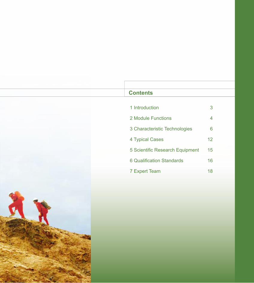
Contents
1 Introduction 3
2 Module Functions 4
3 Characteristic Technologies 6
4 Typical Cases 12
5 Scientific Research Equipment 15
6 Qualification Standards 16
7 Expert Team 18
OFFERING ENERGY SOURCES, CREATING HARMONY
China National Petroleum Corporation (CNPC)is a state-authorized investment agency and a state holding company. On July 1998, with the implementation of the Institutional reform of the State Council, CNPC was reorgnized to become an integrated oil company of cross-regions, cross-industries and cross-countries, it adopts modern enterprise system to realize the integrations of upstream and downstream operations, internal and external trade, production and marketing. CNPC's business covers six main sectors: oil and gas operations, petroleum engineering service, petroleum engineering construction, petroleum equipment manufacturing, financial services and new energy development. In 2014 CNPC produced 113.67 million tons of crude oil and 95.46 billion cubic meters of natural gas, while crude processing volume reached 150.2 million tons. The total revenue of RMB 2,730 billion with a profit of RMB173.4 billion had been achieved the same year.
CNPC was ranked 3th among the world's largest 50 oil companies and 4th in Fortune Global 500 in 2014.
CNPC strictly follows by the combined strategies of increasing resource capacity, expanding market shares and consolidating the international role, and persists in regarding technical innovation as a key framework to advance technological progress. To develop its core businesses, focuses will be placed on the solutions of key bottleneck technologies and key proprietary technologies. Thanks to continuously improving of the technical innovation system, optimizing the configuration of technological resources and strengthening the construction of strong talent teams, CNPC’s technological creativity has been considerably upgraded. Consequently, a large number of technologies have been developed independently, with its own intellectual property.
GeoEast-Lightning PSDM processing system is one of representatives for major innovations of CNPC.
2
3
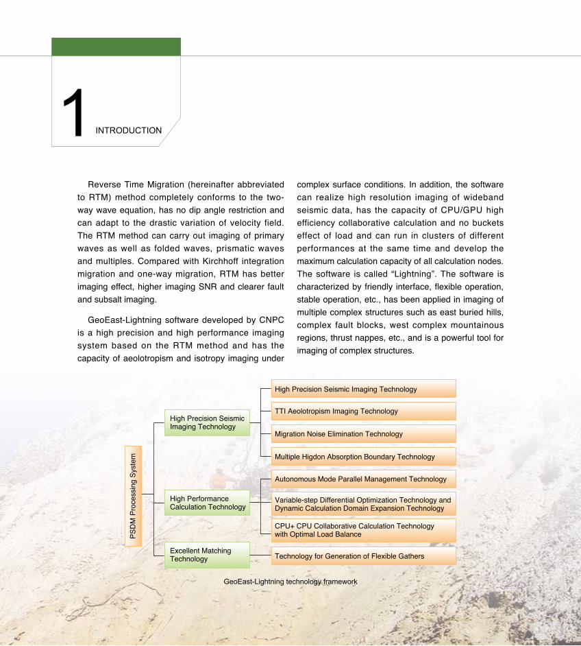
GeoEast-Lightning technology framework
PSD
M P
roce
ssin
g Sy
stem
High Precision Seismic Imaging Technology
High Precision Seismic Imaging Technology
TTI Aeolotropism Imaging Technology
Migration Noise Elimination Technology
Multiple Higdon Absorption Boundary Technology
Autonomous Mode Parallel Management Technology
Variable-step Differential Optimization Technology andDynamic Calculation Domain Expansion Technology
CPU+ CPU Collaborative Calculation Technology with Optimal Load Balance
Technology for Generation of Flexible Gathers
High Performance Calculation Technology
Excellent Matching Technology
Reverse Time Migration (hereinafter abbreviated to RTM) method completely conforms to the two-way wave equation, has no dip angle restriction and can adapt to the drastic variation of velocity field. The RTM method can carry out imaging of primary waves as well as folded waves, prismatic waves and multiples. Compared with Kirchhoff integration migration and one-way migration, RTM has better imaging effect, higher imaging SNR and clearer fault and subsalt imaging.
GeoEast-Lightning software developed by CNPC is a high precision and high performance imaging system based on the RTM method and has the capacity of aeolotropism and isotropy imaging under
complex surface conditions. In addition, the software can realize high resolution imaging of wideband seismic data, has the capacity of CPU/GPU high efficiency collaborative calculation and no buckets effect of load and can run in clusters of different performances at the same time and develop the maximum calculation capacity of all calculation nodes. The software is called “Lightning”. The software is characterized by friendly interface, flexible operation, stable operation, etc., has been applied in imaging of multiple complex structures such as east buried hills, complex fault blocks, west complex mountainous regions, thrust nappes, etc., and is a powerful tool for imaging of complex structures.
InTRoducTIon1
3
2 ModuLE FuncTIonS
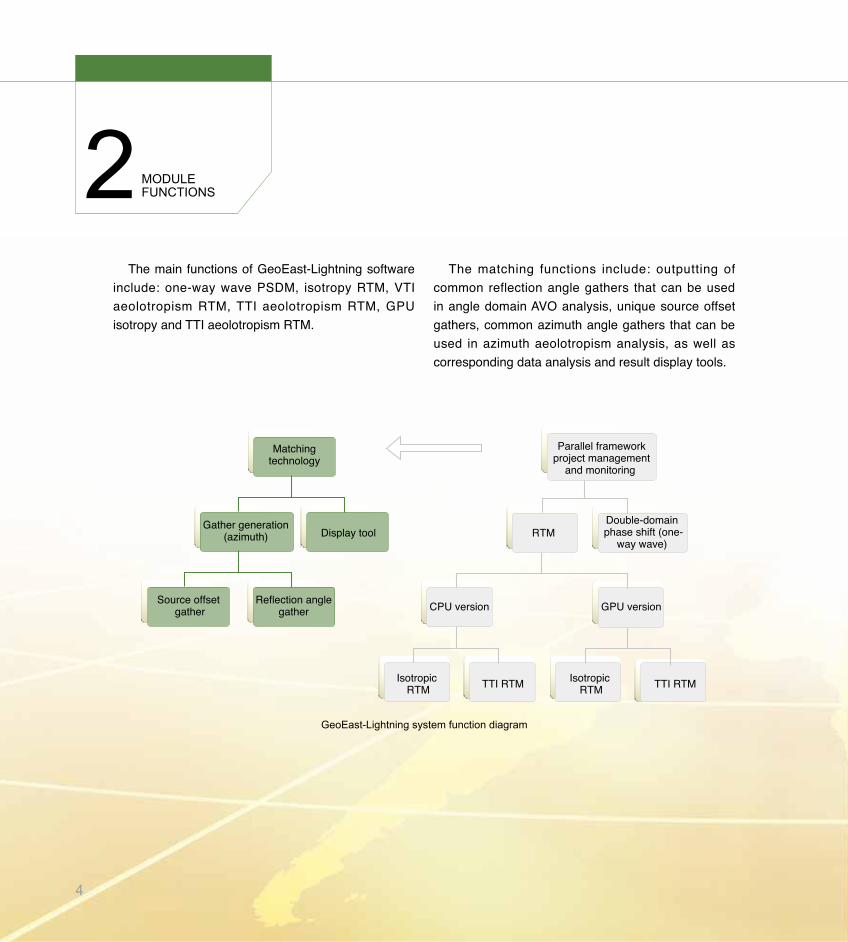
The main functions of GeoEast-Lightning software include: one-way wave PSDM, isotropy RTM, VTI aeolotropism RTM, TTI aeolotropism RTM, GPU isotropy and TTI aeolotropism RTM.
GeoEast-Lightning system function diagram
Matchingtechnology
Parallel frameworkproject management
and monitoring
Double-domain phase shift (one-
way wave)
Gather generation(azimuth) Display tool
Source offset gather
Reflection anglegather
TTI RTM
RTM
CPU version GPU version
Isotropic RTM
Isotropic RTM TTI RTM
The matching functions include: outputting of common reflection angle gathers that can be used in angle domain AVO analysis, unique source offset gathers, common azimuth angle gathers that can be used in azimuth aeolotropism analysis, as well as corresponding data analysis and result display tools.
4
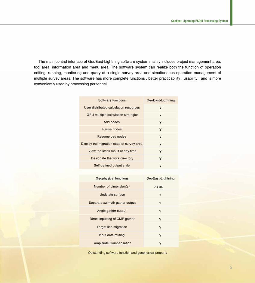
outstanding software function and geophysical property
GeoEast-Lightning
2D 3D
Y
Y
Y
Y
Y
Y
Y
Geophysical functions
Number of dimension(s)
Undulate surface
Separate-azimuth gather output
Angle gather output
Direct inputting of CMP gather
Target line migration
Input data muting
Amplitude Compensation
GeoEast-Lightning
Y
Y
Y
Y
Y
Y
Y
Y
Y
Software functions
User distributed calculation resources
GPU multiple calculation strategies
Add nodes
Pause nodes
Resume bad nodes
Display the migration state of survey area
View the stack result at any time
Designate the work directory
Self-defined output style
The main control interface of GeoEast-Lightning software system mainly includes project management area, tool area, information area and menu area. The software system can realize both the function of operation editing, running, monitoring and query of a single survey area and simultaneous operation management of multiple survey areas. The software has more complete functions , better practicability , usability , and is more conveniently used by processing personnel.
5
GeoEast-Lightning PSDM Processing System
3 chaRacTERISTIc TEchnoLoGIES
GeoEast-Lightning software provides wide and applicable migration function and CPU-GPU collaborative calculation function in isotropy and aeolotropism of one-way waves, two-way waves.
3.1 High Precision Seismic Imaging Technology
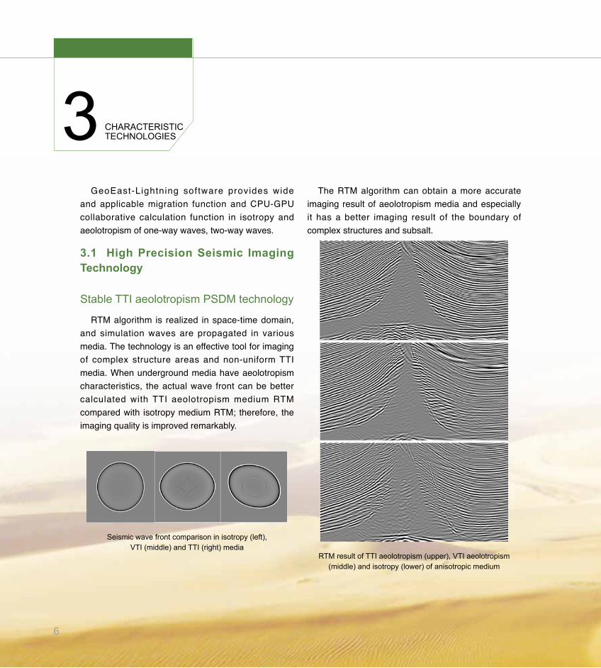
Stable TTI aeolotropism PSdM technology
RTM algorithm is realized in space-time domain, and simulation waves are propagated in various media. The technology is an effective tool for imaging of complex structure areas and non-uniform TTI media. When underground media have aeolotropism characteristics, the actual wave front can be better calculated with TTI aeolotropism medium RTM compared with isotropy medium RTM; therefore, the imaging quality is improved remarkably.
Seismic wave front comparison in isotropy (left), VTI (middle) and TTI (right) media
The RTM algorithm can obtain a more accurate imaging result of aeolotropism media and especially it has a better imaging result of the boundary of complex structures and subsalt.
RTM result of TTI aeolotropism (upper), VTI aeolotropism (middle) and isotropy (lower) of anisotropic medium
6
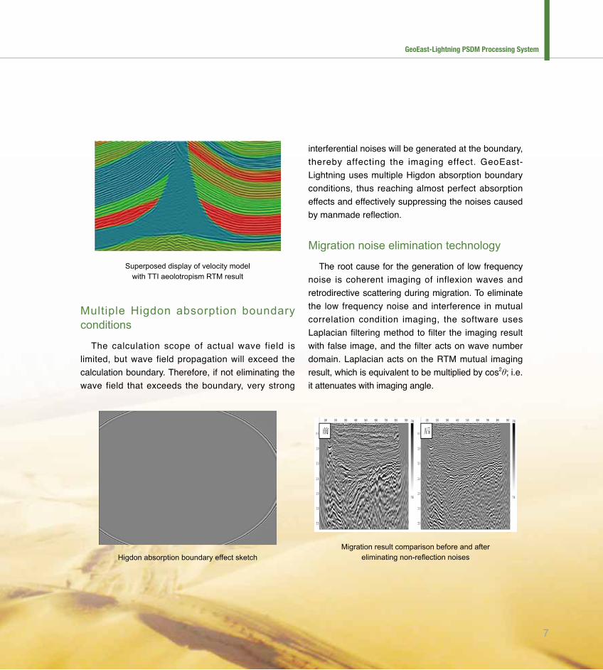
Superposed display of velocity model with TTI aeolotropism RTM result
Migration result comparison before and after eliminating non-reflection noiseshigdon absorption boundary effect sketch
Multiple Higdon absorption boundary conditions
The calculation scope of actual wave field is limited, but wave field propagation will exceed the calculation boundary. Therefore, if not eliminating the wave field that exceeds the boundary, very strong
interferential noises will be generated at the boundary, thereby affecting the imaging effect. GeoEast-Lightning uses multiple Higdon absorption boundary conditions, thus reaching almost perfect absorption effects and effectively suppressing the noises caused by manmade reflection.
Migration noise elimination technology
The root cause for the generation of low frequency noise is coherent imaging of inflexion waves and retrodirective scattering during migration. To eliminate the low frequency noise and interference in mutual correlation condition imaging, the software uses Laplacian filtering method to filter the imaging result with false image, and the filter acts on wave number domain. Laplacian acts on the RTM mutual imaging result, which is equivalent to be multiplied by cos2θ; i.e. it attenuates with imaging angle.
7
GeoEast-Lightning PSDM Processing System
chaRacTERISTIc TEchnoLoGIES
3.2 High Performance Calculation Technology
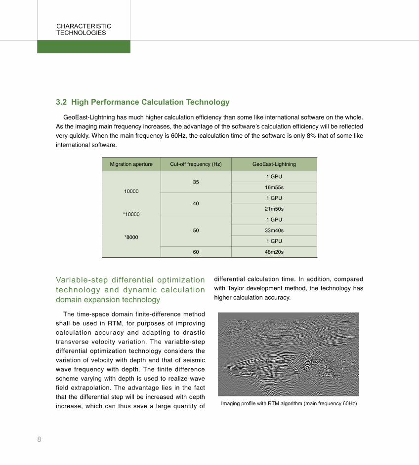
GeoEast-Lightning has much higher calculation efficiency than some like international software on the whole. As the imaging main frequency increases, the advantage of the software’s calculation efficiency will be reflected very quickly. When the main frequency is 60Hz, the calculation time of the software is only 8% that of some like international software.
Migration aperture Cut-off frequency (Hz) GeoEast-Lightning
10000
*10000
*8000
351 GPU
16m55s
401 GPU
21m50s
50
1 GPU
33m40s
1 GPU
60 48m20s
Imaging profile with RTM algorithm (main frequency 60hz)
differential calculation time. In addition, compared with Taylor development method, the technology has higher calculation accuracy.
Variable-step differential optimization technology and dynamic calculation domain expansion technology
The time-space domain finite-difference method shall be used in RTM, for purposes of improving calculat ion accuracy and adapting to drast ic transverse velocity variation. The variable-step differential optimization technology considers the variation of velocity with depth and that of seismic wave frequency with depth. The finite difference scheme varying with depth is used to realize wave field extrapolation. The advantage lies in the fact that the differential step will be increased with depth increase, which can thus save a large quantity of
8
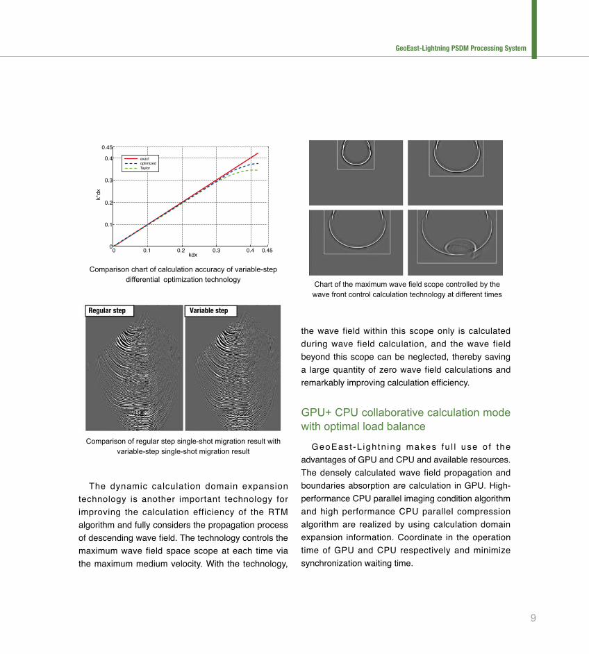
comparison of regular step single-shot migration result with variable-step single-shot migration result
chart of the maximum wave field scope controlled by the wave front control calculation technology at different times
comparison chart of calculation accuracy of variable-step differential optimization technology
The dynamic calculation domain expansion technology is another important technology for improving the calculation efficiency of the RTM algorithm and fully considers the propagation process of descending wave field. The technology controls the maximum wave field space scope at each time via the maximum medium velocity. With the technology,
the wave field within this scope only is calculated during wave field calculation, and the wave field beyond this scope can be neglected, thereby saving a large quantity of zero wave field calculations and remarkably improving calculation efficiency.
GPu+ cPu collaborative calculation mode with optimal load balance
GeoEast -L igh tn ing makes fu l l use o f the advantages of GPU and CPU and available resources. The densely calculated wave field propagation and boundaries absorption are calculation in GPU. High-performance CPU parallel imaging condition algorithm and high performance CPU parallel compression algorithm are realized by using calculation domain expansion information. Coordinate in the operation time of GPU and CPU respectively and minimize synchronization waiting time.
Regular step Variable step
kdx
k*dx
0
0.45
0.4
0.3
0.2
0.1
0 0.1 0.2 0.3 0.4 0.45
exactoptimizedTaylor
9
GeoEast-Lightning PSDM Processing System
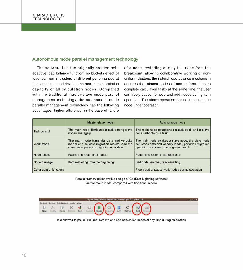
The software has the originally created self-adaptive load balance function, no buckets effect of load, can run in clusters of different performances at the same time, and develop the maximum calculation capaci ty of al l calculat ion nodes. Compared with the traditional master-slave mode parallel management technology, the autonomous mode parallel management technology has the following advantages: higher efficiency; in the case of failure
chaRacTERISTIc TEchnoLoGIES
of a node, restarting of only this node from the breakpoint; allowing collaborative working of non-uniform clusters; the natural load balance mechanism ensures that almost nodes of non-uniform clusters complete calculation tasks at the same time; the user can freely pause, remove and add nodes during item operation. The above operation has no impact on the node under operation.
Master-slave mode Autonomous mode
Task control The main node distributes a task among slave nodes averagely
The main node establishes a task pool, and a slave node self-obtains a task
Work modeThe main node transmits data and velocity model and collects migration results, and the slave node performs migration operation
The main node awakes a slave node; the slave node self-reads data and velocity model, performs migration operation and saves the migration result
Node failure Pause and resume all nodes Pause and resume a single node
Node damage Item restarting from the beginning Bad node removal, task resetting
Other control functions Freely add or pause work nodes during operation
autonomous mode parallel management technology
Parallel framework innovative design of GeoEast-Lightning software: autonomous mode (compared with traditional mode)
It is allowed to pause, resume, remove and add calculation nodes at any time during calculation
10
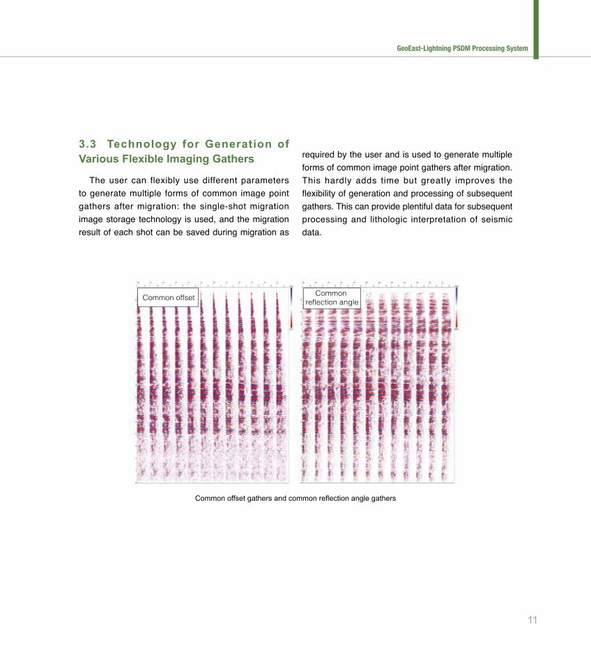
3.3 Technology for Generation of Various Flexible Imaging Gathers
The user can flexibly use different parameters to generate multiple forms of common image point gathers after migration: the single-shot migration image storage technology is used, and the migration result of each shot can be saved during migration as
common offset gathers and common reflection angle gathers
Common offsetCommon
reflection angle
required by the user and is used to generate multiple forms of common image point gathers after migration. This hardly adds time but greatly improves the flexibility of generation and processing of subsequent gathers. This can provide plentiful data for subsequent processing and lithologic interpretation of seismic data.
11
GeoEast-Lightning PSDM Processing System

4 TyPIcaL caSES
GeoEast-Lightning software is applicable to multiple complex land surface types including mountainous region, ocean, gobi, desert, igneous rock outcrop area, etc. and has been successfully
Land surface typeMountainous region, ocean, gobi, desert,igneous rock outcrop area
Exploration target:East buried hill
Complex fault block reservoir in the east
West complex mountainous region, thrust nappe
West complexmountainous region
Complex fault blockreservoir in the east
Deep-sea towline
East buried hill
applicable land surface types to GeoEast-Lightning system and exploration target chart
4.1 Subsalt Imaging Case
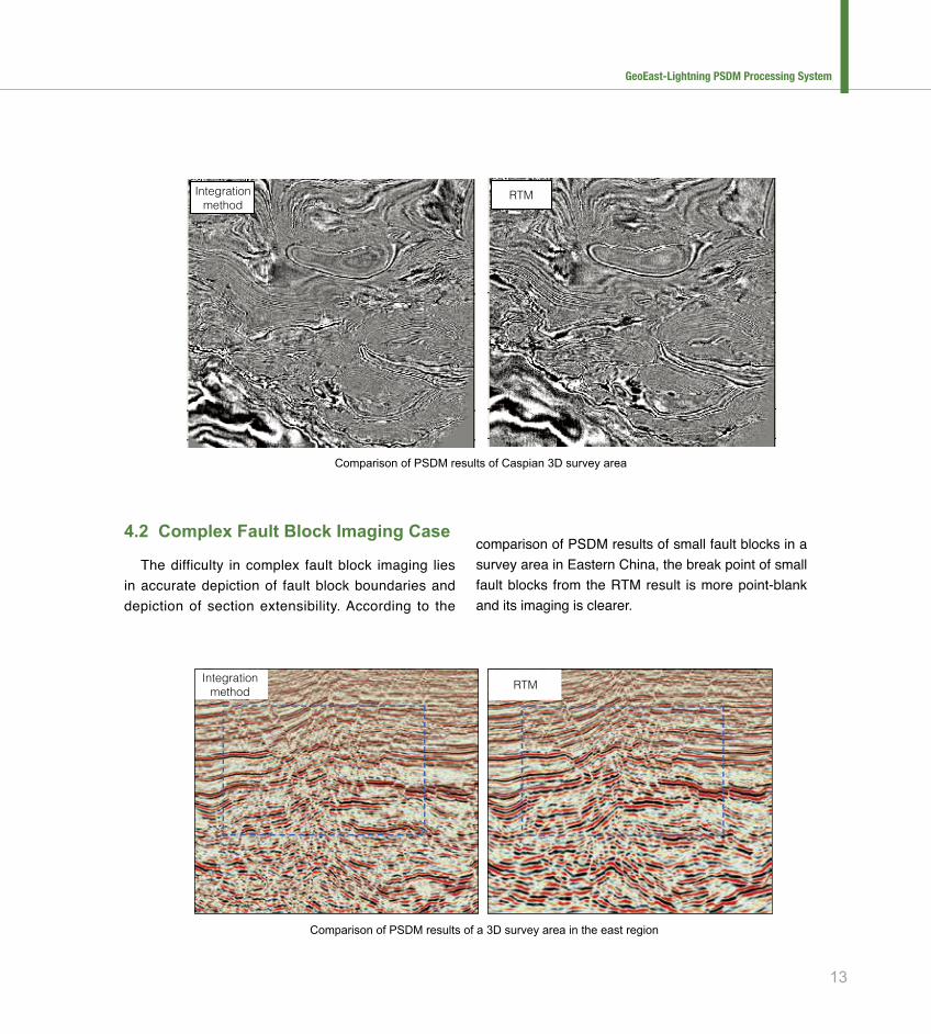
Salt dome is a geologic body with high wave impedance. After encountering salt domes, most energy of seismic waves is reflected back to land surface. The reflection waves from seismic acquisition carry the effective information in only a small quantity of subsalt horizon reflections, and subsalt imaging needs to utilize the known weak effective information from each direction. Therefore, subsalt structure is the important geologic structure for measuring the RTM method. Compared with other migration methods, the
RTM method can obtain better subsalt structures in the reservoirs with developed salt domes in the Gulf of Mexico, West Africa, etc., thus providing reliable structural bases for the development of subsalt reservoirs. A foreign Caspian 3D survey area is a geologic block with developed salt domes, and subsalt structural horizons are reservoir development areas. According to the comparison of imaging results with different algorithms, the RTM method depicts salt dome boundaries more clearly, realizes more continuous subsalt imaging and leads to smaller noise in salt domes than the integration method.
applied in imaging of multiple complex structures such as buried hills in Eastern China, complex fault blocks, salt domes, thrust nappes, etc.
12
Integrationmethod
RTM
comparison of PSdM results of a 3d survey area in the east region
comparison of PSdM results of caspian 3d survey area
Integrationmethod
RTM
4.2 Complex Fault Block Imaging Case
The difficulty in complex fault block imaging lies in accurate depiction of fault block boundaries and depiction of section extensibility. According to the
comparison of PSDM results of small fault blocks in a survey area in Eastern China, the break point of small fault blocks from the RTM result is more point-blank and its imaging is clearer.
13
GeoEast-Lightning PSDM Processing System
Integration method
RTM
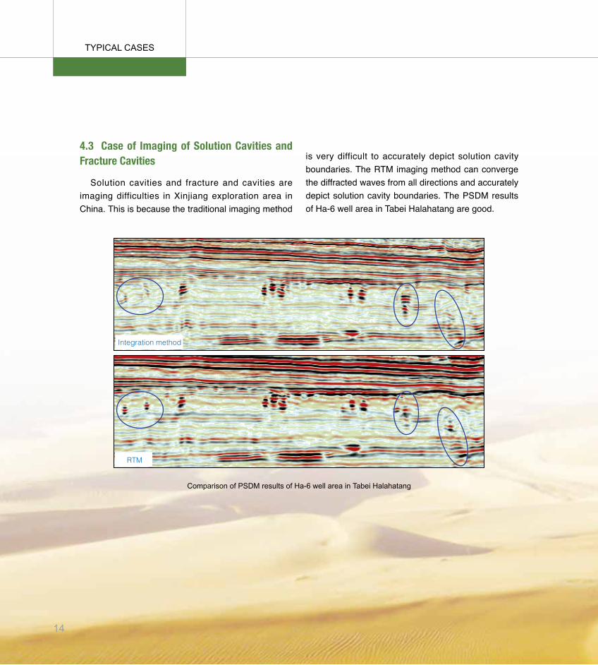
comparison of PSdM results of ha-6 well area in Tabei halahatang
TyPIcaL caSES
4.3 Case of Imaging of Solution Cavities and Fracture Cavities
Solution cavities and fracture and cavities are imaging difficulties in Xinjiang exploration area in China. This is because the traditional imaging method
is very difficult to accurately depict solution cavity boundaries. The RTM imaging method can converge the diffracted waves from all directions and accurately depict solution cavity boundaries. The PSDM results of Ha-6 well area in Tabei Halahatang are good.
14
5ScIEnTIFIc RESEaRch EQuIPMEnT
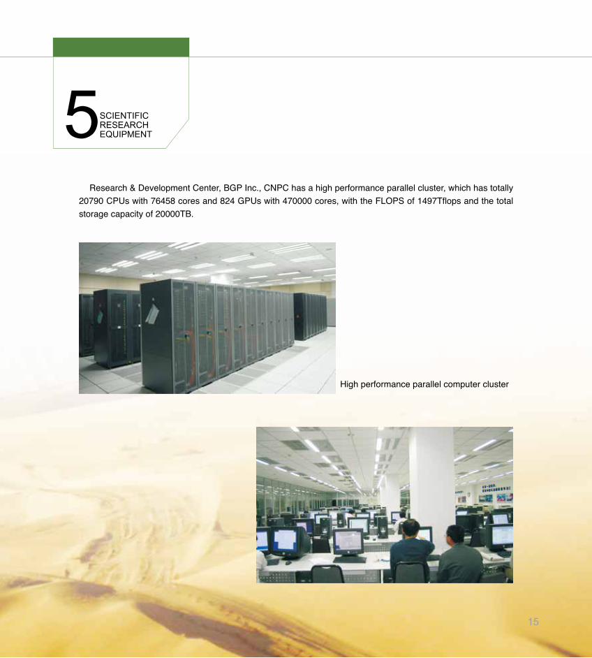
Research & Development Center, BGP Inc., CNPC has a high performance parallel cluster, which has totally 20790 CPUs with 76458 cores and 824 GPUs with 470000 cores, with the FLOPS of 1497Tflops and the total storage capacity of 20000TB.
High performance parallel computer cluster
15
6QuaLIFIcaTIonSTandaRdS
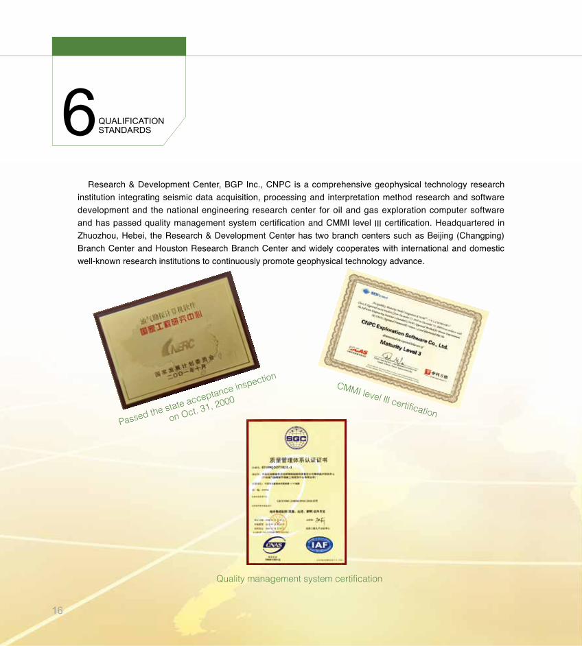
Research & Development Center, BGP Inc., CNPC is a comprehensive geophysical technology research institution integrating seismic data acquisition, processing and interpretation method research and software development and the national engineering research center for oil and gas exploration computer software and has passed quality management system certification and CMMI level Ⅲ certification. Headquartered in Zhuozhou, Hebei, the Research & Development Center has two branch centers such as Beijing (Changping) Branch Center and Houston Research Branch Center and widely cooperates with international and domestic well-known research institutions to continuously promote geophysical technology advance.
Quality management system certification
CMMI level Ⅲ certificationPassed the state acceptance inspection
on Oct. 31, 2000
16
Intellectual property rights
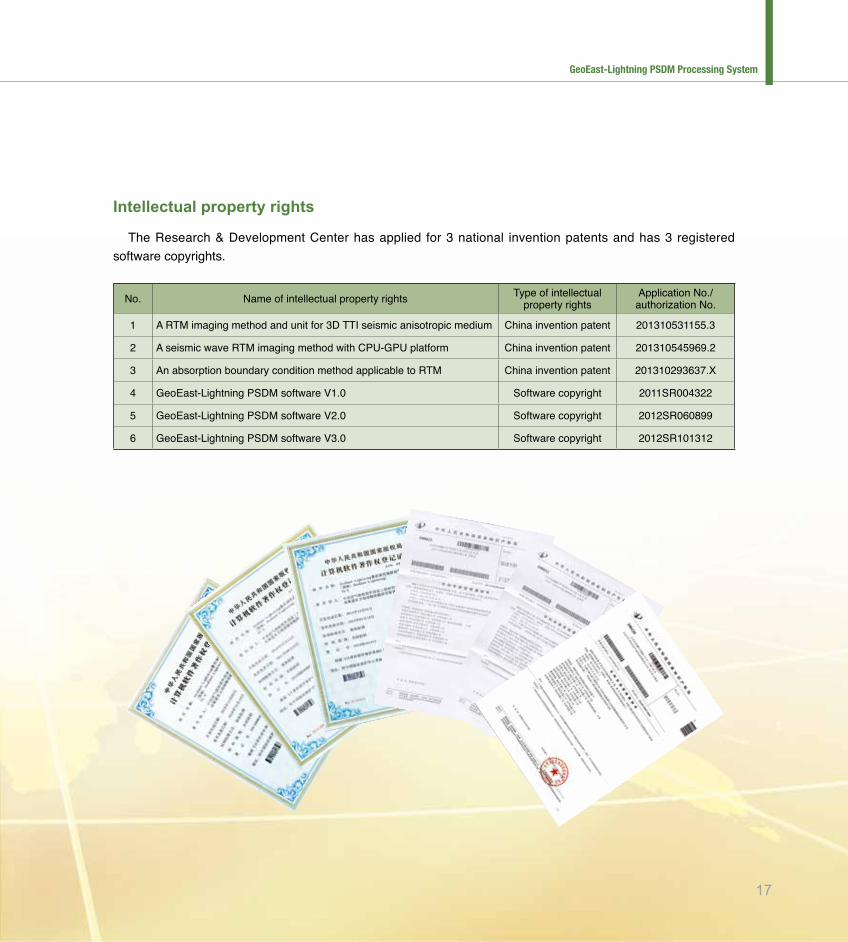
The Research & Development Center has applied for 3 national invention patents and has 3 registered software copyrights.
No. Name of intellectual property rights Type of intellectual property rights
Application No./ authorization No.
1 A RTM imaging method and unit for 3D TTI seismic anisotropic medium China invention patent 201310531155.3
2 A seismic wave RTM imaging method with CPU-GPU platform China invention patent 201310545969.2
3 An absorption boundary condition method applicable to RTM China invention patent 201310293637.X
4 GeoEast-Lightning PSDM software V1.0 Software copyright 2011SR004322
5 GeoEast-Lightning PSDM software V2.0 Software copyright 2012SR060899
6 GeoEast-Lightning PSDM software V3.0 Software copyright 2012SR101312
17
GeoEast-Lightning PSDM Processing System

7ExPERT TEaM
Dai Nanxun
Doctor, professor level senior engineer, the member of CPS, SEG and EAGE. He has acted as the principal of national major special projects, Natural Science Foundation Projects and major scientific research projects many times and has over papers published in domestic and foreign core journals. Tel: 0312-3825908Email: [email protected]
Zhao Bo
Doctor, engineer. He joined BGP Houston Research & Development Center in 2009 and his task in GeoEast-Lightning project is system integration and development. He has 1 Chinese monograph (co-authored), 2 invited reviews in journals and 24 papers published in foreign core journals. Tel: 010-82072020-3008Email: [email protected]
Zhang Wei
Doctor, senior engineer. He joined BGP Houston Research & Development Center in the autumn of 2009 and his main task in GeoEast-Lightning software development is the development of GPU/CPU based heterogeneous multi-core architecture. He has 5 monographs (co-authored) published. Tel: 010-82072020-3008Email: [email protected]
Cheng Runwei
Engineer. He is engaged mainly in the study of depth migration and depth domain modeling method. He joined GeoEast-Lightning project group in 2009 and his main task is method research, module development, software testing, etc. He has participated in the study of 6 scientific research projects including national, CNPC’s and BGP’s ones successively and has 3 papers published. Tel: 010-82072020-3008Email: [email protected]
Wu Wei
Doctor, professor. Since joining CNPC BGP in 2009, he has actively studied and developed frontier technologies in the seismic wave imaging and velocity inversion field leading the team. The GeoEast-Lightning software developed by the team led by him has filled up multiple technology gaps in the depth domain migration imaging field of CNPC. Tel: 010-82072020-3018Email: [email protected]
18
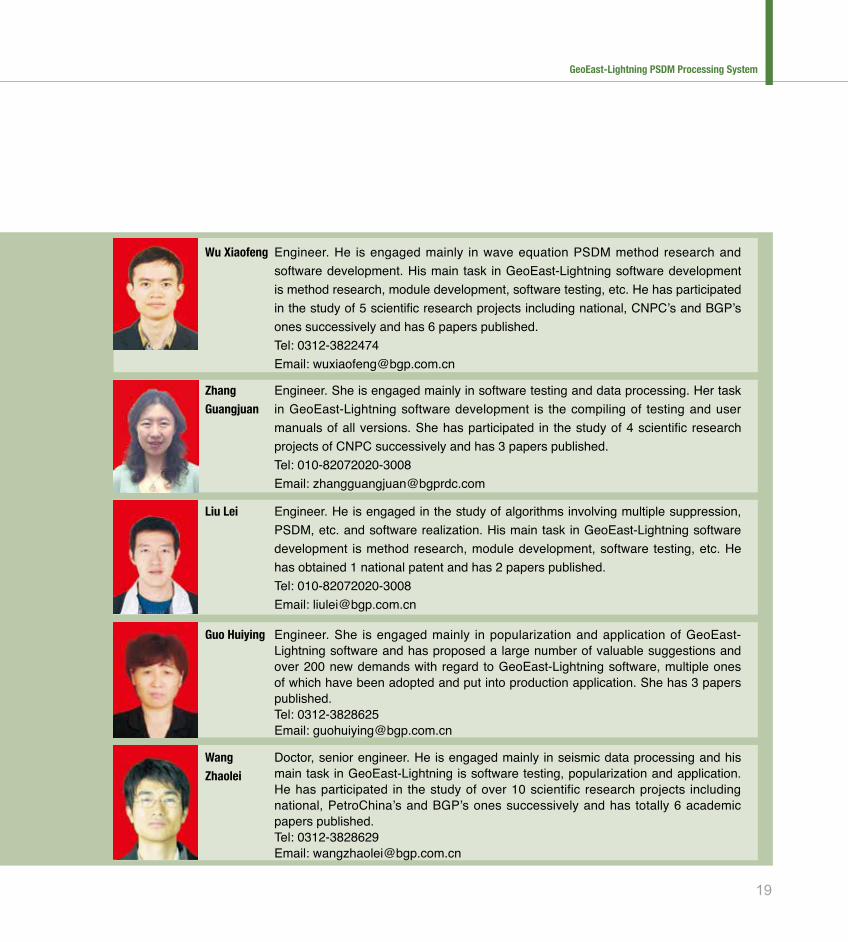
Engineer. He is engaged mainly in wave equation PSDM method research and software development. His main task in GeoEast-Lightning software development is method research, module development, software testing, etc. He has participated in the study of 5 scientific research projects including national, CNPC’s and BGP’s ones successively and has 6 papers published. Tel: 0312-3822474Email: [email protected]
Wu Xiaofeng
Engineer. She is engaged mainly in software testing and data processing. Her task in GeoEast-Lightning software development is the compiling of testing and user manuals of all versions. She has participated in the study of 4 scientific research projects of CNPC successively and has 3 papers published. Tel: 010-82072020-3008Email: [email protected]
Zhang Guangjuan
Engineer. He is engaged in the study of algorithms involving multiple suppression, PSDM, etc. and software realization. His main task in GeoEast-Lightning software development is method research, module development, software testing, etc. He has obtained 1 national patent and has 2 papers published. Tel: 010-82072020-3008Email: [email protected]
Liu Lei
Engineer. She is engaged mainly in popularization and application of GeoEast-Lightning software and has proposed a large number of valuable suggestions and over 200 new demands with regard to GeoEast-Lightning software, multiple ones of which have been adopted and put into production application. She has 3 papers published. Tel: 0312-3828625Email: [email protected]
Guo Huiying
Doctor, senior engineer. He is engaged mainly in seismic data processing and his main task in GeoEast-Lightning is software testing, popularization and application. He has participated in the study of over 10 scientific research projects including national, PetroChina’s and BGP’s ones successively and has totally 6 academic papers published. Tel: 0312-3828629Email: [email protected]
Wang Zhaolei
19
GeoEast-Lightning PSDM Processing System
技术依托单位联系人:
白雪莲 女士
电 话:0312-3737215Email: [email protected]
中国石油科技管理部联系人:
刁 顺 /窦红波 先生
电 话:86-10-59986059/59982528Email: [email protected]/ [email protected]
Contact of the Technical Support Unit : Ms. Bai xuelianTel: 0312-3737215Email: [email protected]
Contact of Science&Technology Management Department,CNPC :
Mr. diao Shun/dou hongboTel: 86-10-59986059/59982528Email: [email protected]/ [email protected]