LN 161 of 2011 - Import and Export (Strategic Commodities ...

European Pleasures
Commodities in Maps of the Americas
Leah Thomas, PhD | Assistant Professor of English | Virginia State University
EC/ASECS 2014

The promise of potosi This Map of South America (1736)
Herman Moll New York Public Library

commerce
Redemption

Herman Moll & Daniel Defoe
A New & Exact Map of the Coasts, Countries and Islands within ye Limits of ye South Sea Company (1711)
Herman Moll Norman B. Leventhal Map Center,
Boston Public Library
A Map of the World, on wch is Delineated the Voyages of Robinson Cruso (1719)
Herman Moll Folger Shakespeare Library

A New and Exact Map of the Dominions of the King of Great Britain on ye Continent of North America (1715)
Herman Moll Norman B. Leventhal Map Center, Boston Public Library

This Map of North America (1736) Herman Moll
New York Public Library

A Map of the most inhabited part of Virginia (1755) Joshua Fry & Peter Jefferson
Geography & Map Reading Room, Library of Congress

negotiating
Territories

“we find it absolutely necessary to caress ‘em as Friends, and not to treat ‘em as
Slaves”—Aphra Behn, Oroonoko
y e C h a r a k e y s a n d Iroquois, by much ye most p o w e r f u l l o f a l l y e Ne ighbour ing Ind ian Nations, the old Friends and Allies of the English, who ever esteemed them to be the Bulwark and Secur i ty of a l l the i r Plantat ions in Nor th America
—Herman Moll
A New Map of the North Parts of America Claimed by France (1720) Herman Moll
Norman B. Leventhal Map Center, Boston Public Library

resources & slavery
America (1671) John Ogilby
New York Public Library
The Female American (1767) Unca Eliza Winkfield

A Map of the British Empire in America (1733) Henry Popple
Norman B. Leventhal Map Center, Boston Public Library
Mapping
transatlantic slavery
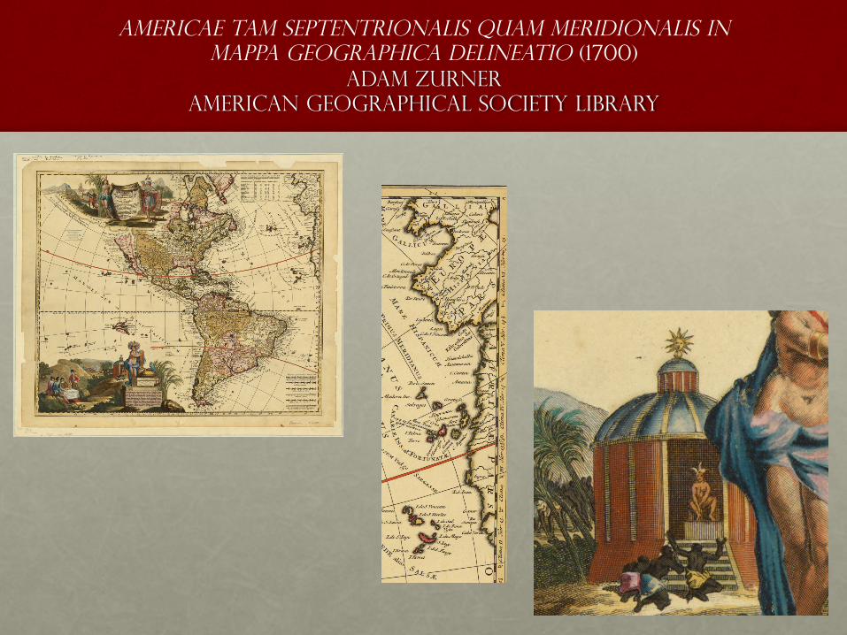
Americae tam septentrionalis quam meridionalis in mappa geographica delineatio (1700)
Adam Zurner american geographical society library

A New & Exact Map of the Coasts, Countries and Islands within ye Limits of ye South Sea Company (1711)
Herman Moll Norman B. Leventhal Map Center, Boston Public Library

This Map of south America (1736) Herman Moll
New York Public Library

Atlas Maritimus & Commercialis; or, a General View of the World, so Far as Relates to Trade and Navigation (1728)
John Harris, John Senex, & Henry Wilson Folger Shakespeare Library
A New and Correct Chart of the Atlantick Ocean (1728)

Turks Islands, from a Survey made in 1753 (1775) Thomas Jefferys
american geographical society library
The West-India Atlas, or, A Compendious Description of the West-Indies (1775)
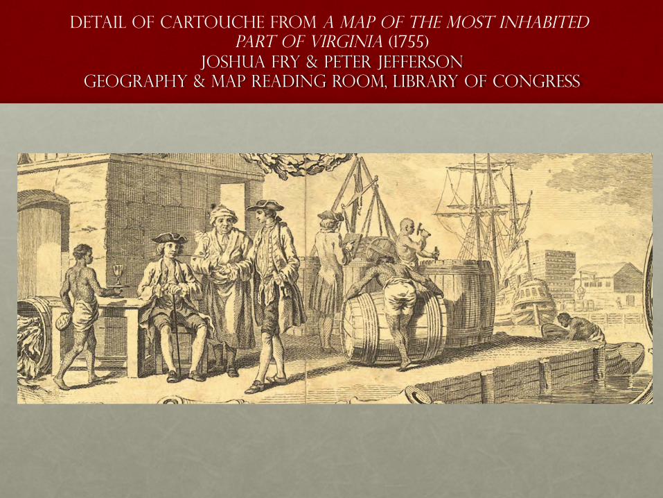
Detail of Cartouche from A Map of the most inhabited part of Virginia (1755)
Joshua Fry & Peter Jefferson Geography & Map Reading Room, Library of Congress

A Topographicall Description and Admeasurement of the Yland of Barbados in the West Indies (1657)
Richard Ligon British Library
A True and Exact History of the Island of Barbadoes (1657)
Copyright © 2022 FDOKUMEN