Electrifying State Light-Duty Fleets & Transit
20
• Moderator: • Alexa Voytek, Energy Consultant/Senior Program Manager, Tennessee Department of Environment and Conservation • Speakers: • Secretary Chuck Brown, Louisiana Department of Environmental Quality • India Birdsong, Chief Operating Officer, WeGo Public Transit/RTA of Middle Tennessee Electrifying State Light-Duty Fleets & Transit
-
Upload
khangminh22 -
Category
Documents
-
view
0 -
download
0
Transcript of Electrifying State Light-Duty Fleets & Transit
• Moderator:
• Alexa Voytek, Energy Consultant/Senior Program Manager, Tennessee Department of Environment and Conservation
• Speakers:
• Secretary Chuck Brown, Louisiana Department of Environmental Quality
• India Birdsong, Chief Operating Officer, WeGo Public Transit/RTA of Middle Tennessee
Electrifying State Light-Duty Fleets & Transit
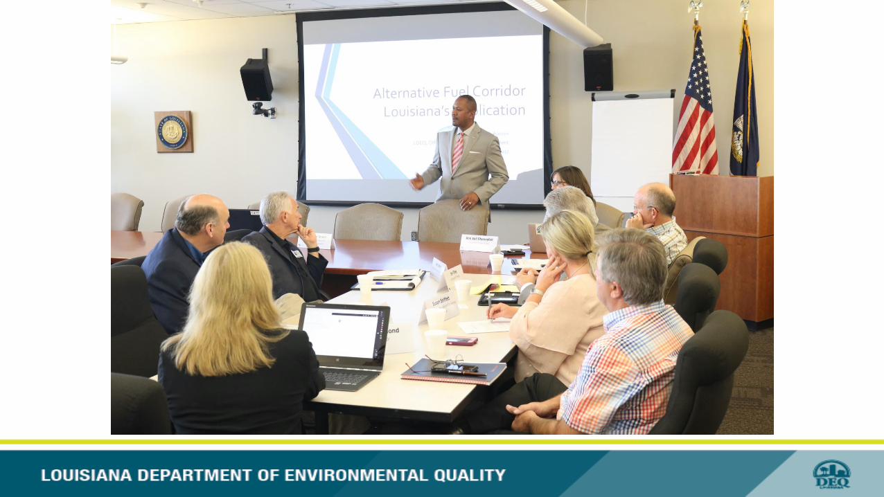
Chuck Brown, Louisiana Department of Environmental Quality
Electrifying State Light-Duty Fleets & Transit
LDEQ – Driving into the future
Chuck Carr Brown, Ph.D. – Secretary

MAP of I-10: FHWA Approved Alternative Fuel Ready Corridor
I-10 is a major transcontinental interstate highway in the southern United States and covers 274.42 miles across the southern
portion of Louisiana from Texas to Mississippi. This section of the interstate travels through Sulphur, West Lake, Lake Charles in
the west; Lafayette at the crossroads of Interstate 49; the Greater Baton Rouge area, Louisiana’s Capitol City; south to the New
Orleans metropolitan area on to Mississippi.
CNG READY: I-10: From LA/TX border to New Orleans, LA
LNG READY: I-10: From LA/TX border to Lafayette, LA
LPG READY: I-10: From TX border to LA/MS border
*Approval pending for CNG from N.O. to LA/MS boarder.
*Approval pending for LNG from Lafayette to LA/MS boarder.
TX MS
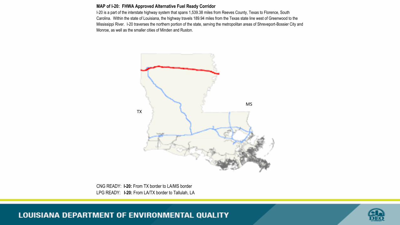
MAP of I-20: FHWA Approved Alternative Fuel Ready Corridor
I-20 is a part of the interstate highway system that spans 1,539.38 miles from Reeves County, Texas to Florence, South
Carolina. Within the state of Louisiana, the highway travels 189.94 miles from the Texas state line west of Greenwood to the
Mississippi River. I-20 traverses the northern portion of the state, serving the metropolitan areas of Shreveport-Bossier City and
Monroe, as well as the smaller cities of Minden and Ruston.
CNG READY: I-20: From TX border to LA/MS border
LPG READY: I-20: From LA/TX border to Tallulah, LA
TX
MS
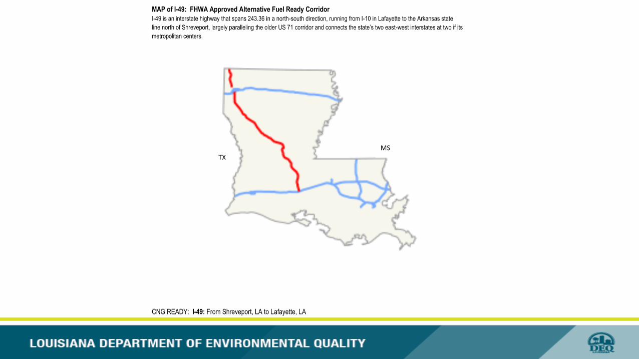
MAP of I-49: FHWA Approved Alternative Fuel Ready Corridor
I-49 is an interstate highway that spans 243.36 in a north-south direction, running from I-10 in Lafayette to the Arkansas state
line north of Shreveport, largely paralleling the older US 71 corridor and connects the state’s two east-west interstates at two if its
metropolitan centers.
CNG READY: I-49: From Shreveport, LA to Lafayette, LA
TX
MS
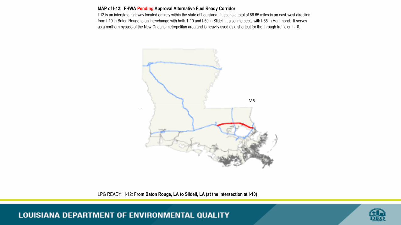
MAP of I-12: FHWA Pending Approval Alternative Fuel Ready Corridor
I-12 is an interstate highway located entirely within the state of Louisiana. It spans a total of 86.65 miles in an east-west direction
from I-10 in Baton Rouge to an interchange with both 1-10 and I-59 in Slidell. It also intersects with I-55 in Hammond. It serves
as a northern bypass of the New Orleans metropolitan area and is heavily used as a shortcut for the through traffic on I-10.
LPG READY: I-12: From Baton Rouge, LA to Slidell, LA (at the intersection at I-10)
T X
MS
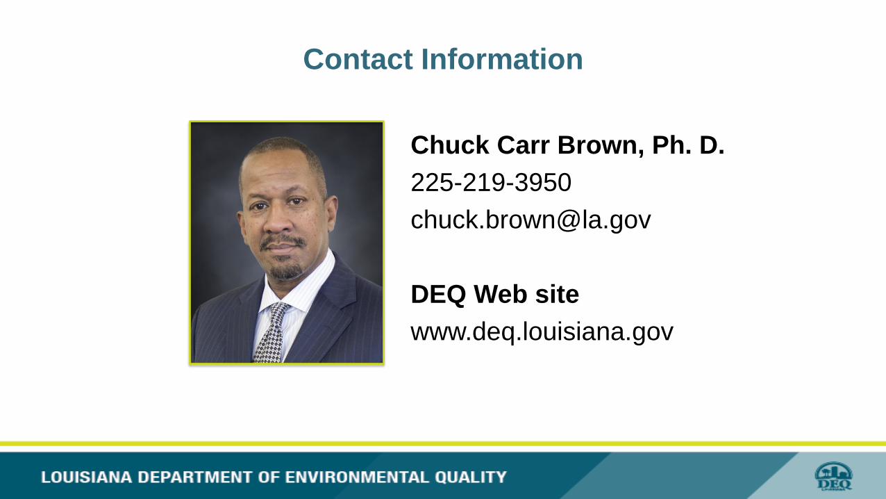
Contact Information
Chuck Carr Brown, Ph. D.
225-219-3950
DEQ Web site
www.deq.louisiana.gov

LDEQ – Driving into the future
Chuck Carr Brown, Ph.D. – Secretary
India Birdsong, Chief Operating Officer, WeGo Public Transit/RTA of Middle Tennessee
Electrifying State Light-Duty Fleets & Transit