Eastern Area Planning Committee - West Berkshire Council
86
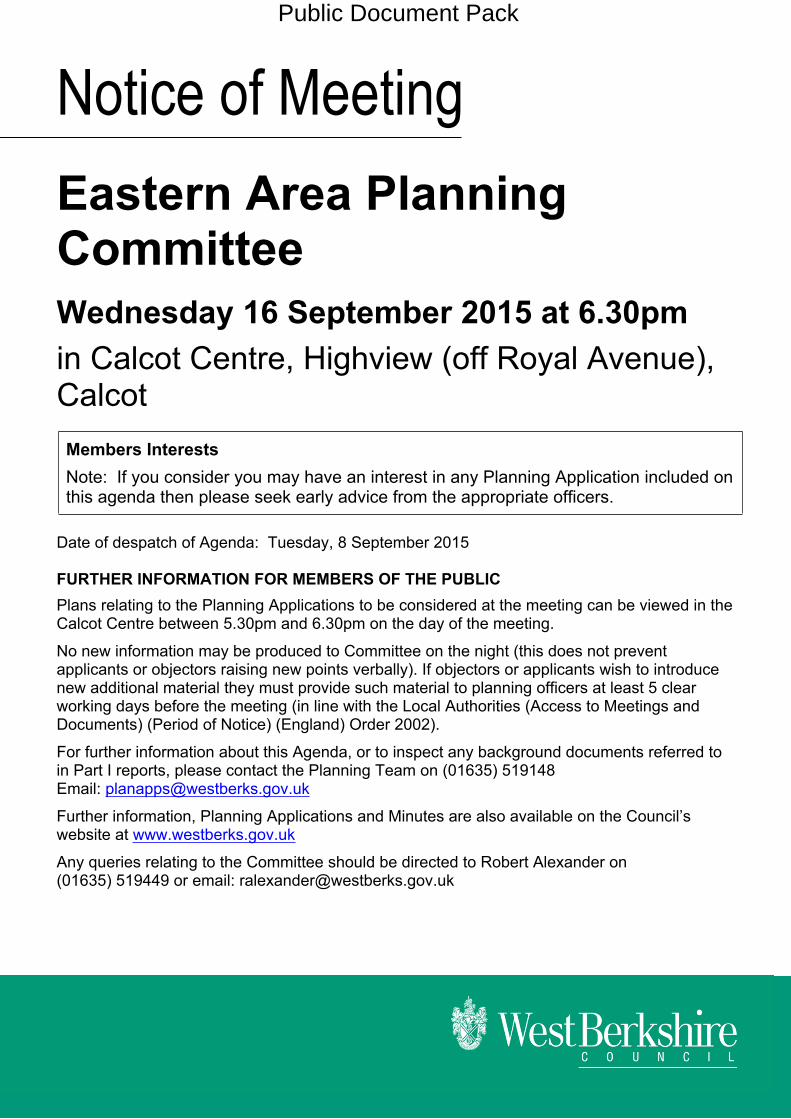
Notice of Meeting Eastern Area Planning Committee Wednesday 16 September 2015 at 6.30pm in Calcot Centre, Highview (off Royal Avenue), Calcot Members Interests Note: If you consider you may have an interest in any Planning Application included on this agenda then please seek early advice from the appropriate officers. Date of despatch of Agenda: Tuesday, 8 September 2015 FURTHER INFORMATION FOR MEMBERS OF THE PUBLIC Plans relating to the Planning Applications to be considered at the meeting can be viewed in the Calcot Centre between 5.30pm and 6.30pm on the day of the meeting. No new information may be produced to Committee on the night (this does not prevent applicants or objectors raising new points verbally). If objectors or applicants wish to introduce new additional material they must provide such material to planning officers at least 5 clear working days before the meeting (in line with the Local Authorities (Access to Meetings and Documents) (Period of Notice) (England) Order 2002). For further information about this Agenda, or to inspect any background documents referred to in Part I reports, please contact the Planning Team on (01635) 519148 Email: [email protected] Further information, Planning Applications and Minutes are also available on the Council’s website at www.westberks.gov.uk Any queries relating to the Committee should be directed to Robert Alexander on (01635) 519449 or email: [email protected] Public Document Pack
-
Upload
khangminh22 -
Category
Documents
-
view
0 -
download
0
Transcript of Eastern Area Planning Committee - West Berkshire Council
Notice of MeetingEastern Area Planning CommitteeWednesday 16 September 2015 at 6.30pmin Calcot Centre, Highview (off Royal Avenue), CalcotMembers InterestsNote: If you consider you may have an interest in any Planning Application included on this agenda then please seek early advice from the appropriate officers.
Date of despatch of Agenda: Tuesday, 8 September 2015
FURTHER INFORMATION FOR MEMBERS OF THE PUBLICPlans relating to the Planning Applications to be considered at the meeting can be viewed in the Calcot Centre between 5.30pm and 6.30pm on the day of the meeting.
No new information may be produced to Committee on the night (this does not prevent applicants or objectors raising new points verbally). If objectors or applicants wish to introduce new additional material they must provide such material to planning officers at least 5 clear working days before the meeting (in line with the Local Authorities (Access to Meetings and Documents) (Period of Notice) (England) Order 2002).
For further information about this Agenda, or to inspect any background documents referred to in Part I reports, please contact the Planning Team on (01635) 519148Email: [email protected]
Further information, Planning Applications and Minutes are also available on the Council’s website at www.westberks.gov.uk
Any queries relating to the Committee should be directed to Robert Alexander on (01635) 519449 or email: [email protected]
Public Document Pack
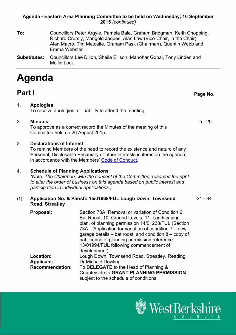
Agenda - Eastern Area Planning Committee to be held on Wednesday, 16 September 2015 (continued)
To: Councillors Peter Argyle, Pamela Bale, Graham Bridgman, Keith Chopping, Richard Crumly, Marigold Jaques, Alan Law (Vice-Chair, in the Chair), Alan Macro, Tim Metcalfe, Graham Pask (Chairman), Quentin Webb and Emma Webster
Substitutes: Councillors Lee Dillon, Sheila Ellison, Manohar Gopal, Tony Linden and Mollie Lock
AgendaPart I Page No.
1. ApologiesTo receive apologies for inability to attend the meeting.
2. Minutes 5 - 20To approve as a correct record the Minutes of the meeting of this Committee held on 26 August 2015.
3. Declarations of InterestTo remind Members of the need to record the existence and nature of any Personal, Disclosable Pecuniary or other interests in items on the agenda, in accordance with the Members’ Code of Conduct.
4. Schedule of Planning Applications(Note: The Chairman, with the consent of the Committee, reserves the right to alter the order of business on this agenda based on public interest and participation in individual applications.)
(1) Application No. & Parish: 15/01668/FUL Lough Down, Townsend Road, Streatley
21 - 34
Proposal: Section 73A: Removal or variation of Condition 6: Bat Roost, 10: Ground Levels, 11: Landscaping plan, of planning permission 14/01238/FUL (Section 73A – Application for variation of condition 7 – new garage details – bat roost, and condition 8 – copy of bat licence of planning permission reference 13/01994/FUL following commencement of development).
Location: Lough Down, Townsend Road, Streatley, ReadingApplicant: Dr Michael DowlingRecommendation: To DELEGATE to the Head of Planning &
Countryside to GRANT PLANNING PERMISSION subject to the schedule of conditions.

Agenda - Eastern Area Planning Committee to be held on Wednesday, 16 September 2015 (continued)
(2) Application No. & Parish: 15/00557/COMIND Land West of Gravel Works, Station Road, Woolhampton
35 - 70
Proposal: Installation of 6MW ground mounted photovoltaic solar arrays with transformer stations, internal access track, landscaping, security fencing, security measures, access gate and ancillary infrastructure.
Location: Land West of Gravel Works, Station Road, Woolhampton, Reading, Berkshire
Applicant: INGR SolarRecommendation: To DELEGATE to the Head of Planning and
Countryside to GRANT PLANNING PERMISSION subject to conditions
(3) Application No. & Parish: 15/01520/FULD The Black Horse, 2 St Johns Road, Thatcham
71 - 84
Proposal: Change of use - The Blackhorse public house into 3 No. residential dwellings providing 2 No. two bedroom and 1 No. three bedroom accommodation with private rear gardens.
Location: The Black Horse, 2 St Johns Road, Thatcham, Applicant: Capita MooreRecommendation: To DELEGATE to the Head of Planning &
Countryside to GRANT PLANNING PERMISSION subject to the schedule of conditions.
Items for Information5. Appeal Decisions relating to Eastern Area Planning 85 - 86
Purpose: To inform Members of the results of recent appeal decisions relating to the Eastern Area Planning Committee.
Background Papers(a) The West Berkshire Core Strategy 2006-2026.(b) The West Berkshire District Local Plan (Saved Policies September 2007), the Replacement
Minerals Local Plan for Berkshire, the Waste Local Plan for Berkshire and relevant Supplementary Planning Guidance and Documents.
(c) Any previous planning applications for the site, together with correspondence and report(s) on those applications.
(d) The case file for the current application comprising plans, application forms, correspondence and case officer’s notes.
(e) The Human Rights Act.
Andy Day -Head of Strategic Support
If you require this information in a different format or translation, please contact Moira Fraser on telephone (01635) 519045.

This page is intentionally left blank

DRAFTNote: These Minutes will remain DRAFT until approved at the next meeting of the Committee
EASTERN AREA PLANNING COMMITTEE
MINUTES OF THE MEETING HELD ONWEDNESDAY, 26 AUGUST 2015
Councillors Present: Peter Argyle, Pamela Bale, Graham Bridgman, Keith Chopping, Marigold Jaques, Alan Law (Vice-Chairman), Mollie Lock (Substitute) (In place of Richard Crumly), Alan Macro, Tim Metcalfe, Graham Pask (Chairman), Quentin Webb and Emma Webster
Also Present: Sharon Armour (Solicitor), Stephen Chard (Policy Officer), Gareth Dowding (Senior Engineer), Samantha Kremzer (Planning Officer) and David Pearson (Development Control Team Leader)
Apologies for inability to attend the meeting: Councillor Richard Crumly
PART I
26. MinutesThe Minutes of the meeting held on 5 August 2015 were approved as a true and correct record and signed by the Chairman, subject to the following amendments:Item 21(1) – 15/00974/COMIND – Level Crossing, Ufton Lane, Ufton NervetPage 8, Paragraph 5:Members asked Network Rail why, in light of the issues experienced on the site, it had taken 11 years to submit an application to remove the level crossing. Daniel Collins stated that they had replaced the partial barriers with full barriers and this was considered to be compliant with the recommendations to improve safety measures. Since then the number of further deaths and near misses had increased and the need to revise the road and rail crossing became an even greater priority. Page 8, Paragraph 7:Councillor Graham Bridgeman, speaking as Ward Member, in addressing the Committee raised the following pointsItem 23 – 15/00968/OUTD – Land at Quint, Rectory Road, Padworth CommonPage 16, Paragraph 7:Councillor Alan Law asked Mike Warner whether he accepted that a precedent was forever, and a promise not to do similar on his property could be overlooked if the property was sold on. Mike Warner agreed. Page 18, Ward Member comments, points 2, 3 and 4: He paraphrased a section of the HSG1 policy and stated that the homes were not
scattered and there was significant support towards the development in order to avoid the demise of more amenities.
He drew the Committee’s attention to the Inspector’s comments in the Firlands appeal suggesting that a review of the settlement boundaries, as stated
Page 5
Agenda Item 2.
EASTERN AREA PLANNING COMMITTEE - 26 AUGUST 2015 - MINUTES
in HSG1, should be considered overdue. Therefore, it should not influence decision making in the case of the current application.
He also drew the Committee’s attention to the acknowledgement by the Parish Council that a single additional property would not rectify concerns about sustainability within the village, but submitted that consideration should be given to the comments raised by the Parish Council and local residents that sticking to the policy meant that a community was losing its identity.
Page 18, Paragraph 14:Councillor Crumly stated that there were strong policies, locally and nationally, regarding the development of properties in rural areas and for this reason he suggested that the proposed development should have been less substantial. He proposed acceptance of Officers’ recommendation to refuse planning permission.
27. Declarations of InterestCouncillor Keith Chopping declared an interest in Agenda Item 4(1), but reported that, as his interest was personal and not prejudicial or a disclosable pecuniary interest, he determined to remain to take part in the debate and vote on the matter.Councillors Graham Pask and Emma Webster declared an interest in Agenda Item 4(2), but reported that, as their interest was personal and not prejudicial or a disclosable pecuniary interest, they determined to remain to take part in the debate and vote on the matter.
28. Schedule of Planning Applications
(1) Application No. & Parish: 15/00356/HOUSE 1 Bethesda Street, Upper Basildon
(Councillor Keith Chopping declared a personal interest in Agenda Item 4(1) by virtue of the fact that he knew an individual who worked for The Barn Partnership (the designers of the extension) in a social capacity. As his interest was personal and not prejudicial or a disclosable pecuniary interest, he determined to remain to take part in the debate and vote on the matter.)The Committee considered a report (Agenda Item 4(1)) concerning Planning Application 15/00356/HOUSE in respect of a proposal for a two storey side and rear extension, and a single storey rear extension.As part of his introduction to the report, David Pearson advised Members that an additional landscaping condition needed to be added to the proposed schedule of conditions. This was for the replanting and retention of a hedge at the front of the property. He also confirmed that the majority of the existing front hedgerow was proposed to be removed. A new hedge would then be planted at a set back position to improve sight lines for vehicles exiting the site. Councillor Graham Bridgman asked for further information in relation to the concerns raised by the Parish Council on how the sight lines would be achieved from the proposed new vehicular access and the impact on the access shared between 1 Bethesda Street and the neighbouring property Caravel. Gareth Dowding clarified that the proposal to set back the hedge would improve sight lines.In accordance with the Council’s Constitution, Mr Paul Whelan and Mr Charles Bugge, objectors, Mr Ben Oakley, supporter, and Ms Alice Goodchild, applicant, addressed the Committee on this application.
Page 6

EASTERN AREA PLANNING COMMITTEE - 26 AUGUST 2015 - MINUTES
Mr Whelan in addressing the Committee raised the following points:
He lived in the neighbouring property, Caravel, and had two particular concerns. These were the increase in scale and mass proposed to 1 Bethesda Street in comparison to the existing dwelling and the impact on his property.
If the application was approved, the frontage of 1 Bethesda Street would widen by an additional 7.7 metres. The result would be a terraced effect being given to the property, rather than a semi-detached property.
The amended position of the extension, largely to the rear of the plot, would do nothing to address the scale and mass being proposed. This would also result in his property being overlooked.
Mr Bugge in addressing the Committee raised the following points:
He was concerned at the impact the planning application could have on his property, Peacemor, if it was approved.
The height, even of the single storey extension, was a concern. Approval of the application would result in his property facing an imposing wall that would run alongside half the length of his fence line.
The proposed size and scale of the extension would be out of keeping from the existing semi-detached cottage.
Caravel would be overlooked and there would be a loss of amenity to both his property and Caravel. In particular, there would be a loss of light from the high walls on either side of 1 Bethesda Street, some with/some without windows.
The Council’s Supplementary Planning Guidance needed to be rigorously followed in the AONB.
In response to a question from Councillor Alan Macro, Mr Whelan confirmed that there were kitchen windows and patio door windows in the elevation of Caravel which faced 1 Bethesda Street. Mr Oakley in addressing the Committee raised the following points:
He had lived in the village for ten years (in Aldworth Road) and in that time there had been considerable development, in particular in Bethesda Street. However, not all villagers were opposed to development.
In terms of 1 Bethesda Street, currently the house was derelict, it was within an overgrown plot and it impacted negatively on the surrounding area. Development would make for a vast improvement.
The property was not designed for modern living and planning permission would enable 1 Bethesda Street to be turned into a 21st century family home.
Mr Oakley understood concerns that had been raised following submission of initial plans as this would have constituted overdevelopment. However, amended plans were more in keeping with the original design of the dwelling. The footprint and height had been scaled back and concerns of neighbours had been taken into account. Unattractive features on the existing property would be removed and replaced, i.e. the windows.
There was a lack of planning reasons on which to refuse the application.
Mr Oakley also made the point that the objections that had been raised had caused considerable unnecessary distress to the applicant.
Page 7

EASTERN AREA PLANNING COMMITTEE - 26 AUGUST 2015 - MINUTES
In response to Mr Oakley’s final point, Councillor Graham Pask stated that the Planning Committee’s decisions were not purely based on levels of objection/support. Councillor Pask then clarified that while the applicant was not listed on the update report as wanting to address the Committee, he had received assurances from Planning Officers that this was in error. Ms Goodchild was therefore entitled to speak. Ms Goodchild in addressing the Committee raised the following points:
She and her family had lived in Upper Basildon for two years and wanted to establish a family home at 1 Bethesda Street. Her children attended the local school and they had been renting a nearby property. This rented property had been converted in a similar way as was being proposed for 1 Bethesda Street.
The existing cottage was run down and was not suitable for modern living. It was the intention to convert the property into a four bedroom home, which, when completed, would only take around 15% of the total considerable plot size.
Efforts had been made to address the concerns raised by neighbours, alongside their own needs and the need to consider the character of the area and of the property.
Development would breathe new life into the property and make it suitable for modern living. Unattractive additions made to the property in recent years would be removed and original features would be retained where possible. Materials to be used would be in keeping with the existing property.
It was felt that the two storey extension would be subservient to the existing dwelling.
As already reported, the existing hedgerow would be removed, but it would be repositioned and replanted. This move would improve visibility and therefore safety for both themselves and the neighbouring Caravel.
Ms Goodchild was pleased that the application was recommended for approval and was confident that the proposed design would enhance the character and appearance of the area alongside achieving a family home.
Ms Goodchild stated that she was content to accept the additional landscaping condition referred to by the Planning Officer.
Councillor Tim Metcalfe sought further clarification on the intention to reposition the hedge and alter the entrance to 1 Bethesda Street. Ms Goodchild explained that it was currently necessary, when exiting the property, to pull into the narrow road in order to achieve the necessary visibility to exit safely. A safer entrance/exit was therefore being sought. Visibility splays had been produced which evidenced this point. Councillor Marigold Jaques queried whether the decorative brickwork proposed would match with the original. Ms Goodchild confirmed this would be the case. Councillor Pamela Bale asked Ms Goodchild to comment on the concerns raised by neighbours in relation to the impact of the proposal on their properties. Ms Goodchild understood their concerns and stated that much time had been spent making revisions to their plans as a result of these concerns. However, she did accept that the proposal put before Committee would still impact on neighbours to a degree. Councillor Alan Law, speaking as Ward Member, made the following points:
A number of objections had been raised in relation to this application. However, this was frequently the case with planning applications for Bethesda Street.
Page 8

EASTERN AREA PLANNING COMMITTEE - 26 AUGUST 2015 - MINUTES
Properties in Bethesda Street, which was a rural lane, had undergone significant changes. Changes made to properties to improve access/egress and visibility splays had resulted in a more suburban feel to the street. The movement of hedges was a feature of this and this was proposed with this application.
Paragraph 6.1.3 of the planning report stated that on balance, Planning Officers felt that the development would be in accordance with the context of the surrounding area, however an ‘on balance’ judgement was difficult to make in this case.
Councillor Law was of the view that this significant extension would not be subservient to the existing dwelling. However, it was within a sizeable plot and larger properties than that proposed already existed in Bethesda Street.
The proposed change to the front hedge and access would change the character of the property and contribute to a change to the character of the area. A cumulative impact (a consideration of the National Planning Policy Framework (NPPF)) on the character of the area was a potential factor if the changes sought were approved, and considered alongside similar changes already made to other properties in the area. Where hedges had been moved, grass verges had been put in their place and these were often used to enable vehicles to pass one another. A preference had been stated by the Highways Officer for the applicant to utilise the existing access.
Councillor Law queried whether the Committee should determine this application today or defer discussion to enable further negotiations.
Gareth Dowding confirmed that the preference from a highways perspective was for the retention of the existing access, with the boundary hedge set back. This would achieve improved visibility for 1 Bethesda Street and Caravel. However, the applicant had requested the access be moved and this move would still improve the visibility splay over that achievable at the existing access. Therefore the proposed access was found to be acceptable.Councillor Law acknowledged improvements to visibility would be achieved, but this would be at the expense of the character and appearance of this rural lane. Councillor Pask queried whether it would be possible to retain the existing access and for the hedge to be set back. David Pearson confirmed that this could become a consideration if this application was refused/deferred. David Pearson then clarified that in general there was no protection afforded to hedgerows unless they were considered ancient hedgerows. This was not the case with the hedgerow in question. Councillor Mollie Lock gave the view that the existing hedgerow was part and parcel of the area and it should not be moved purely for convenience. She then queried the percentage increase in building size in comparison to the existing dwelling. David Pearson clarified that this calculation had not been made as the property was within the settlement boundary. In terms of the proposed design, he stated that ‘on balance’, Planning Officers found this to be acceptable. Councillor Metcalfe stated that he understood neighbours concerns, particularly the occupiers of Caravel in relation to the impact on the outlook from that property to 1 Bethesda Street if permission was granted. However, he was of the view that the extension would be an improvement upon the existing dilapidated property. Therefore, while an element of concern remained for neighbouring properties, he would be willing to support Officers’ recommendation to grant planning permission.
Page 9
EASTERN AREA PLANNING COMMITTEE - 26 AUGUST 2015 - MINUTES
Councillor Bridgman agreed this was a substantial extension, but it would be within the boundary of what was a large plot and he did not feel it would be oppressive. It would result in a significant improvement when compared to the existing dwelling. Councillor Quentin Webb also acknowledged that there would be an element of negative impact on Caravel, this was not helped by the plot being narrow and it was therefore difficult to avoid any impact. However, he did not feel the impact would be significant on Caravel. He had no issue on what was proposed with the hedgerow as this would improve access/egress. He felt that the design was in keeping with the area. Therefore, Councillor Webb proposed acceptance of Officers’ recommendation to grant planning permission subject to conditions in the report and the additional landscaping condition. The proposal was seconded by Councillor Bridgman. RESOLVED that the Head of Planning and Countryside be authorised to grant planning permission subject to the following conditions:Conditions1. Full planning permission time limit
The development hereby permitted shall be begun before the expiration of three years from the date of this permission.
Reason: To comply with Section 91 of the Town and Country Planning Act 1990 (as amended by Section 51 of the Planning and Compulsory Purchase Act 2004); to enable the Local Planning Authority to review the desirability of the development should it not be started within a reasonable time.
2. Approved plansThe development hereby permitted shall be carried out in accordance with drawing numbers 643/S1 received on 11th February 2015, and amended plans drawing numbers 643/05E, 643/01A, and 643/VS/1A received 15th May 2015, 13th July 2015, and 22nd July 2015.
Reason: For the avoidance of doubt and in the interest of proper planning.
3. MaterialsThe materials to be used in this development shall be as specified on the plans or the application forms. No other materials shall be used unless prior permission in writing has been obtained from the Local Planning Authority in respect of a planning application.
Reason: In the interests of amenity in accordance with Policy CS14 and CS19 of the West Berkshire Core Strategy 2006-2026.
4. HoursDemolition or construction works shall not take place outside the following hours:7:30am to 6:00pm Mondays to Fridays;8:30am to 1:00pm Saturdays;nor at any time on Sundays or Bank Holidays.
Reason: To safeguard the living conditions of adjacent occupiers in accordance with Policy CS14 of the West Berkshire Core Strategy 2006-2026.
5. Construction method statement
Page 10

EASTERN AREA PLANNING COMMITTEE - 26 AUGUST 2015 - MINUTES
No development shall take place until a Construction Method Statement has been approved by the Local Planning Authority by way of a condition discharge application. The development shall be carried out in accordance with the approved details. The statement shall provide for:
(a) The parking of vehicles of site operatives and visitors
(b) Loading and unloading of plant and materials
(c) Storage of plant and materials used in constructing the development
(d) The erection and maintenance of security hoarding including decorative displays and facilities for public viewing
(e) Wheel washing facilities
(f) Measures to control the emission of dust and dirt during construction
(g) A scheme for recycling/disposing of waste resulting from demolition and construction works
Reason: To safeguard the amenity of adjoining land uses and occupiers and in the interests of highway safety. This condition is imposed in accordance with the National Planning Policy Framework (March 2012), Policies CS5 and CS13 of the West Berkshire Core Strategy 2006-2026, Policy TRANS 1 of the West Berkshire District Local Plan Saved Policies 2007.
6. Removal of PDIrrespective of the provisions of the Town and Country Planning (General Permitted Development) Order 1995 (or any subsequent revision), no additions or extensions to the dwelling shall be built or ancillary buildings or structures erected within the curtilage, unless permission in writing has been granted by the Local Planning Authority on an application made for the purpose.
Reason: To prevent the overdevelopment of the site and to safeguard the amenities of neighbouring properties in accordance with Policy CS14 of the West Berkshire Core Strategy 2006 - 2026.
7. Visibility splays before occupation
The extensions hereby approved shall not be brought into use until the visibility splays at the access have been provided in accordance with drawing number 643/VS/1 dated 15/04/15. The land within these visibility splays shall thereafter be kept free of all obstructions to visibility over a height of 0.6 metres above the carriageway level.
Reason: In the interests of road safety. This condition is imposed in accordance with the National Planning Policy Framework (March 2012) and Policy CS13 of the West Berkshire Core Strategy 2006-2026.
8. Parking/turning in accordance with plans
The extensions hereby approved shall not be brought into use until the vehicle parking and turning space have been surfaced, marked out and provided in
Page 11

EASTERN AREA PLANNING COMMITTEE - 26 AUGUST 2015 - MINUTES
accordance with the approved plans. The parking and turning space shall thereafter be kept available for parking of private motor cars at all times.
Reason: To ensure the development is provided with adequate parking facilities, in order to reduce the likelihood of roadside parking that would adversely affect road safety and the flow of traffic. This condition is imposed in accordance with the National Planning Policy Framework (March 2012), Policy CS13 of the West Berkshire Core Strategy 2006-2026 and Policy TRANS1 of the West Berkshire District Local Plan Saved Policies 2007.
9. Temporary parking and turning
No development shall take place until details of a temporary parking and turning area to be provided and maintained concurrently with the development of the site have been submitted to and approved in writing by the Local Planning Authority. The approved parking and turning area shall be provided at the commencement of development and thereafter maintained in accordance with the approved details until the development has been completed. During this time, the approved parking and turning area shall be kept available for parking and used by employees, contractors, operatives and other visitors during all periods that they are working at or visiting the site.
Reason: To ensure that the development is provided with adequate parking and turning facilities during the construction period. This condition is imposed in order to minimise the incidences of off-site parking in the locality which could cause danger to other road users, and long terms inconvenience to local residents. This condition is imposed in accordance with the National Planning Policy Framework (March 2012) and Policy CS13 of the West Berkshire Core Strategy 2006-2026.
10. LandscapingNo development or other operations shall commence on site until a detailed scheme of hedge planting to the front of the site (western boundary) is submitted to and approved by the Local Planning Authority by way of a condition discharge application. The details shall be in accordance with plan number 643/VS/1A received 3rd August 2015 and include schedules of plants noting species, plant sizes and proposed numbers/densities, an implementation programme and details of written specifications including retention of the existing landscaping, cultivation and other operations involving tree, shrub and grass establishment. The scheme shall ensure;
a) Completion of the approved landscape scheme within the first planting season following completion of development.
b) Submission of a management plan to ensure the permanent retention of the hedge planting and that any plants that die or become seriously damaged within five years of this development shall be replaced in the following year by plants of the same size and species.
Reason: To ensure the implementation of a satisfactory scheme of hedge planting at the front of this sensitive and prominent site within the North Wessex Downs Area of Outstanding Natural Beauty in accordance with the objectives of Policy CS18 of the West Berkshire Core Strategy July 2012.
Page 12

EASTERN AREA PLANNING COMMITTEE - 26 AUGUST 2015 - MINUTES
Informatives:
1. Decision to grant permissionThe decision to grant planning permission has been taken because the development is in accordance with the development plan and would not have a detrimental impact on the character and appearance of the area or the residential amenities of the occupants of the adjacent dwellings. This informative is only intended as a summary of the reason for the grant of planning permission. For further details on the decision please see the application report which is available from the Planning Service or the Council website.
2.
3.
4.
SustainableThis decision has been made in a positive way to foster the delivery of sustainable development having regard to Development Plan policies and available guidance to secure high quality appropriate development. In this application whilst there has been a need to balance conflicting considerations, the local planning authority has worked proactively with the applicant to secure and accept what is considered to be a development which improves the economic, social and environmental conditions of the area.
CIL liabilityThe development hereby approved results in a requirement to make payments to the Council as part of the Community Infrastructure Levy (CIL) procedure. A Liability Notice setting out further details, and including the amount of CIL payable will be sent out separately from this Decision Notice. You are advised to read the Liability Notice and ensure that a Commencement Notice is submitted to the authority prior to the commencement of the development. Failure to submit the Commencement Notice will result in the loss of any exemptions claimed, and the loss of any right to pay by instalments, and additional costs to you in the form of surcharges. For further details see the website at www.westberks.gov.uk/cil.
Access constructionThe Highways Manager, West Berkshire District Council, Highways & Transport, Council Offices, Market Street, Newbury, RG14 5LD, telephone number 01635 - 519803, should be contacted to agree the access construction details and to grant a licence before any work is carried out within the highway. A formal application should be made, allowing at least four (4) weeks notice, to obtain details of underground services on the applicant's behalf.
5. Damage to footways, cycleways and verges.The attention of the applicant is drawn to the Berkshire Act, 1986, Part II, Clause 9, which enables the Highway Authority to recover the costs of repairing damage to the footway, cycleway or grass verge, arising during building operations.
6. BatsIf bats are to found during commencement of development all work should be stopped immediately. Advice should be sought from Natural England and acted upon prior to work recommencing.
Page 13

EASTERN AREA PLANNING COMMITTEE - 26 AUGUST 2015 - MINUTES
7. ExcavationIn order to protect the stability of the highway it is advised that no excavation be carried out within 15 metres of a public highway without the written approval of the Highway Authority.
8. Tree protectionAll works must occur in a direction away from the trees which are to be retained, to protect them from damage. In addition to this no materials are to be stored within close proximity to the trees to be retained, i.e. underneath tree canopies. All mixing of materials that could be harmful to tree roots must be done away from trees (outside the canopy drip line) and downhill if on a slope, to avoid contamination of the soil.
To ensure the above, chestnut pale fencing must be erected on a scaffold framework around the canopy extent to preserve rooting areas from compaction, chemicals, or other unnatural substances washing into the soil. If this is not possible due to working room / access requirements the ground under the trees' canopies on the side of construction / access should be covered by 7.5cm of woodchip or a compressible material such as sharp sand, and covered with plywood sheets / scaffold boards to prevent compaction of the soil and roots. This could be underlain by a non permeable membrane to prevent lime based products and chemicals entering the soil
If there are any existing roots in situ and the excavation is not to be immediately filled in, then they should be covered by loose soil or dry Hessian sacking to prevent desiccation or frost damage. If required, the minimum amount of root could be cut back using a sharp knife. If lime based products are to be used for strip foundations then any roots found should be protected by a non permeable membrane prior to the laying of concrete.
9. Damage to the carriagewayThe attention of the applicant is drawn to the Highways Act, 1980, which enables the Highway Authority to recover expenses due to extraordinary traffic.
(2) Application No. & Parish: 15/00620/FUL Bucklebury Farm Park, Bucklebury, RG7 6RR
(Councillor Graham Pask declared a personal interest in Agenda Item 4(2) by virtue of the fact that he had visited Bucklebury Farm Park with this children and grandchildren. As his interest was personal and not prejudicial or a disclosable pecuniary interest, he determined to remain to take part in the debate and vote on the matter.)(Councillor Emma Webster declared a personal interest in Agenda Item 4(2) by virtue of the fact that she had visited Bucklebury Farm Park. As her interest was personal and not prejudicial or a disclosable pecuniary interest, she determined to remain to take part in the debate and vote on the matter.)(During the course of the debate, Councillor Emma Webster declared a further personal interest in Agenda Item 4(2) by virtue of the fact that she knew an individual who worked for Blandy and Blandy, the law firm representing Bucklebury Farm Park. However, this was not the individual present at this meeting. As her interest was personal and not prejudicial or a disclosable pecuniary interest, she determined to remain to take part in the debate and vote on the matter.)
Page 14

EASTERN AREA PLANNING COMMITTEE - 26 AUGUST 2015 - MINUTES
The Committee considered a report (Agenda Item 4(2)) concerning Planning Application 15/00620/FUL in respect of a Section 73A – Variation of Condition (1) request to remove restrictions on the months of operation of Bucklebury Farm Park. Currently, public access was limited to the months of March to October. As part of her introduction to the report, Samantha Kremzer informed the Committee that retrospective planning permission was being sought. Members of the public had been accessing Bucklebury Farm Park between the months of February to December for approximately seven years. In response to a Member query, Samantha Kremzer confirmed the location of the public footpath. Members also sought clarification on some of the proposed conditions. Condition 1 confirmed that the use of the site should be restricted to a mixed use of agriculture, farm park with ancillary activities and rural education and visitor centre. David Pearson confirmed that ‘farm park’ was felt to be the best description possible of this use. However, he acknowledged that only if it were challenged would it be possible to ascertain whether this was a defined use that could be enforced if necessary. Condition 3, hours of operation, had been rewritten and this was included in the update report. More detailed questions in relation to days of opening and hours of opening could be asked of the applicant. In accordance with the Council’s Constitution, Ms Anne Hillerton, Parish Council representative, and Ms Elizabeth Peplow/Ms Victoria Charlesson, applicant/agent, addressed the Committee on this application.Ms Hillerton in addressing the Committee raised the following points:
The Parish Council were supportive of the removal of restrictions on opening hours and for the farm park to be open throughout the year.
The farm park was a local employer. It employed skilled workers and it was important for their retention to offer them full time employment, this would be helped by being a full time enterprise. The farm park also provided temporary employment to local young people.
The farm park was an important educational asset. Both for formal visits by schools and more informally by families.
Local people would benefit from winter opening as this would be a quieter time to visit the farm park. Other farm parks in the south east were open all year.
The farm park had a good outdoor play facility and enabled people the opportunity to enjoy the AONB.
The farm park shop was an excellent local resource, which sold local produce. Ms Peplow in addressing the Committee raised the following points:
The farm park offered an extensive programme of activity. It had been in place for 23 years and had provided education and entertainment to a large number of people.
Permission was sought to open during the winter (low season). Separate permission was already in place for the cafeteria to be open all year and it was the hope that opening times could be regularised.
There had been a growth in demand, with people recognising the importance of outdoor activity. School use could also be extended.
Page 15
EASTERN AREA PLANNING COMMITTEE - 26 AUGUST 2015 - MINUTES
The farm park employed ten full time workers and thirty part time students. All year opening would help the sustainability of the business and meet increased demand.
Councillor Graham Bridgman noted that the current permission limited public access to the months of March to October inclusive, but sought to understand the actual opening times that had been in place. Ms Peplow acknowledged that the farm park had been open between the months of February and December, which was not in line with the granted permission. She confirmed that opening hours between February and October were from 9.30am to 6.00pm and 9.30am-5.00pm during the winter months (November and December). However, some variation to these times to accommodate particular events/activities and training courses was a condition of approval on no more than 21 days per calendar year, a small number of which required consent under a Temporary Event Notice. Ms Charlesson commented that the Council could control opening hours via conditions. Ms Peplow added that the proposed conditions accurately reflected hours of opening. In response to a question from Councillor Keith Chopping, Ms Peplow confirmed that the farm park had been opening between the months of February to December for seven years. She had not fully appreciated the need to renew permissions until recently. Councillor Chopping was concerned that the planning history for the site consisted of three previous retrospective approvals and sought an assurance that conditions, if permission was granted, would be adhered to. Ms Peplow confirmed this would be the case. Councillor Marigold Jaques pointed out that the farm animals required all year round care and queried whether staff were already on site throughout the year. Ms Peplow confirmed that three full time workers were employed for this purpose. Councillor Alan Law was aware that on site staff accommodation was being proposed and queried whether this linked to the success of this planning application. Ms Peplow advised that this was a completely separate matter to this application and was to provide accommodation for staff providing animal care. Councillor Graham Pask, Ward Member, advised that he called-in this application to Committee to ensure that full consideration was given to what was being proposed for this existing business. He felt that it would be useful for Members to take the opportunity to tie down hours of operation and use of the farm park. Councillor Quentin Webb, speaking as Ward Member, made the following points:
The Parish Council had no objections to the proposal and were supportive.
Since opening, the farm park had continued to be well managed and provided employment.
Relevant planning policies had been taken into account and proposals were in compliance with these, as outlined in the report.
Concerns highlighted that the farm park could be used as a theme park had been adequately responded to by Planning Officers within the report.
Councillor Webb did not feel it would be detrimental for the farm park to be open during the winter and it would help its sustainability. He supported Officers’ recommendation to grant planning permission.
Councillor Webster commented that this was a well known and well used facility. She proposed acceptance of Officers’ recommendation to grant planning permission. This was seconded by Councillor Law who also made a request to the applicant to comply with planning legislation. David Pearson responded to this point by advising that very
Page 16

EASTERN AREA PLANNING COMMITTEE - 26 AUGUST 2015 - MINUTES
extensive negotiations had taken place with the applicant for this application and an understanding had been reached to continue to work together constructively in relation to any future developments. Members were pleased to note that the proposed conditions would help to control the usage and hours of operation of the farm park. RESOLVED that the Head of Planning and Countryside be authorised to grant planning permission subject to the following conditions:Conditions1. Use
Irrespective of the provisions contained within the Town and Country Planning (General Permitted Development) Order 2015 (or any order revoking, re-enacting or modifying that Order), the use hereby permitted on the land forming the application site shall be restricted to a mixed use of agriculture, farm park with ancillary activities and rural education and visitor centre, and for no other purpose including any other purpose in Classes D1 or D2 of the Schedule of the Town and Country Planning (Use Classes) Order 1987 (as amended) (or an order revoking and re-enacting that Order, with or without modification), without planning permission being granted by the Local Planning Authority in respect of an application made for that purpose.
Except for that on no more than 10 days per calendar year the land may be used for events that would require and have been granted consent under a Temporary Event Notice.
Reason: To ensure the nature and level of the use remains appropriate to the site and the rural character of the area and the tranquillity of this part of the North Wessex Downs Area of Outstanding Natural Beauty. This condition is imposed in accordance with the National Planning Policy Framework (March 2012) and Policies ADPP5, CS13, CS14 and CS19 of the West Berkshire Core Strategy 2006-2026.
2. Standard approved plansThe development hereby permitted shall be carried out in accordance with the approved drawing number “Overall site plan” received on 14 August 2015.
Reason: For the avoidance of doubt and in the interest of proper planning.
3. Hours of operationThe farm park with ancillary activities and rural education and visitor centre hereby permitted shall not be open to the public between the hours of:
21:00 – 08:00 from March to October, and 18:00 – 08:00 from November to February
except that: on no more than 21 days per calendar year the farm park with
ancillary activities and rural education and visitor centre can
Page 17

EASTERN AREA PLANNING COMMITTEE - 26 AUGUST 2015 - MINUTES
be open to the public between the hours of 08:00 and 23.00, of which no more than 10 days per calendar year can be events which would require and have been granted consent under a Temporary Event Notice, and;
on no more than 30 days between 1st May and 31st October per calendar year no more than 15 people on any one night shall be permitted to camp overnight in the area marked green on the drawing “Overall site plan” received on 14 August 2015. No camping shall take place in any other part of the application site.
A written record shall be maintained of all activities, events and private functions open to the public between the hours of 21:00 – 08:00 (March to October), and 18:00 – 08:00 (November to February). Such records shall contain a description of the activities / events and the time, duration and date they occurred. The records shall be retained for a period of not less than 24 months and made available for inspection by the Local Planning Authority if requested.
None of these restrictions shall apply to the areas marked in blue on drawing “Overall site plan” received on 14 August 2015, which shall be operated in accordance with the requirements of the Premises Licence in effect at any given time.
Reason: To safeguard the amenities of surrounding occupiers and the tranquilly of this part of the North Wessex Downs Area of Outstanding Natural Beauty. This condition is imposed in accordance with the National Planning Policy Framework (March 2012), Policies ADPP1, ADPP5, CS14 and CS19 of the West Berkshire Core Strategy (2006-2026), Policy OVS6 of the West Berkshire District Local Plan 1991-2006 (Saved Policies 2007), and the Village Design Statement for Bucklebury (2002).
4. External lighting (details required)Within three months of this application, details of any new external lighting to include a lighting strategy outlining the hours of operation to be used in association with the farm park with ancillary activities and rural education and visitor centre shall be submitted to the Local Planning Authority. No new external lighting shall be used in until the submitted details have been agreed in writing by the Local Planning Authority.
No new external lighting shall be used in association with the farm park with ancillary activities and rural education visitor’s centre except for that expressly authorised by the approval of details as part of this condition. The approved external lighting shall thereafter be operated in accordance with the approved details.
Reason: The site is located within a sensitive location in the North Wessex Downs Area of Outstanding Natural Beauty and the Local Planning Authority wish to be satisfied that these details are satisfactory, the area is unlit at night and benefits from dark night skies. Inappropriate external lighting would harm the
Page 18
EASTERN AREA PLANNING COMMITTEE - 26 AUGUST 2015 - MINUTES
special rural character of the locality. This condition is imposed in accordance with the National Planning Policy Framework (March 2012), Policies ADPP, CS14 and CS19 of the West Berkshire Core Strategy (2006-2026), Supplementary Planning Document Quality Design (June 2006) and the Village Design Statement for Bucklebury (2002).
Informatives:
1 Approval, Objections ReceivedThis decision has been made in a positive way to foster the delivery of sustainable development having regard to Development Plan policies and available guidance to secure high quality appropriate development. In this application whilst there has been a need to balance conflicting considerations, the local planning authority has secured and accepted what is considered to be a development which improves the economic, social and environmental conditions of the area.
2 Footpath Buck 154/1Nothing connected with the use must adversely affect or encroach upon the footpath (BUCK154/1), which must remain available for public use at all times.
29. Appeal Decisions relating to Eastern Area PlanningMembers noted the outcome of appeal decisions relating to the Eastern Area.
30. Site VisitsA date of 9 September 2015 was agreed for site visits if necessary. This was in advance of the next Eastern Area Planning Committee scheduled for 16 September 2015.
(The meeting commenced at 6.30pm and closed at 8.05pm)
CHAIRMAN …………………………………………….
Date of Signature …………………………………………….
Page 19

This page is intentionally left blank
Page 20

West Berkshire Council Eastern Area Planning Committee 16 September 2015
Item No
Application No. and Parish
8/13 week date Proposal, Location and Applicant
(1) 15/01668/FULStreatley
2nd September 2015 Section 73A: Removal or variation of Condition 6: Bat Roost, 10: Ground Levels, 11: Landscaping plan, of planning permission 14/01238/FUL (Section 73A – Application for variation of condition 7 – new garage details – bat roost, and condition 8 – copy of bat licence of planning permission reference 13/01994/FUL following commencement of development).
Lough Down, Townsend Road, Streatley, Reading
Dr Michael Dowling
To view the plans and drawings relating to this application click the following link:http://planning.westberks.gov.uk/rpp/index.asp?caseref=15/01668/FUL
Recommendation Summary: To DELEGATE to the Head of Planning & Countryside to GRANT PLANNING PERMISSION subject to the schedule of conditions (Section 8.1).
Ward Member(s): Councillor Alan Law
Reason for Committee determination:
Member call in in the event of approval, following local interest and request from parish council.
Committee Site Visit: 9th September 2015.
Contact Officer DetailsName: Cheryl WillettJob Title: Senior Planning OfficerTel No: (01635) 519111Email: [email protected]
1. PLANNING HISTORY
13/01994/FUL: Demolition of existing dwelling and construction of a new 4 bedroom low energy home, and demolition of existing garage and replacement with garage and bat roost. Approved 23.12.2013
Page 21
Agenda Item 4.(1)

West Berkshire Council Eastern Area Planning Committee 16 September 2015
14/01238/FUL: Section 73A - Application for variation of Condition (7) - New garage details - bat roost and Condition (8) - Copy of bat licence of planning permission reference 13/01994/FUL following commencement of development. Approved 07.07.2014.
2. PUBLICITY
Site Notice Expired: 11th August 2015.Neighbour Notification Expired: 5th August 2015.
3. CONSULTATIONS AND REPRESENTATIONS
3.1 Consultations
Streatley Parish Council:
No objections raised to the original planning permission (14/01238/FUL) however the Parish wish for the planning conditions to be upheld, in particular those relating to working hours and for the spoil to be removed.The building rubble has not been removed and a considerable amount of spoil has been generated during the build. This has not been removed from the site as per the condition (condition 10 of 14/01238/FUL). The impact of the spoil is that the garden in now several feet higher than it was originally and this is impacting on the stability of the boundary fences whilst potentially impacting on surface drainage from surrounding properties. The parish objects to the application for condition 10 to be removed and requests that the condition is enforced.
Highways: No objections.
Tree Officer The application has been supported by a landscaping plan to cover the requirements of condition 11. This is also supported by a planting schedule which covers the details on the species, sizes and number to be planted which was required to fulfil the requirements of condition 11. No objections raised.
Ecology Officer No objections.
North Wessex Downs AONB Board
No comments received at time of writing.
Drainage No comments received at time of writing.
3.2 Representations
Total: 6 Object: 5 Support: 0 Comment 1
Object: Proposal is contrary to original planning conditions; Creates a plateau, approximately 1 metre higher than pre-development levels which
does not follow the sloping gardens of other properties in Townsend Road;
Page 22

West Berkshire Council Eastern Area Planning Committee 16 September 2015
Raise in land levels have significantly changed the character of the area; Has resulted in damage to outwash in heavy rain and to the existing hedge; Leads to lack of privacy to neighbours whose house lies below the level of the
application site’s garden; Criticisms of West Berkshire Council and their ability to enforce; Previous applications for other properties in Townsend Road have required the
removal of excavated land and these conditions should be enforced at Lough Down;
To allow the addition of the topsoil would comprise further engineering work requiring an additional planning consent;
There were sound reasons why the conditions were imposed. Removing or varying the conditions in the manner requested would undermine the objectives of the conditions. The Council would be condoning the applicant’s deliberate non-compliance, and will permit lasting harm to local visual amenities that previously had to be mitigated;
Planning policies referred to in the reasons for the conditions are still of relevance; Grant of consent would breach the Council’s obligations to protect the AONB;
change the character of the area and set a precedent; There is no plan to remove any spoil as was required by condition 10; Following the officer’s site visit it was observed that the difference between the
original garden level and the level of the spoil was 1 metre (approx. 10m from the northern boundary) and 0.85 metre (approx. 5m from the northern boundary);
The raised levels of spoil over the tree roots especially the weeping beech is not good practice;
There is no topsoil; There is no retaining barrier along the eastern boundary, as there is on the western
boundary. Without it the health of the hedge may be affected, against the advice in the Streatley VDS.
House has been erected at a significantly higher level than the original bungalow Request to refuse the application and enforce the conditions as imposed.
Comment:
Highlights the problems caused by the increase in land levels. As a compromise the writer queries whether the developer could take away some of the soil/look to build a proper retaining wall/or come some way towards solving a problem he has made.
4. PLANNING POLICY
4.1 The statutory development plan comprises the saved policies in the West Berkshire District Local Plan 1991-2006 (Saved Policies 2007) (WBDLP), and the West Berkshire Core Strategy 2006-2026.
4.2 Other material considerations include government guidance, in particular: The National Planning Policy Framework (March 2012) (NPPF) Planning Policy Guidance (March 2014)
4.3 Paragraph 215 of the NPPF advises that, for the 12 months from the day of its publication, due weight should be given to relevant policies in existing plans
Page 23

West Berkshire Council Eastern Area Planning Committee 16 September 2015
according to their degree of consistency with the framework. The following saved policies from the Local Plan are relevant to this application: TRANS.1: Meeting the Transport Needs of New Development HSG.1: The Identification of Settlements for Planning Purposes
4.4 In addition, the following locally adopted policy documents are relevant to this application: Supplementary Planning Document Quality Design (June 2006)
o Part 1 Achieving Quality Designo Part 2 Residential Development
Streatley Village Design Statement (2009) North Wessex Downs Area of Outstanding Natural Beauty Management Plan
(2014-2019)Community Infrastructure Levy Charging Schedule, Adopted March 2014 – Effective from 1 April 2015
4.5 The West Berkshire Core Strategy (2006-2016) July 2012 now forms part of the development plan and therefore its policies attract full weight. The following policies are relevant to this application: Area Delivery Plan Policy 1: Spatial Strategy Area Delivery Plan Policy 5: North Wessex Downs Area of Outstanding Natural
Beauty CS 1: Delivering New Homes and Retaining the Housing Stock CS 4: Housing Type and Mix CS 5: Infrastructure Requirements and Delivery CS 13: Transport CS 14: Design Principles CS 15: Sustainable Construction and Energy Efficiency CS 16: Flooding CS 17: Biodiversity and Geodiversity CS 18: Green Infrastructure CS 19: Historic Environment and Landscape Character
5. DESCRIPTION OF DEVELOPMENT
5.1 The application seeks to regularise the breach of planning conditions 10 and 11 of permission 14/01238/FUL. Condition 10 details the requirements for the levels of the site and states:
5.2‘Within one month of the erection of the external walls of the dwelling details of the finished ground levels shall be submitted to the Local Planning Authority for approval in writing on an application to discharge the condition. Such information shall include details of the ground levels in relation to the original existing ground levels (before the spoil was deposited), how the spoil already placed across the site shall be used in the development and how any remaining spoil shall be removed, including timescales for the depositing and removal of the spoil. Thereafter, the dwelling shall not be occupied until the ground levels have been completed and spoil deposited and removed in accordance with the approved details.’
The developer has breached the terms of this condition by failing to provide details of the ground levels, details of spoil already used and spoil to be removed within the specified time limit . . This application is to rectify this breach. It is proposed to retain the levels as now existing on site.
Page 24

West Berkshire Council Eastern Area Planning Committee 16 September 2015
Condition 11 deals with landscaping and states :
‘Within three months of the date of this permission a scheme of landscaping shall be submitted to the Local Planning Authority for approval in writing on an application to discharge the condition. The details shall include schedules of plants noting species, plant sizes and proposed numbers/densities, an implementation programme and details of written specifications including cultivation and other operations involving tree, shrub and grass establishment. The scheme shall ensure:
a) Completion of the approved landscaping scheme within the first planting season following completion of development or in accordance with a programme submitted to and approved in writing by the Local Planning Authority as part of the details submitted for this condition.
b) Any trees, shrubs or plants that die or become seriously damaged within five years of the completion of the approved landscaping scheme shall be replaced in the next planting season by plants of the same size and species.
Thereafter the approved scheme shall be implemented in full.’
Again, the landscaping scheme was not provided within three months of the permission. This application is to rectify this breach.
5.3 The application also seeks to amend the garage, which is proposed to be reduced in height from 5.4m to 5.1m. All other dimensions would stay as previously approved. This would result in the variation of condition 6, which sought to ensure the bat roost was provided in accordance with the approved plans. The garage has not yet been erected.
5.4 Enforcement action has been undertaken since the levels have risen to the rear of the house. The house has been built to the correct levels. During the past 12 months the level of spoil deposited on the site has been reduced, though details of this operation were not provided to the Local Planning Authority (LPA) in accordance with the terms of condition 10 of permission 14/01238/FUL.
5.5 The LPA are now considering the details which would normally have been submitted under an application to discharge those relevant planning conditions. In terms of the LPAs conduct throughout the development enforcement action has been undertaken and the result is the submission of this planning application. The LPA is enforcing against the requirements of the conditions.
6. APPRAISAL
The main issues for consideration in the determination of this application are: The principle of development The impact on the character and appearance of the area. The impact on highway safety The impact on neighbour amenity The impact on ecology and biodiversity Community Infrastructure Levy
Page 25

West Berkshire Council Eastern Area Planning Committee 16 September 2015
Presumption in favour of sustainable development
6.1 The principle of development
6.1.1 The principle of development has been established through the approval of the original consent (reference 13/01994/FUL).
6.2 Impact on the character and appearance of the area and AONB
6.2.1 Lough Down is located in the North Wessex Downs Area of Outstanding Natural Beauty (AONB). Streatley Village Design Statement (VDS) outlines Townsend Road within Zone 3, and pays reference to the steep approach to Wantage Road.
6.2.2 A site visit was undertaken in June 2014 in respect of the previous application 14/01238/FUL. At this time there was a large amount of chalk and spoil spread across the rear of the site, raising the land levels and resulting in an engineering operation. The plan submitted with the current application shows that the levels of the land have been reduced by approximately half a metre since the approval of application 14/01238/FUL. When visiting the neighbouring property, Hillview as part of the current application, there was a difference of approximately a metre between the top of the garden at Lough Down and the garden at Hillview, though this does not account for any previous difference in levels between the two properties. It is believed that on first deposition of the spoil and chalk the levels at the rear of the site rose approximately 1.3 metres, and therefore across the site it is estimated that the levels as they are now are 0.7 – 0.8m above the pre-development level.
6.2.3 It is agreed that the current condition of the site is quite poor, though this is temporary while construction works continue. The white chalk has been and is currently visible from viewpoints to the north. The chalk would not have a lasting impact on the character of the countryside and AONB as the landscaping scheme will be completed and improve the appearance of the site. Furthermore, the levels have been reduced since the spoil and chalk was originally deposited on site. A slope in the land from west to east is still evident, and in this manner, is still in keeping with the sloping nature of Townsend Road. The increase in the levels of the land since the site has been developed has had an impact on the area, though on balance, this is not considered to be so significant as to cause demonstrable and lasting harm to the qualities and appearance of the AONB and character of the area.
6.2.4 The landscaping scheme is detailed and provides a good level of shrub and tree cover to the front, sides and rear of the site. The tree officer is content with the approach taken. 200mm of topsoil will be required for the landscaping, which is not in itself considered an engineering operation, and will be required to enable the landscaping to establish.
6.2.5 Comments have been made in regard to the beech to the rear of the site and the hedge along the eastern boundary, and whether the change in levels affects the sustainability and health of these features. The Streatley VDS outlines that the ‘rural character of the village is sustained by the many runs of hedges, fences, boundary walls and gateways’. The comments have been raised with the tree officer. Soil should not be compacted around the stem. Therefore, the applicants should create space around the stem to allow movement of air and water. The
Page 26

West Berkshire Council Eastern Area Planning Committee 16 September 2015
hedge is also quite hardwearing and provided the area around it is not compacted there should be no harm to the long term health of the hedge.
6.2.6 The garage is of a reduced height to the structure already permitted. It is considered to have an acceptable impact on the character and appearance of the area. Land levels on this part of the site have not changed and are not proposed to be changed.
6.2.7 Overall, the land levels have increased since the commencement of development but have been reduced over the past 12 months following the involvement of enforcement officers. Permission was originally granted for a replacement dwelling in 2013, and following the commencement of development and the demolition of the bungalow the levels to the rear of the site were increased by approximately 1.3m. The levels at the front and side of the dwelling. Permission was subject to the discharge of planning conditions. Unfortunately, the applicant had not previously provided details of the spoil removal or deposition in accordance with the requirements of condition 10 of 14/01238/FUL. For the reasons discussed above the change in levels is considered to be, on balance, acceptable and the current site levels are shown on the proposed plans. As such the wording of condition 10 has been amended to refer to this plan. The landscaping scheme, including the planting schedule, is acceptable. The original landscape condition required the completion of the landscaping scheme in the first planting season following completion of the development. This is still considered to be appropriate.
6.3. The impact on highway safety
6.3.1. The proposal does not affect the access and available parking at the site. There are no highway objections to this application.
6.4. The impact on neighbour amenity
6.4.1. The property which would be mainly affected is Hillview to the east, and to a lesser extent Conway which is approximately 21m from the eastern boundary of Lough Down. The level changes do mean that the garden of Lough Down sits at a higher level than Hillview. Due to the slope of Townsend Road Lough Down would have already sat at a higher level than Hillview.
6.4.2. The garden of Hillview and to a lesser extent Conway can be seen over the hedge from Lough Down at the point of standing on the eastern boundary, as witnessed on the site visit. However, the garden of Hillview could also be seen from Lough Down at the time of the original application (13/01994/FUL) taking into account the existing slope in Townsend Road, and can still be seen from the side of Lough Down where the levels have not changed (near to the house). The applicant proposes to erect a 1.6m fence with 200mm trellis on part of the site, and plant additional trees and shrubs along the eastern boundary. This aids in reducing any threat of overlooking by creating a natural buffer. The views of the neighbours are understood and appreciated though it is not considered that a reason for refusal based on impact to neighbouring amenity could be defended at appeal.
6.4.3. In terms of the concerns in relation to land stability and whether the additional land could slip into the neighbouring land additional measures could be considered,
Page 27

West Berkshire Council Eastern Area Planning Committee 16 September 2015
including sleepers, similar to what has been added to the retaining wall on the western elevation. This can be secured by condition.
6.4.4. It is not considered that the proposal would have an adverse impact on Shervioke to the west as Lough Down sits at a much lower level than Shervioke.
6.5. The impact on ecology and biodiversity
6.5.1. The proposals include a reduction in the height of the garage, which incorporates a bat roost. The ecologist has no objections to this change and the proposal continues to ensure biodiversity enhancements are included.
6.6. Community Infrastructure Levy (CIL)
6.6.1. The dwelling and garage is liable for CIL. As part of the original application no developer contributions were sought as the proposal was for a replacement dwelling and therefore there is no legal agreement. Under the CIL procedure any scheme which includes a dwelling and floor area above 100 square metres is liable to pay the levy. As this application is determined under S73A of the 1990 Act the difference in floor area between the original scheme and the proposed scheme needs to be calculated. Following advice of officers in the CIL team, as there is no difference no monies are sought through CIL. As an additional comment the developer considers the scheme to be exempt as this is a self-build project. Whilst this would be correct if the development had not yet commenced developers are not able to claim exemptions for works which have already started.
6.7. Other matters
6.7.1. Comments made in relation to planning conditions requiring the removal of spoil from developments in Townsend Road have been investigated. Having looked back through all planning applications submitted in the road to 2000 the permissions have not required details of the removal or use of spoil.
6.7.2. Condition 10 restricts the occupation of the dwelling until such time as details of the levels have been agreed and implemented. This was deemed appropriate when considering that the details of the levels were to be provided at a much earlier stage in the construction. As time has progressed and as details of the levels is considered, on balance, acceptable there is no longer a planning reason to place this trigger for the completion of the works.
6.7.3. It is recommended that conditions 6 and 11 are varied to refer to the drawings and planting schedule as provided. The condition for the landscaping scheme (11) will ensure that the landscaping plan and planting schedule are implemented within the time limits set out in the condition, as well as the provision for the replacement of any of the trees, shrubs or plants within the five years following the completion of the landscaping scheme.
6.7.4. The previous permission included a condition to require the dwelling to be built to Level 4 of the Code for Sustainable Homes. The applicant appears to have built the property to this level, though it would not have been signed off at this stage. Changes in government policy have meant that the LPA are no longer placing
Page 28

West Berkshire Council Eastern Area Planning Committee 16 September 2015
conditions on permissions to achieve Level 4, and therefore it is recommended that a condition is not placed on this permission.
6.8. Presumption in favour of sustainable development
6.8.1. The NPPF has introduced a presumption in favour of sustainable development, which paragraph 197 advises should be applied in assessing and determining development proposals.
6.8.2. The proposal to agree the levels and landscaping, and to change the design of the garage have limited economic benefits. In terms of the social and environmental roles, the principle of development for a replacement house within the settlement boundary has been previously established. The environmental considerations and the impacts on the AONB and character of the surrounding countryside have been considered, and are on balance acceptable. The levels at the site have been raised, though when considering the landscaping and the fact that the development has not yet been completed, there would not be a lasting impact on the AONB.
7. CONCLUSION
7.1 Having taken into account all the relevant policy considerations and the other material considerations the proposed development is considered to contribute to the aims of delivering sustainable development. Whilst the issues are balanced, in recognition of the level of objection and comments raised, it is considered that the alteration to the conditions to enable the levels to remain as they are, and to agree the landscaping and alterations to the garage are acceptable.
8. FULL RECOMMENDATION
DELEGATE to the Head of Planning & Countryside to GRANT PLANNING PERMISSION subject to the conditions set out below.
8.1 Recommended conditions
1. Approved plansThe development hereby permitted shall be carried out in accordance with the approved drawings and other documents listed below:
(i) 218/P/01, /02, /03, /04, /05, /06, /07, /08, /09, /10, /11, and /12 received on 20th November 2013;(ii) Layout Plan 1; Revision 1, received on 16th June 2015; Layout Plan with Levels received on 16th June 2015;(iii) 01B; 02B; and 03B received on 16th June 2015.
Reason: For the avoidance of doubt, to ensure the site levels are in accordance with the submitted plans, and in the interest of proper planning
2. Materials scheduleThe materials to be used in the development hereby permitted shall be as specified on the plans..
Page 29

West Berkshire Council Eastern Area Planning Committee 16 September 2015
Reason: To ensure that the external materials are visually attractive and respond to local character. This condition is imposed in accordance with the National Planning Policy Framework (March 2012), Policies CS14 and CS19 of the West Berkshire Core Strategy (2006-2026), Policy HSG1 of the West Berkshire District Local Plan 1991-2006 (Saved Policies 2007), West Berkshire Council's Supplementary Planning Document Quality Design (June 2006), and Supplementary Planning Guidance 04/2 House Extensions (July 2004) and the Village Design Statement for Streatley.
3. PD removalNotwithstanding the provisions of Article 3 of the Town and Country Planning (General Permitted Development) (England) Order 2015 no windows/dormer windows (other than those expressly authorised by this permission) shall be constructed at first floor level on the east and west elevations of the dwelling hereby permitted, without planning permission being granted by the Local Planning Authority on an application made for that purpose.
Reason: In the interests of the privacy and amenity of neighbouring properties and to prevent the overlooking of surrounding neighbours. This condition is imposed in accordance with the National Planning Policy Framework (March 2012), Policy CS14 of the West Berkshire Core Strategy (2006-2026), Supplementary Planning Document Quality Design (2006), Supplementary Planning Guidance 04/2 House Extensions (July 2004), and the Village Design Statement for Streatley.
4. Bat MitigationThe 4 bat boxes as described in Dr Dowling's e-mail dated 3rd November 2013 shall stay in place during the construction of the new dwelling and garage hereby approved. The garage shall not be brought into use until the permanent bat roost has been provided in the new garage, as approved by plan number 01B, 02B and 03B received 16th June 2015. As part of this bat mitigation the hedges and trees along the eastern boundary will be kept trimmed to ensure there is minimal shading of the new garage roof.
Reason: To ensure the protection of bat species, which are subject to statutory protection under European Legislation by providing temporary and permanent bat habitats. This condition is imposed in accordance with the National Planning Policy Framework (March 2012), Policy CS17 of the West Berkshire Core Strategy (2006-2026).
5. Bat RoostThe garage shall not be brought into use until the permanent bat roost has been provided in the new garage, as approved by plan number 01B, 02B and 03B received 16th June 2015, and shall thereafter be retained as a bat roost. The roof of the garage shall be traditional purlin and after design. Weatherboarding is to be stained black and only traditional bitumastic roofing felt shall be used.
Reason: To ensure the protection of bat species, which are subject to statutory protection under European Legislation. This condition is imposed in accordance with the National Planning Policy Framework (March 2012), Policy CS17 of the West Berkshire Core Strategy (2006-2026).
6. External lighting
Page 30

West Berkshire Council Eastern Area Planning Committee 16 September 2015
No external lighting shall illuminate the new bat roosts and bat roosts access points.
Reason: To ensure the protection of bat species, which are subject to statutory protection under European Legislation. This condition is imposed in accordance with the National Planning Policy Framework (March 2012), and Policy CS17 of the West Berkshire Core Strategy (2006-2026).
7. Bat monitoringWithin three months of first occupation of the new dwelling a report shall be prepared which confirms that the approved mitigation strategy has been implemented in full and that a contract has been let with a licenced ecologist to undertake a bat monitoring survey at three years after first occupation of the new dwelling. Such survey report will be submitted to the Local Planning Authority within one month of the completion of the survey on an application to discharge conditions.
Reason: To ensure the protection of bat species, which are subject to statutory protection under European Legislation, and to ensure that the bat mitigation measures have been implemented. This condition is imposed in accordance with the National Planning Policy Framework (March 2012), and Policy CS17 of the West Berkshire Core Strategy (2006-2026).
8. Hours of workNo demolition or construction works shall take place outside the following hours:
7:30am to 6:00pm Mondays to Fridays;8:30am to 1:00pm Saturdays;nor at any time on Sundays or Bank Holidays.
Reason: To safeguard the amenities of adjoining land uses and occupiers. This condition is imposed in accordance with the National Planning Policy Framework (March 2012), Policy CS14 of the West Berkshire Core Strategy (2006-2026) and Policy HSG1 of the West Berkshire District Local Plan 1991-2006 (Saved Policies 2007).
9. Landscaping implementationAll landscape works shall be carried out in accordance with the submitted plans, schedule of planting and retention, programme of works and other supporting information including drawing title Layout Plan 1 Rev 1 and the Planting Schedule received 16th June 2016. The approved landscape works shall be implemented within the first planting season following first occupation of the dwelling or in accordance with a programme submitted to and approved in writing by the Local Planning Authority. Any trees, shrubs, plants or hedges planted in accordance with the approved scheme which are removed, die, or become diseased or become seriously damaged within five years of completion of this development/completion of the approved landscaping scheme shall be replaced within the next planting season by trees, shrubs or hedges of a similar size and species to that originally approved.
Reason: To ensure the implementation of a satisfactory scheme of landscaping. This condition is imposed in accordance with the National Planning Policy
Page 31

West Berkshire Council Eastern Area Planning Committee 16 September 2015
Framework (March 2012), Policies ADPP5, CS14, CS18 and CS19 of the West Berkshire Core Strategy (2006-2026), Policy HSG1 of the West Berkshire District Local Plan 1991-2006 (Saved Policies 2007), Supplementary Planning Document Quality Design (June 2006), and the Village Design Statement for Streatley.
10. Retaining wallsWithin three months of the date of this permission full details of retaining features to be placed along the eastern boundary shall be submitted to and approved in writing by the Local Planning Authority on a form to discharge the condition.
Reason: In response to the increase in levels and their potential impact on neighbour amenity. This condition is imposed in accordance with the National Planning Policy Framework (March 2012), the Planning Practice Guidance (March 2014) and Policy CS14 of the West Berkshire Core Strategy (2006-2026).
Page 32

Page 33

This page is intentionally left blank
Page 34
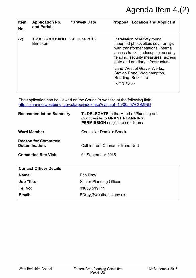
West Berkshire Council Eastern Area Planning Committee 16th September 2015
Item No.
Application No. and Parish
13 Week Date Proposal, Location and Applicant
(2) 15/00557/COMINDBrimpton
19th June 2015 Installation of 6MW ground mounted photovoltaic solar arrays with transformer stations, internal access track, landscaping, security fencing, security measures, access gate and ancillary infrastructure.
Land West of Gravel Works, Station Road, Woolhampton, Reading, Berkshire
INGR Solar
The application can be viewed on the Council’s website at the following link:http://planning.westberks.gov.uk/rpp/index.asp?caseref=15/00557/COMIND
Recommendation Summary: To DELEGATE to the Head of Planning and Countryside to GRANT PLANNING PERMISSION subject to conditions
Ward Member: Councillor Dominic Boeck
Reason for Committee Determination: Call-in from Councillor Irene Neill
Committee Site Visit: 9th September 2015
Contact Officer DetailsName: Bob DrayJob Title: Senior Planning OfficerTel No: 01635 519111Email: [email protected]
Page 35
Agenda Item 4.(2)

West Berkshire Council Eastern Area Planning Committee 16th September 2015
1. INTRODUCTION
1.1 This application seeks full planning permission for the installation of 6MW solar farm, comprising ground-mounted photovoltaic arrays, transformer stations, internal access track, landscaping, security fencing, security measures, access gate and ancillary infrastructure.
1.2 The application site comprises approximately 11.36 hectares of restored agricultural fields (following gravel extraction) within open countryside in the East Kennet Valley. The site is located some 600 metres north-east of Brimpton and approximately 700 metres south of Woolhampton. To the north are sand and gravel pits with the Kennet and Avon Canal beyond. Further north the land rises into the North Wessex Downs Area of Outstanding Natural Beauty (AONB).
1.3 There are numerous public rights of way in the open countryside between the two settlements, including footpath BRIM/4/2 along the western boundary of the site, and footpath BRIM/5/1 along the northern boundary. There are also private ways to the south providing access to fishing lakes. The site is accessed via a private way running from Station Road to the east.
1.4 The proposed ground-mounted solar photovoltaic arrays would be installed in parallel lines on an east-west axis so that the panels face south. The panels would be set at an angle of circa 25 degrees on their mounts to maximise their efficiency. The posts would be driven into the ground to a depth of up to 1.5 metres. The cabling would be laid within trenches.
1.5 A total of 24,000 modules are proposed, resulting in a site coverage by the canopy of 3.93 hectares (35% of the site). The land underneath the panels is proposed to be used for biodiversity enhancements by forming green corridors. An easement gap in the array would be provided either side of the overhead power lines running through the southern third of the site.
1.6 It is proposed to enclose the arrays within a 2 metre security fence, and 7 No. 4m high CCTV towers (coloured green) would encircle the perimeter. A DNO substation is proposed, together with six inverter stations.
1.7 A temporary site compounds is proposed in the north-east corner of the site during construction works. The compound would contain 20 car parking spaces, generators, six storage containers, a turning circle, office and welfare facilities. It would be surrounded by 2.2m high temporary fencing and be removed following completion of the build out.
1.8 The development is sought on a temporary basis with a lifespan of 25 years, after which the land would be restored back to solely agricultural use.
2. PLANNING HISTORY
2.1 There is no relevant planning history on the site in relation to the proposed development.
Page 36

West Berkshire Council Eastern Area Planning Committee 16th September 2015
3. EIA & PUBLICITY
3.1 The application has been considered under the provisions of the Town and Country Planning (Environmental Impact Assessment) Regulations 2011. Prior to submitting the application the applicants requested an EIA screening opinion from the Council (reference 14/03162/SCREEN), where it was determined that the proposed development was not EIA development and therefore EIA was not required. The proposed output has increased from 5MW to 6MW since the screening opinion. This variation is not considered significant in terms of the EIA Regulations (e.g. the Planning Practice Guidance indicative threshold for EIA is 50MW), therefore the former screening opinion is applicable.
3.2 The Town and Country Planning (Development Management Procedure) (England)
Order 2015 (DMPO) requires in the case of an application for planning permission for development which would affect a right of way to which Part 3 of the Wildlife and Countryside Act 1981 applies, the application shall be publicised by giving requisite notice:
(a) by site display in at least one place on or near the land to which the application relates for not less than 21 days; and
(b) by publication of the notice in a newspaper circulating in the locality.
3.3 Otherwise, the DMPO requires in the case of an application for planning permission for major development, the application shall be publicised by giving requisite notice:
a) by site display in at least one place on or near the land to which the application relates for not less than 21 days; or by serving the notice on any adjoining owner of occupier; and
b) by publication of the notice in a newspaper circulating in the locality.
3.4 The publicity undertaken by the Council has been in accordance with the DMPO and the West Berkshire Council Statement of Community Involvement. Site notices (referring to major development and development affecting rights of way) were displayed in numerous locations, including along the boundary of the site, the site access, and on surrounding public footpaths. Neighbour notification letters were sent to 109 local recipients. The application was also listed in a public notice (under headings for both ‘major development’ and ‘development affecting a public right of way’) in the Newbury Weekly News on 09/04/2015.
3.5 Although not a legal requirement, the National Planning Policy Framework (NPPF) also encourages early engagement and consultation by the applicant. The application is accompanied by a Statement of Community Engagement, which outlines the process of community engagement undertaken by the applicants prior to submitting the planning application. This includes a community letter drop to 163 properties, letters to parish and local councillors, meetings with Brimpton and Woolhampton Parish Councils, and a public exhibition.
3.6 The proposal has been amended during the consideration of the application. This principally included amended planting proposals and additional photo views. Statements have also been submitted by the applicant in response to Parish Council and Landscape Consultant consultation responses.
3.7 Interested parties have been consulted on the amended scheme. As a result those likely to be affected have had the opportunity to have their views taken into account
Page 37

West Berkshire Council Eastern Area Planning Committee 16th September 2015
on the amendment. The fundamental proposal remains in accordance with the original application. In these circumstances it is considered that the amendment can be accepted without causing prejudice to any interested party, and the application is to be determined on the basis of the amended plans.
4. CONSULTATION
4.1 Statutory and Non-Statutory Consultations
Brimpton Parish Council:
Object.
Midgham Parish Council (adjacent):
Object.
Woolhampton: Support.
Wasing Parish Meeting: No response.
Energy Efficiency Officer:
No adverse comments.
Landscape Architect: Detailed report (included after report).
Rights of Way: Object.
Highways: Conditional permission.
Environmental Health: No objections.
Conservation: No objections.
Archaeology: No objections.
Trees: No response.
Ecology: Conditional permission.
Minerals & Waste: No objections.
Environment Agency: No objections, conditional permission.
Thames Water: Informative.
Thames Valley Police: No response.
Lead Local Flood Authority:
No response.
Natural England: No objections, conditional permission.
Page 38

West Berkshire Council Eastern Area Planning Committee 16th September 2015
Berks, Bucks & Oxon Wildlife Trust:
Conditional permission.
Emergency Planning: No objections.
DEFRA: No response.
Access Officer: No response.
West Berkshire Spokes: No response.
Ramblers’ Association: No response.
4.2 Public consultation
Original consultation: Total: 27 Support: 5 Object: 22Amendments consultation: Total: 5 Support: 0 Object: 5
Summary of support Support renewable energy Need local generation Need for renewable energy for increases in housing Poor quality farmland Waterlogged soils, uneconomical to farm Well screened site Noise not a disturbance Economic support to Estate Not overlooked by houses Visible only for short distance along adjacent footpaths
Summary of objection Statement of Community Involvement does not portray view of local community Alternative Site Search only relates to 5km from a single grid connection point Solar farms should be constructed on brownfield land/commercial roofs Site comprises undeveloped agricultural land Agricultural land is fertile/usable as it is currently hosting a crop 25 years cannot be considered temporary Restoration to agriculture was a condition of former gravel extraction Affect on future status of the land Contrary to Government policy Site is adjacent to popular public footpaths Affected footpaths are well-used as route between Brimpton and railway station Development would harm the amenity of adjacent footpaths Industrial development, out of character Development would harm the character and appearance of surrounding area Screening will take time to establish Cumulative impacts with other nearby solar farms Development would be visible to multiple houses in Brimpton and Woolhampton,
particularly in winter Adverse ecological impacts – birds, wildlife
Page 39

West Berkshire Council Eastern Area Planning Committee 16th September 2015
Noise impacts Flood risk Precedent Future extension
5. PLANNING POLICY
5.1 Section 38(6) of the Planning and Compulsory Purchase Act 2004 requires that the determination of any planning application must be made in accordance with the development plan unless material considerations indicate otherwise. The statutory Development Plan comprises:
The West Berkshire Core Strategy (2006-2026) The West Berkshire District Local Plan 1991-2006 (Saved Policies 2007) The Replacement Minerals Local Plan for Berkshire (2001) The Waste Local Plan for Berkshire (1998)
5.2 The National Planning Policy Framework (NPPF) was published in March 2012. The Framework sets out Government planning policies for England and how these are expected to be applied. It is a material consideration in planning decisions.
5.3 The Planning Practice Guidance (PPG) was published on 6 March 2014. The Planning Practice Guidance is a material consideration for all planning decisions. It provides guidance on procedural matters (including planning conditions and obligations), and on numerous material planning considerations.
5.4 The following other material considerations are relevant to this application: North Wessex Downs AONB Management Plan 2014-2019 Manual for Streets (DfT; March 2007) North Wessex Downs AONB Statement on Setting
5.5 The West Berkshire Core Strategy was adopted on 16 July 2012 and carries full weight in decision-making as a development plan document adopted since the publication of the NPPF. The following policies from the Core Strategy are relevant to this application:
NPPF Policy ADPP1: Spatial Strategy ADPP6: The East Kennet Valley CS5: Infrastructure Requirements and Delivery CS10: Rural Economy CS13: Transport CS14: Design Principles CS15: Sustainable Construction and Energy Efficiency CS16: Flooding CS17: Biodiversity and Geodiversity CS18: Green Infrastructure CS19: Historic Environment and Landscape Character
5.6 The saved policies of the West Berkshire District Local Plan carry due weight according to their degree of conformity with the NPPF. The following saved policies from the Local Plan are relevant to this application:
Page 40

West Berkshire Council Eastern Area Planning Committee 16th September 2015
OVS.5: Environmental Nuisance and Pollution Control OVS.6: Noise Pollution TRANS.1: Meeting the Transport Needs of New Development
5.7 In addition, the following locally and regionally adopted policy documents are material considerations relevant to this application:
Planning Obligations SPD Quality Design SPD
6. APPRAISAL
6.1 Principle of development
6.1.1 To the extent that development plan policies (detailed in Section 5 of this report) are material to an application for planning permission the decision must be taken in accordance with the Development Plan unless there are material considerations that indicate otherwise (in accordance with Section 70(2) of the Town and Country Planning Act 1990 and Section 38(6) of the Planning and Compulsory Purchase Act 2004).
6.1.2 The National Planning Policy Framework (NPPF) is a material consideration. It stresses the importance of having a planning system that is genuinely plan-led. However, the NPPF has a presumption in favour of sustainable development that provides for where the development plan is absent, silent or relevant policies are out-of-date, the Framework says planning permission should be granted unless:
any adverse impacts in doing so would significantly and demonstrably outweigh the benefits, when assessed against the policies in the Framework taken as a whole; or
specific policies in the Framework indicate development should be restricted, including sites protected under the Birds and Habitats Directive, Sites of Special Scientific Interest, Local Green Space, AONB, designated heritage assets, and locations at risk of flooding.
6.1.3 In terms of the Development Plan, the application site is located in open countryside within the East Kennet Valley Spatial Area, as defined by the Spatial Strategy of the Core Strategy. In accordance with Core Strategy Policy ADPP1, only appropriate limited development should be permitted in this location. A generally restrictive approach is taken to development in the countryside, consistent with national and local planning policies of sustainability and countryside protection. Policy ADPP1 also seeks the majority of development on previously developed land, consistent with national policies. This Spatial Strategy forms the starting point for determining this planning application.
6.1.4 West Berkshire Council has not identified suitable areas for renewable and low carbon energy in plans at the current time. According to the Core Strategy, progress on the implementation of decentralised renewable energy will need to be investigated through a future Local Plan Document, which will highlight the potential in West Berkshire for commercial scale renewable energy. The Core Strategy states that in order to reduce local carbon emissions and meet national targets, a policy approach that supports and reflects the significant challenge ahead needs to be adopted, and that any renewable energy schemes should be efficient.
Page 41

West Berkshire Council Eastern Area Planning Committee 16th September 2015
6.1.5 Other than these broad principles in the Spatial Strategy, and policies related to the impacts of development, there are no Development Plan policies which are considered to specifically preclude or manage solar renewable energy in principle. It is therefore considered appropriate to have due regard to the NPPF presumption in favour of sustainable development in addition to the Spatial Strategy of the Development Plan.
6.1.6 There is a large body of relevant UK energy policy, beyond planning-specific policies and guidance. This includes:
UK Renewable Energy Strategy (July 2009) Memorandum of Understanding between DECC and LGA (9 March 2011) The Promotion and Use of Energy from Renewable Sources Regulations
2011 Energy Act 2010 Energy Security Strategy (November 2012) Annual Energy Statement (October 2013) UK Solar PV Strategy Part 1 – Roadmap to a Brighter Future (October 2013) Renewable Energy in 2013 (June 2014) Digest of United Kingdom Energy Statistics 2014 (July 2014) Renewable Energy Roadmap Update (November 2013)
6.1.7 The overall theme of these policies is to support the growth of renewable and low carbon energy to help mitigate climate change and shift the UK to a low carbon economy. These policies underpin the specific planning policy and guidance relating to renewable energy developments.
6.1.8 The NPPF and Core Strategy are both generally supportive of low carbon energy in order to mitigate the effects of climate change. One of its core planning principles of the NPPF is to “support the transition to a low carbon future in a changing climate, taking full account of flood risk and coastal change, and encourage the reuse of existing resources, including conversion of existing buildings, and encourage the use of renewable resources (for example, by the development of renewable energy)”.
6.1.9 Specifically with respect to energy development, Paragraph 98 of the NPPF advises local planning authorities to approve applications for renewable and low carbon energy (unless material considerations indicate otherwise) if the impacts are, or can be made, acceptable. Paragraph 98 of the Framework also states that local planning authorities should not require applicants for energy development to demonstrate the overall need for renewable or low carbon energy and also recognise that even small-scale projects provide a valuable contribution to cutting greenhouse gas emissions.
6.1.10 Paragraph 13 of the section on Renewable and Low Carbon Energy of the Planning Practice Guidance states the deployment of large-scale solar farms can have a negative impact on the rural environment, particularly in undulating landscapes. However, the visual impact of a well-planned and well-screened solar farm can be properly addressed within the landscape if planned sensitively. Paragraph 13 identifies particular factors relating to ground-mounted solar farms a local planning authority will need to consider:
Page 42

West Berkshire Council Eastern Area Planning Committee 16th September 2015
(1) Encouraging the effective use of land by focussing large scale solar farms on previously developed and non agricultural land, provided that it is not of high environmental value.
(2) Where a proposal involves greenfield land, whether: (i) the proposed use of any agricultural land has been shown to be necessary and poorer quality land has been used in preference to higher quality land; and (ii) the proposal allows for continued agricultural use where applicable and/or encourages biodiversity improvements around arrays.
(3) That solar farms are normally temporary structures and planning conditions can be used to ensure that the installations are removed when no longer in use and the land is restored to its previous use.
(4) The proposal’s visual impact, the effect on landscape of glint and glare (see guidance on landscape assessment) and on neighbouring uses and aircraft safety.
(5) The extent to which there may be additional impacts if solar arrays follow the daily movement of the sun.
(6) The need for, and impact of, security measures such as lights and fencing.
(7) Great care should be taken to ensure heritage assets are conserved in a manner appropriate to their significance, including the impact of proposals on views important to their setting. As the significance of a heritage asset derives not only from its physical presence, but also from its setting, careful consideration should be given to the impact of large scale solar farms on such assets. Depending on their scale, design and prominence, a large scale solar farm within the setting of a heritage asset may cause substantial harm to the significance of the asset.
(8) The potential to mitigate landscape and visual impacts through, for example, screening with native hedges.
(9) The energy generating potential, which can vary for a number of reasons including, latitude and aspect.
6.1.11 These considerations are examined in the following sections of this report.
6.1.12 The decommissioning of the solar farm and the restoration of the land to solely agriculture can be secured by planning condition. Following restoration, the land would not be classified as previously developed land because it has not been occupied by a “permanent structure”.
6.1.13 The proposed solar panels do not track the daily movement of the sun, and therefore there are no such additional impacts that need to be taken into account.
6.1.14 The arrays would be enclosed by a 2 metre security fence, together with seven pole-mounted CCTV cameras measuring 4 metres in height. The visual impact of
Page 43

West Berkshire Council Eastern Area Planning Committee 16th September 2015
these features has been taken into account in the assessment of the landscape and visual impacts.
6.2 Location
6.2.1 The suitability of the site for a ground-mounted solar farm is a key material consideration. The Planning Practice Guidance seeks to focus large scale solar farms on previously developed and non agricultural land, provided that it is not of high environmental value. The preference for previously developed land is repeated in Core Strategy Policy ADPP1 and the NPPF.
6.2.2 The Planning Practice Guidance gives weight to a speech by the Minister for Energy and Climate Change, the Rt Hon Gregory Barker MP, to the solar PV industry on 25 April 2013 and the Written Ministerial Statement – Solar energy: protecting the local and global environment – made on 25 March 2015.
6.2.3 The former speech, whilst supporting placing solar PV at the heart of the UK’s energy mix, warns of inappropriate expansion and the risks of loosing public support. It reiterates Government’s preference for brownfield land for larger schemes. Relevant to the consideration of this application, the Minster states:
“We need to be careful that we do not over-incentivise large-scale ground-mounted projects in inappropriate places – I am thinking of greenfield agricultural land – that could generate strong opposition to our community energy agenda… …It needs careful design and thoughtful consideration. It certainly could not be a scheme about renewable energy at any cost. Impacts on the local community, on landscape and on consumer bills have to be a real consideration…”
6.2.4 The latter Ministerial Statement is also positive to solar energy, but seeks to provide greater emphasis of locating schemes on domestic and commercial roof space, and previously developed land. Relevant to the consideration of this application, it states:
“The National Planning Policy Framework includes strong protections for the natural and historic environment and is quite clear that local councils when considering development proposals should take into account the economic and other benefits of the best and most versatile agricultural land. Yet, some local communities have genuine concerns that when it comes to solar farms insufficient weight has been given to these protections and the benefits of high quality agricultural land. As the solar strategy noted, public acceptability for solar energy is being eroded by the public response to large-scale solar farms which have sometimes been sited insensitively.
Meeting our energy goals should not be used to justify the wrong development in the wrong location and this includes the unnecessary use of high quality agricultural land. Protecting the global environment is not an excuse to trash the local environment. When we published our new planning guidance in support of the Framework, we set out the particular factors relating to large scale ground mounted solar photovoltaic farms that a local council will need to consider. These include making effective use of previously developed land and, where a proposal involves agricultural land,
Page 44

West Berkshire Council Eastern Area Planning Committee 16th September 2015
being quite clear this is necessary and that poorer quality land is to be used in preference to land of a higher quality.”
6.2.5 Brimpton Parish Council objects to the application on grounds that the proposed location is in contravention of Government policy that solar parks should be on brownfield sites and not in attractive countryside. Reference is made to a statement by the Secretary of State for the Environment which said:
"English farmland is some of the best in the world and I want to see it dedicated to growing quality food and crops. I do not want to see its productive potential wasted and its appearance blighted by solar farms. Farming is what our farms are for and it is what keeps our landscape beautiful. I am committed to food production in this country and it makes my heart sink to see row upon row of solar panels where once there was a field of wheat or grassland for livestock to graze. Solar panels are best placed on the 250,000 hectares of south facing commercial rooftops".
6.2.6 The application site is undeveloped agricultural land. Although it is restored agricultural land following gravel extraction, it remains excluded from the definition of previously developed land. It is therefore contrary to the preference for previously developed non-agricultural land.
6.2.7 The Planning Practice Guidance advises that where a proposal involves greenfield land:
(i) the proposed use of any agricultural land should be shown to be necessary and poorer quality land should be used in preference to higher quality land; and
(ii) the proposal should allow for continued agricultural use where applicable and/or encourages biodiversity improvements around arrays.
6.2.8 The status of, and impact on, the agricultural land is examined in Section 6.3, but in summary it has been demonstrated that the land does not constitute the best and most versatile agricultural land, as defined by the NPPF. Biodiversity improvements are proposed in terms of green corridors under the arrays.
6.2.9 The application has been accompanied by an Alternative Site Search report that seeks to demonstrate that there are no alternative suitable sites that can deliver the proposed development. The report outlines the methodology for the site search which involves selecting criteria and then sequentially reviewing previously developed land, non-agricultural sites, lower grade agricultural land, and higher grade agricultural land within a defined search area.
6.2.10 The report has been examined at officer level. The selection criteria are considered reasonable as they respond to practical and policy constraints.
6.2.11 During the consideration of the application the search area of 5km from an identified connection point has been queried by officers. In response, the applicants refer to Paragraph 97 of the NPPF that states “to help increase the use and supply of renewable and low carbon energy, local planning authorities should recognise the responsibility of all communities to contribute to energy generation from renewable or low carbon sources.”
Page 45
West Berkshire Council Eastern Area Planning Committee 16th September 2015
6.2.12 In the absence of a definition for ‘communities’ the applicants suggest that this could constitute the parish and any adjacent parish. As such, the community area in this instance comprises Brimpton CP, Midgham CP, Woolhampton CP, Wasing CP, Baughurst CP, Ashford Hill and Headley CP, Thatcham CP and Aldermaston CP. This is considered to be a reasonable interpretation of NPPF policy.
6.2.13 According to the Interactive Map of Renewable and Alternative Energy Projects across the UK there are no renewable energy schemes within this area (available online: http://www.renewables-map.co.uk/Solar.asp?Status=1&mycompid=0).
6.2.14 West Berkshire has numerous renewable energy schemes already constructed within the district. These include:
Land north of Goring Lane, Grazeley Green Land north of Pingewood Road South, Burghfield Land east of Kennet Wier Business Park, Theale Limberlost Farm, Crookham Common Land to the west of Membury Services Westbound, Hungerford
6.2.15 It is clear from the above that West Berkshire as a whole has taken on the responsibility of providing renewable energy schemes, but the absence of any existing renewable energy schemes within closer proximity to the site weighs in favour of this application.
6.2.16 Brimpton Parish Council raises further concerns relating to future expansion. They state that whilst the proposed site cannot be seen by many houses, the neighbouring fields are more visible. The Parish Council therefore seeks a condition preventing future expansion beyond the proposed site. Such a condition is not, however, considered necessary, reasonable or enforceable. Any expansion would require a separate application for planning permission, which would be considered on its merits. Any differences in circumstances (e.g. increased visibility) may lead to a different decision. Any legal covenants on such matters fall outside the planning system.
6.3 Agricultural land
6.3.1 The application site is an agricultural field, and it is proposed to retain an agricultural use of the land in parallel with the solar farm. It is recognised the range of possible agricultural purposes the field could be used for would be limited by the installation of the solar panels; however the development is reversible and the Council’s Energy Efficiency Officers confirm that the suggested biodiversity response (grazing sheep and panels together) is recognised to be a reasonable and viable dual-use of land.
6.3.2 Paragraph 112 of the NPPF states that where significant development of agricultural land is demonstrated to be necessary, local planning authorities should seek to use areas of poorer quality land in preference to that of a higher quality.
6.3.3 Brimpton Parish Council object by stating that the application claims that the proposed site is on a field of poor quality farmland. The Parish Council state, however, that this is only because of the land has been exploited for gravel extraction, and “not employing what are now known to be the minimum standards
Page 46

West Berkshire Council Eastern Area Planning Committee 16th September 2015
for restoration. And, even so, it is still useable farmland which produces hay/silage in the summer and grazing for sheep in the winter. It is still farmland; it is not brownfield and so is not an appropriate site for a solar park.”
6.3.4 Midgham Parish Council objects to this application partly on the basis that it is felt that the installation would neutralise the land which over the proposed 25 year life will have a long term negative effect.
6.3.5 According to the Council’s Agricultural Land Classification records, the northern end of the application site has been classified as Grade 2, the southern as Grade 3, and a small proportion on the west of the site as Grade 4. Detailed surveys of land to the north and east include land classified as Grades 2, 3a and 3b, but there are no detailed surveys of the site itself.
6.3.6 However, the application has been accompanied by an Agricultural Assessment, which concludes that the land is classified as Grade 3b within the Agricultural Land Classification. This has been reviewed at officer level and no reason has been found to disagree with these findings. The primary reason the land is classified as 3b is because of gleying in the soil profiles, i.e. the soils are generally waterlogged.
6.3.7 The NPPF defines best and most versatile (BMV) agricultural land as land classified as Grades 1, 2 and 3a. It has therefore been demonstrated that the land does not qualify as BMV agricultural land. The development of greenfield agricultural land does weigh against the proposal, but the weight is limited by the land grade.
6.3.8 In terms of whether the significant development of agricultural land is demonstrated to be necessary (Paragraph 112 of the NPPF), Paragraph 98 of the NPPF states that when determining planning applications, local planning authorities should not require applicants for energy development to demonstrate the overall need for renewable or low carbon energy and also recognise that even small-scale projects provide a valuable contribution to cutting greenhouse gas emissions. It is therefore considered that the use of agricultural land for such renewable energy proposals must be determined on the planning balance.
6.4 Landscape and visual impact
6.4.1 Recognising the intrinsic character and beauty of the countryside is one of the core planning principles of the Framework. The planning system should contribute to and enhance the natural and local environment by protecting and enhancing valued landscapes. Core Strategy Policy CS14 states that new development must demonstrate high quality and sustainable design that respects and enhances the character and appearance of the area.
6.4.2 In accordance with Core Strategy Policy CS19, particular regard should also be given to: (a) the sensitivity of the area to change, and (b) ensuring that new development is appropriate in terms of location, scale and design in the context of the existing settlement form, pattern and character.
6.4.3 Kirkham Landscape Planning, the Council’s Landscape Architect Consultant, has reviewed the application and reported on the landscape and visual impacts of the proposal. The full consultant’s report is included at the end of this report, which is based on the original submission.
Page 47

West Berkshire Council Eastern Area Planning Committee 16th September 2015
6.4.4 In summary, it was considered that the original proposal would have an unacceptable impact on the landscape character and appearance of the open undeveloped site, the floodplain, and on the Kennet Valley landscape between Woolhampton and Brimpton. On this basis the proposal was judge to be contrary to the Landscape Character Assessment guidance, and impact on the visual setting of the AONB (in reference to Position Statement on the Setting of the AONB). It would also have a major adverse visual impact on views of the undeveloped rural landscape from the footpath network within this part of the valley and harm views from the valley up to the AONB.
6.4.5 In response to this report, the applicants submitted a rebuttal statement, which included amended layout and planting plans. Additional viewpoints were also submitted for consideration. Following negotiations this information has been accepted as amendments to the proposal and further public consultation has been undertaken.
6.4.6 The amendments effectively provide additional screening by way of new planting along the boundaries. The Landscape Architect Consultant is now satisfied that the panels would be sufficiently hidden behind the new planting so as not to result in a significant visual impact. This approach to screening solar panels is in line with Government advice on making solar farms acceptable.
6.4.7 The additional screening does not, however, overcome the concern with the change in landscape character. The proposed landscape mitigation would not be out of keeping in this landscape, although the enclosure of the northern footpath into a hedged corridor would be anomalous and prevent enjoyment of views across the valley to Brimpton.
6.4.8 Overall, it is considered that the proposed development would have an impact on local landscape character, contrary to Policy CS19. It is not considered that the proposed development would have a significant visual impact on the surrounding area because the arrays would be well-screened by new hedgerow planting that is in keeping with the wider landscape.
6.4.9 There are not considered to be any planned or existing renewable energy development in the surrounding area that would necessitate an examination of cumulative impacts.
6.5 Impacts on surrounding footpath network
6.5.1 The area surrounding the application site includes numerous public rights of way. Footpath 5 Brimpton runs adjacent to the northern boundary of the site and Footpath 4 adjacent to the western boundary.
6.5.2 Brimpton Parish Council objects to the application partly on the basis of the footpaths. They state: “As well as being undeniably attractive countryside, the proposed area is surrounded by public footpaths that are popular and well used. Under the proposal, this valuable amenity will be diminished. The proposed solar park goes right up to Footpaths 4 and 5 which are probably the most used in the entire parish: the current experience of a quiet country walk in a rural landscape will
Page 48

West Berkshire Council Eastern Area Planning Committee 16th September 2015
be blighted by the presence of a 30 acre solar park ("an industrial site in the middle of lovely countryside" to quote a parishioner) and by the noise it emits.”
6.5.3 Woolhampton Parish Council supports the application subject to the existing footpath providing access around the field and lakes being maintained by alternative provision. The development does not involve any closure or diversions of any of the surrounding public rights of way, access will therefore be retained.
6.5.4 The Council’s Rights of Way Officers object to the application because of the detrimental effect it would have on the quality of public enjoyment of these two public footpaths. They provide the following comments:
“This area is characterised by a quiet, open landscape with extensive views across farmland and lakes, punctuated by stands of trees and willow borders.
The area has an unusually ‘untouched’ rural feel and its attraction is greatly enhanced by the wetland, to which there is extensive public access. This ‘untouched’ character would be of great recreational value for those using the two public footpaths. The view from Footpath 5 from the north-eastern corner of the site is particularly evocative, extending across open farmland to the spire of Brimpton church.
My opinion on the application is that the introduction of a large area of metal structures would be of major detriment to the recreational value of the footpaths, because of the major impact on the rural setting I have described.
The proposed vegetation screening would in my view be of considerable further detriment to the enjoyment of the footpaths, because by its nature it is screening the views across the open countryside. If the application is to be allowed, I would suggest that the footpaths would be better served without any screening of the site at all.
There is no formalised permitted access around the area of site, and my remit officially extends to existing public rights of way (Footpaths 4 and 5) plus any ‘claimed’ public rights of way (none near the site).”
6.5.5 It is clear that the proposed development and additional planting would have an impact on the closest footpaths, particularly Footpaths 4 and 5. On the basis of the Landscape Architect’s assessment, however, the impacts would be limited to a change in landscape character, rather than any harmful visual impact.
6.5.6 Footpath 4 runs along the western boundary of the site. The intervening existing hedgerow already obscures views of the site for parts of its length. On this basis the increased screening is not considered harmful, particularly because the footpath would retain an open aspect to the west.
6.5.7 Footpath 5 runs along the northern boundary of the site. Views to the north from this footpath are already obstructed by the adjacent hedgerow, whereas there are open views to the south across the valley floor which would be lost by the enclosure the footpath of both sides. The solar panels would be effectively screened and the proposed hedgerow planting is in keeping with the surrounding landscape. The
Page 49

West Berkshire Council Eastern Area Planning Committee 16th September 2015
harm is therefore limited to the change in character, and the loss of amenity from the obstruction of a public view. Approximately 340 metres length of Footpath 5 would be affected.
6.5.8 The impact on the other public rights of way in the surrounding area is limited due to local topography and vegetation cover. There are private paths within the surrounding area, including access to the fishing lakes to the south. The amenity of these paths attracts less weight than public rights of way, but in any event, no significant views of the proposed development from these paths have been identified.
6.5.9 Overall, it is considered that the mitigation planting would result in a change to the landscape character of Footpath 5, and have an adverse impact on its amenity from the loss of public views. The impact on the wider footpath network and other private ways is not considered significant.
6.6 Glint and glare
6.6.1 The following representations are given in the submitted Planning Statement with respect to the potential for glint and glare:
“The photovoltaic panels are made up of silicon based photovoltaic cells that are encased in a glass covering. Glass does not have a true specular reflection, but does reflect a certain magnitude of light. Reflection of sunlight from photovoltaic panels is unwanted by the operator. This is because the greater the amount of light which can be captured at the photovoltaic cell, the greater the amount of electricity that can be produced. The manufacturers of the panels therefore use anti–reflective coating in the glass that changes the reflectivity from specular distribution to diffuse distribution and is sometimes referred to as ‘stipple glass’.
Therefore, as light falls onto the photovoltaic panels, most of the sunlight is transmitted to the photovoltaic cell beneath the glass with only a small amount reflected back in a multiple of angles and magnitudes. The result is an object that is perceived to have very little glare. The Federal Aviation Administration (FAA) Technical Guidance for Evaluation Selected Solar Technologies at Airports, November 2012 indicates that the reflective light can be as little as 2% of the incident sunlight:-
‘Once the amount of sunlight is known, reflectivity from solar projects will vary based on the type of solar power system and its materials and design. Solar PV employs glass panels that are designed to maximise absorption and minimise reflection to increase electricity production efficiency. To limit reflection, solar PV panels are constructed with dark, light-absorption materials and covered with anti-reflective coating. Today’s panels reflect as little as 2% of the incoming sunlight depending on the angle of the sun and assuming use of antireflective coating.’ ”
6.6.2 It is considered necessary and reasonable to impose a condition stipulating that the solar panels be constructed using materials as described above, in order to limit the likelihood of unwanted glint and glare.
Page 50

West Berkshire Council Eastern Area Planning Committee 16th September 2015
6.7 Conservation of heritage assets
6.7.1 The application is accompanied by a comprehensive assessment of impact on heritage assets within a 2km radius of the application site. This assessment indicates that there is no significant impact on any of these, either directly or on their immediate setting.
6.7.2 The main impact of the proposals is on the much wider rural setting of these, and on the rural landscape as a whole. According to the Council’s Conservation Officer the site itself does not form part of the setting of any of these assets and the proposed development would not affect their significance in any way.
6.7.3 The Landscape Architect’s concerns in respect of views from listed buildings at Douai Abbey have been addressed by the provision of additional photo views showing intervening vegetation obscuring views of the proposed solar farm from this angle.
6.7.4 The Council’s Archaeologist raises no objections to the proposal. A Roman Road is shown passing through the southern end of the site on OS maps. However, given the former gravel extraction, the Archaeologist does not consider it likely that there will be any archaeological assets affected by the proposed development.
6.8 Benefits of low-carbon energy generation
6.8.1 According to the submitted Planning Statement, it is anticipated the development would export up to 6000 MWh per annum, although the final output would be dependent on panel/manufacturers specification. This equates to the annual energy consumption of approximately 1,440 households, and the anticipated carbon dioxide displacement would be 3,360 tonnes per annum.
6.8.2 The Council’s Energy Efficiency Officers confirm that the size of array should produce electricity in line with the stated predictions, according to current industry standards and dependent on materials used and prevailing weather conditions at any given time; and the levels of shading suggested should have no adverse impact on generation.
6.8.3 This output of decentralised low-carbon energy generation is considered to make a significant contribution towards renewable energy targets and overall climate change mitigation. The benefits of the development should therefore attract significant weight.
6.9 Transport and highway impacts
6.9.1 During its operational phase, the development would generate minimal vehicle movements, limited to occasional servicing which can normally be carried out by a small van. The greatest transport and highway impacts would therefore be experienced during the construction and de-construction phases. The application has therefore been supported by a Construction Traffic Management Plan.
6.9.2 The Council’s Highway Officers confirm that the proposed transport route to the site (Option 3) is acceptable as it is the best route for large vehicles. It does, however,
Page 51

West Berkshire Council Eastern Area Planning Committee 16th September 2015
pass a local primary school, so it is considered necessary to restrict times of delivery so as to avoid start, lunch and finishing times for the school.
6.9.3 The number of deliveries per day is also considered acceptable in terms of large lorries (no more than four deliveries per day average). More information on deliveries would be required before commencement, including details of how deliveries would be front loaded for the site set up, the number of site contractors, and delivery days and hours (including school restrictions above). This information can be agreed as part of a Construction Management Plan.
6.9.4 The access route crosses over a narrow hump back bridge near to the Station Road / Wasing Lane junction. Vehicle tracking plots have therefore been submitted to demonstrate that large lorries can negotiate the bridge. A condition survey should be undertaken on the access route, especially for the bridge, before the commencement of works. This can be the subject of a condition.
6.9.5 Woolhampton Parish Council supports the application on condition that construction traffic be restricted to the preferred route shown in the Construction Management Plan. Compliance with this plan should be the subject of a condition.
6.9.6 Woolhampton Parish Council also seeks the removal of the bellmouth site access on Station Road following completion of construction. This does not form part of the proposals, and the decommissioning conditions would only relate to new development approved pursuant to this application.
6.9.7 Overall, the development would have an acceptable impact on the local road network during the construction phase. As a consequence, it is considered that the impacts during decommissioning would also be acceptable. The impact on the local highway network during its operational phase would be negligible.
6.10 Noise
6.10.1 According to the submitted Planning Statement, at a maximum power output the inverters would generate a maximum noise power output of <65dB(A) at 2m. After sunset, the park would not receive solar radiation to generate electricity and under these conditions the invertors would not generate any noise.
6.10.2 The Planning Statement provides typical noise levels for context. 60dB(A) is the equivalent of a “normal conversation”, and 70dB(A) is the equivalent of noise levels “inside a saloon car”.
6.10.3 The Environmental Health Officer has assessed the application and is satisfied that the noise level being proposed by the invertors and other equipment would not cause any nuisance to the nearest residential properties.
6.10.4 Brimpton Parish Council objects to the application partly on grounds of noise. They state: “Visits to other solar parks, sometimes accompanied by representatives of Wasing, have revealed that they are not silent. Indeed, the inverters emit loud noises which were measured as varying between 60 decibels (a washing machine) and 90 decibels (a petrol-driven lawnmower). The inverters work during daylight hours and the better the weather the louder the noise. This would constitute a nuisance for walkers using the public footpaths and at times, depending on wind
Page 52

West Berkshire Council Eastern Area Planning Committee 16th September 2015
direction, the houses nearby. And it should be remembered that, in the summer, daylight hours run from about 4 am to 10 pm.”
6.10.5 Noise levels will reduce with increasing distance from the source, and intervening vegetation will have an attenuation effect. Given the separation distance from the public footpaths, and the proposed hedgerow planting, it is considered that the noise level generated by the equipment is unlikely to result in a significant impact on the public footpaths.
6.11 Ecological impacts and biodiversity enhancements
6.11.1 Brimpton Parish Council objects to the application partly on grounds of ecological impacts. They state: “The proposed field is a haven for increasingly rare birds such as lapwing and skylarks which are in severe decline elsewhere. The proposed solar park would remove their precious habitat which, for both species, requires open countryside without any obstacles (such as solar panels).”
6.11.2 The Council’s Ecologist, however, raises no objections subject to the imposition of conditions.
6.11.3 Natural England raises no objection to the proposed development but does recommend the imposition of planning conditions. The proposed development is in close proximity to the River Kennet Site of Specific Scientific Interest (SSSI). Given the nature and scale of this proposal, Natural England is satisfied that there is not likely to be an adverse effect on this site as a result of the proposal being carried out in strict accordance with the details of the application as submitted.
6.11.4 The Berks, Bucks & Oxon Wildlife Trust (BBOWT) have recommended the imposition of planning conditions to avoid adverse impacts on the River Kennet SSSI, and to achieve a net gain for nature in line with the objectives of the NPPF.
6.12 Flood risk and surface water drainage
6.12.1 The application site is partially located within Flood Zones 2 and 3, and is therefore at risk of flooding. These flood zones are respectively defined as land having between 0.1-1% change of flooding in any given year, and land having a greater than 1% change of flooding in any given year.
6.12.2 Paragraph 103 of the NPPF states that development should not increase flood risk elsewhere and that within a site the most vulnerable development should be located in areas of lowest flood risk. This approach is supported by Core Strategy Policy CS16.
6.12.3 The application is accompanied by a Flood Risk Assessment (FRA). The Environment Agency has assessed the application, and raise no objections subject to the implementation of the proposed mitigation measures. These measures would prevent a loss of floodplain storage, prevent an increase in surface water runoff from the site, and enable the passive movement of floodwater across the site.
6.12.4 Subject to the implementation of these measures, it is considered that the proposed development complies with the NPPF and Core Strategy Policy CS16.
Page 53

West Berkshire Council Eastern Area Planning Committee 16th September 2015
6.13 Minerals sterilisation and waste planning policy
6.13.1 It is understood that the application site is a former mineral working that was granted consent for mineral working in the 1940s, worked in the 1950s/60s and restored by the end of the 1960s. Following the completion of mineral working (and most likely infilling with waste) the site was restored to agriculture and it has remained in an agricultural use since that date. As a consequence, the site does not constitute previously developed land and is thus a greenfield site.
6.13.2 There are no objections to this proposal from a mineral sterilisation or waste planning policy perspective.
7. CONCLUSION
7.1 Planning law requires that applications for planning permission must be determined in accordance with the development plan unless material considerations indicate otherwise. The NPPF constitutes Government guidance for local planning authorities as a material consideration. It encourages approving development proposals that accord with the development plan without delay, or where the development plan is silent on a matter, granting planning permission unless there is significant and demonstrable harm or clear conflict with NPPF policies.
7.2 It is considered that the relevant policies of the Development Plan are generally supportive of renewable energy generation, but development is this location is generally restricted. The Development Plan is silent on the appropriate locations for delivering renewable energy schemes in West Berkshire, and therefore each case must be considered on a case-by-case basis. The Development Plan does, however, provide a clear framework for balancing the relevant considerations, including policies on landscape character, visual impact, green infrastructure, ecological impacts, and heritage conservation.
7.3 In the absence of specific policies guiding the location of renewable energy development in West Berkshire, due weight must be given to the NPPF presumption in favour of sustainable development, and Paragraph 98 of the NPPF that advises local planning authorities to approve applications for renewable and low carbon energy (unless material considerations indicate otherwise) if the impacts are, or can be made, acceptable.
7.4 The application site is undeveloped agricultural land and therefore should be avoided where there are preferable sites available. The application has been supported by an Alternative Site Search that demonstrates that there are no suitable alternative sites within a reasonable search area. It has been demonstrated that the land does not constitute the best and most versatile agricultural land.
7.5 Following amended drawings, it has been demonstrated that the development would not have an adverse visual impact on the surrounding area because the solar panels would be well-screened by new planting. The new planting would, however, have an adverse landscape character impact because it would enclose the northern footpath and result in the loss of open views across the valley floor. Given that the proposed hedgerows are in keeping with the landscape characteristics in general, it
Page 54

West Berkshire Council Eastern Area Planning Committee 16th September 2015
is considered that the level of harm if relatively limited. There is some degree of conflict with Core Strategy Policy CS19; however it is not considered to be significant enough to warrant a refusal.
7.6 The development would make a significant contribution towards renewable energy generation in the local community and within West Berkshire. The carbon displacement attracts significant weight in this decision.
7.7 In the final balance, it is considered that the significant contribution the development would make to renewable energy generation, and the absence of suitable alternative sites in the surrounding area, outweighs the identified harm to the local landscape character. The visual impact of the development can be made acceptable by the planting of new, and the enhancement of existing, hedgerows.
7.8 The application is recommended for conditional approval as detailed in Section 8.
8. FULL RECOMMENDATION
To delegate to the Head of Planning & Countryside to GRANT PLANNING PERMISSION subject to the following conditions.
1. Commencement of development
The development hereby permitted shall be begun before the expiration of three years from the date of this permission.
Reason: To comply with Section 91 of the Town and Country Planning Act 1990 (as amended by Section 51 of the Planning and Compulsory Purchase Act 2004).
2. Approved plans
The development hereby permitted shall be carried out in accordance with the approved plans and documents listed below:
[To be confirmed on Update Report]
Reason: For the avoidance of doubt and in the interest of proper planning.
3. Construction method statement (CMS)
No development shall take place until a Construction Method Statement has been submitted to and approved in writing by the Local Planning Authority. The statement shall provide for:
(a) Delivery arrangements, including: total and daily vehicle movements, and day/time restrictions (including time restrictions on movements past local schools during start, lunch and finishing times);
(b) Signage strategy for access route;(c) Parking of vehicles of site operatives and visitors (including minibuses);(d) Loading and unloading of plant and materials;(e) Storage of plant and materials used in constructing the development;
Page 55

West Berkshire Council Eastern Area Planning Committee 16th September 2015
(f) Erection and maintenance of security hoarding including decorative displays and facilities for public viewing;
(g) Temporary access arrangements to the site, and any temporary hard-standing;
(h) Wheel washing facilities;(i) Measures to control the emission of dust and dirt during construction.
Thereafter the construction works shall incorporate and be undertaken in accordance with the approved statement.
Reason: To safeguard the amenity of adjoining land uses and occupiers, and in the interests of highway safety. The approval of this information is required at this stage because insufficient information has been submitted with the application. This condition is imposed in accordance with the National Planning Policy Framework, Policies CS13 and CS14 of the West Berkshire Core Strategy (2006-2026), and Policies OVS.5, OVS.6 and TRANS.1 of the West Berkshire District Local Plan 1991-2006 (Saved Policies 2007).
4. Construction Environmental Management Plan
No development shall take place until a Construction Environmental Management Plan (CEMP) has been submitted to and approved in writing by the Local Planning Authority, in consultation with Natural England. The CEMP shall consider the impacts from the development on the surrounding SSSI and all relevant mitigation required, and cover the measures listed in the letter from Clarkson and Woods dated 05/05/2015, and the Michael Woods Associates Ecological Survey Report dated February 2015. The CEMP shall include:
(a) Integration of Best Practice Guidance and Pollution Prevention Controls;(b) A Precautionary Method Statement in relation to Great Crested Newts;(c) Management of dust production at the site;(d) On-site material storage;(e) Measures required for dealing with any contamination incidents (e.g.
spillages);(f) A description of on-site waste management, including materials and
construction waste;(g) Evidence that no waste will encroach on the SSSI;(h) A plan showing the ditches at the site and a 6 metre buffer zone between the
ditches and the construction zone;(i) Details of the seed mixes for the grass/wildflower and course grass areas.
Reason: To ensure adequate protection to the River Kennet SSSI and other ecological assets affected by the development. This information is required because development takes place because insufficient information has been provided with the application. This condition is imposed in accordance with the National Planning Policy Framework, and Policy CS17 of the West Berkshire Core Strategy (2006-2026).
5. Landscape and Ecological Management Plan
No development shall take place until a Landscape and Ecological Management Plan (LEMP) has been submitted to and approved in writing by the Local Planning Authority. The LEMP shall cover the measures listed in the letter from Clarkson and
Page 56

West Berkshire Council Eastern Area Planning Committee 16th September 2015
Woods dated 05/05/2015 and the Michael Woods Associates Ecological Survey Report dated February 2015 (implementing the recommendations of Section 7.6 and 7.7).
Reason: To ensure the conservation and enhancement of local landscape and biodiversity assets affected by the proposed development. This information is required because development takes place because insufficient information has been provided with the application. This condition is imposed in accordance with the National Planning Policy Framework, and Policies CS17, CS18 and CS19 of the West Berkshire Core Strategy (2006-2026).
6. Access route condition survey
No development shall take place until a condition survey of the access route has been submitted to and approved in writing by the Local Planning Authority. The condition survey shall be undertaken with a representative from the Local Highway Authority and include photographic evidence of the condition of the public highway and associated structures (including Shalford Bridge).
Reason: To ensure an accurate record is made of the condition of the access route, in order to identify any damage caused by construction traffic on the surrounding rural road network. This condition is imposed in accordance with The Berkshire Act 1986 Part 11 clause 9, the Highways Act 1980, the National Planning Policy Framework, and Policy CS13 of the West Berkshire Core Strategy (2006-2026).
7. Surfacing of access
No development shall take place until details of the surfacing arrangements for the vehicular accesses to the highway have been submitted to and approved in writing by the Local Planning Authority. Such details shall ensure that bonded material is used across the entire width of the accesses for a distance of 16 metres measured back from the carriageway edge. The transportation of solar photovoltaic panels and associated equipment shall not commence until the surfacing arrangements have been constructed in accordance with the approved details.
Reason: To avoid migration of loose material onto the highway in the interest of road safety. This condition is imposed in accordance with the National Planning Policy Framework, and Policies CS13 and CS14 of the West Berkshire Core Strategy (2006-2026).
8. Set back of gates
Any gates to be provided at accesses where vehicles will enter or leave the site, shall open away from the adjoining highway and be set back a distance of at least 16 metres from the edge of the highway.
Reason: In the interest of road safety and to ensure that heavy goods vehicles can be driven off the highway before the gates are opened. This condition is imposed in accordance with the National Planning Policy Framework, and Policies CS13 and CS14 of the West Berkshire Core Strategy (2006-2026).
Page 57

West Berkshire Council Eastern Area Planning Committee 16th September 2015
9. Construction compound
No solar photovoltaic panels, mounds, plant or other associated equipment shall be delivered to the site until the temporary constructors compound and parking arrangements have been provided in accordance with the approved details.
Reason: In the interest of road safety, to ensure that there is sufficient parking within the site before development takes place. This condition is imposed in accordance with the National Planning Policy Framework, and Policies CS13 and CS14 of the West Berkshire Core Strategy (2006-2026).
10. Security fencing construction
No solar photovoltaic panels, mounds, plant or other associated equipment shall be delivered to the site until either (1) the approved security fencing, or (2) a temporary construction fencing approved as part of the Construction Method Statement has been provided. No works shall take place outside the fenced areas except for those necessary to connect the development to the National Grid and for landscaping purposes.
Reason: To ensure that the construction activities are contained within the fenced area, in the interests of safeguarding surrounding ecological assets. This condition is imposed in accordance with the National Planning Policy Framework, and Policies CS13 and CS14 of the West Berkshire Core Strategy (2006-2026).
11. Construction season
Construction/installation operations shall not take place outside the months of November to February (inclusive) in any given year.
Reason: To protect Great Crested Newts from construction activities. This condition is imposed in accordance with the National Planning Policy Framework, and Policy CS17 of the West Berkshire Core Strategy (2006-2026).
12. Hours of work (construction)
No demolition or construction works shall take place outside the following hours:
7:30am to 6:00pm Mondays to Fridays;8:30am to 1:00pm Saturdays;nor at any time on Sundays or Bank Holidays.
Reason: To safeguard the amenities of adjoining land uses and occupiers. This condition is imposed in accordance with the National Planning Policy Framework, and Policy CS14 of the West Berkshire Core Strategy (2006-2026).
13. Lighting
Notwithstanding the provisions of Article 3 of the Town and Country Planning (General Permitted Development) (England) Order 2015 (or any order revoking, re-enacting or modifying that Order), no external lighting shall be installed within the application site during the construction, operational and decommissioning phases of
Page 58

West Berkshire Council Eastern Area Planning Committee 16th September 2015
the development unless details have first been submitted to and approved in writing by the Local Planning Authority pursuant to this condition. Any external lighting shall be installed in accordance with the approved details.
Reasons: To protect the rural character of the area and local wildlife from inappropriate lighting. This condition is imposed in accordance with the National Planning Policy Framework, and Policies CS14, CS17 and CS19 of the West Berkshire Core Strategy (2006-2026).
14. Flood risk mitigation
The development hereby permitted shall not be carried out, except in accordance with the Flood Risk Assessment (Clive Onions, reference 13015/32 V2, dated 20/02/2015), and without undertaking the following mitigation measures detailed within the FRA:
(a) All solar arrays will be located outside of Flood Zones 2 and 3;(b) The construction compound will be removed from the site following the
completion of construction and before the development begins producing electricity;
(c) On-site fencing will have an open mesh;(d) Newly created access tracks will be permeable and level with the existing
ground level;(e) Solar arrays shall be constructed with gaps, as outlined in the FRA, to enable
rainwater to disperse through the array.
Reason: The implementation of the above measured detailed in the FRA is required to prevent a loss of floodplain storage, to prevent an increase in surface water run-off from the site, and to enable the passive movement of floodwater across the site. This condition is imposed in accordance with the National Planning Policy Framework, and Policy CS16 of the West Berkshire Core Strategy (2006-2026).
15. Ecological mitigation and protection of ditches
The development shall not be carried out except in strict accordance with the measures outlined in Section 7.4, 7.6 and 7.7 of the Ecological Survey (Michael Woods Associates report 4181, February 2015). There shall be a minimum buffer zone of 6 metres provided between these ditches present at the site and the construction zone.
Reason: There are several ditches at the site that are linked to the River Kennet SSSI. Natural England advises that the implementation of the proposed mitigation measures is essential to ensure the adequate protection of the SSSI. This condition is imposed in accordance with the National Planning Policy Framework, and Policy CS17 of the West Berkshire Core Strategy (2006-2026).
16. No alteration of ground levels
There shall be no alteration of existing ground levels.
Reason: To ensure that ground levels are not altered in order to protect the character and amenity of the area, and to prevent any potential pathways being
Page 59

West Berkshire Council Eastern Area Planning Committee 16th September 2015
created to contaminated land. This condition is imposed in accordance with the National Planning Policy Framework (March 2012), and Policies ADPP1, ADPP6, CS14 and CS19 of the West Berkshire Core Strategy (2006-2026).
17. Materials
The materials to be used in the development hereby permitted shall be as specified on the plans, the application forms, and as described in Paragraph 5.45 of the Planning Statement.
Reason: For the avoidance of doubt, and in the interests of proper planning. Further, to ensure that the materials used in the construction of solar panels do not cause excessive glint and glare. This condition is imposed in accordance with the National Planning Policy Framework, Policies CS14 and CS19 of the West Berkshire Core Strategy (2006-2026).
18. Decommissioning
No electricity shall be generated by the development hereby permitted until 14 days notice has been submitted to the Local Planning Authority in writing. The development hereby permitted shall be removed in its entirety and the land restored to its former condition within 25 years and six months of the date that electricity was first generated by the development, or within six months of the development failing to generate electricity for 12 consecutive months, whichever occurs first. The land shall be restored to its former condition in accordance with a scheme of decommissioning work and land restoration that shall have first been submitted to and approved in writing by the Local Planning Authority.
Reason: To ensure that the land is restored to its original undeveloped condition following the expiry period or once the development fails to generate electricity, in the interests of protecting the amenity of the open countryside. This condition is imposed in accordance with the National Planning Policy Framework, and Policies ADPP1, ADPP6, CS14 and CS19 of the West Berkshire Core Strategy (2006-2026).
19. Removal of operational development following decommissioning
As part of the decommissioning process, all operational development in, on, over or under the land enclosed by the red line on drawing number PV-0191-02 Revision Number 4 associated with the development hereby permitted shall be completely removed from the application site within 25 years and six months of the date that electricity was first generated by the development, or within six months of development failing to generate electricity for 12 consecutive months, whichever occurs first. The operational development to be removed includes, but is not necessarily limited to: photovoltaic modules, supports, transformer stations, internal access track, security fencing, security measures, access gate, all cables and cable trenches.
Reason: To ensure that the land cannot be classified as previously developed land by virtue of the retention of any structures on a permanent basis. This condition is imposed in the interests of ensuring a sustainable pattern of development and to protect the open countryside from inappropriate future development. This condition is imposed in accordance with the National Planning Policy Framework, and Policies
Page 60

West Berkshire Council Eastern Area Planning Committee 16th September 2015
ADPP1, ADPP6, CS14 and CS19 of the West Berkshire Core Strategy (2006-2026).
20. Permitted development restriction (fences)
Notwithstanding the provisions of Article 3 of the Town and Country Planning (General Permitted Development) (England) Order 2015 (or any order revoking, re-enacting or modifying that Order), no gates, fences, walls or other means of enclosure (except those expressly authorised by this permission) that would otherwise be permitted by Schedule 2, Part 2, Class A of that Order shall be erected within the application, without planning permission being granted by the Local Planning Authority on an application made for that purpose.
Reason: To prevent the inappropriate means of enclosure within the site in the interests of respecting the character and appearance of the surrounding area. This condition is imposed in accordance with the National Planning Policy Framework, and Policies CS14 and CS19 of the West Berkshire Core Strategy (2006-2026).
INFORMATIVES
1. Proactive actions of the LPA
The Local Planning Authority (LPA) has worked with the applicant in a positive and proactive manner based on seeking solutions to problems arising in relation to dealing with a planning application. In particular, the LPA:
a) Provided the applicant with a case officer as a single point of contact.b) Alerted the applicant to issues that were raised during the consideration of
the application.c) Accepted amended plans to address issues arising during the consideration
of the application.d) Agreed an extension of time before determining the application to enable
negotiations with the applicant.e) Entered into protracted considerations/negotiations in order to find a solution
to problems with the proposed development, rather than refusing planning permission without negotiation.
2. Consent to enter land
You must obtain the prior consent of the owner and occupier of any land upon which it is necessary for you to enter in order construct, externally finish, decorate, or in any other way carry out any works in connection with this development, or to obtain any support from adjoining property. This permission granted by the Council in no way authorises you to take such action without first obtaining this consent.
3. Public sewers
There are public sewers crossing or close to your development. In order to protect public sewers and to ensure that Thames Water can gain access to those sewers for future repair and maintenance, approval should be sought from Thames Water where the erection of a building or an extension to a building or underpinning work would be over the line of, or would come within 3 metres of, a public sewer. Thames Water will usually refuse such approval in respect of the construction of new buildings, but approval may be granted in some cases for extensions to existing
Page 61

West Berkshire Council Eastern Area Planning Committee 16th September 2015
buildings. The applicant is advised to contact Thames Water Developer Services on 0800 009 3921 to discuss the options available at this site.
Page 62

KIRKHAM LANDSCAPE PLANNING LTD 177/15WEST BERKSHIRE COUNCIL
WEST BERKSHIRE COUNCIL
PLANNING APPLICATION NO. 15/00557/COMIND
LAND AT MANOR FARM, BRIMPTON
6MW SOLAR FARM WITH ACCESS
A. Introduction
The proposals were reviewed and a site visit was undertaken in May 2015.
B. Submissions
PegasusGroup Landscape and visual impact assessment (LVIA) Feb 2015
Power Services Dwg PV-0191-01
C. Site description
The site is a flat open arable field comprising 11.36 ha in the Kennet Valley. It is located within an area of former gravel extraction which has since largely been restored except for a working area to the east of the site. Wetland habitats with ponds and mature woodland lie to the north up to the A4. Arable fields lie within the open Kennet Valley floor to the immediate west of the site and to the east at Wasing Farm, set within a pattern of small copses and vegetation lined streams. The river Kennet corridor is densely vegetated with woodland and riparian habitats.
The North Wessex Downs AONB lies to the north above Woolhampton, forming a prominent ridgeline to the north of the Kennet Valley. To the south lie the lower slopes of the Greenham – Crookham escarpment. Within this context Douai Abbey in the AONB and Brimpton Church are very prominent landmarks. These two have an open line of sight directly across the western edge of the site.
The field is bounded by a gappy hedge along its southern boundary, a ditch with some boundary vegetation along it western boundary and denser more mature planting to the east. The northern boundary is open and abuts a public right of way leading east to Bottle Cottage, with a dense fairly mature hedgerow to the north (this appears to be planted as part of the restoration scheme for this area). A second public right of way follows the western boundary leading to a further public right of way to the south leading off the road west of Shalford Bridge and connecting to Brimpton in the south to Woolhampton in the north. The line of sight between Douai Abbey in the AONB and Brimpton Church can be enjoyed from this footpath.
1
Page 63

KIRKHAM LANDSCAPE PLANNING LTD 177/15WEST BERKSHIRE COUNCIL
With the restoration of the gravel extraction, footpaths across the Kennet Valley are now extensive and attractive, connecting with the villages and canal towpath, with views of the valley floor and higher ground to the north and south, particularly the AONB.
D. Landscape context and character
North Wessex Downs Landscape Character Assessment 2002
The Kennet Valley forms a part of the setting of the AONB. The nearest part of the AONB is in LCA 8A Hermitage Wooded Commons. The landscape characteristics of LCA8A are not found on the site or the Kennet Valley setting and there are no specific relevant issues other than to maintain a sense of visual tranquillity.
Newbury District-wide Landscape Character Assessment 1993
The site is within LCT8: Kennet Valley. The characteristics of the area are covered in the LVIA which concludes that the site shares the characteristics of the wider area. Despite past gravel workings, and as a result of the restoration scheme, the site and its surroundings are typical of the largely quiet and relatively remote quality of the Kennet Valley with a mix of wetland wilderness and farmland. The A4 is not intrusive and the area is remote from the major settlements along the valley. The NDLCA recommends that further erosion of the rural quality of the valley should be strongly resisted. Solar farms were not an issue when the NDLCA was completed but the guidelines recommend a strategy of conservation with development within the valley floor to be strongly resisted. Any development should be small in scale with extensive measures to conserve valued habitats. It recommends new tree planting. Berkshire Landscape Character Assessment 2003
The site lies within LCAB1: Lower Kennet. The overall strategy is to conserve and restore the open farmland character of the floodplain, seek to restore the traditional pattern of pastoral landscape and enhancement of the visual qualities of the river and canal landscape. Features of key significance include the wetland habitats, ecological management of arable farmland, creation of small scale woodland; the open undeveloped floodplain; and views along and from the floodplain, particularly to the valley sides.
E. Views of the site
The LVIA includes 11 viewpoints (VP). Although these were not agreed in advance, I am happy they are representative of the local viewpoints with the following provisos:
Viewpoint 3 as a representative of views from the footpath west of the site is not the worst case with more open views north of the viewpoint
There are additional views from the footpath south of the site There are views from Douai Abbey. Viewpoint 11 is in the AONB to the west of
Midgham
F. Key Landscape Issues
Landscape impact on the open undeveloped farmland valley floor Visual impact on local footpath network
2
Page 64

KIRKHAM LANDSCAPE PLANNING LTD 177/15WEST BERKSHIRE COUNCIL
G. Relevant Policy
National: Paragraphs 7, 17, 97, 98, 109 to 129
West Berkshire Core Strategy CS19;
H. Assessment of the Scheme
H1 Description of proposals
The following elements would affect the landscape character and visual amenity of the site and its surroundings:
6 ha of solar panels up to 2.6m high and 2-5m apart 6no. small cabinets over the site DNO sub-station Security fencing 2m high Security cameras Internal tracks of stone in a geo-textile membrane.
Landscape mitigation includes: Grassland under the panels to be managed by sheep grazing or low maintenance
mowing regime Grassland edge New hedgerow along northern edge of the site (south of the footpath) Infill planting to western and southern boundaries Hedgerows maintained at 2-3m high.
H2 Direct Impacts on the site
The proposed solar panels do not result in the loss of any boundary vegetation. The arable field will be replaced by a cover of grassland. However the character of the site will change from open farmland to that of a solar farm with the dominant feature being the mass of panels. Minor changes arise from the small built infrastructure and the proposed tracks into the site.
H3 Visual impacts
The panels will be facing south and will be higher than normal eye level. From the north footpath (VP1 and VP2) views will be of the back of the panels and the existing views over the valley floor to the Brimpton to Wasing higher ground will be lost where the panels abut up close to the path. Initially views will be of the rear side of the panels and fencing but in time this will be replaced by the proposed hedge, containing the footpath, with a permanent loss of rural views out over the valley floor to the south. From the west (VP3 and others) initially there will be open and filtered views of the rows of panels from the footpath with the loss of rural views down the valley (at this point the remaining gravel works area is screened by vegetation). With the proposed new planting the panels will be screened in summer, less so in winter. From the south (VP4 and others) views will be of the panels themselves. Light will catch these panels (even with modern less reflective finishes), particularly in winter. With the proposed new planting the panels will be screened in summer, less so in winter.
3
Page 65

KIRKHAM LANDSCAPE PLANNING LTD 177/15WEST BERKSHIRE COUNCIL
Further afield in viewpoints 5 to 11, the impact diminishes with distance and screening vegetation and the proposed solar panels are unlikely to be intrusive. An exception is the views from Douai Abbey which will look down onto the panels at a distance of 2.4km.
Overall the visual impact is localised but from high sensitivity receptors, the public rights of way which cross a rural landscape with fine views of the surrounding AONB and hillsides. The development will be perceived as a significant change to the view, not only from the adjacent paths but from the southern approaches, with the introduction of a major development into a quiet rural landscape. H4 Indirect Impacts on the wider landscape
The value of the existing open undeveloped valley floor and the combination of farmland and wetland habitats with woodland copses is set out in the LCAs. The receiving landscape into which the development is proposed is remote from urban influences and the gravel workings are no longer a detracting influence in the valley floor. The site is typical of the Kennet Valley away from the major settlements and in its current state contributes to the open character and opportunity for views across or down the valley. The proposed landscape mitigation would not be out of keeping in this landscape, although the enclosure of the northern footpath into a hedged corridor would be anomalous and prevent enjoyment of views across the valley to Brimpton.
H5 Assessment of LVIA conclusions
1. Although the site is not in the AONB, it forms part of the foreground in views to the AONB from the valley floor. It therefore forms part of the visual setting of the AONB
2. The site contains features identified as of value in the LCAs. Unfortunately the LVIA methodology provides no guidance on how the sensitivity and value of the landscape is determined and classified from high to low. The LVIA concludes an overall ‘medium’ sensitivity to the site
3. No assessment is made of the effect of the development on the site itself. The LVIA methodology would suggest a high magnitude of change, even taking into account retention of the vegetation and topography, and the new planting
4. The LVIA concludes a low magnitude of change to NDLCA’s LCT8 but for the area between Woolhampton and Brimpton, the LVIA methodology would suggest a medium magnitude of change with the introduction of an element which is uncharacteristic of the quiet rural character of the area
5. This would lead to between a major adverse effect on the site (as also concluded in the LVIA) and a moderate adverse (rather than minor) effect on the local landscape. The wider LCT8 and the landscape character of the AONB would not be affected
6. Views from the Grade II* and Grade II listed buildings at Douai Abbey would be affected. These have not been assessed in the LVIA
7. I agree with the LVIA conclusion that there would be a major adverse effect on views from footpaths VP1 and VP2; moderate effects on VP4 and VP5 and no effect on the wider viewpoints. However the effect on the western path will vary from major to moderate adverse (not minor as stated in the LVIA) depending on the location of the viewer along this route
8. Although supplementary planting to the southern and western boundaries (provided it is in keeping with the local character) would be a long term benefit, the proposed additional hedgerow along the northern boundary, creating a hedged corridor, is not a landscape or visual benefit and only serves to screen the panels
9. The LCAs point towards enhancements of the landscape through the creation of pasture. Although the arable land would be replaced by grassland, the dominant land cover would be the solar panels. The LCAs also point towards the creation of new
4
Page 66

KIRKHAM LANDSCAPE PLANNING LTD 177/15WEST BERKSHIRE COUNCIL
wetland features and small woodland copses as part of any appropriate development. These are not included in the mitigation package
10. I agree there are no cumulative impacts.
I. Conclusion
Taking all the above into account and the general potential in the right location for solar farms to be located within arable fields, the proposed development would have an unacceptable impact on the landscape character and appearance of the open undeveloped site and the floodplain and on the Kennet Valley landscape between Woolhampton and Brimpton. It would be contrary to the LCA guidance and impact on the visual setting of the AONB (ref to Position Statement on the Setting of the AONB). It would also have a major adverse visual impact on views of the undeveloped rural landscape from the footpath network within this part of the valley and harm views from the valley up to the AONB. The development is therefore contrary to CS19.
5
Page 67

This page is intentionally left blank
Page 68

Page 69

This page is intentionally left blank
Page 70

West Berkshire Council Eastern Area Planning Committee 16 September 2015
To view the plans and drawings relating to this application click the following link:http://planning.westberks.gov.uk/rpp/index.asp?caseref=15/01520/FULD
Recommendation Summary: To DELEGATE to the Head of Planning & Countryside to GRANT PLANNING PERMISSION subject to the schedule of conditions (Section 8.1)
Ward Members: Councillor M JacquesCouncillor R Crumly
Reason for Committee Determination:
Level of Objection – Petition with 31 signatures
Committee Site Visit: 9th September 2015
Contact Officer DetailsName: Samantha KremzerJob Title: Senior Planning OfficerTel No: (01635) 519111E-mail Address: [email protected]
Item No
Application No. and Parish
Proposal, Location and Applicant
(3) 15/01520/FULD
Thatcham TownCouncil
8 Week Date 27th July 2015
Change of use - The Blackhorse public house into 3 No. residential dwellings providing 2 No. two bedroom and 1 No. three bedroom accommodation with private rear gardens.
The Black Horse, 2 St Johns Road, Thatcham,
Capita Moore
Page 71
Agenda Item 4.(3)

West Berkshire Council Eastern Area Planning Committee 16 September 2015
1. Site History
113813 - Extension to existing ground floor bar area and new ladies lavatory. Approved. 17.10.1980
14/00220/FULD Change of use - The Blackhorse public house into 3 No. residential dwellings providing 2 No. two bedroom and 1 No. three bedroom accommodation with private rear gardens. [Recommended for approval subject to the completion of a legal agreement by the Eastern Area Planning Committee 17.09.2014] Refused for lack of legal agreement. 27.02.2015
The Eastern Area Planning Committee, resolved to approve application 14/00220/FULD subject to the completion of a legal agreement by 17th December 2014. The legal agreement was not completed and the application was refused for lack of legal agreement.
It should be noted that the planning merits and material considerations of application 14/00220/FULD remain unchanged and continue to apply to this new application.
2. Publicity of Application
Site Notice Expired: 14th July 2015Neighbour Notification Expired: 6th July 2015
3. Consultations and Representations
3.1 Consultations
Town Council: Objection. No provision for off street parking will worsen an already congested location. Other properties in the locality were permitted extensions subject to additional off street parking being required.
Highways: No objections. No highway conditions are requested.
The application appears to be as previously submitted and so highway comments are as provided on this previous application.
The proposed use could create a demand for approximately 5-6 cars, plus visitors. The agent confided that the landlord and their family, plus staff vehicles would have amounted to around 3 vehicles.
The number of patrons that would drive to this public house given its siting within the surrounding residential area would be low, however even if there were only two patrons vehicles, this would be comparable with the proposed use.
It is considered that the cycle storage will not be used given the number of rooms that a bicycle will need to be moved through.
Page 72

West Berkshire Council Eastern Area Planning Committee 16 September 2015
EnvironmentalHealth:
No objections.
Internal noise levels would need to comply with the Building Regulations.
External noise from commercial units adjacent to the site has the potential to impact on neighbours. However, I am not aware of any noise complaints about this site so it is unlikely activities will impact on future residents.
Construction activities should be controlled to minimise the impact on neighbours.
Environment Agency:
No objection. Low environmental risk.
Thames Water: No objection.
Waste: No objection.
3.3 Representations
Total: 4 Letters of Object: 3 Support: 0
Petition (objection): 31 signatures
Objections: 2 Letters and a petition objecting to the application have been received:
The first floor extension would overshadow the neighbour’s garden
There is limited parking along the road, which is at maximum capacity.
Previous neighbouring householder application (144848) from 1994 was refused for lack of parking.
Disputes the fact the previous landlords had 3 vehicles and that customers used to drive to the site.
No licensed premises in west Thatcham.
4 Planning Policy
4.1 The statutory development plan comprises the West Berkshire Core Strategy 2006-2026, July 2012 and those saved policies within the West Berkshire District Local Plan 1991-2006 (Saved Policies 2007) (WBDLP).
4.2 Other material considerations include government guidance, in particular:
Page 73

West Berkshire Council Eastern Area Planning Committee 16 September 2015
The National Planning Policy Framework (March 2012) (NPPF) and the supporting Technical Guidance
Planning Policy Guidance (March 2014) By Design: urban design in the planning system: towards better practice
(DETR/CABE)
4.3 The policies within the West Berkshire Core Strategy (2006-2016) July 2012 attract full weight. The following policies are relevant to this application:
Area Delivery Plan Policy 1 Spatial Strategy; Area Delivery Plan Policy 3 Thatcham; CS 1 Delivering New homes and Retaining the Housing Stock; CS 4 Housing Type and Mix; CS 5 Infrastructure Requirements; CS 13 Transport; CS 14 Design Principles; CS 16 Flooding; CS 17 Biodiversity and Geodiversity; CS 19 Historic Environment and Landscape Character;
4.4 Paragraph 215 of the NPPF advises that due weight should be given to relevant
policies in existing plans according to their degree of consistency with the framework. The following saved policies from the Local Plan are relevant to this application:
HSG1: The Identification of Settlements for Planning Purposes; TRANS 1 : Meeting the Transport Needs for New Development;
4.5 In addition, the following locally adopted policy documents are relevant to this application:
Community Infrastructure Levy (CIL) Charging Schedule West Berkshire Council Supplementary Planning Guidance 19: Public Houses
(2000), Supplementary Planning Document, Quality Design (June 2006),
5. Description of Development
5.1 The application is for the change of use of the Black Horse Public House, on St Johns Road, Thatcham from public house to 3 No. residential dwellings providing 2 No. two bedroom and 1 No. three bedroom dwellings.
5.2 The application is identical to application 14/00220/FULD that was considered by the Eastern Area Planning Committee last year (17/9/14). The committee resolved to approve the application, subject to the completion of a legal agreement. The legal agreement was not completed in the specified time and the application was refused for lack of a legal agreement.
5.3 It should be noted that the planning merits and considerations of applications 14/00220/FULD remain unchanged and the same material considerations continue to apply to this new application.
Page 74

West Berkshire Council Eastern Area Planning Committee 16 September 2015
6. Consideration of the Proposal
The main issues raised by the proposal are:
6.1 The principle of development;6.2 The impact on the character of the area;6.3 Impact on the highways and parking;6.4 The impact on neighbouring amenity;6.5 Community infrastructure levy;6.6 Assessment of sustainability;
6.1 Principle of development
6.1.1 The site is situated within the settlement boundary of Thatcham. It is surrounded by urban residential and non-residential uses. The proposed change of use would constitute ‘brownfield’ development. HSG.1 states that new housing will normally be permitted within the settlement boundary subject to other material considerations. Core Strategy Policy ADPP1 classifies Thatcham as an “Urban Area”, where the focus of the majority of development will be. Within settlement boundaries there is a presumption in favour of development, subject to criteria set out within the relevant development plan policies.
6.1.2 The Core Strategy in paragraph 3.8.2 (Strategic Objectives) states that residential development will maximise the use of suitable brownfield land which has access to facilities and services. In addition, the Core Strategy outlines how Thatcham will accommodate approximately 900 new homes in line with its role within the District Settlement Hierarchy. Consequently, the proposal is in conformity with the Core Strategy.
6.1.3 The Council’s Supplementary Planning Guidance (SPG) ‘Public Houses’ states that ‘public houses also have important links to leisure and tourism, and contribute to the distinctiveness of towns and villages’. It is recognised that planning authorities cannot prevent a public house from closing and the aim of the SPG is to ‘safeguard the public house as a focus of community life’.
6.1.4 Section 6.0 of the SPG sets out the planning criteria for assessing applications intended for development resulting in the loss of a public house. The criteria includes whether it can be demonstrated that:
The proposal would have an adverse effect on the local character, diversity and amenity of the area;
There is alternative acceptable public house provision in the local area; There is evidence that the loss of the public house would result in an
unacceptable decline in the standard of community services for locals and visitors;
The public house is no longer economically viable and all reasonable attempts have been made to sell or let the building as a public house at a realistic price for no less than 6 months.
6.1.5 A commercial viability study was submitted under the previous application (14/00220/FULD) and “Section 106 Management” were instructed by West
Page 75

West Berkshire Council Eastern Area Planning Committee 16 September 2015
Berkshire Council to assess the commercial viability study (25/8/14). This included a site visit (14/8/14). It is considered that nothing significant has changed since last year and that the assessment partly quoted below is still relevant:
Based on these figures it is apparent that the Black Horse is incapable of producing a sufficiently positive return on capital invested to encourage a new owner to reopen the premises.
It appears to us that The Black Horse could not, on the balance of probabilities, be a viable business. It is just conceivable, with substantial investment, that The Black Horse could be transformed into a successful business, however, the probability of achieving such an objective is most uncertain when one takes into account the constraints and opportunities within which the business operates.
The period of marketing is, we think, sufficient to have identified a trade buyer, if one existed. The failure of the marketing effort is a manifestation of the poor financial prognosis indentified.
Overall, it is considered that the applicant has demonstrated compliance with criteria of the West Berkshire ‘Public Houses’ SPG.
6.1.6 The development was considered acceptable under the previous application 14/00220/FULD, the EAPC resolved on the 17th September 2014 to approve the application subject to the completion of a legal agreement by 17th December 2014. The legal agreement was not completed and the application was refused for lack of legal agreement.
6.1.7 Since the determination of the previous application the requirement or developer contributions have been replaced by the Community Infrastructure Levy (CIL), this is dealt with under Section 6.5 of this report.
6.1.8 It should be noted that the planning merits and considerations of applications 14/00220/FULD remain unchanged and the same material considerations continue to apply to this new application. As such the principle of development is considered acceptable, subject to its compliance with other planning policies and material planning considerations.
6.2 Impact on the character of the area
6.2.1 The NPPF looks for good quality development which has regard to the amenity of surrounding land users as well as Policy CS14 of the Core Strategy which seeks, amongst other things, to make efficient use of land whilst respecting the density, character, landscape and biodiversity of the surrounding area.
6.2.2 The street scene is characterised by terraced properties of various deigns. The Black Horse is the northern end of the terrace, so that glimpses of the side elevation can be seen from the street. The area is well served by amenities, as well as having good access by public transport to local employment centres.
6.2.3 The alterations to the front elevation include the blocking up of one doorway and are not considered to have a detrimental impact upon the character of the area.
Page 76

West Berkshire Council Eastern Area Planning Committee 16 September 2015
6.2.4 To the rear and north side elevation the proposed two storey extension will continue the existing ridge height and pitch of the roof and the single story flat roofed extension will reduce the overall bulk to the side elevation. The Council’s Supplementary Planning Guidance “House Extensions” advises that extensions, and in particular two story extensions, should generally have pitched roofs. The design and choice of materials is considered acceptable and to be in keeping with the varied style of surrounding houses.
6.2.5 Although smaller than the standards set out in the Supplementary Planning Document, Quality Design - June 2006 (1 and 2 bed houses 70sqm, 3 or more bed houses 100sqm), the proposed size of the gardens (House 1: 98sqm; House 2: 71sqm; House 3: 58sqm) is considered comparable to some of the dwellings on St Johns Road and smaller sites within the wider area. Policy CS4 notes that developments should make efficient use of land, with greater intensity of development at places with good public transport accessibility. In this case it is considered that the garden sizes are in character with the existing, fairly dense development in St. John’s Road.
6.3 Impact on the highways and parking
6.3.1 The Black Horse is located in a quiet residential side street which is about 300m from the most western point of Thatcham High Street. Within the vicinity of the site parking is extremely limited.
6.3.2 The highways officers have raised no objections and are satisfied that the residential use would not have detrimental impact on the surrounding highway as it will not generate any more demand for parking than use of the building as a public house. As such, zero car parking for this change of use is accepted.
6.3.3 Cycle storage is proposed to the rear of the gardens, however there is no alternative location or rear access achievable and as such the Highways Officer has not objected to this although doubts are expressed about it being practical to use.
6.3.4 It is considered that the application would comply with Policies ADPP1 and CS13 of the Core Strategy.
6.4 Impact on neighbouring amenity
6.4.1 The Core Principles of the NPPF state that planning should always seek to secure a good standard of amenity for all existing and future occupants of land and buildings and Policy CS14 states that development should make a positive contribution to the quality of life. As such amenity is an important issue to consider. The application site is bounded on a number of sides by residential dwellings and there are a number of properties that could be affected by development at this site. The Council’s Supplementary Planning Document ‘Quality Design’ (Part 2) and Supplementary Planning Guidance “House Extensions” provides guidance on the impacts of development on neighbouring living conditions.
6.4.2 Sunlight & Daylight: The SPG outlines that two storey extensions should not project beyond a line drawn at 60 degrees from the middle of the nearest ground floor window of a habitable room of an adjacent property or 45 degrees to a first floor
Page 77

West Berkshire Council Eastern Area Planning Committee 16 September 2015
window of a habitable room. Habitable rooms are defined as kitchens, living rooms and bedrooms but exclude bathrooms, toilets, halls, landings and store rooms.
6.4.3 To the rear, the extension does not project beyond the critical angle and there is not considered to be any overshadowing or loss of light that would be significantly harmful to the amenities of 4 St Johns Road.
6.4.4 Overlooking and loss of privacy: An existing side widow will now serve the stairwell to house 1, this will be fitted with obscure glazing and is not considered to have a detrimental impact upon the neighbouring property to the north. In house 3 the boundary configuration will result in the landing window partly overlooking the rear garden of 4 St Johns Road, although this is in part a replacement of an existing window, a condition is recommended that it be obscure glazed.
6.4.5 Overbearing: The additional 3.5 metres to the side elevation is not considered to have a detrimental overbearing impact on the neighbouring properties to the north, the extension will be at the rear of their gardens, and the roof is hipped away to lessen the impact.
6.4.6 Noise and disturbance: environmental health officers have not raised concerns over potential disturbance to the surrounding neighbours
6.4.7 In terms of the impact on amenity of neighbouring properties, it is not considered that the proposed development would have a detrimental impact sufficient to warrant a refusal.
6.5 Community Infrastructure Levy (CIL)
6.5.1 Planning Policy CS5 of the WBCS states that the Council will work with infrastructure providers and stakeholders to identify requirements for infrastructure provision and services for new development and will seek to co-ordinate infrastructure delivery. The Council has implemented its Community Infrastructure Levy (CIL) as from 1st April 2015. Planning applications which are decided after 1st April 2015 may be liable to pay the levy.
6.5.2 The gross internal floor area has been measured from floor plan to be 487.56 sqm including the loft area.
6.5.3 The CIL PAAIR form submitted indicates the building was occupied for its lawful use for 6 months of the last 36 previous months and as such the existing gross internal floor area (402.64 sqm) can be taken into account in the calculation and the CIL charge will only apply to the additional floorspace.
6.5.4 CIL Charging Schedule amount (at Newbury & Thatcham Residential Rate of £75 per sqm): £6,369
6.6 Presumption in favour of sustainable development
6.6.1 The NPPF places a strong emphasis on sustainable development. All planning applications must result in sustainable development being achieved with consideration being given to economic, social and environmental sustainability aspects of the proposal.
Page 78

West Berkshire Council Eastern Area Planning Committee 16 September 2015
6.6.2 Providing new housing in sustainable locations has a clear social benefit which supports strong, vibrant and healthy communities. The NPPF clearly seeks to significantly boost the supply of housing and the application site is considered to be a suitable location for small scale windfall housing development. As such, it is considered that the proposal would have social benefits which weigh in favour of granting planning permission.
6.6.3 In terms of the economic role of planning, there will be a loss of a currently vacant public house this has been assessed and found to be acceptable. As such, there are no economic reasons to justify refusing planning permission.
6.6.4 Contributing to protecting and enhancing our natural built environment is fundamental to fulfilling the environmental role of planning. The impact on the character and appearance of the surrounding area has been assessed and found to be acceptable and the addition of 3 dwellings in this location is not considered to have a detrimental impact on its surroundings or on neighbouring properties. As such, there are no environmental reasons to justify refusing planning permission.
6.6.5 For the above reasons it is considered that the proposed development complies with the presumption in favour of sustainable development.
7. Conclusion
7.1 On the basis of the assessment of the commercial viability study which is still considered relevant it is concluded that the Black Horse is incapable of producing a sufficient positive return on any capital invested to encourage a new owner to reopen the premises. It is therefore accepted that the applicant has demonstrated compliance with criteria of the West Berkshire ‘Public Houses’ SPG and that the principle of development is therefore acceptable.
7.2 It is considered that the size, scale, and appearance of the proposed extension to create three new dwellings will not have a detrimental impact on the character and appearance of the area.
7.3 The Highways Officer is satisfied that the proposal will not have a detrimental impact upon the existing roads or parking when compared to the previous level of parking required when the pub was open.
7.3 The impact on the surrounding residential properties has been assessed it is not considered that the proposed development would have a detrimental impact on the amenity of these properties
7.4 Overall, it is considered that the proposed development would be consistent with
the presumption in favour of sustainable development introduced by the NPPF. Having taken account all of the relevant policy considerations and the other material considerations referred to above, and having regard to the reasons to support the proposal, the proposed development is recommended for approval subject to the conditions listed below.
8. Recommendation
Page 79

West Berkshire Council Eastern Area Planning Committee 16 September 2015
DELEGATE to the Head of Planning & Countryside to GRANT PLANNING PERMISSION subject to the schedule of conditions (Section 8.1).
8.1 Schedule of conditions
1. Full planning permission time limitThe development hereby permitted shall be begun before the expiration of three years from the date of this permission.
Reason: To comply with Section 91 of the Town and Country Planning Act 1990 (as amended by Section 51 of the Planning and Compulsory Purchase Act 2004); to enable the Local Planning Authority to review the desirability of the development should it not be started within a reasonable time.
2. Standard approved plansThe development hereby permitted shall be carried out in accordance with the approved drawings 40-13-01B and 14-13-02B, received on 1 June 2015.
Reason: For the avoidance of doubt and in the interest of proper planning.
3. Materials as specifiedThe materials to be used in the development hereby permitted shall be as specified on the plans and/or the application forms.
Reason: To ensure that the external materials are visually attractive and respond to local character. This condition is imposed in accordance with the National Planning Policy Framework (March 2012), Policies CS14 and CS19 of the West Berkshire Core Strategy (2006-2026) and Supplementary Planning Document Quality Design (June 2006).
4 P.D Rights restriction Notwithstanding the provisions of Article 3 of the Town and Country Planning (General Permitted Development) Order 2015 (or any order revoking, re-enacting or modifying that Order), no development which would otherwise be permitted by Schedule 2, Part 1 Classes A-E inclusive of that Order shall be carried out, without planning permission being granted by the Local Planning Authority in respect of an application made for that purpose.
Reason: To prevent the overdevelopment of the site and the amenity of adjoining properties, and in the interests of respecting the character and appearance of the surrounding area. This condition is imposed in accordance with the National Planning Policy Framework (March 2012), Policies CS14 and CS19 of the West Berkshire Core Strategy (2006-2026) and Supplementary Planning Document Quality Design (June 2006).
5 Obscure glazing, House 1 - No side windowsThe dwelling indicated as house 1 on the approved plans shall not be occupied until the first floor landing window to the north elevation has been fitted with obscure glass and the obscure glazing shall be permanently retained in position thereafter. Notwithstanding the provisions of the Town and Country Planning (General Permitted Development) Order 2015 (or an order revoking and re-enacting that Order, with or without modification), no windows or other openings
Page 80

West Berkshire Council Eastern Area Planning Committee 16 September 2015
shall be constructed at first floor level on the north elevation of this dwelling unless permission has been granted by the Local Planning Authority in respect of a planning application.
Reason: In the interests of the privacy and amenity of neighbouring properties. This condition is imposed in accordance with the National Planning Policy Framework (March 2012) and Policy CS14 of the West Berkshire Core Strategy (2006-2026)
6 Obscure glazing, House 3 The dwelling indicated as house 3 on the approved plans shall not be occupied until the first floor landing window on the east elevation has been fitted with obscure glass and the obscure glazing shall be permanently retained in position thereafter. Notwithstanding the provisions of the Town and Country Planning (General Permitted Development) Order 2015 (or an order revoking and re-enacting that Order, with or without modification), no windows or other openings shall be constructed at first floor level or in the roof of the east elevation of the dwelling unless permission has been granted by the Local Planning Authority in respect of a planning application.
Reason: In the interests of the privacy and amenity of neighbouring properties. This condition is imposed in accordance with the National Planning Policy Framework (March 2012) and Policy CS14 of the West Berkshire Core Strategy (2006-2026)
7. Cycle storageNo development shall take place until details of the cycle parking and storage space have been submitted to and approved in writing by the Local Planning Authority. The development shall not be occupied until the cycle parking and storage space has been provided in accordance with the approved details and it shall be retained for this purpose at all times thereafter. Reason: To promote cycling by providing convenient and safe bicycle storage. This condition is imposed in accordance with the National Planning Policy Framework (March 2012), Policies CS13 and CS14 of the West Berkshire Core Strategy (2006-2026), and Supplementary Planning Document Quality Design (June 2006).
Informatives:
1 Approval, Objections ReceivedThis decision has been made in a positive way to foster the delivery of sustainable development having regard to Development Plan policies and available guidance to secure high quality appropriate development. In this application whilst there has been a need to balance conflicting considerations, the local planning authority has secured and accepted what is considered to be a development which improves the economic, social and environmental conditions of the area.
2 Damage to footways, cycleways and vergesThe attention of the applicant is drawn to the Berkshire Act, 1986, Part II, Clause 9, which enables the Highway Authority to recover the costs of repairing damage to the footway, cycleway or grass verge, arising during building operations.
Page 81

West Berkshire Council Eastern Area Planning Committee 16 September 2015
3 Damage to the carriagewayThe attention of the applicant is drawn to the Highways Act, 1980, which enables the Highway Authority to recover expenses due to extraordinary traffic.
4 Surface Water DrainageWith regard to surface water drainage it is the responsibility of a developer to make proper provision for drainage to ground, water courses or a suitable sewer. In respect of surface water it is recommended that the applicant should ensure that storm flows are attenuated or regulated into the receiving public network through on or off site storage. When it is proposed to connect to a combined public sewer, the site drainage should be separate and combined at the final manhole nearest the boundary. Connections are not permitted for the removal of groundwater.
Where the developer proposes to discharge to a public sewer, prior approval from Thames Water Developer Services will be required. They can be contacted on 0845 850 2777. Reason - to ensure that the surface water discharge from the site shall not be detrimental to the existing sewerage system.
5 Waste CommentsLegal changes under The Water Industry (Scheme for the Adoption of private sewers) Regulations 2011 mean that the sections of pipes shared with neighbours, or are situated outside of the property boundary which connect to a public sewer are likely to have transferred to Thames Water's ownership. Should the proposed building work fall within 3 metres of these pipes it is recommend to contact Thames Water to discuss their status in more detail and to determine if a building over / near to agreement is required. Thames Water can be contacted on 0845 850 2777 or for more information please visit our website at www.thameswater.co.uk
6 Water CommentsThames Water will aim to provide customers with a minimum pressure of 10m head (approx 1 bar) and a flow rate of 9 litres/minute at the point where it leaves Thames Waters pipes. The developer should take account of this minimum pressure in the design of the proposed development.
Page 82

Page 83

This page is intentionally left blank
Page 84

APPEAL DECISIONS EASTERN AREA-COMMITTEE
Parish andApplication NoInspectorate’s Ref
Location and Appellant
Proposal OfficerRecommendation
Decision
BASILDON14/01069/FULD
PINS Ref 2228088
ClaregateBlandys LaneUpper BasildonReading BerksRG8 8LY
Mr and Mrs K Earl
Demolition of existing detached bungalow, garage and outbuildings and erection of three detached houses, detached garages and bin stores, revisions and improvements to existing access.
Refusal Allowed 20.08.15
TILEHURST15/00124/HOUSE
Pins Ref 3047899
47 Warborough Avenue, TilehurstMr J Williams
First floor rear extension
Delegated Refusal Dismissed4.9.15
BRADFIELD14/03232/HOUSE14/03233/LBCW
Pins Ref 3024290 and 3024338
Gardeners Cottage, St Andrews SchoolBuckholdPangbourneMr and Mrs Evans
Two storey side extension
Delegated Refusal Dismissed7.9.15
Page 85
Agenda Item 5.

This page is intentionally left blank
Page 86